Barcelona, the capital of Catalonia with the largest and longest construction site in Europe, was our destination; and true to the motto: "the journey is the destination" - we were able to collect many beautiful places, impressions and experiences on the way there. But see for yourself...
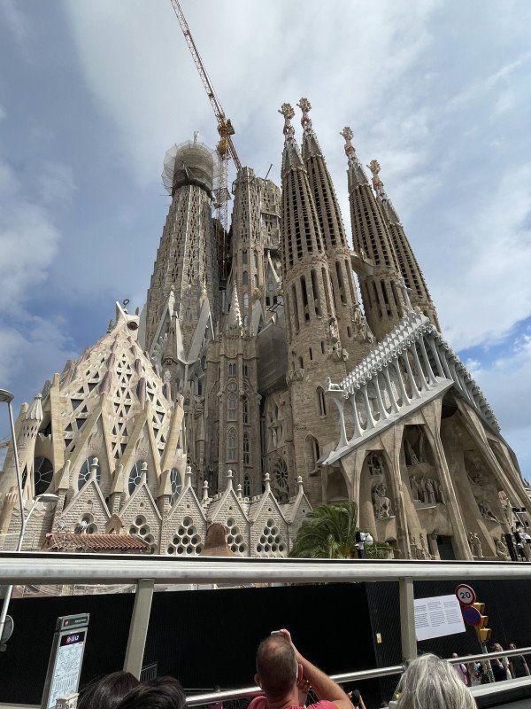
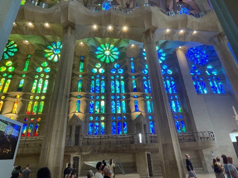
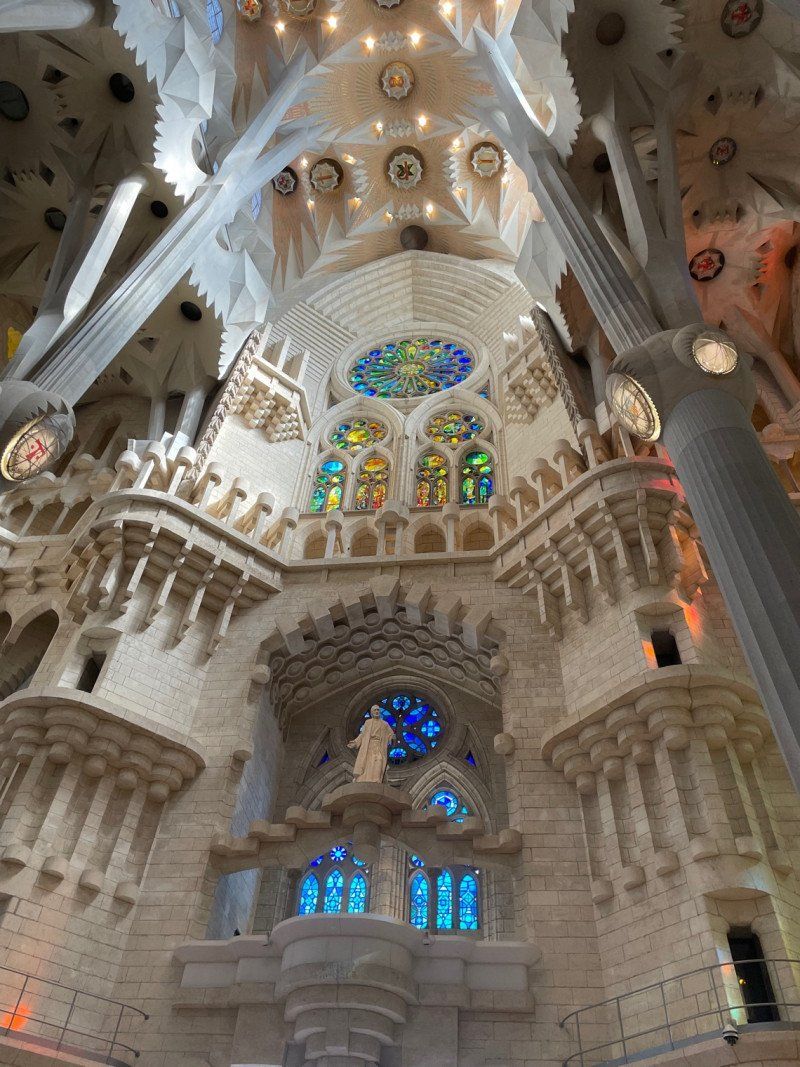
Our highlight: the Sagrada Familia is definitely worth a trip!
Video of the trip: https://youtu.be/FZVXX0Y3RB4?si=u_1GowjYPt4Ehjq8
Day
Kissing, Deutschland
48° 18' 9.7" N 10° 58' 21.4" E
48.3027069 10.9726090
• Head toward Schulstraße on Fichtenstraße. Go for 67 m.
• Turn right onto Schulstraße. Go for 438 m.
• Continue on Mittlerer Weg. Go for 194 m.
• Turn left onto Münchner Straße (B2). Go for 3.2 km.
• Continue on B2 toward München/Fürstenfeldbruck/Industriegebiet Mering-Süd. Go for 756 m.
• Turn right toward Königsbrunn/B17/Messe-Augsburg. Go for 44 m.
• Turn right onto Friedenaustraße (St2380). Go for 5.1 km.
• Keep left onto Meringer Straße (St2380). Go for 39 m.
• Take the 2nd exit from roundabout onto Lechstraße (St2380) toward Füssen/B17/Augsburg/Bobingen/Königsbrunn-Süd. Go for 3.3 km.
• Turn left onto Landsberger Straße (KB30). Go for 3.7 km.
• Turn right onto A30. Go for 270 m.
• Take ramp onto B17. Go for 20.5 km.
• Take ramp onto A96 toward Lindau. Go for 117 km.
• Continue on A14 (Rheintal Autobahn). Go for 8.8 km.
• Take exit 9 toward Bregenz onto A14 (Rheintal Autobahn). Go for 247 m.
• Take the exit toward Bregenz-Weidach. Go for 263 m.
• Take the 2nd exit from roundabout onto Kennelbacher Straße (L13) toward Bregenz. Go for 627 m.
• Continue on Langener Straße (L2). Go for 704 m.
• Turn right onto Römerstraße (L190). Go for 727 m.
• Arrive at Römerstraße (L190).
☍
166,5 km
(1 hrs. 42 min.)
Bregenz, Österreich
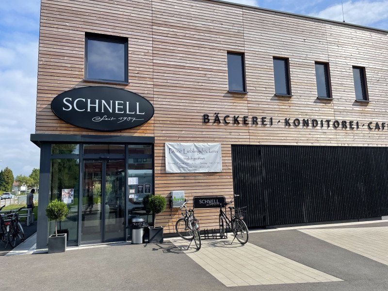
In Austria, fill up the diesel tank again and shop at the bakery
47° 30' 2.7" N 9° 44' 32.3" E
47.5007500 9.7423100
• Head toward Josef-Huter-Straße on Römerstraße (L190). Go for 2.2 km.
• Turn right onto Harder Straße (L3). Go for 2.3 km.
• Turn left onto Rheinstraße (L202). Go for 6.2 km.
• Take the 2nd exit from roundabout onto Hauptstraße (L202). Go for 446 m.
• Turn left onto Hauptstraße (L202). Go for 350 m.
• Continue on Grenzstrasse (E43/E60). Go for 122 m.
• Turn left onto Neudorfstrasse (E43/E60). Go for 862 m.
• Take the 2nd exit from roundabout onto E43/E60. Go for 368 m.
• Take ramp onto A1 toward St. Gallen. Go for 116 km.
• Take the exit toward Bern/Basel/Dietikon onto A1 (Limmattaler Kreuz). Go for 16.4 km.
• Continue on A1 (Verzweigung Birrfeld) toward Bern/Aarau/Mägenwil. Go for 40.6 km.
• Continue on A1 (Härkingen) toward E25/Lausanne/Bern/Biel/Bienne/Oensingen. Go for 20.3 km.
• Take exit 41 toward Biel/Bienne/Solothurn onto A5. Go for 24.9 km.
• Take the exit toward Neuchâtel/Biel/Bienne/Boncourt/Porrentruy/Delémont onto A16. Go for 2.9 km.
• Take the 2nd exit from roundabout onto A16. Go for 145 m.
• Take ramp onto Reuchenettestrasse toward Biel/Bienne. Go for 2.2 km.
• Continue on Juravorstadt. Go for 256 m.
• Turn left onto Adam-Göuffi-Strasse. Go for 161 m.
• Turn right onto Adam-Göuffi-Strasse (5). Go for 523 m.
• Take the 2nd exit from roundabout onto Zentralstrasse. Go for 472 m.
• Arrive at Zentralplatz. Your destination is on the left.
☍
237,4 km
(2 hrs. 43 min.)
Biel, Schweiz
47° 8' 12.4" N 7° 14' 48.4" E
47.1367785 7.2467909
• Head southeast on Zentralplatz. Go for 23 m.
• Continue on Zentralstrasse. Go for 61 m.
• Turn right onto Alexander-Schöni-Strasse. Go for 68 m.
• Continue on Murtenstrasse. Go for 84 m.
• Pass 3 roundabouts and continue on Murtenstrasse. Go for 473 m.
• Continue on Salzhausstrasse. Go for 482 m.
• Turn right onto Aarbergstrasse. Go for 336 m.
• Continue on Ländtestrasse. Go for 625 m.
• Take the 2nd exit from roundabout onto Neuenburgstrasse (5) toward Neuchâtel. Go for 12.8 km.
• Keep left onto A5 toward Lausanne/Neuchâtel/Le Landeron. Go for 56.3 km.
• Take exit 24 toward Lausanne/Besançon/Vallorbe onto A1. Go for 24.9 km.
• Take exit 19 toward Simplon/Gd-St-Bernard/Lausanne-Nord/Vevey/Montreux onto A9 (Villars-Sainte-Croix). Go for 12.8 km.
• Take exit 11 toward Lutry. Go for 246 m.
• Continue on Route du Landar. Go for 1.5 km.
• Continue on Route de la Conversion. Go for 1.1 km.
• Take the 1st exit from roundabout onto Route de la Conversion toward Lausanne/Pully/Vevey/Lutry-Bourg. Go for 227 m.
• Turn left onto Route de Lavaux (9) toward Vevey. Go for 389 m.
• Take the 2nd exit from roundabout onto Route de Lavaux (9). Go for 3.0 km.
• Take ramp onto Route de Lausanne. Go for 551 m.
• Take the 1st exit from roundabout onto Route de Vevey. Go for 660 m.
• Turn right onto Route de Moratel. Go for 26 m.
• Arrive at Route de Moratel. Your destination is on the right.
☍
116,6 km
(1 hrs. 23 min.)
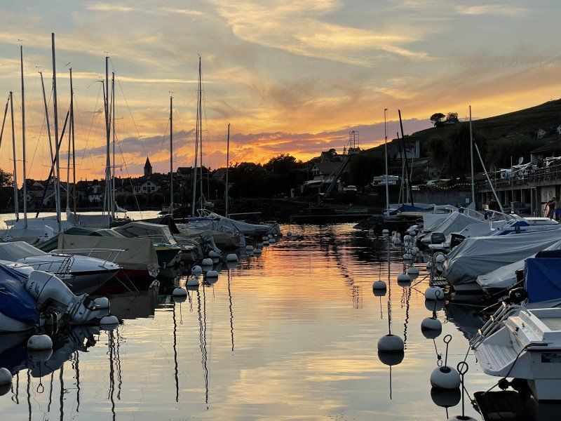
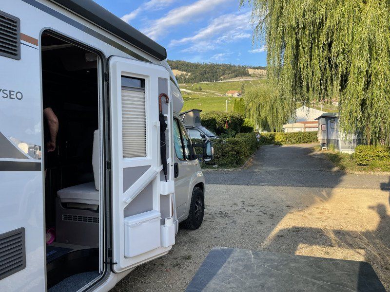
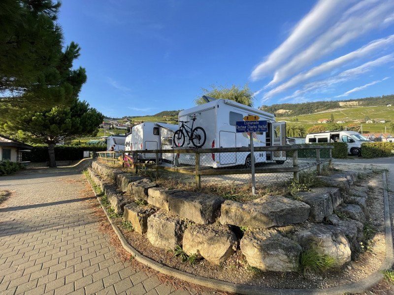
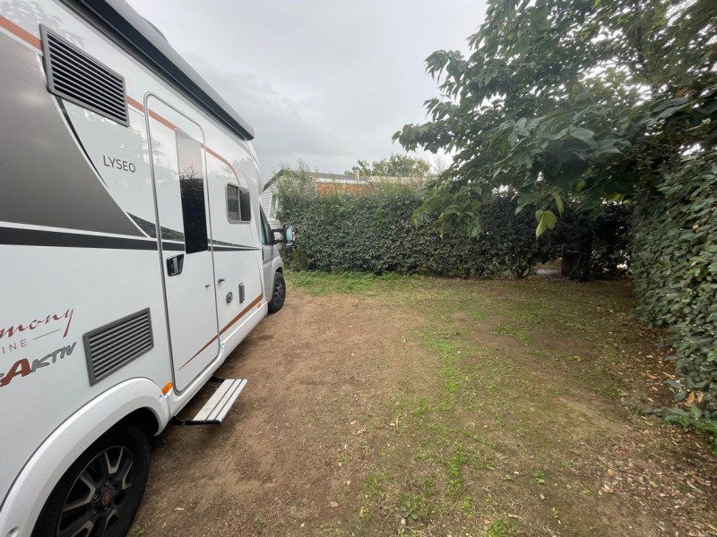
Camping De Moratel
Small, quiet campsite directly on Lake Geneva
Moratel 2, 1096, Cully, Switzerland
46° 29' 22.3" N 6° 44' 14.6" E
46.4895200 6.7373800
• Head toward Route de Vevey on Route de Moratel. Go for 26 m.
• Turn left onto Route de Vevey. Go for 637 m.
• Take the 1st exit from roundabout onto Rue de la Gare. Go for 240 m.
• Take the 1st exit from roundabout onto Route de la Corniche. Go for 199 m.
• Arrive at Route de la Corniche. Your destination is on the right.
☍
1,1 km
( 2 min.)
Day
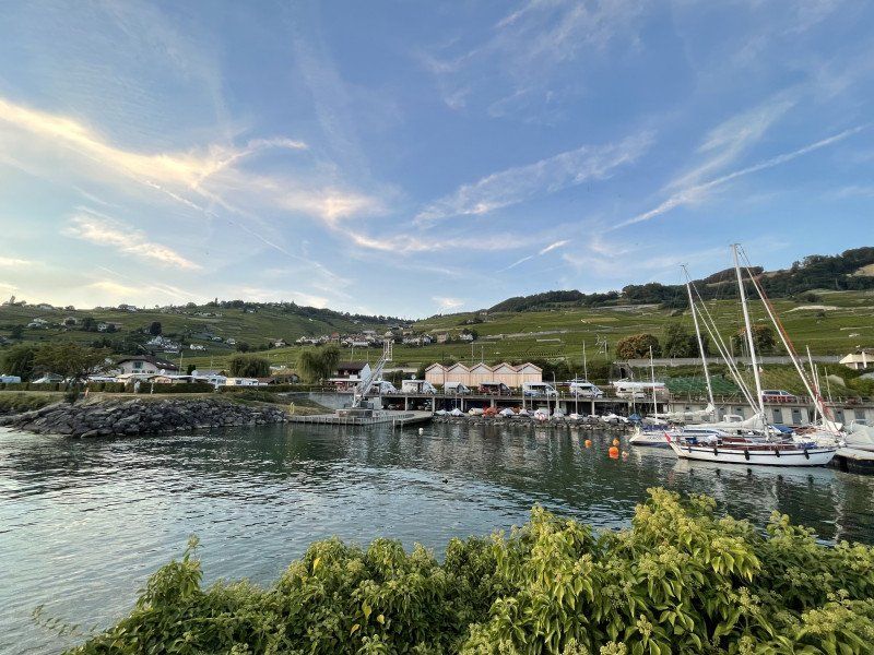
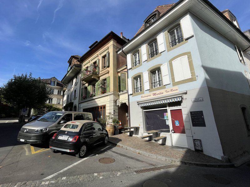
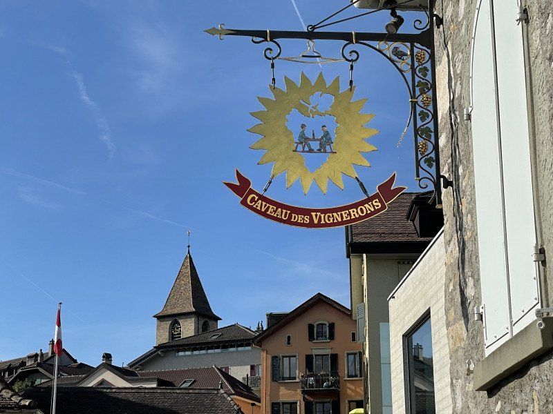
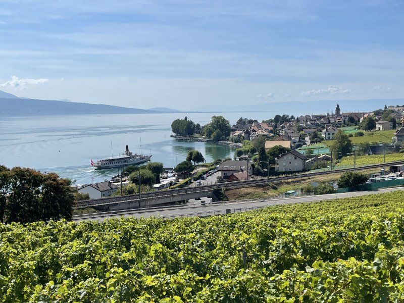
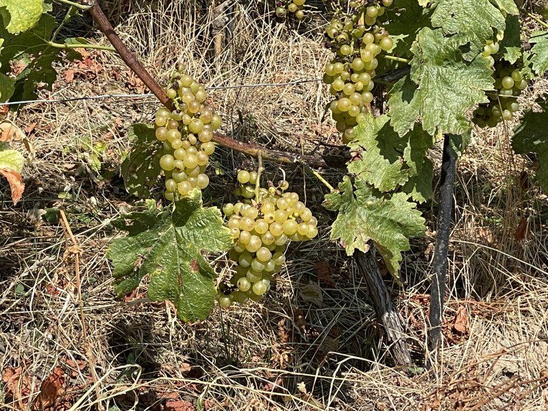
Cully, Bourg-en-Lavaux, Schweiz
Picturesque village below the vineyards
Cully VD, Bourg-en-Lavaux, Schweiz
46° 29' 22.6" N 6° 43' 44.7" E
46.4895985 6.7290888
• Head southwest on Route de la Corniche. Go for 186 m.
• Take the 3rd exit from roundabout onto Rue de la Gare. Go for 268 m.
• Take the 2nd exit from roundabout onto Route de Vevey. Go for 677 m.
• Turn right onto Route de Moratel. Go for 26 m.
• Arrive at Route de Moratel. Your destination is on the right.
☍
1,2 km
( 2 min.)
Camping De Moratel
Moratel 2, 1096, Cully, Switzerland
46° 29' 22.3" N 6° 44' 14.6" E
46.4895200 6.7373800
• Head toward Route de Vevey on Route de Moratel. Go for 26 m.
• Turn left onto Route de Vevey. Go for 637 m.
• Take the 2nd exit from roundabout onto Route de Lausanne. Go for 325 m.
• Take ramp onto Route Cantonale (9) toward Lausanne/Lutry. Go for 3.3 km.
• Take the 2nd exit from roundabout onto Route de Lavaux (9). Go for 777 m.
• Keep left onto Route d'Ouchy (9) toward Genève/Lausanne-Ouchy/Pully Sud. Go for 419 m.
• Continue on Route du Lac. Go for 523 m.
• Continue on Route de Vevey toward Lausanne/Ouchy. Go for 507 m.
• Continue on Avenue des Désertes. Go for 478 m.
• Continue on Avenue Général-Guisan. Go for 1.1 km.
• Turn left onto Avenue de la Tour-Haldimand toward Neuchâtel/Vallorbe/Genève/Ouchy. Go for 186 m.
• Continue on Quai d'Ouchy. Go for 568 m.
• Continue on Quai de Belgique. Go for 325 m.
• Continue on Place Général-Guisan. Go for 114 m.
• Continue on Place du Port. Go for 105 m.
• Turn left onto Place de la Navigation. Go for 961 m.
• Pass 2 roundabouts and continue on Avenue de Rhodanie. Go for 1.2 km.
• Take the 4th exit from roundabout onto E23 (Autoroute Lausanne-Genève). Go for 3.8 km.
• Continue on A1 (Ecublens) toward Genève/Morges. Go for 65.3 km.
• Continue on A41. Go for 71.5 km.
• Continue on A43. Go for 46.9 km.
• Take the exit toward Marseille/Valence/Grenoble onto A48. Go for 25.8 km.
• Take exit 9 toward La Côte-St André/Rives/Aéroport Grenoble-Isère. Go for 756 m.
• Keep right toward Annonay/Aéroport Grenoble-Isère/La Côte St André/Le Grand Lemps. Go for 188 m.
• Continue on Lieu-dit Axe de Bièvre (D119). Go for 14.4 km.
• Take the 3rd exit from roundabout onto Lieu-dit Axe de Bièvre (D119) toward Annonay/Vienne/Beaurepaire/La Côte St André/Z.I. le Rival. Go for 1.7 km.
• Take the 2nd exit from roundabout onto D519 toward Annonay/Vienne/Beaurepaire/La Cote St Andre/St Siméon de Bressieux/Z.I. le Rival. Go for 1.3 km.
• Take the 3rd exit from roundabout onto Route de la Côte-Saint-André (D71) toward Château de Bressieux/Roybon. Go for 1.2 km.
• Pass 2 roundabouts and continue on Route de la Côte-Saint-André (D71). Go for 9.6 km.
• Take the 2nd exit from roundabout onto D20. Go for 1.1 km.
• Turn right onto Route de Montfalcon (D20). Go for 5.3 km.
• Turn left onto Route des Platanes (D20 C). Go for 308 m.
• Arrive at Route des Platanes (D20 C). Your destination is on the left.
☍
260,8 km
(2 hrs. 46 min.)
Day
Montfalcon, Frankreich
Driving across country, the Michelin app recommended us to save toll costs
38940 Montfalcon, Frankreich
45° 15' 16.1" N 5° 10' 17.5" E
45.2544650 5.1715380
• Head toward Chemin du Bourg on Route des Platanes (D20 C). Go for 61 m.
• Continue on Route de Montrigaud (D20 C). Go for 1.5 km.
• Continue on Route de Montfalcon (D67). Go for 4.0 km.
• Take the 2nd exit from roundabout onto Route de Montfalcon (D67) toward Crépol/St Donat/Romans. Go for 2.5 km.
• Continue on Route de Montrigaud (D67). Go for 639 m.
• Continue on Plan d'Agneau (D67) toward Crépol/St Donat. Go for 293 m.
• Continue on D67. Go for 91 m.
• Continue on Lieu-dit Plan d'Agneau (D67). Go for 8 m.
• Continue on Plan d'Agneau (D67). Go for 311 m.
• Continue on Route de Crepol (D67). Go for 118 m.
• Continue on Chemin Gathelet (D67). Go for 158 m.
• Continue on D67. Go for 205 m.
• Continue on Lieu-dit Michonières (D67). Go for 544 m.
• Continue on D67. Go for 2.4 km.
• Continue on Lieu-dit Les Beysons (D67). Go for 40 m.
• Continue on D67. Go for 128 m.
• Continue on Grand Rue (D67). Go for 176 m.
• Continue on D67. Go for 8 m.
• Turn left onto Grand Rue. Go for 35 m.
• Arrive at Grand Rue. Your destination is on the left.
☍
13,3 km
( 11 min.)
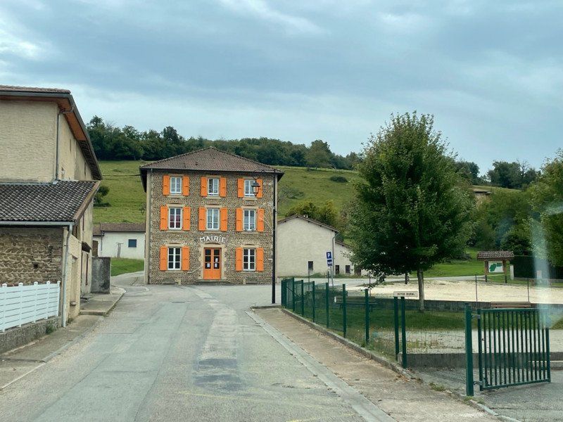
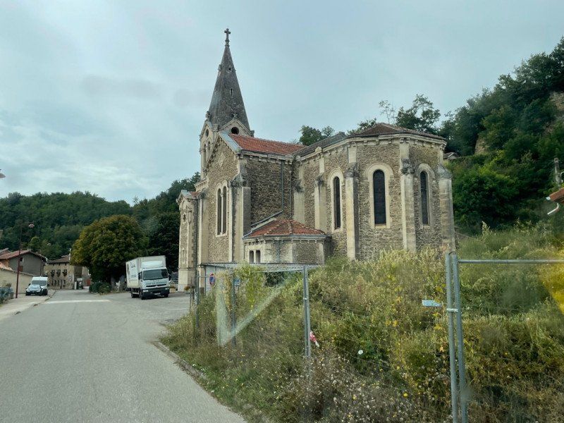
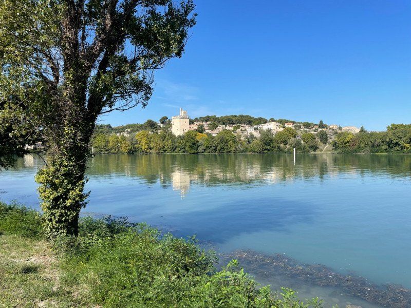
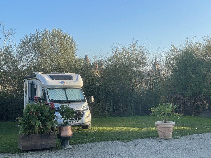
Crépol, Frankreich
journey over land
26350 Crépol, Frankreich
45° 10' 26.3" N 5° 4' 15.9" E
45.1739630 5.0710740
• Head toward Impasse des Baumes on Grand Rue. Go for 48 m.
• Turn left onto Grand Rue (D67). Go for 3.0 km.
• Take the 3rd exit from roundabout onto Route des Dauphins (D538) toward Romans. Go for 1.5 km.
• Pass 2 roundabouts and continue on Route des Dauphins (D538). Go for 6.7 km.
• Take the 1st exit from roundabout onto Route de Mours (D538). Go for 829 m.
• Take the 2nd exit from roundabout onto Route de Mours (D538). Go for 1.7 km.
• Take the 5th exit from roundabout onto Grande Rue (D608). Go for 149 m.
• Turn right onto Place de la Mairie. Go for 37 m.
• Arrive at Rue du Sabotier. Your destination is on the right.
☍
14,0 km
( 13 min.)
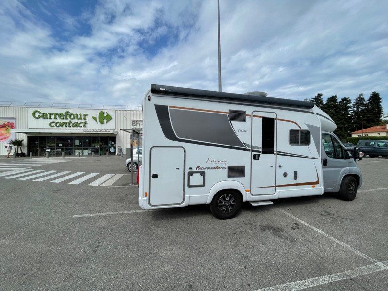
Mours-Saint-Eusèbe, Frankreich
Short stop to fill up the car and refrigerator.
Diesel was relatively cheap
45° 4' 13.2" N 5° 3' 7.9" E
45.0703410 5.0522040
• Head toward Rue des Glycines on Rue du Sabotier. Go for 61 m.
• Turn left onto Place des Capucins. Go for 19 m.
• Turn right onto Traverse des Capucins. Go for 46 m.
• Continue on Place du Champ-de-Mars. Go for 12 m.
• Take the 5th exit from roundabout onto Avenue Dauphiné-Provence (D538). Go for 388 m.
• Take the 2nd exit from roundabout onto Avenue Dauphiné-Provence (D538). Go for 718 m.
• Take the 3rd exit from Giratoire 6 roundabout onto Boulevard Pierre Mendès France (D532) toward A7 (Marseille)/Grenoble/Valence/Romans-Centre. Go for 1.2 km.
• Take the 2nd exit from Giratoire 5 roundabout onto Boulevard Étienne-Jean Lapassat (D532) toward A7 (Marseille)/Grenoble/Valence/Romans-Centre. Go for 584 m.
• Take the 3rd exit from Giratoire 4 roundabout onto Boulevard Étienne-Jean Lapassat (D532) toward A7 (Marseille)/Grenoble/Valence/Romans-Centre. Go for 603 m.
• Take the 3rd exit from Giratoire 3 roundabout onto Boulevard Étienne-Jean Lapassat (D532) toward A7 (Marseille)/Grenoble/Valence/Romans-Centre. Go for 322 m.
• Take the 3rd exit from Giratoire 2 roundabout onto Boulevard Étienne-Jean Lapassat (D532) toward A7 (Marseille)/Grenoble/Valence. Go for 991 m.
• Take the 3rd exit from Giratoire 1 roundabout onto Pont des Allobroges (D532) toward A7 (Marseille)/Grenoble/Valence/Pizançon. Go for 872 m.
• Take the 3rd exit from roundabout onto D532 toward Valence. Go for 1.2 km.
• Take ramp onto A49 toward Valence. Go for 4.4 km.
• Continue on N532. Go for 10.6 km.
• Continue on E713. Go for 240 m.
• Continue on N7. Go for 9.5 km.
• Keep left onto E713 toward E15/A7/Marseille/Montélimar/Privas/Lyon. Go for 405 m.
• Keep left onto Échangeur de Valence-Sud (E713) toward Marseille/Avignon/Montélimar/Privas. Go for 153 m.
• Take ramp onto A7 (Autoroute du Soleil). Go for 93.0 km.
• Keep right onto A9 (Échangeur d'Orange) toward Barcelone/Toulouse/Montpellier/Nîmes. Go for 55.0 km.
• Arrive at La Languedocienne (A9).
☍
180,4 km
(1 hrs. 37 min.)
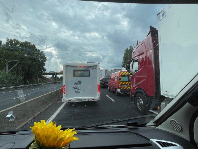
A9, Nîmes, Frankreich
Here we were stuck in a traffic jam for 4 hours as a result of the storms in southern France
43° 48' 35.6" N 4° 20' 39.5" E
43.8098886 4.3443152
• Head west on A9 (La Languedocienne). Go for 31.7 km.
• Keep right onto A709 toward A75/Clermont-Ferrand/Montpellier/Aéroport. Go for 19.7 km.
• Take exit 32 toward Millau/Sète. Go for 1.0 km.
• Take the 2nd exit from Place de l'Europe roundabout onto M116 E1 toward Millau/Montpellier-Mosson. Go for 988 m.
• Take the 1st exit from roundabout onto Route de Sète (M612) toward Sète/Frontignan. Go for 2.8 km.
• Take the 1st exit from roundabout onto M612. Go for 3.5 km.
• Continue on D612. Go for 1.8 km.
• Take the 2nd exit from roundabout onto D612. Go for 2.2 km.
• Take the 3rd exit from roundabout onto Route des Aresquiers (D114) toward Vic la Gardiole. Go for 237 m.
• Continue on D114. Go for 346 m.
• Continue on Route des Aresquiers (D114). Go for 211 m.
• Continue on D114. Go for 290 m.
• Continue on Route des Aresquiers (D114). Go for 766 m.
• Continue on D114. Go for 28 m.
• Continue on Route des Aresquiers (D114). Go for 3.1 km.
• Continue on Pont Philippe Chappotin (D60). Go for 223 m.
• Continue on D60. Go for 1.3 km.
• Turn left onto Avenue d'Ingril (D50). Go for 135 m.
• Take the 1st exit from roundabout onto Avenue d'Ingril (D50). Go for 721 m.
• Turn left onto Avenue d'Ingril. Go for 19 m.
• Arrive at your destination on the right.
☍
71,0 km
( 46 min.)
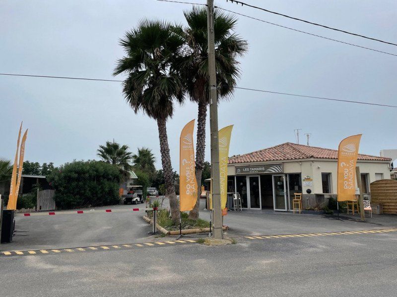
Camping Sandaya - Les Tamaris
Arrival at 10 pm
avenue d'Ingril 140, 34110, Frontignan-Plage, Frankreich
43° 26' 59" N 3° 48' 20.6" E
43.4497100 3.8057300
• Head southeast.
• Arrive at your destination on the right.
☍
Distance not available
(Duration not available)
Day
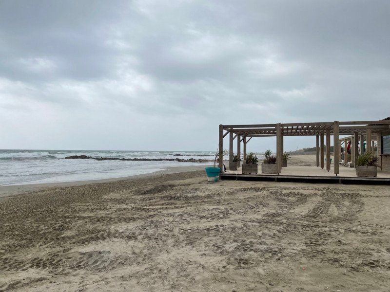
Camping Sandaya - Les Tamaris
From 13.9. it is already off-season and there is no longer a bar on the beach
avenue d'Ingril 140, 34110, Frontignan-Plage, Frankreich
43° 26' 59" N 3° 48' 20.6" E
43.4497100 3.8057300
• Head northwest. Go for 8 m.
• Continue on Avenue d'Ingril. Go for 11 m.
• Turn right onto Avenue d'Ingril (D50). Go for 693 m.
• Take the 2nd exit from roundabout onto Avenue d'Ingril (D50). Go for 157 m.
• Turn left onto Avenue des Étangs (D60). Go for 2.3 km.
• Pass 3 roundabouts and continue on Avenue des Étangs (D60). Go for 2.4 km.
• Keep left onto D60. Go for 170 m.
• Continue on D129. Go for 208 m.
• Take the 3rd exit from Rond-Point des Étangs roundabout onto D612. Go for 3.9 km.
• Take the 1st exit from roundabout onto D600 toward A9/Béziers/Frontignan-Centre/Balaruc/Z.I. les Eaux Blanches/La Peyrade. Go for 724 m.
• Take the 2nd exit from Rond-Point Salvador Allende roundabout onto D600 toward A9/Montpellier/Béziers. Go for 7.1 km.
• Take ramp onto A9 (La Languedocienne) toward Béziers/Toulouse/Barcelone. Go for 158 km.
• Continue on AP-7 (Autopista de la Mediterrània). Go for 66.6 km.
• Take the exit toward Fornells de la Selva/Barcelona/N-2 onto A-2 (Autovia del Nordest). Go for 28.1 km.
• Take the 3rd exit from roundabout onto GI-600 toward Blanes. Go for 1.9 km.
• Take the 1st exit from roundabout onto C-32 toward Barcelona. Go for 25.8 km.
• Take exit 108 toward Caldes d'Estrac. Go for 403 m.
• Take the 4th exit from roundabout onto BV-5034 toward Caldes d'Estrac. Go for 475 m.
• Take the 2nd exit from roundabout onto BV-5034 toward Barcelona/N-2/Girona. Go for 765 m.
• Turn right onto N-2 toward Mataró/Barcelona. Go for 796 m.
• Take the 3rd exit from roundabout onto N-2 toward Barcelona. Go for 2.2 km.
• Take the 2nd exit from roundabout toward Barcelona. Go for 83 m.
• Continue on N-2. Go for 565 m.
• Turn right. Go for 67 m.
• Arrive at your destination on the left.
☍
304,0 km
(2 hrs. 47 min.)
Day
Day
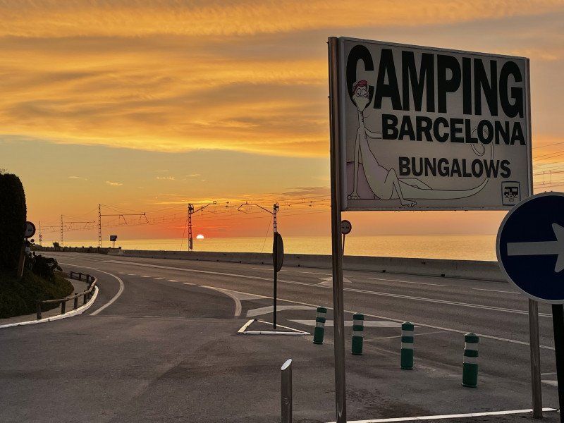
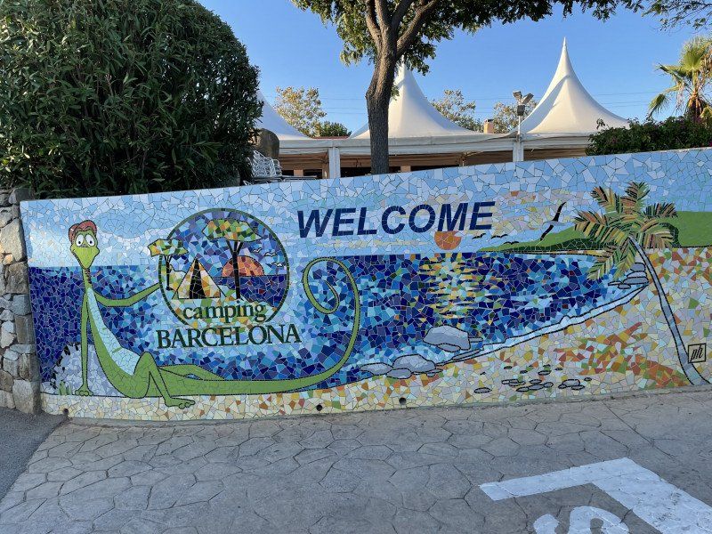
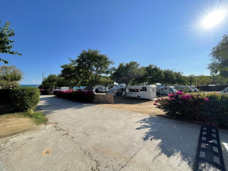
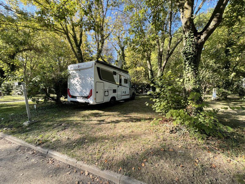
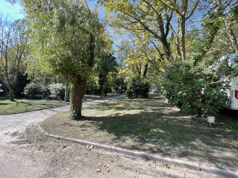
Camping Barcelona
Ideal starting point for visiting Barcelona with your own bus into the city (one way €2.90).
Place is nice and big and with everything you need (sea view, pool, shade ...)
Costa de Barcelona – Maresme Ctra. N-II km. 650, 08304, Mataró, Spain
41° 33' 3.2" N 2° 28' 59.8" E
41.5509000 2.4832900
• Head southeast. Go for 27 m.
• Continue toward Avinguda del Maresme/N-2. Go for 36 m.
• Turn right onto Avinguda del Maresme (N-2). Go for 611 m.
• Take the 1st exit from Rotonda d'Elisabet Cristina de Brunsvic roundabout onto Carretera de la Pedrera (C-31E) toward C-32/N-2/Barcelona. Go for 1.4 km.
• Take ramp onto C-32 (Autopista de Barcelona a Mataró) toward Barcelona/N-2/Mataró. Go for 19.6 km.
• Keep right onto C-31 toward Barcelona/Glòries/Tiana/Montgat. Go for 12.8 km.
• Turn right onto Carrer de Padilla. Go for 180 m.
• Turn left onto Avinguda Diagonal toward C. Lepant/pl. Francesc Macià/Estació Sants/Aeroport. Go for 391 m.
• Turn slightly left onto Carrer d'Aragó toward Pl. Espanya/Estació Sants/Aeroport. Go for 1.5 km.
• Turn left onto Passeig de Gràcia. Go for 166 m.
• Arrive at Passeig de Gràcia. Your destination is on the right.
☍
36,7 km
( 28 min.)
Day
Bus Tour, Passeig de Gràcia, Barcelona, Spanien
Barcelona Bus Tour gave us, as newbies, a good overview of the city and we enjoyed the tour in the double-decker bus (27 € per person)
Pg. de Gràcia, 33, 21, 08007 Barcelona, Spanien
41° 23' 27.2" N 2° 9' 57.6" E
41.3908934 2.1660137
• Head toward Carrer de la Diputació on Passeig de Gràcia. Go for 100 m.
• Turn right onto Carrer de la Diputació. Go for 335 m.
• Turn left onto Carrer de Balmes. Go for 257 m.
• Turn right onto Ronda de la Universitat toward Rda. Universitat/Rda. Sant Antoni. Go for 150 m.
• Continue on Plaça de la Universitat toward Pl. Universitat/G. V. Corts Catalanes/Pl. Espanya/Rda. Sant Antoni. Go for 97 m.
• Continue on Ronda de Sant Antoni. Go for 124 m.
• Turn right onto Plaça de Goya. Go for 69 m.
• Continue on Carrer de Sepúlveda. Go for 1.4 km.
• Turn sharp left onto Avinguda del Paral.lel. Go for 210 m.
• Turn right onto Carrer de Lleida toward Montjuïc-Lleida. Go for 228 m.
• Turn right onto Avinguda de Rius i Taulet toward Av. F.F. I Guàrdia. Go for 347 m.
• Arrive at Avinguda de Rius i Taulet. Your destination is on the left.
☍
3,3 km
( 8 min.)
Font Màgica de Montjuïc, Plaça de Carles Buïgas, Barcelona, Spanien
Pl. de Carles Buïgas, 1, 08038 Barcelona, Spanien
41° 22' 16.2" N 2° 9' 6.3" E
41.3711603 2.1517402
• Head southwest on Avinguda de Rius i Taulet.
• Continue on Avinguda de Francesc Ferrer i Guàrdia. Go for 843 m.
• Take the 2nd exit from Plaça de Sant Jordi roundabout onto Avinguda dels Montanyans. Go for 634 m.
• Continue on Carrer del Mirador del Palau Nacional. Go for 101 m.
• Turn right toward Avinguda dels Montanyans. Go for 135 m.
• Turn left onto Avinguda dels Montanyans. Go for 26 m.
• Turn left. Go for 71 m.
• Arrive at your destination on the left.
☍
1,8 km
( 4 min.)
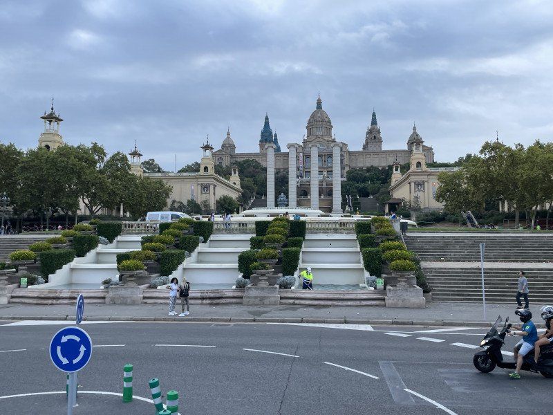
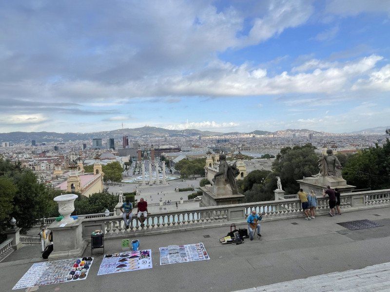
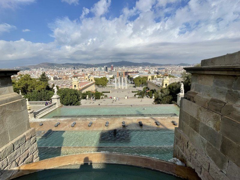
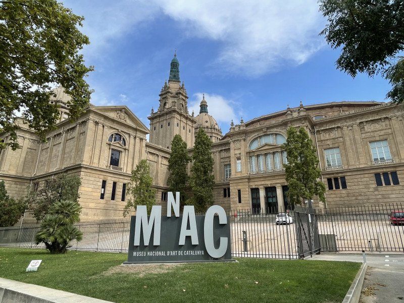
Museu Nacional d'Art de Catalunya, Parc de Montjuïc, Barcelona, Spanien
Wide view over the city
Palau Nacional, Parc de Montjuïc, s/n, 08038 Barcelona, Spanien
41° 22' 6.4" N 2° 9' 12.9" E
41.3684399 2.1535700
• Head toward Avinguda dels Montanyans. Go for 71 m.
• Turn left onto Avinguda dels Montanyans. Go for 312 m.
• Turn right onto Carrer del Mirador del Palau Nacional. Go for 115 m.
• Turn left onto Passeig de Santa Madrona. Go for 556 m.
• Turn right onto Carrer de Lleida toward Av. Paral.lel. Go for 440 m.
• Turn right onto Carrer de Tamarit. Go for 166 m.
• Continue on Carrer d'Entença. Go for 456 m.
• Turn right onto Gran Via de les Corts Catalanes toward Gran Via/Pl. de les Glòries. Go for 1.6 km.
• Keep right toward Gran Via de les Corts Catalanes. Go for 29 m.
• Turn left onto Gran Via de les Corts Catalanes. Go for 146 m.
• Turn slightly left onto Gran Via de les Corts Catalanes toward Pl. Glòries/Pg. Sant Joan. Go for 308 m.
• Keep right onto Gran Via de les Corts Catalanes. Go for 463 m.
• Keep right onto Plaça de Tetuán. Go for 39 m.
• Continue on Gran Via de les Corts Catalanes. Go for 37 m.
• Continue on Plaça de Tetuán. Go for 17 m.
• Keep left onto Plaça de Tetuán toward Pl. de les Glòries/Pl. Mossèn Jacint Verdaguer/La Sagrada Família. Go for 89 m.
• Turn right onto Plaça de Tetuán toward Pl. Glòries/Estació del Nord/C. Marina. Go for 61 m.
• Continue on Gran Via de les Corts Catalanes toward Pl. Glòries. Go for 567 m.
• Turn left onto Carrer de la Marina. Go for 282 m.
• Keep right onto Carrer de la Marina toward Sagrada Família. Go for 139 m.
• Continue on Carrer de la Marina. Go for 135 m.
• Turn right onto Carrer de València toward Hospital de Sant Pau/Av. Meridiana. Go for 256 m.
• Turn left onto Carrer de Padilla. Go for 269 m.
• Turn left onto Carrer de Provença. Go for 134 m.
• Continue on Plaça de Gaudí. Go for 122 m.
• Arrive at Carrer de Provença. Your destination is on the left.
☍
6,8 km
( 16 min.)
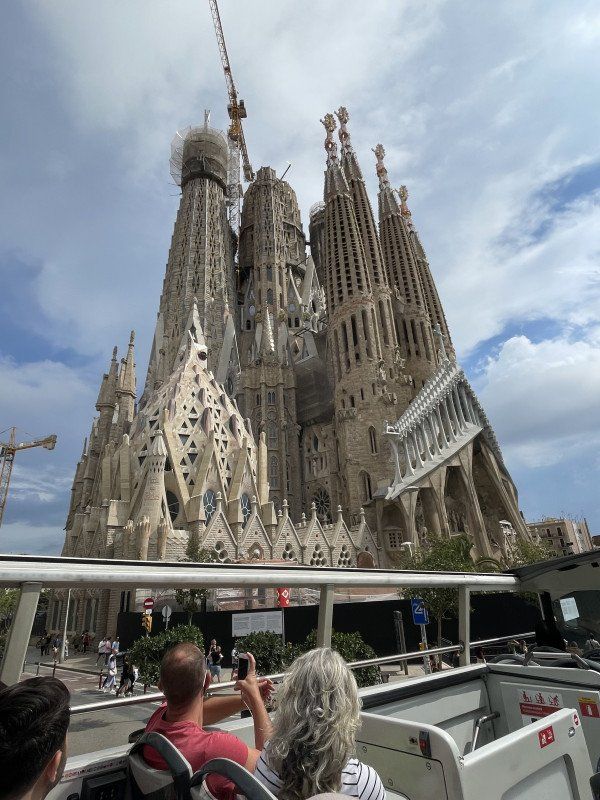
La Sagrada Familia, Barcelona, Spanien
Sagrada Família, Barcelona, Spanien
41° 24' 15.6" N 2° 10' 28.8" E
41.4043239 2.1746666
• Head southwest on Carrer de Provença.
• Turn right onto Carrer de la Marina. Go for 271 m.
• Turn left onto Carrer de Còrsega. Go for 671 m.
• Turn right onto Passeig de Sant Joan. Go for 416 m.
• Turn right onto Travessera de Gràcia. Go for 54 m.
• Continue on Carrer de l'Escorial. Go for 864 m.
• Continue on Carrer de l'Escorial toward Hospital de l'Esperança. Go for 107 m.
• Turn left onto Carrer del Pare Jacint Alegre. Go for 202 m.
• Continue on Carrer de Marianao. Go for 161 m.
• Turn left onto Carrer d'Olot. Go for 35 m.
• Arrive at Carrer d'Olot.
☍
2,8 km
( 8 min.)
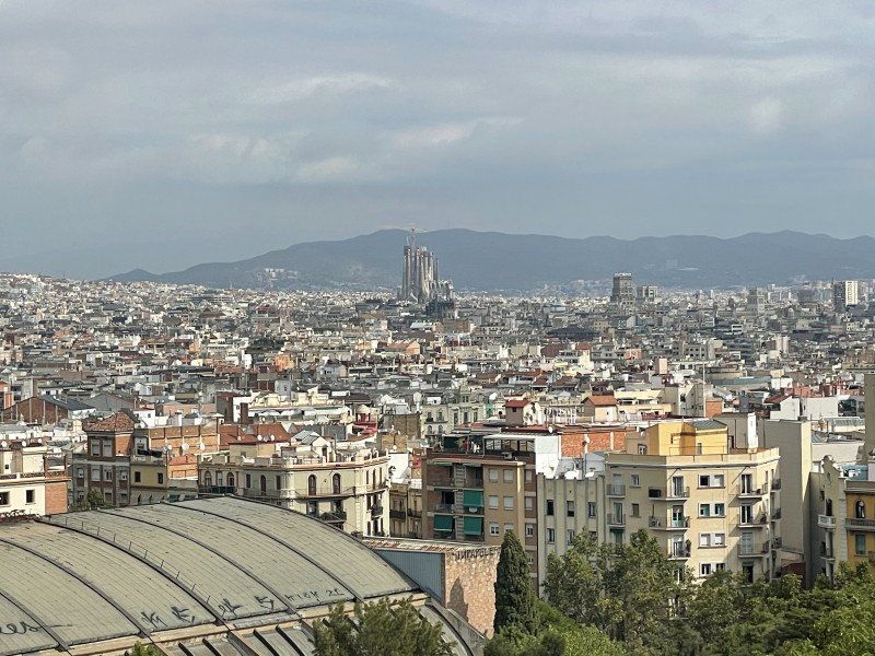
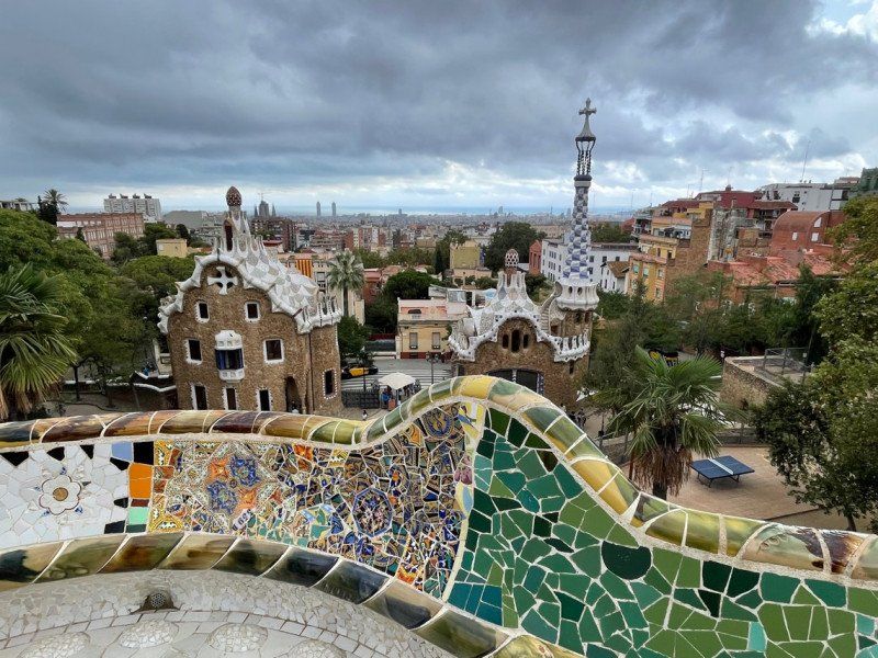
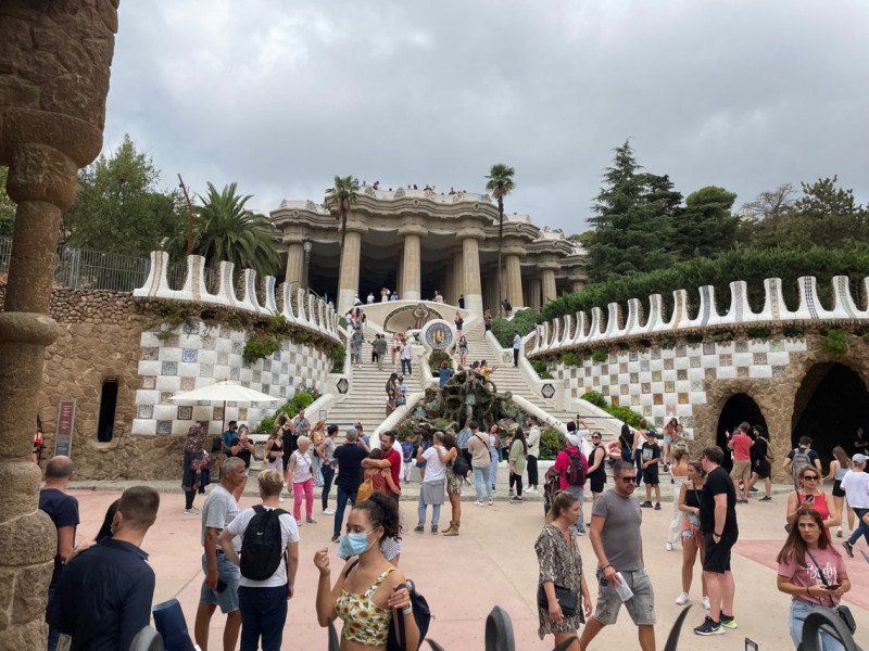
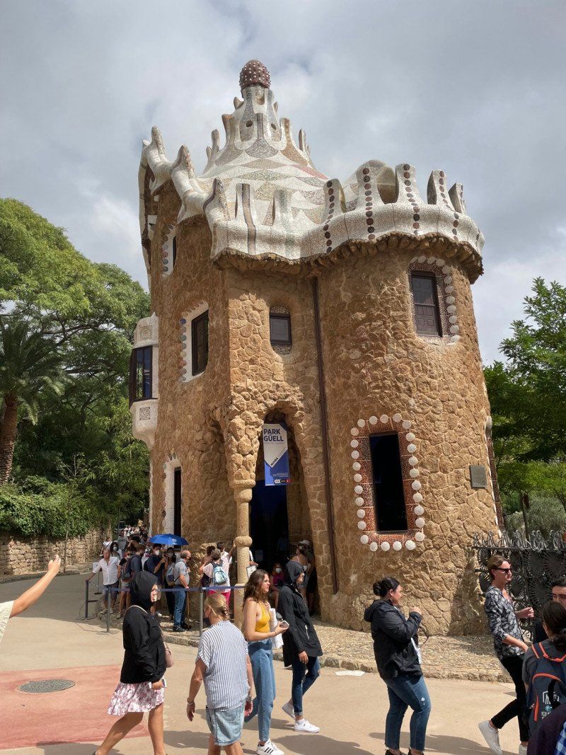
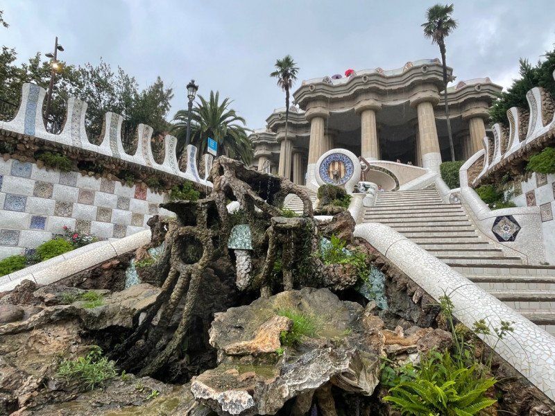
Park Güell, Barcelona, Spanien
Beautiful view over the city (even if there are low clouds)
08024 Barcelona, Provinz Barcelona, Spanien
41° 24' 52.2" N 2° 9' 9.7" E
41.4144948 2.1526945
• Head southwest on Carrer d'Olot. Go for 35 m.
• Turn left onto Carrer de Larrard. Go for 420 m.
• Turn left onto Travessera de Dalt. Go for 922 m.
• Turn right onto Carrer de Lepant. Go for 1.9 km.
• Turn left onto Gran Via de les Corts Catalanes toward C-31/Girona/Pl. Glòries. Go for 123 m.
• Continue on Túnel de les Glòries. Go for 12.9 km.
• Continue on C-32. Go for 19.1 km.
• Take exit 104 toward Girona/N-2 onto C-31E (Carretera de la Pedrera). Go for 1.8 km.
• Take the 2nd exit from Rotonda d'Elisabet Cristina de Brunsvic roundabout onto N-2 toward Llavaneres/Girona. Go for 1.3 km.
• Take the 3rd exit from roundabout toward Barcelona. Go for 138 m.
• Continue on N-2. Go for 565 m.
• Turn right. Go for 67 m.
• Arrive at your destination on the left.
☍
39,3 km
( 31 min.)
Camping Barcelona
Costa de Barcelona – Maresme Ctra. N-II km. 650, 08304, Mataró, Spanien
41° 33' 3.2" N 2° 28' 59.8" E
41.5509000 2.4832900
• Head northwest.
• Arrive at your destination on the left.
☍
Distance not available
(Duration not available)
Day
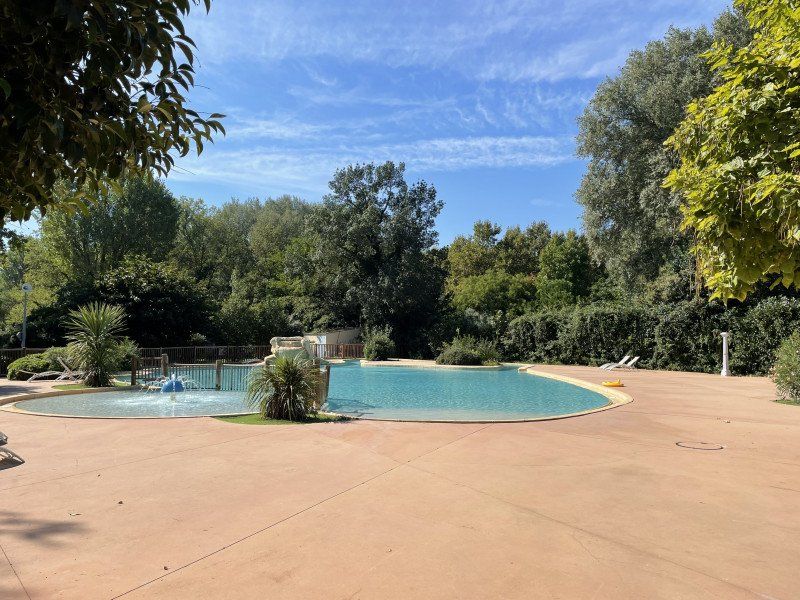
Camping Barcelona
rest day at the pool
Costa de Barcelona – Maresme Ctra. N-II km. 650, 08304, Mataró, Spanien
41° 33' 3.2" N 2° 28' 59.8" E
41.5509000 2.4832900
• Head southeast. Go for 27 m.
• Continue toward Avinguda del Maresme/N-2. Go for 36 m.
• Turn right onto Avinguda del Maresme (N-2). Go for 611 m.
• Take the 1st exit from Rotonda d'Elisabet Cristina de Brunsvic roundabout onto Carretera de la Pedrera (C-31E) toward C-32/N-2/Barcelona. Go for 1.4 km.
• Take ramp onto C-32 (Autopista de Barcelona a Mataró) toward Barcelona/N-2/Mataró. Go for 19.6 km.
• Keep right onto C-31 toward Barcelona/Glòries/Tiana/Montgat. Go for 12.8 km.
• Turn right onto Carrer de Padilla. Go for 180 m.
• Turn left onto Avinguda Diagonal toward C. Lepant/pl. Francesc Macià/Estació Sants/Aeroport. Go for 391 m.
• Turn slightly left onto Carrer d'Aragó toward Pl. Espanya/Estació Sants/Aeroport. Go for 1.2 km.
• Turn right onto Carrer de Roger de Llúria. Go for 405 m.
• Turn left onto Carrer de Provença. Go for 255 m.
• Arrive at Carrer de Provença. Your destination is on the right.
☍
36,8 km
( 28 min.)
Day
Casa Milà, Passeig de Gràcia, Barcelona, Spanien
Passeig de Gràcia, 92, 08008 Barcelona, Spanien
41° 23' 42.8" N 2° 9' 42.8" E
41.3952155 2.1619024
• Head toward Passeig de Gràcia on Carrer de Provença. Go for 47 m.
• Turn right onto Passeig de Gràcia. Go for 135 m.
• Turn right onto Carrer del Rosselló toward Pl. Glòries. Go for 223 m.
• Keep left onto Carrer del Rosselló toward Pl. Glòries. Go for 42 m.
• Turn right onto Avinguda Diagonal toward Pl. Glòries. Go for 629 m.
• Turn left onto Plaça de Mossèn Jacint Verdaguer. Go for 48 m.
• Continue on Passeig de Sant Joan. Go for 278 m.
• Turn right onto Carrer del Rosselló. Go for 793 m.
• Turn right onto Carrer de Lepant. Go for 272 m.
• Turn right onto Plaça de Gaudí toward C. Mallorca/Sagrada Familia. Go for 39 m.
• Arrive at Carrer de Mallorca. Your destination is on the right.
☍
2,5 km
( 7 min.)
La Sagrada Familia, Barcelona, Spanien
The most famous permanent construction site in Europe, for me the most moving place of worship I have ever seen.
Sagrada Família, Barcelona, Spanien
41° 24' 16.1" N 2° 10' 32.6" E
41.4044837 2.1757278
• Head southwest on Carrer de Mallorca. Go for 82 m.
• Turn left onto Carrer de la Marina. Go for 135 m.
• Turn left onto Carrer de València. Go for 123 m.
• Turn right onto Carrer de Lepant. Go for 549 m.
• Turn left onto Gran Via de les Corts Catalanes toward C-31/Girona/Pl. Glòries. Go for 123 m.
• Continue on Túnel de les Glòries. Go for 12.9 km.
• Continue on C-32. Go for 19.1 km.
• Take exit 104 toward Girona/N-2 onto C-31E (Carretera de la Pedrera). Go for 1.8 km.
• Take the 2nd exit from Rotonda d'Elisabet Cristina de Brunsvic roundabout onto N-2 toward Llavaneres/Girona. Go for 1.3 km.
• Take the 3rd exit from roundabout toward Barcelona. Go for 138 m.
• Continue on N-2. Go for 565 m.
• Turn right. Go for 67 m.
• Arrive at your destination on the left.
☍
36,8 km
( 27 min.)
Camping Barcelona
Costa de Barcelona – Maresme Ctra. N-II km. 650, 08304, Mataró, Spanien
41° 33' 3.2" N 2° 28' 59.8" E
41.5509000 2.4832900
• Head northwest.
• Arrive at your destination on the left.
☍
Distance not available
(Duration not available)
Day
Camping Barcelona
Costa de Barcelona – Maresme Ctra. N-II km. 650, 08304, Mataró, Spanien
41° 33' 3.2" N 2° 28' 59.8" E
41.5509000 2.4832900
• Head southeast. Go for 27 m.
• Continue toward Avinguda del Maresme/N-2. Go for 36 m.
• Turn right onto Avinguda del Maresme (N-2). Go for 611 m.
• Take the 3rd exit from Rotonda d'Elisabet Cristina de Brunsvic roundabout onto N-2 toward Llavaneres/Girona. Go for 1.3 km.
• Pass 2 roundabouts and continue on N-2. Go for 3.0 km.
• Turn left onto BV-5034 toward Barcelona/C-32/Girona/Sant Vicenç de Montalt. Go for 730 m.
• Take the 2nd exit from roundabout onto BV-5034 toward Sant Vicenç de Montalt/C-32/Mataró/Barcelona/Girona. Go for 266 m.
• Take ramp onto C-32 (Autopista de Barcelona a Mataró) toward Girona. Go for 13.6 km.
• Take exit 122 toward Calella/Pineda de Mar/Sta. Susanna. Go for 1.1 km.
• Continue on Carrer del Torrent dels Frares toward Calella Centre Ciutat. Go for 23 m.
• Continue on Carrer Torrent del Convent toward Calella Centre Ciutat. Go for 27 m.
• Take ramp toward Calella Centre Ciutat. Go for 195 m.
• Turn right onto Carrer Garbí (N-2). Go for 1.3 km.
• Enter the roundabout. Go for 39 m.
• Arrive at your destination on the left.
☍
22,4 km
( 17 min.)
Calella, Spanien
The N7 along the coast of the Costa Brava is a scenic delight
Calella, Provinz Barcelona, Spanien
41° 36' 48.4" N 2° 39' 12.8" E
41.6134346 2.6535552
• Follow the roundabout. Go for 46 m.
• Take the 4th exit from roundabout onto Carrer Sant Jaume (N-2). Go for 1.5 km.
• Turn right onto Carrer Montecarlo toward Barcelona/C-32/Girona. Go for 134 m.
• Turn right onto Carrer Andorra toward Barcelona/C-32/Girona. Go for 72 m.
• Turn right onto Avinguda del Rierany dels Frares. Go for 324 m.
• Continue on Carrer Torrent del Convent. Go for 27 m.
• Continue on Carrer del Torrent dels Frares. Go for 717 m.
• Take ramp onto C-32 (Autopista de Barcelona a Mataró) toward Girona. Go for 12.1 km.
• Take exit 134 toward Blanes/Lloret de Mar/Tossa de Mar. Go for 355 m.
• Take the 1st exit from roundabout onto GI-600 toward Blanes/Lloret de Mar/Tossa de Mar. Go for 2.1 km.
• Take the 1st exit from roundabout onto Carretera de Tordera (GI-600) toward Blanes/Lloret M. Go for 357 m.
• Take the 2nd exit from roundabout onto Avinguda d'Europa toward Blanes. Go for 252 m.
• Take the 2nd exit from roundabout onto Avinguda d'Europa. Go for 192 m.
• Take the 4th exit from roundabout onto Carretera Accés Costa Brava (GI-682) toward Centre Ciutat. Go for 830 m.
• Take the 1st exit from roundabout onto Carrer Anselm Clavé (GIP-6831) toward Centre Urbà/Centre Ciutat. Go for 231 m.
• Take the 2nd exit from roundabout onto Carrer Anselm Clavé toward Centre Ciutat/Centre Vila. Go for 522 m.
• Turn left onto Rambla de Joaquim Ruyra. Go for 15 m.
• Arrive at Rambla de Joaquim Ruyra. Your destination is on the right.
☍
19,7 km
( 16 min.)
Blanes, Spanien
17300 Blanes, Provinz Girona, Spanien
41° 40' 33.6" N 2° 47' 24.8" E
41.6759954 2.7902289
• Head toward Carrer Tordera on Rambla de Joaquim Ruyra. Go for 214 m.
• Take the 2nd exit from roundabout onto Carrer de Mas Enlaire toward Barcelona/Girona. Go for 75 m.
• Turn left onto Carrer de Sebastià Llorens toward AP-7/C-32/N-2. Go for 158 m.
• Continue on Carrer Anselm Clavé toward AP-7/C-32/N-2. Go for 179 m.
• Take the 2nd exit from roundabout onto Carrer Anselm Clavé (GIP-6831). Go for 210 m.
• Take the 2nd exit from roundabout onto Carretera de Tordera (GI-600) toward Mas Carolet/Ca la Guidó/Mas Cremat. Go for 312 m.
• Pass 4 roundabouts and continue on GI-600. Go for 5.2 km.
• Take the 1st exit from roundabout onto N-2 toward E-15/AP-7/Girona/França/Francia/Aeroport. Go for 27.6 km.
• Take the exit onto AP-7 (Autopista de la Mediterrània). Go for 67.2 km.
• Continue on A9 (La Catalane). Go for 251 km.
• Take exit 23 toward Avignon. Go for 1.0 km.
• Take the 1st exit from roundabout onto N100 toward A7/Avignon. Go for 3.5 km.
• Pass 5 roundabouts and continue on N100. Go for 13.2 km.
• Take ramp onto Rue d'Aramon (D2) toward Beaucaire/Aramon/Villeneuve lez A./Font d'Irac. Go for 330 m.
• Turn left onto Rue d'Aramon (D2) toward Bagnols S/ Cèze/Nîmes/Villeneuve les A. Go for 818 m.
• Turn left toward Avignon. Go for 45 m.
• Turn right onto Avenue Général Leclerc (D900). Go for 377 m.
• Turn right toward Route de l'Islon/D228. Go for 189 m.
• Turn right and take ramp. Go for 121 m.
• Continue on Route de l'Islon (D228). Go for 697 m.
• Turn right. Go for 39 m.
• Arrive at your destination on the right.
☍
372,5 km
(3 hrs. 29 min.)
Day
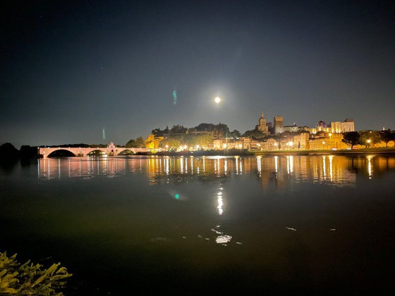
Camping du Pont d'Avignon
On the peninsula in front of the city. With free boat shuttle to the city.
10 chemin de la Barthelasse, 84000, Avignon, Frankreich
43° 57' 24" N 4° 48' 7.8" E
43.9566700 4.8021700
• Head southeast.
• Turn right. Go for 25 m.
• Turn right toward Chemin de la Barthelasse. Go for 12 m.
• Turn left onto Chemin de la Barthelasse. Go for 562 m.
• Turn left onto Chemin de Bagatelle. Go for 223 m.
• Continue on Chemin de l'Île de Piot. Go for 124 m.
• Take the 1st exit from roundabout. Go for 162 m.
• Turn right onto Pont Édouard Daladier. Go for 372 m.
• Turn right and take ramp toward Pl. Crillon. Go for 32 m.
• Keep left onto Boulevard de l'Oulle toward Pl. Crillon. Go for 26 m.
• Turn slightly left onto Boulevard de l'Oulle. Go for 20 m.
• Continue on Porte de l'Oulle. Go for 9 m.
• Continue on Place Crillon. Go for 59 m.
• Continue on Rue Folco de Baroncelli. Go for 57 m.
• Turn right onto Rue Joseph Vernet. Go for 667 m.
• Turn left onto Rue de la République. Go for 393 m.
• Turn left onto Place de l'Horloge. Go for 17 m.
• Turn right onto Place de l'Horloge. Go for 31 m.
• Turn left onto Rue Félicien David. Go for 14 m.
• Arrive at Rue Félicien David. Your destination is on the right.
☍
2,8 km
( 8 min.)
Day
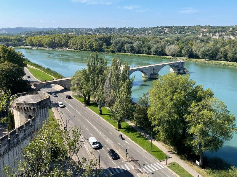
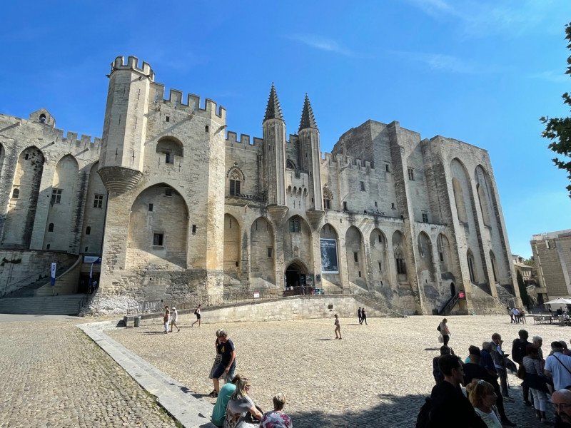
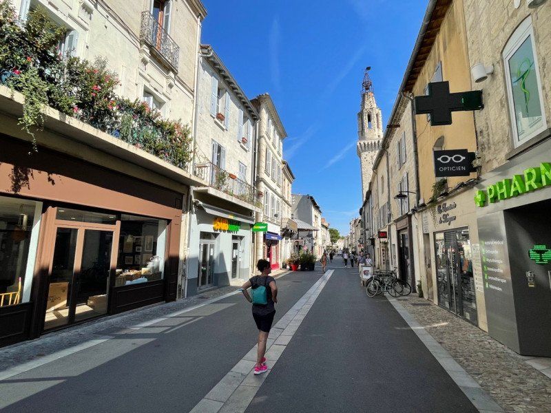
Avignon, Frankreich
A day in the city with the famous bridge
43° 56' 57.5" N 4° 48' 19.9" E
43.9493170 4.8055280
• Head toward Passage Agricol Moureau on Rue Félicien David. Go for 48 m.
• Turn right onto Rue Racine. Go for 138 m.
• Continue on Place de la Madeleine. Go for 16 m.
• Turn left onto Rue Saint-Étienne. Go for 169 m.
• Turn slightly left onto Rue du Rempart du Rhône. Go for 78 m.
• Turn right onto Porte de l'Oulle. Go for 9 m.
• Turn slightly right onto Boulevard du Rhône. Go for 26 m.
• Continue on Pont Édouard Daladier. Go for 489 m.
• Turn right onto Chemin de la Barthelasse. Go for 699 m.
• Turn right. Go for 10 m.
• Arrive at your destination on the right.
☍
1,7 km
( 4 min.)
Camping du Pont d'Avignon
10 chemin de la Barthelasse, 84000, Avignon, Frankreich
43° 57' 24" N 4° 48' 7.8" E
43.9566700 4.8021700
• Head southeast.
• Turn right. Go for 25 m.
• Turn right toward Chemin de la Barthelasse. Go for 12 m.
• Turn left onto Chemin de la Barthelasse. Go for 256 m.
• Turn right toward Route de l'Islon/D228. Go for 73 m.
• Turn left onto Route de l'Islon (D228). Go for 400 m.
• Turn left onto Rue Joseph Noël Clamon. Go for 225 m.
• Turn right onto Pont Édouard Daladier. Go for 379 m.
• Turn right toward Route d'Aramon/D2. Go for 92 m.
• Turn right onto Route d'Aramon (D2). Go for 617 m.
• Turn right toward A9/Bagnols S/C./Les Angles/Nîmes. Go for 114 m.
• Take ramp onto N100. Go for 3.8 km.
• Take the 2nd exit from roundabout onto D6580 toward A9/(Orange)/Roquemaure/Pujaut. Go for 2.2 km.
• Pass 4 roundabouts and continue on D6580. Go for 6.3 km.
• Take the 1st exit from roundabout onto N580. Go for 4.0 km.
• Pass 2 roundabouts and continue on N580. Go for 5.0 km.
• Take the 1st exit from roundabout onto N580 toward Bagnols-sur-Cèze/L'Ardoise/C.E.A Marcoule/Port de l'Ardoise. Go for 225 m.
• Take the 3rd exit from roundabout onto Route de Bagnols (N580). Go for 4.1 km.
• Continue toward Bagnols S/C. Go for 44 m.
• Take the 3rd exit from roundabout onto N580 toward Bagnols S/C. Go for 4.4 km.
• Take the 2nd exit from Rond-Point Constant Compère-Morel roundabout onto Avenue Georges Besse (N580) toward Pont St Esprit/Montélimar/Nîmes/Bagnols-Centre. Go for 758 m.
• Take the 2nd exit from Rond-Point Edgar Tailhades roundabout onto Avenue de la Mayre (D6) toward Montélimar/Pont St Esprit/Alès/Bagnols-Centre/Nîmes. Go for 405 m.
• Turn right toward Avenue du Général de Gaulle. Go for 47 m.
• Continue on Avenue du Général de Gaulle. Go for 306 m.
• Turn left onto Rue Léon Alegré. Go for 211 m.
• Turn right onto Square Thome. Go for 96 m.
• Turn left onto Place de la Vierge. Go for 26 m.
• Arrive at Place de la Vierge. Your destination is on the left.
☍
34,1 km
( 38 min.)
Day
Bagnols-sur-Cèze, Frankreich
30200 Bagnols-sur-Cèze, Frankreich
44° 9' 45.1" N 4° 37' 12.3" E
44.1625200 4.6200750
• Head toward Rue de la Verrerie on Place de la Vierge. Go for 26 m.
• Continue on Rue Roussel. Go for 61 m.
• Turn left onto Rue Jérusalem. Go for 35 m.
• Continue on Rue des Ursins. Go for 61 m.
• Turn right onto Rue Four Canilhac. Go for 23 m.
• Turn slightly right onto Rue du Roc. Go for 118 m.
• Turn left onto Rue du Chien. Go for 32 m.
• Turn right onto Rue Remparts du Collège. Go for 7 m.
• Turn slightly left onto Rue Remparts du Collège. Go for 28 m.
• Turn right onto Place Jean Jaurès (N86). Go for 23 m.
• Take the 2nd exit from Place Jean Jaurès roundabout onto Avenue de l'Europe (N86). Go for 404 m.
• Pass 3 roundabouts and continue on Route de Lyon (N86). Go for 2.2 km.
• Take the 3rd exit from roundabout onto N86 toward A7/Montélimar/Pont St Esprit/St Nazaire. Go for 1.6 km.
• Pass 4 roundabouts and continue on N86. Go for 9.1 km.
• Take the 3rd exit from roundabout onto D63 A toward D63/Lapalud. Go for 825 m.
• Continue on D63. Go for 2.8 km.
• Continue toward N7. Go for 38 m.
• Take the 3rd exit from roundabout onto N7. Go for 2.0 km.
• Take the 2nd exit from roundabout onto N7 toward Aubenas/Montélimar/Pierrelatte. Go for 6.3 km.
• Take the 1st exit from roundabout onto D833 toward Pierrelatte-Centre. Go for 138 m.
• Take the 2nd exit from roundabout onto D833. Go for 193 m.
• Take the 3rd exit from Carrefour Pierre Gendrier roundabout onto Boulevard Frédéric Mistral (D833). Go for 289 m.
• Take the 2nd exit from Rond-Point Edmond Rostand roundabout onto Avenue Irène et Frédéric Joliot-Curie (D833). Go for 354 m.
• Take the 2nd exit from roundabout onto Place du Champ-de-Mars. Go for 107 m.
• Turn slightly left onto Rue Pierre Semard. Go for 51 m.
• Turn left onto Rue Pierre Semard. Go for 94 m.
• Turn slightly right onto Place de l'Église. Go for 57 m.
• Turn slightly right onto Place de l'Église. Go for 11 m.
• Continue on Rue des Salins. Go for 56 m.
• Turn right onto Rue de Berne. Go for 31 m.
• Arrive at Rue de Berne. Your destination is on the right.
☍
27,2 km
( 31 min.)
Pierrelatte, Frankreich
26700 Pierrelatte, Frankreich
44° 22' 39.9" N 4° 41' 49.1" E
44.3777500 4.6969810
• Head east on Rue de Berne.
• Turn right onto Rue du Château. Go for 43 m.
• Turn right onto Rue Raymond. Go for 58 m.
• Turn sharp right onto Place de l'Église. Go for 11 m.
• Continue on Rue des Salins. Go for 56 m.
• Turn slightly left onto Place de l'Ancienne Horloge. Go for 11 m.
• Turn right onto Place de l'Ancienne Horloge. Go for 39 m.
• Turn left onto Rue Le Pas. Go for 34 m.
• Turn right onto Grande Rue (D358). Go for 189 m.
• Continue on Avenue Maréchal de Lattre de Tassigny (D858). Go for 189 m.
• Take the 2nd exit from roundabout onto Avenue Maréchal de Lattre de Tassigny (D858). Go for 672 m.
• Take the 1st exit from roundabout onto Avenue Maréchal de Lattre de Tassigny (N7) toward A7/Montélimar/Aubenas/Valréas/Donzère/Viviers. Go for 1.1 km.
• Pass 4 roundabouts and continue on N7. Go for 9.3 km.
• Take the 4th exit from roundabout onto N7 toward Montélimar/Viviers/Malataverne. Go for 2.3 km.
• Take the 1st exit from roundabout toward Lyon/Valence/Marseille/Nîmes. Go for 175 m.
• Take ramp onto A7 (Autoroute du Soleil) toward Valence/Lyon. Go for 51.4 km.
• Take exit 15 toward Genève/Chambéry/Grenoble/Romans/Valence onto E713 (Échangeur de Valence-Sud). Go for 708 m.
• Continue on N7. Go for 9.7 km.
• Continue on E713. Go for 168 m.
• Continue on N532. Go for 10.6 km.
• Keep left onto A49 toward Genève/Chambéry/Grenoble/Romans-Centre. Go for 60.6 km.
• Take the exit toward Voiron/Lyon/Chambéry/Genève onto A48. Go for 41.8 km.
• Take the exit toward Genève/Chambéry/La Tour du Pin onto A43. Go for 46.8 km.
• Continue on A41 toward Genève/Annecy/Aix les Bains. Go for 71.6 km.
• Continue on A1. Go for 3 m.
• Keep left onto A1. Go for 64.4 km.
• Take the exit toward Bern/Neuchâtel/Simplon/Gd-St-Bernard/Lausanne-Nord/Lausanne-Crissier onto A1 (Ecublens). Go for 21.7 km.
• Continue on A1 toward Bern/Neuchâtel/Yverdon. Go for 26.1 km.
• Take exit 26 toward Estavayer-le-Lac. Go for 839 m.
• Take the 3rd exit from roundabout. Go for 211 m.
• Take the 1st exit from roundabout. Go for 370 m.
• Continue on Route de Frasses. Go for 719 m.
• Take the 2nd exit from roundabout. Go for 220 m.
• Continue on Route de Payerne. Go for 317 m.
• Pass 3 roundabouts and continue on Route de Payerne. Go for 462 m.
• Continue on Grande-Rue. Go for 65 m.
• Turn left onto Rue de Forel. Go for 131 m.
• Continue on Place des Bastians. Go for 20 m.
• Take the 2nd exit from roundabout onto Route du Port. Go for 490 m.
• Take the 1st exit from roundabout onto Route de la Plage. Go for 751 m.
• Turn left onto Plage Communale. Go for 171 m.
• Arrive at Plage Communale. Your destination is on the left.
☍
424,5 km
(4 hrs. 2 min.)
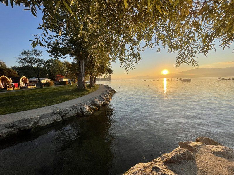
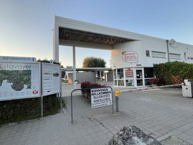
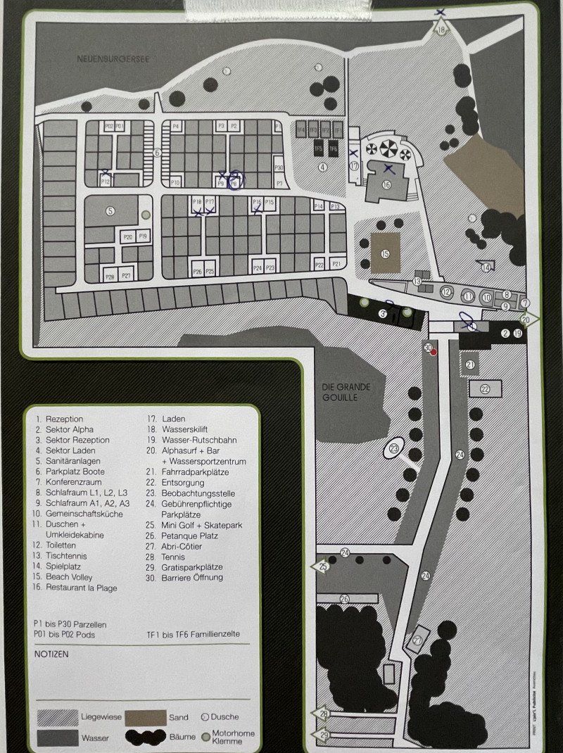
Camping Nouvelle Plage
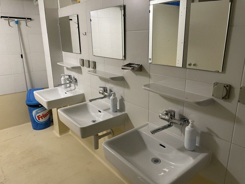
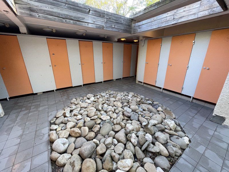
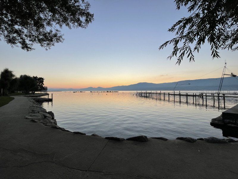
A site directly on Lake Neuchâtel, mostly with permanent campers, but there are a few sites (also with a lake view) for travelers passing through.
Very friendly staff at the reception, modern and clean sanitary facilities
Chemin de la Grande Gouille, 1470, Estavayer-le-Lac, Schweiz
46° 51' 22.4" N 6° 50' 50.6" E
46.8562200 6.8474000
• Head toward Chemin de la Grande Gouille on Plage Communale. Go for 171 m.
• Turn right onto Route de la Plage. Go for 739 m.
• Take the 3rd exit from roundabout onto Route du Port. Go for 524 m.
• Take the 3rd exit from roundabout onto Rue de l'Hôtel de Ville. Go for 140 m.
• Turn right onto Grande-Rue. Go for 172 m.
• Continue on Route de Payerne. Go for 106 m.
• Pass 2 roundabouts and continue on Route de Payerne. Go for 341 m.
• Take the 3rd exit from roundabout onto Route de Payerne. Go for 338 m.
• Keep left. Go for 149 m.
• Take the 2nd exit from roundabout. Go for 679 m.
• Continue on Route de Frasses. Go for 419 m.
• Take the 2nd exit from roundabout. Go for 183 m.
• Take the 2nd exit from roundabout onto A1 toward Bern. Go for 54.1 km.
• Take the left exit toward Zürich/Basel/Biel/Bienne onto A1/A6. Go for 5.8 km.
• Continue on A1 toward Zürich/Basel/Kirchberg. Go for 9.8 km.
• Take exit 39 toward Kirchberg/Alchenflüh/Langnau i.E./Burgdorf. Go for 288 m.
• Keep left toward Langenthal/Solothurn. Go for 825 m.
• Continue on Rüdtligen-Alchenflüh Tunnel. Go for 1.6 km.
• Take the 2nd exit from roundabout. Go for 959 m.
• Take the 2nd exit from roundabout onto Landstrasse (1). Go for 13.1 km.
• Pass 3 roundabouts and continue on Bernstrasse (1). Go for 1.4 km.
• Turn left onto Bernstrasse (1). Go for 223 m.
• Arrive at Zürichstrasse (1). Your destination is on the left.
☍
92,0 km
(1 hrs. 7 min.)
Day
Herzogenbuchsee, Schweiz
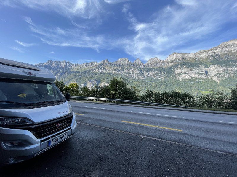
A traffic jam on the A1 motorway gave us a beautiful cross-country trip through Aargau.
3360 Herzogenbuchsee, Schweiz
47° 11' 22.1" N 7° 42' 28" E
47.1894680 7.7077698
• Head northeast on Zürichstrasse (1). Go for 745 m.
• Pass 7 roundabouts and continue on Bernstrasse (1). Go for 14.5 km.
• Arrive at Hauptstrasse (1). Your destination is on the left.
☍
15,2 km
( 18 min.)
Murgenthal, Schweiz
47° 16' 35.8" N 7° 50' 42.5" E
47.2765988 7.8451321
• Head northeast on Hauptstrasse (1). Go for 3.2 km.
• Take the 2nd exit from roundabout onto Bernstrasse (1). Go for 1.6 km.
• Take the 2nd exit from roundabout onto Neue Aarburgerstrasse. Go for 345 m.
• Pass 2 roundabouts and continue on Neue Aarburgerstrasse. Go for 781 m.
• Take ramp onto A1/A2 toward Zürich/Luzern. Go for 1.8 km.
• Continue on A1 (Verzweigung Wiggertal) toward Zürich/Aarau/Oftringen/Zofingen. Go for 47.9 km.
• Take exit 59 toward Chur/Luzern/Westring-Zürich onto A3/A4. Go for 10.4 km.
• Take left exit 31 toward San Bernardino/Chur/Zürich-City onto A3. Go for 5.2 km.
• Take the exit toward San Bernardino/Chur onto A3. Go for 64.1 km.
• Take exit 47 toward Murg/Mühlehorn/Unterterzen/Kerenzerberg. Go for 433 m.
• Take the 1st exit from roundabout onto 3. Go for 4.5 km.
• Take the 2nd exit from roundabout onto Walenseestrasse (3). Go for 103 m.
• Arrive at Walenseestrasse (3). Your destination is on the right.
☍
140,4 km
(1 hrs. 31 min.)
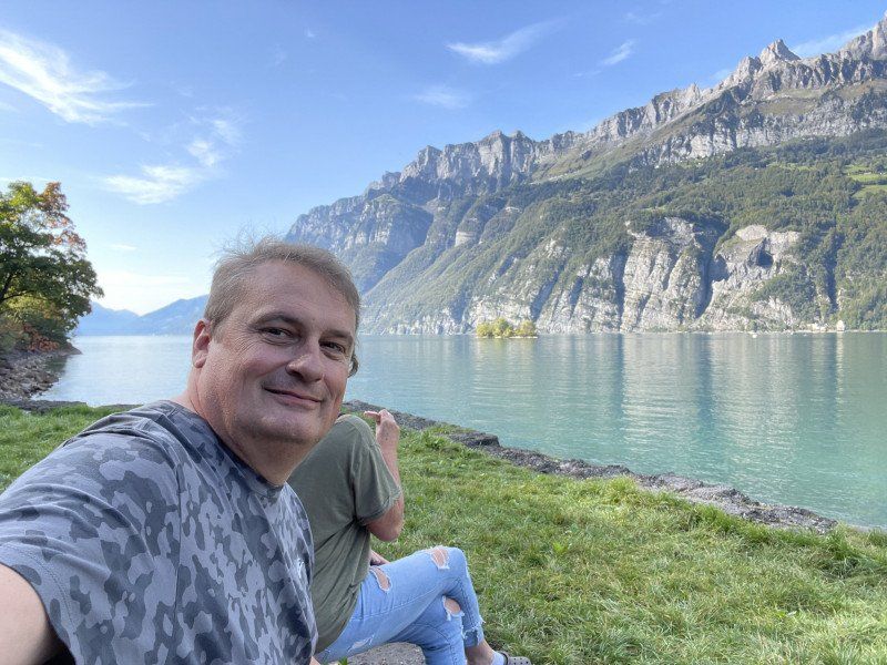
Quarten, Schweiz
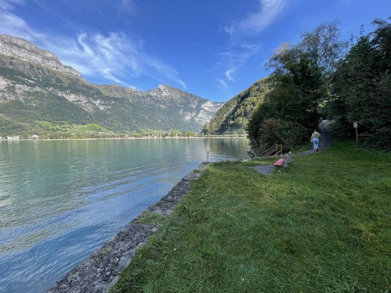
We had enough of driving through tunnels and got off the A3. We drove along the beautiful Walensee, which we would have missed otherwise, and found a rest area.
47° 6' 47.5" N 9° 15' 5.6" E
47.1132054 9.2515678
• Head east on Walenseestrasse (3). Go for 9.4 km.
• Take the 2nd exit from roundabout. Go for 235 m.
• Take left ramp onto A3 toward Chur/St. Gallen. Go for 11.0 km.
• Take exit 11 toward St. Gallen/St. Margrethen/München/Feldkirch/Vaduz onto A13. Go for 41.1 km.
• Take exit 4 toward Kriessern/Altstätten/Götzis. Go for 389 m.
• Continue on Zollstrasse. Go for 260 m.
• Continue on L58. Go for 426 m.
• Take the 3rd exit from roundabout onto Mäderer Landesstraße (L58). Go for 1.2 km.
• Take the 3rd exit from roundabout onto Neue Landstraße (L55). Go for 952 m.
• Take left ramp onto A14 (Rheintal Autobahn) toward Deutschland/Bregenz. Go for 26.5 km.
• Continue on A96. Go for 117 km.
• Take exit 24 toward Landsberg am Lech-West/Augsburg/Schwabmünchen/Schongau. Go for 290 m.
• Take the 4th exit from roundabout onto B17 toward Augsburg. Go for 24.7 km.
• Take ramp toward Königsbrunn-Süd/Bobingen/Mering. Go for 258 m.
• Take the 1st exit from roundabout onto Bobinger Straße (St2380). Go for 4.3 km.
• Take the 1st exit from roundabout onto Meringer Straße (St2380) toward Mering. Go for 5.2 km.
• Turn left onto B2. Go for 4.0 km.
• Turn right onto Mittlerer Weg. Go for 194 m.
• Continue on Schulstraße. Go for 438 m.
• Turn left onto Fichtenstraße. Go for 67 m.
• Arrive at Fichtenstraße. Your destination is on the right.
☍
247,7 km
(2 hrs. 26 min.)
Kissing, Deutschland
48° 18' 9.7" N 10° 58' 21.4" E
48.3027069 10.9726090