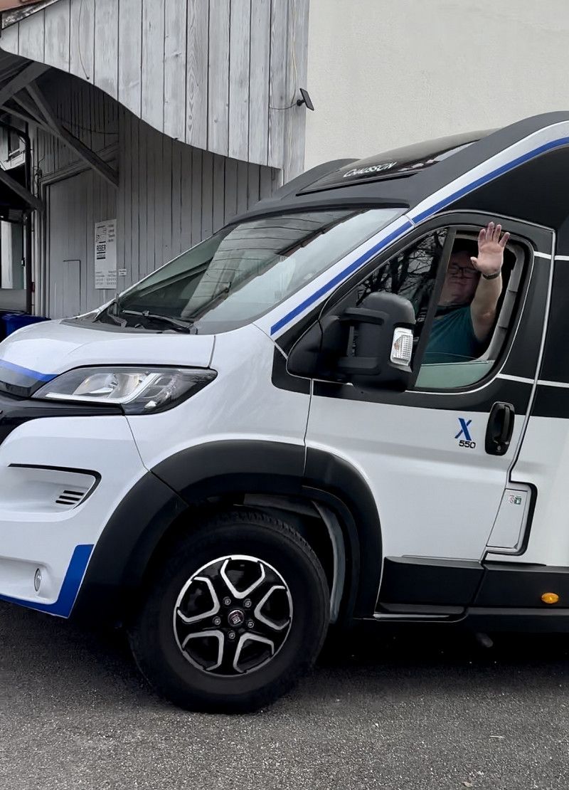
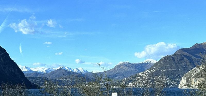
We are starting a new travel season with a dream country: Greece. Via Ancona by ferry to Patras, then Peloponnese, Athens, Euboea, Macedonia, Albania and then along the coast, Montenegro and Croatia. This is roughly the planned route 😀 Our dog stays well looked after at home with the family.
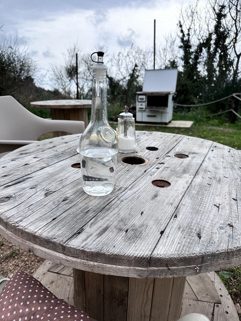
Biel-Benken
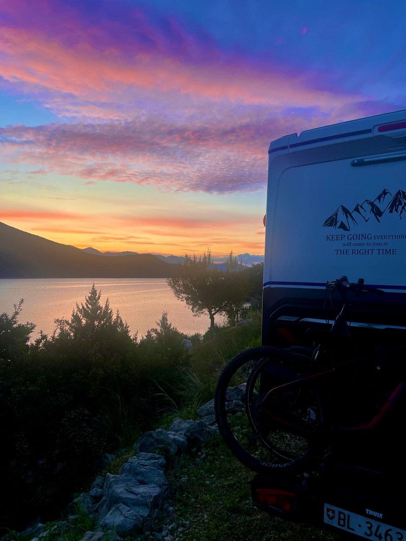
Finally, it starts again. This year we have planned some nice trips again. We start from our home with the destination Ancona. We'll see how far we get today. Tomorrow we have booked a ferry ⛴️ to Patras - Greece 🇬🇷.
Bezirk Arlesheim, Basel-Landschaft, Schweiz
47° 30' 24.4" N 7° 31' 15.5" E
47.5067710 7.5209620
• Head toward Fraumattenstrasse on Friedrich Oser-Strasse. Go for 91 m.
• Turn left onto Fraumattenstrasse. Go for 263 m.
• Continue on Hauptstrasse. Go for 842 m.
• Continue on Bielstrasse. Go for 1.6 km.
• Continue on Hauptstrasse. Go for 401 m.
• Take the 2nd exit from roundabout onto Bottmingerstrasse. Go for 433 m.
• Turn left onto Bottmingerstrasse. Go for 455 m.
• Continue on Therwilerstrasse. Go for 636 m.
• Take the 1st exit from roundabout onto Bruderholzstrasse. Go for 871 m.
• Pass 3 roundabouts and continue on Bruderholzstrasse. Go for 3.7 km.
• Continue on Münchensteinerstrasse. Go for 119 m.
• Take ramp onto A18 toward Luzern/Bern/Zürich/Basel. Go for 1.6 km.
• Take the exit toward Luzern/Bern/Zürich onto A2/A3. Go for 8.2 km.
• Keep right onto A2 (Verzweigung Augst) toward Chiasso/Gotthard/Luzern/Bern/Arisdorf. Go for 28.2 km.
• Take the left exit toward Chiasso/Gotthard/Luzern/Zürich/Rothrist onto A1/A2. Go for 8.8 km.
• Take exit 47 toward Chiasso/Gotthard/Luzern/Reiden onto A2 (Verzweigung Wiggertal). Go for 108 km.
• Take exit 39 toward Wassen/Interlaken/Sustenpass. Go for 172 m.
• Turn right onto Gotthardstrasse (2) toward Lugano/Gotthard/Wassen/Sustenpass/Interlaken. Go for 835 m.
• Continue on Gotthardstrasse (2). Go for 4.1 km.
• Take the 1st exit from roundabout toward Lugano/Gotthard/Zürich/Luzern. Go for 184 m.
• Take ramp onto A2 toward Gotthard/Lugano/Airolo. Go for 126 km.
• Arrive at A2.
☍
295,3 km
(3 hrs. 16 min.)
Info Italien
Entry with an identity card (CH ID) or a valid passport.
The Schengen Agreement applies in Italy - no entry controls
Maximum speed 50 in town / 90 outside town, expressway 110 km
Motorway toll 130 km maximum speed
Daytime running lights mandatory
Currency Euro
Gas station network good, AdBlue available
Free camping is prohibited, but there are good pitches
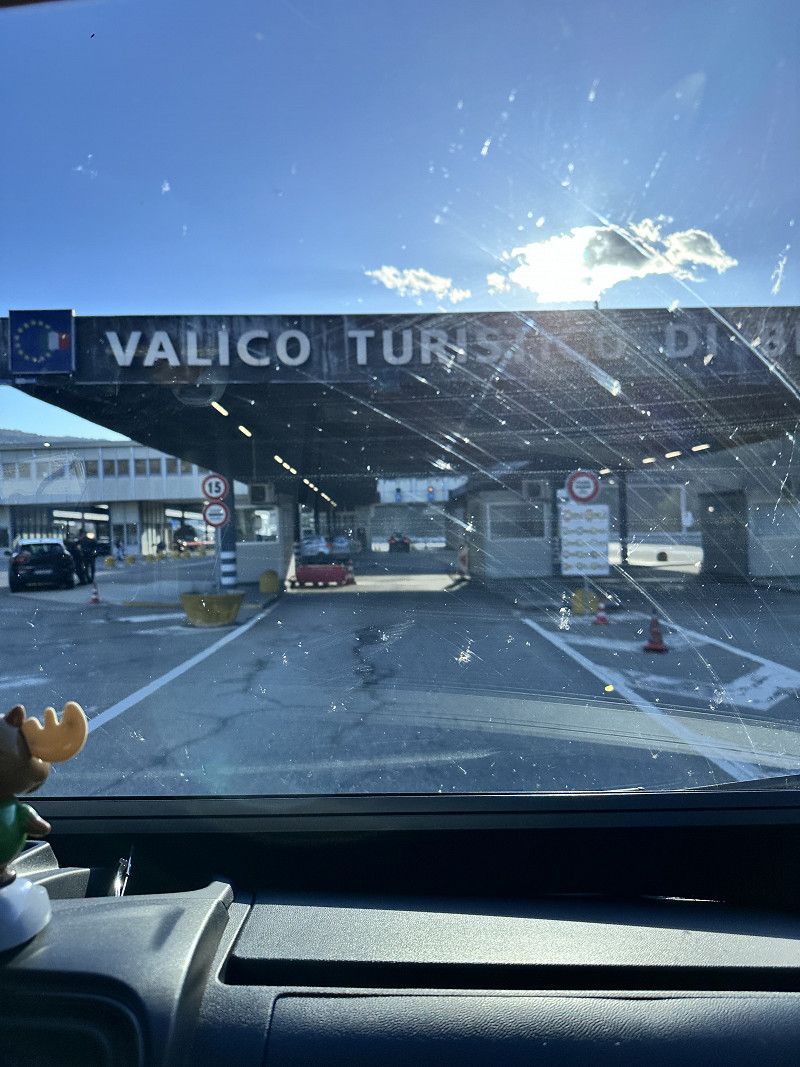
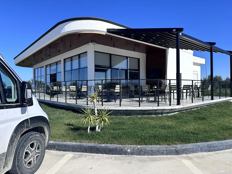
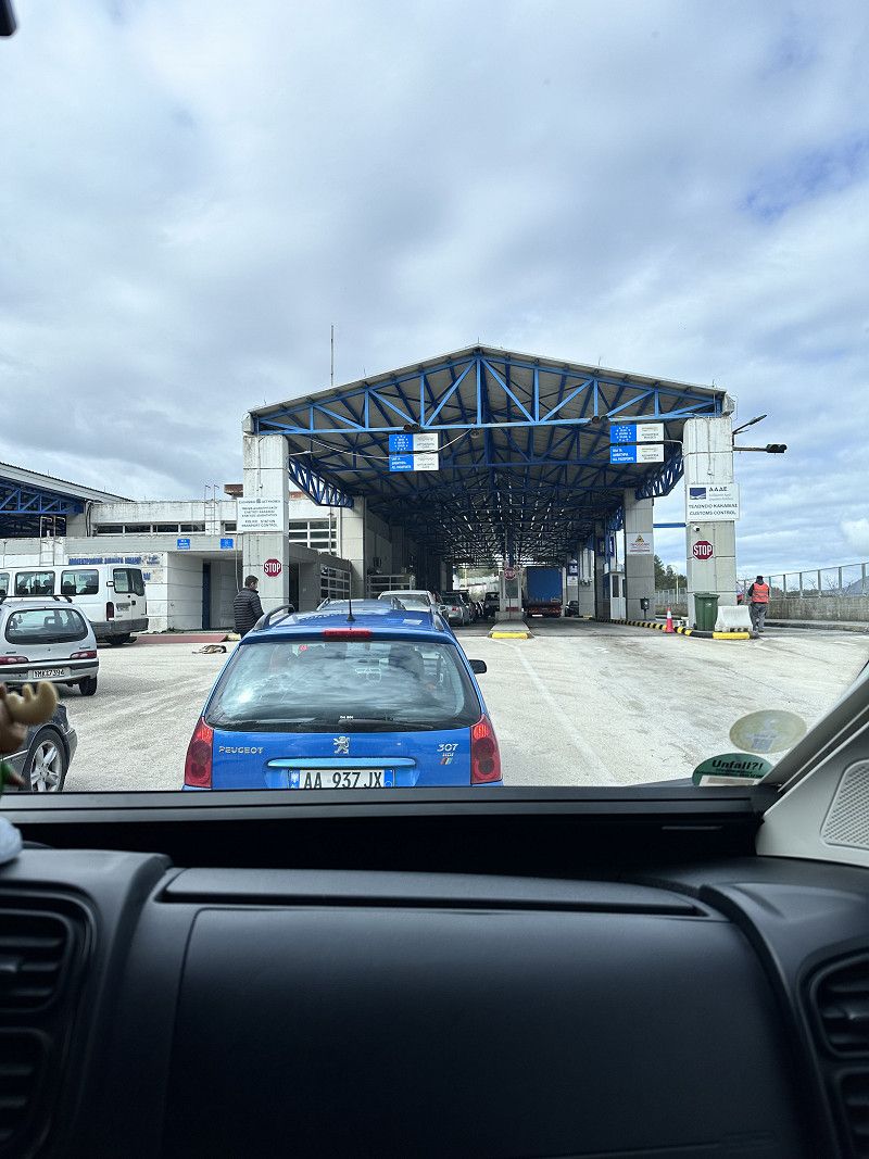
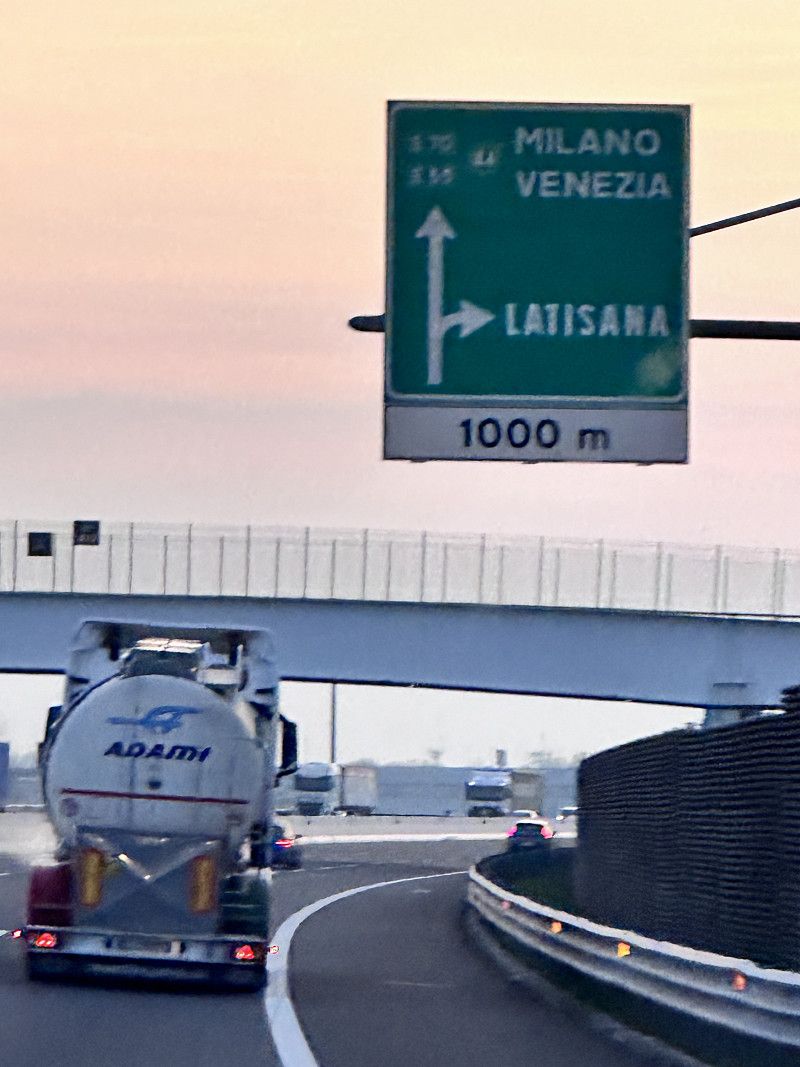
Chiasso - Grenzübertritt Italien
This has never happened before 😁 not a minute of traffic jams on the Gotthard ❣️
These holidays are off to a great start, bye bye Switzerland until three weeks 🇨🇭
A2, Chiasso, Bezirk Mendrisio, Tessin, Schweiz
45° 50' 21" N 9° 2' 7.1" E
45.8391707 9.0352963
• Head northeast on A2.
• Continue on A9 (Autostrada dei Laghi). Go for 31.0 km.
• Take the left exit onto A8 (Autostrada dei Laghi). Go for 5.1 km.
• Take the exit toward E64/Torino/A4/Genova/A7/Bologna/A1 onto A50 (Tangenziale Ovest). Go for 32.1 km.
• Continue on A1 (Autostrada del Sole). Go for 183 km.
• Keep right onto A14 (Autostrada Adriatica) toward Ancona/Ravenna/Padova/A13/Tangenziale/Bologna Borgo Panigale/Bologna Centro/Aeroporto Bologna/Fiera Bologna. Go for 231 km.
• Take the exit toward Ancona Sud/Osimo. Go for 1.1 km.
• Continue on Strada Statale Adriatica (SS16). Go for 486 m.
• Take the 2nd exit from roundabout onto Strada Statale Adriatica (SS16) toward Ancona Centro/Pesaro. Go for 3.7 km.
• Take ramp onto Asse Nord Sud toward Ancona Centro. Go for 5.1 km.
• Continue on Via Alessandro Bocconi. Go for 343 m.
• Take the 2nd exit from Piazzale della Libertà roundabout toward Centro. Go for 87 m.
• Continue on Galleria del Risorgimento. Go for 551 m.
• Continue on Largo Michele Gustavo Bevilacqua. Go for 31 m.
• Continue on Via Antonio Giannelli. Go for 243 m.
• Turn left onto Via Terenzio Frediani. Go for 83 m.
• Turn left onto Piazza Camillo Benso di Cavour. Go for 66 m.
• Turn right onto Piazza Camillo Benso di Cavour. Go for 20 m.
• Turn left onto Piazza Camillo Benso di Cavour. Go for 9 m.
• Arrive at Piazza Camillo Benso di Cavour. Your destination is on the right.
☍
493,7 km
(4 hrs. 16 min.)
Day
Ancona
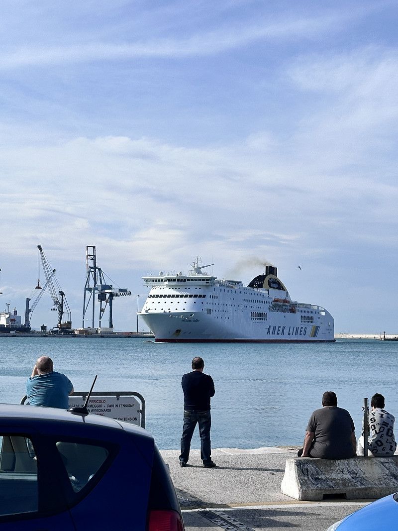
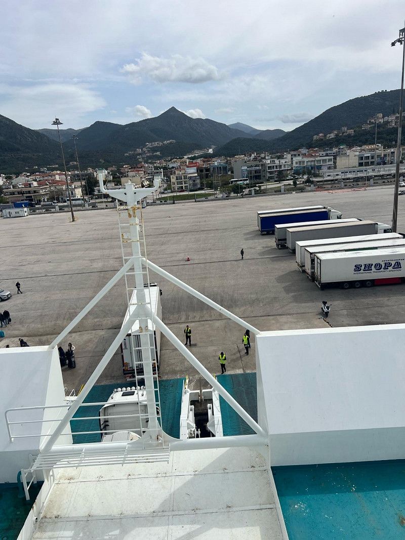
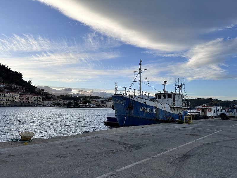
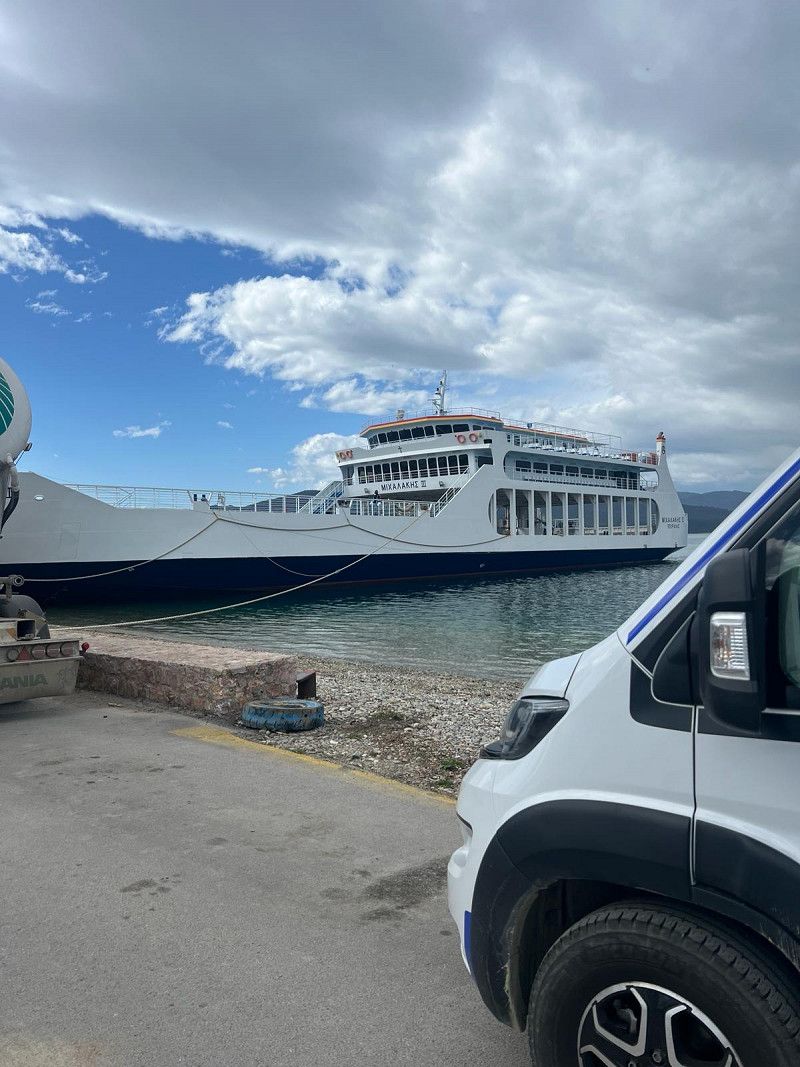
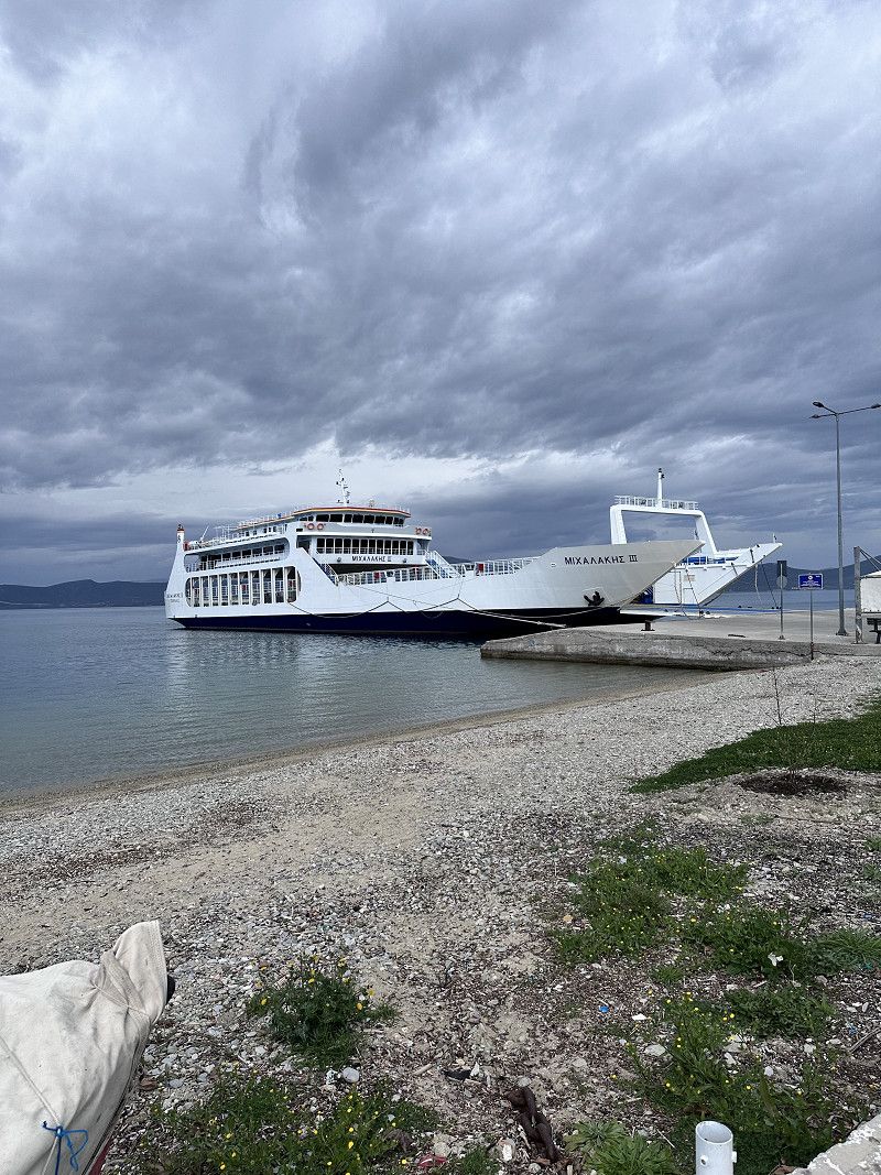
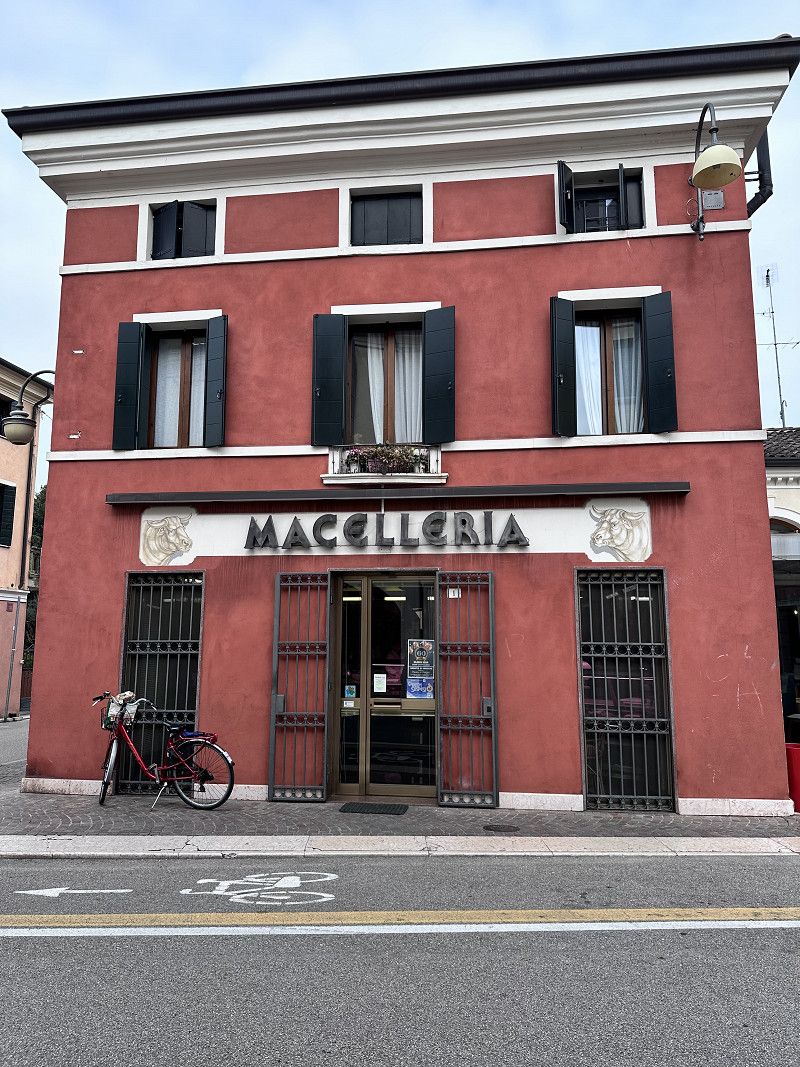
After a quiet night, we went to the port office to check in. We got there around 10 a.m., which was good. Our ship left at 5:30 p.m., an hour late. So we still had some time to visit Ancona.
About 3 hours before departure we were back at the port and watched the ferry being loaded and unloaded. Tetris for advanced players 😀
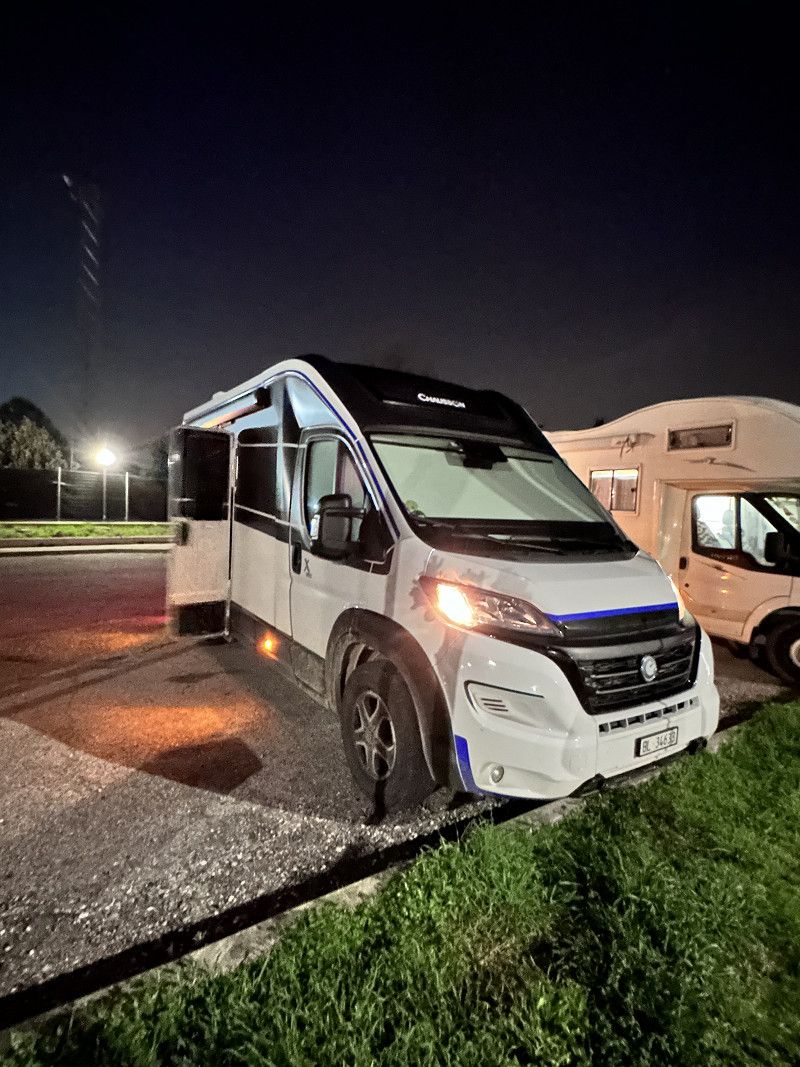
PS: We spent the night at a rest area near Ravenna, about 140 km before Ancona.
Ancona, Marken, Italien
43° 37' 1.2" N 13° 31' 1.6" E
43.6170137 13.5170982
• Head south on Piazza Camillo Benso di Cavour. Go for 82 m.
• Turn slightly right onto Piazza Camillo Benso di Cavour. Go for 126 m.
• Continue on Corso Stamira. Go for 58 m.
• Turn slightly right onto Piazza Stamira. Go for 59 m.
• Turn slightly left onto Piazza Stamira. Go for 44 m.
• Turn right onto Via Palestro. Go for 34 m.
• Turn left onto Via Marsala. Go for 62 m.
• Turn left onto Via San Martino. Go for 409 m.
• Turn left onto Via Antonio Giannelli. Go for 161 m.
• Turn right onto Viale della Vittoria. Go for 658 m.
• Turn left onto Via Francesco Rismondo. Go for 320 m.
• Turn right onto Via Montegrappa. Go for 251 m.
• Turn slightly right onto Via Panoramica. Go for 139 m.
• Arrive at Via Panoramica. Your destination is on the left.
☍
2,4 km
( 6 min.)
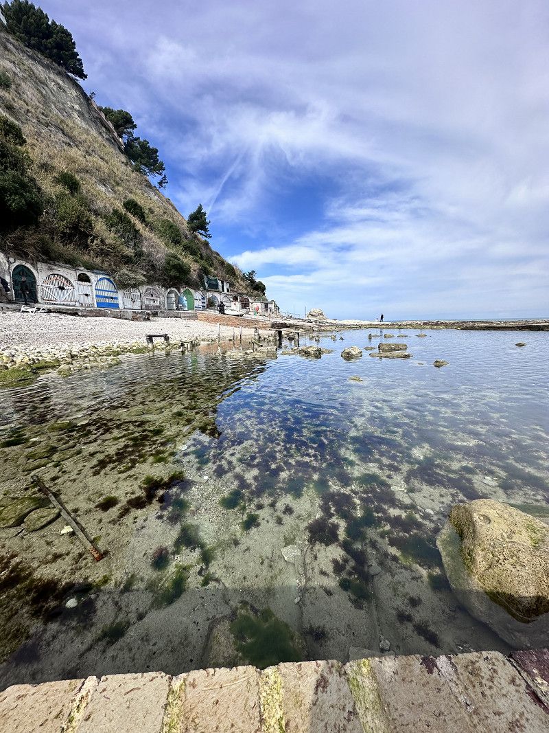
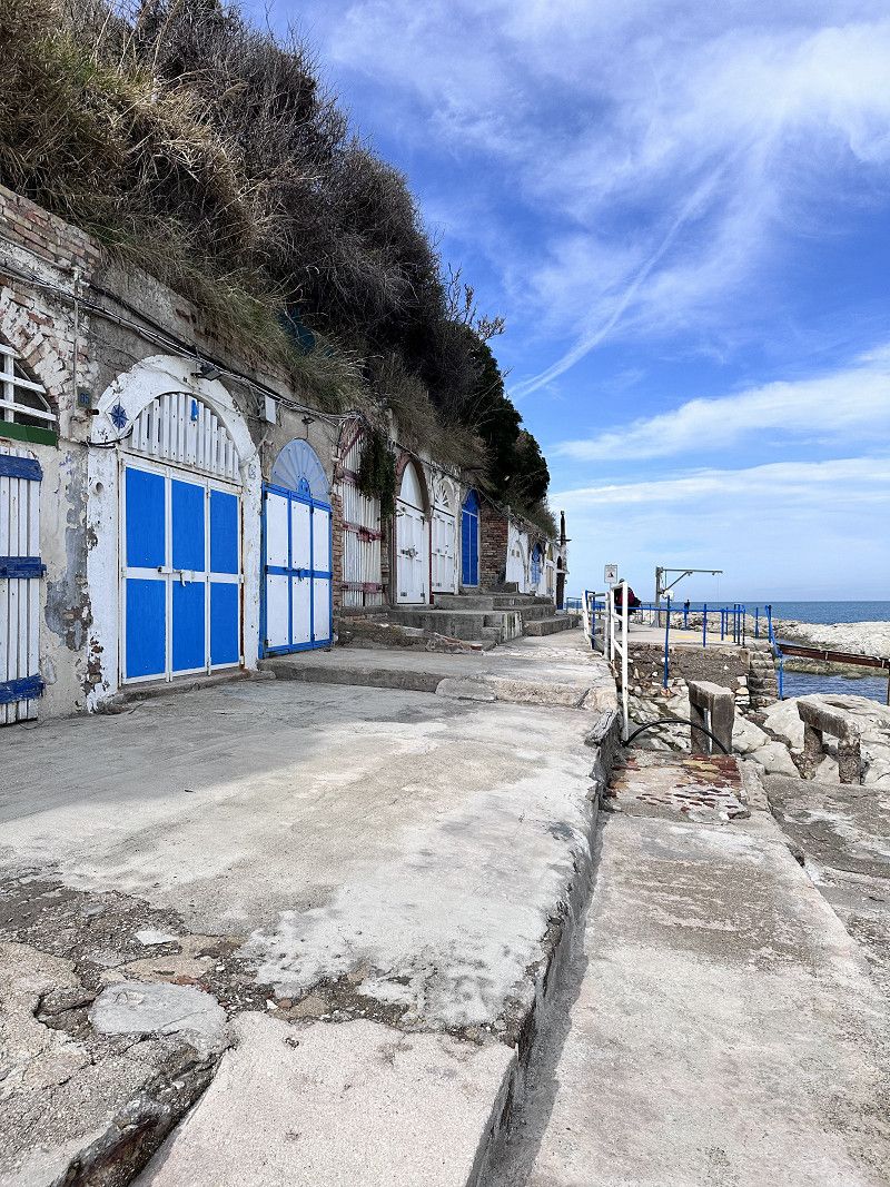
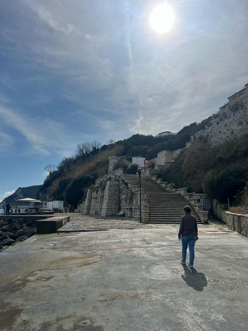
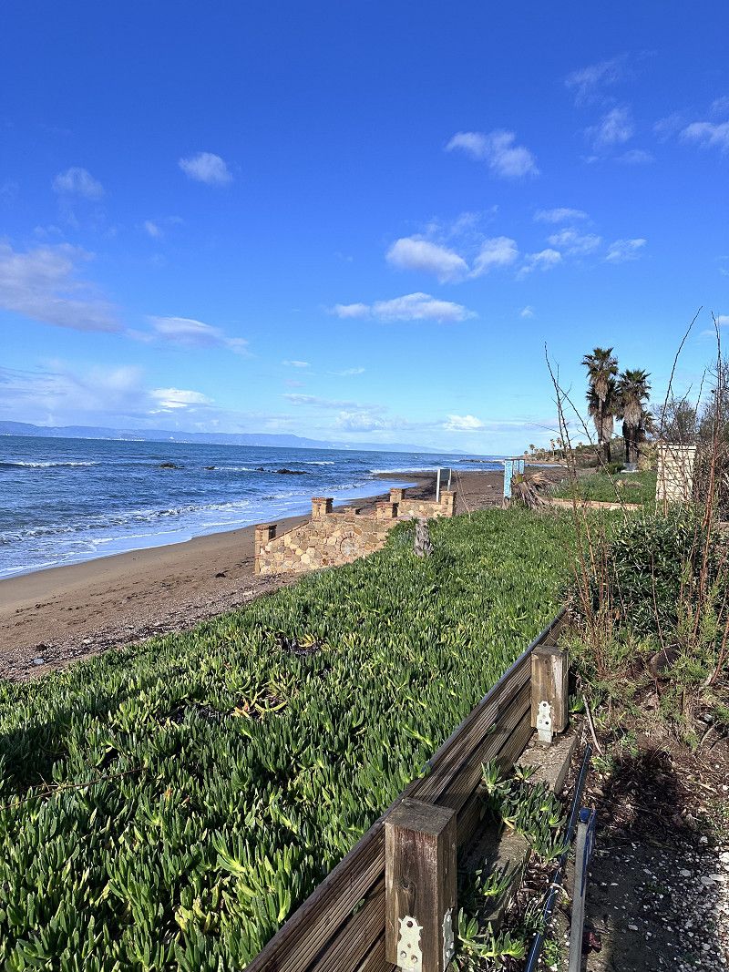
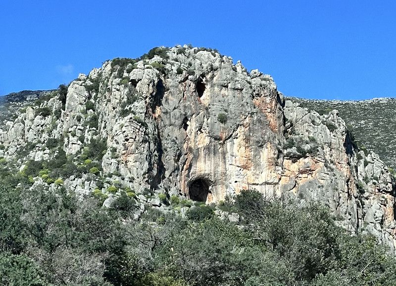
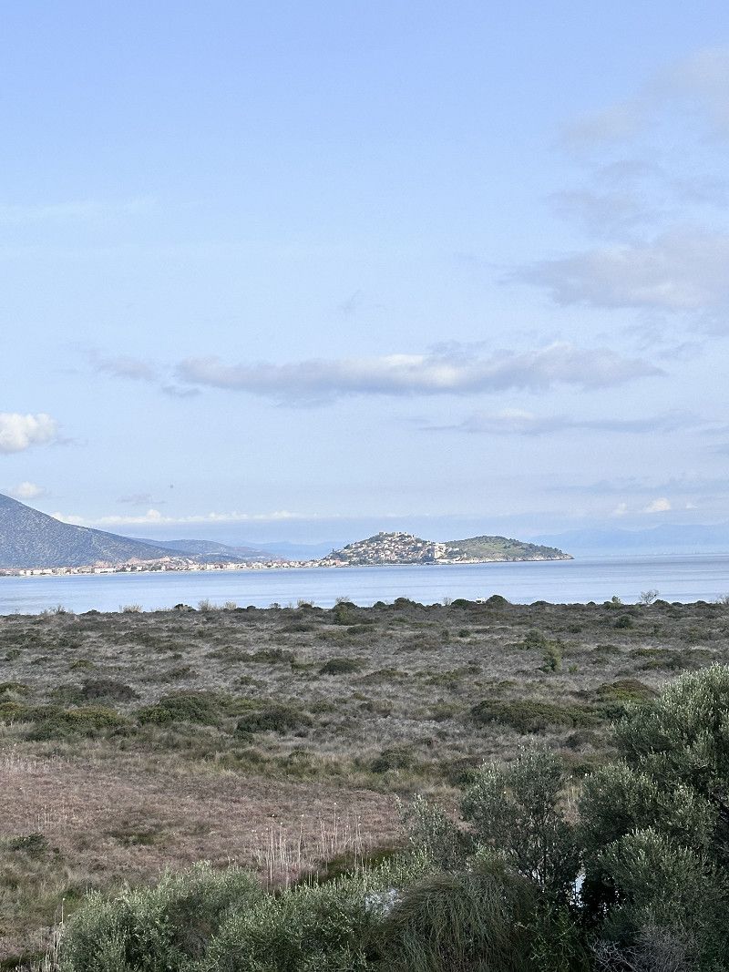
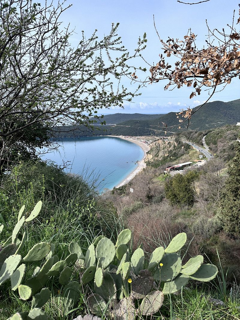
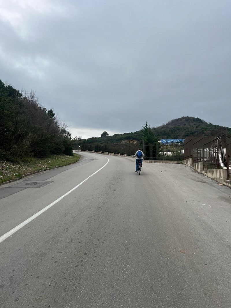
Seggiola del papa - Ancona
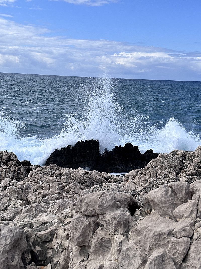
As mentioned, we had a bit of a wait in Ancona. This bay is not far from the harbor. A steep staircase leads down and it was a leisurely walk. Many small boathouses line the beach. There are hardly any boats left, the boathouses are used more as a weekend meeting place.
A stone formation is reminiscent of the Pope's chair, hence the name.
Stradello delle Ripe di Gallina, Ancona, Ancona, Italy
43° 37' 4.6" N 13° 31' 56.2" E
43.6179322 13.5322851
• Head toward Via Monfalcone on Via Panoramica. Go for 119 m.
• Turn left onto Via Francesco Baracca. Go for 133 m.
• Turn right onto Viale della Vittoria. Go for 252 m.
• Turn left onto Via Emilio Bianchi. Go for 75 m.
• Turn left onto Via Trieste. Go for 384 m.
• Continue on Via Santa Margherita. Go for 20 m.
• Turn left onto Via Paolo Thaon de Revel. Go for 34 m.
• Continue on Piazza 4 Novembre. Go for 22 m.
• Turn left onto Piazza 4 Novembre. Go for 53 m.
• Turn right onto Piazza 4 Novembre. Go for 28 m.
• Arrive at Piazza 4 Novembre. Your destination is on the left.
☍
1,1 km
( 3 min.)
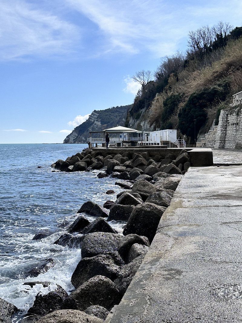
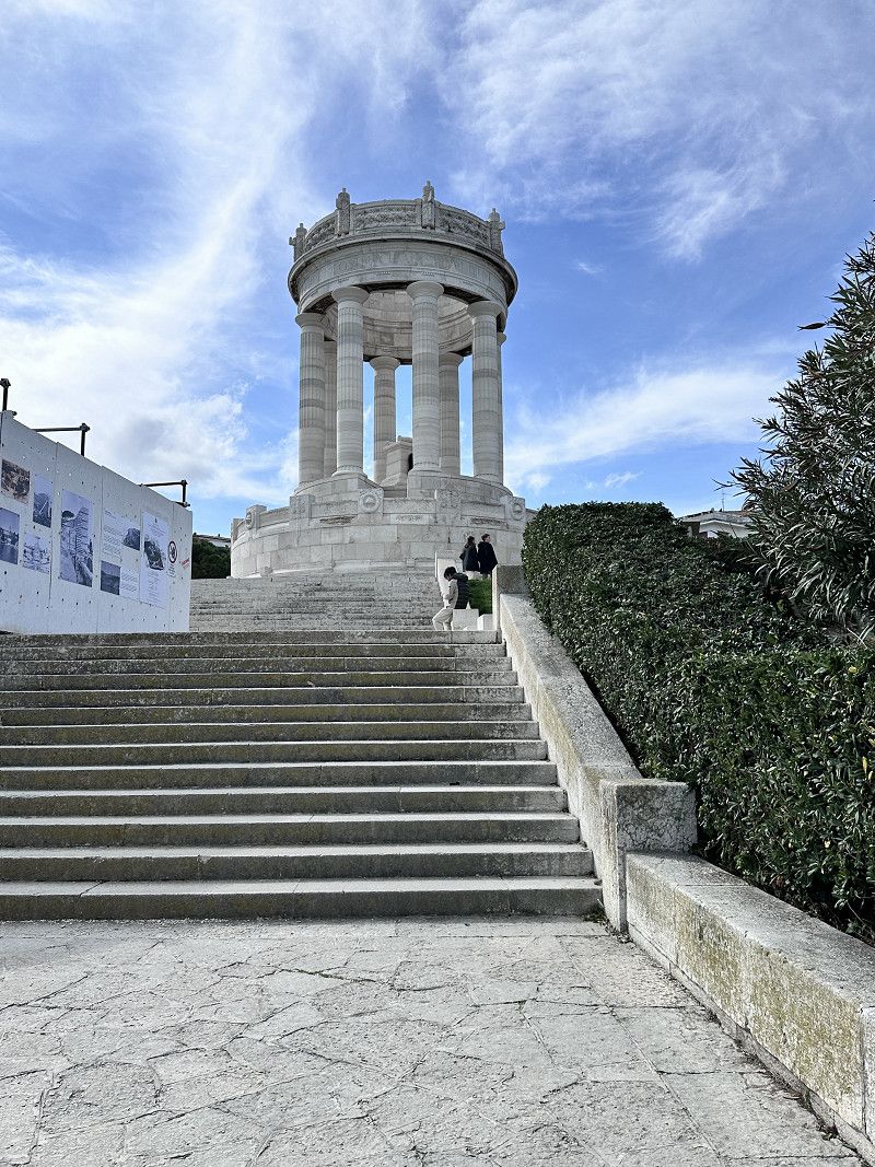
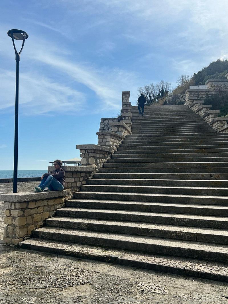
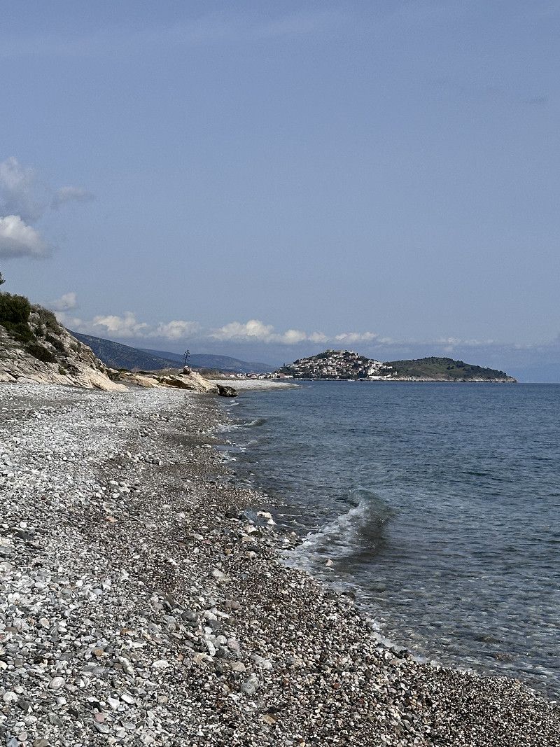
Costa del Passetto - Ancona
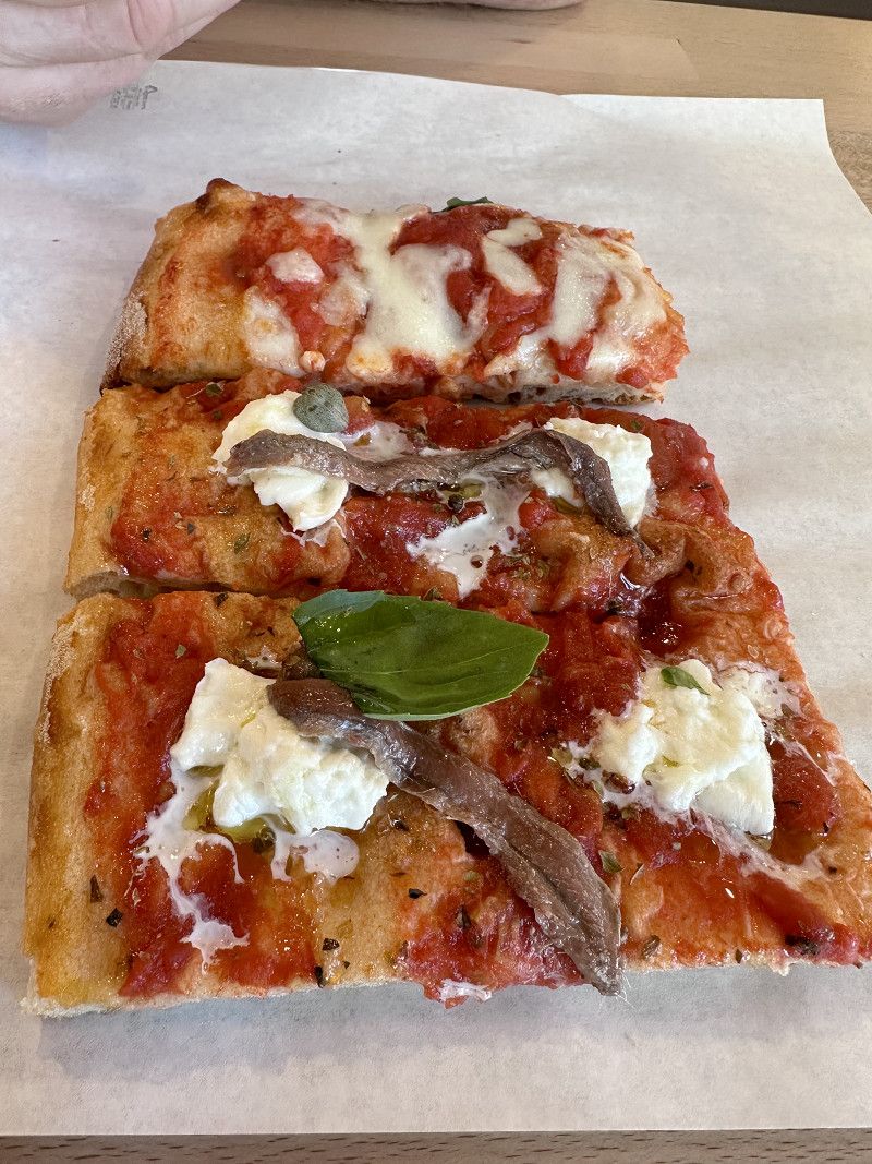
Where you go down, you have to go up again 😀 When you get to the top, there is a beautiful viewing platform and a square with an “Academia”. From this square there is a promenade that invites you to stroll. After a short while on the right there is a pizzeria “Farinando”, which offers slices of pizza for €1.50 to €3.00. Were super delicious 😋
Scalinata del Passetto, Ancona, Ancona, Marche, Italy
43° 36' 54.3" N 13° 32' 1.8" E
43.6150948 13.5338382
• Head toward Via Paolo Thaon de Revel on Piazza 4 Novembre. Go for 51 m.
• Turn right onto Piazza 4 Novembre. Go for 80 m.
• Turn left onto Via Bainsizza. Go for 36 m.
• Turn right onto Via Trieste. Go for 832 m.
• Continue on Via Piave. Go for 310 m.
• Turn right onto Via Antonio Giannelli. Go for 135 m.
• Turn left onto Via Terenzio Frediani. Go for 83 m.
• Turn left onto Piazza Camillo Benso di Cavour. Go for 66 m.
• Turn right onto Piazza Camillo Benso di Cavour. Go for 20 m.
• Turn left onto Piazza Camillo Benso di Cavour. Go for 9 m.
• Arrive at Piazza Camillo Benso di Cavour. Your destination is on the right.
☍
1,6 km
( 4 min.)
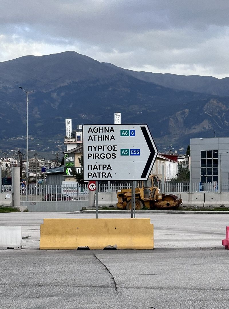
F/B Hellenic Spirit
Departure port: Ancona
Ancona, Marken, Italien
43.6170137 13.5170982
Arrival port: Patras
Regionalbezirk Achaia, Peloponnes, Westgriechenland und Ionische Inseln, Griechenland
38.24624221.7350847
• Head southwest on Plateia Vasileos Georgiou A'. Go for 43 m.
• Continue on Maizonos toward Kalavrita/Pyrgos. Go for 80 m.
• Turn right onto Patreos. Go for 221 m.
• Turn left onto Othonos-Amalias. Go for 596 m.
• Continue on Akti Dymaion. Go for 2.5 km.
• Arrive at Akti Dymaion. Your destination is on the right.
☍
1,1 km
( 3 min.)
Day
Info Griechenland
Entry with an identity card (CH ID) or a valid passport.
Maximum speed 50 in urban areas / 90 out of urban areas
Motorway toll 130 km maximum speed
Currency Euro
Service station network well and often served (they are happy about a small tip)
AdBlue available
Free camping prohibited but was tolerated in March as most campsites are closed
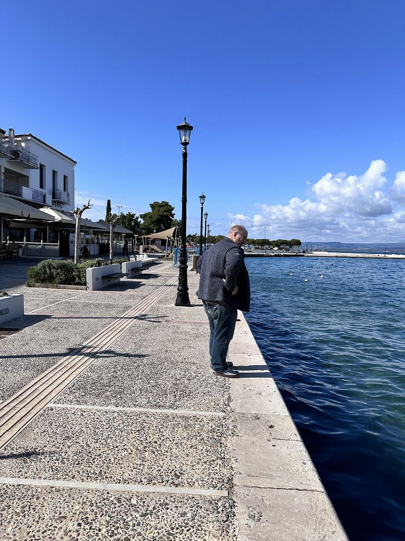
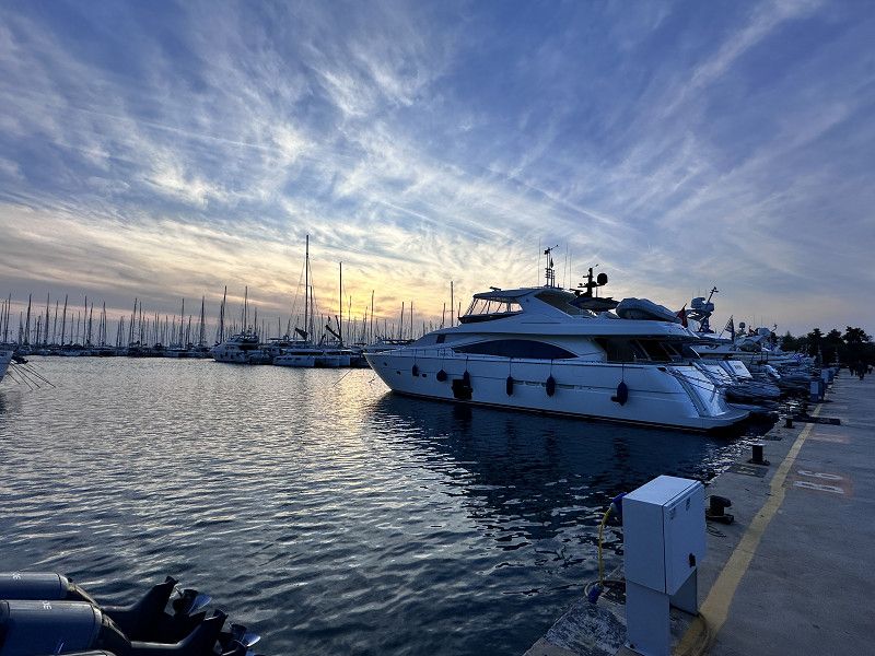
Patras Hafen
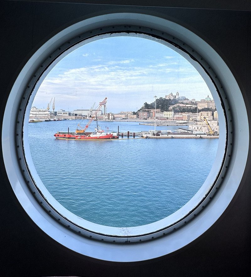
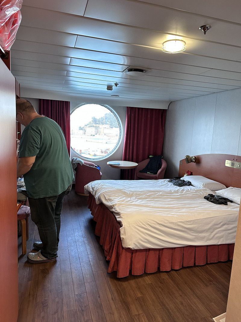
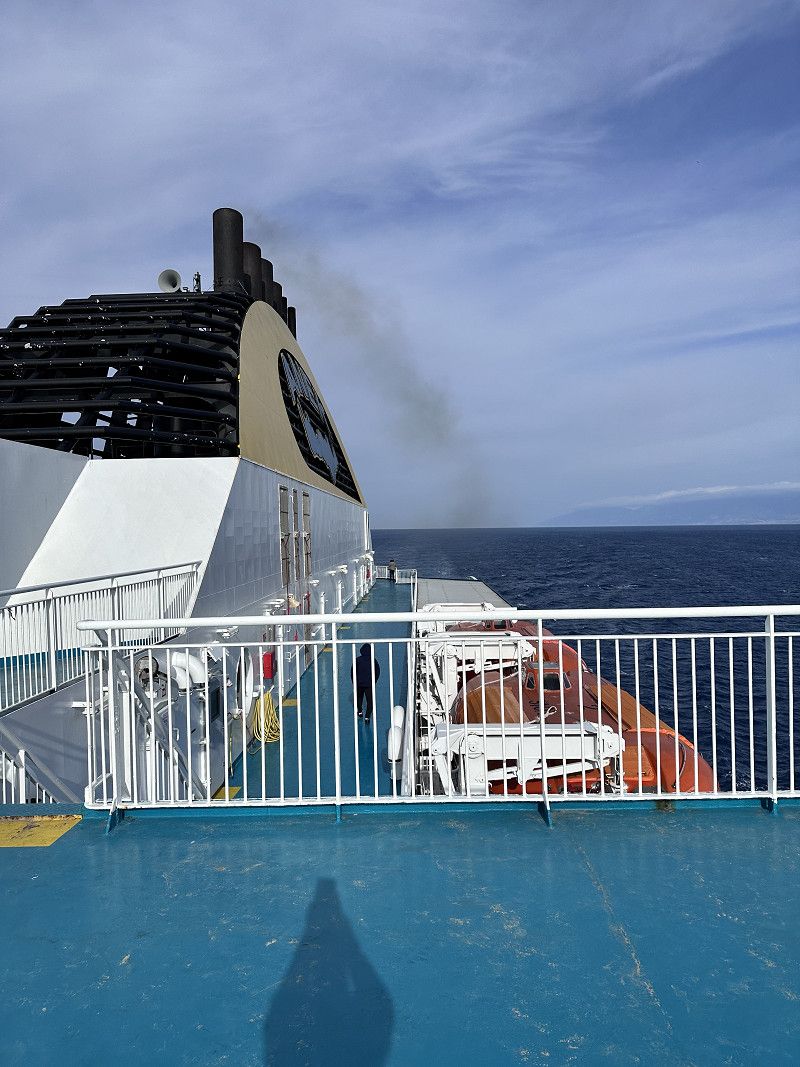
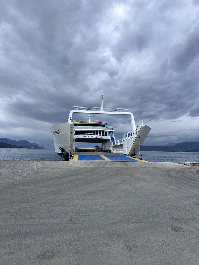
The night was quiet and we got a LUX cabin. Despite bad reviews, the ship and the cabins are quite ok. You can see the age of the ship. The crew tries very hard and is friendly. The first vehicles disembark at Igoumenitsa.
We stay on board and continue to Patras.
Price for a motorhome crossing of 6.50 m costs €. 253.00 with Freeontour card 20% discount. Lux cabin € 352.00 per person. Total €907.00.
Ακτή Δυμαίων, Municipality of Patras, Achaia Regional Unit, Peloponnese, Western Greece and the Ionian, Greece
38° 13' 19.4" N 21° 43' 14.4" E
38.2220515 21.7206646
• Head south on Akti Dymaion. Go for 1.9 km.
• Continue on Palaia Ethniki Odos Patron-Pyrgou. Go for 243 m.
• Continue on Akti Dymaion. Go for 93 m.
• Turn left onto Kalavryton (585) toward Athina/Pyrgos/Parakampsi Patron/By-Pass of Patra. Go for 1.7 km.
• Take ramp onto E55 (Olympia Odos) toward A5/Pyrgos. Go for 9.6 km.
• Keep right onto Chelmou. Go for 442 m.
• Turn right toward Palaia Ethniki Odos Patron-Pyrgou. Go for 115 m.
• Turn left onto Palaia Ethniki Odos Patron-Pyrgou toward Pyrgos. Go for 6.6 km.
• Turn left onto Eparchiaki Odos Kato Achaias-Arlas toward Nea Ethn. Odos/Elaiochori. Go for 353 m.
• Turn right onto Ethniki Odos Patron-Pyrgou (E55) toward Pyrgos. Go for 22.7 km.
• Continue on Ethniki Odos Patron-Pyrgou (E55) toward Pyrgos. Go for 16.1 km.
• Turn right toward Kyllini/Zakynthos/Kefallinia/Neochorio/K. Panagia/Kastro. Go for 5.1 km.
• Turn left. Go for 1.9 km.
• Turn left toward Kastro/Loutra Kyllinis. Go for 6.2 km.
• Turn sharp left. Go for 2.7 km.
• Turn left toward Vartholomio/Gastouni. Go for 1.2 km.
• Turn right. Go for 1.1 km.
• Turn left toward Glyfa. Go for 1.9 km.
• Continue on Glyfa. Go for 620 m.
• Turn right toward Paralia. Go for 701 m.
• Continue on Paralia. Go for 116 m.
• Turn left. Go for 27 m.
• Arrive at your destination on the left.
☍
81,5 km
(1 hrs. 19 min.)
Campsite Ionion Beach
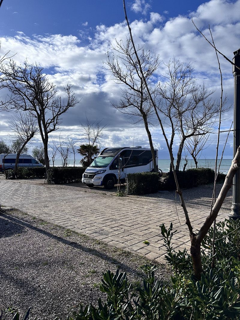
We arrived at the campsite in the dark. It's completely uncomplicated to register for a place tomorrow 😉 There's a thunderstorm coming down, but we don't care. We stand directly on the beach, on a place with solid ground.
I can highly recommend this place, clean, good sanitary facilities and in season pool, playground, mini market 🏪 and a tavern on the square. 👍👍👍
27050, Glyfa, Greece
37° 50' 8.9" N 21° 8' 5" E
37.8358050 21.1347237
• Head north. Go for 27 m.
• Turn right onto Paralia. Go for 368 m.
• Turn slightly right. Go for 449 m.
• Turn left toward Glyfa. Go for 563 m.
• Continue on Glyfa. Go for 3.0 km.
• Turn right. Go for 79 m.
• Turn right toward Agoniston 1825. Go for 2.0 km.
• Continue on Agoniston 1825. Go for 1.7 km.
• Continue on Loutron Kyllinis. Go for 1.0 km.
• Continue on Vourtsi N. Go for 960 m.
• Continue on Kokkala. Go for 3.1 km.
• Continue on Chalkiopoulou. Go for 727 m.
• Turn slightly left onto Sisini Georgiou. Go for 55 m.
• Turn right onto Archaias Ilidos. Go for 914 m.
• Turn right onto Ethniki Odos Patron-Pyrgou (E55) toward Pyrgos. Go for 10.2 km.
• Continue on Ethniki Odos Patron-Pyrgou (E55) toward Pyrgos. Go for 16.4 km.
• Continue on Ethniki Odos Patron-Pyrgou (E55) toward Arch. Olympia/Anc. Olympia/Kyparissia. Go for 11.3 km.
• Take the 2nd exit from roundabout onto Ep. Odos Tripolis-Pyrgou (74). Go for 4.6 km.
• Take ramp toward Arch. Olympia/Anc. Olympia. Go for 1.9 km.
• Continue on Kondyli Praxiteli. Go for 923 m.
• Continue on Kondyli Praxiteli. Go for 569 m.
• Turn left. Go for 370 m.
• Turn right. Go for 241 m.
• Turn left. Go for 81 m.
• Turn right. Go for 67 m.
• Arrive at your destination on the right.
☍
61,5 km
(1 hrs. 1 min.)
Day
Olympia
We continue south on the Peloponnese peninsula. A worthwhile trip to Olympia to visit the museum there. There is a lot to read about this place. The Olympic torch is still lit here today and then brought to the respective venue.
The first taverns and shops are open, mainly because school classes are visiting the place.
Griechenland
37° 38' 17.7" N 21° 37' 50" E
37.6382503 21.6305660
• Head northwest. Go for 148 m.
• Turn right. Go for 241 m.
• Turn left. Go for 370 m.
• Turn left. Go for 843 m.
• Turn right. Go for 241 m.
• Turn left toward Krestena. Go for 481 m.
• Continue on Triantafyllopoulou Marias St. Go for 926 m.
• Continue on Agiou Nikolaou. Go for 3.2 km.
• Turn left toward Makrisia/Krestena. Go for 7.4 km.
• Turn slightly right toward Pyrgos. Go for 1.6 km.
• Turn left onto Ethniki Odos Pyrgou-Kyparissias (E55) toward Kyparissia/Zacharo. Go for 30.3 km.
• Turn right toward S. Stathmos Agiannaki/R.R. Station Agiannaki. Go for 386 m.
• Turn right. Go for 390 m.
• Arrive at your destination.
☍
46,4 km
( 47 min.)
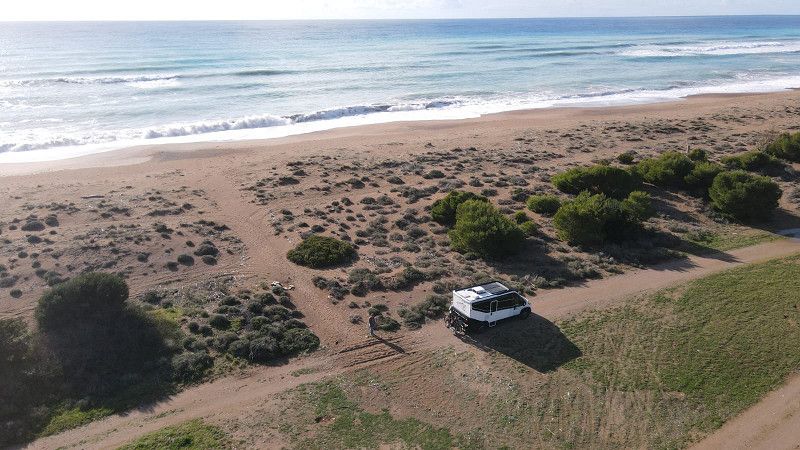
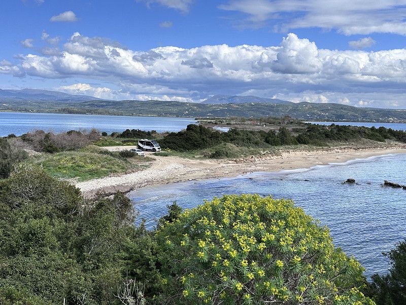
Elea Beach
At this time of year it is no problem finding a spot by the sea. It's wonderful and reflects my desire for freedom 😄. Of course we leave the place clean. Here too we met some nice people and got one or two tips.
The place is located directly on the sandy beach, there is a solid surface, I can't judge what it looks like in constant rain.
In summer the place is used by locals and camping is no longer welcome 😉
37° 21' 8.7" N 21° 41' 32.6" E
37.3524151 21.6923943
• Head southeast. Go for 390 m.
• Turn left toward Ethniki Odos Pyrgou-Kyparissias/E55. Go for 386 m.
• Turn right onto Ethniki Odos Pyrgou-Kyparissias (E55). Go for 6.1 km.
• Continue on Pyrgou-Kyparissias (9) toward Kyparissia/Filiatra. Go for 6.1 km.
• Turn right onto Pyrgou-Kyparissias toward Filiatra/Chora/Pylos. Go for 223 m.
• Continue on 25is Martiou. Go for 480 m.
• Continue on Navarinou. Go for 14.4 km.
• Turn left onto Kyparissias-Pylou (9). Go for 111 m.
• Turn right onto Kyparissias-Pylou (9). Go for 13.9 km.
• Continue on Ep. Odos 15-Filiatron-Koryfasiou. Go for 8.1 km.
• Take the 3rd exit from roundabout onto Kyparissias-Pylou (9). Go for 4.9 km.
• Turn right. Go for 2.8 km.
• Continue straight ahead. Go for 686 m.
• Turn sharp right. Go for 592 m.
• Arrive at your destination on the right.
☍
59,1 km
(1 hrs. 4 min.)
Day
Divari Beach
This beautiful bay is definitely worth a visit. As we learned, standing alone is tolerated in March as many campsites are still closed. It was still too early for us.
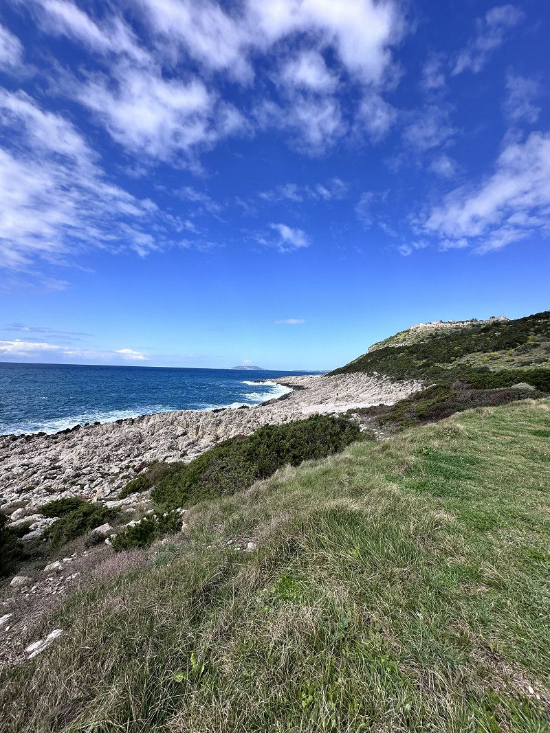
From the parking lot you can take a beautiful circular hike to the Navarino castle ruins with a great view of Ochsenbauch Bay. Duration approx. 1.25 hours.
Great, today we saw Norbert and Martina from CP Ionion Beach again 🤗 Too bad, in retrospect I would have liked to have swapped the phone number 🙈
36.9525047, 21.6614325
36° 57' 9" N 21° 39' 41.2" E
36.9525047 21.6614325
• Head east. Go for 592 m.
• Turn sharp left toward Kyparissias-Pylou/9. Go for 3.5 km.
• Turn right onto Kyparissias-Pylou (9). Go for 4.4 km.
• Turn right onto Methonis-Pylou (9). Go for 3.0 km.
• Keep right onto Kalamatas. Go for 1.1 km.
• Turn right toward Anagnostara. Go for 82 m.
• Continue on Anagnostara. Go for 73 m.
• Turn right onto Tsiklitira. Go for 62 m.
• Arrive at Tsiklitira.
☍
12,8 km
( 21 min.)
Pylos
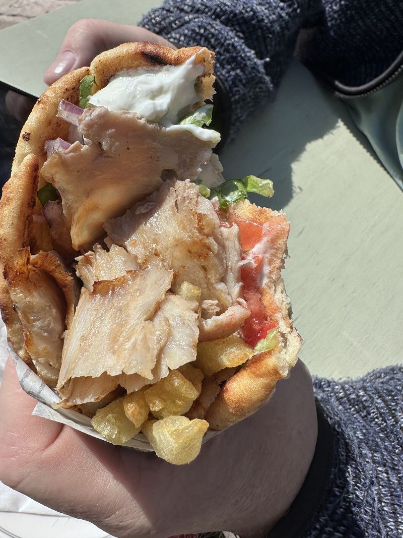
There wasn't much going on at this time of year, so we treated ourselves to a delicious gyros 🥙 at the harbor. It's definitely nice on the pitch in summer.
Tsamadou, Pylos, Messenia Regional Unit, Peloponnese, Western Greece and the Ionian, Greece
36° 54' 56" N 21° 41' 41.6" E
36.9155613 21.6948984
• Head north on Tsiklitira.
• Turn left onto Tsamadou. Go for 66 m.
• Turn left onto Rene Pyo. Go for 70 m.
• Turn right onto Filellinon. Go for 151 m.
• Continue on Methonis. Go for 752 m.
• Continue on Methonis-Pylou (9). Go for 8.8 km.
• Turn left onto Eparchiaki Odos Methonis-Foinikounta toward Foinikounta/Koroni. Go for 1.4 km.
• Turn right. Go for 638 m.
• Turn right toward Miaouli Andrea. Go for 518 m.
• Turn slightly right onto Miaouli Andrea. Go for 92 m.
• Turn left. Go for 66 m.
• Turn right. Go for 24 m.
• Arrive at your destination.
☍
12,5 km
( 15 min.)
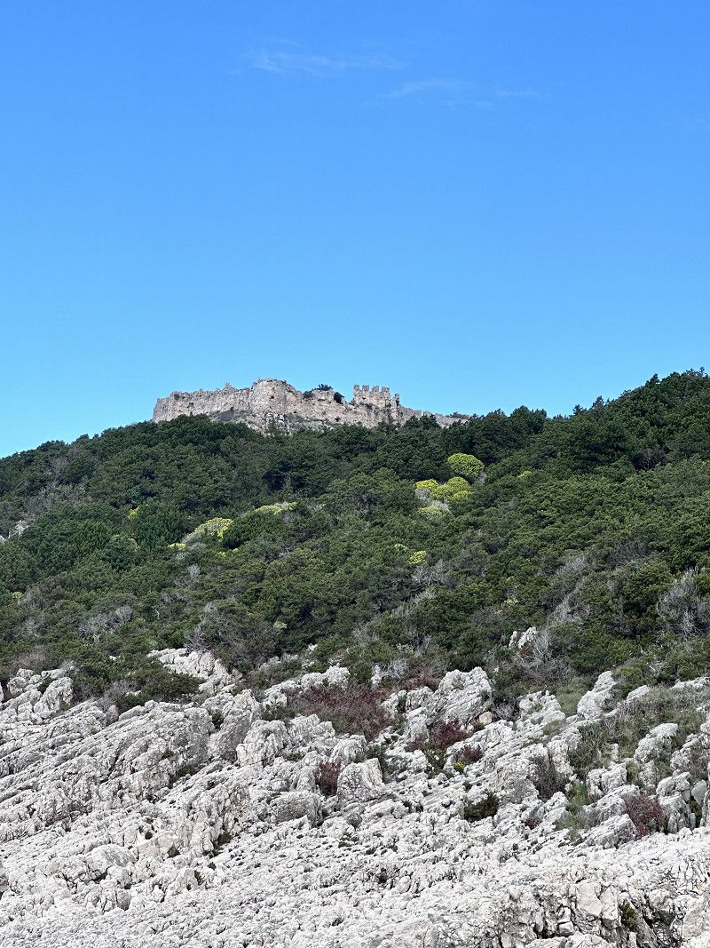
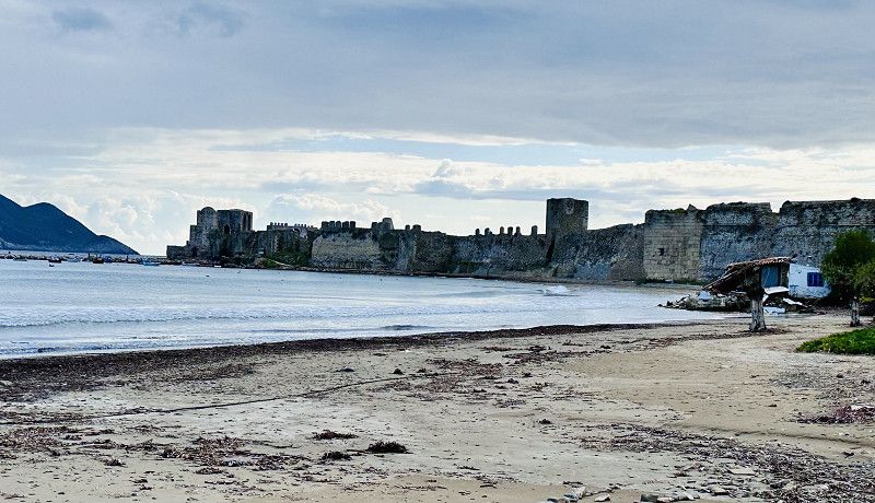
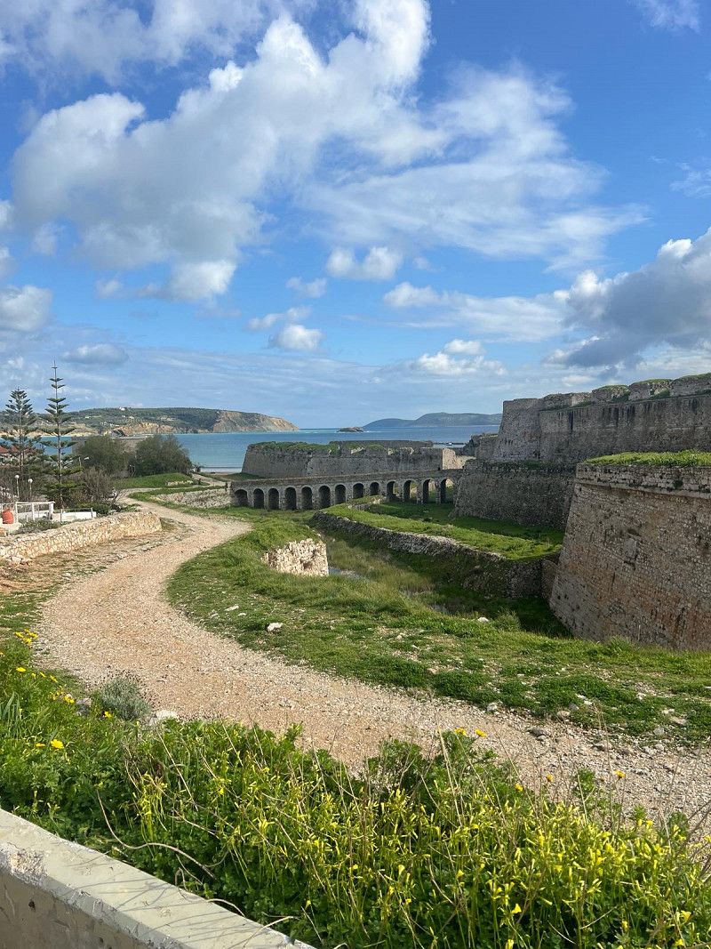
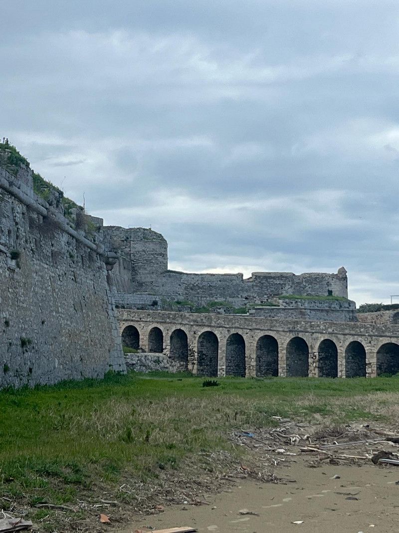
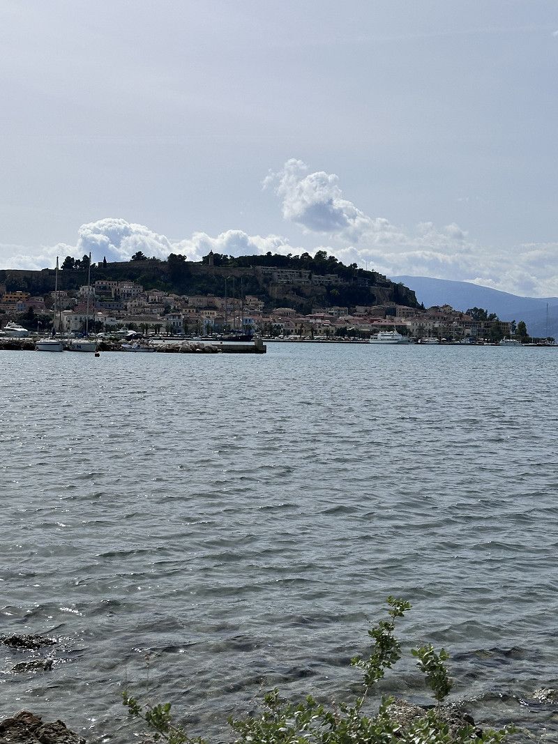
Burg Methoni
The castle at Methoni is very impressive and is evidence of a strategically important point. Built in the 13-15 centuries. We only saw it from the outside; the entrance closed at 3:30 p.m. Maybe another time 😄
• Turn slightly right toward Miaouli Andrea. Go for 47 m.
• Turn right onto Miaouli Andrea. Go for 160 m.
• Turn slightly left. Go for 518 m.
• Turn left toward Eparchiaki Odos Methonis-Foinikounta. Go for 638 m.
• Turn right onto Eparchiaki Odos Methonis-Foinikounta. Go for 8.1 km.
• Turn right. Go for 377 m.
• Arrive at your destination on the right.
☍
9,9 km
( 11 min.)
Campsite Thines
After we were out and about a lot today, we wanted to spend the night at a nice campsite again. There are several places open all year round in the Finikounda area and this one was recommended to us. The place is rightly located directly on the sandy beach. The places are a bit small but we really like it here.
24006, Finikounda, Greece
36° 48' 16" N 21° 47' 44" E
36.8044400 21.7955500
• Head west. Go for 377 m.
• Turn right onto Ep. Odos 13-Methoniou-P. Koroniou. Go for 4.4 km.
• Turn left toward Akritochori/Charokopeio/Kalamata. Go for 1.6 km.
• Turn left onto Akritochori. Go for 2.3 km.
• Continue on Ep. Odos 13-Methoniou-P. Koroniou. Go for 6.3 km.
• Continue on Ep. Odos 9-Rizomylou-Koronis. Go for 5.1 km.
• Take the 4th exit from roundabout onto Ep. Odos 9-Rizomylou-Koronis toward Kalamata. Go for 12.2 km.
• Turn right onto Ep. Odos 9-Rizomylou-Koronis. Go for 1.9 km.
• Turn left toward Ep. Odos 9-Rizomylou-Koronis. Go for 106 m.
• Turn right onto Ep. Odos 9-Rizomylou-Koronis toward Kalamata. Go for 901 m.
• Turn left onto Ep. Odos 9-Rizomylou-Koronis. Go for 55 m.
• Take the 1st exit from roundabout onto Ep. Odos 9-Rizomylou-Koronis. Go for 1.6 km.
• Continue on Ep. Odos 9-Rizomylou-Koronis. Go for 3.0 km.
• Turn right onto Kalamatas-Pylou (82) toward Kalamata. Go for 11.3 km.
• Turn right toward Kalamatas-Pylou/82. Go for 43 m.
• Pass 3 roundabouts and continue on Kalamatas-Pylou (82). Go for 4.6 km.
• Turn right onto Ethniki Odos Tripolis-Kalamatas (E55/E65) toward Kalamata. Go for 5.0 km.
• Turn left onto Artemidos (82) toward Kentro/Sparti. Go for 826 m.
• Turn right onto Iatropoulou. Go for 61 m.
• Continue on Nedontos toward Kentro Kalamatas/Sid. Stathmos. Go for 224 m.
• Continue on Nikitara. Go for 78 m.
• Turn right onto Aristomenous toward Paralia/Sidirodromikos Stathmos/Dioikitirio. Go for 367 m.
• Turn right onto Frantzi A. Go for 27 m.
• Arrive at Frantzi A. Your destination is on the right.
☍
62,3 km
(1 hrs. 18 min.)
Day
Kalamata
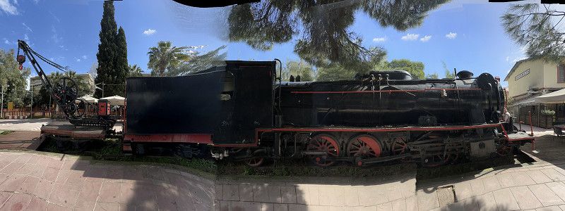
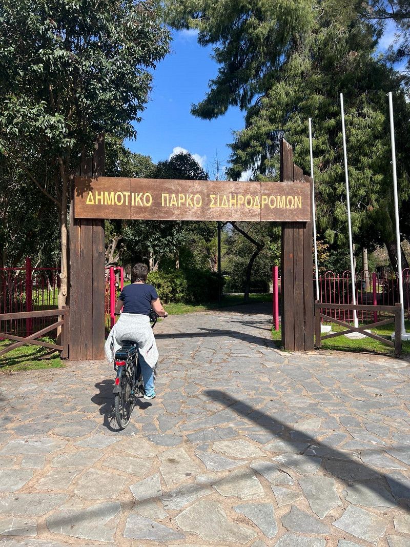
After a short drive we reach the town of Kalamata. The whole city is decorated with carnival figures and some people dance in the streets. We unload the bikes and go exploring. In addition to a shopping area, there is also a small old town. We really like strolling through the streets and the festive atmosphere.
The park near the marina is also worth seeing. Many steam locomotives and passenger trains are on display.
Regionalbezirk Messenien, Peloponnes, Westgriechenland und Ionische Inseln, Griechenland
37° 2' 14.2" N 22° 6' 38.5" E
37.0372714 22.1107070
• Head toward Dagre on Frantzi A. Go for 318 m.
• Turn right onto Artemidos (82) toward Sparti. Go for 966 m.
• Take the 2nd exit from roundabout onto Artemidos (82). Go for 508 m.
• Take the 3rd exit from roundabout. Go for 321 m.
• Take ramp onto A7. Go for 8.1 km.
• Continue on E55/E65 (Ethniki Odos Tripolis-Kalamatas). Go for 20.7 km.
• Continue on E65 (Ethniki Odos Tripolis-Kalamatas). Go for 19.7 km.
• Take exit 14 toward Sparti onto A71. Go for 45.5 km.
• Take the 2nd exit from roundabout onto Ep. Odos 4-Spartis-Agiou Dimitriou toward Geraki. Go for 17.2 km.
• Turn left onto Spartis-Gytheiou (E961) toward Neapoli/Monemvasia/Molaoi/Skala/Gytheio/Spilaia Dirou/Areopoli. Go for 27.0 km.
• Turn right onto Leoforos Vasileos Georgiou. Go for 552 m.
• Continue on Vasileos Pavlou. Go for 327 m.
• Take the 2nd exit from Plateia Mavromichali Petrompei roundabout onto Eparchiaki Odos Gytheiou-Gerolimena. Go for 154 m.
• Turn left. Go for 142 m.
• Arrive at your destination on the left.
☍
141,7 km
(1 hrs. 36 min.)
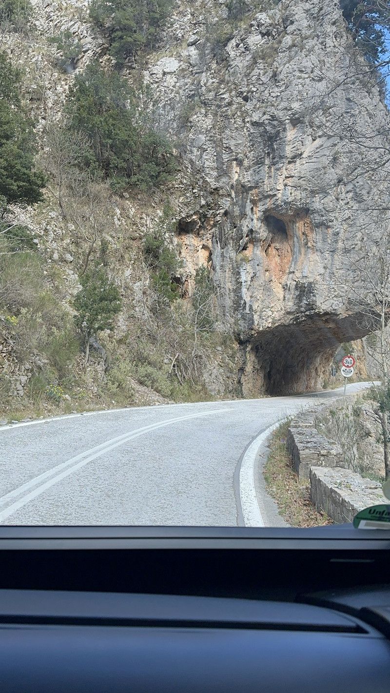
Serpentinenstrasse 82
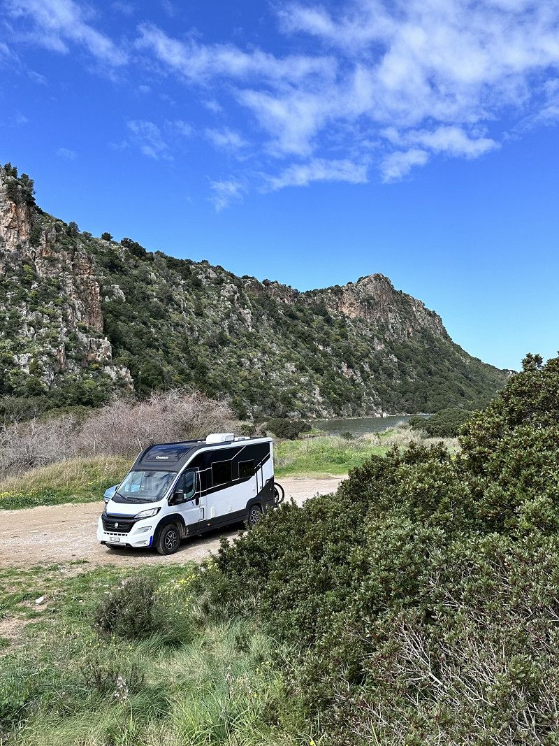
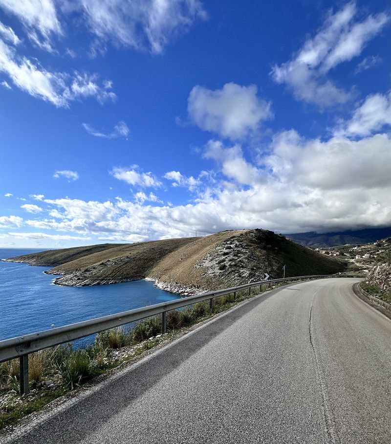
From Kalamata to Gythio you can drive via the A 71 motorway. Definitely recommended for larger RVs. But we decided on Serpetinenstrasse 82. This leads through a wonderful mountain area with bizarre and beautiful stone formations.
PS: Tunnel height 3.80 m maximum
Gythio Hafen
If you don't disturb the fishermen, you can spend the night in this parking lot. Gythio is a lively harbor town with many taverns on the promenade. We took the bikes again and went exploring.
In the evening we went out to eat for the first time. The first taverns have opened and we were able to get to know the hospitable Greeks.
Gythio is a city that was used as a military port by the Spartans in ancient times.
Τζανή Τζαννετάκη, Gytheio Municipal Unit, Laconia Regional Unit, Peloponnese, Western Greece and the Ionian, Greece
36° 45' 29.6" N 22° 34' 9.7" E
36.7582356 22.5693601
• Head toward Tzannetaki Tzani. Go for 142 m.
• Turn right onto Eparchiaki Odos Gytheiou-Gerolimena toward Sparti. Go for 69 m.
• Take the 1st exit from Plateia Mavromichali Petrompei roundabout onto Vasileos Pavlou. Go for 4.0 km.
• Turn right toward Iliadi Pan. Go for 21 m.
• Continue on Iliadi Pan. Go for 296 m.
• Turn slightly left onto Iliadi Pan. Go for 110 m.
• Turn left onto Iliadi Pan. Go for 267 m.
• Arrive at your destination on the right.
☍
4,9 km
( 8 min.)
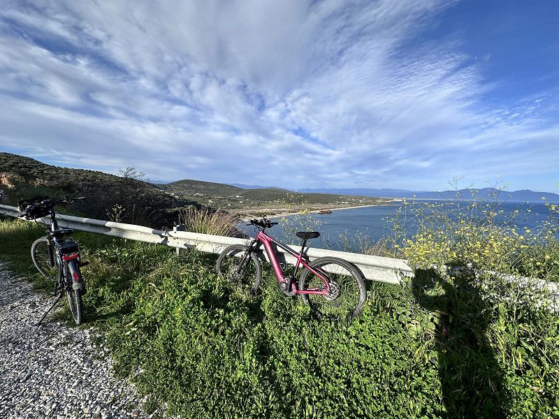
Paralia Selinitsas und die Bucht Valtaki
On our bike tour through Gythio, we spontaneously cycled to the bay of Valtaki, 5 km away. This is located next to Selinitsas beach.
From the main road you have to make a sharp turn to get to the beach. There are already a few mobile homes here, I assume they will spend the night here 😉
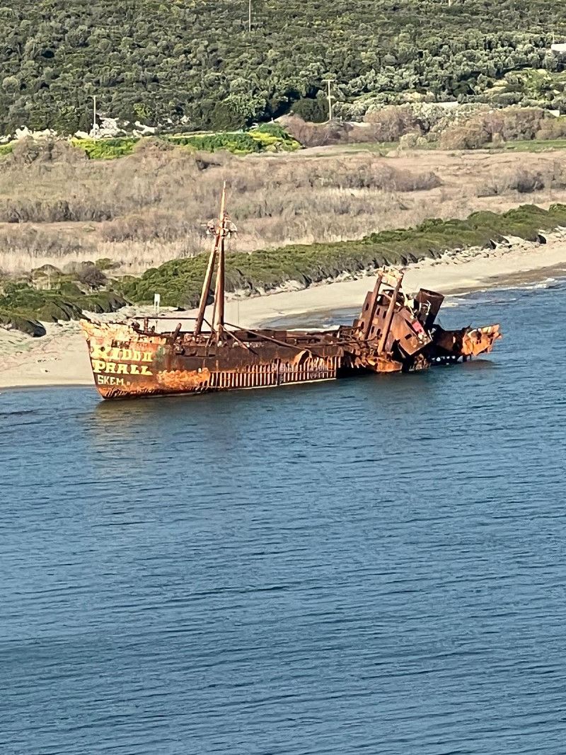
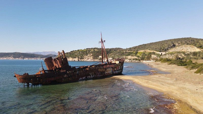
This bay is worth seeing because of the Dimitrios shipwreck. When the captain had to go to hospital in an emergency in 1980, he docked in the port of Gytio. Since the port fee was not paid, the municipality decided that the ship had to anchor in front of the port. On December 23, 1981, a storm raged and the ship tore loose. It drifted into the bay of Valtaki, where it lies to this day 🙈
Griechenland
36° 46' 45.4" N 22° 34' 16.1" E
36.7792669 22.5711431
• Head north. Go for 99 m.
• Continue on Iliadi Pan. Go for 168 m.
• Turn right onto Iliadi Pan. Go for 427 m.
• Turn right onto Eparchiaki Odos 26-Skalas-Gytheiou. Go for 13.1 km.
• Turn right onto Theodosakou V. toward Monemvasia. Go for 42.6 km.
• Turn left toward Ag. Ioannis/Ierakas/Palaia Monemvasia/Angelona/Molaoi. Go for 1.3 km.
• Turn right toward Ierakas. Go for 3.3 km.
• Turn right. Go for 137 m.
• Turn left. Go for 58 m.
• Arrive at your destination on the left.
☍
61,3 km
(1 hrs. )
Day
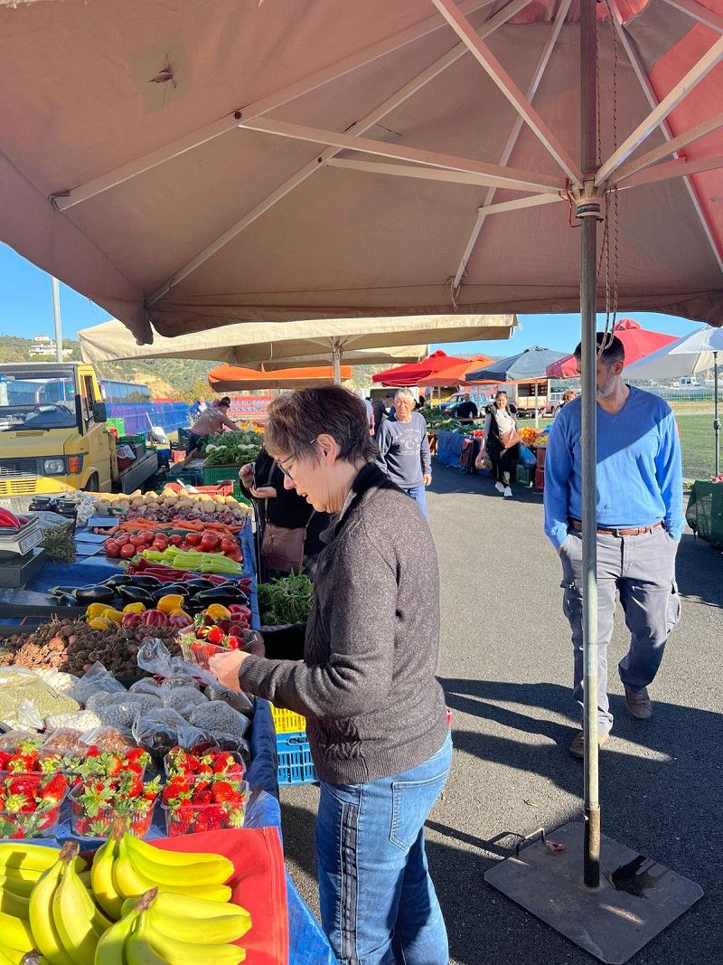
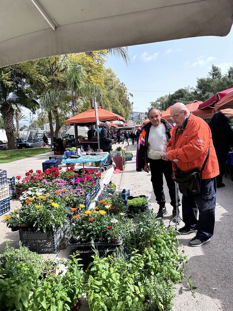
Markt von Gythio
There is a weekly market on Friday and we take the opportunity to buy fruit and vegetables. Here too we are greeted with a joyful Kalimera (good morning).
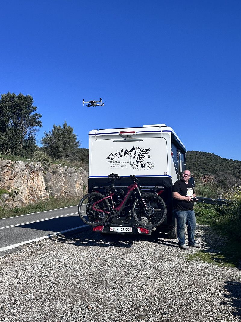
As we continue our journey we stop briefly to take pictures of the Dimitrios with our drone 😁⛴️ Practice practice practice…
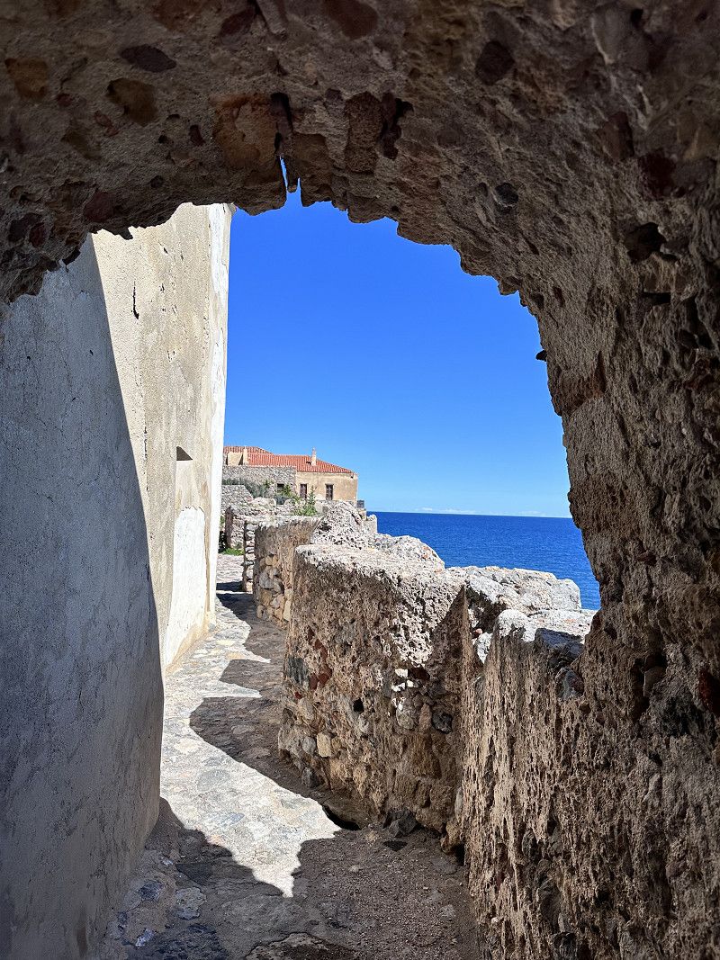
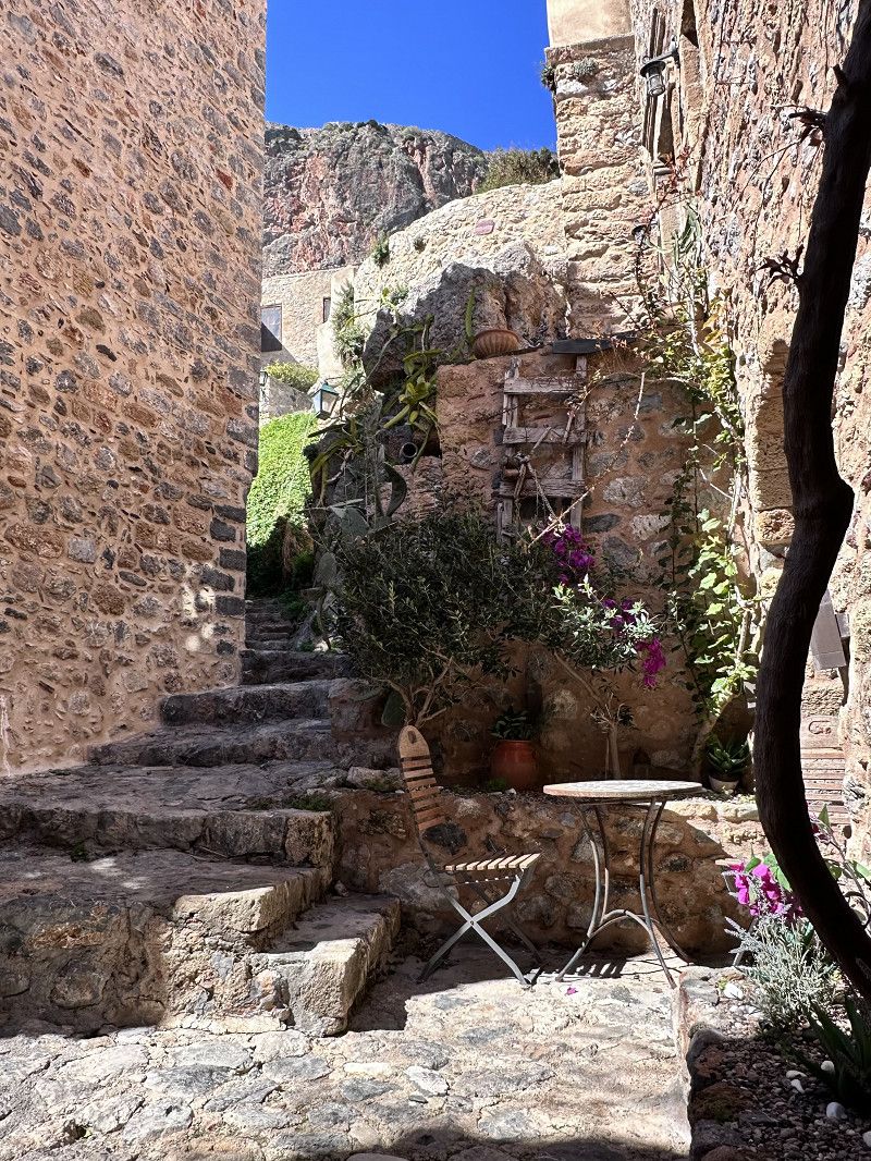
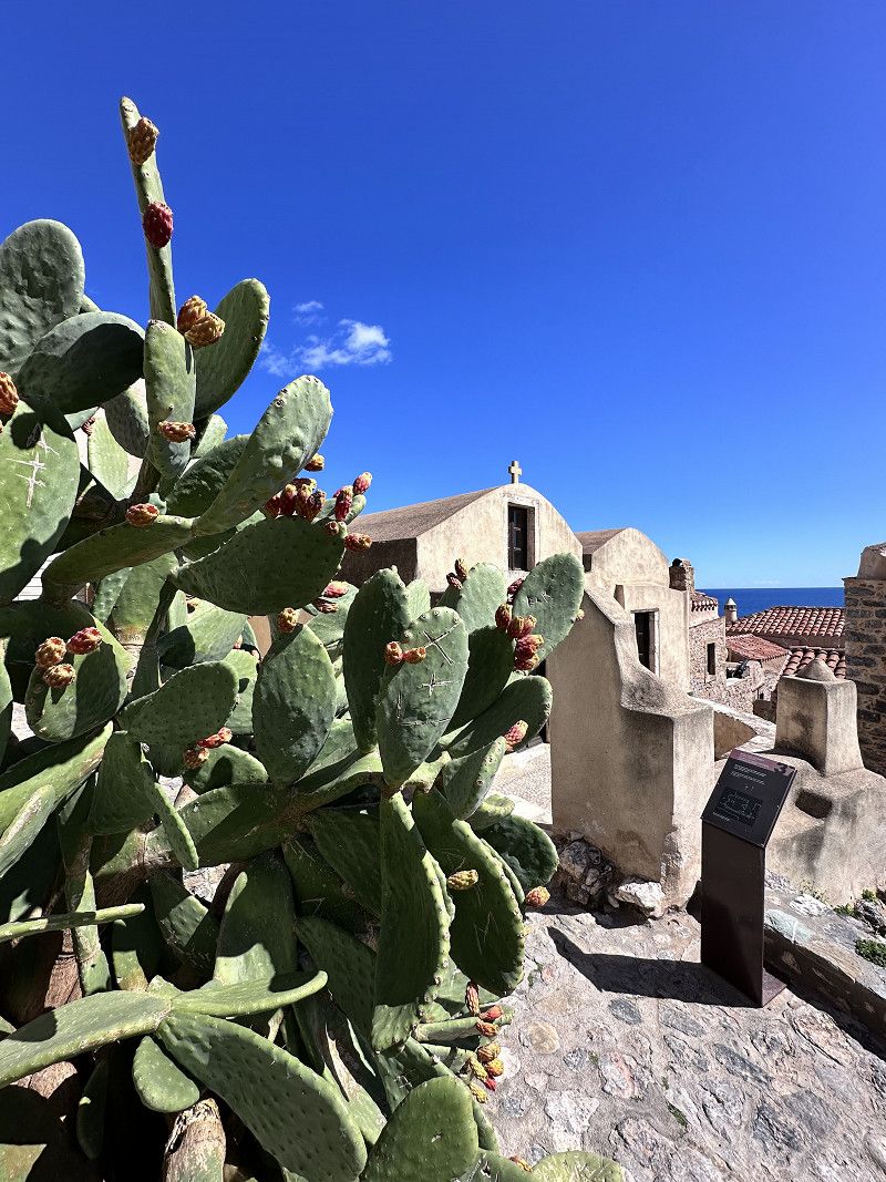
Palea Monemvasia
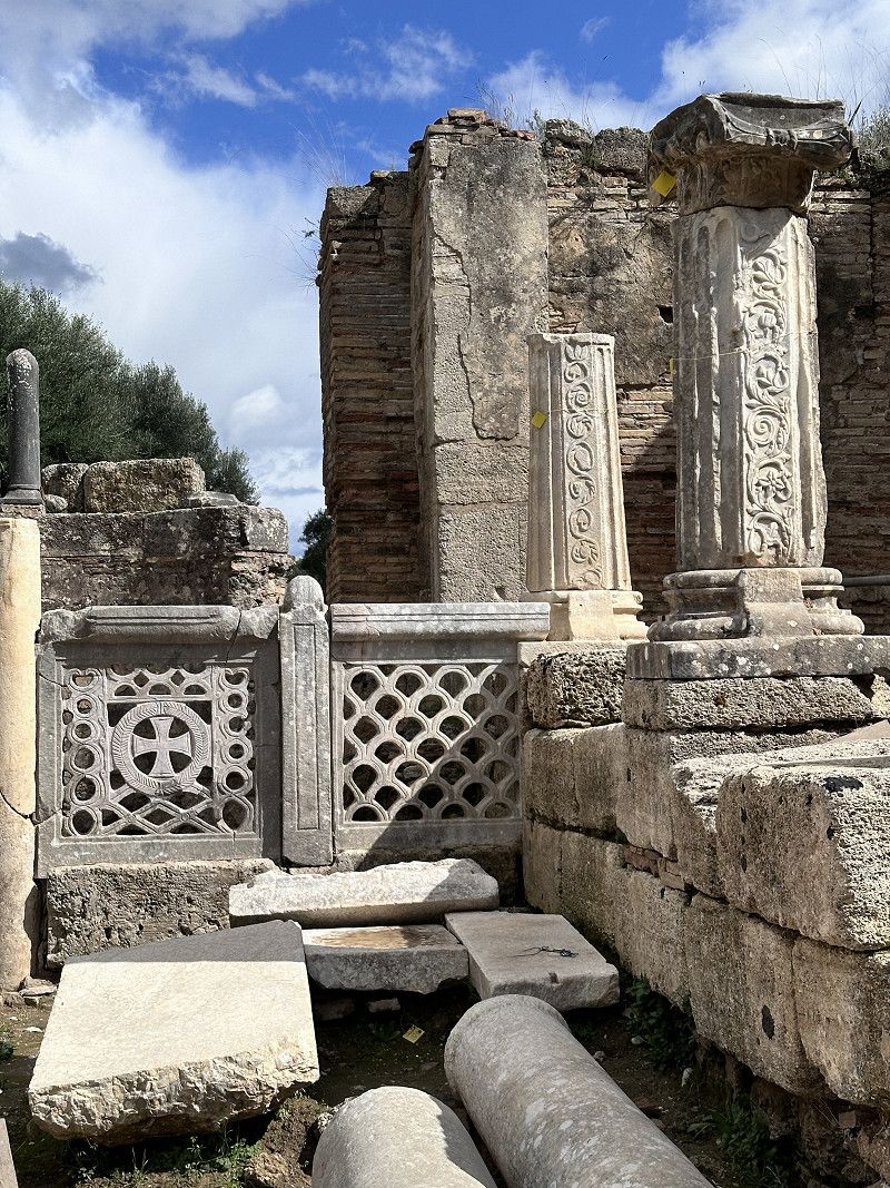
A highlight of our trip is this fortress of Monemvasia from the Byazintic Empire (284-641). The fortress was an almost impregnable defensive castle and secured the sea route from Venice to Constantinople. At its peak, 25,000 people lived here. During the War of Liberation in 1821, the fortress lost its importance.
Anyone who visits the fortress today will feel like they have been transported back to old times😎
Regionalbezirk Lakonien, Peloponnes, Westgriechenland und Ionische Inseln, Griechenland
36° 44' 3.1" N 23° 2' 25.8" E
36.7341957 23.0405134
• Head west. Go for 58 m.
• Turn right toward Palaia Monemvasia. Go for 137 m.
• Turn right onto Palaia Monemvasia. Go for 4.4 km.
• Continue on Kontaiika. Go for 2.0 km.
• Continue on Ariana. Go for 6.8 km.
• Continue on Ierakas. Go for 2.3 km.
• Continue on Agios Ioannis. Go for 5.5 km.
• Continue on Belesaiika. Go for 3.0 km.
• Turn right onto Eparchiaki Odos Molaon-Kyparissiou toward Lampokampos/Kyparissi. Go for 8.5 km.
• Turn left toward Kremasti. Go for 645 m.
• Arrive at your destination on the right.
☍
33,3 km
( 43 min.)
Regionalbezirk Lakonien, Peloponnes, Westgriechenland und Ionische Inseln, Griechenland
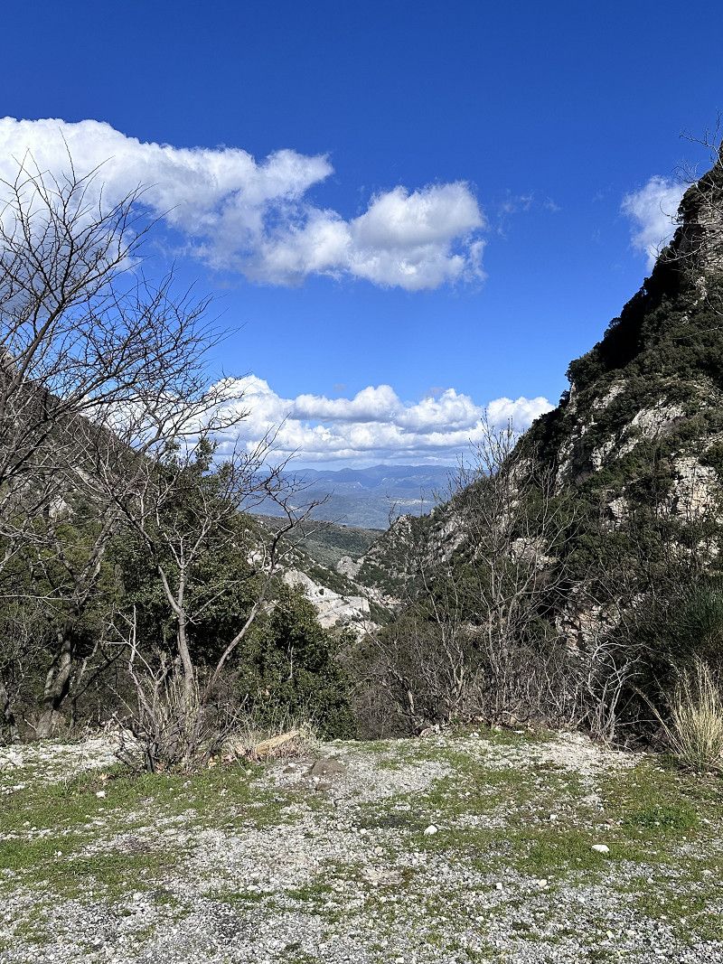
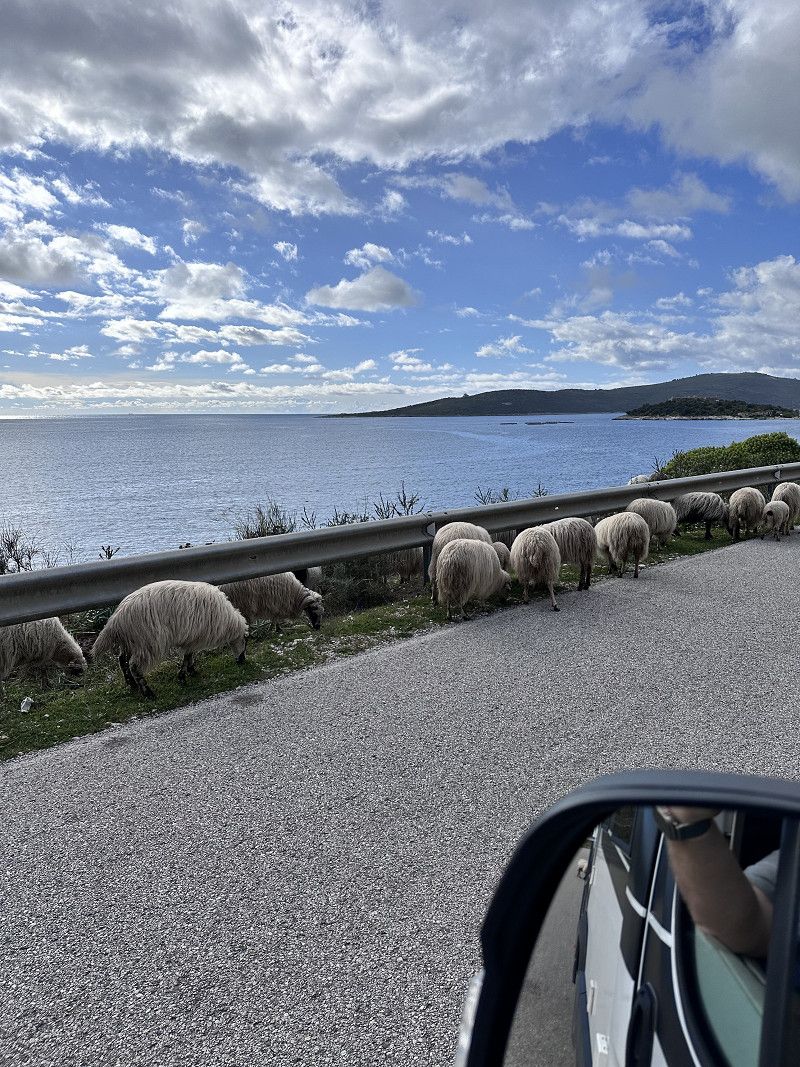
We avoid all toll roads because we simply prefer driving through the mountains. This sometimes results in special encounters such as meeting the shepherd 🐏🐑🐏 or exciting objects on the side of the road
36° 54' 18.9" N 22° 57' 51.4" E
36.9052437 22.9642860
• Head west. Go for 9.7 km.
• Turn left onto Ep. Odos Gefyras Apideas-Leonidiou. Go for 10.1 km.
• Turn right. Go for 436 m.
• Turn right toward Ep. Odos 4-Spartis-Agiou Dimitriou. Go for 176 m.
• Continue on Ep. Odos 4-Spartis-Agiou Dimitriou. Go for 6.2 km.
• Turn left onto Ep. Odos Spartis-Agiou Dimitriou. Go for 10.1 km.
• Turn right onto Eparchiaki Odos Vrontamas-Skala toward Kosmas/Leonidio. Go for 34 m.
• Continue on Eparchiaki Odos Leonidio-Kosmas. Go for 44.0 km.
• Turn left toward Kapetan Foufa Andrea Makedonomachou. Go for 38 m.
• Turn right onto Kapetan Foufa Andrea Makedonomachou. Go for 187 m.
• Turn left onto Karamanou. Go for 70 m.
• Arrive at Karamanou. Your destination is on the right.
☍
81,1 km
(1 hrs. 27 min.)
Leonidio
We drove through Leonidio. However, if you are here on Orthodox Easter Day, you should plan a few days. There is a big festival with sky lanterns and lamb dinners on Sunday in the village square. We were still too early 🙈
We also got here via a serpentine road, it's better if you're not afraid of heights, you'll sometimes look for guardrails in vain🥴
Regionalbezirk Arkadien, Peloponnes, Westgriechenland und Ionische Inseln, Griechenland
37° 9' 58.8" N 22° 51' 37.5" E
37.1663308 22.8604198
• Head toward 21is Ianouariou 1949 on Karamanou. Go for 26 m.
• Turn right onto 21is Ianouariou 1949. Go for 33.5 km.
• Turn right. Go for 126 m.
• Turn right. Go for 114 m.
• Turn left. Go for 41 m.
• Turn slightly right. Go for 283 m.
• Turn slightly right. Go for 282 m.
• Arrive at your destination on the left.
☍
34,4 km
( 38 min.)
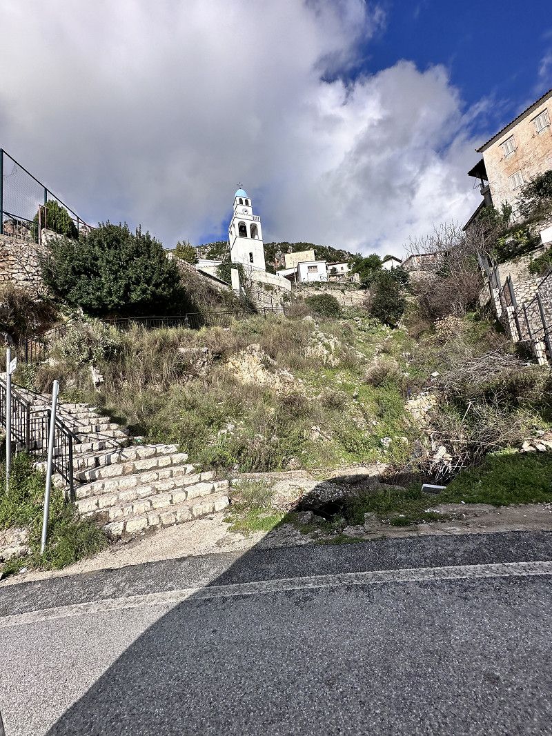
Arkadiko Chorio
We saw this special Orthodox church from afar and we absolutely had to go there. Unfortunately, but it was still worth it.
Regionalbezirk Arkadien, Peloponnes, Westgriechenland und Ionische Inseln, Griechenland
37° 20' 8.4" N 22° 48' 45.2" E
37.3356723 22.8125667
• Head toward Arkadiko Chorio. Go for 30 m.
• Turn right onto Arkadiko Chorio. Go for 191 m.
• Turn right toward Ep. Odos 14-Kiveriou-Leonidiou. Go for 755 m.
• Turn right onto Ep. Odos 14-Kiveriou-Leonidiou. Go for 5.0 km.
• Turn right. Go for 4.1 km.
• Arrive at your destination on the left.
☍
10,0 km
( 16 min.)
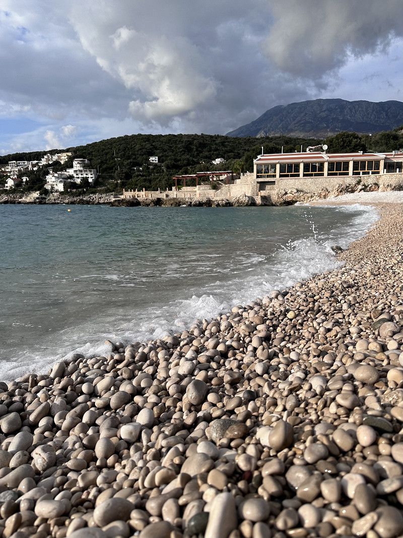
Herronisi Küste - Ακτή Χερρονήσι
Today's place to sleep on the beach, today we drove a long way. Now we're hungry, we cook something delicious and make ourselves comfortable in the motorhome.
The parking lot is located directly on the pebble beach, as always with free standing there is no infrastructure, but what it always has are waste containers - you are welcome to use them 😉
37.3822785, 22.7750924
37° 22' 56.2" N 22° 46' 30.3" E
37.3822785 22.7750924
• Head southwest. Go for 442 m.
• Turn right. Go for 70 m.
• Turn slightly right. Go for 484 m.
• Turn right toward Ep. Odos 14-Kiveriou-Leonidiou. Go for 2.6 km.
• Turn right onto Ep. Odos 14-Kiveriou-Leonidiou. Go for 837 m.
• Continue on Agia Anastasia. Go for 51 m.
• Continue on Ep. Odos 14-Kiveriou-Leonidiou. Go for 20.8 km.
• Turn right onto Argous-Tripolis (7) toward Argos. Go for 1.8 km.
• Turn right onto Ep. Odos 3-Nafpliou-Myloi. Go for 9.3 km.
• Continue on Eparchiaki Odos Nafpliou-Myloi. Go for 14 m.
• Continue on Ep. Odos 3-Nafpliou-Myloi. Go for 1.8 km.
• Turn left onto Neas Kiou-Nafpliou. Go for 124 m.
• Turn left onto Irakleous. Go for 141 m.
• Turn right onto Kilkis. Go for 79 m.
• Turn left onto Boumpoulinas. Go for 51 m.
• Turn right onto Vasileos Georgiou B'. Go for 108 m.
• Continue on Sidiras Merarchias. Go for 54 m.
• Enter the roundabout. Go for 19 m.
• Arrive at your destination on the left.
☍
38,9 km
( 44 min.)
Day
Nafplio
There is also a weekly market in Nafplio, we were here on Saturday. In addition to regional products, you can buy clothes and household goods. The handle of our frying pan broke off a few days ago, so we were able to replace it 👍
For the first time I found wild asparagus. The nice Greek woman recommends an omelette with asparagus, I have to try that 😉
There is a place to stay overnight near the harbor not far from the old town. Would have been better here, like the place from yesterday.
The old town is absolutely worth seeing, since we want to go further to Corinth today, we're skipping a visit. 🥺
Regionalbezirk Argolis, Peloponnes, Westgriechenland und Ionische Inseln, Griechenland
37° 33' 57.3" N 22° 48' 24.8" E
37.5659229 22.8068782
• Follow the roundabout. Go for 33 m.
• Take the 2nd exit from roundabout onto Argous (70). Go for 4.0 km.
• Turn right onto Ep. Odos 19-Tirynthas-Mykinon toward Athina/Korinthos. Go for 924 m.
• Turn right toward Athina. Go for 1.0 km.
• Turn left toward Mykines/Korinthos/Athina. Go for 9.8 km.
• Continue on Ep. Odos 19-Tirynthas-Mykinon. Go for 9.2 km.
• Turn right onto Korinthou-Argous (7) toward Korinthos. Go for 6.4 km.
• Turn left onto Argous-Nemeas (66) toward Athina/Korinthos/Tripoli/Nemea. Go for 1.8 km.
• Turn right and take ramp onto E65 (Ethniki Odos Korinthou-Tripolis) toward Korinthos/Athina. Go for 21.9 km.
• Take the left exit toward Korinthos. Go for 538 m.
• Keep left toward Korinthos/Nosokomeio/Hospital. Go for 4.7 km.
• Continue on Palaia Ethniki Odos Korinthou-Patron. Go for 169 m.
• Continue on Palaia Ethniki Odos Athinon-Korinthou (8). Go for 715 m.
• Turn right. Go for 178 m.
• Turn right. Go for 392 m.
• Turn right. Go for 1.3 km.
• Turn right. Go for 337 m.
• Arrive at your destination.
☍
63,3 km
( 47 min.)
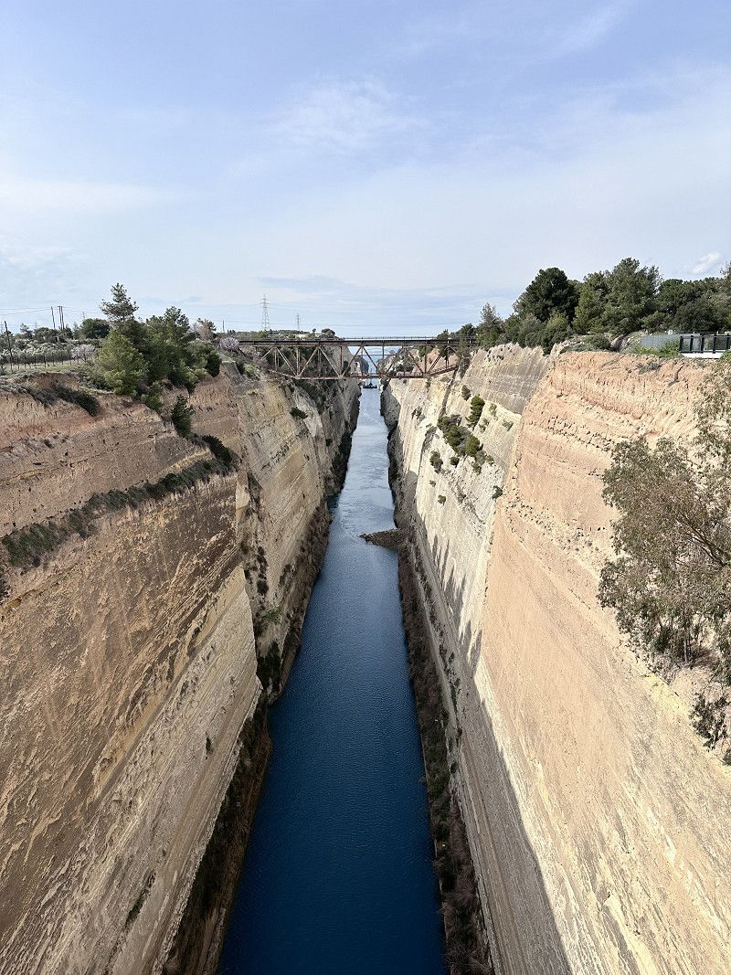
Kanal von Korinth
This canal is an impressive man-made structure 1881-1893. Up to 75 m high and 24 m wide.
Sailing around the Peloponnese peninsula was very dangerous, and so a solution was sought to connect northern Greece with the peninsula. The canal leads from the Saronic Gulf to the Gulf of Corinth. The canal is too narrow and, at 8 m, not deep enough for today's cargo ships. Therefore it is mainly used for tourism trips and private ships 🚢.
Griechenland
37° 56' 3.3" N 22° 59' 4.1" E
37.9342432 22.9844799
• Head toward Leoforos Athinon. Go for 275 m.
• Turn right onto Leoforos Athinon. Go for 1.7 km.
• Make a U-Turn onto Leoforos Athinon. Go for 5.1 km.
• Continue on Venizelou Eleftheriou. Go for 1.1 km.
• Continue on Lekka G. Go for 8.4 km.
• Keep left onto Xenofontos toward Perachora. Go for 553 m.
• Turn left toward Limni Vouliagmeni/Vouliagmeni Lake/Arch. Choros Iraiou/Heraion Arch. Site. Go for 2.4 km.
• Turn slightly left. Go for 273 m.
• Turn slightly right toward Leoforos Vouliagmenis. Go for 459 m.
• Turn slightly right onto Leoforos Vouliagmenis. Go for 4.5 km.
• Turn right. Go for 1.7 km.
• Turn right. Go for 383 m.
• Arrive at your destination on the left.
☍
26,8 km
( 41 min.)
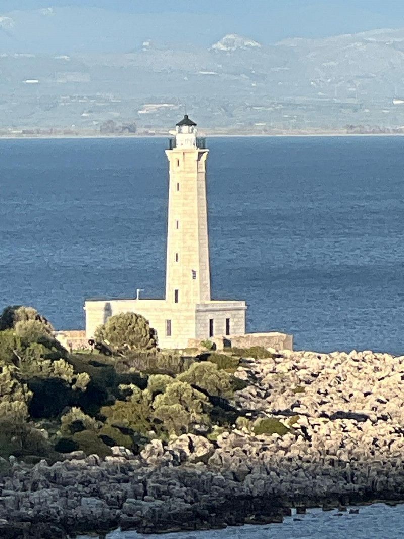
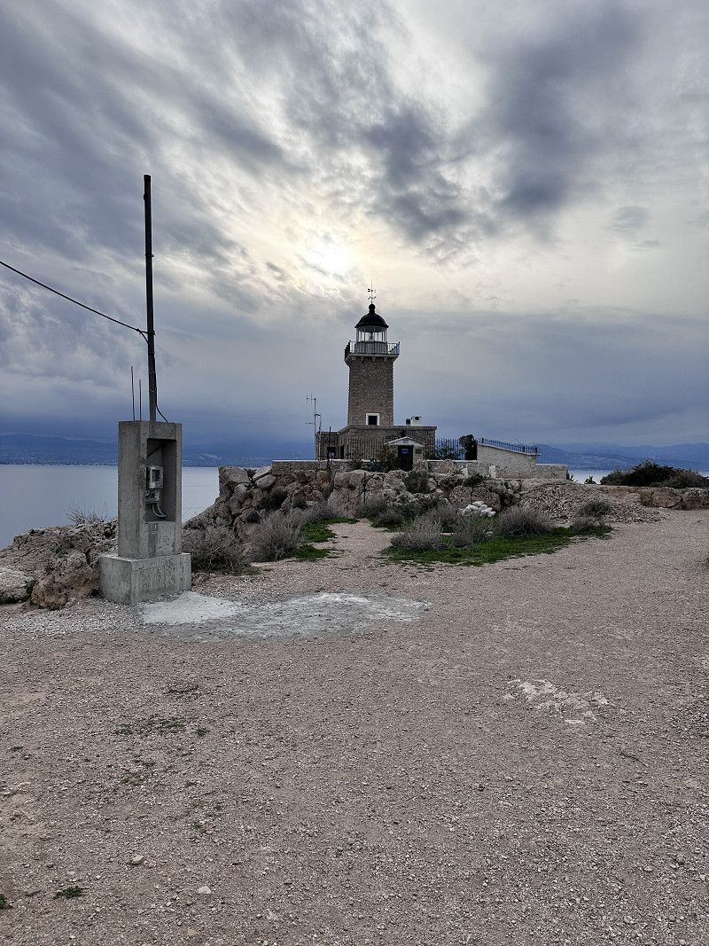
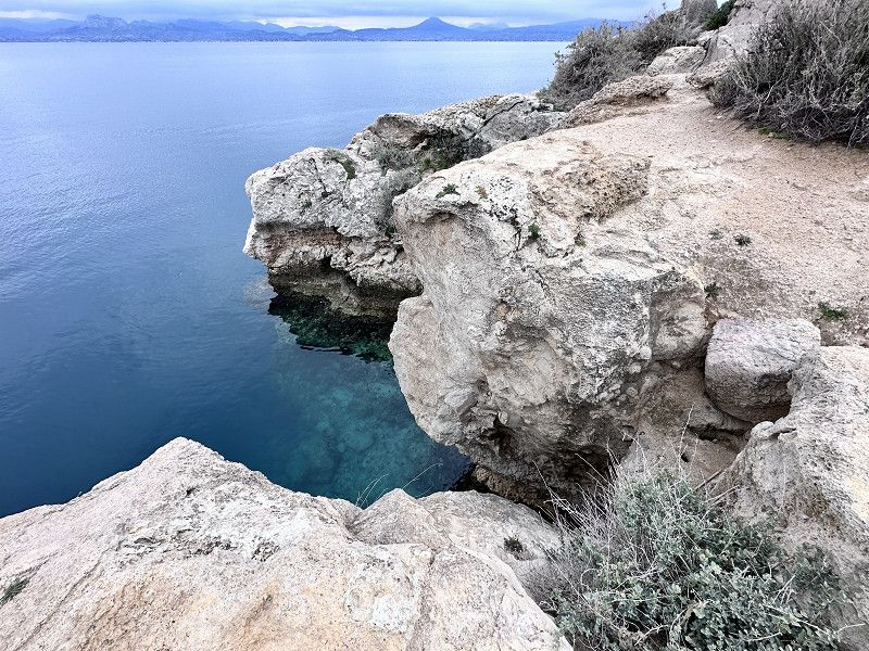
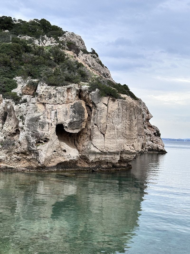
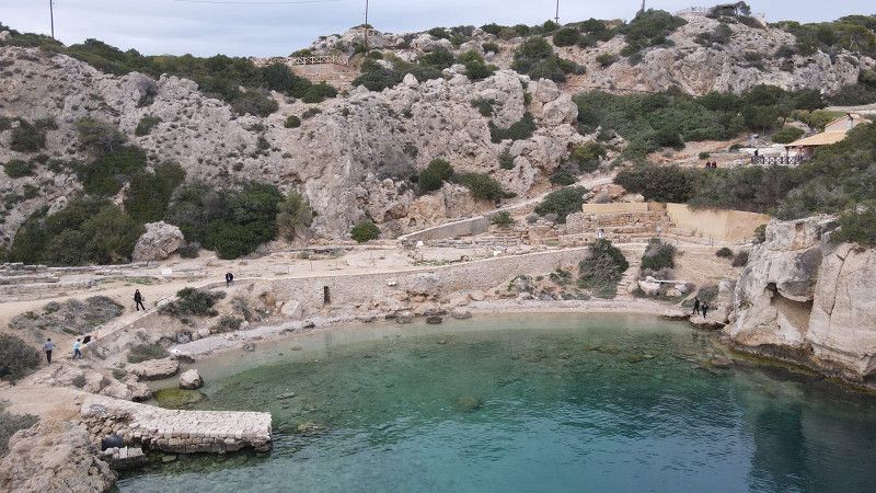
Kap von Melagkavi
After a short drive, about 30 minutes, and a stop at the Panorama Restaurant in Loutraki, we reach the Cape of Melagkavi or also known as the Cape of Perachora. There are two sights in the immediate vicinity. By that I don't mean the fantastically beautiful bay with the crystal clear sea.
One is the lighthouse; unfortunately locked. Still worth seeing, especially because of the beautiful view from up there 🤩
In the bay below is the archaeological site of Heraion. Noteworthy is the well-preserved cistern with attached bath, an L-shaped stoa (free-standing colonnade or covered walkway), dining rooms, altar and two temples in honor of the goddess Hera.🏺🏛️
• Turn slightly left toward Leoforos Vouliagmenis. Go for 2.1 km.
• Continue on Leoforos Vouliagmenis. Go for 347 m.
• Turn slightly left toward Xenofontos. Go for 3.1 km.
• Turn right onto Xenofontos. Go for 7.2 km.
• Continue on Lekka G. Go for 1.8 km.
• Continue on Venizelou Eleftheriou. Go for 1.1 km.
• Continue on Leoforos Athinon. Go for 5.2 km.
• Turn left onto Palaia Ethniki Odos Athinon-Korinthou (8) toward Athina. Go for 707 m.
• Take ramp onto E94 (Ethniki Odos Athinon-Korinthou) toward Athina. Go for 50.0 km.
• Take the exit toward Athina/Peiraias onto 8a (Ethniki Odos Athinon-Korinthou). Go for 19.2 km.
• Keep left onto Leoforos Athinon (8) toward Athina. Go for 1.0 km.
• Take ramp onto Leoforos Athinon toward Lamia/Peiraias/Aerodromio El. Venizelos/Kifisia/Airport El. Venizelos. Go for 269 m.
• Turn right onto Leoforos Kifisou toward Peiraias/Nikaia/Moschato/Tavros. Go for 302 m.
• Take left ramp onto E75 (Leoforos Kifisou) toward Peiraias. Go for 5.8 km.
• Continue toward Leoforos Poseidonos. Go for 649 m.
• Take the left exit toward Glyfada onto Leoforos Poseidonos. Go for 1.7 km.
• Take ramp onto Leoforos Apollonos (91). Go for 3.9 km.
• Turn right. Go for 244 m.
• Turn left. Go for 33 m.
• Turn right. Go for 41 m.
• Arrive at your destination on the left.
☍
108,7 km
(1 hrs. 31 min.)
Yachthafen Alimos Marina
Because we probably arrived too late, we didn't get a parking space at the Acropolis bus parking lot. Never mind, 😉 we found a good replacement.
There would be toilets and showers here. However, these are for the ship owners and I assume that you would need a key.
Δήμος Κομνηνού (Σαλαμίνος), Άλιμος, Regional Unit of South Athens, Attica, Greece
37° 54' 56.9" N 23° 42' 9.6" E
37.9158182 23.7026579
• Head southeast. Go for 30 m.
• Turn left. Go for 96 m.
• Turn left. Go for 167 m.
• Turn right toward Leoforos Poseidonos/91. Go for 121 m.
• Turn left onto Leoforos Poseidonos (91). Go for 3.1 km.
• Take ramp onto Leoforos Syngrou (91) toward Athina/N. Smyrni. Go for 4.9 km.
• Turn slightly left onto Leoforos Syngrou toward Syntagma. Go for 159 m.
• Continue on Leoforos Vasilissis Amalias toward Kentro/Center. Go for 836 m.
• Turn left onto Vasileos Georgiou A' toward Odos Xenofontos/Xenofontos Str. Go for 132 m.
• Continue on Karagiorgi Servias. Go for 192 m.
• Continue on Perikleous. Go for 229 m.
• Continue on Athinaidos. Go for 166 m.
• Continue on Agias Eirinis. Go for 127 m.
• Turn left onto Athinas. Go for 70 m.
• Turn right onto Ermou. Go for 36 m.
• Arrive at Ermou. Your destination is on the left.
☍
10,4 km
( 14 min.)
Day
Gastfreundliche Griechen
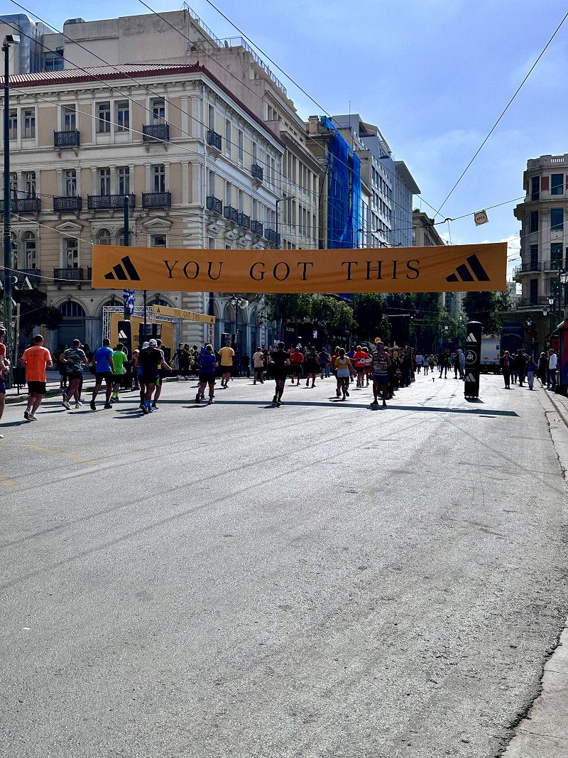
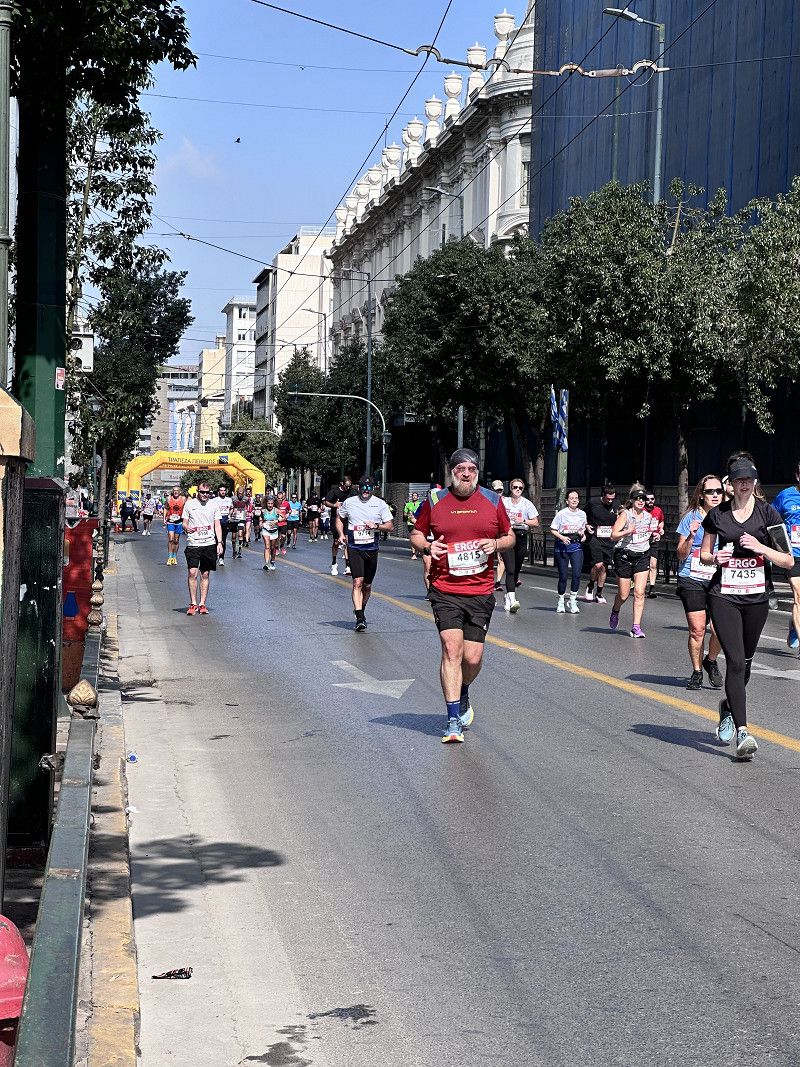
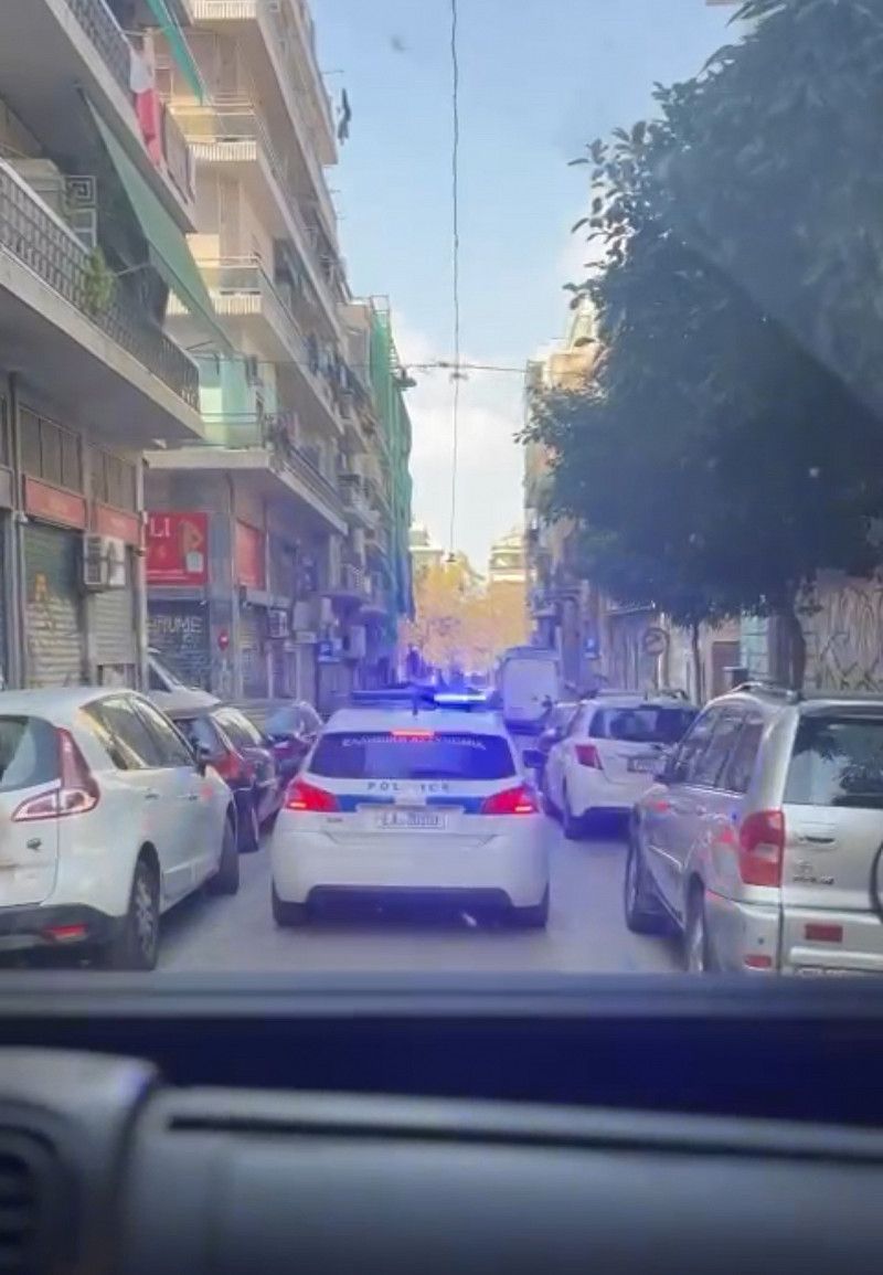
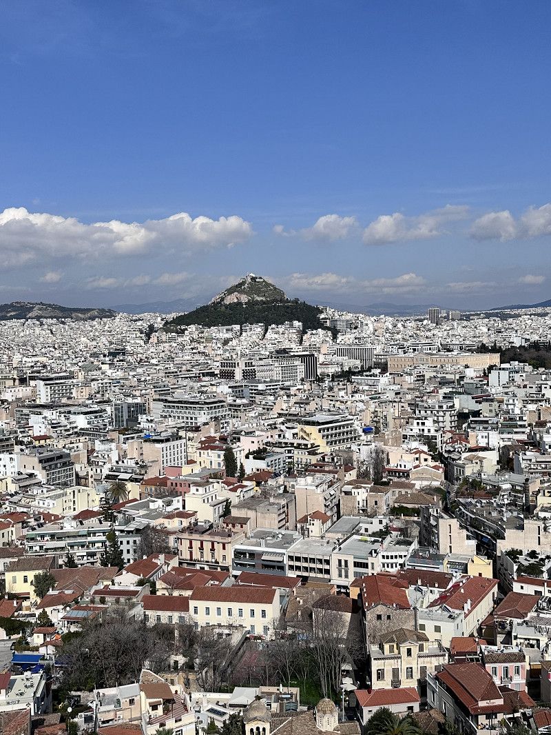
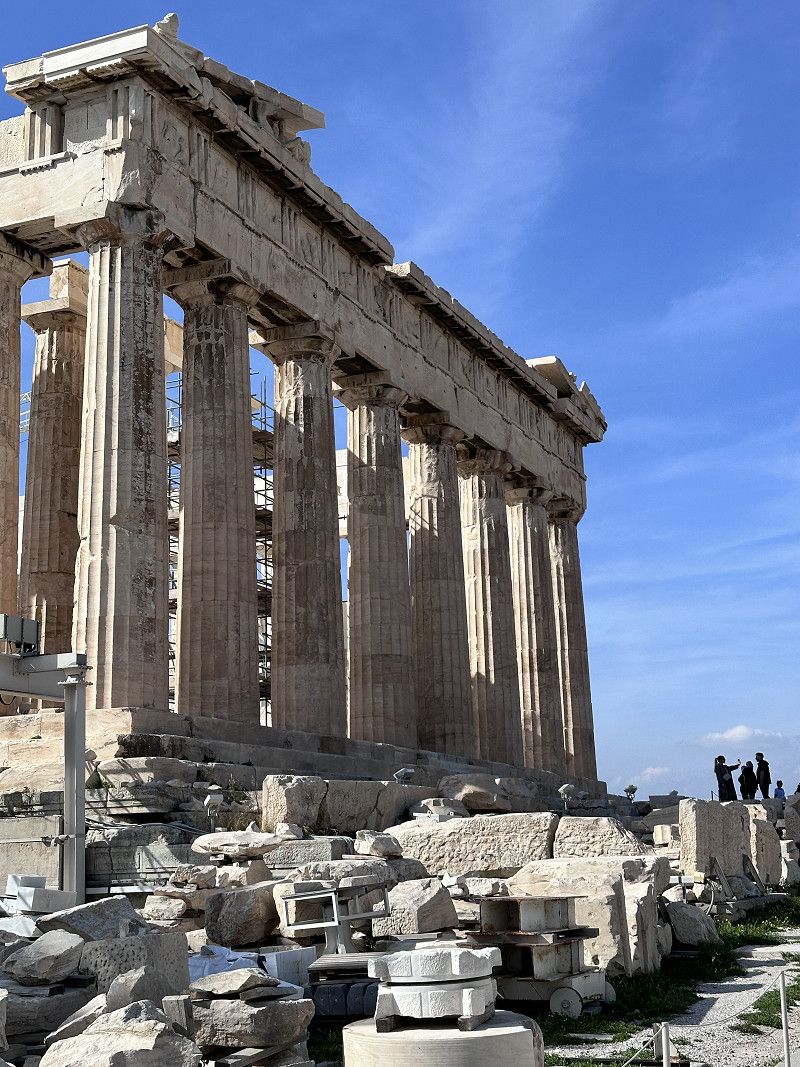
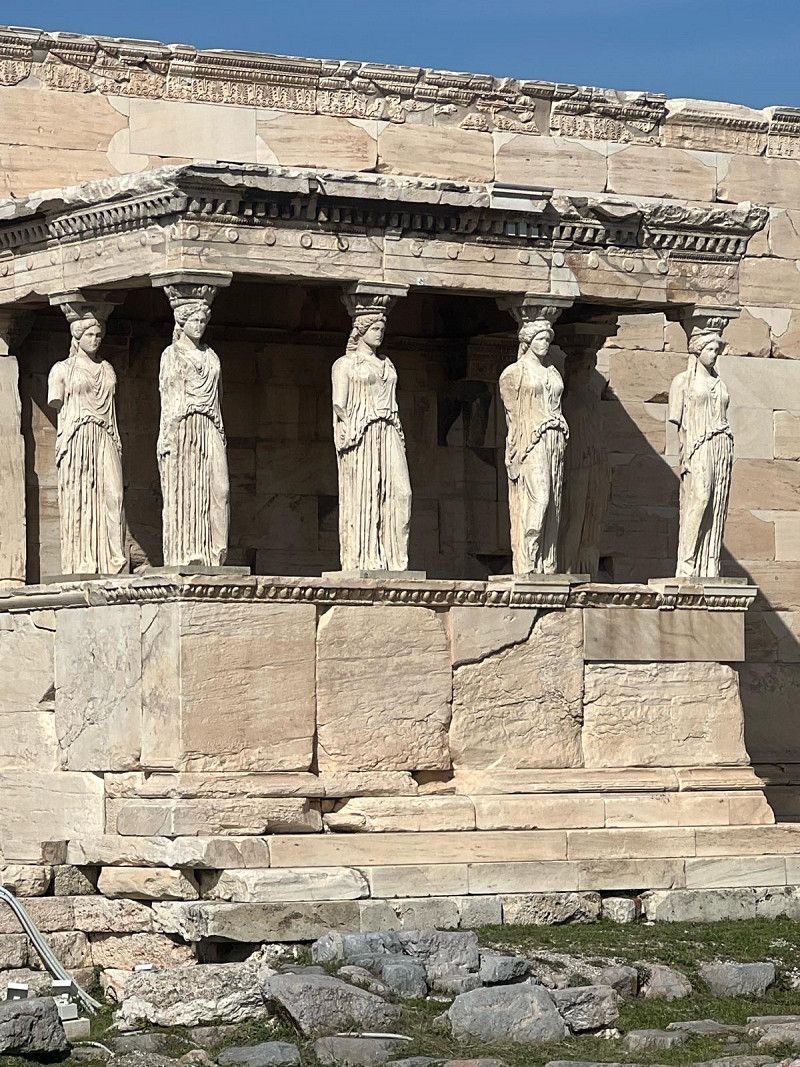
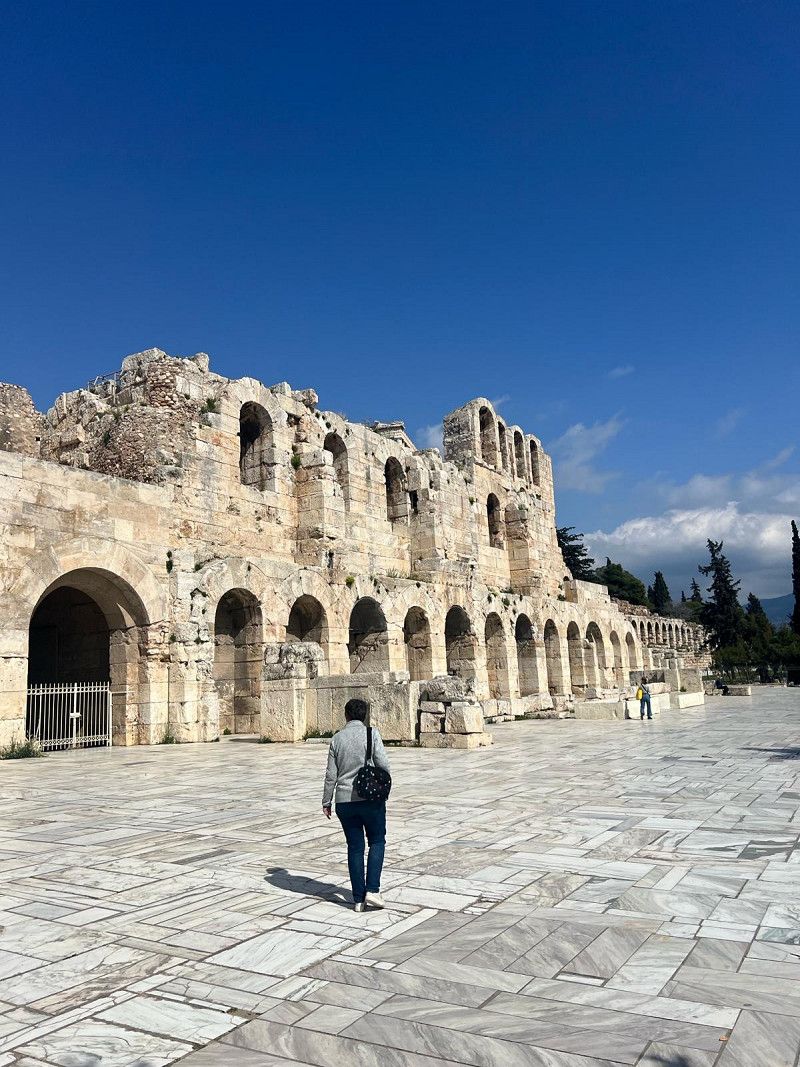
Today Athens is on the agenda. But no matter where we go, the roads are closed. We talk to a police officer and ask. There's a marathon today, no getting through 😵💫
But typically nice Greeks - follow me, come come - hey, what does he want? The police drive ahead and take us to the nearest parking space in the Monastiraki district. This is really welcoming - thank you very much. We park our motorhome in this guarded space and have a chat with the park attendant, who also kindly explains the route to us. Unload the bikes and explore Athens by Bike 🔝👍🔝
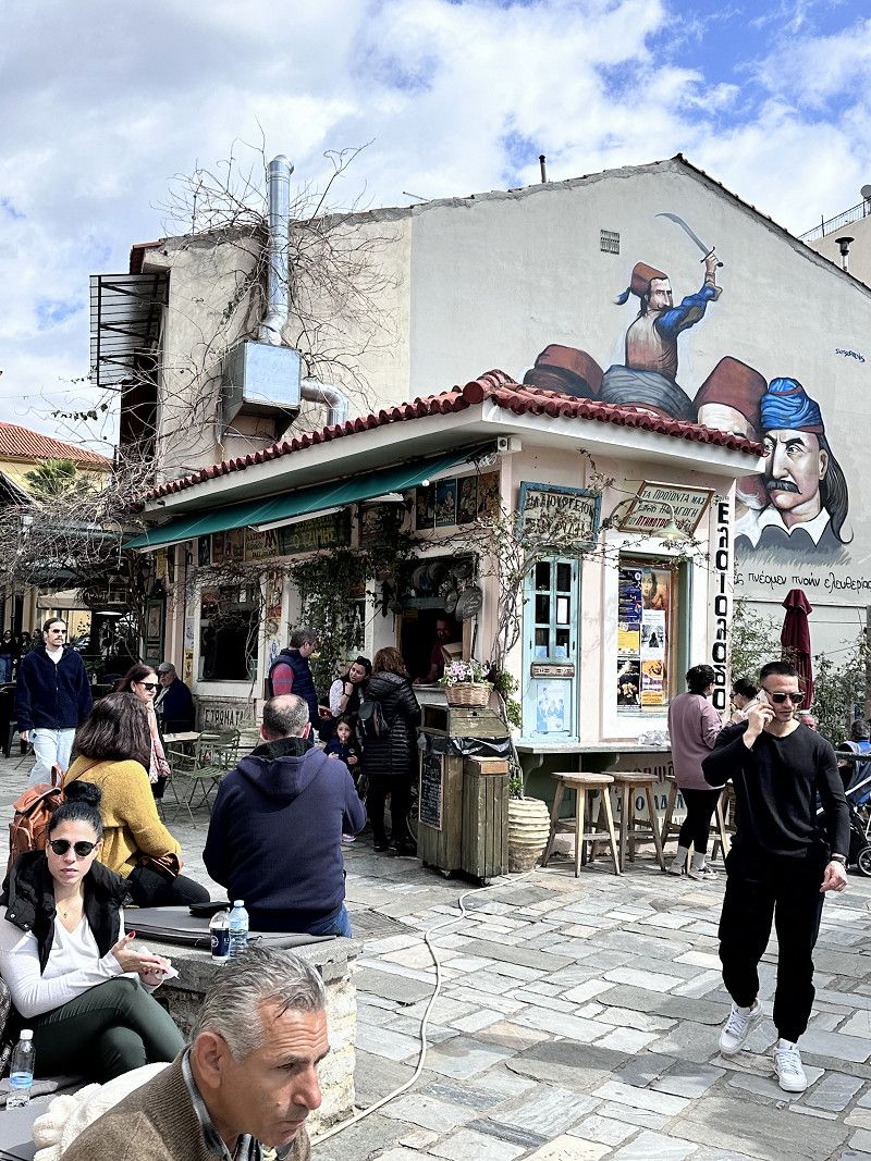
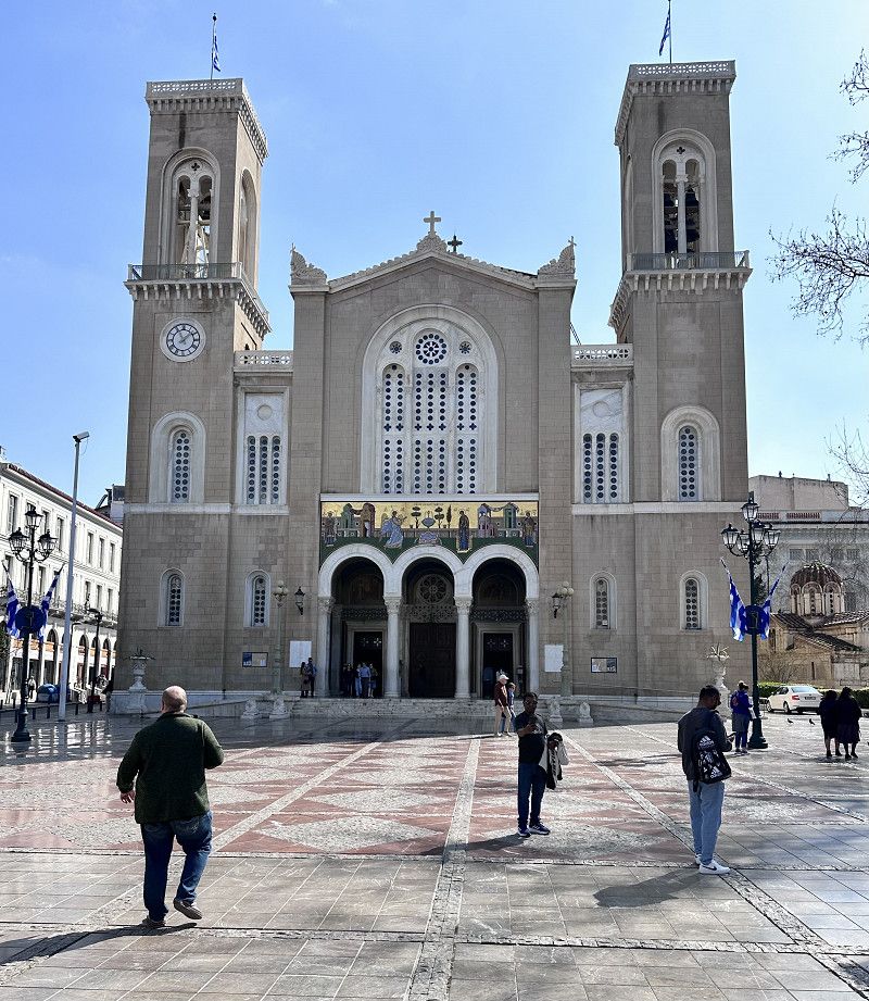
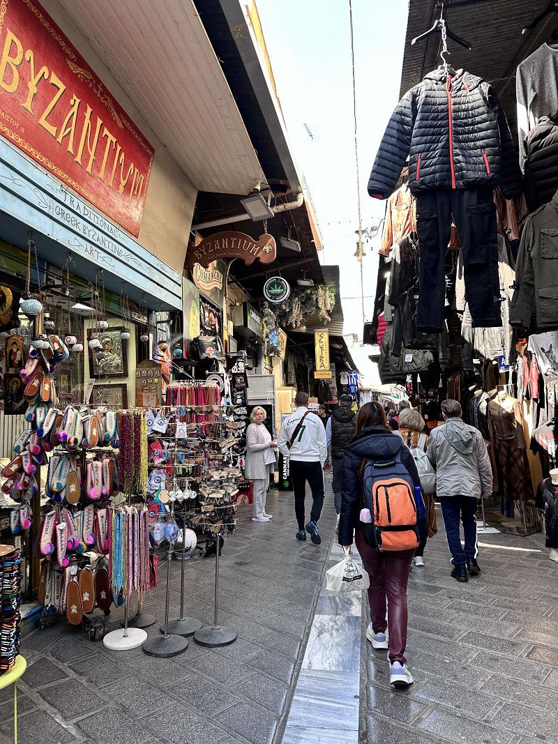
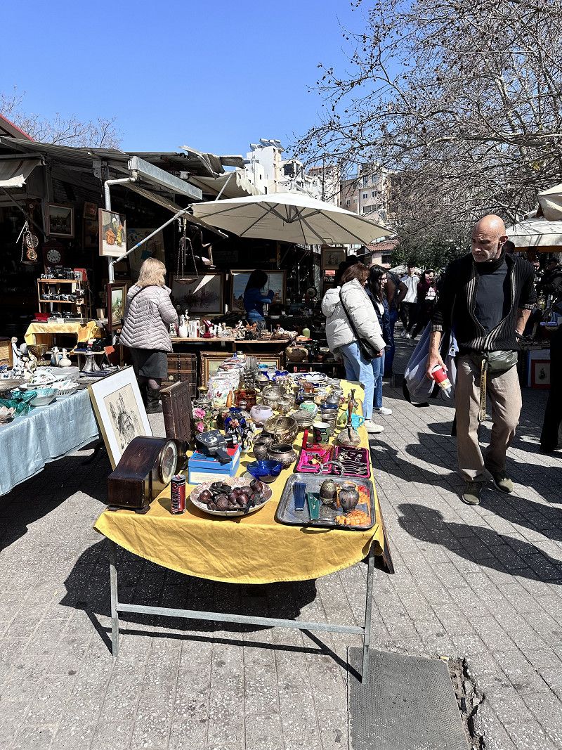
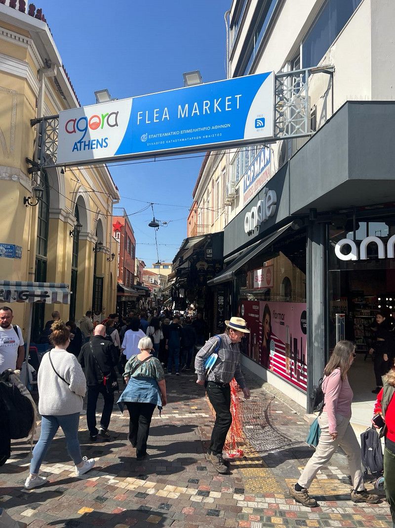
Monastiraki
Monastiraki is a lively district near the Acropolis. Shops, stalls, dealers with 🌰 chestnuts, flea market with antiques and many small restaurants. But there are also endless tourists. 🛍️
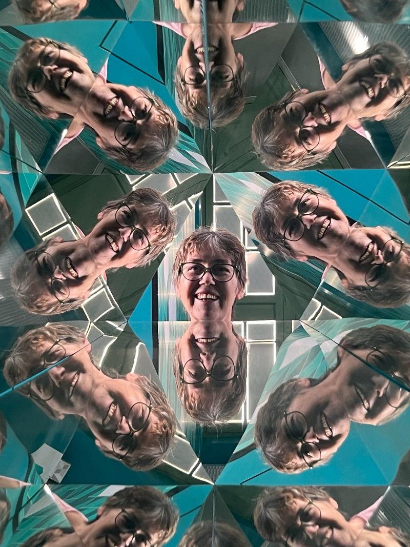
The Museum of Illusions is also located in the same district. If you would like some funny snapshots, you are welcome to visit. In retrospect, the entrance fee of €12 is too much for that.
• Turn right onto Leoforos Vasilissis Amalias toward Peiraias/Glyfada. Go for 337 m.
• Continue on Leoforos Syngrou toward N. Smyrni/Kallithea. Go for 4.6 km.
• Take ramp onto Leoforos Apollonos (91) toward Glyfada/Ol. Sygkrotima Falirou/Faliro Olympic Complex. Go for 3.6 km.
• Turn right. Go for 244 m.
• Turn left. Go for 129 m.
• Turn right. Go for 162 m.
• Arrive at your destination on the left.
☍
10,2 km
( 13 min.)
Yachthafen Alimos Marina
This morning a security guard spoke to us, well 😌 actually sleeping would be forbidden here too. Contrary to the information on the Internet. We asked politely and he allowed us to sleep here again that night 😴 We gratefully accepted, because the campsites in the capital are still closed.
Δήμος Κομνηνού (Σαλαμίνος), Άλιμος, Regional Unit of South Athens, Attica, Greece
37° 54' 57" N 23° 42' 17" E
37.9158388 23.7047224
• Head southeast.
• Turn right. Go for 6 m.
• Turn right. Go for 88 m.
• Turn right. Go for 9 m.
• Turn left. Go for 167 m.
• Turn right toward Leoforos Poseidonos/91. Go for 121 m.
• Turn left onto Leoforos Poseidonos (91). Go for 3.1 km.
• Take left ramp onto Leoforos Poseidonos toward Kentro Politismou ISN/SNF Cultural Centre. Go for 1.9 km.
• Take ramp toward Lamia. Go for 630 m.
• Continue on E75 (Leoforos Kifisou). Go for 154 km.
• Take the exit toward Limani/Port/Arkitsa/Kedros. Go for 1.6 km.
• Turn right. Go for 146 m.
• Make a U-Turn. Go for 107 m.
• Turn right. Go for 54 m.
• Take the Arkitsa-Loutra Aidipsou Ferry. Stay on for 11.9 km.
• Head southeast on Ethnikis Antistaseos. Go for 77 m.
• Turn right onto 28is Oktovriou. Go for 145 m.
• Continue on 28is Oktovriou. Go for 322 m.
• Turn slightly left onto 25is Martiou. Go for 235 m.
• Turn right onto Filellinon. Go for 86 m.
• Arrive at Filellinon. Your destination is on the left.
☍
174,7 km
(2 hrs. 18 min.)
Day
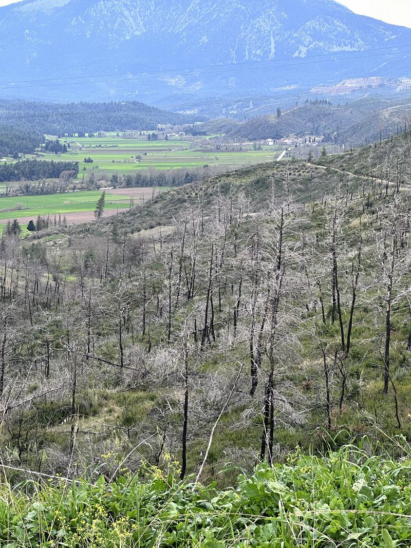
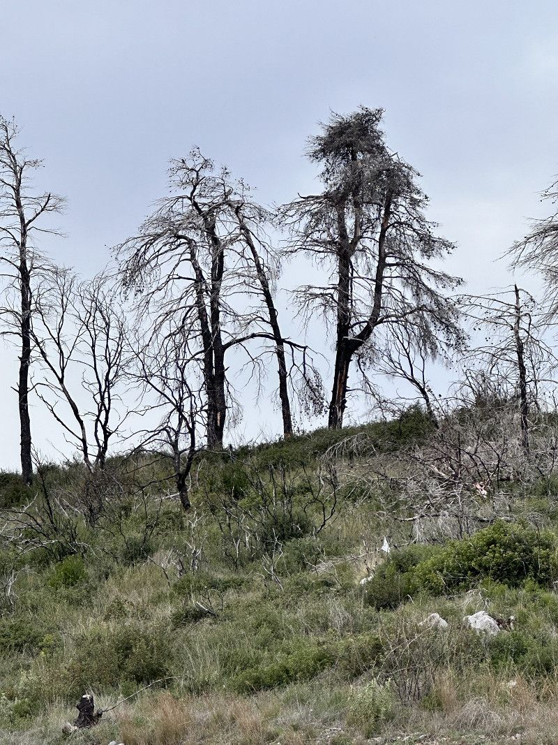
Insel Euböa - Waldbrände 2021
On the onward journey we visited the island of Euboä.
The largest forest fires raged here on August 3, 2021. In the north of the island, more than 50,000 hectares of forest and agricultural land were devastated over eight days. This corresponds to the area of the canton of Baselland, my home canton.
Never before has an event destroyed so much land. It is rumored that it was arson because a wind farm was to be built in the nature reserve.
Today (2024) a lot of burned forests and earth can still be seen. But nature is fighting back 😉
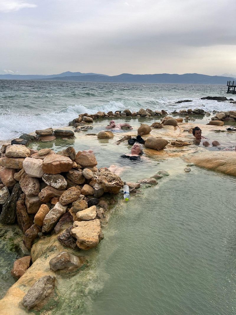
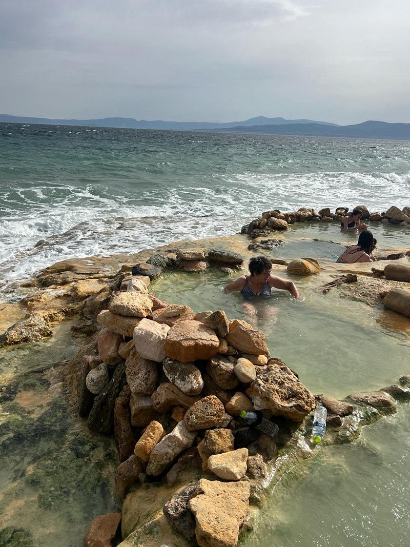
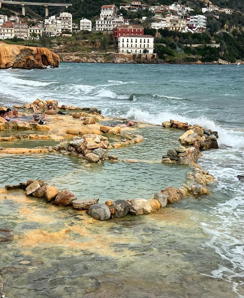
Die heissen Quellen von Edipsou
A cool wind is blowing outside, the sea is making waves, who wants to go swimming 🤔 Put on your swimming trunks, we read that there are hot springs right on the beach.
We were able to park right next to the staircase. Bath towel, Crocs, cell phone for photos, bag and off you go 🌊
After initial hesitation, what a surprise 😮 the water is 39 degrees Celsius. We let ourselves drift and don't want to go out anymore. After half an hour of bathing, we leave the cozy bathroom and go back to the motorhome. Amazingly, we are so warmed up that the cold winds don't bother us.
Φιλελλήνων, Λουτρά Αιδηψού, Euboea Regional Unit, Thessaly and Central Greece, Greece
38° 51' 10.9" N 23° 2' 48.3" E
38.8530157 23.0467630
• Head toward Irakleous on Filellinon. Go for 32 m.
• Turn slightly right onto Poseidonos. Go for 292 m.
• Continue on 28is Oktovriou. Go for 1.1 km.
• Continue on Aidipsou-Istiaias (77). Go for 1.2 km.
• Take the 1st exit from roundabout. Go for 86 m.
• Take the 3rd exit from roundabout onto Aidipsou-Istiaias (77). Go for 1.3 km.
• Continue on Aidipsou-Istiaias (77) toward Istiaia. Go for 6.7 km.
• Turn left. Go for 909 m.
• Turn left. Go for 35 m.
• Turn right. Go for 22 m.
• Arrive at your destination on the left.
☍
11,6 km
( 13 min.)
Namenloser Strand
We found this parking lot on the beach at Park4Night. It is located right on a street but is quiet and is lit at night.
The view is beautiful and overall a great place.
It has showers, which probably only run in summer. While we were there there was a lot of flotsam on the beach.
38.9404, 23.0576
38° 56' 25.4" N 23° 3' 27.4" E
38.9404000 23.0576000
• Head west. Go for 22 m.
• Turn left. Go for 35 m.
• Turn right. Go for 412 m.
• Turn slightly left toward Aidipsou-Istiaias/77. Go for 497 m.
• Turn right onto Aidipsou-Istiaias (77). Go for 688 m.
• Turn right. Go for 1.8 km.
• Arrive at your destination on the right.
☍
3,4 km
( 5 min.)
Day
Agiokampos Hafen
We leave the island of Euboea towards the mainland. We take the ferry ⛴️ to Glyfa. The crossing only takes 30 minutes. Although we have bad weather for the first time today, the sea is calm and there is hardly any rocking. I read that the ferry should leave early during the season. According to the motto; first come first served 😉
At the harbor we shorten the waiting time in a café. When asked if they offer breakfast, she says no. Less than two minutes later she brings us two chocolate croissants from her private kitchen. Hospitality indescribable 😍
Euboea Regional Unit, Thessaly and Central Greece, Greece
38° 56' 9.3" N 23° 2' 4.8" E
38.9359167 23.0346691
• Head toward Eparchiaki Odos Glyfa-Agiokampos. Go for 296 m.
• Turn right toward Eparchiaki Odos 32-Pelasgias-Glyfas. Go for 194 m.
• Continue on Eparchiaki Odos 32-Pelasgias-Glyfas toward Lamia. Go for 12.5 km.
• Turn left and take ramp onto E75 (Ethniki Odos Lamias-Larisas) toward Lamia. Go for 44.6 km.
• Take the exit. Go for 1.2 km.
• Take ramp onto E65 (Aftokinitodromos Kentrikis Elladas) toward Grevenon/Karpenisi. Go for 118 km.
• Take the exit toward Vasiliki/6. Go for 656 m.
• Take the 2nd exit from roundabout. Go for 97 m.
• Take the 1st exit from roundabout onto Ethniki Odos Kalampakas-Trikalon (E92). Go for 10.6 km.
• Turn right toward Meteora. Go for 73 m.
• Turn right onto Ep. Od. Kalampakas-I. M. Meteoron toward Meteora. Go for 4.5 km.
• Turn right onto Ep. Od. Kalampakas-I. M. Meteoron toward Vlachava. Go for 1.0 km.
• Arrive at Ep. Od. Kalampakas-I. M. Meteoron. Your destination is on the left.
☍
Distance not available
(Duration not available)
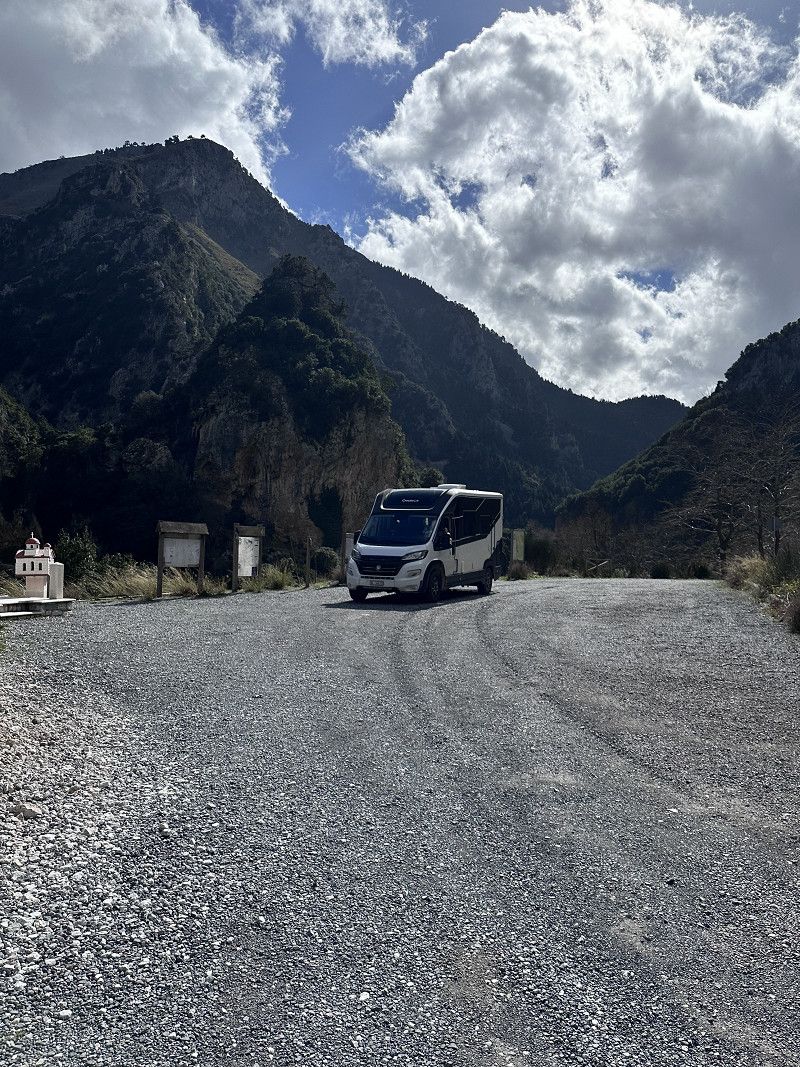
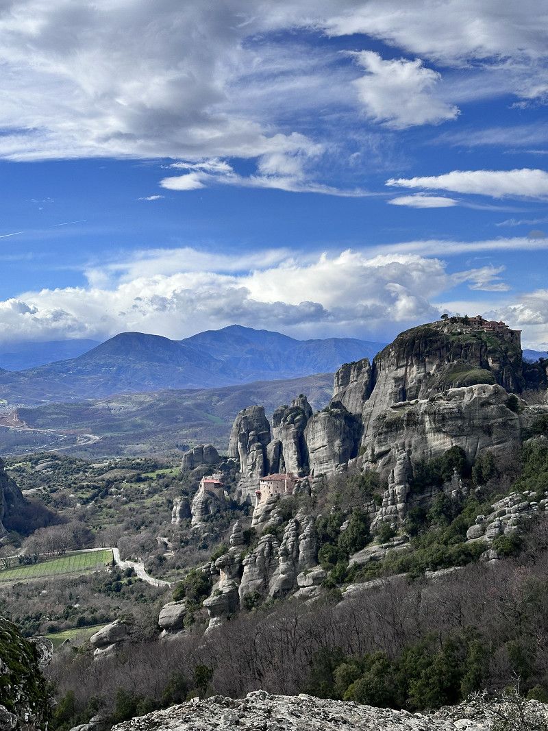
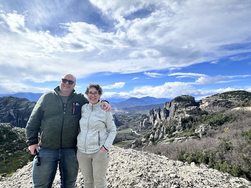
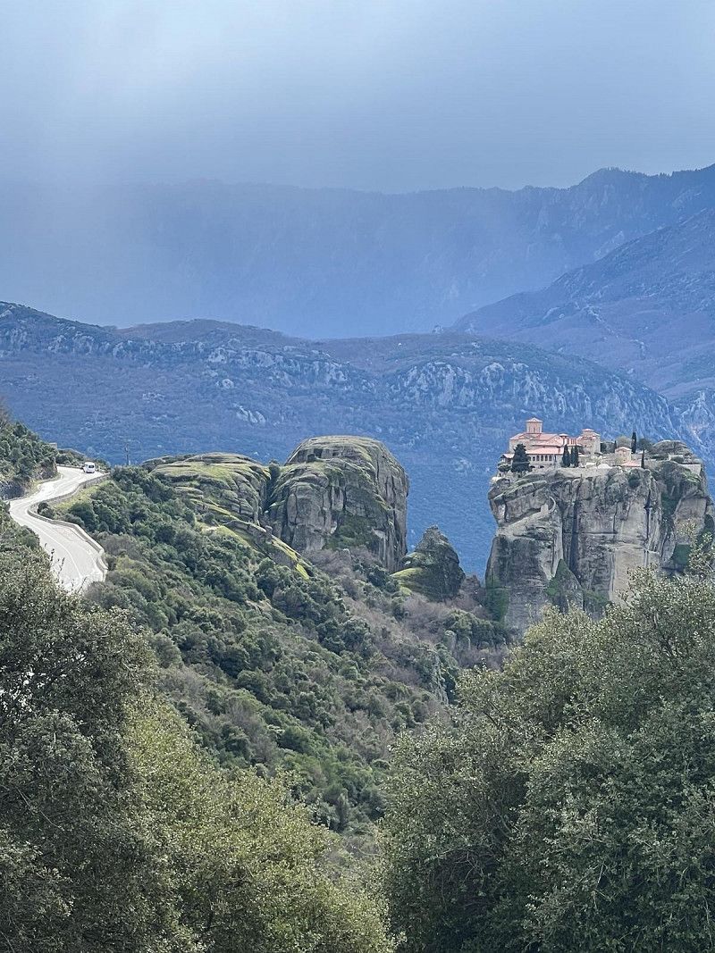
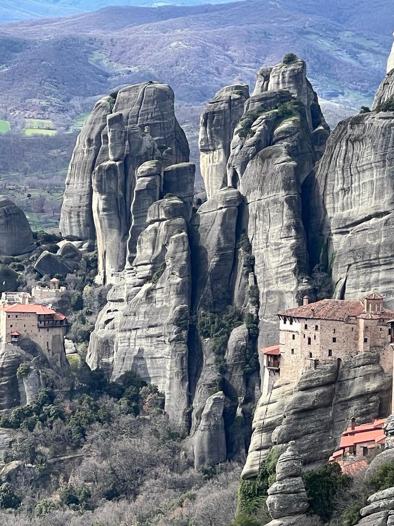
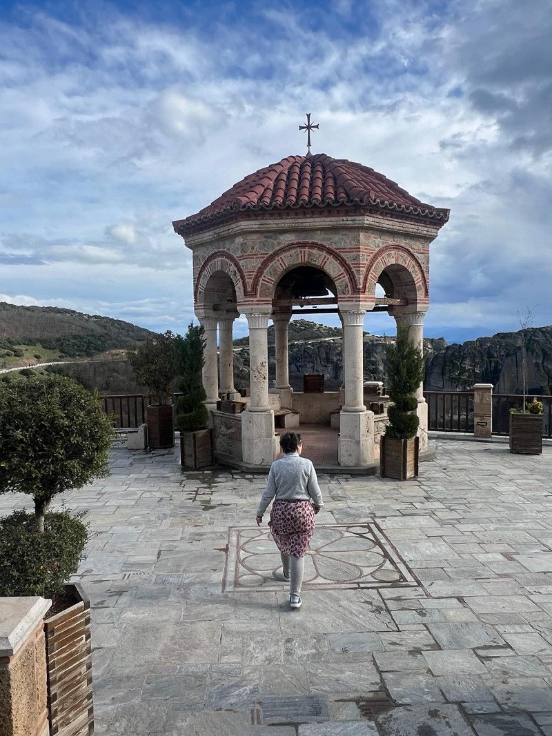
Aussicht auf die Meteora Klöster
Our destination today is the Meteora monasteries.
There are 24 monasteries, which were built between the 12th and 16th centuries. They were built in the 19th century at windy heights on the tops of sandstone cliffs. were there between the 12th and 16th. That's where the name comes from; Meteora means “to lift up”
Six monasteries are still inhabited today and can be visited. These are:
Agia Triada
Agios Nikolaos
Anapavsás Agios Stéphanos
Rousanou
Vaárlam and
Metamorphosis (we visited)
The road goes up from Kalambaka.
From this vantage point you have a fantastic view of the stone formations and several monasteries.
Καλαμπάκας - Μετεώρων, Kalabaka, Trikala Regional Unit, Thessaly and Central Greece, Greece
39° 43' 9.6" N 21° 38' 13.7" E
39.7193374 21.6371372
• Head north on Ep. Od. Kalampakas-I. M. Meteoron. Go for 1.0 km.
• Continue on Ep. Od. Kalampakas-I. M. Meteoron. Go for 1.1 km.
• Arrive at Ep. Od. Kalampakas-I. M. Meteoron.
☍
2,2 km
( 4 min.)
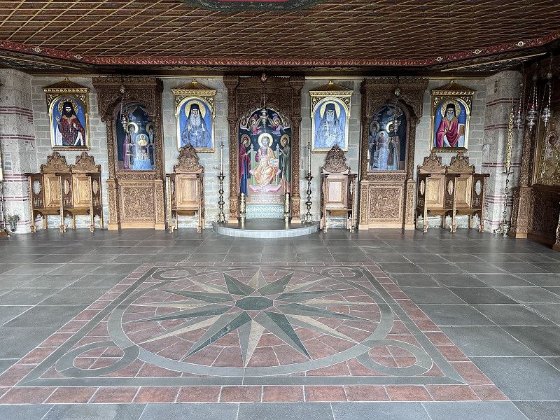
Kloster Metamórphosis
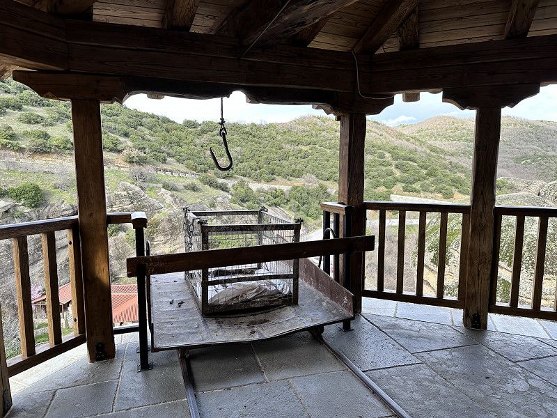
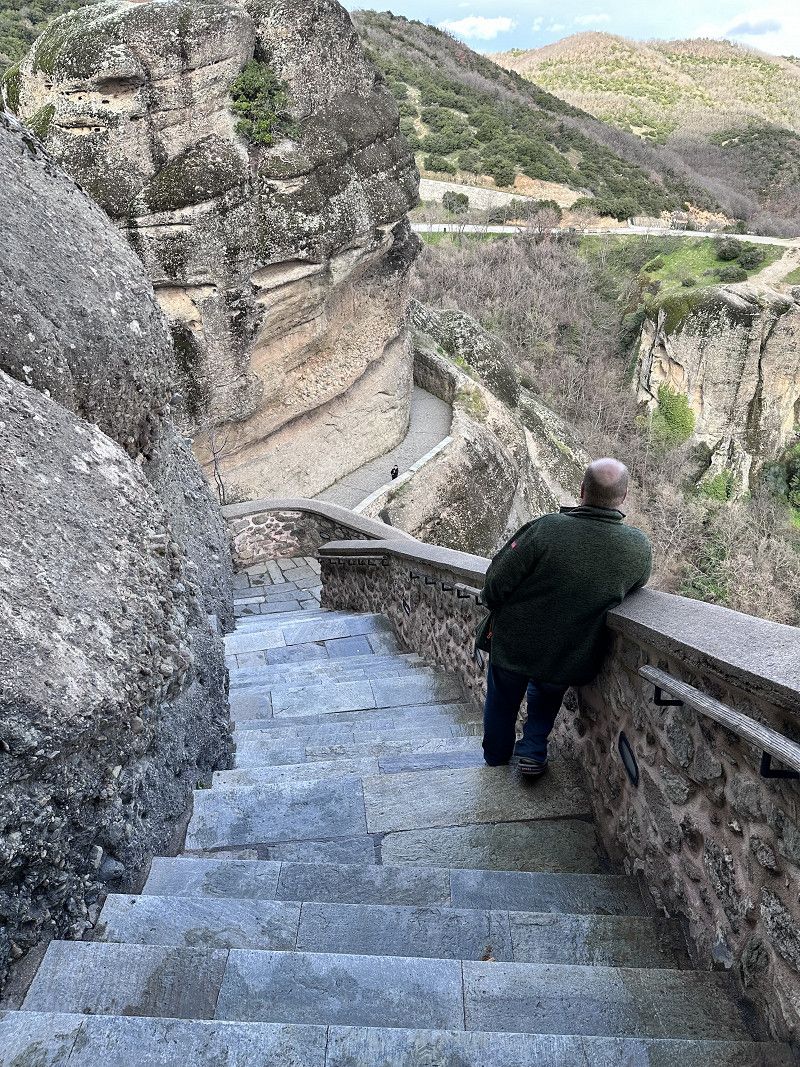
The Metamorphosis Monastery is the largest and oldest. Previously it was only accessible via a rope ladder. Since 1923, the monastery has been accessible via a tunnel and stairs. It is inhabited by monks. 🧐
We had to hurry with the visit, the monastery closed at 4 p.m. and the monks went to evening prayers.
Appropriate clothing, shoulders covered, no shorts and a long skirt for women is desired.
39.72649,21.62651
39° 43' 35.4" N 21° 37' 35.4" E
39.7264900 21.6265100
• Head west on Ep. Od. Kalampakas-I. M. Meteoron.
• Make a U-Turn onto Ep. Od. Kalampakas-I. M. Meteoron. Go for 1.1 km.
• Continue toward Leoforos Oik. Patr. Dimitriou A'. Go for 3.5 km.
• Continue on Leoforos Oik. Patr. Dimitriou A'. Go for 298 m.
• Turn right toward Ethniki Odos Metsovou-Kalampakas/E92. Go for 1.1 km.
• Turn right onto Ethniki Odos Metsovou-Kalampakas (E92). Go for 252 m.
• Take the 2nd exit from roundabout onto Ethniki Odos Metsovou-Kalampakas (E92). Go for 40.8 km.
• Take ramp onto E90/E92 (Egnatia Odos) toward Ioannina/Metsovo. Go for 31.3 km.
• Take exit 6 toward Zagori/Ioannina/Balntouma. Go for 946 m.
• Turn right onto Ep. Odos 43-Balntouma-Anatolikis (6) toward Ioannina/Balntouma. Go for 2.9 km.
• Continue on Ioanninon-Metsovou (6). Go for 17.2 km.
• Turn right toward Ligkiades. Go for 1.7 km.
• Continue straight ahead. Go for 501 m.
• Keep right. Go for 2.9 km.
• Turn slightly right. Go for 59 m.
• Arrive at your destination on the left.
☍
104,5 km
(1 hrs. 55 min.)
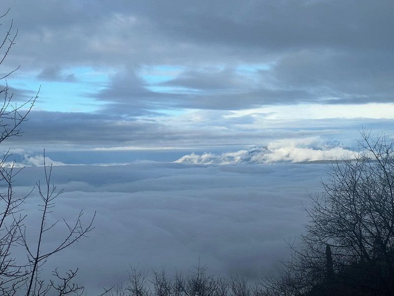
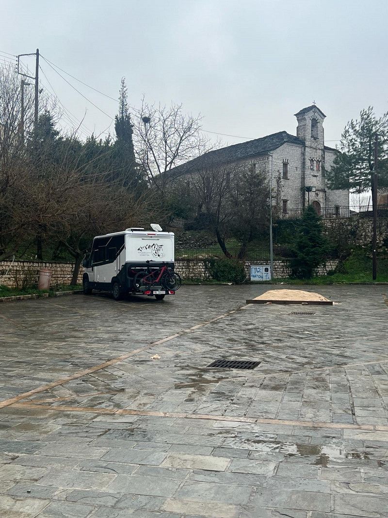
Lingiades Parkplatz
We arrived at our sleeping place today in the dark. We found win on the Park4night app. It's clean and good so far 😌 Let's see what it looks like in the light tomorrow 😴
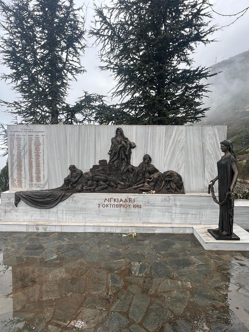
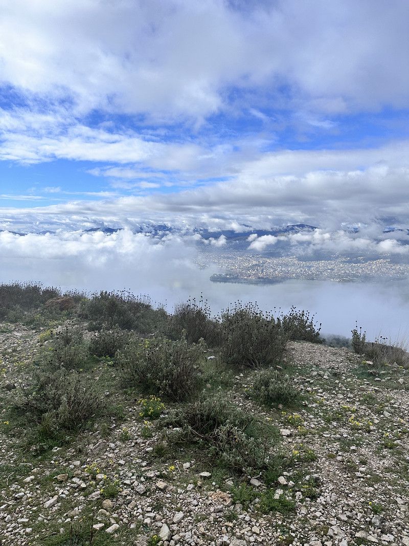
The weather isn't really good😉 but it doesn't matter, it's a good place to sleep and, when the weather is nice, a view of the lake and the city of Ioannina. It has a playground and a city wall, with a war memorial on site.
In memory of the Lingiades massacre, 82 dead, including 34 children (October 3, 1943)
ΕΠ42α, Perama Municipal Unit, Ioannina Regional Unit, Epirus and Western Macedonia, Greece
39° 41' 26.4" N 20° 53' 19.1" E
39.6906682 20.8886347
• Head northwest. Go for 59 m.
• Turn sharp right. Go for 88 m.
• Keep right. Go for 41 m.
• Turn slightly left. Go for 154 m.
• Continue straight ahead. Go for 132 m.
• Turn right. Go for 108 m.
• Turn left. Go for 3.7 km.
• Turn right. Go for 909 m.
• Turn right. Go for 204 m.
• Turn right toward Ioanninon-Metsovou/6. Go for 193 m.
• Turn right onto Ioanninon-Metsovou (6). Go for 3.9 km.
• Take the 3rd exit from roundabout onto 8is Merarchias (E853) toward Egnatia Odos/Kentro Ioannina/Center. Go for 531 m.
• Turn right onto Voreiou Ipeirou (E951) toward Kentro Ioannina/Centre Ioannina/Arta/Egnatia Odos. Go for 253 m.
• Turn left onto Vilara Ioannou toward Kentro Ioannina/Center. Go for 584 m.
• Continue on Valaoritou. Go for 434 m.
• Continue on 28is Oktovriou. Go for 551 m.
• Turn right onto Leoforos Dodonis toward Athina/Arta. Go for 152 m.
• Arrive at Leoforos Dodonis. Your destination is on the right.
☍
12,0 km
( 24 min.)
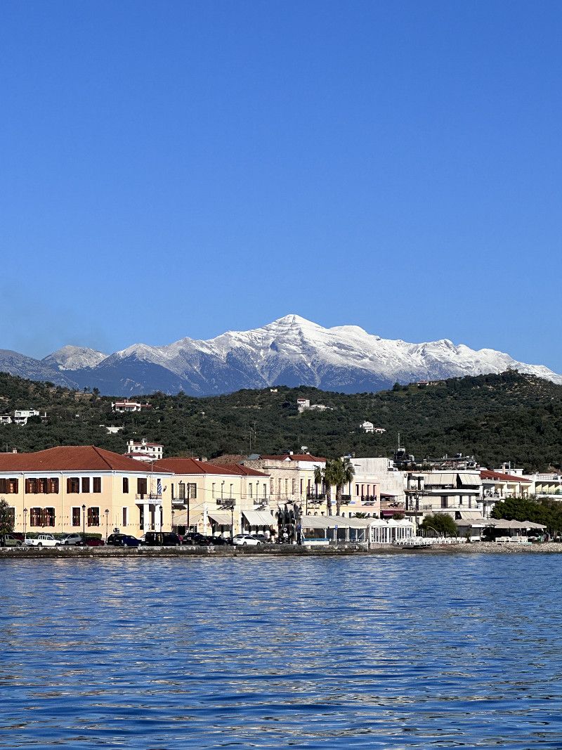
Ioannina
Ioannina is a tourist town known for its silver jewelry forges. The day before it was pouring rain and we couldn't visit this place. Unfortunately everything is closed in the morning today.
• Head southwest on Leoforos Dodonis. Go for 50 m.
• Take the 1st exit from roundabout onto Pyrsinella Vasileiou. Go for 247 m.
• Continue on Plateia Pargis. Go for 71 m.
• Continue on Sakellariou S. Go for 79 m.
• Turn left onto Sakellariou S. toward Aerodromio Ioannina/Airport/Igoumenitsa/Trikala. Go for 123 m.
• Turn right onto Lamprou Spyrou (E951) toward Aerodromio Ioannina/Airport. Go for 1.2 km.
• Turn right onto Voreiou Ipeirou (E951) toward Aerodromio Ioannina/Airport. Go for 451 m.
• Turn left onto 8is Merarchias. Go for 73 m.
• Keep right onto 8is Merarchias (E853). Go for 416 m.
• Take the 3rd exit from roundabout onto Leoforos Grammou (E853) toward Igoumenitsa/Kozani. Go for 1.1 km.
• Pass 3 roundabouts and continue on Ethniki Odos Kozanis-Ioanninon (E853). Go for 30.7 km.
• Turn left onto Kalpakiou-Alvanikon Synoron (E853) toward Delvinaki/Kakavia/Kakavia. Go for 24.4 km.
• Arrive at Kalpakiou-Alvanikon Synoron (E853). Your destination is on the left.
☍
58,9 km
( 52 min.)
Day
Info Albanien
Entry with an identity card (CH ID) or a valid passport.
Green insurance card is mandatory, otherwise insurance will be taken out for 50 euros
Vehicle documents are checked
Maximum speed 40 in urban areas / 80 out of urban areas
Motorway no tolls 110 km maximum speed
Currency Lek 1 Euro/Chf approx. 100 Lek
Service station network well and often served (they are happy about a small tip)
AdBlue available
Free camping allowed
Albanien
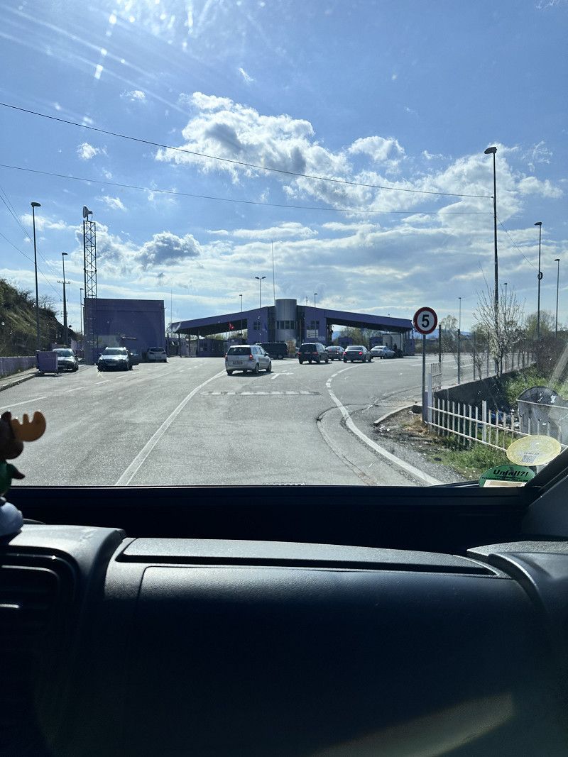
From Ioannina we drive west to cross the border into Albania at Gijrokaster. Although every car is checked several times, crossing the border was still easy.
Phew, I imagined it would be worse 😉
ΕΟ22, Ioannina Regional Unit, Epirus and Western Macedonia, Greece
39° 54' 39.4" N 20° 21' 47" E
39.9109509 20.3630548
• Head west on Kalpakiou-Alvanikon Synoron (E853). Go for 444 m.
• Continue on E853. Go for 9.6 km.
• Turn left onto SH4 toward Sarande/Delvine/Jergucat/Georgoutsates/SH78. Go for 493 m.
• Turn right onto SH78 toward Delvine/Sarande. Go for 7.3 km.
• Turn left onto SH99 toward Sarande. Go for 6.2 km.
• Turn right. Go for 2.0 km.
• Arrive at your destination on the right.
☍
26,1 km
( 36 min.)
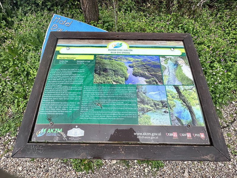
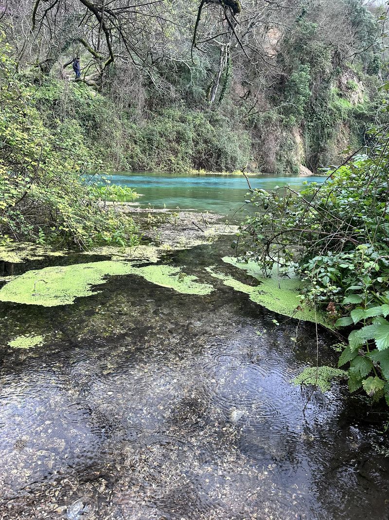
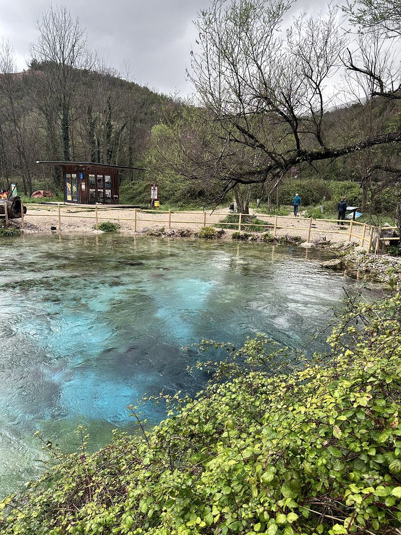
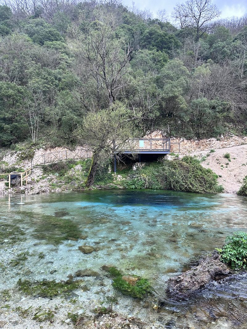
Syri i Kaltër - The blue Eye
This great karst spring is really worth a detour.
The water bubbles up from the depths. Due to the sunlight and against the background of the limestone, the water has a deep blue, sometimes turquoise surface. This spring has not yet been explored, so the exact depth and origin of the spring water is unknown.
It is a nature reserve and swimming 🧼 is prohibited.
Syri i Kaltër, Krongj, Vlorë County, Southern Albania, Albania
39° 55' 27" N 20° 11' 30.6" E
39.9241805 20.1918449
• Head south. Go for 2.0 km.
• Turn right onto SH99. Go for 10.4 km.
• Take the 2nd exit from roundabout onto SH99. Go for 5.4 km.
• Take the 2nd exit from roundabout onto Rruga Skënderbeu (SH99). Go for 1.3 km.
• Take the 1st exit from roundabout onto Rruga Bregdeti (SH8). Go for 50.5 km.
• Take the 2nd exit from roundabout onto SH8. Go for 31.6 km.
• Arrive at SH8. Your destination is on the right.
☍
101,1 km
(2 hrs. 23 min.)
Llogara- Pass
We continue towards Sarandë and then follow the SH8 towards the coastal road and Llogara Pass.
This serpentine road has it all. However, the road conditions are much better than described in our travel guide.
Once at the top you have a sensational view of the Ionian Sea in the south (and Corfu 😉) and the Adriatic Sea in the north.
The pass is 1027 meters above sea level. It's really fresh up there 🥶
We continue towards Vlora.
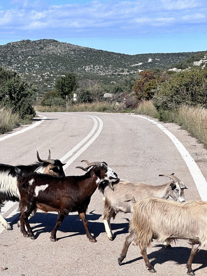
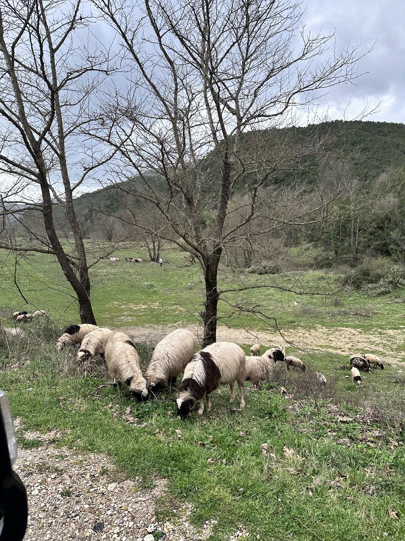
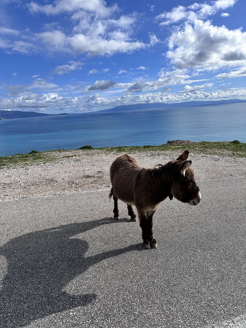
Be careful, there are all kinds of animals (🐕🐄🫏) running around freely on the streets
SH8, Orikum, Vlorë County, Southern Albania, Albania
40° 11' 47.6" N 19° 35' 53.7" E
40.1965524 19.5982375
• Head northwest on SH8. Go for 21.3 km.
• Take the 2nd exit from roundabout onto Rruga Radihme-Orikum (SH8). Go for 395 m.
• Continue on Rruga Radhime Orikum (SH8). Go for 30 m.
• Continue on SH8. Go for 1.6 km.
• Continue on Rruga Radhime Orikum (SH8). Go for 48 m.
• Continue on SH8. Go for 142 m.
• Continue on Rruga Radhime Orikum (SH8). Go for 201 m.
• Continue on SH8. Go for 379 m.
• Continue on Rruga Vlore-Radhime (SH8). Go for 3.4 km.
• Continue on Rruga Vlore Radhime (SH8). Go for 403 m.
• Continue on SH8. Go for 20 m.
• Continue on Rruga Vlore-Radhime (SH8). Go for 1.8 km.
• Continue on SH8. Go for 740 m.
• Continue on Rruga Sali Vranishti (SH8). Go for 1.2 km.
• Continue on SH8. Go for 430 m.
• Continue on Rruga Uji I Ftohte (SH8). Go for 5.9 km.
• Take the 3rd exit from Sheshi Pavarësia roundabout onto Rruga Fejzo Gjomema. Go for 477 m.
• Take the 2nd exit from roundabout onto Rruga Andrea Varfi. Go for 7.8 km.
• Turn slightly left. Go for 1.7 km.
• Turn left. Go for 158 m.
• Turn slightly left. Go for 2.2 km.
• Arrive at your destination on the left.
☍
50,3 km
(1 hrs. 20 min.)
Lagune e Nartes
Shortly after Vlora, over a 2 kilometer long bumpy road, we found this beautiful bay. We are not the only RV (van) owners here.
Some of the sections are sandy and only suitable for 4x4. There are lots of potholes and the rain has made the ground soggy. We enjoy it here, but it's absolutely not suitable for larger RVs.
Vlorë County, Southern Albania, Albania
40° 31' 15.8" N 19° 23' 18.8" E
40.5210587 19.3885538
• Head southeast. Go for 2.3 km.
• Turn right toward Rruga Sazanini. Go for 5.6 km.
• Continue on Rruga Sazanini. Go for 1.0 km.
• Turn left onto Rruga Damian Humariti. Go for 2.6 km.
• Continue on Rruga Nikolla Xhuveli. Go for 161 m.
• Take the 4th exit from roundabout onto A2. Go for 46.2 km.
• Continue on SH4. Go for 7.4 km.
• Take the 1st exit from roundabout onto SH4 toward Tirane/Lushnje. Go for 12.1 km.
• Take the 3rd exit from roundabout onto SH4 toward Tirane/Durres/Shkoder. Go for 4.7 km.
• Pass 3 roundabouts and continue on SH4. Go for 13.9 km.
• Take the 3rd exit from roundabout onto SH4 toward Tirane/Durres. Go for 27.8 km.
• Keep left onto Rruga Martin Camaj (SH85) toward Tirane. Go for 5.7 km.
• Take ramp onto Rruga Nënë Tereza (SH2). Go for 22.5 km.
• Take ramp onto Autostrada Thumanë Kashar (E762). Go for 47.3 km.
• Take the 1st exit from roundabout onto E762 toward Lezhe/Shkoder/Hani Hotit. Go for 1.3 km.
• Take the 3rd exit from roundabout onto Rruga Dom Lleshi (E762) toward H. Hotit/Shkoder. Go for 34.5 km.
• Take the 2nd exit from roundabout onto Rruga Ura e Bunës (E851). Go for 395 m.
• Turn left onto E851 toward Mal I Zi/Muriqan. Go for 12.0 km.
• Arrive at E851. Your destination is on the right.
☍
247,3 km
(3 hrs. 44 min.)
Day
Info Montenegro
Entry with an identity card (CH ID) or a valid passport.
Vehicle documents are checked
Maximum speed 50 in urban areas / 80 out of urban areas
Motorway no tolls 100 km maximum speed
Currency Euro
Service station network well and often served (they are happy about a small tip)
AdBlue available
Free camping prohibited
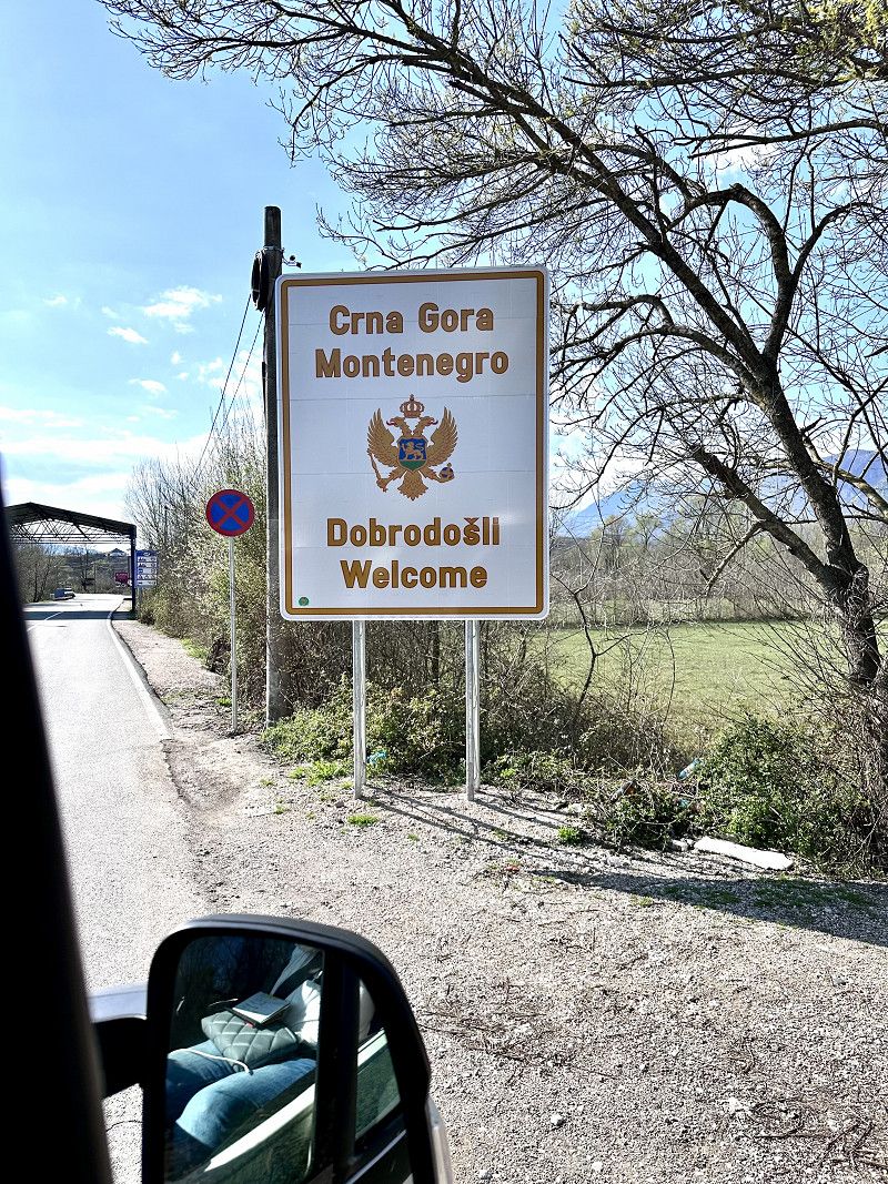
Grenzübertritt nach Montenegro
Today we took a day of travel with the destination Montenegro. There we mainly want to drive along the coastal road towards Croatia.
The famous Jadranska Magistrala (or Adria Magistrale) was built in the 1960s and 1970s. This winding coastal road is considered one of the most beautiful and picturesque in the world.
So we only took a few photos along the way and drove quickly.
Rruga Shtuf Dogane, Ana e Malit, Shkodër County, Northern Albania, Albania
42° 1' 1.7" N 19° 22' 23.1" E
42.0171452 19.3730840
• Head southwest on E851. Go for 143 m.
• Continue on E-752/E-851. Go for 11.3 km.
• Take the 1st exit from roundabout onto Krute toward BAR/TIVAR. Go for 608 m.
• Continue on Krute. Go for 2.7 km.
• Continue on Kamenicki Most. Go for 4.7 km.
• Continue on Pecurice. Go for 247 m.
• Turn left onto Pecurice. Go for 2.2 km.
• Turn right onto E-752/E-851. Go for 1.2 km.
• Turn right. Go for 90 m.
• Turn right toward E-752/E-851. Go for 50 m.
• Turn left onto E-752/E-851. Go for 2.8 km.
• Turn right toward Uvala Masline. Go for 570 m.
• Arrive at your destination on the left.
☍
26,6 km
( 32 min.)
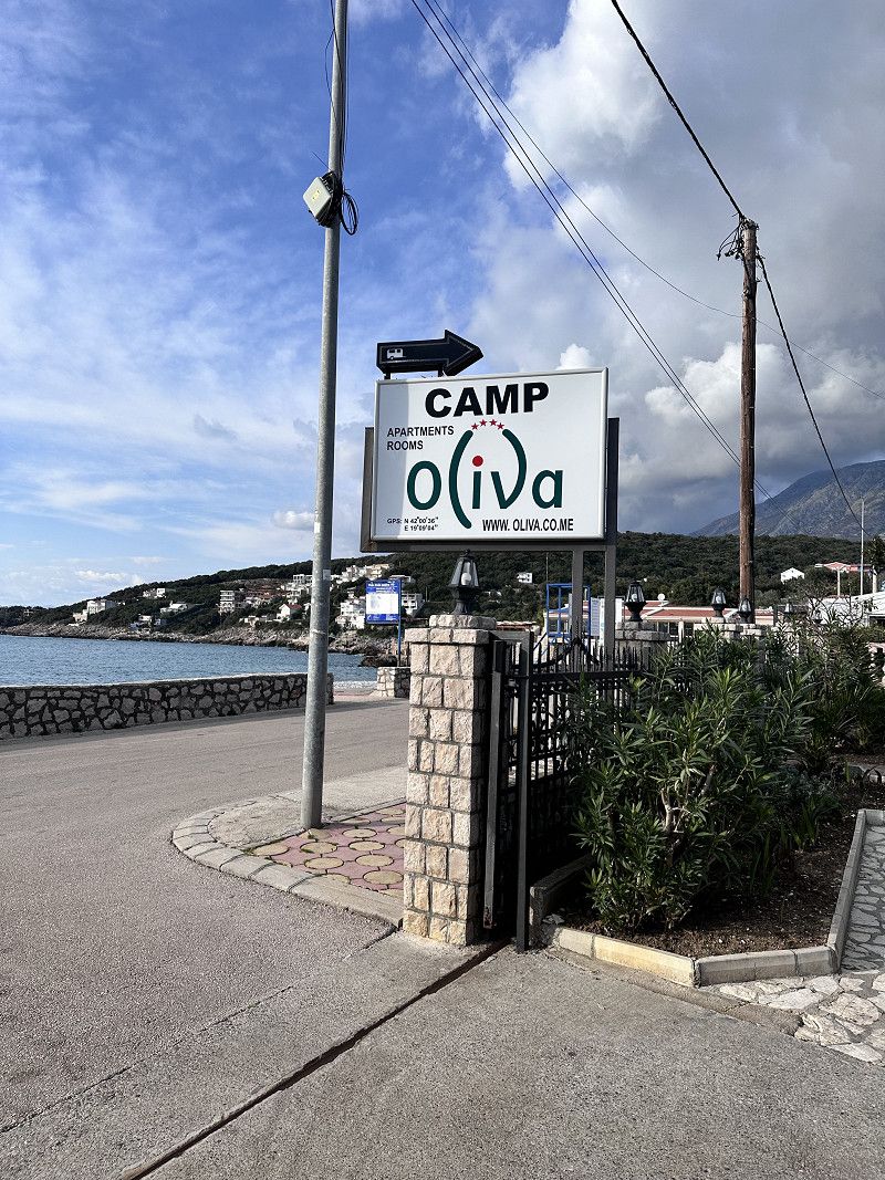
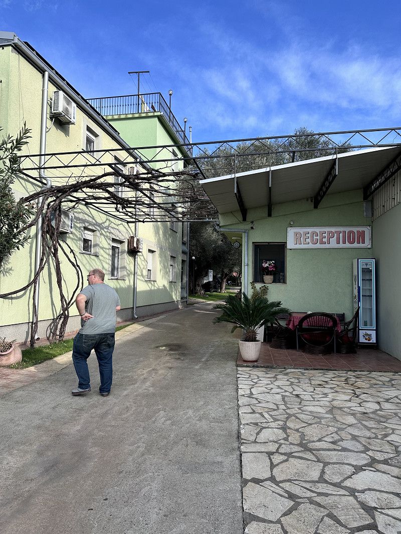
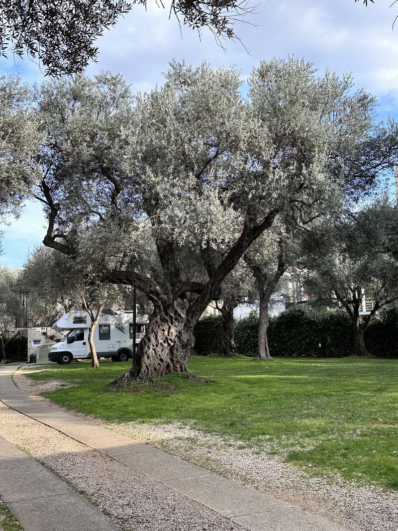
Camping Oliva
We found this small but nice campsite not far from the border in the town of Utjeha. We want to charge everything again (batteries, etc.), fresh water and whatever else goes with it.
The places are small but cute under olive trees. There are clean sanitary facilities and a washing machine.
Uvala Maslina - Utjeha, 85000, Utjeha, Montenegro
42° 0' 37" N 19° 9' 4" E
42.0102800 19.1511000
• Head south. Go for 209 m.
• Turn left onto E-752/E-851. Go for 12.5 km.
• Take the 3rd exit from roundabout onto E-752/E-851 toward Petrovac/Centar. Go for 1.1 km.
• Take the 2nd exit from roundabout onto Ulica Jna. Go for 244 m.
• Turn right onto Jovana Tomasevica. Go for 851 m.
• Arrive at Jovana Tomasevica. Your destination is on the right.
☍
15,0 km
( 16 min.)
Day
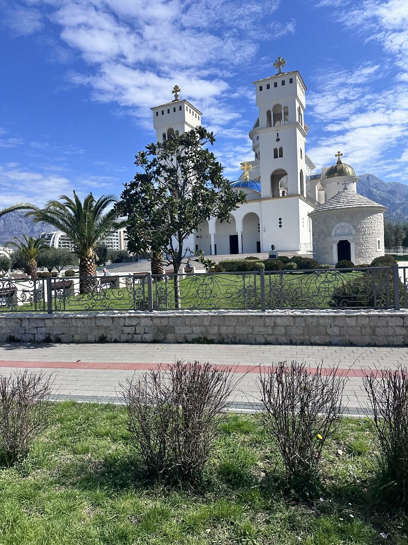
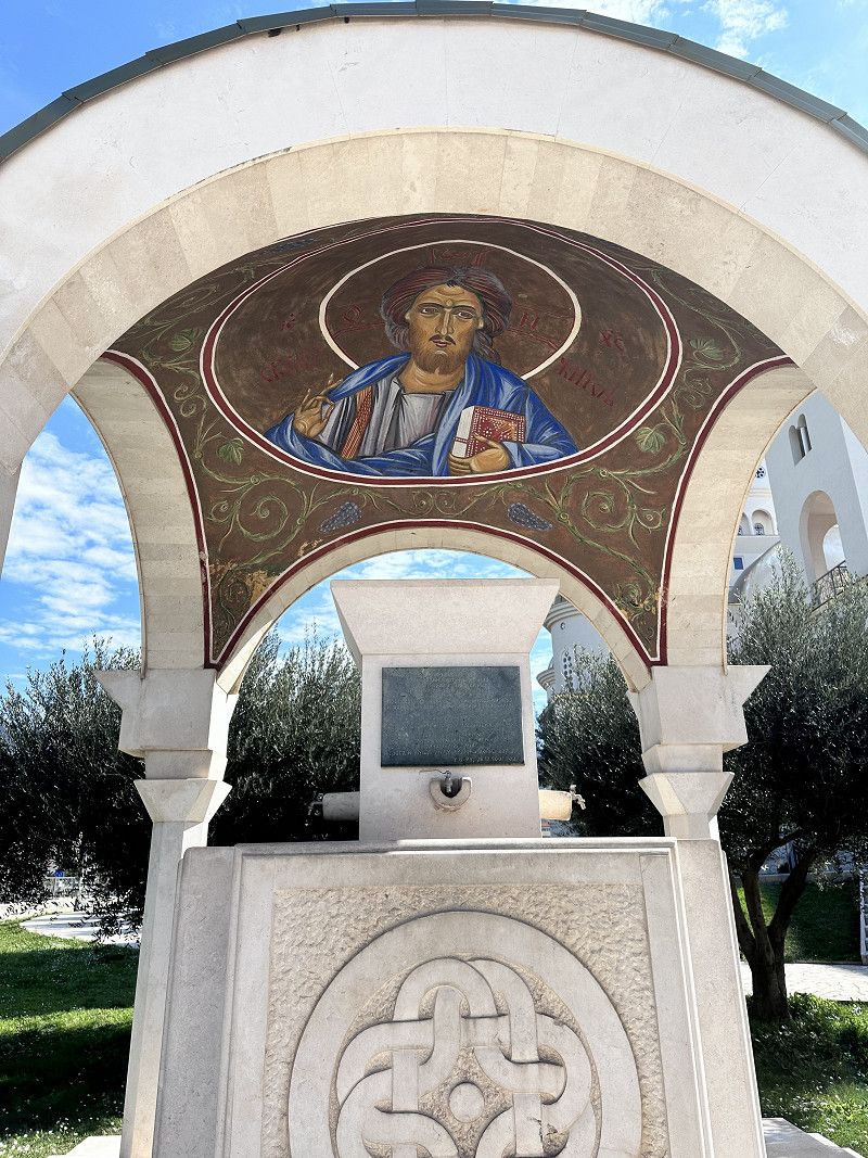
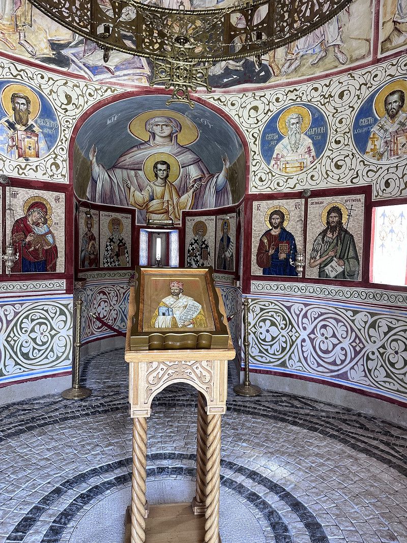
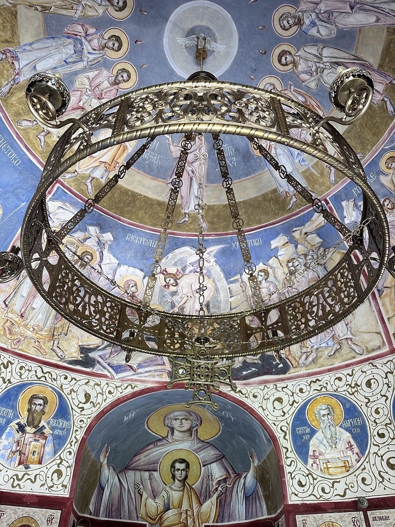
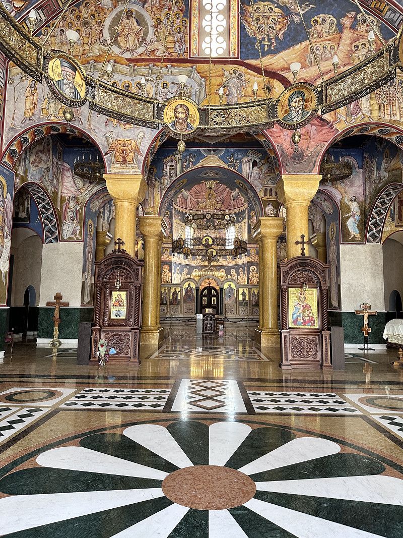
Kathedrale St. Jovan Vladimir
This Orthodox cathedral in Bar is located in a beautiful park. The cathedral is richly decorated both inside and out. Inside, the church is decorated with frescoes, marble columns and floor mosaics.
The church is open to visitors and was built in 2006.
According to legend, the temple is dedicated to Vladimir and Kosara. A love story about the prisoner of war Prince Vladimir, who fell in love with the Tsar's daughter Kosara.
Taj Mahal in Montenegro 😍😍😍
Bulevar Revolucije 38, Bar, Bar Municipality, Montenegro
42° 6' 6.2" N 19° 5' 36.1" E
42.1017257 19.0933525
• Head north on Jovana Tomasevica. Go for 633 m.
• Take the 2nd exit from roundabout onto E-752/E-851. Go for 513 m.
• Take the 2nd exit from roundabout onto E-752/E-851. Go for 7.5 km.
• Turn left toward Podgorica. Go for 2.1 km.
• Continue on Tunel Sozina. Go for 7.4 km.
• Continue on Ras. Go for 2.6 km.
• Turn right onto E-65/E-80 toward Podgorica. Go for 15.8 km.
• Take the 2nd exit from roundabout onto E-65/E-80 toward Podgorica/Tranzit/Aerodrom. Go for 3.4 km.
• Take the 3rd exit from roundabout onto Mojanovici (E-65/E-80) toward Golubovci. Go for 1.3 km.
• Take the 2nd exit from roundabout onto Mojanovici (E-65/E-80). Go for 1.4 km.
• Take the 3rd exit from roundabout onto E-65/E-80 toward Podgorica. Go for 531 m.
• Turn right onto Ljajkovici toward Kuće Rakića/Srpska. Go for 1.7 km.
• Continue on Kuce Rakica. Go for 3.3 km.
• Arrive at Kuce Rakica. Your destination is on the right.
☍
48,1 km
( 46 min.)
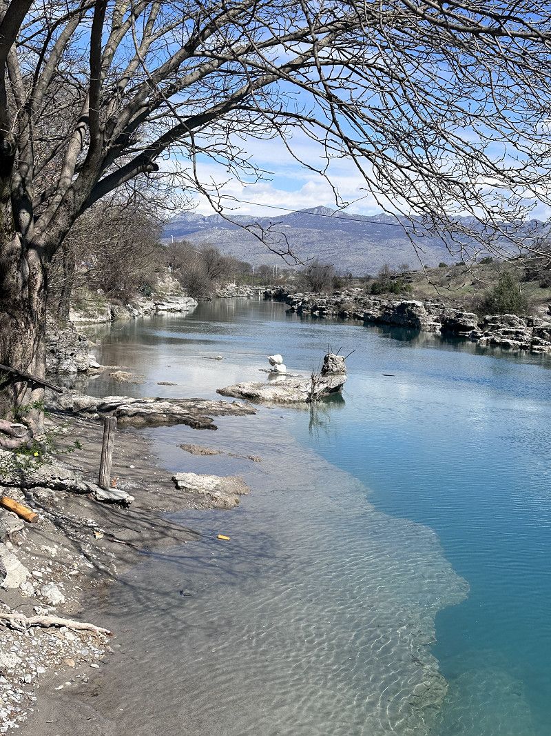
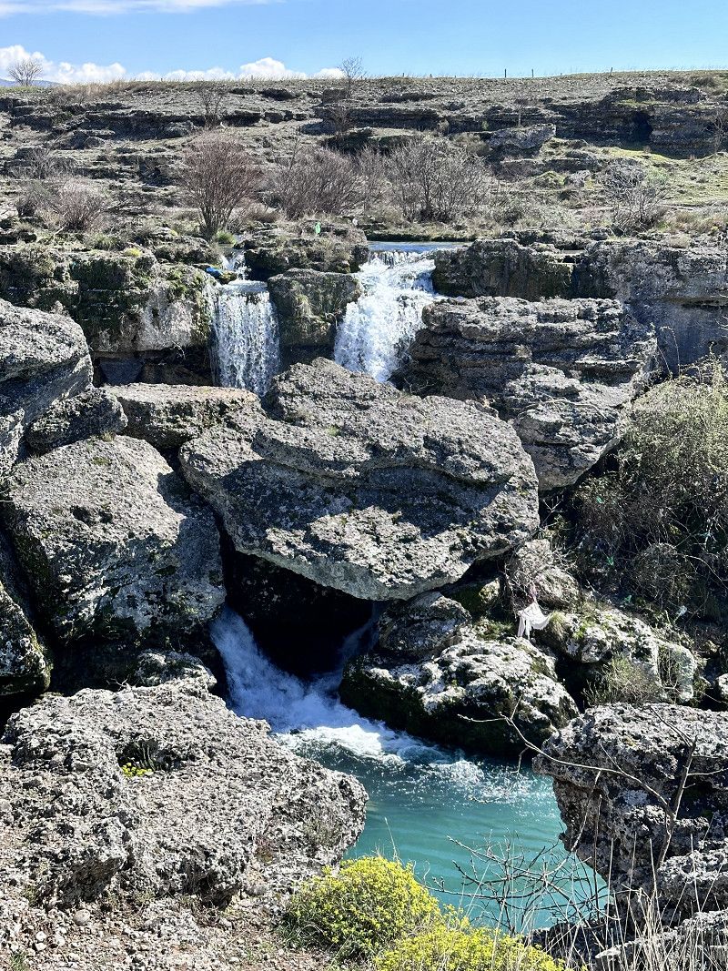
Vodopad Nijagara
We continue driving through the Sozina Tunnel (costs €5 toll for a 6m motorhome) towards Podgorica.
The waterfalls are absolutely worth seeing. There is also a nice little restaurant at this place. Extremely nice staff and good food - I would go there again at any time 🔝👍🔝
M-4, Tuzi Municipality, Montenegro
42° 22' 58.8" N 19° 16' 42.7" E
42.3830100 19.2785226
• Head northeast on Kuce Rakica. Go for 737 m.
• Turn right onto Kuce Rakica. Go for 1.7 km.
• Turn left onto E-762. Go for 2.3 km.
• Take the 3rd exit from roundabout onto E-762 toward Centar. Go for 845 m.
• Take the 2nd exit from roundabout onto Ulica Put Radomira Ivanovica (E-762). Go for 825 m.
• Take the 3rd exit from roundabout onto Bulevar Sarla de Gola (E-65/E-80/E-762) toward Nikšić/Cetinje/Petrovac/Bar. Go for 848 m.
• Turn right onto Bulevar Georgija Zukova (E-65/E-80/E-762) toward Tranzit. Go for 810 m.
• Pass 9 roundabouts and continue on E-762. Go for 20.3 km.
• Take the 1st exit from roundabout onto Ulica Blaza Mrakovica toward Centar. Go for 455 m.
• Turn slightly right onto Ulica I. Bokeljske brigade. Go for 310 m.
• Take the 1st exit from roundabout. Go for 63 m.
• Turn left onto Ulica Njego Beva. Go for 109 m.
• Continue on Ulica Njegoseva. Go for 152 m.
• Turn right. Go for 36 m.
• Turn left toward Ulica Sava Burica. Go for 68 m.
• Turn right onto Ulica Sava Burica. Go for 32 m.
• Continue on Ulica Kese Djurovica. Go for 536 m.
• Turn right toward Sekulici. Go for 1.3 km.
• Continue on Sekulici. Go for 3.1 km.
• Continue on Kadica Boan. Go for 1.6 km.
• Continue on Vujkovina. Go for 242 m.
• Continue on Kalezici. Go for 3.1 km.
• Continue on Vinici. Go for 3.1 km.
• Continue on Sobaici. Go for 4.9 km.
• Continue on Orasije. Go for 1.6 km.
• Turn right. Go for 1.7 km.
• Arrive at your destination on the left.
☍
50,7 km
( 57 min.)
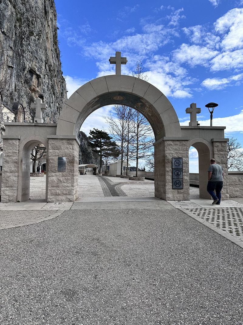
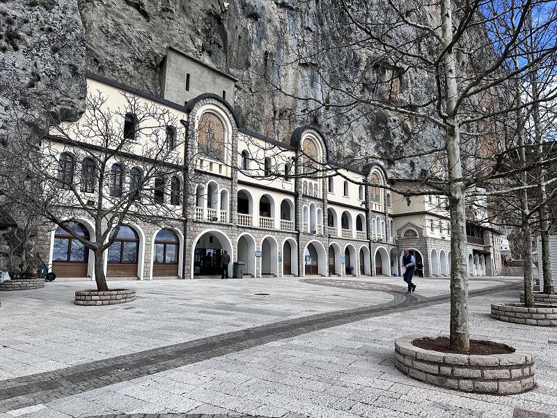
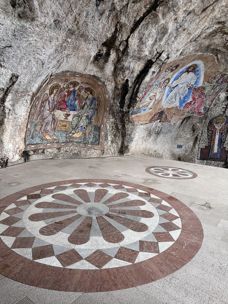
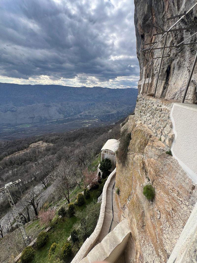
Ostrog Kloster
This monastery can only be reached via a narrow serpentine, partly single-lane, missing guardrails and hairpin bends that we had to make twice with our small motorhome (2.10 m wide and 6 m long).
Not for normal RVs, inexperienced drivers, even with a car only for those with strong nerves 😱
The Serbian Orthodox cave monastery itself is really special. Built in the rock on the slope of the Prekornica Mountains (founded in 1656). It is still inhabited by monks today.
42.6754, 19.0274
42° 40' 31.4" N 19° 1' 38.6" E
42.6754000 19.0274000
• Head northwest. Go for 34 m.
• Turn right. Go for 51 m.
• Turn right. Go for 9 m.
• Turn left. Go for 212 m.
• Continue straight ahead. Go for 1.4 km.
• Turn left toward Orasije. Go for 1.4 km.
• Continue on Orasije. Go for 4.9 km.
• Continue on Sobaici. Go for 3.1 km.
• Continue on Vinici. Go for 3.1 km.
• Continue on Kalezici. Go for 181 m.
• Continue on Vujkovina. Go for 1.6 km.
• Continue on Kadica Boan. Go for 2.5 km.
• Continue on Sekulici toward Danilovgrad. Go for 2.0 km.
• Continue on Ulica Kese Djurovica. Go for 536 m.
• Continue on Ulica Sava Burica. Go for 365 m.
• Turn right onto Ulica Blaza Mrakovica. Go for 673 m.
• Take the 3rd exit from roundabout onto E-762 toward Podgorica. Go for 964 m.
• Pass 7 roundabouts and continue on E-762. Go for 16.3 km.
• Take the 1st exit from roundabout onto Ulica Cetinjski put (M-2.3) toward Budva/Cetinje. Go for 1.2 km.
• Pass 4 roundabouts and continue on Ulica Cetinjski put (M-2.3). Go for 29.4 km.
• Take the 2nd exit from roundabout onto M-2.3 toward Bar/Kotor/Budva. Go for 27.2 km.
• Take the 1st exit from roundabout onto Ulica Jadranski put (E-65/E-80) toward Tivat/Kotor/Budva/Centar/Tivat Budva. Go for 585 m.
• Take the 2nd exit from roundabout onto Ulica Jadranski put (E-65/E-80). Go for 4.6 km.
• Turn right onto Prijevor toward Seoce/Prijevor. Go for 172 m.
• Turn slightly right onto Prijevor. Go for 208 m.
• Turn right onto Seoce. Go for 409 m.
• Turn slightly right onto Seoce. Go for 245 m.
• Turn right onto Seoce. Go for 62 m.
• Turn slightly right onto Seoce. Go for 102 m.
• Arrive at Seoce. Your destination is on the right.
☍
103,5 km
(1 hrs. 43 min.)
Camping Seoce-Budva
Small new family campsite, you feel like you have been invited to your home.
Some of it is still being built, but you won't notice anything about it. Igor, his wife and parents are extremely warm hosts. Cozy seating area, great view of the sea. Electricity, WiFi all included. Clean sanitary facilities and washing machine available. Small bar with welcome schnapps (homemade) 😁, Igor also organizes delivery service of pizzas, burgers etc. We'll be happy to come back 👍🔝
The only downside is the narrow access road; larger motorhomes could have problems. There is also a lack of supply and disposal (gray water, etc.).
Gemeinde Budva, Montenegro
42° 17' 10.7" N 18° 48' 59.6" E
42.2863121 18.8165627
• Head toward Seoca on Seoce. Go for 818 m.
• Turn right onto Prijevor. Go for 930 m.
• Turn slightly left onto Prijevor. Go for 129 m.
• Turn right onto Topliski put. Go for 281 m.
• Arrive at Topliski put.
☍
2,2 km
( 5 min.)
Day
Radweg nach Budva von CP
The old town of Budva was our destination today. We drove the 5 km down from our campsite. Igor showed us a great way so that we didn't have to go along the main road.
The path leads next to the village of Seoce past an aqua park that appears to be out of service. Then we go back up another 5 km, and I'm grateful for my e-bike 😮💨😮💨😮💨
Gemeinde Budva, Montenegro
42° 17' 29.6" N 18° 49' 21.2" E
42.2915549 18.8225552
• Head southeast on Topliski put. Go for 1.5 km.
• Continue on Ulica Obilaznica zrtava fasizma. Go for 36 m.
• Turn left onto Ulica Obilaznica zrtava fasizma. Go for 57 m.
• Continue on Ulica Tanjungska Obilaznica. Go for 78 m.
• Continue on Ulica Obilaznica zrtava fasizma. Go for 156 m.
• Continue on Ulica Tanjungska Obilaznica. Go for 27 m.
• Continue on Ulica Obilaznica zrtava fasizma. Go for 124 m.
• Turn right onto Ulica Popa Jola Zeca. Go for 368 m.
• Continue on Svatovska ulica. Go for 85 m.
• Arrive at Svatovska ulica. Your destination is on the right.
☍
2,4 km
( 5 min.)
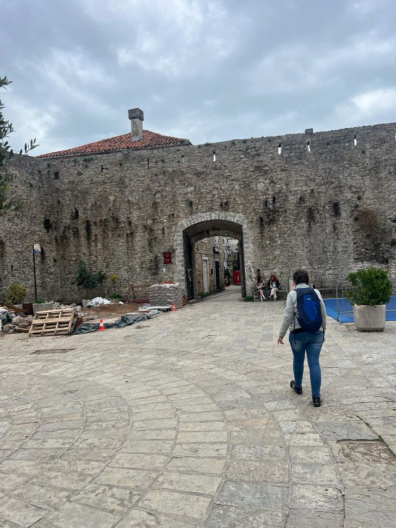
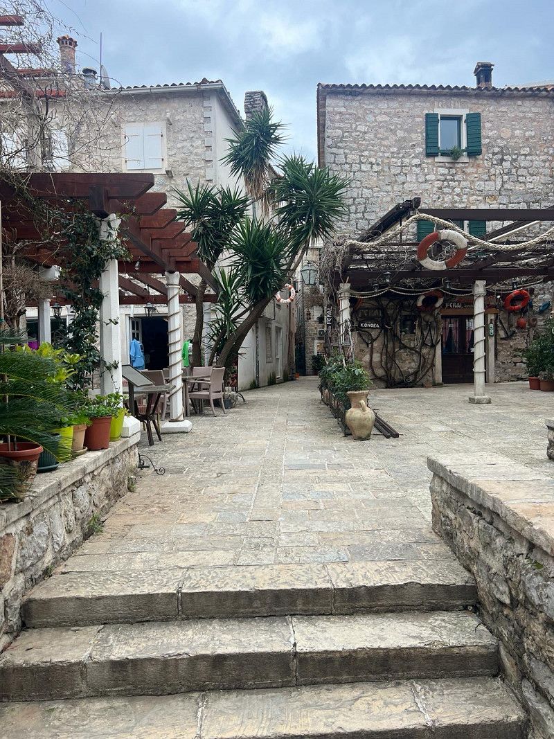
Budva
The old town is really worth seeing, small streets, shops and many nice restaurants. We didn't visit the museum with the citadel and library due to time constraints. Entry costs €4.50.
Gemeinde Budva, Montenegro
42° 17' 18.8" N 18° 50' 31" E
42.2885656 18.8419505
• Head toward Ulica Popa Jola Zeca on Svatovska ulica. Go for 85 m.
• Turn left onto Ulica Mainski put. Go for 123 m.
• Continue on Ulica Jadranski put (E-65/E-80). Go for 3.6 km.
• Turn right onto Prijevor toward Seoce/Prijevor. Go for 172 m.
• Turn slightly right onto Prijevor. Go for 208 m.
• Turn right onto Seoce. Go for 409 m.
• Turn slightly right onto Seoce. Go for 245 m.
• Turn right onto Seoce. Go for 62 m.
• Turn slightly right onto Seoce. Go for 102 m.
• Arrive at Seoce. Your destination is on the right.
☍
5,0 km
( 8 min.)
Camping Seoce-Budva
We liked it here so much, we're staying another night 😁
Seoce No., 85310, Budva / Village Seoce, Montenegro
42° 17' 10.9" N 18° 48' 59.9" E
42.2863560 18.8166370
• Head toward Seoca on Seoce. Go for 818 m.
• Turn left onto Prijevor. Go for 51 m.
• Keep right onto Prijevor. Go for 308 m.
• Turn slightly right onto Prijevor. Go for 21 m.
• Turn sharp right onto Prijevor (E-65/E-80). Go for 14.3 km.
• Take the 1st exit from roundabout onto Jadranski put (R-22) toward Kotor. Go for 4.4 km.
• Take the 1st exit from roundabout onto Skaljari (E-65/E-80). Go for 879 m.
• Turn right toward Trg Mata Petrovica. Go for 67 m.
• Continue on Trg Mata Petrovica. Go for 208 m.
• Turn right. Go for 44 m.
• Arrive at your destination.
☍
21,1 km
( 24 min.)
Day
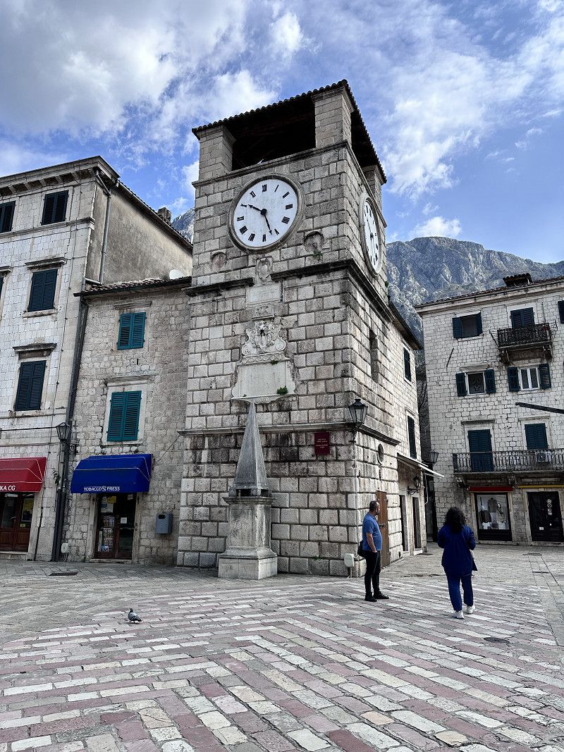
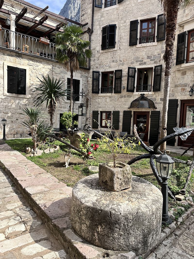
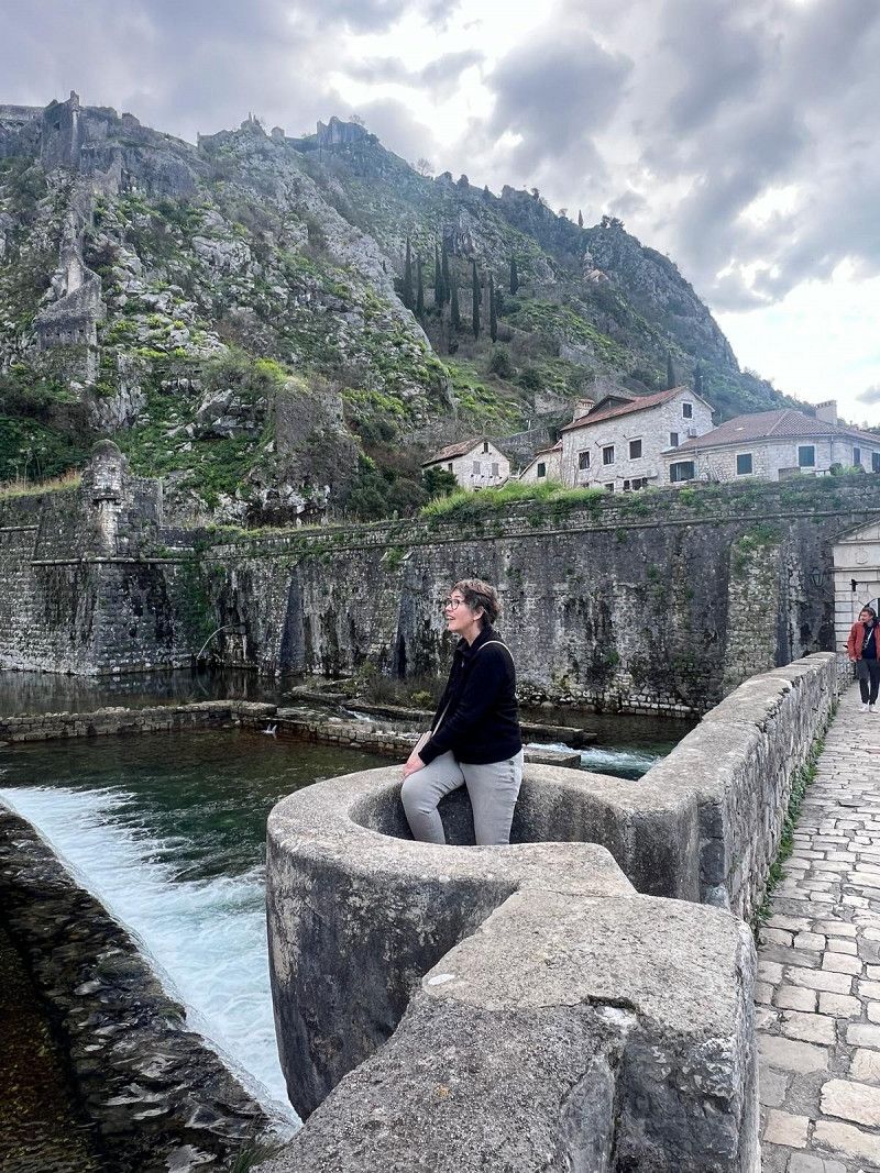
Altstadt und Bucht von Kotor
Kotor is the oldest city in Montenegro. The history goes back to the era of the Roman Empire.
The old town is surrounded by a city wall. There is a guarded parking lot right next to it for €3 per hour. I can't say whether it would be possible to stay overnight.
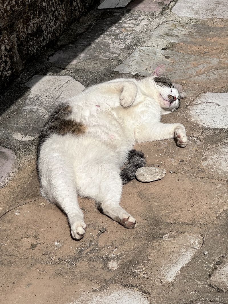
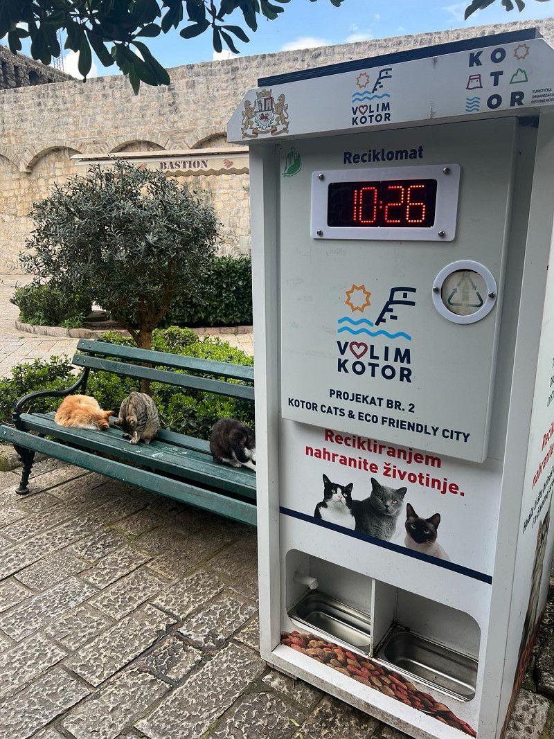
In addition to pretty streets, restaurants and many shops, including handicrafts, the city is known for its cats 🐈⬛ 🐈
There is a pet bottle recycling machine in this town, you put an old bottle in and cat food comes out 😂
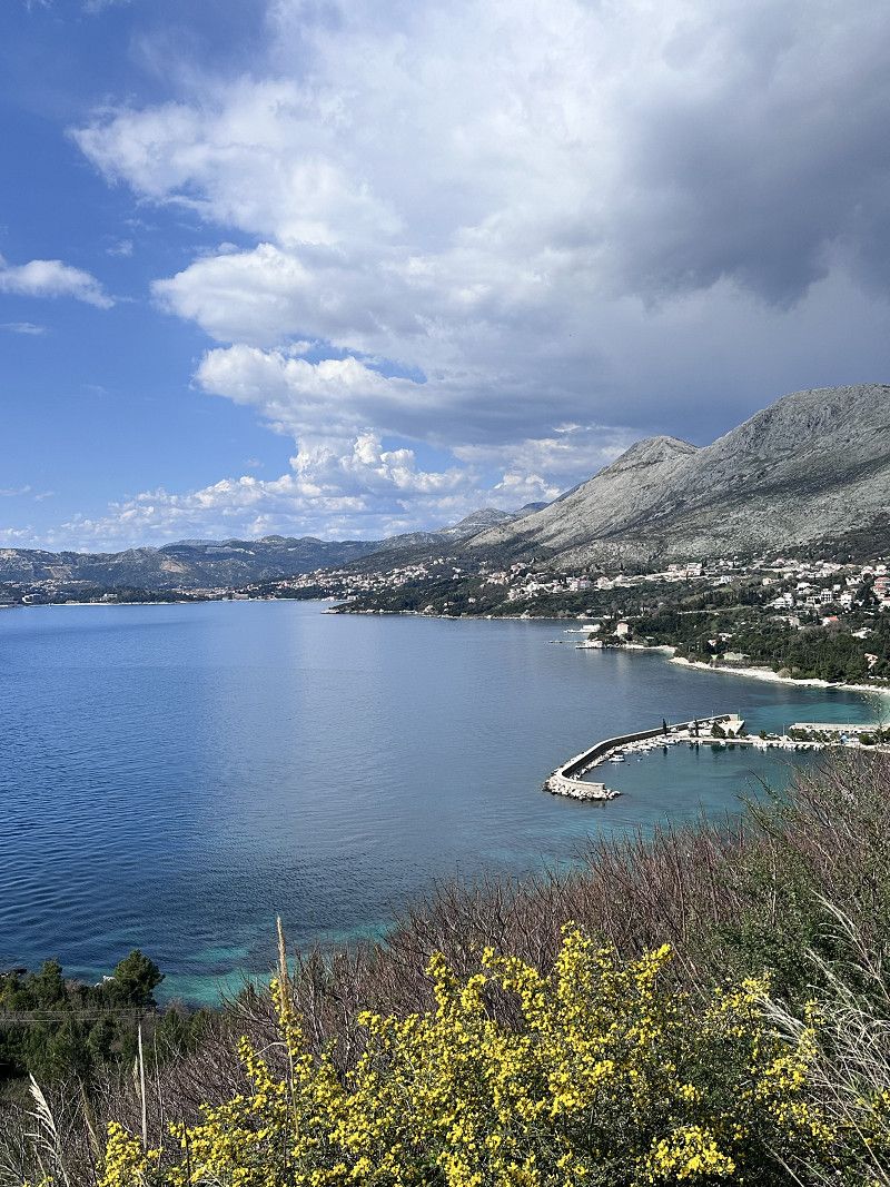
The Bay of Kotor is also a highlight. To continue following the Adriatica Magistrale, you can drive around the bay (like a Norwegian fjord) or take the ferry. We did the latter. ⛴️
Gemeinde Kotor, Montenegro
42° 25' 29.5" N 18° 46' 15.8" E
42.4248515 18.7710437
• Head north. Go for 44 m.
• Turn left toward Trg Mata Petrovica. Go for 86 m.
• Continue on Trg Mata Petrovica. Go for 189 m.
• Turn left onto Ulica Jadranski put (E-65/E-80). Go for 855 m.
• Take the 2nd exit from roundabout onto Skaljari (R-1) toward Autobuska stanica/Budva/Tivat. Go for 4.4 km.
• Take the 2nd exit from roundabout onto Jadranski put (E-65/E-80) toward Tivat. Go for 3.2 km.
• Pass 3 roundabouts and continue on Seljanovo (E-65/E-80). Go for 7.0 km.
• Arrive at Lepetane (E-65/E-80). Your destination is on the right.
☍
15,8 km
( 19 min.)
Trajekt Ferry
Departure port: Lepetane
Gemeinde Tivat, Montenegro
42.4658174 18.6866829
Arrival port: Kamenari
Gemeinde Herceg Novi, Montenegro
42.466839918.673497
• Head northwest on Kamenari. Go for 196 m.
• Turn right onto Kamenari (E-65/E-80). Go for 12.4 km.
• Take the 2nd exit from roundabout onto Ulica Zemunska (E-65/E-80) toward Dubrovnik/Igalo/Herceg Novi. Go for 12.8 km.
• Arrive at E-65/E-80.
☍
12,0 km
( 22 min.)
Info Kroatien
Entry with an identity card (CH ID) or a valid passport.
Vehicle documents are checked, but only if you come from Montenegro
Croatia has been part of the Schengen area since 2023, entry from Slovenia - no entry controls
Maximum speed 50 in town / 90 outside town, expressway 110 km
Motorway toll 130 km maximum speed
October - March daytime running lights
Currency Euro
Gas station network good and rarely served (they are happy about a small tip)
AdBlue available
Free camping is prohibited and will be punished with a fine
Grenzübertritt Kroatien
The border crossing from Montenegro is still controlled. Both vehicle documents and passports.
Logically, the Schengen agreement does not apply here, since Montenegro is not in the EU, but is only a candidate for membership.
• Continue on Jadranska magistrala (8). Go for 35.6 km.
• Take ramp onto Ulica Pera Bakića toward Dubrovnik. Go for 764 m.
• Turn right onto Ulica Vladimira Nazora toward Gruž/Lapad/Luka Dubrovnik. Go for 82 m.
• Keep left onto Ulica Vladimira Nazora toward Gruž/Lapad/Luka Dubrovnik. Go for 484 m.
• Make a U-Turn at Ulica od Gale onto Ulica Vladimira Nazora. Go for 220 m.
• Turn right onto Splitski put. Go for 301 m.
• Turn right onto Put od Republike. Go for 205 m.
• Keep right onto Put od Republike. Go for 39 m.
• Continue on Ulica Vladimira Nazora. Go for 25 m.
• Turn right onto Ulica Vladimira Nazora. Go for 41 m.
• Arrive at Ulica Vladimira Nazora.
☍
37,8 km
( 43 min.)
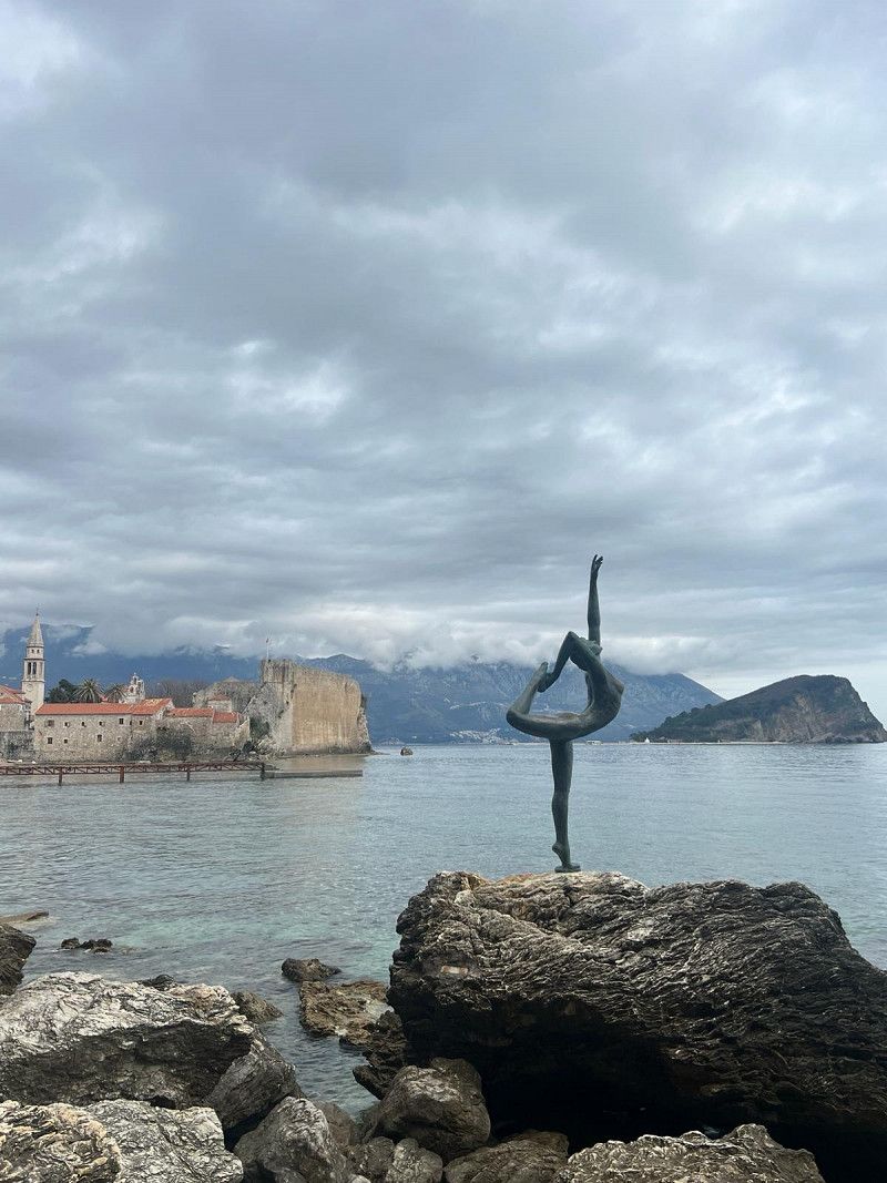
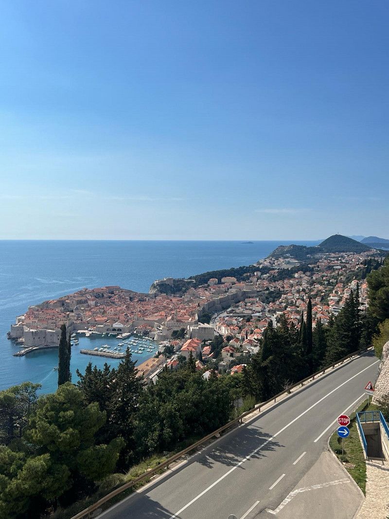
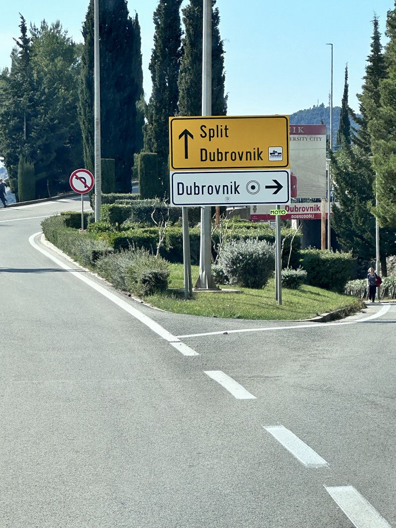
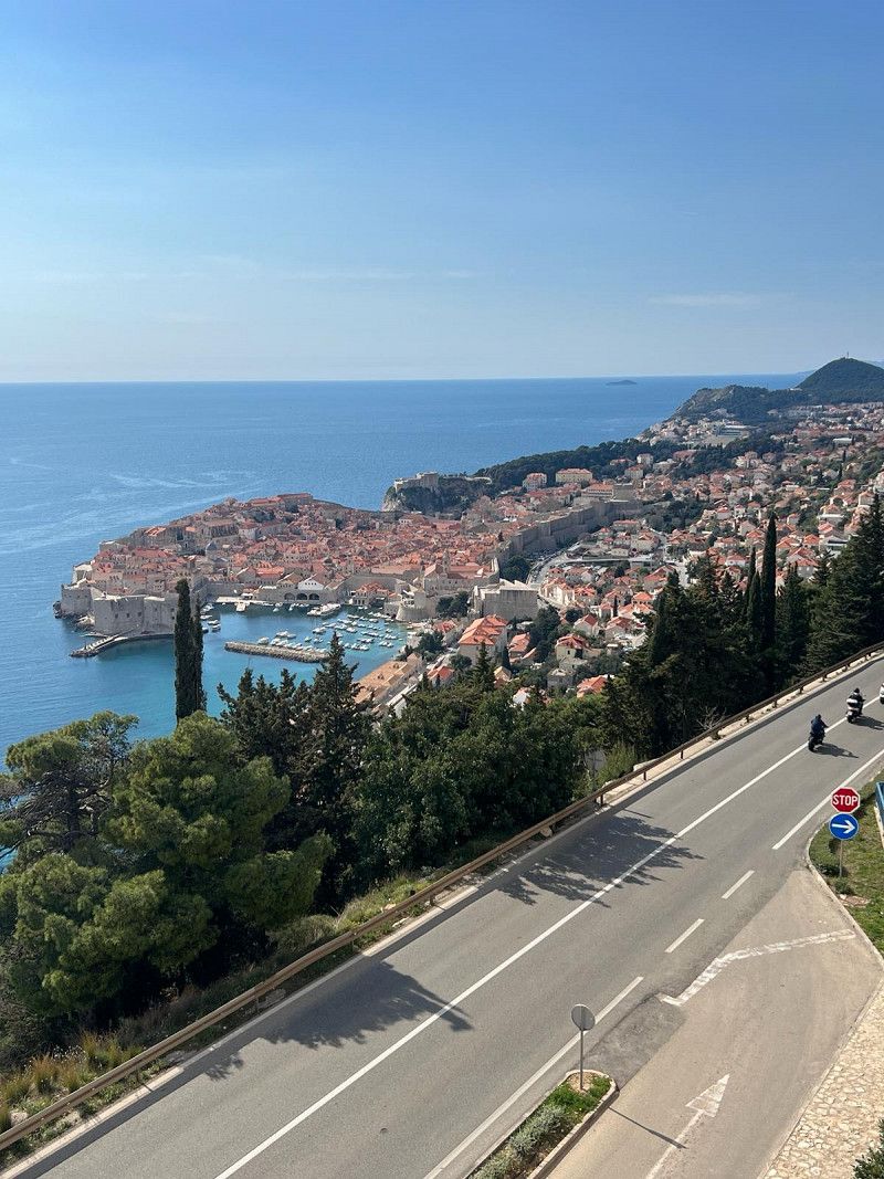
Dubrovnik
The city of Dubrovnik has an interesting fortress from the outside, but after half an hour we still couldn't find a motorhome parking space.
All parking spaces near the old town are reserved for residents or are not suitable for motorhomes 😮💨
Since we have already visited a beautiful old town in Kotor today, we continue.
Maybe another time 😁
Gespanschaft Dubrovnik-Neretva, Kroatien
42° 38' 55.5" N 18° 5' 40.8" E
42.6487363 18.0946802
• Head northwest on Ulica Vladimira Nazora. Go for 41 m.
• Turn right onto Ulica Vladimira Nazora. Go for 619 m.
• Keep left onto Ulica Vladimira Nazora toward Split/Cavtat/Zračna luka. Go for 48 m.
• Continue on Ulica Pera Bakića toward Split/Cavtat/Zračna luka. Go for 273 m.
• Take ramp onto Jadranska magistrala (8) toward Split. Go for 47.0 km.
• Turn right onto Jadranska magistrala (8). Go for 866 m.
• Turn left onto 414 toward Trpanj/Korčula/Ston/Orebić/otok Mljet. Go for 5.6 km.
• Turn left toward Broce. Go for 1.7 km.
• Turn left onto Broce. Go for 470 m.
• Continue on Broce. Go for 97 m.
• Turn slightly right onto Put za Kobaš. Go for 330 m.
• Turn slightly right onto Bižanj. Go for 1.7 km.
• Continue on Hrasno. Go for 3.8 km.
• Turn slightly left onto Kobaš. Go for 528 m.
• Arrive at Kobaš. Your destination is on the left.
☍
63,1 km
(1 hrs. 14 min.)
Broce in der Nähe von Ston
Standing free is actually forbidden in Croatia and in many places this is punished with fines. We found this place on the Park4Night app.
A somewhat narrow path, the last 500 m is a gravel road, leads to this place. Easily feasible for vans and small motorhomes.
It is a parking lot for a restaurant in an idyllic location in the bay near Ston. We had a very good dinner here. When we asked if we could stay, we were even offered coffee for the next day. A very nice owner 🥹
Thank you for your hospitality ❣️
69056, Broce, Dubrovnik-Neretva County, Croatia
42° 48' 17.6" N 17° 44' 32.1" E
42.8048853 17.7422439
• Head southwest on Kobaš. Go for 528 m.
• Turn slightly right toward Hrasno. Go for 3.6 km.
• Continue on Hrasno. Go for 1.4 km.
• Continue on Bižanj. Go for 540 m.
• Turn slightly left onto Put za Kobaš. Go for 330 m.
• Turn slightly left onto Broce. Go for 245 m.
• Continue on Broce. Go for 1.9 km.
• Arrive at your destination on the right.
☍
8,5 km
( 21 min.)
Austern von Mali Ston
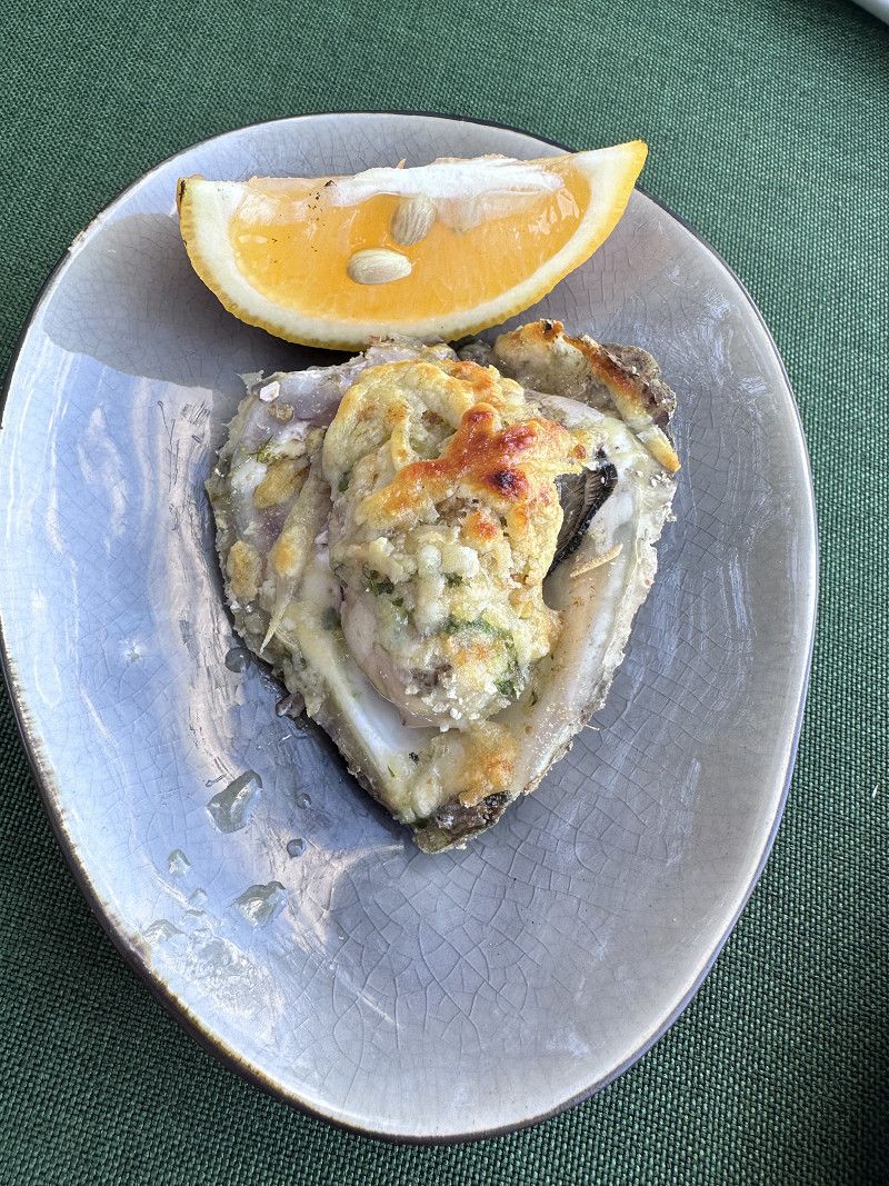
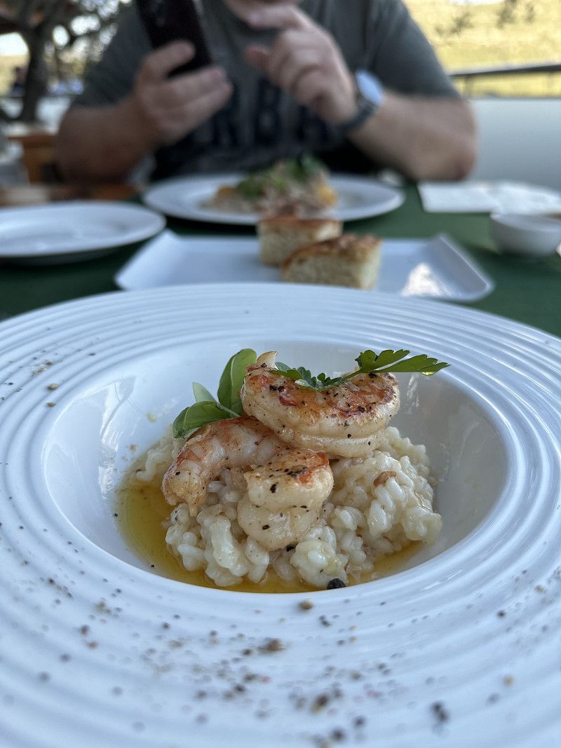
Mali Ston is beautifully situated on the canal and is famous for its oyster and mussel farming, but also for the small medieval old town. There are many restaurants in this region that offer oysters and other sea specialties.
I was able to enjoy an oyster 🦪 gratinated with cheese and a risotto with shrimps. Simply wonderful 😊
Day
Wehrmauer von Ston
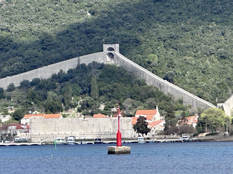
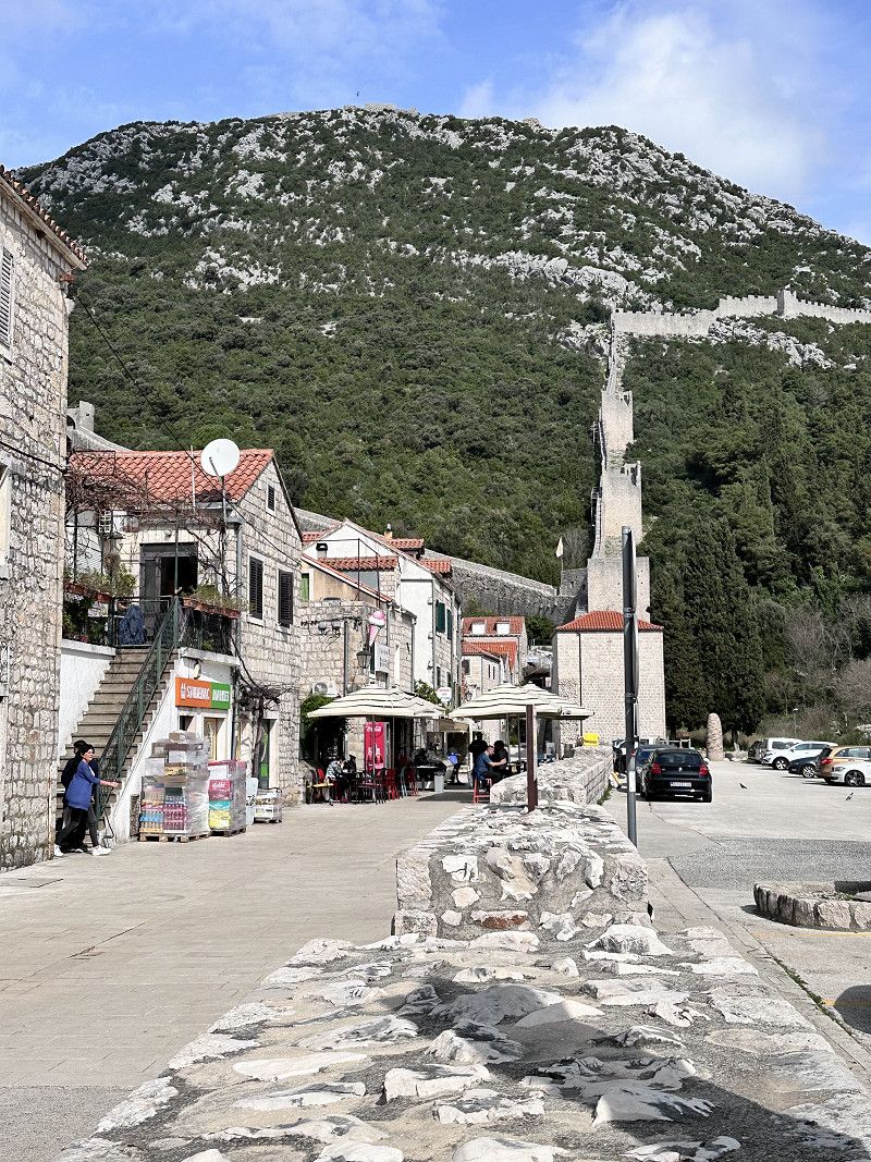
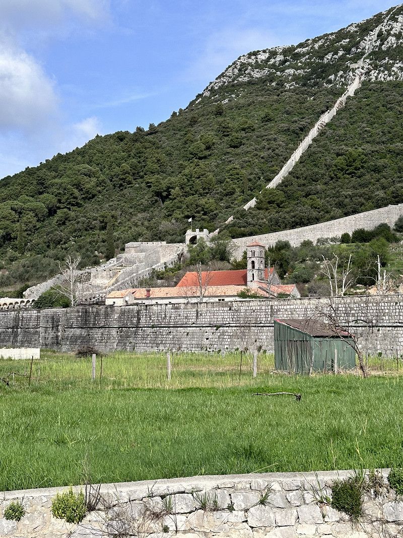
On the way back from our dreamy place to sleep we drive through next to Ston. We can see the impressive defensive wall from afar. There is a reason for this, because next to the Chinese Wall, it is the longest outside of China at 5.5 km. A truly important building in Croatia. Construction began in 1333 and took 400 years to complete.
The wall connects Ston with the bay of Mali Ston and is largely accessible.
69056, Ston, Dubrovnik-Neretva County, Croatia
42° 50' 7.4" N 17° 41' 48.9" E
42.8353876 17.6969274
• Head toward Pelješki put. Go for 82 m.
• Turn left onto Pelješki put (414). Go for 2.5 km.
• Continue toward 674. Go for 358 m.
• Turn left and take ramp onto 674 toward Split/Orebić/Ploče. Go for 25.0 km.
• Continue on Jadranska magistrala (8). Go for 21.9 km.
• Turn left onto 425 toward Ploče/A1/Zagreb/Split. Go for 150 m.
• Keep right onto 425 toward Zagreb/Split. Go for 14.7 km.
• Take the exit onto A1 (Čvor Ploče). Go for 214 km.
• Take exit 19 toward Sukošan/Zadar-centar/Zemunik-Zračna luka/Zemunik D./Dugi otok/otok Ugljan/Bibinje/Škabrnja/Smilčić onto 424 (Čvor Zadar istok). Go for 19.1 km.
• Take the 1st exit from roundabout toward Centar. Go for 1.0 km.
• Continue on Gaženička cesta toward Centar. Go for 215 m.
• Take the 3rd exit from roundabout onto Ulica braće Miroslava i Janka Perice. Go for 789 m.
• Continue on Ulica Vladka Mačeka. Go for 621 m.
• Continue on Ulica dr. Franje Tuđmana (407) toward Vir/Nin/Pag/Centar/Luka/Borik. Go for 2.1 km.
• Take the 3rd exit from roundabout onto Ulica Ivana Meštrovića. Go for 117 m.
• Turn right onto Ulica Ivana Gundulića. Go for 404 m.
• Continue on Ulica Denisa Špike. Go for 483 m.
• Continue on Put Dikla. Go for 904 m.
• Turn left onto Ulica Antuna Gustava Matoša toward Puntamika. Go for 78 m.
• Turn right onto Ulica Antuna Gustava Matoša. Go for 58 m.
• Turn left. Go for 213 m.
• Make a U-Turn. Go for 213 m.
• Turn left onto Ulica Antuna Gustava Matoša. Go for 210 m.
• Arrive at Ulica Antuna Gustava Matoša. Your destination is on the right.
☍
304,7 km
(3 hrs. 5 min.)
Jadranska Magistrala
Today another section of the Jadranska Mainline is on the agenda. It is rightly said that this is probably the most beautiful coastal road in Europe.
In any case, the route is long. From Ulcinj in Montenegro, all of Croatia, Slovenia to Trieste in Italy, there are over 1000 km of coastal roads.
All along the way you have spectacular views of picturesque towns, breathtaking mountain ranges and landscapes and the deep blue sea, the Adriatic.
Falkensteiner Premium Camping Zadar
Today we would like to have a good time. In March almost all campsites are closed. And standing alone is punished with a fine - so we drive to this place.
Now this is really a top place. Certainly very crowded in high season.
Super nice sanitary facilities and heated. Restaurant, market and entertainment are of course still closed.
However, the wellness area of the attached hotel can be used free of charge 👍
Majstora Radovana 7, 23000, Zadar, Croatia
44° 8' 12.6" N 15° 12' 50" E
44.1368300 15.2138900
• Head southeast on Ulica Antuna Gustava Matoša. Go for 210 m.
• Turn right. Go for 213 m.
• Make a U-Turn. Go for 213 m.
• Turn right onto Ulica Antuna Gustava Matoša. Go for 58 m.
• Turn right onto Ulica Antuna Gustava Matoša. Go for 384 m.
• Turn left onto Ulica Vladana Desnice toward Centar. Go for 452 m.
• Continue on Obala kneza Trpimira. Go for 560 m.
• Turn right onto Obala kneza Trpimira. Go for 1.6 km.
• Continue on Ulica Ivana Meštrovića. Go for 174 m.
• Turn right onto Oko vrulja toward Rijeka/Split/Centar. Go for 281 m.
• Continue on Ulica Josipa Jurja Strossmayera. Go for 397 m.
• Turn right onto Ulica bana Josipa Jelačića. Go for 123 m.
• Turn left onto Obala kneza Branimira. Go for 488 m.
• Turn right onto Obala kneza Branimira toward Zagreb/Rijeka/Split/Centar. Go for 112 m.
• Turn right onto Obala kralja Tomislava (407) toward Centar. Go for 618 m.
• Continue on Liburnska obala (407). Go for 713 m.
• Continue on Istarska obala (407). Go for 210 m.
• Arrive at Istarska obala (407). Your destination is on the right.
☍
6,8 km
( 17 min.)
Day
Zadar Altstadt
Today we first enjoyed the sun and the campsite ⛺️.
Towards the afternoon we packed our bikes and drove along the beach, past the harbor and into the old town of Zadar.
In addition to the many interesting sights, such as the “Square of the 5 Wells” or the “Kopnena Vrata” gate, also called “Porta Terraferma”, there are two modern installations in the north of the Riva waterfront promenade.
Both installations are by architect Nikola Bašić; “the sea organ” and “the greeting to the sun”.
The sea organ creates music 🎵 🎶 by waves under the water surface displacing the air through a system of tubes and therefore making organ pipes sound 😍
The Greetings to the Sun is a square with a diameter of 22 meters and consists of 300 glass plates in the ground. During the day, the solar cells collect energy to release a color spectacle at sunset 🌅 😲
Obala kralja Petra Krešimira IV, Zadar, Gespanschaft Zadar, Kroatien
44° 7' 1.4" N 15° 13' 12" E
44.1170424 15.2199991
• Head southeast on Istarska obala (407). Go for 201 m.
• Continue on Liburnska obala (407). Go for 713 m.
• Continue on Obala kralja Tomislava (407). Go for 618 m.
• Turn right onto Ulica Marka Marulića (407) toward A1/Bolnica. Go for 214 m.
• Turn left onto Ulica Nikole Šubića Zrinskog (407) toward Zagreb/Split. Go for 498 m.
• Continue on Ulica Ante Starčevića (407) toward Zagreb/Rijeka/Split/Šibenik. Go for 1.7 km.
• Continue on Zagrebačka ulica (8) toward Zagreb/Rijeka/Nin. Go for 16.9 km.
• Turn right and take ramp onto A1 (Autocesta Bosiljevo-Split-Dubrov.) toward Pag/Posedarje/Smilčić/Zagreb/Rijeka. Go for 188 km.
• Take exit 7 toward Pula/Rijeka onto A6 (Čvor Bosiljevo II). Go for 78.8 km.
• Take middle ramp onto Orehovica (A7) toward Pula/Opatija/Rijeka zapad. Go for 11.9 km.
• Take ramp onto Istarski Ipsilon (A8) toward Pula/Pazin/Opatija. Go for 1.3 km.
• Take the 2nd exit from roundabout onto Kvarnerska cesta. Go for 287 m.
• Continue toward 8. Go for 35 m.
• Take the 2nd exit from roundabout onto 8. Go for 340 m.
• Take the 1st exit from roundabout onto Nova cesta (66) toward Cres/Opatija. Go for 7.1 km.
• Arrive at Liburnijska ulica (66).
☍
308,3 km
(3 hrs. 6 min.)
Day
Küstenstrasse bis Lovran
We drive along the Adriatic coastal road one last time. At Rijeka we drive a short distance further towards Pula on road 66 (Route 66 of Croatia 😅).
The landscape is constantly changing, so the coast off Rijeka is mountainous, barren with a view of the deep blue sea 🌊
afterwards more with palm trees 🌴 cypresses and houses like on the Riviera.
Shortly after Zadar we were able to watch a fisherman at work. He grows mussels and oysters on site 🦪
• Turn right onto Poljanska cesta (5048). Go for 2.1 km.
• Turn right onto Poljanska cesta (5048). Go for 559 m.
• Turn right onto Ladeti (5048). Go for 843 m.
• Continue on Poljane (5048). Go for 617 m.
• Continue on Poljanska cesta (5048). Go for 1.1 km.
• Turn left onto Vlašići (5048). Go for 697 m.
• Turn right onto Škalnice (5048). Go for 338 m.
• Continue on Jurovići (5048). Go for 264 m.
• Continue on 5048. Go for 13 m.
• Continue on Kalina (5048). Go for 257 m.
• Turn left and take ramp onto Istarski Ipsilon (A8) toward Pazin. Go for 2.9 km.
• Turn left onto Istarski Ipsilon (A8). Go for 12.7 km.
• Take exit 6 toward Buzet. Go for 384 m.
• Turn right onto Lupoglav (44) toward Buzet/Lupoglav. Go for 10.7 km.
• Turn right toward Brgad. Go for 85 m.
• Turn right toward Gornja Nugla. Go for 1.6 km.
• Continue on Gornja Nugla. Go for 159 m.
• Turn slightly left onto Gornja Nugla (50034). Go for 283 m.
• Turn left onto Gornja Nugla. Go for 1.5 km.
• Arrive at your destination.
☍
37,1 km
( 42 min.)
Picknickplatz im Nirgendwo
Traveling also makes you hungry and we lost our way a little while looking for a picnic spot 😂😂😂
But it was worth it 👍
Istria County, Croatia
45° 25' 20.8" N 14° 0' 44.8" E
45.4224532 14.0124542
• Head south. Go for 1.4 km.
• Continue on Gornja Nugla. Go for 148 m.
• Turn right onto Gornja Nugla (50034). Go for 283 m.
• Turn slightly right onto Gornja Nugla. Go for 159 m.
• Continue straight ahead. Go for 1.6 km.
• Turn left toward 44. Go for 85 m.
• Turn right onto 44. Go for 4.4 km.
• Pass 3 roundabouts and continue on 201. Go for 6.9 km.
• Arrive at 201. Your destination is on the left.
☍
15,0 km
( 21 min.)
Info Slowenien
Entry with an identity card (CH ID) or a valid passport.
The Schengen Agreement applies in Slovenia - no entry controls
Maximum speed 50 in town / 90 outside town, expressway 110 km
Motorway toll 130 km maximum speed
Daytime running lights mandatory
Currency Euro
Gas station network - AdBlue available
Free camping is prohibited and will be punished with a fine
Grenzübertritt Slowenien
There is certainly a lot to see in Slovenia. This time we are just passing through and it is only 50 km to Italy.
Another time with pleasure 😉
D201, Kodolje, Gespanschaft Istrien, Kroatien
45° 27' 8.9" N 13° 55' 34.5" E
45.4524810 13.9262420
• Head north on 201. Go for 95 m.
• Continue on Maršiči (208). Go for 15.6 km.
• Turn right onto Kortine (208) toward Ljubljana/A1. Go for 2.9 km.
• Turn right onto Gabrovica pri Črnem Kalu (627) toward Osp/Gabrovica. Go for 853 m.
• Turn right onto Gabrovica pri Črnem Kalu (627). Go for 535 m.
• Continue on Osp (627). Go for 36 m.
• Continue on Gabrovica pri Črnem Kalu (627). Go for 49 m.
• Continue on Osp (627). Go for 2.8 km.
• Continue on Osp 627. Go for 3 m.
• Arrive at Osp 627. Your destination is on the right.
☍
22,8 km
( 24 min.)
Info Italien
Entry with an identity card (CH ID) or a valid passport.
The Schengen Agreement applies in Italy - no entry controls
Maximum speed 50 in town / 90 outside town, expressway 110 km
Motorway toll 130 km maximum speed
Daytime running lights mandatory
Currency Euro
Gas station network good, AdBlue available
Free camping is prohibited, but there are good pitches
Grenzübertritt Italien
So now Enspurt 💨💨💨
Now it's another 135 km onto the motorway. Tomorrow we want to go to an outlet village before we finally go home 🏠.
Frazione Crociata 77/A, Italien
45° 34' 56.4" N 13° 50' 20.7" E
45.5823390 13.8390760
• Head toward Località Crociata on Osp 627. Go for 82 m.
• Continue on Località Crociata di Prebenico (SP13). Go for 796 m.
• Continue on SP13. Go for 1.1 km.
• Continue on Località Noghere (SP13). Go for 748 m.
• Take the 2nd exit from roundabout. Go for 85 m.
• Continue on Località Noghere (SP13). Go for 211 m.
• Continue on Via Flavia di Stramare. Go for 111 m.
• Take the 5th exit from roundabout onto Via Flavia di Stramare. Go for 322 m.
• Continue toward Via Caduti sul Lavoro. Go for 39 m.
• Take the 1st exit from roundabout onto Via Caduti sul Lavoro. Go for 387 m.
• Continue toward SS15. Go for 43 m.
• Take the 1st exit from roundabout onto SS15 toward Fernetti/E70/Venezia/A4/E55/Tarvisio/A23/Trieste/Aquilinia. Go for 199 m.
• Take left ramp onto Raccordo Lacotisce-Rabuiese toward Fernetti/E70/Venezia/A4/E55/Tarvisio/A23. Go for 2.5 km.
• Take ramp onto Strada Statale Triestina (SS202) toward Fernetti/E70/RA14/Venezia/A4/E55/Tarvisio/A23. Go for 32.3 km.
• Continue on A4 (Autostrada della Serenissima). Go for 82.8 km.
• Take the exit toward S. Stino di Livenza/S. Stino di L. Centro. Go for 1.1 km.
• Take the 2nd exit from roundabout onto Via Fosson (SP61) toward S. Stino di L. Centro. Go for 405 m.
• Turn right onto Via Ippolito Nievo. Go for 211 m.
• Turn left onto Via Wolfgang Amadeus Mozart. Go for 226 m.
• Turn left onto Via Albert Einstein. Go for 46 m.
• Arrive at Via Albert Einstein. Your destination is on the right.
☍
123,7 km
(1 hrs. 11 min.)
San Stino di Livenza
Once again the Park4Night app is in use and led us to this parking space.
A free place on a quiet street. A really good place for a stopover, electricity is also available free of charge, gray water and chemical toilets can be disposed of and fresh water refilled.
We went out to eat in town that evening. It was delicious 😋
Via Antonio Vivaldi 4, San Stino di Livenza, Venezia, Italy
45° 43' 56.8" N 12° 40' 40.3" E
45.7324557 12.6778746
• Head toward Via Antonio Vivaldi on Via Albert Einstein. Go for 28 m.
• Turn left onto Via Antonio Vivaldi. Go for 51 m.
• Turn left onto Via Giacomo Puccini. Go for 83 m.
• Turn right onto Via Wolfgang Amadeus Mozart. Go for 162 m.
• Turn right onto Via Ippolito Nievo. Go for 211 m.
• Turn right onto Via Giacomo Matteotti (SP61). Go for 89 m.
• Take the 4th exit from roundabout onto Via Giacomo Matteotti (SP61). Go for 464 m.
• Take the 4th exit from roundabout onto Via Piancavallo (SP61) toward Trieste/Venezia/Portogruaro/Triestina/SS14/Treviso/Pordenone/Motta di L./Annone V./Caorle/A4/Milano. Go for 1.5 km.
• Take the 3rd exit from roundabout onto Via Morer delle Anime (SP52). Go for 487 m.
• Continue on Piazza Cavalieri di Vittorio Veneto (SP52). Go for 16 m.
• Take the 1st exit from roundabout onto Riviera Corbolone (SP52). Go for 911 m.
• Turn right onto Via Meduna (SP52). Go for 221 m.
• Continue on Via Corbolone. Go for 3.0 km.
• Continue on Strada Muggia. Go for 1.1 km.
• Take the 3rd exit from roundabout onto Via Callalta Capoluogo (SR53). Go for 1.3 km.
• Take the 2nd exit from roundabout onto Via Callalta Capoluogo (SR53). Go for 851 m.
• Turn left onto Via 4 Novembre. Go for 175 m.
• Turn left onto Via 4 Novembre. Go for 226 m.
• Turn right onto Via Cordamola. Go for 179 m.
• Take the 2nd exit from roundabout onto Via Cordamola. Go for 103 m.
• Continue on Piazzale Martiri della Libertà. Go for 159 m.
• Turn left onto Viale Europa. Go for 255 m.
• Turn left onto Borgo Girolamo Aleandro. Go for 156 m.
• Turn right onto Via del Girone. Go for 92 m.
• Continue on Via Sante Nardini. Go for 24 m.
• Arrive at Via Sante Nardini. Your destination is on the right.
☍
11,9 km
( 15 min.)
Day
Motta di Livenza
We are still a little early for the outlet village and so we take a short detour to this pretty little town.
Many seaside places are well known in this area. Caorle, Bibione or Jesolo. Nothing is going on there at this time of year and there is life in the hinterland 🤩
The locals also recommend having a cappuccino and croissants in a café bar 😁
Via del Girone, Motta di Livenza, Treviso, Veneto, Italy
45° 46' 30.9" N 12° 36' 38.4" E
45.7752591 12.6106798
• Head toward Via Cesare Battisti on Via Sante Nardini. Go for 94 m.
• Turn left onto Via Riva Monticano. Go for 84 m.
• Turn right onto Via Contarina. Go for 159 m.
• Continue on Via Albano Capoluogo. Go for 457 m.
• Take the 2nd exit from roundabout onto Via Albano Capoluogo. Go for 332 m.
• Continue on Via Contarina. Go for 25 m.
• Take the 2nd exit from roundabout onto Via Aldo Moro (SP53). Go for 1.2 km.
• Pass 3 roundabouts and continue on Via Calnova Alta (SP53). Go for 4.2 km.
• Take the 1st exit from roundabout onto Via Magnadola (SP54). Go for 387 m.
• Turn left onto Via Calnova (SP66). Go for 1.2 km.
• Take the 2nd exit from roundabout onto Via Calnova Boschi (SP66). Go for 6.5 km.
• Take the 4th exit from roundabout onto Via Santa Maria di Campagna toward Noventa di P. Centro/Venezia-Milano/A4/San Donà di P./SP63/Jesolo/Caorle. Go for 932 m.
• Continue straight ahead. Go for 54 m.
• Take the 6th exit from roundabout toward Noventa di P. Centro/S. Donà di Piave/Oderzo/Jesolo/Trieste/Venezia/S.Teresina. Go for 555 m.
• Continue toward Via Marco Polo. Go for 177 m.
• Turn right onto Via Marco Polo. Go for 318 m.
• Turn right onto Via Marco Polo. Go for 109 m.
• Arrive at Via Marco Polo. Your destination is on the left.
☍
16,8 km
( 17 min.)
Outlet-Dorf in Noventa di Piave
With the right wallet you could spend the whole day here 🙈
But worth a trip even without it. Before we go home today 🏠, we take a leisurely stroll through the piazza, go out for a delicious meal and also find a couple of affordable souvenirs (not at Prada & Co. 😂).
Strengthened, we now head towards the motorway and on the way home.
Venezia, Veneto, Italy
45° 40' 17.4" N 12° 32' 9.8" E
45.6714961 12.5360531
• Head southeast on Via Marco Polo.
• Turn left onto Via Marco Polo. Go for 284 m.
• Turn right onto Via Marco Polo. Go for 254 m.
• Continue on Via Calnova. Go for 293 m.
• Take the 2nd exit from roundabout onto A4 (Autostrada della Serenissima) toward Venezia. Go for 300 km.
• Take the exit toward E62/Varese/Aeroporto Malpensa/Gravellona T./A26/E35/Como-Chiasso/A9 onto A8 (Autostrada Milano-Varese). Go for 10.6 km.
• Take the exit toward Como/Chiasso onto A9 (Autostrada dei Laghi). Go for 32.0 km.
• Take exit 54 toward Chiasso Centro. Go for 451 m.
• Take the 1st exit from roundabout onto Via Como (2). Go for 221 m.
• Take the 1st exit from roundabout onto Viale Carlo Stoppa. Go for 236 m.
• Turn left onto Via Emilio Bossi. Go for 26 m.
• Turn right onto Via Stefano Franscini. Go for 205 m.
• Turn left onto Via Valdani. Go for 82 m.
• Arrive at Via Valdani. Your destination is on the left.
☍
344,6 km
(2 hrs. 56 min.)
Info Schweiz
Entry with ID card or valid passport.
The Schengen Agreement applies in Switzerland - no entry controls
Maximum speed 50 in urban areas / 80 out of urban areas
Motorway vignette requirement (CHF 40.00) 120 km maximum speed
Daytime running lights mandatory
Currency CHF
Gas station network good, AdBlue available
Free camping allowed, for 1-2 nights
No camping-like behavior (tables, chairs, grill, etc.)
Chiasso
We cross the border into Switzerland again at Chiasso. Driving monotonously on the highway makes you think back to our journey. 🚎
And still a certain anticipation of being home and cuddling our dog again after a long time 🤗 🐶
Bezirk Mendrisio, Tessin, Schweiz
45° 50' 7.9" N 9° 1' 44.5" E
45.8355209 9.0290169
• Head south on Via Valdani. Go for 81 m.
• Turn right onto Corso San Gottardo. Go for 619 m.
• Continue on Largo John F. Kennedy. Go for 91 m.
• Pass 3 roundabouts and continue on Via San Gottardo (2). Go for 1.1 km.
• Take the 1st exit from roundabout. Go for 194 m.
• Take ramp onto A2 toward San Gottardo/Lugano. Go for 235 km.
• Take the exit onto A1/A2. Go for 8.5 km.
• Take exit 45 toward E25/Basel/Egerkingen onto A2. Go for 36.5 km.
• Take exit 6 toward Delémont/Muttenz/Bruderholz Spital onto A18 (Verzweigung Hagnau). Go for 1.8 km.
• Take the exit toward Bottmingen/Münchenstein/Bruderholz onto Münchensteinerstrasse. Go for 369 m.
• Continue on Bruderholzstrasse. Go for 1.4 km.
• Pass 2 roundabouts and continue on Bruderholzstrasse. Go for 2.3 km.
• Take the 2nd exit from roundabout onto Bruderholzstrasse. Go for 896 m.
• Take the 3rd exit from roundabout onto Therwilerstrasse. Go for 685 m.
• Continue on Bottmingerstrasse. Go for 455 m.
• Turn right onto Bottmingerstrasse. Go for 401 m.
• Take the 3rd exit from roundabout onto Hauptstrasse. Go for 476 m.
• Continue on Bielstrasse. Go for 1.6 km.
• Continue on Hauptstrasse. Go for 842 m.
• Continue on Fraumattenstrasse. Go for 263 m.
• Turn right onto Friedrich Oser-Strasse. Go for 91 m.
• Arrive at Friedrich Oser-Strasse. Your destination is on the left.
☍
293,4 km
(2 hrs. 53 min.)
Biel-Benken BL
At home, thanks to all the great encounters. We'll be back ❤️🔥🫶🥰
Bezirk Arlesheim, Basel-Landschaft, Schweiz
47° 30' 24.4" N 7° 31' 15.5" E
47.5067710 7.5209620
Schlusswort
I recommend this trip outside of high season to anyone who would like to experience the warmth of the people in Greece and the Balkans.
An incredible amount of impressions, landscapes and nature, churches of different cultures, archaeology, history and always great encounters with travelers and locals.
Norbert and Martina, Igor and your family, Daniel, Vibke, Susan and many also nameless you will be remembered.
This was one of our best trips ever - just THANK YOU 🤩