Unfortunately, we don't support your browser (Internet Explorer) anymore, some functionalities could not work. Click here to get information on how to upgrade your browser.
From Basel to Greece

Travelogue
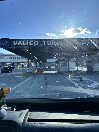
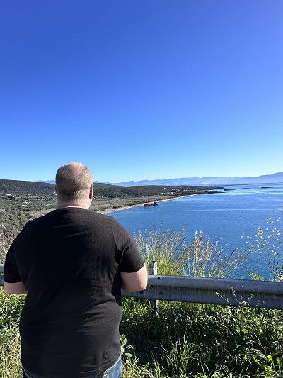
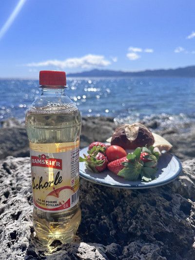
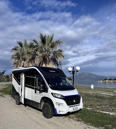
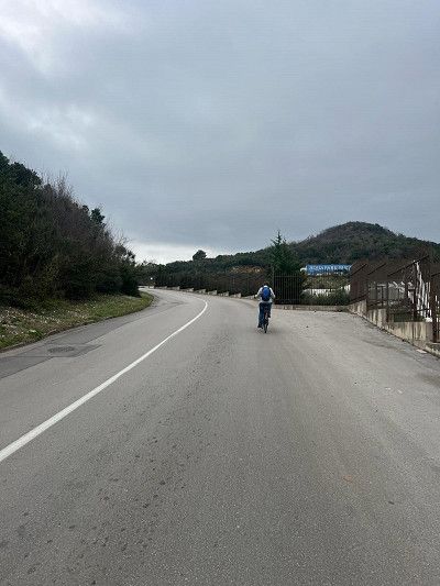
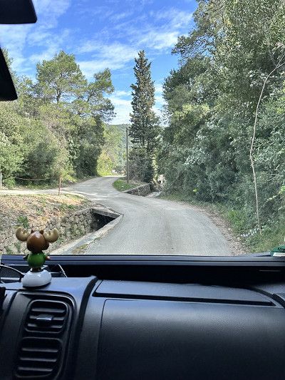
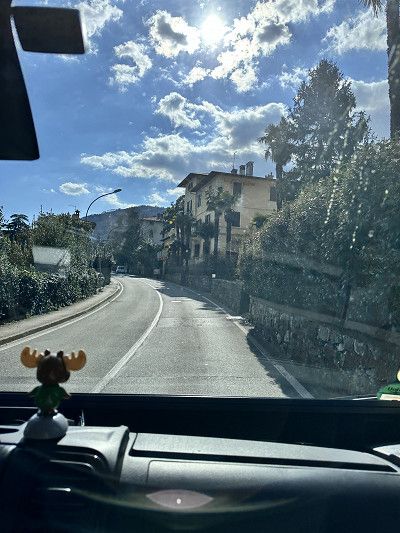
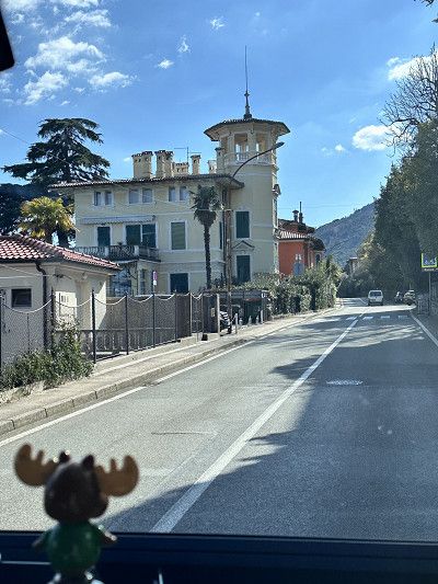
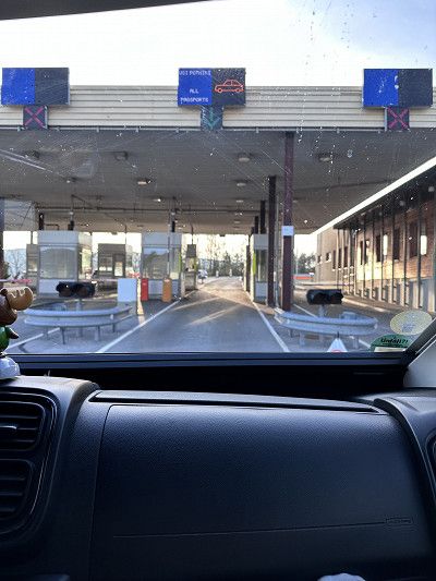
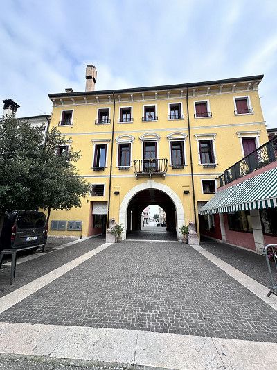
Finally, it starts again. This year we have planned some nice trips again. We start from our home with the destination Ancona. We'll see how far we get today. Tomorrow we have booked a ferry ⛴️ to Patras - Greece 🇬🇷.

Finally, it starts again. This year we have planned some nice trips again. We start from our home with the destination Ancona. We'll see how far we get today. Tomorrow we have booked a ferry ⛴️ to Patras - Greece 🇬🇷.
Entry with an identity card (CH ID) or a valid passport.
The Schengen Agreement applies in Italy - no entry controls
Maximum speed 50 in town / 90 outside town, expressway 110 km
Motorway toll 130 km maximum speed
Daytime running lights mandatory
Currency Euro
Gas station network good, AdBlue available
Free camping is prohibited, but there are good pitches
This has never happened before 😁 not a minute of traffic jams on the Gotthard ❣️
These holidays are off to a great start, bye bye Switzerland until three weeks 🇨🇭
This has never happened before 😁 not a minute of traffic jams on the Gotthard ❣️
These holidays are off to a great start, bye bye Switzerland until three weeks 🇨🇭
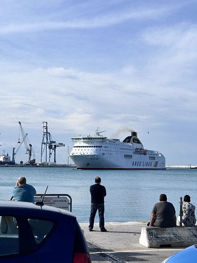
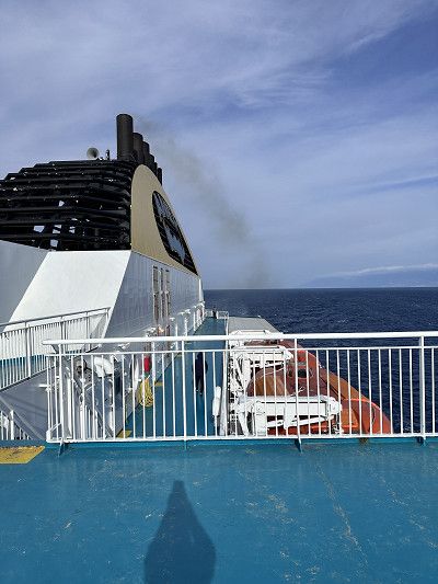
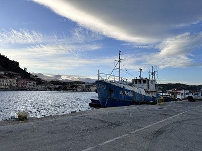
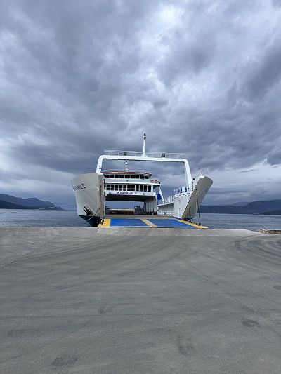
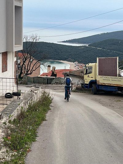
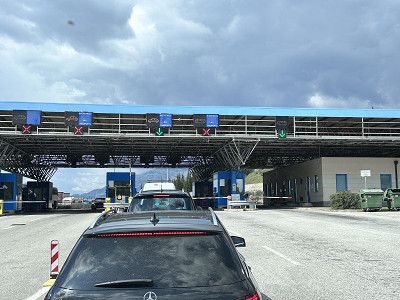
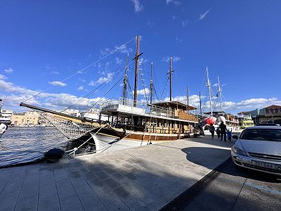
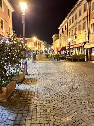
After a quiet night, we went to the port office to check in. We got there around 10 a.m., which was good. Our ship left at 5:30 p.m., an hour late. So we still had some time to visit Ancona.
About 3 hours before departure we were back at the port and watched the ferry being loaded and unloaded. Tetris for advanced players 😀
PS: We spent the night at a rest area near Ravenna, about 140 km before Ancona.
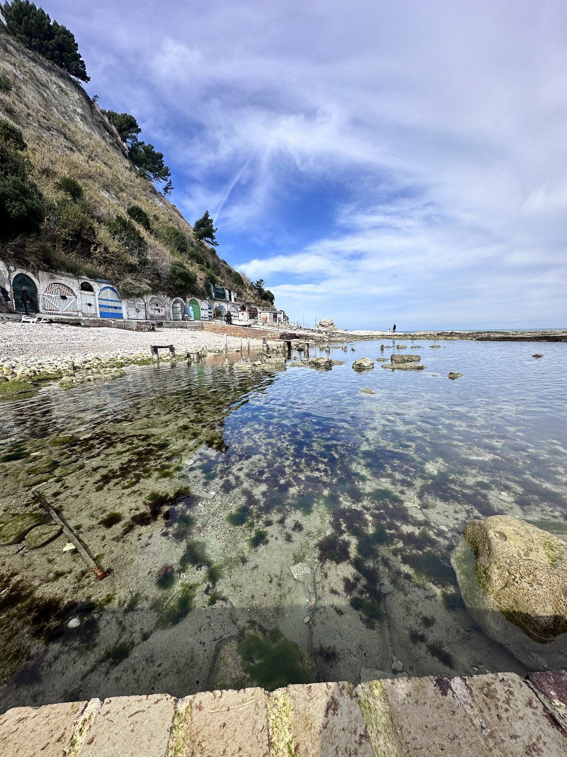
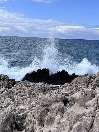
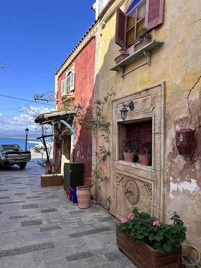
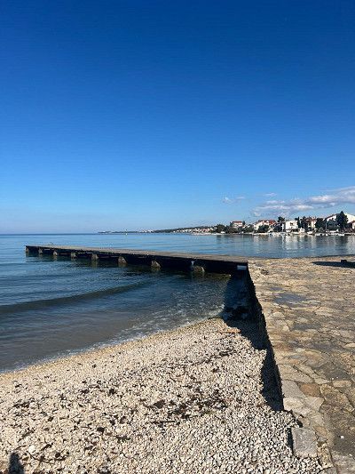
As mentioned, we had a bit of a wait in Ancona. This bay is not far from the harbor. A steep staircase leads down and it was a leisurely walk. Many small boathouses line the beach. There are hardly any boats left, the boathouses are used more as a weekend meeting place.
A stone formation is reminiscent of the Pope's chair, hence the name.
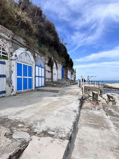
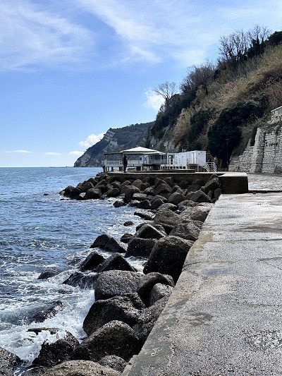
Where you go down, you have to go up again 😀 When you get to the top, there is a beautiful viewing platform and a square with an “Academia”. From this square there is a promenade that invites you to stroll. After a short while on the right there is a pizzeria “Farinando”, which offers slices of pizza for €1.50 to €3.00. Were super delicious 😋
Where you go down, you have to go up again 😀 When you get to the top, there is a beautiful viewing platform and a square with an “Academia”. From this square there is a promenade that invites you to stroll. After a short while on the right there is a pizzeria “Farinando”, which offers slices of pizza for €1.50 to €3.00. Were super delicious 😋
Entry with an identity card (CH ID) or a valid passport.
Maximum speed 50 in urban areas / 90 out of urban areas
Motorway toll 130 km maximum speed
Currency Euro
Service station network well and often served (they are happy about a small tip)
AdBlue available
Free camping prohibited but was tolerated in March as most campsites are closed
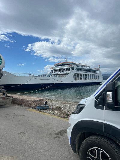
The night was quiet and we got a LUX cabin. Despite bad reviews, the ship and the cabins are quite ok. You can see the age of the ship. The crew tries very hard and is friendly. The first vehicles disembark at Igoumenitsa.
We stay on board and continue to Patras.
Price for a motorhome crossing of 6.50 m costs €. 253.00 with Freeontour card 20% discount. Lux cabin € 352.00 per person. Total €907.00.
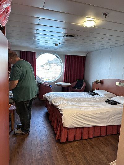
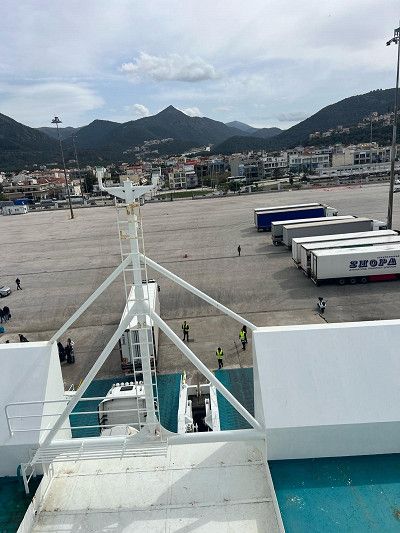
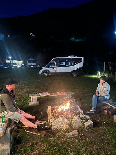
We arrived at the campsite in the dark. It's completely uncomplicated to register for a place tomorrow 😉 There's a thunderstorm coming down, but we don't care. We stand directly on the beach, on a place with solid ground.
I can highly recommend this place, clean, good sanitary facilities and in season pool, playground, mini market 🏪 and a tavern on the square. 👍👍👍
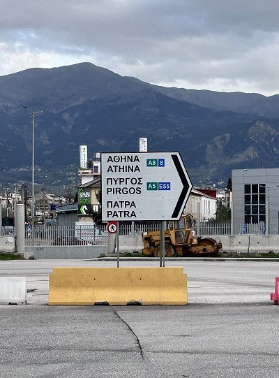
We continue south on the Peloponnese peninsula. A worthwhile trip to Olympia to visit the museum there. There is a lot to read about this place. The Olympic torch is still lit here today and then brought to the respective venue.
The first taverns and shops are open, mainly because school classes are visiting the place.
At this time of year it is no problem finding a spot by the sea. It's wonderful and reflects my desire for freedom 😄. Of course we leave the place clean. Here too we met some nice people and got one or two tips.
The place is located directly on the sandy beach, there is a solid surface, I can't judge what it looks like in constant rain.
In summer the place is used by locals and camping is no longer welcome 😉
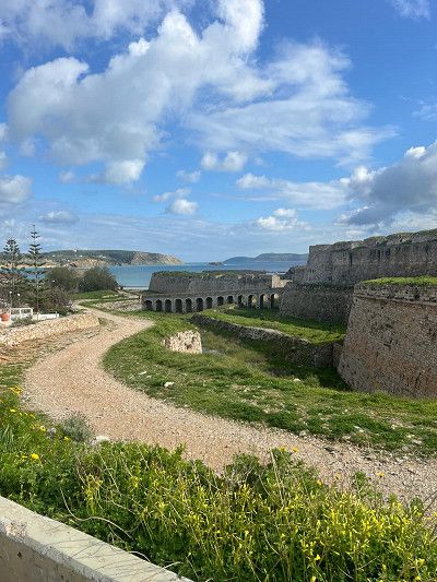
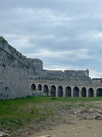
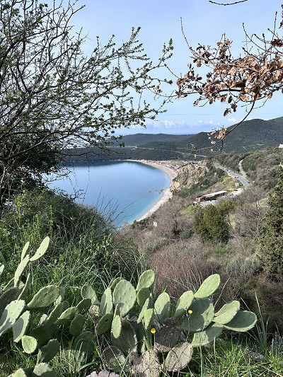
This beautiful bay is definitely worth a visit. As we learned, standing alone is tolerated in March as many campsites are still closed. It was still too early for us.
From the parking lot you can take a beautiful circular hike to the Navarino castle ruins with a great view of Ochsenbauch Bay. Duration approx. 1.25 hours.
Great, today we saw Norbert and Martina from CP Ionion Beach again 🤗 Too bad, in retrospect I would have liked to have swapped the phone number 🙈
There wasn't much going on at this time of year, so we treated ourselves to a delicious gyros 🥙 at the harbor. It's definitely nice on the pitch in summer.
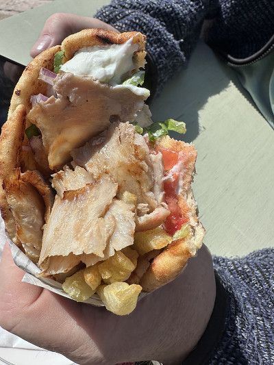
There wasn't much going on at this time of year, so we treated ourselves to a delicious gyros 🥙 at the harbor. It's definitely nice on the pitch in summer.
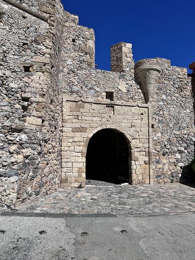
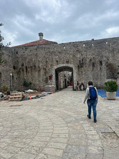
The castle at Methoni is very impressive and is evidence of a strategically important point. Built in the 13-15 centuries. We only saw it from the outside; the entrance closed at 3:30 p.m. Maybe another time 😄
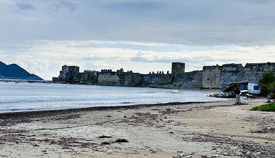
The castle at Methoni is very impressive and is evidence of a strategically important point. Built in the 13-15 centuries. We only saw it from the outside; the entrance closed at 3:30 p.m. Maybe another time 😄
After we were out and about a lot today, we wanted to spend the night at a nice campsite again. There are several places open all year round in the Finikounda area and this one was recommended to us. The place is rightly located directly on the sandy beach. The places are a bit small but we really like it here.
After we were out and about a lot today, we wanted to spend the night at a nice campsite again. There are several places open all year round in the Finikounda area and this one was recommended to us. The place is rightly located directly on the sandy beach. The places are a bit small but we really like it here.
After a short drive we reach the town of Kalamata. The whole city is decorated with carnival figures and some people dance in the streets. We unload the bikes and go exploring. In addition to a shopping area, there is also a small old town. We really like strolling through the streets and the festive atmosphere.
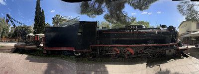
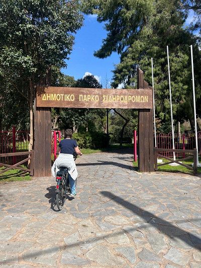
The park near the marina is also worth seeing. Many steam locomotives and passenger trains are on display.

After a short drive we reach the town of Kalamata. The whole city is decorated with carnival figures and some people dance in the streets. We unload the bikes and go exploring. In addition to a shopping area, there is also a small old town. We really like strolling through the streets and the festive atmosphere.
The park near the marina is also worth seeing. Many steam locomotives and passenger trains are on display.
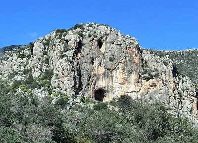
From Kalamata to Gythio you can drive via the A 71 motorway. Definitely recommended for larger RVs. But we decided on Serpetinenstrasse 82. This leads through a wonderful mountain area with bizarre and beautiful stone formations.
PS: Tunnel height 3.80 m maximum
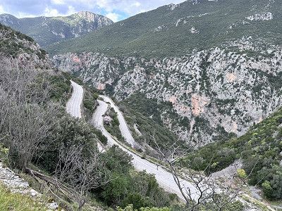
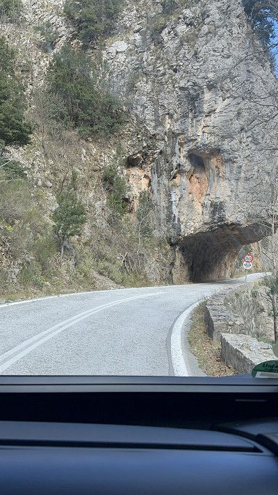

From Kalamata to Gythio you can drive via the A 71 motorway. Definitely recommended for larger RVs. But we decided on Serpetinenstrasse 82. This leads through a wonderful mountain area with bizarre and beautiful stone formations.
PS: Tunnel height 3.80 m maximum
If you don't disturb the fishermen, you can spend the night in this parking lot. Gythio is a lively harbor town with many taverns on the promenade. We took the bikes again and went exploring.
In the evening we went out to eat for the first time. The first taverns have opened and we were able to get to know the hospitable Greeks.
Gythio is a city that was used as a military port by the Spartans in ancient times.
On our bike tour through Gythio, we spontaneously cycled to the bay of Valtaki, 5 km away. This is located next to Selinitsas beach.
From the main road you have to make a sharp turn to get to the beach. There are already a few mobile homes here, I assume they will spend the night here 😉
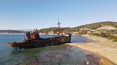
This bay is worth seeing because of the Dimitrios shipwreck. When the captain had to go to hospital in an emergency in 1980, he docked in the port of Gytio. Since the port fee was not paid, the municipality decided that the ship had to anchor in front of the port. On December 23, 1981, a storm raged and the ship tore loose. It drifted into the bay of Valtaki, where it lies to this day 🙈
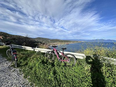

On our bike tour through Gythio, we spontaneously cycled to the bay of Valtaki, 5 km away. This is located next to Selinitsas beach.
From the main road you have to make a sharp turn to get to the beach. There are already a few mobile homes here, I assume they will spend the night here 😉
This bay is worth seeing because of the Dimitrios shipwreck. When the captain had to go to hospital in an emergency in 1980, he docked in the port of Gytio. Since the port fee was not paid, the municipality decided that the ship had to anchor in front of the port. On December 23, 1981, a storm raged and the ship tore loose. It drifted into the bay of Valtaki, where it lies to this day 🙈
There is a weekly market on Friday and we take the opportunity to buy fruit and vegetables. Here too we are greeted with a joyful Kalimera (good morning).
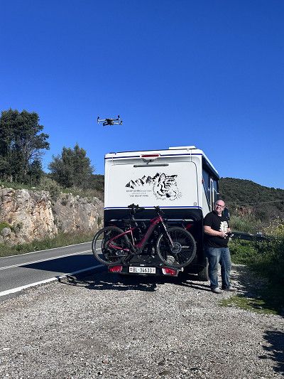
As we continue our journey we stop briefly to take pictures of the Dimitrios with our drone 😁⛴️ Practice practice practice…
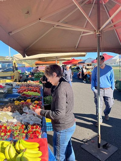
There is a weekly market on Friday and we take the opportunity to buy fruit and vegetables. Here too we are greeted with a joyful Kalimera (good morning).
As we continue our journey we stop briefly to take pictures of the Dimitrios with our drone 😁⛴️ Practice practice practice…
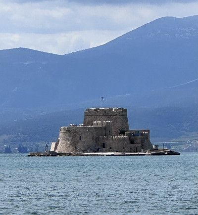
A highlight of our trip is this fortress of Monemvasia from the Byazintic Empire (284-641). The fortress was an almost impregnable defensive castle and secured the sea route from Venice to Constantinople. At its peak, 25,000 people lived here. During the War of Liberation in 1821, the fortress lost its importance.
Anyone who visits the fortress today will feel like they have been transported back to old times😎
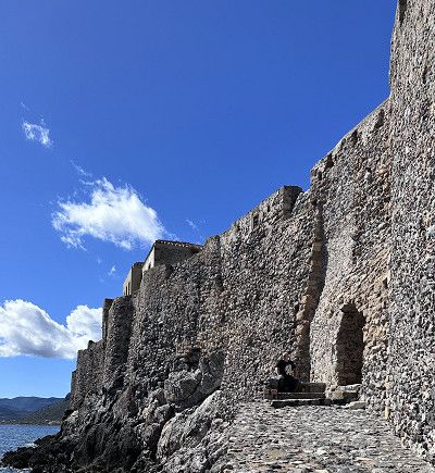
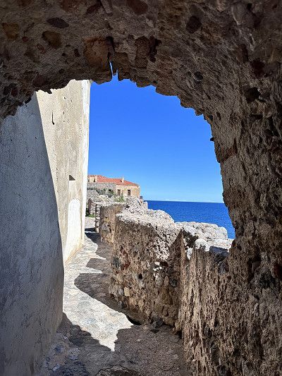
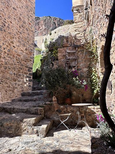
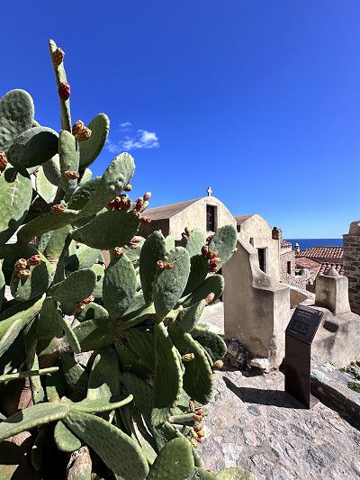
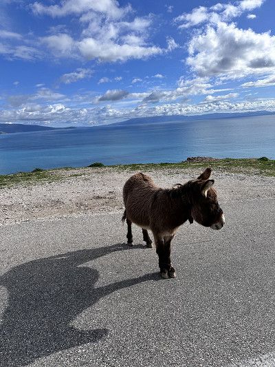
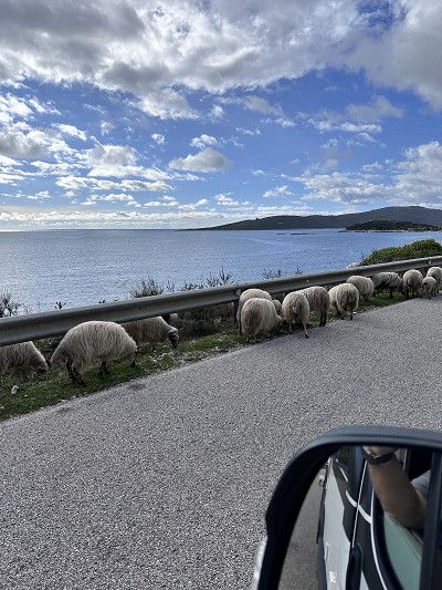
We avoid all toll roads because we simply prefer driving through the mountains. This sometimes results in special encounters such as meeting the shepherd 🐏🐑🐏 or exciting objects on the side of the road
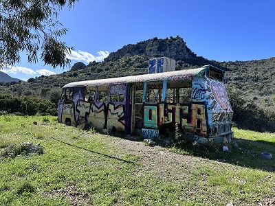
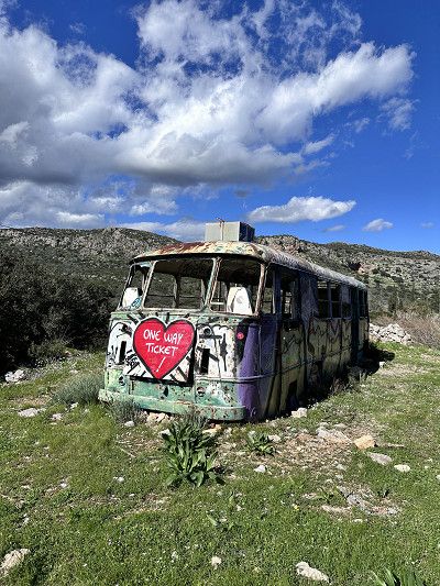
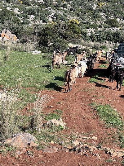
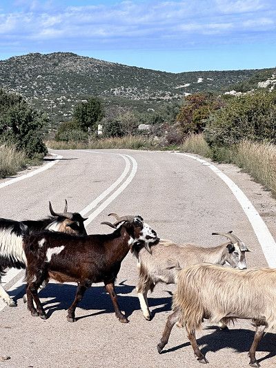
We avoid all toll roads because we simply prefer driving through the mountains. This sometimes results in special encounters such as meeting the shepherd 🐏🐑🐏 or exciting objects on the side of the road
We drove through Leonidio. However, if you are here on Orthodox Easter Day, you should plan a few days. There is a big festival with sky lanterns and lamb dinners on Sunday in the village square. We were still too early 🙈
We also got here via a serpentine road, it's better if you're not afraid of heights, you'll sometimes look for guardrails in vain🥴
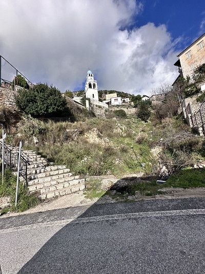
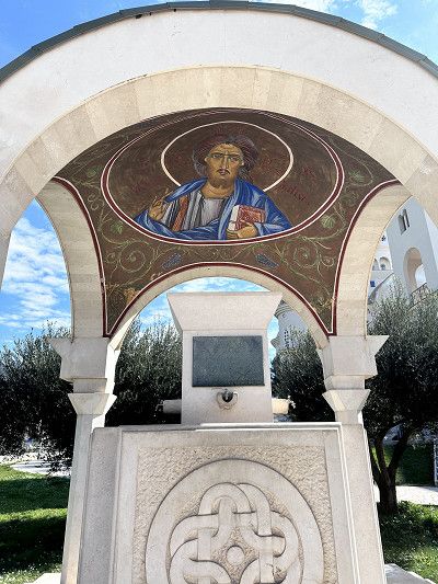
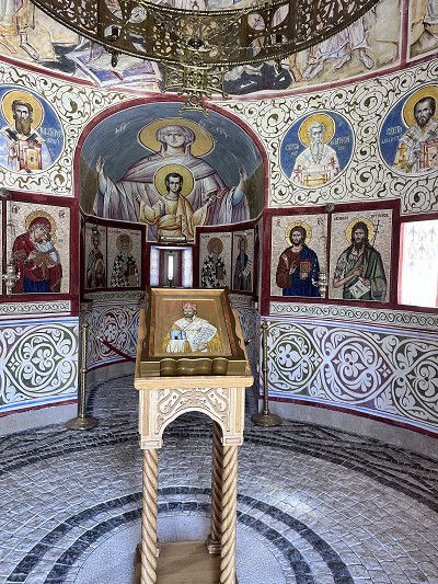
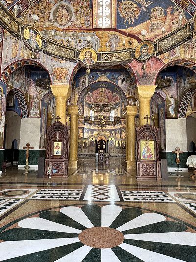
We saw this special Orthodox church from afar and we absolutely had to go there. Unfortunately, but it was still worth it.
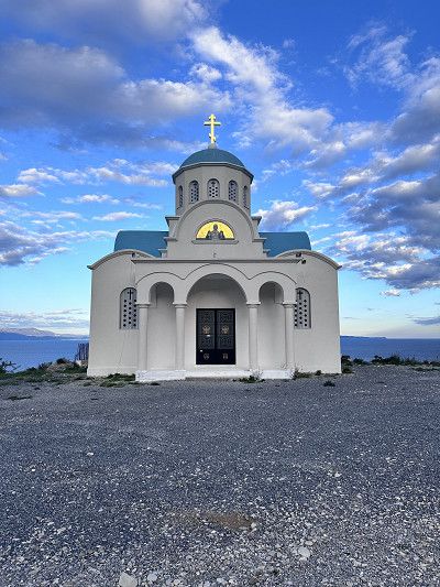
We saw this special Orthodox church from afar and we absolutely had to go there. Unfortunately, but it was still worth it.
Today's place to sleep on the beach, today we drove a long way. Now we're hungry, we cook something delicious and make ourselves comfortable in the motorhome.
The parking lot is located directly on the pebble beach, as always with free standing there is no infrastructure, but what it always has are waste containers - you are welcome to use them 😉
There is also a weekly market in Nafplio, we were here on Saturday. In addition to regional products, you can buy clothes and household goods. The handle of our frying pan broke off a few days ago, so we were able to replace it 👍
For the first time I found wild asparagus. The nice Greek woman recommends an omelette with asparagus, I have to try that 😉
There is a place to stay overnight near the harbor not far from the old town. Would have been better here, like the place from yesterday.
The old town is absolutely worth seeing, since we want to go further to Corinth today, we're skipping a visit. 🥺
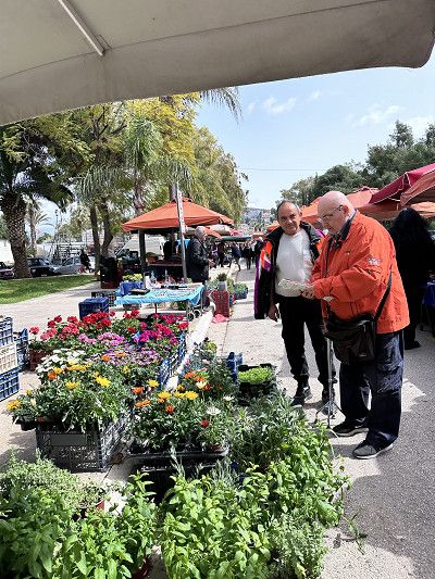
This canal is an impressive man-made structure 1881-1893. Up to 75 m high and 24 m wide.
Sailing around the Peloponnese peninsula was very dangerous, and so a solution was sought to connect northern Greece with the peninsula. The canal leads from the Saronic Gulf to the Gulf of Corinth. The canal is too narrow and, at 8 m, not deep enough for today's cargo ships. Therefore it is mainly used for tourism trips and private ships 🚢.
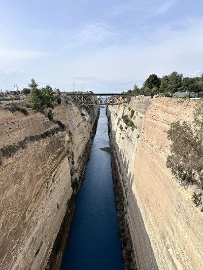
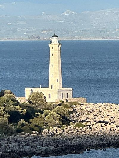
After a short drive, about 30 minutes, and a stop at the Panorama Restaurant in Loutraki, we reach the Cape of Melagkavi or also known as the Cape of Perachora. There are two sights in the immediate vicinity. By that I don't mean the fantastically beautiful bay with the crystal clear sea.
One is the lighthouse; unfortunately locked. Still worth seeing, especially because of the beautiful view from up there 🤩
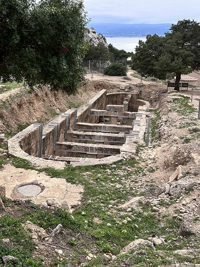
In the bay below is the archaeological site of Heraion. Noteworthy is the well-preserved cistern with attached bath, an L-shaped stoa (free-standing colonnade or covered walkway), dining rooms, altar and two temples in honor of the goddess Hera.🏺🏛️
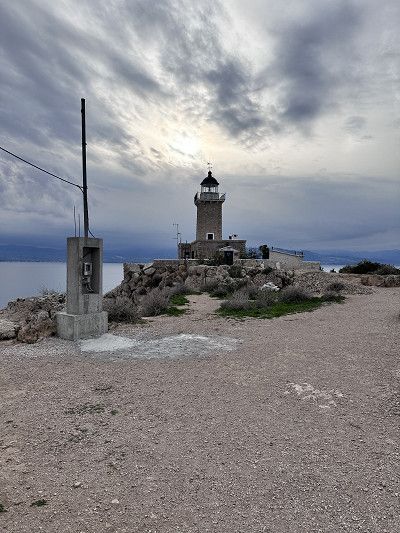
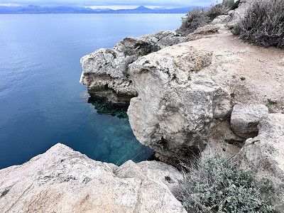
After a short drive, about 30 minutes, and a stop at the Panorama Restaurant in Loutraki, we reach the Cape of Melagkavi or also known as the Cape of Perachora. There are two sights in the immediate vicinity. By that I don't mean the fantastically beautiful bay with the crystal clear sea.
One is the lighthouse; unfortunately locked. Still worth seeing, especially because of the beautiful view from up there 🤩
In the bay below is the archaeological site of Heraion. Noteworthy is the well-preserved cistern with attached bath, an L-shaped stoa (free-standing colonnade or covered walkway), dining rooms, altar and two temples in honor of the goddess Hera.🏺🏛️
Because we probably arrived too late, we didn't get a parking space at the Acropolis bus parking lot. Never mind, 😉 we found a good replacement.
There would be toilets and showers here. However, these are for the ship owners and I assume that you would need a key.
Because we probably arrived too late, we didn't get a parking space at the Acropolis bus parking lot. Never mind, 😉 we found a good replacement.
There would be toilets and showers here. However, these are for the ship owners and I assume that you would need a key.
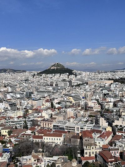
Today Athens is on the agenda. But no matter where we go, the roads are closed. We talk to a police officer and ask. There's a marathon today, no getting through 😵💫
But typically nice Greeks - follow me, come come - hey, what does he want? The police drive ahead and take us to the nearest parking space in the Monastiraki district. This is really welcoming - thank you very much. We park our motorhome in this guarded space and have a chat with the park attendant, who also kindly explains the route to us. Unload the bikes and explore Athens by Bike 🔝👍🔝
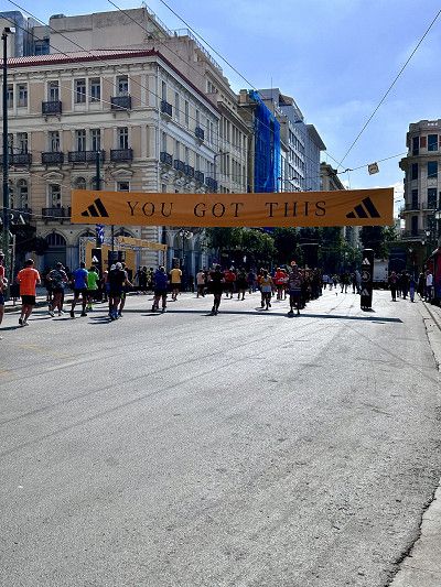
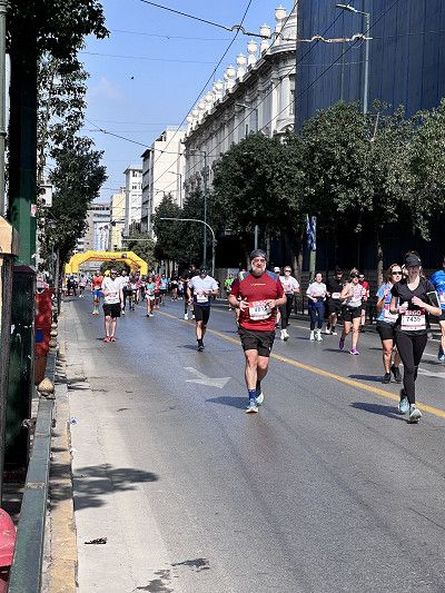
Monastiraki is a lively district near the Acropolis. Shops, stalls, dealers with 🌰 chestnuts, flea market with antiques and many small restaurants. But there are also endless tourists. 🛍️
The Museum of Illusions is also located in the same district. If you would like some funny snapshots, you are welcome to visit. In retrospect, the entrance fee of €12 is too much for that.
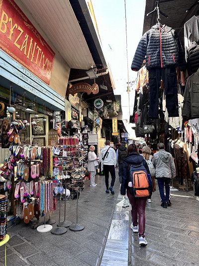
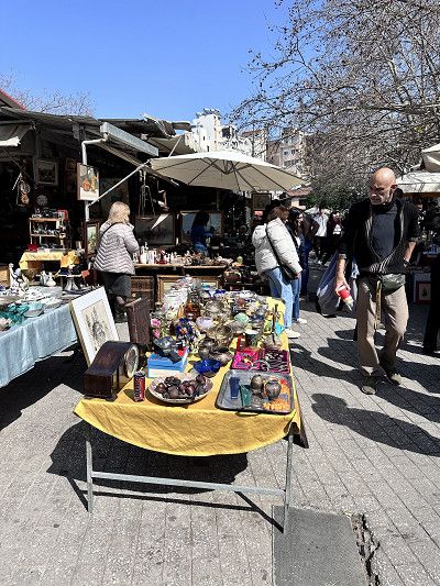
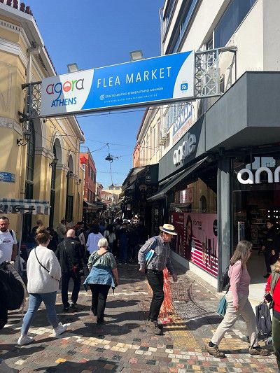
The Acropolis is a must see when visiting Athens. If you would like to know more background, there is a museum in the immediate vicinity.
But we preferred to scramble up to the Temple of Athena. The views of Athens and Piraeus are phenomenal 🤩
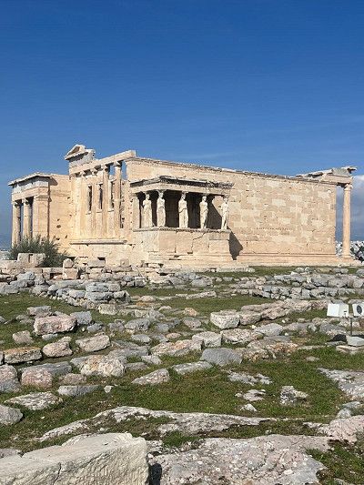


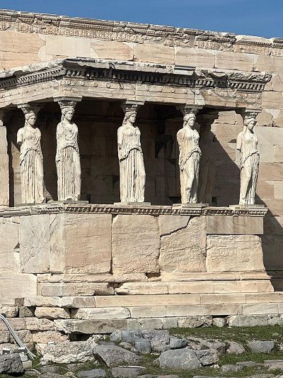
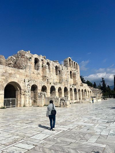
The Acropolis is a must see when visiting Athens. If you would like to know more background, there is a museum in the immediate vicinity.
But we preferred to scramble up to the Temple of Athena. The views of Athens and Piraeus are phenomenal 🤩
This morning a security guard spoke to us, well 😌 actually sleeping would be forbidden here too. Contrary to the information on the Internet. We asked politely and he allowed us to sleep here again that night 😴 We gratefully accepted, because the campsites in the capital are still closed.
This morning a security guard spoke to us, well 😌 actually sleeping would be forbidden here too. Contrary to the information on the Internet. We asked politely and he allowed us to sleep here again that night 😴 We gratefully accepted, because the campsites in the capital are still closed.
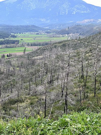
On the onward journey we visited the island of Euboä.
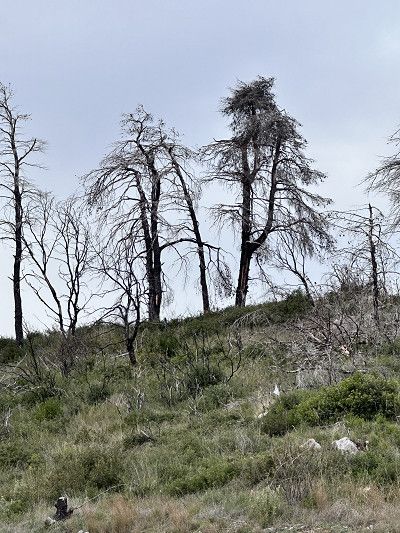
The largest forest fires raged here on August 3, 2021. In the north of the island, more than 50,000 hectares of forest and agricultural land were devastated over eight days. This corresponds to the area of the canton of Baselland, my home canton.
Never before has an event destroyed so much land. It is rumored that it was arson because a wind farm was to be built in the nature reserve.
Today (2024) a lot of burned forests and earth can still be seen. But nature is fighting back 😉
On the onward journey we visited the island of Euboä.
The largest forest fires raged here on August 3, 2021. In the north of the island, more than 50,000 hectares of forest and agricultural land were devastated over eight days. This corresponds to the area of the canton of Baselland, my home canton.
Never before has an event destroyed so much land. It is rumored that it was arson because a wind farm was to be built in the nature reserve.
Today (2024) a lot of burned forests and earth can still be seen. But nature is fighting back 😉
A cool wind is blowing outside, the sea is making waves, who wants to go swimming 🤔 Put on your swimming trunks, we read that there are hot springs right on the beach.
We were able to park right next to the staircase. Bath towel, Crocs, cell phone for photos, bag and off you go 🌊
After initial hesitation, what a surprise 😮 the water is 39 degrees Celsius. We let ourselves drift and don't want to go out anymore. After half an hour of bathing, we leave the cozy bathroom and go back to the motorhome. Amazingly, we are so warmed up that the cold winds don't bother us.
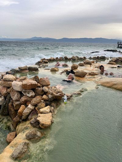
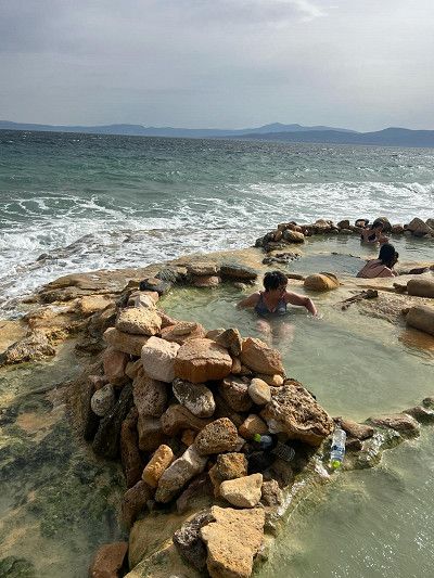
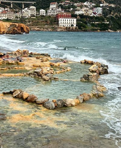
We found this parking lot on the beach at Park4Night. It is located right on a street but is quiet and is lit at night.
The view is beautiful and overall a great place.
It has showers, which probably only run in summer. While we were there there was a lot of flotsam on the beach.

We found this parking lot on the beach at Park4Night. It is located right on a street but is quiet and is lit at night.
The view is beautiful and overall a great place.
It has showers, which probably only run in summer. While we were there there was a lot of flotsam on the beach.
We leave the island of Euboea towards the mainland. We take the ferry ⛴️ to Glyfa. The crossing only takes 30 minutes. Although we have bad weather for the first time today, the sea is calm and there is hardly any rocking. I read that the ferry should leave early during the season. According to the motto; first come first served 😉
At the harbor we shorten the waiting time in a café. When asked if they offer breakfast, she says no. Less than two minutes later she brings us two chocolate croissants from her private kitchen. Hospitality indescribable 😍
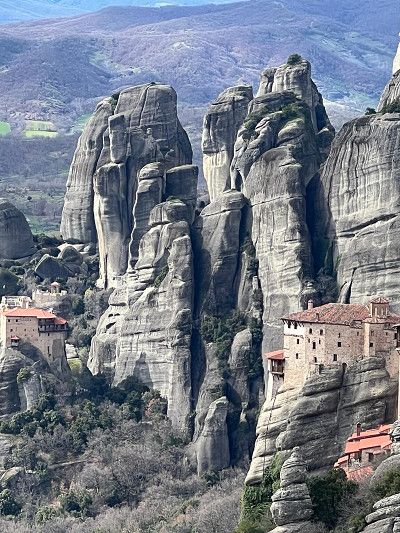
Our destination today is the Meteora monasteries.
There are 24 monasteries, which were built between the 12th and 16th centuries. They were built in the 19th century at windy heights on the tops of sandstone cliffs. were there between the 12th and 16th. That's where the name comes from; Meteora means “to lift up”
Six monasteries are still inhabited today and can be visited. These are:
- Agia Triada
- Agios Nikolaos
- Anapavsás Agios Stéphanos
- Rousanou
- Vaárlam and
- Metamorphosis (we visited)
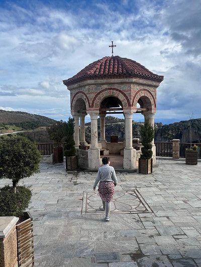
The road goes up from Kalambaka.
From this vantage point you have a fantastic view of the stone formations and several monasteries.
Our destination today is the Meteora monasteries.
There are 24 monasteries, which were built between the 12th and 16th centuries. They were built in the 19th century at windy heights on the tops of sandstone cliffs. were there between the 12th and 16th. That's where the name comes from; Meteora means “to lift up”
Six monasteries are still inhabited today and can be visited. These are:
- Agia Triada
- Agios Nikolaos
- Anapavsás Agios Stéphanos
- Rousanou
- Vaárlam and
- Metamorphosis (we visited)
The road goes up from Kalambaka.
From this vantage point you have a fantastic view of the stone formations and several monasteries.
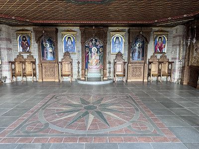
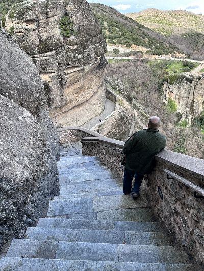
The Metamorphosis Monastery is the largest and oldest. Previously it was only accessible via a rope ladder. Since 1923, the monastery has been accessible via a tunnel and stairs. It is inhabited by monks. 🧐
We had to hurry with the visit, the monastery closed at 4 p.m. and the monks went to evening prayers.
Appropriate clothing, shoulders covered, no shorts and a long skirt for women is desired.
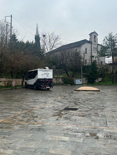
We arrived at our sleeping place today in the dark. We found win on the Park4night app. It's clean and good so far 😌 Let's see what it looks like in the light tomorrow 😴
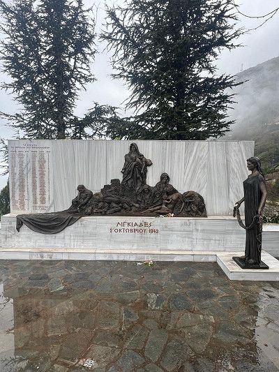
The weather isn't really good😉 but it doesn't matter, it's a good place to sleep and, when the weather is nice, a view of the lake and the city of Ioannina. It has a playground and a city wall, with a war memorial on site.
In memory of the Lingiades massacre, 82 dead, including 34 children (October 3, 1943)
We arrived at our sleeping place today in the dark. We found win on the Park4night app. It's clean and good so far 😌 Let's see what it looks like in the light tomorrow 😴
The weather isn't really good😉 but it doesn't matter, it's a good place to sleep and, when the weather is nice, a view of the lake and the city of Ioannina. It has a playground and a city wall, with a war memorial on site.
In memory of the Lingiades massacre, 82 dead, including 34 children (October 3, 1943)
Ioannina is a tourist town known for its silver jewelry forges. The day before it was pouring rain and we couldn't visit this place. Unfortunately everything is closed in the morning today.
It's a shame, I would have liked it here 🥺
Ioannina is a tourist town known for its silver jewelry forges. The day before it was pouring rain and we couldn't visit this place. Unfortunately everything is closed in the morning today.
It's a shame, I would have liked it here 🥺
Entry with an identity card (CH ID) or a valid passport.
Green insurance card is mandatory, otherwise insurance will be taken out for 50 euros
Vehicle documents are checked
Maximum speed 40 in urban areas / 80 out of urban areas
Motorway no tolls 110 km maximum speed
Currency Lek 1 Euro/Chf approx. 100 Lek
Service station network well and often served (they are happy about a small tip)
AdBlue available
Free camping allowed
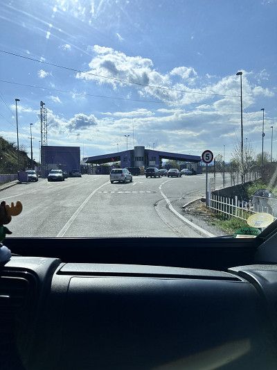
From Ioannina we drive west to cross the border into Albania at Gijrokaster. Although every car is checked several times, crossing the border was still easy.
Phew, I imagined it would be worse 😉

From Ioannina we drive west to cross the border into Albania at Gijrokaster. Although every car is checked several times, crossing the border was still easy.
Phew, I imagined it would be worse 😉
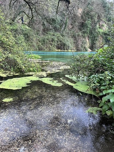
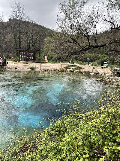
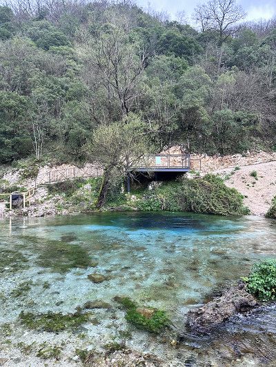
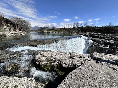
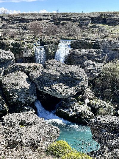
This great karst spring is really worth a detour.
The water bubbles up from the depths. Due to the sunlight and against the background of the limestone, the water has a deep blue, sometimes turquoise surface. This spring has not yet been explored, so the exact depth and origin of the spring water is unknown.
It is a nature reserve and swimming 🧼 is prohibited.
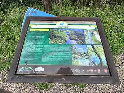
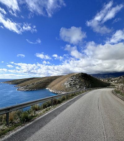
We continue towards Sarandë and then follow the SH8 towards the coastal road and Llogara Pass.
This serpentine road has it all. However, the road conditions are much better than described in our travel guide.
Once at the top you have a sensational view of the Ionian Sea in the south (and Corfu 😉) and the Adriatic Sea in the north.
We continue towards Vlora.
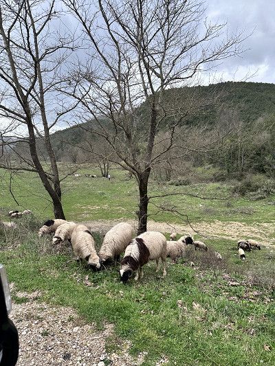
Be careful, there are all kinds of animals (🐕🐄🫏) running around freely on the streets

We continue towards Sarandë and then follow the SH8 towards the coastal road and Llogara Pass.
This serpentine road has it all. However, the road conditions are much better than described in our travel guide.
Once at the top you have a sensational view of the Ionian Sea in the south (and Corfu 😉) and the Adriatic Sea in the north.
We continue towards Vlora.
Be careful, there are all kinds of animals (🐕🐄🫏) running around freely on the streets
Shortly after Vlora, over a 2 kilometer long bumpy road, we found this beautiful bay. We are not the only RV (van) owners here.
Some of the sections are sandy and only suitable for 4x4. There are lots of potholes and the rain has made the ground soggy. We enjoy it here, but it's absolutely not suitable for larger RVs.
Entry with an identity card (CH ID) or a valid passport.
Vehicle documents are checked
Maximum speed 50 in urban areas / 80 out of urban areas
Motorway no tolls 100 km maximum speed
Currency Euro
Service station network well and often served (they are happy about a small tip)
AdBlue available
Free camping prohibited
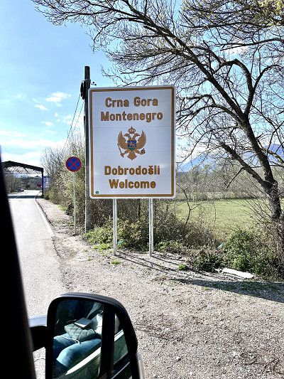
Today we took a day of travel with the destination Montenegro. There we mainly want to drive along the coastal road towards Croatia.
The famous Jadranska Magistrala (or Adria Magistrale) was built in the 1960s and 1970s. This winding coastal road is considered one of the most beautiful and picturesque in the world.
So we only took a few photos along the way and drove quickly.
We found this small but nice campsite not far from the border in the town of Utjeha. We want to charge everything again (batteries, etc.), fresh water and whatever else goes with it.
The places are small but cute under olive trees. There are clean sanitary facilities and a washing machine.
We found this small but nice campsite not far from the border in the town of Utjeha. We want to charge everything again (batteries, etc.), fresh water and whatever else goes with it.
The places are small but cute under olive trees. There are clean sanitary facilities and a washing machine.
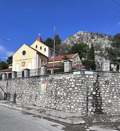
This Orthodox cathedral in Bar is located in a beautiful park. The cathedral is richly decorated both inside and out. Inside, the church is decorated with frescoes, marble columns and floor mosaics.
The church is open to visitors and was built in 2006.
According to legend, the temple is dedicated to Vladimir and Kosara. A love story about the prisoner of war Prince Vladimir, who fell in love with the Tsar's daughter Kosara.
Taj Mahal in Montenegro 😍😍😍
We continue driving through the Sozina Tunnel (costs €5 toll for a 6m motorhome) towards Podgorica.
The waterfalls are absolutely worth seeing. There is also a nice little restaurant at this place. Extremely nice staff and good food - I would go there again at any time 🔝👍🔝


We continue driving through the Sozina Tunnel (costs €5 toll for a 6m motorhome) towards Podgorica.
The waterfalls are absolutely worth seeing. There is also a nice little restaurant at this place. Extremely nice staff and good food - I would go there again at any time 🔝👍🔝
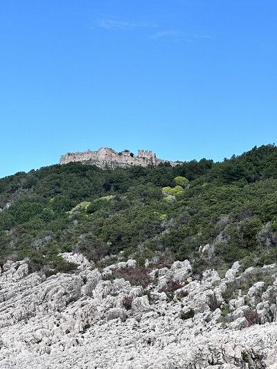
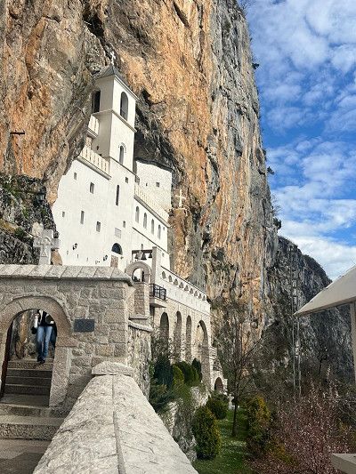
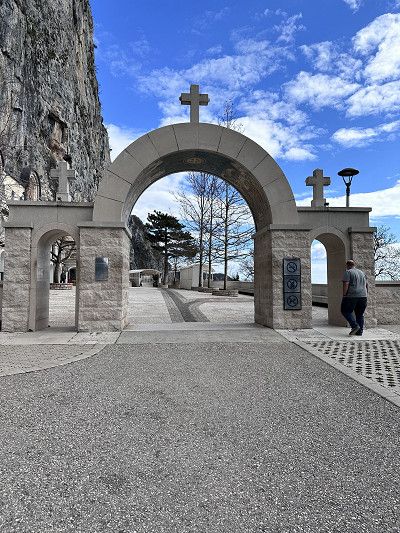
This monastery can only be reached via a narrow serpentine, partly single-lane, missing guardrails and hairpin bends that we had to make twice with our small motorhome (2.10 m wide and 6 m long).
Not for normal RVs, inexperienced drivers, even with a car only for those with strong nerves 😱
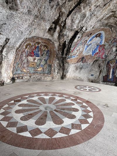
The Serbian Orthodox cave monastery itself is really special. Built in the rock on the slope of the Prekornica Mountains (founded in 1656). It is still inhabited by monks today.
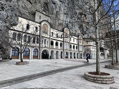
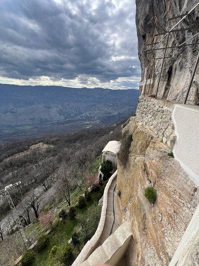
This monastery can only be reached via a narrow serpentine, partly single-lane, missing guardrails and hairpin bends that we had to make twice with our small motorhome (2.10 m wide and 6 m long).
Not for normal RVs, inexperienced drivers, even with a car only for those with strong nerves 😱
The Serbian Orthodox cave monastery itself is really special. Built in the rock on the slope of the Prekornica Mountains (founded in 1656). It is still inhabited by monks today.
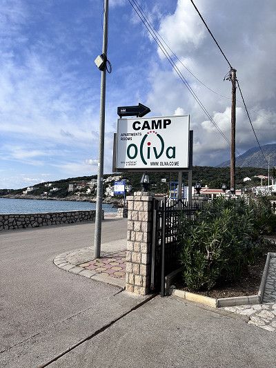
Small new family campsite, you feel like you have been invited to your home.
Some of it is still being built, but you won't notice anything about it. Igor, his wife and parents are extremely warm hosts. Cozy seating area, great view of the sea. Electricity, WiFi all included. Clean sanitary facilities and washing machine available. Small bar with welcome schnapps (homemade) 😁, Igor also organizes delivery service of pizzas, burgers etc. We'll be happy to come back 👍🔝
The only downside is the narrow access road; larger motorhomes could have problems. There is also a lack of supply and disposal (gray water, etc.).
The old town of Budva was our destination today. We drove the 5 km down from our campsite. Igor showed us a great way so that we didn't have to go along the main road.
The path leads next to the village of Seoce past an aqua park that appears to be out of service. Then we go back up another 5 km, and I'm grateful for my e-bike 😮💨😮💨😮💨
The old town is really worth seeing, small streets, shops and many nice restaurants. We didn't visit the museum with the citadel and library due to time constraints. Entry costs €4.50.

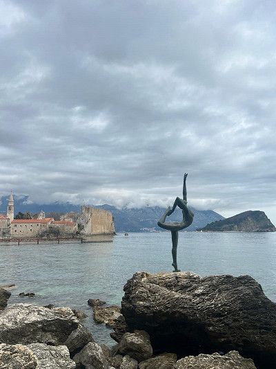
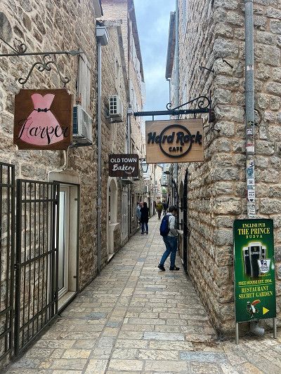
The old town is really worth seeing, small streets, shops and many nice restaurants. We didn't visit the museum with the citadel and library due to time constraints. Entry costs €4.50.
We liked it here so much, we're staying another night 😁
We liked it here so much, we're staying another night 😁
Kotor is the oldest city in Montenegro. The history goes back to the era of the Roman Empire.
The old town is surrounded by a city wall. There is a guarded parking lot right next to it for €3 per hour. I can't say whether it would be possible to stay overnight.
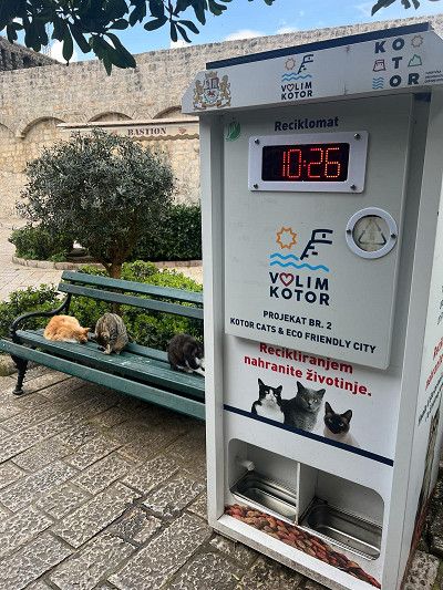
In addition to pretty streets, restaurants and many shops, including handicrafts, the city is known for its cats 🐈⬛ 🐈
There is a pet bottle recycling machine in this town, you put an old bottle in and cat food comes out 😂
The Bay of Kotor is also a highlight. To continue following the Adriatica Magistrale, you can drive around the bay (like a Norwegian fjord) or take the ferry. We did the latter. ⛴️
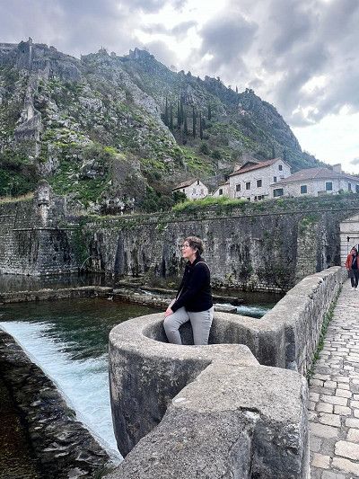
Kotor is the oldest city in Montenegro. The history goes back to the era of the Roman Empire.
The old town is surrounded by a city wall. There is a guarded parking lot right next to it for €3 per hour. I can't say whether it would be possible to stay overnight.
In addition to pretty streets, restaurants and many shops, including handicrafts, the city is known for its cats 🐈⬛ 🐈
There is a pet bottle recycling machine in this town, you put an old bottle in and cat food comes out 😂
The Bay of Kotor is also a highlight. To continue following the Adriatica Magistrale, you can drive around the bay (like a Norwegian fjord) or take the ferry. We did the latter. ⛴️
Entry with an identity card (CH ID) or a valid passport.
Vehicle documents are checked, but only if you come from Montenegro
Croatia has been part of the Schengen area since 2023, entry from Slovenia - no entry controls
Maximum speed 50 in town / 90 outside town, expressway 110 km
Motorway toll 130 km maximum speed
October - March daytime running lights
Currency Euro
Gas station network good and rarely served (they are happy about a small tip)
AdBlue available
Free camping is prohibited and will be punished with a fine
The border crossing from Montenegro is still controlled. Both vehicle documents and passports.
Logically, the Schengen agreement does not apply here, since Montenegro is not in the EU, but is only a candidate for membership.

The border crossing from Montenegro is still controlled. Both vehicle documents and passports.
Logically, the Schengen agreement does not apply here, since Montenegro is not in the EU, but is only a candidate for membership.
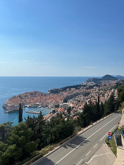
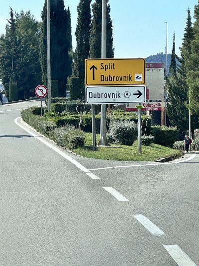
The city of Dubrovnik has an interesting fortress from the outside, but after half an hour we still couldn't find a motorhome parking space.
All parking spaces near the old town are reserved for residents or are not suitable for motorhomes 😮💨
Since we have already visited a beautiful old town in Kotor today, we continue.
Maybe another time 😁
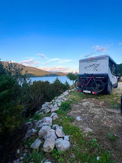
Standing free is actually forbidden in Croatia and in many places this is punished with fines. We found this place on the Park4Night app.
A somewhat narrow path, the last 500 m is a gravel road, leads to this place. Easily feasible for vans and small motorhomes.
It is a parking lot for a restaurant in an idyllic location in the bay near Ston. We had a very good dinner here. When we asked if we could stay, we were even offered coffee for the next day. A very nice owner 🥹
Thank you for your hospitality ❣️
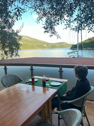
Mali Ston is beautifully situated on the canal and is famous for its oyster and mussel farming, but also for the small medieval old town. There are many restaurants in this region that offer oysters and other sea specialties.
I was able to enjoy an oyster 🦪 gratinated with cheese and a risotto with shrimps. Simply wonderful 😊
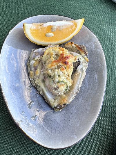
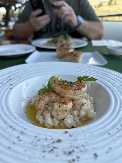
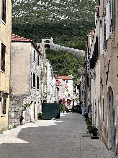
On the way back from our dreamy place to sleep we drive through next to Ston. We can see the impressive defensive wall from afar. There is a reason for this, because next to the Chinese Wall, it is the longest outside of China at 5.5 km. A truly important building in Croatia. Construction began in 1333 and took 400 years to complete.
The wall connects Ston with the bay of Mali Ston and is largely accessible.
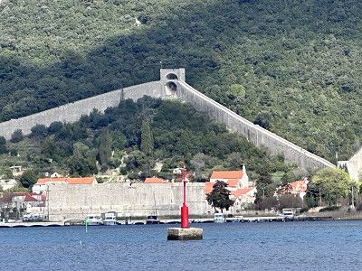
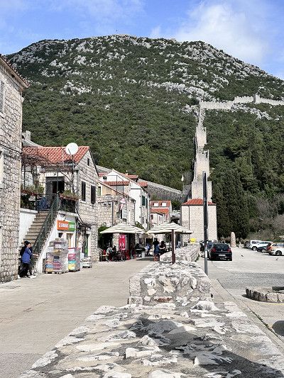
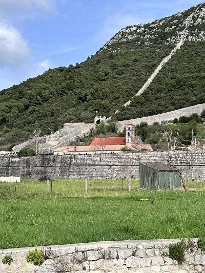
Today another section of the Jadranska Mainline is on the agenda. It is rightly said that this is probably the most beautiful coastal road in Europe.
In any case, the route is long. From Ulcinj in Montenegro, all of Croatia, Slovenia to Trieste in Italy, there are over 1000 km of coastal roads.
All along the way you have spectacular views of picturesque towns, breathtaking mountain ranges and landscapes and the deep blue sea, the Adriatic.
Today we would like to have a good time. In March almost all campsites are closed. And standing alone is punished with a fine - so we drive to this place.
Now this is really a top place. Certainly very crowded in high season.
Super nice sanitary facilities and heated. Restaurant, market and entertainment are of course still closed.
However, the wellness area of the attached hotel can be used free of charge 👍
Today we first enjoyed the sun and the campsite ⛺️.
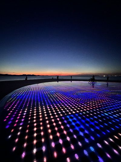
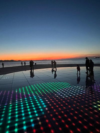
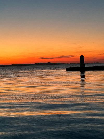
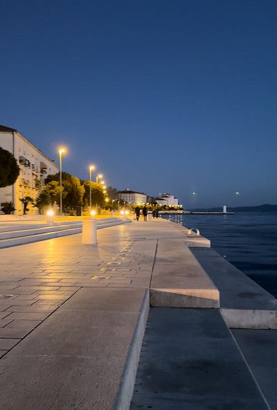
Towards the afternoon we packed our bikes and drove along the beach, past the harbor and into the old town of Zadar.
In addition to the many interesting sights, such as the “Square of the 5 Wells” or the “Kopnena Vrata” gate, also called “Porta Terraferma”, there are two modern installations in the north of the Riva waterfront promenade.
Both installations are by architect Nikola Bašić; “the sea organ” and “the greeting to the sun”.
The sea organ creates music 🎵 🎶 by waves under the water surface displacing the air through a system of tubes and therefore making organ pipes sound 😍
The Greetings to the Sun is a square with a diameter of 22 meters and consists of 300 glass plates in the ground. During the day, the solar cells collect energy to release a color spectacle at sunset 🌅 😲
Today we first enjoyed the sun and the campsite ⛺️.
Towards the afternoon we packed our bikes and drove along the beach, past the harbor and into the old town of Zadar.
In addition to the many interesting sights, such as the “Square of the 5 Wells” or the “Kopnena Vrata” gate, also called “Porta Terraferma”, there are two modern installations in the north of the Riva waterfront promenade.
Both installations are by architect Nikola Bašić; “the sea organ” and “the greeting to the sun”.
The sea organ creates music 🎵 🎶 by waves under the water surface displacing the air through a system of tubes and therefore making organ pipes sound 😍
The Greetings to the Sun is a square with a diameter of 22 meters and consists of 300 glass plates in the ground. During the day, the solar cells collect energy to release a color spectacle at sunset 🌅 😲
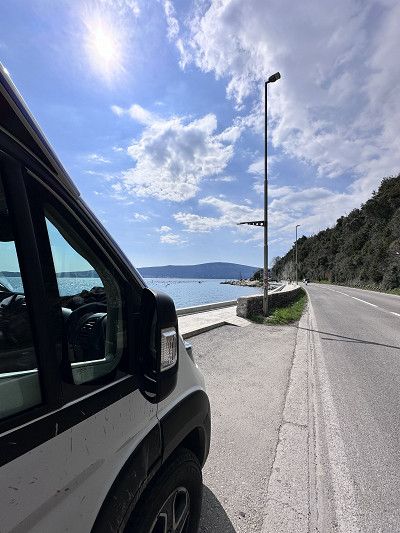
We drive along the Adriatic coastal road one last time. At Rijeka we drive a short distance further towards Pula on road 66 (Route 66 of Croatia 😅).
The landscape is constantly changing, so the coast off Rijeka is mountainous, barren with a view of the deep blue sea 🌊
afterwards more with palm trees 🌴 cypresses and houses like on the Riviera.
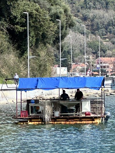
Shortly after Zadar we were able to watch a fisherman at work. He grows mussels and oysters on site 🦪

We drive along the Adriatic coastal road one last time. At Rijeka we drive a short distance further towards Pula on road 66 (Route 66 of Croatia 😅).
The landscape is constantly changing, so the coast off Rijeka is mountainous, barren with a view of the deep blue sea 🌊
afterwards more with palm trees 🌴 cypresses and houses like on the Riviera.
Shortly after Zadar we were able to watch a fisherman at work. He grows mussels and oysters on site 🦪
Traveling also makes you hungry and we lost our way a little while looking for a picnic spot 😂😂😂
But it was worth it 👍
Traveling also makes you hungry and we lost our way a little while looking for a picnic spot 😂😂😂
But it was worth it 👍
Entry with an identity card (CH ID) or a valid passport.
The Schengen Agreement applies in Slovenia - no entry controls
Maximum speed 50 in town / 90 outside town, expressway 110 km
Motorway toll 130 km maximum speed
Daytime running lights mandatory
Currency Euro
Gas station network - AdBlue available
Free camping is prohibited and will be punished with a fine
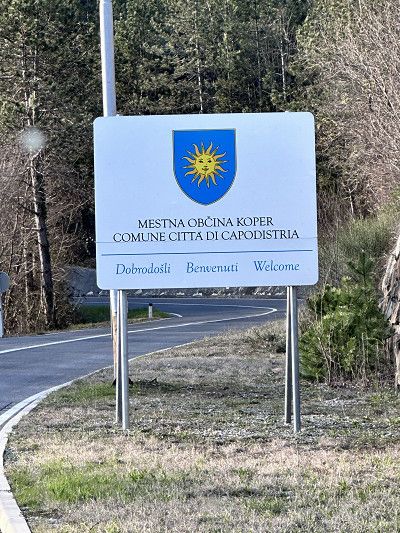
There is certainly a lot to see in Slovenia. This time we are just passing through and it is only 50 km to Italy.
Another time with pleasure 😉
There is certainly a lot to see in Slovenia. This time we are just passing through and it is only 50 km to Italy.
Another time with pleasure 😉
Entry with an identity card (CH ID) or a valid passport.
The Schengen Agreement applies in Italy - no entry controls
Maximum speed 50 in town / 90 outside town, expressway 110 km
Motorway toll 130 km maximum speed
Daytime running lights mandatory
Currency Euro
Gas station network good, AdBlue available
Free camping is prohibited, but there are good pitches
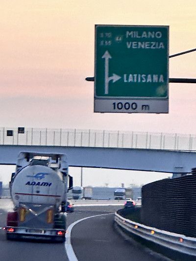
So now Enspurt 💨💨💨
Now it's another 135 km onto the motorway. Tomorrow we want to go to an outlet village before we finally go home 🏠.
So now Enspurt 💨💨💨
Now it's another 135 km onto the motorway. Tomorrow we want to go to an outlet village before we finally go home 🏠.
Once again the Park4Night app is in use and led us to this parking space.
A free place on a quiet street. A really good place for a stopover, electricity is also available free of charge, gray water and chemical toilets can be disposed of and fresh water refilled.
We went out to eat in town that evening. It was delicious 😋
We are still a little early for the outlet village and so we take a short detour to this pretty little town.
Many seaside places are well known in this area. Caorle, Bibione or Jesolo. Nothing is going on there at this time of year and there is life in the hinterland 🤩
The locals also recommend having a cappuccino and croissants in a café bar 😁
With the right wallet you could spend the whole day here 🙈
But worth a trip even without it. Before we go home today 🏠, we take a leisurely stroll through the piazza, go out for a delicious meal and also find a couple of affordable souvenirs (not at Prada & Co. 😂).
Strengthened, we now head towards the motorway and on the way home.
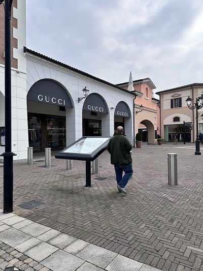
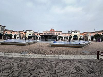
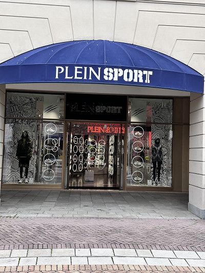
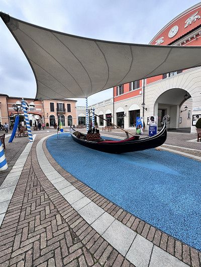
Entry with ID card or valid passport.
The Schengen Agreement applies in Switzerland - no entry controls
Maximum speed 50 in urban areas / 80 out of urban areas
Motorway vignette requirement (CHF 40.00) 120 km maximum speed
Daytime running lights mandatory
Currency CHF
Gas station network good, AdBlue available
Free camping allowed, for 1-2 nights
No camping-like behavior (tables, chairs, grill, etc.)
We cross the border into Switzerland again at Chiasso. Driving monotonously on the highway makes you think back to our journey. 🚎
And still a certain anticipation of being home and cuddling our dog again after a long time 🤗 🐶
We cross the border into Switzerland again at Chiasso. Driving monotonously on the highway makes you think back to our journey. 🚎
And still a certain anticipation of being home and cuddling our dog again after a long time 🤗 🐶
At home, thanks to all the great encounters. We'll be back ❤️🔥🫶🥰
At home, thanks to all the great encounters. We'll be back ❤️🔥🫶🥰
I recommend this trip outside of high season to anyone who would like to experience the warmth of the people in Greece and the Balkans.
An incredible amount of impressions, landscapes and nature, churches of different cultures, archaeology, history and always great encounters with travelers and locals.
Norbert and Martina, Igor and your family, Daniel, Vibke, Susan and many also nameless you will be remembered.
This was one of our best trips ever - just THANK YOU 🤩
Route
Show newest first- 47.5068 7.521
- 47° 30' 24.4" N 7° 31' 15.5" E
Einreise mit Personalausweis (CH ID) oder gültigem Pass.
In Italien gilt das Schengen Abkommen - keine Einreisekontrolle
Höchstgeschwindigkeit 50 Innerorts / 90 Ausserorts, Schnellstrasse 110 km
Autobahn Mautpflichtig 130 km Höchstgeschwindigkeit
Tagfahrlichtpflicht
Währung Euro
Tankstellennetz gut, AdBlue vorhanden
Freies Campen verboten, es gibt aber gute Stellplätze
- 45.8392 9.0353
- 45° 50' 21" N 9° 2' 7.1" E
- 43.617 13.5171
- 43° 37' 1.2" N 13° 31' 1.6" E
- 43.6179 13.5323
- 43° 37' 4.6" N 13° 31' 56.2" E
- 43.6151 13.5338
- 43° 36' 54.3" N 13° 32' 1.8" E
- 43.617 13.5171
- 43° 37' 1.2" N 13° 31' 1.6" E
Einreise mit Personalausweis (CH ID) oder gültigem Pass.
Höchstgeschwindigkeit 50 Innerorts / 90 Ausserorts
Autobahn Mautpflichtig 130 km Höchstgeschwindigkeit
Währung Euro
Tankstellennetz gut und oft bedient (sie freuen sich über ein kleines Trinkgeld)
AdBlue vorhanden
Freies campen verboten, wurde aber im März toleriert, da die meisten Campingplätze geschlossen sind
- 38.2221 21.7207
- 38° 13' 19.4" N 21° 43' 14.4" E
- 36.9525 21.6614
- 36° 57' 9" N 21° 39' 41.2" E
- 36.9156 21.6949
- 36° 54' 56" N 21° 41' 41.6" E
- 36.8155 21.7045
- 36° 48' 55.6" N 21° 42' 16.3" E
- 37.0373 22.1107
- 37° 2' 14.2" N 22° 6' 38.5" E
Von Kalamata nach Gythio kann man über eine Autobahn A 71 fahren. Für grössere Womos sicher zu empfehlen. Wir haben uns aber für die Serpetinenstrasse 82 entschieden. Diese führt durch ein traumhaftes Bergebiet mit bizarren und wunderschönen Steinformationen.
PS: Tunnelhöhe 3.80 m maximum
- 36.7582 22.5694
- 36° 45' 29.6" N 22° 34' 9.7" E
- 36.7793 22.5711
- 36° 46' 45.4" N 22° 34' 16.1" E
Am Freitag ist Wochenmarkt und wir nutzen die Gelegenheit noch Obst und Gemüse einzukaufen. Auch hier werden wir mit einem freudigen Kalimera (guten Morgen) begrüsst.
Auf der Weiterfahrt halten wir noch kurz an um mit unserer Drohne Aufnahmen von der Dimitrios zu machen 😁⛴️ Üben üben üben…
- 36.7342 23.0405
- 36° 44' 3.1" N 23° 2' 25.8" E
- 36.9052 22.9643
- 36° 54' 18.9" N 22° 57' 51.4" E
- 37.1663 22.8604
- 37° 9' 58.8" N 22° 51' 37.5" E
- 37.3357 22.8126
- 37° 20' 8.4" N 22° 48' 45.2" E
- 37.3823 22.7751
- 37° 22' 56.2" N 22° 46' 30.3" E
- 37.5659 22.8069
- 37° 33' 57.3" N 22° 48' 24.8" E
- 37.9342 22.9845
- 37° 56' 3.3" N 22° 59' 4.1" E
- 38.0279 22.8524
- 38° 1' 40.3" N 22° 51' 8.6" E
- 37.9158 23.7027
- 37° 54' 56.9" N 23° 42' 9.6" E
Heute steht Athen auf dem Programm. Doch egal wo wir hin fahren, die Strassen sind gesperrt. Wir sprechen einen Polizisten an und fragen nach. Heute findet ein Marathonlauf statt, kein Durchkommen 😵💫
Aber typisch nette Griechen - follow me, come come - hä was will denn der🤔 die Polizei fährt voraus und bringt uns zum nächstmöglichen Parkplatz im Monastiraki Quartier. Das ist wirklich gastfreundlich - danke vielmals. Wir stellen unser Womo auf diesem bewachten Platz ab, halten noch ein Schwätzchen mit dem Parkwächter der ebenfalls freundlich uns den Weg erklärt. Laden die Fahrräder ab und erkunden Athen by Bike 🔝👍🔝
- 37.9761 23.7256
- 37° 58' 33.9" N 23° 43' 32.3" E
- 37.9717 23.7263
- 37° 58' 18.1" N 23° 43' 34.8" E
- 37.9158 23.7047
- 37° 54' 57" N 23° 42' 17" E
Auf der Weiterreise haben wir die Insel Euboä besucht.
Am 3. August 2021 wütete hier die grössten Waldbrände. Im Norden der Insel wurden während 8 Tagen mehr als 50 000 Hektaren Wald und Landwirtschaftsfläche verwüstet. Das entspricht der Fläche des Kanton Baselland, meinem Heimatkanton.
Noch nie hat ein Ereignis so viel Land zerstört. Es wird gemunkelt, dass es sich um Brandstiftung handelt, weil im Naturschutzgebiet ein Windpark gebaut werden sollte.
Heute (2024) ist noch viel verbrannte Wälder und Erde zu sehen. Doch die Natur kämpft sich zurück 😉
- 38.853 23.0468
- 38° 51' 10.9" N 23° 2' 48.3" E
- 38.9404 23.0576
- 38° 56' 25.4" N 23° 3' 27.4" E
- 38.9359 23.0347
- 38° 56' 9.3" N 23° 2' 4.8" E
- 38.9333 23.0353
- 38° 55' 59.8" N 23° 2' 7.2" E
- 39.7193 21.6371
- 39° 43' 9.6" N 21° 38' 13.7" E
- 39.7265 21.6265
- 39° 43' 35.4" N 21° 37' 35.4" E
- 39.6907 20.8886
- 39° 41' 26.4" N 20° 53' 19.1" E
- 39.664 20.8523
- 39° 39' 50.3" N 20° 51' 8.2" E
Einreise mit Personalausweis (CH ID) oder gültigem Pass.
Grüne Versicherungskarte Pflicht ansonsten wird für 50 Euro eine Versicherung abgeschlossen
Fahrzeugpapiere werden kontrolliert
Höchstgeschwindigkeit 40 Innerorts / 80 Ausserorts
Autobahn keine Maut 110 km Höchstgeschwindigkeit
Währung Lek 1 Euro/Chf ca. 100 Lek
Tankstellennetz gut und oft bedient (sie freuen sich über ein kleines Trinkgeld)
AdBlue vorhanden
Freies Campen erlaubt
- 39.911 20.3631
- 39° 54' 39.4" N 20° 21' 47" E
- 39.9242 20.1918
- 39° 55' 27" N 20° 11' 30.6" E
- 40.1966 19.5982
- 40° 11' 47.6" N 19° 35' 53.7" E
- 40.5211 19.3886
- 40° 31' 15.8" N 19° 23' 18.8" E
Einreise mit Personalausweis (CH ID) oder gültigem Pass.
Fahrzeugpapiere werden kontrolliert
Höchstgeschwindigkeit 50 Innerorts / 80 Ausserorts
Autobahn keine Maut 100 km Höchstgeschwindigkeit
Währung Euro
Tankstellennetz gut und oft bedient (sie freuen sich über ein kleines Trinkgeld)
AdBlue vorhanden
Freies Campen verboten
- 42.0171 19.3731
- 42° 1' 1.7" N 19° 22' 23.1" E
- 42.1017 19.0934
- 42° 6' 6.2" N 19° 5' 36.1" E
- 42.383 19.2785
- 42° 22' 58.8" N 19° 16' 42.7" E
- 42.6754 19.0274
- 42° 40' 31.4" N 19° 1' 38.6" E
- 42.2863 18.8166
- 42° 17' 10.7" N 18° 48' 59.6" E
- 42.2916 18.8226
- 42° 17' 29.6" N 18° 49' 21.2" E
- 42.2886 18.842
- 42° 17' 18.8" N 18° 50' 31" E
- 42.4249 18.771
- 42° 25' 29.5" N 18° 46' 15.8" E
- 42.4658 18.6867
- 42° 27' 56.9" N 18° 41' 12.1" E
Einreise mit Personalausweis (CH ID) oder gültigem Pass.
Fahrzeugpapiere werden kontrolliert, jedoch nur wenn man von Montenegro her kommt
Seit 2023 gehört Kroatien zum Schengen Gebiet, Einreise von Slowenien- keine Einreisekontrolle
Höchstgeschwindigkeit 50 Innerorts / 90 Ausserorts, Schnellstrasse 110 km
Autobahn Mautpflichtig 130 km Höchstgeschwindigkeit
Oktober - März Tagfahrlicht
Währung Euro
Tankstellennetz gut und eher selten bedient (sie freuen sich über ein kleines Trinkgeld)
AdBlue vorhanden
Freies Campen verboten, wird mit Bussen geahndet
- 42.488 18.4362
- 42° 29' 16.9" N 18° 26' 10.4" E
- 42.6487 18.0947
- 42° 38' 55.5" N 18° 5' 40.8" E
- 42.8049 17.7422
- 42° 48' 17.6" N 17° 44' 32.1" E
Mali Ston liegt wunderschön am Kanal und ist berühmt für seine Austern- und Muschelzucht, aber auch für die kleine mittelalterliche Altstadt. Es gibt in dieser Region viele Restaurants, welche Austern und andere Spezialitäten aus dem Meer anbieten.
Ich durfte eine mit Käse überbackene Auster 🦪 und ein Risotto mit Garnelen geniessen. Einfach herrlich 😊
- 42.8354 17.6969
- 42° 50' 7.4" N 17° 41' 48.9" E
Heute steht ein weiterer Abschnitt der Jadranska Magistrale auf dem Plan. Zu Recht sagt man, dass dies wohl die schönste Küstenstrasse Europas ist.
Auf jeden Fall ist die Strecke lang. Von Ulcinj in Montenegro, ganz Kroatien, Slowenien bis Triest in Italien sind das über 1000 km Küstenstrasse.
Auf dem ganzen Weg hat man eine spektakuläre Aussicht auf malerische Städtchen, atemberaubende Bergmassive und Lanschaften und das tiefblaue Meer, die Adria.
- 44.117 15.22
- 44° 7' 1.4" N 15° 13' 12" E
- 45.312 14.2858
- 45° 18' 43.2" N 14° 17' 8.9" E
- 45.4225 14.0125
- 45° 25' 20.8" N 14° 0' 44.8" E
Einreise mit Personalausweis (CH ID) oder gültigem Pass.
In Slowenien gilt das Schengen Abkommen - keine Einreisekontrolle
Höchstgeschwindigkeit 50 Innerorts / 90 Ausserorts, Schnellstrasse 110 km
Autobahn Mautpflichtig 130 km Höchstgeschwindigkeit
Tagfahrlichtpflicht
Währung Euro
Tankstellennetz - AdBlue vorhanden
Freies Campen verboten, wird mit Bussen geahndet
- 45.4525 13.9262
- 45° 27' 8.9" N 13° 55' 34.5" E
Einreise mit Personalausweis (CH ID) oder gültigem Pass.
In Italien gilt das Schengen Abkommen - keine Einreisekontrolle
Höchstgeschwindigkeit 50 Innerorts / 90 Ausserorts, Schnellstrasse 110 km
Autobahn Mautpflichtig 130 km Höchstgeschwindigkeit
Tagfahrlichtpflicht
Währung Euro
Tankstellennetz gut, AdBlue vorhanden
Freies Campen verboten, es gibt aber gute Stellplätze
- 45.5823 13.8391
- 45° 34' 56.4" N 13° 50' 20.7" E
- 45.7325 12.6779
- 45° 43' 56.8" N 12° 40' 40.3" E
- 45.7753 12.6107
- 45° 46' 30.9" N 12° 36' 38.4" E
- 45.6715 12.5361
- 45° 40' 17.4" N 12° 32' 9.8" E
Einreise mit Personalausweis oder gültigem Pass.
In der Schweiz gilt das Schengen Abkommen - keine Einreisekontrolle
Höchstgeschwindigkeit 50 Innerorts / 80 Ausserorts
Autobahn Vignettenpflicht (CHF 40.00) 120 km Höchstgeschwindigkeit
Tagfahrlichtpflicht
Währung CHF
Tankstellennetz gut, AdBlue vorhanden
Freies Campen erlaubt, für 1-2 Nächte
Kein Campingartiges Verhalten (Tische, Stühle, Grill etc.)
- 45.8355 9.029
- 45° 50' 7.9" N 9° 1' 44.5" E
- 47.5068 7.521
- 47° 30' 24.4" N 7° 31' 15.5" E
Jedem, der einmal die Herzlichkeit der Menschen in Griechenland und im Balkan erfahren möchte, empfehle ich diese Reise ausserhalb der Hochsaison.
Unwahrscheinlich viele Eindrücke, Landschaften und Natur, Kirchen verschiedener Kulturen, Archeologisches, Geschichte und immer wieder tolle Begegnungen mit Reisenden und Einheimischen.
Norbert und Martina, Igor und deine Familie, Daniel, Vibke, Susan und viele auch Namenlos ihr bleibt in Erinnerung.
Dies war eine unserer besten Reisen ever - einfach nur DANKE 🤩
Travelogue
Finally, it starts again. This year we have planned some nice trips again. We start from our home with the destination Ancona. We'll see how far we get today. Tomorrow we have booked a ferry ⛴️ to Patras - Greece 🇬🇷.
Finally, it starts again. This year we have planned some nice trips again. We start from our home with the destination Ancona. We'll see how far we get today. Tomorrow we have booked a ferry ⛴️ to Patras - Greece 🇬🇷.
Entry with an identity card (CH ID) or a valid passport.
The Schengen Agreement applies in Italy - no entry controls
Maximum speed 50 in town / 90 outside town, expressway 110 km
Motorway toll 130 km maximum speed
Daytime running lights mandatory
Currency Euro
Gas station network good, AdBlue available
Free camping is prohibited, but there are good pitches
This has never happened before 😁 not a minute of traffic jams on the Gotthard ❣️
These holidays are off to a great start, bye bye Switzerland until three weeks 🇨🇭
This has never happened before 😁 not a minute of traffic jams on the Gotthard ❣️
These holidays are off to a great start, bye bye Switzerland until three weeks 🇨🇭
After a quiet night, we went to the port office to check in. We got there around 10 a.m., which was good. Our ship left at 5:30 p.m., an hour late. So we still had some time to visit Ancona.
About 3 hours before departure we were back at the port and watched the ferry being loaded and unloaded. Tetris for advanced players 😀
PS: We spent the night at a rest area near Ravenna, about 140 km before Ancona.
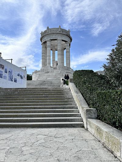
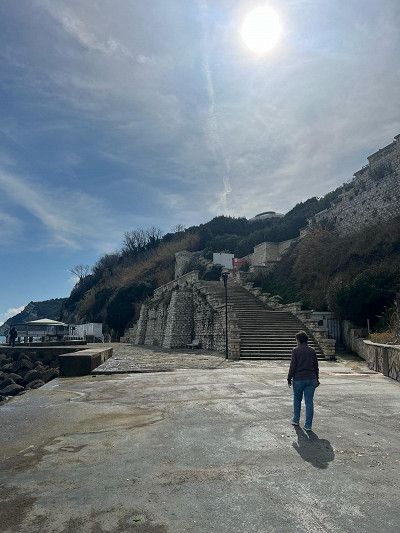
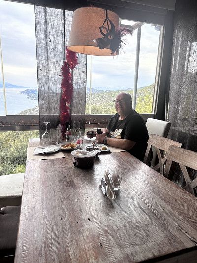
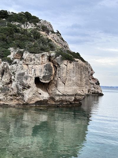
As mentioned, we had a bit of a wait in Ancona. This bay is not far from the harbor. A steep staircase leads down and it was a leisurely walk. Many small boathouses line the beach. There are hardly any boats left, the boathouses are used more as a weekend meeting place.
A stone formation is reminiscent of the Pope's chair, hence the name.
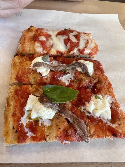
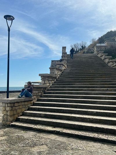
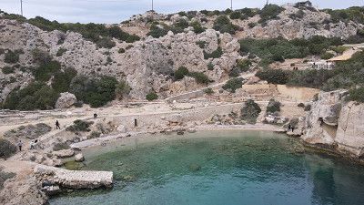
Where you go down, you have to go up again 😀 When you get to the top, there is a beautiful viewing platform and a square with an “Academia”. From this square there is a promenade that invites you to stroll. After a short while on the right there is a pizzeria “Farinando”, which offers slices of pizza for €1.50 to €3.00. Were super delicious 😋
Where you go down, you have to go up again 😀 When you get to the top, there is a beautiful viewing platform and a square with an “Academia”. From this square there is a promenade that invites you to stroll. After a short while on the right there is a pizzeria “Farinando”, which offers slices of pizza for €1.50 to €3.00. Were super delicious 😋
Entry with an identity card (CH ID) or a valid passport.
Maximum speed 50 in urban areas / 90 out of urban areas
Motorway toll 130 km maximum speed
Currency Euro
Service station network well and often served (they are happy about a small tip)
AdBlue available
Free camping prohibited but was tolerated in March as most campsites are closed
The night was quiet and we got a LUX cabin. Despite bad reviews, the ship and the cabins are quite ok. You can see the age of the ship. The crew tries very hard and is friendly. The first vehicles disembark at Igoumenitsa.
We stay on board and continue to Patras.
Price for a motorhome crossing of 6.50 m costs €. 253.00 with Freeontour card 20% discount. Lux cabin € 352.00 per person. Total €907.00.
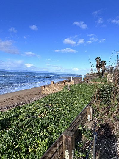
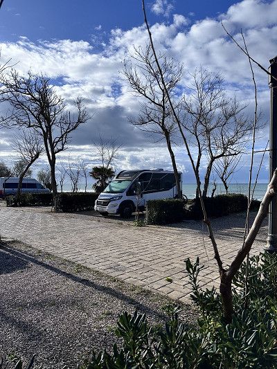
We arrived at the campsite in the dark. It's completely uncomplicated to register for a place tomorrow 😉 There's a thunderstorm coming down, but we don't care. We stand directly on the beach, on a place with solid ground.
I can highly recommend this place, clean, good sanitary facilities and in season pool, playground, mini market 🏪 and a tavern on the square. 👍👍👍
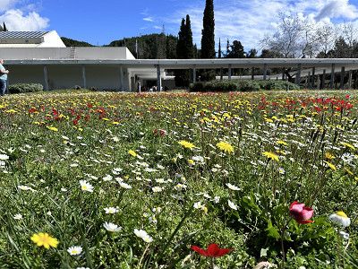
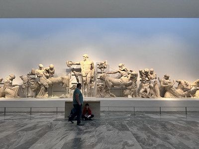
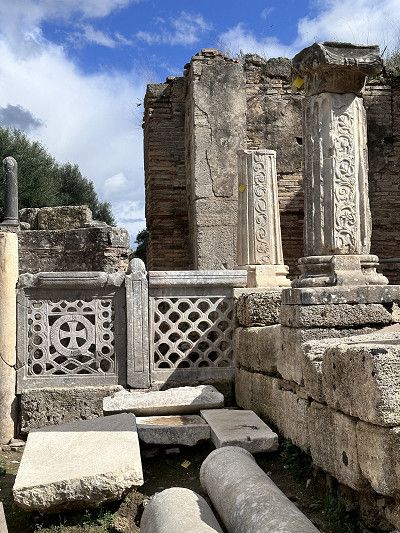
We continue south on the Peloponnese peninsula. A worthwhile trip to Olympia to visit the museum there. There is a lot to read about this place. The Olympic torch is still lit here today and then brought to the respective venue.
The first taverns and shops are open, mainly because school classes are visiting the place.
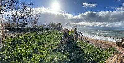
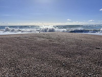
At this time of year it is no problem finding a spot by the sea. It's wonderful and reflects my desire for freedom 😄. Of course we leave the place clean. Here too we met some nice people and got one or two tips.
The place is located directly on the sandy beach, there is a solid surface, I can't judge what it looks like in constant rain.
In summer the place is used by locals and camping is no longer welcome 😉
This beautiful bay is definitely worth a visit. As we learned, standing alone is tolerated in March as many campsites are still closed. It was still too early for us.
From the parking lot you can take a beautiful circular hike to the Navarino castle ruins with a great view of Ochsenbauch Bay. Duration approx. 1.25 hours.
Great, today we saw Norbert and Martina from CP Ionion Beach again 🤗 Too bad, in retrospect I would have liked to have swapped the phone number 🙈
There wasn't much going on at this time of year, so we treated ourselves to a delicious gyros 🥙 at the harbor. It's definitely nice on the pitch in summer.
There wasn't much going on at this time of year, so we treated ourselves to a delicious gyros 🥙 at the harbor. It's definitely nice on the pitch in summer.
The castle at Methoni is very impressive and is evidence of a strategically important point. Built in the 13-15 centuries. We only saw it from the outside; the entrance closed at 3:30 p.m. Maybe another time 😄
The castle at Methoni is very impressive and is evidence of a strategically important point. Built in the 13-15 centuries. We only saw it from the outside; the entrance closed at 3:30 p.m. Maybe another time 😄
After we were out and about a lot today, we wanted to spend the night at a nice campsite again. There are several places open all year round in the Finikounda area and this one was recommended to us. The place is rightly located directly on the sandy beach. The places are a bit small but we really like it here.
After we were out and about a lot today, we wanted to spend the night at a nice campsite again. There are several places open all year round in the Finikounda area and this one was recommended to us. The place is rightly located directly on the sandy beach. The places are a bit small but we really like it here.
After a short drive we reach the town of Kalamata. The whole city is decorated with carnival figures and some people dance in the streets. We unload the bikes and go exploring. In addition to a shopping area, there is also a small old town. We really like strolling through the streets and the festive atmosphere.
The park near the marina is also worth seeing. Many steam locomotives and passenger trains are on display.
From Kalamata to Gythio you can drive via the A 71 motorway. Definitely recommended for larger RVs. But we decided on Serpetinenstrasse 82. This leads through a wonderful mountain area with bizarre and beautiful stone formations.
PS: Tunnel height 3.80 m maximum
From Kalamata to Gythio you can drive via the A 71 motorway. Definitely recommended for larger RVs. But we decided on Serpetinenstrasse 82. This leads through a wonderful mountain area with bizarre and beautiful stone formations.
PS: Tunnel height 3.80 m maximum
If you don't disturb the fishermen, you can spend the night in this parking lot. Gythio is a lively harbor town with many taverns on the promenade. We took the bikes again and went exploring.
In the evening we went out to eat for the first time. The first taverns have opened and we were able to get to know the hospitable Greeks.
Gythio is a city that was used as a military port by the Spartans in ancient times.
On our bike tour through Gythio, we spontaneously cycled to the bay of Valtaki, 5 km away. This is located next to Selinitsas beach.
From the main road you have to make a sharp turn to get to the beach. There are already a few mobile homes here, I assume they will spend the night here 😉
This bay is worth seeing because of the Dimitrios shipwreck. When the captain had to go to hospital in an emergency in 1980, he docked in the port of Gytio. Since the port fee was not paid, the municipality decided that the ship had to anchor in front of the port. On December 23, 1981, a storm raged and the ship tore loose. It drifted into the bay of Valtaki, where it lies to this day 🙈
There is a weekly market on Friday and we take the opportunity to buy fruit and vegetables. Here too we are greeted with a joyful Kalimera (good morning).
As we continue our journey we stop briefly to take pictures of the Dimitrios with our drone 😁⛴️ Practice practice practice…
There is a weekly market on Friday and we take the opportunity to buy fruit and vegetables. Here too we are greeted with a joyful Kalimera (good morning).
As we continue our journey we stop briefly to take pictures of the Dimitrios with our drone 😁⛴️ Practice practice practice…
A highlight of our trip is this fortress of Monemvasia from the Byazintic Empire (284-641). The fortress was an almost impregnable defensive castle and secured the sea route from Venice to Constantinople. At its peak, 25,000 people lived here. During the War of Liberation in 1821, the fortress lost its importance.
Anyone who visits the fortress today will feel like they have been transported back to old times😎
We avoid all toll roads because we simply prefer driving through the mountains. This sometimes results in special encounters such as meeting the shepherd 🐏🐑🐏 or exciting objects on the side of the road
We avoid all toll roads because we simply prefer driving through the mountains. This sometimes results in special encounters such as meeting the shepherd 🐏🐑🐏 or exciting objects on the side of the road
We drove through Leonidio. However, if you are here on Orthodox Easter Day, you should plan a few days. There is a big festival with sky lanterns and lamb dinners on Sunday in the village square. We were still too early 🙈
We also got here via a serpentine road, it's better if you're not afraid of heights, you'll sometimes look for guardrails in vain🥴
We saw this special Orthodox church from afar and we absolutely had to go there. Unfortunately, but it was still worth it.
We saw this special Orthodox church from afar and we absolutely had to go there. Unfortunately, but it was still worth it.
Today's place to sleep on the beach, today we drove a long way. Now we're hungry, we cook something delicious and make ourselves comfortable in the motorhome.
The parking lot is located directly on the pebble beach, as always with free standing there is no infrastructure, but what it always has are waste containers - you are welcome to use them 😉
There is also a weekly market in Nafplio, we were here on Saturday. In addition to regional products, you can buy clothes and household goods. The handle of our frying pan broke off a few days ago, so we were able to replace it 👍
For the first time I found wild asparagus. The nice Greek woman recommends an omelette with asparagus, I have to try that 😉
There is a place to stay overnight near the harbor not far from the old town. Would have been better here, like the place from yesterday.
The old town is absolutely worth seeing, since we want to go further to Corinth today, we're skipping a visit. 🥺
This canal is an impressive man-made structure 1881-1893. Up to 75 m high and 24 m wide.
Sailing around the Peloponnese peninsula was very dangerous, and so a solution was sought to connect northern Greece with the peninsula. The canal leads from the Saronic Gulf to the Gulf of Corinth. The canal is too narrow and, at 8 m, not deep enough for today's cargo ships. Therefore it is mainly used for tourism trips and private ships 🚢.
After a short drive, about 30 minutes, and a stop at the Panorama Restaurant in Loutraki, we reach the Cape of Melagkavi or also known as the Cape of Perachora. There are two sights in the immediate vicinity. By that I don't mean the fantastically beautiful bay with the crystal clear sea.
One is the lighthouse; unfortunately locked. Still worth seeing, especially because of the beautiful view from up there 🤩
In the bay below is the archaeological site of Heraion. Noteworthy is the well-preserved cistern with attached bath, an L-shaped stoa (free-standing colonnade or covered walkway), dining rooms, altar and two temples in honor of the goddess Hera.🏺🏛️
Because we probably arrived too late, we didn't get a parking space at the Acropolis bus parking lot. Never mind, 😉 we found a good replacement.
There would be toilets and showers here. However, these are for the ship owners and I assume that you would need a key.
Because we probably arrived too late, we didn't get a parking space at the Acropolis bus parking lot. Never mind, 😉 we found a good replacement.
There would be toilets and showers here. However, these are for the ship owners and I assume that you would need a key.
Today Athens is on the agenda. But no matter where we go, the roads are closed. We talk to a police officer and ask. There's a marathon today, no getting through 😵💫
But typically nice Greeks - follow me, come come - hey, what does he want? The police drive ahead and take us to the nearest parking space in the Monastiraki district. This is really welcoming - thank you very much. We park our motorhome in this guarded space and have a chat with the park attendant, who also kindly explains the route to us. Unload the bikes and explore Athens by Bike 🔝👍🔝
Monastiraki is a lively district near the Acropolis. Shops, stalls, dealers with 🌰 chestnuts, flea market with antiques and many small restaurants. But there are also endless tourists. 🛍️
The Museum of Illusions is also located in the same district. If you would like some funny snapshots, you are welcome to visit. In retrospect, the entrance fee of €12 is too much for that.
The Acropolis is a must see when visiting Athens. If you would like to know more background, there is a museum in the immediate vicinity.
But we preferred to scramble up to the Temple of Athena. The views of Athens and Piraeus are phenomenal 🤩
The Acropolis is a must see when visiting Athens. If you would like to know more background, there is a museum in the immediate vicinity.
But we preferred to scramble up to the Temple of Athena. The views of Athens and Piraeus are phenomenal 🤩
This morning a security guard spoke to us, well 😌 actually sleeping would be forbidden here too. Contrary to the information on the Internet. We asked politely and he allowed us to sleep here again that night 😴 We gratefully accepted, because the campsites in the capital are still closed.
This morning a security guard spoke to us, well 😌 actually sleeping would be forbidden here too. Contrary to the information on the Internet. We asked politely and he allowed us to sleep here again that night 😴 We gratefully accepted, because the campsites in the capital are still closed.
On the onward journey we visited the island of Euboä.
The largest forest fires raged here on August 3, 2021. In the north of the island, more than 50,000 hectares of forest and agricultural land were devastated over eight days. This corresponds to the area of the canton of Baselland, my home canton.
Never before has an event destroyed so much land. It is rumored that it was arson because a wind farm was to be built in the nature reserve.
Today (2024) a lot of burned forests and earth can still be seen. But nature is fighting back 😉
A cool wind is blowing outside, the sea is making waves, who wants to go swimming 🤔 Put on your swimming trunks, we read that there are hot springs right on the beach.
We were able to park right next to the staircase. Bath towel, Crocs, cell phone for photos, bag and off you go 🌊
After initial hesitation, what a surprise 😮 the water is 39 degrees Celsius. We let ourselves drift and don't want to go out anymore. After half an hour of bathing, we leave the cozy bathroom and go back to the motorhome. Amazingly, we are so warmed up that the cold winds don't bother us.
We found this parking lot on the beach at Park4Night. It is located right on a street but is quiet and is lit at night.
The view is beautiful and overall a great place.
It has showers, which probably only run in summer. While we were there there was a lot of flotsam on the beach.
We found this parking lot on the beach at Park4Night. It is located right on a street but is quiet and is lit at night.
The view is beautiful and overall a great place.
It has showers, which probably only run in summer. While we were there there was a lot of flotsam on the beach.
We leave the island of Euboea towards the mainland. We take the ferry ⛴️ to Glyfa. The crossing only takes 30 minutes. Although we have bad weather for the first time today, the sea is calm and there is hardly any rocking. I read that the ferry should leave early during the season. According to the motto; first come first served 😉
At the harbor we shorten the waiting time in a café. When asked if they offer breakfast, she says no. Less than two minutes later she brings us two chocolate croissants from her private kitchen. Hospitality indescribable 😍
Our destination today is the Meteora monasteries.
There are 24 monasteries, which were built between the 12th and 16th centuries. They were built in the 19th century at windy heights on the tops of sandstone cliffs. were there between the 12th and 16th. That's where the name comes from; Meteora means “to lift up”
Six monasteries are still inhabited today and can be visited. These are:
- Agia Triada
- Agios Nikolaos
- Anapavsás Agios Stéphanos
- Rousanou
- Vaárlam and
- Metamorphosis (we visited)
The road goes up from Kalambaka.
From this vantage point you have a fantastic view of the stone formations and several monasteries.
The Metamorphosis Monastery is the largest and oldest. Previously it was only accessible via a rope ladder. Since 1923, the monastery has been accessible via a tunnel and stairs. It is inhabited by monks. 🧐
We had to hurry with the visit, the monastery closed at 4 p.m. and the monks went to evening prayers.
Appropriate clothing, shoulders covered, no shorts and a long skirt for women is desired.
We arrived at our sleeping place today in the dark. We found win on the Park4night app. It's clean and good so far 😌 Let's see what it looks like in the light tomorrow 😴
The weather isn't really good😉 but it doesn't matter, it's a good place to sleep and, when the weather is nice, a view of the lake and the city of Ioannina. It has a playground and a city wall, with a war memorial on site.
In memory of the Lingiades massacre, 82 dead, including 34 children (October 3, 1943)
Ioannina is a tourist town known for its silver jewelry forges. The day before it was pouring rain and we couldn't visit this place. Unfortunately everything is closed in the morning today.
It's a shame, I would have liked it here 🥺
Ioannina is a tourist town known for its silver jewelry forges. The day before it was pouring rain and we couldn't visit this place. Unfortunately everything is closed in the morning today.
It's a shame, I would have liked it here 🥺
Entry with an identity card (CH ID) or a valid passport.
Green insurance card is mandatory, otherwise insurance will be taken out for 50 euros
Vehicle documents are checked
Maximum speed 40 in urban areas / 80 out of urban areas
Motorway no tolls 110 km maximum speed
Currency Lek 1 Euro/Chf approx. 100 Lek
Service station network well and often served (they are happy about a small tip)
AdBlue available
Free camping allowed
From Ioannina we drive west to cross the border into Albania at Gijrokaster. Although every car is checked several times, crossing the border was still easy.
Phew, I imagined it would be worse 😉
From Ioannina we drive west to cross the border into Albania at Gijrokaster. Although every car is checked several times, crossing the border was still easy.
Phew, I imagined it would be worse 😉
This great karst spring is really worth a detour.
The water bubbles up from the depths. Due to the sunlight and against the background of the limestone, the water has a deep blue, sometimes turquoise surface. This spring has not yet been explored, so the exact depth and origin of the spring water is unknown.
It is a nature reserve and swimming 🧼 is prohibited.
We continue towards Sarandë and then follow the SH8 towards the coastal road and Llogara Pass.
This serpentine road has it all. However, the road conditions are much better than described in our travel guide.
Once at the top you have a sensational view of the Ionian Sea in the south (and Corfu 😉) and the Adriatic Sea in the north.
We continue towards Vlora.
Be careful, there are all kinds of animals (🐕🐄🫏) running around freely on the streets
Shortly after Vlora, over a 2 kilometer long bumpy road, we found this beautiful bay. We are not the only RV (van) owners here.
Some of the sections are sandy and only suitable for 4x4. There are lots of potholes and the rain has made the ground soggy. We enjoy it here, but it's absolutely not suitable for larger RVs.
Entry with an identity card (CH ID) or a valid passport.
Vehicle documents are checked
Maximum speed 50 in urban areas / 80 out of urban areas
Motorway no tolls 100 km maximum speed
Currency Euro
Service station network well and often served (they are happy about a small tip)
AdBlue available
Free camping prohibited
Today we took a day of travel with the destination Montenegro. There we mainly want to drive along the coastal road towards Croatia.
The famous Jadranska Magistrala (or Adria Magistrale) was built in the 1960s and 1970s. This winding coastal road is considered one of the most beautiful and picturesque in the world.
So we only took a few photos along the way and drove quickly.
We found this small but nice campsite not far from the border in the town of Utjeha. We want to charge everything again (batteries, etc.), fresh water and whatever else goes with it.
The places are small but cute under olive trees. There are clean sanitary facilities and a washing machine.
We found this small but nice campsite not far from the border in the town of Utjeha. We want to charge everything again (batteries, etc.), fresh water and whatever else goes with it.
The places are small but cute under olive trees. There are clean sanitary facilities and a washing machine.
This Orthodox cathedral in Bar is located in a beautiful park. The cathedral is richly decorated both inside and out. Inside, the church is decorated with frescoes, marble columns and floor mosaics.
The church is open to visitors and was built in 2006.
According to legend, the temple is dedicated to Vladimir and Kosara. A love story about the prisoner of war Prince Vladimir, who fell in love with the Tsar's daughter Kosara.
Taj Mahal in Montenegro 😍😍😍
We continue driving through the Sozina Tunnel (costs €5 toll for a 6m motorhome) towards Podgorica.
The waterfalls are absolutely worth seeing. There is also a nice little restaurant at this place. Extremely nice staff and good food - I would go there again at any time 🔝👍🔝
We continue driving through the Sozina Tunnel (costs €5 toll for a 6m motorhome) towards Podgorica.
The waterfalls are absolutely worth seeing. There is also a nice little restaurant at this place. Extremely nice staff and good food - I would go there again at any time 🔝👍🔝
This monastery can only be reached via a narrow serpentine, partly single-lane, missing guardrails and hairpin bends that we had to make twice with our small motorhome (2.10 m wide and 6 m long).
Not for normal RVs, inexperienced drivers, even with a car only for those with strong nerves 😱
The Serbian Orthodox cave monastery itself is really special. Built in the rock on the slope of the Prekornica Mountains (founded in 1656). It is still inhabited by monks today.
Small new family campsite, you feel like you have been invited to your home.
Some of it is still being built, but you won't notice anything about it. Igor, his wife and parents are extremely warm hosts. Cozy seating area, great view of the sea. Electricity, WiFi all included. Clean sanitary facilities and washing machine available. Small bar with welcome schnapps (homemade) 😁, Igor also organizes delivery service of pizzas, burgers etc. We'll be happy to come back 👍🔝
The only downside is the narrow access road; larger motorhomes could have problems. There is also a lack of supply and disposal (gray water, etc.).
The old town of Budva was our destination today. We drove the 5 km down from our campsite. Igor showed us a great way so that we didn't have to go along the main road.
The path leads next to the village of Seoce past an aqua park that appears to be out of service. Then we go back up another 5 km, and I'm grateful for my e-bike 😮💨😮💨😮💨
The old town is really worth seeing, small streets, shops and many nice restaurants. We didn't visit the museum with the citadel and library due to time constraints. Entry costs €4.50.
The old town is really worth seeing, small streets, shops and many nice restaurants. We didn't visit the museum with the citadel and library due to time constraints. Entry costs €4.50.
We liked it here so much, we're staying another night 😁
We liked it here so much, we're staying another night 😁
Kotor is the oldest city in Montenegro. The history goes back to the era of the Roman Empire.
The old town is surrounded by a city wall. There is a guarded parking lot right next to it for €3 per hour. I can't say whether it would be possible to stay overnight.
In addition to pretty streets, restaurants and many shops, including handicrafts, the city is known for its cats 🐈⬛ 🐈
There is a pet bottle recycling machine in this town, you put an old bottle in and cat food comes out 😂
The Bay of Kotor is also a highlight. To continue following the Adriatica Magistrale, you can drive around the bay (like a Norwegian fjord) or take the ferry. We did the latter. ⛴️
Entry with an identity card (CH ID) or a valid passport.
Vehicle documents are checked, but only if you come from Montenegro
Croatia has been part of the Schengen area since 2023, entry from Slovenia - no entry controls
Maximum speed 50 in town / 90 outside town, expressway 110 km
Motorway toll 130 km maximum speed
October - March daytime running lights
Currency Euro
Gas station network good and rarely served (they are happy about a small tip)
AdBlue available
Free camping is prohibited and will be punished with a fine
The border crossing from Montenegro is still controlled. Both vehicle documents and passports.
Logically, the Schengen agreement does not apply here, since Montenegro is not in the EU, but is only a candidate for membership.
The border crossing from Montenegro is still controlled. Both vehicle documents and passports.
Logically, the Schengen agreement does not apply here, since Montenegro is not in the EU, but is only a candidate for membership.
The city of Dubrovnik has an interesting fortress from the outside, but after half an hour we still couldn't find a motorhome parking space.
All parking spaces near the old town are reserved for residents or are not suitable for motorhomes 😮💨
Since we have already visited a beautiful old town in Kotor today, we continue.
Maybe another time 😁
Standing free is actually forbidden in Croatia and in many places this is punished with fines. We found this place on the Park4Night app.
A somewhat narrow path, the last 500 m is a gravel road, leads to this place. Easily feasible for vans and small motorhomes.
It is a parking lot for a restaurant in an idyllic location in the bay near Ston. We had a very good dinner here. When we asked if we could stay, we were even offered coffee for the next day. A very nice owner 🥹
Thank you for your hospitality ❣️
Mali Ston is beautifully situated on the canal and is famous for its oyster and mussel farming, but also for the small medieval old town. There are many restaurants in this region that offer oysters and other sea specialties.
I was able to enjoy an oyster 🦪 gratinated with cheese and a risotto with shrimps. Simply wonderful 😊
On the way back from our dreamy place to sleep we drive through next to Ston. We can see the impressive defensive wall from afar. There is a reason for this, because next to the Chinese Wall, it is the longest outside of China at 5.5 km. A truly important building in Croatia. Construction began in 1333 and took 400 years to complete.
The wall connects Ston with the bay of Mali Ston and is largely accessible.
Today another section of the Jadranska Mainline is on the agenda. It is rightly said that this is probably the most beautiful coastal road in Europe.
In any case, the route is long. From Ulcinj in Montenegro, all of Croatia, Slovenia to Trieste in Italy, there are over 1000 km of coastal roads.
All along the way you have spectacular views of picturesque towns, breathtaking mountain ranges and landscapes and the deep blue sea, the Adriatic.
Today we would like to have a good time. In March almost all campsites are closed. And standing alone is punished with a fine - so we drive to this place.
Now this is really a top place. Certainly very crowded in high season.
Super nice sanitary facilities and heated. Restaurant, market and entertainment are of course still closed.
However, the wellness area of the attached hotel can be used free of charge 👍
Today we first enjoyed the sun and the campsite ⛺️.
Towards the afternoon we packed our bikes and drove along the beach, past the harbor and into the old town of Zadar.
In addition to the many interesting sights, such as the “Square of the 5 Wells” or the “Kopnena Vrata” gate, also called “Porta Terraferma”, there are two modern installations in the north of the Riva waterfront promenade.
Both installations are by architect Nikola Bašić; “the sea organ” and “the greeting to the sun”.
The sea organ creates music 🎵 🎶 by waves under the water surface displacing the air through a system of tubes and therefore making organ pipes sound 😍
The Greetings to the Sun is a square with a diameter of 22 meters and consists of 300 glass plates in the ground. During the day, the solar cells collect energy to release a color spectacle at sunset 🌅 😲
We drive along the Adriatic coastal road one last time. At Rijeka we drive a short distance further towards Pula on road 66 (Route 66 of Croatia 😅).
The landscape is constantly changing, so the coast off Rijeka is mountainous, barren with a view of the deep blue sea 🌊
afterwards more with palm trees 🌴 cypresses and houses like on the Riviera.
Shortly after Zadar we were able to watch a fisherman at work. He grows mussels and oysters on site 🦪
Traveling also makes you hungry and we lost our way a little while looking for a picnic spot 😂😂😂
But it was worth it 👍
Traveling also makes you hungry and we lost our way a little while looking for a picnic spot 😂😂😂
But it was worth it 👍
Entry with an identity card (CH ID) or a valid passport.
The Schengen Agreement applies in Slovenia - no entry controls
Maximum speed 50 in town / 90 outside town, expressway 110 km
Motorway toll 130 km maximum speed
Daytime running lights mandatory
Currency Euro
Gas station network - AdBlue available
Free camping is prohibited and will be punished with a fine
There is certainly a lot to see in Slovenia. This time we are just passing through and it is only 50 km to Italy.
Another time with pleasure 😉
There is certainly a lot to see in Slovenia. This time we are just passing through and it is only 50 km to Italy.
Another time with pleasure 😉
Entry with an identity card (CH ID) or a valid passport.
The Schengen Agreement applies in Italy - no entry controls
Maximum speed 50 in town / 90 outside town, expressway 110 km
Motorway toll 130 km maximum speed
Daytime running lights mandatory
Currency Euro
Gas station network good, AdBlue available
Free camping is prohibited, but there are good pitches
So now Enspurt 💨💨💨
Now it's another 135 km onto the motorway. Tomorrow we want to go to an outlet village before we finally go home 🏠.
So now Enspurt 💨💨💨
Now it's another 135 km onto the motorway. Tomorrow we want to go to an outlet village before we finally go home 🏠.
Once again the Park4Night app is in use and led us to this parking space.
A free place on a quiet street. A really good place for a stopover, electricity is also available free of charge, gray water and chemical toilets can be disposed of and fresh water refilled.
We went out to eat in town that evening. It was delicious 😋
We are still a little early for the outlet village and so we take a short detour to this pretty little town.
Many seaside places are well known in this area. Caorle, Bibione or Jesolo. Nothing is going on there at this time of year and there is life in the hinterland 🤩
The locals also recommend having a cappuccino and croissants in a café bar 😁
With the right wallet you could spend the whole day here 🙈
But worth a trip even without it. Before we go home today 🏠, we take a leisurely stroll through the piazza, go out for a delicious meal and also find a couple of affordable souvenirs (not at Prada & Co. 😂).
Strengthened, we now head towards the motorway and on the way home.
Entry with ID card or valid passport.
The Schengen Agreement applies in Switzerland - no entry controls
Maximum speed 50 in urban areas / 80 out of urban areas
Motorway vignette requirement (CHF 40.00) 120 km maximum speed
Daytime running lights mandatory
Currency CHF
Gas station network good, AdBlue available
Free camping allowed, for 1-2 nights
No camping-like behavior (tables, chairs, grill, etc.)
We cross the border into Switzerland again at Chiasso. Driving monotonously on the highway makes you think back to our journey. 🚎
And still a certain anticipation of being home and cuddling our dog again after a long time 🤗 🐶
We cross the border into Switzerland again at Chiasso. Driving monotonously on the highway makes you think back to our journey. 🚎
And still a certain anticipation of being home and cuddling our dog again after a long time 🤗 🐶
At home, thanks to all the great encounters. We'll be back ❤️🔥🫶🥰
At home, thanks to all the great encounters. We'll be back ❤️🔥🫶🥰
I recommend this trip outside of high season to anyone who would like to experience the warmth of the people in Greece and the Balkans.
An incredible amount of impressions, landscapes and nature, churches of different cultures, archaeology, history and always great encounters with travelers and locals.
Norbert and Martina, Igor and your family, Daniel, Vibke, Susan and many also nameless you will be remembered.
This was one of our best trips ever - just THANK YOU 🤩
Comments (1)
Comments from Freeontour users
In einem Womoblog wäre eine kurze Beschreibung der Übernachtungsplätze eine wertvolle Ergänzung. Ich habe dazu in Ihrem sehr knappen Bericht leider nichts gefunden. Wenn freeontour für Womofahrende hilfreich sein soll, sollte die Redaktion darauf achten.
Hallo rauhbu,
da es sich bei den Routen im Rotenplaner - wie auch hier - zum größten Teil um Routen der Freeontour-Mitglieder handelt, steht es diesen frei, die Beschreibung ihrer Touren und auch der genutzten Stellplätze oder Campingplätze so knapp oder so ausführlich zu beschreiben, wie er oder sie es für richtig hält. Aus unserer Sicht ist es weder sinnvoll noch praktikabel seitens unserer Redaktion diesbezüglich Vorgaben zu machen. Darüber hinaus haben wir die Erfahrung gemacht, dass manche Freeontour-Nutzer Routen bevorzugen, die kurz und knackig beschrieben sind, andere wiederum mögen ausführlichere Beschreibungen. Da gibt es einfach kein richtig oder falsch. Daher freuen wir uns über jede Route, die mit der Freeontour-Community öffentlich geteilt wird. Auf diese Weise entsteht eine Vielzahl an unterschiedlichen Routen, von denen sich jede/r die individuell passende heraussuchen kann. Für detaillierte Nachfragen zu den genutzten Plätzen können Sie den Verfasser der Route auch über die Kommentarfunktion kontaktieren.
Viele Grüße aus der Freeontour-Redaktion
Hallo rauhbu
Auf dieser Reise haben wir, bis zweimal, ausschliesslich Freistellplätze angefahren. An diesen Plätzen hat es keine Infrastruktur, kein Strom, Wasser, Grauwasser etc. Wir haben unser Womo für Autark-Reisen eingerichtet und haben eine Clesana. Grauwasser entsorgen wir unterwegs zum Beispiel an Tankstellen gibt es Möglichkeiten.
Die beiden Campingplätze wurden auf Freeontour bewertet (siehe Plätze).
Wenn ich zu Hause bin, kann ich dann die Beschreibung der Schlafplätze nochmals überprüfen und eventuell anpassen. Unterwegs ist das schwierig. Man kann immer noch etwas besser machen.
Übrigens bin ich keine Bloggerin 😉 ich teile lediglich meine Reiseerfahrung.
Viel Freude beim Reisen und liebe Grüsse
Bettina