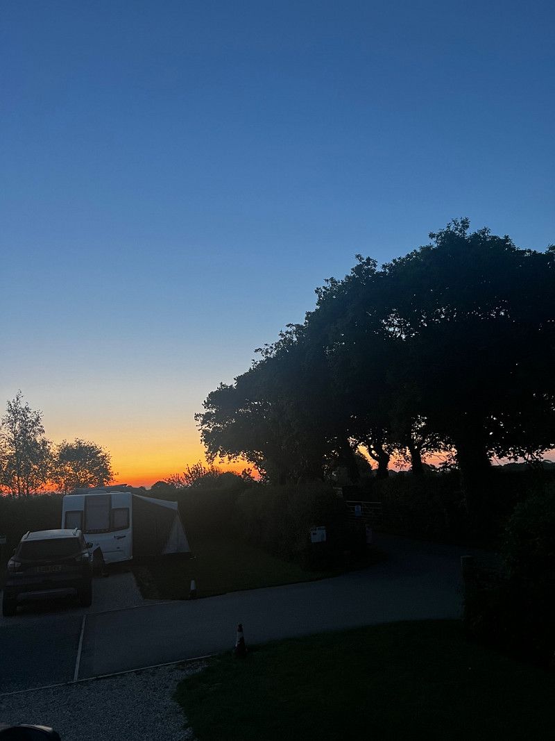
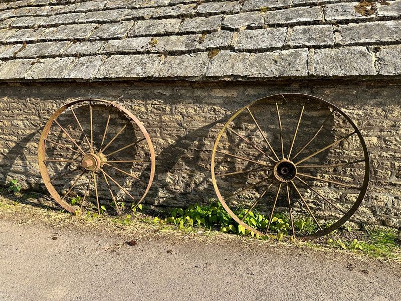
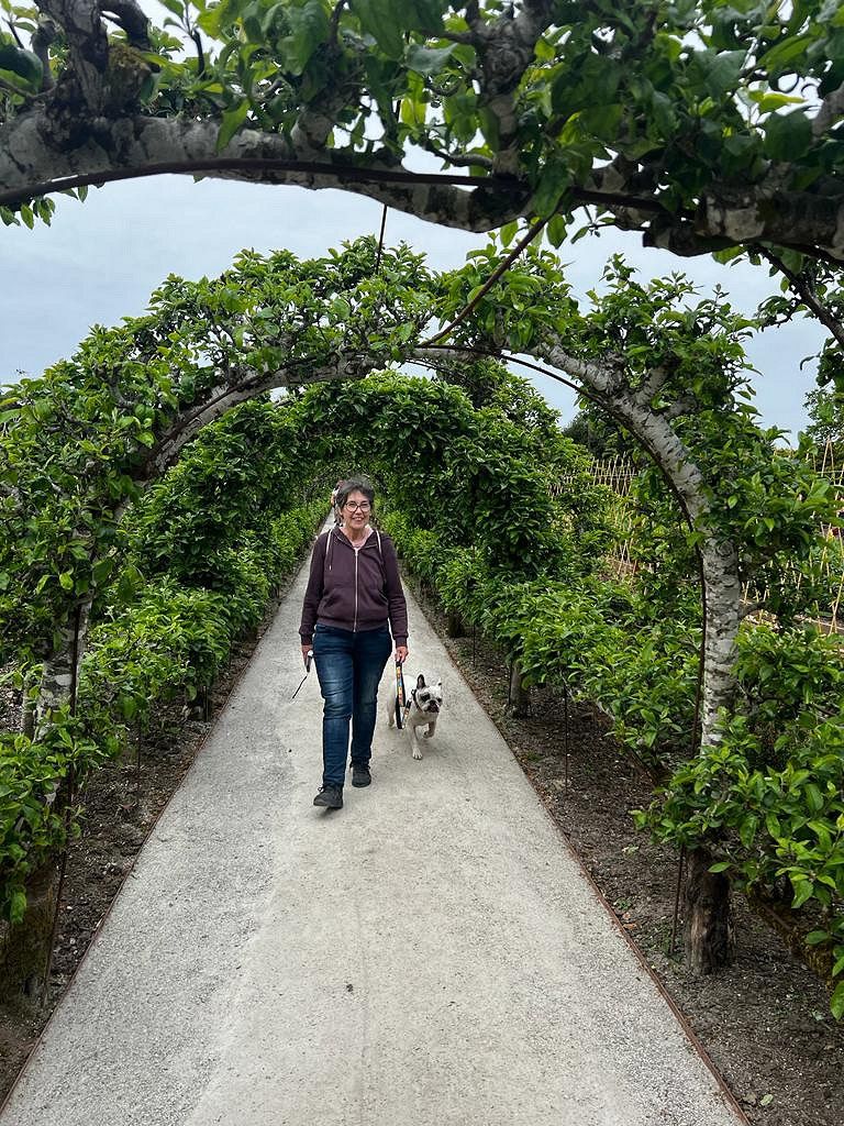
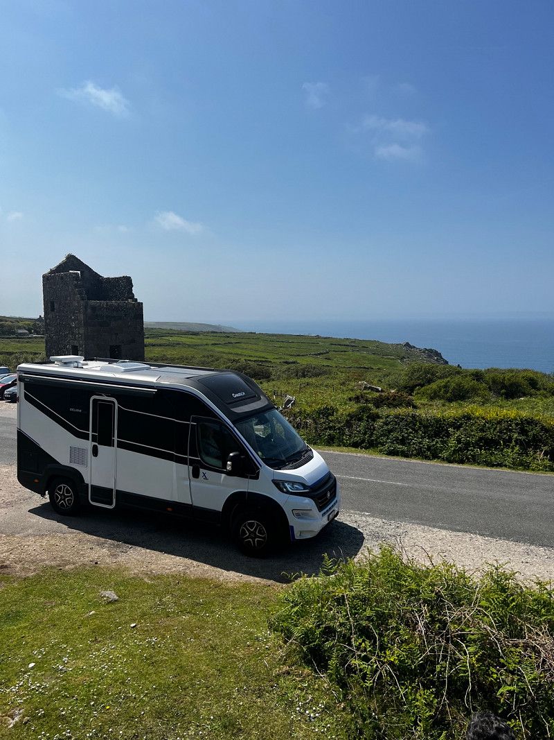
Finally after a long wait our Womo is here. Our Chausson X550 is small and manoeuvrable. And so we dare to go to Cornwall. That would not have been possible with our old mobile home. We're really looking forward to it and are excited about what's to come.
The trip was very varied. We were there in May between Ascension Day and Pentecost, were extremely lucky with the weather and there were few tourists. We were able to go to all sites without a reservation, which is not possible during Spring Break Holiday.
Day
Biel-Benken, Schweiz
Our home base here we go 😁
Biel-Benken , Schweiz
47° 30' 24.4" N 7° 31' 15.5" E
47.5067710 7.5209620
• Head toward Fraumattenstrasse on Friedrich Oser-Strasse. Go for 91 m.
• Turn left onto Fraumattenstrasse. Go for 263 m.
• Continue on Hauptstrasse. Go for 842 m.
• Continue on Bielstrasse. Go for 1.6 km.
• Continue on Hauptstrasse. Go for 401 m.
• Take the 3rd exit from roundabout onto Binningerstrasse. Go for 953 m.
• Continue on Oberwilerstrasse. Go for 450 m.
• Continue on Binningerstrasse. Go for 294 m.
• Continue on Oberwilerstrasse. Go for 1.1 km.
• Take the 1st exit from roundabout onto Hauptstrasse. Go for 779 m.
• Take the 3rd exit from roundabout onto Holeestrasse (2). Go for 2.7 km.
• Take the 2nd exit from roundabout onto Luzernerring (2). Go for 608 m.
• Keep right onto Luzernerring (2) toward Euroairport. Go for 161 m.
• Take the 3rd exit from roundabout onto Flughafenstrasse (320). Go for 361 m.
• Turn right onto Neudorfstrasse (320). Go for 316 m.
• Turn left and take ramp onto A35 toward Mulhouse. Go for 25.8 km.
• Take the exit toward Paris/Lyon/Mulhouse onto A35. Go for 40.5 km.
• Continue on D83. Go for 10.7 km.
• Keep left onto A35. Go for 39.0 km.
• Keep left onto A355 toward E25/A4/Paris/A35/Karlsruhe/Strasbourg. Go for 25.1 km.
• Continue on A4 (Autoroute de l'Est). Go for 339 km.
• Take the exit toward A26/E46/Bruxelles/Calais/Lille/Laon/Rouen/Reims-Nord onto E17. Go for 538 m.
• Continue on A26. Go for 94.7 km.
• Take the exit toward Rouen/Amiens/Péronne/A1 (Paris) onto A29. Go for 64.8 km.
• Take the exit toward Amiens-Nord onto N25. Go for 15.2 km.
• Take the 2nd exit from roundabout onto A16 (L'Européenne) toward Calais/Abbeville. Go for 88.2 km.
• Take exit 26 toward Le Touquet/Étaples/Ste Cécile/Stella-Plage. Go for 1.3 km.
• Take the 1st exit from roundabout onto Route d'Hilbert (D939) toward Le Touquet/Étaples/Merlimont/Ste Cécile/Stella-Plage. Go for 1.0 km.
• Take the 3rd exit from roundabout onto Route d'Hilbert (D939). Go for 825 m.
• Take the 2nd exit from roundabout onto Route d'Hilbert (D939). Go for 475 m.
• Take the 2nd exit from roundabout onto Route d'Hilbert (D939). Go for 1.0 km.
• Take the 4th exit from Rond-Point du Pont Rose roundabout onto Rue du Touquet (D939) toward Le Touquet/Berck/Cucq/Stella-Plage/Merlimont. Go for 628 m.
• Take the 1st exit from roundabout onto Avenue de l'Europe (D939). Go for 516 m.
• Continue on Avenue du Général de Gaulle (D939). Go for 162 m.
• Pass 4 roundabouts and continue on Avenue du Général de Gaulle (D939). Go for 2.9 km.
• Take the 4th exit from Place de l'Hermitage roundabout onto Avenue Louis Aboudaram. Go for 518 m.
• Take the 2nd exit from roundabout onto Avenue de l'Atlantique. Go for 304 m.
• Take the 2nd exit from roundabout onto Avenue de l'Atlantique. Go for 140 m.
• Turn left onto Rue de Varsovie. Go for 144 m.
• Turn slightly left onto Avenue Jean Mermoz. Go for 161 m.
• Turn right onto Avenue Louis Blériot. Go for 21 m.
• Arrive at Avenue Louis Blériot.
☍
764,0 km
(6 hrs. 39 min.)
Camping du fort lapin, Avenue Louis Blériot, Le Touquet-Paris-Plage, Frankreich
Clean little campsite close to ferry or train to England. Place is right by the sea. The beach can be reached via a staircase through the dunes.
Av. Louis Blériot, 62520 Le Touquet-Paris-Plage, Frankreich
50° 30' 51" N 1° 34' 56.5" E
50.5141658 1.5823520
• Head east on Avenue Louis Blériot. Go for 21 m.
• Turn left onto Avenue Jean Mermoz. Go for 136 m.
• Turn slightly right onto Rue de Varsovie. Go for 76 m.
• Turn right onto Avenue de Verdun. Go for 96 m.
• Turn left onto Boulevard Daloz. Go for 87 m.
• Take the 3rd exit from roundabout onto Avenue de l'Atlantique. Go for 333 m.
• Take the 3rd exit from roundabout onto Avenue Louis Aboudaram. Go for 437 m.
• Take the 1st exit from Place de l'Hermitage roundabout onto Avenue du Général de Gaulle (D939). Go for 605 m.
• Pass 4 roundabouts and continue on Avenue du Général de Gaulle (D939). Go for 2.5 km.
• Continue on Avenue de l'Europe (D939). Go for 489 m.
• Take the 2nd exit from roundabout onto D939. Go for 564 m.
• Take the 1st exit from Rond-Point du Pont Rose roundabout onto Boulevard Billiet (D939). Go for 1.0 km.
• Take the 1st exit from roundabout onto Route d'Hilbert (D939). Go for 440 m.
• Take the 1st exit from roundabout onto Route d'Hilbert (D939) toward A16/Arras/Montreuil. Go for 774 m.
• Take the 1st exit from roundabout onto Route d'Hilbert (D939). Go for 1.1 km.
• Take the 2nd exit from roundabout onto A16 (Autoroute des Estuaires) toward Boulogne/Calais. Go for 56.9 km.
• Take exit 42 toward Tunnel sous la Manche onto E15. Go for 1.1 km.
• Take the 2nd exit from roundabout. Go for 172 m.
• Continue on Lieu-dit Terminal de Coquelles. Go for 528 m.
• Take the 2nd exit from roundabout. Go for 562 m.
• Continue straight ahead. Go for 299 m.
• Turn right. Go for 27 m.
• Turn left. Go for 146 m.
• Turn right. Go for 103 m.
• Keep right. Go for 20 m.
• Take the Channel Tunnel car shuttle train. Stay on for 54.2 km.
• Head southeast. Go for 2.4 km.
• Take ramp toward Folkestone/Dover/(A20)/Ramsgate/Canterbury/(A260). Go for 351 m.
• Turn right onto Bargrove. Go for 220 m.
• Take the 1st exit from roundabout onto Ashford Road (A20) toward Channel Tunnel/Sellindge/Ashford/(M20). Go for 160 m.
• Keep left toward Channel Tunnel. Go for 1.6 km.
• Make a U-Turn. Go for 163 m.
• Continue on Boulevard D'Erlanger. Go for 200 m.
• Arrive at your destination on the left.
☍
127,9 km
(2 hrs. 33 min.)
Day
Folkestone Eurotunnel, Ashford Road, Folkestone, Vereinigtes Königreich
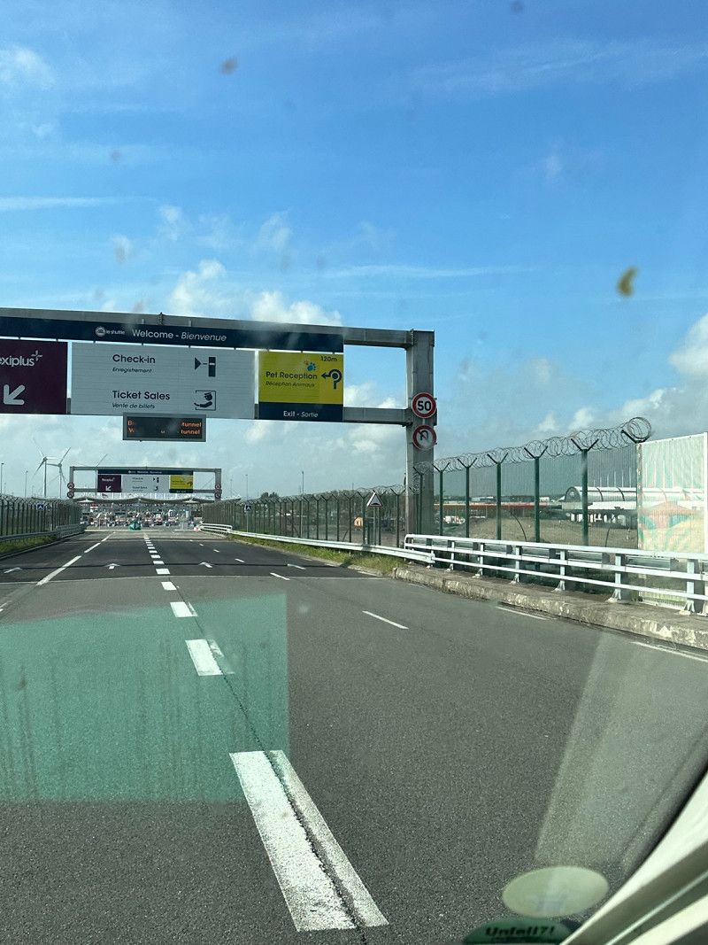
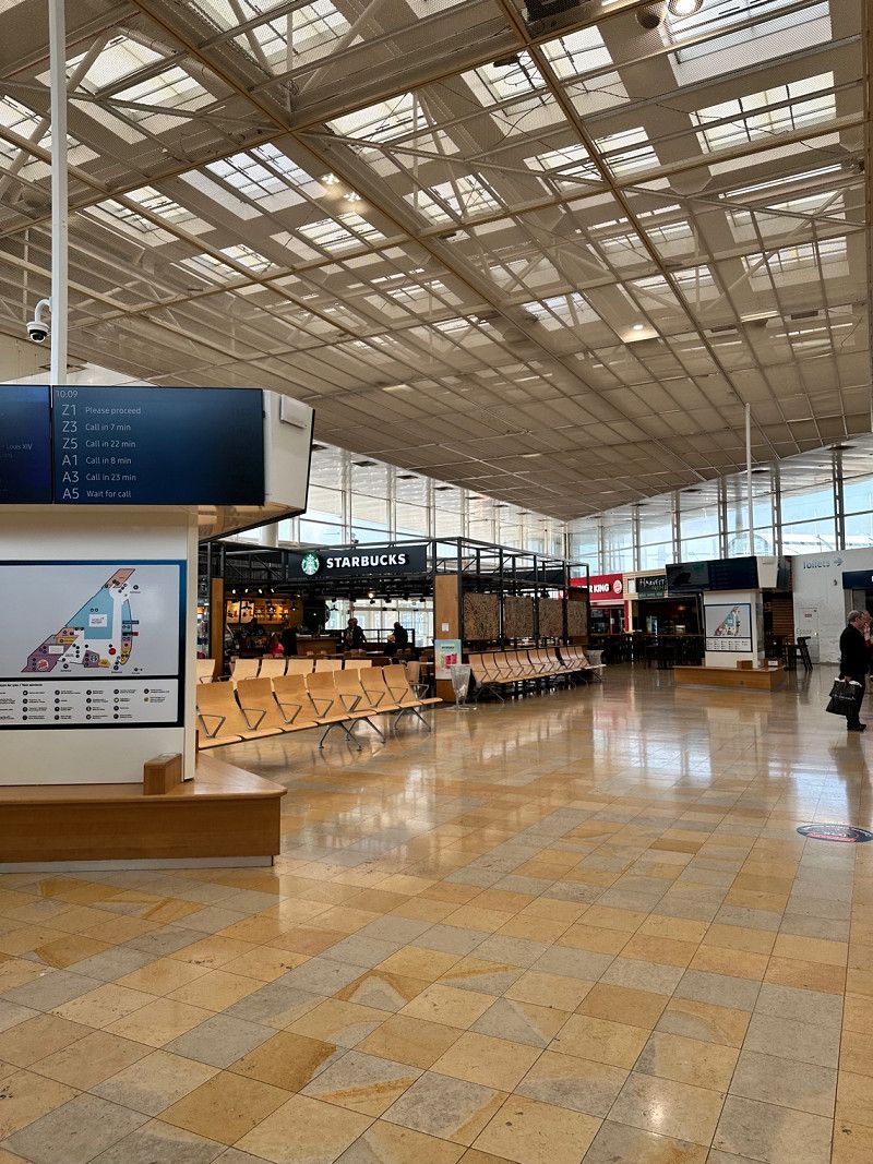
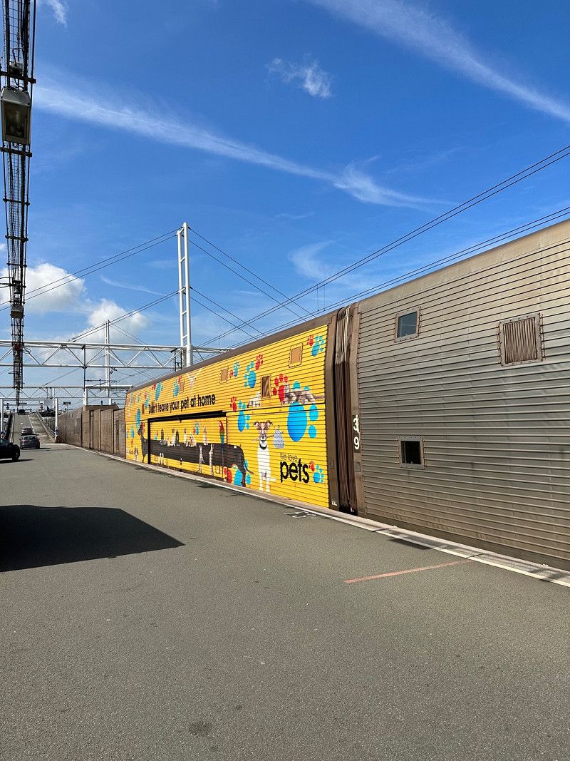
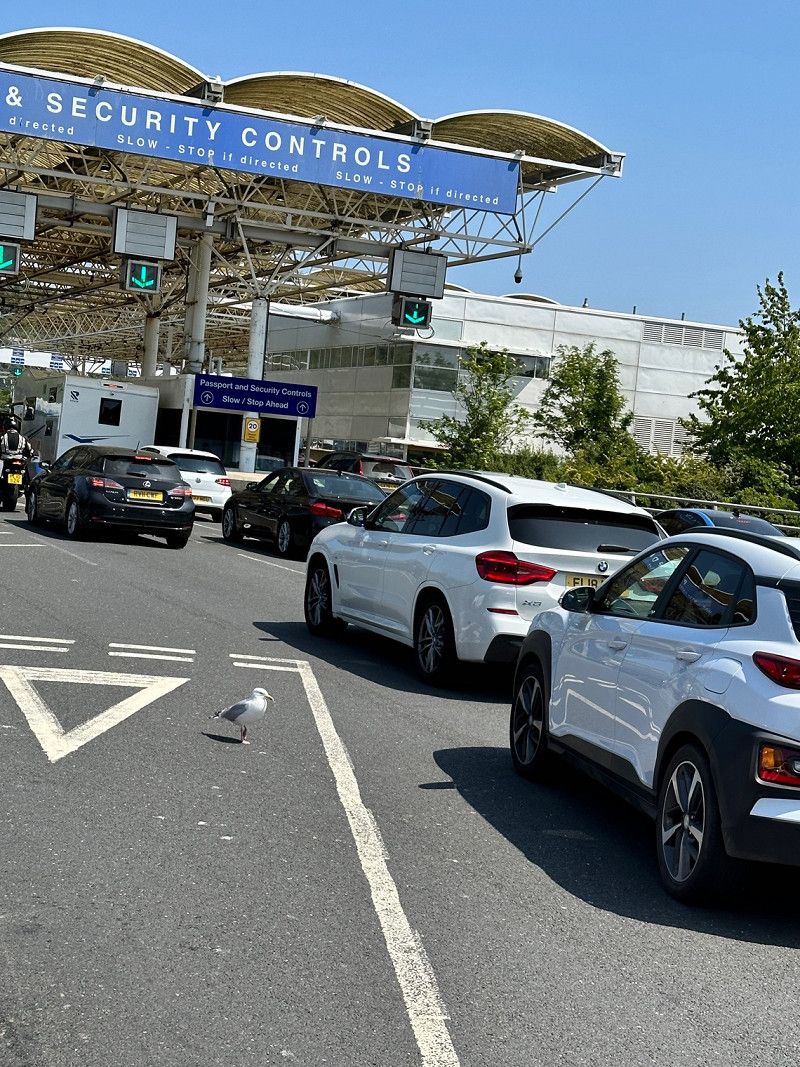
With a dog on board, the question of a ferry does not arise. Dogs are not allowed to leave the vehicle on a ferry, so we decided to take a trip through the Eurotunnel. Everything is super organized. At the Pet Center in Calais, the formalities for dogs are quickly taken care of. In addition to the usual vaccinations, a valid rabies vaccination and a worming treatment with the active ingredient praziquantel (the date and time must be recorded in the vaccination card 24-120 hours before entry). A health certificate in English is recommended but he did not want to see it.
Terminal, 8XX, Ashford Rd, Folkestone CT18 8XX, Vereinigtes Königreich
51° 5' 43.3" N 1° 7' 24.7" E
51.0953634 1.1235274
• Head toward Channel Tunnel. Go for 1.9 km.
• Turn right toward M20. Go for 2.4 km.
• Take right ramp onto M20 toward London/Ashford. Go for 14.0 km.
• Take exit 10A toward Hastings. Go for 394 m.
• Take the 1st exit from Sevington Interchange roundabout onto A2070 toward Hastings/Town Centre/A292. Go for 715 m.
• Keep left toward Hastings/Ashford Intn'l Train Station/Designer Outlet. Go for 190 m.
• Continue on Bad Munstereifel Road (A2070). Go for 2.5 km.
• Take ramp toward Hastings/Lydd Airport. Go for 407 m.
• Take the 2nd exit from roundabout onto A2070 toward Hastings/Lydd Airport. Go for 1.4 km.
• Take the 1st exit from roundabout onto A2070 toward Hastings. Go for 13.1 km.
• Take the 2nd exit from roundabout onto Straight Lane (A259) toward Hastings/Rye/Brookland. Go for 2.1 km.
• Take the 2nd exit from roundabout onto A259 toward Hastings. Go for 10.1 km.
• Take the 1st exit from roundabout onto Fishmarket Road (A259) toward Town centre/Hastings/Battle/(B2089). Go for 1.0 km.
• Take the 2nd exit from roundabout onto Wish Street (A268) toward Town centre/Battle/(B2089). Go for 157 m.
• Continue on Cinque Ports Street (A268). Go for 9 m.
• Turn left onto Ferry Road (A268). Go for 96 m.
• Keep left onto Ferry Road (B2089). Go for 251 m.
• Continue on Udimore Road (B2089). Go for 146 m.
• Continue on Ferry Road (B2089). Go for 18 m.
• Continue on Udimore Road (B2089). Go for 782 m.
• Take the 1st exit from roundabout onto Udimore Road (B2089). Go for 8.9 km.
• Turn left onto King Wood Hill (A28). Go for 8.3 km.
• Turn left onto Sedlescombe Road North (A21). Go for 1.9 km.
• Take the 2nd exit from roundabout. Go for 37 m.
• Continue on Sedlescombe Road North (A21). Go for 56 m.
• Take the 2nd exit from roundabout onto Old Harrow Road. Go for 239 m.
• Continue on Ashbrook Road. Go for 163 m.
• Continue on Blackman Avenue. Go for 897 m.
• Continue on Ironlatch Avenue. Go for 573 m.
• Take the 3rd exit from roundabout onto Crowhurst Road (B2092). Go for 1.5 km.
• Continue on Queensway (B2092). Go for 136 m.
• Turn left onto Combe Valley Way (A2690). Go for 3.8 km.
• Take the 2nd exit from roundabout onto Combe Valley Way (A2690) toward Brighton/Lewes/Bexhill/(A259). Go for 1.7 km.
• Turn right onto King Offa Way (A259). Go for 98 m.
• Continue on Little Common Road (A259). Go for 2.4 km.
• Pass 2 roundabouts and continue on Bexhill Road (A259). Go for 8.3 km.
• Turn left onto Wallsend Road (A259). Go for 1.6 km.
• Keep left onto Eastbourne Road (A259). Go for 2.1 km.
• Pass 2 roundabouts and continue on Pevensey Bay Road (A259). Go for 1.2 km.
• Take the 1st exit from Langney Roundabout roundabout onto Princes Road. Go for 1.0 km.
• Take the 3rd exit from Sovereign Roundabout roundabout onto Royal Parade. Go for 2.1 km.
• Continue on Marine Parade (B2106). Go for 281 m.
• Continue on Grand Parade (B2106). Go for 57 m.
• Arrive at Grand Parade (B2106).
☍
99,0 km
(1 hrs. 40 min.)
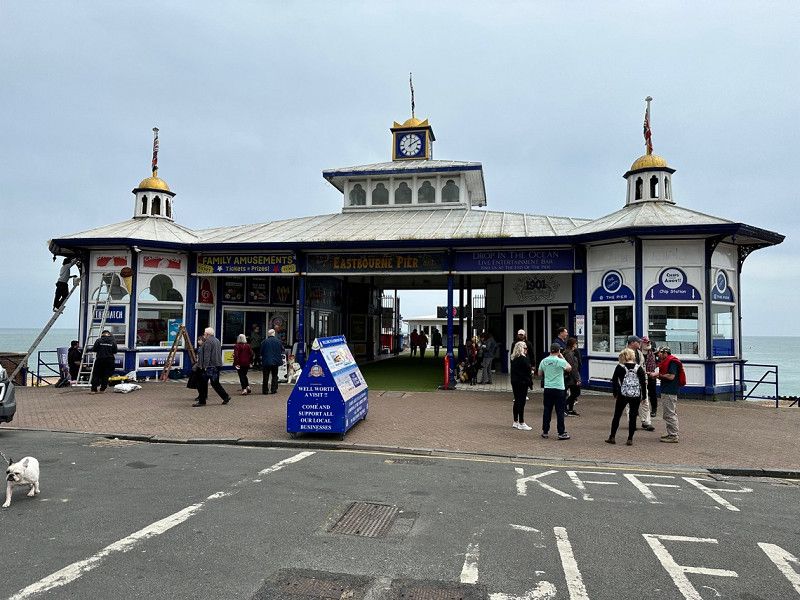
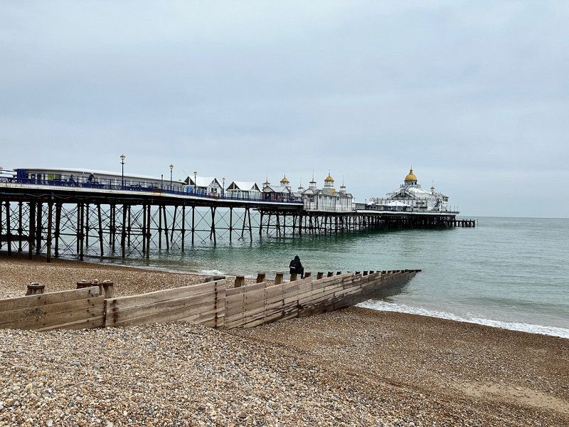
Eastbourne Pier, Eastbourne, Vereinigtes Königreich
On recommendation we have the pier in Eastbourne. Maybe it wasn't the season and hardly anything was open. The pier is also getting a bit old.
Eastbourne Pier Grand Parade, Eastbourne BN21 3EL, Vereinigtes Königreich
50° 45' 57.1" N 0° 17' 43.6" E
50.7658517 0.2954380
• Head toward Terminus Road on Grand Parade (B2106). Go for 392 m.
• Continue on Grand Parade (B2103). Go for 250 m.
• Continue on King Edwards Parade (B2103). Go for 165 m.
• Turn right onto Wilmington Square. Go for 107 m.
• Continue on Carlisle Road. Go for 824 m.
• Turn left onto Meads Road. Go for 441 m.
• Take the 2nd exit from roundabout onto Meads Road. Go for 218 m.
• Take the 2nd exit from roundabout onto Beachy Head Road. Go for 2.7 km.
• Turn left onto East Dean Road (A259). Go for 7.0 km.
• Turn right onto Eastbourne Road (A259). Go for 1.9 km.
• Pass 3 roundabouts and continue on Station Approach (A259). Go for 5.7 km.
• Take the 1st exit from roundabout onto The Drove (A259) toward Newhaven/Brighton/(A26). Go for 371 m.
• Take the 3rd exit from roundabout onto A259. Go for 1.0 km.
• Keep left onto Brighton Road (A259). Go for 4.0 km.
• Pass 2 roundabouts and continue on Marine Drive (A259). Go for 7.3 km.
• Keep right onto Marine Drive (A259). Go for 2.6 km.
• Take the 2nd exit from roundabout onto Grand Junction Road (A259). Go for 48 m.
• Arrive at Grand Junction Road (A259).
☍
35,0 km
( 45 min.)
Brighton Pier, Brighton, Vereinigtes Königreich
The pier in Brighton is not as romantic as in Eastbourne but there are many food stalls and restaurants on the promenade. The whole area looks much neater. Unfortunately, we only saw this while passing through, as we were heading for the next place to sleep.
RV77+W4, Brighton, Vereinigtes Königreich
50° 48' 53.2" N 0° 8' 13.7" W
50.8147796 -0.1371450
• Head west on Grand Junction Road (A259). Go for 5.6 km.
• Turn right onto Church Road (B2193). Go for 430 m.
• Pass 3 roundabouts and continue on Trafalgar Road (B2193). Go for 523 m.
• Turn left onto Old Shoreham Road (A270). Go for 2.3 km.
• Take the 3rd exit from roundabout onto Shoreham By-pass (A27) toward Worthing/Portsmouth/Horsham/(A283). Go for 2.7 km.
• Keep right onto Shoreham By-pass (A27) toward Worthing/Lancing/Airport. Go for 1.3 km.
• Take the 2nd exit from roundabout onto Old Shoreham Road (A27) toward Worthing/Portsmouth/London/Horsham/(A24). Go for 1.2 km.
• Take the 2nd exit from roundabout onto Upper Brighton Road (A27) toward Portsmouth/Worthing/Sompting/London/(A24)/Horsham. Go for 4.6 km.
• Take the 2nd exit from Grove Lodge Roundabout roundabout onto Warren Road (A27) toward Portsmouth/London/Horsham/(A24). Go for 1.2 km.
• Take the 3rd exit from roundabout onto Crockhurst Hill (A27) toward Chichester/Portsmouth. Go for 10.7 km.
• Take the 2nd exit from roundabout onto Lyminster Road (A27) toward Chichester/Portsmouth/London/Dorking/(A284). Go for 1.2 km.
• Pass 2 roundabouts and continue on Chichester Road (A27). Go for 7.0 km.
• Take the 1st exit from roundabout onto A27 toward Barnham/Goodwood. Go for 646 m.
• Take the 3rd exit from roundabout onto Arundel Road (A27) toward Chichester/Portsmouth/Tangmere/Goodwood. Go for 4.4 km.
• Pass 2 roundabouts and continue on Chichester By-pass (A27). Go for 4.8 km.
• Take the 2nd exit from Bognor Road Roundabout roundabout onto Vinnetrow Road toward Mundham/Runcton. Go for 1.8 km.
• Take the 3rd exit from roundabout onto Lagness Road (B2166). Go for 543 m.
• Continue on B2166. Go for 733 m.
• Take the 1st exit from roundabout onto B2145. Go for 586 m.
• Take the 2nd exit from roundabout onto B2145. Go for 108 m.
• Continue on Mayfield Place (B2145). Go for 73 m.
• Continue on B2145. Go for 49 m.
• Continue on Heath Close (B2145). Go for 294 m.
• Continue on B2145. Go for 1.3 km.
• Turn right onto Green Lane. Go for 551 m.
• Turn right onto Selsey Road (B2201). Go for 192 m.
• Turn left onto Wophams Lane. Go for 827 m.
• Turn left onto A286. Go for 1.6 km.
• Continue on Main Road (A286). Go for 1.3 km.
• Take the 1st exit from roundabout onto Bell Lane (B2198). Go for 1.2 km.
• Turn right onto Bracklesham Lane (B2198). Go for 304 m.
• Turn right onto Tile Barn Lane. Go for 223 m.
• Turn left onto Stubcroft Lane. Go for 798 m.
• Arrive at Stubcroft Lane. Your destination is on the right.
☍
60,9 km
(1 hrs. 7 min.)
Stubcroft Farm Campsite, Stubcroft Lane, East Wittering, Chichester, Vereinigtes Königreich
We booked this place from Switzerland. The operators are extremely friendly and helpful. A bit expensive at £54.00 but very clean and the showers are heated.
The village of East Wittering can be reached on foot in about 20 minutes, where we ate very well.
Stubcroft Farm, Stubcroft Ln, East Wittering, Chichester PO20 8PJ, Vereinigtes Königreich
50° 46' 28.1" N 0° 51' 30.8" W
50.7744676 -0.8585496
• Head toward Tile Barn Lane on Stubcroft Lane. Go for 798 m.
• Turn right onto Tile Barn Lane. Go for 223 m.
• Turn left onto Bracklesham Lane (B2198). Go for 304 m.
• Continue on Bell Lane (B2198). Go for 1.2 km.
• Take the 3rd exit from roundabout onto Main Road (A286). Go for 1.4 km.
• Continue on A286. Go for 1.7 km.
• Continue on Birdham Road (A286). Go for 2.8 km.
• Take the 1st exit from roundabout onto Stockbridge Road (A286). Go for 484 m.
• Take the 1st exit from Stockbridge Roundabout roundabout onto Chichester By-pass (A27) toward Portsmouth. Go for 1.2 km.
• Take the 2nd exit from Fishbourne Roundabout roundabout onto A27 toward Portsmouth/Havant. Go for 18.5 km.
• Keep right onto A27 toward Southampton/Portsmouth (W)/City Centre/(M27). Go for 2.2 km.
• Keep right onto M27 toward The West/Southampton/Fareham/Portsmouth/(M275). Go for 844 m.
• Take exit 12 toward Portsmouth onto M275. Go for 3.7 km.
• Keep left onto A3. Go for 467 m.
• Take the 2nd exit from Church Street Roundabout roundabout onto Commercial Road (A3) toward City Centre/Seafront. Go for 304 m.
• Take the 2nd exit from Marketway Roundabout roundabout onto Marketway (A3). Go for 265 m.
• Take the 2nd exit from roundabout onto Marketway (A3) toward Seafront. Go for 290 m.
• Turn right toward Unicorn Road. Go for 77 m.
• Continue on Unicorn Road. Go for 129 m.
• Take the 1st exit from roundabout onto Anchor Gate Road. Go for 547 m.
• Continue on Victoria Road. Go for 245 m.
• Turn left onto Ivy Lane. Go for 175 m.
• Turn left onto The Parade. Go for 198 m.
• Turn right onto Stony Lane. Go for 221 m.
• Turn left onto Main Road. Go for 20 m.
• Arrive at Main Road. Your destination is on the right.
☍
38,2 km
( 39 min.)
Day
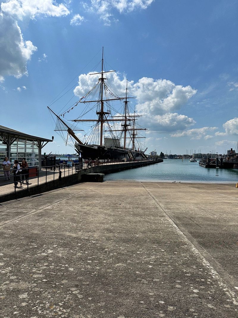
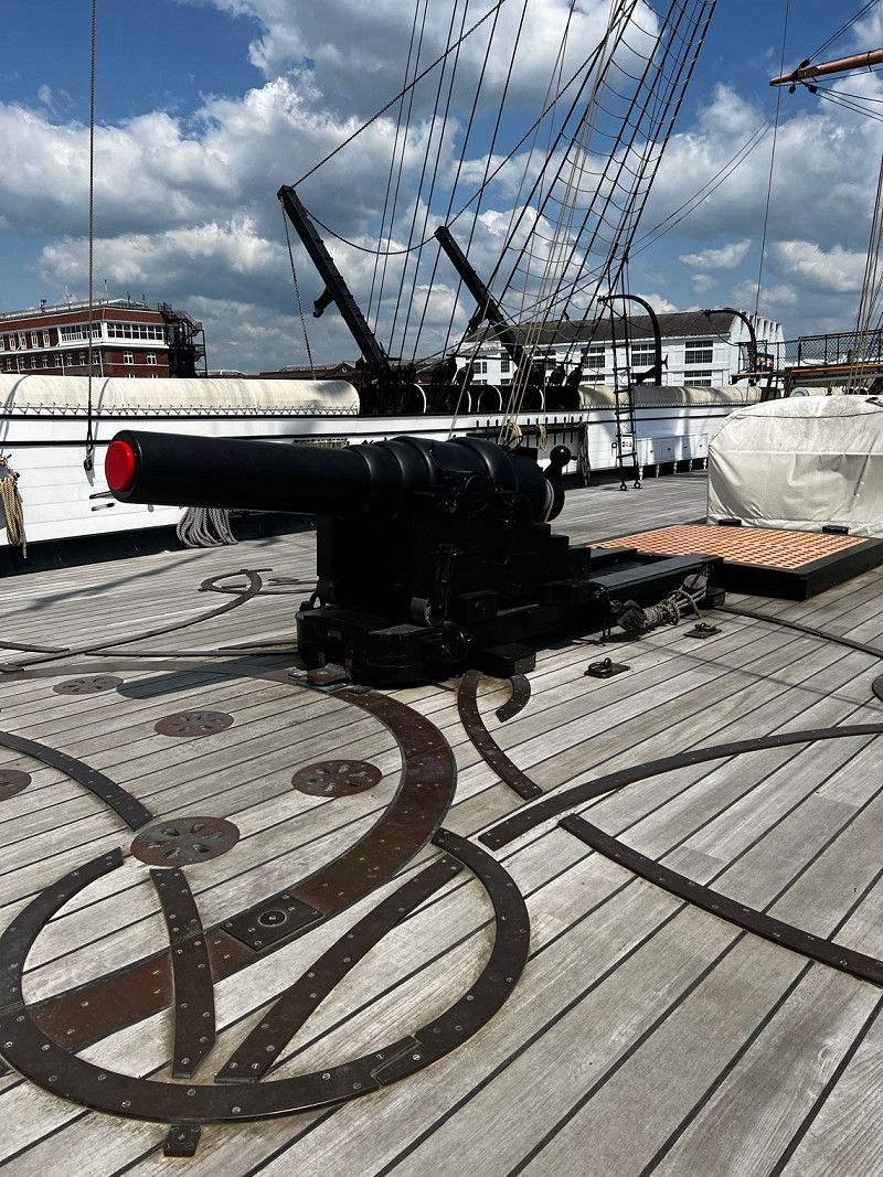
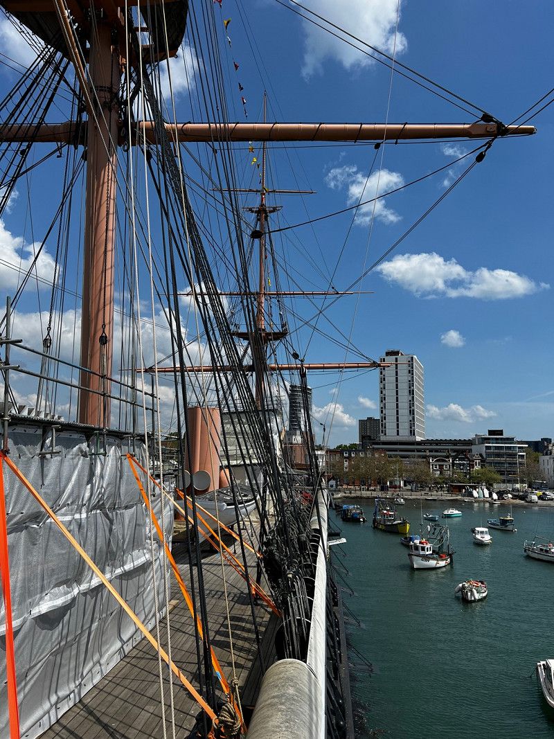
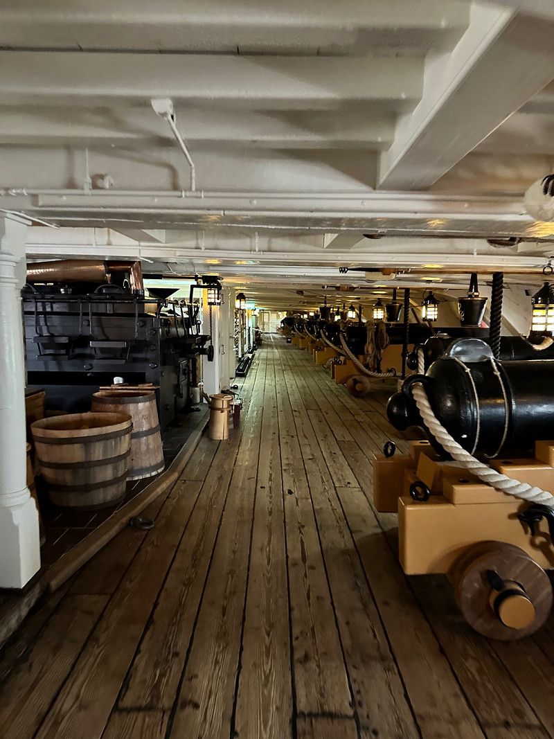
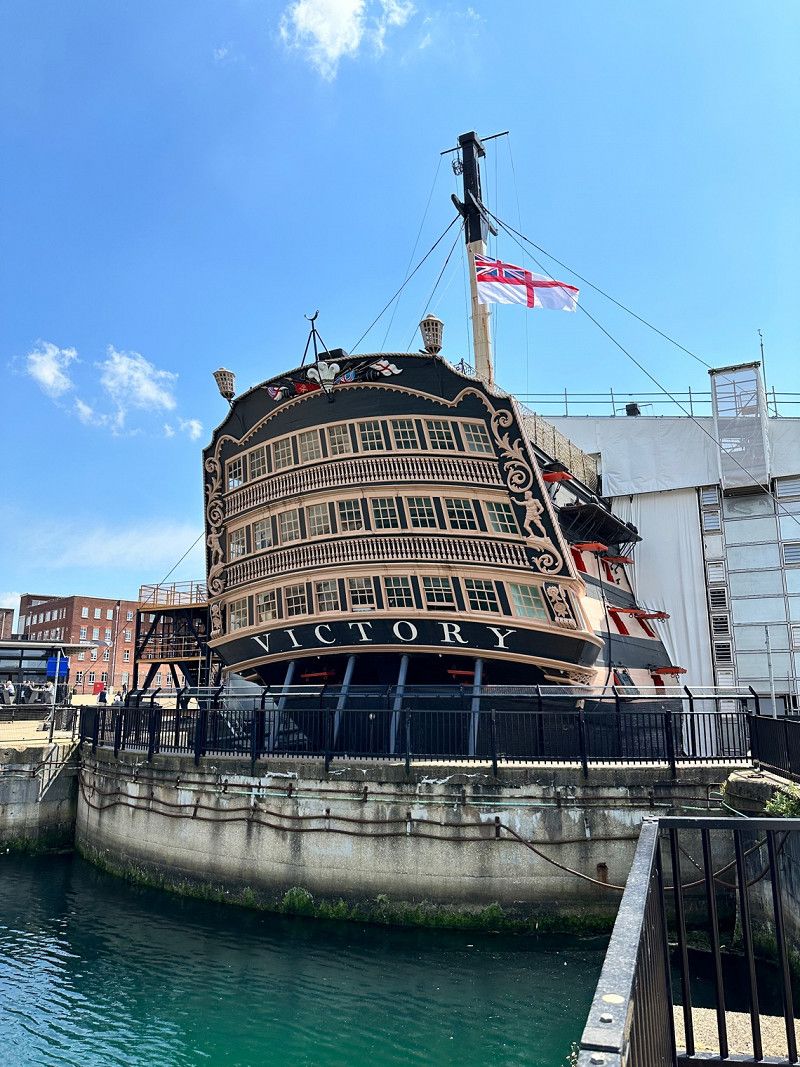
Portsmouth Historic Dockyard, HM Naval Base, Portsmouth, Vereinigtes Königreich
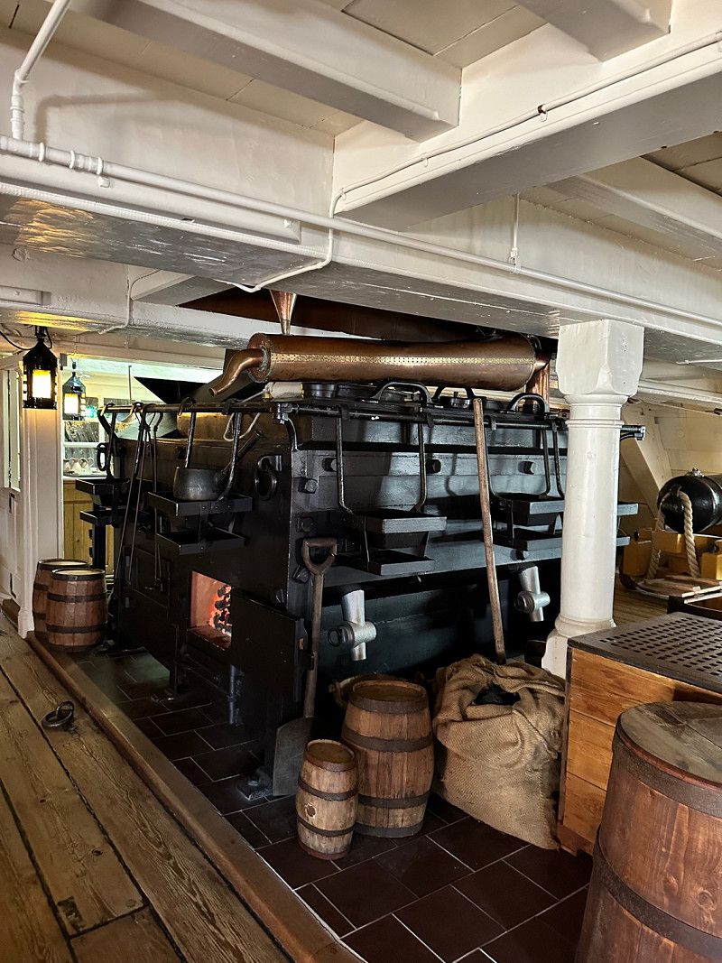
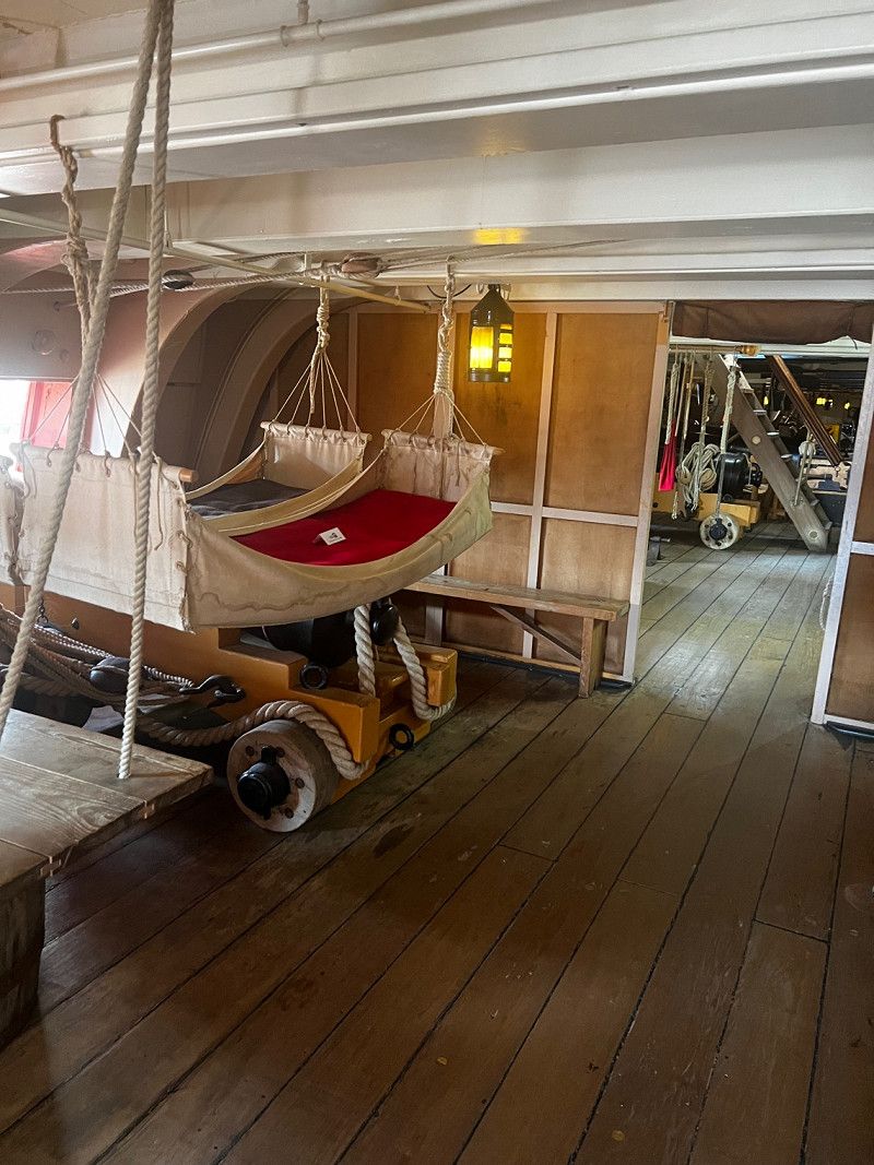
After a good breakfast we made our way to Porthmouth. The Historic Dockyard Museum is on the itinerary. In addition to some exhibitions on warships, four interesting and partially restored ships can be visited.
HMS Victory built 1760, flagship at the Battle of Trafalgar commanded by Admiral Lord Nelson.
The HMS Warrior built in 1860, first seaworthy ironclad with a steam engine
The HMS M33 a warship from WW2 and later
the Mary Rose a well preserved wreck from 1511 (sunk 1545 and salvaged 1982).
Victory Gate, HM Naval Base, Portsmouth PO1 3LJ, Vereinigtes Königreich
50° 48' 1.9" N 1° 6' 34.1" W
50.8005310 -1.1094659
• Head northwest on Main Road. Go for 20 m.
• Turn right onto Stony Lane. Go for 221 m.
• Turn left onto The Parade. Go for 198 m.
• Turn right onto Ivy Lane. Go for 175 m.
• Turn right onto Victoria Road. Go for 245 m.
• Continue on Anchor Gate Road. Go for 223 m.
• Turn slightly left onto Anchor Gate Road. Go for 292 m.
• Take the 3rd exit from roundabout onto Unicorn Road. Go for 225 m.
• Turn left onto Marketway (A3). Go for 250 m.
• Keep left onto Marketway (A3). Go for 347 m.
• Keep right onto Hope Street (A3). Go for 65 m.
• Take the 1st exit from Church Street Roundabout roundabout onto Mile End Road (A3) toward (M275)/(M27)/Cross Channel Ferries/Hilsea/North End Stamshaw/Flathouse Quay. Go for 240 m.
• Keep right onto Mile End Road (A3). Go for 210 m.
• Keep right onto M275 toward (M275)/(M27). Go for 2.8 km.
• Take the exit toward Southampton/Fareham onto M27. Go for 44.5 km.
• Continue on A31. Go for 18.4 km.
• Keep right onto Ringwood Road (A31) toward The West/Dorchester/Poole/(A349)/Wimborne. Go for 2.4 km.
• Pass 3 roundabouts and continue on Ringwood Road (A31). Go for 3.1 km.
• Take the 2nd exit from Palmersford Roundabout roundabout onto A31 toward Dorchester/Poole/(A349). Go for 2.5 km.
• Take the 2nd exit from roundabout onto A31 toward Dorchester/Poole/(A349). Go for 6.4 km.
• Take the 1st exit from Merley Roundabout roundabout onto A349 toward Poole/Bournemouth/(A341)/Wimborne/(B3073). Go for 178 m.
• Take the 2nd exit from roundabout onto Oakley Hill (A349). Go for 2.4 km.
• Take the 3rd exit from Dunyeats Roundabout roundabout onto Dunyeats Road. Go for 1.3 km.
• Take the 2nd exit from Broadstone Roundabout roundabout onto Broadstone Way. Go for 1.3 km.
• Turn right onto Beechbank Avenue. Go for 141 m.
• Pass 2 roundabouts and continue on Beechbank Avenue. Go for 832 m.
• Continue on Longmeadow Lane. Go for 734 m.
• Take the 3rd exit from roundabout onto Poole Road toward Dorchester/Blandford/(A350)/Upton/Hamworthy/Wareham. Go for 204 m.
• Take ramp onto A35 toward Dorchester/Blandford/(A350)/Wareham/(A351). Go for 4.2 km.
• Take the 1st exit from Bakers Arms Roundabout roundabout onto King's Bridge (A351) toward Sandford. Go for 1.6 km.
• Pass 4 roundabouts and continue on A351. Go for 4.4 km.
• Take the 3rd exit from roundabout onto A351. Go for 1.3 km.
• Pass 2 roundabouts and continue on A351. Go for 6.0 km.
• Turn right toward Norden Farm Cottages. Go for 145 m.
• Continue on Norden Farm Cottages. Go for 217 m.
• Arrive at Norden Farm Cottages. Your destination is on the right.
☍
107,6 km
(1 hrs. 29 min.)
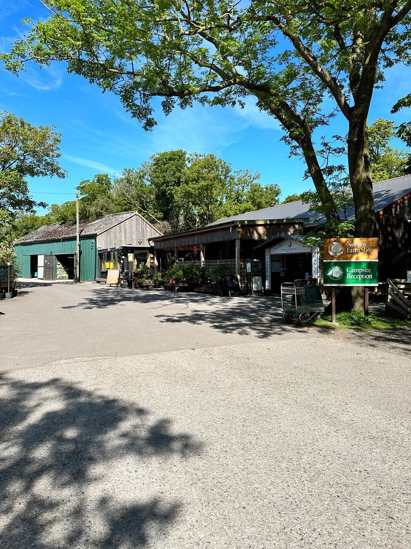
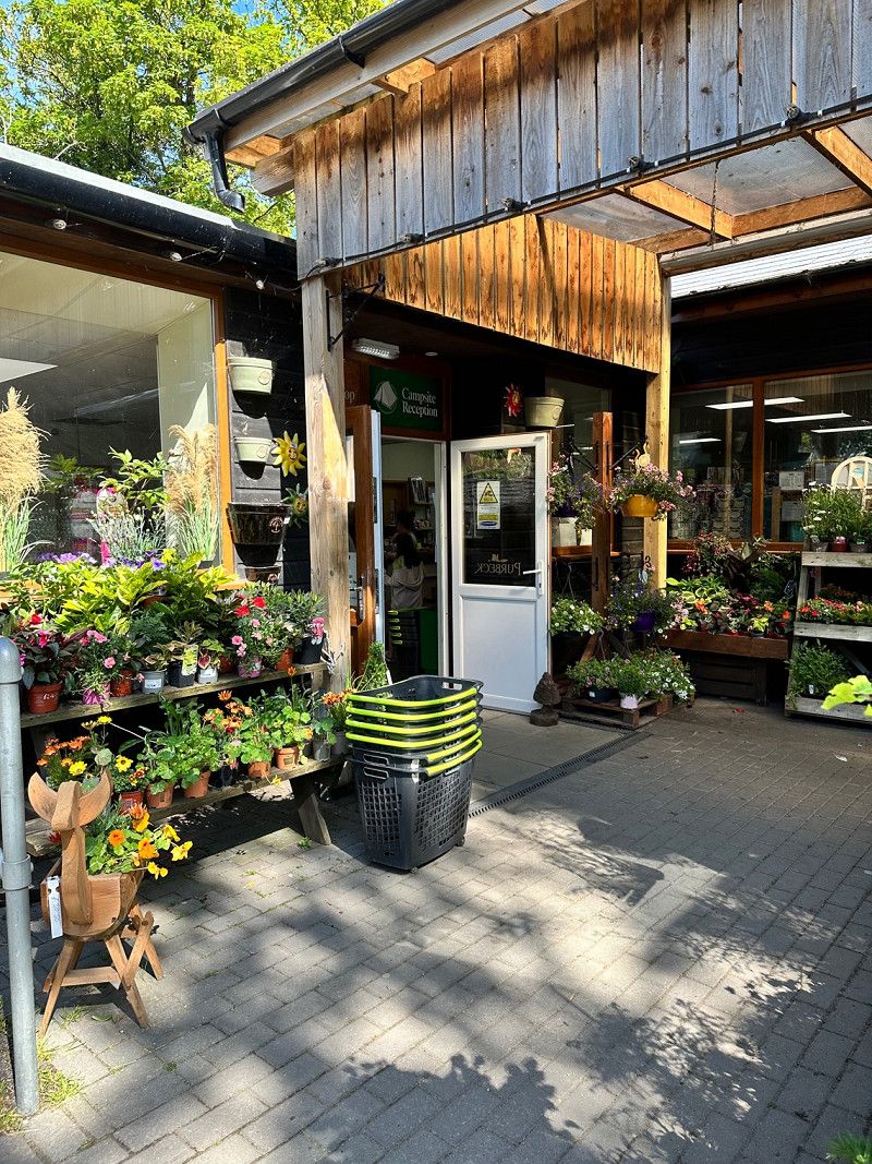
Norden Farm Campsite, Wareham, Vereinigtes Königreich
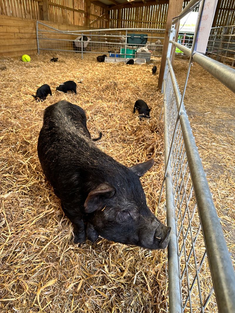
Super nice campsite, open, flat terrain, dog park, clean sanitary facilities, great shop and all kinds of farm animals. We'd love to come back there 😁
Norden Farm Campsite, Wareham BH20 5DS, Vereinigtes Königreich
50° 38' 44.2" N 2° 4' 23.9" W
50.6456151 -2.0732995
• Head southwest on Norden Farm Cottages. Go for 24 m.
• Turn right. Go for 18 m.
• Turn left toward Norden Farm Cottages. Go for 24 m.
• Turn sharp left onto Norden Farm Cottages. Go for 407 m.
• Turn left onto A351. Go for 3.5 km.
• Take the 2nd exit from roundabout onto A351. Go for 2.5 km.
• Take the 1st exit from roundabout onto A352. Go for 2.1 km.
• Turn left onto B3070. Go for 8.8 km.
• Turn left onto B3070. Go for 987 m.
• Continue on Main Road (B3070). Go for 1.5 km.
• Arrive at Main Road. Your destination is on the right.
☍
19,8 km
( 21 min.)
Day
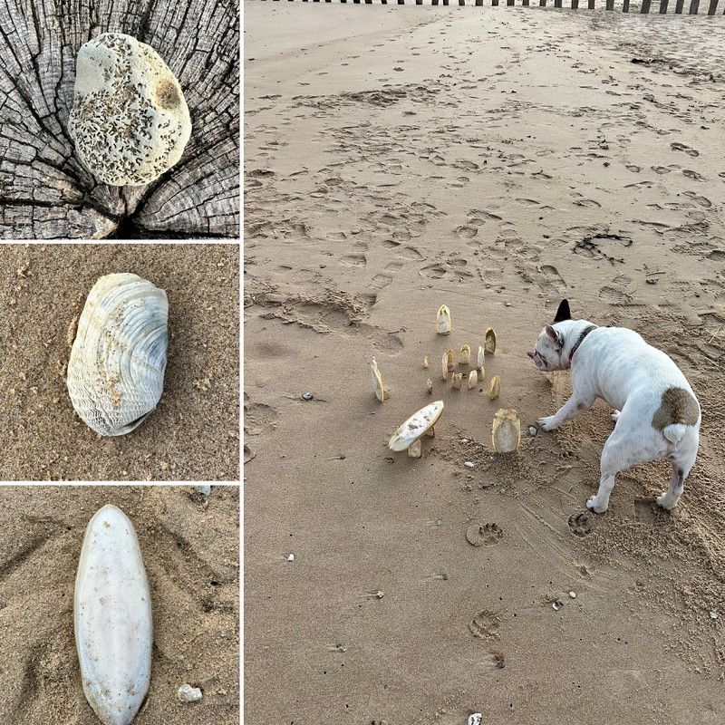
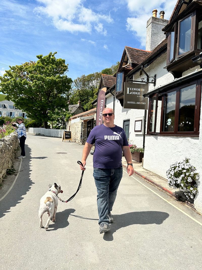
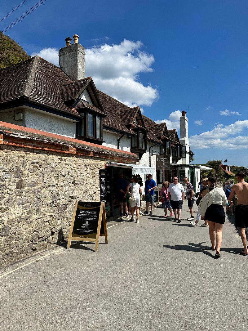
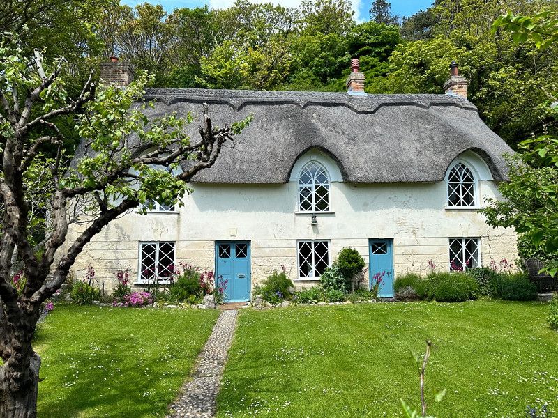
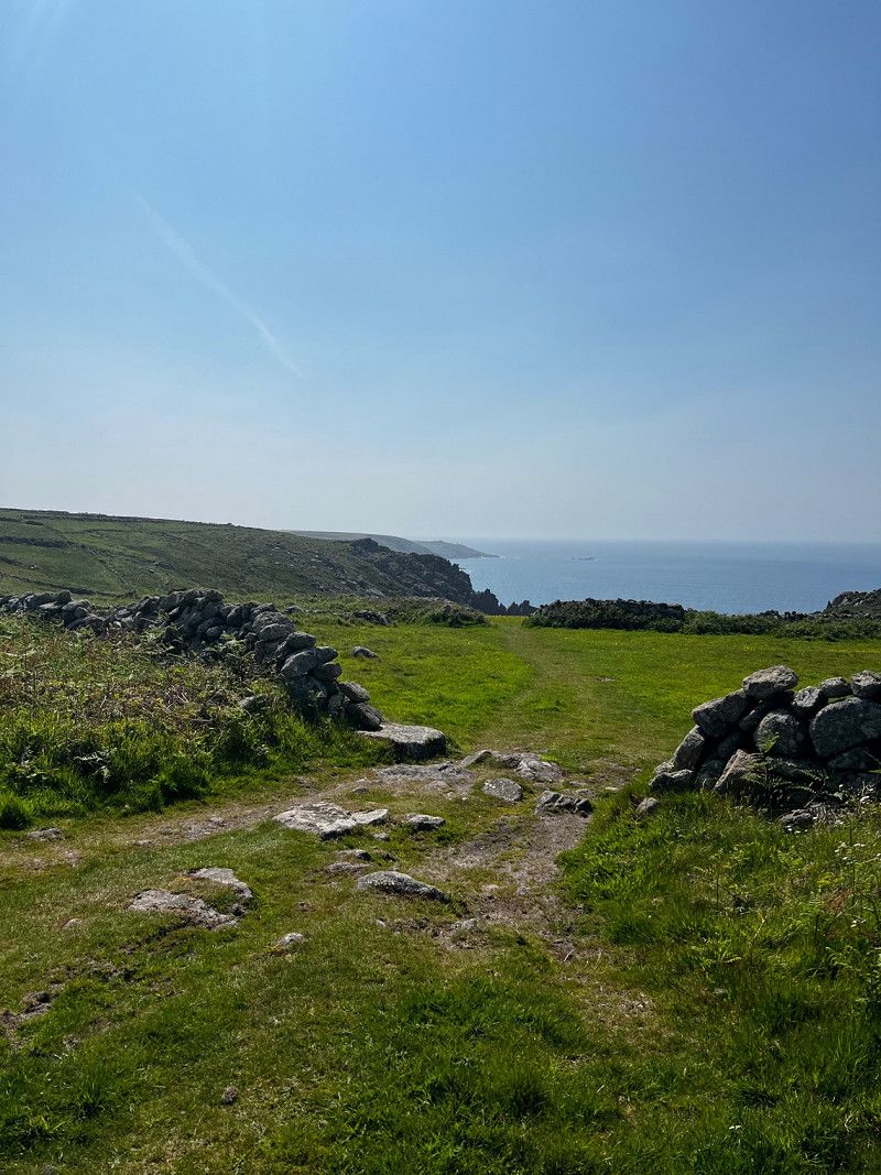
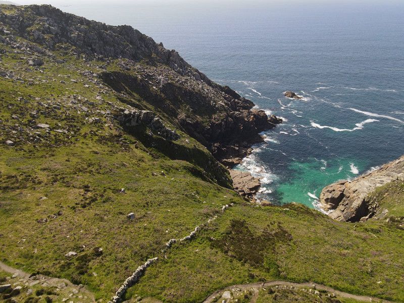
Lulworth Cove, West Lulworth, Wareham, Vereinigtes Königreich
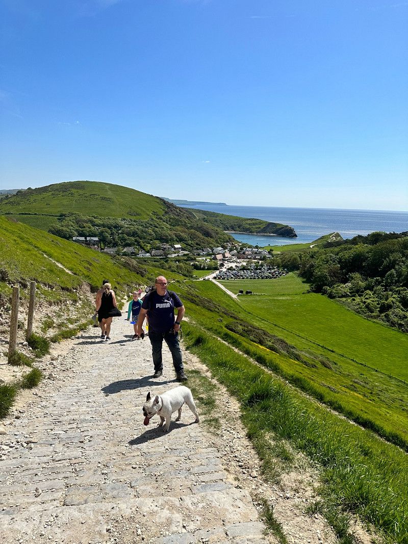
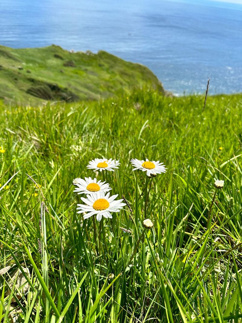
Freshly strengthened and rested we make our way to Lulworth Cove. Since today is Sunday and the weather is nice, we are not the only ones here ☺️ We don't let that bother us and march equipped with a picnic in our backpack and water for the dog up the coastal hike to Durdle Door. Back in the Cove we visited the coastal town.
West Lulworth, Wareham BH20 5RH, Vereinigtes Königreich
50° 37' 7.2" N 2° 14' 59" W
50.6186581 -2.2497115
• Head toward Britwell Drive on Main Road. Go for 795 m.
• Turn left onto Church Road. Go for 1.3 km.
• Turn left. Go for 715 m.
• Arrive at your destination.
☍
2,8 km
( 5 min.)
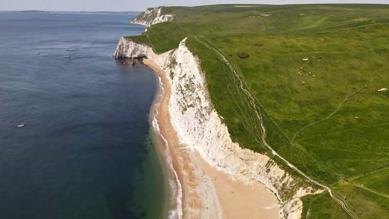
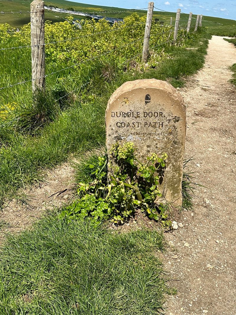
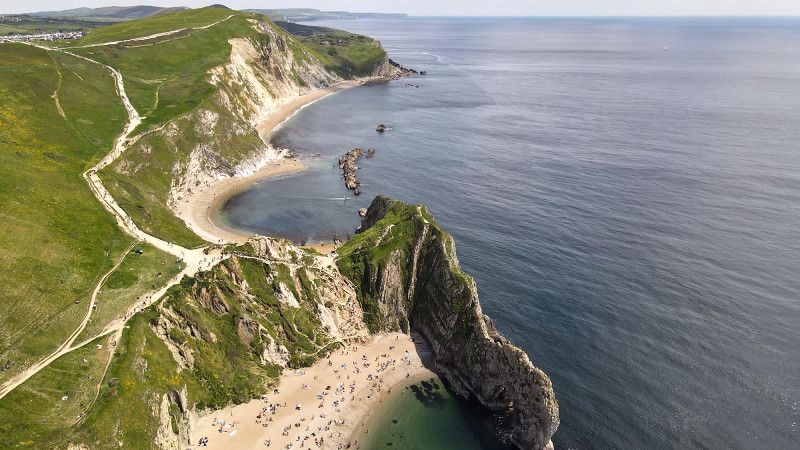
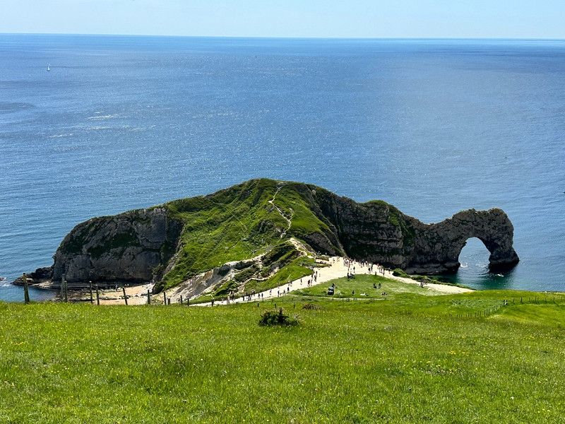
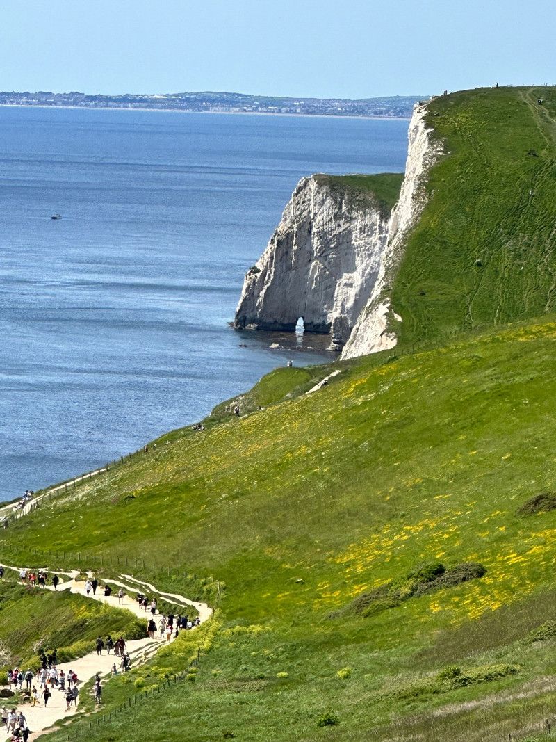
Durdle Door, Vereinigtes Königreich
Arrived here, the view is fantastic, it was definitely worth it and if you climb a little higher, you also avoid mass tourism 🥾 🥾 🥾
Back in Lulworth another fine ice cream and on we go to the next place to sleep in Dartmoor
Durdle Door , Vereinigtes Königreich
50° 37' 16.3" N 2° 16' 36.9" W
50.6211900 -2.2769164
• Head northeast. Go for 330 m.
• Turn right. Go for 385 m.
• Turn left toward High Street. Go for 3.7 km.
• Turn right onto High Street. Go for 502 m.
• Continue on Water Lane. Go for 557 m.
• Turn left onto A352. Go for 5.8 km.
• Take the 2nd exit from Warmwell Cross roundabout onto A352. Go for 6.5 km.
• Take the 1st exit from roundabout onto A352. Go for 318 m.
• Take the 1st exit from Max Gate Roundabout roundabout. Go for 279 m.
• Turn left onto A35 toward Honiton/Weymouth/(A354)/Yeovil/(A37)/Sherborne/(A352)/Bridport. Go for 2.0 km.
• Pass 2 roundabouts and continue on A35. Go for 22.9 km.
• Take the 1st exit from East Road Roundabout roundabout onto Sea Road South (A35) toward Honiton/Exeter. Go for 1.1 km.
• Take the 3rd exit from roundabout onto A35 toward Honiton/Exeter. Go for 12.4 km.
• Take the 3rd exit from roundabout onto A35 toward Honiton/Exeter/(A30)/Axminster. Go for 22.2 km.
• Take the 3rd exit from roundabout onto Monkton Road (A35) toward Exeter/(A30)/Andover/(A303)/Sidmouth/Cullompton/Taunton/Ilminster. Go for 306 m.
• Turn left onto A35 toward (M5)/Exeter/Andover/A30. Go for 61 m.
• Take ramp onto A30 toward (M5)/Exeter/Cullompton/(A373)/Sidmouth/(A375). Go for 22.4 km.
• Keep left toward Plymouth/Torquay/Okehampton/M5(S). Go for 206 m.
• Take ramp onto M5. Go for 7.2 km.
• Take exit 31 toward Bodmin/Okehampton onto A30. Go for 43.8 km.
• Take ramp toward Tavistock/Plymouth/Bideford/Holsworthy/Bude/(A3079)/Sourton/Bridestowe/Lewdown/Hatherleigh. Go for 388 m.
• Turn left onto A386 toward Tavistock/Plymouth/Sourton. Go for 18.9 km.
• Turn left onto Mount Tavy Road (B3357) toward Princetown. Go for 1.1 km.
• Continue on B3357. Go for 1.7 km.
• Continue on Moorshop Cross (B3357). Go for 19 m.
• Turn right onto Moorshop Cross. Go for 748 m.
• Turn slightly left. Go for 193 m.
• Turn left. Go for 860 m.
• Arrive at your destination.
☍
176,8 km
(2 hrs. 17 min.)
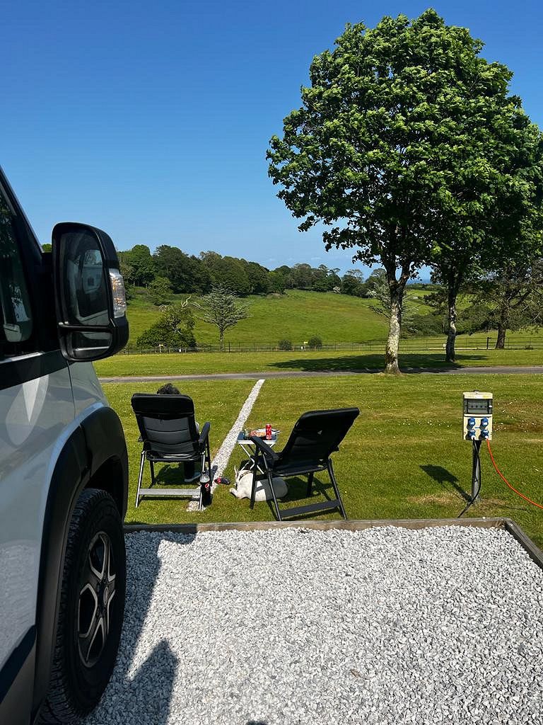
Langstone Manor Park, Vereinigtes Königreich
Again, we have found a great place. In addition to clean facilities, the site also offers a restaurant. Of course we were happy to use that and so the kitchen stayed cold today 😂
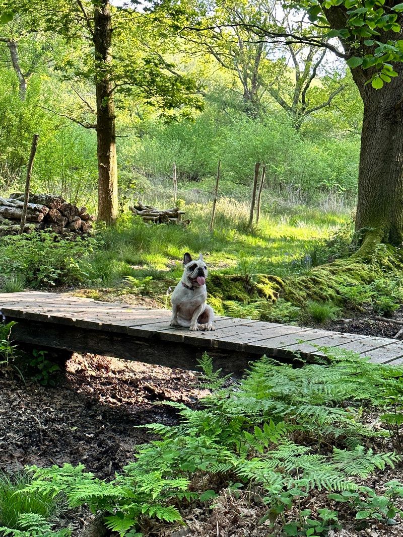
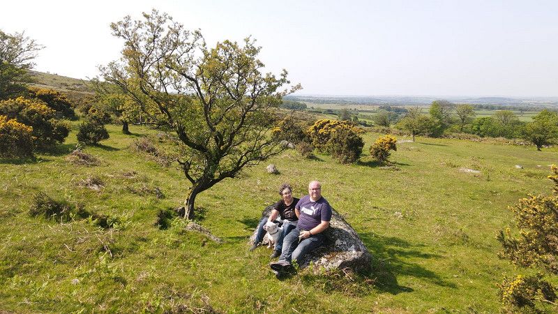
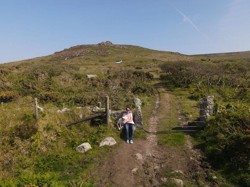
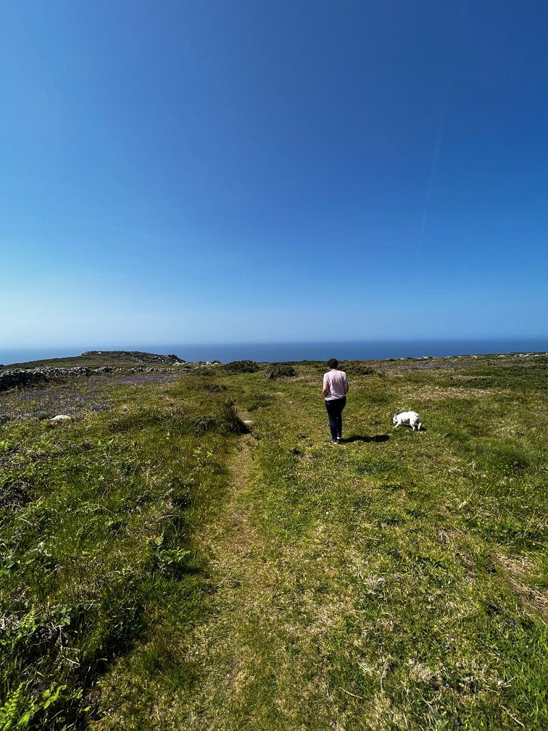
Directly at the site there is the possibility of hiking through the moor, which is very nice.
Pork Hill , West Devon, Vereinigtes Königreich
50° 32' 40.8" N 4° 5' 3.3" W
50.5446696 -4.0842467
• Head west. Go for 860 m.
• Turn right toward Moorshop Cross. Go for 893 m.
• Continue on Moorshop Cross. Go for 48 m.
• Turn left onto Moorshop Cross (B3357). Go for 19 m.
• Continue on B3357. Go for 1.7 km.
• Continue on Mount Tavy Road (B3357). Go for 1.1 km.
• Turn left onto Mount Tavy Road (A386). Go for 167 m.
• Take the 1st exit from roundabout onto Dolvin Road (A386). Go for 56 m.
• Arrive at Dolvin Road (A386). Your destination is on the right.
☍
4,8 km
( 6 min.)
Day
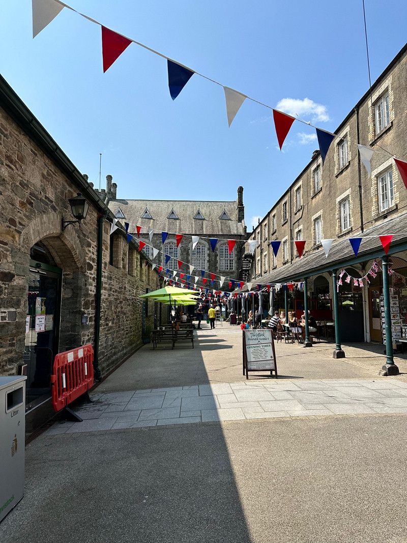
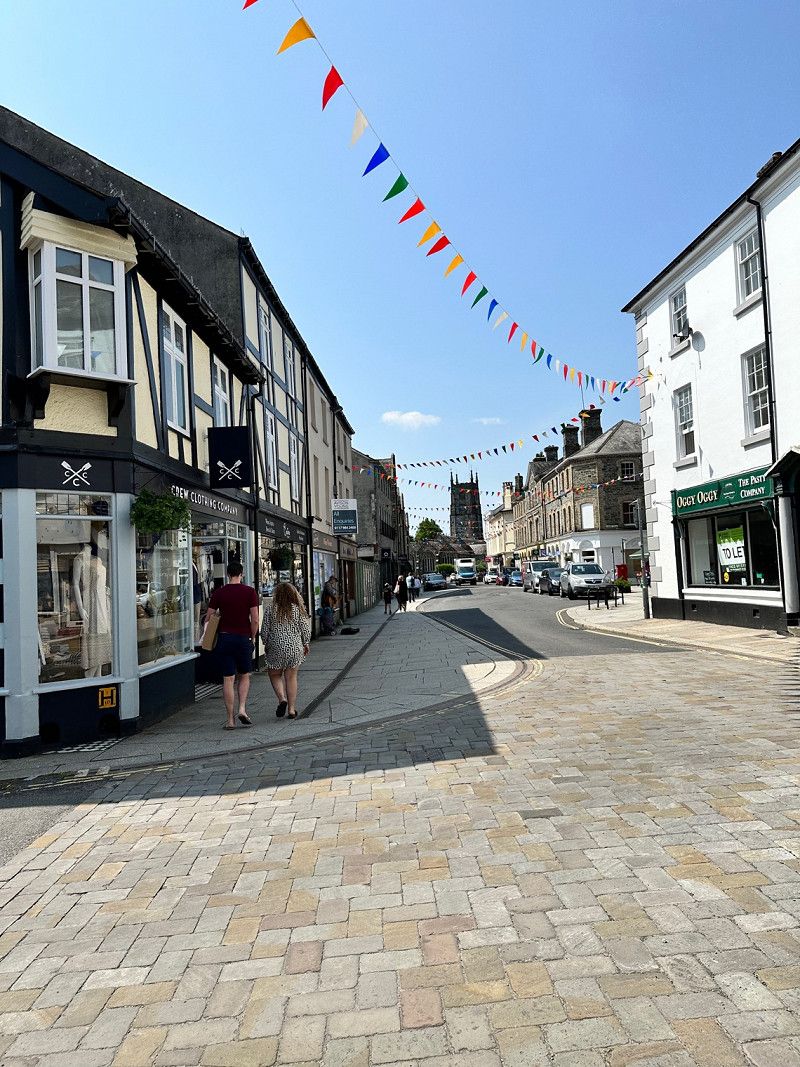
Tavistock, Vereinigtes Königreich
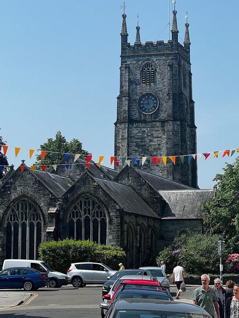
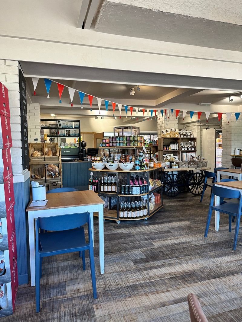
Pretty small English town in Devon on the Cornish border. The Pannier Market is worth seeing. Various regional products, handicrafts are offered and there are some cafes and small shops. Open from Tuesday to Sunday.
Tavistock PL19, Vereinigtes Königreich
50° 33' 4" N 4° 8' 30" W
50.5511229 -4.1416540
• Head southwest on Dolvin Road (A386). Go for 254 m.
• Take the 2nd exit from roundabout onto Abbey Place (A386) toward Plymouth. Go for 128 m.
• Take the 2nd exit from roundabout onto Abbey Place toward Town centre. Go for 37 m.
• Continue on Bedford Square. Go for 49 m.
• Take the 1st exit from roundabout onto West Street. Go for 500 m.
• Take the 2nd exit from roundabout onto Spring Hill. Go for 235 m.
• Continue on New Launceston Road. Go for 3.4 km.
• Keep left onto Nearedale Terrace. Go for 877 m.
• Continue on Blenheim Terrace. Go for 1.1 km.
• Continue on B3362. Go for 3.8 km.
• Continue on Fore Street (B3362). Go for 321 m.
• Continue on B3362. Go for 8.1 km.
• Turn right onto A388. Go for 1.8 km.
• Take the 1st exit from roundabout toward Bodmin/A30/Bude/(A388). Go for 71 m.
• Take the 2nd exit from roundabout onto A30 toward Bodmin/Bude/(A388). Go for 41.7 km.
• Take ramp toward Wadebridge/A389/St Austell. Go for 555 m.
• Take the 1st exit from roundabout onto B3278. Go for 1.6 km.
• Continue on Lockengate (B3278). Go for 104 m.
• Continue on B3278. Go for 2.8 km.
• Continue on Station Road (B3278). Go for 126 m.
• Continue on Fore Street (B3278). Go for 556 m.
• Continue on Higher Bugle (B3278). Go for 836 m.
• Continue on Stannary Road (B3278). Go for 1.1 km.
• Take the 2nd exit from roundabout onto B3274. Go for 2.5 km.
• Continue on Bodmin Road (B3274). Go for 2.4 km.
• Turn right onto Trinity Street (B3274). Go for 22 m.
• Turn left onto Trinity Street. Go for 285 m.
• Take the 2nd exit from roundabout onto South Street. Go for 226 m.
• Take the 1st exit from roundabout onto A390. Go for 28 m.
• Take the 2nd exit from roundabout onto Pentewan Road (B3273). Go for 2.3 km.
• Continue on B3273. Go for 5.7 km.
• Continue on Valley Road (B3273). Go for 303 m.
• Turn right onto Ava Estate. Go for 13 m.
• Turn right onto Ava Estate. Go for 19 m.
• Continue on Ava Estate. Go for 197 m.
• Turn slightly right onto Ava Estate. Go for 19 m.
• Arrive at Ava Estate. Your destination is on the right.
☍
84,0 km
(1 hrs. 11 min.)
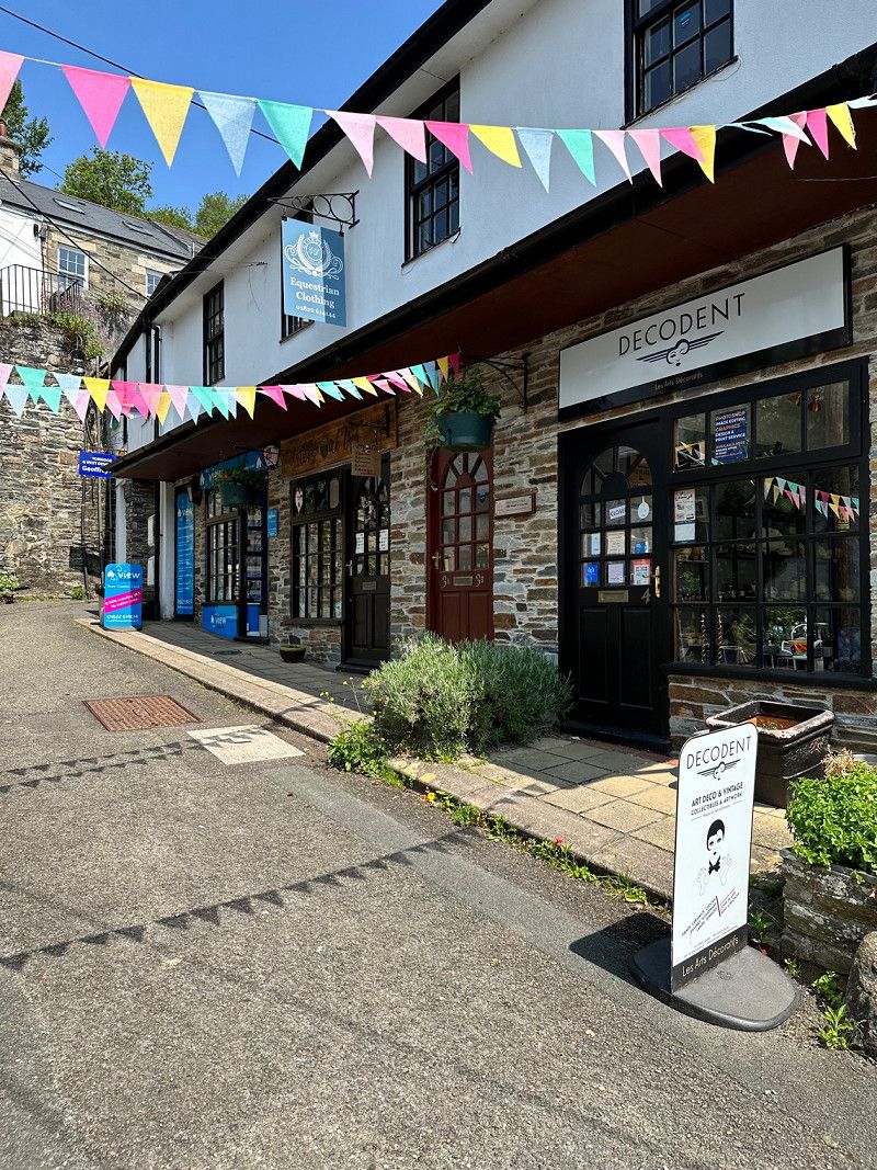
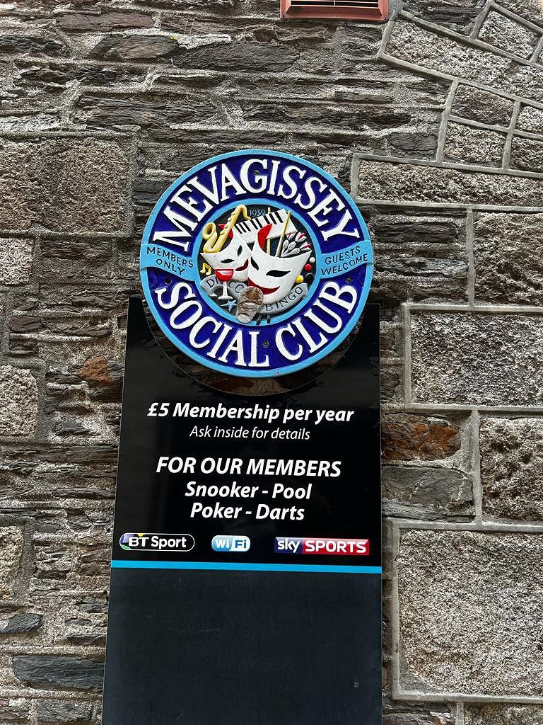
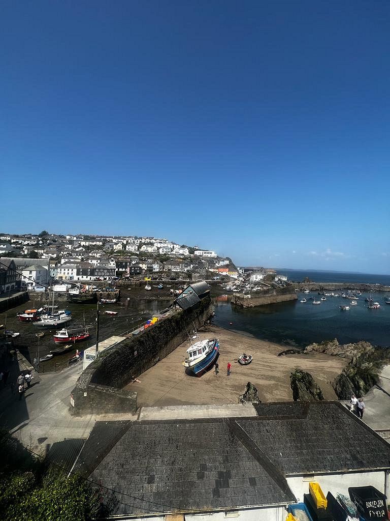
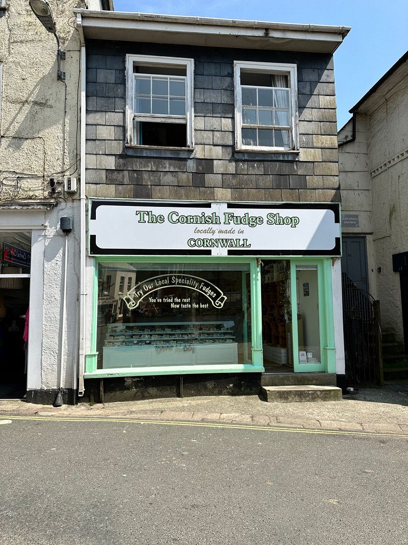
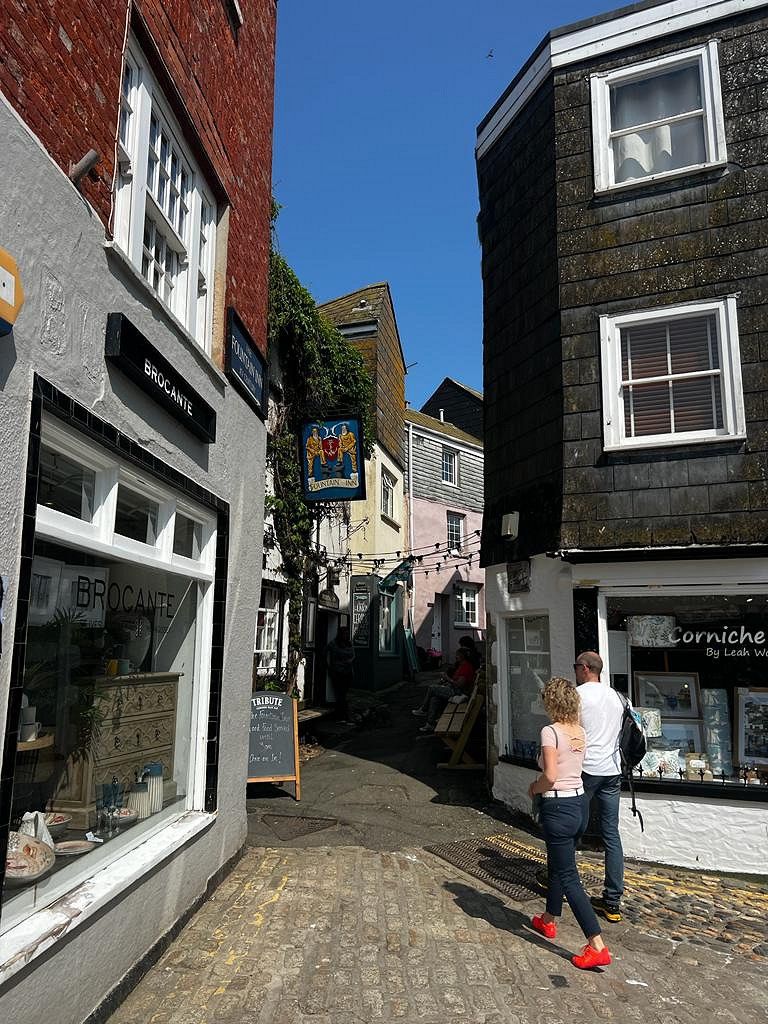
Mevagissey, Vereinigtes Königreich
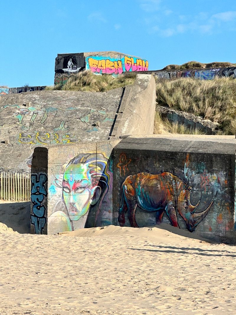
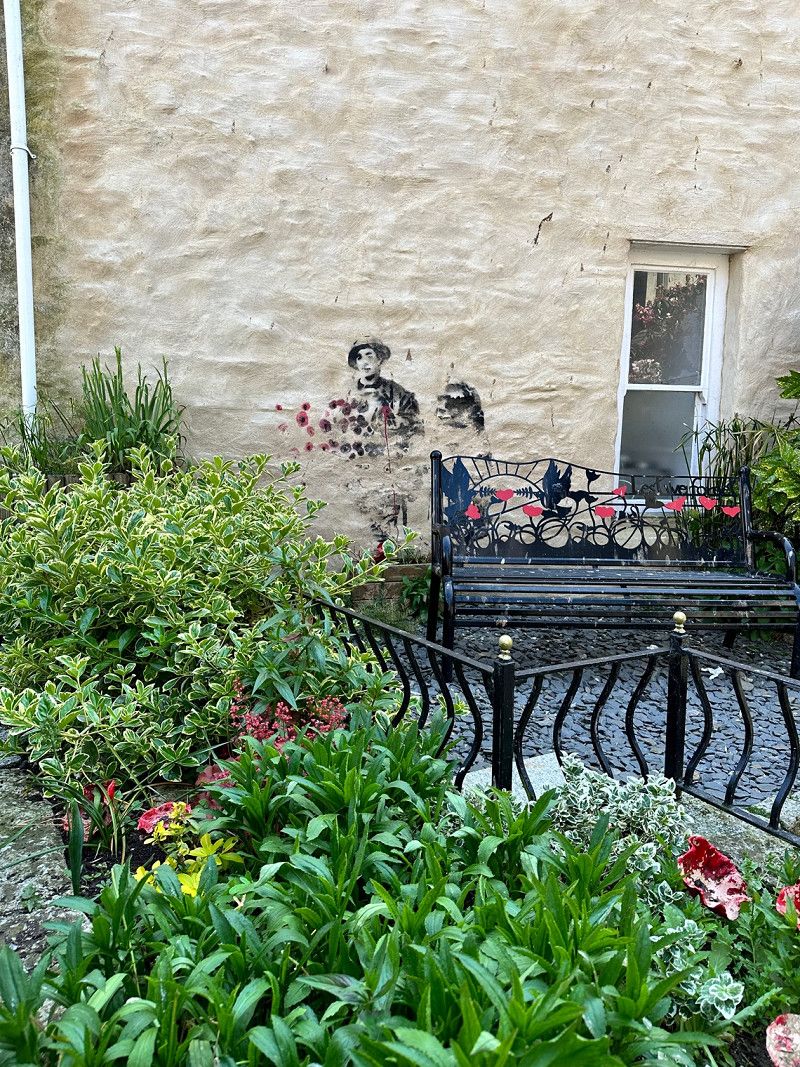
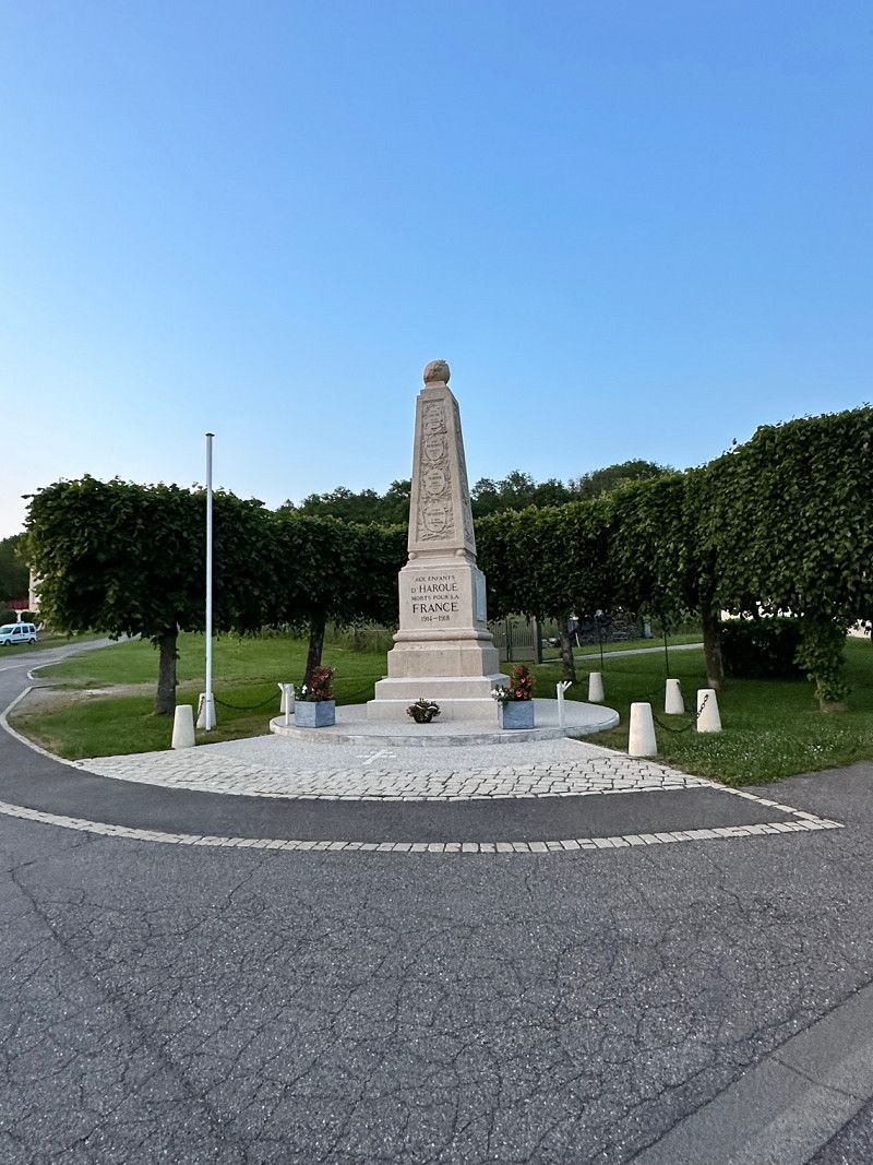
A port town in Cornwall, Mevagissey has a charming core. Small pretty shops and restaurants invite you to stroll. Bansky (anonymous spray artist) immortalized himself at the war memorial.
Mevagissey , Mevagissey, Vereinigtes Königreich
50° 16' 20.5" N 4° 47' 39.4" W
50.2723693 -4.7942775
• Head east on Ava Estate. Go for 149 m.
• Turn right onto Ava Estate. Go for 86 m.
• Turn left onto Ava Estate. Go for 13 m.
• Turn left onto Valley Road (B3273). Go for 303 m.
• Continue on B3273. Go for 1.1 km.
• Turn left. Go for 1.9 km.
• Turn right. Go for 86 m.
• Arrive at your destination on the left.
☍
3,6 km
( 5 min.)
Heligan Woods Caravan & Camping Park
Campsite with good pitches, beautiful views and sensational sanitary facilities. The nicest and cleanest on our trip with families Douche. From this square you have direct access to the Lost Garden of Heligan. Anyone who stays here has a 20% discount on the entrance fees 😀
PL26 6EL, St. Austell, Großbritannien
50° 17' 21" N 4° 48' 58.3" W
50.2891700 -4.8161900
• Head east. Go for 86 m.
• Turn left. Go for 658 m.
• Turn right. Go for 853 m.
• Arrive at your destination on the right.
☍
1,6 km
( 3 min.)
Day
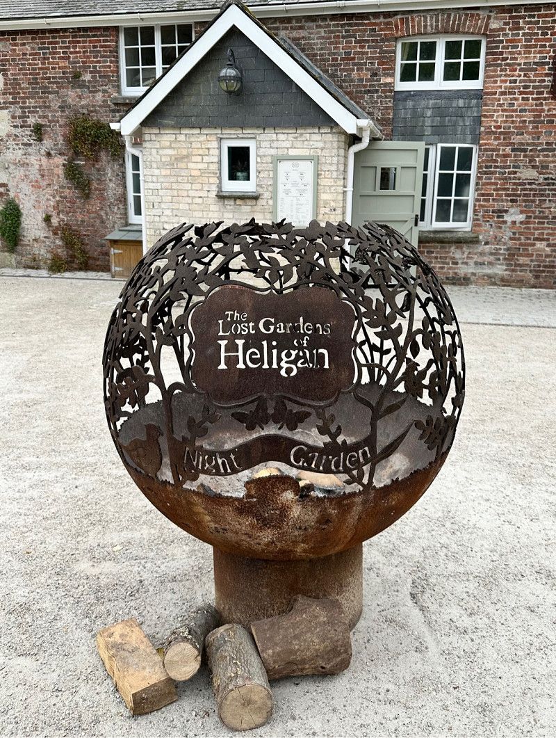
Lost Gardens of Heligan, B3273, Pentewan, Saint Austell, Vereinigtes Königreich
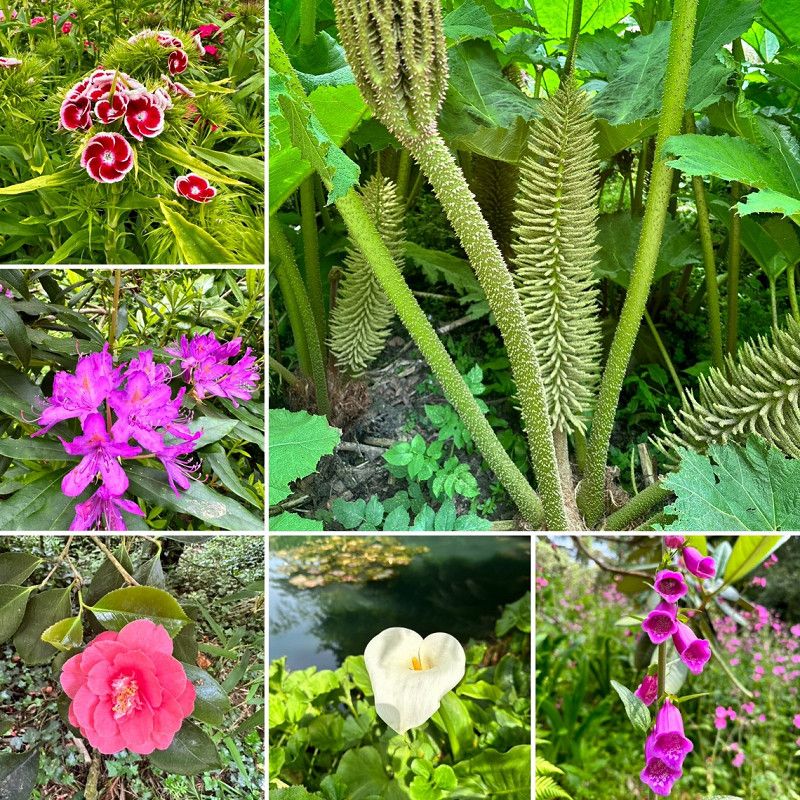
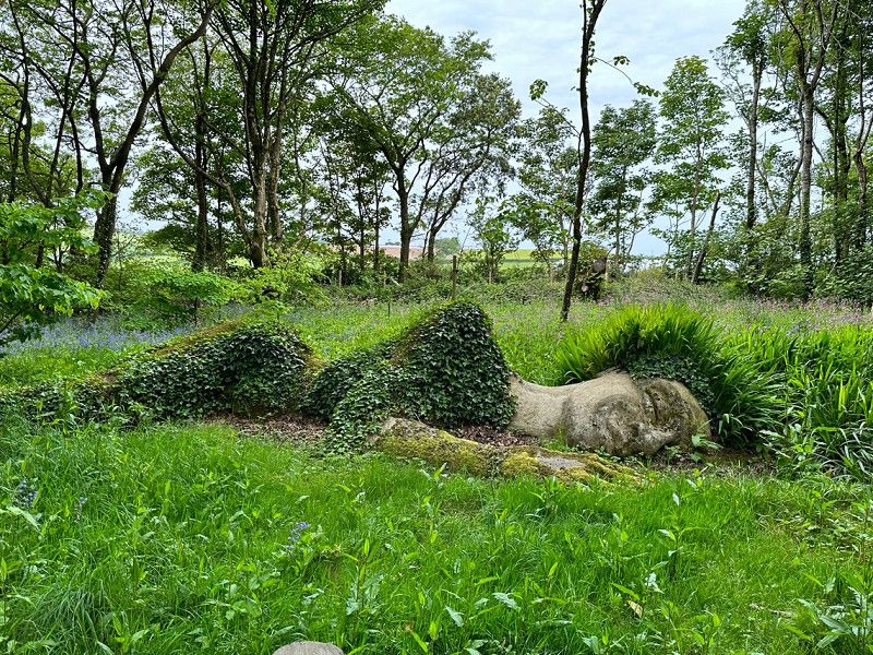
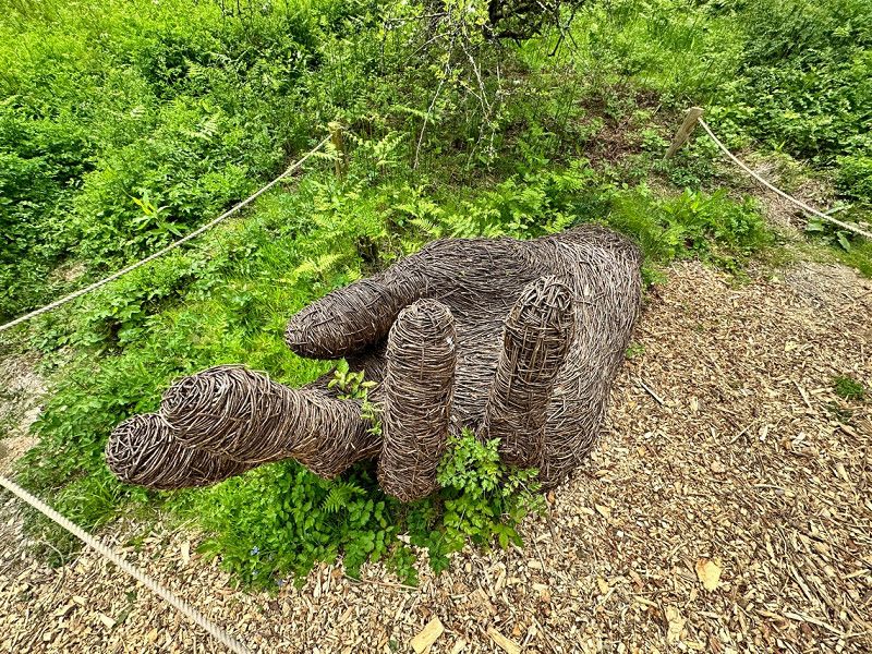
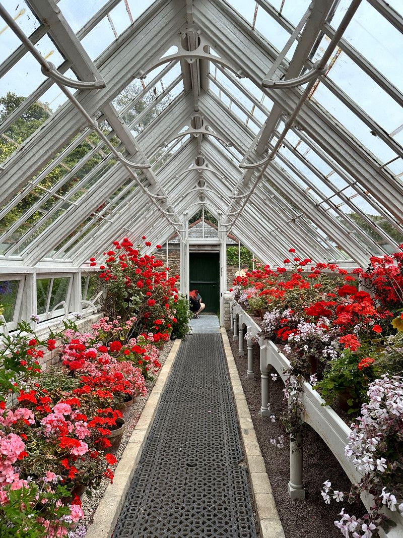
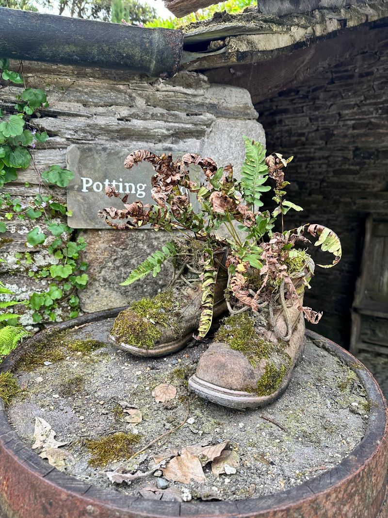
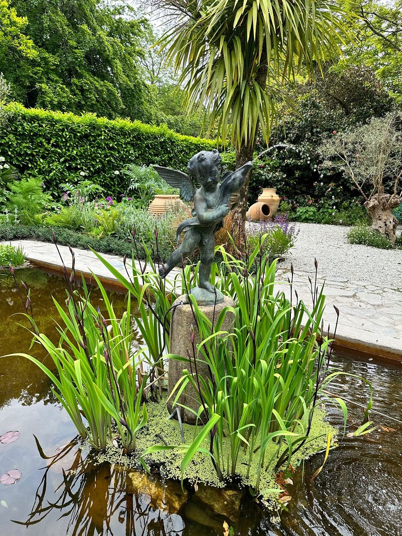
Today we visited the Lost Garden of Heligan. From the campsite you have direct access to the garden car park. I highly recommend this garden to anyone who likes flowers. The overgrown sculptures, the Jungle Way with exotic plants, the complex with greenhouses from around 1900 are beautiful. Amazing what thrives in this climate 🤩
B3273, Pentewan, Saint Austell PL26 6EN, Vereinigtes Königreich
50° 17' 8.9" N 4° 48' 46.8" W
50.2857972 -4.8130079
• Head northwest. Go for 853 m.
• Turn right. Go for 813 m.
• Keep right toward B3273. Go for 435 m.
• Turn left onto B3273. Go for 4.6 km.
• Continue on Pentewan Road (B3273). Go for 2.2 km.
• Take the 1st exit from roundabout onto A390. Go for 23 m.
• Take the 2nd exit from roundabout onto Penwinnick Road (A390). Go for 584 m.
• Turn right onto Edgcumbe Road (A3058). Go for 11.5 km.
• Take the 2nd exit from Brighton Cross roundabout onto A3058. Go for 2.6 km.
• Turn left onto New Row (A3058). Go for 743 m.
• Take ramp onto A30. Go for 36.4 km.
• Take the 3rd exit from Loggans Moor roundabout onto A30 toward Penzance/St Ives/(A3074). Go for 4.7 km.
• Take the 1st exit from roundabout onto A30 toward Penzance. Go for 5.9 km.
• Take the 2nd exit from Newtown Roundabout roundabout toward Marazion. Go for 176 m.
• Continue on Newtown Lane. Go for 438 m.
• Turn left toward West End. Go for 897 m.
• Continue on West End. Go for 475 m.
• Arrive at West End.
☍
73,4 km
(1 hrs. 5 min.)
Day
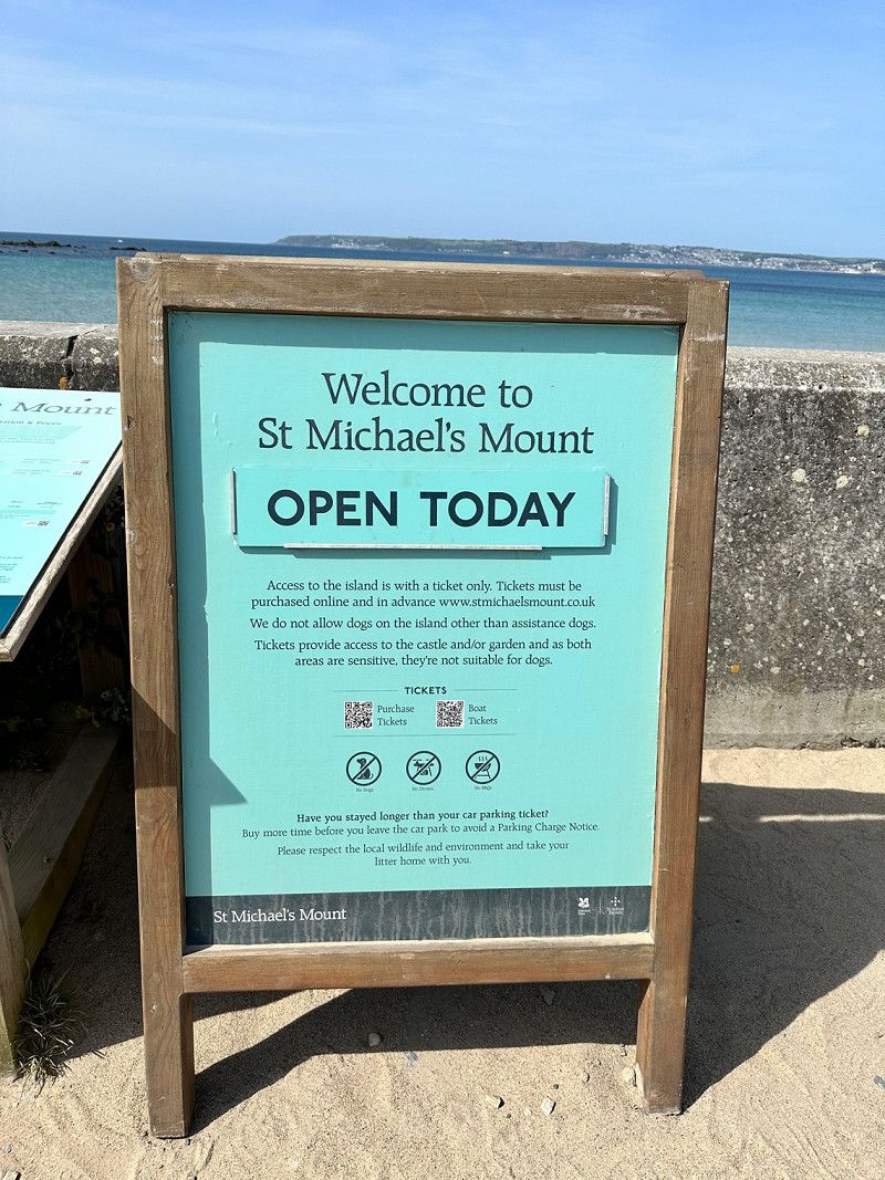
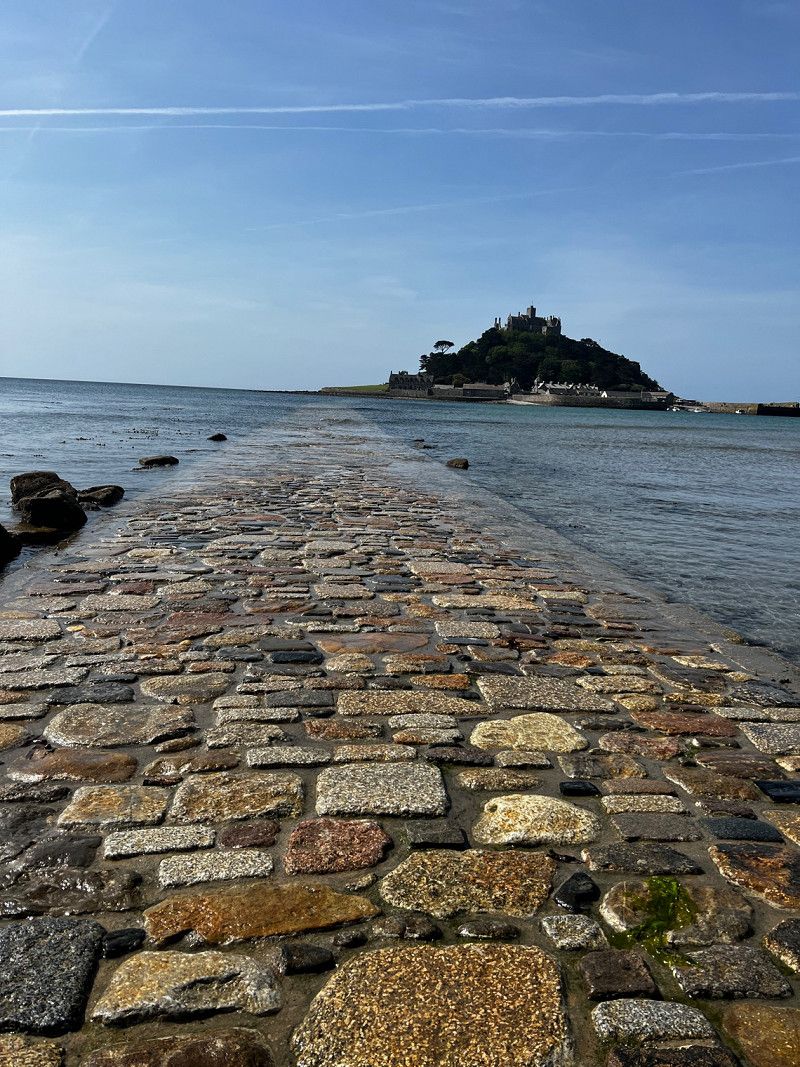
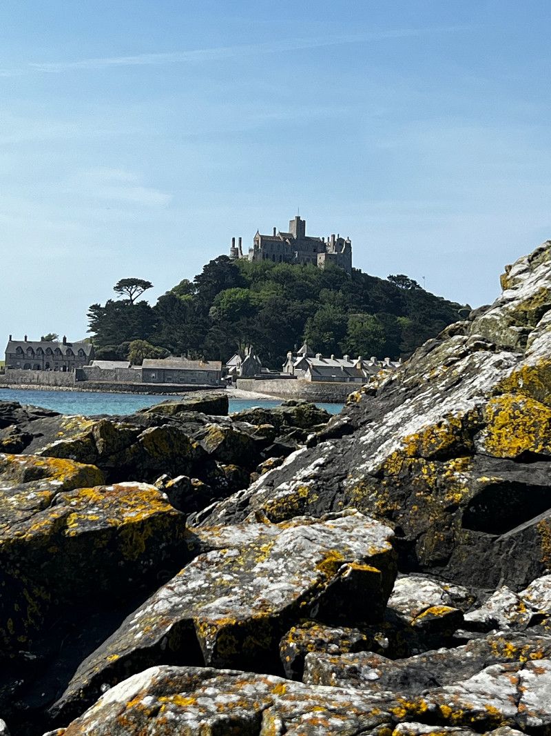
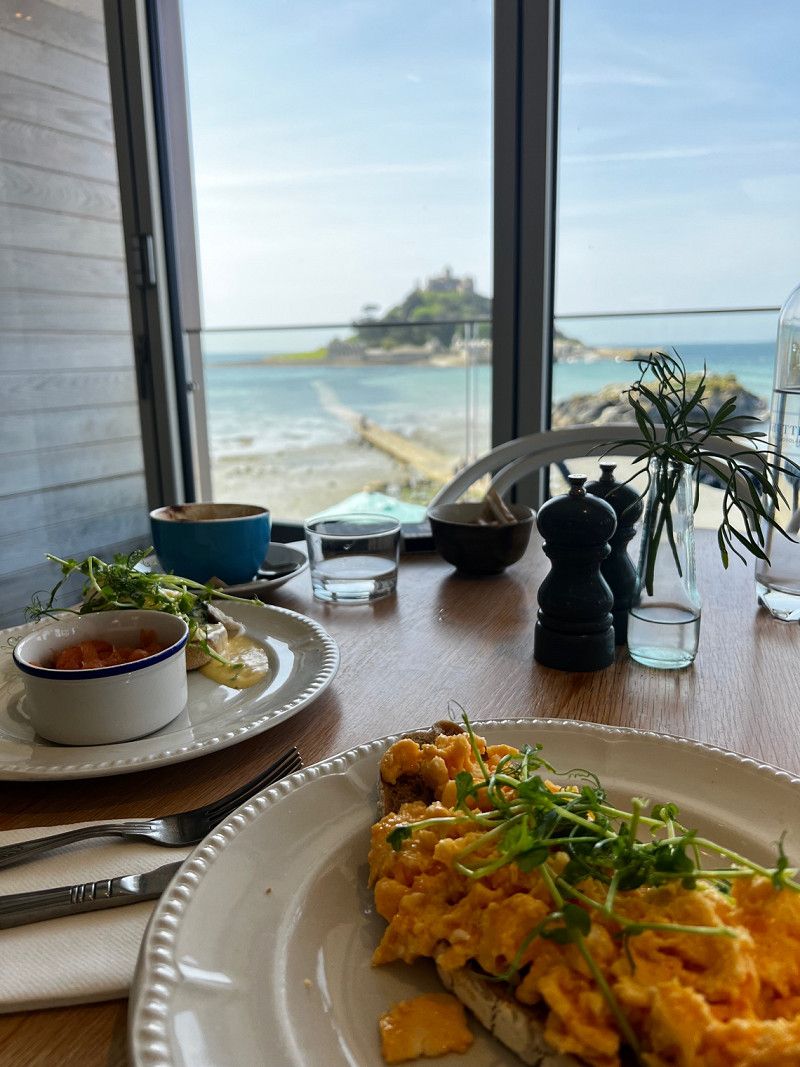
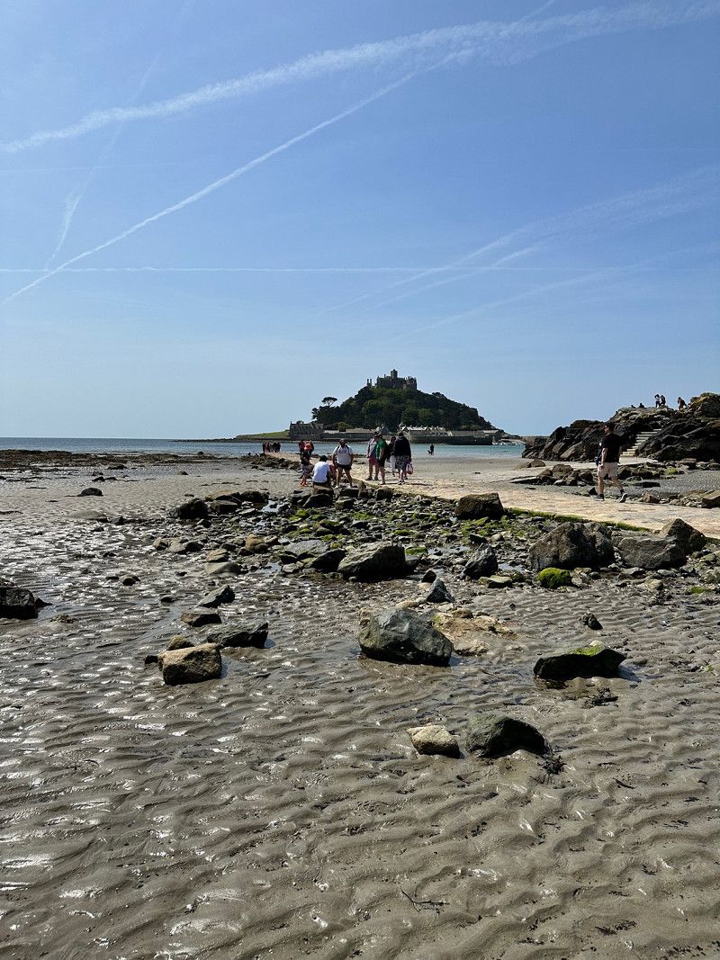
St. Michael's Mount, Marazion, Vereinigtes Königreich
St. Michael's Mount is a tidal island. It can be reached by boat or by a paved path at low tide. There is a castle and a castle garden to visit. The island is accessible from Marazion, which is also a nice little village.
St. Michael's Mount, Marazion TR17, Vereinigtes Königreich
50° 7' 1.8" N 5° 28' 40.1" W
50.1171529 -5.4778073
• Head toward Kings Road on West End. Go for 2.0 km.
• Take the 1st exit from roundabout. Go for 75 m.
• Continue on Riverside. Go for 47 m.
• Continue on Gladstone Terrace. Go for 99 m.
• Continue on Bay Villas. Go for 644 m.
• Take the 2nd exit from roundabout. Go for 115 m.
• Continue toward Eastern Green/A30. Go for 32 m.
• Take the 1st exit from Chy-an-Mor roundabout onto Eastern Green (A30). Go for 346 m.
• Pass 5 roundabouts and continue on A30. Go for 6.4 km.
• Continue on Drift (A30). Go for 170 m.
• Continue on A30. Go for 165 m.
• Continue on Higher Drift (A30). Go for 160 m.
• Continue on A30. Go for 721 m.
• Turn left onto B3283. Go for 3.0 km.
• Continue on Penzance Road (B3283). Go for 204 m.
• Continue on B3283. Go for 150 m.
• Continue on Lands End Road (B3283). Go for 214 m.
• Continue on B3283. Go for 1.7 km.
• Continue on Sparnon (B3283). Go for 66 m.
• Continue on B3315. Go for 671 m.
• Continue on St Buryan Hill (B3315). Go for 499 m.
• Continue on B3315. Go for 126 m.
• Turn right onto Treen Hill (B3315). Go for 296 m.
• Continue on B3315. Go for 1.0 km.
• Turn left onto The Valley. Go for 1.6 km.
• Turn left. Go for 277 m.
• Turn slightly right. Go for 54 m.
• Arrive at your destination on the right.
☍
20,8 km
( 29 min.)
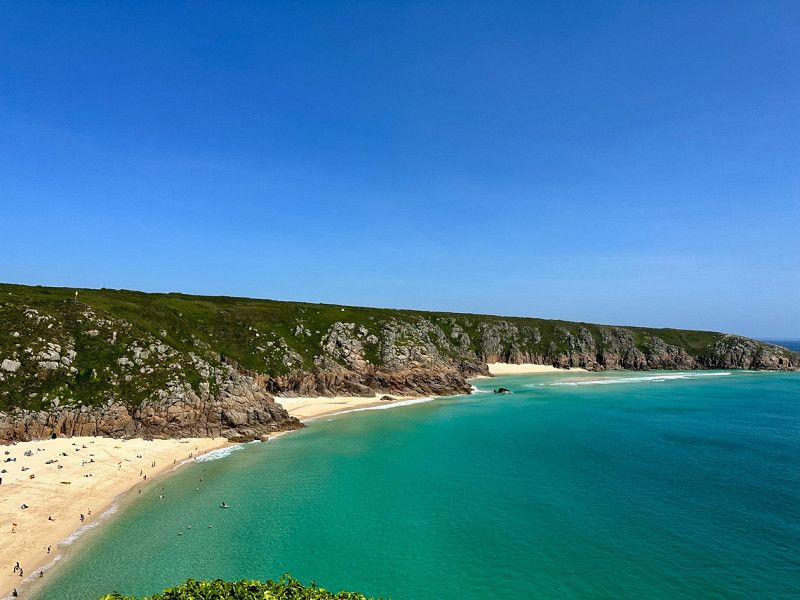
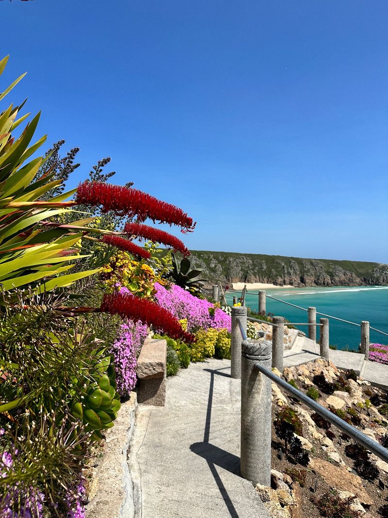
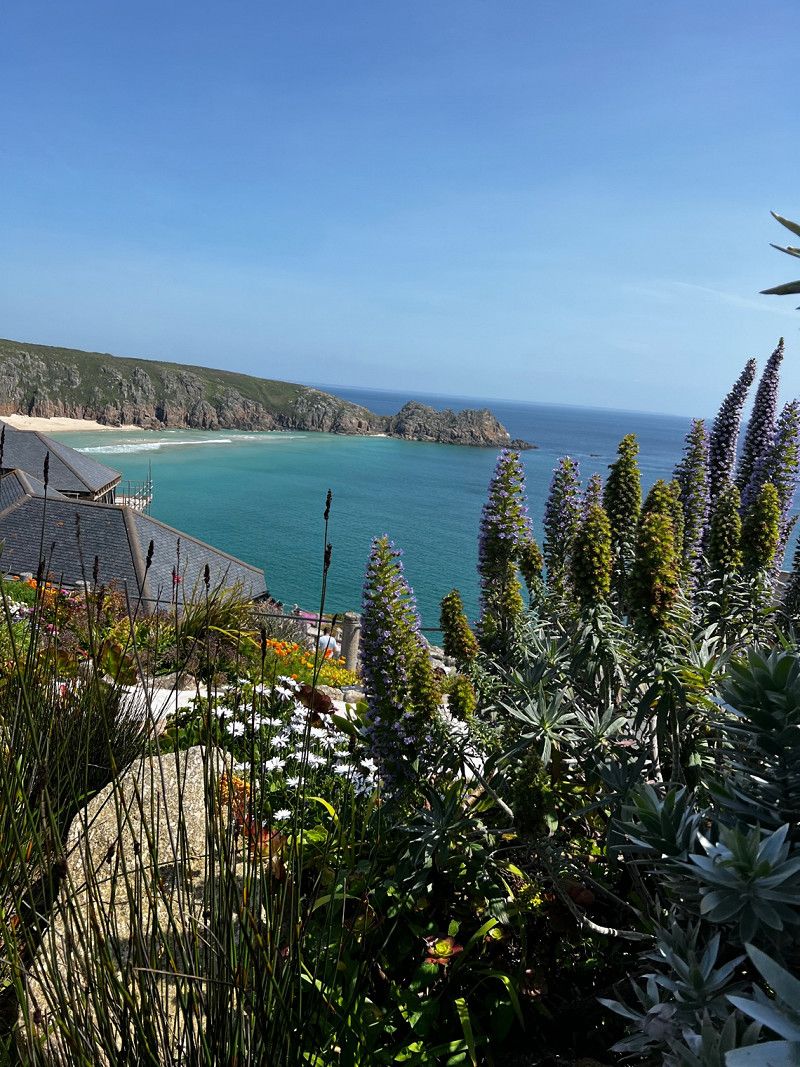
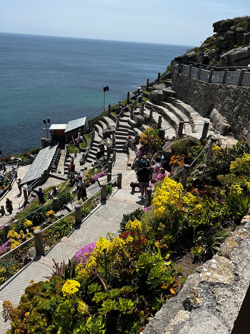
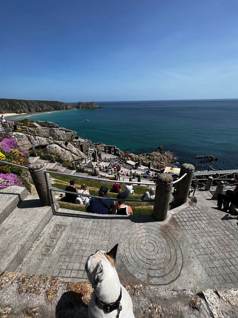
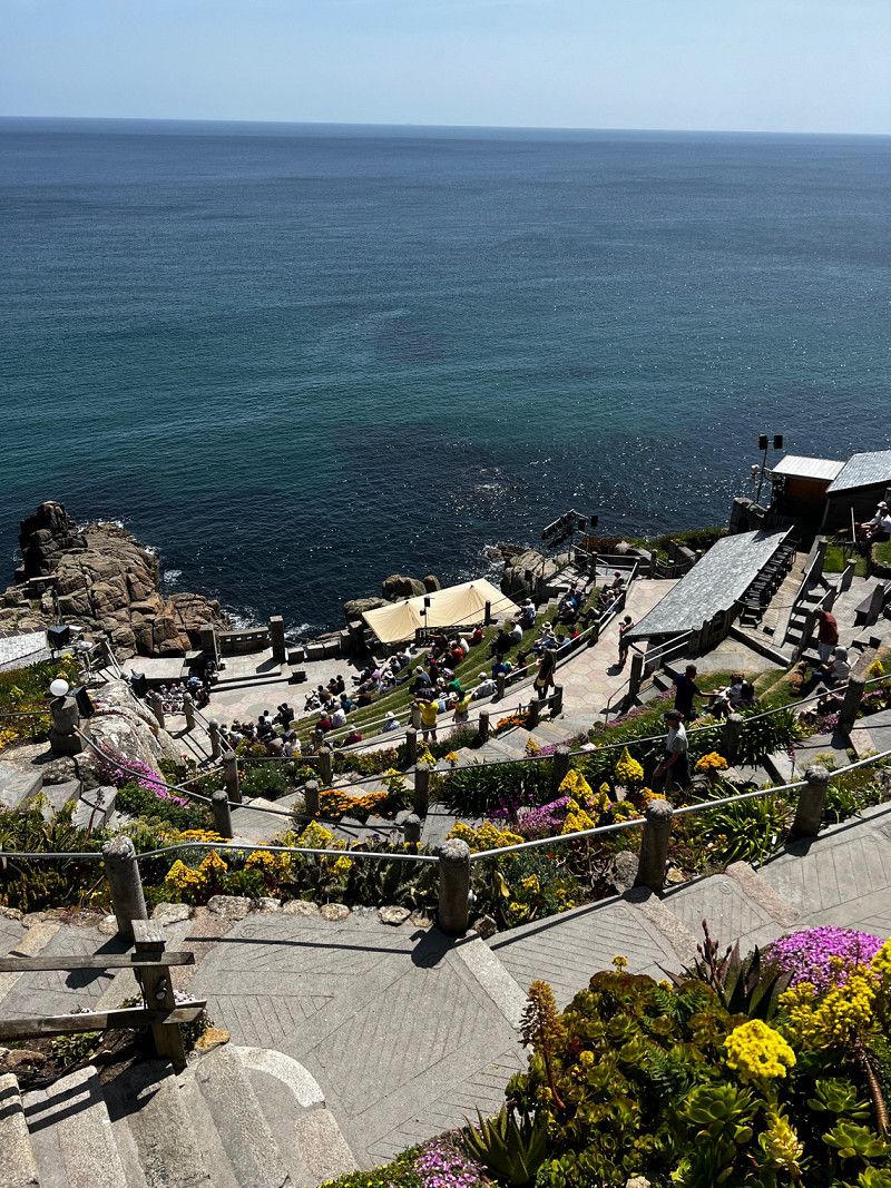
Minack Theatre, Vereinigtes Königreich
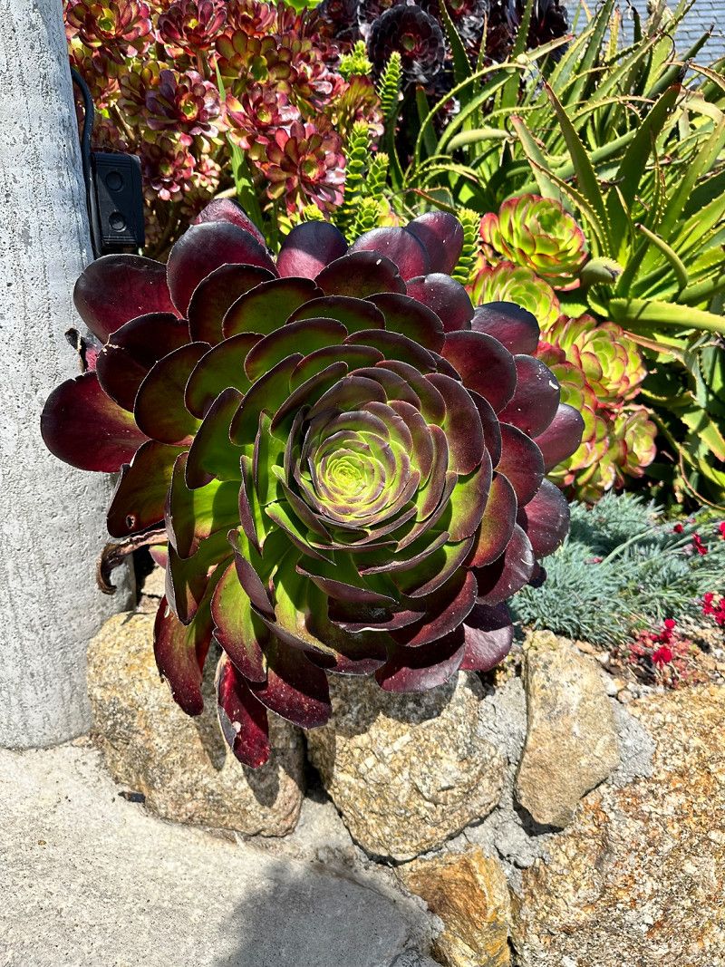
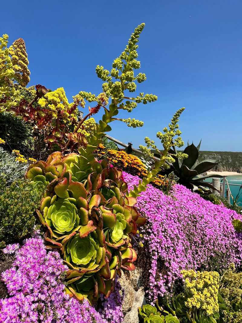
Lots to see today 😀 Rowena Cade built the Minack Open Air Theater on the steep Cornish coast not far from Lands End. The whole theater is built by hand based on a Roman theater. There are regular performances, the view and the flowers are phenomenal.
The Valley , Penzance, Vereinigtes Königreich
50° 2' 27.6" N 5° 39' 4.6" W
50.0409984 -5.6512708
• Head south. Go for 351 m.
• Turn right toward The Valley. Go for 35 m.
• Continue on The Valley. Go for 1.6 km.
• Turn left onto Trethewey (B3315). Go for 106 m.
• Continue on B3315. Go for 504 m.
• Turn right onto B3315. Go for 81 m.
• Continue on Polgigga (B3315). Go for 205 m.
• Continue on B3315. Go for 2.5 km.
• Turn right toward A30. Go for 238 m.
• Turn right onto A30. Go for 1.7 km.
• Continue on Sea View Terrace (A30). Go for 127 m.
• Continue on A30. Go for 1.3 km.
• Turn left onto B3306. Go for 4.3 km.
• Continue on Bosavern (B3306). Go for 76 m.
• Continue on B3306. Go for 249 m.
• Turn right onto A3071. Go for 3.4 km.
• Turn sharp left onto B3318. Go for 3.0 km.
• Continue on Boscaswell Downs (B3318). Go for 484 m.
• Turn right onto St Ives Road (B3306). Go for 99 m.
• Continue on Ponds Hill (B3306). Go for 271 m.
• Continue on Higher Bojewyan (B3306). Go for 275 m.
• Continue on B3306. Go for 1.3 km.
• Continue on Morvah (B3306). Go for 171 m.
• Continue on B3306. Go for 1.9 km.
• Arrive at B3306. Your destination is on the right.
☍
24,2 km
( 32 min.)
Rosemergy, Vereinigtes Königreich
There is a beautiful coastal road between St Nur and St Yves. On the way is a secluded little restaurant with a beautiful view. Be sure to check opening times on the internet in advance. Cornish Cream Tea (tea, scones, jam and clotted cream) taste great. I recommend allowing enough time, as there are many beautiful hikes possible through the moor.
Unfortunately we didn't have time to look at St. Yves. I know the harbor from a previous trip, a special atmosphere at low tide.
Rosemergy , Porthmeor, Vereinigtes Königreich
50° 10' 13" N 5° 37' 2.8" W
50.1702849 -5.6174544
• Head northeast on B3306. Go for 2.1 km.
• Continue on Porthmeor (B3306). Go for 174 m.
• Continue on B3306. Go for 9.1 km.
• Turn right onto Halsetown Road (B3311). Go for 418 m.
• Continue on B3311. Go for 1.7 km.
• Turn left toward Nance. Go for 1.1 km.
• Continue on Nance. Go for 3.4 km.
• Continue on Mill Hill. Go for 344 m.
• Take the 3rd exit from roundabout onto Nut Lane (A3074). Go for 110 m.
• Take the 2nd exit from roundabout onto Nut Lane (A3074). Go for 319 m.
• Take the 2nd exit from roundabout onto A30 toward Redruth. Go for 4.7 km.
• Take the 2nd exit from Loggans Moor roundabout onto A30 toward Redruth. Go for 41.5 km.
• Take ramp toward Wadebridge/Newquay/(A392)/Airport. Go for 672 m.
• Take the 1st exit from roundabout onto A39 toward Wadebridge/Newquay/(A392)/St Columb Road/St Columb Major/Airport. Go for 1.4 km.
• Take the 3rd exit from Halloon roundabout onto A39 toward Wadebridge/Padstow/St Columb Major/Airport. Go for 2.8 km.
• Take the 3rd exit from Trekenning roundabout onto A39 toward Wadebridge. Go for 4.3 km.
• Pass 3 roundabouts and continue on A39. Go for 53.9 km.
• Take the 3rd exit from roundabout onto A39 toward Bideford. Go for 23.1 km.
• Take the 1st exit from Clovelly Cross roundabout onto B3237 toward Clovelly. Go for 2.3 km.
• Turn left toward Sail Loft. Go for 448 m.
• Continue on Sail Loft. Go for 40 m.
• Arrive at Sail Loft.
☍
154,0 km
(2 hrs. 7 min.)
Day
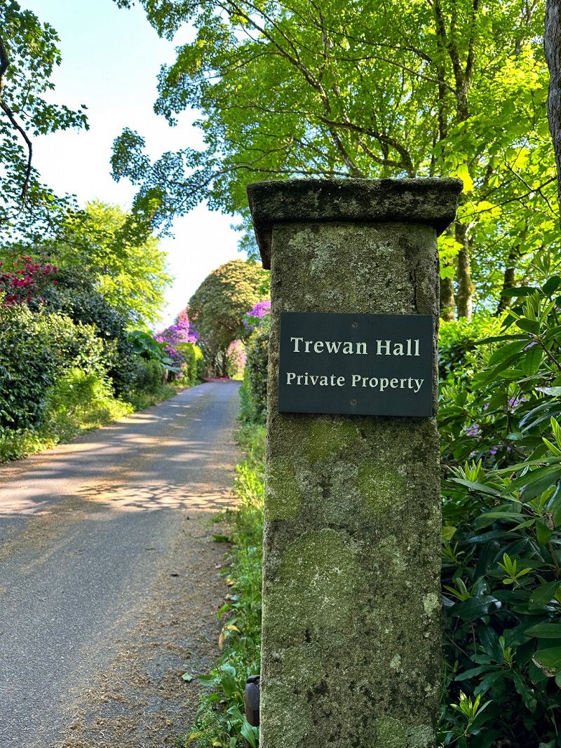
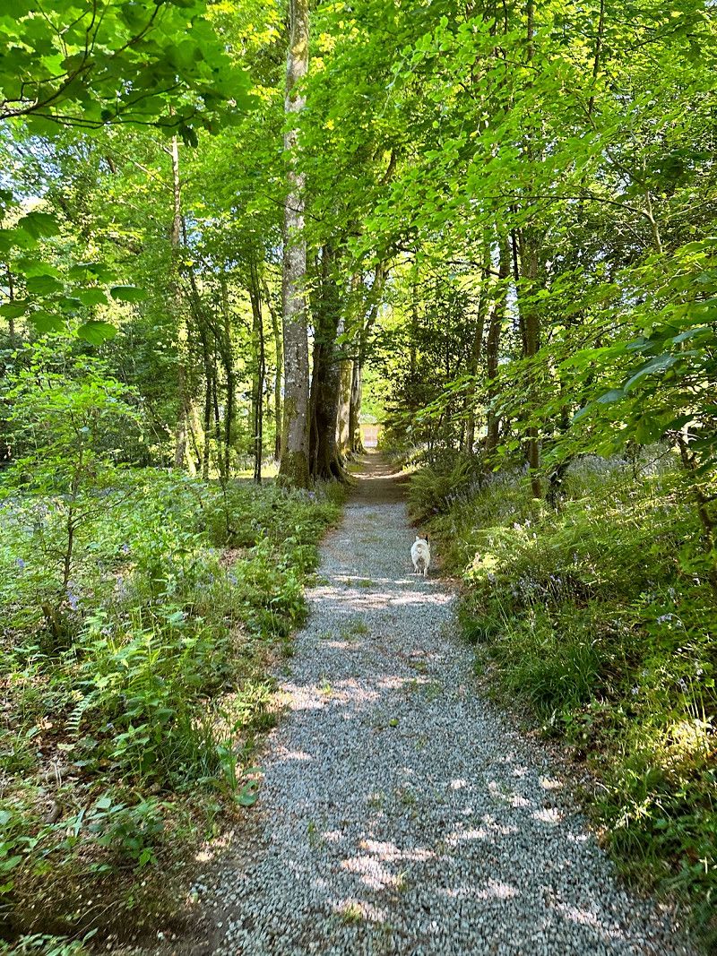
Trewan Hall Campsite
Today we spend the night in this great place. Great well-kept facility and friendly hosts. There is a heated pool, which was not open when we were there. We didn't need it anyway 😁 There is a herb garden where you can help yourself 🪴 In the high season there is live music in the barns.
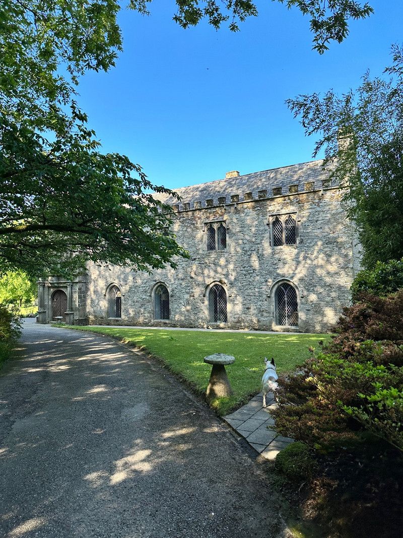
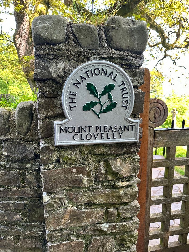
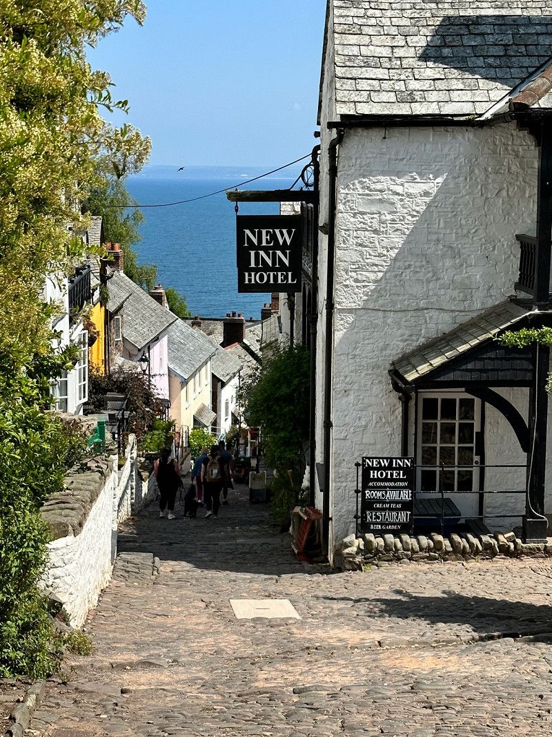
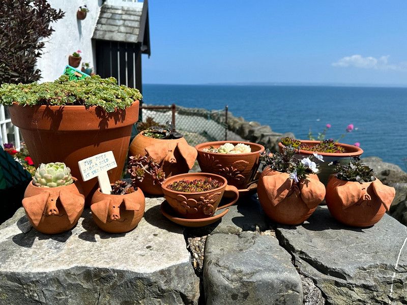
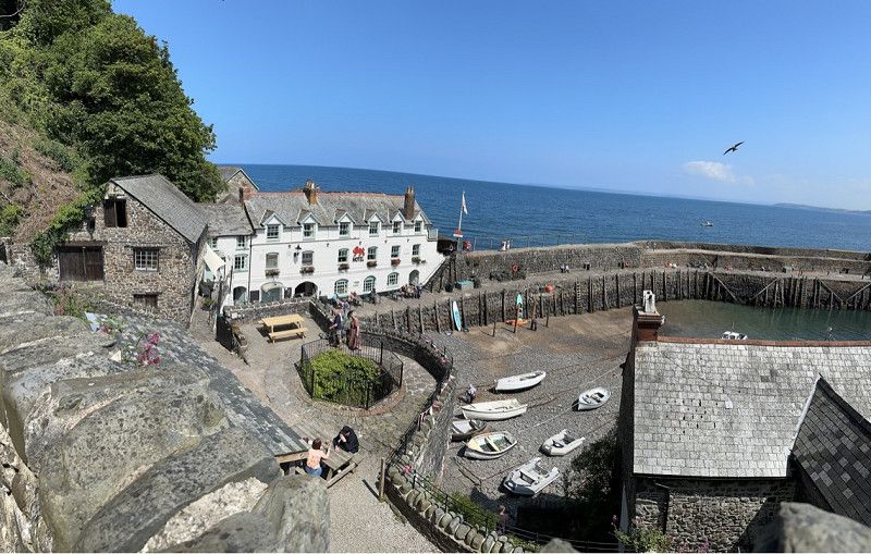
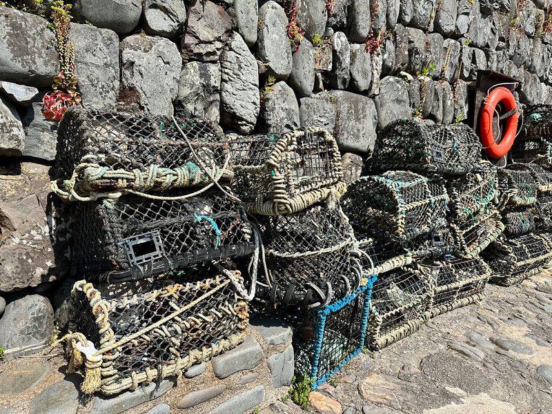
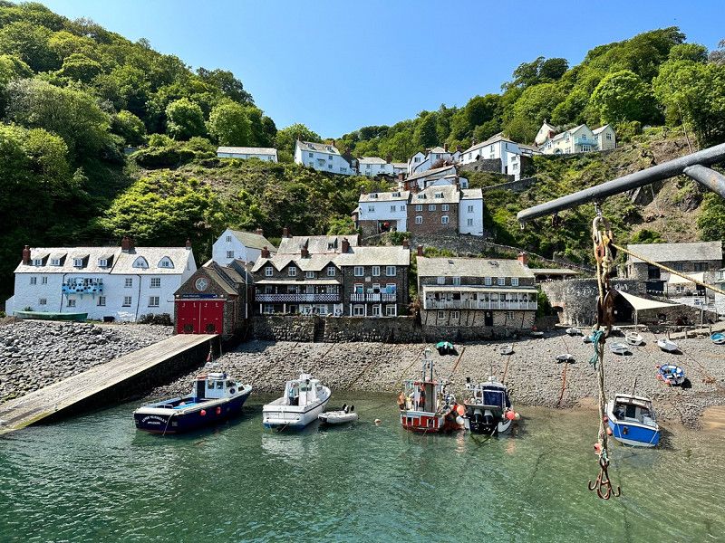
Clovelly, Bideford, Vereinigtes Königreich
To visit this fishing village you pay 8.50 pounds. We were surprised at first, but then realized that the whole village is a kind of open-air museum. There are various attractions, eg pottery, museum, fisherman's house and the harbour. Really nice.
Clovelly, Bideford EX39, Vereinigtes Königreich
50° 59' 53.3" N 4° 23' 56.8" W
50.9981276 -4.3991182
• Head west on Sail Loft. Go for 467 m.
• Turn right onto B3237. Go for 2.3 km.
• Take the 1st exit from Clovelly Cross roundabout onto A39 toward Bideford. Go for 12.3 km.
• Pass 2 roundabouts and continue on A39. Go for 14.3 km.
• Take the 3rd exit from Roundswell roundabout onto A39 toward Barnstaple. Go for 1.7 km.
• Take the 2nd exit from Lake Roundabout roundabout onto A361 toward Taunton/Exeter/(M5)/Lynton/(A39). Go for 812 m.
• Take the 2nd exit from Bishop's Tawton Road roundabout onto A361 toward Taunton/Exeter/(M5)/Lynton/(A39)/Landkey. Go for 1.5 km.
• Take the 2nd exit from Portmore Roundabout roundabout onto A361 toward South Molton/Taunton/(M5)/Exeter. Go for 1.7 km.
• Take the 1st exit from Landkey Roundabout roundabout onto A361. Go for 11.7 km.
• Pass 5 roundabouts. Go for 41.2 km.
• Take ramp onto M5. Go for 23.8 km.
• Take exit 25 toward Taunton/Yeovil. Go for 368 m.
• Take the 4th exit from roundabout onto A358 toward Yeovil/Weymouth/(A37)/Park and Ride/Ruishton/Ilminster/Langport/Chard. Go for 14.4 km.
• Take the 1st exit from Southfields Roundabout roundabout onto A303 toward London/Ilchester/Yeovil/(A3088)/Weymouth/(A37). Go for 10.3 km.
• Pass 2 roundabouts and continue on A303. Go for 13.8 km.
• Take the 3rd exit from Podimore Roundabout roundabout onto A303 toward London. Go for 52.1 km.
• Take ramp toward Salisbury/Wilton. Go for 319 m.
• Turn right onto A36 toward Salisbury/Wilton. Go for 13.4 km.
• Take the 2nd exit from roundabout onto Salisbury Road (A36) toward Salisbury. Go for 642 m.
• Turn right onto Netherhampton Road (A3094) toward Bournemouth/Ringwood/(A338)/Livestock Market. Go for 1.4 km.
• Turn right toward Race Plain Road. Go for 70 m.
• Continue on Race Plain Road. Go for 1.9 km.
• Turn sharp left onto Old Shaftsbury Drove. Go for 522 m.
• Arrive at your destination on the right.
☍
220,9 km
(2 hrs. 35 min.)
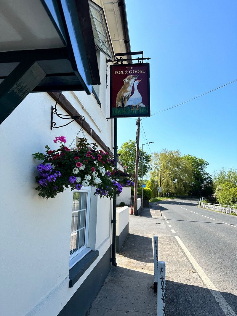
Coombe Caravan Park, Coombe Bissett, Salisbury, Vereinigtes Königreich
Since we are driving back quickly, we were looking for a place near Salisbury today. In the evening we went for a walk to the nearest pub. Walk about 30 minutes. We can highly recommend the Fox & Goose pub. Good food and nice hosts. The host at the campsite is also very helpful and will be happy to explain the way to the pub☺️
Coombe Bissett, Salisbury SP2 8PN, Vereinigtes Königreich
51° 3' 14.1" N 1° 51' 44.1" W
51.0539231 -1.8622623
• Head west. Go for 97 m.
• Continue on Old Shaftsbury Drove. Go for 425 m.
• Turn sharp right onto Race Plain Road. Go for 2.0 km.
• Turn left onto Netherhampton Road (A3094). Go for 1.4 km.
• Turn left onto Salisbury Road (A36). Go for 632 m.
• Take the 3rd exit from roundabout onto The Avenue toward Devizes/(A360). Go for 445 m.
• Take the 2nd exit from roundabout onto The Avenue. Go for 2.0 km.
• Take the 1st exit from roundabout onto A360. Go for 8.2 km.
• Take the 3rd exit from Longbarrow Roundabout roundabout onto A303 toward London/Amesbury. Go for 5.6 km.
• Take the 2nd exit from Countess roundabout onto A303 toward Tidworth/Solstice Park. Go for 43.2 km.
• Take ramp onto M3. Go for 52.8 km.
• Take exit 2 toward (M4, M40, M1)/Heathrow Airport/Watford/Staines/Gatwick Airport/M23/Chertsey/A320/Dartford/M20 onto M25. Go for 58.1 km.
• Keep right onto M26 toward Dover/Channel Tnl/(M20)/Maidstone/Hastings/Sevenoaks/(A21). Go for 17.1 km.
• Keep right onto M26. Go for 182 m.
• Continue on M20. Go for 13.2 km.
• Take exit 7 toward Sheerness/A249(N)/Maidstone/A249(S). Go for 384 m.
• Turn left onto Sittingbourne Road (A249) toward Canterbury/Ramsgate/Sittingbourne/Sheerness. Go for 8.7 km.
• Take ramp onto M2 toward Dover/Ramsgate/Canterbury. Go for 20.8 km.
• Take exit 7 toward Canterbury/Dover. Go for 441 m.
• Take the 4th exit from Brenley Cor roundabout onto A2 toward Dover/Canterbury. Go for 8.2 km.
• Take ramp onto A2050 toward Canterbury/Harbledown/(A28). Go for 2.2 km.
• Take the 2nd exit from London Road Roundabout roundabout onto Rheims Way (A2050) toward Margate/(A28)/Ashford. Go for 778 m.
• Take the 3rd exit from St Peters Roundabout roundabout onto Rheims Way (A290) toward Margate/(A28)/Ashford. Go for 513 m.
• Take the 2nd exit from Wincheap Roundabout roundabout onto Pin Hill (A28) toward Margate. Go for 505 m.
• Take the 2nd exit from Riding Gate Roundabout roundabout onto Upper Bridge Street (A28) toward Margate/Sandwich/(A257). Go for 238 m.
• Take the 2nd exit from St Georges Roundabout roundabout onto St George's Place (A257) toward Sandwich/Dover/(A2). Go for 252 m.
• Turn left onto Lower Chantry Lane (A257). Go for 241 m.
• Take the 2nd exit from St Augustines Roundabout roundabout onto Longport (A257). Go for 1.7 km.
• Turn right onto Bekesbourne Lane. Go for 133 m.
• Turn right. Go for 49 m.
• Turn left. Go for 15 m.
• Arrive at your destination on the left.
☍
250,7 km
(2 hrs. 33 min.)
Day
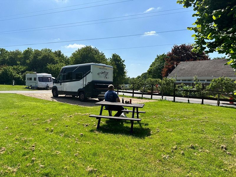
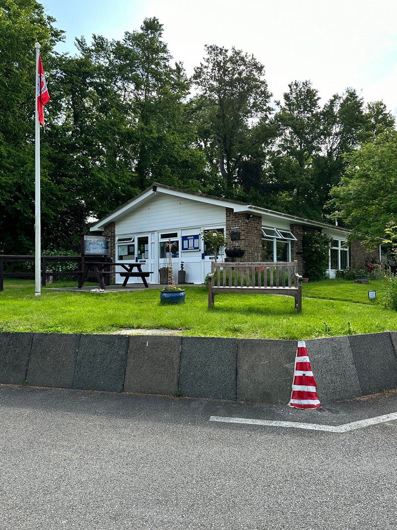
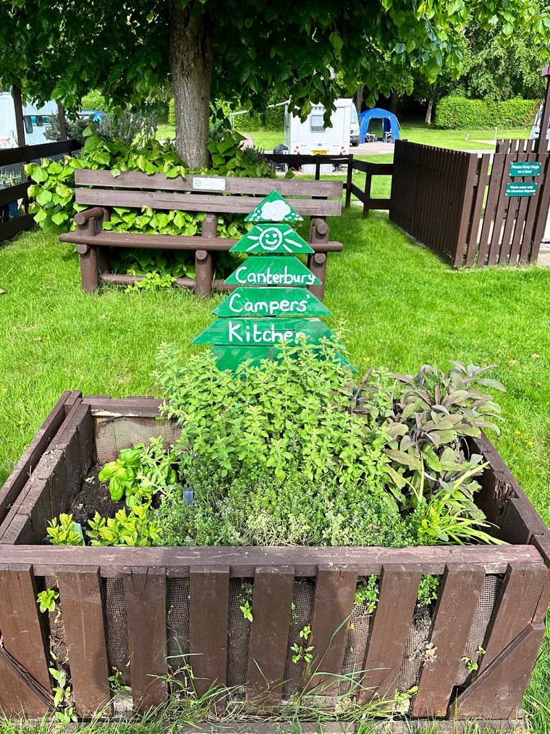
Canterbury Camping and Caravanning Club Site
Great and clean city camping. The bus takes you to the city center in a few minutes. We were lucky to get another place, it's fully booked due to the beginning of Springbreak Holiday'.
It has an adjacent forest where the dog can be groomed.
Bekesbourne Lane, CT3 4AB, Canterbury, Großbritannien
51° 16' 37.7" N 1° 6' 46.4" E
51.2771400 1.1128800
• Head southeast. Go for 53 m.
• Turn right. Go for 33 m.
• Turn right toward Bekesbourne Lane. Go for 99 m.
• Turn left onto Bekesbourne Lane. Go for 85 m.
• Turn left onto Littlebourne Road (A257). Go for 1.7 km.
• Take the 1st exit from St Augustines Roundabout roundabout onto Lower Chantry Lane (A257). Go for 239 m.
• Turn right onto St George's Place (A257). Go for 244 m.
• Take the 2nd exit from St Georges Roundabout roundabout onto Lower Bridge Street (A28) toward Margate/Ramsgate/Herne Bay/(A291). Go for 955 m.
• Take the 1st exit from Chaucer Roundabout roundabout onto Tourtel Road (A28) toward Margate/Herne Bay/(A291). Go for 205 m.
• Take the 1st exit from roundabout onto Northgate. Go for 123 m.
• Turn left onto New Ruttington Lane. Go for 47 m.
• Turn right onto Union Place. Go for 67 m.
• Turn right onto Victoria Row. Go for 39 m.
• Turn left onto Northgate. Go for 218 m.
• Continue on The Borough. Go for 109 m.
• Turn left onto Palace Street. Go for 118 m.
• Turn right onto St Alphege Lane. Go for 71 m.
• Turn left onto King Street. Go for 75 m.
• Continue on Best Lane. Go for 57 m.
• Arrive at Best Lane. Your destination is on the right.
☍
4,5 km
( 8 min.)
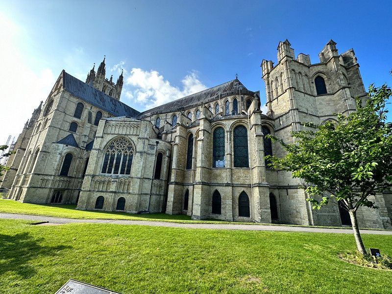
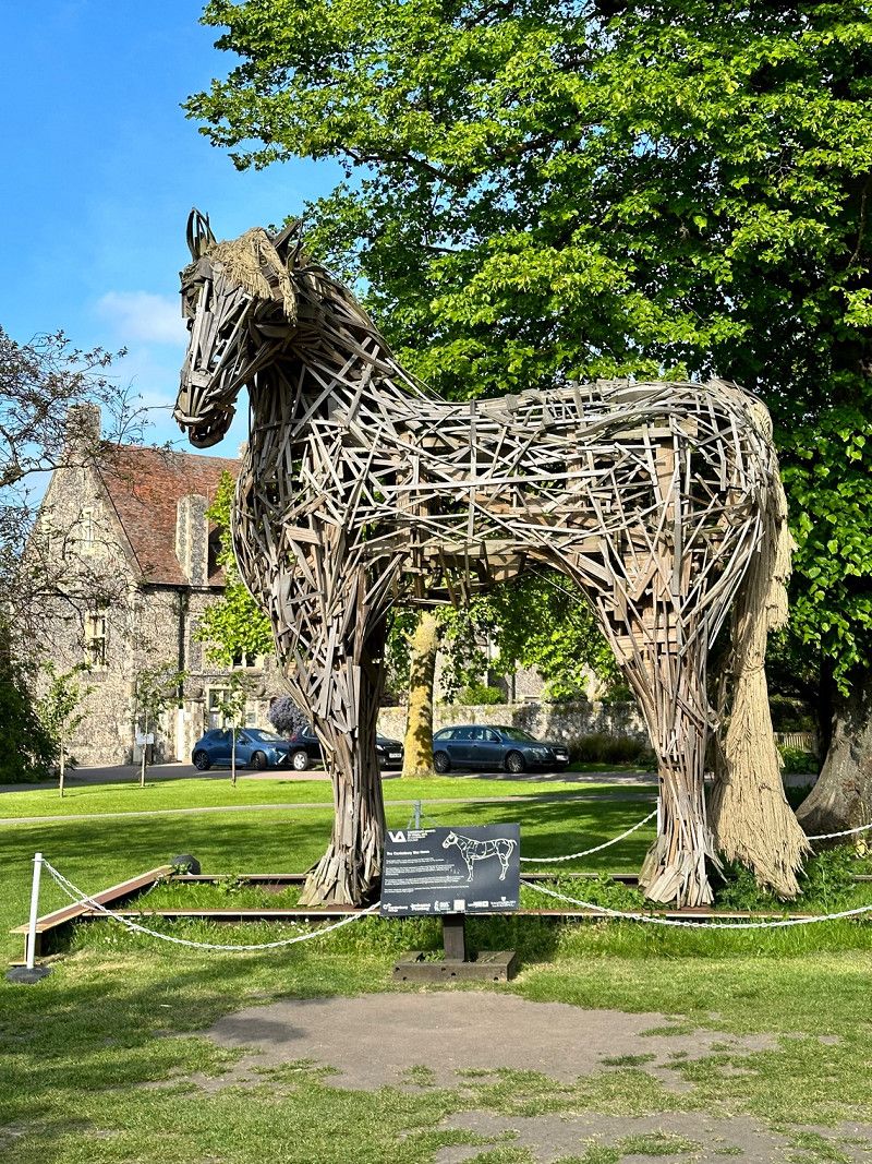
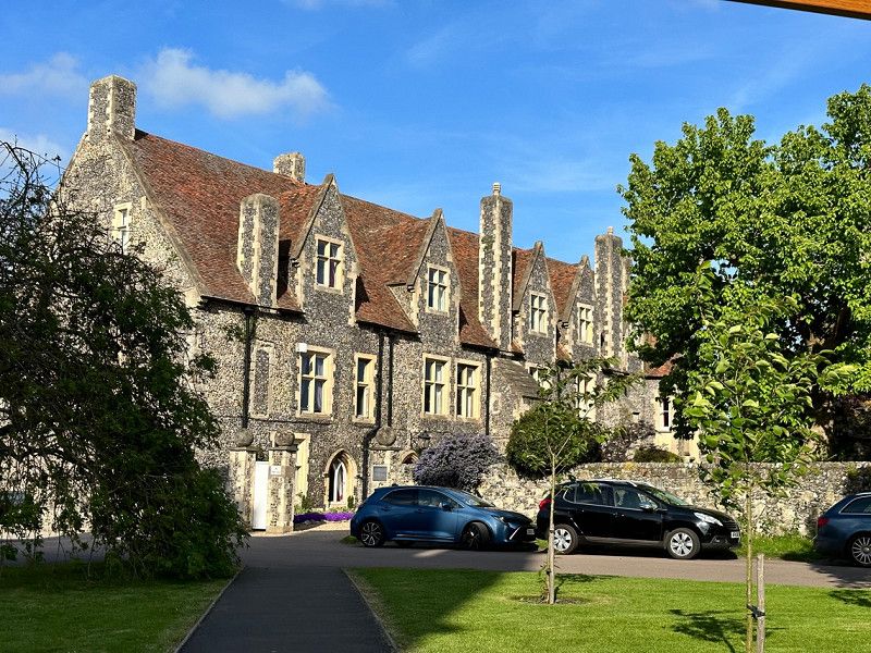
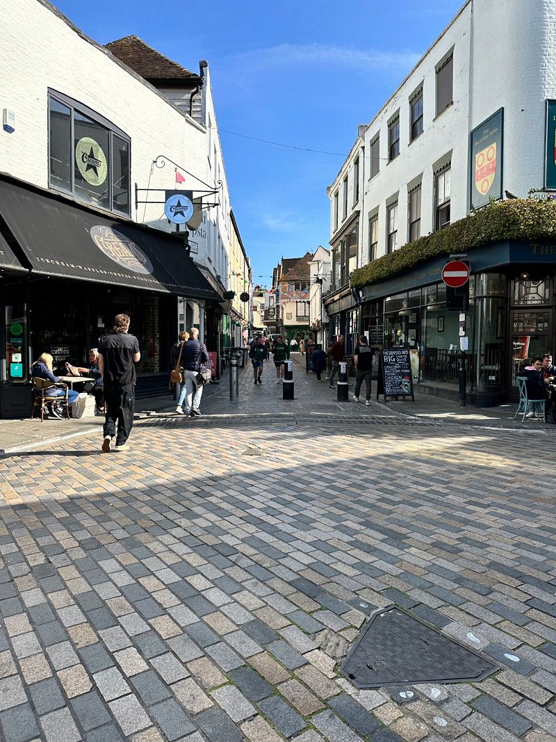
Canterbury, Vereinigtes Königreich
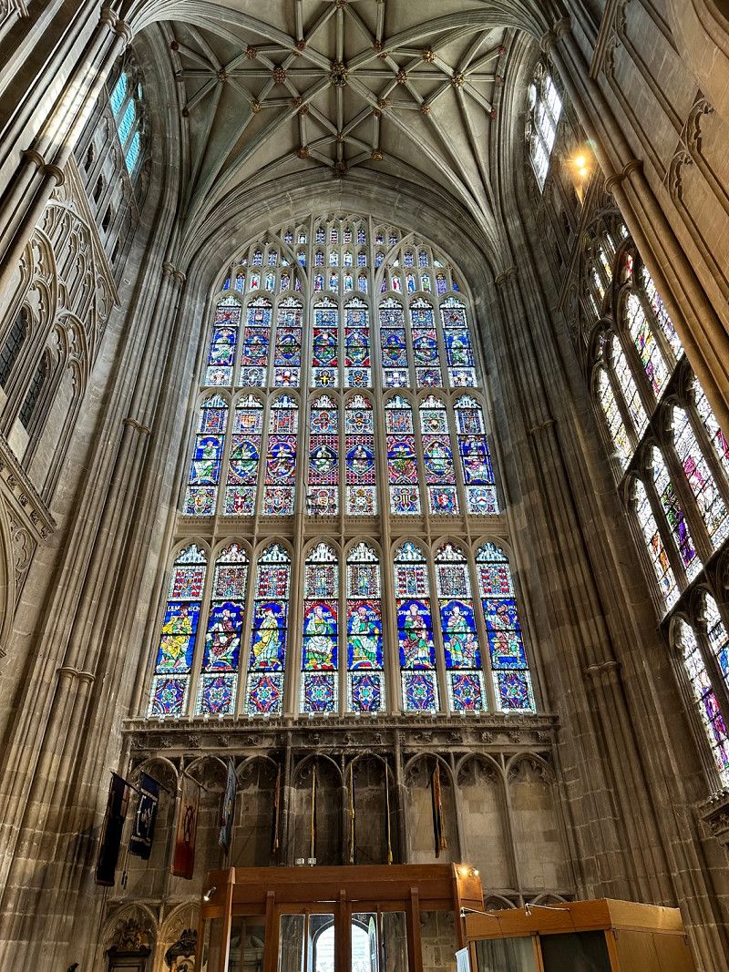
Before we go back to France tomorrow, we want to do a bit of shopping 🛍️. In Canterbury is a beautiful cathedral. When we visited, a mass was being sung by the choir. Beautiful 🤩
51° 16' 48.8" N 1° 4' 44.1" E
51.2802330 1.0789089
• Head southwest on Best Lane.
• Turn left. Go for 52 m.
• Turn left toward Orange Street. Go for 31 m.
• Turn right onto Orange Street. Go for 42 m.
• Turn left onto Palace Street. Go for 211 m.
• Turn right onto The Borough. Go for 109 m.
• Continue on Northgate. Go for 34 m.
• Turn right onto Broad Street. Go for 200 m.
• Turn left onto Military Road (A28). Go for 402 m.
• Take the 3rd exit from Chaucer Roundabout roundabout onto Military Road (A28) toward City Centre. Go for 957 m.
• Take the 1st exit from St Georges Roundabout roundabout onto St George's Place (A257) toward Sandwich/Dover/(A2). Go for 235 m.
• Continue on New Dover Road (A2050). Go for 789 m.
• Turn right onto St Lawrence Road (B2068). Go for 174 m.
• Turn left onto Old Dover Road (B2068). Go for 189 m.
• Turn right onto Nackington Road (B2068). Go for 20.4 km.
• Take the 1st exit from Westenhanger Intr roundabout toward Channel Tunnel/Folkestone/Dover. Go for 536 m.
• Continue on M20. Go for 2.6 km.
• Take exit 11A toward Channel Tunnel/Eurotunnel. Go for 2.1 km.
• Make a U-Turn. Go for 163 m.
• Continue on Boulevard D'Erlanger. Go for 200 m.
• Arrive at your destination on the left.
☍
29,4 km
( 29 min.)
Day
Folkestone Eurotunnel, Ashford Road, Folkestone, Vereinigtes Königreich
On the way back everything worked out and is well organized 😁 Only the duty-free area in Calais is better maintained and cleaner than in Folkstone.
Terminal, 8XX, Ashford Rd, Folkestone CT18 8XX, Vereinigtes Königreich
51° 5' 43.3" N 1° 7' 24.7" E
51.0953634 1.1235274
• Head northeast. Go for 1.9 km.
• Take the Channel Tunnel car shuttle train. Stay on for 58.6 km.
• Head southwest. Go for 144 m.
• Turn right toward Avenue de France. Go for 400 m.
• Continue on Avenue de France. Go for 367 m.
• Continue on Avenue de France. Go for 1.3 km.
• Take ramp onto A16 (Autoroute des Estuaires) toward Calais/Lille/Reims/A26/Paris/Bruxelles. Go for 1.1 km.
• Take exit 43 toward Calais-Centre/Coulogne/Guines/Blériot-Plage/Z.A. Eurocap. Go for 379 m.
• Take the 4th exit from roundabout onto A16 (Autoroute des Estuaires) toward Tunnel sous la Manche/Boulogne/Calais. Go for 1.3 km.
• Take exit 42 toward Tunnel S/S la Manche/Tunnel sous la Manche onto E15. Go for 1.1 km.
• Take the 2nd exit from roundabout. Go for 115 m.
• Arrive at your destination on the right.
☍
66,7 km
(1 hrs. 55 min.)
Calais Eurotunnel Arrival Point, Eurotunnel, Coquelles, Frankreich
Bienvenue en France 🤗
Channel Tunnel, 62231 Coquelles, Frankreich
50° 56' 10.8" N 1° 48' 53.9" E
50.9363300 1.8149714
• Head south. Go for 57 m.
• Continue on Lieu-dit Terminal de Coquelles. Go for 528 m.
• Take the 2nd exit from roundabout. Go for 562 m.
• Continue straight ahead. Go for 299 m.
• Turn right. Go for 27 m.
• Turn left. Go for 146 m.
• Turn right. Go for 103 m.
• Keep middle. Go for 222 m.
• Turn right toward Avenue de France. Go for 414 m.
• Continue on Avenue de France. Go for 367 m.
• Continue on Avenue de France. Go for 1.3 km.
• Take ramp onto A16 (Autoroute des Estuaires) toward Calais/Lille/Reims/A26/Paris/Bruxelles. Go for 6.1 km.
• Take the exit toward St Omer/Arras/Reims/Paris onto A26 (Autoroute des Anglais). Go for 263 km.
• Continue on E17. Go for 322 m.
• Take the exit onto A4 (Contournement Sud de Reims). Go for 37.6 km.
• Take exit 24 toward Châlons en Ch.-Centre/Vitry le François onto Échangeur de la Veuve. Go for 660 m.
• Turn right onto Échangeur de la Veuve toward D21/Châlons en Ch./Vitry-le-F./Reims/La Veuve. Go for 89 m.
• Continue on D21. Go for 534 m.
• Take ramp onto N44 toward Châlons en Ch./Vitry le F./Recy/Z.I. Châlons St Martin. Go for 17.1 km.
• Take the 3rd exit from roundabout onto N44 toward Nancy/Vitry le F./Pogny. Go for 24.1 km.
• Take the 2nd exit from roundabout onto N4 toward St Dizier/Nancy/Brienne le Ch./Vitry le P. Go for 104 km.
• Take left ramp onto A31 toward Nancy/Toul-Croix de Metz. Go for 19.0 km.
• Take the exit toward Lunéville/Strasbourg/Nancy-Brabois/Vandoeuvre onto A33. Go for 10.1 km.
• Take the exit toward Besançon/Épinal/Fléville/Ludres/Z.I. Ludres onto A330. Go for 4.9 km.
• Continue on N57. Go for 4.0 km.
• Take ramp onto D913 toward Vézelise/Colline de Sion-Vaudémont. Go for 2.0 km.
• Turn left onto D6 toward Lemainville/Benney. Go for 2.1 km.
• Continue on Rue de Nancy (D6). Go for 1.9 km.
• Continue on Faubourg Le Faubourg (D6). Go for 1.6 km.
• Continue on D6. Go for 571 m.
• Keep left onto Rue de l'Abbé Harmand (D6). Go for 2.4 km.
• Continue on Rue Général Gérard (D6). Go for 115 m.
• Continue on Rue Béatrix de Choiseul (D6). Go for 144 m.
• Continue on Place du Maréchal Bassonpierre (D6). Go for 129 m.
• Turn left onto Rue du Maréchal de Beauvais (D9). Go for 56 m.
• Arrive at Rue du Maréchal de Beauvau (D9). Your destination is on the right.
☍
507,0 km
(4 hrs. 54 min.)
L'Auberge d'Haroué, Place du Château, Haroué, Frankreich
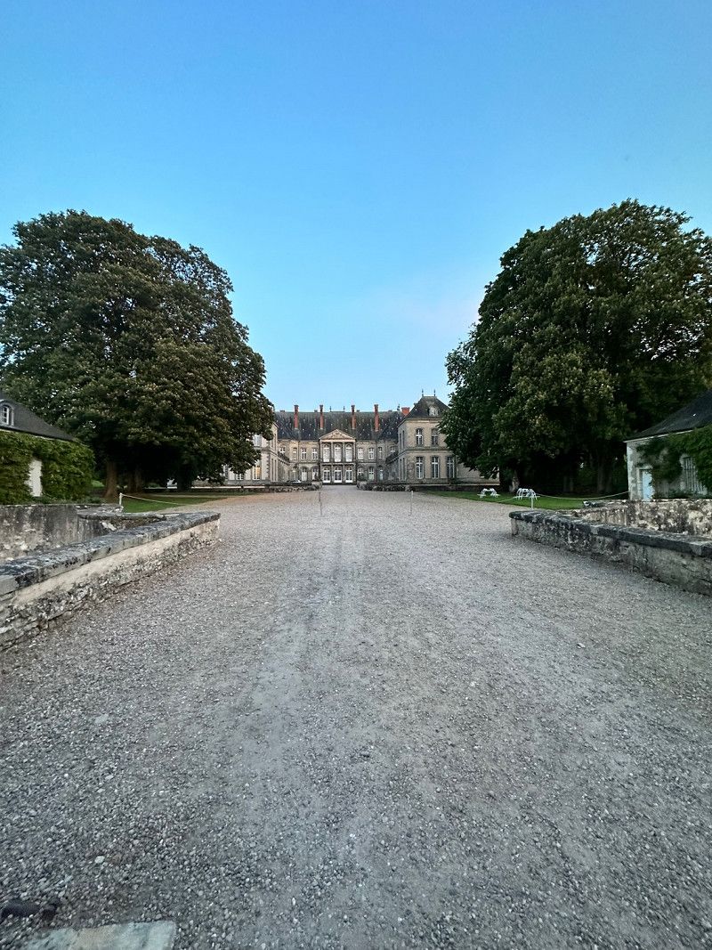
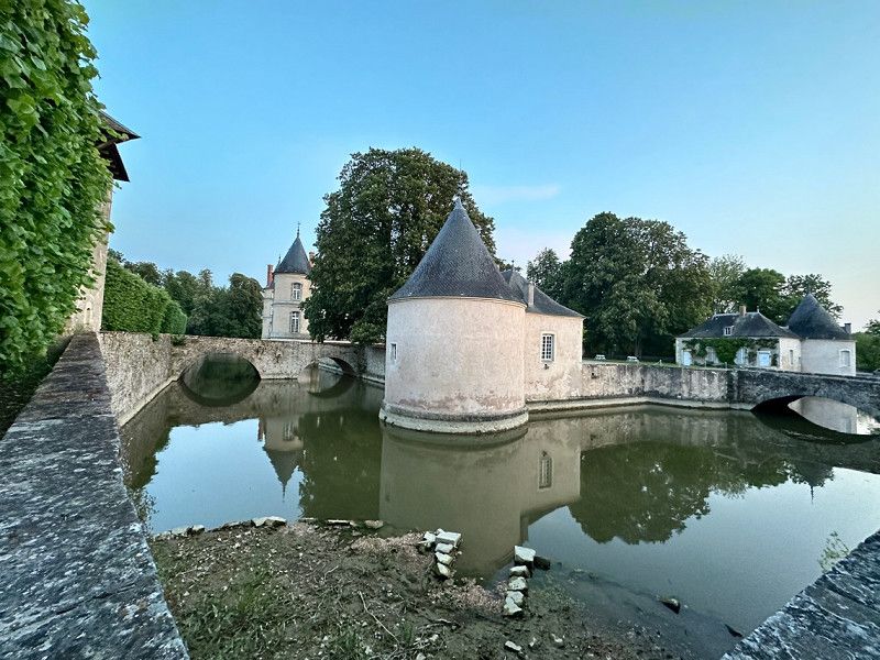
On the way home we still got hungry 😃 We are just off the motorway and discovered this cozy restaurant. Good regional cuisine with local products is served. The pork ragout in a mustard sauce with fresh vegetables (pluma de porc) was tender as butter. The restaurant is right next to the Château Haroué, which is also worth seeing.
6 Pl. du Château, 54740 Haroué, Frankreich
48° 28' 0.9" N 6° 10' 48.8" E
48.4669266 6.1802359
• Head toward Rue Boffrand on Rue du Maréchal de Beauvau (D9). Go for 5.3 km.
• Take ramp onto N57 toward Épinal/Charmes. Go for 62.8 km.
• Keep left onto N57 toward Vesoul/Besançon/Belfort/Remiremont/Plombières/St-Nabord-Fallières. Go for 36.0 km.
• Take the 4th exit from roundabout onto D64 toward Belfort/Vesoul/Besançon/Citers/Lure. Go for 11.9 km.
• Take the 2nd exit from roundabout onto Route de Luxeuil (D64) toward Belfort/Lure. Go for 226 m.
• Take the 4th exit from roundabout onto N19 toward Belfort/Lure-Est/Lure le Mortard. Go for 36.2 km.
• Keep left onto N19. Go for 9.4 km.
• Take the 1st exit from roundabout onto D19 toward Grandvillars/Morvillars. Go for 251 m.
• Take the 1st exit from roundabout onto D19. Go for 1.0 km.
• Pass 4 roundabouts and continue on Grande Rue (D19). Go for 4.3 km.
• Take the 2nd exit from roundabout onto Rue du Caporal Peugeot (D463). Go for 10.9 km.
• Turn left onto Rue du Grunenwald (D17 I). Go for 2.7 km.
• Turn left onto Grand Rue (D7 BIS). Go for 312 m.
• Turn right onto Rue de Largitzen (D17 I). Go for 1.6 km.
• Continue on Rue d'Ueberstrass (D17 I). Go for 758 m.
• Turn left onto Rue de Seppois (D17 II). Go for 311 m.
• Continue on Rue de Hirtzbach (D17 II). Go for 608 m.
• Continue on D17. Go for 1.5 km.
• Continue on Lieu-dit Granzele (D17). Go for 104 m.
• Continue on Route de Largitzen (D17). Go for 2.0 km.
• Continue on Rue du 21 Novembre (D17). Go for 508 m.
• Continue on Rue Principale (D17). Go for 560 m.
• Turn right onto Rue du Château (D258). Go for 54 m.
• Arrive at Rue du Château (D258). Your destination is on the left.
☍
189,3 km
(2 hrs. 10 min.)
Day
Hirtzbach, Frankreich
Finally we visit some friends before we finally go home tomorrow. 😃
68118 Hirtzbach, Frankreich
47° 35' 54.9" N 7° 13' 24.7" E
47.5985960 7.2235400
• Head southeast on Rue du Château (D258). Go for 244 m.
• Continue on D258. Go for 1.7 km.
• Continue on Rue Paul Lang (D258). Go for 689 m.
• Turn left onto Rue Raoul Lang (D258). Go for 155 m.
• Turn right onto Rue du Maréchal de Lattre de Tassigny (D432). Go for 325 m.
• Turn left toward Rue du Général de Gaulle/D432. Go for 41 m.
• Continue on Rue de Bettendorf (D9 B). Go for 6.5 km.
• Turn left onto Rue du 19 Novembre (D9 B). Go for 371 m.
• Take the 3rd exit from roundabout onto Rue du Maréchal Joffre (D9 B). Go for 485 m.
• Take the 1st exit from roundabout onto Rue de Waldighoffen (D9 B) toward Roppentzwiller/Durmenach/Leymen. Go for 4.4 km.
• Turn right onto Rue de Ferrette (D473). Go for 14 m.
• Turn left onto Rue de Fislis (D9 B) toward D9 BIS/Leymen/Oltingue/Linsdorf/Fislis. Go for 4.0 km.
• Turn right onto Lieu-dit Saint-Blaise (D21 B). Go for 19 m.
• Turn left onto D9 B. Go for 7.4 km.
• Turn left onto Rue Principale (D23). Go for 374 m.
• Continue on Rue de Benken (D23). Go for 1.0 km.
• Continue on Lieu-dit La Maison Rouge (D23). Go for 97 m.
• Continue on D23. Go for 833 m.
• Continue on Leymenstrasse. Go for 668 m.
• Turn left onto Therwilerstrasse. Go for 432 m.
• Turn left onto Eichgasse. Go for 365 m.
• Arrive at Eichgasse. Your destination is on the right.
☍
30,1 km
( 36 min.)
Day
Biel-Benken, Schweiz
At home 🏠 It was a great trip with many impressions and experiences. We are happy if we could inspire someone. We will definitely travel to this area again. We especially liked the English, with their friendly and polite manner. You quickly start talking about this and that. Nature is so beautiful and those who like hiking will get their money's worth.
4105 Biel-Benken, Schweiz
47° 30' 22.6" N 7° 31' 31.9" E
47.5062720 7.5255321