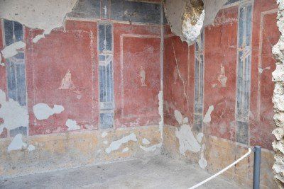
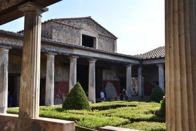
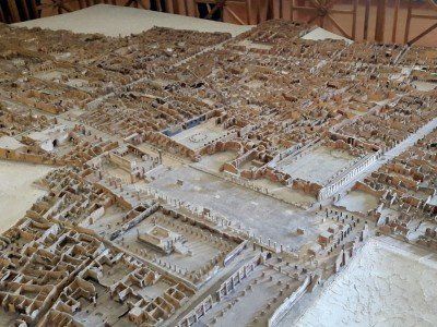
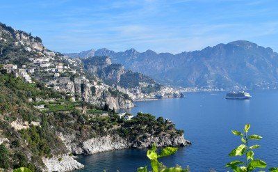
3,500 km south on the Adriatic (Gargano, Trani) to the trulli in Alberobello. Then to the Ionian Sea with the most beautiful sandy beaches (Lido di Metaponto). Over the mountains to the Tyrrhenian Sea to Maratea, Castellabate and on to the Amalfi Coast and Sorrento. Stunning Greek (Paestum) and Roman (Pompei and Archaeological Museum in Naples) culture. Return via Sabaudia and Lake Trasimeno.
Day
Sissach, Schweiz
47° 27' 51.8" N 7° 48' 38.4" E
47.4643945 7.8106610
• Head toward Rheinfelderstrasse on Hauptstrasse. Go for 839 m.
• Continue on Netzenstrasse. Go for 176 m.
• Take the 2nd exit from roundabout onto Netzenstrasse. Go for 108 m.
• Take the 3rd exit from roundabout onto A22 toward Liestal/Luzern/Bern/Zürich/Basel. Go for 91 m.
• Take ramp onto A2 toward Luzern/Bern. Go for 19.3 km.
• Take the left exit toward Chiasso/Gotthard/Luzern/Zürich/Rothrist onto A1/A2. Go for 8.8 km.
• Take exit 47 toward Chiasso/Gotthard/Luzern/Reiden onto A2 (Verzweigung Wiggertal). Go for 237 km.
• Continue on A9 (Autostrada dei Laghi). Go for 31.0 km.
• Take the left exit onto A8 (Autostrada dei Laghi). Go for 5.1 km.
• Take the exit toward E64/Torino/A4/Genova/A7/Bologna/A1 onto A50 (Tangenziale Ovest). Go for 32.1 km.
• Continue on A1 (Autostrada del Sole). Go for 183 km.
• Keep right onto A14 (Autostrada Adriatica) toward Ancona/Ravenna/Padova/A13/Tangenziale/Bologna Borgo Panigale/Bologna Centro/Aeroporto Bologna/Fiera Bologna. Go for 174 km.
• Take the exit toward Fano/Fano Centro. Go for 1.2 km.
• Take the 1st exit from roundabout onto Strada Statale di Bocca Trabaria (SS73bis) toward Fano. Go for 1.7 km.
• Take the 2nd exit from roundabout onto Via Papiria toward Centro. Go for 696 m.
• Continue on Via 4 Novembre. Go for 574 m.
• Arrive at Via Monte Grappa.
☍
695,3 km
(6 hrs. 30 min.)
Fano, Italien
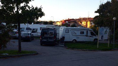
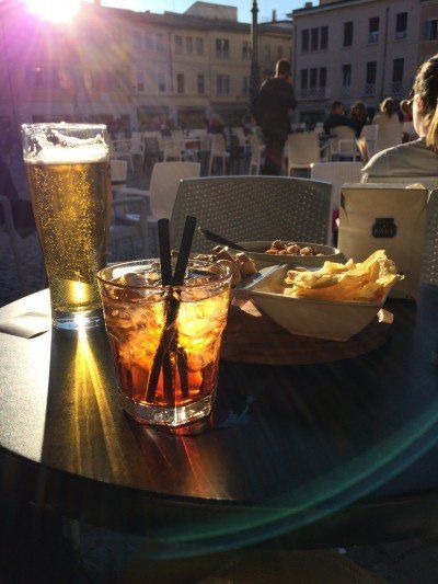
comfortably through the Gotthard tunnel, via Milano, Bologna, Rimini to Fano on the Adriatic. First aperitif riche on the piazza. Free camper parking in viale Kennedy, very quiet and close to the center.
43° 50' 23.3" N 13° 1' 9.9" E
43.8398164 13.0194201
• Head east on Via Monte Grappa. Go for 12 m.
• Take the 3rd exit from roundabout onto Viale Antonio Gramsci (SS16) toward Pesaro/Autostrada/A14. Go for 589 m.
• Take the 2nd exit from roundabout onto Via Roma toward Autostrada/A14/Flaminia/SP3/Roma/SS73bis. Go for 194 m.
• Take the 2nd exit from roundabout onto Via Roma toward Autostrada/A14/Roma/SS73bis. Go for 665 m.
• Take the 3rd exit from roundabout onto Via Sandro Pertini toward Autostrada/A14/Ancona/SS16/Roma/SS73bis. Go for 381 m.
• Take the 2nd exit from roundabout onto Via Sandro Pertini toward Autostrada/A14/Ancona/SS16/Roma/SS73bis. Go for 464 m.
• Continue on Via Bellandra. Go for 70 m.
• Take the 2nd exit from roundabout onto Strada Statale di Bocca Trabaria (SS73bis) toward Autostrada/A14/Urbino/Roma/Perugia/Gubbio. Go for 709 m.
• Take ramp toward Bologna/E55/Taranto/A14/Flaminia/SP3/Bellocchi. Go for 599 m.
• Take the 3rd exit from roundabout onto A14 (Autostrada Adriatica) toward Ancona. Go for 336 km.
• Take the exit toward Poggio Imperiale/Lesina. Go for 897 m.
• Take the 2nd exit from roundabout onto Strada Scorrimento Veloce del Gargano toward Poggio I.-Rodi G./Peschici-Vieste. Go for 21.2 km.
• Take ramp onto Strada Provinciale Sannicandro Torre Mileto (SP41) toward Sannicandro. Go for 28.1 km.
• Continue on SP41. Go for 26 m.
• Continue on Strada Provinciale Sannicandro Torre Mileto (SP41). Go for 999 m.
• Turn left onto SS89. Go for 992 m.
• Continue on Strada Provinciale San Severo Rodi (SS89). Go for 2.6 km.
• Continue on Corso Madonna della Libera (SS89). Go for 637 m.
• Turn right onto Vico 5 Madonna della Libera. Go for 29 m.
• Turn left onto Corso Ruggero Bonghi. Go for 192 m.
• Turn right onto Via Carmine Grossi (SS89). Go for 83 m.
• Turn left onto Via 20 Settembre (SS89). Go for 387 m.
• Turn right onto Via Trieste (SS89). Go for 291 m.
• Continue on Via Pineta Marzini (SS89). Go for 1.7 km.
• Continue on SS89. Go for 2.3 km.
• Continue on Via Lungomare Andrea Pazienza (SS89). Go for 1.1 km.
• Continue on Via Pineta Marzini (SS89). Go for 1.2 km.
• Continue on SS89. Go for 6.8 km.
• Turn left onto SS89. Go for 373 m.
• Turn left. Go for 115 m.
• Turn left. Go for 50 m.
• Arrive at your destination on the left.
☍
409,4 km
(4 hrs. 11 min.)
Day
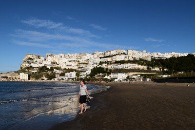
Peschici, Gargano, Italien
Campeggio Bellariva Baia di Peschici directly on the beach in front of a picturesque village (18€).
Loc. Baia di Peschici, 71010, Peschici, Italien
41° 56' 43.8" N 16° 0' 23" E
41.9455000 16.0064000
• Head southwest. Go for 50 m.
• Turn right toward SS89. Go for 115 m.
• Turn left onto SS89. Go for 2.2 km.
• Take the 1st exit from roundabout onto SS89 toward Vieste/Mattinata/Manfredonia. Go for 10.5 km.
• Continue on Cascina Mandrione (SS89). Go for 266 m.
• Continue on SS89. Go for 8.8 km.
• Continue on Località Pietà toward Centro/Peschici Litoranea. Go for 20 m.
• Continue on Via Dante Alighieri. Go for 1.0 km.
• Continue on Via Guglielmo Marconi. Go for 41 m.
• Take the 3rd exit from roundabout onto Via Guglielmo Marconi. Go for 242 m.
• Turn left onto Via Madonna della Libera toward Centro. Go for 251 m.
• Turn left onto Viale 24 Maggio. Go for 21 m.
• Turn right onto Via Milano. Go for 11 m.
• Arrive at Via Milano. Your destination is on the right.
☍
23,5 km
( 29 min.)
Day
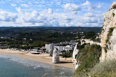
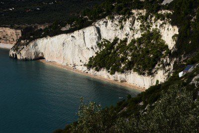
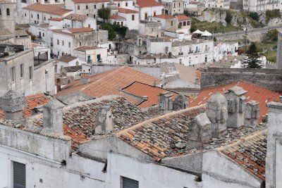
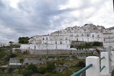
Vieste, Gargano, Italien
Main town on the eastern tip of Gargano/Puglia
41° 52' 56.9" N 16° 10' 36.3" E
41.8824764 16.1767489
• Head toward Via Papa Giovanni XXIII on Via Milano. Go for 43 m.
• Turn left onto Via Papa Giovanni XXIII. Go for 33 m.
• Turn right onto Via Trieste. Go for 75 m.
• Turn right onto Via Santa Maria di Merino. Go for 34 m.
• Turn right onto Via Vittorio Veneto. Go for 106 m.
• Turn right onto Viale 24 Maggio. Go for 300 m.
• Take the 4th exit from roundabout onto Via Guglielmo Marconi. Go for 254 m.
• Continue on Lungomare Enrico Mattei toward Mattinata/Litoranea/Autostrada. Go for 31.3 km.
• Continue on SS89. Go for 36 m.
• Turn left onto Strada Provinciale Mattinata Vieste (SP53). Go for 9.0 km.
• Keep left toward SP53. Go for 44 m.
• Turn left onto SP53. Go for 586 m.
• Arrive at SP53.
☍
41,9 km
( 52 min.)
Day
Mattinata, Foggia, Gargano, Italien
Sosta Camper da Francesco: small, privately run campsite right on the pebble beach in the middle of the olive trees
41° 42' 26.8" N 16° 3' 11.6" E
41.7074400 16.0532300
• Head toward Via San Michele Arcangelo on SP53. Go for 1.3 km.
• Continue on SS89. Go for 7.6 km.
• Take the 1st exit from roundabout onto SS89 toward Monte S.Angelo. Go for 431 m.
• Take ramp onto Via Crocifisso (SP55) toward Monte S.Angelo. Go for 8.2 km.
• Continue on Via Don Luigi Sturzo (SP55). Go for 1.3 km.
• Take the 3rd exit from roundabout onto Via Giuseppe Palladino (SS89dir1). Go for 29 m.
• Turn right onto Via Giosuè Carducci. Go for 318 m.
• Turn right onto Via Campo dei Fiori. Go for 60 m.
• Turn left onto Via D. Manfredi. Go for 158 m.
• Continue on Via Giovanni Tancredi. Go for 103 m.
• Continue on Corso Vittorio Emanuele. Go for 123 m.
• Turn right onto Corso Vittorio Emanuele. Go for 139 m.
• Turn right onto Via Carbonara. Go for 29 m.
• Turn left onto Via Estramurale. Go for 736 m.
• Turn right onto SS272. Go for 5.3 km.
• Turn right onto SS528 toward Vieste/Vico del Gargano. Go for 117 m.
• Continue on Strada Statale della Foresta Umbra (SS528). Go for 3.4 km.
• Arrive at Strada Statale della Foresta Umbra (SS528). Your destination is on the right.
☍
29,2 km
( 33 min.)
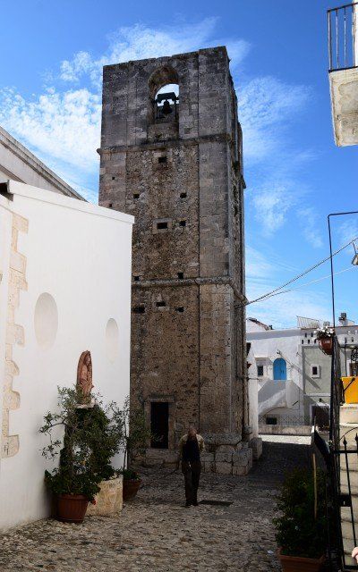
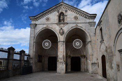
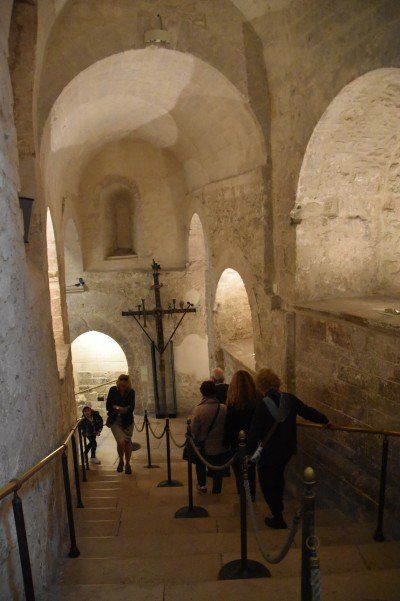
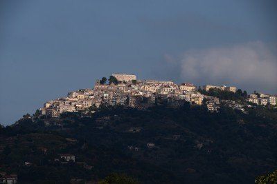
Monte Sant'Angelo, Italien
Place of pilgrimage in the mountains with a chapel deep in the rock below the church
41° 43' 30.8" N 15° 56' 47.4" E
41.7252303 15.9464874
• Head toward Località Carbonara on Strada Statale della Foresta Umbra (SS528). Go for 3.4 km.
• Continue on SS528. Go for 117 m.
• Turn right onto SS272 toward Foggia/S.Severo/S.Marco in Lamis/S.Giovanni. Go for 7.0 km.
• Continue on Strada Statale Monte Sant'Angelo (SS272). Go for 113 m.
• Turn left onto Strada Provinciale Scaloria (SP57). Go for 138 m.
• Continue on SP57. Go for 2.0 km.
• Continue on Strada Provinciale Scaloria (SP57). Go for 1.1 km.
• Continue on SP57. Go for 202 m.
• Continue on Strada Provinciale Scaloria (SP57). Go for 11.3 km.
• Continue on Strada Provinciale Scaloria (SP57). Go for 853 m.
• Continue toward S.Giovanni R. Go for 19 m.
• Turn right onto Viale Padre Pio da Pietralcina (SP58) toward S.Giovanni R. Go for 1.5 km.
• Keep left onto SP58 toward S.Giovanni. Go for 183 m.
• Take left ramp onto SS89 toward Foggia/Bologna/Bari/A14. Go for 4.7 km.
• Take ramp onto SS89 toward Manfredonia Sud. Go for 1.7 km.
• Turn right onto SP141. Go for 8.3 km.
• Take the 2nd exit from roundabout onto SP141. Go for 5.0 km.
• Turn right onto Strada Statale Rivolese (SS545) toward Autostrade/Cerignola/Foggia. Go for 12.2 km.
• Pass 2 roundabouts and continue on Strada Statale Rivolese (SS545). Go for 7.0 km.
• Take ramp onto A14 (Autostrada Adriatica) toward Bari. Go for 21.6 km.
• Take the exit toward Canosa onto SS93. Go for 827 m.
• Take ramp toward Minervino/SR6/Spinazzola. Go for 792 m.
• Continue on SR6. Go for 5.1 km.
• Take ramp onto SS98 (SP231). Go for 3.5 km.
• Take the 1st exit from roundabout onto SP149. Go for 1.7 km.
• Continue on Viale dei Condottieri (SP149). Go for 421 m.
• Continue on SP149. Go for 2.5 km.
• Continue on Contrada Iazzo Nuovo (SP149). Go for 3.2 km.
• Continue on Contrada Lama di Corvo (SP149). Go for 1.3 km.
• Continue on SP149. Go for 8.2 km.
• Continue on Contrada Piano di Citulo (SP149). Go for 1.6 km.
• Turn left onto SP234. Go for 4.2 km.
• Turn left onto SS170dir A. Go for 1.0 km.
• Turn left onto Via Castel del Monte (SP234a). Go for 861 m.
• Arrive at Via Castel del Monte (SP234a). Your destination is on the left.
☍
123,4 km
(1 hrs. 31 min.)
Day
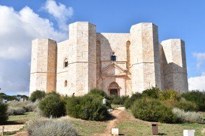
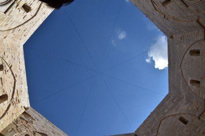
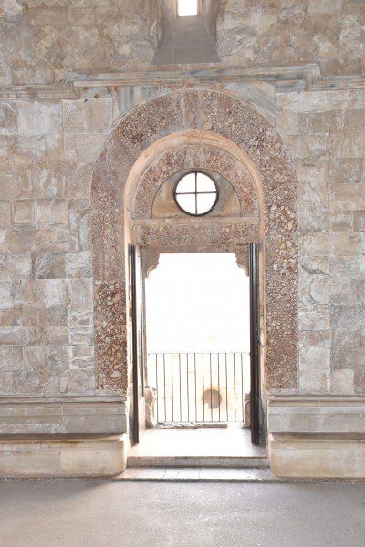
Castel del Monte, Andria, Italien
Octagonal fortress with 8 towers built by Staufer Emperor Frederick II somewhere in no man's land
41° 5' 5.2" N 16° 16' 14.3" E
41.0847777 16.2706484
• Head north on Via Castel del Monte (SP234a). Go for 861 m.
• Turn left onto SS170dir A. Go for 14.1 km.
• Turn right toward SS98/SP231. Go for 124 m.
• Turn left and take ramp onto SS98 (SP231) toward Bari/A14/Corato. Go for 2.9 km.
• Take ramp onto Tangenziale Andria-Barletta toward Andria Centro/Autostrade/Trani/SP130/Barletta/SS170dir/Bisceglie/SP13. Go for 6.4 km.
• Take the 2nd exit from roundabout onto Tangenziale Andria-Barletta toward Napoli/A16/Barletta/SS128. Go for 867 m.
• Continue toward Barletta. Go for 74 m.
• Take ramp onto SS170dir toward Barletta/SS16bis. Go for 6.0 km.
• Turn slightly left onto SS170dir toward Autostrade/Andria/Foggia. Go for 983 m.
• Take the 2nd exit from roundabout onto Via Andria. Go for 698 m.
• Continue toward Corso Camillo Benso di Cavour. Go for 32 m.
• Take the 3rd exit from Piazza Fratelli Cervi roundabout onto Corso Camillo Benso di Cavour. Go for 470 m.
• Arrive at Corso Camillo Benso di Cavour. Your destination is on the left.
☍
33,6 km
( 29 min.)
Barletta, Italien
41° 19' 10.8" N 16° 17' 1.8" E
41.3196635 16.2838207
• Head toward Via dei Greci on Corso Camillo Benso di Cavour. Go for 420 m.
• Take the 3rd exit from Piazza Fratelli Cervi roundabout onto Piazza Fratelli Cervi. Go for 132 m.
• Continue on Via Trani. Go for 175 m.
• Pass 2 roundabouts and continue on Via Barletta. Go for 10.9 km.
• Turn right onto Piazza Indipendenza. Go for 12 m.
• Turn left onto Piazza Indipendenza. Go for 81 m.
• Continue on Corso Vittorio Emanuele II. Go for 184 m.
• Turn left onto Piazza Giuliano Gradenigo. Go for 79 m.
• Continue on Via Fra' Diego Alvarez. Go for 78 m.
• Turn right onto Via Mario Pagano. Go for 110 m.
• Continue on Piazza Ferdinando Lambert. Go for 40 m.
• Continue on Piazza Giuseppe Mazzini. Go for 60 m.
• Continue on Piazza Guglielmo Marconi. Go for 65 m.
• Continue on Via Mario Pagano. Go for 139 m.
• Arrive at Via Mario Pagano. Your destination is on the right.
☍
12,5 km
( 13 min.)
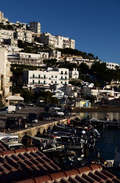
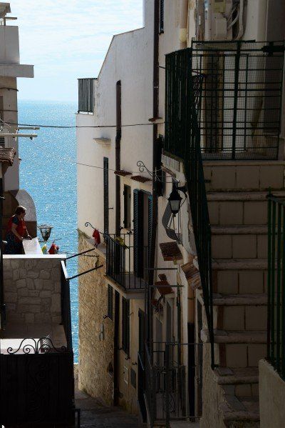
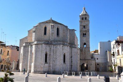
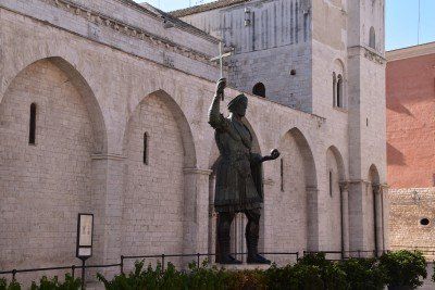
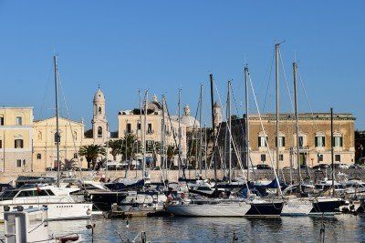
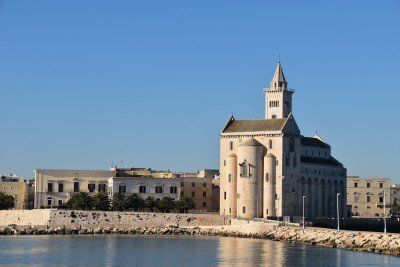
Trani, Italien
very beautiful old town with cathedral and castle, fishing port, old houses, idyllic
Parking directly at the Castello
41° 16' 38.9" N 16° 25' 4.2" E
41.2774857 16.4178334
• Head toward Via Gabriele D'Annunzio on Via Mario Pagano. Go for 150 m.
• Continue on Piazza Libertà. Go for 55 m.
• Continue on Via Aldo Moro. Go for 129 m.
• Continue on Via Aldo Moro. Go for 291 m.
• Turn right onto Corso Matteo Renato Imbriani. Go for 220 m.
• Turn left onto Via Istria toward Ospedale/A14/Bari-Foggia/SS16. Go for 111 m.
• Continue on Via Giuseppe Verdi. Go for 116 m.
• Turn right onto Viale delle Forze Armate toward Corato/Autostrada. Go for 758 m.
• Take the 2nd exit from roundabout onto Viale delle Forze Armate toward Corato/Bari-Foggia/A14. Go for 150 m.
• Continue on Via Beato Annibale Maria di Francia (SP12). Go for 1.3 km.
• Continue on Strada Provinciale di Altamura (SP238). Go for 3.8 km.
• Take ramp onto A14 (Autostrada Adriatica) toward Pescara/Taranto/A16/E842/Napoli/Bari. Go for 59.4 km.
• Take the exit toward Acquaviva delle Fonti/Turi/Putignano/Castellana Grotte/Conversano/Casamassima/Rutigliano/Sammichele di Bari. Go for 982 m.
• Turn slightly left onto Strada Provinciale Acquaviva delle Fonti-Sammichele (SP125). Go for 6.3 km.
• Turn right onto Via Vito Donato Bianco. Go for 908 m.
• Take the 2nd exit from roundabout toward Turi/Putignano. Go for 788 m.
• Continue on Strada Provinciale Putignano-Sammichele di Bari (SP58). Go for 4.0 km.
• Continue toward Strada Provinciale Putignano-Sammichele di Bari/SP58. Go for 42 m.
• Take the 2nd exit from roundabout onto Strada Provinciale Putignano-Sammichele di Bari (SP58) toward Putignano. Go for 8.8 km.
• Turn sharp right onto Strada Provinciale Gioia del Colle-Putignano (SP106). Go for 689 m.
• Turn sharp left. Go for 252 m.
• Arrive at your destination on the right.
☍
89,2 km
( 55 min.)
Day
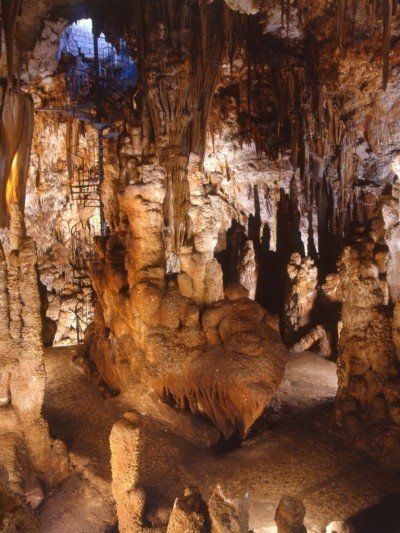
Putignano, Italien
Grotta del Trullo: beautiful little stalactite cave; Access via iron spiral staircase
40° 50' 37.7" N 17° 5' 21.8" E
40.8438073 17.0893798
• Head west. Go for 204 m.
• Turn sharp right onto Strada Provinciale Gioia del Colle-Putignano (SP106). Go for 741 m.
• Continue on Strada Provinciale Putignano-Sammichele di Bari (SP58). Go for 1.8 km.
• Continue on Via Noci. Go for 312 m.
• Continue on SS377. Go for 360 m.
• Take the 2nd exit from roundabout onto Strada Provinciale delle Grotte (SP237). Go for 7.3 km.
• Continue on Strada Provinciale di Alberobello (SS377). Go for 10.4 km.
• Turn right onto Via 7 Liberatori della Selva (SS604) toward Mottola/Taranto/Monopoli/Bari. Go for 195 m.
• Take the 3rd exit from roundabout onto Via Giuseppe Capecelatro. Go for 334 m.
• Continue on Via Don Francesco Gigante. Go for 30 m.
• Take the 1st exit from roundabout onto Via Don Francesco Gigante. Go for 215 m.
• Turn right. Go for 20 m.
• Turn left. Go for 64 m.
• Arrive at your destination on the left.
☍
21,9 km
( 18 min.)
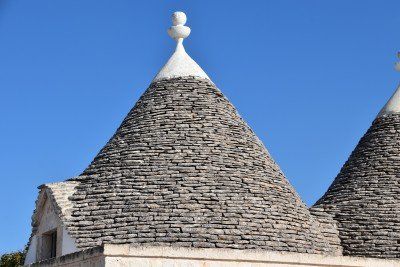
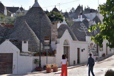
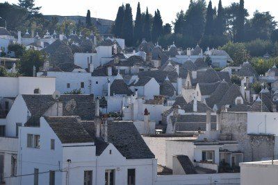
Alberobello, Italien
that's only here: a whole town with these trulli houses: white with round peaked roofs made of gray field stones. Sosta Camper right next to the Trulli district.
Via Cadore 2, 70011, Alberobello, Italien
40° 46' 58" N 17° 14' 2" E
40.7827778 17.2338889
• Head south. Go for 38 m.
• Turn right toward Via Don Francesco Gigante. Go for 132 m.
• Turn left onto Via Don Francesco Gigante. Go for 35 m.
• Turn right onto Largo Michelangelo la Sorte. Go for 112 m.
• Turn right onto Via Alessandro Manzoni. Go for 65 m.
• Turn left onto Via Barsento. Go for 113 m.
• Take the 3rd exit from roundabout onto Via Ernesto Acquaviva. Go for 189 m.
• Take the 2nd exit from roundabout onto Via Vaccari. Go for 301 m.
• Continue on Strada Provinciale di Alberobello (SP239) toward Autostrada/A14/Noci. Go for 10.4 km.
• Continue on Strada Provinciale delle Grotte (SP237). Go for 133 m.
• Take ramp onto Via per Mottola toward Mottola/SP237. Go for 399 m.
• Continue on Strada Provinciale delle Grotte (SP237). Go for 1.2 km.
• Take the 3rd exit from roundabout onto Strada Provinciale delle Grotte (SP237). Go for 6.7 km.
• Continue on SS377. Go for 10.2 km.
• Take ramp onto SS100 toward Taranto. Go for 6.0 km.
• Take ramp onto Via Appia (SS7) toward Palagiano/Matera/Reggio C./SS106. Go for 2.3 km.
• Continue on Strada Statale Jonica (SS106dir). Go for 6.5 km.
• Take ramp toward Reggio C./SS106. Go for 169 m.
• Take the 3rd exit from roundabout toward Reggio C. Go for 88 m.
• Take ramp onto Strada Statale Jonica (SS106). Go for 29.6 km.
• Take ramp onto Strada Statale Basentana (SS407) toward Metaponto. Go for 316 m.
• Keep left onto Strada Provinciale Bernalda-Metaponto toward Metaponto. Go for 2.2 km.
• Take the 2nd exit from roundabout onto Strada Provinciale Bernalda-Metaponto. Go for 676 m.
• Turn sharp right toward Contrada Torremare. Go for 1.9 km.
• Continue on Contrada Torremare. Go for 395 m.
• Turn sharp left onto Contrada Torremare. Go for 486 m.
• Take the 2nd exit from roundabout. Go for 1.0 km.
• Turn right onto Strada Provinciale Bernalda-Metaponto. Go for 583 m.
• Turn slightly right onto Viale Magna Grecia. Go for 136 m.
• Take the 2nd exit from roundabout onto Viale Magna Grecia. Go for 196 m.
• Arrive at Viale Magna Grecia.
☍
82,5 km
(1 hrs. 6 min.)
Day
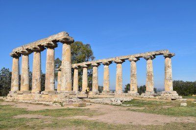
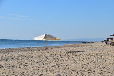
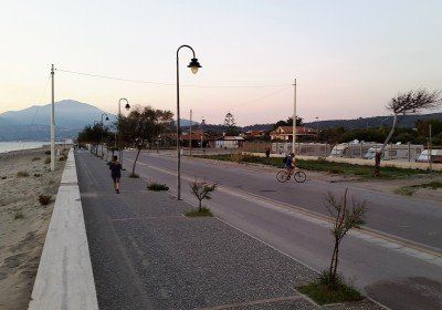
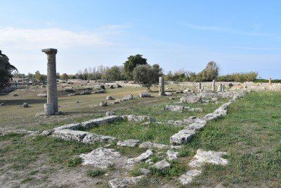
Lido di Metaponto: Campeggio Internazionale
miles of sandy beach, but extinct "resort". Small campsite with very friendly brothers. Greek temple complex with Hera temple
Magna Grecia, 75010, Lido di Metaponto, Italien
40° 21' 34.9" N 16° 50' 3.1" E
40.3597000 16.8342000
• Head southwest on Viale Magna Grecia. Go for 50 m.
• Turn right onto Viale Leucippo. Go for 65 m.
• Turn right onto Viale Esara. Go for 98 m.
• Turn right onto Viale Pitagora. Go for 60 m.
• Turn left onto Viale Magna Grecia. Go for 122 m.
• Take the 3rd exit from roundabout onto Viale Magna Grecia. Go for 177 m.
• Turn slightly left toward Strada Provinciale Bernalda-Metaponto. Go for 79 m.
• Continue on Strada Provinciale Bernalda-Metaponto. Go for 658 m.
• Take the 2nd exit from roundabout onto Strada Provinciale Bernalda-Metaponto. Go for 1.3 km.
• Continue toward Strada Provinciale Bernalda-Metaponto. Go for 34 m.
• Take the 2nd exit from roundabout onto Strada Provinciale Bernalda-Metaponto. Go for 199 m.
• Continue on Strada Provinciale Bernalda-Metaponto. Go for 2.0 km.
• Continue on Strada Statale Basentana (SS407). Go for 97 m.
• Take ramp onto Strada Statale Jonica (SS106) toward Reggio C./A3. Go for 26.3 km.
• Take ramp toward Sinnica/SS653. Go for 273 m.
• Keep right toward Valsinni. Go for 194 m.
• Continue on Strada Statale Sinnica (SS653). Go for 81.6 km.
• Take the 2nd exit from roundabout toward Lauria/SS19. Go for 2.3 km.
• Turn left onto Contrada Pecorone (SS19). Go for 3.9 km.
• Turn right toward Strada Provinciale Tirrena/SP3. Go for 20 m.
• Turn right onto Strada Provinciale Tirrena (SP3). Go for 1.8 km.
• Continue on Contrada San Paolo. Go for 395 m.
• Continue on Contrada Catania. Go for 1.7 km.
• Turn right onto Via Fontana (SP3). Go for 524 m.
• Turn left toward Contrada Carroso. Go for 183 m.
• Continue on Contrada Carroso. Go for 907 m.
• Take the 1st exit from roundabout onto Bretella Lauria-Fondovalle. Go for 3.2 km.
• Take left ramp onto Strada Statale Fondo Valle Noce (SS585). Go for 13.0 km.
• Take ramp toward Sapri/Maratea Sud/Praia a Mare/Tortora/Scalea/Castrocucco di Maratea. Go for 267 m.
• Continue on SS18 toward Praia a Mare/Tortora/Scalea/Castrocucco di Maratea. Go for 108 m.
• Continue on Via del Mare. Go for 1.5 km.
• Turn right onto Via del Mare. Go for 855 m.
• Arrive at Via del Mare. Your destination is on the left.
☍
144,0 km
(1 hrs. 48 min.)
Day
Day
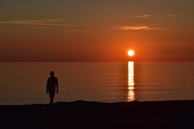
Lido Noleggio Castrocucco di Maratea, Italien
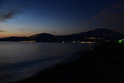
black sandy beach, hardly any people; Overnight stay right on the beach with a great sunset!!
39° 55' 60" N 15° 45' 6.8" E
39.9333270 15.7519010
• Head northwest on Via del Mare. Go for 6 m.
• Turn right toward Via San Gerardo Maiella. Go for 448 m.
• Continue on Via San Gerardo Maiella. Go for 293 m.
• Continue toward SS18. Go for 276 m.
• Turn right onto SS18. Go for 788 m.
• Turn left toward E45/A3/Salerno/Reggio C./Lagonegro/Potenza. Go for 168 m.
• Take ramp onto Strada Statale Fondo Valle Noce (SS585). Go for 9.2 km.
• Turn left onto Strada Provinciale del Noce (SP44). Go for 5.7 km.
• Turn right onto Piazza del Popolo (SP44). Go for 40 m.
• Turn left onto Piazza del Popolo (SP3). Go for 159 m.
• Continue on Via Cavalier Ercole Schettini. Go for 755 m.
• Continue on Strada Provinciale Tirrena (SP3). Go for 6.9 km.
• Turn sharp right toward Strada Provinciale Maratea Trecchina/SP3. Go for 361 m.
• Turn right onto Strada Provinciale Maratea Trecchina (SP3). Go for 611 m.
• Continue on Strada Sant'Elia. Go for 1.7 km.
• Keep right onto Via Salvo D'Acquisto. Go for 578 m.
• Turn left onto Discesa San Francesco. Go for 155 m.
• Turn right onto Via San Nicola. Go for 404 m.
• Arrive at Via San Nicola. Your destination is on the left.
☍
28,6 km
( 35 min.)
Day
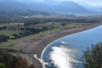
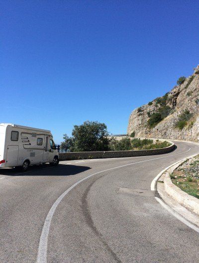
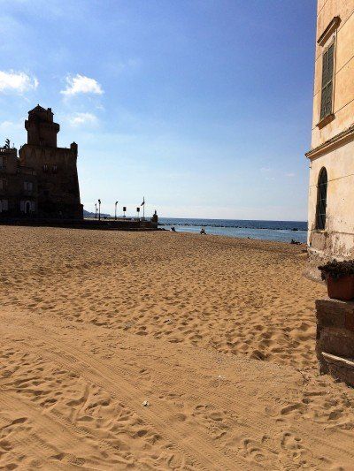
Maratea, Potenza, Italien
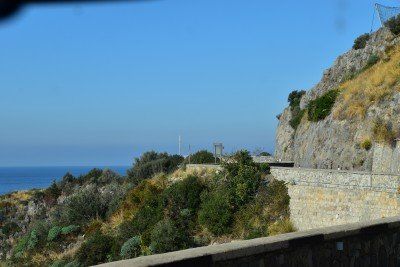
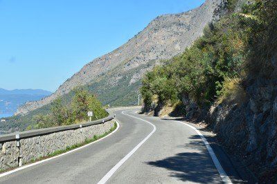
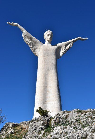
adventurous drive on coastal road SS18 to Maratea. Motorbike tour to "Il Redentore": 22m high white statue of Jesus
39° 59' 54.7" N 15° 43' 6.6" E
39.9985224 15.7185109
• Head west on Strada Provinciale Tirrena (SP3). Go for 12 m.
• Continue on Strada Provinciale Tirrena (SP3). Go for 1.0 km.
• Turn right onto Via Rione Ondavo (SS18). Go for 28.2 km.
• Turn right onto Strada Statale Bussentina (SS517var) toward Salerno/A3/Reggio C./Casaletto S./Strada Statale Variante/SS10/Morigerati. Go for 275 m.
• Take ramp onto Strada Provinciale Variante SS18 (SP430) toward Vallo della Lucania/Palinuro/Celle di Bulgheria/Roccagloriosa/Marina di Camerota. Go for 37.0 km.
• Take ramp onto Via Badia toward Pattano. Go for 429 m.
• Turn slightly left onto Via Badia (SS18). Go for 1.4 km.
• Turn left onto Via Velia (SP365). Go for 1.8 km.
• Turn right onto Via Prevetelupo (SP433). Go for 986 m.
• Continue on Via Metoio (SP433). Go for 369 m.
• Continue on SP433. Go for 2.9 km.
• Continue on Via Auriroi (SP433). Go for 786 m.
• Continue on Via Salicuneta (SP433). Go for 1.7 km.
• Turn left onto Via Coppola (SS447). Go for 3.0 km.
• Take the 2nd exit from roundabout onto SS447. Go for 1.6 km.
• Take the 1st exit from roundabout onto Corso Elea (SP90). Go for 450 m.
• Keep left onto Via Parmenide. Go for 756 m.
• Turn left onto Via della Ferrovia. Go for 53 m.
• Arrive at Via della Ferrovia. Your destination is on the left.
☍
82,8 km
(1 hrs. 19 min.)
Marina di Ascea, Salerno, Italien
Sosta Camper at the football stadium, separated from the beach only by a road
40° 8' 27.7" N 15° 10' 20.4" E
40.1410227 15.1723337
• Head toward Via Parmenide on Via della Ferrovia. Go for 53 m.
• Turn right onto Via Parmenide. Go for 756 m.
• Continue on Corso Elea (SP90). Go for 428 m.
• Take the 2nd exit from roundabout onto Via Porta Rosa (SS447). Go for 1.6 km.
• Pass 3 roundabouts and continue on Via Grimmita (SS447). Go for 8.9 km.
• Continue on Strada Statale Tirrena Inferiore (SS18). Go for 1.1 km.
• Take ramp toward Agropoli/Battipaglia/Salerno Reggio Calabria/A3/Salerno. Go for 387 m.
• Continue on SS18var. Go for 7.1 km.
• Continue on Strada Provinciale Variante SS18 (SP430). Go for 13.7 km.
• Take ramp toward Agropoli Sud. Go for 192 m.
• Turn left onto Via Sandro Pertini (SP45). Go for 436 m.
• Take the 2nd exit from roundabout onto Contrada Marrota (SS267). Go for 6.2 km.
• Continue on SS267. Go for 2.7 km.
• Take the 3rd exit from roundabout onto SS267. Go for 508 m.
• Take the 3rd exit from roundabout onto Viale Corrado Grande. Go for 73 m.
• Take the 1st exit from roundabout onto Via Beato Simeone. Go for 96 m.
• Turn left onto Corso Beato Simeone. Go for 188 m.
• Turn right. Go for 22 m.
• Turn left. Go for 50 m.
• Turn right. Go for 56 m.
• Arrive at your destination on the left.
☍
44,6 km
( 46 min.)
Day
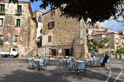
Santa Maria di Castellabate, Salerno, Italien
Nice place on mountain with narrow streets. Beautiful Marina; Houses partially up to the beach. Unfortunately, Sosta Camper is already closed.
40° 17' 45.5" N 14° 57' 7.1" E
40.2959722 14.9519715
• Head northeast. Go for 180 m.
• Turn left toward Corso Beato Simeone. Go for 110 m.
• Continue on Corso Beato Simeone. Go for 78 m.
• Turn right onto Via Beato Simeone. Go for 83 m.
• Take the 2nd exit from roundabout onto Viale Corrado Grande. Go for 74 m.
• Take the 1st exit from roundabout onto SS267. Go for 477 m.
• Take the 1st exit from roundabout onto SS267. Go for 8.9 km.
• Take the 1st exit from roundabout onto SP45. Go for 395 m.
• Take ramp onto Strada Provinciale Variante SS18 (SP430) toward Salerno/Salerno Reggio C./A3. Go for 7.8 km.
• Take ramp toward Capaccio. Go for 271 m.
• Continue on Via Fuscillo (SS18). Go for 2.6 km.
• Turn right onto Via Porta Giustizia. Go for 1.1 km.
• Continue on SP276. Go for 1.1 km.
• Turn left onto Via Magna Grecia. Go for 329 m.
• Arrive at Via Magna Grecia.
☍
23,5 km
( 29 min.)
Day
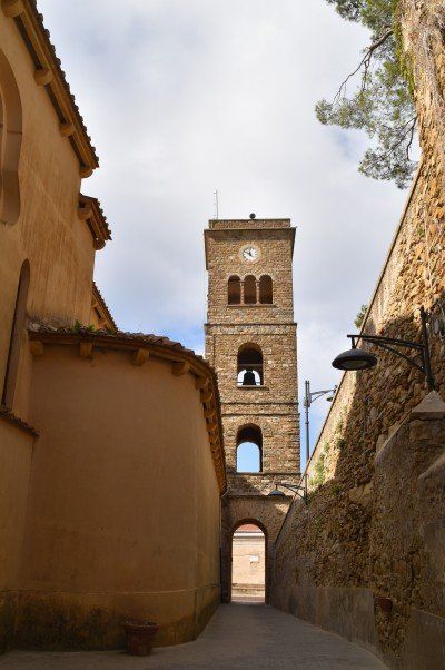
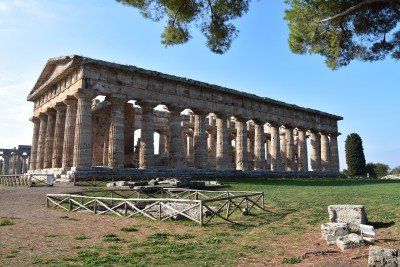
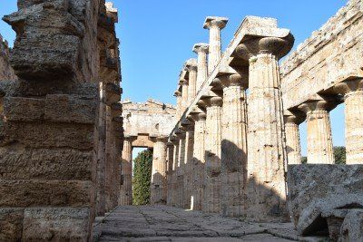
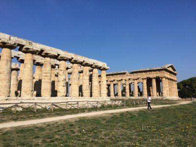
Paestum, Italien
as Poseidonia around 600 BC Founded by Greeks. Around 500 AD the area slowly began to swamp, malaria spread and the last inhabitants left the place. Paestum was only rediscovered in 1752, at about the same time as Pompeii and Herculaneum.
40° 25' 23.3" N 15° 0' 25.8" E
40.4231513 15.0071628
• Head north on Via Magna Grecia. Go for 329 m.
• Turn left onto Via Tavernelle (SP175). Go for 335 m.
• Take the 1st exit from roundabout onto Via Laura (SP175). Go for 1.8 km.
• Take the 1st exit from roundabout onto Via Laura (SP175). Go for 3.6 km.
• Turn slightly left onto Via Foce Sele (SP175). Go for 583 m.
• Take the 1st exit from roundabout onto Via Foce Sele (SP175). Go for 8.0 km.
• Take the 2nd exit from roundabout onto Via Medaglie d'Oro (SP175a). Go for 7.3 km.
• Continue on Via Lago Trasimeno (SP175). Go for 6.3 km.
• Continue straight ahead. Go for 55 m.
• Take the 1st exit from roundabout. Go for 593 m.
• Continue straight ahead. Go for 41 m.
• Take the 1st exit from roundabout. Go for 261 m.
• Continue toward Via Roberto Wenner. Go for 37 m.
• Take the 1st exit from roundabout onto Via Roberto Wenner. Go for 279 m.
• Take the 2nd exit from roundabout onto Via Roberto Wenner toward Front/Ospedale/Tangenziale. Go for 820 m.
• Continue toward Fratte/Salerno Centro. Go for 50 m.
• Take the 3rd exit from roundabout onto Via Roberto Wenner toward Fratte/Salerno Centro. Go for 190 m.
• Take ramp onto Tangenziale (SS18) toward Fratte/Salerno Centro. Go for 8.2 km.
• Take left ramp onto A3 (Viadotto Medaglie d'Oro) toward Napoli. Go for 28.9 km.
• Take the exit toward Pompei Est/Scafati onto Via Acquasalsa. Go for 616 m.
• Take the 1st exit from roundabout onto Via Acquasalsa toward Pompei Centro/Scafati Centro. Go for 97 m.
• Take the 2nd exit from roundabout onto Via Lepanto. Go for 637 m.
• Take the 1st exit from roundabout onto Via Lepanto. Go for 250 m.
• Turn right onto Via Anastasio Rossi. Go for 193 m.
• Continue on Piazza Vittorio Veneto. Go for 22 m.
• Continue on Via Armando Diaz. Go for 83 m.
• Turn right onto Via Nolana. Go for 513 m.
• Turn left onto Via Antonio Segni. Go for 101 m.
• Turn left onto Traversa Antonio Segni. Go for 12 m.
• Arrive at Traversa Antonio Segni. Your destination is on the right.
☍
70,1 km
(1 hrs. 8 min.)
Pompei: Area di Sosta della Famiglia Ametrano
Sosta Camper behind the cathedral: Old town and excavation area 10 minutes on foot
Via Antonio Segni 23, 80045, Pompei, Italien
40° 45' 17" N 14° 29' 49" E
40.7547222 14.4969444
• Head toward Via Antonio Segni on Traversa Antonio Segni. Go for 12 m.
• Turn right onto Via Antonio Segni. Go for 101 m.
• Turn right onto Via Nolana. Go for 513 m.
• Continue on Via Albenzio De Fusco. Go for 116 m.
• Turn right onto Via Piave. Go for 106 m.
• Turn left onto Via Lepanto. Go for 358 m.
• Take the 2nd exit from roundabout onto Via Lepanto. Go for 628 m.
• Take the 1st exit from roundabout onto Via Acquasalsa toward Napoli/A3/Salerno. Go for 89 m.
• Take the 2nd exit from roundabout onto Via Acquasalsa toward A3/Napoli/Salerno. Go for 286 m.
• Take ramp onto A3 (Autostrada Napoli-Salerno) toward Napoli. Go for 2.9 km.
• Take the exit toward Castellammare di Stabia onto Raccordo Autostradale Pompei Castellamare. Go for 516 m.
• Keep right onto Raccordo Autostradale Pompei Castellamare. Go for 83 m.
• Keep left onto Raccordo Autostradale Pompei Castellamare. Go for 412 m.
• Continue on Strada Statale della Penisola Sorrentina (SS145). Go for 9.3 km.
• Keep left onto SS145var toward Sorrento/SS1. Go for 10.8 km.
• Turn left onto Via Cavone. Go for 203 m.
• Turn right onto Via dei Platani. Go for 780 m.
• Turn right onto Via Mortora San Liborio. Go for 345 m.
• Continue on Via Mortora. Go for 7 m.
• Continue on Via Mortora San Liborio. Go for 27 m.
• Continue on Via Mortora. Go for 16 m.
• Continue on Via Mortora San Liborio. Go for 52 m.
• Turn left onto Corso Italia (SS145). Go for 2.1 km.
• Turn left onto Via degli Aranci (SS145). Go for 105 m.
• Take the 1st exit from roundabout onto Via degli Aranci (SS145). Go for 1.4 km.
• Turn left onto Via Capo (SS145). Go for 395 m.
• Arrive at Via Capo (SS145). Your destination is on the right.
☍
31,6 km
(1 hrs. )
Day
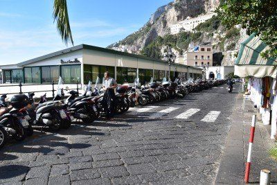
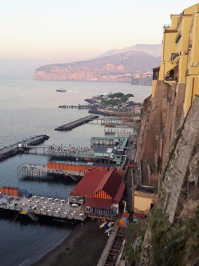
Sorrento: Campeggio Nube D`Argento
all pitches under olive trees, swimming pool still open in October! Stairs down to the old port.
Capo 21, 80067, Sorrento, Italien
40° 37' 31.8" N 14° 21' 56.2" E
40.6255000 14.3656000
• Head southeast on Via Capo (SS145). Go for 395 m.
• Turn right onto Via degli Aranci (SS145). Go for 1.4 km.
• Take the 3rd exit from roundabout onto Via degli Aranci (SS145). Go for 127 m.
• Turn right onto Corso Italia (SS145). Go for 2.1 km.
• Turn right onto Via Mortora San Liborio. Go for 52 m.
• Continue on Via Mortora. Go for 16 m.
• Continue on Via Mortora San Liborio. Go for 27 m.
• Continue on Via Mortora. Go for 7 m.
• Continue on Via Mortora San Liborio. Go for 1.6 km.
• Take ramp. Go for 132 m.
• Turn left onto Strada Statale Amalfitana (SS163). Go for 26.5 km.
• Take the 1st exit from Piazza Flavio Gioia roundabout onto Lungomare dei Cavalieri. Go for 124 m.
• Arrive at Lungomare dei Cavalieri.
☍
32,5 km
(1 hrs. 16 min.)
Day
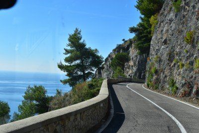
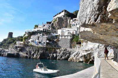
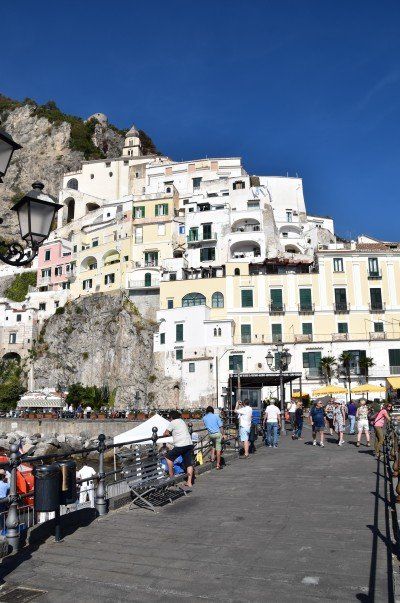
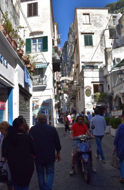
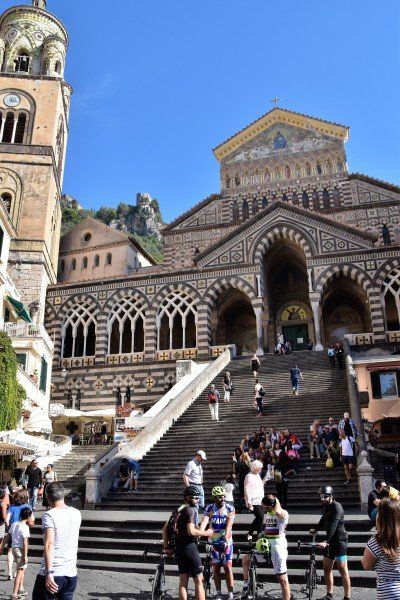
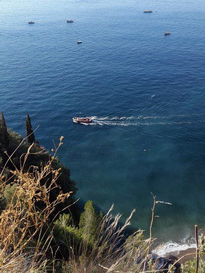
Amalfi, Salerno, Italien
fantastic motorbike tour on the Amalfitana to Positano, Praiano and Amalfi
40° 37' 56.6" N 14° 36' 5.5" E
40.6323940 14.6015300
• Head toward Lungomare dei Cavalieri di San Giovanni on Lungomare dei Cavalieri. Go for 82 m.
• Take the 3rd exit from Piazza Flavio Gioia roundabout onto Via Matteo Camera (SS163). Go for 1.9 km.
• Turn left onto Strada Statale Amalfitana (SS163) toward Praiano/Positano/Sorrento/Meta di Sorrento. Go for 24.7 km.
• Turn left and take ramp onto Via Mortora San Liborio. Go for 1.7 km.
• Continue on Via Mortora. Go for 7 m.
• Continue on Via Mortora San Liborio. Go for 27 m.
• Continue on Via Mortora. Go for 16 m.
• Continue on Via Mortora San Liborio. Go for 52 m.
• Turn left onto Corso Italia (SS145). Go for 2.1 km.
• Turn left onto Via degli Aranci (SS145). Go for 105 m.
• Take the 1st exit from roundabout onto Via degli Aranci (SS145). Go for 465 m.
• Turn right onto Via Fuorimura. Go for 149 m.
• Turn right onto Via Fuorimura. Go for 124 m.
• Continue on Piazza Torquato Tasso. Go for 80 m.
• Turn left onto Corso Italia. Go for 9 m.
• Arrive at Corso Italia.
☍
31,6 km
(1 hrs. 9 min.)
Day
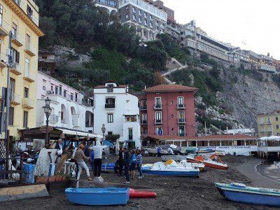
Sorrento, Neapel, Italien
40° 37' 34.7" N 14° 22' 32.9" E
40.6262925 14.3757985
• Head east on Corso Italia. Go for 2.8 km.
• Turn right onto Via Mortora San Liborio. Go for 52 m.
• Continue on Via Mortora. Go for 16 m.
• Continue on Via Mortora San Liborio. Go for 27 m.
• Continue on Via Mortora. Go for 7 m.
• Continue on Via Mortora San Liborio. Go for 345 m.
• Turn left onto Via dei Platani toward Napoli/A3. Go for 780 m.
• Turn left onto Via Cavone toward Napoli/A3/Sorrento. Go for 203 m.
• Turn right onto Corso Italia (SS145) toward Napoli/A3. Go for 10.8 km.
• Continue on Via Panoramica (SS145). Go for 9.3 km.
• Keep left toward Napoli-Salerno/A3. Go for 491 m.
• Continue on Raccordo Autostradale Pompei Castellamare. Go for 11 m.
• Take left ramp onto A3 (Autostrada Napoli-Salerno) toward Napoli. Go for 18.8 km.
• Take the exit toward Napoli Centro/Zona Industriale Napoli onto A3 (Autostrada Napoli-Salerno). Go for 2.1 km.
• Take the exit toward Centro/Napoli Centro/Porto onto Via Reggia di Portici. Go for 1.4 km.
• Take the 1st exit from roundabout onto Via Alessandro Volta. Go for 491 m.
• Take the 2nd exit from roundabout onto Via Amerigo Vespucci. Go for 746 m.
• Turn right onto Corso Giuseppe Garibaldi. Go for 570 m.
• Keep left onto Corso Giuseppe Garibaldi. Go for 36 m.
• Arrive at Corso Giuseppe Garibaldi. Your destination is on the right.
☍
48,8 km
(1 hrs. 3 min.)
Neapel, Italien
Sosta Camper "Parco dei Camaldoli": bus stop right in front of the square, then continue with metro no. 1 to the center, archaeological museum is a must!
40° 51' 6.4" N 14° 16' 5.2" E
40.8517746 14.2681244
• Head north on Corso Giuseppe Garibaldi. Go for 37 m.
• Turn right onto Piazza Giuseppe Garibaldi toward Autostrade/C.so Lucci. Go for 13 m.
• Turn left onto Corso Giuseppe Garibaldi. Go for 366 m.
• Turn right onto Via Casanova. Go for 333 m.
• Continue on Calata Ponte di Casanova. Go for 189 m.
• Turn right onto Piazza Nazionale. Go for 233 m.
• Turn right onto Via Nuova Poggioreale. Go for 210 m.
• Turn left onto Corso Malta. Go for 970 m.
• Take left ramp onto A56 (Tangenziale Est-Ovest di Napoli) toward Capodimonte/Arenella/Camaldoli/Vomero/Fuorigrotta/Agnano/Via Campana/Cuma/Pozzuoli. Go for 18.9 km.
• Take exit 14 toward Pozzuoli/Arco Felice/Bacoli onto Via Monte Nuovo Licola Patria. Go for 964 m.
• Turn right onto Via Miliscola toward Bacoli. Go for 1.5 km.
• Take the 3rd exit from roundabout onto Via Miliscola. Go for 725 m.
• Continue on Via Montegrillo. Go for 1.1 km.
• Continue on Via Lucullo. Go for 871 m.
• Turn left onto Via Castello. Go for 1.3 km.
• Turn right onto Via Risorgimento. Go for 1.0 km.
• Turn right onto Via Lungolago. Go for 717 m.
• Enter the roundabout. Go for 44 m.
• Arrive at Piazzale Amedeo Maiuri. Your destination is on the right.
☍
29,5 km
( 39 min.)
Day
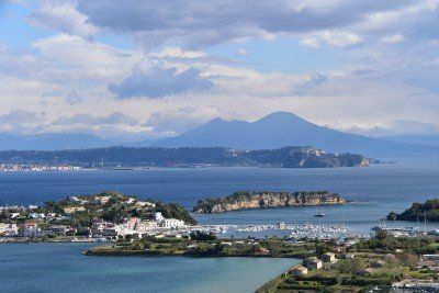
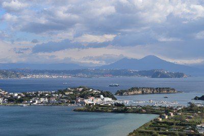
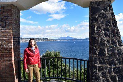
Bacoli, Neapel, Italien
Panorama from Pozzuoli over Naples, Vesuvius to the Sorrento coast with Capri and Ischia on the other side!
40° 47' 41.3" N 14° 4' 6.7" E
40.7948004 14.0685261
• Follow the roundabout. Go for 158 m.
• Take the 4th exit from roundabout onto Via Lungolago. Go for 717 m.
• Turn left onto Via Risorgimento toward Pozzuoli/Napoli. Go for 1.0 km.
• Turn left onto Via Castello. Go for 1.3 km.
• Turn right onto Via Lucullo. Go for 871 m.
• Continue on Via Montegrillo (SP2). Go for 1.1 km.
• Continue on Via Miliscola. Go for 691 m.
• Take the 1st exit from roundabout onto Via Miliscola. Go for 485 m.
• Keep left onto Via Miliscola. Go for 1.0 km.
• Turn right onto Via Monte Nuovo Licola Patria. Go for 76 m.
• Keep middle onto Via Domitiana. Go for 288 m.
• Turn right toward Via Domitiana. Go for 11 m.
• Make a U-Turn onto Via Domitiana. Go for 1.2 km.
• Continue on Via Monte Nuovo Licola Patria. Go for 134 m.
• Take ramp onto SS7quater toward Poma/Calvizzano/Villaricca. Go for 29.4 km.
• Pass 4 roundabouts and continue on Via Domiziana (SS7quater). Go for 7.9 km.
• Take the 3rd exit from roundabout onto Via Domiziana (SS7quater). Go for 5.9 km.
• Take the 2nd exit from roundabout onto Via Domiziana (SS7quater) toward Roma. Go for 4.3 km.
• Take the 2nd exit from roundabout onto Via Domiziana (SS7quater) toward Roma/Minturno. Go for 6.7 km.
• Keep left onto Via Domiziana (SS7quater) toward Minturno/Scauri/Formia/Latina/Cassino/Roma/A1. Go for 123 m.
• Continue on Strada Statale Appia (SS7). Go for 10.1 km.
• Take the 2nd exit from roundabout onto Variante Formia-Garigliano (SS7quater). Go for 5.0 km.
• Take the 2nd exit from roundabout onto Via Flacca (SR213) toward Formia Centro/Gaeta/Itri/Roma. Go for 1.3 km.
• Take the 2nd exit from roundabout onto Via Flacca (SR213). Go for 4.9 km.
• Keep left onto Lungomare Giovanni Caboto toward Ospedale/Università la Sapienza Scienze Infermieristiche/Sperlonga/Terracina/Roma. Go for 346 m.
• Pass 2 roundabouts and continue on Lungomare Giovanni Caboto. Go for 1.5 km.
• Take the 1st exit from roundabout onto Via Firenze. Go for 324 m.
• Arrive at Via Firenze.
☍
87,0 km
(1 hrs. 31 min.)
Gaeta, Latina, Italien
41° 12' 38.6" N 13° 34' 17.1" E
41.2107299 13.5714285
• Head toward Corso Italia on Via Firenze. Go for 7 m.
• Turn right onto Corso Italia. Go for 940 m.
• Turn left onto Via Giuseppe Garibaldi. Go for 220 m.
• Continue on Via del Colle toward Roma/SS213. Go for 129 m.
• Turn left onto Via del Colle. Go for 58 m.
• Turn right onto Via Flacca (SR213). Go for 14.5 km.
• Pass 3 roundabouts and continue on Via Flacca (SR213). Go for 13.3 km.
• Continue on Via Appia (SS7). Go for 16.5 km.
• Turn left onto Strada Provinciale Migliara (SP77) toward Sabaudia. Go for 5.0 km.
• Take the 1st exit from roundabout onto Strada Regionale Pontina (SR148) toward Latina. Go for 6.0 km.
• Take the 3rd exit from roundabout onto Via Migliara 49 toward Strada Provinciale Litoranea/Litoranea. Go for 2.6 km.
• Arrive at Via Migliara 49.
☍
59,4 km
( 59 min.)
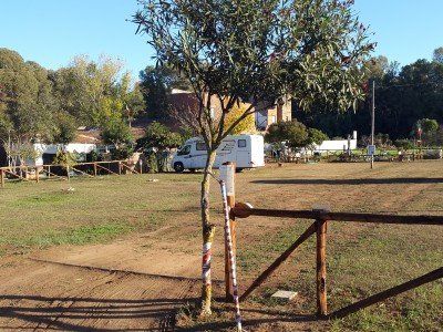
Sabaudia, Latina, Italien
Sosta Camper "Gli Oleandri": newly created family-run campsite
41° 21' 27.2" N 13° 0' 45.5" E
41.3575628 13.0126523
• Head toward Strada Provinciale Litoranea on Via Migliara 49. Go for 1.2 km.
• Turn right onto Strada Provinciale Litoranea (SP46). Go for 6.0 km.
• Pass 2 roundabouts and continue on Strada Litoranea (SP46). Go for 3.3 km.
• Turn right onto Strada Isonzo (SP46) toward Latina/Roma. Go for 3.7 km.
• Take the 3rd exit from roundabout onto Via Filippo Ferrazza toward Borgo Piave/Aprilia/Roma. Go for 1.9 km.
• Take the 2nd exit from roundabout onto Via Filippo Ferrazza toward B.go Piave/Aprilia. Go for 397 m.
• Take left ramp onto Strada Regionale Pontina (SR148). Go for 4.1 km.
• Take ramp onto Strada Regionale Pontina (SR148). Go for 54.6 km.
• Take ramp onto A90 (Grande Raccordo Anulare) toward E35/Firenze/A1/Aurelia/SS1/Porto Civitavecchia/A12/Aeroporto Fiumicino. Go for 4.9 km.
• Keep right toward Roma Centro-Eur/Aeroporto Fiumicino/Porto Civitavecchia/A12/Nuova Fiera di Roma/Via della Magliana/Via della Pisana/Via del Pescaccio. Go for 799 m.
• Take exit 30 toward Fiumicino/Civitavecchia/A12/Aeroporto Fiumicino onto A91 (Autostrada Roma-Fiumicino). Go for 6.8 km.
• Take the exit toward Porto Civitavecchia/Fregene onto A12 (Autostrada Azzurra). Go for 52.8 km.
• Take the exit toward Civitavecchia Sud. Go for 1.0 km.
• Turn right toward SS1. Go for 22 m.
• Turn right onto SS1 toward Civitavecchia/Sardegna. Go for 1.4 km.
• Continue on SS1. Go for 2.0 km.
• Keep left onto Via Castronovo (SS1). Go for 1.1 km.
• Turn right onto Via Santa Fermina. Go for 128 m.
• Continue on Via Francesco Crispi. Go for 276 m.
• Enter the roundabout. Go for 25 m.
• Arrive at your destination.
☍
146,3 km
(1 hrs. 42 min.)
Day
Civitavecchia, Rom, Italien
42° 5' 32.7" N 11° 47' 43.5" E
42.0924239 11.7954132
• Follow the roundabout. Go for 31 m.
• Take the 4th exit from roundabout onto Corso Centocelle. Go for 155 m.
• Take the 3rd exit from roundabout onto Via Roma. Go for 345 m.
• Take the 2nd exit from roundabout onto Via Borghese. Go for 46 m.
• Continue on Via Isonzo. Go for 461 m.
• Take the 3rd exit from roundabout onto Via Turco. Go for 178 m.
• Continue on Via Prato del Turco. Go for 7 m.
• Take the 1st exit from Largo della Pace roundabout onto Raccordo Civitavecchia-Orte. Go for 8.1 km.
• Take the 3rd exit from roundabout onto A12 (Autostrada Azzurra) toward Tarquinia/Grosseto/SS1. Go for 14.3 km.
• Continue on Via Aurelia (SS1). Go for 14.5 km.
• Take ramp toward Ischia di C./Manciano/Vulci/Saturnia. Go for 215 m.
• Continue on Strada Provinciale del Fiora (SP105). Go for 9.1 km.
• Turn left toward Strada Provinciale Campigliola/SP67. Go for 557 m.
• Continue on Strada Provinciale Campigliola (SP67). Go for 20.9 km.
• Turn sharp left onto Strada Provinciale Manciano Farnese (SP32). Go for 2.2 km.
• Turn right onto Via Martiri della Libertà. Go for 573 m.
• Take the 2nd exit from roundabout onto Via dell'Imposto (SR74). Go for 264 m.
• Take the 2nd exit from roundabout onto Via Padre Pascucci (SP159). Go for 6.5 km.
• Turn right onto Strada Provinciale Follonata (SP10). Go for 5.5 km.
• Turn right onto Località Saturnia. Go for 460 m.
• Arrive at Località Saturnia. Your destination is on the right.
☍
84,3 km
(1 hrs. 12 min.)
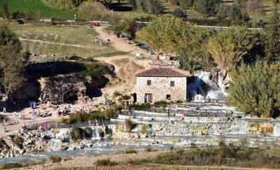
Thermalquellen von Saturnia, Grosseto, Italien
800 liters of sulphurous water at a temperature of 37 degrees flow out of the thermal spring every second. The water comes to the surface after 30 kilometers in Saturnia and pours over the Cascate del Mulino . Bathing in the naturally created sinter pools is free and freely accessible.
42° 39' 30.6" N 11° 30' 58" E
42.6585030 11.5161035
• Head toward Via Clodia on Località Saturnia. Go for 460 m.
• Turn right onto Strada Provinciale Follonata (SP10). Go for 9.2 km.
• Turn right onto Via Aldo Moro (SP22). Go for 18.0 km.
• Turn right onto Strada Provinciale Pian della Madonna (SP46). Go for 4.6 km.
• Turn left onto Strada Regionale Maremmana (SR74). Go for 634 m.
• Turn right onto Strada Regionale Maremmana (SR74). Go for 80 m.
• Turn sharp left onto Via Giovanni XXIII (SR74). Go for 32 m.
• Turn right onto Via Don F. Rossi. Go for 46 m.
• Turn left onto Via Carolina Allegretti. Go for 109 m.
• Turn left onto Via Giovanni XXIII (SR74). Go for 40 m.
• Arrive at Via Giovanni XXIII (SR74). Your destination is on the right.
☍
33,2 km
( 38 min.)
Day
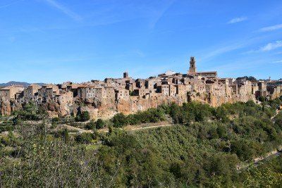
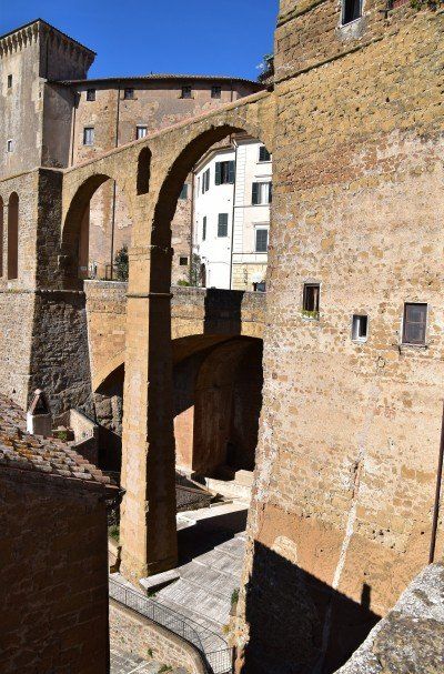
Pitigliano, Grosseto, Italien
medieval town on rocky outcrop
42° 38' 7.1" N 11° 40' 12" E
42.6353182 11.6699906
• Head toward Via L. Pavolini on Via Giovanni XXIII (SR74). Go for 130 m.
• Turn sharp right onto Via Nicola Ciacci (SR74). Go for 80 m.
• Turn right onto Via Santa Chiara. Go for 23.5 km.
• Turn right onto Strada Provinciale Sforzesca (SP95). Go for 4.3 km.
• Continue on Strada Provinciale Pitiglianese (SP134). Go for 491 m.
• Continue on Traversa Cassia Aurelia (SP20). Go for 4.3 km.
• Turn slightly right onto Strada Provinciale del Monte Amiata (SP18) toward Roma/SR2/Siena/S. Casciano Bagni/A1/Chiusi. Go for 710 m.
• Continue on Strada Regionale Cassia (SR2). Go for 1.8 km.
• Turn left onto Strada Statale del Polacco (SS321) toward Firenze-Roma/A1/Perugia/Chiusi/Cetona/Le Piazze/S.Casciano dei Bagni/Celle sul Rigo. Go for 19.6 km.
• Turn right onto Piazza Arturo Toscanini (SP82). Go for 1.1 km.
• Continue on Villa Emma (SP308) toward Chiusi/Autostrada/A1/Firenze-Roma. Go for 44 m.
• Continue on Strada Provinciale Villa Emma Fabro Ficulle (SP308). Go for 773 m.
• Continue on Strada Provinciale di Città della Pieve II Tratto (SP308). Go for 3.7 km.
• Turn left onto Strada Provinciale di Città della Pieve III Tratto (SP308). Go for 5.5 km.
• Take the 1st exit from roundabout onto Strada Provinciale di Chiusi e del Lago (SP49) toward Perugia/Chiusi. Go for 578 m.
• Turn right. Go for 2.1 km.
• Continue toward Strada Statale del Pasubio/SS146. Go for 62 m.
• Turn right onto Strada Statale del Pasubio (SS146) toward Po Bandino Centro/Città della Pieve. Go for 394 m.
• Keep left toward Arezzo/Perugia/Castiglione del Lago/Moiano. Go for 52 m.
• Continue on Strada Statale Umbro Casentinese (SS71). Go for 664 m.
• Take the 1st exit from roundabout onto Strada Statale Umbro Casentinese (SS71) toward Castiglione del Lago/Magione/Perugia. Go for 11.6 km.
• Continue toward Castiglione del Lago/Arezzo. Go for 31 m.
• Take the 2nd exit from roundabout toward Castiglione del Lago/Arezzo. Go for 89 m.
• Continue on Via Magellano (SS71). Go for 2.1 km.
• Continue toward Strada Statale Umbro Casentinese/SS71. Go for 43 m.
• Take the 3rd exit from roundabout onto Strada Statale Umbro Casentinese (SS71) toward Castiglione del Lago/Arezzo. Go for 3.4 km.
• Pass 2 roundabouts and continue on Via Roma (SS71). Go for 1.1 km.
• Arrive at Via Firenze (SS71). Your destination is on the left.
☍
88,3 km
(1 hrs. 28 min.)
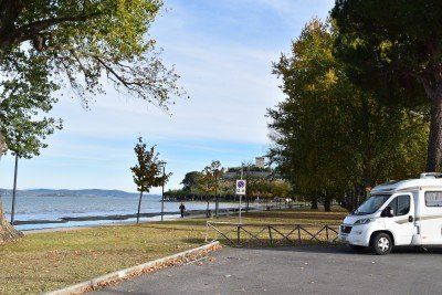
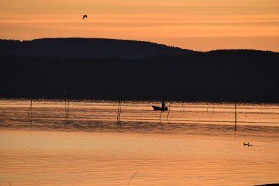
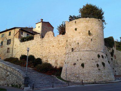
Castiglione del Lago Trasimeno, Perugia, Italien
Parking lot directly at Lago di Trasimeno (unfortunately loud barking at night from the police dog school)
43° 7' 35.2" N 12° 2' 52.2" E
43.1264498 12.0478399
• Head toward Via Giacomo Leopardi on Via Firenze (SS71). Go for 629 m.
• Take the 1st exit from roundabout onto Via Firenze (SS71) toward Arezzo/A1. Go for 7.2 km.
• Continue on Strada Regionale Umbro Casentinese Romagnola (SR71). Go for 670 m.
• Take ramp onto Raccordo Perugia A1 (RA6) toward Perugia. Go for 34.7 km.
• Take ramp toward Perugia Centro. Go for 289 m.
• Continue on Via Pietro Tuzi toward Perugia Centro. Go for 436 m.
• Take the 2nd exit from roundabout onto Via Settevalli. Go for 481 m.
• Keep left onto Via Settevalli. Go for 424 m.
• Continue on Via Mario Angeloni. Go for 255 m.
• Keep right onto Via Mario Angeloni. Go for 384 m.
• Continue on Via Ruggero d'Andreotto. Go for 495 m.
• Turn slightly right onto Via San Galigano-Rimbocchi. Go for 441 m.
• Turn right onto Viale Orazio Antinori. Go for 568 m.
• Continue on Viale Pompeo Pellini. Go for 291 m.
• Take the 2nd exit from Rotatoria Gil Evans roundabout onto Galleria Kennedy. Go for 421 m.
• Arrive at Galleria Kennedy. Your destination is on the right.
☍
47,7 km
( 34 min.)
Day
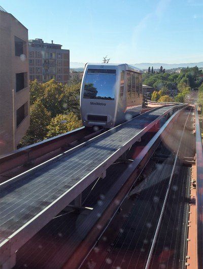
Perugia, Italien
Visit to the old town: car park near the motorway near the stadium, then continue with the new Minimetro (Funicolare)
43° 6' 38.6" N 12° 23' 27" E
43.1107168 12.3908279
• Head toward Rotatoria Miles Davis on Galleria Kennedy. Go for 2 m.
• Take the 4th exit from Rotatoria Miles Davis roundabout onto Galleria Kennedy. Go for 457 m.
• Take the 1st exit from Rotatoria Gil Evans roundabout onto Viale Pompeo Pellini. Go for 313 m.
• Continue on Viale Orazio Antinori. Go for 568 m.
• Turn left onto Via San Galigano-Rimbocchi. Go for 398 m.
• Continue on Via San Galigano. Go for 139 m.
• Turn left onto Via Raniero Fasani toward Firenze-Roma/A1/Ospedale. Go for 144 m.
• Keep right onto Via Raniero Fasani. Go for 398 m.
• Keep right onto Via Raniero Fasani. Go for 55 m.
• Continue on Via Aldo Capitini. Go for 279 m.
• Keep right onto Via Aldo Capitini toward A1. Go for 52 m.
• Continue on Via Cortonese. Go for 375 m.
• Keep left onto Via Pievaiola (SR75bis). Go for 463 m.
• Keep right onto Via Settevalli toward Ospedale/Firenze/A1. Go for 460 m.
• Keep right onto Via Settevalli. Go for 92 m.
• Continue on Via Pietro Tuzi. Go for 223 m.
• Take ramp onto Raccordo Autostradale Bettolle-Perugia (RA6) toward Arezzo/Siena/Firenze. Go for 52.8 km.
• Take ramp toward Firenze-Roma/A1/Bettolle/Foiano della Chiana. Go for 215 m.
• Take the 4th exit from roundabout onto SP327 toward Firenze/A1/Roma/Bettolle. Go for 456 m.
• Take the 1st exit from roundabout onto SP327 toward Firenze-Roma/A1/Bettolle. Go for 704 m.
• Take the 3rd exit from roundabout onto A1 (Autostrada del Sole) toward Firenze/Roma/Autostrada. Go for 124 km.
• Keep right onto A1var toward Bologna/Barberino. Go for 39.1 km.
• Continue on A1 (Autostrada del Sole). Go for 108 km.
• Take the exit toward Parma Centro/Fiera di Parma. Go for 1.3 km.
• Keep right toward Tangenziale/Parma Centro/Aeroporto. Go for 28 m.
• Take left ramp onto Viale Europa. Go for 684 m.
• Pass 4 roundabouts and continue on Viale Europa. Go for 2.0 km.
• Take the 2nd exit from roundabout onto Via Europa toward Ospedale. Go for 294 m.
• Pass 2 roundabouts and continue on Via Europa. Go for 483 m.
• Take the 2nd exit from roundabout onto Viale 4 Novembre. Go for 298 m.
• Turn right onto Viale Paolo Toschi. Go for 165 m.
• Take the 1st exit from roundabout onto Viale Giovanni Mariotti. Go for 351 m.
• Turn left onto Strada Giuseppe Mazzini. Go for 284 m.
• Continue on Piazza Giuseppe Garibaldi. Go for 21 m.
• Arrive at Piazza Giuseppe Garibaldi. Your destination is on the right.
☍
335,9 km
(3 hrs. 4 min.)
Parma, Italien
44° 48' 5.3" N 10° 19' 40.5" E
44.8014850 10.3279036
Day