Take a look at the tulip blossom and the windmills of Kinderdijk. For 6 days in the Netherlands with just over 1000 km.
We visited Friesland, North and South Holland and loved it.
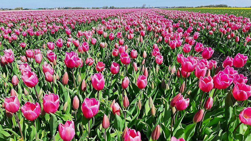
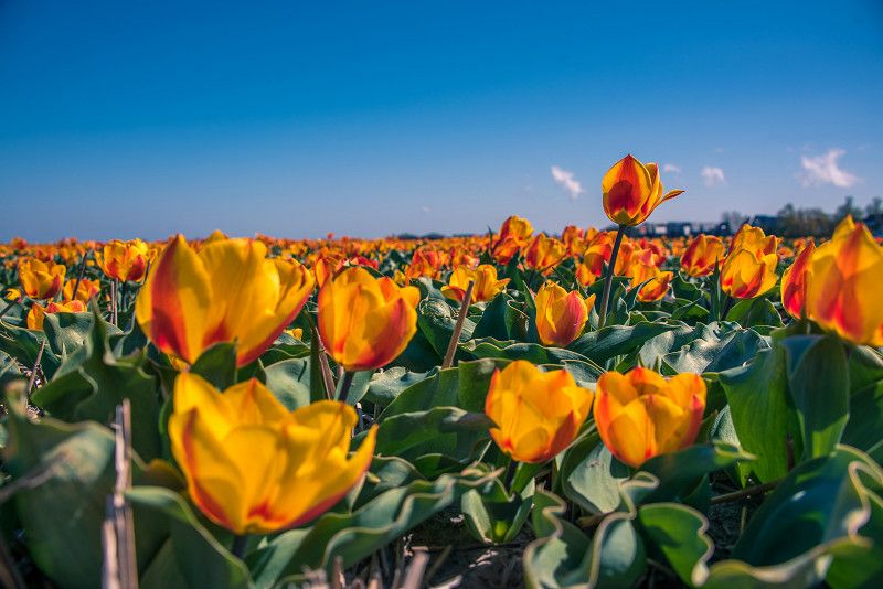
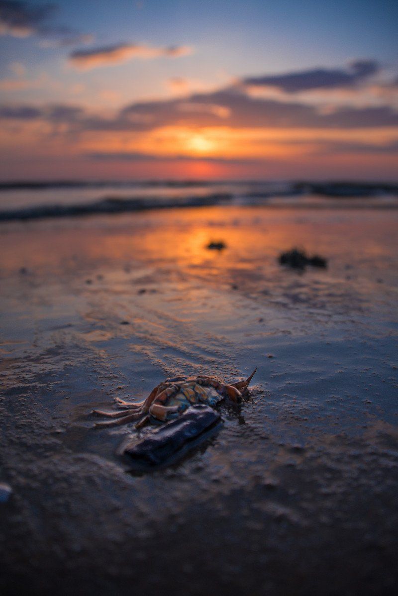
Colors as far as the eye can see.
Day
Peine, Deutschland
52° 19' 13.5" N 10° 14' 35.8" E
52.3204095 10.2432670
• Head toward Woltorfer Straße. Go for 10 m.
• Turn right onto Woltorfer Straße (L321). Go for 597 m.
• Turn right onto Am Stadtpark (L321). Go for 218 m.
• Turn right onto Kantstraße. Go for 302 m.
• Continue on Schwarzer Weg. Go for 1.5 km.
• Turn left and take ramp onto A2 toward Hannover. Go for 24.0 km.
• Take exit 48 toward Hamburg/Bremen onto A7. Go for 46.6 km.
• Take exit 48 toward Bremen/Walsrode onto A27. Go for 56.2 km.
• Take exit 22 toward Osnabrück/Oldenburg/Flughafen Bremen onto A1. Go for 21.2 km.
• Take exit 58A toward Oldenburg onto A28. Go for 42.6 km.
• Take the exit toward Groningen/Emden/Leer/Bad Zwischenahn/OL-Wechloy onto A28. Go for 8.5 km.
• Take exit 9 toward Neuenkruge/Edewecht/Bad Zwischenahn. Go for 375 m.
• Turn right onto Haarenstrother Straße (L815) toward Edewecht/Bad Zwischenahn. Go for 2.8 km.
• Turn right onto Windmühlenstraße (K126) toward Aschhauserfeld. Go for 2.1 km.
• Turn right onto Wiefelsteder Straße (L825). Go for 1.3 km.
• Turn left onto Dreiberger Straße (K126) toward Dreibergen. Go for 1.7 km.
• Turn right. Go for 45 m.
• Arrive at your destination on the right.
☍
209,9 km
(2 hrs. 12 min.)
Dreibergen, Bad Zwischenahn, Deutschland
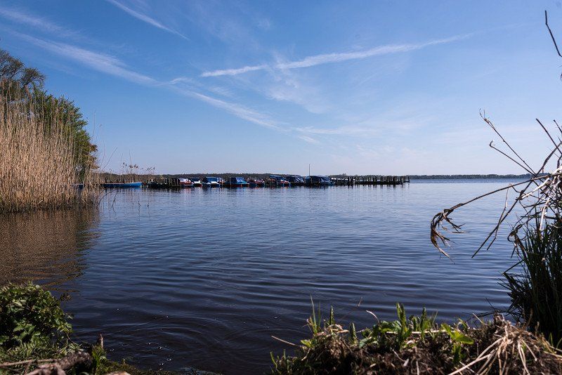
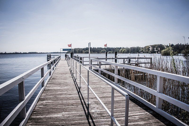
We start our tour of the Netherlands with a stopover at the Zwischenahner Meer and take a look at the north shore.
Dreibergen, 26160 Bad Zwischenahn, Deutschland
53° 12' 52.9" N 8° 1' 15.7" E
53.2147029 8.0210238
• Head south. Go for 45 m.
• Turn right onto Dreiberger Straße (K126). Go for 814 m.
• Turn right onto Am Denkmal (K125). Go for 784 m.
• Turn left onto Langebrügger Straße (K346). Go for 1.9 km.
• Take the 1st exit from roundabout onto Hüllsteder Straße (K123). Go for 3.1 km.
• Take left ramp onto A28 toward Emden/Leer. Go for 15.7 km.
• Take exit 4 toward Apen/Barßel/Augustfehn/Remels. Go for 325 m.
• Turn left onto Augustfehner Straße (K11) toward Apen/Südgeorgsfehn/Barßel. Go for 1.9 km.
• Continue on Uplengener Straße (K119). Go for 969 m.
• Turn right onto Stahlwerkstraße (K114). Go for 1.5 km.
• Turn right onto Friedensweg. Go for 149 m.
• Turn left onto Friedensweg. Go for 234 m.
• Arrive at Friedensweg. Your destination is on the left.
☍
27,3 km
( 20 min.)
Augustfehn, Apen, Deutschland
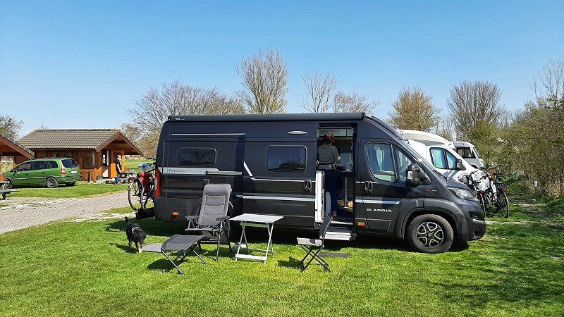
About "country fun" we spend the night in the "herb basket" in Apen
Augustfehn, 26689 Apen, Deutschland
53° 13' 33.3" N 7° 45' 37.8" E
53.2259204 7.7605124
• Head southwest on Friedensweg. Go for 2 m.
• Turn right onto Habichtsweg. Go for 163 m.
• Turn left onto Friedensweg. Go for 167 m.
• Turn right onto Friedensweg. Go for 149 m.
• Turn left onto Stahlwerkstraße (K114). Go for 1.5 km.
• Turn left onto Uplengener Straße (K119). Go for 969 m.
• Continue on Augustfehner Straße (K11). Go for 1.8 km.
• Take ramp onto A28 toward Emden/Leer. Go for 15.3 km.
• Take exit 2 toward Leer-Ost/Leer-Hafen/Leer. Go for 306 m.
• Turn right onto Leeraner Straße (B436) toward Leer. Go for 6.1 km.
• Continue on Bremer Straße. Go for 461 m.
• Turn right onto Marienstraße. Go for 127 m.
• Arrive at Marienstraße. Your destination is on the right.
☍
27,0 km
( 23 min.)
Day
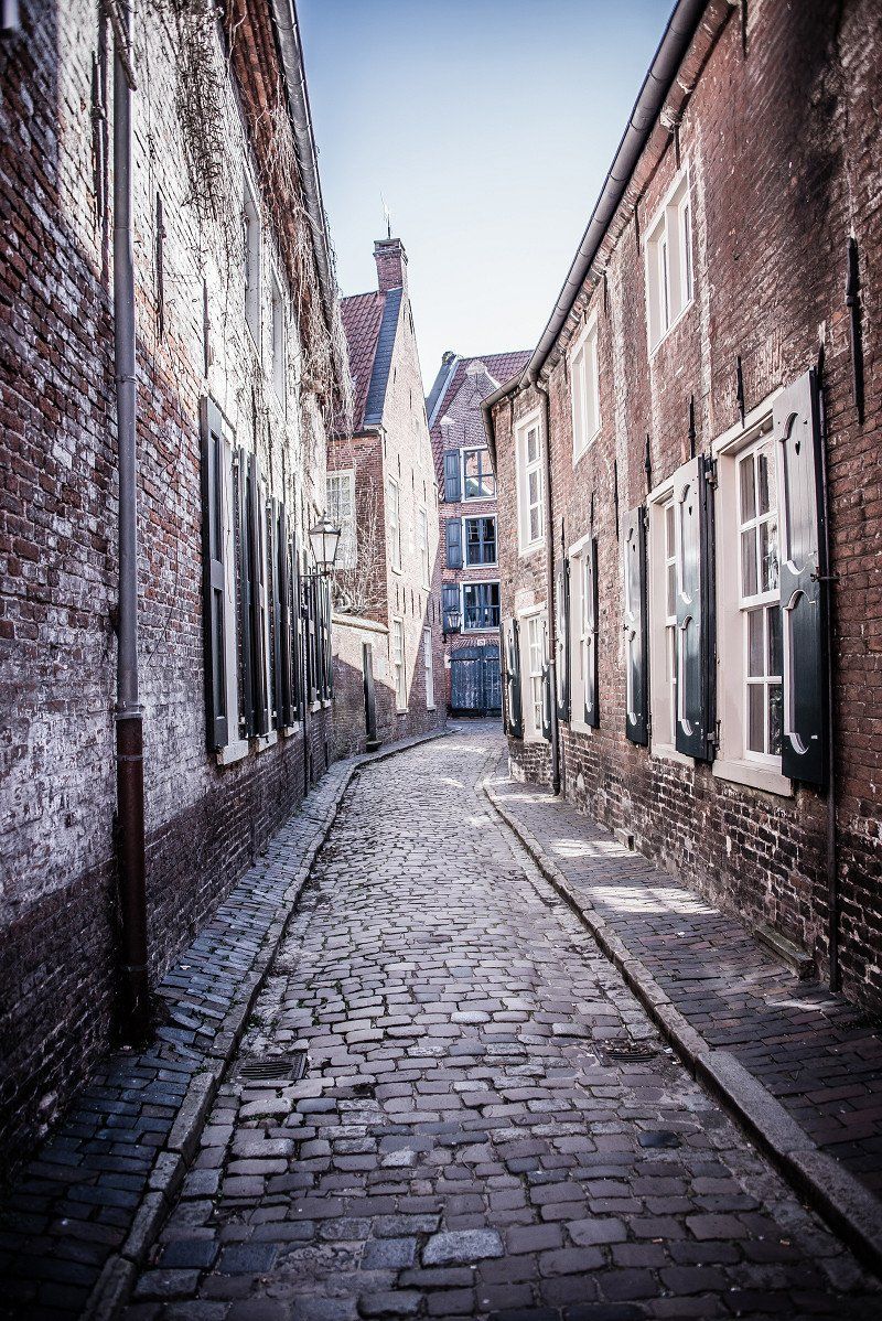
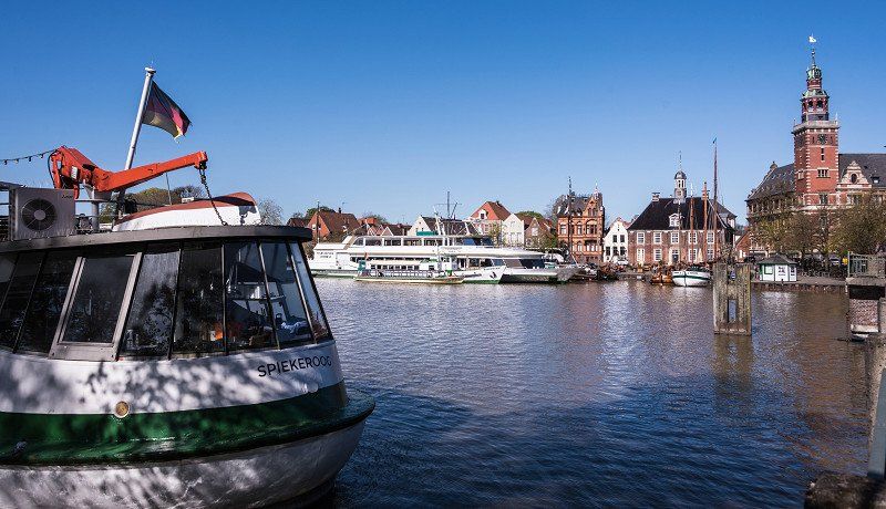
Leer, Deutschland
Before we went to our neighbors in Holland, we wanted to take a look at Leer.
We were able to park on the Womo parking space on the edge of the port.
We really liked the winding streets and a cozy promenade towards the water.
26789 Leer (Ostfriesland), Deutschland
53° 14' 8.4" N 7° 28' 4.4" E
53.2356570 7.4679018
• Head toward Großer Oldekamp on Marienstraße. Go for 97 m.
• Turn left onto Großer Oldekamp. Go for 50 m.
• Continue on Fabriciusstraße. Go for 71 m.
• Continue on Kleine Roßbergstraße. Go for 243 m.
• Turn right onto Bremer Straße. Go for 21 m.
• Continue on Mühlenstraße. Go for 150 m.
• Turn right onto Bahnhofsring. Go for 104 m.
• Continue on Friesenstraße. Go for 712 m.
• Keep left onto Friesenstraße. Go for 52 m.
• Keep right onto Ubbo-Emmius-Straße toward Krankenhaus. Go for 876 m.
• Continue on Deichstraße. Go for 2.3 km.
• Turn right and take ramp onto A31 toward Groningen/Meppen/A280. Go for 13.3 km.
• Take exit 14 toward Groningen/Bunde-West onto A280. Go for 4.8 km.
• Continue on A7. Go for 45.7 km.
• Take ramp onto Knooppunt Euvelgunne (N7) toward RING-Zuid/Amsterdam/Drachten/Assen (A28). Go for 36.5 km.
• Take exit 30A toward Drachten/Burgum/Leeuwarden onto N31 (Waldwei). Go for 33.8 km.
• Keep left onto A31 toward Amsterdam/Harlingen/Dronryp/N31. Go for 18.8 km.
• Continue on N31. Go for 1.6 km.
• Take ramp toward Harlingen. Go for 242 m.
• Take the 1st exit from roundabout onto Almenumerweg toward Centrum/Zorgplein-Harlingen. Go for 326 m.
• Continue on Stationsweg. Go for 172 m.
• Take the 1st exit from roundabout onto Stationsweg toward Centrum/Amsterdam. Go for 208 m.
• Turn right onto Zuidoostersingel. Go for 357 m.
• Turn left onto Franekereind. Go for 54 m.
• Turn right onto Fabrieksplein. Go for 29 m.
• Turn right onto Franekereind. Go for 51 m.
• Continue on Noorderkade. Go for 37 m.
• Turn left. Go for 31 m.
• Arrive at your destination on the left.
☍
160,7 km
(1 hrs. 43 min.)
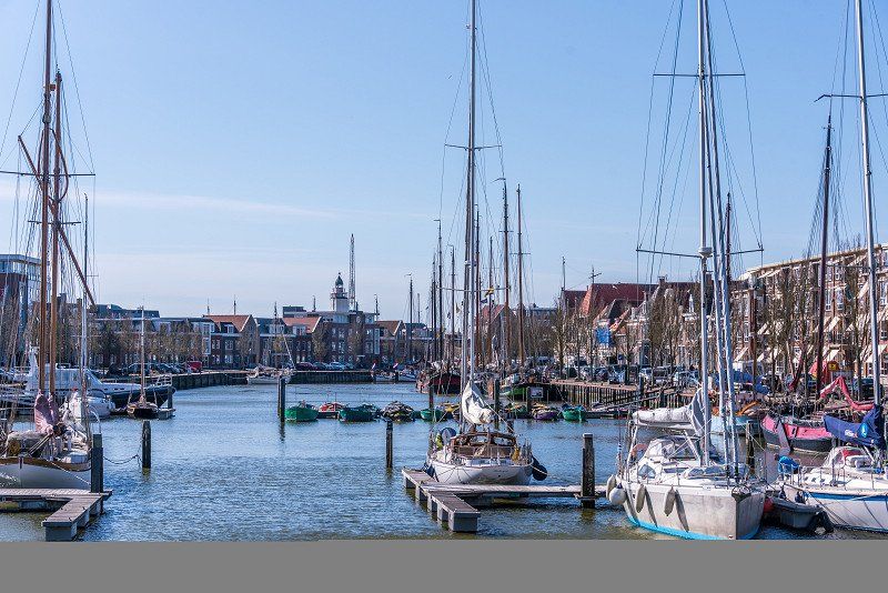
Harlingen, Niederlande
Via Groningen and Leeuwarden we ended up in Harlingen and got a nice place at the campsite "de Zeehoeve". Highly recommended, clean, large pitches and you're on the dike in no time.
53° 10' 28.7" N 5° 25' 30.5" E
53.1746381 5.4251517
• Head toward Noorderkade. Go for 31 m.
• Turn right onto Noorderkade. Go for 37 m.
• Continue on Franekereind. Go for 51 m.
• Turn left onto Fabrieksplein. Go for 29 m.
• Turn left onto Franekereind. Go for 54 m.
• Turn right onto Zuidoostersingel. Go for 357 m.
• Turn left onto Stationsweg. Go for 160 m.
• Take the 2nd exit from roundabout onto Stationsweg toward Sneek/Amsterdam/Leeuwarden. Go for 209 m.
• Continue on Almenumerweg. Go for 287 m.
• Take the 1st exit from roundabout onto N31 toward Sneek/Amsterdam. Go for 8.0 km.
• Keep left onto A31 toward Den Helder/Amsterdam/A7/E22. Go for 1.9 km.
• Continue on A7 (Afsluitdijk). Go for 29.2 km.
• Take exit 14 toward Den Oever/Den Helder. Go for 544 m.
• Turn right onto Rijksstraatweg (N99) toward Den Oever/Den Helder. Go for 428 m.
• Pass 4 roundabouts and continue on Rijksstraatweg (N99). Go for 11.7 km.
• Take the 3rd exit from roundabout onto Van Ewijcksvaart (N249) toward Breezand/Anna Paulowna/Schagen. Go for 3.8 km.
• Take the 1st exit from roundabout onto Molenvaart. Go for 744 m.
• Turn left onto J.C. Geerligslaan. Go for 445 m.
• Turn right onto Vrouw Steenlaan. Go for 67 m.
• Turn right onto Vrouw Steenlaan. Go for 67 m.
• Arrive at Vrouw Steenlaan. Your destination is on the right.
☍
58,1 km
( 46 min.)
Day
Anna Paulowna, Niederlande
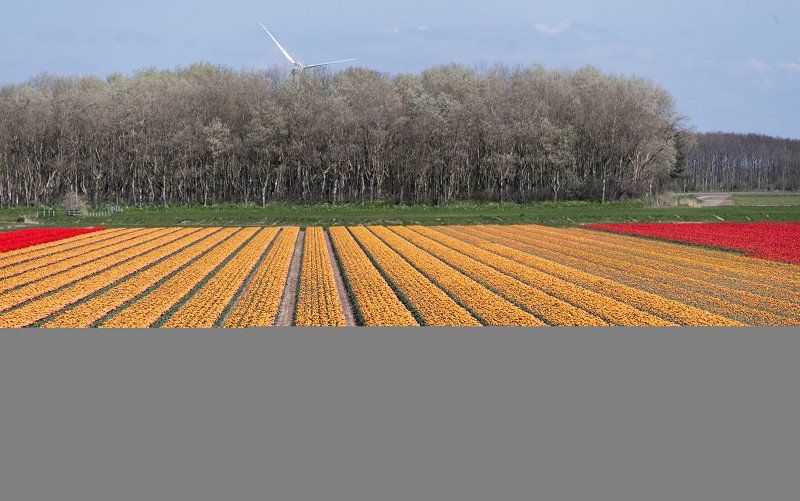
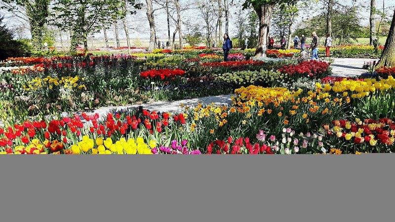
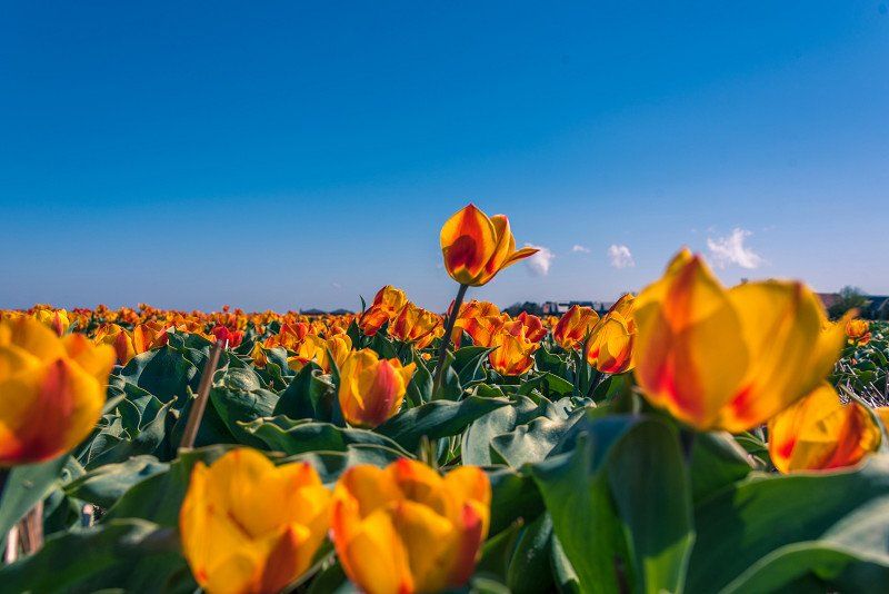
The following day we went over the dam of the IJsselmeer to Anna Paulowna. The place is said to be one of the best spots for tulip blooms in North Holland and afterwards we knew why.
You can't imagine the splendor more beautiful.
Particularly noteworthy is the "Poldertuin", a huge garden full of tulips and other plants.
1761 Anna Paulowna, Niederlande
52° 51' 41.8" N 4° 49' 25.7" E
52.8616158 4.8238091
• Head southwest on Vrouw Steenlaan. Go for 67 m.
• Turn left onto Vrouw Steenlaan. Go for 67 m.
• Turn left onto J.C. Geerligslaan. Go for 445 m.
• Turn right onto Molenvaart. Go for 717 m.
• Take the 1st exit from roundabout onto Lagedijk (N249). Go for 1.6 km.
• Take the 2nd exit from roundabout onto Anna Paulownaweg (N249) toward 't Zand/Schagen/Alkmaar. Go for 4.4 km.
• Take the 1st exit from roundabout onto Keinsmerweg toward 't Zand. Go for 85 m.
• Continue on Koning Willem II-Weg. Go for 50 m.
• Turn left onto Keinsmerweg. Go for 623 m.
• Continue on Kanaalkade. Go for 43 m.
• Continue on Verbindingsweg. Go for 267 m.
• Turn right onto Parallelweg toward Groote Keeten/Callantsoogs/Industrieterrein Bollenoord. Go for 209 m.
• Continue on Groteweg toward Groote Keeten/Callantsoog. Go for 1.0 km.
• Turn right onto Noordschinkeldijk. Go for 1.3 km.
• Continue on Helmweg. Go for 1.8 km.
• Turn right onto Duinweg (N502) toward Julianadorp/Den Helder. Go for 2.2 km.
• Continue on Zanddijk (N502). Go for 2.5 km.
• Turn right onto Orchis. Go for 59 m.
• Turn right onto Parnassia. Go for 361 m.
• Arrive at Parnassia. Your destination is on the right.
☍
17,9 km
( 22 min.)
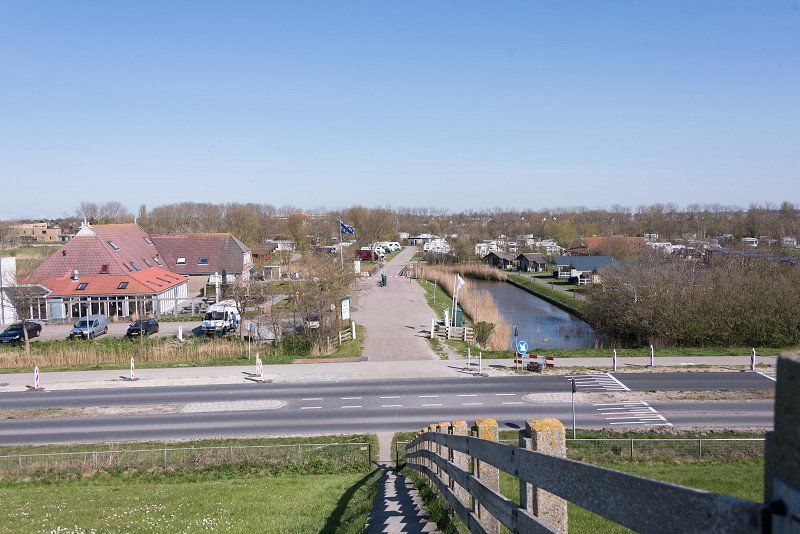
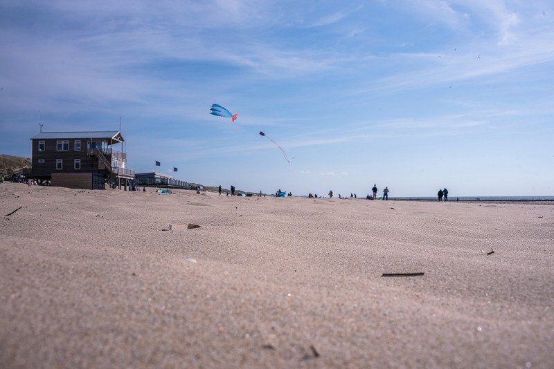
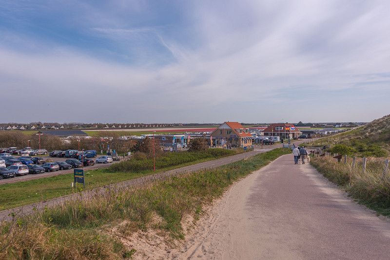
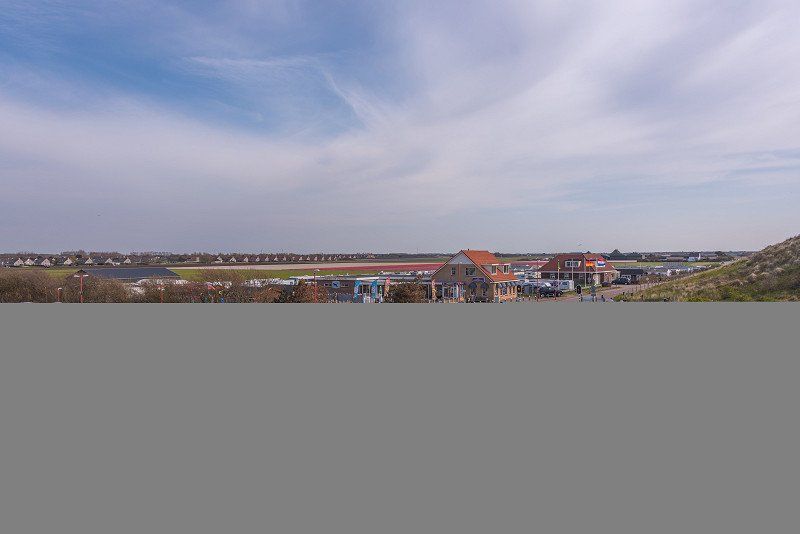
Julianadorp aan zee, Julianadorp, Niederlande
We spend three wonderful days with great weather at the “de Zwaluw” campsite.
Julianadorp aan zee, 1787 CH Julianadorp, Niederlande
52° 54' 12.8" N 4° 43' 20.5" E
52.9035431 4.7223494
• Head toward Orchis on Parnassia. Go for 98 m.
• Turn right onto Ogentroost. Go for 107 m.
• Turn right onto Tormentil. Go for 55 m.
• Turn left onto Dopheide. Go for 187 m.
• Turn right onto Gentiaan. Go for 45 m.
• Turn left onto Gentiaan. Go for 36 m.
• Turn right onto Van Foreestweg. Go for 252 m.
• Turn left onto Zanddijk (N502) toward Groote Keeten/Callantsoog. Go for 2.0 km.
• Continue on Duinweg (N502). Go for 2.2 km.
• Turn left onto Helmweg toward 't Zand/Alkmaar. Go for 1.8 km.
• Continue on Noordschinkeldijk. Go for 1.3 km.
• Turn left onto Groteweg. Go for 1.0 km.
• Continue on Parallelweg. Go for 423 m.
• Turn left onto Parallelweg. Go for 47 m.
• Turn right onto Rijksweg (N9). Go for 10.2 km.
• Take the 2nd exit from roundabout onto Rijksweg (N9) toward Alkmaar/Burgerbrug/Haarlem. Go for 12.0 km.
• Continue on Steve Bikoweg (N9) toward Ziekenhuis M.C.A./Ring Alkmaar/Haarlem. Go for 6.8 km.
• Take the 1st exit from Verkeersplein Kooimeer roundabout toward Amsterdam/Haarlem. Go for 30 m.
• Take left ramp onto A9 toward Amsterdam/Haarlem. Go for 30.3 km.
• Take the exit toward Rotterdam/Hoofddorp onto A5. Go for 8.7 km.
• Continue on A4 (Knooppunt de Hoek). Go for 9.9 km.
• Keep left onto A4. Go for 22.6 km.
• Keep left onto A4 (Leidschendam) toward E30/Ring-Oost/Rotterdam/Den Haag-Zuid/Rijswijk. Go for 3.4 km.
• Keep right onto E19 toward Breda/Rotterdam/Delft/Rijswijk-Zuid/A13. Go for 3.3 km.
• Continue on A13 (Rotterdamseweg). Go for 12.4 km.
• Take the left exit toward Dordrecht/Utrecht/Havens 100-200 onto A20 (Knooppunt Kleinpolderplein). Go for 6.5 km.
• Take the exit toward Ring-Oost/Rotterdam-Oost/Zuid/Dordrecht/Breda/Ring onto A16 (Knooppunt Terbregseplein). Go for 2.8 km.
• Keep left onto A16 (Ring Rotterdam) toward Dordrecht/Breda/Havens 1200-9900. Go for 7.4 km.
• Take the exit toward Gorinchem/Nijmegen onto A15 (Knooppunt Ridderkerk). Go for 8.3 km.
• Take exit 22 toward Alblasserdam/Kinderdijk/Papendrecht-West. Go for 325 m.
• Turn left onto Grote Beer (N915). Go for 236 m.
• Turn left onto Edisonweg toward Rotterdam/(A15)/Alblasserdam-Oost/Bedrijventerrein Vinkenwaard. Go for 1.1 km.
• Take the 2nd exit from roundabout onto Oude Torenweg toward Alblasserdam-Oost. Go for 566 m.
• Continue on Oude Torenbrug. Go for 69 m.
• Continue on Randweg. Go for 213 m.
• Turn right onto Vondellaan. Go for 323 m.
• Continue on Rembrandtlaan. Go for 359 m.
• Turn right onto Ruysdaellaan. Go for 81 m.
• Turn left onto Ruysdaellaan. Go for 58 m.
• Arrive at Ruysdaellaan. Your destination is on the left.
☍
157,6 km
(1 hrs. 57 min.)
Day
Camping de Zwaluw
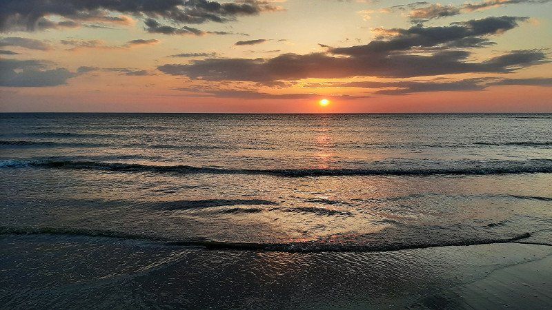
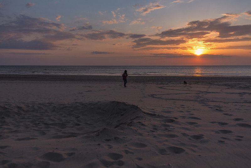
Lazy, rest in Julianadorp aan Zee. Beach walks and short shopping in Julianadorp.
Day
Alblasserdam, Niederlande
The Kinderdijk campsite in Alblasserdam is our domicile for the last night in the Netherlands. A very new and clean place. Ideal for visiting the world heritage site of the Kinderdijk windmills.
51° 52' 13.2" N 4° 40' 12.7" E
51.8703366 4.6702024
• Head south on Ruysdaellaan. Go for 58 m.
• Turn right onto Ruysdaellaan. Go for 81 m.
• Turn right onto Rembrandtlaan. Go for 110 m.
• Turn left onto Mesdaglaan. Go for 69 m.
• Turn left onto Plantageweg. Go for 630 m.
• Take the 1st exit from roundabout onto Randweg. Go for 199 m.
• Continue on Parallelweg. Go for 477 m.
• Turn left onto Blokweerweg. Go for 148 m.
• Turn right onto Van Hogendorpweg. Go for 844 m.
• Turn right onto Scheldeplein. Go for 165 m.
• Continue on Rijnstraat. Go for 427 m.
• Continue on Zwarte Paard. Go for 321 m.
• Turn right onto West Kinderdijk. Go for 932 m.
• Continue on Molenstraat. Go for 462 m.
• Arrive at Molenstraat. Your destination is on the right.
☍
4,9 km
( 10 min.)
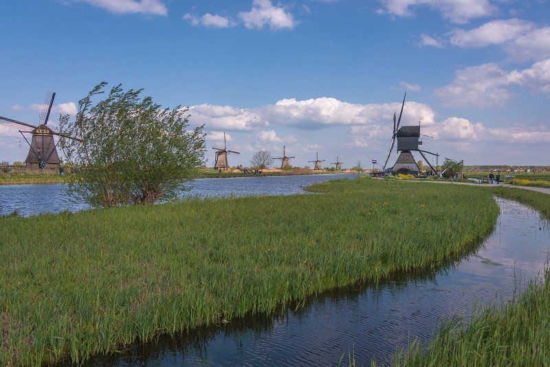
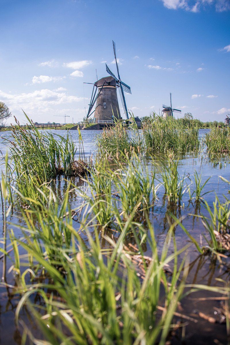
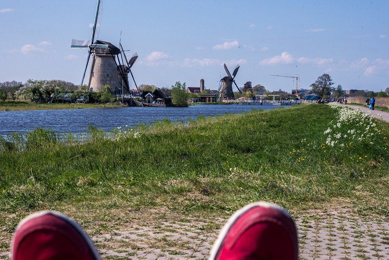
Kinderdijk, Niederlande
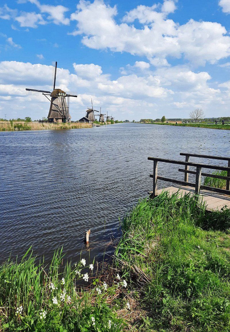
We cycled from the parking space through the town and meadows to the mills.
19 windmills, built around 1740, are located here as part of an extensive water management system to prevent flooding. Today they are the symbol of water management in Holland and were added to the UNESCO World Heritage List in 1997.
2961 Kinderdijk, Niederlande
51° 53' 1.5" N 4° 37' 59.1" E
51.8837436 4.6330916
• Head south on Molenstraat. Go for 462 m.
• Continue on West Kinderdijk. Go for 1.6 km.
• Continue on Oost Kinderdijk. Go for 1.0 km.
• Continue on Cortgene. Go for 369 m.
• Continue on Haven. Go for 465 m.
• Continue on Dam. Go for 319 m.
• Continue on De Helling. Go for 744 m.
• Turn left onto Grote Beer (N915). Go for 811 m.
• Turn left and take ramp onto A15 toward Dordrecht/Gorinchem. Go for 19.0 km.
• Take exit 27 toward Utrecht/E311 onto A27. Go for 33.5 km.
• Keep right onto E30 (Knooppunt Rijnsweerd) toward Groningen/Hengelo/Amersfoort/Utrecht-de Uithof/A28. Go for 2.5 km.
• Continue on A28. Go for 20.4 km.
• Take the exit toward Apeldoorn/Hengelo onto A1. Go for 91.7 km.
• Take the exit toward Osnabrück/Enschede/Hengelo onto A1/A35. Go for 3.9 km.
• Continue on A1 toward Osnabrück/Hengelo/Borne. Go for 23.4 km.
• Continue on A30. Go for 135 km.
• Take the exit toward Berlin/Hannover onto A2 (Weser-Brücke). Go for 89.7 km.
• Keep left onto A2. Go for 19.7 km.
• Take exit 52 toward Peine. Go for 443 m.
• Turn right onto Schwarzer Weg (B444) toward Hildesheim/Salzgitter/Ilsede/Zentrum. Go for 570 m.
• Turn left onto Schwarzer Weg toward Zentrum. Go for 730 m.
• Continue on Kantstraße. Go for 302 m.
• Turn left onto Am Stadtpark (L321) toward Bahnhof. Go for 218 m.
• Turn left onto Woltorfer Straße (L321). Go for 597 m.
• Turn left. Go for 10 m.
• Arrive at your destination on the left.
☍
447,6 km
(4 hrs. 27 min.)
Day
Peine, Deutschland
52° 19' 13.5" N 10° 14' 35.8" E
52.3204095 10.2432670