Route description for Southern Sweden in September
By ferry from Rostock to southern Sweden (September 4th - 22nd).
Without the big cities, let's look around southern Sweden.
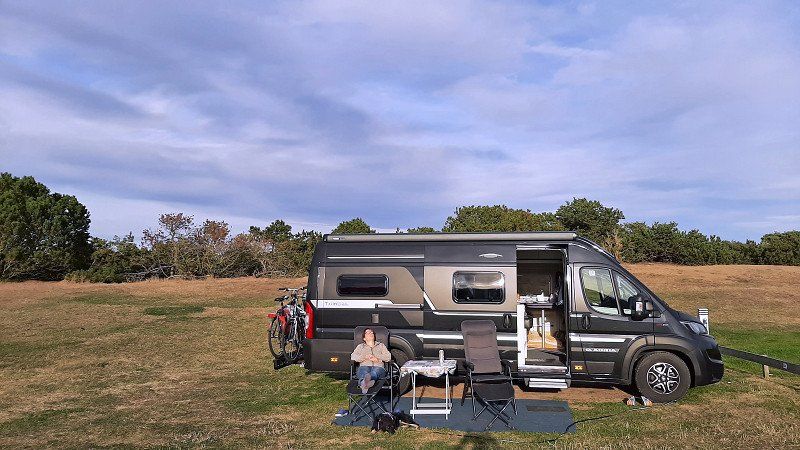
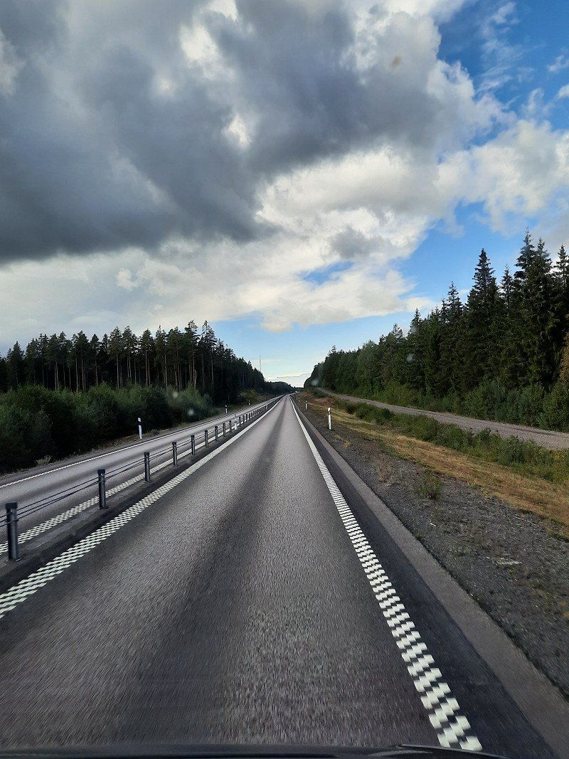
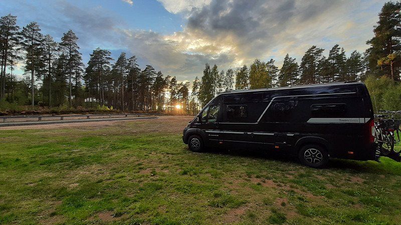
In Sweden, tourism is already being curtailed at the beginning of September, and the receptions are no longer manned at numerous campsites or motorhome parking spaces. Also has advantages ;-)
Day
Peine
Deutschland
52° 19' 13.5" N 10° 14' 35.8" E
52.3204095 10.2432670
• Head toward Woltorfer Straße. Go for 10 m.
• Turn left onto Woltorfer Straße (L321). Go for 1.2 km.
• Turn left onto Ostrandstraße. Go for 1.5 km.
• Take the 1st exit from Ascherslebener Kreisel roundabout onto K69 toward A2/Celle/B444/Gewerbegebiet Nord. Go for 423 m.
• Continue on K75 toward A2/Celle/Edemissen/Gewerbegebiet Nord. Go for 345 m.
• Turn right and take ramp onto A2 toward Berlin. Go for 17.6 km.
• Take exit 55 toward Gifhorn/B4 onto A391. Go for 2.9 km.
• Continue on B4. Go for 26.0 km.
• Take the 2nd exit from roundabout onto An der B4 (B4) toward Lüneburg. Go for 10.8 km.
• Arrive at Hauptstraße (B4). Your destination is on the right.
☍
60,7 km
( 43 min.)
Groß Oesingen, Deutschland
29393 Groß Oesingen, Deutschland
52° 38' 49.3" N 10° 27' 47.7" E
52.6470399 10.4632595
• Head toward Mühlenstraße on Hauptstraße (B4). Go for 27.2 km.
• Pass 2 roundabouts and continue on B4. Go for 42.2 km.
• Keep left onto Harz-Heide Straße (B4) toward Lüneburg/Stadtmitte. Go for 526 m.
• Take the 2nd exit from roundabout onto Harz-Heide Straße. Go for 137 m.
• Continue on Neu-Häcklingen. Go for 205 m.
• Continue on Harz-Heide Straße. Go for 86 m.
• Continue on Uelzener Straße. Go for 1.3 km.
• Continue on Universitätsallee. Go for 828 m.
• Continue on Willy-Brandt-Straße. Go for 2.2 km.
• Arrive at Willy-Brandt-Straße. Your destination is on the left.
☍
74,7 km
( 56 min.)
Lüneburg, Deutschland
Short stop at the daughter for coffee ;-)
53° 14' 52.3" N 10° 24' 57.8" E
53.2478704 10.4160637
• Head north on Willy-Brandt-Straße.
• Continue on Schießgrabenstraße. Go for 379 m.
• Continue on Am Schifferwall. Go for 169 m.
• Continue on Bockelmannstraße. Go for 1.4 km.
• Turn right onto Erbstorfer Landstraße. Go for 5.5 km.
• Keep left onto K53. Go for 1.1 km.
• Take the 2nd exit from roundabout onto Am Unteren Vorhafen (K53). Go for 728 m.
• Continue on K53. Go for 4.5 km.
• Continue on Scharnebecker Straße (K53). Go for 1.4 km.
• Continue on Landesstraße (K53). Go for 1.5 km.
• Continue on Lauenburger Straße (K53). Go for 1.5 km.
• Continue on Echemer Straße (K53). Go for 369 m.
• Turn left onto Elbuferstraße (L219) toward Lauenburg/Hornstorf. Go for 2.1 km.
• Turn right onto Bundesstraße (B209) toward Lübeck/Lüneburg. Go for 2.8 km.
• Turn right onto Berliner Straße (B5) toward Berlin/A24/Berlin/Ludwigslust/Boizenburg. Go for 65.9 km.
• Turn left onto Lindenstraße toward Zentrum. Go for 139 m.
• Continue on Alexandrinenplatz. Go for 19 m.
• Enter the roundabout. Go for 101 m.
• Arrive at your destination on the left.
☍
89,6 km
(1 hrs. 13 min.)
Ludwigslust
Deutschland
53° 19' 28.2" N 11° 29' 48.9" E
53.3244914 11.4969238
• Follow the roundabout. Go for 110 m.
• Take the 4th exit from roundabout onto Alexandrinenplatz. Go for 26 m.
• Continue on Lindenstraße. Go for 134 m.
• Turn right onto Breite Straße. Go for 144 m.
• Take the 2nd exit from roundabout onto Breite Straße. Go for 101 m.
• Turn left onto Käthe-Kollwitz-Straße (L072). Go for 842 m.
• Turn right onto Neustädter Straße (L073) toward Parchim/Neustadt-Glewe. Go for 1.8 km.
• Turn left and take ramp onto A14 toward Wismar/A24. Go for 29.5 km.
• Take the exit toward Schwerin-Ost/Schwerin-Zentrum/Crivitz. Go for 323 m.
• Turn right onto An der Crivitzer Chaussee (B321) toward Hagenow/Schwerin. Go for 945 m.
• Turn right onto Charlottenberg (L101) toward Rampe/Leezen. Go for 845 m.
• Take the 2nd exit from roundabout onto Leezener Straße (L101). Go for 2.0 km.
• Turn right onto K105. Go for 589 m.
• Continue on Schweriner Straße (K105). Go for 1.3 km.
• Turn left onto Schweriner Straße (K105). Go for 819 m.
• Continue on K105. Go for 1.6 km.
• Continue on Dorfstraße (K105). Go for 83 m.
• Continue on Neu Goderner Weg (K105). Go for 179 m.
• Continue on Vorbecker Straße (K105). Go for 1.1 km.
• Continue on K105. Go for 50 m.
• Continue on Kritzower Straße (K105). Go for 175 m.
• Continue on Kladower Weg (K105). Go for 31 m.
• Continue on Kritzower Straße (K105). Go for 180 m.
• Continue on K105. Go for 1.8 km.
• Continue on Vorbecker Straße (K105). Go for 131 m.
• Turn right onto Hauptstraße (K104). Go for 207 m.
• Continue on K104. Go for 2.4 km.
• Turn right. Go for 1.5 km.
• Turn left toward Am Basthorst. Go for 263 m.
• Continue on Am Basthorst. Go for 240 m.
• Continue on Rehagen. Go for 57 m.
• Arrive at Rehagen. Your destination is on the left.
☍
49,6 km
( 39 min.)
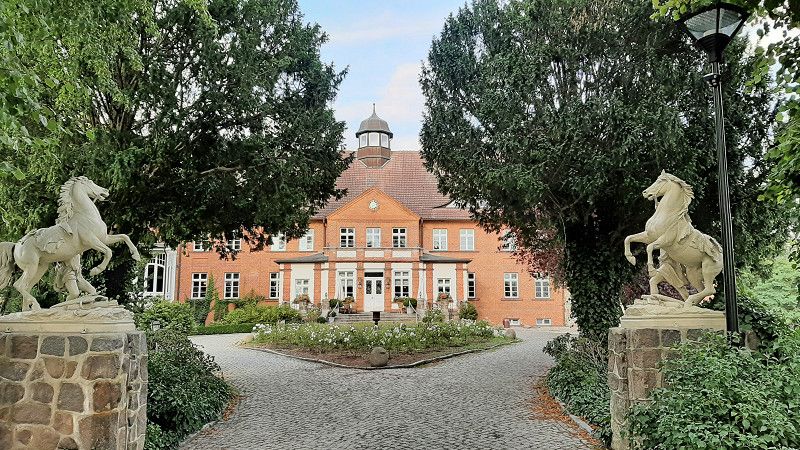
Basthorst, Crivitz, Deutschland
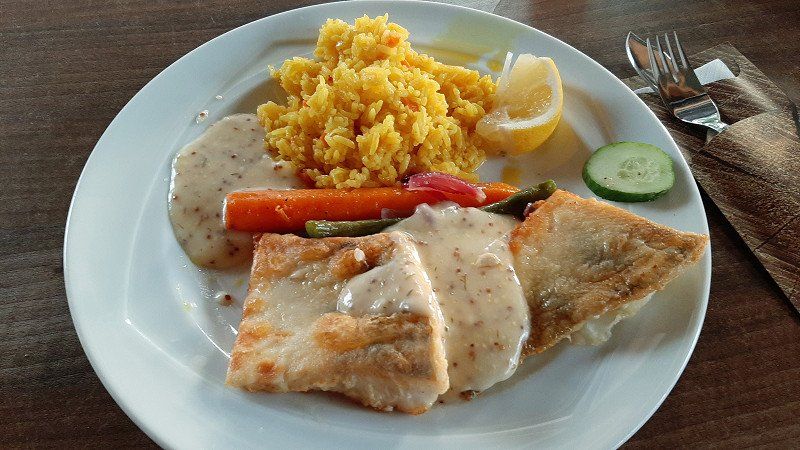
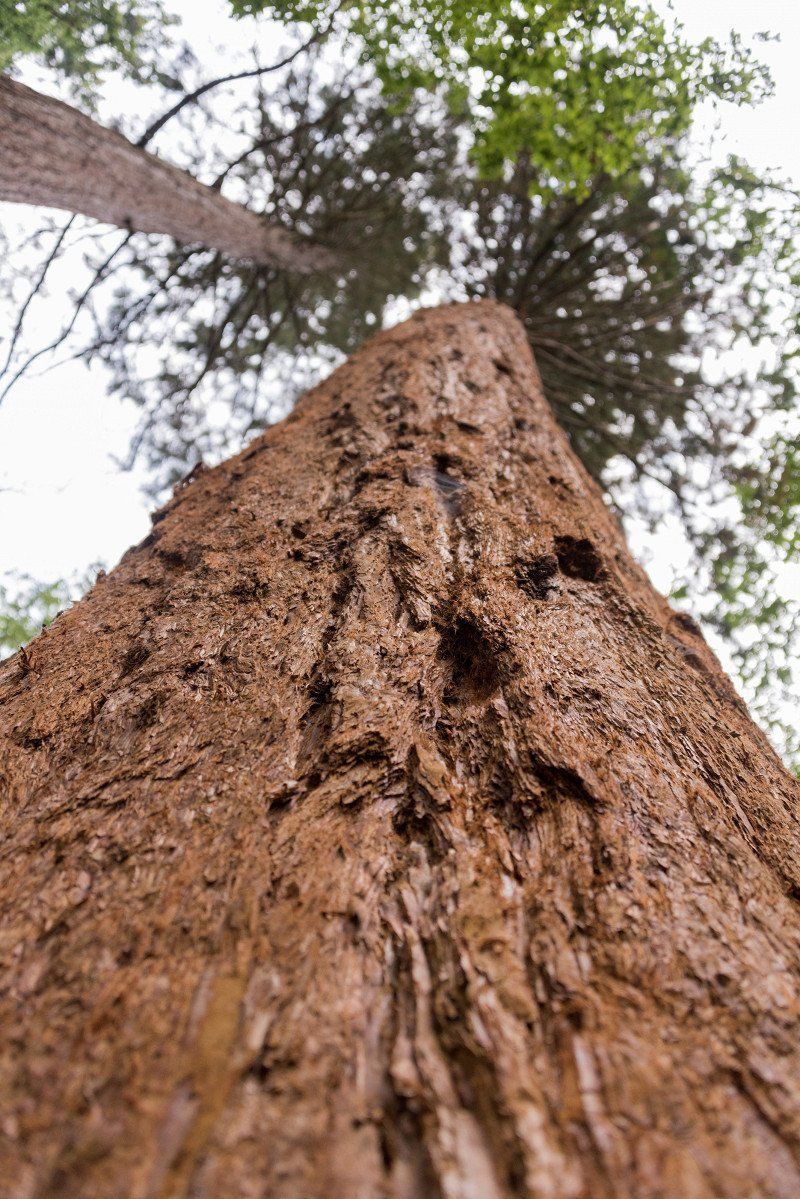
We stay here with country pleasures and are served a really great meal. In addition to Basthorst Castle, there is also plenty to see nearby, including redwoods.
Basthorst, 19089 Crivitz, Deutschland
53° 38' 11.8" N 11° 37' 24.4" E
53.6366203 11.6234366
• Head toward Samelower Weg on Rehagen. Go for 78 m.
• Turn right onto Samelower Weg. Go for 279 m.
• Turn slightly right toward K104. Go for 1.8 km.
• Turn right onto K104. Go for 1.2 km.
• Continue on Kritzower Straße (K104). Go for 331 m.
• Turn left onto Weberin (L09). Go for 8.3 km.
• Turn right onto B104. Go for 14.3 km.
• Continue on B104 toward Güstrow. Go for 25.2 km.
• Turn left onto Lindenstraße (B104) toward Rostock/A19/Neubrandenburg/Teterow/Laage/B103. Go for 376 m.
• Turn right onto Bleicherstraße (B104) toward A19/Neubrandenburg/Rostock/Pritzwalk. Go for 1.1 km.
• Turn right onto Liebnitzstraße (B104) toward A19/Neubrandenburg/Rostock/Flughafen Rostock-Laage/Krankenhaus. Go for 700 m.
• Turn left onto Neue Straße (L14) toward Schwaan/Bützow. Go for 513 m.
• Arrive at Neue Straße (L14). Your destination is on the right.
☍
54,3 km
( 47 min.)
Day
Güstrow, Deutschland
53° 48' 0.8" N 12° 10' 28.5" E
53.8002129 12.1745703
• Head west on Neue Straße (L14).
• Turn right onto Schwaaner Straße (L14). Go for 1.1 km.
• Take the 2nd exit from roundabout onto Schwaaner Chaussee (L14). Go for 2.1 km.
• Turn right onto Zur Bundesstraße (L142). Go for 2.1 km.
• Turn left onto B103 toward A19/Rostock. Go for 8.1 km.
• Turn right and take ramp onto A19 toward Rostock. Go for 32.1 km.
• Take exit 4 toward Ostsee-Fähren/Überseehafen/Ferries/Fähren onto E55 (Am Seehafen). Go for 749 m.
• Turn slightly left onto Zum Fährterminal (E55) toward Fähre Trelleborg/Fähre Gedser. Go for 616 m.
• Arrive at Zum Fährterminal (E55).
☍
47,0 km
( 31 min.)
Zum Fährterminal
Rostock, Deutschland
54° 8' 29.8" N 12° 6' 10.2" E
54.1415988 12.1028232
• Head northwest on Zum Fährterminal (E55).
• Take the 4th exit from roundabout onto Zum Fährterminal (E55). Go for 1.4 km.
• Turn right and take ramp onto A19 toward Berlin/Flugplatz Rostock-Laage/A20. Go for 5.7 km.
• Take exit 6 toward Rostock-Ost onto L22 (Rövershäger Chaussee). Go for 4.9 km.
• Turn right onto Am Strande. Go for 47 m.
• Turn left onto Stadthafen. Go for 158 m.
• Turn right. Go for 56 m.
• Arrive at your destination on the left.
☍
12,3 km
( 12 min.)
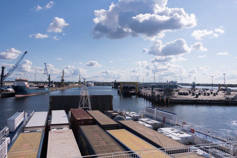
TT Line
Departure port: Rostock
Mecklenburg-Vorpommern, Deutschland
54.0924445 12.1286127
Arrival port: Trelleborg
Provinz Schonen, Schweden
55.3759213.1461522
• Head toward Västra Vallgatan on Svenstorpsgatan. Go for 103 m.
• Turn left onto Västra Vallgatan. Go for 78 m.
• Turn left onto Västergatan. Go for 179 m.
• Turn right onto Bryggaregatan (108). Go for 129 m.
• Turn left onto 9 toward Ystad. Go for 2.5 km.
• Take the 2nd exit from roundabout onto Östra infarten (9) toward Ystad. Go for 1.5 km.
• Turn right toward Dalköpinge Strandväg. Go for 131 m.
• Turn left onto Dalköpinge Strandväg. Go for 470 m.
• Turn right onto Östra infarten (9) toward Ystad. Go for 10.5 km.
• Turn right toward Smyge Strandväg. Go for 18 m.
• Turn right onto Smyge Strandväg. Go for 106 m.
• Arrive at Smyge Strandväg. Your destination is on the left.
☍
11,3 km
( 12 min.)
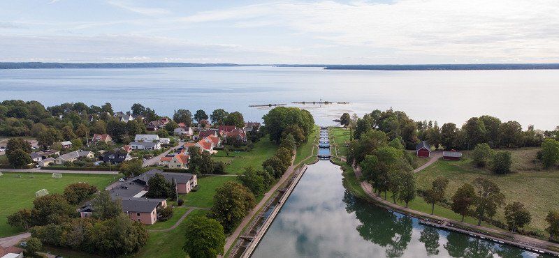
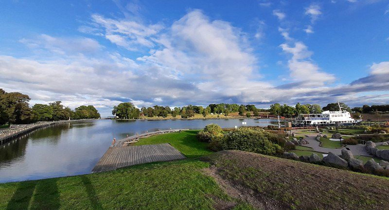
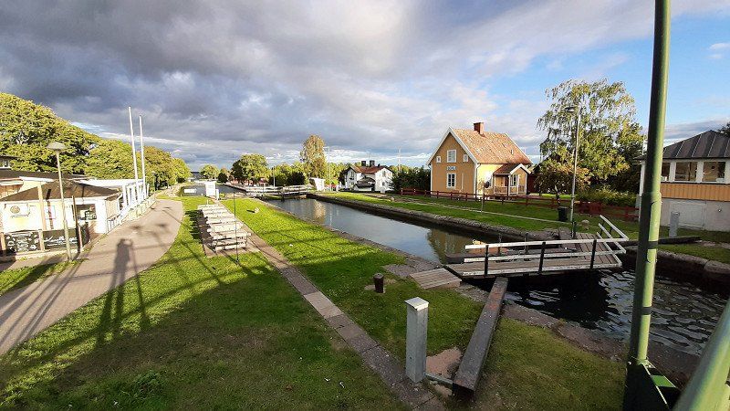
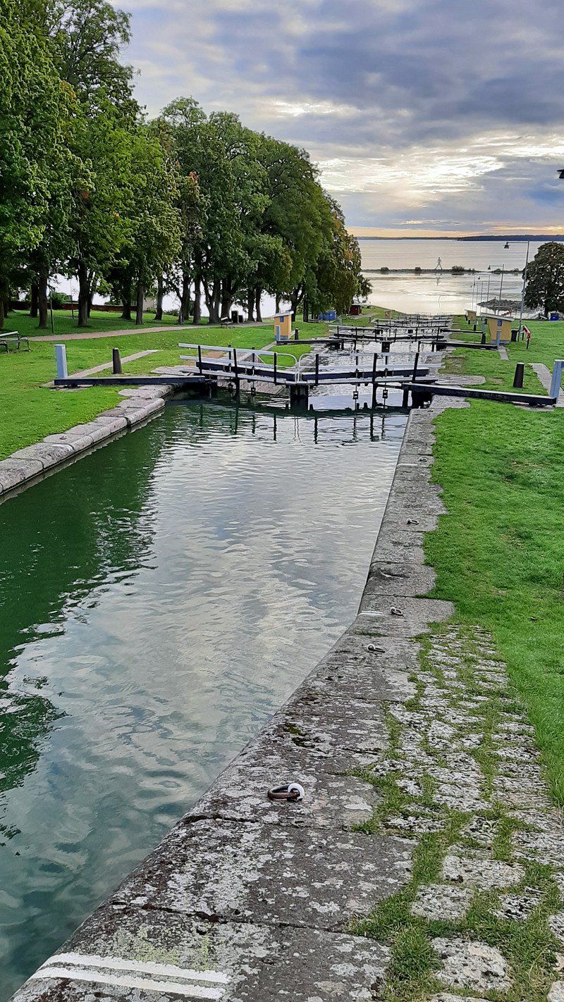
Day
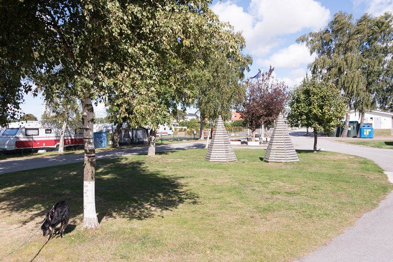
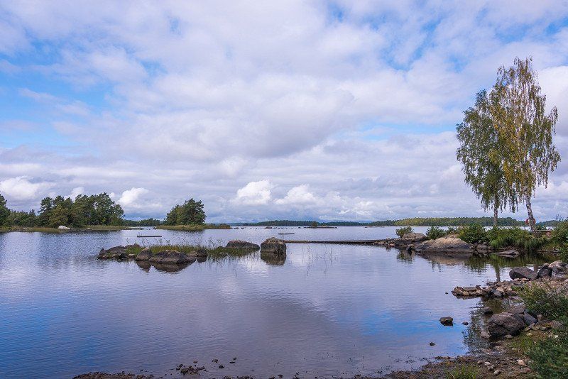
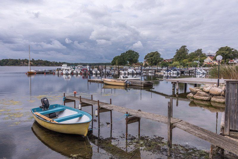
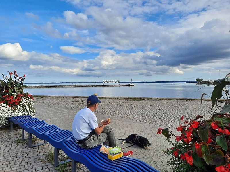
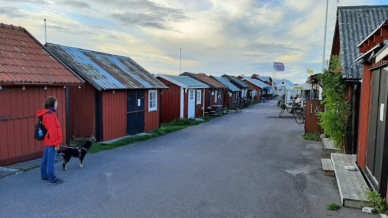
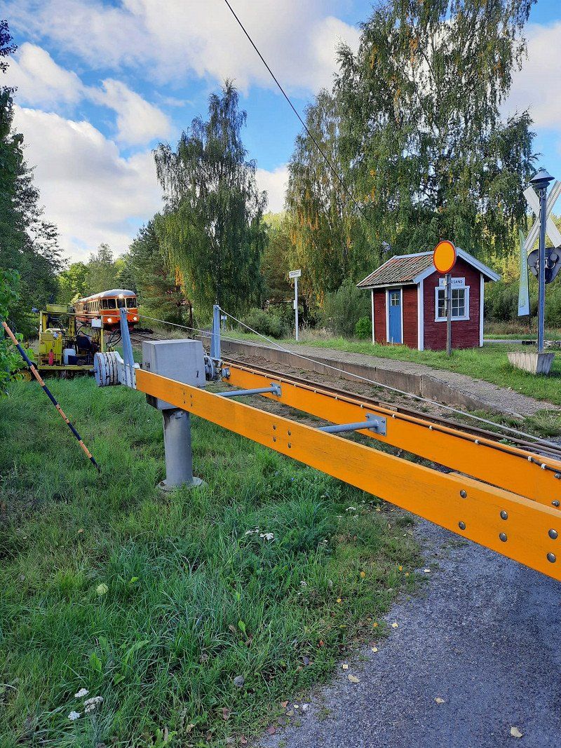
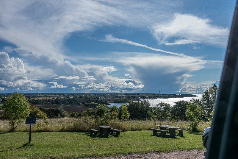
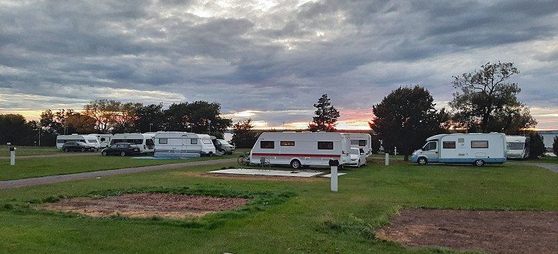
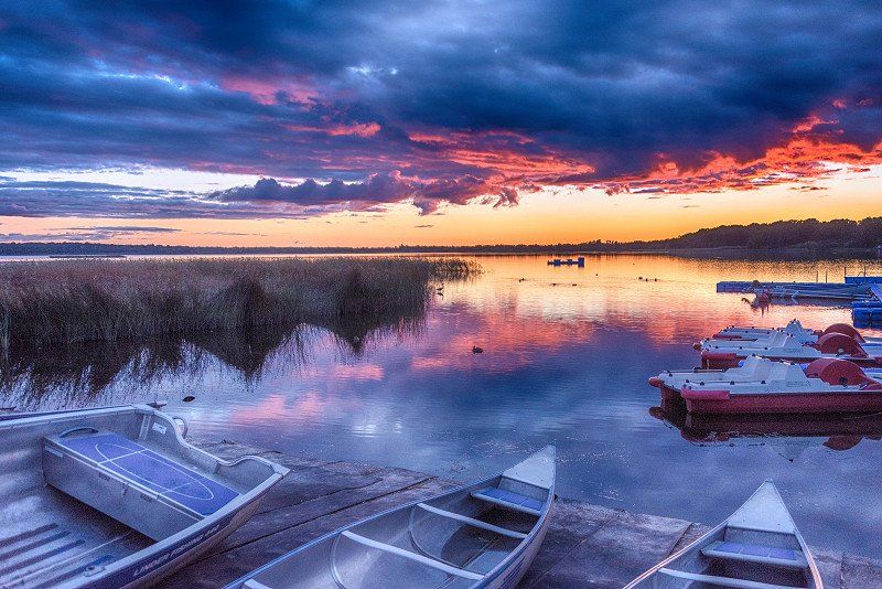
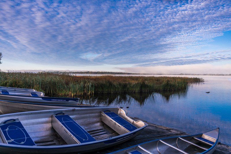
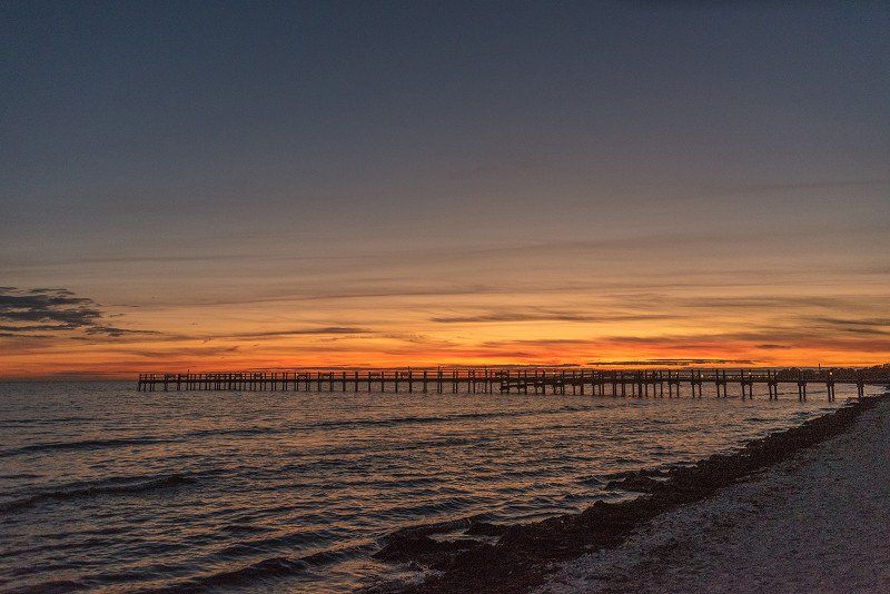
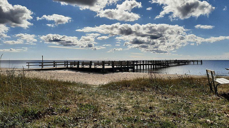
Camping und Sightseeing in Trelleborg
We stay 2 nights in this place. 4 km to the ferry, which is ideal when getting off the ferry or for the way back.
We then explored the city by bike.
Day
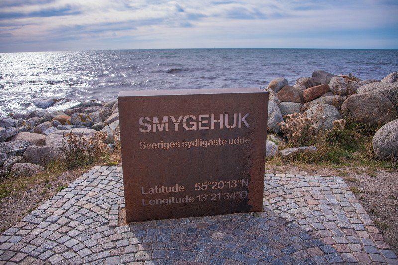
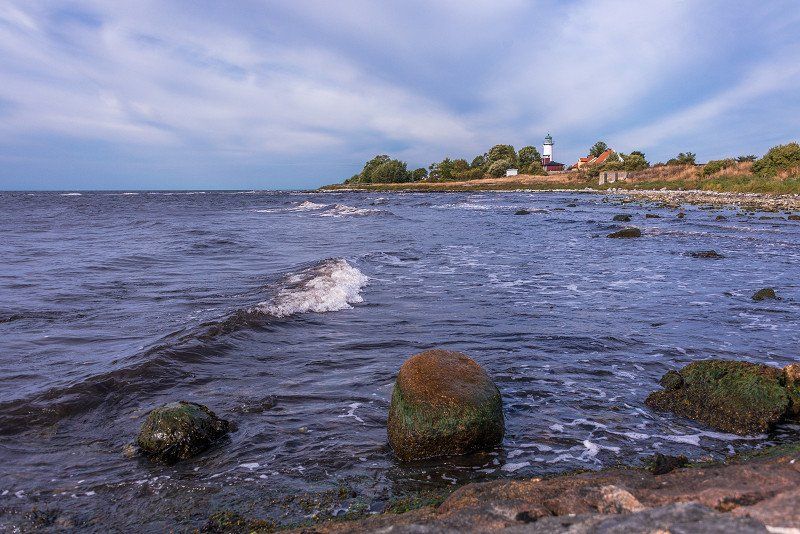
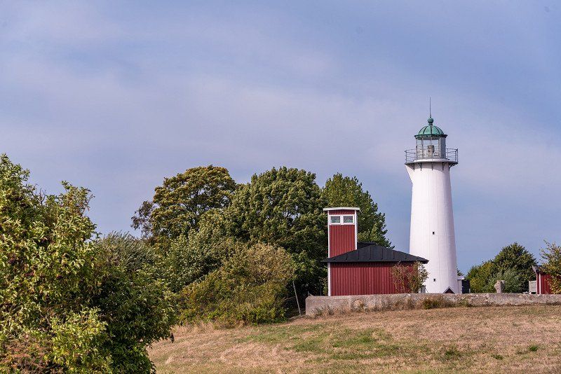
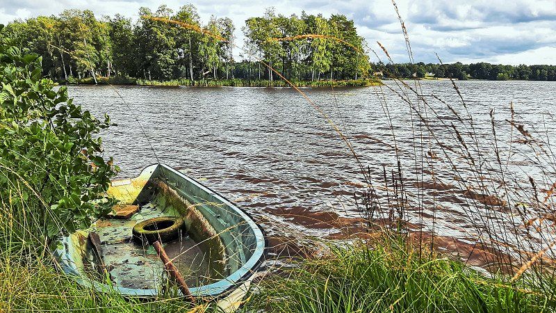
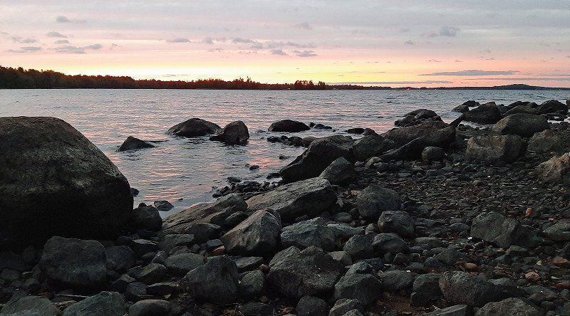
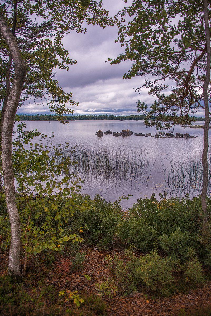
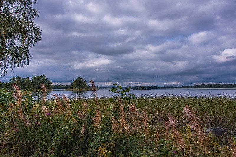
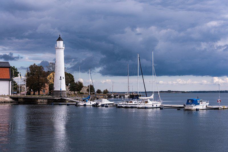
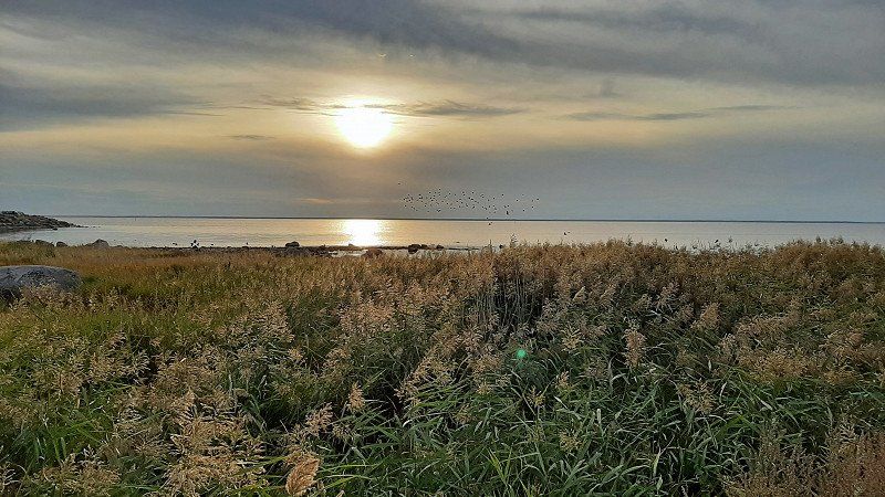
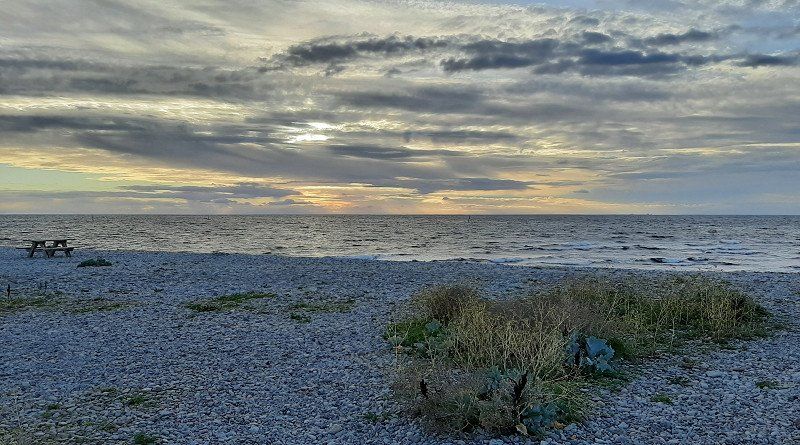
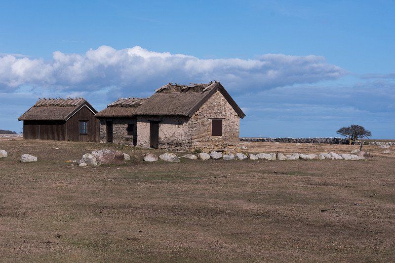
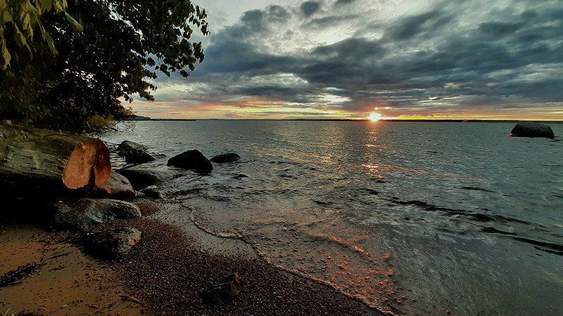
Smygehuk, Schweden
We start at the southernmost point of Sweden. A small lighthouse and a rather cute harbor can be visited.
55° 20' 18.4" N 13° 21' 35.3" E
55.3384522 13.3598038
• Head north on Smyge Strandväg. Go for 106 m.
• Turn left toward Smyge Strandväg/9. Go for 18 m.
• Turn right onto Smyge Strandväg (9). Go for 20.7 km.
• Turn right onto Mossby (9) toward Ystad. Go for 8.7 km.
• Turn right onto Västerleden. Go for 2.7 km.
• Take the 2nd exit from roundabout onto Kyrkogårdsgatan. Go for 675 m.
• Turn right onto Stora Norregatan. Go for 313 m.
• Turn left onto Stortorget. Go for 87 m.
• Arrive at Stortorget. Your destination is on the right.
☍
33,3 km
( 37 min.)
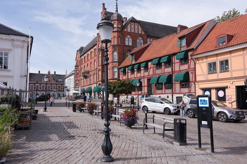
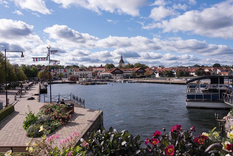
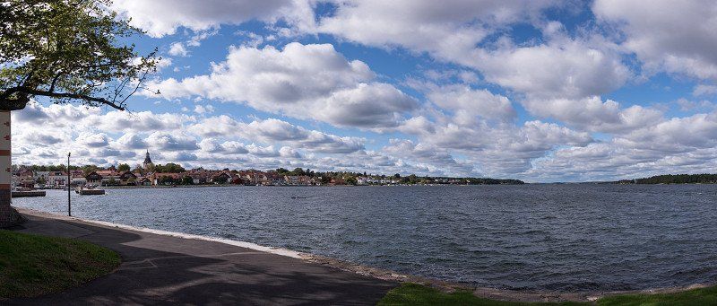
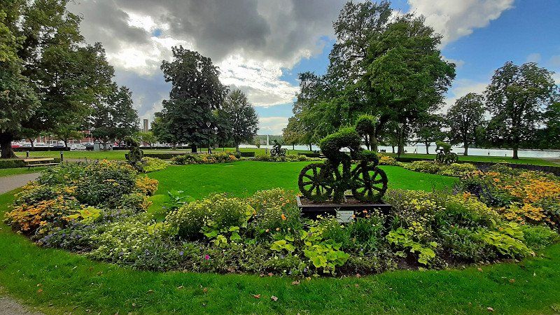
Ystad, Schweden
The journey continued to Ystad. Finding a parking space is not a problem if you have downloaded the various parking apps ;-). Inspector Wallander's town is quite interesting and has a cozy pedestrian street.
55° 25' 46.2" N 13° 49' 12.1" E
55.4295051 13.8200308
• Head west on Stortorget. Go for 87 m.
• Turn right onto Stora Norregatan. Go for 13 m.
• Turn left onto Klockaregränd. Go for 45 m.
• Turn left onto Lilla Norregatan. Go for 64 m.
• Turn left onto Stora västergatan. Go for 21 m.
• Turn right onto Teatergränd. Go for 45 m.
• Turn left onto Långgatan. Go for 61 m.
• Turn right onto Skansgränd. Go for 116 m.
• Turn left onto Sjömansgatan. Go for 150 m.
• Continue on Österleden. Go for 1.4 km.
• Take the 1st exit from roundabout onto Österleden (9) toward Simrishamn. Go for 8.5 km.
• Turn right onto Östra Kustvägen toward Kåseberga. Go for 7.8 km.
• Turn right onto Ales väg. Go for 384 m.
• Arrive at Ales väg.
☍
18,6 km
( 19 min.)
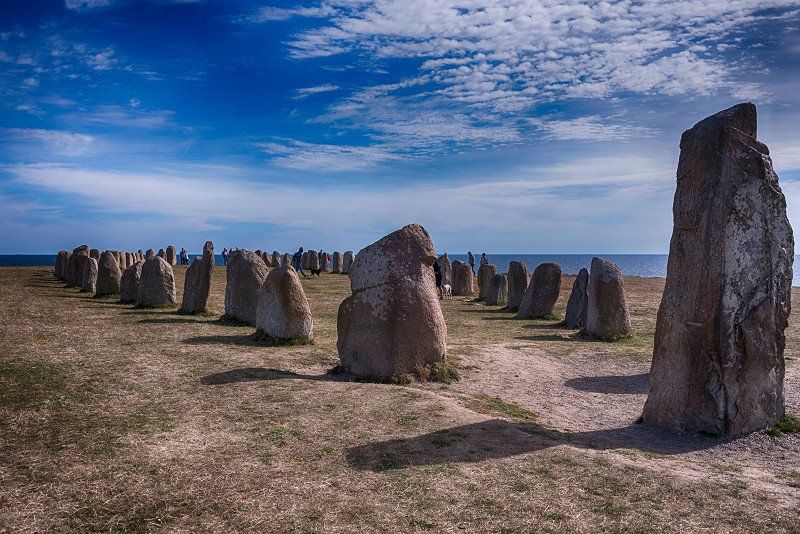
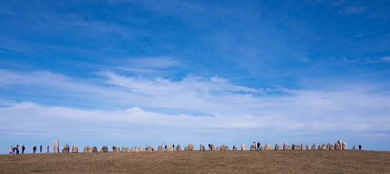
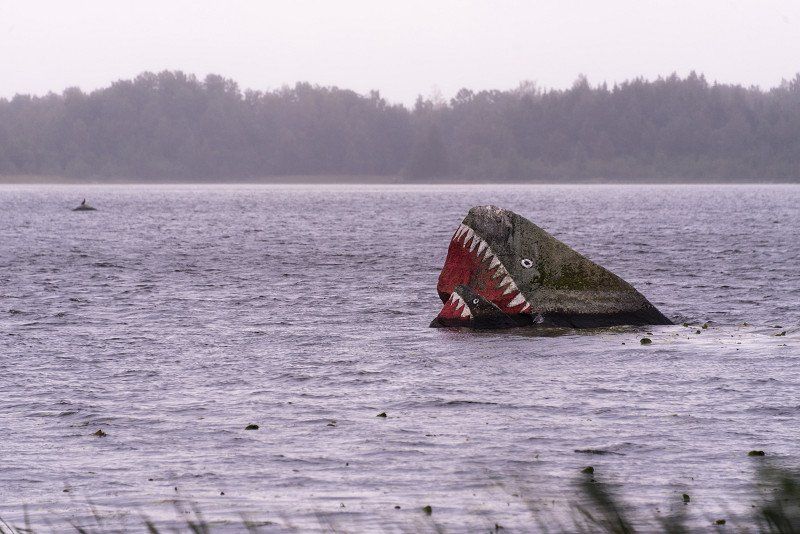
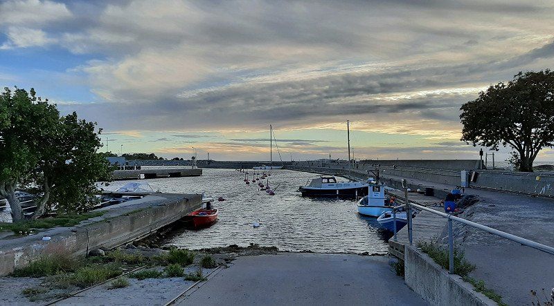
Kåseberga, Schweden ALES STENAR
The small town lives from the ship setting, which is very close by. A short walk of about 2 km leads to the destination - Ales Stenar.
You can then walk down to the harbour.
271 78 Kåseberga, Schweden
55° 23' 11.6" N 14° 3' 54.4" E
55.3865519 14.0651143
• Head toward Hommevägen on Ales väg. Go for 384 m.
• Turn right onto Egebjersvägen. Go for 567 m.
• Continue on Östra Kustvägen. Go for 6.2 km.
• Continue on Ingridvägen. Go for 608 m.
• Continue on Östra Kustvägen. Go for 189 m.
• Continue on Gamla Järavägen. Go for 234 m.
• Continue on Östra Kustvägen. Go for 2.9 km.
• Continue on Örnahusvägen. Go for 7.5 km.
• Continue on Strandgatan. Go for 729 m.
• Continue on Hamngatan. Go for 161 m.
• Take the 1st exit from roundabout onto Kaptensgatan. Go for 619 m.
• Continue on Gislövsdalsvägen. Go for 340 m.
• Turn right onto Höga vägen. Go for 8.4 km.
• Take the 2nd exit from roundabout onto Christian IV:s väg (9) toward Kristianstad. Go for 288 m.
• Pass 2 roundabouts and continue on Storgatan (9). Go for 1.4 km.
• Turn left onto Yngve Östbergs väg (9) toward Kristianstad. Go for 351 m.
• Turn left onto Kristianstadsvägen (9) toward Kristianstad. Go for 1.9 km.
• Turn right onto Tobisvägen. Go for 253 m.
• Arrive at Tobisvägen. Your destination is on the left.
From Käseberga we went to the above campsite. Very clean and located directly on the Baltic Sea. Priced one of the more expensive places with about 30 euros for everything.
But there wasn't much going on anymore.
Tobisvägen 38, 272 94 Simrishamn, Schweden
55° 34' 12.2" N 14° 20' 10.6" E
55.5700457 14.3362766
• Head north on Tobisvägen. Go for 253 m.
• Turn right onto Norra Infartsvägen (9). Go for 25.9 km.
• Turn right onto 9/19 toward Kristianstad. Go for 28.9 km.
• Turn right onto 9/19 toward Karlskrona/Kristianstad. Go for 2.5 km.
• Take ramp onto E22 (Malmövägen). Go for 5.5 km.
• Continue on 9/19 (Malmövägen) toward Helsingborg/21/Hässleholm/Osby/Vilan/Härlöv. Go for 629 m.
• Take the 3rd exit from roundabout onto Ringelikorsvägen (19) toward Osby/Broby. Go for 10.6 km.
• Pass 2 roundabouts and continue on 19. Go for 22.1 km.
• Continue on 23 toward Växjö/19/Älmhult. Go for 9.2 km.
• Take the 3rd exit from roundabout onto Kristianstadsgatan toward Osby S C/Osby S. Go for 2.3 km.
• Turn left onto Östra Storgatan. Go for 270 m.
• Take the 2nd exit from roundabout onto Södra Portgatan. Go for 193 m.
• Turn right onto Västra Storgatan. Go for 293 m.
• Turn left onto Klockaregatan. Go for 45 m.
• Arrive at Klockaregatan. Your destination is on the left.
☍
108,7 km
(1 hrs. 28 min.)
Day
Osby, Schweden
Via Broby and Osby we finally reach the Älmhult area. Ikea and Co. say hello. The area is quite nice.
56° 22' 53.5" N 13° 59' 34.6" E
56.3815355 13.9929413
• Head toward Parkgatan on Klockaregatan. Go for 73 m.
• Turn right onto Parkgatan. Go for 141 m.
• Turn right onto Köpmannagatan. Go for 116 m.
• Turn left onto Västra Storgatan. Go for 295 m.
• Take the 1st exit from roundabout onto Ågatan (15) toward 19/23/Lönsboda. Go for 194 m.
• Pass 2 roundabouts and continue on 15. Go for 2.4 km.
• Take the 3rd exit from roundabout onto 23 toward Växjö/Älmhult. Go for 19.2 km.
• Take ramp onto Haganäsleden (120) toward Traryd/Älmhult C/Stena industriområde. Go for 570 m.
• Pass 2 roundabouts and continue on Hallandsvägen (120). Go for 1.7 km.
• Take the 1st exit from roundabout onto Bäckgatan toward Pjätteryd/Stena. Go for 218 m.
• Turn left onto Kyrkogatan. Go for 164 m.
• Continue on Ljungbyvägen. Go for 1.4 km.
• Continue on Bokhults Hantverksgård. Go for 93 m.
• Turn right toward Badvägen. Go for 11 m.
• Continue on Badvägen. Go for 161 m.
• Turn right onto Bökhult. Go for 356 m.
• Turn left onto Badvägen. Go for 12 m.
• Turn slightly right onto Badvägen. Go for 42 m.
• Arrive at Badvägen. Your destination is on the right.
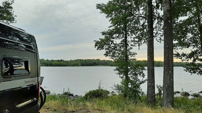
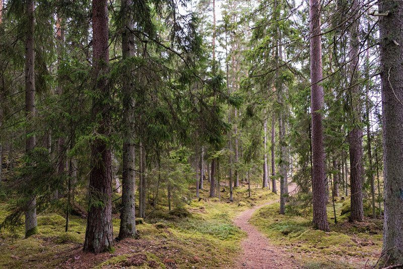
The campsite is in a very rustic location in the forest on the outskirts of Älmhult. Direct access to the lake is probably a hit, especially in summer.
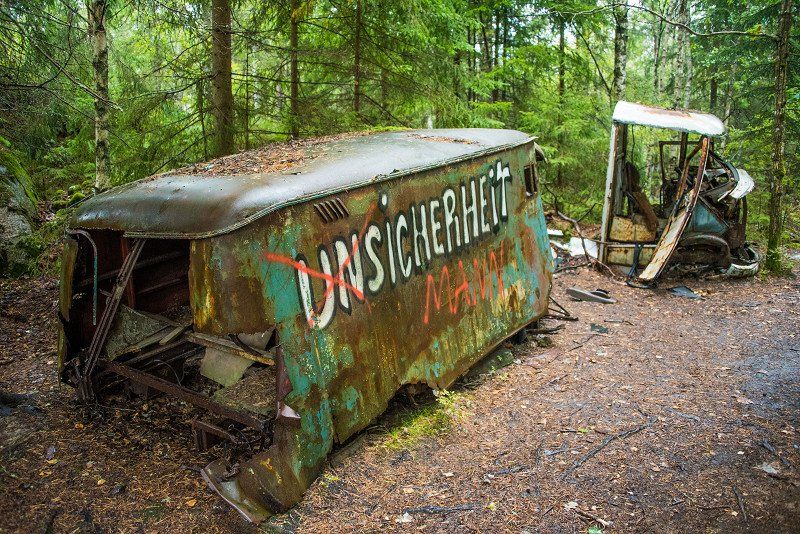
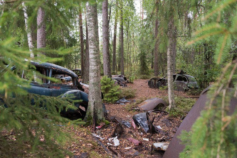
Before we leave for the next campsite, we pay a visit to a car graveyard. We don't find it that interesting now, but we have to pass the time ;-)
Värendsgatan, 360 10 Ryd, Schweden
56° 27' 58.3" N 14° 39' 18.6" E
56.4661868 14.6551576
• Head east on Kyrkön (119). Go for 2.4 km.
• Turn left onto Storgatan (126). Go for 3.1 km.
• Turn left onto 120/126. Go for 4.4 km.
• Turn right onto Ålshult. Go for 654 m.
• Continue on Ålshult Sjöklint. Go for 37 m.
• Continue on Ålshult. Go for 109 m.
• Turn left onto Ålshult Sjödalen. Go for 240 m.
• Continue on Toftahult. Go for 258 m.
• Continue on Toftahult Marmelund. Go for 501 m.
• Continue on Toftåsa Solhem. Go for 1.7 km.
• Continue on Toftåsa. Go for 649 m.
• Turn left toward Getnö gård Abborrestugan. Go for 3.5 km.
• Continue on Getnö gård Abborrestugan. Go for 309 m.
• Turn right onto Getnö gård Rättarebostaden. Go for 14 m.
• Arrive at Getnö gård Rättarebostaden. Your destination is on the left.
☍
17,9 km
( 25 min.)
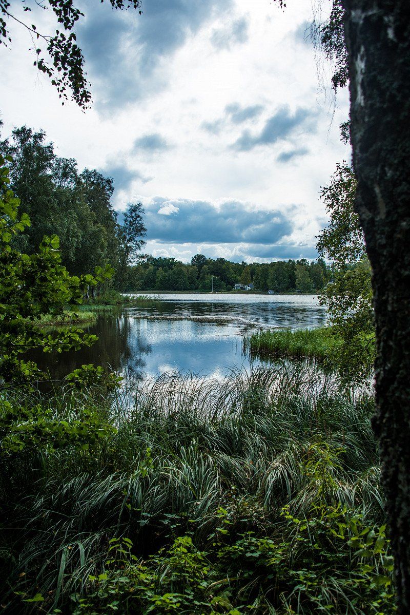
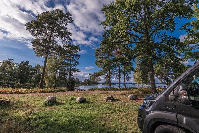
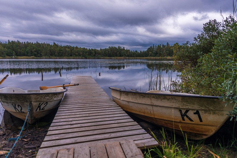
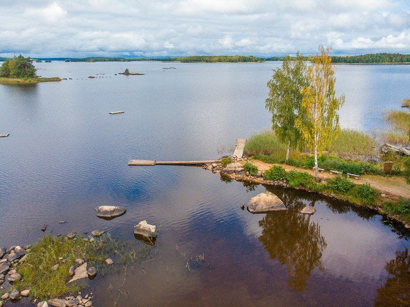
Getnö Gård - Lake Åsnen Resort, Ryd, Schweden
The most beautiful campsite in our holiday this year.
A place laid out over terraces in the middle of the forest. Located directly at Åsnen.
We felt so comfortable that we immediately extended one more night here. However, it has its price: in the front row 36 euros. We were all alone the first night, and on the second night we had neighbors within earshot.
Getnö Gård AB, Getnö Gård, 362 96 Ryd, Schweden
56° 35' 4.6" N 14° 41' 41.2" E
56.5846038 14.6947743
• Head toward Getnö gård Annexet on Getnö gård Rättarebostaden. Go for 14 m.
• Turn left onto Getnö gård Abborrestugan. Go for 4.4 km.
• Continue on Toftåsa. Go for 97 m.
• Continue on Toftåsa Solhem. Go for 1.7 km.
• Continue toward Toftahult Marmelund. Go for 282 m.
• Keep right onto Toftahult Marmelund. Go for 219 m.
• Continue on Toftahult. Go for 258 m.
• Continue on Ålshult Sjödalen. Go for 240 m.
• Turn right onto Ålshult. Go for 109 m.
• Continue on Ålshult Sjöklint. Go for 37 m.
• Continue on Ålshult. Go for 654 m.
• Turn left onto 120/126. Go for 4.4 km.
• Turn left onto 120. Go for 18.4 km.
• Turn right onto 27/29/120. Go for 38.8 km.
• Pass 5 roundabouts and continue on Strandgatan (E22.4). Go for 3.0 km.
• Turn right onto Söderbro. Go for 140 m.
• Continue on Blasius Königsgatan. Go for 899 m.
• Continue on Risatorpsvägen. Go for 2.1 km.
• Continue on Droppemålavägen. Go for 749 m.
• Continue on Droppemåla. Go for 7 m.
• Continue on Droppemålavägen. Go for 269 m.
• Take the 2nd exit from roundabout onto Droppemålavägen. Go for 460 m.
• Arrive at Droppemålavägen.
☍
77,2 km
(1 hrs. 12 min.)
Day
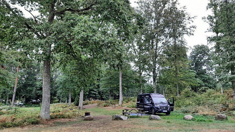
nach wie vor Getnö Gård Lake Åsnen Resort
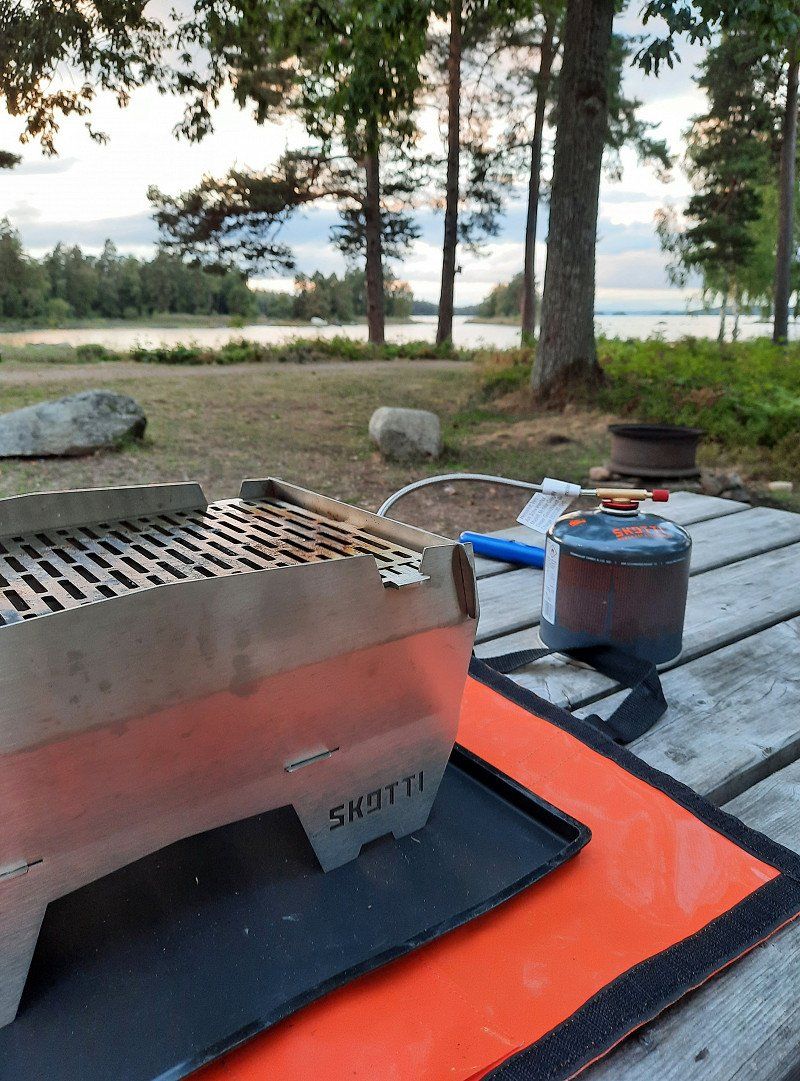
We go on a great hike here, have a cozy barbecue on the specially created barbecue area on the seating area provided, just great.
Day
Ronnebyhamn, Schweden
The journey continues. Via Rönneby Hamn we then get to ...
372 73 Ronnebyhamn, Schweden
56° 10' 22.7" N 15° 16' 50.6" E
56.1729772 15.2807113
• Head east on Droppemålavägen. Go for 421 m.
• Continue on Ekenäsvägen. Go for 929 m.
• Continue on Hamnvägen. Go for 791 m.
• Turn right toward Heabyvägen. Go for 360 m.
• Continue on Heabyvägen. Go for 1.6 km.
• Continue on Heabyvägen. Go for 225 m.
• Turn left onto Gövägen. Go for 1.9 km.
• Turn right onto Gärestadsvägen. Go for 640 m.
• Continue on Gärestadsvägen. Go for 89 m.
• Continue on Aspanvägen. Go for 372 m.
• Continue on Gärestadsvägen. Go for 460 m.
• Turn right onto E22. Go for 1.7 km.
• Pass 2 roundabouts and continue on E22. Go for 8.1 km.
• Take ramp toward Nättraby/Skärva. Go for 212 m.
• Turn left toward Karlskrona/Bjärby. Go for 131 m.
• Turn right onto Gamla Landsvägen. Go for 2.5 km.
• Turn left onto Boråkravägen. Go for 2.2 km.
• Continue on Silletorpsvägen. Go for 1.3 km.
• Take the 2nd exit from roundabout. Go for 182 m.
• Continue on Silletorpsvägen. Go for 123 m.
• Continue on Silletorpsvägen. Go for 192 m.
• Turn left onto Ronnebyvägen (E22) toward Karlskrona. Go for 1.7 km.
• Take the 1st exit from roundabout onto Sunnavägen (E22). Go for 580 m.
• Keep left onto Sunnavägen (E22) toward Centrum. Go for 246 m.
• Take ramp onto Österleden (28). Go for 3.1 km.
• Turn left onto Skeppsbrokajen. Go for 360 m.
• Turn right onto Drottninggatan. Go for 622 m.
• Turn right onto Kyrkogatan. Go for 164 m.
• Turn right onto Stortorget. Go for 44 m.
• Turn left onto Fredrikskyrkan. Go for 112 m.
• Arrive at Fredrikskyrkan. Your destination is on the left.
☍
31,6 km
( 33 min.)
Karlskrona, Schweden
Karlskrona. We only make a short flying visit, because we don't particularly like the place. Unfortunately, there are construction sites everywhere, so that the sights are not easy to reach.
56° 9' 40.4" N 15° 35' 12.8" E
56.1612240 15.5869000
• Head toward Norra Smedjegatan on Fredrikskyrkan. Go for 112 m.
• Turn right onto Stortorget. Go for 44 m.
• Turn left onto Kyrkogatan. Go for 164 m.
• Turn left onto Drottninggatan. Go for 622 m.
• Turn left onto Skeppsbrokajen. Go for 310 m.
• Turn right onto Österleden (28). Go for 4.5 km.
• Continue on Österleden (28). Go for 877 m.
• Take the 2nd exit from roundabout onto Österleden (28) toward Vetlanda/Växjö/27/E22/Malmö/Kalmar. Go for 200 m.
• Take ramp onto E22 toward Kalmar. Go for 38.9 km.
• Turn right toward Bergkvara hamn. Go for 625 m.
• Continue on Skällenäs Lugnet. Go for 255 m.
• Continue on Malmgatan. Go for 804 m.
• Turn left onto Hamngatan. Go for 363 m.
• Continue on Storgatan. Go for 130 m.
• Turn right onto Dalskärsvägen. Go for 535 m.
• Arrive at Dalskärsvägen. Your destination is on the left.
☍
48,4 km
( 41 min.)
Dalskärs Camping
About 50 km before Kalmar we land at Bergkvara on this campsite. Here, too, the reception is no longer manned. Short call: stand where you want. :-) The season is over, we're a bit surprised.
Dalskärsvägen 11, 38540, Bergkvara, Sweden
56° 23' 29.3" N 16° 5' 26.2" E
56.3914800 16.0906100
• Head southwest on Dalskärsvägen. Go for 463 m.
• Turn slightly left onto Dalskärsvägen. Go for 72 m.
• Turn right onto Storgatan. Go for 1.4 km.
• Turn right onto Kungsvägen (E22). Go for 39.0 km.
• Take the exit toward Kalmar C/Centrum onto E22.9 (Erik Dahlbergs väg). Go for 765 m.
• Pass 2 roundabouts and continue on Erik Dahlbergs väg (E22.9). Go for 1.2 km.
• Turn right onto Norra vägen. Go for 226 m.
• Take the 2nd exit from roundabout onto Norra vägen. Go for 423 m.
• Turn left onto Unionsgatan. Go for 30 m.
• Turn right onto Jenny Nyströms gränd. Go for 158 m.
• Turn right. Go for 25 m.
• Arrive at your destination on the right.
☍
43,8 km
( 34 min.)
Day
Kalmar, Schweden
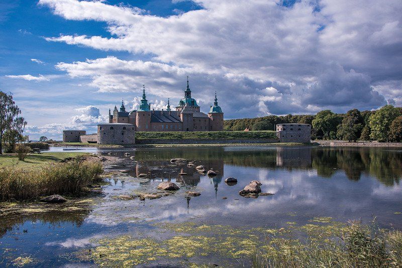
Before we head over to Öland, we pay a visit to Kalmar. We have no regrets. In bright sunshine we pay a visit to the castle and the old town. Great !
56° 39' 48.4" N 16° 21' 24.4" E
56.6634447 16.3567790
• Head toward Jenny Nyströms gränd. Go for 25 m.
• Turn left onto Jenny Nyströms gränd. Go for 158 m.
• Turn left onto Unionsgatan. Go for 30 m.
• Turn right onto Norra vägen. Go for 104 m.
• Turn right onto Esplanaden. Go for 241 m.
• Take the 1st exit from roundabout onto Malmbron. Go for 66 m.
• Turn left onto Södra Kanalgatan. Go for 218 m.
• Take the 2nd exit from roundabout onto Södra Kanalgatan. Go for 374 m.
• Turn left onto Ängöleden. Go for 139 m.
• Take the 2nd exit from roundabout onto Ängöleden. Go for 1.9 km.
• Take ramp onto Ölandsleden (137) toward Öland. Go for 10.5 km.
• Continue on 136. Go for 24.8 km.
• Turn left onto Storgatan. Go for 779 m.
• Turn right onto Tullgatan. Go for 292 m.
• Turn left onto Sandgatan. Go for 159 m.
• Turn right onto Fritidsvägen. Go for 91 m.
• Turn left onto Fritidsvägen. Go for 84 m.
• Turn right. Go for 37 m.
• Arrive at your destination.
☍
40,0 km
( 38 min.)
Kapelludden Camping o Stugor
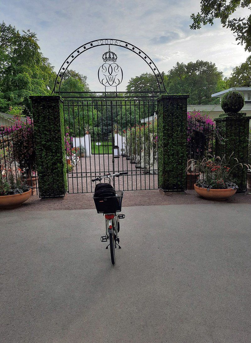
In the evening we stranded in Borgholm on Öland at the above campsite.
Here we take a bike tour to the summer residence of the Swedish royal family, Sollidens Slot, and also look at the ruins of Borgholm Slot from a distance.
38731, Borgholm, Sweden
56° 52' 59" N 16° 39' 26" E
56.8830600 16.6572200
• Head south. Go for 37 m.
• Turn left onto Fritidsvägen. Go for 84 m.
• Turn right onto Fritidsvägen. Go for 91 m.
• Turn left onto Sandgatan. Go for 242 m.
• Continue on Norra infarten. Go for 1.2 km.
• Take the 3rd exit from roundabout onto Köpingevägen (136). Go for 40.2 km.
• Pass 2 roundabouts and continue on 136. Go for 17.7 km.
• Turn right toward Grankullavägen. Go for 1.7 km.
• Continue on Grankullavägen. Go for 5.5 km.
• Turn right onto Trollskogsvägen. Go for 2.2 km.
• Arrive at Trollskogsvägen. Your destination is on the left.
☍
68,9 km
(1 hrs. 1 min.)
Day
Trollskogen, Trollskogsvägen, Byxelkrok, Schweden
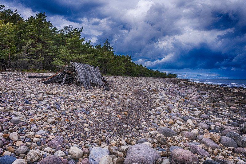
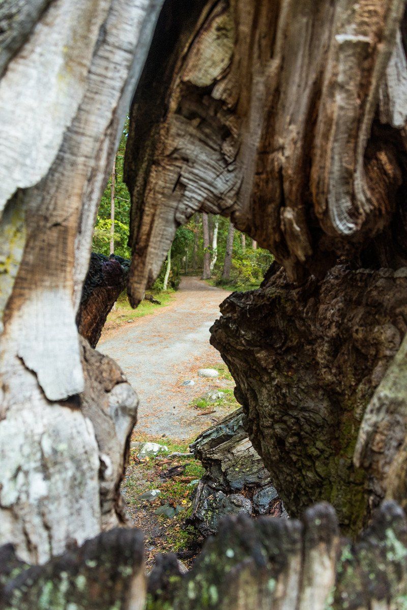
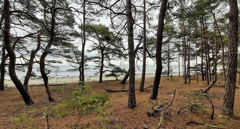
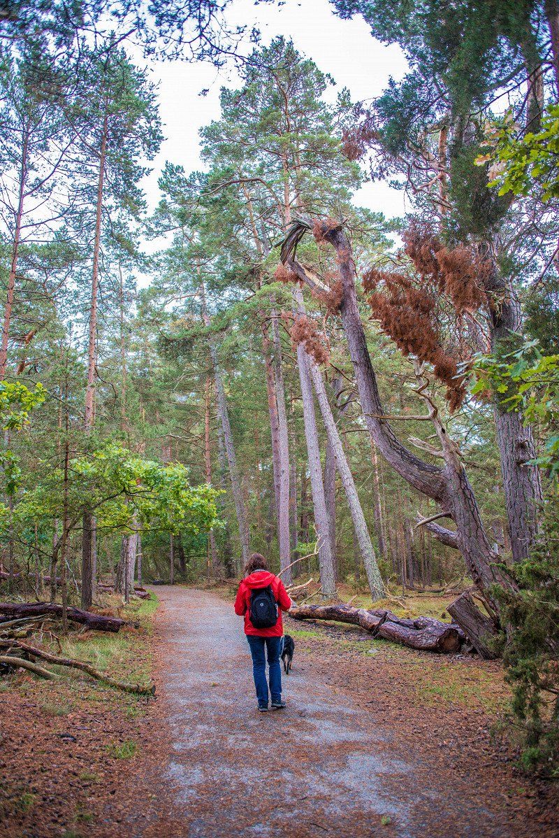
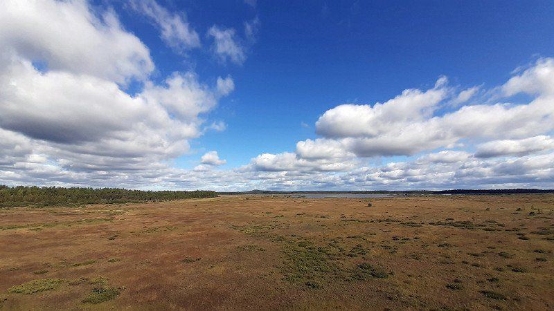
We drive to the north of Öland and look around the Trollskogen National Park. It's nice here, a hike of about 6 km leads through the forest and always along the Baltic Sea.
Trollskogsvägen 20, 387 75 Byxelkrok, Schweden
57° 20' 33.6" N 17° 7' 8.6" E
57.3426559 17.1190508
• Head east on Trollskogsvägen. Go for 63 m.
• Turn right onto Trollskogsvägen. Go for 55 m.
• Turn left onto Trollskogsvägen. Go for 2.0 km.
• Turn right onto Grankullavägen. Go for 2.4 km.
• Continue on Nabbelundsvägen (136). Go for 5.6 km.
• Turn left onto Småskogsvägen. Go for 210 m.
• Arrive at Småskogsvägen. Your destination is on the right.
We spend the night in the north and are surprised again that there is hardly anything going on here. There are 12 pubs and restaurants at the port, only one is still open. The season would already be over and it's not worth leaving everything open. Funny.
Småskogsvägen 2, 387 75 Byxelkrok, Schweden
57° 19' 48.9" N 17° 0' 42.4" E
57.3302398 17.0117861
• Head toward Neptunivägen on Småskogsvägen. Go for 210 m.
• Turn left onto Neptunivägen (136). Go for 652 m.
• Pass 3 roundabouts and continue on 136. Go for 57.4 km.
• Turn left onto Öjvägen. Go for 66 m.
• Turn right onto Ramsättravägen. Go for 2.8 km.
• Continue on Mölle Kalles väg. Go for 126 m.
• Continue on Ramsättravägen. Go for 504 m.
• Continue on Ramsättravägen. Go for 283 m.
• Continue on Ramsättravägen. Go for 1.7 km.
• Continue on Ramsättravägen. Go for 139 m.
• Continue on Ramsättravägen. Go for 590 m.
• Continue on Ramsättravägen. Go for 306 m.
• Continue on Ramsättravägen. Go for 695 m.
• Continue on Ramsättravägen. Go for 427 m.
• Turn left onto Östra Sörbyvägen. Go for 777 m.
• Continue on Lergatvägen. Go for 792 m.
• Turn right onto Störlinge. Go for 595 m.
• Continue on Störlinge. Go for 1.8 km.
• Continue on Södra Gärdslösa. Go for 551 m.
• Continue on Södra Gärdslösa. Go for 1.2 km.
• Continue on Rosenborg. Go for 1.7 km.
• Continue on Långlöt. Go for 1.1 km.
• Continue on Långlötsmosse. Go for 983 m.
• Continue on Folkeslunda. Go for 937 m.
• Continue on Folkeslunda. Go for 745 m.
• Continue on Lerkaka. Go for 1.3 km.
• Continue on Bjärby. Go for 1.0 km.
• Continue on Runsten. Go for 1.4 km.
• Continue on Lopperstad. Go for 1.4 km.
• Continue on Åkerby. Go for 2.7 km.
• Continue on Norra Möckleby. Go for 1.3 km.
• Continue on Norra Möckleby. Go for 273 m.
• Continue on Norra Möckleby. Go for 507 m.
• Continue on Norra Möckleby. Go for 479 m.
• Continue on Dörby. Go for 894 m.
• Continue toward Dörby. Go for 57 m.
• Continue on Dörby. Go for 2.6 km.
• Continue on Gårdby. Go for 104 m.
• Continue on Stationsvägen. Go for 122 m.
• Continue on Gårdby. Go for 342 m.
• Continue on Gårdby. Go for 502 m.
• Continue on Gårdby. Go for 2.1 km.
• Continue on Vället. Go for 1.9 km.
• Continue on Södra Sandby. Go for 3.1 km.
• Continue on Norra Kvinneby. Go for 981 m.
• Continue on Norra Kvinneby. Go for 579 m.
• Continue on Stora Brunneby. Go for 576 m.
• Continue on Stora Brunneby. Go for 227 m.
• Continue on Lilla Brunneby. Go for 783 m.
• Continue on Stenåsa. Go for 1.1 km.
• Continue on Slagerstad. Go for 790 m.
• Continue on Södra Kvinneby. Go for 1.3 km.
• Continue on Alby. Go for 1.3 km.
• Continue on Alby. Go for 77 m.
• Continue on Triberga. Go for 735 m.
• Continue on Triberga. Go for 2.2 km.
• Continue on Hulterstad. Go for 1.4 km.
• Continue on Skärlöv. Go for 2.9 km.
• Continue on Skärlöv. Go for 904 m.
• Continue on Mellby. Go for 1.5 km.
• Continue on Mellby. Go for 638 m.
• Continue on Mellby. Go for 847 m.
• Continue on Segerstad. Go for 776 m.
• Continue on Nedra Segerstad. Go for 89 m.
• Continue on Nedra Segerstad. Go for 277 m.
• Continue on Nedra Segerstad. Go for 795 m.
• Continue on Segerstad. Go for 1.1 km.
• Continue on Seby. Go for 1.4 km.
• Continue on Seby. Go for 153 m.
• Continue on Seby. Go for 248 m.
• Continue toward Seby. Go for 184 m.
• Continue on Seby. Go for 207 m.
• Continue on Torngård. Go for 700 m.
• Continue on Gammalsby. Go for 776 m.
• Continue on Gammalsby. Go for 241 m.
• Continue on Mellstaby. Go for 1.4 km.
• Continue on Gräsgård. Go for 2.7 km.
• Turn right toward Eketorp. Go for 362 m.
• Continue on Eketorp. Go for 655 m.
• Turn right onto Eketorp. Go for 761 m.
• Arrive at Eketorp.
☍
130,8 km
(2 hrs. 3 min.)
Day
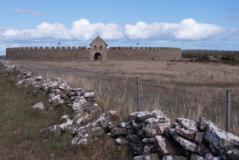
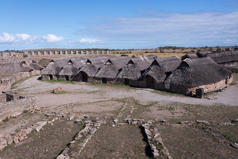
Eketorps borg, Eketorps, Degerhamn, Schweden
Today we cross the whole island and drive south on the east side.
We stop at the remains of Eketorps borg. It has been restored and is worth a short visit.
Eketorps, 380 65 Degerhamn, Schweden
56° 17' 45.5" N 16° 29' 10.4" E
56.2959625 16.4862113
• Head southwest on Eketorp. Go for 761 m.
• Turn right onto Eketorp. Go for 2.1 km.
• Continue on Lindby. Go for 2.0 km.
• Continue on Ventlinge-Lunda. Go for 923 m.
• Continue on Eketorpsvägen. Go for 871 m.
• Turn left onto Ottenbyvägen (136). Go for 4.4 km.
• Turn right toward Ottenby Fågelstation. Go for 4.3 km.
• Continue on Ottenby Fågelstation. Go for 89 m.
• Continue on Ottenby. Go for 46 m.
• Arrive at Ottenby. Your destination is on the right.
☍
15,5 km
( 21 min.)
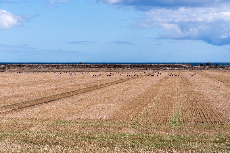
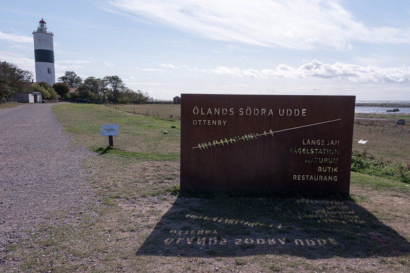
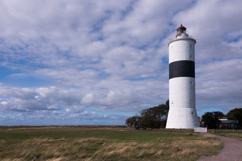
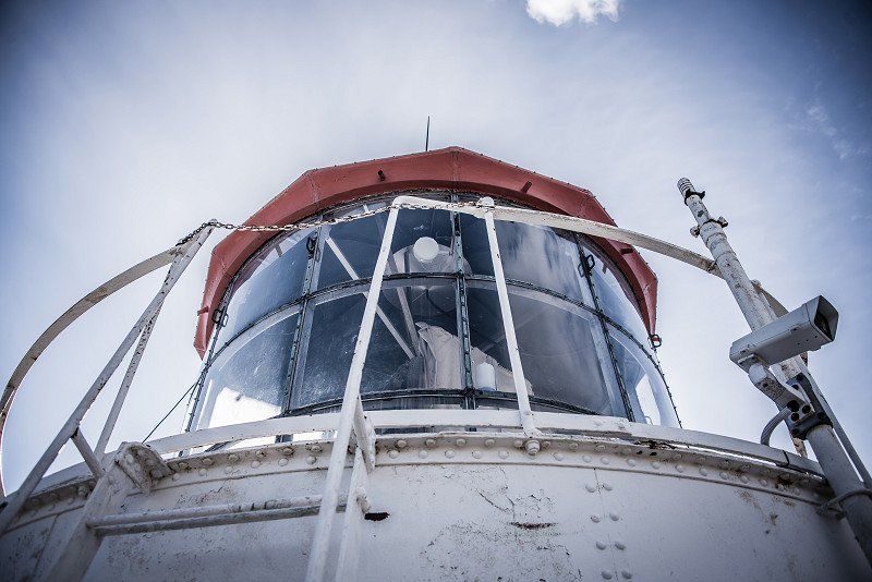
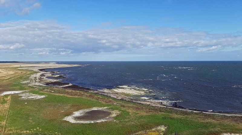
Långe Jan, Degerhamn, Schweden
We continue to the southern tip of Öland to Sweden's highest lighthouse. Of course, the ascent is part of it.
Ottenby 401, 386 64 Degerhamn, Schweden
56° 11' 45.7" N 16° 23' 54.6" E
56.1960403 16.3984891
• Head north on Ottenby. Go for 46 m.
• Continue on Ottenby Fågelstation. Go for 4.4 km.
• Turn left onto 136. Go for 14.4 km.
• Turn left onto Degerhamnsvägen. Go for 2.0 km.
• Continue on Årsvik. Go for 1.3 km.
• Turn left. Go for 308 m.
• Turn right. Go for 87 m.
• Arrive at your destination on the left.
☍
22,5 km
( 29 min.)
Sandviks Camping
We spend the last night on Öland. We didn't like the island that much. One hears again and again that it is Sweden's Mallorca, but certainly only in midsummer when everything is full.
Årsvik 102, 38065, Degerhamn, Sweden
56° 22' 41" N 16° 24' 17" E
56.3780600 16.4047200
• Head toward Årsvik. Go for 395 m.
• Turn left onto Årsvik. Go for 893 m.
• Continue on Hammarby. Go for 2.2 km.
• Continue on Smedby. Go for 723 m.
• Continue on Nedra Västerstad. Go for 1.1 km.
• Continue toward Övra Västerstad. Go for 516 m.
• Continue on Övra Västerstad. Go for 1.9 km.
• Continue on Bjärby. Go for 226 m.
• Turn left onto 136. Go for 26.8 km.
• Continue on Björnhovda. Go for 337 m.
• Take left ramp onto 137 toward Kalmar. Go for 12.5 km.
• Take the 2nd exit from Ölandsleden roundabout onto E22 toward Malmö/25/Flygplats/31. Go for 5.6 km.
• Take ramp toward Halmstad/Växjö/Nybro/Vetlanda/31. Go for 647 m.
• Continue on 25. Go for 22.0 km.
• Take the 3rd exit from roundabout onto Södra vägen (25) toward Halmstad/Växjö. Go for 29.9 km.
• Take the 1st exit from roundabout onto 28 toward Vetlanda/Lenhovda/Kosta/Åfors. Go for 12.7 km.
• Turn right onto Ekeberga Lillebo. Go for 276 m.
• Turn left onto Stora vägen. Go for 1.3 km.
• Arrive at Stora vägen.
☍
120,0 km
(1 hrs. 35 min.)
Day
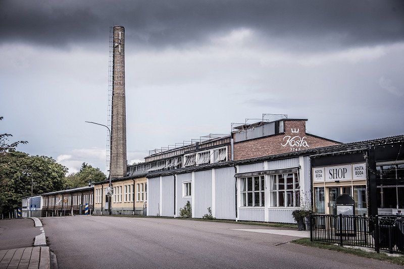
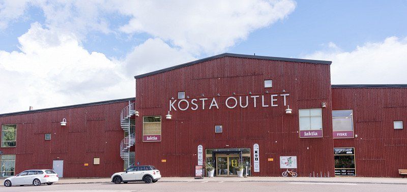
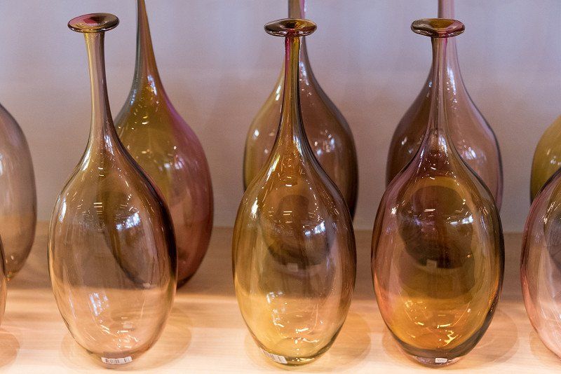
Kosta, Schweden
Back to the mainland. Via Nybro we drive to Kosta in the Kingdom of Crystal. However, apart from an outlet and numerous shops where glass is sold, there is not much to discover here and we drive on again after 3 hours.
360 52 Kosta, Schweden
56° 50' 38.6" N 15° 23' 45.7" E
56.8440678 15.3960304
• Head north on Stora vägen. Go for 170 m.
• Turn left onto Rydvägen. Go for 393 m.
• Turn right onto 28. Go for 8.7 km.
• Turn left onto 31. Go for 22.3 km.
• Turn right and take ramp toward Linköping/Oskarshamn/Åseda. Go for 258 m.
• Continue on 23/37. Go for 21.8 km.
• Turn left onto 23/125 toward Linköping/Målilla/Virserum/Vetlanda. Go for 33.5 km.
• Take the 2nd exit from roundabout onto 23/47 toward Linköping/Oskarshamn/Målilla. Go for 3.2 km.
• Take the 3rd exit from roundabout onto Vetlandavägen toward Centrum. Go for 611 m.
• Arrive at Vetlandavägen. Your destination is on the left.
☍
90,9 km
(1 hrs. 9 min.)
Målilla, Schweden
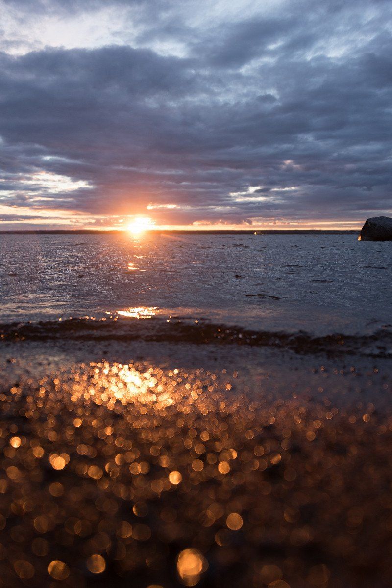
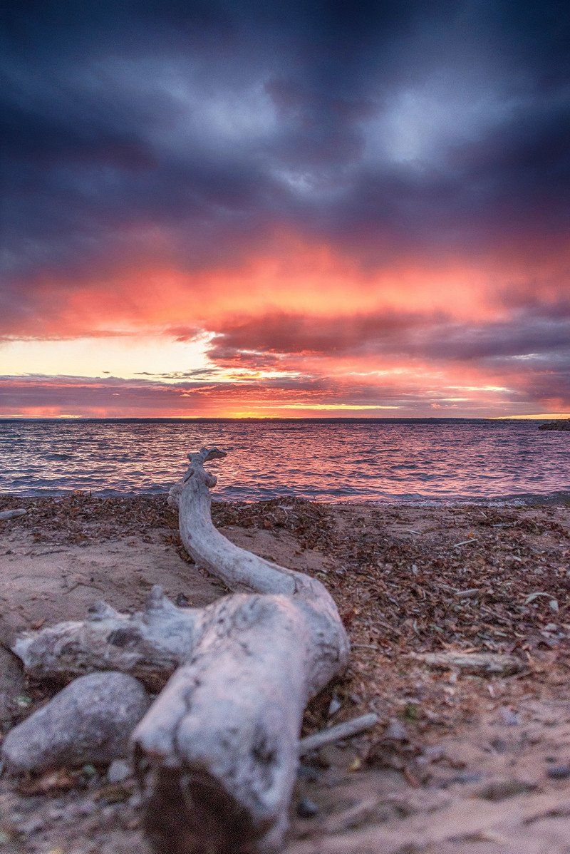
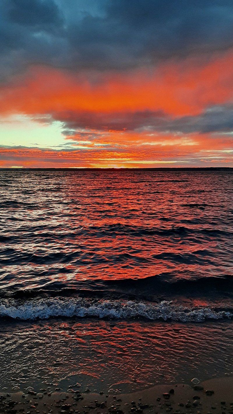
Today's stage ends just north of Målilla. We are standing by a small lake. We have to go straight through the middle of a construction site. In addition to us, a camper actually got lost here ;-) We are spoiled with a great sunset.
570 82 Målilla, Schweden
57° 23' 20.9" N 15° 48' 58.4" E
57.3891396 15.8162213
• Head east on Vetlandavägen. Go for 5 m.
• Take the 3rd exit from roundabout onto Vetlandavägen. Go for 564 m.
• Take the 2nd exit from roundabout onto 23/47 toward Växjö/Jönköping. Go for 3.2 km.
• Take the 2nd exit from roundabout onto 23 toward Växjö/Åseda/Virserum. Go for 948 m.
• Turn left toward L Sinnerstad/Gårdveda. Go for 478 m.
• Continue on Västra Tvetavägen. Go for 646 m.
• Continue on Gårdveda gamla skola. Go for 59 m.
• Continue on Gårdveda gamla Lärarbostad. Go for 134 m.
• Continue on Gårdveda gård. Go for 145 m.
• Continue on Gårdveda gård Tallbacken. Go for 93 m.
• Continue on Gårdveda Södergården. Go for 186 m.
• Continue on Gårdveda gård Åstugan. Go for 1.5 km.
• Continue on Kristineberg Sigridslund. Go for 1.4 km.
• Turn right. Go for 10 m.
• Turn slightly left. Go for 24 m.
• Arrive at your destination on the left.
☍
9,4 km
( 11 min.)
Day
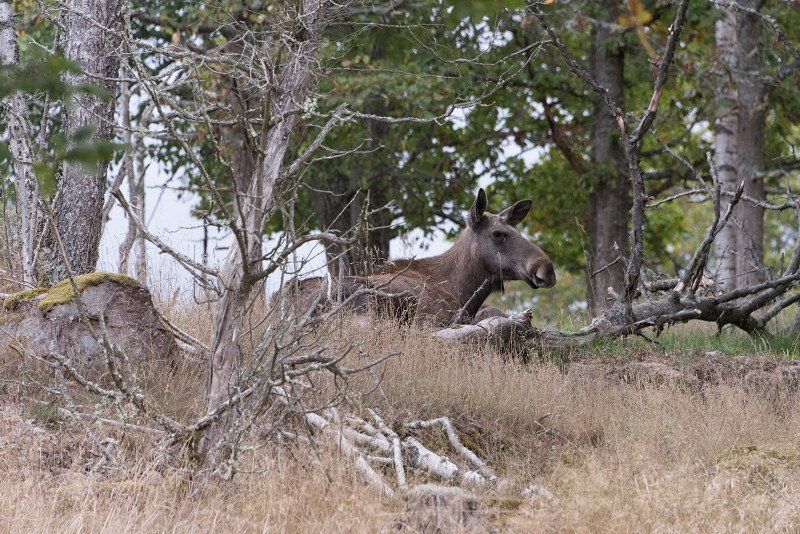
Målilla Älgpark, Målilla, Schweden
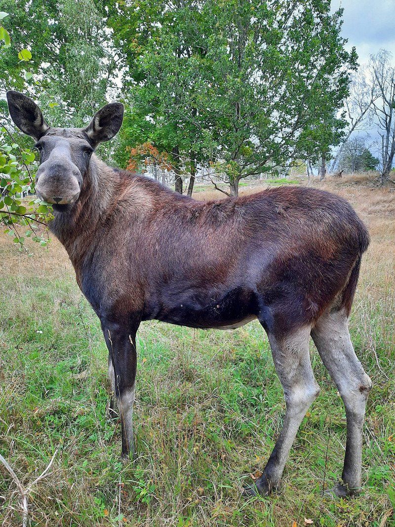
Hooray, we see moose. Not in the wild (it's like winning the lottery), but in a small but nice moose park. The boss also speaks good German and explains great.
Kristineberg, 570 82 Målilla, Schweden
57° 21' 10.2" N 15° 47' 16" E
57.3528340 15.7877680
• Head toward Kristineberg Flygel. Go for 66 m.
• Turn right onto Kristineberg. Go for 76 m.
• Turn left toward Kristineberg Sigridslund. Go for 882 m.
• Continue on Kristineberg Sigridslund. Go for 1.9 km.
• Continue on Gårdveda gård Åstugan. Go for 253 m.
• Continue on Gårdveda Södergården. Go for 82 m.
• Continue on Gårdveda gård Tallbacken. Go for 93 m.
• Continue on Gårdveda gård. Go for 145 m.
• Continue on Gårdveda gamla Lärarbostad. Go for 134 m.
• Continue on Gårdveda gamla skola. Go for 59 m.
• Continue on Västra Tvetavägen. Go for 646 m.
• Continue toward 23. Go for 478 m.
• Turn right onto 23. Go for 895 m.
• Take the 2nd exit from roundabout onto 23/47 toward Linköping/Oskarshamn/Målilla. Go for 3.2 km.
• Take the 4th exit from roundabout onto 23/34 toward Linköping/Vimmerby. Go for 14.7 km.
• Pass 2 roundabouts and continue on 23/34. Go for 17.7 km.
• Take ramp toward Vimmerby N C/Astrid Lindgrens Värld/Rumskulla. Go for 175 m.
• Turn left onto Vimmerbyallén. Go for 282 m.
• Take the 2nd exit from roundabout onto Vimmerbyallén. Go for 302 m.
• Take the 3rd exit from roundabout onto Lundgatan. Go for 1.0 km.
• Take the 3rd exit from roundabout onto Fabriksgatan. Go for 306 m.
• Turn left onto Fabriksgatan. Go for 102 m.
• Arrive at Fabriksgatan. Your destination is on the left.
☍
43,5 km
( 39 min.)
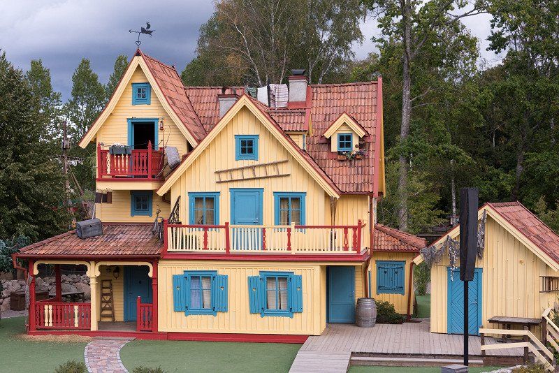
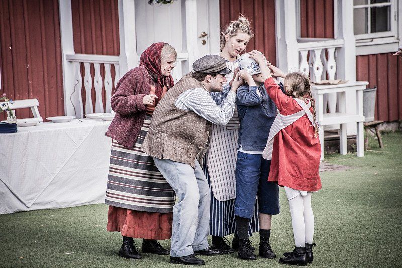
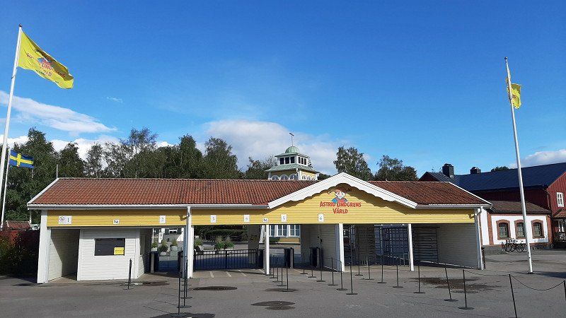
Astrid Lindgrens värld, Vimmerby, Schweden
The journey continues in the direction of Vimmerby. We visit the amusement park and unfortunately don't learn much new about the writer and her well-known book characters such as Pippi, Karlsson and Co. But we don't miss a show with Michel, who is called Emil in Sweden.
598 85 Vimmerby, Schweden
57° 40' 27.3" N 15° 50' 33.7" E
57.6742381 15.8426876
• Head north on Fabriksgatan. Go for 102 m.
• Turn left onto Fabriksgatan. Go for 75 m.
• Turn left onto Fabriksgatan. Go for 213 m.
• Turn right onto Fabriksgatan. Go for 498 m.
• Turn right onto Förrådsgatan. Go for 237 m.
• Take the 1st exit from roundabout onto Vimmerbyallén. Go for 1.4 km.
• Take the 2nd exit from roundabout onto Södra Ringleden. Go for 885 m.
• Take the 3rd exit from roundabout onto 40 toward Västervik/Astrid Lindgrens Värld. Go for 28.5 km.
• Arrive at 40. Your destination is on the left.
☍
31,9 km
( 25 min.)
Långsjön Stugor & Camping AB
We spend the night at Långsjön on the campsite there. The location isn't that great, because you can only get to the lake via a busy road and every now and then a small railway tinkles. But the CP has by far the best sanitary facilities, almost new and immaculate.
Fagersand, 59371, Ankarsrum, Sweden
57° 41' 47.5" N 16° 17' 4.1" E
57.6965300 16.2844800
• Head east on 40. Go for 11.2 km.
• Turn left onto E22 toward Norrköping/Västervik. Go for 8.8 km.
• Take ramp onto E22.8 toward Sjukhus/Västervik. Go for 1.5 km.
• Continue on Rullstensvägen (E22.8). Go for 95 m.
• Continue on E22.8. Go for 453 m.
• Continue on Stora Infartsvägen (E22.8). Go for 508 m.
• Take the 1st exit from roundabout onto Stora Infartsvägen (E22.8). Go for 426 m.
• Take the 2nd exit from roundabout onto Stora Infartsvägen (E22.8). Go for 405 m.
• Take the 2nd exit from roundabout onto Allén (E22.8). Go for 1.2 km.
• Continue on Allén. Go for 443 m.
• Continue on Storgatan. Go for 153 m.
• Continue on Kvarngatan. Go for 285 m.
• Turn left onto Östra Kyrkogatan. Go for 21 m.
• Turn right onto Kvarngatan. Go for 28 m.
• Arrive at Kvarngatan. Your destination is on the left.
☍
25,6 km
( 22 min.)
Day
Västervik, Schweden
Continue to Vastervik. We like the city, it has something.
57° 45' 27.8" N 16° 38' 13.1" E
57.7577156 16.6369759
• Head toward Rådhusgatan on Kvarngatan. Go for 76 m.
• Turn left onto Hamngatan. Go for 81 m.
• Turn left onto Storgatan. Go for 351 m.
• Turn right onto Storgatan. Go for 153 m.
• Continue on Allén. Go for 1.6 km.
• Pass 2 roundabouts and continue on Stora Infartsvägen (E22.8). Go for 838 m.
• Take the 2nd exit from roundabout onto Stora Infartsvägen (E22.8). Go for 543 m.
• Continue on E22.8. Go for 453 m.
• Continue on Rullstensvägen (E22.8). Go for 95 m.
• Continue on E22.8. Go for 959 m.
• Take ramp onto E22 toward Norrköping/Linköping. Go for 20.3 km.
• Take ramp toward Linköping/Åtvidaberg/Överum/Kisa/Gamleby N. Go for 198 m.
• Turn right onto 35/135 toward Linköping/Åtvidaberg/Överum/Kisa. Go for 43.6 km.
• Pass 2 roundabouts and continue on Linköpingsvägen (35). Go for 26.7 km.
• Take the 2nd exit from Vårdsbergsrondellen roundabout onto Vårdsberg Södervillan toward Linghem. Go for 490 m.
• Continue on Vårdsberg Ekliden. Go for 669 m.
• Continue on Vårdsberg Haganäs. Go for 247 m.
• Turn left onto Vimarka Enlund. Go for 970 m.
• Continue on Vimarka Lindebo. Go for 416 m.
• Continue on Vimarka Grindtorp. Go for 123 m.
• Continue on Ringatorp Alléstugan. Go for 620 m.
• Continue on Ringatorp Granebo. Go for 932 m.
• Continue on Vänge. Go for 177 m.
• Continue on Stora Vänge. Go for 306 m.
• Turn left onto Beatelund Furulid. Go for 607 m.
• Continue on Norrköpingsvägen. Go for 1.6 km.
• Continue on Linghemsvägen. Go for 1.1 km.
• Take the 1st exit from Mörtlösarondellen roundabout onto E4.21 (Norrköpingsvägen) toward E4/Helsingborg/Stockholm/34. Go for 615 m.
• Take the left exit toward Helsingborg/34 onto E4. Go for 6.3 km.
• Take exit 112 toward Berg/Bergs Slussar/Göta Kanal. Go for 269 m.
• Take the 2nd exit from roundabout onto Bergsvägen (1136). Go for 5.9 km.
• Continue on Stjärnorpsvägen. Go for 497 m.
• Arrive at Stjärnorpsvägen.
☍
117,7 km
(1 hrs. 37 min.)
Bergs slussar, Schweden
We then drive across the country via Linköping to Berg to the Göta Canal.
We actually want to use the public parking space, but it's already closed. Then we just draw a day ticket and stay here anyway.
590 77 Bergs slussar, Schweden
58° 29' 8.4" N 15° 31' 31.2" E
58.4856589 15.5253258
• Head toward Bergs Slussar on Stjärnorpsvägen. Go for 497 m.
• Turn right toward Vreta kloster. Go for 68 m.
• Continue on Vreta kloster. Go for 662 m.
• Continue on Heda Östergård. Go for 943 m.
• Take the 2nd exit from roundabout. Go for 487 m.
• Continue on Stora Sjögestad Järngården. Go for 869 m.
• Continue on Gullberg Tingshuset. Go for 582 m.
• Continue on Gullberg Mårbacka. Go for 719 m.
• Continue on Gullberg Stenstorp. Go for 249 m.
• Continue on Hornstäve Såntorp. Go for 162 m.
• Continue on Hornstäve Haga. Go for 629 m.
• Continue on Hornstäve gård. Go for 1.4 km.
• Continue on Flistad Backgård. Go for 490 m.
• Continue on Flistad Vallaholm. Go for 494 m.
• Continue on Flistad Lilla Valla. Go for 2.1 km.
• Continue on Klockrike. Go for 5.8 km.
• Continue on Älvan station. Go for 189 m.
• Continue on Älvan. Go for 2.9 km.
• Continue on Industrivägen. Go for 1.5 km.
• Continue on Slottet Västergården. Go for 4.0 km.
• Continue on Allévägen. Go for 4.1 km.
• Continue on Vinnerstad. Go for 1.1 km.
• Continue on Vinnerstad Östergården. Go for 198 m.
• Continue on Vinnerstad. Go for 491 m.
• Continue on Linköpingsvägen. Go for 1.7 km.
• Turn left onto Vickerkullavägen. Go for 88 m.
• Turn right onto Sveavägen. Go for 947 m.
• Turn right onto Vadstenavägen. Go for 794 m.
• Turn right onto Östermalmsgatan toward 34/Linköping. Go for 280 m.
• Turn right onto Järnvägsparken. Go for 45 m.
• Arrive at Järnvägsparken. Your destination is on the right.
☍
34,5 km
( 31 min.)
Day
Motala, Schweden
We then drive via Motala, here we make a tour, always in sight of Lake Vättern.
58° 32' 16.9" N 15° 2' 49.5" E
58.5380335 15.0470936
• Head toward Industrigatan on Järnvägsparken. Go for 48 m.
• Turn right onto Järnvägsparken. Go for 66 m.
• Turn right onto Järnvägsparken. Go for 95 m.
• Turn left onto Östermalmsgatan. Go for 199 m.
• Turn left onto Vadstenavägen. Go for 2.8 km.
• Continue toward Jönköping. Go for 41 m.
• Take the 2nd exit from roundabout toward Jönköping. Go for 70 m.
• Take the 1st exit from roundabout onto Bergslagsdiagonalen (50) toward Jönköping. Go for 1.6 km.
• Take ramp toward Vadstena/Industriområde Norrsten/Södra Freberga. Go for 181 m.
• Take the 1st exit from roundabout onto Bergslagsdiagonalen toward Vadstena. Go for 1.2 km.
• Continue on Lillhamra. Go for 347 m.
• Continue on Bergslagsdiagonalen. Go for 26 m.
• Continue on Norrsten. Go for 293 m.
• Continue on Bergslagsdiagonalen. Go for 1.5 km.
• Continue on Skeppstad. Go for 222 m.
• Continue on Bergslagsdiagonalen. Go for 4.7 km.
• Pass 3 roundabouts and continue on Bergslagsdiagonalen. Go for 4.7 km.
• Take the 2nd exit from roundabout onto Bergslagsdiagonalen toward Ödeshög. Go for 21.3 km.
• Turn right. Go for 311 m.
• Turn right. Go for 114 m.
• Arrive at your destination on the left.
☍
39,9 km
( 37 min.)
Alvastra Kloster, Ödeshög, Schweden
Just before you reach the E4, there is a ruined monastery. If you drive a little further here, you can climb a mountain from which you can enjoy a great view of the lake. It's a bit steep though ;-)
599 93 Ödeshög, Schweden
58° 17' 48.2" N 14° 39' 30.5" E
58.2967259 14.6584832
• Head toward Alvastra Kungsgård. Go for 114 m.
• Turn left toward Bergslagsdiagonalen. Go for 311 m.
• Turn right onto Bergslagsdiagonalen. Go for 7.2 km.
• Take the 1st exit from roundabout onto Bergslagsdiagonalen. Go for 504 m.
• Take the 1st exit from Trafikplats Ödeshög roundabout onto E4 toward Helsingborg/50/Jönköping/Gränna. Go for 11.3 km.
• Take exit 105 toward Vida Vättern/Omberg/Tåkern-Gränna. Go for 329 m.
• Turn right. Go for 50 m.
• Turn left toward Stava Vilhelmsro. Go for 174 m.
• Continue on Stava Vilhelmsro. Go for 42 m.
• Turn left toward Stava Utsikten. Go for 17 m.
• Continue on Stava Utsikten. Go for 131 m.
• Continue on Stava. Go for 604 m.
• Continue on Stava. Go for 526 m.
• Continue on Holkaberg Sjöberga. Go for 1.3 km.
• Continue on Narbäck Fridhem. Go for 3.0 km.
• Continue on Getingaryd. Go for 233 m.
• Continue on Getingaryd Rastaborg. Go for 178 m.
• Continue on Boeryd. Go for 725 m.
• Continue on Boeryd. Go for 1.2 km.
• Continue on Uppgränna Sjöhagen. Go for 1.3 km.
• Continue on Uppgränna Bultagård. Go for 396 m.
• Continue on Uppgränna. Go for 224 m.
• Continue on Uppgränna gästgivaregård. Go for 514 m.
• Continue on Uppgränna Skermagård. Go for 189 m.
• Continue on Uppgränna Knutagård. Go for 38 m.
• Continue on Uppgränna Toragård. Go for 74 m.
• Continue on Uppgränna. Go for 372 m.
• Continue on Uppgränna kvarn. Go for 69 m.
• Continue on Uppgränna. Go for 1.3 km.
• Continue on Ödeshögsvägen. Go for 2.1 km.
• Turn right onto Amiralsvägen. Go for 735 m.
• Turn left onto Hamnvägen. Go for 119 m.
• Arrive at Hamnvägen. Your destination is on the right.
☍
35,3 km
( 31 min.)
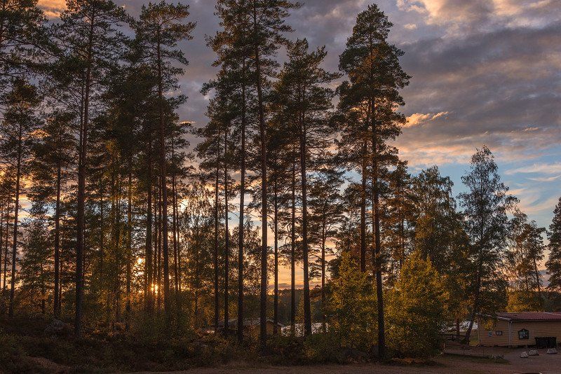
First Camp Gränna - Vättern, Hamnvägen, Gränna, Schweden
Finally we reach Gränna. We have already stood on the CP on our trip to Norway. And we are rewarded with a great sunset.
Hamnvägen 49, 563 31 Gränna, Schweden
58° 1' 39.8" N 14° 27' 29.4" E
58.0277278 14.4581626
• Head northeast on Hamnvägen. Go for 119 m.
• Turn right onto Amiralsvägen. Go for 735 m.
• Turn right onto Brahegatan. Go for 2.7 km.
• Take the 3rd exit from roundabout onto E4 toward Helsingborg/Jönköping. Go for 36.5 km.
• Take exit 95B toward Helsingborg/Växjö onto E4. Go for 39.4 km.
• Take exit 87 toward Bredaryd/Hillerstorp/Skillingaryd S/Tofteryd. Go for 351 m.
• Turn right onto 152 toward Bredaryd/Hillestorp/Skillingaryd. Go for 120 m.
• Turn left onto 152. Go for 17.8 km.
• Take the 3rd exit from roundabout onto 151. Go for 2.3 km.
• Turn left onto Store Mosse nationalpark Naturum. Go for 29 m.
• Turn slightly left. Go for 38 m.
• Turn right. Go for 55 m.
• Arrive at your destination on the left.
☍
100,2 km
(1 hrs. 9 min.)
Day
Nochmal Gränna
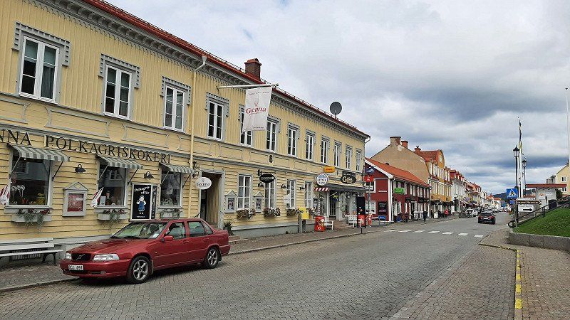
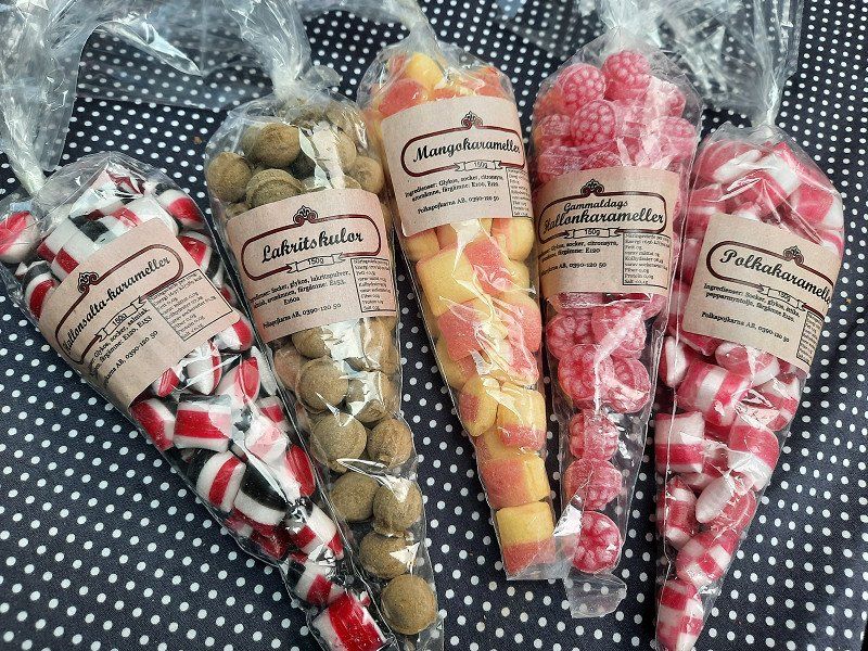
We stay one more night and rest a bit, drink the brown delicacy (I think it was cappuccino) in a cute cafe, buy polkagrisar and enjoy the sunset again.
Day
Store Mosse nationalpark, Hillerstorp, Schweden
The journey continues to Store Mosse National Park near Värnamo.
#Not so well suited for dogs because many paths are designed for three boards.#
Store Mosse nationalpark, 330 33 Hillerstorp, Schweden
57° 17' 60" N 13° 55' 47.4" E
57.2999982 13.9298207
• Head southwest. Go for 36 m.
• Turn right onto Store Mosse nationalpark Naturum. Go for 24 m.
• Turn left onto Store Mosse nationalpark Naturum. Go for 29 m.
• Turn left onto 151. Go for 13.1 km.
• Take the 2nd exit from roundabout onto 151. Go for 2.3 km.
• Take the 2nd exit from roundabout onto Nydalavägen (E4.17) toward E4/127. Go for 1.1 km.
• Turn left and take ramp onto E4 toward Helsingborg/Ljungby. Go for 92.1 km.
• Take exit 74 toward Hässleholm/Markaryd S. Go for 398 m.
• Take the 3rd exit from roundabout onto 117 toward Hässleholm/Ulvaryd. Go for 337 m.
• Pass 3 roundabouts and continue on Vankivavägen (117). Go for 32.5 km.
• Take the 2nd exit from roundabout onto Vankivavägen toward Hässleholm V C. Go for 1.2 km.
• Take the 2nd exit from T4-Rondellen roundabout onto Vankivavägen. Go for 1.5 km.
• Take the 2nd exit from Grönängsplan roundabout onto Hovdalavägen. Go for 1.7 km.
• Pass 3 roundabouts. Go for 6.4 km.
• Continue on Nösdala. Go for 1.7 km.
• Turn right onto 23. Go for 18.1 km.
• Pass 3 roundabouts and continue on Malmövägen (23). Go for 3.2 km.
• Take the 3rd exit from roundabout onto Nya Sätoftavägen toward Sätofta. Go for 1.3 km.
• Continue on Sätoftavägen. Go for 1.7 km.
• Turn right onto Gamla Jägersbovägen. Go for 370 m.
• Turn slightly left onto Gamla Jägersbovägen. Go for 208 m.
• Turn right onto Fiskaregränd. Go for 45 m.
• Arrive at Fiskaregränd. Your destination is on the right.
☍
179,4 km
(2 hrs. 12 min.)
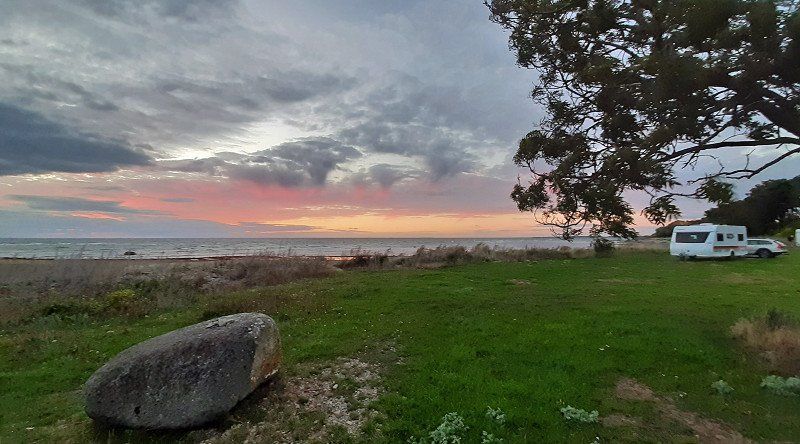
Jägersbo Camping, Fiskaregränd, Höör, Schweden
And finally we land on the CP near Höör. We liked it, it wasn't too expensive and again the reception wasn't manned. We experienced the most surreal sunset ever here.
Fiskaregränd 1, 243 35 Höör, Schweden
55° 54' 11" N 13° 33' 53.1" E
55.9030652 13.5647496
• Head northwest on Fiskaregränd. Go for 45 m.
• Turn left onto Gamla Jägersbovägen. Go for 208 m.
• Turn slightly right onto Gamla Jägersbovägen. Go for 370 m.
• Turn left onto Sätoftavägen. Go for 663 m.
• Turn left onto Nybyvägen. Go for 2.4 km.
• Turn left onto 23. Go for 7.9 km.
• Pass 2 roundabouts and continue on 23. Go for 3.7 km.
• Take ramp onto E22 toward Malmö. Go for 25.1 km.
• Take exit 19 toward Trelleborg/Flygplats Sturup/Kävlinge/Lund. Go for 248 m.
• Take the 2nd exit from roundabout onto 108 toward Malmö/Trelleborg/Sturup flygplats. Go for 3.4 km.
• Pass 2 roundabouts and continue on 108. Go for 7.5 km.
• Take the 1st exit from roundabout onto Gamla Malmövägen toward Malmö/Bara/Klågerup. Go for 179 m.
• Turn right onto Bangårdsvägen. Go for 15 m.
• Arrive at Bangårdsvägen. Your destination is on the left.
☍
51,7 km
( 40 min.)
Day
Klågerup, Schweden
It's also quite nice in Höör in the morning ;-), but the journey then continued to Trelleborg.
Klagerup, Schweden
55° 35' 52.2" N 13° 15' 33.3" E
55.5978233 13.2592414
• Head toward Gamla Malmövägen on Bangårdsvägen. Go for 15 m.
• Turn left onto Gamla Malmövägen. Go for 165 m.
• Take the 1st exit from roundabout onto 108 toward Trelleborg/Svedala. Go for 4.4 km.
• Take the 2nd exit from roundabout onto Lundavägen (108) toward Trelleborg. Go for 5.8 km.
• Take the 2nd exit from roundabout onto Lundavägen (108) toward Trelleborg. Go for 8.3 km.
• Take the 2nd exit from roundabout onto Lundavägen (108) toward Trelleborg. Go for 2.7 km.
• Turn left onto Gyllevägen toward Gylle. Go for 4.3 km.
• Turn left onto Mellanköpingevägen toward Mellanköpinge. Go for 2.4 km.
• Turn right onto Engelbrektsgatan. Go for 635 m.
• Turn left onto Östra Ringvägen toward E6/E22/Malmö/Ystad/Centrum. Go for 485 m.
• Take the 3rd exit from roundabout onto Östra infarten (9) toward Ystad. Go for 1.5 km.
• Turn right toward Dalköpinge Strandväg. Go for 131 m.
• Turn left onto Dalköpinge Strandväg. Go for 470 m.
• Turn left onto Östra infarten (9) toward Centrum. Go for 1.4 km.
• Take the 2nd exit from roundabout onto Östra infarten (9) toward Centrum. Go for 3.2 km.
• Turn left onto Travemündeallén toward Travemünde/E6/Sassnitz/E22/Rostock/Swinoujscie. Go for 45 m.
• Turn right onto Travemündeallén. Go for 131 m.
• Turn left onto Strandridaregatan. Go for 602 m.
• Continue on Södra Nyhamnsgatan. Go for 202 m.
• Arrive at Södra Nyhamnsgatan. Your destination is on the left.
☍
6,3 km
( 10 min.)
Day
Trelleborgs Hamn
Provinz Schonen, Schweden
55° 22' 11.3" N 13° 8' 43.6" E
55.3698064 13.1454537
• Head southwest on Södra Nyhamnsgatan. Go for 202 m.
• Continue on Strandridaregatan. Go for 602 m.
• Turn right onto Travemündeallén. Go for 131 m.
• Turn left onto Travemündeallén. Go for 45 m.
• Turn right onto Slussgatan (9). Go for 408 m.
• Turn left onto Östersjögatan. Go for 168 m.
• Turn right onto Västergatan. Go for 42 m.
• Turn left onto Västra Vallgatan. Go for 78 m.
• Turn right onto Svenstorpsgatan. Go for 103 m.
• Arrive at Svenstorpsgatan. Your destination is on the right.
☍
1,8 km
( 4 min.)
TT Line
Departure port: Trelleborg
Provinz Schonen, Schweden
55.3759200 13.1461522
Arrival port: Rostock
Mecklenburg-Vorpommern, Deutschland
54.092444512.1286127
• Head toward Stadthafen. Go for 56 m.
• Turn left onto Stadthafen. Go for 158 m.
• Turn right onto Am Strande. Go for 47 m.
• Turn right onto Am Strande (L22). Go for 118 m.
• Turn left onto Am Kanonsberg. Go for 280 m.
• Make a U-Turn at Patriotischer Weg onto Am Kanonsberg. Go for 294 m.
• Turn right onto Am Strande (L22). Go for 4.8 km.
• Take ramp onto A19 toward Rostock-Überseehafen. Go for 6.1 km.
• Take exit 4 toward Ostsee-Fähren/Überseehafen/Ferries/Fähren onto E55 (Am Seehafen). Go for 749 m.
• Turn slightly left onto Zum Fährterminal (E55) toward Fähre Trelleborg/Fähre Gedser. Go for 616 m.
• Take the 2nd exit from roundabout onto Zum Fährterminal. Go for 105 m.
• Turn slightly right onto Zum Fährterminal. Go for 26 m.
• Turn slightly right onto Zum Fährterminal. Go for 31 m.
• Turn right onto Zum Fährterminal. Go for 21 m.
• Turn left onto Zum Fährterminal. Go for 152 m.
• Arrive at Zum Fährterminal. Your destination is on the right.
☍
9,4 km
( 9 min.)
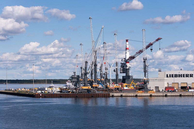
Rostock Fährhafen, Rostock, Deutschland
Entrance to the port
18147 Rostock, Deutschland
54° 8' 38.2" N 12° 6' 6.6" E
54.1439430 12.1018299
• Head north on Zum Fährterminal. Go for 18 m.
• Turn right onto Zum Fährterminal. Go for 34 m.
• Continue on Ost-West-Straße. Go for 398 m.
• Turn right onto Am Seehafen. Go for 1.2 km.
• Turn right and take ramp onto A19 toward Berlin/Flugplatz Rostock-Laage/A20. Go for 14.8 km.
• Take exit 9 toward Lübeck onto A20. Go for 49.5 km.
• Take exit 9 toward Berlin/Dresden/Schwerin onto A14. Go for 67.5 km.
• Take the exit toward Ludwigslust/Neustadt-Glewe. Go for 566 m.
• Turn right onto L073 toward Ludwigslust. Go for 1.5 km.
• Turn left onto L072 toward Dannenberg/Lauenburg/Perleberg. Go for 1.0 km.
• Turn right onto Alexandrinenplatz. Go for 155 m.
• Enter the roundabout. Go for 65 m.
• Arrive at your destination on the left.
☍
136,7 km
(1 hrs. 13 min.)
Ludwigslust, Deutschland
19288 Ludwigslust, Deutschland
53° 19' 28.2" N 11° 29' 48.9" E
53.3244914 11.4969238
• Follow the roundabout. Go for 40 m.
• Take the 2nd exit from roundabout onto Alexandrinenplatz. Go for 19 m.
• Continue on Lindenstraße. Go for 139 m.
• Continue on Lindenstraße (B5). Go for 3.3 km.
• Take the 1st exit from roundabout onto B191 toward Dannenberg/Dömitz. Go for 27.7 km.
• Continue on B191 toward Dannenberg. Go for 5.0 km.
• Turn left onto K29 toward Gusborn/Quickborn. Go for 848 m.
• Turn right onto K15. Go for 12 m.
• Turn left onto Drosselweg (K29). Go for 348 m.
• Continue on K29. Go for 2.6 km.
• Continue on Kirchberg (K29). Go for 223 m.
• Turn right onto Gartower Straße (L256). Go for 6.9 km.
• Turn left onto B191. Go for 744 m.
• Turn right onto Bäckergrund. Go for 281 m.
• Arrive at Bäckergrund. Your destination is on the left.
☍
48,2 km
( 42 min.)
Dannenberg (Elbe), Deutschland
On the long return journey we make a stop at the Elbe near Dannenberg and stretch our legs a little.
29451 Dannenberg (Elbe), Deutschland
53° 5' 55.3" N 11° 6' 33.6" E
53.0986852 11.1093360
• Head toward Am Stadtbad on Bäckergrund. Go for 354 m.
• Turn right onto Gartower Straße. Go for 929 m.
• Turn right onto Heider Straße (K1). Go for 2.2 km.
• Turn right onto K1. Go for 3.5 km.
• Turn right onto Mühlendamm (K30). Go for 544 m.
• Continue on K30. Go for 849 m.
• Continue on K33. Go for 1.6 km.
• Continue on Weitsche (K33). Go for 417 m.
• Continue on K33. Go for 2.4 km.
• Continue on Weitscher Straße (K33). Go for 127 m.
• Continue on K33. Go for 998 m.
• Continue on Weitscher Straße (K33). Go for 448 m.
• Continue on Im Rundling (K33). Go for 191 m.
• Continue on Lüchower Straße (K33). Go for 1.3 km.
• Continue on K33. Go for 405 m.
• Continue on An der Tränke (K33). Go for 278 m.
• Turn left onto An der Tränke (K2). Go for 102 m.
• Continue on K2. Go for 460 m.
• Take the 1st exit from roundabout onto Seerauer Straße (K1) toward Lüchow. Go for 194 m.
• Take the 3rd exit from roundabout onto B248 toward Gartow/Salzwedel. Go for 2.1 km.
• Pass 2 roundabouts and continue on B71/B248. Go for 13.6 km.
• Take the 1st exit from roundabout onto Schillerstraße toward Wittingen/Zentrum. Go for 151 m.
• Turn left onto Ernst-Thälmann-Straße. Go for 160 m.
• Turn right onto Brückenstraße. Go for 421 m.
• Take the 2nd exit from roundabout onto Brückenstraße. Go for 578 m.
• Turn right onto Braunschweiger Straße toward Altstadt. Go for 40 m.
• Continue on Neutorstraße. Go for 590 m.
• Arrive at Neutorstraße. Your destination is on the right.
☍
34,9 km
( 32 min.)
Salzwedel, Deutschland
29410 Salzwedel, Deutschland
52° 50' 58.7" N 11° 9' 5.4" E
52.8496504 11.1514876
• Head toward Radestraße on Neutorstraße. Go for 590 m.
• Continue on Braunschweiger Straße. Go for 2.0 km.
• Continue on An der Warthe. Go for 526 m.
• Take the 2nd exit from roundabout onto B248 toward Wolfsburg/Rohrberg. Go for 14.6 km.
• Turn right onto Breite Straße (B248) toward Wolfsburg/Wittingen. Go for 324 m.
• Turn left onto Bahnhofstraße (B248) toward Wolfsburg/Brome. Go for 14.4 km.
• Turn right onto Hauptstraße (B248) toward Braunschweig/Fallersleben. Go for 11.6 km.
• Turn left onto Fallerslebener Straße (B248) toward Braunschweig/A39/Wolfsburg. Go for 12.9 km.
• Continue on A39. Go for 17.3 km.
• Take exit 28 toward Hannover/Braunschweig onto A2. Go for 32.3 km.
• Take exit 52 toward Peine-Ost/Ilsede/Edemissen. Go for 505 m.
• Turn left onto K75 toward Salzgitter/Ilsede/Peine. Go for 623 m.
• Continue on K69. Go for 377 m.
• Take the 2nd exit from Ascherslebener Kreisel roundabout onto Ostrandstraße toward Salzgitter/Ilsede/B65/B444/B494/Gewerbegebiet Stahlwerke. Go for 1.5 km.
• Turn right onto Woltorfer Straße (L321) toward Zentrum. Go for 1.2 km.