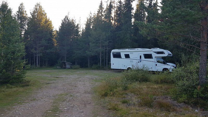
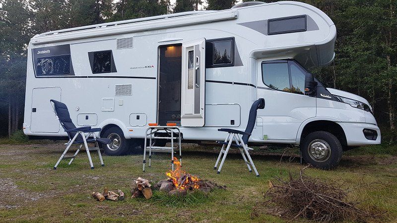
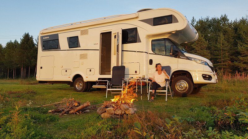
From 19.8. we were on the road until 13.9.22. We had changed our original plan in the meantime and made a detour to the center of the Arctic Circle in Norway. The post-processing is done gradually.
About the route: From Stuttgart to Kiel, then by ferry to Gothenburg. Crossing at night to arrive rested in Gothenburg. From there to the Arctic Circle and back east with a detour to Stockholm.
Since the map is based on Google Maps, it can happen again and again that the actual route suddenly looks different from what I had planned because the calculation is based on Google Maps and then suddenly looks different due to road closures or the like.
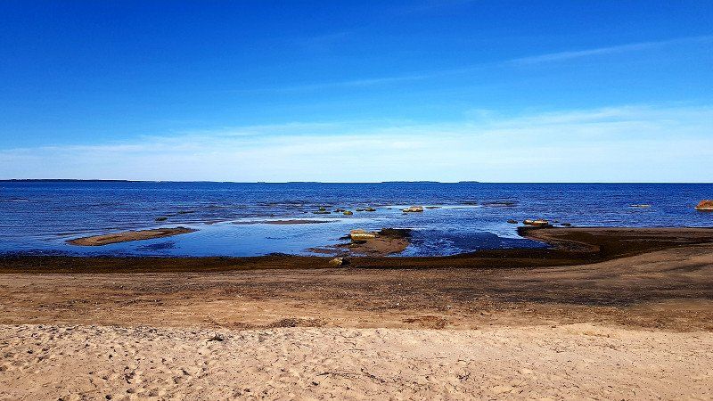
Total distance in Sweden: originally planned: 4300km in 21 days. In the end it was 4500km in Sweden, with an arrival and departure of 6275km.
Day
Esslingen am Neckar - Abfahrt Freitag 16:00 Uhr
Day
Kiel -Stellplatz Ankunft Samstag 16:00 Uhr
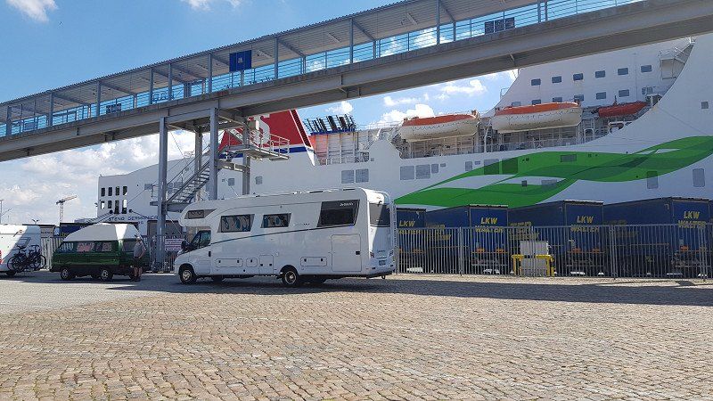
We stood at the Citti Center. The parking space is free, but offers nothing except that you can stand there. But that's okay with us. Right next to it is a cheap gas station that also offers AdBlue and LPG for the gas tank, and all of that relatively cheaply. So fill up all the tanks again before heading to Sweden, where the price of diesel is 50 cents higher.
Day
Kiel - Fährhafen - Check-In Sonntag 15:30 Uhr - Abfahrt 17:15 Uhr
Based on my experience, I can only advise arriving in Kiel a day in advance. We had 3 complete closures on the 800km Autobahn, which cost us several hours. Thanks to the additional reserve day in Kiel, we were completely relaxed. If the ferry had already left on the day of arrival, we would have missed it.
Day
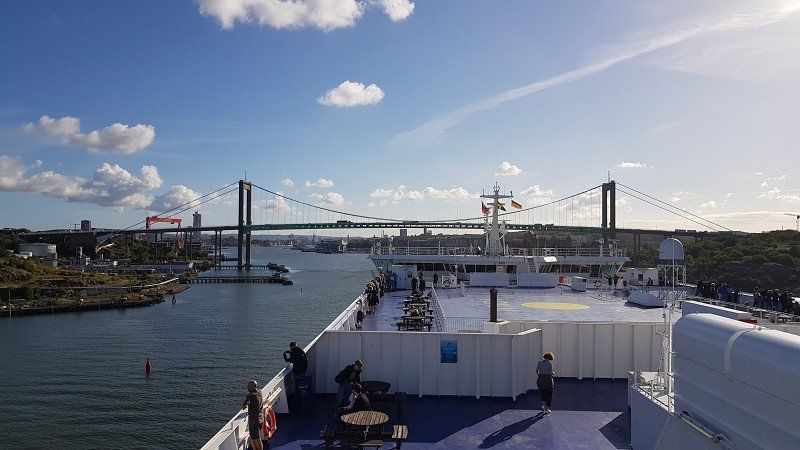
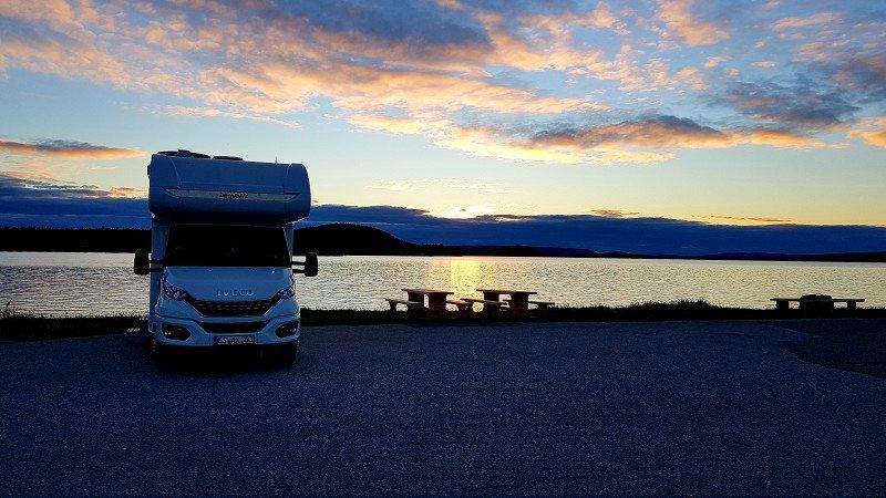
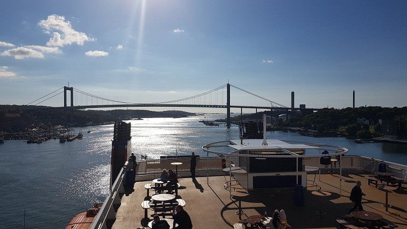
Gothenburg - Ankunft Montag 9:15 Uhr
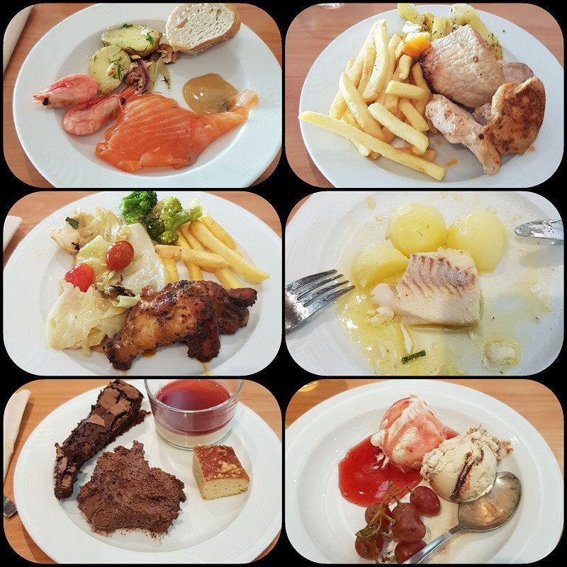
The holiday already begins on board. We reserved a table at the Taste restaurant and then had a great dinner. For around 36,- you get really delicious food, you have a large selection and the drinks are included in the price.
The on-board shop also has a good selection and is very reasonably priced in many respects. Here you can also buy high-proof beer at good prices, which is later impossible or very expensive in Sweden.
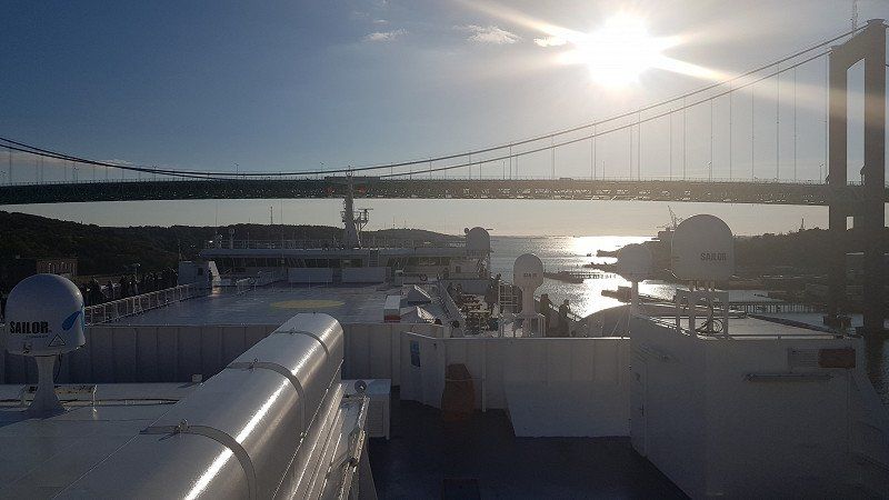
Gothenburg - Abfahrt Montag 10:30 Uhr
Tip: Check beforehand where you are going after leaving the ferry. Unloading is all a bit hectic, then you have to pass the border controls and the port area is not so big that you can still stand comfortably somewhere. So you drive off, the navigation system isn't "awake" yet and you hit the wrong road. Ok, you always get to your destination, maybe with a small detour.
414 58 Gothenburg, Schweden
57° 41' 44.8" N 11° 54' 51.7" E
57.6957885 11.9143510
• Head northeast on Majnabbehamnen. Go for 54 m.
• Turn left onto Majnabbehamnen. Go for 194 m.
• Turn right onto Majnabbehamnen. Go for 307 m.
• Continue on Majnabbegatan. Go for 70 m.
• Turn left and take ramp onto Oscarsleden (E45.1) toward E20/E45/40/Centrum. Go for 6.2 km.
• Take left ramp onto Partihallsviadukten (E20) toward Stockholm. Go for 43.5 km.
• Take the 2nd exit from roundabout onto Sveaplan (E20) toward 180/Stockholm. Go for 83.9 km.
• Take ramp onto 49 toward Skövde. Go for 23.3 km.
• Take the 3rd exit from Hallenbergsrondellen roundabout onto Vadsbovägen toward 26/Sjukhus/Mariestad. Go for 1.4 km.
• Take the 1st exit from Badhusrondellen roundabout onto Majorsgatan toward Centrum. Go for 172 m.
• Continue on Majorsgatan. Go for 410 m.
• Continue on Hjovägen. Go for 1.5 km.
• Take the 2nd exit from Mariesjörondellen roundabout onto Hjovägen (49) toward Mariestad/Askersund/Tibro/194/200/Flygplats/Aspelund. Go for 254 m.
• Take the 2nd exit from roundabout onto Hjovägen (49) toward Askersund/194/Hjo. Go for 3.0 km.
• Take the 2nd exit from roundabout onto 49 toward Askersund/Karlsborg/Tibro. Go for 12.3 km.
• Take the 2nd exit from roundabout onto 49/201 toward Askersund/Mariestad. Go for 19.3 km.
• Turn left onto Hjovägen toward Forsvik/Mölltorp. Go for 347 m.
• Continue on Järnvägsgatan. Go for 232 m.
• Continue on Centralgatan. Go for 296 m.
• Take the 2nd exit from roundabout onto Forsviksvägen. Go for 2.2 km.
• Continue on Vaberget Dampegården. Go for 2.8 km.
• Continue on Gällsebo skola. Go for 79 m.
• Continue on Gällsebo. Go for 664 m.
• Continue on Gällsebo Sörvik. Go for 43 m.
• Continue on Gällsebo. Go for 1.1 km.
• Continue on Hulängen. Go for 125 m.
• Continue on Hulängen Hagalund. Go for 2.6 km.
• Continue on Baltzar von Platens väg. Go for 274 m.
• Turn right onto Hagenvägen. Go for 73 m.
• Arrive at Hagenvägen.
☍
206,7 km
(2 hrs. 28 min.)
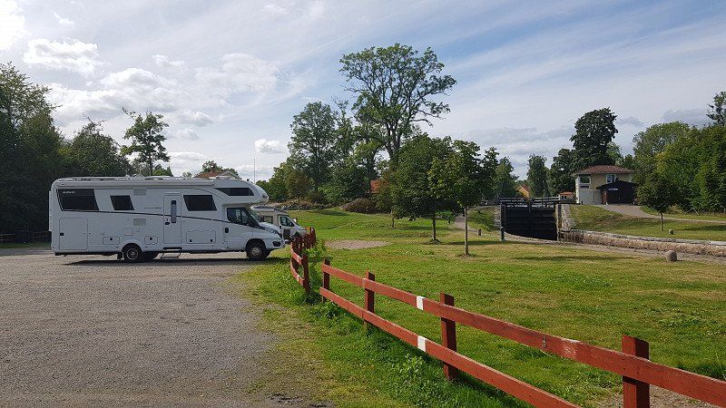
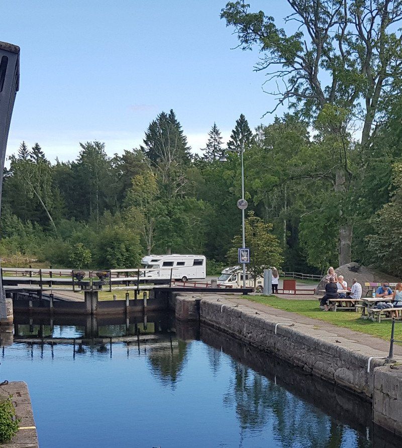
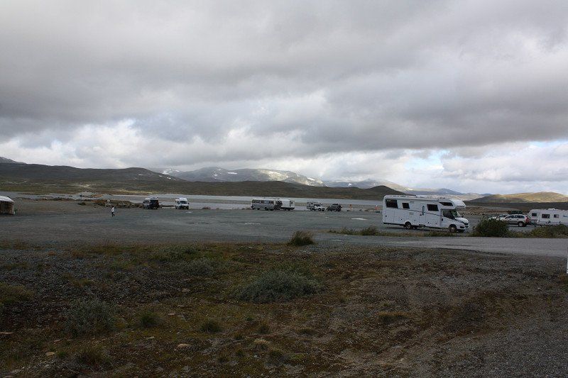
Forsviks Stellplatz am Göta-Kanal - Ankunft Montag 16:00 Uhr
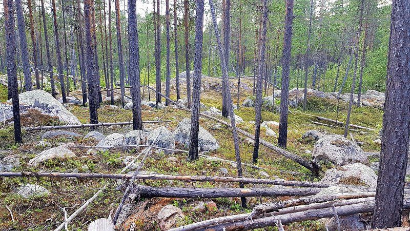
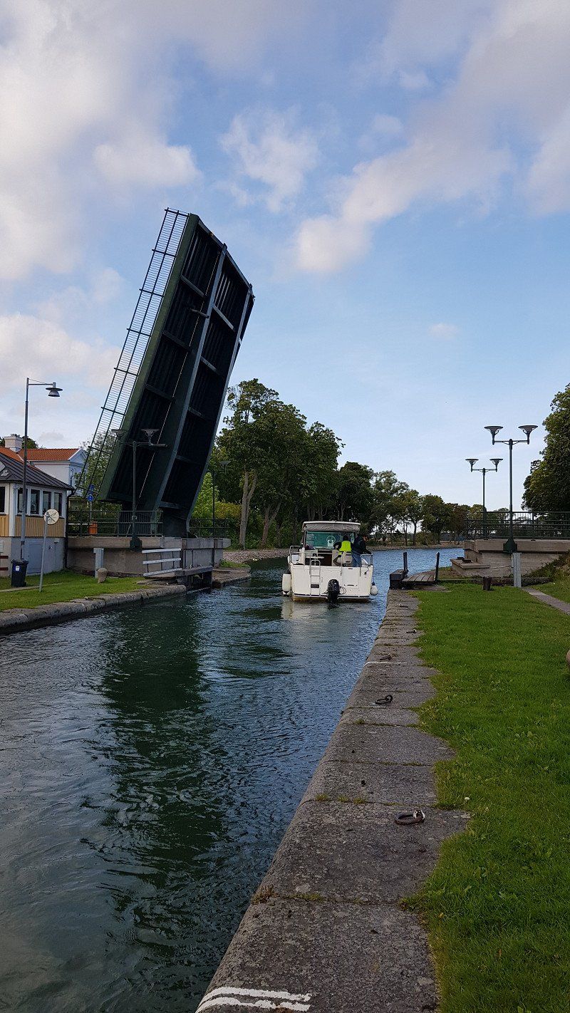
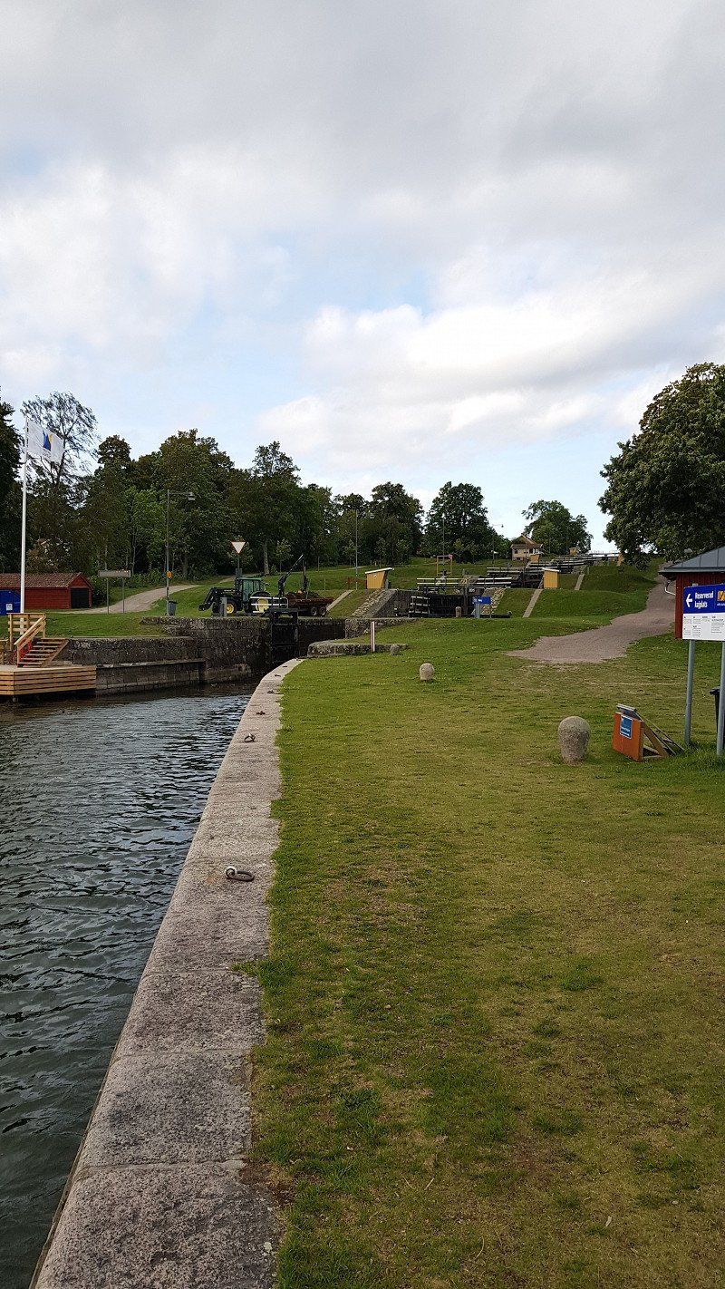
The pitch is not very crowded out of season. There were only 2 more Womos there. Forsviks has a small museum where you can see the different crafts from the past. At over 600 years old, Forsviks is Sweden's oldest industrial site with former ironworks, forges, foundries, mills and sawmills.
The lock is the highest on the Güta Canal and with a drop of 3.5 m it is the highest single lock. Busier in the high season when the passenger ships pass through.
Day
Forsviks Stellplatz am Göta-Kanal - Abfahrt Dienstag 10:00 Uhr
Hagenvägen 6, 546 73 Forsvik, Schweden
58° 34' 30.4" N 14° 26' 11.8" E
58.5751111 14.4366145
• Head southeast on Hagenvägen. Go for 30 m.
• Turn right onto Vilhelm Gjutares väg. Go for 111 m.
• Turn right onto Karl Smeds väg. Go for 94 m.
• Turn right onto Baltzar von Platens väg. Go for 1.3 km.
• Turn right onto 202. Go for 4.2 km.
• Turn left onto 49. Go for 42.0 km.
• Take ramp onto Bergslagsdiagonalen (50). Go for 3.3 km.
• Take the 2nd exit from roundabout onto Bergslagsdiagonalen (50) toward Örebro. Go for 25.8 km.
• Take ramp onto E20 (Bergslagsdiagonalen) toward Stockholm/Örebro. Go for 29.6 km.
• Take exit 115 toward Falun/Gävle. Go for 264 m.
• Turn left onto Bergslagsdiagonalen (E20.5) toward Falun/Gävle/Bettorp. Go for 216 m.
• Pass 5 roundabouts and continue on Bergslagsdiagonalen (50). Go for 97.4 km.
• Turn right toward Djupuddsvägen. Go for 787 m.
• Arrive at Djupuddsvägen. Your destination is on the right.
☍
205,1 km
(2 hrs. 22 min.)
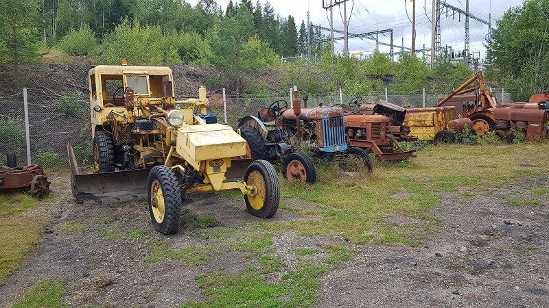
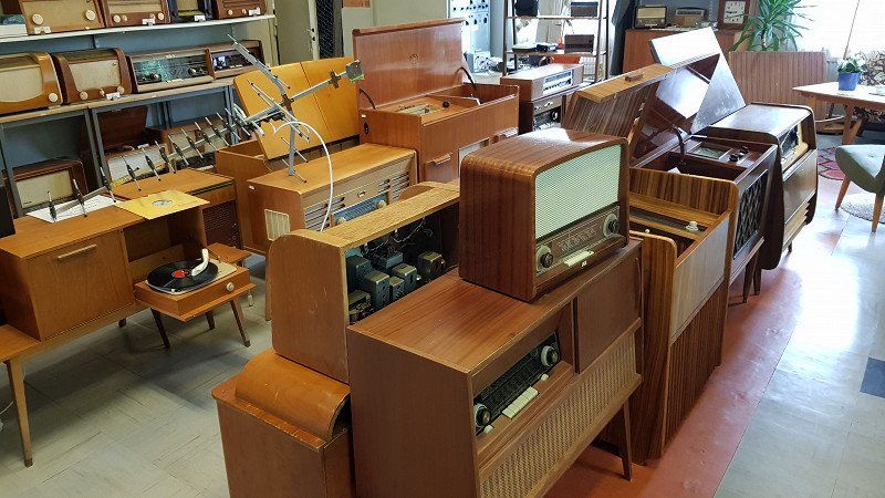
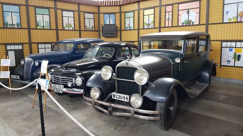
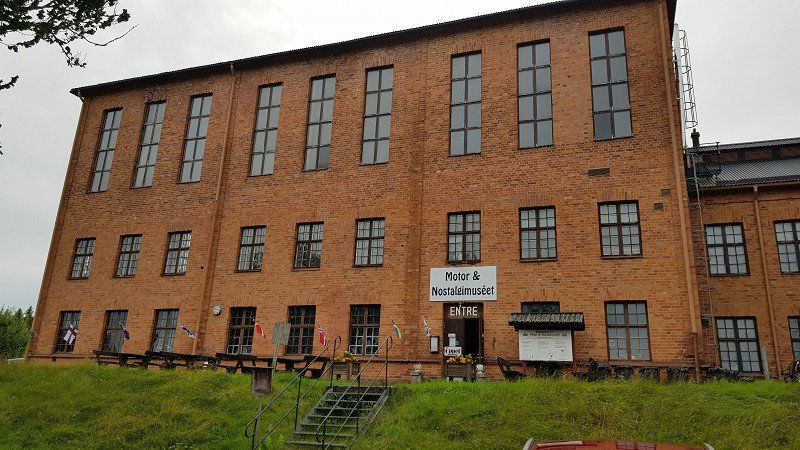
Motor and Nostalgia Museum Grängesberg, Schweden
Much has been collected here that has existed since the 1920s. Radios, televisions, cameras, mobile phones, cars, aircraft and boat engines, forestry equipment, trucks and construction machinery, etc. Various shops from the 1930s were also reconstructed, as was a driving school. Definitely worth seeing.
Djupuddsvägen 14, 772 90 Grängesberg, Schweden
60° 3' 48.7" N 14° 59' 41.5" E
60.0635301 14.9948713
• Head toward Uggelbovägen on Djupuddsvägen. Go for 787 m.
• Turn right onto Bergslagsdiagonalen (50/63). Go for 2.1 km.
• Turn left onto Björnhyttevägen. Go for 6.8 km.
• Continue on Saxenvägen. Go for 5.6 km.
• Continue on Väsmanvägen. Go for 7.2 km.
• Turn left onto 66. Go for 31.8 km.
• Turn left onto E16 toward Sälen/Malung/Vansbro. Go for 14.7 km.
• Turn left toward Storängsvägen. Go for 622 m.
• Turn left onto Storängsvägen. Go for 175 m.
• Turn right onto Storängsvägen. Go for 64 m.
• Arrive at Storängsvägen. Your destination is on the right.
☍
69,8 km
( 56 min.)
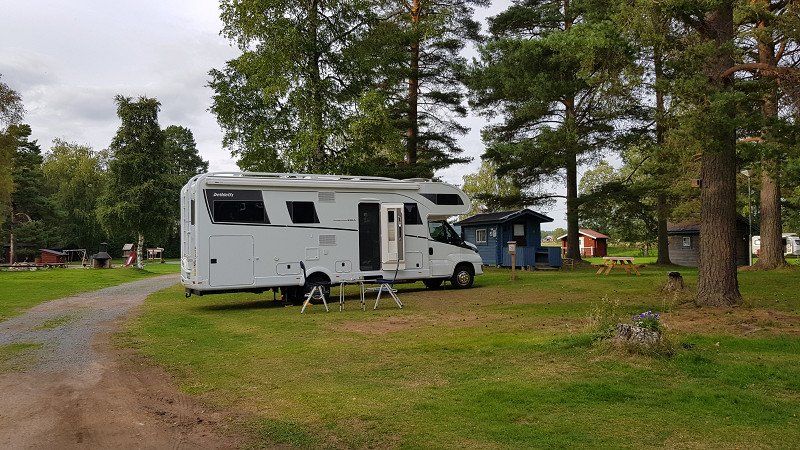
Nås Camping Dalarna, deutscher Betreiber - Ankunft Dienstag 16:00 Uhr
For once, we are at a campsite to dispose of gray water and refill the water supply. Unfortunately, there is no disposal option for gray water.
The place is very nicely arranged and clean. There are toilets, showers and a place to wash dishes. Everything is there if you forgot something. The cassette toilet can also be emptied.
There are canoes and a rowing boat for guests, which can be used free of charge.
We refilled our water supply at the tap.
Day
Nås Camping Dalarna, deutscher Betreiber - Abfahrt Mittwoch 10:00 Uhr
Storängsvägen 14, 786 93 Nås, Schweden
60° 26' 49.8" N 14° 29' 48.5" E
60.4471545 14.4968033
• Head north on Storängsvägen. Go for 64 m.
• Turn left onto Storängsvägen. Go for 723 m.
• Turn right toward E16. Go for 252 m.
• Turn left onto E16. Go for 11.8 km.
• Turn right onto Noret toward Leksand. Go for 1.2 km.
• Continue on Noret. Go for 431 m.
• Continue on Noret. Go for 27.5 km.
• Continue on Skallskog. Go for 10.2 km.
• Continue on Molnbyggen Järnavägen. Go for 1.5 km.
• Continue on Åkersbodarna Järnavägen. Go for 805 m.
• Continue on Åkersbodarnas byväg. Go for 200 m.
• Continue on Åkersbodarna Järnavägen. Go for 163 m.
• Continue on Åkerövägen. Go for 1.4 km.
• Continue on Heden Järnavägen. Go for 474 m.
• Turn right onto Heden Storhedsvägen. Go for 2.3 km.
• Continue on Mjälgen Storhedsvägen. Go for 352 m.
• Continue on Heden Storhedsvägen. Go for 546 m.
• Continue on Mjälgen Myrbackavägen. Go for 67 m.
• Continue on Mjälgen Storhedsvägen. Go for 304 m.
• Turn right onto Gärde Häradsvägen. Go for 284 m.
• Arrive at Gärde Häradsvägen. Your destination is on the right.
☍
60,6 km
( 44 min.)
Fabrikverkauf Knäckebrot
A must in Sweden :-)
Attention: The crispbread slices are loose in the large 4 kg boxes that the Swedes buy in bulk and not in packs of 10, as they are sold in stores. Unfortunately, we only noticed that outside.
240, 793 50 Leksand, Schweden
60° 42' 2" N 15° 2' 48.1" E
60.7005444 15.0466978
• Head toward Gärde Näsgattu on Gärde Häradsvägen. Go for 436 m.
• Turn left onto 70. Go for 23.7 km.
• Pass 5 roundabouts and continue on Riksvägen (70). Go for 26.6 km.
• Turn left onto Nusnäsvägen toward Nusnäs. Go for 763 m.
• Continue on Nusnäs bygata. Go for 2.4 km.
• Turn right onto Edåkersvägen. Go for 287 m.
• Arrive at Edåkersvägen. Your destination is on the right.
☍
54,2 km
( 41 min.)
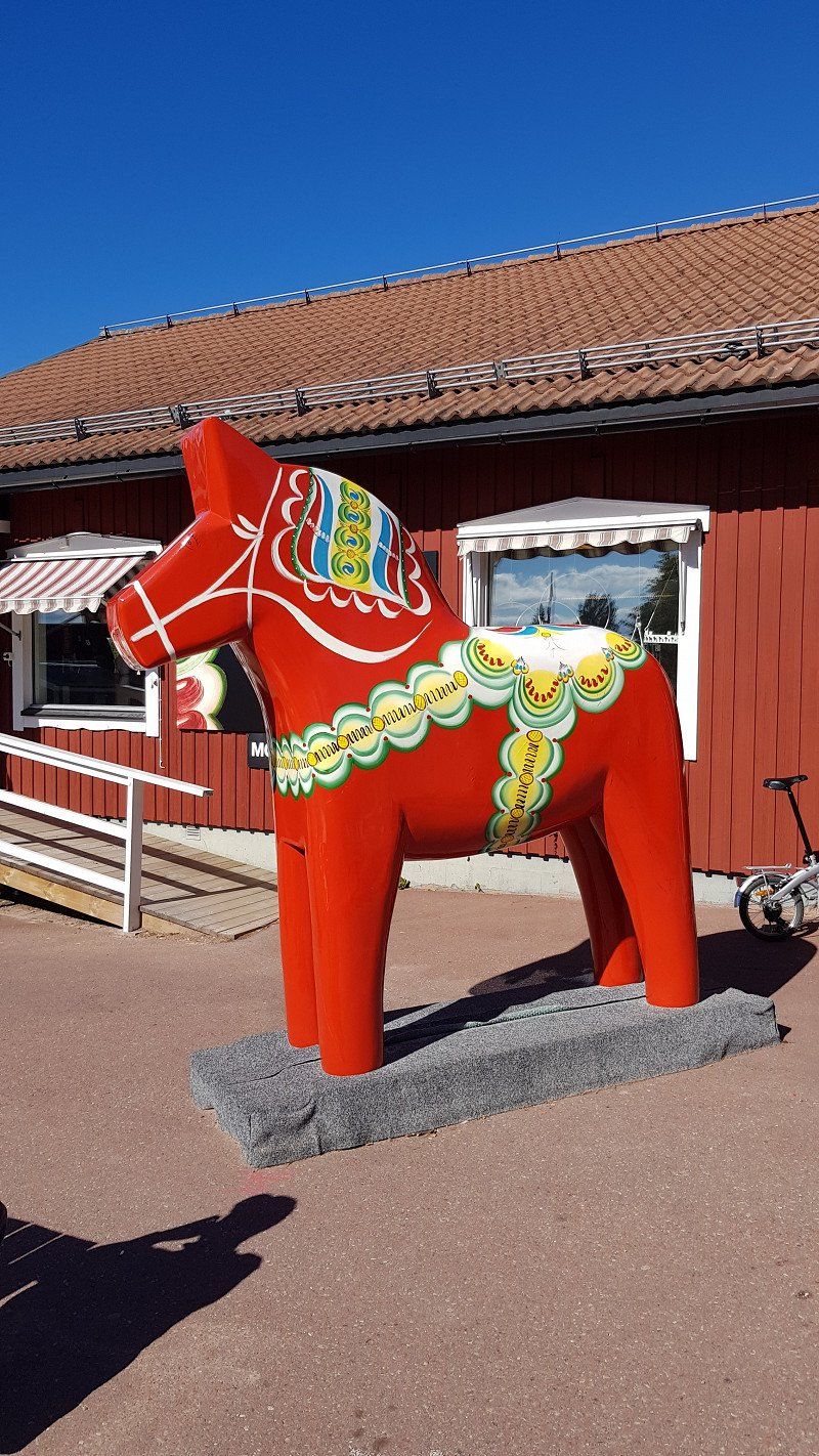
Nusnäs, Schweden
Here you can buy the famous wooden horses. You have the opportunity to walk through the workshops and see the production.
Edåkersvägen 21, 792 77 Nusnäs, Schweden
60° 57' 42.1" N 14° 39' 6.8" E
60.9616945 14.6518852
• Head toward Trähästvägen on Edåkersvägen. Go for 542 m.
• Turn right onto Nusnäs bygata. Go for 2.6 km.
• Continue on Hansjonsgatan. Go for 2.1 km.
• Turn left onto Färnäs bygata. Go for 1.4 km.
• Take the 3rd exit from roundabout onto 70 toward Mora. Go for 1.0 km.
• Take the 2nd exit from roundabout onto E45 toward Mora. Go for 1.4 km.
• Pass 2 roundabouts and continue on Vasagatan (E45). Go for 733 m.
• Take the 2nd exit from Cirkulationsplats Stranden roundabout onto Älvgatan (70). Go for 504 m.
• Pass 3 roundabouts and continue on Dalgatan (70). Go for 123 km.
• Turn left toward Gördalen/Fulufjällets nationalpark/Njupeskär/Mörkret/Fulufjällsbyn. Go for 15.9 km.
• Continue toward Mörkret. Go for 4.6 km.
• Turn left onto Mörkret. Go for 234 m.
• Continue on Mörkret Där Västigen. Go for 2.4 km.
• Continue on Stormorvallen. Go for 279 m.
• Continue on Björbäckstugan. Go for 1.6 km.
• Arrive at Björbäckstugan. Your destination is on the right.
☍
158,8 km
(2 hrs. 1 min.)
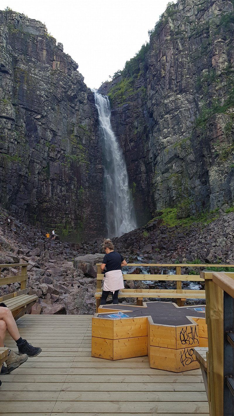
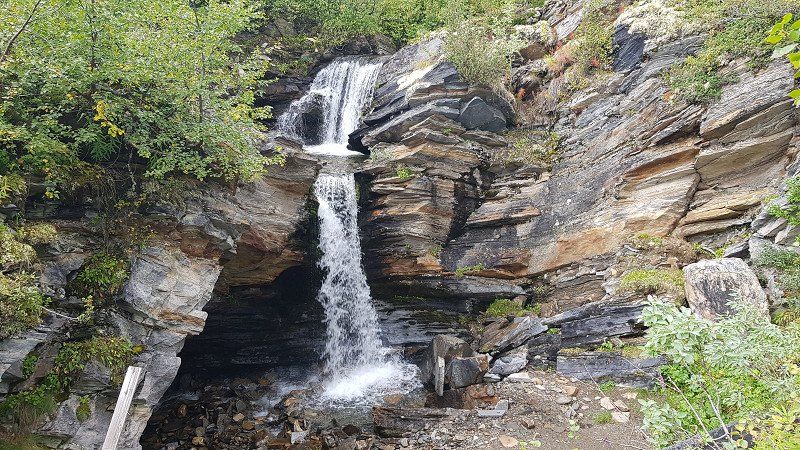
Nationalparkt Wasserfall Njupeskär
Sweden's highest waterfall at almost 100m. Very worth seeing and the national park was created great. Overnight stays in the parking lot there are not permitted.
790 90 Mörkret, Schweden
61° 38' 12.3" N 12° 42' 59.9" E
61.6367425 12.7166480
• Head toward Rörsjöstugan on Björbäckstugan. Go for 1.6 km.
• Continue on Stormorvallen. Go for 279 m.
• Continue toward Mörkret Där Västigen. Go for 2.0 km.
• Continue on Mörkret Där Västigen. Go for 447 m.
• Continue on Mörkret. Go for 234 m.
• Turn right toward Veksjövägen. Go for 762 m.
• Turn sharp left onto Veksjövägen. Go for 451 m.
• Arrive at Veksjövägen. Your destination is on the right.
☍
5,8 km
( 12 min.)
Rastplatz Fuluälven - Ankunft Mittwoch 16:00 Uhr
Our place to stay is a dream. Directly on a small river, apart from a little rushing water, absolute peace and quiet. With fireplaces, firewood and dry toilet. This is Sweden.
Day
Rastplatz Fuluälven - Abfahrt Do 10:00 Uhr
MQ43+2X Mörkret, Schweden
61° 39' 18.1" N 12° 45' 17.8" E
61.6550343 12.7549332
• Head southeast on Veksjövägen. Go for 4.3 km.
• Continue toward 70. Go for 16.0 km.
• Turn left onto 70. Go for 14.4 km.
• Turn right onto 311 toward 84/Funäsdalen/Tännäs/Fjätervålen. Go for 43.2 km.
• Turn left onto Mälen (311). Go for 41.3 km.
• Turn right onto Bygatan (311). Go for 2.0 km.
• Turn left onto Storvägen (84). Go for 15.3 km.
• Turn right onto Vallarvägen toward Ljungdalen/Messlingen/Flatruet/Ramundberget/Bruksvallarna. Go for 3.4 km.
• Turn right onto Strånda. Go for 623 m.
• Continue on Östra Ruvallen. Go for 2.5 km.
• Continue on Ånnfjällvallen. Go for 390 m.
• Continue on Östra Ruvallen. Go for 1.1 km.
• Continue on Lillåsvallen. Go for 10.1 km.
• Continue on Mittådalen. Go for 1.7 km.
• Turn left toward Mittådalen. Go for 91 m.
• Continue on Mittådalen. Go for 6.1 km.
• Arrive at your destination on the right.
☍
162,5 km
(2 hrs. 7 min.)
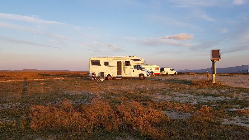
Flatruetvägen (höchstgelegene Passstraße), Stellplatz zum Übernachten - Ankunft Do 17:00 Uhr
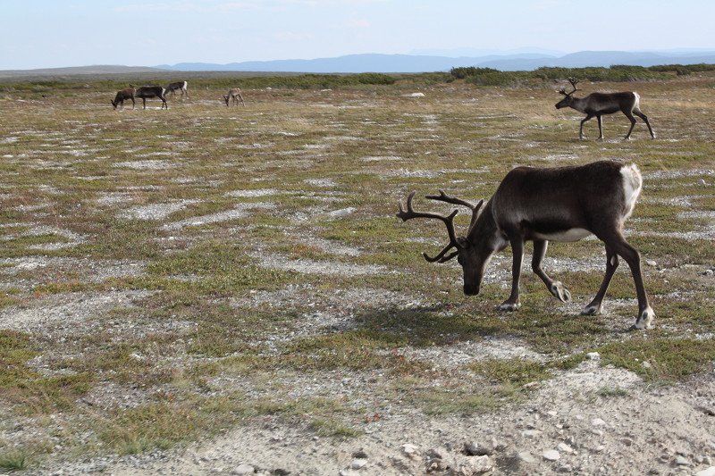
The approach is a bit bumpy, because it goes over pothole slopes and gravel roads to Sweden's highest pass road at 975m. The area is breathtaking, endless expanse and loads of reindeer. We saw a few as we approached and sometimes had to wait until they were comfortable walking off the road.
Day
Flatruetvägen (höchstgelegene Passstraße), Stellplatz zum Übernachten - Abfahrt Fr 10:00 Uhr
Flatruetvägen is a street in Sweden. It runs across the Flatruet low mountain range in north-western Härjedalen. At 975 m, the road is Sweden's highest mountain pass. Flatruetvägen connects the two towns of Funäsdalen and Ljungdalen.
Flatruetvägen, 845 99 Ljungdalen, Schweden
62° 44' 19.3" N 12° 44' 23.8" E
62.7386899 12.7399349
• Head north. Go for 79 m.
• Continue on Stentjärnarna Vueliejaevrie. Go for 6.8 km.
• Continue on Skärkdalen. Go for 1.3 km.
• Continue on Skärkdalen. Go for 2.1 km.
• Continue on Uggvallen. Go for 90 m.
• Continue on Ljungdalen. Go for 4.8 km.
• Turn right onto Ljungdalen. Go for 3.0 km.
• Continue on Movallen. Go for 7.0 km.
• Continue on Storsjö. Go for 5.5 km.
• Continue toward Storsjö Västgården. Go for 79 m.
• Continue on Storsjö Västgården. Go for 257 m.
• Continue on Storsjö. Go for 3.3 km.
• Continue on Bottenbäckviken. Go for 3.1 km.
• Continue on Åviken. Go for 15.1 km.
• Continue on Ekorrlandet. Go for 12.9 km.
• Continue on Arånäset Sven-Jakobs. Go for 14.6 km.
• Turn left toward Galåbodarna Galbäcken. Go for 7.6 km.
• Continue on Galåbodarna Galbäcken. Go for 336 m.
• Continue on Galåbodarna. Go for 5.9 km.
• Continue on Långbodarna. Go for 4.2 km.
• Continue on Fittjebodarna. Go for 1.5 km.
• Continue on Gamla Fittjebodarna. Go for 1.5 km.
• Continue on Landsombodarna. Go for 529 m.
• Continue on Landsombodarna. Go for 2.0 km.
• Continue on Gammal-Åbbåsbodarna. Go for 2.2 km.
• Continue on Tollsbäcks Vad. Go for 748 m.
• Continue on Tollsbäcks Vad. Go for 1.1 km.
• Continue on Hällebo. Go for 877 m.
• Continue on Hårmyrholmen. Go for 4.9 km.
• Continue on Stormyren. Go for 798 m.
• Continue on Stormyren. Go for 3.8 km.
• Continue on Persåsen. Go for 1.1 km.
• Turn left onto Persåsen. Go for 1.0 km.
• Continue on Svedje. Go for 94 m.
• Turn right toward 321. Go for 559 m.
• Turn left onto 321. Go for 9.6 km.
• Turn right onto Fröjdholmsvägen. Go for 702 m.
• Continue on Borgvik. Go for 108 m.
• Continue on Myre. Go for 855 m.
• Continue on Bugården. Go for 915 m.
• Continue on Helgebacken. Go for 67 m.
• Continue on Oviksvägen. Go for 276 m.
• Continue on Prästbordet. Go for 108 m.
• Continue on Oviksvägen. Go for 1.6 km.
• Continue on Side. Go for 553 m.
• Continue toward Side. Go for 157 m.
• Continue on Side. Go for 2.9 km.
• Turn left onto Sanne. Go for 85 m.
• Continue on Kårgärde. Go for 2.2 km.
• Continue on Kårgärde. Go for 1.5 km.
• Continue on Bodlägden. Go for 1.8 km.
• Continue on Hara. Go for 900 m.
• Continue on Hara. Go for 1.3 km.
• Continue on Hara. Go for 233 m.
• Continue on Hara. Go for 460 m.
• Continue on Hara. Go for 82 m.
• Continue on Hara. Go for 109 m.
• Continue on Hara. Go for 763 m.
• Continue on Hara. Go for 2.5 km.
• Continue on Önsved. Go for 2.0 km.
• Continue on Önsved. Go for 290 m.
• Continue on Orrviken. Go for 4.1 km.
• Continue on Fannbyn. Go for 2.2 km.
• Continue on Digernäs. Go for 1.3 km.
• Continue on Målsta. Go for 962 m.
• Continue on Målsta. Go for 642 m.
• Continue on Genvalla. Go for 533 m.
• Continue on Fillsta. Go for 926 m.
• Continue on Böle. Go for 159 m.
• Continue on Böle. Go for 710 m.
• Continue on Böle. Go for 332 m.
• Continue on Böle. Go for 261 m.
• Continue on Böle. Go for 403 m.
• Continue on Sandviken. Go for 507 m.
• Turn left toward Vallsundsbron. Go for 82 m.
• Continue on Vallsundsbron. Go for 2.5 km.
• Take the 1st exit from roundabout onto Vallaleden. Go for 1.1 km.
• Take ramp onto Frösöbron. Go for 1.1 km.
• Turn left onto Rådhusgatan. Go for 603 m.
• Take the 3rd exit from roundabout onto Arkivvägen. Go for 162 m.
• Turn right onto Kyrkgatan. Go for 85 m.
• Continue on Fornbyvägen. Go for 32 m.
• Turn left onto Jamtli. Go for 25 m.
• Arrive at Jamtli. Your destination is on the left.
☍
171,5 km
(2 hrs. 12 min.)
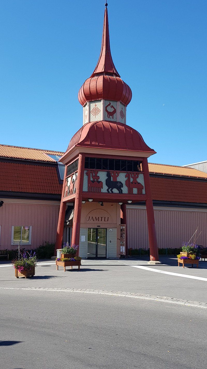
Naturkundemuseum Jamtli, Östersund
A great museum showing the history of Sweden. A guided tour tells a lot about the past, such as that a former king decreed that every traveler must be able to find accommodation every 20km. Maybe that's one reason why there are still so many free parking spaces here today.
Museiplan 2, 831 31 Östersund, Schweden
63° 11' 13.4" N 14° 38' 11.9" E
63.1870567 14.6366381
• Head toward Fornbyvägen on Jamtli. Go for 25 m.
• Turn right onto Fornbyvägen. Go for 32 m.
• Continue on Kyrkgatan. Go for 85 m.
• Turn left onto Arkivvägen. Go for 104 m.
• Take the 3rd exit from roundabout onto Rådhusgatan. Go for 399 m.
• Continue toward Pampasvägen. Go for 35 m.
• Take the 1st exit from roundabout onto Pampasvägen. Go for 569 m.
• Take the 3rd exit from roundabout toward E14/Trondheim/Sundsvall/E45/Arvidsjaur. Go for 446 m.
• Continue on Lövlunda. Go for 460 m.
• Take the 2nd exit from roundabout onto Lövlunda toward E14/E45. Go for 1.2 km.
• Continue on E45 toward Arvidsjaur/Strömsund. Go for 96.0 km.
• Take the 2nd exit from roundabout onto Lövbergavägen (E45) toward Arvidsjaur/342/Gäddede. Go for 299 m.
• Take the 3rd exit from roundabout onto Strömsvägen (342) toward Gäddede. Go for 14.1 km.
• Turn left onto Allviken toward Äspnäs. Go for 1.1 km.
• Arrive at Allviken. Your destination is on the right.
☍
114,8 km
(1 hrs. 26 min.)
Day
Übernachtungsplatz, Schweden
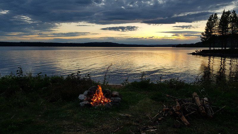
Like so many rest and overnight places, a real dream and so typical for Sweden. Located directly on a lake, with fireplaces and absolute tranquility.
Located right on Vildmarksvägen.
ALLVIKEN 110, 833 95 Strömsund, Schweden
63° 58' 43.2" N 15° 28' 28.3" E
63.9786708 15.4745182
• Head toward Vildmarksvägen on Allviken. Go for 1.1 km.
• Turn left onto Vildmarksvägen (342). Go for 119 km.
• Turn right onto Vildmarksvägen toward Stekenjokk/Ankarede/Blåsjön/Jormlien. Go for 34.4 km.
• Continue on Blåsjöfjället. Go for 1.4 km.
• Continue on Vildmarksvägen. Go for 4.2 km.
• Continue on Mittilia. Go for 1.8 km.
• Continue on Mittilia. Go for 215 m.
• Continue on Stora Blåsjön. Go for 4.8 km.
• Continue on Mesvattnet. Go for 16.4 km.
• Turn left onto Leipikvattnet. Go for 2.8 km.
• Arrive at Leipikvattnet. Your destination is on the left.
☍
186,3 km
(2 hrs. 22 min.)
Naturreservat Bjurälven, Schweden
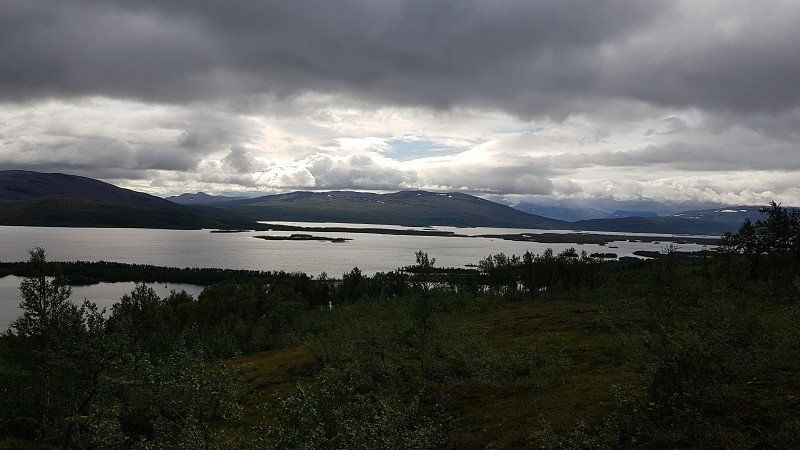
We continue along the Vildmarksvägen, Sweden's most beautiful tourist road. Past the typical Swedish houses, through endlessly long forests and along umpteen lakes that never seem to end.
For hiking, we make a detour to the Bjurälven nature reserve. Unfortunately, rain forces us to turn back in between.
LEIPIKVATTNET 110, 833 99 Stora Blåsjön, Schweden
64° 55' 44.2" N 14° 9' 21.1" E
64.9289525 14.1558570
• Head toward Vildmarksvägen on Leipikvattnet. Go for 2.8 km.
• Turn left onto Raavre. Go for 22.7 km.
• Arrive at Vildmarksvägen. Your destination is on the left.
☍
25,5 km
( 24 min.)
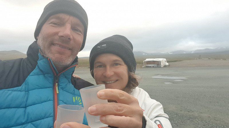
Stekenjokk Mine, Schweden
Then it goes further into the mountains, barren and unreal, the area stretches in all directions. At the top at almost 900m, on the border with Lapland, we will spend the night. There is a large gravel parking lot with plenty of space.
At only 7 degrees, we not only heat ourselves up with a schnapps, but also our camper.
3FQ5+XJ3 Stikkenjokk, Schweden
65° 5' 23.6" N 14° 27' 32.5" E
65.0898890 14.4590403
• Head north on Vildmarksvägen. Go for 32.1 km.
• Continue on Kultsjölandet. Go for 2.4 km.
• Turn left toward Fatmomakke. Go for 5.0 km.
• Turn right onto Fatmomakke. Go for 2.1 km.
• Arrive at Fatmomakke. Your destination is on the left.
☍
41,7 km
( 47 min.)
Day
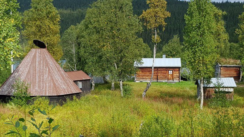
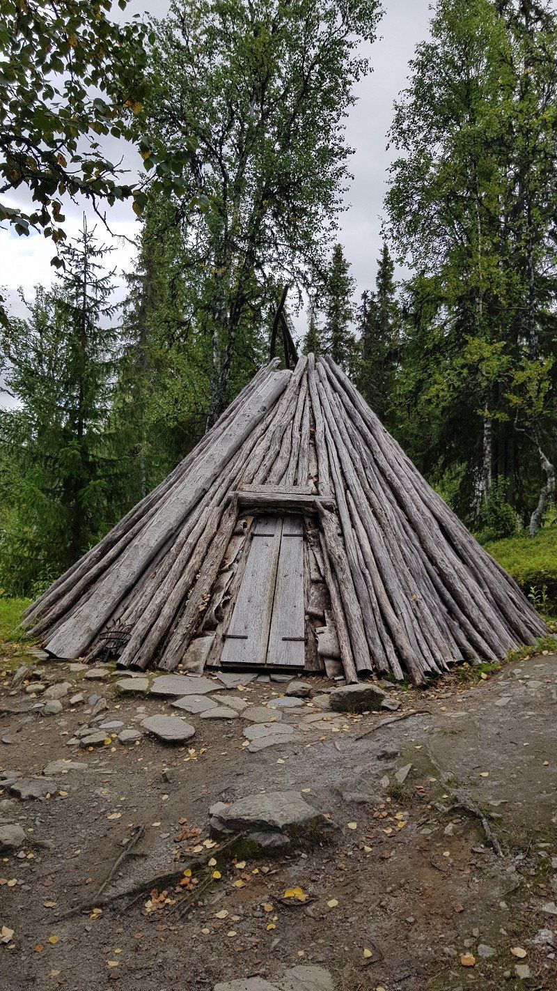
Fatmomakke, Schweden
We continue along the Vildmarksvägen, Sweden's most beautiful tourist road. Today, however, downhill to an old Sami village, which arose in the 18th century, Fatmomakke. Today there are around 100 buildings from different eras.
Fatmomakke 87, 910 88 Marsfjäll, Schweden
65° 5' 15.9" N 15° 8' 9" E
65.0877404 15.1358455
• Head west on Fatmomakke. Go for 2.1 km.
• Turn left toward Stornäs. Go for 5.0 km.
• Turn left onto Stornäs. Go for 1.7 km.
• Continue on Västra Stornäs. Go for 6.2 km.
• Continue on Fiskonbäcken. Go for 3.7 km.
• Continue on Vildmarksvägen. Go for 9.1 km.
• Continue on Nedre Saxnäs. Go for 1.7 km.
• Continue on Vildmarksvägen. Go for 2.1 km.
• Arrive at Vildmarksvägen. Your destination is on the left.
☍
31,6 km
( 37 min.)
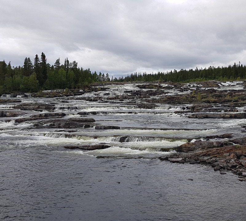
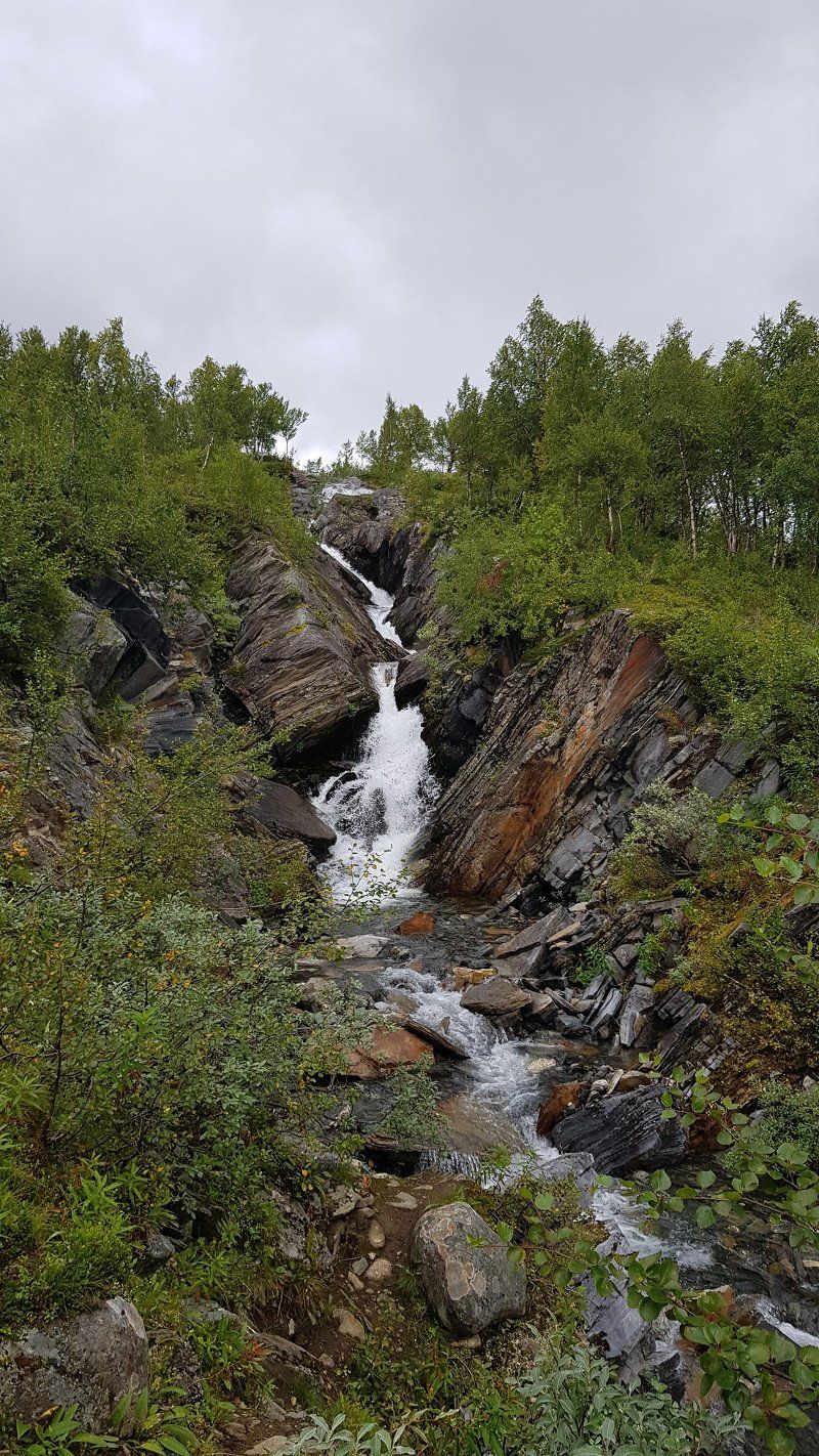
Trappstegsforsen
Then a short stop at Trappstegsforsen, Sweden's most beautiful waterfall. Not high, but wide and long over many steps.
910 88 Marsfjäll, Schweden
64° 57' 22.4" N 15° 27' 51.4" E
64.9562251 15.4642868
• Head toward Trappstegsforsen on Vildmarksvägen. Go for 8.1 km.
• Continue on Gaskelite. Go for 855 m.
• Continue on Vuollelite. Go for 1.0 km.
• Continue on Litsjönäs. Go for 502 m.
• Continue on Bångnäs. Go for 13.6 km.
• Continue on Sagavägen. Go for 56.4 km.
• Continue on Lövliden. Go for 1.1 km.
• Turn right onto Sagavägen. Go for 81 m.
• Arrive at Sagavägen. Your destination is on the right.
☍
81,6 km
( 59 min.)
Bergmans Fisk & Vilt, Sågån, Vilhelmina, Schweden
This restaurant was recommended to us by 2 people, so we gave it a try. It was really good, that's why we recommend it. But beware: opening hours only until 6 p.m.
Sågån 1, 912 92 Vilhelmina, Schweden
64° 38' 46.4" N 16° 36' 54.6" E
64.6462326 16.6151543
• Head northwest on Sagavägen. Go for 81 m.
• Turn right onto Sagavägen. Go for 64 m.
• Turn left onto E45. Go for 62.7 km.
• Turn left onto Blå vägen (E12/E45). Go for 2.0 km.
• Continue on Blå vägen (E12) toward Mo i Rana. Go for 384 m.
• Take the 2nd exit from roundabout onto Blå vägen (E12). Go for 46.3 km.
• Turn left. Go for 553 m.
• Arrive at your destination on the right.
☍
112,0 km
(1 hrs. 19 min.)
Übernachtungsplatz, Schweden
Then, as always, the search for a nice place for the night. At Storuman we found what we were looking for just before dark.
C,, 923 99 Storuman, Schweden
65° 22' 39.2" N 16° 30' 23.6" E
65.3775511 16.5065634
• Head toward Blå vägen. Go for 553 m.
• Turn left onto Blå vägen (E12). Go for 146 km.
• Turn right onto Kåtaviken. Go for 498 m.
• Arrive at Kåtaviken. Your destination is on the left.
☍
147,5 km
(1 hrs. 48 min.)
Day
Kåtaviken, Schweden
Shortly before the border with Norway in Kåtaviken there are many small caves to see, and then we had to walk up a mountain. Everywhere small entrances to the caves, unfortunately too narrow for an adult. Then finally a large grotto with a 5m waterfall. And again and again water-rich mountain streams that fill the many lakes
Kåtaviken 205, 920 66 Hemavan, Schweden
66° 7' 26.8" N 14° 47' 47.9" E
66.1241207 14.7966282
• Head toward Blå vägen on Kåtaviken. Go for 498 m.
• Turn right onto Blå vägen (E12). Go for 9.8 km.
• Continue on E12. Go for 17.7 km.
• Arrive at E12. Your destination is on the right.
☍
28,0 km
( 21 min.)
Übernachtungsplatz, Norwegen
Overnight place in Norway
E12 1, 8610 Mo i Rana, Norwegen
66° 17' 1.7" N 14° 31' 53.5" E
66.2838133 14.5315237
• Head northeast on E12. Go for 21.0 km.
• Take the 1st exit from roundabout onto Selforsveien (E6). Go for 242 m.
• Take the 2nd exit from roundabout onto Selforsveien (E6). Go for 246 m.
• Take the 1st exit from roundabout onto Saltfjellveien (E6) toward Narvik. Go for 76.1 km.
• Arrive at Saltfjellveien (E6). Your destination is on the right.
☍
97,6 km
(1 hrs. 13 min.)
Day
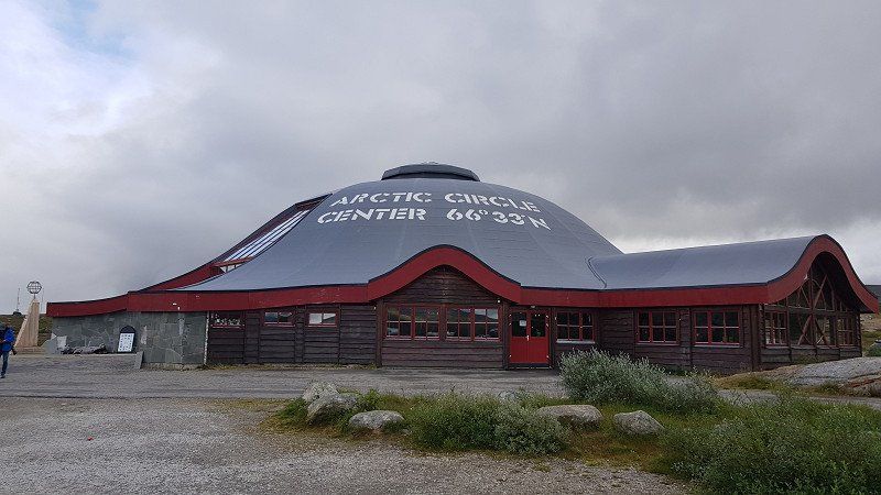
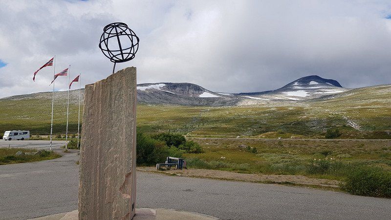
Polarkreiszentrum Norwegen
The detour via Norway was worth it. It wasn't planned, but the Arctic Circle is much more impressive here, like in Sweden at Jokkmokk.
9FRQG8P3+6W
66° 32' 7.9" N 15° 18' 17.3" E
66.5355406 15.3048131
• Head north on Saltfjellveien (E6). Go for 33.1 km.
• Turn right onto 77 toward Luleå/Arjeplog/Graddis. Go for 23.1 km.
• Continue on 95. Go for 116 km.
• Turn right. Go for 127 m.
• Arrive at your destination on the left.
☍
172,7 km
(1 hrs. 59 min.)
Übernachtungsplatz, Schweden
Overnight place with fireplace and dry toilet. Asphalt and very flat
4F3J+W3G Östansjö, Schweden
66° 6' 17.3" N 17° 28' 48.7" E
66.1048188 17.4801944
• Head northeast. Go for 127 m.
• Turn right onto 95. Go for 20.8 km.
• Turn left onto Torggatan toward Centrum/Silvermuseet. Go for 77 m.
• Turn left onto Torget. Go for 35 m.
• Arrive at Torget. Your destination is on the left.
☍
21,0 km
( 15 min.)
Day
Silbermuseum Arjeplog, Schweden
We continued along "Silvervägen" to Arjeplog, where we saw the church and the silver museum. A doctor who arrived there in 1922 opened the museum in 1965 and collected everything about Sami life. Definitely worth seeing.
In the shop you can buy nice silver jewelry. The prices are identical to those in the Jokkmokk silver factory.
TORGET 1A, 930 90 Arjeplog, Schweden
66° 3' 4.2" N 17° 53' 13.4" E
66.0511551 17.8870574
• Head toward Torggatan on Torget. Go for 131 m.
• Turn right onto Torggatan. Go for 123 m.
• Turn left onto Silvervägen (95). Go for 76.1 km.
• Continue on Inlandsvägen (E45) toward Arvidsjaur flygplats/Skellefteå. Go for 7.9 km.
• Take the 1st exit from roundabout onto 95 toward Skellefteå/Arvidsjaur flygplats. Go for 2.0 km.
• Pass 2 roundabouts and continue on Storgatan (95). Go for 2.6 km.
• Turn left onto 94 toward Luleå/Älvsbyn/Arvidsjaurs flygplats. Go for 5.3 km.
• Turn left onto Framnäs toward Arvidsjaurs flygplats. Go for 2.8 km.
• Continue toward Arvidsjaurs flygplats. Go for 1.6 km.
• Continue on Arvidsjaurs flygplats. Go for 84 m.
• Arrive at Arvidsjaurs flygplats. Your destination is on the right.
☍
98,7 km
(1 hrs. 14 min.)
Flughafen Arvidsjaur, Schweden
The big car companies have built winter test tracks in Arvidsjaur because the conditions here in winter are ideal. Accordingly, the place is booming. Everything about the creation and development of the test centers can be viewed and read at the airport. There is a small free exhibition here.
933 91 Arvidsjaur, Schweden
65° 35' 31.8" N 19° 15' 51.1" E
65.5921635 19.2642046
• Head northwest on Arvidsjaurs flygplats. Go for 50 m.
• Turn left. Go for 134 m.
• Turn right toward Framnäs. Go for 1.6 km.
• Continue on Framnäs. Go for 2.8 km.
• Turn right onto 94. Go for 5.3 km.
• Turn right onto 95 toward Bodö/Centrum. Go for 2.5 km.
• Pass 2 roundabouts and continue on Storgatan (95). Go for 2.1 km.
• Take the 1st exit from roundabout onto Inlandsvägen (E45) toward Gällivare/Jokkmokk. Go for 129 km.
• Turn right. Go for 28 m.
• Arrive at your destination on the right.
☍
143,8 km
(1 hrs. 40 min.)
Übernachtungsplatz, Schweden
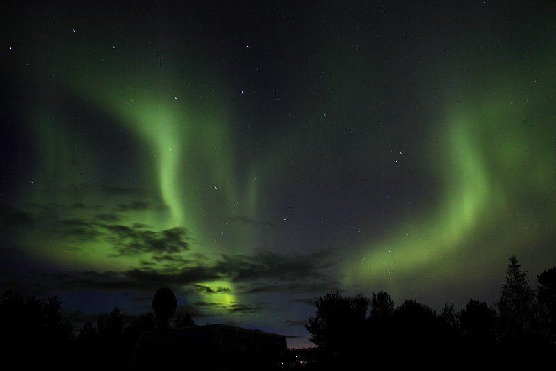
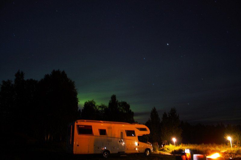
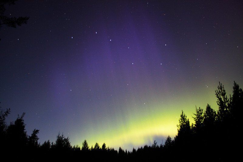
Overnight spot just before the Arctic Circle near Jokkmokk. Here we also saw our first Northern Lights.
CMGM+H3Q Tårrajaur, Schweden
66° 25' 35.3" N 19° 40' 57.8" E
66.4264736 19.6827353
• Head toward Inlandsvägen. Go for 72 m.
• Turn right onto Inlandsvägen (E45). Go for 15.5 km.
• Turn right onto Polcirkeln söder Jokkmokk toward Polcirkeln Jokkmokk. Go for 110 m.
• Turn right onto Polcirkelns Fiskecamp. Go for 76 m.
• Arrive at Polcirkelns Fiskecamp. Your destination is on the right.
☍
15,8 km
( 9 min.)
Day
POLCIRKELNS FISKECAMP
Today we cross the Arctic Circle from south to north for the second time, this time in Sweden.
POLCIRKELNS FISKECAMP 2, 962 99 Jokkmokk, Schweden
66° 33' 1.6" N 19° 45' 56.2" E
66.5504466 19.7656180
• Head toward Inlandsvägen on Polcirkelns Fiskecamp. Go for 76 m.
• Turn right onto Polcirkeln söder Jokkmokk. Go for 114 m.
• Turn right onto Inlandsvägen (E45). Go for 7.0 km.
• Take the 2nd exit from roundabout onto Klockarvägen (E45) toward Gällivare. Go for 45.0 km.
• Turn left onto Strömgatan. Go for 166 m.
• Arrive at Strömgatan. Your destination is on the left.
☍
52,4 km
( 36 min.)
Kraftwerk, Schweden
Here we wanted to look at the power plant, there should also be tours in German. Unfortunately probably not in 2022, it was closed.
Strömgatan 41, 982 60 Porjus, Schweden
66° 57' 45.8" N 19° 49' 25.2" E
66.9627220 19.8236590
• Head northeast on Strömgatan. Go for 166 m.
• Turn right onto Strömgatan (E45). Go for 18.8 km.
• Turn right onto Ligga. Go for 766 m.
• Turn slightly left. Go for 6.9 km.
• Continue straight ahead. Go for 3.9 km.
• Arrive at your destination on the right.
☍
30,5 km
( 43 min.)
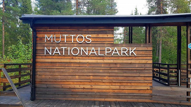
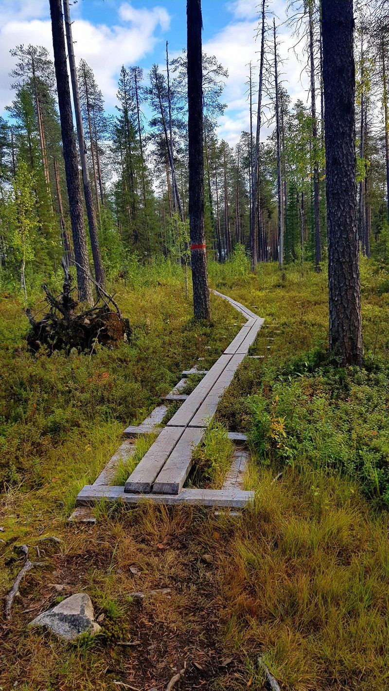
Muttos Nationalpark
Muttos National Park. Nice for hiking. However, the round trip is over 20km long. Since there is not enough time, we only hike about 1.5 hours into the park and then turn back.
9GR2Q4C5+GR
66° 46' 16.5" N 20° 6' 34.2" E
66.7712632 20.1095129
• Head west. Go for 10.8 km.
• Turn slightly right onto Ligga. Go for 766 m.
• Turn right onto Inlandsvägen (E45). Go for 22.0 km.
• Turn left onto Forsviken. Go for 73 m.
• Arrive at Forsviken. Your destination is on the left.
☍
33,6 km
( 44 min.)
Übernachtungsplatz, Schweden
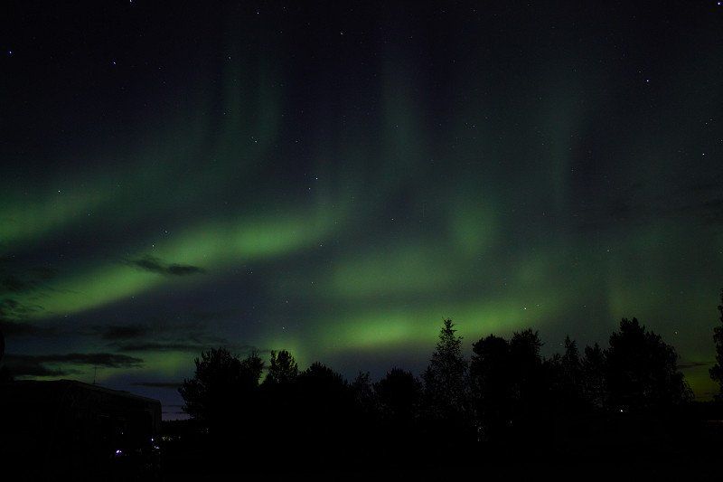
Overnight place just north of Jokkmokk. Great location on the reservoir with nice seating.
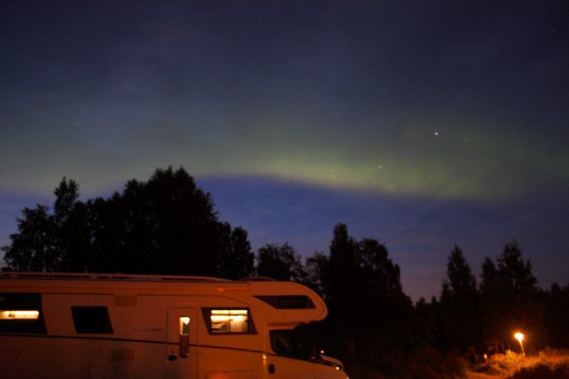
Here we also see the northern lights for the second time.
FORSVIKEN 1, 962 99 Jokkmokk, Schweden
66° 38' 32.5" N 19° 49' 37.9" E
66.6423607 19.8271843
• Head toward Inlandsvägen on Forsviken. Go for 73 m.
• Turn left onto Inlandsvägen (E45). Go for 4.5 km.
• Take the 3rd exit from roundabout onto Storgatan (97) toward Centrum/Ájtte. Go for 742 m.
• Pass 3 roundabouts and continue on Garnisonsgatan (97/356). Go for 134 km.
• Turn right onto Lulevägen (97) toward Luleå. Go for 1.1 km.
• Take the 2nd exit from roundabout onto Lulevägen (97). Go for 21.6 km.
• Turn right onto Sunderbyvägen toward S Sunderbyn. Go for 144 m.
• Turn left toward Gamla Bodenvägen. Go for 503 m.
• Turn right onto Gamla Bodenvägen. Go for 4.3 km.
• Turn left onto Kyrktorget. Go for 79 m.
• Arrive at Kyrktorget. Your destination is on the right.
☍
166,6 km
(1 hrs. 48 min.)
Day
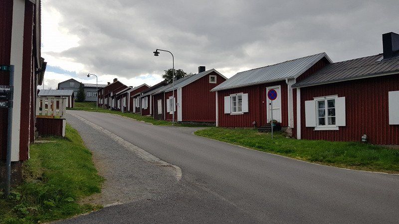
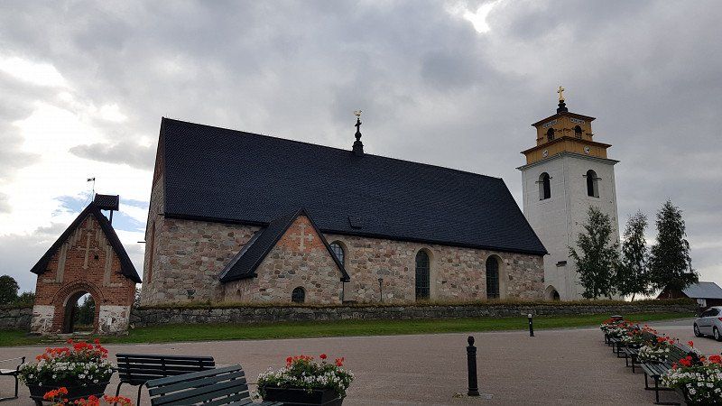
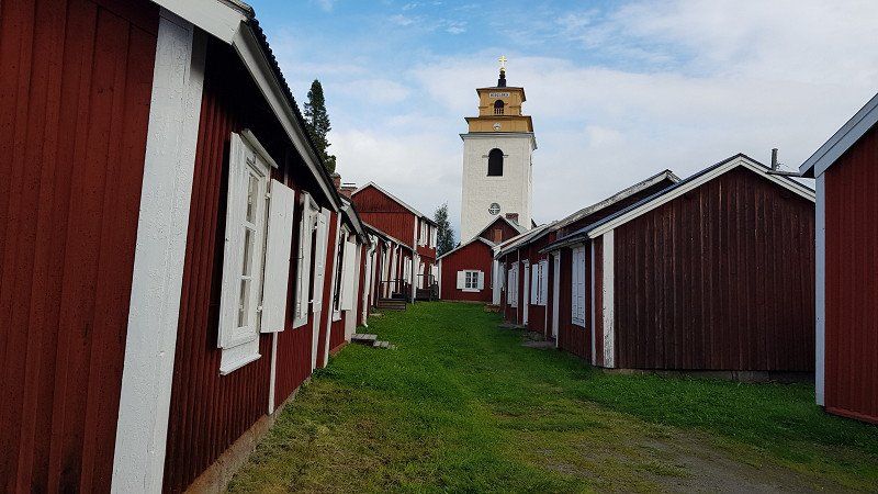
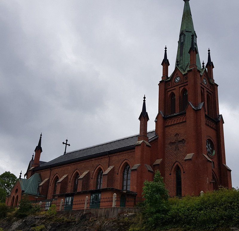
Gammelstad, Schweden
Sweden's largest church town, Gammelstad with its 400 wooden houses, all of which are privately owned and temporarily inhabited for large church festivals. The steel ship shows where the trading port was 400 years ago. Due to land uplift (8mm per year) the sea has "retracted" 10km, where Luleå was built.
Kyrktorget 2, 954 33 Gammelstad, Schweden
65° 38' 44.5" N 22° 1' 42.5" E
65.6456986 22.0284800
• Head east on Kyrktorget. Go for 1.8 km.
• Take the 2nd exit from roundabout onto Lulevägen. Go for 202 m.
• Turn left and take ramp onto 97 toward Luleå. Go for 1.3 km.
• Take ramp onto E4 toward Sundsvall/Karlsvik/Flygplats. Go for 49.1 km.
• Take ramp toward Munksund/Sjukhus/Piteå. Go for 356 m.
• Take the 4th exit from roundabout onto Norra Ringen. Go for 2.6 km.
• Turn right onto Kolugnsvägen. Go for 82 m.
• Arrive at Kolugnsvägen. Your destination is on the left.
☍
55,5 km
( 36 min.)
Übernachtungsplatz Piteå, Schweden
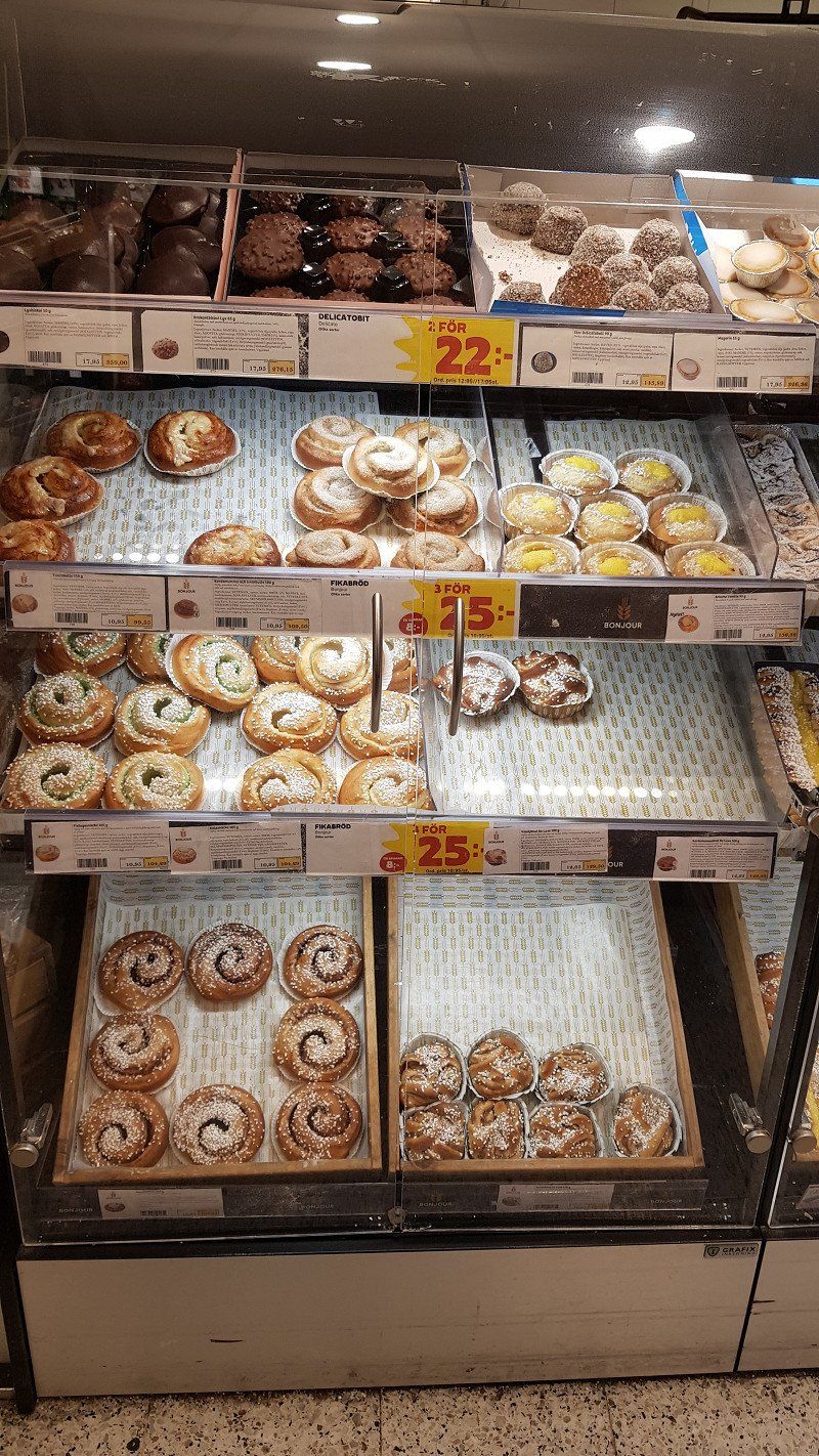
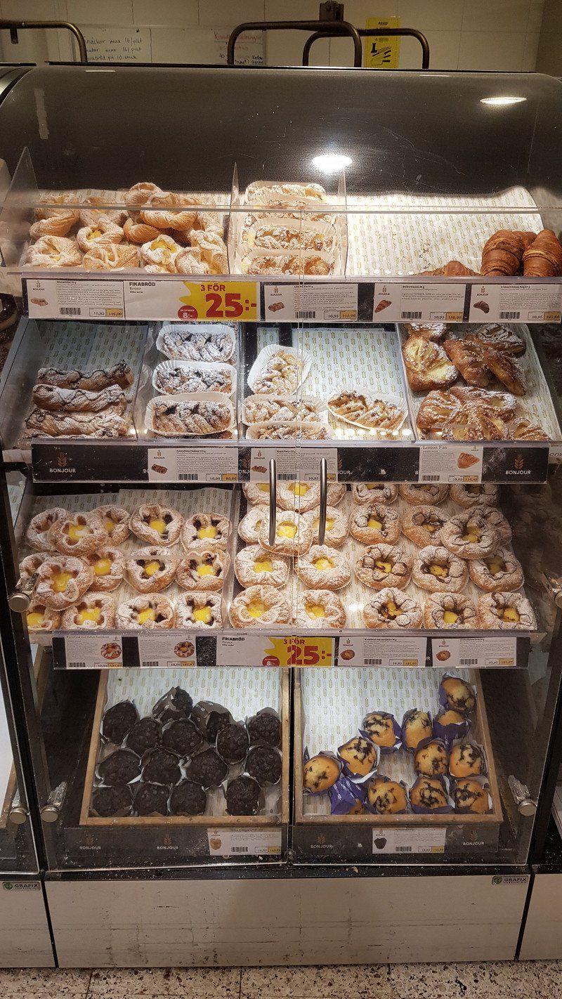
In Piteå we go shopping again, not because we have to, but because we like the sweet pastries. A real sugar shock, but we are on vacation. Since I ate these parts on the 2nd day in Sweden, not a day goes by without them. We also become fans of the Coop, which has a great offer as "Stora".
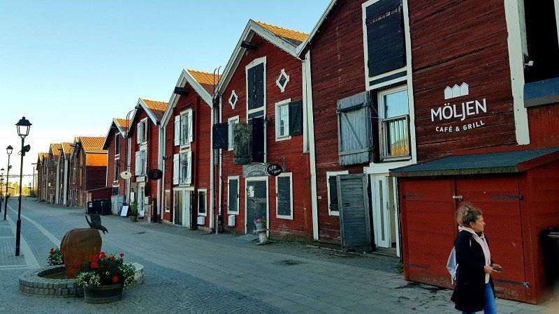
Then it goes to the center of Piteå with the oldest standing wooden church. The pedestrian zone with the old wooden houses is also worth seeing. It is said to be Sweden's first pedestrian zone.
Kolugnsvägen, 941 38 Piteå, Schweden
65° 18' 58.2" N 21° 28' 13.6" E
65.3161712 21.4704473
• Head toward Västergatan on Kolugnsvägen. Go for 82 m.
• Turn left onto Timmerleden. Go for 2.5 km.
• Take the 3rd exit from roundabout onto E4 toward Piteå. Go for 2.6 km.
• Take ramp toward Hortlax/Bergsviken. Go for 249 m.
• Take the 1st exit from roundabout onto Tingsholmsvägen. Go for 246 m.
• Take the 2nd exit from roundabout onto Flakabergsvägen. Go for 353 m.
• Continue on Norra Hortlaxvägen. Go for 733 m.
• Continue on Hortlaxvägen. Go for 5.3 km.
• Continue on Blåsmarksvägen. Go for 1.2 km.
• Turn left onto Kallforsvägen. Go for 98 m.
• Continue on Blåsmarksvägen. Go for 3.9 km.
• Continue on Hemmingsmarksvägen. Go for 9.4 km.
• Continue on Mellanboda. Go for 2.0 km.
• Continue on Holmfors. Go for 4.8 km.
• Continue on Ålund. Go for 3.0 km.
• Turn right onto Ålund. Go for 846 m.
• Continue on Lundfors. Go for 3.4 km.
• Continue on Islandsbäck. Go for 1.5 km.
• Turn left onto Jakobsfors. Go for 5.6 km.
• Continue on Forsheden. Go for 424 m.
• Turn slightly left onto Fallgatan. Go for 407 m.
• Turn right onto Hälleströmsvägen. Go for 95 m.
• Arrive at Hälleströmsvägen. Your destination is on the left.
☍
48,6 km
( 38 min.)
Day
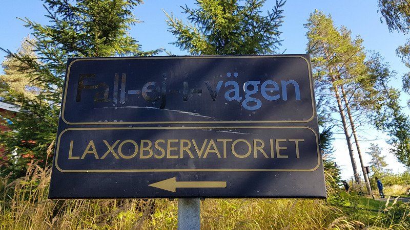
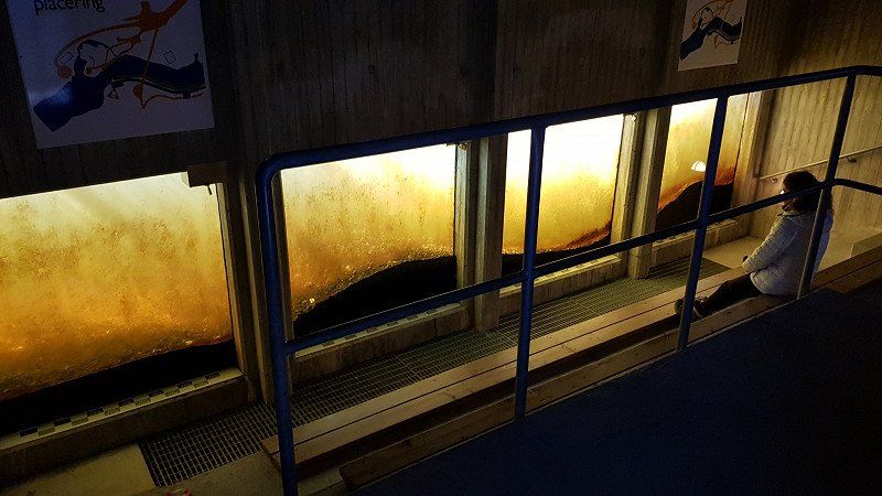
Laxobservatoriet
We could have saved ourselves the lax observatory. There were no salmon to be seen.
Hälleströmsvägen 8, 930 52 Fällfors, Schweden
65° 7' 27.1" N 20° 47' 33.9" E
65.1241811 20.7927632
• Head toward Skolgatan on Hälleströmsvägen. Go for 208 m.
• Turn left onto Skolgatan. Go for 304 m.
• Continue toward Nyfors. Go for 6.9 km.
• Continue on Nyfors. Go for 3.7 km.
• Continue on Svartå. Go for 911 m.
• Continue on Nide. Go for 5.6 km.
• Turn left toward Dalbäck. Go for 2.4 km.
• Continue on Dalbäck. Go for 184 m.
• Continue on Källdal. Go for 8.7 km.
• Continue on Drängsmark. Go for 8.1 km.
• Turn left onto Ostvik. Go for 889 m.
• Turn right and take ramp onto E4 toward Sundsvall. Go for 12.1 km.
• Take ramp toward Fällbäcken/Boviken. Go for 388 m.
• Turn left toward Boviken. Go for 2.1 km.
• Continue on Boviken. Go for 138 m.
• Turn right toward Boviken. Go for 224 m.
• Continue on Boviken. Go for 407 m.
• Continue toward Boviken. Go for 203 m.
• Turn right onto Boviken. Go for 36 m.
• Arrive at Boviken. Your destination is on the left.
☍
53,5 km
( 41 min.)
Übernachtungsplatz, Schweden
Place to stay at a small port, 100SEK. With fireplace. Nice and quiet location.
Boviken 700, 931 99 Skellefteå, Schweden
64° 47' 44.3" N 21° 3' 55.8" E
64.7956486 21.0655036
• Head north on Boviken. Go for 36 m.
• Turn left toward Boviken. Go for 203 m.
• Continue on Boviken. Go for 407 m.
• Continue toward Boviken. Go for 224 m.
• Turn left onto Boviken. Go for 2.2 km.
• Turn left and take ramp onto E4 toward Sundsvall. Go for 5.3 km.
• Pass 3 roundabouts and continue on E4. Go for 130 km.
• Take the 3rd exit from Nydalarondellen roundabout onto Mineral (E4) toward Sundsvall/E12/Vasa/Holmsund. Go for 3.4 km.
• Pass 2 roundabouts and continue on Mineral (E4). Go for 908 m.
• Take the 2nd exit from Carlslidrondellen roundabout onto Mineral (E4) toward Sundsvall/E12/Vasa/Holmsund. Go for 600 m.
• Pass 3 roundabouts and continue on Blå vägen (E4/E12). Go for 3.7 km.
• Take the 3rd exit from Söderslättsrondellen roundabout onto E4 toward Sundsvall. Go for 105 km.
• Take the 2nd exit from roundabout onto E4 toward Sundsvall. Go for 2.6 km.
• Take the 1st exit from roundabout onto E4 toward Sundsvall/348/Åsele. Go for 22.0 km.
• Turn left toward Näske. Go for 31 m.
• Continue on Norum. Go for 568 m.
• Continue toward Järvvik. Go for 185 m.
• Continue on Järvvik. Go for 2.1 km.
• Continue on Järvvik. Go for 1.1 km.
• Continue on Näske. Go for 1.0 km.
• Turn sharp right onto Näske. Go for 60 m.
• Continue toward Näske. Go for 28 m.
• Continue on Näske. Go for 774 m.
• Turn slightly right toward Näske. Go for 52 m.
• Turn slightly right onto Näske. Go for 215 m.
• Continue straight ahead. Go for 22 m.
• Turn slightly left. Go for 1.9 km.
• Turn left. Go for 23 m.
• Turn slightly right. Go for 277 m.
• Arrive at your destination on the left.
☍
284,9 km
(3 hrs. 28 min.)
Day
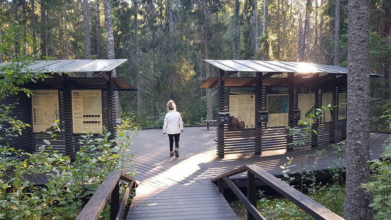
Ankunft Skuleskogen Nationalpark
....without big highlights, because today we have to cover some distance. 310 km with construction sites and thus gravel roads that allow a maximum of 30 km/h take time. So we have to postpone today's hike in Skuleskogen National Park to tomorrow, otherwise we'll get in in the dark.
For this we are optimizing the remaining route to Gothenburg, because we should be there on Saturday evening and unfortunately the days are running out ☹
Day
Skuleskogen National Park, North Entrance
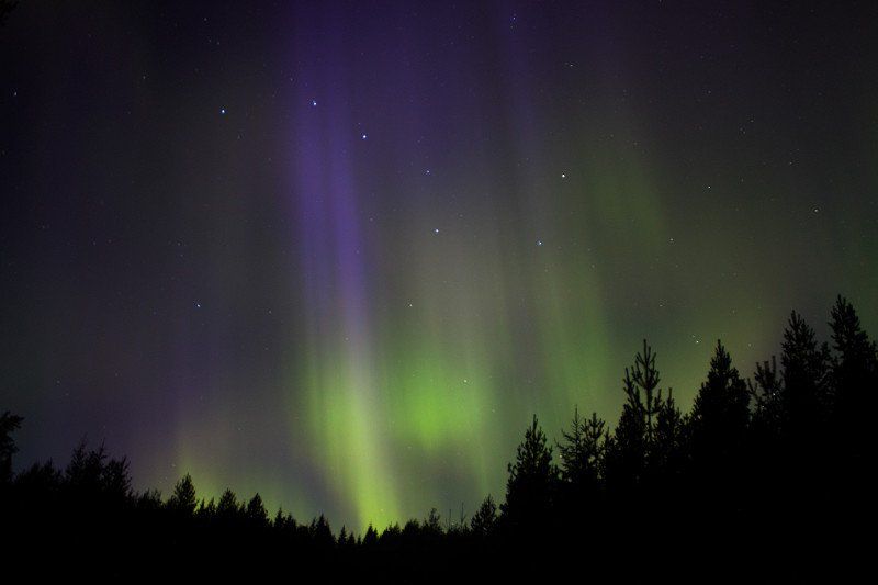
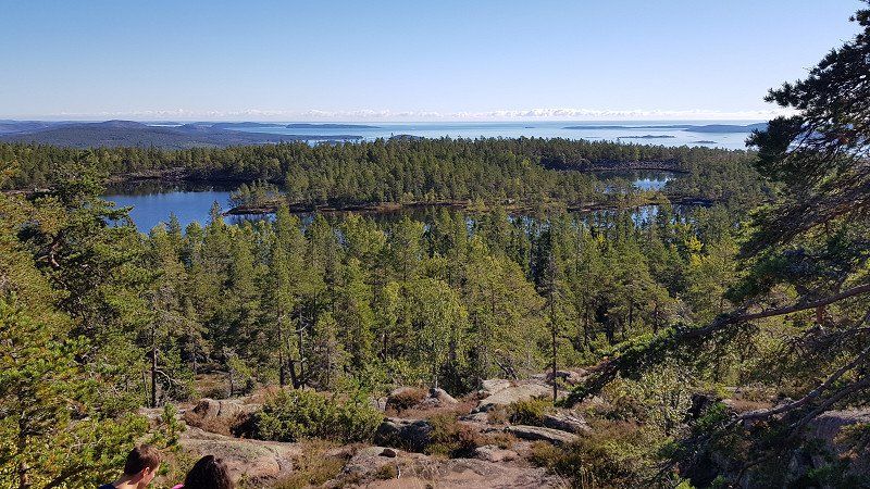
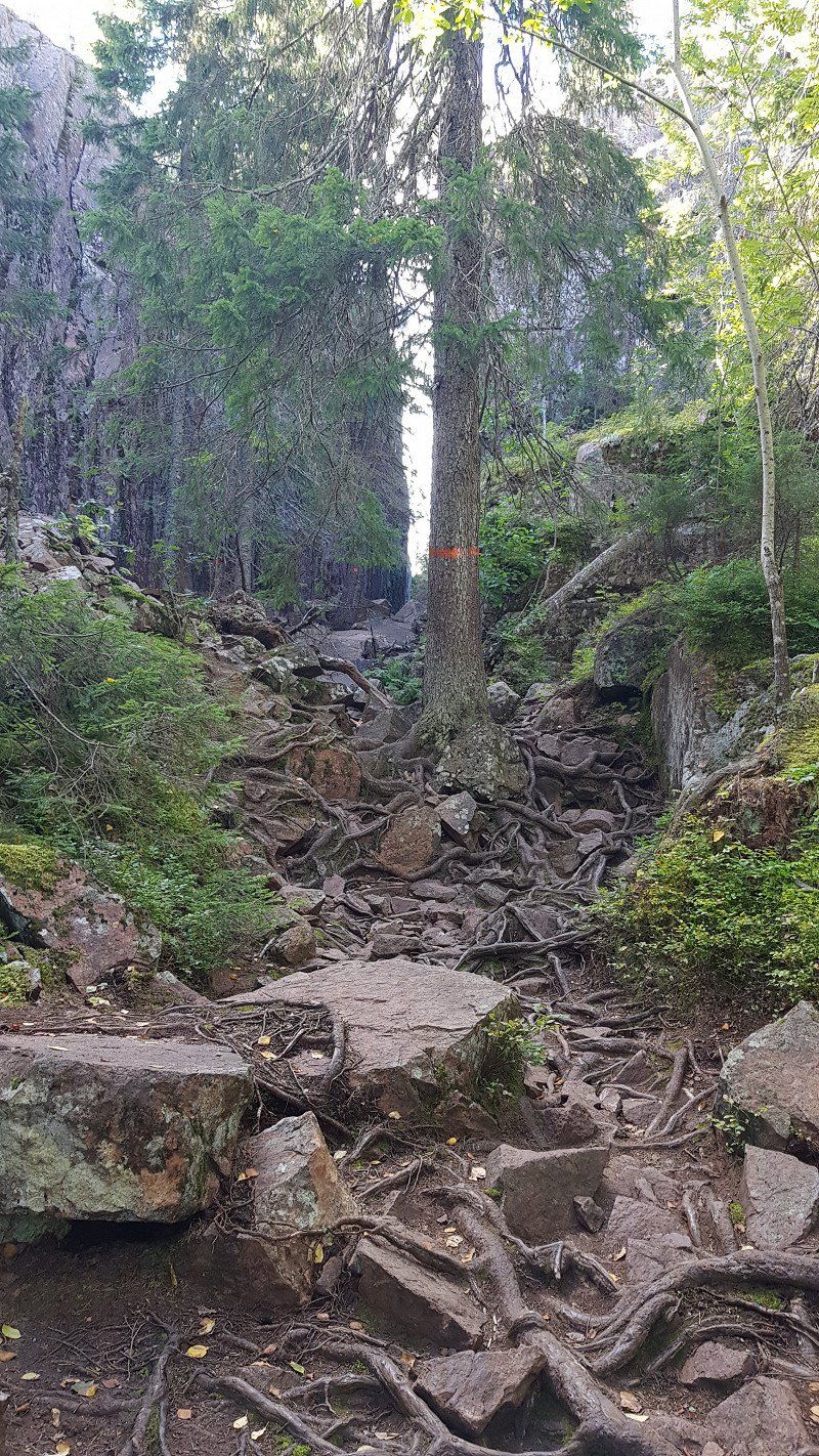
After the great northern lights night, we went hiking in the Skuleskogen National Park today. It was 10km over boardwalks, root paths, scree paths and massive boulders. After 5 exhausting hours we were back and still a bit tired, but it was worth it.
Skuleskogen National Park, North Entrance - Abfahrt Montag 15 Uhr
N 63° 08.106 E 018° 30.932, 893 91 Bjästa, Schweden
63° 8' 6.4" N 18° 30' 55.4" E
63.1351238 18.5153961
• Head northwest. Go for 2.2 km.
• Continue on Näske. Go for 215 m.
• Turn slightly left toward Näske. Go for 52 m.
• Turn slightly left onto Näske. Go for 774 m.
• Continue toward Näske. Go for 28 m.
• Continue on Näske. Go for 60 m.
• Turn sharp left onto Näske. Go for 1.7 km.
• Continue on Järvvik. Go for 496 m.
• Continue on Järvvik. Go for 2.2 km.
• Continue on Norum. Go for 599 m.
• Turn left onto E4. Go for 74.5 km.
• Turn right toward Norrstig. Go for 24 m.
• Continue on Norrstig. Go for 345 m.
• Continue on Långslätten. Go for 1.4 km.
• Continue on Söderstig. Go for 1.1 km.
• Continue on Byåker. Go for 639 m.
• Turn right toward Billsta. Go for 2.6 km.
• Continue on Billsta. Go for 748 m.
• Turn left toward Nyland Erikslund. Go for 134 m.
• Continue on Nyland Erikslund. Go for 145 m.
• Continue on Nyland. Go for 3.6 km.
• Continue on Tjärnsjö. Go for 1.2 km.
• Continue on Tjärnsjö. Go for 140 m.
• Continue on Antjärn. Go for 404 m.
• Turn right onto E4. Go for 115 km.
• Turn left toward Hudiksvall/Hornslandet/Hölick. Go for 2.3 km.
• Continue on Sannavägen. Go for 679 m.
• Turn left onto Östanbräcksvägen. Go for 4.0 km.
• Turn right onto Köpmanbergsvägen. Go for 440 m.
• Arrive at Köpmanbergsvägen. Your destination is on the left.
☍
217,3 km
(2 hrs. 42 min.)
Day
Parkplatz Hudiksvall, Schweden
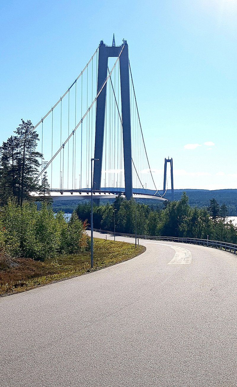
Then back on the E 4 and on we go south, including over the Höga Kusrenbro with its 180m pylons, one of the longest suspension bridges in the world.
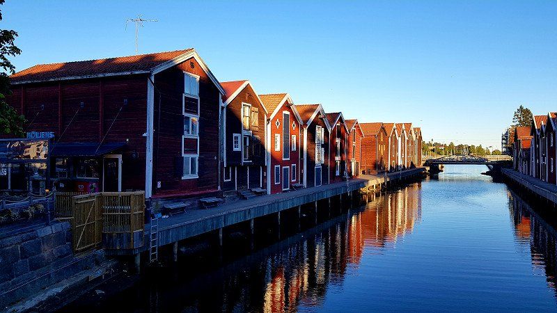
Today's destination is Hudiksvall, a former fishing and trading town by the sea. The many old warehouses still bear witness to this time.
Unfortunately, the much-advertised parking space at the harbor has fallen victim to a building site. There are still a few long-term parking spaces, but the location is not particularly great. We drive 2km out of town and find a great place to stay there.
Köpmanbergsvägen 12, 824 50 Hudiksvall, Schweden
61° 43' 20.3" N 17° 8' 3.5" E
61.7223011 17.1343013
• Head west on Köpmanbergsvägen. Go for 411 m.
• Turn slightly right onto Köpmanbergsvägen. Go for 240 m.
• Turn left onto Malnvägen. Go for 179 m.
• Continue on Hamngatan. Go for 762 m.
• Turn left onto Stationsgatan. Go for 1.4 km.
• Take the 3rd exit from roundabout onto Södra vägen. Go for 969 m.
• Continue on Håstaängsvägen. Go for 306 m.
• Continue on 84. Go for 1.3 km.
• Turn right onto 84 toward Stockholm/Sveg/Ljusdal. Go for 221 m.
• Turn left onto 84 toward Stockholm. Go for 24 m.
• Take ramp onto E4 toward Stockholm. Go for 127 km.
• Take exit 197 toward Östhammar/76/Furuvik/Gävle S/Hedesunda. Go for 320 m.
• Turn right onto Spängersleden toward Östhammar/Furuvik/Gävle S. Go for 268 m.
• Pass 4 roundabouts and continue on Söderbågen (76). Go for 2.6 km.
• Take the 1st exit from roundabout onto Södra Kungsvägen (76) toward Östhammar/Furuvik/Hemlingby. Go for 14.2 km.
• Take the 3rd exit from roundabout onto Kyrkvägen. Go for 388 m.
• Continue on Östra vägen. Go for 791 m.
• Turn right toward Nyhamnsvägen. Go for 163 m.
• Turn left onto Nyhamnsvägen. Go for 348 m.
• Turn left. Go for 320 m.
• Arrive at your destination on the right.
☍
152,3 km
(1 hrs. 48 min.)
Day
Übernachtungsplatz Skutskär, Schweden
There are also goofy days, and today was one of them. "Only" drove 150km south on the E4 and then made a detour to the sea. But before that, I bought a couple of sweets from the Coop and arrested 3 of them. I love these things. The other 3 are for breakfast tomorrow. And then supplies are bought straight away, the navigation system is already programmed for the next Coop
50m from the beach we are now surrounded by trees and absolute peace
JCVH+M8J Skutskär, Schweden
60° 38' 39.1" N 17° 25' 41.8" E
60.6442044 17.4282685
• Head toward Nyhamnsvägen. Go for 320 m.
• Turn right onto Nyhamnsvägen. Go for 348 m.
• Turn right toward Östra vägen. Go for 163 m.
• Turn left onto Östra vägen. Go for 791 m.
• Continue on Kyrkvägen. Go for 337 m.
• Take the 3rd exit from roundabout onto Gävlevägen (76). Go for 853 m.
• Take the 2nd exit from roundabout onto Gävlevägen (76) toward Norrtälje/Älvkarleby. Go for 8.7 km.
• Continue on 291 toward Uppsala/E4/Mehedeby. Go for 11.8 km.
• Turn left and take ramp onto E4 toward Stockholm. Go for 132 km.
• Continue on E4 (Uppsalavägen) toward Stockholm/E20. Go for 2.9 km.
• Take exit 164 toward E20/277/Karolinska sjukhuset onto E4.26 (Uppsalavägen). Go for 375 m.
• Take the exit toward Stockholm C/Norrtull onto E4.26 (Uppsalavägen). Go for 790 m.
• Turn right onto Norra Stationsgatan toward E4 S/E20 S/S:t Eriksplan. Go for 100 m.
• Take the 3rd exit from roundabout onto Sankt Eriksgatan. Go for 465 m.
• Take the 2nd exit from Vanadisplan roundabout onto Sankt Eriksgatan. Go for 891 m.
• Continue on Sankt Eriksbron. Go for 148 m.
• Continue on Sankt Eriksgatan. Go for 527 m.
• Turn right onto Drottningholmsvägen toward Fridhemsplan/E20 S/E4 S. Go for 162 m.
• Keep right onto Drottningholmsvägen toward E4 N/E20 N/Solna/Södermalm. Go for 262 m.
• Turn left onto Lilla västerbron toward Hornstull/Södermalm. Go for 198 m.
• Continue on Västerbron. Go for 207 m.
• Continue on Västerbroplan. Go for 46 m.
• Turn left onto Västerbroplan. Go for 100 m.
• Continue on Västerbron. Go for 1.1 km.
• Continue on Långholmsgatan. Go for 133 m.
• Turn right onto Högalidsgatan. Go for 227 m.
• Turn right onto Långholmsbron. Go for 47 m.
• Turn right onto Söder Mälarstrand. Go for 371 m.
• Turn left onto Pålsundsbron. Go for 87 m.
• Turn left onto Skutskepparvägen. Go for 51 m.
• Turn left onto Skutskepparvägen. Go for 167 m.
• Arrive at Skutskepparvägen. Your destination is on the right.
☍
164,8 km
(1 hrs. 57 min.)
Day
Långholmens Husbilscamping Stockholm - Stellplatz Ankunft Mittwoch 7.9.22 12:00 Uhr
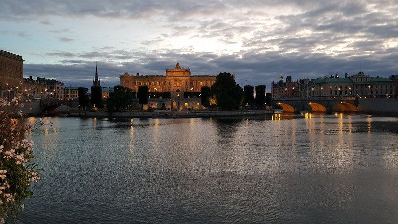
Stockholm: A stroll through the old town is worthwhile, past the royal palace.
Then visit the ABBA Museum with countless exhibits and replicas of the rooms where the hits were made. Of course there is also music and films.
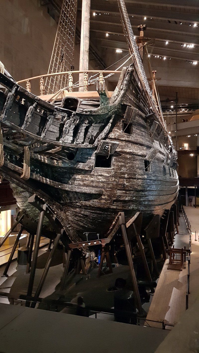
Then on to the Vasa Museum, which is all about a single warship that sank in 1628 after only 1.5 km. It was salvaged in 1961 and renovated and conserved over many years, so that 98% of it can be seen in the original.
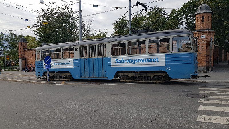
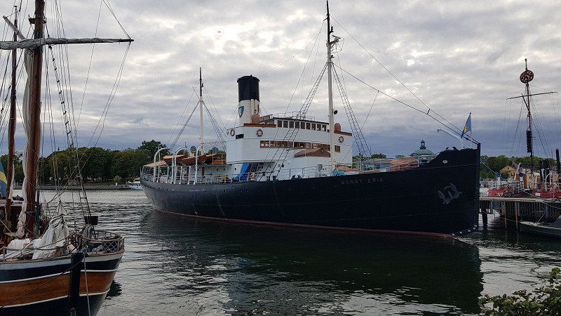
Here in Stockholm you not only see many old ships that have been converted into houseboats, restaurants, bars and hotels, but also buses that drive on the water. They also have old trams here.
So if you walk here, it's exhausting, but you see a lot more than if you take the train. We walked about 12 km today.
Day
Långholmens Husbilscamping - Abfahrt Donnerstag 10:00 Uhr
Skutskepparvägen 1, 11733, Stockholm, Schweden
59° 19' 13" N 18° 1' 50" E
59.3202778 18.0305556
• Head east on Skutskepparvägen. Go for 218 m.
• Turn right onto Mälarvarvsbacken. Go for 87 m.
• Turn right onto Söder Mälarstrand. Go for 371 m.
• Turn left onto Långholmsbron. Go for 47 m.
• Turn left onto Högalidsgatan. Go for 227 m.
• Turn right onto Långholmsgatan toward Hornstull/E4 S/S Bergsund/E20 S. Go for 689 m.
• Continue on Södertäljevägen. Go for 1.4 km.
• Take left ramp onto E4/E20 (Södertäljevägen) toward Helsingborg/Göteborg. Go for 27.3 km.
• Continue on E4 (Trafikplats Saltskog östra) toward Helsingborg/Nyköping. Go for 165 km.
• Take exit 112 toward Berg/Bergs Slussar/Göta Kanal. Go for 269 m.
• Take the 2nd exit from roundabout onto Bergsvägen (1136). Go for 5.9 km.
• Continue on Stjärnorpsvägen. Go for 456 m.
• Turn right onto Bergs Slussar. Go for 57 m.
• Continue on Bergs Slussar Kanalvillan. Go for 58 m.
• Turn slightly left. Go for 158 m.
• Arrive at your destination on the left.
☍
202,0 km
(2 hrs. 9 min.)
Stellplatz an der Berg-Schleuse - Ankunft Donnerstag 13:00 Uhr
The monastery church there, which dates back to the 11th century, has been repeatedly renovated and expanded since that time. Simple but worth seeing.
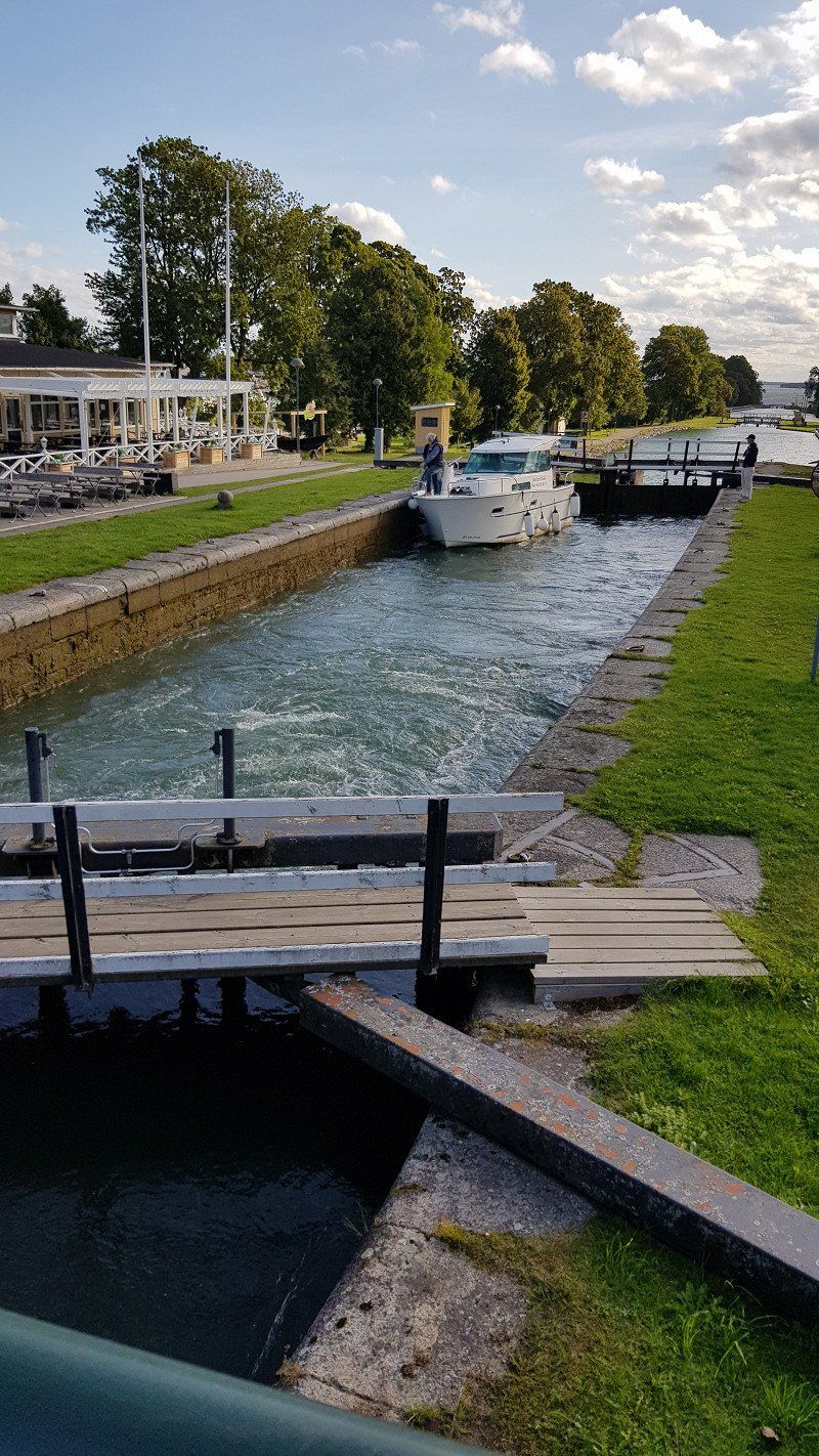
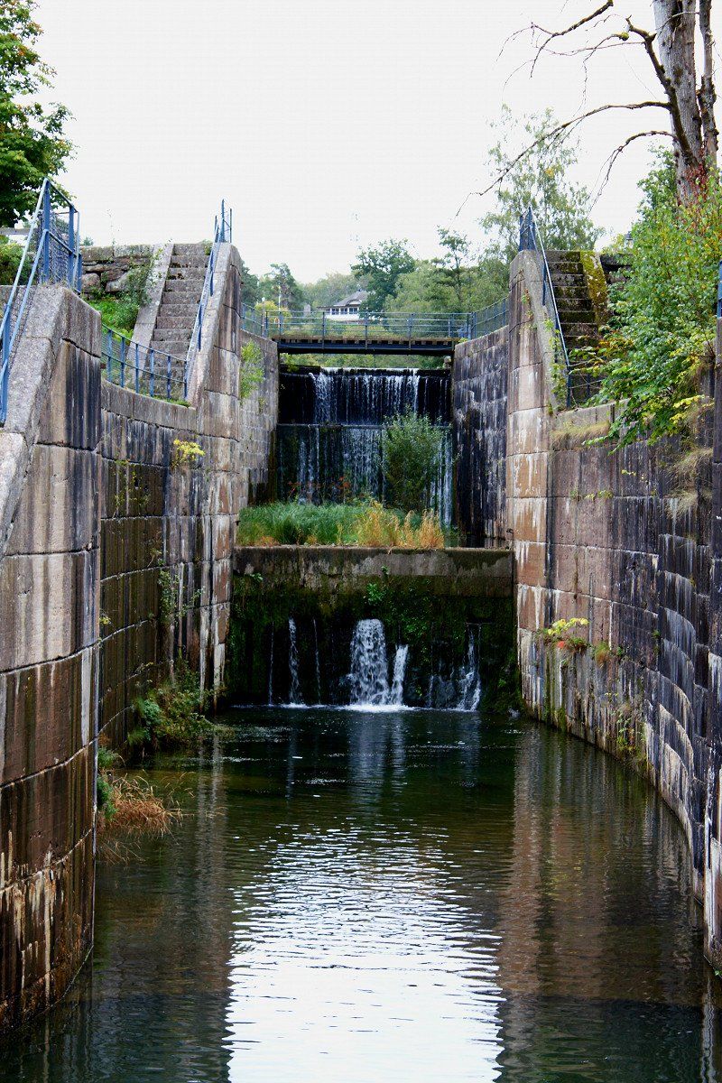
In Berg is the highlight of the Göta Canal. The 11 lock gates over a length of around 1km allow a height difference of over 30m. Considering the locks were built in 1815, that's quite a feat.
Since the monastery church has a large and empty parking lot, we stay here overnight with 2 other campers.
Day
Stellplatz an der Berg-Schleuse - Abfahrt Freitag 10:00 Uhr
58220, Linköping, Schweden
58° 29' 8" N 15° 31' 48" E
58.4855556 15.5300000
• Head east. Go for 7 m.
• Turn right toward Bergs Slussar Kanalvillan. Go for 16 m.
• Turn right onto Bergs Slussar Kanalvillan. Go for 218 m.
• Continue on Bergs Slussar. Go for 57 m.
• Turn left onto Stjärnorpsvägen. Go for 456 m.
• Continue on Bergsvägen (1136). Go for 5.9 km.
• Take the 1st exit from roundabout onto E4 toward Helsingborg/Motala. Go for 125 km.
• Continue on 40 toward Göteborg/Flygplats. Go for 4.6 km.
• Take ramp toward Trollhättan/Hjo/Sandseryd/Jönköpings flygplats/Hedenstorp. Go for 214 m.
• Turn right onto 26/47 toward 195/Mariestad/Trollhättan/Hjo. Go for 7.0 km.
• Take ramp onto 26/47 toward Mariestad/Trollhättan/Mullsjö/Kortebo. Go for 425 m.
• Pass 2 roundabouts and continue on 26/47. Go for 31.8 km.
• Keep left toward Trollhättan/Falköping. Go for 83 m.
• Continue on 47 toward Trollhättan/Falköping. Go for 22.7 km.
• Take the 3rd exit from roundabout onto 46/47 toward Ulricehamn/Trollhättan. Go for 1.5 km.
• Pass 2 roundabouts and continue on Södergatan. Go for 60.7 km.
• Continue on Flo Logårdsbro. Go for 1.1 km.
• Continue on Flo Hildeberg toward Uddevalla/Trollhättan. Go for 343 m.
• Continue toward Uddevalla/Trollhättan. Go for 38 m.
• Take the 3rd exit from roundabout onto 44/47 toward Uddevalla/Trollhättan. Go for 2.0 km.
• Take the 1st exit from Cirkulationsplats Smärgels Kurva roundabout toward Lilleskog/Hunneberg. Go for 107 m.
• Continue on Flo Gålstad. Go for 427 m.
• Continue on Flo Lilla Kampetorp. Go for 774 m.
• Continue on Flo Stommen. Go for 154 m.
• Continue on Flo Stommen. Go for 1.0 km.
• Continue on Flo Nyhem. Go for 169 m.
• Continue on Flo Solhem. Go for 141 m.
• Continue on Flo Elinsro. Go for 3.3 km.
• Continue on Flo Toremosse. Go for 794 m.
• Continue on Flo Mossebo. Go for 946 m.
• Continue on Munkesten. Go for 474 m.
• Continue on Lilleskog. Go for 2.1 km.
• Continue on Lilleskogsvägen. Go for 2.1 km.
• Continue on Storegårdsvägen. Go for 42 m.
• Turn right onto Storegårdsvägen. Go for 419 m.
• Turn right onto Hallebergsvägen. Go for 96 m.
• Turn left onto Stationsvägen. Go for 41 m.
• Turn right onto Hallebergsvägen. Go for 803 m.
• Continue on Halleberg. Go for 5.0 km.
• Turn left onto Centralvägen. Go for 321 m.
• Continue on Centralvägen. Go for 315 m.
• Arrive at Centralvägen. Your destination is on the right.
☍
283,8 km
(3 hrs. 24 min.)
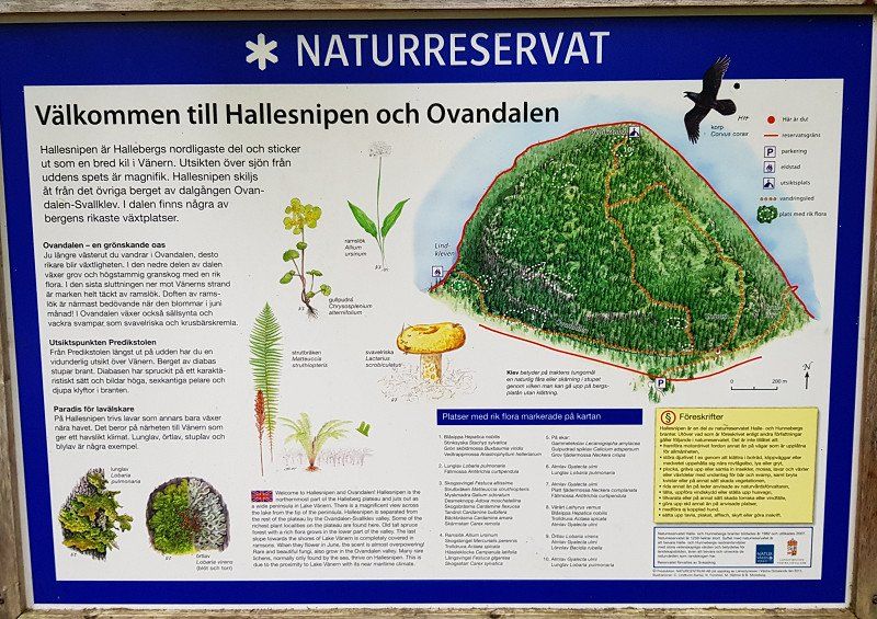
Nordkroken, Schweden
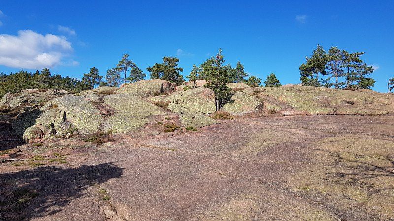
Parking lot at Hallesnipen nature reserve, where we then hiked to the coast of Lake Vänern. A great view of the lake awaited us there.
We will spend the night here, in the middle of nature surrounded by trees and only the wind can be heard today.
9FW4+93P Nordkroken, Schweden
58° 23' 45.5" N 12° 27' 18.8" E
58.3959660 12.4552131
• Head southeast on Centralvägen. Go for 315 m.
• Continue on Centralvägen. Go for 321 m.
• Turn right onto Centralvägen. Go for 3.9 km.
• Continue on Halleberg. Go for 1.1 km.
• Continue on Hallebergsvägen. Go for 803 m.
• Turn left onto Stationsvägen. Go for 41 m.
• Turn right onto Hallebergsvägen. Go for 96 m.
• Turn right onto Storegårdsvägen. Go for 712 m.
• Turn left onto Storegårdsvägen. Go for 184 m.
• Take the 2nd exit from roundabout. Go for 1.7 km.
• Continue on Näset. Go for 307 m.
• Continue on Nygård. Go for 1.5 km.
• Continue on Forstena. Go for 772 m.
• Take the 1st exit from roundabout onto Forstena Koppegården. Go for 965 m.
• Continue on Flygfältsvägen. Go for 1.6 km.
• Take the 2nd exit from roundabout. Go for 390 m.
• Continue on Trafikplats Stallbacka. Go for 83 m.
• Take the 2nd exit from roundabout onto Trafikplats Stallbacka (E45) toward Göteborg/Trollhättan C/Stallbacka S. Go for 839 m.
• Take the 2nd exit from roundabout onto Edsborgsvägen (E45) toward Centrum. Go for 2.2 km.
• Take the 1st exit from roundabout onto Gärdhemsvägen toward Centrum. Go for 156 m.
• Pass 3 roundabouts and continue on Gärdhemsvägen. Go for 866 m.
• Continue on Torggatan. Go for 394 m.
• Turn left onto Kanalstigen. Go for 573 m.
• Turn left onto Kyrkbron. Go for 40 m.
• Continue on Kyrkbrovägen. Go for 95 m.
• Arrive at Kyrkbrovägen. Your destination is on the right.
☍
19,9 km
( 30 min.)
Day
Trollhättan, Schweden
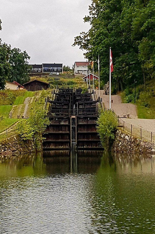
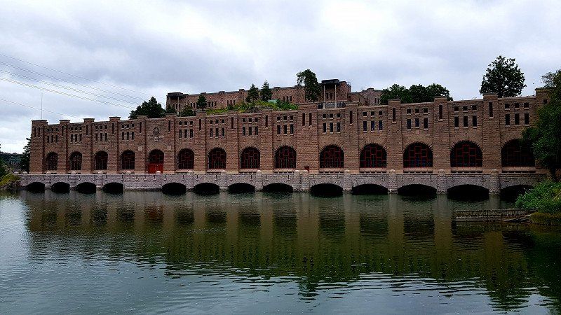
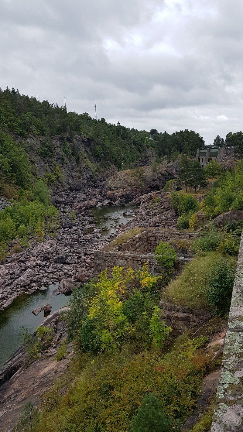
We have arrived in Trollhättan and here we are in a huge hydroelectric power and waterfall complex. We walk a long loop, past a large hydroelectric power station into the adjacent nature reserve with its old, disused locks from the years 1800 and 1844, which were still operated with pure muscle power. Past the new canal with huge lock gates that make us humans look small next to them.
The dam hatches are normally opened here every day at 3 p.m. and 300,000 liters of water per second shoot through the rocky river terrain, but unfortunately only until the end of August. Unfortunately, we are left empty-handed.
But we found a quiet place to stay here and go to bed with many great impressions that can only be reproduced here to a limited extent.
Kyrkbrovägen 1, 461 34 Trollhättan, Schweden
58° 16' 44.3" N 12° 16' 45.1" E
58.2789782 12.2791832
• Head toward Åkersbergsvägen on Kyrkbrovägen. Go for 95 m.
• Continue on Kyrkbron. Go for 40 m.
• Turn right onto Åkersbergsvägen. Go for 573 m.
• Turn right onto Klaffbron. Go for 394 m.
• Continue on Gärdhemsvägen. Go for 275 m.
• Pass 3 roundabouts and continue on Gärdhemsvägen. Go for 722 m.
• Take the 1st exit from roundabout onto E45. Go for 3.8 km.
• Pass 4 roundabouts and continue on E45. Go for 62.1 km.
• Keep right onto E45 toward Göteborg. Go for 11.2 km.
• Take ramp toward Kiel. Go for 178 m.
• Continue on Majnabbegatan. Go for 23 m.
• Continue on Majnabbehamnen. Go for 71 m.
• Arrive at Majnabbehamnen. Your destination is on the left.
☍
79,5 km
( 56 min.)
Day
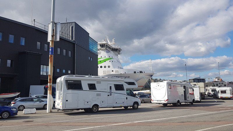
Göteborg - Fährhafen
Elof Lindälvs gata 11, 414 58 Göteborg, Schweden
57° 41' 33.8" N 11° 54' 47.3" E
57.6927220 11.9131409
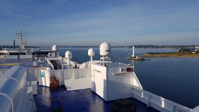
Göteborg - Fährhafen
Unfortunately, every good vacation comes to an end.
Today we went to Gothenburg on the ferry, tomorrow we will arrive in Kiel. Then there are still 800 km of motorway ahead of us.
The food here on board can really be recommended, we didn't think it could taste so good. You don't usually hear so many good things about ships.
Sweden was a dream, we would never have imagined it. We were the first time in Sweden, but certainly not the last time.
Day
Kiel - Ankunft Montag 9:15 Uhr
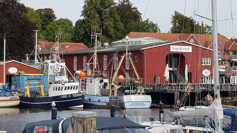
After arriving in Kiel, I went to Eckernförde to Thitronik, who wanted to take a look at my alarm system. During this time we were able to drive into Eckernförde with 2 e-bikes from Thitronik and have a look around the port. We liked it and made us want to spend a few days there.
Esslingen am Neckar - Montag Ankunft 24:00
After the visit to Thitronik, the 830 km long drive home started. We got home sharp at midnight.
A dreamlike journey came to an end after exactly 6275km. We are so grateful to have had such a great holiday and to be able to take so many new impressions home with us