September 2nd, 2022 - October 3rd, 2022 - 3 weeks on the island with the aim of exploring Scotland.
The information on the distance is only accurate to a limited extent.
Day
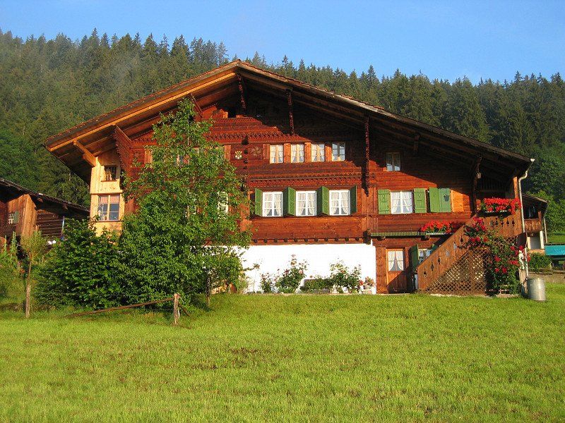
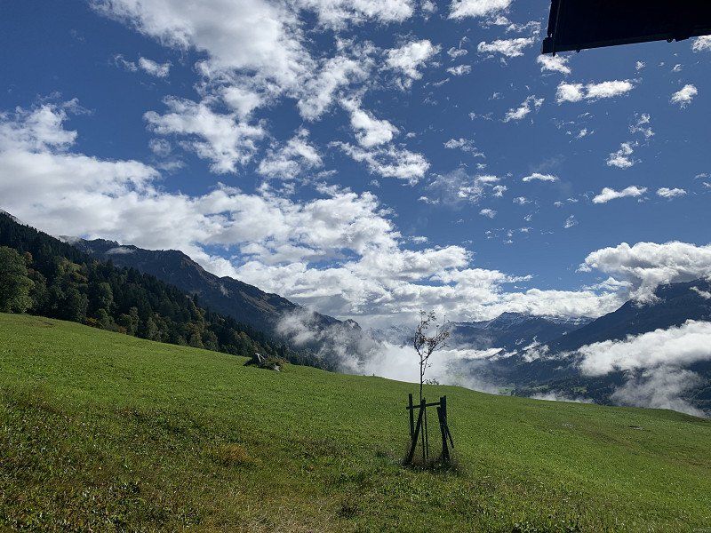
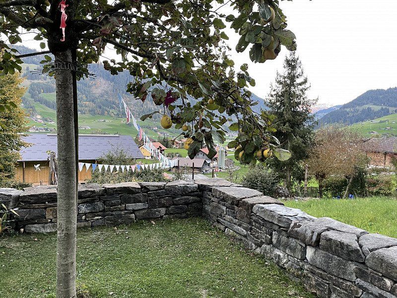
Obeggstrasse 8, Zweisimmen, Schweiz
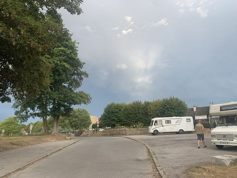
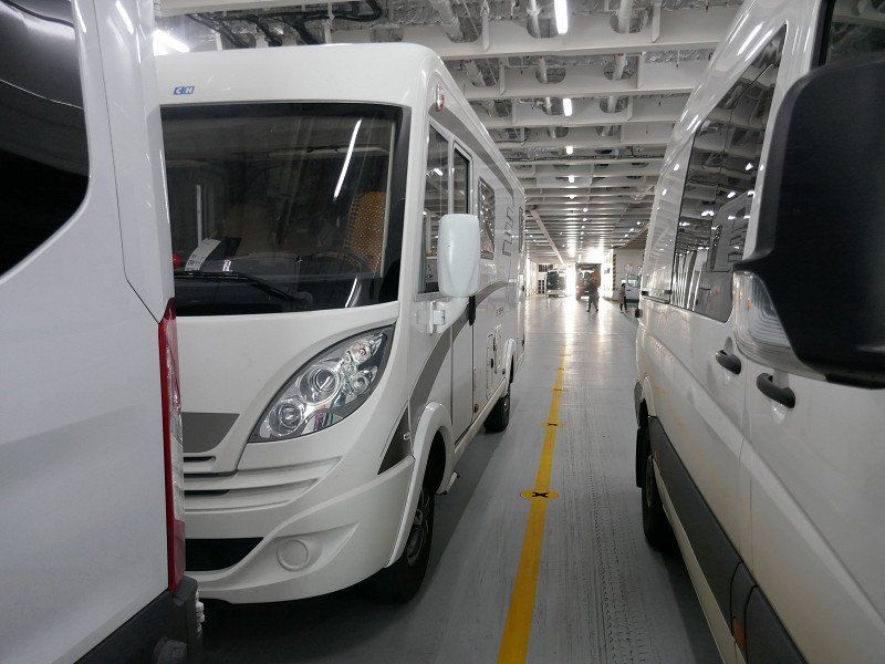
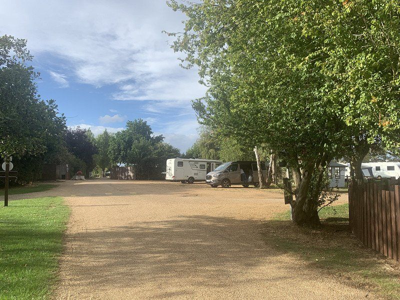
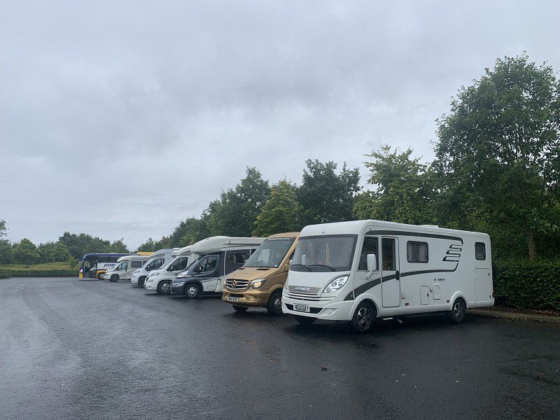
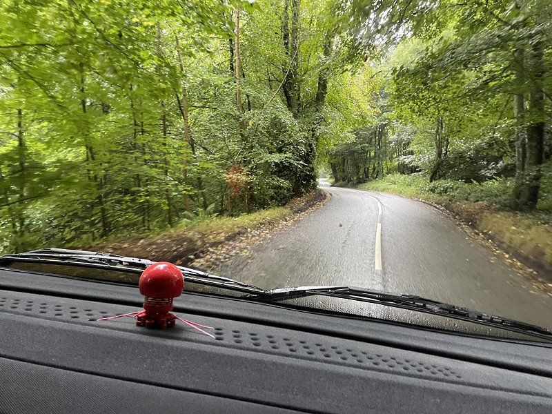
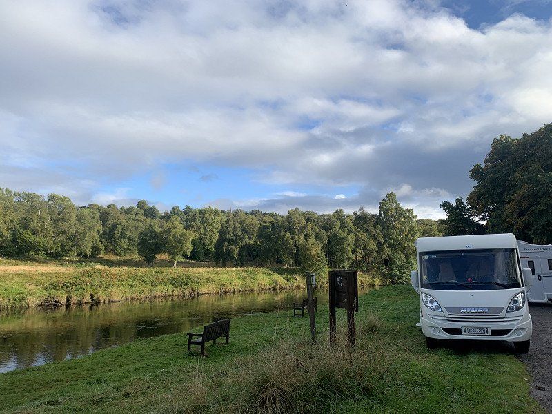
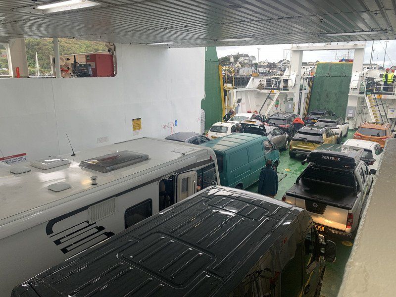
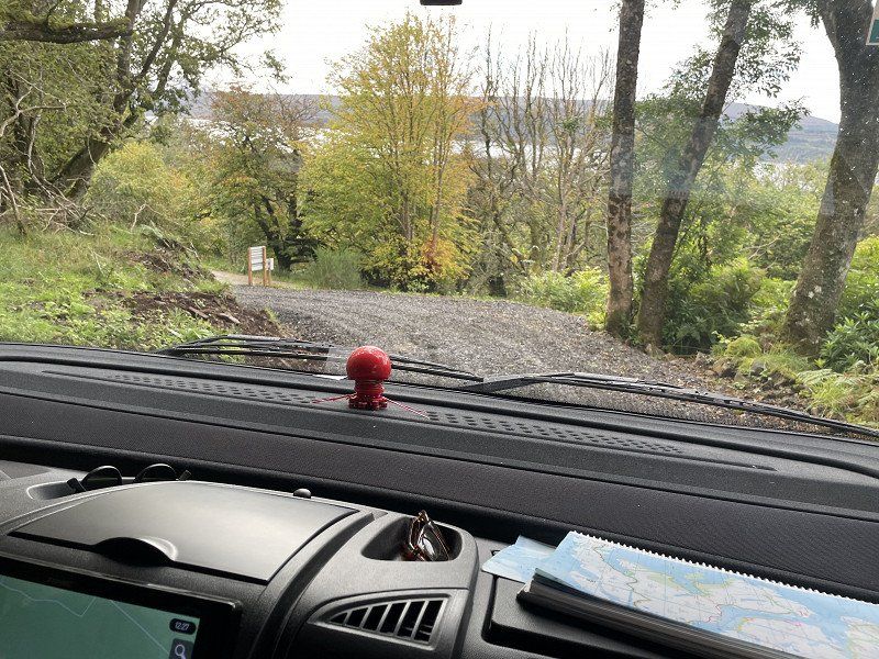
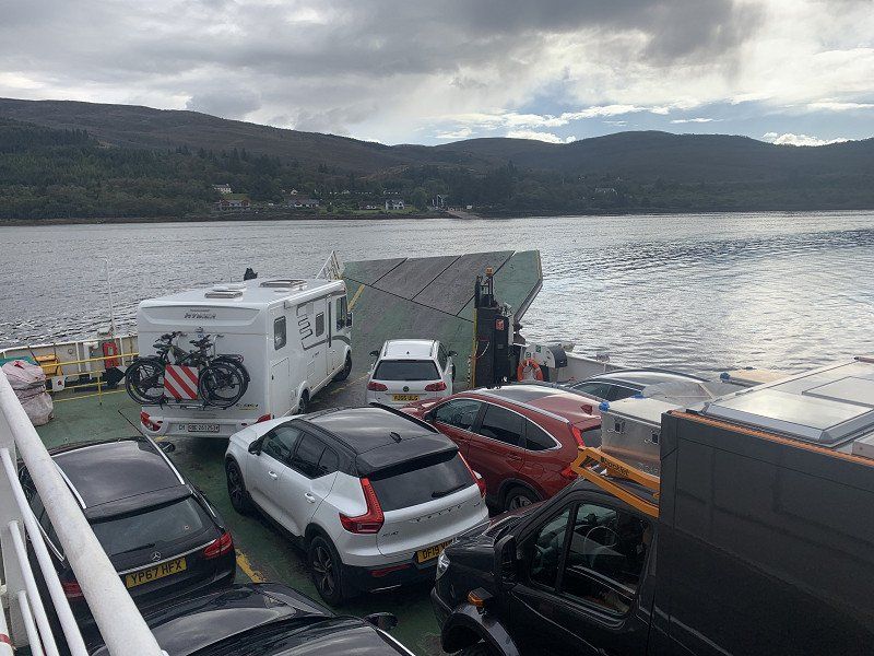
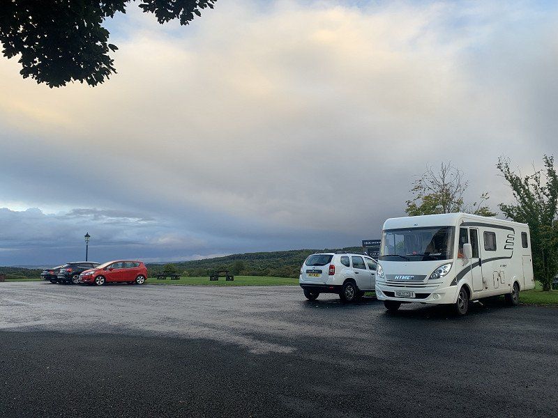
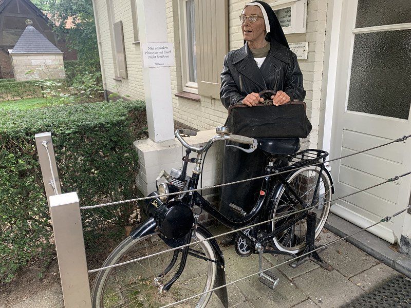
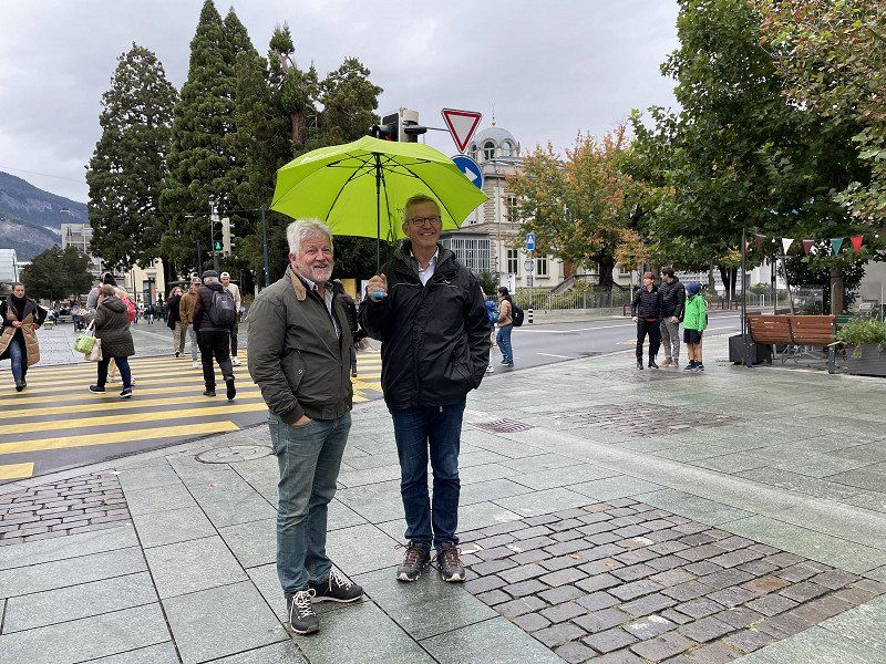
Our Hymer is being loaded... we're sure to have things with us that we'll never need!
Obeggstrasse 8, 3770 Zweisimmen, Schweiz
46° 33' 41.8" N 7° 22' 9.9" E
46.5616049 7.3694149
• Head south on Obeggstrasse. Go for 369 m.
• Turn left onto Eggetlistrasse. Go for 825 m.
• Turn left onto Thunstrasse (11). Go for 29.1 km.
• Keep left onto A6W. Go for 3.6 km.
• Take the left exit toward Bern/Thun-Süd onto A6. Go for 42.7 km.
• Continue on A1 toward Zürich/Basel/Kirchberg. Go for 44.7 km.
• Take exit 45 toward E35/Basel/Egerkingen onto A2. Go for 36.9 km.
• Take exit 6 toward Delémont/Muttenz/Bruderholz Spital onto A18 (Verzweigung Hagnau). Go for 6.7 km.
• Take the exit toward Arlesheim/Dornach onto Bruggstrasse. Go for 431 m.
• Keep right onto Bruggstrasse. Go for 360 m.
• Take the 2nd exit from roundabout onto Bruggstrasse. Go for 148 m.
• Take the 2nd exit from roundabout onto Neuarlesheimerstrasse. Go for 45 m.
• Continue on Birseckstrasse. Go for 101 m.
• Turn left onto Düchelweiher. Go for 38 m.
• Arrive at Düchelweiher. Your destination is on the left.
☍
166,0 km
(1 hrs. 51 min.)
Arlesheim, Schweiz
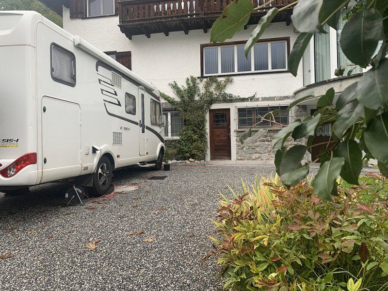
We stay with the children.
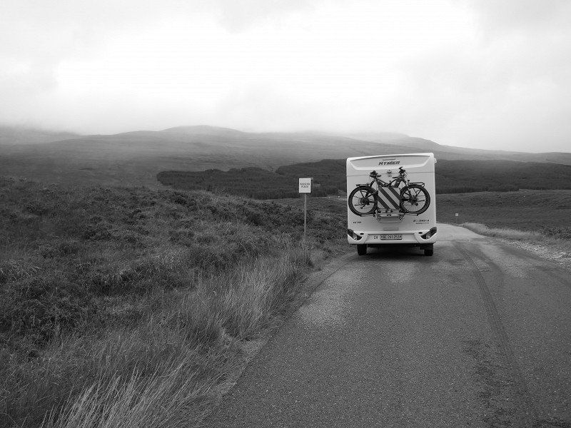
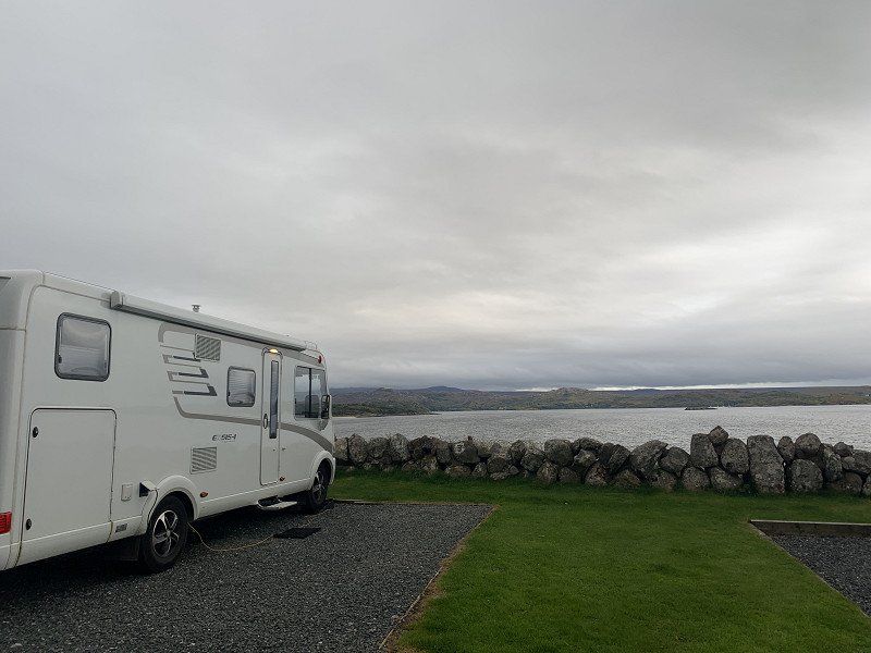
On Sunday the 2 'boys' will complete a driving course with the WoMo. The total weight is also measured there (3'470kg - just about enough!)
Distance : 166km
Düchelweiher 7, 4144 Arlesheim, Schweiz
47° 29' 24.1" N 7° 36' 29" E
47.4900344 7.6080590
• Head toward Birseckstrasse on Düchelweiher. Go for 38 m.
• Turn right onto Birseckstrasse. Go for 101 m.
• Continue on Neuarlesheimerstrasse. Go for 16 m.
• Take the 1st exit from roundabout onto Bruggstrasse. Go for 134 m.
• Take the 2nd exit from roundabout onto Bruggstrasse. Go for 319 m.
• Take ramp onto A18 toward Basel. Go for 6.3 km.
• Take the exit toward Karlsruhe/Mulhouse/Basel Flughafen onto A2/A3 (Verzweigung Hagnau). Go for 4.6 km.
• Keep right onto A3 (Basel-Kleinhüningen) toward Mulhouse/EuroAirport/Basel-Kleinhüningen/Lörrach/Weil am Rhein. Go for 3.8 km.
• Continue on A35. Go for 25.5 km.
• Take the exit toward Paris/Lyon/Mulhouse onto A35. Go for 40.5 km.
• Continue on D83. Go for 10.7 km.
• Keep left onto A35. Go for 39.0 km.
• Keep left onto A355 toward E25/A4/Paris/A35/Karlsruhe/Strasbourg. Go for 25.1 km.
• Continue on A4 (Autoroute de l'Est). Go for 108 km.
• Take exit 37 toward Sarrelouis/Carling/Creutzwald onto N33. Go for 980 m.
• Pass 4 roundabouts and continue on N33. Go for 9.8 km.
• Continue on B269N. Go for 9.2 km.
• Take ramp onto A620 toward Luxembourg/Saarlouis. Go for 7.2 km.
• Continue on A8. Go for 14.6 km.
• Take exit 6 toward Merzig/Losheim a. See/Hilbringen. Go for 354 m.
• Turn left onto Merziger Straße (L173) toward Hilbringen. Go for 757 m.
• Turn left onto Waldwieser Straße (L173). Go for 6.3 km.
• Continue on D855. Go for 2.1 km.
• Turn right onto Grand Rue (D64). Go for 1.0 km.
• Continue on Lieu-dit Gonguelfang (D64). Go for 249 m.
• Continue on D64. Go for 2.5 km.
• Continue on Route de Waldwisse (D64). Go for 434 m.
• Continue on Rue de Ritzing (D64). Go for 610 m.
• Continue on Route de Launstroff (D64). Go for 1.6 km.
• Continue on Rue Principale (D64). Go for 735 m.
• Continue on D64. Go for 628 m.
• Continue on Rue Principale (D64). Go for 1.4 km.
• Turn right toward Chemin Sources. Go for 76 m.
• Continue on Chemin Sources. Go for 442 m.
• Turn left onto Rue des Grands Vents. Go for 103 m.
• Turn right onto Grand'Rue (D64 E). Go for 483 m.
• Turn left onto Chemin du Lavoir. Go for 170 m.
• Continue on Rue de la Fontaine. Go for 188 m.
• Continue on Grand'Rue. Go for 1.0 km.
• Arrive at Grand'Rue.
☍
327,5 km
(3 hrs. 10 min.)
Day
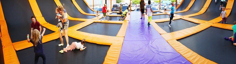
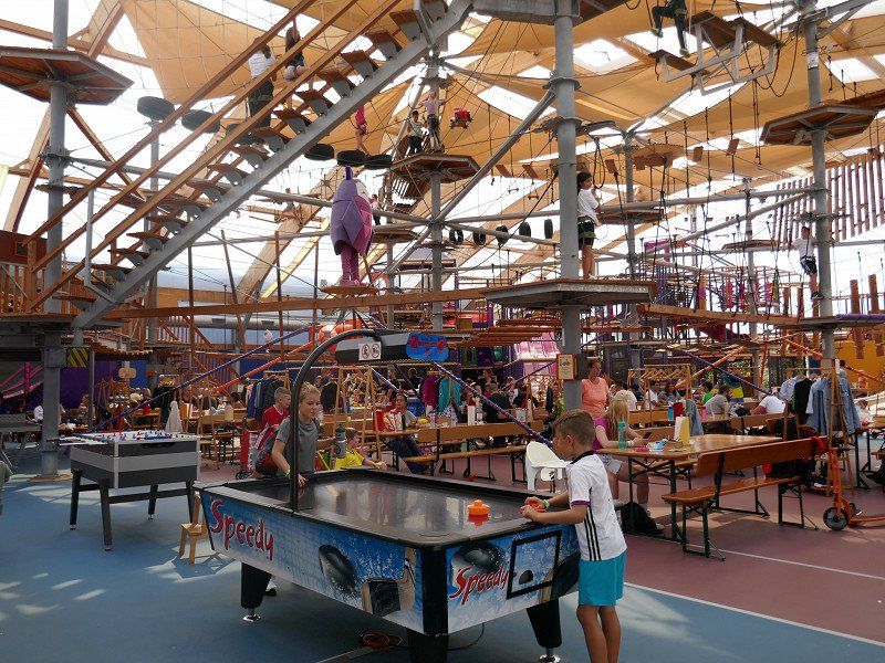
Ausflug von Arlesheim nach Füllinsdorf
We enjoy the FUN park SwissMegaPark with our grandchildren
Day
FF67+QF Manderen-Ritzing, Frankreich
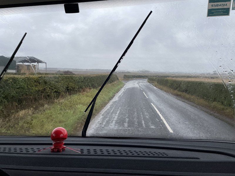
We keep our route to the north in order to visit 'something' in Luxembourg or Belgium. However, we are making great progress so that we 'pull through'.
49° 27' 43" N 6° 27' 49.2" E
49.4619441 6.4636543
• Head southwest on Grand'Rue. Go for 1.0 km.
• Continue on Rue de la Fontaine. Go for 188 m.
• Keep right onto Chemin du Lavoir. Go for 170 m.
• Turn right onto Grand'Rue (D64 E). Go for 108 m.
• Turn slightly left onto Grand'Rue (D64 E). Go for 555 m.
• Continue on Route de Tunting (D64 E). Go for 546 m.
• Turn right onto Rue Principale (D64). Go for 1.5 km.
• Continue on Route de Manderen (D64). Go for 775 m.
• Continue on Route Apach (D64). Go for 2.4 km.
• Continue on Route de Waldwisse (D64). Go for 479 m.
• Turn right onto Route Nationale (D654). Go for 1.4 km.
• Continue on Am Dreiländereck (B419). Go for 490 m.
• Take the 2nd exit from roundabout onto B407 toward Luxembourg/Schengen. Go for 390 m.
• Continue toward N10. Go for 148 m.
• Continue on N10. Go for 951 m.
• Turn left and take ramp onto A13 toward Luxembourg/Mondorf les Bains. Go for 20.7 km.
• Take the exit toward Luxembourg/Bruxelles onto A3. Go for 8.8 km.
• Take the exit toward E29/Aéroport/Trier/Ettelbruck/A7/Bruxelles/Liège/Esch/Alzette/A4 onto A6. Go for 21.7 km.
• Continue on E25/E411. Go for 42.6 km.
• Continue on E411 toward Bruxelles/Namur. Go for 140 km.
• Take ramp onto R0 toward Ring/E19/E40. Go for 1.8 km.
• Keep left onto R0 toward Gent/E40/Luik/Antwerpen/E19/Luchthaven Zaventem. Go for 6.9 km.
• Continue on E40. Go for 16.4 km.
• Take the exit toward Gent/Aalst onto E40. Go for 64.9 km.
• Take exit 11 toward Knokke-Heist/Haven Zeebrugge Oost/Tielt/Aalter. Go for 240 m.
• Keep right onto Knokkebaan. Go for 591 m.
• Take ramp toward Centrum/Sint-Maria-Aalter. Go for 264 m.
• Take the 3rd exit from roundabout onto Brouwerijstraat toward Sint-Maria-Aalter. Go for 875 m.
• Turn right onto Sint-Maria-Aalterstraat. Go for 60 m.
• Turn left onto Sint-Maria-Aalterstraat. Go for 174 m.
• Arrive at Sint-Maria-Aalterstraat.
☍
337,6 km
(3 hrs. 20 min.)
3CQM+V8 Aalter, Belgien
51° 5' 22.9" N 3° 25' 59.9" E
51.0896980 3.4333069
• Head southeast on Sint-Maria-Aalterstraat. Go for 174 m.
• Turn right onto Sint-Maria-Aalterstraat. Go for 60 m.
• Turn left onto Brouwerijstraat. Go for 813 m.
• Take the 1st exit from roundabout onto Knokkebaan (N44) toward E40. Go for 623 m.
• Take ramp onto E40 toward Oostende. Go for 71.0 km.
• Continue on A16 (Autoroute des Estuaires). Go for 12.7 km.
• Take exit 61 toward Coudekerque-Br.-Est onto Rue Ledru-Rollin. Go for 426 m.
• Turn right onto Rue Victor Hugo. Go for 223 m.
• Take the 1st exit from roundabout onto Route de Steendam (D72). Go for 1.7 km.
• Continue on Rue Principale (D72). Go for 724 m.
• Pass 2 roundabouts and continue on Chemin de Dunkerque à Bergues (D72). Go for 4.2 km.
• Turn right onto Route d'Hondschoote (D3). Go for 354 m.
• Turn left onto Place Marché aux Poissons (D3). Go for 42 m.
• Turn left onto Rue Espagnole. Go for 28 m.
• Turn right onto Rue des Potiers. Go for 95 m.
• Continue on Rue de l'Hôtel de Ville. Go for 119 m.
• Arrive at Rue de l'Hôtel de Ville. Your destination is on the right.
☍
93,3 km
( 58 min.)
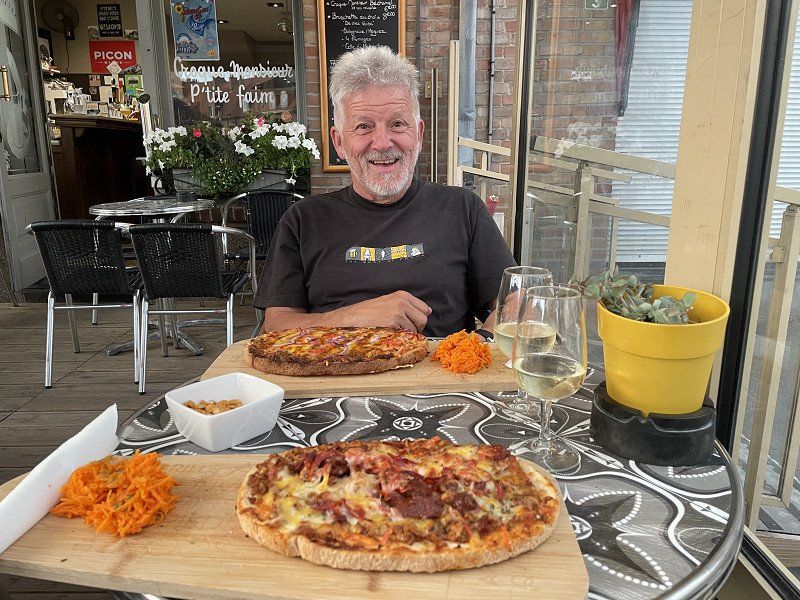
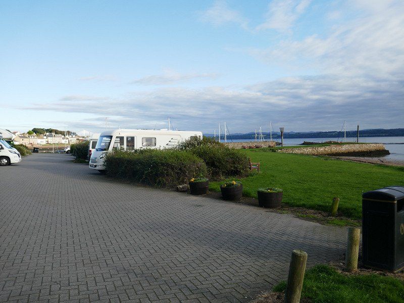
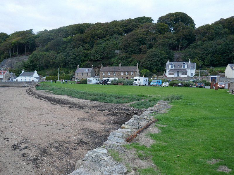
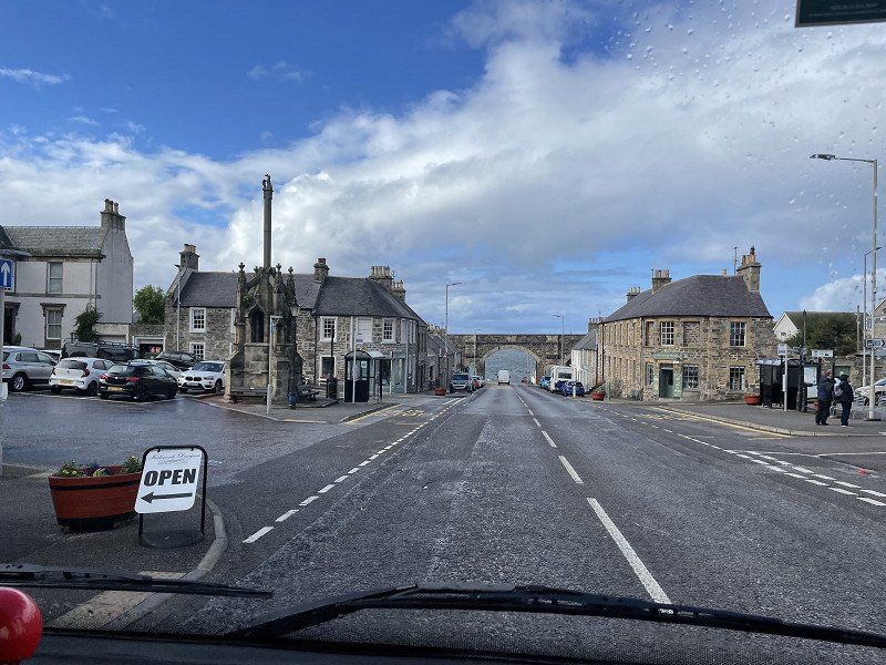
Bergues, Frankreich
In the village where 'Chez les Ch'ti' was filmed we find a nice spot on the remparts.
Unfortunately, the only open restaurant is already sold out ... so we eat a kind of pizza on the main square opposite the church in a (still barely open) café
Distance 752 km
59380 Bergues, Frankreich
50° 58' 6.7" N 2° 25' 60" E
50.9685190 2.4333240
• Head south on Rue de l'Hôtel de Ville.
• Turn left onto Rue Léon Claeys. Go for 67 m.
• Turn left onto Rue Jean Mermoz. Go for 143 m.
• Turn right onto Rue des Capucins. Go for 27 m.
• Turn left onto Rue du Coq. Go for 64 m.
• Continue on Rue d'Hondschoote. Go for 82 m.
• Turn left onto Rue du Marché aux Poissons (D3). Go for 248 m.
• Continue on Rue du Port (D3). Go for 423 m.
• Continue on D916. Go for 262 m.
• Take the 2nd exit from roundabout onto Route de Dunkerque (D916) toward A16/Cappelle la Gr./Coudekerque-Br./Dunkerque. Go for 5.8 km.
• Turn slightly left onto Rue Louis Armand toward Calais/Lille/Dunkerque-Petite Synthe/Dunkerque-les Ports/Dunkerque-Car Ferry. Go for 39 m.
• Take ramp onto A16 (Autoroute des Estuaires). Go for 36.2 km.
• Take exit 47 toward Calais-Port/Calais-Z.I.Est/Centre Universitaire onto A216 (Rocade Est). Go for 5.3 km.
• Keep left onto Rocade Est (N216) toward Calais-Centre/Terminal Intermodal. Go for 565 m.
• Take ramp toward Calais-Centre/Terminal Intermodal. Go for 216 m.
• Enter the roundabout. Go for 200 m.
• Arrive at your destination on the right.
☍
49,6 km
( 35 min.)
Day
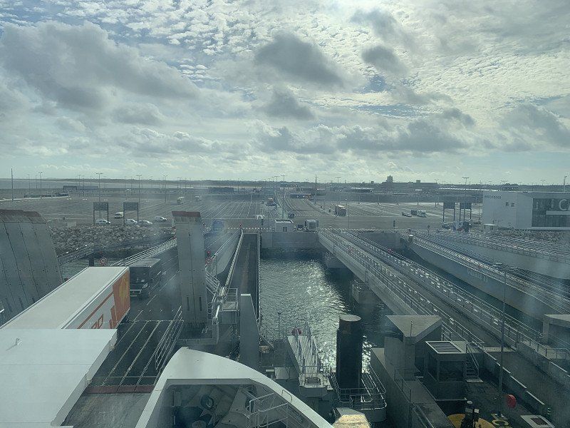
Calais, Frankreich
a short drive takes us to Calais where the ferry is booked for 10:30 (get there 45' before).
We're still filling up in France because it's a bit cheaper here than on the island at the moment.
2 Rond-Point Hoverport, 62100 Calais, Frankreich
50° 58' 10.1" N 1° 52' 25.5" E
50.9694749 1.8737584
• Follow the roundabout. Go for 80 m.
• Take the 2nd exit from roundabout onto Avenue du Commandant Cousteau toward Calais-Centre/Z.I. des Dunes. Go for 267 m.
• Take the 1st exit from roundabout onto Avenue du Commandant Cousteau toward Calais-Centre/Centre Ville/Cité Internationale de la Dentelle et de la Mode/Calais-Nord et Plage. Go for 839 m.
• Take the 3rd exit from roundabout onto Quai de la Loire. Go for 1.1 km.
• Turn right onto Rue Mollien. Go for 500 m.
• Continue on Pont Mollien. Go for 277 m.
• Turn left onto Place du Soldat Inconnu. Go for 18 m.
• Turn slightly right onto Place du Soldat Inconnu. Go for 28 m.
• Turn slightly left onto Place du Soldat Inconnu. Go for 33 m.
• Arrive at Place du Soldat Inconnu. Your destination is on the right.
☍
3,2 km
( 4 min.)
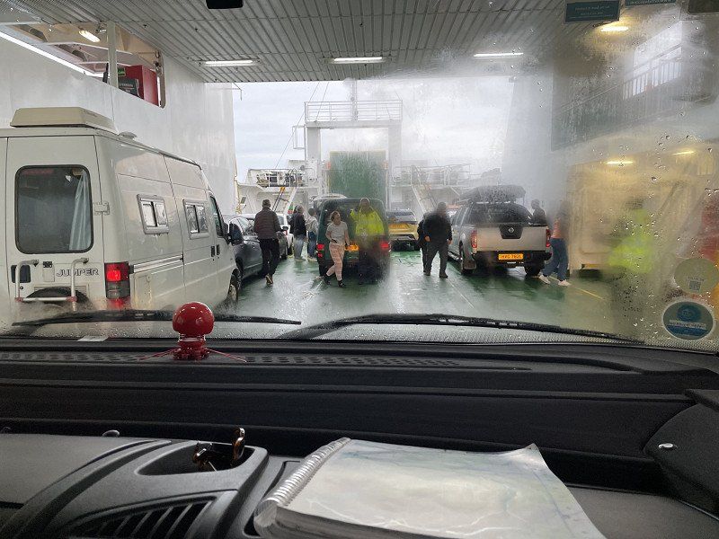
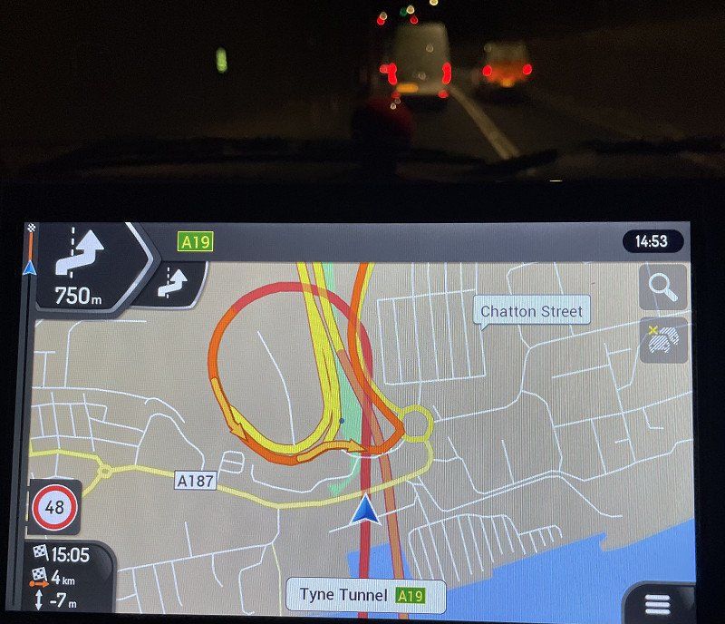
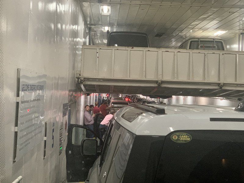
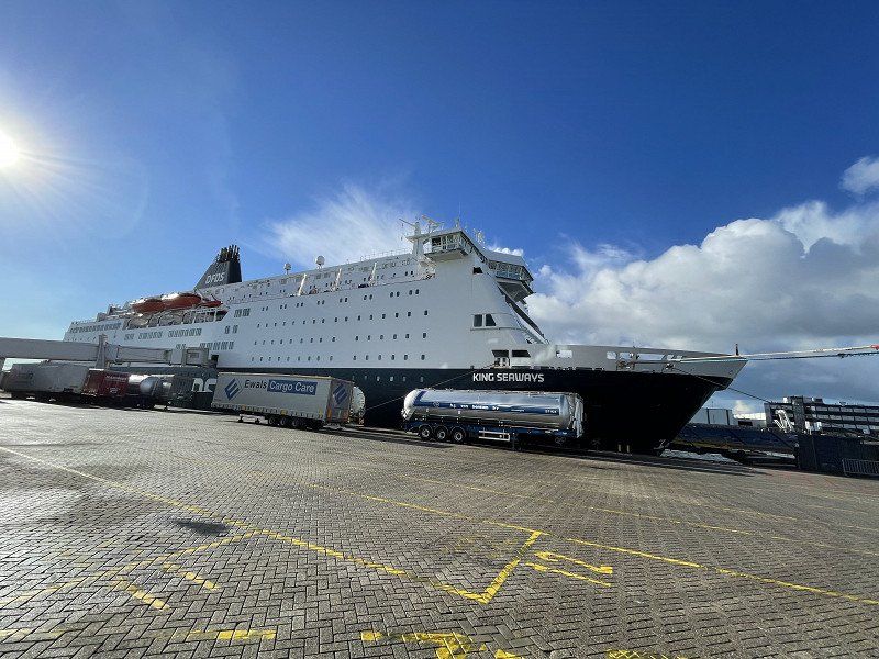
Departure port: Calais
Pas-de-Calais, Nordfrankreich, Frankreich
50.9524769 1.8538446
Arrival port: Dover
Kent, England, Vereinigtes Königreich
51.12512751.3134228
• Head toward Flying Horse Lane on King Street. Go for 88 m.
• Turn slightly right onto Queen Street. Go for 60 m.
• Turn left onto York Street (A20). Go for 105 m.
• Turn left onto Townwall Street (A20). Go for 1.0 km.
• Take the 1st exit from Eastern Docks Roundabout roundabout. Go for 41 m.
• Continue on Back Road West. Go for 273 m.
• Continue on West Ramp. Go for 700 m.
• Continue on North Camber Way. Go for 640 m.
• Turn left onto South Camber Way. Go for 111 m.
• Continue on Lower Road East. Go for 612 m.
• Continue straight ahead. Go for 132 m.
• Arrive at your destination on the right.
☍
337,6 km
(3 hrs. 12 min.)
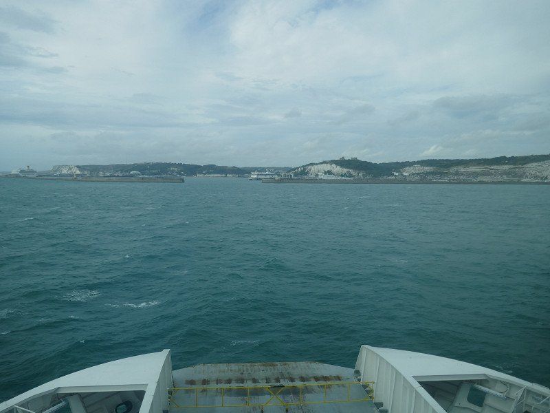
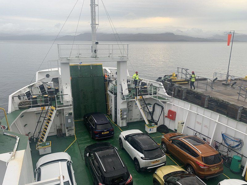
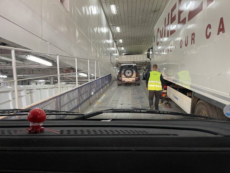
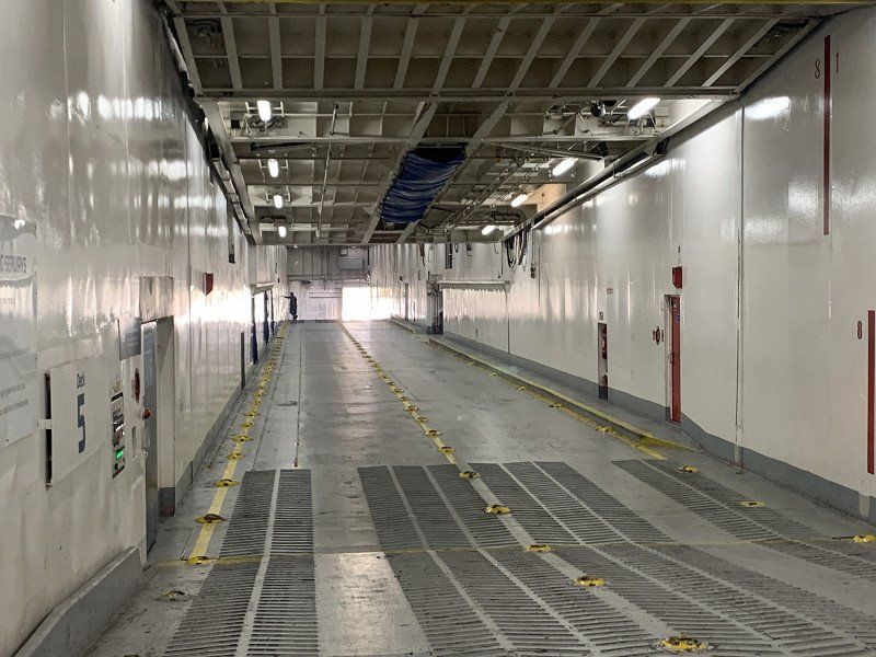
Fähre Dover - Calais
Stress-free and peaceful crossing on a half-empty ferry-
Why not in the tunnel???Tunneling is not our thing - if there is a ferry (or a pass in the mountains) then our choice is clear!
• Keep right onto Jubilee Way (A2) toward Canterbury/Deal/(A258)/Ramsgate/(A256). Go for 2.3 km.
• Take the 2nd exit from roundabout onto A2 toward London/(M2)/Canterbury/Ramsgate/(A256). Go for 3.3 km.
• Take the 3rd exit from roundabout onto A2 toward Canterbury/(M2). Go for 32.5 km.
• Take the 2nd exit from Brenley Cor roundabout onto M2 toward London. Go for 41.3 km.
• Continue on Watling Street (A2). Go for 1.3 km.
• Keep right onto Watling Street (A2) toward (M25)/London/Dartford Crossing. Go for 9.9 km.
• Keep right onto Watling Street (A2) toward London/(M25)/Dartford Crossing. Go for 2.3 km.
• Take ramp onto A282 toward (M25(N))/(M11,M1)/City Airport/ExCel/Dartford Crossing. Go for 8.7 km.
• Continue on M25 toward M11/M1/Stansted Airport. Go for 25.4 km.
• Take exit 27 toward M11(S)/London (NE & C)/Stansted Airport/Harlow/Cambridge onto M11. Go for 46.1 km.
• Keep right onto M11 toward Cambridge. Go for 21.8 km.
• Take exit 14 toward Newmarket/Ely/(A10) onto A14/A428. Go for 3.6 km.
• Keep right onto A14 toward Felixstowe/Ipswich/Ely/(A10). Go for 2.6 km.
• Take ramp toward Cambridge/Ely. Go for 273 m.
• Turn left toward A10. Go for 199 m.
• Continue on A10. Go for 6.7 km.
• Take the 2nd exit from roundabout onto Ely Road (A10) toward Ely. Go for 1.1 km.
• Take the 2nd exit from roundabout onto Ely Road (A10) toward Ely. Go for 6.1 km.
• Take the 2nd exit from roundabout onto Cambridge Road (A10) toward Ely. Go for 5.2 km.
• Take the 1st exit from roundabout onto A10 toward Downham Market/March/(A142)/Witchford/Coveney/Downham/Littleport. Go for 710 m.
• Pass 5 roundabouts and continue on A10. Go for 11.9 km.
• Take the 1st exit from roundabout onto Lynn Road (A10) toward Downham Market. Go for 16.0 km.
• Pass 3 roundabouts and continue on Lynn Road (A10). Go for 16.4 km.
• Take the 4th exit from Hardwick Roundabout roundabout onto Queen Elizabeth Way (A149) toward North Ind Ests/Docks. Go for 1.1 km.
• Pass 4 roundabouts and continue on A149. Go for 16.3 km.
• Turn left onto Beach Road. Go for 2.3 km.
• Arrive at Beach Road. Your destination is on the left.
☍
287,1 km
(3 hrs. 11 min.)
Diglea Caravan Park - Snettisham
Near Sandringham Castle (unfortunately closed) we find a nice place with very friendly hosts and top sanitary facilities. All just 500m from the sea
Distance : 332km ( 49km to Calais + the first 283km from Dover in left-hand traffic )
32 Beach Road
52° 52' 20.7" N 0° 27' 24.7" E
52.8724255 0.4568740
• Head toward The Cedars on Beach Road. Go for 2.3 km.
• Turn right onto A149. Go for 4.2 km.
• Take the 2nd exit from roundabout onto Queen Elizabeth Way (A149). Go for 6.8 km.
• Pass 3 roundabouts and continue on Queen Elizabeth Way (A149). Go for 6.1 km.
• Take the 1st exit from Hardwick Roundabout roundabout onto Constitution Hill toward Norwich/Swaffham/Wisbech/Sleaford/(A17)/Saddlebow Ind Est/A47. Go for 217 m.
• Take the 2nd exit from roundabout onto A47 toward Wisbech/Sleaford/(A17)/Saddlebow Ind Est. Go for 3.0 km.
• Take the 2nd exit from roundabout onto A17 toward Sleaford. Go for 13.3 km.
• Take the 1st exit from roundabout onto A17 toward Sleaford/Wisbech/(A1101). Go for 218 m.
• Take the 2nd exit from roundabout onto A17 toward Sleaford/Wisbech/(A1101)/Long Sutton/Holbeach. Go for 4.0 km.
• Pass 7 roundabouts and continue on A17. Go for 51.6 km.
• Take the 3rd exit from Holdingham Roundabout roundabout onto A17 toward Newark/(A1). Go for 23.6 km.
• Pass 2 roundabouts and continue on A17. Go for 3.3 km.
• Take the 2nd exit from roundabout onto A46 toward Newark/Doncaster/(A1). Go for 405 m.
• Take the 3rd exit from roundabout onto A1 toward Doncaster/Sheffield/(A57). Go for 41.4 km.
• Keep right onto A1(M) (Doncaster By-pass) toward The North/Doncaster. Go for 37.2 km.
• Keep right onto A1(M) toward The North/Wetherby/Manchester/Leeds/(M62). Go for 16.6 km.
• Take the exit onto A1(M) (Aberford By Pass). Go for 134 km.
• Continue on A1. Go for 8.2 km.
• Keep right onto A1 toward Newcastle/Airport/Hexham/(A69). Go for 5.9 km.
• Keep right onto A1 toward Morpeth/Airport/Jedburgh/(A696). Go for 2.8 km.
• Keep right onto A1 toward Morpeth. Go for 23.5 km.
• Take ramp onto A697 toward Coldstream/Wooler/Morpeth(North)/Rothbury/(B6344)/Northgate Hospital. Go for 21.0 km.
• Turn left onto B6341 toward Rothbury. Go for 5.2 km.
• Arrive at B6341. Your destination is on the left.
☍
414,6 km
(4 hrs. 16 min.)
Day
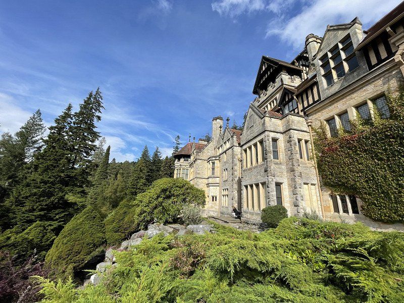
Cragside House, Rothbury, Morpeth
We visit Cragside House:
With our membership in the Scottish National Trust, we also have free parking and free entry here.
https://www.nationaltrust.org.uk/cragside
Illuminated with hydro-electricity and powered by hydraulics. Discover Britain's original smart home
• Continue on Clayport Bank (B6341). Go for 223 m.
• Continue on Clayport Street (B6341). Go for 393 m.
• Turn left onto Fenkle Street (B6346). Go for 173 m.
• Continue on Narrowgate (B6346). Go for 184 m.
• Continue on The Peth (B6341). Go for 20 m.
• Arrive at The Peth (B6341).
☍
1,4 km
( 2 min.)
Day
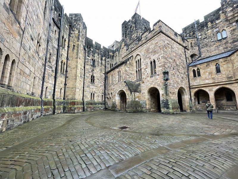
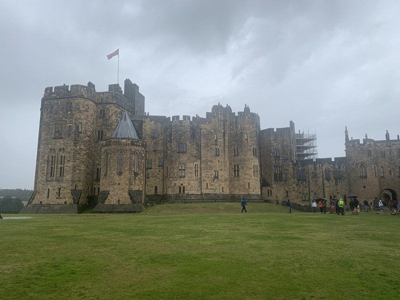
Alnwick castle
Early in the morning we meet one in the huge Alnwick Castel car park.
First, a visit to the large gardens with many enchanted corners and a Poisson Garden, which can only be reached with an (exciting) guided tour.
Finally the Catsel itself, which was used as a setting for many films (including Harry Potter)
However, the weather left something to be desired
C78V+MV9 Alnwick, Vereinigtes Königreich
55° 25' 0" N 1° 42' 18.9" W
55.4166669 -1.7052552
• Head toward Bailiffgate on The Peth (B6341). Go for 20 m.
• Continue on Narrowgate (B6346). Go for 184 m.
• Continue on Fenkle Street (B6346). Go for 173 m.
• Turn left onto Market Street (B6341). Go for 148 m.
• Continue on Bondgate Within (B6346). Go for 152 m.
• Continue on Bondgate Without (B6346). Go for 226 m.
• Continue on B6346. Go for 292 m.
• Continue on Aydon Gardens (B6346). Go for 163 m.
• Continue on B6346. Go for 70 m.
• Take the 2nd exit from roundabout onto Alnmouth Road (A1068). Go for 4.5 km.
• Take the 1st exit from Lesbury Roundabout roundabout onto Main Road (B1339). Go for 219 m.
• Continue on B1339. Go for 423 m.
• Turn left onto Longhoughton Road (B1339). Go for 218 m.
• Continue on B1339. Go for 2.1 km.
• Arrive at B1339. Your destination is on the left.
☍
8,9 km
( 10 min.)
C99J+7J Alnwick
C99J+7J Alnwick, Vereinigtes Königreich
55° 25' 5.4" N 1° 37' 6.3" W
55.4181536 -1.6184051
• Head north on B1339. Go for 748 m.
• Continue on South End (B1339). Go for 359 m.
• Turn right onto B1339. Go for 44 m.
• Continue on North End (B1339). Go for 540 m.
• Continue on Sea View (B1339). Go for 168 m.
• Continue on North End (B1339). Go for 89 m.
• Continue on Sea View (B1339). Go for 122 m.
• Continue on B1339. Go for 1.6 km.
• Continue on Howick Quarry (B1339). Go for 182 m.
• Continue on B1339. Go for 5.2 km.
• Continue on Embleton Mill Dairy Cottages (B1339). Go for 37 m.
• Continue on B1339. Go for 1.2 km.
• Continue on Bolton Terrace (B1339). Go for 28 m.
• Continue on B1339. Go for 12 m.
• Continue on North Villas (B1339). Go for 101 m.
• Continue on B1339. Go for 71 m.
• Continue on Turnstone Gardens (B1339). Go for 108 m.
• Continue on B1339. Go for 1.5 km.
• Turn sharp left onto Lambertss Lane (B1340). Go for 152 m.
• Arrive at Lambertss Lane (B1340).
☍
12,3 km
( 13 min.)
unterwegs bei Alnwick
G963+W3 Alnwick, Vereinigtes Königreich
55° 30' 44.3" N 1° 38' 50.1" W
55.5123044 -1.6472626
• Head northeast on Lambertss Lane (B1340). Go for 120 m.
• Continue on B1340. Go for 4.7 km.
• Turn right onto B1340. Go for 4.4 km.
• Continue on King Street (B1340). Go for 594 m.
• Take the 2nd exit from roundabout onto Main Street (B1340). Go for 172 m.
• Take the 2nd exit from roundabout onto Seafield Road (B1340). Go for 394 m.
• Continue on St Aidans (B1340). Go for 626 m.
• Continue on B1340. Go for 2.1 km.
• Continue on Links Road (B1340). Go for 1.7 km.
• Turn sharp right. Go for 33 m.
• Arrive at your destination on the left.
☍
14,9 km
( 15 min.)
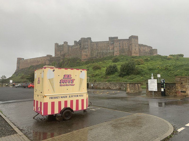
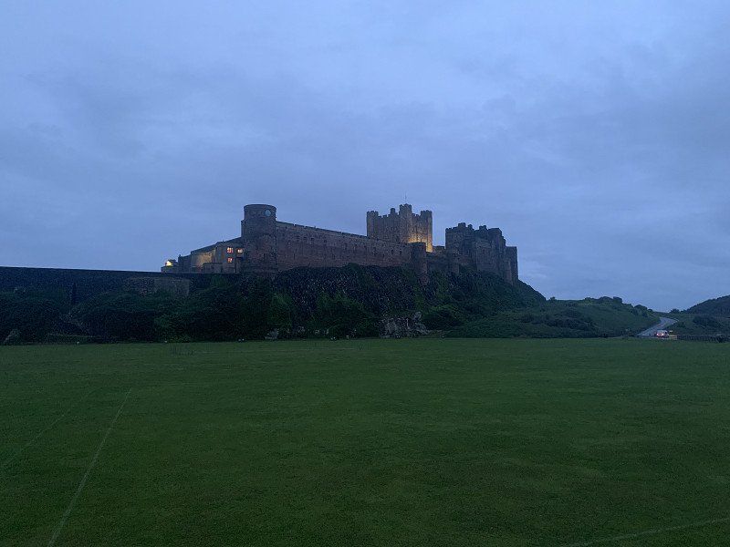
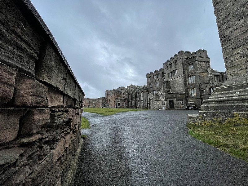
Bamburgh
The time to look at Bamburgh Castle was over, but there is a great parking space directly under the castle (however without infrastructure)
In the evening in the pub, the English national anthem is played on TV and the BBC announcer, dressed in black, announces the Queen's death.
Distance : 37km
Bamburgh NE69 7DF, Vereinigtes Königreich
55° 36' 32.3" N 1° 42' 35.6" W
55.6089596 -1.7099001
• Head toward Links Road. Go for 33 m.
• Turn right onto B1340. Go for 171 m.
• Continue on Front Street (B1340). Go for 62 m.
• Keep left onto Front Street (B1341). Go for 30 m.
• Arrive at Front Street (B1341). Your destination is on the right.
☍
0,3 km
( )
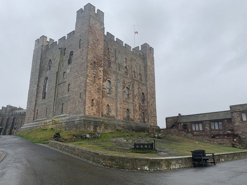
Day
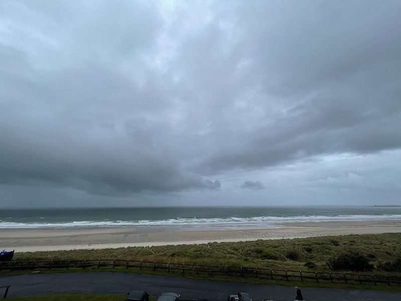
Bamburgh Castle
Great castle on a rock right on the coast.
Stormy weather
In the castle there would also be an aviation museum - but this is limited to the wreckage of downed planes - and of course the stories about it!
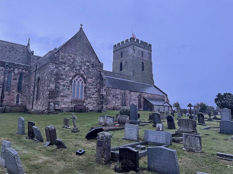
We enjoy breakfast in the nearby town, visit the church and then we continue towards Scotland.
Bamburgh NE69, Vereinigtes Königreich
55° 36' 27.5" N 1° 42' 53.4" W
55.6076431 -1.7148211
• Head toward Doctors Lane on Front Street (B1341). Go for 170 m.
• Turn right toward Radcliffe Road/B1342. Go for 96 m.
• Turn left onto Radcliffe Road (B1342). Go for 377 m.
• Continue on B1342. Go for 1.7 km.
• Continue on Budle (B1342). Go for 188 m.
• Continue on B1342. Go for 1.5 km.
• Turn left onto B1342. Go for 2.7 km.
• Continue on Station Road (B1342). Go for 843 m.
• Continue on B1342. Go for 34 m.
• Turn right onto A1 toward Berwick. Go for 20.0 km.
• Take the 1st exit from roundabout onto A1 toward Edinburgh. Go for 3.4 km.
• Take the 2nd exit from roundabout onto A1 toward Edinburgh/Berwick Train Station. Go for 1.6 km.
• Turn left onto B6461 toward Paxton/Kelso. Go for 3.8 km.
• Turn left onto B6461. Go for 435 m.
• Turn right onto B6460. Go for 335 m.
• Turn left onto B6460. Go for 12.5 km.
• Continue on Sinclairshill (B6460). Go for 98 m.
• Continue on B6460. Go for 1.5 km.
• Turn right onto A6112. Go for 4.2 km.
• Turn right onto Trinity Park. Go for 156 m.
• Arrive at Trinity Park. Your destination is on the left.
☍
55,6 km
( 43 min.)
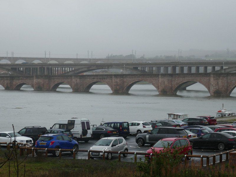
unterwegs in der Gegend Berwick upon Tweed
on the way ... more inland
35 Trinity Park, Duns TD11 3HN, Vereinigtes Königreich
55° 46' 24.6" N 2° 20' 17.4" W
55.7734928 -2.3381720
• Head northwest on Trinity Park. Go for 156 m.
• Turn right onto Station Road (A6112). Go for 437 m.
• Take the 1st exit from roundabout onto Currie Street (A6105). Go for 366 m.
• Turn right onto Castle Street (A6112). Go for 2.0 km.
• Turn left onto B6365. Go for 3.5 km.
• Continue on B6355. Go for 4.5 km.
• Continue on Ellemford (B6355). Go for 126 m.
• Continue on B6355. Go for 5.0 km.
• Continue on Cranshaws House (B6355). Go for 87 m.
• Continue on Cranshaws (B6355). Go for 93 m.
• Continue on B6355. Go for 18.7 km.
• Continue on Duns Road (B6355). Go for 119 m.
• Continue on Main Street (B6355). Go for 58 m.
• Turn right onto B6369. Go for 258 m.
• Arrive at B6369.
☍
35,3 km
( 34 min.)
unterwegs
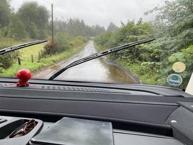
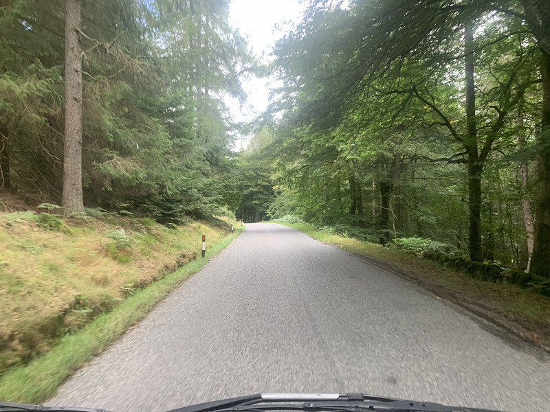
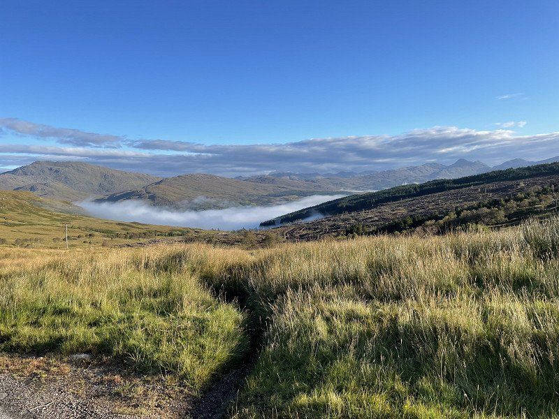
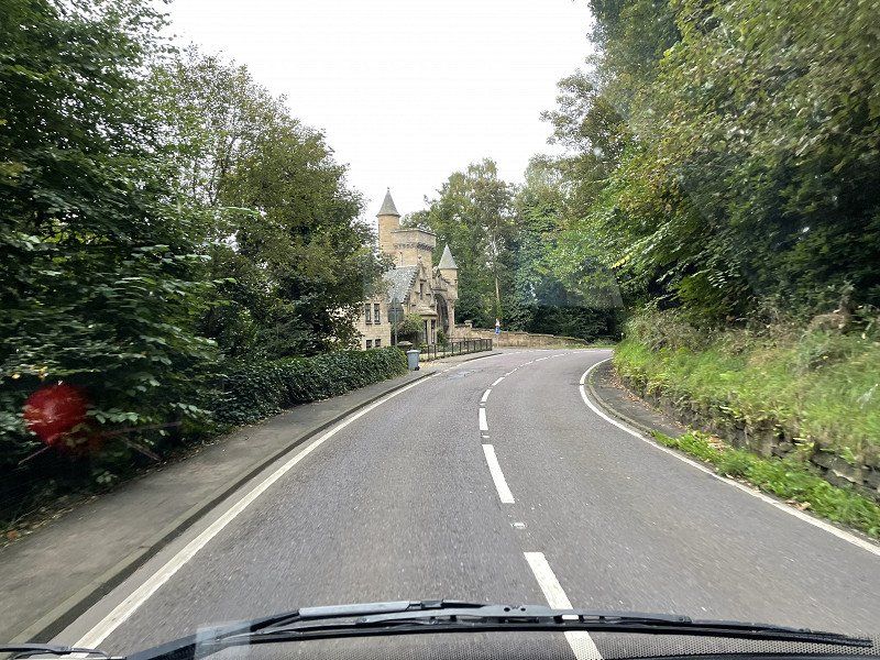
We are always looking for small roads/pass roads...
At the height (350 m above sea level!) there is also fog
W744+9F Haddington, Vereinigtes Königreich
55° 54' 21.5" N 2° 44' 37.7" W
55.9059667 -2.7437926
• Head north on B6369. Go for 2.5 km.
• Continue on Cockles Brae (B6369). Go for 979 m.
• Continue on B6369. Go for 2.7 km.
• Continue on B6368. Go for 222 m.
• Continue on Poldrate (B6368). Go for 93 m.
• Continue on Sidegate (B6368). Go for 275 m.
• Continue on Hardgate (A6093). Go for 357 m.
• Continue on Dunbar Road (A6093). Go for 542 m.
• Take the 3rd exit from roundabout onto A199 toward Berwick upon Tweed/(A1)/East Linton/Dunbar. Go for 153 m.
• Take the 2nd exit from roundabout onto A199 toward North Berwick/East Linton/Dunbar. Go for 2.6 km.
• Turn left onto B1347. Go for 3.6 km.
• Take the 1st exit from roundabout onto Smithy Row (B1347). Go for 276 m.
• Turn left onto B1347. Go for 260 m.
• Turn right onto B1347. Go for 5.7 km.
• Continue on Haddington Road (B1347). Go for 874 m.
• Continue on Law Road (B1347). Go for 224 m.
• Turn right onto St Baldred's Road (A198). Go for 609 m.
• Turn right onto Dunbar Road (A198) toward Dunbar/(A1087). Go for 433 m.
• Take the 1st exit from roundabout onto Tantallon Road (A198). Go for 396 m.
• Take the 1st exit from roundabout onto Tantallon Road (A198). Go for 570 m.
• Arrive at Tantallon Road (A198). Your destination is on the left.
☍
23,5 km
( 24 min.)
Tantallon Caravan & Camping Park, Berwick
good place with great view
Distance : 108 km
Dunbar Road, EH39 5NJ, North Berwick, United Kingdom
56° 3' 20.9" N 2° 41' 27.6" W
56.0558000 -2.6910100
• Head toward Rhodes Holdings on Tantallon Road (A198). Go for 2.0 km.
• Turn left. Go for 354 m.
• Arrive at your destination.
☍
2,3 km
( 2 min.)
Day
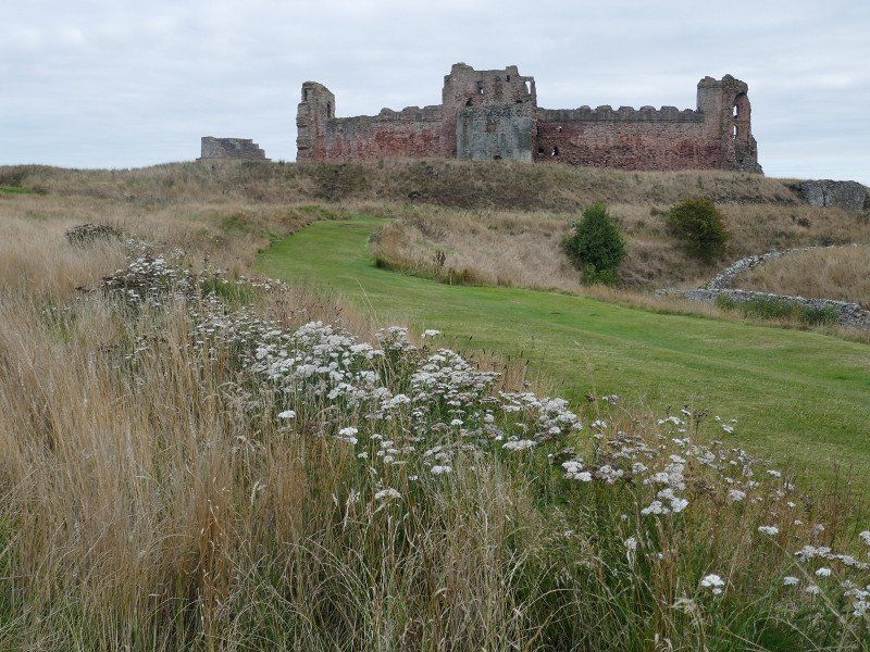
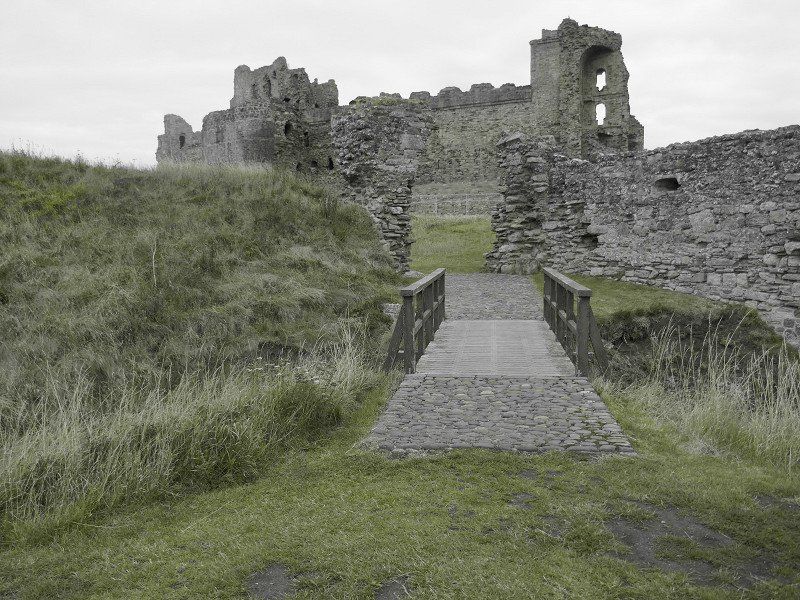
Tantallon Castle
Not far from where we stayed, we find the next ruined castle.
The actual castle is not accessible at the moment: An authority checked the castle ruins and found that there was a risk of collapse --> closed. After all, there is no entrance fee and those responsible on site are well-positioned, communicative and accessible people.
North Berwick EH39 5PN, Vereinigtes Königreich
56° 3' 22.9" N 2° 39' 2.2" W
56.0563593 -2.6506188
• Head southwest. Go for 354 m.
• Turn right onto A198. Go for 2.5 km.
• Pass 2 roundabouts and continue on Dunbar Road (A198). Go for 876 m.
• Turn left onto St Baldred's Road (A198) toward Edinburgh. Go for 609 m.
• Turn left onto Law Road (B1347). Go for 224 m.
• Continue on Haddington Road (B1347). Go for 874 m.
• Continue on B1347. Go for 6.0 km.
• Turn right onto Smithy Row (B1347). Go for 260 m.
• Take the 2nd exit from roundabout onto B1347. Go for 810 m.
• Turn left. Go for 645 m.
• Turn right. Go for 463 m.
• Arrive at your destination on the left.
☍
13,6 km
( 17 min.)
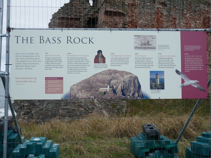
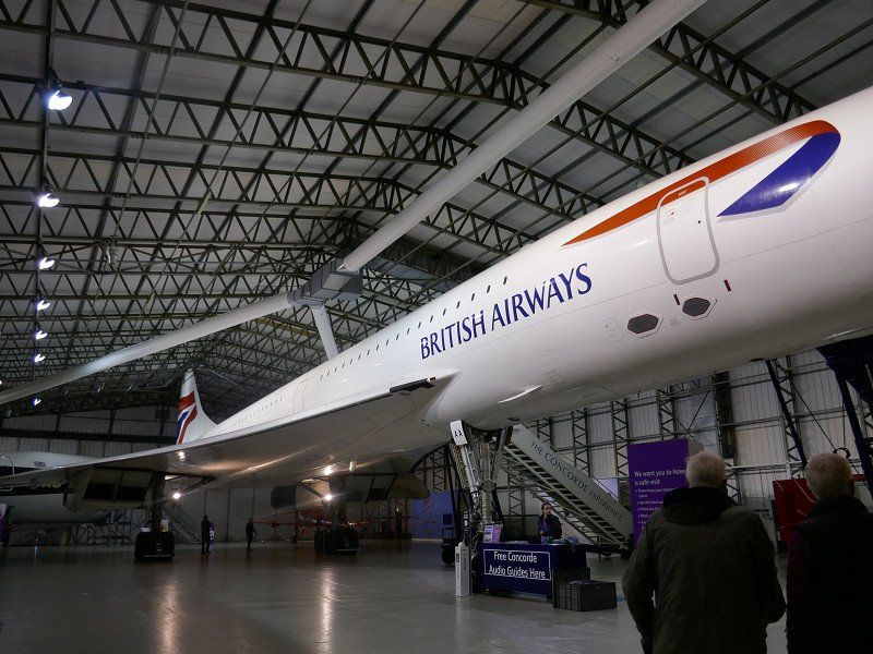
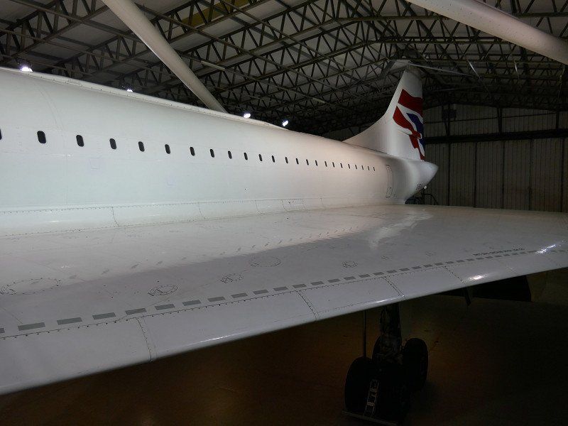
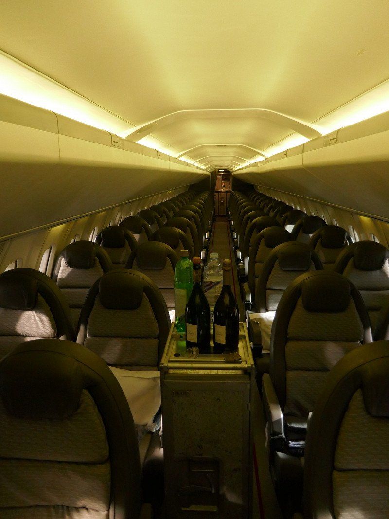
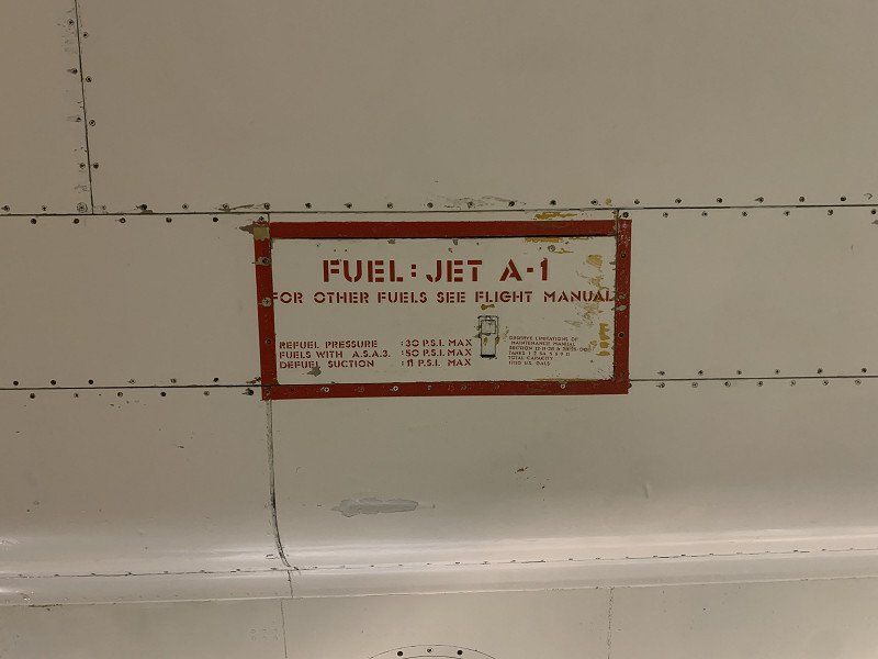
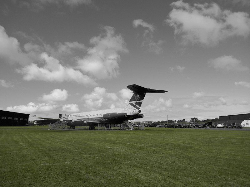
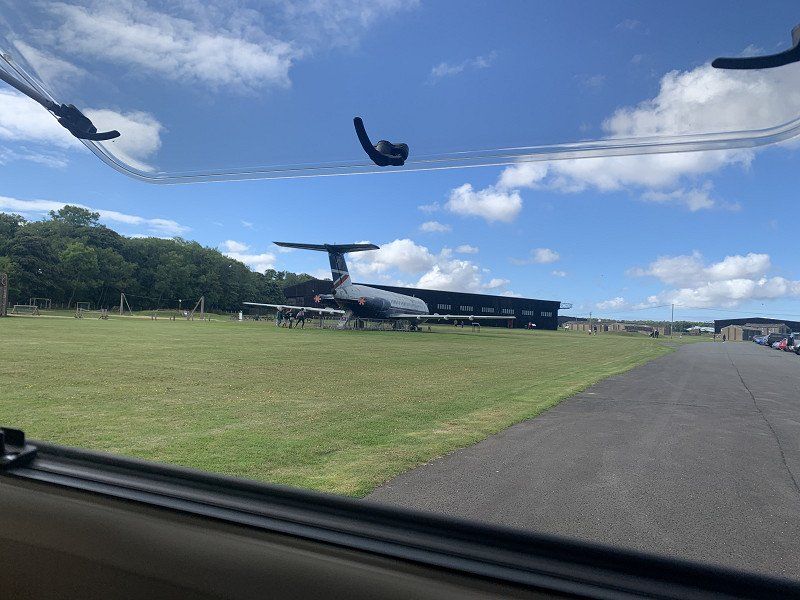
National Museum Of Flight
The Aviation Museum on a former military airfield is worth a visit. The very well preserved and maintained Concorde is in much better shape than the one in Toulouse, for example.
( In the plexiglass walls -eg in front of the cockpit- there are special holes for easy forography!) .
Other planes - civil and military - as well as the construction of an airfield during the World War can be visited in the wide area.
Lunch in the WoMo with a beautiful view.
East Fortune Airfield, B1347, North Berwick EH39 5LF, Vereinigtes Königreich
55° 59' 44.8" N 2° 43' 11.4" W
55.9957760 -2.7198467
• Head south. Go for 463 m.
• Turn left toward B1347. Go for 645 m.
• Turn left onto B1347. Go for 2.8 km.
• Turn right onto A199. Go for 2.5 km.
• Take the 2nd exit from roundabout onto A199 toward Edinburgh/(A1)/Haddington/(A6093)/Drem Station/(B1377). Go for 122 m.
• Take the 3rd exit from roundabout onto A1 toward Edinburgh. Go for 19.0 km.
• Take ramp toward Glasgow/Stirling/Edinburgh South & West. Go for 406 m.
• Take the 1st exit from roundabout onto The City of Edinburgh Bypass (A720) toward Glasgow/Stirling. Go for 3.5 km.
• Take the 2nd exit from Sheriffhall Roundabout roundabout onto A7 toward Galashiels. Go for 564 m.
• Pass 2 roundabouts and continue on A7. Go for 1.6 km.
• Take the 3rd exit from Eskbank Road Roundabout roundabout onto A7 toward Galashiels/Carlisle. Go for 810 m.
• Take the 2nd exit from Hardengreen Roundabout roundabout onto A7 toward Galashiels/Hawick. Go for 717 m.
• Keep right onto A7 toward Galashiels/Hawick/Carlisle. Go for 457 m.
• Take the 2nd exit from Victoria Park roundabout onto Murderdean Road (A7) toward Galashiels/Hawick/Carlisle. Go for 844 m.
• Arrive at A7. Your destination is on the right.
☍
34,4 km
( 26 min.)
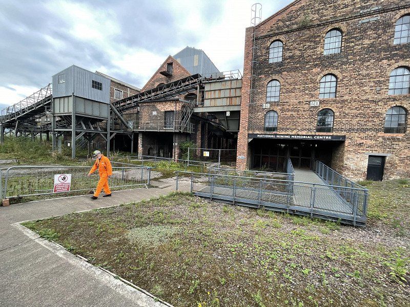
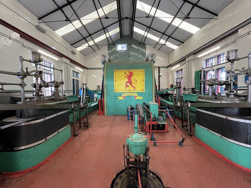
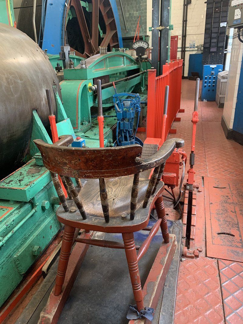
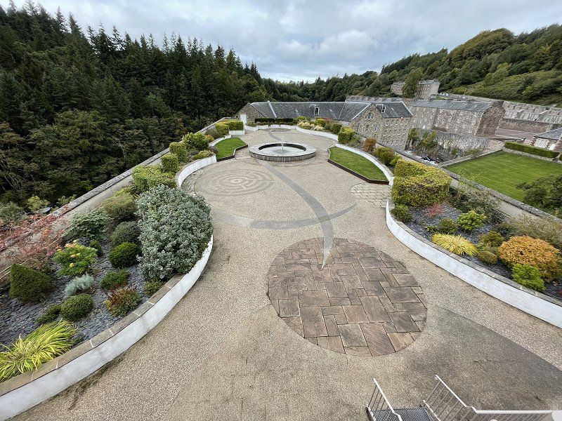
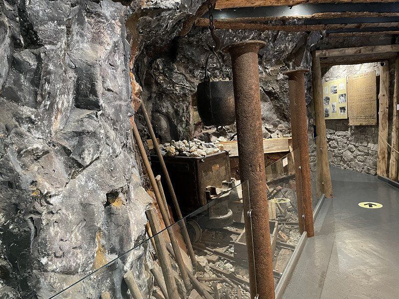
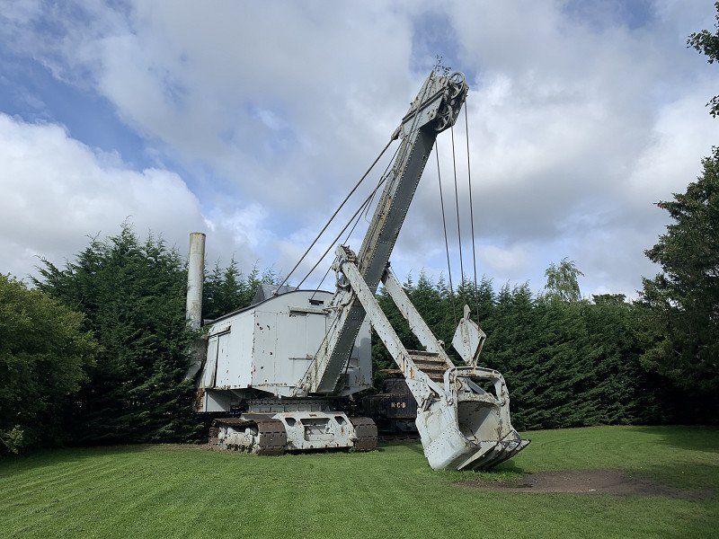
National Mining Museum Scotland
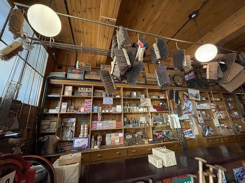
A guided tour of this exciting museum by a former miner gives you a good feeling of 'how people worked in the old days'.
The imposing steam engine for controlling the pit lift with the corresponding control chair ... terrific.
The guide said: He doesn't have to go on a FreeFallTower - in these pit lifts you fall down 500 meters in a cage ... freefall-like
Lady Victoria Colliery, Newtongrange, Dalkeith EH22 4QN, Vereinigtes Königreich
55° 51' 44.5" N 3° 3' 56.1" W
55.8623561 -3.0655970
• Head toward Saugh Cottages on A7. Go for 807 m.
• Pass 5 roundabouts and continue on A7. Go for 4.1 km.
• Take the 1st exit from Sheriffhall Roundabout roundabout onto The City of Edinburgh Bypass (A720) toward Glasgow/(M8)/Stirling/(M9)/Edinburgh South & West/Airport. Go for 15.0 km.
• Take ramp toward Glasgow/Forth Road Bridge/(A90)/Stirling/(M9)/Livingston. Go for 349 m.
• Take the 1st exit from roundabout onto M8 toward Glasgow/Stirling. Go for 5.4 km.
• Take exit 2 toward Forth Road Bridge/(A90)/Stirling onto M9. Go for 4.6 km.
• Take exit 1A toward Dundee/Perth onto M90. Go for 4.8 km.
• Continue on A90. Go for 1.9 km.
• Keep right onto M90. Go for 6.0 km.
• Take exit 1C toward Kincardine Br/Inverkeithing/Kincardine Bridge. Go for 335 m.
• Take the 1st exit from roundabout onto Admiralty Road (A985) toward Kincardine Bridge. Go for 495 m.
• Pass 2 roundabouts and continue on Admiralty Road (A985). Go for 1.4 km.
• Take the 2nd exit from roundabout onto Admiralty Road (A985) toward Kincardine Br./(A876). Go for 2.0 km.
• Turn left onto Dunfermline Road toward Limekilns/Charlestown. Go for 777 m.
• Arrive at Dunfermline Road. Your destination is on the left.
☍
48,0 km
( 35 min.)
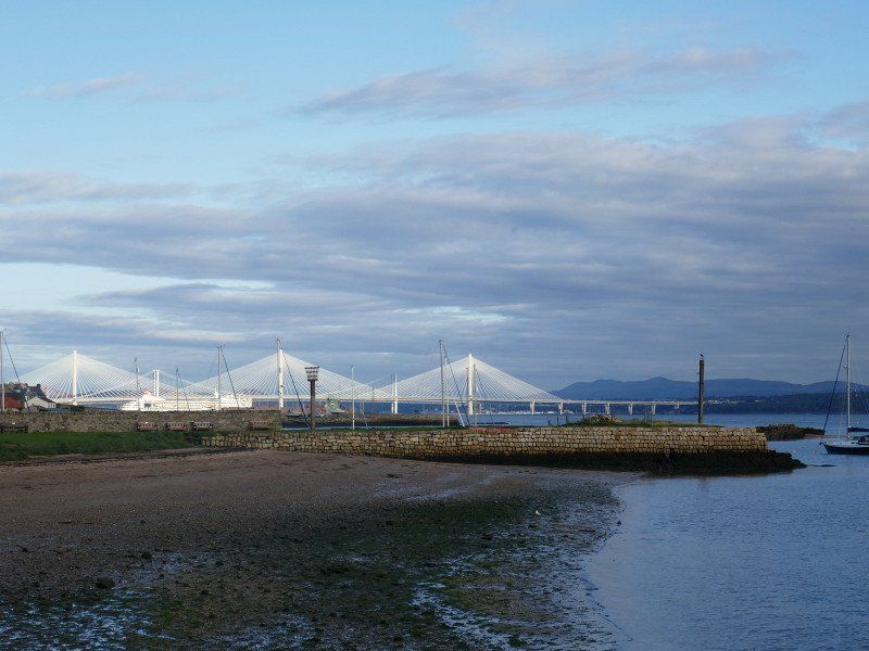
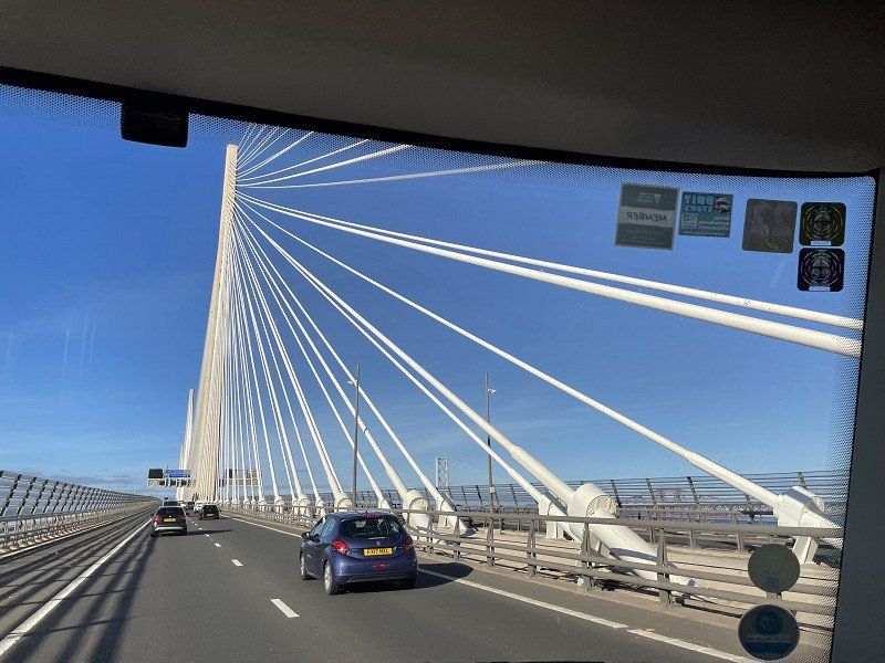
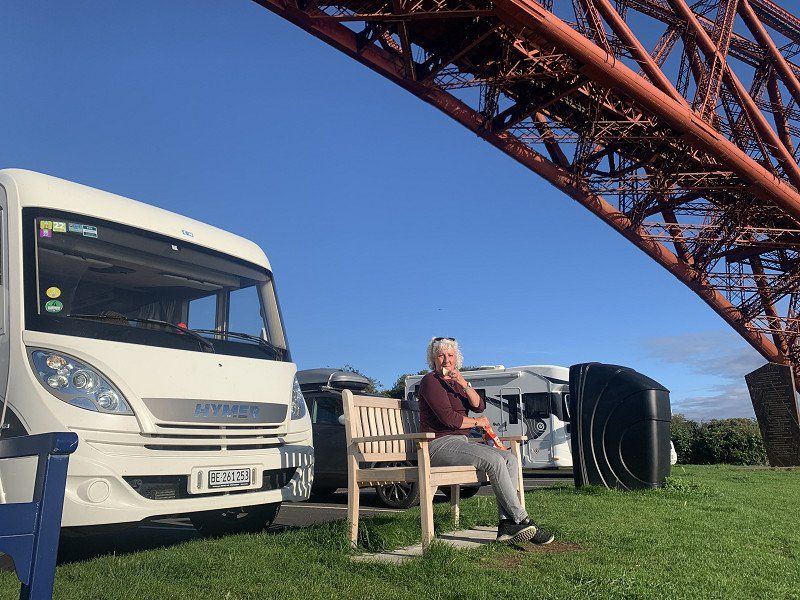
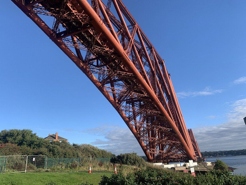
Limekilns
After a trip over the new bridge over the Firth of Forth and a short rest under the old railway bridge we find (thanks to Park4night) a nice and quiet place to stay.
Unfortunately all pubs 'fully booked'!
Distance : 95 km
Limekilns, Vereinigtes Königreich
56° 2' 3.3" N 3° 28' 44.5" W
56.0342419 -3.4790360
• Head toward The Wellheads on Dunfermline Road. Go for 777 m.
• Turn left onto A985. Go for 5.9 km.
• Take the 2nd exit from Cairneyhill Roundabout roundabout onto A985 toward Kincardine. Go for 10.0 km.
• Take the 2nd exit from roundabout onto A985 toward Glasgow/(M876)/Edinburgh/(M9)/Kincardine Bridge. Go for 2.5 km.
• Take the 1st exit from Higgins Neuk Roundabout roundabout onto A876 toward Glasgow/(M80)/Edinburgh/(M9)/Stirling/Falkirk/(A904)/Grangemouth/(M876). Go for 886 m.
• Turn left toward A905. Go for 970 m.
• Take the 1st exit from Bowtrees Interchange roundabout onto A905 toward Larbert/Skinflats. Go for 984 m.
• Take the 2nd exit from South Bellsdyke Roundabout roundabout onto Bellsdyke Road (A88). Go for 3.0 km.
• Take the 1st exit from Antonshill Roundabout roundabout onto B902. Go for 455 m.
• Pass 2 roundabouts and continue on New Carron Road (B902). Go for 1.9 km.
• Take the 3rd exit from roundabout onto Ronades Road (B906). Go for 700 m.
• Take the 2nd exit from roundabout onto Ronades Road (B906). Go for 486 m.
• Take the 3rd exit from Murchieston Roundabout roundabout onto A9. Go for 887 m.
• Take the 1st exit from Rosebank Roundabout roundabout onto Camelon Road (A803). Go for 72 m.
• Take the 2nd exit from roundabout onto Glenfuir Road (B816). Go for 462 m.
• Pass 2 roundabouts and continue on Glenfuir Road (B816). Go for 607 m.
• Turn right onto Tamfourhill Road (B816). Go for 1.0 km.
• Take the 3rd exit from roundabout onto Lime Road. Go for 119 m.
• Turn slightly left onto Falkirk Wheel. Go for 15 m.
• Take the 1st exit from roundabout onto Falkirk Wheel. Go for 398 m.
• Turn right. Go for 62 m.
• Arrive at your destination on the left.
☍
32,3 km
( 31 min.)
Day
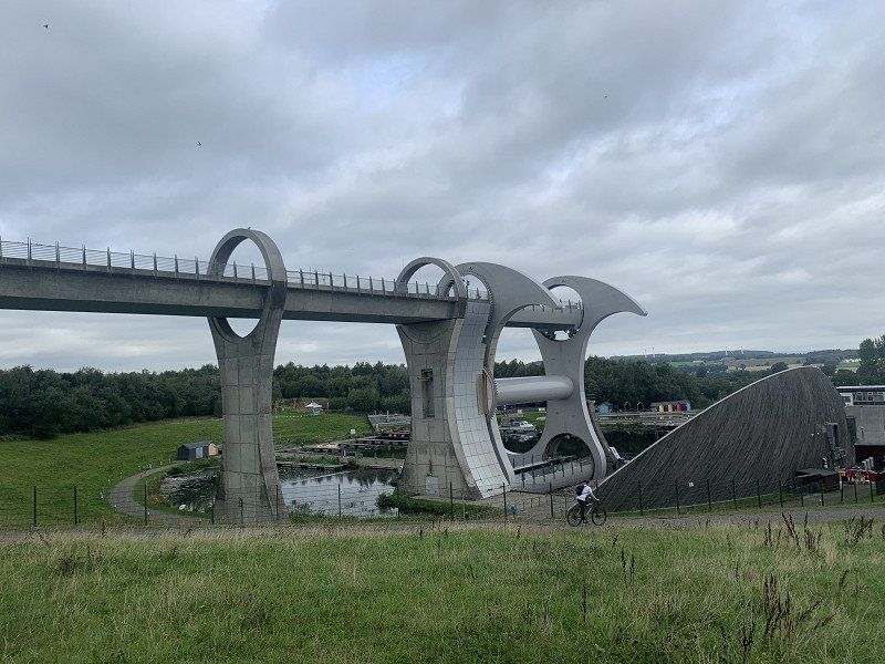
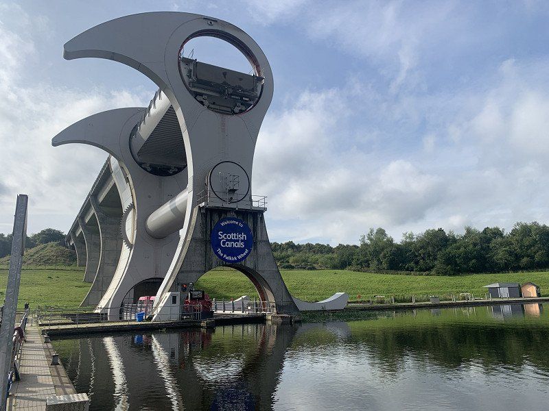
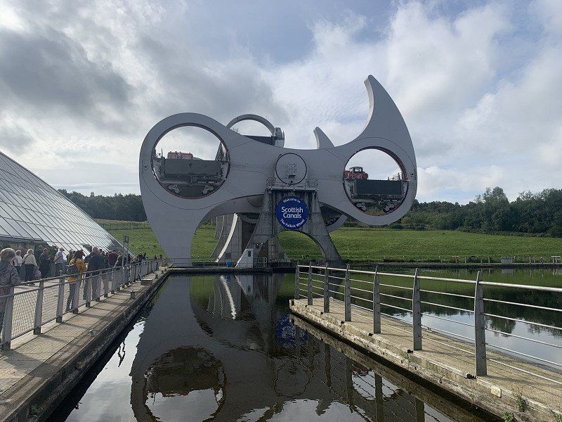
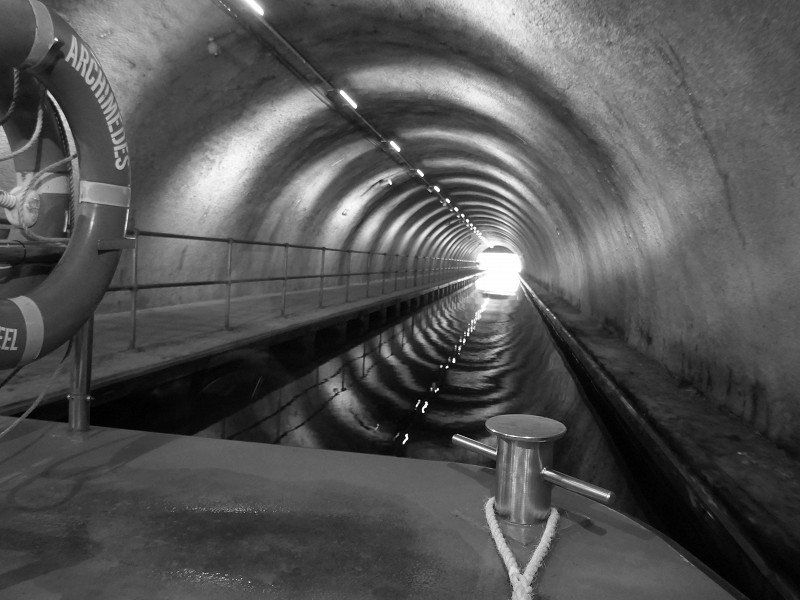
Falkirk Wheel
The Falkirk Wheel is a modern boat lift near the Scottish town of Falkirk, which is unique in the world due to its construction in the manner of a Ferris wheel.
(https://de.wikipedia.org/wiki/Falkirk_Wheel)
Very imposing and impressive ... of course we don't miss the boat trip and enjoy this exciting and technically demanding 'lock'.
Falkirk FK1 4LX, Vereinigtes Königreich
56° 0' 0.7" N 3° 50' 19.4" W
56.0001903 -3.8387325
• Head toward Falkirk Wheel. Go for 62 m.
• Turn left onto Falkirk Wheel. Go for 351 m.
• Take the 1st exit from roundabout onto Falkirk Wheel. Go for 62 m.
• Turn slightly right onto Lime Road. Go for 95 m.
• Take the 1st exit from roundabout onto Tamfourhill Road (B816). Go for 1.0 km.
• Turn left onto Glenfuir Road (B816). Go for 285 m.
• Pass 2 roundabouts and continue on Glenfuir Road (B816). Go for 751 m.
• Take the 1st exit from roundabout onto Camelon Road (A803). Go for 76 m.
• Take the 2nd exit from Rosebank Roundabout roundabout onto Main Street (A803). Go for 724 m.
• Take the 2nd exit from Camelon Roundabout roundabout onto Stirling Road (A9). Go for 3.2 km.
• Take the 2nd exit from roundabout onto Stirling Road (A9). Go for 349 m.
• Take the 2nd exit from North Broomage Roundabout roundabout onto A9. Go for 564 m.
• Pass 3 roundabouts and continue on A9. Go for 7.2 km.
• Take the 3rd exit from roundabout onto A91 toward Stirling/(A905)/Alloa/(A907)/St. Andrews. Go for 571 m.
• Take the 1st exit from roundabout onto A91 toward St Andrews/Stirling/(A905)/Alloa/(A907). Go for 1.0 km.
• Take the 2nd exit from Skeoch Roundabout roundabout onto A91 toward Stirling/(A905)/Alloa/(A907)/St. Andrews. Go for 1.5 km.
• Take the 1st exit from roundabout onto A905 toward Stirling. Go for 739 m.
• Pass 2 roundabouts and continue on Springbank Road (A905). Go for 1.1 km.
• Take the 2nd exit from Craigs Roundabout roundabout onto Upper Craigs. Go for 139 m.
• Turn left onto Wellgreen Road. Go for 103 m.
• Take the 2nd exit from Wellgreen Roundabout roundabout onto Wellgreen Road toward Erskine Br./Balloch/(A811). Go for 174 m.
• Turn right onto St Ninians Road toward Town Centre/Erskine Br./Balloch/Stirling Castle. Go for 41 m.
• Continue on Port Street. Go for 111 m.
• Turn left onto Dumbarton Road toward Erskine Br./Balloch/Stirling Castle. Go for 231 m.
• Continue on Albert Place. Go for 75 m.
• Turn right onto Corn Exchange Road. Go for 181 m.
• Turn left onto Spittal Street. Go for 239 m.
• Continue on St John Street. Go for 164 m.
• Continue on Mar Place. Go for 134 m.
• Continue on Castle Wynd. Go for 15 m.
• Turn slightly left onto Esplanade. Go for 135 m.
• Arrive at Esplanade. Your destination is on the left.
☍
21,4 km
( 30 min.)
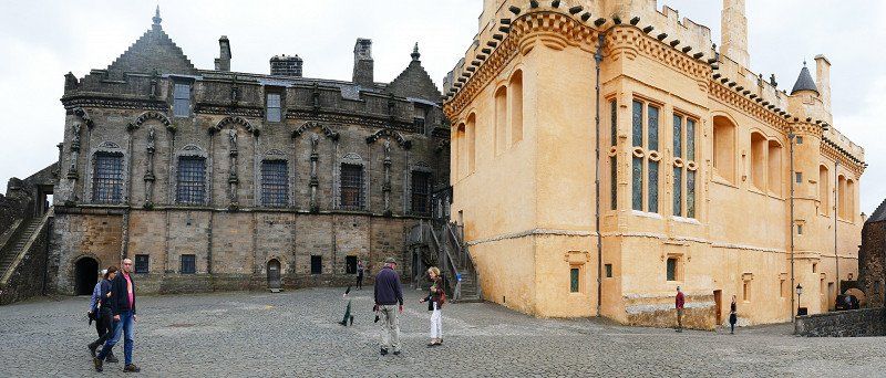
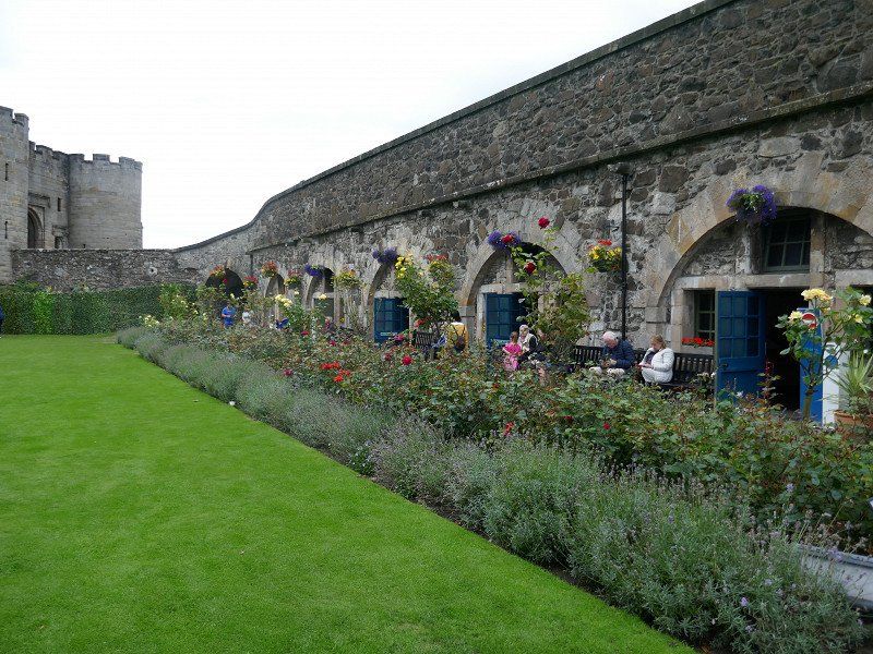
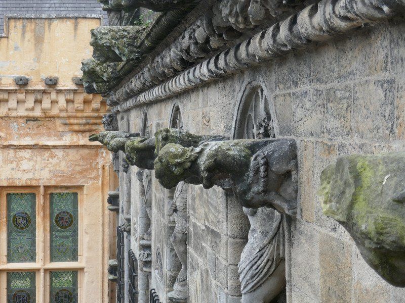
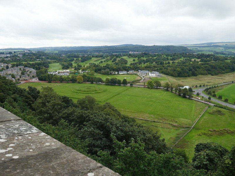
Stirling Castle
The Castle-Parking is closed for WoMo's ... so back to the city and search for a parking space. We find something somewhere, unload the bikes and drive up to the castle.
Somehow interesting and varied, but we didn't like it that much: too big and a bit lifeless (except for many tourists)
• Head toward Castle Wynd on Esplanade. Go for 135 m.
• Turn left onto Castle Wynd. Go for 41 m.
• Continue on Upper Castlehill. Go for 124 m.
• Continue on Lower Castlehill. Go for 178 m.
• Continue on Barn Road. Go for 154 m.
• Turn left onto Upper Bridge Street. Go for 326 m.
• Turn left onto Cowane Street (B8052). Go for 5 m.
• Continue on Lower Bridge Street (B8052). Go for 67 m.
• Take the 2nd exit from roundabout onto Union Street (B8052). Go for 247 m.
• Take the 2nd exit from Customs Roundabout roundabout onto Causewayhead Road (A9) toward St. Andrews/(A91)/Alloa/(A907)/Bridge of Allan/Causewayhead/Cornton. Go for 1.6 km.
• Take the 3rd exit from roundabout onto Alloa Road (A907). Go for 1.8 km.
• Pass 2 roundabouts and continue on Alloa Road (A907). Go for 3.0 km.
• Take the 2nd exit from roundabout onto B9140. Go for 1.1 km.
• Take the 2nd exit from Muirside roundabout onto B9140. Go for 2.5 km.
• Take the 3rd exit from Collyland roundabout onto B908. Go for 547 m.
• Take the 2nd exit from roundabout onto B908. Go for 416 m.
• Continue on Fairfield Road (B908). Go for 100 m.
• Take the 1st exit from roundabout onto Fairfield Road (B908). Go for 507 m.
• Continue on Parkhead Road (B908). Go for 176 m.
• Take the 2nd exit from roundabout onto Hallpark (A908). Go for 207 m.
• Take the 1st exit from roundabout onto Hallpark (A908). Go for 292 m.
• Take the 2nd exit from roundabout onto Hilton Road (B909). Go for 1.1 km.
• Take the 1st exit from Parkhill roundabout onto A907. Go for 656 m.
• Take the 2nd exit from roundabout onto B910. Go for 626 m.
• Turn right onto Kirk Wynd. Go for 296 m.
• Continue on Port Street. Go for 230 m.
• Turn right onto Craigrie Road. Go for 755 m.
• Arrive at Craigrie Road.
☍
17,1 km
( 24 min.)
unterwegs
464M+C8 Clackmannan, Vereinigtes Königreich
56° 6' 21.8" N 3° 45' 59.9" W
56.1060649 -3.7666380
• Head south on Craigrie Road. Go for 755 m.
• Turn left onto Port Street. Go for 230 m.
• Turn right onto Main Street. Go for 214 m.
• Turn slightly left onto Cattle Market. Go for 639 m.
• Continue on B910. Go for 959 m.
• Continue on Linnmill (B910). Go for 1.9 km.
• Turn left onto A977. Go for 13.5 km.
• Turn right onto B9097 toward Cleish/Kinglassie. Go for 1.1 km.
• Continue on Cullibole Castle (B9097). Go for 295 m.
• Continue on B9097. Go for 9.0 km.
• Turn left onto B996. Go for 256 m.
• Turn right onto B9097. Go for 2.3 km.
• Arrive at B9097.
☍
31,1 km
( 29 min.)
unterwegs
5JCP+26 Kinross, Vereinigtes Königreich
56° 10' 12.3" N 3° 21' 51.8" W
56.1700712 -3.3643796
• Head east on B9097. Go for 3.2 km.
• Turn right onto B920. Go for 690 m.
• Turn left onto B9097. Go for 3.8 km.
• Turn left onto B921. Go for 1.6 km.
• Continue on West End (B921). Go for 421 m.
• Continue on Main Street (B921). Go for 736 m.
• Take the 1st exit from roundabout onto Laurence Park (B921). Go for 260 m.
• Continue on Kinglassie Road (B921). Go for 2.9 km.
• Take the 2nd exit from Southfield Roundabout roundabout onto Kinglassie Road (B921). Go for 1.2 km.
• Take the 2nd exit from roundabout onto Kinglassie Road (B921). Go for 1.2 km.
• Take the 2nd exit from Bankhead Roundabout roundabout onto A92 toward Dundee/St Andrews/Glenrothes. Go for 1.7 km.
• Take the 3rd exit from Preston Roundabout roundabout onto A911 toward Leven/Buckhaven/Methil. Go for 6.9 km.
• Take the 2nd exit from Durievale Roundabout roundabout onto A915. Go for 919 m.
• Pass 3 roundabouts and continue on A915. Go for 2.7 km.
• Take the 3rd exit from roundabout onto Scoonie Brae (A915). Go for 261 m.
• Take the 2nd exit from roundabout onto Largo Road (A915). Go for 4.8 km.
• Continue on Main Street (A917). Go for 3.8 km.
• Turn right onto A917. Go for 4.5 km.
• Turn left onto High Street (A917). Go for 380 m.
• Turn right onto Wadeslea. Go for 182 m.
• Turn left onto Wadeslea. Go for 110 m.
• Arrive at Wadeslea. Your destination is on the left.
☍
42,3 km
( 44 min.)
unterwegs
14 Wadeslea, Elie, Leven KY9 1EB, Vereinigtes Königreich
56° 11' 19.7" N 2° 48' 51.5" W
56.1888152 -2.8143010
• Head east on Wadeslea. Go for 292 m.
• Turn right onto A917. Go for 8.1 km.
• Turn left onto Elizabeth Place (A917). Go for 200 m.
• Take the 3rd exit from roundabout onto Rodger Street (B9131). Go for 125 m.
• Continue on Shore Street (B9131). Go for 67 m.
• Turn left onto Cunzie Street. Go for 21 m.
• Arrive at Cunzie Street. Your destination is on the left.
☍
8,8 km
( 11 min.)
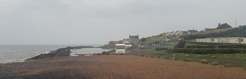
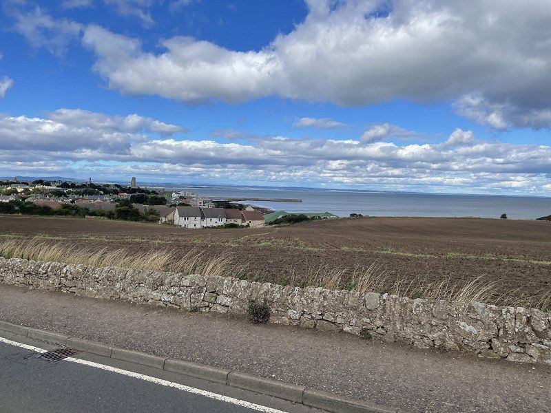
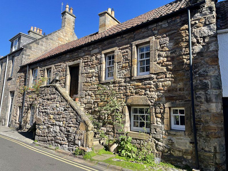
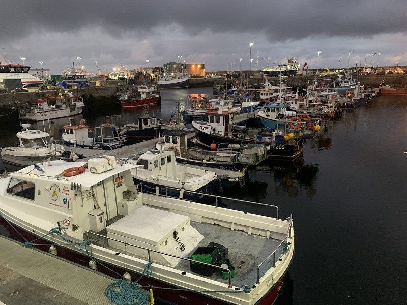
Anstruther
A little further back on small and smaller country roads we get to Anstruther ('opposite of Edinburgh'), where we park our mobile home right by the sea - we actually wanted to go to the caravan park there, but it made a completely closed impression. The driveway across the village is a bit narrow, but it worked.
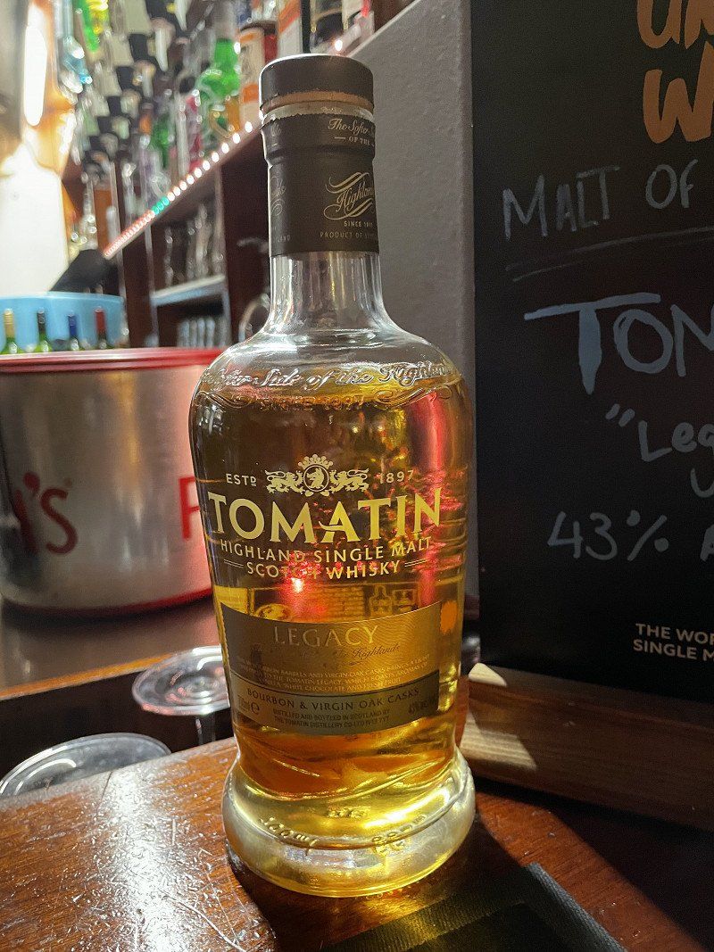
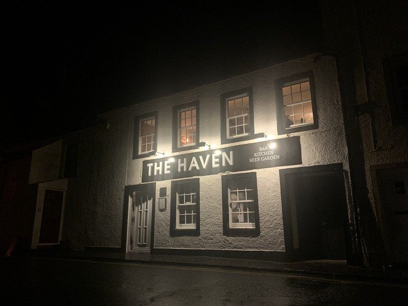
Dinner in the restaurant The Haven: cosy, nice, good
Whiskey of the month: Tomatin ( we liked it a lot, so we'll probably drive by this distillery! )
Distance : 160 km
Anstruther, Vereinigtes Königreich
56° 13' 22.7" N 2° 42' 1.9" W
56.2229800 -2.7005390
• Head toward Shore Street on Cunzie Street. Go for 21 m.
• Turn left onto Shore Street (B9131). Go for 207 m.
• Continue on East Shore (B9131). Go for 35 m.
• Arrive at East Shore (B9131). Your destination is on the left.
☍
0,3 km
( 1 min.)
Day
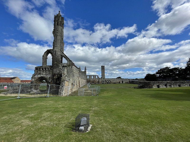
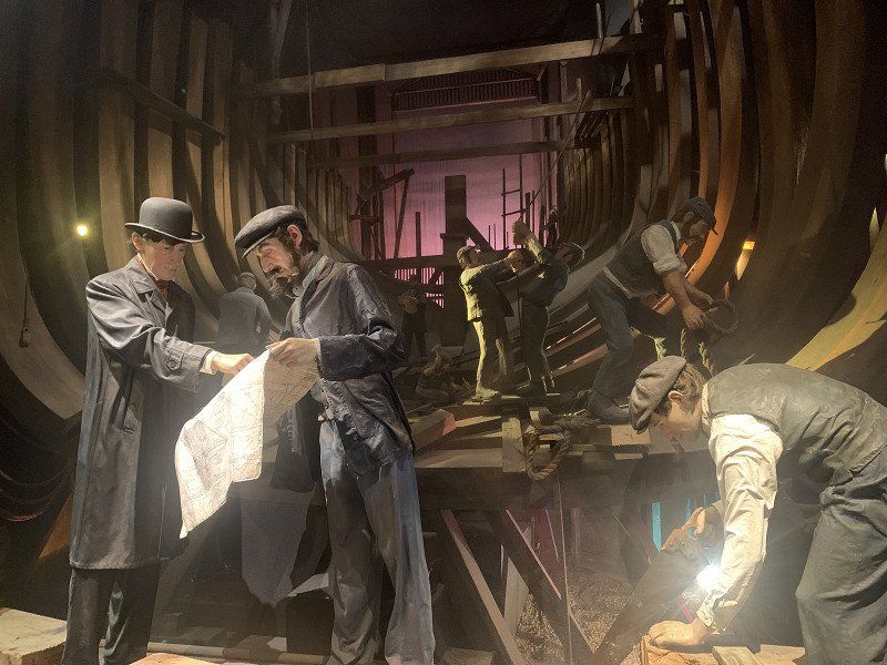
Scottish Fisheries Museum Trust Ltd
Bright sunshine wakes us up in the morning.
On foot we set off to explore the local fishing museum. Absolutely to recommend.
St Ayles, Harbourhead, Anstruther KY10 3AB, Vereinigtes Königreich
56° 13' 18.6" N 2° 41' 49.4" W
56.2218435 -2.6970594
• Head toward Haddfoot Wynd on East Shore (B9131). Go for 35 m.
• Continue on Shore Street (B9131). Go for 274 m.
• Continue on Rodger Street (B9131). Go for 95 m.
• Take the 2nd exit from roundabout onto St Andrews Road (B9131). Go for 177 m.
• Take the 3rd exit from roundabout onto B9131. Go for 18 m.
• Take the 1st exit from roundabout onto B9131. Go for 5.2 km.
• Turn right onto B940. Go for 2.2 km.
• Turn right. Go for 373 m.
• Arrive at your destination on the left.
☍
8,4 km
( 9 min.)
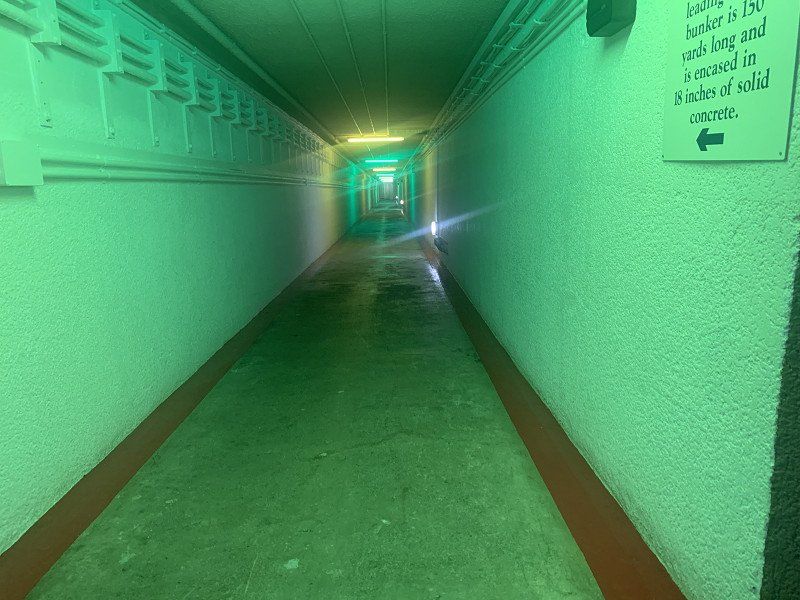
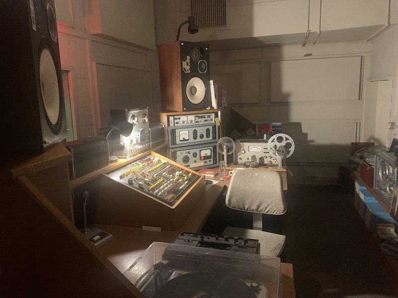
Secret Bunker Scottland
Interesting for sure, but not really our thing: very depressing in view of the threatening escalation in the Ukraine war.
• Continue on Dunnichen Road (B9128). Go for 3.0 km.
• Turn right toward A932. Go for 1.8 km.
• Turn right onto A932. Go for 1.9 km.
• Turn right. Go for 27 m.
• Arrive at your destination on the right.
☍
15,5 km
( 16 min.)
Foresterseat Caravan Park, Forfar
The weather holds! We stay just north of Dundee. Quiet, stress free.
Distance : 80 km
Arbroath Road, DD8 1BT, Forfar, Großbritannien
56° 38' 56.5" N 2° 49' 26.4" W
56.6490300 -2.8240100
• Head north. Go for 27 m.
• Turn left onto A932. Go for 3.7 km.
• Turn left onto South Street (A932). Go for 52 m.
• Take the 3rd exit from roundabout onto Academy Street (A932). Go for 315 m.
• Take the 1st exit from roundabout onto St James Road (A932). Go for 746 m.
• Turn right toward Dundee Road/A932. Go for 22 m.
• Continue on Dundee Loan (A926). Go for 294 m.
• Turn left onto Glamis Road (A94). Go for 1.9 km.
• Take the 2nd exit from Glamis Junction roundabout onto Glamis Junction (A94). Go for 463 m.
• Take the 2nd exit from Glamis Junction roundabout onto A94 toward Coupar Angus. Go for 5.9 km.
• Turn right onto Dundee Road (A928). Go for 2.1 km.
• Turn right toward Glamis Castle. Go for 750 m.
• Turn slightly left onto Glamis Castle. Go for 129 m.
• Turn slightly left. Go for 176 m.
• Arrive at your destination on the right.
☍
16,5 km
( 20 min.)
Day
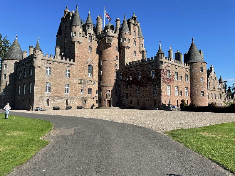
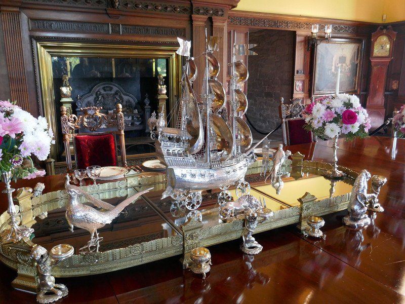
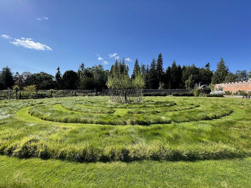
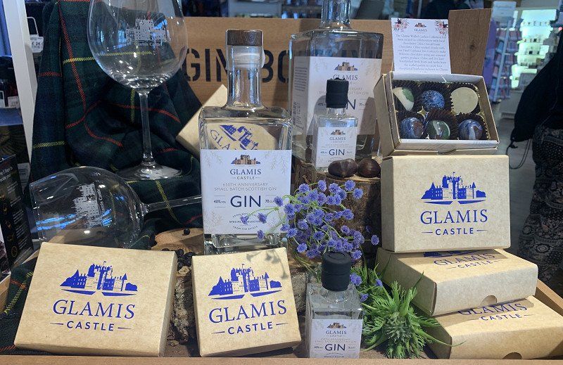
Glamis Castle
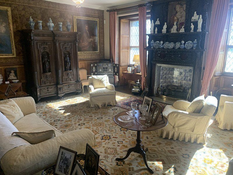
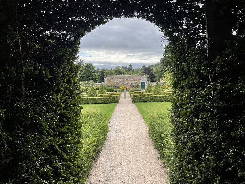
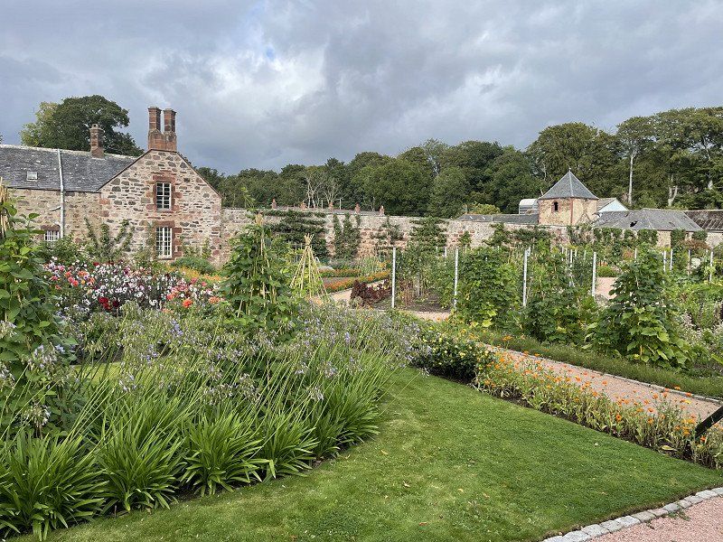
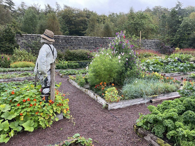
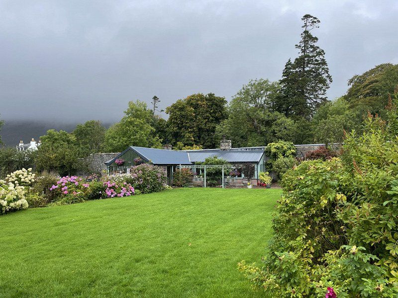
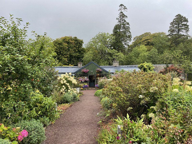
Glamis Castle is the home of the Earl of Strathmore who opened it to the public. Unlike many other Scottish castles, it is not run by the National Trust for Scotland. 'Queen Mum' spent her childhood here and her daughter Princess Margaret was born here... Margareth and Elizabeth (the future Queen)'s favorite children's chairs are still on display.
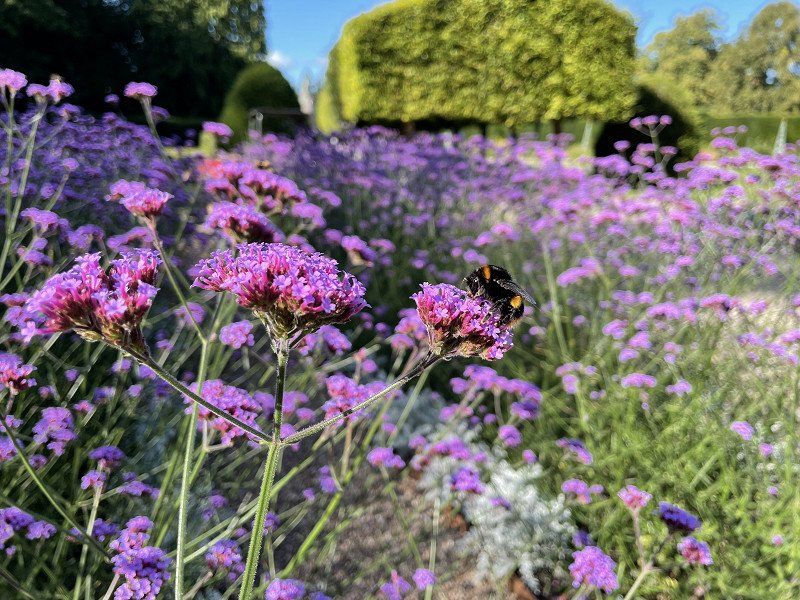
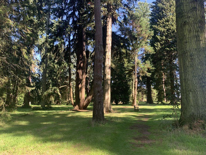
Great walled garden and impressive arboretrum
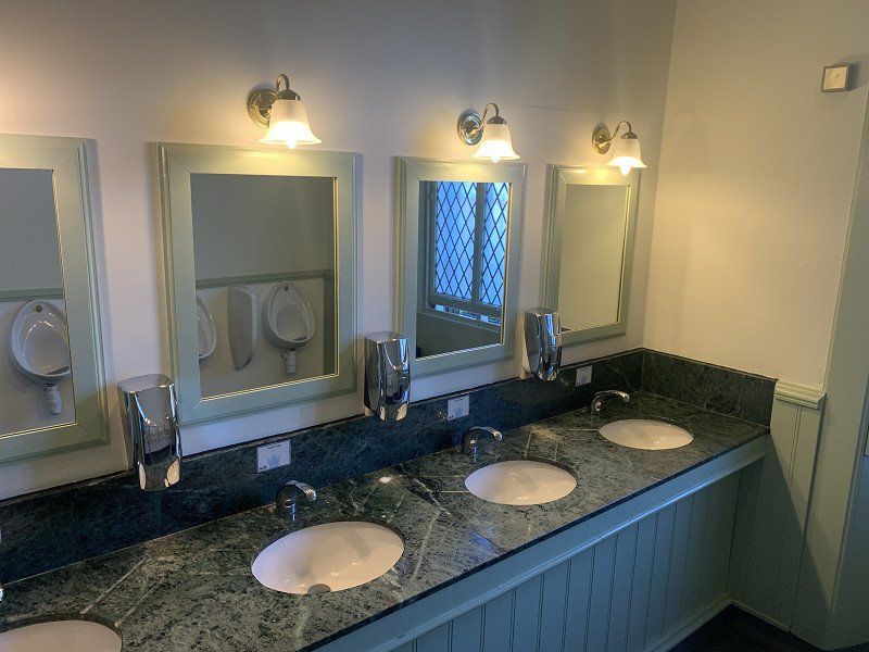
PS: very elegant toilet!
PS: there has to be a bit of Glamis 650th Anniversary Gin in it
• Turn slightly right onto Glamis Castle. Go for 129 m.
• Turn slightly right toward A928. Go for 750 m.
• Turn right onto A928. Go for 5.8 km.
• Continue on Bellies Brae (A926). Go for 349 m.
• Continue on High Street (A926). Go for 79 m.
• Continue on Glengate (B956). Go for 100 m.
• Turn right onto St Malcolm's Wynd (B956). Go for 92 m.
• Continue on Reform Street (B956). Go for 109 m.
• Turn left onto Rosefield Road. Go for 91 m.
• Turn right onto Glebe Court. Go for 26 m.
• Arrive at Glebe Court. Your destination is on the left.
☍
7,7 km
( 10 min.)
unterwegs
Kirriemuir DD8, Vereinigtes Königreich
56° 40' 30.4" N 3° 0' 12.6" W
56.6751170 -3.0035010
• Head toward Rosefield Gardens on Glebe Court. Go for 26 m.
• Turn left onto Rosefield Road. Go for 91 m.
• Turn left onto Reform Street (B956). Go for 56 m.
• Continue on Brechin Road (B957). Go for 788 m.
• Continue on B957. Go for 7.9 km.
• Turn right onto Whig Street (B957). Go for 1.5 km.
• Continue on South Esk Road (B957). Go for 228 m.
• Turn sharp left onto Broomhill Road. Go for 2.7 km.
• Turn right. Go for 1.2 km.
• Turn slightly left. Go for 509 m.
• Arrive at your destination.
☍
15,1 km
( 17 min.)
unterwegs
Noranside, Forfar DD8 3FT, Vereinigtes Königreich
56° 44' 27.8" N 2° 52' 2.8" W
56.7410680 -2.8674360
• Head southwest. Go for 670 m.
• Continue straight ahead. Go for 1.1 km.
• Turn left. Go for 678 m.
• Turn slightly left toward Broomhill Road. Go for 1.8 km.
• Continue on Broomhill Road. Go for 263 m.
• Continue on South Esk Road (B957). Go for 156 m.
• Continue on B957. Go for 2.2 km.
• Turn left onto A90. Go for 13.4 km.
• Take ramp toward Brechin/Edzell/Fettercairn. Go for 214 m.
• Take the 2nd exit from roundabout onto B966 toward Edzell/Fettercairn. Go for 5.4 km.
• Continue on High Street (B966). Go for 614 m.
• Take the 1st exit from roundabout onto Lethnot Road. Go for 1.3 km.
• Continue on Edzell Castle. Go for 125 m.
• Arrive at Edzell Castle.
☍
27,8 km
( 25 min.)
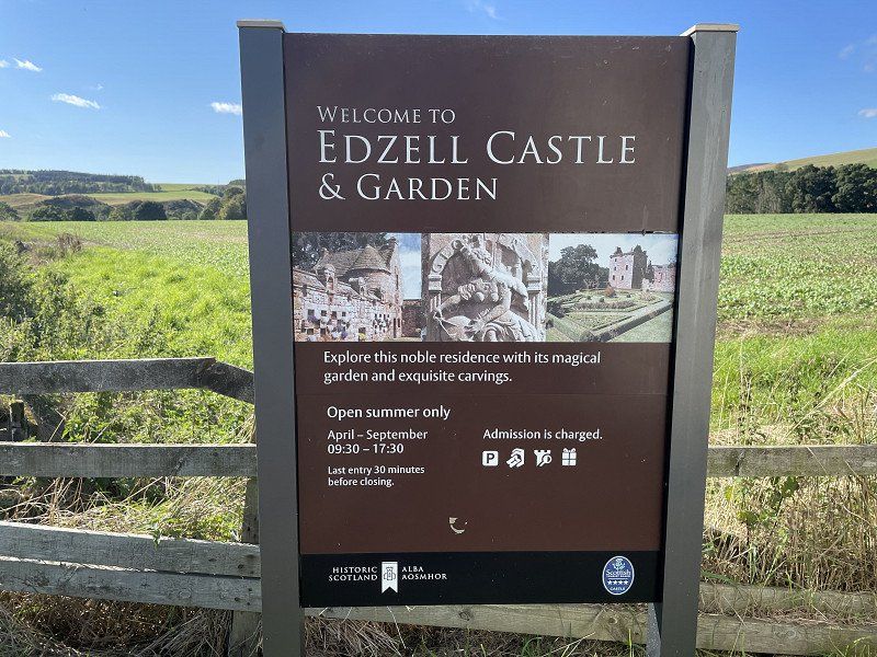
Edzell Castle and Garden
A little way back (overland) we want to visit Edzell Castle 6 Garden, but ...
Closed due to danger of collapse!
Edzell, Brechin DD9 7UE, Vereinigtes Königreich
56° 48' 42.4" N 2° 40' 55" W
56.8117799 -2.6819515
• Head toward Slateford Road on Edzell Castle. Go for 951 m.
• Continue on Lethnot Road. Go for 511 m.
• Take the 3rd exit from roundabout onto High Street (B966). Go for 648 m.
• Continue on B966. Go for 5.3 km.
• Take the 3rd exit from roundabout onto B966 toward Edinburgh/(M90)/Perth/Dundee/Forfar/(A90)/Montrose/(A935)/Brechin. Go for 546 m.
• Take the 1st exit from roundabout onto B966 toward Brechin/Montrose/Arbroath/(A935). Go for 2.1 km.
• Continue on Trinity Road (B966). Go for 473 m.
• Take the 1st exit from roundabout onto Southesk Street (B966). Go for 245 m.
• Take the 2nd exit from roundabout onto Southesk Street (A935). Go for 564 m.
• Turn left onto Montrose Street (A935). Go for 963 m.
• Continue on A935. Go for 6.4 km.
• Arrive at A935. Your destination is on the left.
☍
18,7 km
( 20 min.)
House of Dun
Already closed, or only guided tours ... and we were too late!
House Of Dun, Dun, Montrose DD10 9LQ, Vereinigtes Königreich
56° 43' 29.9" N 2° 32' 22" W
56.7249654 -2.5394446
• Head northeast on A935. Go for 3.5 km.
• Continue on Brechin Road (A935). Go for 684 m.
• Take the 1st exit from roundabout onto Brechin Road. Go for 370 m.
• Take the 2nd exit from roundabout onto Brechin Road. Go for 146 m.
• Turn left onto North Esk Road (A92). Go for 213 m.
• Take the 2nd exit from roundabout onto North Esk Road (A92). Go for 17.8 km.
• Turn right onto Brae Road toward Gourdon. Go for 656 m.
• Arrive at Brae Road. Your destination is on the left.
☍
23,4 km
( 22 min.)
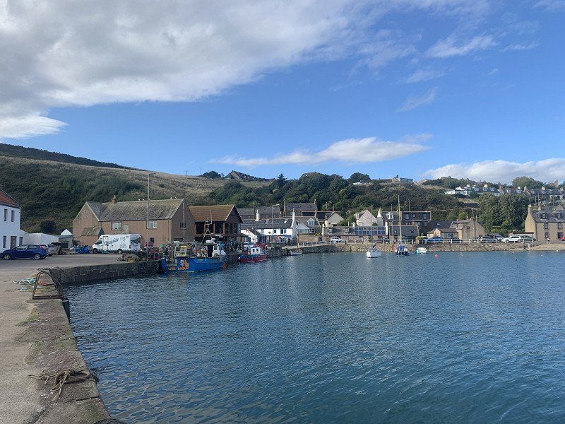
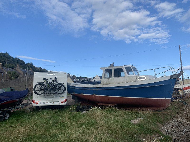
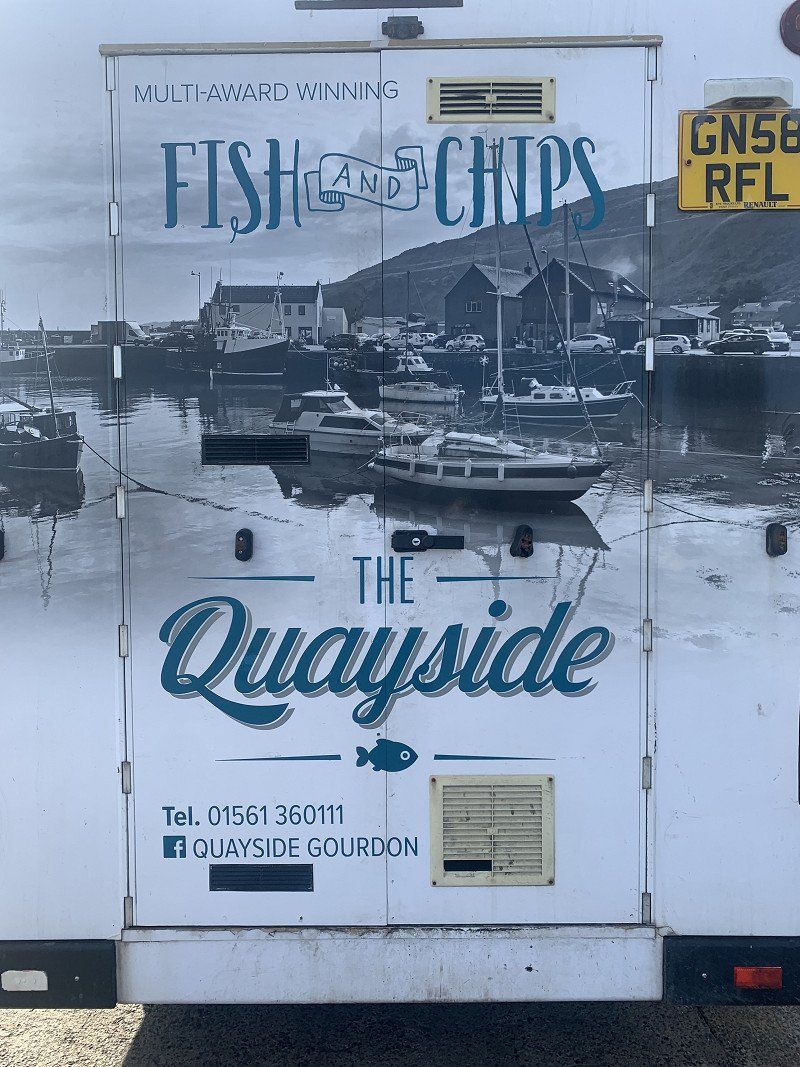
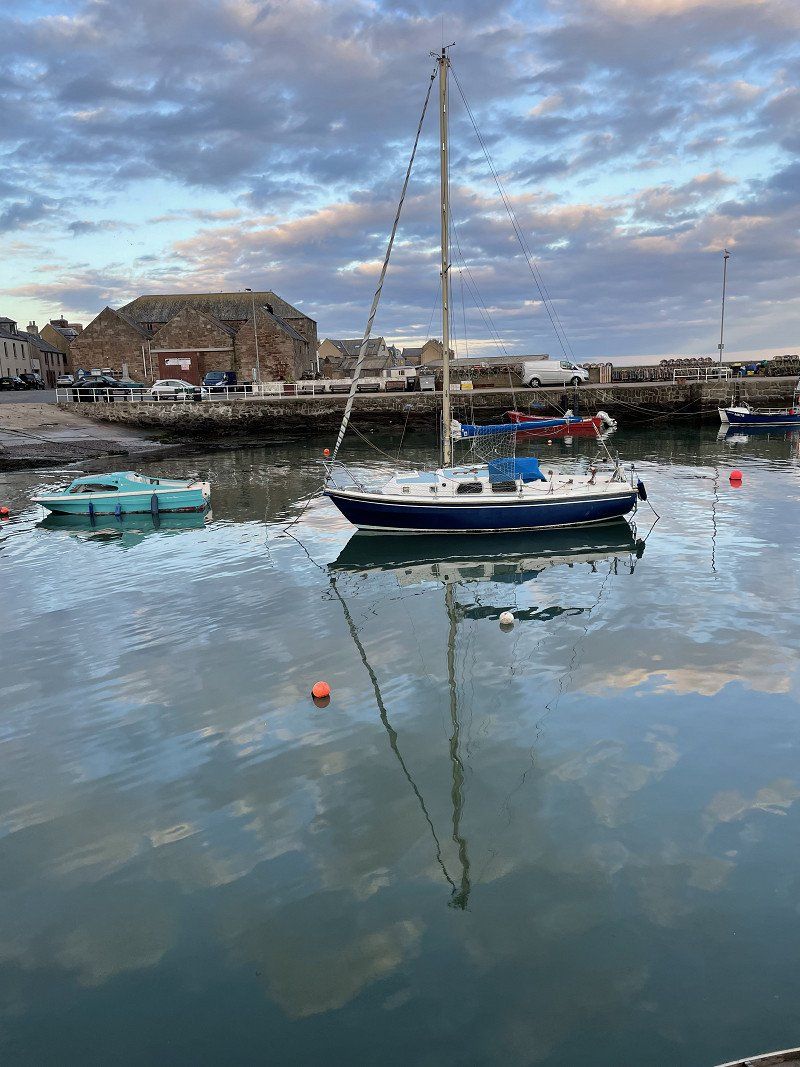
Gourdon
Harbor Bar our S46 Britstop
The Harbor Bar itself... well! Was also closed in the evening, but right next to it was Fish&Chip The Quaisyde, which has a super restaurant on the 1st floor with a view of the harbor to see the ebb and flow spectacle.
Distance : 92km
Gourdon, Vereinigtes Königreich
56° 49' 43.3" N 2° 17' 14.8" W
56.8286871 -2.2874411
• Head toward Bank Street on Brae Road. Go for 93 m.
• Turn slightly left onto Brae Road. Go for 468 m.
• Turn slightly left onto Brae Road. Go for 95 m.
• Turn right onto A92. Go for 13.8 km.
• Turn right. Go for 450 m.
• Turn right. Go for 211 m.
• Arrive at your destination.
☍
15,1 km
( 14 min.)
Day
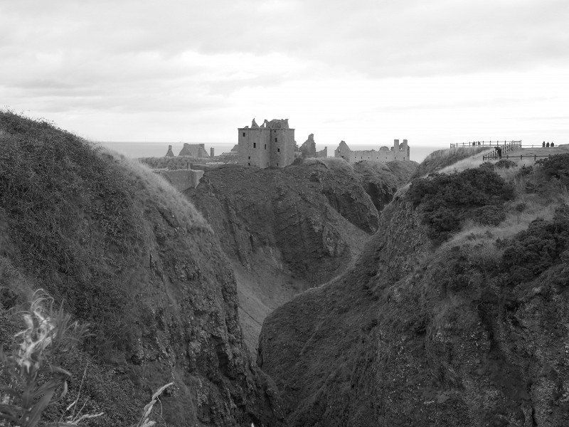
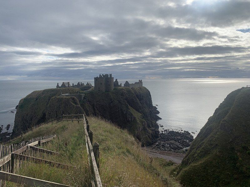
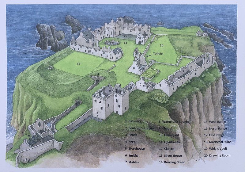
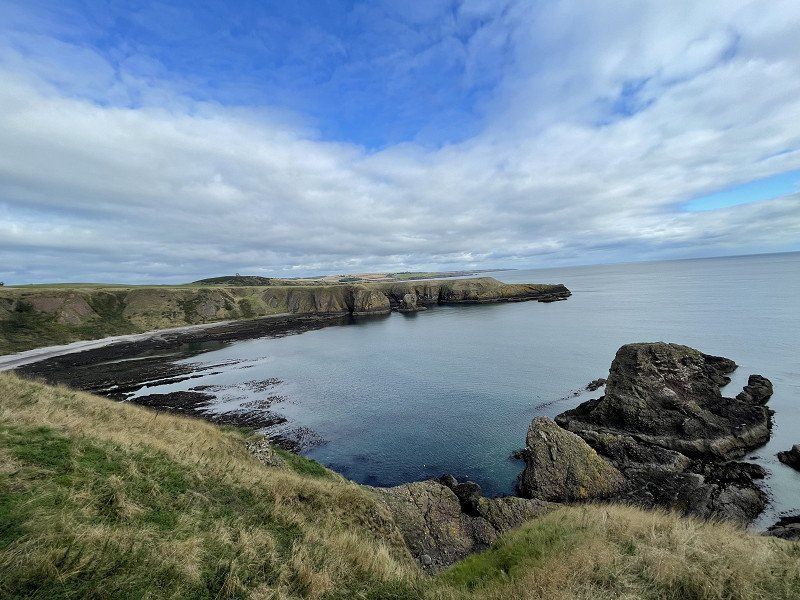
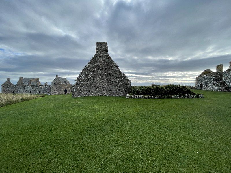
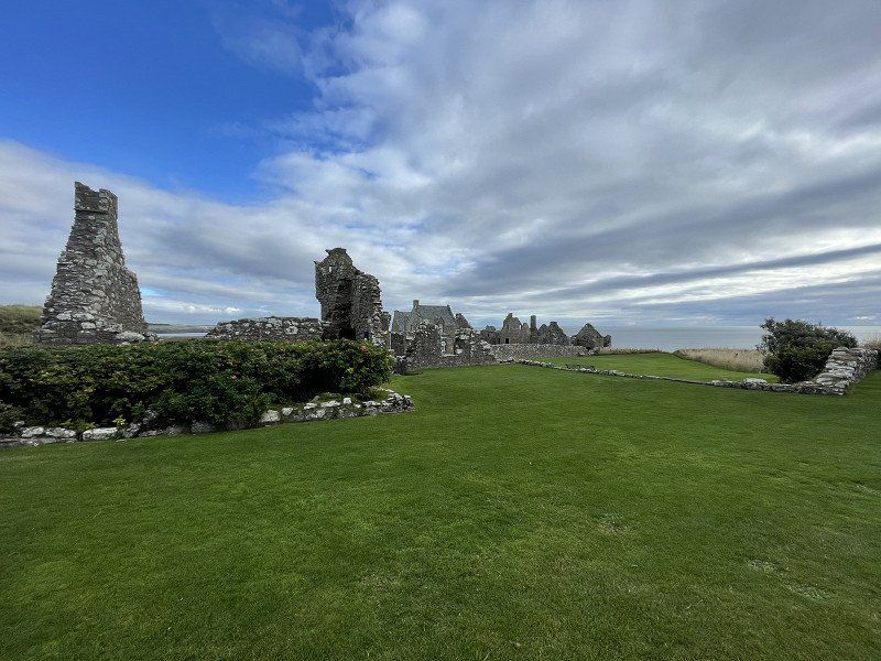
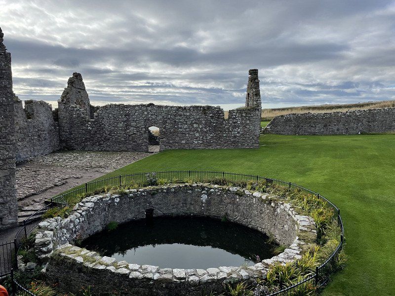
Dunnottar Castle
great location right on the sea.
very impressive: When you are 'in the castle', there are practically no people, since they usually only look from afar ... but the facility and the corresponding explanations are absolutely worth seeing.
• Head toward The Square on School Road. Go for 108 m.
• Turn right onto School Road (B974). Go for 16 m.
• Take the 1st exit from roundabout onto B966. Go for 669 m.
• Turn left onto B966. Go for 6.4 km.
• Continue on East Cairnbeg (B966). Go for 159 m.
• Continue on B966. Go for 2.8 km.
• Turn right. Go for 2.0 km.
• Turn right toward A90. Go for 234 m.
• Turn left onto A90. Go for 19.1 km.
• Take ramp toward Peterculter/A90 North/Inverness/AECC/Airport/(A96)/Aberdeen (N) & (W)/ARI Hospital. Go for 257 m.
• Take the 3rd exit from Stonehaven Roundabout roundabout onto Aberdeen Western Peripheral Route (A90) toward Inverness/AECC/Airport/(A96)/Aberdeen (N) & (W)/ARI Hospital. Go for 11.6 km.
• Take the 1st exit from Cleanhill Roundabout roundabout onto Aberdeen Western Peripheral Route (A90) toward Inverness/AECC/Airport/Aberdeen (N) & (W)/ARI Hospital. Go for 7.9 km.
• Take ramp toward Alford/Westhill/Kingswells/Aberdeen (W). Go for 626 m.
• Take the 1st exit from roundabout onto A944 toward Alford/Westhill. Go for 1.8 km.
• Pass 3 roundabouts and continue on A944. Go for 9.1 km.
• Continue on Victoria Terrace (B993). Go for 647 m.
• Continue on B993. Go for 530 m.
• Turn left onto B993. Go for 5.5 km.
• Take the 1st exit from Inverurie Roundabout roundabout onto A96 toward Inverness. Go for 2.4 km.
• Take the 4th exit from roundabout onto Blackhall Road (B9144) toward Inverurie/Oldmeldrum/Rothienorman/(B9001)/Harlaw Ind. Est./Blackhall Ind. Est. Go for 327 m.
• Take the 2nd exit from roundabout onto Burghmuir Drive (B9001). Go for 1.1 km.
• Take the 2nd exit from roundabout onto B9001. Go for 1.5 km.
• Take the 3rd exit from roundabout. Go for 780 m.
• Take the 1st exit from roundabout onto B9170. Go for 3.1 km.
• Continue on Barra Castle (B9170). Go for 40 m.
• Continue on B9170. Go for 1.3 km.
• Pass 3 roundabouts and continue on B9170. Go for 3.0 km.
• Continue on Meldrum Ho (B9170). Go for 294 m.
• Continue on B9170. Go for 7.9 km.
• Turn right toward Woodside Cottages. Go for 802 m.
• Continue on Woodside Cottages. Go for 1.5 km.
• Turn slightly right. Go for 114 m.
• Arrive at your destination on the right.
☍
35,6 km
( 41 min.)
Haddo House
Closing: low season
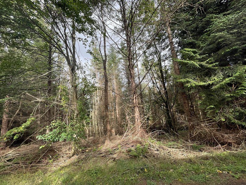
Some of the forests were massively destroyed by the storm Arwen, which raged here at the end of November 2021. Everywhere one is still tidying up.
Methlick, Ellon AB41 7EQ, Vereinigtes Königreich
57° 24' 10.7" N 2° 13' 13.4" W
57.4029622 -2.2204023
• Head northeast. Go for 361 m.
• Continue on Ellon. Go for 973 m.
• Turn left onto B9005. Go for 2.0 km.
• Continue on B9170. Go for 395 m.
• Turn left onto B9005. Go for 1.2 km.
• Continue on Ardo (B9005). Go for 273 m.
• Continue on B9005. Go for 3.6 km.
• Continue on Cottown (B9005). Go for 89 m.
• Continue on B9005. Go for 2.7 km.
• Continue on School Terrace (B9005). Go for 550 m.
• Continue on B9005. Go for 1.8 km.
• Turn right. Go for 378 m.
• Turn left. Go for 1.3 km.
• Turn right. Go for 335 m.
• Turn slightly left. Go for 121 m.
• Turn slightly left. Go for 94 m.
• Arrive at your destination on the right.
☍
16,1 km
( 21 min.)
Fyvie Castle
Closing: low season
Fyvie, Turriff AB53 8JS, Vereinigtes Königreich
57° 26' 36.4" N 2° 23' 41.4" W
57.4434329 -2.3948457
• Head southeast. Go for 63 m.
• Turn right. Go for 399 m.
• Turn slightly left toward A947. Go for 497 m.
• Turn right onto A947. Go for 9.0 km.
• Turn right onto B9170. Go for 5.0 km.
• Turn right onto B9170. Go for 1.8 km.
• Turn left onto B9027. Go for 1.2 km.
• Turn left onto B9027. Go for 1.7 km.
• Turn left onto B9027. Go for 2.0 km.
• Continue on Bridge Street (B9027). Go for 230 m.
• Turn right onto Main Street (B9027). Go for 270 m.
• Continue on The Square (B9027). Go for 66 m.
• Turn left onto Banff Road (B9027). Go for 68 m.
• Continue on B9027. Go for 2.0 km.
• Turn right onto A98. Go for 20.9 km.
• Take the 2nd exit from roundabout onto Watermill Road (A98) toward Fraserburgh/Sandhaven/Rosehearty/(B9031)/Watermill Industrial Estates. Go for 1.8 km.
• Continue on Broad Street. Go for 161 m.
• Turn left onto Frithside Street. Go for 52 m.
• Continue on Quayside. Go for 109 m.
• Arrive at Quayside. Your destination is on the right.
☍
47,3 km
( 43 min.)
Fraserburgh Caravan Park Ltd
a bit unromantic, but ok.
In the evening we ate in the only (?) open restaurant in the (rather deserted) town
Distance : 210km
South Harbour Road, AB43 9TB, Fraserburgh, Großbritannien
57° 41' 29" N 2° 0' 13" W
57.6914000 -2.0036000
• Head toward Harbour Road on Quayside. Go for 19 m.
• Turn right onto Harbour Road. Go for 18 m.
• Turn right onto Dalrymple Street (B9034). Go for 119 m.
• Continue on Shore Street. Go for 300 m.
• Turn left onto Duke Street. Go for 80 m.
• Turn right onto Castle Street. Go for 146 m.
• Turn slightly left onto Quarry Road. Go for 189 m.
• Turn right onto Stevenson Road. Go for 70 m.
• Turn right. Go for 43 m.
• Arrive at your destination on the left.
☍
1,0 km
( 3 min.)
Day
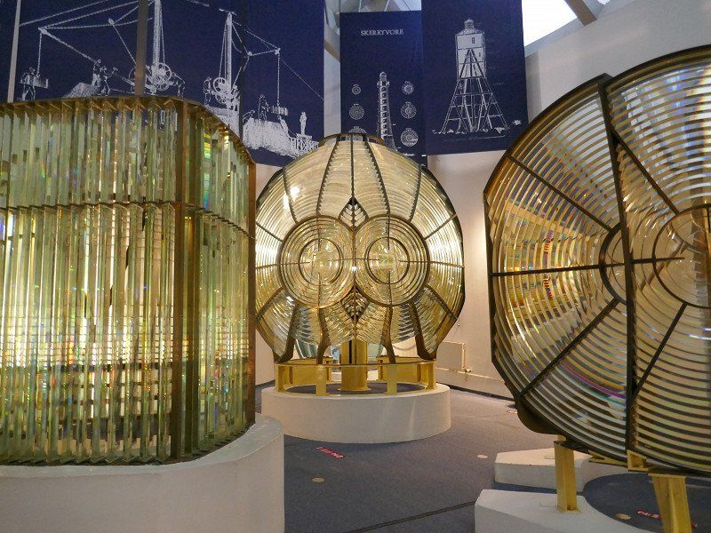
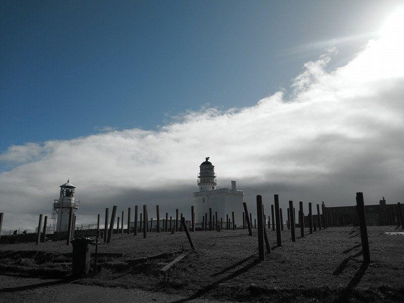
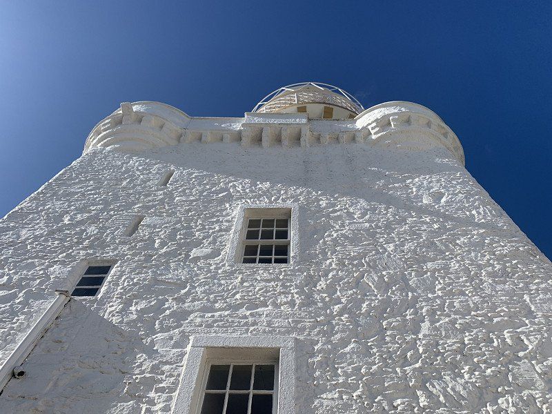
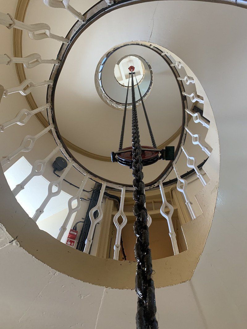
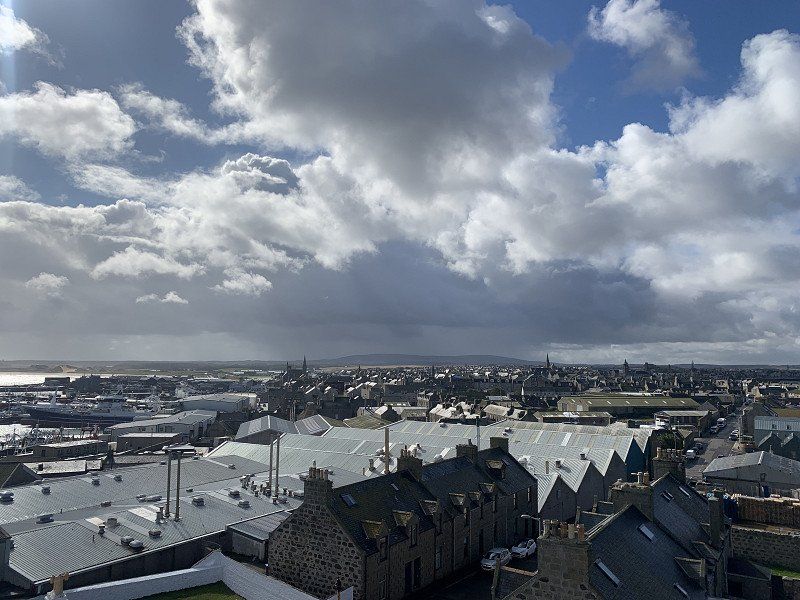
Museum Of Scottish Lighthouses
Lighthouse Museum with a collection of different lenses, as well as a visit to the actual lighthouse
• Take the 3rd exit from Fochabers East Roundabout roundabout onto A96 toward Inverness/Elgin. Go for 1.6 km.
• Take the 2nd exit from Spey Bay Roundabout roundabout onto A96 toward Inverness/Elgin. Go for 817 m.
• Take the 1st exit from Coul Brae Roundabout roundabout onto B9015 toward Kingston/Garmouth/Mosstodloch/Rothes. Go for 9.9 km.
• Continue on Newlands (B9015). Go for 238 m.
• Continue on B9015. Go for 2.8 km.
• Continue on North Street (B9015). Go for 399 m.
• Take the 1st exit from roundabout onto New Street (A941) toward Perth/(A95). Go for 4.0 km.
• Turn right onto B9102 toward Knockando/Archiestown. Go for 5.5 km.
• Continue on Robertstown (B9102). Go for 245 m.
• Continue on B9102. Go for 638 m.
• Continue on High Street (B9102). Go for 426 m.
• Continue on West End (B9102). Go for 145 m.
• Continue on B9102. Go for 4.5 km.
• Turn left. Go for 330 m.
• Turn right. Go for 206 m.
• Arrive at your destination on the right.
☍
50,4 km
( 43 min.)
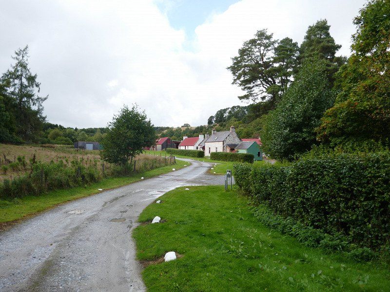
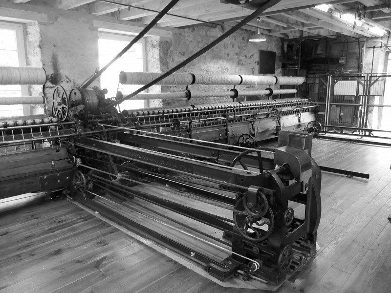
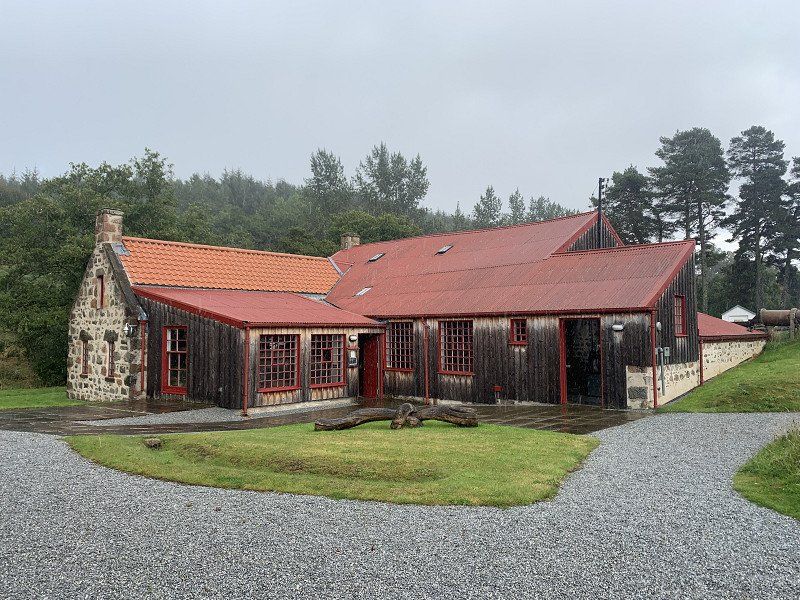
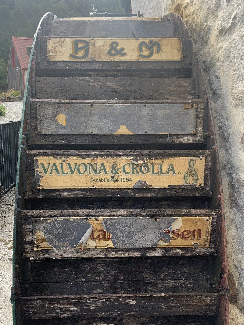
Knockando Woolmill
old wool weaving restored with a lot of love.
Small but nice
PS: the sponsor board on the water wheel
Knockando Woolmill, The Woolmill, Knockando, Aberlour AB38 7RP, Vereinigtes Königreich
57° 27' 57.1" N 3° 21' 20.4" W
57.4658484 -3.3556773
• Head southeast. Go for 206 m.
• Turn left toward B9102. Go for 330 m.
• Turn left onto B9102. Go for 919 m.
• Continue on Upper Knockando (B9102). Go for 14 m.
• Continue on B9102. Go for 4.9 km.
• Turn left onto B9138. Go for 479 m.
• Continue on Blacksboat Bridge (B9138). Go for 44 m.
• Continue on B9138. Go for 1.0 km.
• Continue on Denhead Terrace (B9138). Go for 203 m.
• Continue on B9138. Go for 22 m.
• Turn right onto A95. Go for 24.9 km.
• Take the 1st exit from Speybridge Roundabout roundabout onto A95 toward Perth/(A9)/Inverness/Aviemore/(B9152). Go for 551 m.
• Turn left. Go for 664 m.
• Arrive at your destination on the left.
☍
34,2 km
( 30 min.)
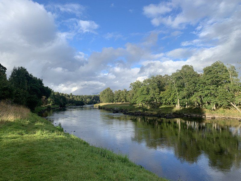
Übernachtung direkt an der Spey
N57.3148 W3.6166
Found a place on Park4Night - right on the river - next to the cemetery
Distance : 162km
897M+V87 Grantown-on-Spey, Vereinigtes Königreich
57° 18' 52.8" N 3° 37' 0.1" W
57.3146648 -3.6167080
• Head north. Go for 205 m.
• Turn slightly left toward A95. Go for 373 m.
• Turn left onto A95. Go for 2.7 km.
• Turn right onto A938 toward Carrbridge/Skye of Curr/Dulnain Bridge. Go for 14.6 km.
• Turn right onto A9 toward Inverness. Go for 11.4 km.
• Turn left toward Tomatin. Go for 345 m.
• Turn right. Go for 497 m.
• Turn slightly left. Go for 122 m.
• Turn left. Go for 45 m.
• Arrive at your destination on the right.
☍
30,3 km
( 25 min.)
Day
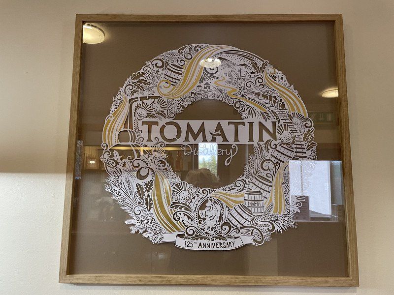
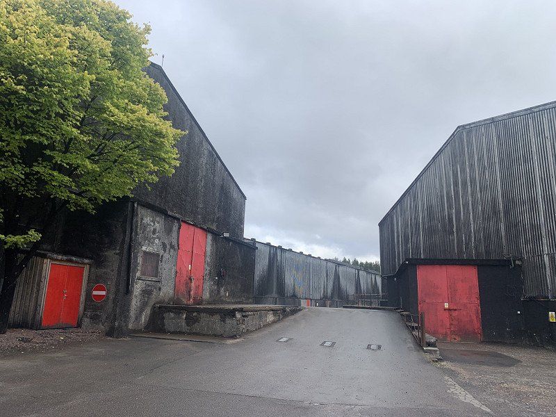
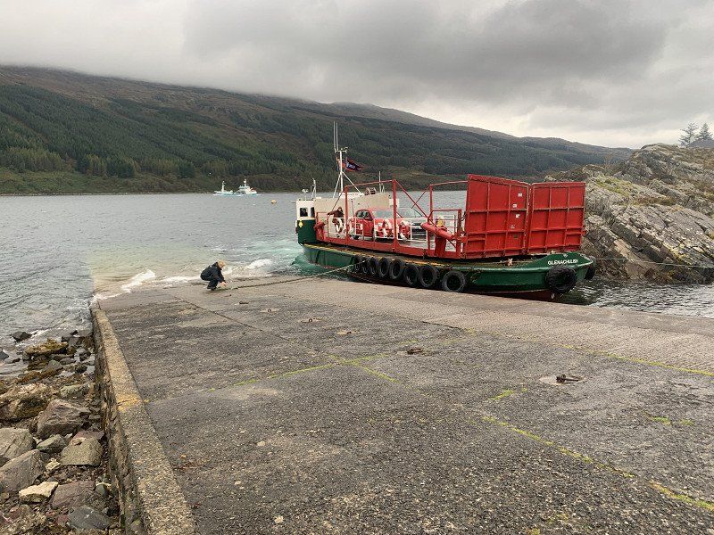
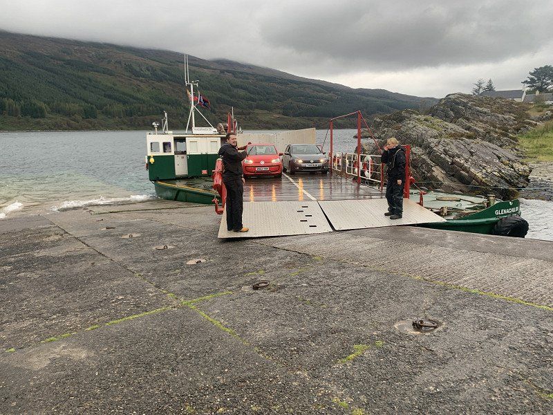
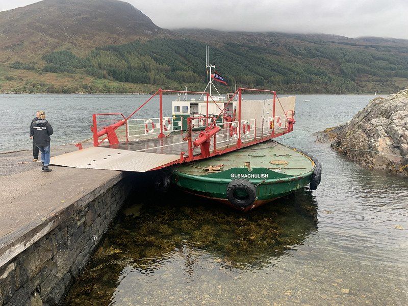
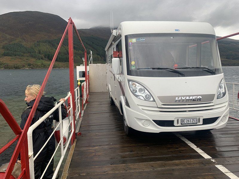
Tomatin Distillery
Guided tour already gone (we hadn't inquired beforehand, let alone reserved!). Are mainly here because of the name (Tomatin ... is almost like Thomas) and the actually smooth whiskey.
an absolute sensation: the rotating platform, the flaps ... all operated by hand
Glenelg, Kyle IV40 8JZ, Vereinigtes Königreich
57° 13' 47.9" N 5° 39' 16.7" W
57.2299751 -5.6546401
• Head northwest. Go for 13 m.
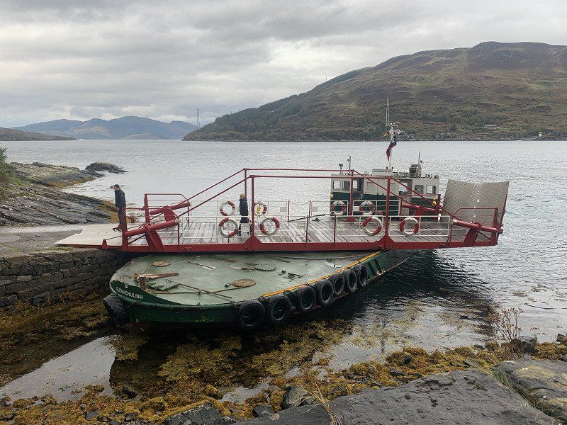
• Turn left. Go for 115 m.
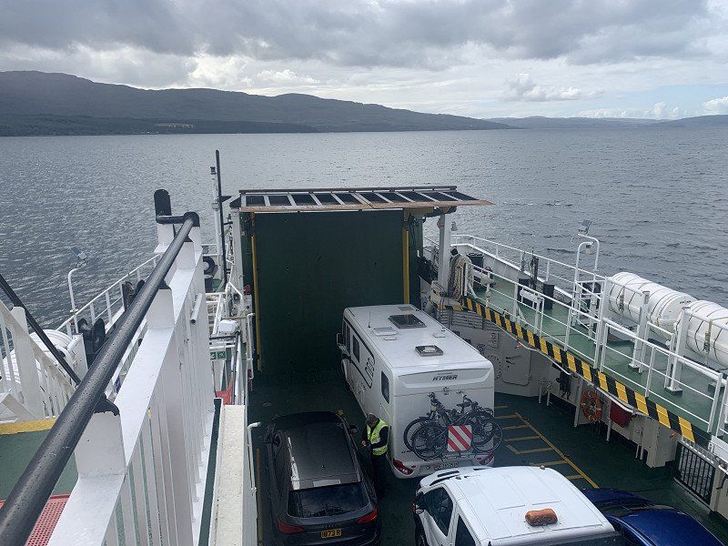
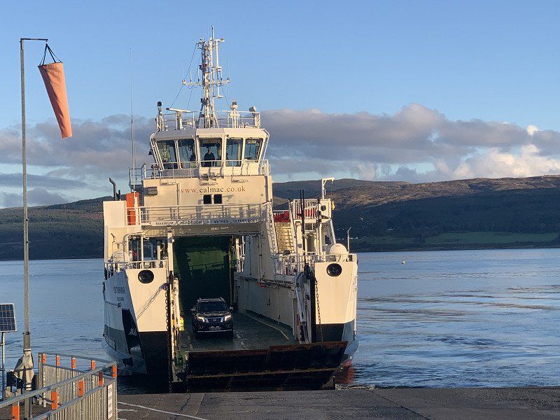
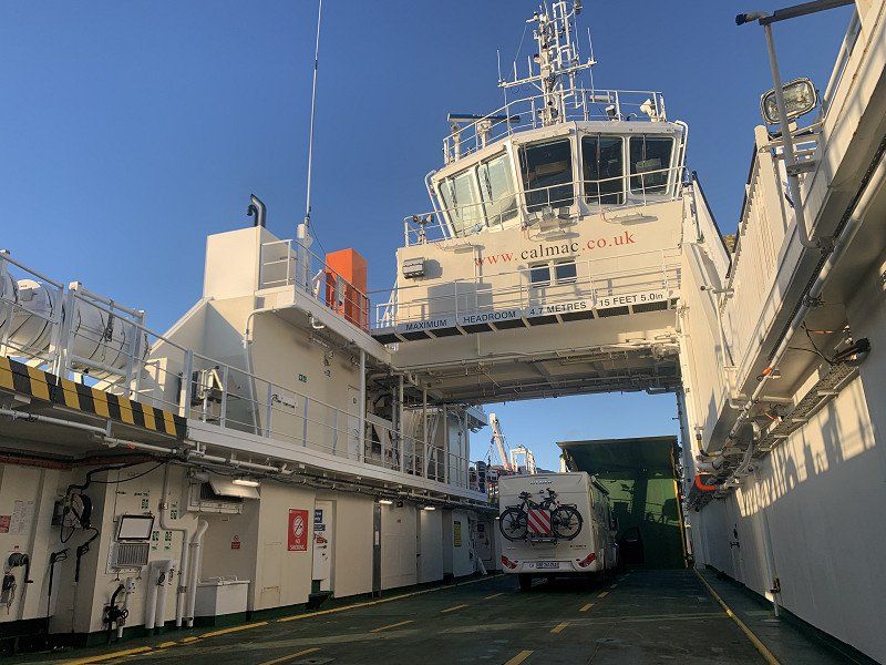
• Take the Isle of Skye-Glenelg Ferry. Stay on for 572 m.
• Head west. Go for 125 m.
• Arrive at your destination on the right.
☍
0,8 km
( 31 min.)
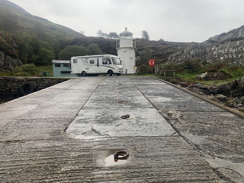
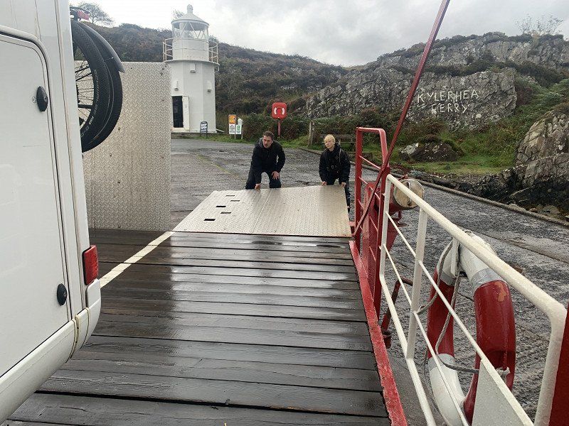
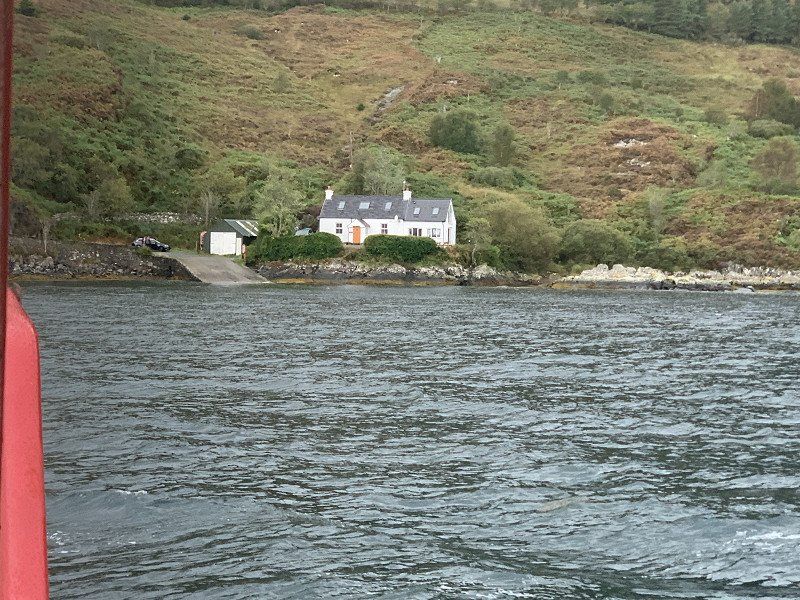
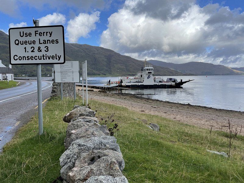
Kylerhea, Isle of Skye
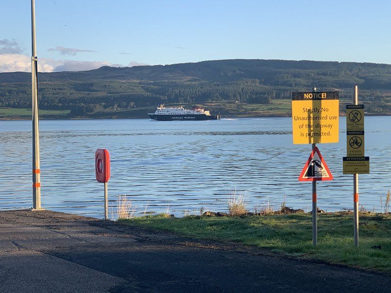
Isle of Skye
68GP+W5 Kylerhea, Isle of Skye, Vereinigtes Königreich
57° 13' 38.2" N 5° 39' 52.4" W
57.2272672 -5.6645614
• Head southeast. Go for 594 m.
• Continue on Kylerhea. Go for 10.6 km.
• Turn left onto A87. Go for 810 m.
• Continue on Ashaig (A87). Go for 78 m.
• Continue on A87. Go for 3.0 km.
• Turn left onto Skulamus (A851). Go for 276 m.
• Continue on A851. Go for 5.9 km.
• Continue on Kinloch (A851). Go for 138 m.
• Continue on A851. Go for 5.0 km.
• Continue on Duisdalemore (A851). Go for 141 m.
• Continue on A851. Go for 527 m.
• Continue on Duisdale Beag (A851). Go for 171 m.
• Continue on A851. Go for 6.6 km.
• Continue on Ferrindonald (A851). Go for 131 m.
• Continue on A851. Go for 323 m.
• Continue on Kilmore (A851). Go for 126 m.
• Continue on A851. Go for 1.4 km.
• Continue on Kilbeg (A851). Go for 140 m.
• Continue on A851. Go for 1.6 km.
• Continue on Castle Armadale (A851). Go for 162 m.
• Continue on A851. Go for 861 m.
• Turn right. Go for 16 m.
• Arrive at your destination on the right.
☍
38,6 km
( 39 min.)
Armadale
The camping in Broadford was full - so we stay overnight in the port of Armadale - in the south of the Isle of Skye
Distance : 228 km
Armadale, Isle of Skye IV45 8RB, Vereinigtes Königreich
57° 3' 53.5" N 5° 54' 4.5" W
57.0648630 -5.9012490
• Head northeast. Go for 16 m.
• Turn right onto A851. Go for 383 m.
• Turn left onto A851. Go for 18 m.
• Arrive at A851. Your destination is on the right.
☍
0,4 km
( 1 min.)
Day
Armadale Ferry Terminal
On the ferry back to the mainland
Isle of Skye IV45, Vereinigtes Königreich
57° 3' 52.4" N 5° 53' 41.6" W
57.0645428 -5.8948986
• Head north on A851. Go for 53 m.
• Take the Armadale-Mallaig Ferry. Stay on for 8.0 km.
• Head west. Go for 118 m.
• Arrive at your destination on the right.
☍
8,1 km
( 42 min.)
Mallaig
Arriving in Mallaig first, shopping and: drinking coffee in The Tea Garden after we practically drove straight from the bed onto the ship - and we didn't want to do the coffee on the ship!
PS: As always on the island with scones 😊
The Pier Mallaig, Inverness, Mallaig, Shire PH41 4QD, Vereinigtes Königreich
57° 0' 24.7" N 5° 49' 41.2" W
57.0068692 -5.8281051
• Head southwest. Go for 110 m.
• Take the 2nd exit from roundabout onto A830. Go for 48.3 km.
• Turn right onto A861. Go for 4.4 km.
• Continue on South Garvan (A861). Go for 230 m.
• Continue on A861. Go for 1.6 km.
• Continue on Duisky (A861). Go for 136 m.
• Continue on A861. Go for 10.1 km.
• Continue on Camusnagaul (A861). Go for 245 m.
• Continue on A861. Go for 1.8 km.
• Arrive at A861. Your destination is on the right.
☍
66,8 km
(1 hrs. 3 min.)
unterwegs auf der A861
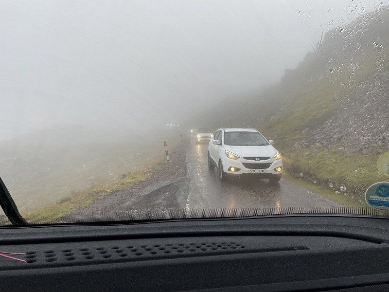
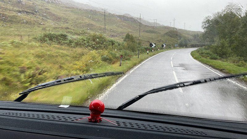
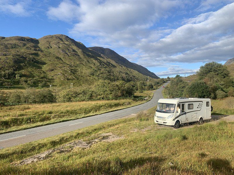
The weather doesn't really want to, ie it's raining, which has its appeal, but not necessarily if you're a tourist
A861, Fort William PH33 7AJ, Vereinigtes Königreich
56° 48' 46.6" N 5° 8' 30" W
56.8129407 -5.1416622
• Head southwest on A861. Go for 1.2 km.
• Continue on Stronchreggan (A861). Go for 255 m.
• Continue on A861. Go for 6.2 km.
• Continue on Conaglen Ho (A861). Go for 198 m.
• Continue on A861. Go for 835 m.
• Continue on Aryhoulan (A861). Go for 105 m.
• Continue on A861. Go for 5.5 km.
• Continue on Corran (A861). Go for 201 m.
• Continue on A861. Go for 10.8 km.
• Turn left onto B8043. Go for 5.7 km.
• Continue on Kilmalieu (B8043). Go for 192 m.
• Continue on B8043. Go for 4.4 km.
• Arrive at B8043.
☍
35,5 km
( 45 min.)
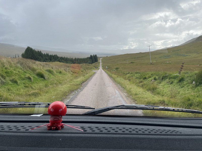
unterwegs
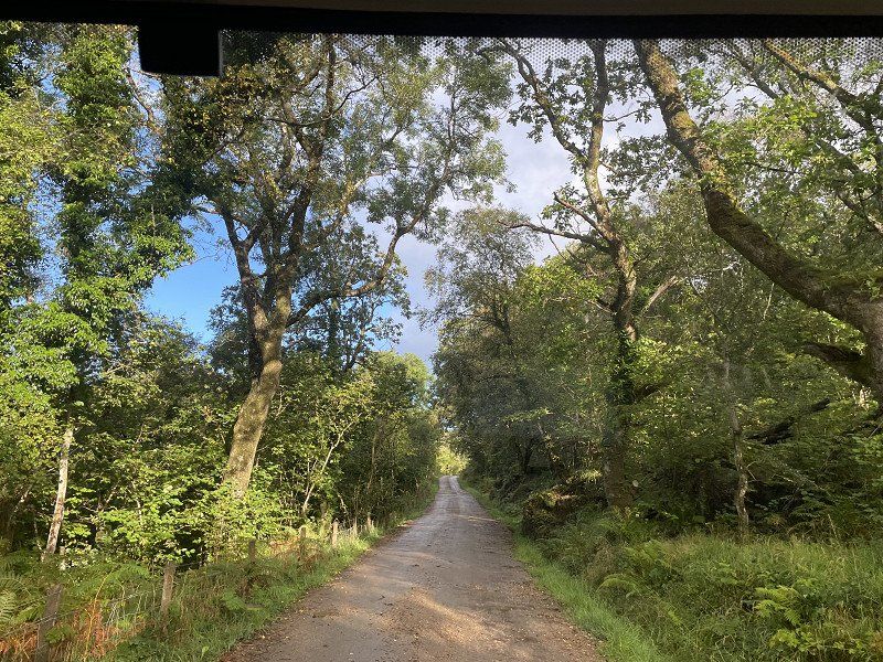
past Corran and on small and tiny streets (I love it!)
JG8G+XJ Glengalmadale, Fort William, Vereinigtes Königreich
56° 37' 2.6" N 5° 28' 24.4" W
56.6173849 -5.4734438
• Head west on B8043. Go for 1.6 km.
• Continue on Camasnacroise (B8043). Go for 93 m.
• Continue on B8043. Go for 8.2 km.
• Continue on Lochuisge (B8043). Go for 30 m.
• Continue on B8043. Go for 898 m.
• Turn left onto A884. Go for 11.3 km.
• Continue on Acharn (A884). Go for 58 m.
• Continue on A884. Go for 860 m.
• Continue on Claggan (A884). Go for 55 m.
• Continue on A884. Go for 1.4 km.
• Continue on Larachbeg (A884). Go for 107 m.
• Continue on A884. Go for 4.2 km.
• Turn right. Go for 191 m.
• Arrive at your destination on the left.
☍
29,0 km
( 35 min.)
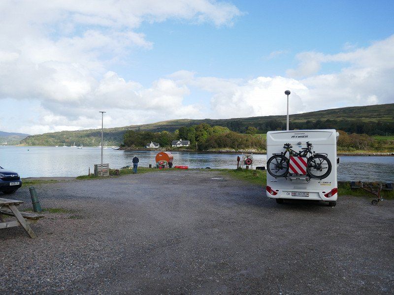
Lochaline, Ferry station
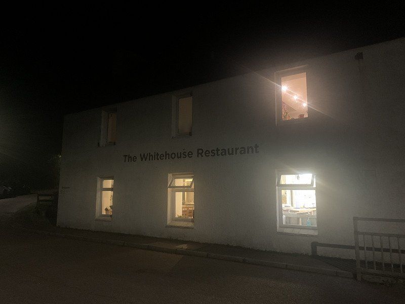
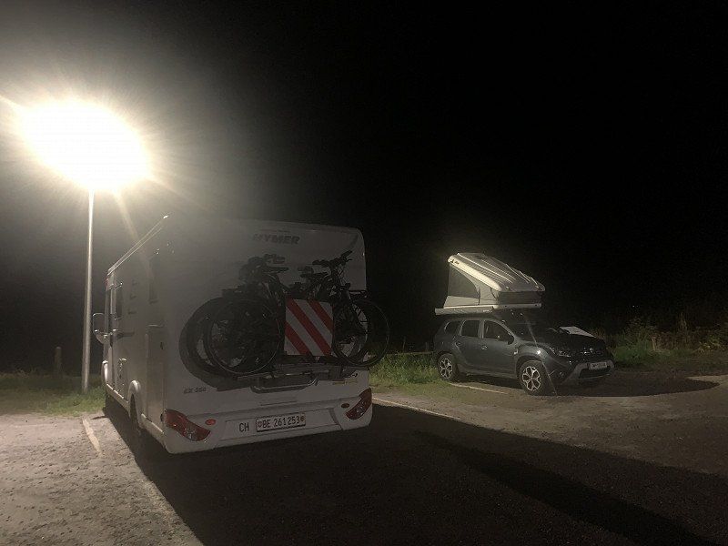
Again parkinf and overnight directly in the port
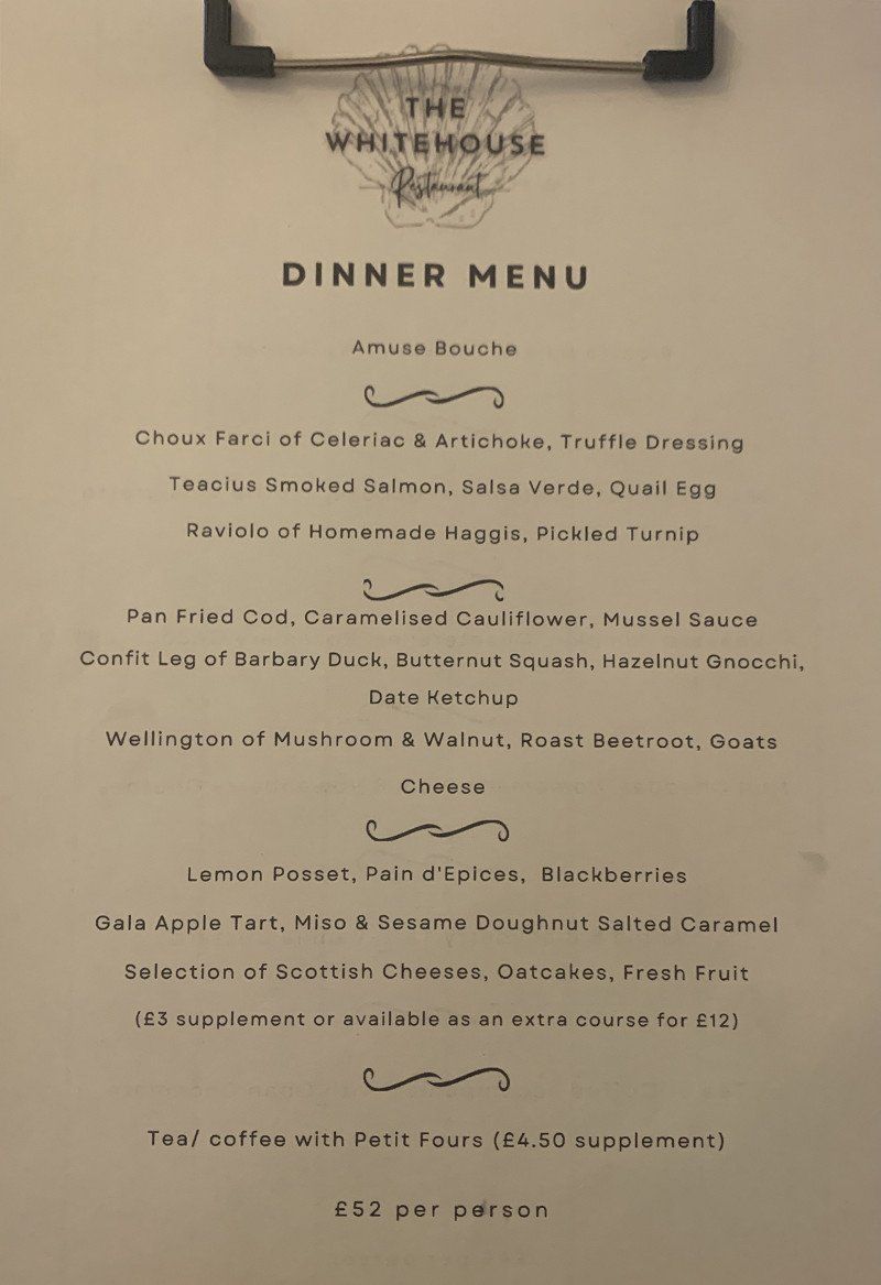
Excellent dinner at the Whitehouse Restaurant...5 mins walk
Distance : 109 km
Lochaline, Oban PA80 5XP, Vereinigtes Königreich
56° 32' 5.5" N 5° 46' 38.4" W
56.5348630 -5.7773430
• Head northeast. Go for 191 m.
• Turn left onto A884. Go for 325 m.
• Turn left onto B849. Go for 4.6 km.
• Continue on Savary (B849). Go for 28 m.
• Continue on B849. Go for 1.9 km.
• Continue on Fiunary (B849). Go for 60 m.
• Continue on B849. Go for 4.7 km.
• Continue on Killundine (B849). Go for 199 m.
• Continue on B849. Go for 2.0 km.
• Continue on Rhemore (B849). Go for 191 m.
• Continue on B849. Go for 996 m.
• Continue on Glenmorven Cottage (B849). Go for 185 m.
• Continue on B849. Go for 1.9 km.
• Continue on Seaview (B849). Go for 202 m.
• Continue on B849. Go for 175 m.
• Turn right. Go for 1.0 km.
• Keep left. Go for 197 m.
• Turn slightly right. Go for 233 m.
• Turn left. Go for 134 m.
• Arrive at your destination.
☍
19,2 km
( 28 min.)
Day
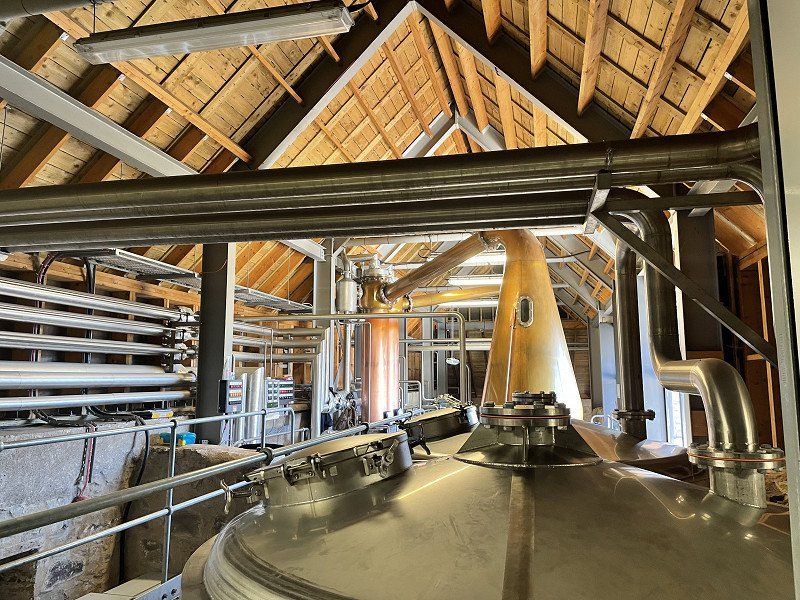
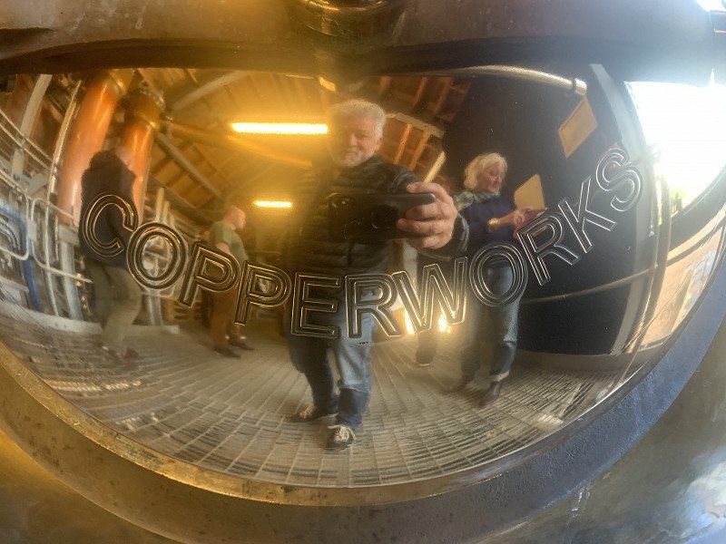
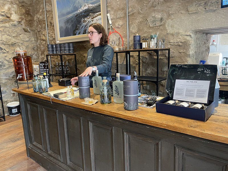
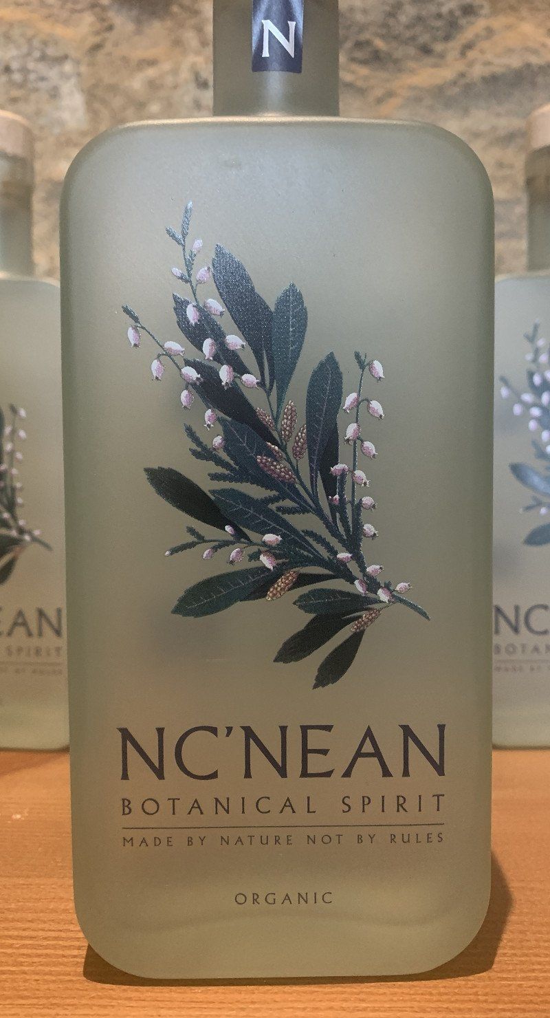
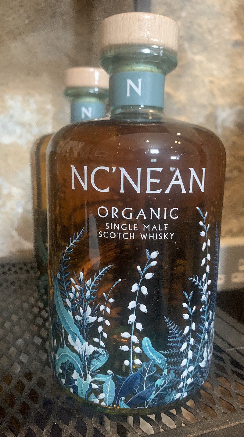
Nc’nean Distillery
At the end of the road to the east is a very special distillery: Nc'nean. There we are registered for a guided tour with tasting.
Apart from the fact that this operation is run by women, quite a few women are employed here and everything is organic... the whiskey (and gin) was to our liking
Drimnin, By Lochaline, Morvern PA80 5XZ, Vereinigtes Königreich
56° 37' 25.2" N 5° 59' 24.3" W
56.6236560 -5.9900760
• Head southeast. Go for 134 m.
• Turn right. Go for 960 m.
• Continue toward B849. Go for 484 m.
• Continue on B849. Go for 175 m.
• Continue on Seaview (B849). Go for 202 m.
• Continue on B849. Go for 1.9 km.
• Continue on Glenmorven Cottage (B849). Go for 185 m.
• Continue on B849. Go for 996 m.
• Continue on Rhemore (B849). Go for 191 m.
• Continue on B849. Go for 2.0 km.
• Continue on Killundine (B849). Go for 199 m.
• Continue on B849. Go for 4.7 km.
• Continue on Fiunary (B849). Go for 60 m.
• Continue on B849. Go for 1.9 km.
• Continue on Savary (B849). Go for 28 m.
• Continue on B849. Go for 4.6 km.
• Turn right onto A884. Go for 1.1 km.
• Arrive at A884.
☍
19,8 km
( 28 min.)
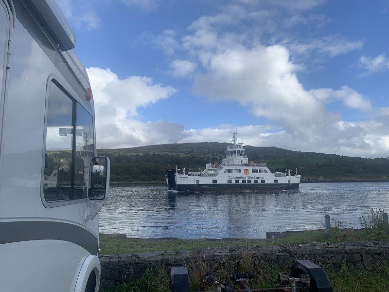
Fishnish - Lochaline Ferry
We drive the challenging road back to Lochaline where the ferry to the Isle of Mull departs.
G6G7+52, Lochaline, Oban, Vereinigtes Königreich
56° 31' 31.6" N 5° 47' 14.8" W
56.5254488 -5.7874373
• Head northeast on A884. Go for 609 m.
• Turn right onto A884. Go for 240 m.
• Take the Fishnish-Lochaline Ferry. Stay on for 3.5 km.
• Head southeast. Go for 48 m.
• Continue on A884. Go for 1.4 km.
• Turn left onto A849. Go for 1.9 km.
• Continue on Garmony (A849). Go for 158 m.
• Continue on A849. Go for 2.9 km.
• Continue on Scallastle (A849). Go for 186 m.
• Continue on A849. Go for 4.6 km.
• Continue on Torosay Castle (A849). Go for 192 m.
• Continue on A849. Go for 12.4 km.
• Continue on Tomsleibhe (A849). Go for 162 m.
• Continue on A849. Go for 18.1 km.
• Continue on Pennycross (A849). Go for 139 m.
• Continue on A849. Go for 2.6 km.
• Continue on Torrans (A849). Go for 143 m.
• Continue on A849. Go for 3.2 km.
• Continue on Tavool Ho (A849). Go for 98 m.
• Continue on A849. Go for 2.9 km.
• Continue on Burgh (A849). Go for 102 m.
• Continue on A849. Go for 4.0 km.
• Continue on Schoolbrae (A849). Go for 177 m.
• Continue on A849. Go for 1.2 km.
• Turn left. Go for 790 m.
• Turn left toward Ardalanish. Go for 1.9 km.
• Continue on Ardalanish. Go for 1.4 km.
• Continue on Ardchiavaig. Go for 169 m.
• Continue on Uisken. Go for 9 m.
• Arrive at Uisken. Your destination is on the right.
☍
65,1 km
(1 hrs. 46 min.)
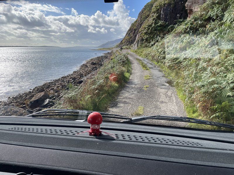
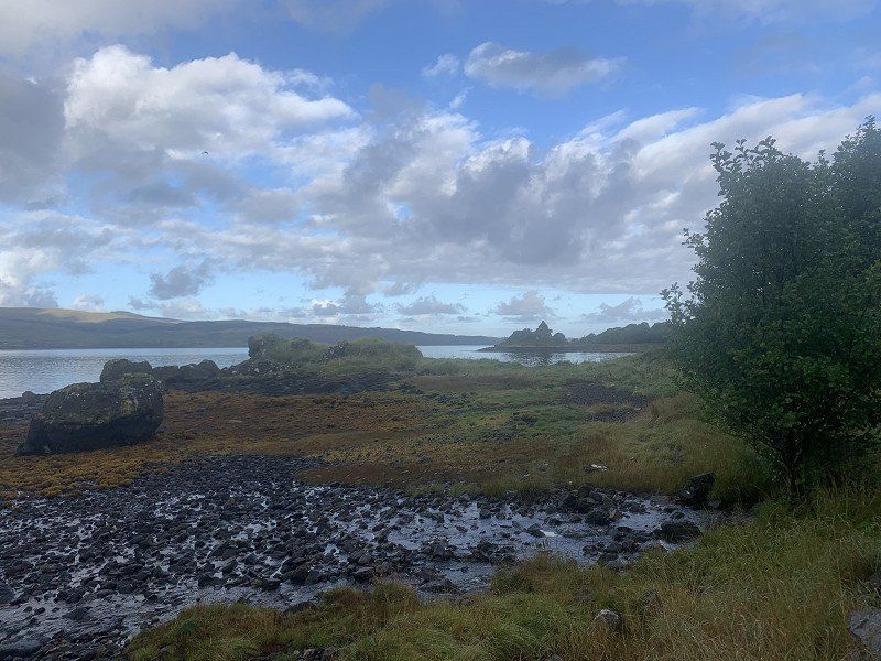
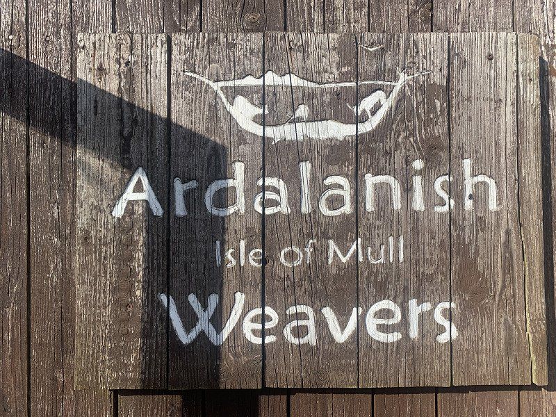
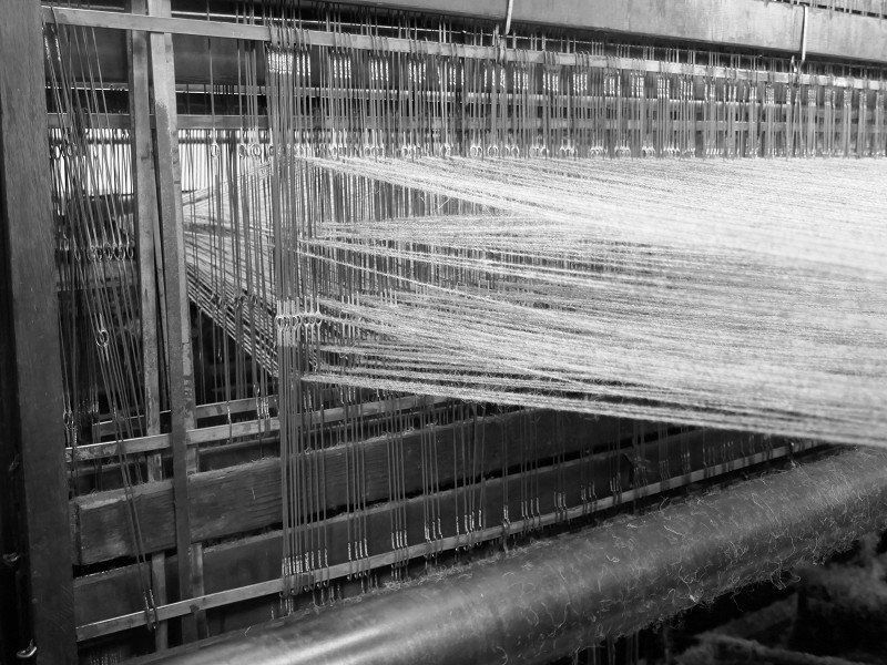
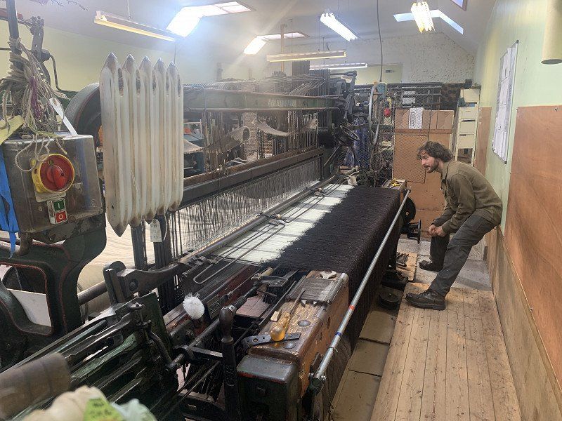
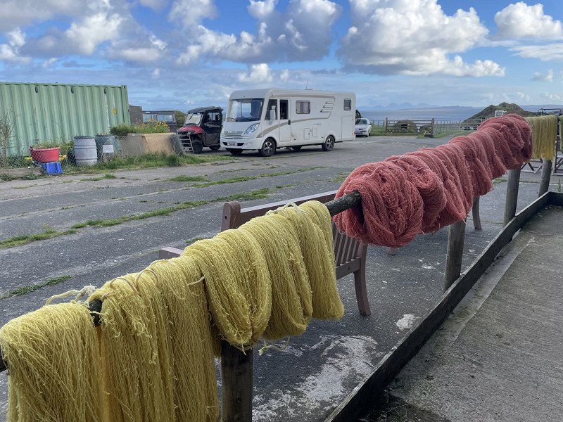
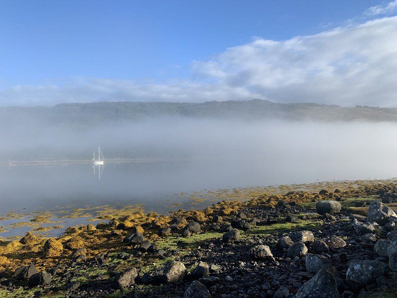
Ardchiavaig
In the very south of the island we visit the Ardalanish Weavers weaving mill. We are relatively late, but are received very friendly and given a lot of information.
Back again on small roads - which does not rule out that in between a bus comes towards you.
Ardchiavaig, Isle of Mull PA67 6DT, Vereinigtes Königreich
56° 17' 21.4" N 6° 13' 15.5" W
56.2892720 -6.2209690
• Head northwest on Uisken. Go for 9 m.
• Continue on Ardchiavaig. Go for 1.4 km.
• Continue on Ardalanish. Go for 2.9 km.
• Turn right onto A849. Go for 1.2 km.
• Continue on Schoolbrae (A849). Go for 177 m.
• Continue on A849. Go for 4.0 km.
• Continue on Burgh (A849). Go for 102 m.
• Continue on A849. Go for 2.9 km.
• Continue on Tavool Ho (A849). Go for 98 m.
• Continue on A849. Go for 3.2 km.
• Continue on Torrans (A849). Go for 143 m.
• Continue on A849. Go for 2.6 km.
• Continue on Pennycross (A849). Go for 139 m.
• Continue on A849. Go for 18.1 km.
• Continue on Tomsleibhe (A849). Go for 162 m.
• Continue on A849. Go for 12.4 km.
• Continue on Torosay Castle (A849). Go for 192 m.
• Continue on A849. Go for 1.7 km.
• Turn right. Go for 56 m.
• Turn right. Go for 86 m.
• Arrive at your destination on the left.
☍
51,5 km
( 58 min.)
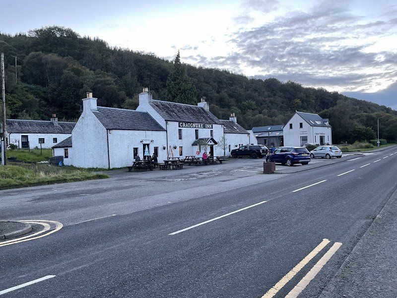
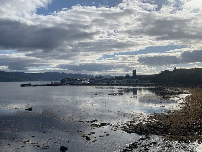
Craignure
Good spot by the sea... very close to a local pub: the food doesn't blow your socks off but it's ok
Distance : 153km
Craignure, Isle of Mull PA65, Vereinigtes Königreich
56° 28' 5.9" N 5° 41' 53.2" W
56.4683152 -5.6981216
• Head northwest. Go for 86 m.
• Turn left toward A849. Go for 56 m.
• Turn right onto A849. Go for 2.9 km.
• Continue on Scallastle (A849). Go for 186 m.
• Continue on A849. Go for 2.9 km.
• Continue on Garmony (A849). Go for 158 m.
• Continue on A849. Go for 1.9 km.
• Turn right onto A884. Go for 1.4 km.
• Turn left. Go for 48 m.
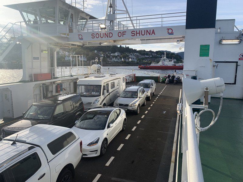
• Take the Fishnish-Lochaline Ferry. Stay on for 3.5 km.
• Head southwest. Go for 10 m.
• Continue on A884. Go for 230 m.
• Turn left onto A884. Go for 609 m.
• Arrive at A884.
☍
14,0 km
( 47 min.)
Day
Fishnish - Lochaline Ferry
We don't want to wait at the ferry the next day for possible 'no-shows' and so we go back Fishnish - Lachaline (where no reservation is necessary) - at least 2 vehicles.
G6G7+52, Lochaline, Oban, Vereinigtes Königreich
56° 31' 31.6" N 5° 47' 14.8" W
56.5254488 -5.7874373
• Head northeast on A884. Go for 5.0 km.
• Continue on Larachbeg (A884). Go for 107 m.
• Continue on A884. Go for 1.4 km.
• Continue on Claggan (A884). Go for 55 m.
• Continue on A884. Go for 860 m.
• Continue on Acharn (A884). Go for 58 m.
• Continue on A884. Go for 11.3 km.
• Turn right onto B8043. Go for 898 m.
• Continue on Lochuisge (B8043). Go for 30 m.
• Continue on B8043. Go for 3.5 km.
• Arrive at B8043.
☍
23,1 km
( 23 min.)
unterwegs
Picnic on the way
JCJX+W4 Lochuisge, Oban, Vereinigtes Königreich
56° 37' 56.3" N 5° 33' 8" W
56.6323123 -5.5522156
• Head northwest on B8043. Go for 3.5 km.
• Continue on Lochuisge (B8043). Go for 30 m.
• Continue on B8043. Go for 898 m.
• Turn right onto A884. Go for 4.6 km.
• Continue on Liddesdale (A884). Go for 201 m.
• Continue on A884. Go for 1.4 km.
• Continue on Achleek (A884). Go for 115 m.
• Continue on A884. Go for 5.0 km.
• Turn right onto A861. Go for 20.3 km.
• Turn right. Go for 15 m.
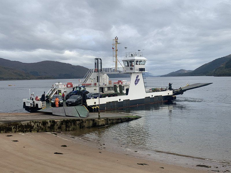
• Take the Corran-Ardgour Ferry. Stay on for 506 m.
• Head east on A861. Go for 15 m.
• Arrive at A861. Your destination is on the left.
☍
36,6 km
(1 hrs. 1 min.)
Corran Ferry
Corran - Inchree Ferry
6SJ, A82, Fort William PH33 6SJ, Vereinigtes Königreich
56° 43' 17.5" N 5° 14' 7.6" W
56.7215244 -5.2354504
• Head east on A861. Go for 276 m.
• Turn right onto A82. Go for 7.0 km.
• Turn left toward A828. Go for 166 m.
• Turn left onto A828. Go for 21.2 km.
• Turn left. Go for 125 m.
• Turn right. Go for 196 m.
• Arrive at your destination on the left.
☍
29,0 km
( 26 min.)
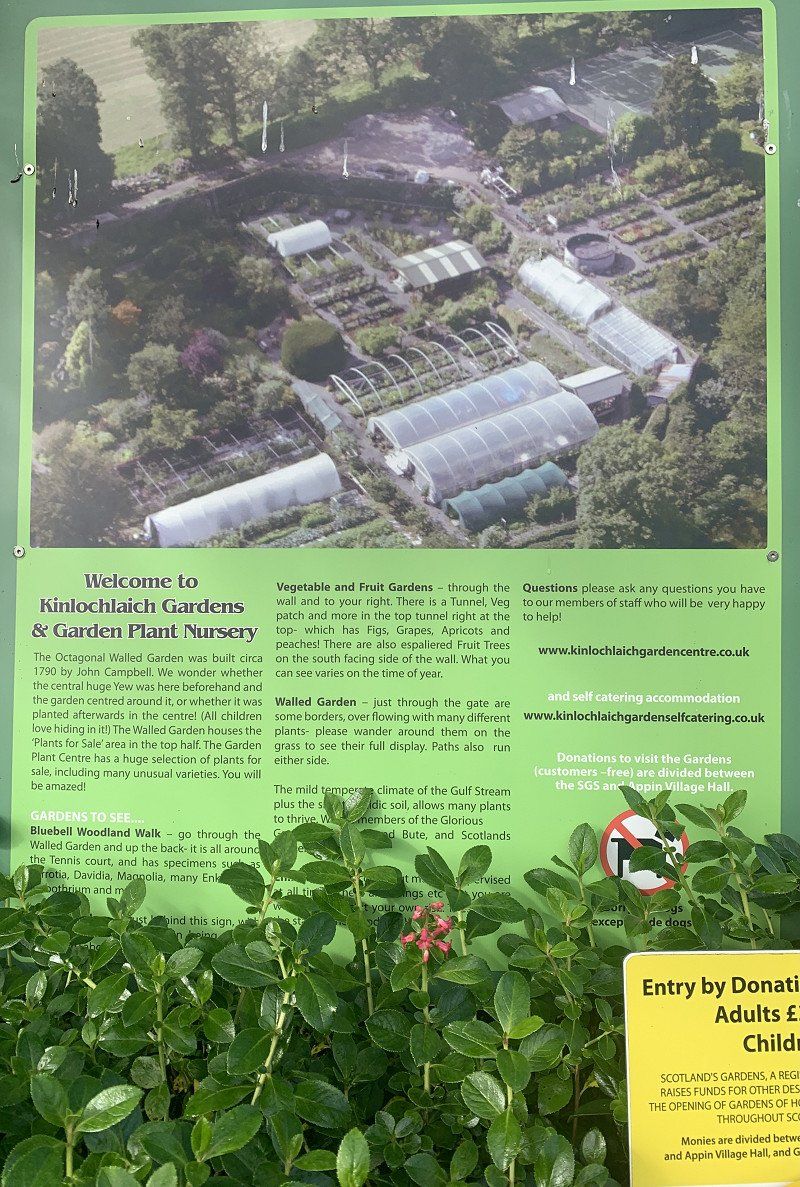
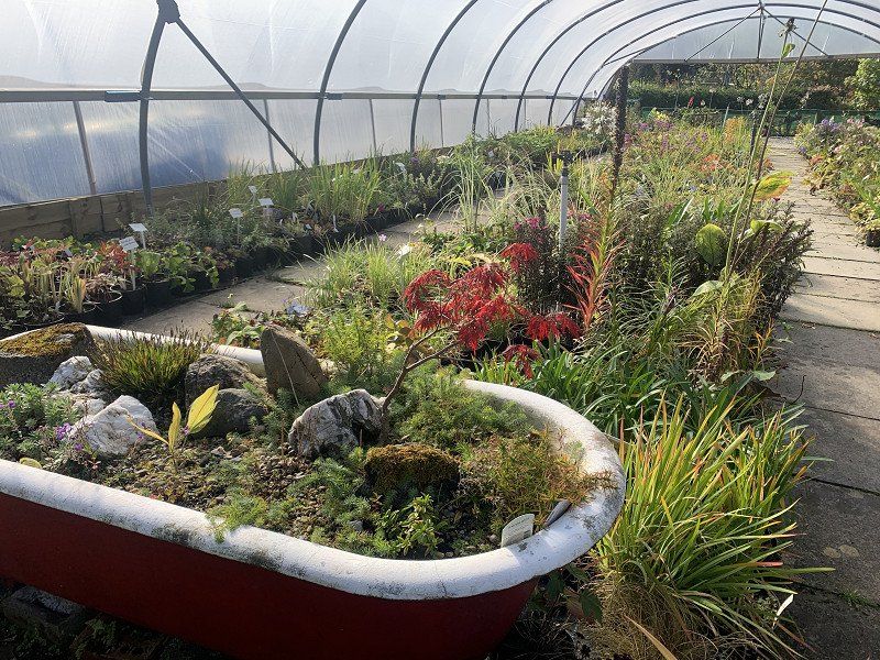
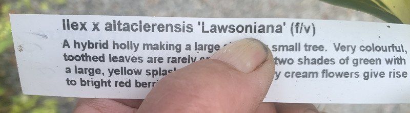
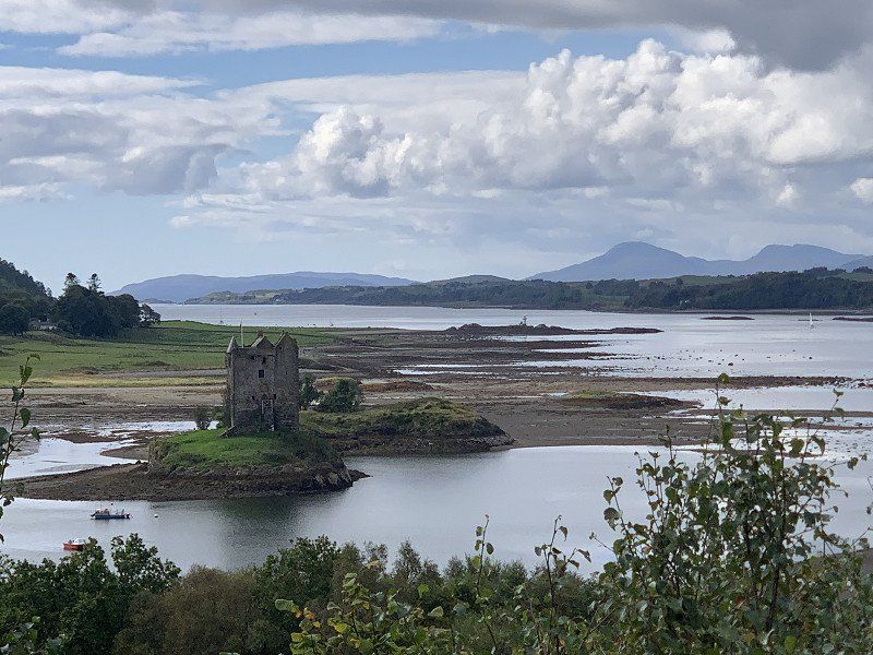
Kinlochlaich Garden Centre
We pass the Castle Stalker car park but just beyond there is a garden center - with exciting care: Looking for male and female holly - we now have (I think) a female plant with berries. The male will show up.
This is what a castle in Scotland should look like ... unfortunately not accessible.
But: I can once again strike with the scones
Appin PA38 4BL, Vereinigtes Königreich
56° 34' 17.7" N 5° 23' 10" W
56.5715695 -5.3861191
• Head southeast. Go for 234 m.
• Turn right onto Portnacroish (A828). Go for 6.4 km.
• Take the 2nd exit from roundabout onto A828. Go for 799 m.
• Take the 1st exit from roundabout onto A828. Go for 14.5 km.
• Turn right onto A85. Go for 11.5 km.
• Turn left onto B845. Go for 721 m.
• Turn left onto B845. Go for 98 m.
• Turn right onto Lochandhu Road. Go for 388 m.
• Arrive at Lochandhu Road. Your destination is on the left.
☍
34,6 km
( 32 min.)
Bonawe Historic Iron Furnace
An old iron foundry - unfortunately not fully accessible here either due to the risk of collapse
Taynuilt, Argyll PA35 1JQ, Vereinigtes Königreich
56° 26' 12" N 5° 13' 46.1" W
56.4366601 -5.2294718
• Head east on Lochandhu Road. Go for 959 m.
• Turn left onto A85. Go for 15.8 km.
• Turn right onto A819. Go for 21.6 km.
• Turn left. Go for 914 m.
• Turn left. Go for 311 m.
• Arrive at your destination on the right.
☍
39,5 km
( 34 min.)
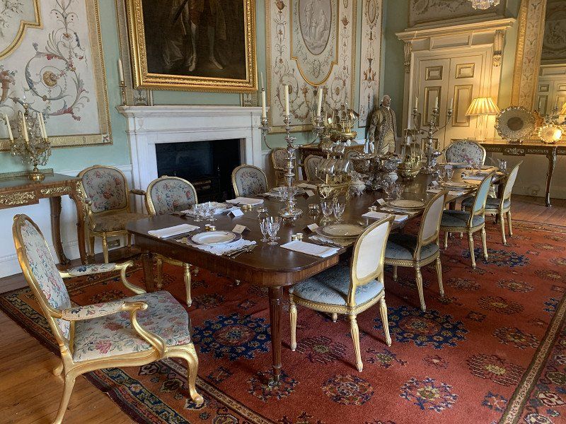
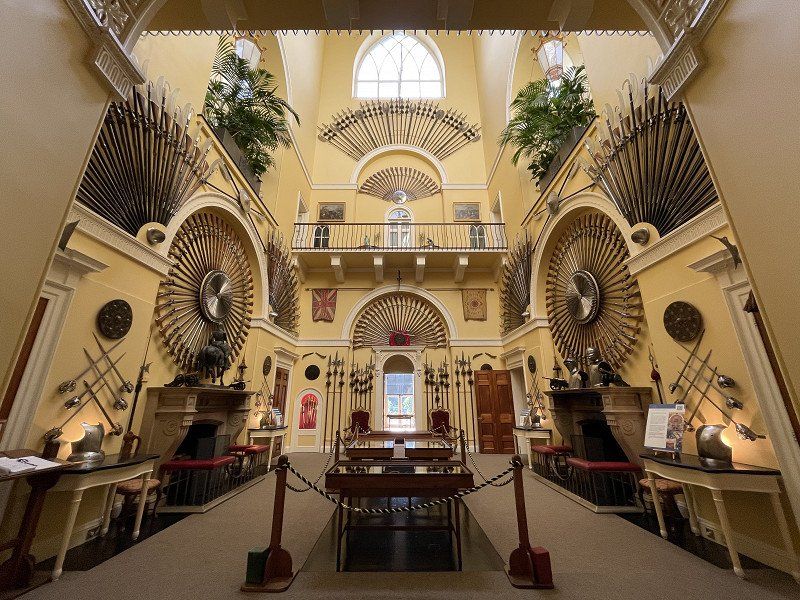
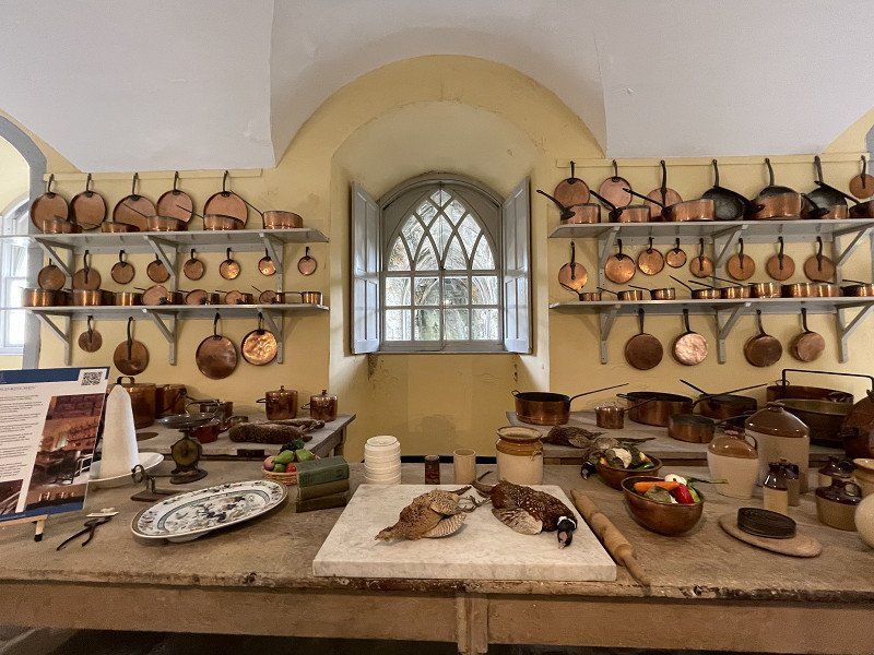
Inveraray Castle
impressive and big. A completely exaggerated collection of weapons.
(Huge visitor car park - in 2005 you could still park right in front of the castle!)
Inveraray PA32 8XE, Vereinigtes Königreich
56° 14' 15.4" N 5° 4' 24.9" W
56.2376038 -5.0735931
• Head southwest. Go for 69 m.
• Continue toward A83. Go for 676 m.
• Turn left onto A83. Go for 17.4 km.
• Turn right onto A815. Go for 27.7 km.
• Continue on Bernice (A815). Go for 134 m.
• Continue on A815. Go for 7.2 km.
• Continue on Uig (A815). Go for 161 m.
• Continue on A815. Go for 5.5 km.
• Continue on High Road (A885). Go for 655 m.
• Continue on A885. Go for 1.5 km.
• Keep right onto Sandbank Road (A885). Go for 564 m.
• Continue on Argyll Street (A885). Go for 768 m.
• Turn right onto Alfred Street. Go for 85 m.
• Turn left onto Victoria Road. Go for 243 m.
• Turn left onto Royal Crescent. Go for 272 m.
• Turn left onto Milton Avenue. Go for 85 m.
• Turn left onto Milton Avenue. Go for 21 m.
• Turn slightly left. Go for 119 m.
• Turn right. Go for 47 m.
• Arrive at your destination on the right.
☍
63,2 km
( 54 min.)
Ferry Brae
It goes over the Firth of Clyde near Glasgow.
We slowly have to think about the trip home or the booked ferry
Ferry Brae, Dunoon PA23, Vereinigtes Königreich
55° 56' 55" N 4° 55' 34.6" W
55.9486206 -4.9262742
• Head east. Go for 178 m.
• Turn left onto Milton Avenue. Go for 26 m.
• Turn left onto Ferry Brae. Go for 105 m.
• Turn left onto Argyll Street (A885). Go for 106 m.
• Turn right onto Moir Street. Go for 119 m.
• Turn left onto Alexandra Parade (A815). Go for 1.7 km.
• Continue on Marine Parade (A815). Go for 955 m.
• Turn right. Go for 86 m.
• Take the Dunoon-Gourock Ferry. Stay on for 4.2 km.
• Head toward Cloch Road on McInroy's Point. Go for 101 m.
• Turn right onto Cloch Road (A770). Go for 5.3 km.
• Take the 3rd exit from Bankfoot Roundabout roundabout onto Inverkip Road (A78) toward Inverkip/Rothesay Ferry/Irvine. Go for 14.3 km.
• Turn left onto Douglas Street toward Inverclyde/Brisbane/Glen Road. Go for 522 m.
• Continue on Brisbane Glen Road. Go for 2.4 km.
• Continue on Middleton. Go for 1.5 km.
• Arrive at your destination on the right.
☍
31,5 km
(1 hrs. 8 min.)
Camping South Whittlieburn Farm
very simple but quiet
Brisbane Glen, KA30 8SN, Largs, United Kingdom
55° 50' 2.1" N 4° 50' 26.8" W
55.8339274 -4.8407650
• Head south. Go for 1.2 km.
• Continue on Middleton. Go for 1.4 km.
• Continue on Brisbane Glen Road. Go for 1.3 km.
• Continue on Douglas Street. Go for 522 m.
• Turn left onto Greenock Road (A78). Go for 1.1 km.
• Take the 3rd exit from Largs Roundabout roundabout onto Main Street (A78). Go for 219 m.
• Take the 2nd exit from Gogo Roundabout roundabout onto Irvine Road (A78). Go for 929 m.
• Turn left onto Dalry Road (A760) toward Kilbirnie. Go for 13.7 km.
• Take the 2nd exit from Townhead Roundabout roundabout onto Townhead (A760). Go for 128 m.
• Take the 1st exit from Police Roundabout roundabout onto Bridgend Road (A760). Go for 7.4 km.
• Take the 1st exit from Roadhead Roundabout roundabout onto A737 toward Glasgow/(M8)/Paisley. Go for 13.5 km.
• Take ramp onto M8. Go for 10.3 km.
• Take exit 21 toward Tradeston/A8/Carlisle. Go for 1.6 km.
• Keep right onto M74 toward Carlisle. Go for 24.1 km.
• Take exit 7 toward Lanark onto A72 (Lanark Road). Go for 3.6 km.
• Take the 1st exit from Cornsilloch Roundabout roundabout onto Cornsilloch Brae (A71) toward Kilmarnock/Stonehouse/Edinburgh/Lanark/(A72). Go for 468 m.
• Take the 2nd exit from Garrion Bridge roundabout onto A72 toward Lanark. Go for 2.9 km.
• Arrive at Lanark Road (A72). Your destination is on the right.
☍
84,4 km
(1 hrs. 5 min.)
Day
unterwegs via Carluke
south past Glasgow
P4C2+FV Carluke, Vereinigtes Königreich
55° 43' 16.1" N 3° 53' 51.9" W
55.7211288 -3.8977528
• Head southwest on Lanark Road (A72). Go for 8.9 km.
• Turn right toward Riverside Road. Go for 39 m.
• Turn slightly right onto Riverside Road. Go for 62 m.
• Continue on Kirkfield Road. Go for 416 m.
• Turn slightly left onto Byretown Road. Go for 862 m.
• Arrive at Byretown Road.
☍
10,3 km
( 12 min.)
New Lanark
New Lanark: A Spinning Mill. The then owner was convinced that education was better than oppression.
see also: https://de.wikipedia.org/wiki/New_Lanark
New Lanark, Lanark ML11 9DA, Vereinigtes Königreich
55° 39' 52.3" N 3° 47' 18.9" W
55.6645410 -3.7885840
• Head toward Byretown Grove on Byretown Road. Go for 862 m.
• Turn slightly right onto Kirkfield Road. Go for 416 m.
• Continue on Riverside Road. Go for 62 m.
• Turn slightly left toward Riverside Road/A72. Go for 39 m.
• Turn left onto Riverside Road (A72). Go for 1.4 km.
• Turn left onto B7018 toward Lesmahagow. Go for 1.6 km.
• Continue on Newkayes Road (B7018). Go for 910 m.
• Turn left onto B7018 toward Lesmahagow. Go for 2.0 km.
• Continue on Dillarburn Road (B7018). Go for 591 m.
• Continue on Dillaburn Road (B7018). Go for 1.5 km.
• Continue on Eastwood Road (B7018). Go for 650 m.
• Turn left onto Carlisle Road (B7078) toward Coalburn/(M74)/Carlisle. Go for 264 m.
• Continue on B7078. Go for 45 m.
• Continue on Carlisle Road (B7078). Go for 4.9 km.
• Turn right onto B7078 toward Carlisle. Go for 213 m.
• Take the 1st exit from roundabout toward Carlisle/(A74). Go for 127 m.
• Take the 2nd exit from roundabout onto B7078 toward Carlisle/(A74)/Edinburgh/(A70)/Ayr/Douglas/Rigside. Go for 2.3 km.
• Take the 3rd exit from roundabout onto M74 toward Carlisle. Go for 11.7 km.
• Take exit 13 toward Edinburgh/Lanark/(A73)/Abington. Go for 360 m.
• Take the 3rd exit from Maidencoates Roundabout roundabout onto A702 toward Abington/Crawford/Elvanfoot/Leadhills/(B797). Go for 901 m.
• Continue on Edinburgh Road (A702). Go for 499 m.
• Continue on Carlisle Road (A702). Go for 447 m.
• Turn right onto Leadhills Road (B797). Go for 1.2 km.
• Continue on B797. Go for 8.3 km.
• Continue on Symington Street (B797). Go for 378 m.
• Continue on Main Street (B797). Go for 178 m.
• Continue on B797. Go for 262 m.
• Continue on Main Street (B797) toward Sanquhar. Go for 511 m.
• Continue on B797. Go for 1.4 km.
• Turn right. Go for 456 m.
• Arrive at your destination on the right.
☍
44,2 km
( 38 min.)
Wanlockhead Museum
a mining museum in the highest village in Scotland (750 m).
Unfortunately we missed the lead by almost 10 minutes
Wanlockhead Museum Trust, Wanlockhead, Biggar ML12 6UT, Vereinigtes Königreich
55° 23' 53.5" N 3° 46' 42.6" W
55.3982072 -3.7785119
• Head southwest. Go for 207 m.
• Turn left toward B797. Go for 281 m.
• Turn right onto B797. Go for 10.2 km.
• Turn right onto B797. Go for 258 m.
• Turn left onto A76. Go for 10.5 km.
• Turn right toward Drumlanrig Castle. Go for 613 m.
• Turn left toward Drumlanrig Castle. Go for 739 m.
• Continue on Drumlanrig Castle. Go for 252 m.
• Turn sharp right toward The Drumlanrig Sycamore. Go for 330 m.
• Continue on The Drumlanrig Sycamore. Go for 189 m.
• Arrive at The Drumlanrig Sycamore. Your destination is on the left.
☍
23,5 km
( 22 min.)
Drumlanrig Castle & Gardens
already closed
Thornhill DG3 4AQ, Vereinigtes Königreich
55° 16' 25.3" N 3° 48' 32.1" W
55.2736968 -3.8089056
• Head northwest on The Drumlanrig Sycamore. Go for 91 m.
• Turn right. Go for 1.4 km.
• Turn left. Go for 427 m.
• Turn slightly right toward A76. Go for 256 m.
• Continue on A76. Go for 5.1 km.
• Pass 2 roundabouts and continue on Glasgow Road (A76). Go for 21.0 km.
• Take the 5th exit from roundabout onto A75 toward Stranraer. Go for 2.2 km.
• Take the 2nd exit from roundabout onto A75 toward Stranraer. Go for 683 m.
• Take the 3rd exit from Garroch Roundabout roundabout onto A75 toward Stranraer. Go for 4.3 km.
• Take the 2nd exit from Drumore Roundabout roundabout onto A75 toward Stranraer. Go for 18.5 km.
• Take the 1st exit from roundabout onto A745 toward Castle Douglas/Dalbeattie/Auchencairn/(B736)/(A711). Go for 1.0 km.
• Take the 1st exit from roundabout onto Ernespie Road (A745). Go for 691 m.
• Take the 3rd exit from roundabout. Go for 92 m.
• Turn left onto King Street (A713). Go for 646 m.
• Continue on King Street (B736). Go for 185 m.
• Turn left onto Marle Street. Go for 203 m.
• Turn right toward Lochside Park. Go for 49 m.
• Continue on Lochside Park. Go for 40 m.
• Arrive at Lochside Park. Your destination is on the left.
☍
56,9 km
( 47 min.)
Lochside Caravan & Camping Site in Castle Douglas
A place with the charm of a motorway service station (but clean)
Image from the campsite's homepage
Distance : 218 km
Lochside Park, DG7 1EZ, Castle Douglas, United Kingdom
54° 56' 10.7" N 3° 55' 47.4" W
54.9363100 -3.9298200
• Head toward Lochside Road on Lochside Park. Go for 89 m.
• Turn left onto Marle Street. Go for 98 m.
• Turn left onto Queen Street. Go for 115 m.
• Turn left onto King Street (B736). Go for 41 m.
• Continue on B736. Go for 24 m.
• Continue on Threave Terrace (B736). Go for 143 m.
• Continue on B736. Go for 239 m.
• Continue on Buchan (B736). Go for 196 m.
• Continue on B736. Go for 210 m.
• Turn left. Go for 375 m.
• Turn right. Go for 608 m.
• Arrive at your destination on the right.
☍
2,1 km
( 4 min.)
Day
Threave Garden
A great garden ... slowly autumn is coming
Threave Estate, Castle Douglas DG7 1RX, Vereinigtes Königreich
54° 55' 29.6" N 3° 56' 51.9" W
54.9248852 -3.9477530
• Head north. Go for 608 m.
• Turn left. Go for 55 m.
• Turn slightly right toward B736. Go for 294 m.
• Turn right onto B736. Go for 250 m.
• Continue on Buchan (B736). Go for 196 m.
• Continue on B736. Go for 239 m.
• Continue on Threave Terrace (B736). Go for 143 m.
• Continue on B736. Go for 24 m.
• Continue on King Street (B736). Go for 1.0 km.
• Take the 2nd exit from roundabout onto Oakwell Road (A745). Go for 8.2 km.
• Continue on Craignair Road (A711). Go for 870 m.
• Turn right onto Port Road (A710). Go for 13.5 km.
• Turn left. Go for 551 m.
• Arrive at your destination.
☍
26,0 km
( 26 min.)
dem Meer entlang Richtung Dumfries
V7QW+GV Dumfries, Vereinigtes Königreich
54° 53' 19.9" N 3° 42' 10.3" W
54.8888504 -3.7028516
• Head east. Go for 551 m.
• Turn left onto A710. Go for 15.6 km.
• Arrive at A710. Your destination is on the right.
☍
16,2 km
( 13 min.)
Sweetheart Abbey
unfortunately cannot be visited in full due to the danger of collapse
Main St, New Abbey, Dumfries DG2 8BU, Vereinigtes Königreich
54° 58' 49.1" N 3° 37' 9.7" W
54.9802974 -3.6193487
• Head west on A710. Go for 10.1 km.
• Turn right onto Pleasance Avenue (A756). Go for 712 m.
• Continue on St Michaels Bridge Road (A756). Go for 350 m.
• Turn right onto St Michael Street (B725). Go for 300 m.
• Take the 3rd exit from roundabout onto Nith Bank (B725). Go for 249 m.
• Keep left onto Bankend Road (B725). Go for 19 m.
• Continue on Glencaple Road (B725). Go for 1.5 km.
• Take the 1st exit from roundabout onto Glencaple Road (B725). Go for 5.5 km.
• Continue on Church Street (B725). Go for 31 m.
• Continue on Shore Road (B725). Go for 4.7 km.
• Continue on B725. Go for 812 m.
• Continue on Caerlaverock Castle (B725). Go for 141 m.
• Continue on Military Road (B6318). Go for 977 m.
• Turn right. Go for 1.2 km.
• Take the 2nd exit from roundabout. Go for 1.2 km.
• Continue on Holeyn Hall Road. Go for 717 m.
• Continue on Church Road. Go for 295 m.
• Turn sharp left onto Main Road. Go for 568 m.
• Continue on Station Road. Go for 478 m.
• Continue on Crawcrook Lane. Go for 1.9 km.
• Continue on Greenside Road. Go for 643 m.
• Turn left onto A695. Go for 193 m.
• Take the 2nd exit from roundabout. Go for 128 m.
• Continue on Sunning Gill Terrace. Go for 121 m.
• Continue on Greenside Road. Go for 182 m.
• Turn right onto Woodside Lane (B6315). Go for 399 m.
• Turn right onto Lead Road (B6315). Go for 121 m.
• Keep left onto Spen Lane (B6315). Go for 362 m.
• Arrive at Spen Lane (B6315).
☍
11,2 km
( 13 min.)
entlang dem Hadrians Wall
X629+8J Ryton, Vereinigtes Königreich
54° 57' 3" N 1° 46' 51.6" W
54.9508402 -1.7809925
• Head toward Pawston Road on Spen Lane (B6315). Go for 1.1 km.
• Continue on Rogues Lane (B6315). Go for 554 m.
• Continue on Ramsay Street (B6315). Go for 188 m.
• Continue on Collingdon Road (B6315). Go for 431 m.
• Continue on Hookergate Lane (B6315). Go for 1.7 km.
• Continue on Smailes Lane (B6315). Go for 191 m.
• Continue on South View East (B6315). Go for 64 m.
• Continue on Smailes Lane (B6315). Go for 671 m.
• Turn right onto Strathmore Road (B6315). Go for 593 m.
• Turn left onto Station Road (A694). Go for 227 m.
• Turn right onto The Grove. Go for 215 m.
• Continue on Stirling Lane. Go for 106 m.
• Turn right onto Burnopfield Road (B6314). Go for 116 m.
• Continue on Busty Bank (B6314). Go for 950 m.
• Continue on New Road (B6314). Go for 668 m.
• Continue on Front Street (B6310). Go for 409 m.
• Turn left onto Lobleyhill Road (A692). Go for 3.4 km.
• Turn right onto A6076 toward Stanley. Go for 2.3 km.
• Turn left onto Beamishburn Road. Go for 1.0 km.
• Turn left onto Red Row. Go for 68 m.
• Arrive at Red Row. Your destination is on the right.
☍
14,9 km
( 17 min.)
Black Horse Beamish in Stanley
Super stand in the car park of this pub.
Excellent food and lovely people
Distance : 215 km
Red Row, Stanley DH9 0RW, Vereinigtes Königreich
54° 53' 33.8" N 1° 40' 45.3" W
54.8927287 -1.6792387
• Head toward Beamishburn Road on Red Row. Go for 68 m.
• Turn left onto Beamishburn Road. Go for 1.2 km.
• Turn right toward Causey Road/A6076. Go for 211 m.
• Turn left onto Causey Road (A6076). Go for 1.2 km.
• Pass 2 roundabouts and continue on High Street (A693). Go for 487 m.
• Arrive at High Street (A693). Your destination is on the right.
☍
3,2 km
( 4 min.)
Day
Umweg
getting a little lost on the way to the museum ... but it would have been very easy!
1 High St, Stanley DH9 0DQ, Vereinigtes Königreich
54° 52' 20.5" N 1° 41' 32.8" W
54.8723572 -1.6924544
• Head toward Slaidburn Road on High Street (A693). Go for 2.3 km.
• Take the 1st exit from roundabout toward Beamish. Go for 322 m.
• Take the 2nd exit from roundabout. Go for 147 m.
• Turn left. Go for 486 m.
• Arrive at your destination on the left.
☍
3,3 km
( 6 min.)
the Living Museum of the North - Beamish
absolutely sensational open-air museum, which everyone can only heartily recommend.
Regional Resource Centre, Beamish, Stanley DH9 0RG, Vereinigtes Königreich
54° 52' 54.3" N 1° 39' 31.9" W
54.8817464 -1.6588590
• Head northwest. Go for 486 m.
• Turn right. Go for 128 m.
• Take the 1st exit from roundabout. Go for 301 m.
• Continue toward A693. Go for 30 m.
• Take the 1st exit from roundabout onto A693 toward A1(M)/Chester-le-Street. Go for 2.0 km.
• Pass 3 roundabouts and continue on Blind Lane (A693). Go for 4.3 km.
• Take the 1st exit from roundabout onto A1(M) toward Newcastle/Gateshead. Go for 3.9 km.
• Keep right onto A194(M) toward Tyne Tunnel/South Shields. Go for 6.0 km.
• Take the 2nd exit from roundabout onto Leam Lane (A194) toward South Shields. Go for 980 m.
• Take the 2nd exit from roundabout onto Leam Lane (A194) toward South Shields/Tyne Tunnel/(A19). Go for 2.6 km.
• Take the 2nd exit from Lindisfarne Roundabout roundabout onto A19 toward Tyne Tunnel/Morpeth. Go for 3.6 km.
• Keep right. Go for 173 m.
• Keep right toward A187. Go for 145 m.
• Take the 1st exit from roundabout onto A187. Go for 605 m.
• Take the 2nd exit from roundabout onto Howdon Road (A187). Go for 476 m.
• Take the 2nd exit from roundabout onto Howdon Road (A187). Go for 443 m.
• Take the 2nd exit from roundabout onto Coble Dene. Go for 263 m.
• Take the 2nd exit from roundabout onto Coble Dene. Go for 255 m.
• Take the 2nd exit from roundabout. Go for 617 m.
• Arrive at your destination on the left.
☍
27,3 km
( 26 min.)
DFDS Newcastle Ferry Terminal
hardly arrived in the harbor we are already on the ship. Move into the cabin and inquire about the ship and soon we'll be on our way
Royal Quays, North Shields NE29 6EE, Vereinigtes Königreich
54° 59' 33.3" N 1° 27' 10.2" W
54.9925916 -1.4528336
• Head northwest. Go for 557 m.
• Take the 2nd exit from roundabout onto Coble Dene. Go for 262 m.
• Take the 2nd exit from roundabout onto Coble Dene. Go for 236 m.
• Take the 2nd exit from roundabout onto Howdon Road (A187). Go for 456 m.
• Take the 2nd exit from roundabout onto Howdon Road (A187). Go for 461 m.
• Take the 2nd exit from roundabout. Go for 633 m.
• Take the 2nd exit from roundabout onto A193. Go for 251 m.
• Take the 3rd exit from roundabout onto A19 toward Morpeth/(A1 North)/Tynemouth/Newcastle/(A1058). Go for 946 m.
• Take ramp toward A1058. Go for 510 m.
• Take the 1st exit from roundabout onto Coast Road (A1058). Go for 370 m.
• Keep right onto Coast Road (A1058). Go for 793 m.
• Keep right onto Coast Road (A1058) toward Newcastle. Go for 665 m.
• Keep right onto Coast Road (A1058) toward Newcastle. Go for 2.6 km.
• Keep right onto Coast Road (A1058) toward City Centre/(A167(M)). Go for 779 m.
• Keep right onto Coast Road (A1058) toward City Centre/(A167(M)). Go for 1.7 km.
• Keep right onto Jesmond Road (A1058) toward City Centre/A167(M). Go for 666 m.
• Take ramp onto A167(M) toward The South. Go for 1.1 km.
• Take the exit toward Walker/City Centre (South). Go for 219 m.
• Take the 3rd exit from roundabout onto Pilgrim Street toward City Centre. Go for 448 m.
• Turn left onto Hood Street. Go for 95 m.
• Arrive at Hood Street. Your destination is on the right.
☍
13,7 km
( 14 min.)
Departure port: Newcastle upon Tyne
North of Tyne, England, Vereinigtes Königreich
54.9738474 -1.6131572
Arrival port: IJmuiden
Nordholland, Niederlande
52.45742364.6111981
• Head west on Lange Nieuwstraat. Go for 336 m.
• Enter the roundabout. Go for 39 m.
• Arrive at your destination on the left.
☍
36,7 km
(1 hrs. 4 min.)
Day
IJmuiden, Niederlande
Lots of industry
We're almost at the back, but eventually the deck in front of us will be high enough for us to ride
52° 27' 25" N 4° 36' 21.6" E
52.4569544 4.6060138
• Follow the roundabout. Go for 46 m.
• Take the 3rd exit from roundabout onto Lange Nieuwstraat. Go for 1.4 km.
• Turn left onto Plein 1945. Go for 95 m.
• Continue on De Noostraat. Go for 967 m.
• Continue on Parkweg. Go for 942 m.
• Continue on Amsterdamseweg (N202). Go for 322 m.
• Take ramp onto A22 (IJmuiden) toward Amsterdam/Rotterdam. Go for 2.5 km.
• Continue on A9 (Knooppunt Velsen). Go for 27.6 km.
• Take the exit toward Utrecht/E35 onto A2. Go for 26.6 km.
• Take the exit toward E30/Arnhem/Amersfoort onto A12. Go for 61.2 km.
• Continue on A12 toward Arnhem/Doetinchem/Oberhausen. Go for 844 m.
• Take exit 26 toward Ziekenhuis Rijnstate/Arnhem-Noord/Openluchtmuseum/Burgers' Zoo. Go for 771 m.
• Turn right onto Apeldoornseweg (N784). Go for 405 m.
• Take ramp. Go for 237 m.
• Turn right onto Schelmseweg. Go for 1.3 km.
• Take the 1st exit from roundabout onto Hoeferlaan. Go for 173 m.
• Turn left onto Hoeferlaan. Go for 97 m.
• Turn right. Go for 148 m.
• Arrive at your destination on the right.
☍
125,5 km
(1 hrs. 14 min.)
Openluchtmuseum Arnhem
On the way south we visit another open-air museum.
This also offers good insights into the past
Hoeferlaan 4, 6816 SG Arnhem, Niederlande
52° 0' 35.8" N 5° 54' 23.9" E
52.0099492 5.9066406
• Head north. Go for 75 m.
• Turn left toward Hoeferlaan. Go for 164 m.
• Continue on Hoeferlaan. Go for 155 m.
• Take the 3rd exit from roundabout onto Schelmseweg. Go for 1.4 km.
• Turn left and take ramp onto Apeldoornseweg (N784) toward Zutphen/Oberhausen/Utrecht/Apeldoorn. Go for 642 m.
• Turn right and take ramp onto A12 toward Zutphen/Oberhausen. Go for 21.6 km.
• Continue on A3. Go for 64.8 km.
• Take exit 10 toward Köln/Düsseldorf/Duisburg onto A3. Go for 74.7 km.
• Continue on A3 toward Frankfurt a.M. Go for 24.1 km.
• Take exit 32 toward Altenkirchen/Hennef (Sieg) onto A560. Go for 6.5 km.
• Turn left onto Europaallee (L333) toward Eitorf/Stadt Blankenberg/Gewerbegebiet Hossenberg. Go for 9.4 km.
• Arrive at Hennefer Straße (L333). Your destination is on the left.
☍
203,6 km
(1 hrs. 58 min.)
Camping Happbach Eitorf, Deutschland
Luckily the traffic jam was only in the opposite lane. Near Hennef we find a nice place with a very nice and accommodating owner.
Distance : 328km
Hennefer Str. 8, 53783 Eitorf, Deutschland
50° 46' 16.8" N 7° 24' 5" E
50.7713433 7.4013888
• Head north on Hennefer Straße (L333). Go for 1.9 km.
• Turn right onto Am Erlenbach (K27). Go for 742 m.
• Continue on Am Wollsbach (K27). Go for 691 m.
• Turn right onto Blumenhof (K27) toward Irlenborn/B8. Go for 126 m.
• Continue on Josefshöhe (K27). Go for 409 m.
• Continue on K27. Go for 818 m.
• Continue on Hauptstraße (K27). Go for 1.2 km.
• Continue on K27. Go for 214 m.
• Continue on Hausen (K27). Go for 87 m.
• Continue on K27. Go for 1.5 km.
• Continue on Kalkstraße (K27). Go for 956 m.
• Continue on K27. Go for 1.2 km.
• Turn right onto L255 toward Asbach/Neuwied. Go for 1.6 km.
• Continue on Neuwieder Straße (L274) toward A3/Köln/Frankfurt/Königswinter/Linz. Go for 3.2 km.
• Continue on Hauptstraße (L274). Go for 1.8 km.
• Turn left onto L273. Go for 1.1 km.
• Turn right onto L272 toward A3/Köln/Frankfurt/Linz/Bad Honnef. Go for 2.3 km.
• Continue on Rottbitzer Straße (L247). Go for 2.1 km.
• Turn left and take ramp onto A3 toward Frankfurt a.M. Go for 82.6 km.
• Take exit 44 toward Aarbergen/Hünstetten/Hünfelden. Go for 338 m.
• Turn left onto L3013 toward A3/Bad Camberg/Aarbergen/Hünstetten. Go for 587 m.
• Take the 2nd exit from roundabout onto L3031 toward Köln/A3/Usingen/Bad Camberg. Go for 1.1 km.
• Pass 2 roundabouts and continue on Bahnhofstraße (L3031). Go for 1.3 km.
• Turn right onto Frankfurter Straße (B8) toward Königstein/Waldems/Usingen. Go for 1.2 km.
• Turn left onto L3031 toward Usingen/Dombach. Go for 8.0 km.
• Turn left onto B275 toward Usingen. Go for 7.2 km.
• Turn right onto L3025 toward Schmitten/Hochtaunusstraße/Weiltal/Lochmühle. Go for 4.0 km.
• Turn left onto L3041 toward Bad Homburg/Neu-Anspach/Saalburg. Go for 9.0 km.
• Turn right and take ramp onto B456. Go for 1.9 km.
• Turn right onto An der Jupitersäule. Go for 108 m.
• Turn right onto An der Jupitersäule. Go for 119 m.
• Turn left onto An der Jupitersäule. Go for 303 m.
• Arrive at An der Jupitersäule.
☍
139,5 km
(1 hrs. 35 min.)
Day
Römerkastell Saalburg
We have to see the Limes after we have already seen the Antonius Wall and Hadrian's Wall.
Saalburg 1, 61350 Bad Homburg vor der Höhe, Deutschland
50° 16' 18.3" N 8° 33' 59.7" E
50.2717470 8.5665714
• Head southeast on An der Jupitersäule. Go for 303 m.
• Turn right onto An der Jupitersäule. Go for 119 m.
• Turn left onto An der Jupitersäule. Go for 108 m.
• Turn right onto B456. Go for 6.9 km.
• Take ramp onto A661 toward Frankfurt/Kassel. Go for 5.1 km.
• Take exit 4 toward Basel/Flughafen F. Kreuz/Wiesbaden onto A5. Go for 40.1 km.
• Take the exit toward Basel/Karlsruhe onto A5. Go for 105 km.
• Take exit 46 toward München/Stuttgart/Pforzheim onto A8. Go for 18.7 km.
• Take exit 43 toward Pforzheim-Zentrum/Calw/Bad Liebenzell/Bad Wildbad/B10 onto B463 (Westtangente). Go for 1.6 km.
• Take ramp toward Keltern/Pforzheim/Birkenfeld. Go for 186 m.
• Turn left onto Dietlinger Straße (L562) toward Pforzheim. Go for 2.6 km.
• Turn right onto Büchenbronner Straße (L562) toward Schömberg/Büchenbronn/Gewerbegebiet Brötzinger Tal. Go for 219 m.
• Turn right onto Büchenbronner Straße (L562). Go for 6.5 km.
• Turn left onto L338 toward B463/Unterreichenbach/Grunbach. Go for 3.9 km.
• Turn right onto Grunbacher Straße (L338). Go for 317 m.
• Turn right onto Calwer Straße (B463). Go for 14.0 km.
• Turn right toward Nagold/Bad Teinach/Zavelstein. Go for 45 m.
• Arrive at your destination on the left.
☍
205,2 km
(2 hrs. 6 min.)
Calw, Deutschland
on to Elke and Gummar, who we met in Wales 4 years ago and who are still in contact from time to time.
We spend the night 'on the street' and are spoiled with a sauerkraut casserole
Distance : 358 km
75365 Calw, Deutschland
48° 42' 45.6" N 8° 44' 33.1" E
48.7126752 8.7425205
• Head southeast on Bahnhofstraße (B463).
• Turn right onto Bahnhofstraße (B463). Go for 349 m.
• Turn left toward Stuttgart/Herrenberg/CW-Stammheim/CW-Heumaden/Krankenhaus. Go for 110 m.
• Turn right onto Bahnhofstraße (B463) toward Stuttgart/Herrenberg/CW-Stammheim/CW-Heumaden/Krankenhaus. Go for 253 m.
• Turn right onto Stuttgarter Straße (B296) toward Stuttgart/Herrenberg/CW-Stammheim/CW-Heumaden/Krankenhaus. Go for 2.2 km.
• Turn right onto Tübinger Straße (B296) toward Singen/A81/Herrenberg/CW-Stammheim. Go for 2.1 km.
• Pass 2 roundabouts and continue on B296. Go for 6.5 km.
• Take the 3rd exit from roundabout onto K1075 toward Böblingen/Gärtringen/Tennental/A81. Go for 5.8 km.
• Take the 2nd exit from roundabout onto K1067 toward Böblingen/Herrenberg/Nufringen/Gewerbegebiet Gärtringen. Go for 1.6 km.
• Take the 2nd exit from roundabout onto Südrandstraße (K1079). Go for 1.0 km.
• Turn left onto Anschlussstelle Gärtringen toward Böblingen/Gewerbegebiet Gärtringen. Go for 253 m.
• Take ramp onto A81 toward Singen. Go for 115 km.
• Take exit 40 toward Lindau/Friedrichshafen/Stockach onto A98. Go for 14.0 km.
• Continue on B31N. Go for 15.6 km.
• Continue on B31. Go for 12.9 km.
• Keep left onto B31/B33 toward Lindau/Friedrichshafen/Hagenau. Go for 4.6 km.
• Continue on B31 toward Lindau/Friedrichshafen. Go for 9.8 km.
• Take ramp. Go for 218 m.
• Turn left toward FN-Schnetzenhausen/FN-West Gewerbegebiet/Krankenhaus. Go for 294 m.
• Take the 2nd exit from roundabout onto Untere Mühlbachstraße (L328B) toward FN-West Gewerbegebiet. Go for 2.0 km.
• Take the 2nd exit from roundabout onto Hochstraße (L328B). Go for 402 m.
• Take the 2nd exit from roundabout onto Eugenstraße. Go for 725 m.
• Take the 1st exit from roundabout onto Riedleparkstraße (K7739). Go for 227 m.
• Turn left onto Friedrichstraße (L328B). Go for 448 m.
• Keep right onto Eckenerstraße (B30) toward Lindau. Go for 163 m.
• Continue on Eckenerstraße (L328A). Go for 2.1 km.
• Take ramp onto B31 toward Lindau. Go for 5.8 km.
• Take ramp toward Langenargen/Laimnau/Oberdorf. Go for 285 m.
• Turn left onto K7706 toward Tettnang/Laimnau/Oberdorf. Go for 368 m.
• Turn left onto Kressbronner Straße toward Friedrichshafen. Go for 139 m.
• Arrive at Kressbronner Straße.
☍
204,9 km
(2 hrs. 12 min.)
Nordufer Bodensee
We're making good progress for now...great weather.
We may plan to take the ferry from Friedrichshafen to Romanshorn, but then we are stuck in traffic for what feels like forever and then continue on the country road. We would like to save the sticker for the few kilometers, but it just keeps getting stuck.
JH96+FM Langenargen, Deutschland
47° 37' 7.1" N 9° 33' 42.1" E
47.6186288 9.5616833
• Head northwest on Kressbronner Straße.
• Take ramp onto B31. Go for 3.7 km.
• Take ramp toward Eriskirch. Go for 117 m.
• Take the 2nd exit from roundabout onto K7780 toward A96/Lindau/Eriskirch/B31. Go for 333 m.
• Take the 3rd exit from roundabout onto B31 toward A96/Lindau. Go for 18.0 km.
• Take ramp onto A96 toward Bregenz/Lindau. Go for 3.7 km.
• Continue on A14 (Rheintal Autobahn). Go for 1.2 km.
• Take exit 1 toward Hörbranz/Lochau. Go for 270 m.
• Turn left onto Allgäustraße (L1) toward Bregenz/Lochau. Go for 2.0 km.
• Continue on Bregenzer Straße (L190). Go for 1.9 km.
• Take the 1st exit from roundabout onto Seestraße (L190). Go for 95 m.
• Turn left onto Nepomukgasse. Go for 88 m.
• Arrive at Nepomukgasse. Your destination is on the left.
☍
31,5 km
( 26 min.)
Bregenz, Österreich
Of course, this also causes traffic jams
Kaspar-Moosbrugger-Platz .204, 6900 Bregenz, Österreich
47° 30' 17.9" N 9° 44' 54.1" E
47.5049854 9.7483568
• Head northeast on Nepomukgasse. Go for 88 m.
• Turn right onto Seestraße (L190). Go for 70 m.
• Take the 4th exit from roundabout onto Seestraße (L190). Go for 555 m.
• Continue on Schweizer Straße (L202). Go for 6.5 km.
• Turn left onto Lustenauer Straße (L203). Go for 2.7 km.
• Turn left onto Hagstraße. Go for 209 m.
• Arrive at Hagstraße. Your destination is on the right.
☍
10,1 km
( 13 min.)
on the road
we use the small border crossing near Lustenau
Hagstraße 19a, 6890 Lustenau, Österreich
47° 27' 7.3" N 9° 39' 59.7" E
47.4520217 9.6665955
• Head south on Hagstraße. Go for 181 m.
• Turn right onto Hagstraße. Go for 96 m.
• Take the 3rd exit from roundabout onto Hagstraße (L203). Go for 1.7 km.
• Turn right onto Reichsstraße (L203). Go for 841 m.
• Turn right onto Lustenauer Straße (L204). Go for 385 m.
• Continue on Zollstrasse (435). Go for 298 m.
• Take the 3rd exit from roundabout onto A13 toward Chur/Sargans. Go for 49.7 km.
• Take the left exit toward Chiasso/San Bernardino/Chur/Bad Ragaz onto A13. Go for 10.4 km.
• Take exit 14 toward Landquart/Davos/Autoverlad Vereina. Go for 284 m.
• Take the 3rd exit from roundabout onto Ragazerstrasse (3/13) toward Landquart/Davos/Autoverlad Vereina. Go for 143 m.
• Take the 2nd exit from roundabout onto Ragazerstrasse (3/13). Go for 492 m.
• Keep left toward Karlihof. Go for 262 m.
• Continue on Karlihof. Go for 1.4 km.
• Continue on Prättigauerstrasse (28). Go for 8.3 km.
• Turn left onto Dorfstrasse. Go for 464 m.
• Arrive at Dorfstrasse. Your destination is on the right.
☍
75,0 km
( 46 min.)
Schiers, Schweiz
Arrival in Schiers at Thomas & Edith. longtime friends.
We are back in front of the house - eat, look at Chur the next day and always talk a lot together, chat, discuss, ...
Distance : 315 km
46° 58' 10.9" N 9° 41' 18.5" E
46.9696936 9.6884858
• Head east on Dorfstrasse. Go for 1.2 km.
• Continue on Schälleria. Go for 274 m.
• Continue on Saneus. Go for 583 m.
• Turn left onto 28. Go for 10.2 km.
• Take ramp toward Saas. Go for 314 m.
• Take the 1st exit from roundabout. Go for 53 m.
• Continue on Hauptstrasse. Go for 230 m.
• Turn left onto Winkelstrasse. Go for 83 m.
• Turn left onto Obergasse. Go for 32 m.
• Turn right onto Dalfansweg. Go for 997 m.
• Arrive at your destination.
☍
14,0 km
( 15 min.)
Day
Day
Pläviggin, Küblis, Schweiz
Here we say goodbye to Franco & Ruth, long-time friends of the family
Pläviggin, 7240 Küblis, Schweiz
46° 55' 13.1" N 9° 47' 10.5" E
46.9203153 9.7862397
• Head toward Obergasse. Go for 630 m.
• Continue on Dalfansweg. Go for 367 m.
• Turn left onto Obergasse. Go for 32 m.
• Turn right onto Winkelstrasse. Go for 83 m.
• Turn right onto Fasortisstrasse. Go for 198 m.
• Continue toward Hauptstrasse/28. Go for 78 m.
• Take the 1st exit from roundabout. Go for 56 m.
• Take ramp onto Hauptstrasse (28). Go for 22.3 km.
• Continue on Karlihof. Go for 492 m.
• Continue on Ragazerstrasse (3/13). Go for 404 m.
• Take ramp onto A13 toward Zürich/St. Margrethen. Go for 10.1 km.
• Continue on A3 toward Zürich/Sargans. Go for 88.9 km.
• Take exit 32 toward Flughafen/Bern/Basel/St. Gallen/Westring-Zürich onto A3. Go for 5.5 km.
• Take left exit 31 toward Bern/Basel/St. Gallen/Flughafen/Westring-Zürich onto A3/A4. Go for 10.0 km.
• Take the left exit toward Bern/Basel onto A1/A3. Go for 16.4 km.
• Take exit 53 toward Basel/Brugg onto A3. Go for 54.1 km.
• Take left exit 5 toward Basel-City onto Basel-Süd/City. Go for 1.1 km.
• Turn slightly right onto 12 toward Basel-West/Universitätsspital/Zoo. Go for 896 m.
• Keep left toward Nauentunnel. Go for 132 m.
• Continue on Nauentunnel. Go for 288 m.
• Continue on Steinentorberg. Go for 10 m.
• Continue on Heuwaage-Viadukt. Go for 364 m.
• Continue on Steinengraben. Go for 330 m.
• Continue on Holbeinplatz. Go for 93 m.
• Continue on Schützengraben. Go for 388 m.
• Continue on Schönbeinstrasse. Go for 152 m.
• Turn left onto Mittlere Strasse. Go for 78 m.
• Continue on Klingelbergstrasse. Go for 233 m.
• Continue on Schanzenstrasse. Go for 193 m.
• Turn right onto Spitalstrasse. Go for 251 m.
• Continue on Totentanz. Go for 104 m.
• Turn slightly right onto Blumenrain. Go for 197 m.
• Turn slightly left onto Schifflände. Go for 84 m.
• Arrive at Schifflände.
☍
214,7 km
(2 hrs. 14 min.)
Day
Basel, Schweiz
Intermediate destination - 'unloading' brother
47° 33' 34.6" N 7° 35' 18.9" E
47.5595986 7.5885761
• Head northwest on Schifflände. Go for 84 m.
• Turn slightly right onto Blumenrain. Go for 197 m.
• Turn slightly right onto Totentanz. Go for 102 m.
• Continue on Sankt Johanns-Vorstadt. Go for 555 m.
• Continue on Elsässerstrasse. Go for 497 m.
• Turn right onto Voltastrasse (320). Go for 240 m.
• Take ramp onto A3 (Dreirosenbrücke) toward Basel-Kleinhüningen Hafen/Riehen. Go for 14.5 km.
• Keep right onto A2 (Verzweigung Augst) toward Chiasso/Gotthard/Luzern/Bern/Arisdorf. Go for 28.2 km.
• Take exit 45 toward Lausanne/Bern/Biel/Bienne/Oensingen onto A1 (Härkingen). Go for 50.6 km.
• Continue on A6 (Wankdorf) toward Interlaken/Thun/Bern-Ostring/Bern-Wankdorf/Flughafen. Go for 37.3 km.
• Take exit 18 toward Zweisimmen/Wimmis onto A6W. Go for 4.1 km.
• Continue on 11. Go for 29.1 km.
• Turn right onto Eggetlistrasse. Go for 825 m.
• Turn right onto Obeggstrasse. Go for 369 m.
• Arrive at Obeggstrasse. Your destination is on the right.