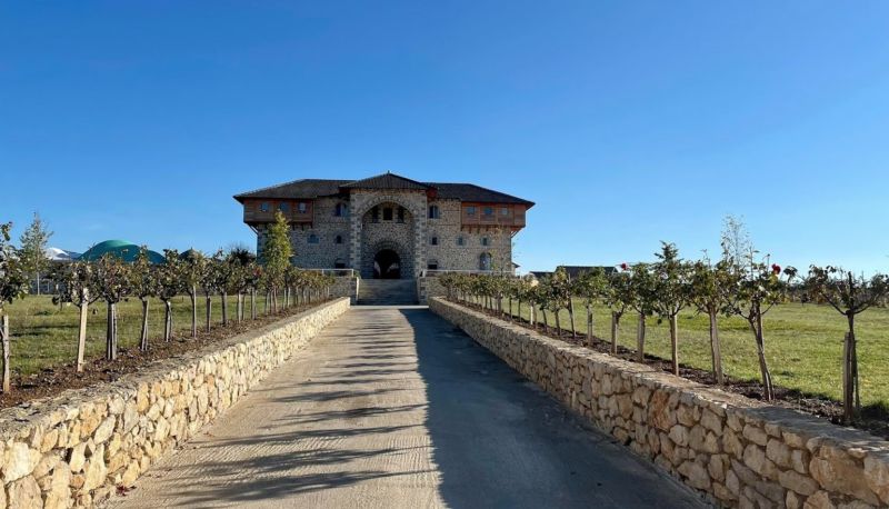
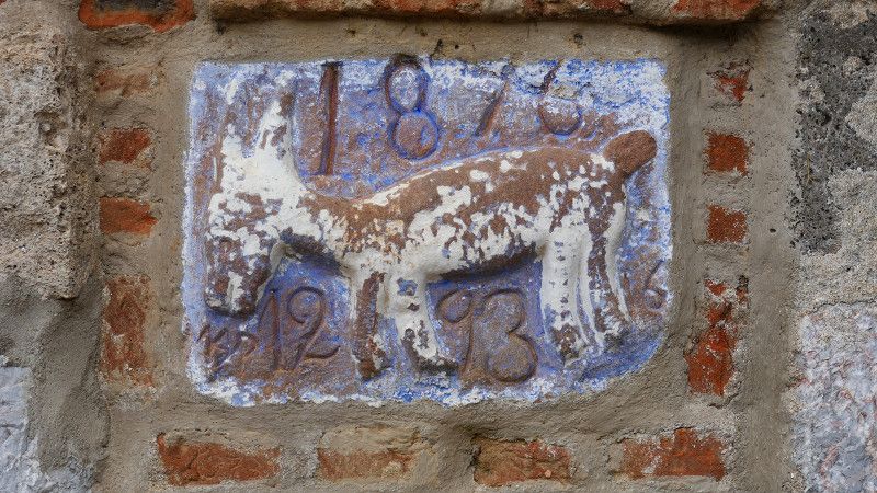
We started in Igoumenitsa at the beginning of April and then drove all over Albania. We had thought of a few things and thought we would see what would happen, what could be realized from these plans. We decided a lot on the spot - especially where to stay overnight.
The HoBo travel guide for motorhomes was a big help to us.
We also drove our motorhome on narrower and less perfect roads - we are more adventurous than on well-trodden tourist paths. You don't need a high 4x4 vehicle for that.
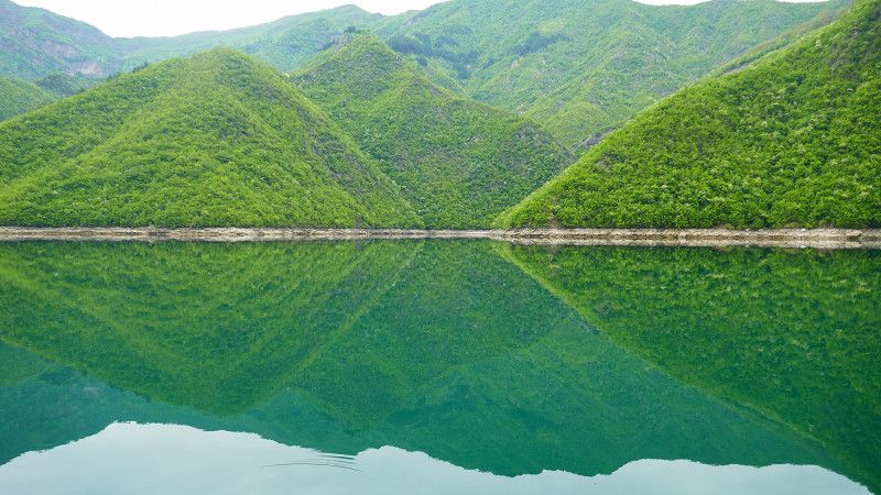
Towards the middle of our vacation the weather deteriorated significantly and we decided not to visit Tirana, among other things, because we really wanted to experience the Koman ferry (sensational!!)
Then the weather caught up with us and when the snow line was only about 100 meters above us we hurried south... to Greece (we've seen enough snow at home)
Igoumenitsa
Arrival 6 hours late at 13:30.
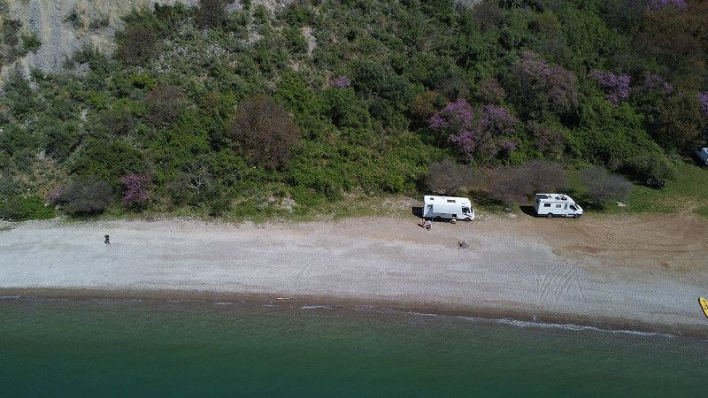
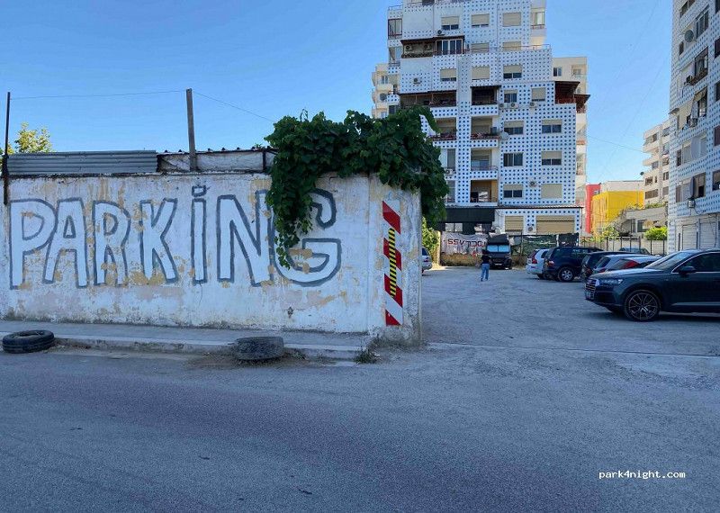
We drive towards Albania and have already registered in Kasami. Then we get a big surprise at customs: it's closed due to a strike. We drive back to a nearby beach to wait for the next day.
• Head southeast on Eparchiaki Odos Sagiadas-Mavromati. Go for 236 m.
• Take the 2nd exit from roundabout. Go for 286 m.
• Continue on SH97. Go for 172 m.
• Take the 1st exit from roundabout onto SH97. Go for 7.1 km.
• Turn left onto SH98. Go for 6.3 km.
• Turn left toward Butrint. Go for 6.3 km.
• Turn left onto SH81. Go for 239 m.
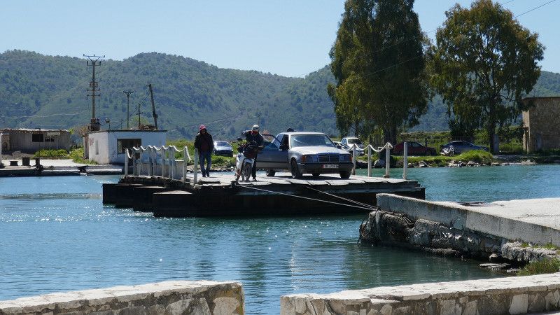
• Take the ferry. Stay on for 73 m.
• Head north on SH81. Go for 226 m.
• Arrive at SH81. Your destination is on the left.
☍
20,9 km
( 57 min.)
Butrint - Xarrë
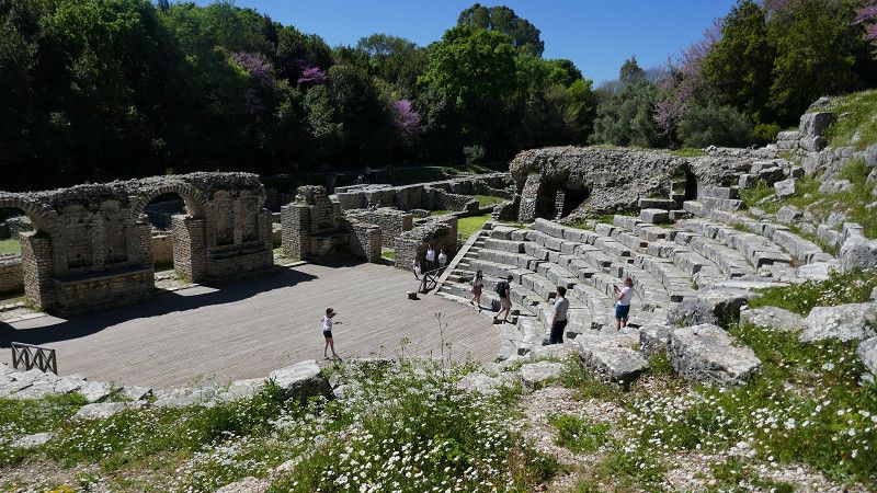
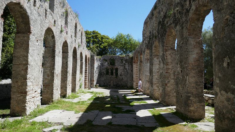
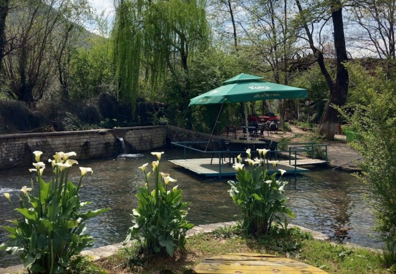
After the small ferry we visit Butrint: very impressive and absolutely recommended - good descriptions of the ancient monuments. We also recommend the nearby restaurant Hotel Livia, where we have a wonderful meal on the terrace.
SH81, Xarrë, Qark Vlora, Süd-Albanien, Albanien
39° 44' 43.3" N 20° 1' 4.7" E
39.7453564 20.0179584
• Head northwest on SH81. Go for 3.1 km.
• Continue on Rruga Butrinti (SH81). Go for 1.2 km.
• Take the 2nd exit from roundabout onto Rruga Butrinti (SH81). Go for 600 m.
• Turn left onto Rruga Abaz Sheu. Go for 111 m.
• Turn right onto Rruga Eqerem Çabej. Go for 12 m.
• Continue on Rruga Ismail Qemali. Go for 36 m.
• Turn left. Go for 96 m.
• Arrive at your destination on the left.
☍
5,1 km
( 8 min.)
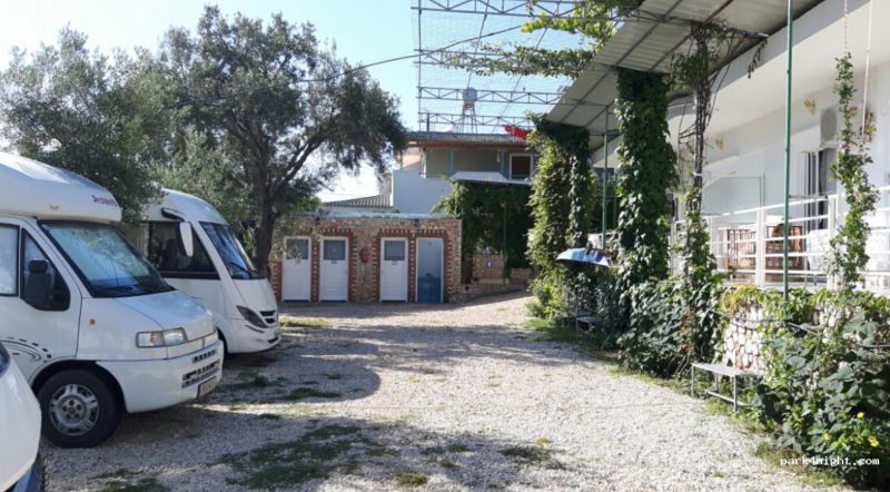
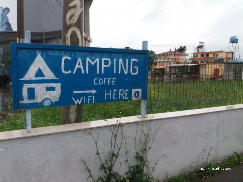
Ksamil Caravan Camping
Camping Ksamil:
Cozy campsite with very friendly owners. Several pitches with shade. We are greeted with a coffee and a lot of friendliness! Very clean sanitary facilities. Everything is very clean and furnished with love.
The location of the campsite is a bit unusual: somewhere in a residential area with construction going on all around - but we didn't hear anything: quiet and relaxing.
• Turn left onto Rruga Ismail Qemali. Go for 127 m.
• Turn right onto Rruga Iliria. Go for 99 m.
• Turn left onto Rruga Butrinti (SH81). Go for 1.1 km.
• Continue on SH81. Go for 7.1 km.
• Turn left onto Rruga Butrinti (SH81). Go for 3.1 km.
• Continue on Rruga Naim Frasheri (SH81). Go for 163 m.
• Continue on SH81. Go for 114 m.
• Arrive at SH81. Your destination is on the right.
☍
12,0 km
( 21 min.)
Day
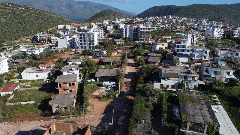
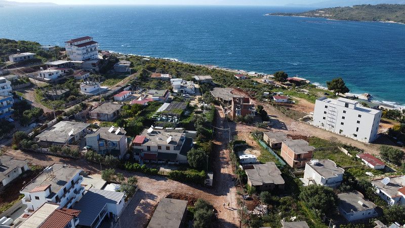
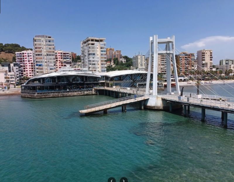
Sarandë
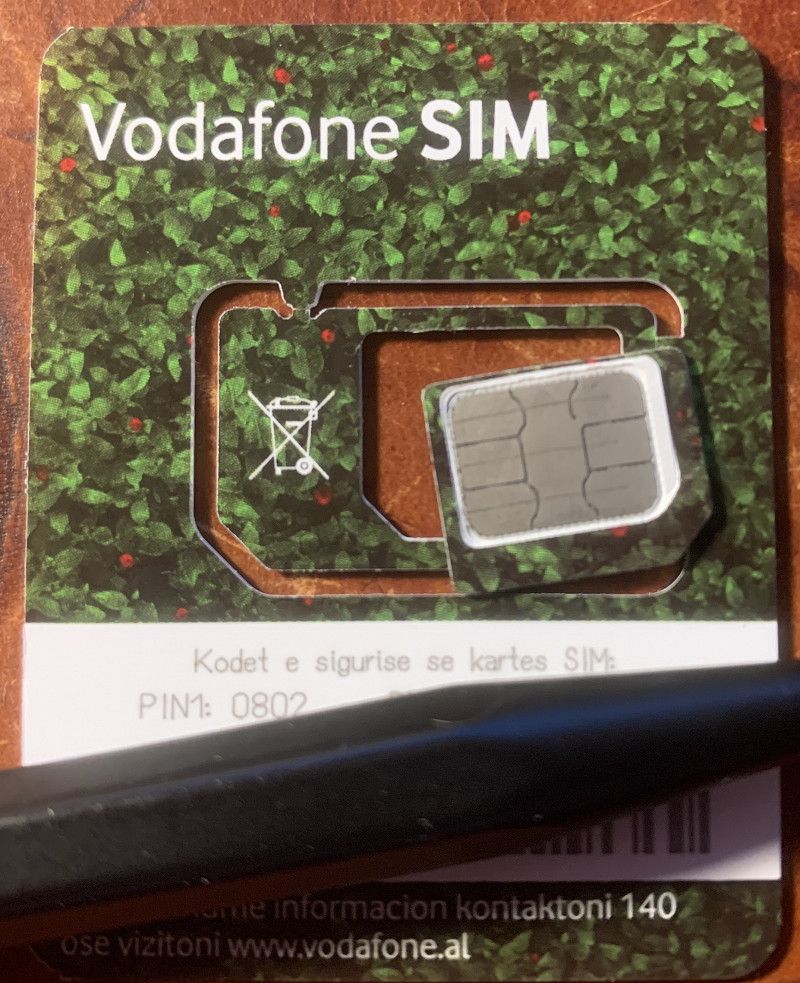
We drive into Sarrande because we still need an Albanian SIM card. At first we can't find one in the center... there is also a huge traffic chaos because an old house is burning in the middle of the city (it was probably burned down to make room for something new).
On the main road we find a kiosk where we get a SIM card: This in the iPhone and from now on I have an Albanian phone number, as well as 40GB data volume ... for just under 30€
SH81, Sarandë, Qark Vlora, Süd-Albanien, Albanien
39° 52' 22.7" N 20° 0' 49.6" E
39.8729634 20.0137736
• Head north on SH81. Go for 11 m.
• Turn right onto Rruga 40 Shenjtoret toward Gjirokastër/Vlorë/Tiranë. Go for 208 m.
• Continue on SH8. Go for 1.8 km.
• Continue on Gjashtë (SH8). Go for 111 m.
• Take the 1st exit from roundabout onto Rruga Deliu (SH99) toward Gjirokaster/Tirane. Go for 1.2 km.
• Pass 2 roundabouts and continue on SH99. Go for 15.8 km.
• Turn left. Go for 503 m.
• Arrive at your destination.
☍
19,6 km
( 28 min.)
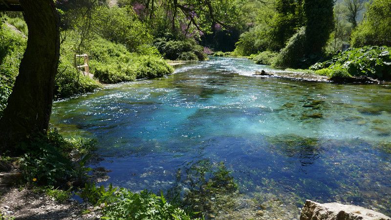
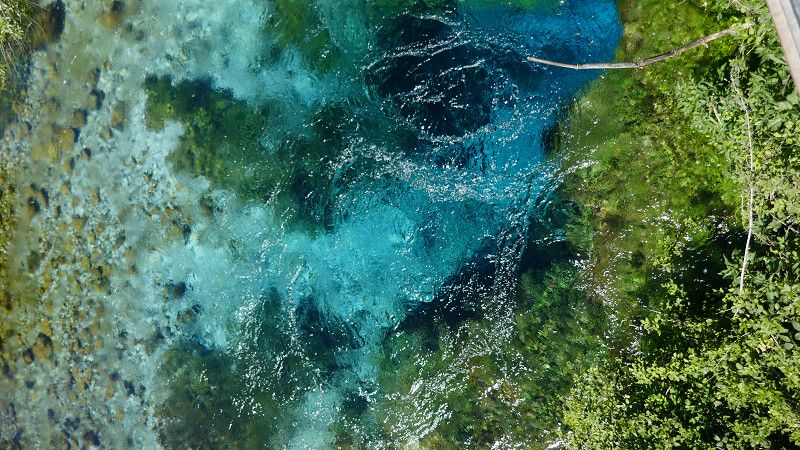
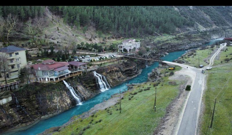
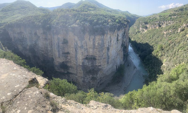
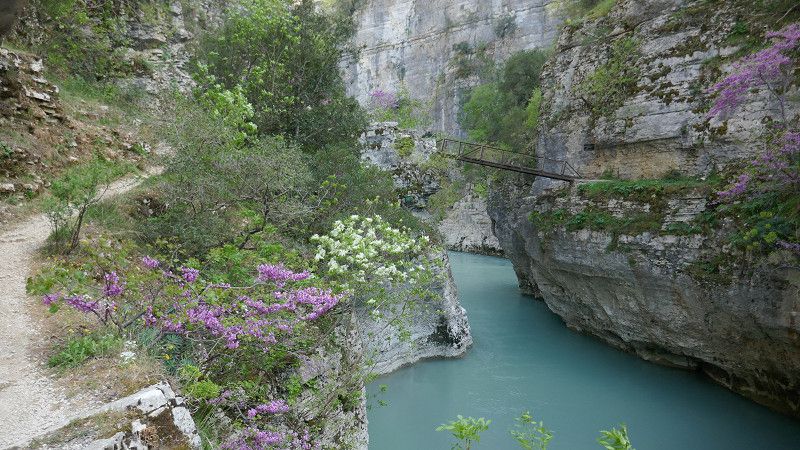
Krongj (Blue Eye)
You stop at a large parking lot in front of the reservoir, then pay a fee of 1€ and we walk to Blue Eye (you could also rent an electric scooter, but that seems a bit excessive to us).
Syri i Kaltër, Krongj, Qark Vlora, Süd-Albanien, Albanien
39° 55' 1" N 20° 11' 8.4" E
39.9169553 20.1856690
• Head northeast. Go for 1.5 km.
• Turn right. Go for 62 m.
• Arrive at your destination.
☍
1,5 km
( 3 min.)
Krongj - Blue Eye
very nice - relatively touristy, but in early April it is still quiet
Syri i Kaltër, Krongj, Qark Vlora, Süd-Albanien, Albanien
39° 55' 22.9" N 20° 11' 43.6" E
39.9230409 20.1954363
• Head northwest. Go for 62 m.
• Turn left toward SH99. Go for 2.0 km.
• Turn left onto SH99. Go for 6.2 km.
• Continue on SH78 toward Gjirokaster. Go for 7.3 km.
• Arrive at SH78.
☍
15,5 km
( 28 min.)
Dropull i Sipërm
SH99, Dropull i Sipërm, Qark Gjirokastra, Süd-Albanien, Albanien
39° 56' 15.8" N 20° 16' 2.9" E
39.9377148 20.2674725
• Head east on SH78. Go for 21 m.
• Continue on SH4. Go for 493 m.
• Turn left onto E853 toward Gjirokaster. Go for 18.7 km.
• Take the 1st exit from roundabout onto Rruga Nacionale (E853) toward Tirane/Durres. Go for 918 m.
• Take the 1st exit from roundabout. Go for 500 m.
• Continue on Rruga Valare. Go for 1.5 km.
• Arrive at your destination.
☍
22,1 km
( 28 min.)
Camping Gjirokaster
Small campsite near a restaurant. Pitches with shade. Showers and toilets are clean. Chemical toilets and grey water cannot be emptied. The operators were friendly and helpful.
• Take the 1st exit from roundabout onto Rruga Nacionale. Go for 34 m.
• Turn right onto Rruga Gjin Zenebishi. Go for 250 m.
• Take the 1st exit from roundabout onto Rruga Gjin Zenebishi. Go for 1.0 km.
• Arrive at Rruga Gjin Zenebishi. Your destination is on the right.
☍
1,3 km
( 2 min.)
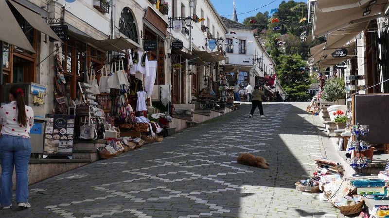
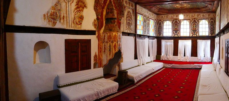
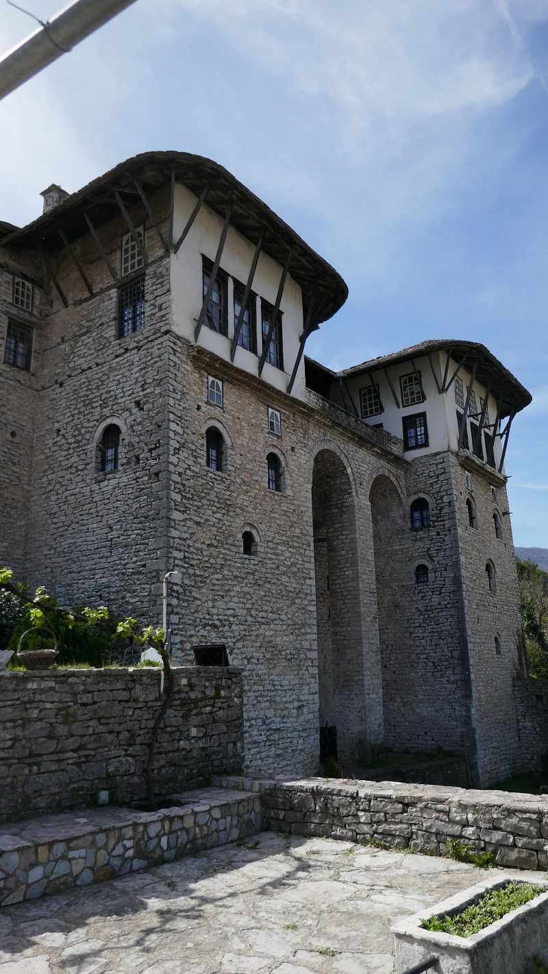
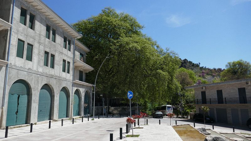
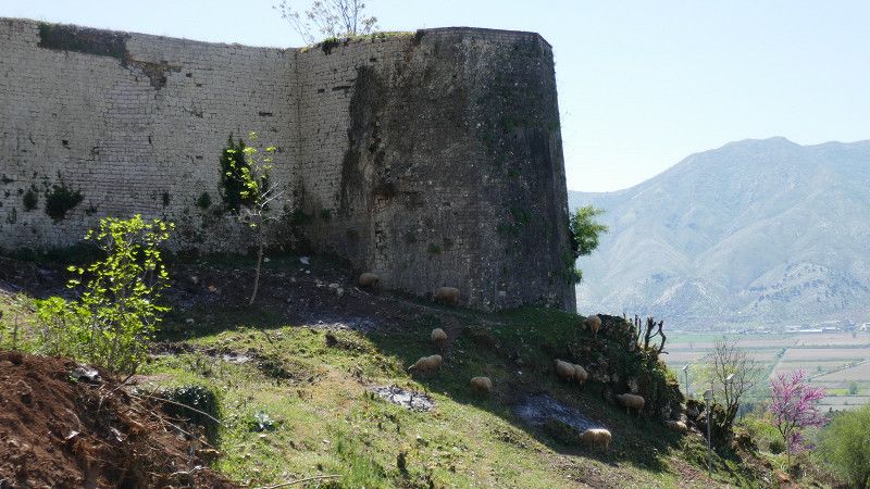
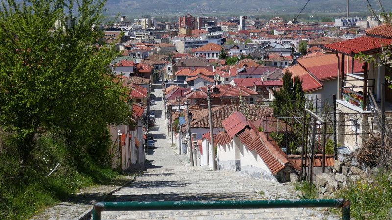
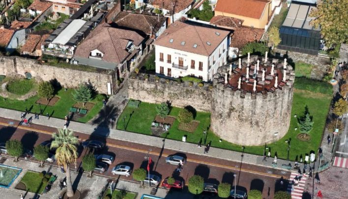
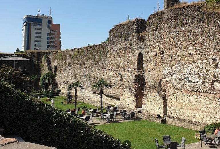
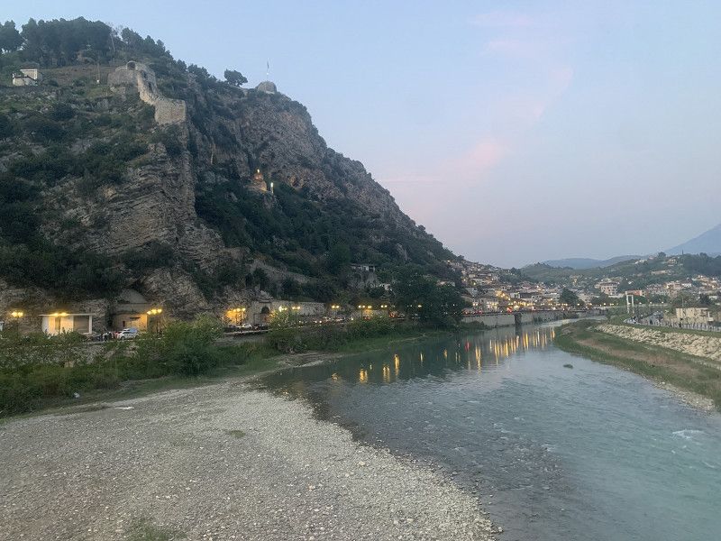
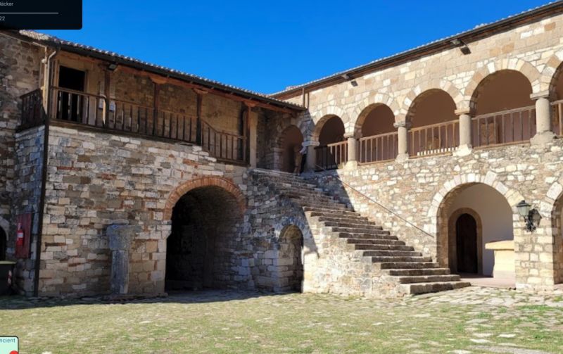
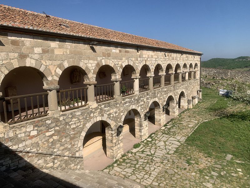
Gjirokastër
We can park below the castle and explore the city. Ideal place in front of the newly built underground car park.
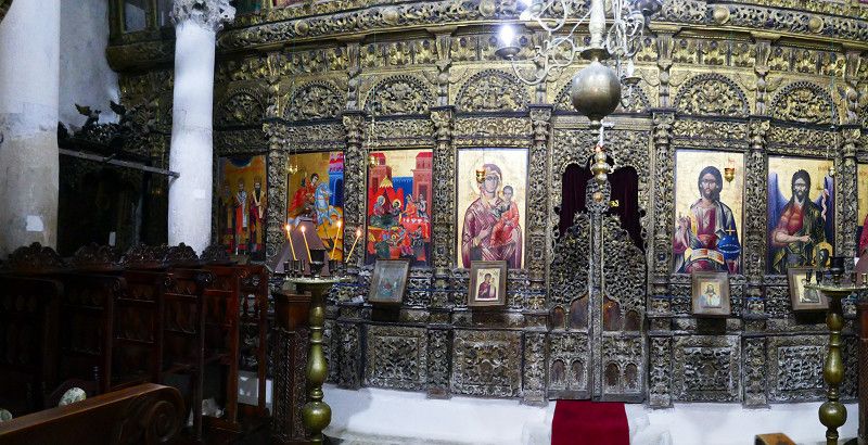
On foot we explore Gjirokaster Castle and the Skenduli House
Rruga Gjin Zenebishti, Gjirokastër, Qark Gjirokastra, Süd-Albanien, Albanien
40° 4' 31.7" N 20° 8' 27.5" E
40.0754802 20.1409690
• Head toward Rruga Doktorr Kalivopulli on Rruga Gjin Zenebishi. Go for 261 m.
• Continue on Rruga Ismail Kadare. Go for 102 m.
• Turn right onto Rruga Vasil Laboviti. Go for 690 m.
• Take the 1st exit from roundabout onto Bulevardi 18 Shtatori. Go for 693 m.
• Take the 2nd exit from roundabout. Go for 512 m.
• Continue on Rruga Valare. Go for 1.9 km.
• Continue on Topullaraj. Go for 145 m.
• Continue on Rruga Valare. Go for 2.6 km.
• Continue on Valare. Go for 1.5 km.
• Turn slightly left. Go for 1.3 km.
• Continue toward Erind/Çajup. Go for 2.6 km.
• Turn left. Go for 395 m.
• Turn slightly left. Go for 116 m.
• Turn slightly right. Go for 108 m.
• Turn left. Go for 8.0 km.
• Continue straight ahead. Go for 406 m.
• Turn right. Go for 1.8 km.
• Turn slightly right. Go for 2.1 km.
• Arrive at your destination.
☍
25,1 km
( 47 min.)
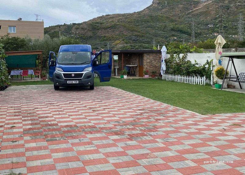
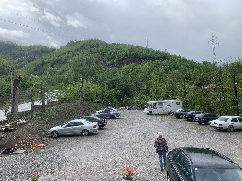
Zagorie Camping Cajupi
On a plateau - totally quiet and lonely. The 'groundskeeper' hardly speaks any English but is a warm and friendly guy who is willing to read your every wish from your lips.
It 'even' has a toilet and shower ...
Rruga e Cajupit, Zagorie, Qark Gjirokastra, Süd-Albanien, Albanien
40° 10' 59.9" N 20° 11' 6" E
40.1832955 20.1850089
• Head southwest. Go for 3.8 km.
• Turn left. Go for 8.4 km.
• Turn right. Go for 241 m.
• Turn slightly left. Go for 378 m.
• Turn right. Go for 371 m.
• Turn slightly left toward Valare. Go for 5.0 km.
• Continue on Valare. Go for 1.3 km.
• Continue on Rruga Valare. Go for 1.4 km.
• Continue on Topullaraj. Go for 1.4 km.
• Continue on Rruga Valare. Go for 1.1 km.
• Take the 3rd exit from roundabout onto Rruga Nacionale (E853). Go for 951 m.
• Take the 2nd exit from roundabout onto Rruga Nacionale (E853) toward Kakavie/Sarande. Go for 7.8 km.
• Turn left toward Bulo. Go for 2.8 km.
• Continue straight ahead. Go for 2.5 km.
• Turn left. Go for 3.1 km.
• Continue straight ahead. Go for 4.5 km.
• Turn slightly right. Go for 79 m.
• Turn right. Go for 13 m.
• Arrive at your destination on the left.
☍
45,1 km
(1 hrs. 27 min.)
Day
Libohovë se Kryqit
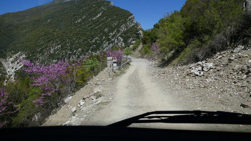
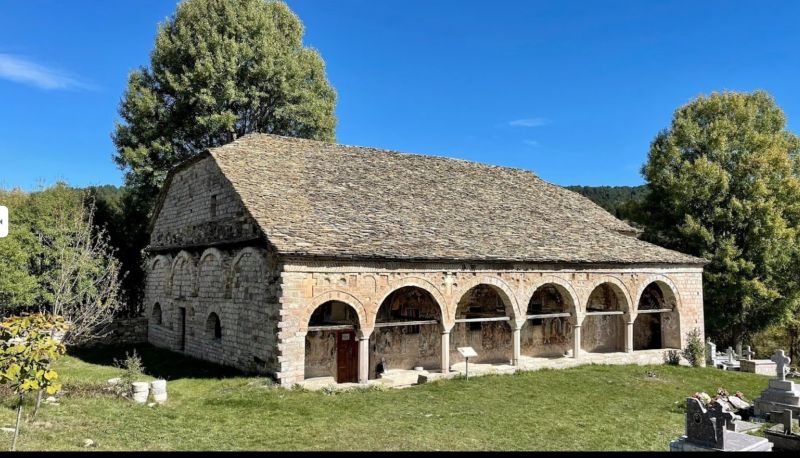
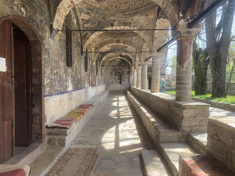
beautiful church - somewhat (very) narrow access ... but it's possible!
Qark Gjirokastra, Süd-Albanien, Albanien
40° 4' 26" N 20° 17' 26.8" E
40.0738849 20.2907669
• Head west. Go for 13 m.
• Turn left. Go for 7.7 km.
• Turn left toward SH96. Go for 440 m.
• Turn left onto SH96. Go for 611 m.
• Turn left onto SH96. Go for 925 m.
• Arrive at SH96.
☍
9,7 km
( 25 min.)
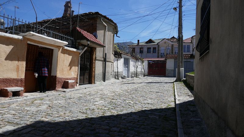
Libohovë
Qark Gjirokastra, Süd-Albanien, Albanien
40° 2' 0.2" N 20° 15' 27.5" E
40.0333785 20.2576425
• Head north on SH96. Go for 755 m.
• Turn right. Go for 173 m.
• Arrive at your destination on the right.
☍
0,9 km
( 2 min.)
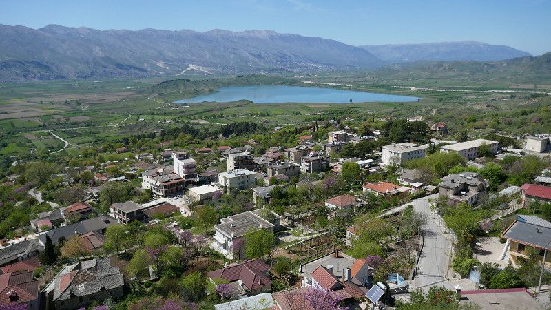
Libohovë
Mountain village with restaurant under a huge plane tree, as well as a castle complex a little above with a beautiful view
good cheese shop (or shop with good cheese!) with friendly owners.
SH75, Qendër Piskovë, Qark Gjirokastra, Süd-Albanien, Albanien
40° 17' 25.1" N 20° 14' 20.5" E
40.2902999 20.2390261
• Head east on SH75. Go for 19.9 km.
• Turn left toward Benjë. Go for 3.8 km.
• Turn left. Go for 910 m.
• Turn right. Go for 899 m.
• Arrive at your destination on the right.
☍
25,5 km
( 36 min.)
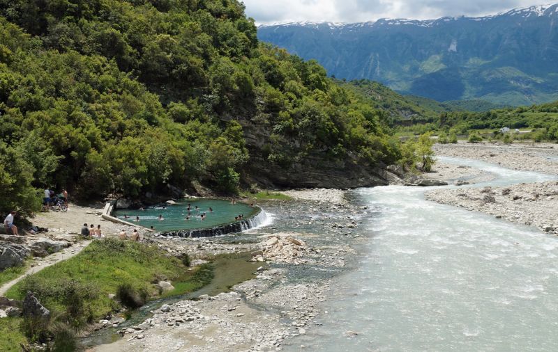
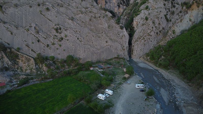
Ogdunan - Camping Vjosa Explorer
40.2406, 20.4290 (P4N: 6404)
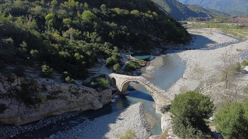
The place is located 300 meters from the thermal spring of Benja, the Ottoman bridge of Katiu and the gorge of the river Lengarica.
Only 5 minutes to the springs. Nice young operators who still have a lot planned. Beautiful starry sky!
Ura e Kadiut, Ogdunan, Qark Gjirokastra, Süd-Albanien, Albanien
40° 14' 25.5" N 20° 25' 45.1" E
40.2404213 20.4291861
• Head northeast. Go for 1.5 km.
• Arrive at your destination.
☍
1,5 km
( 3 min.)
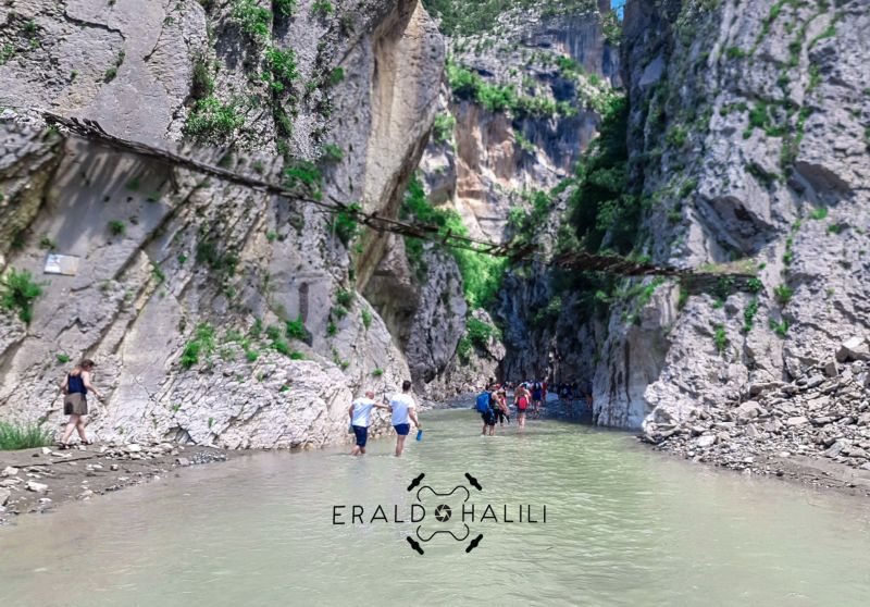
Ogdunan - Thermalquellen
https://en.wikipedia.org/wiki/Lengarica
Ura e Kadiut, Ogdunan, Qark Gjirokastra, Süd-Albanien, Albanien
40° 14' 44.2" N 20° 26' 18.1" E
40.2456174 20.4383578
• Head southwest. Go for 2.4 km.
• Turn left toward SH75. Go for 4.7 km.
• Turn left onto SH75. Go for 34.7 km.
• Turn slightly right. Go for 140 m.
• Arrive at your destination on the right.
☍
41,9 km
( 48 min.)
Day
Leskovik
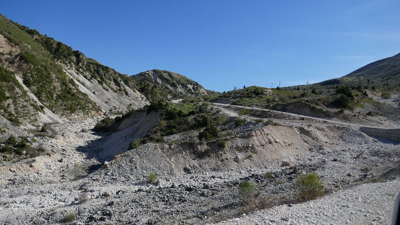
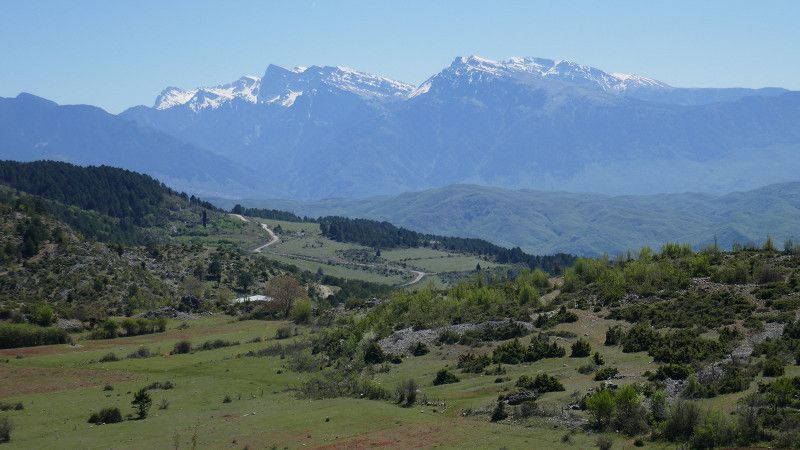
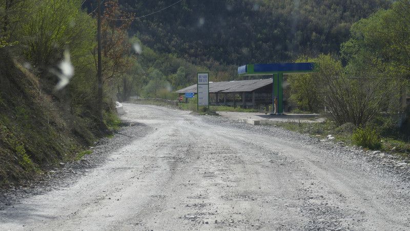
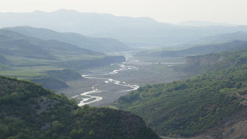
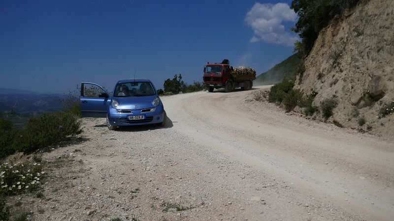
We reach Leskovik on a generally bad road (SS75 on the section: Carcovë - Leskovik)
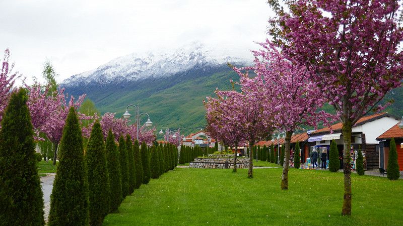
The scenery is magnificent
Qark Korça, Süd-Albanien, Albanien
40° 9' 10.5" N 20° 35' 58.8" E
40.1529253 20.5996528
• Head southwest. Go for 60 m.
• Turn left. Go for 16 m.
• Turn left toward SH75. Go for 33 m.
• Turn right onto SH75. Go for 15.8 km.
• Arrive at SH75. Your destination is on the right.
☍
15,9 km
( 17 min.)
Camping Farma Sotira
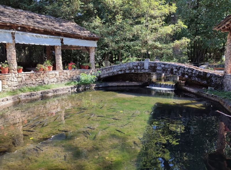
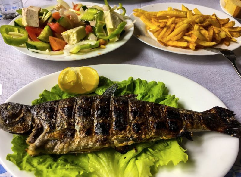
A very good campsite, or stop-off point, fresh trout ponds on site. Small shower, toilet. There is also a restaurant on site.
P4N: 7402
freshly caught trout ... mmmh
National road Leskovik-Erseke km 15, 7402, Komuna Leskovik, Albanien
40° 12' 51" N 20° 38' 46.9" E
40.2141600 20.6463600
• Head northeast on SH75. Go for 22.3 km.
• Arrive at Borovë (SH75). Your destination is on the left.
☍
22,3 km
( 34 min.)
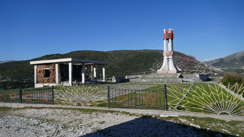
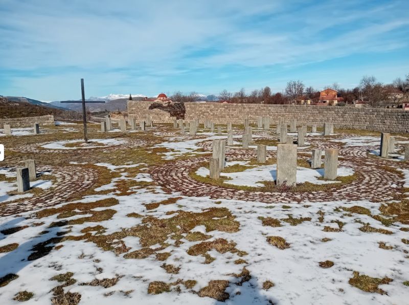
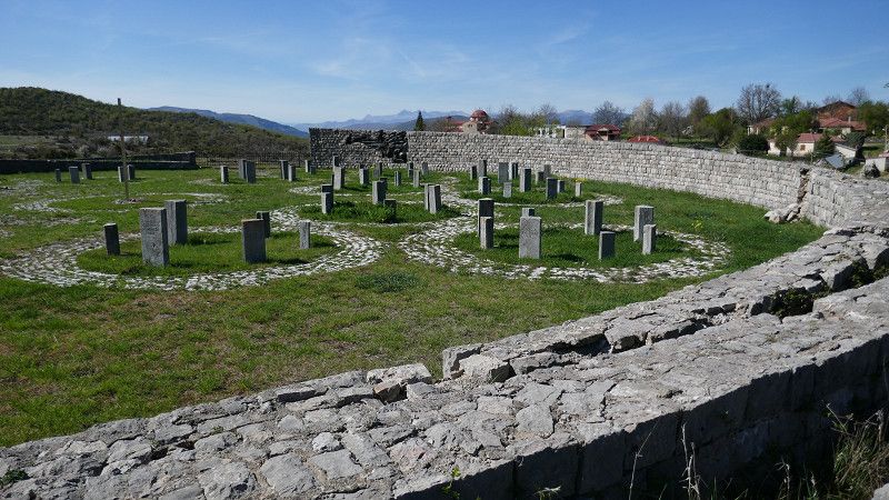
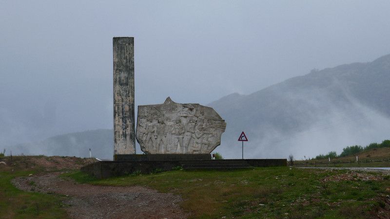
Gedenkstätte: Qendër Ersekë Boroves
impressive memorial to a massacre from the Second World War, where the population of an entire village was wiped out 'in retaliation'!
Book p. 431
SH75, Qendër Ersekë, Qark Korça, Süd-Albanien, Albanien
40° 18' 36.2" N 20° 39' 7.5" E
40.3100671 20.6520929
• Head northwest on Borovë (SH75). Go for 4.7 km.
• Turn left onto SH75. Go for 1.8 km.
• Turn left onto SH75. Go for 25.5 km.
• Turn right. Go for 148 m.
• Turn left. Go for 166 m.
• Arrive at your destination.
☍
32,3 km
( 32 min.)
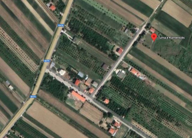
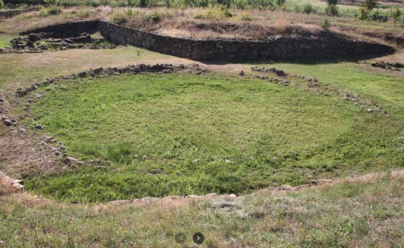
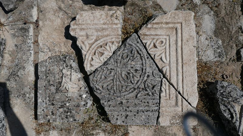
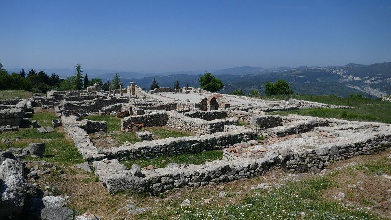
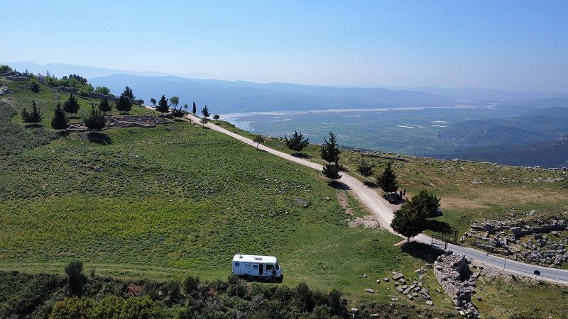
Hügelgräber - Mollaj: Tuma e Kamenices
ca 8km before Korca burial mound (p.457)
One of the largest excavation sites, but still quite manageable. Exhibition beautifully arranged,
We were looked after and given gifts by a very nice lady.
Qark Korça, Süd-Albanien, Albanien
40° 32' 38.3" N 20° 43' 31.3" E
40.5439593 20.7253611
• Head southwest. Go for 166 m.
• Turn right toward SH75. Go for 148 m.
• Turn right onto SH75. Go for 7.0 km.
• Arrive at SH75.
☍
7,3 km
( 11 min.)
Camping Korca
Good, lovingly prepared campsite with hospitable operators.
On the homepage it sounds like this:
... Welcome to Camping Korca, your premier destination for an unforgettable camping experience in the heart of Korce town. Nestled in the stunning scenery of the Korce region, our campsite offers the perfect blend of natural beauty, comfort and relaxation .
• Arrive at Rruga Antoni Athanas (SH75). Your destination is on the left.
☍
2,0 km
( 2 min.)
Day
Korçë
We ride our bikes to Korce and explore the city on foot...
We skip the famous brewery because we prefer wine anyway.
Rruga Antoni Athanas, Korçë, Qark Korça, Süd-Albanien, Albanien
40° 36' 31.4" N 20° 46' 33.4" E
40.6087155 20.7759415
• Head north on Rruga Antoni Athanas (SH75). Go for 39 m.
• Pass 3 roundabouts and continue on Rruga Insan Korça (SH75). Go for 1.5 km.
• Take the 3rd exit from roundabout onto Rruga Desaretët (SH63) toward Voskopoja. Go for 697 m.
• Continue on SH63. Go for 6.9 km.
• Turn right onto SH63 toward Voskopoje. Go for 10.6 km.
• Turn slightly left onto SH63 toward Qender Voskopojë. Go for 169 m.
• Arrive at SH63.
☍
19,8 km
( 33 min.)
Day
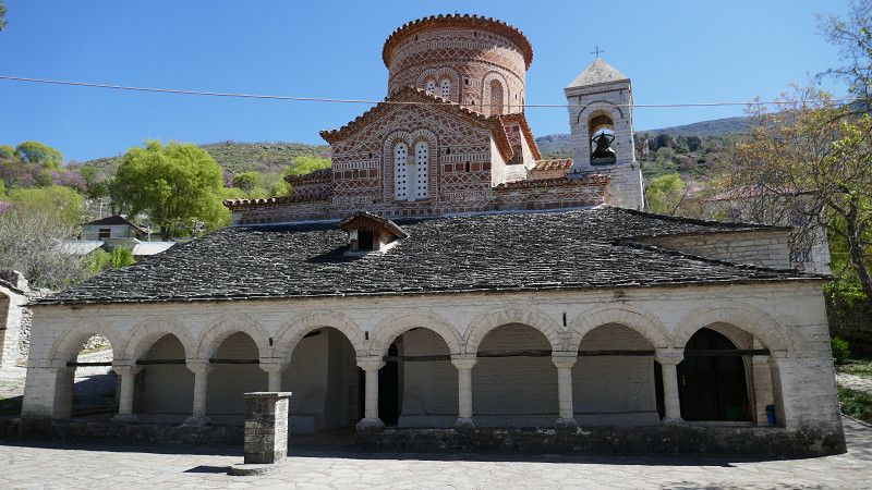
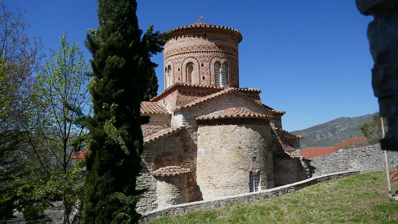
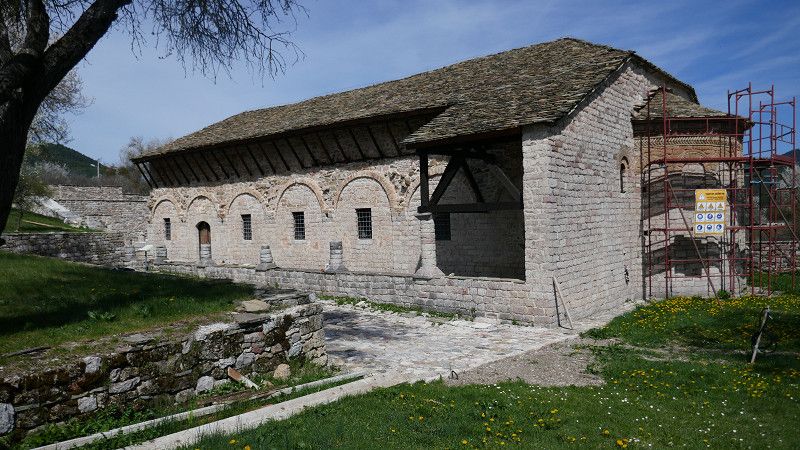
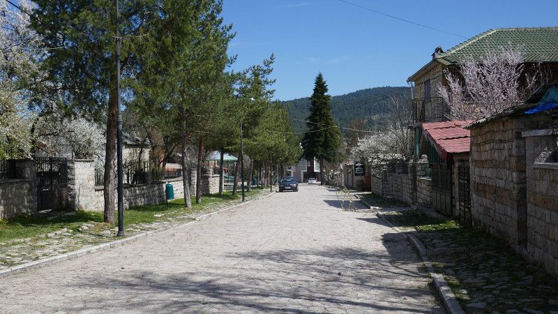
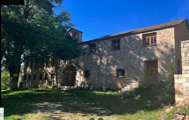
Voskopojë
Unfortunately, all churches are closed (except for one). We drive up to the monastery Monastiri Shen Prodhromit, which works out without any problems despite the description saying otherwise.
Lunch in the village
Book S 453 - there must be very interesting churches there, among other things
(Info in the Tourist Center in Korce, which was still closed)
• Head toward Rruga Gjergj Simon Sina on SH63. Go for 8 m.
• Turn right onto Rruga Zai Fundo. Go for 157 m.
• Turn right. Go for 132 m.
• Turn right. Go for 72 m.
• Turn slightly left. Go for 2.0 km.
• Arrive at your destination on the right.
☍
2,3 km
( 6 min.)
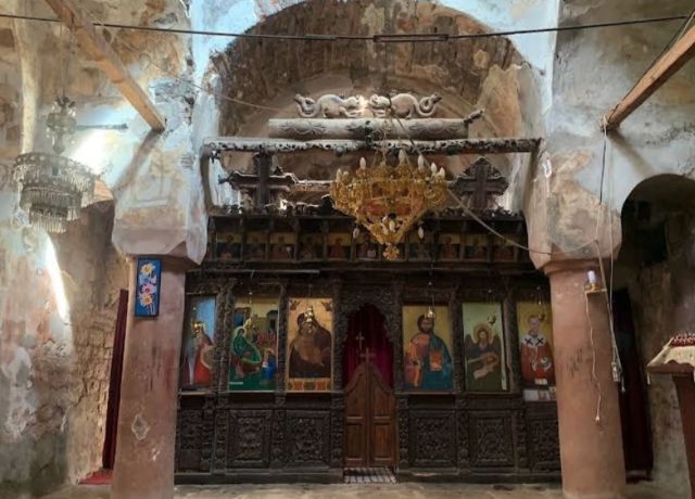
Voskopojë Kloster Shen Prodhomit
Shen Prodhomit Monastery (p.455)
We drive up to the monastery, which works without any problems despite the description saying otherwise. However, the monastery is currently (April 2024) under construction.
This is called “Manastiri i Shën Prodhromit” by the locals and is located in the middle of the trees. With stunning views of Voskopoja and a fountain that the locals believe to be “holy water” that some of them bottle and even take back to the US or Canada. It is a place to go
• Head northwest on Rruga E Tiranës (SH3). Go for 994 m.
• Turn left onto SH3 toward Tirana. Go for 3.7 km.
• Turn left toward Lumalas. Go for 346 m.
• Continue on Lumalas. Go for 77 m.
• Turn left. Go for 1.8 km.
• Turn slightly right. Go for 267 m.
• Turn right. Go for 210 m.
• Arrive at your destination on the right.
☍
7,4 km
( 11 min.)
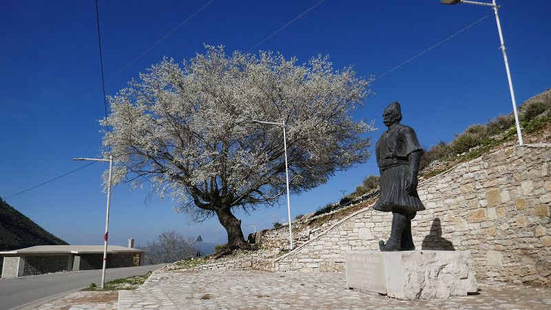
Teqeja: "Baba Abdulla" Melçan-Korçë
This memorial/tomb/'monastery' towers over the plain... we're going to visit it:
great view - but we didn't find out what it was for
Qark Korça, Süd-Albanien, Albanien
40° 38' 47.3" N 20° 43' 39.4" E
40.6464858 20.7276135
• Head northwest. Go for 210 m.
• Turn left. Go for 267 m.
• Turn slightly left toward Lumalas. Go for 1.8 km.
• Turn right onto Lumalas. Go for 423 m.
• Turn left onto SH3 toward Progradec. Go for 6.7 km.
• Turn left toward SH3. Go for 29 m.
• Continue on SH3. Go for 1.2 km.
• Take the 1st exit from roundabout onto SH71. Go for 123 m.
• Arrive at SH71. Your destination is on the right.
☍
10,8 km
( 15 min.)
Maliq
SH71, Maliq, Qark Korça, Süd-Albanien, Albanien
40° 42' 36.2" N 20° 41' 49.7" E
40.7100509 20.6971288
• Head west on SH71. Go for 14.5 km.
• Continue on Lozhan I Ri (SH71). Go for 52 m.
• Continue on SH71. Go for 1.8 km.
• Continue on Lozhan I Ri (SH71). Go for 186 m.
• Continue on SH71. Go for 23.7 km.
• Arrive at SH71. Your destination is on the right.
☍
40,2 km
(1 hrs. 2 min.)
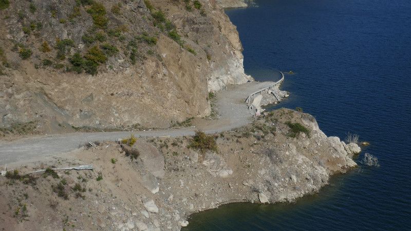
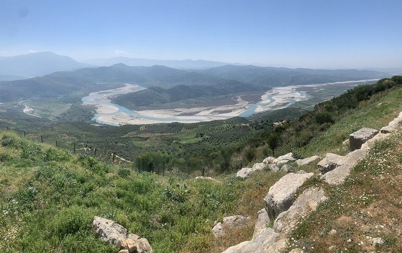
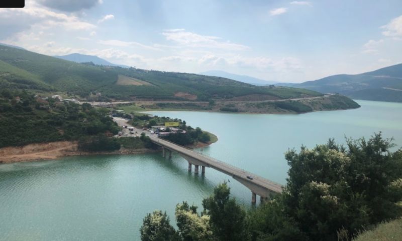
SH 71: Gopesh
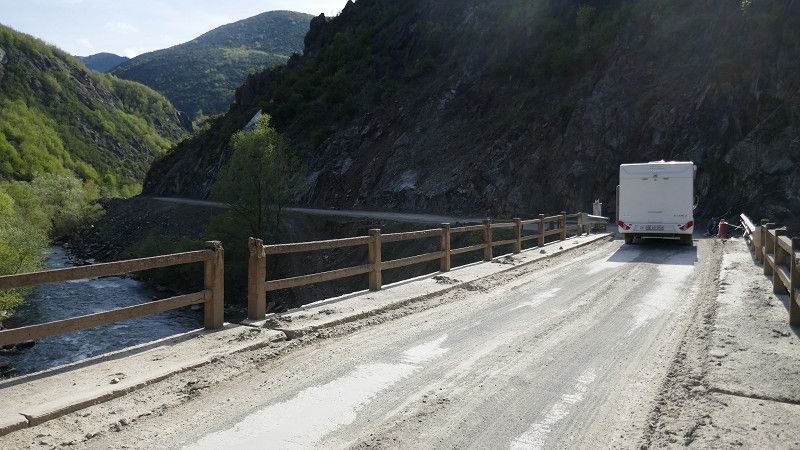
The SH 71: mostly well developed with some bumpy sections (construction work is underway).
The old road disappears into the reservoir... the new 'bypass' is a constant up and down, with great scenery and is easy to drive.
SH71, Gopesh, Qark Korça, Süd-Albanien, Albanien
40° 42' 21.6" N 20° 23' 39.7" E
40.7059872 20.3943567
• Head northwest on SH71. Go for 13.4 km.
• Continue on Bratilë (SH71). Go for 78 m.
• Continue on SH71. Go for 4.0 km.
• Continue on Kokël (SH71). Go for 183 m.
• Continue on SH71. Go for 6.6 km.
• Continue on Bërsnik I Poshtëm (SH71). Go for 168 m.
• Continue on SH71. Go for 3.0 km.
• Continue on Mashan (SH71). Go for 167 m.
• Continue on SH71. Go for 7.2 km.
• Turn left. Go for 37 m.
• Arrive at your destination on the right.
☍
34,8 km
( 51 min.)
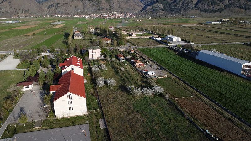
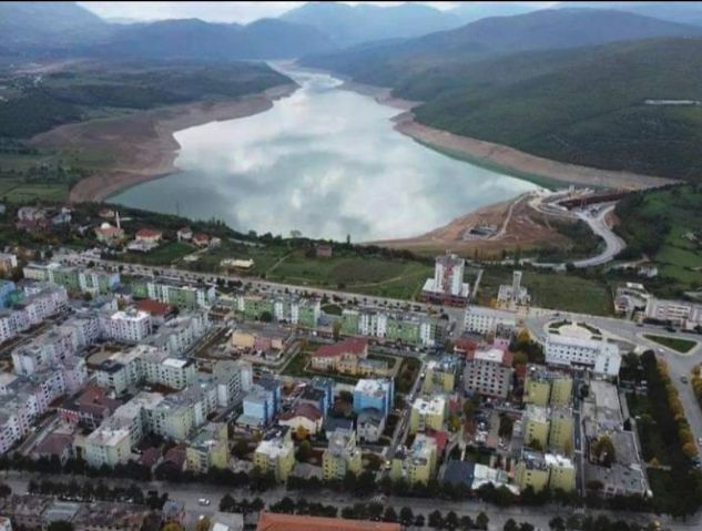
Gramsh
p. 491
SH71, Gramsh, Qarku i Elbasanit, Zentral-Albanien, Albanien
40° 51' 52.1" N 20° 11' 8.8" E
40.8644828 20.1857762
• Head north. Go for 37 m.
• Turn left onto SH71. Go for 1.8 km.
• Continue on SH89. Go for 1.3 km.
• Continue on Çekin (SH89). Go for 122 m.
• Continue on SH89. Go for 1.3 km.
• Continue on Qerret (SH89). Go for 183 m.
• Continue on SH89. Go for 3.3 km.
• Turn right. Go for 1.1 km.
• Turn right toward SH71. Go for 2.1 km.
• Continue on SH71. Go for 1.8 km.
• Continue on Kotorr (SH71). Go for 94 m.
• Keep right. Go for 3.9 km.
• Arrive at your destination on the right.
☍
17,2 km
( 30 min.)
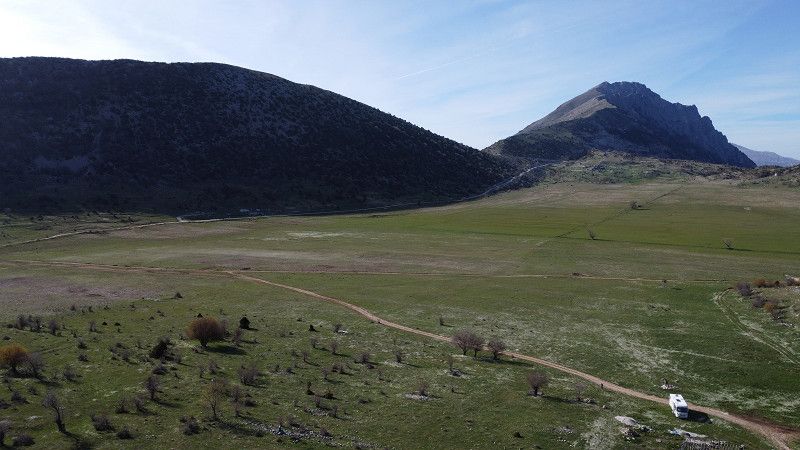
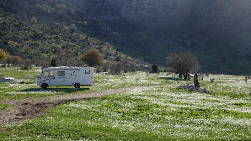
Holtes Canyon - Zavalinë
A great place - also to stay overnight.
We didn't go into the canyon itself...but it's supposed to be very beautiful!
Qarku i Elbasanit, Zentral-Albanien, Albanien
40° 55' 41" N 20° 12' 32.7" E
40.9280608 20.2090767
• Head west. Go for 3.9 km.
• Continue on Kotorr (SH71). Go for 94 m.
• Continue on SH71. Go for 1.8 km.
• Continue toward SH89. Go for 3.2 km.
• Turn right onto SH89. Go for 539 m.
• Continue on Drizë (SH89). Go for 388 m.
• Continue on SH89. Go for 7.5 km.
• Continue on SH59. Go for 10.0 km.
• Continue on Rruga Nacionale (SH59). Go for 655 m.
• Arrive at Rruga Nacionale (SH59). Your destination is on the left.
☍
28,2 km
( 44 min.)
Day
Cërrik
SH59, Cërrik, Qarku i Elbasanit, Zentral-Albanien, Albanien
41° 1' 26.5" N 19° 59' 23.4" E
41.0240173 19.9898289
• Head northwest on Rruga Nacionale (SH59). Go for 79 m.
• Turn right onto Rruga Pavarsia. Go for 195 m.
• Turn slightly right toward Rruga 14 Maji. Go for 87 m.
• Turn right onto Rruga 14 Maji. Go for 59 m.
• Turn left onto Rruga Nacionale (SH70). Go for 626 m.
• Continue on SH70. Go for 1.4 km.
• Continue on Thanë (SH70). Go for 63 m.
• Continue on SH70. Go for 4.8 km.
• Continue on SH71. Go for 35 m.
• Continue on SH70. Go for 824 m.
• Continue on Kuqan (SH70). Go for 97 m.
• Continue on Rruga Kuqan (SH70). Go for 16 m.
• Continue on SH70. Go for 3.7 km.
• Continue on Rruga Thoma Kalefi (SH70). Go for 1.1 km.
• Continue on Rruga Cerrik-Elbasan (SH70). Go for 340 m.
• Turn right. Go for 309 m.
• Continue straight ahead. Go for 669 m.
• Turn left. Go for 742 m.
• Turn right. Go for 142 m.
• Turn left. Go for 37 m.
• Turn right. Go for 2.9 km.
• Arrive at your destination on the right.
☍
18,2 km
( 30 min.)
Bar Restaurant Byshek - Shushicë
nice place near springs.
Restaurant - good to linger
Qarku i Elbasanit, Zentral-Albanien, Albanien
41° 6' 3.1" N 20° 7' 28.3" E
41.1008576 20.1245319
• Head southwest. Go for 2.4 km.
• Turn right. Go for 109 m.
• Turn right. Go for 419 m.
• Turn left. Go for 37 m.
• Turn right. Go for 142 m.
• Turn left. Go for 550 m.
• Turn slightly left. Go for 192 m.
• Turn right toward Rruga Thoma Kalefi/SH70. Go for 978 m.
• Turn right onto Rruga Thoma Kalefi (SH70). Go for 1.0 km.
• Turn right onto Rruga Thoma Kalefi. Go for 732 m.
• Take the 2nd exit from roundabout onto Rruga 11 Nëntori. Go for 279 m.
• Take the 1st exit from roundabout. Go for 176 m.
• Take the 3rd exit from roundabout onto Rruga Jinaq Kilica. Go for 55 m.
• Turn right onto Rruga Muzeut. Go for 187 m.
• Turn left onto Rruga Xhaferr Kongoli. Go for 14 m.
• Turn right onto Rruga Avni Rustemi. Go for 11 m.
• Arrive at Rruga Avni Rustemi. Your destination is on the right.
☍
7,3 km
( 15 min.)
Elbasan Castle
We walk around the town a bit... but we are not city visitors. The castle itself seems to be a good hotel. The church within the walls is not accessible, but the mosque is.
Book p. 481
Rruga Janaq Kilica, Elbasan, Qarku i Elbasanit, Zentral-Albanien, Albanien
41° 6' 47" N 20° 4' 55.1" E
41.1130662 20.0819683
• Head northeast on Rruga Avni Rustemi. Go for 85 m.
• Turn right onto Rruga Tefta Dodbiba. Go for 70 m.
• Turn left onto Rruga Isuf Ibershimi. Go for 96 m.
• Turn right onto Rruga Egnatia. Go for 65 m.
• Turn right onto Rruga Rinia. Go for 356 m.
• Turn right onto Rruga 11 Nëntori. Go for 195 m.
• Take the 2nd exit from roundabout onto Rruga Thoma Kalefi. Go for 781 m.
• Turn slightly left onto Rruga Çerçiz Topulli (E852) toward Librazhd/Q. Thane/Korçe. Go for 406 m.
• Arrive at Rruga Çerçiz Topulli (E852).
☍
2,1 km
( 4 min.)
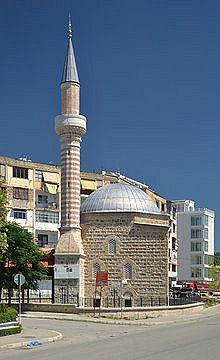
Elbasan Nazireshe Moschee
We visit the Naziresha Mosque, which we imagined to be completely different from the descriptions
https://de.wikipedia.org/wiki/Naziresha-Moschee
Rruga Zogu i Parë, Elbasan, Qarku i Elbasanit, Zentral-Albanien, Albanien
41° 6' 18.3" N 20° 5' 11.6" E
41.1050705 20.0865499
• Head toward Rruga Kadri Skuro on Rruga Çerçiz Topulli (E852). Go for 1.4 km.
• Take the 3rd exit from roundabout toward Tirane/Durres/Rrogozhine. Go for 95 m.
• Continue on Rruga 11 Nëntori (E852) toward Tirane/Durres/Rrogozhine/SH7. Go for 3.7 km.
• Take the 3rd exit from roundabout onto SH7 toward Peqin/Rrogozhine/Durres. Go for 132 m.
• Arrive at SH7. Your destination is on the right.
☍
5,4 km
( 7 min.)
Fikas Bar Camping Landi
P4N
Despite good descriptions on P4N, we were not at all happy with the location and drove on
Peqin - Elbasan, Fikas, Qarku i Elbasanit, Zentral-Albanien, Albanien
41° 6' 2.2" N 20° 1' 42.1" E
41.1006213 20.0283657
• Head west on SH7. Go for 10.7 km.
• Turn left onto SH59 toward Cerrik. Go for 2.6 km.
• Continue on Rruga Nacionale (SH59). Go for 3.8 km.
• Continue on SH59. Go for 3.9 km.
• Turn right. Go for 795 m.
• Take the 3rd exit from roundabout. Go for 2.8 km.
• Continue on Lumas. Go for 3.1 km.
• Continue on Rruga Ramazan Shermadhi. Go for 668 m.
• Turn slightly left. Go for 1.1 km.
• Turn right toward Selitë. Go for 4.9 km.
• Continue on Selitë. Go for 224 m.
• Arrive at your destination on the right.
☍
34,5 km
( 54 min.)
Selitë
Qarku i Elbasanit, Zentral-Albanien, Albanien
40° 53' 17.2" N 19° 58' 38.5" E
40.8881130 19.9773600
• Head southwest. Go for 1.2 km.
• Continue toward Frashër. Go for 3.3 km.
• Continue on Frashër. Go for 4.6 km.
• Continue on Gegë. Go for 622 m.
• Turn slightly left. Go for 479 m.
• Turn right. Go for 11 m.
• Turn left. Go for 224 m.
• Turn slightly right. Go for 312 m.
• Turn left. Go for 335 m.
• Take the 2nd exit from roundabout. Go for 2.1 km.
• Continue on Rruga Kurtit. Go for 520 m.
• Continue on Rruga Naftetari. Go for 667 m.
• Take the 1st exit from roundabout onto SH91. Go for 3.2 km.
• Take the 3rd exit from roundabout. Go for 992 m.
• Take the 2nd exit from roundabout onto SH72. Go for 5.2 km.
• Continue on Rruga Orizaj (SH72). Go for 146 m.
• Continue on SH72. Go for 1.4 km.
• Continue on Rruga Anti Patrea (SH72). Go for 440 m.
• Turn right onto Rruga Anti Patrea (SH72). Go for 682 m.
• Pass 2 roundabouts. Go for 934 m.
• Continue on Rruga Ura Ere. Go for 1.2 km.
• Turn left toward Rruga Shpiragu. Go for 370 m.
• Continue on Rruga Shpiragu. Go for 166 m.
• Arrive at Rruga Shpiragu. Your destination is on the right.
☍
29,1 km
( 49 min.)
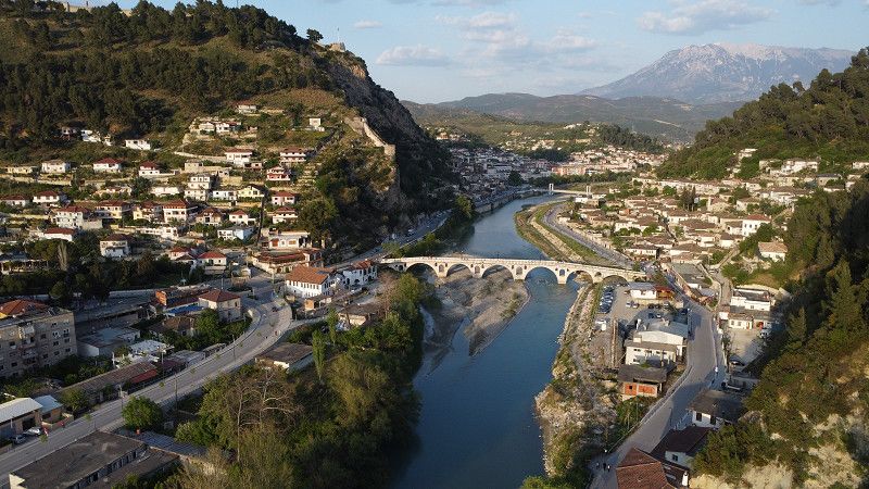
Berat
Good parking space on the 'orthodox side' right next to the pedestrian bridge. Very helpful operators.
• Turn slightly left onto Pojan (SH66). Go for 181 m.
• Turn slightly right onto SH66. Go for 1.0 km.
• Continue on Havaleas (SH66). Go for 160 m.
• Continue on SH66. Go for 316 m.
• Turn slightly right onto SH66. Go for 139 m.
• Take the 2nd exit from roundabout onto A2 toward Tiranë. Go for 10.8 km.
• Continue on SH4. Go for 3.6 km.
• Turn left. Go for 239 m.
• Turn sharp right toward SH67. Go for 2.6 km.
• Continue on SH67. Go for 764 m.
• Turn sharp left. Go for 12 m.
• Turn right. Go for 1.6 km.
• Turn left. Go for 174 m.
• Turn right. Go for 374 m.
• Arrive at your destination on the left.
☍
23,4 km
( 27 min.)
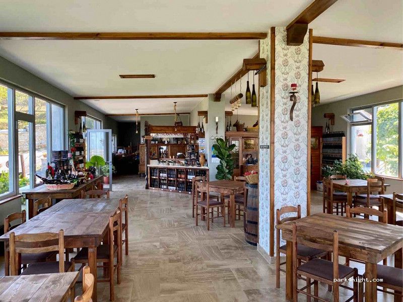
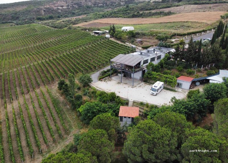
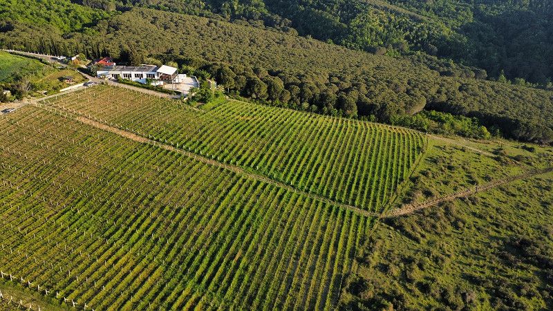
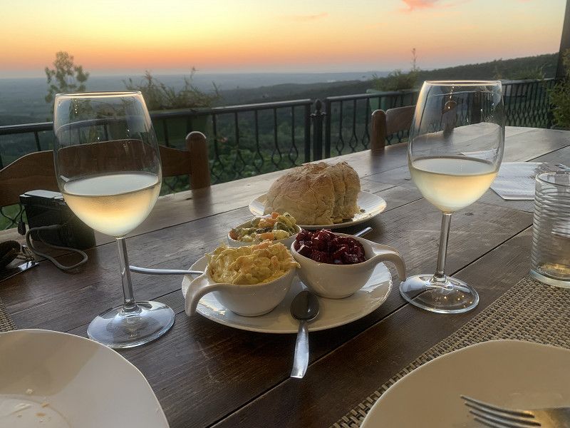
Albanica vinery
Albanica Winery surrounded by vineyards with a fantastic view. Nice and good restaurant with small shop where you can buy wine and olive oil from their own production and enjoy homemade organic food. Very nice owner speaks perfect English. From the village of Kolonjë Ardenice drive up the hill to the monastery church until you see the signs to Albanica Winery and from there follow the gravel road.
Qark Fier, Süd-Albanien, Albanien
40° 50' 25.9" N 19° 35' 52.5" E
40.8405263 19.5979075
• Head west. Go for 374 m.
• Turn left. Go for 174 m.
• Turn right. Go for 1.6 km.
• Turn left. Go for 1.3 km.
• Continue toward SH4. Go for 35 m.
• Take the 2nd exit from roundabout onto SH4 toward Tirane/Lushnje. Go for 12.1 km.
• Take the 3rd exit from roundabout onto SH4 toward Tirane/Durres/Shkoder. Go for 4.7 km.
• Pass 3 roundabouts and continue on SH4. Go for 13.9 km.
• Take the 3rd exit from roundabout onto SH4 toward Tirane/Durres. Go for 27.8 km.
• Take ramp onto SH4 toward Ndroq/Durres. Go for 352 m.
• Take the 2nd exit from roundabout onto Rruga Pavaresia. Go for 1.3 km.
• Pass 3 roundabouts and continue on Rruga Pavaresia. Go for 3.0 km.
• Continue on Rruga Lidhja e Prizrenit. Go for 269 m.
• Take the 1st exit from roundabout onto Rruga Nacionale. Go for 303 m.
• Continue on Rruga Nacionale. Go for 970 m.
• Turn right toward Rruga Myfti Kodra. Go for 38 m.
• Turn left onto Rruga Myfti Kodra. Go for 166 m.
• Arrive at Rruga Myfti Kodra.
☍
68,3 km
(1 hrs. 5 min.)
Day
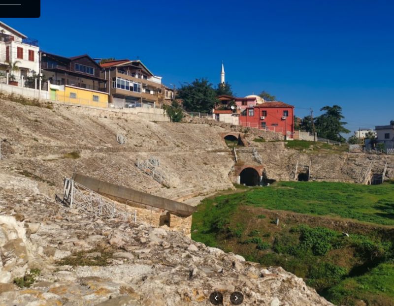
Durrës
We drove past Durres: a horrible city from the motorway! Maybe it's nicer in the centre - we don't know.
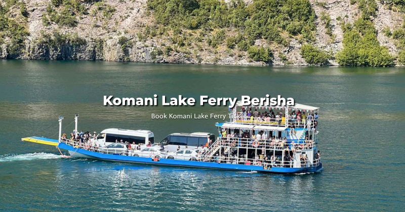
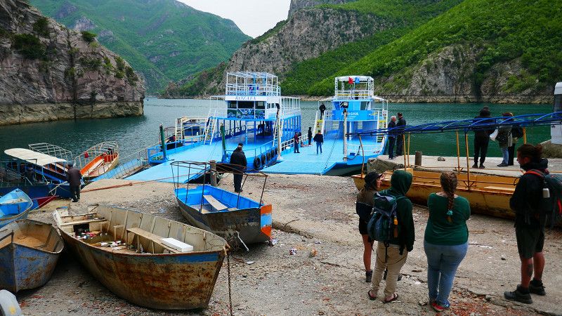
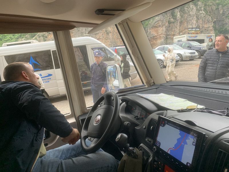
Since the weather is getting worse and we definitely want to experience the Koman ferry (not in the rain) ... we drive quickly north.
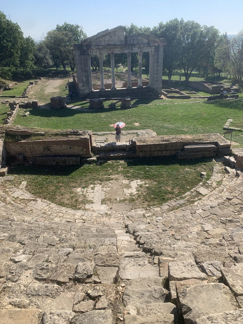
Durrës is a port city on the Adriatic Sea in western Albania, west of the capital Tirana. One of the city's landmarks is the huge Roman amphitheater. Nearby is a 9th-century church with mosaic-decorated walls. The Archaeological Museum displays finds from the Greek, Hellenic and Roman eras. Durrës' wide beach has shallow water and is not far from King Zogu's former 20th-century summer villa.
The amphitheater, which was discovered by chance during construction work in 1966, is worth seeing.
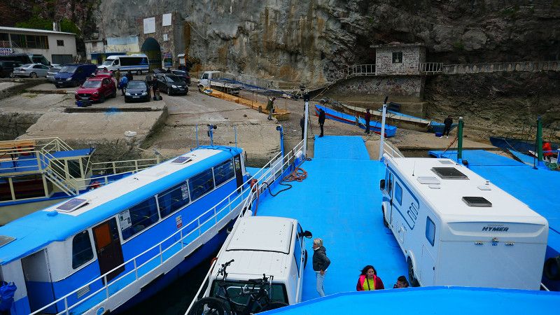
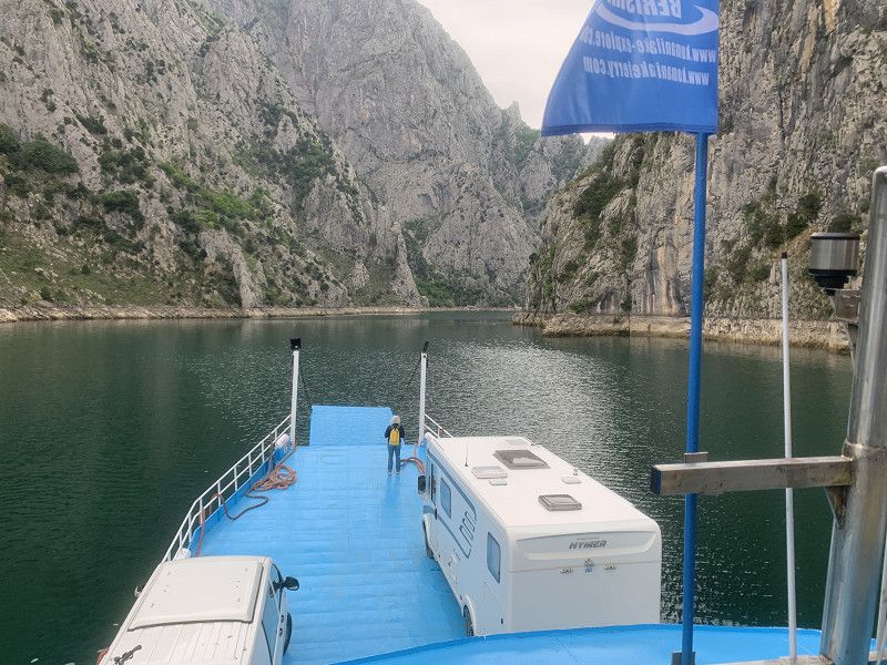
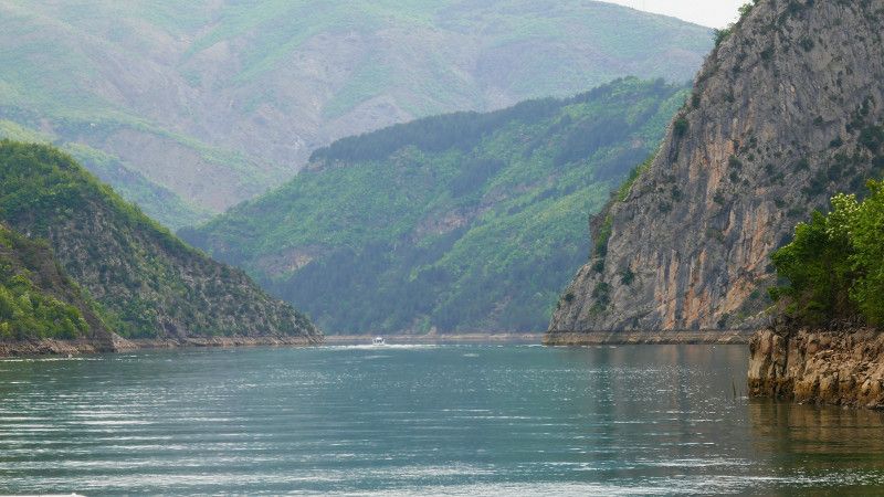
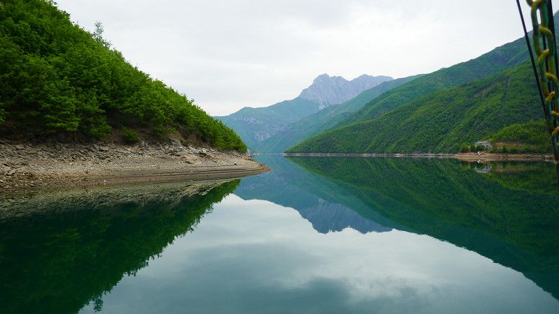
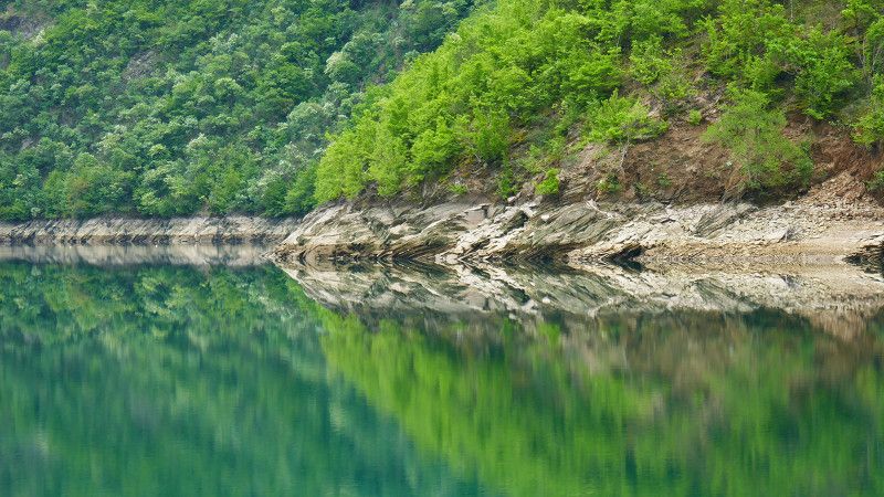
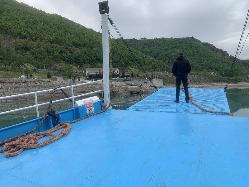
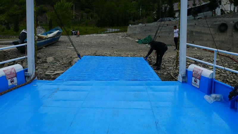
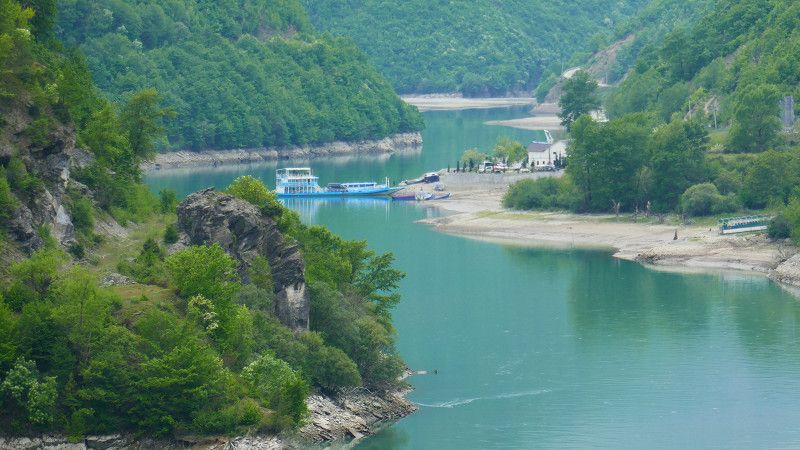
Ferry arrival ... A great and atmospheric ferry ride. The weather held up - it was dry ... the sun shone at times, but a great experience: From boarding to the journey to the destination
PS: If you are hesitant about the chaos at the departure: The motorhome (not only ours) was safely secured by a local employee with the help of what felt like 10 helpers
reversed onto the ferry... around corners - through gaps - over ledges.
https://youtu.be/L76XwnxEToc
Qark Kukës, Nord-Albanien, Albanien
42° 15' 58.1" N 20° 0' 56" E
42.2661326 20.0155549
• Head east on Breg-Lumë. Go for 2.0 km.
• Continue on Dushaj. Go for 235 m.
• Turn right onto SH22 toward Fierze/Qafe Mali. Go for 60.1 km.
• Arrive at SH22. Your destination is on the left.
☍
62,3 km
(1 hrs. 20 min.)
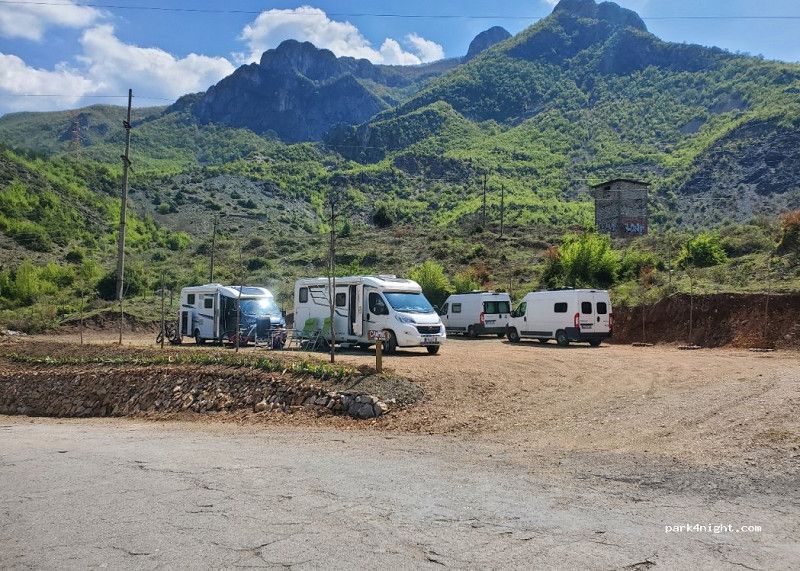
Flet
uphill... downhill... As expected, the weather gets worse... but the scenery is simply amazing!
SH22, Flet, Qark Shkodra, Nord-Albanien, Albanien
42° 6' 1.2" N 20° 6' 49.3" E
42.1003314 20.1137009
• Head east on SH22. Go for 40 m.
• Turn left onto E851. Go for 47.9 km.
• Take the 2nd exit from roundabout onto E851. Go for 113 m.
• Take left ramp onto E851 toward Kukes. Go for 8.2 km.
• Arrive at E851. Your destination is on the right.
☍
56,3 km
(1 hrs. 18 min.)
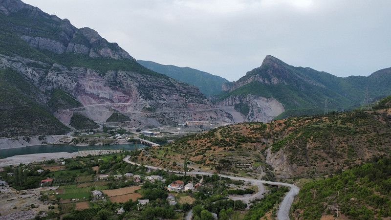
Bashkia Kukës
Meanwhile, there is a newer bridge, which is still under construction.
We leave the town itself to the left, or rather we drive straight through Kukës... to the recommended parking spot in P4N with a great view, however, we only find large-scale driving bans.
We drive past the airfield further south (exciting history of the airport ... https://de.wikipedia.org/wiki/Flughafen_Kuk%C3%ABs
E 851, Bashkia Kukës, Qark Kukës, Nord-Albanien, Albanien
42° 4' 31.9" N 20° 24' 24.2" E
42.0755174 20.4067252
• Head east on E851. Go for 139 m.
• Turn right onto E851 toward Kosove. Go for 2.5 km.
• Take ramp. Go for 421 m.
• Take the 1st exit from roundabout onto SH31. Go for 17.4 km.
• Continue on Malqenë. Go for 5.0 km.
• Keep right onto Lusen. Go for 770 m.
• Continue on Zall. Go for 3.5 km.
• Arrive at your destination on the right.
☍
29,8 km
( 36 min.)
Bashkia Kukës
We spend the night in the parking lot of a BILLA bar/restaurant: nice owners, but a lot of smoke (nicotine) in the restaurant, which we are no longer used to.
... there would still be a Mercedes for hobbyists
Qark Kukës, Nord-Albanien, Albanien
41° 53' 37.4" N 20° 24' 55.5" E
41.8937199 20.4154192
• Head southwest. Go for 4.3 km.
• Turn right toward Vasie. Go for 1.9 km.
• Continue on Vasie. Go for 1.6 km.
• Turn left toward Ploshtan. Go for 1.2 km.
• Turn left onto Ploshtan. Go for 5.0 km.
• Turn left toward Vleshë. Go for 5.0 km.
• Continue on Vleshë. Go for 697 m.
• Keep right. Go for 3.3 km.
• Turn sharp left. Go for 10 m.
• Arrive at your destination.
☍
22,9 km
( 30 min.)
Day
Sllatinë
War memorial
Qark Dibra, Nord-Albanien, Albanien
41° 47' 58.8" N 20° 23' 36.5" E
41.7996714 20.3934668
• Head west. Go for 10 m.
• Turn left toward Trojak. Go for 1.7 km.
• Continue on Trojak. Go for 3.8 km.
• Continue on Shumbat. Go for 3.5 km.
• Continue on Renz. Go for 3.6 km.
• Continue on Kastriot. Go for 1.1 km.
• Continue on Brest I Epërm. Go for 3.6 km.
• Continue on SH31. Go for 3.7 km.
• Continue on SH6. Go for 3.6 km.
• Continue on SH6. Go for 11.6 km.
• Take the 2nd exit from roundabout onto SH44. Go for 987 m.
• Take the 2nd exit from roundabout onto SH44. Go for 2.3 km.
• Arrive at SH44. Your destination is on the right.
☍
39,5 km
( 57 min.)
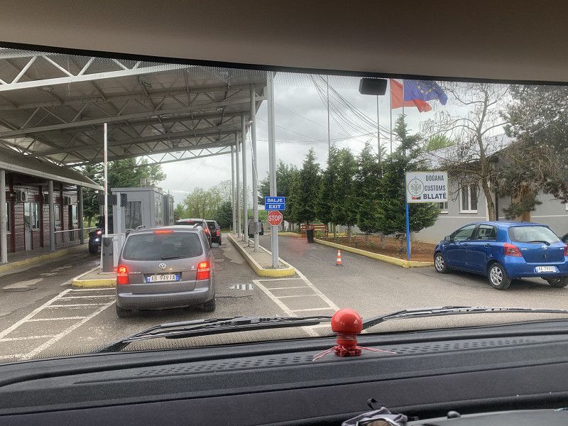
Grenze zu Nordmazedonien: Bllatë e Sipërme
stress-free border crossing: ID, vehicle registration, green insurance card
SH44, Bllatë e Sipërme, Qark Dibra, Nord-Albanien, Albanien
41° 33' 39.5" N 20° 29' 37.4" E
41.5609619 20.4937195
• Head south on SH44. Go for 14 m.
• Continue on R1202. Go for 5.7 km.
• Take the 1st exit from roundabout onto Debar (R1201) toward Struga/Strugë. Go for 49.6 km.
• Take the 2nd exit from roundabout onto R1201. Go for 1.5 km.
• Take the 2nd exit from roundabout onto Ulica Proleterski brigadi toward Struga/Strugë. Go for 745 m.
• Continue on Ulica 15-ti korpus. Go for 339 m.
• Continue on Ulica 15 korpus. Go for 10 m.
• Take the 2nd exit from roundabout onto Ulica Vlado Malevski (R1208). Go for 221 m.
• Turn left toward Kej Boris Kidrich. Go for 18 m.
• Turn left onto Kej Boris Kidrich. Go for 66 m.
• Turn left onto Kej Boris Kidrich. Go for 33 m.
• Turn left onto Kej Boris Kidrich. Go for 41 m.
• Arrive at Kej Boris Kidrich.
☍
58,3 km
(1 hrs. 1 min.)
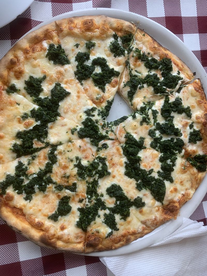
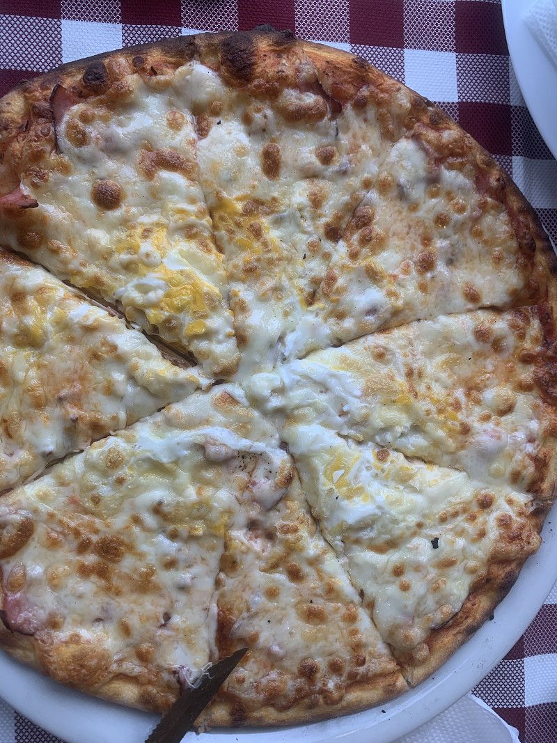
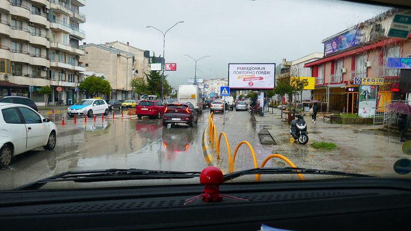
Pizzeria in Struga - Струга
It is raining and rather cold. In Struga we go to the nearest pizzeria
Борис Кидрич, Струга, Region Südwesten, Nordmazedonien
41° 10' 28.3" N 20° 40' 42.6" E
41.1745254 20.6785116
• Head toward Ulica Most na poezijata on Kej Boris Kidrich. Go for 28 m.
• Turn left onto Ulica Partizanska (R1208). Go for 730 m.
• Take the 1st exit from roundabout onto R1208. Go for 1.9 km.
• Take the 1st exit from roundabout onto Misleshevo (R1208) toward Ohrid/Ohër. Go for 9.6 km.
• Turn right onto Bulevar Turistichka (A3). Go for 492 m.
• Pass 6 roundabouts and continue on Bulevar Turistichka (A3). Go for 3.0 km.
• Take the 1st exit from roundabout onto Ulica Naum Ohridski (A3). Go for 546 m.
• Continue on Bulevar Turistichka (A3). Go for 3.1 km.
• Continue on A3. Go for 5.9 km.
• Continue on Peshtani (A3). Go for 89 m.
• Continue on Ulica Naum Ohridski (A3). Go for 1.6 km.
• Continue on Peshtani (A3). Go for 243 m.
• Continue on A3. Go for 6.1 km.
• Continue on Trpejca (A3). Go for 438 m.
• Continue on A3. Go for 5.9 km.
• Continue on Ljubanishta (A3). Go for 313 m.
• Continue on A3. Go for 4.2 km.
• Continue on SH64. Go for 1.7 km.
• Continue on Tushemisht (SH64). Go for 176 m.
• Continue on SH64. Go for 643 m.
• Turn left. Go for 1.2 km.
• Turn right. Go for 126 m.
• Turn left. Go for 45 m.
• Turn right toward SH64. Go for 119 m.
• Turn right onto SH64. Go for 930 m.
• Turn right. Go for 23 m.
• Arrive at your destination on the left.
☍
49,3 km
(1 hrs. 3 min.)
Camping Arbi
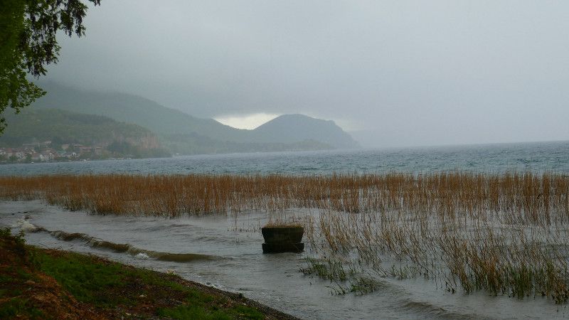
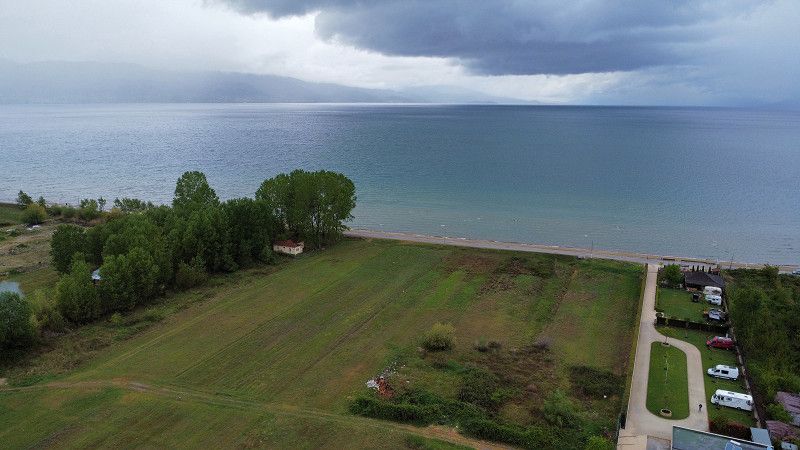
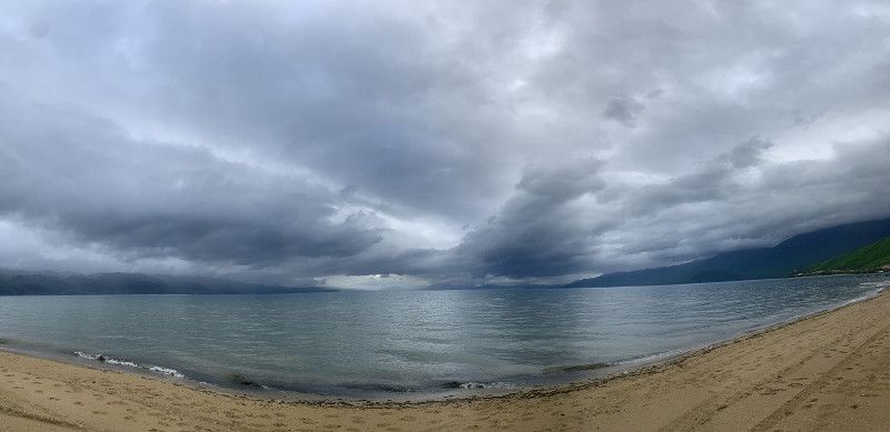
It is raining and so we drive through Ohrid and along the whole of Lake Ohrid until we are just behind the border in Albania: cozy - very clean campsite
Drilon Street, 7301, Pogradec, Albanien
40° 54' 4.5" N 20° 42' 35.5" E
40.9012500 20.7098700
• Head north. Go for 23 m.
• Turn right onto SH64. Go for 747 m.
• Continue on Tushemisht (SH64). Go for 176 m.
• Continue on SH64. Go for 1.7 km.
• Continue on A3. Go for 397 m.
• Turn left. Go for 264 m.
• Turn slightly left. Go for 133 m.
• Arrive at your destination on the left.
☍
3,5 km
( 6 min.)
Day
Lubaništa
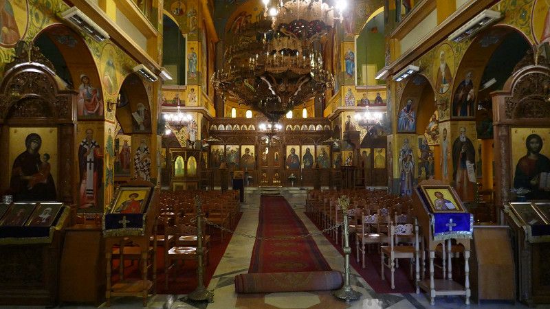
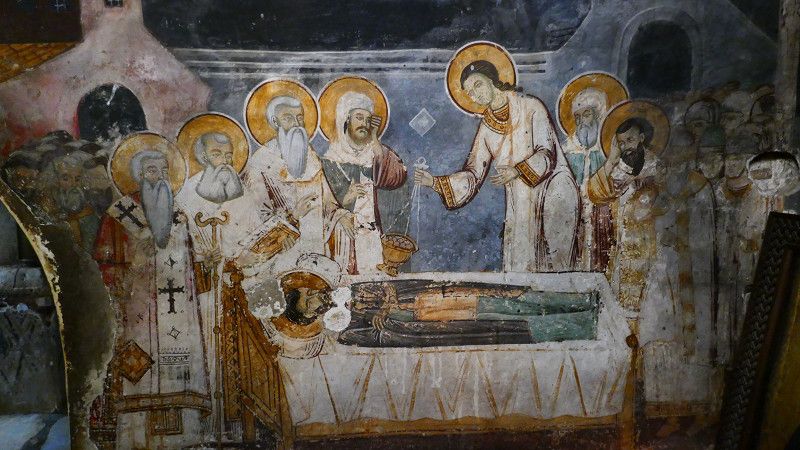
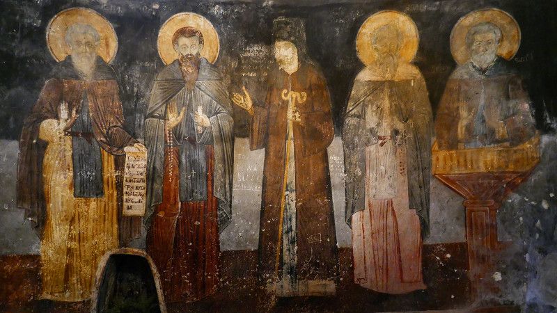
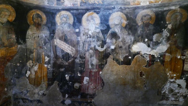
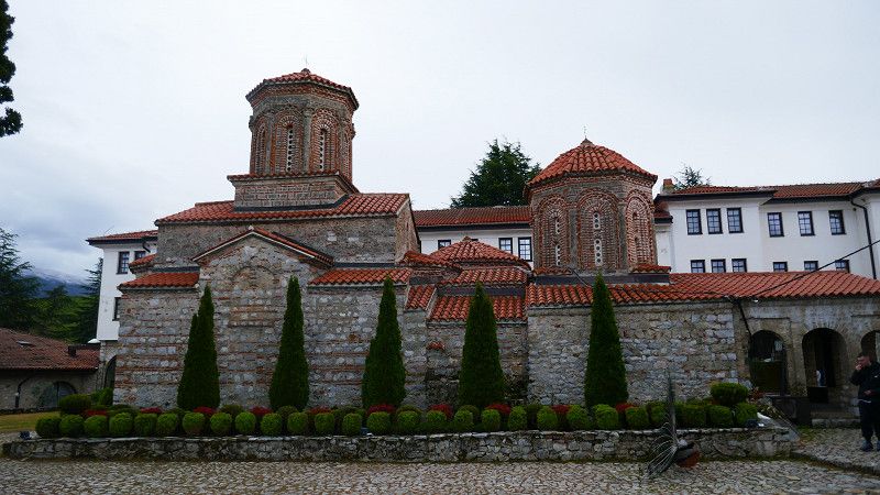
We visit one of the highlights of North Macedonia: the monastery of St. Naum: very impressive
In summer, however, it might be rather uncomfortable here!
Now cold and snow up to about 1'100 - 1'200 m above sea level
R1301, Lubaništa, Region Südwesten, Nordmazedonien
40° 54' 49.5" N 20° 44' 25.8" E
40.9137447 20.7405098
• Head southwest. Go for 397 m.
• Turn right onto A3. Go for 397 m.
• Continue on SH64. Go for 1.7 km.
• Continue on Tushemisht (SH64). Go for 176 m.
• Continue on SH64. Go for 643 m.
• Turn left toward Rruga E Drilonit. Go for 3.5 km.
• Continue on Rruga E Drilonit. Go for 196 m.
• Turn left onto Rruga Harmonia. Go for 378 m.
• Turn left onto Rruga Gani Budka (SH3). Go for 11.3 km.
• Turn left toward Golloborde/Podgorie. Go for 4.1 km.
• Continue on Kapotë. Go for 1.5 km.
• Turn right toward Podgorie. Go for 644 m.
• Continue on Podgorie. Go for 770 m.
• Keep left toward Bregas. Go for 3.0 km.
• Continue on Bregas. Go for 4.1 km.
• Continue on Shëngjergj. Go for 3.8 km.
• Continue on Zvezdë. Go for 1.8 km.
• Turn right onto SH79. Go for 3.2 km.
• Turn left onto E86 toward Bilisht/Greece. Go for 14.7 km.
• Take the 2nd exit from roundabout onto Rruga Superstrada Devoll (E86). Go for 7.3 km.
• Arrive at E86. Your destination is on the left.
☍
63,6 km
(1 hrs. 15 min.)
Grenzübergang nach Griechenland - Δημοτική Ενότητα Κρυσταλλοπηγής
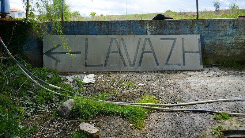
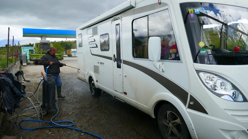
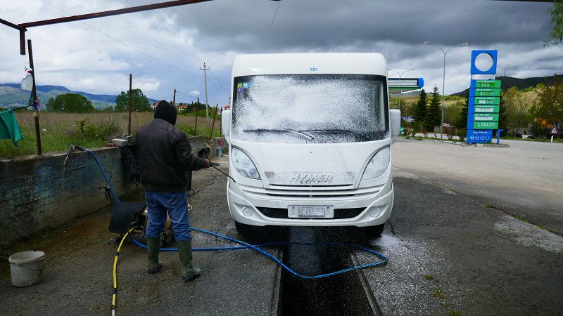
Before that, we have our Hymer washed at a classic LAVAZH and invest the last of our Lekki in diesel...