On September 12th, 2022 we started our tour 4 weeks tour through four countries until October 10th. We were lucky with the weather and had a nice long summer.
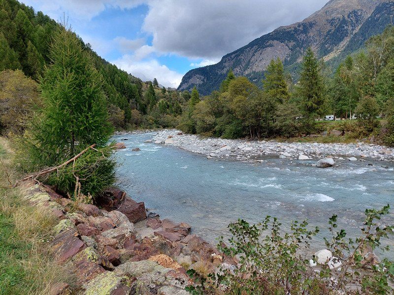
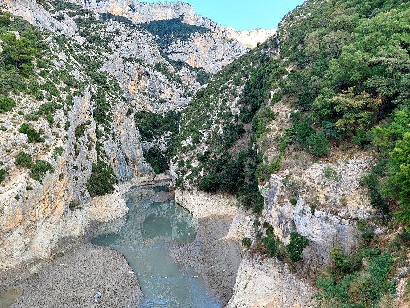
This should not hide the fact that the summer of 2022 was very dry and rivers and lakes (even if this cannot always be seen directly in the following pictures) had very low water levels. In particular, the Verdon Gorge: there was only a trickle.
Note: The route includes campsites where we did not stay (because of the weather or not liking).
Day
92262 Birgland, Deutschland
This is where our journey starts from Bavaria through Austria, Italy, Switzerland and France.
Birgland, Deutschland
92262 Birgland, Deutschland
49° 26' 14.5" N 11° 37' 0.6" E
49.4373538 11.6168325
• Head south on Frechetsfeld (AS36). Go for 259 m.
• Continue on AS36. Go for 938 m.
• Turn right onto AS36 toward Alfeld/Eckeltshof/Kegelheim. Go for 842 m.
• Continue on Hainfeld (AS36). Go for 164 m.
• Continue on AS36. Go for 2.4 km.
• Continue on Eckeltshof (AS36). Go for 277 m.
• Continue on AS36. Go for 1.1 km.
• Continue on Kegelheim (AS36). Go for 688 m.
• Continue on LAU26. Go for 840 m.
• Continue on Kauerheimer Straße (LAU26). Go for 438 m.
• Turn left onto Hauptstraße (St2236) toward Nürnberg/A6/Amberg/Lauterhofen. Go for 1.9 km.
• Take ramp onto A6 toward Nürnberg. Go for 25.8 km.
• Take exit 60 toward München onto A9. Go for 150 km.
• Take exit 76 toward M.-Schwabing/München Centrum/Garmisch-P./A95/Mittl. Ring West/BMW Welt/Olympiapark/SAP Garden onto B2R (Mittlerer Ring). Go for 561 m.
• Keep left onto Mittlerer Ring (B2R) toward Garmisch-P./A95/Lindau/A96/Stuttgart/A8. Go for 2.0 km.
• Keep left onto Mittlerer Ring (B2R) toward A8/A96/A95/Stuttgart/Lindau/Garmisch-P. Go for 1.2 km.
• Take ramp onto Landshuter Allee (B2R) toward Garmisch-P./A95/Lindau/A96. Go for 4.3 km.
• Keep left onto Donnersbergerbrücke (B2R). Go for 3.8 km.
• Keep right onto Anschlussstelle München-Sendling-Süd toward Garmisch-P. Go for 333 m.
• Continue on A95. Go for 47.8 km.
• Take exit 9 toward Sindelsdorf/Bad Tölz/Bichl/Peißenberg. Go for 246 m.
• Turn right onto B472 toward Bad Tölz/Kochel/Benediktbeuern/Bichl/Penzberg/Sindelsdorf. Go for 5.9 km.
• Turn right onto B11 toward Innsbruck/Kochel am See/Benediktbeuern/Bichl. Go for 2.4 km.
• Arrive at Kocheler Straße (B11). Your destination is on the left.
☍
253,9 km
(2 hrs. 34 min.)
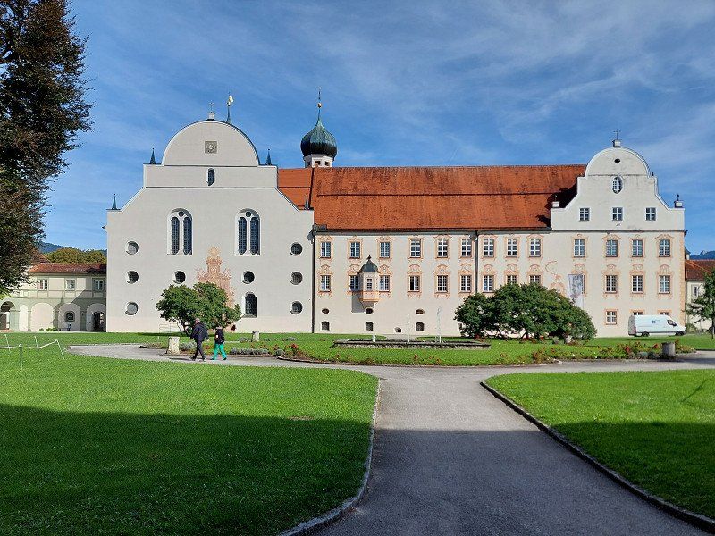
Benediktbeuern, Deutschland
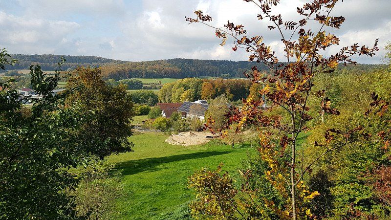
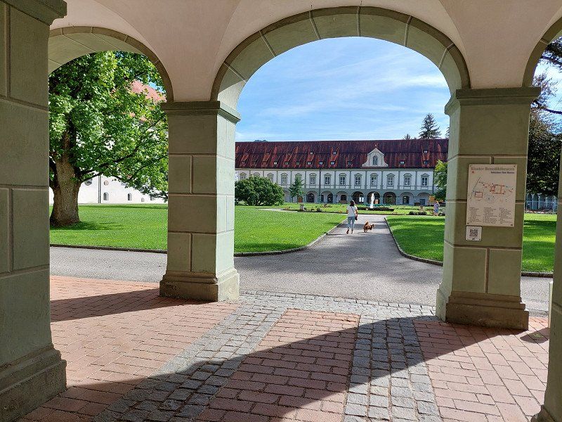
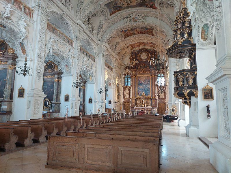
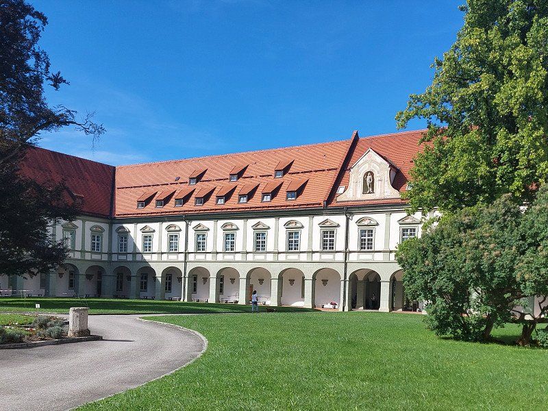
The first stage of the day takes us past Munich into the Bavarian foothills of the Alps, where we make a short stopover in Benediktbeuern and visit the former Benedictine monastery.
47° 42' 22.2" N 11° 24' 40.6" E
47.7061744 11.4112816
• Head south on Kocheler Straße (B11). Go for 9.5 km.
• Turn right. Go for 72 m.
• Arrive at your destination on the left.
☍
9,6 km
( 9 min.)
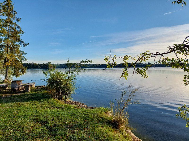
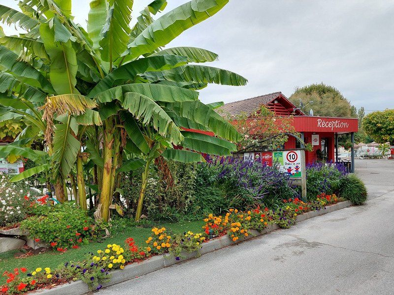
Campingplatz Renken am Kochelsee
The Kochelsee is only a few minutes' drive from the Benedictine monastery.
Although we are on the road after the summer holidays, we cannot find a campsite on the Kochelsee and Walchensee that still has a free space for our campervan.
A reservation at these hotspots is highly recommended!
Mittenwalder Strasse 106, 82431, Kochel am See, Germany
47° 38' 22.8" N 11° 21' 15.2" E
47.6396800 11.3542200
• Head southeast. Go for 72 m.
• Turn left onto B11. Go for 2.8 km.
• Turn left onto Schlehdorfer Straße (St2062) toward München/Garmisch/Murnau/Schlehdorf. Go for 16.5 km.
• Turn right onto Burggraben (B2). Go for 211 m.
• Continue on B2. Go for 502 m.
• Turn left toward Oberammergau/Bad Kohlgrub/Uffing/Seehausen/P+R/Staffelsee. Go for 239 m.
• Pass 2 roundabouts and continue on Seehauser Straße (St2372). Go for 5.6 km.
• Turn left onto Seestraße. Go for 1.7 km.
• Turn right toward Aichalehof. Go for 66 m.
• Continue on Aichalehof. Go for 25 m.
• Turn left onto Aichalehof. Go for 45 m.
• Arrive at Aichalehof. Your destination is on the right.
☍
27,8 km
( 32 min.)
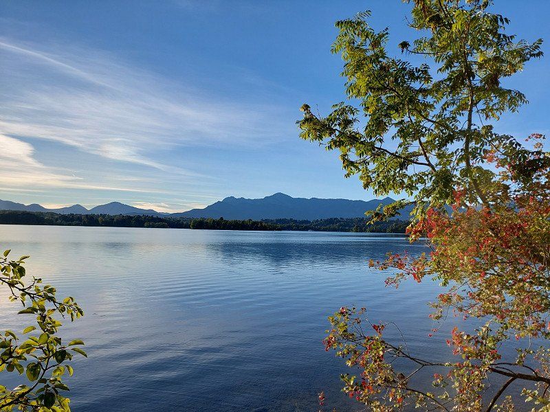
Camping Aichalehof
We then drove to Staffelsee.
It is quieter here and there are great hiking opportunities.
Ideal for dogs!
Aichalehof 4, 82449, Uffing am Staffelsee, Germany
47° 41' 55" N 11° 9' 31" E
47.6986100 11.1586100
• Head west on Aichalehof. Go for 45 m.
• Turn right onto Aichalehof. Go for 91 m.
• Turn left onto Seestraße. Go for 1.7 km.
• Turn right onto Murnauer Straße (St2372). Go for 5.3 km.
• Pass 2 roundabouts. Go for 497 m.
• Turn right onto Kellerstraße (B2). Go for 6.3 km.
• Take ramp onto A95 toward Garmisch-P. Go for 5.3 km.
• Continue on B2. Go for 11.1 km.
• Take ramp onto B23 toward Fernpass/Reutte/Grainau/Garmisch/Burgrain. Go for 1.4 km.
• Continue on B23. Go for 79 m.
• Take the 2nd exit from roundabout onto B23 toward Fernpass/Reutte/Grainau. Go for 5.5 km.
• Turn left onto Schmölzstraße toward Obergrainau/Höllentalklamm. Go for 18 m.
• Turn right onto Schmölzstraße. Go for 544 m.
• Turn left onto Wankstraße. Go for 86 m.
• Continue on Ofenlainweg. Go for 219 m.
• Turn left onto Degernau. Go for 60 m.
• Arrive at Degernau.
☍
38,2 km
( 42 min.)
Day
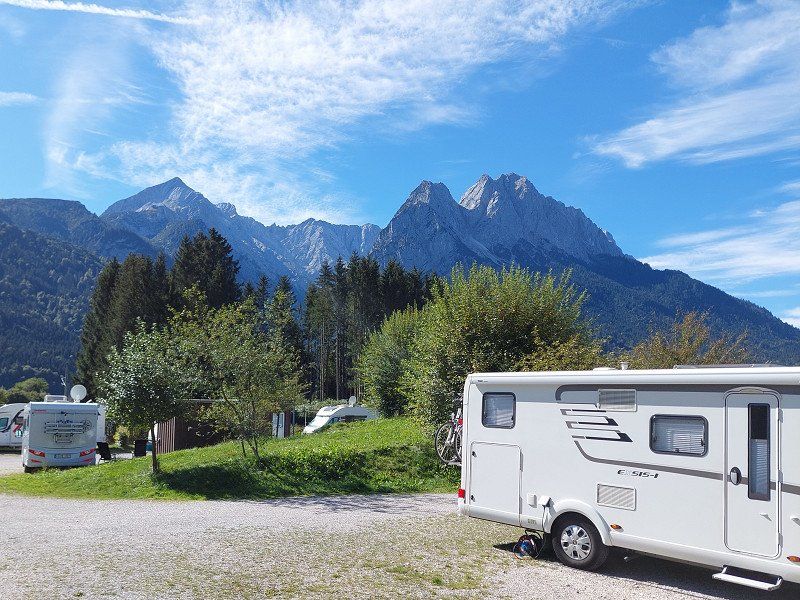
Camping Resort Zugspitze
From the campsite, take the bus to the Eibsee. From there with the cable car to the Zugspitze.
Griesener Straße 9, 82491, Grainau, Germany
47° 28' 38.5" N 11° 3' 12.7" E
47.4773600 11.0535300
• Head west on Degernau. Go for 60 m.
• Turn right onto Ofenlainweg. Go for 219 m.
• Continue on Wankstraße. Go for 86 m.
• Turn right onto Schmölzstraße. Go for 544 m.
• Turn left onto Schmölzstraße. Go for 18 m.
• Turn left onto Griesener Straße (B23). Go for 283 m.
• Take the 1st exit from roundabout onto B23. Go for 10.0 km.
• Continue on Ehrwalder Bundesstraße (B187). Go for 7.5 km.
• Turn left onto Garmischer Straße (L391). Go for 2.0 km.
• Take the 2nd exit from roundabout onto Innsbrucker Straße (L391). Go for 5.5 km.
• Keep right toward Fernpass. Go for 248 m.
• Take ramp. Go for 71 m.
• Turn right onto Fernpass Bundesstraße (B179). Go for 14.4 km.
• Take ramp onto Mieminger Bundesstraße (B189) toward Imst/Arlberg/Reschen. Go for 10.2 km.
• Take the 2nd exit from roundabout onto Mieminger Bundesstraße (B189) toward Landeck/B171. Go for 1.5 km.
• Take the 2nd exit from roundabout onto Bundesstraße (B171). Go for 4.5 km.
• Take the 2nd exit from roundabout onto A12 (Inntal Autobahn) toward Bregenz. Go for 8.7 km.
• Take the exit toward B180/Reschenpass/Kaunertal/Meran/St. Moritz onto A12 (Inntal Autobahn). Go for 12.9 km.
• Turn right toward Prutz. Go for 197 m.
• Take the 1st exit from roundabout onto Prutz. Go for 92 m.
• Turn right onto Pontlatzstraße. Go for 368 m.
• Turn right. Go for 17 m.
• Turn left. Go for 16 m.
• Arrive at your destination on the right.
☍
79,4 km
(1 hrs. 18 min.)
Day
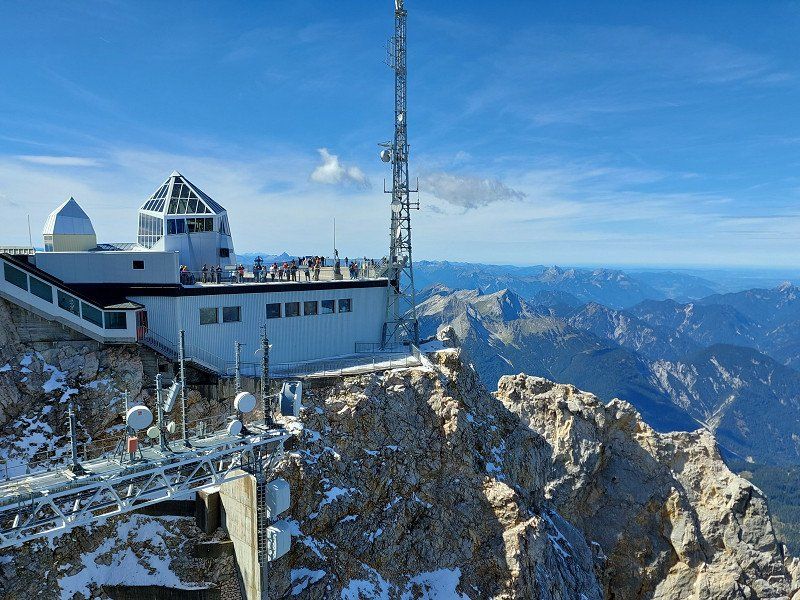
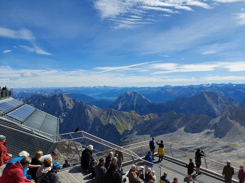
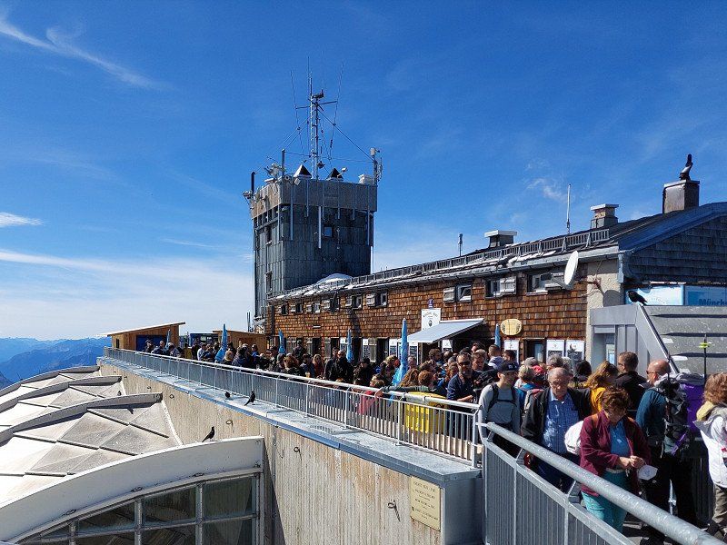
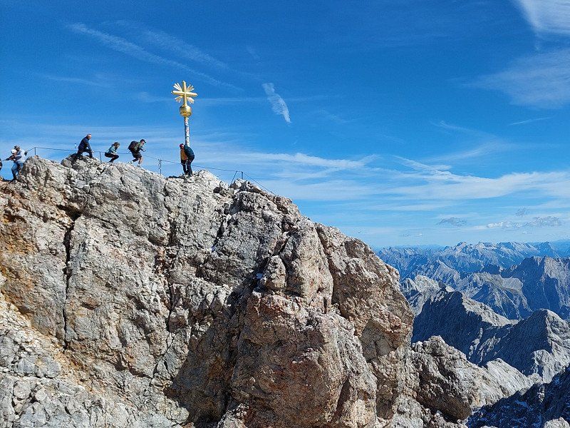
Zugspitze
Germany's highest mountain is quite crowded.
Day
Aktiv-Camping Prutz / Tirol, Pontlatzstraße, Prutz, Österreich
Despite good sanitary facilities, we did not like this campsite.
It lies between the Inn and a busy road.
We then immediately drove on to Italy.
Pontlatzstraße 22, 6522 Prutz, Österreich
47° 4' 49.2" N 10° 39' 34.3" E
47.0803274 10.6595161
• Head south. Go for 16 m.
• Turn right toward Pontlatzstraße. Go for 17 m.
• Turn left onto Pontlatzstraße. Go for 433 m.
• Continue on Prutz. Go for 12 m.
• Take the 1st exit from roundabout toward St.Moritz/Reschenpass. Go for 305 m.
• Continue on Prutz (B180). Go for 19.0 km.
• Turn right onto Engadiner Bundesstraße (B184) toward St.Moritz. Go for 2.7 km.
• Continue on 27. Go for 6.3 km.
• Turn left onto Plan da La Punt. Go for 52 m.
• Continue on Martinsbrucker Bundesstraße (B185). Go for 7.6 km.
• Turn right onto Bundesstraße (B180) toward Italien/Reschenpass. Go for 4.4 km.
• Continue on Via Nazionale (SS40). Go for 10.3 km.
• Turn sharp right onto Via Casone. Go for 79 m.
• Continue on Via Vittorio Veneto. Go for 88 m.
• Arrive at Via Vittorio Veneto. Your destination is on the left.
☍
51,3 km
( 51 min.)
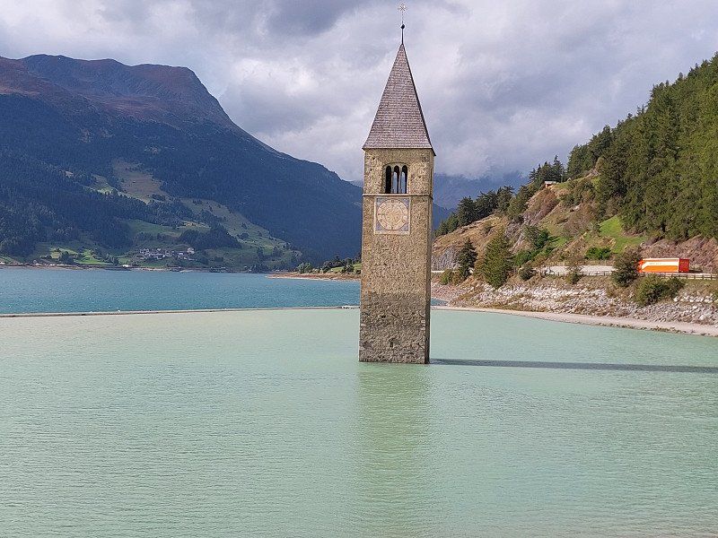
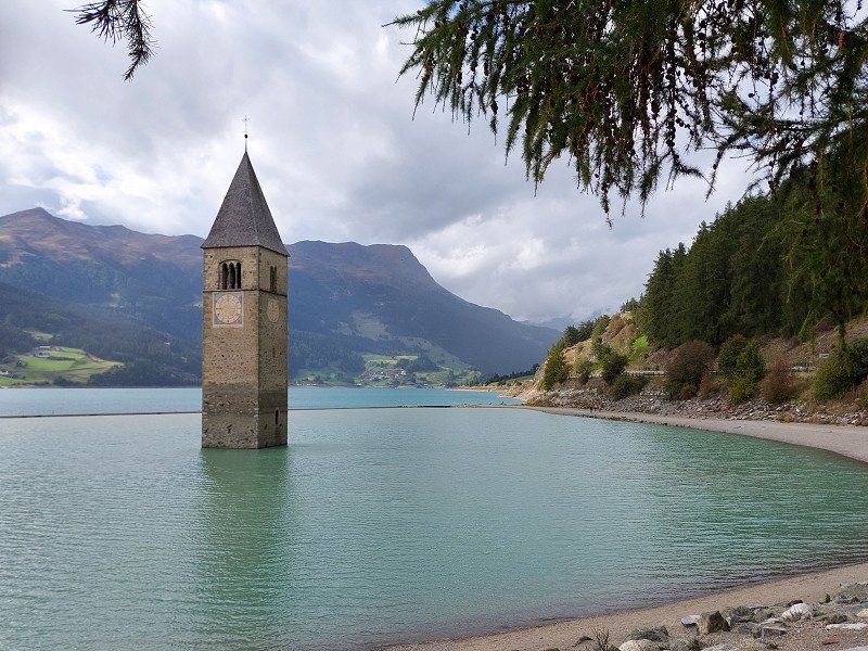
Camping Thöni
The sunken tower in the lake...
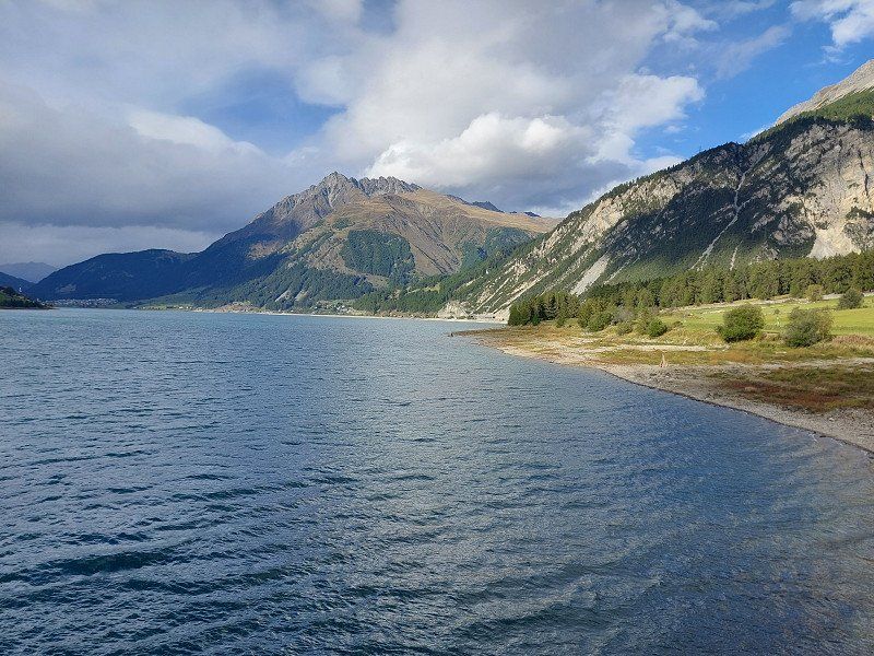
The campsite is located between Lake Reschen and Lake Haider.
Ideal for a hike at the Haider Alm. (mountain railway)
The dammed water in Lake Reschen is used to generate electricity, which is then transported to Milan.
Landstraße 83, 39027, St. Valentin a.d.H. Graun, Italy
46° 46' 11.4" N 10° 31' 55.9" E
46.7698300 10.5322000
• Head toward Via Casone on Via Vittorio Veneto. Go for 88 m.
• Continue on Via Casone. Go for 79 m.
• Turn right onto Via Vittorio Veneto (SS40). Go for 8.0 km.
• Take the 2nd exit from roundabout onto Strada Statale del Passo Resia (SS40) toward Mals/Malles/Meran/Merano. Go for 4.4 km.
• Turn right onto Strada Provinciale Glorenza-Malles Venosta (SP85) toward Glurns/Glorenza/Industriegebiet Mals/Zona Industriale Malles V. Go for 100 m.
• Take the 1st exit from roundabout onto Via Glorenza (SP85). Go for 166 m.
• Continue on Via Glorenza (SP85). Go for 1.8 km.
• Arrive at Via Malles (SP85). Your destination is on the right.
☍
14,6 km
( 16 min.)
Day
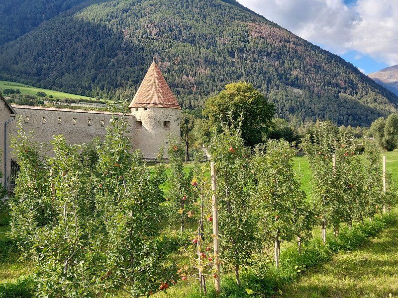
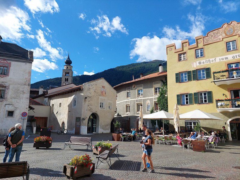
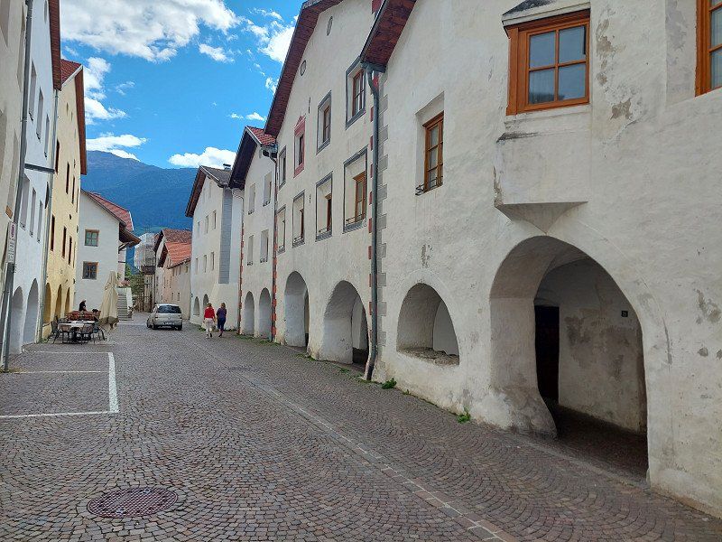
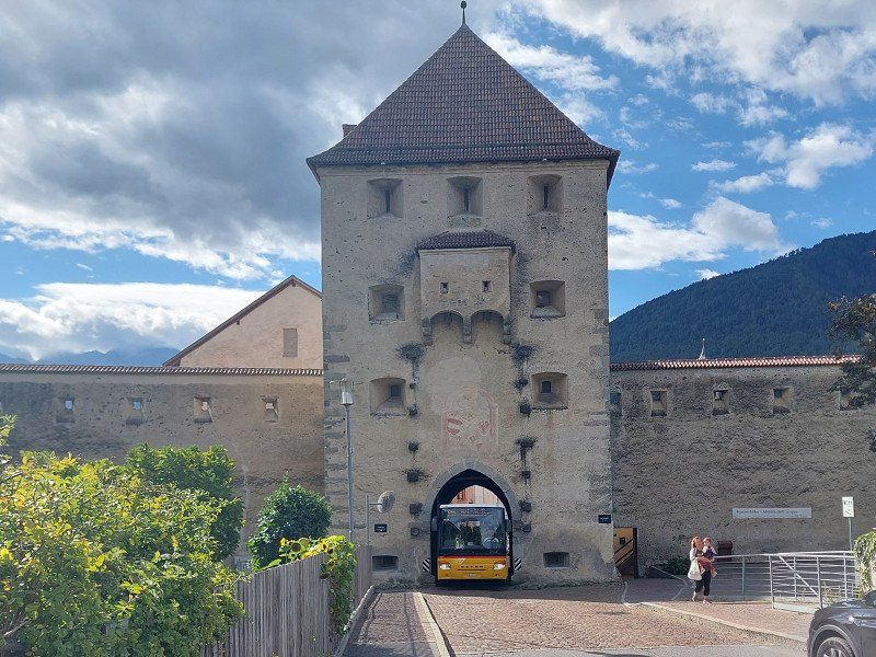
Glurns, Autonome Provinz Bozen - Südtirol, Italien
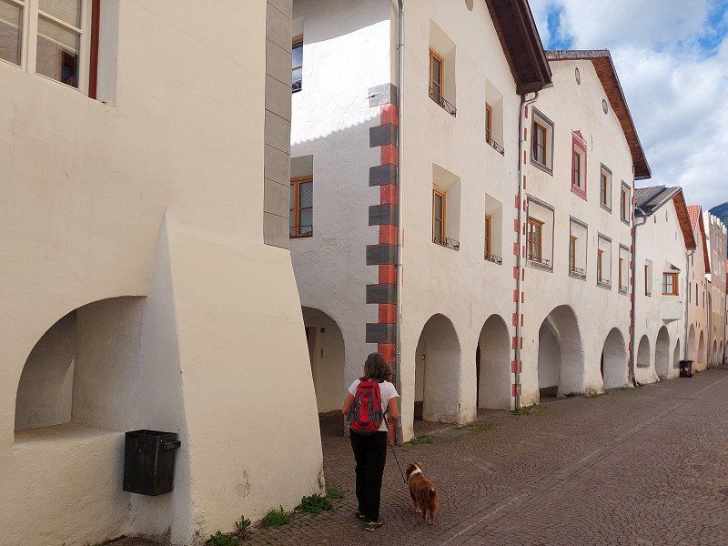
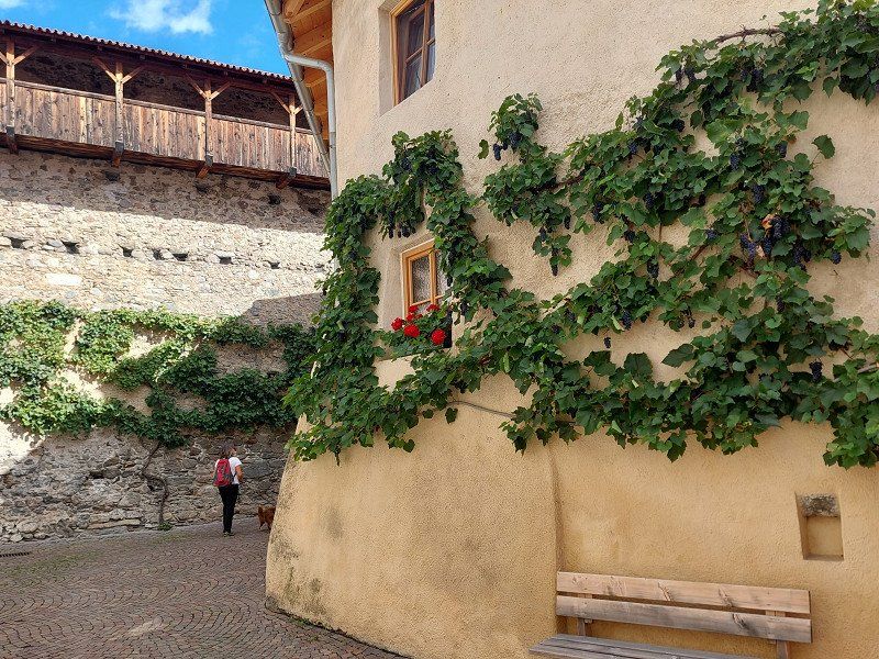
Glorenza (Province of Bozen) - The smallest town in South Tyrol
As one of the smallest towns in the Alps and also in Europe, Glurns has retained its medieval flair with its completely preserved town walls to this day.
The city is located in Vinschgau on the upper Etsch. Due to its favorable location on the Swiss border, it quickly became rich and known for its market.
39020 Glurns, Autonome Provinz Bozen - Südtirol, Italien
46° 40' 14.3" N 10° 33' 10.6" E
46.6706289 10.5529478
• Head toward Piazza della Città on Via Malles (SP85). Go for 7 m.
• Turn slightly right onto Via Flora (SS41). Go for 9.6 km.
• Continue on Cunfin (28). Go for 8.6 km.
• Arrive at Bulaseras (28). Your destination is on the right.
☍
18,2 km
( 22 min.)
Val Müstair, Schweiz
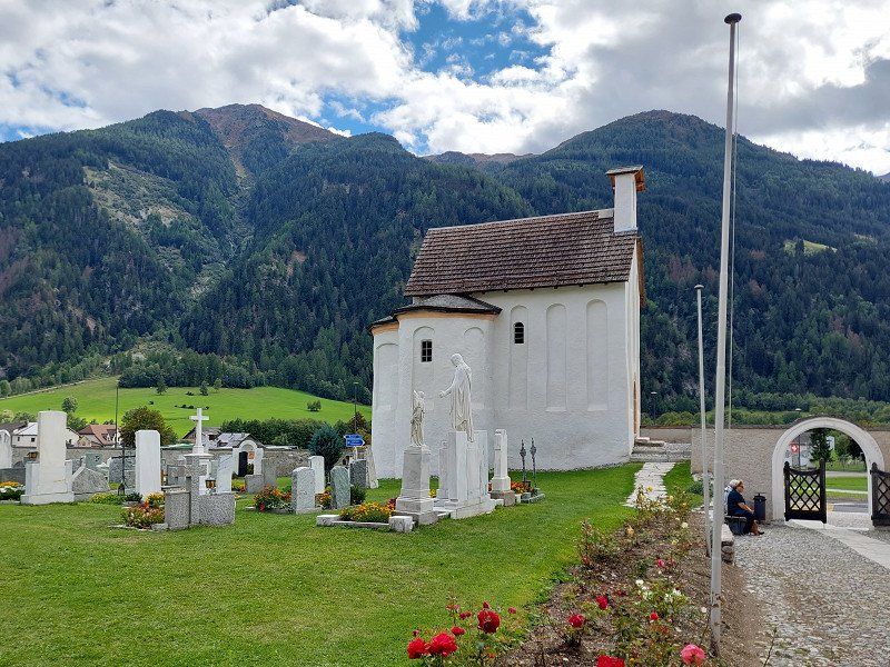
Mustair Monastery
The monastery in the Swiss canton of Graubünden is a very well-preserved medieval monastery from the Carolingian period. The monastery was included in the UNESCO World Heritage List in 1983.
46° 36' 22.6" N 10° 22' 49.5" E
46.6062803 10.3804262
• Head toward Furom on Bulaseras (28). Go for 31.3 km.
• Turn left onto Via Sura (27). Go for 765 m.
• Turn sharp right onto Madinas. Go for 102 m.
• Turn left onto Madinas. Go for 97 m.
• Turn right onto Cul. Go for 162 m.
• Arrive at Cul. Your destination is on the right.
☍
32,5 km
( 34 min.)
Day
Day
Camping Cul
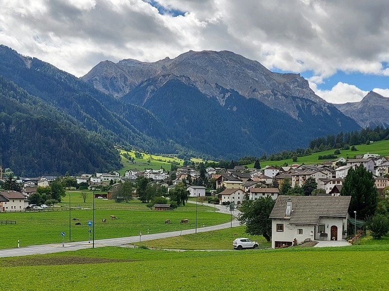
Gateway to the Swiss National Park
Since 1914, the Swiss National Park in the Engadin and Val Müstair has been the oldest and best protected wilderness area in the Alps.
Campsite at the Inn with a beautiful view of the mountains.
Great hiking and biking trails!
Madinas s/n, 7530, Zernez, Switzerland
46° 41' 51.3" N 10° 5' 13" E
46.6975800 10.0869400
• Head toward Sur Crusch on Cul. Go for 162 m.
• Turn left onto Madinas. Go for 97 m.
• Turn right onto Madinas. Go for 102 m.
• Turn right onto 27. Go for 26.0 km.
• Pass 2 roundabouts and continue on Via da Puntraschigna (27/29). Go for 2.4 km.
• Take the 1st exit from roundabout onto 27. Go for 3.1 km.
• Pass 5 roundabouts and continue on Via San Gian (27). Go for 5.3 km.
• Take the 4th exit from roundabout onto Via Chantunela (3/27) toward Malojapass/Silvaplana. Go for 1.1 km.
• Take the 2nd exit from roundabout onto Via Chantunela (3) toward Malojapass. Go for 722 m.
• Take the 3rd exit from roundabout. Go for 68 m.
• Turn left toward Via da Bos-Cha. Go for 119 m.
• Turn right onto Via da Bos-Cha. Go for 21 m.
• Arrive at Via da Bos-Cha. Your destination is on the right.
☍
39,2 km
( 38 min.)
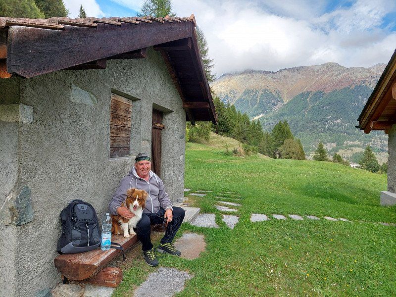
Camping Silvaplana
We just planned. With a hike to Grevasalvas.
But at these altitudes it is a bit colder. We drove past this campsite, further down the mountains into Italy to Lake Como.
via bos-cha , 7513, Silvaplana, Switzerland
46° 27' 20.6" N 9° 47' 33.9" E
46.4557200 9.7927400
• Head north on Via da Bos-Cha. Go for 21 m.
• Turn left. Go for 119 m.
• Turn right toward Stradun Chantunel/3. Go for 13 m.
• Take the 3rd exit from roundabout onto Stradun Chantunel (3) toward Chiavenna/Malojapass. Go for 2.9 km.
• Pass 3 roundabouts and continue on Vecchia Dogana (3). Go for 29.3 km.
• Continue on Strada Statale della Maloja (SS37). Go for 334 m.
• Take the 2nd exit from roundabout onto Strada Statale della Maloja (SS37) toward Milano/Chiavenna. Go for 9.7 km.
• Take the 3rd exit from Largo Valichi Alpini Antonio Pio roundabout onto Via Consoli Chiavennaschi (SS36) toward Milano/Lecco. Go for 305 m.
• Continue on Piazza Giuseppe Verdi (SS36) toward Milano/Lecco. Go for 21 m.
• Pass 5 roundabouts and continue on Strada Statale del Lago di Como e dello Spluga (SS36). Go for 20.0 km.
• Turn right onto Via Regina (SP4) toward Como/Lugano. Go for 669 m.
• Continue on Strada Provinciale Valeriana (SPEXSS402). Go for 1.5 km.
• Take the 1st exit from roundabout onto SS340dir toward Gravedona/Menaggio/Como. Go for 6.7 km.
• Turn slightly left onto Via Case Sparse. Go for 293 m.
• Arrive at Via Case Sparse. Your destination is on the left.
☍
72,0 km
(1 hrs. 23 min.)
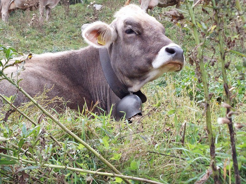
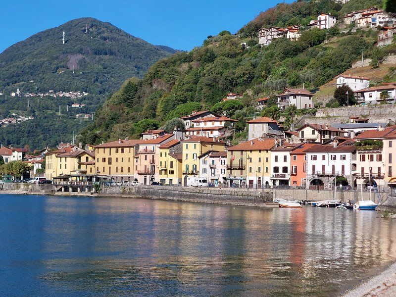
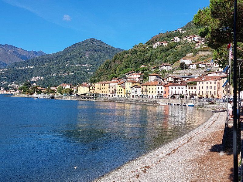
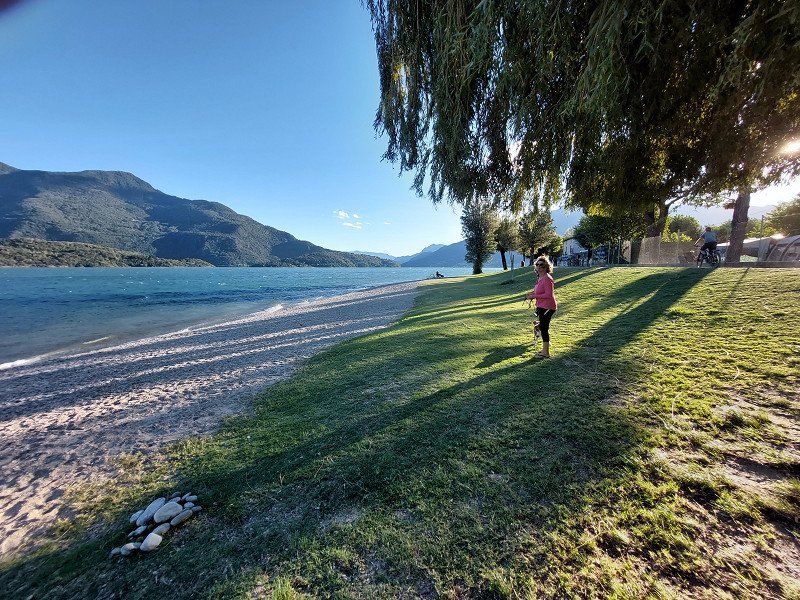
Day
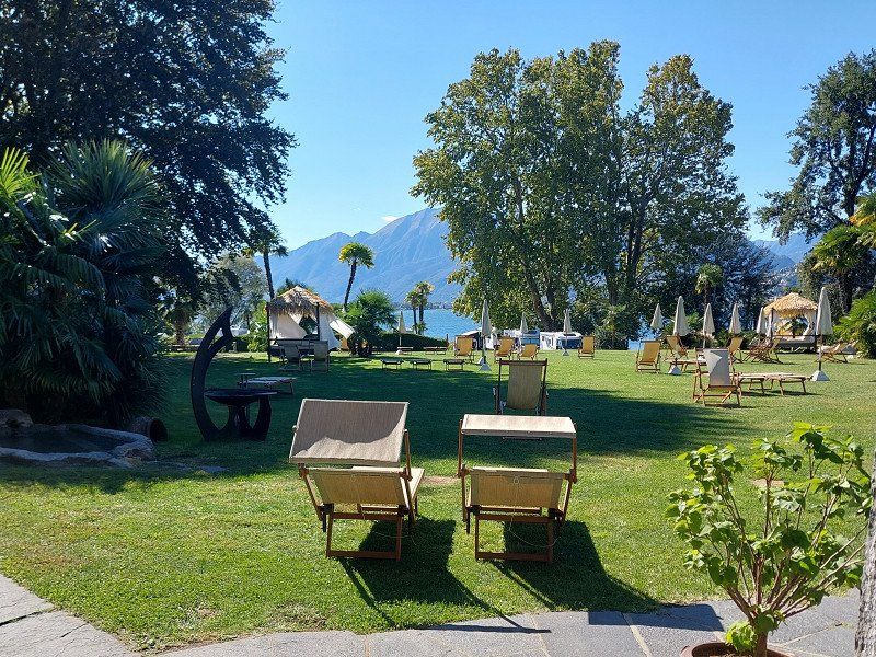
Campeggio Gardenia
Domaso - Most beautiful town on Lake Como
Campsite directly on Lake Como. In the high season more of a parking space character. But good infrastructure and inexpensive.
Less suitable for dogs. We drove on after one night.
Case Sparse 164, 22013, Domaso, Italy
46° 9' 3.6" N 9° 20' 14.7" E
46.1509900 9.3374200
• Head northwest on Via Case Sparse. Go for 293 m.
• Turn left onto Via Case Sparse (SS340dir). Go for 4.6 km.
• Take the 3rd exit from roundabout onto Via Statale (SS340dir). Go for 1.0 km.
• Take the 2nd exit from roundabout onto Via delle Rimembranze (SS340dir). Go for 13.8 km.
• Take ramp toward Porlezza/Lugano/Menaggio Centro/Ospedale Erba-Renaldi. Go for 519 m.
• Take the 1st exit from roundabout onto Via Luigi Cadorna (SS340). Go for 6.1 km.
• Pass 2 roundabouts and continue on Via Statale (SS340). Go for 5.1 km.
• Take the 1st exit from roundabout onto Via Porto Letizia (SS340). Go for 4.5 km.
• Continue on Galleria Albogasio. Go for 3.4 km.
• Continue on Via Statale. Go for 724 m.
• Continue on Strada di Gandria (399). Go for 3.2 km.
• Turn right onto Strada di Fulmigniano. Go for 773 m.
• Continue on Via Ceresio di Suvigliana. Go for 841 m.
• Continue on Via Ruvigliana. Go for 804 m.
• Take the 2nd exit from roundabout onto Via Pazzalino. Go for 159 m.
• Continue on Strada di Pregassona. Go for 469 m.
• Turn left onto Viale Cassone. Go for 793 m.
• Turn right onto Via Ceresio. Go for 408 m.
• Continue on Via alla Bozzoreda. Go for 395 m.
• Turn right onto Via Sonvico (402). Go for 270 m.
• Take the 2nd exit from roundabout onto Via Sonvico (402). Go for 359 m.
• Keep left onto Via Sonvico (399) toward Bellinzona/Chiasso/Lugano. Go for 99 m.
• Keep right onto 399 toward Bellinzona/Chiasso. Go for 3.0 km.
• Turn right and take ramp onto A2 toward San Gottardo/Bellinzona. Go for 12.2 km.
• Take exit 48 toward Rivera/Monte Ceneri onto 2. Go for 7.7 km.
• Continue on Via Monte Ceneri. Go for 561 m.
• Take the 2nd exit from roundabout onto Via Cantonale (406). Go for 525 m.
• Pass 4 roundabouts and continue on Via Monte Ceneri (406). Go for 3.8 km.
• Keep right toward Via Monte Ceneri. Go for 123 m.
• Continue on Via Monte Ceneri. Go for 405 m.
• Continue on Strada Cantonale. Go for 1.3 km.
• Take the 2nd exit from roundabout onto A13. Go for 2.3 km.
• Take ramp toward Valle Verzasca/Tenero. Go for 255 m.
• Take the 2nd exit from roundabout onto Via delle Ressighe. Go for 700 m.
• Take the 3rd exit from roundabout. Go for 63 m.
• Continue on Via Naviglio. Go for 189 m.
• Turn slightly right onto Via Naviglio. Go for 64 m.
• Continue on Via Roncaccio. Go for 23 m.
• Turn right onto Via Roncaccio. Go for 66 m.
• Arrive at Via Roncaccio. Your destination is on the right.
☍
81,8 km
(1 hrs. 43 min.)
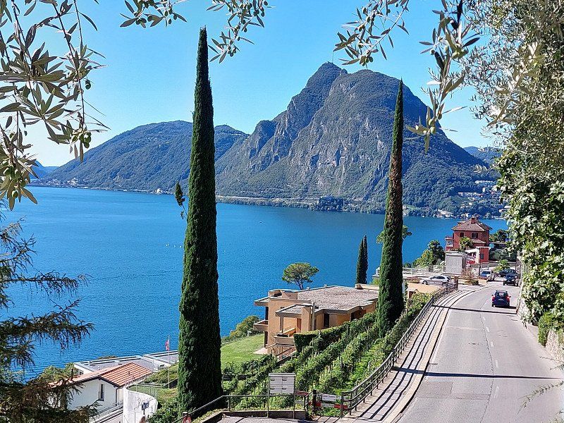
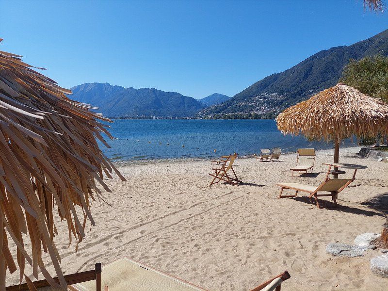
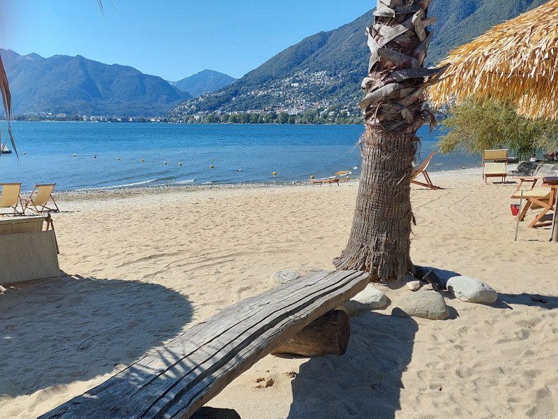
Day
Day
Caravan Camping Miralago SA
First we wanted to go to the Lago Maggiore campsite. However, dogs are not allowed there.
That's why we chose Camping Miralago. The restaurant is expensive considering the quality. But that's nothing new for many 5-star places.
Via Roncaccio 20, 6598, Tenero, Switzerland
46° 10' 22.4" N 8° 50' 47.9" E
46.1728800 8.8466300
• Head east on Via Roncaccio. Go for 66 m.
• Turn left onto Via Roncaccio. Go for 23 m.
• Continue on Via Naviglio. Go for 264 m.
• Take the 1st exit from roundabout onto Via delle Ressighe. Go for 678 m.
• Take the 2nd exit from roundabout onto A13 toward Locarno. Go for 1.1 km.
• Keep left onto A13 toward Brissago/Ascona/Locarno. Go for 5.9 km.
• Keep left onto Galleria Mappo Morettina (A13) toward Brissago/Centovalli/Ascona/Maggia/Onsernone. Go for 1.2 km.
• Keep left onto A13 toward Italia/Brissago/Ascona. Go for 197 m.
• Continue on 13. Go for 9.6 km.
• Continue on Strada Statale del Lago Maggiore (SS34). Go for 24.6 km.
• Take the 2nd exit from roundabout onto Corso Goffredo Mameli (SS34). Go for 483 m.
• Take the 3rd exit from roundabout onto Strada Statale del Lago Maggiore (SS34). Go for 1.5 km.
• Take the 3rd exit from roundabout onto Corso Europa (SS34). Go for 321 m.
• Pass 3 roundabouts and continue on Strada Statale del Lago Maggiore (SS34). Go for 5.7 km.
• Take the 2nd exit from Piazzale Caduti dei Lager Nazisti roundabout onto Via per Feriolo (SP167). Go for 2.1 km.
• Take the 2nd exit from roundabout onto Strada Nazionale Sempione Feriolo (SS33). Go for 1.2 km.
• Take ramp onto Via degli Scalpellini. Go for 1.1 km.
• Take ramp onto A26 (Autostrada Genova Voltri-Gravellona Toce). Go for 27.5 km.
• Take the left exit toward Genova/Torino/A4/Aosta/A5 onto A26 (Autostrada Genova Voltri-Gravellona Toce). Go for 33.9 km.
• Take the exit toward Torino/E66 onto A4 (Autostrada Torino-Trieste). Go for 27.1 km.
• Take the exit toward Santhià. Go for 1.3 km.
• Take the 1st exit from roundabout. Go for 351 m.
• Take the 4th exit from roundabout onto Corso 25 Aprile (SP143) toward Biella/Ivrea/Cavaglià. Go for 1.2 km.
• Take the 3rd exit from roundabout onto Strada Provinciale Vercellese (SP143). Go for 3.7 km.
• Turn right onto Strada Provinciale Vercellese (SP143) toward Biella/Ivrea/Aosta/Torino/Cavaglia. Go for 414 m.
• Take the 3rd exit from roundabout onto Via San Giovanni Bosco. Go for 350 m.
• Continue on Via Roma. Go for 341 m.
• Turn right onto Via San Rocco. Go for 145 m.
• Turn right onto Via San Rocco (SS228). Go for 1.4 km.
• Take the 2nd exit from roundabout onto Via Ivrea (SS228). Go for 1.7 km.
• Take the 3rd exit from roundabout onto Via Alice Castello (SP420). Go for 1.7 km.
• Turn right onto Strada Comuna-Masseria. Go for 2.3 km.
• Turn slightly left onto Via Becco di Cugno. Go for 185 m.
• Arrive at Via Becco di Cugno. Your destination is on the right.
☍
159,6 km
(2 hrs. 20 min.)
Day
CAMPING HAWAY, Frazione Masseria, Viverone, Biella, Italien
The owner of the campsite pretended to be fully booked, so we drove a few kilometers further.
Frazione Masseria, s.n.c, 13886 Viverone BI, Italien
45° 24' 20.3" N 8° 1' 57.2" E
45.4056510 8.0325500
• Head toward Frazione Masseria on Via Becco di Cugno. Go for 185 m.
• Turn slightly right onto Strada Comuna-Masseria. Go for 2.3 km.
• Turn left onto Via Alice Castello (SP420). Go for 1.6 km.
• Take the 3rd exit from roundabout onto Via SP228 del Lago di Viverone (SS228). Go for 547 m.
• Turn left onto Viale Lido Maggiore Croce Arturo. Go for 429 m.
• Turn right onto Viale Lungo Lago Ignazio Tarello. Go for 226 m.
• Make a U-Turn onto Viale Lungo Lago Ignazio Tarello. Go for 88 m.
• Arrive at Viale Lungo Lago Ignazio Tarello.
☍
5,3 km
( 14 min.)
Viverone, Italien
Camping IL SALICE
Strada Provinciale 123
Viverone (Bi)
Tel. 348.52.31.964
Very nice operator. Enzo explained to me which restaurants were open in town (within walking distance).
Lago di Viverone, Italien
45° 25' 2.4" N 8° 2' 11.5" E
45.4173225 8.0365198
• Head toward Viale Lungo Lago on Viale Lungo Lago Ignazio Tarello. Go for 143 m.
• Turn left onto Viale Lido Maggiore Croce Arturo. Go for 429 m.
• Turn left onto Via Provinciale (SS228). Go for 1.7 km.
• Continue on Strada Provinciale della Frazione Boschi (SPEXSS228). Go for 3.2 km.
• Turn left onto Strada per Strambino (SP56). Go for 1.9 km.
• Turn right onto Strada Provinciale di Pobbia (SP262) toward Albiano-Ivrea/Autostrade. Go for 434 m.
• Turn left onto Strada Provinciale di Azeglio (SP79). Go for 4.0 km.
• Take the 3rd exit from roundabout onto Piazza Umberto I (SP80) toward Autostrade/Caravino/Cossano. Go for 829 m.
• Take ramp onto A5 (Diramazione A4/A5) toward Torino/Aosta. Go for 8.2 km.
• Take the left exit toward Torino onto A5 (Autostrada Torino-Aosta). Go for 34.3 km.
• Continue on A55 (Tangenziale Nord). Go for 16.3 km.
• Take the exit toward Frejus/T4/Bardonecchia/A32/Strada Statale del Moncenisio/SS25 onto A55 (Tangenziale Nord). Go for 3.9 km.
• Continue on A32 (Autostrada Torino-Bardonecchia). Go for 61.5 km.
• Take the exit toward Oulx Circ.ne/Sestriere/SS23 onto Raccordo Di Oulx. Go for 2.4 km.
• Take ramp onto Strada Statale del Monginevro (SS24) toward Cesana/Sestriere/Claviere/Monginevro/SR23/Sauze di Cesana. Go for 8.7 km.
• Pass 2 roundabouts and continue on Viale Generale Sibille (SS24). Go for 6.1 km.
• Take the 1st exit from roundabout onto Strada Statale del Monginevro (SS24). Go for 1.5 km.
• Continue on N94. Go for 1.5 km.
• Take the 3rd exit from roundabout onto N94 toward Briançon/Névache. Go for 869 m.
• Take the 2nd exit from roundabout onto Rue des Sablons (N94) toward Briançon/Névache. Go for 10.6 km.
• Take the 3rd exit from Place Champ-de-Mars roundabout onto Avenue Baldenberger (N94). Go for 400 m.
• Turn left onto Avenue de la Libération (D2) toward Centre Ville. Go for 999 m.
• Take the 3rd exit from roundabout onto Avenue Maurice Petsche (D2). Go for 183 m.
• Take the 1st exit from roundabout onto Avenue Maurice Petsche (D2). Go for 263 m.
• Turn left onto Route de Gap (N94). Go for 1.7 km.
• Take the 2nd exit from roundabout onto Route de Gap (N94) toward Gap/Sisteron/St Martin de Qres/L'Argentière la Bessée/Embrun. Go for 4.7 km.
• Turn right onto D4 toward Les Vigneaux/Puy St Vincent/Vallouise/Pelvoux. Go for 8.0 km.
• Turn right onto D994 E. Go for 2.5 km.
• Continue on Pont Haut (D994 E). Go for 18 m.
• Continue on D994 E. Go for 1.6 km.
• Continue on Route de la Gyronde (D994 E). Go for 837 m.
• Turn left. Go for 45 m.
• Turn left. Go for 179 m.
• Arrive at your destination.
☍
189,8 km
(2 hrs. 28 min.)
Day
Day
Huttopia Vallouise
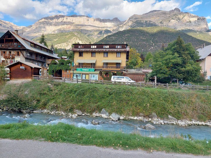
In the southern part of the Western Alps (Hautes-Alpes department) there are several four-thousanders.
Hautes-Alpes is therefore the highest department in France and not only scores with its impressive natural landscape, but is also an Eldorado for mountaineers, climbers, kayakers, hikers and cyclists.
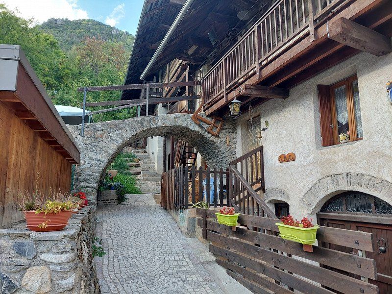
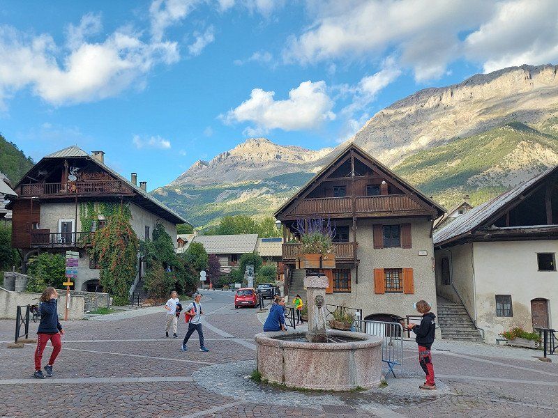
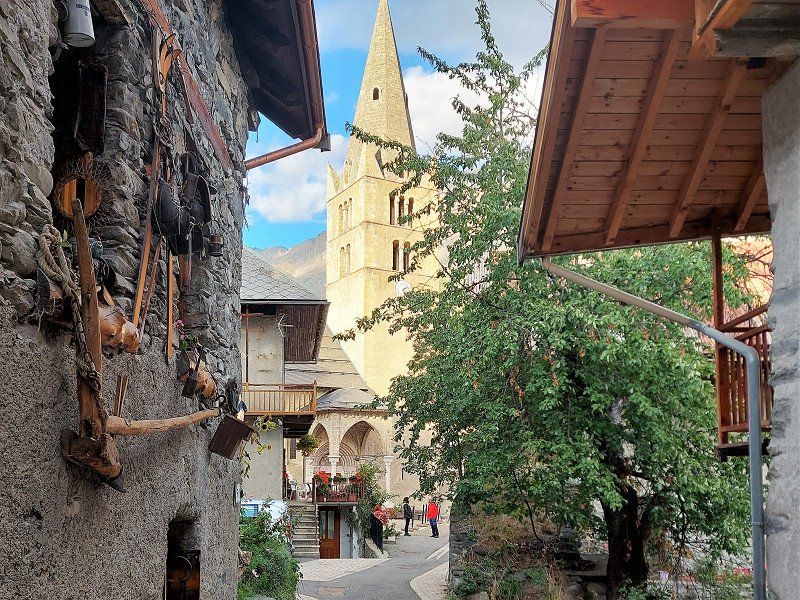
In the middle of the national park lies the mountain village of Vallouise, which has a special charm thanks to its original architecture.
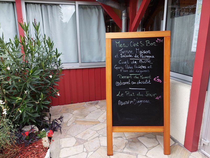
We ended the evening not far from the campsite in the Hotel Les Vallois with a classic Boef Bourguignon.
Chemin des Chambonnettes, 05290, VALLOUISE, France
44° 50' 40.6" N 6° 29' 23" E
44.8446000 6.4897340
• Head toward Chemin des Chambonnettes. Go for 179 m.
• Turn right toward Route de la Gyronde/D994 E. Go for 45 m.
• Turn right onto Route de la Gyronde (D994 E). Go for 837 m.
• Continue on D994 E. Go for 1.6 km.
• Continue on Pont Haut (D994 E). Go for 18 m.
• Continue on D994 E. Go for 6.8 km.
• Continue on Avenue de Vallouise (D994 E). Go for 216 m.
• Turn left onto Rue de la République (D994 E). Go for 142 m.
• Continue on Rue des Giraudes (D994 E). Go for 149 m.
• Turn right onto Avenue de Beauregard (N94). Go for 10.7 km.
• Take the 2nd exit from roundabout onto N94 toward Gap. Go for 4.9 km.
• Take the 2nd exit from roundabout toward Gap/Sisteron/Embrun. Go for 117 m.
• Continue on Lieu-dit La Gagière (N94). Go for 12.8 km.
• Take the 2nd exit from roundabout onto N94 toward Gap/Sisteron/Baratier/Les Orres/Crots. Go for 5.3 km.
• Take the 3rd exit from roundabout onto N94 toward Gap/Sisteron/Crots/Lac de Serre Ponçon. Go for 19.8 km.
• Take the 2nd exit from roundabout onto N94. Go for 4.4 km.
• Turn left onto D942 toward A51/Sisteron/Gap/La Bâtie Neuve/Tallard/N.D. du Laus. Go for 14.1 km.
• Turn right onto D900 B toward A51/Sisteron/Gap/Tallard. Go for 1.2 km.
• Continue on D942 toward Lettret/Tallard/Sisteron/Aix en Pce. Go for 5.5 km.
• Turn left onto Avenue de l'Aérodrome (N85) toward A51/Sisteron. Go for 770 m.
• Take the 4th exit from roundabout onto A51 (Autoroute du Val de Durance) toward Sisteron/Digne les Bains/Aix en Pce/Marseille. Go for 42.5 km.
• Take exit 21 toward Digne les Bains onto N85 (Route Napoléon). Go for 5.6 km.
• Take the 2nd exit from roundabout onto Route de Nice (N85). Go for 7.1 km.
• Take the 3rd exit from roundabout onto Route Napoléon (N85) toward Digne les Bains/Nice/Mallemoisson. Go for 7.2 km.
• Take the 1st exit from roundabout onto Avenue du Général de Gaulle (N85). Go for 1.0 km.
• Turn right onto D17 toward Le Chaffaut/Mézel/Z.A. Espace Blénon. Go for 1.3 km.
• Continue on D12. Go for 668 m.
• Continue on Lieu-dit Chénerilles (D12). Go for 98 m.
• Continue on D12. Go for 1.2 km.
• Turn right onto Lieu-dit Isoird (D17). Go for 113 m.
• Continue on D17. Go for 152 m.
• Continue on Lieu-dit Les Bas Astiers (D17). Go for 99 m.
• Continue on D17. Go for 251 m.
• Continue on Lieu-dit Groulet (D17). Go for 48 m.
• Continue on D17. Go for 1.3 km.
• Continue on Lieu-dit La Forêt (D17). Go for 104 m.
• Continue on D17. Go for 1.5 km.
• Continue on Lieu-dit Gros Prélaissal (D17). Go for 108 m.
• Continue on D17. Go for 1.3 km.
• Continue on Lieu-dit La Roussette (D17). Go for 85 m.
• Continue on D17. Go for 155 m.
• Continue on Lieu-dit Champlong Haut (D17). Go for 102 m.
• Continue on D17. Go for 1.4 km.
• Take the 1st exit from roundabout onto D907. Go for 12.0 km.
• Continue on D953. Go for 8.5 km.
• Turn left onto Route de Moustiers (D56). Go for 216 m.
• Continue on D56. Go for 2.4 km.
• Continue on Lieu-dit Grenouillet (D56). Go for 98 m.
• Continue on D56. Go for 2.4 km.
• Turn left onto D952. Go for 7.1 km.
• Pass 2 roundabouts and continue on Route de la Palud (D952). Go for 2.6 km.
• Take the 2nd exit from roundabout onto D957. Go for 10.0 km.
• Turn right. Go for 576 m.
• Turn left. Go for 1.0 km.
• Arrive at your destination on the right.
☍
209,6 km
(2 hrs. 49 min.)
Day
Camping La Source, Margaridon, Les Salles-sur-Verdon, Frankreich
Due to the much too dry summer, the water level in the Verdon Gorge has dropped alarmingly low.
Margaridon, 83630 Les Salles-sur-Verdon, Frankreich
43° 46' 30.2" N 6° 12' 26.7" E
43.7750440 6.2074250
• Head north. Go for 49 m.
• Continue on Chemin des Vignes. Go for 686 m.
• Turn right onto D957. Go for 12.5 km.
• Turn left onto D49. Go for 1.6 km.
• Turn left onto D6 toward Vérignon/Draguignan. Go for 3.4 km.
• Continue on D49. Go for 4.6 km.
• Continue on Route de Vérignon (D49). Go for 1.2 km.
• Continue on D49. Go for 35 m.
• Continue on Route de Vérignon (D49). Go for 4.0 km.
• Turn left onto Route de Tourtour (D49) toward Ampus/Draguignan. Go for 2.2 km.
• Continue on D49. Go for 23 m.
• Continue on Route de Draguignan (D49). Go for 9.5 km.
• Turn right onto Avenue Frédéric Henri Manhès (D955). Go for 1.9 km.
• Take the 2nd exit from Place Marcel Meiffret roundabout onto Boulevard Léon Gambetta (D955). Go for 466 m.
• Take the 1st exit from Place Henry Sénès roundabout onto Boulevard Léon Gambetta (D955). Go for 326 m.
• Continue on Boulevard Léo Lagrange (D955). Go for 268 m.
• Turn right toward Boulevard Léo Lagrange/D955. Go for 60 m.
• Pass 2 roundabouts and continue on Boulevard Léo Lagrange (D955). Go for 789 m.
• Take the 2nd exit from Place Condorcet roundabout onto Avenue des Anciens Combattants d'Afr. du N. toward A8. Go for 563 m.
• Take the 1st exit from Place Maurice Allard roundabout onto Avenue des Vignerons toward A8/Fréjus/St Raphaël/Digne/Grasse. Go for 185 m.
• Take the 2nd exit from Place Célestin Freinet roundabout onto Boulevard Pierre Mendès France toward D955/A8/Fréjus/St Raphaël/Digne/Grasse. Go for 252 m.
• Take the 2nd exit from Place Louise Michel roundabout onto Avenue du 18 Juin 1940 toward D955/A8/Fréjus/St Raphaël/Digne/Grasse. Go for 547 m.
• Take the 1st exit from Rond-Point Charles de Gaulle roundabout onto Avenue du Général Charles de Gaulle toward A8/Fréjus/St Raphaël/Toulon/Trans en Pce. Go for 390 m.
• Take the 2nd exit from roundabout onto Avenue du Général Charles de Gaulle (D1555). Go for 810 m.
• Take the 2nd exit from Rond-Point des Danseurs roundabout onto Avenue du Général Charles de Gaulle (D1555) toward A8/Fréjus/St-Raphaël/Toulon/Trans en Pce/Le Muy/Les Arcs. Go for 730 m.
• Pass 2 roundabouts and continue on Route de Draguignan (D1555). Go for 1.8 km.
• Take the 3rd exit from roundabout onto Route du Muy (D1555) toward A8/St Tropez/Fréjus/St Raphaël/Le Muy. Go for 889 m.
• Pass 4 roundabouts and continue on Route de Draguignan (D1555). Go for 6.3 km.
• Take the 3rd exit from roundabout onto Route de Sainte-Maxime (D125) toward St Tropez/Ste Maxime. Go for 17.5 km.
• Pass 3 roundabouts and continue on Route du Plan de La Tour (D25). Go for 1.5 km.
• Take the 2nd exit from Rond-Point des Virgiles roundabout onto Route du Plan de La Tour (D25) toward St Tropez/Ste Maxime-Centre. Go for 512 m.
• Take the 2nd exit from Rond-Point de Neuenbrg roundabout onto D25 toward St Tropez/Grimaud. Go for 372 m.
• Take the 2nd exit from Rond-Point Léonce Olivier roundabout onto Avenue du 8 Mai 1945 toward St Tropez/Toulon/Grimaud. Go for 609 m.
• Continue toward Avenue Antoine de Saint-Exupéry. Go for 35 m.
• Take the 1st exit from Rond-Point du Préconil roundabout onto Avenue Antoine de Saint-Exupéry toward St Tropez/Toulon/Grimaud. Go for 255 m.
• Take the 2nd exit from Rond-Point du Train des Pignes roundabout onto Avenue Saint-Exupéry toward Toulon/St Tropez. Go for 191 m.
• Turn right onto Boulevard Jean Moulin (D559). Go for 229 m.
• Keep right onto Boulevard Jean Moulin (D559). Go for 646 m.
• Pass 3 roundabouts and continue on Route du Littoral (D559). Go for 4.9 km.
• Take the 3rd exit from roundabout onto Route du Littoral (D559). Go for 1.9 km.
• Continue on D98. Go for 201 m.
• Keep left onto D559 toward St Tropez/Gassin/La Croix Valmer/Cavalaire/Hôpital Pôle de Santé. Go for 265 m.
• Keep right onto Rond-Point de la Foux (D98 A) toward St Tropez/Ramatuelle. Go for 524 m.
• Keep right onto D98 A. Go for 394 m.
• Take the 1st exit from roundabout onto Route du Littoral (D98 A). Go for 880 m.
• Keep right onto Route de Ramatuelle (D61) toward Gassin/Ramatuelle. Go for 524 m.
• Take the 2nd exit from roundabout onto Route de Ramatuelle (D61). Go for 2.4 km.
• Continue on Vallon de Bois (D61). Go for 1.2 km.
• Continue on D61. Go for 17 m.
• Continue on Route de la Rouillère (D61). Go for 416 m.
• Continue on D61. Go for 690 m.
• Take the 3rd exit from roundabout onto Lieu-dit La Rocade (D61) toward La Croix/Valmer. Go for 1.3 km.
• Continue on Parc d'Activité le Colombier (D61). Go for 240 m.
• Continue on D61. Go for 25 m.
• Take the 2nd exit from roundabout onto Route des Plages (D93) toward St Tropez. Go for 1.1 km.
• Turn right onto Route de Camarat. Go for 764 m.
• Turn right onto Route de Camarat. Go for 124 m.
• Turn slightly right onto Route de Camarat. Go for 617 m.
• Turn right. Go for 11 m.
• Turn slightly left. Go for 53 m.
• Arrive at your destination on the right.
☍
96,5 km
(1 hrs. 39 min.)
Day
Day
Yelloh! Village Les Tournels
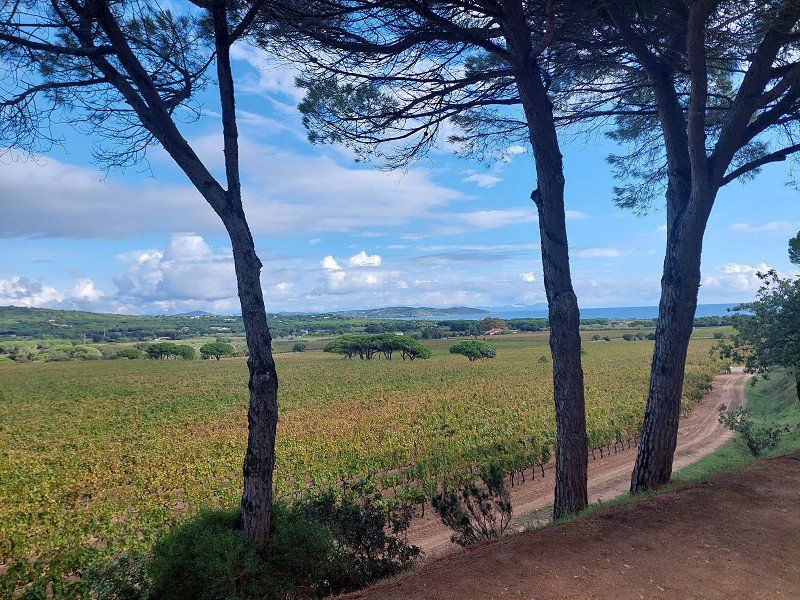
Since there were still many places available, we were a little further away from the animation area. The plots are well mixed with the holiday homes and offer a lot of privacy, not least because of the hillside location.
Attached picture shows the "breathtaking view of the Gulf of Saint-Tropez" mentioned in the catalogue.
In the high-priced Spar supermarket, just a few steps away, wines under 30 euros were scarce.
Route de Camarat 1510, 83350, Ramatuelle, France
43° 12' 19" N 6° 39' 2" E
43.2052700 6.6505500
• Head north. Go for 53 m.
• Turn slightly right toward Route de Camarat. Go for 11 m.
• Turn left onto Route de Camarat. Go for 741 m.
• Turn left onto Route de Bonne Terrasse. Go for 758 m.
• Turn left onto Route des Plages (D93). Go for 1.0 km.
• Take the 2nd exit from roundabout onto D61 toward Ramatuelle. Go for 60 m.
• Continue on Parc d'Activité le Colombier (D61). Go for 240 m.
• Continue on Chemin de la Rouvenède (D61). Go for 1.3 km.
• Take the 1st exit from roundabout onto D61. Go for 702 m.
• Continue on Route de la Rouillère (D61). Go for 416 m.
• Continue on D61. Go for 17 m.
• Continue on Route de la Rouillère (D61). Go for 1.2 km.
• Continue on Route de Ramatuelle (D61). Go for 2.4 km.
• Take the 2nd exit from roundabout onto Route de Ramatuelle (D61). Go for 575 m.
• Continue on D98 A. Go for 139 m.
• Continue on D61. Go for 138 m.
• Continue on D98 A. Go for 97 m.
• Make a U-Turn at Route Departementale 98A onto Route du Littoral (D98 A). Go for 337 m.
• Keep right onto Route du Littoral (D98 A). Go for 586 m.
• Take the 2nd exit from roundabout onto Avenue du Littoral (D98 A). Go for 790 m.
• Keep right toward Aix Nice/Fréjus/St Raphaël/Ste Maxime. Go for 68 m.
• Turn right onto D559. Go for 1.8 km.
• Take the 1st exit from roundabout onto Route du Littoral (D559). Go for 495 m.
• Pass 3 roundabouts and continue on Boulevard Jean Moulin (D559). Go for 5.1 km.
• Continue on Boulevard Jean Moulin (D559). Go for 179 m.
• Keep left onto Avenue Saint-Exupéry toward A8/Plan de La Tour/Le Muy/Z.A. Camp Ferrat. Go for 211 m.
• Take the 1st exit from Rond-Point du Train des Pignes roundabout onto Avenue Antoine de Saint-Exupéry toward A8/St Raphaël/Le Muy. Go for 275 m.
• Take the 2nd exit from Rond-Point du Préconil roundabout onto Avenue du 8 Mai 1945 toward A8/Draguignan/Aix en Pce/Plan de La Tour/Le Muy. Go for 639 m.
• Take the 2nd exit from Rond-Point Léonce Olivier roundabout onto D25 toward A8/Draguignan/Aix en Pce/Plan de La Tour/Le Muy. Go for 361 m.
• Pass 5 roundabouts and continue on Route du Muy (D25). Go for 19.4 km.
• Continue on Route de Sainte-Maxime (D125). Go for 55 m.
• Take the 3rd exit from roundabout onto D1555 toward Toulon/Nice/Aix en Pce. Go for 324 m.
• Take ramp onto A8 (La Provençale) toward Aix en Pce/Hyères/Toulon. Go for 118 km.
• Continue on A7 (Autoroute du Soleil). Go for 33.5 km.
• Take exit 25 toward Cavaillon/Apt onto D99. Go for 1.9 km.
• Continue on D99 C. Go for 185 m.
• Take ramp onto D938 toward D99/Cavaillon/L'Isle sur la Sorgue/Apt. Go for 1.0 km.
• Take the 3rd exit from roundabout onto Avenue du Pont toward Centre Ville. Go for 556 m.
• Continue on Avenue de Verdun. Go for 388 m.
• Take the 2nd exit from roundabout onto Avenue Gabriel Péri. Go for 86 m.
• Turn right onto Avenue du Maréchal Joffre. Go for 181 m.
• Take the 2nd exit from roundabout onto Avenue Pierre Semard. Go for 322 m.
• Turn right onto Avenue Abel Sarnette. Go for 62 m.
• Continue on Carrefour Bellevue. Go for 3 m.
• Keep left onto Carrefour Bellevue toward Avignon/Carpentras/Isle sur la Sorgue/Fontaine de Vaucluse. Go for 41 m.
• Keep right onto Avenue John Fitzgerald Kennedy (D15) toward Clinique St Roch. Go for 739 m.
• Pass 2 roundabouts and continue on Route de Gordes (D15). Go for 3.3 km.
• Continue on Chemin Rural 15 (D15). Go for 754 m.
• Take the 2nd exit from Rond-Point Charles Reboul roundabout onto Chemin Rural 15 (D15). Go for 2.9 km.
• Take the 3rd exit from roundabout onto D15. Go for 540 m.
• Continue on Lieu-dit Les Rouges (D15). Go for 184 m.
• Continue on D15. Go for 281 m.
• Continue on Ancienne Route de Gordes (D15). Go for 1.1 km.
• Take the 2nd exit from roundabout onto Ancienne Route de Gordes (D15). Go for 1.1 km.
• Continue on Route de Cavaillon à Saint-Saturnin-lès-Apt (D2). Go for 3.8 km.
• Take the 2nd exit from roundabout onto Route de Cavaillon à Sault-de-Vaucluse (D15) toward Gordes/Abbaye de Senanque/Saint-Firmin. Go for 1.4 km.
• Keep right onto Route de Cavaillon à Sault-de-Vaucluse (D15) toward Gordes Centre/Saint-Firmin. Go for 614 m.
• Take the 2nd exit from Place du Marché roundabout onto Place du Château (D15). Go for 1.7 km.
• Turn left onto Chemin de Fontanille. Go for 188 m.
• Continue straight ahead. Go for 96 m.
• Continue straight ahead. Go for 11 m.
• Arrive at your destination on the left.
☍
215,9 km
(2 hrs. 26 min.)
Day
Day
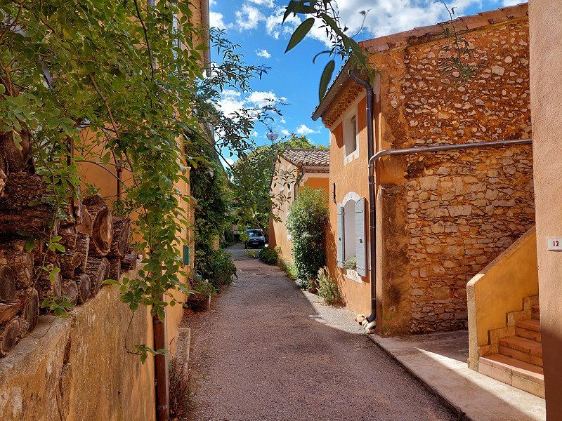
Domaine du Camping des Sources ****
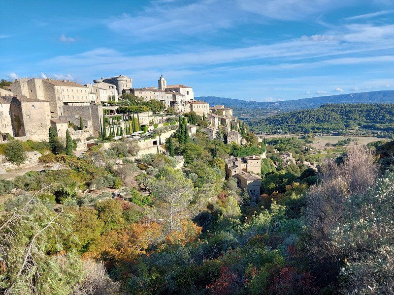
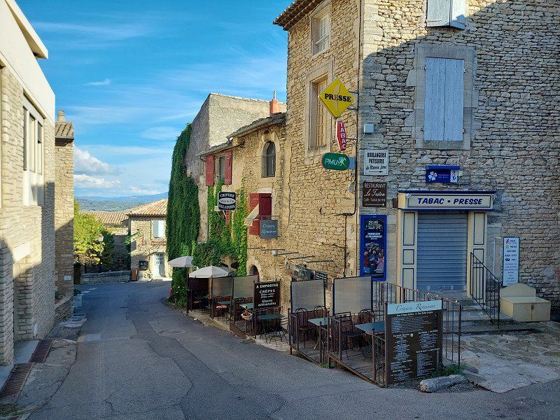
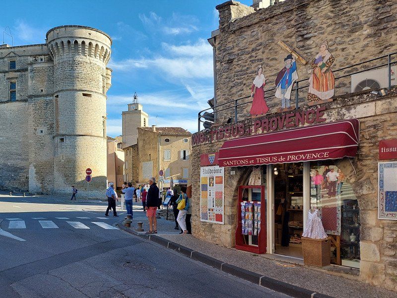
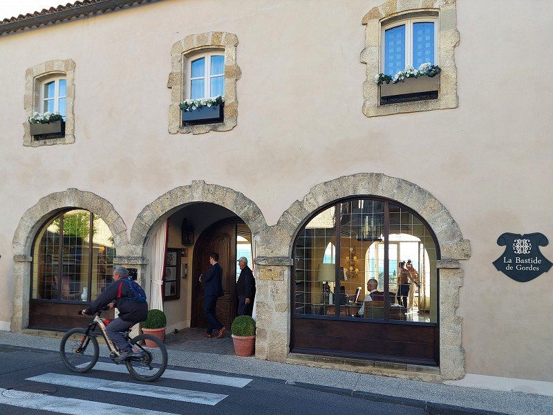
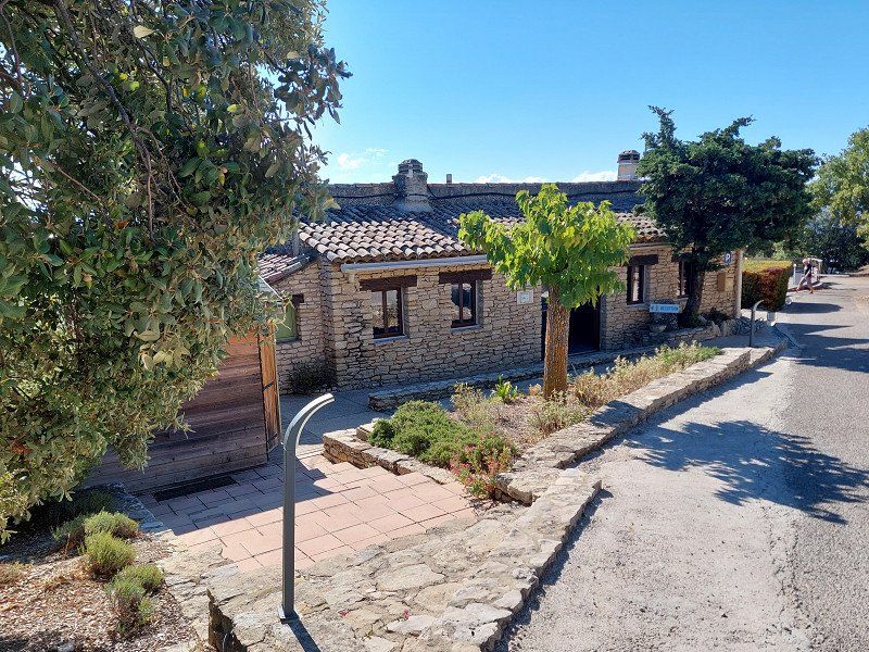
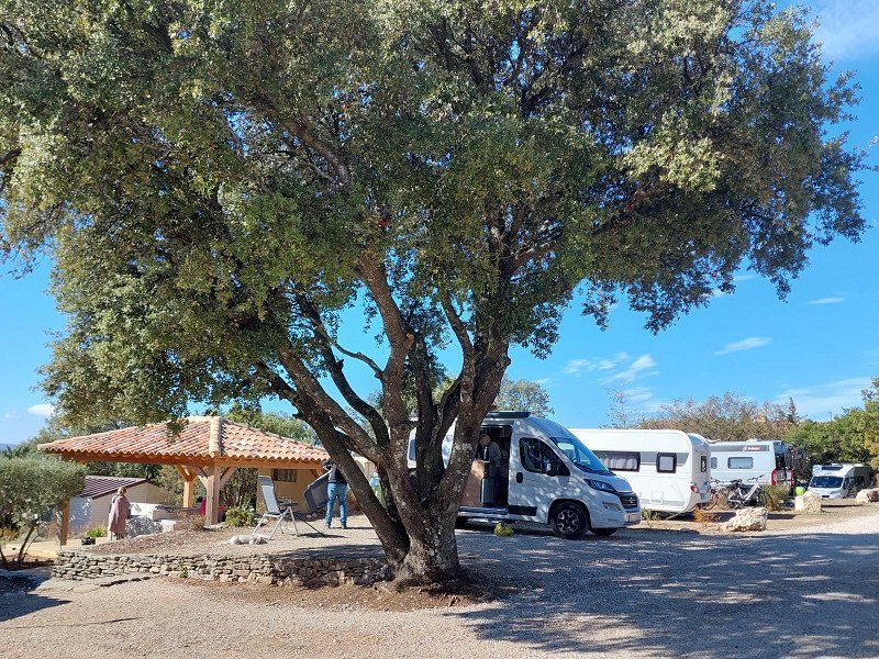
The campsite Domaine du Camping des Sources is located at an altitude of 500 m with a great view over the countryside.
A beautiful footpath leads from the campsite to the village of Gordes, which has been included in the "Les plus beaux villages de France" program.
Route de Murs - 301 chemin de Fontanille, 84220, Gordes, France
43° 55' 37.8" N 5° 12' 9" E
43.9271654 5.2024987
• Head toward Quartier Fontanille. Go for 107 m.
• Continue on Chemin de Fontanille. Go for 188 m.
• Turn left onto Route de Cavaillon à Sault-de-Vaucluse (D15). Go for 2.3 km.
• Continue on D15. Go for 138 m.
• Continue on Lieu-dit La Charlesse (D15). Go for 112 m.
• Turn left onto D244. Go for 2.1 km.
• Continue on Ancien Chemin de Vénasque à Murs (D244). Go for 277 m.
• Turn right onto D177. Go for 1.8 km.
• Continue on Lieu-dit La Corneirette (D177). Go for 93 m.
• Continue on D177. Go for 2.7 km.
• Turn left onto Route d'Apt (D4) toward Carpentras/Venasque. Go for 4.3 km.
• Continue on Route de Carpentras (D4). Go for 997 m.
• Turn right onto Route de Malemort (D77) toward Malemort-du-Comtat. Go for 985 m.
• Continue on Route de Vénasque (D77). Go for 685 m.
• Turn right onto Route de Carpentras (D77) toward D5/Malemort. Go for 269 m.
• Take the 3rd exit from roundabout onto Route du Bosquet (D158). Go for 408 m.
• Turn left onto Route de Mazan (D77) toward Mazan/Mormoiron. Go for 1.1 km.
• Keep right onto Route de Saint-Mirat (D77). Go for 2.3 km.
• Turn right onto Route d'Avignon à la Drôme (D942). Go for 2.5 km.
• Pass 3 roundabouts and continue on Route de Carpentras (D942). Go for 4.4 km.
• Turn right. Go for 27 m.
• Arrive at your destination on the left.
☍
27,8 km
( 28 min.)
Day
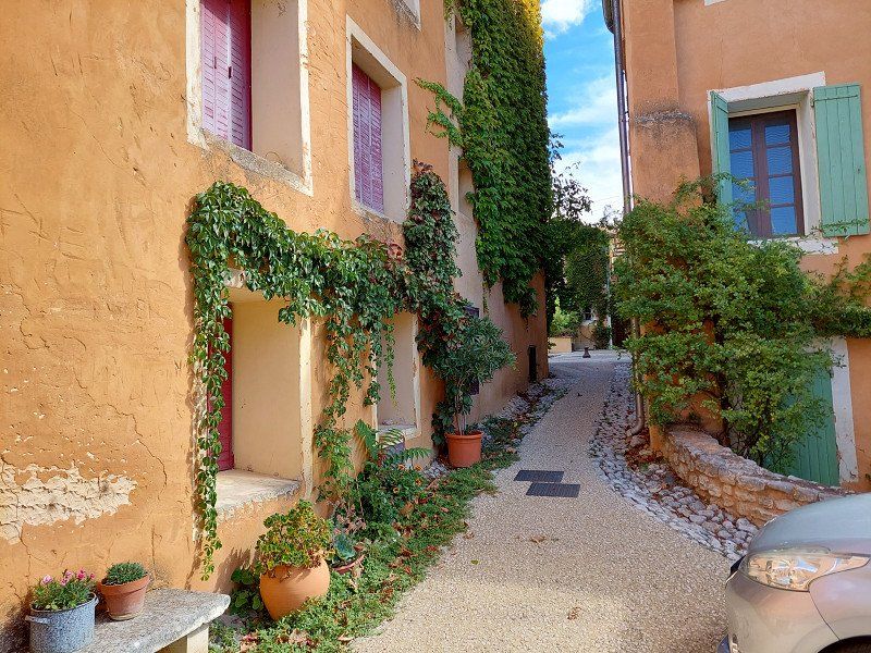
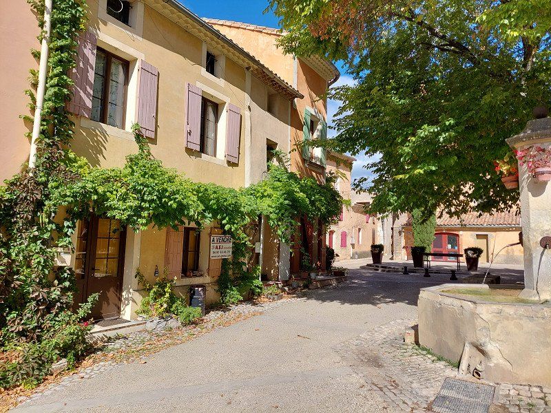
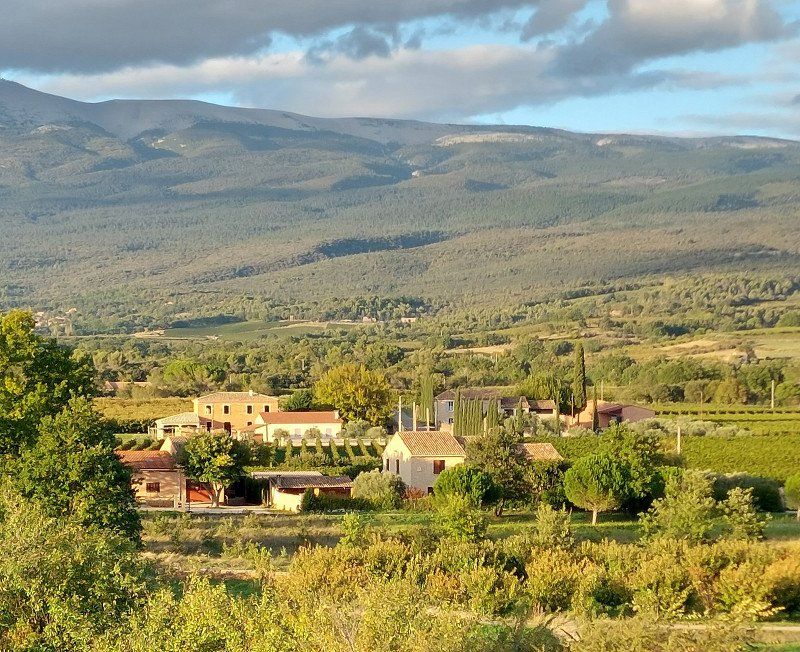
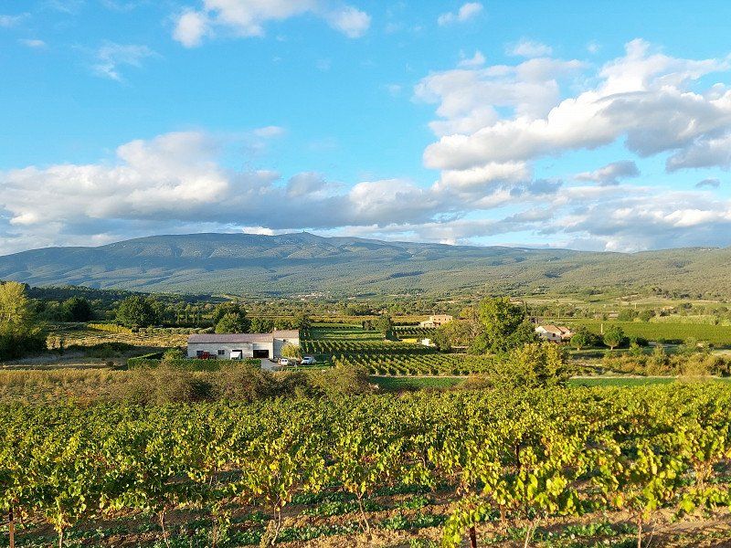
Camping les Verguettes****, Route de Carpentras, Villes-sur-Auzon, Frankreich
The only 4 stars the campsite deserves are the newly created pitches at the very end, which offer a beautiful view.
The nearby villages of Flassan and Mormoiron are beautiful.
119 Rte de Carpentras, 84570 Villes-sur-Auzon, Frankreich
44° 3' 25.3" N 5° 13' 42.4" E
44.0570380 5.2284327
• Head toward Route de Carpentras. Go for 27 m.
• Turn left onto Route de Carpentras (D942). Go for 94 m.
• Pass 3 roundabouts and continue on Route de Carpentras (D942). Go for 8.4 km.
• Take the 3rd exit from roundabout onto Route d'Avignon à la Drôme (D942). Go for 1.2 km.
• Turn right onto Route de Caromb (D70). Go for 3.0 km.
• Continue on Route de Mazan (D70). Go for 202 m.
• Take the 3rd exit from roundabout onto D974. Go for 4.5 km.
• Take the 3rd exit from roundabout onto D942 R toward A7/A9/Orange/Avignon/Gap/Bollène/Vaison la Romaine/Mt Ventoux-Nord. Go for 1.2 km.
• Take the 2nd exit from roundabout onto D942 R toward A7/Orange/Avignon/Cavaillon/Monteux/Isle sur la Sorgue. Go for 1.5 km.
• Take the 2nd exit from roundabout onto Route d'Orange (D950) toward Lyon/A7/Orange/Loriol du Comtat/Sarrians. Go for 2.3 km.
• Pass 5 roundabouts and continue on Route d'Orange (D950). Go for 9.1 km.
• Take the 2nd exit from roundabout onto D950 toward A7/Orange/Avignon/Courthézon/Z.A. la Grange Blanche. Go for 2.6 km.
• Pass 2 roundabouts and continue on D950. Go for 1.9 km.
• Take the 3rd exit from roundabout onto D907 toward A7/Orange. Go for 2.0 km.
• Take the 3rd exit from roundabout toward A7/Valence/Lyon/Avignon/Marseille. Go for 350 m.
• Take ramp onto A7 (Autoroute du Soleil) toward Valence/Lyon. Go for 117 km.
• Take exit 13 toward Tournon S/R./Tain l'Hermitage. Go for 1.1 km.
• Take the 2nd exit from roundabout. Go for 176 m.
• Take the 4th exit from roundabout onto Avenue du Vercors et de la Résistance (D532 A) toward Tain l'Hermitage. Go for 417 m.
• Pass 2 roundabouts and continue on Avenue du Vercors et de la Résistance (D532 A). Go for 800 m.
• Continue on Avenue Jules Nadi (D532 A). Go for 274 m.
• Turn left onto Rue Paul Bourret. Go for 315 m.
• Turn left onto Avenue du Président Franklin Roosevelt (N7). Go for 181 m.
• Arrive at Avenue du Président Franklin Roosevelt (N7). Your destination is on the right.
☍
158,7 km
(1 hrs. 40 min.)
Camping Municipal " Les Lucs " à Tain l'Hermitage (OUVERT - OPEN 15.02. - 15.11.2022), Avenue du Président Roosevelt, Tain-l'Hermitage, Frankreich
If you like a central location with parking space character, this is the place for you.
The campsite is just a narrow tongue between the Rhône promenade and the main road.
We drove a little further on the "Les Acasias" .
56 Av. du Président Roosevelt Nationale 7, 26600 Tain-l'Hermitage, Frankreich
45° 4' 0.3" N 4° 50' 58.5" E
45.0667413 4.8495922
• Head toward Rue Paul Bourret on Avenue du Président Franklin Roosevelt (N7). Go for 637 m.
• Turn left onto Avenue des Comtés de Larnage (D95 N) toward Tournon/Lamastre. Go for 416 m.
• Turn right onto Quai Charles de Gaulle (D86). Go for 1.6 km.
• Continue toward Route de Lamastre/D532. Go for 19 m.
• Take the 3rd exit from Rond-Point de la Paix roundabout onto Route de Lamastre (D532). Go for 1.3 km.
• Take the 2nd exit from roundabout onto Route de Lamastre (D532). Go for 1.1 km.
• Arrive at Route de Lamastre (D532). Your destination is on the right.
☍
5,0 km
( 7 min.)
Day
Day
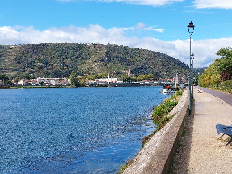
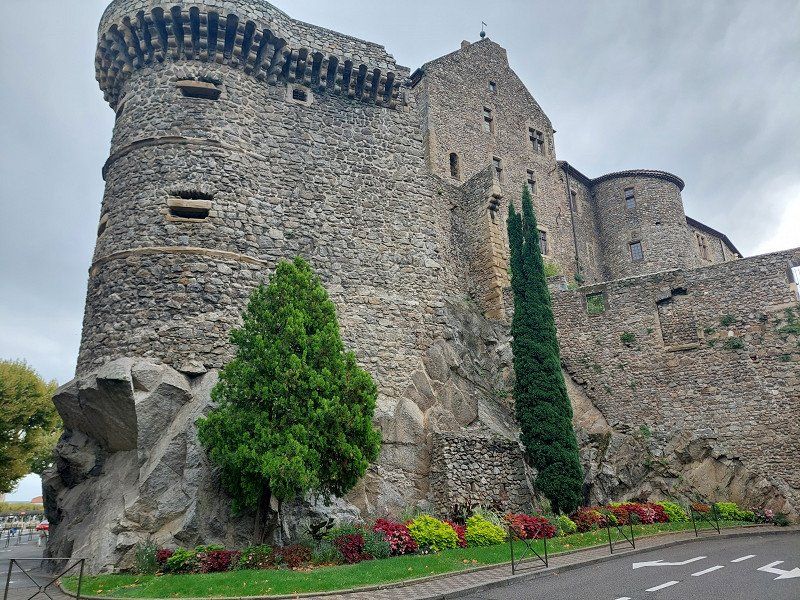
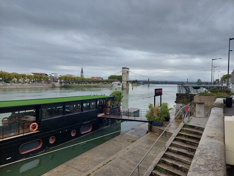
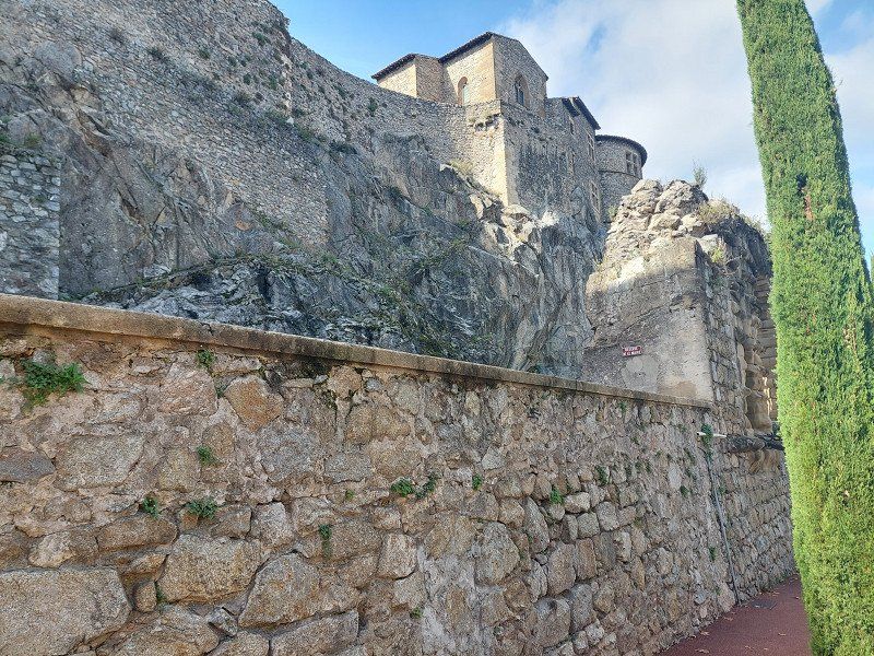
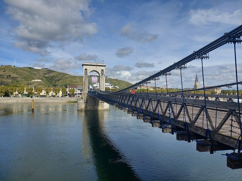
Camping Les Acacias
Tournon Castle and the two suspension bridges over the river with the most water in France are worth seeing.
190 Route de Lamastre, 07300, Tournon sur Rhône, France
45° 3' 58.9" N 4° 47' 43.1" E
45.0663721 4.7953161
• Head toward Chemin du Berthier on Route de Lamastre (D532). Go for 1.0 km.
• Take the 2nd exit from roundabout onto Route de Lamastre (D532). Go for 1.3 km.
• Take the 1st exit from Rond-Point de la Paix roundabout onto Avenue Maréchal Foch (D86). Go for 1.6 km.
• Take the 3rd exit from roundabout onto Pont Gustave Toursier (D95). Go for 460 m.
• Turn right onto Avenue du Président Franklin Roosevelt (N7). Go for 2.2 km.
• Turn left onto Rue de la Mulé Blanche (D101) toward Beaumont-Monteux/Châteauneuf S/Isère/La Teppe. Go for 201 m.
• Take the 2nd exit from roundabout onto D101 toward Beaumont-Monteux/Bellevue/Les 7 Chemins. Go for 442 m.
• Continue on Route de la Voie Romaine (D101). Go for 694 m.
• Continue on D101. Go for 705 m.
• Continue on Lieu-dit La Ville Rouge (D101). Go for 100 m.
• Continue on D101. Go for 783 m.
• Take the 2nd exit from roundabout onto Route des 7 Chemins (D101) toward Beaumont-Monteux/Châteauneuf S/Isère. Go for 1.7 km.
• Continue on D101. Go for 734 m.
• Continue on Lieu-dit Vie Magne (D101). Go for 163 m.
• Turn slightly left onto Route de l'Hermitage (D101) toward Beaumont/Monteaux. Go for 180 m.
• Continue on Lieu-dit Les Chanaudes (D101). Go for 112 m.
• Continue on Route de l'Hermitage (D101). Go for 875 m.
• Continue on Route du Vercors (D101). Go for 1.2 km.
• Take the 1st exit from roundabout onto D67 toward Châteauneuf S/ Isère/Valence. Go for 577 m.
• Continue on Avenue de Valence (D67). Go for 60 m.
• Take the 1st exit from roundabout onto Avenue de Valence (D67) toward Bourg les Vce/St Marcel lès Valence/Pont-de-l'Isère/Alixan. Go for 177 m.
• Take the 3rd exit from roundabout onto Rue des Crozes toward D101/Bourg du Péage/Alixan. Go for 626 m.
• Take the 2nd exit from roundabout. Go for 49 m.
• Continue on Rue des Monts du Matin (D101). Go for 717 m.
• Continue on D101. Go for 3.0 km.
• Take the 2nd exit from roundabout onto Lieu-dit La Gare (D101). Go for 274 m.
• Continue on D101 toward Alixan. Go for 702 m.
• Take the 2nd exit from roundabout onto D101 toward Alixan/Valence. Go for 401 m.
• Take the 3rd exit from roundabout toward A49/Romans/Bourg de Péage. Go for 468 m.
• Take ramp onto N532. Go for 2.8 km.
• Keep left onto A49 toward Genève/Chambéry/Grenoble/Romans-Centre. Go for 60.6 km.
• Take the exit toward Voiron/Lyon/Chambéry/Genève onto A48. Go for 7.8 km.
• Take exit 10 toward Les Abrets/Voiron-Champfeuillet. Go for 775 m.
• Pass 4 roundabouts and continue on D1076. Go for 4.7 km.
• Continue on Avenue de la Brunerie (D1075). Go for 3.0 km.
• Pass 3 roundabouts and continue on Rue Gambetta (D1075). Go for 15.6 km.
• Take the 1st exit from roundabout onto Rue d'Italie (D1006) toward Chambéry/Pt de Beauvoisin. Go for 1.4 km.
• Turn left onto Chemin de la Louidine. Go for 766 m.
• Turn left onto Chemin de Veroud. Go for 191 m.
• Turn right onto Chemin des Vignes. Go for 45 m.
• Arrive at Chemin des Vignes. Your destination is on the right.
☍
119,3 km
(1 hrs. 31 min.)
Day
Day
Camping le Coin Tranquille, Chemin des Vignes, Les Abrets-en-Dauphiné, Frankreich
The friendly family-run campsite is set in beautiful natural surroundings and offers a view of the Savoy Alps.
Caution! Large portions in the restaurant.
6 Chem. des Vignes, 38490 Les Abrets en Dauphiné, Frankreich
45° 32' 28.8" N 5° 36' 29.4" E
45.5413374 5.6081753
• Head toward Chemin des Châtaigniers on Chemin des Vignes. Go for 126 m.
• Turn left onto Chemin des Châtaigniers. Go for 816 m.
• Turn left onto Chemin de la Bruyère (D142 E). Go for 1.8 km.
• Turn right onto Rue Victor Hugo (D592). Go for 3.9 km.
• Take the 2nd exit from roundabout toward A43/Lyon/La Tour du Pin/Genève/Chambéry. Go for 114 m.
• Take ramp onto A43 toward Genève/Chambéry. Go for 26.5 km.
• Continue on A41 toward Genève/Annecy/Aix les Bains. Go for 39.5 km.
• Take exit 16 toward Cran-Gevrier onto D3508. Go for 1.3 km.
• Keep left onto D3508 toward Aix-les-Bains/Chambéry/Seynod/Z.I. de Vovray. Go for 688 m.
• Keep left onto D3508 toward Z.I. de Vouvray/Le Lac/Le Semnoz. Go for 189 m.
• Take the 3rd exit from Rond-Point de la Croisée roundabout onto Avenue du Pont-Neuf (D1201) toward Annecy-Centre/Albertville. Go for 698 m.
• Take the 1st exit from roundabout onto Avenue du Rhône (D5) toward Albertville/Le Château/Le Lac/Le Semnoz. Go for 304 m.
• Continue on Avenue Lucien Boschetti toward Albertville/Le Lac/Z.I. de Vovrey. Go for 207 m.
• Take the 2nd exit from roundabout onto Avenue du Crêt du Maure toward Albertville/Le Château/Le Lac. Go for 442 m.
• Take the 1st exit from Place du Paradis roundabout onto Boulevard de la Corniche toward Albertville/Le Lac. Go for 247 m.
• Take the 1st exit from roundabout onto Boulevard de la Corniche (D41). Go for 512 m.
• Keep right onto Route du Semnoz (D41). Go for 321 m.
• Turn right onto Route du Semnoz. Go for 28 m.
• Arrive at Route du Semnoz. Your destination is on the left.
☍
77,7 km
( 56 min.)
Camping Municipal Le Belvédère
Narrow terraced pitches. We didn't like the campsite and we drove on.
We would have liked to have looked at the old town of Annecy.
8 route du Semmoz, 74000, Annecy, France
45° 53' 27.2" N 6° 7' 55.2" E
45.8908800 6.1319900
• Head south on Route du Semnoz. Go for 28 m.
• Turn left onto Route du Semnoz (D41). Go for 321 m.
• Continue on Boulevard de la Corniche (D41). Go for 482 m.
• Take the 2nd exit from roundabout onto Boulevard de la Corniche. Go for 289 m.
• Take the 2nd exit from Place du Paradis roundabout onto Avenue du Crêt du Maure toward Vieille Ville/Loverchy-les Balmettes. Go for 420 m.
• Turn right onto Avenue Lucien Boschetti toward Thônes. Go for 236 m.
• Continue on Avenue du Rhône (D5) toward Seynod. Go for 289 m.
• Pass 2 roundabouts and continue on Avenue du Rhône. Go for 743 m.
• Take ramp onto Boulevard Ouest (D1501) toward Thônes/Centre Hospitalier. Go for 678 m.
• Keep right toward Cran-Gevrier/Centre Hospitalier/Z.A. d'Aléry. Go for 301 m.
• Keep left toward A41/Bellegarde. Go for 168 m.
• Continue on D3508. Go for 386 m.
• Take ramp onto A41 toward Genève. Go for 32.6 km.
• Continue on A1. Go for 3 m.
• Keep left onto A1. Go for 36.8 km.
• Take exit 12 toward Begnins. Go for 475 m.
• Continue on Avenue du Mont-Blanc toward Begnins. Go for 230 m.
• Pass 2 roundabouts and continue on Route de Begnins. Go for 281 m.
• Continue on Route de Gland. Go for 33 m.
• Continue on Route de Begnins. Go for 24 m.
• Continue on Route de Gland. Go for 212 m.
• Take the 2nd exit from roundabout onto Route de Begnins. Go for 467 m.
• Continue on Route de Gland. Go for 1.2 km.
• Turn right onto Rue de Gland. Go for 110 m.
• Turn right onto Route de Burtigny. Go for 4.2 km.
• Continue on Route des Matagasses. Go for 2.3 km.
• Continue on La Foge. Go for 479 m.
• Turn right onto Route de Le Vaud. Go for 517 m.
• Continue on Route du Marchairuz. Go for 189 m.
• Take the 2nd exit from roundabout onto Route du Marchairuz. Go for 349 m.
• Continue on Route de Longirod. Go for 880 m.
• Continue on Route de Marchissy. Go for 270 m.
• Turn slightly left onto Grand Rue. Go for 352 m.
• Continue on Chemin du Champ à la Croche. Go for 461 m.
• Continue on Route de Longirod. Go for 1.4 km.
• Continue on Grand'Rue. Go for 162 m.
• Turn left onto Route du Marchairuz. Go for 4.3 km.
• Turn left onto Route du Col du Marchairuz. Go for 3.7 km.
• Continue on Route du Marchairuz. Go for 6.8 km.
• Turn right onto Route de France. Go for 501 m.
• Continue on Rue de la Gare. Go for 172 m.
• Take the 3rd exit from roundabout onto Rue de la Gare. Go for 190 m.
• Take the 2nd exit from roundabout onto Rue de la Gare. Go for 1.4 km.
• Continue on Rue des Écoles. Go for 465 m.
• Continue on Rue Georges-Henri Piguet. Go for 658 m.
• Take the 2nd exit from roundabout onto Grande-Rue. Go for 1.2 km.
• Continue on Rue de la Golisse. Go for 250 m.
• Turn right onto Rue de la Golisse. Go for 148 m.
• Continue on Rue de l'Arcadie. Go for 736 m.
• Turn slightly left onto Le Rocheray. Go for 884 m.
• Turn left. Go for 247 m.
• Arrive at your destination on the left.
☍
109,9 km
(1 hrs. 39 min.)
Camping du Lac de Joux, Le Rocheray, Le Chenit, Schweiz
Fantastically beautifully situated campsite with a view of the lake and yet away from tourism.
Owners weren't around so we decided to head to Lake Geneva for the warmth.
Le Rocheray 37, 1347 Le Chenit, Schweiz
46° 37' 35.9" N 6° 15' 11" E
46.6266449 6.2530591
• Head southwest. Go for 48 m.
• Turn slightly left toward Le Rocheray. Go for 199 m.
• Turn left onto Le Rocheray. Go for 410 m.
• Continue on Esserts-de-Rive Haut. Go for 416 m.
• Continue on Esserts-de-Rive Bas. Go for 210 m.
• Continue on Esserts-de-Rive Haut. Go for 79 m.
• Continue straight ahead. Go for 1.2 km.
• Turn left toward Grand'Rue. Go for 42 m.
• Turn right onto Grand'Rue. Go for 3.0 km.
• Continue on Route du Lieu. Go for 1.1 km.
• Continue on La Colline. Go for 309 m.
• Continue on Rue du Mont d'Or. Go for 1.3 km.
• Turn right onto Rue de la Poste. Go for 595 m.
• Turn left onto Sur-les-Quais. Go for 956 m.
• Take the 2nd exit from roundabout. Go for 3.6 km.
• Continue on Col du Mollendruz. Go for 4.5 km.
• Turn right onto Route du Mollendruz. Go for 2.0 km.
• Continue on Route de l'Isle. Go for 2.3 km.
• Continue on Route du Mollendruz. Go for 752 m.
• Continue on Rue de Chabiez. Go for 239 m.
• Continue on Rue de l'Avalanche. Go for 194 m.
• Turn right onto Route Cantonale. Go for 2.7 km.
• Continue on Au Village. Go for 93 m.
• Take the 2nd exit from roundabout onto Au Village. Go for 125 m.
• Continue on Route de Saint-Denis. Go for 509 m.
• Continue on Route de Saint-Denis. Go for 133 m.
• Turn left onto Route de Saint-Denis. Go for 1.4 km.
• Keep right onto Route de Saint-Denis. Go for 104 m.
• Turn right onto Rue d'Ittens. Go for 1.5 km.
• Continue on Route de la Vallée. Go for 1.5 km.
• Take the 2nd exit from roundabout onto Route de la Vallée. Go for 245 m.
• Take the 2nd exit from roundabout onto Rue des Chavannes. Go for 184 m.
• Take the 2nd exit from roundabout onto Rue des Étangs (9). Go for 105 m.
• Pass 2 roundabouts and continue on Route de la Gare (9). Go for 2.4 km.
• Take the 1st exit from roundabout onto Route de Lausanne (9). Go for 610 m.
• Continue straight ahead. Go for 979 m.
• Pass 2 roundabouts. Go for 1.2 km.
• Take ramp onto A1/A9 toward Lausanne. Go for 3.3 km.
• Take exit 19 toward Simplon/Gd-St-Bernard/Lausanne-Nord/Vevey/Montreux onto A9 (Villars-Sainte-Croix). Go for 40.7 km.
• Take exit 16 toward Villeneuve. Go for 412 m.
• Continue on Route du Simplon (9). Go for 286 m.
• Take the 2nd exit from roundabout onto Route du Simplon (9) toward Lausanne/Montreux. Go for 322 m.
• Take the 3rd exit from roundabout onto Route d'Evian toward Noville/Evian. Go for 1.9 km.
• Turn right onto Chemin du Battoir. Go for 219 m.
• Turn slightly left onto Clos de la Delèze. Go for 1.2 km.
• Turn left onto Route des Grangettes. Go for 174 m.
• Turn right onto Route des Grangettes. Go for 96 m.
• Turn left. Go for 74 m.
• Turn right. Go for 29 m.
• Arrive at your destination on the left.
☍
85,9 km
(1 hrs. 17 min.)
Day
Day
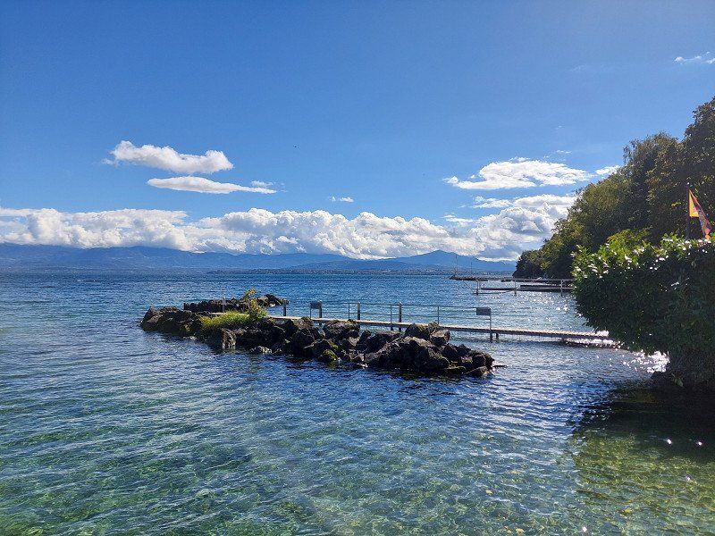
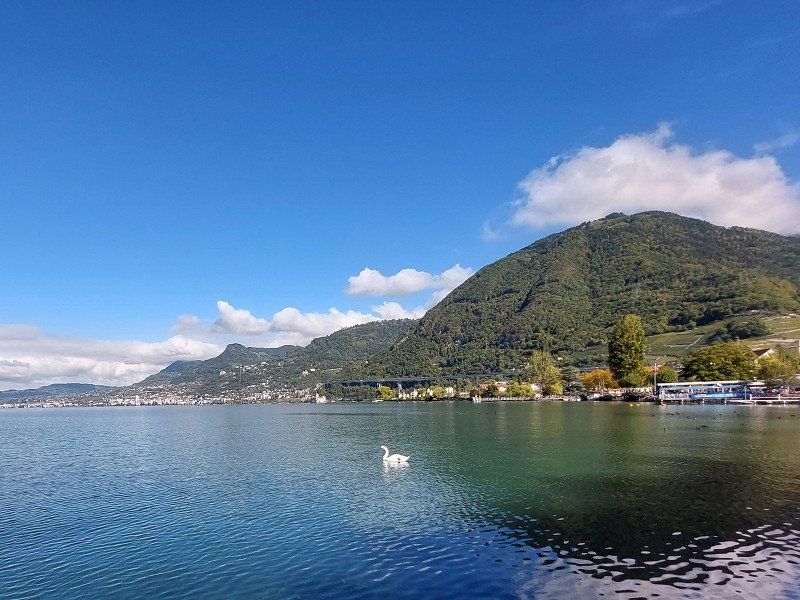
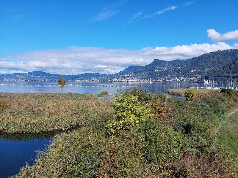
Camping Les Grangettes
Lake Geneva (near Montreux)
Beautifully located, quiet campsite in a nature reserve.
Footpath through the nature reserve to Villeneuve.
Les Grangettes 31, 1845, Noville, Switzerland
46° 23' 37" N 6° 53' 39" E
46.3936100 6.8941600
• Head south. Go for 29 m.
• Turn left toward Route des Grangettes. Go for 74 m.
• Turn right onto Route des Grangettes. Go for 96 m.
• Turn left onto Route des Grangettes. Go for 174 m.
• Turn right onto Route des Grangettes. Go for 1.2 km.
• Turn slightly right onto Chemin du Battoir. Go for 219 m.
• Turn left onto Route d'Evian. Go for 1.8 km.
• Take the 1st exit from roundabout onto La Croisée (9) toward Aigle. Go for 299 m.
• Take the 2nd exit from roundabout onto Route du Simplon (9) toward Aigle. Go for 560 m.
• Turn left and take ramp onto A9 toward Lausanne/Bern. Go for 12.2 km.
• Take exit 14 toward Bern/Fribourg onto A12. Go for 78.8 km.
• Take the exit toward Zürich/Basel/Interlaken/Flughafen onto A1. Go for 5.4 km.
• Take exit 37 toward Interlaken/Thun/Bern-Ostring/Flughafen onto A6 (Wankdorf). Go for 38.8 km.
• Keep left onto A8 toward Luzern/Interlaken. Go for 5.5 km.
• Continue on 6/11. Go for 18 m.
• Continue on A8. Go for 12.1 km.
• Take exit 25 toward Grindelwald/Lauterbrunnen/Matten. Go for 322 m.
• Take the 2nd exit from roundabout. Go for 334 m.
• Continue on Umfahrung Wilderswil. Go for 230 m.
• Continue on Umfahrung Wilderswil. Go for 1.4 km.
• Take the 2nd exit from roundabout. Go for 238 m.
• Continue on Tschingelmatta. Go for 162 m.
• Continue on Bir Sagi. Go for 3.2 km.
• Continue on Feldli. Go for 402 m.
• Turn left toward Alte Post. Go for 70 m.
• Continue on Alte Post. Go for 3.1 km.
• Continue on Tschingeley. Go for 832 m.
• Continue on Briggmättli. Go for 231 m.
• Continue on Riedermätteli. Go for 429 m.
• Continue on Gadenstatt. Go for 208 m.
• Continue on Lindi. Go for 310 m.
• Continue on In der Ey. Go for 287 m.
• Continue on Stalden. Go for 747 m.
• Continue on Grindelwaldstrasse. Go for 4.2 km.
• Take the 2nd exit from roundabout onto Dorfstrasse. Go for 2.1 km.
• Turn right onto Grabenstrasse. Go for 258 m.
• Turn right onto Grabenstrasse. Go for 316 m.
• Turn sharp right onto Locherbodenstrasse. Go for 168 m.
• Arrive at Locherbodenstrasse.
☍
176,8 km
(2 hrs. 3 min.)
Day
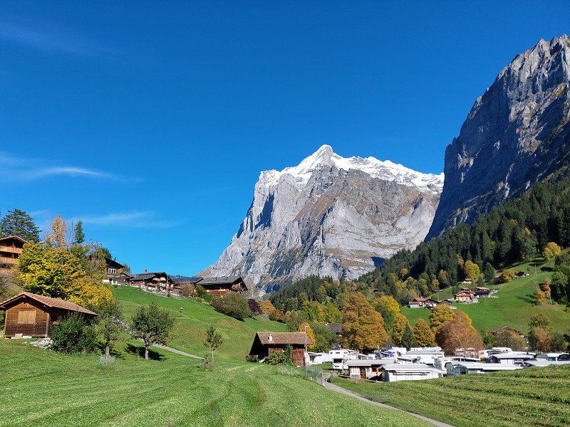
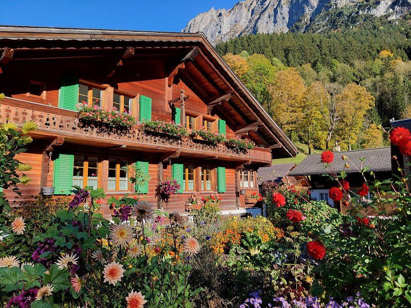
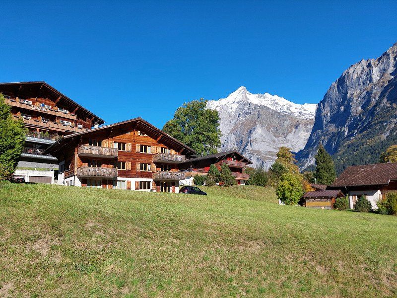
Camping Gletscherdorf
Impressive view of the Eiger with great hiking opportunities.
Locherbodenstrasse 29, 3818, Grindelwald, Switzerland
46° 37' 14.4" N 8° 2' 38.6" E
46.6206600 8.0440500
• Head toward Grabenstrasse on Locherbodenstrasse. Go for 168 m.
• Turn right onto Grabenstrasse. Go for 22 m.
• Turn right onto Mettenbergstrasse. Go for 1.1 km.
• Continue on Grythstrasse. Go for 894 m.
• Continue on Wärgistalstrasse. Go for 83 m.
• Turn left onto Grundstrasse. Go for 1.2 km.
• Take the 2nd exit from roundabout onto Grindelwaldstrasse. Go for 4.3 km.
• Continue on Ey. Go for 739 m.
• Continue on In der Ey. Go for 270 m.
• Continue on Lindi. Go for 406 m.
• Continue on Gadenstatt. Go for 173 m.
• Continue on Riedermätteli. Go for 314 m.
• Continue on Im Mätteli. Go for 714 m.
• Continue on Tschingeley. Go for 1.9 km.
• Continue on Hauptstrasse. Go for 1.6 km.
• Turn left toward Sandweidli. Go for 1.8 km.
• Continue on Sandweidli. Go for 1.0 km.
• Continue on Lochbrücke. Go for 52 m.
• Continue on Schmitsmatte. Go for 234 m.
• Continue on Schmiedsmatte. Go for 393 m.
• Continue on Tripfi. Go for 109 m.
• Continue on Bei der Zuben. Go for 149 m.
• Continue on Station. Go for 178 m.
• Continue on Stutzli. Go for 206 m.
• Continue on Auf der Fuhren. Go for 197 m.
• Continue on Beim Alten Schulhaus. Go for 276 m.
• Continue on Ey. Go for 24 m.
• Arrive at Ey. Your destination is on the left.
☍
18,5 km
( 28 min.)
Day
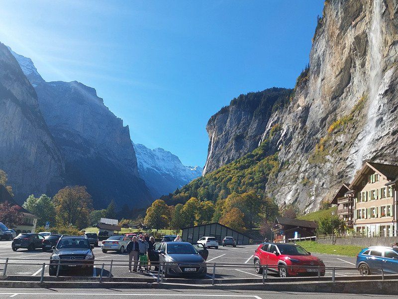
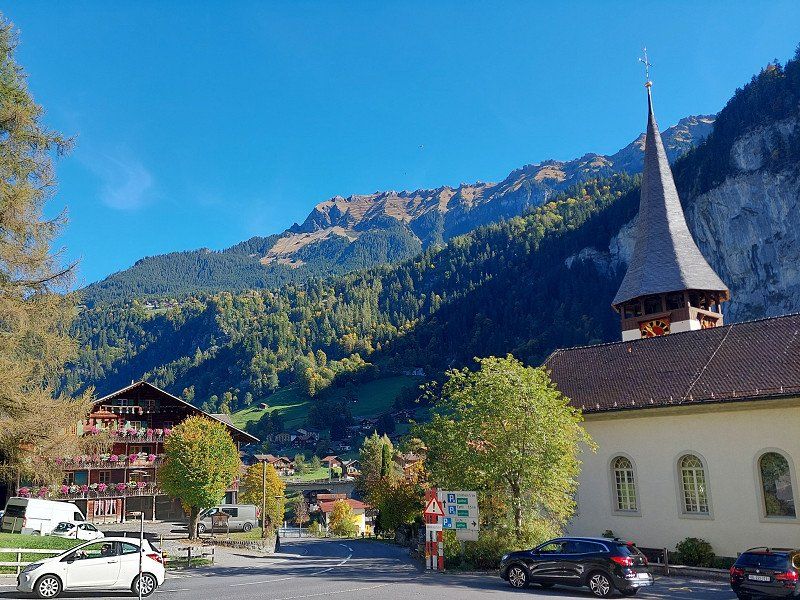
Lauterbrunnen, Schweiz
The vertical cliffs and waterfalls are impressive.
From Lauterbrunnen you can take the train to Kleine Scheidegg . Starting point for the cog railway to the Jungfraujoch but also with the best view of the Eiger north face, the Mönch and the Jungfrau.
46° 35' 36.6" N 7° 54' 32.8" E
46.5935058 7.9090981
• Head toward Fuhrenboden on Ey. Go for 24 m.
• Continue on Im Rohr. Go for 12 m.
• Turn slightly left onto Im Rohr. Go for 264 m.
• Continue on Auf der Fuhren. Go for 197 m.
• Continue on Auf der Fuhren. Go for 206 m.
• Continue on Bei der Zuben. Go for 178 m.
• Continue on Tripfi. Go for 149 m.
• Continue on Tripfi. Go for 109 m.
• Continue on Schmiedsmatte. Go for 393 m.
• Continue on Schmitsmatte. Go for 905 m.
• Continue on Sandweidli. Go for 2.5 km.
• Continue on Feldli. Go for 2.9 km.
• Continue on Bir Sagi. Go for 546 m.
• Continue on Tschingelmatta. Go for 201 m.
• Take the 1st exit from roundabout onto Umfahrung Wilderswil. Go for 1.6 km.
• Continue on Umfahrung Wilderswil. Go for 356 m.
• Take the 2nd exit from roundabout. Go for 38 m.
• Continue on Gsteigstrasse. Go for 68 m.
• Take ramp onto A8 toward Bern/Thun/Spiez/Gunten. Go for 7.5 km.
• Keep left onto A8 toward Bern/Thun/Spiez. Go for 5.2 km.
• Continue on 6/11. Go for 18 m.
• Continue on A8. Go for 5.5 km.
• Continue on A6. Go for 44.0 km.
• Continue on A1 toward Zürich/Basel/Kirchberg. Go for 44.7 km.
• Take exit 45 toward E35/Basel/Egerkingen onto A2. Go for 28.5 km.
• Take exit 9 toward Zürich/Rheinfelden onto A3. Go for 2.0 km.
• Take exit 14 toward Deutschland/Rheinfelden-West. Go for 1.3 km.
• Continue on A861. Go for 88 m.
• Continue on A861. Go for 4.1 km.
• Take the exit onto A98. Go for 2.1 km.
• Take ramp. Go for 602 m.
• Turn left onto Am Kalkofen (K6333) toward Maulburg/Minseln. Go for 557 m.
• Turn right onto Nordschwabener Straße. Go for 566 m.
• Continue on K6336. Go for 2.8 km.
• Continue on Schopfheimer Straße (K6336). Go for 735 m.
• Continue on K6336. Go for 1.3 km.
• Continue on Dinkelbergstraße (K6336). Go for 1.5 km.
• Continue on Wiechser Straße (K6336). Go for 310 m.
• Turn left onto Hohe-Flum-Straße. Go for 99 m.
• Turn left and take ramp. Go for 174 m.
• Turn left onto B317. Go for 21.8 km.
• Turn right onto B317 toward Donaueschingen/Todtnau/Münstertal. Go for 29.0 km.
• Take ramp onto B31 toward Freiburg/Titisee/Neustadt-West/B500/Hochfirstschanze. Go for 768 m.
• Take ramp toward Neustadt-West/Titisee/Hochfirstschanze. Go for 216 m.
• Turn left onto Neustädter Straße (L156) toward Neustadt/Krankenhaus/Helios-Klinik/Gewerbegebiet Neustadt-West/Gewerbegebiet Titisee/Hochfirstschanze. Go for 240 m.
• Turn right onto Gewerbestraße toward Titisee. Go for 597 m.
• Turn right onto Seebachstraße. Go for 932 m.
• Turn right onto Seebachstraße. Go for 1.0 km.
• Turn left onto Seestraße. Go for 264 m.
• Arrive at Seestraße.
☍
219,3 km
(3 hrs. 4 min.)
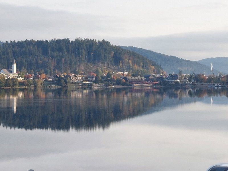
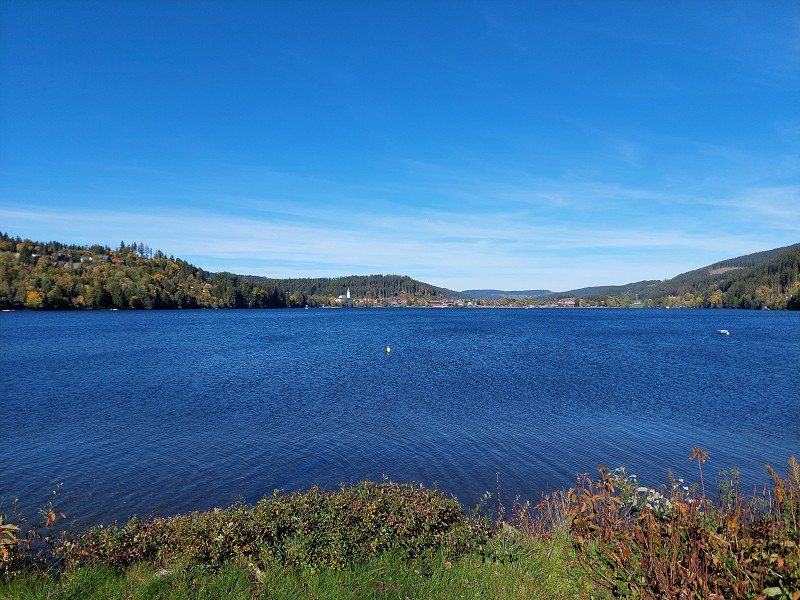
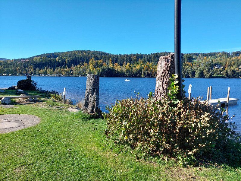
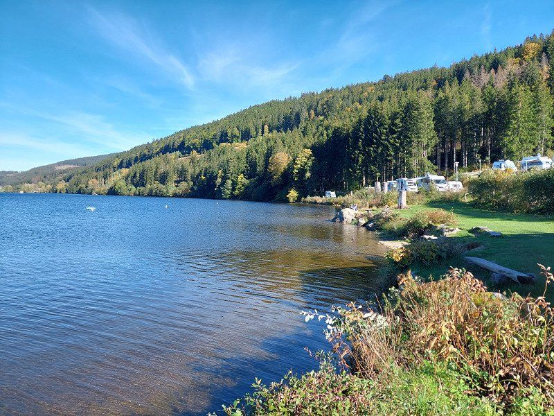
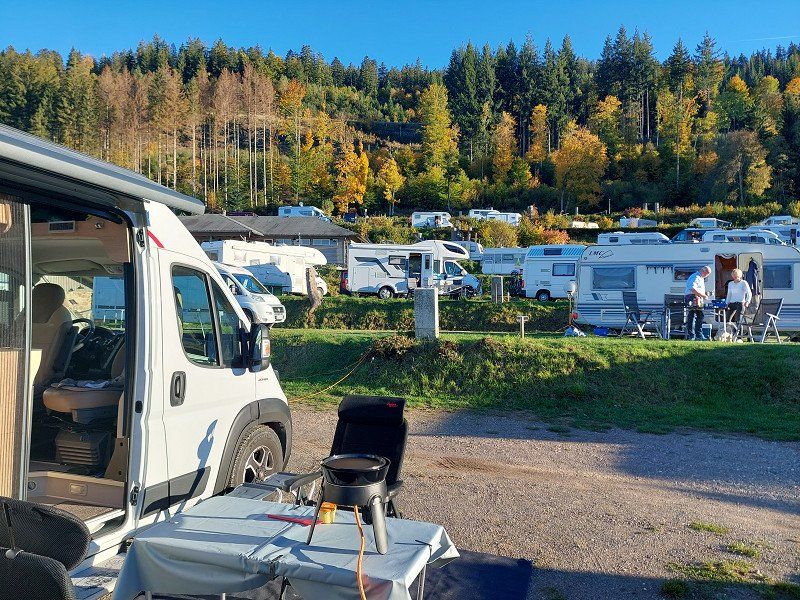
Seerundweg 9, Titisee 79822 Titisee-Neustadt, Breisgau-Hochschwarzwald, Deutschland
Camping sandbar
Very nice terraced campsite. All pitches with a view of Lake Titisee.
Bistro with terrace on the water. Good bread service without pre-order. New modern sanitary facilities.
Free offers: stand-up paddling, pedal boats, car rental for shopping
We recommend!
Seerundweg 9, 79822 Titisee-Neustadt, Deutschland
47° 53' 42.6" N 8° 9' 19.3" E
47.8951569 8.1553645
• Head northwest on Seestraße. Go for 264 m.
• Turn right onto Seebachstraße. Go for 1.0 km.
• Turn left onto Seebachstraße. Go for 42 m.
• Turn right onto Seebachstraße. Go for 890 m.
• Turn left onto Gewerbestraße. Go for 597 m.
• Turn left onto Neustädter Straße (L156). Go for 240 m.
• Turn right and take ramp onto B31 toward Freiburg/Titisee/B500. Go for 35.7 km.
• Take ramp onto A5 toward Basel. Go for 12.5 km.
• Take exit 64A toward Bad Krozingen/Staufen/Münstertal/Colmar/Breisach. Go for 216 m.
• Turn left onto B31 toward Breisach/Colmar (Elsaß)/Hartheim/Hausen/Möhlin. Go for 10.3 km.
• Take the 2nd exit from roundabout onto B31 toward Colmar. Go for 612 m.
• Continue on D415. Go for 303 m.
• Pass 2 roundabouts and continue on D415. Go for 2.1 km.
• Take the 3rd exit from roundabout onto D415 toward Colmar/Neuf-Brisach. Go for 1.5 km.
• Take the 2nd exit from roundabout onto D415 toward A35/Colmar/Wolfgantzen. Go for 1.1 km.
• Take the 3rd exit from roundabout onto Route de Neuf-Brisach (D2) toward Ensisheim/Dessenheim/Weckolsheim. Go for 1.8 km.
• Turn right onto Route de Niederhergheim (D1 BIS). Go for 2.9 km.
• Pass 5 roundabouts and continue on D1 BIS. Go for 15.5 km.
• Continue on Route d'Eguisheim (D1 BIS). Go for 266 m.
• Continue on D1 BIS. Go for 856 m.
• Continue on Route de Herrlisheim (D1 BIS). Go for 168 m.
• Take the 2nd exit from roundabout onto Route de Wettolsheim (D1 BIS). Go for 259 m.
• Turn left onto Rue des Fleurs. Go for 371 m.
• Continue on Rue du Riesling. Go for 25 m.
• Continue on Rue du Traminer. Go for 145 m.
• Continue on Place Charles de Gaulle. Go for 13 m.
• Turn right onto Place Charles de Gaulle. Go for 88 m.
• Turn slightly left onto Place Charles de Gaulle. Go for 15 m.
• Turn right onto Rue de Hautvillers. Go for 293 m.
• Turn slightly left onto Rue du Bassin. Go for 132 m.
• Arrive at Rue du Bassin. Your destination is on the right.
☍
90,2 km
(1 hrs. 29 min.)
Day
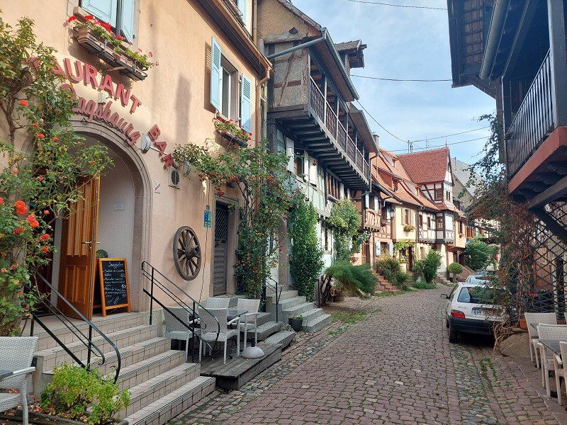
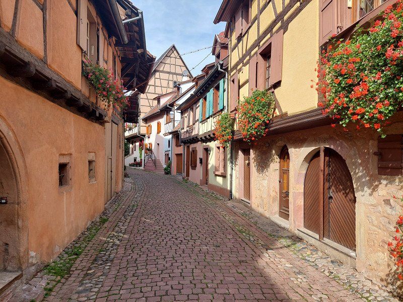
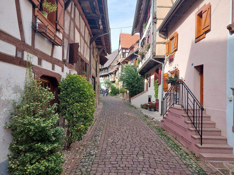
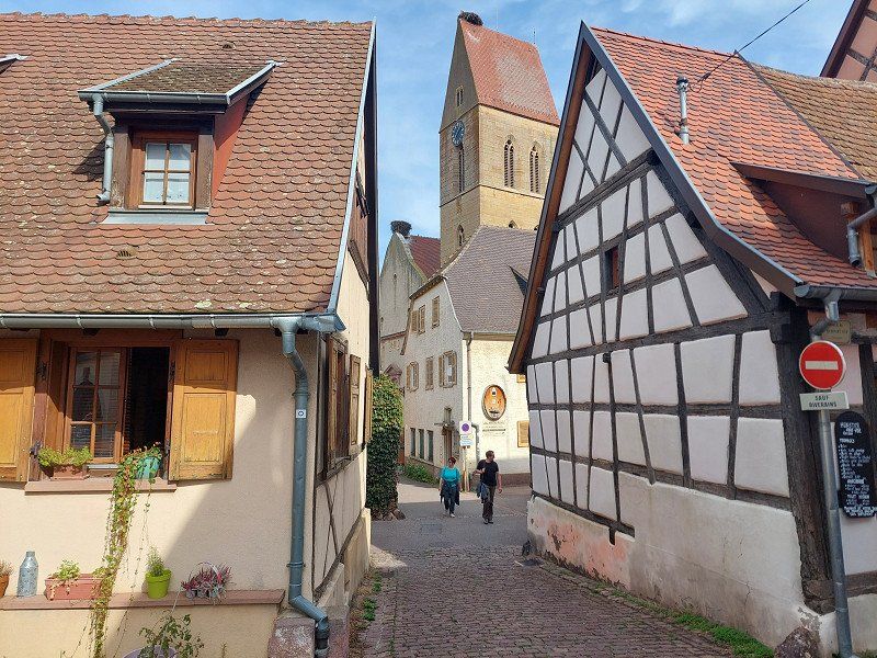
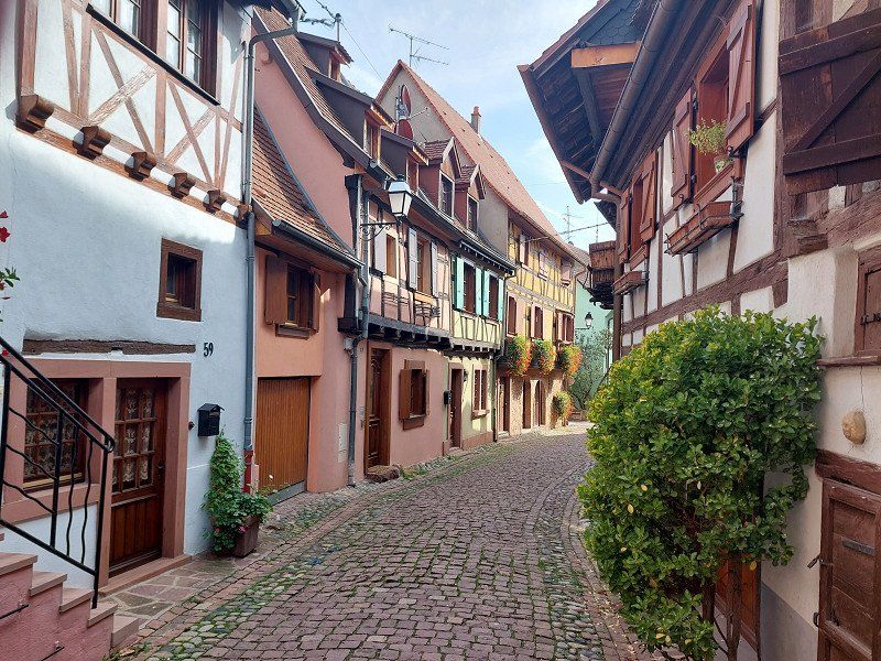
Camping Les Trois Châteaux
Eguisheim (near Colmar)
A very pretty village on the Alsatian Wine Route. Just a three minute walk from the campsite.
It's like stepping into another world...
Like in a movie studio.
But it's all real!
rue du Bassin 10, 68420, Eguisheim, France
48° 2' 36" N 7° 17' 55.6" E
48.0433300 7.2987700
• Head southeast on Rue du Bassin. Go for 132 m.
• Turn slightly right onto Rue de Hautvillers. Go for 293 m.
• Continue on Place Charles de Gaulle. Go for 74 m.
• Turn left onto Place Charles de Gaulle. Go for 50 m.
• Continue on Rue du Traminer. Go for 145 m.
• Continue on Rue du Riesling. Go for 25 m.
• Continue on Rue des Fleurs. Go for 371 m.
• Turn left onto Route de Wettolsheim (D1 BIS). Go for 850 m.
• Continue on D1 BIS. Go for 363 m.
• Take the 3rd exit from roundabout onto D83 toward Nancy/Strasbourg/Munster/Wintzenheim/Z.I. Colmar. Go for 2.4 km.
• Take the 3rd exit from roundabout onto Carrefour Ligibel (D83) toward Freiburg/Nancy/Strasbourg/Z.I. Colmar/Ingersheim/Turckheim. Go for 1.0 km.
• Take the 3rd exit from roundabout onto Carrefour Ligibel (D83) toward Freiburg/Nancy/Strasbourg/Z.I. Colmar/Ingersheim. Go for 825 m.
• Pass 5 roundabouts and continue on Rue du 152ème Régiment d'Infanterie (D83). Go for 3.4 km.
• Take the 3rd exit from roundabout onto Avenue Gilbert Meyer toward Nancy/St Dié/Strasbourg/Houssen. Go for 719 m.
• Pass 2 roundabouts and continue on Avenue Gilbert Meyer (D83). Go for 2.3 km.
• Take the 2nd exit from roundabout onto D83. Go for 11.3 km.
• Keep left onto A35. Go for 39.0 km.
• Keep left onto A355 toward E25/A4/Paris/A35/Karlsruhe/Strasbourg. Go for 23.6 km.
• Keep right toward A35/A4/Schiltigheim/Karlsruhe/Lauterbourg/Hoerdt. Go for 2.5 km.
• Continue on A35. Go for 47.0 km.
• Continue on B9. Go for 6.1 km.
• Turn right onto K18 toward Hagenbach. Go for 2.0 km.
• Turn right onto K19 toward Hagenbach. Go for 1.6 km.
• Turn left onto L540 toward Hagenbach. Go for 280 m.
• Take the 2nd exit from roundabout onto L540. Go for 162 m.
• Continue on Habsburgerallee. Go for 1.0 km.
• Turn left onto Friedenstraße (L540). Go for 385 m.
• Take the 3rd exit from roundabout onto L540 toward A65/Germersheim/Wörth/B9. Go for 1.9 km.
• Continue on B9. Go for 35.0 km.
• Take ramp onto B9 toward B39/Heidelberg/Speyer-Süd/Speyer-Zentrum/Krankenhaus Diakonissen. Go for 1.6 km.
• Take ramp onto B39 toward A5/A6/Heidelberg/SP-Zentrum/SP-Vogelgesang. Go for 1.8 km.
• Take ramp toward Speyer-Zentrum/Flughafen/Gewerbegebiet-Süd/Krankenhaus Diakonissen/Dom/Mussen. Go for 197 m.
• Continue on Am Technik Museum (K2). Go for 396 m.
• Turn right onto Geibstraße. Go for 212 m.
• Turn right onto Geibstraße. Go for 107 m.
• Continue straight ahead. Go for 94 m.
• Turn right. Go for 66 m.
• Arrive at your destination on the left.
☍
189,2 km
(2 hrs. 1 min.)
Day
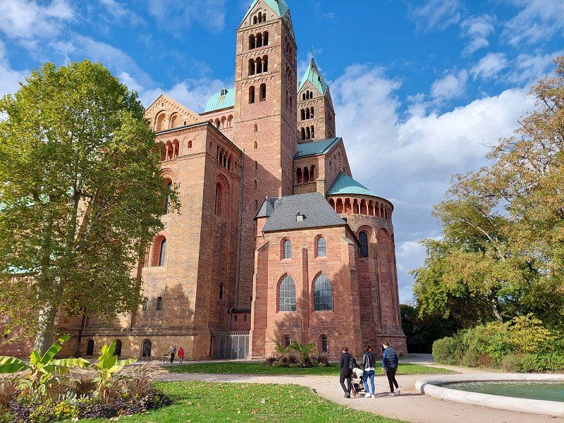
Caravanpark am Technik Museum
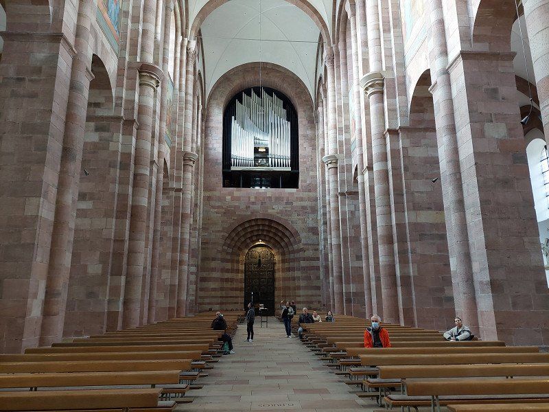
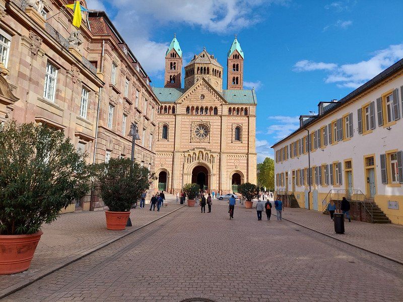
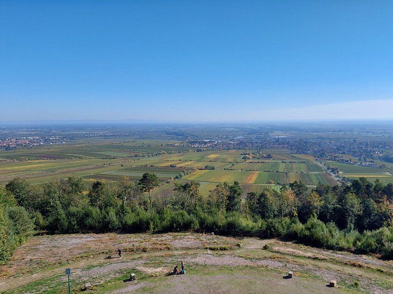
Speyer Cathedral
Largest preserved Romanesque church in the world.
The caravan park is located between the Rhine and the old town.
It is only a few minutes by car to the German Wine Route .
Am Technik Museum 1, 67346, Speyer, Germany
49° 18' 39.3" N 8° 27' 1.9" E
49.3109200 8.4505200
• Head south. Go for 213 m.
• Continue on Geibstraße. Go for 107 m.
• Turn left onto Geibstraße. Go for 212 m.
• Turn left onto Am Technik Museum (K2). Go for 396 m.
• Take ramp. Go for 208 m.
• Continue on B39. Go for 1.9 km.
• Continue on L722 toward A61/Heidelberg/Schwetzingen/Hockenheim/Gewerbegebiet Talhaus. Go for 2.8 km.
• Take ramp onto A61 toward Heilbronn/Karlsruhe/Mannheim. Go for 3.3 km.
• Take the left exit toward Stuttgart/Heilbronn/Karlsruhe onto A6. Go for 249 km.
• Take exit 64 toward Lauterhofen/Schwend onto St2164. Go for 564 m.
• Turn right onto Schwenderöd (AS3) toward Nürnberg-Amberg/Sulzbach-Rosenberg. Go for 132 m.
• Continue on AS3. Go for 2.4 km.
• Continue on AS36. Go for 938 m.
• Continue on Frechetsfeld (AS36). Go for 259 m.
• Arrive at Frechetsfeld (AS36). Your destination is on the right.
☍
262,7 km
(2 hrs. 28 min.)
92262 Birgland, Deutschland
49° 26' 14.5" N 11° 37' 0.6" E
49.4373538 11.6168325