The wonderful days at Pentecost 2020 and the relaxation of travel restrictions were so tempting that we decided to take a tour of the Black Forest. It was supposed to be more sightseeing, because museums and the like could only be visited to a limited extent. Nevertheless, it was very relaxing, although some parking spaces were occupied up to the capacity limit (which is surprising) - but there are always alternatives!
Day
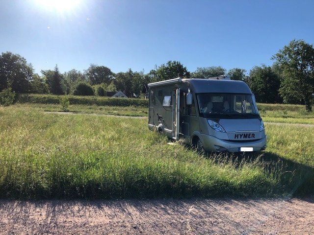
Stellplatz am Freibad
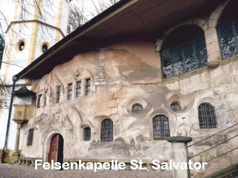
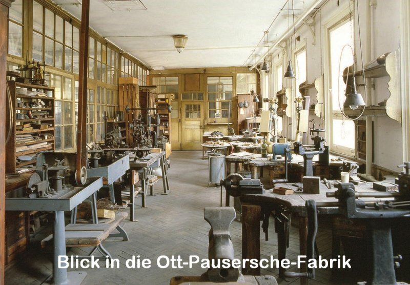
The starting point is Schwäbisch Gmünd, the oldest Staufer town. It is the oldest attested medieval town founding in Württemberg. Many witnesses from this time still characterize the city today. Market square, St. John's Church, Münster, St. Salvator (rock chapel and Stations of the Cross), Prediger (museum) or the Ott-Pausersche factory (silverware museum) are some of the stops that also justify a stay of several days. The State Horticultural Show 2014 also had a lasting impact on the cityscape and the surrounding area. The "heavenly garden" with the "heavenly striker" are impressive witnesses of this. After a visit to the site, a walk through the forest along the "ball track" down to the "Erdenreich" is a good idea.
Attention: The parking space situation in Schwäbisch Gmünd has changed.
Information can be found at: https://www.gmuender-baeder.de/wohnmobilhafen.html
Schießtalstraße 13, 73525, Schwäbisch Gmünd, Deutschland
48° 48' 17" N 9° 48' 49" E
48.8047222 9.8136111
• Head west. Go for 33 m.
• Turn right toward Richard-Bullinger-Straße. Go for 160 m.
• Turn right onto Richard-Bullinger-Straße. Go for 37 m.
• Continue on Schießtalstraße. Go for 318 m.
• Turn right onto Herlikofer Straße (L1075). Go for 499 m.
• Continue on Vordere Schmiedgasse (L1075) toward Waldstetten/Bettringen/Zentrum/Stuttgart/Bahnhof. Go for 189 m.
• Take the 3rd exit from Baldungskreisel roundabout onto Baldungstraße toward Waldstetten/Bettringen. Go for 169 m.
• Turn right onto Königsturmstraße. Go for 550 m.
• Turn right onto Königsturmstraße. Go for 35 m.
• Continue on Klösterlestraße. Go for 421 m.
• Continue on Goethestraße. Go for 244 m.
• Turn left onto Rektor-Klaus-Straße (L1075). Go for 354 m.
• Turn right onto Rechbergstraße (L1075). Go for 1.3 km.
• Take the 2nd exit from roundabout onto Einhornstraße (L1075). Go for 913 m.
• Take the 2nd exit from roundabout onto Donzdorfer Straße (L1159). Go for 4.2 km.
• Pass 2 roundabouts and continue on Gmünder Straße (L1159). Go for 7.2 km.
• Take the 1st exit from roundabout onto K1402 toward Göppingen/Süßen/B466. Go for 2.9 km.
• Keep right onto B466 toward Göppingen/Süßen. Go for 3.3 km.
• Take ramp onto B10 toward Stuttgart/Göppingen. Go for 1.8 km.
• Take ramp toward Süßen/Schlat. Go for 155 m.
• Turn left onto Schlater Straße (K1426) toward Reichenbach i.T./Schlat. Go for 87 m.
• Continue on K1426. Go for 74 m.
• Continue on Eichenwasen (K1426). Go for 120 m.
• Continue on Schlater Straße (K1426). Go for 58 m.
• Continue on K1426. Go for 1.6 km.
• Continue on Süßener Straße (K1426). Go for 326 m.
• Take the 2nd exit from roundabout onto Süßener Straße (K1426). Go for 437 m.
• Turn left onto Hauptstraße (K1426). Go for 277 m.
• Continue on Reichenbacher Straße (L1218). Go for 6.3 km.
• Turn right onto B466. Go for 951 m.
• Take the 1st exit from roundabout onto Geislinger Straße (B466). Go for 2.9 km.
• Arrive at B466. Your destination is on the right.
☍
37,8 km
( 41 min.)
Bad Ditzenbach, Deutschland
73342 Bad Ditzenbach, Deutschland
48° 35' 12.9" N 9° 41' 58.9" E
48.5869280 9.6997062
• Head toward Auendorfer Straße on B466. Go for 3.1 km.
• Take the 3rd exit from roundabout onto L1200 toward Wiesensteig/Mühlhausen i.T. Go for 3.3 km.
• Turn right onto Hauptstraße (L1200). Go for 145 m.
• Arrive at Kirchheimer Straße (L1200).
☍
6,5 km
( 7 min.)
Zusatzinfos
In Bad Ditzenbach, among other things, it is worth visiting the St. Bernhard herb house with its diverse range of natural products. Of course you can also visit the thermal baths. A simple parking space is nearby.
Wiesensteig, Deutschland
73349 Wiesensteig, Deutschland
48° 33' 42.4" N 9° 37' 25" E
48.5617826 9.6236236
• Head toward Sommerbergstraße on Kirchheimer Straße (L1200). Go for 2.5 km.
• Turn left onto K1430 toward Schopfloch. Go for 3.4 km.
• Continue on K1247. Go for 2.4 km.
• Turn left onto L1212. Go for 2.7 km.
• Turn left onto B465 toward Blaubeuren/Römerstein. Go for 1.3 km.
• Turn right onto K6704 toward Bad Urach/Rö.-Böhringen. Go for 1.9 km.
• Turn right onto L252. Go for 1.3 km.
• Continue on Klingen (L252). Go for 281 m.
• Continue on L252. Go for 253 m.
• Continue on Poststraße (L252). Go for 495 m.
• Continue on Albstraße (L252). Go for 602 m.
• Turn right onto B28/B465. Go for 457 m.
• Turn right onto K6758 toward Neuffen/Grabenstetten/Falkensteiner Höhle. Go for 4.9 km.
• Turn left onto Uracher Straße (L211). Go for 499 m.
• Continue on Neuffener Straße (K6759). Go for 3.1 km.
• Continue on K1263. Go for 602 m.
• Continue on K6760. Go for 440 m.
• Turn right onto L250 toward Nürtingen/Neuffen. Go for 125 m.
• Continue on L1250. Go for 5.5 km.
• Turn left onto Burgstraße (L1210) toward Nürtingen/Metzingen/Kappishäusern. Go for 232 m.
• Turn right onto Paulusstraße. Go for 49 m.
• Arrive at Paulusstraße. Your destination is on the left.
☍
33,1 km
( 29 min.)
Zusatzinfo
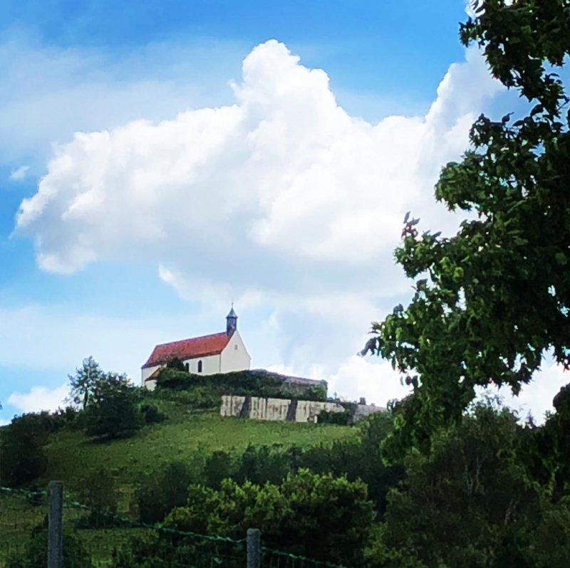
On the way, the Wurmling Chapel greets you (detour?).
Neuffen, Deutschland
48° 33' 22.1" N 9° 22' 32.2" E
48.5561406 9.3756195
• Head south on Paulusstraße. Go for 49 m.
• Turn right onto Oberer Graben (L1210). Go for 95 m.
• Take the 3rd exit from roundabout onto Lindenplatz (L1210) toward Stadtmitte. Go for 4.8 km.
• Turn left onto Metzinger Straße (K1241). Go for 335 m.
• Continue on Kirchstraße (K1241). Go for 29 m.
• Continue on Metzinger Straße (K1241). Go for 315 m.
• Continue on Dettinger Straße (K1241). Go for 366 m.
• Continue on K1241. Go for 431 m.
• Continue on Vorderer Nützenbach (K6712). Go for 572 m.
• Continue on Unterer Boden (K6712). Go for 45 m.
• Continue on K6712. Go for 59 m.
• Continue on Nürtinger Straße (K6712). Go for 420 m.
• Take the 1st exit from roundabout onto Metzinger Straße (K6712). Go for 900 m.
• Continue on L380A. Go for 338 m.
• Take ramp toward Stuttgart/Reutlingen/Metzingen. Go for 234 m.
• Turn right onto B28. Go for 4.7 km.
• Take ramp onto B28/B312/B313. Go for 18.7 km.
• Take ramp toward Rottenburg/Paul Horn-Arena. Go for 181 m.
• Turn right onto Europastraße. Go for 21.4 km.
• Take ramp onto L1361 toward Nagold/Mötzingen. Go for 6.3 km.
• Continue on L361. Go for 1.5 km.
• Turn left onto L362. Go for 247 m.
• Continue on L362 toward Freudenstadt/B28/Altensteig/Krankenhaus/Gewerbegebiet Nagold West. Go for 1.8 km.
• Turn right onto Kronenstraße. Go for 38 m.
• Turn right onto Lembergstraße. Go for 255 m.
• Turn left onto Obere Eisenbahnstraße. Go for 66 m.
• Arrive at Obere Eisenbahnstraße. Your destination is on the left.
☍
64,2 km
( 56 min.)
Zusatzinfos
A short detour to Ruine "Hohenneuffen" is always appropriate. When the weather is clear, the view is fantastic.
Nagold, Deutschland
72202 Nagold, Deutschland
48° 32' 50.7" N 8° 43' 24.5" E
48.5474083 8.7234746
• Head toward Am Ziegelrain on Obere Eisenbahnstraße. Go for 142 m.
• Turn left toward Kronenstraße. Go for 87 m.
• Turn right onto Kronenstraße. Go for 31 m.
• Turn sharp left onto Freudenstädter Straße. Go for 348 m.
• Take the 1st exit from roundabout onto Altensteiger Straße toward Freudenstadt/Altensteig/Gewerbepark N-West. Go for 337 m.
• Take the 1st exit from roundabout onto L362 toward Freudenstadt/Altensteig/Haiterbach. Go for 2.1 km.
• Take the 2nd exit from roundabout onto K4339 toward Egenhausen/Walddorf. Go for 2.5 km.
• Continue on Rohrdorfer Straße (K4339). Go for 553 m.
• Continue on K4339. Go for 812 m.
• Continue on Freudenstädter Straße (K4339). Go for 436 m.
• Continue on Pfalzgrafenweiler Straße (K4339). Go for 587 m.
• Continue on K4339. Go for 1.7 km.
• Continue on Walddorfer Straße (K4339). Go for 455 m.
• Turn right onto Nagolder Straße (L353) toward Freudenstadt/Pfalzgrafenweiler. Go for 4.3 km.
• Take the 2nd exit from roundabout onto L353. Go for 340 m.
• Turn left onto L404 toward Freudenstadt/Dornstetten. Go for 2.6 km.
• Continue on L404 toward B28/Freudenstadt. Go for 13.5 km.
• Arrive at Stuttgarter Straße (B28/B462). Your destination is on the left.
☍
30,8 km
( 29 min.)
Zusatzinfo
If you bring a lot of time (and money) with you, you could stop in the Rolf Benz outlet. Otherwise, follow the Nagoldtal and the former narrow-gauge railway (Altensteigerle - now a bike path) towards Freudenstadt.
Freudenstadt, Deutschland
48° 27' 52.1" N 8° 25' 4.8" E
48.4644796 8.4179988
• Head toward Musbacher Straße on Stuttgarter Straße (B28/B462). Go for 517 m.
• Turn left onto Loßburger Straße (B28) toward Straßburg. Go for 321 m.
• Take the 1st exit from roundabout onto Straßburger Straße (B28) toward Strasbourg/Baden-Baden/Kniebis. Go for 580 m.
• Turn left onto Schömberger Straße (L405) toward Wolfach/Bad Rippoldsau-Schapbach/Zwieselberg/Schömberg. Go for 1.9 km.
• Continue on L404 toward Wolfach/Bad Rippoldsau/Schapbach/Zwieselberg. Go for 11.5 km.
• Turn left onto Wolftalstraße (L96). Go for 20.1 km.
• Turn right onto Hauptstraße. Go for 381 m.
• Continue on Bahnhofstraße. Go for 531 m.
• Continue on Kirnbacher Straße (K5361). Go for 669 m.
• Continue on K5361. Go for 131 m.
• Continue on Kirnbacher Straße (K5361). Go for 136 m.
• Continue on K5361. Go for 390 m.
• Continue on Talstraße (K5361). Go for 416 m.
• Turn right onto Einödstraße (K5360) toward Hornberg/Gutach. Go for 348 m.
• Continue on Kirnbacher Straße (K5360). Go for 1.2 km.
• Turn left onto Hausacher Straße (B33). Go for 17.4 km.
• Turn right onto Frejusstraße (B500) toward Furtwangen/Schönwald/Elzach/Schonach/Stadtmitte. Go for 1.3 km.
• Turn left onto Ludwigstraße (K5727). Go for 108 m.
• Turn left onto Luisenstraße. Go for 26 m.
• Turn left onto Amthausweg. Go for 131 m.
• Arrive at Amthausweg. Your destination is on the right.
☍
58,2 km
(1 hrs. 3 min.)
Zusatzinfo
Losing words about Freudenstadt's market place (very worth seeing) is like carrying owls to Athens. A stop is always worthwhile. Also, when the weather is nice, you should not miss the Ellbachsee view in Kniebis. A part of the Black Forest High Road then goes deeper into the Black Forest.
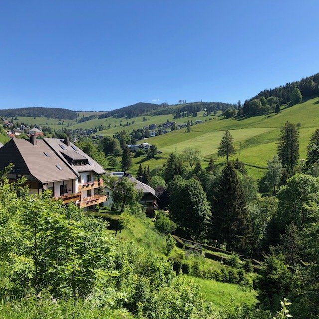
Triberg, Deutschland
78098 Triberg im Schwarzwald, Deutschland
48° 7' 48.6" N 8° 13' 56.8" E
48.1301564 8.2324351
• Head toward Luisenstraße on Amthausweg. Go for 131 m.
• Turn right onto Luisenstraße. Go for 26 m.
• Turn left onto Ludwigstraße (K5727). Go for 18 m.
• Continue on Friedrichstraße (K5727). Go for 261 m.
• Continue on Rohrbacher Straße (K5727). Go for 885 m.
• Continue on Geutschenstraße (K5727). Go for 1.7 km.
• Continue on K5727. Go for 683 m.
• Continue on Geutschenstraße (K5727). Go for 440 m.
• Continue on K5727. Go for 395 m.
• Turn left onto K5728. Go for 485 m.
• Continue on Fuchsfallenweg (K5728). Go for 903 m.
• Turn left and take ramp toward St. Georgen/Brigach/Furtwangen/Rohrbach. Go for 178 m.
• Turn right onto L175. Go for 6.6 km.
• Turn right onto Alemannenstraße (L173). Go for 2.6 km.
• Turn left onto Martin-Schmitt-Straße (L173). Go for 1.8 km.
• Turn left onto Bregstraße (B500). Go for 419 m.
• Take the 3rd exit from roundabout onto B500. Go for 2.3 km.
• Turn left onto Oberbregenbach (B500) toward Titisee-Neustadt/Hinterzarten/Neukirch. Go for 12.0 km.
• Turn left onto Jostalstraße (L128) toward Neustadt/Jostal. Go for 7.7 km.
• Turn right onto Freiburger Straße (L156). Go for 2.9 km.
• Take the 3rd exit from roundabout onto B31 toward Donaueschingen/Neustadt-Mitte/Feldberg/B317/B500. Go for 664 m.
• Take ramp onto B317 toward Basel/Feldberg/Waldshut-Tiengen/Schluchsee/Lenzkirch/B500. Go for 3.9 km.
• Turn left onto B315 toward Schaffhausen/Lenzkirch/Saig/Falkau. Go for 728 m.
• Turn right onto K4991. Go for 1.2 km.
• Continue on Ortsstraße (K4991). Go for 2.6 km.
• Continue on Falkauer Straße (K4991). Go for 312 m.
• Turn left onto Falkauer Straße. Go for 327 m.
• Arrive at Falkauer Straße. Your destination is on the right.
☍
52,2 km
( 50 min.)
Zusatzinfo
You should have seen Germany's highest waterfalls in Triberg! Foaming and roaring, the water of the Gutach falls 163 m. On the paths along the seven fall levels you will experience a magnificent natural spectacle that can be experienced all year round. A short walk down the main street is also interesting (watches). Above the entrance to the waterfalls, there is a bus parking lot with camper parking spaces right on the street.
Altglashütten, Feldberg (Schwarzwald), Deutschland
Altglashütten, 79868 Feldberg (Schwarzwald), Deutschland
47° 51' 25.5" N 8° 6' 45.3" E
47.8570964 8.1125790
• Head southwest on Falkauer Straße. Go for 139 m.
• Turn right onto Kirchgasse. Go for 147 m.
• Turn right onto B500. Go for 2.0 km.
• Turn left onto Feldbergstraße (B317) toward Basel/Lörrach/Feldberg/Feldbergbahn. Go for 4.9 km.
• Turn right onto Am Seebuck (B317) toward Feldbergbahn/Feldberg. Go for 695 m.
• Enter the roundabout. Go for 53 m.
• Arrive at your destination on the left.
☍
8,0 km
( 9 min.)
Zusatzinfo
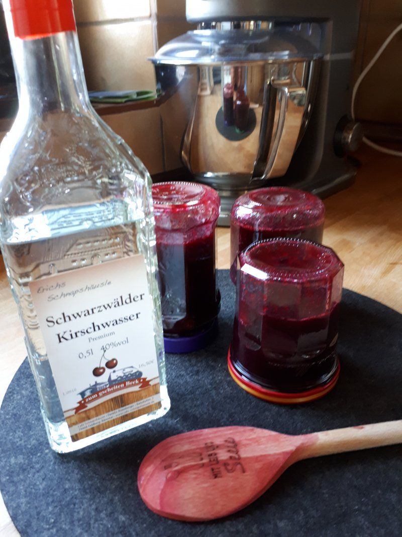
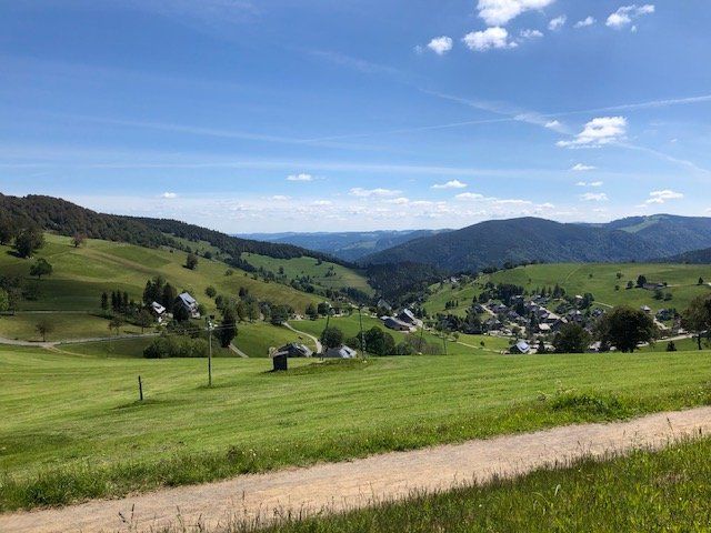
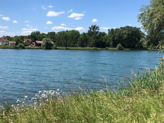
Whether you interrupt your journey in Titisee at the bathing paradise (parking space) depends on the mood and the urge to move. We drove towards Feldberg. In Bärental it is worth visiting the "Schnapshäusle" before continuing to Altglashütte to the parking space at the train station. With us it was overcrowded, so that we had a very quiet night at the Feldberghalle shortly before (no infrastructure).
Day
Feldberg, Deutschland
79868 Feldberg (Schwarzwald), Deutschland
47° 51' 32.4" N 8° 2' 13.4" E
47.8589972 8.0370440
• Follow the roundabout. Go for 58 m.
• Take the 4th exit from roundabout onto Am Seebuck (B317). Go for 620 m.
• Turn sharp right onto Passhöhe (B317). Go for 10.9 km.
• Turn right onto Friedrichstraße. Go for 51 m.
• Turn left onto Fridolin-Wißler-Straße. Go for 106 m.
• Turn right onto Franz-Dietsche-Straße. Go for 116 m.
• Arrive at Franz-Dietsche-Straße. Your destination is on the right.
☍
11,8 km
( 14 min.)
Zusatzinfo
If you have enough time, you should consider a hike to the Feldberg tower. With the mobile you have to park at the pass.
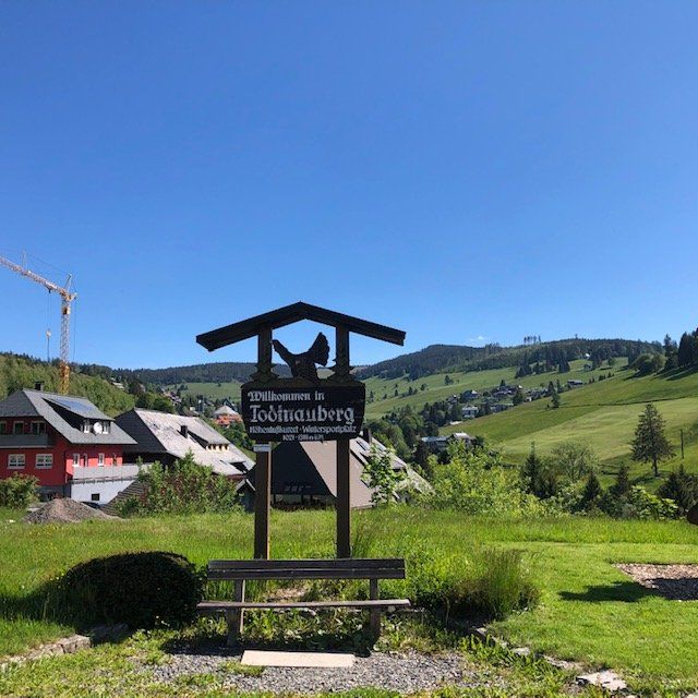
Todtnau, Deutschland
47° 49' 50.4" N 7° 56' 43.7" E
47.8306596 7.9454669
• Head toward Freiburger Straße on Franz-Dietsche-Straße. Go for 43 m.
• Turn left onto Freiburger Straße. Go for 626 m.
• Turn right onto L126. Go for 3.4 km.
• Turn right onto K6307. Go for 1.6 km.
• Turn slightly left onto Außer Ort Todtnauberg (K6307). Go for 550 m.
• Turn slightly right onto Kurhausstraße (K6307). Go for 135 m.
• Continue on Kreuzmattstraße (K6307). Go for 33 m.
• Turn slightly left onto Kurhausstraße. Go for 251 m.
• Arrive at Kurhausstraße. Your destination is on the right.
☍
6,6 km
( 11 min.)
Zusatzinfo
The trip from Feldberg is curvy and offers beautiful views. The waterfalls in Todtnau are worthwhile. You can easily reach the upper entrance on the route to Todtnauberg - a nice walk.
Todtnauberg, Deutschland
79674 Todtnauberg, Deutschland
47° 51' 6.1" N 7° 56' 26.1" E
47.8517078 7.9405851
• Head toward Rosenweg on Kurhausstraße. Go for 251 m.
• Turn slightly right onto Kreuzmattstraße (K6307). Go for 33 m.
• Continue on Kurhausstraße (K6307). Go for 135 m.
• Turn slightly left onto Außer Ort Todtnauberg (K6307). Go for 550 m.
• Turn slightly right onto K6307. Go for 1.6 km.
• Turn right onto Schauinslandstraße (L126). Go for 3.3 km.
• Turn left onto Notschrei (L124). Go for 4.5 km.
• Turn right onto Schauinslandstraße. Go for 27 m.
• Arrive at Schauinslandstraße.
☍
10,4 km
( 13 min.)
Zusatzinfo
If you fancy a (easy) hike, drive through the town towards the youth hostel. The mobile can be parked above the hiking car park Radschert and the activities are "no longer in the way".
Schauinsland, Freiburg im Breisgau, Deutschland
Schauinsland, 79254 Freiburg im Breisgau, Deutschland
47° 54' 43" N 7° 53' 54" E
47.9119444 7.8983333
• Head southwest on Schauinslandstraße. Go for 27 m.
• Turn right onto Schauinslandstraße (L124). Go for 17.7 km.
• Turn left onto Schreiberstraße (B31) toward A5. Go for 952 m.
• Take ramp toward Unikliniken/Stühlinger/Gewerbegebiet Süd/Haslach. Go for 263 m.
• Turn right onto Eschholzstraße toward Uni-Kliniken/Stühlinger. Go for 883 m.
• Turn right onto Lehener Straße. Go for 322 m.
• Turn right onto Wentzingerstraße. Go for 92 m.
• Turn left. Go for 40 m.
• Arrive at your destination on the right.
☍
20,2 km
( 29 min.)
Zusatzinfo
Be sure to plan time when the weather is nice. The trip down to Freiburg by gondola is certainly worth considering. Then it goes back down into the valley via the former race track.
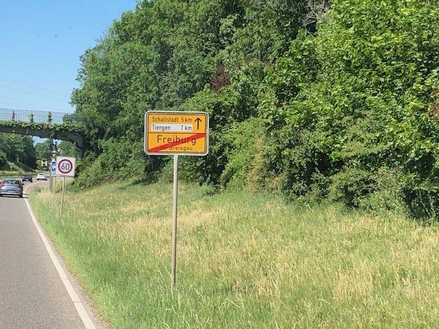
Freiburg im Breisgau, Deutschland
47° 59' 56.4" N 7° 50' 31.6" E
47.9990077 7.8421043
• Head toward Wentzingerstraße. Go for 40 m.
• Turn right onto Wentzingerstraße. Go for 92 m.
• Turn left onto Lehener Straße. Go for 696 m.
• Continue on Sundgauallee (K9859). Go for 898 m.
• Turn left onto Berliner Allee. Go for 616 m.
• Take ramp onto Autobahnzubringer Mitte (B31A) toward Autobahn Karlsruhe Basel/Offenburg/Gottenheim. Go for 3.6 km.
• Take ramp onto A5 toward Basel. Go for 12.5 km.
• Take exit 64A toward Bad Krozingen/Staufen/Münstertal/Colmar/Breisach. Go for 216 m.
• Turn left onto B31 toward Breisach/Colmar (Elsaß)/Hartheim/Hausen/Möhlin. Go for 2.0 km.
• Turn right onto Mittelmatten (K4931) toward Oberrimsingen. Go for 765 m.
• Continue on Grezhauser Straße (K4931). Go for 411 m.
• Turn left onto Bundesstraße (K4999). Go for 1.3 km.
• Turn right onto B31. Go for 5.4 km.
• Turn right onto L104 toward Riegel/Vogtsburg i.K./Breisach-Mitte/Nord. Go for 1.9 km.
• Turn right and take ramp toward Breisach-Mitte/Gewerbegebiet Gelbstein. Go for 192 m.
• Turn right onto Zum Kaiserstuhl. Go for 395 m.
• Take the 2nd exit from roundabout onto Neuer Weg. Go for 420 m.
• Turn right onto Friedhofallee. Go for 144 m.
• Continue on Saarlandstraße. Go for 249 m.
• Turn right onto Hohenzollernstraße. Go for 22 m.
• Turn left onto Hohenzollernstraße. Go for 40 m.
• Arrive at Hohenzollernstraße. Your destination is on the left.
☍
31,8 km
( 30 min.)
Zusatzinfo
Freiburg is always worth a visit. On Saturdays you shouldn't miss the market around Münster - all a question of time :-))
Breisach am Rhein, Deutschland
48° 2' 5.4" N 7° 35' 1" E
48.0348382 7.5836067
• Head southeast on Hohenzollernstraße. Go for 40 m.
• Turn right onto Hohenzollernstraße. Go for 187 m.
• Turn right onto Zähringerstraße. Go for 203 m.
• Turn right onto Burkheimer Landstraße. Go for 302 m.
• Take the 3rd exit from roundabout onto Burkheimer Landstraße. Go for 875 m.
• Turn right onto Hafenstraße. Go for 484 m.
• Turn left onto L104. Go for 11.9 km.
• Turn left onto Wyhler Straße (L104). Go for 513 m.
• Pass 3 roundabouts and continue on Sasbacher Straße (L104). Go for 3.3 km.
• Take the 3rd exit from roundabout onto Hauptstraße (L104). Go for 678 m.
• Pass 4 roundabouts and continue on Hausener Straße (L104). Go for 12.7 km.
• Continue on Fischerstraße (L104). Go for 331 m.
• Arrive at Fischerstraße (L104). Your destination is on the right.
☍
31,5 km
( 38 min.)
Zusatzinfo
The parking space in Breisach is well attended. A factory tour at Geldermann (sparkling wine) is informative and worthwhile. In addition, the old town has a special charm.
Rust, Deutschland
77977 Rust, Deutschland
48° 16' 2" N 7° 43' 32.2" E
48.2672137 7.7256191
• Head northeast on Fischerstraße (L104). Go for 176 m.
• Continue on Karl-Friedrich-Straße (L104). Go for 3.2 km.
• Turn right onto Rathausstraße (L103). Go for 169 m.
• Turn left onto Wittenweierstraße (L104). Go for 4.2 km.
• Take the 2nd exit from roundabout onto K5368 toward Nonnenweier/Lahr. Go for 1.4 km.
• Turn left onto K5342. Go for 1.8 km.
• Turn right onto Allmannsweierer Straße (K5343). Go for 593 m.
• Take the 3rd exit from roundabout onto L100. Go for 273 m.
• Turn right onto K5343. Go for 2.8 km.
• Take the 1st exit from roundabout onto K5343. Go for 664 m.
• Turn slightly left onto Kirchstraße (L104). Go for 101 m.
• Arrive at Kirchstraße (L104). Your destination is on the right.
☍
15,5 km
( 17 min.)
Zusatzinfo
Europapark - do you have to say anything else? Parking space!
Schwanau, Deutschland
77963 Schwanau, Deutschland
48° 23' 7.4" N 7° 45' 23.6" E
48.3853760 7.7565447
• Head toward Oberdorfstraße on Kirchstraße (L104). Go for 101 m.
• Turn left onto Schwarzwaldstraße (L104). Go for 3.5 km.
• Turn right onto L75. Go for 548 m.
• Continue on B415 toward Karlsruhe. Go for 381 m.
• Turn left and take ramp onto A5 toward Karlsruhe. Go for 48.2 km.
• Take exit 52 toward Bühl/Bühlertal/Bad.-Steinbach/Rheinmünster/Flughafen Baden-Airpark/Bühlertal/Ottersweier/Bühl/Bad Steinbach. Go for 226 m.
• Take the 2nd exit from roundabout onto L85 toward Bühlertal/Ottersweier/Bühl/Bad Steinbach. Go for 3.9 km.
• Continue on L83. Go for 1.5 km.
• Take the 1st exit from roundabout onto K3764. Go for 52 m.
• Continue on Bühlertalstraße (K3764). Go for 1.3 km.
• Turn right onto Johannesstraße. Go for 31 m.
• Turn slightly left onto Krempengasse. Go for 128 m.
• Arrive at Krempengasse. Your destination is on the right.
☍
59,9 km
( 39 min.)
Zusatzinfo
If you are not necessarily dependent on a parking space or the appropriate infrastructure, you should also pay attention to the "Rhine" signs. There are places right on the shore that are suitable for overnight stays.
Day
Bühl, Deutschland
48° 41' 43.7" N 8° 8' 17" E
48.6954722 8.1380604
• Head toward Johannesstraße on Krempengasse. Go for 128 m.
• Turn left onto Johannesstraße. Go for 218 m.
• Turn slightly right onto Grabenstraße. Go for 215 m.
• Turn right onto Hauptstraße. Go for 36 m.
• Take the 2nd exit from roundabout onto Hauptstraße (K3763). Go for 630 m.
• Continue on L85. Go for 66 m.
• Continue on L84. Go for 1.5 km.
• Continue on K9616. Go for 1.5 km.
• Continue on B3 toward Baden-Baden/Sinzheim. Go for 5.8 km.
• Take ramp onto B500 toward Baden-Baden. Go for 1.2 km.
• Keep right toward Europastraße/B500. Go for 43 m.
• Take the 2nd exit from Europaplatz roundabout onto Europastraße (B500) toward Baden-Baden/Centrum/Krankenhaus KMB Balg/Balg/Weststadt. Go for 3.1 km.
• Keep right toward Freudenstadt/B28/Lichtental/Centrum-Congress. Go for 77 m.
• Turn right onto Waldseestraße (K9600). Go for 397 m.
• Arrive at Waldseestraße (K9600). Your destination is on the left.
☍
14,9 km
( 19 min.)
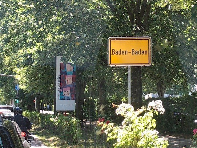
Baden-Baden, Deutschland
48° 45' 56.3" N 8° 13' 42.7" E
48.7656400 8.2285242
• Head south on Waldseestraße (K9600). Go for 1.4 km.
• Turn left onto Katzensteinstraße. Go for 185 m.
• Turn left onto Katzensteinstraße. Go for 492 m.
• Continue on Moltkestraße. Go for 83 m.
• Turn right onto Salzgrabenweg. Go for 262 m.
• Turn slightly right onto Stadelhoferstraße. Go for 169 m.
• Turn left onto Fremersbergstraße (L84A). Go for 653 m.
• Continue on Lichtentaler Allee (L84A). Go for 17 m.
• Turn left onto Bertholdstraße (L84A). Go for 411 m.
• Take the 1st exit from roundabout onto Lichtentaler Straße (L84A). Go for 766 m.
• Continue on Hauptstraße. Go for 942 m.
• Turn left onto Hauptstraße (B500) toward Freudenstadt/Herrenalb-Gernsbach. Go for 106 m.
• Continue on Beuerner Straße (L78). Go for 2.4 km.
• Turn right onto Großherzog-Friedrich-Luisenstraße (L79). Go for 12.9 km.
• Turn right onto Landstraße (B462). Go for 6.0 km.
• Arrive at Raumünzach (B462). Your destination is on the left.
☍
26,8 km
( 40 min.)
Zusatzinfo
The parking situation for womos in Baden Baden is modest. If you still want to visit the city (worthwhile), you should use the Hubertusstraße parking space (48 ° 46 ′ 56 ″ N; 8 ° 12 ′ 14 ″ E; bus stop within walking distance).
Raumünzach, Deutschland
76596 Raumünzach, Deutschland
48° 38' 21.6" N 8° 20' 55" E
48.6393390 8.3486239
• Head toward Kaltenbach on Raumünzach (B462). Go for 9.0 km.
• Turn left onto Besenfelder Straße (L350) toward B294/Freudenstadt/Seewald/Schönegründ. Go for 4.3 km.
• Turn left onto B294. Go for 1.6 km.
• Arrive at Wildbader Straße (B294). Your destination is on the right.
☍
14,9 km
( 16 min.)
Zusatzinfo
We actually wanted to go to Bad Wildbad right away. Unfortunately (but in retrospect great) the junction was blocked. We "had to" follow the course of the Murg - wonderful ride! In this case, a detour to the Schwarzenbachtalsperre is mandatory.
Seewald, Deutschland
72297 Seewald, Deutschland
48° 35' 49.4" N 8° 25' 18.8" E
48.5970660 8.4218757
• Head east on Wildbader Straße (B294). Go for 16.9 km.
• Turn right onto K4360 toward Calw/Bad Teinach/Agenbach. Go for 2.9 km.
• Turn left onto Würzbacher Straße (K4325). Go for 930 m.
• Continue on K4325. Go for 2.9 km.
• Continue on Agenbacher Straße (K4325). Go for 953 m.
• Continue on Calwer Straße (K4325). Go for 1.2 km.
• Continue on K4325. Go for 2.5 km.
• Take the 2nd exit from roundabout onto K4325 toward Calw/Alburg. Go for 1.2 km.
• Continue on Hausäcker (K4325). Go for 181 m.
• Continue on K4325. Go for 596 m.
• Continue on Schwarzwaldstraße (K4325). Go for 1.1 km.
• Take the 2nd exit from roundabout onto Schwarzwaldstraße (K4325). Go for 609 m.
• Continue on K4325. Go for 597 m.
• Take the 2nd exit from roundabout onto Otto-Göhner-Straße (K4325). Go for 859 m.
• Continue on Altburger Straße (K4325). Go for 1.4 km.
• Continue on K4325. Go for 1.0 km.
• Turn right onto Bischofstraße (B296/B463). Go for 835 m.
• Turn right onto Lange Steige. Go for 148 m.
• Turn right onto Stammheimer Steige. Go for 23 m.
• Turn left onto Stammheimer Steige. Go for 187 m.
• Arrive at Stammheimer Steige. Your destination is on the right.
☍
36,8 km
( 35 min.)
Zusatzinfo
Via Baiersbronn (star gastronomy) and (if you want) a detour to the Nagold dam, the route now leads to the Hermann Hesse city of Calw
Calw, Deutschland
75365 Calw, Deutschland
48° 42' 44" N 8° 44' 50.1" E
48.7122107 8.7472439
• Head toward Uhlandshöhe on Stammheimer Steige. Go for 210 m.
• Turn right onto Lange Steige. Go for 168 m.
• Turn left onto Lange Steige. Go for 33 m.
• Turn right onto Stuttgarter Straße (B296). Go for 1.8 km.
• Continue on B295 toward A8/Stuttgart/Althengstett/CW-Heumaden. Go for 3.0 km.
• Pass 3 roundabouts and continue on Südumgehung (B295). Go for 18.0 km.
• Continue on Südrandstraße (K1011). Go for 1.8 km.
• Turn left onto Bruckenbachstraße toward Gewerbegebiet Hertichstr.-Ost. Go for 605 m.
• Turn right onto Carl-Schmincke-Straße. Go for 41 m.
• Turn left onto Leonberger Straße (L1141). Go for 10 m.
• Arrive at Leonberger Straße (L1141). Your destination is on the left.
☍
25,6 km
( 27 min.)
Zusatzinfo
Be sure to plan a stop and stroll through the old town. The rest of the route was "only" a transport stage to the starting point. A stopover in Waiblingen (old town) or Schorndorf is conceivable.
Eltingen, Leonberg, Deutschland
Eltingen, 71229 Leonberg, Deutschland
48° 47' 19.3" N 9° 0' 35.6" E
48.7886844 9.0099008
• Head toward Glemseckstraße on Leonberger Straße (L1141). Go for 10 m.
• Turn right onto Carl-Schmincke-Straße toward Eltingen. Go for 41 m.
• Turn left onto Bruckenbachstraße. Go for 605 m.
• Turn left onto Südrandstraße (K1011) toward München/A8/Heilbronn/A81/Singen/Stuttgart/Böblingen/Sindelfingen. Go for 1.6 km.
• Take ramp onto A81 toward Heilbronn. Go for 16.3 km.
• Take exit 16 toward Ludwigsburg. Go for 370 m.
• Turn right onto Schwieberdinger Straße (L1140) toward Ludwigsburg/Asperg (Ost). Go for 3.6 km.
• Keep right onto Friedrichstraße (L1140). Go for 195 m.
• Turn left onto Stuttgarter Straße (B27) toward Heilbronn/Zentrum/Klinikum. Go for 466 m.
• Turn right onto Friedrich-Ebert-Straße. Go for 63 m.
• Turn left onto Friedrich-Ebert-Straße. Go for 118 m.
• Arrive at your destination.
☍
23,3 km
( 24 min.)
Ludwigsburg, Deutschland
48° 53' 38.6" N 9° 11' 43.7" E
48.8940624 9.1954640
• Head west. Go for 105 m.
• Continue on Friedrich-Ebert-Straße. Go for 13 m.
• Turn right onto Friedrich-Ebert-Straße. Go for 63 m.
• Turn left onto Stuttgarter Straße (B27). Go for 453 m.
• Turn left onto Friedrichstraße (L1140) toward Waiblingen. Go for 5.7 km.
• Turn right onto Remstalstraße (L1100). Go for 457 m.
• Keep left onto Remstalstraße (L1100). Go for 400 m.
• Continue on Remstalstraße (L1142). Go for 2.5 km.
• Pass 2 roundabouts and continue on Neckarstraße (L1142). Go for 2.6 km.
• Turn right and take ramp. Go for 157 m.
• Turn right onto Schmidener Straße (L1142). Go for 80 m.
• Turn right onto Schmidener Straße (L1142). Go for 225 m.
• Turn right onto Schmidener Straße. Go for 690 m.
• Turn right onto Schmidener Straße. Go for 34 m.
• Continue on Am Stadtgraben. Go for 159 m.
• Continue on Alter Postplatz. Go for 99 m.
• Continue on Am Stadtgraben. Go for 23 m.
• Turn left onto Alter Postplatz. Go for 289 m.
• Continue toward Schorndorfer Straße/L1142. Go for 10 m.
• Arrive at Schorndorfer Straße (L1142). Your destination is on the left.
☍
14,1 km
( 24 min.)
Waiblingen, Deutschland
48° 49' 45.7" N 9° 19' 6.9" E
48.8293519 9.3185739
• Head southeast on Schorndorfer Straße (L1142). Go for 773 m.
• Continue on L1193. Go for 278 m.
• Take the 2nd exit from roundabout onto Schorndorfer Straße (L1193). Go for 2.1 km.
• Continue on L1199 toward Aalen/Schorndorf. Go for 107 m.
• Take ramp onto B29 toward Aalen/Schorndorf. Go for 38.0 km.
• Take ramp toward Schwäbisch Hall/Leinzell/Stauferklinik. Go for 168 m.
• Turn right onto Aalener Straße (B298) toward Schwäbisch Hall/Leinzell/Stauferklinik. Go for 499 m.
• Turn left onto Schießtalstraße. Go for 318 m.
• Continue on Richard-Bullinger-Straße. Go for 37 m.
• Turn left. Go for 165 m.
• Turn right. Go for 39 m.
• Arrive at your destination on the right.
☍
42,4 km
( 28 min.)
Stellplatz am Freibad
Attention: The parking situation in Schwäbisch Gmünd has changed.
Information can be found at: https://www.gmuender-baeder.de/wohnmobilhafen.html
73527 Schwäbisch Gmünd, Deutschland
48° 48' 16.7" N 9° 48' 45.2" E
48.8046491 9.8125438