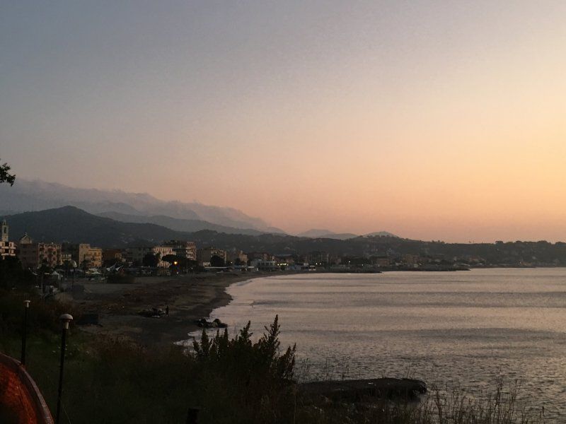
The incomparably beautiful autumn last year led us on a tour of Lake Garda, the Ligurian coast, France and Switzerland. There was surprisingly little going on the way and so we could enjoy the wonderful sunshine "undisturbed".
Day
Schwäbisch Gmünd - Stellplatz am Freibad
Schießtalstraße 13, 73525, Schwäbisch Gmünd, Deutschland
48° 48' 17" N 9° 48' 49" E
48.8047222 9.8136111
• Head west. Go for 33 m.
• Turn right toward Richard-Bullinger-Straße. Go for 160 m.
• Turn right onto Richard-Bullinger-Straße. Go for 37 m.
• Continue on Schießtalstraße. Go for 318 m.
• Turn right onto Herlikofer Straße (L1075). Go for 499 m.
• Turn left and take ramp onto B29 toward A7/Aalen. Go for 9.3 km.
• Continue on Stuttgarter Straße (B29) toward A7/Aalen. Go for 11.7 km.
• Keep right onto B19 toward Heidenheim/AA-Zentrum/AA-Süd. Go for 316 m.
• Keep right onto B19 toward Heidenheim/Aalen-Süd. Go for 5.1 km.
• Take ramp toward A7/Neresheim/AA-Unterkochen/Ulm/Würzburg. Go for 203 m.
• Turn left onto L1084. Go for 437 m.
• Turn right onto Ebnater Straße (L1084). Go for 4.4 km.
• Continue on B29A. Go for 1.7 km.
• Continue on B29A toward A7/Neresheim. Go for 1.1 km.
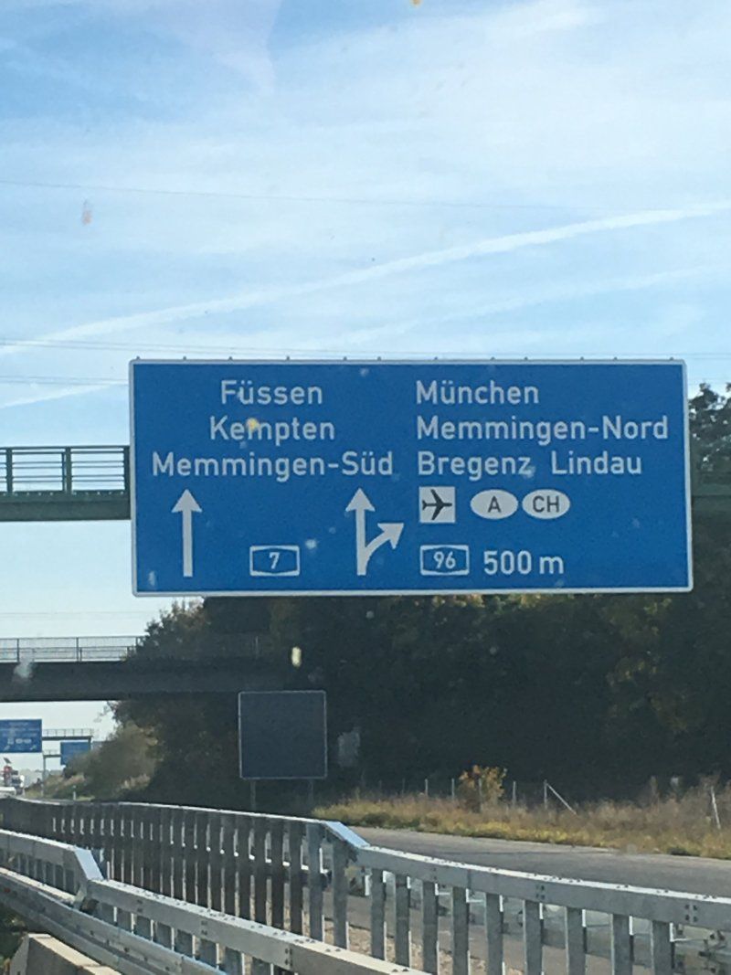
• Take ramp onto A7 toward Ulm. Go for 171 km.
• Continue on Grenztunnel Füssen (B179). Go for 17.0 km.
• Take ramp toward Heiterwang. Go for 118 m.
• Turn left onto Heiterwanger-See Landesstraße (L355). Go for 3.2 km.
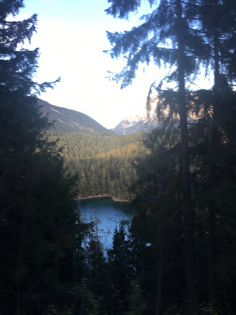
• Turn left onto Fernpass Bundesstraße (B179) toward Innsbruck. Go for 28.7 km.
• Continue on Mieminger Bundesstraße (B189). Go for 13.4 km.
• Take the 1st exit from roundabout onto Krebsbach (L236) toward Innsbruck/Bregenz/Mötz. Go for 5.0 km.
• Turn right and take ramp onto A12 (Inntal Autobahn) toward Innsbruck. Go for 37.6 km.
• Take exit 75 toward Innsbruck-Mitte. Go for 321 m.
• Take the 4th exit from roundabout onto Resselstraße (L9) toward Innsbruck. Go for 693 m.
• Take the 2nd exit from roundabout onto Anton-Eder-Straße. Go for 646 m.
• Turn left onto Amraser Straße. Go for 552 m.
• Keep right onto Museumstraße. Go for 16 m.
• Continue on König-Laurin-Straße. Go for 333 m.
• Turn left onto Dreiheiligenstraße. Go for 105 m.
• Turn right onto Jahnstraße. Go for 82 m.
• Arrive at Jahnstraße. Your destination is on the right.
☍
314,1 km
(3 hrs. 31 min.)
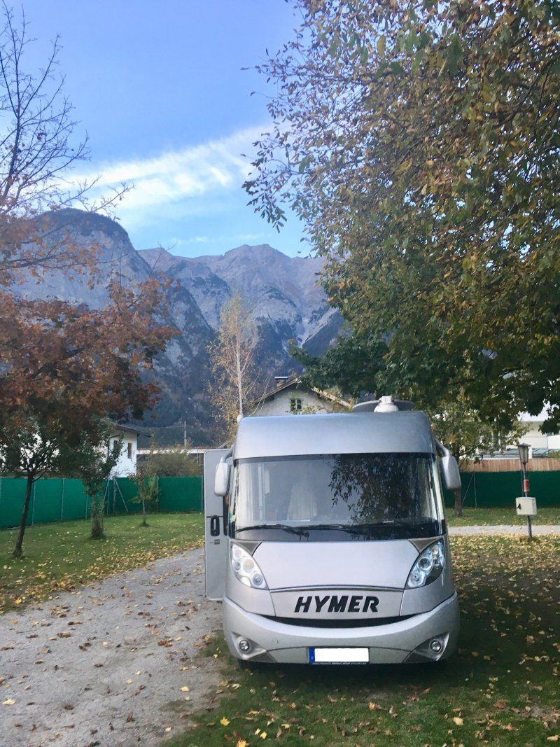
Innsbruck, Österreich
We spent the night (mother souls alone) in Fiè. Although you never heard the planes taking off from the nearby landing site, it was a quiet, if not cheap night.
47° 16' 9.2" N 11° 24' 14.8" E
47.2692124 11.4041024
• Head north on Jahnstraße. Go for 33 m.
• Turn left onto Kohlstattgasse. Go for 81 m.
• Turn left onto Kapuzinergasse. Go for 25 m.
• Turn left onto Ingenieur-Etzel-Straße. Go for 434 m.
• Turn right onto Museumstraße. Go for 39 m.
• Turn left onto Brunecker Straße toward Zentrum. Go for 206 m.
• Continue on Südtiroler Platz. Go for 21 m.
• Turn left onto Südtiroler Platz. Go for 191 m.
• Continue on Sterzinger Straße toward A12/A13. Go for 146 m.
• Continue on Südbahnstraße. Go for 582 m.
• Continue on Olympiastraße (B174). Go for 69 m.
• Turn left onto Leopoldstraße (B182). Go for 3.4 km.
• Take left ramp onto A13 (Brenner Autobahn) toward Brenner/Salzburg/A12/München/Bregenz/Garmisch/Bozen. Go for 31.5 km.
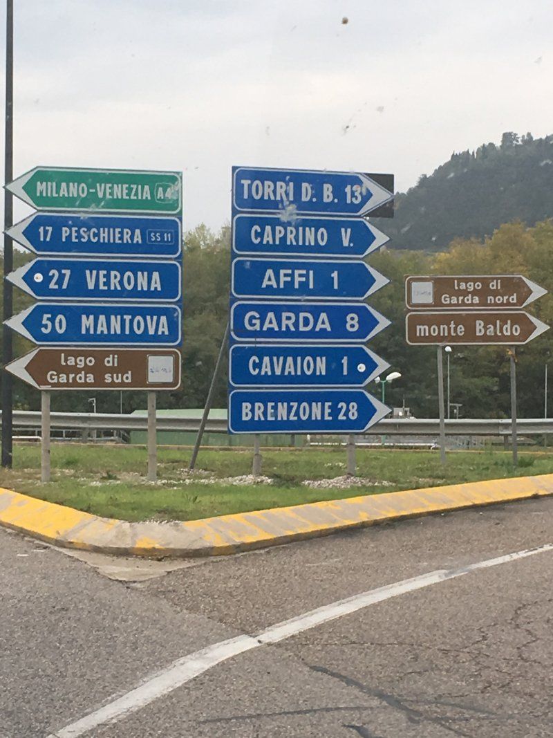
• Continue on A22 (Autostrada del Brennero). Go for 206 km.
• Take the exit toward Affi/Lago di Garda Sud. Go for 598 m.
• Take the 3rd exit from roundabout toward Peschiera/SS450. Go for 337 m.
• Take the 2nd exit from roundabout onto Strada Regionale di Affi (SR450) toward Milano/A4/Peschiera/Verona/SR11. Go for 13.0 km.
• Keep left onto SS11dir toward Milano-Venezia/A4/Brescia/SR11/Sirmione/Peschiera. Go for 3.6 km.
• Keep left toward Sirmione/SR11/Brescia. Go for 262 m.
• Continue on Paradiso di Sotto. Go for 339 m.
• Continue on Strada Regionale Padana Superiore (SR11). Go for 1.4 km.
• Take ramp toward Peschiera Centro/Mantova/Monzambano/Ponti sul Mincio. Go for 364 m.
• Turn left onto Via Mantova (SP28). Go for 348 m.
• Turn right onto Via Mantova (SP56). Go for 458 m.
• Turn left onto Via Milano. Go for 53 m.
• Enter the roundabout. Go for 39 m.
• Arrive at your destination on the right.
☍
263,9 km
(2 hrs. 44 min.)
Day
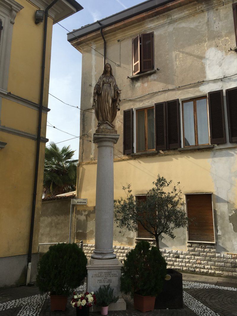
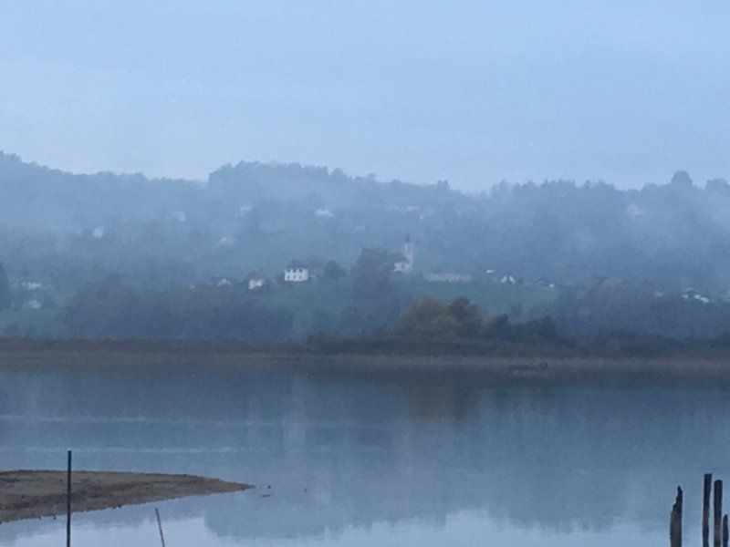
Peschiera del Garda, Verona, Italien
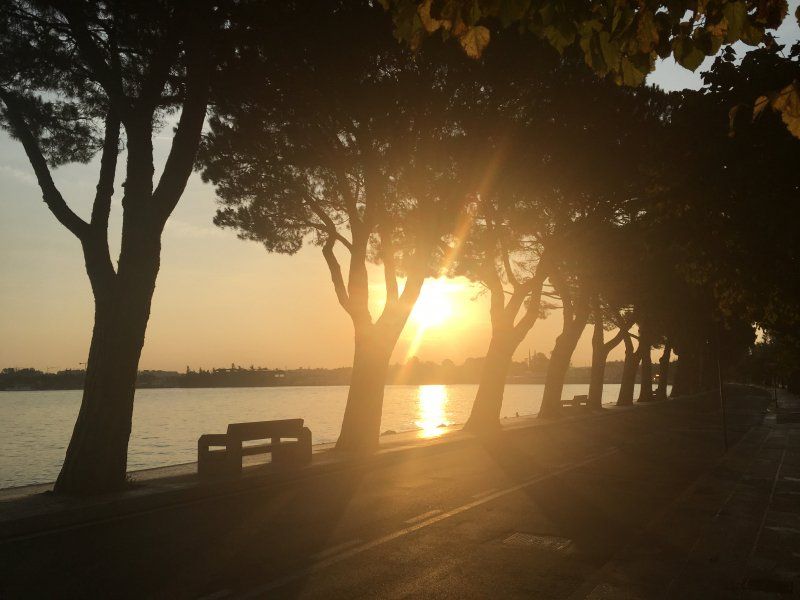
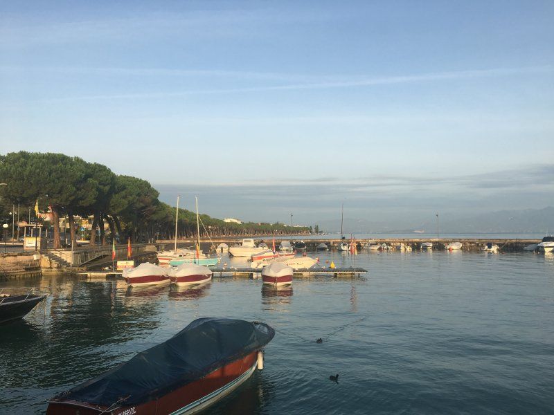
Since we wanted to get to Lake Garda quickly, we used the toll motorways. So we arrived in Peschiera in the early afternoon and were able to search for a campsite that was still open. The parking space was not usable at that time - for whatever reason.
37019 Peschiera del Garda, Verona, Italien
45° 26' 22.7" N 10° 41' 11.6" E
45.4396385 10.6865449
• Follow the roundabout. Go for 27 m.
• Take the 3rd exit from roundabout onto Viale Risorgimento. Go for 276 m.
• Continue on Riviera Giosuè Carducci. Go for 14 m.
• Take the 3rd exit from roundabout onto Riviera Giosuè Carducci. Go for 216 m.
• Turn left onto Parco Catullo. Go for 350 m.
• Continue on Via Venezia. Go for 228 m.
• Keep right toward Via General Bonomi/SR249. Go for 32 m.
• Take the 1st exit from roundabout onto Via General Bonomi (SR249). Go for 1.0 km.
• Turn left toward Milano-Venezia/Milano-Brennero/A22. Go for 63 m.
• Take ramp onto A4 (Autostrada della Serenissima) toward Milano. Go for 38.5 km.
• Take the exit toward Brescia Centro. Go for 1.4 km.
• Take the 1st exit from roundabout toward Centro/Ospedale/Milano/Verona. Go for 70 m.
• Keep left toward Centro/Ospedale/Milano. Go for 181 m.
• Take the 1st exit from roundabout onto Strada Provinciale Padana Superiore (SPBS11var) toward Milano. Go for 3.4 km.
• Take ramp toward Brescia Centro. Go for 198 m.
• Take the 1st exit from roundabout onto Via Labirinto toward Brescia Centro/Via Dalmazia/Via Corsica. Go for 274 m.
• Take the 2nd exit from roundabout onto Via Dalmazia. Go for 73 m.
• Take the 1st exit from roundabout onto Via Corsica. Go for 189 m.
• Take the 2nd exit from roundabout onto Via Corsica toward Tangenziale/Autostrade/Quinzano. Go for 225 m.
• Take the 3rd exit from roundabout onto Via Corsica. Go for 496 m.
• Pass 2 roundabouts and continue on Via Corsica. Go for 849 m.
• Continue on Piazzale della Repubblica. Go for 56 m.
• Turn right onto Piazzale della Repubblica toward Centro/Val Trompia/Milano/Mantova-Verona. Go for 82 m.
• Turn right onto Piazzale della Repubblica toward Val Trompia/Milano. Go for 52 m.
• Turn sharp left onto Via dei Mille. Go for 737 m.
• Arrive at Via dei Mille. Your destination is on the left.
☍
48,9 km
( 37 min.)
Day
Brescia, Italien
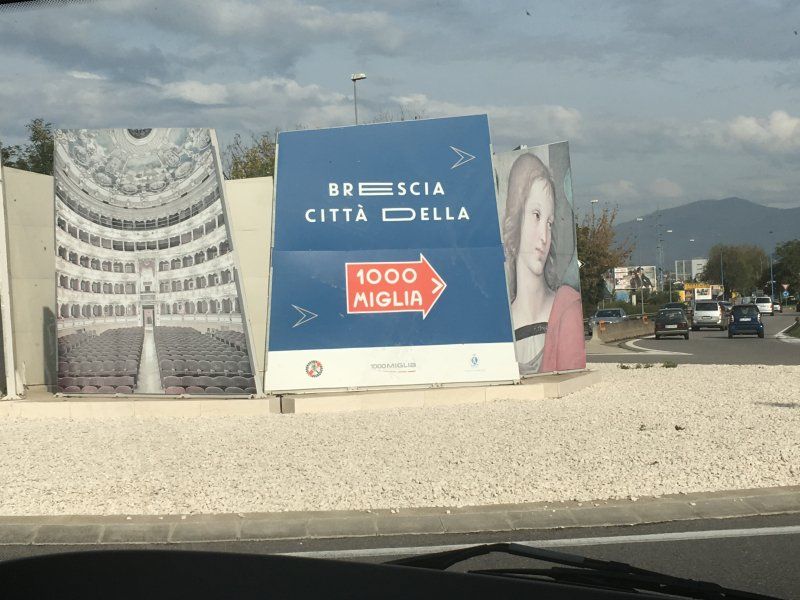
The way to Genoa "had to" lead via Brescia - once again sniff a little Mille Miglia air :-))
45° 32' 29.6" N 10° 12' 42.5" E
45.5415526 10.2118019
• Head toward Corso Giuseppe Garibaldi on Via dei Mille. Go for 5 m.
• Turn left onto Piazzale Giuseppe Garibaldi. Go for 74 m.
• Turn left onto Piazzale Giuseppe Garibaldi toward Mantova/Cremona. Go for 48 m.
• Continue on Via Fratelli Ugoni. Go for 760 m.
• Turn right onto Piazzale della Repubblica. Go for 88 m.
• Turn right onto Piazzale della Repubblica. Go for 31 m.
• Continue on Via 20 Settembre. Go for 876 m.
• Continue on Via 25 Aprile. Go for 130 m.
• Turn right onto Via Carlo Zima. Go for 353 m.
• Take the 2nd exit from roundabout onto Via Cremona. Go for 592 m.
• Take the 2nd exit from roundabout onto Via Cremona. Go for 535 m.
• Continue on Via della Volta. Go for 156 m.
• Pass 2 roundabouts and continue on Via della Volta. Go for 542 m.
• Take the 2nd exit from roundabout onto Via Borgosatollo toward Autostrade/Mantova/S. Polo/Tangenziale Sud. Go for 304 m.
• Take the 1st exit from roundabout onto Via Borgosatollo toward Milano/A4/Venezia/Torino/A21/Autostrade/Tangenziale Sud. Go for 203 m.
• Take the 1st exit from roundabout toward Autostrade/S. Zeno. Go for 258 m.
• Take the 3rd exit from roundabout onto A21 (Autostrada Torino-Piacenza-Brescia) toward Autostrade/Torino/Piacenza/Milano/A35/Aeroporto Linate/E35/Bologna/A1/Venezia/E45/Brennero/A22/Aeroporto Montichiari. Go for 151 km.
• Take the exit toward Genova/Tortona onto A7 (Autostrada Milano-Genova). Go for 66.8 km.
• Keep left onto A12 (Autostrada Azzurra) toward Genova Est/Livorno. Go for 4.0 km.
• Take the exit toward Genova Est onto Svincolo Genova Est. Go for 2.6 km.
• Turn right toward Fiera di Genova/Stazione F. S. Brignole/Città Centro/Porto Terminal Crociere. Go for 101 m.
• Continue on Via Bobbio. Go for 2.5 km.
• Turn right onto Viale Paolo Thaon di Revel. Go for 108 m.
• Arrive at Viale Paolo Thaon di Revel.
☍
231,8 km
(2 hrs. 19 min.)
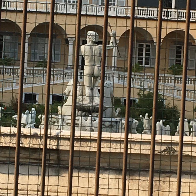
Genua, Italien
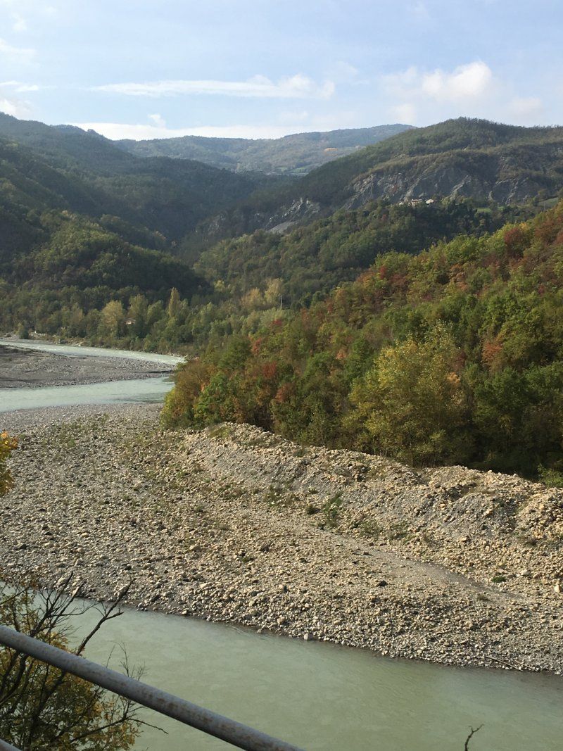
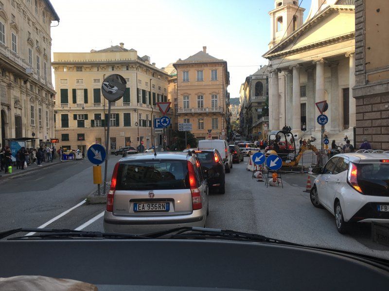
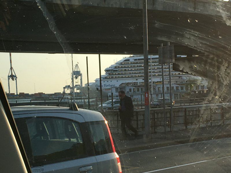
Across country, through the mountains - a wonderful trip to the coast. Right in the middle of Genoa, past Savona and then look for a place to stay.
44° 24' 20.3" N 8° 56' 46.5" E
44.4056499 8.9462560
• Head toward Via Colombo on Viale Paolo Thaon di Revel. Go for 98 m.
• Turn left onto Via Fiume. Go for 145 m.
• Turn left onto Via Luigi Cadorna. Go for 213 m.
• Turn right onto Viale Brigata Bisagno (SS45). Go for 858 m.
• Turn right onto Strada Aldo Moro (SS1) toward Aeroporto. Go for 4.6 km.
• Take ramp onto A7 (Autostrada Milano-Genova) toward Aeroporto/Autostrade/Uffici Comunali. Go for 2.0 km.
• Take the exit toward Alessandria/A26/Ventimiglia/Torino/A21/E70/Aeroporto onto A10 (Ponte Genova San Giorgio). Go for 81.3 km.
• Take the exit toward Albenga/Aeroporto Villanova. Go for 993 m.
• Take the 1st exit from roundabout onto Strada Provinciale del Colle San Bernardo (SP582) toward Albenga. Go for 210 m.
• Take the 2nd exit from roundabout onto Strada Provinciale del Colle San Bernardo (SP582) toward Albenga/SS1/Leca. Go for 754 m.
• Take the 1st exit from roundabout onto Viale Martiri della Foce toward Ceriale/SP1/Albenga Centro. Go for 925 m.
• Take the 1st exit from roundabout onto Viale Martiri della Foce. Go for 696 m.
• Take the 1st exit from roundabout onto Via Leonardo da Vinci toward Albenga Centro/Savona. Go for 236 m.
• Take the 1st exit from roundabout onto Via Leonardo da Vinci toward Centro/S.Fedele-Lusignano. Go for 216 m.
• Continue on Via Viziano. Go for 112 m.
• Take the 2nd exit from roundabout onto Via Genova (SP39) toward Centro/Fraz.Lusignano/Fraz.San Fedele. Go for 353 m.
• Take the 3rd exit from roundabout onto Piazza del Popolo. Go for 68 m.
• Turn left onto Via Milite Ignoto. Go for 82 m.
• Turn left onto Via dei Mille. Go for 8 m.
• Turn right onto Via Giuseppe Mazzini. Go for 34 m.
• Arrive at Via Giuseppe Mazzini. Your destination is on the left.
☍
93,9 km
(1 hrs. 4 min.)
Albenga, Savona, Italien
We then spent a quiet night on a large parking lot near Albenga.
17031 Albenga, Savona, Italien
44° 2' 57.9" N 8° 12' 56.2" E
44.0494254 8.2156113
• Head toward Via Vecchia Morella on Via Giuseppe Mazzini. Go for 53 m.
• Turn left onto Via Edmondo De Amicis. Go for 115 m.
• Turn left onto Viale Liguria. Go for 70 m.
• Turn right onto Via Genova (SP39). Go for 155 m.
• Take the 2nd exit from roundabout onto Via Viziano. Go for 153 m.
• Continue on Via Leonardo da Vinci toward Genova/A10/Ventimiglia. Go for 181 m.
• Take the 2nd exit from roundabout onto Via Leonardo da Vinci toward Aeroporto/Autostrada/Garessio/Imperia. Go for 250 m.
• Take the 3rd exit from roundabout onto Viale Martiri della Foce toward Genova/A10/Ventimiglia/Autostrada. Go for 743 m.
• Take the 2nd exit from roundabout onto Viale Martiri della Foce. Go for 914 m.
• Take the 2nd exit from roundabout onto Strada Provinciale del Colle San Bernardo (SP582) toward Autostrada/A10. Go for 778 m.
• Take the 2nd exit from roundabout onto Strada Provinciale del Colle San Bernardo (SP582). Go for 245 m.
• Take the 2nd exit from roundabout onto A10 (Autostrada dei Fiori) toward Ventimiglia. Go for 77.9 km.
• Continue on A8 (La Provençale). Go for 94.9 km.
• Take exit 37 toward Roquebrune S/A./Fréjus-Ouest/Puget S/ A. Go for 849 m.
• Take the 1st exit from roundabout onto DN7 toward Draguignan/Toulon/Aix en Pce/Puget sur Argens-Centre/Roquebrune sur Argens/Le Muy/La Bouverie. Go for 2.8 km.
• Take the 2nd exit from roundabout onto DN7 toward Draguignan/Toulon/Aix en Pce/Roquebrune S/A./Le Muy. Go for 1.8 km.
• Take the 4th exit from roundabout onto D7 toward Roquebrune sur Argens/Saint Aygulf/Les Issambres. Go for 365 m.
• Pass 2 roundabouts and continue on Avenue du Général Charles de Gaulle (D7). Go for 2.1 km.
• Turn right onto Rue Grande André Cabasse. Go for 44 m.
• Turn left onto Rue Grande André Cabasse. Go for 130 m.
• Turn left onto Rue de l'Hôtel de Ville. Go for 30 m.
• Arrive at Rue de l'Hôtel de Ville. Your destination is on the right.
☍
184,5 km
(1 hrs. 56 min.)
Day
Roquebrune-sur-Argens, Frankreich
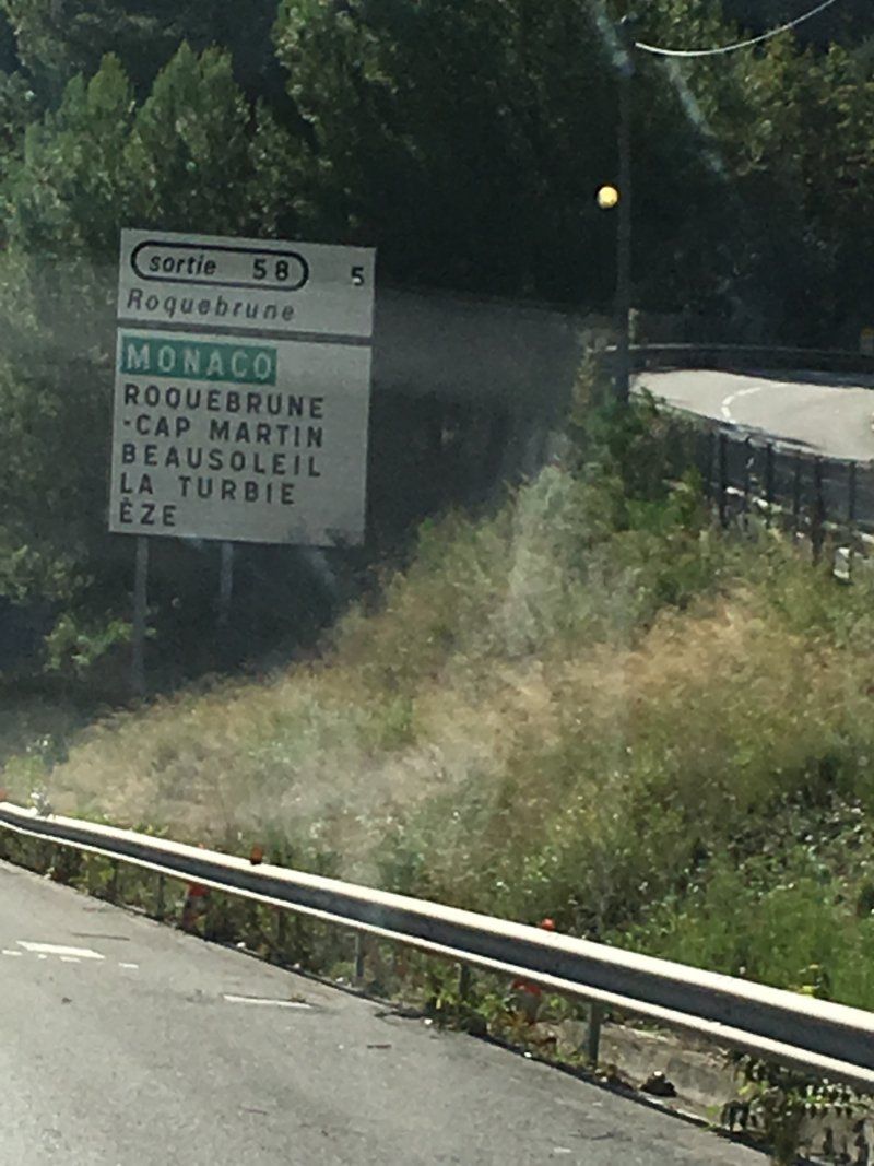
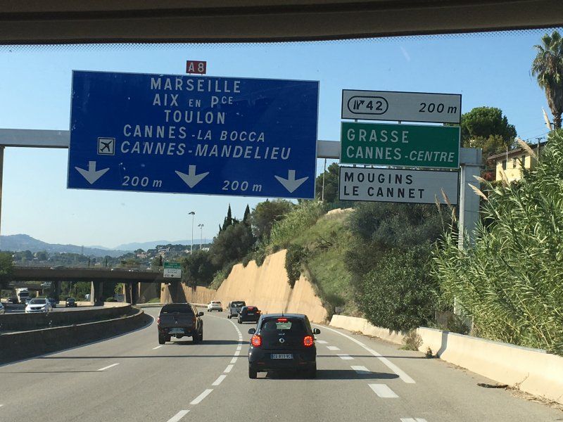
Then we continued as far as possible on the coastal road. Past San Remo, at Menton across the border, around Nice and Cannes and then via Fréjus to the next place to stay (Moulin des Iscles).
43° 26' 36.3" N 6° 38' 15.7" E
43.4434080 6.6376820
• Head toward Rue Grande André Cabasse on Rue de l'Hôtel de Ville. Go for 30 m.
• Turn slightly left onto Place Ernest Pellet. Go for 43 m.
• Turn slightly left onto Rue du Galinier. Go for 38 m.
• Turn right onto Rue Saint-Antoine. Go for 84 m.
• Turn slightly left onto Rue Saint-Antoine. Go for 90 m.
• Turn left onto Avenue Général de Gaulle (D7). Go for 113 m.
• Pass 2 roundabouts and continue on D7. Go for 2.1 km.
• Take the 1st exit from roundabout onto DN7 toward A8 (Nice)/Fréjus/St Raphaël/Puget S/Argens. Go for 1.7 km.
• Take the 1st exit from roundabout onto DN7 toward A8/Fréjus/St Raphaël/Puget S/A. Go for 2.8 km.
• Take the 3rd exit from roundabout onto A8 (La Provençale) toward Aix en Pce/Toulon. Go for 130 km.
• Continue on A7 (Autoroute du Soleil). Go for 57.0 km.
• Take exit 23 toward Carpentras/Avignon-Nord/Le Pontet/Sorgues/Vedène. Go for 1.1 km.
• Keep left toward Avignon/Le Pontet. Go for 21 m.
• Continue toward Route de Carpentras/D225. Go for 33 m.
• Take the 4th exit from roundabout onto Route de Carpentras (D225) toward Avignon/Le Pontet. Go for 2.8 km.
• Continue on D907. Go for 1.9 km.
• Take ramp onto D225 toward Avignon-Centre. Go for 2.4 km.
• Take ramp onto Boulevard Saint-Lazare toward Pont d'Avignon St Bénezet. Go for 466 m.
• Continue on Boulevard du Quai de la Ligne. Go for 516 m.
• Continue on Boulevard du Rhône. Go for 325 m.
• Keep right onto Boulevard du Rhône. Go for 195 m.
• Continue on Allée de l'Oulle. Go for 329 m.
• Keep left onto Allée de l'Oulle toward A9/Nîmes. Go for 56 m.
• Turn sharp left onto Boulevard Saint-Dominique. Go for 133 m.
• Turn right onto Porte Saint-Dominique. Go for 27 m.
• Turn slightly left onto Rue Victor Hugo. Go for 249 m.
• Turn right onto Rue Joseph Vernet. Go for 398 m.
• Turn left onto Rue de la République. Go for 393 m.
• Turn left onto Place de l'Horloge. Go for 17 m.
• Turn right onto Place de l'Horloge. Go for 31 m.
• Turn left onto Rue Félicien David. Go for 14 m.
• Arrive at Rue Félicien David. Your destination is on the right.
☍
205,8 km
(1 hrs. 55 min.)
Day
Avignon, Frankreich
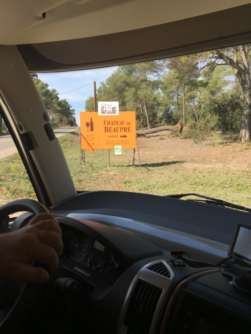
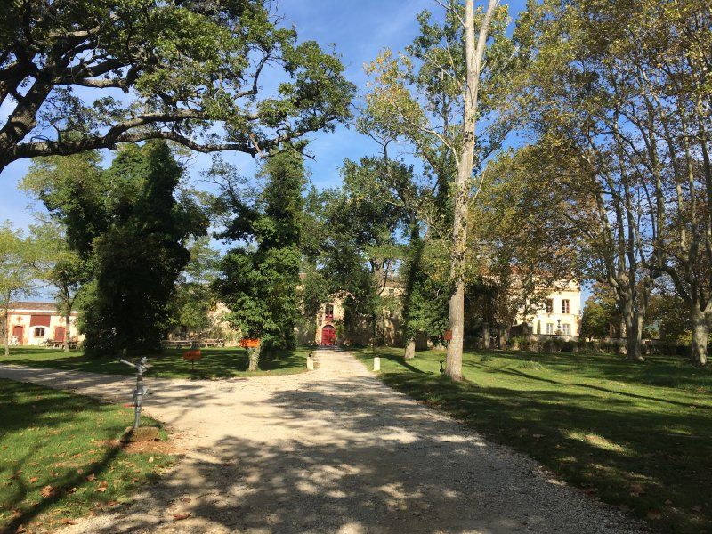
We then drove national road again (no cost). Behind Aix-en-Provence we visited a small but recommendable winery (Château de Beaupré) and also bought some wine. On the way again and again wonderful views and photo motifs. Our goal was Avignon. On the very conveniently located campsite "Camping du Pont d'Avignon" we found a great place directly opposite the old town. Since it was only shortly after noon, we went for a stroll into the city.
43° 56' 57.5" N 4° 48' 19.9" E
43.9493170 4.8055280
• Head west on Rue Félicien David.
• Arrive at Rue Félicien David. Your destination is on the right.
☍
Distance not available
(Duration not available)
Day
Ruhe- und Besichtigungstag in Avignon, Frankreich
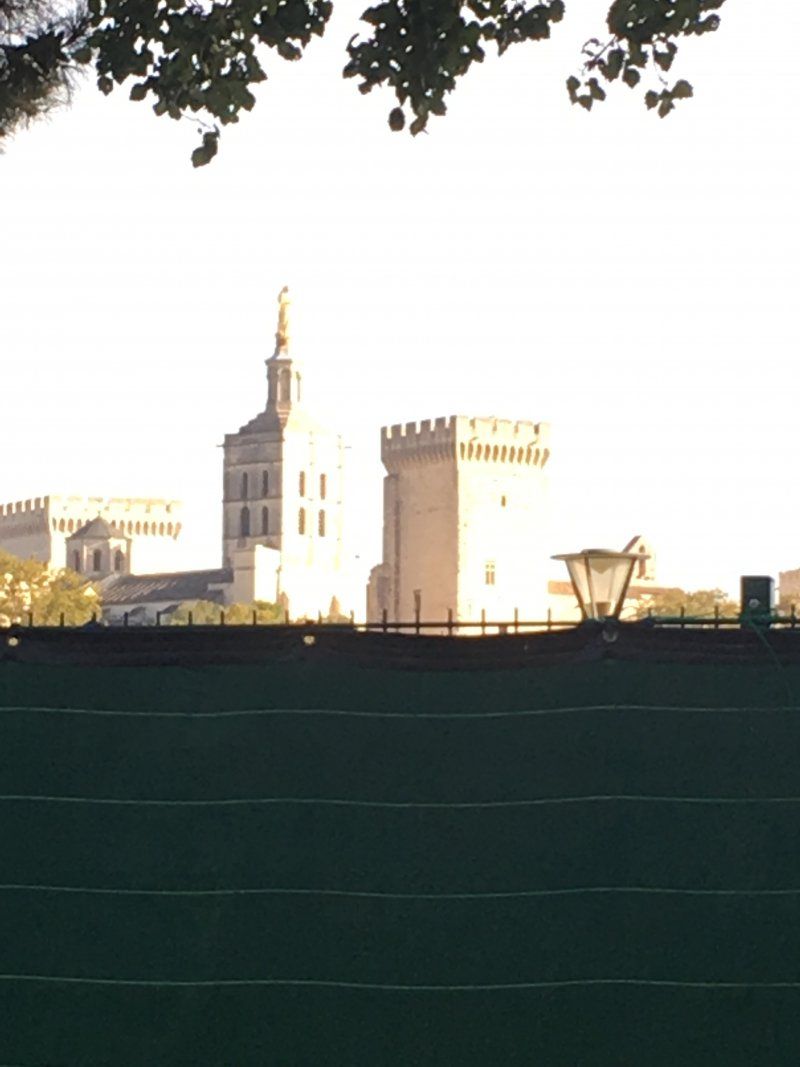
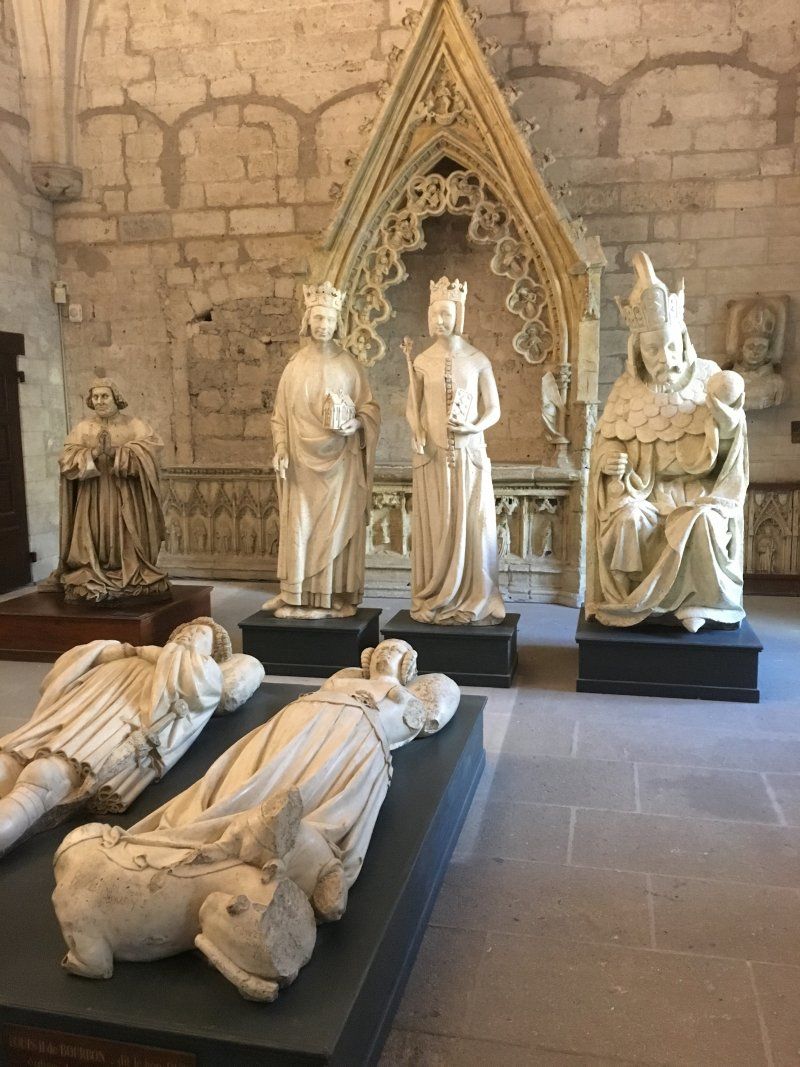
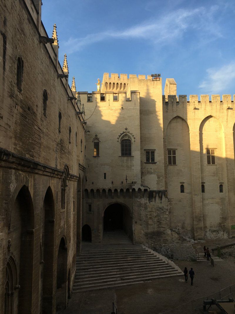
The focus of the visit was of course the Pope's Palace.
Avignon, Frankreich
43° 56' 57.5" N 4° 48' 19.9" E
43.9493170 4.8055280
• Head toward Passage Agricol Moureau on Rue Félicien David. Go for 48 m.
• Turn right onto Rue Racine. Go for 138 m.
• Continue on Place de la Madeleine. Go for 16 m.
• Turn left onto Rue Saint-Étienne. Go for 169 m.
• Turn slightly left onto Rue du Rempart du Rhône. Go for 78 m.
• Turn right onto Porte de l'Oulle. Go for 9 m.
• Turn slightly right onto Boulevard du Rhône. Go for 26 m.
• Turn slightly right onto Boulevard du Rhône. Go for 406 m.
• Continue on Quai Joël Bameule. Go for 516 m.
• Continue on Boulevard Saint-Lazare. Go for 306 m.
• Take ramp onto Route Touristique du Docteur Pons (D225) toward A7/Orange/Carpentras. Go for 2.2 km.
• Take ramp onto D907. Go for 2.3 km.
• Take ramp onto D907 toward Orange/Sorgues/Z.I. Perigord. Go for 1.4 km.
• Pass 2 roundabouts and continue on D907. Go for 4.0 km.
• Take ramp. Go for 104 m.
• Take the 4th exit from roundabout onto Avenue d'Orange. Go for 204 m.
• Take the 3rd exit from roundabout onto Route de Châteauneuf du Pape (D17). Go for 216 m.
• Take the 2nd exit from roundabout onto Route de Châteauneuf du Pape (D17). Go for 2.2 km.
• Continue on Route de Sorgues (D17). Go for 2.1 km.
• Continue on Avenue Pierre de Luxembourg (D17). Go for 190 m.
• Take the 1st exit from roundabout onto Avenue Pierre de Luxembourg (D17). Go for 520 m.
• Take the 2nd exit from roundabout onto Avenue Louis Pasteur (D17) toward Orange/Roquemaure/Courthézon/Centre Ville/Château. Go for 401 m.
• Turn left onto Avenue Général de Gaulle (D17). Go for 87 m.
• Turn left onto Avenue Général de Gaulle (D17). Go for 159 m.
• Continue on Place Jean Moulin (D17). Go for 54 m.
• Continue on Rue de la République (D17). Go for 59 m.
• Continue on D17. Go for 8 m.
• Turn right onto Rue Joseph Ducos. Go for 46 m.
• Turn right onto Rue Maréchal Foch. Go for 145 m.
• Arrive at Rue Frédéric Mistral. Your destination is on the left.
☍
18,2 km
( 20 min.)
Day
Châteauneuf-du-Pape, Frankreich
Almost every wine lover associates excellent (if not cheap) wines with this place. Even if the town is a bit off the actual route: A short stroll through the narrow old town and the assessment of the many vinotheques always justify a stay.
84230 Châteauneuf-du-Pape, Frankreich
44° 3' 23.6" N 4° 49' 52.6" E
44.0565560 4.8312810
• Head toward Impasse des Montagnards on Rue Frédéric Mistral. Go for 101 m.
• Turn left toward Rue Porte Rouge. Go for 19 m.
• Turn right onto Rue Porte Rouge. Go for 79 m.
• Turn left onto Route d'Orange (D68). Go for 401 m.
• Take the 1st exit from roundabout onto D68. Go for 3.4 km.
• Continue on Lieu-dit Cabrières (D68). Go for 146 m.
• Continue on Lieu-dit Allard (D68). Go for 167 m.
• Continue on D68. Go for 402 m.
• Take the 2nd exit from roundabout onto D68. Go for 925 m.
• Continue on Route de Châteauneuf (D68). Go for 1.3 km.
• Take the 2nd exit from roundabout onto Route de Châteauneuf (D68). Go for 483 m.
• Continue on Rue de Châteauneuf (D68). Go for 13 m.
• Continue on Route de Châteauneuf (D68). Go for 282 m.
• Take the 3rd exit from roundabout. Go for 75 m.
• Continue on Rue de Châteauneuf (D68). Go for 153 m.
• Take the 2nd exit from roundabout onto Rue de Châteauneuf (D68). Go for 1.3 km.
• Turn left onto Avenue Maréchal Foch (N7). Go for 819 m.
• Turn left onto Rue du Fond du Sac. Go for 86 m.
• Turn left onto Rue du Renoyer. Go for 12 m.
• Arrive at Rue du Renoyer. Your destination is on the right.
☍
10,2 km
( 12 min.)
Orange, Frankreich
Across Orange with his triumphal arch, past many lovely towns, we went back home. A few kilometers before Geneva we found a nice place to stay at the "Lac d'Aiguebelette" right on the lake.
84100 Orange, Frankreich
44° 8' 17.2" N 4° 48' 27" E
44.1380989 4.8075110
• Head toward Rue du Tillet on Rue du Renoyer. Go for 66 m.
• Turn left onto Rue Caristie. Go for 39 m.
• Turn left onto Boulevard Édouard Daladier (N7). Go for 196 m.
• Continue on Rue Auguste Lacour toward A7/A9/Caderousse/Nîmes. Go for 96 m.
• Continue on Cours Aristide Briand. Go for 196 m.
• Take the 1st exit from roundabout onto Avenue Charles de Gaulle (D17) toward A7/A9/Caderousse. Go for 352 m.
• Take the 3rd exit from roundabout onto Avenue Charles de Gaulle (D17) toward A7/A9. Go for 283 m.
• Take the 3rd exit from roundabout onto A9 (Échangeur d'Orange) toward Montélimar/Lyon. Go for 1.5 km.
• Continue on A7 (Autoroute du Soleil). Go for 92.5 km.
• Take exit 15 toward Genève/Chambéry/Grenoble/Romans/Valence onto E713 (Échangeur de Valence-Sud). Go for 708 m.
• Continue on N7. Go for 9.7 km.
• Continue on E713. Go for 168 m.
• Continue on N532. Go for 10.6 km.
• Keep left onto A49 toward Genève/Chambéry/Grenoble/Romans-Centre. Go for 60.6 km.
• Take the exit toward Voiron/Lyon/Chambéry/Genève onto A48. Go for 7.8 km.
• Take exit 10 toward Les Abrets/Voiron-Champfeuillet. Go for 776 m.
• Pass 4 roundabouts and continue on D1076. Go for 4.7 km.
• Continue on Avenue de la Brunerie (D1075). Go for 3.0 km.
• Take the 2nd exit from roundabout onto Route du Bourg (D1075) toward Bourg en B./Montferrat/Les Abrets/St Geoire en Valdaine. Go for 2.3 km.
• Turn right onto Route du Val d'Ainan (D82) toward Pont de Beauvoisin/Chambéry/Massieu/St Geoire en Valdaine/Château de Longpra. Go for 14.0 km.
• Turn right onto Route du Guiers (D82 A). Go for 2.5 km.
• Take the 3rd exit from roundabout onto Avenue de la Gare (D203). Go for 2.8 km.
• Turn right onto Route de Pont de Beauvoisin (D921 E). Go for 3.1 km.
• Take the 2nd exit from roundabout onto Route du Lac (D921). Go for 2.7 km.
• Turn right onto Route du Sougey. Go for 282 m.
• Turn left onto Route du Sougey. Go for 37 m.
• Turn right onto Chemin de Lavy. Go for 73 m.
• Turn slightly left onto Chemin de Lavy. Go for 321 m.
• Arrive at your destination.
☍
221,5 km
(2 hrs. 11 min.)
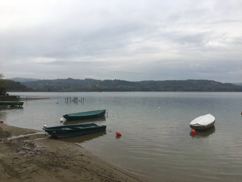
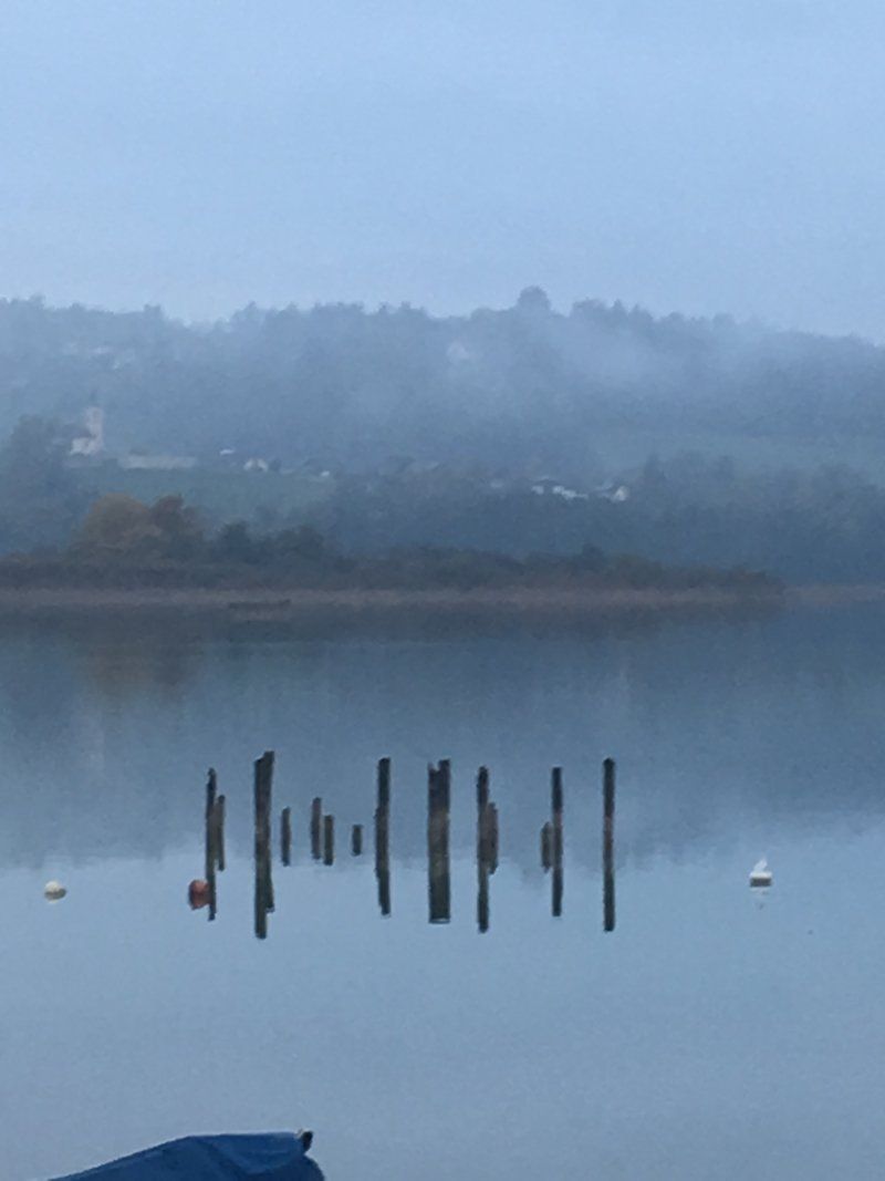
Lac d'Aiguebelette, Frankreich
Since we were already out of season, many places were already closed. Fortunately, after some searching, we found a place with direct access to the lake and were able to spend the night directly on the water.
45° 33' 19.6" N 5° 47' 54.5" E
45.5554510 5.7984672
• Head toward Lieu-dit La Combe. Go for 155 m.
• Turn left onto Lieu-dit La Combe. Go for 142 m.
• Continue on Lieu-dit Le Sougey. Go for 202 m.
• Continue on Route du Sougey. Go for 112 m.
• Turn right onto Route du Sougey. Go for 282 m.
• Turn right onto Route du Lac (D921). Go for 2.2 km.
• Take the 1st exit from roundabout onto Route d'Aiguebelette (D921 D). Go for 552 m.
• Take the 3rd exit from roundabout onto A43 toward Genève/Grenoble/Chambéry. Go for 9.2 km.
• Continue on A41 toward Genève/Annecy/Aix les Bains. Go for 71.6 km.
• Continue on A1. Go for 3 m.
• Keep left onto A1. Go for 907 m.
• Take exit 1 toward Genève-Centre/La Praille/Carouge onto A1a (Perly). Go for 5.0 km.
• Continue on Voie Centrale. Go for 479 m.
• Keep left onto Voie Centrale toward Genève-Jonction/Les Vernets. Go for 883 m.
• Continue on Route des Jeunes. Go for 279 m.
• Continue on Pont de Saint-Georges toward Cornavin. Go for 110 m.
• Continue on Rue des Deux-Ponts. Go for 375 m.
• Continue on Pont de Sous-Terre. Go for 79 m.
• Continue on Rue de Sous-Terre. Go for 301 m.
• Turn right onto Rue de Saint-Jean toward Place Bel-Air. Go for 274 m.
• Continue on Rue de Saint-Jean. Go for 158 m.
• Continue on Place Isaac-Mercier. Go for 67 m.
• Continue on Rue du Temple. Go for 8 m.
• Continue on Rue du Temple. Go for 164 m.
• Turn slightly left onto Quai Turrettini. Go for 37 m.
• Turn right onto Rue des Moulins. Go for 148 m.
• Arrive at Pont de l'Ile. Your destination is on the left.
☍
93,8 km
(1 hrs. )
Day
Genf, Schweiz
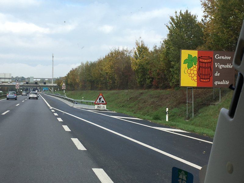
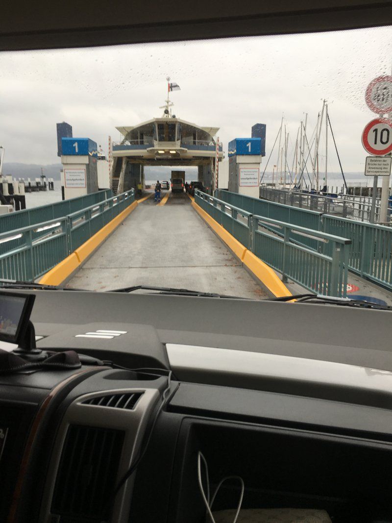
A proper breakfast is of course part of it. Since our available time was slowly coming to an end, we "made kilometers". Past Geneva, we went towards Lake Constance. From Constance by ferry across the lake to spend the night at the old distillery in Stetten.
46° 12' 15.8" N 6° 8' 35.4" E
46.2043907 6.1431577
• Head toward Quai de l'Ile on Pont de l'Ile. Go for 148 m.
• Turn left onto Quai Turrettini. Go for 37 m.
• Turn slightly right onto Rue du Temple. Go for 164 m.
• Turn right onto Rue Terreaux-du-Temple toward Cornavin. Go for 267 m.
• Keep left onto Place de Cornavin (1) toward Lausanne/Cornavin. Go for 3.8 km.
• Keep left onto Route de Lausanne (1) toward Lausanne/Versoix/Route du Lac. Go for 175 m.
• Take ramp onto A1a toward Lausanne. Go for 2.3 km.
• Continue on A1. Go for 49.0 km.
• Take the exit toward Bern/Neuchâtel/Simplon/Gd-St-Bernard/Lausanne-Nord/Lausanne-Crissier onto A1 (Ecublens). Go for 21.7 km.
• Continue on A1 toward Bern/Neuchâtel/Yverdon. Go for 81.1 km.
• Take the left exit toward Zürich/Basel/Biel/Bienne onto A1/A6. Go for 5.8 km.
• Continue on A1 toward Zürich/Basel/Kirchberg. Go for 53.9 km.
• Continue on A1 (Verzweigung Wiggertal) toward Zürich/Aarau/Oftringen/Zofingen. Go for 47.9 km.
• Take exit 59 toward St. Gallen/Flughafen/Nordring-Zürich onto A1/A4. Go for 34.1 km.
• Continue on A1 toward St. Gallen/Kreuzlingen/Winterthur-Ohringen. Go for 7.4 km.
• Keep right onto A7 (Winterthur-Ost) toward Konstanz/Kreuzlingen/Frauenfeld. Go for 33.4 km.
• Take the 2nd exit from Anschlussstelle Kreuzlingen Nord roundabout onto A7 toward Konstanz. Go for 760 m.
• Continue on B33. Go for 1.1 km.
• Take ramp toward Gewerbegebiet Oberlohn. Go for 343 m.
• Take the 1st exit from roundabout onto Oberlohnstraße toward Gewerbegebiet Oberlohn. Go for 367 m.
• Take the 2nd exit from roundabout onto Oberlohnstraße. Go for 612 m.
• Turn right onto Wollmatinger Straße (L220). Go for 782 m.
• Arrive at Wollmatinger Straße (L220). Your destination is on the right.
☍
345,3 km
(3 hrs. 24 min.)
Konstanz, Deutschland
47° 40' 40.6" N 9° 10' 23.7" E
47.6779496 9.1732384
• Head toward Schneckenburgstraße on Wollmatinger Straße (L220). Go for 23 m.
• Make a U-Turn at Schneckenburgstraße onto Wollmatinger Straße (L220). Go for 815 m.
• Turn left onto Oberlohnstraße. Go for 574 m.
• Take the 2nd exit from roundabout onto Oberlohnstraße. Go for 386 m.
• Take the 1st exit from roundabout onto Reichenaustraße (B33) toward Singen/Reichenau. Go for 17.2 km.
• Take ramp toward Radolfzell/Stockach. Go for 308 m.
• Turn right onto B34 toward Stockach/Radolfzell-Güttlingen. Go for 7.5 km.
• Turn left onto Riedstraße (B313) toward Lindau/Überlingen/Stuttgart/Singen/Sigmaringen/Stockach. Go for 2.9 km.
• Turn left onto B313 toward Lindau/A98/Überlingen/Wahlwies. Go for 421 m.
• Turn right and take ramp onto A98 toward Lindau/Überlingen. Go for 3.0 km.
• Continue on B31N. Go for 15.6 km.
• Continue on B31. Go for 12.9 km.
• Take ramp onto Hauptstraße (B33) toward Ravensburg/Markdorf/Stetten. Go for 812 m.
• Turn left onto Winzerweg. Go for 92 m.
• Turn right onto Landstraße. Go for 9 m.
• Turn left onto Landstraße. Go for 38 m.
• Turn left. Go for 11 m.
• Arrive at your destination on the right.
☍
62,6 km
( 53 min.)
Stetten - Stellplatz Alte Brennerei (Bodensee)
Riedetsweilerstraße 5, 88719, Stetten, Deutschland
47° 41' 35" N 9° 17' 53" E
47.6930556 9.2980556
• Head toward Landstraße. Go for 46 m.
• Turn left onto Landstraße. Go for 47 m.
• Turn left onto Landstraße. Go for 19 m.
• Turn right onto Winzerweg. Go for 92 m.
• Turn left onto Hauptstraße (B33). Go for 7.5 km.
• Take the 1st exit from roundabout onto B33 toward Ravensburg/Friedrichshafen. Go for 13.7 km.
• Turn right onto Oberzeller Straße (K7980). Go for 408 m.
• Take the 1st exit from roundabout onto Oberzeller Straße (K7980). Go for 101 m.
• Continue on K7980. Go for 171 m.
• Continue on Oberweiler (K7980). Go for 167 m.
• Continue on K7980. Go for 635 m.
• Continue on Metzisweiler (K7980). Go for 218 m.
• Continue on K7980. Go for 614 m.
• Continue on Bavendorfer Straße (K7980). Go for 492 m.
• Turn left onto Gebhard-Fugel-Straße (K7980). Go for 214 m.
• Continue on Josef-Strobel-Straße (K7980). Go for 173 m.
• Continue on K7980. Go for 727 m.
• Continue on Reutehof (K7980). Go for 10 m.
• Continue on K7980. Go for 1.4 km.
• Turn right onto Schussentalbrücke. Go for 533 m.
• Turn right onto Jahnstraße toward Friedrichshafen/Lindau/Weißenau/B30/Gewerbegebiet Karrer/Gewerbegebiet Mariatal. Go for 146 m.
• Turn left onto Weißenauer Straße. Go for 453 m.
• Take the 2nd exit from roundabout onto Hindenburgstraße. Go for 412 m.
• Continue on Goetheplatz. Go for 94 m.
• Continue on Seestraße. Go for 460 m.
• Arrive at Seestraße.
☍
28,8 km
( 36 min.)
Day
Ravensburg, Deutschland
47° 46' 41.8" N 9° 36' 43.7" E
47.7782704 9.6121303
• Head toward Rudolfstraße on Seestraße. Go for 172 m.
• Turn left onto Hirschgraben. Go for 338 m.
• Continue on Olgastraße. Go for 107 m.
• Continue on Karlstraße (K7975). Go for 409 m.
• Keep left toward Karlstraße/K7975. Go for 54 m.
• Turn left onto Ulmer Straße (B32). Go for 1.1 km.
• Keep left onto B32 toward B30. Go for 489 m.
• Keep left onto B32 toward Friedrichshafen/Lindau/Meersburg/Ravensburg-Süd/Berg. Go for 404 m.
• Continue on L291 toward Berg. Go for 8.3 km.
• Turn right onto Blitzenreuter Straße (L291). Go for 570 m.
• Continue on Baienbacher Straße (L291). Go for 1.1 km.
• Turn left onto Hauptstraße (B32) toward Sigmaringen/Bad Saulgau/Altshausen. Go for 18.1 km.
• Take the 2nd exit from roundabout onto Altshauser Straße. Go for 782 m.
• Turn left onto Josef-Bautz-Straße. Go for 365 m.
• Take the 1st exit from roundabout onto Paradiesstraße (L280). Go for 334 m.
• Enter the roundabout. Go for 18 m.
• Arrive at your destination on the left.
☍
32,6 km
( 33 min.)
Bad Saulgau, Deutschland
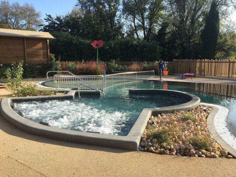
If you still have time, you can insert an additional night here at the thermal bath.
88348 Bad Saulgau, Deutschland
48° 0' 53" N 9° 30' 0.7" E
48.0147205 9.5002000
• Follow the roundabout. Go for 67 m.
• Take the 4th exit from roundabout onto Paradiesstraße (L280). Go for 71 m.
• Turn right onto Badstraße (L283). Go for 339 m.
• Turn right onto Lindenstraße. Go for 19 m.
• Continue on Schillerstraße. Go for 353 m.
• Continue on Hauptstraße. Go for 18 m.
• Turn left onto Hauptstraße. Go for 65 m.
• Continue on Herbertinger Straße. Go for 821 m.
• Take the 2nd exit from roundabout onto Herbertinger Straße (B32). Go for 6.1 km.
• Take ramp onto B311 toward Ulm/Reutlingen/Riedlingen. Go for 9.8 km.
• Turn left onto Buchauer Straße toward Stadtmitte. Go for 55 m.
• Continue on Hindenburgstraße. Go for 798 m.
• Continue on Haldenstraße. Go for 123 m.
• Continue on Marktplatz. Go for 79 m.
• Turn left onto Kirchstraße. Go for 424 m.
• Turn right onto Ziegelhüttenstraße (L277) toward Ulm/Biberach/Zwiefalten. Go for 11 m.
• Turn left onto Lindenweg. Go for 155 m.
• Turn right onto Sankt-Gerhard-Straße. Go for 173 m.
• Arrive at Sankt-Gerhard-Straße. Your destination is on the left.
☍
19,5 km
( 20 min.)
Riedlingen, Deutschland
48° 9' 34.7" N 9° 28' 16.8" E
48.1596486 9.4713346
• Head toward Birkenweg on Sankt-Gerhard-Straße. Go for 173 m.
• Turn left onto Lindenweg. Go for 155 m.
• Turn left onto Ziegelhüttenstraße (L277). Go for 434 m.
• Turn right onto Zwiefalter Straße (B312). Go for 1.6 km.
• Turn left and take ramp toward Ulm/Ehingen. Go for 200 m.
• Turn right onto B311 toward Ulm/Ehingen/Unlingen. Go for 24.7 km.
• Keep left onto B311. Go for 1.2 km.
• Take ramp toward Blaubeuren/Allmendingen/Gewerbegebiet Berkacher Straße/B492. Go for 200 m.
• Turn right onto Blaubeurer Straße (B492). Go for 4.0 km.
• Take the 2nd exit from roundabout onto B492 toward Blaubeuren/Schelklingen. Go for 12.5 km.
• Turn right onto Bahnhofstraße (B28) toward Ulm/Stadtmitte/Blautopf/Kloster. Go for 224 m.
• Turn left onto Karlstraße. Go for 341 m.
• Turn left onto Zeppelinstraße. Go for 80 m.
• Turn left onto Weilersteig. Go for 417 m.
• Turn left onto Reichlensbergweg. Go for 104 m.
• Continue on Matthäus-Hipp-Weg. Go for 18 m.
• Turn left onto Auf dem Barmen. Go for 519 m.
• Arrive at Auf dem Barmen. Your destination is on the right.
☍
46,9 km
( 45 min.)
Blaubeuren, Deutschland
The same applies here as before: An interruption of the trip is worthwhile. Blautopf, monastery and the old town are definitely worth seeing. For us this is right on the doorstep, so we often leave it "to the left".
89143 Blaubeuren, Deutschland
48° 24' 26.3" N 9° 47' 0.8" E
48.4073041 9.7835451
• Head toward Matthäus-Hipp-Weg on Auf dem Barmen. Go for 519 m.
• Turn right onto Matthäus-Hipp-Weg. Go for 18 m.
• Continue on Reichlensbergweg. Go for 104 m.
• Turn right toward Weilersteig. Go for 106 m.
• Continue on Weilersteig. Go for 311 m.
• Turn right onto Zeppelinstraße. Go for 80 m.
• Turn right onto Karlstraße. Go for 341 m.
• Turn right onto Bahnhofstraße (B28). Go for 3.7 km.
• Turn right onto L1230 toward A8/Merklingen/Berghülen. Go for 8.7 km.
• Turn right onto L1230 toward A8/Geislingen/Merklingen. Go for 7.2 km.
• Turn left onto Aicher Straße (L1230) toward Geislingen/Türkheim/Bad Ditzenbach/Authausen. Go for 4.7 km.
• Take the 1st exit from roundabout onto Nellinger Straße (L1230). Go for 6.1 km.
• Turn left onto Wiesensteiger Straße (L1231). Go for 169 m.
• Turn right onto Paulinenstraße. Go for 434 m.
• Turn right. Go for 40 m.
• Arrive at your destination on the right.
☍
32,6 km
( 33 min.)
Geislingen an der Steige, Deutschland
A visit to the WMF outlet is interesting and (mostly) worthwhile.
73312 Geislingen an der Steige, Deutschland
48° 37' 17.5" N 9° 49' 46" E
48.6215162 9.8294482
• Head toward Paulinenstraße. Go for 40 m.
• Turn right onto Paulinenstraße. Go for 53 m.
• Turn right onto Paulinenstraße. Go for 140 m.
• Turn right onto Tälesbahnstraße. Go for 45 m.
• Turn slightly left onto Tälesbahnstraße. Go for 62 m.
• Continue on Lessingstraße. Go for 103 m.
• Turn right onto Überkinger Straße (B466). Go for 61 m.
• Turn left onto Stuttgarter Straße (B10) toward Stuttgart/Göppingen. Go for 6.9 km.
• Take ramp toward Heidenheim/Donzdorf/Süßen-Ost. Go for 239 m.
• Turn right onto B466. Go for 3.3 km.
• Take the 2nd exit from roundabout onto K1402 toward Reichenbach u.R. Go for 3.0 km.
• Take the 3rd exit from roundabout onto Hauptstraße (L1159) toward Schwäbisch Gmünd/Winzingen. Go for 1.3 km.
• Pass 2 roundabouts and continue on Kaiserbergstraße (L1159). Go for 10.1 km.
• Take the 2nd exit from roundabout onto Einhornstraße (L1075). Go for 897 m.
• Take the 2nd exit from roundabout onto Einhornstraße (L1075). Go for 1.4 km.
• Continue on Rechbergstraße (L1160). Go for 451 m.
• Take the 2nd exit from roundabout. Go for 55 m.
• Turn right onto Klarenbergstraße. Go for 57 m.
• Continue on Sebaldplatz. Go for 117 m.
• Turn left onto Untere Zeiselbergstraße. Go for 206 m.
• Continue on Königsturmstraße. Go for 474 m.
• Take the 3rd exit from roundabout onto Baldungstraße. Go for 156 m.
• Turn right onto Vordere Schmiedgasse (L1075). Go for 239 m.
• Continue on Aalener Straße (B298). Go for 499 m.
• Turn left onto Schießtalstraße. Go for 318 m.
• Continue on Richard-Bullinger-Straße. Go for 37 m.
• Turn left. Go for 160 m.
• Turn left. Go for 33 m.
• Arrive at your destination on the left.
☍
30,3 km
( 42 min.)
Schwäbisch Gmünd - Stellplatz am Freibad
Schießtalstraße 13, 73525, Schwäbisch Gmünd, Deutschland
48° 48' 17" N 9° 48' 49" E
48.8047222 9.8136111