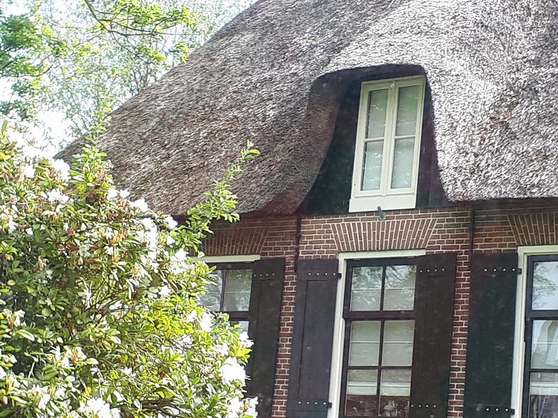
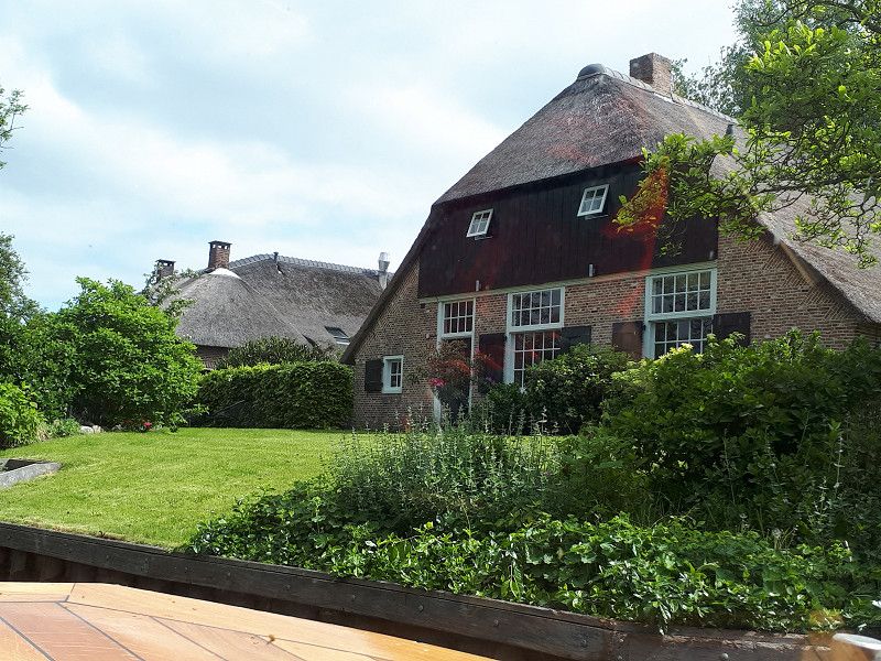
We start in Moers, where our Womo received a ceramic seal at the Koating Campany. Since Moers is not far from the Dutch border, a visit there is recommended.
Day
Bernsweg, Deutschland
Bernsweg 45, 47445, Moers, Deutschland
51° 28' 27.8" N 6° 36' 7.3" E
51.4743950 6.6020407
• Head east on Bernsweg. Go for 361 m.
• Turn right onto Kamper Straße (L399). Go for 2.3 km.
• Turn right onto Repelener Straße (L475). Go for 414 m.
• Continue on Krefelder Straße (L475). Go for 1.2 km.
• Turn left onto Venloer Straße (L140). Go for 715 m.
• Turn right onto Filder Straße (K3) toward Kapellen/Freizeitpark Moers. Go for 162 m.
• Turn right onto Zur Alten Wassermühle. Go for 24 m.
• Turn right onto Filder Straße. Go for 172 m.
• Continue toward Filder Straße. Go for 98 m.
• Turn right onto Filder Straße. Go for 13 m.
• Continue straight ahead. Go for 34 m.
• Turn left. Go for 26 m.
• Arrive at your destination on the right.
☍
5,6 km
( 7 min.)
Stellplatz am Solimare-Bad
Filder Straße 144, 47441, Moers, Deutschland
51° 26' 25.2" N 6° 37' 3.8" E
51.4403289 6.6177135
• Head east. Go for 26 m.
• Turn right toward Filder Straße. Go for 34 m.
• Continue on Filder Straße. Go for 13 m.
• Turn left toward Filder Straße. Go for 98 m.
• Continue on Filder Straße. Go for 172 m.
• Turn left onto Zur Alten Wassermühle. Go for 24 m.
• Turn left onto Filder Straße (K3). Go for 162 m.
• Turn left onto Venloer Straße (L140). Go for 715 m.
• Turn right onto Krefelder Straße (L475) toward Moers. Go for 1.3 km.
• Turn right onto Unterwallstraße. Go for 378 m.
• Turn right onto Neuer Wall. Go for 195 m.
• Turn right onto Dr.-Hermann-Bähr-Straße. Go for 52 m.
• Arrive at Dr.-Hermann-Bähr-Straße. Your destination is on the left.
☍
3,1 km
( 5 min.)
Day
Moers, Deutschland
Hike through the amusement park to the city center
51° 27' 4.6" N 6° 37' 42.3" E
51.4512830 6.6284300
• Head west on Dr.-Hermann-Bähr-Straße.
• Turn right onto Oberwallstraße. Go for 172 m.
• Turn right onto Unterwallstraße. Go for 58 m.
• Turn left onto Rheinberger Straße. Go for 283 m.
• Turn left onto Mühlenstraße (L475). Go for 349 m.
• Turn right onto Repelener Straße (L399). Go for 502 m.
• Continue on Repelener Straße (L399). Go for 1.9 km.
• Turn left onto Bernsweg. Go for 361 m.
• Arrive at Bernsweg. Your destination is on the left.
☍
3,6 km
( 5 min.)
Day
Bernsweg, Deutschland
Bernsweg 45, 47445, Moers, Deutschland
51° 28' 27.8" N 6° 36' 7.3" E
51.4743950 6.6020407
• Head west on Bernsweg.
• Arrive at Bernsweg. Your destination is on the left.
☍
Distance not available
(Duration not available)
Keramikversiegelung unseres Womo
Day
Keramikversiegelung unseres Womo
Day
Keramikversiegelung unseres Womo
Day
Keramikversiegelung unseres Womo
Day
Bernsweg, Deutschland
Pick up camper
Starting point: Koating Company, Jungbornstrasse 4, Moers
Bernsweg 45, 47445, Moers, Deutschland
51° 28' 27.8" N 6° 36' 7.3" E
51.4743950 6.6020407
• Head east on Bernsweg. Go for 361 m.
• Turn left onto Kamper Straße (L399). Go for 2.7 km.
• Continue on Kamper Straße (L287). Go for 599 m.
• Take ramp onto A57 toward Nijmegen. Go for 11.7 km.
• Take exit 6 toward Alpen/Wesel/Geldern/Issum. Go for 323 m.
• Turn left onto Weseler Straße (B58). Go for 14.4 km.
• Turn left onto Südring (B8) toward Arnheim/A3/Rees/Bocholt/Gewerbegebiet Hafen. Go for 4.0 km.
• Turn right onto Bocholter Straße (B8) toward A3/Rees/Bocholt/Hamminkeln. Go for 299 m.
• Continue toward Bocholter Straße/B8. Go for 56 m.
• Continue on Bocholter Straße (B473) toward Arnheim/A3/Bocholt. Go for 16.2 km.
• Continue on L602. Go for 2.1 km.
• Continue on L602. Go for 1.1 km.
• Turn left onto Dinxperloer Straße (L602). Go for 1.5 km.
• Take the 1st exit from roundabout onto Hamalandstraße (L602). Go for 4.1 km.
• Continue on Hamelandroute (N313). Go for 1.8 km.
• Take the 2nd exit from roundabout onto Hamelandroute (N313). Go for 3.1 km.
• Turn right onto Bredevoortsestraatweg (N318). Go for 2.0 km.
• Take the 2nd exit from roundabout onto Bredevoortsestraatweg (N318). Go for 6.1 km.
• Take the 2nd exit from roundabout onto Rondweg West (N319) toward Ziekenhuizen Kon. Beatrix/Groenlo/Zutphen/Meddo. Go for 838 m.
• Take the 2nd exit from roundabout onto Rondweg West (N319) toward Meddo/Groenlo/Zutphen/Ziekenhuizen Koningin Beatrix. Go for 924 m.
• Take the 3rd exit from roundabout onto Groenloseweg (N319) toward Groenlo/Enschede/Zutphen. Go for 495 m.
• Take the 2nd exit from roundabout onto Groenloseweg (N319). Go for 3.2 km.
• Turn right toward Meddo. Go for 14 m.
• Continue on Beerninkweg. Go for 2.1 km.
• Turn left onto Geldereschweg. Go for 466 m.
• Turn left. Go for 643 m.
• Arrive at your destination.
☍
80,9 km
(1 hrs. 10 min.)
Wellness Camping Stoltenborg, Geldereschweg, Winterswijk Meddo, Niederlande
The place has a new owner who is just setting it up again. Wellness and restaurant are not open yet. The access roads to the plots are partly overgrown and therefore only accessible with a box van.
That's why we keep going!
Geldereschweg 67A, 7104 AN Winterswijk Meddo, Netherlands
52° 0' 57.7" N 6° 40' 2.5" E
52.0160218 6.6673694
• Head toward Geldereschweg. Go for 643 m.
• Turn left onto Geldereschweg. Go for 450 m.
• Continue on Meddoseweg. Go for 494 m.
• Turn left onto Meddoseweg. Go for 45 m.
• Turn slightly left onto Oosterholtweg. Go for 1.7 km.
• Turn right onto Winterswijkseweg (N319). Go for 3.7 km.
• Continue on Rondweg (N319) toward Groenlo/Ruurlo/Zutphen. Go for 761 m.
• Turn right onto Barkenkamp toward Groenlo/Gezondheids-Centrum. Go for 298 m.
• Continue on Deken Hooijmansingel. Go for 322 m.
• Take the 2nd exit from roundabout onto Borculoseweg. Go for 925 m.
• Turn right onto Deventer Kunstweg. Go for 4.8 km.
• Turn right onto Lintveldseweg. Go for 1.6 km.
• Turn right onto Molenweg. Go for 289 m.
• Turn left onto Kormelinkweg. Go for 1.0 km.
• Arrive at Kormelinkweg.
☍
17,0 km
( 19 min.)
Hub Vakantieparken Park De Fontein
Hupselse Markenweg 4, 7151NV, Eibergen, Netherlands
52° 5' 36.3" N 6° 37' 6.1" E
52.0934300 6.6183600
• Head west on Kormelinkweg. Go for 1.0 km.
• Turn right onto Molenweg. Go for 289 m.
• Turn left onto Lintveldseweg. Go for 1.6 km.
• Turn right onto Deventer Kunstweg. Go for 878 m.
• Continue on Groenloseweg. Go for 2.7 km.
• Turn left onto Batendijk (N822). Go for 1.2 km.
• Turn right toward Rondweg/N315. Go for 253 m.
• Turn right onto Rondweg (N315). Go for 942 m.
• Take the 2nd exit from roundabout onto Hekweg (N315). Go for 821 m.
• Take the 3rd exit from roundabout onto Nettelhorsterweg (N825). Go for 2.4 km.
• Take the 2nd exit from roundabout onto Nettelhorsterweg (N825). Go for 6.1 km.
• Turn left onto Goorseweg (N346). Go for 862 m.
• Turn left onto Goorseweg (N346). Go for 690 m.
• Take the 1st exit from roundabout onto Stationsweg (N346) toward Zutphen/Laren/Holten. Go for 469 m.
• Take the 2nd exit from roundabout onto Kwinkweerd (N346). Go for 1.9 km.
• Turn right onto Rengersweg (N332) toward Laren/Deventer/Holten. Go for 2.7 km.
• Continue on Provinciale Weg (N332). Go for 1.3 km.
• Take the 2nd exit from roundabout onto Provinciale Weg (N332). Go for 6.2 km.
• Turn right onto Larenseweg (N332). Go for 3.1 km.
• Pass 2 roundabouts and continue on Raalterweg (N332). Go for 10.1 km.
• Take the 1st exit from roundabout onto N332. Go for 1.3 km.
• Take the 2nd exit from roundabout onto Dorpsstraat (N332). Go for 3.7 km.
• Take the 2nd exit from roundabout onto Nieuwe Deventerweg (N348) toward Almelo/Raalte/Ommen/Zwolle. Go for 2.3 km.
• Pass 2 roundabouts and continue on Nieuwe Deventerweg (N348). Go for 1.6 km.
• Turn left onto Heinoseweg (N35) toward Heino/Zwolle. Go for 18.6 km.
• Turn right and take ramp onto A28 toward Industrieterrein Hessenpoort/Meppel. Go for 8.6 km.
• Take exit 22 toward Nieuwleusen/Dedemsvaart/Rouveen/Hasselt/N377. Go for 404 m.
• Turn left onto Hermelenweg. Go for 173 m.
• Turn left onto N377. Go for 6.3 km.
• Take the 2nd exit from roundabout onto Vaartweg (N377). Go for 1.2 km.
• Take the 1st exit from roundabout onto Zwartsluizerweg (N331). Go for 4.9 km.
• Take the 2nd exit from roundabout onto Provinciale Weg (N331). Go for 966 m.
• Take the 1st exit from roundabout onto Provinciale Weg (N334). Go for 811 m.
• Take the 2nd exit from roundabout onto Provinciale Weg (N334). Go for 2.8 km.
• Keep left toward Provinciale Weg/N334. Go for 61 m.
• Take the 2nd exit from roundabout onto Blauwehandseweg (N334). Go for 7.2 km.
• Turn right onto Bartus Warnersweg. Go for 102 m.
• Turn right onto Bartus Warnersweg. Go for 841 m.
• Turn right onto Bartus Warnersweg. Go for 12 m.
• Arrive at Bartus Warnersweg.
☍
107,5 km
(1 hrs. 32 min.)
Day
Camping d' Hof
The place was fully booked. We keep going!
Binnenpad 137, 8355 BW, Giethoorn, Netherlands
52° 42' 59.9" N 6° 5' 23.6" E
52.7166400 6.0898800
• Head north on Bartus Warnersweg. Go for 12 m.
• Turn left onto Bartus Warnersweg. Go for 841 m.
• Turn left onto Bartus Warnersweg. Go for 102 m.
• Turn right onto Beulakerweg (N334). Go for 359 m.
• Turn left onto Cornelisgracht. Go for 51 m.
• Turn left onto Cornelisgracht. Go for 117 m.
• Turn left onto Jonenweg. Go for 242 m.
• Arrive at Jonenweg. Your destination is on the left.
☍
1,7 km
( 4 min.)
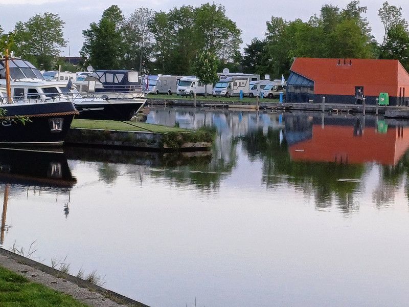
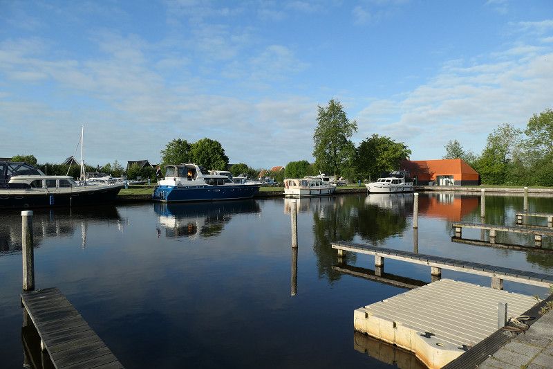
Passantenhaven De Zuidercluft
We stroll to the next restaurant and get to know Dutch food cultures. At lunchtime there is only a lunch menu with a few salads, lots of burgers and ribs. You usually eat in the evening.
Vosjacht, 8355, Giethoorn, Netherlands
52° 43' 17" N 6° 4' 27" E
52.7213889 6.0741667
• Head west on Jonenweg.
• Arrive at Jonenweg. Your destination is on the left.
☍
Distance not available
(Duration not available)
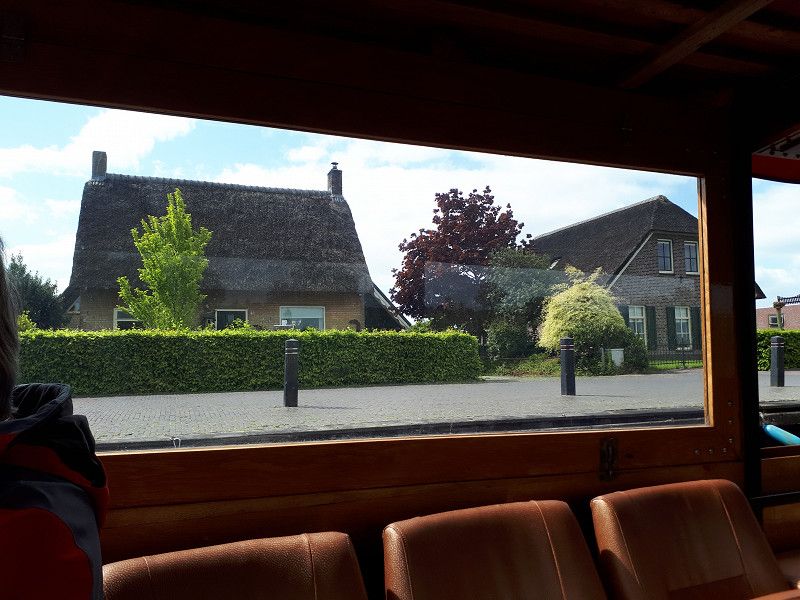
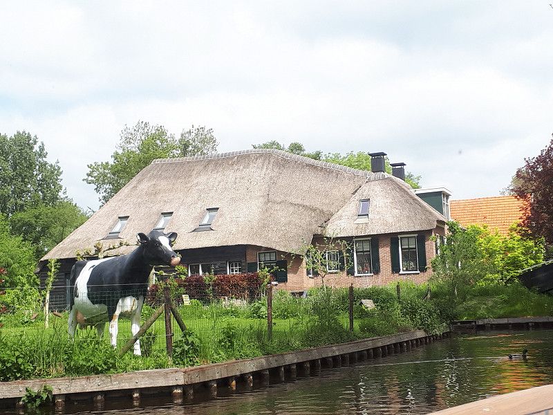
Day
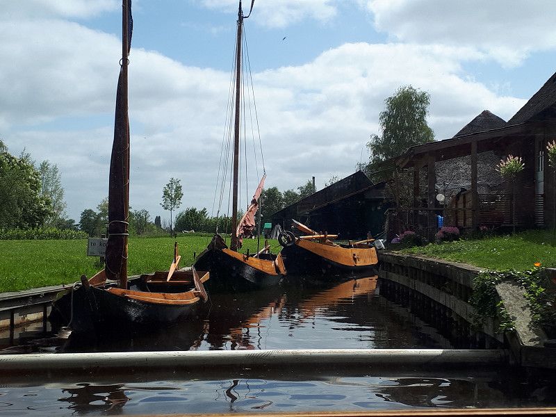
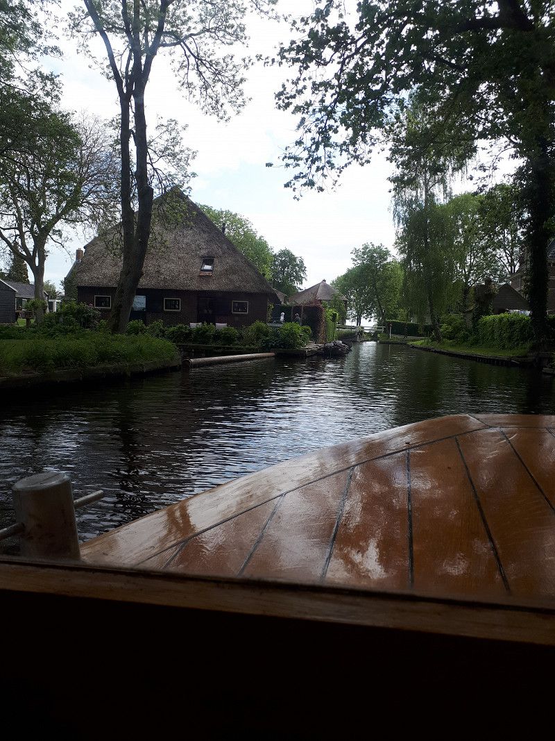
Passantenhaven De Zuidercluft
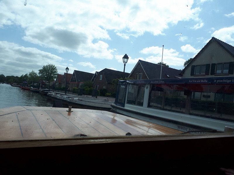
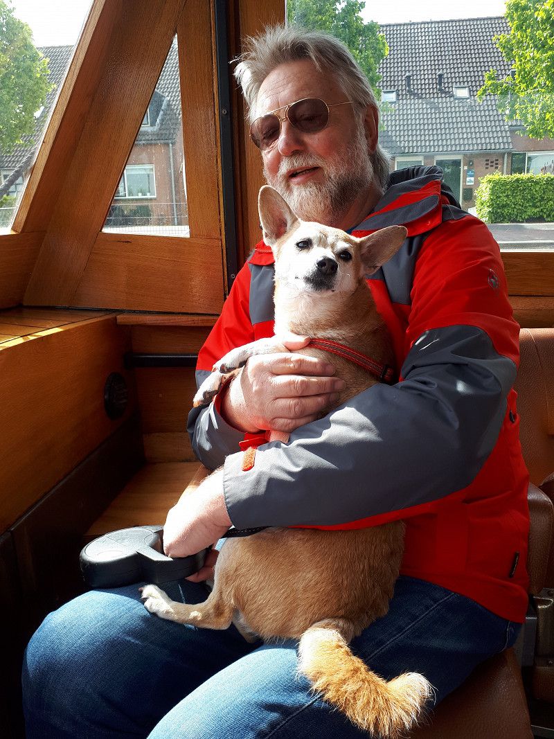
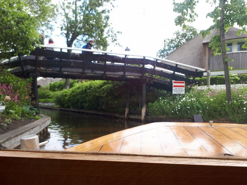
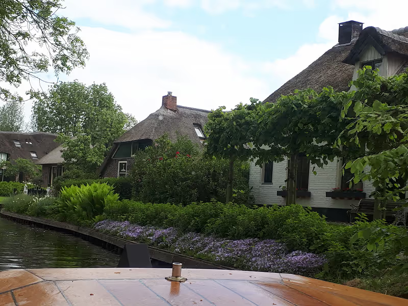
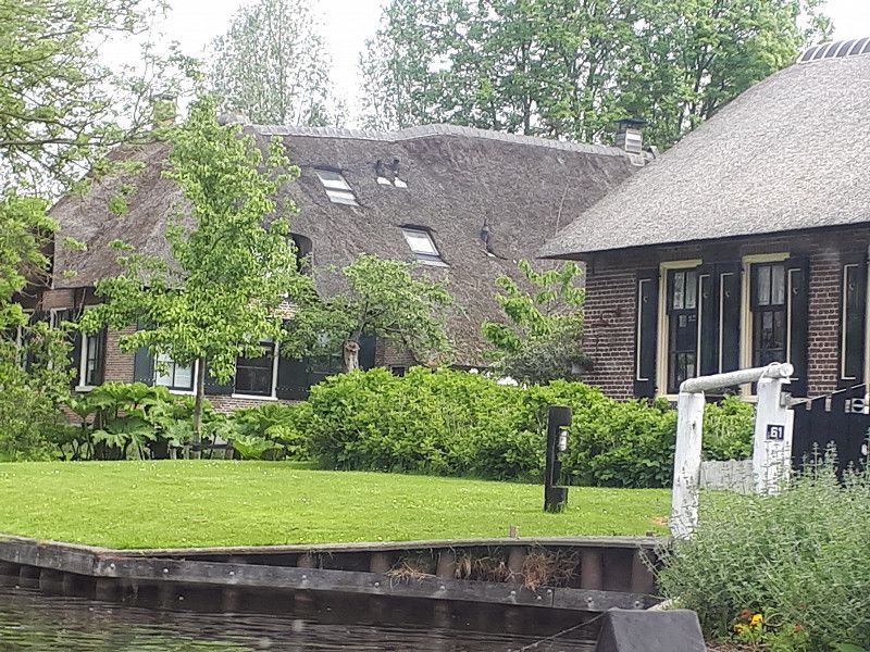
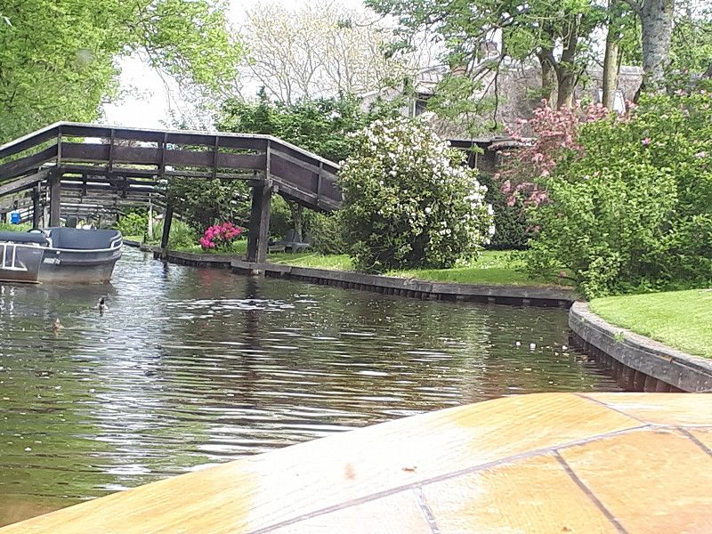
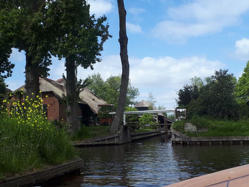
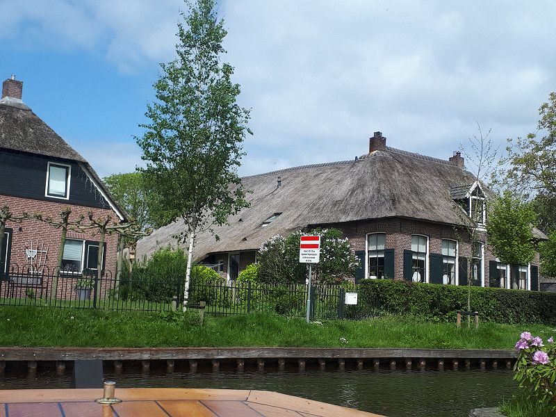
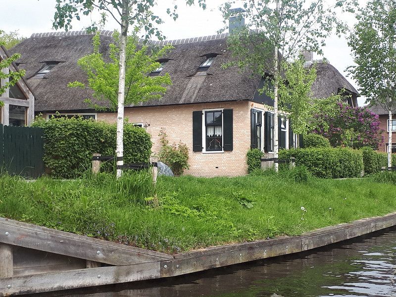
Today we took a tour on a tourist boat through the numerous canals of Holland's Venice. It was very impressive.
Vosjacht, 8355, Giethoorn, Netherlands
52° 43' 17" N 6° 4' 27" E
52.7213889 6.0741667
• Head toward Vosjacht on Jonenweg. Go for 242 m.
• Turn right onto Cornelisgracht. Go for 117 m.
• Turn right onto Cornelisgracht. Go for 51 m.
• Turn left onto Beulakerweg (N334). Go for 1.9 km.
• Turn right onto Beulakerweg. Go for 26 m.
• Arrive at Beulakerweg. Your destination is on the left.
☍
2,4 km
( 3 min.)
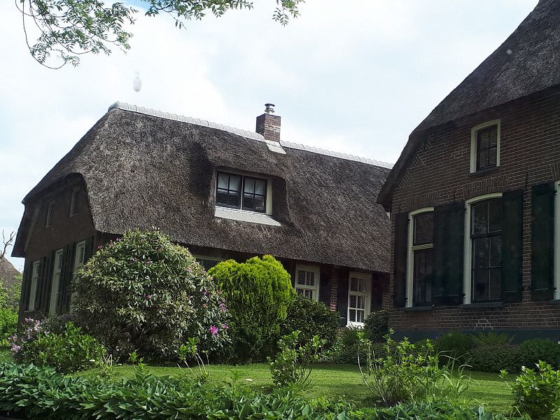
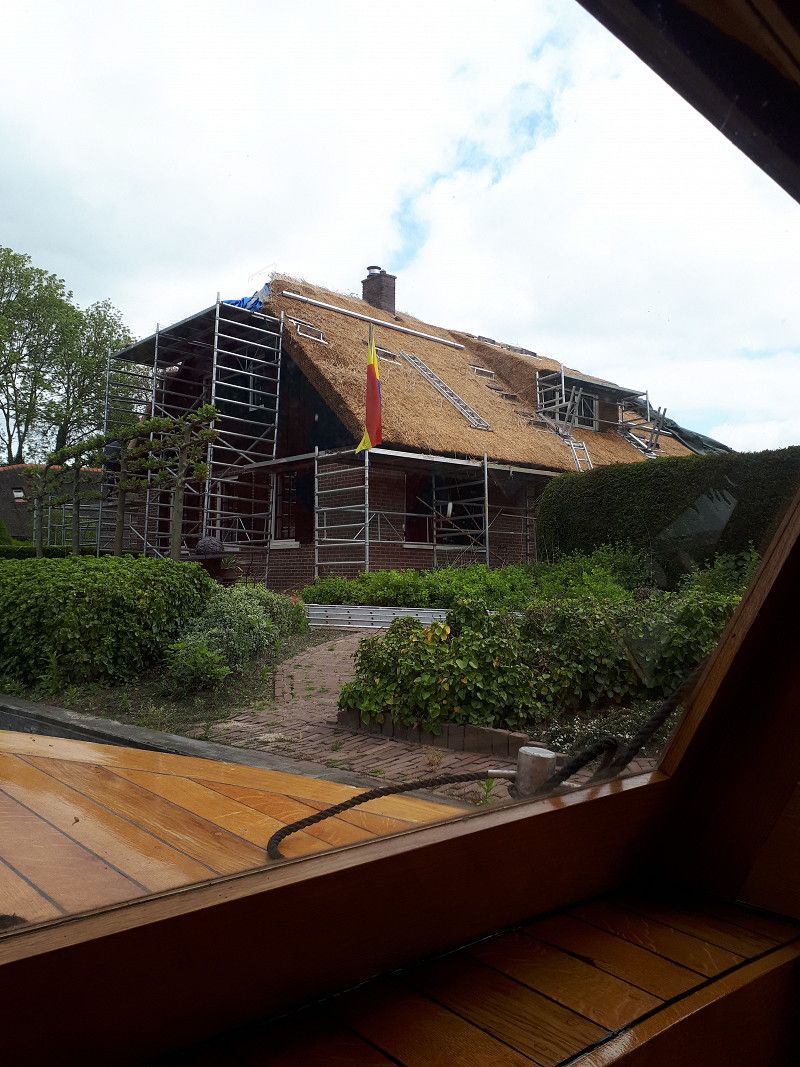
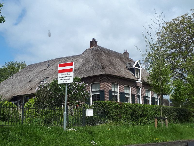
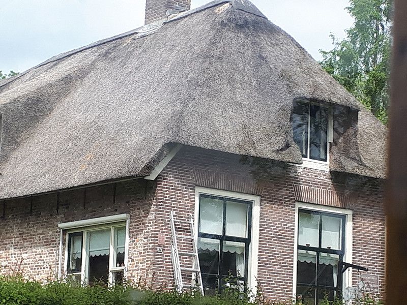
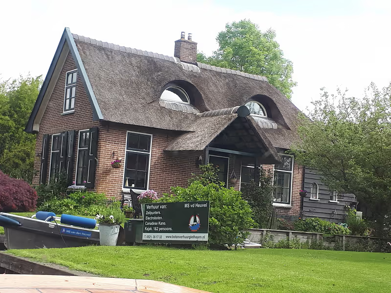
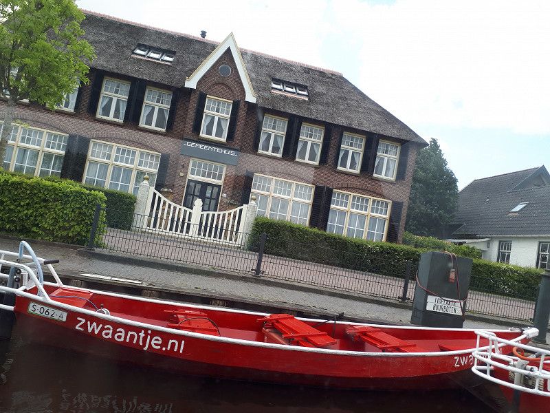
Giethoorn, Niederlande
Giethoorn, Giethoorn, Niederlande
52° 44' 28" N 6° 4' 38.8" E
52.7411050 6.0774310
• Head east on Beulakerweg.
• Arrive at Beulakerweg. Your destination is on the left.
☍
Distance not available
(Duration not available)
Giethoorn, Niederlande
Giethoorn, Giethoorn, Niederlande
52° 44' 28" N 6° 4' 38.8" E
52.7411050 6.0774310
• Head west on Beulakerweg. Go for 26 m.
• Turn right onto Beulakerweg (N334). Go for 3.9 km.
• Turn right onto Blokzijlseweg (N333/N334). Go for 758 m.
• Take the 2nd exit from roundabout onto Ruxveenseweg (N334). Go for 288 m.
• Pass 2 roundabouts and continue on Ruxveenseweg (N334). Go for 3.1 km.
• Take the 1st exit from roundabout onto Steenwijkerweg (N334). Go for 713 m.
• Turn left and take ramp onto A32 toward Wolvega/Heerenveen/Leeuwarden. Go for 23.1 km.
• Take the exit toward Industrieterrein Heerenveen-Noord/Joure/Amsterdam onto A7. Go for 8.8 km.
• Take the exit onto A7. Go for 11.9 km.
• Continue on N7 toward Sneek-Oost/Oppenhuizen/Leeuwarden/RING/N354. Go for 64 m.
• Take ramp toward Sneek-Oost/Oppenhuizen/Leeuwarden/RING/N354. Go for 334 m.
• Turn right toward Oppenhuizerweg. Go for 125 m.
• Take the 3rd exit from roundabout onto Oppenhuizerweg toward Industriegebied Houkesloot I. Go for 355 m.
• Pass 2 roundabouts and continue on Oppenhuizerweg. Go for 990 m.
• Continue on Jousterkade. Go for 172 m.
• Take the 4th exit from roundabout onto Prins Hendrikkade. Go for 350 m.
• Take the 3rd exit from roundabout onto Gedempte Pol. Go for 55 m.
• Turn right onto Prins Hendrikkade. Go for 22 m.
• Arrive at Prins Hendrikkade. Your destination is on the left.
☍
55,0 km
( 36 min.)
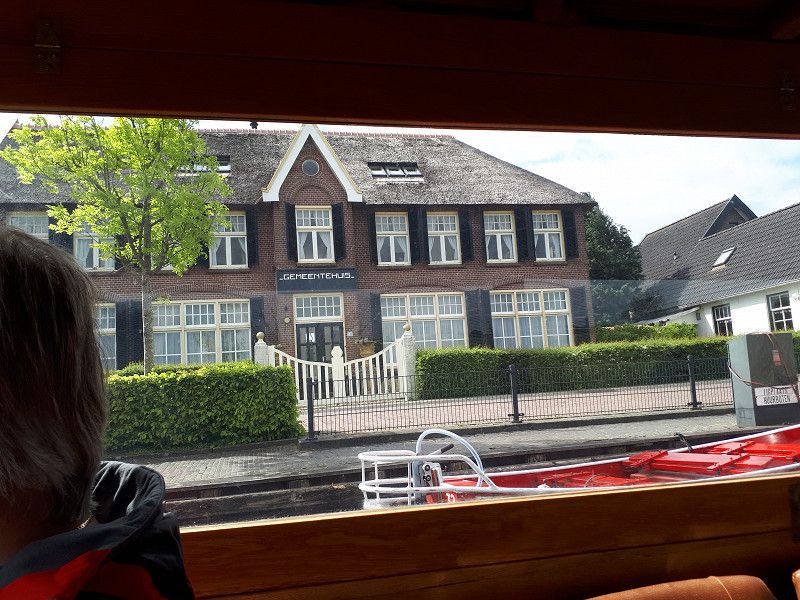
Day
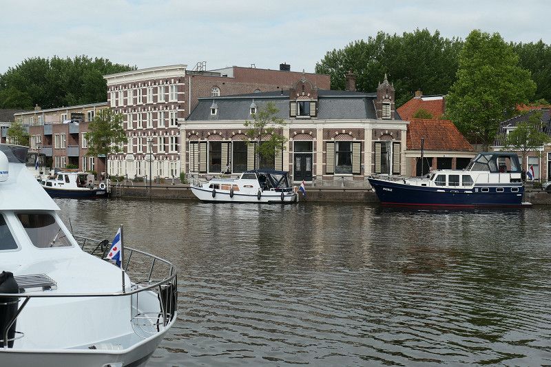
Sneek, Niederlande
- Waterpoort, a bridge gate with two pointed octagonal towers from 1613,
- old town
- the canals
- the Gothic Martinikerk and
- the Stadthuis with rococo facade
53° 2' 0.8" N 5° 39' 40" E
53.0335480 5.6611029
• Head toward Gedempte Pol on Prins Hendrikkade. Go for 22 m.
• Turn right onto Gedempte Pol. Go for 126 m.
• Continue on Gedempte Poortezijlen. Go for 60 m.
• Continue on Singel. Go for 336 m.
• Continue on Hoogend. Go for 125 m.
• Continue on Lemmerweg. Go for 319 m.
• Take the 2nd exit from roundabout onto Lemmerweg. Go for 477 m.
• Take ramp onto N7 toward Ring Sneek/Ziekenhuis Antonius/Bolsward/A7. Go for 3.0 km.
• Continue on A7. Go for 32.3 km.
• Take the exit toward Breezanddijk. Go for 429 m.
• Turn left toward Afsluitdijk. Go for 190 m.
• Turn left onto Afsluitdijk. Go for 297 m.
• Arrive at Afsluitdijk.
☍
37,7 km
( 24 min.)
Abschlussdeich, Niederlande
The 32 km long dyke connects Noord-Holland with Friesland. It separates the Waddenzee from the Zuiderzee, which became a freshwater lake when the dike was built in 1927-32 and has since been called the IJsselmeer. A four-lane highway and a path for cyclists and pedestrians lead across the 90 m wide embankment.
Unfortunately, there was a big construction site at the moment, it wasn't possible to stop, the dyke museum was closed.
Abschlussdeich, 8766, Südwestfriesland, Niederlande
53° 1' 18.4" N 5° 12' 39.3" E
53.0217664 5.2109277
• Head southeast on Afsluitdijk. Go for 297 m.
• Turn right toward Afsluitdijk/A7. Go for 321 m.
• Take ramp onto A7 (Afsluitdijk). Go for 14.9 km.
• Take exit 14 toward Den Oever/Den Helder. Go for 544 m.
• Turn right onto Rijksstraatweg (N99) toward Den Oever/Den Helder. Go for 428 m.
• Pass 6 roundabouts and continue on N99. Go for 18.0 km.
• Turn right onto N99 toward N9/N250/Den Helder/Veer Texel/Alkmaar. Go for 365 m.
• Turn left onto Rijksweg (N250) toward Den Helder. Go for 3.3 km.
• Keep right toward Veer Texel/Havens. Go for 21 m.
• Take the 1st exit from roundabout onto N250 toward Veer Texel/Havens. Go for 1.3 km.
• Turn right onto Havenweg. Go for 339 m.
• Turn slightly right onto Havenweg. Go for 185 m.
• Continue on Rijkszee-en Marinehaven. Go for 1.3 km.
• Turn right onto Noordvoorlandweg. Go for 56 m.
• Continue on Het Nieuwe Diep. Go for 61 m.
• Arrive at Het Nieuwe Diep.
☍
41,4 km
( 34 min.)
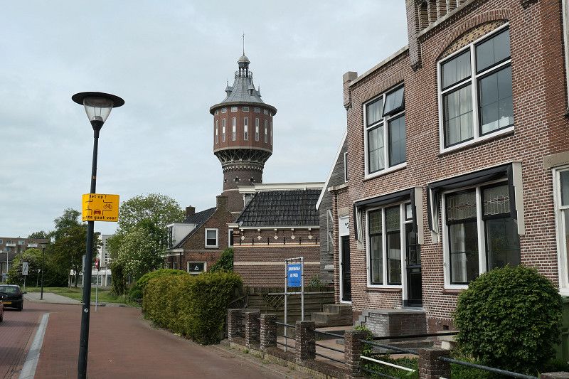
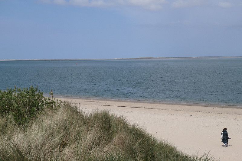
Den Helder, Niederlande
Life takes place along the canals.
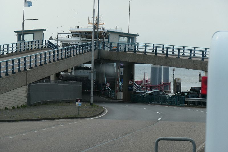
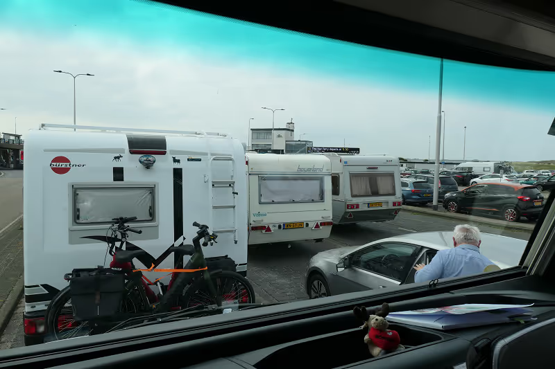
We take the ferry to Texel.
Den Helder, Den Helder, Niederlande
52° 57' 10.8" N 4° 49' 36.3" E
52.9529894 4.8267593
• Head north on Het Nieuwe Diep. Go for 61 m.
• Continue on Noordvoorlandweg. Go for 57 m.
• Turn left onto Rijkszee-en Marinehaven. Go for 1.3 km.
• Turn left onto Havenweg. Go for 185 m.
• Turn slightly left onto Havenweg. Go for 339 m.
• Turn right onto Binnenhaven (N250). Go for 852 m.
• Turn right onto Weststraat (N250) toward Veer Texel. Go for 1.7 km.
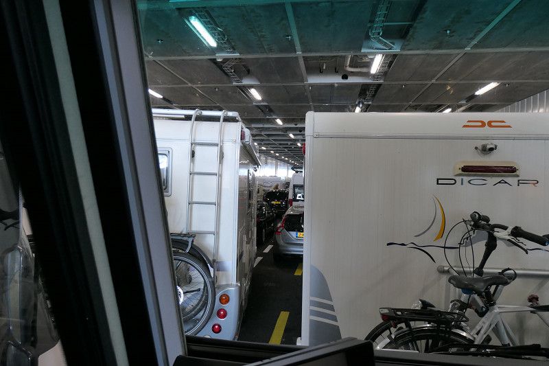
• Take the Den Helder-Texel Ferry. Stay on for 4.6 km.
• Head northwest on Pontweg (N501). Go for 580 m.
• Turn left onto Molwerk. Go for 174 m.
• Turn right onto Molwerk. Go for 663 m.
• Continue on Watermolenweg. Go for 1.9 km.
• Turn right onto Hoornderweg. Go for 3.7 km.
• Take the 3rd exit from roundabout onto Pontweg (N501). Go for 1.3 km.
• Take the 1st exit from roundabout onto Akenbuurt. Go for 484 m.
• Continue on Kogerweg. Go for 844 m.
• Continue on Nieuwlanderweg. Go for 3.9 km.
• Take the 1st exit from roundabout onto Postweg. Go for 7.3 km.
• Take the 2nd exit from roundabout onto Vuurtorenweg. Go for 2.7 km.
• Continue on Volharding. Go for 108 m.
• Turn left onto Vuurtorenweg. Go for 552 m.
• Turn right. Go for 27 m.
• Arrive at your destination on the left.
☍
33,4 km
(1 hrs. 14 min.)
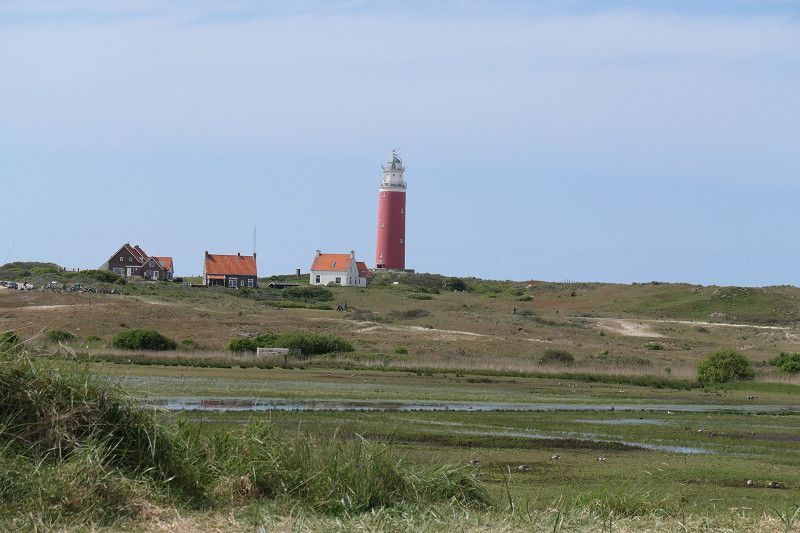
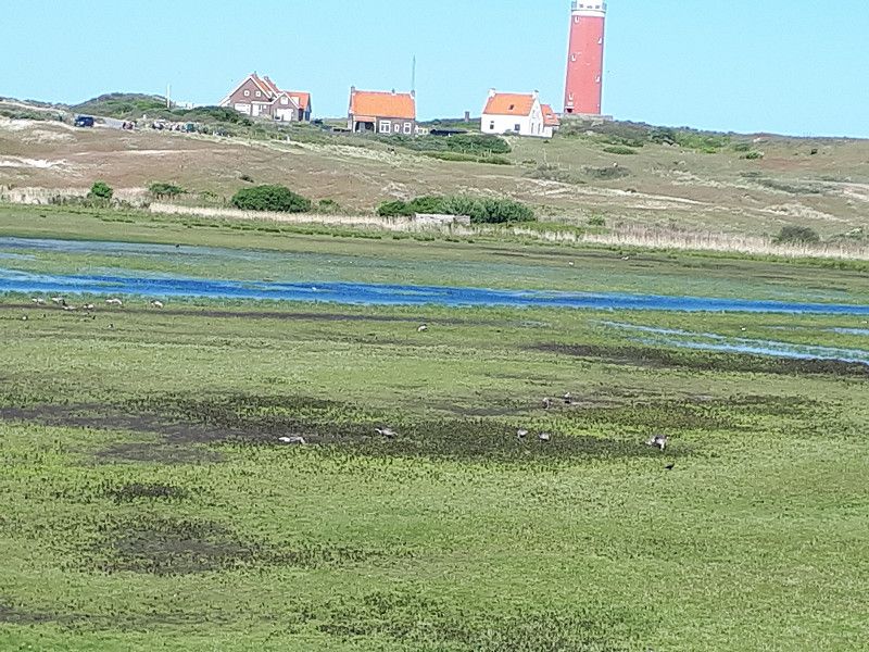
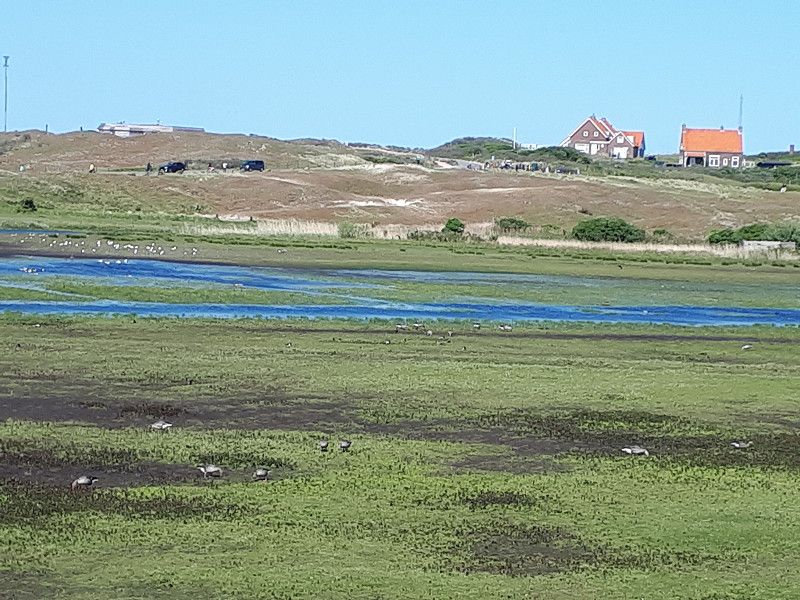
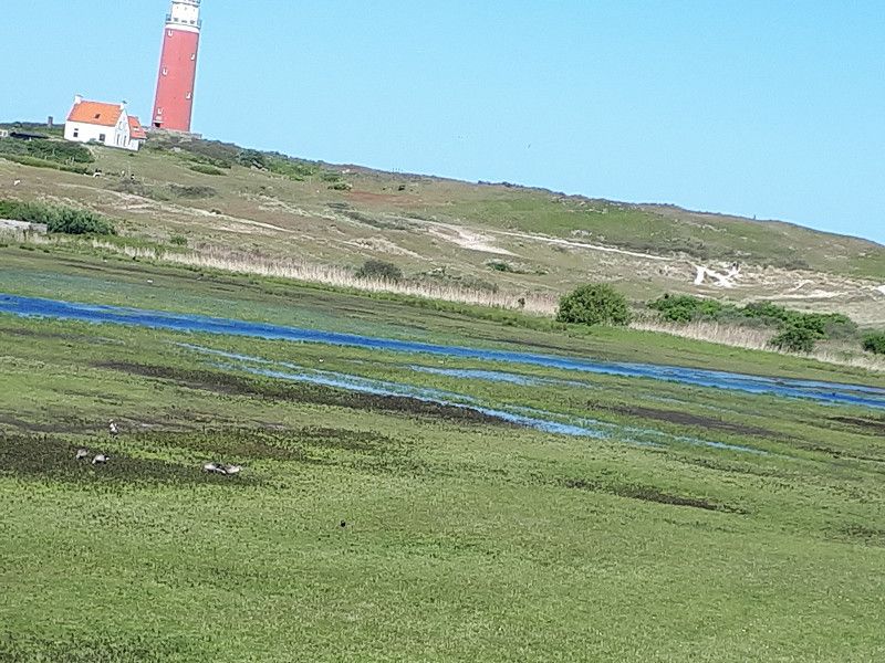
Duinpark en Camping De Robbenjager
The course is in the dunes below the lighthouse. There is absolute silence here at night. During the day the bear dances. When we arrived, the place was occupied to the last seat. Due to the division into many fields, you feel comfortable despite the size of the space. Unfortunately, the pricing with different flat rates is a rip off. We had to pay for 4 days (pitch, people, dog and energy flat rate), although we were only there 3 days
The site has an excellent restaurant, Restaurant RJ. There is another very good restaurant 100 meters away, Cape Noord, specializing in fish, seafood and mussels. There are 2 other restaurants near the lighthouse, but we didn't visit them.
Vuurtorenweg 148, 1795 LN, Texel - De Cocksdorp, Netherlands
53° 10' 39.2" N 4° 51' 36.5" E
53.1775500 4.8601300
• Head east.
• Arrive at your destination on the left.
☍
Distance not available
(Duration not available)
Day
Duinpark en Camping De Robbenjager
Vuurtorenweg 148, 1795 LN, Texel - De Cocksdorp, Netherlands
53° 10' 39.2" N 4° 51' 36.5" E
53.1775500 4.8601300
• Head east.
• Arrive at your destination on the left.
☍
Distance not available
(Duration not available)
Day
Duinpark en Camping De Robbenjager
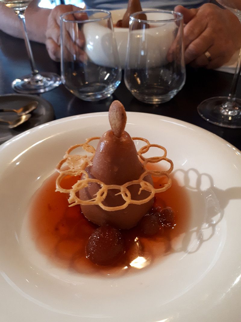
We enjoy an exquisite 3-course dinner surprise menu in the RJ restaurant
Vuurtorenweg 148, 1795 LN, Texel - De Cocksdorp, Netherlands
53° 10' 39.2" N 4° 51' 36.5" E
53.1775500 4.8601300
• Head toward Vuurtorenweg. Go for 27 m.
• Turn right onto Vuurtorenweg. Go for 24 m.
• Turn slightly left onto Vuurtorenweg. Go for 53 m.
• Turn sharp left onto Vuurtorenweg. Go for 531 m.
• Turn right onto Vuurtorenweg. Go for 2.6 km.
• Take the 1st exit from roundabout onto Postweg. Go for 7.3 km.
• Take the 2nd exit from roundabout onto Nieuwlanderweg. Go for 4.0 km.
• Continue on Kogerweg. Go for 844 m.
• Continue on Akenbuurt. Go for 455 m.
• Take the 3rd exit from roundabout onto Pontweg. Go for 1.3 km.
• Take the 1st exit from roundabout onto Hoornderweg. Go for 3.7 km.
• Turn left onto Watermolenweg. Go for 1.9 km.
• Continue on Molwerk. Go for 663 m.
• Turn left onto Molwerk. Go for 162 m.
• Turn right onto Pontweg (N501). Go for 615 m.
• Take the Den Helder-Texel Ferry. Stay on for 4.6 km.
• Head southwest on Havenplein (N250). Go for 59 m.
• Turn right onto Havenplein (N250). Go for 1.6 km.
• Turn left onto Zuidstraat (N250) toward Leeuwarden/Alkmaar. Go for 852 m.
• Turn left onto Havenweg. Go for 339 m.
• Turn slightly right onto Havenweg. Go for 185 m.
• Continue on Rijkszee-en Marinehaven. Go for 1.3 km.
• Turn right onto Noordvoorlandweg. Go for 56 m.
• Continue on Het Nieuwe Diep. Go for 61 m.
• Arrive at Het Nieuwe Diep.
☍
33,3 km
(1 hrs. 14 min.)
Day
Den Helder, Niederlande
Den Helder, Den Helder, Niederlande
52° 57' 10.8" N 4° 49' 36.3" E
52.9529894 4.8267593
• Head north on Het Nieuwe Diep. Go for 61 m.
• Continue on Noordvoorlandweg. Go for 57 m.
• Turn left onto Rijkszee-en Marinehaven. Go for 1.3 km.
• Turn left onto Havenweg. Go for 185 m.
• Turn slightly left onto Havenweg. Go for 339 m.
• Turn left onto Binnenhaven (N250). Go for 1.3 km.
• Keep left toward Leeuwarden/Alkmaar. Go for 24 m.
• Pass 2 roundabouts and continue on Rijksweg (N9). Go for 34.9 km.
• Continue on Steve Bikoweg (N9) toward Ziekenhuis M.C.A./Ring Alkmaar/Haarlem. Go for 6.8 km.
• Take the 1st exit from Verkeersplein Kooimeer roundabout toward Amsterdam/Haarlem. Go for 30 m.
• Take left ramp onto A9 toward Amsterdam/Haarlem. Go for 48.4 km.
• Take the exit toward Utrecht/E35 onto A2. Go for 26.6 km.
• Take the exit toward E30/Arnhem/Amersfoort onto A12. Go for 6.3 km.
• Take the exit toward E30/Ring Utrecht/Amersfoort/A28/Hilversum onto A27. Go for 3.7 km.
• Keep right onto E30 (Knooppunt Rijnsweerd) toward Groningen/Hengelo/Amersfoort/Utrecht-de Uithof/A28. Go for 2.5 km.
• Continue on A28. Go for 6.3 km.
• Take exit 3 toward Den Dolder/Zeist-Oost. Go for 547 m.
• Turn left onto Krakelingweg. Go for 501 m.
• Take the 2nd exit from roundabout onto Krakelingweg. Go for 1.4 km.
• Take the 2nd exit from roundabout onto Woudenbergseweg (N224) toward Industrieterrein Seyst/Austerlitz/Woudenberg. Go for 409 m.
• Take the 3rd exit from roundabout onto Woudenbergseweg (N224) toward Austerlitz/Woudenberg/Arnhem. Go for 639 m.
• Take the 2nd exit from roundabout onto Woudenbergseweg (N224) toward Woudenberg/Arnhem. Go for 842 m.
• Arrive at Woudenbergseweg (N224). Your destination is on the right.
☍
143,2 km
(1 hrs. 50 min.)
Allurepark De Krakeling
Very large and beautiful place between forest and heath. You can eat well in the Bistro Jan on the square.
Woudenbergseweg 17, 3707 HW, Zeist, Netherlands
52° 5' 15.8" N 5° 18' 20.5" E
52.0877300 5.3057000
• Head toward Traayweg on Woudenbergseweg (N224). Go for 3.8 km.
• Continue on Zeisterweg (N224). Go for 3.0 km.
• Take the 1st exit from roundabout onto Randweg (N224) toward Industrieterrein Parallelweg/Woudenberg/Arnhem. Go for 848 m.
• Take the 1st exit from roundabout onto Maarsbergseweg (N226) toward Maarsbergen/Utrecht/Arnhem. Go for 2.2 km.
• Take the 2nd exit from roundabout onto Woudenbergseweg (N226). Go for 393 m.
• Keep right toward Leersum/Doorn/N226. Go for 26 m.
• Take the 4th exit from Woudenbergseweg roundabout onto Parallelweg toward Leersum/Doorn/N226/Arnhem/A12. Go for 321 m.
• Turn left and take ramp onto A12 toward Arnhem. Go for 29.1 km.
• Take the exit toward Eindhoven/Nijmegen/Arnhem-Zuid onto A50. Go for 21.3 km.
• Take the exit toward Köln/Venlo/Nijmegen onto E31 (Knooppunt Ewijk). Go for 1.8 km.
• Continue on A73 (Knooppunt Ewijk). Go for 4.2 km.
• Take the exit toward Nijmegen-Dukenburg/Venlo/Köln onto A73. Go for 22.0 km.
• Take the exit toward Gennep/Nieuw Bergen/Goch/Köln onto A77. Go for 10.4 km.
• Continue on A57. Go for 50.9 km.
• Take exit 9 toward Moers-Hülsdonk/Neukirchen-Vluyn. Go for 362 m.
• Turn right onto Geldernsche Straße (L474). Go for 1.1 km.
• Take the 1st exit from roundabout onto Am Jostenhof. Go for 667 m.
• Turn left onto Hülsdonker Straße. Go for 895 m.
• Continue on Unterwallstraße. Go for 396 m.
• Turn right onto Neuer Wall. Go for 195 m.
• Turn right onto Dr.-Hermann-Bähr-Straße. Go for 52 m.
• Arrive at Dr.-Hermann-Bähr-Straße. Your destination is on the left.
☍
153,9 km
(1 hrs. 37 min.)
Day
Moers, Deutschland
We pick up our parked car.
51° 27' 4.6" N 6° 37' 42.3" E
51.4512830 6.6284300
• Head west on Dr.-Hermann-Bähr-Straße.
• Turn right onto Oberwallstraße. Go for 172 m.
• Turn right onto Unterwallstraße. Go for 7 m.
• Make a U-Turn onto Unterwallstraße. Go for 515 m.
• Turn slightly left onto Krefelder Straße (L475). Go for 2.0 km.
• Turn left and take ramp onto A57 toward Köln. Go for 58.1 km.
• Take exit 28 toward Koblenz onto A1. Go for 29.1 km.
• Take exit 109 toward Trier/B51/Euskirchen onto A1. Go for 37.7 km.
• Take exit 114 toward Trier/Dahlem/Blankenheim onto B51. Go for 38.1 km.
• Take ramp onto B51/B410. Go for 7.2 km.
• Take the 2nd exit from roundabout onto B51 toward Luxemburg/A60/Trier/Bitburg/E42/Schloßheck. Go for 219 m.
• Take ramp onto A60 toward Luxembourg/Trier/Bitburg. Go for 18.9 km.
• Take exit 6 toward Luxembourg/Bitburg onto B51. Go for 9.6 km.
• Take ramp onto B257 toward Luxemburg/Echternach/Irrel. Go for 3.5 km.
• Turn left onto K23 toward Oberstedem/Niederstedem. Go for 71 m.
• Continue on In der Höhe (K23). Go for 404 m.
• Turn right onto Esslinger Straße (K97). Go for 306 m.
• Continue on K97. Go for 756 m.
• Continue on K22. Go for 1.6 km.
• Continue on Brunnenstraße (K22). Go for 311 m.
• Turn left onto Hauptstraße (K24). Go for 804 m.
• Continue on K24. Go for 29 m.
• Turn left and take ramp onto B51 toward Trier. Go for 21.3 km.
• Turn left onto Kaiser-Wilhelm-Brücke toward B51/A602/Saarbrücken/Centrum. Go for 329 m.
• Turn right toward Katharinenufer/B49. Go for 182 m.
• Turn right onto Katharinenufer (B49) toward Saarbrücken/Luxemburg/Centrum/Alleenring. Go for 2.8 km.
• Continue on B51. Go for 2.4 km.
• Keep left onto B51 toward Metz/Luxembourg/B419/Saarburg/Gewerbegebiet Saarmündung/Gewerbegebiet Granahöhe/Saar-Mosel-Centrum/Tarkett. Go for 3.0 km.
• Keep left toward Konz. Go for 46 m.
• Take the 2nd exit from roundabout onto Am Luxemburger Damm toward Konz. Go for 382 m.
• Continue on Karthäuser Straße. Go for 112 m.
• Continue on Granastraße. Go for 258 m.
• Pass 2 roundabouts and continue on Granastraße. Go for 257 m.
• Arrive at Granastraße.
☍
240,5 km
(2 hrs. 48 min.)
Konz
Deutschland
49° 41' 57.7" N 6° 34' 21.7" E
49.6993563 6.5726813