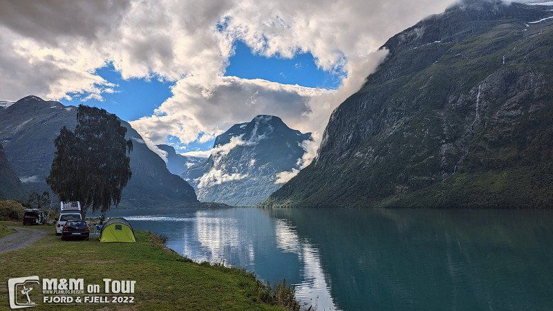
Three weeks break in Scandinavia, we try to escape the flow of tourists without missing the hotspots.
Day
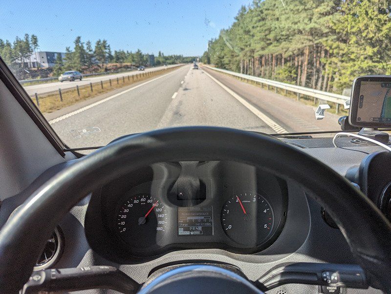
Start ins Abenteuer
With sweltering hot temperatures, our journey north begins this year. Hopefully it will be a bit cooler soon.
Einsiedel, Chemnitz, Deutschland
50° 45' 58.9" N 12° 57' 37.2" E
50.7663508 12.9603457
• Head east on Berbisdorfer Straße (K6110). Go for 717 m.
• Turn left onto Einsiedler Hauptstraße (K6110). Go for 325 m.
• Turn left onto Einsiedler Hauptstraße (S232). Go for 4.2 km.
• Take the 1st exit from roundabout onto Reichenhainer Straße. Go for 1.0 km.
• Turn left and take ramp onto Südring. Go for 5.3 km.
• Take left ramp onto Neefestraße (B169/B173) toward C-Süd/A72/Leipzig/Zwickau. Go for 1.2 km.
• Take ramp onto A72 toward Leipzig/Dresden/A4/Erfurt. Go for 67.3 km.
• Take ramp onto A38 toward Dresden. Go for 14.2 km.
• Take the left exit toward Magdeburg/Halle/Flughafen/Leipzig/A9 onto A14. Go for 137 km.
• Take exit 2 toward Hannover/Braunschweig onto A2. Go for 119 km.
• Take exit 48 toward Hamburg/Bremen onto A7. Go for 124 km.
• Keep left onto Horster Dreieck toward Lübeck/Berlin/Hamburg/Lüneburg/A1. Go for 2.5 km.
• Continue on A1. Go for 13.2 km.
• Take exit 36 toward Lübeck/Berlin/Hamburg-Südost onto A1. Go for 69.1 km.
• Take exit 19 toward Sereetz/Bad Schwartau/Ratekau-Techau. Go for 352 m.
• Turn right onto L181 toward Techau/Ratekau/Bad Schwartau-Nord/Sereetz. Go for 1.6 km.
• Continue on Eutiner Straße (L309) toward Puttgarden/Kiel. Go for 12.6 km.
• Turn right and take ramp onto B432 toward Scharbeutz/A1. Go for 3.4 km.
• Take ramp onto A1 toward Puttgarden. Go for 47.2 km.
• Continue on B207. Go for 21.2 km.
• Keep right onto Fährhafenstraße toward Bahnhof. Go for 490 m.
• Continue on Fährbahnhof. Go for 201 m.
• Arrive at Fährbahnhof. Your destination is on the right.
☍
646,5 km
(6 hrs. 8 min.)
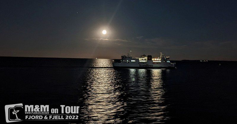
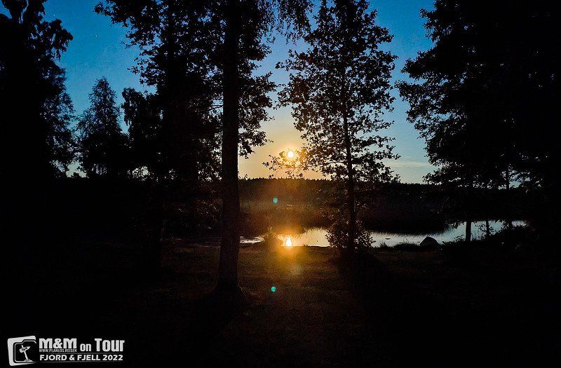
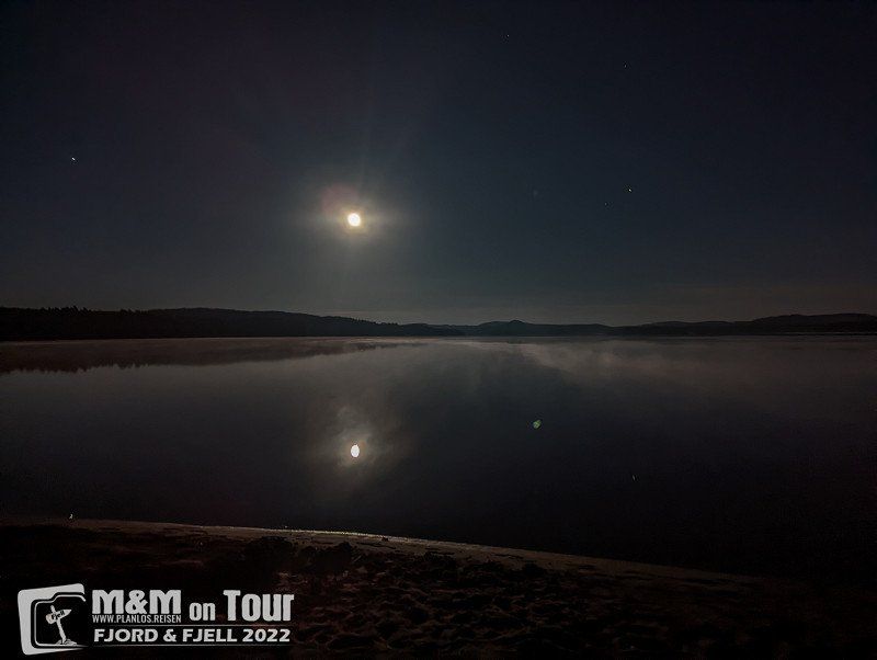
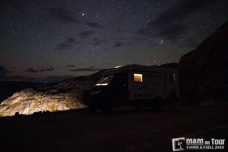
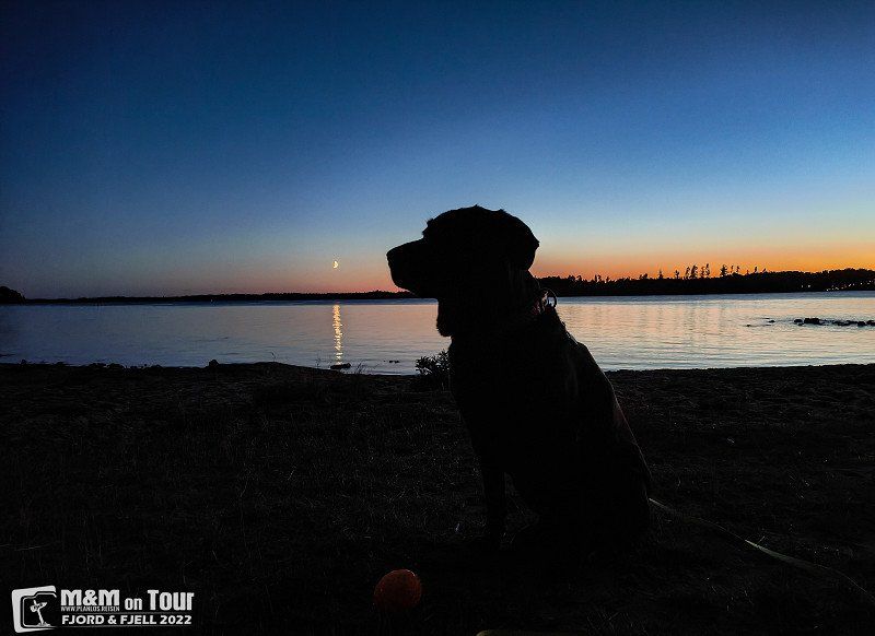
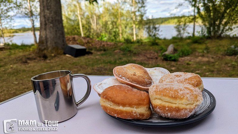
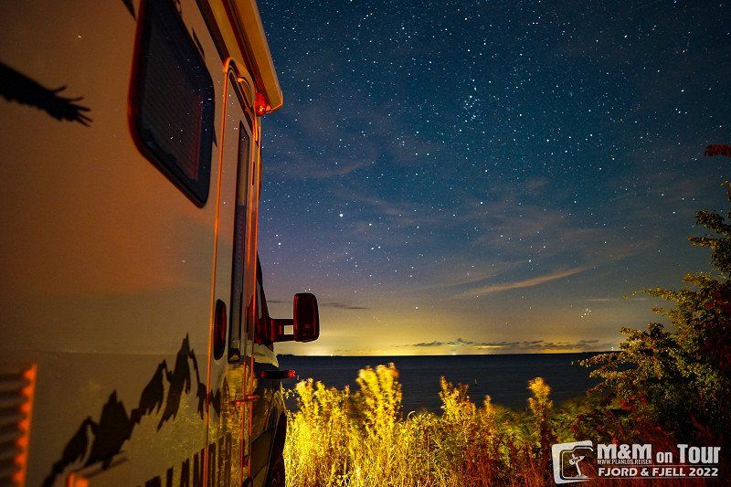
Nachtfahrt inklusive Vollmond
There is a breather from the >30°C on the ferry. With a full moon and no wind we enjoy the 20°C on the Baltic Sea.
23769 Fehmarn, Deutschland
54° 30' 2.8" N 11° 13' 33" E
54.5007640 11.2258430
• Head north on Fährbahnhof. Go for 43 m.
• Continue on Fährhafenstraße. Go for 45 m.
• Turn slightly left onto Fährbahnhof. Go for 237 m.
• Continue on Fährhafenstraße. Go for 392 m.
• Turn right onto E47. Go for 836 m.
• Take the Puttgarden-Rødby Ferry. Stay on for 18.7 km.
• Head northeast. Go for 769 m.
• Keep left toward København/E47. Go for 135 m.
• Continue on Sydmotorvejen (E47). Go for 121 km.
• Continue on E20/E47 (Køge Vest). Go for 26.1 km.
• Take the exit toward E55/Helsingør/København N onto E47 (Motorring 3). Go for 50.6 km.
• Take the 2nd exit from roundabout onto Kongevejen (E47) toward Helsingør. Go for 732 m.
• Take the 2nd exit from roundabout onto Kongevejen (E47) toward Centrum. Go for 1.3 km.
• Turn left onto Montebello Allé. Go for 192 m.
• Turn right onto Kierboesvej. Go for 194 m.
• Arrive at Kierboesvej. Your destination is on the right.
☍
221,0 km
(3 hrs. 10 min.)
Day
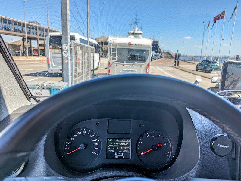
Auf nach Schweden
After a quiet night on the WoMo pitch, we continue to the land of the moose and the Köttbullar. Somehow we had expected slightly different temperatures, the climate is running continuously and we are almost gone.
3000 Helsingør, Dänemark
56° 1' 50.8" N 12° 35' 31.7" E
56.0307870 12.5921270
• Head toward Kircksvej on Kierboesvej. Go for 194 m.
• Turn left onto Montebello Allé. Go for 192 m.
• Turn left onto Kongevejen (E47). Go for 627 m.
• Turn right onto Flynderborgvej (E47) toward Helsingborg. Go for 618 m.
• Take the 2nd exit from roundabout onto Færgevej toward Helsingborg. Go for 321 m.
• Turn right toward Færgevej. Go for 379 m.
• Continue on Færgevej. Go for 61 m.
• Take the Helsingør-Helsingborg Ferry. Stay on for 5.0 km.
• Head northeast on Bredgatan. Go for 659 m.
• Take the 2nd exit from roundabout onto Sjögatan (E4) toward E20. Go for 754 m.
• Turn left onto Oljehamnsleden (E4) toward E6/E20/Centrum. Go for 532 m.
• Turn left onto Malmöleden (E4). Go for 484 m.
• Take the 2nd exit from roundabout toward Sjukhus. Go for 196 m.
• Continue on Södra Stenbocksgatan. Go for 1.5 km.
• Continue on Mellersta Stenbocksgatan. Go for 725 m.
• Take the 1st exit from roundabout onto Ringstorpsvägen. Go for 378 m.
• Turn right onto Ängelholmsvägen toward E4/E6/111. Go for 634 m.
• Continue on Ängelholmsleden toward E6/E20/111. Go for 2.6 km.
• Continue on E4.23 (Ängelholmsleden). Go for 679 m.
• Continue on E4. Go for 226 km.
• Take the 2nd exit from roundabout onto 40 toward Göteborg/Flygplats. Go for 4.8 km.
• Take ramp toward Trollhättan/Hjo/Sandseryd/Jönköpings flygplats/Hedenstorp. Go for 214 m.
• Turn right onto 26/47 toward 195/Mariestad/Trollhättan/Hjo. Go for 7.0 km.
• Take ramp onto 26/47 toward Mariestad/Trollhättan/Mullsjö/Kortebo. Go for 425 m.
• Take the 2nd exit from roundabout onto 26/47 toward Mariestad/Trollhättan/Mullsjö. Go for 16.8 km.
• Take the 3rd exit from roundabout onto Bottnarydsvägen (185) toward Bottnaryd. Go for 1.7 km.
• Turn right toward Nyhem. Go for 40 m.
• Continue on Nyhem. Go for 718 m.
• Continue on Habblahester. Go for 478 m.
• Continue on Habblahester Huvudbyggnad. Go for 85 m.
• Continue on Björkhagen. Go for 828 m.
• Continue on Nunnered. Go for 457 m.
• Continue on Nunnered. Go for 682 m.
• Turn left onto Bjurbäck Lidsberg. Go for 213 m.
• Continue on Bjurbäck Munkebo. Go for 624 m.
• Turn right toward Bjurbäck norra Hästhagen. Go for 80 m.
• Continue on Bjurbäck norra Hästhagen. Go for 880 m.
• Continue on Höganäs. Go for 1.4 km.
• Continue on Valshalla. Go for 2.3 km.
• Turn right toward Starhester. Go for 1.2 km.
• Continue on Starhester. Go for 1.0 km.
• Continue on Vållered. Go for 2.2 km.
• Continue on Stockared. Go for 1.1 km.
• Turn left toward Kölingsholm. Go for 542 m.
• Turn right onto Kölingsholm. Go for 1.5 km.
• Continue on Kölingared. Go for 228 m.
• Continue on Kölingared. Go for 2.4 km.
• Turn left toward Fivlered Storegården. Go for 387 m.
• Turn right onto Fivlered Storegården. Go for 646 m.
• Turn left toward Hasselvägen. Go for 2.0 km.
• Continue on Hasselvägen. Go for 564 m.
• Continue on Ekvägen. Go for 517 m.
• Arrive at Ekvägen.
☍
296,8 km
(4 hrs. 4 min.)
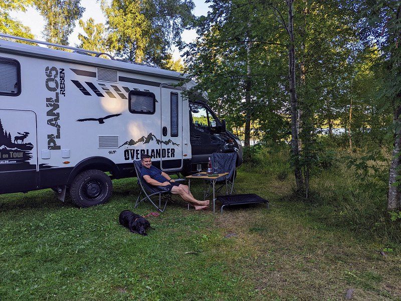
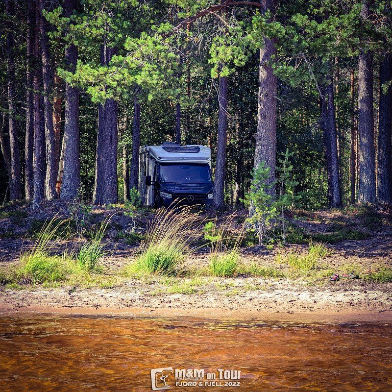
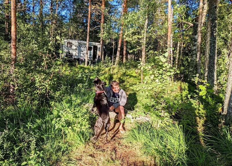
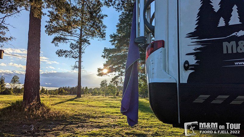
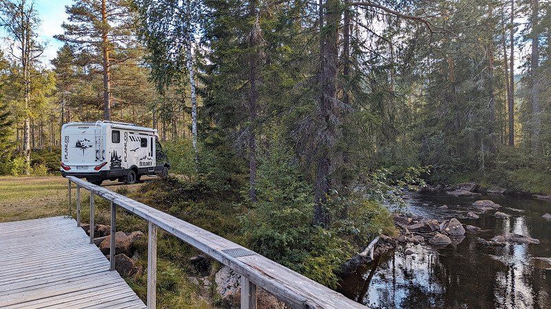
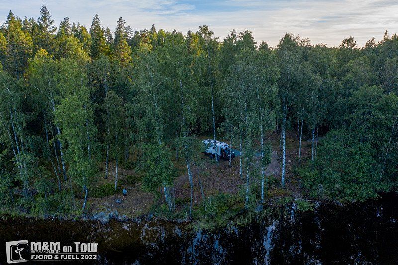
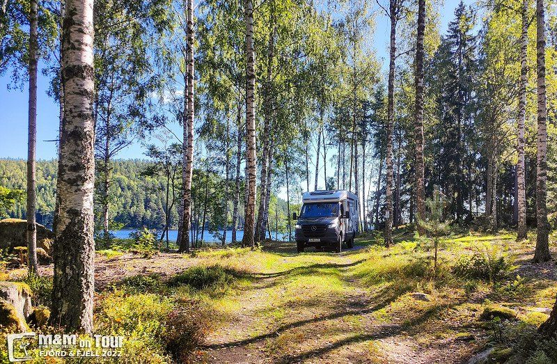
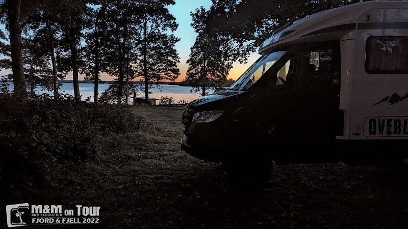
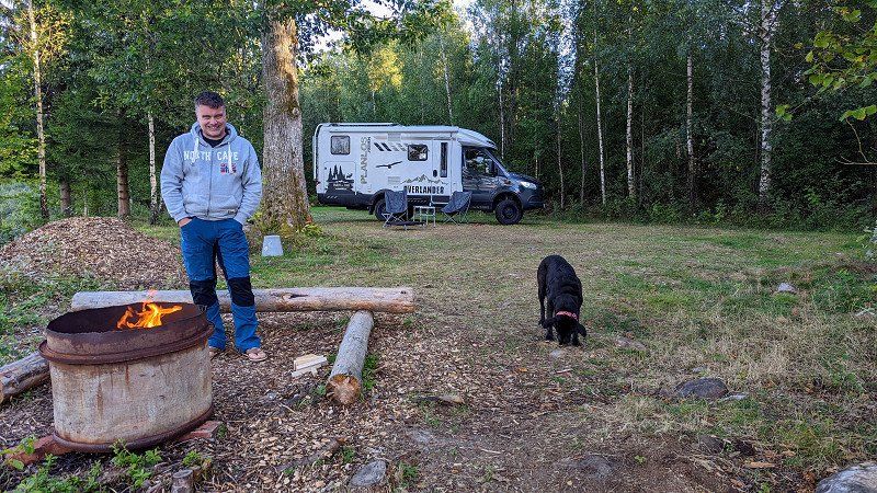
Weiterschwitzen in Schweden
Something is broken this year, it's getting warmer instead of cooler. We find a nice parking space for the night and enjoy the evening hours in front of the house ;)
Lönern, Schweden
57° 55' 15.8" N 13° 38' 37.5" E
57.9210504 13.6437390
• Head toward Björkstigen on Ekvägen. Go for 517 m.
• Continue on Hasselvägen. Go for 2.6 km.
• Turn left onto Fivlered Karlsgården. Go for 576 m.
• Turn right onto Fivlered Ryttaregården. Go for 110 m.
• Turn right onto Fivlered Högalund. Go for 519 m.
• Continue on Fivlered Söderkvarn. Go for 1.4 km.
• Turn left onto Fivlered Eksäter. Go for 870 m.
• Continue on Fivlered Aplaskog. Go for 1.3 km.
• Continue on Fivlered Kvarnö. Go for 1.8 km.
• Continue on Hunared Sandby. Go for 384 m.
• Continue on Hunared Nolgården. Go for 1.9 km.
• Continue on Rullesås skola. Go for 172 m.
• Continue on Hagagärdets skola. Go for 463 m.
• Continue on Hagagärdet. Go for 256 m.
• Continue on Kyllevägen. Go for 845 m.
• Turn right onto Stråkenvägen. Go for 586 m.
• Turn left onto Falköpingsvägen. Go for 345 m.
• Continue toward 26/47. Go for 3.0 km.
• Turn left onto 26/47. Go for 5.4 km.
• Turn slightly right onto 26 toward Mariestad/Skövde/Tidaholm. Go for 12.5 km.
• Take the 2nd exit from roundabout onto 26 toward Mariestad. Go for 19.9 km.
• Turn right onto 26 toward Mariestad/Skövde. Go for 8.9 km.
• Keep left onto 26 toward Mariestad/49/Askersund. Go for 1.1 km.
• Take the 2nd exit from roundabout onto Östra leden (26/49) toward Mariestad/Askersund/29. Go for 1.2 km.
• Take the 2nd exit from Timboholmsrondellen roundabout onto Östra leden (26/49) toward Mariestad/Askersund. Go for 3.0 km.
• Take the 2nd exit from Stallsikenrondellen roundabout onto 26 toward Mariestad/200/Töreboda/Flygplats. Go for 1.5 km.
• Take the 2nd exit from Horsåsrondellen roundabout onto Törebodavägen (26) toward Mariestad/Södra Ryd. Go for 1.1 km.
• Take the 1st exit from Karstorpsrondellen roundabout onto 26 toward Mariestad. Go for 29.2 km.
• Take ramp toward Stockholm/Örebro/Mora. Go for 260 m.
• Continue on E20. Go for 11.4 km.
• Turn left onto 26 toward Mora/Kristinehamn/Gullspång. Go for 65.2 km.
• Turn right onto Varnumsleden (26) toward E18/Oslo/Stockholm/Filipstad. Go for 3.1 km.
• Turn right and take ramp onto E18. Go for 2.1 km.
• Take ramp toward Filipstad/Kristinehamn. Go for 437 m.
• Turn right onto Dalavägen (26) toward Filipstad. Go for 26.8 km.
• Pass 3 roundabouts and continue on Nykroppavägen (26). Go for 21.3 km.
• Turn right onto Hertig Karlsgatan (26/63) toward Ludvika/Mora. Go for 8.6 km.
• Turn left onto 26 toward Mora/Lesjöfors. Go for 34.4 km.
• Turn right. Go for 1.5 km.
• Arrive at your destination.
☍
276,7 km
(3 hrs. 35 min.)
Day
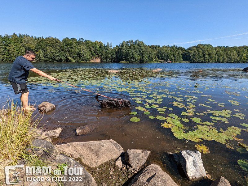
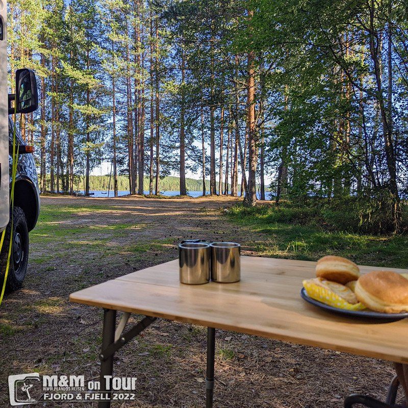
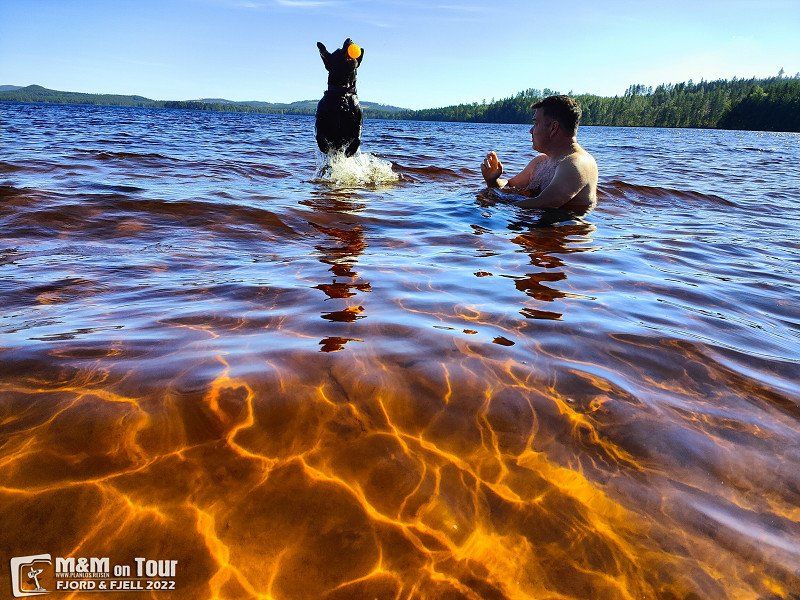
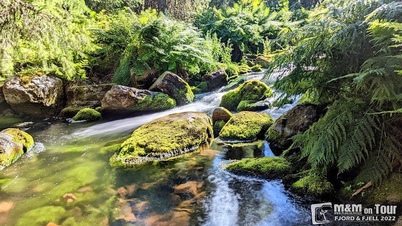
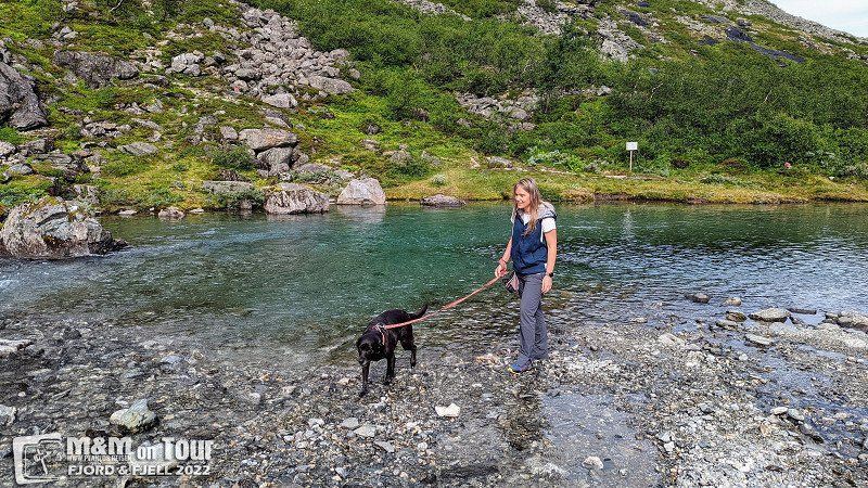
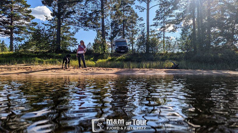
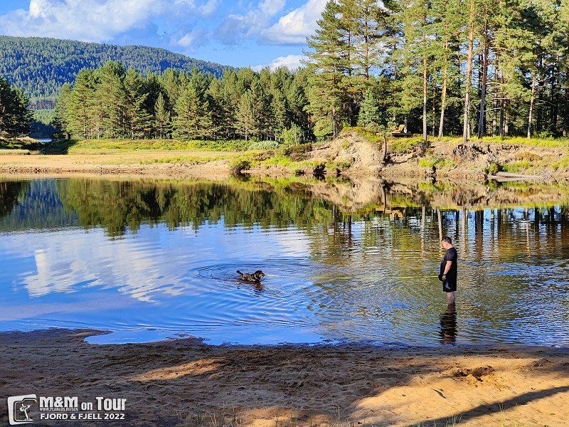
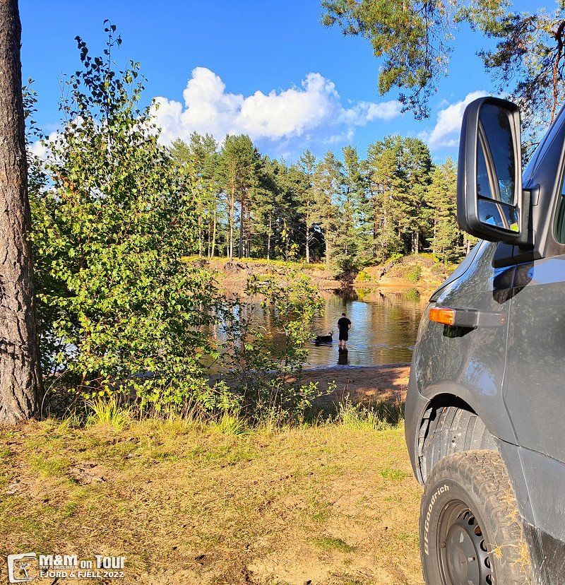
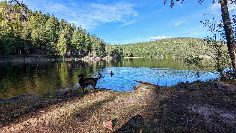
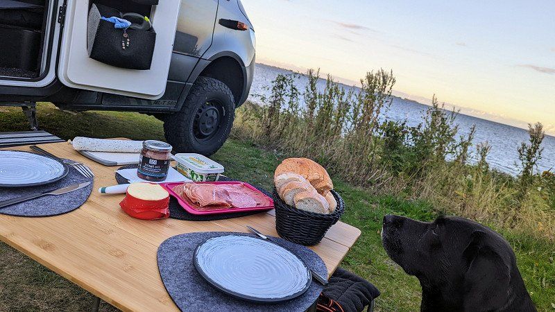
Erstmal ein Bad
After leaving the two large lakes behind us, we look for a place for the night and enjoy a cool down.
Djuprämmen, 680 96 Lesjöfors, Schweden
60° 4' 13.9" N 14° 9' 35.5" E
60.0705401 14.1598630
• Head south. Go for 1.5 km.
• Turn right onto 26/245. Go for 53.2 km.
• Turn left and take ramp onto Järnavägen (E16) toward Gävle/Mora/Västerås. Go for 403 m.
• Take the 3rd exit from roundabout onto Moravägen (26) toward Mora. Go for 37.7 km.
• Continue on Johannisholm (E45) toward Mora. Go for 3.1 km.
• Turn sharp left onto Sjöändan toward Venjan. Go for 69 m.
• Continue on Vinäs. Go for 5.3 km.
• Continue on Rullbodarna. Go for 993 m.
• Continue on Vinäs. Go for 4.6 km.
• Continue on Järpesbo. Go for 1.5 km.
• Continue on Solbodarna. Go for 2.5 km.
• Continue on Moravägen. Go for 4.4 km.
• Turn right onto Tennängsvägen. Go for 18.0 km.
• Continue on Tennänget. Go for 1.4 km.
• Turn left toward Mångsbodarna. Go for 3.4 km.
• Continue on Mångsbodarna. Go for 2.3 km.
• Turn right toward Lövnäsvägen. Go for 33.3 km.
• Continue on Lövnäsvägen. Go for 1.5 km.
• Continue on Lövnäsvägen. Go for 10.5 km.
• Turn left onto 70. Go for 78.5 km.
• Turn right onto Foskrosvägen toward Sörvattnet/Foskros. Go for 2.0 km.
• Continue on Foskrosvägen. Go for 7.9 km.
• Arrive at your destination on the left.
☍
273,9 km
(3 hrs. 14 min.)
Day
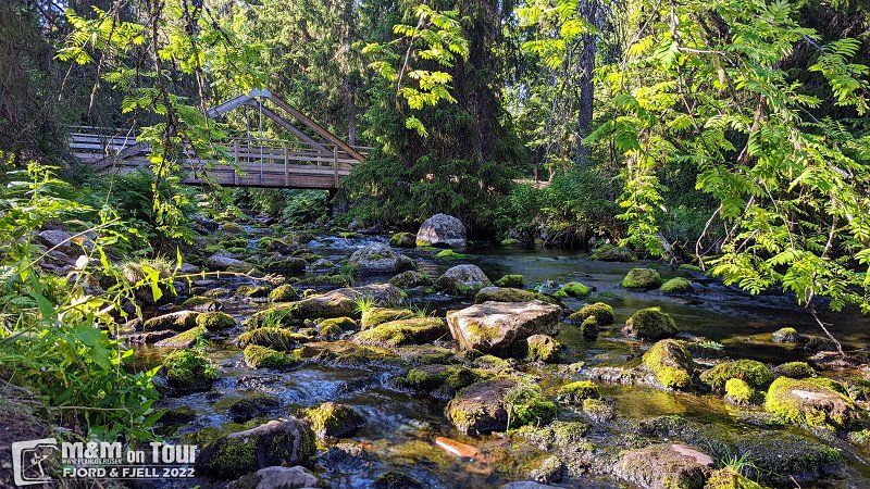
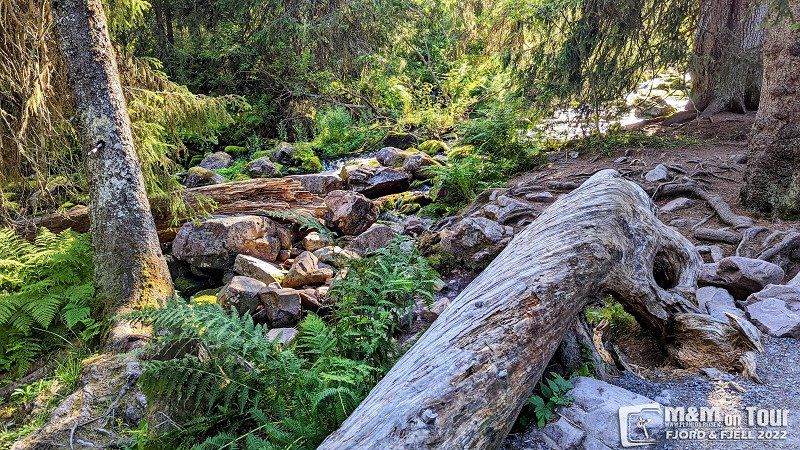
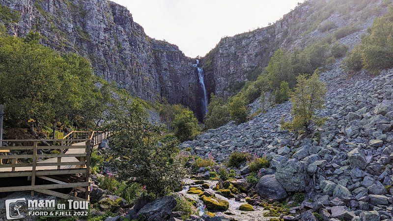
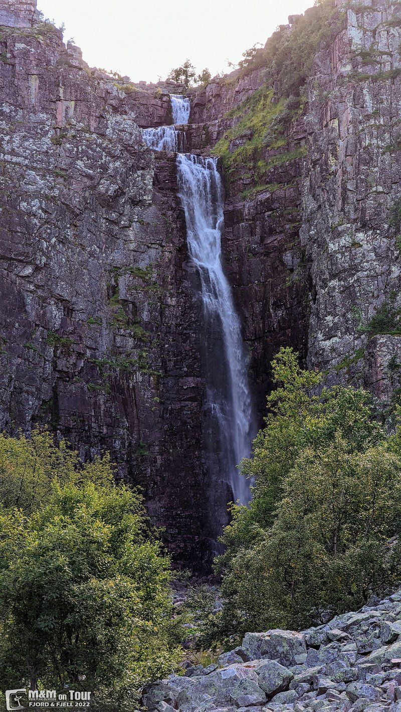
Fulufjället Nationalpark, Schweden
On the way to the next place to stay we make a stop at Fulufjället National Park. Surprisingly little going on here, that's how we like it.
Älvdalen, Schweden
61° 32' 50.2" N 12° 45' 10.7" E
61.5472905 12.7529779
• Head southeast. Go for 5.8 km.
• Continue on Foskrosvägen. Go for 3.1 km.
• Continue on Foskrosvägen. Go for 918 m.
• Turn right onto 70. Go for 32 m.
• Turn left onto 70. Go for 37.3 km.
• Continue on Kopparleden (218). Go for 8.6 km.
• Turn right onto Kopparleden (26) toward Røros/217/Koppang. Go for 97.3 km.
• Turn left onto Rørosveien (30) toward Tynset. Go for 20.7 km.
• Take the 1st exit from roundabout onto 30. Go for 1.9 km.
• Turn left onto 3 toward Elverum/Alvdal. Go for 21.2 km.
• Turn right onto Folldalsvegen (29). Go for 69.0 km.
• Turn left onto Trondheimsvegen (E6). Go for 31.0 km.
• Take the 3rd exit from roundabout onto E6 toward Oslo/Otta. Go for 2.3 km.
• Turn left onto Øverbygdsvegen (2656). Go for 8.9 km.
• Turn left onto Bergsgrende. Go for 308 m.
• Turn slightly left onto Bergsgrende. Go for 160 m.
• Turn slightly right onto Bergsgrende. Go for 730 m.
• Turn left onto Bergsgrende. Go for 70 m.
• Turn left onto Bergsgrende. Go for 4.2 km.
• Continue on Grimsdalsvegen. Go for 5.9 km.
• Turn right onto Haverdalsvegen. Go for 298 m.
• Continue on Haverdalsvegen. Go for 2.8 km.
• Turn right. Go for 1.2 km.
• Arrive at your destination.
☍
323,7 km
(4 hrs. 16 min.)
Lägerplats Idre, Schweden
Unnamed Road, 790 91 Idre, Schweden
61° 55' 52.7" N 12° 39' 29.2" E
61.9312965 12.6581094
• Head northeast. Go for 1.2 km.
• Turn left onto Haverdalsvegen. Go for 3.1 km.
• Turn left onto Grimsdalsvegen. Go for 5.9 km.
• Continue on Bergsgrende. Go for 5.5 km.
• Turn right onto Øverbygdsvegen (2656). Go for 8.9 km.
• Turn right onto Gudbrandsdalsvegen (E6). Go for 2.3 km.
• Take the 1st exit from roundabout onto Trondheimsvegen (E6) toward Trondheim/Oppdal. Go for 78.4 km.
• Take the 2nd exit from roundabout onto Dovrevegen (E6) toward 70/Trondheim. Go for 348 m.
• Take the 3rd exit from roundabout onto O. Skasliens veg (70) toward Kristiansund. Go for 242 m.
• Take the 2nd exit from roundabout onto 70. Go for 68.2 km.
• Take the 3rd exit from roundabout onto Romsdalsvegen (62) toward Molde. Go for 2.0 km.
• Turn left onto Litldalsvegen (6136). Go for 1.6 km.
• Continue on 6136. Go for 3.6 km.
• Keep right toward Langvatnet. Go for 18.4 km.
• Continue on Langvatnet. Go for 4.0 km.
• Continue on Sandvatnet. Go for 2.4 km.
• Continue toward Torbuvatnet. Go for 3.2 km.
• Continue on Torbuvatnet. Go for 3.0 km.
• Continue on Aursjøvegen. Go for 4.9 km.
• Turn left onto Aursjøvegen. Go for 159 m.
• Turn left toward Aursjøvegen. Go for 909 m.
• Turn left onto Aursjøvegen. Go for 7.6 km.
• Continue on Aursjøvegen. Go for 3.2 km.
• Turn slightly right onto Aursjøvegen. Go for 6.8 km.
• Arrive at Aursjøvegen. Your destination is on the left.
☍
235,7 km
(4 hrs. 54 min.)
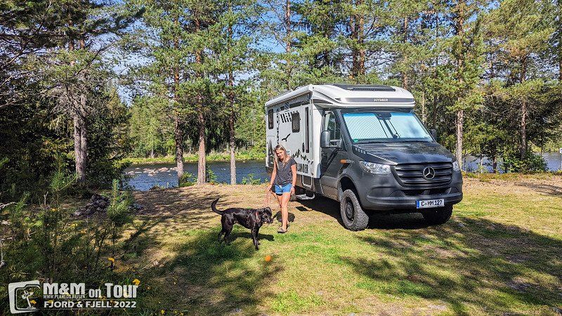
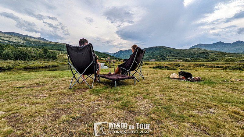
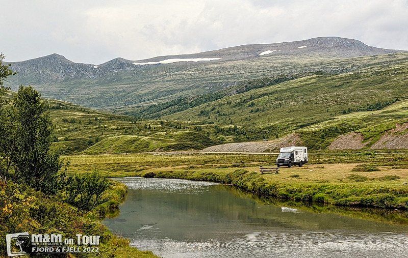
Day
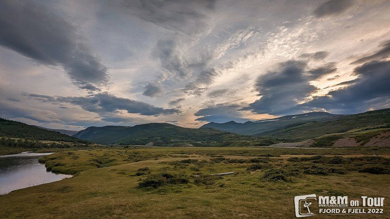
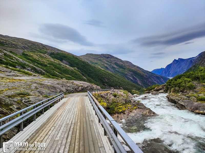
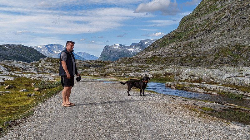
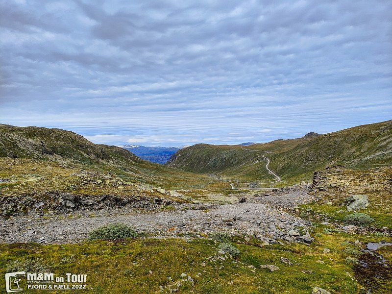
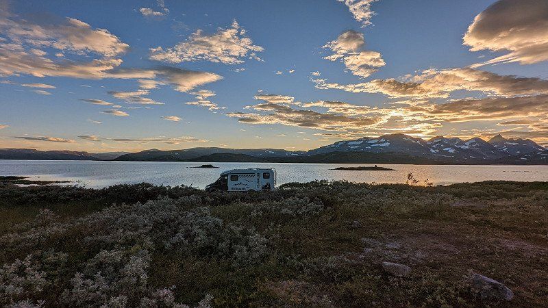
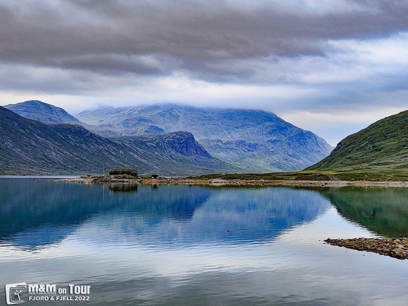
Grimsdalen, Norwegen
After entering Norway and a short refueling stop, it's off to Grimsdalvegen. We decided to spend the night there because of the beautiful landscape.
Dovre, 2662, Norwegen
62° 0' 3.7" N 9° 24' 22.5" E
62.0010409 9.4062456
• Head south on Aursjøvegen. Go for 17.6 km.
• Turn right toward Aursjøvegen. Go for 909 m.
• Turn right onto Aursjøvegen. Go for 159 m.
• Turn right onto Aursjøvegen. Go for 5.3 km.
• Continue on Torbuvatnet. Go for 2.6 km.
• Continue toward Sandvatnet. Go for 3.2 km.
• Continue on Sandvatnet. Go for 2.4 km.
• Continue on Langvatnet. Go for 24.4 km.
• Continue on 6136. Go for 1.6 km.
• Continue on Litldalsvegen (6136). Go for 1.6 km.
• Turn right onto Romsdalsvegen (62). Go for 1.9 km.
• Take the 3rd exit from roundabout onto Nordmørsvegen (70). Go for 18.9 km.
• Turn left onto 70 toward Kristiansund/Tingvoll. Go for 1.7 km.
• Turn right onto Vågavegen. Go for 315 m.
• Turn right onto Vågavegen. Go for 172 m.
• Arrive at Vågavegen. Your destination is on the right.
☍
82,7 km
(2 hrs. 35 min.)
Day
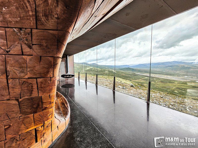
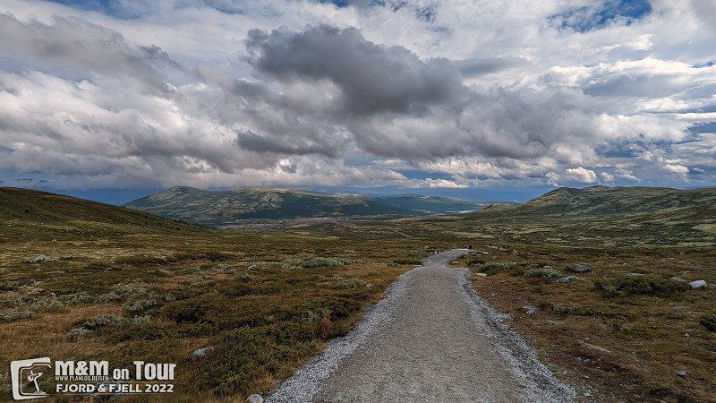
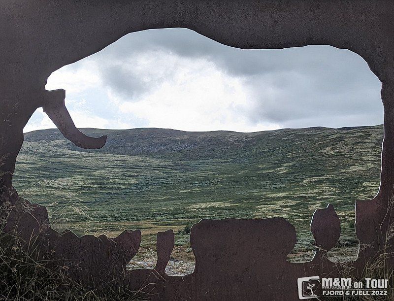
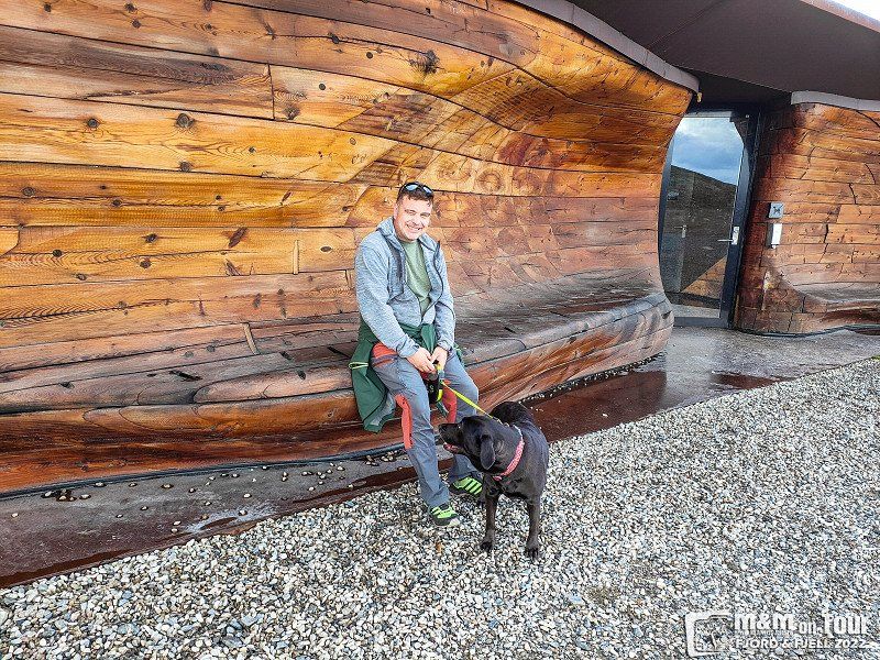
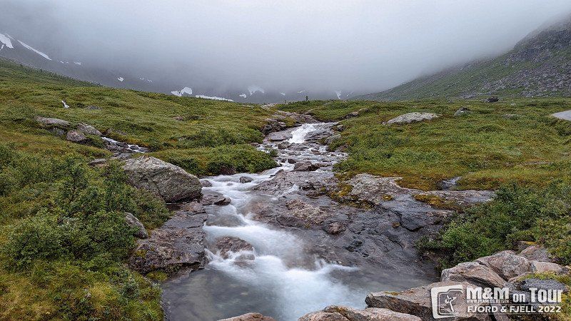
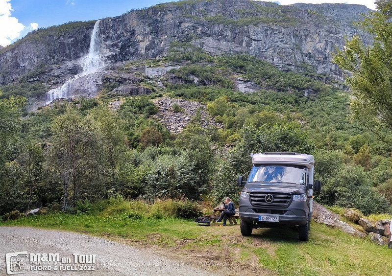
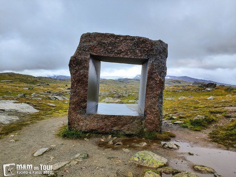
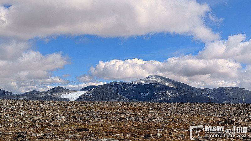
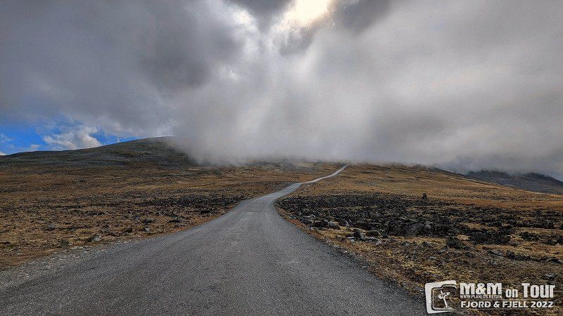
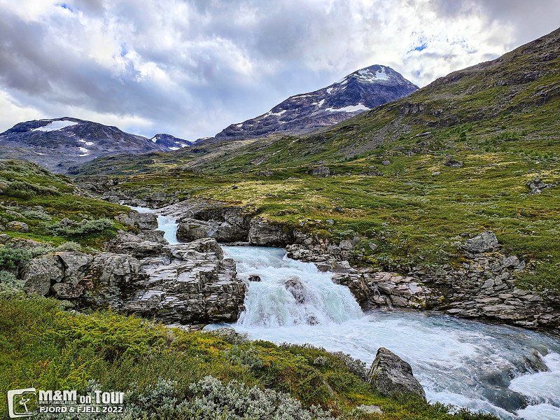
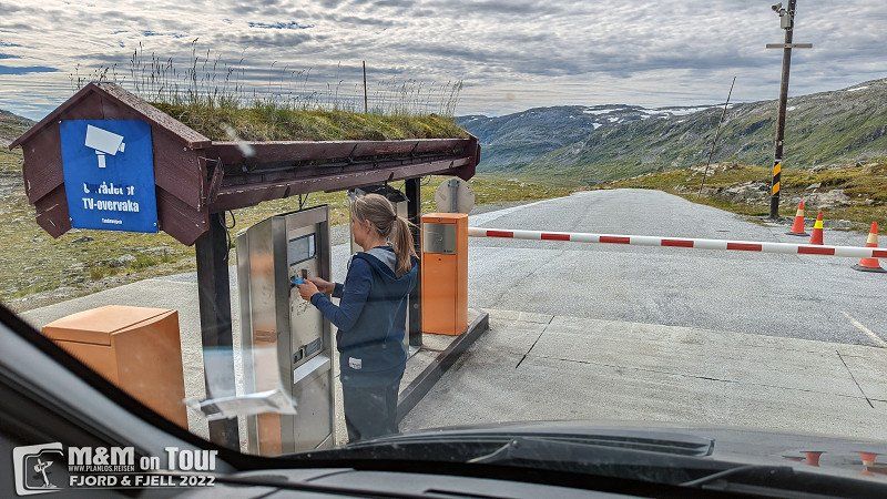
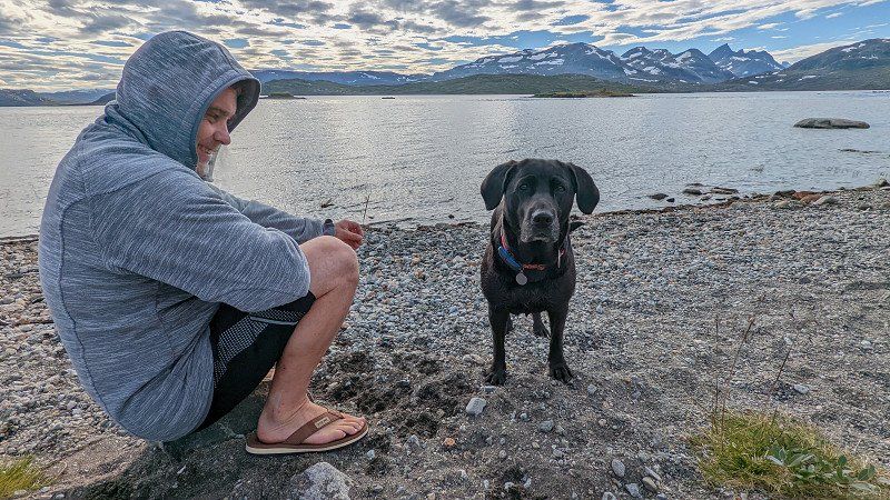
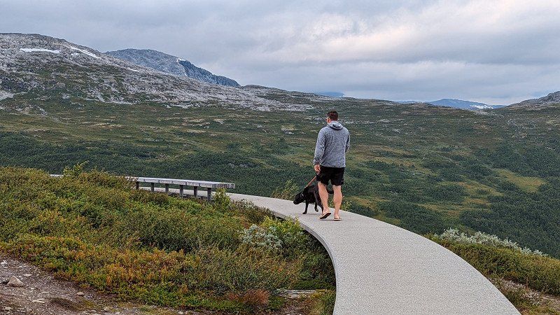
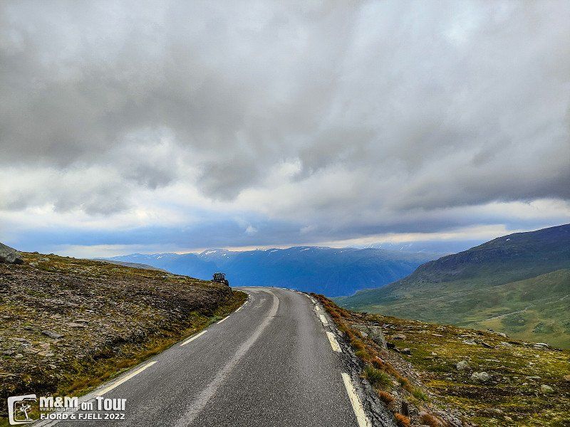
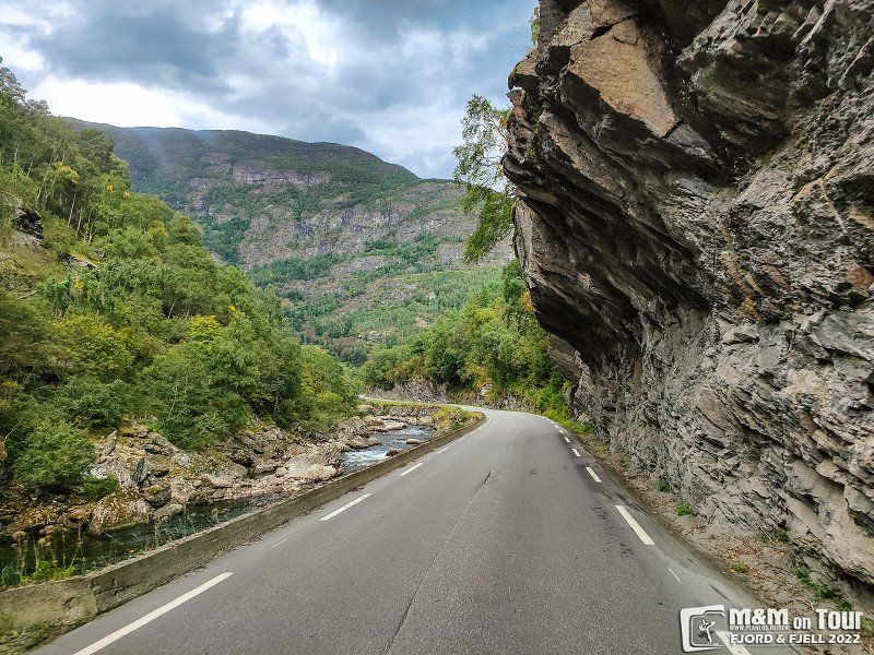
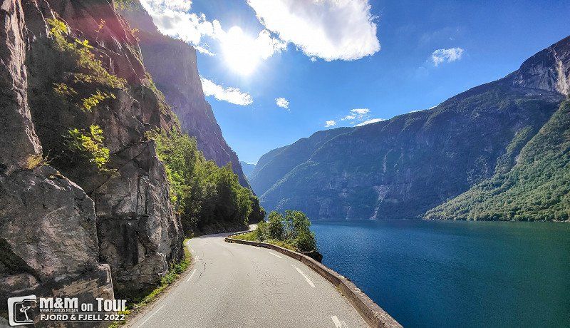
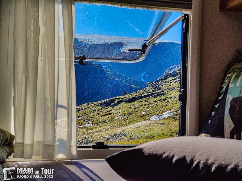
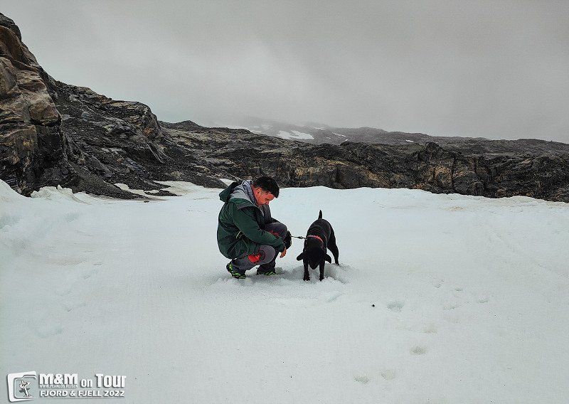
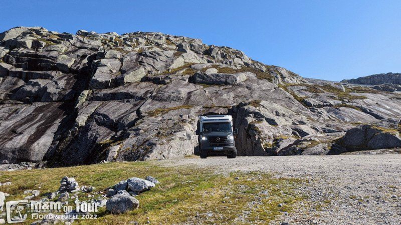
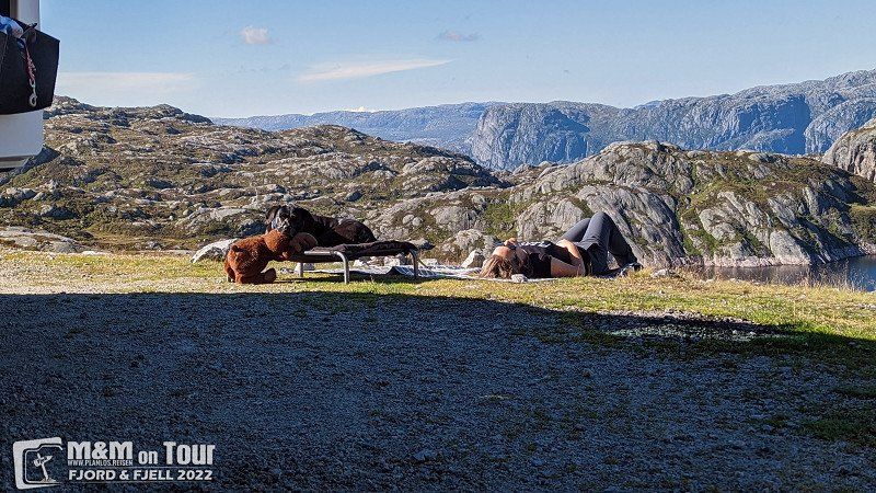
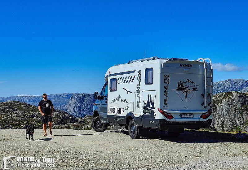
viewpoint SNØHETTA
In changeable weather (our first day without air conditioning) we drive to the viewpoint Snøhetta. It is a short hike from the parking lot to Snøhetta.
Hjerkinnhusvegen 33, 2661 Hjerkinn, Norwegen
62° 13' 26.6" N 9° 29' 24" E
62.2240679 9.4900119
• Head east on Vågavegen. Go for 54 m.
• Turn left onto Vågavegen. Go for 459 m.
• Turn slightly left onto Vågavegen. Go for 30 m.
• Turn right onto 70. Go for 57.4 km.
• Take the 2nd exit from roundabout onto E39 toward Ålesund/Molde. Go for 1.7 km.
• Turn right onto 532 toward Gjemnes/Eide. Go for 2.7 km.
• Continue on Grønset (532). Go for 88 m.
• Continue on 532. Go for 285 m.
• Continue on Storlandsvegen (532). Go for 2.9 km.
• Continue on 532. Go for 715 m.
• Continue on Kolset (532). Go for 96 m.
• Continue on 532. Go for 3.6 km.
• Continue on Røysan (532). Go for 12 m.
• Continue on 532. Go for 907 m.
• Continue on Strandvegen (532). Go for 802 m.
• Continue on 532. Go for 411 m.
• Continue on Strandvegen (532). Go for 115 m.
• Continue on 532. Go for 626 m.
• Continue on Strandvegen (532). Go for 357 m.
• Continue on 532. Go for 770 m.
• Continue on Strandvegen (532). Go for 459 m.
• Continue on 532. Go for 671 m.
• Continue on Strandvegen (532). Go for 20 m.
• Continue on 532. Go for 130 m.
• Continue on Strandvegen (532). Go for 359 m.
• Continue on 532. Go for 84 m.
• Continue on Strandvegen (532). Go for 798 m.
• Continue on 532. Go for 892 m.
• Continue on Strandvegen (532). Go for 536 m.
• Continue on 532. Go for 70 m.
• Continue on Strandvegen (532). Go for 261 m.
• Continue on 532. Go for 132 m.
• Continue on Strandvegen (532). Go for 98 m.
• Continue on 532. Go for 2.7 km.
• Turn right onto Eidevegen (64). Go for 15.2 km.
• Turn right onto 64. Go for 2.5 km.
• Arrive at Atlanterhavsvegen (64).
☍
99,1 km
(1 hrs. 29 min.)
Aursjøvegen, Eikesdal, Norwegen
Aursjøvegen Road, Molde, Norwegen
62° 25' 15.5" N 8° 19' 5.5" E
62.4209826 8.3181953
• Head southwest on Atlanterhavsvegen (64). Go for 2.5 km.
• Turn left onto Vevangvegen (64). Go for 29.2 km.
• Take the 2nd exit from roundabout onto Malmefjordvegen (64). Go for 9.6 km.
• Continue on Årødalsvegen. Go for 1.9 km.
• Take the 1st exit from roundabout onto Fannefjordsvegen (E39). Go for 893 m.
• Take the 2nd exit from roundabout onto Skålavegen (64) toward Åndalsnes/Bolsøya. Go for 17.5 km.
• Take the Sølsnes-Åfarnes Ferry. Stay on for 3.2 km.
• Head toward Langfjordsstranda on 64. Go for 360 m.
• Turn right onto Nordsidevegen (64). Go for 25.5 km.
• Turn left onto 5994. Go for 265 m.
• Turn right onto Hensvegen (5994). Go for 633 m.
• Arrive at Hensvegen (5994). Your destination is on the left.
☍
91,5 km
(1 hrs. 55 min.)
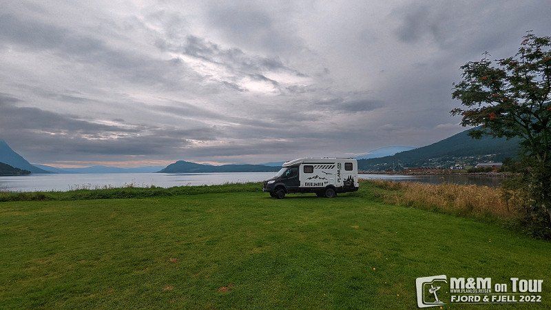
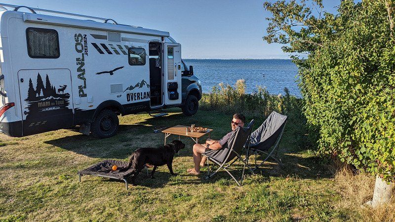
Fuglevåg Camping
Great CP right on the fjord.
6622, Ålvundfjord, Norway
62° 50' 7" N 8° 30' 25.6" E
62.8352900 8.5071000
• Head southeast on Hensvegen (5994). Go for 1.3 km.
• Turn left onto Nordsidevegen (64). Go for 5.0 km.
• Take the 3rd exit from roundabout onto Nordsidevegen (64). Go for 687 m.
• Continue on Sørsidevegen (E136). Go for 43.3 km.
• Take the 2nd exit from roundabout onto Brastadstranda (E39) toward Ålesund. Go for 21.5 km.
• Turn left onto Giskemovegen (522). Go for 176 m.
• Continue on Valgermo (522). Go for 97 m.
• Continue on Giskemovegen (522). Go for 142 m.
• Continue on 522. Go for 43 m.
• Continue on Giskemovegen (522). Go for 1.0 km.
• Turn left onto Storfjordvegen (650). Go for 43.0 km.
• Turn left onto 63. Go for 35.2 km.
• Arrive at Isterdalsvegen (63).
☍
151,5 km
(2 hrs. 19 min.)
Day
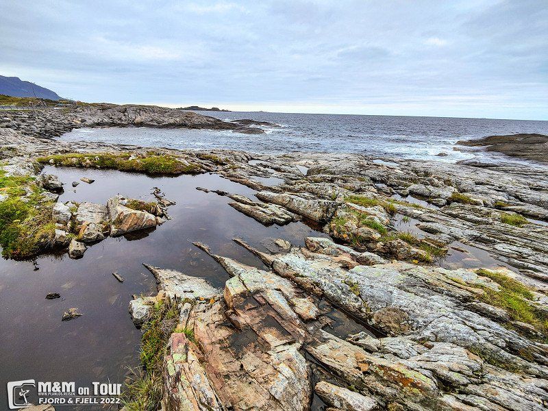
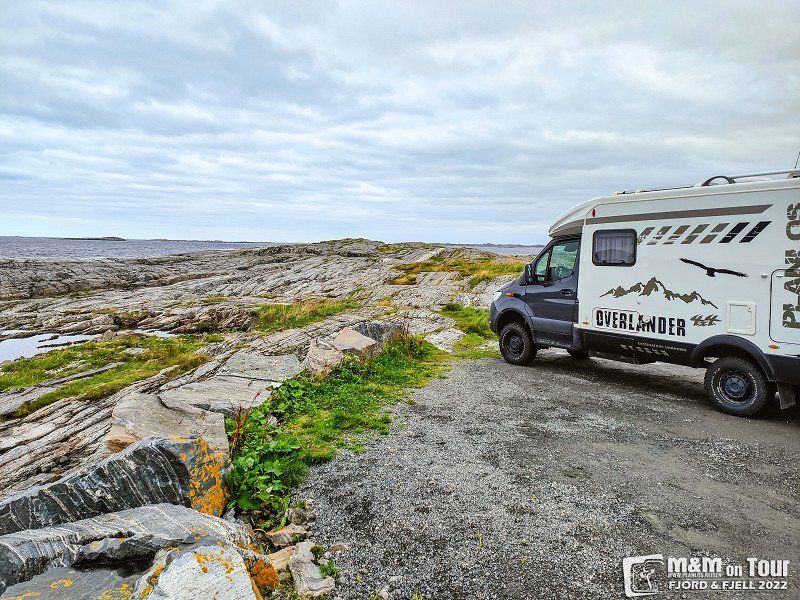
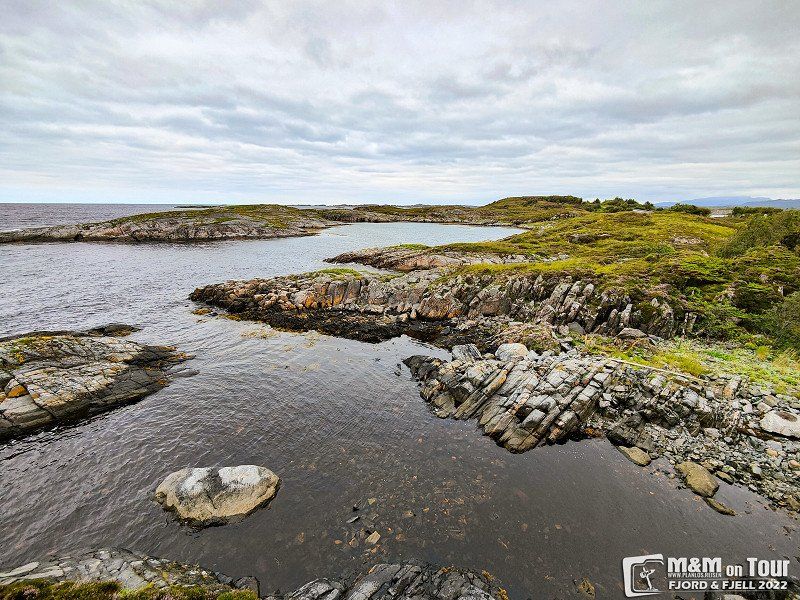
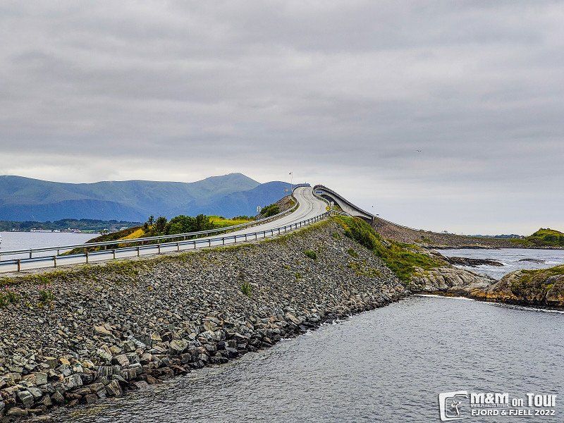
Atlantikstraße, Vevang, Norwegen
Atlanterhavsveien, 6494 Vevang, Norwegen
63° 0' 42.8" N 7° 19' 16.5" E
63.0118985 7.3212509
• Head southwest on Isterdalsvegen (63). Go for 35.2 km.
• Turn right onto 63. Go for 4.3 km.
• Turn left onto 63. Go for 156 m.
• Take the Linge-Eidsdal Ferry. Stay on for 2.6 km.
• Head toward Ytterdalsgata on 63. Go for 11.8 km.
• Turn right onto Indreeidstunnelen (63). Go for 5.2 km.
• Turn right onto Ørnevegen (63). Go for 8.1 km.
• Turn right onto Maråkvegen. Go for 170 m.
• Arrive at Maråkvegen. Your destination is on the right.
☍
67,5 km
(1 hrs. 44 min.)
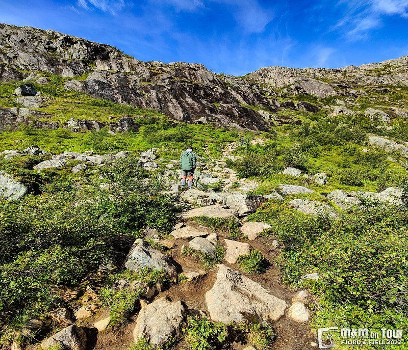
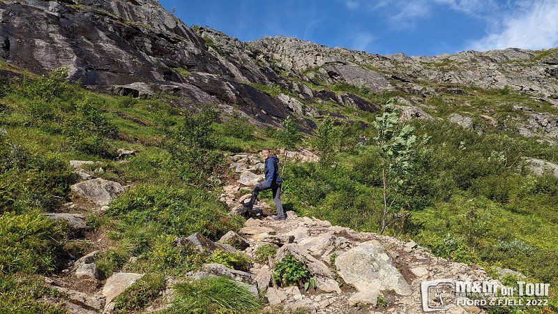
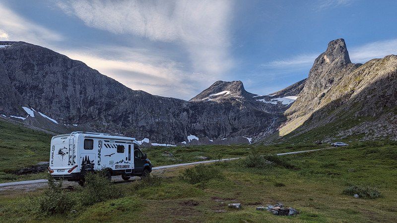
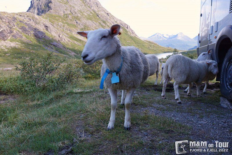
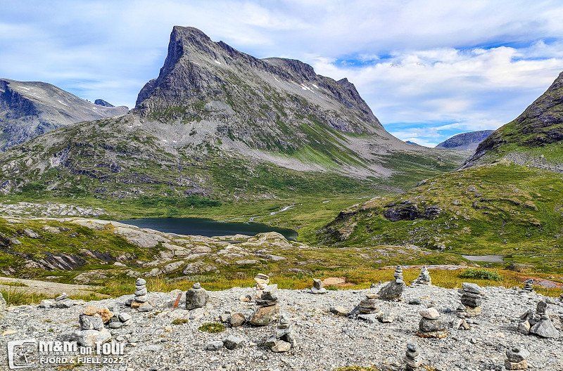
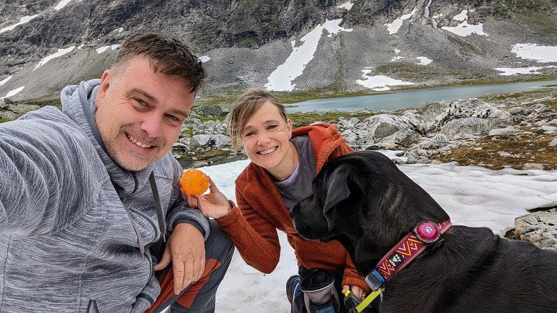
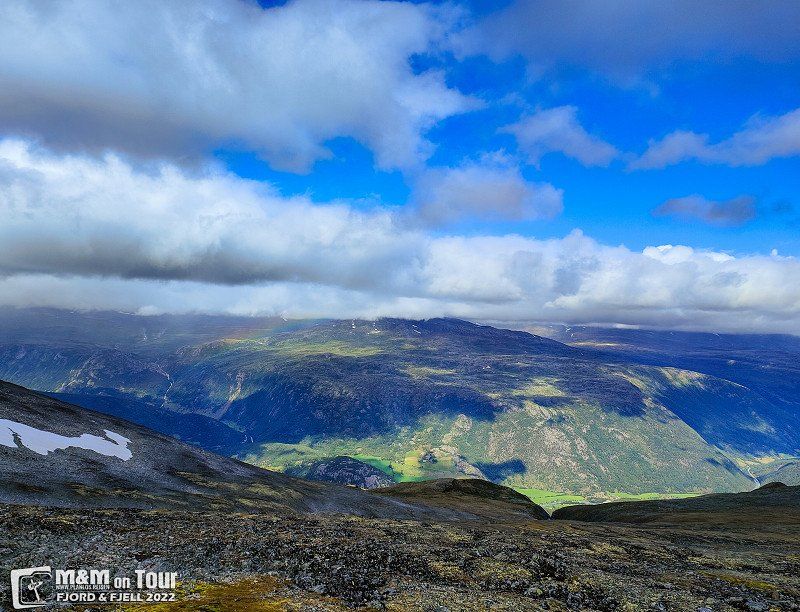
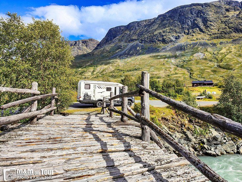
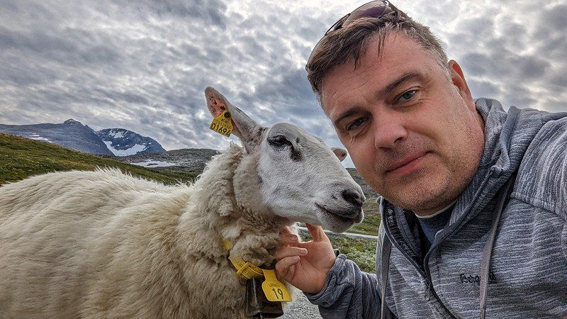
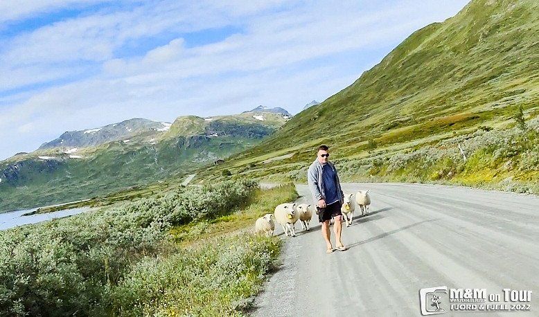
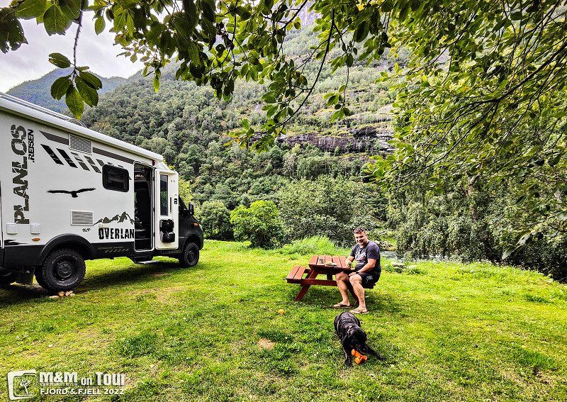
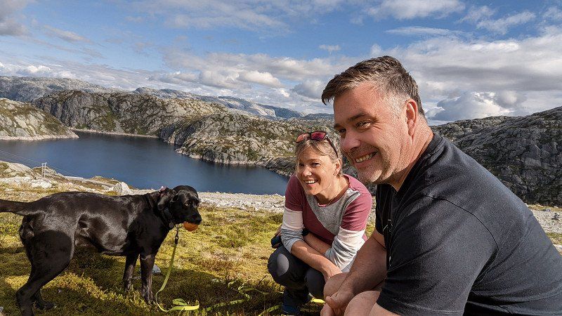
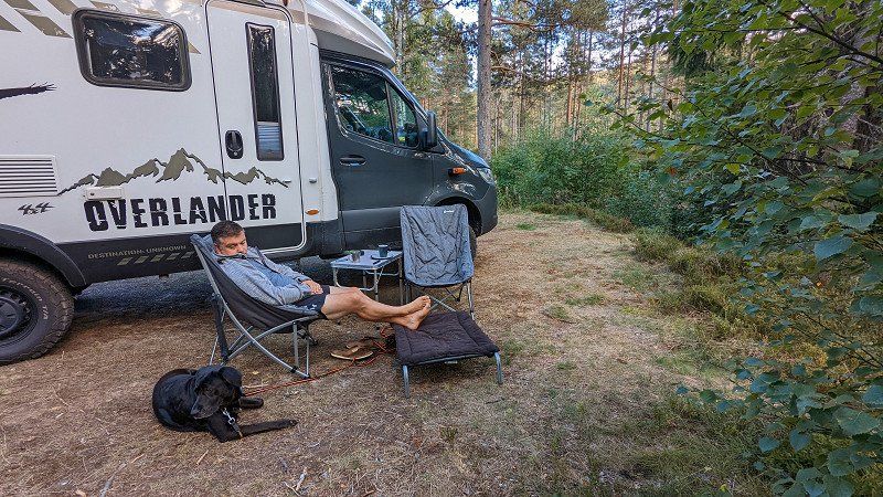
Fjell
We spend the night on a private road in the middle of beautiful nature and even get free lambskin care. The next morning we go hiking in the mountains.
Isfjorden, Norwegen
62° 34' 40.1" N 7° 47' 32.1" E
62.5778010 7.7922426
• Head south on Maråkvegen.
• Turn left onto Maråkvegen. Go for 133 m.
• Turn left onto Geirangervegen (63). Go for 204 m.
• Turn left onto 63. Go for 119 m.
• Take the Geiranger-Hellesylt Ferry. Stay on for 20.1 km.
• Head toward Hellesyltvegen on 60. Go for 578 m.
• Turn right onto Hellesyltvegen (60). Go for 878 m.
• Turn left onto Langedalsvegen (60). Go for 25.0 km.
• Turn left onto E39 toward Bergen/Stryn/60. Go for 8.3 km.
• Turn left onto Nordfjordvegen (15) toward Stryn. Go for 15.8 km.
• Take the 2nd exit from roundabout onto Tonningsgata (15) toward Otta. Go for 37.1 km.
• Turn right onto 258. Go for 7.0 km.
• Arrive at 258. Your destination is on the right.
☍
115,2 km
(2 hrs. 32 min.)
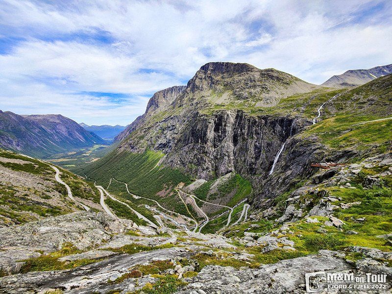
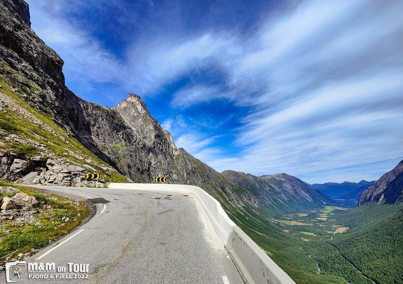
Day
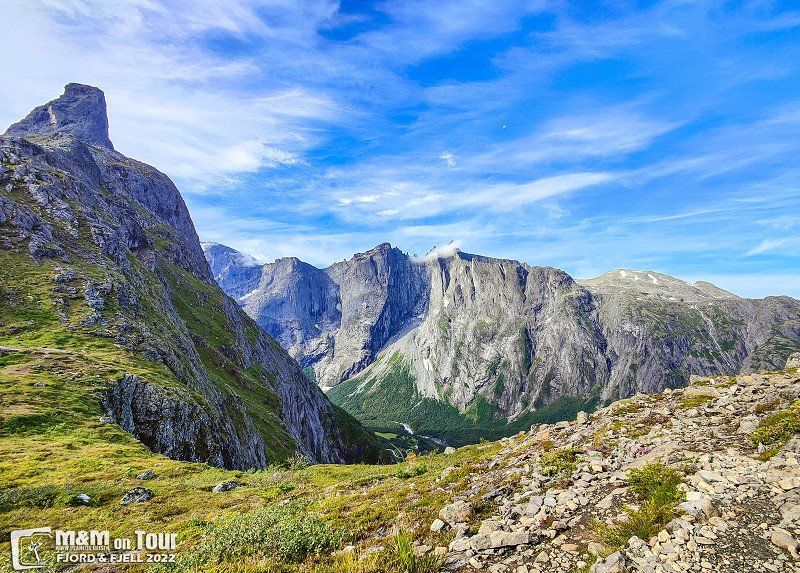
Trollstigen, Åndalsnes, Norwegen
The full tourist program: yesterday Atlantic Road, today Trollstigen and Geiranger.
Trollstigen, 6300 Åndalsnes, Norwegen
62° 27' 15.3" N 7° 40' 8.9" E
62.4542607 7.6691326
• Head west on 258. Go for 7.0 km.
• Turn left onto 15. Go for 37.1 km.
• Take the 2nd exit from roundabout onto Visnesvegen (60) toward E39/Førde/Byrkjelo/Måløy. Go for 10.5 km.
• Turn left onto Lodalsvegen (5723). Go for 606 m.
• Turn slightly right onto 5723. Go for 2.2 km.
• Continue on 5723. Go for 3.8 km.
• Continue on Lodalsvegen (5723). Go for 2.8 km.
• Arrive at Lodalsvegen (5723). Your destination is on the right.
☍
63,8 km
(1 hrs. 8 min.)
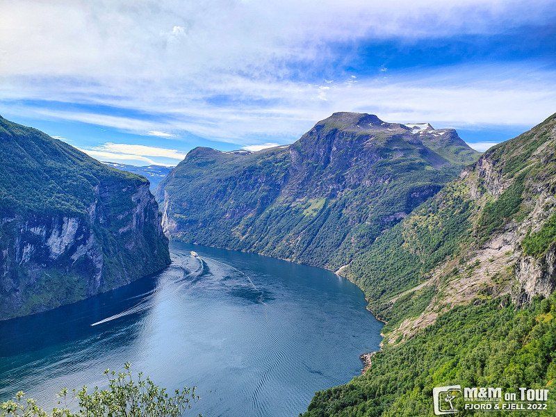
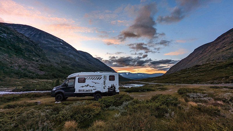
Geiranger, Norwegen
After there was just too much going on at Geiranger, we look for a place in the mountains and only enjoy eco-noise.
62° 6' 3" N 7° 12' 21.2" E
62.1008441 7.2058941
• Head southeast on Lodalsvegen (5723). Go for 11.0 km.
• Arrive at your destination.
☍
11,0 km
( 19 min.)
Day
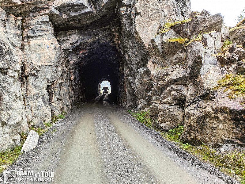
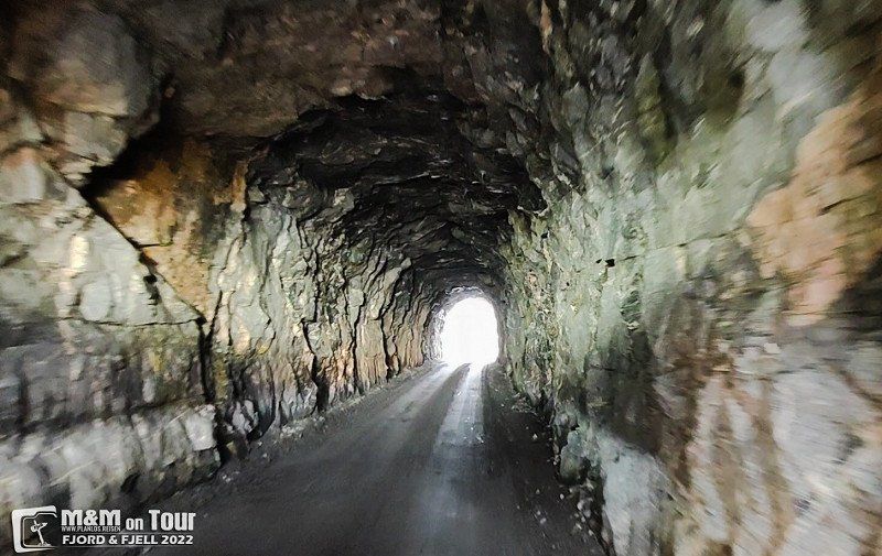
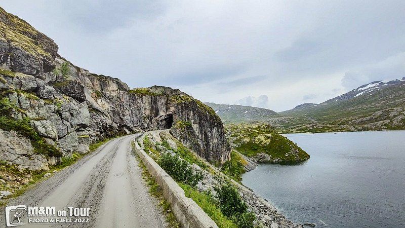
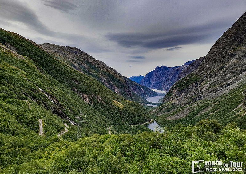
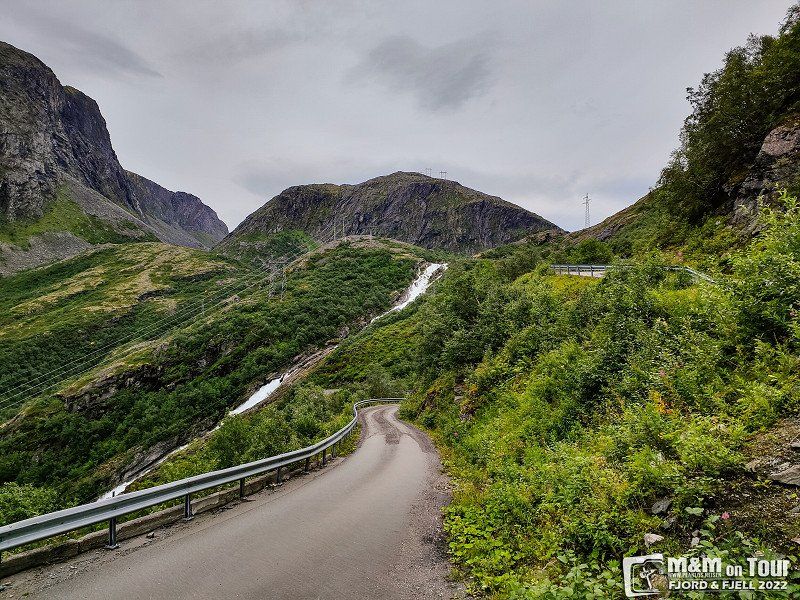
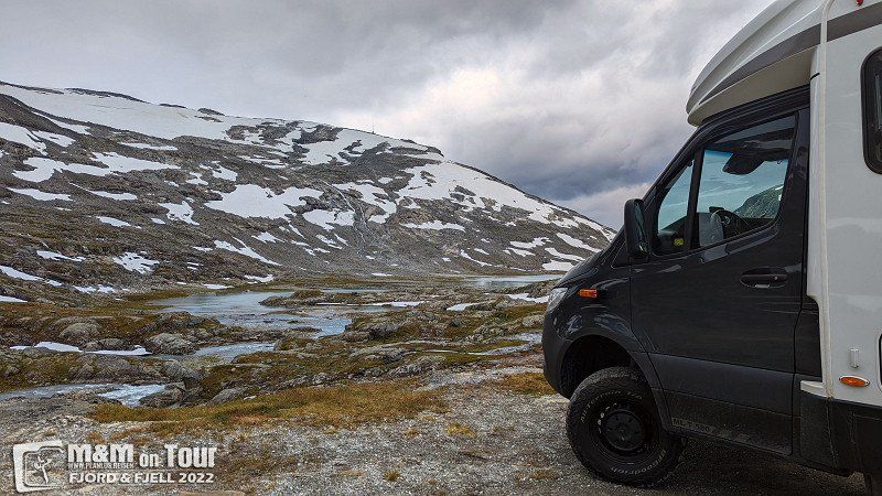
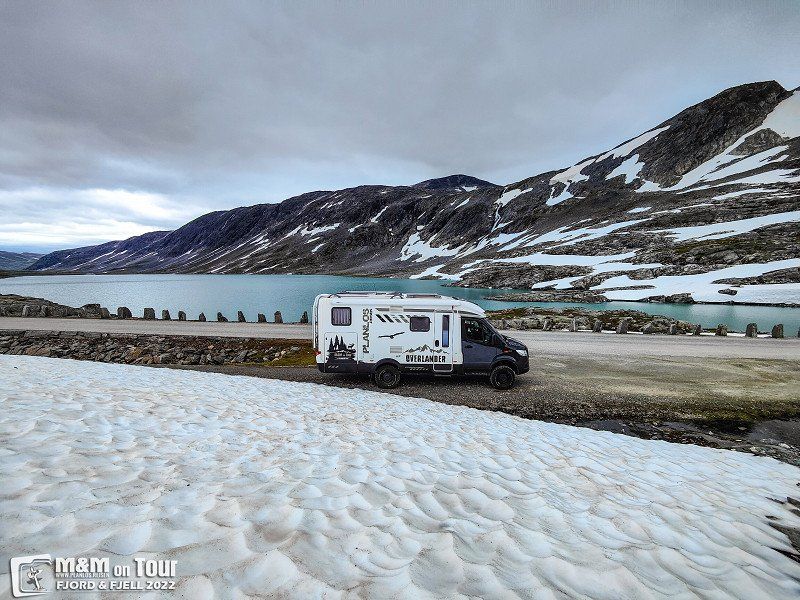
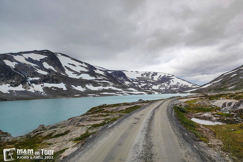
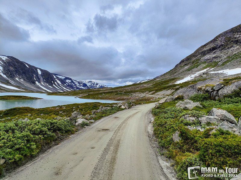
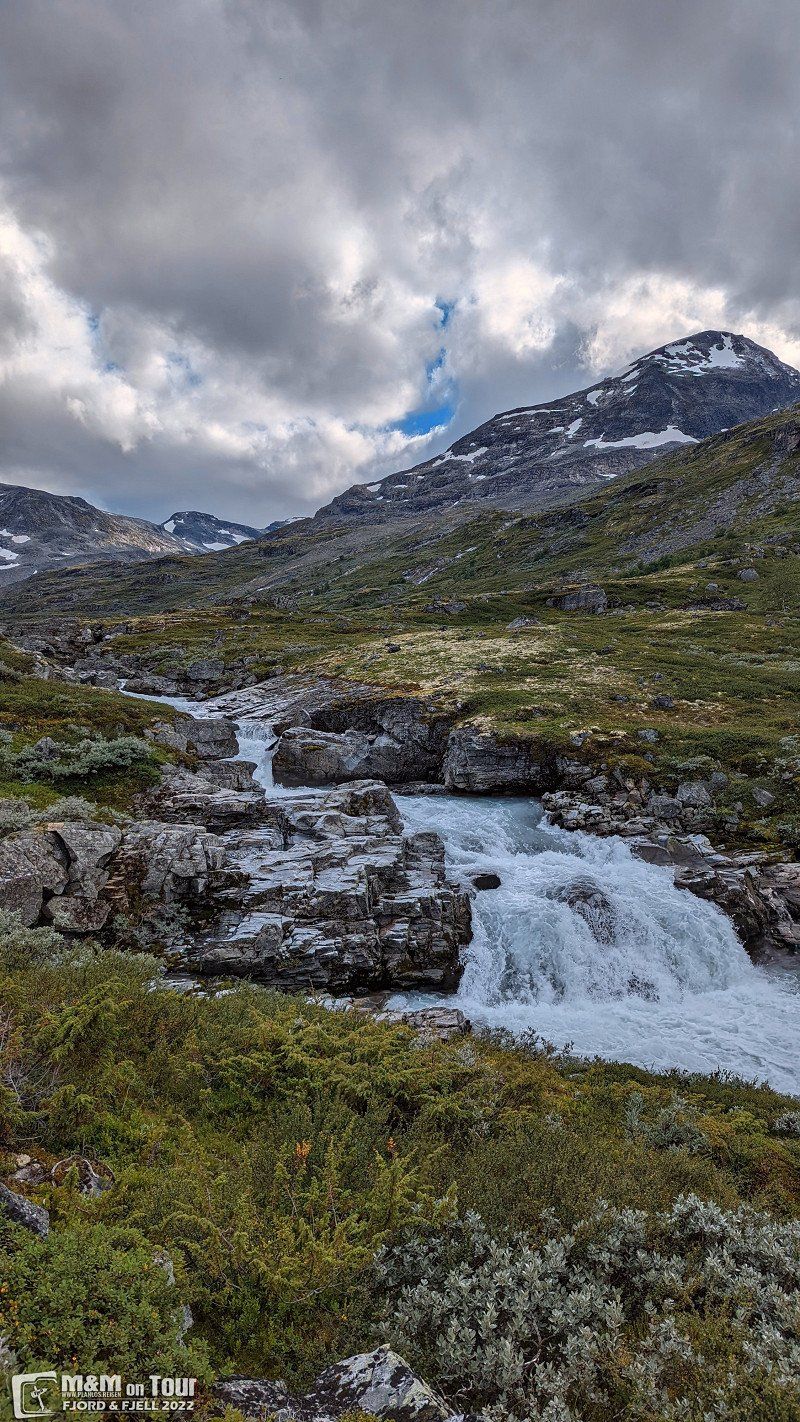
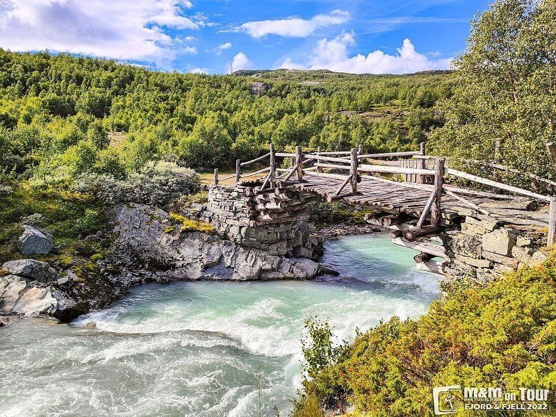
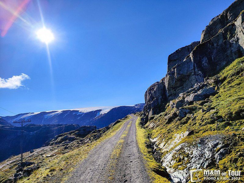
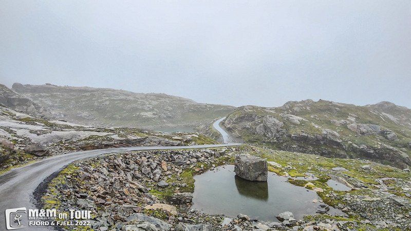
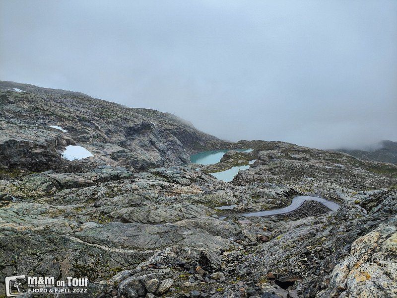
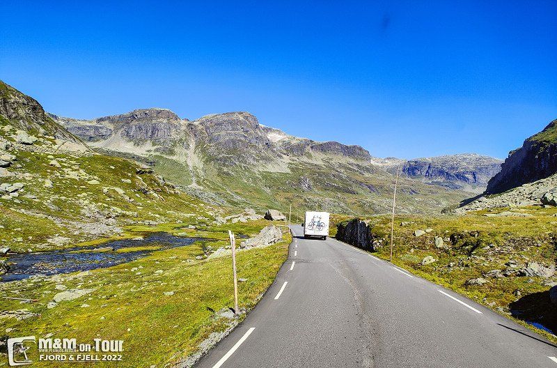
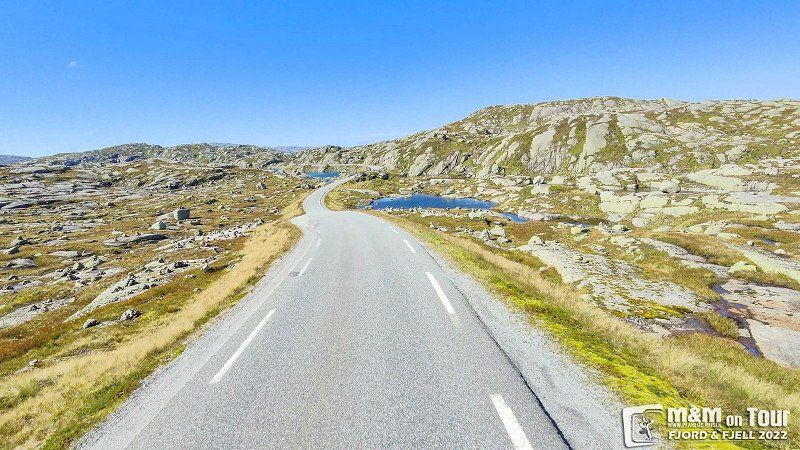
Gamle Strynefjellsvegen
Impressive and awesome. Luckily there was little traffic, otherwise we would probably still be there today ;)
Old Strynefjell Mountain Road, Stryn Municipality, Norwegen
61° 57' 15.4" N 7° 20' 34.8" E
61.9542893 7.3429870
• Head north. Go for 4.1 km.
• Continue on Lodalsvegen. Go for 9.7 km.
• Continue on 5723. Go for 3.5 km.
• Keep left onto 5723. Go for 1.7 km.
• Turn left onto Lovikvegen. Go for 75 m.
• Turn right onto Lovikvegen. Go for 1.1 km.
• Turn left onto Fjordvegen (60). Go for 5.3 km.
• Turn left onto 5724 toward Oldedalen. Go for 30 m.
• Turn right onto 5724. Go for 1.3 km.
• Continue on Oldedalsvegen (5724). Go for 497 m.
• Continue on 5724. Go for 1.5 km.
• Continue on Solheim (5724). Go for 95 m.
• Continue on 5724. Go for 463 m.
• Continue on Oldedalsvegen (5724). Go for 3.2 km.
• Continue on 5724. Go for 2.1 km.
• Continue on 5724. Go for 7.5 km.
• Turn slightly left onto Oldedalsvegen (5724). Go for 883 m.
• Continue on 5724. Go for 181 m.
• Continue on Oldedalsvegen (5724). Go for 660 m.
• Continue on 5724. Go for 3.2 km.
• Arrive at 5724. Your destination is on the right.
☍
47,0 km
(1 hrs. 10 min.)
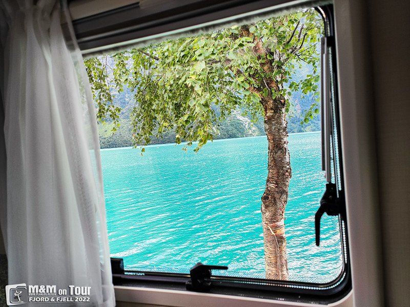
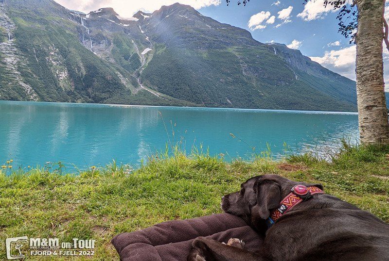
Helset Camping, Loen, Norwegen
Very nice CP on the Lovatnet.
Helset 6789, 6789 Loen, Norwegen
61° 49' 34.1" N 6° 58' 7.3" E
61.8261496 6.9687041
• Head north on 5724. Go for 3.2 km.
• Continue on Oldedalsvegen (5724). Go for 660 m.
• Continue on 5724. Go for 181 m.
• Continue on Oldedalsvegen (5724). Go for 883 m.
• Turn slightly right onto 5724. Go for 6.6 km.
• Turn slightly right onto 5724. Go for 3.1 km.
• Continue on Oldedalsvegen (5724). Go for 3.2 km.
• Continue on 5724. Go for 463 m.
• Continue on Solheim (5724). Go for 95 m.
• Continue on 5724. Go for 1.5 km.
• Continue on Oldedalsvegen (5724). Go for 497 m.
• Continue on 5724. Go for 1.0 km.
• Turn slightly left onto Sjøatunet. Go for 246 m.
• Turn left onto 60. Go for 40.6 km.
• Turn left onto Breimsvegen (E39). Go for 19.9 km.
• Take the 2nd exit from roundabout onto 5 toward Sogndal/Fjærland. Go for 61.1 km.
• Take the 3rd exit from roundabout onto Gravensteinsgata (5) toward E16/Lærdal/55/Lom. Go for 123 m.
• Pass 2 roundabouts and continue on Helgheimsvegen (5). Go for 1.2 km.
• Take the 2nd exit from roundabout onto 55 toward Lom. Go for 70.2 km.
• Arrive at 55. Your destination is on the left.
☍
214,8 km
(3 hrs. 18 min.)
Day
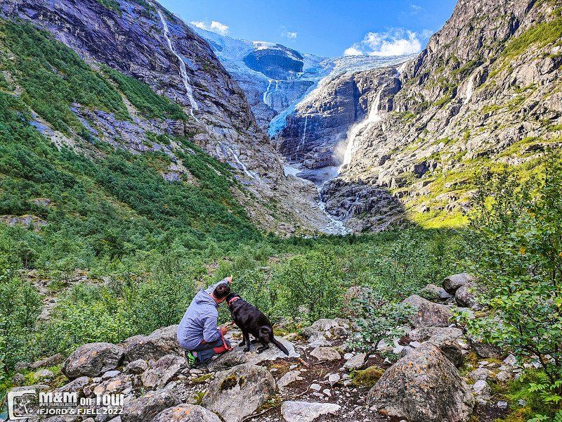
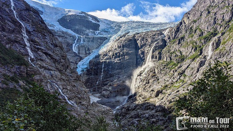
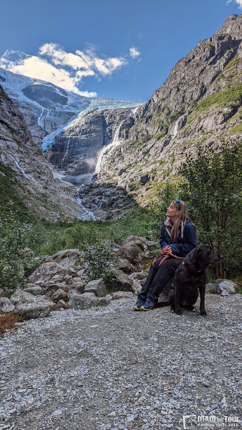
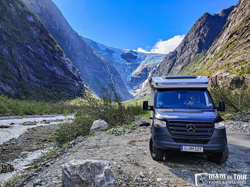
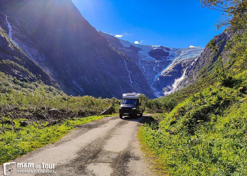
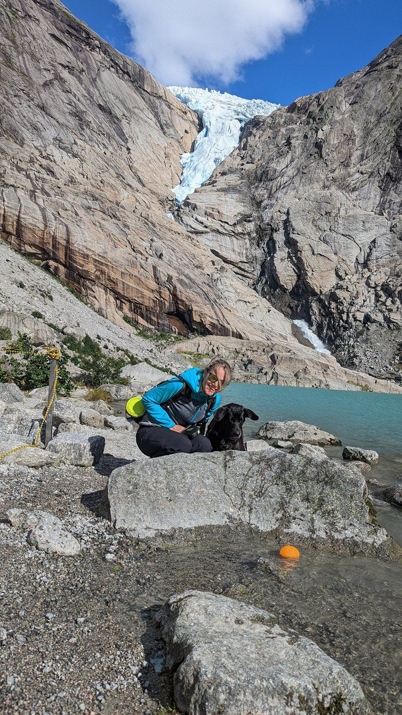
Kjenndalsbreen, Loen, Norwegen
Glaciers are very trendy for us this year. The Kjenndalsbreen should not be the only one on our trip.
Kjenndalsbreen, Stryn Municipality, Norwegen
61° 44' 4.1" N 7° 1' 47.8" E
61.7344838 7.0299402
• Head northeast on 55. Go for 1.4 km.
• Turn left onto Tindevegen toward 53/Årdal. Go for 2.7 km.
• Turn slightly right onto Tindevegen. Go for 17.0 km.
• Keep right toward Fardalsvegen. Go for 685 m.
• Continue on Fardalsvegen. Go for 5.1 km.
• Continue on 5632. Go for 204 m.
• Continue on Fardalsvegen (5632). Go for 98 m.
• Continue on 5632. Go for 192 m.
• Continue on Åbøle (5632). Go for 100 m.
• Continue on 5632. Go for 103 m.
• Continue on Hagahaugen (5632). Go for 98 m.
• Continue on 5632. Go for 687 m.
• Continue on Fardalsvegen (5632). Go for 98 m.
• Continue on 5632. Go for 417 m.
• Continue on Fardalsvegen (5632). Go for 67 m.
• Continue on 5632. Go for 349 m.
• Continue on Fardalsvegen (5632). Go for 2.8 km.
• Continue on 5632. Go for 131 m.
• Continue on Øvstetunsvegen. Go for 32 m.
• Turn left onto Flotavegen. Go for 465 m.
• Continue on Storevegen. Go for 1.1 km.
• Turn slightly right onto Storevegen (5631). Go for 17 m.
• Turn left onto Tyinvegen (53). Go for 36.7 km.
• Turn left onto Tyinvegen (53). Go for 412 m.
• Turn right onto Tyinvegen (E16). Go for 40.3 km.
• Turn left onto Riddarvegen (2510) toward 51/Beitostølen/Skammestein/Høre/Sentrum. Go for 2.3 km.
• Turn right onto Hørevegen (2510). Go for 2.1 km.
• Continue on Ellestadvegen (2510). Go for 19 m.
• Continue on Øygarden (2510). Go for 99 m.
• Turn left onto Eggeåsvegen (2508). Go for 5.4 km.
• Continue on 2508. Go for 358 m.
• Continue on Dalsvegen (2508). Go for 926 m.
• Continue on Ranisete (2508). Go for 141 m.
• Continue on Dalsvegen (2508). Go for 319 m.
• Continue on Skjel (2508). Go for 85 m.
• Continue on Dalsvegen (2508). Go for 741 m.
• Continue on Holun (2508). Go for 83 m.
• Continue on Dalsvegen (2508). Go for 2.9 km.
• Continue on Skøltevegen (2508). Go for 4.2 km.
• Turn left onto Bygdinvegen (51). Go for 92.2 km.
• Turn left onto Ottadalsvegen (15). Go for 24.7 km.
• Take the 2nd exit from roundabout onto Sognefjellsvegen (55) toward Sogndal. Go for 31.1 km.
• Turn left onto Leirdalsvegen. Go for 14.4 km.
• Arrive at Leirdalsvegen. Your destination is on the right.
☍
293,2 km
(5 hrs. 18 min.)
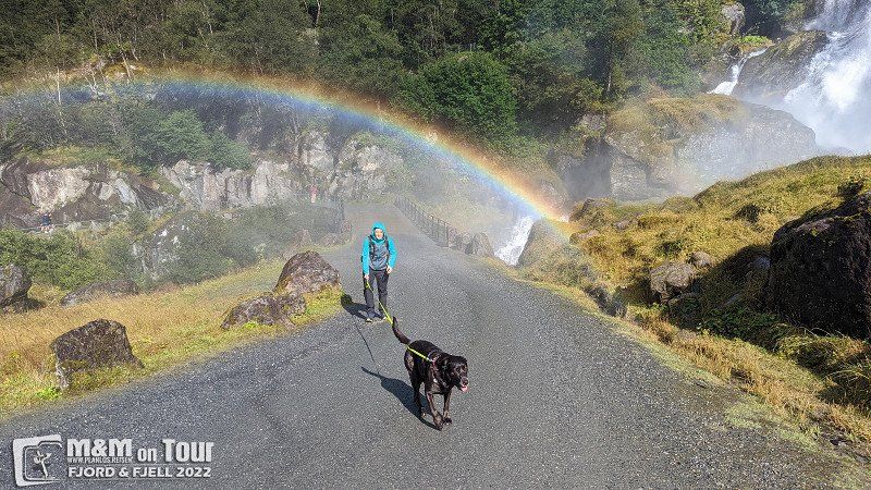
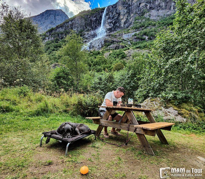
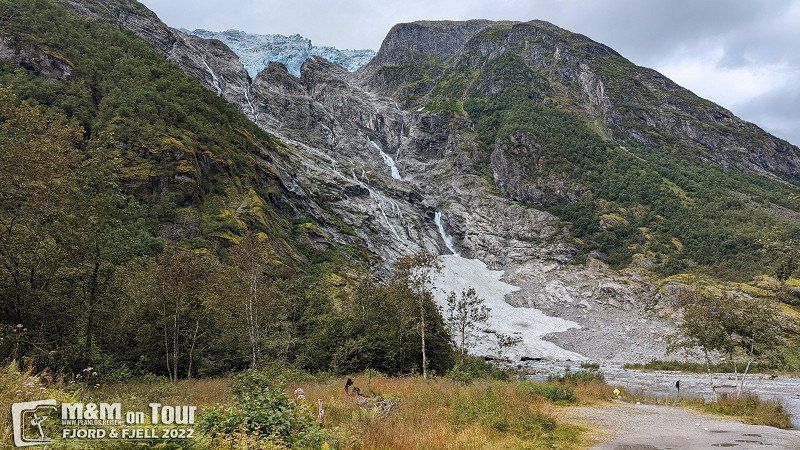
Melkevoll Bretun
Even though we've been here more than once, we don't miss the hike to Briksdalsbreen. We end the evening on the campsite under the waterfall.
6792, Briksdalsbre, Norway
61° 39' 54" N 6° 48' 56" E
61.6650000 6.8155500
• Head northwest on Leirdalsvegen. Go for 14.4 km.
• Turn right onto Sognefjellsvegen (55). Go for 31.0 km.
• Take the 1st exit from roundabout onto Bergomsvegen (15). Go for 24.7 km.
• Turn right onto Fjellvegen (51). Go for 92.2 km.
• Turn right onto Skøltevegen (2508). Go for 4.2 km.
• Continue on Dalsvegen (2508). Go for 2.9 km.
• Continue on Holun (2508). Go for 83 m.
• Continue on Dalsvegen (2508). Go for 741 m.
• Continue on Skjel (2508). Go for 85 m.
• Continue on Dalsvegen (2508). Go for 319 m.
• Continue on Ranisete (2508). Go for 141 m.
• Continue on Dalsvegen (2508). Go for 926 m.
• Continue on 2508. Go for 358 m.
• Continue on Eggeåsvegen (2508). Go for 5.4 km.
• Turn right onto Øygarden (2510). Go for 99 m.
• Continue on Ellestadvegen (2510). Go for 19 m.
• Continue on Hørevegen (2510). Go for 2.1 km.
• Turn left onto Riddarvegen (2510). Go for 2.3 km.
• Turn right onto Tyinvegen (E16). Go for 40.3 km.
• Turn left onto Tyinvegen (53). Go for 412 m.
• Turn right onto Tyinvegen (53) toward Årdal/Tyin. Go for 36.7 km.
• Turn right onto Storevegen (5631). Go for 343 m.
• Continue on Storevegen. Go for 786 m.
• Continue on Flotavegen. Go for 465 m.
• Turn right onto Øvstetunsvegen. Go for 32 m.
• Continue on 5632. Go for 46 m.
• Turn slightly right onto 5632. Go for 85 m.
• Continue on Fardalsvegen (5632). Go for 2.8 km.
• Continue on 5632. Go for 349 m.
• Continue on Fardalsvegen (5632). Go for 67 m.
• Continue on 5632. Go for 417 m.
• Continue on Fardalsvegen (5632). Go for 98 m.
• Continue on 5632. Go for 687 m.
• Continue on Hagahaugen (5632). Go for 98 m.
• Continue on 5632. Go for 103 m.
• Continue on Åbøle (5632). Go for 100 m.
• Continue on 5632. Go for 192 m.
• Continue on Fardalsvegen (5632). Go for 98 m.
• Continue on 5632. Go for 204 m.
• Continue on Fardalsvegen. Go for 5.8 km.
• Continue on Tindevegen. Go for 859 m.
• Arrive at Tindevegen.
☍
272,9 km
(4 hrs. 38 min.)
Day
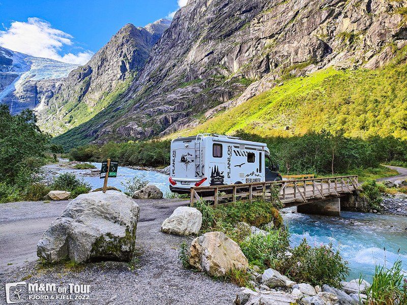
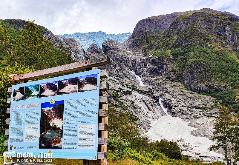
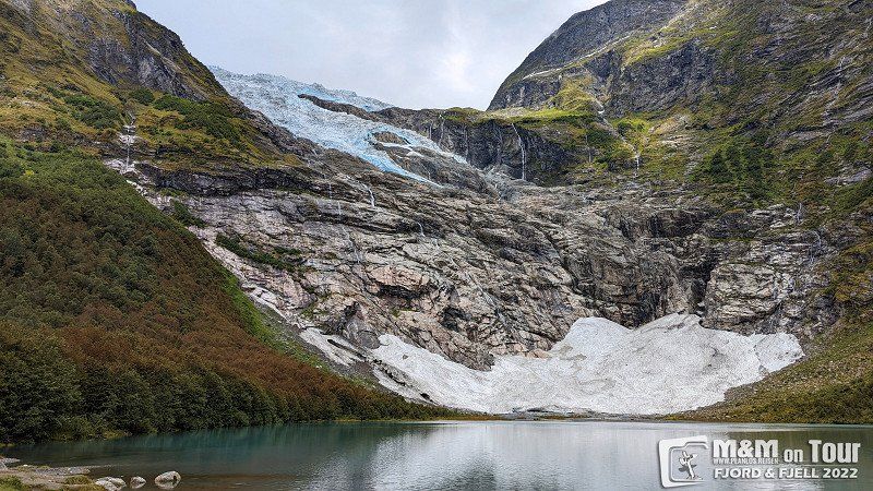
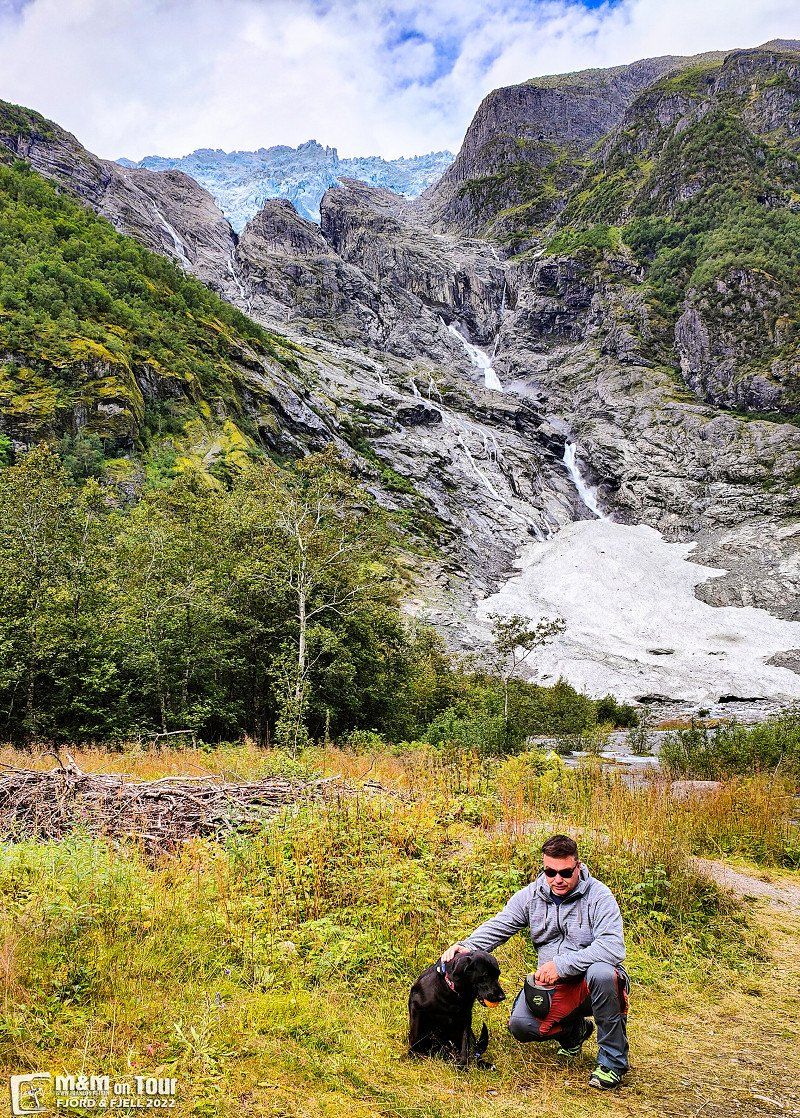
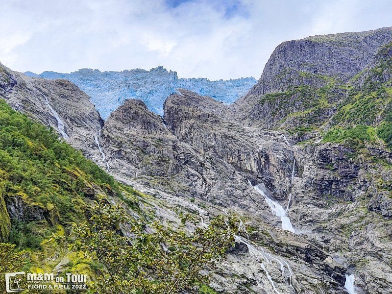
Bøyabreen und Supphellebreen
We visit Bøyabreen and Supphellebreen before continuing towards "Norway's highest pass road".
Bøyabreen, Sogndal Municipality, Norwegen
61° 30' 23.1" N 6° 45' 32.2" E
61.5064297 6.7589367
• Head south on Tindevegen. Go for 859 m.
• Keep right toward Fardalsvegen. Go for 685 m.
• Continue on Fardalsvegen. Go for 5.1 km.
• Continue on 5632. Go for 204 m.
• Continue on Fardalsvegen (5632). Go for 98 m.
• Continue on 5632. Go for 192 m.
• Continue on Åbøle (5632). Go for 100 m.
• Continue on 5632. Go for 103 m.
• Continue on Hagahaugen (5632). Go for 98 m.
• Continue on 5632. Go for 687 m.
• Continue on Fardalsvegen (5632). Go for 98 m.
• Continue on 5632. Go for 417 m.
• Continue on Fardalsvegen (5632). Go for 67 m.
• Continue on 5632. Go for 349 m.
• Continue on Fardalsvegen (5632). Go for 2.8 km.
• Continue on 5632. Go for 131 m.
• Continue on Øvstetunsvegen. Go for 32 m.
• Turn left onto Flotavegen. Go for 465 m.
• Continue on Storevegen. Go for 1.1 km.
• Turn slightly right onto Storevegen (5631). Go for 17 m.
• Turn left onto Tyinvegen (53). Go for 36.7 km.
• Turn left onto Tyinvegen (53). Go for 412 m.
• Turn right onto Tyinvegen (E16). Go for 10.9 km.
• Arrive at Rødølstunnelen (E16). Your destination is on the right.
☍
61,5 km
(1 hrs. 9 min.)
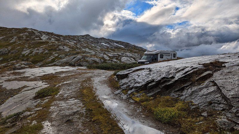
Sognefjellsvegen - The National Tourist Route, Fortun, Norwegen
Sognefjellsvegen - The National Tourist Route, Luster Municipality, Norwegen
61° 30' 15.7" N 7° 48' 45.5" E
61.5043551 7.8126525
• Head toward Tyinvegen on Rødølstunnelen (E16). Go for 37.2 km.
• Take the 1st exit from roundabout onto E16 toward Bergen/Lærdal. Go for 28.3 km.
• Take the 2nd exit from roundabout onto E16 toward Bergen/Aurland. Go for 25.1 km.
• Take the 1st exit from roundabout toward Sentrum. Go for 43 m.
• Continue on Skulevegen (5627). Go for 1.5 km.
• Turn right onto Øvregata. Go for 162 m.
• Continue on Bjørgavegen (5627). Go for 1.7 km.
• Continue on Kvam (5627). Go for 96 m.
• Continue on Bjørgavegen (5627). Go for 7.0 km.
• Turn left onto Bjørgavegen (5627). Go for 7.6 km.
• Arrive at Bjørgavegen (5627). Your destination is on the right.
☍
108,7 km
(1 hrs. 41 min.)
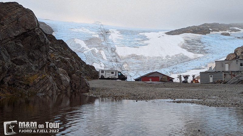
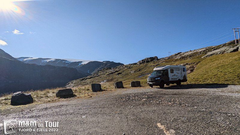
Day
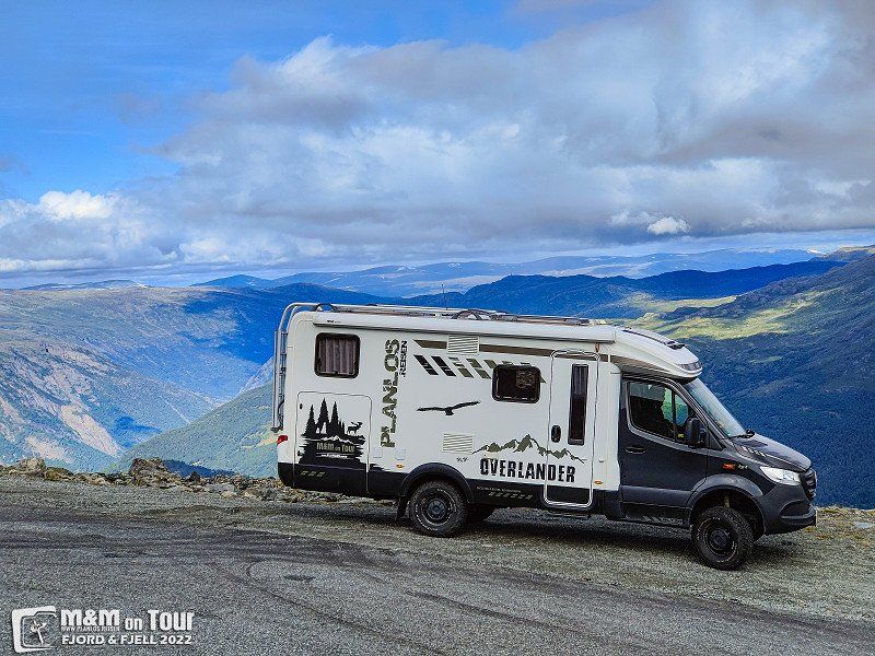
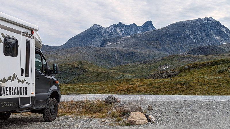
Galdhøpiggen, Lom, Norwegen
The nearest glacier is on Norway's highest mountain, a stunning road through equally beautiful scenery leads to the top.
2686 Lom, Norwegen
61° 38' 13.3" N 8° 18' 33.1" E
61.6370232 8.3091979
• Head toward Storhovdevegen on Bjørgavegen (5627). Go for 14.6 km.
• Continue on Kvam (5627). Go for 96 m.
• Continue on Bjørgavegen (5627). Go for 1.7 km.
• Turn right onto Bjørgavegen (5627). Go for 7 m.
• Continue on Vangen (5627). Go for 91 m.
• Continue on Bjørgavegen (5627). Go for 18 m.
• Continue on Vangen (5627). Go for 21 m.
• Continue on Bjørgavegen (5627). Go for 12 m.
• Turn left onto Vangen (5627). Go for 54 m.
• Continue on Skulevegen (5627). Go for 1.3 km.
• Turn right onto Skulevegen. Go for 18 m.
• Arrive at Skulevegen. Your destination is on the right.
☍
17,9 km
( 30 min.)
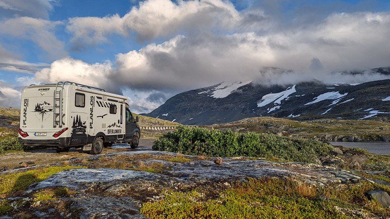
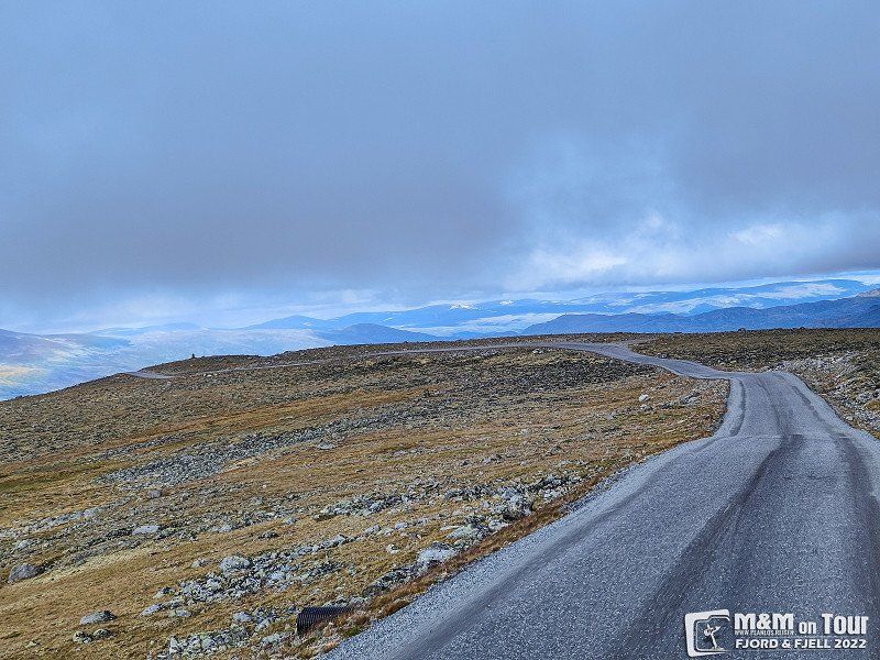
Leirvassbu, Bøverdalen, Norwegen
...beautiful area at about 1300m above sea level.
Lom, Norwegen
61° 32' 58.7" N 8° 14' 46.4" E
61.5496370 8.2462190
• Head northeast on Skulevegen. Go for 18 m.
• Turn right onto Skulevegen (5627). Go for 309 m.
• Take the 3rd exit from roundabout onto E16 toward Oslo/Lærdal. Go for 25.1 km.
• Take the 1st exit from roundabout onto E16 toward Oslo/Fagernes. Go for 28.2 km.
• Take the 1st exit from roundabout onto 52 toward 7/Oslo/Gol. Go for 75.5 km.
• Turn right onto Golreppen (2916). Go for 1.8 km.
• Continue on Skagavegen (2916). Go for 318 m.
• Continue on Golreppen (2916). Go for 350 m.
• Continue on 2916. Go for 30 m.
• Continue on Tuppeskogvegen (2916). Go for 1.4 km.
• Continue on 2916. Go for 174 m.
• Continue on Tuppeskogvegen (2916). Go for 897 m.
• Continue on Granlii (2916). Go for 44 m.
• Continue on Tuppeskogvegen (2916). Go for 87 m.
• Continue on Gaukdokki (2916). Go for 74 m.
• Continue on Tuppeskogvegen (2916). Go for 268 m.
• Continue on Brekko (2916). Go for 79 m.
• Continue on Øynebråten (2916). Go for 23 m.
• Continue on 2916. Go for 65 m.
• Continue on Tuppeskogvegen (2916). Go for 602 m.
• Turn right onto Rotneimvegen (7). Go for 33.0 km.
• Turn left onto Mogrendvegen (7). Go for 11.0 km.
• Take the 2nd exit from roundabout onto Ustedalen (7) toward Eidfjord. Go for 73.2 km.
• Turn right. Go for 23 m.
• Turn right. Go for 99 m.
• Turn left. Go for 209 m.
• Arrive at your destination on the left.
☍
253,1 km
(3 hrs. 47 min.)
Day
Tindevegen, Øvre Årdal, Norwegen
Tindevegen, 6884 Øvre Årdal, Norwegen
61° 23' 18" N 7° 43' 25" E
61.3883455 7.7236242
• Head west. Go for 209 m.
• Turn right. Go for 99 m.
• Turn left toward Hardangervidda/7. Go for 23 m.
• Turn right onto Hardangervidda (7). Go for 32.3 km.
• Take the 1st exit from Butunnelen roundabout onto Butunnelen (13). Go for 54.7 km.
• Take the 2nd exit from roundabout onto Røldalsvegen (13). Go for 17.7 km.
• Turn left onto E134 toward Haukeli/Rødal. Go for 55.4 km.
• Turn left toward Haukelivegen. Go for 90 m.
• Turn right onto Haukelivegen. Go for 1.2 km.
• Arrive at Haukelivegen.
☍
161,7 km
(2 hrs. 29 min.)
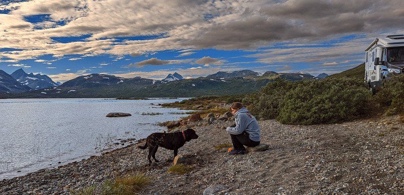
Tyinvegen, Øye, Norwegen
No matter where you land, it is beautiful everywhere.
Tyinvegen, 2977 Øye, Norwegen
61° 10' 39.7" N 8° 22' 57.8" E
61.1776987 8.3827270
• Head southeast on Haukelivegen. Go for 948 m.
• Continue toward Haukelivegen/E134. Go for 184 m.
• Turn left onto Haukelivegen (E134). Go for 21.0 km.
• Turn right onto 9 toward Evje/Hovden. Go for 26.6 km.
• Take the 2nd exit from roundabout onto Setesdalsvegen (9). Go for 44.9 km.
• Turn right onto Setesdalsvegen. Go for 429 m.
• Arrive at Setesdalsvegen. Your destination is on the left.
☍
94,0 km
(1 hrs. 15 min.)
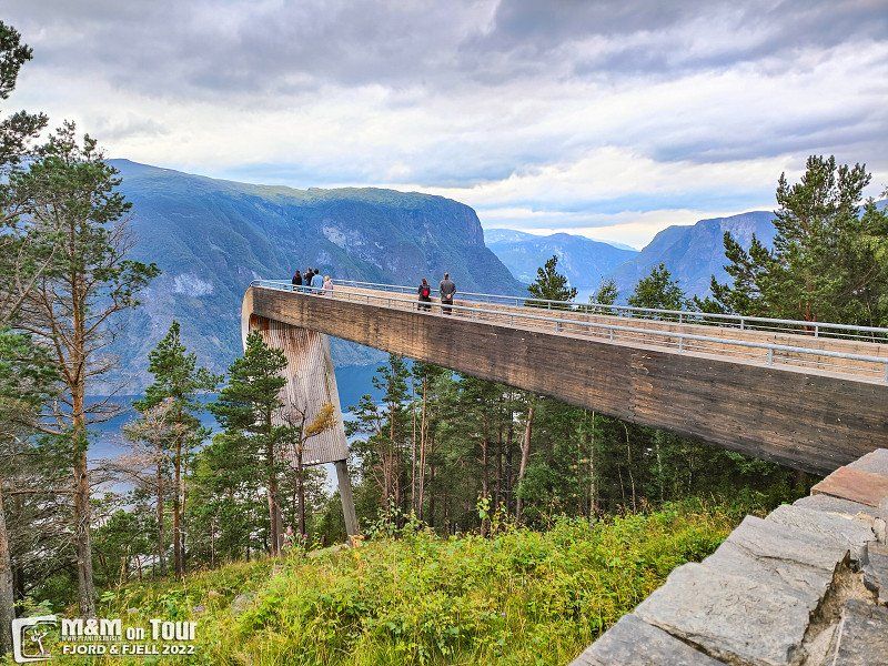
Day
Gamle Aurlandsvegen, Bjørgavegen, Aurland, Norwegen
Small side roads take you to Old Aurlandsvegen.
Bjørgavegen, 5745 Aurland, Norwegen
60° 55' 27.6" N 7° 18' 17.8" E
60.9243289 7.3049464
• Head southeast on Setesdalsvegen. Go for 842 m.
• Turn right onto 9. Go for 8.7 km.
• Pass 5 roundabouts and continue on Setesdalsvegen (9). Go for 97.2 km.
• Turn right onto Kjetsåvegen (42). Go for 1.6 km.
• Turn right onto Sveindalsvegen (42). Go for 45.0 km.
• Turn right onto Eikenveien (42). Go for 90.2 km.
• Turn right onto Sørlandsveien (E39). Go for 39.7 km.
• Turn right onto Hunnedalsvegen (45) toward Sirdal/Byrkjedal/Oltedal. Go for 11.2 km.
• Turn left onto Seldalveien (508). Go for 3.7 km.
• Turn right onto Søredalen (508). Go for 3.6 km.
• Turn right onto Høleveien (508). Go for 5.6 km.
• Keep right onto Lauvvikveien (508). Go for 310 m.
• Take the Lauvvik-Forsand Ferry. Stay on for 2.2 km.
• Take the Forsand-Songesand Ferry. Stay on for 19.7 km.
• Take the Songesand-Flørli Ferry. Stay on for 6.6 km.
• Take the Flørli-Lysebotn Ferry. Stay on for 13.6 km.
• Head southeast on Lysevegen (4224). Go for 1.8 km.
• Arrive at Lysevegen (4224). Your destination is on the right.
☍
351,6 km
(5 hrs. 44 min.)
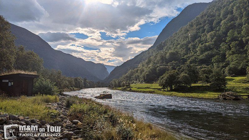
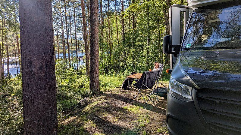
Lunde Camping, Skulevegen, Aurland, Norwegen
Since the weather is not so nice, we interrupt our journey and spend the night at the river again.
Skulevegen 49, 5745 Aurland, Norwegen
60° 53' 59.8" N 7° 12' 22.5" E
60.8999549 7.2062618
• Head toward Nilsebuvegen on Lysevegen (4224). Go for 1.8 km.
• Take the Lysebotn-Flørli Ferry. Stay on for 13.6 km.
• Take the Flørli-Songesand Ferry. Stay on for 6.6 km.
• Take the Songesand-Forsand Ferry. Stay on for 19.7 km.
• Take the Forsand-Lauvvik Ferry. Stay on for 2.2 km.
• Head west on Lauvvikveien (508). Go for 5.9 km.
• Turn left onto Søredalen (508). Go for 3.6 km.
• Turn left onto Seldalveien (508). Go for 3.7 km.
• Turn right onto Oltedalsveien (45). Go for 11.2 km.
• Turn left onto Europavegen (E39) toward Kristiansand/Flekkefjord. Go for 39.7 km.
• Turn left onto Sirdalsveien (42) toward Tonstad/Sirdal. Go for 90.2 km.
• Turn left onto 42. Go for 45.0 km.
• Turn left onto Kjetsåvegen (42). Go for 1.6 km.
• Turn left onto Setesdalsvegen (9). Go for 1.1 km.
• Pass 2 roundabouts and continue on Setesdalsvegen (9). Go for 4.2 km.
• Turn right onto Arendalsvegen (42). Go for 34.0 km.
• Turn left onto Øvre Lauvrak (413) toward Åmli. Go for 12.2 km.
• Turn right onto Bås (413). Go for 2.8 km.
• Continue on Dølemo (41). Go for 8.3 km.
• Turn right onto Sigridnes. Go for 2.3 km.
• Turn right onto Sigridnes. Go for 39 m.
• Arrive at Sigridnes. Your destination is on the left.
☍
309,7 km
(5 hrs. 45 min.)
Day
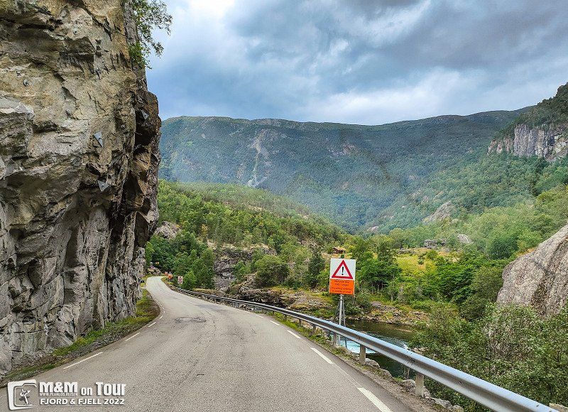
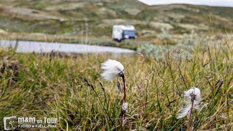
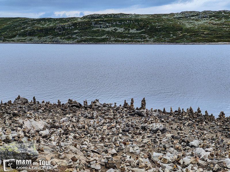
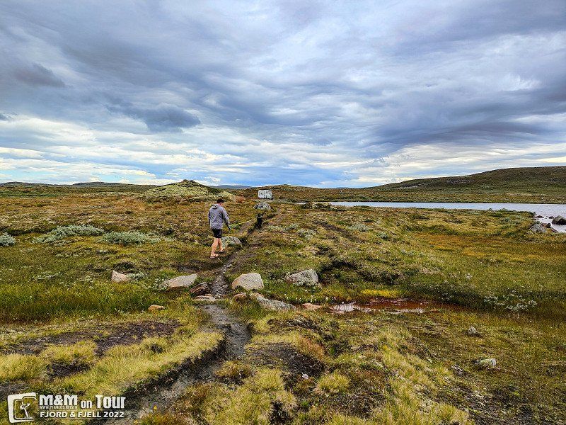
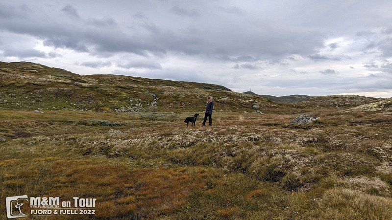
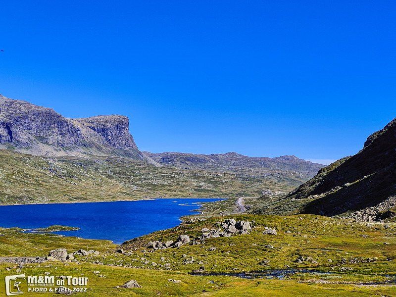
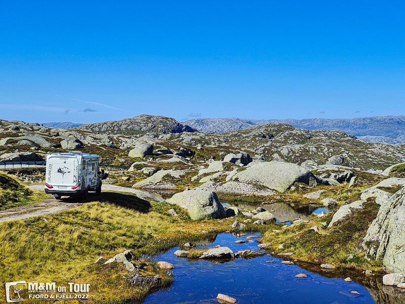
Hardangervidda, Norwegen
After a good night's sleep we continue towards Hardangervidda via the FV50.
Norwegen
60° 9' 15.4" N 7° 26' 35" E
60.1542843 7.4430460
• Head northeast on Sigridnes. Go for 39 m.
• Turn left onto Sigridnes. Go for 2.3 km.
• Turn right onto Gjermundnes (41). Go for 94.4 km.
• Turn right onto Brunkebergvegen (E134) toward Oslo/Seljord. Go for 45.3 km.
• Turn left onto Gransheradvegen (361) toward 37/Rjukan/Gransherad. Go for 9.6 km.
• Turn right onto Gransheradvegen (37) toward Kongsberg/Sentrum. Go for 11.6 km.
• Turn right onto Bolkesjøvegen (37) toward Kongsberg. Go for 20.4 km.
• Arrive at Jondalsveien (37). Your destination is on the right.
☍
183,6 km
(2 hrs. 54 min.)
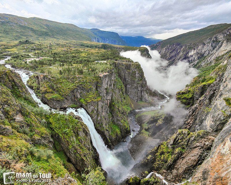
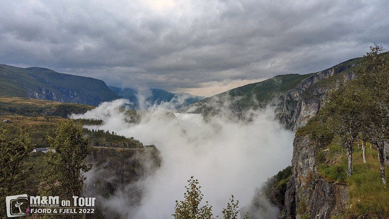
Day
Vøringsfossen, Vøringsfoss, Norwegen
Vøringfossen, Eidfjord Municipality, Norwegen
60° 25' 35.7" N 7° 15' 5.3" E
60.4265721 7.2514658
• Head southeast on Jondalsveien (37). Go for 8.7 km.
• Turn right onto Numedalsveien (40) toward Kongsberg. Go for 5.4 km.
• Pass 2 roundabouts and continue on Numedalsveien (40). Go for 611 m.
• Take the 1st exit from roundabout onto Gomsrudveien (40) toward Larvik. Go for 840 m.
• Take the 1st exit from roundabout onto Gomsrudveien (40). Go for 714 m.
• Take the 2nd exit from roundabout onto Kongsbergtunnelen (E134). Go for 19.8 km.
• Pass 4 roundabouts and continue on E134. Go for 7.4 km.
• Take ramp toward Mjøndalen/283/Krokstadelva. Go for 128 m.
• Take the 3rd exit from roundabout. Go for 224 m.
• Continue toward 283. Go for 35 m.
• Take the 1st exit from roundabout onto 283. Go for 412 m.
• Pass 3 roundabouts and continue on 283. Go for 8.8 km.
• Keep right onto Rosenkrantzgata (283). Go for 191 m.
• Take the 2nd exit from roundabout onto Rosenkrantzgata. Go for 613 m.
• Continue on Hauges gate. Go for 35 m.
• Turn left onto Konggata (38). Go for 309 m.
• Turn right onto Bergstien (2724). Go for 33 m.
• Turn left onto Eivind Olsens vei. Go for 615 m.
• Arrive at Eivind Olsens vei.
☍
54,8 km
( 55 min.)
Folgefonna nasjonalpark, Skålafjæro, Rosendal, Norwegen
The last glacier of our tour is also the southernmost one in Norway, Folgefonna Glacier. The approach was also a real highlight, finally a road without disturbing crash barriers.
Skålafjæro 17, 5470 Rosendal, Norwegen
60° 0' 53.5" N 6° 17' 52.5" E
60.0148605 6.2979147
• Head northwest on Eivind Olsens vei. Go for 615 m.
• Turn right onto Bergstien (2724). Go for 33 m.
• Turn left onto Konggata (38). Go for 309 m.
• Turn right onto Hauges gate. Go for 35 m.
• Continue on Rosenkrantzgata. Go for 54 m.
• Turn left onto Vinjes gate. Go for 140 m.
• Take the 1st exit from roundabout onto Lajordgata (283). Go for 182 m.
• Take the 1st exit from Bragernestunnelen roundabout onto Bragernestunnelen (283). Go for 2.8 km.
• Take the 4th exit from roundabout onto Strandveien (282). Go for 430 m.
• Keep left onto Strandvegen (282) toward 23/Drøbak/285/Hønefoss/Asker. Go for 505 m.
• Pass 2 roundabouts and continue on Strandvegen (282). Go for 1.6 km.
• Take the 1st exit from roundabout onto Røykenveien (E134) toward Drøbak. Go for 309 m.
• Pass 3 roundabouts and continue on Røykenveien (E134). Go for 6.2 km.
• Take the 1st exit from roundabout onto E134 toward Drøbak/Røyken/Tofte/281/Gøteborg/E6/Stockholm/E18. Go for 5.2 km.
• Pass 6 roundabouts and continue on E134. Go for 26.8 km.
• Take the 1st exit from roundabout onto E6 toward Oslo/E18/Stockholm. Go for 4.4 km.
• Take the exit toward Vinterbro/Stockholm/Ski/154. Go for 230 m.
• Take the 2nd exit from roundabout toward Stockholm/154/Ski. Go for 245 m.
• Continue on E18. Go for 6.2 km.
• Take the 2nd exit from roundabout onto E18 toward Askim. Go for 63.6 km.
• Continue on E18. Go for 27.9 km.
• Take ramp onto 172 toward Bengtsfors. Go for 24.6 km.
• Turn left onto Vammerviken Mon (172). Go for 9.3 km.
• Arrive at Kessviken (172). Your destination is on the left.
☍
181,9 km
(2 hrs. 32 min.)
Day
Den gamle Haukelivegen, Edland, Norwegen
We were happy to drive the old mountain roads without much traffic, unfortunately (due to a tunnel construction site) all traffic was routed over it.
Den gamle Haukelivegen, 3895 Edland, Norwegen
59° 47' 40.5" N 7° 15' 57.5" E
59.7945940 7.2659763
• Head east on Kessviken (172). Go for 14.9 km.
• Take the 2nd exit from roundabout onto Strömgatan (172). Go for 30.7 km.
• Turn right onto 172. Go for 54.8 km.
• Turn right and take ramp onto 44 toward Vänersborg/Trollhättan/E6. Go for 2.9 km.
• Take ramp toward E6/Göteborg. Go for 3.6 km.
• Keep left toward E6. Go for 1.3 km.
• Continue on Bratterödsleden. Go for 918 m.
• Continue on Bratterödsleden. Go for 1.4 km.
• Continue toward E6/Råssbyn. Go for 808 m.
• Continue on Bratterödsleden. Go for 824 m.
• Continue straight ahead. Go for 28 m.
• Take the 2nd exit from roundabout toward E6. Go for 286 m.
• Take ramp onto E6 toward Göteborg. Go for 69.7 km.
• Keep left onto E6 (Kungsbackaleden). Go for 568 m.
• Keep left onto E6 (Olskroksmotet). Go for 128 m.
• Continue on E20 (Olskroksmotet). Go for 2.5 km.
• Take exit 70 toward Jönköping/Flygplats onto 27/40 (Boråsleden). Go for 54.8 km.
• Take exit 83 toward Karlskrona/41/Sjömarken/Ramnaslätt/Viared. Go for 364 m.
• Pass 4 roundabouts and continue on 27. Go for 64.4 km.
• Take the 2nd exit from roundabout onto 27 toward Karlskrona/Anderstorp/Gislaved. Go for 22.4 km.
• Take the 2nd exit from roundabout onto 27/153 toward Karlskrona/Värnamo. Go for 4.1 km.
• Turn right onto Forsgatan. Go for 240 m.
• Turn left onto Storgatan. Go for 163 m.
• Turn right onto Brogatan. Go for 1.3 km.
• Continue on Forsheda Björkliden. Go for 175 m.
• Continue on Forsheda Lilla Sandlid. Go for 7.0 km.
• Continue on Fylleryd Nyagärde. Go for 2.8 km.
• Continue on Dannäs Lilla Rödjebo. Go for 454 m.
• Continue on Dannäs Dragaryd. Go for 1.0 km.
• Continue on Dannäs Björkhaga. Go for 71 m.
• Continue on Dannäs Prästgården. Go for 49 m.
• Continue on Dannäs Björkängen. Go for 197 m.
• Turn right onto Dannäs Villa Solhem. Go for 60 m.
• Continue on Dannäs. Go for 120 m.
• Continue on Dannäs Brofors. Go for 79 m.
• Continue on Dannäs Asphyddan. Go for 113 m.
• Continue on Dannäs Furusäter. Go for 465 m.
• Continue toward Dannäs Församlingshem. Go for 29 m.
• Continue on Dannäs Solgläntan. Go for 2.6 km.
• Continue on Dannäs Bäck. Go for 1.9 km.
• Continue on Dannäs Mormors Stuga. Go for 962 m.
• Continue on Dannäs Norregård. Go for 385 m.
• Continue on Dannäs Skoghem. Go for 238 m.
• Continue on Dannäs Stora Gavlö. Go for 631 m.
• Continue on Dannäs Gavlö Björkängen. Go for 310 m.
• Continue on Dannäs Kronobäck. Go for 508 m.
• Continue on Jonsboda Torpet. Go for 394 m.
• Continue on Jonsboda västra. Go for 151 m.
• Continue on Jonsboda Bergsätra. Go for 61 m.
• Continue on Jonsboda västra. Go for 489 m.
• Continue on Skällandsö Brandstation. Go for 528 m.
• Continue on Skällandsö Vilan. Go for 49 m.
• Continue on Skällandsö Norregård. Go for 60 m.
• Continue on Skällandsö Nygård. Go for 52 m.
• Continue on Skällandsö Vänhem. Go for 182 m.
• Continue on Skällandsö Mellangård. Go for 450 m.
• Continue on Skällandsö Södergård. Go for 927 m.
• Continue on Sunnerö bygdegård. Go for 1.5 km.
• Continue on Sunnerö Enestugan. Go for 346 m.
• Continue on Tannåker Hultet. Go for 205 m.
• Continue on Tannåker Lundsborg. Go for 586 m.
• Turn right onto Tannåker Klockaregård. Go for 391 m.
• Continue on Tannåker Eksätra. Go for 189 m.
• Continue on Tannåker Solsätra. Go for 39 m.
• Continue on Tannåker Klockaregård. Go for 165 m.
• Continue on Tannåker Fridhem. Go for 115 m.
• Turn right onto Tannåker Stora. Go for 180 m.
• Continue on Tannåker Haga. Go for 74 m.
• Continue on Tannåker Kvarnen. Go for 1.3 km.
• Continue on Bollstad Avloppsstation. Go for 308 m.
• Continue on Bollstad. Go for 713 m.
• Continue on Bollstad Tomten. Go for 244 m.
• Continue on Bollstad Bjurkaberg. Go for 1.4 km.
• Continue on Hov. Go for 935 m.
• Continue on Hassle. Go for 425 m.
• Continue on Bo Sjöviken. Go for 700 m.
• Continue on Bo Bäckåker. Go for 278 m.
• Continue on Österås. Go for 2.8 km.
• Continue on Brogården Nyhem. Go for 31 m.
• Continue on Kyrkbyvägen. Go for 729 m.
• Turn right onto Kyrkbyvägen. Go for 158 m.
• Turn slightly left. Go for 14 m.
• Keep right. Go for 25 m.
• Arrive at your destination.
☍
370,6 km
(4 hrs. 24 min.)
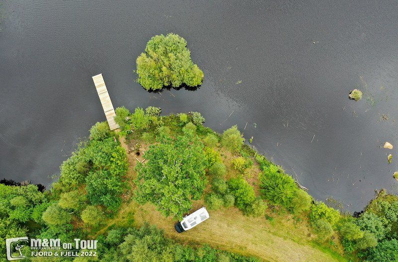
Sanden Sare Bubilcamp Wohnmobilpark
A fantastic pitch, on the river and in a quiet location.
4747, Valle, Norway
59° 16' 17.6" N 7° 27' 43.9" E
59.2715500 7.4621900
• Head northwest. Go for 13 m.
• Turn slightly left toward Kyrkbyvägen. Go for 197 m.
• Turn slightly right onto Kyrkbyvägen. Go for 887 m.
• Continue on Brogården Nyhem. Go for 2.6 km.
• Continue on Österås. Go for 212 m.
• Continue on Bo Bäckåker. Go for 644 m.
• Continue on Bo Sjöviken. Go for 334 m.
• Continue on Hassle. Go for 1.1 km.
• Continue on Hov. Go for 942 m.
• Continue on Bollstad Bjurkaberg. Go for 726 m.
• Continue on Bollstad Tomten. Go for 577 m.
• Continue on Bollstad. Go for 430 m.
• Continue on Bollstad Avloppsstation. Go for 1.1 km.
• Continue on Tannåker Kvarnen. Go for 444 m.
• Continue on Tannåker Haga. Go for 74 m.
• Continue on Tannåker Stora. Go for 180 m.
• Turn right onto Tannåker Ängshyddan. Go for 84 m.
• Continue on Tannåker Skogshyddan. Go for 60 m.
• Continue on Tannåker Pingstkyrka. Go for 68 m.
• Continue on Tannåker. Go for 62 m.
• Continue on Tannåker Sjöryd. Go for 144 m.
• Continue on Tannåker Ljungsäter. Go for 76 m.
• Continue on Tannåker Sjövalla. Go for 1.1 km.
• Continue on Tannåker Stora. Go for 1.7 km.
• Continue on Tannåker Skogen. Go for 218 m.
• Continue on Tannåker Fällan. Go for 240 m.
• Continue on Tannåker Muggebo. Go for 1.3 km.
• Continue on Hölminge. Go for 551 m.
• Continue on Hölminge. Go for 338 m.
• Continue on Hölminge. Go for 392 m.
• Continue on Hölminge Pilagården. Go for 356 m.
• Continue on Hölminge. Go for 357 m.
• Continue on Hölminge. Go for 144 m.
• Continue on Hölminge Norragården. Go for 682 m.
• Continue on Bolmstad Liden. Go for 1.5 km.
• Continue on Häggvägen. Go for 919 m.
• Continue on Bolmstad skola. Go for 165 m.
• Continue on Bolmstad gamla Affären. Go for 106 m.
• Continue on Bolmstad Norregård. Go for 630 m.
• Continue on Fotatorp Sjöadal. Go for 3.3 km.
• Continue on Bjärnaryd Skattegård. Go for 48 m.
• Continue on Angelstads-Bjärnaryd Skattegård. Go for 2.9 km.
• Continue on Hovdinge Södergård. Go for 64 m.
• Continue on Hovdinge. Go for 1.4 km.
• Continue on Tofta Norragården. Go for 950 m.
• Continue on Bolmstadsvägen. Go for 683 m.
• Take the 2nd exit from Rönnäsrondellen roundabout onto Bolmstadsvägen. Go for 1.1 km.
• Turn right onto Helsingborgsvägen. Go for 231 m.
• Take the 2nd exit from Hammarrondellen roundabout onto Gängesvägen. Go for 896 m.
• Take the 2nd exit from roundabout onto Vadgatan. Go for 874 m.
• Take the 2nd exit from Hångersrondellen roundabout onto Vadgatan (124). Go for 30.7 km.
• Continue toward Garanshult. Go for 1.3 km.
• Continue on Garanshult. Go for 244 m.
• Continue on Garanshult Västergård. Go for 882 m.
• Continue on Arnanäs Sjöbo. Go for 1.7 km.
• Continue on Arnanäs Södregård. Go for 876 m.
• Turn left onto Horshultsvägen. Go for 612 m.
• Continue on Virestad Hästhagen. Go for 316 m.
• Continue on Stubbalycke. Go for 356 m.
• Continue on Horshult. Go for 105 m.
• Continue on Horshult Fridhem. Go for 335 m.
• Continue on Horshult. Go for 902 m.
• Turn right onto Gylteboda. Go for 1.9 km.
• Turn right toward Hormeshult Norregård. Go for 1.2 km.
• Continue on Hormeshult Norregård. Go for 496 m.
• Turn left onto Hormeshult Nyhem. Go for 373 m.
• Continue on Hormeshult. Go for 134 m.
• Arrive at Hormeshult. Your destination is on the right.
☍
76,4 km
(1 hrs. 8 min.)
Day
Lysevegen, Lysebotn, Norwegen
Incredibly beautiful & hard to put into words.
Lysevegen 745, 4127 Lysebotn, Norwegen
59° 3' 19.3" N 6° 39' 50.8" E
59.0553535 6.6640994
• Head north on Hormeshult. Go for 480 m.
• Continue on Hormeshult Nyhem. Go for 27 m.
• Turn right onto Hormeshult Norregård. Go for 1.7 km.
• Turn left onto Gylteboda. Go for 1.9 km.
• Turn left toward Horshult. Go for 465 m.
• Continue on Horshult. Go for 659 m.
• Continue on Horshult Fridhem. Go for 113 m.
• Continue on Horshult. Go for 105 m.
• Continue on Stubbalycke. Go for 356 m.
• Continue on Virestad Hästhagen. Go for 316 m.
• Continue on Horshultsvägen. Go for 612 m.
• Turn right onto Pehr Hörbergs väg. Go for 2.0 km.
• Continue on Arnanäs Sjöbo. Go for 1.1 km.
• Continue on Garanshult Västergård. Go for 386 m.
• Continue on Garanshult. Go for 1.5 km.
• Turn left onto Baggåsvägen (23) toward Malmö. Go for 34.7 km.
• Take the 2nd exit from roundabout toward Malmö. Go for 115 m.
• Continue on 23. Go for 2.5 km.
• Take the 2nd exit from roundabout onto 23 toward 19/19 S. Go for 9.2 km.
• Continue on 19. Go for 1.1 km.
• Turn right toward Hästveda. Go for 40 m.
• Continue on Glimminge. Go for 422 m.
• Continue on Glimminge. Go for 2.7 km.
• Turn left onto 23 toward Hässleholm/Hästveda. Go for 15.1 km.
• Take the 2nd exit from roundabout onto 23 toward Hässleholm Ö/Malmö/Läreda. Go for 18.6 km.
• Take ramp toward Häglinge/Sösdala. Go for 181 m.
• Turn right onto Länsmansgatan toward Häglinge. Go for 119 m.
• Continue on Sjöcronas gata. Go for 857 m.
• Continue on Fredriksberg. Go for 1.7 km.
• Continue on Röslöv. Go for 1.7 km.
• Continue on Västra Häglinge. Go for 362 m.
• Continue on Västra Häglinge. Go for 265 m.
• Continue on Häglinge. Go for 177 m.
• Continue on Häglinge. Go for 70 m.
• Continue on Häglinge. Go for 190 m.
• Continue on Västra Häglinge. Go for 183 m.
• Turn left onto Häglinge. Go for 381 m.
• Continue on Västra Häglinge. Go for 169 m.
• Continue on Häglinge. Go for 2.7 km.
• Continue on Fundersed. Go for 645 m.
• Continue on Fundersed. Go for 680 m.
• Continue on Fundersed. Go for 2.6 km.
• Continue on Södra Rörum. Go for 409 m.
• Continue on Södra Rörum Häglingevägen. Go for 552 m.
• Turn left onto Södra Rörum Hörbyvägen. Go for 2.6 km.
• Continue on Fulltofta. Go for 1.6 km.
• Continue on Fulltofta. Go for 1.6 km.
• Continue on Fulltofta. Go for 1.1 km.
• Turn right and take ramp onto E22 toward Lund. Go for 44.3 km.
• Take exit 18 toward Trelleborg/Limhamn onto E6/E20/E22 (Yttre Ringvägen). Go for 15.5 km.
• Continue on E20 (Yttre Ringvägen) toward Flygplats/Köpenhamn/Limhamn. Go for 13.7 km.
• Continue on E20 (Øresundsbroen). Go for 53.5 km.
• Keep right onto E47/E55 (Køge Vest) toward Rødby/Gedser. Go for 77.6 km.
• Continue on E47 (Sydmotorvejen) toward Rødby. Go for 27.1 km.
• Take exit 48 toward Tårs/Nakskov. Go for 625 m.
• Turn right onto Vestre Landevej (9) toward Tårs/Nakskov/Bandholm/289. Go for 1.4 km.
• Turn right onto Skibevej (289) toward Kragenæs/Bandholm. Go for 5.0 km.
• Turn slightly right onto Havnegade. Go for 462 m.
• Continue on Havnepladsen. Go for 100 m.
• Turn left onto Strandparken. Go for 574 m.
• Arrive at your destination on the right.
☍
356,8 km
(3 hrs. 43 min.)
Day
Sigridnes Camping, Sigridnes, Åmli, Norwegen
Sigridnes 209, 4865 Åmli, Norwegen
58° 44' 7.6" N 8° 29' 40.7" E
58.7354477 8.4946502
Day
Max Camping, Jondalsveien, Kongsberg, Norwegen
Jondalsveien 825, 3614 Kongsberg, Norwegen
59° 42' 17" N 9° 27' 31.1" E
59.7047296 9.4586258
Day
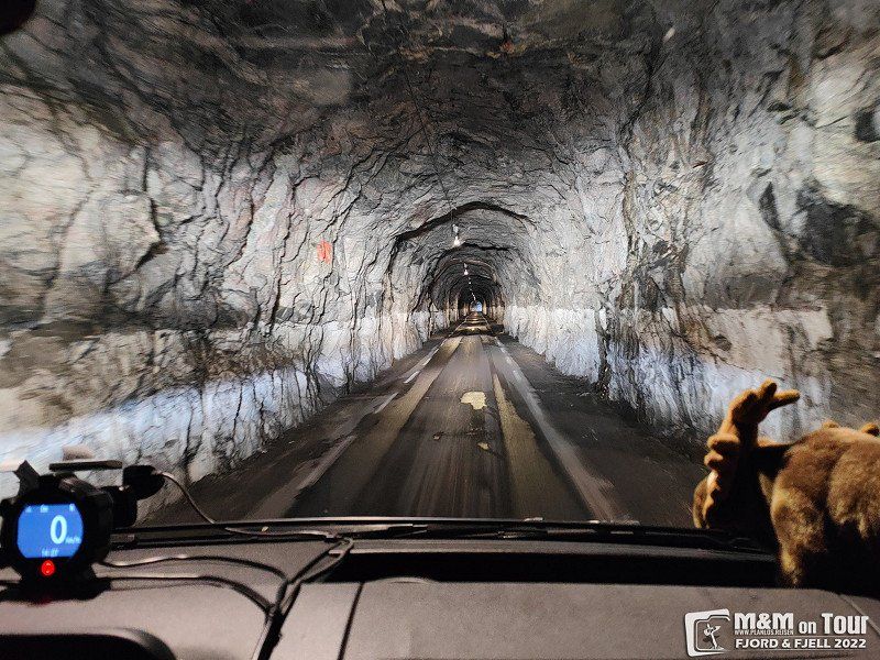
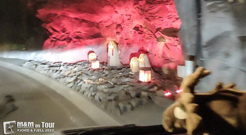
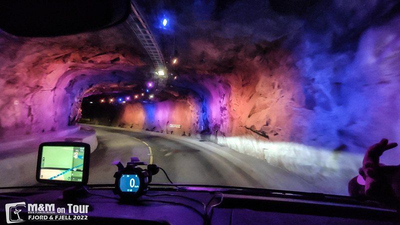
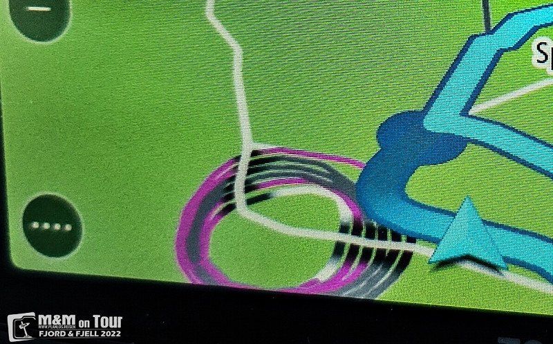
Spiralen, Eivind Olsens vei, Drammen, Norwegen
... a spiral tunnel is pretty cool.
Eivind Olsens vei, 3016 Drammen, Norwegen
59° 45' 7.7" N 10° 12' 3.2" E
59.7521483 10.2008964
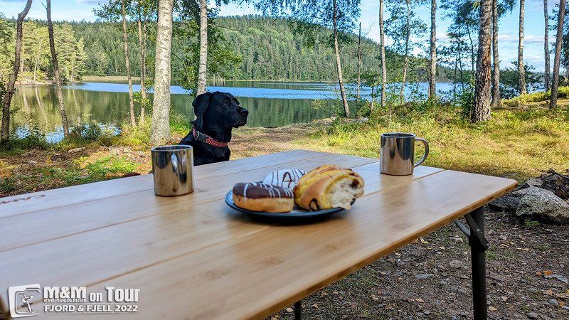
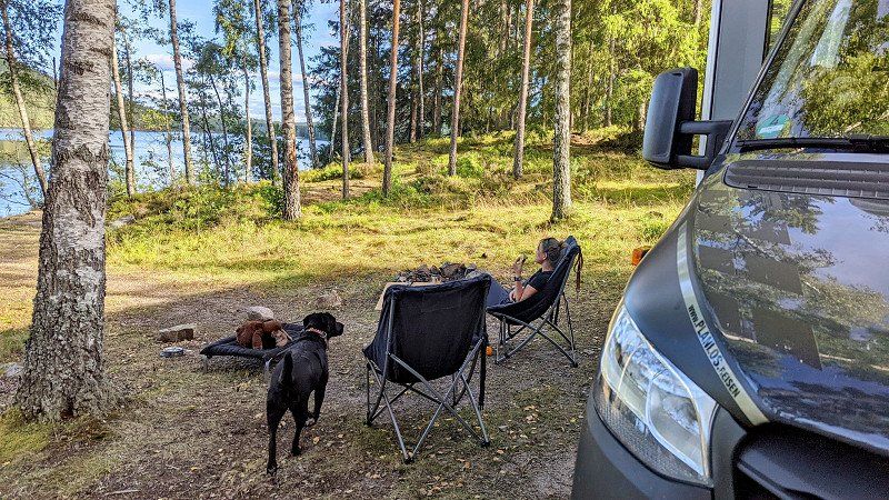
Kråkviken, Schweden
Slowly but surely it's back to everyday life, but we don't miss the lonely Swedish forests.
666 93 Kråkviken, Schweden
59° 8' 13.5" N 12° 11' 48.9" E
59.1370792 12.1969290
Day
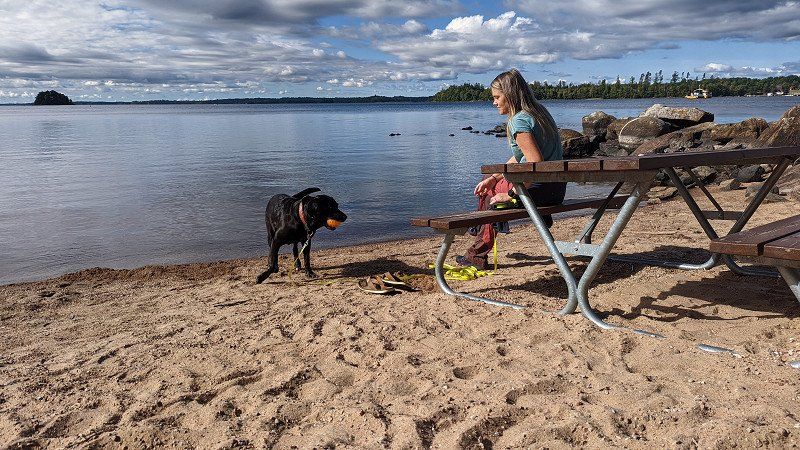
Bolmsö Ställplats & Hytter, Bolmsö, Schweden
Very nice parking space, right on the lake with beach access.
341 93 Bolmsö, Schweden
57° 0' 29.4" N 13° 43' 8.9" E
57.0081628 13.7191368
Day
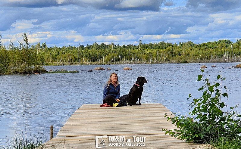
Hormeshult, Schweden
Our second private pitch in Sweden, super secluded, super quiet, super beautiful!
343 73 Hormeshult, Schweden
56° 35' 18.6" N 14° 23' 4.6" E
56.5885111 14.3845980
Day
Bandholm Strand Wohnmobilstellplatz, Strandparken, Bandholm, Dänemark
Our journey ends where it began about 3 weeks ago.
Strandparken 10, 4941 Bandholm, Dänemark
54° 50' 23.3" N 11° 28' 45.5" E
54.8398030 11.4793050