Our first real round trip with the camper - and then soooo nice...! :-)
Verbandsgemeinde Bodenheim, Deutschland
Wormser Str. 14, 55294 Verbandsgemeinde Bodenheim, Deutschland
49° 55' 45.5" N 8° 18' 45.6" E
49.9292948 8.3126740
• Head northwest on Wormser Straße (L413). Go for 56 m.
• Turn left onto Rheinstraße (L413). Go for 213 m.
• Continue on Pfarrstraße (L413). Go for 128 m.
• Continue on Langgasse (L413). Go for 217 m.
• Turn left onto Gaustraße (L413). Go for 822 m.
• Continue on L413. Go for 477 m.
• Take the 1st exit from roundabout onto L413. Go for 1.7 km.
• Turn right onto Steigstraße (L413) toward Mainz/Nieder-Olm. Go for 345 m.
• Turn right onto L425. Go for 662 m.
• Turn left onto Töngesstraße (L413) toward Nieder-Olm/Mz.-Ebersheim. Go for 988 m.
• Take the 2nd exit from roundabout onto Töngesstraße (L413). Go for 748 m.
• Continue on Römerstraße (L413). Go for 271 m.
• Continue on Nieder-Olmer-Straße (L413). Go for 1.3 km.
• Continue on L413. Go for 1.1 km.
• Continue on Ebersheimer Straße (L413). Go for 132 m.
• Take the 1st exit from roundabout onto An der Hubertusmühle (L413). Go for 759 m.
• Continue on Ingelheimer Straße (L401). Go for 255 m.
• Take the 1st exit from roundabout onto Ingelheimer Straße (L413) toward A63/Sprendlingen/Stadecken-Elsheim/Gewerbegebiet Nieder-Olm. Go for 565 m.
• Take the 2nd exit from roundabout onto A63 toward Kaiserslautern. Go for 63.4 km.
• Continue on Dreieck Kaiserslautern. Go for 343 m.
• Continue on A6. Go for 72.1 km.
• Continue on A320. Go for 13.5 km.
• Continue on E50 (Échangeur de Freyming). Go for 259 m.
• Take the left exit toward Paris/Metz/St Avold/Carling onto A4 (Autoroute de l'Est). Go for 202 km.
• Take the exit toward St Gibrien/Épernay/Troyes/Orléans onto A26. Go for 89.5 km.
• Take exit 23 toward Troyes-Est. Go for 809 m.
• Take the 4th exit from roundabout onto D619 toward Chaumont/Lusigny S/Barse/Bar sur-Aube. Go for 7.3 km.
• Turn left onto D1 F. Go for 1.5 km.
• Continue on D1. Go for 74 m.
• Continue on Hameau de Larivour (D1). Go for 759 m.
• Continue on D1. Go for 1.3 km.
• Continue on Lieu-dit Ferme de la Fontainerie (D1). Go for 126 m.
• Continue on Lieu-dit Ferme de la Porcherie (D1). Go for 174 m.
• Continue on D1. Go for 614 m.
• Continue on Lieu-dit La Fromentelle (D1). Go for 185 m.
• Continue on D1. Go for 1.1 km.
• Continue on Lieu-dit Vaudemanche (D1). Go for 190 m.
• Continue on D1. Go for 1.4 km.
• Continue on Rue du Général Bertrand (D1). Go for 1.1 km.
• Take the 1st exit from roundabout onto D43. Go for 80 m.
• Take the 1st exit from roundabout onto Rue du Fort Saint-Georges (D43). Go for 1.2 km.
• Turn left. Go for 118 m.
• Turn left. Go for 64 m.
• Arrive at your destination on the right.
☍
470,2 km
(4 hrs. 16 min.)
Day
Camping Aux Rives du Lac, Rue du Fort Saint-Georges, Géraudot, Frankreich
Rue du Fort Saint-Georges, 10220 Géraudot, Frankreich
48° 18' 11.5" N 4° 20' 14.5" E
48.3032010 4.3373573
• Head toward Rue du Fort Saint-Georges. Go for 182 m.
• Turn right onto Rue du Fort Saint-Georges (D43). Go for 1.2 km.
• Take the 2nd exit from roundabout onto D43. Go for 93 m.
• Take the 2nd exit from roundabout onto Rue du Général Bertrand (D1). Go for 1.1 km.
• Keep right onto D1. Go for 1.4 km.
• Continue on Lieu-dit Vaudemanche (D1). Go for 190 m.
• Continue on D1. Go for 1.1 km.
• Continue on Lieu-dit La Fromentelle (D1). Go for 185 m.
• Continue on D1. Go for 614 m.
• Continue on Lieu-dit Ferme de la Porcherie (D1). Go for 174 m.
• Continue on Lieu-dit Ferme de la Fontainerie (D1). Go for 126 m.
• Continue on D1. Go for 1.3 km.
• Continue on Lieu-dit Larrivour (D1). Go for 759 m.
• Continue on D1. Go for 74 m.
• Continue on D1 F. Go for 1.5 km.
• Turn right onto D619. Go for 7.2 km.
• Take the 1st exit from roundabout onto A26 toward Chaumont/Dijon/Lyon/Sens/Orléans. Go for 7.1 km.
• Take the exit toward Orléans/Paris/Auxerre/Sens onto A5. Go for 69.8 km.
• Take the exit toward Sens/Provins/Orléans onto A19. Go for 28.5 km.
• Take the exit toward Orléans/Montargis onto A19. Go for 35.3 km.
• Take the exit toward Paris/Fontainebleau/Nevers. Go for 1.2 km.
• Take the exit onto A77. Go for 87.8 km.
• Take exit 24 toward Sancerre/Suilly La Tour/Tracy S/Loire. Go for 385 m.
• Take the 1st exit from roundabout onto D4 toward Maltaverne/Tracy S/Loire/St Satur/Sancerre. Go for 287 m.
• Take the 2nd exit from roundabout onto Route des Braults (D4). Go for 5.2 km.
• Continue on Rue du Commerce (D9). Go for 314 m.
• Take the 2nd exit from roundabout onto Rue Paul Cannier (D955). Go for 1.5 km.
• Take the 3rd exit from roundabout onto Lieu-dit Le Petit Morice (D955). Go for 1.3 km.
• Take the 2nd exit from Carrefour Saint-Ladre roundabout onto Avenue de Verdun (D955). Go for 1.4 km.
• Turn right onto D923. Go for 3.4 km.
• Turn left onto D7. Go for 819 m.
• Turn right onto Route de Bué (D85). Go for 965 m.
• Turn right onto Lieu-dit La Vauvise. Go for 154 m.
• Arrive at Lieu-dit La Vauvise.
☍
262,7 km
(2 hrs. 30 min.)
Champagne mal ohne Champagner
Departure from Bodenheim around 12:00 p.m., arrival at Camping Aux Rives du Lac in Géraudot around 5:45 p.m.
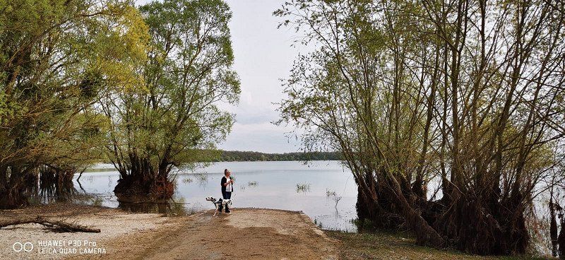
Simple but well-kept facility on the edge of the forest and within walking distance to the lake with a beach and leisure facilities. Dogs are unfortunately not allowed on the lake, not even on a leash... ☹ We actually wanted to go to Urville to buy champagne, but then decided to stock up on Loire wine. So go on...
Day
La Vauvise, Menetou-Râtel, Frankreich
La Vauvise, 18300 Menetou-Râtel, Frankreich
47° 20' 1.1" N 2° 46' 16.8" E
47.3336332 2.7713266
• Head toward Route de Bué on Lieu-dit La Vauvise. Go for 154 m.
• Turn left onto Route de Bué (D85). Go for 965 m.
• Turn sharp right onto D7. Go for 3.4 km.
• Continue on Route de Sancerre (D7). Go for 2.2 km.
• Continue on Rue Jean Moulin (D7). Go for 129 m.
• Turn left onto Route de la Chapelotte (D7). Go for 2.1 km.
• Continue on D7. Go for 357 m.
• Continue on Lieu-dit Les Chailloux (D7). Go for 118 m.
• Continue on D7. Go for 247 m.
• Continue on Lieu-dit Les Réaux (D7). Go for 55 m.
• Continue on Chemin du Vernoy (D7). Go for 159 m.
• Continue on Lieu-dit Même Rang (D7). Go for 85 m.
• Continue on Chemin du Vernoy (D7). Go for 896 m.
• Continue on Lieu-dit La Culotterie (D7). Go for 170 m.
• Continue on D7. Go for 3.4 km.
• Continue on Lieu-dit La Vieille Verrerie (D7). Go for 101 m.
• Continue on Domaine de Beaujeu (D7). Go for 626 m.
• Continue on Lieu-dit Domaine de Beaujeu (D7). Go for 183 m.
• Continue on Domaine de Beaujeu (D7). Go for 629 m.
• Continue on Route de Sancerre (D7). Go for 625 m.
• Turn left onto Route de Sancerre (D11). Go for 8.3 km.
• Take the 3rd exit from roundabout onto Place Henri IV (D20). Go for 8.5 km.
• Take the 2nd exit from roundabout onto D20 toward Allogny/Mehun S/Yèvre. Go for 5.2 km.
• Take the 3rd exit from roundabout onto Lieu-dit Le Barangeon (D20). Go for 5.0 km.
• Turn right onto Route Vierzon (D56). Go for 4.0 km.
• Continue on D56. Go for 357 m.
• Continue on Lieu-dit Les Oussas (D56). Go for 84 m.
• Continue on Route d'Allogny (D56). Go for 3.3 km.
• Continue on Lieu-dit Chaumoux (D56). Go for 83 m.
• Continue on Route d'Allogny (D56). Go for 157 m.
• Continue on D56. Go for 2.1 km.
• Turn left onto Rue Jean Graczyk (D30). Go for 2.1 km.
• Turn right onto Rue de la République (D2076) toward A71/Vierzon/Tours. Go for 4.3 km.
• Take the 3rd exit from roundabout onto Échangeur de Vierzon-Est toward Orléans/Tours/Clermont Fd. Go for 701 m.
• Take ramp onto A71 toward Paris/Tours/Orléans/Vierzon. Go for 11.1 km.
• Take the exit toward Nantes/Tours/Blois onto A85. Go for 206 km.
• Continue toward Nantes/Angers. Go for 212 m.
• Take the exit onto A11 (L'Océane). Go for 17.9 km.
• Take exit 15 toward Angers-Centre. Go for 598 m.
• Keep left onto D323 toward Angers-Centre. Go for 1.5 km.
• Take ramp toward Avrillé/La Doutre. Go for 169 m.
• Turn left onto Boulevard Ayrault. Go for 755 m.
• Take the 1st exit from roundabout onto Place Pierre Mendès France. Go for 188 m.
• Continue on Boulevard Pierre Bessonneau. Go for 114 m.
• Continue on Boulevard de la Résistance et de la Déportation. Go for 109 m.
• Continue on Boulevard du Maréchal Foch. Go for 226 m.
• Turn right onto Rue Saint-Julien. Go for 206 m.
• Turn right onto Rue Saint-Denis. Go for 12 m.
• Arrive at Rue Saint-Denis. Your destination is on the left.
☍
299,7 km
(3 hrs. 2 min.)
Weingut Bernard Fleuriet et Fils - empfehlenswert!
Stations & impressions along the way: Villeneuve de Chemin, Chapelle St. Joseph, embedded in rapeseed and grain fields, surrounded by meadows; a nice rest area Continue via St. Florentin with a marina on Armançon and Pontigny, a nice place with a camper pitch Longer break in beautiful Auxerre, camper pitch right on the Loire.
Shopping and overnight stay at the Bernard Fleuriet et Fils winery in La Vauvise - Menetou-Râtel near Sancerre with a very nice family of winegrowers who also offer holiday apartments. Unfortunately no good walking possibilities with dog. In France there are apparently only seldom dirt roads, every cm of field is used.
Day
Angers, Frankreich
47° 28' 16.2" N 0° 33' 6.6" W
47.4711616 -0.5518257
• Head toward Rue Franklin Roosevelt on Rue Saint-Denis. Go for 12 m.
• Turn right onto Rue Louis de Romain. Go for 115 m.
• Turn left onto Rue Chaperonnière. Go for 87 m.
• Continue on Place Sainte-Croix. Go for 50 m.
• Continue on Rue Toussaint. Go for 283 m.
• Continue on Place du Président Kennedy. Go for 73 m.
• Turn right onto Boulevard du Général de Gaulle. Go for 327 m.
• Turn left and take ramp onto D323 toward Nantes/Laval/Rennes/La Roseraie/Angers-Technopole. Go for 4.0 km.
• Keep right onto Avenue de l'Atlantique (D523) toward Nantes/Bouchemaine/Beaucouzé/Angers. Go for 1.0 km.
• Keep left onto D523 toward Nantes/Ancenis/Châteaubriant. Go for 5.2 km.
• Take ramp onto A11 (L'Océane). Go for 73.1 km.
• Continue on A844 (Périphérique Nord). Go for 4.8 km.
• Continue on A82. Go for 1.6 km.
• Continue on N165. Go for 25.9 km.
• Keep left onto N165 toward Brest/Lorient/Vannes/Savenay-Nord. Go for 69.9 km.
• Keep left onto N165 toward Vannes-Centre/Lorient/Brest/Rennes. Go for 6.8 km.
• Keep left onto Rocade de Vannes (N165) toward Lorient/Brest/Vannes-Ouest/Arradon/Auray. Go for 52.3 km.
• Keep left onto Voie Express de Nantes à Brest (N165) toward Quimper/Brest/Quéven/Ploemeur/Quimperlé/Aéroport Lorient Lann-Bihoué. Go for 38.1 km.
• Take ramp toward Kerampaou/Rosporden/Melgven/Pont-Aven/Névez/Trégunc. Go for 271 m.
• Continue on Lieu-dit Kerampaou (D24). Go for 306 m.
• Turn right onto Lieu-dit Kerampaou (D122). Go for 279 m.
• Continue on Lieu-dit Kercorey (D122). Go for 176 m.
• Continue on D122. Go for 200 m.
• Continue on Kerleo (D122). Go for 664 m.
• Continue on Croas Kerfrancès (D122). Go for 858 m.
• Continue on Rue des Chênes (D122). Go for 1.7 km.
• Continue on Rue des Chênes (D122). Go for 199 m.
• Continue on Rue Yves Trichard (D122). Go for 3.2 km.
• Turn left toward Rue de Melgven/D22. Go for 35 m.
• Continue on Rue de Kérose (D22). Go for 611 m.
• Turn right onto D783. Go for 915 m.
• Take the 2nd exit from Giratoire du Moros roundabout onto Avenue de Bielefeld-Senne (D322 A). Go for 525 m.
• Take the 1st exit from Rond-Point du Lin roundabout onto Avenue Alain Le Lay. Go for 669 m.
• Take the 2nd exit from roundabout onto Avenue de la Gare. Go for 109 m.
• Turn right onto Rue Malakoff. Go for 218 m.
• Turn left onto Rue Bayard. Go for 150 m.
• Turn left onto Rue du Général Morvan. Go for 61 m.
• Arrive at Rue du Général Morvan. Your destination is on the right.
☍
294,9 km
(2 hrs. 59 min.)
Fahrt entlang Loire und Cher, Rast am See
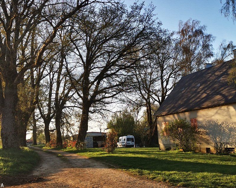
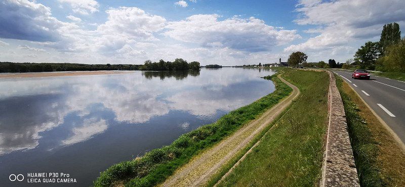
Continue on a very nice route with a view of Sancerre (the town itself doesn't seem to have much to offer except narrow streets) and Mennetou-sur-Cher with a beautiful medieval town center to Tours. No parking space for campers found in Tours, the information from Stellplatz-Info only led us in circles. The city is obviously huge, so just park somewhere and start walking was too tricky for us. So on via Saumur (was too big and industrial for us) to Angers, mostly along the Loire. Every now and then nice little towns, also with campsites and parking spaces (e.g. St. Clément des Levées, St. Mathurin-sur-Loire) to Angers overnight stay at Camping d'Angers Lac de Maine. Very neat, modern place near the lake. Unfortunately, the pool and bistro were not yet open in the off-season. But 7km tour around the lake, the dog was happy
Day
Concarneau, Frankreich
47° 52' 22.2" N 3° 55' 14.6" W
47.8728340 -3.9207340
• Head east on Rue du Général Morvan.
• Turn left onto Rue du Colonel Moll. Go for 121 m.
• Turn left onto Rue Malakoff. Go for 149 m.
• Turn right onto Rue de Porzambars. Go for 31 m.
• Turn right onto Rue Vulcain. Go for 222 m.
• Turn right onto Avenue de la Gare. Go for 51 m.
• Take the 1st exit from roundabout onto Avenue de la Gare. Go for 81 m.
• Turn left onto Quai Carnot. Go for 423 m.
• Continue on Rue du 19 Mars 1962. Go for 91 m.
• Keep right onto Avenue Alain Le Lay. Go for 231 m.
• Take the 3rd exit from Rond-Point du Lin roundabout onto Avenue de Bielefeld-Senne (D322 A). Go for 542 m.
• Take the 1st exit from Giratoire du Moros roundabout onto D783. Go for 941 m.
• Turn left onto Rue de Kérose (D22). Go for 611 m.
• Keep right onto Rue Yves Trichard (D122). Go for 3.2 km.
• Continue on Rue des Chênes (D122). Go for 199 m.
• Continue on Rue des Bruyères (D122). Go for 1.7 km.
• Continue on Croas Kerfrancès (D122). Go for 858 m.
• Continue on Kerleo (D122). Go for 664 m.
• Continue on D122. Go for 200 m.
• Continue on Lieu-dit Kercorey (D122). Go for 176 m.
• Continue on Lieu-dit Kerampaou (D122). Go for 235 m.
• Take ramp onto N165 toward Lorient/Nantes/Quimperlé/Riec S/Bélon. Go for 38.4 km.
• Keep left onto Voie Express de Nantes à Brest (N165) toward Vannes/Nantes/Rennes/Hennebont/Auray. Go for 8.3 km.
• Take ramp onto N24 toward St-Brieuc/Rennes/Dinan/Languidic/Baud/Pontivy. Go for 22.9 km.
• Take ramp onto Route de Pontivy (D768) toward St Brieuc/Pontivy. Go for 472 m.
• Take the 2nd exit from roundabout onto D768 toward Pontivy. Go for 35.6 km.
• Continue on D700. Go for 7.3 km.
• Take the 1st exit from Rond-Point de la Beslière roundabout onto N164 toward Rennes/Plémet. Go for 10.4 km.
• Take the 2nd exit from roundabout onto N164 toward Rennes/Merdrignac. Go for 2.5 km.
• Take the 2nd exit from roundabout onto D1. Go for 258 m.
• Turn right onto D1. Go for 2.1 km.
• Take the 2nd exit from roundabout onto D792. Go for 13.6 km.
• Turn left onto D792. Go for 1.5 km.
• Pass 2 roundabouts and continue on Lieu-dit La Meuniais (D792). Go for 11.4 km.
• Take the 3rd exit from roundabout onto Rue Jules Ferry (D792). Go for 468 m.
• Take the 3rd exit from roundabout onto Rue des Ajoncs (D59). Go for 432 m.
• Continue on D59. Go for 2.7 km.
• Turn right onto D44. Go for 1.4 km.
• Continue on Lieu-dit Les Frêches (D44). Go for 76 m.
• Continue on D44. Go for 925 m.
• Continue on Lieu-dit La Croix de l'Épine (D44). Go for 177 m.
• Take the 3rd exit from roundabout onto D44. Go for 4.3 km.
• Turn right onto D16. Go for 297 m.
• Turn left and take ramp onto N176 toward Dinan. Go for 38.6 km.
• Take ramp onto D137 toward St Malo/Cancale/Châteauneuf d'I. et V. Go for 10.5 km.
• Keep left onto D137 toward Saint-Malo Par Saint-Servan/D168/Dinard/Aéroport Pleurtuit/Barrage de la Rance. Go for 260 m.
• Keep left onto Rue du Général Patton (D137) toward Saint-Malo Par Saint-Servan. Go for 152 m.
• Pass 2 roundabouts and continue on Rue du Général Patton. Go for 845 m.
• Continue on Rue de la Balue. Go for 280 m.
• Take the 1st exit from roundabout onto Rue de la Balue. Go for 296 m.
• Take the 2nd exit from Rond-Point du Mouchoir Vert roundabout onto Rue de la Marne toward St Malo-Centre/Le Port/Centre Hospitalier/Alet. Go for 1.2 km.
• Take the 3rd exit from roundabout onto Rue des Grèves de Chasles (D126) toward Saint-Servan. Go for 159 m.
• Pass 4 roundabouts and continue on Quai Saint-Louis (D126). Go for 1.5 km.
• Turn left onto Porte Saint-Louis. Go for 17 m.
• Continue on Rue de Toulouse. Go for 47 m.
• Turn right onto Rue d'Asfeld. Go for 64 m.
• Turn left onto Rue des Forgeurs. Go for 81 m.
• Continue on Rue Saint-François. Go for 58 m.
• Turn right onto Rue Robert Surcouf. Go for 21 m.
• Turn left onto Rue Sainte-Catherine. Go for 32 m.
• Continue on Place Brevet. Go for 28 m.
• Continue on Rue Saint-Sauveur. Go for 71 m.
• Turn right onto Rue des Bouchers. Go for 75 m.
• Continue on Rue de la Crosse. Go for 113 m.
• Continue on Rue Sainte-Anne. Go for 80 m.
• Continue on Rue Grout de Saint-Georges. Go for 48 m.
• Turn right onto Rue Toullier. Go for 34 m.
• Turn right onto Rue Toullier. Go for 43 m.
• Turn left onto Place Gasnier-Duparc. Go for 55 m.
• Turn right onto Place Jean de Châtillon. Go for 38 m.
• Turn left onto Rue Guillaume Le Gouverneur. Go for 22 m.
• Arrive at Rue Guillaume Le Gouverneur. Your destination is on the left.
☍
230,8 km
(2 hrs. 45 min.)
Camping Les Sables Bancs in Concarneau
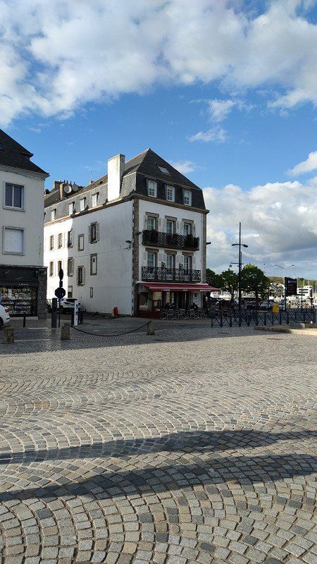
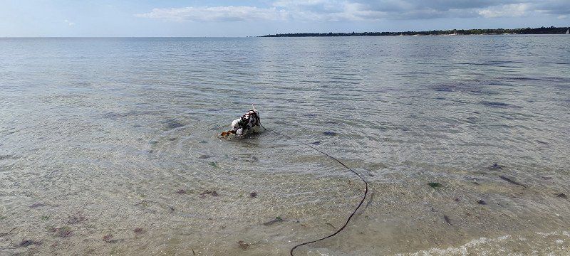
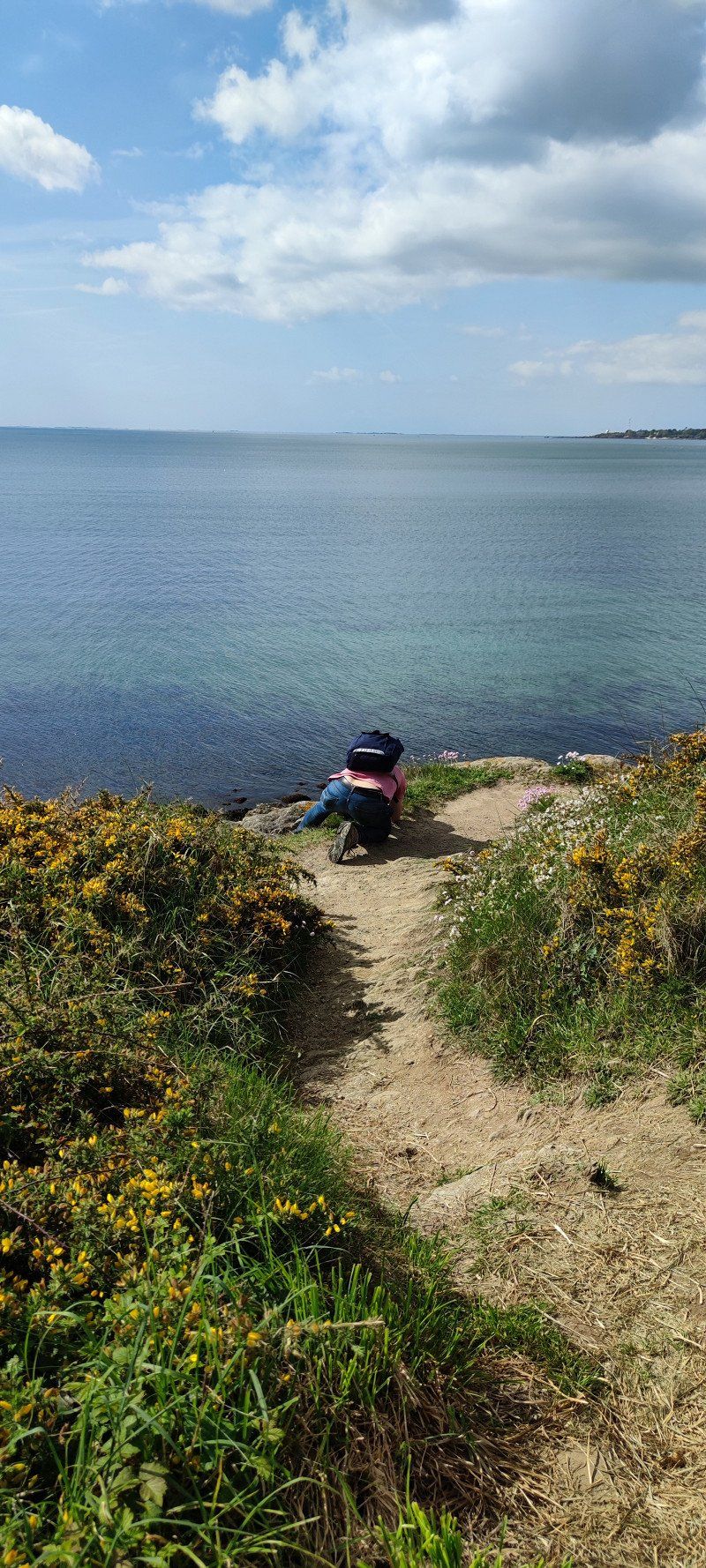
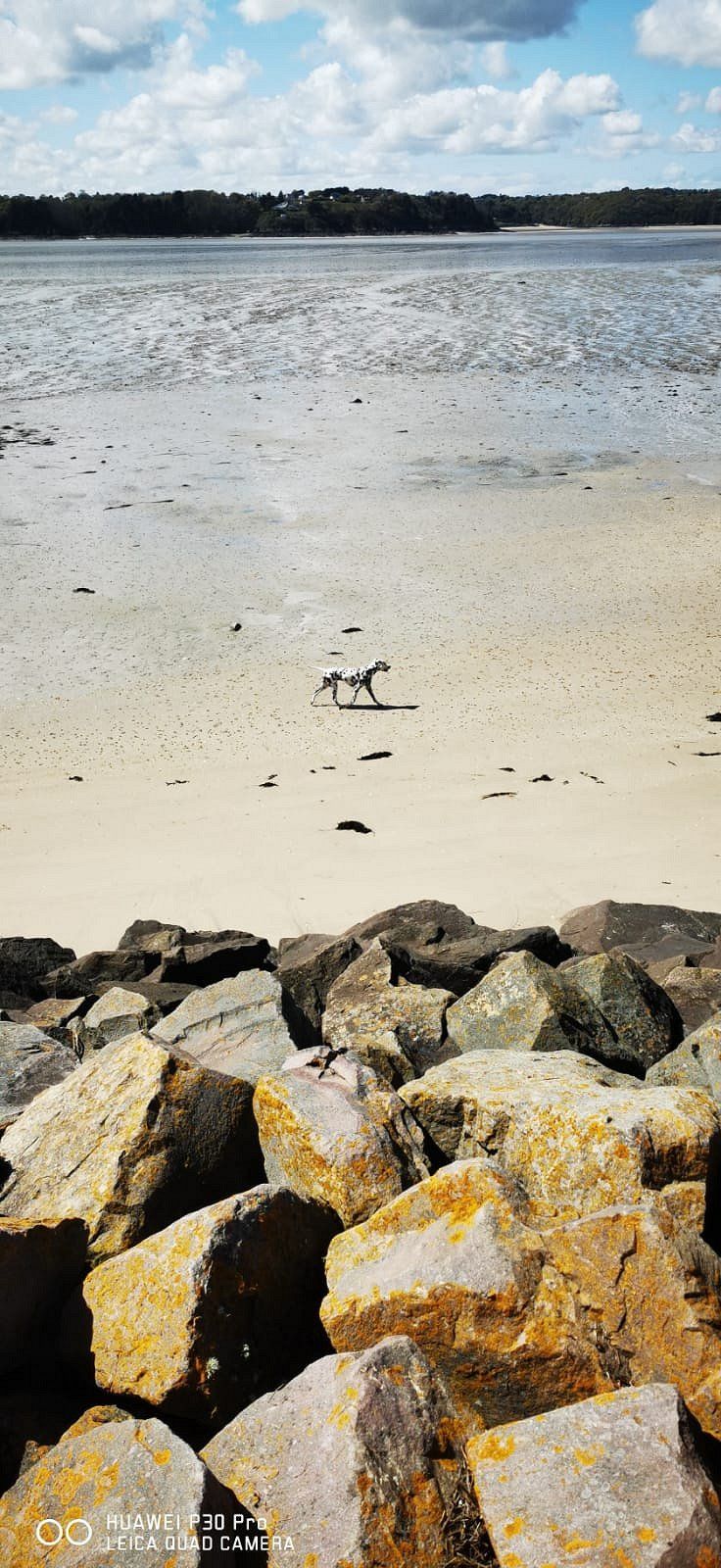
About Nort-sur-Erdre, a nice town with parks and a fairly large marina on the canal, Fay de Bretagne (parking space at a supermarket, quite pretty, but rather sleepy) and Campbon (ville fleurie with a large cathedral, small but pretty and well-kept ) and because of traffic jams through Vannes (large, industrial). A trip along the coast would probably have been worthwhile, but we wanted to keep going and fought our way back onto the N24 via rather pretty back roads to get to Concarneau. Somewhere in the countryside near Pluvigner (quite a nice place) we finally found a forest path for our dog. In Concarneau we then spent 3 nights at the beautifully landscaped and well-equipped Camping Les Sables Blancs. Both town and beach are within walking distance. The latter is unfortunately not allowed for dogs (actually, well, in the low season you don't take it too seriously), but a walk on the Cap also leads to wild beaches where the dogs can let off steam.
The old town of Concarneau was still tolerable at this time, in the summer there are certainly crowds of tourists. But there are still plenty of excursion destinations on the coast. However, we rested first – and of course we ate at the famous l'Amiral.
Day
Bummel in die Alststadt
Concarneau must be pretty crowded in the summer. We were lucky.
Day
Schön hier!
Banksy loves water - even salty... ;-)
Day
voller Einsatz!
Those beautiful flowers everywhere...!
St Malo, Frankreich
Saint-Malo, Frankreich
48° 38' 57.6" N 2° 1' 32.4" W
48.6493370 -2.0256740
• Head toward Place Jean de Châtillon on Rue Guillaume Le Gouverneur. Go for 22 m.
• Turn left onto Rue du Pourpris. Go for 43 m.
• Continue on Rue Broussais. Go for 121 m.
• Continue on Rue de Dinan. Go for 177 m.
• Continue on Porte de Dinan. Go for 25 m.
• Turn left onto Esplanade de la Bourse. Go for 38 m.
• Turn right onto Esplanade de la Bourse. Go for 141 m.
• Take the 2nd exit from Rond-Point de l'Île Maurice roundabout onto Chaussée Éric Tabarly (D126). Go for 530 m.
• Take the 3rd exit from Rond-Point du Naye roundabout onto Quai de Trichet (D126) toward Les Sablons/La Gare. Go for 467 m.
• Take the 4th exit from roundabout onto Quai de Trichet (D126) toward Barrage de la Rance. Go for 455 m.
• Take the 2nd exit from Giratoire des Quatre Pavillons roundabout onto Rue des Grèves de Chasles (D126) toward Marville/Paramé. Go for 152 m.
• Take the 1st exit from roundabout onto Boulevard des Talards toward Bellevue. Go for 212 m.
• Continue on Rue de la Marne. Go for 959 m.
• Take the 3rd exit from Rond-Point du Mouchoir Vert roundabout onto Rue de la Balue toward Dol-de-Bretagne/Barrage de la Rance/Lorette/La Madeleine. Go for 333 m.
• Take the 2nd exit from roundabout onto Rue de la Balue. Go for 316 m.
• Continue on Rue du Général Patton. Go for 416 m.
• Take the 2nd exit from roundabout onto Rue du Général Patton. Go for 348 m.
• Take the 3rd exit from Rond-Point René Cassin roundabout onto Rue du Général Patton (D137). Go for 60.5 km.
• Keep left onto D137 toward Rennes/Z.A. Nord/Lorient/Nantes/P+R Villejean-U. Go for 450 m.
• Take ramp onto Rocade Nord (N136) toward Rocade Ouest/Lorient/Nantes. Go for 4.2 km.
• Take ramp onto Rue de Lorient (N24) toward Vannes/Lorient/Quimper/Le Rheu. Go for 3.5 km.
• Keep left onto N24 toward Le Rheu. Go for 36.9 km.
• Take ramp onto Lieu-dit Le Bois de Guénion (D773) toward Beignon/Guer. Go for 1.2 km.
• Take the 2nd exit from Rue de Saint-Cyr roundabout onto Rue de Saint-Cyr (D773). Go for 2.9 km.
• Turn left onto Rue de l'Église (C2). Go for 227 m.
• Turn right onto C2. Go for 156 m.
• Turn right. Go for 28 m.
• Arrive at your destination on the left.
☍
114,8 km
(1 hrs. 17 min.)
Camping L'etang D'aleth
56380, St Malo De Beignon, France
47° 57' 35.3" N 2° 9' 10.1" W
47.9598000 -2.1528000
• Head south. Go for 28 m.
• Turn left onto C2. Go for 156 m.
• Turn left onto Rue de l'Église (C2). Go for 227 m.
• Turn right onto Rue Nationale (D773). Go for 2.9 km.
• Take the 2nd exit from Rue de Saint-Cyr roundabout onto Rue de Saint-Cyr (D773). Go for 1.2 km.
• Take the 4th exit from roundabout onto Lieu-dit La Bonde (D773) toward Rennes. Go for 152 m.
• Take ramp onto N24 toward Rennes. Go for 40.3 km.
• Keep left onto Rue de Lorient (N24) toward St Malo/Caen/Rennes-Centre. Go for 231 m.
• Turn left and take ramp onto Rocade Ouest (N136) toward Rocade Nord/St Malo/Caen. Go for 970 m.
• Keep left onto Rocade Ouest (N136) toward Ouest/Caen/St Malo/Fougères/Beauregard. Go for 10.0 km.
• Take ramp onto A84 toward Fougères/Mt St Michel/Caen/Cherbourg/Liffré. Go for 66.5 km.
• Continue on N175. Go for 10.5 km.
• Keep left onto A84 toward Cherbourg/Caen/Saint-Lô/Villedieu-les-Poêles. Go for 90.2 km.
• Take the exit toward Paris/Alençon/Flers/Caen-Centre onto N814 (Périphérique). Go for 12.7 km.
• Take ramp onto A13 (Autoroute de Normandie) toward A13 (A813)/Deauville/Trouville/Le Havre/Rouen/Paris. Go for 91.0 km.
• Take exit 25 toward Bourg-Achard. Go for 382 m.
• Take the 2nd exit from roundabout onto D313 toward Bourgtheroulde. Go for 418 m.
• Take the 2nd exit from roundabout onto D313 toward Elbeuf/Bourg Achard. Go for 567 m.
• Turn right onto Grande Rue (D675). Go for 136 m.
• Turn left onto Place de la Mairie (D83) toward Bosc-Bénard-Crescy/Le Neubourg. Go for 58 m.
• Turn left onto Square du Général de Gaulle. Go for 10 m.
• Arrive at Square du Général de Gaulle. Your destination is on the left.
☍
328,5 km
(2 hrs. 59 min.)
St. Malo - lohnt nicht
Again we shortened the coast a bit and drove on the D 790 via Corlay and Plancoët (beautiful place on the canal). Nice rest with a walk on the beach in St. Jacut de la Mer and a break in the very nice restaurant Du Port near the abbey, which will change its name, so beware, but it's worth looking for!
Overnight stay at the simple but beautifully situated Camping d`Aleth (just behind the masts and trees on the picture on the left) with a view of St. Malo. We would have also preferred to go to the small bay of Aleth with its cozy restaurants and pubs instead of going into the gloomy one and crowded St. Malo!
Day
Bourg-Achard, Frankreich
27310 Bourg-Achard, Frankreich
49° 21' 16.5" N 0° 49' 2.9" E
49.3545840 0.8174760
• Head toward Place de la Mairie on Square du Général de Gaulle. Go for 10 m.
• Turn right onto Place de la Mairie (D83). Go for 58 m.
• Turn right onto Grande Rue (D675). Go for 136 m.
• Turn left onto Rue du Docteur Duvrac (D313) toward A13/A28/Rouen/Fécamp. Go for 503 m.
• Take the 3rd exit from roundabout onto D313 toward D675/A13/A28/Fécamp/Rouen. Go for 426 m.
• Take the 2nd exit from roundabout onto D313 toward A13/A28/Fécamp/Pt de Brotonne/La Mailleraye. Go for 361 m.
• Take ramp onto A13 (Autoroute de Normandie) toward Paris/Rouen. Go for 134 km.
• Take the exit toward Lyon/Metz/Nancy/Paris-Centre/Paris-Pte de St Cloud onto Boulevard Périphérique. Go for 7.5 km.
• Keep left onto Boulevard Périphérique toward A3/A1/Metz/A4/Nancy. Go for 2.0 km.
• Keep left onto Boulevard Périphérique. Go for 3.0 km.
• Take ramp onto A4 toward Troyes/A5/Metz/Nancy/Marne la Vallée/Créteil. Go for 7.5 km.
• Keep left onto A4 (Autoroute de l'Est). Go for 363 km.
• Take the exit toward Forbach onto A320. Go for 14.6 km.
• Continue on A6. Go for 71.9 km.
• Keep right onto Dreieck Kaiserslautern toward Frankfurt a.M./Mainz/Kaisersl.-Centrum/A63. Go for 523 m.
• Continue on A63. Go for 60.8 km.
• Take exit 5 toward Saulheim/Nieder-Olm (Süd). Go for 627 m.
• Turn right onto L401 toward Nieder-Olm. Go for 324 m.
• Continue on L432. Go for 893 m.
• Turn left onto Wilhelm-Leuschner-Straße (K34). Go for 371 m.
• Take the 1st exit from roundabout onto Zornheimer Straße (K34) toward Zentrum/Zornheim. Go for 546 m.
• Take the 1st exit from roundabout onto Zornheimer Straße (K34) toward Zornheim. Go for 4.8 km.
• Turn left onto Gaustraße (L425) toward Mainz/Harxheim. Go for 3.0 km.
• Turn right onto Steigstraße (L413). Go for 345 m.
• Turn left onto Langstraße (L413) toward Bodenheim. Go for 1.7 km.
• Take the 2nd exit from roundabout onto L413 toward Bodenheim. Go for 521 m.
• Continue on Gaustraße (L413). Go for 822 m.
• Turn right onto Langgasse (L413). Go for 217 m.
• Continue on Pfarrstraße (L413). Go for 128 m.
• Continue on Rheinstraße (L413). Go for 213 m.
• Turn right onto Wormser Straße (L413) toward Worms. Go for 56 m.
• Arrive at Wormser Straße (L413). Your destination is on the left.
☍
680,7 km
(6 hrs. 17 min.)
Austernbucht und Ärmelkanal
Via Cancales (THE oyster town!) and Saint-Benoît-des-Ondes along the coast (always nice little towns with pitches and campsites) and a break in a pretty oyster bar at Le Vivier-sur-Mer right next to it the coast of the English Channel. We only caught a glimpse of the action at Mont St Michel and preferred to continue. Overnight stay in Bourg Achard (small, but you can buy delicious specialties cheaply) at the beautifully landscaped and well-kept Camping le Clos Normand. Unfortunately little exercise for the dog, but it worked. Nice hosts!
Day
Bodenheim, Deutschland
49° 55' 45.5" N 8° 18' 45.6" E
49.9292948 8.3126740
Heimwärts!
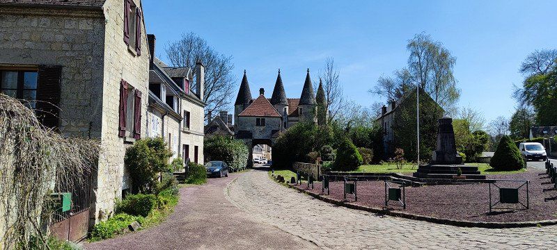
Return journey via the well-developed N or city motorway around Paris and with a nice stopover at the Abbaye Longport just south of Soissons. Then through Belgium and Luxembourg home via Hunsrück-Höhenstraße.
Arrival 21.04. 22:00 O'clock