Day
Abfahrt
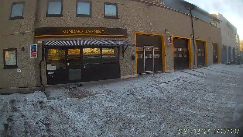
We drove on the first holiday 25.12. with the aim of seeing the northern lights and had the first intermediate destination Flensburg, because on Monday 27.12. in Mölndal near Gothenburg wanted to go to a tire dealer to lend us spiked tires. We found the dealer NDF Däck & Fälg on the internet ndf.se. There we could borrow a set of spiked tires with rims for around €400 and have them fitted. Our bikes are stored for a period of 5 weeks and then reassembled.
bei Würzburg, Deutschland
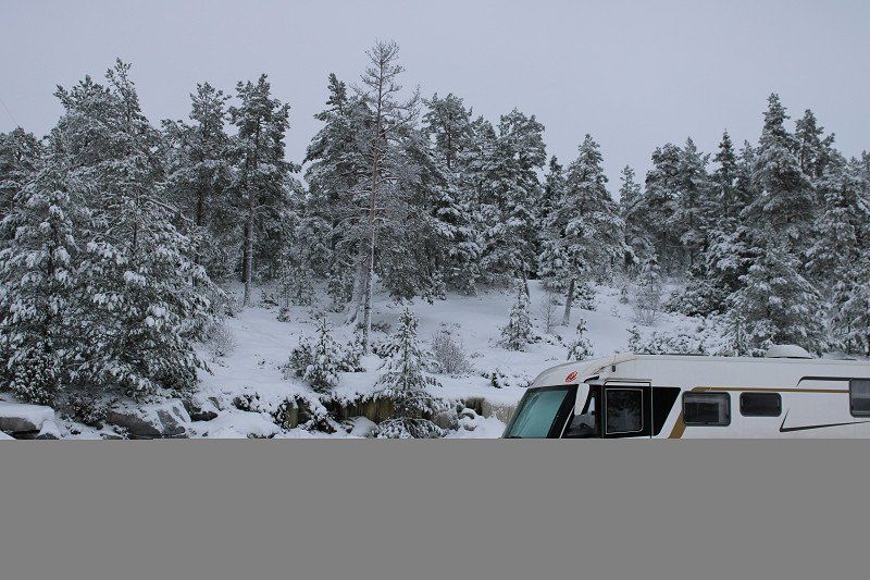
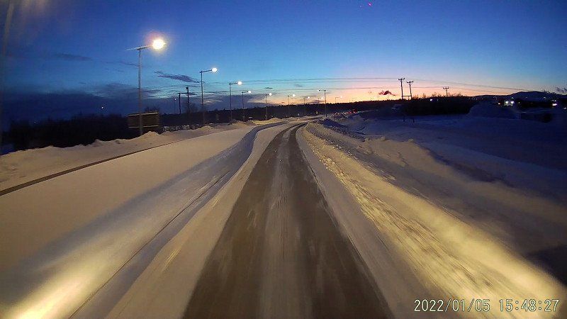
Unfortunately, we had a breakdown right after only 350 km, our radiator thermostat no longer works and the engine no longer warms up. That is why there is no longer any engine heating. After some hesitation and phone calls, we decided to partially cover the radiator and continue the journey. Arrived in Flensburg, we got the hang of it. The Fiat has normal temperatures again, the heating is warming up again. But we're half a day behind schedule. So write to the tire dealer and inform them that we won't be available until December 27th. come in the afternoon instead of early in the morning.
Erbshausen-Sulzwiesen, 97262 Hausen bei Würzburg, Deutschland
49° 54' 43.5" N 10° 0' 31.9" E
49.9120893 10.0088516
• Head toward Evodiusstraße on Erbshausener Straße (WÜ4). Go for 507 m.
• Continue on WÜ4. Go for 109 m.
• Take ramp onto A7 toward Kassel/Erfurt/Bamberg. Go for 124 km.
• Continue on A7. Go for 368 km.
• Keep left onto A7. Go for 155 km.
• Take exit 2 toward Flensburg/Harrislee/Handewitt/Niebüll/Leck. Go for 332 m.
• Turn left onto B199. Go for 3.2 km.
• Turn right onto Lilienthalstraße (K19) toward Gewerbegebiet FL-Weiche/CITTI-PARK P+R. Go for 101 m.
• Turn right onto Lilienthalstraße. Go for 31 m.
• Arrive at Lilienthalstraße. Your destination is on the left.
☍
651,8 km
(5 hrs. 41 min.)
Day
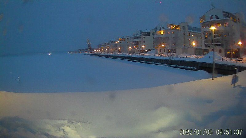
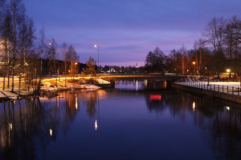
Flensburg, Deutschland
Parking space opposite a supermarket with supply and disposal.
We still tried to get help about the radiator thermostat today on Sunday and the first holiday. Well, Sunday and the first holiday - we tested and tried ourselves and then decided to go north with the self-made radiator cover.
Lilienthalstraße 4, 24941 Flensburg, Deutschland
54° 46' 27.2" N 9° 23' 38.7" E
54.7742282 9.3940825
• Head east on Lilienthalstraße. Go for 31 m.
• Turn left onto Lilienthalstraße (K19). Go for 101 m.
• Turn left onto Lecker Chaussee (B199). Go for 3.1 km.
• Take ramp onto A7 toward Kolding. Go for 4.0 km.
• Continue on E45 (Sønderjyske Motorvej). Go for 89.5 km.
• Keep right onto E20 (Kolding) toward Odense/Fredericia. Go for 209 km.
• Continue on E20 (Avedøre) toward Malmø/Lufthavn/København C. Go for 27.7 km.
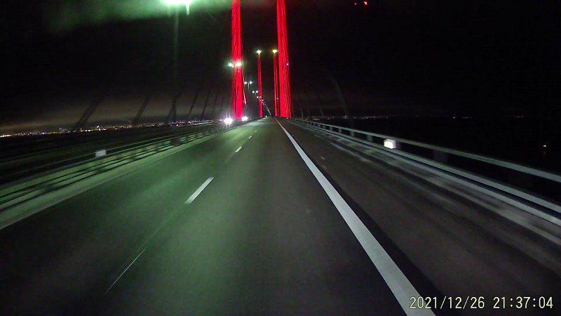
• Continue on E20 (Öresundsbron). Go for 9.8 km.
• Take the exit toward Malmö V/Limhamn. Go for 760 m.
• Continue on Lorensborgsgatan. Go for 387 m.
• Take the 3rd exit from roundabout onto Gottorpsvägen toward Bunkeflostrand/Ollebo. Go for 637 m.
• Pass 3 roundabouts and continue on Gottorpsvägen. Go for 1.9 km.
• Take the 1st exit from roundabout onto Klagshamnsvägen. Go for 1.9 km.
• Turn left onto Tältängsvägen. Go for 740 m.
• Turn left onto Strandgatan. Go for 178 m.
• Continue on Lernacksvägen. Go for 258 m.
• Turn slightly right onto Gamlebrovägen. Go for 346 m.
• Turn right onto Hammars väg. Go for 74 m.
• Arrive at Hammars väg. Your destination is on the right.
☍
350,7 km
(3 hrs. 20 min.)
Day
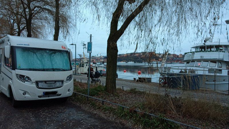
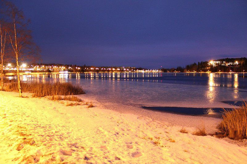
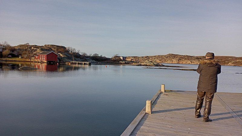
Malmö Camping & Feriecenter
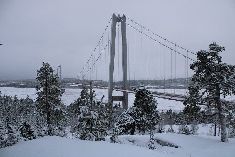
So continue across the Great Belt (bridge) and then take a break at a marina in Malmö with a view of the bridge. Tomorrow morning we continue...
216 11 Limhamn, Schweden
55° 34' 18.9" N 12° 54' 28" E
55.5719155 12.9077768
• Head west on Hammars väg. Go for 74 m.
• Turn left onto Gamlebrovägen. Go for 346 m.
• Turn slightly left onto Lernacksvägen. Go for 258 m.
• Continue on Strandgatan. Go for 178 m.
• Turn right onto Tältängsvägen. Go for 740 m.
• Turn left onto Kalkbrottsgatan toward Centrum. Go for 497 m.
• Turn right onto Annetorpsvägen toward E6/E20/E65/Kalmar/E22. Go for 384 m.
• Pass 5 roundabouts and continue on Annetorpsvägen. Go for 3.6 km.
• Keep left onto Inre Ringvägen. Go for 1.2 km.
• Take the 2nd exit from roundabout onto E6.1 (Inre Ringvägen) toward Göteborg/Kalmar/Ystad. Go for 7.3 km.
• Take the exit toward E6/E20/E22/E11/Simrishamn/Staffanstorp/Toftanäs onto 11. Go for 2.6 km.
• Take the exit toward Göteborg/Kalmar onto E6/E20/E22 (Yttre Ringvägen). Go for 3.6 km.
• Continue on E6/E20 toward E4/Göteborg/Stockholm. Go for 56.8 km.
• Continue on E6/E20 toward Göteborg/111/Höganäs/Helsingborg N. Go for 199 km.
• Take exit 66 toward Göteborg V/Mölndal S C/Centrum/Åbro. Go for 707 m.
• Take the 1st exit from roundabout onto Gamla Kungsbackavägen. Go for 441 m.
• Pass 2 roundabouts and continue on Gamla Kungsbackavägen. Go for 335 m.
• Continue on Göteborgsvägen. Go for 286 m.
• Take the 1st exit from roundabout onto Göteborgsvägen. Go for 930 m.
• Arrive at Göteborgsvägen.
☍
279,1 km
(2 hrs. 43 min.)
Day
Göteborgsvägen, Mölndal, Schweden
57° 39' 54.5" N 12° 0' 43.5" E
57.6651435 12.0120902
• Head north on Göteborgsvägen. Go for 66 m.
• Take the 1st exit from roundabout onto Bifrostgatan. Go for 60 m.
• Turn right onto Ågatan. Go for 83 m.
• Take the 1st exit from roundabout onto Norra Ågatan. Go for 37 m.
• Continue on Gunnebogatan. Go for 267 m.
• Turn left onto Järnvägsgatan. Go for 53 m.
• Take ramp onto E6/E20 (Kungsbackaleden) toward Göteborg. Go for 3.8 km.
• Take exit 71 toward Örgryte onto Örgrytevägen. Go for 232 m.
• Continue on Sankt Sigfrids plan. Go for 59 m.
• Continue on Delsjövägen. Go for 1.1 km.
• Take the 2nd exit from roundabout onto Delsjövägen. Go for 896 m.
• Take the 1st exit from roundabout onto Olbersgatan. Go for 229 m.
• Turn right onto Olbersgatan. Go for 21 m.
• Turn right. Go for 42 m.
• Arrive at your destination on the right.
☍
6,9 km
( 8 min.)
Lisebergsbyn
beautiful large campsite with cabins and pitches for caravans and motorhomes.
Tomorrow we will explore Gothenburg.
Olbersgatan 9, 41655, Göteborg, Sweden
57° 42' 21.6" N 12° 1' 43.4" E
57.7059900 12.0287200
• Head toward Olbersgatan. Go for 42 m.
• Turn left onto Olbersgatan. Go for 21 m.
• Turn left onto Olbersgatan. Go for 212 m.
• Take the 3rd exit from roundabout onto Delsjövägen. Go for 897 m.
• Take the 2nd exit from roundabout onto Delsjövägen. Go for 1.1 km.
• Continue on Sankt Sigfrids plan. Go for 11 m.
• Turn left onto Sankt Sigfrids plan. Go for 49 m.
• Turn right onto Örgrytevägen. Go for 214 m.
• Turn right onto Fabriksgatan. Go for 140 m.
• Turn right and take ramp onto E6/E20 (Kungsbackaleden) toward Malmö/Flygplats/40/158. Go for 873 m.
• Take exit 70 toward Jönköping/Flygplats onto 27/40 (Boråsleden). Go for 54.8 km.
• Continue on 40 (Öst-västleden). Go for 81.9 km.
• Take ramp toward Mariestad/Trollhättan/47/Hjo/195/Flygplats. Go for 221 m.
• Take the 1st exit from roundabout onto 26 toward Mariestad/Trollhättan/Hjo/195/Hedenstorp N/E4. Go for 230 m.
• Take the 2nd exit from roundabout onto 26/47 toward Mariestad/Trollhättan/Hjo. Go for 636 m.
• Take ramp toward Axamo/Mariebo. Go for 221 m.
• Turn right toward Mariebo. Go for 547 m.
• Continue on Åsenvägen. Go for 237 m.
• Turn right onto Åsenvägen. Go for 981 m.
• Turn right onto Åsenvägen. Go for 1.8 km.
• Turn right onto Kungsgatan. Go for 310 m.
• Turn left onto Klostergatan. Go for 451 m.
• Turn right onto Nygatan. Go for 191 m.
• Turn left onto Västgötagatan. Go for 83 m.
• Turn left onto Skolgatan. Go for 42 m.
• Turn left onto Trädgårdsgatan. Go for 14 m.
• Arrive at Trädgårdsgatan. Your destination is on the left.
☍
146,2 km
(1 hrs. 36 min.)
Day
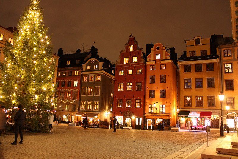
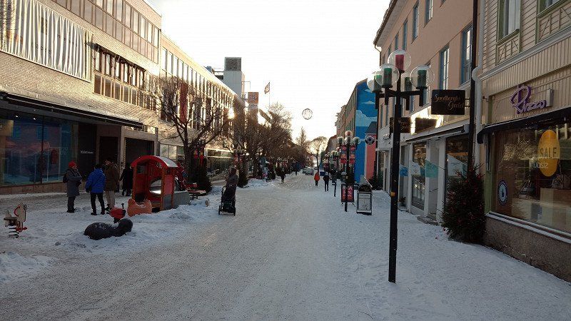
Göteborg
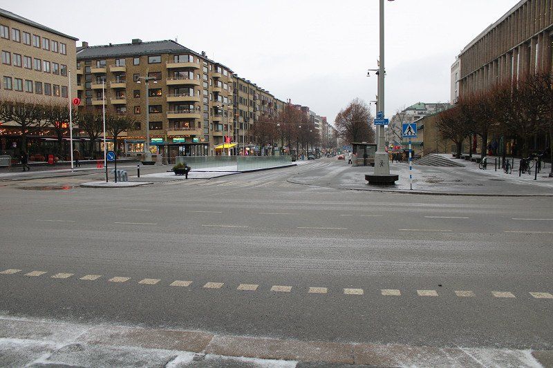
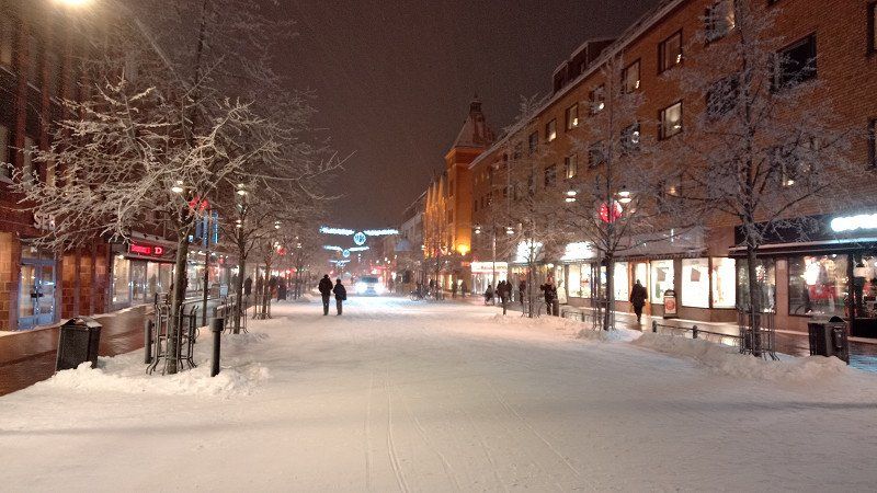
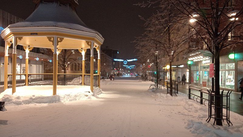
Today we wanted to see Gothenburg. But first thing in the morning: sleet, then rain at 1 p.m., we were wet and didn't feel like it anymore. But otherwise a nice, cozy city.
So we drove on to Jönköping in the afternoon.
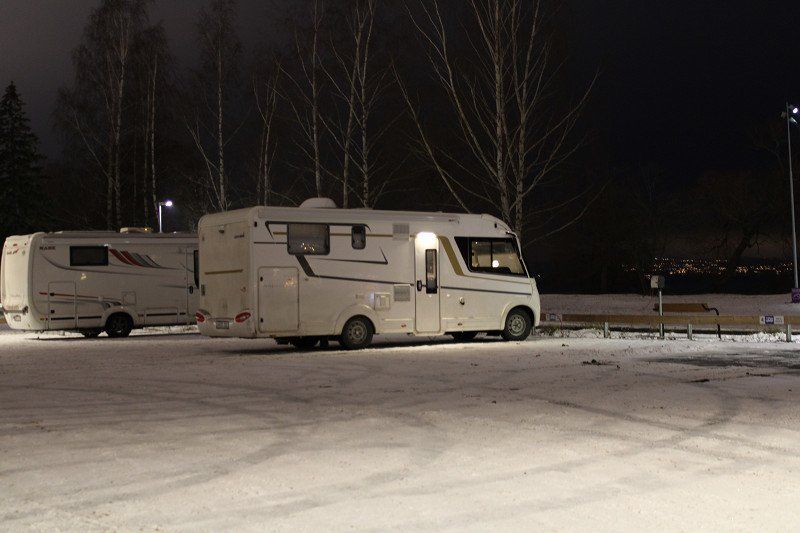
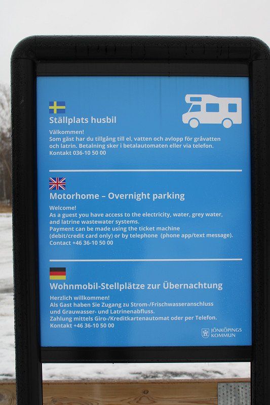
Jönköping, Schweden
There is a new parking space here with electricity and drainage and supply - right on Vättern, works perfectly at -5° C today.
The city and/or the Husqvarna Museum are also worthwhile.
3Alviksvägen, 56132 Sweden
57° 46' 57.4" N 14° 9' 42.4" E
57.7826137 14.1617876
• Head toward Nygatan on Trädgårdsgatan. Go for 66 m.
• Turn left onto Nygatan. Go for 86 m.
• Turn left onto Barnarpsgatan. Go for 84 m.
• Turn right onto Skolgatan. Go for 307 m.
• Continue on Munksjöleden. Go for 355 m.
• Continue on Östra Strandgatan. Go for 74 m.
• Take the 3rd exit from Östra Strandgatan roundabout onto Odengatan (E4.1). Go for 829 m.
• Take the 3rd exit from Tullportsrondellen roundabout onto Odengatan (E4.1). Go for 412 m.
• Take the 1st exit from Rocksjörondellen roundabout onto Odengaten (E4.1). Go for 867 m.
• Take the 4th exit from Kompanirondellen roundabout onto E4 toward 31/47/Elmia/Stockholm. Go for 89.2 km.
• Take exit 108 toward Örebro/Motala/Skänninge. Go for 360 m.
• Turn left onto 50 toward Örebro/Motala/Skänninge. Go for 9.3 km.
• Take ramp toward 206/Vadstena/Mantorp/Skänninge N/Varv. Go for 208 m.
• Take the 1st exit from roundabout toward Borensberg/Varv. Go for 1.3 km.
• Turn right onto Biskopsberga Ljungen. Go for 2.4 km.
• Continue on Vallerstad kyrka. Go for 181 m.
• Continue on Vallerstad Vallslätt. Go for 45 m.
• Continue on Vallerstad Valltorp. Go for 63 m.
• Continue on Hassla Eriksdal. Go for 1.1 km.
• Continue on Hassla Stora Södergård. Go for 51 m.
• Continue on Hassla gård. Go for 108 m.
• Continue on Vallerstad Solhem. Go for 415 m.
• Continue on Vallerstad Fridensborg. Go for 1.2 km.
• Turn right onto Götevi Korpralsgård. Go for 1.3 km.
• Turn left onto Melstad Storgård. Go for 966 m.
• Continue on Träda. Go for 1.7 km.
• Continue on Fornåsa. Go for 406 m.
• Continue on Fornåsa. Go for 954 m.
• Continue on Skänningevägen. Go for 1.4 km.
• Continue on Fornåsa. Go for 561 m.
• Continue toward Lönsås. Go for 760 m.
• Continue on Lönsås. Go for 1.3 km.
• Continue on Lönsås. Go for 159 m.
• Continue on Lönsås. Go for 388 m.
• Continue on Korskrog. Go for 1.2 km.
• Continue on Lönsås. Go for 766 m.
• Continue on Örstorp. Go for 783 m.
• Turn right toward Lönsås Herrängen. Go for 212 m.
• Continue on Lönsås Herrängen. Go for 135 m.
• Continue on Lönsås. Go for 912 m.
• Continue on Brunneby. Go for 1.1 km.
• Continue on Skänningevägen. Go for 1.1 km.
• Turn left toward Magasinsgatan. Go for 12 m.
• Turn right onto Magasinsgatan. Go for 113 m.
• Arrive at Magasinsgatan. Your destination is on the left.
☍
125,3 km
(1 hrs. 24 min.)
Day
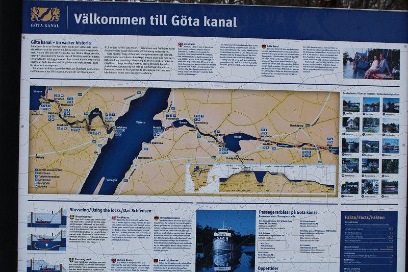
Borensberg am Göta Kanal, Schweden
The parking space directly on the canal also offers supply and disposal in winter. The coffee, however, was closed. But the place isn't far, just over the bridge.
It's beautifully romantic, the canal and the lights in winter.
You can hardly go wrong on the Göta Canal, every place is beautiful and you can find some parking spaces or campsites even in winter.
Magasinsgatan 7, 590 31 Borensberg, Schweden
58° 33' 31" N 15° 16' 46.3" E
58.5586014 15.2795153
• Head north on Magasinsgatan. Go for 18 m.
• Turn right onto Magasinsgatan. Go for 185 m.
• Turn left onto Skänningevägen. Go for 24 m.
• Turn right onto Linköpingsvägen. Go for 2.8 km.
• Turn right onto 34. Go for 18.8 km.
• Keep left onto Trafikplats Linköping västra (34) toward Stockholm/E4/Vimmerby/Linköping V/Flygplats/Sjukhus. Go for 514 m.
• Keep left onto Trafikplats Linköping västra toward Vimmerby/Linköping V/Sjukhus. Go for 252 m.
• Take ramp onto E4 toward Flygplats/Stockholm. Go for 39.8 km.
• Take exit 119 toward Kalmar/E22/Arkösund/209/Norrköping S C/Sjukhus/Flygplats. Go for 505 m.
• Continue on Trafikplats Borg (E22). Go for 1.7 km.
• Take ramp onto Söderleden (E22) toward Sjukhus/Kalmar/Flygplats/Arkösund/Centrum. Go for 4.3 km.
• Keep left onto Söderleden toward Flygplats/209/Arkösund/Risängen. Go for 262 m.
• Continue on Söderleden toward 209/Industriområde Risängen. Go for 336 m.
• Take the 1st exit from Arkösundsrondellen roundabout onto Arkösundsvägen (209). Go for 5.7 km.
• Continue on 209. Go for 293 m.
• Continue on Dagsbergs Storgård (209). Go for 367 m.
• Continue on 209. Go for 5.1 km.
• Continue on Konungsund (209). Go for 710 m.
• Continue on Konungsund Sjöängsbro (209). Go for 420 m.
• Continue on 209. Go for 614 m.
• Continue on Råda Björkebo (209). Go for 121 m.
• Continue on Konungsund (209). Go for 75 m.
• Continue on Petersborg (209). Go for 70 m.
• Continue on Konungsund (209). Go for 155 m.
• Continue on 209. Go for 171 m.
• Continue on Konungsunds bygdegård (209). Go for 264 m.
• Continue on 209. Go for 2.0 km.
• Continue on Östra Stenby Karlslund (209). Go for 363 m.
• Continue on 209. Go for 721 m.
• Continue on Östra Stenby Solbacka (209). Go for 416 m.
• Continue on Östra Stenby (209). Go for 59 m.
• Continue on 209. Go for 2.2 km.
• Continue on Östra Husby Glädingstad (209). Go for 361 m.
• Continue on 209. Go for 2.4 km.
• Continue on Östra Husby Signedal (209). Go for 758 m.
• Continue on 209. Go for 1.9 km.
• Continue on Myrby (209). Go for 563 m.
• Continue on 209. Go for 177 m.
• Continue on Häradshammar Aspliden (209). Go for 586 m.
• Continue on 209. Go for 1.8 km.
• Continue on Reseberga Solklint (209). Go for 463 m.
• Continue on 209. Go for 1.1 km.
• Continue on Svenneby (209). Go for 432 m.
• Continue on 209. Go for 937 m.
• Continue on Svenneby Granliden (209). Go for 731 m.
• Continue on Kättinge Fredriksberg (209). Go for 275 m.
• Continue on Kättinge Nyborg (209). Go for 65 m.
• Continue on Kättinge västra lund (209). Go for 214 m.
• Continue on Holmkärr (209). Go for 138 m.
• Continue on Kättinge Anneborg (209). Go for 1.3 km.
• Continue on 209. Go for 130 m.
• Continue on Kättinge Stenhällen (209). Go for 158 m.
• Continue on 209. Go for 219 m.
• Continue on Kättinge (209). Go for 230 m.
• Continue on 209. Go for 165 m.
• Continue on Fettsätter Yxbergstorp (209). Go for 1.0 km.
• Continue on 209. Go for 256 m.
• Turn left toward Glofshult Västeräng. Go for 425 m.
• Continue on Glofshult Västeräng. Go for 308 m.
• Turn slightly right onto Glofshult. Go for 466 m.
• Continue on Glofshult Solbacken. Go for 166 m.
• Arrive at Glofshult Solbacken.
☍
107,1 km
(1 hrs. 20 min.)
Day
Fahrt über Linköping und Narsholm nach Vikbolandet
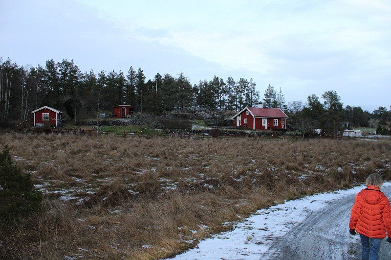
to a typical Swedish farm "Glofshult". Hiking and cycling would be great here. Only 5 km from the Baltic Sea coast. There is also a farm shop.
GQJM+XC Utsäter, Schweden
58° 31' 56.9" N 16° 47' 1" E
58.5324755 16.7835995
• Head toward Kättinge Simmetorp on Glofshult Solbacken. Go for 166 m.
• Continue on Glofshult. Go for 466 m.
• Turn slightly left onto Glofshult Västeräng. Go for 733 m.
• Turn right onto 209. Go for 256 m.
• Continue on Fettsätter Yxbergstorp (209). Go for 1.0 km.
• Continue on 209. Go for 165 m.
• Continue on Kättinge (209). Go for 230 m.
• Continue on 209. Go for 219 m.
• Continue on Kättinge Stenhällen (209). Go for 158 m.
• Continue on 209. Go for 130 m.
• Continue on Kättinge Anneborg (209). Go for 1.3 km.
• Continue on Holmkärr (209). Go for 138 m.
• Continue on Kättinge västra lund (209). Go for 214 m.
• Continue on Kättinge Nyborg (209). Go for 65 m.
• Continue on Kättinge Fredriksberg (209). Go for 275 m.
• Continue on Grönevadshagen (209). Go for 731 m.
• Continue on 209. Go for 937 m.
• Continue on Svenneby (209). Go for 432 m.
• Continue on 209. Go for 1.1 km.
• Continue on Reseberga Solklint (209). Go for 463 m.
• Continue on 209. Go for 1.8 km.
• Continue on Häradshammar Aspliden (209). Go for 586 m.
• Continue on 209. Go for 177 m.
• Continue on Myrby (209). Go for 563 m.
• Continue on 209. Go for 1.9 km.
• Continue on Östra Husby Signedal (209). Go for 758 m.
• Continue on 209. Go for 2.4 km.
• Continue on Östra Husby Glädingstad (209). Go for 361 m.
• Continue on 209. Go for 2.2 km.
• Continue on Östra Stenby (209). Go for 59 m.
• Continue on Östra Stenby Solbacka (209). Go for 416 m.
• Continue on 209. Go for 721 m.
• Continue on Östra Stenby Karlslund (209). Go for 363 m.
• Continue on 209. Go for 2.0 km.
• Continue on Konungsunds bygdegård (209). Go for 264 m.
• Continue on 209. Go for 171 m.
• Continue on Konungsund (209). Go for 155 m.
• Continue on Petersborg (209). Go for 70 m.
• Continue on Konungsund (209). Go for 75 m.
• Continue on Råda Björkebo (209). Go for 121 m.
• Continue on 209. Go for 614 m.
• Continue on Konungsund Sjöängsbro (209). Go for 420 m.
• Continue on Konungsund (209). Go for 710 m.
• Continue on 209. Go for 5.1 km.
• Continue on Dagsbergs Storgård (209). Go for 367 m.
• Continue on 209. Go for 293 m.
• Continue on Arkösundsvägen (209). Go for 5.6 km.
• Take the 3rd exit from Arkösundsrondellen roundabout onto Söderleden. Go for 374 m.
• Take ramp toward Centrum. Go for 228 m.
• Take the 1st exit from Ljurarondellen roundabout onto Söderköpingsvägen (E4.8) toward Centrum. Go for 2.2 km.
• Pass 2 roundabouts and continue on Ståthögavägen (E4.8). Go for 2.4 km.
• Take the 1st exit from Sandbyhovsrondellen roundabout onto Stockholmsvägen (E4.8) toward E4. Go for 222 m.
• Take the 2nd exit from Ingelstarondellen roundabout onto Stockholmsvägen (E4.8) toward E4/51/55/56. Go for 1.6 km.
• Continue on Stockholmsvägen. Go for 315 m.
• Continue toward Trafikplats Norrköping norra. Go for 297 m.
• Continue on Trafikplats Norrköping norra. Go for 395 m.
• Continue on E4 (Trafikplats Norrköping norra). Go for 152 km.
• Take exit 160A toward Fridhemsplan onto Drottningholmsvägen. Go for 916 m.
• Take the 1st exit from Lindhagensplan roundabout onto Rålambshovsleden toward E4 S/E20 S/Centrum. Go for 780 m.
• Continue on Norr Mälarstrand. Go for 867 m.
• Turn right onto Norr Mälarstrand. Go for 17 m.
• Turn right. Go for 48 m.
• Arrive at your destination on the left.
☍
199,6 km
(2 hrs. 18 min.)
Day
Wandertag
Today we have a hiking day. It's 5°, the snow is gone. But the ground is still frozen.
Day
Stockholm
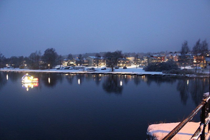
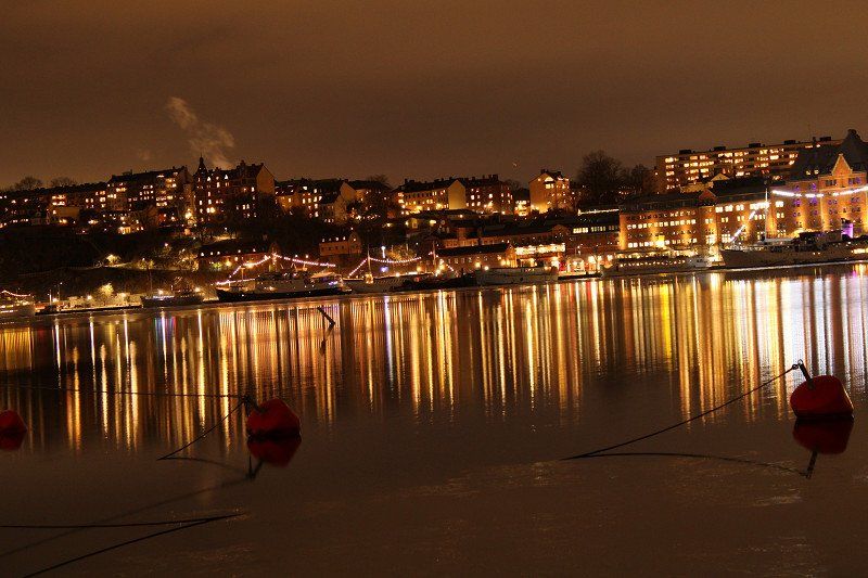
Today we went to Stockholm - in the middle of the city. In the Norr Mälerstrad right next to the town house and a quay with inhabited boats. Ok, being in the middle of the city also means traffic, but in Cornoa times we didn't want to take the bus or train. In addition, a stroll through the city is very easy and beautiful. It's 0°C during the day and -1°C at night.
Norr Mälarstrand 24, 112 20 Stockholm, Schweden
59° 19' 35.7" N 18° 2' 42.4" E
59.3265719 18.0451201
• Head west. Go for 211 m.
• Turn right toward Norr Mälarstrand. Go for 16 m.
• Turn left onto Norr Mälarstrand. Go for 621 m.
• Continue on Rålambshovsleden. Go for 745 m.
• Take the 3rd exit from Lindhagensplan roundabout onto Lindhagensgatan toward E4 N/E20 N/Kristineberg. Go for 605 m.
• Turn left onto Kellgrensgatan. Go for 104 m.
• Take ramp onto E4/E20 (Essingeleden) toward Sundsvall/Solna. Go for 2.8 km.
• Keep left onto E4 (Hagatunneln) toward Sundsvall/E18/Flygplats. Go for 6.5 km.
• Continue on E4 (Uppsalavägen). Go for 346 km.
• Turn right toward Ovansjö. Go for 284 m.
• Continue on Ovansjö. Go for 637 m.
• Turn right toward Ovansjö. Go for 109 m.
• Continue on Ovansjö. Go for 421 m.
• Continue on Ovansjö. Go for 559 m.
• Continue toward Ovansjö. Go for 267 m.
• Continue on Ovansjö. Go for 1.7 km.
• Continue on Ovansjö. Go for 3.2 km.
• Continue on Myrbodarna. Go for 670 m.
• Turn right onto Myrbodarna. Go for 409 m.
• Continue on Vikarbodarna. Go for 503 m.
• Turn right. Go for 29 m.
• Arrive at your destination on the right.
☍
366,2 km
(3 hrs. 48 min.)
Day
Vikarbodarna, Schweden
After it snowed at night in Stockholm and fog and thaw set in early in the morning, we drove to Sundsvall via Uppsala after breakfast. In Uppsala we were able to shop for dinner and fill up with diesel despite it being a Sunday. All major shops and markets are open until 10pm. Tomorrow we will fill up with gas in Kvissleby.
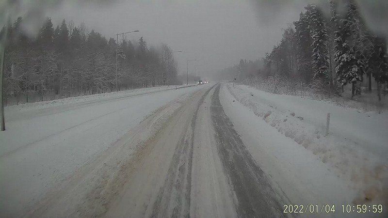
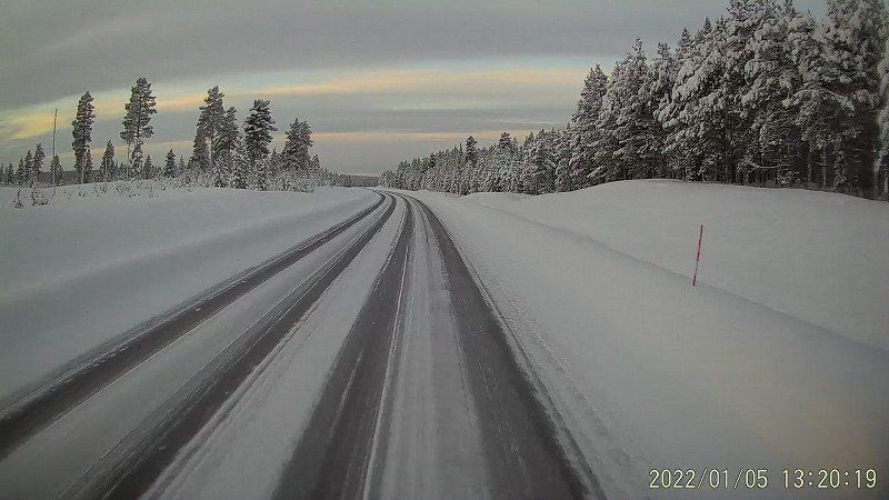
Unfortunately we had fog the whole way, the roads were covered with snow from Gävle onwards. But no one cares, it is driven 110 on the E4. So it comes as it has to come, an overtaker comes about 1 km ahead of us in the deep snow and in the central boundary. After 150 m, the front of the car is in the oncoming lane and the rear is in the fast lane. Everyone gets stuck and we have to spend an hour on the autobahn before the route is released again. Has anyone learned anything? No, within the next 7 km there are 2 more accidents. We're glad we borrowed spiked tires.
We have decided not to drive any further and therefore drive to a parking space at Vikarbodarna. Just beautiful!!! In the middle of the snow, on the edge of the forest, next to a small town and only 50 m from the Baltic Sea. There is even supply and disposal despite the winter time (-7°C) the water works!
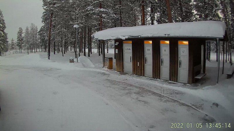
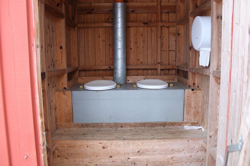
By the way: there are very nice rest areas on the E4 and they all have clean toilets with latrines for disposal!
Vikarbodarna 210, 862 96 Njurunda, Schweden
62° 11' 56.8" N 17° 29' 44.5" E
62.1990974 17.4956842
• Head toward Vikarbodarna. Go for 29 m.
• Turn left onto Vikarbodarna. Go for 664 m.
• Continue on Myrbodarna. Go for 248 m.
• Turn left onto Myrbodarna. Go for 902 m.
• Continue on Ovansjö. Go for 4.5 km.
• Continue on Ovansjö. Go for 540 m.
• Continue on Ovansjö. Go for 609 m.
• Continue on Ovansjö. Go for 480 m.
• Turn right onto Ovansjö. Go for 85 m.
• Continue on Ulvberg. Go for 1.2 km.
• Turn left toward E4. Go for 37 m.
• Turn right onto E4. Go for 67.2 km.
• Keep left onto E4 toward Haparanda/Sollefteå/90. Go for 102 km.
• Take the 3rd exit from roundabout onto Centralesplanaden (E4) toward Haparanda. Go for 2.7 km.
• Take the 3rd exit from roundabout onto E4 toward Haparanda. Go for 100 km.
• Turn right onto Stöcksjö Degernäsväg. Go for 1.5 km.
• Continue on Degernäs. Go for 807 m.
• Continue on Stöcksjö Degernäsväg. Go for 1.3 km.
• Arrive at Stöcksjö Degernäsväg.
☍
285,1 km
(3 hrs. 16 min.)
Day
Degernäs bei Umea, Schweden
Today we were gas and diesel fuel, then we drove along the coast (Höga Kustenleden). We think a piece of coast worth seeing and unique in Sweden. It is a piece of fjord coast. With frozen side arms of the Baltic Sea.
The weather: cold winter, partly heavy snowfall and then again at -1° C drizzle. Even the E4 was very difficult to drive. Not 300 km but a 4.5 hour drive;-).
The landscape is magnificent!
Degernäs 2, 905 80 Umeå, Schweden
63° 46' 0.3" N 20° 15' 21.7" E
63.7667553 20.2560348
• Head east on Stöcksjö Degernäsväg. Go for 286 m.
• Continue on Degernäs. Go for 86 m.
• Continue on Stöcksjö Degernäsväg. Go for 1.6 km.
• Turn left onto Blå vägen (E12). Go for 3.9 km.
• Take the 1st exit from Alviksrondellen roundabout onto Mineral (E4) toward Haparanda/Mo i Rana/92/363/364. Go for 1.4 km.
• Take the 2nd exit from Gimonäsrondellen roundabout onto Mineral (E4) toward Haparanda/E12/Mo i Rana/92/363/364. Go for 654 m.
• Take the 2nd exit from Carlshemsrondellen roundabout onto Mineral (E4) toward Haparanda/E12/Mo i Rana/92/363/364. Go for 610 m.
• Pass 7 roundabouts and continue on E4. Go for 256 km.
• Take ramp toward Bergnäset/Avan/Flygplats. Go for 1.8 km.
• Take the 1st exit from roundabout onto Älvbrovägen. Go for 2.3 km.
• Take the 2nd exit from roundabout onto Älvbrovägen. Go for 2.0 km.
• Continue on Bergnäsbron. Go for 745 m.
• Continue on Sandviksgatan. Go for 712 m.
• Turn right onto Södra Hamnleden. Go for 331 m.
• Arrive at Södra Hamnleden. Your destination is on the right.
☍
272,1 km
(3 hrs. 3 min.)
Day
Lulea, 38 Södra Kungsgatan, Schweden
this is a parking space belonging to a marina, we landed there unplanned. Because we just weren't as fast as we thought. We left at 9:00 this morning. In between we only filled up and made lunch. From then on, almost nothing worked. Every few miles the windshield wipers were full of ice and couldn't get the water wiped aside. Gradually a layer of ice formed on the pane. It was the same for all other drivers, you had to stop constantly and clean the wipers and the window. Crap today only 280 km done....
Now we have explored the city, it is beautiful and lively - certainly worth more than one night.
Oh yes, I almost forgot: Large snow blowers (trucks) drive on the ice of the Baltic Sea and prepare ice surfaces for skating.
Södra Smedjegatan 2, 972 35 Luleå, Schweden
65° 34' 49.4" N 22° 9' 6.7" E
65.5803862 22.1518654
• Head toward Södra Smedjegatan on Södra Hamnleden. Go for 121 m.
• Turn left onto Smedjegatan. Go for 541 m.
• Take the 2nd exit from roundabout onto Bodenvägen. Go for 1.9 km.
• Take the 2nd exit from roundabout onto Bodenvägen. Go for 2.1 km.
• Take the 2nd exit from roundabout onto Bodenvägen (97). Go for 2.0 km.
• Take ramp onto E4/E10 toward Haparanda/Kiruna. Go for 47.1 km.
• Take ramp toward Kiruna/Töre/Töre hamn. Go for 359 m.
• Continue on E10. Go for 176 km.
• Turn right onto E10 toward Kiruna/E45/Karesuando/Svappavaara. Go for 65.1 km.
• Continue on Etian (E10) toward Kiruna. Go for 43.0 km.
• Take the 3rd exit from roundabout onto Malmvägen. Go for 1.8 km.
• Take the 2nd exit from roundabout onto Malmvägen. Go for 1.5 km.
• Continue on Hjalmar Lundbohmsvägen. Go for 1.6 km.
• Turn right onto Lars Janssonsgatan. Go for 145 m.
• Turn left onto Vänortstorget. Go for 56 m.
• Turn left. Go for 24 m.
• Arrive at your destination on the left.
☍
343,7 km
(3 hrs. 45 min.)
Day
Kiruna, Schweden
today everything worked out, the weather was good, the little snow came as "dry powder snow". The wiper blades had no problem with that. We crossed the Arctic Circle and reached Kiruna around 3:00 p.m. (The time on the pictures is 1 hour too late) The sky has cleared up, the sun has peeked out on the horizon. And now you can see the stars. Tonight around 4.00 am there is also the first slight chance of seeing the Northern Lights.
By the way: the temperatures have been in double digits since last night. This afternoon it was already -17° C and tonight -20° is forecast.
Once again the subject of disposal: There are really some parking lots (also on the E10) with a picnic area, there are also toilets there and each one also has a "latrine emptying". Sometimes there is even drinking water.
67° 51' 20.9" N 20° 13' 31" E
67.8557995 20.2252821
• Head toward Vänortstorget. Go for 33 m.
• Turn left onto Vänortstorget. Go for 48 m.
• Turn right onto Lars Janssonsgatan. Go for 86 m.
• Turn left onto Hjalmar Lundbohmsvägen. Go for 1.6 km.
• Continue on Malmvägen. Go for 1.5 km.
• Take the 2nd exit from roundabout onto Malmvägen. Go for 1.7 km.
• Take the 2nd exit from roundabout onto E10. Go for 43.0 km.
• Turn left onto Inlandsvägen (E45) toward Pajala/Karesuando/Svappavaara. Go for 24.7 km.
• Continue on 395 toward Pajala. Go for 104 km.
• Turn left onto Autio (99) toward Karesuando/Muodoslompolo/Kaunisvaara. Go for 1.1 km.
• Turn right toward Finland. Go for 165 m.
• Continue on Autio. Go for 2.5 km.
• Continue on Rova. Go for 3.6 km.
• Continue on Rova. Go for 1.2 km.
• Continue on Niva. Go for 1.1 km.
• Turn left onto 403. Go for 22.3 km.
• Turn right onto 403. Go for 155 m.
• Continue on Tullintie (943). Go for 521 m.
• Turn left onto Jokijalantie (943). Go for 4.6 km.
• Turn left onto Muoniontie (E8). Go for 1.4 km.
• Turn right onto Kurtakontie (939) toward Kittilä/80/Ylläs-Ylläsjärvi. Go for 45.4 km.
• Turn right onto Lainiotie. Go for 3.2 km.
• Turn slightly right onto Lainiotie. Go for 1.0 km.
• Turn slightly left onto Lainiotie. Go for 1.1 km.
• Arrive at Lainiotie. Your destination is on the right.
☍
266,3 km
(3 hrs. 15 min.)
Day
Day
heute fällt die Temperatur auf - 27° C
It's already the 4th or 5th day below -15° and ice is slowly forming on the inside of the profiles of the doors and flaps. But everything works perfectly, the Alde heating warms up nicely and even the insulating glass panes in the front remain free of ice. The waste water tank can be emptied perfectly. A Gardena shut-off valve only broke when I was filling the water tank. It's exciting to fill up with water at - 25 °C.
Day
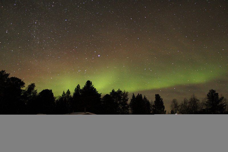
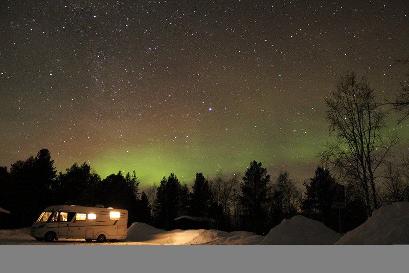
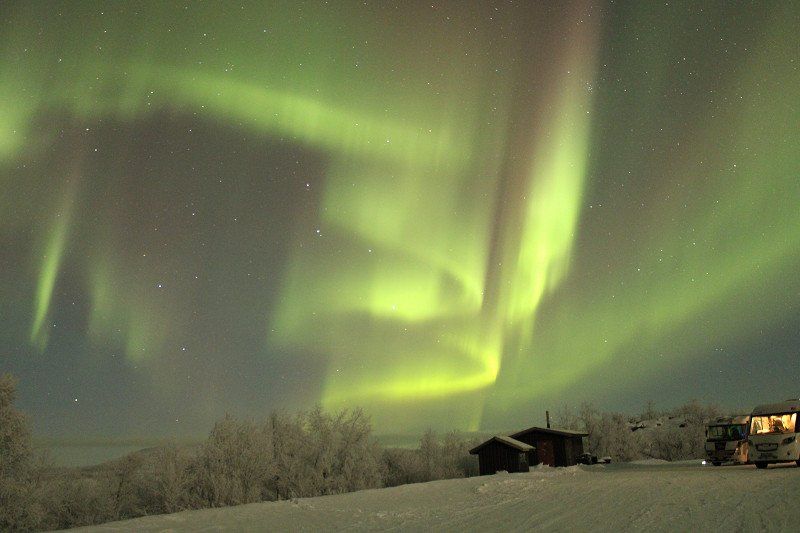
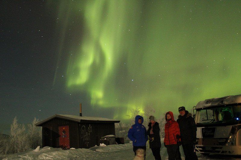
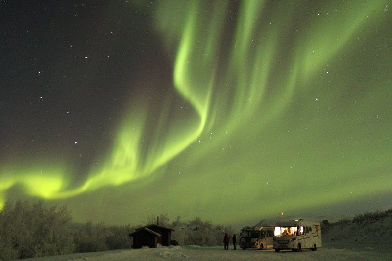
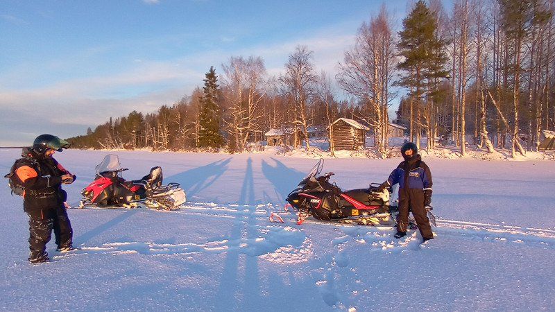
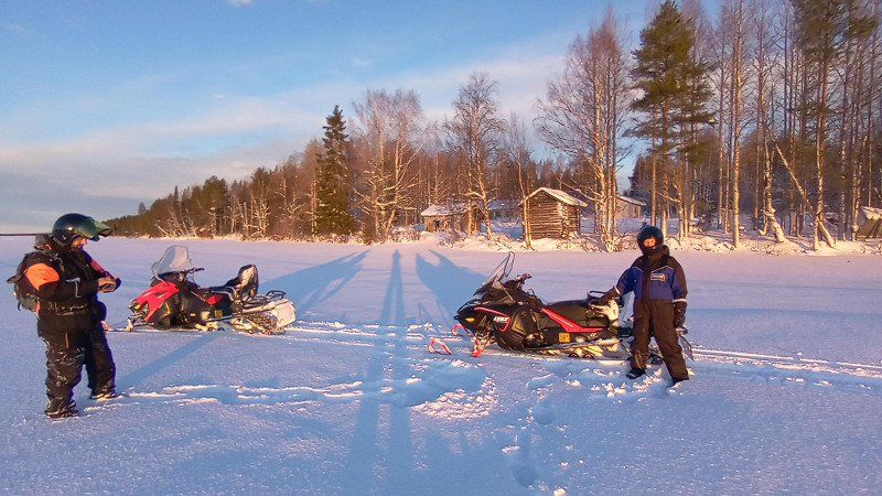
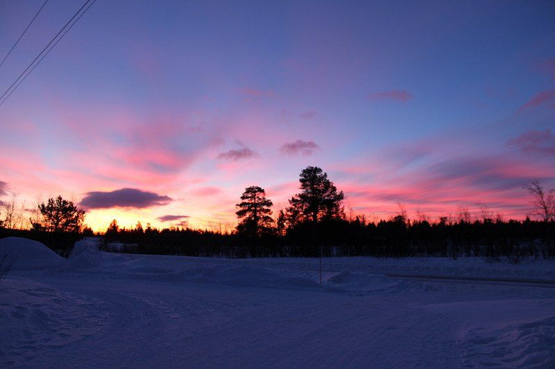
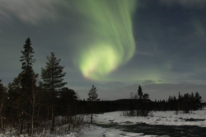
Polarlichter
we are bursting with pride, our first attempt to see the northern lights worked. We drove 50 km west towards Narvik into solitude. It was really dark there. After about 3 hours of patience, the time had come. The mobile phone works as a remote control for the Canon camera - until, yes, until the mobile phone battery suddenly tells you that it's too cold. So quickly held a hand warmer under the cell phone and warmed the cell phone.
Day
Day
Kiruna
we spent the last few days hiking and walking in and around Kiruna. In the evening we drove off into the dark and photographed the northern lights.
We also got to know a nice couple from South Tyrol with whom we spent nice hours.
Day
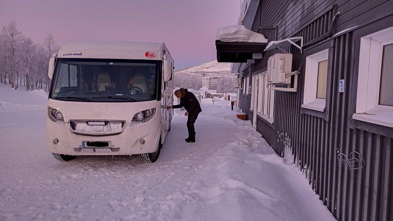
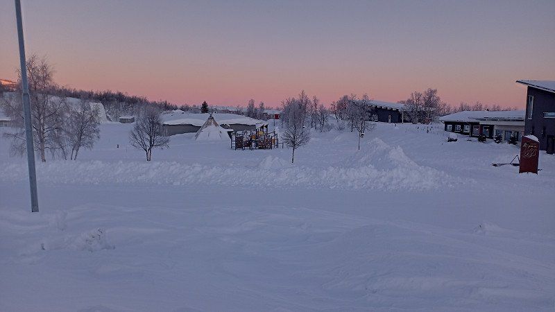
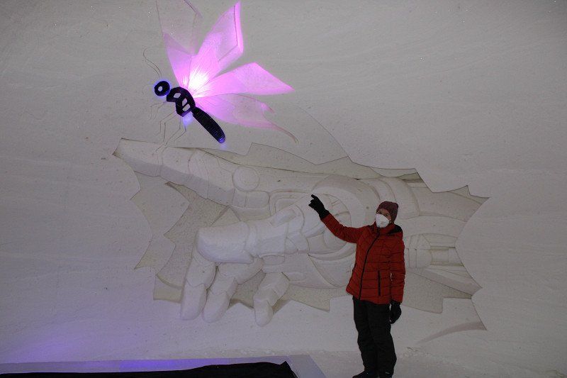
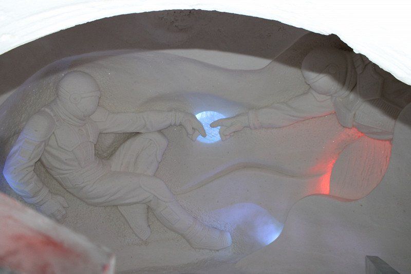
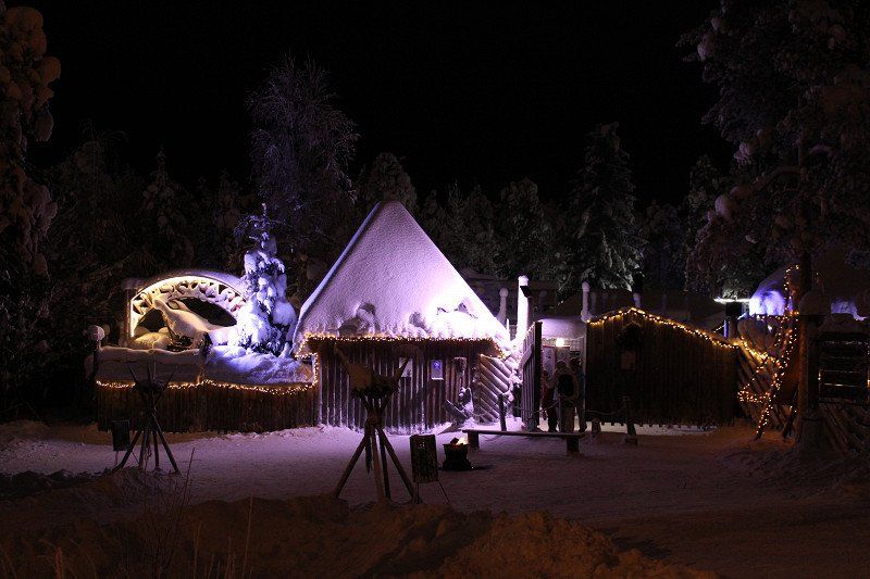
Snow Village
still at around -20 °C. Inside and outside of the Snow Village. We visited the village for €19 per person and were amazed by the snow sculptures - amazing.
Lainiotie 566, 99100 Kittilä, Finnland
67° 32' 31.7" N 24° 29' 40.9" E
67.5421339 24.4947052
• Head north on Lainiotie. Go for 5.4 km.
• Turn right onto Ylläksentie (939). Go for 21.0 km.
• Turn right onto Valtatie (79) toward Rovaniemi/80/Keskusta. Go for 2.0 km.
• Turn left onto Ollintie. Go for 116 m.
• Turn left onto Rantatie. Go for 281 m.
• Turn right. Go for 30 m.
• Turn right. Go for 1.3 km.
• Arrive at your destination on the left.
☍
30,1 km
( 34 min.)
Lainiotie 566, 99100 Kittilä
We went to Finland and checked out the snow hotel near Kittilä. Impressive sculptures in every room!
Then we went to Kittilä itself because there is a nice pitch right by the river. It has no service but pure nature. There was plenty of snow. when we got there there was already a camper there and we couldn't find a place in the snow without getting stuck. So we went back 150m and stayed there overnight.
Pakatti, Finnland
MW2G+PC Pakatti, Finnland
67° 39' 6.5" N 24° 55' 33.9" E
67.6517939 24.9260706
• Head northwest. Go for 1.3 km.
• Turn left toward Rantatie. Go for 30 m.
• Turn left onto Rantatie. Go for 281 m.
• Turn right onto Ollintie. Go for 116 m.
• Turn left onto Valtatie (79). Go for 91.4 km.
• Continue on Ounasjoen Itäpuolentie (934) toward Saarenkylä. Go for 56.5 km.
• Turn right and take ramp onto Sodankyläntie (E75). Go for 4.1 km.
• Arrive at Sodankyläntie (E75). Your destination is on the left.
☍
153,7 km
(1 hrs. 40 min.)
Day
Rovaniemi, Finnland
First we went shopping in Rovaniemi. Then we are to Santa Claus Park. Yesterday we used the webcam to call the grandchildren. And went for quite a long walk in the evening. Today we went on a reindeer ride - nice and leisurely through the winter forest.
Tomorrow we're going to do a Ski-Doo Tour - let's see how that goes.
The BestPark pitch is great. Supply and disposal work and there is a sauna all for the price of €24.90. Only the current is only fused with 6 A.
Sodankyläntie 551, 96900 Rovaniemi, Finnland
66° 32' 31" N 25° 48' 25.5" E
66.5419468 25.8070780
• Head toward Myllymäentie on Sodankyläntie (E75). Go for 11.1 km.
• Turn right. Go for 61 m.
• Arrive at your destination.
☍
11,2 km
( 8 min.)
Day
Rovaniemi, Finnland
Sodankyläntie 1654, 96900 Rovaniemi, Finnland
66° 34' 57" N 26° 1' 27.7" E
66.5824887 26.0243629
• Head toward Sodankyläntie. Go for 61 m.
• Turn left onto Sodankyläntie (E75). Go for 16.2 km.
• Take ramp toward Muonio/Pello/Kajaani/78/83/Keskusta/Centre/Ounasvaara. Go for 334 m.
• Turn right onto Kantatie 79 (79) toward Muonio/Kittilä/Pello/83. Go for 3.7 km.
• Take the 2nd exit from roundabout onto Kittiläntie (79) toward Muonio. Go for 17.0 km.
• Turn left onto Pellontie (83) toward Pello. Go for 78.0 km.
• Turn right onto Pellontie (E8) toward Kilpisjärvi/Muonio/Ruotsi/Sverige. Go for 413 m.
• Turn left onto Tullitie (937) toward Ruotsi/Sverige. Go for 186 m.
• Continue on 937. Go for 113 m.
• Continue on 402. Go for 82 m.
• Continue on Ragnar Lassinanttis väg (402). Go for 488 m.
• Continue on 402. Go for 2.7 km.
• Turn right onto 99. Go for 53.9 km.
• Take the 2nd exit from roundabout onto Genvägen (99) toward Karesuando/395/Pajala flygplats/Kiruna. Go for 6.9 km.
• Continue on Autio (395). Go for 104 km.
• Continue on Inlandsvägen (E45) toward Kiruna/E10/Gällivare. Go for 24.7 km.
• Turn right onto Etian (E10). Go for 43.0 km.
• Pass 4 roundabouts and continue on E10. Go for 24.5 km.
• Turn right onto Rautas östra. Go for 59 m.
• Arrive at Rautas östra. Your destination is on the right.
☍
376,4 km
(4 hrs. 31 min.)
Day
Rovaniemi
we stay 2 more days in Rovaniemi. Today we ride the Skidoo. We are lucky!!!! The booked tour takes place with us as the only participants. And - we can't believe it, our guide's name is Martin and he comes from Germany. After a short briefing you can start. The chemistry between Martin and us seems to be right, we have fun!
In the evening we look for a parking space just outside at a rest area that is also used by locals to look for the northern lights.
Day
Rastplats bei Kiruna
Today we are going back to Kiruna, we want to be at the gas professional before 4 p.m. and have our tank bottle filled. Then we make our way a bit outside to get another chance to see the Northern Lights.
981 95 Kiruna, Schweden
67° 59' 28.8" N 19° 55' 19.8" E
67.9913335 19.9221611
• Head toward Rautas on Rautas östra. Go for 59 m.
• Turn left onto Rautas östra (E10). Go for 17.7 km.
• Pass 3 roundabouts and continue on E10. Go for 6.7 km.
• Take the 3rd exit from roundabout onto E10. Go for 105 km.
• Turn right onto Inlandsvägen (E45) toward Flygplats/Gällivare. Go for 8.7 km.
• Take the 2nd exit from roundabout onto Nuolajärvivägen toward Sjukhus. Go for 1.8 km.
• Take the 2nd exit from roundabout onto Luleåvägen. Go for 200 m.
• Continue on Lasarettsgatan. Go for 305 m.
• Take the 3rd exit from roundabout onto Parkgatan (E45). Go for 93.3 km.
• Take the 2nd exit from roundabout onto Klockarvägen (E45) toward Arvidsjaur/Piteå. Go for 100 km.
• Turn right toward Arvidsjaur. Go for 45 m.
• Arrive at your destination on the left.
☍
333,8 km
(3 hrs. 52 min.)
Day
Ljusselsstugan, Schweden
Enjoy a short coffee break and the scenery at the Arctic Circle, then continue straight away to a rest area next to the E4 until tomorrow.
XG29+RP Ljusselsstugan, Schweden
65° 57' 7.2" N 19° 31' 9.7" E
65.9520084 19.5193658
• Head northwest.
• Turn left toward Inlandsvägen/E45. Go for 159 m.
• Turn right onto Inlandsvägen (E45). Go for 51.5 km.
• Take the 1st exit from roundabout onto Inlandsvägen (E45) toward Bodö/Östersund/Arjeplog. Go for 7.9 km.
• Turn left onto Inlandsvägen (E45) toward Östersund/Storuman/Slagnäs. Go for 72.9 km.
• Turn left onto Stationsgatan (E45). Go for 70.7 km.
• Turn left onto Blå vägen (E12/E45) toward Umeå/Östersund/Centrum. Go for 2.0 km.
• Turn right onto E45. Go for 90.2 km.
• Continue on Meselefors (E45) toward Östersund. Go for 33.2 km.
• Turn left onto E45 toward Östersund. Go for 70.1 km.
• Pass 2 roundabouts and continue on Brogatan (E45). Go for 1.3 km.
• Turn right onto Öhnvägen toward Öhn. Go for 44 m.
• Turn left onto Näsviken. Go for 271 m.
• Arrive at Näsviken. Your destination is on the right.
☍
400,4 km
(4 hrs. 48 min.)
Day
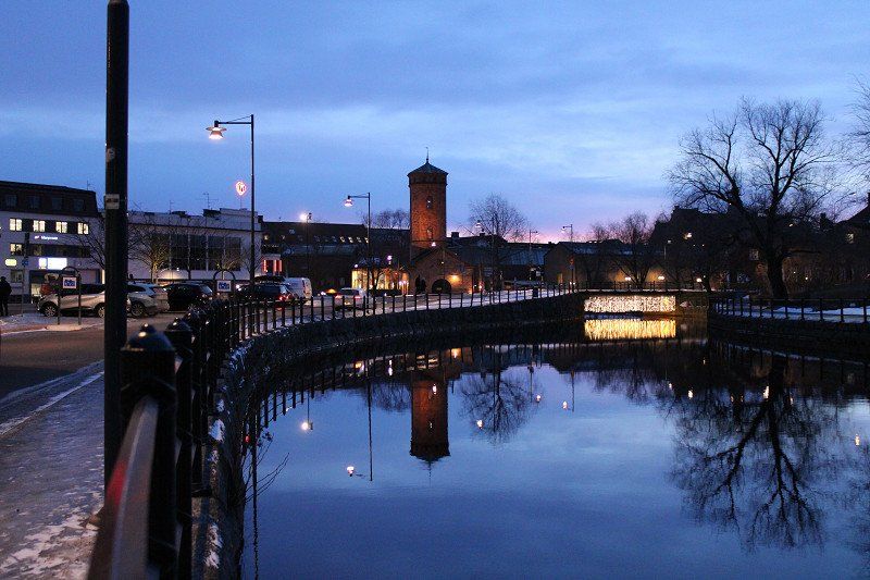
Strömsunds Camping
Today we went to Strömsund where there are 2 parking spaces. Well, it wasn't particularly nice at first. But the city was worth a nice walk.
Näsviken, 83324, Strömsund, Schweden
63° 50' 49" N 15° 31' 60" E
63.8469400 15.5333300
• Head toward Öhnvägen on Näsviken. Go for 271 m.
• Turn right onto Öhnvägen. Go for 44 m.
• Turn right onto Näsviken (E45). Go for 95.8 km.
• Continue on Lövlunda. Go for 271 m.
• Take the 2nd exit from roundabout onto Lövlunda toward Flygplats Frösön/Centrum. Go for 878 m.
• Take the 3rd exit from roundabout onto Genvägen. Go for 1.2 km.
• Take the 2nd exit from roundabout onto Genvägen. Go for 344 m.
• Take the 1st exit from roundabout onto Stuguvägen. Go for 832 m.
• Take the 2nd exit from roundabout onto Rådhusgatan toward Frösön flygplats/Torvalla/Odensala. Go for 105 m.
• Take the 2nd exit from roundabout onto Rådhusgatan. Go for 927 m.
• Take the 1st exit from roundabout onto Nedre Vattugatan. Go for 253 m.
• Take the 2nd exit from roundabout. Go for 285 m.
• Turn right onto Storsjöstråket. Go for 130 m.
• Turn right. Go for 66 m.
• Arrive at your destination on the left.
☍
101,4 km
(1 hrs. 19 min.)
Day
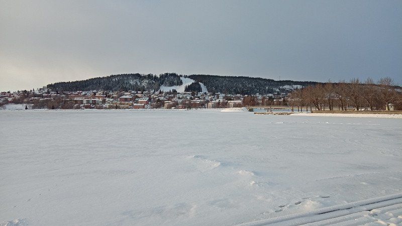
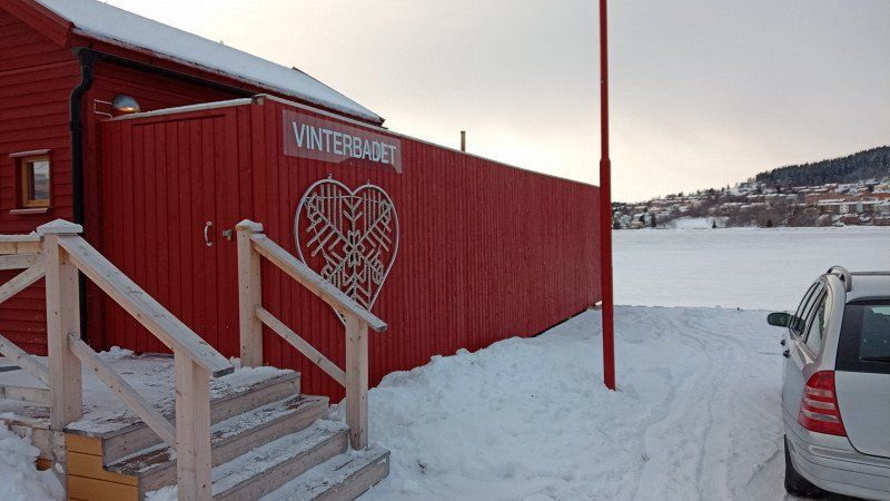
Östersund, Schweden
There is a parking space between the lake and the railway, directly on Badgaden, where winter swimming is also possible.
Storsjöstråket 19, 831 34 Östersund, Schweden
63° 9' 48.8" N 14° 38' 40.8" E
63.1635432 14.6446634
• Head toward Storsjöstråket. Go for 66 m.
• Turn left onto Storsjöstråket. Go for 130 m.
• Turn left toward Nedre Vattugatan. Go for 246 m.
• Take the 2nd exit from roundabout onto Nedre Vattugatan. Go for 265 m.
• Take the 1st exit from roundabout onto Rådhusgatan. Go for 505 m.
• Pass 2 roundabouts and continue on Rådhusgatan. Go for 1.5 km.
• Take the 2nd exit from roundabout onto Opevägen. Go for 857 m.
• Continue on Opevägen. Go for 2.9 km.
• Continue on Opevägen. Go for 628 m.
• Continue on Ope. Go for 1.8 km.
• Continue on Optand. Go for 1.5 km.
• Continue on Trutsgård. Go for 104 m.
• Continue on Lund. Go for 381 m.
• Turn right onto Lund (E14/E45). Go for 4.9 km.
• Take the 1st exit from roundabout onto E45 toward Mora/Svenstavik/Viken. Go for 61.2 km.
• Turn right onto 316 toward 84/Funäsdalen/315/Hede/Vemdalen/Klövsjö. Go for 18.7 km.
• Turn right onto Katrinavägen. Go for 1.0 km.
• Turn left onto Vällevägen. Go for 98 m.
• Arrive at Vällevägen. Your destination is on the left.
☍
96,9 km
(1 hrs. 17 min.)
Day
Skigebiet bei Klövsjö, Schweden
However, the specified mobile home parking space at the lift station is closed in winter?!
845 97, 840 32 Klövsjö, Schweden
62° 30' 8.8" N 14° 10' 40.4" E
62.5024555 14.1778948
• Head northeast on Vällevägen. Go for 98 m.
• Turn right onto Katrinavägen. Go for 1.0 km.
• Turn right onto 316. Go for 3.5 km.
• Turn left onto Utanbergsvallarna (315). Go for 20.2 km.
• Turn left toward Rätans camping. Go for 97 m.
• Turn left onto Rätans camping. Go for 36 m.
• Continue straight ahead. Go for 55 m.
• Arrive at your destination on the left.
☍
25,1 km
( 22 min.)
Rätans Camping
so drive on if necessary and look for a place nearby - found a place by a lake in Rätan.
Kämpevägen 2, 84030, Rätan, Schweden
62° 28' 47.6" N 14° 32' 16.7" E
62.4799000 14.5379600
• Head toward Rätans camping. Go for 55 m.
• Continue on Rätans camping. Go for 36 m.
• Turn right toward Sjövägen/315. Go for 97 m.
• Turn right onto Sjövägen (315). Go for 2.7 km.
• Turn left onto E45. Go for 46.3 km.
• Turn left onto 296 toward Ljusdal/Kårböle. Go for 22.6 km.
• Turn left onto Härjedalsvägen (84/296). Go for 3.0 km.
• Turn right onto Losvägen (296) toward Voxna/Los. Go for 84.4 km.
• Turn right onto 296/301 toward Rättvik/Orsa/Furudal. Go for 35.7 km.
• Take the 2nd exit from roundabout onto Furudal Furudalsvägen (296/301) toward Orsa. Go for 2.7 km.
• Continue on Furudalsvägen (301) toward Rättvik. Go for 25.3 km.
• Turn left onto Blecketvägen. Go for 691 m.
• Continue on Övre Gärdsjö Blecketvägen. Go for 138 m.
• Continue on Blecketvägen. Go for 38 m.
• Turn right onto Övre Gärdsjö Landsväg. Go for 13.2 km.
• Continue on Sörskog. Go for 1.2 km.
• Continue on Sörskog. Go for 1.6 km.
• Continue on Sörskog. Go for 3.2 km.
• Continue on Andersbo. Go for 1.3 km.
• Continue on Andersbo. Go for 840 m.
• Continue on Bultbo. Go for 2.5 km.
• Continue on Svedjelund. Go for 577 m.
• Turn left onto 69. Go for 17.2 km.
• Take the 2nd exit from roundabout onto Bergslagsdiagonalen (E16) toward Örebro/Leksand. Go for 370 m.
• Take the 1st exit from roundabout onto Bergslagsdiagonalen (E16). Go for 2.6 km.
• Take the 3rd exit from Gruvrondellen roundabout onto Gruvgatan toward Centrum. Go for 423 m.
• Take the 3rd exit from roundabout onto Gruvgatan. Go for 172 m.
• Take the 2nd exit from roundabout onto Gruvgatan. Go for 88 m.
• Take the 1st exit from roundabout onto Myntgatan. Go for 619 m.
• Continue on Sturegatan. Go for 2.5 km.
• Turn left onto Främby udde. Go for 273 m.
• Continue on Främby udde. Go for 1.2 km.
• Arrive at Främby udde. Your destination is on the right.
☍
273,4 km
(3 hrs. 20 min.)
Day
Sjösidan Falun
Today we drove to Falun, where we filled up gas again and explored the city. We used a parking lot directly on the lake for this purpose. The parking lot at the mine is closed again in winter. The city is beautiful but just as frozen as every city since Östersund. You walk and park on sheets of ice, and the streets are ice tracks too. Cheers to spikes - we could have used "E" roads, it's not that bad.
Främby Udde 20, 79153, Falun, Schweden
60° 34' 51.2" N 15° 40' 32.9" E
60.5809000 15.6758000
• Head southwest on Främby udde. Go for 1.4 km.
• Turn left onto Källviksvägen. Go for 3.5 km.
• Turn left and take ramp onto Bergslagsdiagonalen (E16) toward Örebro/Borlänge. Go for 14.3 km.
• Pass 2 roundabouts and continue on Bergslagsdiagonalen (E16). Go for 1.8 km.
• Take the 3rd exit from Backarondellen roundabout onto Bergslagsdiagonalen (50) toward Örebro/N Backa. Go for 437 m.
• Pass 11 roundabouts and continue on Bergslagsdiagonalen (50). Go for 156 km.
• Take ramp onto E18/E20 (Bergslagsdiagonalen) toward Oslo/Göteborg/Gustavsvik/Flygplats. Go for 7.8 km.
• Continue on E20 (Bergslagsdiagonalen) toward Göteborg. Go for 46.6 km.
• Take the 2nd exit from roundabout onto E20 toward Göteborg. Go for 14.1 km.
• Continue on E20 toward Göteborg. Go for 40.8 km.
• Take ramp onto Stockholmsvägen toward 202/Karlsborg/Töreboda/Mariestad N C. Go for 1.1 km.
• Pass 2 roundabouts and continue on Stockholmsvägen (E20.4). Go for 2.2 km.
• Turn right onto Nygatan. Go for 494 m.
• Continue on Hamngatan. Go for 161 m.
• Turn right. Go for 98 m.
• Arrive at your destination on the left.
☍
290,8 km
(3 hrs. 23 min.)
Day
Gästhamnen Mariestad
today we drove via Örebro (mining town) to Mariestad on the Vänern. We made a stop in Sjötrop on the Göta Canal. We actually wanted to stay there and have a coffee and go for a walk. But all three parking spaces and the café are closed. In Mariestad there is electricity on the pitch and also a service house with water. So tomorrow we will stay in Mariestad and go for a walk.
A storm is raging today - according to the weather forecast 50 km/h - but it feels worse. By the way, the white on the ground - pure ice!
Hamngatan, 54286, Mariestad, Schweden
58° 42' 53" N 13° 49' 10" E
58.7147222 13.8194444
• Head toward Hamngatan. Go for 98 m.
• Turn left onto Hamngatan. Go for 161 m.
• Continue on Nygatan. Go for 494 m.
• Turn left onto Stockholmsvägen (E20.4). Go for 682 m.
• Take the 2nd exit from roundabout onto Stockholmsvägen (E20.4). Go for 1.4 km.
• Take the 2nd exit from roundabout onto Stockholmsvägen (E20.4). Go for 666 m.
• Turn right onto Krontorp Hinkan (202). Go for 12.3 km.
• Turn left onto Hulteboda. Go for 302 m.
• Continue on Hulteboda Brinnsbacken. Go for 87 m.
• Continue on Söråsen. Go for 486 m.
• Continue on Nolåsen Noltorp. Go for 303 m.
• Continue on Nolåsen Östtomten. Go for 712 m.
• Continue on Nolåsen. Go for 245 m.
• Continue on Nolåsen Lindtorp. Go for 63 m.
• Continue on Nolåsen Olstorp. Go for 356 m.
• Continue on Klubbetorp Olofslund. Go for 72 m.
• Continue on Klubbetorp Fredsbergs bygdegård. Go for 1.7 km.
• Continue on Fredsberg Småskolan. Go for 57 m.
• Continue on Fredsberg. Go for 52 m.
• Continue on Fredsberg Ljunghamra. Go for 44 m.
• Continue on Fredsberg Stenhagen. Go for 114 m.
• Continue toward Fredsberg Nybro. Go for 197 m.
• Continue on Fredsberg Nybro. Go for 155 m.
• Turn right toward Sörby Sörbacka. Go for 49 m.
• Continue on Sörby Sörbacka. Go for 443 m.
• Continue on Sörby. Go for 465 m.
• Continue on Hajstorp Melltorp. Go for 127 m.
• Continue on Hajstorp. Go for 43 m.
• Continue on Hajstorp Karlsberg. Go for 42 m.
• Continue on Hajstorp Hjertryd. Go for 180 m.
• Turn right onto Hajstorp Kanalingenjörsvillan. Go for 52 m.
• Arrive at Hajstorp Kanalingenjörsvillan. Your destination is on the right.
☍
22,2 km
( 22 min.)
Day
Day
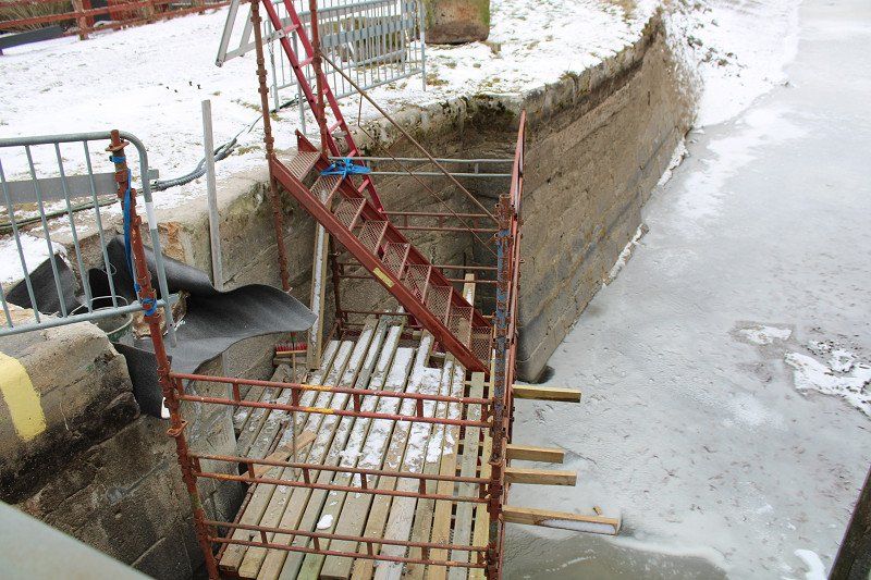
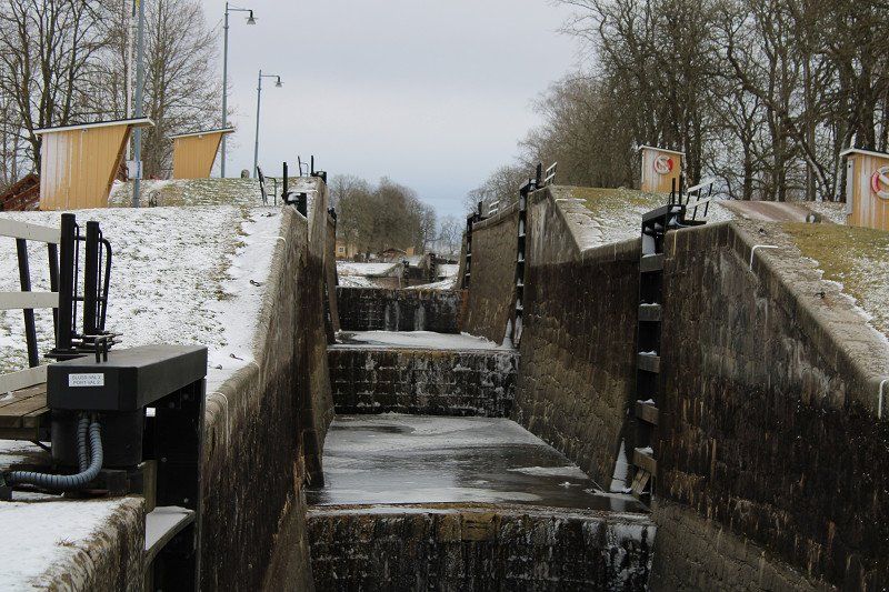
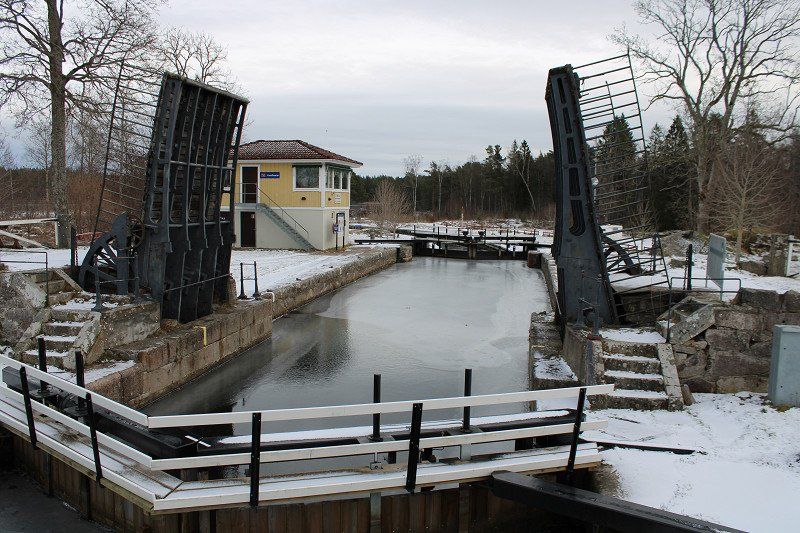
Hajstorp Schleuse
here there are 5 locks in quick succession. Nice towpaths for walking. The canal was drained in this area while sluice gates are being repaired.
The parking fee is paid via an app that only works with a Swedish bank. Or by phone: Well, we don't know that much Swedish. So we called and stumbled through. It turned out that the lady on the phone has a shop in the neighboring town and we should bring the parking fee there. We did the same thing the next day and had a great chat.
54590, Töreboda, Schweden
58° 44' 50" N 14° 6' 28" E
58.7472222 14.1077778
• Head toward Hajstorp Hjertryd on Hajstorp Kanalingenjörsvillan. Go for 52 m.
• Turn right toward Hajstorp. Go for 57 m.
• Continue on Hajstorp. Go for 259 m.
• Turn right onto Svenningstorp Tallbacken. Go for 637 m.
• Continue on Svenningstorp Björkhaga. Go for 896 m.
• Continue on Levsäng. Go for 174 m.
• Turn right onto 200. Go for 2.6 km.
• Turn slightly left onto Sötåsenvägen (202). Go for 418 m.
• Continue on Sötåsenvägen. Go for 3.0 km.
• Continue on Sötåsen. Go for 1.4 km.
• Continue on Riddarhagen. Go for 260 m.
• Continue on Riddarhagen Adolfsberg. Go for 293 m.
• Continue on Riddarhagen Framnäs. Go for 264 m.
• Continue on Riddarhagen Källtorp. Go for 502 m.
• Continue on Riddarhagen. Go for 204 m.
• Turn left onto Källebacken. Go for 632 m.
• Turn right toward Remmestorp. Go for 2.0 km.
• Continue on Remmestorp. Go for 1.0 km.
• Continue on Vassbacken. Go for 506 m.
• Continue on Vassbacken Brovaktarstugan. Go for 60 m.
• Continue on Vassbacken. Go for 1.5 km.
• Continue on Mockeltorp. Go for 1.0 km.
• Continue on Mockeltorp Nolgården. Go for 149 m.
• Continue on Mockeltorp Skattegården. Go for 95 m.
• Continue on Mockeltorp Sörgården. Go for 435 m.
• Turn left toward Ekeskog Storegården. Go for 1.0 km.
• Continue on Ekeskog Storegården. Go for 137 m.
• Continue on Ekeskog. Go for 235 m.
• Continue toward Ekeskog. Go for 22 m.
• Continue on Ekeskog. Go for 50 m.
• Continue on Ekeskog Perstorp. Go for 780 m.
• Continue on Ekeskog Ekebo. Go for 68 m.
• Continue on Ekeskog Bygdegården. Go for 214 m.
• Continue on Ekeskog. Go for 318 m.
• Continue on Ekeskog Spelars backe. Go for 262 m.
• Continue on Ekeskog. Go for 1.0 km.
• Continue on Tåtorp. Go for 442 m.
• Continue on Tåtorp. Go for 52 m.
• Turn slightly right. Go for 35 m.
• Arrive at your destination on the right.
☍
23,2 km
( 27 min.)
Day
Tatorp, Schweden
also on the Göta Canal, right at the entrance to Lake Viken. A nice place to go for a hike and enjoy the area.
Funny to keep a distance sign because of Corona, then this outhouse!
TÅTORP 41, 549 93 Moholm, Schweden
58° 36' 33.6" N 14° 11' 31.5" E
58.6093265 14.1920959
• Head west. Go for 35 m.
• Turn slightly left onto Tåtorp. Go for 52 m.
• Continue on Tåtorp. Go for 1.1 km.
• Continue on Ekeskog. Go for 491 m.
• Continue on Ekeskog Spelars backe. Go for 157 m.
• Continue on Ekeskog. Go for 318 m.
• Continue on Ekeskog Bygdegården. Go for 214 m.
• Continue on Ekeskog Ekebo. Go for 351 m.
• Continue on Ekeskog Perstorp. Go for 497 m.
• Continue on Ekeskog. Go for 72 m.
• Continue on Ekeskog. Go for 235 m.
• Continue on Ekeskog Storegården. Go for 137 m.
• Continue straight ahead. Go for 1.0 km.
• Turn left toward Bällefors Närlingsmon. Go for 664 m.
• Continue on Bällefors Närlingsmon. Go for 52 m.
• Continue on Bällefors Moliden. Go for 90 m.
• Continue on Bällefors Västerås. Go for 809 m.
• Continue on Bällefors Närlingstorp. Go for 155 m.
• Continue on Bällefors Sandslätt. Go for 284 m.
• Continue on Bällefors Fridhem. Go for 554 m.
• Continue on Bällefors. Go for 92 m.
• Continue on Bällefors Tallåsen. Go for 516 m.
• Continue on Bällefors Bäckaryd. Go for 839 m.
• Continue on Lagerfors Furhem. Go for 864 m.
• Continue on Ekeskogsvägen. Go for 293 m.
• Turn left onto Beatebergsvägen. Go for 945 m.
• Continue on Lagerfors Vargavadet. Go for 325 m.
• Continue on Lagerfors Ängen. Go for 892 m.
• Continue on Ryholm Byn. Go for 3.3 km.
• Turn left onto Ryholm Folkskolan. Go for 169 m.
• Continue on Ryholm Småskolan. Go for 2.9 km.
• Continue on Beateberg Fjällängen. Go for 86 m.
• Continue on Beateberg Björkåsen. Go for 111 m.
• Continue on Beateberg Folkskolan. Go for 279 m.
• Continue on Beateberg Beatelund. Go for 82 m.
• Continue on Beateberg kyrkan. Go for 156 m.
• Continue on Beateberg. Go for 179 m.
• Continue on Beateberg Bolet. Go for 91 m.
• Continue on Beateberg Damsbacken. Go for 121 m.
• Continue on Beateberg Bolsbacken. Go for 236 m.
• Continue on Beateberg Linna. Go for 400 m.
• Continue on Beateberg Tomten. Go for 1.4 km.
• Continue on Beateberg Pukerud. Go for 231 m.
• Continue on Beateberg Karlås. Go for 1.2 km.
• Continue on Magderud Magderuds gård. Go for 2.4 km.
• Continue on Dalen. Go for 404 m.
• Turn right toward Rosendala Herrgård. Go for 958 m.
• Continue on Rosendala Herrgård. Go for 3.1 km.
• Turn right onto 202. Go for 3.4 km.
• Turn right onto Baltzar von Platens väg. Go for 1.2 km.
• Turn left onto Hagenvägen. Go for 116 m.
• Arrive at Hagenvägen.
☍
34,5 km
( 39 min.)
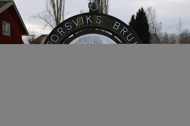
Forsvik Schleuse
we were here in the summer 2 years ago. In my opinion one of the most beautiful spots on the Göta Canal.
Now in winter, like almost everywhere, nothing is going on. You stand alone in the square, nothing is open. In the summer we visited the museum, very interesting. Here almost everything was produced with hydroelectric power from flour painting, to an ironworks, to products such as frying pans and kitchen stoves, etc.
Kolbodsvägen, 54673, Karlsborg, Schweden
58° 34' 30" N 14° 26' 15" E
58.5750000 14.4375000
• Head southeast on Hagenvägen. Go for 75 m.
• Turn right onto Krokavägen. Go for 321 m.
• Turn left toward Hulängen Hagalund. Go for 1.4 km.
• Continue on Hulängen Hagalund. Go for 1.2 km.
• Continue on Hulängen. Go for 1.1 km.
• Continue on Gällsebo. Go for 96 m.
• Continue on Gällsebo Sörvik. Go for 43 m.
• Continue on Gällsebo. Go for 664 m.
• Continue on Gällsebo skola. Go for 2.3 km.
• Continue on Vaberget Dampegården. Go for 1.6 km.
• Continue on Forsviksvägen. Go for 1.1 km.
• Take the 2nd exit from roundabout onto Centralgatan. Go for 328 m.
• Continue on Järnvägsgatan. Go for 240 m.
• Continue on Hjovägen. Go for 339 m.
• Turn right onto 49. Go for 19.3 km.
• Pass 4 roundabouts and continue on Hjovägen. Go for 17.0 km.
• Continue on Majorsgatan. Go for 557 m.
• Take the 3rd exit from Badhusrondellen roundabout onto Vadsbovägen toward Jönköping/Ulricehamn/Skara. Go for 1.4 km.
• Turn right onto Skaravägen (49). Go for 23.1 km.
• Take the 2nd exit from roundabout onto 49 toward E20/Göteborg/184/Lidköping/Centrum. Go for 322 m.
• Take ramp onto E20 toward Göteborg/Alingsås. Go for 84.4 km.
• Take the 2nd exit from roundabout onto Sveaplan (E20) toward Göteborg. Go for 42.0 km.
• Keep left onto E20 (Ånäsmotet) toward Oslo/E6/Karlstad/E45/Gamlestaden/Olskroken. Go for 611 m.
• Continue on Marieholmsmotet toward E6/Oslo/155/Hisingen/Slakthuset industriområde/Partihallarna. Go for 589 m.
• Continue on Marieholmstunneln. Go for 1.2 km.
• Take the exit onto E6.21 (Lundbyleden). Go for 6.3 km.
• Keep right onto Lundbyleden (E6.21) toward Oslo/E6/Karlstad/E45/Öckerö/155/Torslanda. Go for 532 m.
• Continue on Hisingsleden (E6.20). Go for 255 m.
• Keep right onto Torslandavägen (155) toward Färja Öckerö/Torslanda/Industriområde Biskopsgården. Go for 5.9 km.
• Take the 3rd exit from roundabout onto Gösta Fraenckels väg (155). Go for 912 m.
• Take the 2nd exit from roundabout onto Gösta Fraenckels väg (155). Go for 1.0 km.
• Take the 2nd exit from roundabout onto Hjuviksvägen (155). Go for 899 m.
• Pass 4 roundabouts and continue on Hjuviksvägen (155). Go for 3.0 km.
• Turn right onto Hjuviksvägen. Go for 53 m.
• Continue on Hjuviksvägen (155). Go for 293 m.
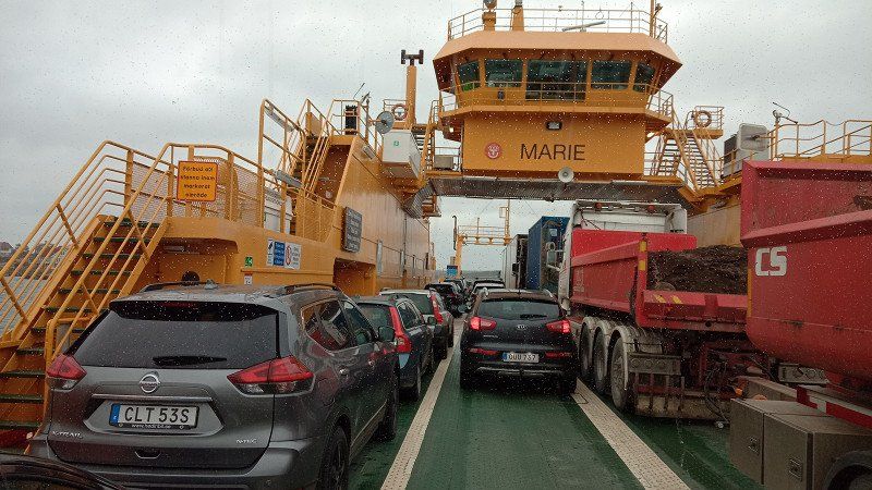
• Take the Hönöleden Ferry. Stay on for 2.4 km.
• Head toward Tärnvägen on Göteborgsvägen (155). Go for 1.2 km.
• Take the 3rd exit from roundabout onto Öckerövägen. Go for 1.5 km.
• Pass 2 roundabouts and continue on Öckerövägen. Go for 1.1 km.
• Turn left onto Klåva hamnväg. Go for 146 m.
• Arrive at Klåva hamnväg.
☍
226,7 km
(3 hrs. 29 min.)
Day
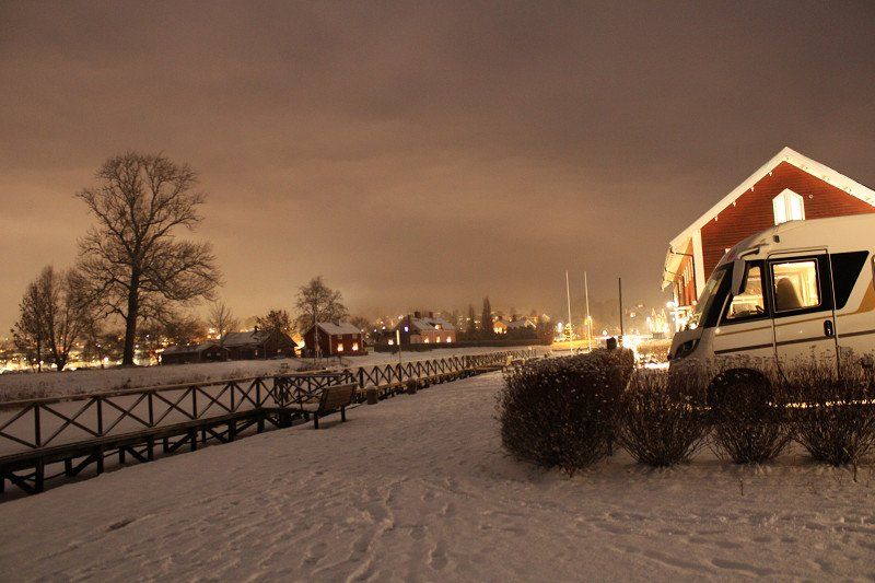
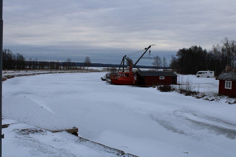
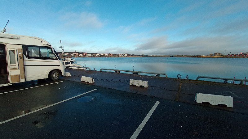
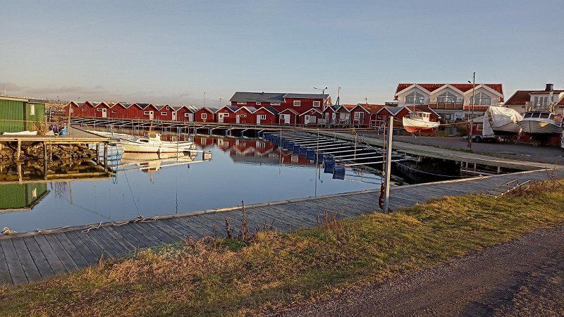
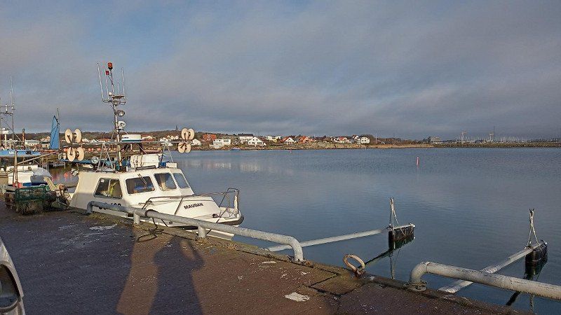
Gästhamn Hönö Klåva
we drove near Gothenburg today to be near the tire dealer in Mölndal tomorrow morning. Actually, I wanted to drive to a parking space in Öckerö. When we stood in front of the ferry at the last second - the traffic light was already on red, it was released again so that we could still go - we drove onto the wrong ferry. She took us to Hönö. Well, never mind, we didn't know either one and the descriptions sounded great too. The pitch is open in winter, is in the harbor and is a good place to go for a walk.
Klåva Hamnväg, 43090, Öckerö, Schweden
57° 40' 52" N 11° 38' 42" E
57.6811111 11.6450000
• Head toward Öckerövägen on Klåva hamnväg. Go for 146 m.
• Turn right onto Öckerövägen. Go for 688 m.
• Pass 2 roundabouts and continue on Öckerövägen. Go for 1.8 km.
• Take the 1st exit from roundabout onto Göteborgsvägen (155). Go for 1.2 km.
• Take the Hönöleden Ferry. Stay on for 2.4 km.
• Head northeast on Hjuviksvägen (155). Go for 8 m.
• Turn left onto Hjuviksvägen (155). Go for 735 m.
• Pass 4 roundabouts and continue on Hjuviksvägen (155). Go for 3.4 km.
• Take the 2nd exit from roundabout onto Gösta Fraenckels väg (155). Go for 1.0 km.
• Take the 2nd exit from roundabout onto Gösta Fraenckels väg (155). Go for 830 m.
• Turn right onto Torslandavägen (155). Go for 5.8 km.
• Continue on Hisingsleden (E6.20). Go for 436 m.
• Keep left onto Hisingsleden (E6.20) toward Malmö/E6/E20/E45/40/Flygplats/Centrum. Go for 2.9 km.
• Keep left onto Hisingsleden (E45.1) toward E6/E20/Malmö/158/Särö/Mölndal/Långedrag/Frölunda. Go for 786 m.
• Keep left onto Västerleden (E6.20) toward E6/E20/Malmö/158/Särö/Mölndal/Långedrag. Go for 10.3 km.
• Take left ramp onto E6/E20 (Kungsbackaleden) toward Malmö. Go for 206 km.
• Continue on E6/E20 (Trafikplats Helsingborg S). Go for 49.0 km.
• Take exit 18 toward Malmö onto E22.10 (Stockholmsvägen). Go for 4.0 km.
• Continue on Stockholmsvägen toward Centrum. Go for 2.7 km.
• Turn right toward Stockholmsvägen. Go for 72 m.
• Continue on Stockholmsvägen. Go for 70 m.
• Continue on Hornsgatan. Go for 235 m.
• Turn right onto Hornsgatan toward Slussen. Go for 122 m.
• Keep right onto Hornsgatan toward Slussen. Go for 403 m.
• Take the 1st exit from roundabout onto Hornsgatan. Go for 948 m.
• Turn right onto Mälarbron. Go for 53 m.
• Continue on Skeppsbron. Go for 137 m.
• Turn left onto Norra Neptunigatan. Go for 1.0 km.
• Turn left onto Skeppsbyggaregatan. Go for 135 m.
• Turn right onto Citadellsvägen toward Trelleborg/E6/Köpenhamn/E20. Go for 280 m.
• Continue on Limhamnsvägen. Go for 787 m.
• Pass 2 roundabouts and continue on Limhamnsvägen. Go for 3.0 km.
• Turn right onto Övägen toward Sibbarp/Ön. Go for 199 m.
• Turn left onto Strandgatan toward Sibbarp. Go for 349 m.
• Turn right onto Bryggövägen. Go for 283 m.
• Turn right onto Vågbrytarvägen. Go for 78 m.
• Arrive at Vågbrytarvägen. Your destination is on the left.
☍
302,3 km
(3 hrs. 53 min.)
Day
Malmö, Schweden
Strandgatan 27, 216 12 Limhamn, Schweden
55° 35' 5" N 12° 55' 7.6" E
55.5847276 12.9187827
• Head toward Bryggövägen on Vågbrytarvägen. Go for 78 m.
• Turn left onto Bryggövägen. Go for 283 m.
• Turn right onto Strandgatan. Go for 189 m.
• Turn left onto Linnégatan. Go for 497 m.
• Turn right onto Kalkbrottsgatan toward E6/E20/E22/E65. Go for 762 m.
• Continue on Annetorpsvägen toward E20/E6/E65/Kalmar/E22. Go for 370 m.
• Pass 4 roundabouts and continue on Annetorpsvägen. Go for 2.7 km.
• Take the 1st exit from roundabout onto Lorensborgsgatan toward E6/E20/E22/E65/Vintrie/Ollebo. Go for 498 m.
• Pass 2 roundabouts and continue on Lorensborgsgatan. Go for 1.3 km.
• Turn right and take ramp onto E20 (Yttre Ringvägen) toward Köpenhamn. Go for 9.9 km.
• Continue on E20 (Øresundsbroen). Go for 53.5 km.
• Keep left onto E20 (Køge Vest) toward Odense. Go for 174 km.
• Keep left onto E20 (Fredericia) toward Esbjerg/E45s/Kolding/Flensborg. Go for 15.5 km.
• Continue on E45 (Sønderjyske Motorvej) toward Flensborg. Go for 73.9 km.
• Take exit 74 toward Kruså/Flensborg N/170 onto Aabenraavej. Go for 5.6 km.
• Continue on B200. Go for 2.8 km.
• Take ramp toward FL-Klues. Go for 244 m.
• Continue on Mads-Clausen-Straße (K12). Go for 4.1 km.
• Turn left onto Hafendamm (K28). Go for 613 m.
• Continue on Hafendamm (K6). Go for 1.0 km.
• Turn left onto Am Industriehafen. Go for 259 m.
• Turn right onto Harniskai. Go for 273 m.
• Arrive at Harniskai. Your destination is on the left.
☍
348,7 km
(3 hrs. 47 min.)
Day
Stellplatz im Industriehafen
in Flensburg we washed our camper again, it was time.
Harniskai, 24937, Flensburg, Deutschland
54° 48' 12" N 9° 26' 22" E
54.8033333 9.4394444
• Head south on Harniskai. Go for 273 m.
• Turn left onto Am Industriehafen. Go for 259 m.
• Turn right onto Ballastbrücke (K6). Go for 1.6 km.
• Turn left onto Süderhofenden (K28). Go for 795 m.
• Keep left onto Friedrich-Ebert-Straße. Go for 167 m.
• Continue on Husumer Straße (K25). Go for 1.6 km.
• Take ramp onto B200 toward Hamburg/A7/Kolding/Husum/Kiel/Schleswig. Go for 5.9 km.
• Take ramp onto A7 toward Hamburg/Kiel. Go for 147 km.
• Keep left onto A7. Go for 5.4 km.
• Take exit 30 toward HH-Waltershof/HH-Finkenwerder/Hafen/Finkenwerder/Altenwerder/Dradenau onto B3 (Finkenwerder Straße). Go for 1.2 km.
• Keep right onto Finkenwerder Straße toward Cranz/Finkenwerder/Dradenau-Süd. Go for 1.2 km.
• Continue on Aue-Hauptdeich. Go for 269 m.
• Continue on An der Alten Süderelbe. Go for 7.0 km.
• Continue on Neuenfelder Hauptdeich. Go for 395 m.
• Turn left onto Neuenfelder Damm toward Neuenfelde. Go for 471 m.
• Turn left onto Neuenfelder Fährdeich toward Cranz. Go for 613 m.
• Turn right onto Marschkamper Deich toward Moorburg. Go for 887 m.
• Turn right onto Nincoper Straße. Go for 184 m.
• Turn left onto Nincoper Deich toward Neu Wulmstorf/Rübke. Go for 3.1 km.
• Turn left and take ramp onto A26. Go for 23.9 km.
• Continue on B73. Go for 14.7 km.
• Pass 3 roundabouts and continue on B73. Go for 55.2 km.
• Continue toward B73. Go for 45 m.
• Take the 2nd exit from roundabout onto B73 toward Cuxhaven/Fährhafen. Go for 2.7 km.
• Turn right onto Wernerstraße (B73). Go for 1.2 km.
• Continue on Poststraße (K8). Go for 106 m.
• Turn right onto Karl-Olfers-Platz. Go for 16 m.
• Continue on Werner-Kammann-Straße. Go for 448 m.
• Continue on Kirchenpauerstraße. Go for 223 m.
• Continue on Schillerplatz. Go for 44 m.
• Continue on Marienstraße. Go for 110 m.
• Turn right onto Kasernenstraße. Go for 224 m.
• Turn left onto Am Seedeich. Go for 187 m.
• Continue on Cassen-Eils-Straße. Go for 440 m.
• Arrive at Cassen-Eils-Straße. Your destination is on the left.
☍
278,0 km
(3 hrs. 16 min.)
Day
Stellplatz am Fährhafen
Today we ate fish - simply delicious! Tomorrow we will buy and freeze fish
Fährhafen, 27472, Cuxhaven, Deutschland
53° 52' 24" N 8° 42' 5" E
53.8733333 8.7013889
• Head toward Am Jachthafen on Cassen-Eils-Straße. Go for 462 m.
• Turn right onto Am Alten Hafen. Go for 283 m.
• Continue on Zollkaje. Go for 170 m.
• Continue on Kapitän-Alexander-Straße. Go for 647 m.
• Turn left onto Konrad-Adenauer-Allee (B73). Go for 3.4 km.
• Continue toward Bremen/Bremerhaven/Flughafen. Go for 52 m.
• Take the 1st exit from roundabout onto A27 toward Bremen/Bremerhaven/Flughafen. Go for 162 km.
• Take the exit onto A7. Go for 29.5 km.
• Keep right onto A352 (Dreieck Hannover-Nord) toward Dortmund/Flughafen/Hannover-Nord. Go for 18.1 km.
• Continue on A2. Go for 38.2 km.
• Take exit 36 toward Rehren/Hess. Oldendorf. Go for 428 m.
• Turn left onto Rehrener Straße (L443) toward Hannover/A2/Rinteln/Hess. Oldendorf/Stadthagen. Go for 442 m.
• Turn left onto Marktplatz (L434). Go for 286 m.
• Turn right onto L434. Go for 7.6 km.
• Pass 2 roundabouts and continue on L434. Go for 3.7 km.
• Take the 2nd exit from roundabout onto In der Rute (L433) toward Hameln/Lachem. Go for 8.4 km.
• Turn right and take ramp onto Pyrmonter Straße (B1/B83). Go for 1.2 km.
• Keep left onto Ohrsche Landstraße (B83) toward Höxter/Holzminden/Bodenwerder/Bad Pyrmont. Go for 19.3 km.
• Turn left onto Hamelner Straße toward Kemnade/Gewerbegebiet Steinbrink. Go for 876 m.
• Continue on Am Mühlentor. Go for 71 m.
• Turn left. Go for 31 m.
• Turn slightly left. Go for 78 m.
• Arrive at your destination on the left.
☍
294,6 km
(2 hrs. 50 min.)
Day
Wohnmobilstellplatz
it's a pity that the holiday is already over, we could spend another 5 weeks in the north of Sweden.
37619, Am Mühlentor, 37619 Bodenwerder, Deutschland
51° 58' 50.7" N 9° 31' 6.1" E
51.9807568 9.5183659
Day