Wangen (Allgäu) - Genoa - Porto Torres - Capo Carbonara - Costa Rei - Santa Margeritha di Pula - Villaputzu - Olbia - Genoa -
Schleswig
September 24, 2022
- Start in the early hours of the morning in Schleswig-Holstein
--> 1st milestone: Wangen (Allgäu)
Deutschland
54° 31' 29.9" N 9° 33' 39.1" E
54.5249669 9.5608476
• Head toward Königsberger Straße on Kattenhunder Weg (K63). Go for 1.2 km.
• Turn left onto K16. Go for 288 m.
• Take ramp onto B201 toward A7/Husum. Go for 5.0 km.
• Take the 2nd exit from roundabout onto Schleswiger Straße (B201) toward Hamburg/A7/Husum/Schuby/Lürschau. Go for 310 m.
• Take the 3rd exit from roundabout onto A7 toward Hamburg/Kiel. Go for 122 km.
• Keep left onto A7. Go for 371 km.
• Keep right onto A7 (Hattenbacher Dreieck) toward München/Stuttgart/Würzburg/Fulda/Basel/Frankfurt/Wiesbaden/Gießen. Go for 362 km.
• Take exit 128 toward Bregenz/Lindau onto A96. Go for 39.0 km.
• Take exit 6 toward Wangen-Nord/Lindenberg/Argenbühl. Go for 382 m.
• Turn right onto L321 toward Lindenberg/Wangen/Argenbühl. Go for 4.3 km.
• Take the 2nd exit from roundabout onto Leutkircher Straße (L320). Go for 1.1 km.
• Turn right onto Buchweg (B32) toward A96/Ravensburg/Tettnang/Neuravensburg. Go for 114 m.
• Turn left onto Gegenbaurstraße (L320) toward Altstadt. Go for 298 m.
• Turn right onto Poststraße. Go for 51 m.
• Turn right onto Bahnhofstraße. Go for 83 m.
• Turn right onto Schillerstraße. Go for 37 m.
• Arrive at Schillerstraße. Your destination is on the right.
☍
907,6 km
(8 hrs. 19 min.)
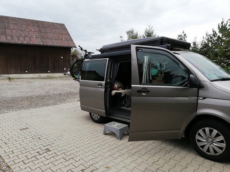
Wangen im Allgäu - Stellplatz Hundrisshof
September 24, 2022
- Arrival in Wangen in the afternoon
- After shopping for groceries for the evening, overnight stop at the Hundrisshof
(Parking space in a beautiful location, sanitary: very rustic, but it's okay, ideal stopover)
- Weather: rainy, overcast, cool
Deutschland
47° 41' 15" N 9° 49' 54.5" E
47.6874999 9.8318005
• Head toward Gegenbaurstraße on Schillerstraße. Go for 73 m.
• Turn left onto Gegenbaurstraße (L320). Go for 206 m.
• Turn left onto Buchweg (B32). Go for 1.3 km.
• Take the 2nd exit from roundabout onto Ravensburger Straße (B32). Go for 2.4 km.
• Turn right and take ramp onto A96 toward Lindau. Go for 19.9 km.
• Continue on A14 (Rheintal Autobahn). Go for 26.4 km.
• Take exit 27 toward Götzis. Go for 286 m.
• Turn left onto Schweizer Straße (L55) toward Mäder. Go for 546 m.
• Take the 1st exit from roundabout onto Alte Landstraße (L58). Go for 1.1 km.
• Take the 2nd exit from roundabout onto Mäderer Landesstraße (L58). Go for 467 m.
• Continue on Zollstrasse. Go for 324 m.
• Take left ramp onto A13 toward Chur/Sargans. Go for 40.7 km.
• Take the left exit toward Chiasso/San Bernardino/Chur/Bad Ragaz onto A13. Go for 137 km.
• Take the left exit toward E35/Milano/Lugano/Locarno/Bellinzona Sud onto A2. Go for 55.7 km.
• Continue on A9 (Autostrada dei Laghi). Go for 31.0 km.
• Take the left exit onto A8 (Autostrada dei Laghi). Go for 5.1 km.
• Take the exit toward E64/Torino/A4/Genova/A7/Bologna/A1 onto A50 (Tangenziale Ovest). Go for 20.5 km.
• Take the exit toward Genova onto A7 (Autostrada Milano-Genova). Go for 103 km.
• Take the exit toward Ronco Scrivia. Go for 425 m.
• Continue on Frazione Isolabuona (SP35) toward Genova/Busalla/B.Fornari. Go for 5.0 km.
• Turn left toward Autostrada/A7/Montoggio/Casella/Crocefieschi. Go for 12 m.
• Turn right onto Via Giuseppe Mazzini (SP226) toward Autostrada/A7/Montoggio/Casella/Crocefieschi. Go for 754 m.
• Take the 3rd exit from roundabout onto A7 (Autostrada Milano-Genova) toward Genova. Go for 17.4 km.
• Keep left onto A12 (Autostrada Azzurra) toward Genova Est/Livorno. Go for 4.0 km.
• Take the exit toward Genova Est onto Svincolo Genova Est. Go for 2.6 km.
• Turn right toward Fiera di Genova/Stazione F. S. Brignole/Città Centro/Porto Terminal Crociere. Go for 101 m.
• Continue on Via Bobbio. Go for 2.5 km.
• Turn right onto Viale Paolo Thaon di Revel. Go for 108 m.
• Arrive at Viale Paolo Thaon di Revel.
☍
478,8 km
(5 hrs. 23 min.)
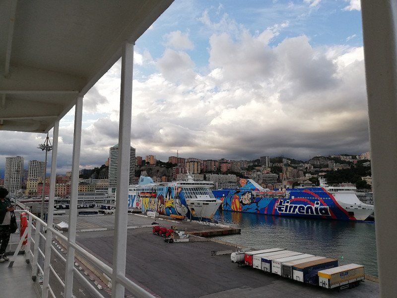
Genua Fährhafen
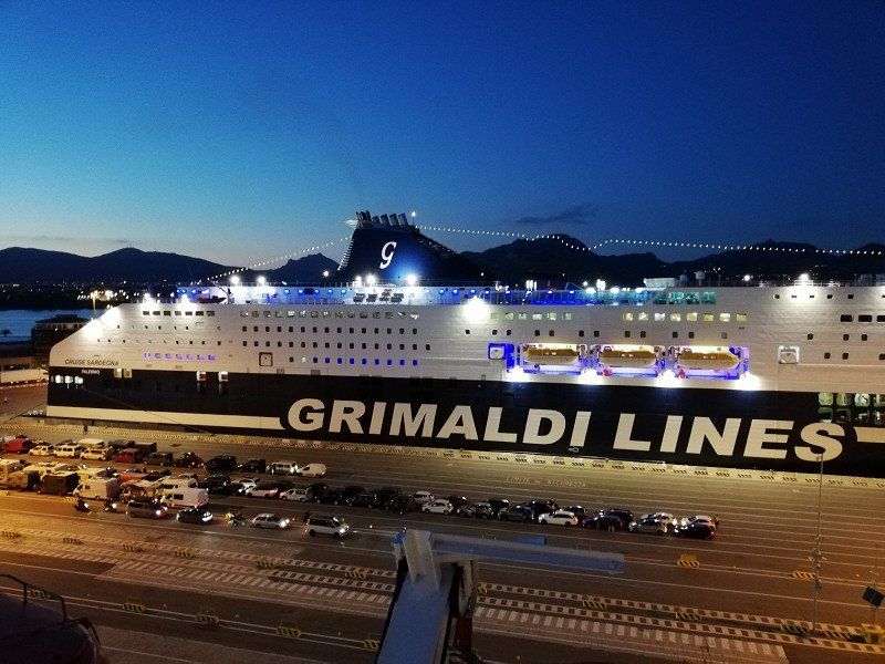
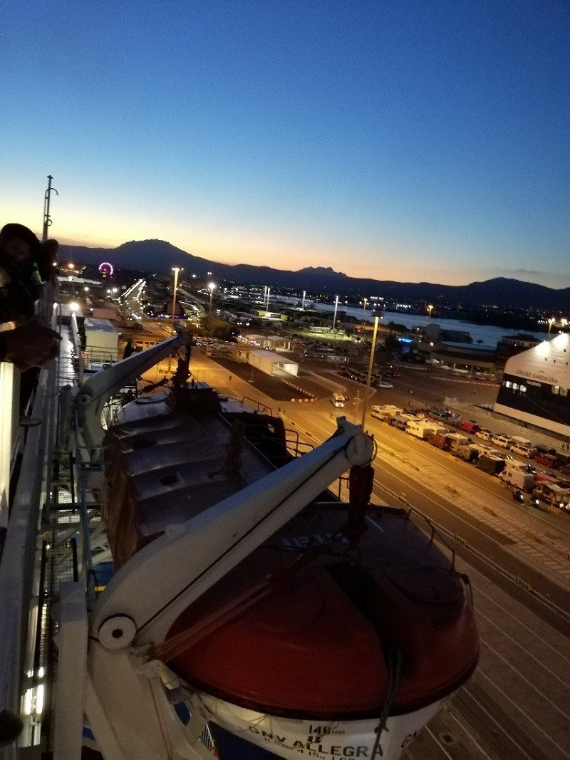
September 25, 2022
- Early in the morning we continue through Switzerland (via the San Bernadino Tunnel) towards Genoa
--> Well done!
- Midday arrival at the ferry port much too early (according to the staff, entry there is not until 4 p.m.), sends us away.
--> We are lost in Genoa for 2 hours. We find the recommended shopping center
not, the parking spaces shown on maps do not match the vehicle height, the traffic is moving
one on the brink of madness....
- During a fuel stop we discover a Lidl, we park there, get a few snacks and
bring a hot afternoon in the parking lot.
- 16.00 entry ferry port - FINALLY!!
- 18.00 ferry departs. We find and explore our cabin. Then we play in the bar over a glass
wine cards.
Italien
44° 24' 20.3" N 8° 56' 46.5" E
44.4056499 8.9462560
• Head toward Via Colombo on Viale Paolo Thaon di Revel. Go for 98 m.
• Turn left onto Via Fiume. Go for 145 m.
• Turn left onto Via Luigi Cadorna. Go for 213 m.
• Turn left onto Viale Emanuele Filiberto Duca d'Aosta (SS45). Go for 176 m.
• Turn right onto Piazza delle Americhe toward Corso Europa/Ospedale S. Martino/Autostrade/La Spezia/Nervi. Go for 89 m.
• Continue on Via Giovanni Tomaso Invrea. Go for 417 m.
• Continue on Piazza Gaetano Alimonda. Go for 63 m.
• Turn slightly right onto Via Odessa. Go for 118 m.
• Turn left onto Via Montevideo. Go for 161 m.
• Continue on Corso Aldo Gastaldi. Go for 3.9 km.
• Keep left onto Corso Europa. Go for 813 m.
• Take ramp toward Livorno/A12. Go for 152 m.
• Turn left onto Cavalcavia Carlo Negri toward Genova/E80/Livorno/A12. Go for 80 m.
• Turn right onto Svincolo Genova Nervi. Go for 1.4 km.
• Take left ramp onto A12 (Autostrada Azzurra) toward Livorno. Go for 159 km.
• Take the exit toward Livorno onto A12 (Autostrada Azzurra). Go for 3.8 km.
• Take the exit toward Stagno/SS1. Go for 1.0 km.
• Take the 2nd exit from roundabout onto Strada Statale Aurelia (SS1) toward Livorno Centro. Go for 1.1 km.
• Take the 2nd exit from roundabout onto Via Firenze (SS1). Go for 1.3 km.
• Keep left onto Strada Statale Aurelia (SS1). Go for 318 m.
• Turn right onto Viale Genova (SP224). Go for 546 m.
• Continue on Via delle Cateratte. Go for 1.2 km.
• Continue on Via Guido Donegani. Go for 635 m.
• Take the 2nd exit from roundabout onto Via Andrea Costa. Go for 376 m.
• Take the 3rd exit from roundabout onto Via Andrea Costa. Go for 213 m.
• Take the 1st exit from roundabout onto Calata Carrara. Go for 42 m.
• Turn right onto Piazza del Portuale. Go for 174 m.
• Continue on Calata Siena. Go for 135 m.
• Take the Livorno-Bastia Ferry. Stay on for 121 km.
• Head toward Quai Nord. Go for 230 m.
• Turn right toward Rue Chanoine Leschi. Go for 274 m.
• Take the 6th exit from roundabout toward Centre Ville/Ajaccio/Calvi/Bonifacio. Go for 249 m.
• Continue on Rue Chanoine Leschi. Go for 303 m.
• Keep left toward T11. Go for 207 m.
• Continue on T11. Go for 2.9 km.
• Keep left onto T11 toward Ajaccio/Bonifacio/Aéroport Poretta. Go for 1.7 km.
• Take the 2nd exit from roundabout onto Avenue Sampiero Corso (T11) toward Calvi/Ajaccio/Bonifacio/Aéroport Poretta. Go for 919 m.
• Keep right onto Avenue Sampiero Corso (T11) toward Calvi/Ajaccio/Bonifacio/Aéroport Poretta. Go for 113 m.
• Pass 4 roundabouts and continue on T11. Go for 19.0 km.
• Take the 3rd exit from roundabout onto T10 toward Aléria. Go for 997 m.
• Pass 19 roundabouts and continue on T10. Go for 117 km.
• Take the 2nd exit from roundabout onto T10 toward Ajaccio/Bonifacio/Aéroport Figari. Go for 680 m.
• Take the 3rd exit from roundabout onto T10 toward Ajaccio/Bonifacio/Aéroport Figari. Go for 1.2 km.
• Pass 2 roundabouts and continue on T10. Go for 998 m.
• Turn right onto T10 toward Ajaccio/Bonifacio/Aéroport Figari. Go for 624 m.
• Pass 4 roundabouts and continue on T10. Go for 22.5 km.
• Take the 3rd exit from roundabout onto Avenue Sylver Bohn (T40) toward Bonifacio/Centre-Ville. Go for 2.2 km.
• Continue on Rue Sauveur-Paul Étienne. Go for 193 m.
• Continue on Quai Sott a Portigliola toward Gare Maritime. Go for 207 m.
• Take the Bonifacio-Santa Teresa di Gallura Ferry. Stay on for 18.2 km.
• Head southwest on SP161. Go for 96 m.
• Turn left onto SP161. Go for 455 m.
• Turn left onto Via Sandro Pertini. Go for 202 m.
• Turn right onto Via Aa17. Go for 845 m.
• Turn slightly right onto Strada Statale Santa Teresa-Ponte Liscia (SS133bis). Go for 434 m.
• Take the 2nd exit from roundabout onto Strada Provinciale Santa Teresa-Castelsardo (SP90). Go for 18.1 km.
• Pass 4 roundabouts. Go for 41.4 km.
• Continue on SP90. Go for 7.8 km.
• Keep left onto Strada Provinciale Sassari Santa Teresa. Go for 6.1 km.
• Turn left onto Strada Statale dell'Anglona (SS200). Go for 8.8 km.
• Turn right onto SP48. Go for 2.7 km.
• Take the 2nd exit from roundabout onto Località Lu Padru (SP48). Go for 3.9 km.
• Turn right onto Località Badde Fustiggiu (SP25). Go for 1.1 km.
• Pass 4 roundabouts and continue on Via Sassari (SS131). Go for 10.0 km.
• Arrive at Via Sassari (SS131). Your destination is on the right.
☍
590,1 km
(10 hrs. 15 min.)
Porto Torres - Fährhafen
September 26, 2022
- Arrival of the ferry in Porto Torres
--> I don't remember the exact time, in the morning.
--> Weather: overcast, 18° - not exactly what we dreamed of: We jet on the most direct
way to the south of the island
Sassari, Italien
40° 50' 0.1" N 8° 24' 8.3" E
40.8333682 8.4022929
• Head northwest on Via Sassari (SS131). Go for 278 m.
• Continue on Corso Vittorio Emanuele II (SS131). Go for 169 m.
• Turn left onto Via Ponte Romano. Go for 502 m.
• Take the 2nd exit from roundabout onto Via Amerigo Vespucci. Go for 742 m.
• Take the 2nd exit from roundabout onto Via dell'Industria. Go for 367 m.
• Take the 2nd exit from roundabout onto Via dell'Industria toward Sassari/Cagliari/SS131. Go for 215 m.
• Take ramp onto SS131 toward Sassari/Olbia/Nuoro/Oristano/Cagliari/Aeroporto Alghero. Go for 69.4 km.
• Take ramp. Go for 249 m.
• Take the 2nd exit from roundabout onto SS131. Go for 144 km.
• Keep left onto Strada Statale Carlo Felice (SS131). Go for 12.6 km.
• Take ramp onto Strada Statale Cagliaritana (SS554) toward SS195/Pula/Quarto S.Elena/Villasimius/Quartu S. E./SS131/Cagliari Stadio. Go for 10.1 km.
• Take ramp. Go for 803 m.
• Continue on Strada Statale Orientale Sarda (SS125). Go for 5.0 km.
• Take the 2nd exit from roundabout onto Località Ganni (SS125). Go for 2.1 km.
• Turn left and take ramp onto Nuova SS554. Go for 8.1 km.
• Take ramp toward Porto di Tortolì/Arbatax/Villasimius/SS125 Var/Muravera/SS125 Var. Go for 1.2 km.
• Continue on Strada Statale Orientale Sarda (SS125). Go for 14.9 km.
• Continue on Nuova SS125. Go for 13.7 km.
• Take ramp toward Costa Rey/Castiadas. Go for 646 m.
• Turn left onto Via Centrale (SP20). Go for 476 m.
• Turn left onto SP97. Go for 69 m.
• Continue on Località Maloccu (SP97). Go for 289 m.
• Continue on SP97. Go for 248 m.
• Continue on Località Maloccu (SP97). Go for 2.8 km.
• Continue on SP97. Go for 2.7 km.
• Turn right onto Ortsstrasse. Go for 138 m.
• Arrive at Ortsstrasse. Your destination is on the left.
☍
292,0 km
(2 hrs. 58 min.)
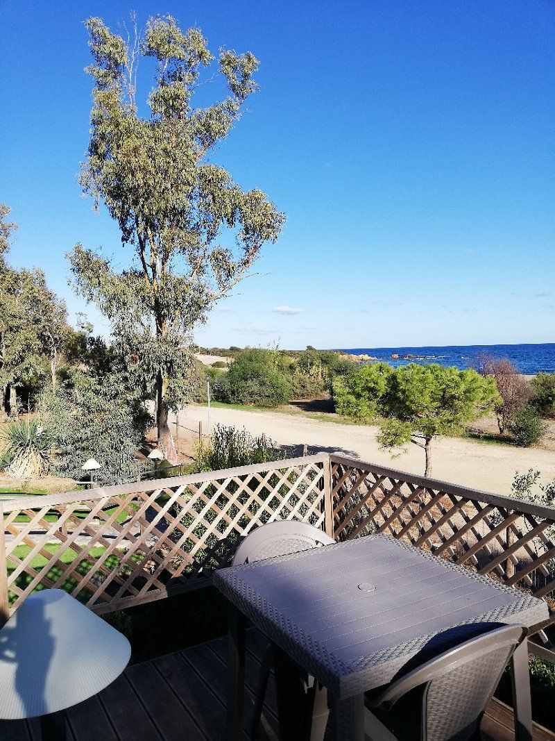
Tiliguerta Glamping&Camping Village
September 26, 2022
- Arrive at Camping Tiliguerta (which we picked from home).
- Unfortunately fully booked!!!😪
- We get the information that on 28.09. a larger tour group is leaving and reserve us
without hesitation a place for 3 nights in the front row to the beach.
- At the tip of the campsite employee, we drive back towards Calghieri and Capo Carbonara and
try our luck at Camping Spiaggia del Riso.
S.P. 97 km. 6, Loc. Capo Ferrato sn, 09043, Muravera, Italien
39° 17' 28.7" N 9° 35' 59.4" E
39.2913030 9.5998300
• Head north on Ortsstrasse. Go for 138 m.
• Turn left onto SP97. Go for 2.7 km.
• Continue on Località Maloccu (SP97). Go for 2.8 km.
• Continue toward SP97. Go for 33 m.
• Turn left onto Località Maloccu (SP18). Go for 2.5 km.
• Continue on Località Santa Giusta (SP18). Go for 3.8 km.
• Continue on SP18. Go for 164 m.
• Continue on Via del Mare (SP18). Go for 216 m.
• Continue on SP18. Go for 2.5 km.
• Keep right onto SP98. Go for 260 m.
• Continue on Località San Pietro (SP98). Go for 2.8 km.
• Continue on SP19. Go for 6.0 km.
• Take the 1st exit from roundabout. Go for 52 m.
• Continue on Viale dei Cormorani (SP19). Go for 778 m.
• Continue on Via Umberto I (SP19). Go for 591 m.
• Continue on Piazza Giovanni XXIII. Go for 580 m.
• Take the 1st exit from roundabout onto Via del Mare. Go for 742 m.
• Continue on Via degli Oleandri. Go for 491 m.
• Continue on Viale degli Oleandri. Go for 499 m.
• Continue on Viale degli Oleandri. Go for 152 m.
• Turn slightly right onto Via degli Aranci. Go for 362 m.
• Turn left onto Via degli Aranci. Go for 67 m.
• Arrive at Via degli Aranci.
☍
28,1 km
( 36 min.)
Campeggio Spiaggia del Riso
September 26, 2022
- Arrival at Camping Spiaggia del Riso
- With a little patience and waiting time (lunch break!!), we settled down in the simple restaurant of the Cam-
pingplatzes with lunch, we still get hold of a parking space. Although not on that
quite so nice part of the square near the road but better than nothing.
- In the evening we grab our bikes and cycle along the coast into the sunset.
degli aranci 2b, 09049, Villasimius, Italien
39° 7' 19" N 9° 30' 36.9" E
39.1219400 9.5102550
• Head toward Via dei Manarini on Via degli Aranci. Go for 429 m.
• Turn sharp right onto Via degli Oleandri. Go for 537 m.
• Turn left toward Viale degli Oleandri. Go for 259 m.
• Continue on Viale degli Oleandri. Go for 85 m.
• Continue on Via Capo Carbonara. Go for 116 m.
• Continue on Viale degli Oleandri. Go for 14 m.
• Continue on Via Capo Carbonara. Go for 1.5 km.
• Turn slightly right toward Via Lago di Garda. Go for 59 m.
• Continue on Via Lago di Garda. Go for 396 m.
• Turn right toward Via Capo Carbonara. Go for 17 m.
• Continue on Via Capo Carbonara. Go for 551 m.
• Arrive at Via Capo Carbonara. Your destination is on the left.
☍
3,9 km
( 9 min.)
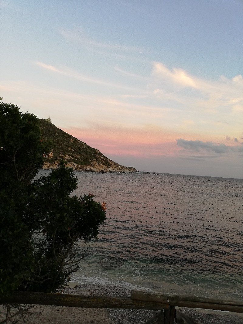
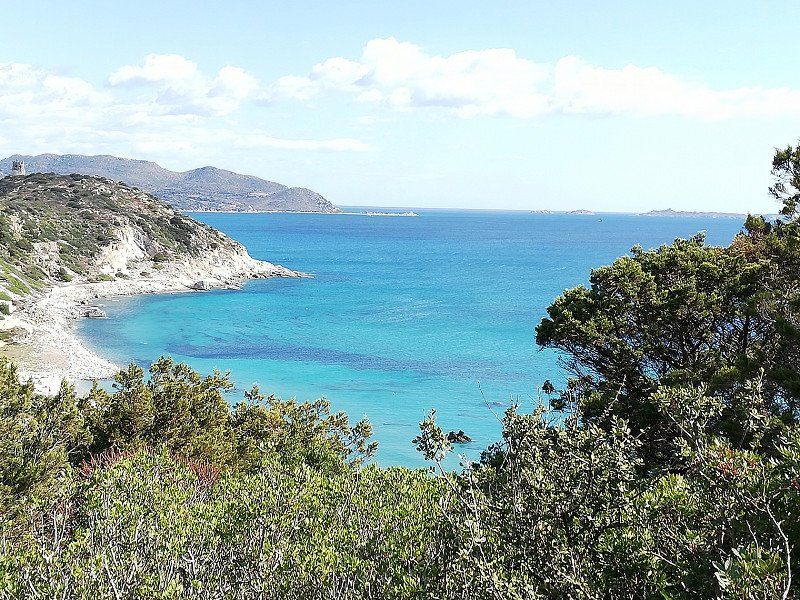
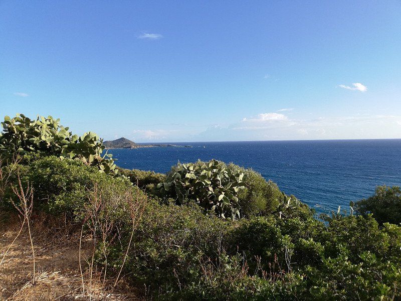
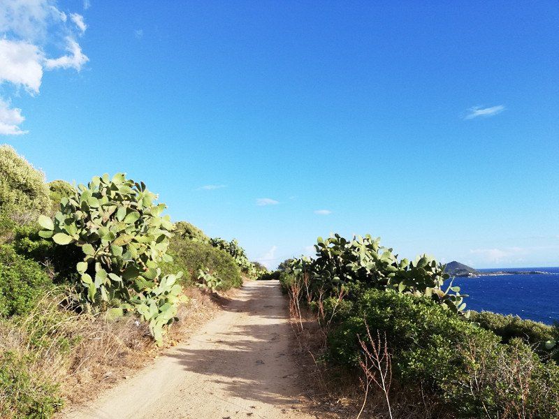
Capo Carbonara
September 27, 2022
- We make a wonderful bike excursion to Capo Carbonara. All the way to the lighthouse
we don't come, but we still enjoy the wonderful view, the wonderful weather, a
fold everything!
--> Weather: Great! SUMMER!!!!!
--> Impressions in keywords:
- turquoise and crystal clear water - Caribbean feeling - sun - sea - prickly pears - cicadas
Villasimius, South Sardinia, Italien
39° 6' 13.4" N 9° 30' 49.4" E
39.1037268 9.5137091
• Head northeast on Via Capo Carbonara. Go for 568 m.
• Turn left onto Via Lago di Garda. Go for 455 m.
• Turn slightly left onto Via Capo Carbonara. Go for 1.5 km.
• Continue on Viale degli Oleandri. Go for 14 m.
• Continue on Via Capo Carbonara. Go for 116 m.
• Continue on Viale degli Oleandri. Go for 344 m.
• Continue on Via degli Oleandri. Go for 537 m.
• Continue on Viale degli Oleandri. Go for 301 m.
• Continue toward Viale degli Oleandri. Go for 264 m.
• Continue on Viale degli Oleandri. Go for 86 m.
• Continue on Via degli Oleandri. Go for 491 m.
• Continue on Via del Mare. Go for 728 m.
• Take the 1st exit from roundabout onto Via Giacomo Matteotti (SP18). Go for 53 m.
• Turn left onto Via Generale Luigi Cadorna. Go for 291 m.
• Turn slightly right onto Via Generale Luigi Cadorna. Go for 100 m.
• Continue on Via Principe Amedeo. Go for 212 m.
• Turn right onto Via Principe Amedeo. Go for 27 m.
• Turn right onto Via Vittorio Emanuele II. Go for 449 m.
• Turn slightly right toward Viale dei Gabbiani. Go for 56 m.
• Take the 1st exit from roundabout onto Viale dei Gabbiani. Go for 1.3 km.
• Continue toward SP19. Go for 82 m.
• Take the 1st exit from roundabout onto SP19. Go for 6.0 km.
• Continue on Località San Pietro (SP19). Go for 1.6 km.
• Turn right onto Località San Pietro (SP98). Go for 1.2 km.
• Continue on SP98. Go for 251 m.
• Turn left onto SP18. Go for 2.5 km.
• Continue on Via del Mare (SP18). Go for 216 m.
• Continue on SP18. Go for 164 m.
• Continue on Località Santa Giusta (SP18). Go for 3.8 km.
• Continue on Località Maloccu (SP18). Go for 2.5 km.
• Turn right onto Località Maloccu (SP97). Go for 2.8 km.
• Continue on SP97. Go for 2.7 km.
• Turn right onto Ortsstrasse. Go for 138 m.
• Arrive at Ortsstrasse. Your destination is on the left.
☍
31,8 km
( 44 min.)
Tiliguerta Glamping&Camping Village
September 28 to October 01, 2022
- Arrival Camping Tiliguerta
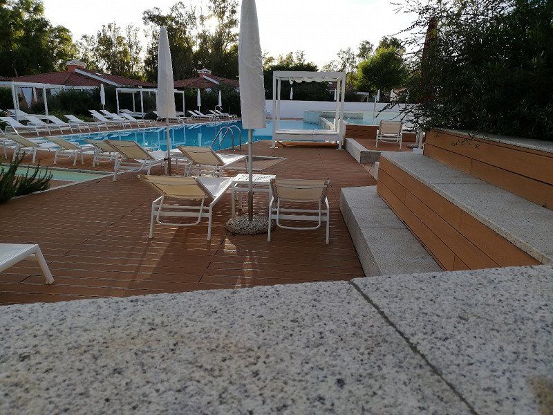
--> Campsite: Beautiful, relaxed facility right by the sea with a pool area (even a
There is a dog pool) and restaurant.
Our pitch is right on the beach access behind a flat dune - great view
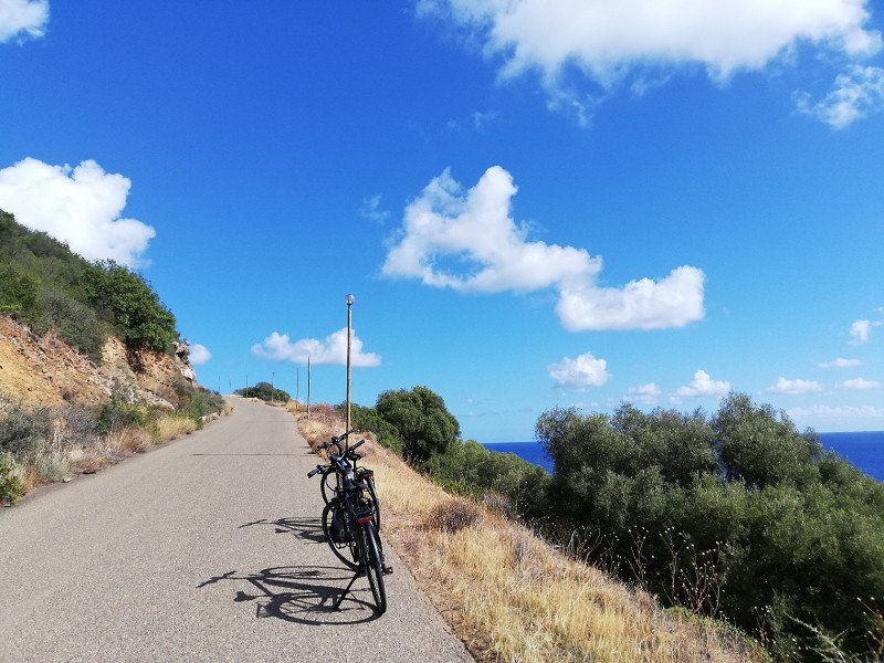
- After we're settled in, we'll go for a bike ride along the coast and hike
Direction Capo Ferrato up to the tower on the mountain. Terrific views, even though it's easy
is hazy.
- We have super nice neighbors with whom we sit together in the evenings and play cards.
- In the coming days we cycle the coast, explore Villasimius, experience a restless one
Thunderstorm night, say goodbye to our neighbors and realize that unfortunately we don't have our pitch
can extend more.
Impressions in keywords:
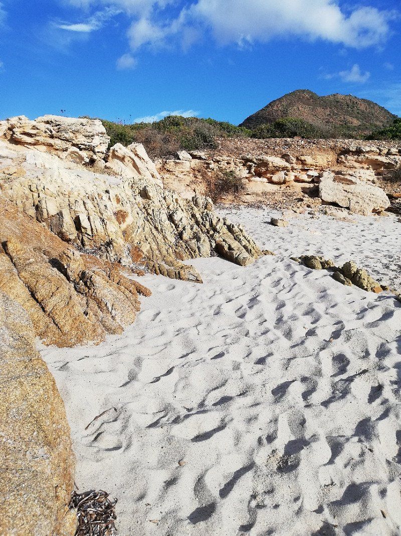
- arrival in paradise - sea - view - rugged rocks -
S.P. 97 km. 6, Loc. Capo Ferrato sn, 09043, Muravera, Italien
39° 17' 28.7" N 9° 35' 59.4" E
39.2913030 9.5998300
• Head north on Ortsstrasse. Go for 138 m.
• Turn left onto SP97. Go for 2.7 km.
• Continue on Località Maloccu (SP97). Go for 2.8 km.
• Continue on SP97. Go for 248 m.
• Continue on Località Maloccu (SP97). Go for 289 m.
• Continue on SP97. Go for 69 m.
• Turn right onto Via Centrale (SP20). Go for 432 m.
• Keep right toward Nuova SS125. Go for 153 m.
• Take ramp onto Nuova SS125 toward Cagliari/Muravera. Go for 14.0 km.
• Continue on Strada Statale Orientale Sarda (SS125). Go for 14.9 km.
• Take ramp onto Nuova SS554 toward Aeroporto Elmas/Cagliari. Go for 7.8 km.
• Take ramp onto Strada Statale Orientale Sarda (SS125). Go for 2.3 km.
• Take the 2nd exit from roundabout onto Strada Statale Orientale Sarda (SS125). Go for 5.0 km.
• Take ramp onto Strada Statale 554 (SS554). Go for 7.5 km.
• Keep left onto Strada Statale Cagliaritana (SS554) toward Pula/Iglesias. Go for 3.6 km.
• Take left ramp onto SS195racc toward Cagliari Porto/Pula/SS195. Go for 3.0 km.
• Continue on Via Ponte Nuovo. Go for 1.2 km.
• Keep left onto Via Ponte Nuovo toward Domus De Maria/Pula. Go for 208 m.
• Take ramp onto Strada Statale Sulcitana (SS195). Go for 11.3 km.
• Pass 2 roundabouts and continue on Strada Statale Sulcitana (SS195). Go for 2.2 km.
• Continue toward SP91. Go for 46 m.
• Take the 1st exit from roundabout onto SP91. Go for 1.4 km.
• Take the 2nd exit from roundabout onto SP91. Go for 438 m.
• Take the 1st exit from roundabout. Go for 202 m.
• Take ramp. Go for 7.6 km.
• Continue on Sa Nuraxedda. Go for 8.5 km.
• Turn right. Go for 100 m.
• Turn right toward SS195. Go for 906 m.
• Take the 1st exit from roundabout onto SS195. Go for 551 m.
• Pass 5 roundabouts and continue on SS195. Go for 11.2 km.
• Turn left onto Viale delle Ondine. Go for 21 m.
• Turn left. Go for 82 m.
• Turn right toward Viale Zeus. Go for 19 m.
• Continue on Viale Zeus. Go for 218 m.
• Turn right toward Viale di Venere. Go for 180 m.
• Turn left onto Viale di Venere. Go for 41 m.
• Arrive at Viale di Venere. Your destination is on the left.
☍
111,5 km
(1 hrs. 36 min.)
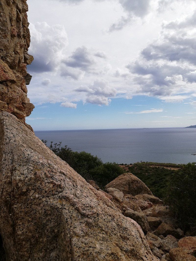
Santa Margherita di Pula - Camping Cala d'Ostia
01 to 03 October 2022
- Arrival at the Cala d'Ostia campsite
--> Campsite: Located directly on the coast, mostly completely shady places in the forest, which are not
be very well cared for, listless reception at the reception, very simple sanitary facilities (with which we
get by), pizza in the restaurant ok, we don't feel very well but stay 2 nights,
many stray cats
- The coast is beautiful, swimming okay - unfortunately a lot of vegetation in the water, so when entering the water
attention is required.
- We make bike tours in the area, cycle to the archaeological site of Nora and to the towers in the
Vicinity.
Pula Metropolitanstadt Cagliari, Italien
38° 55' 51.4" N 8° 55' 33.3" E
38.9309350 8.9259142
• Head northwest on Viale di Venere. Go for 41 m.
• Turn right toward Viale Zeus. Go for 180 m.
• Turn left onto Viale Zeus. Go for 237 m.
• Turn left toward Viale delle Ondine. Go for 82 m.
• Turn right onto Viale delle Ondine. Go for 21 m.
• Turn right onto SS195. Go for 4.5 km.
• Pass 5 roundabouts and continue on SS195. Go for 7.3 km.
• Take the 3rd exit from roundabout. Go for 976 m.
• Turn right. Go for 69 m.
• Turn right. Go for 3.5 km.
• Keep left toward Sa Nuraxedda. Go for 4.5 km.
• Continue on Sa Nuraxedda. Go for 2.6 km.
• Keep left. Go for 5.4 km.
• Take ramp. Go for 272 m.
• Take the 3rd exit from roundabout onto SP91. Go for 1.5 km.
• Take the 2nd exit from roundabout onto Strada Statale Sulcitana (SS195). Go for 507 m.
• Pass 2 roundabouts and continue on Strada Statale Sulcitana (SS195). Go for 12.7 km.
• Take ramp onto Via Ponte Nuovo. Go for 2.1 km.
• Continue on SS195racc. Go for 2.6 km.
• Take ramp onto Strada Statale Cagliaritana (SS554) toward Villasimius/Oristano/Sassari/Quartu S. E./Muravera/SS125/Cagliari Pirri. Go for 11.1 km.
• Take ramp. Go for 803 m.
• Continue on Strada Statale Orientale Sarda (SS125). Go for 5.0 km.
• Take the 2nd exit from roundabout onto Località Ganni (SS125). Go for 2.1 km.
• Turn left and take ramp onto Nuova SS554. Go for 8.1 km.
• Take ramp toward Porto di Tortolì/Arbatax/Villasimius/SS125 Var/Muravera/SS125 Var. Go for 1.2 km.
• Continue on Strada Statale Orientale Sarda (SS125). Go for 14.9 km.
• Continue on Nuova SS125. Go for 39.3 km.
• Take ramp toward Murtas/Ex SS125. Go for 362 m.
• Turn right onto Strada Statale Orientale Sarda (SS125). Go for 6.1 km.
• Turn slightly left onto SP99. Go for 4.4 km.
• Arrive at SP99. Your destination is on the right.
☍
142,3 km
(1 hrs. 57 min.)
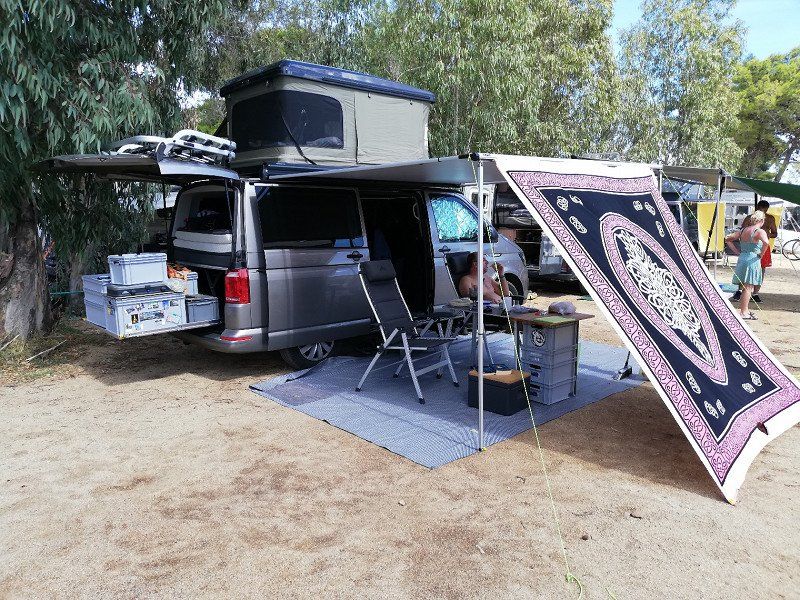
Porto Corallo (Villaputzu) - Stellplatz Bellavista Camperservice
October 03 to 07, 2022
- Arrival at the Bellavista Camperservice pitch
--> Parking space: almost like a campsite, totally relaxed reception, free choice of space, restaurant
unfortunately closed at this time of year, 2 toilets for everyone in a container whose door handles are not
everyone understands (sometimes very funny), view of the sea from the pitch, quick access to the beach,
Bread service, cheap
- Our final location of the trip. We like the parking space, if only because of the relaxed atmosphere
there. Nice neighbors.
- Swimming and beach walks every day. Great sunrises. Weather: SUMMER!!! once even
around 30° (in October).
- Bike tours and walks to the nearby tower, to Villaputzu and the surrounding area.
- Impressions in keywords:
- heavenly sea - pure relaxation - how do I eat a prickly pear - swim, swim,
swimming - wild campers everywhere - LOVE IT
South Sardinia, Italien
39° 26' 31.3" N 9° 38' 17.8" E
39.4420283 9.6382659
• Head northeast on SP99. Go for 4 m.
• Turn right. Go for 38 m.
• Make a U-Turn. Go for 38 m.
• Turn left onto SP99. Go for 4.3 km.
• Turn right onto Strada Statale Orientale Sarda (SS125). Go for 6.1 km.
• Turn left toward Nuova SS125. Go for 122 m.
• Take ramp onto Nuova SS125. Go for 9.1 km.
• Take ramp toward SS125/Tertenia/Villaputzu. Go for 315 m.
• Turn left onto Strada Statale Orientale Sarda (SS125) toward Tertenia. Go for 8.2 km.
• Take the 2nd exit from roundabout onto SS125 Orientale Sarda toward Olbia/Tertenia. Go for 5.4 km.
• Continue on Strada Statale Orientale Sarda (SS125). Go for 5.6 km.
• Keep left onto SS125var. Go for 10.6 km.
• Take ramp onto Strada Statale Orientale Sarda (SS125). Go for 1.9 km.
• Keep right toward Strada Vicnale Taccu Illixeddu. Go for 572 m.
• Continue on Strada Vicnale Taccu Illixeddu. Go for 4.8 km.
• Take the 2nd exit from roundabout. Go for 4.6 km.
• Continue on Via Sa Serra. Go for 1.3 km.
• Continue on SS390. Go for 1.6 km.
• Take the 3rd exit from Piazza Goffredo Mameli roundabout onto Piazza Goffredo Mameli (SS390). Go for 47 m.
• Turn right onto Viale Don Bosco (SS390). Go for 2.2 km.
• Continue on Via Guglielmo Marconi (SS198). Go for 3.5 km.
• Turn right onto SS389. Go for 556 m.
• Continue on SS198. Go for 54 m.
• Continue on SS389. Go for 6.7 km.
• Take the 1st exit from roundabout onto SS389. Go for 477 m.
• Continue on SS389/Var. Go for 14.4 km.
• Continue on SS389. Go for 17 m.
• Continue on SS389/Var. Go for 36.8 km.
• Continue on Tunnel Pontesardo (SS389). Go for 1.2 km.
• Take left ramp onto SS389. Go for 864 m.
• Take ramp onto SS131d.C.N. toward Olbia/Siniscola. Go for 93.3 km.
• Take ramp onto Strada Statale di Monti (SS199/SS729) toward Ospedale/Aeroporto/Olbia Centro. Go for 2.4 km.
• Take ramp toward Olbia. Go for 427 m.
• Keep right toward Olbia Centro/Quartiere Portu Quadu. Go for 91 m.
• Turn left onto Strada Statale Orientale Sarda (SS125). Go for 444 m.
• Pass 3 roundabouts and continue on Via Roma. Go for 1.4 km.
• Turn left onto Via Goffredo Mameli. Go for 416 m.
• Arrive at Via Goffredo Mameli.
☍
230,0 km
(3 hrs. )
Olbia - Fährhafen
October 07, 2022
- Return to Olbia via the spectacular SS 125
We pass wonderful places and areas, drive through the plateau, look into deep valleys, pass a quarry and and and....
Stage points:
- Muravera - Jerzu - Tortoli - Baunei - Urzulei - Cala Ganone - Orosei
Even if there is little time for short stops, we still enjoy this extraordinary journey very much.
Since we arrive in Olbia much too early, we first have a picnic in the parking lot of the ferry port. The ferry leaves at around 7 p.m., the sun has almost set, unique pictures on deck.
Impressions in keywords:
- barren, rugged cliffs - wine filling station - a soccer field on a ledge - small towns in breezy
Höh - free running herds - Grand Canyon in small - marble - fear of heights alarm on narrow
Mountain Roads - Harbor in Sunset
Arrividerci Sardegna! We will be back!
Sassari, Italien
40° 55' 24.9" N 9° 29' 47.2" E
40.9235764 9.4964429
• Head toward Corso Umberto I on Via Goffredo Mameli. Go for 8 m.
• Continue on Via San Simplicio. Go for 117 m.
• Turn right onto Via Gabriele D'Annunzio. Go for 435 m.
• Turn right toward Via Alessandro Nanni. Go for 42 m.
• Continue on Via Alessandro Nanni. Go for 534 m.
• Turn right onto Viale Principe Umberto. Go for 23 m.
• Take the 4th exit from roundabout. Go for 92 m.
• Keep right. Go for 100 m.
• Take ramp toward Costa Smeralda/Arzachena/Palau/Porto Cervo. Go for 358 m.
• Continue on Strada Statale Orientale Sarda (SS125). Go for 2.1 km.
• Take the 2nd exit from roundabout onto Strada Statale Orientale Sarda (SS125). Go for 4.1 km.
• Take the 2nd exit from roundabout onto Strada Statale Orientale Sarda (SS125) toward Arzachena/Palau/Olbia. Go for 13.9 km.
• Take the 3rd exit from roundabout onto Circonvallazione Arzachena toward Palau/S.Teresa/Olbia Porto/Aeroporto Olbia. Go for 3.5 km.
• Pass 2 roundabouts and continue on Circonvallazione Arzachena. Go for 2.7 km.
• Turn right onto Viale Costa Smeralda (SP115) toward Arzachena/V.le C.Smeralda/Palau/S.Teresa di Gallura. Go for 275 m.
• Turn left onto Strada Statale Orientale Sarda (SS125). Go for 10.8 km.
• Take the 2nd exit from roundabout onto SS133 toward Santa Teresa Porto/Tempio. Go for 5.6 km.
• Continue on SS133bis. Go for 15.4 km.
• Keep right toward Via Aa17. Go for 67 m.
• Turn right onto Via Aa17. Go for 832 m.
• Turn slightly left onto Via Sandro Pertini. Go for 226 m.
• Turn right onto SP161. Go for 455 m.
• Turn right onto SP161. Go for 96 m.
• Take the Santa Teresa di Gallura-Bonifacio Ferry. Stay on for 18.2 km.
• Head toward Quai Banda del Ferro. Go for 78 m.
• Continue on Quai Sott a Portigliola. Go for 129 m.
• Continue on Rue Sauveur-Paul Étienne. Go for 193 m.
• Continue on San Rocu (T40). Go for 672 m.
• Turn right onto Rue Paul Nicolai (D58). Go for 185 m.
• Turn left toward Avenue Sylvère Bohn/T40. Go for 315 m.
• Turn right onto Avenue Sylvère Bohn (T40) toward Ajaccio/Bastia/Porto Vecchio. Go for 1.4 km.
• Take the 1st exit from roundabout onto T10 toward Porto Vecchio/Bastia. Go for 19.6 km.
• Pass 4 roundabouts and continue on T10. Go for 3.5 km.
• Take the 2nd exit from roundabout onto T10 toward Bastia/Calvi. Go for 599 m.
• Pass 5 roundabouts and continue on T10. Go for 3.6 km.
• Take the 3rd exit from roundabout onto Avenue de Bastia (T10) toward Bastia/Calvi/Solenzara. Go for 2.5 km.
• Take the 3rd exit from roundabout onto T10 toward Bastia/Calvi/Solenzara. Go for 6.0 km.
• Pass 16 roundabouts and continue on Lieu-dit Chiosu di a Croce (T10). Go for 108 km.
• Take the 2nd exit from roundabout onto T11 toward Vescovato-Arena/Bastia/Aéroport Poretta/La Mer. Go for 1.3 km.
• Pass 2 roundabouts and continue on T11. Go for 14.8 km.
• Take the 3rd exit from roundabout onto T11 toward Bastia. Go for 2.6 km.
• Turn left toward Avenue Sampiero Corso/T11. Go for 423 m.
• Continue on Avenue Sampiero Corso (T11). Go for 843 m.
• Keep right onto Avenue Sampiero Corso (T11). Go for 825 m.
• Keep right onto Avenue Sampiero Corso (T11) toward Le Port/Centre Ville. Go for 589 m.
• Keep left onto T11 toward Centre Ville/Le Port. Go for 3.2 km.
• Keep left toward Rue Chanoine Leschi. Go for 207 m.
• Continue on Rue Chanoine Leschi. Go for 230 m.
• Keep right. Go for 230 m.
• Turn right. Go for 129 m.
• Turn right. Go for 230 m.
• Take the Bastia-Livorno Ferry. Stay on for 121 km.
• Head toward Piazzale dei Marmi on Calata Siena. Go for 135 m.
• Continue on Piazza del Portuale. Go for 174 m.
• Turn left onto Calata Carrara. Go for 23 m.
• Take the 1st exit from roundabout onto Via Andrea Costa. Go for 158 m.
• Take the 1st exit from roundabout onto Via Andrea Costa. Go for 345 m.
• Take the 1st exit from roundabout onto Via Guido Donegani toward Autostrada. Go for 646 m.
• Continue on Via Enrico Mattei toward Autostrada. Go for 1.1 km.
• Turn right onto Viale Genova (SP224) toward Zona Industriale Picchianti/Grosseto-Roma. Go for 584 m.
• Turn left onto Strada Statale Aurelia (SS1). Go for 1.6 km.
• Continue toward Strada Provinciale delle Sorgenti/SP4. Go for 43 m.
• Take the 1st exit from roundabout onto Strada Provinciale delle Sorgenti (SP4). Go for 1.1 km.
• Take ramp onto Variante Aurelia (SS1) toward Genova/A12/Firenze/A11/Pisa. Go for 1.0 km.
• Keep left onto A12 (Autostrada Azzurra) toward Genova/E80/Firenze/A11/E74/Rosignano M./E80/Roma/E80/Pisa/SS1. Go for 4.0 km.
• Take the left exit toward Genova/E76/Firenze/A11 onto A12 (Autostrada Azzurra). Go for 170 km.
• Take the exit toward Milano/Via Serravalle/Genova/Bolzaneto onto A7 (Autostrada Milano-Genova). Go for 121 km.
• Take the exit toward Varese-Como onto A50 (Tangenziale Ovest). Go for 21.0 km.
• Take the exit toward Varese/Gravellona T./A26/Como-Chiasso/A9 onto A8 (Autostrada dei Laghi). Go for 4.9 km.
• Take the exit toward Como/Chiasso onto A9 (Autostrada dei Laghi). Go for 32.0 km.
• Continue on A2. Go for 55.1 km.
• Take exit 45 toward E43/Chur/San Bernardino/Bellinzona Nord onto A13 (Diramazione Bellinzona Nord). Go for 137 km.
• Take exit 11 toward St. Gallen/St. Margrethen/München/Feldkirch/Vaduz onto A13. Go for 40.8 km.
• Take exit 4 toward Kriessern/Altstätten/Götzis. Go for 389 m.
• Continue on Zollstrasse. Go for 260 m.
• Continue on L58. Go for 429 m.
• Take the 3rd exit from roundabout onto Mäderer Landesstraße (L58). Go for 1.2 km.
• Take the 3rd exit from roundabout onto Neue Landstraße (L55). Go for 951 m.
• Take left ramp onto A14 (Rheintal Autobahn) toward Deutschland/Bregenz. Go for 26.5 km.
• Continue on A96. Go for 63.0 km.
• Take the left exit toward Würzburg/Ulm/Stuttgart onto A7. Go for 206 km.
• Take exit 104 toward Marktbreit/Iphofen/Kitzingen-Ost/Ochsenfurt. Go for 331 m.
• Turn right onto St2271 toward Kitzingen/Marktbreit. Go for 2.1 km.
• Take the 3rd exit from roundabout onto St2271. Go for 8.4 km.
• Turn right and take ramp onto Südbrücke (St2272) toward A8/Würzburg/Gewerbegebiet Hafen. Go for 1.1 km.
• Continue on Westtangente (St2270). Go for 620 m.
• Turn left onto Steigweg. Go for 298 m.
• Turn right onto Zum Oberbäumle. Go for 132 m.
• Turn left onto Zum Oberbäumle. Go for 42 m.
• Arrive at Zum Oberbäumle. Your destination is on the right.
☍
1,276,4 km
(16 hrs. 47 min.)
Kitzingen - auf einem Parkplatz im Nirgendwo
October 08, 2022
Overnight stop in Kitzingen
- Parking space is fully occupied, so stay overnight in the neighboring parking lot, which is little used
confidence-inspiring, but other mobiles are there as well
- Little walk to stretch your legs in search of a restaurant. We like the city
neither do the residents we meet. The Greek restaurant is contrary to expectations
but very good, the visitors give hope - there are normal people here.
- We are happy when we start the journey home the next morning with the first cock crow.
Deutschland
49° 44' 2.7" N 10° 8' 50.6" E
49.7340805 10.1473777
• Head east on Zum Oberbäumle. Go for 42 m.
• Turn right onto Zum Oberbäumle. Go for 132 m.
• Turn left onto Steigweg. Go for 298 m.
• Turn left onto Westtangente (St2270). Go for 165 m.
• Turn left onto Kaltensondheimer Straße (St2272). Go for 281 m.
• Turn right onto Jahnstraße. Go for 274 m.
• Turn left onto Repperndorfer Straße (B8). Go for 3.9 km.
• Take ramp onto A7 toward Kassel/Würzburg/Nürnberg. Go for 145 km.
• Continue on A7. Go for 368 km.
• Keep left onto A7. Go for 125 km.
• Take exit 5 toward Schleswig/Schuby/Kappeln/Husum. Go for 399 m.
• Take the 2nd exit from roundabout onto Schleswiger Straße (B201) toward Kappeln/Schleswig/Schloss Gottorf/Tolk-Schau. Go for 4.7 km.
• Take ramp toward Missunde/Schleswig. Go for 299 m.
• Continue on Kattenhunder Weg (K63). Go for 1.2 km.
• Arrive at Kattenhunder Weg (K63). Your destination is on the right.
☍
649,9 km
(6 hrs. 9 min.)
Schleswig
October 09, 2022
arrival home.
Travel conclusion:
This was our second trip to Sardinia and was so much nicer than the first. The island virus has us
fall - we'll be back.
Our plan (wish? hope?) to be able to soak up the sun again against the winter blues has come to fruition.
Deutschland
54° 31' 29.9" N 9° 33' 39.1" E
54.5249669 9.5608476