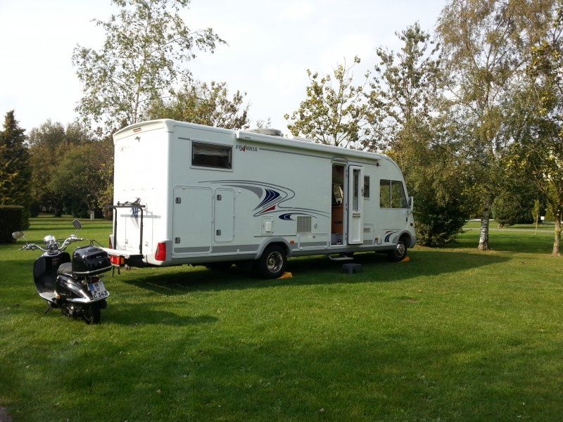
We dared: Despite a fair knowledge of the English language, despite the 8.5 m long motorhome, despite all warnings that we should expect a lot of wounds on the camper .... It worked! The English are a very nice and friendly people with very polite drivers. We take with us from this trip: Not a single scratch on the motorhome, wonderful memories of breathtaking landscapes and magical places and the knowledge that we will visit this country again!
Day
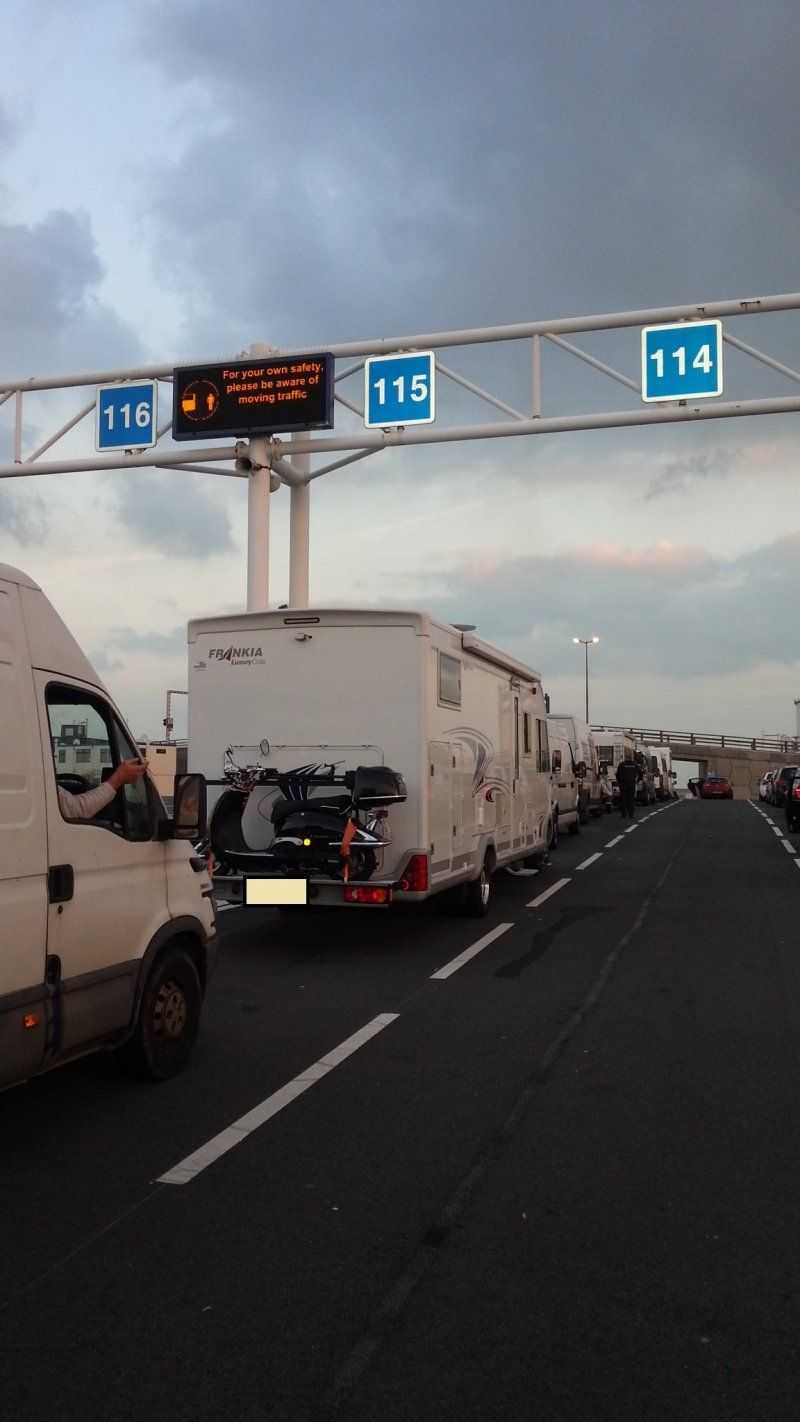
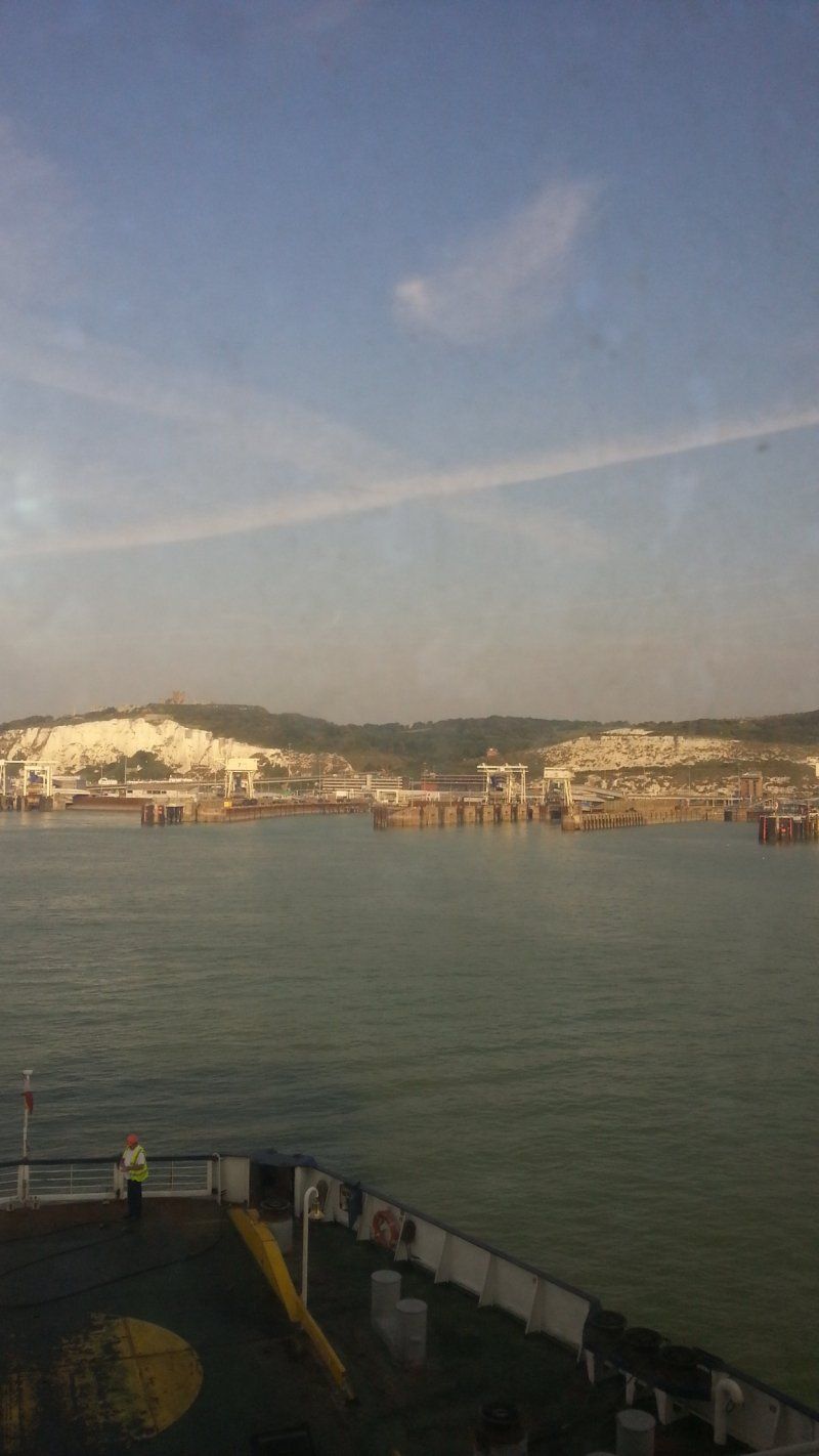
Calais, Frankreich
Abfahrt mit der Fähre morgens um 8 Uhr
13 Rue du Commandant Bonningue, 62100 Calais, Frankreich
50° 57' 39.2" N 1° 51' 17.8" E
50.9608852 1.8549410
• Head toward Rue de Londres on Rue du Commandant Bonningue. Go for 54 m.
• Turn slightly right onto Place de Suède. Go for 26 m.
• Turn left onto Place de Suède. Go for 50 m.
• Turn left onto Place de Suède. Go for 11 m.
• Turn right onto Rue Lamy. Go for 71 m.
• Continue on Pont Vétillard. Go for 442 m.
• Continue toward Avenue du Commandant Cousteau. Go for 39 m.
• Take the 3rd exit from roundabout onto Avenue du Commandant Cousteau. Go for 873 m.
• Take the 2nd exit from roundabout onto Avenue du Commandant Cousteau toward A16/A26/Terminal Intermodal/Terminal Ferroviaire. Go for 316 m.
• Take the 2nd exit from roundabout. Go for 525 m.
• Continue straight ahead. Go for 18 m.
• Take the 2nd exit from roundabout. Go for 383 m.
• Continue straight ahead. Go for 22 m.
• Take the 2nd exit from roundabout. Go for 166 m.
• Take the 3rd exit from roundabout. Go for 847 m.
• Turn right toward Avenue de l'Embarquement. Go for 857 m.
• Continue on Avenue de l'Embarquement. Go for 852 m.
• Take the Calais-Dover Ferry. Stay on for 40.6 km.
• Head northwest. Go for 133 m.
• Turn right toward Ramp B. Go for 129 m.
• Continue on Ramp B. Go for 69 m.
• Turn right toward The Fan. Go for 143 m.
• Continue on The Fan. Go for 269 m.
• Keep right onto Inward Car Lanes. Go for 115 m.
• Keep right onto Inward Car Lanes. Go for 100 m.
• Turn left toward Jubilee Way/A2. Go for 324 m.
• Turn left onto Jubilee Way (A2). Go for 69 m.
• Arrive at Jubilee Way (A2). Your destination is on the left.
☍
47,5 km
(1 hrs. 48 min.)
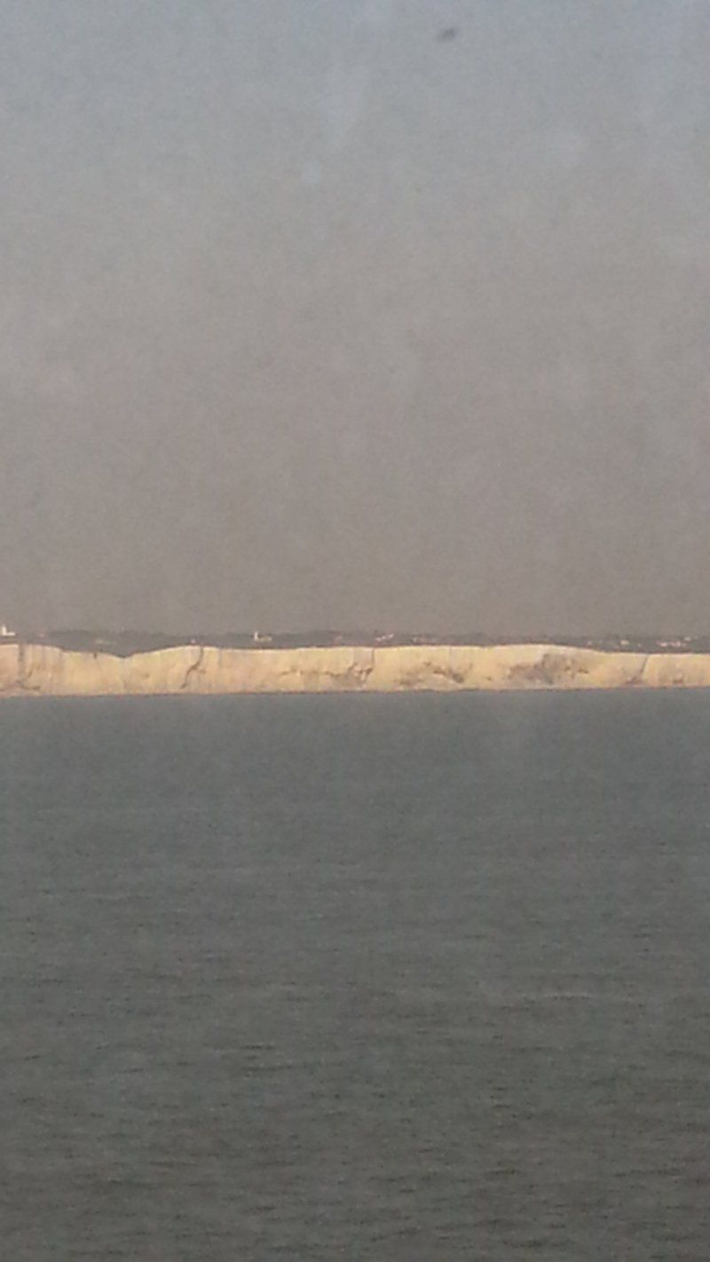
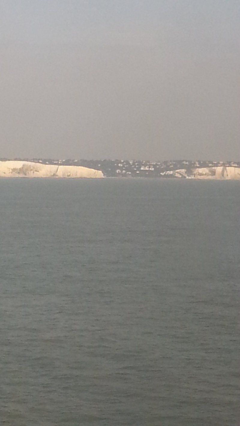
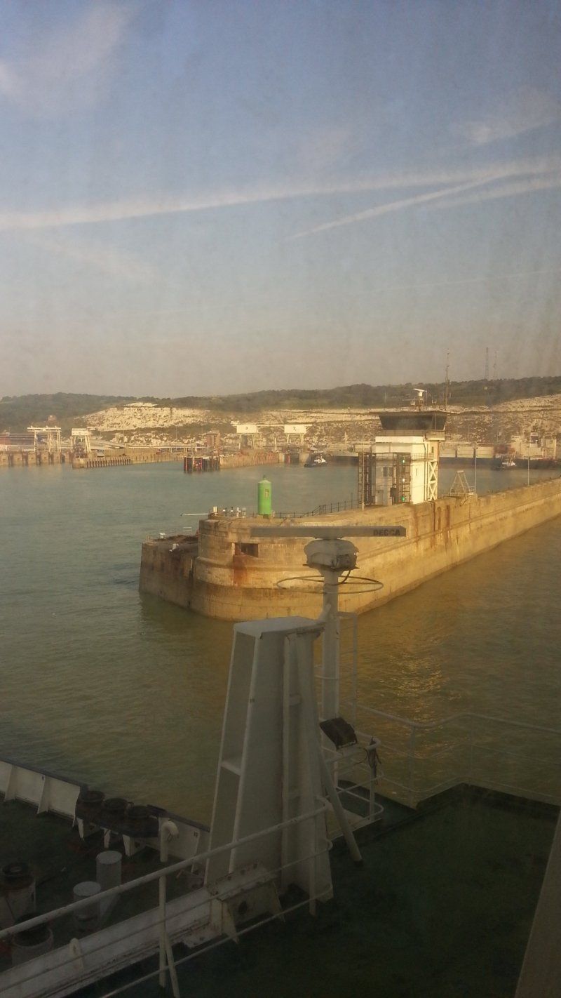
Dover, Vereinigtes Königreich
Dover Ferry Port, Dover CT16 1JN, Vereinigtes Königreich
51° 7' 35.3" N 1° 19' 49.7" E
51.1264654 1.3304688
• Head south on Jubilee Way (A2). Go for 251 m.
• Keep left onto A20 toward Town Centre/(M20). Go for 1.8 km.
• Take the 3rd exit from Limekiln Roundabout roundabout onto Archcliffe Road (A20) toward London/(M20)/Folkestone. Go for 496 m.
• Take the 1st exit from Western Heights Roundabout roundabout onto A20 toward London/(M20)/Channel Tnl/Folkestone. Go for 11.3 km.
• Keep right onto M20 toward London/Channel Tnl/Ashford. Go for 64.7 km.
• Keep left onto M26 toward Heathrow Airport/(M25(W))/Gatwick Airport/Sevenoaks/(A25). Go for 15.6 km.
• Keep left onto M26. Go for 344 m.
• Continue on M25. Go for 57.2 km.
• Take exit 12 toward Basingstoke/Southampton onto M3. Go for 50.9 km.
• Take exit 8 toward The South West/Andover/Salisbury onto A303. Go for 25.6 km.
• Take ramp onto Salisbury Road (A343) toward Salisbury/Middle Wallop/Grateley. Go for 815 m.
• Take the 3rd exit from roundabout onto Salisbury Road (A343) toward Salisbury/Middle Wallop/Grateley. Go for 6.2 km.
• Take the 2nd exit from roundabout onto A343 toward The Wallops/Salisbury/(A30). Go for 6.9 km.
• Continue on A30 toward Salisbury. Go for 1.9 km.
• Continue on A30 toward Pitton/Firsdown. Go for 7.3 km.
• Pass 3 roundabouts and continue on London Road (A30). Go for 2.3 km.
• Take the 2nd exit from St Mark's Roundabout roundabout onto Churchill Way East (A36) toward Ring Road/Southampton. Go for 1.2 km.
• Take the 2nd exit from College Roundabout roundabout onto Churchill Way (A338) toward Bournemouth/Blandford/(A354). Go for 514 m.
• Take the 3rd exit from Exeter Street Roundabout roundabout onto Exeter Street. Go for 542 m.
• Continue on St John's Street. Go for 119 m.
• Continue on Catherine Street. Go for 187 m.
• Turn left onto New Canal. Go for 25 m.
• Arrive at New Canal. Your destination is on the right.
☍
256,3 km
(2 hrs. 37 min.)
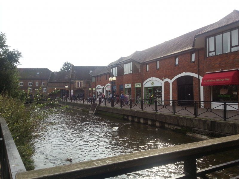
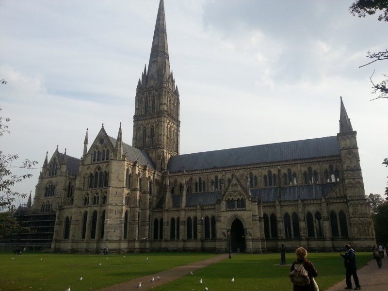
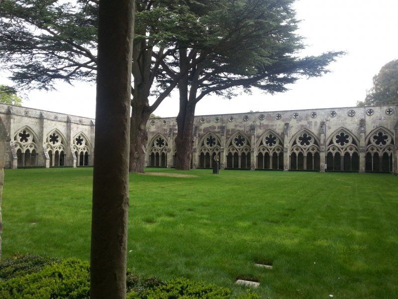
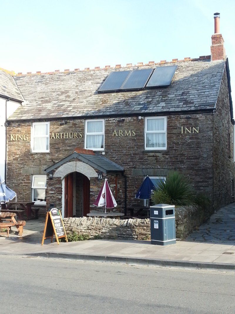
Salisbury, Vereinigtes Königreich
Salisbury is a medieval city with a beautiful cathedral.
51° 4' 7.6" N 1° 47' 40.1" W
51.0687850 -1.7944720
• Head west on New Canal. Go for 208 m.
• Continue on High Street. Go for 45 m.
• Turn left onto Bridge Street. Go for 183 m.
• Continue on Fisherton Street. Go for 304 m.
• Take the 3rd exit from roundabout onto Fisherton Street. Go for 212 m.
• Take the 2nd exit from St Paul's Roundabout roundabout onto Devizes Road (A360) toward Devizes. Go for 791 m.
• Take the 2nd exit from roundabout onto Devizes Road (A360). Go for 1.9 km.
• Take the 2nd exit from roundabout onto Devizes Road (A360). Go for 684 m.
• Take the 2nd exit from roundabout onto A360. Go for 707 m.
• Take the 3rd exit from roundabout onto A360. Go for 8.2 km.
• Take the 3rd exit from Longbarrow Roundabout roundabout onto A303 toward London/Amesbury. Go for 2.0 km.
• Turn left. Go for 551 m.
• Arrive at your destination.
☍
15,8 km
( 16 min.)
http://www.coombecaravanpark.co.uk/
Our first stop takes us to this very well-kept campsite. Very nice operator. Shower / toilet everything was great and clean.
Day
Stonehenge, Amesbury, Salisbury, Vereinigtes Königreich
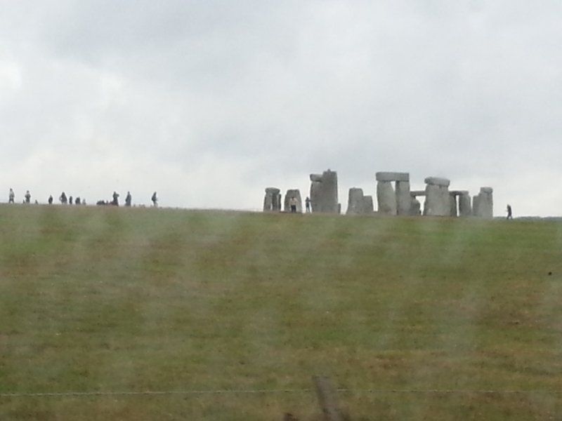
We drive past Stonehenge. The entrance fee was just too expensive for us, for not even getting to the famous stones. Besides, the weather didn't cooperate at all.
Amesbury, Salisbury SP4 7DE, Vereinigtes Königreich
51° 10' 44" N 1° 49' 34.4" W
51.1788820 -1.8262150
• Head northeast.
• Turn left toward Airman's Corner. Go for 2.2 km.
• Turn slightly left toward A360. Go for 43 m.
• Take the 2nd exit from Airman's Corner roundabout onto A360. Go for 3.5 km.
• Take the 1st exit from roundabout onto Maddington Street (A360). Go for 482 m.
• Turn left onto Chitterne Road (B390). Go for 3.7 km.
• Continue on Shrewton Road (B390). Go for 3.5 km.
• Continue on Bidden Lane (B390). Go for 483 m.
• Continue on B390. Go for 6.0 km.
• Turn right onto A36. Go for 2.0 km.
• Take the 2nd exit from Cotley Hill Roundabout roundabout onto A36 toward (A350)/(A362). Go for 5.3 km.
• Take the 2nd exit from roundabout onto A36 toward Bristol/Bath. Go for 2.1 km.
• Take the 1st exit from Cley Hill Roundabout roundabout onto A362 toward Frome/Corsley Heath. Go for 1.0 km.
• Take the 3rd exit from Picket Post roundabout onto A362. Go for 6.4 km.
• Turn left onto A361. Go for 2.1 km.
• Take the 2nd exit from Blatchbridge Roundabout roundabout onto A361 toward Shepton Mallet/Glastonbury/Taunton. Go for 1.8 km.
• Pass 2 roundabouts and continue on Holwell Hill (A361). Go for 15.0 km.
• Turn left onto Fosse Lane (A361) toward Glastonbury/Yeovil/(A37)/Wells/(A371). Go for 1.1 km.
• Take the 1st exit from Cannards Grave Roundabout roundabout onto Whitstone Road (A37) toward Yeovil/Glastonbury/(A361)/Wincanton/(A371). Go for 788 m.
• Take the 2nd exit from Whitstone Corner roundabout onto A37 toward Yeovil/Glastonbury/(A361). Go for 266 m.
• Turn right onto East Compton Road (A361) toward Taunton/Glastonbury. Go for 12.2 km.
• Turn right onto Ashwell Lane. Go for 229 m.
• Turn right onto Gipsy Lane. Go for 43 m.
• Turn left onto Basketfield Lane. Go for 483 m.
• Turn slightly left onto Stone Down Lane. Go for 101 m.
• Arrive at Stone Down Lane.
☍
70,7 km
( 59 min.)
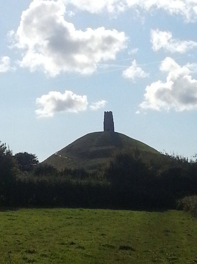
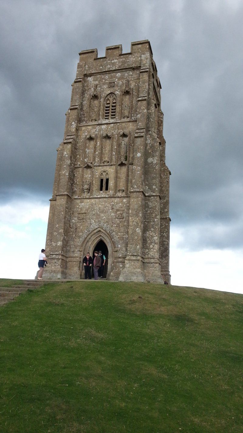
Glastonbury Tor, Glastonbury, Vereinigtes Königreich
Stand on the legendary Glastonbury Tor, the former Avalon ;-)
Glastonbury Tor, Glastonbury BA6 8BG, Vereinigtes Königreich
51° 8' 40" N 2° 41' 55" W
51.1444440 -2.6986110
• Head west on Stone Down Lane. Go for 203 m.
• Turn slightly left onto Wellhouse Lane. Go for 658 m.
• Turn right onto Chilkwell Street (A361). Go for 326 m.
• Take the 1st exit from roundabout onto Bere Lane (A361) toward Taunton/Bridgwater/(A39). Go for 620 m.
• Take the 1st exit from roundabout onto Street Road (A361) toward Street/Taunton/Bridgwater/(A39). Go for 837 m.
• Pass 3 roundabouts and continue on Westway (A39). Go for 18.5 km.
• Turn left onto Bath Road (A39) toward Bridgwater. Go for 2.2 km.
• Take the 2nd exit from roundabout onto Bath Road (A39). Go for 1.7 km.
• Take the 1st exit from Cross Rifles Roundabout roundabout onto Monmouth Street (A38). Go for 1.6 km.
• Take the 1st exit from roundabout onto Wembdon Road (A39). Go for 1.0 km.
• Take the 1st exit from Whitegate Roundabout roundabout onto Quantock Road (A39). Go for 2.1 km.
• Pass 3 roundabouts and continue on A39. Go for 14.3 km.
• Turn left onto Putsham Hill (A39). Go for 9.9 km.
• Take the 2nd exit from roundabout onto Bank Street (A39). Go for 1.9 km.
• Pass 3 roundabouts and continue on Alcombe Road. Go for 10.5 km.
• Continue on Townsend Road. Go for 755 m.
• Continue on Friday Street. Go for 196 m.
• Turn left onto Park Street. Go for 157 m.
• Turn left onto Parkhouse Road. Go for 217 m.
• Turn left onto Millbridge Road. Go for 189 m.
• Turn left onto Millbridge Gardens. Go for 38 m.
• Arrive at Millbridge Gardens. Your destination is on the right.
☍
68,0 km
(1 hrs. 11 min.)
https://www.theoldoaks.co.uk/
This campsite is right at the foot of Glastonbury Gate.
Day
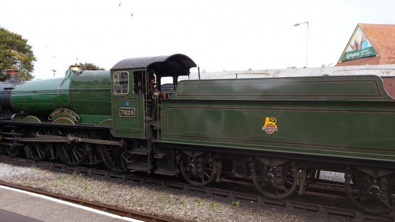
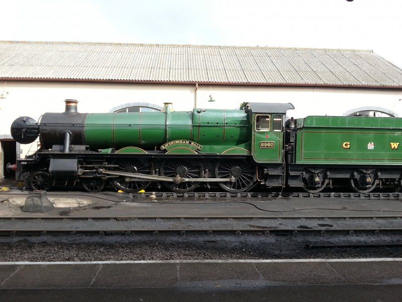
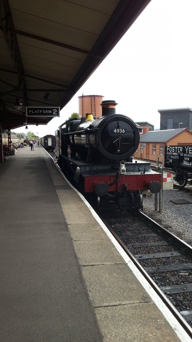
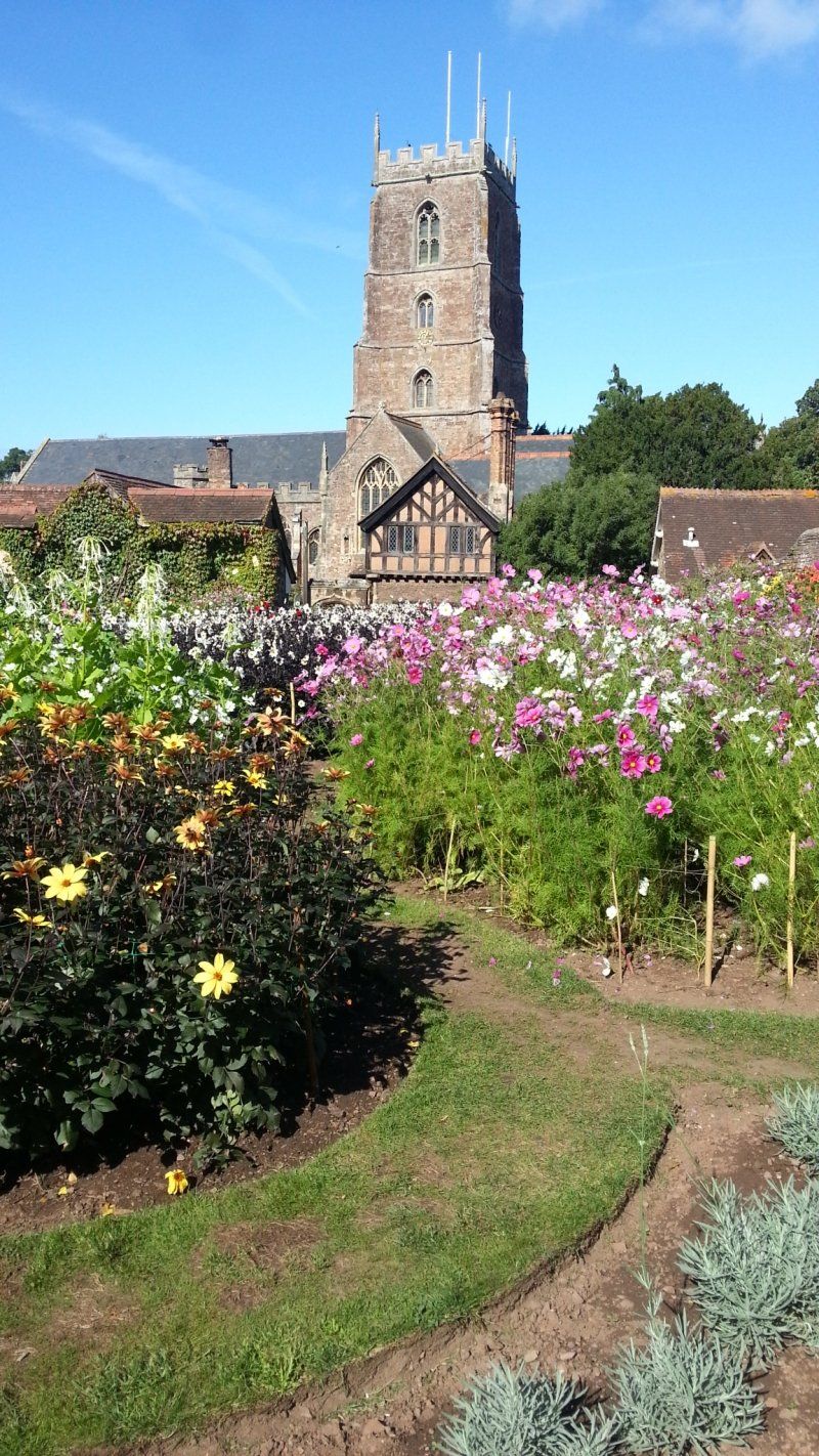
Minehead, Vereinigtes Königreich
We stroll through the tranquil town of Minehead and visit the station with its historic railways. And there is a "birthday latte macchiato" ;-)
We stay two days because we like it at the campsite and we want to visit Dunster Castle.
51° 12' 15.4" N 3° 28' 52.1" W
51.2042800 -3.4811520
• Head toward Millstream Close on Millbridge Gardens. Go for 38 m.
• Turn right onto Millbridge Road. Go for 189 m.
• Turn right onto Parkhouse Road. Go for 217 m.
• Turn right onto Park Street. Go for 157 m.
• Turn right onto Friday Street. Go for 196 m.
• Continue on Townsend Road. Go for 755 m.
• Continue on Alcombe Road. Go for 220 m.
• Pass 2 roundabouts and continue on A39. Go for 2.5 km.
• Turn right. Go for 374 m.
• Continue straight ahead. Go for 193 m.
• Arrive at your destination on the left.
☍
4,9 km
( 9 min.)
http://www.mineheadandexmoorcamping.co.uk/index.html
Day
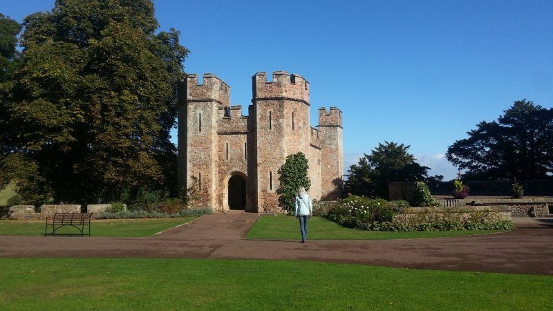
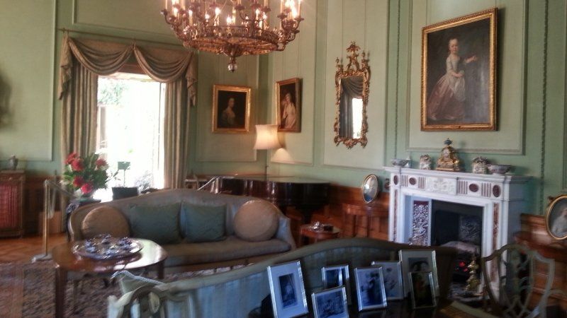
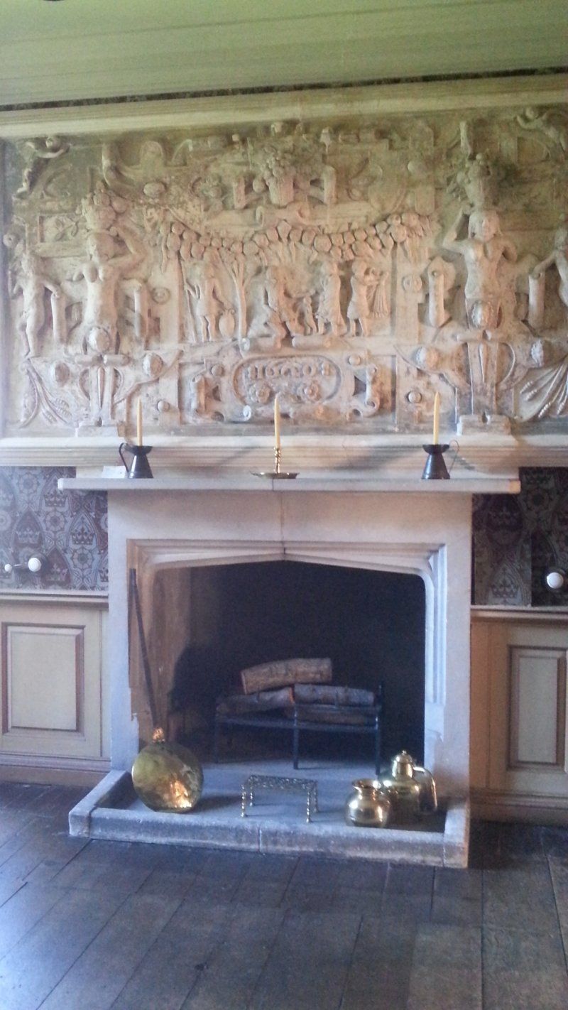
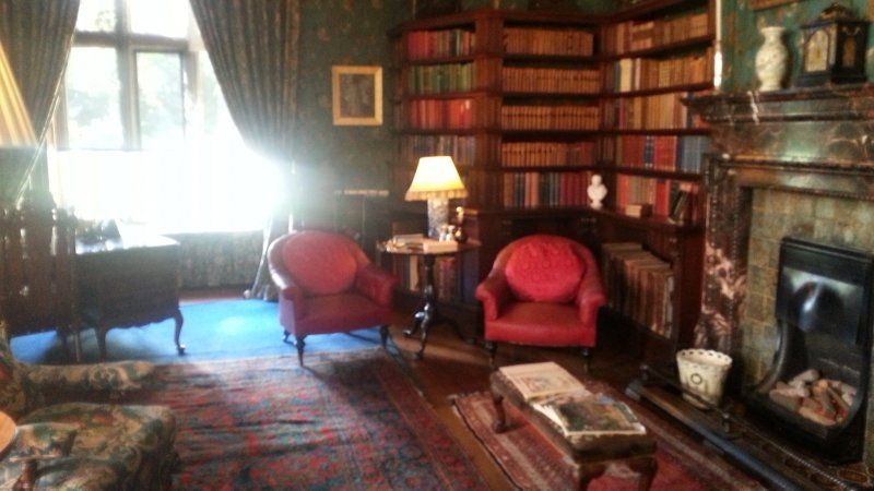
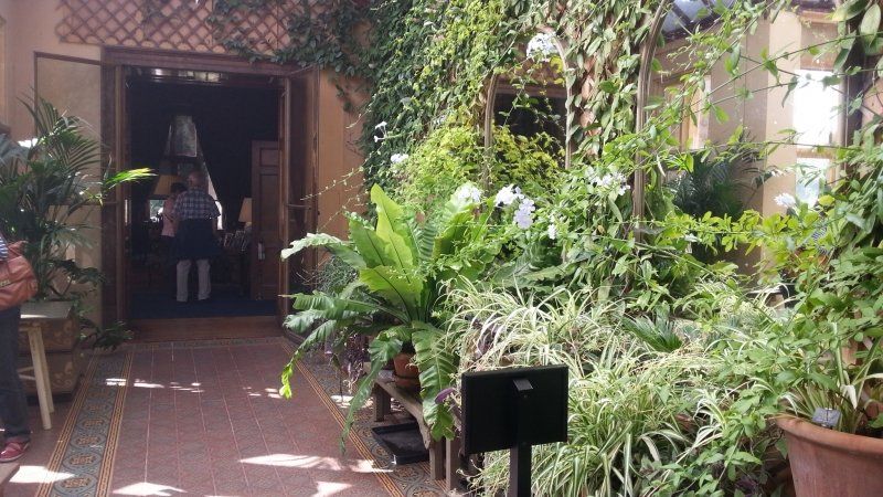
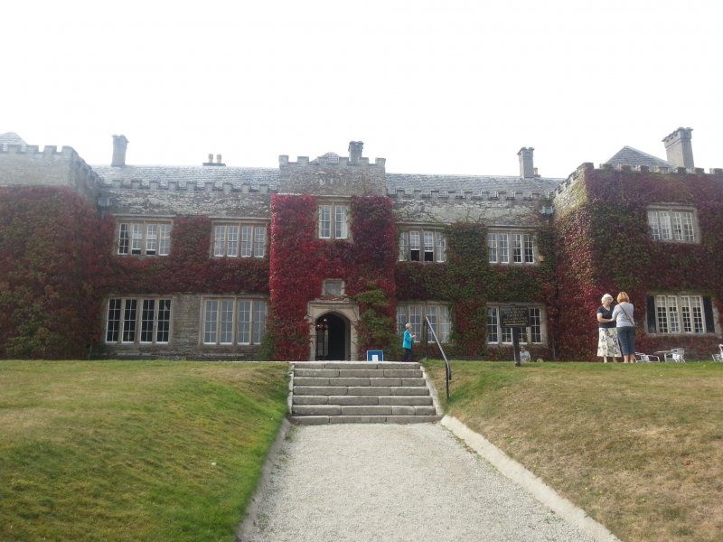
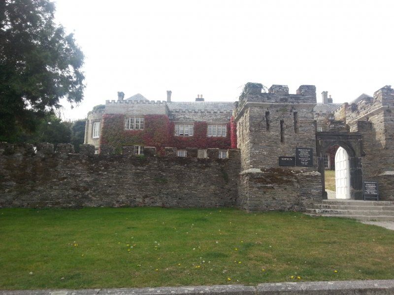
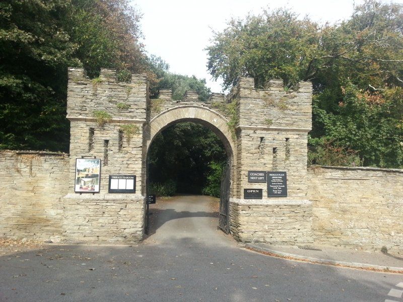
Dunster Castle, Dunster, Minehead, Vereinigtes Königreich
A really great castle with beautiful gardens around it.
Dunster, Minehead TA24 6SL, Vereinigtes Königreich
51° 10' 53.7" N 3° 26' 37.5" W
51.1815885 -3.4437525
• Head east. Go for 567 m.
• Turn left onto Loxhole Bridge (A39). Go for 78 m.
• Turn left onto Dunster Steep (A396). Go for 10.9 km.
• Turn left onto Summerway (B3224). Go for 1.4 km.
• Continue on Hare Path (B3224). Go for 1.3 km.
• Turn right toward Beech Tree Cross. Go for 7.2 km.
• Continue on Beech Tree Cross. Go for 2.9 km.
• Turn slightly right onto A396. Go for 176 m.
• Turn left onto B3222. Go for 229 m.
• Continue on Jury Hill (B3222). Go for 658 m.
• Continue on Jury Road (B3222). Go for 1.2 km.
• Turn left onto Vicarage Hill (B3222). Go for 43 m.
• Continue on High Street (B3222). Go for 246 m.
• Continue on Bridge Street (B3222). Go for 67 m.
• Turn right onto Kemps Way. Go for 122 m.
• Arrive at Kemps Way. Your destination is on the left.
☍
27,1 km
( 30 min.)
Day
Exmoor-Nationalpark, Dulverton, Vereinigtes Königreich
We get up early in the morning and drive through Exmoor National Park.
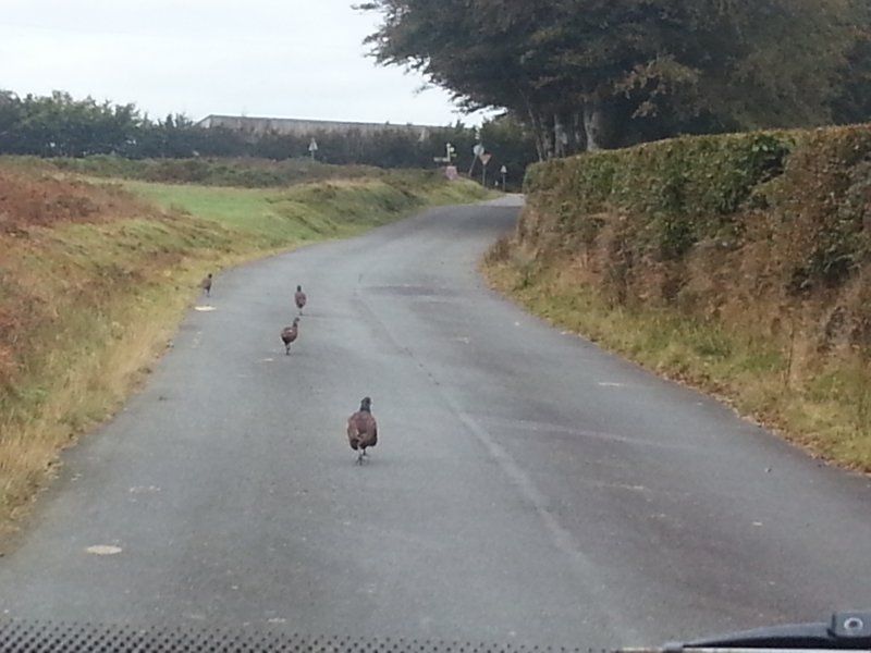
The drive through the national park with its small narrow streets, on which the pheasants feel like the kings of the country road, was one of our most beautiful experiences on this trip.
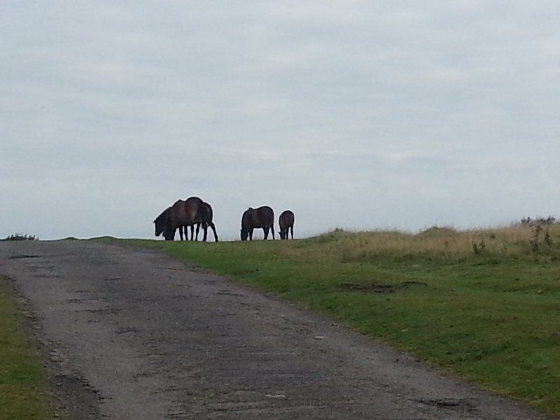
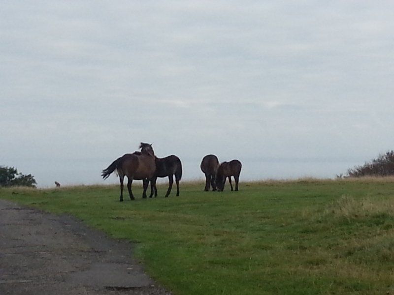
And finally we see them, the wild Exmoor ponies! An unforgettable moment!
Dulverton TA22 9HL, Vereinigtes Königreich
51° 2' 26" N 3° 33' 10.6" W
51.0405650 -3.5529370
• Head northeast on Kemps Way. Go for 10 m.
• Turn right onto Kemps Way. Go for 132 m.
• Turn right onto Bridge Street (B3222). Go for 48 m.
• Continue on B3222. Go for 314 m.
• Continue on Battleton (B3222). Go for 147 m.
• Continue on B3222. Go for 382 m.
• Continue on Battleton (B3222). Go for 559 m.
• Continue on B3222. Go for 3.0 km.
• Turn right onto A396. Go for 3.2 km.
• Turn right onto Hamslade Hill. Go for 207 m.
• Turn left onto Hamslade Hill. Go for 357 m.
• Turn sharp right onto B3227. Go for 1.8 km.
• Continue on High Bolham (B3227). Go for 187 m.
• Continue on B3227. Go for 15.2 km.
• Take the 1st exit from roundabout onto B3227 toward Barnstaple/A361/S Molton/(B3227). Go for 717 m.
• Turn left onto A361. Go for 1.5 km.
• Pass 6 roundabouts and continue on A361. Go for 21.3 km.
• Take the 1st exit from Lake Roundabout roundabout onto A39 toward Bideford/Bude/Roundswell/Bickington. Go for 1.7 km.
• Pass 4 roundabouts and continue on A39. Go for 49.6 km.
• Take the 2nd exit from roundabout onto Stratton Road (A3072) toward Bude. Go for 518 m.
• Take the 2nd exit from roundabout onto Stratton Road (A3072). Go for 952 m.
• Continue on Bencoolen Road. Go for 326 m.
• Turn right onto Killerton Road. Go for 17 m.
• Arrive at Killerton Road. Your destination is on the right.
☍
102,1 km
(1 hrs. 29 min.)
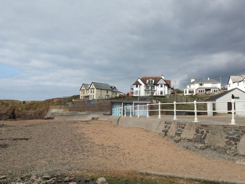
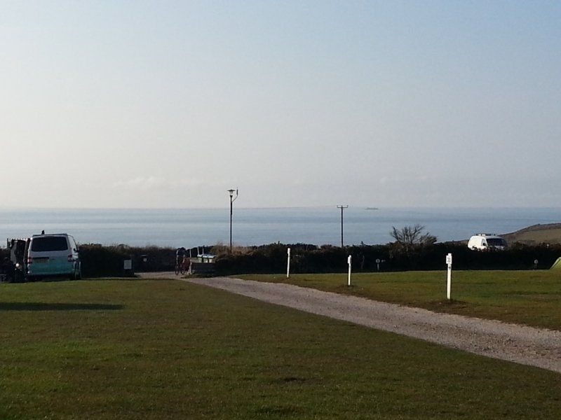
Bude, Vereinigtes Königreich
We reach our next station. After we have quickly settled in at the campsite, we go into town by scooter. We enjoy the hustle and bustle of the small town and take a long walk on the beach.
50° 49' 35.9" N 4° 32' 37.2" W
50.8266360 -4.5436780
• Head toward Bencoolen Road on Killerton Road. Go for 17 m.
• Turn left onto Bencoolen Road. Go for 326 m.
• Turn right onto Kings Hill (A3073). Go for 1.2 km.
• Continue on Thorne Farm Business Centre (A3073). Go for 50 m.
• Turn right onto A3073. Go for 249 m.
• Turn right onto A39. Go for 13.0 km.
• Turn right onto B3263 toward Boscastle/Crackington Haven. Go for 7.7 km.
• Continue on Penally Hill (B3263). Go for 372 m.
• Continue on The Bridge (B3263). Go for 51 m.
• Continue on B3263. Go for 35 m.
• Turn right onto New Road (B3263). Go for 925 m.
• Turn right onto Doctors Hill (B3263). Go for 114 m.
• Continue on Barnpark Road (B3263). Go for 279 m.
• Continue on Tintagel Road (B3263). Go for 447 m.
• Continue on B3263. Go for 3.1 km.
• Continue on Old Borough Farm (B3263). Go for 74 m.
• Continue on B3263. Go for 46 m.
• Continue on Bossiney Road (B3263). Go for 1.0 km.
• Take the 2nd exit from roundabout onto Fore Street. Go for 87 m.
• Arrive at Fore Street. Your destination is on the left.
☍
28,9 km
( 30 min.)
Day
Tintagel, Vereinigtes Königreich
On our onward journey we make a stop in Tintagel. We didn't want to do the way to the ruin, so we only took a stroll through the village.
Tintagel PL34, Vereinigtes Königreich
50° 39' 46.8" N 4° 45' 2.4" W
50.6630100 -4.7506600
• Head southeast on Fore Street. Go for 64 m.
• Take the 2nd exit from roundabout onto Molesworth Street (B3263). Go for 345 m.
• Continue on Trerammett (B3263). Go for 53 m.
• Continue on B3263. Go for 5.5 km.
• Turn left onto B3263. Go for 659 m.
• Continue on B3314. Go for 288 m.
• Turn right onto Camelford Station (B3266). Go for 15 m.
• Continue on B3266. Go for 2.0 km.
• Continue on Sportsmans (B3266). Go for 61 m.
• Continue on B3266. Go for 13 m.
• Continue on Sportsmans Road (B3266). Go for 557 m.
• Continue on B3266. Go for 286 m.
• Continue on Valley Truckle (B3266). Go for 78 m.
• Turn right onto A39. Go for 15.1 km.
• Take the 3rd exit from roundabout onto A39 toward Newquay/(A3059)/Truro/(A30)/Padstow/Royal Cornwall Showground. Go for 2.9 km.
• Take the 2nd exit from Tollgate roundabout onto A39 toward Truro/Royal Cornwall Showground. Go for 1.9 km.
• Turn right onto A389 toward Padstow/Hawksland/St Issey/Little Petherick. Go for 5.0 km.
• Turn right onto A389. Go for 3.2 km.
• Turn right onto New Street (B3276). Go for 222 m.
• Turn slightly right onto Dennis Road. Go for 19 m.
• Continue on Station Road. Go for 313 m.
• Continue on Riverside. Go for 189 m.
• Turn left onto South Quay. Go for 57 m.
• Turn slightly right onto The Strand. Go for 29 m.
• Turn right onto The Strand. Go for 12 m.
• Turn slightly left onto West Quay. Go for 56 m.
• Turn left onto Mill Square. Go for 26 m.
• Arrive at Mill Square. Your destination is on the right.
☍
39,0 km
( 39 min.)
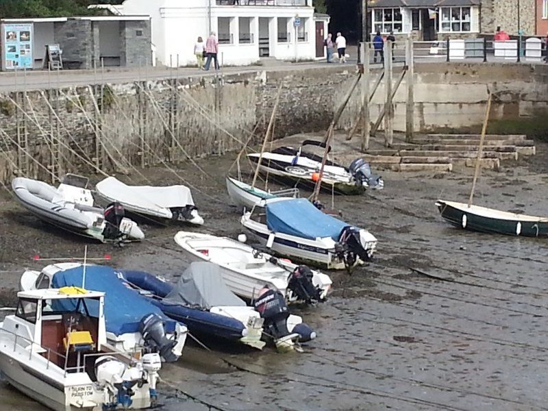
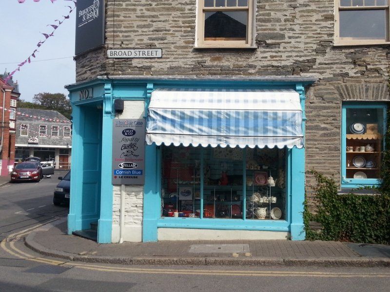
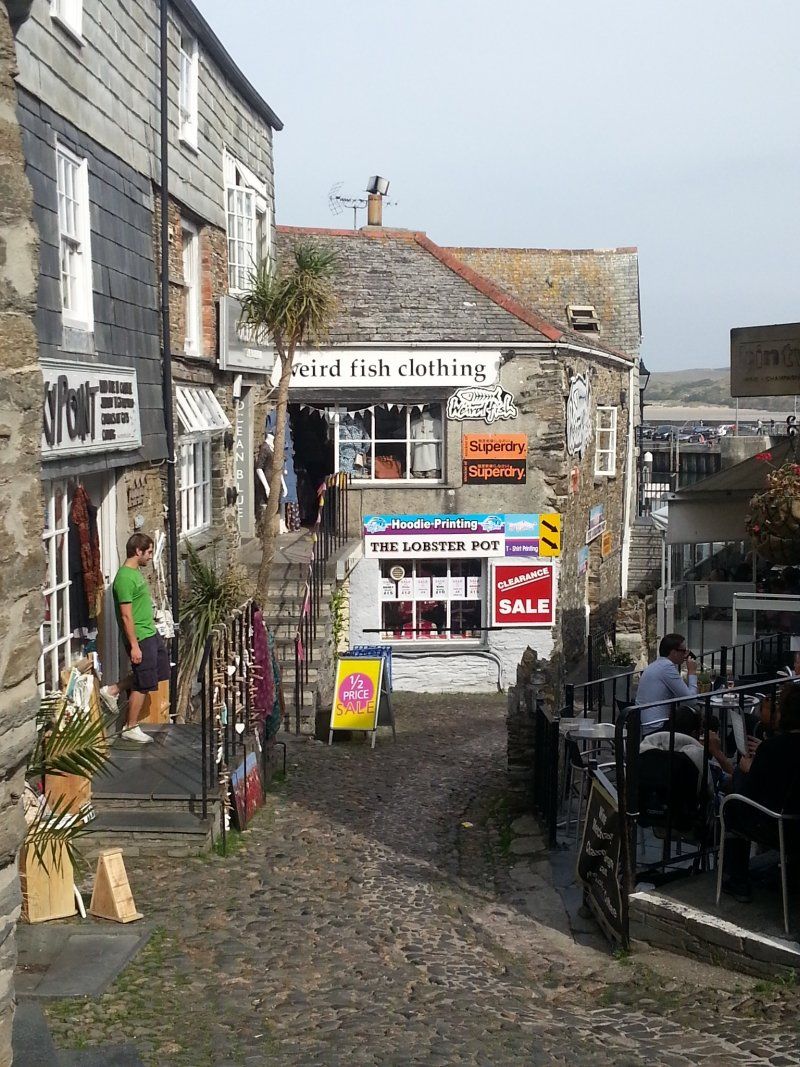
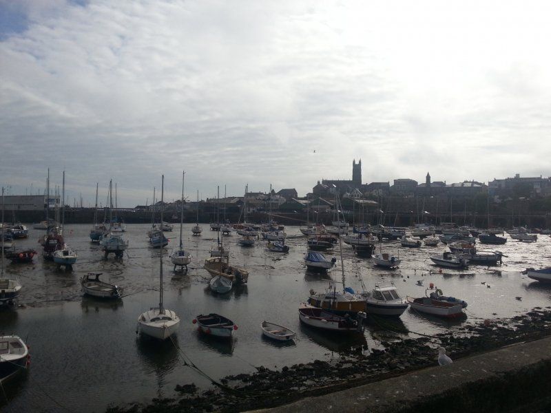
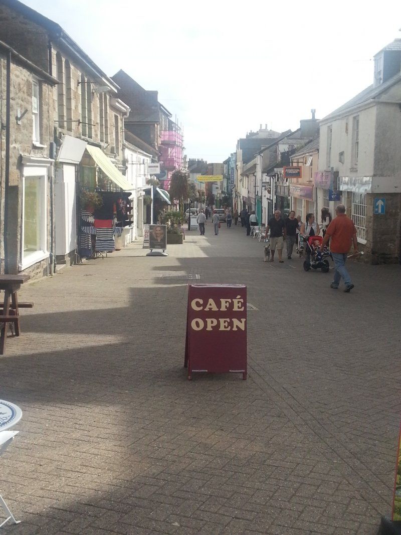
Padstow, Vereinigtes Königreich
We reach Padstow, drive to the campsite and get the scooter off the stage. Off we go to Padstow and we stroll through the town. With coffee and scones we enjoy the nice weather at the harbor. This makes it too late to visit Prideaux Place, made famous by many Rosamunde Pilcher films. Therefore we only made a small tour around the magnificent mansion.
50° 32' 31.4" N 4° 56' 20.5" W
50.5420620 -4.9390170
• Head toward Duke Street on Mill Square. Go for 28 m.
• Continue on Market Place (B3276). Go for 59 m.
• Turn left onto Broad Street (B3276). Go for 28 m.
• Turn left onto Broad Street (B3276). Go for 25 m.
• Turn right onto New Street (B3276). Go for 56 m.
• Continue on New Street (B3276). Go for 300 m.
• Turn left onto A389. Go for 3.2 km.
• Continue on B3274. Go for 3.6 km.
• Turn right. Go for 2.0 km.
• Turn left. Go for 678 m.
• Turn right. Go for 2.6 km.
• Turn right toward B3276. Go for 2.6 km.
• Turn left onto B3276. Go for 2.4 km.
• Turn right. Go for 270 m.
• Turn left. Go for 36 m.
• Arrive at your destination on the right.
☍
17,9 km
( 20 min.)
https://www.padstowtouringpark.co.uk/
Day
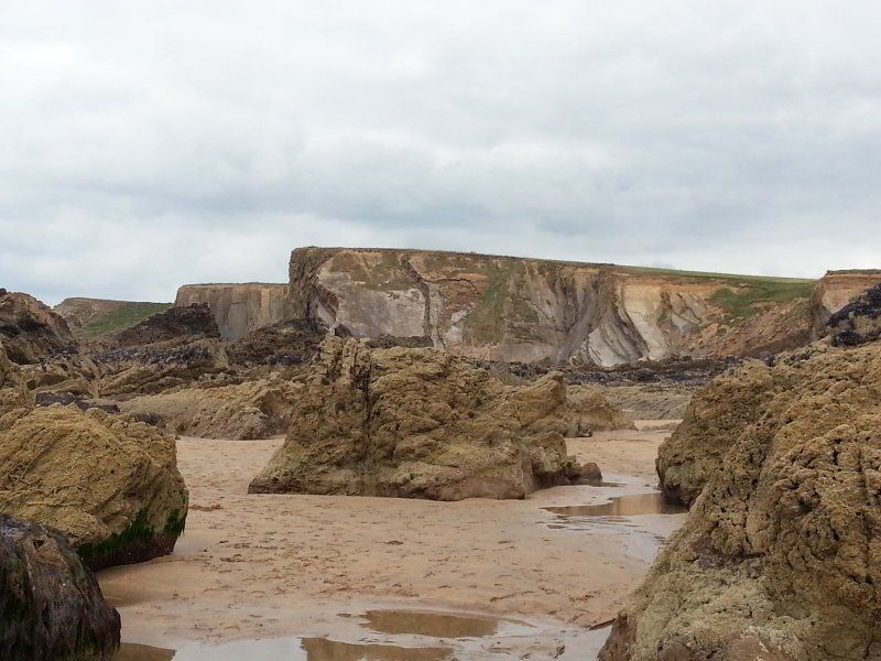
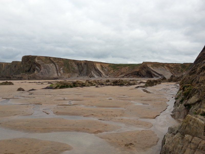
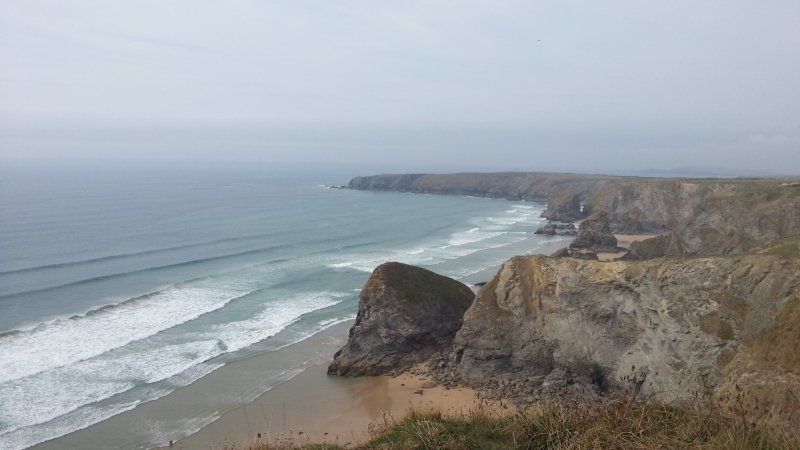
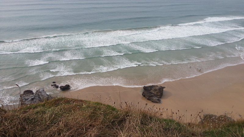
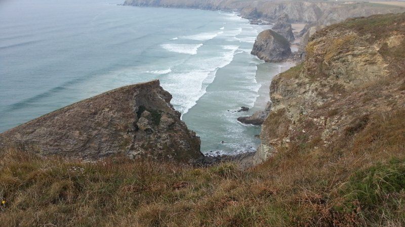
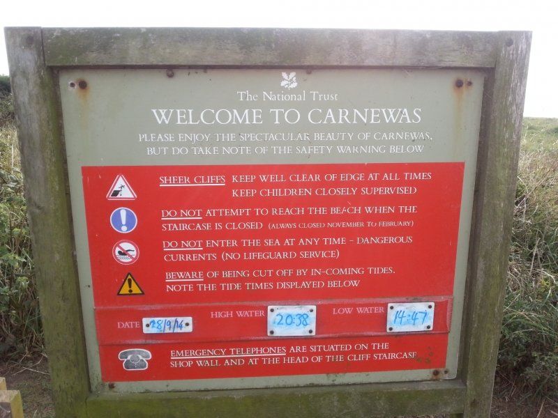
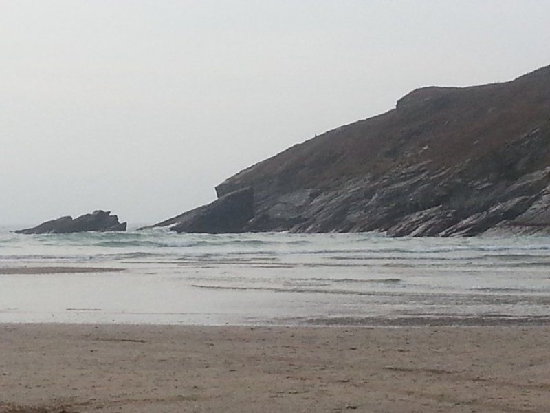
National Trust - Carnewas, Bedruthan Steps, Wadebridge, Vereinigtes Königreich
We are on the road again and, as so often, we see super great spots where we can stop and not get enough of the wild landscape. So here in Carnewas.
B3276, Wadebridge PL27 7UW, Vereinigtes Königreich
50° 28' 52.5" N 5° 1' 55.2" W
50.4812366 -5.0320076
• Head north. Go for 36 m.
• Turn right toward B3276. Go for 270 m.
• Turn right onto B3276. Go for 2.2 km.
• Continue on Sandy Beach (B3276). Go for 99 m.
• Continue on B3276. Go for 356 m.
• Continue on Mawgan Bay View (B3276). Go for 118 m.
• Continue on B3276. Go for 610 m.
• Turn right toward Trevarrian Hill. Go for 127 m.
• Continue on Trevarrian Hill. Go for 1.6 km.
• Continue on Watergate Road (B3276). Go for 2.6 km.
• Continue on Alexandra Road (B3276). Go for 190 m.
• Arrive at Alexandra Road (B3276).
☍
8,2 km
( 11 min.)
Porth Beach Tourist Park
Mit Abstand der beste Campingplatz auf dieser Reise mit supernetten jungen Betreibern. Wir machen einen ausgiebigen Strandspaziergang und lassen den Abend gemütlich ausklingen.
Porth, TR7 5PW, Newquay, Großbritannien
50° 25' 32.9" N 5° 3' 31" W
50.4258000 -5.0586000
• Head southeast on Alexandra Road (B3276). Go for 599 m.
• Continue on Porth Way (B3276). Go for 488 m.
• Take the 2nd exit from roundabout onto Henver Road (A3058). Go for 54 m.
• Pass 2 roundabouts and continue on Narrowcliff. Go for 1.4 km.
• Turn left onto Edgcumbe Avenue. Go for 104 m.
• Arrive at Edgcumbe Avenue. Your destination is on the right.
☍
2,7 km
( 4 min.)
Day
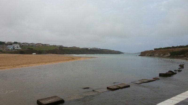
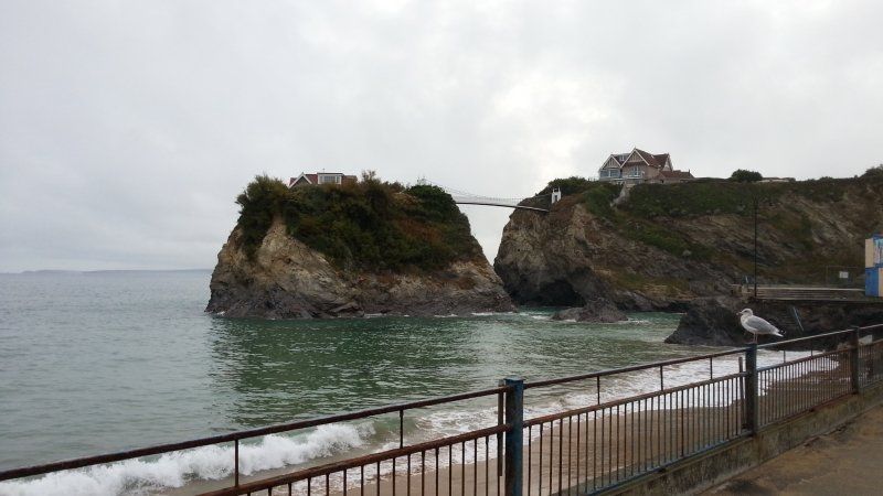
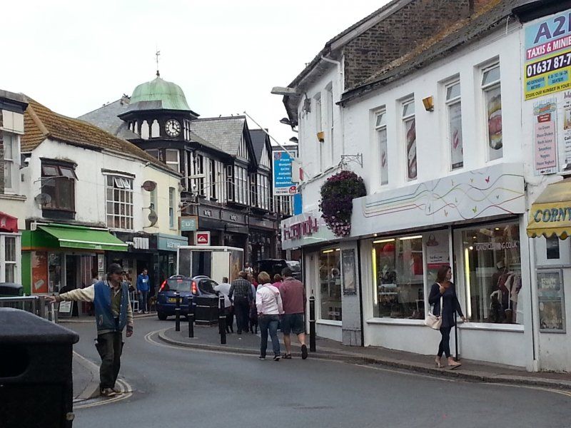
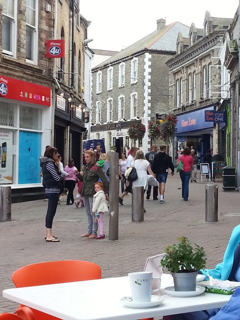
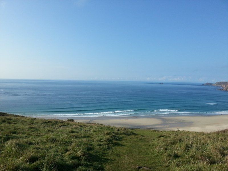
Newquay, Vereinigtes Königreich
We take the bus to Newquay because it looks like rain (which has not been confirmed) and we don't want to take the scooter. In between we get a cafe to go and look around the place. We discover a house that stands on a rock. How do you get your weekly shopping there? :-)
50° 24' 55.8" N 5° 4' 25.4" W
50.4154970 -5.0737190
• Head toward Edgcumbe Gardens on Edgcumbe Avenue. Go for 284 m.
• Take the 3rd exit from roundabout onto Ulalia Road (A3058). Go for 559 m.
• Take the 2nd exit from roundabout. Go for 32 m.
• Take the 1st exit from roundabout onto Trevemper Road (A3058). Go for 414 m.
• Take the 1st exit from Mellanvrane Roundabout roundabout onto Trevemper Road (A392). Go for 735 m.
• Take the 3rd exit from Trevemper roundabout onto Trevemper Road (A3075) toward Redruth/Perranporth/Cubert/Crantock. Go for 271 m.
• Pass 3 roundabouts and continue on Perranwell Road (A3075). Go for 15.0 km.
• Take the 4th exit from roundabout onto A30 toward Redruth. Go for 20.7 km.
• Take the 3rd exit from Loggans Moor roundabout onto A30 toward Penzance/St Ives/(A3074). Go for 4.7 km.
• Take the 2nd exit from roundabout onto Nut Lane (A3074) toward St Ives. Go for 448 m.
• Take the 1st exit from roundabout onto Nut Lane (A3074). Go for 101 m.
• Take the 1st exit from roundabout onto Mill Hill. Go for 3.6 km.
• Continue on Nance. Go for 1.2 km.
• Turn right onto B3311. Go for 1.7 km.
• Continue on Halsetown Road (B3311). Go for 418 m.
• Turn right onto Higher Stennack (B3306). Go for 724 m.
• Enter the roundabout. Go for 16 m.
• Arrive at your destination on the right.
☍
50,9 km
( 45 min.)
Day
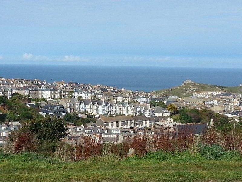
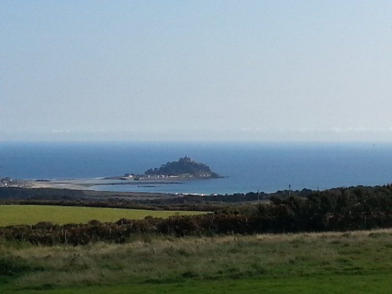
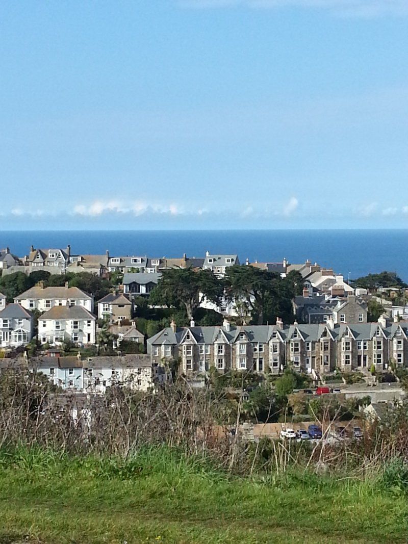
St Ives, Vereinigtes Königreich
Actually we wanted to go to St. Ives today. Unfortunately, at the Park and Ride, you can only pay the parking fees with coins - which of course we didn't have. And far and wide there was nobody to see who could change. So it was time to continue with a stop at a place where we could see St. Michael's Mount.
50° 12' 30.2" N 5° 29' 27.2" W
50.2083858 -5.4908864
• Follow the roundabout. Go for 20 m.
• Take the 2nd exit from roundabout onto Higher Stennack (B3306). Go for 724 m.
• Turn left onto Halsetown Road (B3311). Go for 418 m.
• Continue on B3311. Go for 2.9 km.
• Continue on Cripplesease (B3311). Go for 184 m.
• Continue on B3311. Go for 1.0 km.
• Continue on Baldhu Row (B3311). Go for 52 m.
• Continue on B3311. Go for 2.0 km.
• Continue on Castle Gate (B3311). Go for 75 m.
• Continue on B3311. Go for 2.7 km.
• Continue on Chyandaunce (B3311). Go for 54 m.
• Continue on Gulval Cross (B3311). Go for 64 m.
• Continue on Trevarrack Road (B3311). Go for 79 m.
• Turn right onto Green Lane Hill (B3311). Go for 208 m.
• Continue on B3311. Go for 132 m.
• Continue on Ponsondane Mews (B3311). Go for 179 m.
• Continue on B3311. Go for 281 m.
• Turn left onto Eastern Green (B3311). Go for 229 m.
• Take the 1st exit from roundabout onto A30. Go for 1.3 km.
• Pass 3 roundabouts and continue on A30. Go for 4.4 km.
• Continue on Drift (A30). Go for 170 m.
• Continue on A30. Go for 165 m.
• Continue on Higher Drift (A30). Go for 160 m.
• Continue on A30. Go for 721 m.
• Continue on Catchall (A30). Go for 187 m.
• Continue on A30. Go for 3.5 km.
• Continue on Crows-an-Wra (A30). Go for 90 m.
• Continue on A30. Go for 2.4 km.
• Turn right. Go for 642 m.
• Arrive at your destination on the left.
☍
25,1 km
( 30 min.)
Trevedra Farm Caravan & Camping Site, Sennen, Penzance, Vereinigtes Königreich
We reach today's stop at Trevedra Farm. We decide to stay here two nights because we want to go to Land's End tomorrow. We quickly get the scooter down and head to Penzance.
Sennen, Penzance TR19 7BE, Vereinigtes Königreich
50° 5' 19.1" N 5° 40' 44" W
50.0886483 -5.6788835
• Head southwest. Go for 642 m.
• Turn left onto A30. Go for 2.4 km.
• Continue on Crows-an-Wra (A30). Go for 90 m.
• Continue on A30. Go for 3.5 km.
• Continue on Catchall (A30). Go for 187 m.
• Continue on A30. Go for 721 m.
• Continue on Higher Drift (A30). Go for 160 m.
• Continue on A30. Go for 165 m.
• Continue on Drift (A30). Go for 170 m.
• Continue on A30. Go for 2.3 km.
• Take the 2nd exit from Mount Misery roundabout onto A30. Go for 1.4 km.
• Take the 4th exit from roundabout onto Nancealverne. Go for 609 m.
• Continue on St Clare Street. Go for 172 m.
• Take the 1st exit from roundabout onto St Clare Street. Go for 220 m.
• Turn left onto Taroveor Road. Go for 58 m.
• Turn right onto High Street. Go for 237 m.
• Turn right onto Bread Street. Go for 40 m.
• Turn left onto Causewayhead. Go for 14 m.
• Arrive at Causewayhead. Your destination is on the left.
☍
13,0 km
( 16 min.)
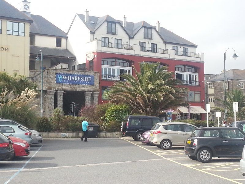
Penzance, Vereinigtes Königreich
A very beautiful town with a special charm.
50° 7' 7.7" N 5° 32' 15.3" W
50.1187980 -5.5375920
• Head toward Market Place on Causewayhead. Go for 13 m.
• Turn right onto Alverton Street. Go for 119 m.
• Continue on Alverton Road. Go for 530 m.
• Take the 2nd exit from roundabout onto Alverton Road. Go for 468 m.
• Continue on Lansdowne Place. Go for 329 m.
• Continue on Barlanwick. Go for 128 m.
• Continue toward A30. Go for 32 m.
• Take the 1st exit from Mount Misery roundabout onto A30. Go for 2.3 km.
• Continue on Drift (A30). Go for 170 m.
• Continue on A30. Go for 165 m.
• Continue on Higher Drift (A30). Go for 160 m.
• Continue on A30. Go for 721 m.
• Continue on Catchall (A30). Go for 187 m.
• Continue on A30. Go for 3.5 km.
• Continue on Crows-an-Wra (A30). Go for 90 m.
• Continue on A30. Go for 3.5 km.
• Continue on Sea View Terrace (A30). Go for 127 m.
• Continue on A30. Go for 2.9 km.
• Turn left. Go for 13 m.
• Arrive at your destination on the right.
☍
15,4 km
( 19 min.)
Day
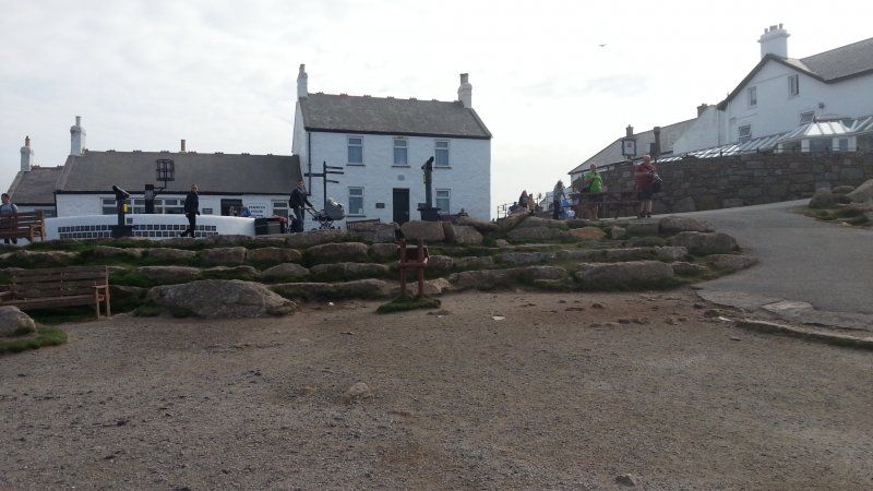
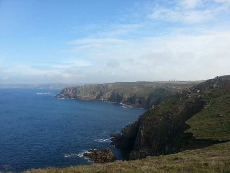
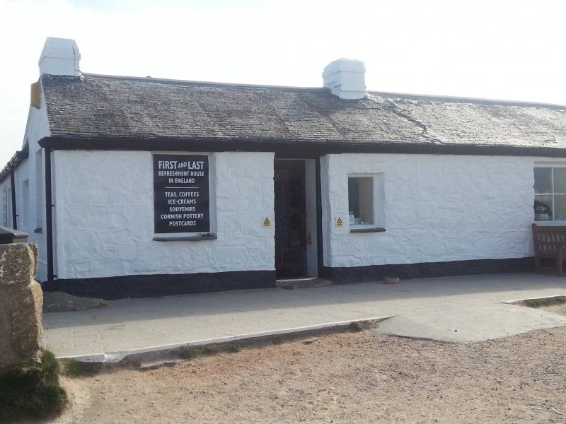
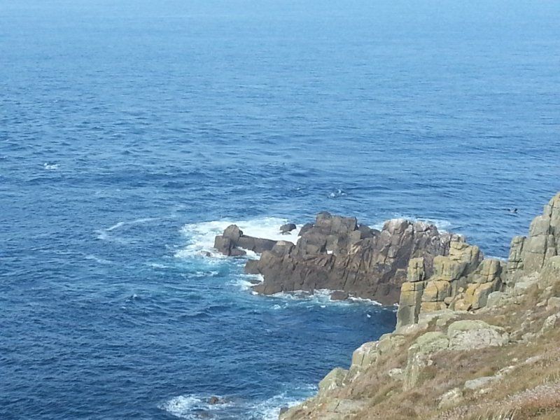
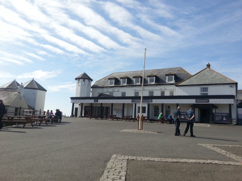
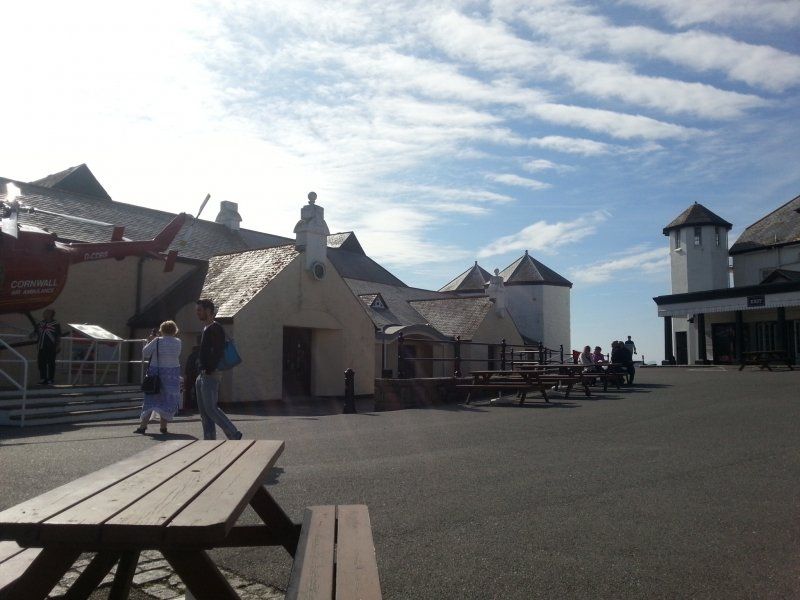
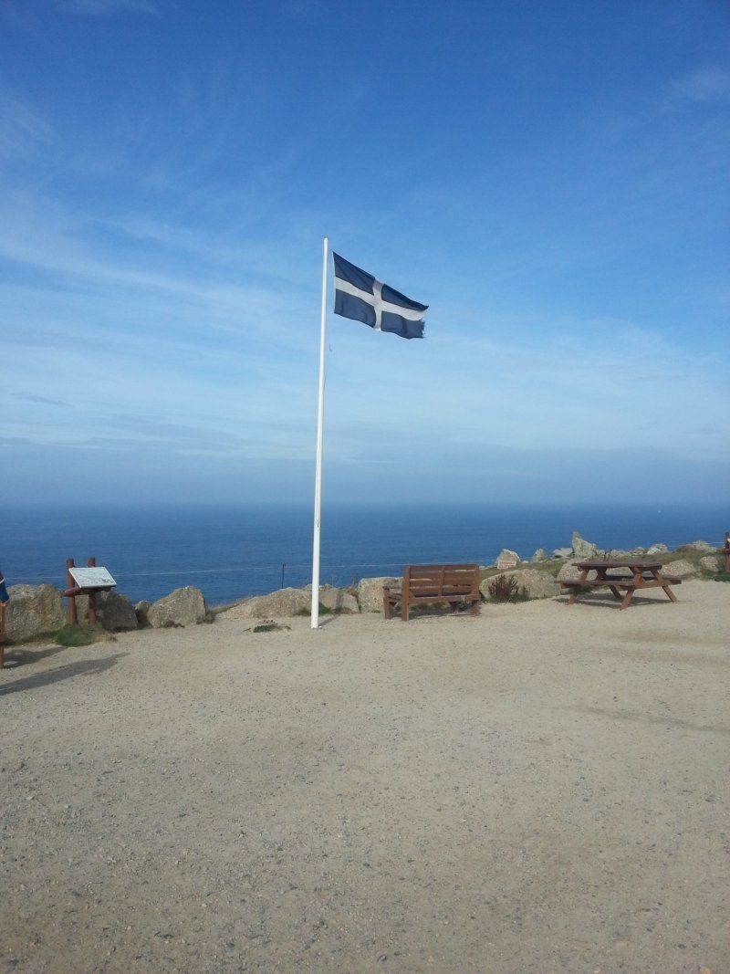
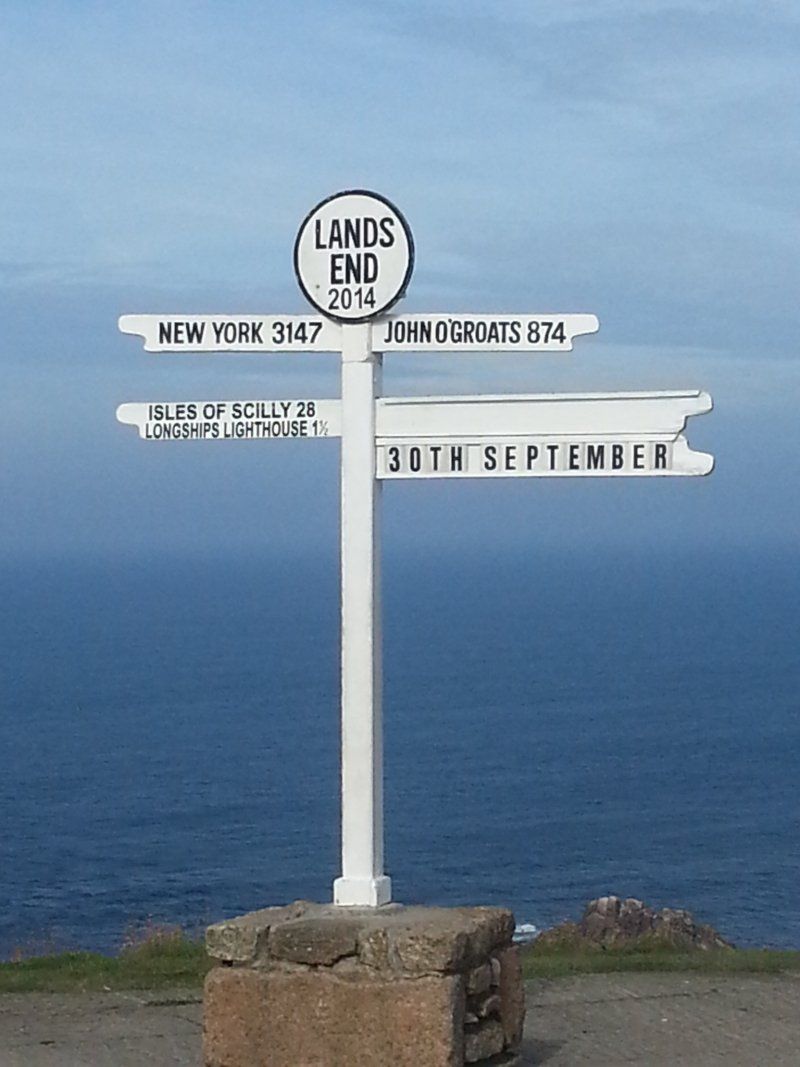
Land's End, Unnamed Road, Penzance, Vereinigtes Königreich
It's really commercial, but you have to see it when you're in the corner ;-)
Unnamed Road, Penzance TR19 7AA, Vereinigtes Königreich
50° 3' 56.4" N 5° 42' 45.4" W
50.0656768 -5.7126040
• Head southeast. Go for 4 m.
• Turn slightly left. Go for 81 m.
• Turn left. Go for 30 m.
• Turn right toward A30. Go for 358 m.
• Turn slightly left onto A30. Go for 434 m.
• Keep left onto A30. Go for 2.1 km.
• Continue on Sea View Terrace (A30). Go for 127 m.
• Continue on A30. Go for 3.5 km.
• Continue on Crows-an-Wra (A30). Go for 90 m.
• Continue on A30. Go for 3.5 km.
• Continue on Catchall (A30). Go for 187 m.
• Continue on A30. Go for 721 m.
• Continue on Higher Drift (A30). Go for 160 m.
• Continue on A30. Go for 165 m.
• Continue on Drift (A30). Go for 170 m.
• Continue on A30. Go for 2.3 km.
• Take the 2nd exit from Mount Misery roundabout onto A30. Go for 1.4 km.
• Take the 3rd exit from roundabout onto A30. Go for 756 m.
• Pass 2 roundabouts and continue on Eastern Green (A30). Go for 2.0 km.
• Take the 2nd exit from roundabout onto Eastern Green (A30). Go for 304 m.
• Take the 2nd exit from Chy-an-Mor roundabout onto A30. Go for 1.7 km.
• Take the 1st exit from Newtown Roundabout roundabout onto A30 toward Redruth/St Ives/A3047/Hayle. Go for 5.8 km.
• Take the 3rd exit from roundabout onto A30 toward Redruth. Go for 4.8 km.
• Take the 2nd exit from Loggans Moor roundabout onto A30 toward Redruth. Go for 162 km.
• Take ramp onto M5 toward Taunton/Honiton/Exmouth. Go for 7.4 km.
• Take exit 29 toward Exeter Airport onto A30 (Honiton Road). Go for 1.0 km.
• Keep right onto Honiton Road (A30) toward Honiton/Exeter Airport/Cranbrook/(B3174). Go for 30.8 km.
• Keep left onto A303 toward London/Yeovil/Ilminster. Go for 16.2 km.
• Take the 3rd exit from Southfields Roundabout roundabout onto A303 toward London/Ilchester/Yeovil/(A3088)/Weymouth/(A37). Go for 10.4 km.
• Pass 2 roundabouts and continue on A303. Go for 13.8 km.
• Take the 3rd exit from Podimore Roundabout roundabout onto A303 toward London. Go for 62.3 km.
• Pass 2 roundabouts and continue on A303. Go for 48.8 km.
• Take ramp onto M3. Go for 52.8 km.
• Take exit 2 toward (M4, M40, M1)/Heathrow Airport/Watford/Staines/Gatwick Airport/M23/Chertsey/A320/Dartford/M20 onto M25. Go for 58.1 km.
• Keep right onto M26 toward Dover/Channel Tnl/(M20)/Maidstone/Hastings/Sevenoaks/(A21). Go for 17.1 km.
• Keep right onto M26. Go for 182 m.
• Continue on M20. Go for 64.1 km.
• Continue on A20. Go for 11.4 km.
• Pass 2 roundabouts and continue on Limekiln Street (A20). Go for 1.3 km.
• Turn left onto York Street (A20) toward Town centre (North)/Priory Train Station. Go for 429 m.
• Take the 2nd exit from roundabout onto Priory Road (A256). Go for 252 m.
• Turn right onto Ladywell. Go for 88 m.
• Continue on Park Place. Go for 58 m.
• Continue on Park Street. Go for 95 m.
• Turn slightly right onto Maison Dieu Road (A256). Go for 276 m.
• Turn right onto Pencester Road. Go for 66 m.
• Arrive at Pencester Road. Your destination is on the left.
☍
589,7 km
(6 hrs. 25 min.)
Day
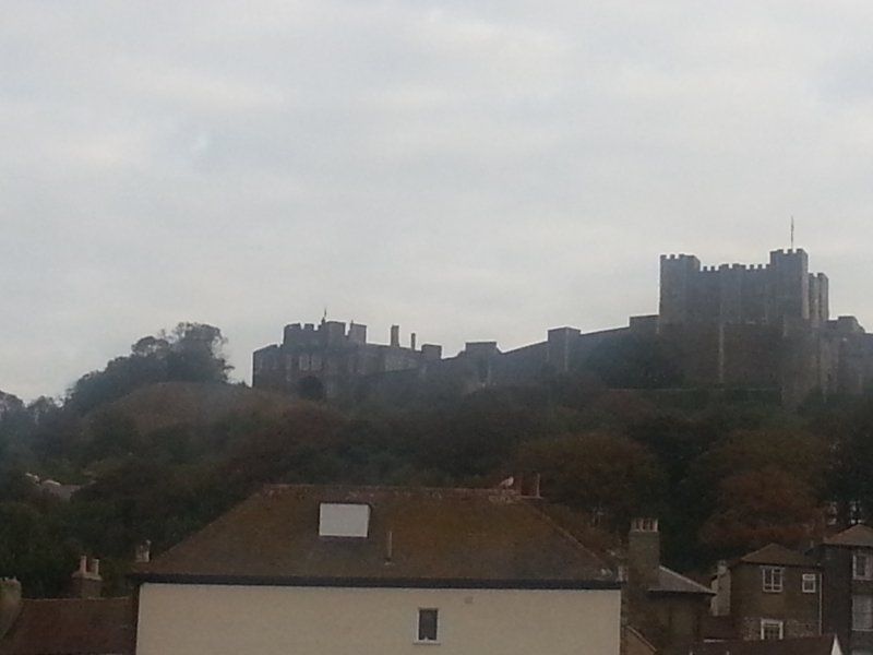
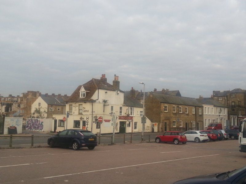
Dover, Vereinigtes Königreich
We decide to take the ferry a day earlier because I long for the grandchildren ;-). So we make our way towards Dover. Unfortunately, we completely miscalculated the distance, arrive in Dover late at night and spend the night in a public truck park. The next morning we found out at the terminal that a rebooking would cost an additional 200 euros :-(. The nice lady at the terminal gave us the tip to drive one more day to Canterbury and take the originally booked ferry the next day. done.
51° 7' 40.4" N 1° 18' 48.2" E
51.1278758 1.3134027
• Head toward Worthington Street on Pencester Road. Go for 186 m.
• Turn right onto Biggin Street. Go for 70 m.
• Turn left onto Priory Street. Go for 87 m.
• Take the 1st exit from roundabout onto York Street (A20). Go for 410 m.
• Turn left onto Townwall Street (A20). Go for 1.0 km.
• Take the 2nd exit from Eastern Docks Roundabout roundabout onto Jubilee Way (A2) toward Canterbury/Deal/(A258)/Ramsgate/(A256)/Sandwich. Go for 2.3 km.
• Take the 2nd exit from roundabout onto A2 toward London/(M2)/Canterbury/Ramsgate/(A256). Go for 3.3 km.
• Take the 3rd exit from roundabout onto A2 toward Canterbury/(M2). Go for 17.2 km.
• Take ramp onto A2050 toward Canterbury. Go for 1.6 km.
• Take the 2nd exit from The Gate Roundabout roundabout. Go for 266 m.
• Turn left. Go for 12 m.
• Arrive at your destination on the left.
☍
26,5 km
( 22 min.)
Park & Ride New Dover Road
In Canterbury übernachten wir auf dem Stellplatz für 3 Pfund inkl. Busticket nach Canterbury hin und zurück. Übrigens war dies der einzige Stellplatz während unserer Reise. England scheint damit mäßig ausgestattet zu sein.
New Dover Road, 51.2612319, Canterbury
51° 15' 41" N 1° 6' 1" E
51.2613889 1.1002778
• Head northeast. Go for 6 m.
• Turn right. Go for 42 m.
• Turn right toward New Dover Road/A2050. Go for 293 m.
• Take the 2nd exit from The Gate Roundabout roundabout onto New Dover Road (A2050). Go for 1.9 km.
• Continue on St George's Place (A257). Go for 234 m.
• Take the 2nd exit from St Georges Roundabout roundabout onto Lower Bridge Street (A28) toward Margate/Ramsgate/Herne Bay/(A291). Go for 955 m.
• Take the 1st exit from Chaucer Roundabout roundabout onto Tourtel Road (A28) toward Margate/Herne Bay/(A291). Go for 205 m.
• Take the 1st exit from roundabout onto Northgate. Go for 123 m.
• Turn left onto New Ruttington Lane. Go for 47 m.
• Turn right onto Union Place. Go for 67 m.
• Turn right onto Victoria Row. Go for 39 m.
• Turn left onto Northgate. Go for 218 m.
• Continue on The Borough. Go for 109 m.
• Turn left onto Palace Street. Go for 118 m.
• Turn right onto St Alphege Lane. Go for 71 m.
• Turn left onto King Street. Go for 75 m.
• Continue on Best Lane. Go for 57 m.
• Arrive at Best Lane. Your destination is on the right.
☍
4,5 km
( 12 min.)
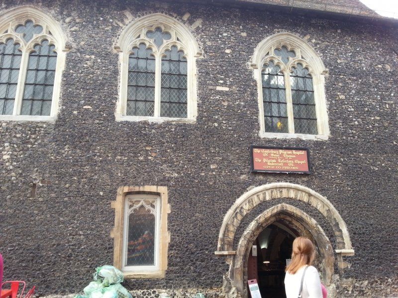
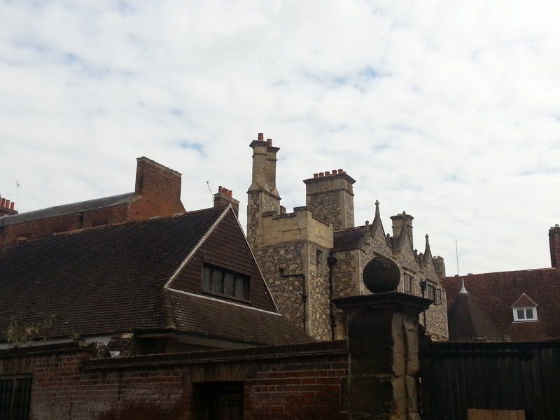
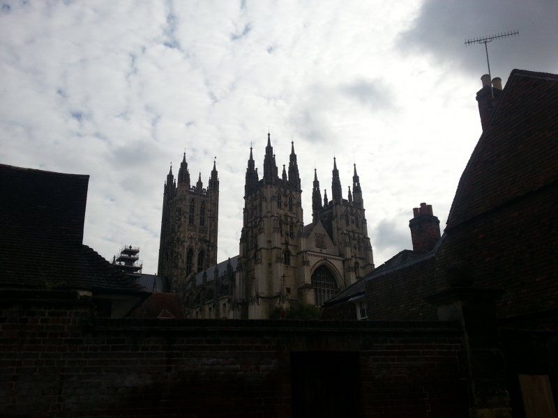
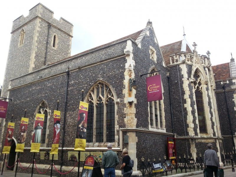
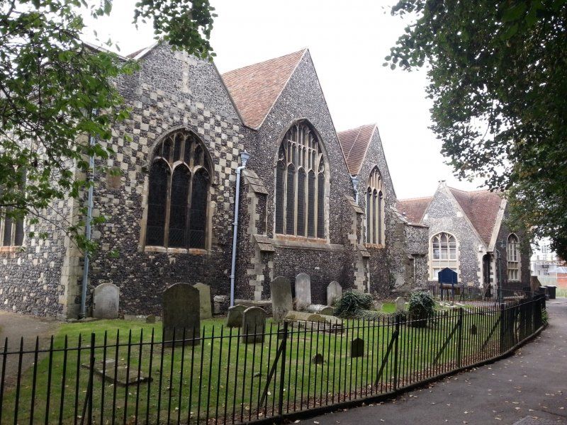
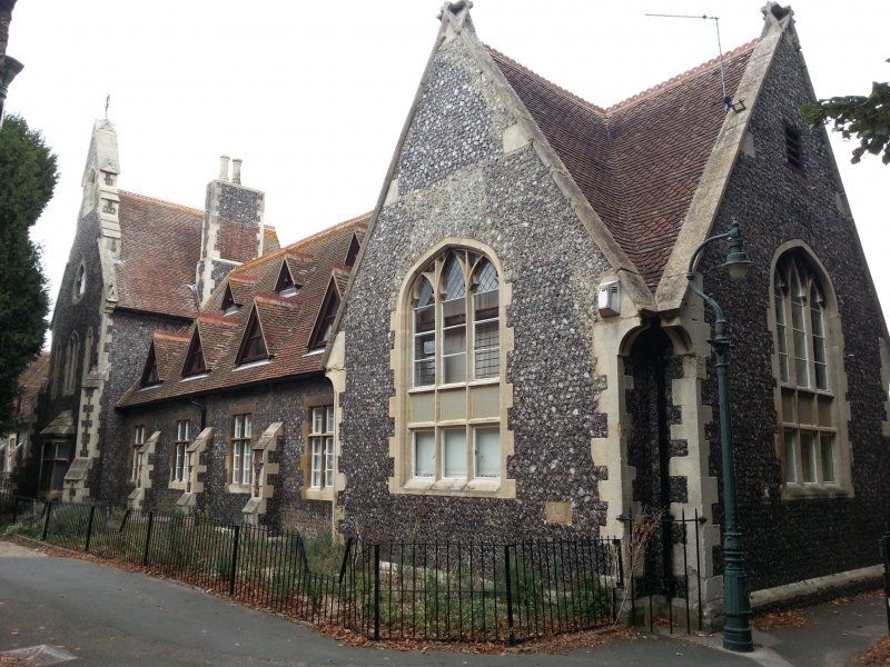
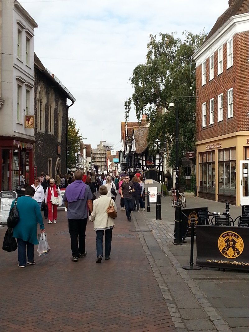
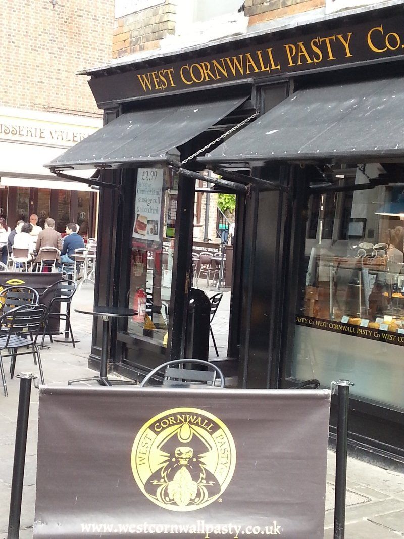
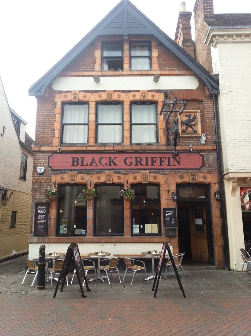
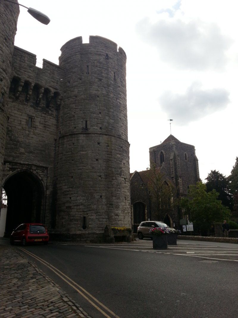
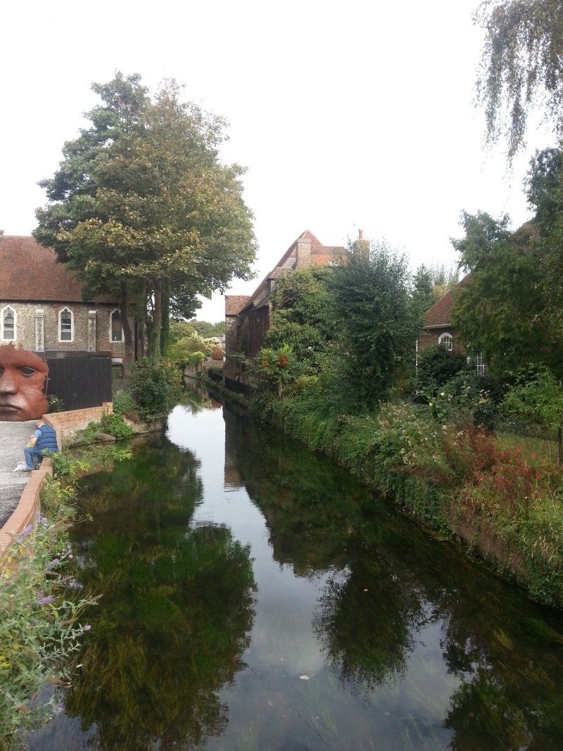
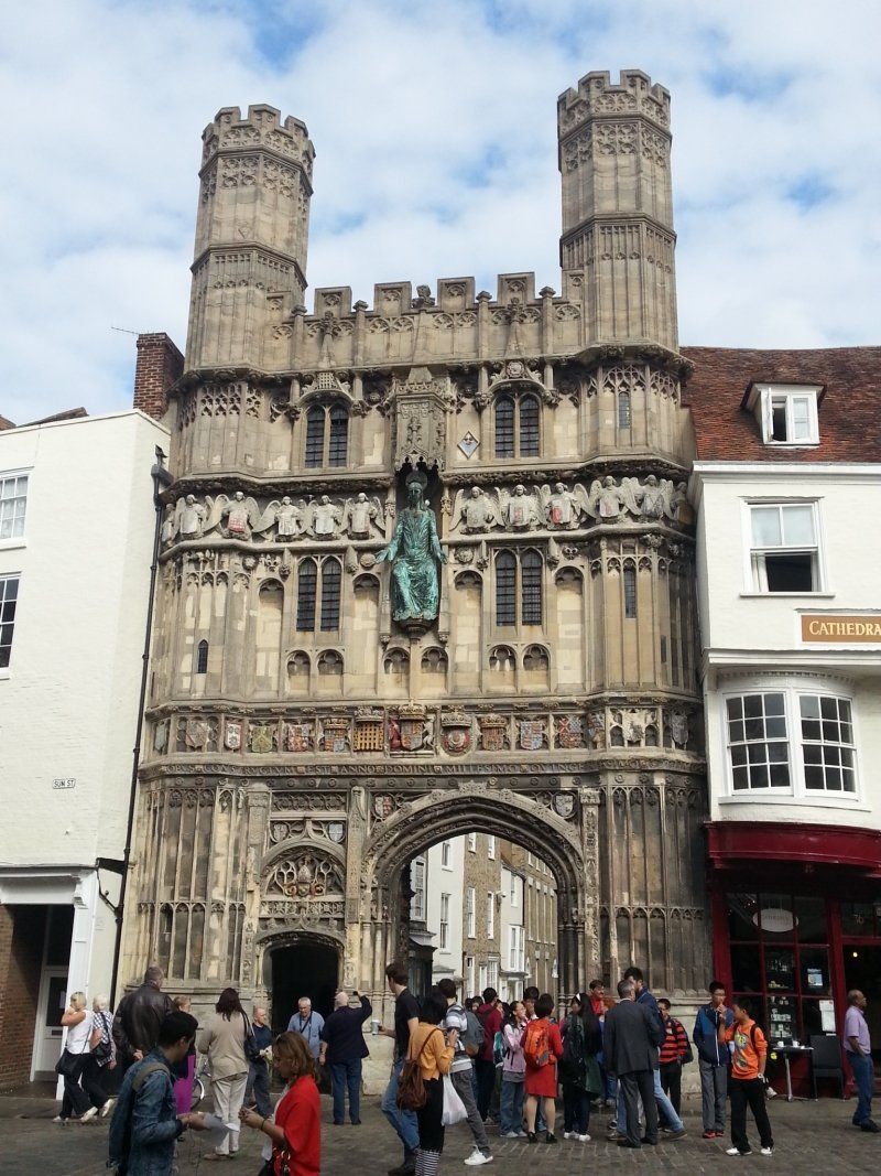
Canterbury, Vereinigtes Königreich
That was the best decision! Canterbury is such a magical place!
51° 16' 48.8" N 1° 4' 44.1" E
51.2802330 1.0789089
• Head southwest on Best Lane.
• Turn left. Go for 52 m.
• Turn left toward Orange Street. Go for 31 m.
• Turn right onto Orange Street. Go for 42 m.
• Turn left onto Palace Street. Go for 211 m.
• Turn right onto The Borough. Go for 109 m.
• Continue on Northgate. Go for 364 m.
• Take the 3rd exit from roundabout onto Tourtel Road (A28) toward Ashford/London/(A2)/Dover. Go for 268 m.
• Take the 2nd exit from Chaucer Roundabout roundabout onto Military Road (A28) toward Ashford/London/(A2)/Dover. Go for 929 m.
• Take the 1st exit from St Georges Roundabout roundabout onto St George's Place (A257) toward Sandwich/Dover/(A2). Go for 235 m.
• Continue on New Dover Road (A2050). Go for 1.8 km.
• Take the 1st exit from The Gate Roundabout roundabout onto New Dover Road (A2050). Go for 929 m.
• Take ramp onto A2. Go for 17.8 km.
• Take the 4th exit from roundabout onto Whitfield Hill (A256) toward Temple Ewell. Go for 1.4 km.
• Take the 1st exit from roundabout onto London Road (A256). Go for 2.8 km.
• Turn left onto Charlton Green (A256). Go for 686 m.
• Turn right onto Pencester Road. Go for 66 m.
• Arrive at Pencester Road. Your destination is on the left.
☍
27,7 km
( 30 min.)
Day
Dover, Vereinigtes Königreich
51° 7' 40.4" N 1° 18' 48.2" E
51.1278758 1.3134027
• Head toward Worthington Street on Pencester Road. Go for 186 m.
• Turn right onto Biggin Street. Go for 70 m.
• Turn left onto Priory Street. Go for 87 m.
• Take the 1st exit from roundabout onto York Street (A20). Go for 410 m.
• Turn left onto Townwall Street (A20). Go for 1.0 km.
• Take the 1st exit from Eastern Docks Roundabout roundabout. Go for 41 m.
• Continue on Back Road West. Go for 273 m.
• Continue on West Ramp. Go for 700 m.
• Continue on North Camber Way. Go for 640 m.
• Turn left onto South Camber Way. Go for 111 m.
• Continue on Lower Road East. Go for 318 m.
• Turn left. Go for 263 m.
• Take the Dover-Calais Ferry. Stay on for 40.6 km.
• Head southeast. Go for 281 m.
• Continue on Boulevard du Débarquement. Go for 921 m.
• Turn right toward Avenue du Commandant Cousteau. Go for 221 m.
• Continue on Avenue du Commandant Cousteau. Go for 79 m.
• Take the 3rd exit from roundabout onto Quai de la Loire. Go for 1.1 km.
• Turn right onto Rue Mollien. Go for 500 m.
• Continue on Pont Mollien. Go for 379 m.
• Take the 3rd exit from Rue Paul Bert roundabout onto Boulevard Jacquard. Go for 349 m.
• Turn left onto Rue de la Pomme d'Or. Go for 334 m.
• Arrive at Rue de la Pomme d'Or. Your destination is on the right.
☍
48,9 km
(1 hrs. 52 min.)
Calais, Frankreich
50° 57' 4.6" N 1° 51' 31.3" E
50.9512900 1.8586860