Day
Neumarkt in der Oberpfalz
92318 Neumarkt in der Oberpfalz, Deutschland
49° 16' 38.1" N 11° 28' 1.9" E
49.2772606 11.4671996
• Head toward Schweningerstraße on Zimmererstraße. Go for 25 m.
• Turn left onto Schweningerstraße. Go for 112 m.
• Turn right onto Badstraße (St2240). Go for 496 m.
• Turn right onto Ringstraße (St2240). Go for 300 m.
• Continue on Freystädter Straße (St2240). Go for 561 m.
• Continue on Freystädter Straße (NMs41). Go for 146 m.
• Take the 2nd exit from roundabout onto Freystädter Straße (NMs41) toward Stauf. Go for 171 m.
• Continue on NM41. Go for 330 m.
• Continue on Staufer Hauptstraße (NM41). Go for 309 m.
• Turn left onto Äußerer Ring. Go for 280 m.
• Turn left onto Münchener Ring (B299) toward München/B8/Regensburg/Freystadt. Go for 18.4 km.
• Continue on Neumarkter Straße (B299) toward A9/München/Ingolstadt/Landshut/Beilngries. Go for 8.3 km.
• Take the 2nd exit from roundabout onto Maria-Hilf-Straße (B299) toward München/A9/Landshut/Ingolstadt/Kelheim/Altmühltal. Go for 1.0 km.
• Turn left onto Ingolstädter Straße (B299) toward München/A9/Landshut/Neustadt/Ingolstadt/Paulushofen. Go for 973 m.
• Take the 2nd exit from roundabout onto Ingolstädter Straße (B299) toward München/A9/Landshut/Ingolstadt/Denkendorf. Go for 3.4 km.
• Continue on St2229. Go for 8.3 km.
• Pass 2 roundabouts and continue on St2229. Go for 1.5 km.
• Turn left and take ramp onto A9 toward München. Go for 89.8 km.
• Take exit 76 toward M.-Schwabing/München Centrum/Garmisch-P./A95/Mittl. Ring West/BMW Welt/Olympiapark/SAP Garden onto B2R (Mittlerer Ring). Go for 561 m.
• Keep left onto Mittlerer Ring (B2R) toward Garmisch-P./A95/Lindau/A96/Stuttgart/A8. Go for 2.0 km.
• Keep left onto Mittlerer Ring (B2R) toward A8/A96/A95/Stuttgart/Lindau/Garmisch-P. Go for 1.2 km.
• Take ramp onto Landshuter Allee (B2R) toward Garmisch-P./A95/Lindau/A96. Go for 4.3 km.
• Keep left onto Donnersbergerbrücke (B2R). Go for 3.8 km.
• Keep right onto Anschlussstelle München-Sendling-Süd toward Garmisch-P. Go for 333 m.
• Continue on A95. Go for 54.8 km.
• Take exit 10A toward Kochel a. See/Großweil. Go for 724 m.
• Turn left onto St2062 toward Kochel a. See/Großweil. Go for 8.4 km.
• Turn right onto Schmied-von-Kochel-Platz (B11). Go for 16.4 km.
• Turn left onto Einsiedl. Go for 20 m.
• Arrive at Einsiedl.
☍
227,1 km
(2 hrs. 33 min.)
Nachtparkplatz Einsiedl, Walchensee
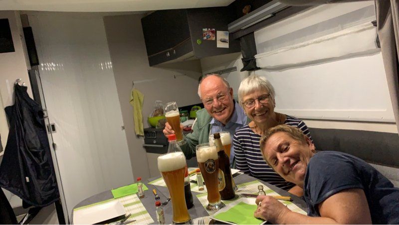
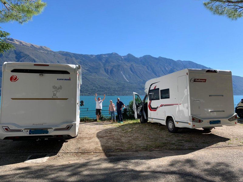
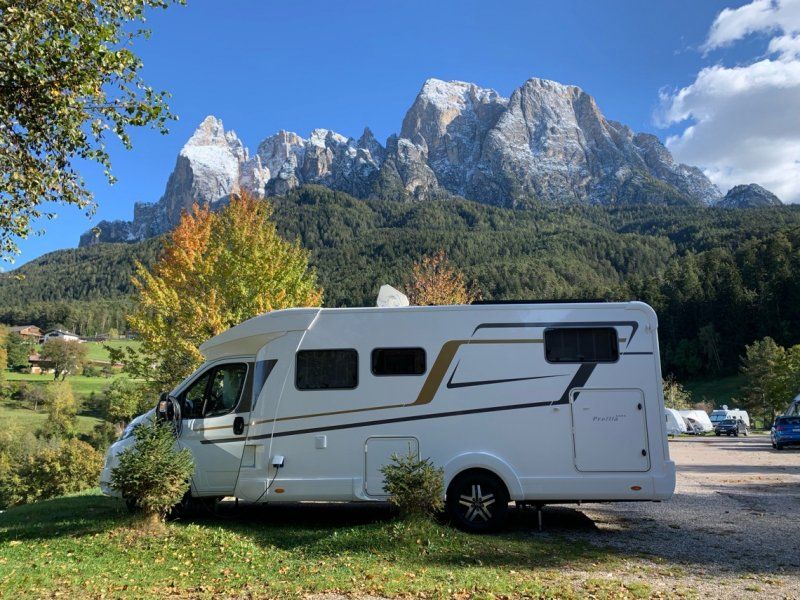
The weather forecast says nothing good - storms and continuous rain. The Covid numbers don't mean anything good either - but Lake Garda and South Tyrol are not yet risk areas. So quickly head south. We meet with dear friends at Walchensee, but when we arrive we don't discover them. What a surprise - a new camper and completely sealed. Although we were surprised when it was said a few days earlier that you cannot use the oven.
It must now be toasted immediately!
That you are always accident-free and have a lot of fun with the new one. ?
B 11, 82432, Walchensee, Deutschland
47° 34' 16" N 11° 18' 18" E
47.5711111 11.3050000
• Head west on Einsiedl. Go for 20 m.
• Turn left onto Einsiedl (B11). Go for 9.0 km.
• Keep left toward Innsbruck/B2/Mittenwald. Go for 36 m.
• Take ramp onto B2. Go for 12.4 km.
• Continue on Seefelder Bundesstraße (B177). Go for 20.9 km.
• Take left ramp onto A12 (Inntal Autobahn) toward Innsbruck/Brenner. Go for 10.2 km.
• Keep right onto A13 (Knoten Innsbruck-Wilten) toward E45/Bozen/Brenner/Innsbruck-Süd. Go for 33.5 km.
• Continue on A22 (Autostrada del Brennero). Go for 206 km.
• Take the exit toward Affi/Lago di Garda Sud. Go for 598 m.
• Take the 3rd exit from roundabout toward Peschiera/SS450. Go for 337 m.
• Take the 2nd exit from roundabout onto Strada Regionale di Affi (SR450) toward Milano/A4/Peschiera/Verona/SR11. Go for 7.0 km.
• Take ramp toward Verona/Lazise/Bussolengo. Go for 184 m.
• Turn right onto SP5. Go for 2.3 km.
• Take the 2nd exit from roundabout onto Via Antonio della Scala (SP5). Go for 820 m.
• Take the 3rd exit from roundabout onto Strada Regionale Gardesana Orientale (SR249) toward Peschiera. Go for 650 m.
• Turn right. Go for 20 m.
• Arrive at your destination on the left.
☍
304,2 km
(3 hrs. 2 min.)
Day
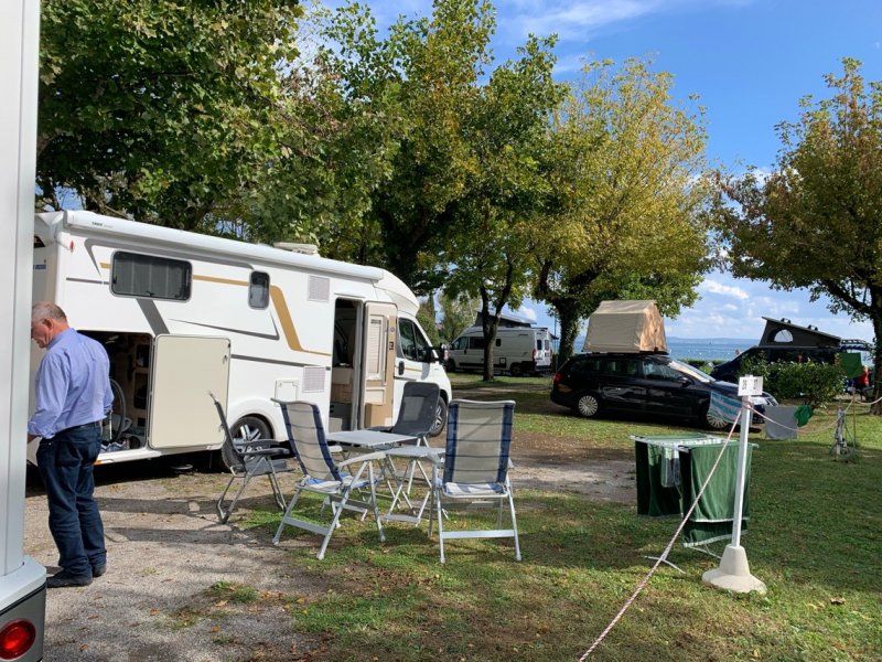
Camping Village Du Parc, Lazise
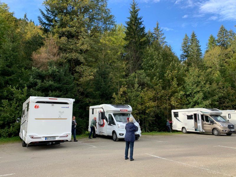
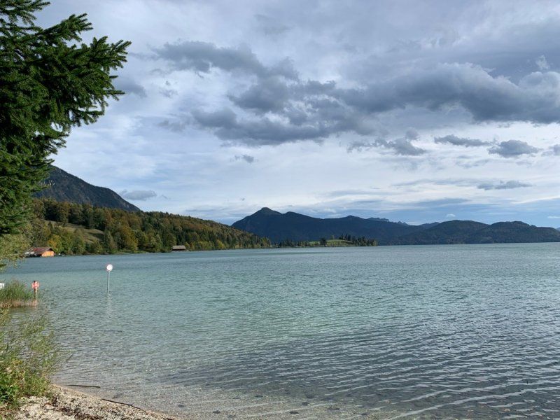
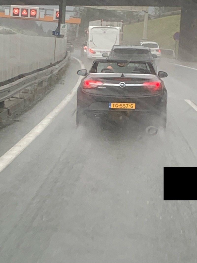
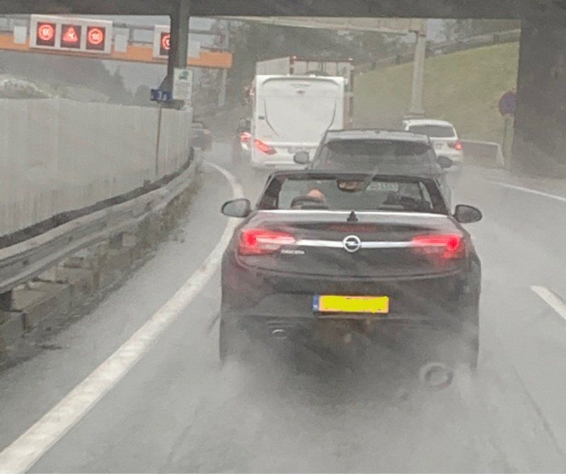
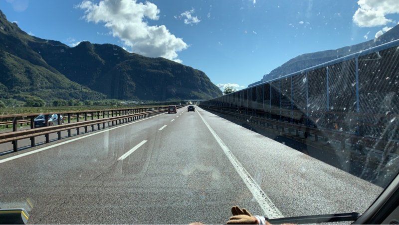
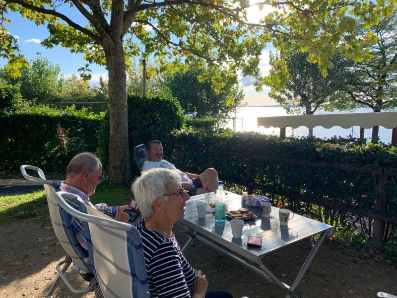
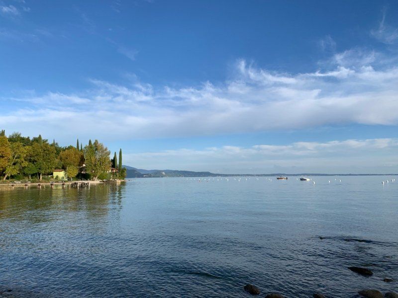
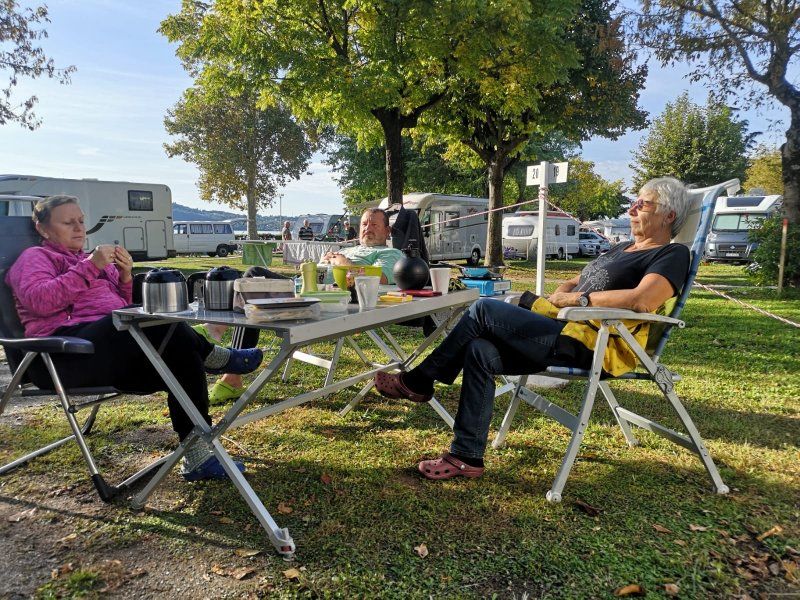
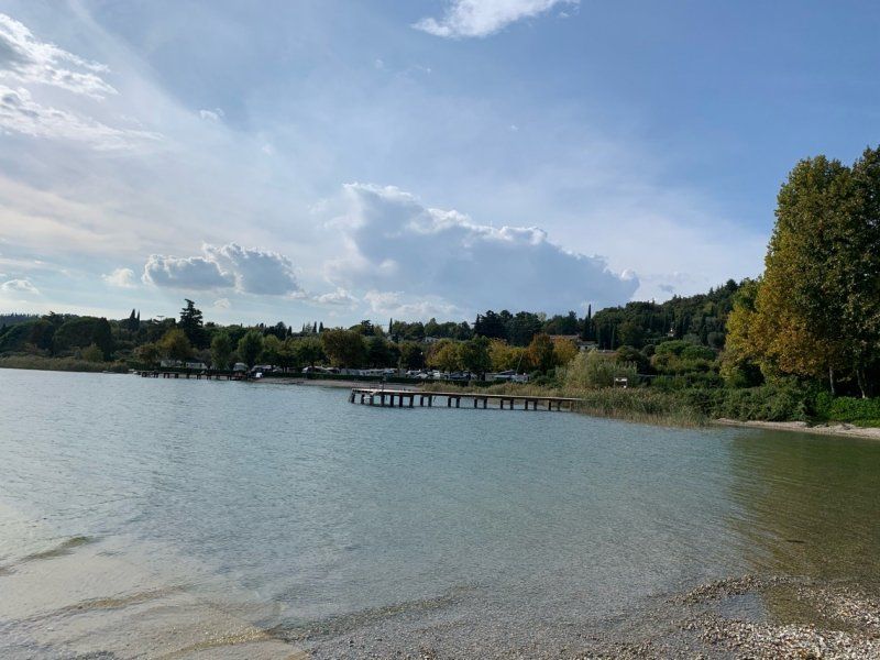
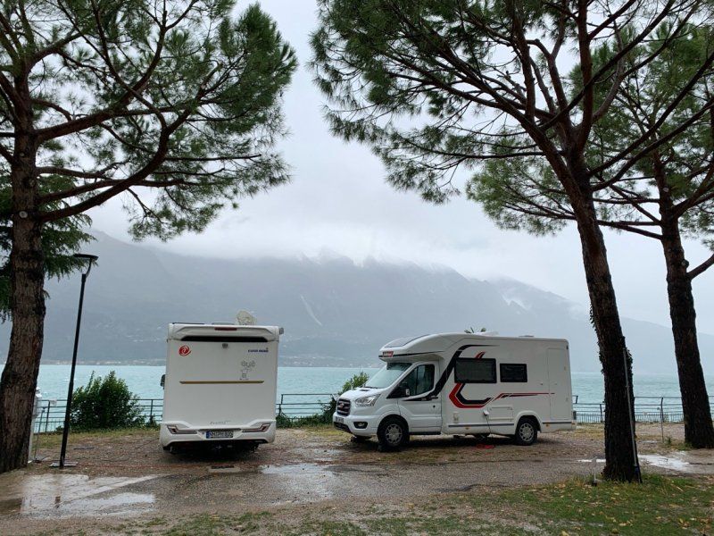
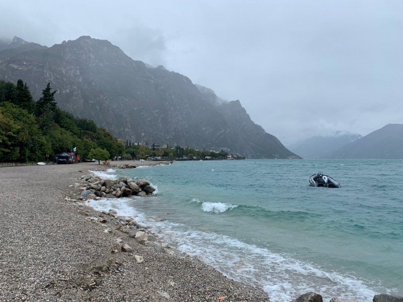
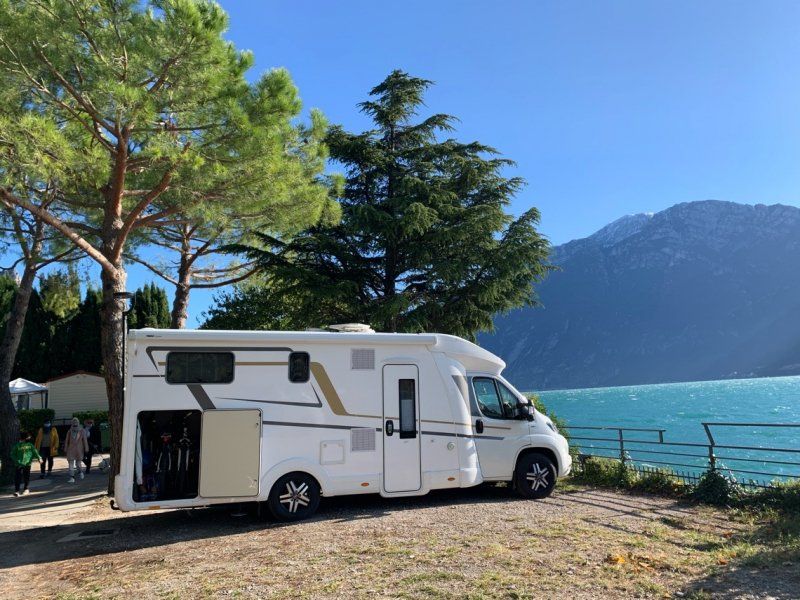
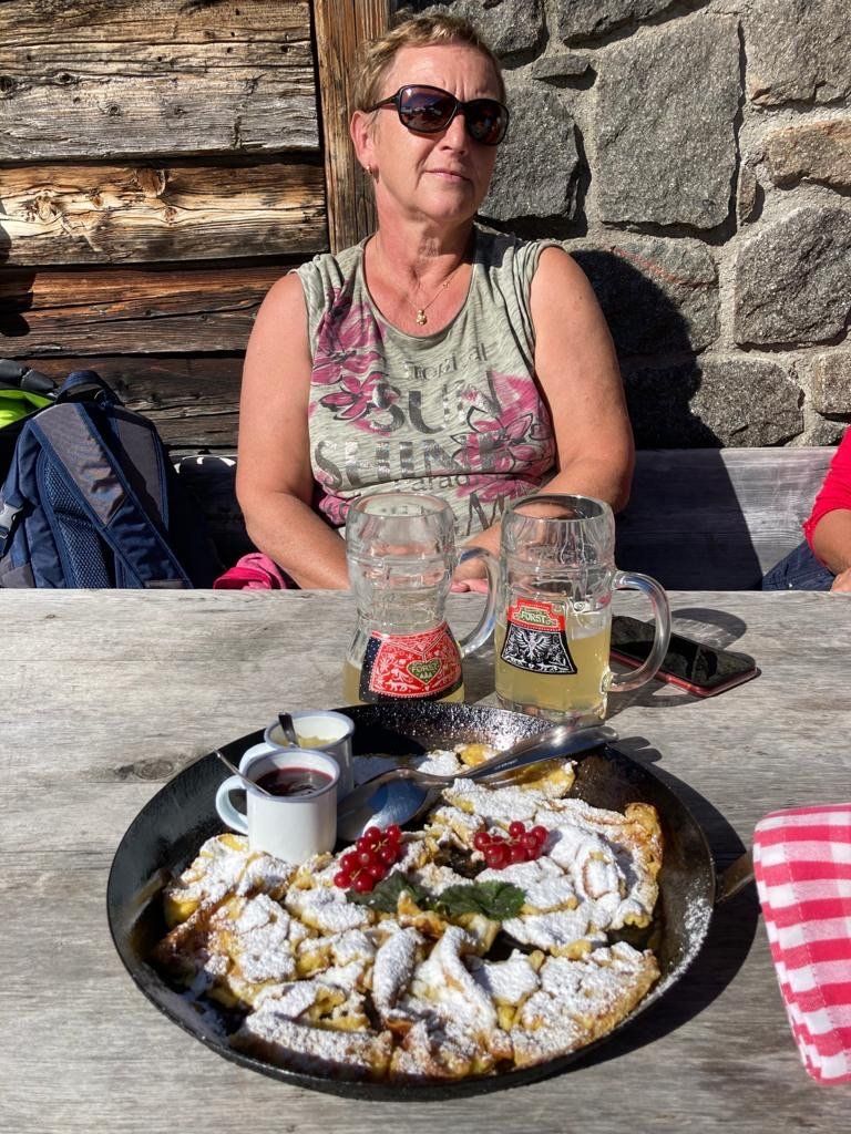
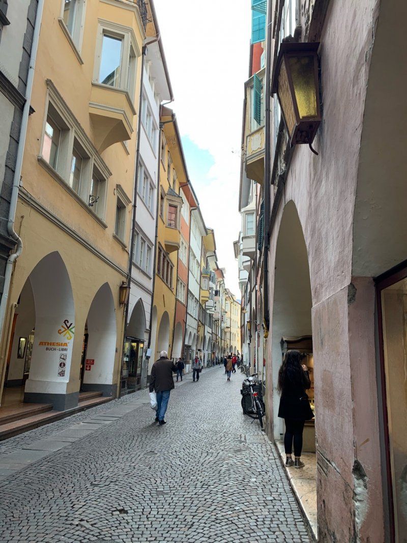
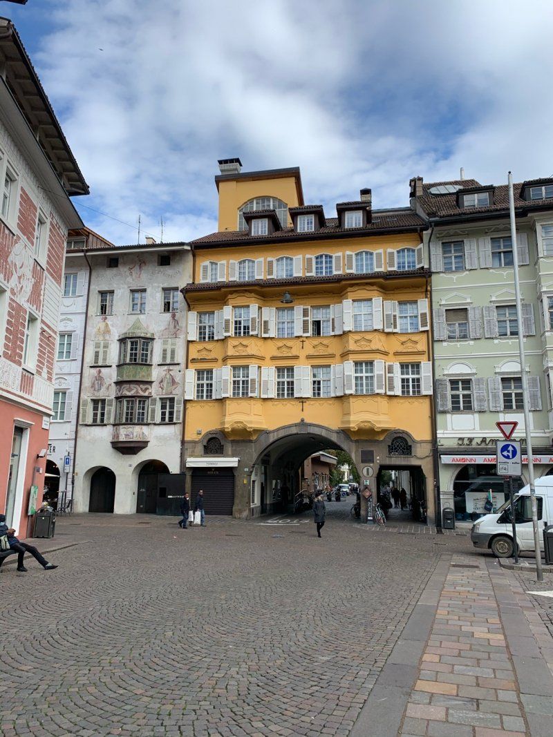
We take another walk to the Walchensee before we start south. The sun is still showing up and it is fairly calm. But that should be different in the next few hours. We check all the available weather apps again and find out that the huge storm area should only be over at southern Lake Garda. Let's go. The first involuntary stop on the B2 near Mittenwald. There are trees across the street and the fire brigade is just getting ready with a chainsaw. We carefully turn around and can evade the place. Over the next km you can see fallen trees and large branches that the fire brigade has already cleared. Now the rain really starts and the next 300 km become a submarine trip. The rain lashes against the camper and the squalls push. It's not fun, but we have one goal - sunshine and mild temperatures. The goal is Lazise, where it should be over 20 ° again in the next few days. We take the campsite that is closest to town and check into du Parc for two days. It's cozy with coffee and a view of the lake. The sun is so good after this rainy journey. We start in the picturesque Lazise - I love this place - not without taking a look at the camping shop - which every camper needs to know if they have been to Lazise before. And of course something has to be included, this time nice shot glasses that will be used more often in the next day. We enjoy the sunset and look for a nice restaurant. Everything done right.
Gardesana 110, 37017, Lazise, Italien
45° 29' 55.1" N 10° 44' 14.9" E
45.4986300 10.7374700
• Head toward Via Gardesana. Go for 20 m.
• Turn right onto Via Gardesana (SR249). Go for 2.4 km.
• Continue on Località Fossalta (SR249). Go for 1.2 km.
• Pass 5 roundabouts and continue on Via Venezia. Go for 4.5 km.
• Continue on Parco Catullo. Go for 218 m.
• Turn right onto Riviera Giosuè Carducci. Go for 191 m.
• Take the 2nd exit from roundabout onto Riviera Giosuè Carducci. Go for 35 m.
• Continue on Viale Risorgimento. Go for 283 m.
• Take the 1st exit from roundabout onto Via Milano toward Brescia/A4/Sirmione. Go for 445 m.
• Take the 1st exit from roundabout onto Via Milano. Go for 413 m.
• Take the 1st exit from roundabout onto Via Bell'Italia (SR11) toward S. Benedetto. Go for 810 m.
• Pass 7 roundabouts and continue on Strada Padana Superiore. Go for 5.5 km.
• Take the 1st exit from roundabout onto Via Colombare. Go for 42 m.
• Continue on Via Colombare. Go for 41 m.
• Pass 3 roundabouts and continue on Via Colombare. Go for 918 m.
• Continue on Via 25 Aprile. Go for 188 m.
• Take the 1st exit from roundabout onto Via 25 Aprile. Go for 1.4 km.
• Continue on Viale Guglielmo Marconi. Go for 540 m.
• Continue on Largo Johann Wolfgang von Goethe. Go for 92 m.
• Continue on Piazza Castello. Go for 90 m.
• Turn right onto Via Vittorio Emanuele II. Go for 98 m.
• Turn right onto Via San Salvatore. Go for 11 m.
• Turn left onto Via G. Piana. Go for 188 m.
• Turn slightly right onto Via Caio Valerio Catullo. Go for 593 m.
• Arrive at Via Caio Valerio Catullo.
☍
20,1 km
( 31 min.)
Day
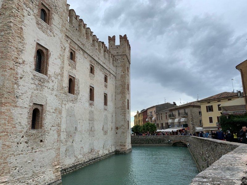
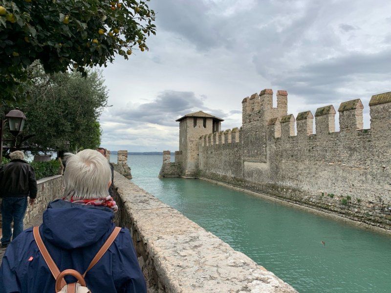
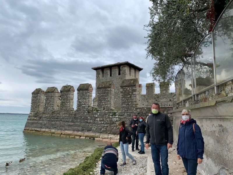
Sirmione
Boat trip to Sirmione, we do not take the "white fleet" without first having a fever measured. After almost 30 minutes the ferry in Sirmione spits us out again. We're on a city tour, enjoying the views that are offered, admiring the old walls, enjoying cappuccino and lunch, and we're satisfied with our vacation mode. It's so good to escape the corona thoughts. We got used to the mask.
Piazzale Orti Manara
45° 30' 5.4" N 10° 36' 20.9" E
45.5014995 10.6058108
• Head southeast on Via Caio Valerio Catullo. Go for 71 m.
• Turn right onto Via C. Arici. Go for 302 m.
• Turn right onto Via Caio Valerio Catullo. Go for 199 m.
• Turn slightly right onto Piazza Don Angelo Piatti. Go for 31 m.
• Turn left onto Via Vittorio Emanuele II. Go for 249 m.
• Turn left onto Via Santa Maria Maggiore. Go for 100 m.
• Turn right onto Via Dante Alighieri. Go for 64 m.
• Turn right onto Via Dante. Go for 56 m.
• Turn left onto Piazza Castello. Go for 18 m.
• Continue on Largo Johann Wolfgang von Goethe. Go for 92 m.
• Turn right onto Piazzale Porto. Go for 72 m.
• Turn slightly left onto Lungolago Armando Diaz. Go for 237 m.
• Turn left toward Viale Guglielmo Marconi. Go for 17 m.
• Turn slightly right onto Viale Guglielmo Marconi. Go for 279 m.
• Continue on Via 25 Aprile. Go for 1.4 km.
• Take the 2nd exit from roundabout onto Via 25 Aprile. Go for 216 m.
• Continue on Via Colombare. Go for 196 m.
• Take the 3rd exit from roundabout onto Via Colombare. Go for 340 m.
• Take the 1st exit from roundabout onto Via Colombare. Go for 363 m.
• Take the 3rd exit from roundabout onto Via Colombare. Go for 104 m.
• Take the 3rd exit from roundabout onto Via Verona. Go for 442 m.
• Take the 2nd exit from roundabout onto Strada Padana Superiore. Go for 380 m.
• Continue toward Via Verona. Go for 34 m.
• Take the 2nd exit from roundabout toward Venezia/A4/Verona/Peschiera. Go for 71 m.
• Turn slightly right onto Via Verona. Go for 194 m.
• Pass 2 roundabouts and continue on Via Verona. Go for 1.7 km.
• Continue toward Verona/Peschiera. Go for 57 m.
• Take the 2nd exit from roundabout onto Strada Padana Superiore toward Verona/Peschiera. Go for 2.0 km.
• Pass 2 roundabouts and continue on Via Bell'Italia (SR11). Go for 1.5 km.
• Take the 3rd exit from roundabout onto Via Bell'Italia toward Peschiera. Go for 487 m.
• Take the 2nd exit from roundabout onto Via Milano. Go for 457 m.
• Take the 3rd exit from roundabout onto Viale Risorgimento. Go for 303 m.
• Continue on Riviera Giosuè Carducci. Go for 14 m.
• Take the 3rd exit from roundabout onto Riviera Giosuè Carducci. Go for 216 m.
• Turn left onto Parco Catullo. Go for 350 m.
• Continue on Via Venezia. Go for 228 m.
• Keep right toward Via Venezia/SR249. Go for 32 m.
• Take the 2nd exit from roundabout onto Via Venezia (SR249). Go for 486 m.
• Turn left toward Garda/Lazise. Go for 58 m.
• Turn right onto Via Monte Baldo (SR249) toward Ospedale/Garda/SS249. Go for 503 m.
• Pass 4 roundabouts and continue on Strada Regionale Gardesana Orientale (SR249). Go for 4.5 km.
• Continue on Località Fossalta (SR249). Go for 2.2 km.
• Turn left. Go for 20 m.
• Arrive at your destination on the left.
☍
20,6 km
( 33 min.)
Camping Village Du Parc, Lazise
Returning back by ferry, we end the evening with our new acquisition from the Laziser camper shop.
Gardesana 110, 37017, Lazise, Italien
45° 29' 55.1" N 10° 44' 14.9" E
45.4986300 10.7374700
• Head toward Via Gardesana. Go for 20 m.
• Turn right onto Via Gardesana (SR249). Go for 2.4 km.
• Continue on Località Fossalta (SR249). Go for 1.2 km.
• Pass 5 roundabouts and continue on Via Venezia. Go for 4.5 km.
• Continue on Parco Catullo. Go for 218 m.
• Turn right onto Riviera Giosuè Carducci. Go for 191 m.
• Take the 2nd exit from roundabout onto Riviera Giosuè Carducci. Go for 35 m.
• Continue on Viale Risorgimento. Go for 283 m.
• Take the 3rd exit from roundabout onto Via Milano toward Mantova/Pozzolengo. Go for 90 m.
• Turn right onto Via Mantova. Go for 458 m.
• Continue on Via Frassino (SP56). Go for 554 m.
• Take the 3rd exit from roundabout onto Via Frassino (SP56). Go for 1.0 km.
• Continue toward Strada Gabbione/SP77. Go for 228 m.
• Continue on Strada Gabbione (SP77). Go for 2.4 km.
• Continue on Località Paùl Fruschì. Go for 94 m.
• Continue on Località Marchina. Go for 348 m.
• Continue on Località Zanzur. Go for 192 m.
• Continue on Località Martello toward Mantova/Solferino. Go for 163 m.
• Take the 2nd exit from roundabout onto Via Confini (SP13DIR) toward Mantova/Solferino. Go for 1.5 km.
• Take the 2nd exit from roundabout onto Strada Provinciale SS11-S. Martino-Pozzolengo (SP13DIR) toward Mantova/Solferino. Go for 1.4 km.
• Take the 3rd exit from roundabout onto Località Irta (SP13) toward Mantova/Solferino. Go for 2.0 km.
• Continue on Via Pozzolengo (SP8). Go for 2.4 km.
• Turn right onto SP8. Go for 114 m.
• Continue on Via dei Francesi (SP8). Go for 974 m.
• Turn left onto Via Giuseppe Garibaldi (SP8) toward Castiglione. Go for 20 m.
• Turn right onto Via Ortensie. Go for 289 m.
• Turn right onto Piazza Luigi Torelli. Go for 27 m.
• Continue on Viale Henry Dunant. Go for 118 m.
• Arrive at Viale Henry Dunant. Your destination is on the left.
☍
23,2 km
( 25 min.)
Day
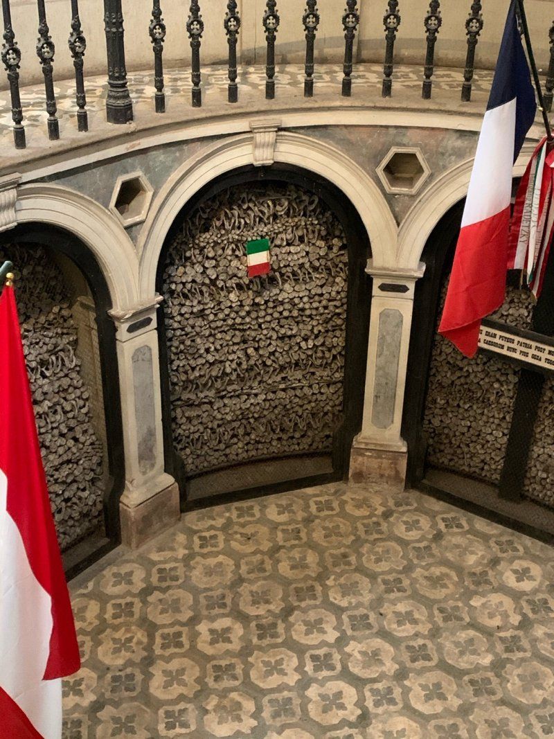
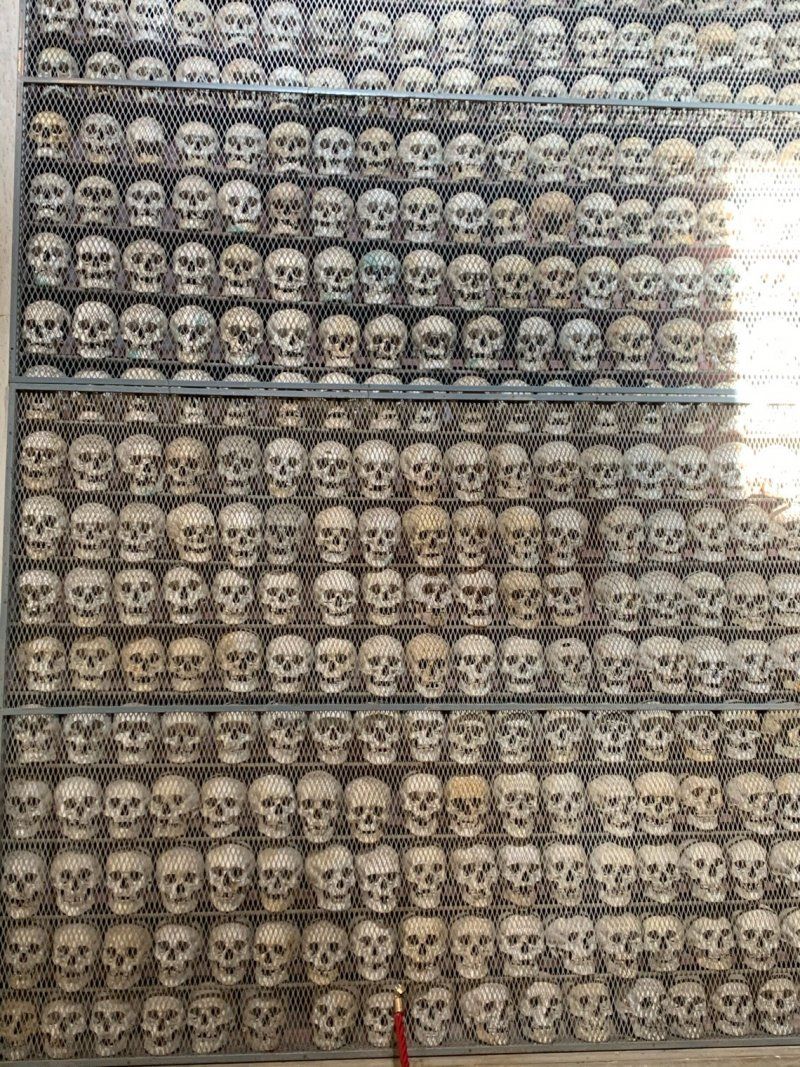
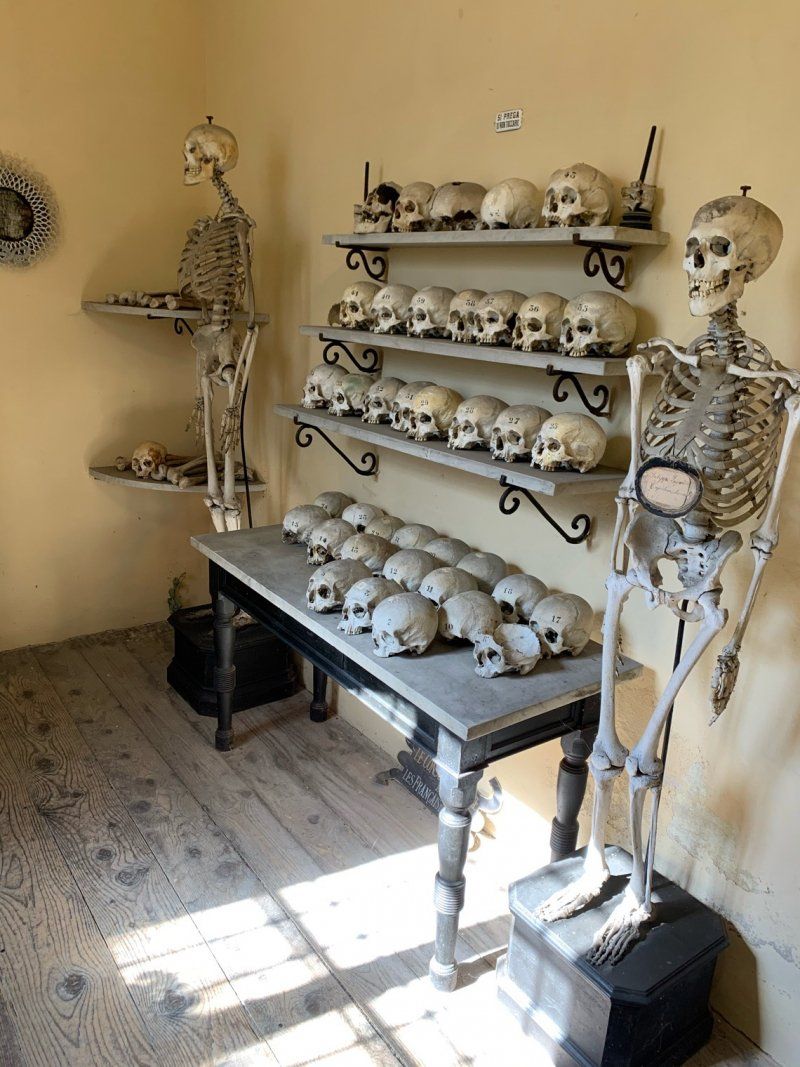
Beinhaus in Solferino
History is on the agenda today. We are on the way to Solferino from Lazise via Peschiera, about 10 km south of Lake Garda. Anyone who knows the history of the Red Cross also knows Henry Dunant and the town of Solferino. The Battle of Solferino took place here on June 24, 1859. Troops of the Kingdom of Sardinia-Piedmont and French troops under Napoleon III faced the army of Austria here. The battle ended with Austria's defeat in the Sardinian War. As a result, Austria had to cede Lombardy to the Kingdom of Sardinia-Piedmont.
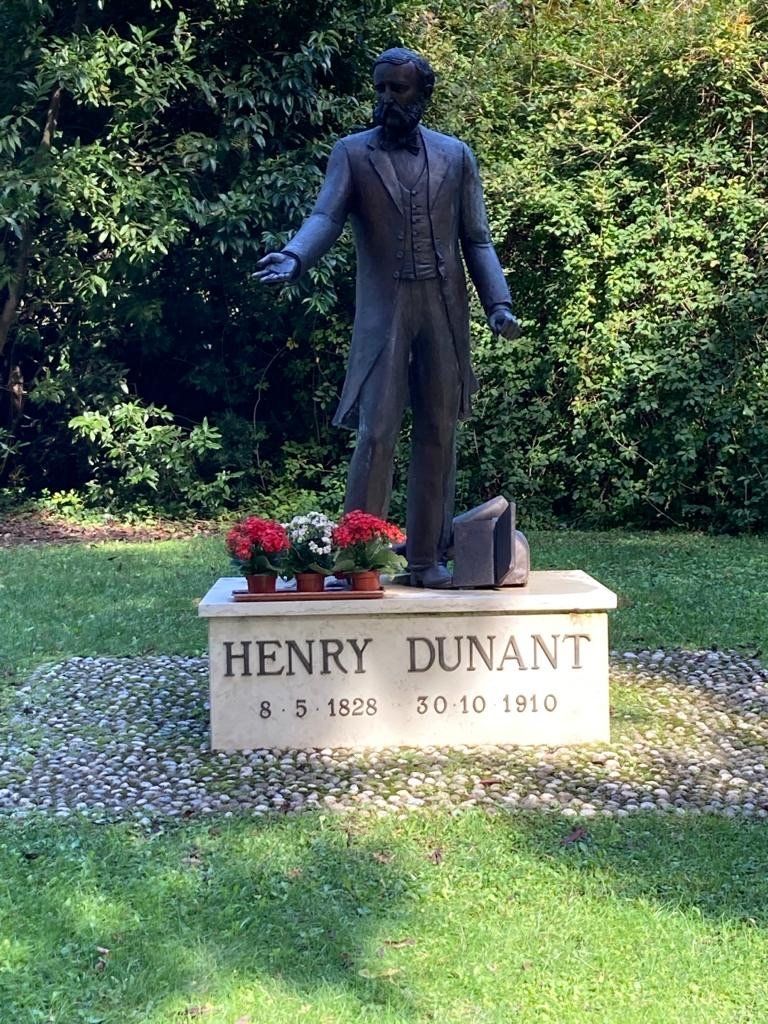
Henry Dunant, who was on site and happened to witness the appalling conditions, helped himself and spontaneously organized help. Locals - women, children, men - all helped, and help was given regardless of origin or skin color.
Sono tutti fratelli - we are all brothers! At his suggestion - he published his experiences in Solferino as a book - the International Committee of the Red Cross was founded in 1863. The battle left 25,000 dead and 10,000 wounded. The bones of 7000 fallen soldiers and a total of 1413 skulls are piled up in the ossuary. A place that reminds you and makes you think.
Via Henry Dunant, 46040, Solferino, Italien
45° 22' 9" N 10° 33' 54" E
45.3691667 10.5650000
• Head toward Piazza Luigi Torelli on Viale Henry Dunant. Go for 118 m.
• Continue on Piazza Luigi Torelli. Go for 27 m.
• Continue on Via Giuseppe Garibaldi (SP8). Go for 269 m.
• Continue on Via Ossario. Go for 654 m.
• Continue on Via San Martino. Go for 1.6 km.
• Continue on Via Civetta. Go for 1.4 km.
• Turn left onto Via Fenil Nuovo Scoperta toward Lonato. Go for 2.1 km.
• Continue on Via Fenil Vecchio. Go for 1.1 km.
• Continue on Via Fornasetta. Go for 749 m.
• Continue on Via Battaglie. Go for 1.5 km.
• Take the 4th exit from roundabout onto Strada Provinciale del Benaco (SPBS567) toward Milano/A4/Venezia/Desenzano/Brescia. Go for 3.6 km.
• Continue on Viale Guglielmo Marconi. Go for 591 m.
• Continue toward Viale Guglielmo Marconi. Go for 33 m.
• Take the 2nd exit from roundabout onto Viale Guglielmo Marconi toward Centro. Go for 386 m.
• Continue toward Mini Tangenziale/SPBS572var. Go for 41 m.
• Pass 3 roundabouts and continue on Mini Tangenziale (SPBS572var). Go for 3.1 km.
• Keep right onto Via Guglielmo Marconi (SPBS572) toward Salò/Riva D/G/Padenghe. Go for 726 m.
• Take the 2nd exit from Via Guglielmo Marconi roundabout onto Via Guglielmo Marconi (SPBS572) toward Salò/Moniga D.G. Go for 717 m.
• Continue toward Via Campagnola/SPBS572. Go for 37 m.
• Pass 11 roundabouts and continue on Via Campagnola (SPBS572). Go for 7.5 km.
• Take the 2nd exit from roundabout onto Via Serraglie toward San Felice. Go for 1.5 km.
• Continue on Via San Procolo. Go for 558 m.
• Take the 2nd exit from roundabout onto Via Umberto Zerneri toward Salò-Portese/Salò/Portese/Santigaro. Go for 769 m.
• Take the 2nd exit from roundabout onto Via Umberto Zerneri toward Portese/Salò. Go for 140 m.
• Turn right onto Via San Fermo. Go for 374 m.
• Turn left onto Via San Fermo. Go for 736 m.
• Turn right onto Via Fornella. Go for 123 m.
• Turn left. Go for 24 m.
• Arrive at your destination on the right.
☍
30,6 km
( 36 min.)
Camping Mos, San Felice del Benaco
We are on our way towards San Felice del Benaco and are looking for a campsite. We make ourselves comfortable at Camping Mos. Lake Garda in view, the sun on your neck and very pleasant temperatures. The table and chairs are set up in no time and we are totally relaxed. It's so relaxing ...
Via Fornella 7
45° 35' 4" N 10° 33' 50.4" E
45.5844331 10.5640109
• Head toward Via Fornella. Go for 24 m.
• Turn right onto Via Fornella. Go for 123 m.
• Turn right onto Via San Fermo. Go for 475 m.
• Turn left onto Via Bernaco. Go for 706 m.
• Turn right onto Via Bernaco. Go for 193 m.
• Turn slightly left onto Via Bernaco. Go for 269 m.
• Take the 2nd exit from roundabout onto Via Bernaco. Go for 605 m.
• Turn right onto Via Porto Portese. Go for 441 m.
• Arrive at Via Porto Portese. Your destination is on the left.
☍
2,8 km
( 6 min.)
Day
Porto Portese
We hike west from the campsite and land in Porto Portese. Here it is definitely off-season and everything is very quiet. Cappuccino is a must and it goes well. We do a little more shopping and go back to our moving family houses.
Portese, 25087 Salò BS, Italien
45° 36' 2.7" N 10° 33' 14.3" E
45.6007464 10.5539611
• Head toward Via Preone on Via Porto Portese. Go for 441 m.
• Turn left onto Via Bernaco. Go for 579 m.
• Take the 1st exit from roundabout onto Via Bernaco. Go for 475 m.
• Turn left onto Via Bernaco. Go for 706 m.
• Turn right onto Via San Fermo. Go for 475 m.
• Turn left onto Via Fornella. Go for 123 m.
• Turn left. Go for 24 m.
• Turn left. Go for 100 m.
• Arrive at your destination on the right.
☍
2,9 km
( 6 min.)
Camping Mos, San Felice del Benaco
Via Fornella, 7, 25010 San Felice del Benaco BS, Italien
45° 35' 1.5" N 10° 33' 51.1" E
45.5837395 10.5641903
• Head northeast. Go for 100 m.
• Turn right toward Via Fornella. Go for 24 m.
• Turn right onto Via Fornella. Go for 123 m.
• Turn left onto Via San Fermo. Go for 407 m.
• Turn left onto Via Spizzago. Go for 499 m.
• Turn sharp right onto Via della Somma. Go for 54 m.
• Turn slightly right onto Via della Somma. Go for 91 m.
• Arrive at Via della Somma.
☍
1,3 km
( 3 min.)
Day
Porto di San Felice
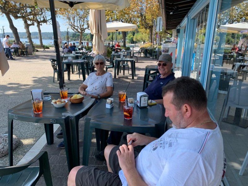
Today we head east, first always along the water, later through the olive groves. We arrive at the port of San Felice, meet our fellow travelers and sit down with a cocktail on the terrace of the restaurant. Life can be so beautiful...
25010 Porto di San Felice BS, Italien
45° 34' 53.4" N 10° 33' 33.7" E
45.5815000 10.5593494
• Head west on Via della Somma. Go for 145 m.
• Turn sharp left onto Via Spizzago. Go for 499 m.
• Turn right onto Via San Fermo. Go for 407 m.
• Turn right onto Via Fornella. Go for 123 m.
• Turn left. Go for 24 m.
• Arrive at your destination on the right.
☍
1,2 km
( 3 min.)
Camping Mos, San Felice del Benaco
Via Fornella 7
45° 35' 3.9" N 10° 33' 50.4" E
45.5844289 10.5639928
• Head toward Via Fornella. Go for 24 m.
• Turn right onto Via Fornella. Go for 123 m.
• Turn right onto Via San Fermo. Go for 475 m.
• Turn left onto Via Bernaco. Go for 706 m.
• Turn right onto Via Bernaco. Go for 193 m.
• Turn slightly left onto Via Bernaco. Go for 269 m.
• Take the 2nd exit from roundabout onto Via Bernaco. Go for 649 m.
• Continue on Via Martiri della Patria. Go for 1.1 km.
• Continue on Via Magnolie. Go for 871 m.
• Continue on Via Tavine. Go for 897 m.
• Continue on Via Pietro da Salò toward Gardone R./Centro. Go for 740 m.
• Take the 1st exit from roundabout onto Via Pietro da Salò. Go for 137 m.
• Continue on Piazza San Bernardino. Go for 63 m.
• Continue on Piazza Sergio Bresciani. Go for 126 m.
• Continue on Via Zambellino Bolzati. Go for 60 m.
• Continue on Piazza Vittorio Emanuele II. Go for 129 m.
• Turn right onto Largo Dante Alighieri toward Riva-Trento. Go for 203 m.
• Take the 2nd exit from roundabout onto Largo Dante Alighieri. Go for 78 m.
• Continue on Via Brunati. Go for 595 m.
• Take the 2nd exit from roundabout onto Piazza Carmine toward Gardone/Riva. Go for 92 m.
• Continue on Via Angelo Landi. Go for 955 m.
• Turn right onto Via Trento (SS45bis). Go for 5.9 km.
• Take the 3rd exit from roundabout onto Via Statale Maderno (SS45bis). Go for 561 m.
• Take the 1st exit from roundabout onto Strada Statale Gardesana Occidentale (SS45bis). Go for 395 m.
• Continue toward Via Statale Toscolano/SS45bis. Go for 22 m.
• Take the 3rd exit from roundabout onto Via Statale Toscolano (SS45bis) toward Riva/Trento. Go for 4.9 km.
• Take the 2nd exit from roundabout onto Via della Libertà (SS45bis) toward Riva-Gargnano. Go for 19.0 km.
• Arrive at Via 4 Novembre (SS45bis). Your destination is on the right.
☍
39,2 km
( 46 min.)
Day
Campeggio Garda, Limone sul Garda
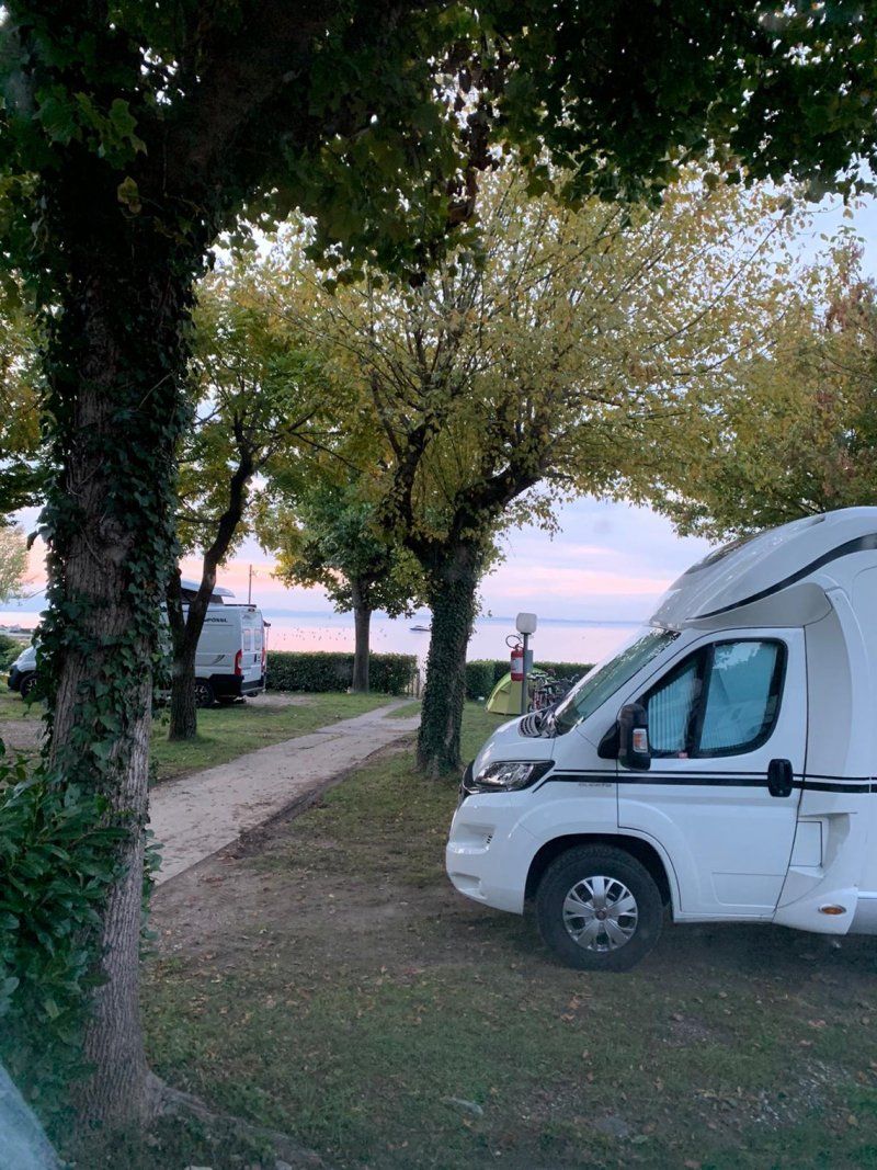
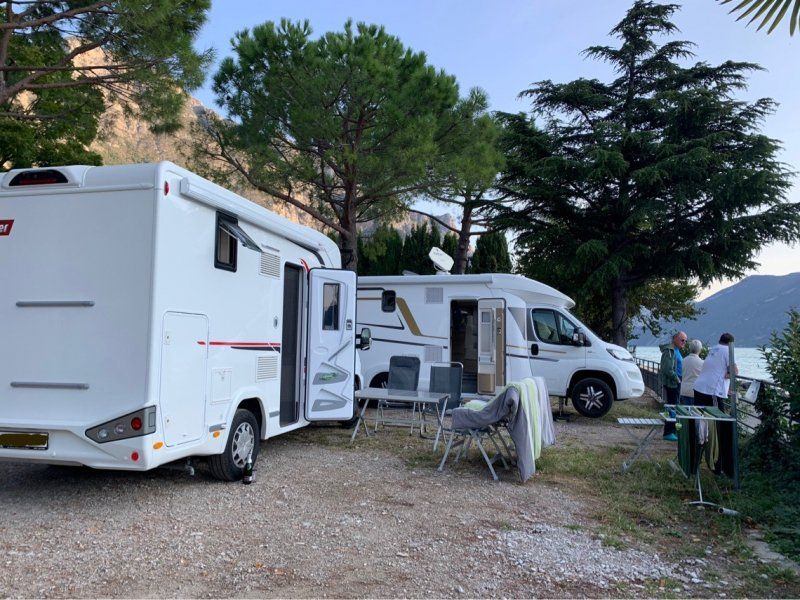
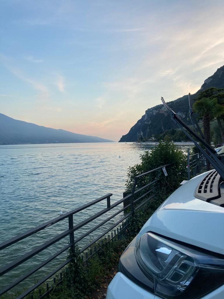
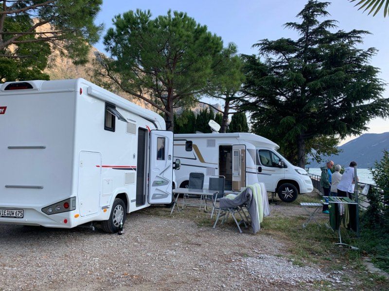
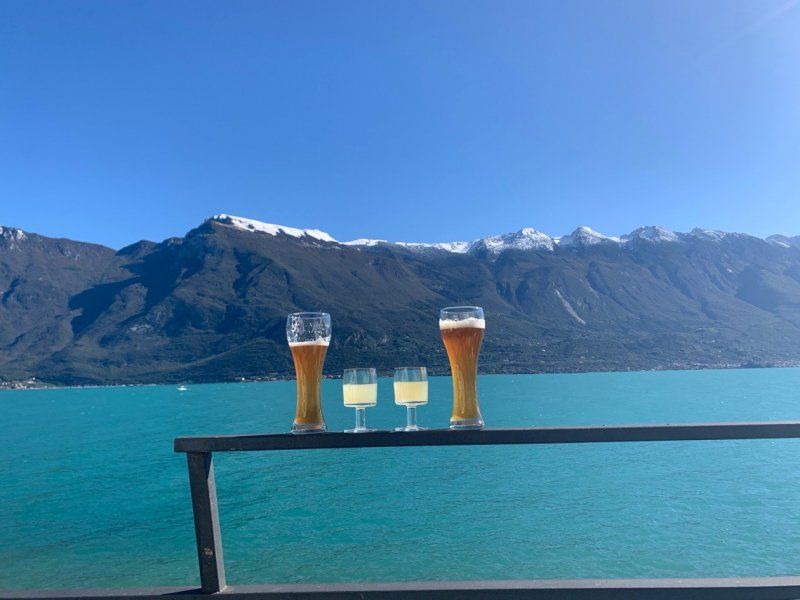
We start in the direction of Limone. For the two of us, the west side of the lake is new territory. Since there are not too many pitches or campsites, I asked in Limone at Camping Nanzel, which we canceled. But at Camping Garda I was able to reserve lakeside spots for us. We arrive, unfortunately during the lunch break, use the time to inspect the place. Later on, we are greeted in a very friendly manner and carefully drive the campsite serpentines to our pitches. And what kind of pitches - we're right on the lake, almost in the water - across from the Monte Baldo massif, we're just happy. I'm not only happy but also brave and take a swim in the lake. Ok it was fresh, but not cold. The grill is lit up and we enjoy ...
Via Iv Novembre 10, 25010, Limone sul Garda, Italien
45° 48' 18" N 10° 47' 16" E
45.8050000 10.7877700
• Head toward Strada Provinciale Limone S/G-Tremosine on Via 4 Novembre (SS45bis). Go for 11.1 km.
• Take the 1st exit from roundabout onto Via Monte Oro (SS45bis) toward Centro. Go for 500 m.
• Take the 1st exit from roundabout onto Viale Baruffaldi toward Autostrada/A22/Torbole/Arco/Rovereto/Trento. Go for 62 m.
• Continue on Viale Luigi Antonio Baruffaldi toward Centro/Autostrada/A22/Torbole/Arco/Rovereto/Trento. Go for 82 m.
• Turn right onto Via Martiri 28 Giugno toward Roverto/Torbole/Centro. Go for 298 m.
• Turn left onto Viale Dante Alighieri. Go for 116 m.
• Take the 3rd exit from Largo Bensheim roundabout onto Viale Giosuè Carducci (SS240). Go for 820 m.
• Pass 2 roundabouts and continue on Via Gardesana (SS240). Go for 2.5 km.
• Take the 1st exit from roundabout onto Via Giacomo Matteotti (SS249) toward Malcesine/Verona. Go for 5.5 km.
• Continue on Strada Regionale Gardesana Orientale (SR249). Go for 8.1 km.
• Take the 3rd exit from roundabout onto Via Navene Vecchia. Go for 170 m.
• Arrive at Via Navene Vecchia. Your destination is on the right.
☍
29,2 km
( 34 min.)
Day
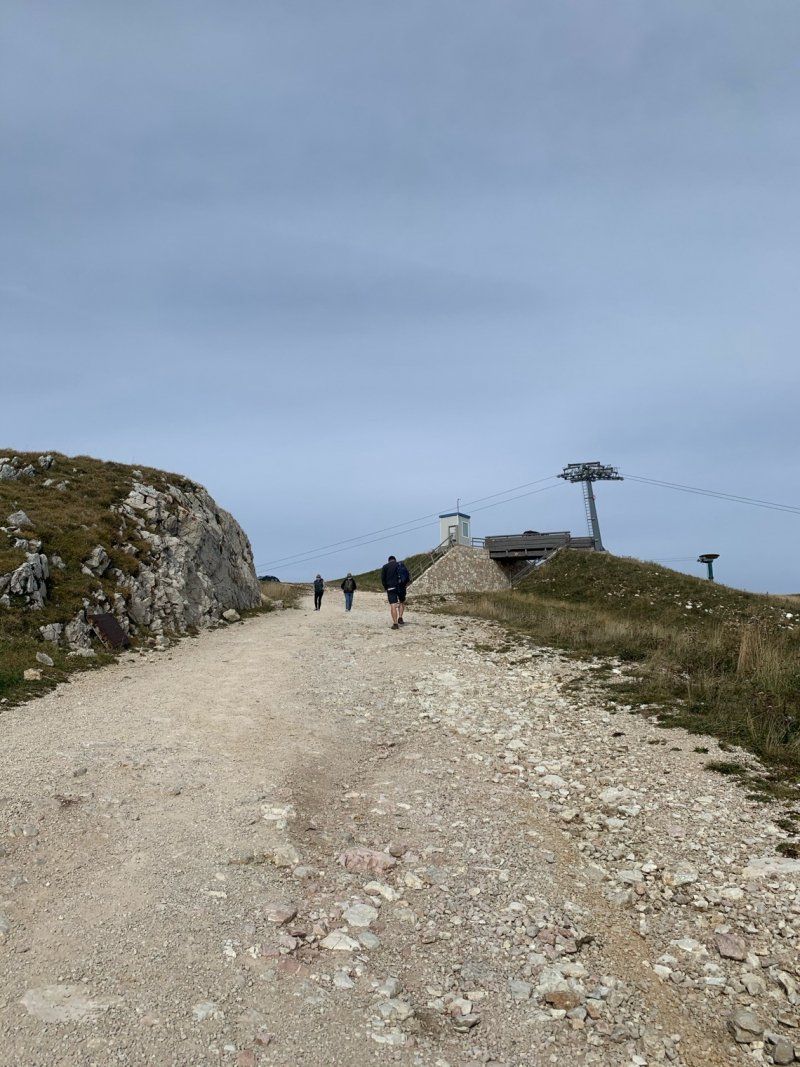
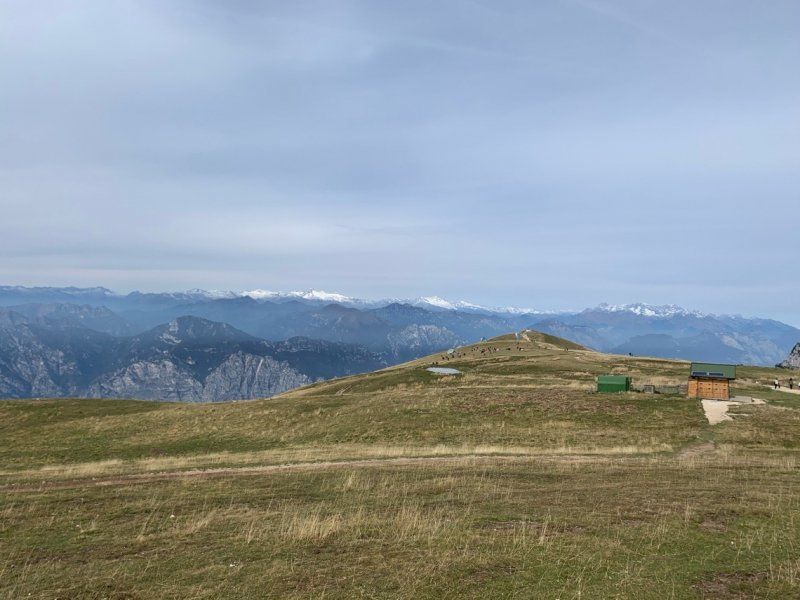
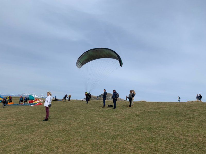
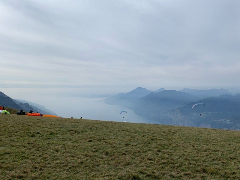
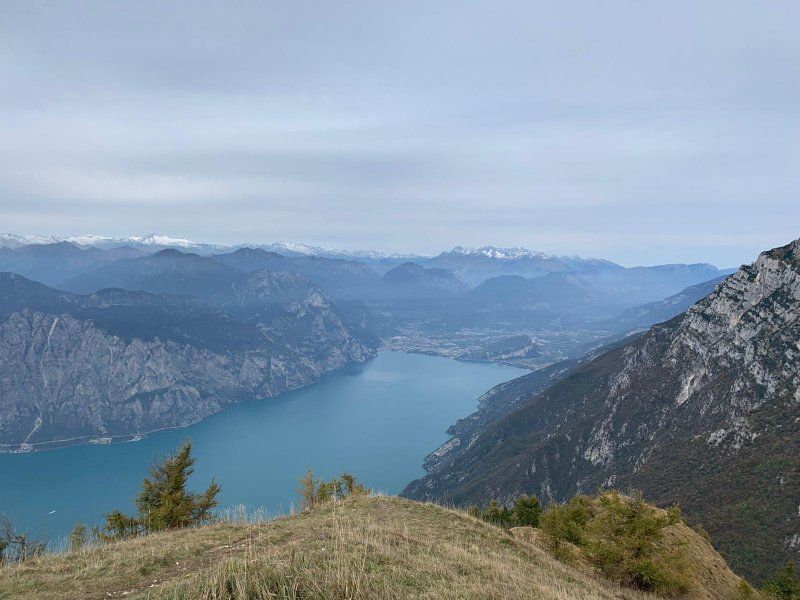
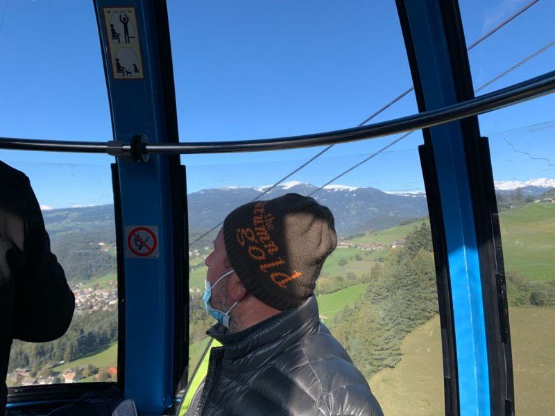
Monte Baldo
We are within walking distance of the village and the ferry, so today we will drive over to Malcesine to take the cable car to Monte Baldo. It's fresh up here, but the views are terrific and watching the paragliders is a spectacle. Later we are still a little on the road, not without the obligatory cappuccino and take the last ferry back to Limone. It was another beautiful day and we are now really relaxed and away from our job and Corona.
Via Navene Vecchia 12
45° 45' 58" N 10° 48' 46.3" E
45.7661233 10.8128558
• Head north on Via Navene Vecchia. Go for 56 m.
• Turn left toward Via Navene Vecchia. Go for 70 m.
• Continue on Via Navene Vecchia. Go for 166 m.
• Take the 1st exit from roundabout onto Via Gardesana (SR249). Go for 8.1 km.
• Continue on Strada Statale Gardesana Orientale (SS249). Go for 5.5 km.
• Take the 2nd exit from roundabout onto Via Giacomo Matteotti (SS240) toward Riva D/G./Arco/SS249/Limone S/G./SS45. Go for 785 m.
• Take the 2nd exit from roundabout onto Via Gardesana (SS240). Go for 1.8 km.
• Take the 2nd exit from roundabout onto Viale Rovereto (SS240). Go for 825 m.
• Take the 1st exit from Largo Bensheim roundabout onto Viale Damiano Chiesa toward Arco/Trento/Autostrada/A22/Brescia. Go for 535 m.
• Turn left onto Viale Trento (SS45bis). Go for 129 m.
• Keep right onto Viale Trento (SS45bis). Go for 49 m.
• Take the 2nd exit from roundabout onto Largo Guglielmo Marconi (SS45bis) toward Limone/Brescia. Go for 507 m.
• Take the 2nd exit from roundabout onto Via Monte Oro (SS45bis) toward Limone/Brescia. Go for 11.1 km.
• Arrive at Via 4 Novembre (SS45bis). Your destination is on the left.
☍
29,5 km
( 38 min.)
Campeggio Garda, Limone sul Garda
Via 4 Novembre, 10, 25010 Limone Sul Garda BS, Italien
45° 48' 18.9" N 10° 47' 15.4" E
45.8052446 10.7876015
• Head south on Via 4 Novembre (SS45bis). Go for 506 m.
• Turn right onto Strada Statale Gardesana Occidentale. Go for 33 m.
• Continue on Via Nanzello. Go for 107 m.
• Continue on Via 4 Novembre (SS45bis). Go for 3.5 km.
• Turn right onto Via Reamol. Go for 89 m.
• Arrive at Via Reamol.
☍
4,3 km
( 6 min.)
Day
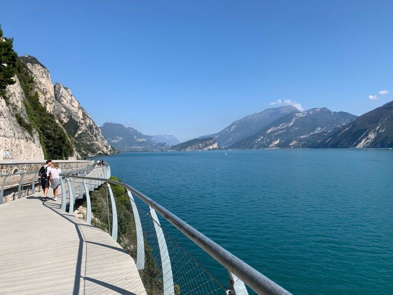
Panoramaweg, Limone sul Garda
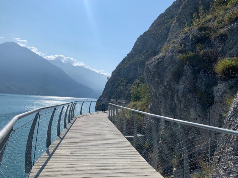
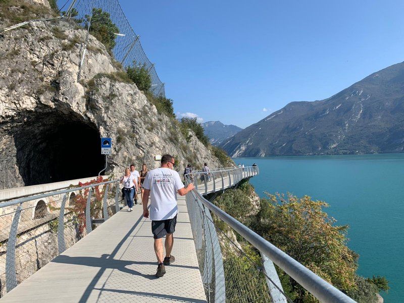
The new panorama path heading north starts in Limone, opened on July 15, 2018. A spectacular iron construction allows the path to float part of the route 50 m above the lake. Currently completed up to the Lombardy / Trentino border, it should go to Riva and in the future will enable a bike / hiking trail around the entire lake. The weather is kind to us today and we're on our way. It's the weekend and therefore pretty full on the route, but it's still easy to walk and of course we reward ourselves on the way back - with Aperol Spritz.
Via Reamol 4
45° 49' 24.4" N 10° 48' 31.6" E
45.8234382 10.8087675
• Head toward Via 4 Novembre on Via Reamol. Go for 89 m.
• Turn left onto Via 4 Novembre (SS45bis). Go for 3.2 km.
• Arrive at Via 4 Novembre (SS45bis). Your destination is on the left.
☍
3,2 km
( 5 min.)
Campeggio Garda, Limone sul Garda
Via Iv Novembre 10, 25010, Limone sul Garda, Italien
45° 48' 18" N 10° 47' 16" E
45.8050000 10.7877700
• Head south on Via 4 Novembre (SS45bis). Go for 475 m.
• Turn right onto Strada Statale Gardesana Occidentale. Go for 33 m.
• Continue on Via Nanzello. Go for 107 m.
• Continue on Via 4 Novembre (SS45bis). Go for 1.0 km.
• Turn left onto Via Tamas. Go for 99 m.
• Turn right onto Via Benedetto Croce. Go for 51 m.
• Arrive at Via Benedetto Croce. Your destination is on the right.
☍
1,8 km
( 3 min.)
Day
Regentag, Limone Sul Garda
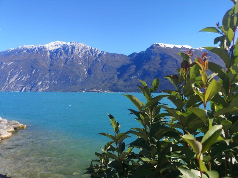
Today the sun may have a break. It's raining and it's significantly cooler. Opposite the Monte Baldo has got a snow cover. The wind is good and the rain doesn't stop the surfers. And he doesn't stop us from going for a walk and then falling asleep afterwards.
Later in the evening we reward ourselves with a really delicious visit to a restaurant.
25010 Limone Sul Garda, Province of Brescia, Italien
45° 48' 36.5" N 10° 47' 23.5" E
45.8101279 10.7898576
• Head toward Via Tamas on Via Benedetto Croce. Go for 51 m.
• Turn left onto Via Tamas. Go for 99 m.
• Turn right onto Via 4 Novembre (SS45bis). Go for 673 m.
• Arrive at Via 4 Novembre (SS45bis). Your destination is on the left.
☍
0,8 km
( 1 min.)
Campeggio Garda, Limone sul Garda
Via Iv Novembre 10, 25010, Limone sul Garda, Italien
45° 48' 18" N 10° 47' 16" E
45.8050000 10.7877700
• Head south on Via 4 Novembre (SS45bis). Go for 475 m.
• Turn right onto Strada Statale Gardesana Occidentale. Go for 33 m.
• Continue on Via Nanzello. Go for 107 m.
• Continue on Via 4 Novembre (SS45bis). Go for 1.6 km.
• Arrive at Via 4 Novembre (SS45bis).
☍
2,2 km
( 3 min.)
Day
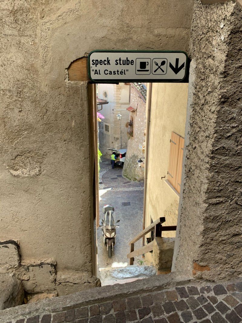
Limonaia del Castèl, Limone Sul Garda
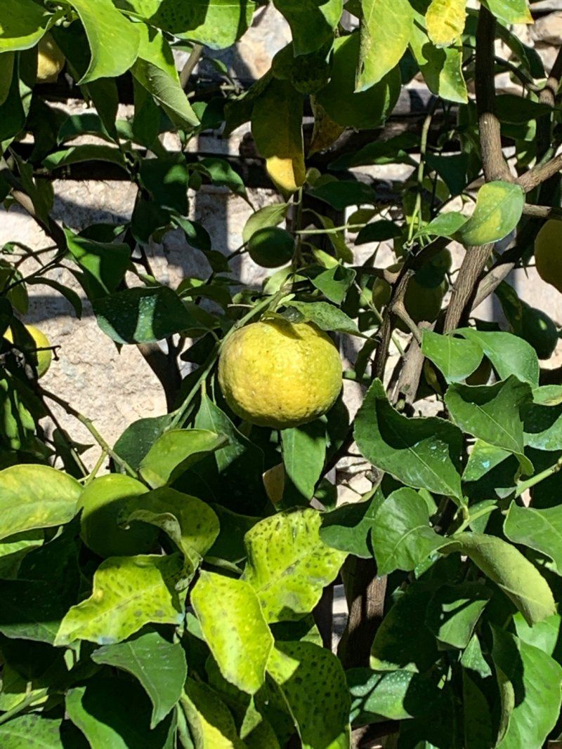
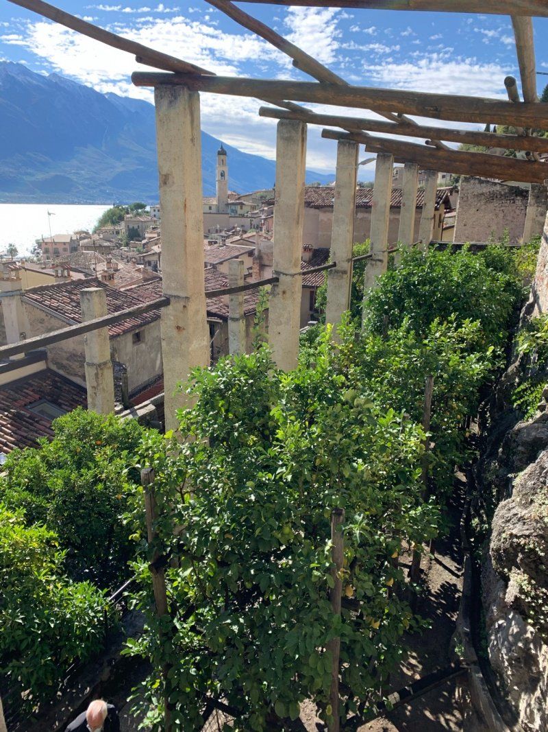
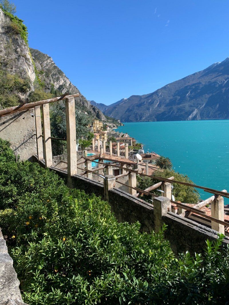
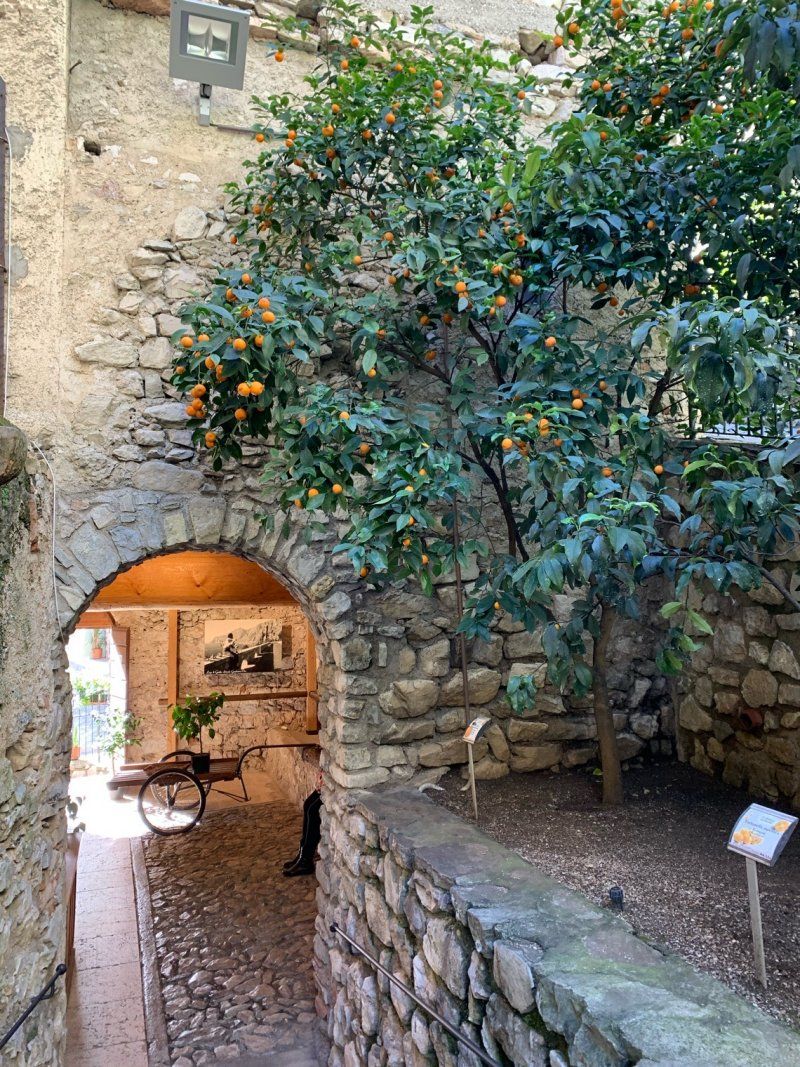
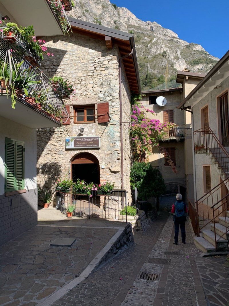
If you are already in Limone, and the place is firmly connected with the cultivation of lemons and citrus fruits, we have to look at the Limonaia del Castel. Here in the old part of Limone some of the dilapidated lemon greenhouses were brought out of their twilight sleep, renovated, rebuilt and replanted. It has been open to the public since 2004 and is open every day. It's interesting and educational, and we can only congratulate the city on investing here. We meander through the alleys over stairs and narrow paths. Another place like that ...
Via Orti, 9, 25010 Limone Sul Garda BS, Italien
45° 48' 55.8" N 10° 47' 31" E
45.8154993 10.7919453
• Head south on Via 4 Novembre (SS45bis). Go for 1.2 km.
• Arrive at Via 4 Novembre (SS45bis). Your destination is on the left.
☍
1,2 km
( 1 min.)
Campeggio Garda, Limone sul Garda
Via Iv Novembre 10, 25010, Limone sul Garda, Italien
45° 48' 18" N 10° 47' 16" E
45.8050000 10.7877700
• Head south on Via 4 Novembre (SS45bis). Go for 475 m.
• Turn right onto Strada Statale Gardesana Occidentale. Go for 33 m.
• Continue on Via Nanzello. Go for 107 m.
• Continue on Via 4 Novembre (SS45bis). Go for 11.4 km.
• Take the 2nd exit from roundabout onto Variante SS45bis toward Autostrada/A22/Arco/Torbole/Trento. Go for 1.2 km.
• Continue toward Rive del G. Centro. Go for 19 m.
• Take the 2nd exit from roundabout onto Strada Provinciale del Monte Tombio (SP37) toward Rive del G. Centro. Go for 477 m.
• Take the 4th exit from roundabout onto Via Oleandri (SS421) toward Tenno. Go for 757 m.
• Continue on Via Fontanella. Go for 40 m.
• Take the 2nd exit from roundabout onto Via Ballino (SS421) toward Varone/Tenno/Comano Terme. Go for 1.2 km.
• Continue on Strada Statale dei Laghi Molveno Tenno (SS421). Go for 374 m.
• Continue on Via Giuseppe Mazzini (SS421) toward Tenno/Comano Terme/Tione/SS237. Go for 140 m.
• Turn right onto Via Giacomo Bozzoni toward Varone. Go for 153 m.
• Turn right onto Località Le Foci toward Varone. Go for 130 m.
• Turn left onto Località Le Foci (SS421). Go for 71 m.
• Turn right onto Via Grotta Cascata. Go for 64 m.
• Arrive at your destination on the left.
☍
16,6 km
( 22 min.)
Day
Parco Grotta Cascata Varone
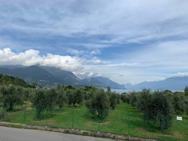
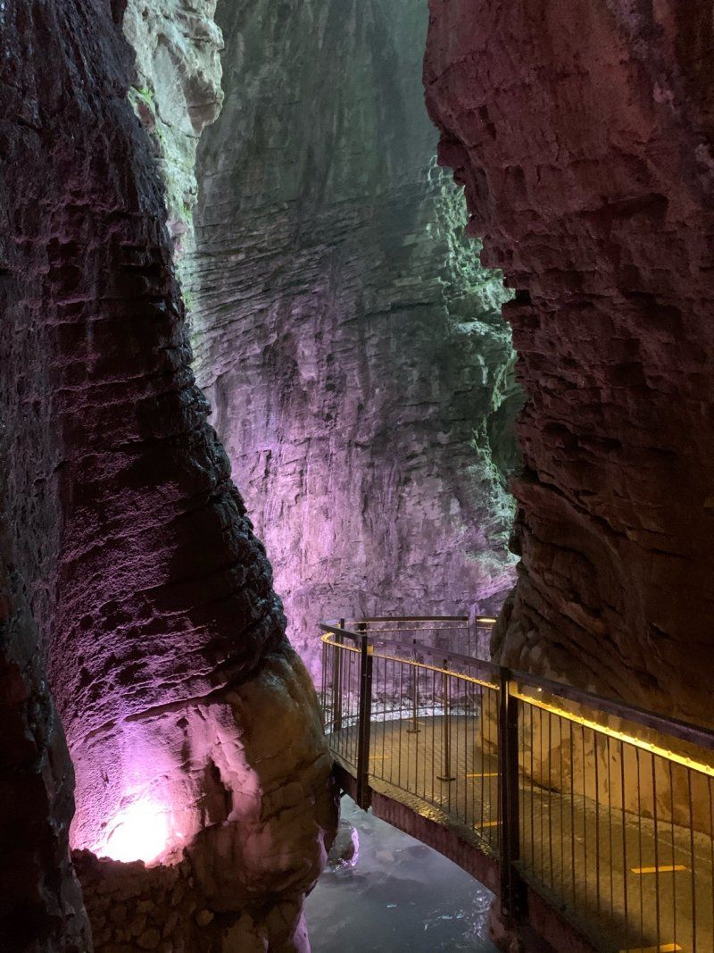
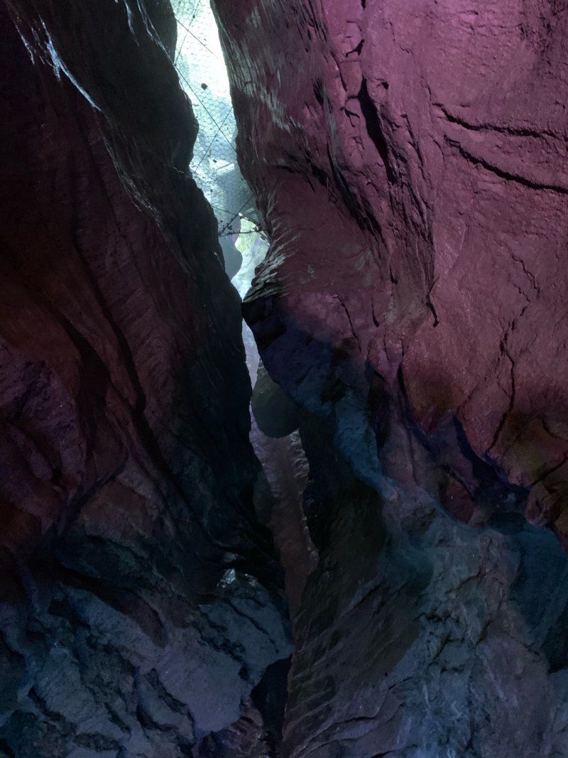
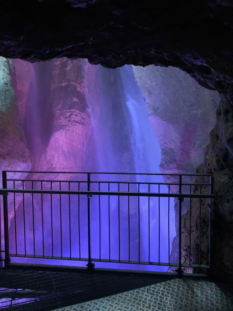
We want to go to the Dolomites today, because we have reserved a few days at Camping Seiser Alm. Not without paying another visit to Cascata Varone north of Riva. We have seen many waterfalls, but this one is special. Surrounded by a botanical garden, the actual waterfall lies within the rock. The Magnone River (later Varone), which rises 8 km north of Lake Tenno, has washed its way through the rock here, creating grottos, caves and gorges. The waterfall, which is illuminated in changing colors, can be viewed from two platforms. But be careful, you get pretty wet!
45° 54' 41.4" N 10° 50' 6.1" E
45.9115048 10.8350144
• Head northeast. Go for 44 m.
• Turn slightly right onto Via Grotta Cascata. Go for 20 m.
• Turn sharp right onto Località Le Foci (SS421). Go for 1.5 km.
• Take the 1st exit from roundabout onto Via Ballino (SS421). Go for 712 m.
• Take the 4th exit from roundabout onto Viale dei Tigli (SS421) toward Centro. Go for 619 m.
• Take the 2nd exit from roundabout onto Viale Baruffaldi toward Autostrada/A22/Torbole/Arco/Rovereto/Trento. Go for 92 m.
• Continue on Viale Luigi Antonio Baruffaldi toward Centro/Autostrada/A22/Torbole/Arco/Rovereto/Trento. Go for 82 m.
• Turn right onto Via Martiri 28 Giugno toward Roverto/Torbole/Centro. Go for 298 m.
• Turn left onto Viale Dante Alighieri. Go for 116 m.
• Take the 3rd exit from Largo Bensheim roundabout onto Viale Giosuè Carducci (SS240). Go for 820 m.
• Pass 2 roundabouts and continue on Via Gardesana (SS240). Go for 2.5 km.
• Take the 2nd exit from roundabout onto Strada Statale di Loppio e Val di Ledro (SS240) toward Autostrada/A22/Nago/Rovereto. Go for 1.9 km.
• Pass 3 roundabouts and continue on Località Loppio (SS240). Go for 11.4 km.
• Keep right toward Brennero/Modena. Go for 192 m.
• Take ramp onto A22 (Autostrada del Brennero) toward Brennero/Trento. Go for 89.5 km.
• Take the exit toward Bolzano Nord/Val D 'Ega/Bozen Nord/Eggental/Steinegg/Collepietra/Kastelruth/Castelrotto/Brenner/Brennero. Go for 578 m.
• Turn left onto Strada Statale dell'Abetone e del Brennero (SS12) toward Steinegg/Collepietra/Kastelruth/Castelrotto/Brenner/Brennero. Go for 3.6 km.
• Take left ramp onto Strada Provinciale Prato Isarco-Ponte Gardena (SP24) toward Tiers/Tires. Go for 7.4 km.
• Take the 2nd exit from roundabout onto Via per Bolzano (SP24) toward Seis A. Schlern/Siusi A. Sciliar/Kastelruth/Castelrotto. Go for 3.5 km.
• Turn left onto Località San Costantino. Go for 125 m.
• Turn slightly left onto Via Dolomiti. Go for 302 m.
• Arrive at Via Dolomiti. Your destination is on the right.
☍
125,2 km
(1 hrs. 36 min.)
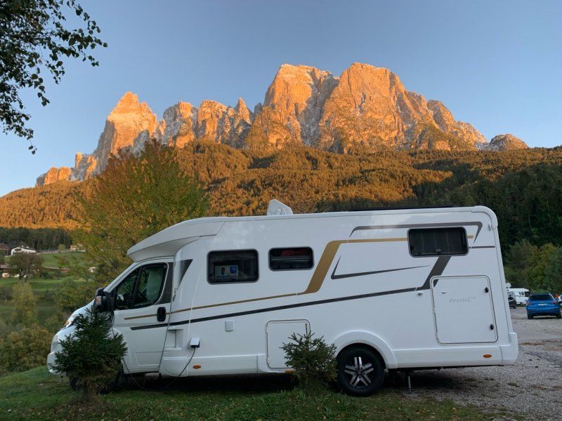
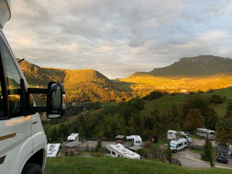
Camping Seiser Alm, St. Konstantin
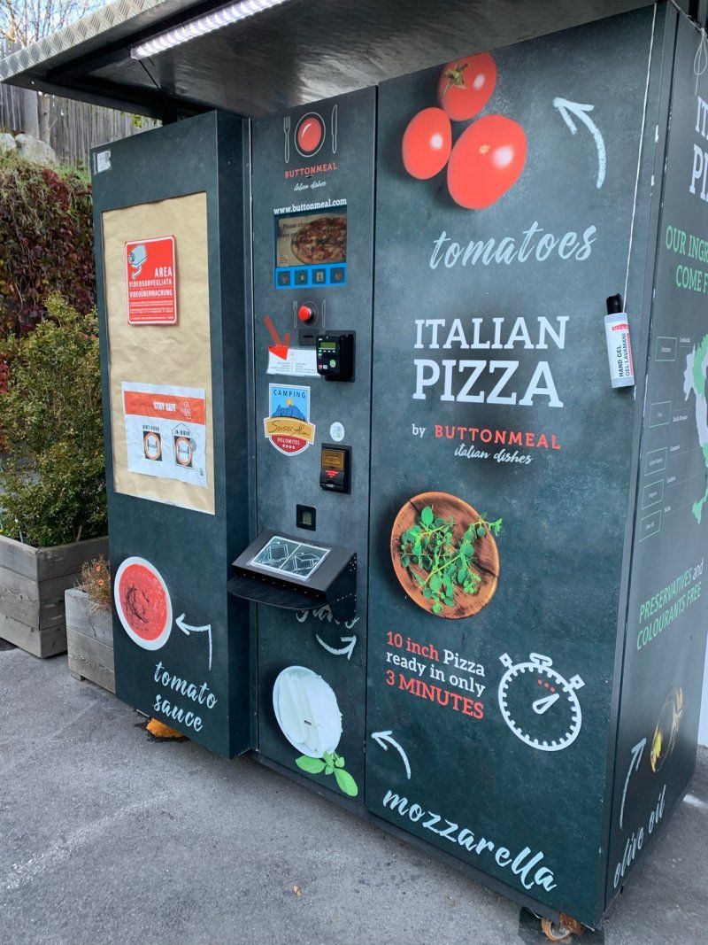
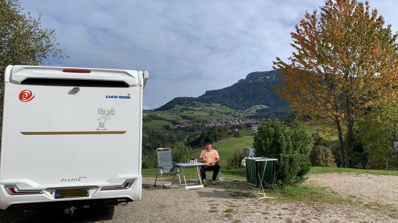
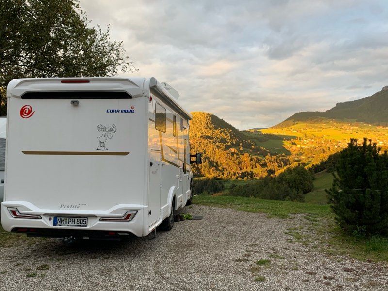
We take the Brenner highway, we have time and so you get more of the landscape and people than you would on the Autostrada. A little north of the Bozen Nord motorway exit, we turn onto the LS24. The road winds its way up over the Eisack valley, we drive through Fiè allo Sciliar to check in at the campsite in St. Constantin below the Sciliar. We are standing on a category C panorama place and have Seis am Schlern, the cable car to the Alpe di Siusi in front of us and the Schlern on the right next to us. What a view! During the subsequent tour of the square, we noticed a pizza machine, but we didn't try it. We are skeptical and prefer to go to the restaurant on site the days later.
Dolomiten Weg 10, 39050, Völs am Schlern, Italien
46° 31' 59.2" N 11° 32' 0.8" E
46.5331200 11.5335600
• Head north on Via Dolomiti. Go for 302 m.
• Turn slightly right onto Località San Costantino. Go for 125 m.
• Turn sharp left onto Strada Provinciale Prato Isarco-Ponte Gardena (SP24). Go for 3.0 km.
• Turn right onto Via Sciliar. Go for 107 m.
• Turn left onto Schlernstraße. Go for 26 m.
• Arrive at Schlernstraße. Your destination is on the right.
☍
3,5 km
( 5 min.)
Day
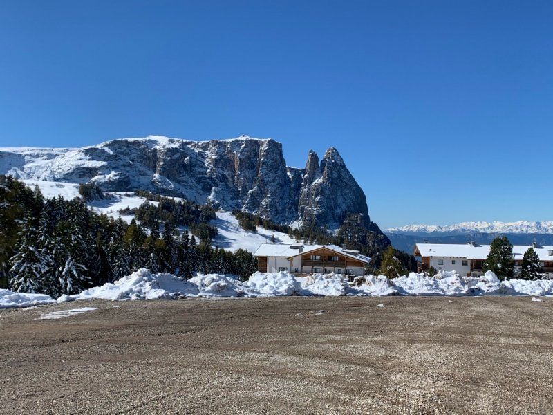
Seiser Alm
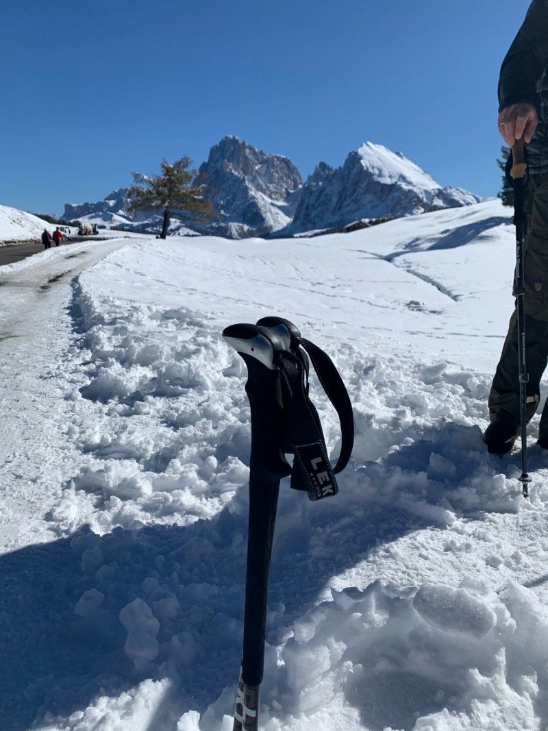
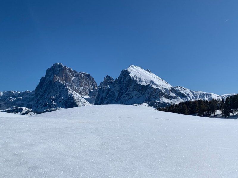
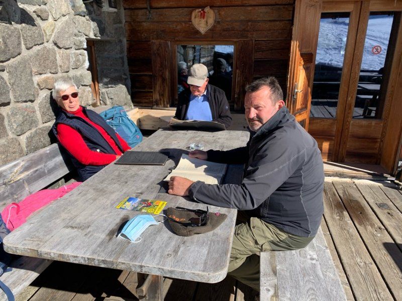
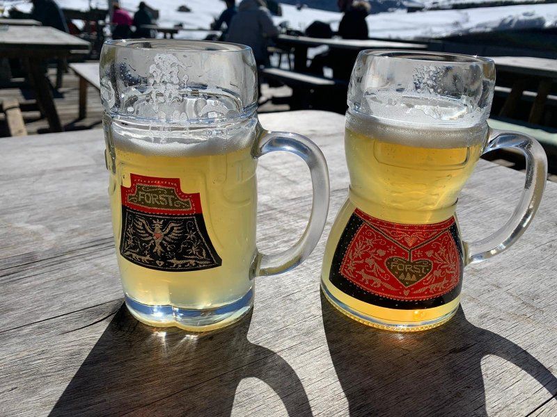
With the bus - the ticket to the valley station of the Seiser Alm Bahn is included in the campsite price - we are on the way to the valley station and later with the cable car up. We have chosen one of the more relaxed hikes, because the further up we get, the snowier it gets. Destination Sanonhütte - we trudge through the snow, the sun makes the landscape sparkle, we get warm, the views are terrific and we are happy. The hut meal makes you satisfied and full and the cyclists in the special female or male glasses are simply nice.
Schlernstrasse 39
46° 32' 24.7" N 11° 33' 48.8" E
46.5401926 11.5635531
• Head east on Schlernstraße. Go for 70 m.
• Turn left onto Schlernstraße. Go for 12 m.
• Turn left toward Via Sciliar. Go for 108 m.
• Turn right onto Via Sciliar. Go for 90 m.
• Turn left onto Strada Provinciale Prato Isarco-Ponte Gardena (SP24). Go for 3.0 km.
• Turn sharp right onto Località San Costantino. Go for 125 m.
• Turn slightly left onto Via Dolomiti. Go for 302 m.
• Arrive at Via Dolomiti. Your destination is on the right.
☍
3,7 km
( 5 min.)
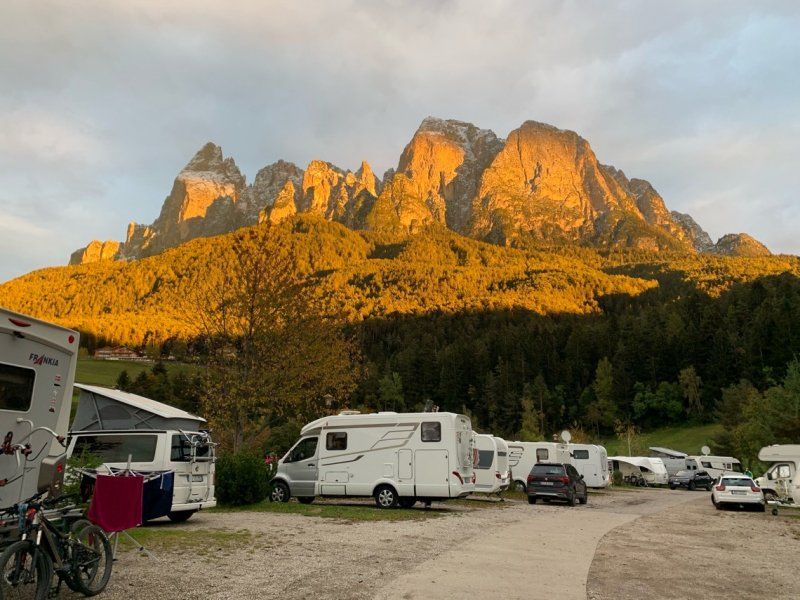
Camping Seiser Alm, St. Konstantin
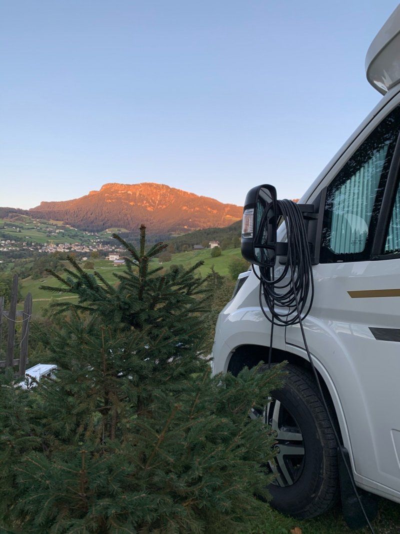
Back at the campsite, the bright dolomite mountains turn yellow - red, play of colors that get under your skin - dolomite glow that fascinates.
Dolomiten Weg 10, 39050, Völs am Schlern, Italien
46° 31' 59.2" N 11° 32' 0.8" E
46.5331200 11.5335600
• Head south on Via Dolomiti.
• Arrive at Via Dolomiti. Your destination is on the right.
☍
Distance not available
(Duration not available)
Day
Camping Seiser Alm, St. Konstantin
Today our 2 fellow travelers leave us. We say goodbye to them and have a rest day. The hike on the Alpe di Siusi has left deep traces on the male heels, so that today only a little camping - walking - in - grogs is the order of the day. We will have to do without further hikes.
Dolomiten Weg 10, 39050, Völs am Schlern, Italien
46° 31' 59.2" N 11° 32' 0.8" E
46.5331200 11.5335600
• Head north on Via Dolomiti. Go for 302 m.
• Turn slightly right onto Località San Costantino. Go for 125 m.
• Turn right onto Strada Provinciale Prato Isarco-Ponte Gardena (SP24). Go for 3.4 km.
• Take the 2nd exit from roundabout onto Via per Bolzano (SP24). Go for 7.2 km.
• Take ramp onto Strada Statale dell'Abetone e del Brennero (SS12). Go for 7.1 km.
• Take the 2nd exit from roundabout onto Strada Statale dell'Abetone e del Brennero (SS12) toward Bolzano Centro/Bozen Zentrum/Modena/A22/Merano/Meran/Trento. Go for 644 m.
• Take ramp onto Ponte Virgolo toward Centro/Zentrum. Go for 234 m.
• Turn left onto Via Josef Mayr Nusser. Go for 483 m.
• Turn right onto Piazza Giuseppe Verdi. Go for 52 m.
• Turn right onto Piazza Giuseppe Verdi. Go for 77 m.
• Turn left onto Via Alto Adige. Go for 285 m.
• Turn slightly left onto Piazza della Parrocchia. Go for 140 m.
• Continue on Via della Posta. Go for 73 m.
• Turn right onto Via Johann Wolfgang von Goethe. Go for 124 m.
• Turn left onto Via Leonardo da Vinci. Go for 21 m.
• Turn right onto Vicolo delle Erbe. Go for 82 m.
• Turn left onto Via Museo. Go for 178 m.
• Arrive at Via Museo. Your destination is on the left.
☍
20,6 km
( 30 min.)
Day
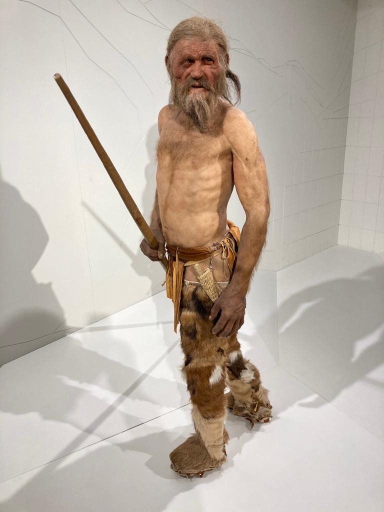
Besuch bei Ötzi, Bozen
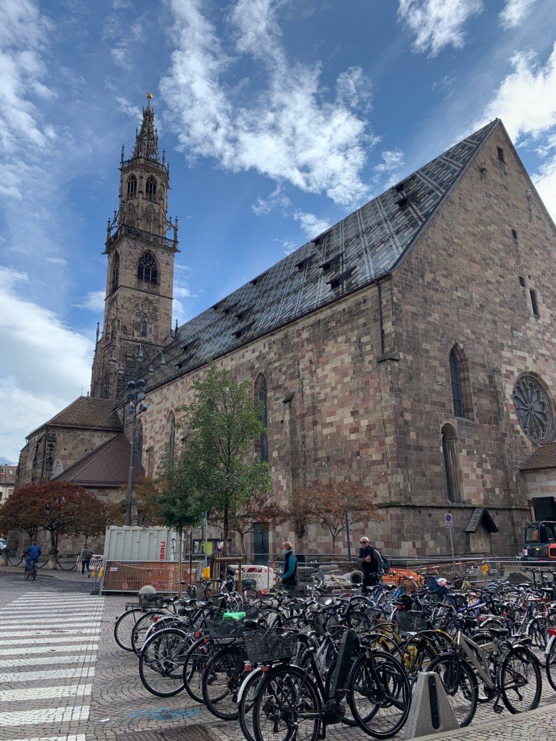
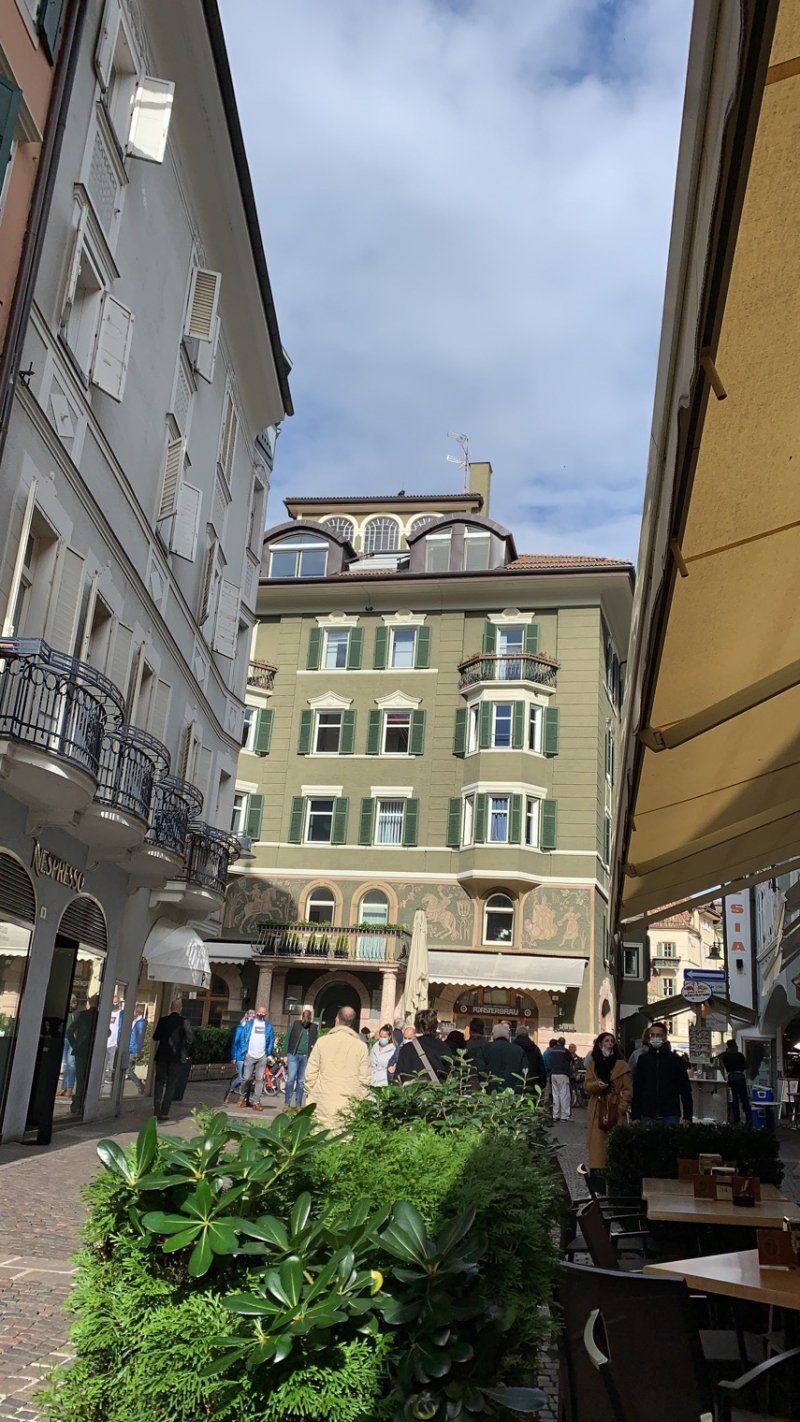
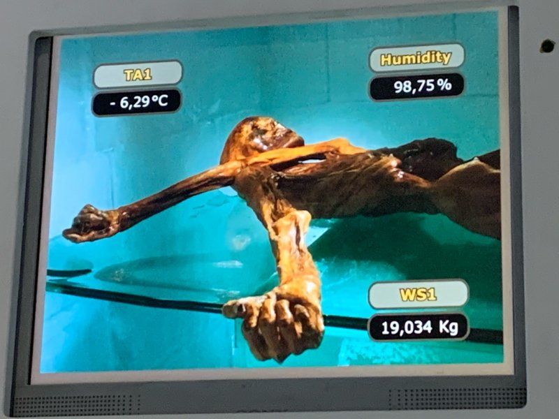
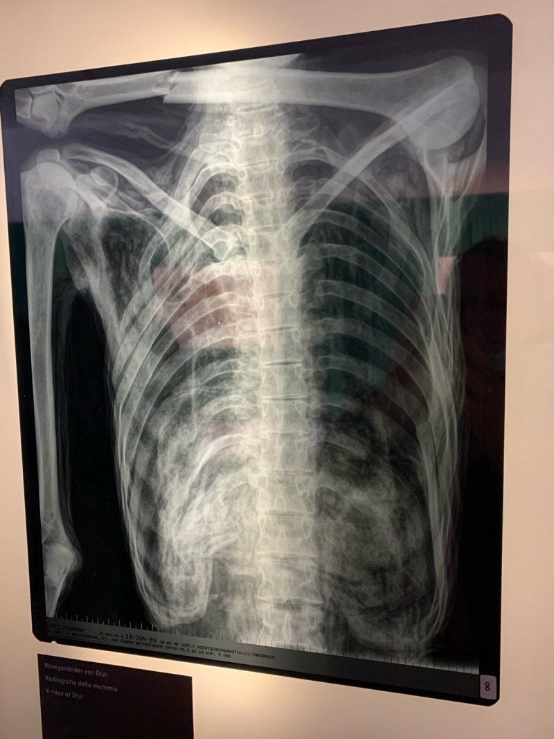
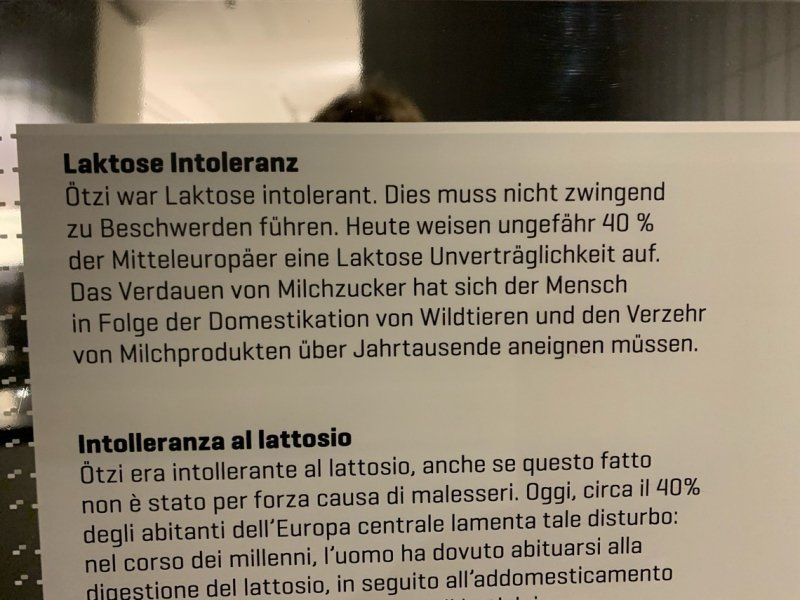
After hikes were canceled yesterday, alternative program today. The bus ticket is also valid to Bozen or Bressanone and so we set off into the valley to Bozen. Always wanted to look at Ötzi. We're a bit through Bolzano with the well-known Laubengasse, stopping for cake and cappuccino to queue for about 20 minutes at the Archaeological Museum. Only a limited number of people are admitted due to Covid. But the queuing was worth it, a very well presented museum awaits us and we find out everything from Ötzi - which illnesses, which injuries, what ate, what he had with him, what was he wearing - there is only one thing you don't know - who has him killed and why. Remember that the man's death was dated between 3359 and 3105 BC. BC using the radiocarbon method and the age of the mummy is around 5300 years. Older than the pyramids in Egypt.
Museumstraße, 43, 39100 Bozen, Südtirol, Italien
46° 29' 59.5" N 11° 20' 58.4" E
46.4998589 11.3495538
• Head toward Via Cassa di Risparmio on Via Museo. Go for 98 m.
• Turn left onto Via Antonio Rosmini. Go for 336 m.
• Turn right onto Via Dante Alighieri. Go for 297 m.
• Turn left onto Via Guglielmo Marconi. Go for 194 m.
• Continue on Piazza Giuseppe Verdi. Go for 147 m.
• Turn right onto Piazza Giuseppe Verdi. Go for 52 m.
• Turn left onto Via Josef Mayr Nusser toward Autostrada/A22/Brennero/Merano/Trento. Go for 485 m.
• Turn right onto Ponte Virgolo. Go for 114 m.
• Turn left and take ramp onto Strada Statale dell'Abetone e del Brennero (SS12) toward Brennero/A22/Brenner. Go for 745 m.
• Take the 2nd exit from roundabout onto Strada Statale dell'Abetone e del Brennero (SS12) toward Brennero/A22/Brenner. Go for 7.0 km.
• Take left ramp onto Strada Provinciale Prato Isarco-Ponte Gardena (SP24) toward Tiers/Tires. Go for 7.4 km.
• Take the 2nd exit from roundabout onto Via per Bolzano (SP24) toward Seis A. Schlern/Siusi A. Sciliar/Kastelruth/Castelrotto. Go for 3.5 km.
• Turn left onto Località San Costantino. Go for 125 m.
• Turn slightly left onto Via Dolomiti. Go for 302 m.
• Arrive at Via Dolomiti. Your destination is on the right.
☍
20,7 km
( 28 min.)
Camping Seiser Alm, St. Konstantin
Dolomiten Weg 10, 39050, Völs am Schlern, Italien
46° 31' 59.2" N 11° 32' 0.8" E
46.5331200 11.5335600
• Head north on Via Dolomiti. Go for 302 m.
• Turn slightly right onto Località San Costantino. Go for 125 m.
• Turn sharp left onto Strada Provinciale Prato Isarco-Ponte Gardena (SP24). Go for 3.4 km.
• Pass 2 roundabouts and continue on Strada Provinciale Castelrotto-Ortisei (SP64). Go for 2.2 km.
• Continue on Via Oswald von Wolkenstein. Go for 604 m.
• Continue on Strada Comunale Castelrotto. Go for 194 m.
• Turn left onto Via Oswald von Wolkenstein. Go for 103 m.
• Continue on Piazza Krausen. Go for 25 m.
• Continue on Via Platten. Go for 15 m.
• Arrive at Via Platten. Your destination is on the right.
☍
7,0 km
( 10 min.)
Day
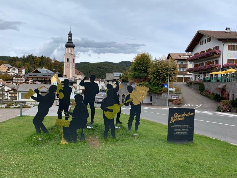
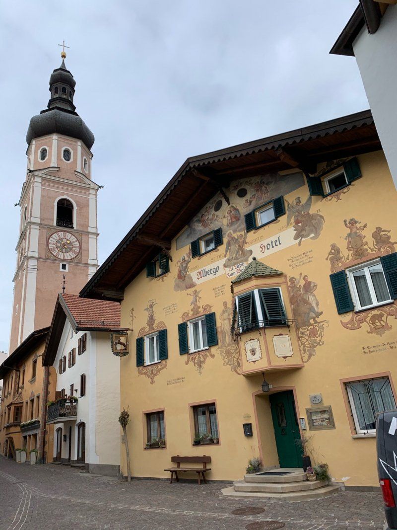
Kastelruth
Today on the bus in the other direction, we get off in Castelrotto. OK, we didn't really meet the sparrows and had to be satisfied with the wooden figures on the roadside, but the delicious lunch in the old forge with the sparrows' golden records made up for us. When we drive back the bus somehow takes a different departure. We are not on the way to the campsite, but are driving in the wrong direction Brixen. In Klausen we get off and change the bus back again. Unwanted panoramic tour, so to speak.
Krausenplatz 1
46° 34' 4.9" N 11° 33' 33.7" E
46.5680164 11.5593718
• Head toward Vicolo Walther von der Vogelweide on Via Platten. Go for 15 m.
• Continue on Piazza Krausen. Go for 25 m.
• Continue on Via Oswald von Wolkenstein. Go for 42 m.
• Turn slightly right onto Via Oswald von Wolkenstein. Go for 61 m.
• Turn right onto Strada Comunale Castelrotto. Go for 1.3 km.
• Pass 2 roundabouts and continue on Strada Provinciale Prato Isarco-Ponte Gardena (SP24). Go for 5.2 km.
• Turn sharp right onto Località San Costantino. Go for 125 m.
• Turn slightly left onto Via Dolomiti. Go for 302 m.
• Arrive at Via Dolomiti. Your destination is on the right.
☍
7,0 km
( 10 min.)
Camping Seiser Alm, St. Konstantin
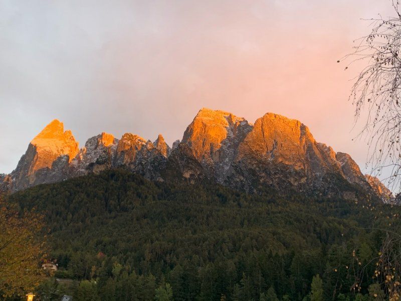
We're enjoying the last evening and staying until Sunday. This year or autumn you never know when you will be able to leave again. And it is as if the place, the area want to tell us, will just come back soon. The sun and the landscape show the best it has to offer. The Dolomites are glowing!
We'll be coming back!
Dolomiten Weg 10, 39050, Völs am Schlern, Italien
46° 31' 59.2" N 11° 32' 0.8" E
46.5331200 11.5335600
• Head north on Via Dolomiti. Go for 302 m.
• Turn slightly right onto Località San Costantino. Go for 125 m.
• Turn sharp left onto Strada Provinciale Prato Isarco-Ponte Gardena (SP24). Go for 3.4 km.
• Take the 2nd exit from roundabout onto Via Sciliar (SP24) toward Kastelruth/Castelrotto. Go for 1.7 km.
• Take the 3rd exit from roundabout onto Strada Provinciale Prato Isarco-Ponte Gardena (SP24) toward Autostrada/A22/Waidbruck/Ponte Gardena/Bozen/Bolzano/Zona Industriale Telfen. Go for 7.6 km.
• Take the 3rd exit from roundabout onto Strada Statale di Val Gardena e Passo Sella (SS242). Go for 168 m.
• Turn right onto Strada Statale dell'Abetone e del Brennero (SS12) toward Brennero/A22/Brenner/Barbian/Barbiano/Brixen/Bressanone. Go for 7.6 km.
• Turn right onto Strada Statale di Val Gardena e Passo Sella (SS242dir) toward Autobahn/Autostrada/A22/Gufidaun/Gudon/Lajen/Laion. Go for 303 m.
• Take the 2nd exit from roundabout onto A22 (Autostrada del Brennero) toward Autobahn/Autostrada/Brennero/Brenner. Go for 53.8 km.
• Continue on A13 (Brennerpass). Go for 34.5 km.
• Continue on A12 (Inntal Autobahn). Go for 74.9 km.
• Continue on A93 (Grenzübergang Kiefersfelden). Go for 24.8 km.
• Take the left exit toward München/Rosenheim-West onto A8. Go for 45.6 km.
• Take exit 95 toward Nürnberg/Stuttgart/Messe/ICM/Flughafen München onto A99. Go for 29.9 km.
• Take exit 13 toward Berlin/Nürnberg/Deggendorf/Flughafen München onto A9. Go for 84.3 km.
• Take exit 59 toward Beilngries/Riedenburg. Go for 335 m.
• Turn right onto St2229 toward Beilngries/Riedenburg/Altmannstein/Gewerbegebiet Denkendorf/Dinosaurier-Park. Go for 178 m.
• Pass 2 roundabouts and continue on St2229. Go for 9.5 km.
• Continue on B299. Go for 3.4 km.
• Take the 1st exit from roundabout onto Ingolstädter Straße (B299) toward Neumarkt/Beilngries Zentrum. Go for 1.0 km.
• Turn right onto Kelheimer Straße (B299) toward A9/Nürnberg/Neumarkt i.d.OPf./Eichstätt/Kelheim. Go for 984 m.
• Take the 2nd exit from roundabout onto B299 toward Neumarkt i.d.OPf./Amberg/Berching/Kloster Parkstetten. Go for 26.8 km.
• Turn right onto Äußerer Ring toward Stadtteil Woffenbach/Stadtteil Stauf. Go for 280 m.
• Turn right onto Staufer Hauptstraße (NM41). Go for 309 m.
• Continue on NM41. Go for 330 m.
• Continue on Freystädter Straße (NMs41). Go for 133 m.
• Take the 2nd exit from roundabout onto Freystädter Straße (NMs41) toward Stadtmitte. Go for 752 m.
• Continue on Ringstraße (St2240). Go for 300 m.
• Turn left onto Badstraße (St2240) toward Schmidmühlen. Go for 496 m.
• Turn left onto Schweningerstraße. Go for 112 m.
• Turn right onto Zimmererstraße. Go for 25 m.
• Arrive at Zimmererstraße. Your destination is on the left.
☍
414,1 km
(4 hrs. 34 min.)
Day
Neumarkt in der Oberpfalz
92318 Neumarkt in der Oberpfalz, Deutschland
49° 16' 38.1" N 11° 28' 1.9" E
49.2772606 11.4671996