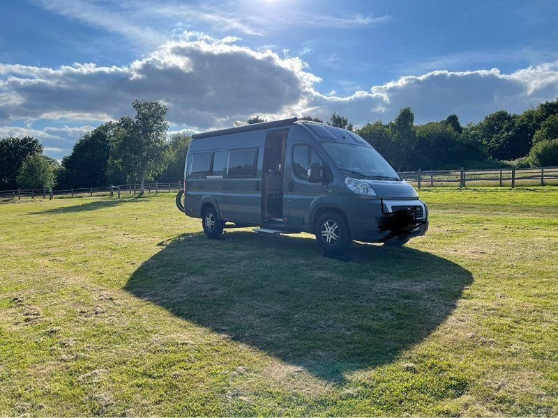
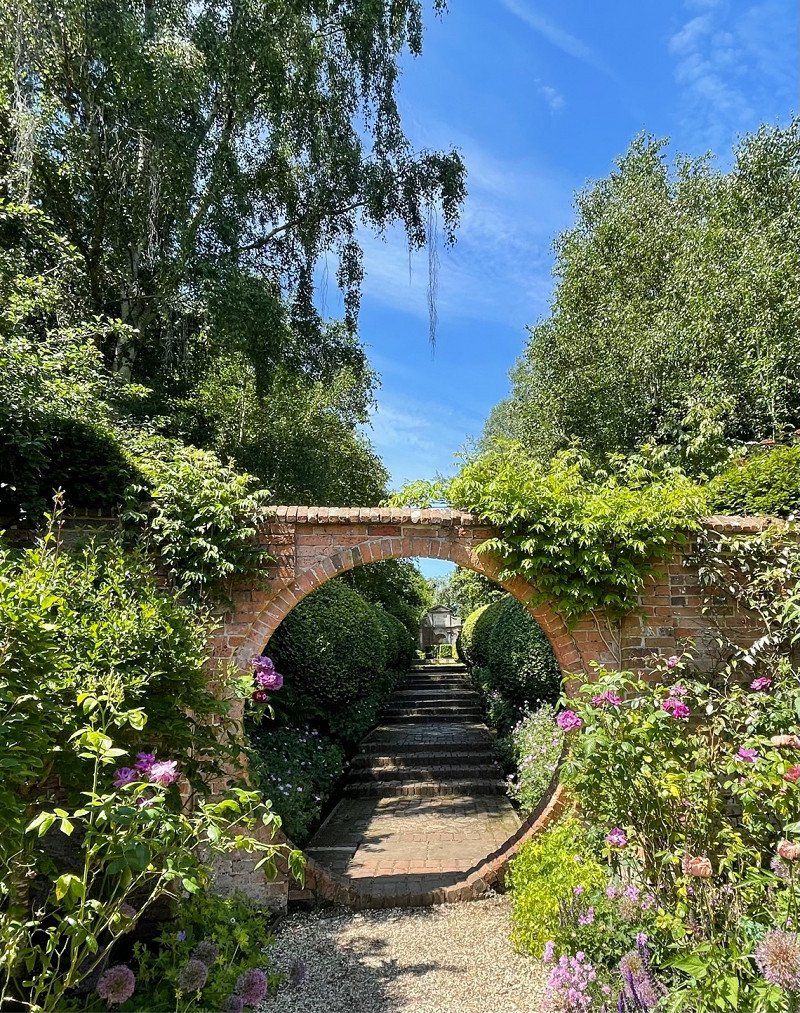
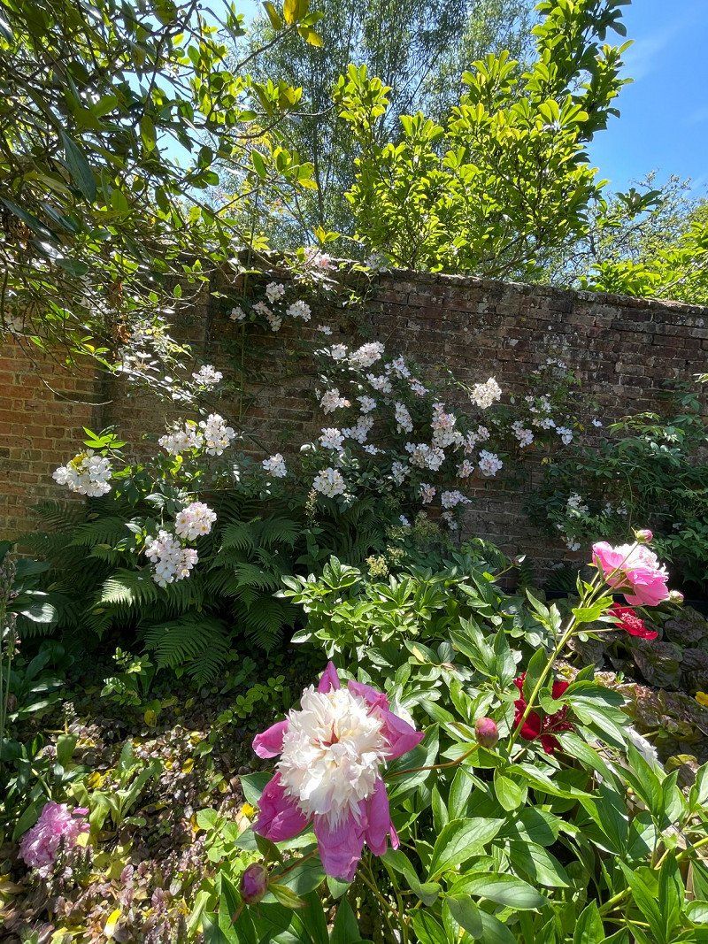
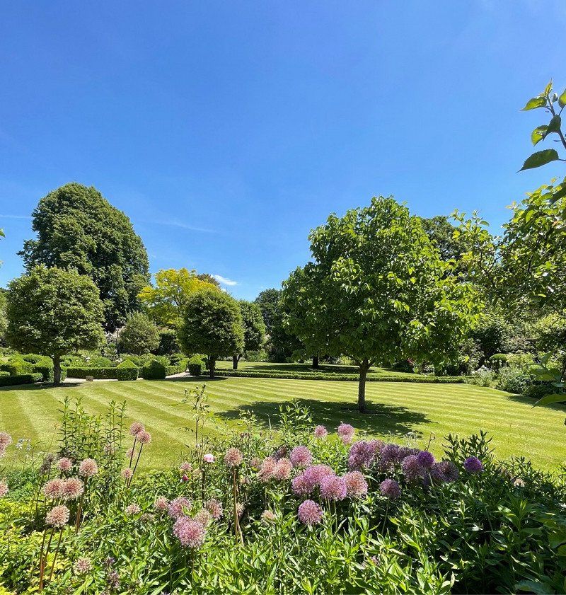
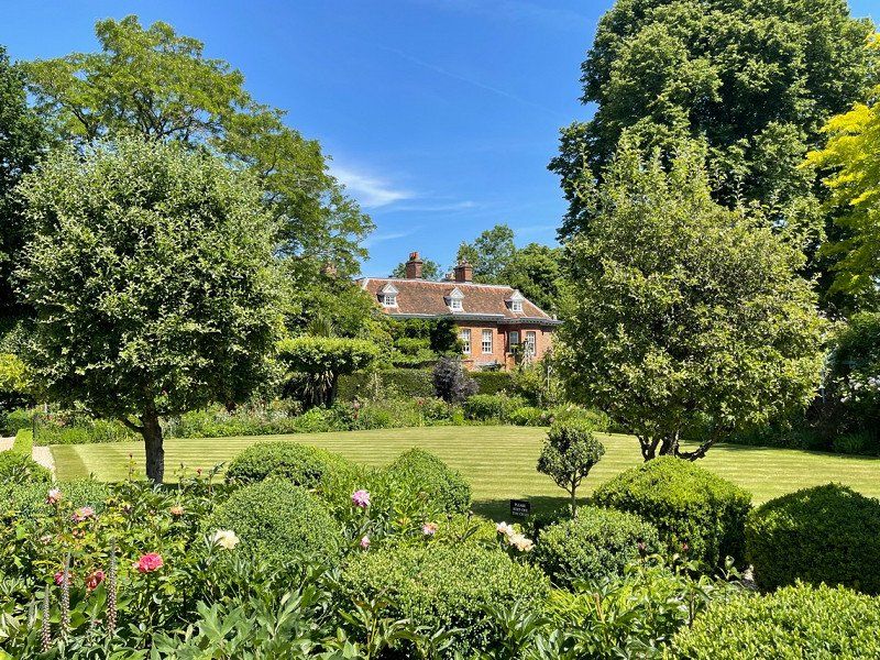
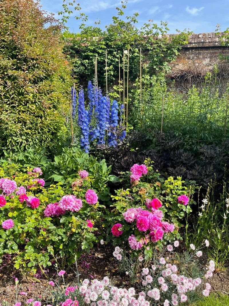
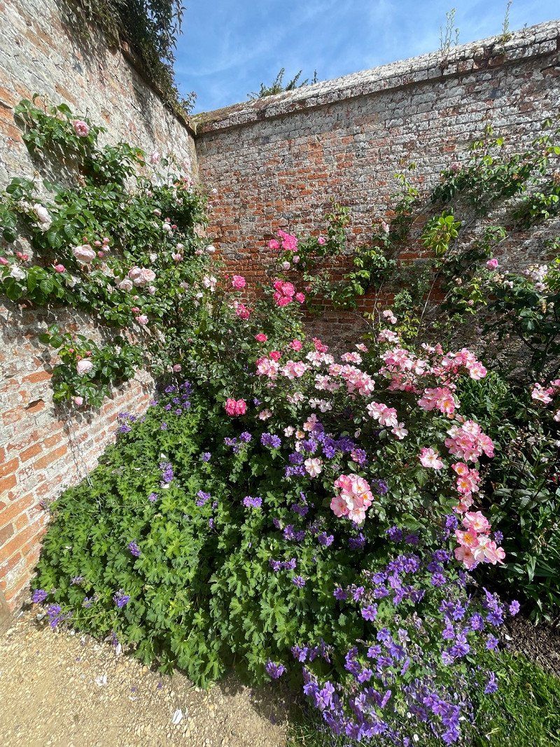
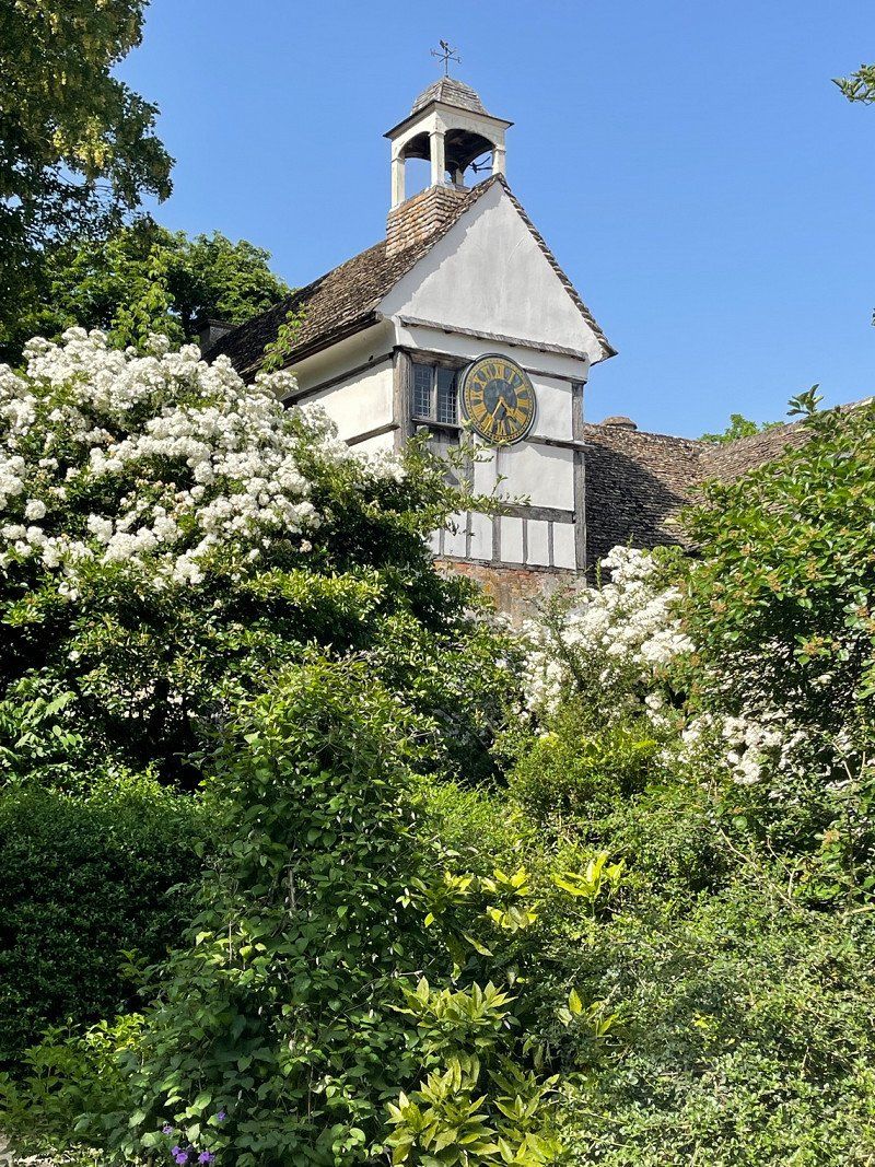
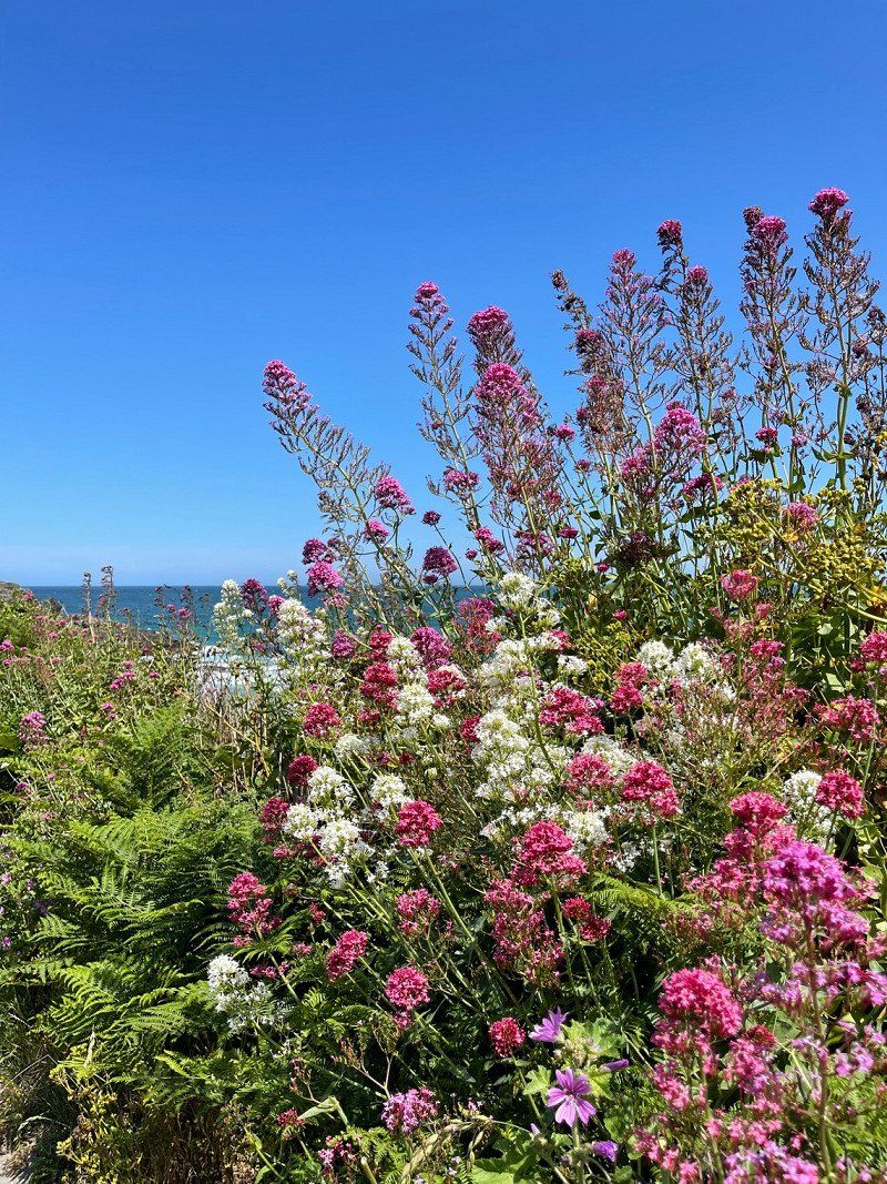
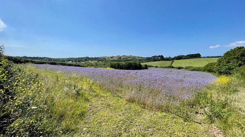
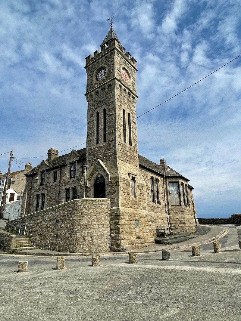
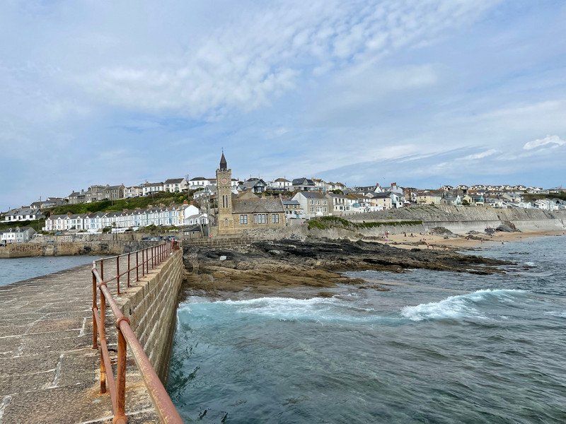
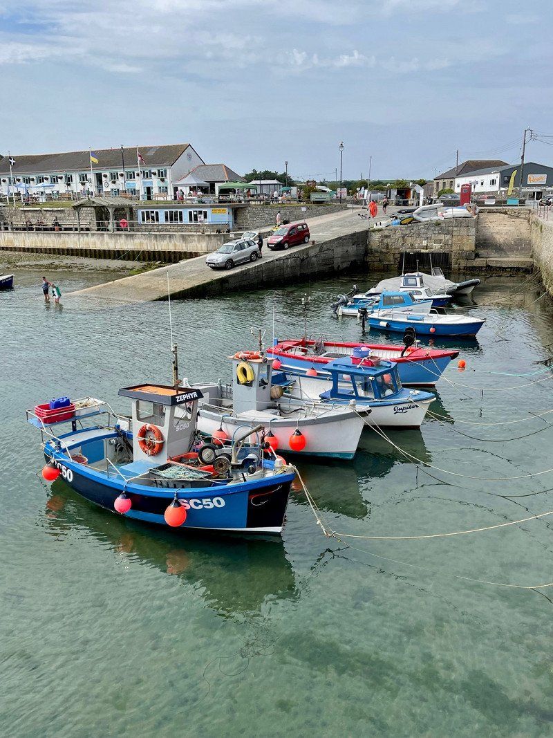
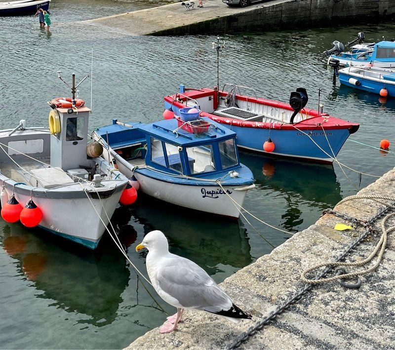
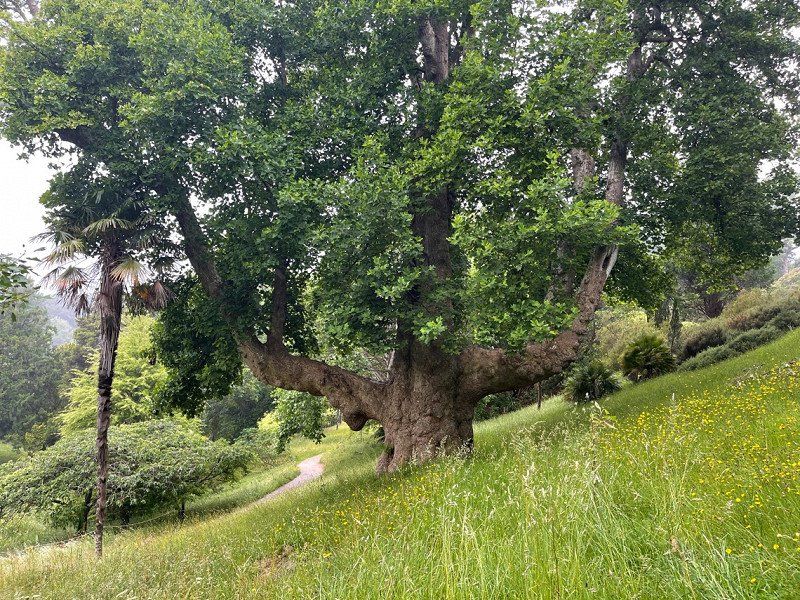
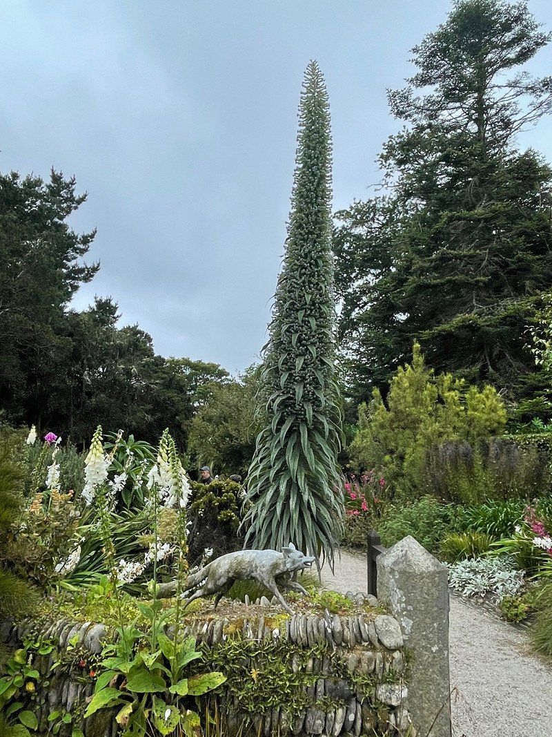
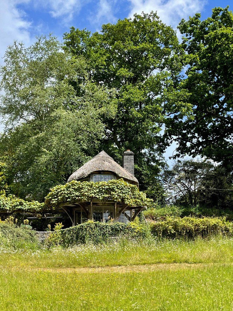
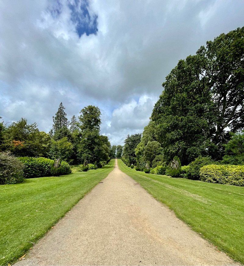
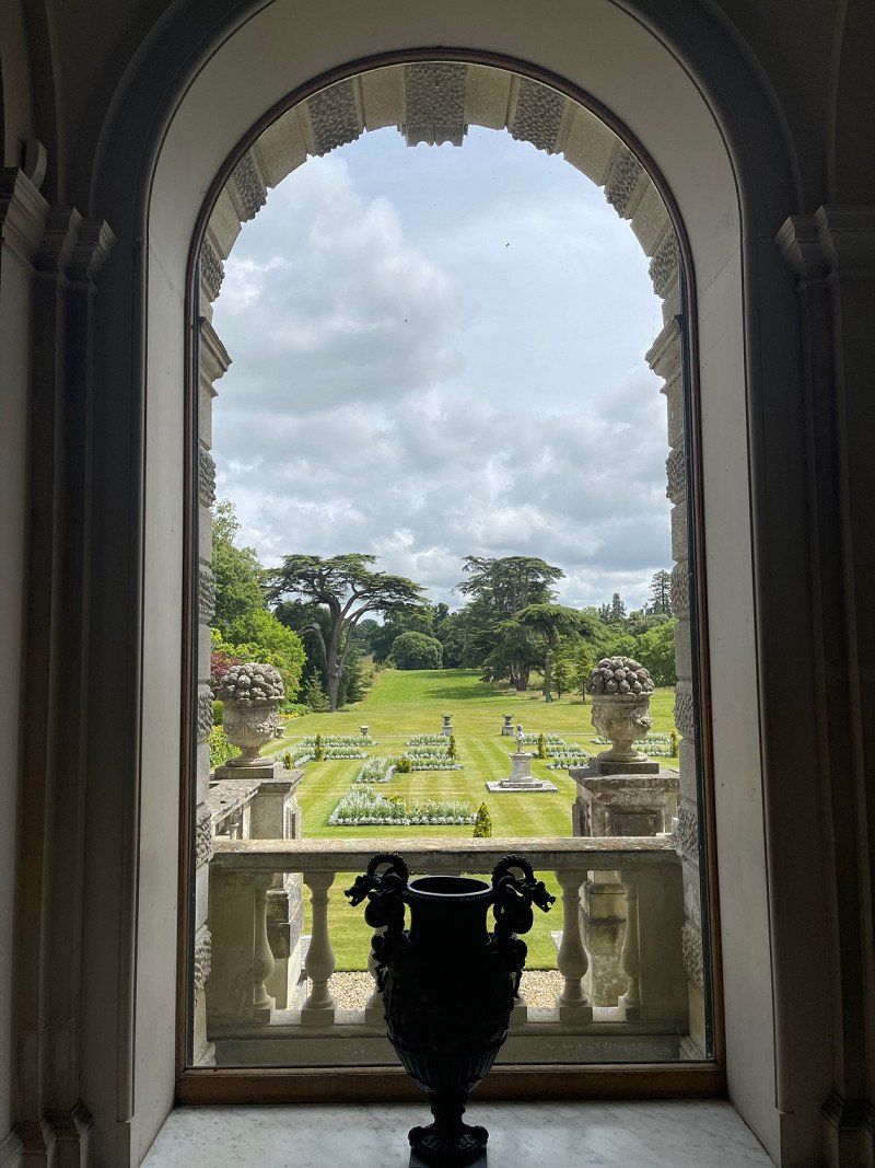
We traveled to southern England for the second time in June. Everything is in bloom and the rose gardens in particular are fantastic. With a National Trust pass (around £80) we had free entry to many beautiful gardens, parks and houses. It's worth it just because of the parking fees, which are also included. The parks with their vistas are magnificent and the small coastal villages are charming.
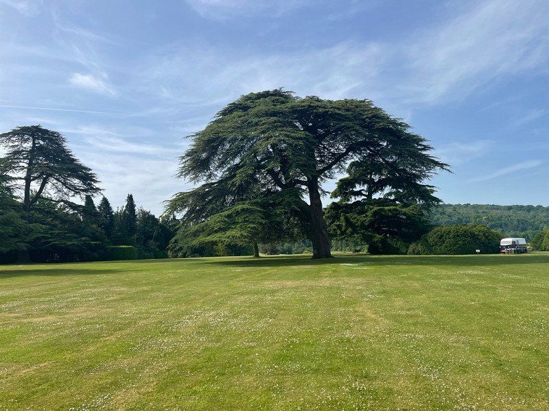
We like to walk and cycle and love beautiful landscapes.
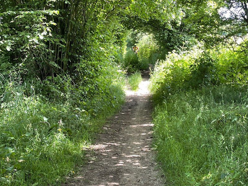
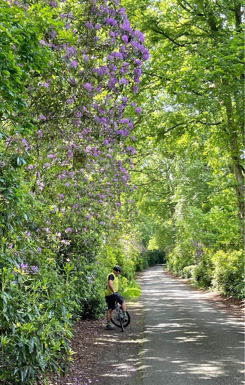
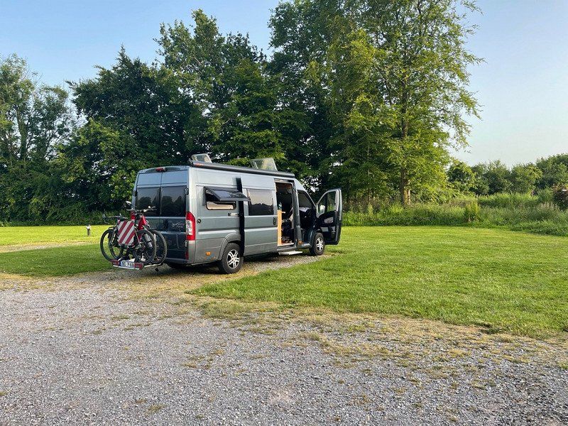
The extremely friendly English with their politeness make traveling on the left very easy. Nobody honks or pushes. Often the streets are so narrow that it's the middle anyway. So don't be afraid of left-hand traffic. Maybe at home briefly depict the situation in the roundabout (mostly 2 lanes) with toy cars. That helps enormously. For the bike tours I recommend the book: Lost Lanes or simply Komoot. There are great bike paths. Riding a bike on normal country roads seems too dangerous to me - but that's the way it is with us. Very often it goes up and down steeply and steeply. I wouldn't have expected that in England. E-bikes are not yet widespread and the cycle paths are correspondingly empty. You should not rely on the navigation system in the car. At the same time, we followed the route on Pocket Earth (top app on which every parking space and every path is marked). The navigation system sends you all too often into streets that are not suitable for a camper. 'You always get lost with the Sat -nav', it says, and it's true. Altogether we were on the road in southern England for 3 weeks and still haven't seen a lot. We planned our route depending on the weather, at short notice and therefore a bit confused. We would definitely do it again because the weather in England is very changeable. Dover-Brighton tends to be much more stable than Cornwall. We drove through to Cornwall when the weather forecast was good for it. I wish you a lot of fun with all your travels!
Day
The Riverside Centre Dover, Dover, Vereinigtes Königreich
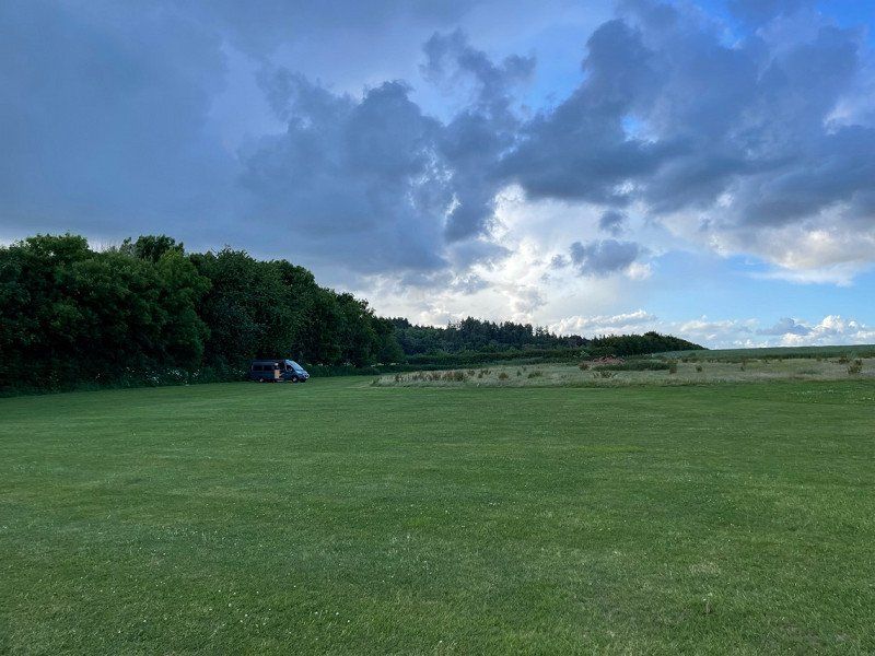
Quiet car park for first night after ferry. Video monitored and secure.
The Riverside Centre, Maison Dieu Gardens, Dover CT16 1RL, Vereinigtes Königreich
51° 7' 42" N 1° 18' 39.7" E
51.1283225 1.3110156
• Head southeast. Go for 113 m.
• Turn right onto Maison Dieu Road (A256). Go for 400 m.
• Turn left onto Castle Street (A258). Go for 1.0 km.
• Turn right onto Upper Road. Go for 1.4 km.
• Continue on Langdon Cliffs. Go for 387 m.
• Arrive at Langdon Cliffs. Your destination is on the left.
☍
3,3 km
( 5 min.)
Day
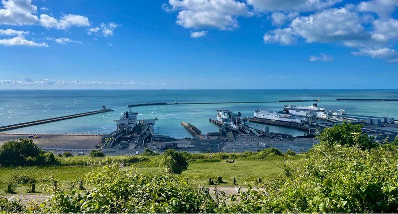
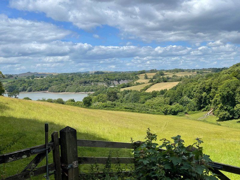
National Trust - The White Cliffs of Dover, Upper Road, Guston, Dover, Vereinigtes Königreich
We first had a coffee in this parking lot with a wonderful view and then started a bike ride to Deal. Very worthwhile this bike tour! You can find them on komoot.
Langdon Cliffs, Upper Rd, Guston, Dover CT16 1HJ, Vereinigtes Königreich
51° 7' 53.8" N 1° 20' 15.3" E
51.1315987 1.3375697
• Head toward Upper Road on Langdon Cliffs. Go for 387 m.
• Continue on Upper Road. Go for 1.4 km.
• Turn left onto A258. Go for 941 m.
• Turn left onto Castle Hill Road. Go for 30 m.
• Turn left onto Castle Hill Road. Go for 22 m.
• Continue on St James Street. Go for 34 m.
• Turn left onto Woolcomber Street (A256). Go for 103 m.
• Turn right onto Townwall Street (A20) toward London/Channel Tnl/(M20)/Folkestone. Go for 1.2 km.
• Take the 3rd exit from Limekiln Roundabout roundabout onto Archcliffe Road (A20) toward London/(M20)/Folkestone. Go for 496 m.
• Take the 1st exit from Western Heights Roundabout roundabout onto A20 toward London/(M20)/Channel Tnl/Folkestone. Go for 11.3 km.
• Keep right onto M20 toward London/Channel Tnl/Ashford. Go for 22.9 km.
• Take exit 9 toward Ashford/Canterbury/Tenterden/(A28). Go for 399 m.
• Take the 1st exit from Drovers Interchange roundabout onto Fougeres Way (A20) toward Ashford/Canterbury/A28/Tenterden. Go for 559 m.
• Take the 3rd exit from roundabout onto Templer Way (A28) toward Tenterden. Go for 624 m.
• Take the 3rd exit from roundabout onto Chart Road (A28) toward Tenterden/Great Chart. Go for 1.1 km.
• Take the 2nd exit from roundabout onto A28 toward Singleton/Chilmington/Bethersden. Go for 938 m.
• Take the 2nd exit from roundabout onto A28 toward Tenterden. Go for 1.2 km.
• Take the 2nd exit from roundabout onto A28. Go for 12.4 km.
• Turn right onto Biddenden Road (A262) toward Tun. Wells/Maidstone/(A274)/Biddenden. Go for 451 m.
• Turn left onto Biddenden Road (A262). Go for 4.2 km.
• Turn left onto High Street (A262) toward Cranbrook/Tun. Wells/Sissinghurst. Go for 5.5 km.
• Turn right. Go for 1.0 km.
• Arrive at your destination on the right.
☍
67,0 km
( 57 min.)
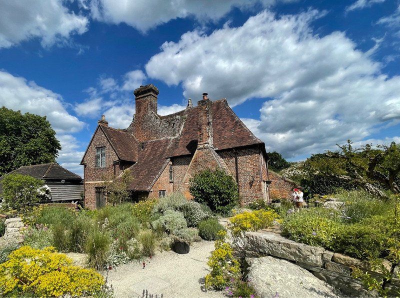
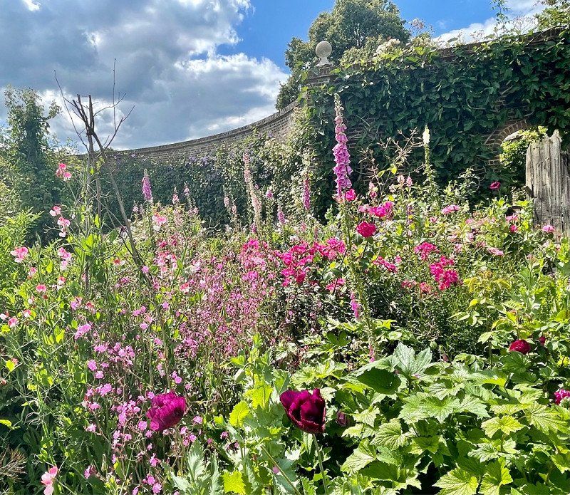
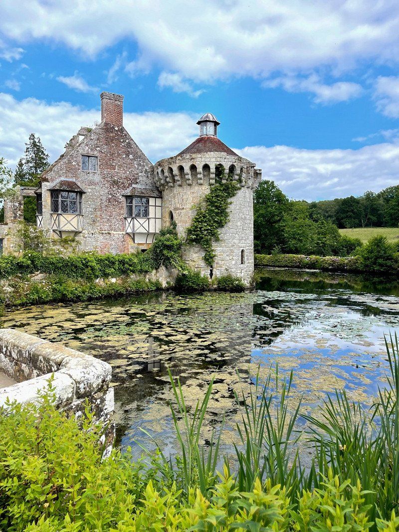
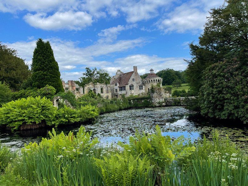
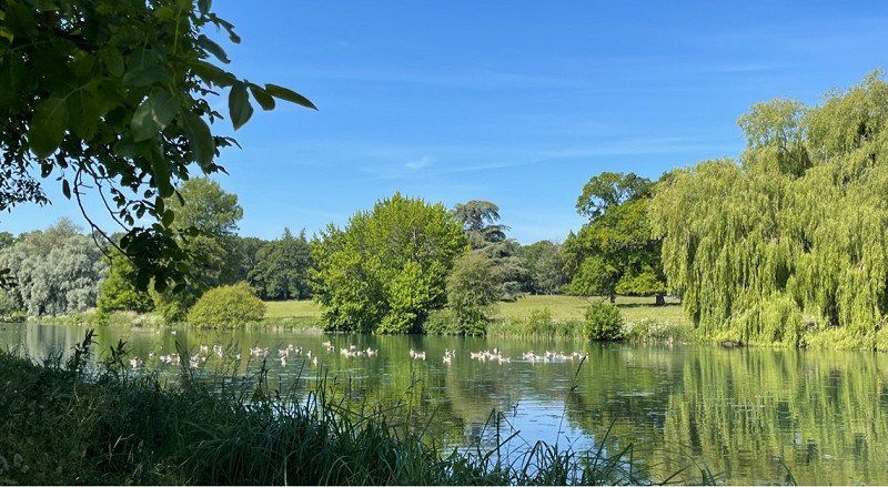
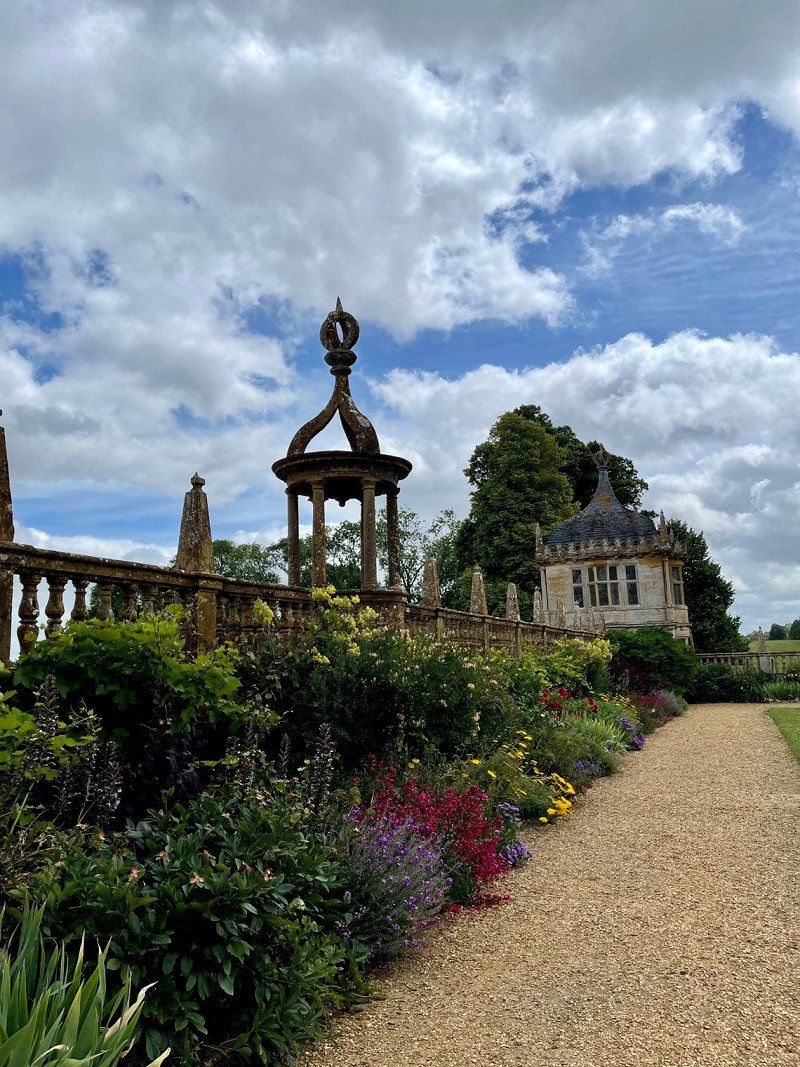
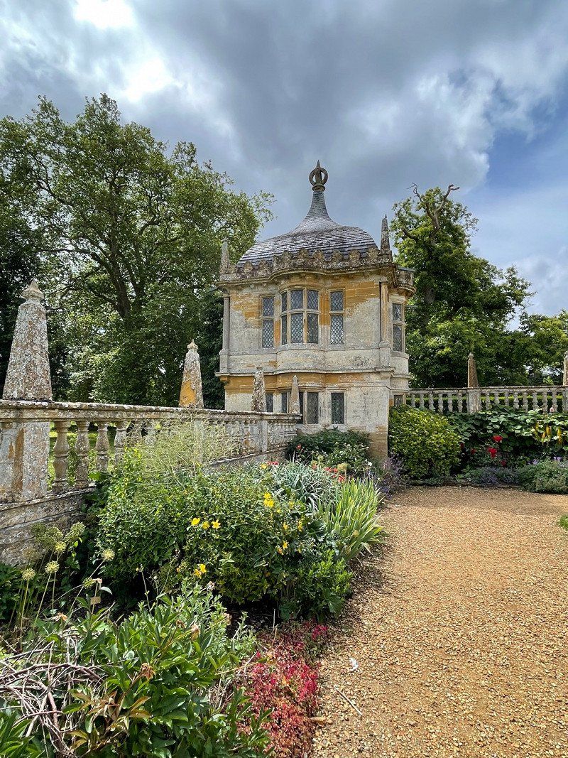
National Trust - Sissinghurst Castle Garden, Biddenden Rd, Cranbrook, Vereinigtes Königreich
Always worth it and especially in June with all the roses like a miracle! This is the second time we have been here at this time of year and it is simply indescribably beautiful!
Biddenden Rd, Cranbrook TN17 2AB, Vereinigtes Königreich
51° 6' 56.6" N 0° 34' 53.2" E
51.1157155 0.5814530
• Head north. Go for 53 m.
• Turn left. Go for 56 m.
• Turn right toward The Street/A262. Go for 956 m.
• Turn right onto The Street (A262). Go for 1.9 km.
• Take the 2nd exit from roundabout onto Goudhurst Road (A262) toward Tun. Wells/Tunbridge Wells/(A21)/Godhurst. Go for 10.9 km.
• Take the 3rd exit from Forstal Farm Roundabout roundabout onto A21 toward London/Tun Wells. Go for 4.9 km.
• Pass 2 roundabouts and continue on Hastings Road (A21). Go for 3.4 km.
• Take ramp toward Tun Wells. Go for 178 m.
• Take the 2nd exit from roundabout onto Pembury Road (A264) toward Tun Wells/Tunbridge Wells/High Brooms Ind. Est. Go for 2.8 km.
• Turn right onto Calverley Road (A264) toward Lewes/(A26)/E.Grinstead. Go for 347 m.
• Take the 2nd exit from roundabout onto Crescent Road (A264). Go for 375 m.
• Arrive at Crescent Road (A264). Your destination is on the right.
☍
25,9 km
( 27 min.)
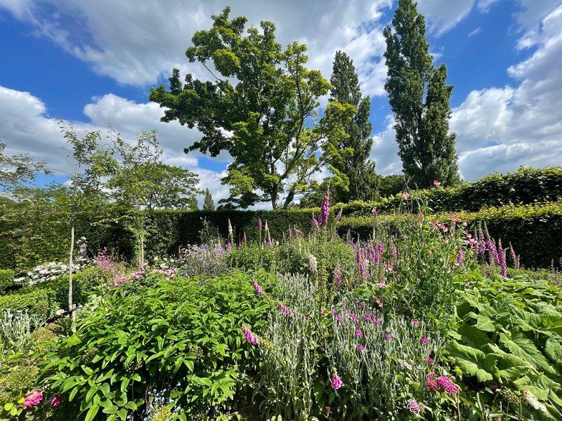
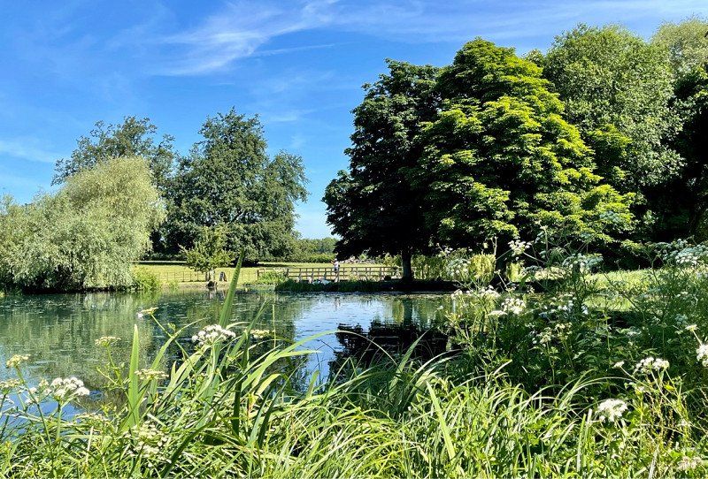
National Trust Scotney Castle
Beautiful old walls with a landscaped garden all around. Definitely worth a stop.
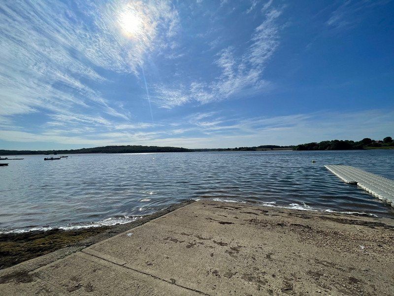
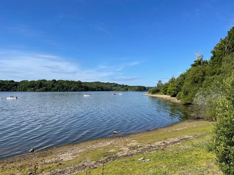
Camping Bewl water
Camping meadow without frills. Not usually bookable for just one night. But the nice operator had no problem letting us on the pitch. We were also almost alone. You can circle the lake in 3 hours on foot or in 1 hour by bike.
Day
Tunbridge Wells, Vereinigtes Königreich
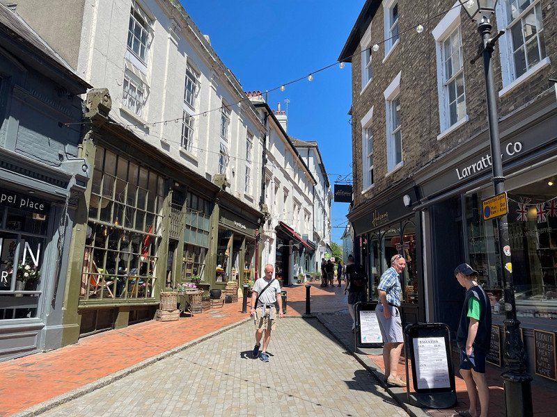
A really nice place to stroll and have lunch. However, the parking situation is a disaster. We strongly recommend arriving by train. No problem, the station is right in the center. It's a lively city with lots of young people and nice street cafes. We recommend JULIETS on the High Street for a tasty midday snack or IVYs for the more sophisticated.
51° 7' 56.6" N 0° 15' 49.3" E
51.1323770 0.2636950
• Head toward Mount Pleasant Road on Crescent Road (A264). Go for 1.2 km.
• Take the 2nd exit from roundabout onto Langton Road (A264) toward Langton Green/East Grinstead/Groombridge/(B2110). Go for 3.8 km.
• Turn right onto Ashurst Road (A264) toward East Grinstead/Fordcombe/Penshurst/(B2188). Go for 15.8 km.
• Take the 1st exit from roundabout onto Blackwell Hollow (B2110) toward East Court. Go for 272 m.
• Continue on College Lane (B2110). Go for 494 m.
• Continue toward B2110. Go for 23 m.
• Turn right toward High Street/B2110. Go for 10 m.
• Continue on High Street. Go for 132 m.
• Continue on High Street. Go for 191 m.
• Take the 1st exit from roundabout onto Judges Terrace. Go for 51 m.
• Take the 1st exit from roundabout onto Ship Street. Go for 488 m.
• Turn right onto Dunnings Road. Go for 710 m.
• Continue on West Hoathly Road. Go for 893 m.
• Turn left. Go for 517 m.
• Arrive at your destination on the right.
☍
24,7 km
( 28 min.)
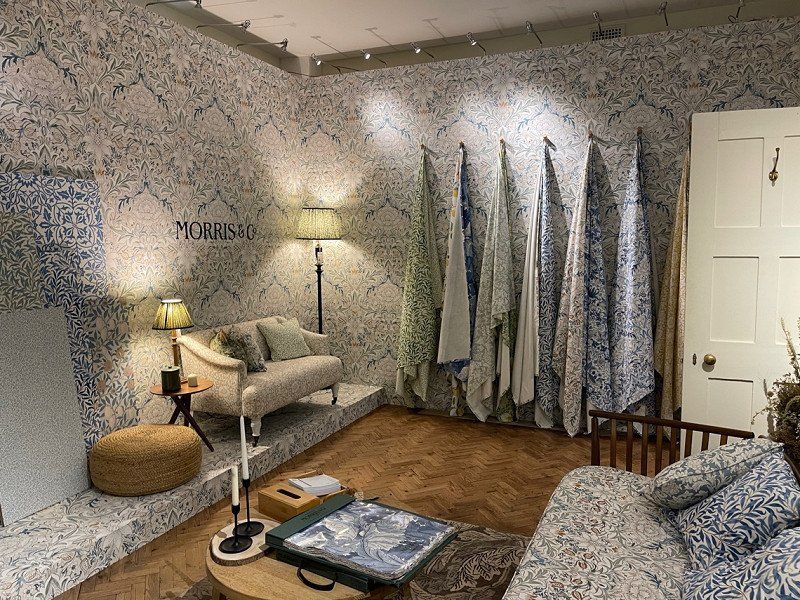
National Trust - Standen House and Garden, West Hoathly Road, East Grinstead, Vereinigtes Königreich
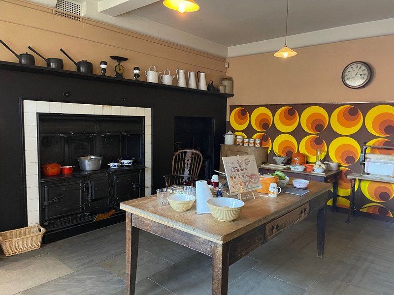
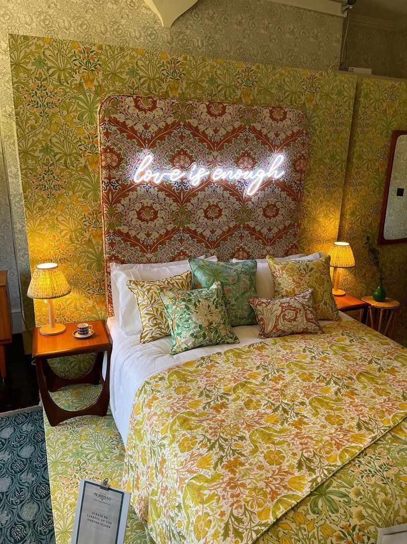
This house and the garden didn't really convince us. But for interior design fans with a soft spot for Morris and Co. it is definitely an Eldorado. You can see it, but you don't have to.
W Hoathly Rd, East Grinstead RH19 4NE, Vereinigtes Königreich
51° 6' 12.2" N 0° 0' 59.5" W
51.1034010 -0.0165370
• Head toward West Hoathly Road. Go for 517 m.
• Turn right onto West Hoathly Road. Go for 893 m.
• Continue on Dunnings Road. Go for 684 m.
• Turn left onto Ship Street. Go for 500 m.
• Take the 2nd exit from roundabout onto Judges Terrace. Go for 58 m.
• Take the 1st exit from roundabout onto London Road. Go for 370 m.
• Take the 2nd exit from roundabout onto London Road. Go for 92 m.
• Continue on Beeching Way. Go for 257 m.
• Keep right onto Station Road (A22) toward London/Crawley/Gatwick Airport/Tunbridge Wells/(A264). Go for 363 m.
• Keep left onto London Road (A22) toward London/Crawley/Gatwick Airport/(A264). Go for 310 m.
• Pass 4 roundabouts and continue on A22. Go for 16.0 km.
• Take the 2nd exit from Godstone Interchange roundabout onto M25 toward Gatwick Airport/Reigate/(M23). Go for 41.8 km.
• Take exit 12 toward Basingstoke/Southampton onto M3. Go for 33.7 km.
• Take exit 5 toward Hook/(B3349)/Farnham. Go for 496 m.
• Take the 1st exit from roundabout onto A287 toward Farnham. Go for 214 m.
• Turn right onto Hook Road. Go for 1.7 km.
• Continue on Greywell Street. Go for 24 m.
• Arrive at Greywell Street. Your destination is on the right.
☍
97,9 km
(1 hrs. 11 min.)
Fox & Goose, Greywell, Hook, Vereinigtes Königreich
The very nice operators of the pub have set up a large meadow behind the house where you can spend the night. A stop at the pub is of course obligatory, but it's also worth it. The beer and food are ok!
Many thanks to the nice operators
The Street, Greywell, Hook RG29 1BY, Vereinigtes Königreich
51° 15' 25" N 0° 58' 19" W
51.2569444 -0.9719444
• Head toward Deptford Lane on Greywell Street. Go for 24 m.
• Continue on Hook Road. Go for 1.6 km.
• Turn left onto A287. Go for 204 m.
• Take the 1st exit from roundabout toward Southampton/Winchester/Basingstoke. Go for 46 m.
• Take ramp onto M3. Go for 7.1 km.
• Take exit 6 toward Basingstoke/Alton/A339. Go for 364 m.
• Take the 2nd exit from roundabout onto M3 toward Basingstoke/Newbury/(A339)/Alton/(A30). Go for 738 m.
• Continue on Ringway East (A339) toward Ring Road (N)/Town Centre/Newbury/Reading/(A33). Go for 436 m.
• Keep right onto Ringway East (A339) toward Ring road(N)/Newbury/Reading/(A33). Go for 553 m.
• Keep right onto Ringway East (A339) toward Chineham District Hospital. Go for 2.4 km.
• Take ramp toward Aldermaston/A340/Tadley/Houndmills. Go for 266 m.
• Take the 4th exit from Aldermaston Road Roundabout roundabout onto Aldermaston Road (A340). Go for 1.7 km.
• Turn right onto Elm Road. Go for 1.1 km.
• Continue on Vyne Road. Go for 2.0 km.
• Arrive at Vyne Road.
☍
18,6 km
( 16 min.)
Day
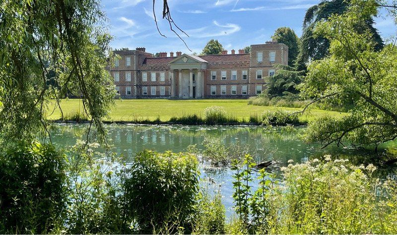
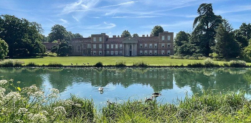
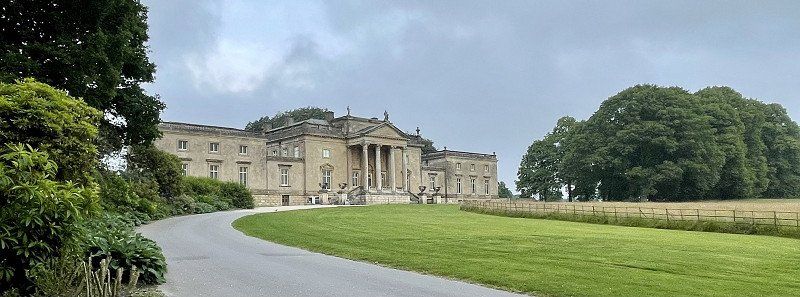
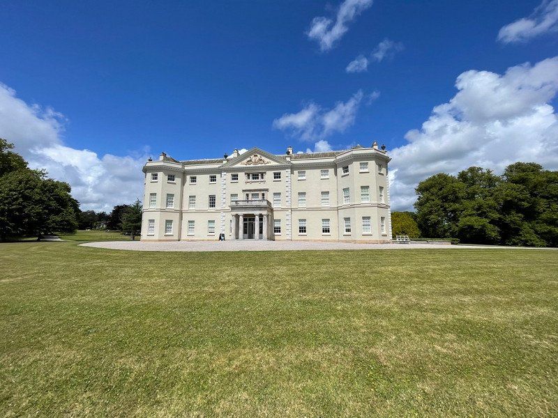
National Trust - The Vyne, Vyne Road, Sherborne Saint John, Basingstoke, Vereinigtes Königreich
Beautiful house with park by the river
Vyne Rd, Sherborne St John, Basingstoke RG24 9HL, Vereinigtes Königreich
51° 18' 24.8" N 1° 5' 18.8" W
51.3068890 -1.0885690
• Head south on Vyne Road. Go for 2.0 km.
• Continue on Elm Road. Go for 1.2 km.
• Turn left onto Aldermaston Road (A340). Go for 1.4 km.
• Take the 2nd exit from Aldermaston Road Roundabout roundabout. Go for 249 m.
• Take ramp onto Ringway North (A339). Go for 3.4 km.
• Continue on Black Dam Roundabout toward Old Basing. Go for 24 m.
• Keep left onto London Road (A30) toward Old Basing. Go for 8.0 km.
• Pass 2 roundabouts and continue on London Road (A30). Go for 4.2 km.
• Turn left onto Thackhams Lane. Go for 1.5 km.
• Turn left. Go for 33 m.
• Turn slightly right. Go for 52 m.
• Arrive at your destination on the right.
☍
22,0 km
( 21 min.)
West Green House Garden, Thackham's Lane, West Green, Hook, Vereinigtes Königreich
This garden is also owned by the National Trust. It's certainly worth it, especially in June when the roses are blooming, otherwise I wouldn't take a detour for it.
Lunch at the cafe was excellent!
Thackham's Ln, West Green, Hook RG27 8JB, Vereinigtes Königreich
51° 18' 5.1" N 0° 55' 55.3" W
51.3014230 -0.9320370
• Head southwest. Go for 241 m.
• Turn left onto Thackhams Lane. Go for 470 m.
• Turn slightly left toward Reading Road/B3349. Go for 1.9 km.
• Turn right onto Reading Road (B3349). Go for 1.6 km.
• Continue on B3349. Go for 2.3 km.
• Take the 2nd exit from roundabout onto Odiham Road (B3349). Go for 1.7 km.
• Take the 1st exit from roundabout onto B3349. Go for 648 m.
• Take the 3rd exit from roundabout onto A33. Go for 6.6 km.
• Take ramp onto M4 toward South Wales/Newbury/A34/Oxford. Go for 6.8 km.
• Take exit 12. Go for 439 m.
• Take the 1st exit from roundabout onto Bath Road (A4) toward Theale/Pangbourne/(A340). Go for 389 m.
• Take the 2nd exit from roundabout onto Bath Road (A4). Go for 1.6 km.
• Take the 3rd exit from roundabout onto A340. Go for 6.0 km.
• Take the 1st exit from roundabout onto Station Road (A329). Go for 3.1 km.
• Turn left. Go for 176 m.
• Turn slightly left. Go for 312 m.
• Turn left. Go for 156 m.
• Arrive at your destination on the left.
☍
34,3 km
( 31 min.)
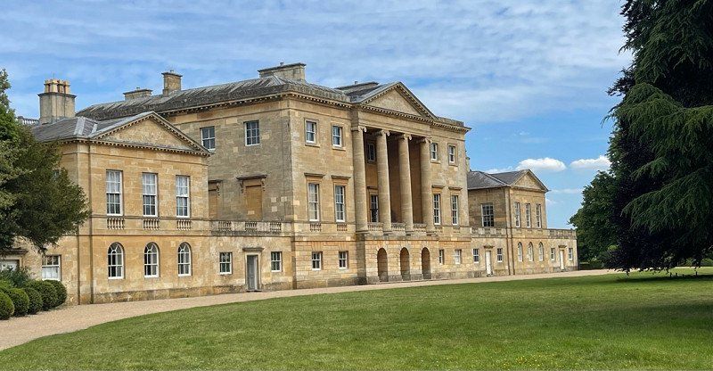
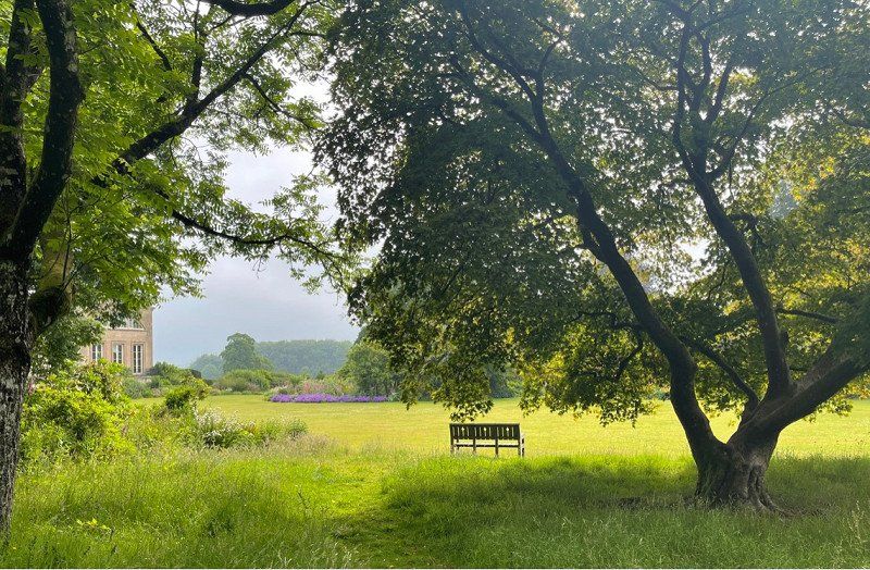
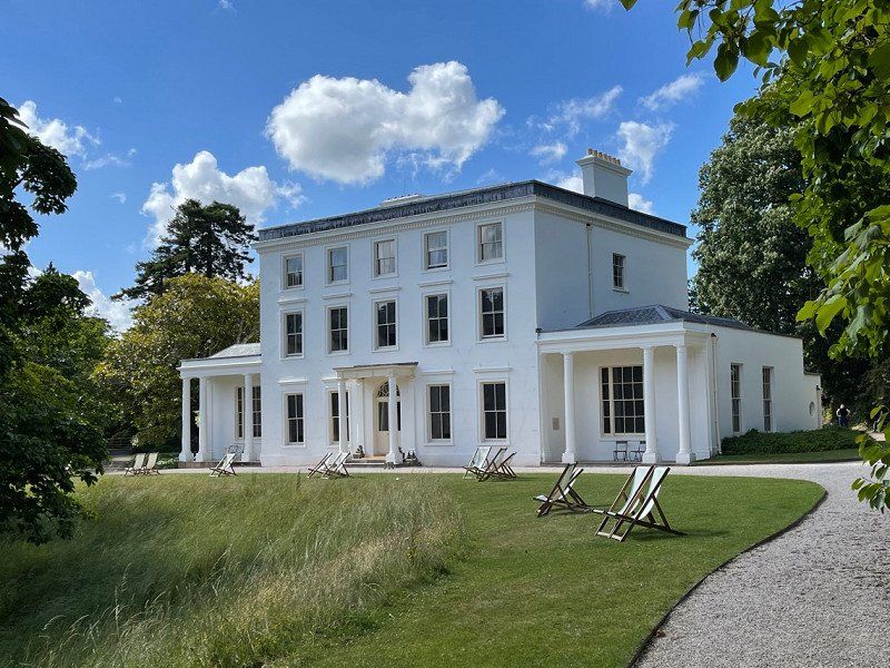
Basildon Park, Lower Basildon, Reading, Vereinigtes Königreich
Lower Basildon, Reading RG8 9NR, Vereinigtes Königreich
51° 29' 56.8" N 1° 7' 17.3" W
51.4991097 -1.1214602
• Head toward Park Wall Lane. Go for 906 m.
• Turn right onto Park Wall Lane. Go for 1.0 km.
• Turn left onto A329. Go for 2.9 km.
• Turn left onto Streatley Hill (B4009). Go for 990 m.
• Continue on B4009. Go for 1.9 km.
• Continue on Westridge Green (B4009). Go for 40 m.
• Continue on B4009. Go for 1.8 km.
• Turn sharp right toward Aldworth Road. Go for 2.6 km.
• Continue on Aldworth Road. Go for 593 m.
• Continue on School Road. Go for 475 m.
• Continue on High Street. Go for 429 m.
• Continue on Ilsley Road. Go for 2.3 km.
• Continue on Cow Lane. Go for 530 m.
• Turn left onto Broad Street. Go for 217 m.
• Turn left onto High Street. Go for 591 m.
• Continue on A34. Go for 9.7 km.
• Keep right onto A34 toward Winchester/Southampton/(M3). Go for 9.3 km.
• Take ramp toward Highclere/Wash Common. Go for 219 m.
• Take the 1st exit from roundabout onto Andover Road (A343) toward Newbury/Wash Common. Go for 342 m.
• Turn right onto Penwood Road. Go for 264 m.
• Turn left onto Penwood Road. Go for 122 m.
• Arrive at your destination on the left.
☍
37,2 km
( 32 min.)
Oakley Farm Caravan Park
Wash Water , RG20 0LP, Berkshire, Großbritannien
51° 21' 52.2" N 1° 20' 51.5" W
51.3644900 -1.3476400
• Head west. Go for 4 m.
• Arrive at your destination on the right.
☍
0,0 km
(Duration not available)
Day
Oakley Farm Caravan Park, Penwood Road, Newbury, Vereinigtes Königreich
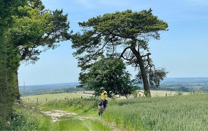
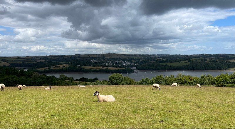
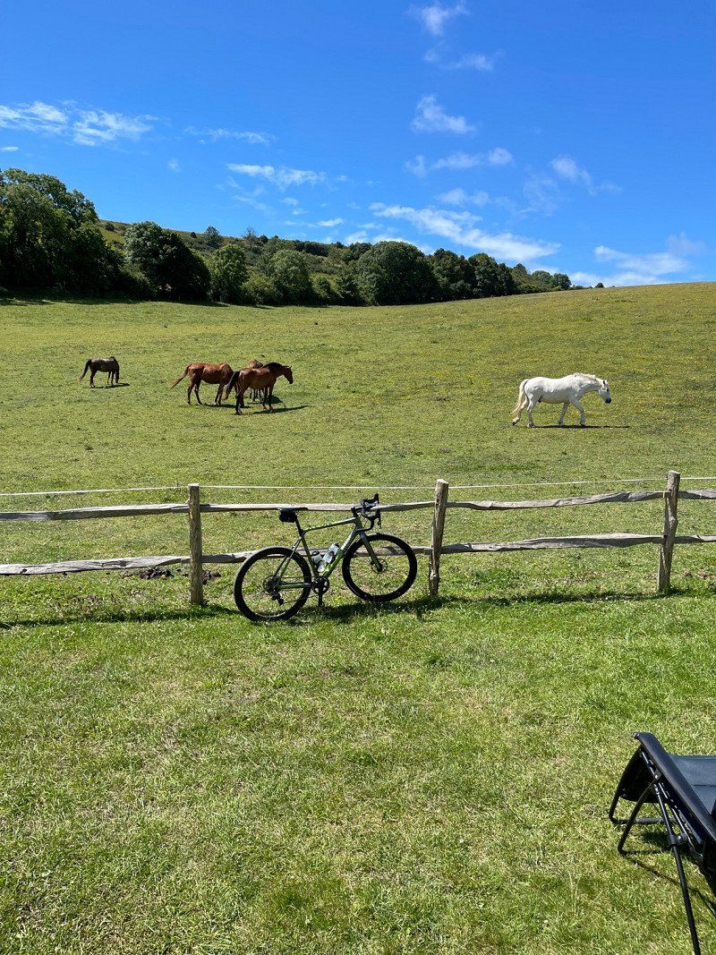
A bike ride around Highclere was wonderful in the nicest weather. You can download it at komoot (Around Highclere Castle) With a detour to the viewpoint Watership Down. But you should definitely check the tour again, we went wrong very often. In terms of landscape, the route is a dream to drive, with many viewpoints and past beautiful houses. Very worthwhile!
Penwood Rd, Newbury RG20 0LR, Vereinigtes Königreich
51° 21' 52.1" N 1° 20' 51.8" W
51.3644647 -1.3477173
• Head west. Go for 28 m.
• Continue on Penwood Road. Go for 89 m.
• Turn right onto Penwood Road. Go for 264 m.
• Turn left onto Andover Road (A343). Go for 315 m.
• Take the 3rd exit from roundabout onto A34 toward Winchester/Basingstoke/(A303)/Andover/Southampton/(M3). Go for 2.2 km.
• Take ramp toward Burghclere. Go for 446 m.
• Take the 2nd exit from roundabout toward Highclere Stud/Burghclere. Go for 604 m.
• Turn right toward Whitway. Go for 1.2 km.
• Continue on Whitway. Go for 474 m.
• Turn right. Go for 891 m.
• Turn left toward Highclere Park. Go for 170 m.
• Continue on Highclere Park. Go for 270 m.
• Continue on Highclere Castle. Go for 132 m.
• Arrive at your destination on the left.
☍
7,1 km
( 8 min.)
Day
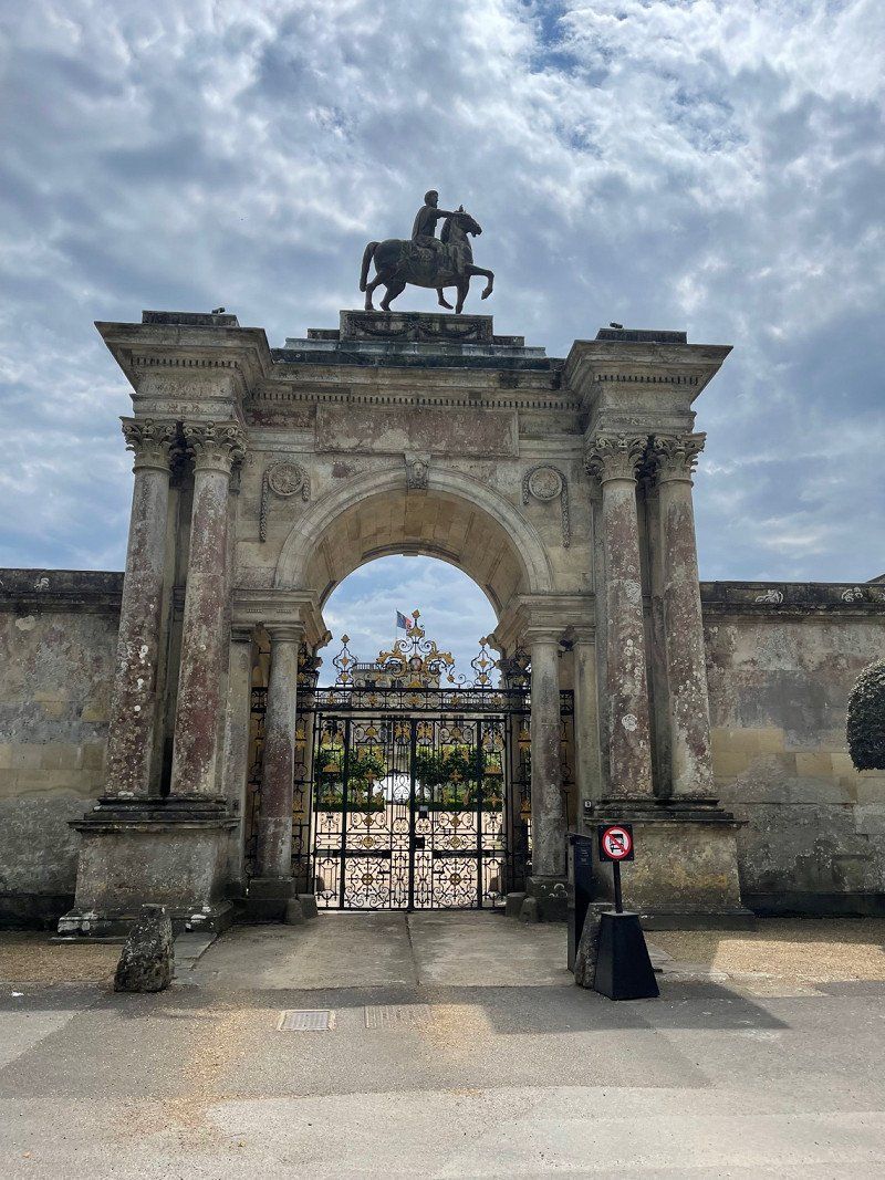
Highclere Castle, Highclere, Newbury, Vereinigtes Königreich
In the morning at 9.00 a.m. we were all alone on the grounds of the castle. If you want to visit it, you have to get tickets very early on. We booked three months in advance. It's very worth it!
Highclere Park, Highclere, Newbury RG20 9RN, Vereinigtes Königreich
51° 19' 35.7" N 1° 21' 38.4" W
51.3265901 -1.3606660
• Head northeast. Go for 70 m.
• Continue on Highclere Castle. Go for 143 m.
• Continue on Highclere Park. Go for 359 m.
• Turn right. Go for 891 m.
• Turn left toward Whitway. Go for 278 m.
• Continue on Whitway. Go for 1.4 km.
• Turn left. Go for 553 m.
• Take the 2nd exit from roundabout toward The MIDLANDS/(M4)/Oxford. Go for 258 m.
• Take ramp onto A34 toward The Midlands/(M4)/Oxford. Go for 8.0 km.
• Take ramp toward Hungerford/Newbury. Go for 395 m.
• Take the 3rd exit from roundabout onto B4000 toward Wickham/Stockcross. Go for 1.5 km.
• Continue on Ermin Street (B4000). Go for 90 m.
• Continue on B4000. Go for 2.9 km.
• Continue on Newbury Road (B4000). Go for 2.1 km.
• Continue on Baydon Road (B4000). Go for 3.1 km.
• Continue on Ermine Street (B4000). Go for 362 m.
• Turn left onto Baydon Road (A338). Go for 858 m.
• Take the 3rd exit from roundabout onto M4 toward South Wales/Bristol/Swindon (W). Go for 48.6 km.
• Take exit 17 toward Chippenham. Go for 411 m.
• Take the 2nd exit from Stanton St Quintin roundabout onto A350 toward Chippenham. Go for 4.1 km.
• Take the 3rd exit from Malmesbury Road roundabout onto West Cepen Way (A350) toward Ind Estates Business & Retail Areas/(A4)/(A361)/Cepen Park/Town Centre. Go for 348 m.
• Pass 2 roundabouts and continue on West Cepen Way (A350). Go for 1.2 km.
• Take the 3rd exit from Bumpers Farm roundabout onto West Cepen Way (A350) toward Corsham/Cepen Park South/Bath Road Ind Est/Methuen Park. Go for 2.3 km.
• Take the 2nd exit from Cepen Park South roundabout onto West Cepen Way (A350) toward (A4)/(A361). Go for 318 m.
• Take the 3rd exit from Chequers roundabout onto West Cepen Way (A350) toward Melksham. Go for 299 m.
• Keep right onto West Cepen Way (A350). Go for 1.1 km.
• Take the 2nd exit from Showell Farm roundabout onto West Cepen Way (A350) toward Poole/Warminster/Trowbridge/(A361). Go for 506 m.
• Take the 3rd exit from Lackham roundabout onto A350 toward Poole/Warminster/Trowbridge/(A361)/Melksham. Go for 2.8 km.
• Turn sharp left onto Melksham Road toward Lacock Village & Abbey. Go for 347 m.
• Continue on West Street. Go for 16 m.
• Take the 2nd exit from roundabout onto Hither Way. Go for 274 m.
• Arrive at Hither Way.
☍
86,0 km
( 57 min.)
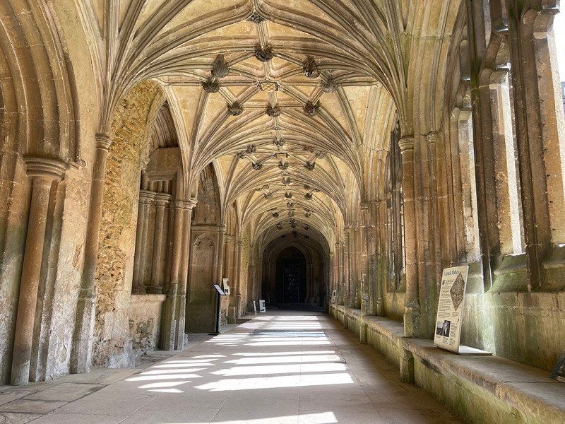
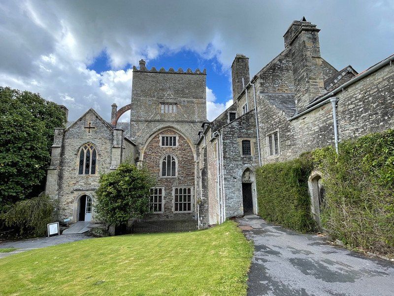
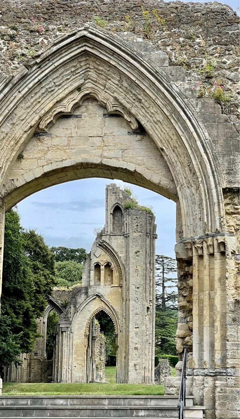
Lacock Abbey, Lacock, Chippenham, Vereinigtes Königreich
Also owned by the National Trust, Lacock Abbey is where many scenes from Harry Potter were filmed. The place of the same name is also ancient and just a short walk away.
Lacock, Chippenham SN15 2LG, Vereinigtes Königreich
51° 24' 52.8" N 2° 7' 1.8" W
51.4146597 -2.1171611
• Head west on Hither Way. Go for 253 m.
• Take the 1st exit from roundabout onto West Street. Go for 30 m.
• Continue on Melksham Road. Go for 414 m.
• Continue on A350. Go for 3.4 km.
• Pass 3 roundabouts and continue on Western Way (A350). Go for 2.7 km.
• Take the 2nd exit from Western Way roundabout onto A350 toward (A361). Go for 1.0 km.
• Take the 2nd exit from Hampton Park roundabout onto A350 toward Poole/Warminster/Westbury/Trowbridge/(A361)/Semington. Go for 1.6 km.
• Take the 2nd exit from Littleton roundabout onto A350 toward Poole/Warminster/Westbury/Frome/West Ashton/Steeple Ashton/West Wills Trading Estate/White Horse Business Park. Go for 6.5 km.
• Take the 3rd exit from Yarnbrook roundabout onto Westbury Road (A363) toward Frome/North Bradley/(A361)/Trowbridge. Go for 597 m.
• Take the 2nd exit from roundabout onto Westbury Road. Go for 596 m.
• Take the 1st exit from roundabout onto Southwick Road. Go for 934 m.
• Continue on Bradley Road. Go for 690 m.
• Continue on Goose Street. Go for 278 m.
• Continue on Wynsome Street. Go for 535 m.
• Take the 1st exit from roundabout onto Frome Road (A361). Go for 4.8 km.
• Take the 1st exit from roundabout onto A36 toward Warminster/Southampton/Frome/(A361)/Standerwick/Oldford/Orchardleigh. Go for 1.0 km.
• Take the 3rd exit from Warminster Road Roundabout roundabout onto A361 toward Frome/Taunton/Oldford. Go for 1.3 km.
• Pass 2 roundabouts and continue on A361. Go for 1.6 km.
• Take the 2nd exit from Berkley Roundabout roundabout onto A361 toward Shepton Mallet/Warminster/(A362)/Westbury. Go for 4.2 km.
• Take the 1st exit from Blatchbridge Roundabout roundabout onto B3092 toward Maiden Bradley. Go for 3.9 km.
• Continue on Frome Road (B3092). Go for 3.6 km.
• Continue on Church Street (B3092). Go for 463 m.
• Continue on B3092. Go for 5.5 km.
• Turn right onto High Street. Go for 488 m.
• Arrive at High Street. Your destination is on the right.
☍
46,5 km
( 41 min.)
Stourhead House The National Trust, High Street, Stourton, Warminster, Vereinigtes Königreich
At the back of the National Trust car park there is a small enclosed area for five motorhomes with electricity. Totally calm and relaxed!
Stourhead House The National Trust, High St, Stourton, Warminster BA12 6QE, Vereinigtes Königreich
51° 6' 20" N 2° 19' 8.4" W
51.1055486 -2.3189869
• Head northeast on High Street. Go for 488 m.
• Turn left onto B3092. Go for 5.5 km.
• Continue on Church Street (B3092). Go for 463 m.
• Continue on Frome Road (B3092). Go for 3.6 km.
• Continue on B3092. Go for 3.8 km.
• Take the 3rd exit from Blatchbridge Roundabout roundabout onto A361 toward Trowbridge/Bath/(A36)/Warminster/(A362)/Westbury. Go for 4.2 km.
• Take the 1st exit from Berkley Roundabout roundabout onto A361 toward Bath/(A36). Go for 378 m.
• Take the 2nd exit from roundabout onto A361 toward Trowbridge/Bath/(A36). Go for 1.3 km.
• Take the 2nd exit from roundabout onto A361 toward Beckington/Rode/Frome Market/Shepton M./(A362). Go for 1.3 km.
• Take the 2nd exit from Warminster Road Roundabout roundabout onto A36 toward Bath/Trowbridge/(A361). Go for 1.1 km.
• Take the 2nd exit from roundabout onto A36 toward Woolverton/Limpley Stoke/Claverton. Go for 17.5 km.
• Keep left onto Sydney Place (A36). Go for 317 m.
• Take the 2nd exit from roundabout onto Pulteney Road (A36) toward Bristol/(A4)/Wells/(A37). Go for 772 m.
• Keep right onto Rossiter Road (A36). Go for 690 m.
• Keep right toward Warminster/Chippenham/(A4)/City Centre/(M4). Go for 21 m.
• Turn right onto Lower Bristol Road (A36). Go for 35 m.
• Keep left onto Broad Quay (A367) toward City Centre. Go for 66 m.
• Turn left onto Broad Quay (A367). Go for 142 m.
• Turn right onto Corn Street (A367) toward Warminster/(A36)/Shepton Mallet/City centre/Southgate Train Station. Go for 128 m.
• Keep left toward Southgate Street. Go for 20 m.
• Arrive at Southgate Street. Your destination is on the right.
☍
41,8 km
( 38 min.)
Day
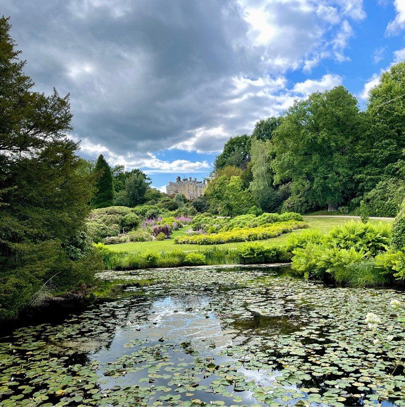
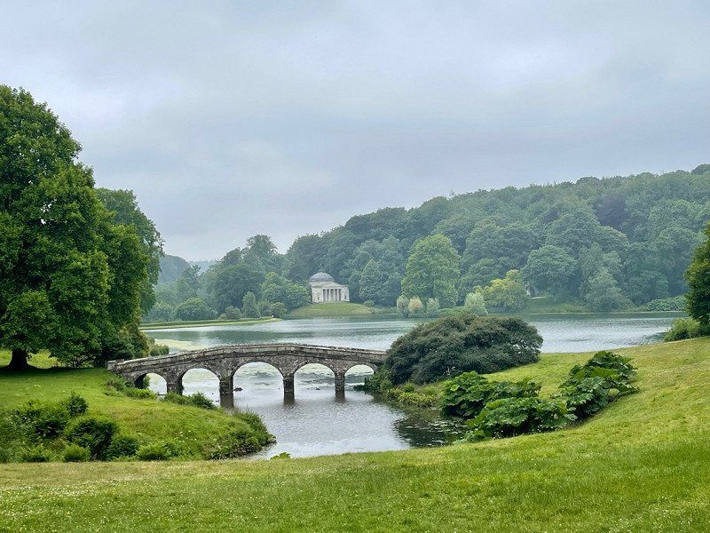
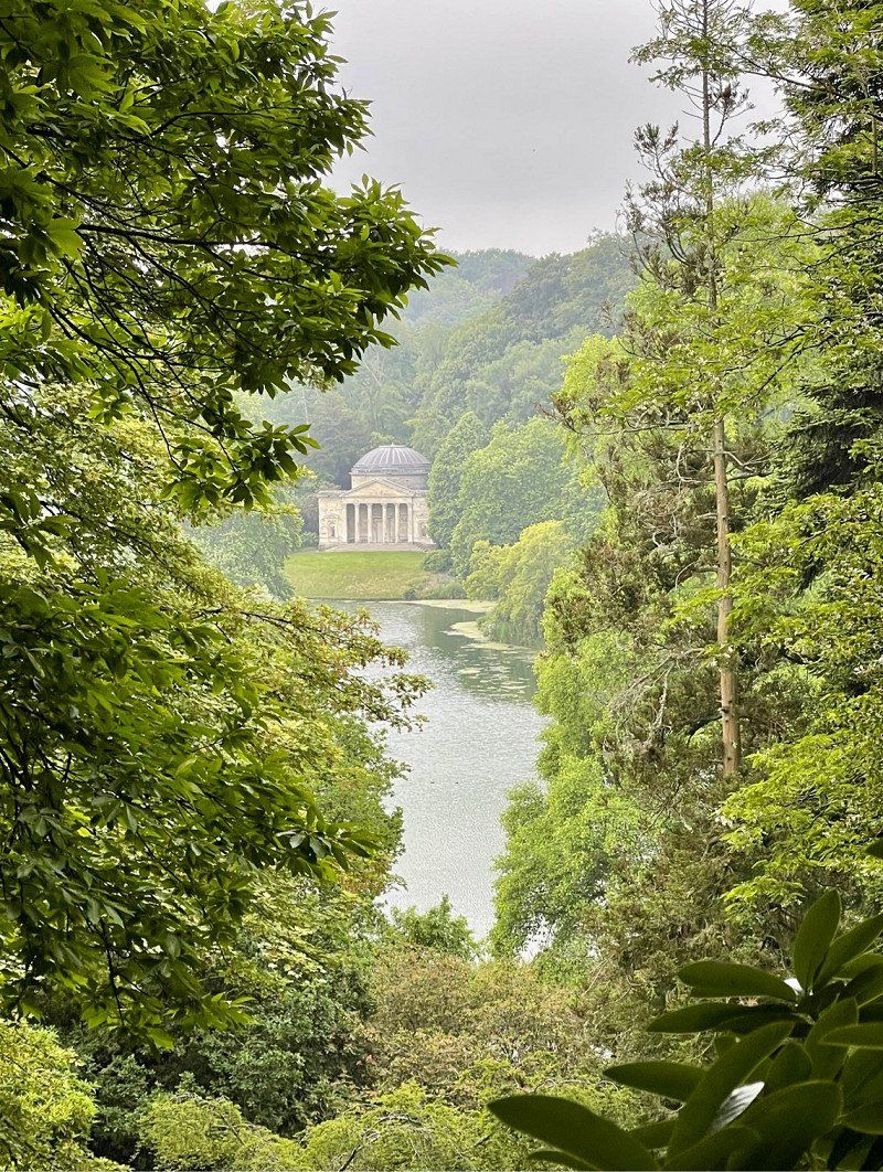
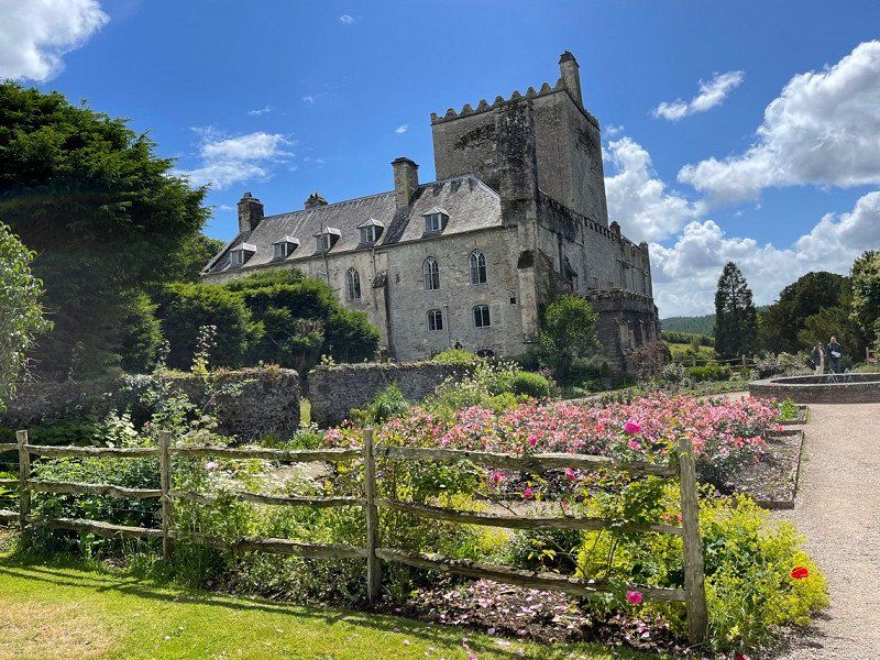
Stourhead Park
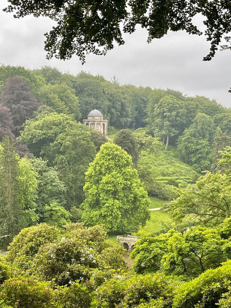
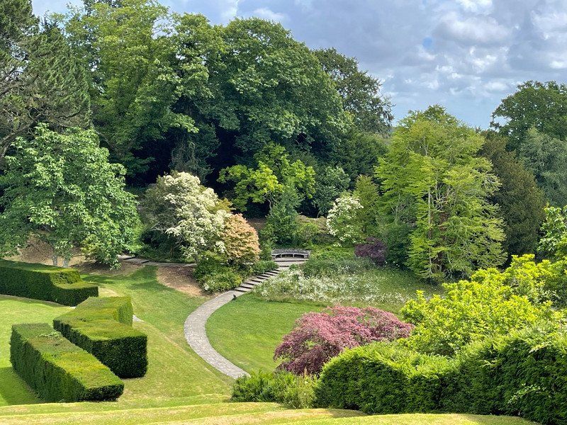
For me, Stourhead and Sheffield Park are the most outstandingly beautiful country parks in southern England.
Bath, Vereinigtes Königreich
Little trip to Bath. Very nice for shopping otherwise: you can do it but you don't have to. However, the Prior Park is well worth seeing!
51° 22' 41.2" N 2° 21' 34.9" W
51.3781018 -2.3596827
• Head southeast on Dorchester Street (A3039). Go for 19 m.
• Continue on Dorchester Street (A3039). Go for 143 m.
• Continue on Manvers Street (A3039). Go for 234 m.
• Continue on Pierrepont Street (A3039). Go for 110 m.
• Turn right onto North Parade. Go for 410 m.
• Turn left onto Pulteney Road (A36). Go for 340 m.
• Take the 2nd exit from roundabout onto Darlington Street (A36). Go for 290 m.
• Continue toward Sydney Place/A36. Go for 17 m.
• Turn right onto Beckford Road (A36). Go for 17.5 km.
• Pass 2 roundabouts and continue on A36. Go for 8.6 km.
• Take the 3rd exit from roundabout onto A36 toward Salisbury/Blandford/(A350). Go for 2.5 km.
• Pass 2 roundabouts and continue on A36. Go for 7.4 km.
• Take the 3rd exit from Cotley Hill Roundabout roundabout onto A36 toward Codford. Go for 24.3 km.
• Take the 3rd exit from roundabout onto Minster Street (A30) toward Wilton. Go for 710 m.
• Turn left onto South Street. Go for 339 m.
• Turn left. Go for 136 m.
• Turn left. Go for 495 m.
• Arrive at your destination on the left.
☍
63,5 km
( 54 min.)
Stourhead Park
Simply an ideal place, so one more night.
Wilton House, Wilton, Salisbury, Vereinigtes Königreich
Wilton House with an impressive collection of paintings: Rubens and 2 rooms full of Van Dyks. An old English rose garden and the beautiful bridge by Wiliam Kent.
Wilton, Salisbury SP2 0BJ, Vereinigtes Königreich
51° 4' 42.8" N 1° 51' 33.5" W
51.0785664 -1.8592917
• Head north. Go for 495 m.
• Turn right toward South Street. Go for 136 m.
• Turn right onto South Street. Go for 339 m.
• Turn left onto West Street (A30). Go for 683 m.
• Take the 2nd exit from roundabout onto Shaftesbury Road (A30). Go for 3.5 km.
• Turn right onto Wilton Road (B3089). Go for 23 m.
• Turn left onto West Street (B3089). Go for 585 m.
• Continue on B3089. Go for 953 m.
• Continue on The Belt (B3089). Go for 208 m.
• Continue on B3089. Go for 989 m.
• Continue on Hindon Road (B3089). Go for 3.4 km.
• Continue on B3089. Go for 1.5 km.
• Turn left onto Hindon Road (B3089). Go for 1.4 km.
• Continue on Salisbury Road (B3089). Go for 1.3 km.
• Continue on B3089. Go for 3.2 km.
• Turn right onto B3089. Go for 1.7 km.
• Continue on The Needles (B3089). Go for 54 m.
• Continue on B3089. Go for 740 m.
• Continue on High Street (B3089). Go for 8 m.
• Turn left onto Angel Lane (B3089). Go for 413 m.
• Continue on B3089. Go for 2.0 km.
• Turn right onto A350. Go for 41 m.
• Turn left onto B3089. Go for 1.8 km.
• Turn left onto A303 toward Exeter/Honiton. Go for 36.6 km.
• Take the 2nd exit from Podimore Roundabout roundabout onto A303 toward Exeter/Yeovil/(A37)/Taunton/(A358). Go for 8.6 km.
• Take the 2nd exit from Cartgate Roundabout roundabout onto A303 toward (M5)/Exeter/Taunton/(A358). Go for 5.3 km.
• Take the 3rd exit from roundabout onto A303 toward (M5)/Exeter/Honiton/Taunton/(A358). Go for 10.3 km.
• Take the 2nd exit from Southfields Roundabout roundabout onto A303 toward Exeter/Honiton. Go for 16.3 km.
• Continue on A30. Go for 30.5 km.
• Keep left toward Plymouth/Torquay/Okehampton/M5(S). Go for 206 m.
• Take ramp onto M5. Go for 7.2 km.
• Take exit 31 toward Bodmin/Okehampton onto A30. Go for 163 km.
• Take the 3rd exit from Loggans Moor roundabout onto A30 toward Penzance/St Ives/(A3074). Go for 4.7 km.
• Take the 2nd exit from roundabout onto Nut Lane (A3074) toward St Ives. Go for 448 m.
• Take the 1st exit from roundabout onto Nut Lane (A3074). Go for 101 m.
• Take the 1st exit from roundabout onto Mill Hill. Go for 3.6 km.
• Continue on Nance. Go for 1.2 km.
• Turn right onto B3311. Go for 1.7 km.
• Continue on Halsetown Road (B3311). Go for 418 m.
• Turn left onto B3306. Go for 128 m.
• Turn right. Go for 154 m.
• Turn right. Go for 57 m.
• Arrive at your destination on the right.
☍
316,1 km
(3 hrs. 17 min.)
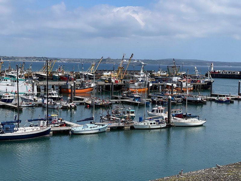
Hellesveor Holidays, Saint Ives, Vereinigtes Königreich
Nice quiet place above the city. There is a bus connection and a coastal hiking trail to the center.
Hellesveor Farm, Saint Ives TR26 3AD, Vereinigtes Königreich
50° 12' 28.2" N 5° 30' 2.2" W
50.2078200 -5.5006210
• Head southwest. Go for 57 m.
• Turn left toward B3306. Go for 154 m.
• Turn left onto B3306. Go for 128 m.
• Continue on Higher Stennack (B3306). Go for 724 m.
• Enter the roundabout. Go for 16 m.
• Arrive at your destination on the right.
☍
1,1 km
( 1 min.)
Day
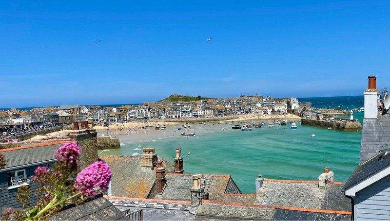
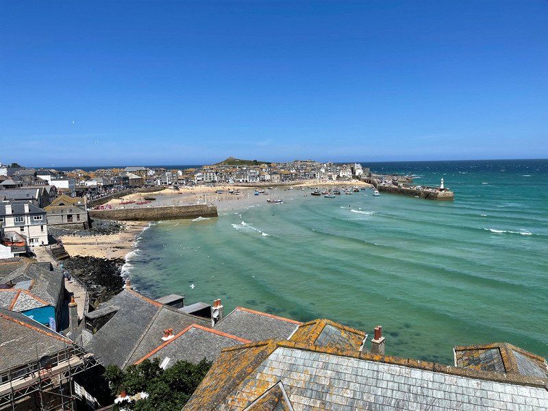
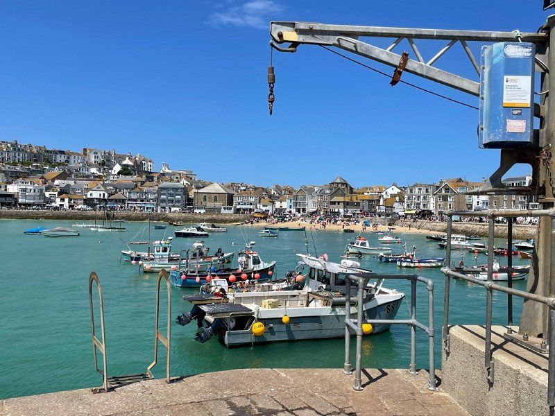
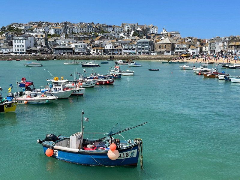
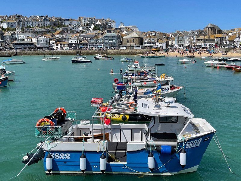
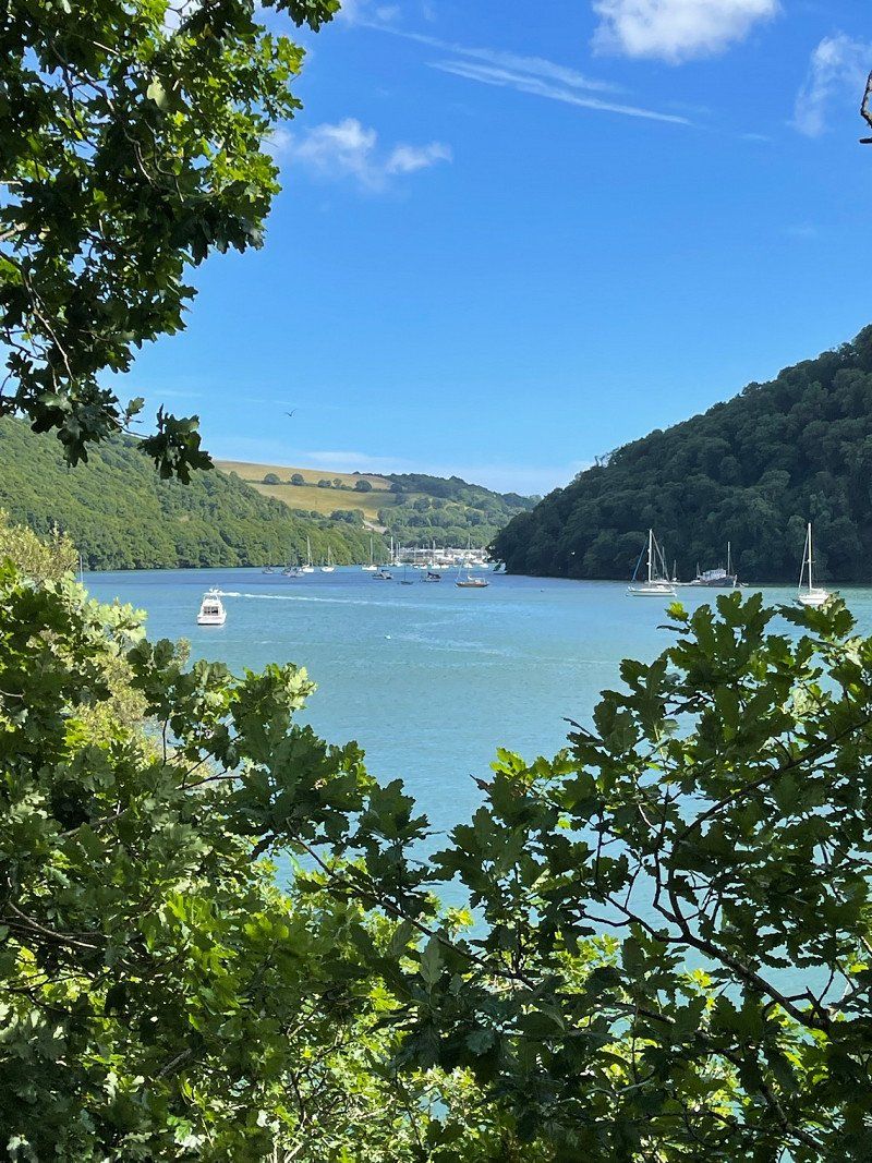
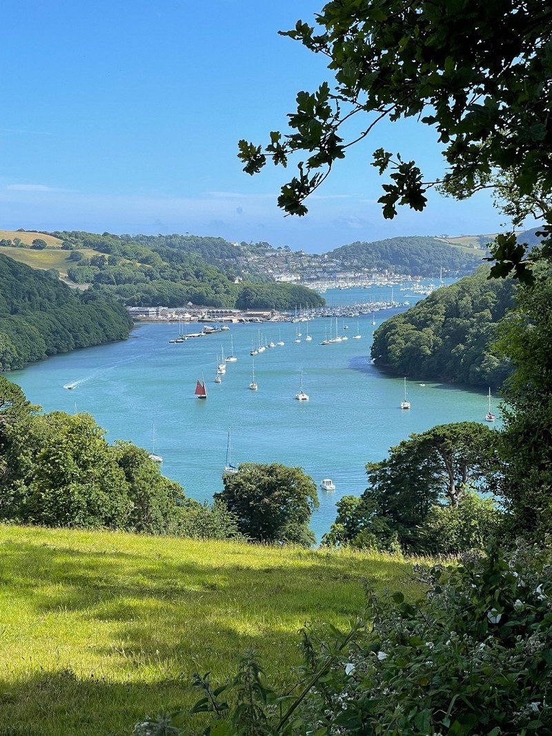
Saint Ives, Vereinigtes Königreich
St Ives, Vereinigtes Königreich
50° 12' 30.2" N 5° 29' 27.2" W
50.2083858 -5.4908864
• Follow the roundabout. Go for 20 m.
• Take the 2nd exit from roundabout onto Higher Stennack (B3306). Go for 724 m.
• Continue on B3306. Go for 128 m.
• Turn right. Go for 154 m.
• Turn right. Go for 57 m.
• Arrive at your destination on the right.
☍
1,1 km
( 1 min.)
Hellesveor Holidays, Saint Ives, Vereinigtes Königreich
Hellesveor Farm, Saint Ives TR26 3AD, Vereinigtes Königreich
50° 12' 28.2" N 5° 30' 2.2" W
50.2078200 -5.5006210
• Head southwest. Go for 57 m.
• Turn left toward B3306. Go for 154 m.
• Turn right onto B3306. Go for 5.9 km.
• Turn right. Go for 250 m.
• Arrive at your destination on the right.
☍
6,3 km
( 8 min.)
Penzance Radtour
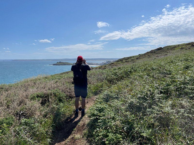
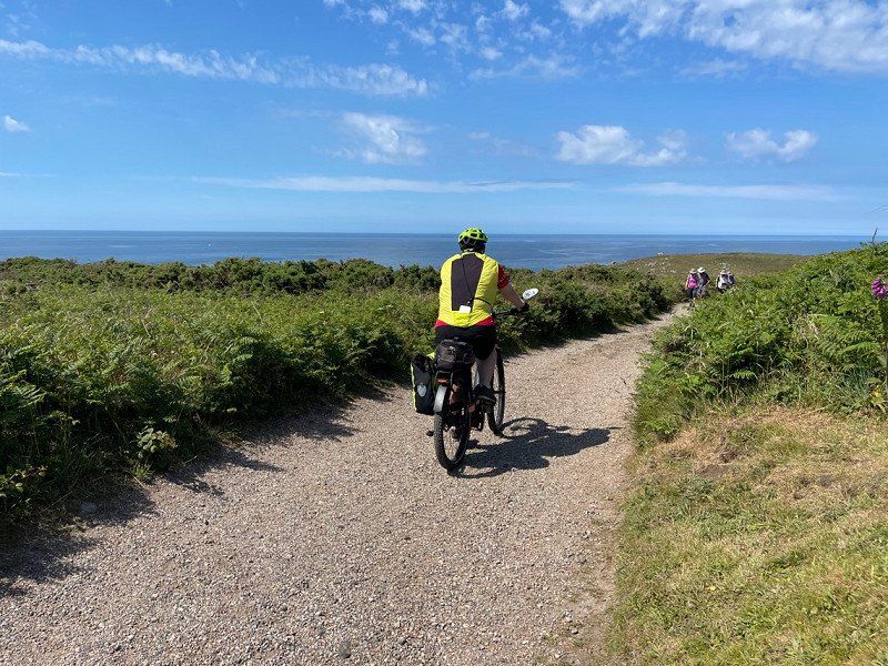
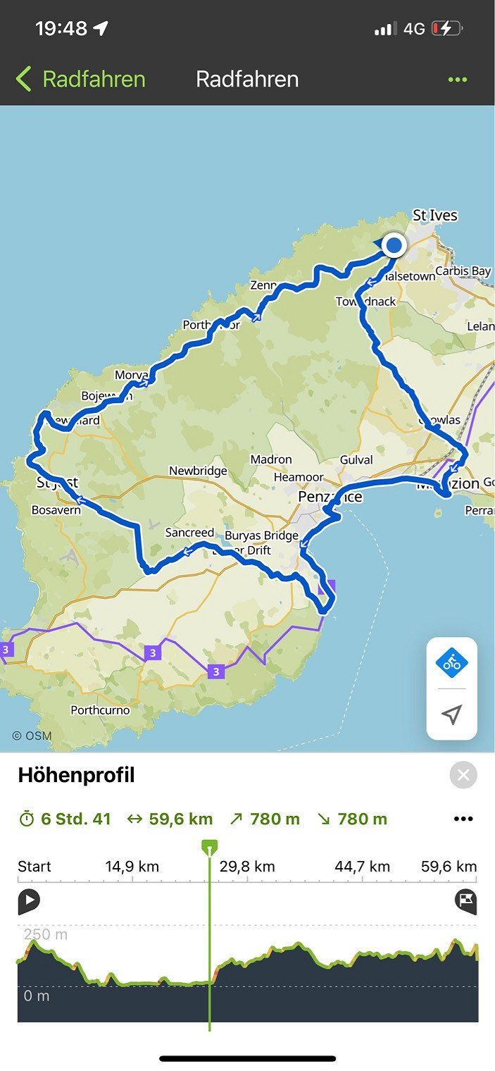
Wonderful but very strenuous bike ride (Komoot). About lonely paths and partly dirt roads. Departing from the campsite to Penzance and Moushole.
Day
Hellesveor Holidays, Saint Ives, Vereinigtes Königreich
Hellesveor Farm, Saint Ives TR26 3AD, Vereinigtes Königreich
50° 12' 28.2" N 5° 30' 2.2" W
50.2078200 -5.5006210
• Head south. Go for 34 m.
• Turn slightly left toward B3306. Go for 216 m.
• Turn left onto B3306. Go for 5.9 km.
• Turn left. Go for 154 m.
• Turn right. Go for 57 m.
• Arrive at your destination on the right.
☍
6,3 km
( 7 min.)
Day
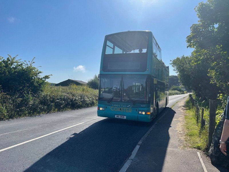
Zennor, Saint Ives, Vereinigtes Königreich
Round trip with the open double decker to Lands End with various stops
Zennor, Saint Ives TR26, Vereinigtes Königreich
50° 11' 30.8" N 5° 34' 3.8" W
50.1919006 -5.5677286
• Head southwest. Go for 57 m.
• Turn left toward B3306. Go for 154 m.
• Turn left onto B3306. Go for 128 m.
• Turn right onto Halsetown Road (B3311). Go for 418 m.
• Continue on B3311. Go for 1.7 km.
• Turn left toward Nance. Go for 1.1 km.
• Continue on Nance. Go for 3.4 km.
• Continue on Mill Hill. Go for 344 m.
• Take the 3rd exit from roundabout onto Nut Lane (A3074). Go for 110 m.
• Take the 2nd exit from roundabout onto Nut Lane (A3074). Go for 319 m.
• Take the 2nd exit from roundabout onto A30 toward Redruth. Go for 4.7 km.
• Take the 1st exit from Loggans Moor roundabout onto Carwin Rise (B3301) toward Hayle. Go for 197 m.
• Take the 2nd exit from roundabout. Go for 32 m.
• Take the 2nd exit from roundabout onto Loggans Road (B3301). Go for 1.2 km.
• Keep left onto B3301. Go for 185 m.
• Continue on Upton Towans (B3301). Go for 216 m.
• Continue on B3301. Go for 901 m.
• Continue on St Ives Lane (B3301). Go for 766 m.
• Continue on Churchtown Road (B3301). Go for 889 m.
• Turn right onto B3301. Go for 1.5 km.
• Turn sharp left. Go for 119 m.
• Arrive at your destination.
☍
18,5 km
( 20 min.)
Hellesveor Holidays, Saint Ives, Vereinigtes Königreich
Hellesveor Farm, Saint Ives TR26 3AD, Vereinigtes Königreich
50° 12' 28.2" N 5° 30' 2.2" W
50.2078200 -5.5006210
• Head east. Go for 119 m.
• Turn sharp right onto B3301. Go for 1.5 km.
• Turn left onto Churchtown Road (B3301). Go for 889 m.
• Continue on St Ives Lane (B3301). Go for 766 m.
• Continue on B3301. Go for 901 m.
• Continue on Upton Towans (B3301). Go for 216 m.
• Continue on B3301. Go for 185 m.
• Continue on Loggans Road (B3301). Go for 1.2 km.
• Take the 2nd exit from roundabout onto Carwin Rise (B3301). Go for 51 m.
• Continue on Penmare Terrace (B3301). Go for 241 m.
• Continue on Hollows Terrace (B3301). Go for 71 m.
• Continue on Madison Terrace (B3301). Go for 56 m.
• Continue on Beatrice Terrace (B3301). Go for 160 m.
• Continue on Copper Terrace (B3301). Go for 137 m.
• Continue on Market Square (B3301). Go for 60 m.
• Continue on Fore Street (B3301). Go for 394 m.
• Continue on Commercial Road (B3301). Go for 300 m.
• Continue on Hayle Terrace (B3301). Go for 377 m.
• Continue on Penpol Terrace (B3301). Go for 501 m.
• Take the 1st exit from roundabout onto Foundry Hill (B3302). Go for 479 m.
• Keep left onto Mellanear Road (B3302). Go for 885 m.
• Continue on Tolroy Road (B3302). Go for 1.7 km.
• Continue on Calais Road (B3302). Go for 1.1 km.
• Continue on Hayle Road (B3302). Go for 431 m.
• Continue on Fraddam Road (B3302). Go for 1.4 km.
• Continue on B3302. Go for 173 m.
• Continue on Square View (B3302). Go for 97 m.
• Continue on Chapel Road (B3302). Go for 247 m.
• Continue on Binnerton Road (B3302). Go for 234 m.
• Continue on B3302. Go for 252 m.
• Continue on Fraddam Road (B3302). Go for 147 m.
• Continue on B3302. Go for 1.4 km.
• Continue on Pengelly Cross (B3302). Go for 193 m.
• Continue on B3302. Go for 5.2 km.
• Turn right onto A394. Go for 1.9 km.
• Turn left onto B3304 toward Porthleven. Go for 785 m.
• Continue on Methleigh Bottoms (B3304). Go for 1.0 km.
• Continue on B3304. Go for 124 m.
• Continue on Fore Street (B3304). Go for 13 m.
• Turn left onto Fore Street (B3304). Go for 12 m.
• Arrive at Fore Street (B3304). Your destination is on the right.
☍
25,9 km
( 30 min.)
Day
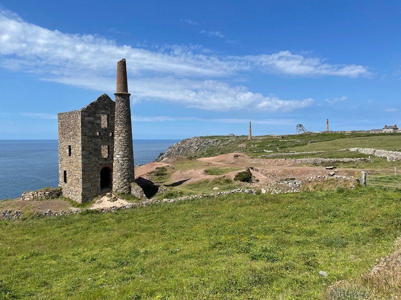
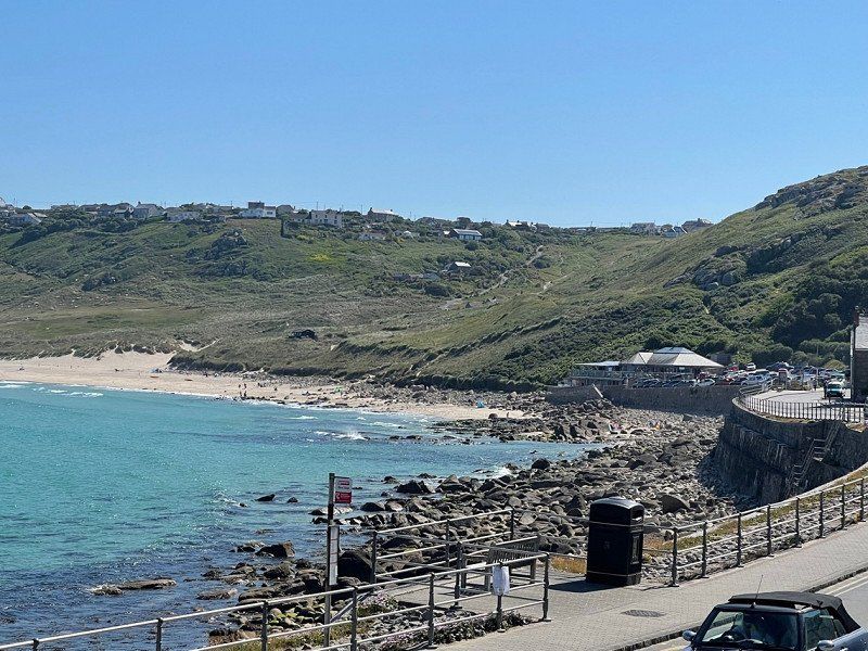
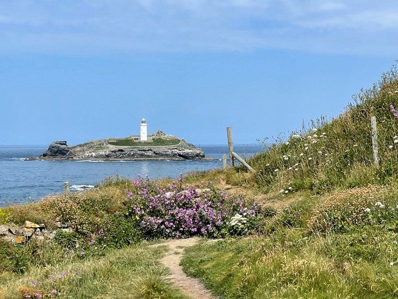
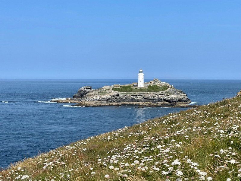
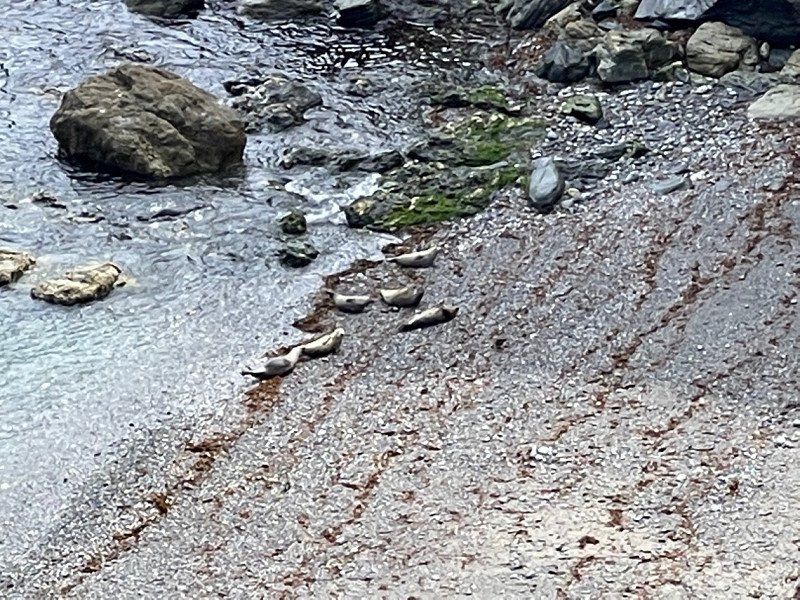
Godrevy Lighthouse, Vereinigtes Königreich
Beautiful place of the NT. Swimming, surfing, hiking and watching seals
TR27 5ED, Vereinigtes Königreich
50° 14' 33" N 5° 24' 0.9" W
50.2424918 -5.4002384
• Head toward Chapel Terrace on Fore Street (B3304). Go for 127 m.
• Continue on Wellington Road (B3304). Go for 602 m.
• Continue on B3304. Go for 194 m.
• Continue on Penrose Hill (B3304). Go for 181 m.
• Turn left onto B3304. Go for 1.3 km.
• Continue on Porthleven Road (B3304). Go for 1.1 km.
• Take the 2nd exit from roundabout onto Penzance Road (A394). Go for 51 m.
• Take the 2nd exit from roundabout onto The Furry (A394) toward Falmouth/Lizard/(A3083)/Redruth/(B3297). Go for 697 m.
• Take the 2nd exit from roundabout onto Meneage Street (A394) toward Falmouth/Redruth/(B3297)/Lizard/(A3083). Go for 704 m.
• Take the 3rd exit from roundabout onto A3083 toward Lizard. Go for 3.5 km.
• Take the 2nd exit from roundabout onto A3083. Go for 3.6 km.
• Keep left onto Bochym Hill (A3083). Go for 1.4 km.
• Continue on A3083. Go for 1.7 km.
• Turn right onto Meaver Road (B3296). Go for 2.0 km.
• Continue on Trewoon Road (B3296). Go for 12 m.
• Continue on Churchtown (B3296). Go for 201 m.
• Continue on Higher Vicarage Lane (B3296). Go for 85 m.
• Turn right onto Nansmellyon Road (B3296). Go for 1.6 km.
• Arrive at Nansmellyon Road (B3296). Your destination is on the right.
☍
19,0 km
( 23 min.)
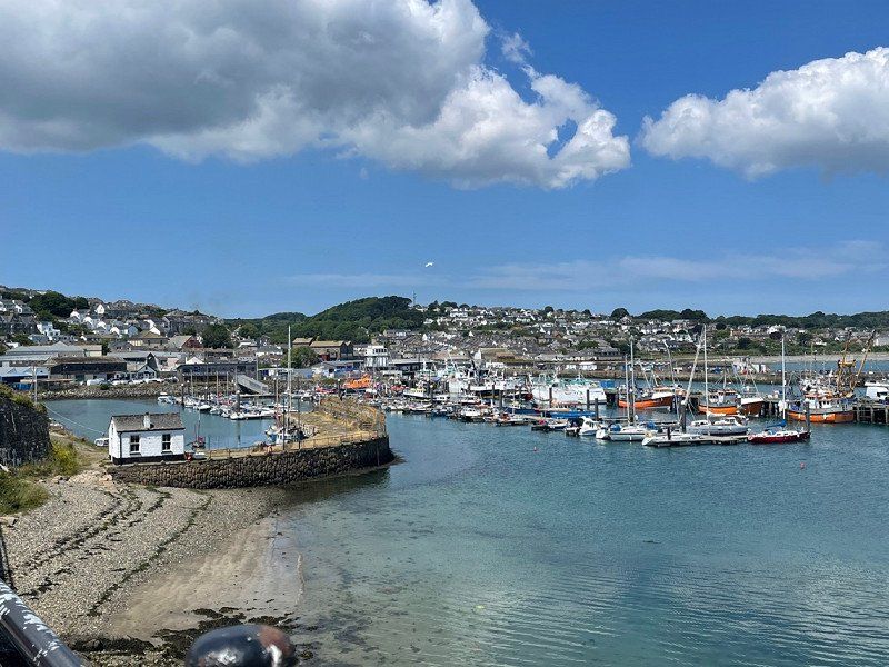
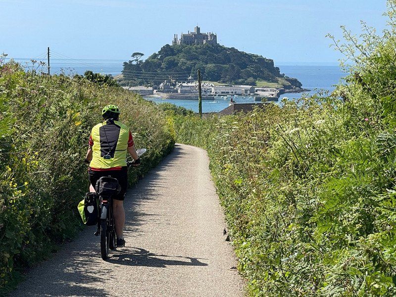
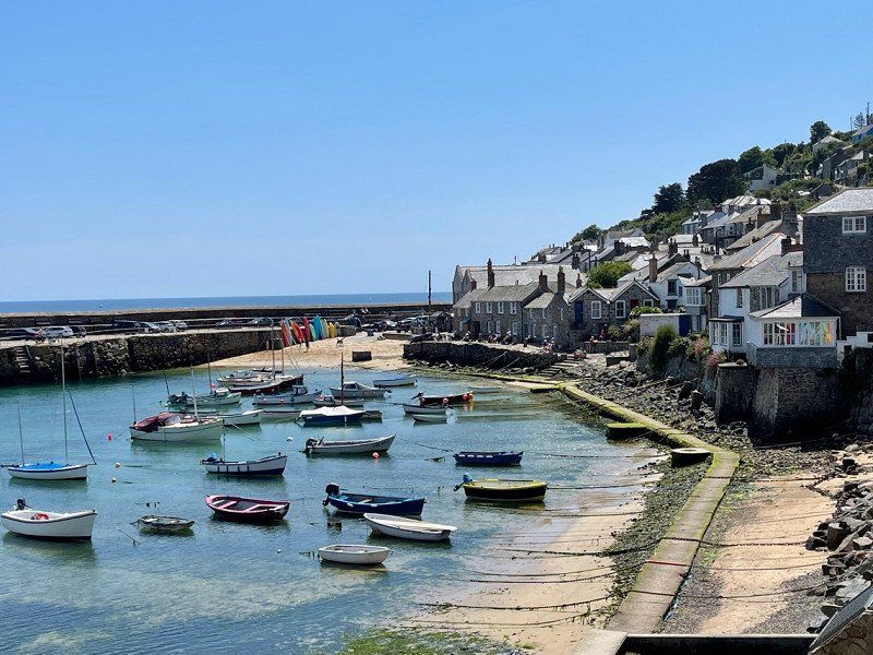
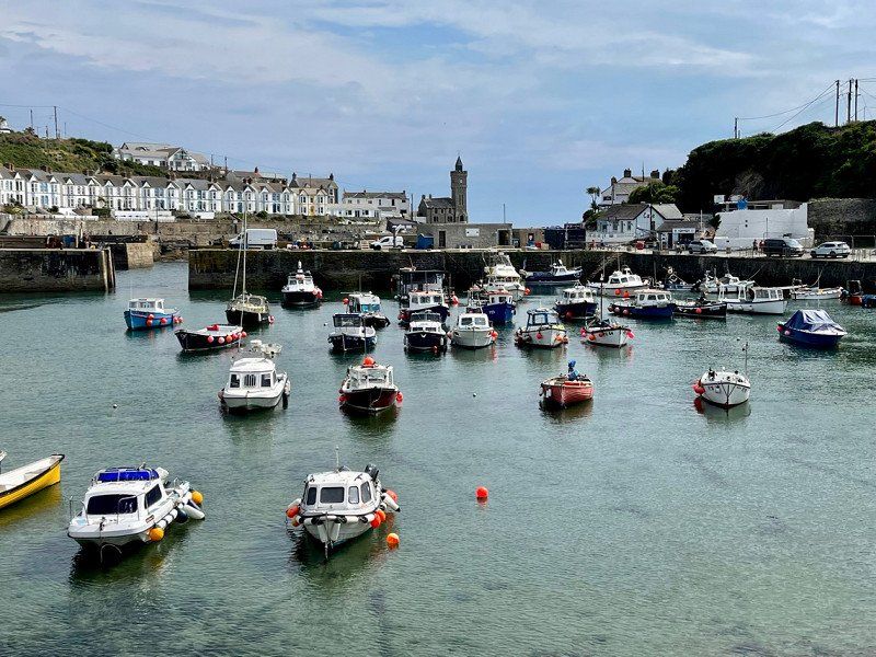
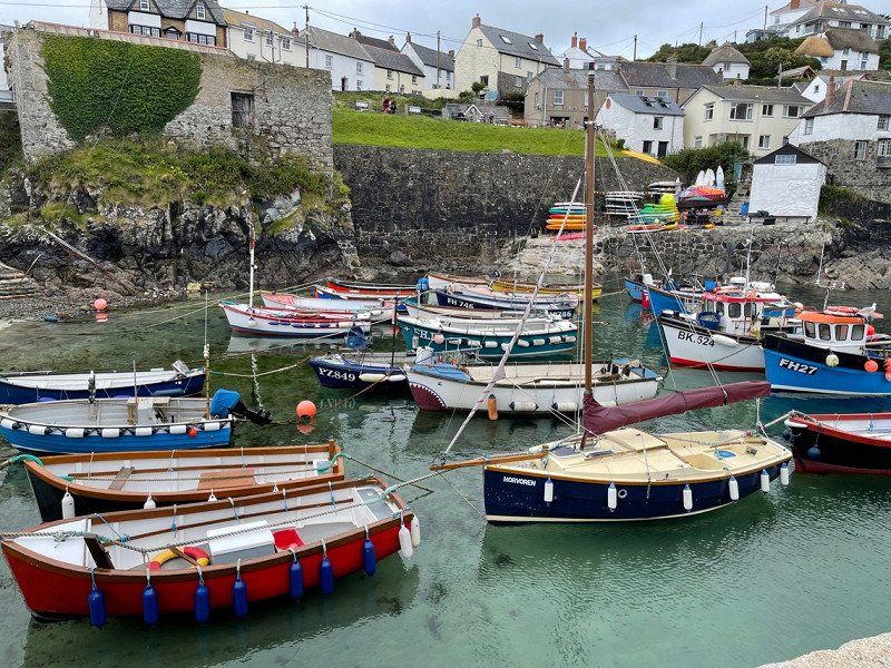
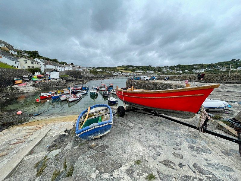
Porthleven, Helston, Vereinigtes Königreich
50° 5' 7.1" N 5° 18' 57.1" W
50.0853050 -5.3158530
• Head toward Mullion Cove on Nansmellyon Road (B3296). Go for 1.6 km.
• Turn left onto Higher Vicarage Lane (B3296). Go for 85 m.
• Continue on Churchtown (B3296). Go for 147 m.
• Turn right onto Lender Lane (B3296). Go for 172 m.
• Turn left onto Trewoon Road (B3296). Go for 12 m.
• Turn right onto Meaver Road (B3296). Go for 2.0 km.
• Turn right onto A3083. Go for 3.3 km.
• Turn left. Go for 1.3 km.
• Turn left toward New Road. Go for 844 m.
• Continue on New Road. Go for 499 m.
• Arrive at New Road. Your destination is on the right.
☍
9,8 km
( 13 min.)
Mullion Cove, Mullion, Helston, Vereinigtes Königreich
Mullion Cove, Mullion, Helston TR12, Vereinigtes Königreich
50° 0' 57.3" N 5° 15' 18" W
50.0159212 -5.2549894
• Head toward Ledra Close on New Road. Go for 499 m.
• Turn right. Go for 2.1 km.
• Turn left toward B3293. Go for 4.6 km.
• Turn right onto B3293. Go for 4.0 km.
• Keep right onto B3294. Go for 2.1 km.
• Continue on The Cove (B3294). Go for 300 m.
• Arrive at your destination.
☍
13,6 km
( 18 min.)
Day
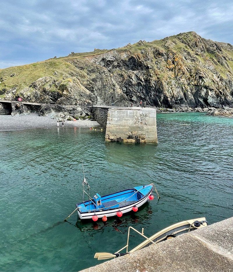
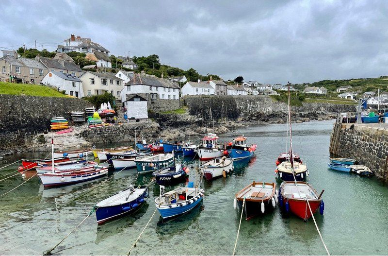
Cadgwith, Helston, Vereinigtes Königreich
Cadgwith, Helston TR12 7JY, Vereinigtes Königreich
49° 59' 16.2" N 5° 10' 54.1" W
49.9878340 -5.1816900
• Head toward School Hill. Go for 8 m.
• Continue on The Cove (B3294). Go for 292 m.
• Turn right onto B3294. Go for 2.1 km.
• Continue on B3293. Go for 8.8 km.
• Continue on St Keverne Road (B3293). Go for 458 m.
• Take the 1st exit from Mawgan Cross roundabout onto Rosevear Hill (B3293). Go for 292 m.
• Continue on B3293. Go for 1.8 km.
• Take the 2nd exit from roundabout onto A3083. Go for 3.5 km.
• Take the 2nd exit from roundabout onto Clodgey Lane (A394) toward Falmouth/Redruth/(B3297). Go for 121 m.
• Take the 1st exit from roundabout onto Clodgey Lane (A394) toward Falmouth/Redruth/(B3297). Go for 735 m.
• Take the 2nd exit from roundabout onto A394 toward Falmouth. Go for 333 m.
• Take the 2nd exit from roundabout onto A394 toward Falmouth. Go for 920 m.
• Take the 3rd exit from roundabout onto A394 toward Falmouth. Go for 12.8 km.
• Take the 2nd exit from Treliever Roundabout roundabout onto A39 toward Penryn/Falmouth. Go for 858 m.
• Take the 3rd exit from Kernick Roundabout roundabout onto Antron Hill. Go for 496 m.
• Turn left onto Church Road. Go for 2.4 km.
• Continue on Penwarne Road. Go for 3.5 km.
• Continue on Sampys Hill. Go for 339 m.
• Turn right onto Grove Hill. Go for 965 m.
• Turn left. Go for 207 m.
• Arrive at your destination on the left.
☍
40,9 km
( 47 min.)
Coverack Cove, Vereinigtes Königreich
50° 1' 29.3" N 5° 5' 37.6" W
50.0248110 -5.0937822
• Head northeast. Go for 207 m.
• Turn right toward Grove Hill. Go for 153 m.
• Continue on Grove Hill. Go for 812 m.
• Turn left onto Sampys Hill. Go for 339 m.
• Continue on Penwarne Road. Go for 5.2 km.
• Turn right onto Church Road. Go for 687 m.
• Turn right onto Antron Hill. Go for 450 m.
• Take the 1st exit from Kernick Roundabout roundabout onto A39. Go for 835 m.
• Take the 3rd exit from Treliever Roundabout roundabout onto Treliever Roundabout (A39). Go for 98 m.
• Pass 6 roundabouts and continue on A39. Go for 11.6 km.
• Take the 2nd exit from roundabout onto Morlaix Avenue (A39) toward St Austell/(A390)/Bodmin/(A30). Go for 1.1 km.
• Pass 2 roundabouts and continue on Tregolls Road (A39). Go for 1.8 km.
• Turn left onto Newquay Road (A39) toward Bodmin/Newquay. Go for 815 m.
• Take the 2nd exit from roundabout onto A39 toward Bodmin/Newquay. Go for 8.2 km.
• Take the 2nd exit from Carland Cross roundabout onto A39. Go for 237 m.
• Take the 3rd exit from roundabout onto A30 toward Bodmin/Newquay/(A3076)/Mitchell/Summercourt. Go for 28.6 km.
• Take ramp toward Plymouth/Liskeard. Go for 444 m.
• Take the 3rd exit from roundabout onto A38 toward Plymouth/Liskeard. Go for 654 m.
• Pass 3 roundabouts and continue on A38. Go for 36.4 km.
• Turn right onto B3271 toward Latchbrook. Go for 177 m.
• Continue on Liskeard Road (B3271). Go for 189 m.
• Pass 2 roundabouts. Go for 510 m.
• Take the 1st exit from roundabout onto Liskeard Road (B3271). Go for 269 m.
• Continue on New Road (B3271). Go for 1.3 km.
• Continue on North Road (B3271). Go for 457 m.
• Take ramp. Go for 891 m.
• Continue on A38. Go for 36 m.
• Take the 1st exit from roundabout onto The Parkway (A38) toward Exeter/Plymouth/(A3064)/City Centre/Tavistock/(A386). Go for 8.1 km.
• Take ramp onto The Parkway toward City Centre. Go for 461 m.
• Turn left onto Plymouth Road (B3416). Go for 465 m.
• Turn left onto Coypool Road. Go for 151 m.
• Turn slightly left onto Coypool Road. Go for 42 m.
• Turn left. Go for 20 m.
• Turn right. Go for 31 m.
• Arrive at your destination on the left.
☍
111,8 km
(1 hrs. 42 min.)
Glendurgan Gardens, Falmouth, Vereinigtes Königreich
Beautiful gardens of the NT for a walk to the sea. I wouldn't make an extra drive if I wasn't around. Right next door, there is also a very beautiful garden to visit.
Falmouth TR11 5JS, Vereinigtes Königreich
50° 6' 32.8" N 5° 7' 1.4" W
50.1091094 -5.1170584
• Head northwest. Go for 30 m.
• Turn right toward Coypool Road. Go for 27 m.
• Turn right onto Coypool Road. Go for 253 m.
• Turn left onto Plymouth Road (B3416). Go for 640 m.
• Turn right onto Cot Hill. Go for 667 m.
• Take the 2nd exit from roundabout onto Merafield Road. Go for 276 m.
• Turn right. Go for 602 m.
• Turn right. Go for 53 m.
• Turn left. Go for 24 m.
• Arrive at your destination on the right.
☍
2,6 km
( 7 min.)
Coypool Park and Ride, Coypool Road, Plymouth, Vereinigtes Königreich
8 free places
Coypool Rd, Plymouth PL7 4TB, Vereinigtes Königreich
50° 23' 37.3" N 4° 4' 56.9" W
50.3936915 -4.0824839
• Head southeast. Go for 96 m.
• Turn sharp left toward Merafield Road. Go for 733 m.
• Turn left onto Merafield Road. Go for 245 m.
• Take the 1st exit from roundabout onto Cot Hill. Go for 635 m.
• Turn left onto Plymouth Road (B3416). Go for 952 m.
• Take the 3rd exit from roundabout onto The Parkway. Go for 979 m.
• Keep right onto The Parkway. Go for 23 m.
• Take the 4th exit from roundabout onto Forder Valley Road (A3822). Go for 1.4 km.
• Turn right onto Novorossiysk Road (B3432). Go for 1.9 km.
• Pass 2 roundabouts and continue on Morgan Road (B3432). Go for 2.0 km.
• Continue toward Morgan Road/B3432. Go for 65 m.
• Turn right onto Tavistock Road (A386). Go for 710 m.
• Turn left onto Tavistock Road (A386). Go for 1.0 km.
• Take the 2nd exit from Belliver roundabout onto A386 toward Tavistock/Hursley Business Park. Go for 1.8 km.
• Turn left toward Milton Combe/Lopwell/Maristow. Go for 2.3 km.
• Turn left toward Blowiscombe Cross. Go for 330 m.
• Continue on Blowiscombe Cross. Go for 686 m.
• Continue on Abbey Cross. Go for 17 m.
• Turn right onto Abbey Cross. Go for 16 m.
• Turn left onto Abbey Cross. Go for 366 m.
• Arrive at your destination on the right.
☍
16,3 km
( 24 min.)
Day
Saltram House, Plympton, Plymouth, Vereinigtes Königreich
Worth seeing house of the NT
Saltram, Plympton, Plymouth PL7 1UH, Vereinigtes Königreich
50° 22' 52.1" N 4° 4' 51.8" W
50.3811288 -4.0810540
• Head east. Go for 357 m.
• Continue on Abbey Cross. Go for 9 m.
• Turn right onto Abbey Cross. Go for 16 m.
• Turn left onto Abbey Cross. Go for 670 m.
• Continue on Blowiscombe Cross. Go for 833 m.
• Turn slightly left onto Sowton Road. Go for 1.1 km.
• Turn right onto A386. Go for 3.1 km.
• Take the 1st exit from Belliver roundabout onto Tavistock Road (A386) toward Plymouth. Go for 998 m.
• Take the 2nd exit from Woolwell roundabout onto Tavistock Road (A386) toward City Centre. Go for 711 m.
• Keep right onto Tavistock Road (A386). Go for 1.3 km.
• Continue on Derriford. Go for 127 m.
• Keep left onto Tavistock Road (A386) toward City centre/Liskeard/(A38)/Exeter. Go for 1.8 km.
• Take ramp toward Exeter/Liskeard/Mutley. Go for 303 m.
• Take the 1st exit from roundabout onto The Parkway (A38) toward Exeter. Go for 27.1 km.
• Take ramp toward Paignton/Dartington/Totnes/Dartmouth. Go for 289 m.
• Take the 1st exit from Marley Head roundabout onto Marley Head (A385) toward Paignton/Dartington/Totnes/Dartmouth. Go for 302 m.
• Pass 2 roundabouts and continue on A385. Go for 7.2 km.
• Take the 1st exit from roundabout onto A384 toward Ashburton/Buckfastleigh. Go for 185 m.
• Take the 2nd exit from roundabout onto A384. Go for 365 m.
• Turn right. Go for 1.6 km.
• Arrive at your destination on the left.
☍
48,4 km
( 43 min.)
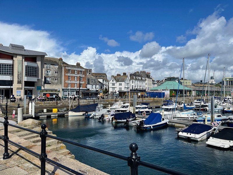
Plymouth, Vereinigtes Königreich
Signposted 27 bike ride into town signposted from car park.
0° 0' 0" N 0° 0' 0" E
0.0000000 0.0000000
• Head toward Park Road. Go for 1.5 km.
• Continue on Dartington Lane. Go for 250 m.
• Turn left onto Ashburton Road (A385). Go for 999 m.
• Take the 2nd exit from roundabout onto A381 toward Paignton/A385/N. Abbot/(A381). Go for 446 m.
• Take the 2nd exit from roundabout onto Newton Road (A385) toward Paignton. Go for 7.1 km.
• Turn right onto Brixham Road (A3022) toward Brixham/Broadsands. Go for 2.6 km.
• Take the 1st exit from roundabout onto Brixham Road (A3022) toward Brixham. Go for 871 m.
• Continue toward Dartmouth Road/A3022. Go for 26 m.
• Turn right onto Dartmouth Road (A3022) toward Paignton/Torquay/A379. Go for 529 m.
• Turn right onto Manor Vale Road. Go for 409 m.
• Continue on Greenway Road. Go for 51 m.
• Turn left onto Greenway Road. Go for 527 m.
• Continue on Greenway Road. Go for 196 m.
• Turn slightly left onto Greenway Road. Go for 653 m.
• Turn slightly right onto Greenway Road. Go for 882 m.
• Turn left. Go for 354 m.
• Turn left. Go for 46 m.
• Arrive at your destination on the right.
☍
17,4 km
( 27 min.)
Buckland Abbey, Yelverton, Vereinigtes Königreich
NT House by Francis Drake is worth checking out.
Buckland Abbey, Yelverton PL20 6EU, Vereinigtes Königreich
50° 29' 0.3" N 4° 7' 49.9" W
50.4834090 -4.1305180
• Head north. Go for 46 m.
• Turn right toward Greenway Road. Go for 354 m.
• Turn right onto Greenway Road. Go for 2.3 km.
• Continue on Manor Vale Road. Go for 409 m.
• Turn left onto Dartmouth Road (A3022). Go for 481 m.
• Keep left onto Brixham Road (A3022) toward Torquay/Exeter/(A380)/Totnes/(A385). Go for 911 m.
• Take the 3rd exit from roundabout onto Brixham Road (A3022) toward Ring Road/Totnes/(A385). Go for 2.7 km.
• Continue on Kings Ash Road (A380) toward Exeter/(A380)/Torquay/Newton Abbot/Teignmouth. Go for 2.7 km.
• Pass 3 roundabouts and continue on Hamelin Way (A380). Go for 4.3 km.
• Keep left onto South Devon Link Road (A380) toward Exeter/Newton Abbot. Go for 4.7 km.
• Keep right onto South Devon Link Road (A380) toward Exeter/Ashburton/(A383)/Bovey Tracey/(A382)/Teignmouth/(A381)/Shaldon. Go for 17.2 km.
• Take right ramp onto A38 toward Exeter. Go for 3.1 km.
• Keep right onto M5 toward Taunton/Honiton/Barnstaple. Go for 7.6 km.
• Take exit 29 toward Exeter Airport onto A30 (Honiton Road). Go for 1.0 km.
• Keep right onto Honiton Road (A30) toward Honiton/Exeter Airport/Cranbrook/(B3174). Go for 30.8 km.
• Keep left onto A303 toward London/Yeovil/Ilminster. Go for 16.2 km.
• Take the 3rd exit from Southfields Roundabout roundabout onto A303 toward London/Ilchester/Yeovil/(A3088)/Weymouth/(A37). Go for 10.4 km.
• Take the 2nd exit from roundabout onto A303 toward Ilchester/Crewkerne/(A356). Go for 5.2 km.
• Take the 3rd exit from Cartgate Roundabout roundabout onto A3088 toward Yeovil/Weymouth/(A37)/Dorchester. Go for 1.9 km.
• Turn right toward Montacute Road. Go for 631 m.
• Turn left onto Montacute Road. Go for 347 m.
• Turn slightly right onto Montacute Road. Go for 175 m.
• Turn slightly right onto Bishopston. Go for 169 m.
• Turn slightly left onto Middle Street. Go for 155 m.
• Turn left. Go for 68 m.
• Turn slightly right. Go for 20 m.
• Turn slightly left. Go for 95 m.
• Arrive at your destination on the left.
☍
114,0 km
(1 hrs. 30 min.)
Dartington Hall, Totnes, Vereinigtes Königreich
Campsite on a large meadow with deer park and grade 2 garden for viewing.
Dartington Hall, Totnes TQ9, Vereinigtes Königreich
50° 27' 9.5" N 3° 41' 36.9" W
50.4526394 -3.6935807
• Head south. Go for 185 m.
• Turn right onto Middle Street. Go for 155 m.
• Turn slightly right onto Bishopston. Go for 169 m.
• Turn slightly left onto Montacute Road. Go for 175 m.
• Turn slightly left onto Montacute Road. Go for 347 m.
• Turn right toward A3088. Go for 631 m.
• Turn left onto A3088. Go for 1.7 km.
• Take the 3rd exit from Cartgate Roundabout roundabout onto A303 toward London/Wincanton/Bristol/(A37)/Ilchester. Go for 8.6 km.
• Take the 1st exit from Podimore Roundabout roundabout onto A372 toward Langport. Go for 2.0 km.
• Turn right onto B3151. Go for 425 m.
• Continue on Rocky Hill (B3151). Go for 1.1 km.
• Continue on B3151. Go for 2.7 km.
• Continue on Lodge Hill (B3151). Go for 208 m.
• Continue on B3151. Go for 272 m.
• Continue on Littleton Hill (B3151). Go for 1.6 km.
• Continue on B3151. Go for 2.4 km.
• Continue on Castlebrook (B3151). Go for 189 m.
• Continue on B3151. Go for 272 m.
• Continue on Main Road (B3151). Go for 1.5 km.
• Continue on Marshall's Elm (B3151). Go for 125 m.
• Continue on Ivythorn Hill (B3151). Go for 364 m.
• Turn right onto Somerton Road (B3151). Go for 2.3 km.
• Take the 2nd exit from roundabout onto Glaston Road (B3151). Go for 335 m.
• Take the 2nd exit from Street Roundabout roundabout onto The Causeway (A39). Go for 1.3 km.
• Take the 3rd exit from Wirrall Park Roundabout roundabout onto Street Road (A361) toward Town Centre/Shepton Mallet/Frome. Go for 893 m.
• Take the 2nd exit from roundabout onto Fishers Hill (A361) toward Shepton Mallet/Frome. Go for 635 m.
• Take the 2nd exit from roundabout onto Chilkwell Street (A361) toward Shepton Mallet/Frome. Go for 357 m.
• Turn left onto Wellhouse Lane. Go for 658 m.
• Turn slightly right onto Stone Down Lane. Go for 203 m.
• Arrive at Stone Down Lane.
☍
31,8 km
( 34 min.)
Day
Dartington Hall, Totnes, Vereinigtes Königreich
Walk in the beautiful park with deer and along the River Dart.
Dartington Hall, Totnes TQ9, Vereinigtes Königreich
50° 27' 9.5" N 3° 41' 36.9" W
50.4526394 -3.6935807
• Head west on Stone Down Lane. Go for 203 m.
• Turn slightly left onto Wellhouse Lane. Go for 658 m.
• Turn right onto Chilkwell Street (A361). Go for 326 m.
• Take the 2nd exit from roundabout onto Chilkwell Street. Go for 358 m.
• Continue on Lambrook Street. Go for 106 m.
• Continue on Wells Road. Go for 2.1 km.
• Take the 2nd exit from roundabout onto Wells Road (A39). Go for 6.1 km.
• Take the 1st exit from Strawberry Way Roundabout roundabout onto Strawberry Way (A39). Go for 697 m.
• Turn right onto Portway (A39). Go for 794 m.
• Turn right onto New Street (B3139). Go for 188 m.
• Take the 1st exit from roundabout onto The Liberty (B3139). Go for 273 m.
• Turn right onto East Liberty (B3139). Go for 141 m.
• Turn right onto St Andrews Street. Go for 89 m.
• Continue on Cathedral Green. Go for 13 m.
• Arrive at Cathedral Green. Your destination is on the left.
☍
12,1 km
( 18 min.)
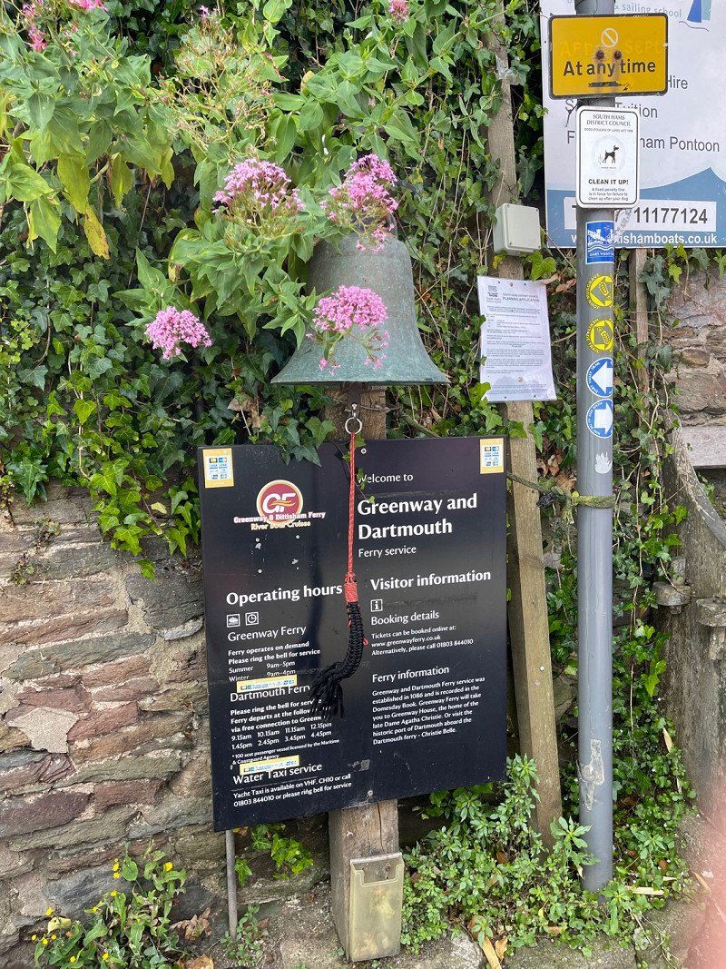
Greenway House, Kingswear, Brixham, Vereinigtes Königreich
Agatha Christie's home, furnished as it was when she was alive. Very interesting!
Greenway House, Kingswear, Brixham TQ5 0ES, Vereinigtes Königreich
50° 22' 56.8" N 3° 35' 19.2" W
50.3824450 -3.5886670
• Head toward East Liberty on Cathedral Green. Go for 13 m.
• Continue on St Andrews Street. Go for 89 m.
• Turn right onto St Andrews Street (B3139). Go for 54 m.
• Turn right onto Tor Street (B3139). Go for 229 m.
• Continue on B3139. Go for 1.4 km.
• Continue on Highfield (B3139). Go for 124 m.
• Continue on B3139. Go for 104 m.
• Continue toward Constitution Hill/B3139. Go for 28 m.
• Continue on B3139. Go for 379 m.
• Turn left onto A371. Go for 5.6 km.
• Take the 2nd exit from roundabout onto Commercial Road (A361). Go for 13.5 km.
• Take the 3rd exit from Nunney Catch Roundabout roundabout onto A361 toward Trowbridge/Frome. Go for 3.0 km.
• Take the 2nd exit from Marston Roundabout roundabout onto A361 toward Trowbridge/Bath/(A36)/Warminster/(A362). Go for 1.8 km.
• Take the 3rd exit from Blatchbridge Roundabout roundabout onto B3092 toward Maiden Bradley. Go for 3.9 km.
• Continue on Frome Road (B3092). Go for 3.6 km.
• Continue on Church Street (B3092). Go for 463 m.
• Continue on B3092. Go for 5.5 km.
• Turn right onto High Street. Go for 488 m.
• Arrive at High Street. Your destination is on the right.
☍
40,4 km
( 40 min.)
Day
Dartington Hall
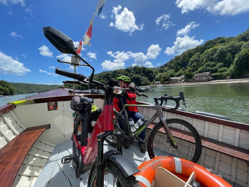
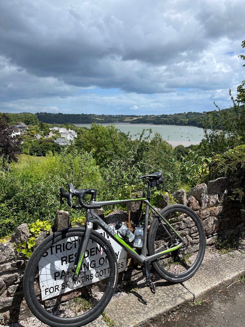
After another night in Dartington, we went for a bike ride around the village of Totnes today. The landscape around the river there is incredibly beautiful. For cycling, however, very very exhausting. Tours are available for download on komoot and I highly recommend it! It is best to choose a bike tour that includes the bell ferry to Greenway.
Day
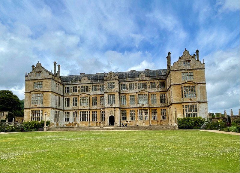
Montacute House, Montacute, Vereinigtes Königreich
Incredibly interesting NT Tudor house.
House, Montacute TA15 6XP, Vereinigtes Königreich
50° 57' 6.5" N 2° 42' 49.5" W
50.9518069 -2.7137594
• Head northeast on High Street. Go for 488 m.
• Turn right onto B3092. Go for 1.1 km.
• Continue on Crab Lane (B3092). Go for 1.0 km.
• Continue on B3092. Go for 1.1 km.
• Turn right onto B3092. Go for 1.2 km.
• Continue on Mapperton Hill (B3092). Go for 1.6 km.
• Continue on B3092. Go for 1.9 km.
• Take the 2nd exit from roundabout onto B3092. Go for 316 m.
• Continue on Canada Gardens (B3092). Go for 116 m.
• Continue on Lidford Flats (B3092). Go for 63 m.
• Continue on Peacemarsh (B3092). Go for 102 m.
• Continue on B3092. Go for 159 m.
• Continue on Great House Walk (B3092). Go for 52 m.
• Take the 2nd exit from roundabout onto Le Neubourg Way (B3092). Go for 1.3 km.
• Take the 2nd exit from roundabout onto Newbury (B3081). Go for 319 m.
• Continue on Shaftesbury Road (B3081). Go for 849 m.
• Take the 3rd exit from roundabout onto Shaftesbury Road (B3081). Go for 421 m.
• Continue on B3081. Go for 2.3 km.
• Continue on Shaftesbury Road (B3081). Go for 759 m.
• Continue on B3081. Go for 1.0 km.
• Turn right onto Woolands Lane. Go for 198 m.
• Turn right onto New Road. Go for 98 m.
• Turn left onto A30. Go for 842 m.
• Take the 3rd exit from Ivy Cross Roundabout roundabout onto Little Content Lane (A30) toward Poole/Blandford/Fontmell Magna/A350/Salisbury. Go for 629 m.
• Take the 2nd exit from roundabout onto Christys Lane (A30). Go for 516 m.
• Take the 3rd exit from Royal Chase Roundabout roundabout onto A350 toward Poole/Blandford. Go for 18.6 km.
• Take the 2nd exit from roundabout onto A350. Go for 812 m.
• Take the 2nd exit from roundabout onto A354 toward Dorchester/Poole/(A350)/Wimborne/(B3082)/Blandford Camp. Go for 1.4 km.
• Take the 1st exit from roundabout onto Wimborne Road (B3082) toward Wimborne. Go for 7.0 km.
• Continue on Blandford Road (B3082). Go for 2.8 km.
• Turn right. Go for 961 m.
• Arrive at your destination on the right.
☍
50,2 km
( 54 min.)
Glastonbury Tor, Glastonbury, Vereinigtes Königreich
Very worth seeing Old ruins of an abbey, the tomb of King Arthur, and an esoteric scene that is rarely found. Totally fun shops...
Glastonbury Tor, Glastonbury BA6 8BJ, Vereinigtes Königreich
51° 8' 40" N 2° 41' 55" W
51.1444440 -2.6986110
• Head east. Go for 532 m.
• Turn left toward Blandford Road/B3082. Go for 337 m.
• Turn right onto Blandford Road (B3082). Go for 2.0 km.
• Continue on St Margarets Hill (B3082). Go for 98 m.
• Continue on Victoria Road (B3082). Go for 395 m.
• Take the 2nd exit from roundabout onto Julians Road (B3078). Go for 187 m.
• Continue on B3078. Go for 1.2 km.
• Take the 1st exit from Lake Gates roundabout onto A31. Go for 2.0 km.
• Take the 1st exit from Merley Roundabout roundabout onto A31 toward Ringwood. Go for 6.3 km.
• Pass 5 roundabouts and continue on Ringwood Road (A31). Go for 9.2 km.
• Keep right onto A31 toward Southampton/(M27)/London/Winchester/(M3). Go for 17.1 km.
• Keep right onto M27 toward London/Southampton/Winchester. Go for 45.4 km.
• Continue on A27. Go for 3.7 km.
• Keep right onto A27 toward Brighton/Chichester/Havant/Hayling Island. Go for 17.0 km.
• Take the 1st exit from Fishbourne Roundabout roundabout onto Cathedral Way (A259) toward Chichester/Midhurst/(A286). Go for 461 m.
• Take the 3rd exit from Westgate Link Roundabout roundabout onto Via Ravenna (A259) toward Chichester/Midhurst/(A286). Go for 660 m.
• Take the 2nd exit from Via Ravenna Roundabout roundabout onto Via Ravenna (A259) toward Midhurst/(A286). Go for 219 m.
• Take the 2nd exit from Avenue de Chartres Roundabout roundabout onto Avenue de Chartres (A286) toward Ring Road/Witterings/Bognor Regis. Go for 314 m.
• Turn left onto Southgate (A286). Go for 24 m.
• Keep right onto Market Avenue (A286). Go for 68 m.
• Keep left onto Market Avenue (A286) toward Ring Road/Eastgate/Worthing/(A27)/Bognor Regis/(A259). Go for 589 m.
• Turn left onto Eastgate Square. Go for 22 m.
• Continue on East Street. Go for 29 m.
• Turn right onto East Walls. Go for 85 m.
• Turn left onto Shippam Street. Go for 43 m.
• Turn right onto Shippam Street. Go for 73 m.
• Arrive at Shippam Street. Your destination is on the left.
☍
108,1 km
(1 hrs. 13 min.)
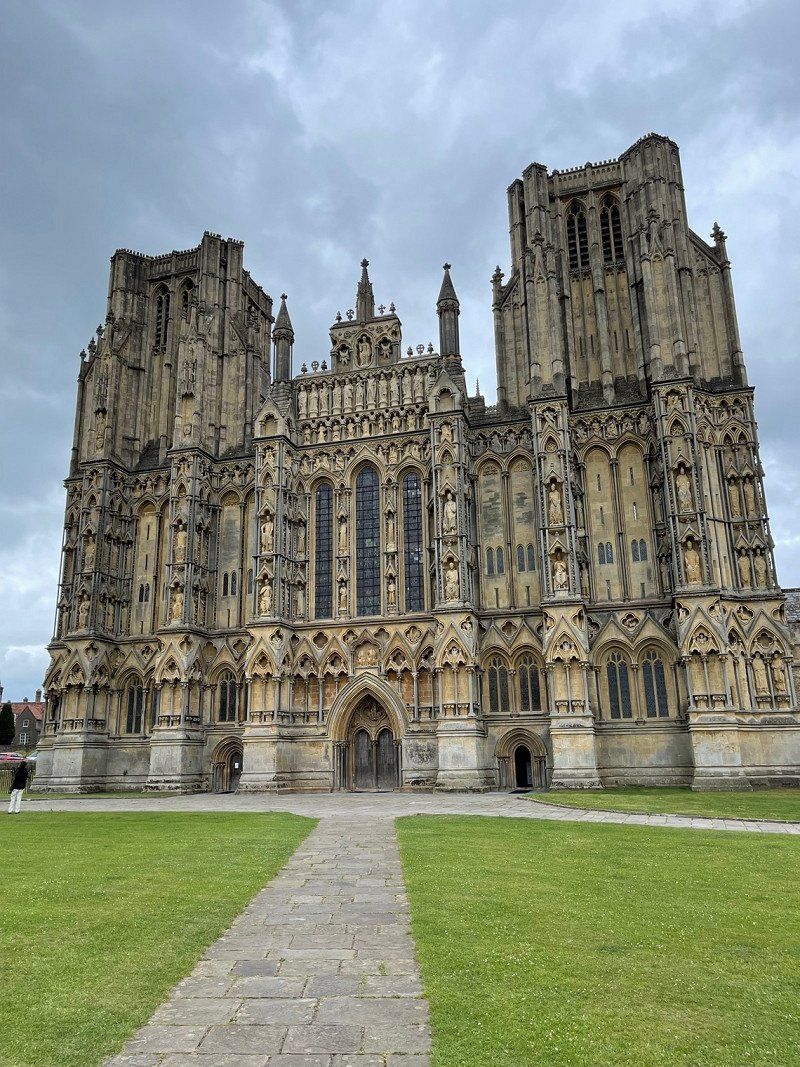
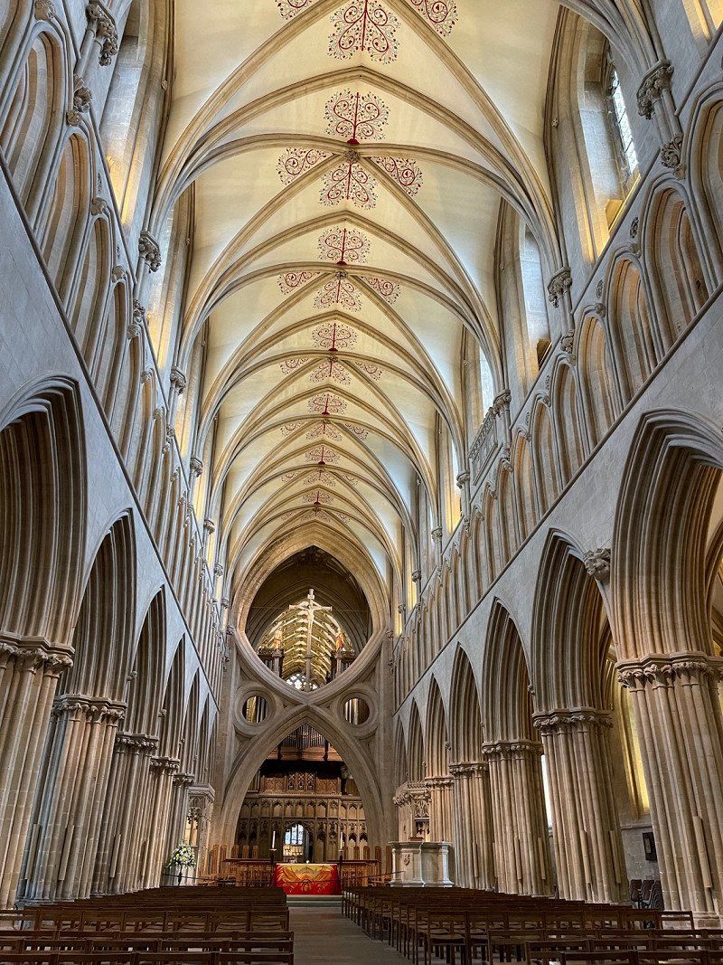
Wells Cathedral, Cathedral Green, Wells, Vereinigtes Königreich
Impressive cathedral. At 5:00 p.m. there will be evening prayer with the choir. Very beautiful!
Cathedral Grn, Wells BA5 2UE, Vereinigtes Königreich
51° 12' 37.6" N 2° 38' 36.3" W
51.2104476 -2.6434089
• Head north on Shippam Street.
• Turn right onto East Row. Go for 32 m.
• Turn left onto East Walls. Go for 83 m.
• Turn right onto Priory Road. Go for 96 m.
• Turn right onto New Park Road (A286). Go for 169 m.
• Turn left onto St Pancras (A286) toward Worthing/A285/(A27). Go for 34 m.
• Keep right onto Needlemakers (A286) toward Ring Road/Southgate/Witterings/Bognor Regis/(A259)/Selsey/(B2145). Go for 94 m.
• Keep right onto The Hornet (A286) toward Ring Road/Soutgate/Witterings/Portsmouth/(A27). Go for 162 m.
• Keep left onto Market Road (A286) toward Southgate/Witterings/Portsmouth/(A27). Go for 107 m.
• Turn left. Go for 54 m.
• Arrive at your destination.
☍
0,8 km
( 2 min.)
Stourhead House The National Trust, High Street, Stourton, Warminster, Vereinigtes Königreich
Approached again because the place to sleep is so wonderful.
Stourhead House The National Trust, High St, Stourton, Warminster BA12 6QE, Vereinigtes Königreich
51° 6' 20" N 2° 19' 8.4" W
51.1055486 -2.3189869
• Head toward Market Road. Go for 54 m.
• Turn right onto Market Road (A286). Go for 293 m.
• Keep left onto St Pancras (A285) toward Worthing/(A27). Go for 600 m.
• Pass 3 roundabouts and continue on Westhampnett Road (A285). Go for 577 m.
• Take the 3rd exit from roundabout onto Portfield Way (A285) toward Worthing/Bognor Regis/(A27). Go for 293 m.
• Take the 2nd exit from Portfield Roundabout roundabout onto A27 toward Fontwell. Go for 3.5 km.
• Take the 2nd exit from roundabout onto A27 toward Arundel/Footwell/Brighton/Worthing/London/(A29). Go for 4.4 km.
• Take the 1st exit from roundabout onto A27 toward Arundel/Yapton. Go for 677 m.
• Take the 2nd exit from roundabout onto Arundel Road (A27) toward Worthing/Brighton. Go for 6.0 km.
• Take the 3rd exit from roundabout onto Arundel By Pass (A27) toward Worthing/Brighton/Littlehampton/(A284). Go for 1.0 km.
• Take the 2nd exit from roundabout onto The Causeway (A27) toward Warningcamp/Burpham. Go for 1.1 km.
• Pass 2 roundabouts and continue on Warren Road (A27). Go for 11.8 km.
• Take the 3rd exit from Grove Lodge Roundabout roundabout onto Upper Brighton Road (A27) toward Brighton. Go for 4.6 km.
• Pass 2 roundabouts and continue on Old Shoreham Road (A27). Go for 4.5 km.
• Keep right onto A27 toward Brighton/Lewes/Shoreham Harbour/(A293). Go for 7.9 km.
• Keep right onto A27 toward Lewes/Brighton/(A23). Go for 2.6 km.
• Keep right onto A27 toward Lewes/Newhaven. Go for 3.6 km.
• Keep right onto Falmer Hill (A27) toward Lewes/Newhaven. Go for 4.4 km.
• Pass 3 roundabouts and continue on A27. Go for 14.7 km.
• Take the 3rd exit from Drusillas Roundabout roundabout onto Alfriston Road toward Alfriston. Go for 1.9 km.
• Continue on North Street. Go for 381 m.
• Continue toward Waterloo Square. Go for 25 m.
• Continue on High Street. Go for 369 m.
• Turn right. Go for 312 m.
• Arrive at your destination.
☍
75,6 km
(1 hrs. 1 min.)
Kingston Lacy House, Kingston Lacy, Wimborne, Vereinigtes Königreich
An incredible house of the NT. Very worth seeing! Rubens twice and a large park!
Kingston Lacy, Wimborne BH21 4EA, Vereinigtes Königreich
50° 48' 39.3" N 2° 1' 54.1" W
50.8109148 -2.0316901
• Head west.
• Arrive at your destination.
☍
Distance not available
(Duration not available)
Chichester, Vereinigtes Königreich
Overnight stay at knights hill car park
50° 50' 15.4" N 0° 46' 29.8" W
50.8376100 -0.7749360
• Head toward White Way. Go for 312 m.
• Turn left onto High Street. Go for 369 m.
• Keep right toward Waterloo Square. Go for 25 m.
• Continue on North Street. Go for 381 m.
• Continue on Alfriston Road. Go for 1.8 km.
• Take the 3rd exit from Drusillas Roundabout roundabout onto A27 toward Polegate. Go for 5.4 km.
• Keep left onto Polegate By Pass (A27) toward London/(A22)/E. Grinstead/Hastings/Eastbourne. Go for 904 m.
• Take the 3rd exit from roundabout onto A27 toward Pevensey. Go for 2.9 km.
• Take the 1st exit from roundabout onto A27 toward Hastings/Bexhill/(A259). Go for 4.9 km.
• Take the 2nd exit from Pevensey Roundabout roundabout onto A259 toward Bexhill/Hastings. Go for 8.0 km.
• Take the 3rd exit from roundabout onto Little Common Road (A259) toward Hastings. Go for 2.6 km.
• Turn left onto Combe Valley Way (A2690). Go for 1.7 km.
• Take the 2nd exit from roundabout onto Combe Valley Way (A2690) toward London/(A21)/Battle/(A2100)/Conquest Hospital. Go for 3.8 km.
• Turn left onto Queensway (A2690). Go for 2.6 km.
• Take the 1st exit from roundabout onto Queensway (A2690). Go for 247 m.
• Take the 2nd exit from roundabout onto The Ridge West (A2100). Go for 487 m.
• Continue on The Ridge (B2093). Go for 207 m.
• Pass 2 roundabouts and continue on The Ridge (B2093). Go for 4.1 km.
• Continue on Old London Road (B2093). Go for 150 m.
• Keep left onto Old London Road (B2093). Go for 42 m.
• Turn left onto Rye Road (A259). Go for 15.2 km.
• Take the 3rd exit from roundabout onto A259 toward Folkestone/Dover. Go for 1.0 km.
• Take the 2nd exit from roundabout onto New Road (A259) toward Folkestone/Dover/Camber. Go for 10.0 km.
• Take the 3rd exit from roundabout onto A259 toward Channel Tnl/Dover/Folkestone/Brenzett. Go for 2.1 km.
• Take the 2nd exit from roundabout onto A2070 toward Ashford/(M20)/Hamstreet. Go for 13.1 km.
• Take the 2nd exit from roundabout onto A2070 toward Ashford/(M20). Go for 1.4 km.
• Take the 3rd exit from roundabout onto Bad Munstereifel Road (A2070) toward (M20)/Canterbury/(A28). Go for 2.0 km.
• Keep left onto Bad Munstereifel Road (A2070). Go for 1.4 km.
• Take the 2nd exit from roundabout onto A2070 toward (M20)/Sellindge/(A20). Go for 790 m.
• Take the 4th exit from Sevington Interchange roundabout onto M20 toward Dover/Folkestone/Channel Tunnel. Go for 18.5 km.
• Continue on A20. Go for 11.4 km.
• Pass 2 roundabouts and continue on Limekiln Street (A20). Go for 1.3 km.
• Turn left onto York Street (A20) toward Town centre (North)/Priory Train Station. Go for 429 m.
• Take the 2nd exit from roundabout onto Priory Road (A256). Go for 252 m.
• Turn right onto Ladywell. Go for 88 m.
• Continue on Park Place. Go for 58 m.
• Continue on Park Street. Go for 95 m.
• Turn slightly right onto Maison Dieu Road (A256). Go for 276 m.
• Turn right onto Pencester Road. Go for 66 m.
• Arrive at Pencester Road. Your destination is on the left.
☍
120,5 km
(1 hrs. 44 min.)
Day
Cattle Market Car Park, Market Road, Chichester, Vereinigtes Königreich
Huge car park and ideally located for a stroll into the beautiful shopping town.
Cattlemarket Car Park, Market Rd, Chichester PO19 1JW, Vereinigtes Königreich
50° 50' 6.4" N 0° 46' 23.5" W
50.8350990 -0.7731994
Alfriston Camping Park, Alfriston, Polegate, Vereinigtes Königreich
Camping with a horse. Idyllic in a great location. Alfriston is lovely and the location in the South Downs is great for walking and cycling.
Pleasant Rise Farm, Alfriston, Polegate BN26 5TN, Vereinigtes Königreich
50° 48' 14.8" N 0° 8' 45.1" E
50.8041079 0.1458589
Day
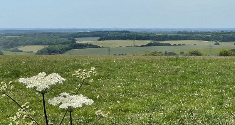
Alfriston, Vereinigtes Königreich
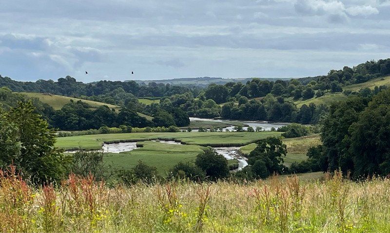
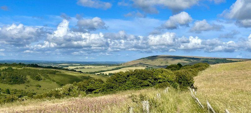
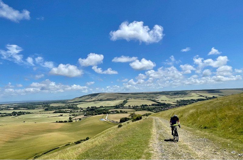
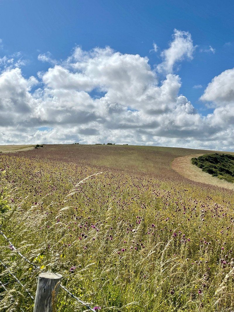
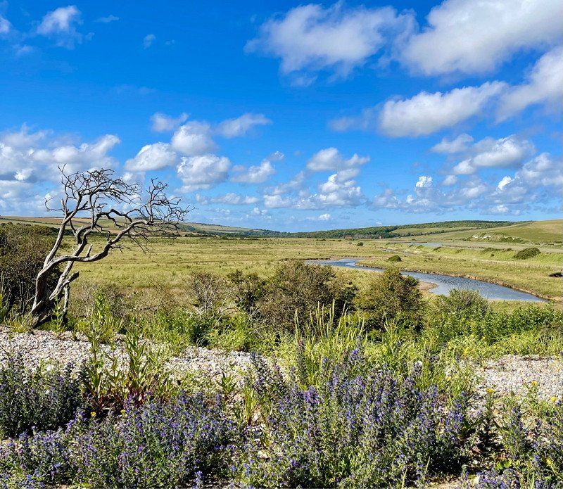
On Cycle Route 89 over the South Downs ranges. Across the view to the Seven Sisters and the river valley back to Alfriston. A fantastic round. At the beginning, however, very steep 27%.
50° 48' 32.9" N 0° 7' 54.2" E
50.8091521 0.1317207
Alfriston Camping Park, Alfriston, Polegate, Vereinigtes Königreich
Pleasant Rise Farm, Alfriston, Polegate BN26 5TN, Vereinigtes Königreich
50° 48' 14.8" N 0° 8' 45.1" E
50.8041079 0.1458589
Day
Dover, Vereinigtes Königreich
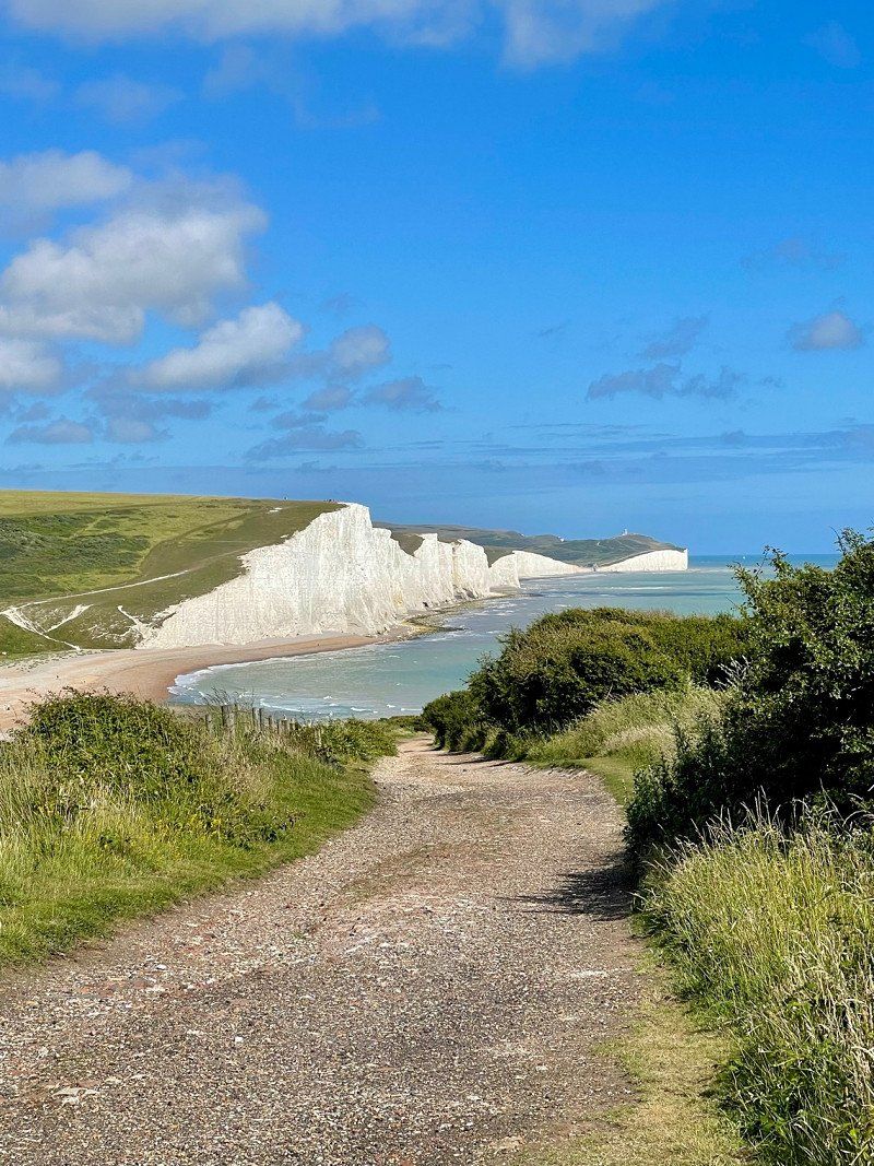
Via the viewpoint Beachy Had and Rye (hopeless to find a parking space for campers) back to Dover.
It was a wonderful journey that we will certainly continue.
In addition, for anyone who is inspired by us, I can definitely recommend Leeds Castle and Sheffield Park. In Sheffield Park in June hundreds of water lilies bloom in the large ponds and Leeds Castle is a work of art of moated castle and park.
51° 7' 40.4" N 1° 18' 48.2" E
51.1278758 1.3134027