Summer trip 2022. A road trip across the Iberian Peninsula in 20 days with a longer stop in the Algarve. By the way, you can find us on Instagram under #helbisontour.
Day
Hamm, Deutschland
Friday, 07/15
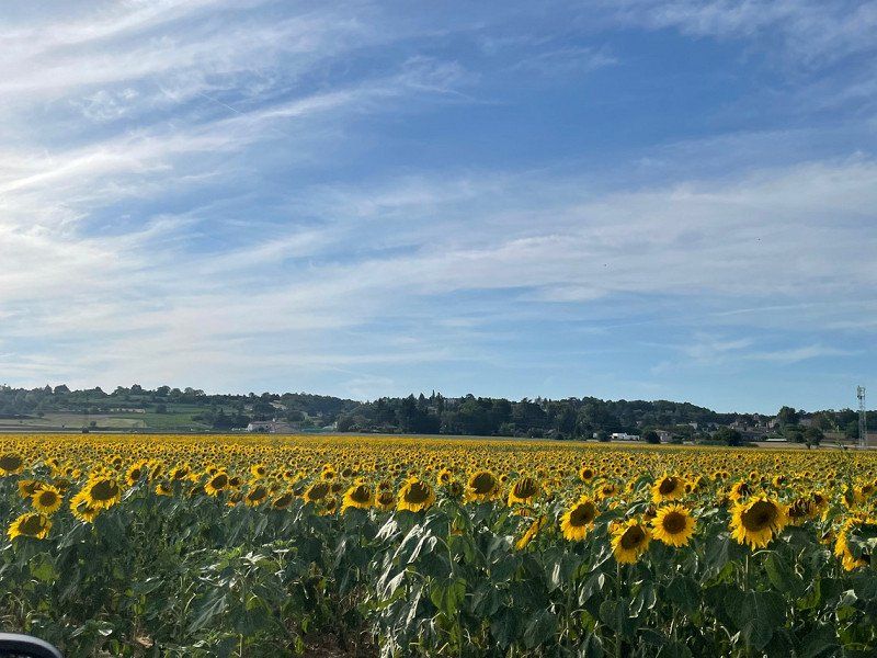
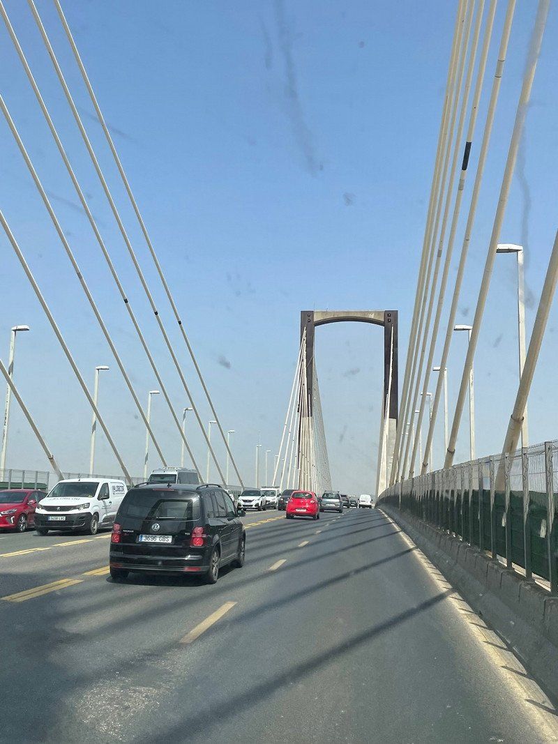
Start at home a little after five in the morning. Long day of driving via Luxembourg 🇱🇺 to France 🇫🇷. Overnight on the pitch in Saint-Prim, south of Lyon.
51° 40' 25.9" N 7° 48' 57.5" E
51.6738583 7.8159816
• Head toward Schillerstraße on Taubenstraße. Go for 38 m.
• Turn left onto Schillerstraße. Go for 80 m.
• Turn right onto Goethestraße (B63). Go for 1.5 km.
• Turn right onto Werler Straße (B63) toward A2/Werl/Rhynern. Go for 4.6 km.
• Take ramp onto A2 toward Oberhausen/Bremen/Köln. Go for 11.1 km.
• Take exit 16 toward Köln/Frankfurt a.M./Flughafen Dortmund onto A1. Go for 127 km.
• Take exit 109 toward Trier/B51/Euskirchen onto A1. Go for 37.7 km.
• Take exit 114 toward Trier/Dahlem/Blankenheim onto B51. Go for 38.1 km.
• Take ramp onto B51/B410. Go for 7.2 km.
• Take the 2nd exit from roundabout onto B51 toward Luxemburg/A60/Trier/Bitburg/E42/Schloßheck. Go for 219 m.
• Take ramp onto A60 toward Luxembourg/Trier/Bitburg. Go for 18.9 km.
• Take exit 6 toward Luxembourg/Bitburg onto B51. Go for 9.6 km.
• Take ramp onto B257 toward Luxemburg/Echternach/Irrel. Go for 16.5 km.
• Keep left onto B257 toward Luxemburg/Echternach. Go for 1.8 km.
• Take ramp toward Trier/Körperich/Bollendorf/Echternacherbrück. Go for 81 m.
• Take the 3rd exit from roundabout onto L1 toward Bollendorf/Echternacherbrück. Go for 831 m.
• Take the 2nd exit from roundabout onto Bitburger Straße (L1) toward Luxembourg/Echternach. Go for 71 m.
• Continue on N11. Go for 93 m.
• Turn right onto Rue du Pont (N10). Go for 462 m.
• Continue on Route de Luxembourg (N11). Go for 16.4 km.
• Keep left onto E29 toward Luxembourg/Gonderange. Go for 2.4 km.
• Take the 2nd exit from roundabout onto E29. Go for 764 m.
• Continue on N11. Go for 7.0 km.
• Take ramp onto A7 toward Bruxelles/Trier/E29/Luxembourg/Aéroport/Plateau de Kirchberg. Go for 1.6 km.
• Take the exit toward Bruxelles/Metz/Luxembourg-Gare/E29 onto A1. Go for 9.5 km.
• Take the exit toward Metz/Saarbrücken/Livange onto A3. Go for 12.3 km.
• Keep left onto A3. Go for 739 m.
• Continue on A31. Go for 100 km.
• Take the exit toward Lyon/Paris/Dijon/Toul onto A31. Go for 132 km.
• Take the left exit toward Lyon/Besançon/Dijon/Langres-Sud onto A31. Go for 115 km.
• Continue on A6 (Autoroute du Soleil). Go for 127 km.
• Keep right onto A46 toward Marseille/Genève/Grenoble/Lyon-Est. Go for 26.4 km.
• Take the left exit toward Lyon onto A42. Go for 3.7 km.
• Take the left exit toward Marseille/Grenoble/Périphérique Sud/Porte de Cusset onto D383 (Boulevard Laurent Bonnevay). Go for 6.0 km.
• Keep left onto Boulevard Laurent Bonnevay (D383) toward St Étienne/Marseille/Vénissieux. Go for 1.9 km.
• Keep left onto Boulevard Laurent Bonnevay (D383) toward Paris/Saint-Étienne/Marseille/Lyon-Centre/Vénissieux-Centre. Go for 3.3 km.
• Keep left onto D383 toward Paris/Marseille/Saint-Étienne/Pierre Bénite/Saint Fons-Centre/Port E. Herriot. Go for 2.3 km.
• Take ramp toward Saint Fons-Belle Étoile. Go for 263 m.
• Continue on Avenue Albert Ramboz. Go for 1.3 km.
• Take the 3rd exit from roundabout onto Avenue Albert Ramboz. Go for 782 m.
• Take ramp onto A7 (Autoroute du Soleil) toward Vienne/St Étienne/Valence/Marseille. Go for 22.8 km.
• Take exit 10 toward Ampuis/Condrieu onto D386. Go for 1.7 km.
• Turn left onto D4 G toward D45 E/Marseille/Vaugris/Z.A. de Vérenay. Go for 781 m.
• Turn right onto Route du Barrage (D4 B). Go for 384 m.
• Turn left onto Route du Barrage (D4). Go for 360 m.
• Turn right onto N7. Go for 2.2 km.
• Pass 2 roundabouts and continue on N7. Go for 2.4 km.
• Turn right onto Allée des Mûriers toward Saint-Prim/Chonas l'Amballan/Z.A. Grand Champ. Go for 76 m.
• Continue on Route de Vienne. Go for 1.3 km.
• Turn left onto Route des Fontenettes (V1). Go for 1.4 km.
• Turn right onto Rue du Village (D37). Go for 159 m.
• Turn left onto Rue du Village. Go for 24 m.
• Arrive at Rue du Village. Your destination is on the right.
☍
881,1 km
(8 hrs. 48 min.)
Saint-Prim, Frankreich
Free, small parking space of the municipality of Saint-Prim. Water, sewage, toilet disposal available. Arrival, since there are no toll roads, around 7 p.m.
45° 26' 40.1" N 4° 47' 33" E
45.4444650 4.7925040
• Head east on Rue du Village. Go for 24 m.
• Turn right onto Rue du Village (D37). Go for 159 m.
• Continue on Route de Glay (D37). Go for 1.2 km.
• Turn left onto Route d'Auberives (D37). Go for 1.8 km.
• Turn right onto Lieu-dit Parassat (N7). Go for 1.8 km.
• Take the 2nd exit from roundabout onto N7 toward Valence/A7. Go for 3.0 km.
• Take left ramp onto A7 (Autoroute du Soleil) toward Annonay/Valence. Go for 150 km.
• Keep right onto A9 (Échangeur d'Orange) toward Barcelone/Toulouse/Montpellier/Nîmes. Go for 281 km.
• Continue on AP-7 (Autopista de la Mediterrània). Go for 66.6 km.
• Take the exit toward Fornells de la Selva/Barcelona/N-2 onto A-2 (Autovia del Nordest). Go for 28.1 km.
• Take the 3rd exit from roundabout onto GI-600 toward Blanes. Go for 1.9 km.
• Pass 2 roundabouts and continue on Carretera de Tordera (GI-600). Go for 2.6 km.
• Take the 2nd exit from roundabout onto Avinguda d'Europa toward Blanes. Go for 252 m.
• Take the 2nd exit from roundabout onto Avinguda d'Europa. Go for 192 m.
• Take the 4th exit from roundabout onto Carretera Accés Costa Brava (GI-682) toward Centre Ciutat. Go for 830 m.
• Take the 1st exit from roundabout onto Carrer Anselm Clavé (GIP-6831) toward Centre Urbà/Centre Ciutat. Go for 231 m.
• Take the 2nd exit from roundabout onto Carrer Anselm Clavé toward Centre Ciutat/Centre Vila. Go for 522 m.
• Turn left onto Rambla de Joaquim Ruyra. Go for 15 m.
• Arrive at Rambla de Joaquim Ruyra. Your destination is on the right.
☍
540,4 km
(4 hrs. 54 min.)
Day
Day
Blanes, Spanien
Saturday 16.07.
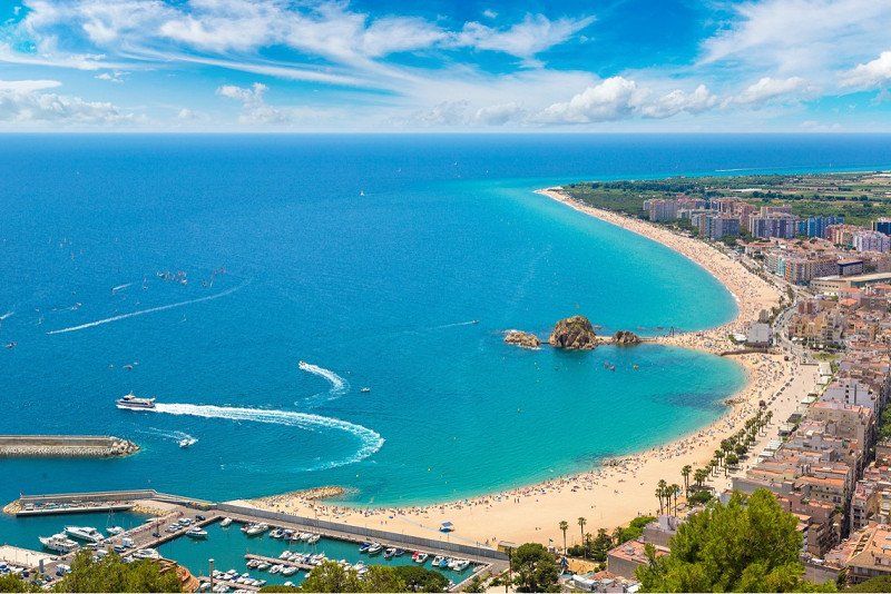
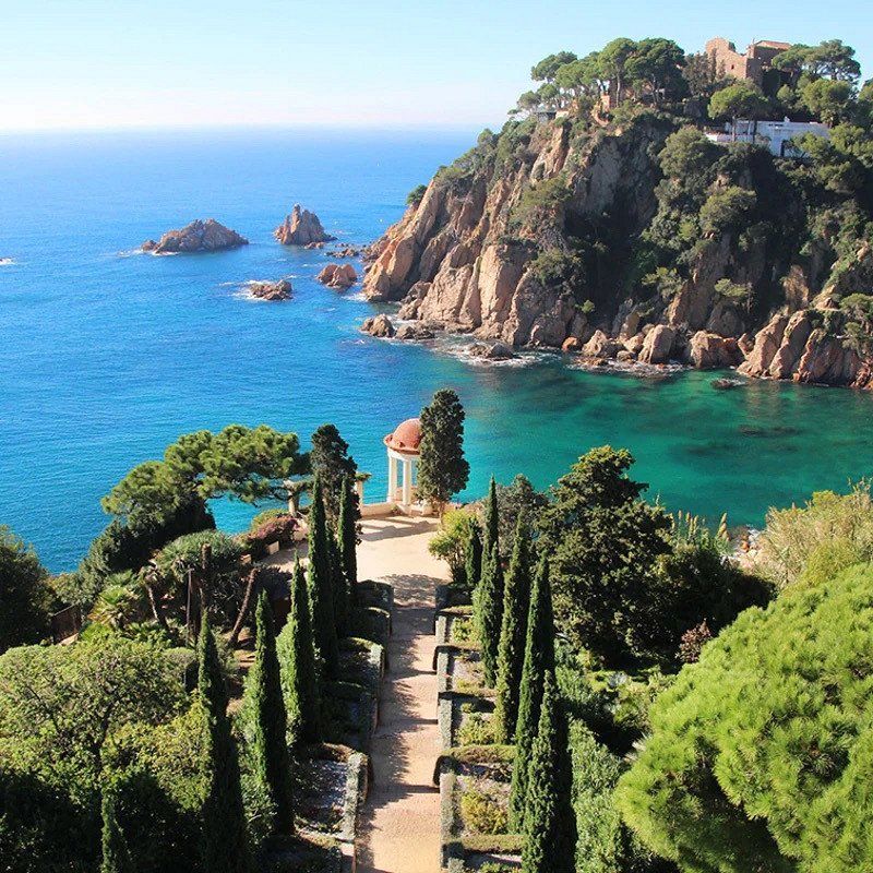
Continue to Blanes on the Costa Brava.
The planned travel time was significantly extended by traffic jams, so that we only arrived at around half past four and a family member with migraines at the El Pinar campsite. We liked the place under the pine trees.
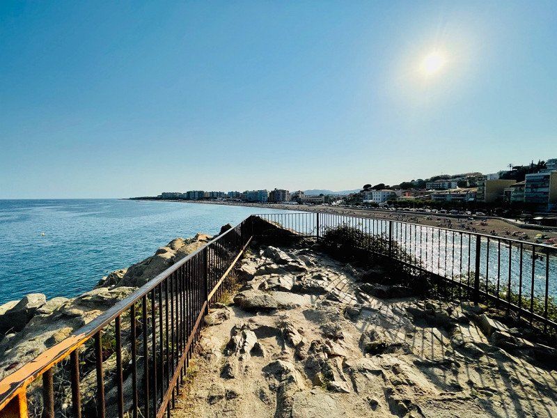
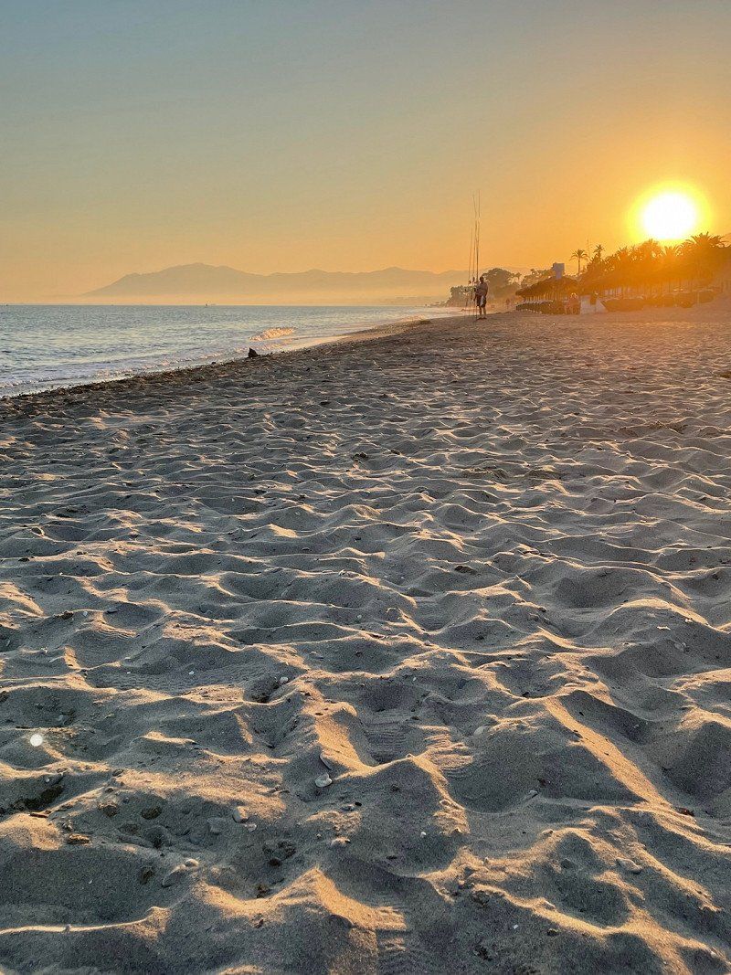
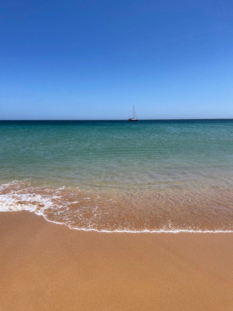
We cycled to the main beach of the city on the Costa Brava and went swimming.
On the way back we unfortunately found a flat tire. So it was time to change hoses before a late dinner at the El Pinar campsite settled us down for the day. 🥘
17300 Blanes, Provinz Girona, Spanien
41° 40' 33.6" N 2° 47' 24.8" E
41.6759954 2.7902289
• Head toward Carrer Tordera on Rambla de Joaquim Ruyra. Go for 214 m.
• Take the 2nd exit from roundabout onto Carrer de Mas Enlaire toward Barcelona/Girona. Go for 75 m.
• Turn left onto Carrer de Sebastià Llorens toward AP-7/C-32/N-2. Go for 158 m.
• Continue on Carrer Anselm Clavé toward AP-7/C-32/N-2. Go for 179 m.
• Take the 2nd exit from roundabout onto Carrer Anselm Clavé (GIP-6831). Go for 210 m.
• Take the 2nd exit from roundabout onto Carretera de Tordera (GI-600) toward Mas Carolet/Ca la Guidó/Mas Cremat. Go for 312 m.
• Pass 3 roundabouts and continue on Carretera de Tordera (GI-600). Go for 3.2 km.
• Take the 3rd exit from roundabout onto C-32 toward Barcelona. Go for 50.4 km.
• Keep right onto C-31 toward Barcelona/Glòries/Tiana/Montgat. Go for 12.8 km.
• Turn right onto Carrer de Padilla. Go for 180 m.
• Turn left onto Avinguda Diagonal toward C. Lepant/pl. Francesc Macià/Estació Sants/Aeroport. Go for 391 m.
• Turn slightly left onto Carrer d'Aragó toward Pl. Espanya/Estació Sants/Aeroport. Go for 1.5 km.
• Turn left onto Passeig de Gràcia. Go for 447 m.
• Turn right onto Passeig de Gràcia. Go for 200 m.
• Turn right onto Plaça de Catalunya. Go for 141 m.
• Arrive at Plaça de Catalunya. Your destination is on the left.
☍
70,3 km
( 57 min.)
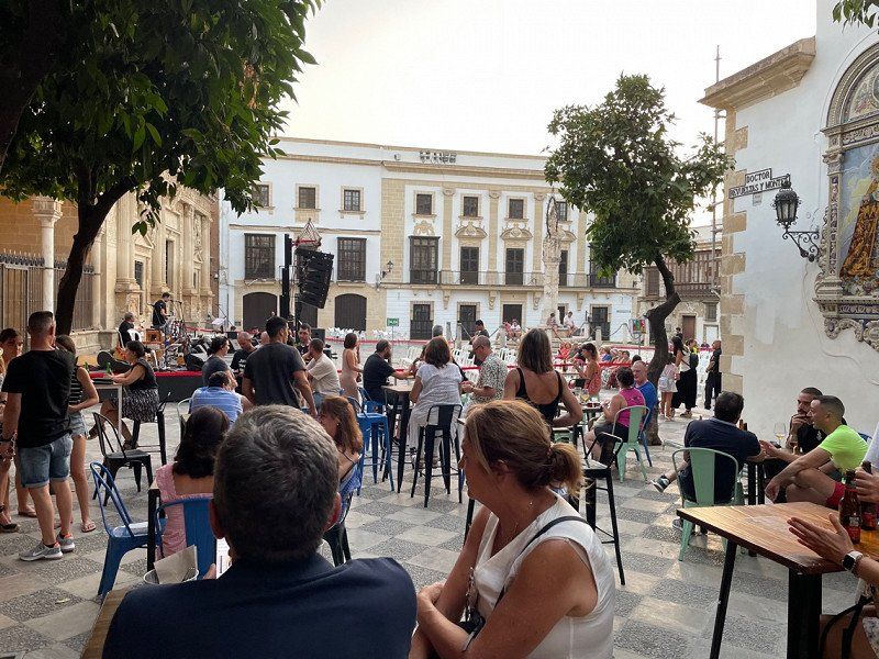
Barcelona, Spanien
Sunday, July 17th:
Today the Womo stops for the first day. We cycled to the train station in Blanes and from there took the 9:25 train to Barcelona, where we arrived about an hour and a quarter later.
We walked (at about 34 degrees) through the city, past the Arc de Triomf and with a detour to the Parc de la ciutadella, before redeeming our pre-booked tickets for the Sagrada Familia at 12:30 p.m. and the beautiful church (for the second times) visited. Then we went to the old town and the harbor for tapas. Unfortunately, the lady of the house developed circulatory problems due to the heat, which unfortunately accelerated the way home and made it a bit difficult.
Barcelona, Provinz Barcelona, Spanien
41° 23' 14.6" N 2° 10' 6.8" E
41.3873974 2.1685680
• Head southwest on Plaça de Catalunya.
• Continue on Ronda de la Universitat. Go for 365 m.
• Continue on Plaça de la Universitat toward Pl. Universitat/G. V. Corts Catalanes/Pl. Espanya/Rda. Sant Antoni. Go for 97 m.
• Continue on Ronda de Sant Antoni. Go for 124 m.
• Turn right onto Plaça de Goya. Go for 69 m.
• Continue on Carrer de Sepúlveda. Go for 1.4 km.
• Turn right onto Avinguda del Paral.lel. Go for 168 m.
• Take the 4th exit from Plaça d'Espanya roundabout onto Gran Via de les Corts Catalanes toward pl. Cerdà/Aeroport/Castelldefels/C-31/C-32/Fira Gran Via/l'Hospitalet/Tarragona. Go for 20.9 km.
• Keep left onto Avinguda de Castelldefels (C-31) toward C-32/Sitges/Tarragona. Go for 705 m.
• Take ramp onto C-32. Go for 43.9 km.
• Take the left exit toward Tarragona/València onto AP-7 (Autopista de la Mediterrània). Go for 27.2 km.
• Take exit 33 toward N-240/Centre Ciutat Tarragona/Valls-Lleida/Estació de Tren AVE. Go for 754 m.
• Take the 1st exit from roundabout toward A-27/A-7/T-11/Aeroport/Polígon Industrial de Riuclar. Go for 229 m.
• Continue toward A-27. Go for 36 m.
• Take the 3rd exit from roundabout onto A-27 toward Tarragona/Aeroport. Go for 1.8 km.
• Continue on N-241. Go for 957 m.
• Take exit 0B toward Ctra. València/C-31b/Salou onto N-340. Go for 273 m.
• Take the 2nd exit from roundabout onto Carretera a València (N-340) toward Icomar/Riu Clar. Go for 321 m.
• Turn right toward Torreforta/C-31B/Salou. Go for 102 m.
• Turn right onto Autovia de Tarragona a Salou (C-31b) toward Salou. Go for 1.7 km.
• Take the 1st exit from roundabout onto Camí Vilaseca al Prat d'Albinyana (C-31b) toward Salou. Go for 3.0 km.
• Take ramp toward La Pineda/Vila-Seca/A-7. Go for 188 m.
• Take the 3rd exit from roundabout onto TV-3148 toward La Pineda. Go for 914 m.
• Take the 2nd exit from roundabout onto TV-3146 toward La Pineda Platges. Go for 336 m.
• Take the 2nd exit from roundabout onto TV-3146. Go for 325 m.
• Take the 2nd exit from Plaça de Juli Garreta roundabout onto Passeig de Pau Casals (TV-3146). Go for 1.1 km.
• Turn right onto Plaça de l'Estany. Go for 50 m.
• Continue on Carrer d'Hipòlit Lázaro. Go for 67 m.
• Arrive at Carrer d'Hipòlit Lázaro.
☍
107,1 km
(1 hrs. 18 min.)
Day
Aquopolis Costa Dorada - La Pineda Salou, Passeig de Pau Casals, La Pineda, Spanien
Monday, 07/18/2022
We have divided today's route into two parts. With the Slagharen annual pass you can enter the Aquapark Aquopolis Costa Dourada for free. The pubescent loves slides and water fun and the adults look forward to a bit of rest and cooling off.
Passeig de Pau Casals, 65, 43480 Platja de la Pineda, Tarragona, Spanien
41° 4' 24.4" N 1° 10' 39.7" E
41.0734366 1.1776957
• Head west on Carrer d'Hipòlit Lázaro. Go for 244 m.
• Take the 3rd exit from Plaça de la Cançó Catalana roundabout onto Carrer Ciutat de Melbourne toward Sortida/Aquopolis-Dofinari. Go for 266 m.
• Take the 1st exit from Plaça de Baló roundabout onto Carrer de Camí del Racó toward Centre Ciutat/Tarragona/C-31B/Urb. Xalets Salou/Urb. Mirador. Go for 542 m.
• Pass 2 roundabouts and continue on Carrer de Camí del Racó. Go for 663 m.
• Turn right onto C-31b. Go for 637 m.
• Take ramp toward Vila-Seca. Go for 427 m.
• Take the 4th exit from roundabout onto TV-3148 toward Vila-Seca. Go for 795 m.
• Pass 2 roundabouts and continue on Carretera Vila-Seca-la Pineda (TV-3148). Go for 1.6 km.
• Take the 4th exit from roundabout onto A-7 (Autovia de la Mediterrània) toward Valencia/E-15. Go for 815 m.
• Take exit 1152 toward Vila-Seca oest/E-15/Reus/C-14/Salou/Tarragona/Castelló onto AP-7 (Autopista de la Mediterrània). Go for 225 km.
• Keep left onto V-21 toward Valencia (Norte)/Puçol/V-23/Sagunt/Sagunto. Go for 19.6 km.
• Take the 1st exit from Plaza Cardenal Vicente Enrique y Tarancón roundabout onto Avenida Blasco Ibáñez toward Hospital Quirón/Centre Ciutat/Centro Ciudad. Go for 990 m.
• Continue on Calle General Elio toward Centro Ciudad/Centre Ciutat. Go for 184 m.
• Keep left onto Plaza Llano del Real toward Centre Ciutat. Go for 77 m.
• Turn right onto Plaza Llano del Real. Go for 30 m.
• Keep left onto Puente del Real. Go for 218 m.
• Continue on Plaza Tetuán. Go for 201 m.
• Keep right onto Plaza Tetuán toward c/La Paz/Centro Histórico/Centre Històric. Go for 25 m.
• Continue on Calle General Tovar. Go for 113 m.
• Turn right onto Plaza de Alfonso el Magnánimo. Go for 51 m.
• Continue on Calle de la Paz. Go for 319 m.
• Turn left onto Calle del Marqués de Dos Aguas. Go for 87 m.
• Continue on Calle del Poeta Querol. Go for 254 m.
• Continue on Calle de las Barcas. Go for 21 m.
• Continue on Calle Pascual y Genís. Go for 60 m.
• Turn right onto Calle Correos. Go for 174 m.
• Arrive at Calle Correos. Your destination is on the right.
☍
253,6 km
(2 hrs. 22 min.)
Valencia, Spanien
Then in the afternoon we continue to the Nomadic Valencia Camping Car pitch in an industrial area north of Valencia.
Valencia, Provinz Valencia, Spanien
39° 28' 11.7" N 0° 22' 34.6" W
39.4699075 -0.3762881
• Head toward Calle Pérez Pujol on Calle Correos. Go for 89 m.
• Turn right onto Calle Pérez Pujol. Go for 73 m.
• Turn left onto Calle Roger de Lauria. Go for 81 m.
• Turn right onto Calle Pascual y Genís. Go for 143 m.
• Continue on Calle Félix Pizcueta. Go for 272 m.
• Turn right onto Gran Vía Marqués del Turia. Go for 157 m.
• Continue on Gran Vía de las Germanías toward Aeropuerto/Madrid/A-3/CV-35/Llíria/V-31/Alacant/Albacete. Go for 243 m.
• Keep right onto Gran Vía de las Germanías toward Alacant/V-31/Albacete/València Joaquín Sorolla. Go for 164 m.
• Turn left onto Calle de Gibraltar. Go for 34 m.
• Turn slightly right onto Calle Cuba. Go for 253 m.
• Turn right onto Calle Puerto Rico. Go for 167 m.
• Turn right onto Calle Filipinas. Go for 82 m.
• Make a U-Turn onto Calle Filipinas. Go for 506 m.
• Continue on Plaza de Manuel Sanchis Guarner. Go for 69 m.
• Turn right onto Avenida de Ausiàs March. Go for 1.3 km.
• Take the 3rd exit from roundabout onto Avenida de Ausiàs March (V-31) toward V-30/Hospital La Fe/Hospital Urgències/Urgencias. Go for 13.8 km.
• Continue on A-7 (Autovía del Mediterráneo). Go for 42.8 km.
• Continue on A-35 toward Albacete/Murcia. Go for 32.8 km.
• Take exit 11 toward La Font de la Figuera/Alacant/Alicante/Murcia onto A-33. Go for 92.9 km.
• Continue on A-30 (Autovía de Murcia). Go for 22.5 km.
• Take exit 134A toward Murcia/Ronda Oeste/Cartagena/E-15/Almería/A-7 onto A-30 (Murcia Ronda Oeste). Go for 3.0 km.
• Take exit 138 toward Almería/Granada onto A-7 (Autovía del Mediterráneo). Go for 83.8 km.
• Take exit 651 toward Vélez Rubio/Granada onto A-91. Go for 17.0 km.
• Continue on A-92N. Go for 119 km.
• Continue on A-92. Go for 118 km.
• Take exit 177 toward Algeciras onto A-92M. Go for 26.0 km.
• Continue on A-45 (Autovía de Málaga). Go for 1.5 km.
• Keep left onto AP-46 (Autopista de Málaga) toward Málaga/Algeciras/Almería. Go for 25.8 km.
• Continue on A-7 (Autovía del Mediterráneo). Go for 27.0 km.
• Keep left onto A-7 (Autopista del Mediterráneo) toward Marbella/Algeciras. Go for 1.8 km.
• Continue on AP-7 (Autopista del Mediterráneo). Go for 11.9 km.
• Keep right toward Autopista del Mediterráneo/AP-7. Go for 356 m.
• Continue on AP-7 (Autopista del Mediterráneo). Go for 14.8 km.
• Continue on A-7 (Autopista del Mediterráneo). Go for 1.2 km.
• Take exit 184 toward Marbella Casco Antiguo/Avd. del Trapiche/E-15/AP-7/A-7/Málaga. Go for 384 m.
• Take the 4th exit from roundabout onto Avenida del Trapiche toward E-15/AP-7/A-7/Málaga. Go for 183 m.
• Take the 2nd exit from roundabout onto Avenida del Trapiche. Go for 95 m.
• Take the 3rd exit from roundabout onto Avenida Arias de Velasco (A-355). Go for 410 m.
• Take the 1st exit from roundabout onto Avenida Doctor Maíz Viñals. Go for 35 m.
• Continue on Avenida Juan Alameda. Go for 379 m.
• Continue on Calle Practicante Manuel Cantos. Go for 439 m.
• Continue on Plaza Puente Málaga. Go for 63 m.
• Arrive at Plaza Puente Málaga. Your destination is on the right.
☍
661,3 km
(5 hrs. 46 min.)
Day
Marbella, Spanien
Tuesday, July 19, 2022: Another long day of driving is ahead of us before we take it easy.
We skip the planned visit to the Alhambra when the outside temperature is up to 39 degrees. Instead, at half past eleven we make our way to Marbella, where we finally arrive around 7:30 p.m. The plastic greenhouse deserts on the way are really frightening. You might think about buying locally more often.
The Bugainville campsite still has a place for us upon request by email. We check in, put the camper on the somewhat uneven pitch and make our way to the beach, for a quick swim and then a delicious dinner at the "Captain Cook".
Marbella, Provinz Málaga, Spanien
36° 30' 36.3" N 4° 52' 56.8" W
36.5100710 -4.8824474
• Head north on Plaza Puente Málaga. Go for 39 m.
• Continue on Avenida Doctor Maíz Viñals. Go for 870 m.
• Take the 3rd exit from roundabout onto Avenida Arias de Velasco (A-355). Go for 409 m.
• Take the 1st exit from roundabout onto Avenida del Trapiche toward Ojén/A-355/AP-7/Cádiz-Málaga/A-7. Go for 92 m.
• Take the 3rd exit from roundabout onto Avenida del Trapiche. Go for 157 m.
• Take the 3rd exit from roundabout onto A-7 (Autovía del Mediterráneo) toward Algeciras. Go for 3.6 km.
• Keep left onto AP-7 (Autopista del Mediterráneo) toward Estepona/Algeciras. Go for 8.8 km.
• Keep right toward Autopista del Mediterráneo/AP-7. Go for 358 m.
• Continue on AP-7 (Autopista del Mediterráneo). Go for 15.5 km.
• Continue on A-7 (Autovía del Mediterráneo). Go for 2.4 km.
• Continue on AP-7 (Autopista del Mediterráneo). Go for 11.6 km.
• Keep right onto AP-7. Go for 10.2 km.
• Continue on A-7 (Autovía del Mediterráneo). Go for 24.5 km.
• Keep right onto N-340 toward E-15/A-7/Algeciras Centro Ciudad/Tarifa/Cádiz. Go for 1.3 km.
• Continue on A-7 (Autovía del Mediterráneo). Go for 4.3 km.
• Take exit 103. Go for 276 m.
• Take the 1st exit from roundabout onto N-340 toward Cadiz/Sevilla. Go for 338 m.
• Pass 2 roundabouts and continue on N-340. Go for 17.4 km.
• Take the 2nd exit from roundabout toward Tarifa. Go for 184 m.
• Continue on Carretera Cádiz-Málaga. Go for 277 m.
• Take the 2nd exit from roundabout onto Calle Amador de los Ríos. Go for 815 m.
• Arrive at Calle Amador de los Ríos. Your destination is on the right.
☍
103,3 km
(1 hrs. 7 min.)
Day
Tarifa, Spanien
Wednesday, 07/20/2022:
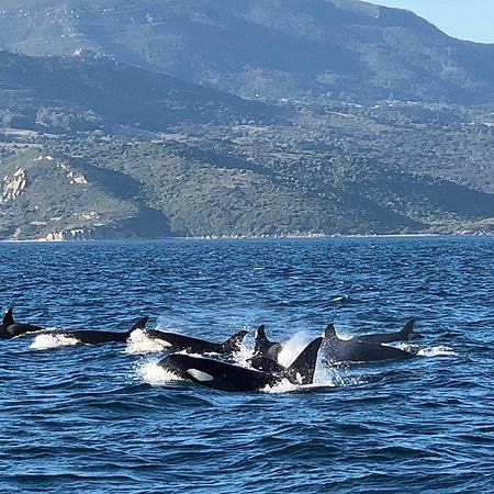
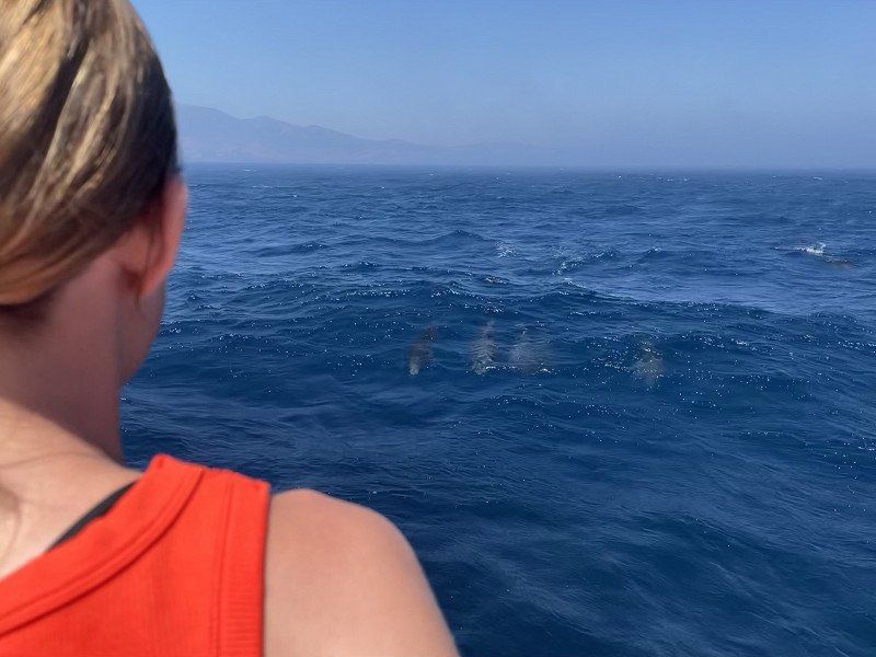
On our way to Gibraltar today we call Firmm Whale Watching to book a tour for Thursday. Because of the strong wind to be expected, none would take place, only today at 3 p.m. So after a short discussion there is a small change of plan: Today Tarifa, tomorrow Gibraltar.
Just in time for the introduction, we arrive at the Firmm office around 2:00 p.m. and receive an introduction in German. Then we go on the water for about two hours and we can observe many dolphins and pilot whales with a view of Morocco. A great experience and an institution worth supporting.
Dinner in the old town and a visit to the southernmost point of mainland Europe, where the Mediterranean Sea and the Atlantic meet, and a visit to the beach round off a great day.
Overnight caravan parking space Tarifa 8 €
11380 Tarifa, Provinz Cádiz, Spanien
36° 0' 51.6" N 5° 36' 16" W
36.0143209 -5.6044497
• Head southwest on Calle Amador de los Ríos.
• Continue on Avenida de Andalucía. Go for 108 m.
• Turn right onto Calle San Sebastián. Go for 97 m.
• Turn left onto Calle Bailén. Go for 31 m.
• Turn left onto Calle San Isidro. Go for 95 m.
• Turn left onto Avenida de Andalucía. Go for 147 m.
• Continue on Calle Amador de los Ríos. Go for 784 m.
• Take the 2nd exit from roundabout. Go for 50 m.
• Continue on Carretera Cádiz-Málaga. Go for 257 m.
• Keep right onto Carretera Cádiz-Málaga toward Algeciras/Málaga. Go for 221 m.
• Continue on N-340. Go for 16.6 km.
• Take the 1st exit from roundabout onto N-340 toward Málaga. Go for 572 m.
• Take the 3rd exit from roundabout onto Calle Maestro Luis Cano Toba toward Barriada Los Pastores. Go for 449 m.
• Turn right onto Pasaje Carretera del Cobre. Go for 131 m.
• Turn right onto Carretera al Cobre (CA-9208). Go for 369 m.
• Keep right onto Carretera al Cobre. Go for 22 m.
• Turn right toward Autovía del Mediterráneo/A-7. Go for 74 m.
• Take the 5th exit from roundabout onto A-7 (Autovía del Mediterráneo) toward Estepona/Málaga. Go for 4.8 km.
• Continue on N-340 toward A-7/San Roque/Málaga/Sevilla. Go for 1.3 km.
• Continue on A-7 (Autovía del Mediterráneo). Go for 9.4 km.
• Take exit 118 toward San Roque (Sur)/La Línea/Gibraltar. Go for 467 m.
• Keep left onto CA-34 toward La Línea/Gibraltar. Go for 1.7 km.
• Pass 5 roundabouts and continue on Avenida de España (CA-34). Go for 4.4 km.
• Take the 1st exit from roundabout onto Avenida Príncipe de Asturias (N-351). Go for 552 m.
• Take the 1st exit from Rotonda Real Balompédica Linense roundabout onto Avenida Príncipe de Asturias (N-351). Go for 326 m.
• Turn right onto Avenida Alcaidesa Marina toward Gibraltar. Go for 49 m.
• Take the 2nd exit from roundabout onto Carretera de la Frontera. Go for 414 m.
• Continue on Cerretera de la Frontera. Go for 49 m.
• Turn right. Go for 140 m.
• Continue toward Winston Churchill Avenue. Go for 29 m.
• Continue on Winston Churchill Avenue. Go for 63 m.
• Turn left. Go for 59 m.
• Turn slightly right toward Kingsway. Go for 205 m.
• Take the 1st exit from roundabout onto Kingsway. Go for 378 m.
• Continue on Kingsway Tunnel. Go for 529 m.
• Continue on Kingsway. Go for 367 m.
• Take the 1st exit from roundabout onto Devil's Tower Road. Go for 438 m.
• Take the 1st exit from roundabout onto Devil's Tower Road. Go for 358 m.
• Take the 3rd exit from roundabout onto Winston Churchill Avenue toward City Centre/Port. Go for 323 m.
• Take the 1st exit from roundabout onto Smith Dorrien Avenue. Go for 319 m.
• Take the 1st exit from roundabout onto Line Wall Road. Go for 484 m.
• Turn left onto John Mackintosh Square. Go for 104 m.
• Turn slightly left onto City Mill Lane. Go for 6 m.
• Arrive at City Mill Lane. Your destination is on the left.
☍
47,3 km
( 49 min.)
Day
Gibraltar
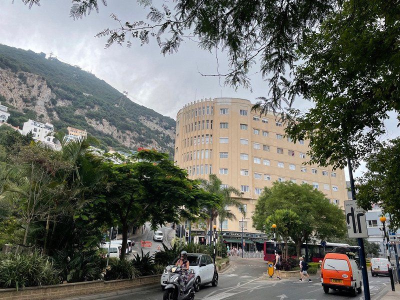
Thursday, 07/21/2022. Drive to Gibraltar. Parking in front of the airport and border crossing on foot. It is interesting to walk over the runway.
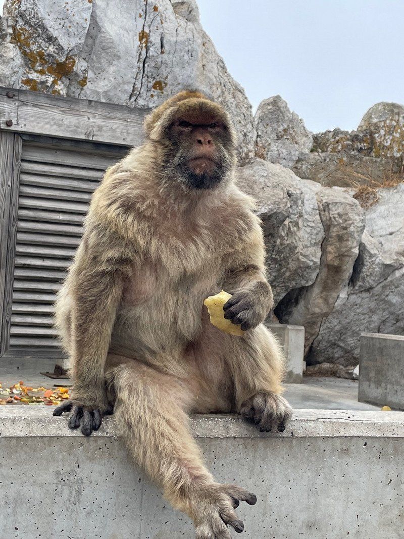
Gibraltar itself doesn't blow our minds. We walk to the cable car, which is still okay. For about 150€ we then buy cable car tickets and tickets for the nature reserve to see the monkeys. A visit to the toilet of the cable car station does not necessarily inspire confidence. A door frame has broken out, the cistern handle is broken, the soap dispenser falls off the wall towards the woman in front of me. We survive the cable car ride anyway, but feel that a lot of what we still see has come down. The monkeys don't help either. Arrived back down we eat still almost unseasoned British food in a bar: At least authentic. 😉 The parking lot also costs 25€. Goodbye Gibraltar. One visit is enough...
36° 8' 26.7" N 5° 21' 12.9" W
36.1407510 -5.3535850
• Head toward Cornwall's Lane on City Mill Lane. Go for 25 m.
• Turn slightly right onto City Mill Lane. Go for 121 m.
• Turn right onto Governor's Street. Go for 163 m.
• Continue on Town Range. Go for 55 m.
• Turn right onto George's Lane. Go for 113 m.
• Turn left onto Cathedral Square. Go for 72 m.
• Turn right onto Cathedral Square. Go for 34 m.
• Turn slightly left toward Line Wall Road. Go for 34 m.
• Continue on Line Wall Road. Go for 714 m.
• Take the 1st exit from roundabout onto Smith Dorrien Avenue. Go for 323 m.
• Take the 3rd exit from roundabout onto Winston Churchill Avenue. Go for 301 m.
• Take the 1st exit from roundabout onto Devil's Tower Road. Go for 343 m.
• Take the 1st exit from roundabout onto Devil's Tower Road. Go for 434 m.
• Take the 3rd exit from roundabout onto Kingsway. Go for 466 m.
• Continue on Kingsway Tunnel. Go for 550 m.
• Continue on Kingsway. Go for 336 m.
• Take the 2nd exit from roundabout. Go for 256 m.
• Take the 1st exit from roundabout. Go for 236 m.
• Turn right. Go for 140 m.
• Continue toward Avenida Príncipe de Asturias. Go for 151 m.
• Turn right onto Avenida Príncipe de Asturias. Go for 115 m.
• Make a U-Turn onto Avenida Príncipe de Asturias. Go for 511 m.
• Continue on Avenida Príncipe de Asturias (N-351). Go for 269 m.
• Take the 2nd exit from Rotonda Real Balompédica Linense roundabout onto Avenida Príncipe de Asturias (N-351) toward San Roque/Campamento. Go for 533 m.
• Take the 4th exit from roundabout onto Avenida de España (CA-34). Go for 444 m.
• Take the 3rd exit from roundabout onto Avenida de España (CA-34) toward San Roque. Go for 425 m.
• Take the 3rd exit from roundabout onto Avenida de España (CA-34). Go for 422 m.
• Take the 3rd exit from roundabout onto Avenida de España (CA-34) toward San Roque. Go for 1.9 km.
• Pass 2 roundabouts and continue on CA-34. Go for 2.9 km.
• Keep left toward CA-34/San Roque/Algeciras/E-15/A-7/Cádiz/Sevilla. Go for 226 m.
• Take ramp onto A-7 (Autovía del Mediterráneo) toward Algeciras/Cádiz. Go for 7.9 km.
• Take exit 110B toward Los Barrios/Jerez/E-5/Sevilla/AP-4 onto A-381. Go for 88.5 km.
• Continue on A-2004. Go for 270 m.
• Pass 2 roundabouts and continue on Carretera Jerez-Algeciras (A-2004). Go for 2.8 km.
• Take the 3rd exit from roundabout onto Carretera Jerez-Algeciras (A-2004) toward Jerez. Go for 992 m.
• Take the 2nd exit from roundabout onto Avenida de Medina Sidonia toward Centro Ciudad. Go for 1.0 km.
• Turn right toward Calle Ronda de los Alunados. Go for 72 m.
• Turn right onto Calle Ronda de los Alunados. Go for 563 m.
• Take the 5th exit from roundabout onto Avenida de Arcos. Go for 290 m.
• Turn right onto Calle Jorge Bocuze. Go for 212 m.
• Turn left onto Calle Jorge Bocuze. Go for 62 m.
• Turn right onto Calle Felipe de Fauconpret. Go for 49 m.
• Arrive at Calle Felipe de Fauconpret. Your destination is on the right.
☍
115,3 km
(1 hrs. 19 min.)
Jerez de la Frontera, Spanien
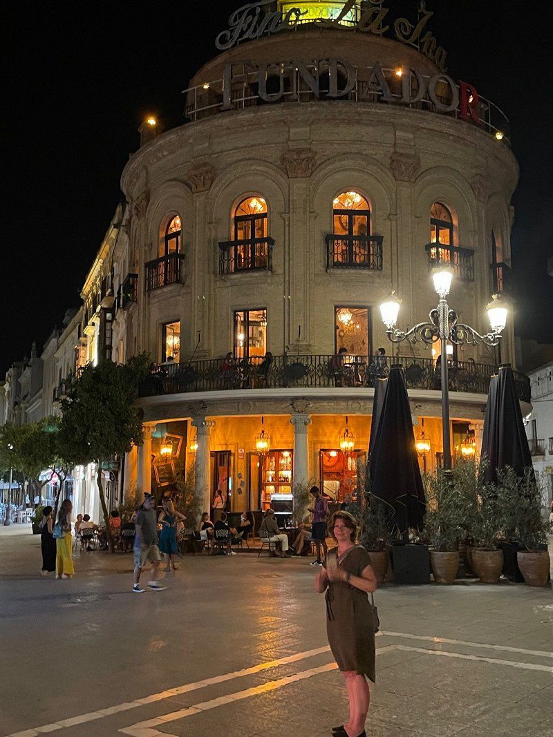
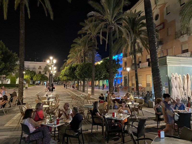
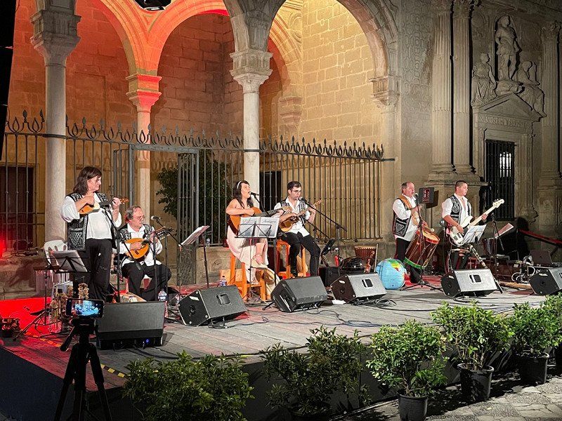
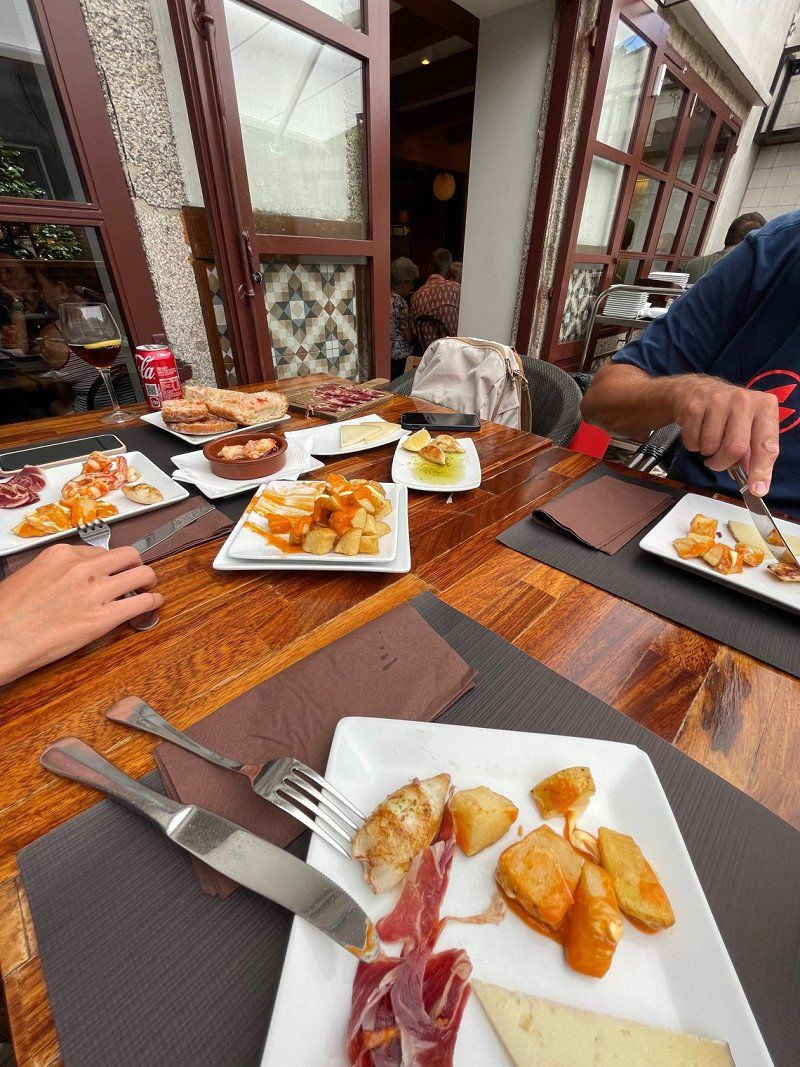
We continue to Jerez de la Frontera, with a blazing heat of 39 degrees. The Morada del Sur parking space is the parking lot of a WoMo dealer, who greets us directly with a sherry. The downside is little shade. In the evening we make our way to the city center (by bus), which is very busy and offers many restaurants. We find an outside table in the brewery 'La Frontera de Jerez' and for a total of incredible €26 we eat three tapas (6 chicken thighs, three ham croquettes and six salmon), drink two sherries, a coke and four beers. 😂😳 At half past ten another concert starts on the square. We have to go here again sometime!
Overnight €15/ La Morada del Sur
Jerez de la Frontera, Provinz Cádiz, Spanien
36° 41' 6" N 6° 7' 33.9" W
36.6850064 -6.1260744
• Head east on Calle Felipe de Fauconpret. Go for 49 m.
• Turn left onto Calle Jorge Bocuze. Go for 62 m.
• Turn left onto Calle Jorge Bocuze. Go for 231 m.
• Turn right and take ramp. Go for 32 m.
• Turn right onto Calle de Nuestra Señora de la Paz. Go for 264 m.
• Take the 1st exit from Glorieta Manuel Simo de la Riva roundabout onto Calle Pablo Neruda. Go for 614 m.
• Take the 2nd exit from roundabout onto Avenida de la Feria. Go for 490 m.
• Take the 1st exit from roundabout onto Avenida de Europa. Go for 366 m.
• Take the 2nd exit from roundabout onto Avenida de Europa. Go for 851 m.
• Take the 2nd exit from roundabout onto Avenida La Granja. Go for 517 m.
• Pass 3 roundabouts. Go for 2.3 km.
• Take left ramp onto AP-4 (Autopista del Sur) toward Sevilla. Go for 66.3 km.
• Continue on A-4 (Autopista del Sur). Go for 6.9 km.
• Take exit 549 toward Pol. Ind. La Isla/SE-30/Puerto Sevilla/E-1/Huelva/A-49/Mérida/A-66 onto SE-40. Go for 2.8 km.
• Continue on Carretera de la Esclusa (SE-31). Go for 1.4 km.
• Take the 2nd exit from roundabout onto Carretera de la Esclusa (SE-31). Go for 950 m.
• Pass 2 roundabouts and continue on Carretera de la Esclusa (SE-31). Go for 1.3 km.
• Take the 1st exit from roundabout onto Carretera de la Esclusa (SE-31). Go for 4.0 km.
• Take the 2nd exit from roundabout toward SE-30. Go for 200 m.
• Take ramp onto A-66 (Ronda Urbana Sur) toward Coria del Río/Huelva/A-49/Mérida. Go for 4.7 km.
• Take exit 17B toward Huelva onto A-49 (Autopista del V Centenario). Go for 133 km.
• Continue on A22 (Via Infante de Sagres). Go for 130 km.
• Take exit 1 toward Vila do Bispo/Sagres/Lagos. Go for 4.7 km.
• Take the 1st exit from roundabout toward V. do Bispo/Sagres. Go for 856 m.
• Continue toward V. do Bispo/Sagres. Go for 42 m.
• Take the 2nd exit from roundabout onto N125 toward V. do Bispo/Sagres/Vila do Bispo. Go for 2.4 km.
• Turn right. Go for 16 m.
• Turn left. Go for 195 m.
• Turn right toward Urbanização das Amendoeiras. Go for 197 m.
• Turn right onto Urbanização das Amendoeiras. Go for 248 m.
• Turn right. Go for 149 m.
• Turn right. Go for 14 m.
• Turn right. Go for 470 m.
• Arrive at your destination on the left.
☍
367,1 km
(3 hrs. 35 min.)
Day
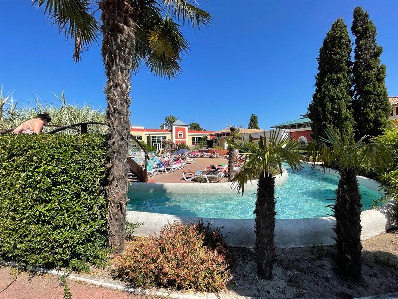
Yelloh ! Village Algarve Turiscampo
Friday July 22nd
After we bought sherry at Lustau and also tried it at Tio Pepe, but couldn't find a parking space suitable for a motorhome, we drove on to Portugal.
At the border we were briefly stopped to register the electronic toll before continuing our journey.
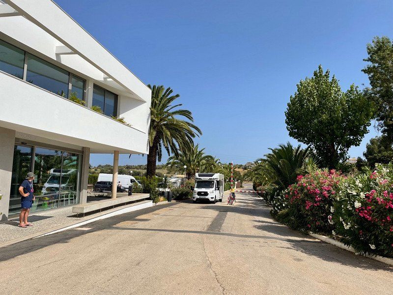
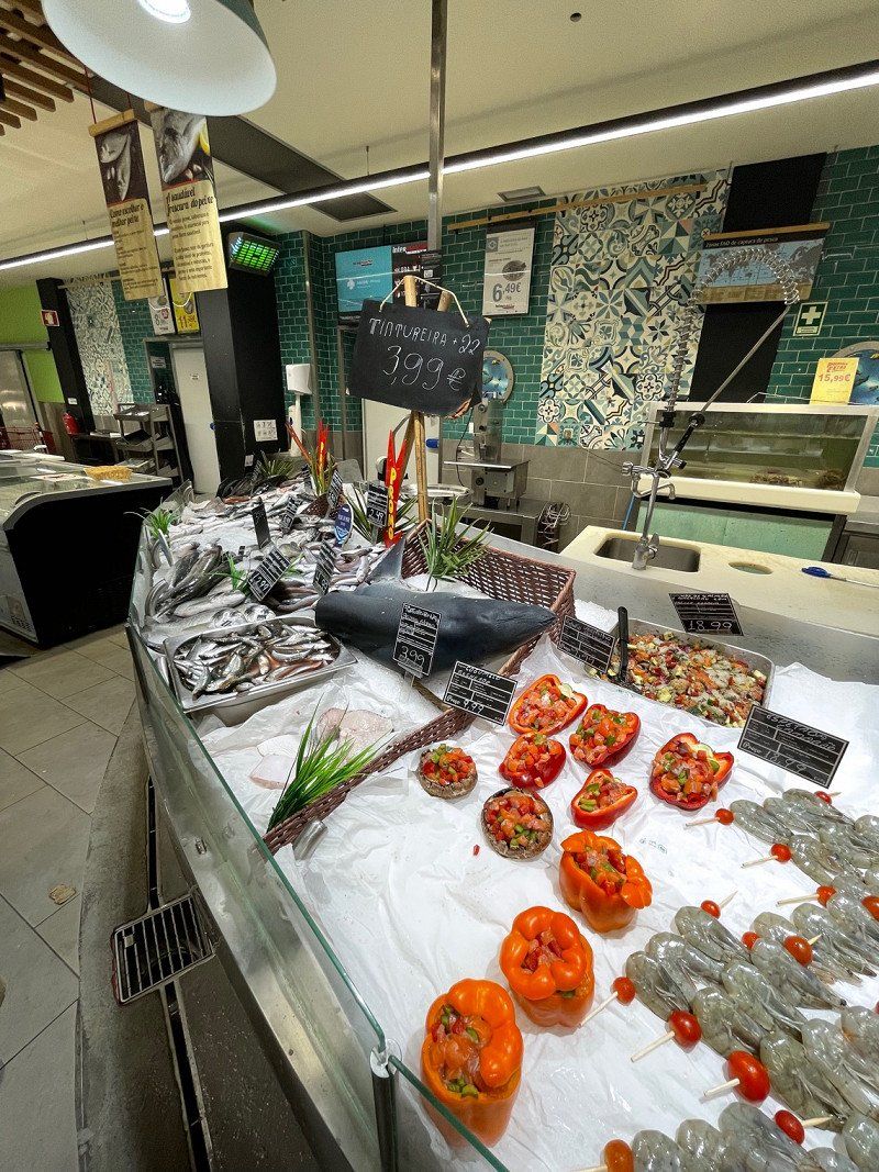
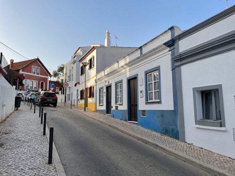
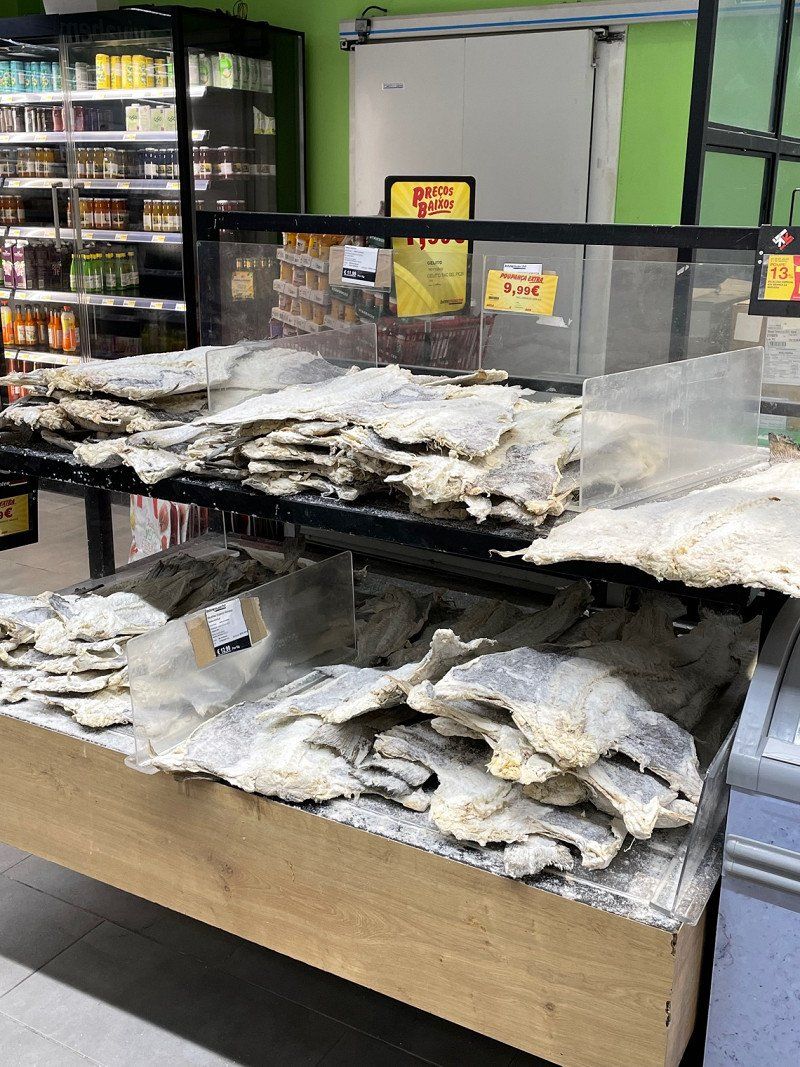
Portugal was immediately greener than Spain and made us excited for the coming days. When we arrived in Lagos, we first shopped in the large Intermarche, which offered a great selection, and then drove to our campsite Turiscampo, which will be our permanent base until next Thursday.
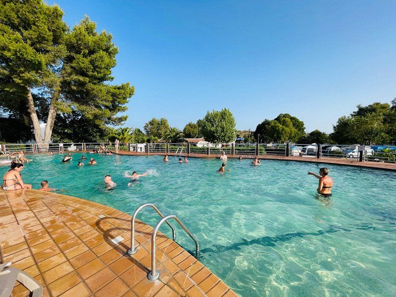
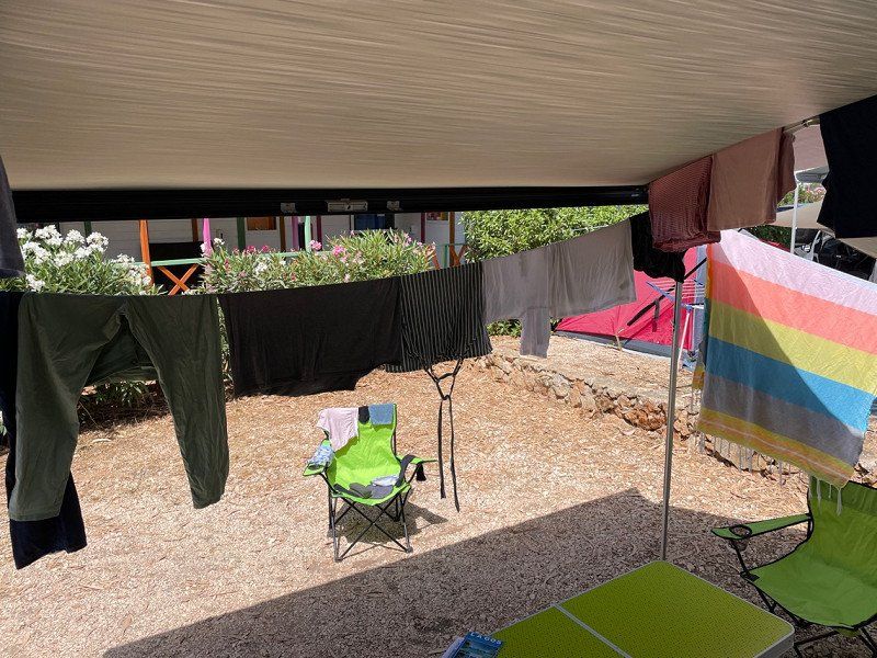
The pool (unfortunately only open until 7 p.m.) was tested directly at 39 degrees, at least after
a load of laundry ended up in the machine.
Estrada Nacional - 125, Km17, Espiche, 8600-109, Espiche, Portugal
37° 6' 8" N 8° 43' 59" W
37.1022200 -8.7330500
• Head west. Go for 29 m.
• Turn right. Go for 184 m.
• Turn right. Go for 167 m.
• Turn right. Go for 14 m.
• Turn left. Go for 149 m.
• Turn left toward Urbanização das Amendoeiras. Go for 155 m.
• Continue on Urbanização das Amendoeiras. Go for 93 m.
• Turn left. Go for 197 m.
• Turn left. Go for 195 m.
• Turn right toward N125. Go for 16 m.
• Turn left onto N125. Go for 60 m.
• Arrive at N125. Your destination is on the right.
☍
1,3 km
( 4 min.)
Turiscampo, Luz, Portugal
Friday 22.07.
After we bought sherry at Lustau and also tried at Tio Pepe, but couldn't find a parking space suitable for motorhomes, we drove on to Portugal.
At the border we were briefly stopped to register the electronic toll before we continued our journey.
Portugal was directly greener than Spain and made us excited for the coming days. Arriving in Lagos, we first shopped in the large Intermarche, which offered a great selection, and then drove to our Turiscampo campsite, which will be our permanent base until next Thursday.
At 39 degrees, the pool (unfortunately only open until 7 p.m.) was tested directly, at least after
a load of laundry ended up in the machine:
turiscampo, 8600 Luz, Portugal
37° 6' 8.7" N 8° 44' 2.4" W
37.1024123 -8.7340069
• Head east on N125. Go for 2.3 km.
• Take the 3rd exit from roundabout toward Lagos/A22/Portimão. Go for 140 m.
• Continue straight ahead. Go for 796 m.
• Continue toward Faro/A22/Portimão. Go for 48 m.
• Take the 3rd exit from roundabout toward Faro/Portimão. Go for 4.4 km.
• Take ramp onto A22 (Via Infante de Sagres) toward Faro/Lisboa/(A2). Go for 45.0 km.
• Take exit 9 toward Lisboa/Ourique onto IC1. Go for 44.3 km.
• Turn right toward Castelo Ventoso. Go for 3.1 km.
• Continue on Castelo Ventoso. Go for 2.3 km.
• Arrive at your destination.
☍
102,4 km
(1 hrs. 15 min.)
Luz
Espiche, Luz, Lagos, Faro, 8600-109, Portugal
37° 6' 2.5" N 8° 43' 53" W
37.1006860 -8.7313945
• Head east. Go for 638 m.
• Turn left toward IC1. Go for 6.2 km.
• Turn right onto IC1. Go for 21.2 km.
• Take ramp onto IP2 toward Lisboa/Algarve/Beja/C. Verde. Go for 14.0 km.
• Take ramp toward Aljustrel/C. Verde/Mértola. Go for 247 m.
• Continue on N2. Go for 20.6 km.
• Pass 2 roundabouts and continue on N2. Go for 25.3 km.
• Take the 3rd exit from roundabout onto N2. Go for 402 m.
• Pass 2 roundabouts and continue on N2. Go for 12.4 km.
• Take the 1st exit from roundabout onto N2. Go for 17.7 km.
• Turn right onto N2. Go for 11.8 km.
• Take the 1st exit from roundabout onto N2. Go for 866 m.
• Take the 4th exit from roundabout onto Rua de São Sebastião (N2). Go for 132 m.
• Turn right onto N2. Go for 4.9 km.
• Turn right. Go for 2.6 km.
• Arrive at your destination.
☍
138,9 km
(2 hrs. 10 min.)
Ourique
Monte Corte Coelho, EM 546, Corgo do Almarjão, Santana da Serra, Ourique, Almodôvar, Beja, 7670-613, Portugal
37° 27' 28.5" N 8° 16' 37.6" W
37.4579126 -8.2771146
• Head southwest. Go for 2.6 km.
• Turn left onto N2. Go for 4.9 km.
• Turn left onto Rua de São Sebastião (N2). Go for 71 m.
• Take the 1st exit from roundabout onto N2. Go for 858 m.
• Take the 2nd exit from roundabout onto N2. Go for 11.8 km.
• Turn left onto N2. Go for 17.7 km.
• Take the 2nd exit from roundabout onto N2. Go for 3.4 km.
• Pass 5 roundabouts and continue on N2. Go for 55.2 km.
• Take ramp onto IP2 toward Ourique/Almodôvar/Lisboa/A2/Algarve. Go for 7.5 km.
• Take ramp onto A2 (Autoestrada do Sul) toward Algarve. Go for 63.3 km.
• Take exit 15 toward Lagos/Portimão/Albufeira onto A22 (Via Infante de Sagres). Go for 49.4 km.
• Take exit 1 toward Vila do Bispo/Sagres/Lagos. Go for 4.7 km.
• Take the 1st exit from roundabout toward V. do Bispo/Sagres. Go for 856 m.
• Continue toward V. do Bispo/Sagres. Go for 42 m.
• Take the 2nd exit from roundabout onto N125 toward V. do Bispo/Sagres/Vila do Bispo. Go for 2.4 km.
• Turn right. Go for 16 m.
• Turn left. Go for 195 m.
• Turn right toward Urbanização das Amendoeiras. Go for 197 m.
• Turn right onto Urbanização das Amendoeiras. Go for 248 m.
• Turn right. Go for 149 m.
• Turn right. Go for 14 m.
• Turn left. Go for 287 m.
• Arrive at your destination on the right.
☍
225,8 km
(2 hrs. 49 min.)
Viana do Alentejo
Herdade do Monte Velho, Alcáçovas, Viana do Alentejo, Évora, Portugal
38° 26' 31.4" N 8° 7' 47.3" W
38.4420477 -8.1297957
• Head north. Go for 120 m.
• Turn right. Go for 167 m.
• Turn right. Go for 14 m.
• Turn left. Go for 149 m.
• Turn left toward Urbanização das Amendoeiras. Go for 155 m.
• Continue on Urbanização das Amendoeiras. Go for 93 m.
• Turn left. Go for 197 m.
• Turn left. Go for 195 m.
• Turn right toward N125. Go for 16 m.
• Turn left onto N125. Go for 2.4 km.
• Take the 3rd exit from roundabout toward Lagos/A22/Portimão. Go for 140 m.
• Continue straight ahead. Go for 796 m.
• Continue toward Faro/A22/Portimão. Go for 48 m.
• Take the 3rd exit from roundabout toward Faro/Portimão. Go for 4.4 km.
• Take ramp onto A22 (Via Infante de Sagres) toward Faro/Lisboa/(A2). Go for 49.2 km.
• Take exit 10 toward Lisboa/Messines onto A2 (Autoestrada do Sul). Go for 183 km.
• Keep right onto Nó da A2-A6-A13 toward Norte/Santarém. Go for 1.1 km.
• Continue on A13 (Nó da A2-A6-A13). Go for 38.7 km.
• Take exit 4 toward Benavente/Arruda/Carregado/A1/CREL/A9 onto A10 (Autoestrada do Ribatejo). Go for 22.3 km.
• Take exit 4 toward Porto onto A1 (Autoestrada do Norte). Go for 16.3 km.
• Take exit 5 toward Alcoentre. Go for 1.7 km.
• Take the 3rd exit from roundabout onto N366 toward Alcoentre/Rio Maior/(IC2)/Caldas R.nha/(N115). Go for 10.8 km.
• Continue on IC2. Go for 9.7 km.
• Take ramp onto A15 (Autoestrada do Atlântico) toward C.das Rainha. Go for 19.5 km.
• Take the exit toward Leiria/C.das Rainha onto A8 (Autoestrada do Oeste). Go for 29.5 km.
• Take exit 22 toward Nazaré. Go for 978 m.
• Take the 2nd exit from roundabout onto N8-5 toward Tomar/Nazaré. Go for 667 m.
• Take the 3rd exit from roundabout onto N8-5 toward Nazaré. Go for 228 m.
• Take the 2nd exit from roundabout onto Avenida da Nazaré (N8-5). Go for 1.9 km.
• Continue on N8-5. Go for 1.9 km.
• Pass 2 roundabouts and continue on N8-5. Go for 450 m.
• Take the 1st exit from roundabout onto N8-5 toward Nazaré. Go for 391 m.
• Continue on Rua Combatentes do Ultramar (N8-5). Go for 391 m.
• Take the 1st exit from Rotunda do Matadouro roundabout onto Avenida Nogent-Sur Marne (N242). Go for 252 m.
• Take the 4th exit from Rotunda da Cerâmica roundabout onto Avenida Circular Norte. Go for 198 m.
• Turn left onto Avenida Circular Norte. Go for 40 m.
• Turn slightly right onto Avenida da Independência Nacional. Go for 30 m.
• Continue on Avenida de Olivença. Go for 90 m.
• Continue on Rua Adrião Batalha. Go for 143 m.
• Turn left onto Rua Mouzinho de Albuquerque. Go for 14 m.
• Turn right onto Rua França Borges. Go for 25 m.
• Arrive at Rua França Borges. Your destination is on the left.
☍
398,5 km
(3 hrs. 49 min.)
Day
Turiscampo, Luz, Portugal
Saturday 23.07.
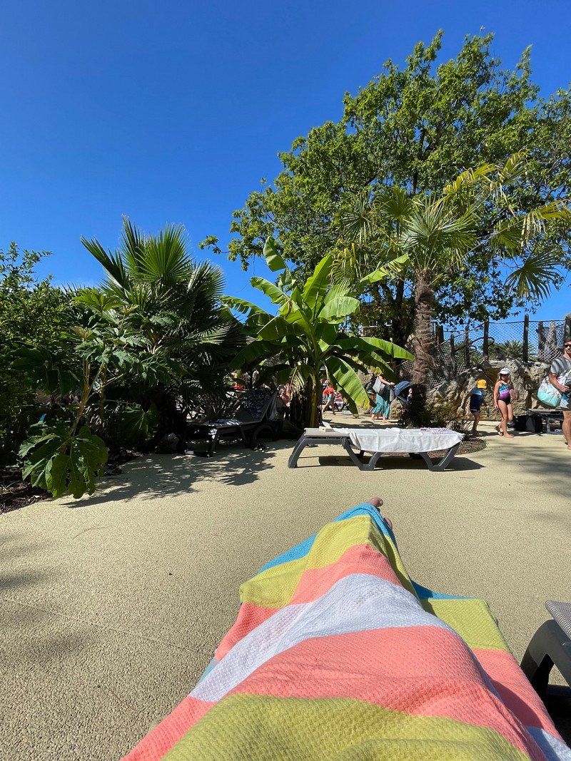
Today we sleep in, do laundry, do some cleaning and use the pool area.
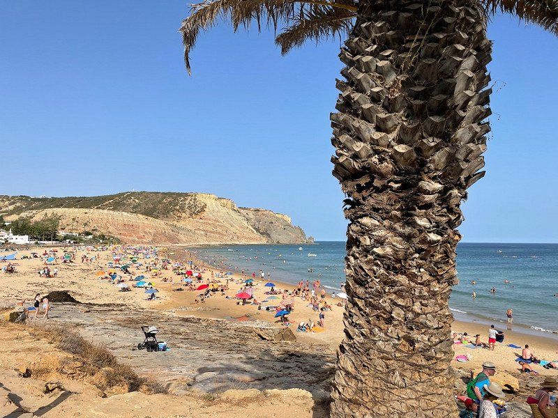
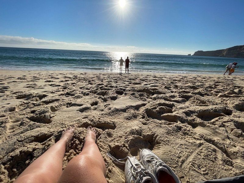
Towards the evening we still feel a little thirst for discovery and we start by bike to the beach in Luz (it was pretty hot 🥵). We go briefly into the sea and stroll through the place, which we like because of its small size and - despite tourism - preserved originality.
turiscampo, 8600 Luz, Portugal
37° 6' 8.7" N 8° 44' 2.4" W
37.1024123 -8.7340069
• Head toward Travessa do Açougue on Rua França Borges. Go for 37 m.
• Turn slightly left onto Travessa do Açougue. Go for 4 m.
• Turn left onto Travessa do Açougue. Go for 17 m.
• Turn left onto Rua Joaquim Bernardo de Souza Lobo. Go for 68 m.
• Turn right onto Rua Mouzinho de Albuquerque. Go for 83 m.
• Keep left onto Rua Mouzinho de Albuquerque. Go for 139 m.
• Turn left onto Avenida dos Bombeiros Voluntários (N242). Go for 151 m.
• Take the 3rd exit from Rotunda do Matadouro roundabout onto Avenida Nogent-Sur Marne (N242). Go for 283 m.
• Take the 3rd exit from Rotunda da Cerâmica roundabout onto Avenida Nogent-Sur Marne (N242). Go for 483 m.
• Take the 3rd exit from roundabout onto Rua 25 de Abril. Go for 675 m.
• Turn right onto Rua das Figueiras. Go for 100 m.
• Turn left onto Largo de Touros. Go for 152 m.
• Continue on Rua da Fonte Nova. Go for 10 m.
• Continue on Rua Teófilo Braga. Go for 53 m.
• Continue on Rua Teófilo Braga. Go for 120 m.
• Continue on Rua Dom Fuas Roupinho. Go for 60 m.
• Turn right onto Rua Brito Alão. Go for 137 m.
• Turn slightly right onto Rua Brito Alão. Go for 131 m.
• Turn right onto Estrada do Farol. Go for 168 m.
• Arrive at Estrada do Farol. Your destination is on the left.
☍
2,9 km
( 7 min.)
Day
Turiscampo, Luz, Portugal
Sunday 24.07.
We sleep in, have breakfast in peace and then take the bus to Lagos at a little after one. It's 40 degrees again (hopefully it will be a bit cooler soon, the weather forecast gives hope) and we walk through the sun-warmed streets of the city. It smells like brackish water everywhere, it's hot, crowded, loud. Maybe that's why we don't 'warm' with this city. We flee to a beautiful, but hopelessly overcrowded, rocky beach where, to make matters worse, we sit next to a horde of drunk tourists. We are almost happy when the bus drives back shortly after 5 p.m.
We end the evening with Portuguese folklore on the Turiscampo.
turiscampo, 8600 Luz, Portugal
37° 6' 8.7" N 8° 44' 2.4" W
37.1024123 -8.7340069
• Head toward Rua Brito Alão on Estrada do Farol. Go for 249 m.
• Continue on Largo de Nossa Senhora da Nazaré. Go for 190 m.
• Continue on Rua 25 de Abril. Go for 895 m.
• Take the 3rd exit from roundabout onto N242. Go for 544 m.
• Pass 2 roundabouts and continue on N242. Go for 7.6 km.
• Take the 1st exit from roundabout onto Avenida Rainha Santa Isabel. Go for 996 m.
• Take the 1st exit from roundabout onto Avenida Clube Desportivo Pataiense (N242-4). Go for 1.6 km.
• Continue on Rua 25 de Abril (N242-4). Go for 1.0 km.
• Take the 3rd exit from roundabout onto Estrada de Alpedriz (N242-4). Go for 451 m.
• Continue on N242-4. Go for 1.4 km.
• Take ramp onto A8 (Autoestrada do Oeste) toward Lisboa. Go for 13.1 km.
• Continue on A17 (Autoestrada do Litoral Centro) toward Aveiro/Leiria Norte/Porto/(A29). Go for 118 km.
• Continue on A25 (Autoestrada da Costa da Prata) toward Viseu/Porto/(A29). Go for 9.5 km.
• Take exit 7 toward Porto onto A1 (Autoestrada do Norte). Go for 56.9 km.
• Take the exit toward Hospital/C.po Alegre onto Via Panorâmica Edgar Cardoso. Go for 890 m.
• Turn right onto Rua do Campo Alegre toward Baixa Centro. Go for 464 m.
• Turn right toward Boavista/Faculdade Direito. Go for 38 m.
• Turn left toward Praça da Galiza. Go for 80 m.
• Turn left onto Rua de Júlio Dinis toward Boavista. Go for 574 m.
• Enter the roundabout. Go for 167 m.
• Arrive at Praça Mouzinho de Albuquerque.
☍
214,7 km
(2 hrs. 12 min.)
Day
Turiscampo, Luz, Portugal
Monday 25.07.
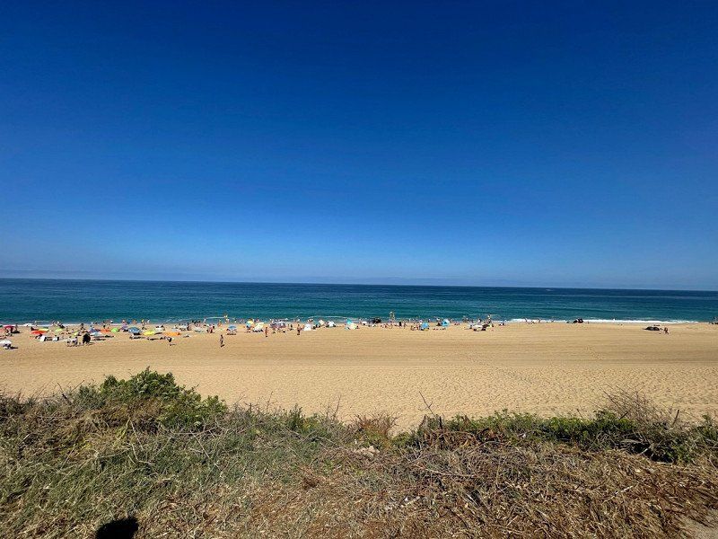
Around noon we cycle to the beach in Luz and spend a day at the beach there. It's a bit more bearable than yesterday, but still very hot.
The sea is fresh and serves to cool off, as does a drink round in a bar and a sofa ride. We have a delicious dinner at 'Endless Summer' before we battle our way back up the mountain to Turiscampo by bike.
turiscampo, 8600 Luz, Portugal
37° 6' 8.7" N 8° 44' 2.4" W
37.1024123 -8.7340069
• Follow the roundabout. Go for 94 m.
• Take the 1st exit from roundabout onto Avenida de França. Go for 532 m.
• Turn right onto Rua da Quinta Amarela. Go for 221 m.
• Turn left onto Rua de Oliveira Monteiro. Go for 254 m.
• Continue on Praça do Exército Libertador. Go for 157 m.
• Continue on Rua do Carvalhido. Go for 157 m.
• Turn right onto Rua de Sousa Pinto toward Lisboa/A1/Braga/A3/VCI/P.te Freixo/Aeroporto. Go for 230 m.
• Turn left onto Rua de Acácio Lino toward Lisboa/A1/Braga/A3/VCI/Ponte do Freixo/Aeroporto. Go for 148 m.
• Take the 1st exit from Rotunda Orlando Ribeiro roundabout toward Braga/A3/Vila Real/A4/P.te Freixo/IC23/Lisboa/A1/Aeroporto. Go for 150 m.
• Take ramp onto A20 (CRIP) toward P.te Freixo/Lisboa/A1/Braga/A3/V. Real/A4. Go for 2.2 km.
• Take the exit toward Valença/Braga/Vila Real/A4/Valongo onto A3 (Autoestrada do Minho). Go for 112 km.
• Continue on A-55. Go for 4.5 km.
• Take exit 26B toward Pontevedra/Vigo onto AP-9 (Autoestrada do Atlántico). Go for 110 km.
• Take exit 67 toward Centro Cidade Santiago/Lugo/Aeroporto Lavacolla (SCQ)/Santiago Norte/Centro Histórico onto SC-20 (Avenida de Camilo José Cela). Go for 2.1 km.
• Take ramp toward Aeroporto Lavacolla/Lugo/Oviedo/Meixonfrío. Go for 246 m.
• Take the 3rd exit from roundabout onto Avenida de Asturias toward Santiago de Compostela/Avda. Asturias/Meixonfrío. Go for 1.6 km.
• Take the 3rd exit from Estrada Mallou de Arriba roundabout onto Avenida do Cruceiro da Coruña. Go for 1.1 km.
• Continue on Rúa de San Caetano. Go for 322 m.
• Continue on Avenida de Xoán XXIII. Go for 720 m.
• Continue on Avenida de Xoán XXIII. Go for 420 m.
• Continue on Rúa Costa de San Francisco. Go for 45 m.
• Turn left onto Rúa de San Francisco. Go for 225 m.
• Turn slightly right onto Rúa de San Francisco. Go for 50 m.
• Turn slightly left onto Praza do Obradoiro. Go for 52 m.
• Continue on Rúa do Franco. Go for 37 m.
• Continue on Rúa Fonseca. Go for 64 m.
• Turn slightly right onto Praza das Praterías. Go for 17 m.
• Turn left onto Praza das Praterías. Go for 25 m.
• Turn right onto Rúa Conga. Go for 113 m.
• Continue on Rúa da Fonte Sequelo. Go for 24 m.
• Turn right onto Rúa de Xelmirez. Go for 57 m.
• Turn left onto Rúa Nova. Go for 264 m.
• Turn right onto Cantón do Toural. Go for 35 m.
• Turn right onto Praza do Toural. Go for 32 m.
• Turn right onto Rúa do Vilar. Go for 64 m.
• Arrive at Rúa do Vilar.
☍
238,6 km
(2 hrs. 19 min.)
Day
Turiscampo, Luz, Portugal
Tuesday, 07/26
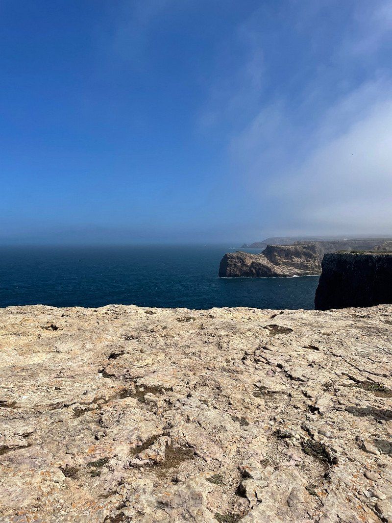
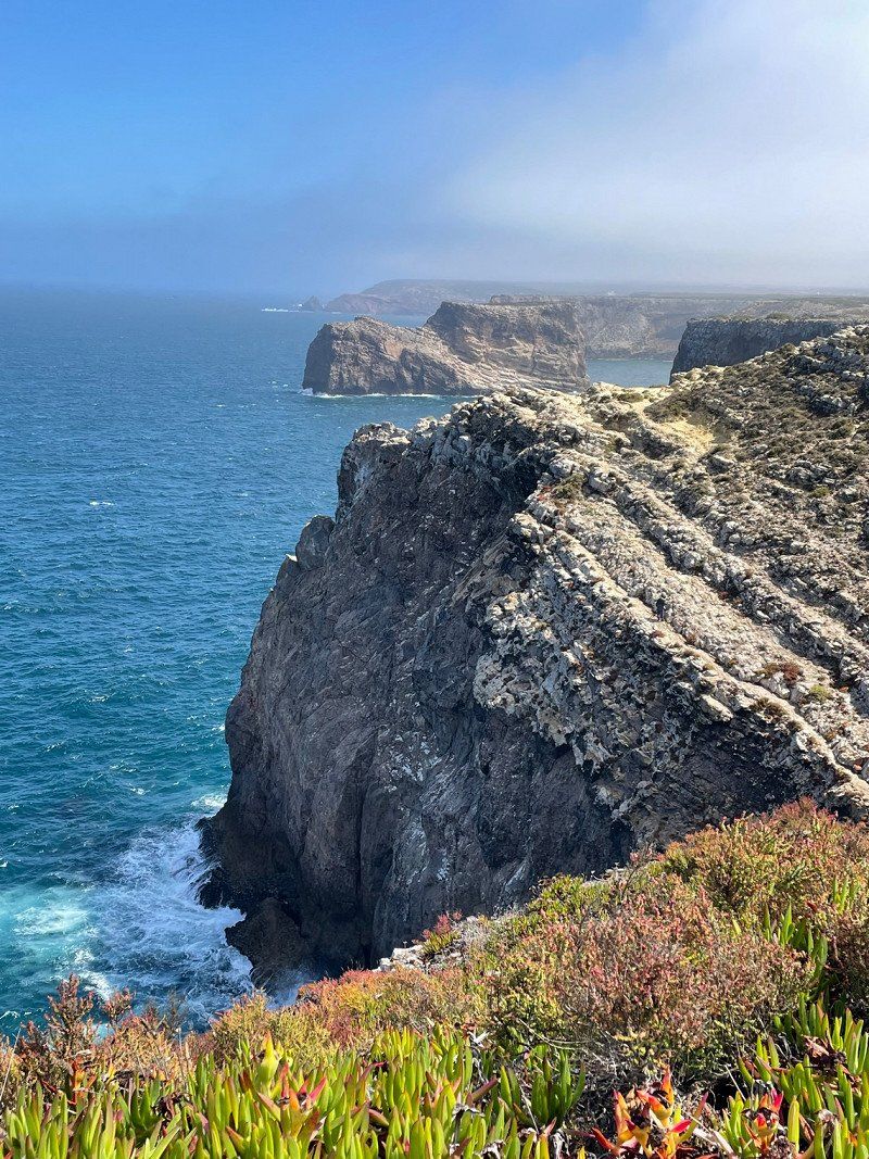
Today we take the bus to 'the end of the world', or at least what people used to think it was. The Cabo de Sao Vincente, on the extreme southwestern tip of the European mainland, is stormy and boasts great views from the steep coast down to the Atlantic.
Since the temperatures are a bit more pleasant (and the bus runs quite irregularly), we walk to Sagres via the Fishermen's Trail. The approximately 7.5 kilometers offer beautiful views.
In Sagres we have a snack on the beach and then take the bus back to the campsite.
turiscampo, 8600 Luz, Portugal
37° 6' 8.7" N 8° 44' 2.4" W
37.1024123 -8.7340069
• Head toward Travesa do Franco on Rúa do Vilar. Go for 189 m.
• Continue on Praza das Praterías. Go for 25 m.
• Turn right onto Rúa Conga. Go for 113 m.
• Turn left onto Rúa Conga. Go for 30 m.
• Turn slightly right onto Praza de Feixoo. Go for 26 m.
• Turn right onto Rúa do Preguntoiro. Go for 33 m.
• Keep left onto Rúa do Castro. Go for 51 m.
• Turn slightly right onto Praza de Entrepraciñas. Go for 21 m.
• Continue on Praza da Fonte Seca. Go for 14 m.
• Continue on Praza da Universidade. Go for 56 m.
• Continue on Praza de Mazarelos. Go for 45 m.
• Continue on Rúa de Mazarelos. Go for 68 m.
• Turn right onto Rúa da Fonte de Santo Antonio. Go for 162 m.
• Arrive at Rúa da Fonte de Santo Antonio. Your destination is on the left.
☍
0,8 km
( 2 min.)
Day
Turiscampo, Luz, Portugal
Wednesday, 07/27
Today we 'chill the base' before we continue tomorrow. We play something, go to the pool and have a nice meal in the restaurant.
turiscampo, 8600 Luz, Portugal
37° 6' 8.7" N 8° 44' 2.4" W
37.1024123 -8.7340069
• Head southwest on Rúa da Fonte de Santo Antonio.
• Continue on Rúa Senra. Go for 27 m.
• Turn left onto Praza de Galicia. Go for 77 m.
• Turn right onto Rúa Montero Ríos. Go for 12 m.
• Turn left onto Rúa Doutor Teixeiro. Go for 308 m.
• Turn left onto Rúa da República Arxentina. Go for 94 m.
• Turn right onto Rúa do Hórreo. Go for 223 m.
• Take the 2nd exit from roundabout onto Avenida de Lugo. Go for 1.1 km.
• Keep left onto Avenida de Gonzalo Torrente Ballester (SC-20) toward A-54/Oviedo/Aeroporto/E-1/A Coruña/AP-9/Pontevedra. Go for 1.8 km.
• Keep left onto Avenida de Gonzalo Torrente Ballester (SC-20) toward Oviedo/A-54/Aeroporto/A Coruña/E-1/Pontevedra/AP-9. Go for 868 m.
• Take ramp toward A Coruña/Pontevedra. Go for 213 m.
• Take the 1st exit from roundabout onto AP-9 (Autoestrada do Atlántico) toward A Coruña/Ferrol. Go for 50.8 km.
• Take exit 16 toward E-70/A-6/Arteixo/Lugo/Madrid onto AP-9. Go for 1.5 km.
• Take the left exit toward E-70/Lugo/Madrid onto A-6 (Autovía do Noroeste). Go for 46.1 km.
• Take exit 522AB toward Oviedo onto A-8 (Autovía do Cantábrico). Go for 78.3 km.
• Take exit 516 toward N-634/Reinante/Rinlo/Praia das Catedrais. Go for 1.5 km.
• Take ramp. Go for 45 m.
• Take the 2nd exit from roundabout onto Estrada LU-P-5206 toward Playa de as Catedrais. Go for 603 m.
• Take the 2nd exit from roundabout onto Estrada LU-P-5206. Go for 449 m.
• Turn right. Go for 101 m.
• Arrive at your destination.
☍
184,3 km
(1 hrs. 38 min.)
Day
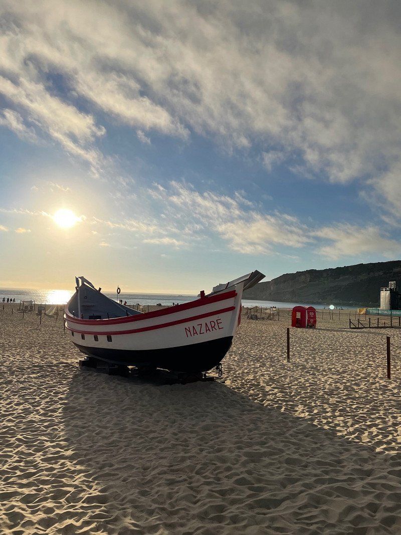
Nazaré, Portugal
Thursday, 07/28
After shopping in the Intermarche, the trip goes to the dream city of surfers.
For lack of other alternatives, we stay overnight at Orbitur campsite, which doesn't really belong in the 'beautiful' category, even though it does have a pool.
We walk into the city, which doesn't really appeal to us. But we like the beach with its waves. It's (finally) gotten a little fresh.
2450 Nazaré, Portugal
39° 36' 4.4" N 9° 4' 12.4" W
39.6012147 -9.0700991
• Head southwest. Go for 97 m.
• Turn right toward Estrada LU-P-5206. Go for 12 m.
• Turn left onto Estrada LU-P-5206. Go for 388 m.
• Take the 1st exit from roundabout onto Estrada LU-P-5206. Go for 574 m.
• Take the 2nd exit from roundabout toward Oviedo/A Coruña. Go for 150 m.
• Take ramp onto A-8 (Autovía do Cantábrico) toward Ribadeo/Oviedo. Go for 155 km.
• Take the left exit toward Villaviciosa/Santander onto A-8 (Autovía del Cantábrico). Go for 98.1 km.
• Take exit 264 toward San Vicente de la Barquera/La Acebosa. Go for 391 m.
• Take the 3rd exit from roundabout onto CA-843 toward San Vicente de la Barquera/E-70/A-8/Unquera/Oviedo. Go for 247 m.
• Take the 1st exit from roundabout. Go for 96 m.
• Continue on CA-843. Go for 1.6 km.
• Enter the roundabout. Go for 39 m.
• Arrive at your destination on the left.
☍
257,1 km
(2 hrs. 14 min.)
Day
Farol da Nazaré, Nazaré, Portugal
Friday, 07/29/2022
Before we continue, let's take a look at the headland with the lighthouse this morning, where the infamous monster waves break in winter. The interesting, small exhibition shows the boards of the wave conquerors and how the waves are formed. We also pay a visit to the pilgrimage church of Nazaré.
Estr. do Farol, 2450 Nazaré, Portugal
39° 36' 17.3" N 9° 4' 48.4" W
39.6048097 -9.0801054
• Follow the roundabout. Go for 56 m.
• Take the 3rd exit from roundabout onto CA-843. Go for 1.6 km.
• Continue toward CA-847. Go for 47 m.
• Take the 2nd exit from roundabout onto CA-843. Go for 181 m.
• Take the 2nd exit from roundabout onto A-8 (Autovía del Cantábrico) toward Cabezón de la Sal/Santander. Go for 63.9 km.
• Take the exit onto A-8 (Autovía del Cantábrico). Go for 70.3 km.
• Keep left onto AP-8 toward Balmaseda/BI-636/Bilbao/Miribilla/Vitoria-Gasteiz/Donostia/S. Sebastián. Go for 14.9 km.
• Take the exit toward Donostia/San Sebastián/E-804/Vitoria-Gasteiz/AP-68 onto A-8 (Autovía del Cantábrico). Go for 1.6 km.
• Keep left onto AP-8 (Autopista del Cantábrico) toward A-8/Donostia-San Sebastián. Go for 86.4 km.
• Take the exit toward Hernani/Pasaia/Irun/Baiona/Bordeaux onto AP-1/AP-8 (Segundo Cinturón de San Sebastián). Go for 14.6 km.
• Take the exit onto AP-8. Go for 12.7 km.
• Continue on A63 (Autoroute de la Côte Basque). Go for 39.1 km.
• Take exit 7 toward Labenne/Boucau-Tarnos/Ondres. Go for 1.1 km.
• Take the 3rd exit from roundabout onto D85 toward Labenne/Ondres. Go for 2.0 km.
• Take the 1st exit from roundabout onto D810 toward Bordeaux/Mont de Marsan/Dax/Capbreton/Labenne/Ondres. Go for 3.5 km.
• Pass 2 roundabouts and continue on Avenue Charles de Gaulle (D810). Go for 1.2 km.
• Take the 4th exit from roundabout onto Rue des Marguerites. Go for 326 m.
• Take the 1st exit from roundabout onto Rue des Marguerites. Go for 335 m.
• Turn left onto Rue des Châtaigniers. Go for 336 m.
• Take the 3rd exit from roundabout onto Route Océane (D126). Go for 1.0 km.
• Take the 1st exit from roundabout onto Avenue de l'Océan (D126). Go for 857 m.
• Turn right onto Avenue de la Plage. Go for 112 m.
• Turn right onto Pont de la Mer. Go for 102 m.
• Turn slightly left onto Pont de la Mer. Go for 88 m.
• Arrive at Pont de la Mer. Your destination is on the right.
☍
316,1 km
(3 hrs. 8 min.)
Porto, Portugal
That was probably nothing! Somehow Portugal seems a bit womounfriendly to us. We actually want to visit Porto. But there are only a few parking spaces and if there are, then nothing is available spontaneously. Postage is full. So we continue to Spain.
41° 9' 28.6" N 8° 37' 44.8" W
41.1579438 -8.6291053
• Head east on Pont de la Mer. Go for 60 m.
• Turn slightly right onto Pont de la Mer. Go for 228 m.
• Turn left onto Avenue de l'Océan (D126). Go for 845 m.
• Pass 3 roundabouts and continue on Avenue de l'Océan (D126). Go for 1.9 km.
• Turn left onto Avenue du Général Charles de Gaulle (D810). Go for 322 m.
• Take the 1st exit from Avenue Jean Lartigau roundabout onto Avenue du Général Charles de Gaulle (D810) toward Bordeaux/A63/Dax/Bénesse-Mmne/St V. de Tyrosse. Go for 5.6 km.
• Take the 3rd exit from Route de Bayonne roundabout onto Route de Capbreton (D28) toward A63/Capbreton/Hossegor/Z.I. d'Arriet. Go for 281 m.
• Pass 2 roundabouts and continue on D28. Go for 1.7 km.
• Take the 2nd exit from roundabout onto A63 toward Dax/Mt de Marsan/Arcachon/Bordeaux. Go for 157 km.
• Take the exit toward Paris/Toulouse/Bordeaux/Talence onto A630 (Rocade de Bordeaux). Go for 9.2 km.
• Keep left onto Rocade de Bordeaux (N230) toward Paris/A10/Lyon/A89. Go for 10.2 km.
• Take left ramp onto A10 toward E606/Paris/Nantes/Angoulême/Saintes. Go for 365 km.
• Take exit 18 toward Château-Renault/Chartres/Autrèche/Amboise onto D31. Go for 1.1 km.
• Take the 2nd exit from roundabout onto Lieu-dit La Rivonnerie (D31) toward Autrèche/Amboise/Parc d'Activités-Porte de Touraine. Go for 1.6 km.
• Turn slightly left onto Rue du Général de Gaulle (D55) toward Dame-Marie Les Bois/Morand/Centre-Bourg/Onzain. Go for 455 m.
• Continue on D55. Go for 45 m.
• Continue on Rue du Général de Gaulle (D55). Go for 90 m.
• Continue on D55. Go for 1.8 km.
• Continue on Lieu-dit La Tiercerie (D55). Go for 104 m.
• Continue on D55. Go for 244 m.
• Continue on Rue du Vau Corneille (D55). Go for 305 m.
• Continue on D55. Go for 46 m.
• Continue on Rue du Vau Corneille (D55). Go for 354 m.
• Continue on Rue de Blemars (D55). Go for 110 m.
• Turn right onto Rue du Pavot (D274). Go for 999 m.
• Continue on Lieu-dit Le Pavot (D274). Go for 443 m.
• Continue on Route de Dame Marie (D43). Go for 153 m.
• Continue on D43. Go for 2.5 km.
• Continue on Lieu-dit Les Caves (D43). Go for 94 m.
• Continue on D43. Go for 460 m.
• Continue on Route de Dame Marie (D43). Go for 564 m.
• Continue on D43. Go for 219 m.
• Continue on Lieu-dit La Croix (D43). Go for 497 m.
• Continue on D43. Go for 543 m.
• Continue on Lieu-dit La Croix (D43). Go for 174 m.
• Continue on Lieu-dit Les Pérets (D43). Go for 1.0 km.
• Continue on Grande Rue (D43). Go for 324 m.
• Turn left onto Grande Rue (D43). Go for 119 m.
• Continue on Route d'Onzain (D43). Go for 157 m.
• Take the 1st exit from roundabout onto Route d'Onzain (D43). Go for 1.8 km.
• Continue on Lieu-dit Domaine des Hauts de Loire (D1). Go for 153 m.
• Continue on D1. Go for 829 m.
• Continue on Rue Gilbert Navard (D1). Go for 1.5 km.
• Continue on Grande Rue (D1). Go for 53 m.
• Arrive at Grande Rue (D1). Your destination is on the left.
☍
570,8 km
(5 hrs. 12 min.)
Santiago de Compostela, Spanien
We land a little north of Santiago on the Lavacolla pitch.
Santiago de Compostela, Provinz A Coruña, Spanien
42° 52' 41.6" N 8° 32' 41.4" W
42.8782132 -8.5448445
• Head northeast on Grande Rue (D1).
• Turn right onto Rue Gustave Marc (D1). Go for 466 m.
• Continue on Avenue de la République (D1). Go for 691 m.
• Continue on Avenue du Général de Gaulle (D1). Go for 716 m.
• Take the 3rd exit from roundabout onto D952 toward Blois/Chambord/Chouzy S/C. Go for 6.8 km.
• Take the 1st exit from roundabout onto D952 toward Blois/Chambord. Go for 11.4 km.
• Take ramp onto Avenue de Verdun (D956). Go for 741 m.
• Keep left onto Boulevard des Cités Unies (D956) toward Orléans/Tours/Chartres/Le Mans/Angers/Blois-Nord. Go for 1.2 km.
• Turn right toward A10/Villerbon/PA A10/PA Gailletrous. Go for 453 m.
• Continue on D956. Go for 635 m.
• Take the 3rd exit from Rond-Point des Châteaux roundabout onto D952 A toward Orléans/Orleans/Tours. Go for 576 m.
• Take ramp onto A10 (L'Aquitaine) toward Paris/Orléans. Go for 158 km.
• Take the exit toward Lille/A1/Paris/A6/Rungis/Aéroport Orly onto A10. Go for 3.6 km.
• Keep right toward A6 B/E15/A86/A1/Lille/Rungis/Aéroport Orly. Go for 817 m.
• Continue on A6 B. Go for 9.4 km.
• Take the exit onto Boulevard Périphérique. Go for 2.8 km.
• Keep left onto Boulevard Périphérique. Go for 4.9 km.
• Take ramp onto A3 toward A16/Lille/Aéroport Ch. de Gaulle/Bobigny. Go for 15.2 km.
• Take the exit toward A16/Cergy-Pontoise/A15/Lille onto A1 (Autoroute du Nord). Go for 124 km.
• Keep right onto A2 toward Cambrai/Valenciennes/Bruxelles/Liège. Go for 77.1 km.
• Continue on E19. Go for 37.0 km.
• Keep right onto E42 toward Liège/Charleroi/La Louvière/Garocentre Sud/Magnapark. Go for 104 km.
• Continue on E40. Go for 49.5 km.
• Continue on A44. Go for 10.4 km.
• Take exit 4 toward Köln onto A4. Go for 52.2 km.
• Take the exit toward Dortmund/Düsseldorf/Köln-Nord onto A1. Go for 107 km.
• Take exit 82 toward Hannover/Bielefeld onto A2. Go for 11.7 km.
• Take exit 18 toward Hamm. Go for 325 m.
• Turn left onto Werler Straße (B63) toward Hamm. Go for 3.5 km.
• Continue on Werler Straße (B63) toward Münster/Zentrum/Zentralhallen. Go for 1.5 km.
• Turn left onto Richard-Wagner-Straße (B63) toward Münster/Kamen/Zentrum/Hafen/Zentralhallen. Go for 1.5 km.
• Turn left onto Schillerstraße. Go for 80 m.
• Turn right onto Taubenstraße. Go for 38 m.
• Arrive at Taubenstraße.
☍
798,8 km
(8 hrs. 11 min.)
Day
Santiago de Compostela, Spanien
Sat 07/30/2022
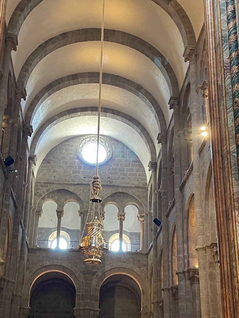
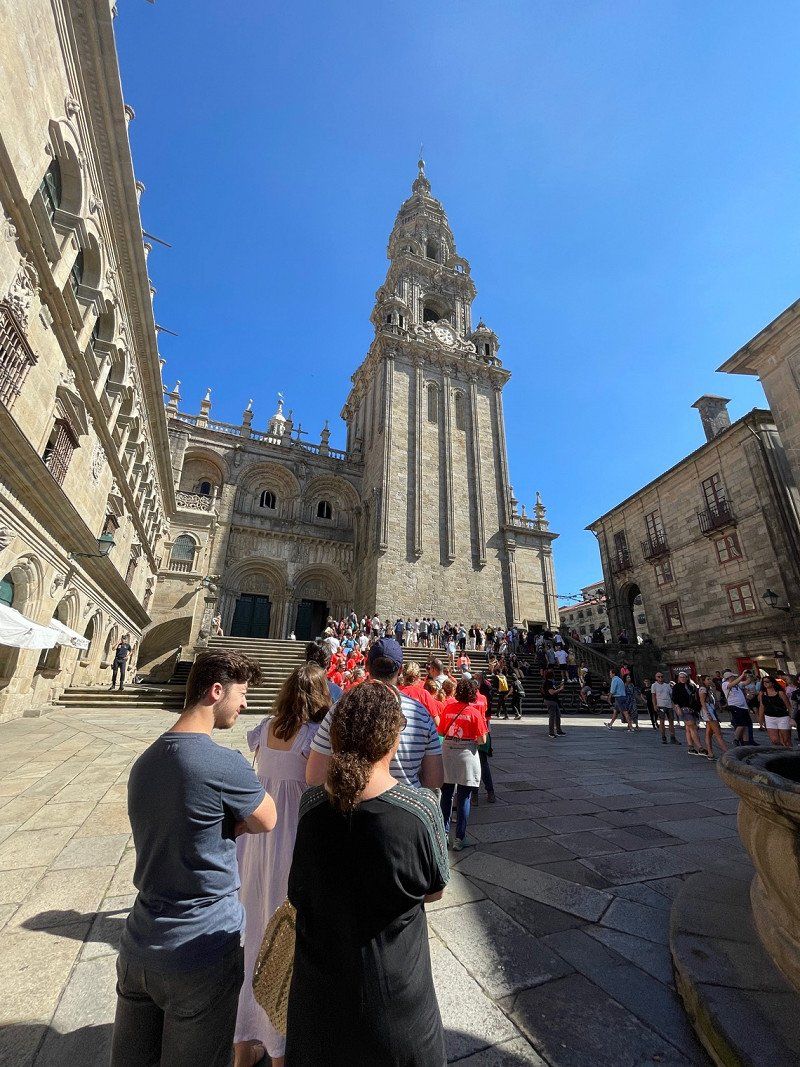
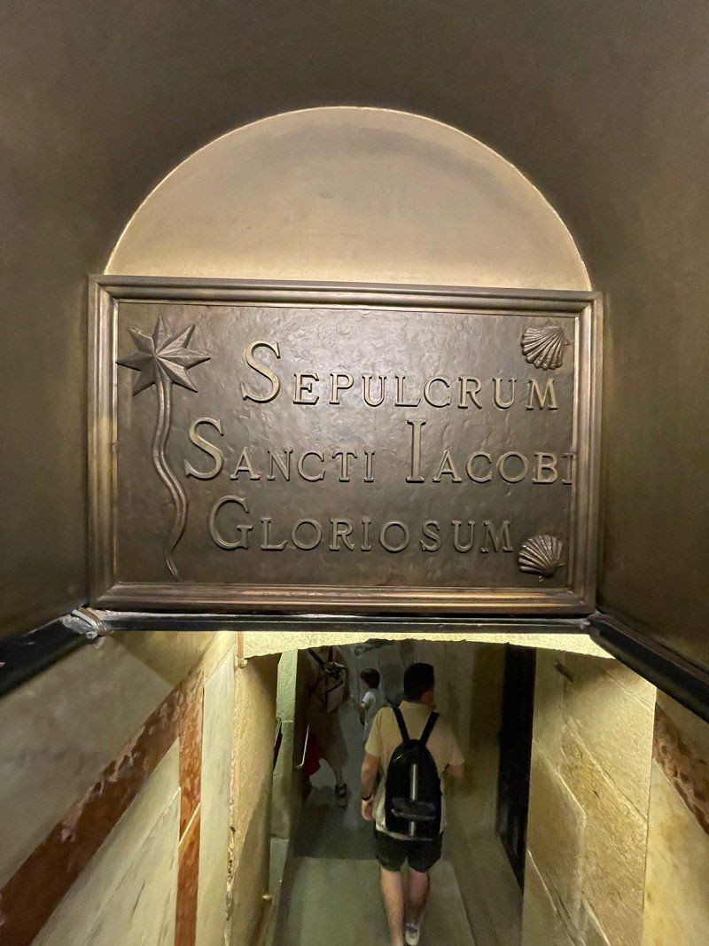
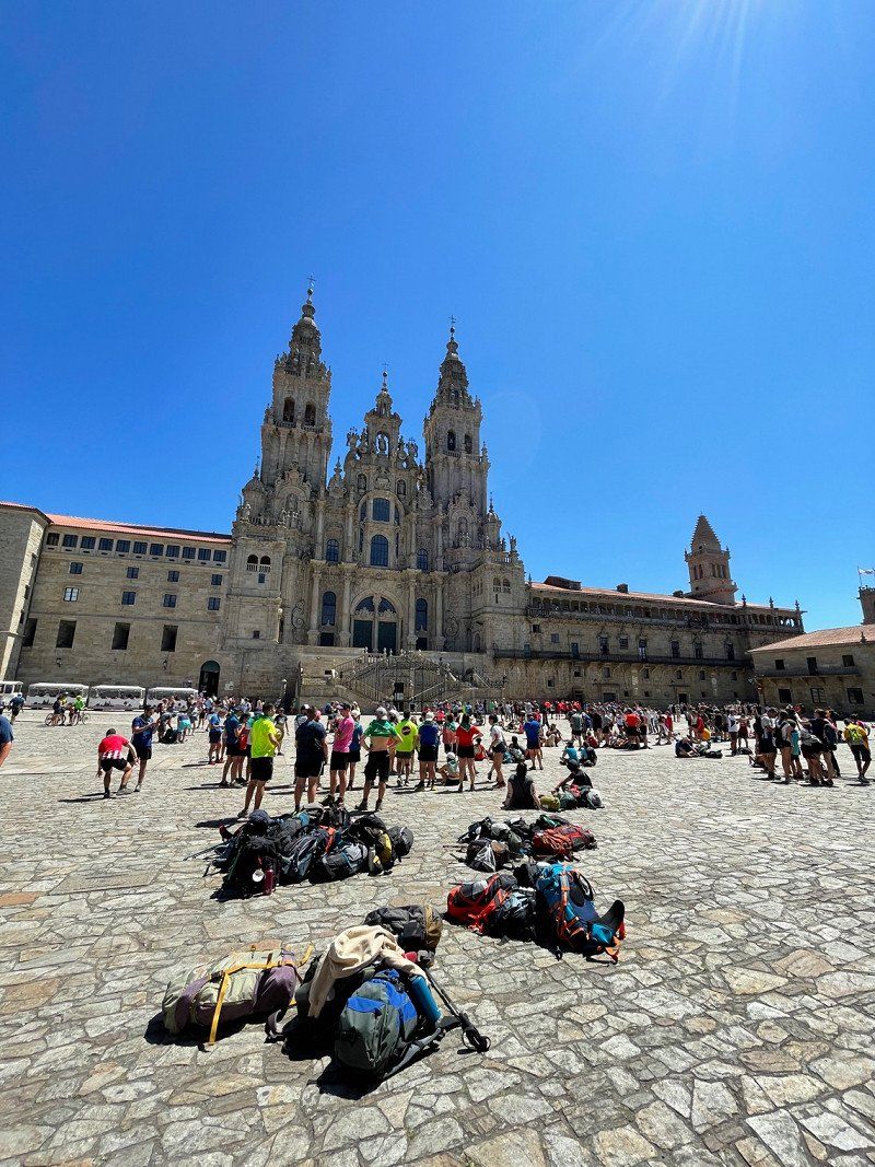
Our pitch is almost directly on the Camino and so we decided to walk the last six or seven kilometers to the tomb of the apostle James in the cathedral.
It is something special to see the many pilgrims and to look forward to your arrival with them on the main square of the cathedral. Many only ran the last 114 kilometers, but many also ran the entire 800km of the Camino Frances or even further.
Santiago de Compostela, Provinz A Coruña, Spanien
42° 52' 36.7" N 8° 32' 39" W
42.8768606 -8.5441729
Day
Praia das Catedrais, Spanien
Sun. 07/31/2022
In the morning we meet, quite spontaneously, with one of our friends' former exchange students for breakfast.
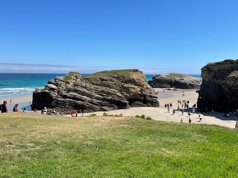
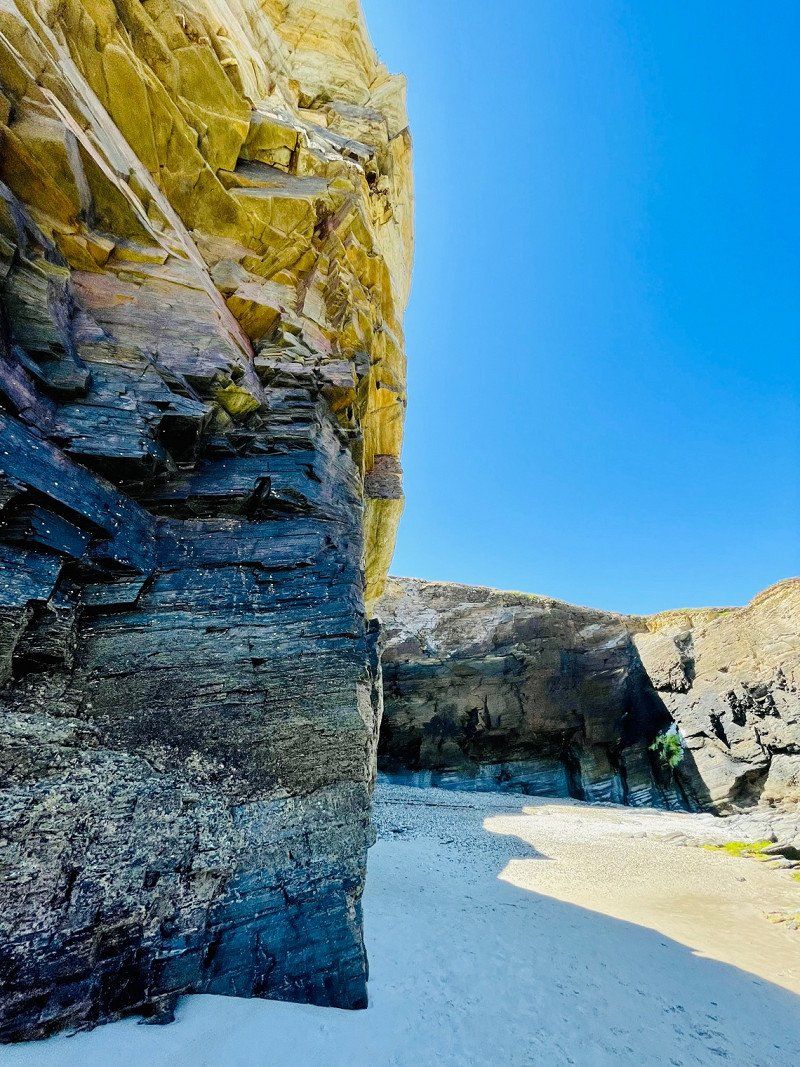
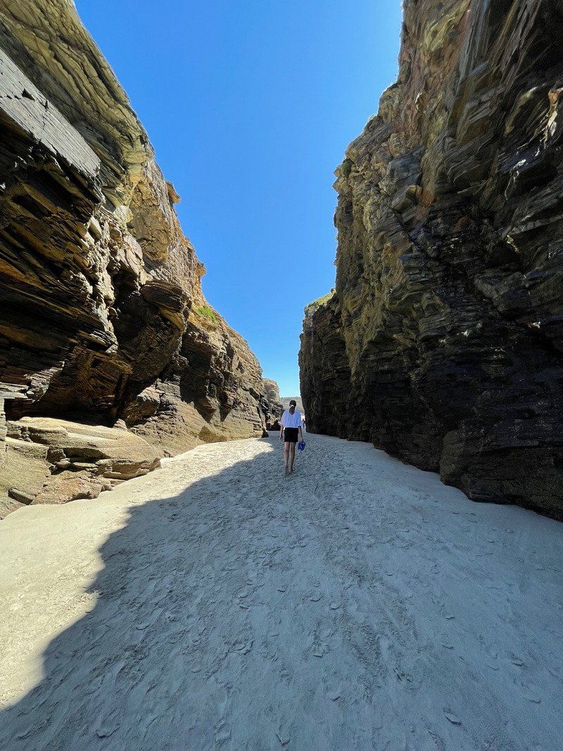
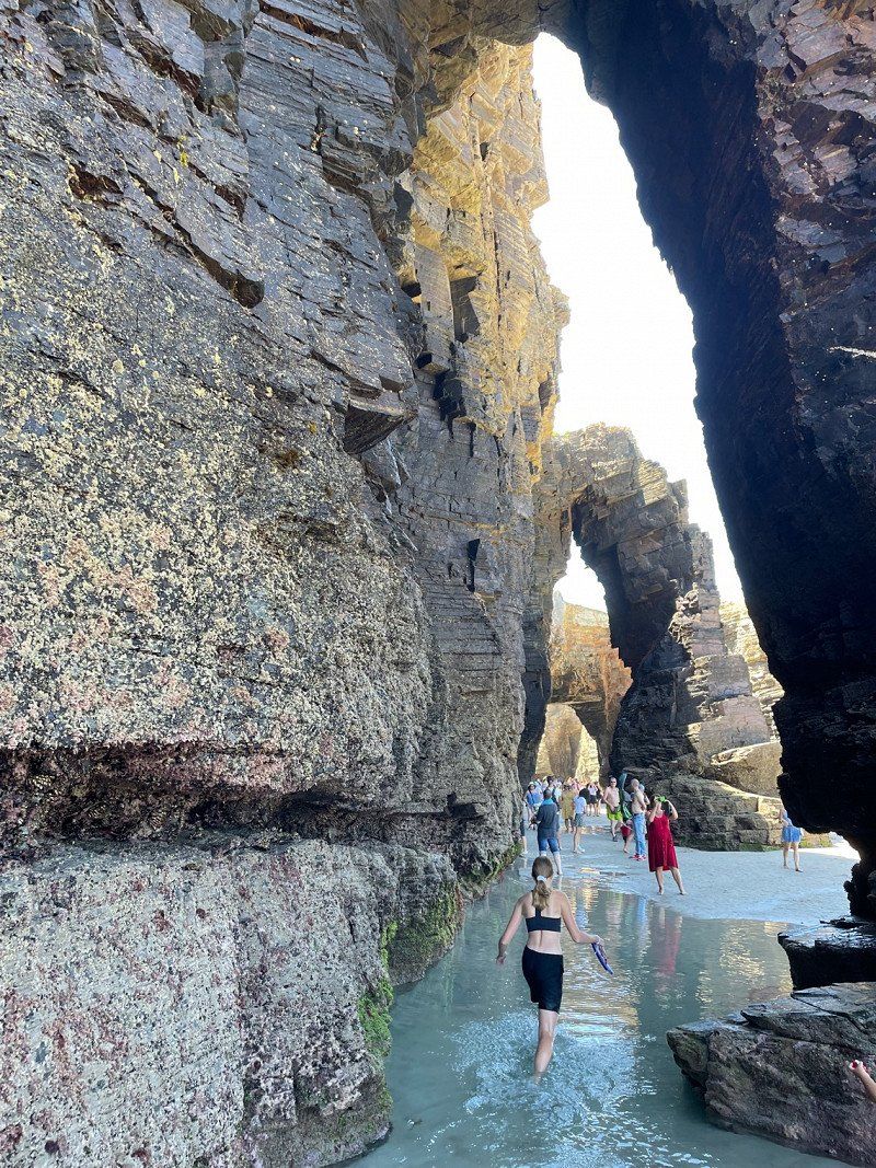
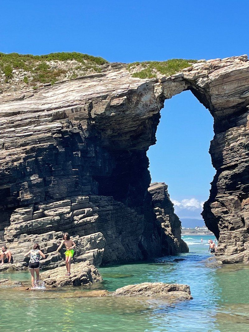
We then head north because we have a registration (required in summer) for Praia das catedrais, the cathedral beach. Since its impressive rock arches and formations are only accessible at low tide, we have to be there around 1 p.m., which we manage to do. We walk along the impressive beach and we also like the surroundings. The north, much greener than the south and east of Spain, is more scenic for us.
After a lunchtime snack in a nearby café, we drive a little further east because we want to be in France by Monday.
As Catedrais beach, Spanien
43° 33' 14.6" N 7° 9' 26" W
43.5540577 -7.1572259
San Vicente de la Barquera, Spanien
Overnight on a pitch near the beach.
39540 San Vicente de la Barquera, Cantabria, Spanien
43° 22' 52.7" N 4° 23' 49.4" W
43.3813069 -4.3970580
Day
Yelloh! Village Sylvamar*****
Monday, 08/01/2022
The teenager wanted another night at a campsite with a great pool, so we stay one night at the Yelloh Sylvamar on the French Atlantic coast.
Avenue de l'océan 59, 40530, Labenne, Frankreich
43° 35' 51" N 1° 27' 28" W
43.5975000 -1.4577700
Day
Veuzain-sur-Loire, Frankreich
Tuesday 08/02/2022
It draws us home. We begin our return journey to Germany and spend one more night on the Loire on French soil.
41150 Veuzain-sur-Loire, Frankreich
47° 29' 59.5" N 1° 10' 26" E
47.4998614 1.1738840
Day
Hamm, Deutschland
Wednesday, 08/03/2022
The sat nav is set to 'home' and we get by pretty well. In the evening we reach Hamm again after almost 6500 km. Conclusion of our trip: We saw a lot of beautiful things and have become all the bigger fans of Europe. It's great that we can travel without restrictions on our continent and the similarities between the individual countries and people are greater than the differences. We're thankful! Because we wanted to see a lot and our travel time is limited, rest and relaxation were a bit too short due to the long travel times. In the coming year we will therefore drive a shorter total distance.
51° 40' 25.9" N 7° 48' 57.5" E
51.6738583 7.8159816