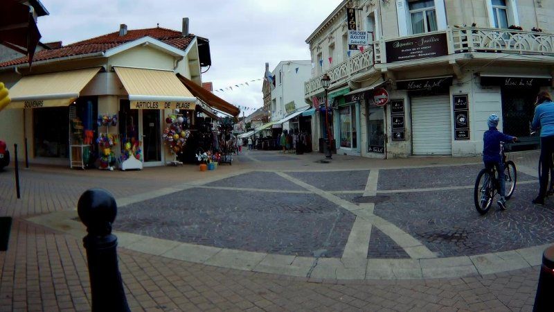
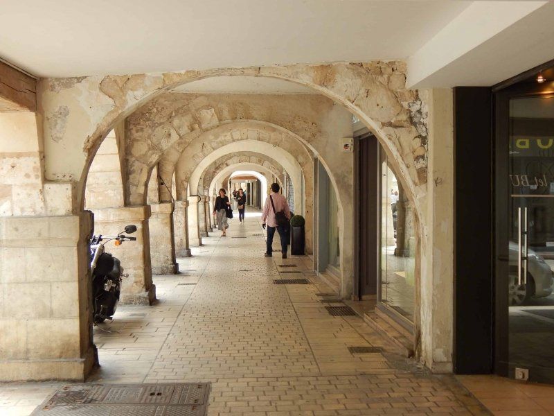
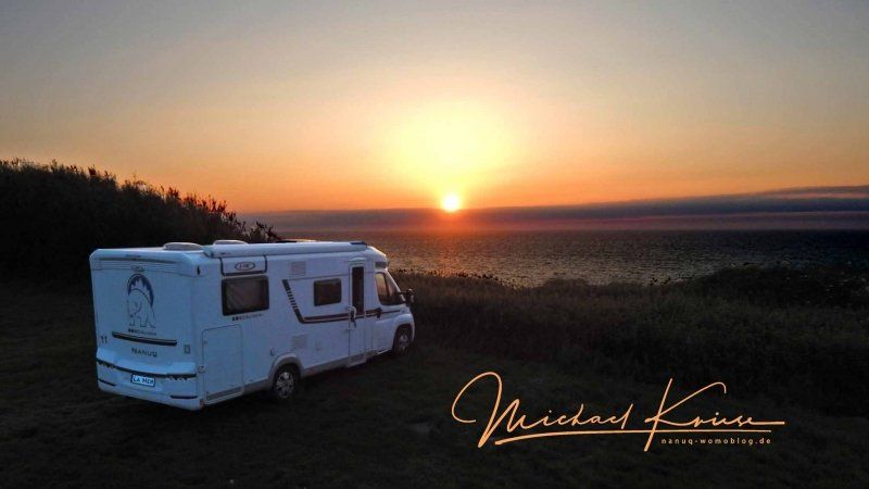
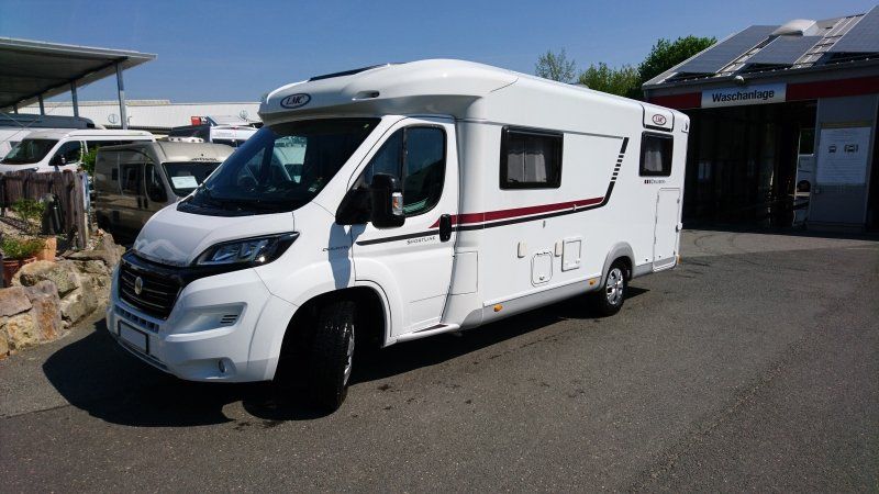
We spent our big holiday in France in 2018, more precisely on France's west coast. To do this, it was originally supposed to go from Frankfurt to the La Rochelle area and then, always along the coast, in a southerly direction. However, on the way we decided for various reasons to reverse the route from Chambord, i.e. first through the hinterland to the south and then north along the coast.
You can find more information and tips about mobile travel on our homepage nanuq-womoblog.de, on YouTube at youtube.com/NanuqWomoBlog or on Facebook at facebook.com/nanuqwomoblog
Day
Campingplatz Mainkur, Frankfurter Landstraße, Maintal, Deutschland
As always, we started from our "base station" in the evening to avoid the rush hour traffic in the Rhine-Main area and to get a little further towards our destination.
50° 8' 17.7" N 8° 46' 58.4" E
50.1382638 8.7828941
• Head toward Hanauer Landstraße on Frankfurter Landstraße. Go for 442 m.
• Turn left onto Hanauer Landstraße (B8/B40). Go for 3.9 km.
• Turn left onto B8/B40 toward Darmstadt/A661/Flughafen Frankf. Kreuz/Offenbach. Go for 79 m.
• Take ramp onto A661 toward Darmstadt/Flughafen Frankf. Kreuz/Offenbach. Go for 5.4 km.
• Take exit 17 toward Köln/Wiesbaden/Flughafen F. Kreuz onto A3. Go for 17.6 km.
• Take exit 48 toward Raunheim onto B43. Go for 9.7 km.
• Continue on Rugbyring (B43). Go for 4.9 km.
• Keep left onto B43 toward Wiesbaden. Go for 460 m.
• Take ramp onto A671 toward Darmstadt/Koblenz/Mainz. Go for 1.4 km.
• Take exit 7 toward Koblenz/Bingen/Mainz/Ginsheim-Gustavsburg onto A60. Go for 8.5 km.
• Take exit 21 toward Kaiserslautern/Ludwigshafen/Alzey onto A63. Go for 70.5 km.
• Continue on Dreieck Kaiserslautern. Go for 343 m.
• Continue on A6. Go for 39.0 km.
• Take exit 9 toward Homburg/Bexbach. Go for 372 m.
• Turn right onto B423 toward Glan-Münchweiler/Jägersburg/Bexbach. Go for 518 m.
• Turn left and take ramp toward Kirkel. Go for 217 m.
• Turn left onto L219 toward Kirkel/Altstadt. Go for 1.2 km.
• Continue on Ortsstraße (L219). Go for 648 m.
• Turn right onto Bexbacher Straße (L116) toward Bexbach/Niederbexbach. Go for 2.8 km.
• Turn left onto Im Blumengarten. Go for 316 m.
• Arrive at Im Blumengarten. Your destination is on the right.
☍
168,4 km
(1 hrs. 46 min.)
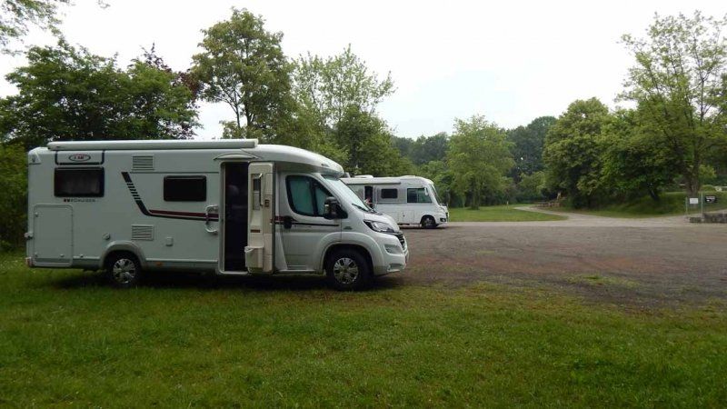
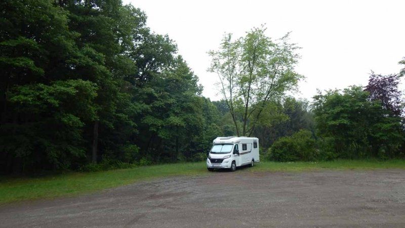
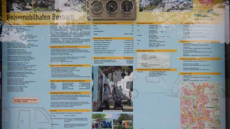
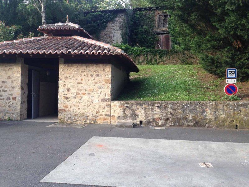
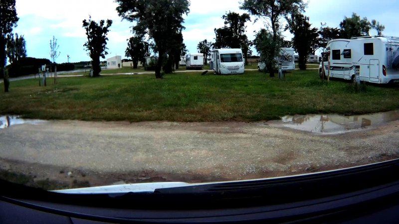
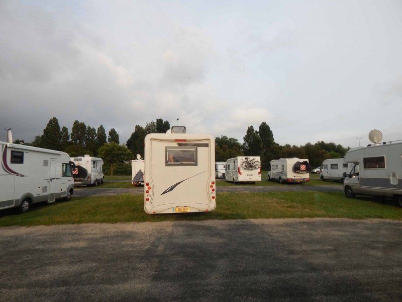
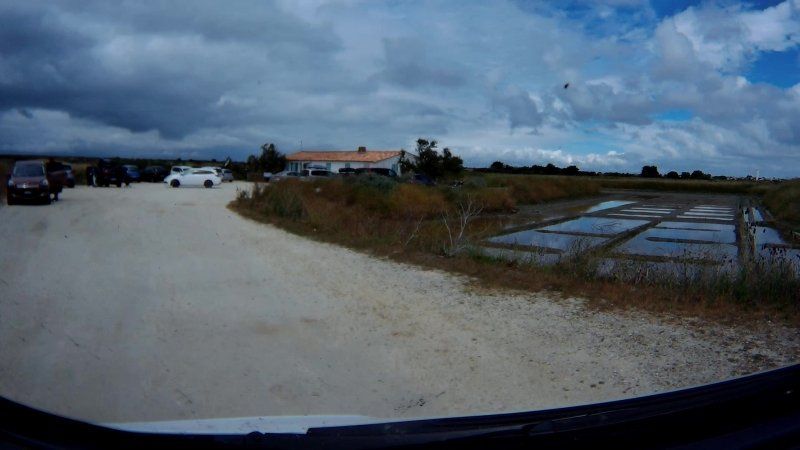
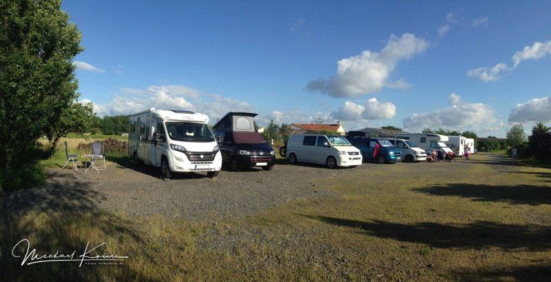
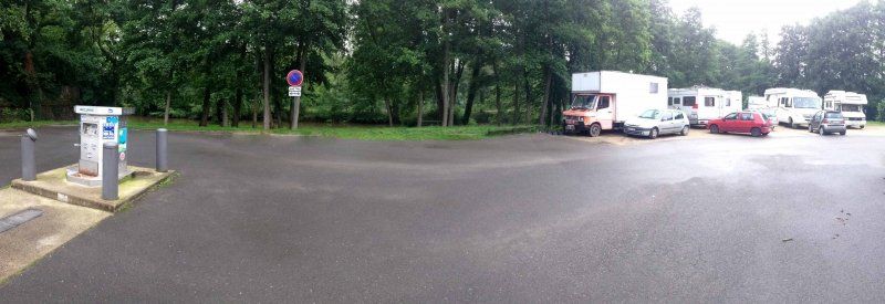
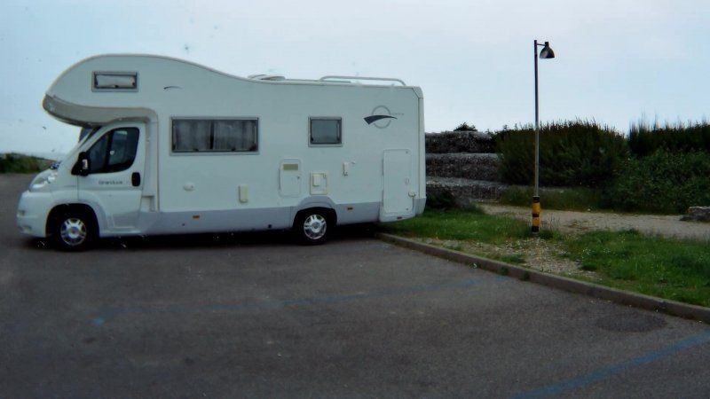
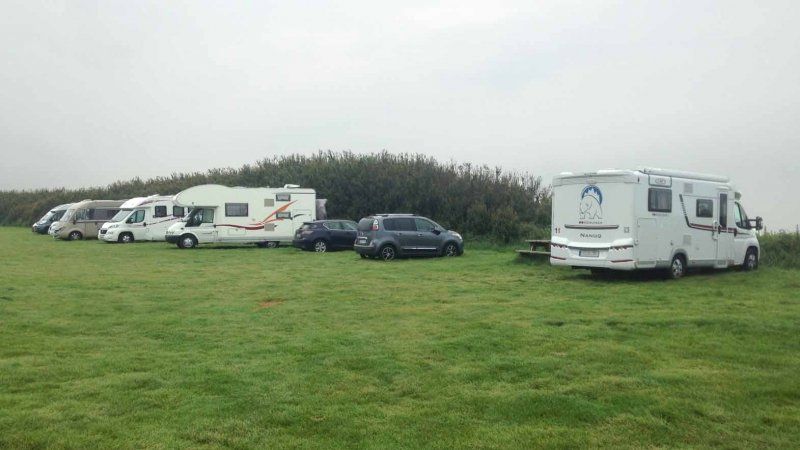
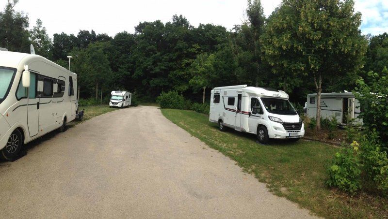
Reisemobilhafen
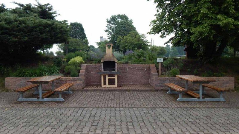
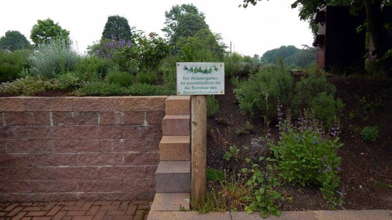
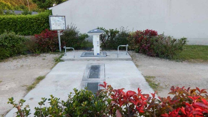
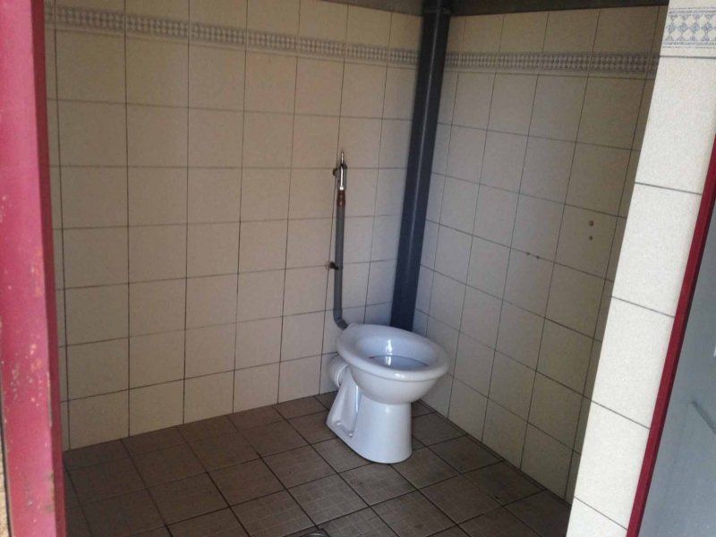
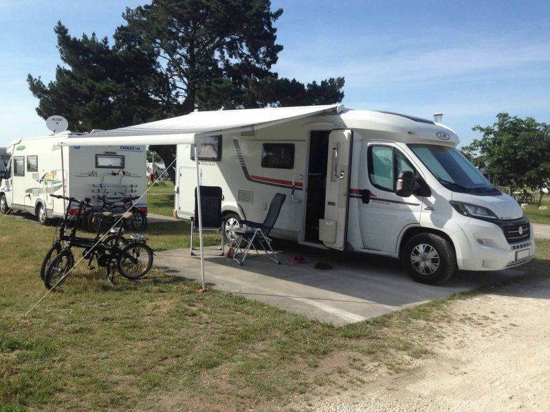
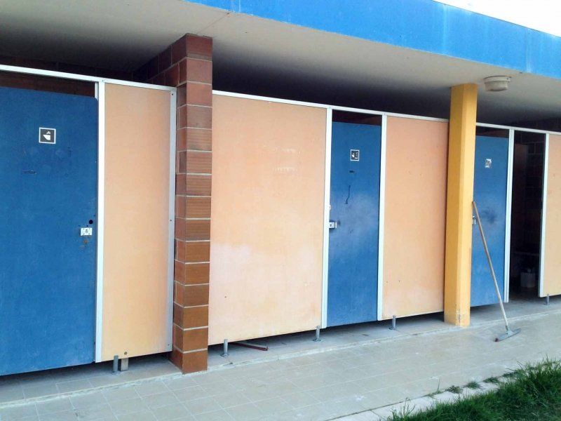
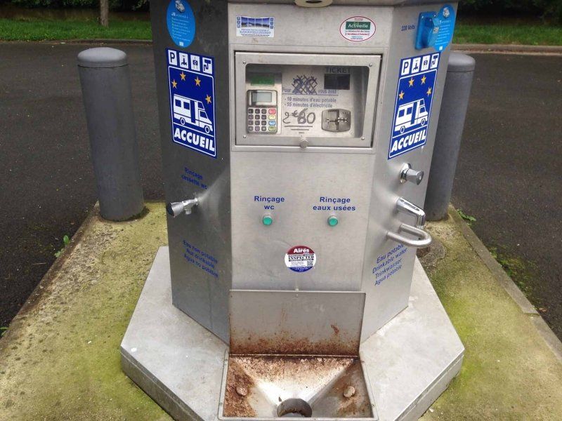
The parking space for 35 Mobile is located in the forest, the meadow spaces are not parceled out. V/E is available off site but was out of order when we visited due to storm damage. There is electricity, a nice barbecue area, a herb garden and a toilet in the flower garden nearby. The court fee is collected twice a day.
A tip on how to get there: Enter the Saarland Mining Museum as a waypoint/intermediate destination. Otherwise you might end up at the wrong end of the square like we did and then the entrance will be a bit difficult to find.
Im Blumengarten,, 66450 Bexbach, Deutschland
49° 20' 28.8" N 7° 15' 28" E
49.3413354 7.2577840
• Head toward Niederbexbacher Straße on Im Blumengarten. Go for 316 m.
• Turn right onto Bliestalstraße (L116). Go for 621 m.
• Turn right onto Bliestalstraße. Go for 799 m.
• Turn right onto Schmelzstraße. Go for 1.3 km.
• Continue on Niederbexbacher Straße. Go for 1.3 km.
• Turn left onto Torhausweg. Go for 487 m.
• Turn right onto Limbacher Straße (L114) toward A8/A3/Neunkirchen. Go for 310 m.
• Take left ramp onto A8 toward Mannheim/Saarbrücken/A6/Karlsruhe/Zweibrücken. Go for 1.3 km.
• Take exit 27 toward Paris/Metz/Saarbrücken/Flughafen onto A6. Go for 27.8 km.
• Continue on A320. Go for 13.5 km.
• Continue on E50 (Échangeur de Freyming). Go for 259 m.
• Take the left exit toward Paris/Metz/St Avold/Carling onto A4 (Autoroute de l'Est). Go for 55.9 km.
• Take exit 34 toward Amnéville/Walygator/Woippy. Go for 557 m.
• Take the 3rd exit from roundabout onto D652 toward Paris/Verdun/Rombas/Marange-Silvange/Woippy/Semécourt/Val Euromoselle-Sud/Écoparc. Go for 1.1 km.
• Keep right. Go for 588 m.
• Turn left. Go for 106 m.
• Turn left. Go for 19 m.
• Arrive at your destination on the left.
☍
106,3 km
(1 hrs. 6 min.)
Day
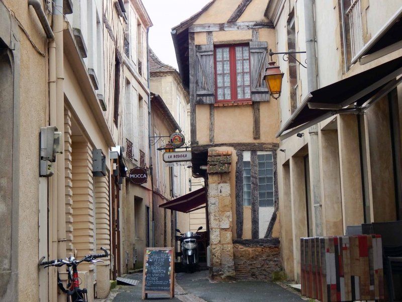
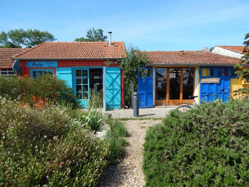
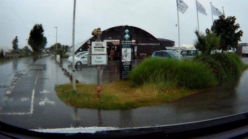
Semécourt, Frankreich
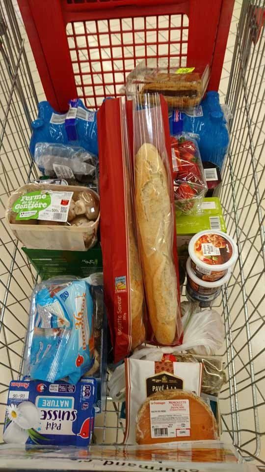
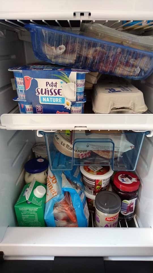
Whenever we go to France, we stop here first to stock up on supplies. As you can see in the photos, only the bare essentials...
1 Voie Romaine, 57280 Semécourt, Frankreich
49° 11' 37.4" N 6° 8' 44.6" E
49.1937225 6.1457348
• Head west. Go for 68 m.
• Turn right. Go for 8 m.
• Turn left. Go for 62 m.
• Turn right. Go for 34 m.
• Turn slightly left toward Rue Voie Romaine. Go for 157 m.
• Turn slightly right onto Rue Voie Romaine. Go for 112 m.
• Continue on D652. Go for 370 m.
• Take the 4th exit from roundabout onto A4 (Autoroute de l'Est) toward Amnéville/Maizières-les-M./Walygator/Val Euromoselle/Paris/Verdun/Rombas/Marange-Silvange. Go for 146 km.
• Take the exit toward St Gibrien/Épernay/Troyes/Orléans onto A26. Go for 96.4 km.
• Take the exit toward Orléans/Paris/Auxerre/Sens onto A5. Go for 69.8 km.
• Take the exit toward Sens/Provins/Orléans onto A19. Go for 28.5 km.
• Take the exit toward Orléans/Montargis onto A19. Go for 51.1 km.
• Take exit 6 toward Malesherbes/Bellegarde/Beaune la R. Go for 619 m.
• Take the 3rd exit from roundabout. Go for 673 m.
• Continue toward D975. Go for 46 m.
• Take the 2nd exit from roundabout onto D975 toward Bellegarde/Beaune-la-Rolande. Go for 5.3 km.
• Take the 1st exit from roundabout onto Route de Pithiviers (D950). Go for 60 m.
• Turn left onto Lieu-dit Pavé de Mézières (D151). Go for 151 m.
• Continue on D151. Go for 225 m.
• Continue on Lieu-dit Longue Plaine (D151). Go for 93 m.
• Continue on D151. Go for 3.7 km.
• Continue on Route de Boiscommun (D151). Go for 237 m.
• Continue on Lieu-dit Lauty (D151). Go for 106 m.
• Continue on Route de Boiscommun (D151). Go for 205 m.
• Continue on Lieu-dit Les Renardeaux (D151). Go for 98 m.
• Continue on Route de Boiscommun (D151). Go for 562 m.
• Continue on Lieu-dit Le Petit Bois (D151). Go for 765 m.
• Continue on Route de Saint-Loup (D151). Go for 412 m.
• Turn right onto Rue du Professeur Paul Lebeau. Go for 16 m.
• Continue on Route de Saint-Loup (D151). Go for 107 m.
• Turn left onto Rue de l'Hôtel de Ville (D9). Go for 247 m.
• Turn left onto Rue de la République (D9). Go for 157 m.
• Turn right onto Faubourg d'Orléans (D9). Go for 15.1 km.
• Turn right onto C8. Go for 117 m.
• Turn right onto Rue de l'Abbé Visage (D137). Go for 272 m.
• Continue on Rue Gambetta (D137). Go for 327 m.
• Arrive at Rue Gambetta (D137). Your destination is on the right.
☍
422,4 km
(3 hrs. 40 min.)
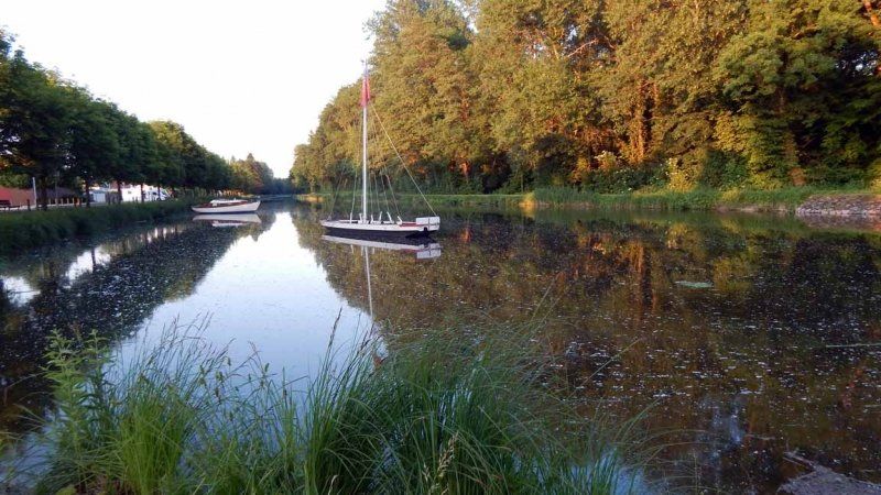
Vitry-aux-Loges, Frankreich
After our shopping we drove on until we didn't feel like it anymore, but further than planned. The place to stay that we had chosen as a replacement is a small parking lot for 6 mobile homes (with a little good will from the other campers and the local residents, 9 mobile homes can also fit) directly on the Canal d'Orleans. The place has V/E, but no electricity. There is a bakery nearby, so fresh croissants and baguettes are provided.
56 Rue Gambetta, 45530 Vitry-aux-Loges, Frankreich
47° 56' 24.1" N 2° 15' 59.3" E
47.9400290 2.2664680
• Head north on Rue Gambetta (D137). Go for 29 m.
• Turn right onto Rue Joseph Leber. Go for 117 m.
• Turn right onto Rue des Moulins. Go for 242 m.
• Continue on Quai Aristide Briand. Go for 179 m.
• Turn left onto Rue de l'Abbé Visage (D137). Go for 6.7 km.
• Turn left and take ramp onto D2060 toward Orléans. Go for 8.9 km.
• Take ramp toward Fay aux Loges/St Denis de l'H/Jargeau/Aérodrome de St Denis de l'Hôtel/P.A. des Loges et de l'Évangile. Go for 299 m.
• Take the 3rd exit from roundabout. Go for 131 m.
• Continue on D921. Go for 85 m.
• Take the 1st exit from roundabout onto D921 toward Saint-Denis de l'Hôtel/Jargeau/Aérodrôme de St Denis de l'h. Go for 2.4 km.
• Take the 1st exit from roundabout onto Boulevard des Chenats (D411) toward D21/Mardié/Donnery. Go for 346 m.
• Continue on D21. Go for 268 m.
• Take the 2nd exit from roundabout onto D21 toward Mardié. Go for 1.9 km.
• Take the 3rd exit from roundabout onto Déviation de Jargeau. Go for 4.2 km.
• Take the 3rd exit from roundabout onto D951. Go for 4.9 km.
• Take the 2nd exit from roundabout onto D13. Go for 904 m.
• Turn right onto D13. Go for 746 m.
• Turn right onto D921. Go for 13.7 km.
• Take the 2nd exit from roundabout onto Route de Jouy-le-Potier (D18) toward Jouy le Potier/Meung S/Loire/Beaugency/Ligny le Ribault. Go for 958 m.
• Turn left onto Rue Denis Papin. Go for 1.1 km.
• Turn right onto Route de Ligny (D61). Go for 12.3 km.
• Turn right onto D19. Go for 55 m.
• Turn right onto Rue Docteur Pierre Seguel (D15). Go for 292 m.
• Continue on Rue du Général de Gaulle (D19). Go for 128 m.
• Continue on Rue César Finance (D61). Go for 3.6 km.
• Continue on D103. Go for 5.4 km.
• Turn right onto Faubourg Bretagne (D925). Go for 151 m.
• Turn left onto Route de Crouy-sur-Cosson (D103). Go for 5.0 km.
• Turn left onto Route de Thoury (D33). Go for 9.0 km.
• Turn right onto Route de la Commission (D33). Go for 177 m.
• Turn sharp right onto Rue de la Grange aux Dîmes. Go for 113 m.
• Arrive at Rue de la Grange aux Dîmes. Your destination is on the left.
☍
84,2 km
(1 hrs. 7 min.)
Day
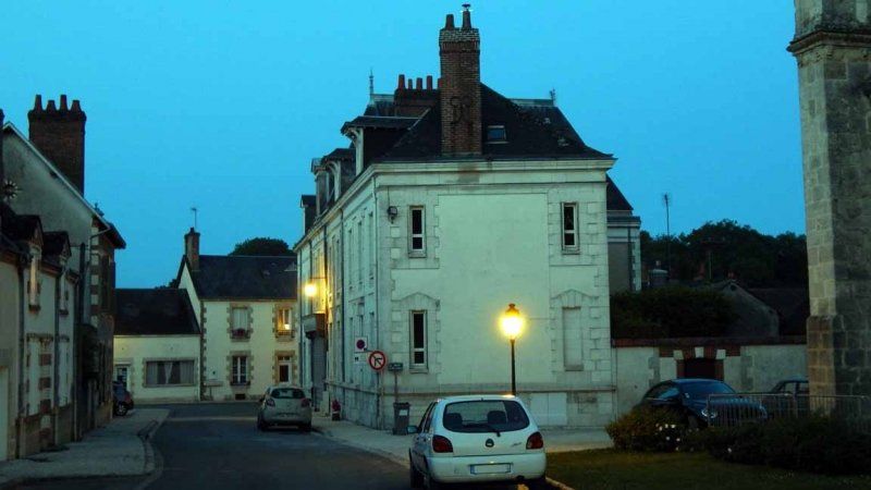
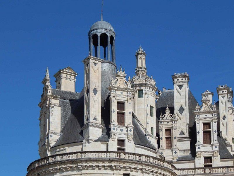
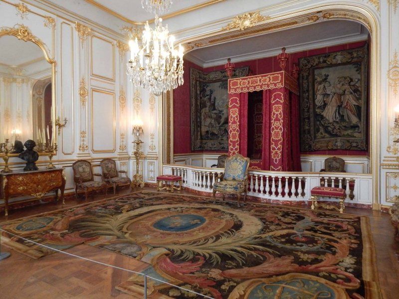
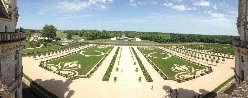
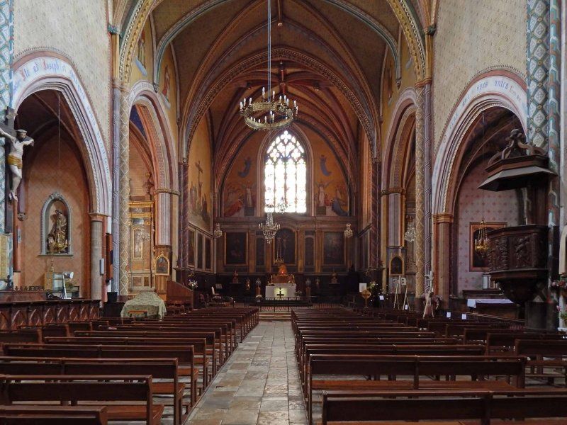
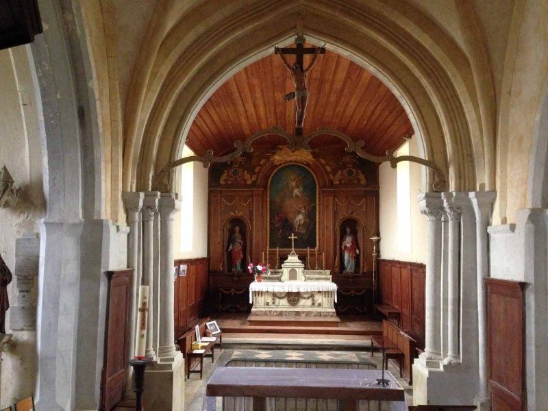
Chambord, Frankreich
Chambord - dream castle on the Loire and an absolute must if you are in the area. Built as a hunting lodge, it passed through a few hands, and Moritz von Sachsen was also the owner for a few years. In recognition of his achievements as Marshal of France.
The parking space is located in the immediate vicinity of the castle on the extensive grounds of the castle. However, the castle can only be seen from a few places. The pitches are parceled out and gravelled, but offer no service on the pitch itself. There is a central V/E station. As in our case, it can happen that an event takes place on the large meadow next to the parking space; in our case a 75th company anniversary. Then it can get pretty loud during the night. Our compensation was a big fireworks display as part of the celebration...
3-67 Rue de la Grange aux Dîmes, 41250 Chambord, Frankreich
47° 36' 51" N 1° 31' 0.8" E
47.6141580 1.5168780
• Head toward Route de la Commission on Rue de la Grange aux Dîmes. Go for 113 m.
• Turn sharp left onto Route de la Commission (D33). Go for 177 m.
• Continue on Route de Bracieux (D112). Go for 6.8 km.
• Take the 2nd exit from roundabout onto Rue Roger Brun (D923). Go for 282 m.
• Take the 4th exit from roundabout onto Rue Roger Brun (D923). Go for 1.0 km.
• Turn left onto Route de Fontaines (D120). Go for 4.1 km.
• Continue on Route de l'Arche (D119). Go for 1.6 km.
• Turn left onto D20. Go for 1.2 km.
• Continue on Lieu-dit La Croix du Bois (D20). Go for 74 m.
• Continue on D20. Go for 318 m.
• Continue on Lieu-dit Le Bois (D20). Go for 70 m.
• Continue on D20. Go for 586 m.
• Continue on Lieu-dit Les Pluies (D20). Go for 59 m.
• Continue on D20. Go for 2.3 km.
• Continue on Lieu-dit Les Cobrières (D20). Go for 110 m.
• Continue on Lieu-dit Les Corbelières (D20). Go for 74 m.
• Continue on D20. Go for 1.4 km.
• Continue on Lieu-dit La Moutinière (D20). Go for 128 m.
• Continue on D20. Go for 2.8 km.
• Continue on Lieu-dit La Meule (D20). Go for 56 m.
• Continue on D20. Go for 243 m.
• Continue on Rue de Chambord (D20). Go for 741 m.
• Continue on Rue Paul Besnard. Go for 326 m.
• Turn right onto Rue Camille Masson (D63). Go for 165 m.
• Turn left onto Square de Lattre de Tassigny (D765). Go for 394 m.
• Turn right onto Rue de Lassay (D20) toward Lassay sur Croisne/Pruniers/Gy en Sologne/Château du Moulin/Fontjouan/Locature de la Straize. Go for 1.7 km.
• Continue on D20. Go for 950 m.
• Continue on Lieu-dit La Saugère (D20). Go for 364 m.
• Continue on D20. Go for 118 m.
• Continue on Route de Mur-de-Sologne (D20). Go for 1.1 km.
• Continue on Route de Romorantin (D20). Go for 2.5 km.
• Continue on D20. Go for 248 m.
• Turn right onto Lieu-dit L'Étang de Paris (D20). Go for 145 m.
• Continue on Route de Pruniers (D20). Go for 609 m.
• Continue on Lieu-dit Bellevue (D20). Go for 100 m.
• Continue on Route de Pruniers (D20). Go for 425 m.
• Continue on D20. Go for 2.7 km.
• Continue on Rue Victor Hugo (D20). Go for 934 m.
• Turn right onto D159. Go for 8 m.
• Turn left onto Place des Anciens Combattants (D20). Go for 36 m.
• Continue on D20. Go for 141 m.
• Turn right onto Rue des Prés Neufs (C2). Go for 850 m.
• Continue on D128. Go for 1.8 km.
• Take the 2nd exit from roundabout onto Rue de Romorantin (D128) toward Valençay/Gièvres/Chabris. Go for 2.6 km.
• Take the 2nd exit from roundabout onto Rue Victor Hugo (D128). Go for 1.8 km.
• Continue on Rue du Pont (D4). Go for 940 m.
• Take the 3rd exit from roundabout onto Rue de Verdun (D25). Go for 10.8 km.
• Keep right onto Lieu-dit La Fourche (D25). Go for 9.6 km.
• Turn left onto D960. Go for 5.3 km.
• Turn right onto Grande Rue (D136). Go for 240 m.
• Continue on Place de la République (D920). Go for 2.8 km.
• Take ramp onto A20 (L'Occitane) toward Châteauroux. Go for 105 km.
• Take exit 23 toward Magnac-Laval/Bellac. Go for 638 m.
• Take the 1st exit from roundabout onto N145 toward Angoulême/Magnac-Laval/Bellac. Go for 27.5 km.
• Take the 3rd exit from roundabout onto N147 toward Limoges/Angoulême. Go for 2.0 km.
• Take the 1st exit from roundabout toward Bellac. Go for 1.1 km.
• Continue on Route de Limoges. Go for 409 m.
• Turn left onto D3. Go for 302 m.
• Continue on Route de Blond (D3). Go for 156 m.
• Continue on D3. Go for 43 m.
• Turn right onto Chemin de la Forge à Fer. Go for 98 m.
• Continue on Rue des Tanneries. Go for 11 m.
• Turn left onto Parc Aimé Vallat. Go for 42 m.
• Arrive at Parc Aimé Vallat. Your destination is on the right.
☍
211,6 km
(2 hrs. 20 min.)
Day
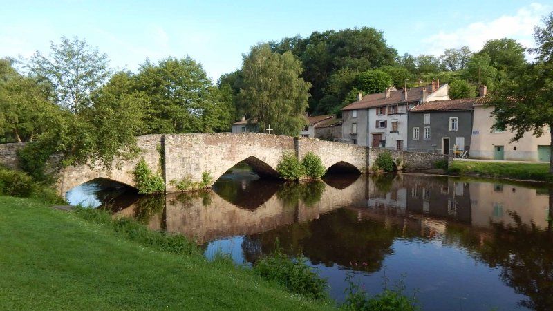
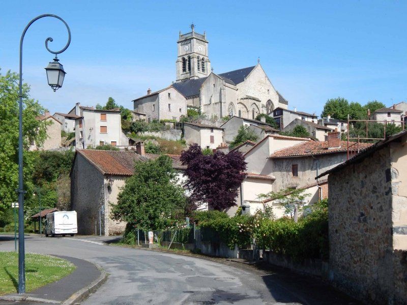
Bellac, Frankreich
Wir hatten uns entschlossen, unsere Tour einfach umzudrehen, also zunächst durch das Landesinnere bis Bordeaux zu fahren, um dann der Küste entlang Richtung Norden zu reisen. Zwischenstation auf dem Weg nach Rocamadour, einem Tipp aus Facebook von Sylvia war Bellac, ein kleiner Ort, der im Jahre 12. Jahrhundert Stadtrechte erhielt. Seehenswert sind vor allem die Kirche Notre Dame und die alte Brücke.
Der Stellplatz für 5 Mobile liegt direkt an einem Park und dem Flüsschen, ruhig und schön. Die Plätze sind asphaltiert und markiert. Der Platz ist kostenlos, es gibt ein paar hundert Meter weiter eine Station für V/E. Die Toiletten dort wollten wir abder dann doch lieber nicht nutzen.
Fazit: ein schöner Ort und eine sehr ruhige Nacht.
7 Rue des Tanneries, 87300 Bellac, Frankreich
46° 6' 53.7" N 1° 3' 7.6" E
46.1149211 1.0521069
• Head toward Rue des Tanneries on Parc Aimé Vallat. Go for 42 m.
• Turn right onto Rue des Tanneries. Go for 11 m.
• Continue on Chemin de la Forge à Fer. Go for 98 m.
• Turn left onto D3. Go for 43 m.
• Continue on Route de Blond (D3). Go for 156 m.
• Continue on D3. Go for 256 m.
• Turn right onto Avenue du Maréchal Foch. Go for 1.5 km.
• Take the 2nd exit from roundabout onto N147 toward Limoges. Go for 27.4 km.
• Take the 3rd exit from roundabout onto Route de Poitiers (N147) toward A20/Limoges/Couzeix. Go for 190 m.
• Take the 4th exit from roundabout onto Rocade Nord-Ouest (N520) toward A20/Ambazac/Z.I.N. Centre Routier. Go for 4.7 km.
• Take the 2nd exit from roundabout onto Rocade Nord-Ouest (N520) toward A20/Orléans/Toulouse/Clermont Fd/Limoges-Centre/Ambazac. Go for 966 m.
• Take the 1st exit from roundabout onto A20 (L'Occitane) toward Toulouse/Clermont Fd/Limoges-Centre. Go for 116 km.
• Take exit 54 toward Gouffre de Padirac/Gramat/Rocamadour. Go for 1.3 km.
• Continue toward Decazeville/Rodez/Martel/Rocamadour/Gramat/Figeac/Gfre de Padirac. Go for 33 m.
• Take the 2nd exit from roundabout onto D840 toward Figeac/Decazeville/Rodez/Martel/Gramat/Rocamadour/Gfre de Padirac. Go for 9.6 km.
• Take the 1st exit from Place Gambetta roundabout onto Avenue Lavaysière (D23) toward A20/(Toulouse)/Souillac/Creysse. Go for 41 m.
• Turn left onto Rue Mercière. Go for 69 m.
• Turn left onto Place Henri Ramet. Go for 26 m.
• Arrive at Place Henri Ramet.
☍
162,8 km
(1 hrs. 41 min.)
Day
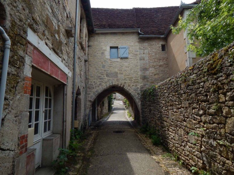
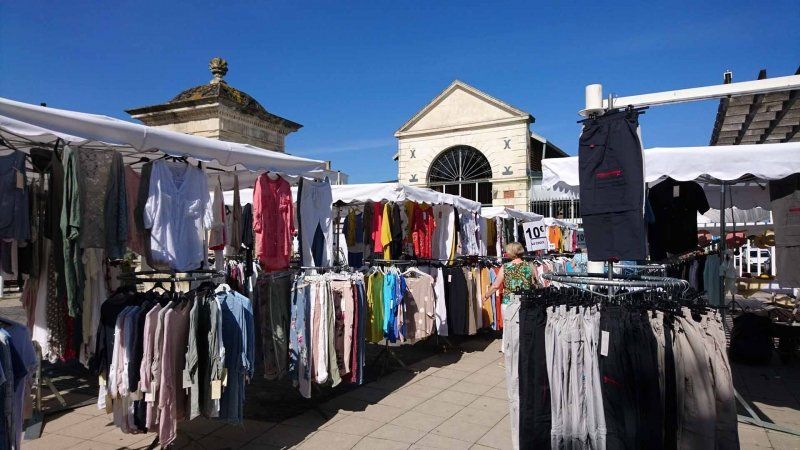
Martel, Frankreich
A beautiful little place with a medieval old town. Beautiful little alleyways, an open market hall from the 18th century with the original roof truss (market on Wednesdays and Saturdays) and the church "St. Maur de Martel". The place, free but without service, is within walking distance to the old town and quiet from the evening.
Even if we only spent one night there, the city is worth a detour.
5167F Place des Consuls, 46600 Martel, Frankreich
44° 56' 12.4" N 1° 36' 30.9" E
44.9367830 1.6085820
• Head east on Place Henri Ramet.
• Turn right onto Place Henri Ramet. Go for 23 m.
• Turn right onto Rue Henri Court-Mantel. Go for 48 m.
• Turn slightly left onto Rue Mercière. Go for 69 m.
• Turn sharp left onto Avenue Lavaysière (D23). Go for 138 m.
• Take the 2nd exit from roundabout onto Avenue de Nassogne (D23) toward Grottes de Lacave/Creysse. Go for 1.1 km.
• Continue on Route de Creysse (D23). Go for 613 m.
• Continue on Lieu-dit Esclauzar (D23). Go for 357 m.
• Continue on Lieu-dit La Vassaudie (D23). Go for 97 m.
• Continue on D23. Go for 247 m.
• Continue on Lieu-dit La Vaysse (D23). Go for 386 m.
• Continue on D23. Go for 2.0 km.
• Continue on Rocade Del Nau (D23). Go for 293 m.
• Continue on D23. Go for 132 m.
• Continue on Lieu-dit Sainte-Catherine (D23). Go for 88 m.
• Continue on D23. Go for 149 m.
• Continue on Lieu-dit La Brunette (D23). Go for 92 m.
• Continue on D23. Go for 699 m.
• Continue on Lieu-dit Le Jardy (D23). Go for 47 m.
• Continue on D23. Go for 312 m.
• Turn right onto D114. Go for 1.8 km.
• Continue on Route de Fleuraguet (D114). Go for 1.8 km.
• Turn left onto Rue des L'Écoles et du Glacis (D114). Go for 152 m.
• Turn left onto Rue de l'Occitanie (D15). Go for 1.3 km.
• Turn right onto Route du Rocher Sainte-Marie (D23). Go for 940 m.
• Continue on D23. Go for 1.9 km.
• Continue on Lieu-dit Bellemire (D23). Go for 245 m.
• Continue on D23. Go for 2.1 km.
• Turn left. Go for 105 m.
• Turn slightly right. Go for 24 m.
• Arrive at your destination on the left.
☍
17,2 km
( 19 min.)
Day
Lacave, Frankreich
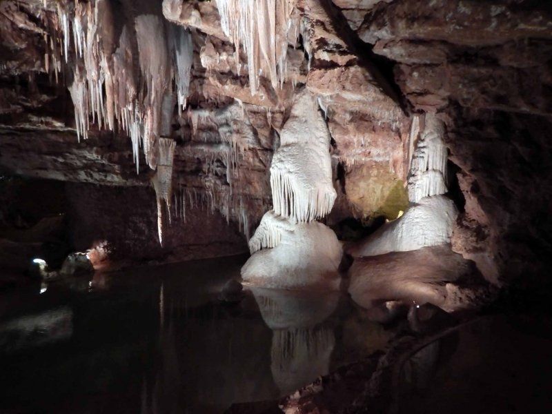
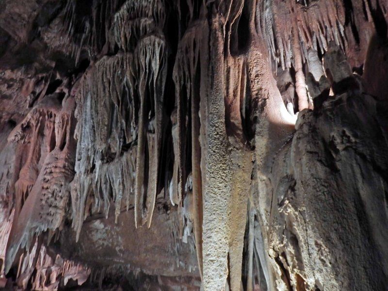
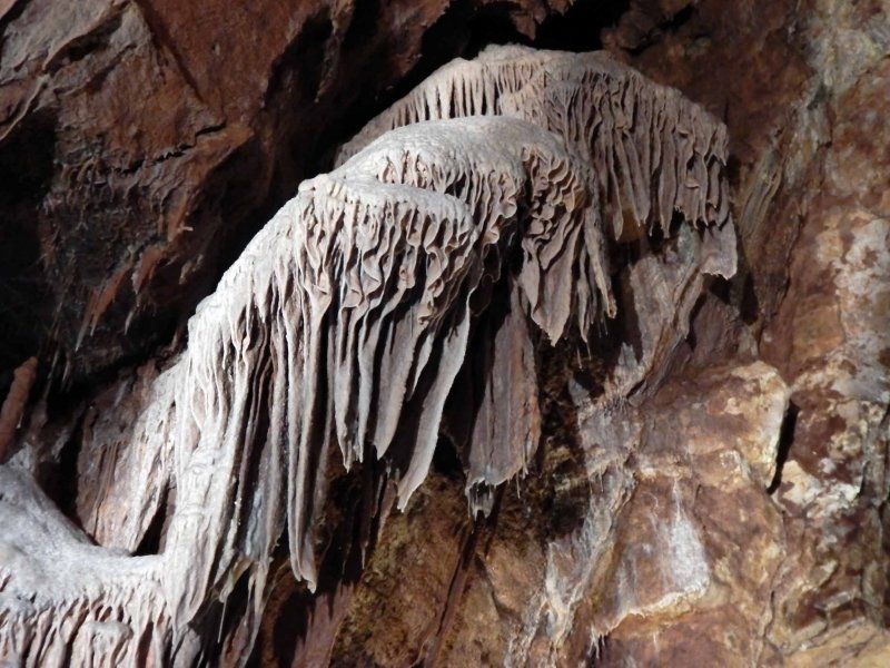
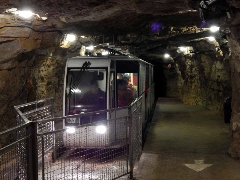
There are several stalactite caves in the Dordogne valley, including the Gouffre de Padirac, the Grottes de Cougnac and the Lacave caves we visited. The Gouffre de Padirac, where you are not allowed to take photos, offers the special feature that you first take an elevator down 75m through a large hole in the cave ceiling and then put parts of the cave back by boat. The Grottes de Cougnac offers prehistoric cave paintings and Lacave fascinating stalactite formations and a guided tour that can also be followed in German via an app. A mine train takes you 400m down and from there on foot with a guide through several caves.
D23, 46200 Lacave, Frankreich
44° 50' 38.9" N 1° 33' 26.4" E
44.8441270 1.5573330
• Head southwest. Go for 40 m.
• Turn sharp left onto D247. Go for 986 m.
• Continue on Lieu-dit Le Sud (D247). Go for 73 m.
• Continue on D247. Go for 155 m.
• Continue on Lieu-dit Peyre Levade (D247). Go for 139 m.
• Continue on D247. Go for 5.1 km.
• Continue on Lieu-dit Borie d'Imbert (D247). Go for 393 m.
• Continue on D247. Go for 254 m.
• Continue on Lieu-dit Borie Delpech (D247). Go for 99 m.
• Continue on D247. Go for 501 m.
• Continue on Lieu-dit Les Campagnes (D247). Go for 1.5 km.
• Turn left onto Lieu-dit L'Hospitalet (D673). Go for 157 m.
• Take the 1st exit from roundabout onto Lieu-dit L'Hospitalet (D673). Go for 115 m.
• Continue on Lieu-dit Le Garroustié (D32). Go for 628 m.
• Continue on D32. Go for 364 m.
• Continue on Voie Sainte (D32). Go for 213 m.
• Continue on Place Bernard de Ventadour (D32). Go for 4 m.
• Continue on Porte du Figuier. Go for 10 m.
• Continue on Rue Roland Le Preux. Go for 215 m.
• Continue on Rue de la Couronnerie. Go for 37 m.
• Arrive at Rue de la Couronnerie. Your destination is on the right.
☍
11,0 km
( 13 min.)
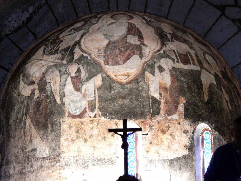
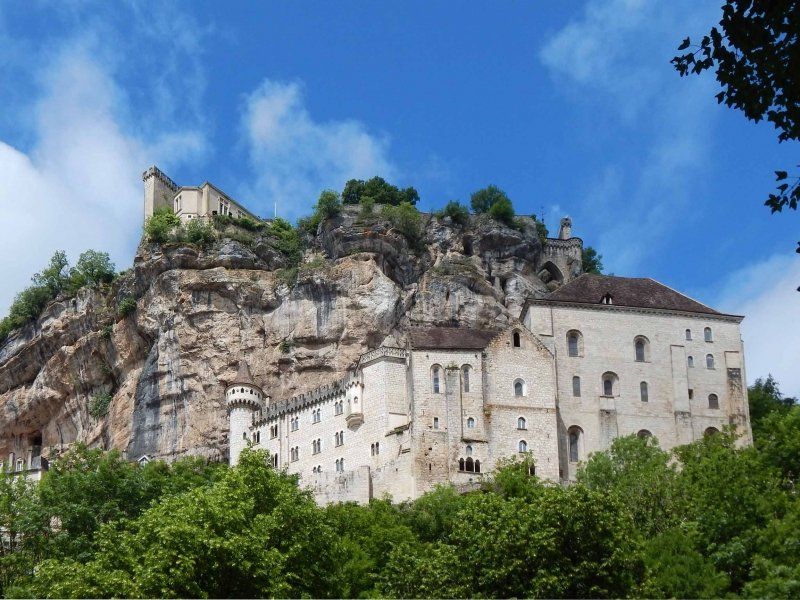
Rocamadour, Frankreich
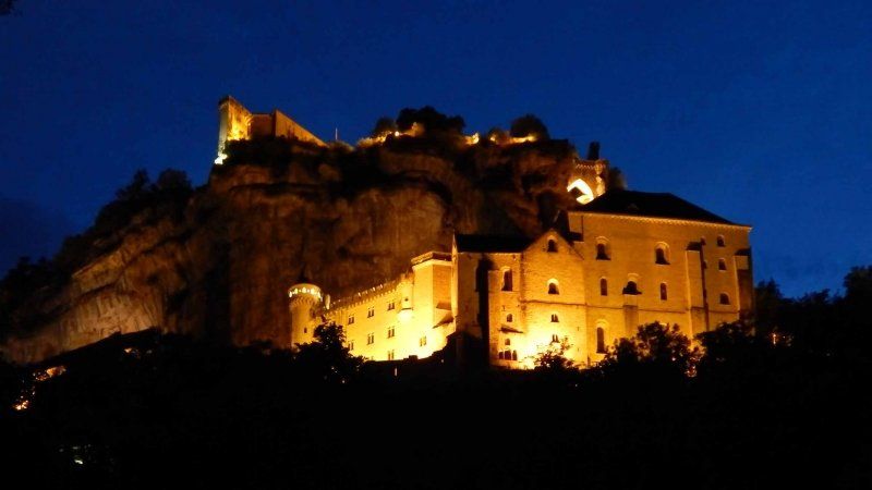
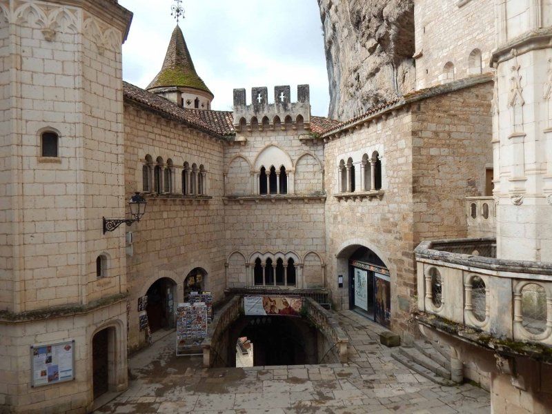
Rocamadour - we didn't have this town on our itinerary. But a tip from the Facebook group "Mobile homes and motor homes, the most beautiful hobby in the world" led us there. Many thanks to Sylvia for this.
Rocamadour is a medieval pilgrimage town with a bishop's palace and a large number of churches and chapels, built in a confined space on and on the rock. Next to the Mont Saint Michel, Rocamadour is actually the second most well-known and visited attraction in France. And thanks to the recommendation of Park4Night, we stood in a parking lot at the foot of the city with a priceless view of Rocamadour. For us one of the highlights of this holiday and definitely worth a detour.
5213F Rue de la Couronnerie, 46500 Rocamadour, Frankreich
44° 47' 57.8" N 1° 37' 4.4" E
44.7993830 1.6179010
• Head south on Rue de la Couronnerie. Go for 210 m.
• Continue on Lieu-dit Lou Coustalou. Go for 111 m.
• Turn left onto Lieu-dit Roquefraich. Go for 84 m.
• Continue on D32 B. Go for 715 m.
• Continue on D32. Go for 365 m.
• Turn right onto Place Bernard de Ventadour (D32). Go for 4 m.
• Continue on Voie Sainte (D32). Go for 213 m.
• Continue on D32. Go for 364 m.
• Continue on Lieu-dit Le Garroustié (D32). Go for 628 m.
• Continue on Lieu-dit L'Hospitalet (D32). Go for 93 m.
• Take the 2nd exit from roundabout onto Lieu-dit L'Hospitalet (D673). Go for 177 m.
• Turn right onto Lieu-dit Les Campagnes (D247). Go for 1.5 km.
• Continue on D247. Go for 501 m.
• Continue on Lieu-dit Borie Delpech (D247). Go for 99 m.
• Continue on D247. Go for 254 m.
• Continue on Lieu-dit Borie d'Imbert (D247). Go for 393 m.
• Continue on D247. Go for 5.1 km.
• Continue on Lieu-dit Peyre Levade (D247). Go for 139 m.
• Continue on D247. Go for 155 m.
• Continue on Lieu-dit Le Sud (D247). Go for 73 m.
• Continue on D247. Go for 986 m.
• Turn left onto D23. Go for 306 m.
• Continue on Lieu-dit Pont de l'Ouysse (D23). Go for 101 m.
• Continue on D23. Go for 936 m.
• Turn right onto D43. Go for 733 m.
• Continue on Lieu-dit Les Boules (D43). Go for 46 m.
• Continue on D43. Go for 1.6 km.
• Continue on Lieu-dit Les Clauzels (D43). Go for 67 m.
• Continue on D43. Go for 79 m.
• Continue on Lieu-dit La Plantade (D43). Go for 98 m.
• Continue on D43. Go for 953 m.
• Continue on Lieu-dit Port de Pinsac (D43). Go for 133 m.
• Continue on D43. Go for 2.5 km.
• Continue on Lieu-dit Le Platant (D43). Go for 52 m.
• Continue on D43. Go for 861 m.
• Continue on Lieu-dit Le Raysse de Banat (D43). Go for 100 m.
• Continue on D43. Go for 1.3 km.
• Turn right onto Avenue de Toulouse (D820). Go for 1.3 km.
• Turn left onto Avenue de Sarlat (D804) toward Carlux/Sarlat/Cazoulès/Abbaye 12-17e S./Musée de l'Automate/Château de Fénelon. Go for 1.6 km.
• Take the 3rd exit from roundabout onto Avenue de Sarlat (D804) toward Sarlat/Cazoulès/Carlux. Go for 15.4 km.
• Continue on D703 toward D704 A/Sarlat/Montignac/Z.A.E Périgord Noir. Go for 116 m.
• Continue on Route de l'Enéa (D704 A). Go for 6.0 km.
• Take the 2nd exit from roundabout onto Route de Souillac (D704 A) toward Sarlat. Go for 755 m.
• Continue on Avenue du Périgord (D704) toward Sarlat. Go for 1.8 km.
• Take the 3rd exit from roundabout onto Avenue Simone Veil (D704) toward Sarlat/Brive/Périgueux/Bergerac/Sarlat-Centre Ville. Go for 668 m.
• Pass 2 roundabouts and continue on Avenue du Colonel Beltrame (D704). Go for 814 m.
• Take the 3rd exit from roundabout onto Avenue de la Dordogne (D46) toward Bergerac/St André Allas/Vézac/Vitrac. Go for 206 m.
• Take the 2nd exit from roundabout onto Avenue de la Dordogne (D46) toward Bergerac. Go for 586 m.
• Take the 1st exit from roundabout onto Avenue Joséphine Baker (D57) toward Bergerac. Go for 7.1 km.
• Continue on D49 toward Bergerac/Lalinde/Beynac/Château de Beynac. Go for 817 m.
• Continue on D703 toward Bergerac/Lalinde/Beynac/Château de Beynac. Go for 17.6 km.
• Take the 2nd exit from roundabout onto Voie de la Vallée (D25) toward Bergerac/Périgueux/Le Buisson/Lalinde. Go for 526 m.
• Take the 1st exit from roundabout onto Voie de la Vallée (D25) toward Le Buisson/Périgueux. Go for 6.8 km.
• Keep right onto Avenue d'Aquitaine (D29 E) toward Bergerac/Lalinde/Z.A.E. la Seguinie. Go for 799 m.
• Take the 2nd exit from roundabout onto Route de Bergerac (D29) toward Bergerac/Badefols/Lalinde. Go for 14.5 km.
• Continue on D8 E4. Go for 930 m.
• Turn right onto Place du 8 Mai 1945 (D703) toward Mauzac/Ste Alvère/Cingles de Trémolat et Limeuil. Go for 29 m.
• Turn left onto Boulevard de Stalingrad (D8 E3) toward Bergerac/Périgueux/Beaumont/Couze. Go for 662 m.
• Turn right onto Avenue Paul Langevin (D703) toward Bergerac/Port de Couze/Beaumont. Go for 913 m.
• Take the 2nd exit from roundabout onto Avenue Jean Moulin (D703). Go for 1.6 km.
• Continue on Avenue du Port de Couze (D660). Go for 4.0 km.
• Turn left onto Lieu-dit Le Bourg toward C8/St Agne/Varennes/Lanquais. Go for 531 m.
• Turn right onto D37. Go for 1.0 km.
• Continue on Route de la Plaine (D37). Go for 2.1 km.
• Continue on D37. Go for 302 m.
• Continue on Route de Saint-Agne (D37). Go for 1.7 km.
• Continue on Rue du Port (D21 E3). Go for 369 m.
• Turn left onto Route de la Jarthe (D21 E3). Go for 828 m.
• Turn right onto Route de Cours de Pile (D37). Go for 621 m.
• Continue on D37. Go for 370 m.
• Continue on Route de Saint-Germain (D37). Go for 3.5 km.
• Keep right onto Route des Rivachauds (D37). Go for 240 m.
• Take the 3rd exit from roundabout onto Route de Bergerac (D37). Go for 736 m.
• Continue on D37. Go for 238 m.
• Continue on Lieu-dit Les Meynoudes (D37). Go for 123 m.
• Continue on D37. Go for 831 m.
• Turn right onto Route de Saint-Nexans (D19). Go for 1.6 km.
• Turn right onto Route d'Agen (D936). Go for 1.1 km.
• Take the 2nd exit from roundabout onto Avenue Paul Painlevé. Go for 194 m.
• Continue on Rue Berggren. Go for 8 m.
• Turn left onto Boulevard Voltaire. Go for 159 m.
• Take the 1st exit from roundabout onto Boulevard Henri Sicard. Go for 360 m.
• Turn left onto Rue du Maréchal Joffre (D936). Go for 55 m.
• Turn sharp right onto Rue Boileau. Go for 204 m.
• Turn left onto Rue Jean-Jacques Rousseau. Go for 113 m.
• Arrive at Rue Jean-Jacques Rousseau. Your destination is on the right.
☍
124,8 km
(2 hrs. 9 min.)
Day
Camping La Pelouse
Camping La Pelouse is a "camping municipal" that appears to have been given into private hands. The young operator couple is trying to get the place back in shape. The result, however, was that only the older of the two wash houses was available due to work on the water pipes.
The place itself is a meadow place and parceled out with power connections on site, V/E and bread service. The exit is a bit tricky as it is a bit steep and the view of the cross street is blocked by walls.
What makes this place unbeatable is the fact that the city is a good 10 minute walk from there.
jean - jacques Rousseau 8 bis, 24100, Bergerac, Frankreich
44° 50' 56" N 0° 28' 35" E
44.8489000 0.4764000
• Head east on Rue Jean-Jacques Rousseau. Go for 113 m.
• Turn right onto Rue Boileau. Go for 204 m.
• Turn left onto Rue du Maréchal Joffre (D936). Go for 353 m.
• Take the 3rd exit from roundabout onto Rue Fénelon. Go for 84 m.
• Continue on Place de la Dordogne. Go for 15 m.
• Continue on Pont Saint-Jean. Go for 162 m.
• Take the 3rd exit from Square Jean et Gaby Pierre-Bloch roundabout onto Rue Hippolyte Taine. Go for 186 m.
• Continue on Quai Salvette. Go for 162 m.
• Take the 1st exit from roundabout onto Rue Saint-Esprit. Go for 239 m.
• Take the 1st exit from roundabout onto Rue Mounet Sully (D709). Go for 125 m.
• Take the 2nd exit from Place de Lattre de Tassigny roundabout onto Place de Lattre de Tassigny. Go for 111 m.
• Turn right onto Place Gambetta. Go for 31 m.
• Turn right onto Rue des 2 Portes. Go for 42 m.
• Arrive at Rue des 2 Portes. Your destination is on the right.
☍
1,8 km
( 6 min.)
Day
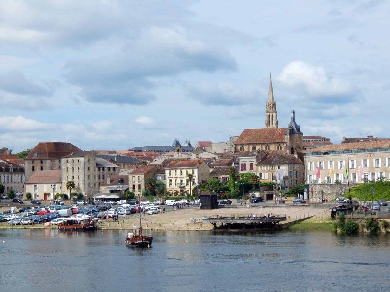
Bergerac, Frankreich
Cyrano de Bergerac - this tragic figure in the play by Edmond Rostand, filmed incomparably with Gérard Depardieu, was the reason for us to pay a visit to this city. Of course it's a fictional character, but ...
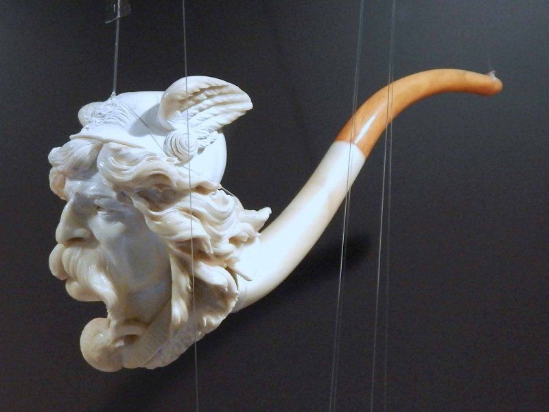
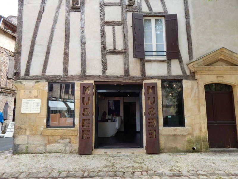
Bergerac is a small, old and charming town in the center. Not rich in sights but still worth seeing. The tobacco museum is particularly worthwhile, as it is dedicated to the history of tobacco consumption in Europe and has an important collection of pipes. Here you can find out how tobacco made its way from America to Europe, how it was consumed in different epochs and that tobacco is also a medicinal plant, for example against migraines.
We also recommend the church of St. Jacques with its bell gable and wooden balcony, the alleys and small squares and, last but not least, the statue of Cyrano de Bergerac on the Place de la Mirpe.
2 Rue des Faures, 24100 Bergerac, Frankreich
44° 51' 13.7" N 0° 29' 0.2" E
44.8538060 0.4833920
• Head east on Rue des 2 Portes.
• Turn right onto Rue des Faures. Go for 40 m.
• Turn right onto Place de Lattre de Tassigny. Go for 24 m.
• Turn right onto Place Gambetta. Go for 214 m.
• Take the 3rd exit from Giratoire de l'Europe roundabout onto Boulevard Montaigne. Go for 59 m.
• Continue on Boulevard Jean Moulin. Go for 236 m.
• Pass 2 roundabouts and continue on Rue du Maréchal Foch (D709). Go for 20.2 km.
• Take the 1st exit from roundabout onto A89 toward Bordeaux/Libourne. Go for 65.6 km.
• Continue on N89. Go for 17.8 km.
• Take ramp onto Rocade de Bordeaux (N230) toward E70/A10 (Paris)/Aéroport Mérignac/Lormont/Carbon Blanc/Bassens/Bordeaux-Lac. Go for 1.5 km.
• Take ramp onto A630 (Rocade de Bordeaux) toward Aéroport Mérignac/Bordeaux-Centre/Zone Portuaire. Go for 12.8 km.
• Take exit 8 toward Le Verdon S/ Mer/Lacanau/St Médard en Jalles/Eysines-Centre onto D1215. Go for 1.4 km.
• Pass 3 roundabouts and continue on Route de Lacanau (D1215). Go for 3.4 km.
• Take the 2nd exit from roundabout onto Route de Lacanau (D1215) toward Le Verdon S/Mer/Lacanau/St Médard/St Aubin de M. Go for 1.3 km.
• Take the 2nd exit from roundabout onto Route de Lacanau (D1215) toward Le Verdon S/Mer/Lacanau/St Aubin de M. Go for 1.0 km.
• Take the 1st exit from roundabout onto D1215 E1 toward Le Verdon S/Mer/Castelnau de M./Le Pian-Médoc. Go for 3.1 km.
• Pass 4 roundabouts and continue on D1215 E1. Go for 11.6 km.
• Take the 2nd exit from roundabout onto D1215 toward Listrac-Médoc/St Laurent/Lesparre/Le Verdon. Go for 890 m.
• Take the 2nd exit from roundabout onto D1215 toward Listrac-Médoc/St Laurent/Lesparre/Le Verdon. Go for 1.6 km.
• Take the 1st exit from roundabout onto D1215 toward Listrac-Médoc/St Laurent/Lesparre/Le Verdon. Go for 13.3 km.
• Take the 2nd exit from roundabout onto D1215 toward Pauillac/Lesparre-M/Le Verdon S/ Mer. Go for 375 m.
• Take the 1st exit from roundabout onto Route de Pauillac (D206) toward Pauillac. Go for 6.2 km.
• Take the 1st exit from roundabout onto Avenue Charles de Gaulle (D205). Go for 922 m.
• Take the 2nd exit from roundabout onto Rue Mandavy. Go for 452 m.
• Continue on Quai Paul Doumer (D2 E6). Go for 274 m.
• Continue on Quai Albert Pichon (D205). Go for 133 m.
• Continue on Quai Léon Perrier (D205). Go for 162 m.
• Continue on Quai Antoine Ferchaud (D205). Go for 27 m.
• Arrive at Quai Antoine Ferchaud (D205). Your destination is on the left.
☍
164,6 km
(1 hrs. 59 min.)
Day
Pauillac, Frankreich
The ADAC Tour Set® writes about Pauillac: The beautiful town of Pauillac on the banks of the Gironde is the wine capital of the Médoc. It owes its reputation above all to the famous castles that are lined up in the north between lush vineyards ... "
And unfortunately that's exactly the point: the city itself doesn't really have much to offer. Apart from the humble beach promenade, there isn't much that a visitor might be interested in. The tourist office or center offers wine seminars and tastings (for a fee), and the staff is a bit dismissive to say the least. The large selection of wines from the various cooperative winemakers is of no use either, because a label is patient. We are used to different things from Tuscany. The only highlight: one obviously seems to be very proud of the German town twinning.
So we didn't stay here long and continued along the vineyards and chateaus towards Soulac-sur-Mer.
5 Rue Lucien Teyssier, 33250 Pauillac, Frankreich
45° 11' 58.5" N 0° 44' 46.4" W
45.1995850 -0.7462120
• Head toward Rue Ferdinand Buisson on Quai Antoine Ferchaud (D205). Go for 333 m.
• Continue on Quai Jean Fleuret (D205). Go for 383 m.
• Continue on Allées Marines (D205). Go for 321 m.
• Turn right onto Rue du Maréchal Joffre (D2). Go for 405 m.
• Turn left onto D205. Go for 2.2 km.
• Continue on Lieu-dit Les Carruades (D205). Go for 85 m.
• Continue on D205. Go for 348 m.
• Continue on Lieu-dit Passe-Temps (D205). Go for 94 m.
• Continue on D205. Go for 389 m.
• Continue on Route d'Hourtin (D205). Go for 2.5 km.
• Continue on D205. Go for 655 m.
• Take the 2nd exit from roundabout onto Route du Paradis (D205). Go for 3.2 km.
• Take the 1st exit from roundabout onto Route de la Cardine (D1215) toward Lesparre-M./Le Verdon S/Mer. Go for 10.0 km.
• Pass 4 roundabouts and continue on Place du 19 Mars 1962 (D1215). Go for 28.3 km.
• Turn left onto Route de Bordeaux (D1 E4) toward Soulac S/Mer. Go for 1.8 km.
• Turn left onto Rue Jean Laporte (D1 E6). Go for 724 m.
• Take the 2nd exit from roundabout onto Rue Périer de Larsan. Go for 476 m.
• Turn right onto Rue Ausone. Go for 390 m.
• Turn left onto Rue Bremontier (D101 E1). Go for 209 m.
• Continue on Boulevard Louis Constant (D101 E1). Go for 536 m.
• Continue on Boulevard de l'Amélie (D101 E1). Go for 826 m.
• Arrive at Boulevard de l'Amélie (D101 E1).
☍
54,2 km
( 54 min.)
Aire de Camping-cars
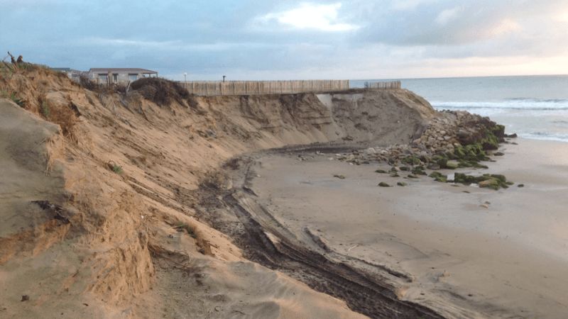
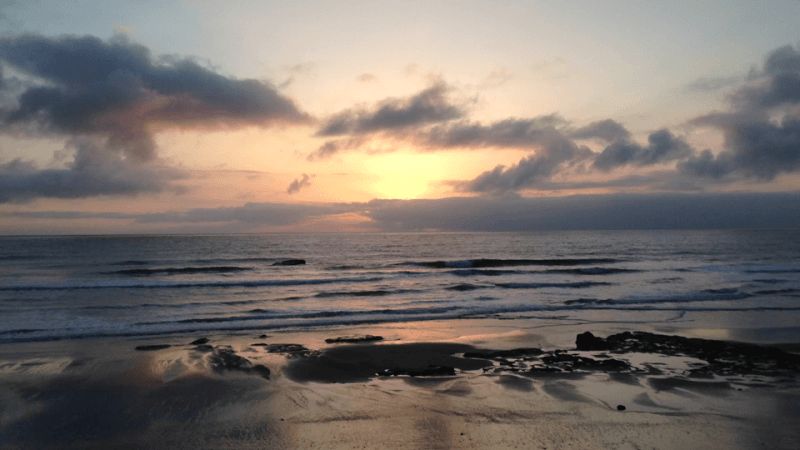
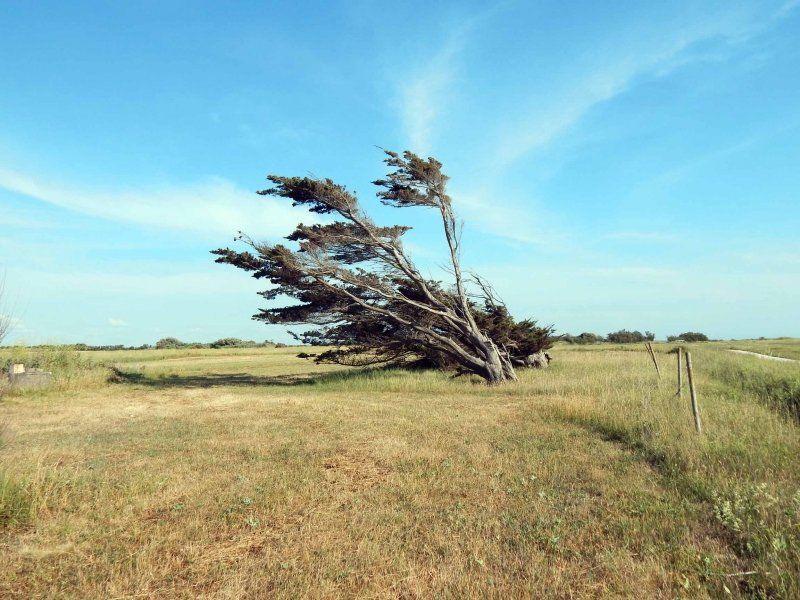
Soulac-sur-Mer - a small town on the Atlantic coast. A seaside resort with some beautiful houses from the Belle Epoque, but whose coastline is massively threatened by the sea. Basically, we stopped there for the night, because the pitch is right in the dunes with a beautiful view of the sea and the dunes. Falling asleep to the sound of the sea - that's something.
We did a bike ride into the town itself, but everything was closed except for the usual beach shops. pre-season.
Boulevard de l'Amélie 31, 33780, Soulac-sur-Mer , Frankreich
45° 30' 0" N 1° 8' 19" W
45.5000000 -1.1386111
• Head toward Rue des Trois Mousquetaires on Boulevard de l'Amélie (D101 E1). Go for 826 m.
• Continue on Boulevard Louis Constant (D101 E1). Go for 536 m.
• Continue on Rue Bremontier (D101 E1). Go for 209 m.
• Turn right onto Rue Ausone. Go for 390 m.
• Turn left onto Rue Périer de Larsan. Go for 434 m.
• Take the 2nd exit from roundabout onto Rue Jean Laporte (D1 E6). Go for 344 m.
• Turn left onto Rue Jean Goudineau (D1 E5). Go for 450 m.
• Turn left onto Route de Soulac (D1 E4) toward Royan/Le Verdon S Mer. Go for 2.5 km.
• Turn left onto D1215. Go for 3.2 km.
• Take the 3rd exit from roundabout onto Rue du Capitaine Henri de Bournazel (D1215) toward Royan-Par Pte de Grave/Port-Médoc. Go for 2.7 km.
• Turn right onto D1215 toward Royan-Embarquement. Go for 308 m.
• Turn left onto D1215. Go for 209 m.
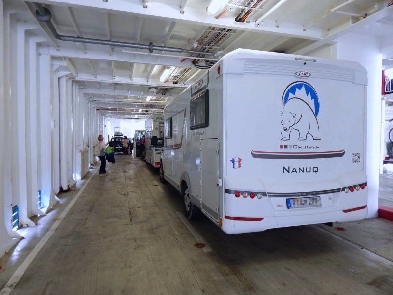
• Take the Royan-Le-Verdon-sur-Mer Ferry. Stay on for 6.1 km.
• Head toward Quai des Sabliers on Rue de la Galiote. Go for 115 m.
• Turn right onto Rue de la Tartane. Go for 257 m.
• Turn right onto Quai Amiral Meyer toward Centre Ville. Go for 133 m.
• Keep left onto Rue Gambetta toward Centre Ville. Go for 418 m.
• Continue on Square de la Brigade Rac. Go for 127 m.
• Turn left onto Place Charles de Gaulle. Go for 72 m.
• Continue on Rue Font de Cherves. Go for 498 m.
• Take the 2nd exit from roundabout onto Rue Pierre Loti (D122). Go for 30 m.
• Continue on Rue Pierre Loti. Go for 78 m.
• Turn left. Go for 18 m.
• Turn right. Go for 30 m.
• Arrive at your destination on the left.
☍
20,0 km
(1 hrs. 4 min.)
Day
Royan, Frankreich
We reached Royan, on the northern bank of the Gironde estuary, in about 30 minutes by ferry. From the ferry, the expanse of the Gironde estuary opens up, a journey that is not only worthwhile for reasons of time. Other than that, we love ferries.
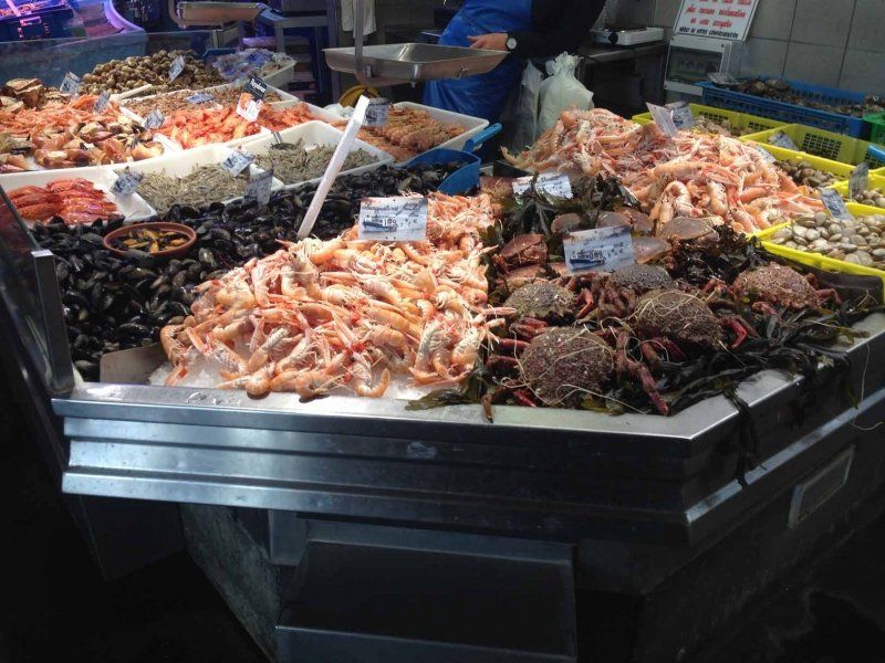
In Royan, we were actually only interested in the market hall on Rue Henri Mériot. In addition to the architecture, there is everything that the sea and the region have to offer in terms of culinary delights. We parked in a residential area nearby (15 min walk) but could have gotten a spot very close by. You just have to search a bit and try it. The official camper places are definitely too far away.
73 Rue Font de Cherves, 17200 Royan, Frankreich
45° 37' 39.6" N 1° 1' 52.6" W
45.6276554 -1.0312672
• Head toward Rue Henri Mériot. Go for 55 m.
• Turn left onto Rue Henri Mériot. Go for 109 m.
• Turn left onto Rue Font de Cherves. Go for 175 m.
• Take the 1st exit from roundabout onto Avenue Daniel Heddé. Go for 389 m.
• Continue on Avenue Daniel Heddé toward A10/Clinique Pasteur. Go for 569 m.
• Take the 2nd exit from roundabout onto Avenue Daniel Heddé toward Rochefort/Île d'Oléron/A10. Go for 405 m.
• Take the 2nd exit from roundabout onto Avenue de Rochefort (D733) toward Rochefort/Île d'Oléron/Breuillet/La Tremblade/St Sulpice de Royan. Go for 1.2 km.
• Pass 6 roundabouts and continue on Chemin des 4 Allées (D733). Go for 11.4 km.
• Take the 3rd exit from roundabout onto D131 toward Île d'Oléron/Marennes/St Sornin/Nieulle S/Seudre. Go for 5.0 km.
• Turn left onto D728. Go for 5.6 km.
• Pass 3 roundabouts and continue on Route de Bourcefranc (D728). Go for 8.6 km.
• Take the 3rd exit from roundabout onto D26. Go for 1.2 km.
• Take the 2nd exit from roundabout onto D26. Go for 4.7 km.
• Turn right onto Rue de la Pointe Blanche (D734). Go for 2.2 km.
• Pass 3 roundabouts and continue on Chemin de Ronde (D734). Go for 1.1 km.
• Take the 2nd exit from roundabout onto Boulevard Philippe Daste. Go for 1.3 km.
• Turn left. Go for 17 m.
• Arrive at your destination on the right.
☍
44,1 km
( 47 min.)
Aire De Camping Car
The parking space is just outside Le Chateau-d'Oléron. The square is separated from the beach by the street. The city can be reached by bike in about 5 minutes.
The space is large, the pitches are not directly parceled out, some have a concrete slab so that you can set up your camping furniture cleanly. The wash house is simple but clean, the showers have hot water (which is not really hot everywhere).
We think it's a good starting point to see the place and at 10.50 not really expensive either.
Boulevard Philippe Daste, 17480 Le Château-d'Oléron, Frankreich
45° 53' 47.2" N 1° 12' 8" W
45.8964449 -1.2022197
• Head toward Route des Huîtres. Go for 17 m.
• Turn right onto Route des Huîtres. Go for 1.3 km.
• Take the 1st exit from roundabout onto Avenue d'Antioche (D734). Go for 4.5 km.
• Take the 1st exit from roundabout onto Route Départementale (D734). Go for 629 m.
• Take the 2nd exit from roundabout onto Route Départementale (D734). Go for 863 m.
• Take the 3rd exit from roundabout onto Route Départementale (D734). Go for 1.7 km.
• Continue on D734. Go for 1.2 km.
• Continue on Lieu-dit Pinturbat (D734). Go for 368 m.
• Continue on Avenue du Moulin Blanc (D734). Go for 862 m.
• Take the 2nd exit from roundabout onto Avenue de Bel-Air (D734). Go for 1.0 km.
• Continue on Avenue de Bonnemie (D734). Go for 608 m.
• Take the 2nd exit from roundabout onto Avenue de Bonnemie (D734). Go for 514 m.
• Continue on D734. Go for 349 m.
• Continue on Lieu-dit Le Cuchas (D734). Go for 463 m.
• Continue on Route de la Dresserie (D734). Go for 296 m.
• Continue on Route du Viaduc au Phare de Chassiron (D734). Go for 694 m.
• Continue on Lieu-dit Les Landes (D734). Go for 92 m.
• Continue on Lieu-dit La Croix des Landes (D734). Go for 131 m.
• Continue on Lieu-dit La Vignerie (D734). Go for 451 m.
• Continue on D734. Go for 351 m.
• Continue on Rue Nationale (D734). Go for 1.1 km.
• Take the 2nd exit from roundabout onto Rue Nationale (D734). Go for 526 m.
• Continue on D734. Go for 4.5 km.
• Continue on Lieu-dit La Betaudière (D734). Go for 277 m.
• Take the 2nd exit from roundabout onto Rue de l'Ormeau (D734). Go for 1.2 km.
• Turn sharp left onto Route des Huttes (VC3). Go for 433 m.
• Turn right. Go for 96 m.
• Arrive at your destination on the right.
☍
24,5 km
( 31 min.)
Chateau-d'Oleron
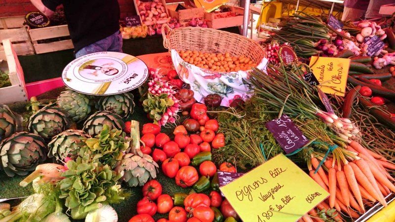
The place itself with its older part is located within the fortress, which unfortunately was bombed by the Royal Airforce on the orders of a French general about 3 weeks before the end of the war and almost completely destroyed after more than 300 years. The place itself is manageable, but especially in the central area it is quite nice and well-kept. The market hall, which is open every day and offers a wide range, is also located near the tourist information office. The typical French market takes place on the square in front of it. Dates are available at the tourist information.
The old oystercatcher huts can be found further down at the harbor. In the meantime they have been renovated, brightly painted and populated by artists and restaurants, in which you can also get inexpensive fresh oysters and other seafood.
There is not much left of the actual fortress ...
Day
Camping Le Moulin
The community-operated parking space is a nice starting point for a bike ride to the lighthouse on the northern tip of the island, the Phare de Chassiron. If the weather cooperates, there are plenty of opportunities for a stop at the beach.
The place is also not parceled out. It has sufficient power connections, V/E and is located near the place, which can also be easily reached on foot. As is typical for the country, a bakery truck drives across the square, honking loudly.
Unfortunately, during our stay we had a short but violent storm, in which a lightning strike not only disabled the entire electrical system on the site, but also our refrigerator. Luckily it still runs on battery and gas...
17650, St Denis D Oleron, Frankreich
46° 1' 41.2" N 1° 23' 3.1" W
46.0281000 -1.3842000
• Head toward Route des Huttes. Go for 96 m.
• Turn left onto Route des Huttes. Go for 409 m.
• Turn sharp right onto Rue de l'Ormeau (D734). Go for 1.2 km.
• Take the 3rd exit from roundabout onto Rue de l'Ormeau (D734). Go for 320 m.
• Continue on D734. Go for 4.5 km.
• Continue on Rue Nationale (D734). Go for 503 m.
• Take the 2nd exit from roundabout onto Rue Nationale (D734). Go for 1.1 km.
• Continue on D734. Go for 351 m.
• Continue on Lieu-dit La Vignerie (D734). Go for 451 m.
• Continue on Lieu-dit La Croix des Landes (D734). Go for 131 m.
• Continue on Lieu-dit Les Landes (D734). Go for 92 m.
• Continue on Route du Viaduc au Phare de Chassiron (D734). Go for 694 m.
• Continue on Route de la Dresserie (D734). Go for 296 m.
• Continue on Lieu-dit Le Cuchas (D734). Go for 463 m.
• Continue on D734. Go for 349 m.
• Continue on Avenue de Bonnemie (D734). Go for 471 m.
• Take the 2nd exit from roundabout onto Avenue de Bonnemie (D734). Go for 627 m.
• Continue on Avenue de Bel-Air (D734). Go for 971 m.
• Take the 2nd exit from roundabout onto Avenue du Moulin Blanc (D734). Go for 888 m.
• Continue on Route de Viaduc au Phare de Chassiron (D734). Go for 368 m.
• Continue on D734. Go for 1.2 km.
• Continue on Route Départementale (D734). Go for 1.7 km.
• Pass 2 roundabouts and continue on Route Départementale (D734). Go for 1.5 km.
• Take the 1st exit from roundabout onto D26. Go for 2.1 km.
• Take the 2nd exit from roundabout onto Avenue de la Beaucoursière (D26). Go for 1.7 km.
• Take the 1st exit from roundabout onto Avenue de la Beaucoursière (D26). Go for 656 m.
• Take the 2nd exit from roundabout onto Avenue de la Beaucoursière (D26). Go for 538 m.
• Take the 3rd exit from roundabout onto Avenue de la Beaucoursière (D26). Go for 6.3 km.
• Take the 2nd exit from roundabout onto D26. Go for 1.2 km.
• Take the 2nd exit from roundabout onto Route de Marennes (D728). Go for 1.7 km.
• Take the 4th exit from roundabout onto Route de Bourcefranc (D728). Go for 2.3 km.
• Take the 2nd exit from roundabout onto Route du Chapus (D728). Go for 877 m.
• Turn slightly left onto D123. Go for 10.8 km.
• Take ramp onto D733 toward Rochefort/St Agnant/St Hippolyte/Aéroport Rochefort-St Agnant. Go for 7.1 km.
• Keep left onto D733. Go for 2.1 km.
• Take the 2nd exit from Rond-Point Albert Bignon roundabout onto Boulevard Albert Bignon (D733) toward A837 (A10)/Saintes/Niort/La Rochelle/Fouras. Go for 1.3 km.
• Take the 2nd exit from roundabout onto Boulevard Albert Bignon (D733) toward A837/A10/Saintes/La Rochelle. Go for 1.5 km.
• Take the 3rd exit from Rond-Point du Brillouet roundabout onto Route de la Rochelle (D733) toward La Rochelle/St Laurent de la Prée/Fouras/Vergeroux-Nord. Go for 1.1 km.
• Take the 1st exit from roundabout onto Route de la Rochelle (D137) toward La Rochelle/St Laurent de la Prée/Fouras. Go for 21.6 km.
• Continue on N137. Go for 2.5 km.
• Take ramp toward Zone des Cottes Mailles. Go for 573 m.
• Pass 3 roundabouts and continue on Avenue Simone Veil. Go for 2.2 km.
• Take the 1st exit from roundabout onto Avenue Jean Moulin. Go for 769 m.
• Take the 4th exit from roundabout. Go for 124 m.
• Turn right. Go for 122 m.
• Turn left. Go for 73 m.
• Arrive at your destination on the right.
☍
87,8 km
(1 hrs. 23 min.)
Day
Parking P+R Vieux Port
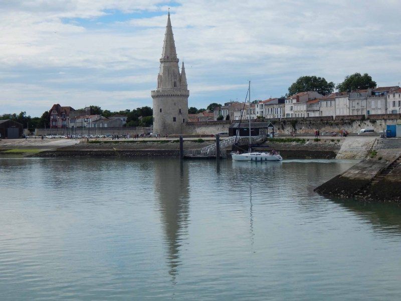
Der Großparkplatz liegt in La Rochelle, aber außerhalb der Altstadt, die aber gut mit Bus, Fahrrad (es gibt Fahrradwege) oder zu Fuß (15 Minuten) zu erreichen ist.
Der Bereich für die Wohnmobile befindet sich in dem hinteren Bereich. Die Wiesenplätze sind nicht parzelliert und bieten neben der zentralen V/E Station keinen Service. Auch ist der Parkplatz mit 15 Euro zwar recht teuer, aber, wegen der Nähe zur Altstadt, sein Geld wert.
Avenue Jean Moulin, 17025, La Rochelle, Frankreich
46° 9' 13" N 1° 8' 26" W
46.1536111 -1.1405556
• Head east. Go for 93 m.
• Turn right onto Avenue Jean Moulin. Go for 115 m.
• Take the 6th exit from roundabout onto Avenue Jean Moulin. Go for 524 m.
• Continue on Pont Jean Moulin. Go for 326 m.
• Continue on Chaussée de Ceinture Nord. Go for 96 m.
• Turn sharp right onto Rue du Docteur Schweitzer. Go for 236 m.
• Turn right onto Boulevard Joffre. Go for 630 m.
• Turn right onto Avenue du Général de Gaulle. Go for 307 m.
• Turn right onto Place du Commandant de La Motte-Rouge. Go for 30 m.
• Continue on Place du Commandant de La Motte-Rouge. Go for 59 m.
• Turn slightly left onto Rue de la Fabrique. Go for 75 m.
• Turn slightly left onto Quai de la Georgette. Go for 106 m.
• Turn right onto Quai Georges Simenon. Go for 60 m.
• Turn right onto Rue de la Chaloupe. Go for 41 m.
• Turn right onto Rue de la Chaloupe. Go for 33 m.
• Arrive at Rue de la Chaloupe. Your destination is on the right.
☍
2,7 km
( 7 min.)
Day
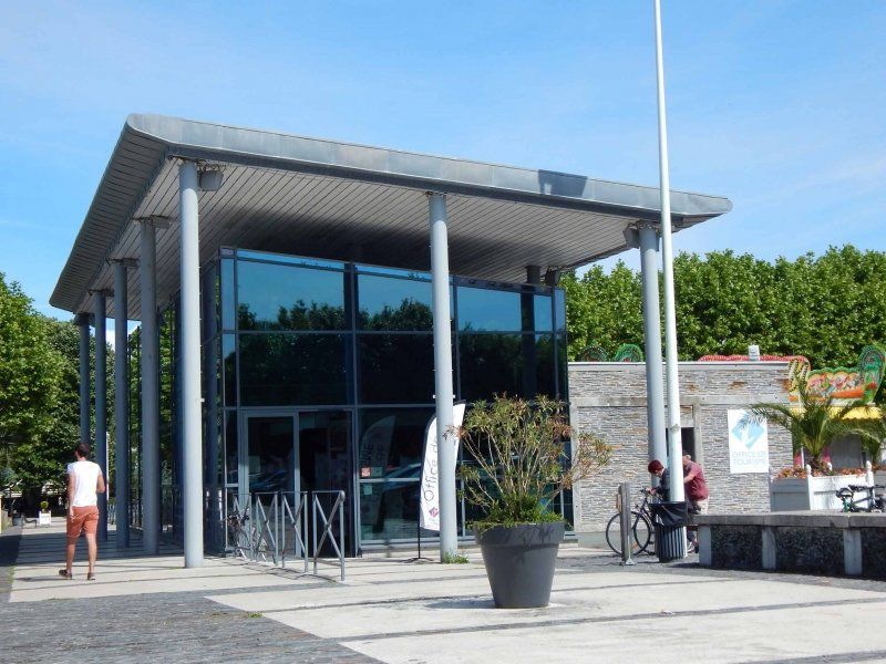
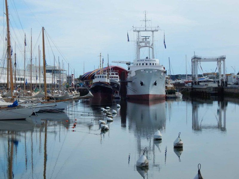
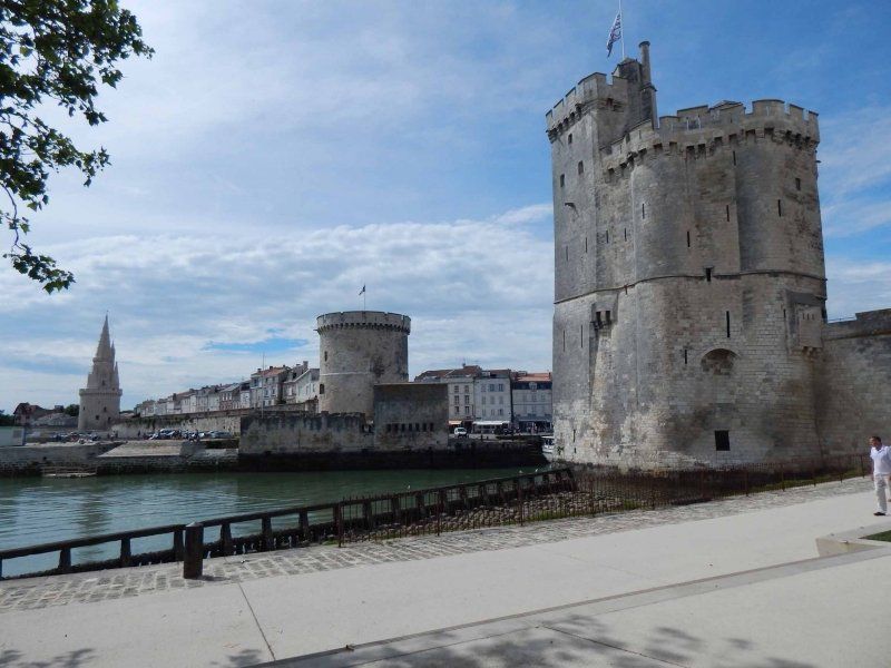
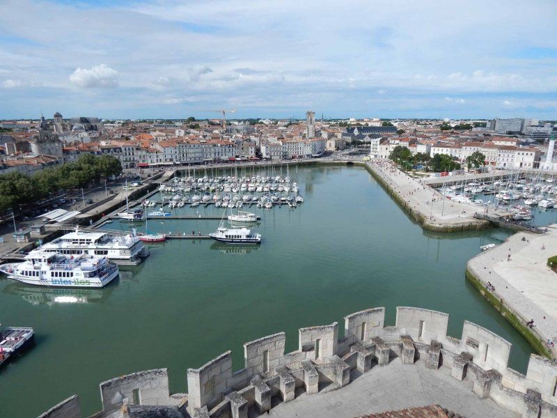
Tourist Information Center
As always, our first route is to the tourist information office, which is located in La Rochelle at the port. There you will get the "Plan de Ville" with the main sights.
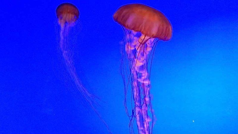
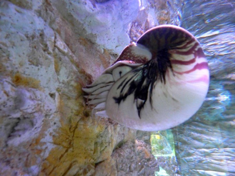
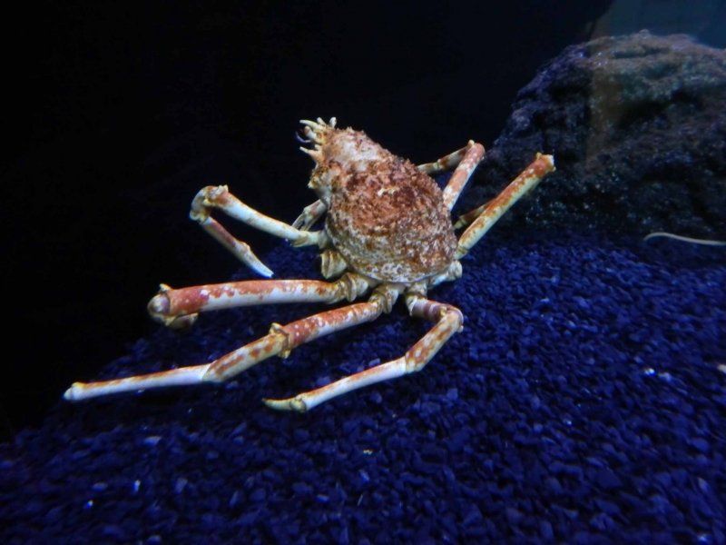
La Rochelle itself has a lot to offer. Starting with the aquarium, an absolute highlight and particularly suitable for families. An absolute must for us.
2 Quai Georges Simenon, 17000 La Rochelle, Frankreich
46° 9' 18.6" N 1° 8' 59.7" W
46.1551619 -1.1499166
• Head toward Quai de la Georgette on Rue de la Chaloupe. Go for 23 m.
• Turn right onto Quai de la Georgette. Go for 36 m.
• Turn left onto Place du Commandant de La Motte-Rouge. Go for 21 m.
• Continue on Square Jacques Bobinec. Go for 63 m.
• Continue on Place du Commandant de La Motte-Rouge. Go for 30 m.
• Continue on Place du Commandant de La Motte-Rouge. Go for 59 m.
• Turn slightly left onto Rue de la Fabrique. Go for 14 m.
• Turn right onto Rue Saint-Nicolas. Go for 78 m.
• Turn slightly right onto Rue Sardinerie. Go for 67 m.
• Turn right onto Rue des Marionnettes. Go for 81 m.
• Turn left onto Rue du Duc. Go for 145 m.
• Continue on Pont Louis Suire. Go for 40 m.
• Continue on Rue Villeneuve. Go for 446 m.
• Continue on Rue Villeneuve. Go for 56 m.
• Turn left onto Rue Alcide d'Orbigny. Go for 491 m.
• Turn right onto Rue Albert 1er. Go for 267 m.
• Continue on Avenue de la Porte Dauphine. Go for 217 m.
• Take the 2nd exit from Rond-Point des Médaillés Militaires roundabout onto Avenue de Fétilly. Go for 176 m.
• Take the 1st exit from Rond-Point de la Légion d'Honneur roundabout onto Avenue du 11 Novembre 1918. Go for 891 m.
• Continue on Avenue du 8 Mai 1945. Go for 98 m.
• Take the 1st exit from roundabout onto Avenue du 8 Mai 1945 (D104). Go for 137 m.
• Take the 3rd exit from roundabout. Go for 471 m.
• Take ramp onto N237. Go for 4.6 km.
• Take ramp toward Île de Ré. Go for 251 m.
• Take the 3rd exit from roundabout onto D735. Go for 3.8 km.
• Take the 2nd exit from roundabout onto Pont de l'Île de Ré (D735). Go for 669 m.
• Take the 2nd exit from roundabout onto Avenue des Dunes (D201). Go for 2.0 km.
• Pass 4 roundabouts and continue on D201. Go for 8.2 km.
• Take the 1st exit from roundabout onto D201 E2. Go for 2.3 km.
• Take the 2nd exit from roundabout onto D735. Go for 457 m.
• Take the 2nd exit from roundabout onto Route de la Couarde (D735). Go for 2.1 km.
• Continue on D735. Go for 1.6 km.
• Take the 1st exit from roundabout onto D735. Go for 1.1 km.
• Take the 1st exit from roundabout onto Route d'Ars (D735). Go for 2.4 km.
• Take the 2nd exit from roundabout onto Route d'Ars (D735). Go for 3.5 km.
• Continue on D735. Go for 1.3 km.
• Take the 1st exit from roundabout onto Route du Moulin des Soeurs. Go for 511 m.
• Continue on Route de la Prée. Go for 126 m.
• Arrive at Route de la Prée. Your destination is on the right.
☍
38,7 km
( 48 min.)
Day
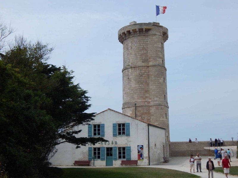
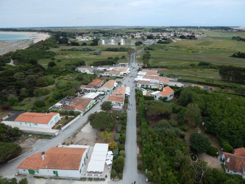
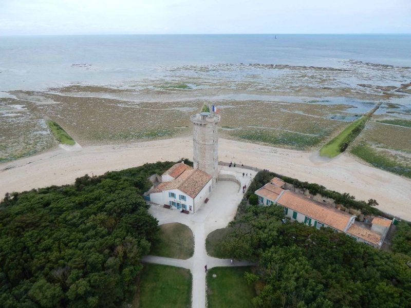
Stellplatz am Phare des Baleines
46°14'31.6"N / 1°33'20.3"W
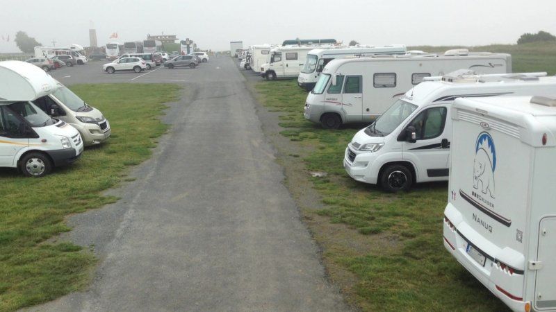
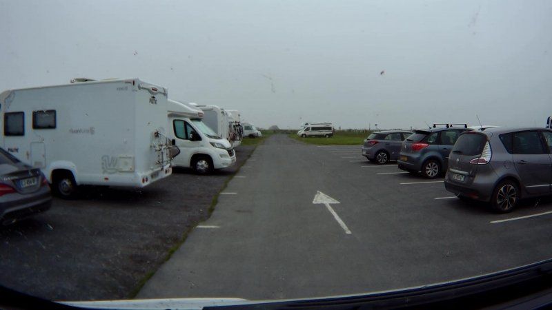
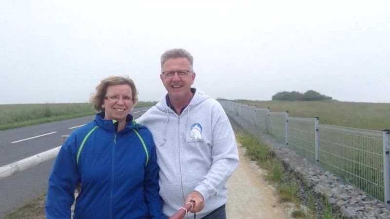
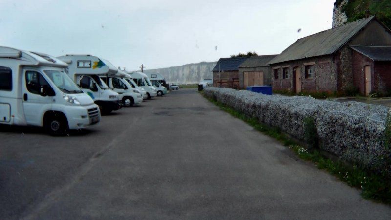
The parking space for 6 mobiles up to 7m max. was added to the existing parking lot, the entrances to which are provided with height barriers, and was not yet finished when we visited and was free of charge. But that will change in our opinion, because the mounting bases for presumably access barriers and a parking machine are available. The place does not offer any service, but it is still right next to the lighthouse and is quiet. The view from the Womo is just beautiful...
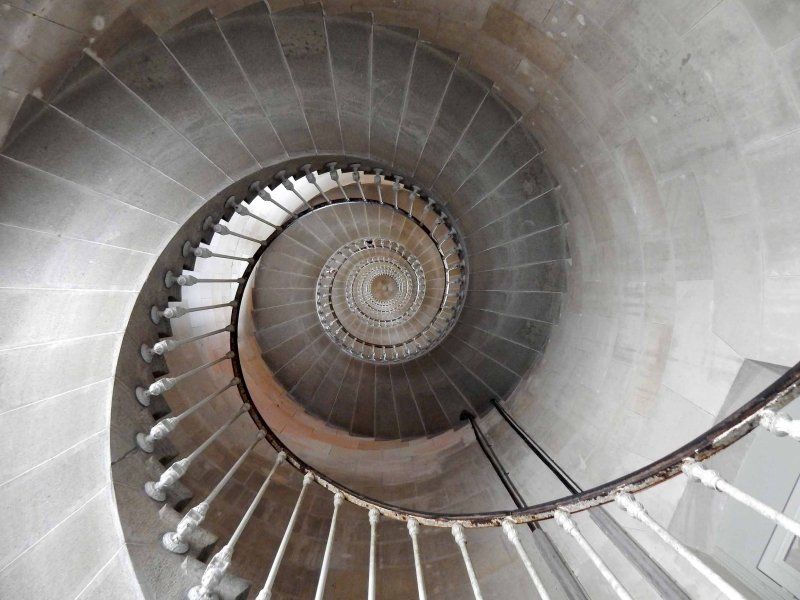
Of course, the square is the starting point for a visit to the lighthouse and its museum, which is small but informative. And of course the two towers (there is the old lighthouse and the new one) offer a wonderful view.
Day
Cooperative Ile de Ré Sauniers, Route de la Prée, Ars-en-Ré, Frankreich
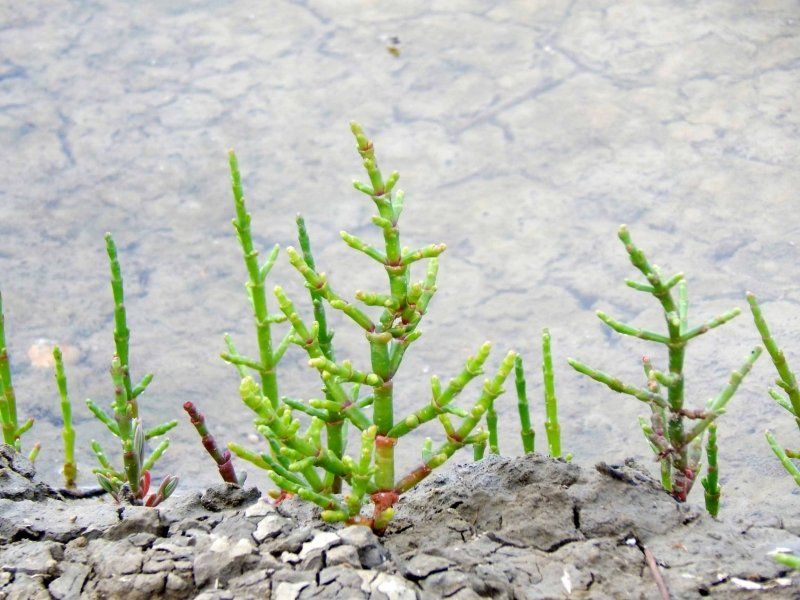
The Ile de Ré, like the Ile d'Oleron, is a center of sea salt production. The salt farmers have joined together in a cooperative in which the products are also marketed directly. To get straight to the point: the same products are available in the supermarkets at the same price.
7 Route de la Prée, 17590 Ars-en-Ré, Frankreich
46° 12' 28.7" N 1° 30' 31.5" W
46.2079840 -1.5087480
• Head southeast on Route de la Prée. Go for 126 m.
• Continue on Route du Moulin des Soeurs. Go for 495 m.
• Take the 2nd exit from roundabout onto D735. Go for 1.4 km.
• Continue on Route d'Ars (D735). Go for 3.4 km.
• Take the 1st exit from roundabout onto Route d'Ars (D735). Go for 2.4 km.
• Take the 1st exit from roundabout onto Avenue de Nouralène. Go for 385 m.
• Continue on Avenue d'Antioche. Go for 278 m.
• Take the 3rd exit from roundabout onto Avenue du Mail. Go for 470 m.
• Continue on Petite Rue de la Raicheneau. Go for 165 m.
• Turn right onto Route du Bois. Go for 332 m.
• Continue on D201. Go for 1.2 km.
• Continue on Route de la Couarde (D201). Go for 179 m.
• Continue on Rue de la Glacière. Go for 18 m.
• Keep right onto Rue de la Glacière (D201). Go for 491 m.
• Take the 3rd exit from roundabout onto Rue de la Glacière (D201). Go for 420 m.
• Turn slightly left onto Rue Charles de Gaulle (D201). Go for 434 m.
• Take the 2nd exit from roundabout onto Rue Charles de Gaulle (D201). Go for 70 m.
• Continue on Route de Sainte-Marie (D201). Go for 159 m.
• Continue on D201. Go for 215 m.
• Continue on Route de Sainte-Marie (D201). Go for 331 m.
• Turn right onto Chemin des Cevettes. Go for 47 m.
• Arrive at Chemin des Cevettes. Your destination is on the left.
☍
13,1 km
( 17 min.)
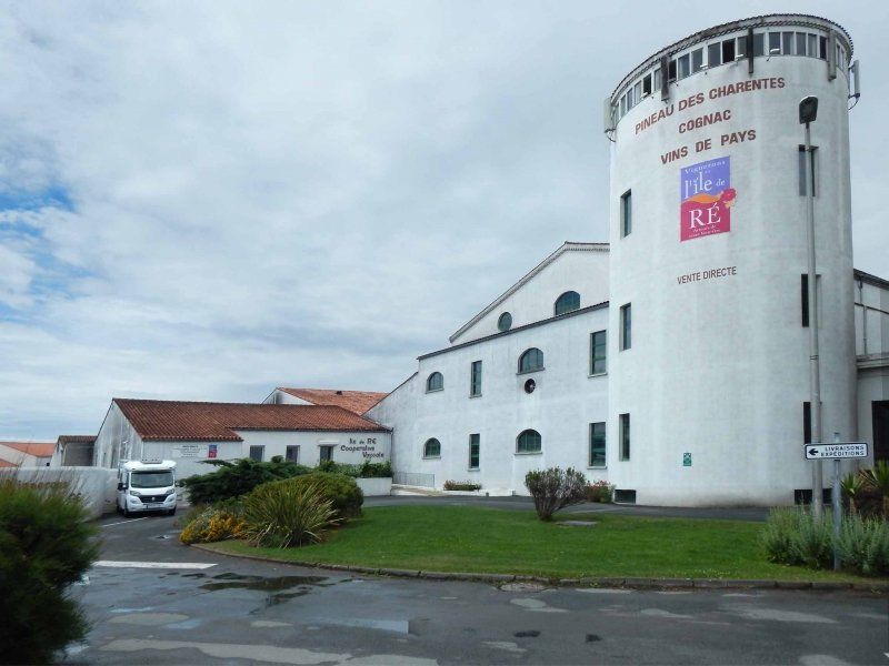
Coopérative Vignerons de L'Ile de Ré, Route de Sainte-Marie, Le Bois-Plage-en-Ré, Frankreich
On the Ile de Ré not only salt is mined but also wine is grown. You can find out more about the diverse range of wines, Pineau (an aperitif wine) or cognac - also as part of a tasting - in the winegrowers' cooperative. And of course also buy.
Route de Sainte-Marie, 17580 Le Bois-Plage-en-Ré, Frankreich
46° 10' 50.3" N 1° 22' 48.1" W
46.1806350 -1.3800249
• Head toward Chemin du Peu de la Fourchette on Chemin des Cevettes.
• Turn left toward Chemin du Peu de la Fourchette. Go for 25 m.
• Turn left onto Chemin du Peu de la Fourchette. Go for 53 m.
• Turn right onto Route de Sainte-Marie (D201). Go for 445 m.
• Take the 3rd exit from roundabout onto D201 E2. Go for 2.4 km.
• Take the 2nd exit from roundabout onto D735. Go for 457 m.
• Take the 2nd exit from roundabout onto Route de la Couarde (D735). Go for 2.1 km.
• Continue on D735. Go for 1.6 km.
• Take the 1st exit from roundabout onto D735. Go for 1.1 km.
• Take the 1st exit from roundabout onto Route d'Ars (D735). Go for 2.4 km.
• Take the 1st exit from roundabout onto Route de Loix (D102). Go for 936 m.
• Continue on D102. Go for 262 m.
• Continue on Lieu-dit Le Feneau (D102). Go for 113 m.
• Continue on D102. Go for 515 m.
• Turn left. Go for 133 m.
• Arrive at your destination on the right.
☍
12,5 km
( 14 min.)
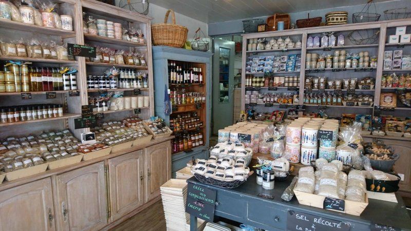
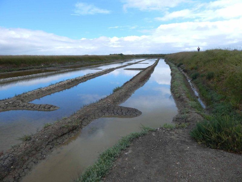
Ecomusée du Marais Salant, route de La Passe, Loix en Ré, Frankreich
If you want to find out more about salt production, you've come to the right place. What is special about this actually small Ecomusée is the tour (in French - there is an information sheet in German), in which the system of salt production and the individual work steps are explained in detail. Here you can also learn the difference between the Fleur de Sel and the Sel Gris, the "grey salt".
Of course, there is also a small shop here that sells their own salt.
route de La Passe, 17111 Loix en Ré, Frankreich
46° 13' 14" N 1° 27' 30.1" W
46.2205689 -1.4583583
• Head west. Go for 133 m.
• Turn right onto D102. Go for 515 m.
• Continue on Lieu-dit Le Feneau (D102). Go for 113 m.
• Continue on D102. Go for 262 m.
• Continue on Route de Loix (D102). Go for 922 m.
• Take the 2nd exit from roundabout onto Route d'Ars (D735). Go for 2.4 km.
• Take the 1st exit from roundabout onto Avenue de Nouralène. Go for 385 m.
• Continue on Avenue d'Antioche. Go for 278 m.
• Take the 3rd exit from roundabout onto Avenue du Mail. Go for 470 m.
• Continue on Petite Rue de la Raicheneau. Go for 165 m.
• Turn right onto Route du Bois. Go for 332 m.
• Continue on D201. Go for 1.2 km.
• Continue on Route de la Couarde (D201). Go for 179 m.
• Continue on Rue de la Glacière. Go for 18 m.
• Keep right onto Rue de la Glacière (D201). Go for 491 m.
• Take the 2nd exit from roundabout onto Rue Raise Maritaise. Go for 1.0 km.
• Turn right onto Avenue du Pas des Boeufs. Go for 233 m.
• Arrive at Avenue du Pas des Boeufs.
☍
9,1 km
( 14 min.)
Camping Campéole Les Amis de la Plage, Avenue du Passage des Boeufs, Le Bois-Plage-en-Ré, Frankreich
The pitch is right next to the campsite of the same name. The pitches are not all flat, but they are subdivided and have electricity. The central V/E station is located next to the entrance.
Contrary to what is occasionally described, the site does not have sanitary facilities; those of the campsite may not be shared. There is only a simple outdoor shower to wash off the sand after a day at the beach.
Nevertheless, the place is quiet and close to the beach, which invites you to take long walks.
68 Av. du Passage des Boeufs, 17580 Le Bois-Plage-en-Ré, Frankreich
46° 10' 37.8" N 1° 23' 17.6" W
46.1771795 -1.3882136
• Head toward Chemin de la Prairie on Avenue du Pas des Boeufs. Go for 892 m.
• Take the 1st exit from roundabout onto Rue Charles de Gaulle (D201). Go for 56 m.
• Continue on Route de Sainte-Marie (D201). Go for 159 m.
• Continue on D201. Go for 215 m.
• Continue on Route de Sainte-Marie (D201). Go for 776 m.
• Take the 3rd exit from roundabout onto D201 E2. Go for 2.4 km.
• Take the 1st exit from roundabout onto D735. Go for 881 m.
• Take the 4th exit from Rond-Point Jean Moulin roundabout onto Avenue Général de Gaulle. Go for 326 m.
• Turn left onto Place du 123ème R.I. et de la Liberté. Go for 67 m.
• Continue on Rue de l'Hôpital. Go for 371 m.
• Turn right onto Place de la République. Go for 52 m.
• Continue on Rue du Général Lapasset. Go for 144 m.
• Arrive at Rue du Général Lapasset. Your destination is on the right.
☍
6,3 km
( 10 min.)
Day
Saint-Martin-de-Ré, Frankreich
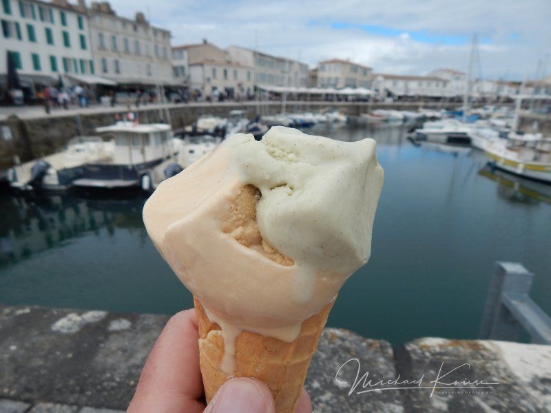
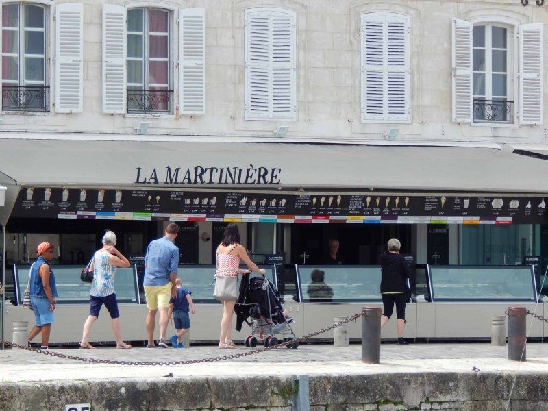
Even if La Flotte is called the most beautiful place on the Ile de Ré, for us it is Saint-Martin-de-Ré. Also an old fishing town with a lovely little harbor surrounded by the Citadel's ramparts - quaint, charming and delicious. In addition to the shops and boutiques, there are plenty of restaurants and bistros. The highlight, however, is the ice cream parlor at the port, La Martinière, which serves salted caramel ice cream. awesome.
Oh yes, with the Womo you can also stay in Saint-Martin-de-Ré (and certainly stay overnight) - the P2 at the cemetery offers plenty of space and is intended for mobile homes. Free but without service. And in less than 5 minutes you are in the city.
46° 12' 12.2" N 1° 22' 2.6" W
46.2034010 -1.3673760
• Head north on Rue du Général Lapasset.
• Turn right onto Cours Dechézeaux. Go for 206 m.
• Continue on Cours Thoiras. Go for 278 m.
• Continue on Place du 123ème R.I. et de la Liberté. Go for 118 m.
• Continue on Avenue Général de Gaulle. Go for 245 m.
• Take the 3rd exit from Rond-Point Jean Moulin roundabout onto Route de la Flotte (D735). Go for 518 m.
• Pass 2 roundabouts and continue on D735. Go for 2.8 km.
• Take the 3rd exit from roundabout onto D735. Go for 810 m.
• Pass 2 roundabouts and continue on D735. Go for 2.2 km.
• Turn left. Go for 303 m.
• Turn left. Go for 168 m.
• Arrive at your destination on the left.
☍
7,6 km
( 11 min.)
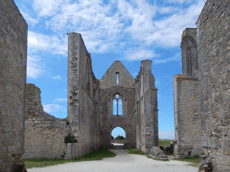
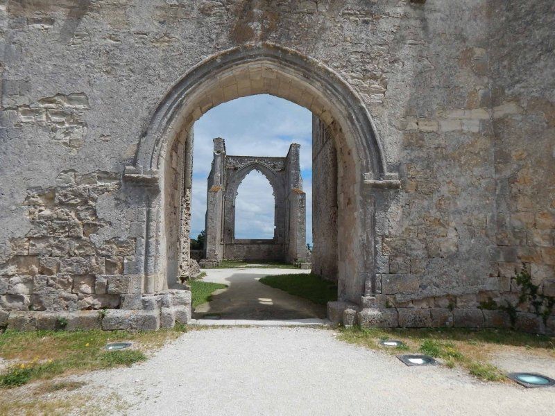
Les Châteliers, La Flotte, Frankreich
When you come to the island (or leave) you inevitably pass it - Les Chateliers. The former Cistercian abbey, founded around 1150 and destroyed and rebuilt several times in the course of its history. After being destroyed by the Huguenots at the end of the 16th century, the abbey was abandoned. Used as a quarry, the monastery gradually fell into disrepair, the ruins were only secured in 1997.
17630 La Flotte, Frankreich
46° 11' 8.9" N 1° 17' 50" W
46.1858080 -1.2972310
• Head south. Go for 168 m.
• Turn right toward D735. Go for 303 m.
• Turn left onto D735. Go for 3.2 km.
• Take the 2nd exit from roundabout onto Rue Édouard Herriot (D735). Go for 316 m.
• Take the 1st exit from roundabout onto Avenue de la Plage. Go for 211 m.
• Turn right onto Avenue Gustave Perreau (D735). Go for 397 m.
• Take the 3rd exit from roundabout onto Avenue Gustave Perreau (D735). Go for 673 m.
• Take the 2nd exit from roundabout onto Pont de l'Île de Ré (D735). Go for 3.7 km.
• Keep right toward N237. Go for 252 m.
• Continue on N237. Go for 4.5 km.
• Take ramp toward D104/La Rochelle-Centre/Lagord. Go for 463 m.
• Take the 3rd exit from roundabout onto Avenue du 8 Mai 1945 (D104). Go for 1.4 km.
• Take the 2nd exit from roundabout onto D105. Go for 2.5 km.
• Take the 2nd exit from roundabout onto D105. Go for 2.7 km.
• Take the 2nd exit from roundabout onto D10. Go for 3.8 km.
• Take the 4th exit from roundabout onto D10. Go for 1.6 km.
• Take the 2nd exit from roundabout onto D9. Go for 6.3 km.
• Take the 2nd exit from roundabout onto Chemin de la Rochelle (D9). Go for 1.4 km.
• Continue on D10 A. Go for 6.6 km.
• Take the 2nd exit from roundabout onto D10 A. Go for 6.3 km.
• Take the 3rd exit from roundabout onto D137 toward A83/Nantes/Angers/St Nazaire/La Roche S/Yon/Luçon. Go for 4.8 km.
• Take the 2nd exit from roundabout onto D137 toward A83/Nantes/Cholet/Angers/Chantonnay. Go for 239 m.
• Pass 4 roundabouts and continue on D137. Go for 7.6 km.
• Take the 3rd exit from roundabout toward Bordeaux/Poitiers/Cholet/Nantes/Angers. Go for 188 m.
• Take ramp onto A83 toward Angers/Nantes/Cholet/La Roche S/Yon. Go for 68.5 km.
• Take exit 3 toward St-Philbert de Gd L./Clisson/Aigrefeuille S/Maine onto Échangeur d'Aigrefeuille. Go for 1.3 km.
• Take the 2nd exit from roundabout onto Lieu-dit Claveleau (D117) toward Clisson/Aigrefeuille S/M. Go for 503 m.
• Pass 2 roundabouts and continue on Lieu-dit La Basse Poterie (D117). Go for 2.4 km.
• Take the 1st exit from roundabout onto Avenue de Nantes (D137) toward Niort/La Rochelle/Clisson/Remouillé/Montaigu. Go for 709 m.
• Take the 2nd exit from roundabout onto Avenue de la Vendée (D137). Go for 745 m.
• Take the 2nd exit from roundabout onto D117. Go for 476 m.
• Turn left onto D7. Go for 2.7 km.
• Continue on Rue Beau Soleil (D7). Go for 404 m.
• Turn right onto Place de l'Église (D7). Go for 32 m.
• Continue on Rue des Abbés Courtais (D58). Go for 50 m.
• Continue on Place des Tilleuls. Go for 30 m.
• Turn right onto Rue Félix Dugast (D7) toward Monnières/Le Pallet/Vertou/St Fiacre sur Maine/La Haye Fouassière/Z.A. les Fromenteaux. Go for 31 m.
• Turn left onto Rue des Forges (D7). Go for 144 m.
• Continue on Rue des Bouchauds (D7). Go for 84 m.
• Take the 2nd exit from roundabout onto Rue des Noëlles. Go for 239 m.
• Take the 1st exit from roundabout onto Rue de la Mairie (D74). Go for 452 m.
• Continue on Lieu-dit Les Croix (D74). Go for 403 m.
• Arrive at Lieu-dit Les Croix (D74). Your destination is on the left.
☍
138,9 km
(1 hrs. 47 min.)
Domaine des Croix, Les Croix, Maisdon-sur-Sèvre, Frankreich
Since the weather was a bit mixed and we didn't take any longer bathing breaks at the sea, we decided to extend our trip to Normandy. We therefore left the Ile de Ré in the direction of Nantes.
For our overnight stay, we decided on a winery that offers free pitches with sanitary facilities (shower/toilet) and V/E. However, a voluntary contribution is requested.
After our arrival, we were greeted by the owner of the winery and invited to a non-binding wine tasting (since the wine was good, we also bought some).
If you are in the area, be sure to stay here.
23 Les Croix, 44690 Maisdon-sur-Sèvre, Frankreich
47° 6' 25.3" N 1° 23' 15.6" W
47.1070290 -1.3876720
• Head north on Lieu-dit Les Croix (D74). Go for 95 m.
• Continue on D74. Go for 1.9 km.
• Continue on Lieu-dit La Bretonnière (D74). Go for 291 m.
• Continue on Lieu-dit La Haie Trois sous (D74). Go for 310 m.
• Continue on La Haie Trois sous (D74). Go for 27 m.
• Continue on D74. Go for 12 m.
• Continue on Lieu-dit La Haie Trois sous (D74). Go for 142 m.
• Continue on La Haie Trois sous (D74). Go for 201 m.
• Continue on Lieu-dit La Haie Trois sous (D74). Go for 35 m.
• Continue on D74. Go for 81 m.
• Turn left onto Lieu-dit La Croix de l'Hommelet (D59). Go for 1.5 km.
• Continue on Lotissement Beau Site (D59). Go for 247 m.
• Continue on D59. Go for 304 m.
• Continue on Rue Beauregard (D59). Go for 308 m.
• Continue on Rue Sophie Trébuchet (D59). Go for 530 m.
• Continue on Lieu-dit La Croix de la Brosse (D59). Go for 37 m.
• Continue on D59. Go for 271 m.
• Continue on Lieu-dit le moulin de la Bourchinière (D59). Go for 83 m.
• Continue on D59. Go for 278 m.
• Continue on Rue Geoffroy de Couesbouc (D59). Go for 500 m.
• Continue on Rue de la Ramée (D59). Go for 488 m.
• Continue on D59. Go for 91 m.
• Continue on Route Touristique du Vignoble Nantais (M59). Go for 2.3 km.
• Take the 2nd exit from Rond-Point du Vignoble roundabout onto M59. Go for 113 m.
• Continue on Boulevard de l'Europe (M59). Go for 50 m.
• Pass 5 roundabouts and continue on Boulevard de l'Europe (M59). Go for 2.1 km.
• Take the 2nd exit from roundabout onto Route du Vignoble (M59). Go for 478 m.
• Take the 2nd exit from roundabout onto Route du Vignoble (M59). Go for 949 m.
• Continue on Route de Nantes (M59). Go for 140 m.
• Pass 3 roundabouts and continue on Route de Vertou. Go for 3.0 km.
• Continue on Rue Ledru-Rollin. Go for 445 m.
• Turn left onto Boulevard Joliot-Curie. Go for 13 m.
• Continue on Rue Saint-Jacques. Go for 315 m.
• Take the 1st exit from roundabout onto Rue Saint-Jacques. Go for 146 m.
• Take the 2nd exit from Place de Pirmil roundabout. Go for 144 m.
• Continue on Pont de Pirmil. Go for 254 m.
• Take the 2nd exit from roundabout onto Place Victor Mangin. Go for 115 m.
• Pass 2 roundabouts and continue on Boulevard Victor Hugo. Go for 869 m.
• Continue on Place de la République. Go for 9 m.
• Take the 2nd exit from Place de la République roundabout onto Place de la République toward Centre Ville. Go for 87 m.
• Continue on Rue Louis Blanc. Go for 175 m.
• Continue on Pont Haudaudine. Go for 227 m.
• Continue on Rue Gaston Veil. Go for 258 m.
• Take the 2nd exit from roundabout onto Rue Gaston Veil. Go for 41 m.
• Take the 3rd exit from roundabout onto Rue Félix Éboué. Go for 167 m.
• Take the 1st exit from roundabout onto Square Jean-Baptiste Daviais. Go for 81 m.
• Turn left onto Quai de la Fosse. Go for 62 m.
• Turn left onto Rue Félix Éboué. Go for 14 m.
• Turn right. Go for 131 m.
• Arrive at your destination on the right.
☍
20,4 km
( 32 min.)
Day
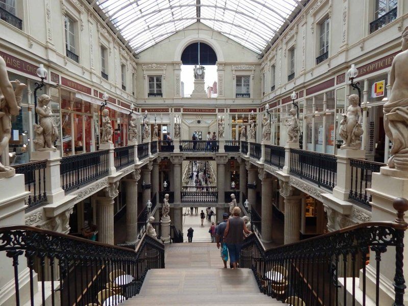
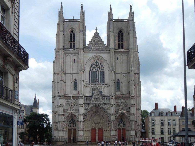
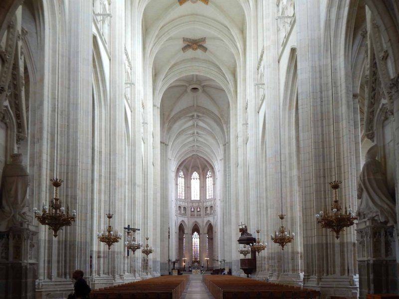
Nantes, Frankreich
On the way to Normandy we made a stop in Nantes. It is good that you can stand on the Central Parking Nantes (47.211011 / -1.559847). Tip: Put your parking ticket on the dashboard or clip it to the left aisle at the bottom of the window. With us it hung (as always) above the windshield wipers, which brought us a ticket for parking without a parking ticket).
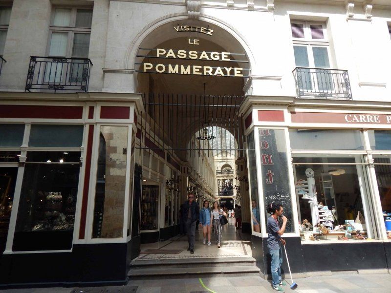
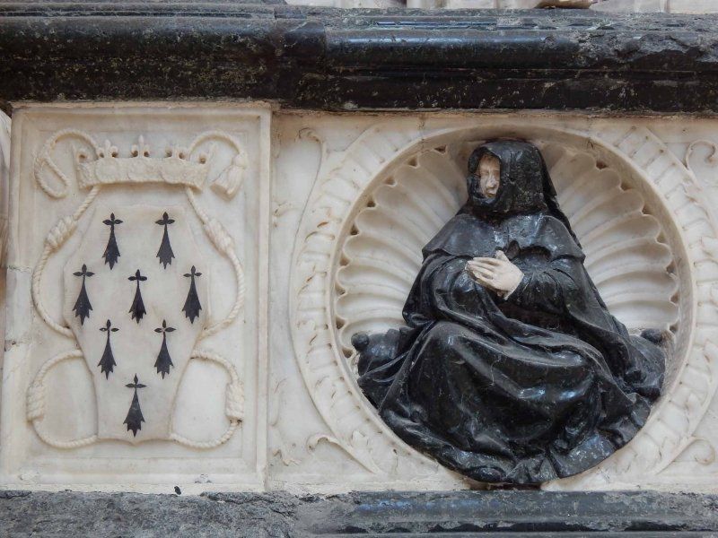
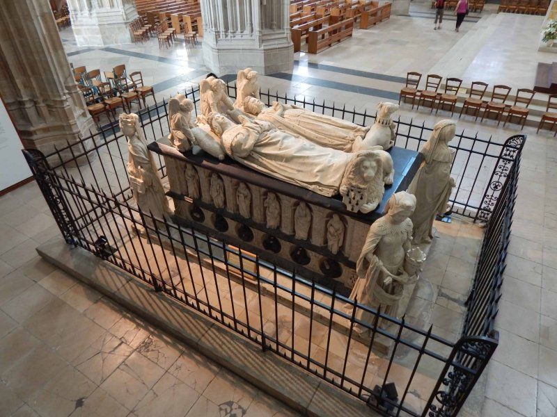
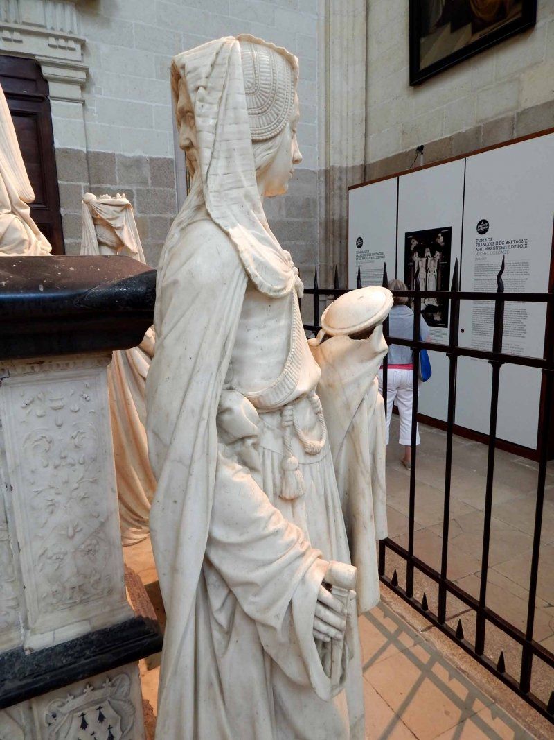
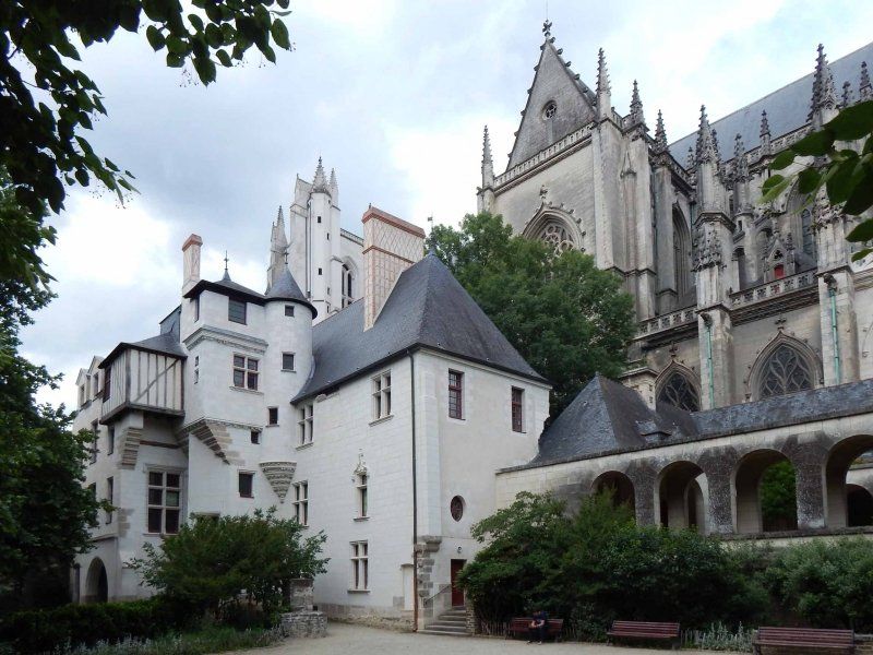
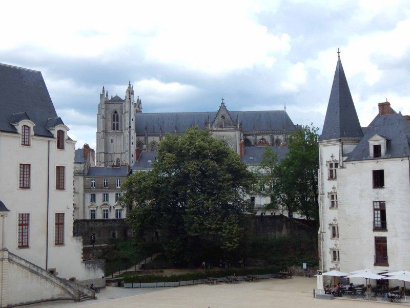
From there you can see the old town with the Gothic cathedral (marble tomb of Duke Francois II and his wife Marguerite de Foix; the crypt was closed for construction work), the Saint-Nicolas basilica on the Place Royale, the Passage Pommeraye, a beautiful shopping arcade from 1843 and the ducal castle.
A trip to the river island for the "Les Machines de l'Ile" exhibition (the highlight is the huge mechanical elephant) should not be missed either.
Boulevard des Nations-Unies, 44000 Nantes, Frankreich
47° 12' 38.8" N 1° 33' 36.9" W
47.2107803 -1.5602510
• Head southeast. Go for 4 m.
• Turn left. Go for 130 m.
• Turn right toward Rue Félix Éboué. Go for 22 m.
• Turn right onto Rue Félix Éboué. Go for 43 m.
• Take the 2nd exit from roundabout onto Rue Félix Éboué. Go for 168 m.
• Take the 1st exit from roundabout onto Rue Gaston Veil. Go for 28 m.
• Take the 2nd exit from roundabout onto Boulevard Jean Phillipot. Go for 201 m.
• Take the 3rd exit from Place Alexis Ricordeau roundabout onto Boulevard Jean Phillipot. Go for 114 m.
• Take the 2nd exit from roundabout onto Boulevard Jean Phillipot. Go for 122 m.
• Take the 1st exit from roundabout onto Cours Commandant d'Estienne d'Orves. Go for 232 m.
• Take the 2nd exit from Square Elsa Mercoeur roundabout onto Rue de Strasbourg toward Nord-Centre Ville/Est-Centre Ville/Place Pt Morand. Go for 702 m.
• Continue on Place du Port Communeau. Go for 46 m.
• Take the 2nd exit from Place du Port Communeau roundabout onto Place du Pont Morand toward Nord-Centre Ville/Rennes/Place Bretagne/Marché de Talensac. Go for 75 m.
• Continue on Rue Paul Bellamy. Go for 73 m.
• Take the 1st exit from roundabout. Go for 10 m.
• Take the 2nd exit from roundabout onto Rue Paul Bellamy toward Rennes/Nantes-Nord. Go for 1.5 km.
• Take the 2nd exit from Rond-Point de Rennes roundabout onto Rond-Point de Rennes toward Porte de Rennes/Nantes-Nord. Go for 25 m.
• Take the 1st exit from Rond-Point de Rennes roundabout onto Boulevard Robert Schuman toward Nantes-Nord. Go for 335 m.
• Pass 5 roundabouts and continue on Boulevard Robert Schuman. Go for 1.5 km.
• Continue on Route de Rennes toward Rennes/Orvault/Pont du Cens. Go for 671 m.
• Pass 8 roundabouts and continue on Route de Rennes (N137). Go for 97.3 km.
• Take ramp onto Rocade Sud (N136) toward E3/Le Mans/Caen/C.H.U. Hôpital Sud. Go for 7.7 km.
• Take ramp toward Porte de la Valette/Cesson Centre/Z.A. la Rigourdière. Go for 291 m.
• Take the 3rd exit from roundabout toward Cesson-Centre. Go for 232 m.
• Continue on Rue de Paris. Go for 210 m.
• Take the 2nd exit from roundabout onto Route de Domloup toward Cesson-Centre/La Rigourdière/Rocade Est/Caen/Brest. Go for 339 m.
• Take the 3rd exit from roundabout onto Rue de Paris. Go for 285 m.
• Take the 1st exit from roundabout onto Route de la Valette. Go for 242 m.
• Continue on Route de la Valette. Go for 299 m.
• Take the 3rd exit from roundabout. Go for 59 m.
• Arrive at your destination on the right.
☍
112,9 km
(1 hrs. 19 min.)
Aire de Camping-Car, Cesson-Sévigné, Frankreich
The small parking space is enough for 5-6 mobiles, alternatively you can also park in the parking lot of the sports field on the other side of the street when there are no events.
The course is beautifully situated on a huge park landscape interspersed with various lakes, which is ideal for walking or cycling. Actually too nice to just stay there overnight.
14 Route de la Valette, 35510 Cesson-Sévigné, Frankreich
48° 7' 6.1" N 1° 35' 27.8" W
48.1183677 -1.5910590
• Head southeast. Go for 15 m.
• Take the 1st exit from roundabout onto Route de la Valette. Go for 535 m.
• Take the 2nd exit from roundabout onto Rue de Paris. Go for 292 m.
• Take the 3rd exit from roundabout onto Rue de la Rigourdière. Go for 290 m.
• Pass 2 roundabouts and continue on Rue de la Rigourdière. Go for 1.1 km.
• Take the 2nd exit from roundabout toward Rocade Est/Caen/Brest/Cesson-Nord/Mouillepied. Go for 146 m.
• Continue on Porte de la Rigourdière. Go for 631 m.
• Continue toward Porte de la Rigourdière. Go for 39 m.
• Take the 1st exit from roundabout onto Porte de la Rigourdière toward Rocade Est/Caen/Brest/Cesson-Nord. Go for 86 m.
• Take ramp onto Rocade Est (N136). Go for 4.0 km.
• Take ramp onto A84 toward Porte de Normandie/Fougères/Mt St Michel/Caen/Cherbourg/Liffré. Go for 66.5 km.
• Continue on N175. Go for 10.5 km.
• Keep left onto A84 toward Cherbourg/Caen/Saint-Lô/Villedieu-les-Poêles. Go for 16.6 km.
• Take exit 37 toward Villedieu les P./Coutances/Gavray. Go for 503 m.
• Take the 3rd exit from roundabout onto D924 toward Rennes/A84/Avranches/Fleury/Granville. Go for 192 m.
• Take the 1st exit from roundabout onto D33 toward Le Mesnil-Garnier. Go for 341 m.
• Take the 1st exit from roundabout onto Route du Mesnil Garnier (D33). Go for 3.0 km.
• Continue on D33. Go for 1.1 km.
• Continue on Lieu-dit L'Hôtel Chaignon (D33). Go for 201 m.
• Continue on D33. Go for 270 m.
• Continue on Lieu-dit Le Couvent (D33). Go for 113 m.
• Continue on D33. Go for 895 m.
• Continue on Lieu-dit La Rourie (D33). Go for 117 m.
• Continue on D33. Go for 1.0 km.
• Continue on Lieu-dit L'Orail (D33). Go for 89 m.
• Continue on D33. Go for 350 m.
• Continue on Lieu-dit Au Fèvre (D33). Go for 151 m.
• Continue on D33. Go for 1.1 km.
• Continue on Lieu-dit Guédon (D33). Go for 98 m.
• Continue on D33. Go for 733 m.
• Continue on Lieu-dit Le Trébuchet (D33). Go for 56 m.
• Continue on D33. Go for 233 m.
• Continue on Lieu-dit La Doronnerie (D33). Go for 104 m.
• Continue on D33. Go for 479 m.
• Continue on Lieu-dit Le Val Raimond (D33). Go for 177 m.
• Continue on D33. Go for 93 m.
• Continue on Lieu-dit Catte sur Cat (D33). Go for 101 m.
• Turn right onto Lieu-dit Catte sur Cat (D38). Go for 67 m.
• Continue on D38. Go for 365 m.
• Continue on Rue Haute Rue (D38). Go for 1.5 km.
• Turn left onto Rue du Moulin (D9). Go for 97 m.
• Turn right onto D7. Go for 3.7 km.
• Take the 2nd exit from roundabout onto Rue de la Pérelle (D7). Go for 8.6 km.
• Take the 3rd exit from roundabout onto D73. Go for 1.5 km.
• Continue on Rue des Fours à Chaux (D73). Go for 1.4 km.
• Turn left onto Rue des Forges (D971). Go for 328 m.
• Turn right onto Rue de la Bataille (D73) toward Hyenville/Montmartin S/M./Regnéville S/M. Go for 65 m.
• Continue on Rue de la Bataille (D72). Go for 1.1 km.
• Continue on Rue du Mont César (D72). Go for 3.1 km.
• Turn right onto Rue du Mesnil (D20). Go for 772 m.
• Take the 2nd exit from roundabout onto Lieu-dit Le Pont de la Roque (D650). Go for 5.9 km.
• Turn left onto Route de Saint-Malo de la Lande (D272). Go for 1.8 km.
• Turn right onto Rue de Blainville (D72). Go for 606 m.
• Turn left onto Rue du Vieux Coutainville (D361). Go for 244 m.
• Turn left onto D361. Go for 69 m.
• Arrive at D361. Your destination is on the right.
☍
143,3 km
(1 hrs. 35 min.)
Day
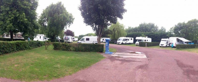
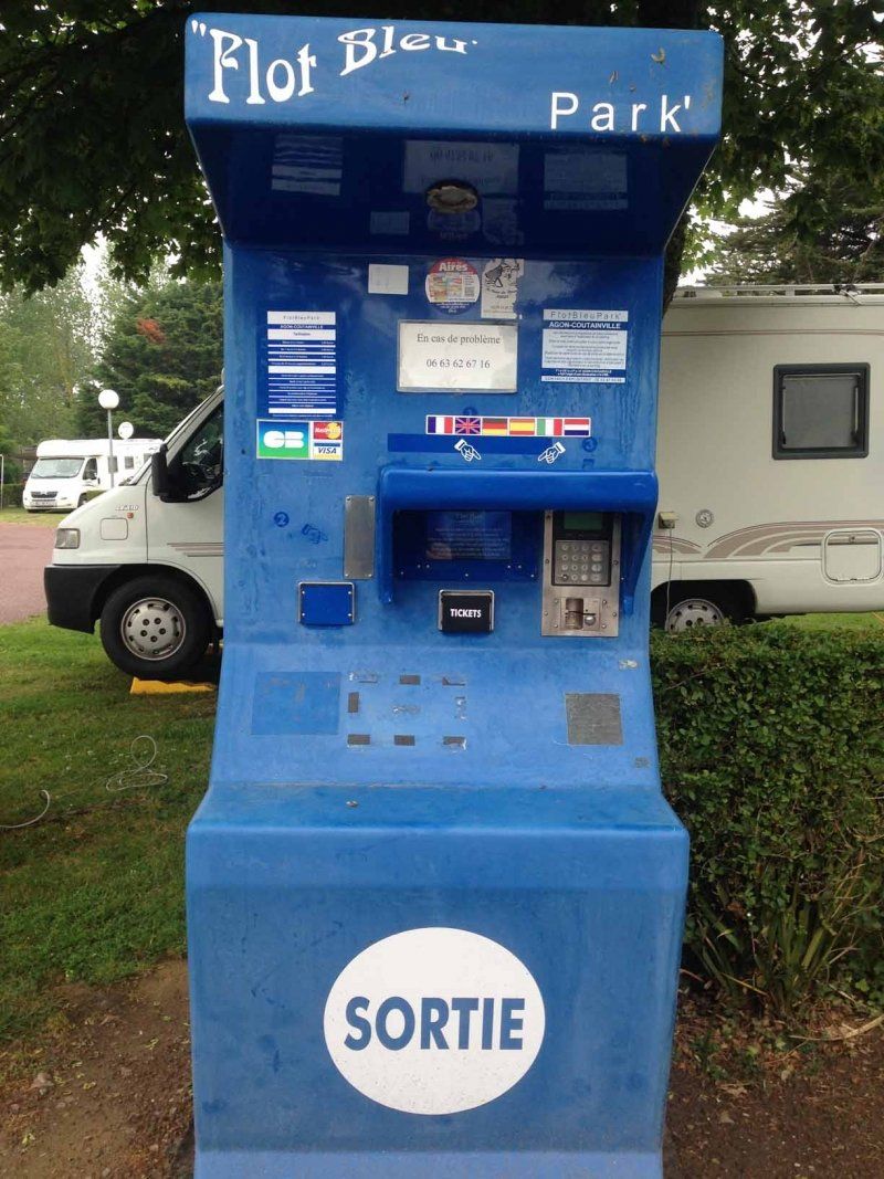
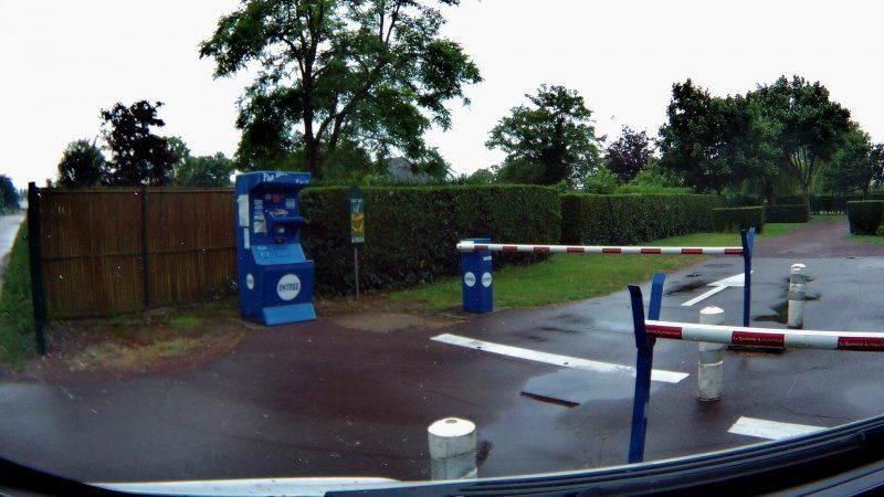
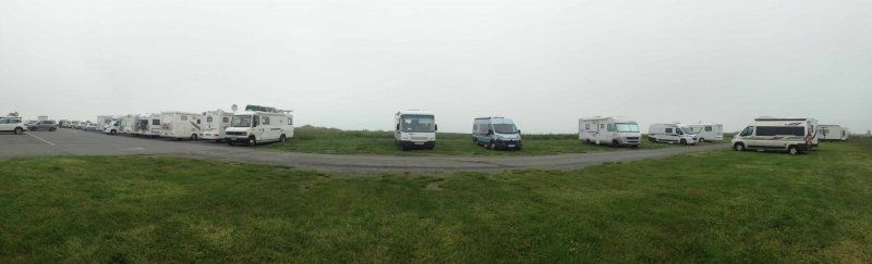
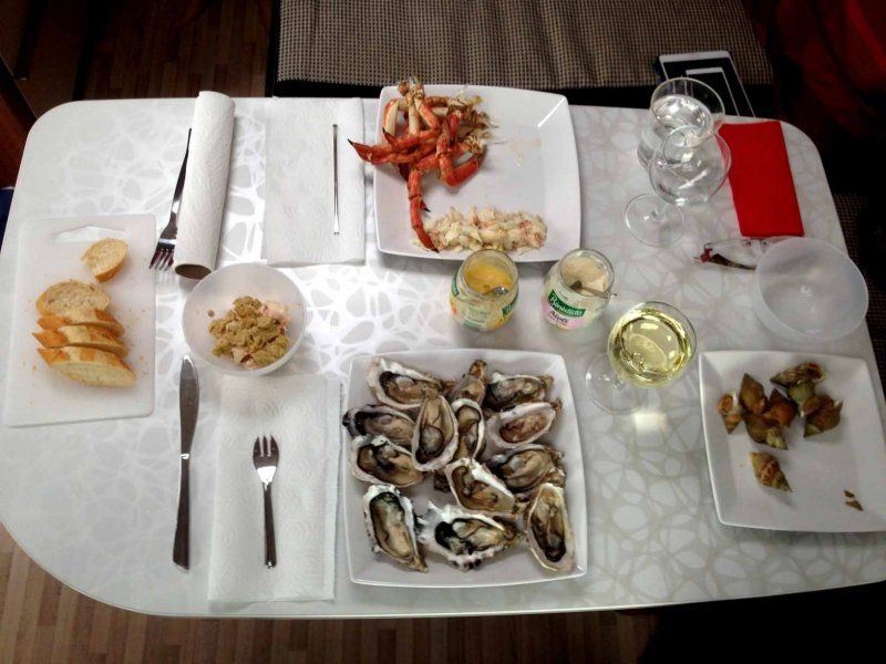
Aire de Camping-Car le Marais, Agon-Coutainville, Frankreich
Agon-Coutainville - we had a holiday home here in 2015, the decision to buy a mobile home matured here, here we found our El Dorado for shellfish and crustaceans, Les Trois C (we reported on our homepage). Les Trois C is the reason for us to visit this actually typical bathing resort again and again, and this year as well. To our horror we found that the owner had changed. We found out from the former operators via Facebook that after the lease expired, the lease was set at such a high level that the young couple had to give up. Well, there are still shellfish and crustaceans; significantly more expensive and not quite as good as Madame's. Nevertheless, we have covered ourselves where we have been before...
We stood on the same site as in 2016, a beautiful parceled site with electricity and V/E, all included in the price.
D361, 50230 Agon-Coutainville, Frankreich
49° 3' 11.9" N 1° 35' 30.4" W
49.0533100 -1.5917787
• Head toward Boulevard Louis Lebel Jehenne on D361. Go for 193 m.
• Turn left onto Rue des Martyrs. Go for 342 m.
• Turn right onto Rue de Blainville (D72). Go for 313 m.
• Turn left onto Route de Saint-Malo de la Lande (D272). Go for 1.7 km.
• Turn right onto D650. Go for 1.8 km.
• Turn sharp right onto D72. Go for 476 m.
• Turn right onto Rue du Pont (D44). Go for 5.7 km.
• Pass 2 roundabouts and continue on Route du Moulin Neuf (D44). Go for 1.2 km.
• Take the 3rd exit from roundabout onto D971 toward Saint-Lô/Carentan/Barneville-Carteret/Valognes/Cherbourg. Go for 3.3 km.
• Take the 2nd exit from Rond-Point des Pommiers roundabout onto D972 toward Saint-Lô/Z.I. Château de la Mare. Go for 13.8 km.
• Pass 4 roundabouts and continue on Route de Coutances (D972). Go for 8.9 km.
• Take the 2nd exit from roundabout onto N174 toward Caen. Go for 4.5 km.
• Take ramp toward Bayeux. Go for 552 m.
• Pass 3 roundabouts and continue on D972. Go for 2.8 km.
• Take the 2nd exit from Rond-Point du Sémilly roundabout onto D972 toward Bayeux. Go for 911 m.
• Take the 1st exit from Rond-Point du Bessin roundabout onto D972 toward Balleroy/Le Molay Littry/Bayeux. Go for 9.5 km.
• Continue on Lieu-dit La Malbreche (D572) toward Bayeux/Caen. Go for 6.2 km.
• Take the 3rd exit from roundabout onto Lieu-dit L'Embranchement (D572) toward Caen/Bayeux. Go for 8.6 km.
• Take the 2nd exit from roundabout onto D572 toward Caen/Subles/Bayeux. Go for 3.3 km.
• Continue toward Bayeux/Caen. Go for 34 m.
• Take the 3rd exit from roundabout onto D572 toward Bayeux/Caen. Go for 785 m.
• Continue toward Cherbourg/Bayeux. Go for 34 m.
• Take the 3rd exit from roundabout onto D572 toward Cherbourg/Bayeux. Go for 230 m.
• Pass 3 roundabouts and continue on Boulevard Sadi Carnot (D572). Go for 2.9 km.
• Take the 4th exit from roundabout onto Boulevard Maréchal Montgomery (D572). Go for 576 m.
• Take the 3rd exit from Rond-Point Eisenhower roundabout onto Boulevard Winston Churchill (D613). Go for 237 m.
• Take the 3rd exit from Carrefour Saint-Exupère roundabout onto Boulevard Winston Churchill (D613). Go for 132 m.
• Pass 3 roundabouts and continue on Boulevard Winston Churchill (D613). Go for 1.6 km.
• Take the 2nd exit from roundabout onto Route d'Arromanches (D516). Go for 7.2 km.
• Take the 2nd exit from roundabout onto D514. Go for 671 m.
• Turn right onto Rue Marie-Rose Thonnard (D87). Go for 585 m.
• Continue on Rue de l'Abreuvoir. Go for 116 m.
• Turn right onto Avenue Amiral Mountbatten (D514). Go for 268 m.
• Turn left onto D514. Go for 598 m.
• Arrive at D514.
☍
90,0 km
(1 hrs. 17 min.)
Day
PARKING 360
We were also here in 2016, but with better weather. When we visited the 360° cinema there in 2015, it was clear to us that we wanted to stand here with our future mobile home. The view of the sea from the Womo is so beautiful that we came back here again this year.
D514, 14117 Arromanches-les-Bains, Frankreich
49° 20' 20.3" N 0° 36' 54.3" W
49.3389726 -0.6150949
• Head toward Rue du Calvaire on D514. Go for 10.8 km.
• Turn right onto Avenue du Général de Gaulle (D112 C). Go for 588 m.
• Take the 2nd exit from roundabout onto Rue Grande (D112 B). Go for 409 m.
• Turn right onto Chemin de Banville. Go for 69 m.
• Turn sharp left onto Rue de Banville. Go for 135 m.
• Continue on D12. Go for 642 m.
• Take the 1st exit from roundabout onto Route de Caen (D79). Go for 721 m.
• Take the 2nd exit from roundabout onto Route de Caen (D79). Go for 2.5 km.
• Take the 3rd exit from roundabout onto D79. Go for 785 m.
• Continue on D404. Go for 2.3 km.
• Take the 2nd exit from roundabout onto D404. Go for 2.2 km.
• Turn right onto D7. Go for 5.6 km.
• Take the 2nd exit from Rond-Point de la Bijude roundabout onto D7. Go for 3.0 km.
• Keep left toward Calvaire St Pierre. Go for 38 m.
• Continue on Avenue de la Côte de Nacre (D7). Go for 127 m.
• Turn left toward Périphérique/N814. Go for 50 m.
• Turn right and take ramp onto Périphérique (N814) toward Paris/Ouistreham-Car Ferry/Périphérique Est. Go for 5.6 km.
• Take ramp toward Deauville/Trouville/Rouen. Go for 456 m.
• Keep left onto A13 (Autoroute de Normandie) toward Deauville/Trouville/Le Havre/Rouen/Paris/Troarn/Dozulé. Go for 50.1 km.
• Take the exit toward Le Havre/Amiens/Calais/Honfleur/Pont de Normandie onto A29. Go for 18.0 km.
• Continue on N1029. Go for 7.1 km.
• Continue on A29. Go for 35.9 km.
• Take exit 8 toward Cany-Barville. Go for 1.4 km.
• Take the 1st exit from roundabout onto D926 toward Fécamp/Fauville en Caux/Cany-Barville. Go for 3.5 km.
• Take the 2nd exit from roundabout onto D926 toward Fécamp/Cany-Barville/Ypreville-Biville. Go for 848 m.
• Take the 1st exit from roundabout onto D109 toward Normanville/Ourville en Cx/Cany-Barville. Go for 84 m.
• Turn right toward D50. Go for 38 m.
• Keep left toward D50. Go for 74 m.
• Turn right onto D50. Go for 7.6 km.
• Take the 3rd exit from roundabout onto Route de Fauville (D50). Go for 4.4 km.
• Take the 2nd exit from roundabout onto Route d'Ourville (D131). Go for 3.1 km.
• Turn right onto Rue du Général de Gaulle (D925). Go for 469 m.
• Continue on Rue de Saint-Valéry (D925). Go for 9.8 km.
• Take the 2nd exit from roundabout onto D925 B toward St Valery en Caux/Z.A. du Plateau Ouest/St Valery en Cx. Go for 725 m.
• Take the 1st exit from roundabout onto D925 B. Go for 439 m.
• Continue on Avenue de la 51ème Highland Division (D925 B). Go for 75 m.
• Continue on D925 B. Go for 139 m.
• Turn left onto Route du Havre (D925 B). Go for 894 m.
• Turn left onto Route du Havre (D925 B). Go for 57 m.
• Continue on Quai du Havre (D925 B). Go for 177 m.
• Turn left onto Quai du Havre (D79). Go for 74 m.
• Turn right onto Quai d'Aval. Go for 87 m.
• Turn slightly left onto Quai d'Aval. Go for 300 m.
• Arrive at Quai d'Aval.
☍
181,3 km
(2 hrs. 2 min.)
Day
Aire de Camping-car Plage Ouest
We had chosen the pitch for the next two nights because it is right by the harbor and also close to town. When we arrived we saw that it actually consists of two squares. A part that is in front of the harbor with a view of the sea (this was already fully booked in the early afternoon), the other part is set back behind a wall and directly in front of the rocks.
Both spaces are parceled out but very narrow, so that you can have problems with large rear garage doors. The V/E (additional chargeable) has its best days behind it.
So we drove on and tried our luck in the next town.
Quai d'Aval, 76460, St.-Valéry-en-Caux, Frankreich
49° 52' 19" N 0° 42' 35" E
49.8719444 0.7097222
• Head toward Sente des Douaniers on Quai d'Aval. Go for 387 m.
• Turn left onto Quai du Havre (D79). Go for 74 m.
• Turn left onto Rue du Havre (D925 B). Go for 108 m.
• Take the 2nd exit from roundabout onto Route de Dieppe (D925 B). Go for 636 m.
• Take the 2nd exit from roundabout onto Route de Dieppe (D925 B). Go for 1.5 km.
• Continue on D925 B. Go for 85 m.
• Take the 3rd exit from roundabout onto D925 toward Dieppe/Veules les Roses. Go for 5.3 km.
• Take the 2nd exit from roundabout onto Rue Docteur Pierre Girard (D142). Go for 466 m.
• Continue on Rue Docteur Pierre Girard (D142). Go for 57 m.
• Turn left onto Rue Jean Lamy. Go for 96 m.
• Continue on Rue Zacharie Pelletier. Go for 59 m.
• Turn right onto Sentier aux Ânes. Go for 95 m.
• Turn slightly left onto Sentier à Douane. Go for 258 m.
• Turn right. Go for 23 m.
• Turn right. Go for 151 m.
• Arrive at your destination on the left.
☍
9,3 km
( 12 min.)
Parking des Falaises, Veules-les-Roses, Frankreich
We opted for a free parking space (without service) above Veules-les-Roses. Contrary to the other campers, we chose a place with a view of the sea and were rewarded with fantastic sunsets.
7 Sentier À Douane, 76980 Veules-les-Roses, Frankreich
49° 52' 31.5" N 0° 47' 32.8" E
49.8754254 0.7924392
• Head southwest. Go for 141 m.
• Turn left. Go for 51 m.
• Turn right. Go for 28 m.
• Turn right toward Route des Abatoirs. Go for 367 m.
• Continue on Route des Abatoirs. Go for 1.7 km.
• Turn right onto D925. Go for 2.6 km.
• Take the 3rd exit from roundabout onto D925 toward Fécamp/Cany-Barville/St Valery en C. Go for 1.6 km.
• Take the 4th exit from roundabout onto D20 toward A150/A29/Rouen/Doudeville. Go for 10.6 km.
• Pass 3 roundabouts and continue on Route de Rouen (D20). Go for 14.7 km.
• Take the 4th exit from roundabout onto A29 toward Dieppe/Amiens. Go for 33.6 km.
• Continue on A28. Go for 20.2 km.
• Take the exit toward Reims/Lille/Amiens onto A29. Go for 58.6 km.
• Take the exit toward Reims/Lille/Paris/Amiens-Sud onto A16 (L'Européenne). Go for 3.9 km.
• Take the exit toward Reims/Lille/Paris-Est/A1/Amiens-Sud onto E44. Go for 1.1 km.
• Continue on A29. Go for 10.2 km.
• Take the exit toward Paris/Lille/Reims/St Quentin onto A29. Go for 64.4 km.
• Take the exit toward Lyon/Metz/Nancy/Reims/St Quentin-Sud onto A26 (Autoroute des Anglais). Go for 95.0 km.
• Continue on E17. Go for 322 m.
• Take the exit onto A4 (Contournement Sud de Reims). Go for 37.6 km.
• Take exit 24 toward Châlons en Ch.-Centre/Vitry le François onto Échangeur de la Veuve. Go for 660 m.
• Turn right onto Échangeur de la Veuve toward D21/Châlons en Ch./Vitry-le-F./Reims/La Veuve. Go for 89 m.
• Continue on D21. Go for 534 m.
• Take ramp onto N44 toward Châlons en Ch./Vitry le F./Recy/Z.I. Châlons St Martin. Go for 17.1 km.
• Take the 3rd exit from roundabout onto N44 toward Nancy/Vitry le F./Pogny. Go for 24.1 km.
• Take the 2nd exit from roundabout onto N4 toward St Dizier/Nancy/Brienne le Ch./Vitry le P. Go for 7.5 km.
• Turn right onto Rue Saint-Hilaire (D58) toward Écriennes. Go for 1.9 km.
• Turn right onto Rue de Matignicourt (D58). Go for 1.2 km.
• Turn right onto D58. Go for 545 m.
• Continue on Route de Thieblemont (D58). Go for 70 m.
• Turn right onto Grande Rue (D58). Go for 173 m.
• Turn left onto Rue Carnot (D58). Go for 116 m.
• Continue on D58. Go for 2.8 km.
• Turn left onto D13. Go for 4.1 km.
• Take the 2nd exit from roundabout onto Rue du Faubourg (D13). Go for 8.1 km.
• Take the 3rd exit from roundabout. Go for 85 m.
• Turn right onto VV Lac du der. Go for 103 m.
• Continue on VV Lac du der. Go for 62 m.
• Arrive at VV Lac du der.
☍
425,9 km
(4 hrs. 5 min.)
Day
Veules-les-Roses
The place, named after the shortest river in France, the Veules, has some interesting things to offer. In the tourist office you get a city map with a city tour that leads through the old town to some beautiful points.
Day
Giffaumont-Champaubert, Frankreich
A nice pitch, located directly on a huge water reservoir. There are V / E as well as plenty of parceled out spaces. The trees are still young, so there is no shade yet.
The place is an ideal starting point for hikes or bike rides along this really huge lake.
Unfortunately, the square has been redesigned in such a way that the electronics and computers didn't work yet, so we didn't even get to the square. We then drove to the next place on the same lake.
D13, 51290 Giffaumont-Champaubert, Frankreich
48° 34' 3.2" N 4° 42' 12.3" E
48.5675532 4.7034166
• Head toward Port de Chantecoq on VV Lac du der. Go for 165 m.
• Turn left toward D13. Go for 24 m.
• Take the 3rd exit from roundabout onto D13. Go for 4.9 km.
• Continue on Rue de Champaubert (D55). Go for 364 m.
• Continue on D55. Go for 48 m.
• Take the 2nd exit from roundabout onto Rue du Port. Go for 665 m.
• Take the 1st exit from roundabout onto Chemin de la Cachotte. Go for 106 m.
• Turn left. Go for 22 m.
• Arrive at your destination on the left.
☍
6,3 km
( 7 min.)
Lac du Der - Station Nautique
A "holiday settlement" with holiday homes, larger parking lots, restaurants, shops, a tourist office, a marina and of course 2 parking spaces for around 130 mobile homes. Nevertheless, it is nice and quiet, although all hell breaks loose there in the summer.
There is electricity and V/E for the undivided pitches. The holiday center and the marina are very close by and the lake is also ideal for hiking and, above all, cycling tours.
Since it was our last evening in France, we explained our "souvenirs" for the final dinner.
Rue du Port, 51290, Giffaumont-Champaubert, Frankreich
48° 33' 12" N 4° 46' 3" E
48.5533333 4.7675000
• Head toward Domaine de la Giffaumière. Go for 22 m.
• Turn right onto Chemin de la Cachotte. Go for 76 m.
• Take the 2nd exit from roundabout onto Rue du Port. Go for 653 m.
• Take the 1st exit from roundabout onto D55. Go for 79 m.
• Continue on Rue de Champaubert (D55). Go for 364 m.
• Continue on Rue du Grand der (D13). Go for 4.8 km.
• Take the 2nd exit from roundabout onto D13. Go for 7.9 km.
• Turn right onto Rue du Lavoir (D59). Go for 401 m.
• Continue on Rue des Dames (D59). Go for 372 m.
• Continue on Rue de Saint-Dizier (D59). Go for 377 m.
• Continue on D59. Go for 2.7 km.
• Continue on Route de Larzicourt (D59). Go for 901 m.
• Continue on Rue Henri Robert (D59). Go for 153 m.
• Continue on Rue Émile Chavot (D59). Go for 231 m.
• Continue on Rue Henri Roussel (D60). Go for 114 m.
• Continue on Rue des Plessis (D60). Go for 1.0 km.
• Continue on D60. Go for 192 m.
• Take the 3rd exit from roundabout onto D60. Go for 237 m.
• Take the 2nd exit from roundabout onto D60. Go for 573 m.
• Turn right onto D358. Go for 1.9 km.
• Continue on Rue de la Bergerie (D358). Go for 493 m.
• Turn left onto D59. Go for 2.9 km.
• Continue on Rue de la Tour (D59). Go for 177 m.
• Take the 1st exit from roundabout onto Rue de la Tour (D59). Go for 239 m.
• Continue on Rue du Chêne Vert (D59). Go for 527 m.
• Continue on Rue des Tilleuls (D59). Go for 666 m.
• Continue on Place de la Mairie (D59). Go for 841 m.
• Turn right onto Lieu-dit Beaumont (D214). Go for 169 m.
• Continue on Rue de Beaumont (D214). Go for 770 m.
• Turn left onto D214. Go for 742 m.
• Continue on Lieu-dit Ferme du Sorton (D214). Go for 290 m.
• Continue on D214. Go for 2.4 km.
• Continue on Route de Blesme (D214). Go for 57 m.
• Turn right onto Rue de Sermaize (D995). Go for 2.3 km.
• Turn left onto Rue de la Chavée (D61). Go for 469 m.
• Continue on D61. Go for 2.5 km.
• Continue on Rue du Jard (D61). Go for 99 m.
• Continue on Rue du Jard (D14 E). Go for 278 m.
• Take the 2nd exit from roundabout onto Rue du Château d'Eau (D14). Go for 217 m.
• Continue on D14. Go for 2.8 km.
• Continue on Grande Rue (D14). Go for 868 m.
• Continue on D14. Go for 2.6 km.
• Continue on D64. Go for 135 m.
• Continue on Rue Principale (D64). Go for 3.3 km.
• Continue on D64. Go for 1.8 km.
• Continue on Avenue de Paris (D64). Go for 1.3 km.
• Turn left onto Rue de la Libération (D994). Go for 2.1 km.
• Turn right onto D75 toward Bar le Duc. Go for 140 m.
• Turn left onto Rue de Laheycourt (D20). Go for 6.0 km.
• Take the 2nd exit from roundabout onto Rue du Bois (D20). Go for 11.1 km.
• Turn left onto Rue de la Voie de Belval (D20). Go for 336 m.
• Take the 3rd exit from roundabout onto Rue du Commandant Laflotte (D20). Go for 537 m.
• Turn right onto Rue du Commandant Laflotte (D20). Go for 244 m.
• Continue on Route de Foucaucourt (D20). Go for 1.4 km.
• Continue on D20. Go for 1.6 km.
• Continue on Rue de la Haraie (D20). Go for 226 m.
• Continue on Rue du Four (D20). Go for 194 m.
• Continue on Route de Waly (D20). Go for 2.4 km.
• Continue on Place de l'Église (D40). Go for 1.9 km.
• Continue on D40. Go for 2.4 km.
• Turn left onto D998. Go for 5.0 km.
• Turn left and take ramp onto A4 (Autoroute de l'Est) toward Strasbourg/Metz/Nancy/Paris/Reims. Go for 84.0 km.
• Take exit 34 toward Semécourt/Amnéville Walygator/Maizières lès M./Amnéville/Woippy. Go for 315 m.
• Take the 1st exit from roundabout onto D652 toward Woippy/Semécourt/Val Euromoselle Sud-Écoparc. Go for 610 m.
• Keep right. Go for 659 m.
• Continue straight ahead. Go for 16 m.
• Turn left. Go for 46 m.
• Arrive at your destination on the right.
☍
173,1 km
(2 hrs. 6 min.)
Day
Semécourt, Frankreich
Our first place in France was also our last place. One more delicious shop before we went back home. Our vacation is over.
Rue du Patural, 57280 Semécourt, Frankreich
49° 11' 36" N 6° 8' 50.5" E
49.1933249 6.1473505
• Head north. Go for 19 m.
• Turn left. Go for 306 m.
• Turn slightly left toward Rue Voie Romaine. Go for 157 m.
• Turn slightly right onto Rue Voie Romaine. Go for 112 m.
• Continue on D652. Go for 370 m.
• Take the 2nd exit from roundabout onto A4 (Autoroute de l'Est) toward Metz/Luxembourg/Strasbourg. Go for 55.8 km.
• Take the exit toward Forbach onto A320. Go for 14.6 km.
• Continue on A6. Go for 131 km.
• Take exit 25 toward Stuttgart/Basel/Karlsruhe/Mannheim onto A6. Go for 10.4 km.
• Take exit 27 toward Flughafen onto A656. Go for 1.7 km.
• Take exit 2 toward Flughafen onto B38A. Go for 1.0 km.
• Turn right onto Will-Sohl-Straße (B38A) toward MA-Seckenheim/Ma-Neuostheim/City/Airport/Gewerbegebiet Mühlfeld. Go for 180 m.
• Turn right onto Hans-Thoma-Straße. Go for 65 m.
• Turn left. Go for 65 m.
• Arrive at your destination on the right.
☍
216,3 km
(2 hrs. 4 min.)
Wohnmobilstellplatz Mannheim-Neuostheim, Mannheim, Deutschland
The motorhome parking space is located in a suburb of Mannheim and is the ideal starting point for sightseeing in the city. It is a through space, that means you drive in on one side and out again at the other end - all spaces are to the right of the driveway, you drive backwards onto the square. The places are paved and dimensioned sufficiently wide so that you can easily set up table and chairs and extend the awning. Two spaces are located next to each other, separated from the neighboring spaces by hedges. So you don't stand directly window to window. In addition, there is a separate space for particularly large mobiles. There is a good connection to the local transport, so that you don't need your Womo to explore Mannheim.
All pitches have a power connection (currently € 1.00 / kWh). There is a central V / E station in the entrance area (!!), where the parking machine is also located (the parking space fee of currently € 10.00 can be paid with coins or an EC card). Electricity and water are only available in exchange for tokens, which can be obtained in exchange for coins or bills.
There is a special feature of the water column that we noticed very positively. Unlike most water columns, this does not calculate according to the flow time (the amount of water stored in bunkers is heavily dependent on the hose diameter), but according to the flow rate. Ie if you pay 1.00 €, you will also get 100 liters of water. We explain what that means with an example: When we arrived, the clock still had 30 liters of water from the previous one. I put in a token and stashed 70 liters. My successor can now fill in 60 liters free of charge. We think that's really great.
Small drawback: At night you can occasionally hear the main road (we slept well), during the day the sport planes and helicopters taking off and landing from the nearby airfield, although flight operations are low.
All in all, a nice, clean and very well-kept pitch that we have included in our favorites.
Will-Sohl-Straße 7, 68163 Mannheim, Deutschland
49° 28' 30.1" N 8° 31' 29.8" E
49.4750217 8.5249539
• Head toward Hans-Thoma-Straße. Go for 65 m.
• Turn right onto Hans-Thoma-Straße. Go for 65 m.
• Turn left onto Will-Sohl-Straße (B38A). Go for 158 m.
• Turn left onto B38A toward Ladenburg/MA-Vogelstang/MA-Käfertal/MA-Feudenheim. Go for 811 m.
• Take ramp onto A656 toward Kreuz Mannheim. Go for 1.5 km.
• Take exit 3 toward Frankfurt/Frankfurt a.M./Kreuz/Viernheim onto A6. Go for 11.0 km.
• Continue on A67 toward Hannover/Frankfurt/Köln/Darmstadt. Go for 35.1 km.
• Continue on E451 (Darmstädter Kreuz) toward Hannover/Dortmund/Frankfurt/A5. Go for 877 m.
• Continue on A5. Go for 20.7 km.
• Take the exit toward Köln/Wiesbaden/Kelsterbach/Flughafen Frankfurt/München/Würzburg/Offenbach/F-Süd onto A3. Go for 9.0 km.
• Take exit 52 toward Bad Homburg/Frankfurt/Kassel onto A661. Go for 6.7 km.
• Take exit 14 toward Hanau/Maintal onto B8/B40 (Hanauer Landstraße). Go for 4.3 km.
• Turn right onto Frankfurter Landstraße. Go for 482 m.
• Arrive at Frankfurter Landstraße. Your destination is on the left.
☍
90,8 km
( 57 min.)
Day
Campingplatz Mainkur
In the morning we first sent our mobile home through the car wash at GÜMA Caravan-Motorcaravan KG in Mannheim. Badly needed after 3 weeks on tour. Then we went straight home.
Our 2018 tour of France is over. The trip went a little differently than expected - from the route, the weather and so on. But still - a beautiful, eventful, interesting and, above all, incredibly relaxing time.
When the memories have been edited, cut, and set to music in the form of pictures and videos, you will find a more detailed report on our homepage at https://www.nanuq-womoblog.de and on Youtube at https://youtube.com/NanuqWomoB ... Find. Take a look, subscribe to our channel so you don't miss anything. But give us some time.
Have a great time, have a great vacation, interesting tours and always a good and safe journey.
Servis, until the next tour ...
Frankfurter Landstraße 107, 63477 Maintal, Deutschland
50° 8' 17.8" N 8° 46' 58.4" E
50.1382643 8.7828934