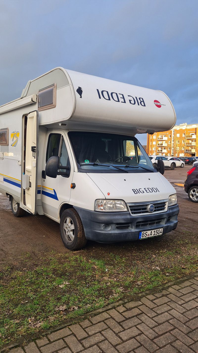
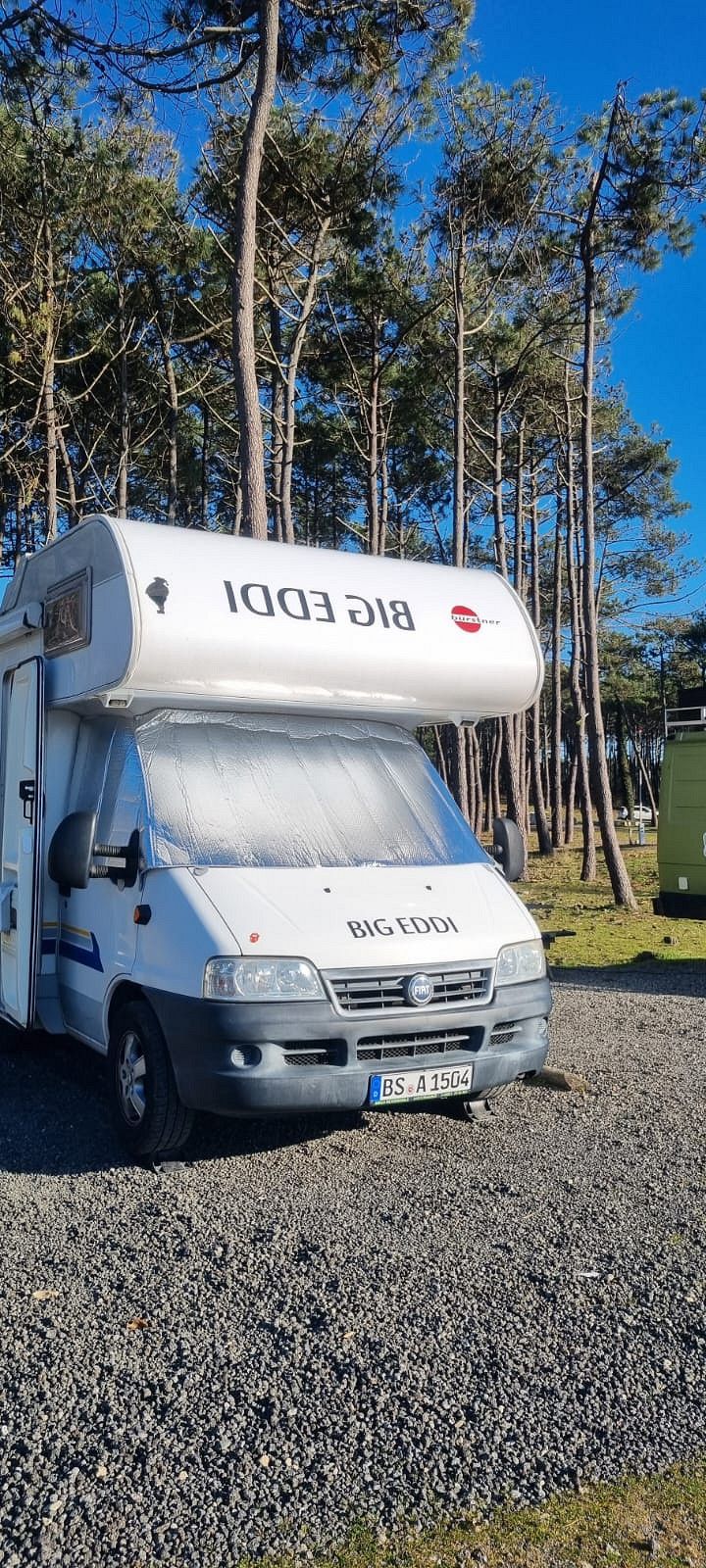
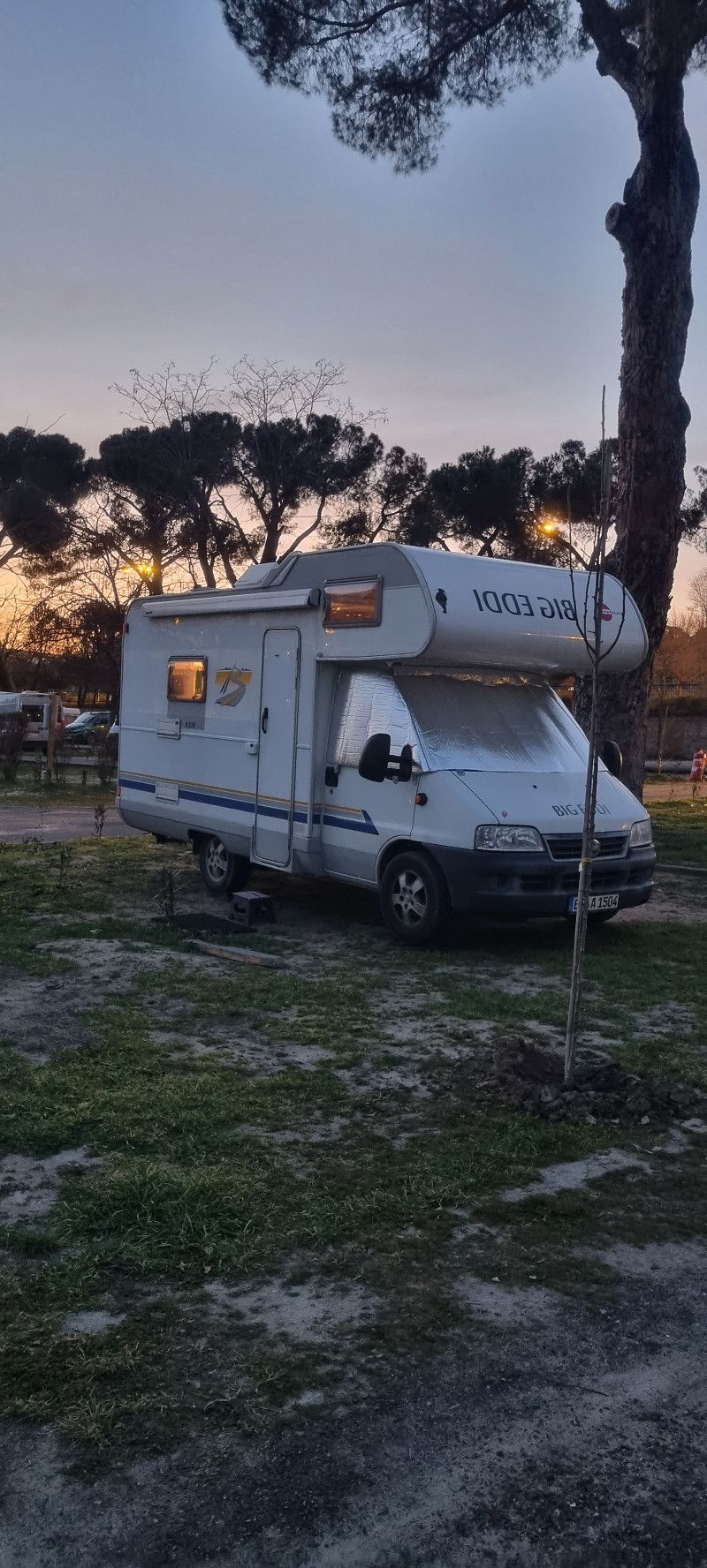
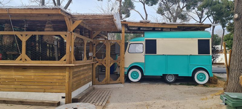
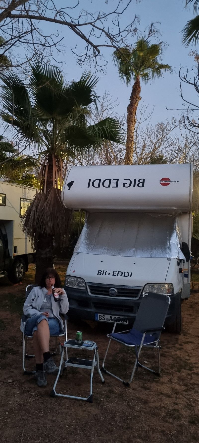
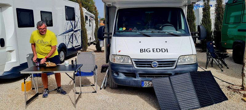
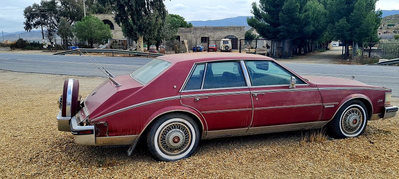
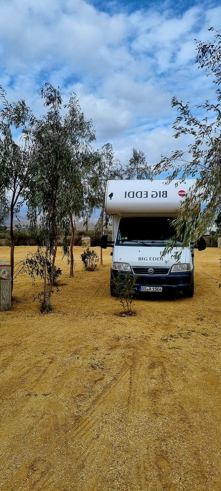
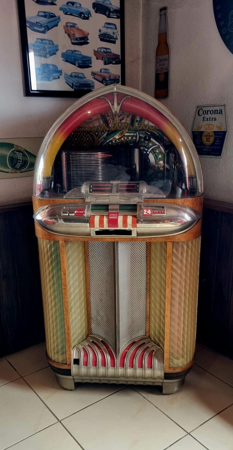
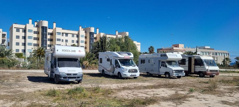
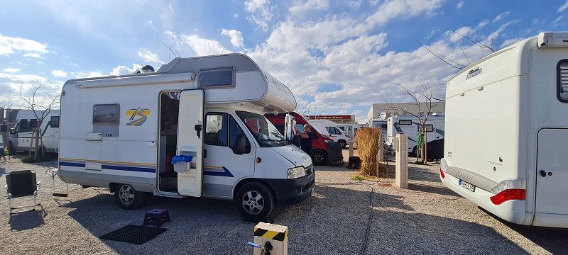
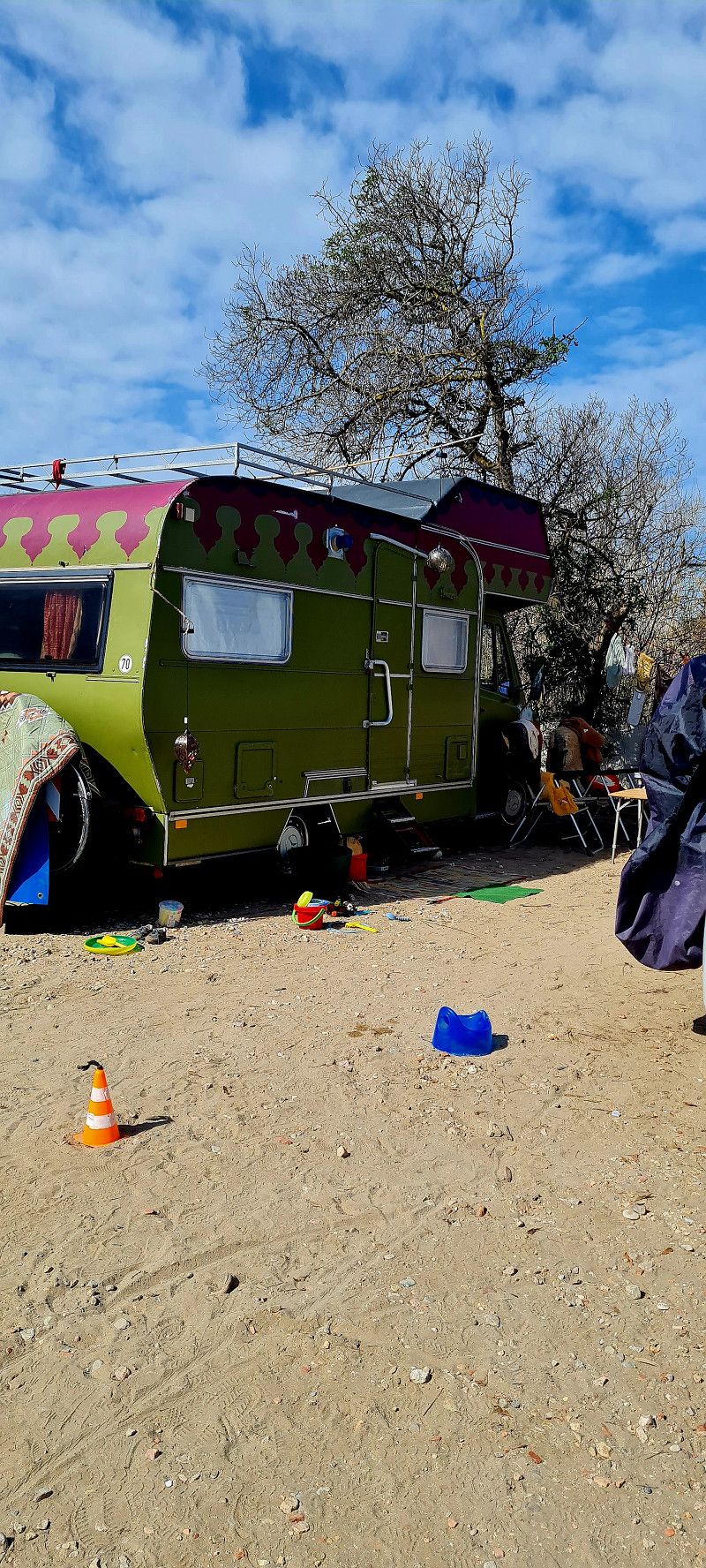
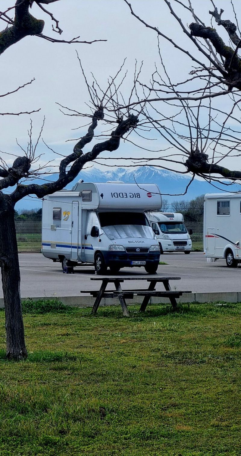
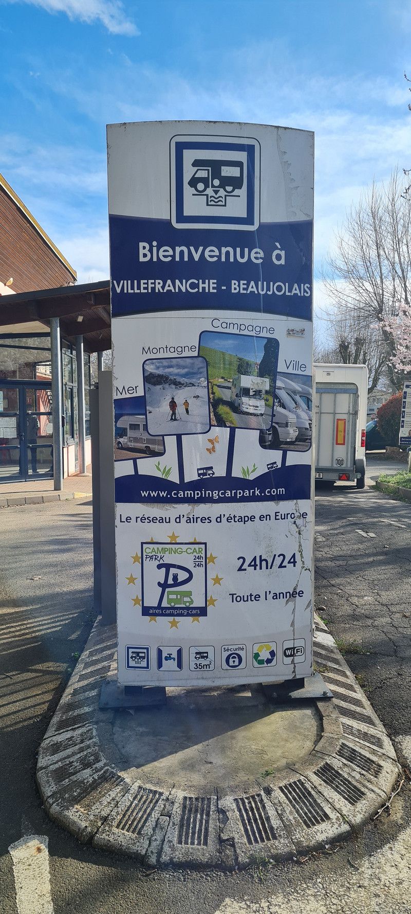
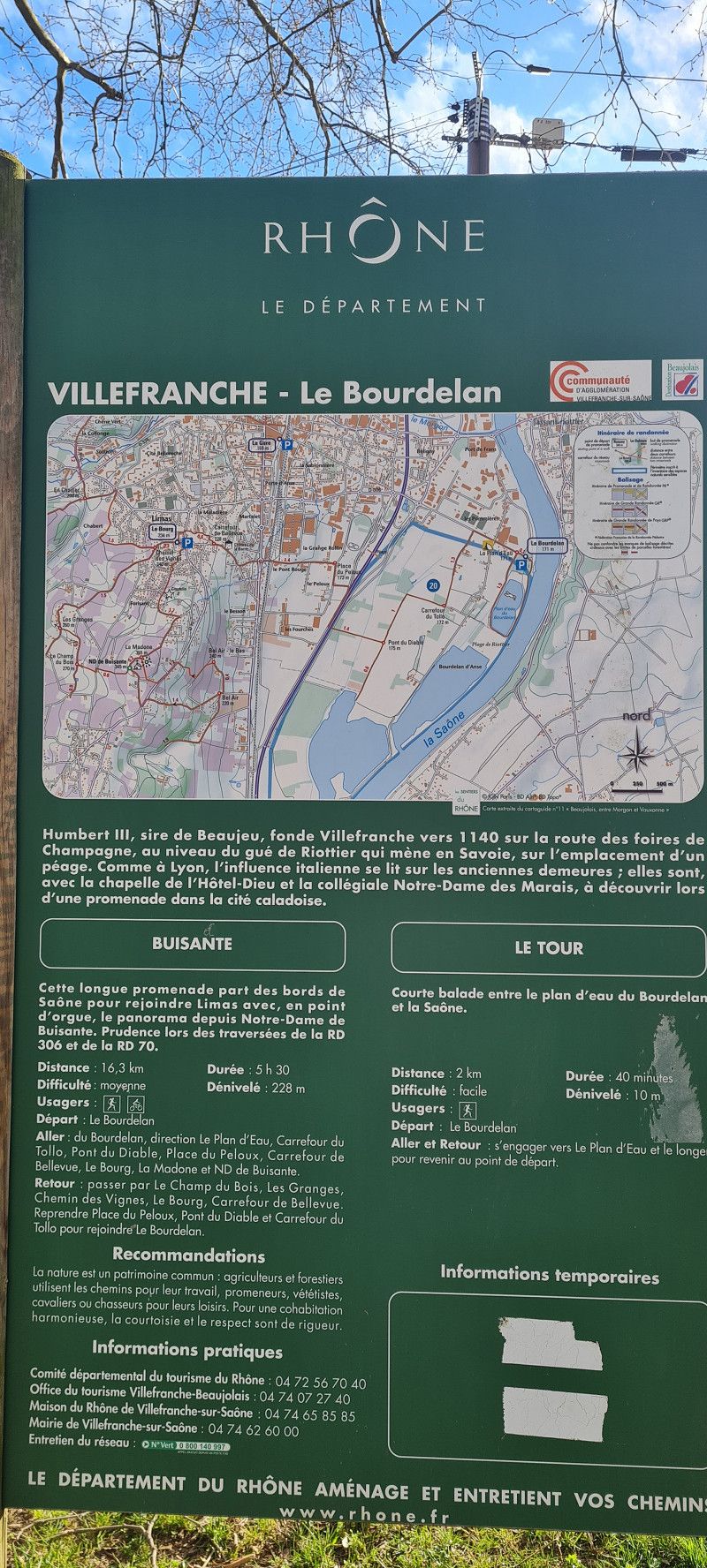
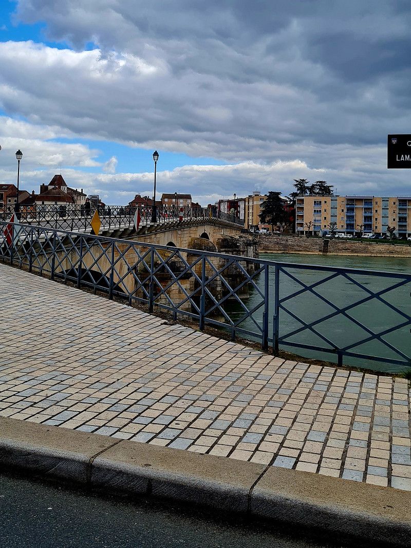
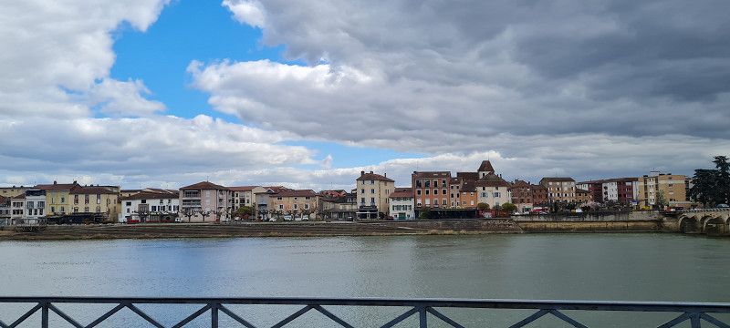
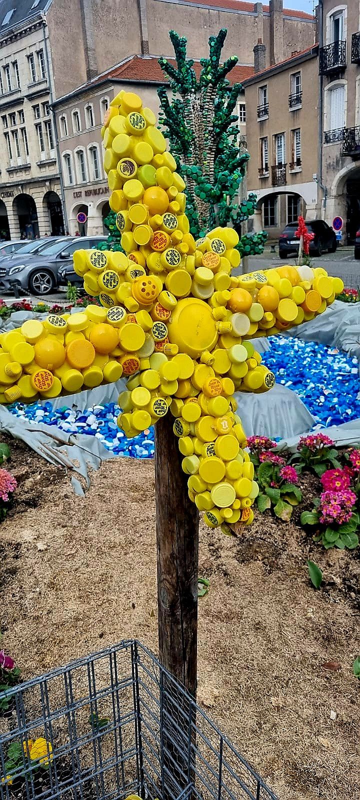
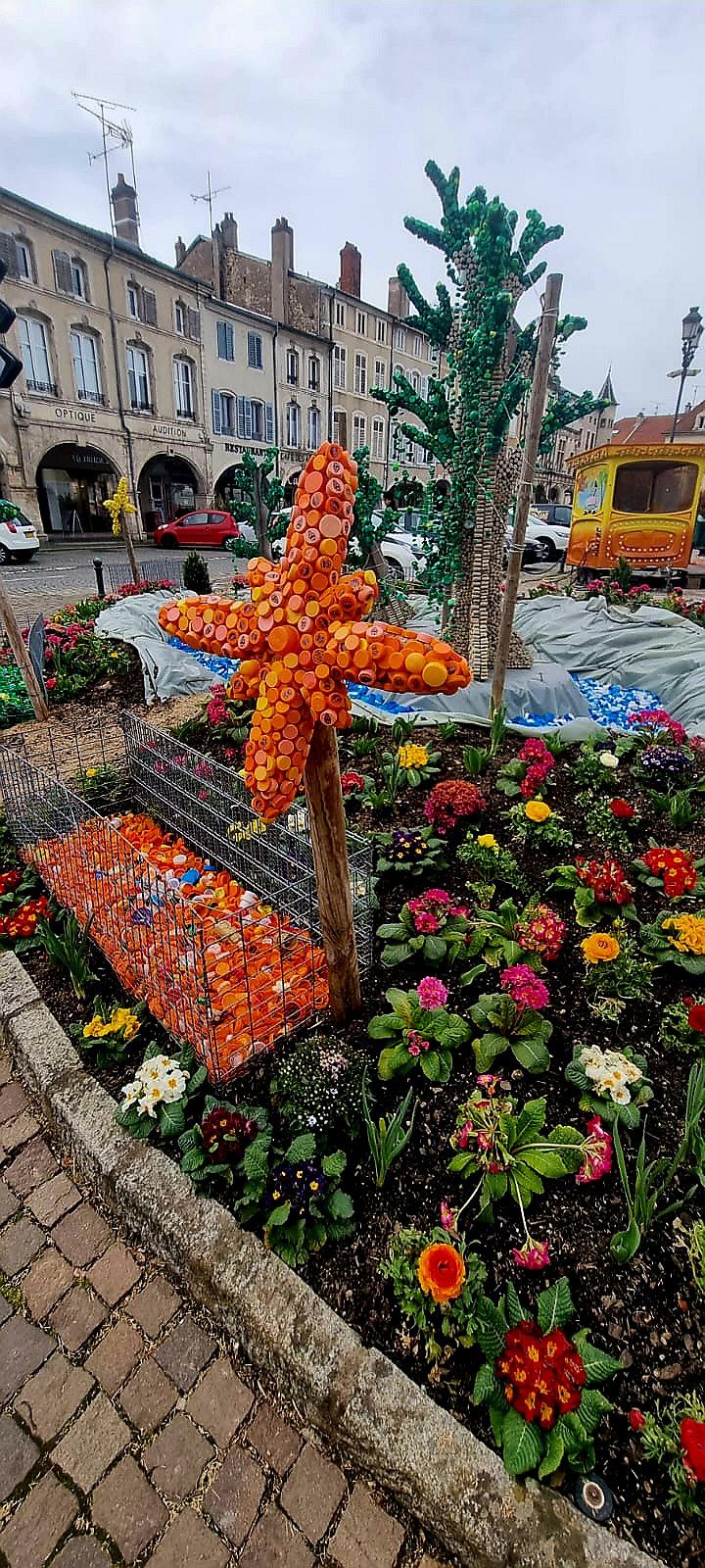
We will be touring around France and Spain with BIG EDDI for about 8 weeks.
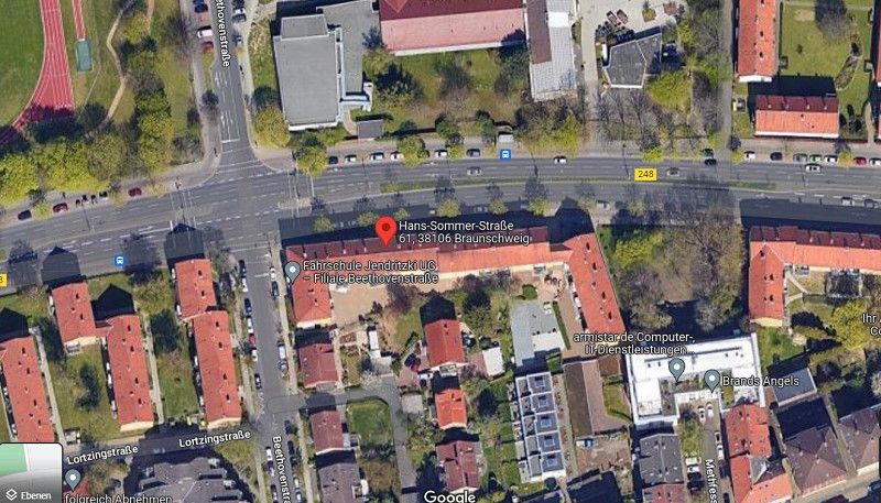
Hans-Sommer-Straße 61, Braunschweig, Deutschland
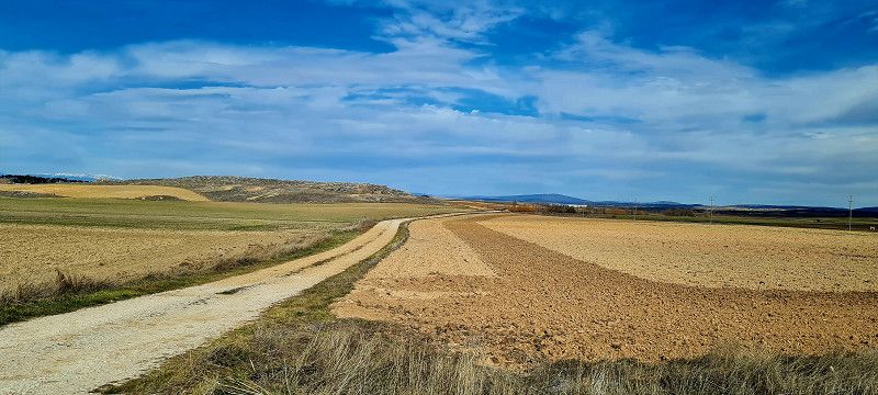
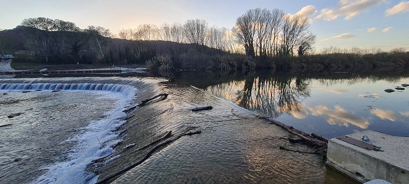
day 1
Hans-Sommer-Straße 61, 38106 Braunschweig, Germany
52° 16' 38.9" N 10° 32' 45.9" E
52.2774691 10.5460794
• Head toward Abtstraße on Hans-Sommer-Straße (L295). Go for 197 m.
• Make a U-Turn at Abtstraße onto Hans-Sommer-Straße (L295). Go for 952 m.
• Continue on Rebenring (K11) toward Hannover/A2/Hildesheim/B214/Celle/B4/Lüneburg/B1. Go for 963 m.
• Turn right onto Hamburger Straße (K2) toward Lüneburg/B4/Gewerbegebiet Hansestraße/Volkswagen BS/Hafen Braunschweig. Go for 741 m.
• Turn left toward A391/A2/A39/Watenbüttel/Hannover/Berlin/Lüneburg/Celle/Kassel. Go for 66 m.
• Continue on A392. Go for 972 m.
• Take the left exit toward Hannover-Berlin/Celle/BS-Watenbüttel onto A392. Go for 3.1 km.
• Continue on Celler Heerstraße (B214) toward Hannover/A2/Celle/BS-Watenbüttel. Go for 5.7 km.
• Turn left and take ramp onto A2 toward Hannover. Go for 235 km.
• Take exit 16 toward Köln/Frankfurt a.M./Flughafen Dortmund onto A1. Go for 127 km.
• Take exit 109 toward Trier/B51/Euskirchen onto A1. Go for 11.5 km.
• Take exit 110B toward Euskirchen onto L264. Go for 3.1 km.
• Continue on Frauenberger Straße toward Centrum. Go for 266 m.
• Turn left onto Im Schilderfeldchen. Go for 252 m.
• Turn slightly right onto Charleviller Platz. Go for 135 m.
• Turn right. Go for 15 m.
• Arrive at your destination on the left.
☍
390,0 km
(3 hrs. 55 min.)
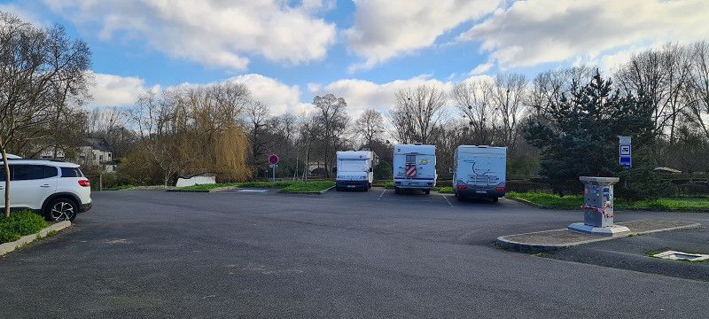
Day
Charleviller Platz, Deutschland
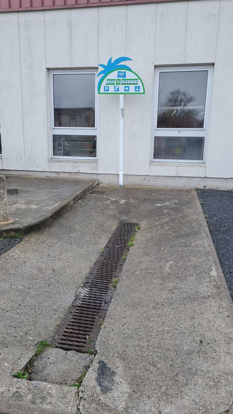
- Free parking space for mobile homes without supply
Charleviller Platz , Euskirchen, Deutschland
50° 39' 58.4" N 6° 47' 2.7" E
50.6662345 6.7840734
• Head toward Charleviller Platz. Go for 15 m.
• Turn left onto Im Schilderfeldchen. Go for 49 m.
• Turn right onto Sebastian-Kneipp-Straße. Go for 249 m.
• Turn left onto Jülicher Ring (B56). Go for 564 m.
• Turn right onto Frauenberger Straße (L264) toward Köln-Trier/A1/Köln-Koblenz/A61/Düren/Zülpich. Go for 2.7 km.
• Turn left and take ramp onto A1 toward Trier. Go for 26.1 km.
• Take exit 114 toward Trier/Dahlem/Blankenheim onto B51. Go for 19.1 km.
• Take ramp toward Aachen/Malmedy/Kronenburg. Go for 295 m.
• Turn right onto Hammerhütte (B421) toward Aachen/Malmedy/Losheim/Kronenburg/See. Go for 9.6 km.
• Turn right onto B265 toward Malmedy/Hellenthal/Losheim/Aachen/Monschau/Nationalpark Eifel. Go for 120 m.
• Turn left toward St. Vith/Manderfeld. Go for 10 m.
• Continue on Hergersberg (N634). Go for 5.9 km.
• Pass 2 roundabouts and continue on Manderfelderstrasse (N626). Go for 18.8 km.
• Take the 2nd exit from roundabout. Go for 95 m.
• Turn right onto Prümer Strasse (N626). Go for 395 m.
• Take the 2nd exit from An den Linden roundabout onto Luxemburger Strasse (N62). Go for 1.8 km.
• Keep right onto Luxemburger Strasse (E421) toward Luxembourg/Luxemburg/Diekirch/Houffalize/Reuland. Go for 4.8 km.
• Turn right onto Breitwiesstrasse (N827) toward Bastogne/Houffalize/Gouvy. Go for 7.9 km.
• Take the 1st exit from roundabout onto N68. Go for 4.1 km.
• Turn left onto N878 toward Gouvy/Courtil/Zone Industrielle Pôle Ardenne-Bois Gouvy/Zone Industrielle P.A.E. Courtil. Go for 2.4 km.
• Take the 2nd exit from roundabout. Go for 1.5 km.
• Continue on N878. Go for 2.5 km.
• Continue on Cherain (N878). Go for 1.2 km.
• Turn right onto N827. Go for 7.6 km.
• Turn left onto Les Cheras (N30). Go for 497 m.
• Take ramp onto E25 toward Luxembourg/Bastogne. Go for 37.6 km.
• Take the exit toward Bruxelles/Namur/Neufchâteau onto E411. Go for 14.3 km.
• Take exit 25 toward Reims/Sedan/Bouillon/Bertrix. Go for 408 m.
• Take the 3rd exit from roundabout onto Avenue de Bouillon (E46) toward Reims/Sedan/Bouillon/Bertrix. Go for 5.2 km.
• Pass 2 roundabouts and continue on E46. Go for 25.4 km.
• Continue on N58. Go for 10.9 km.
• Take ramp onto N43 toward Charleville-M./Sedan/Reims. Go for 6.3 km.
• Keep left onto A34 toward Donchery/Charleville-Mézières/Reims. Go for 15.9 km.
• Take the exit toward Châlons S/M/Reims/Rethel/La Francheville onto A34. Go for 2.6 km.
• Take the exit onto A34. Go for 34.1 km.
• Keep left onto N51 toward Reims/Rethel/L'Étoile. Go for 31.6 km.
• Keep left onto A34. Go for 12.5 km.
• Take ramp onto A344 (Voie Jean Taittinger) toward Épernay/Reims-Centre. Go for 1.9 km.
• Take the exit toward Épernay. Go for 491 m.
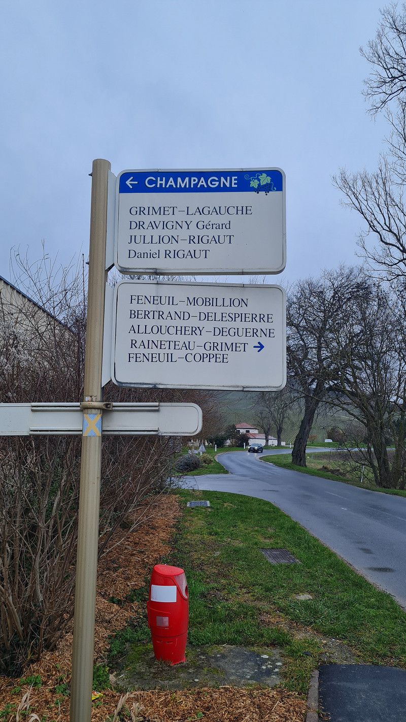
• Turn left onto Avenue de Champagne (N51). Go for 456 m.
• Keep left onto Avenue de Champagne (D951) toward Épernay/Murigny. Go for 1.7 km.
• Take the 2nd exit from Place des Combattants d'A.F.N. roundabout onto Avenue de Champagne (D951) toward A4 (A26)/Épernay/Ay/Villers Allerand/Champfleury/Gare Champagne-Ardenne. Go for 909 m.
• Take the 3rd exit from Rond-Point de Champagne roundabout onto Avenue de Champagne (D951) toward A4 (A26)/Épernay/Ay/Villers Allerand/Champfleury. Go for 1.3 km.
• Take the 2nd exit from roundabout onto D22 toward Villers aux Noeuds. Go for 449 m.
• Continue on Rue de Reims (D22). Go for 1.0 km.
• Continue on Rue de Longjumeau (D22). Go for 2.1 km.
• Continue on D22. Go for 1.4 km.
• Take the 1st exit from roundabout onto D26. Go for 52 m.
• Continue on Route du Champagne (D26). Go for 1.4 km.
• Turn left onto Rue du Château Rouge. Go for 101 m.
• Turn right. Go for 55 m.
• Arrive at your destination on the left.
☍
328,3 km
(3 hrs. 46 min.)
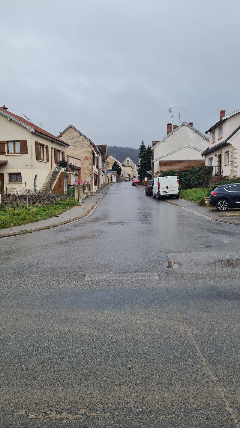
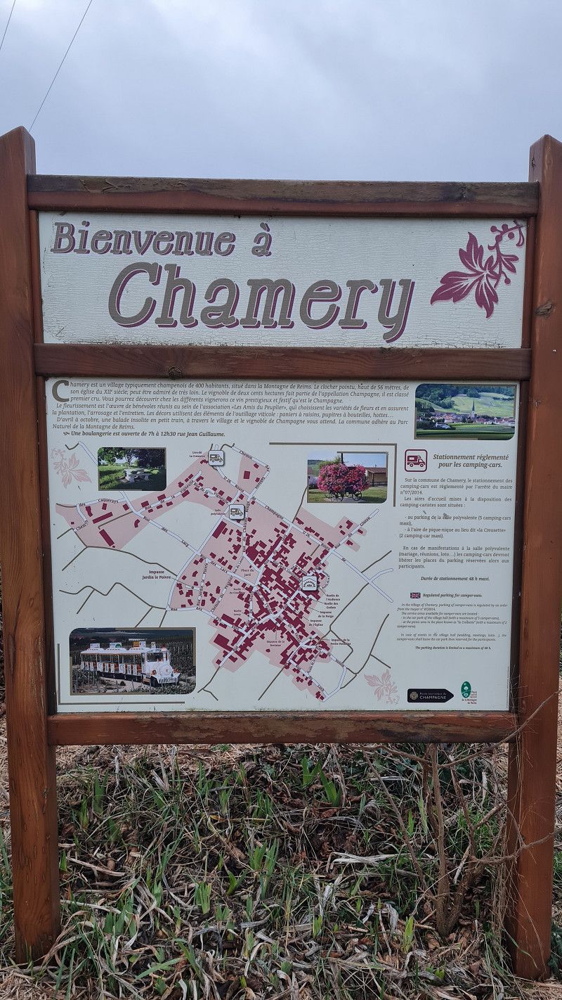
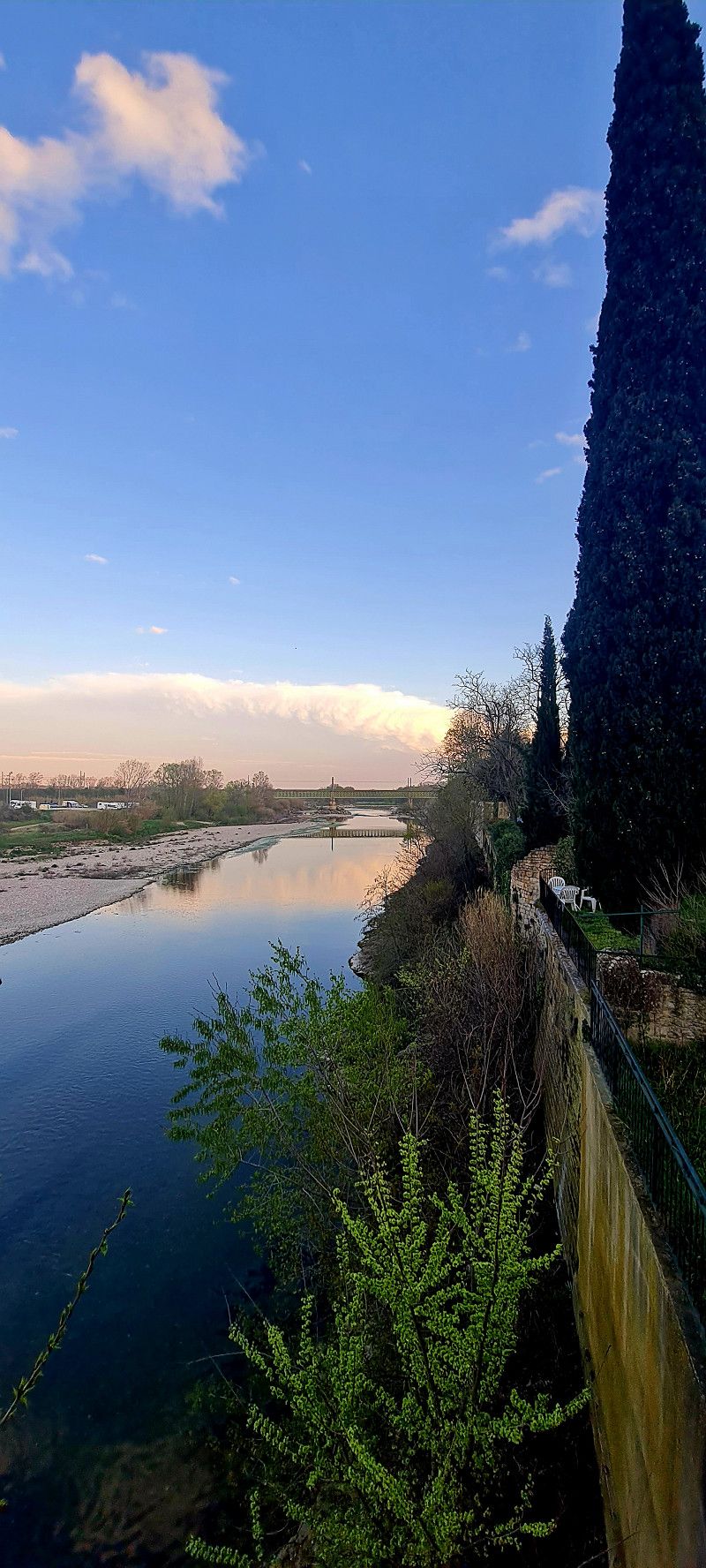
Day
Aire de Salle Polyvalente
free stopover. Disposal station for black and gray water.
Rue du Chateau Rouge, 51500, Chamery, Frankreich
49° 10' 26" N 3° 57' 14" E
49.1738889 3.9538889
• Head northwest. Go for 17 m.
• Turn right toward Rue de la Vigneulle. Go for 100 m.
• Turn right onto Rue de la Vigneulle. Go for 8 m.
• Turn right onto Route du Champagne (D26). Go for 1.5 km.
• Continue on D26. Go for 32 m.
• Take the 2nd exit from roundabout onto D22. Go for 1.4 km.
• Continue on Rue de Longjumeau (D22). Go for 2.1 km.
• Continue on Rue de Reims (D22). Go for 1.0 km.
• Continue on D22. Go for 397 m.
• Take the 4th exit from roundabout onto A4 (Contournement Sud de Reims) toward Lille/Paris. Go for 135 km.
• Take the exit toward Bordeaux/Nantes/Lyon/Maisons-Alfort/Créteil/Versailles onto A86. Go for 11.2 km.
• Keep left onto N186 toward Bordeaux/Nantes/Lyon/L'Hay les Roses/Versailles/Fresnes. Go for 3.3 km.
• Take ramp onto A6 B toward Bordeaux/Nantes/Lyon/Évry/Palaiseau. Go for 2.8 km.
• Keep right onto A10 toward E05/Palaiseau/Étampes/Bordeaux/Nantes/Antony-Z.A./Massy/Longjumeau. Go for 3.5 km.
• Keep left toward N20/Orléans/Étampes/La Ville du Bois/Saulx les Chartreux. Go for 1.4 km.
• Continue on N20. Go for 3.7 km.
• Take ramp toward Ballainvilliers/Saulx les Ch./Villiers S/O. Go for 286 m.
• Continue straight ahead. Go for 37 m.
• Take the 5th exit from roundabout. Go for 232 m.
• Continue on Grande Route de Chassé (D186). Go for 511 m.
• Take the 2nd exit from roundabout onto Grande Route de Chassé (D186). Go for 778 m.
• Take the 2nd exit from roundabout onto Route de Chasse (D35). Go for 1.1 km.
• Continue on Rue Gabriel Péri (D35). Go for 358 m.
• Turn right toward Voie des Prés. Go for 29 m.
• Continue on Voie des Prés. Go for 410 m.
• Turn left. Go for 13 m.
• Arrive at your destination on the right.
☍
171,5 km
(1 hrs. 52 min.)
Day
1 Voie des Prés, 91700 Villiers-sur-Orge, Frankreich
Camping Paris Beautiful Village
for a visit to Paris. Very expensive because the connection to Paris is great.
1 Voie des Prés, 91700 Villiers-sur-Orge, France
48° 39' 18.4" N 2° 18' 14.7" E
48.6551068 2.3040782
• Head south. Go for 31 m.
• Turn left. Go for 24 m.
• Turn slightly right toward Voie des Prés. Go for 100 m.
• Turn right onto Voie des Prés. Go for 308 m.
• Continue toward Rue Gabriel Péri/D35. Go for 29 m.
• Turn left onto Rue Gabriel Péri (D35). Go for 358 m.
• Continue on Route de Chasse (D35). Go for 1.0 km.
• Take the 2nd exit from roundabout onto Grande Route de Chassé (D186). Go for 774 m.
• Take the 3rd exit from roundabout onto Grande Route de Chassé (D186). Go for 417 m.
• Take ramp onto Avenue de la Division Leclerc (N20). Go for 5.4 km.
• Continue on A10. Go for 3.7 km.
• Continue on A6 A (Autoroute du Soleil). Go for 8.7 km.
• Take the exit toward D920/Porte d'Orléans. Go for 1.1 km.
• Turn right onto Avenue de la Porte d'Orléans toward Porte d'Orléans. Go for 177 m.
• Continue on Place du 25 Août 1944. Go for 132 m.
• Continue on Avenue du Général Leclerc. Go for 533 m.
• Take the 3rd exit from Place Victor et Hélène Basch roundabout onto Avenue du Maine. Go for 1.2 km.
• Keep left onto Avenue du Maine. Go for 716 m.
• Turn right onto Rue d'Alençon. Go for 100 m.
• Turn left onto Boulevard du Montparnasse. Go for 97 m.
• Continue on Boulevard du Montparnasse. Go for 323 m.
• Continue on Boulevard des Invalides toward Invalides/Place Ch.De Gaulle-Étoile. Go for 469 m.
• Turn right onto Place André Tardieu toward Concorde/Esplanade des Invalides. Go for 798 m.
• Turn left onto Square d'Ajaccio. Go for 66 m.
• Turn right onto Rue de Constantine. Go for 204 m.
• Turn right onto Rue Saint-Dominique. Go for 411 m.
• Turn right onto Rue Casimir Périer. Go for 30 m.
• Arrive at Rue Casimir Périer. Your destination is on the left.
☍
27,2 km
( 40 min.)
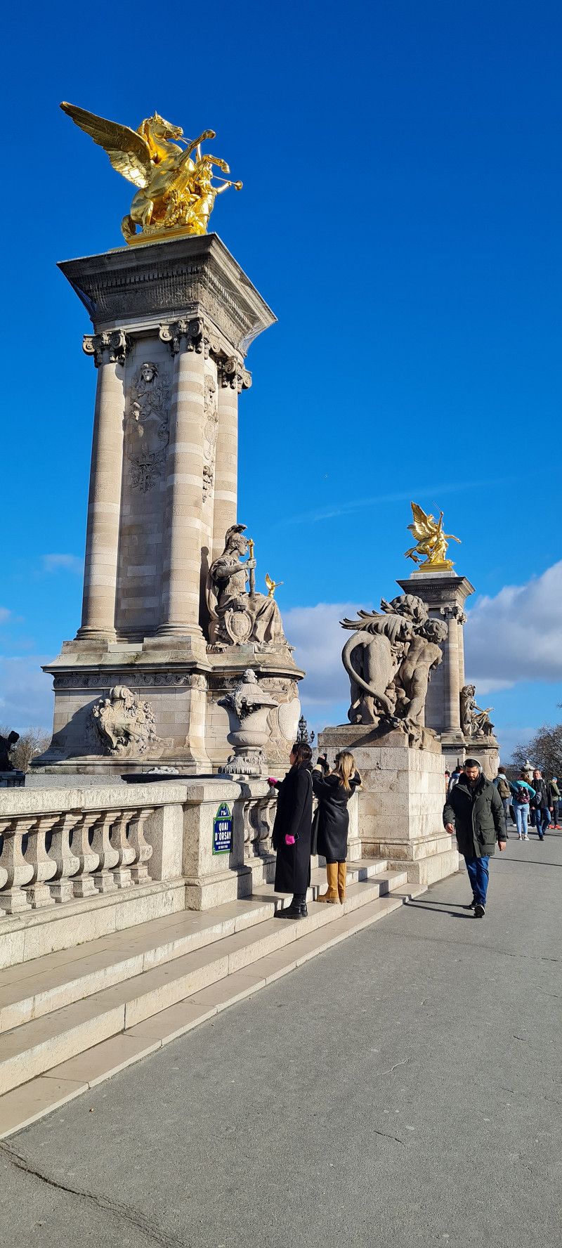
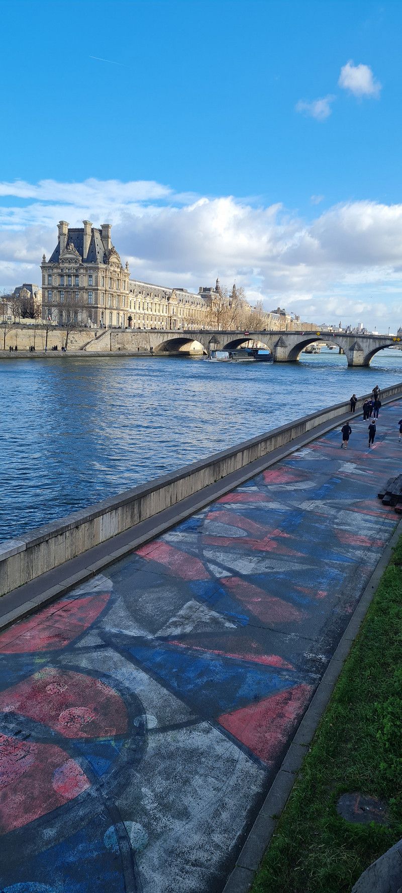
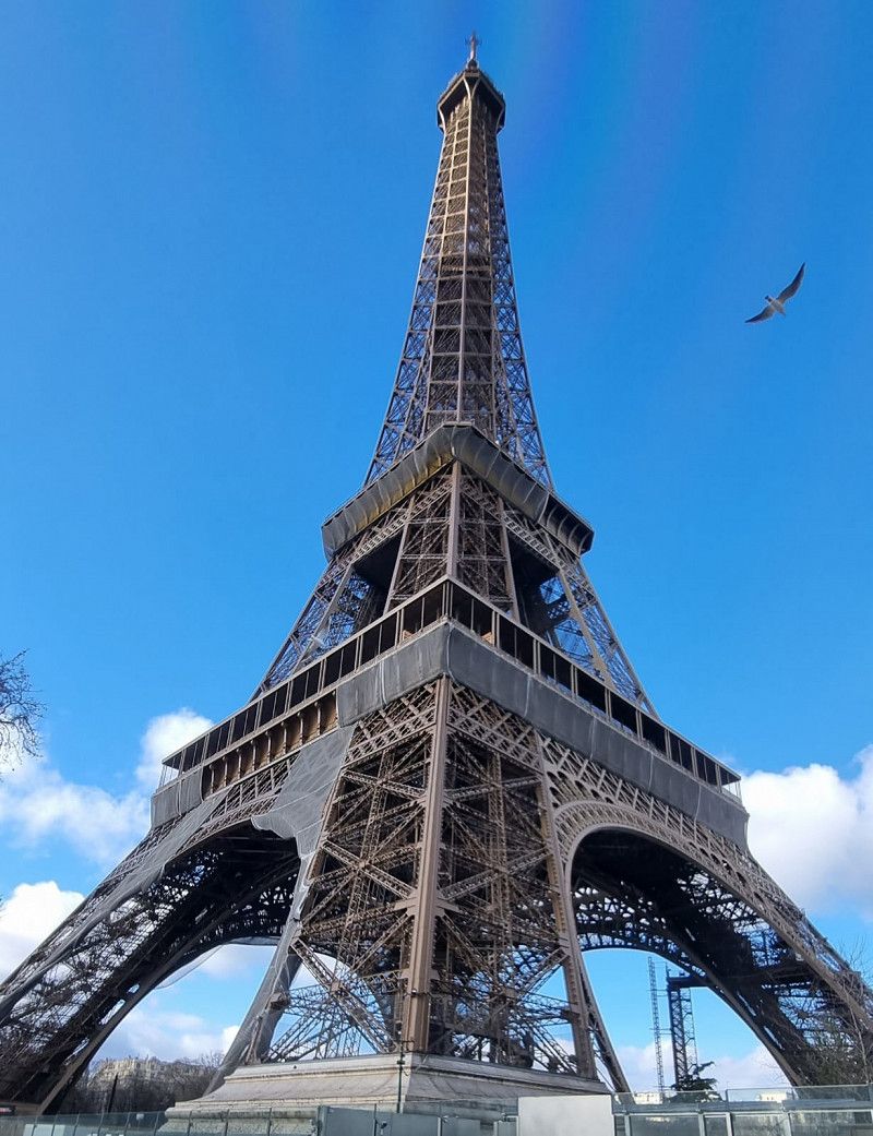
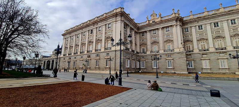
Day
Paris, Frankreich
Paris , Paris, Frankreich
48° 51' 32" N 2° 19' 12.1" E
48.8588897 2.3200410
• Head toward Rue Las Cases on Rue Casimir Périer. Go for 210 m.
• Turn right onto Rue de Grenelle. Go for 271 m.
• Turn left onto Boulevard des Invalides. Go for 725 m.
• Turn right toward Place du Président Mithouard. Go for 35 m.
• Turn left onto Boulevard des Invalides. Go for 520 m.
• Continue on Place Léon-Paul Fargue. Go for 296 m.
• Turn slightly right onto Avenue du Maine toward Pte d'Orléans. Go for 1.5 km.
• Turn right onto Rue des Plantes. Go for 972 m.
• Turn left onto Boulevard Brune. Go for 390 m.
• Turn right onto Avenue de la Porte de Montrouge. Go for 357 m.
• Turn left onto Boulevard Romain Rolland. Go for 411 m.
• Take left ramp onto A6 A toward Bordeaux/A10/Nantes/Lyon/Évry/Aéroport Orly-Rungis. Go for 9.7 km.
• Take the exit toward E05/Palaiseau/Étampes/Bordeaux/Nantes/Massy/Longjumeau onto A10. Go for 3.6 km.
• Take the exit toward Nantes/A11/Bordeaux/Orléans/Palaiseau onto A10. Go for 215 km.
• Take exit 20 toward Vouvray. Go for 447 m.
• Continue on Boulevard Abel Gance (D801). Go for 73 m.
• Take the 5th exit from Rond-Point Saint-Martin roundabout onto Boulevard Abel Gance (D801) toward A10-A85/Blois/Saumur/Tours-Centre/Tours-Sud/Vouvray. Go for 871 m.
• Take the 3rd exit from Rond-Point Jean le Reste roundabout onto D952 toward Blois/Rochecorbon/Vouvray/Amboise. Go for 5.7 km.
• Turn right onto Chemin du Bec de Cisse. Go for 55 m.
• Arrive at Chemin du Bec de Cisse. Your destination is on the left.
☍
241,2 km
(2 hrs. 28 min.)
Day
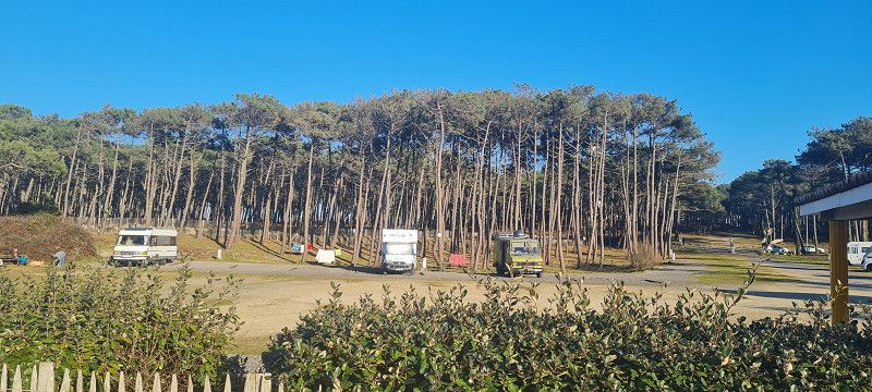
Aire de Caping-car
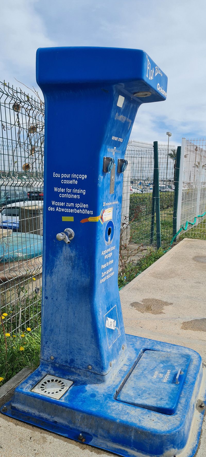
Very nice place for an overnight stay. Free with V/E station. Public toilet
Voie de la Cissé, 37210, Vouvray, Frankreich
47° 24' 34" N 0° 47' 50" E
47.4094444 0.7972222
• Head toward Avenue Léon Brulée on Chemin du Bec de Cisse. Go for 55 m.
• Turn left onto Route Nationale (D952). Go for 5.6 km.
• Take the 1st exit from Rond-Point Jean le Reste roundabout onto Boulevard Abel Gance (D801) toward Tours-Centre/Parçay-Meslay. Go for 567 m.
• Take ramp onto A10 (L'Aquitaine) toward A85/Tours-Centre/Vierzon/Poitiers/Châteauroux. Go for 106 km.
• Take exit 30 toward Angoulême/Vivonne/Lusignan onto N10. Go for 120 km.
• Take ramp toward Châteauneuf/Claix. Go for 261 m.
• Take the 1st exit from roundabout onto Route de Sireuil (D7). Go for 623 m.
• Turn right onto Route de Sireuil (D7). Go for 1.0 km.
• Arrive at Route de Sireuil (D7). Your destination is on the left.
☍
234,0 km
(2 hrs. 20 min.)
Day
Roullet-Saint-Estèphe
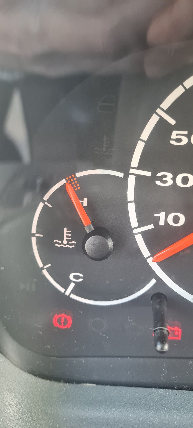
Emergency stop due to display problems in the cockpit due to overheating.
16440, Frankreich
45° 35' 28.5" N 0° 1' 42.9" E
45.5912616 0.0285704
• Head toward Impasse des Bergerons on Route de Sireuil (D7). Go for 1.0 km.
• Turn left onto Route de Sireuil (D7). Go for 612 m.
• Take the 2nd exit from roundabout toward Bordeaux/Barbezieux. Go for 313 m.
• Continue on N10. Go for 76.1 km.
• Keep left onto N10 toward A10/Bordeaux. Go for 351 m.
• Take ramp onto A10 (L'Aquitaine). Go for 16.4 km.
• Take exit 1 toward Toulouse/Bayonne/Bassin d'Arcachon/Bordeaux/Périgueux onto N230 (Rocade de Bordeaux). Go for 19.8 km.
• Take exit 15 toward Saint Sébastien/Bayonne/Mont de Marsan/Bassin d'Arcachon onto A63. Go for 76.4 km.
• Take exit 16 toward Mimizan/Labouheyre. Go for 334 m.
• Take the 1st exit from roundabout onto D626 toward Ponteux-les-Forges/Mimizan/Lue/St Paul-en-B/Ste Eulalie-en-B/Escource. Go for 423 m.
• Turn left onto Route de Bilot (D63). Go for 1.4 km.
• Continue on D63. Go for 7.5 km.
• Continue on Route de Labouheyre (D63). Go for 494 m.
• Continue on D63. Go for 113 m.
• Turn right onto Place de la Mairie (D44). Go for 206 m.
• Turn left onto Route de Mezos (D63). Go for 284 m.
• Continue on D63. Go for 1.5 km.
• Continue on Lieu-dit Cameleyre (D63). Go for 304 m.
• Continue on D63. Go for 7.7 km.
• Continue on Lieu-dit L'Habitant (D63). Go for 70 m.
• Continue on D63. Go for 325 m.
• Continue on Lieu-dit Soulès (D63). Go for 65 m.
• Continue on D63. Go for 326 m.
• Continue on Lieu-dit Ninicq (D63). Go for 126 m.
• Continue on D63. Go for 2.2 km.
• Turn right onto D63. Go for 1.8 km.
• Take the 1st exit from roundabout onto Avenue de l'Océan (D167). Go for 5.8 km.
• Take the 2nd exit from roundabout onto Route de Contis (D41). Go for 6.7 km.
• Continue on Avenue de l'Océan (D41). Go for 508 m.
• Turn left. Go for 17 m.
• Turn right. Go for 53 m.
• Turn left. Go for 178 m.
• Arrive at your destination on the left.
☍
229,6 km
(2 hrs. 24 min.)
Day
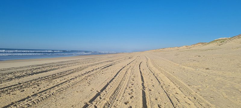
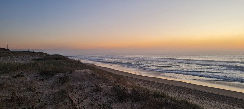
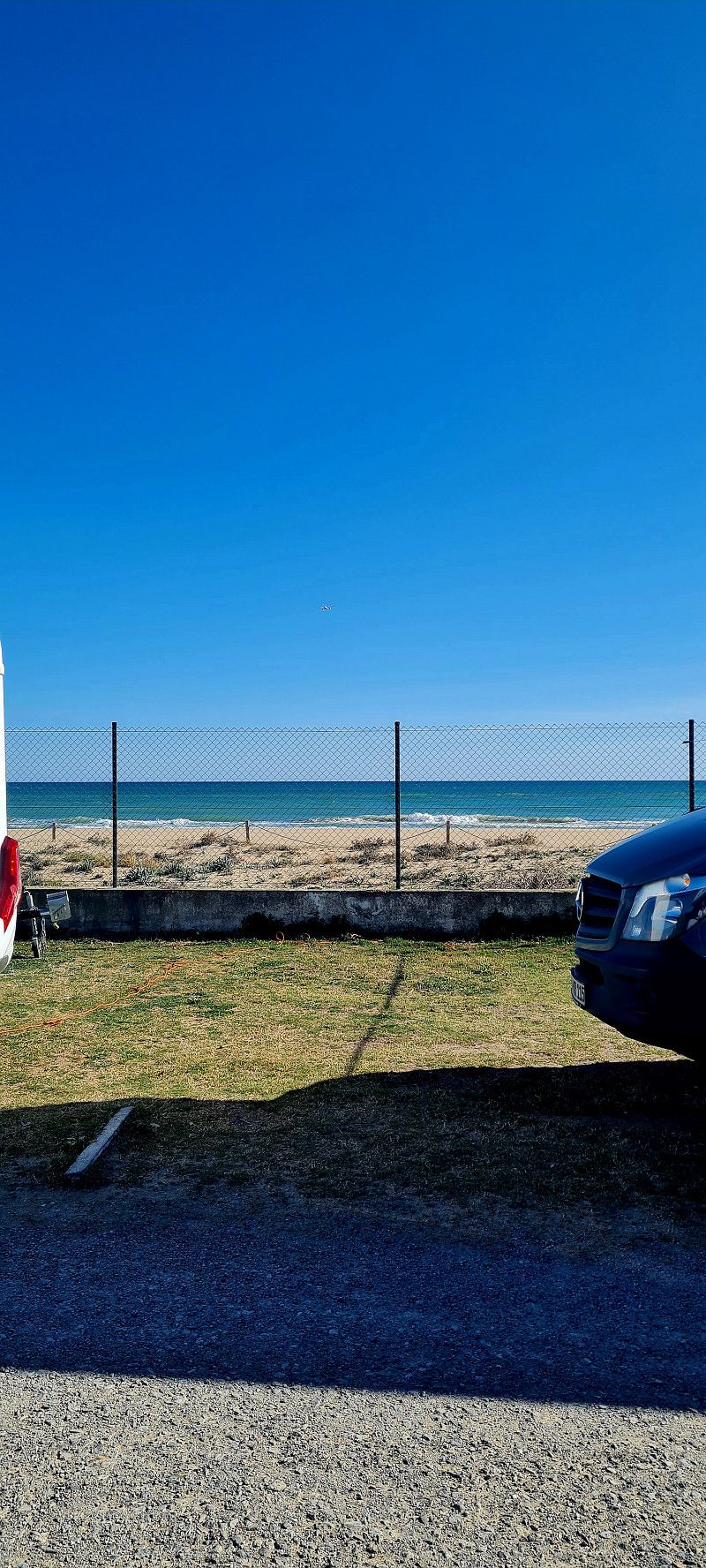
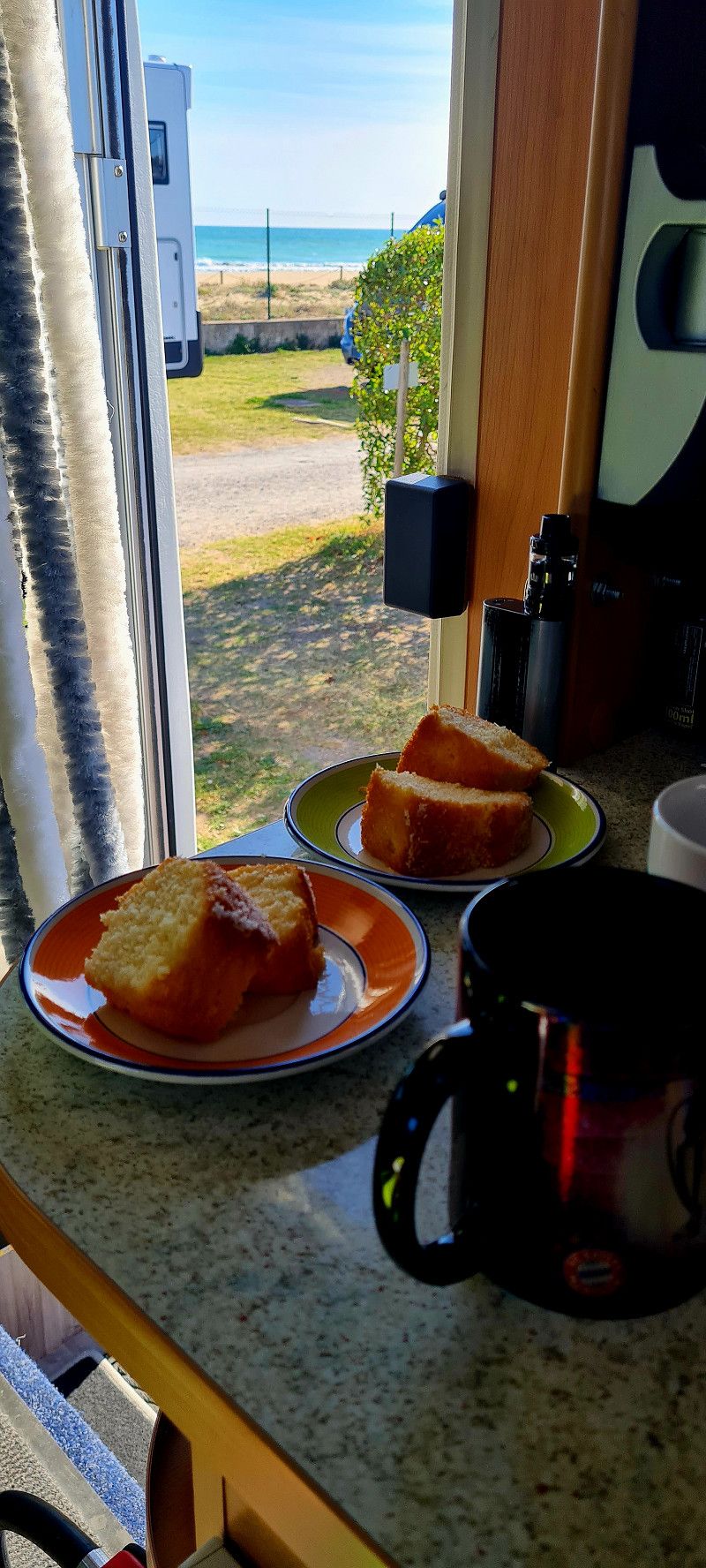
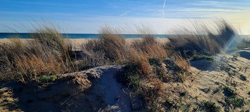
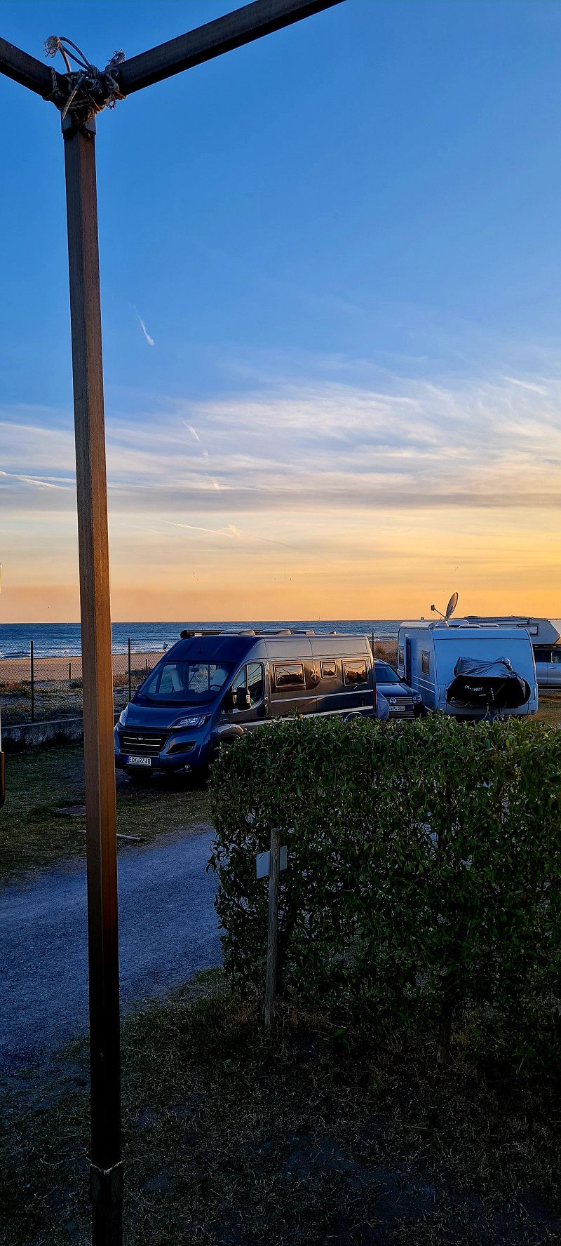
Lous Seurrots, Frankreich
Great pitch by the sea. 10 euros for 24 hours including electricity and water on some pitches. V/E on site
No sanitary facilities. Public washing up facility.
Rue des Tourterelles , Saint-Julien-en-Born, Frankreich
44° 5' 17.3" N 1° 18' 59.8" W
44.0881293 -1.3166110
• Head southeast.
• Arrive at your destination on the left.
☍
Distance not available
(Duration not available)
Day
Lous Seurrots, Frankreich
Because it is so beautiful here, we stayed another day
Rue des Tourterelles , Saint-Julien-en-Born, Frankreich
44° 5' 17.3" N 1° 18' 59.8" W
44.0881293 -1.3166110
• Head northwest. Go for 178 m.
• Turn right. Go for 58 m.
• Turn left toward Avenue de l'Océan/D41. Go for 30 m.
• Turn right onto Avenue de l'Océan (D41). Go for 508 m.
• Turn right onto Route du Pont Rose (D340). Go for 100 m.
• Continue on Allée du Pont Rose (D340). Go for 191 m.
• Continue on Route de Contis (D340). Go for 6.7 km.
• Continue on D340. Go for 73 m.
• Continue on Chemin de Port Lit (D340). Go for 570 m.
• Continue on Rue Henri Crouzet (D340). Go for 545 m.
• Turn left onto Avenue de la Côte d'Argent (D652). Go for 188 m.
• Turn right onto Rue du Point du Jour (D66). Go for 2.6 km.
• Continue on Rue de Lit et Mixe (D66). Go for 1.8 km.
• Turn right onto Rue de Castets (D5). Go for 3.3 km.
• Continue on D5. Go for 113 m.
• Continue on Route d'Uza (D5). Go for 1.7 km.
• Continue on Route de Castets (D5). Go for 1.6 km.
• Continue on D5. Go for 6.8 km.
• Continue on Route d'Uza (D5). Go for 3.8 km.
• Turn right onto Rue du Marensin (D947). Go for 308 m.
• Continue on Rue Sainte-Hélène (D947 E). Go for 453 m.
• Take the 3rd exit from roundabout onto Rue de la Poterie (D947). Go for 581 m.
• Take the 2nd exit from roundabout onto Rue de Juston (D947). Go for 617 m.
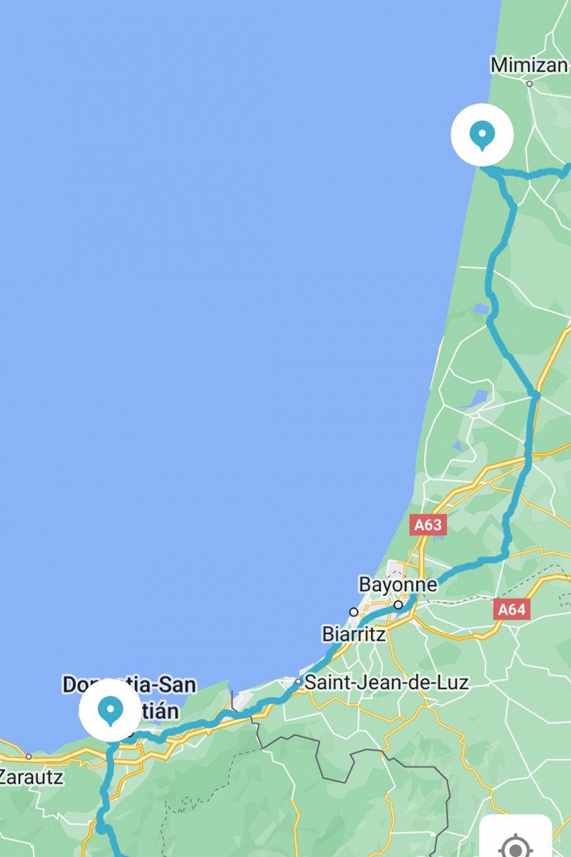
• Take the 2nd exit from roundabout onto A63 toward Bayonne/Magescq/Soustons/St-V. de Tyrosse. Go for 88.3 km.
• Continue on AP-8 (Autopista del Cantábrico). Go for 12.2 km.
• Continue on GI-20 toward Errenteria/Beraun/Pasaia/Donostia/S. Sebastián. Go for 10.9 km.
• Take exit 10 toward Donostia/Ondarreta onto Camino de Zubiberri. Go for 1.6 km.
• Keep left onto Avenida de Tolosa. Go for 665 m.
• Turn right toward El Antiguo/Ondarreta/Unibertsitatea. Go for 63 m.
• Turn right onto Avenida de Tolosa toward El Antiguo/Ondarreta/Unibertsitatea. Go for 540 m.
• Take the 4th exit from Plaza de Europa roundabout onto Paseo de Berio toward Berio/Unibertsitatea. Go for 242 m.
• Take the 1st exit from roundabout onto Paseo de Berio. Go for 165 m.
• Turn right onto Paseo de Berio. Go for 73 m.
• Arrive at Paseo de Berio. Your destination is on the right.
☍
147,3 km
(1 hrs. 34 min.)
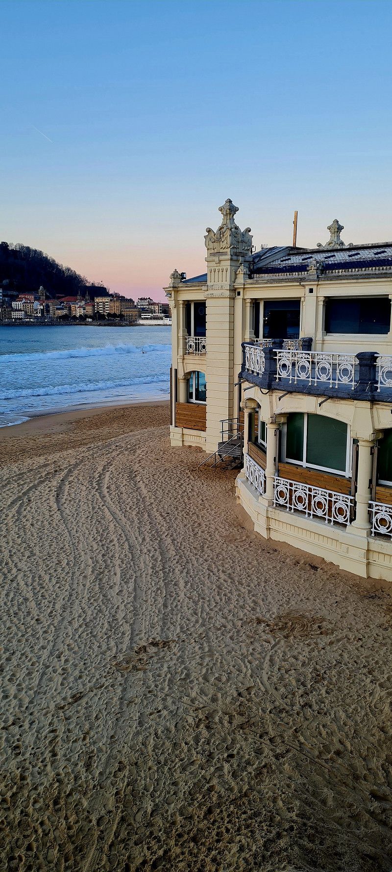
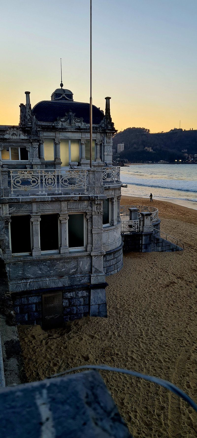
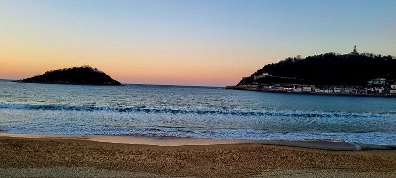
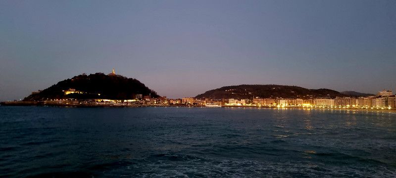
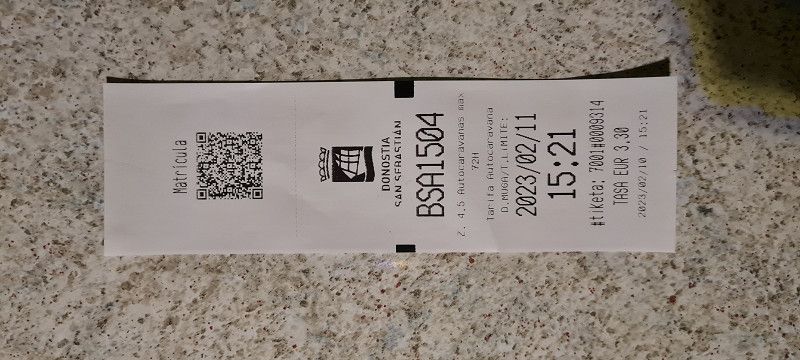
Day
Autokarabanak Paseo de Berio
Super nice city. Parking space for mobile homes reported without further service. 3.30 euros for 24 hours in the low season. Perfect.
Paseo de Berio, 20018, Donostia-San Sebastián, Spain
43° 18' 28" N 2° 0' 51" W
43.3077778 -2.0141667
• Head east on Paseo de Berio. Go for 73 m.
• Turn left onto Paseo de Berio. Go for 146 m.
• Take the 2nd exit from roundabout onto Paseo de Berio. Go for 197 m.
• Take the 2nd exit from Plaza de Europa roundabout onto Avenida de Tolosa toward A-8/N-634/A-15/N-1. Go for 567 m.
• Turn right onto Avenida de Tolosa toward Vitoria/N-1/Gasteiz/N-634/Bilbao/A-8/Pamplona/A-15/Iruña. Go for 91 m.
• Take ramp onto Avenida Zarautz. Go for 529 m.
• Take ramp onto GI-20. Go for 1.0 km.
• Take exit 13 toward Lasarte-Oria/N-1/Iruña/Pamplona/A-15/Usurbil/N-634/Hernani/GI-2132 onto GI-11. Go for 1.9 km.
• Take the exit onto N-1. Go for 8.8 km.
• Keep right onto A-15 (Agaraitz auzoa) toward Irurtzun/Iruña/Pamplona. Go for 44.4 km.
• Continue on AP-15 (Autopista de Navarra). Go for 14.5 km.
• Take exit 97 toward PA-34/Pamplona/Iruña/Berriozar onto Avenida de Navarra. Go for 3.4 km.
• Take the 4th exit from roundabout onto Calle de Santa Lucía toward Buztintxuri. Go for 839 m.
• Take the 1st exit from roundabout onto Avenida de Guipúzcoa (N-240-A). Go for 390 m.
• Continue toward Avenida de Guipúzcoa. Go for 27 m.
• Take the 3rd exit from Avenida de Guipúzcoa roundabout. Go for 107 m.
• Turn right onto Avenida de Guipúzcoa. Go for 371 m.
• Arrive at Avenida de Guipúzcoa. Your destination is on the right.
☍
77,4 km
( 50 min.)
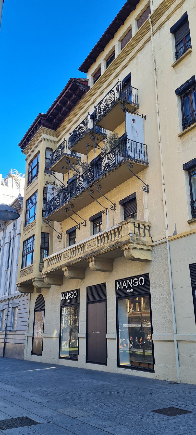
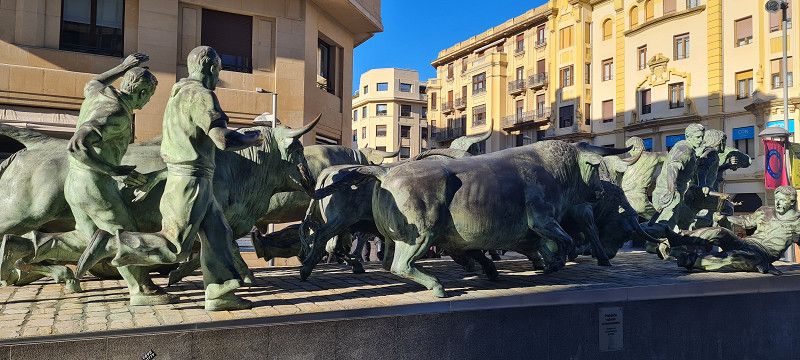
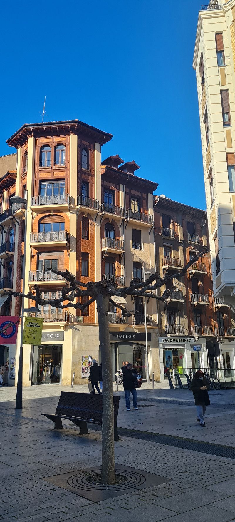
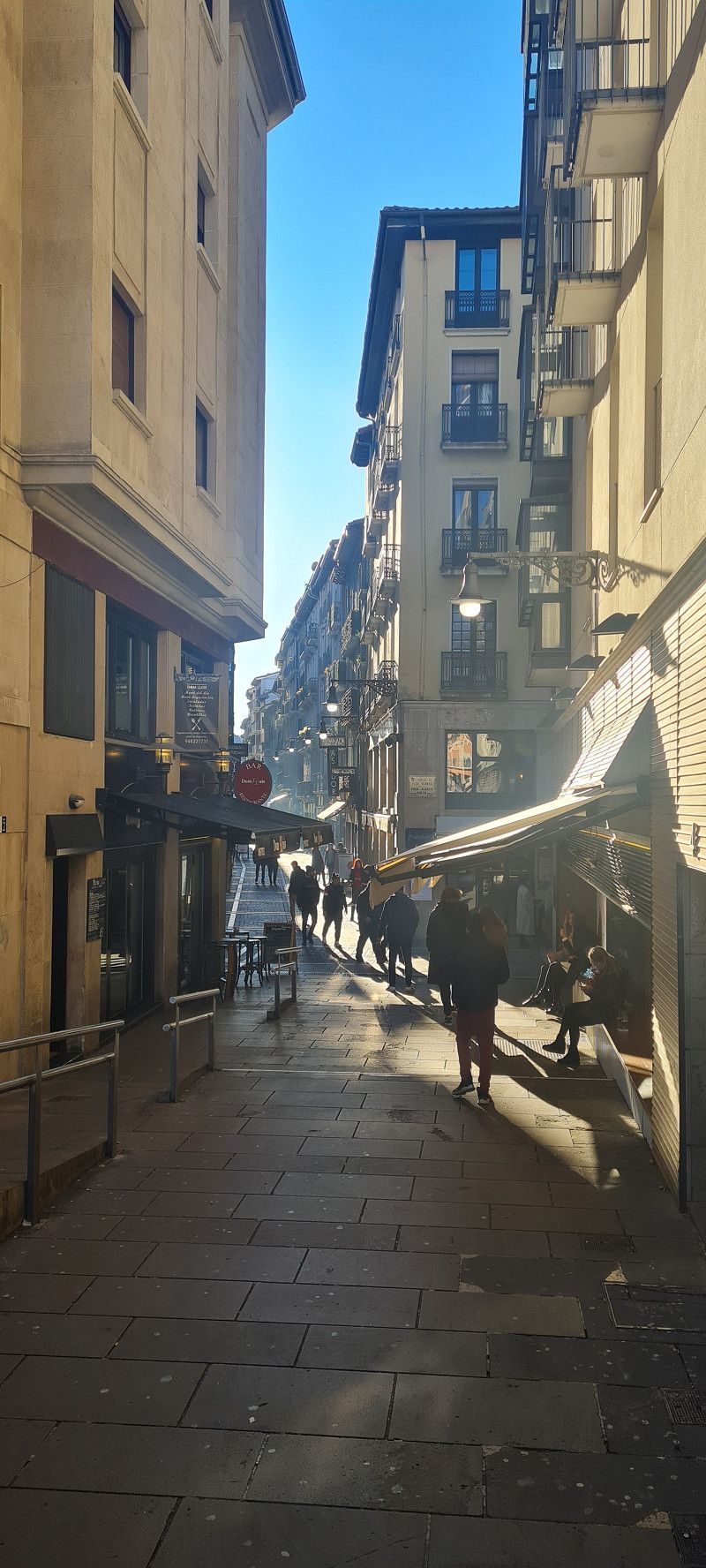
Day
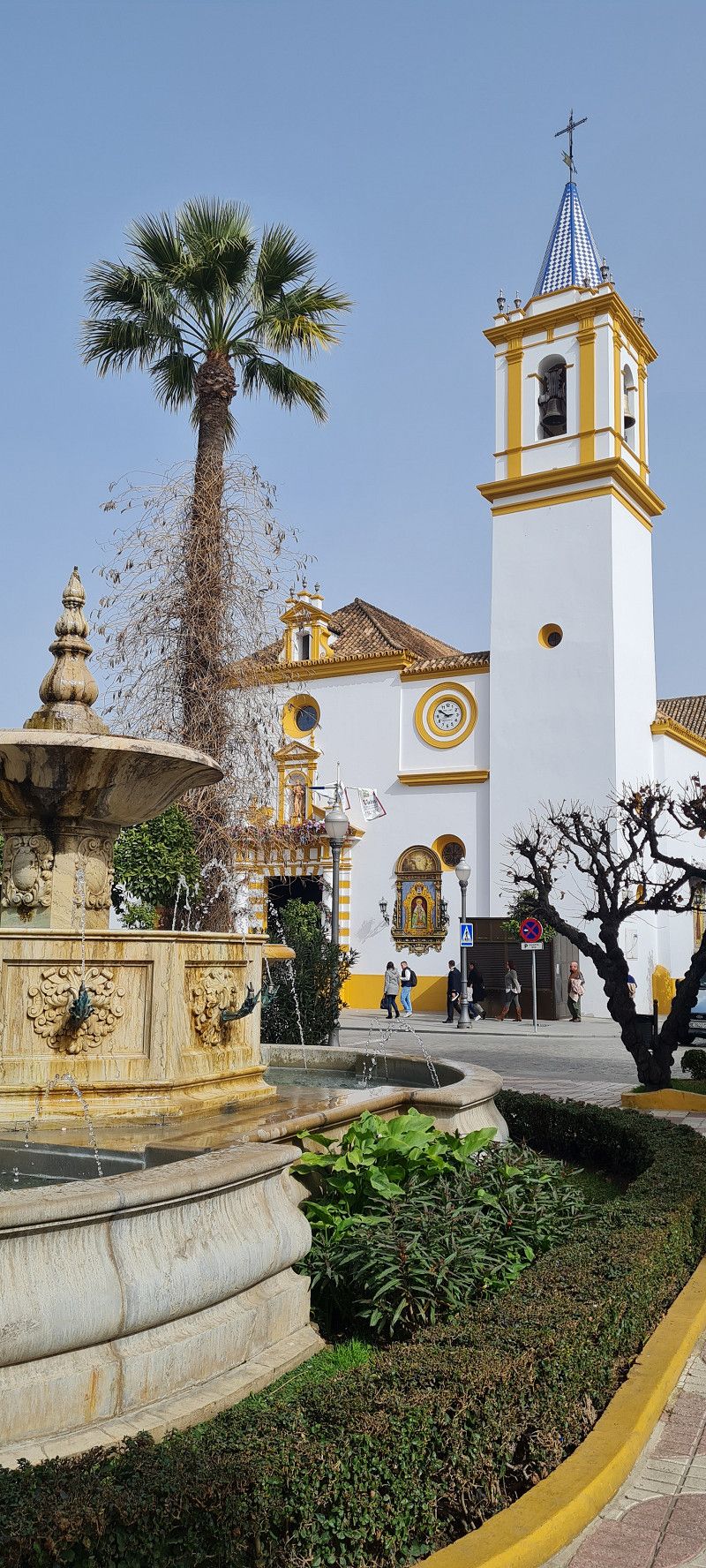
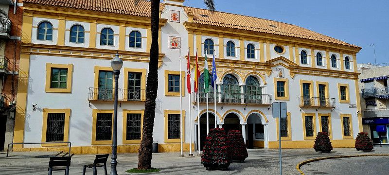
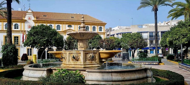
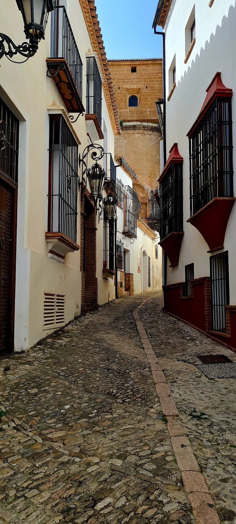
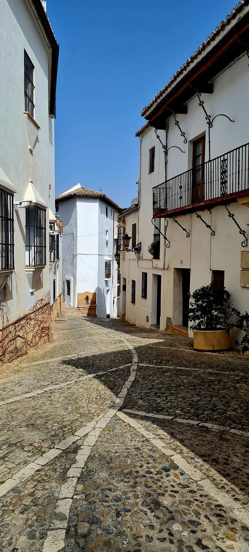
Av. de Guipúzcoa, 1-409, 31014 Pamplona, Navarra, Spanien
Motorhome parking area Área Autocaravanas.
The pitch in Pamplona is again very good. 10 euros for 24 hours including V/E, electricity and water.
It is about 1.5 km to the old town
This time of year is great for strolling. Hardly anything going on. For a beer we got a cookie in the 🌞.
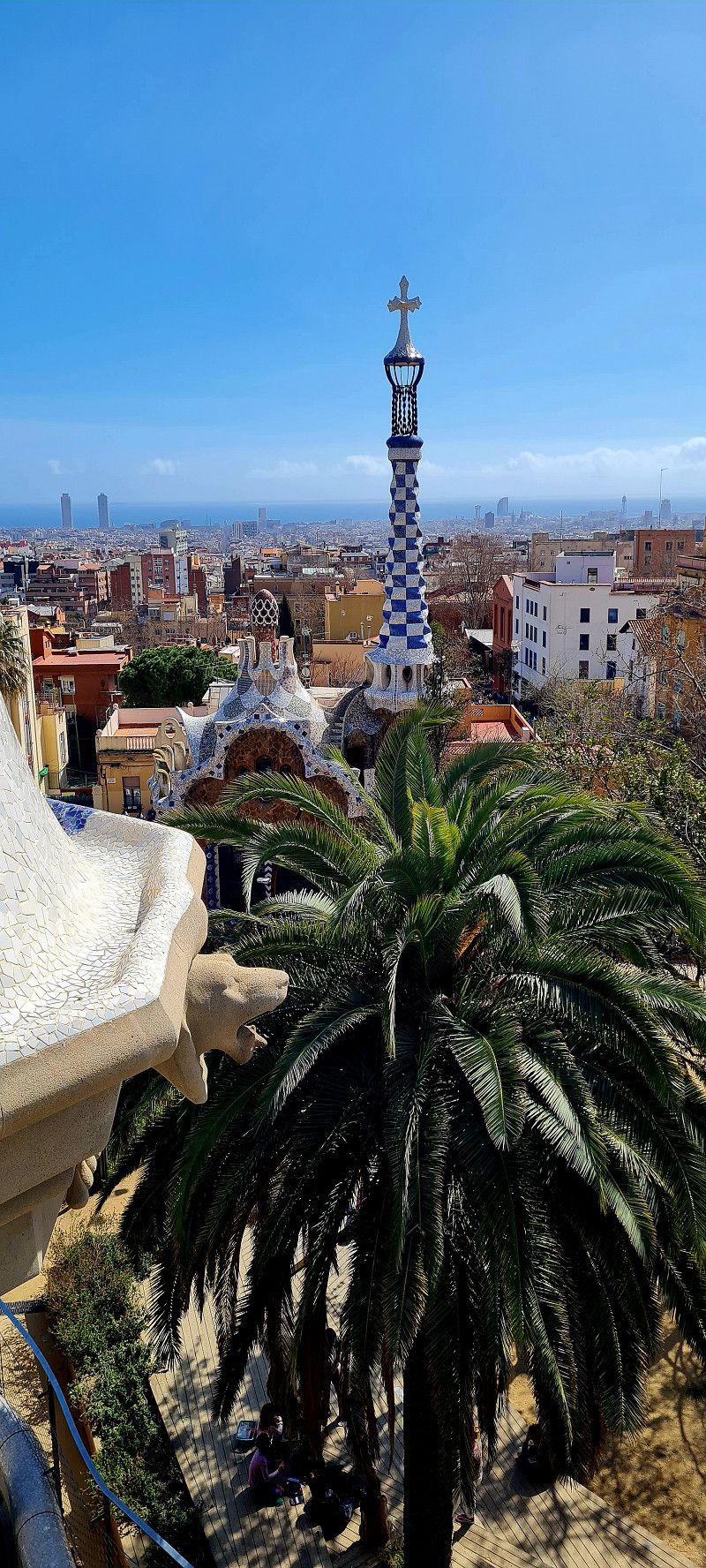
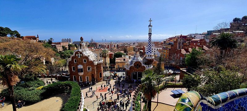
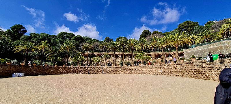
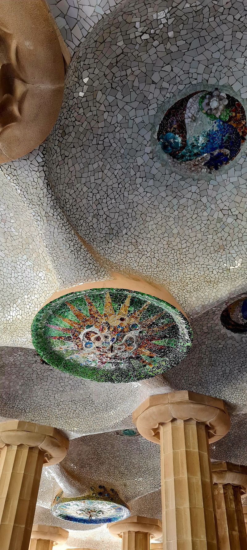
Here again our impressions in pictures :-)
Av. de Guipúzcoa, 1, 31014 Pamplona, Navarra, Spain
42° 49' 20" N 1° 39' 18.4" W
42.8222322 -1.6551155
• Head southeast on Avenida de Guipúzcoa.
• Turn right onto Calle Trinitarios. Go for 106 m.
• Take the 3rd exit from roundabout onto Avenida de Guipúzcoa. Go for 385 m.
• Take the 1st exit from roundabout onto Calle Cuesta de la Reina. Go for 672 m.
• Continue on Plaza de Juan XXIII. Go for 26 m.
• Turn slightly left onto Avenida del Ejército. Go for 799 m.
• Turn right onto Plaza de la Paz. Go for 28 m.
• Keep right onto Calle de Yanguas y Miranda. Go for 260 m.
• Take the 1st exit from roundabout toward Aeropuerto. Go for 213 m.
• Turn right toward Avenida de Zaragoza. Go for 35 m.
• Continue on Avenida de Zaragoza. Go for 205 m.
• Pass 2 roundabouts and continue on Avenida de Zaragoza. Go for 1.4 km.
• Continue on Carretera de Zaragoza. Go for 555 m.
• Take the 2nd exit from roundabout onto Carretera de Zaragoza (PA-31). Go for 837 m.
• Take ramp onto A-15 (Autopista de Navarra). Go for 1.2 km.
• Continue on AP-15 (Autopista de Navarra). Go for 734 m.
• Take exit 82 toward Sangüesa/Huesca onto A-21. Go for 41.1 km.
• Take exit 47 toward Yesa. Go for 411 m.
• Take the 2nd exit from roundabout onto NA-2420 toward Yesa/Jaca. Go for 487 m.
• Continue on Calle René Petit (NA-2420). Go for 412 m.
• Continue on NA-2420. Go for 125 m.
• Continue on Carretera Jaca-Pamplona (NA-2420). Go for 162 m.
• Turn left onto Calle Barriada Turística. Go for 35 m.
• Turn right onto Calle Benasa. Go for 52 m.
• Arrive at Calle Benasa. Your destination is on the left.
☍
50,4 km
( 31 min.)
Day
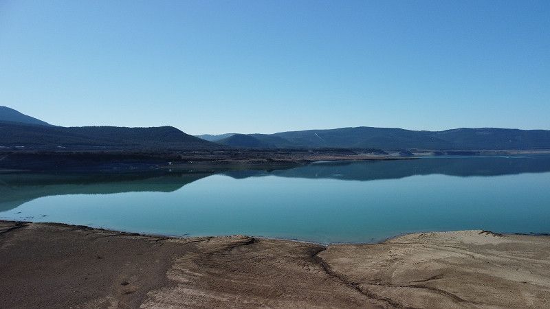
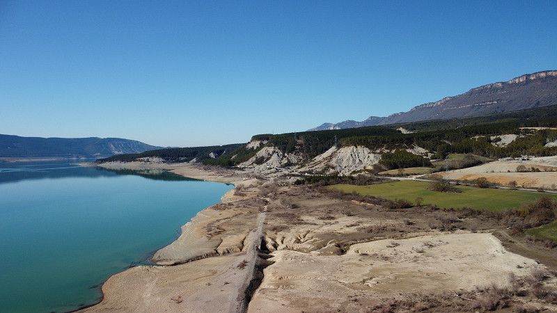
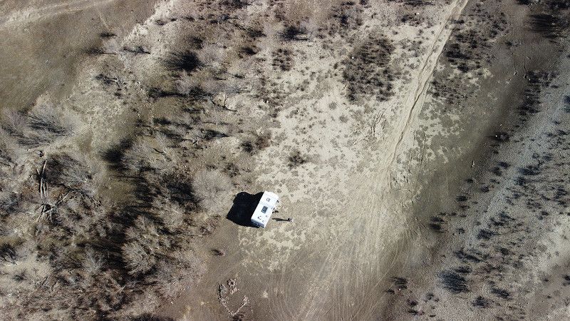
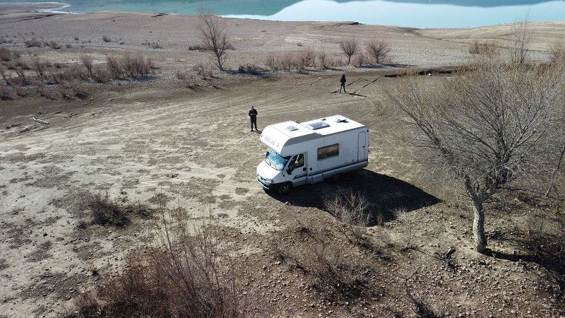
C. Benasa, 31410 Yesa, Navarra, Spanien
Made a stop at the Yesa dam today. Without accommodation. We took a short hike to a small ruined village and then enjoyed a coffee in the sun at the dam.
C. Benasa, 31410 Yesa, Navarra, Spain
42° 37' 12.4" N 1° 11' 44.9" W
42.6200997 -1.1958104
• Head east on Calle Benasa. Go for 55 m.
• Turn right toward Carretera Jaca-Pamplona/NA-2420. Go for 33 m.
• Turn right onto Carretera Jaca-Pamplona (NA-2420). Go for 273 m.
• Continue on NA-2420. Go for 125 m.
• Continue on Calle René Petit (NA-2420). Go for 412 m.
• Continue on NA-2420. Go for 444 m.
• Take the 2nd exit from roundabout. Go for 136 m.
• Take the 2nd exit from roundabout onto A-21 (Autovía del Pirineo) toward Pamplona. Go for 4.5 km.
• Take exit 42 toward Liédena. Go for 524 m.
• Take the 4th exit from roundabout. Go for 192 m.
• Take the 1st exit from roundabout onto NA-2420 toward Liédena/Sangüesa. Go for 1.3 km.
• Take the 3rd exit from roundabout onto NA-127 toward Sangüesa/Sos del Rey Católico. Go for 2.0 km.
• Take the 1st exit from roundabout onto NA-127. Go for 707 m.
• Take the 2nd exit from roundabout onto NA-8603. Go for 1.7 km.
• Keep right onto NA-132. Go for 28.8 km.
• Turn left onto Calle 13 de Septiembre (NA-5300). Go for 353 m.
• Continue on NA-5300. Go for 8.9 km.
• Continue on Paseo de Doña Leonor (NA-5300). Go for 391 m.
• Take the 2nd exit from roundabout onto Paseo de Doña Leonor. Go for 156 m.
• Take the 3rd exit from roundabout onto Plaza San Antón. Go for 131 m.
• Turn left onto Calle Alcalde Maillata (NA-8602). Go for 530 m.
• Continue on NA-8602. Go for 1.1 km.
• Turn left onto N-121. Go for 14.2 km.
• Take the 3rd exit from roundabout onto Carretera Zaragoza (N-121) toward Tudela/Zaragoza/Madrid/Castejón. Go for 15.0 km.
• Continue on NA-134. Go for 154 m.
• Continue on N-113. Go for 128 m.
• Turn left onto NA-134. Go for 8.3 km.
• Turn left onto NA-6712 toward Arguedas. Go for 1.5 km.
• Continue on Calle Real (NA-6712). Go for 73 m.
• Keep right onto Calle Real. Go for 96 m.
• Turn right onto Calle El Silo. Go for 84 m.
• Turn right onto Calle Tejerías. Go for 252 m.
• Turn left onto Grupo Infanta Elena. Go for 115 m.
• Turn right onto Grupo La Constitución. Go for 23 m.
• Turn slightly left onto Calle Bordón. Go for 22 m.
• Continue on Calle Bordón. Go for 170 m.
• Arrive at Calle Bordón. Your destination is on the right.
☍
93,0 km
(1 hrs. 8 min.)
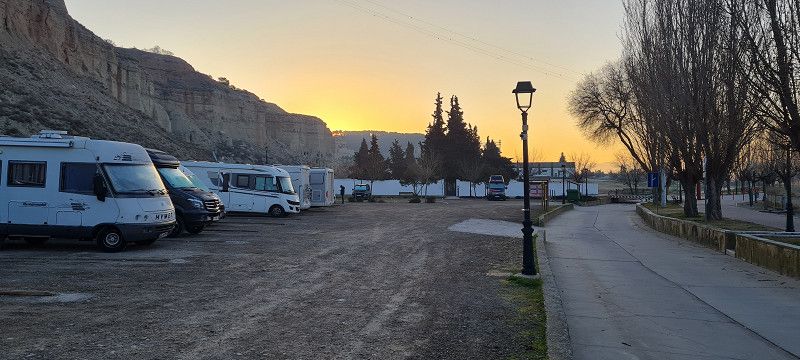
Aerea autocaravanas, Spanien
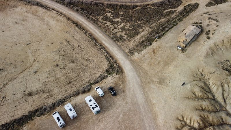
Arrived at the pitch around 5:30 p.m. today. Free for up to 48 hours. V/E and water available free of charge. There are about 25 places. Mobiles with trailers also fit into the pitches.
Calle Val , Arguedas, Spanien
42° 10' 25.7" N 1° 35' 29.6" W
42.1738011 -1.5915661
• Head toward Calle Eras Bajas on Calle Bordón. Go for 192 m.
• Turn sharp left onto Camino de las Peñuelas. Go for 1.3 km.
• Continue on Camino de las Bárdenas Reales. Go for 9.3 km.
• Turn right. Go for 3.6 km.
• Arrive at your destination.
☍
14,5 km
( 38 min.)
Day
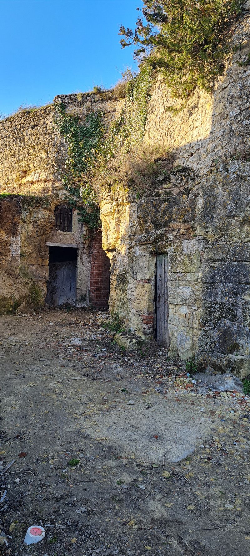
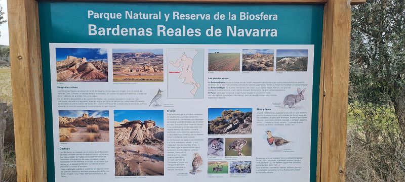
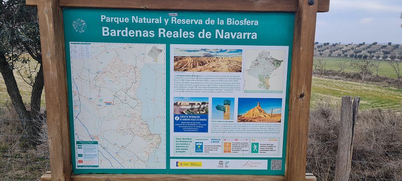
Parque Natural de las Bardenas Reales, Spanien
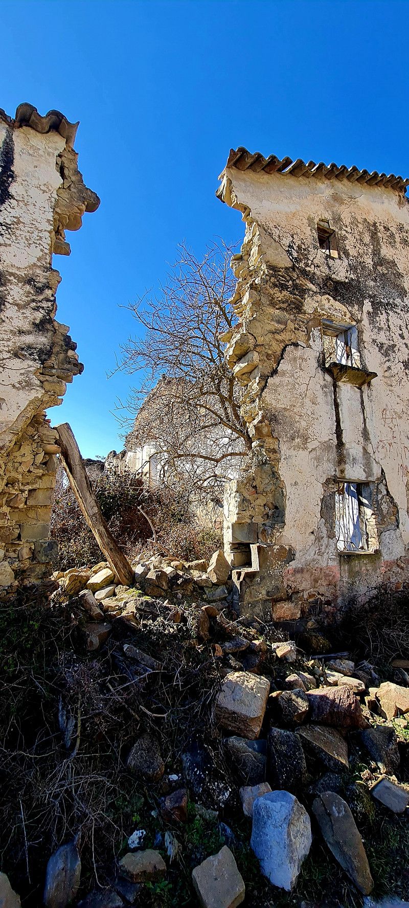
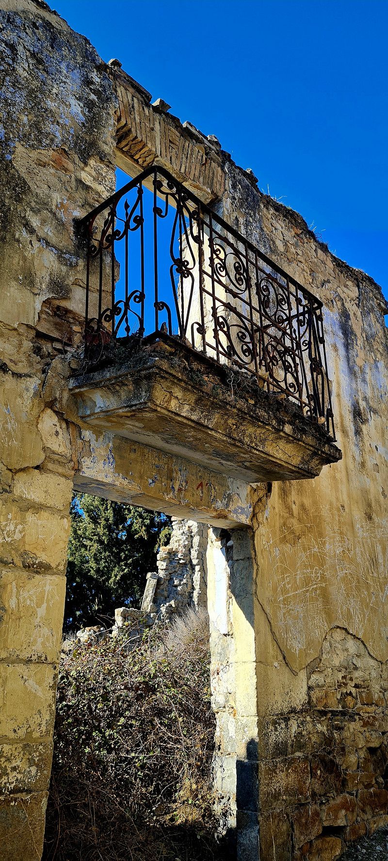
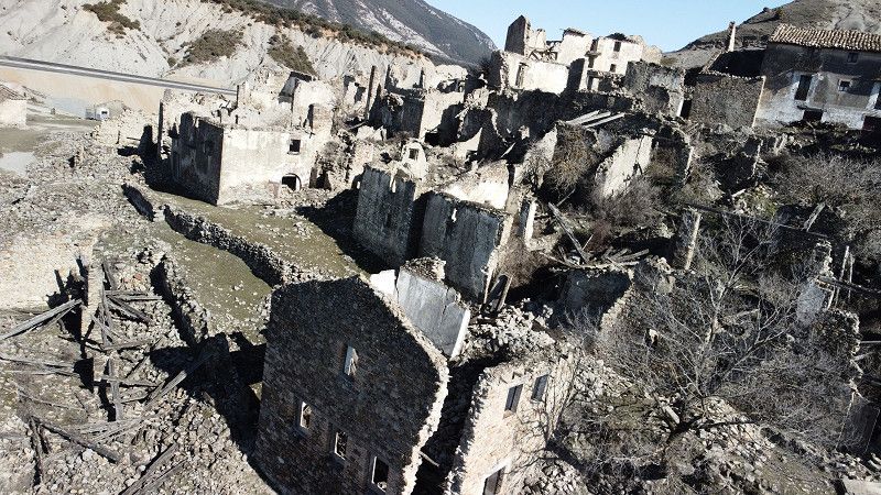
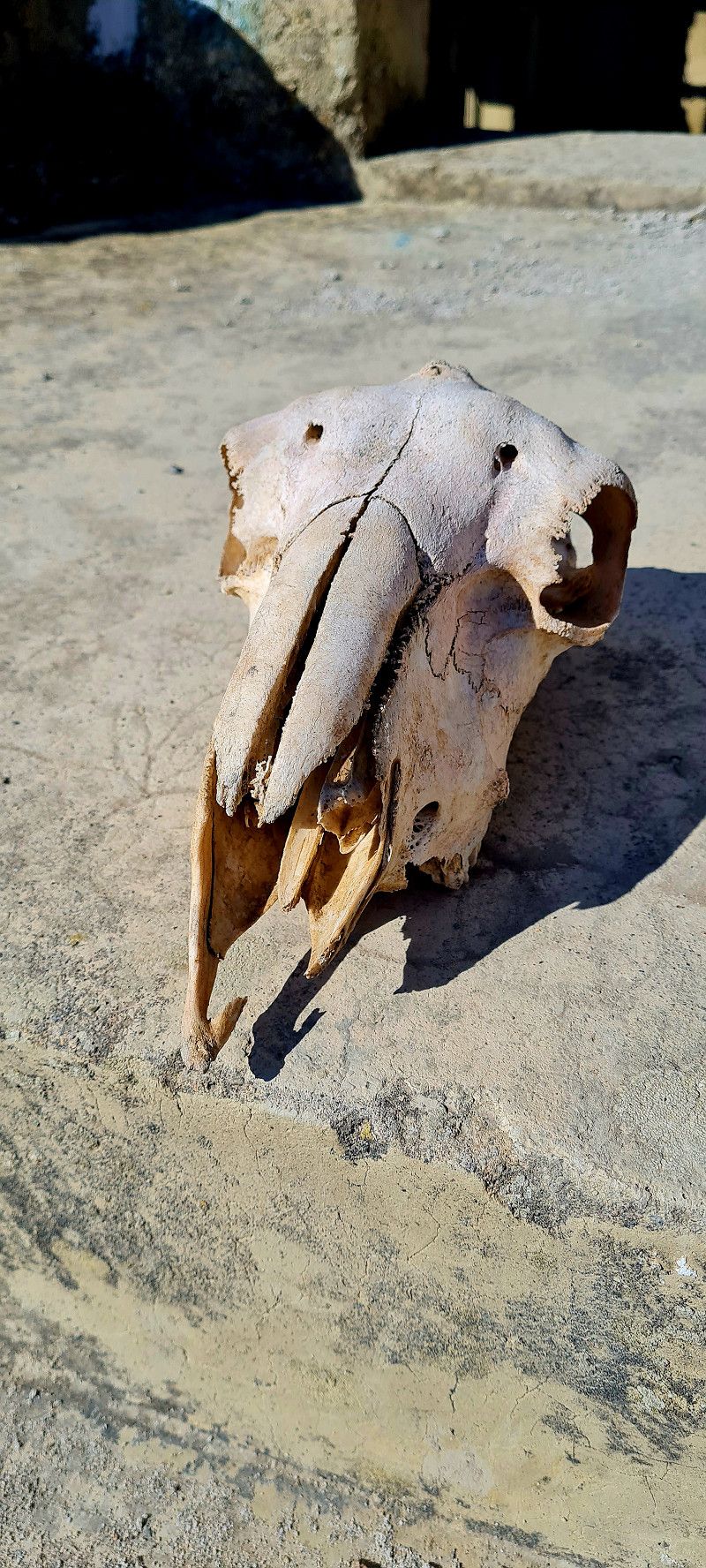
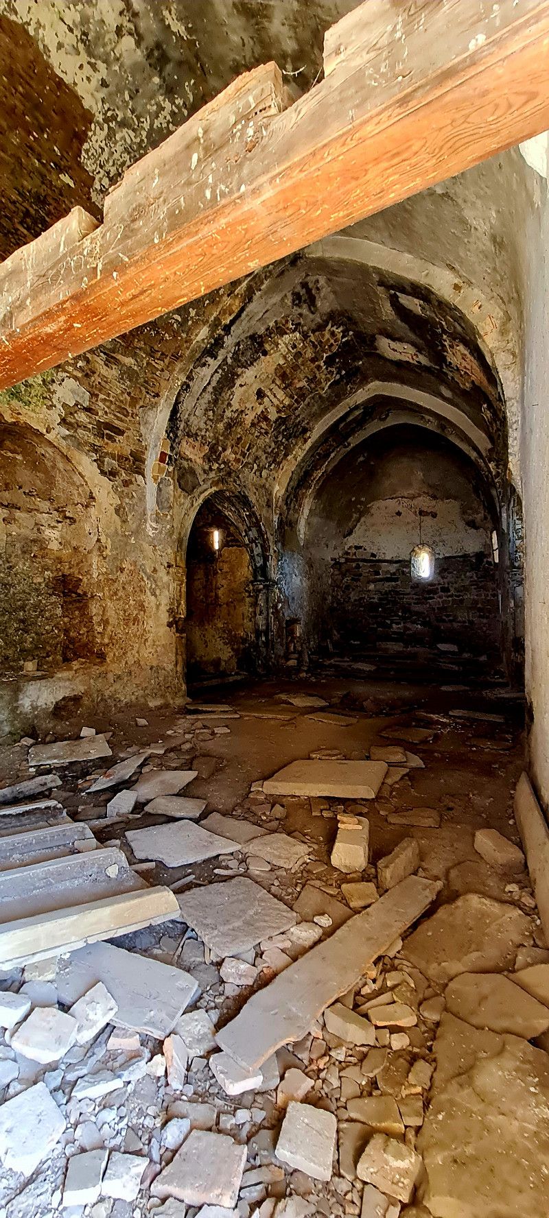
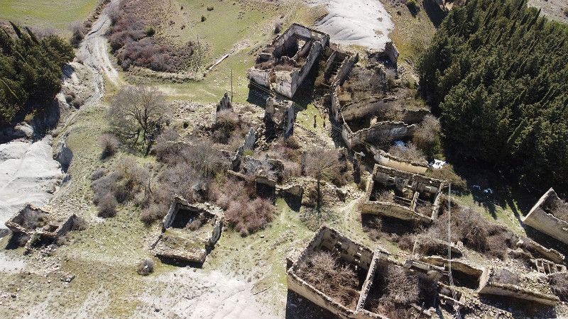
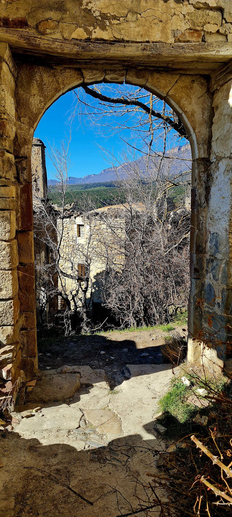
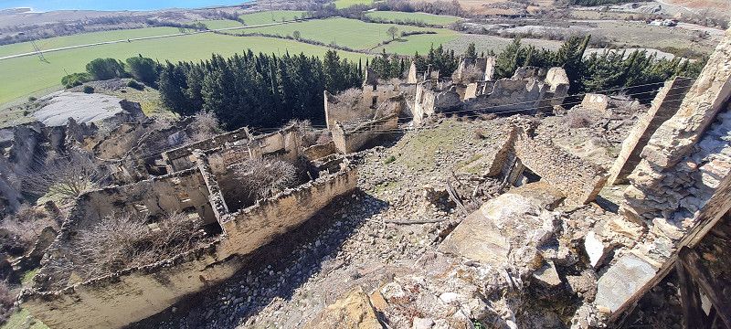
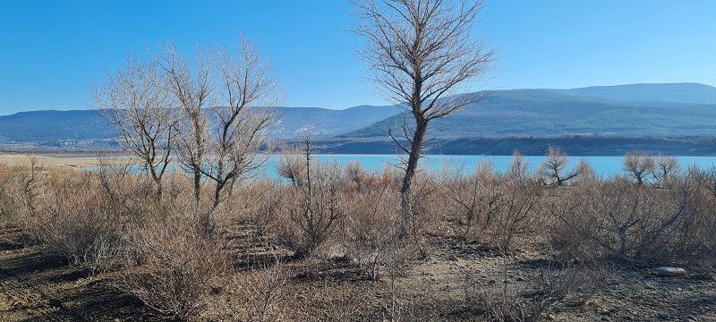
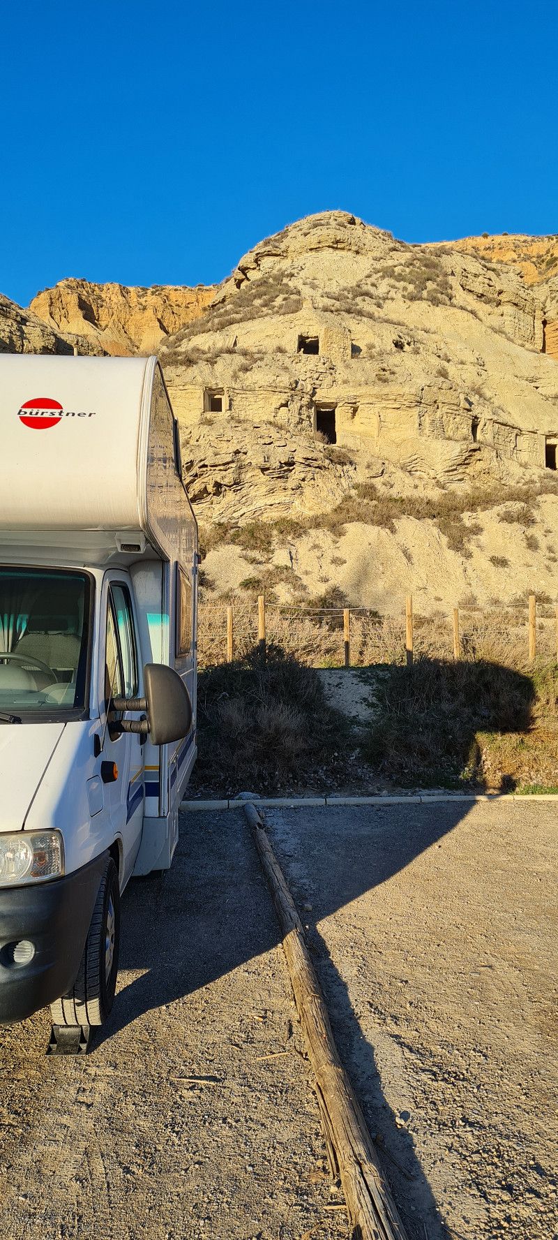
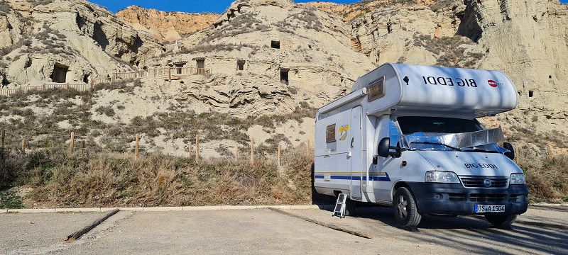
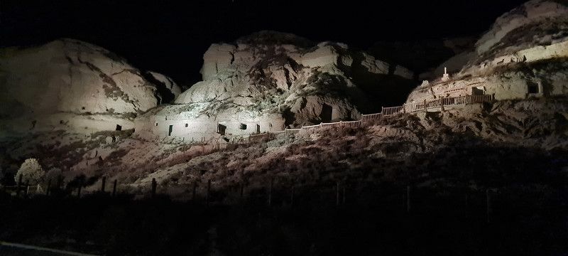
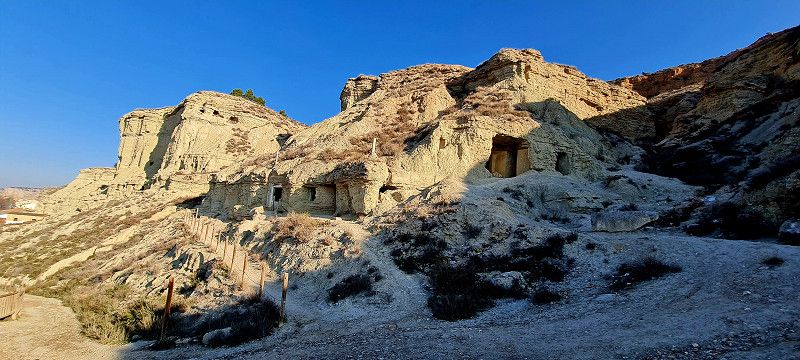
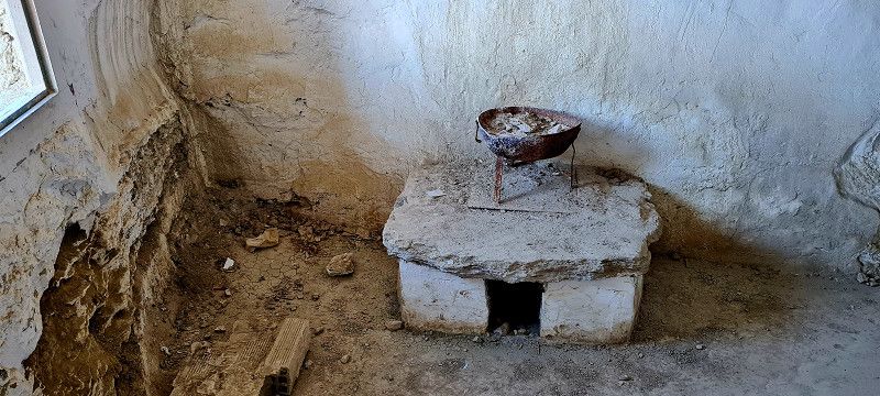
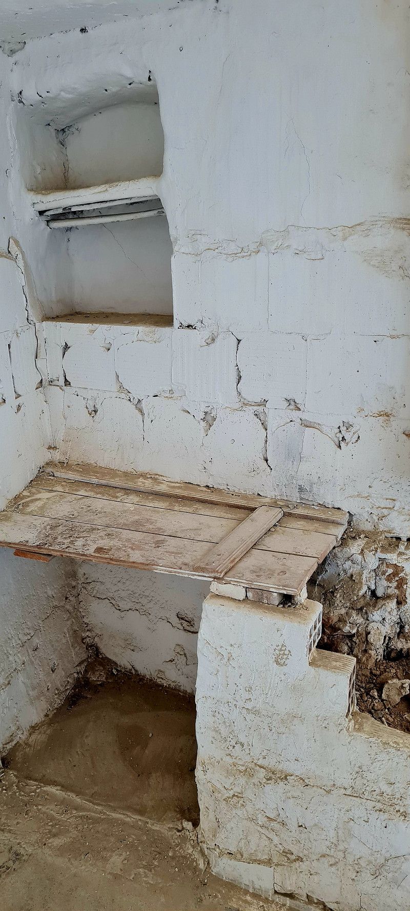
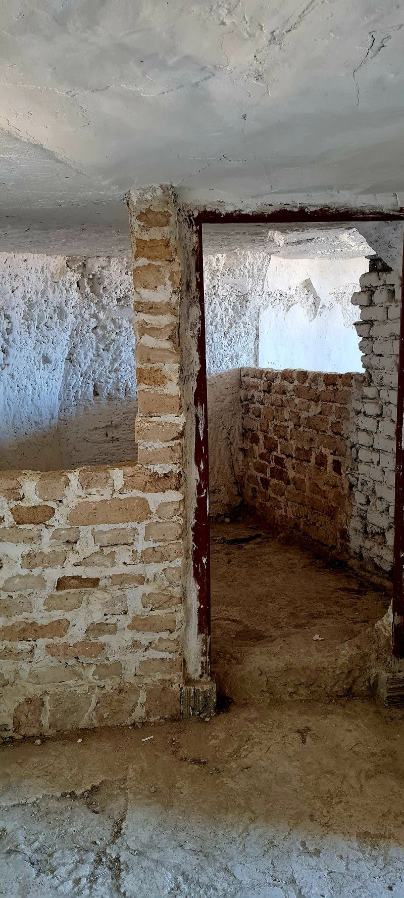
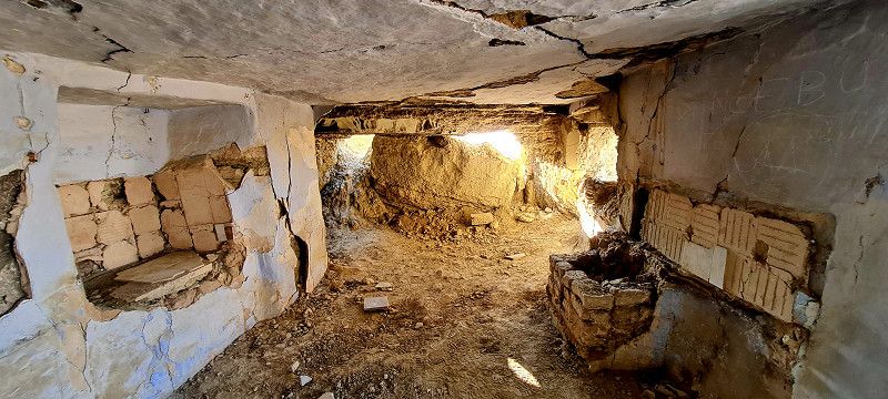
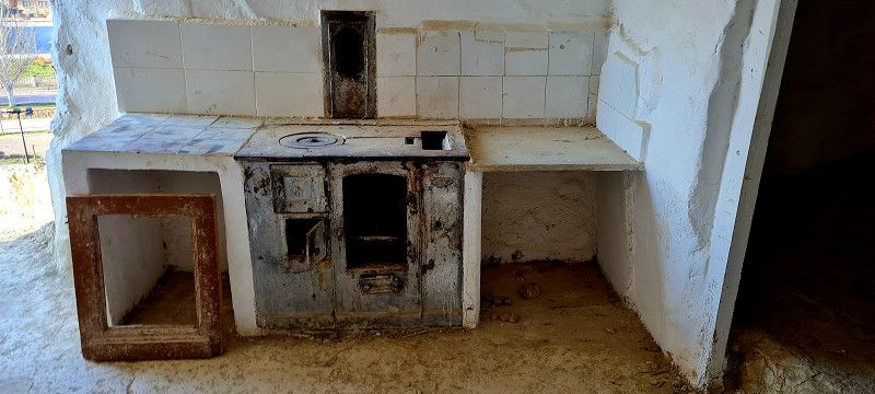
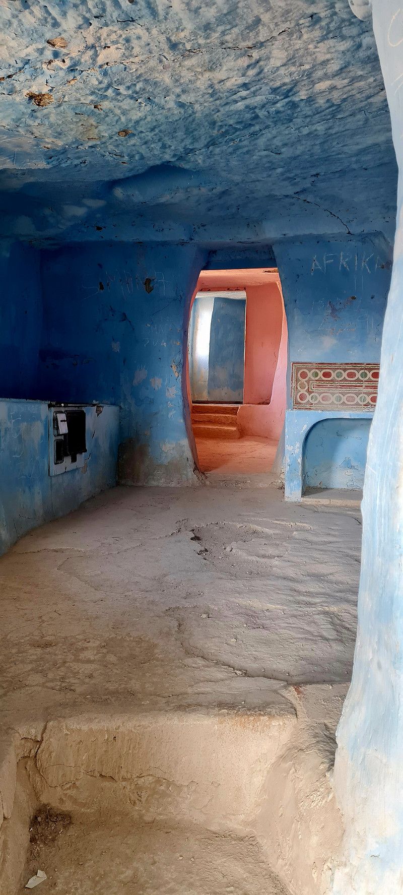
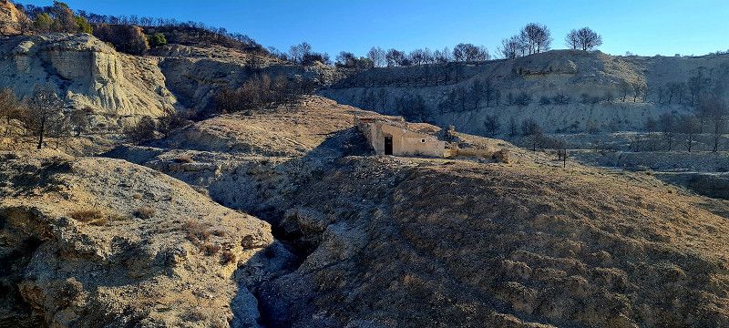
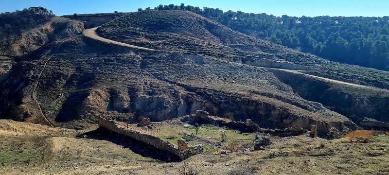
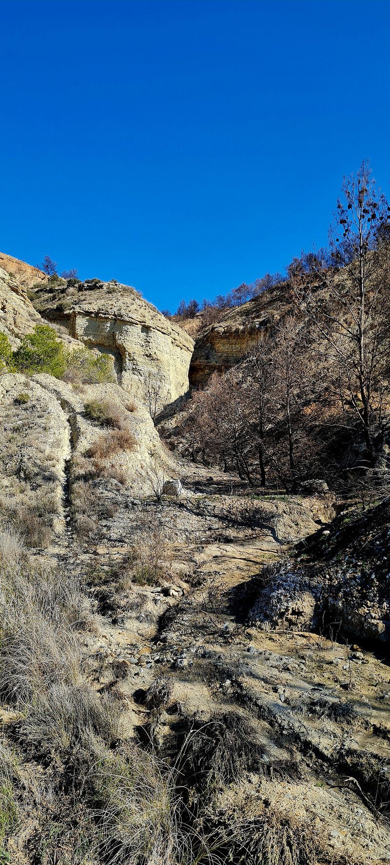
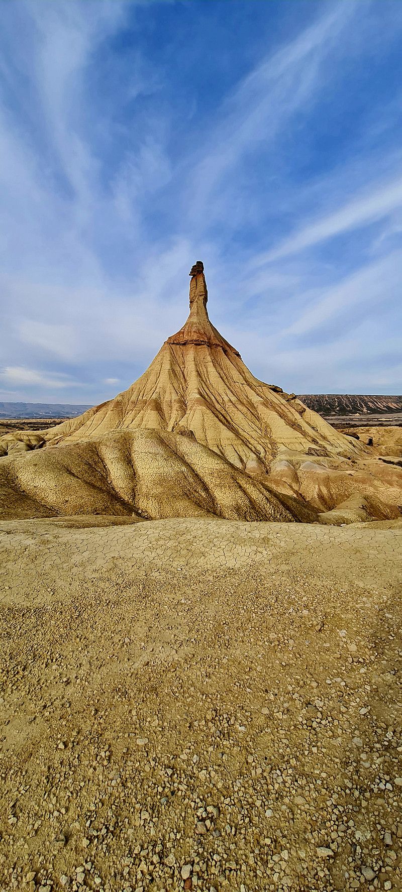
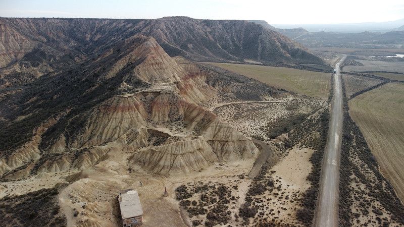
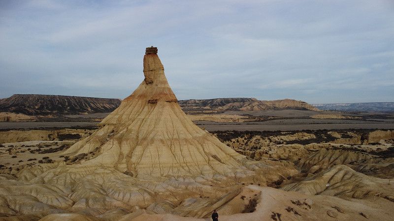
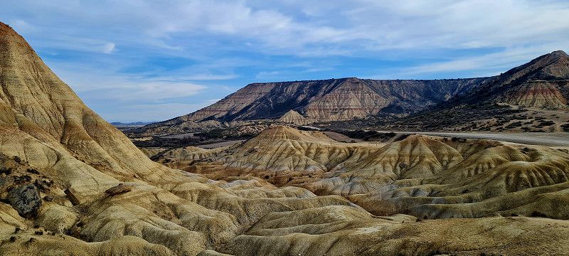
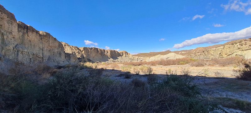
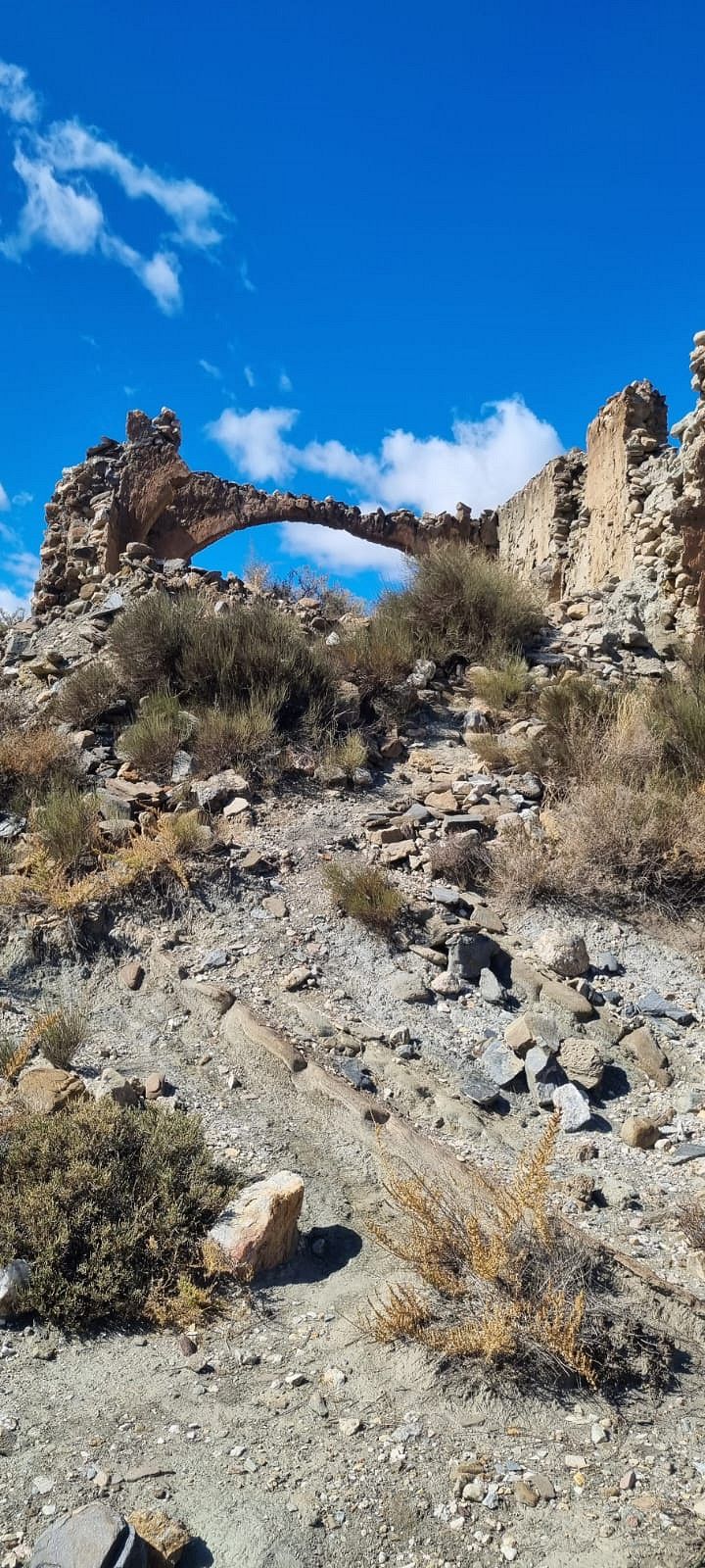
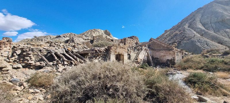
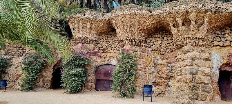
Today was hiking day. First we visit the cave dwellings that were inhabited until 1960.
After that we did another 11 km hike through a small part of the semi-desert. Unfortunately, the signage wasn't great and we got lost several times
Parque Natural de las Bardenas Reales , Bardenas Reales de Navarra, Spanien
42° 9' 40.2" N 1° 27' 58.5" W
42.1611684 -1.4662507
• Head southeast.
• Arrive at your destination.
☍
Distance not available
(Duration not available)
Day
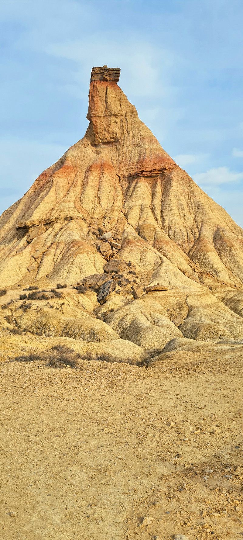
Bardenas Reales de Navarra, Spanien
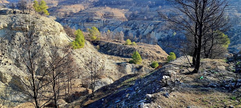
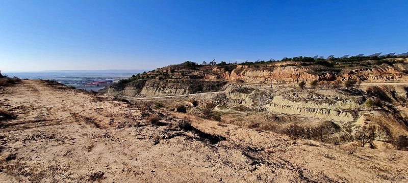
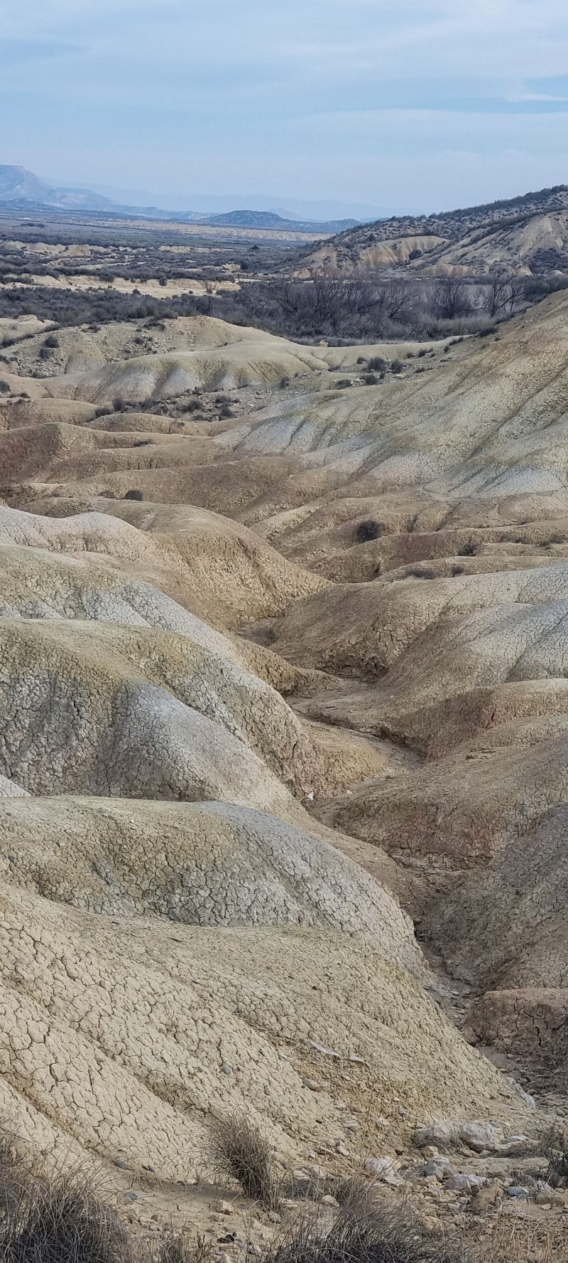
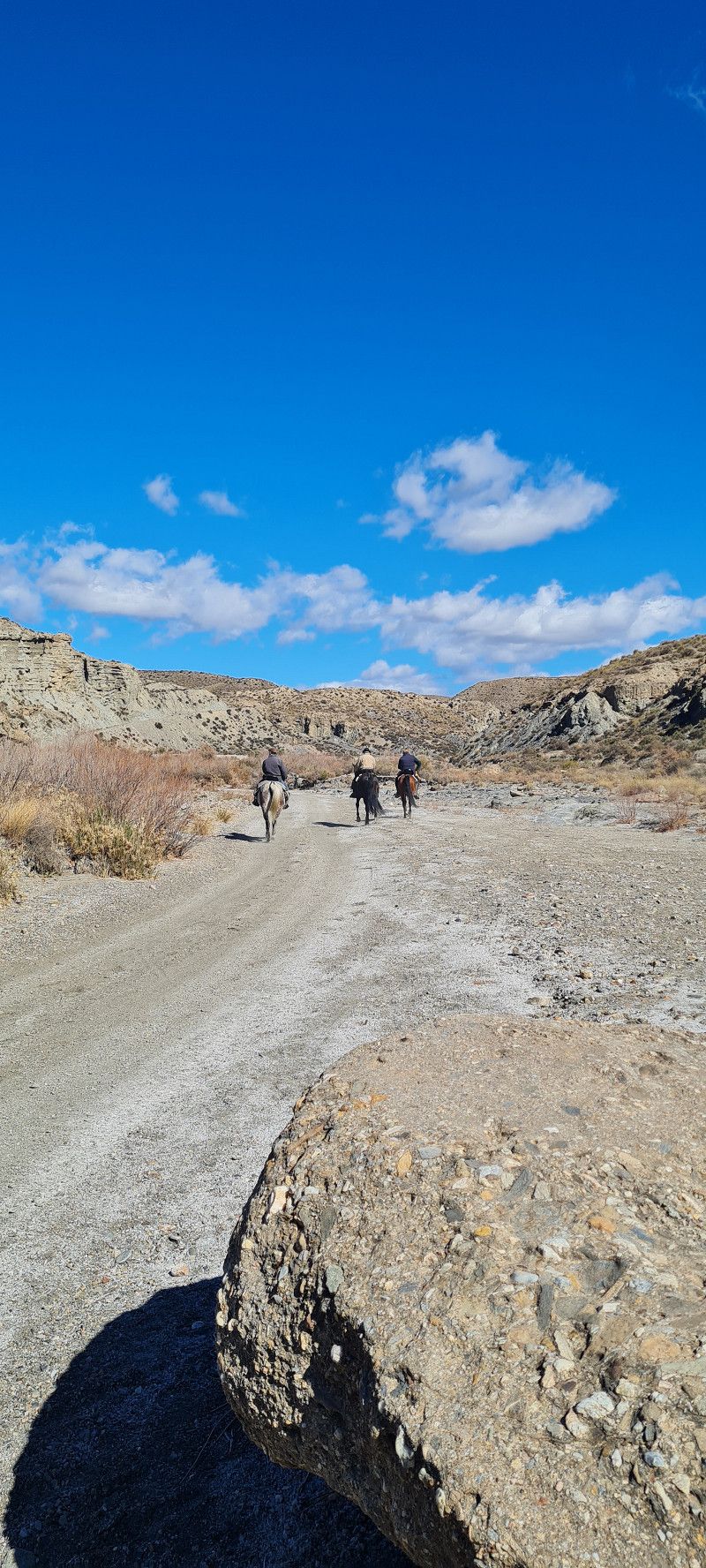
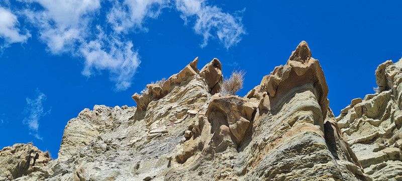
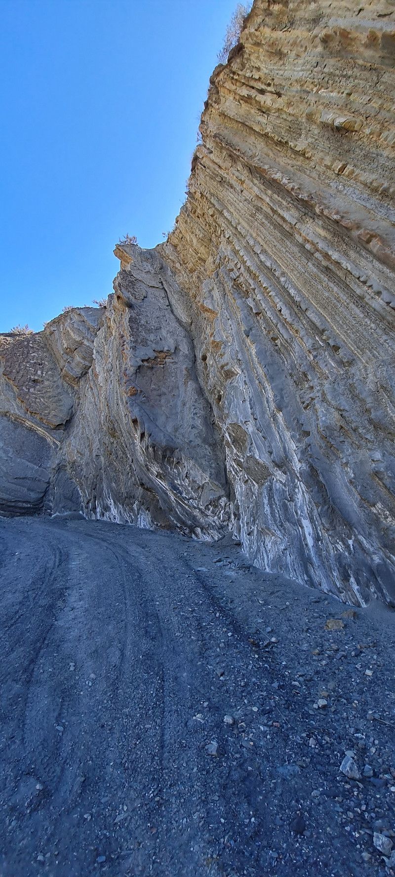
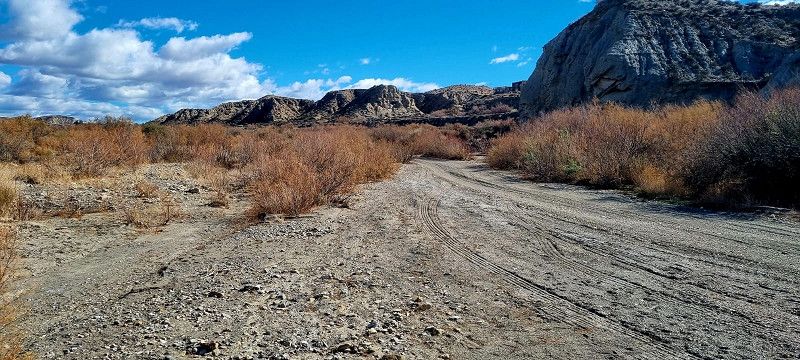
Made another short stop in the desert today and looked at the spectacular rock formations. Films, video clips and commercials have been shot here.
Bardenas Reales de Navarra , Spanien
42° 9' 40.2" N 1° 27' 58.5" W
42.1611684 -1.4662507
• Head toward Camino de las Bárdenas Reales. Go for 3.6 km.
• Turn left onto Camino de las Bárdenas Reales. Go for 9.3 km.
• Turn left onto Camino de las Bárdenas Reales. Go for 1.2 km.
• Turn left onto NA-6712. Go for 659 m.
• Turn right onto NA-134 toward Pamplona/Logroño. Go for 8.3 km.
• Keep left toward N-113. Go for 37 m.
• Turn left onto N-113. Go for 1.4 km.
• Continue toward N-113. Go for 48 m.
• Take the 3rd exit from roundabout onto N-113 toward Madrid/N-232/Zaragoza. Go for 875 m.
• Continue toward N-113. Go for 39 m.
• Take the 1st exit from roundabout onto N-113 toward Castejón/Madrid/Logroño/N-232/Zaragoza. Go for 16.0 km.
• Take the 2nd exit from roundabout onto N-113 toward Madrid. Go for 26.8 km.
• Take the 2nd exit from roundabout onto A-15 (Autovía de Navarra) toward CL-101/Ólvega/Almazán/Soria. Go for 4.8 km.
• Take exit 106 toward Ólvega/Ágreda onto CL-101. Go for 72.2 km.
• Turn left and take ramp onto A-15 (Autovía de Navarra) toward Medinaceli/Madrid. Go for 41.7 km.
• Continue on A-2 (Autovía del Nordeste). Go for 140 km.
• Take exit 9 toward Avda. Logroño/Calle Alcalá onto Avenida de Logroño. Go for 202 m.
• Turn right onto Paseo de la Alameda de Osuna toward Avda. Logroño/M-40/A-1/A-6/M-12/Aeropuerto/T-4. Go for 128 m.
• Turn right onto Avenida de Logroño. Go for 305 m.
• Take the 1st exit from roundabout onto Avenida de Logroño toward Barajas. Go for 197 m.
• Turn right onto Calle de los Jardines de Aranjuez toward Paseo Alameda de Osuna. Go for 268 m.
• Turn left onto Paseo de la Alameda de Osuna. Go for 54 m.
• Arrive at Paseo de la Alameda de Osuna. Your destination is on the right.
☍
328,2 km
(3 hrs. 46 min.)
Camping Osuna
We then drove on to Madrid. So far everything without toll. The roads are really very good to drive and compared to those I know so well (A1, A2 and A7 in Germany) there is almost nothing going on on the autobahns.
Around 5 p.m. we reached the Osuna campsite in Madrid. We hadn't reserved in advance and there was so much vacancy we had free seating. 10 minutes walk to the metro to get to the city center in about 25 minutes. We'll do that tomorrow.
Jardines de Aranjuez, s/n, 28042, Madrid, Spain
40° 27' 15" N 3° 36' 2" W
40.4541600 -3.6005500
• Head toward Plaza del Capricho on Paseo de la Alameda de Osuna. Go for 121 m.
• Turn right onto Paseo de la Alameda de Osuna. Go for 46 m.
• Turn left onto Paseo de la Alameda de Osuna. Go for 121 m.
• Turn left onto Paseo de la Alameda de Osuna. Go for 42 m.
• Turn left onto Paseo de la Alameda de Osuna. Go for 247 m.
• Turn slightly right onto Calle de los Jardines de Aranjuez. Go for 268 m.
• Turn slightly right toward Calle de los Jardines de Aranjuez. Go for 50 m.
• Continue on Avenida de Logroño. Go for 135 m.
• Take the 2nd exit from roundabout onto Avenida de Logroño toward Avda. de América. Go for 435 m.
• Keep right onto Avenida de Logroño. Go for 398 m.
• Keep left toward Avenida de Logroño. Go for 36 m.
• Take ramp onto A-2 (Avenida de América). Go for 4.1 km.
• Keep left onto Avenida de América toward A-2/Centro Ciudad/Avda. de América/C/Corazón de María. Go for 1.7 km.
• Continue on Calle de María de Molina. Go for 769 m.
• Turn left onto Calle de Serrano. Go for 542 m.
• Turn right onto Calle de Juan Bravo. Go for 116 m.
• Continue on Puente de Enrique Mata Gorostizaga. Go for 16 m.
• Continue on Paso Elevado de Enrique Mata Gorostizaga. Go for 117 m.
• Continue on Paseo de Eduardo Dato. Go for 127 m.
• Take the 2nd exit from Glorieta de Rubén Darío roundabout onto Paseo de Eduardo Dato toward Plaza de Chamberí. Go for 480 m.
• Continue on Plaza de Chamberí. Go for 101 m.
• Turn slightly left onto Calle de Luchana toward Glorieta de Bilbao. Go for 522 m.
• Continue on Glorieta de Bilbao toward Glorieta de Quevedo. Go for 74 m.
• Continue on Calle de Carranza. Go for 242 m.
• Turn right onto Glorieta de Ruiz Giménez toward Gran Vía. Go for 131 m.
• Turn right onto Calle de San Bernardo toward Gran Vía. Go for 1.0 km.
• Turn slightly left onto Plaza de Santo Domingo. Go for 95 m.
• Turn right onto Calle de las Veneras. Go for 88 m.
• Turn slightly right onto Calle de Trujillos. Go for 48 m.
• Turn left onto Travesía de los Trujillos. Go for 38 m.
• Turn right onto Plaza de San Martín. Go for 71 m.
• Continue on Calle de la Flora. Go for 59 m.
• Turn left onto Plaza de Santa Catalina de los Donados. Go for 10 m.
• Continue on Calle de los Donados. Go for 56 m.
• Continue on Calle de las Fuentes. Go for 120 m.
• Continue on Plaza de los Herradores. Go for 42 m.
• Continue on Plaza del Comandante las Morenas. Go for 48 m.
• Turn left onto Calle Mayor. Go for 318 m.
• Turn right onto Calle de Esparteros. Go for 89 m.
• Turn left onto Calle del Marqués Viudo de Pontejos. Go for 89 m.
• Turn left onto Calle del Correo. Go for 38 m.
• Turn right onto Calle de San Ricardo. Go for 83 m.
• Arrive at Calle de San Ricardo. Your destination is on the left.
☍
13,3 km
( 25 min.)
Day
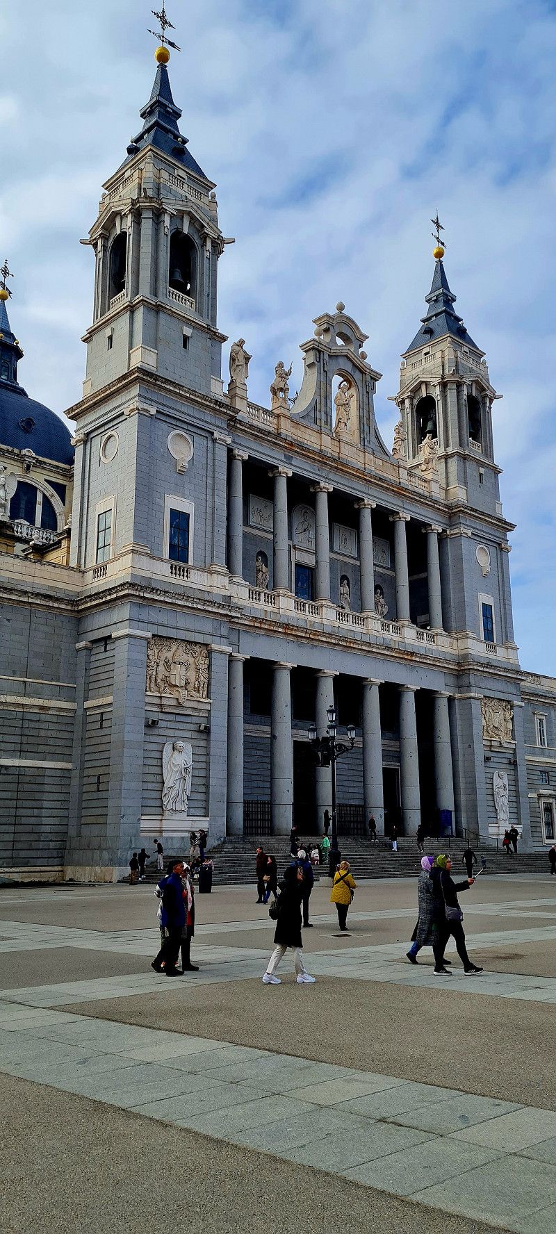
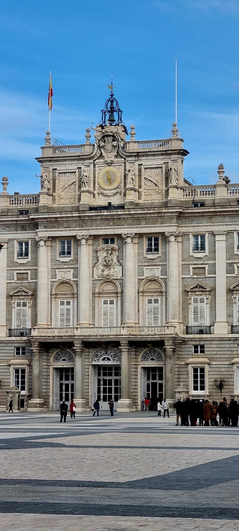
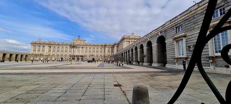
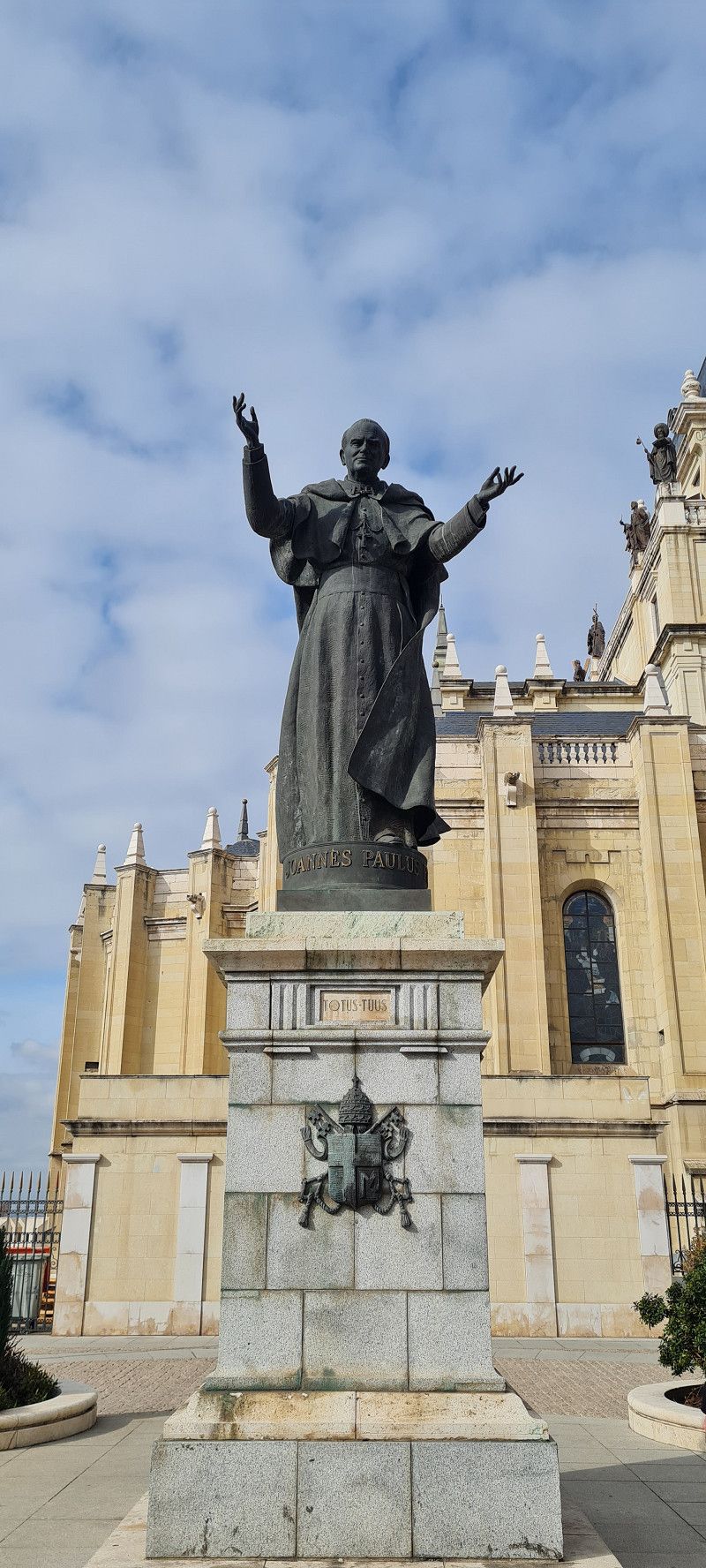
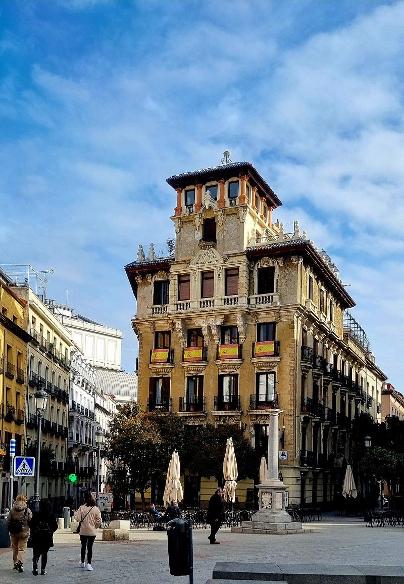
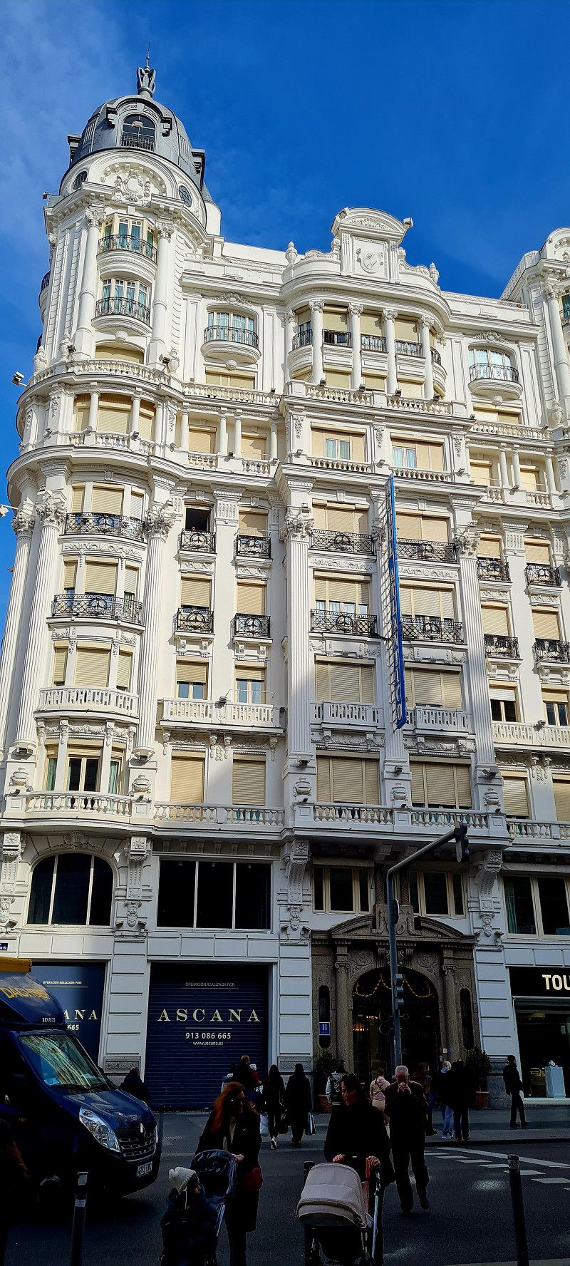
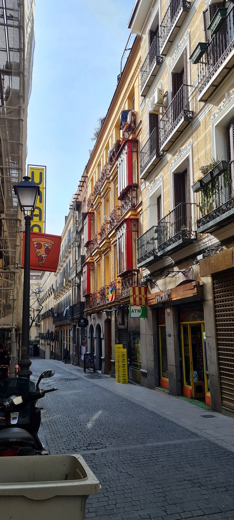
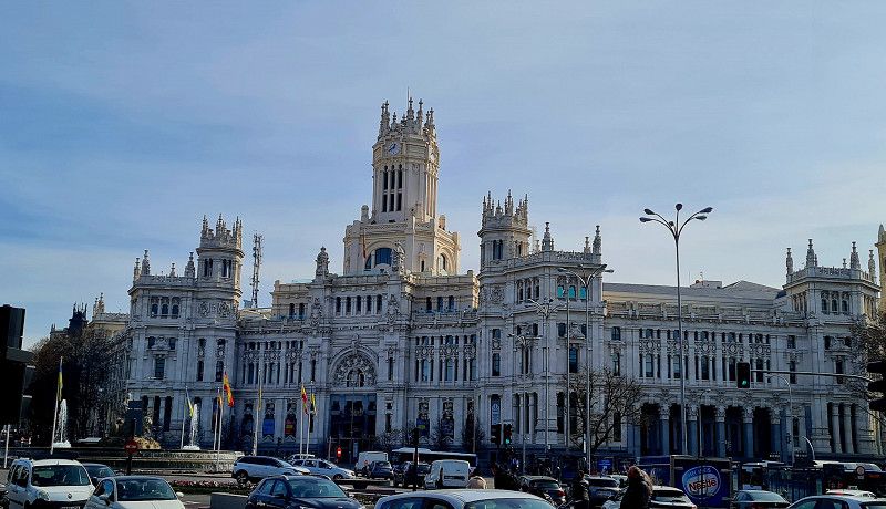
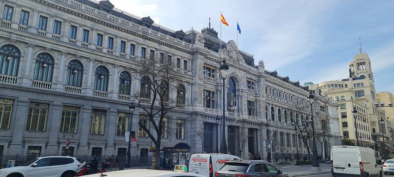
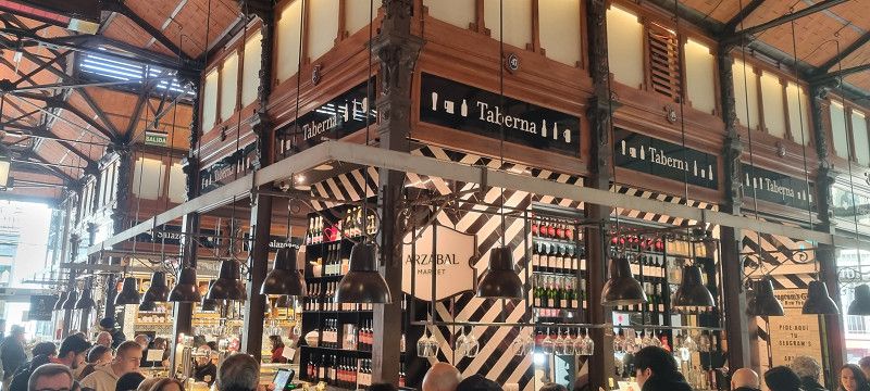
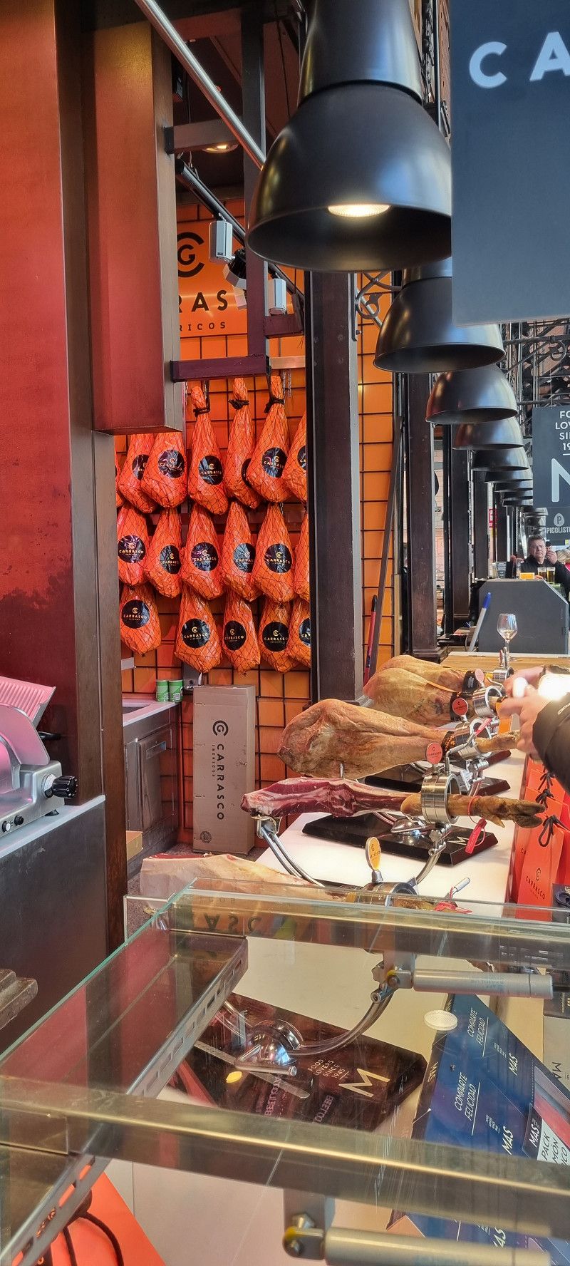
Madrid, Spanien
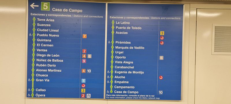
Spent the whole day in Madrid today. With the metro (station about 10 minutes walk from the campsite).
8.60 euros per person per day.
I have never experienced it in such a structured and clear manner. The routes and lines are clearly laid out and also colour-coded. And if you look sparingly, there is immediately someone at your side who wants to help.
Really great!
We need a few minutes until we have found the orientation.
Then it wasn't that difficult to head for some sights.
Here are a few impressions. Unfortunately, you couldn't really get all of these huge houses and buildings on the photo.
We were still able to take a few nice snapshots.
By the way.. today we ran 17.5 kilometers in 6.5 hours
Madrid , Spanien
40° 25' 0.1" N 3° 42' 12.9" W
40.4167047 -3.7035825
• Head east on Calle de San Ricardo.
• Turn right onto Calle de las Carretas. Go for 174 m.
• Continue on Plaza de Jacinto Benavente. Go for 48 m.
• Turn right onto Plaza de Jacinto Benavente. Go for 6 m.
• Continue on Calle de Atocha. Go for 27 m.
• Turn left onto Calle de la Concepción Jerónima. Go for 320 m.
• Turn left onto Calle de Toledo. Go for 268 m.
• Take the 2nd exit from Plaza La Cebada roundabout onto Calle de Toledo. Go for 567 m.
• Take the 4th exit from Glorieta de la Puerta de Toledo roundabout onto Glorieta de la Puerta de Toledo. Go for 91 m.
• Continue on Calle de Toledo. Go for 636 m.
• Turn right onto Glorieta de las Pirámides. Go for 30 m.
• Turn right onto Calle de Alejandro Dumas toward Toledo/Badajoz/R-5/M-30/Tanatorio Parque de San Isidro/Glorieta Marqués de Vadillo. Go for 154 m.
• Keep left toward M-30/Toledo/A-42/A-4/A-3/Aeropuerto/A-2/Gta. M. Vadillo/Toledo/R-5/Badajoz. Go for 258 m.
• Take left ramp onto M-30 (Nudo de Puente de Toledo) toward A-42/A-4/A-3/Aeropuerto/A-2. Go for 2.8 km.
• Keep right toward Córdoba/A-4/Caja Mágica/Avenida Andalucía/Hospital 12 de Octubre. Go for 28 m.
• Continue on Nudo Sur. Go for 74 m.
• Continue on A-4 toward Córdoba/Caja Mágica. Go for 59.5 km.
• Keep right toward Tarancón/A-40/Cuenca/Madrid/R-4/N-301. Go for 5.8 km.
• Continue on A-4 (Autovía del Sur). Go for 321 km.
• Take exit 403 toward Córdoba Sur y Oeste/Granada/Hospital/Plaza de Andalucía. Go for 856 m.
• Continue on Carretera de Castro. Go for 218 m.
• Turn right onto Calle Hixén I. Go for 412 m.
• Turn right onto Calle Acera del Río (CO-3204) toward Torre de la Barca. Go for 200 m.
• Continue on CO-3204. Go for 1.2 km.
• Turn right onto CV-272. Go for 5.6 km.
• Arrive at CV-272.
☍
400,5 km
(3 hrs. 52 min.)
Cordova, Andalusia, Spain
Cordova, Spain
37° 50' 53.2" N 4° 42' 16.3" W
37.8481094 -4.7045198
• Head west on CV-272. Go for 5.6 km.
• Turn left onto CO-3204. Go for 1.2 km.
• Continue on Calle Acera del Río (CO-3204). Go for 419 m.
• Turn left onto Calle Arrabal del Mediodía. Go for 336 m.
• Turn left onto Carretera de Castro. Go for 439 m.
• Take the 3rd exit from roundabout onto Carretera a Granada (N-432) toward E-5/A-4/Sevilla/Málaga/A-45. Go for 86 m.
• Take ramp toward A-45/Málaga/E-5/A-4/Sevilla/Cádiz. Go for 443 m.
• Continue on Calle Libertador Andrés de Santacruz. Go for 180 m.
• Continue toward Autovía del Sur/A-4. Go for 2.3 km.
• Continue on A-4 (Autovía del Sur). Go for 117 km.
• Take exit 526 toward Utrera/A-376/Granada/A-92/Cádiz/A-4 onto SE-40. Go for 19.7 km.
• Take exit 19 toward Centro Ciudad Dos Hermanas/avda. Universidades. Go for 466 m.
• Take the 3rd exit from roundabout onto Avenida Pablo de Olavide toward Centro Ciudad Dos Hermanas/avda. Universidades/Dos Hermanas. Go for 548 m.
• Continue on Avenida de las Universidades. Go for 178 m.
• Continue on Avenida Pablo de Olavide. Go for 71 m.
• Continue on Avenida de las Universidades. Go for 58 m.
• Take the 1st exit from roundabout onto Ronda Adolfo Suárez toward E-5/N-4/Sevilla-Cádiz. Go for 421 m.
• Take the 1st exit from roundabout. Go for 89 m.
• Keep left toward N-4/Cádiz/A-4. Go for 185 m.
• Take ramp onto N-4. Go for 775 m.
• Pass 2 roundabouts and continue on N-4. Go for 1.2 km.
• Take the 1st exit from roundabout onto SE-3205 toward Isla Menor. Go for 189 m.
• Turn right. Go for 27 m.
• Arrive at your destination on the right.
☍
152,2 km
(1 hrs. 40 min.)
Day
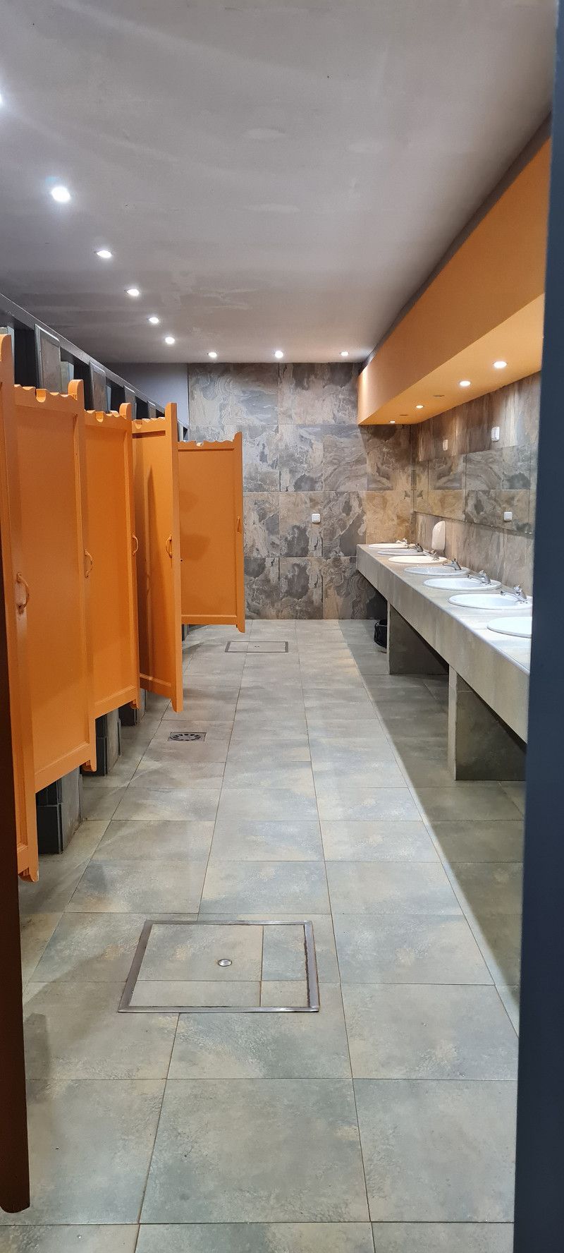
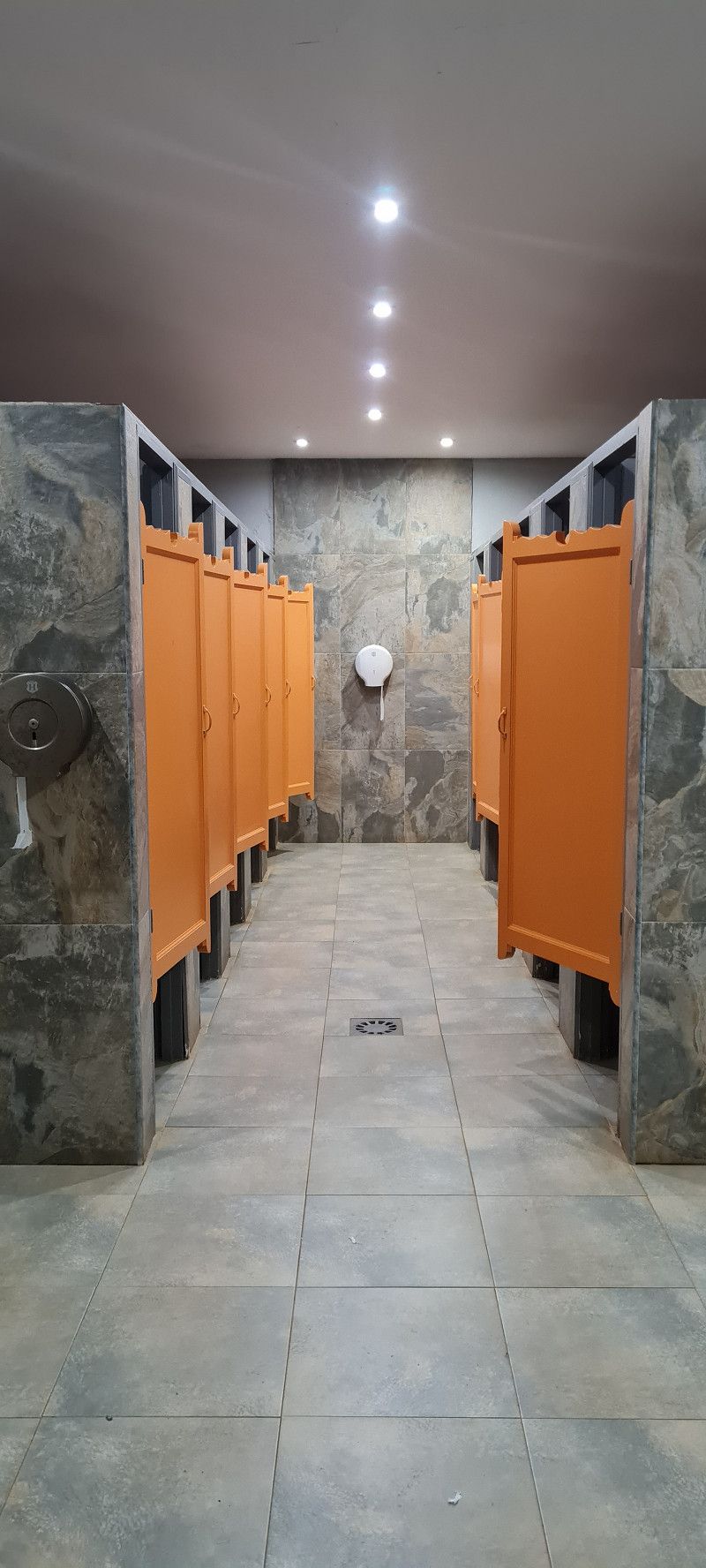
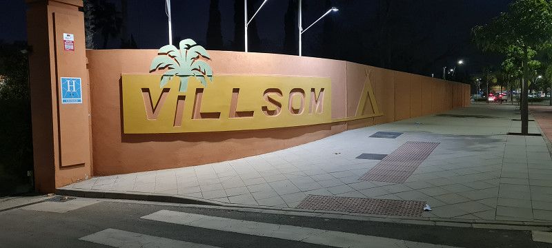
Camping Villsom Dos Hermanas
Today we did a little bit.
We skipped a few stops to make some progress.
We started at 11 a.m. and covered a good 550 kilometers in about 7 hours. Of course with a coffee break, shopping and refueling.
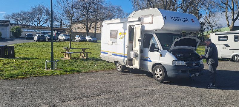
EDDI annoyed us again today. There is a fault somewhere in the starter battery. The dashboard was dead for a short time and the fat one didn't want to start anymore. By jerking at the battery connections, EDDI was compliant again... Man man.
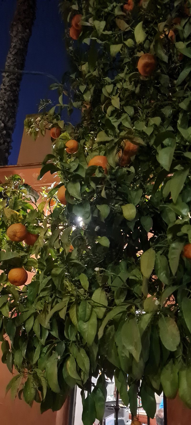
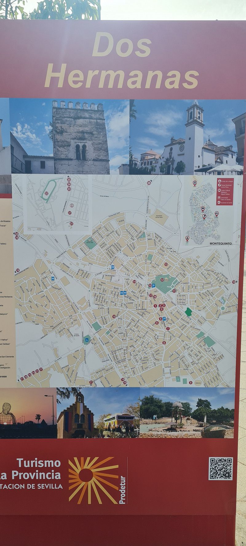
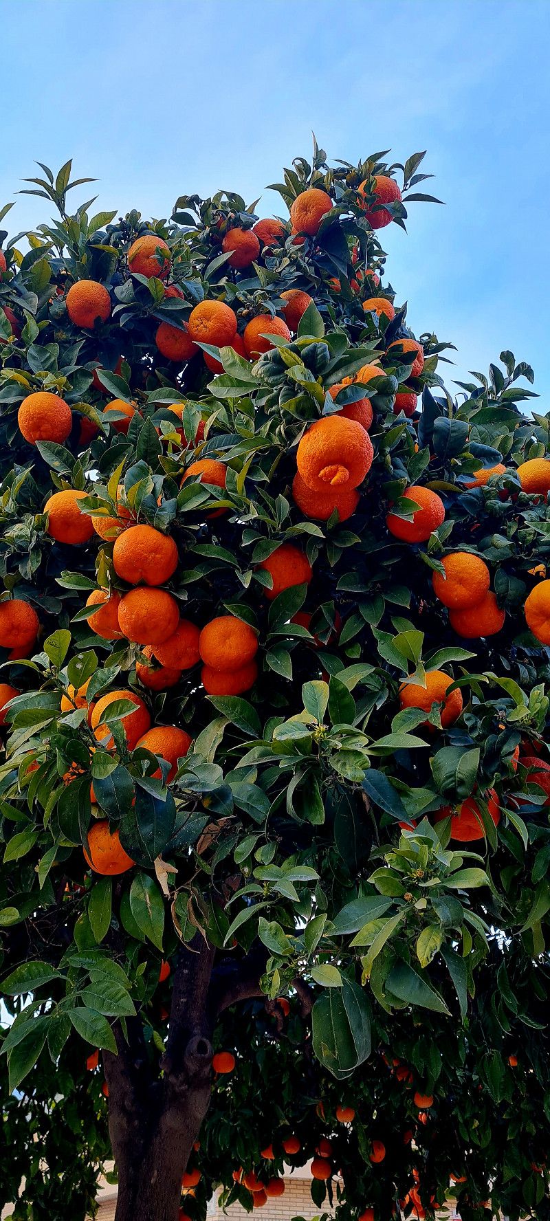
We then arrived safely at the Villsom campsite in Dos Hermanas. We'll stay here for 3 nights. The place is quite large but the pitches are very small and narrow. But lots of greenery, orange trees and palm trees surround the pitches.
Tomorrow we'll take the public transport to Seville for a sightseeing tour.
41703, Dos Hermanas, Spanien
37° 16' 39.6" N 5° 56' 11.7" W
37.2776700 -5.9365700
• Head toward Calle Cable. Go for 27 m.
• Turn right onto SE-3205. Go for 141 m.
• Pass 3 roundabouts and continue on SE-3205. Go for 3.5 km.
• Take the 1st exit from roundabout onto A-4 (Autovía del Sur) toward Sevilla. Go for 8.3 km.
• Take the exit toward Sevilla Centro/Av. de la Raza. Go for 514 m.
• Take the 2nd exit from roundabout onto Avenida de la Raza toward av. de la Raza. Go for 700 m.
• Take the 1st exit from roundabout onto Avenida de la Raza toward Puerto Este/av. de la Raza/Sevilla Centro. Go for 1.5 km.
• Continue on Avenida La Raza. Go for 1.1 km.
• Take the 1st exit from roundabout onto Avenida Molini toward Centro Ciudad/E-803/Mérida/N-630/Los Remedios. Go for 145 m.
• Turn left toward Centro Ciudad. Go for 62 m.
• Continue on Paseo de las Delicias. Go for 970 m.
• Continue on Paseo Las Delicias. Go for 459 m.
• Continue on Paseo Cristóbal Colón. Go for 825 m.
• Turn right onto Calle Reyes Católicos toward SE-30/Centro Ciudad. Go for 165 m.
• Continue on Calle Reyes Católicos. Go for 120 m.
• Continue on Puerta de Triana. Go for 27 m.
• Turn right onto Calle Zaragoza. Go for 279 m.
• Turn slightly left onto Calle Madrid. Go for 34 m.
• Turn left onto Plaza Nueva. Go for 87 m.
• Turn right onto Plaza Nueva. Go for 67 m.
• Arrive at Plaza Nueva. Your destination is on the right.
☍
18,9 km
( 22 min.)
Day
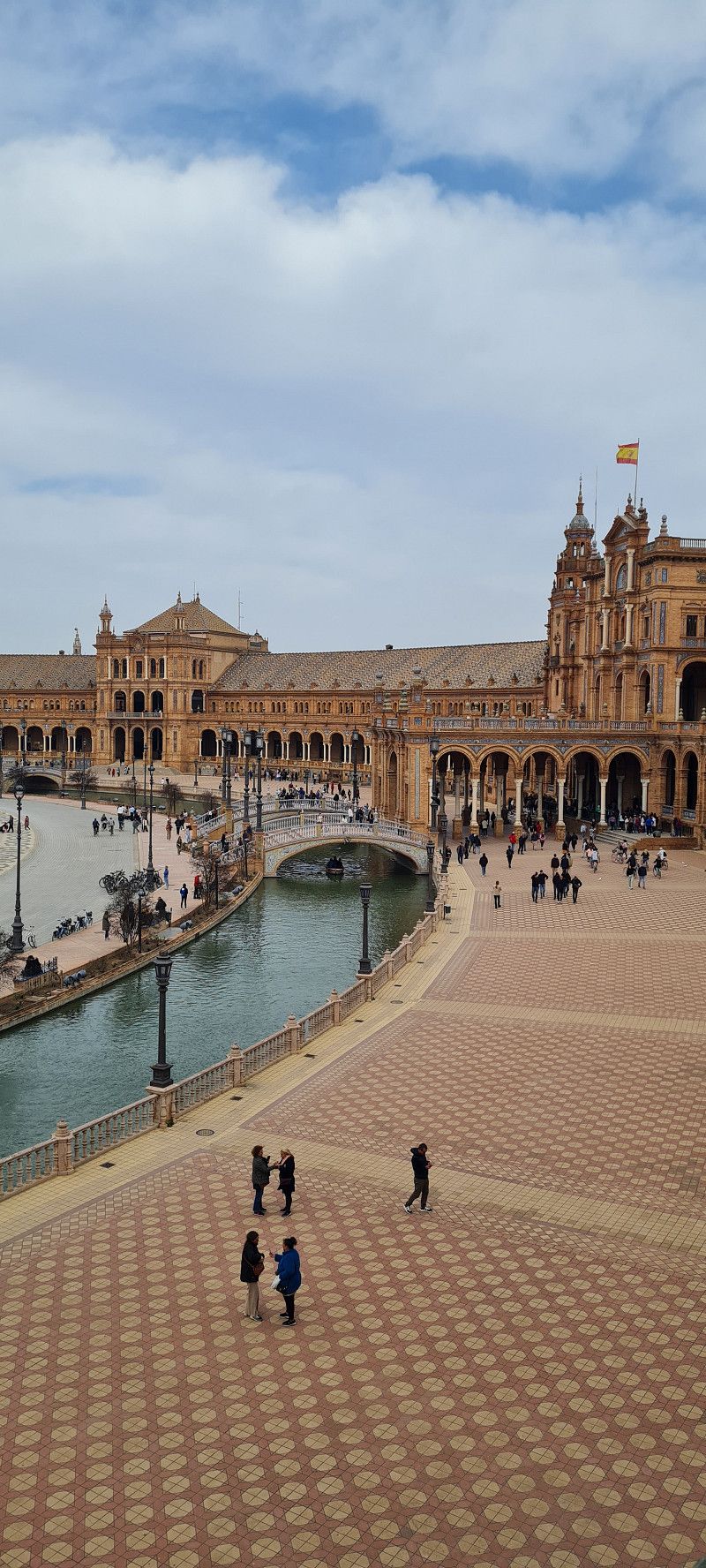
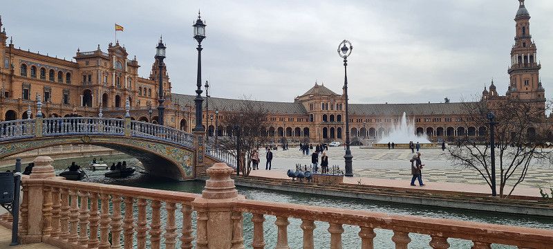
Sevilla, Spanien
Around 12 o'clock we made our way to Seville. A short walk from the campsite to the bus stop. (You can get a map of the city and all the information you need at reception) For €1.75 a head you can drive a good 20 kilometers to the center of Seville.
The Plaza de España was the first sight on the plan.
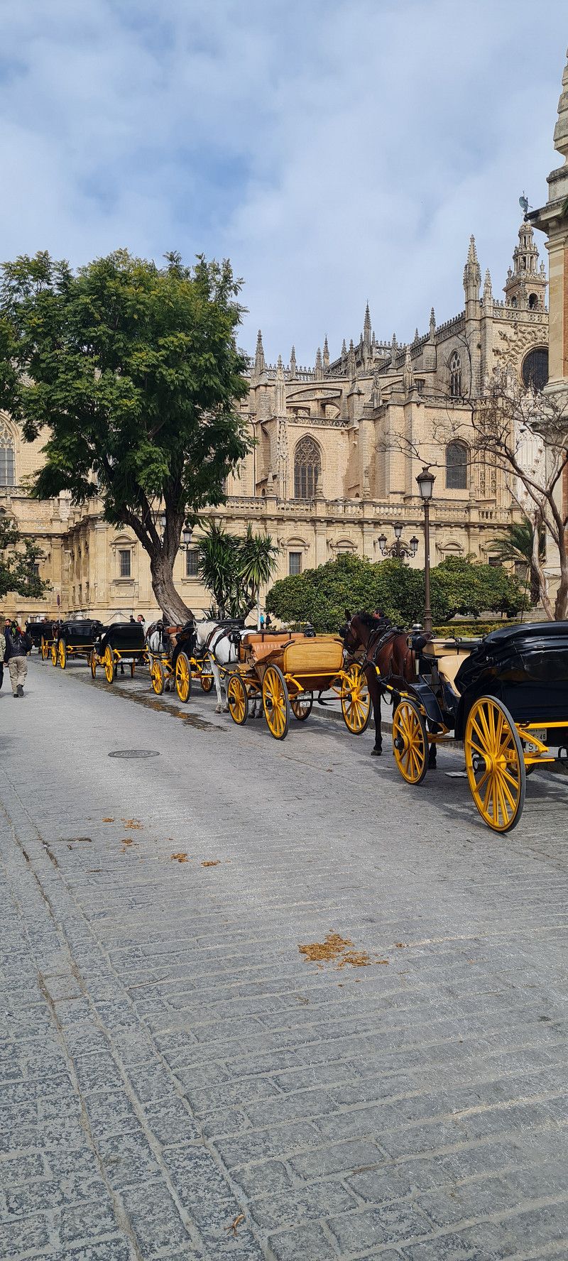
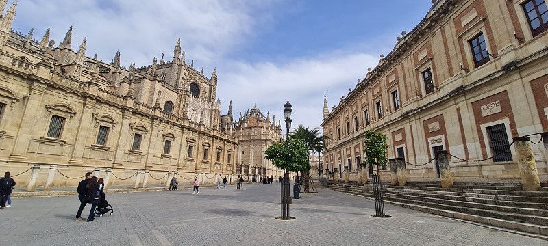
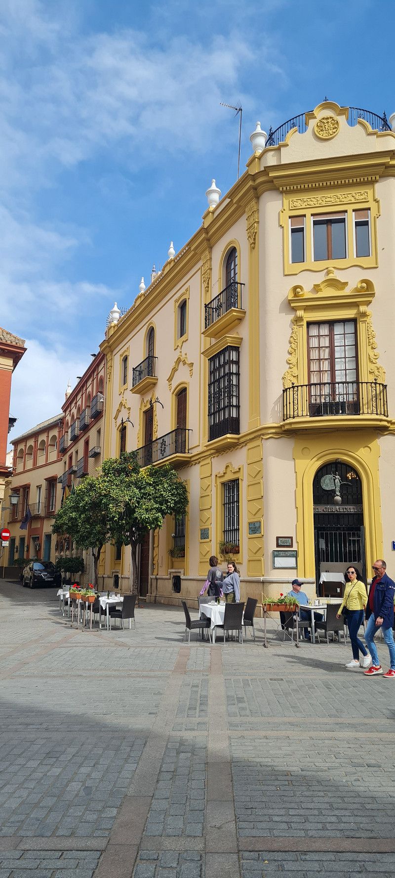
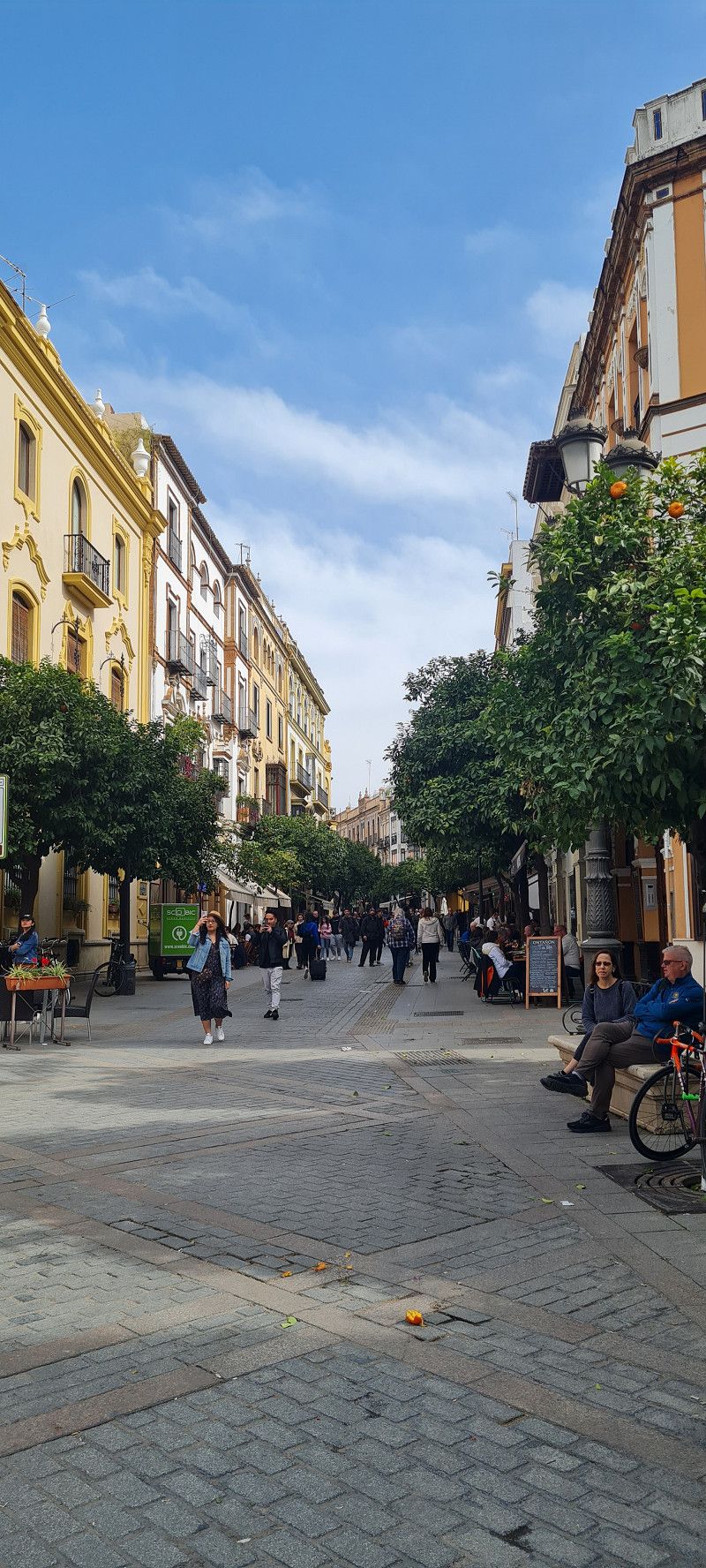
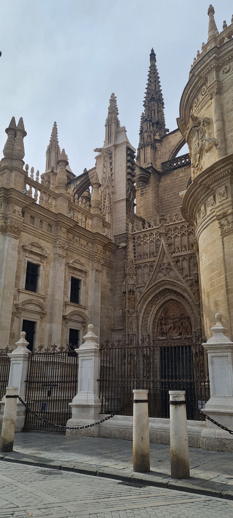
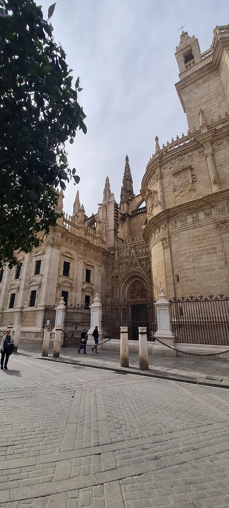
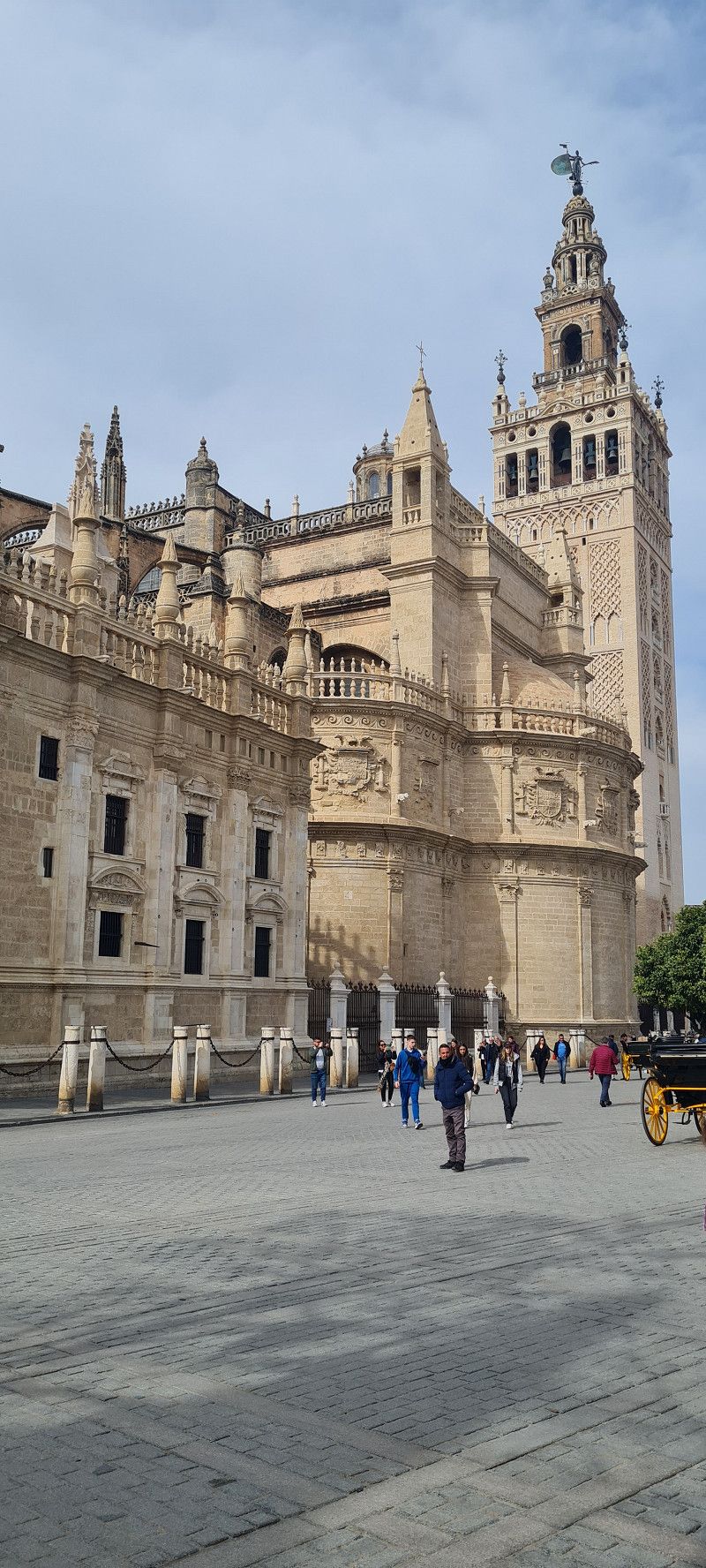
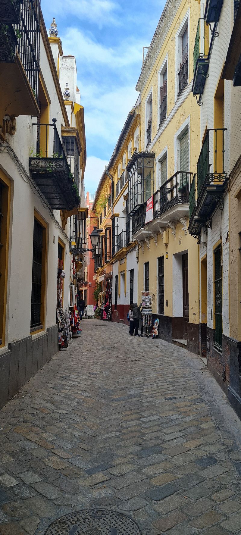
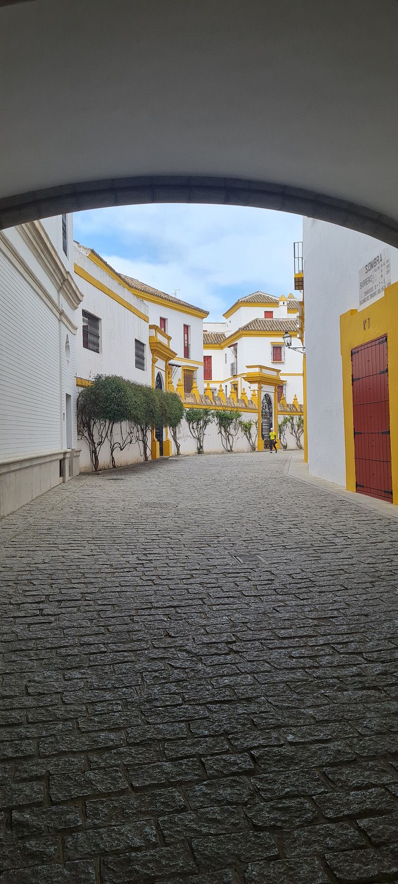
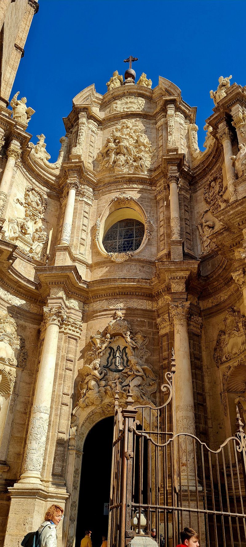
Then we strolled comfortably into the city and looked at the cathedral (but only from the outside) It's really bombastic. And the cozy little streets with shops, bars and restaurants...
Finally, we looked at the bullring. The second largest arena in Spain after Madrid (Don't worry, there was NO fight) But traditionally these fights still take place.
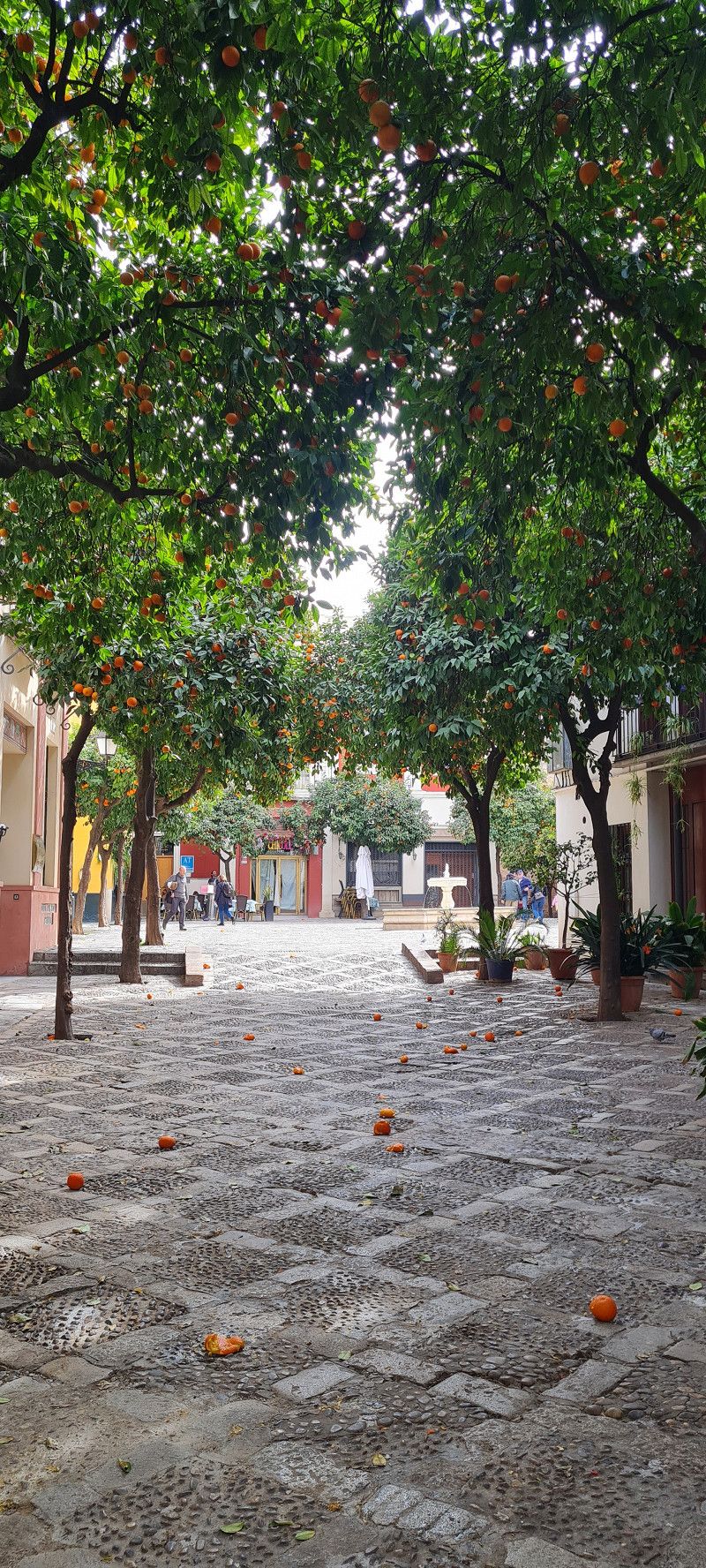
Oh, by the way, the whole city smells like oranges 😀
Sevilla , Spanien
37° 23' 19.1" N 5° 59' 43.2" W
37.3886303 -5.9953403
• Head east on Plaza Nueva.
• Turn left onto Calle Jaén. Go for 53 m.
• Turn left onto Calle Albareda. Go for 72 m.
• Turn right onto Calle de Méndez Núñez. Go for 138 m.
• Turn left onto Calle San Pablo. Go for 166 m.
• Turn right onto Calle Cristo del Calvario. Go for 105 m.
• Turn left onto Calle Canalejas. Go for 186 m.
• Turn right onto Calle Marqués de Paradas. Go for 109 m.
• Turn left onto Plaza La Legión toward Pabellón de la Navegación/Isla Mágica Sevilla. Go for 111 m.
• Turn slightly right onto Avenida Cristo de la Expiración toward Pabellón de la Navegación/Isla de Cartuja Parque Temático. Go for 472 m.
• Continue on Avenida Expo 92 toward SE-30/E-1/A-49/Huelva/E-803/N-630/Mérida/Isla de la Cartuja. Go for 464 m.
• Turn right onto Glorieta José Moya Sanabria. Go for 27 m.
• Keep left onto Glorieta José Moya Sanabria toward Los Remedios. Go for 157 m.
• Turn right onto N-630 toward Isla Mágica Sevilla/Sevilla Centro/Isla La Cartuja. Go for 2.0 km.
• Take left ramp onto A-66 (Ronda Urbana Sur) toward Cádiz/Granada/A-4/Córdoba/A-92/A-4. Go for 4.1 km.
• Take exit 9A toward Cádiz onto A-4 (Autovía del Sur). Go for 4.3 km.
• Take exit 549 toward Córdoba/Granada/Cádiz onto SE-40. Go for 4.5 km.
• Take exit 19 toward avda. Universidades. Go for 410 m.
• Take the 1st exit from roundabout onto Avenida Pablo de Olavide toward Centro Ciudad Dos Hermanas/avda. Universidades/Dos Hermanas. Go for 390 m.
• Continue on Avenida de las Universidades. Go for 178 m.
• Continue on Avenida Pablo de Olavide. Go for 71 m.
• Continue on Avenida de las Universidades. Go for 58 m.
• Take the 2nd exit from roundabout onto Calle Gabriel Miró toward Centro Ciudad. Go for 314 m.
• Take the 2nd exit from roundabout onto Avenida Libertad (A-8032). Go for 560 m.
• Take the 2nd exit from Glorieta Comunidad Autónoma Cataluña roundabout onto Avenida Libertad. Go for 212 m.
• Take the 4th exit from Glorieta Comunidad Autónoma Andalucía roundabout onto Avenida Sevilla. Go for 721 m.
• Take the 1st exit from Plaza Arenal roundabout onto Calle Nuestra Señora de Valme. Go for 56 m.
• Continue on Calle Canónigo. Go for 252 m.
• Turn left onto Calle Lamarque de Novoa. Go for 38 m.
• Arrive at Calle Lamarque de Novoa. Your destination is on the right.
☍
20,2 km
( 25 min.)
Day
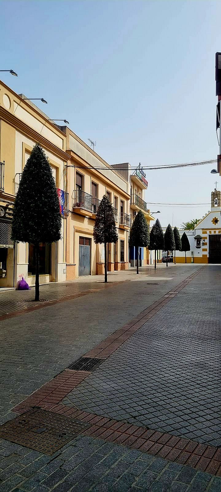
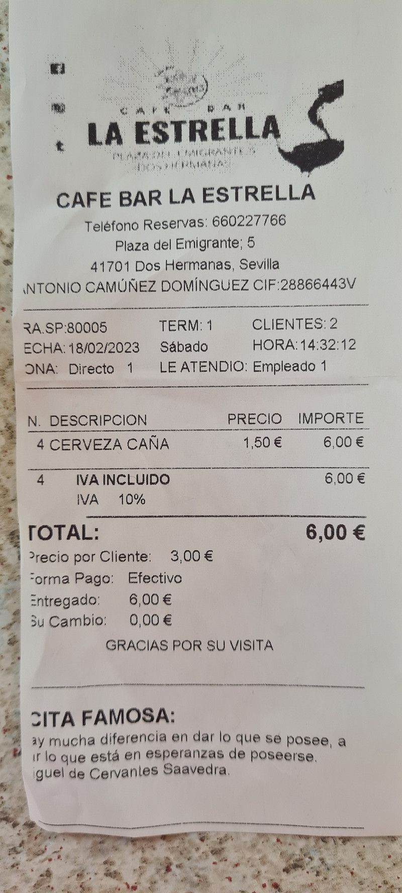
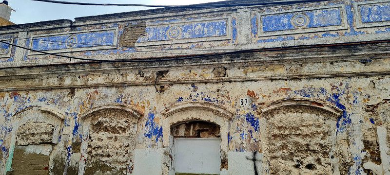
Dos Hermanas, Spanien
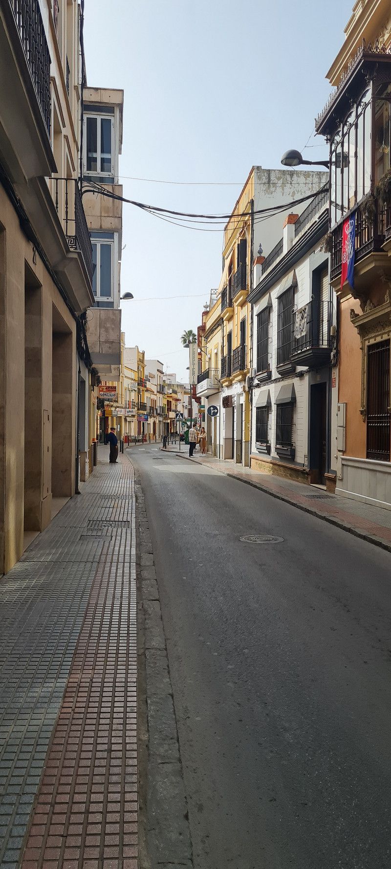
Today we chilled a bit here on site. Around 12 o'clock we set off to explore the town of Dos Hermanas a little.
At first glance, things looked a little bleak. But the further we got into the center, the place turned out to be quite attractive. However, foreign tourists don't really seem to be attracted here.
We then settled down in a bar and enjoyed a beer or two in the sun at 34 degrees.
And where it is not touristy, a beer (0.3 L) costs only €1.50. There was also a typical local specialty for free.
But there are not many pictures today.
Tomorrow we'll continue towards Gibraltar (if EDDI wants) :😉
Dos Hermanas , Spanien
37° 17' 1.3" N 5° 55' 21.6" W
37.2836890 -5.9226718
• Head toward Calle Canónigo on Calle Lamarque de Novoa. Go for 38 m.
• Turn left onto Calle Canónigo. Go for 295 m.
• Turn slightly right onto Calle El Ejido. Go for 257 m.
• Turn right onto Calle Portugal. Go for 17 m.
• Turn left onto Avenida Andalucía toward Cadiz/Complejo Deportivo Los Montecillos. Go for 623 m.
• Take the 2nd exit from roundabout onto Avenida Andalucía. Go for 980 m.
• Take the 3rd exit from roundabout onto Avenida Andalucía. Go for 278 m.
• Take the 4th exit from roundabout onto AP-4A toward E-5/Jerez/Cádiz. Go for 3.2 km.
• Continue on AP-4 (Autopista del Sur). Go for 69.0 km.
• Take exit 84 toward A-381/Algeciras onto A-2004. Go for 719 m.
• Take the 3rd exit from roundabout onto A-2004 toward A-381/Medina Sidonia/Los Barrios/Algeciras/AP-4/Cádiz/Sevilla. Go for 389 m.
• Keep left onto A-381 toward Medina Sidonia/Algeciras. Go for 88.0 km.
• Take the left exit toward San Roque/Estepona/Málaga onto A-7 (Autovía del Mediterráneo). Go for 8.0 km.
• Take exit 118 toward San Roque (Sur)/La Línea/Gibraltar. Go for 467 m.
• Keep left onto CA-34 toward La Línea/Gibraltar. Go for 1.7 km.
• Pass 3 roundabouts and continue on Avenida de España (CA-34). Go for 3.5 km.
• Take the 2nd exit from roundabout onto Calle Torres Quevedo. Go for 184 m.
• Take the 3rd exit from roundabout onto Calle Virgen Purísima Concepción. Go for 523 m.
• Take the 1st exit from roundabout onto Calle Virgen del Rosario. Go for 212 m.
• Take the 3rd exit from roundabout onto Calle Pedreras. Go for 144 m.
• Turn right onto Calle Prim. Go for 742 m.
• Turn right onto Avenida María Guerrero. Go for 505 m.
• Turn left onto Calle Alemania toward Centro de Salud La Velada. Go for 89 m.
• Arrive at Calle Alemania. Your destination is on the right.
☍
180,0 km
(1 hrs. 50 min.)
Day
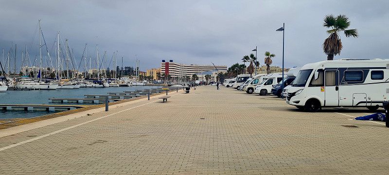
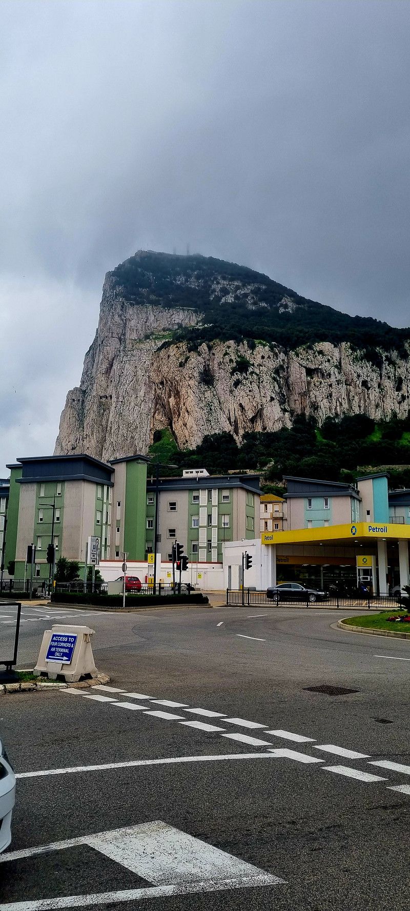
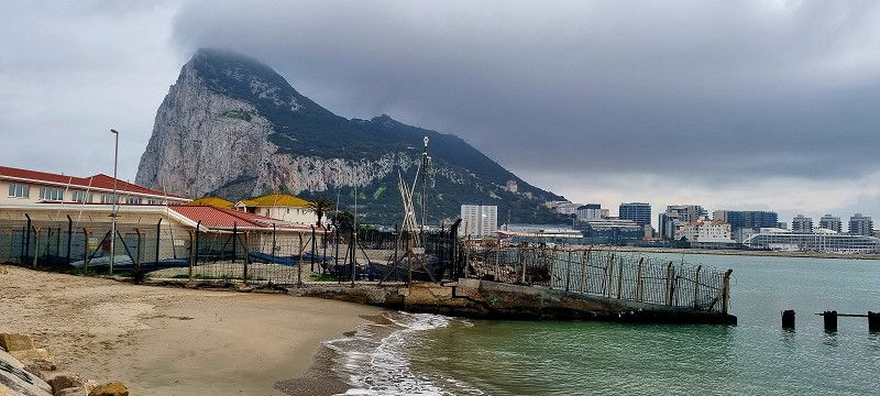
La Línea de la Concepción, Spanien
Today's destination was La Linea de la Concepcion overlooking the marina just before the border with Gibraltar.
Here we stand for 14 euros/24 hours.
We just walked through the city. We don't really like it here. So we went over to England without further ado.
But the weather wasn't on our side either. Very, very windy and very cloudy. Temperatures around 16 degrees.
Here are our impressions.
We had considered going over to Africa by ship, but for 2 people there and back without a car it costs between 110 and 125 euros. That was a bit too much for us to go for a walk "over there".
La Línea de la Concepción , Spanien
36° 10' 4" N 5° 20' 53.7" W
36.1677899 -5.3482396
• Head toward Calle Lutgardo López Ramírez on Calle Alemania. Go for 67 m.
• Turn left onto Calle Lope de Vega. Go for 166 m.
• Turn right onto Avenida María Guerrero. Go for 906 m.
• Take the 2nd exit from roundabout onto Carretera a Málaga (A-383). Go for 2.5 km.
• Take the 3rd exit from roundabout onto A-383 toward Algeciras/Málaga. Go for 4.9 km.
• Take the 1st exit from roundabout onto A-7 (Autovía del Mediterráneo) toward Estepona/Málaga. Go for 9.4 km.
• Continue on AP-7 (Autopista del Mediterráneo) toward Estepona/Málaga. Go for 9.7 km.
• Keep right onto AP-7. Go for 11.9 km.
• Continue on A-7 (Autopista del Mediterráneo). Go for 257 m.
• Continue on AP-7 (Autopista del Mediterráneo). Go for 36 m.
• Continue on A-7 (Autovía del Mediterráneo). Go for 2.6 km.
• Continue on AP-7 (Autopista del Mediterráneo) toward Marbella/Málaga. Go for 15.1 km.
• Take exit 172 toward San Pedro de Alcántara onto A-397 (Carretera Ronda-San Pedro). Go for 1.3 km.
• Take the 5th exit from roundabout onto Carretera Ronda-San Pedro (A-397) toward Ronda. Go for 782 m.
• Take the 2nd exit from roundabout onto Carretera Ronda-San Pedro (A-397) toward Ronda. Go for 45.5 km.
• Take the 4th exit from roundabout onto Avenida de Málaga toward Ronda/San Pedro de Alcántara/Algeciras. Go for 375 m.
• Take the 3rd exit from roundabout onto Calle Médico Luis Peralta. Go for 198 m.
• Arrive at Calle Médico Luis Peralta. Your destination is on the right.
☍
105,5 km
(1 hrs. 28 min.)
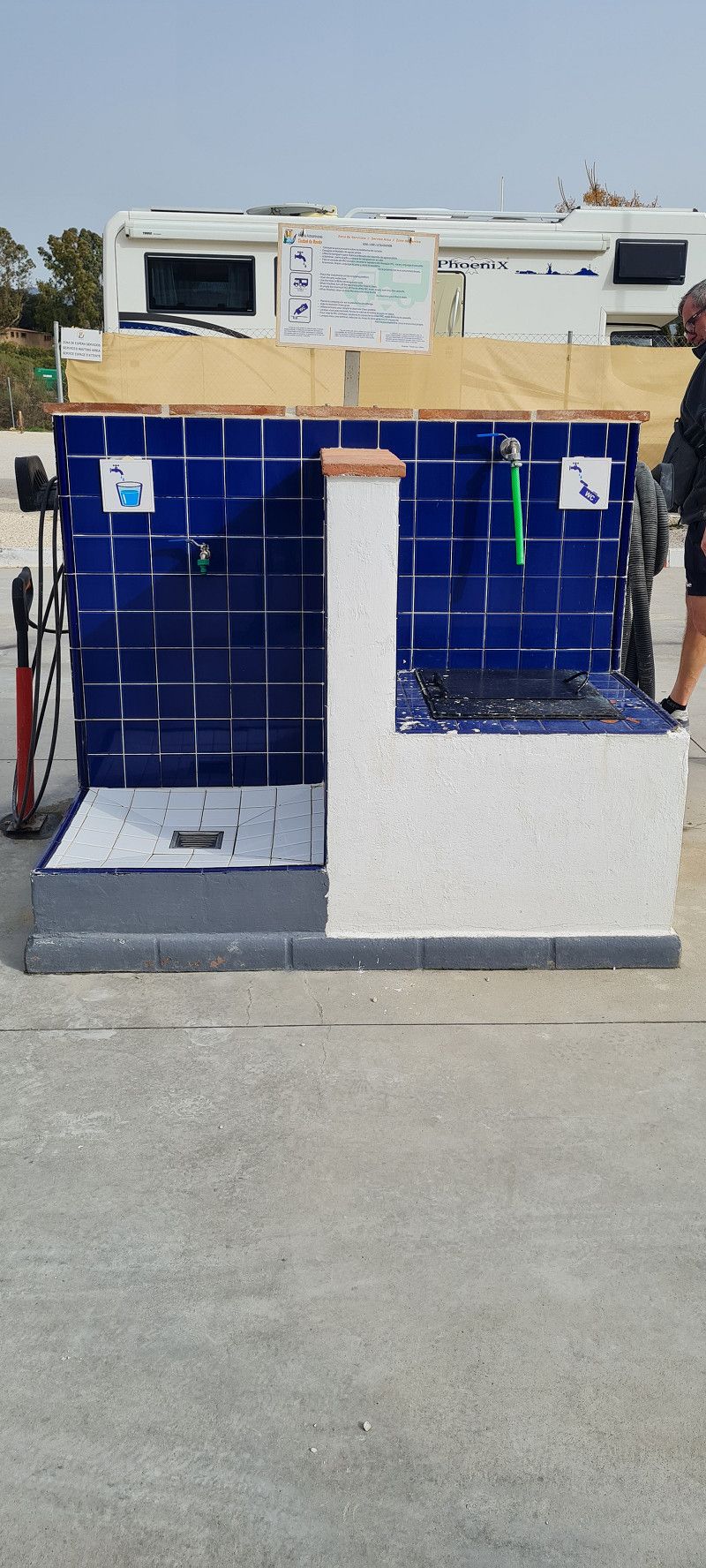
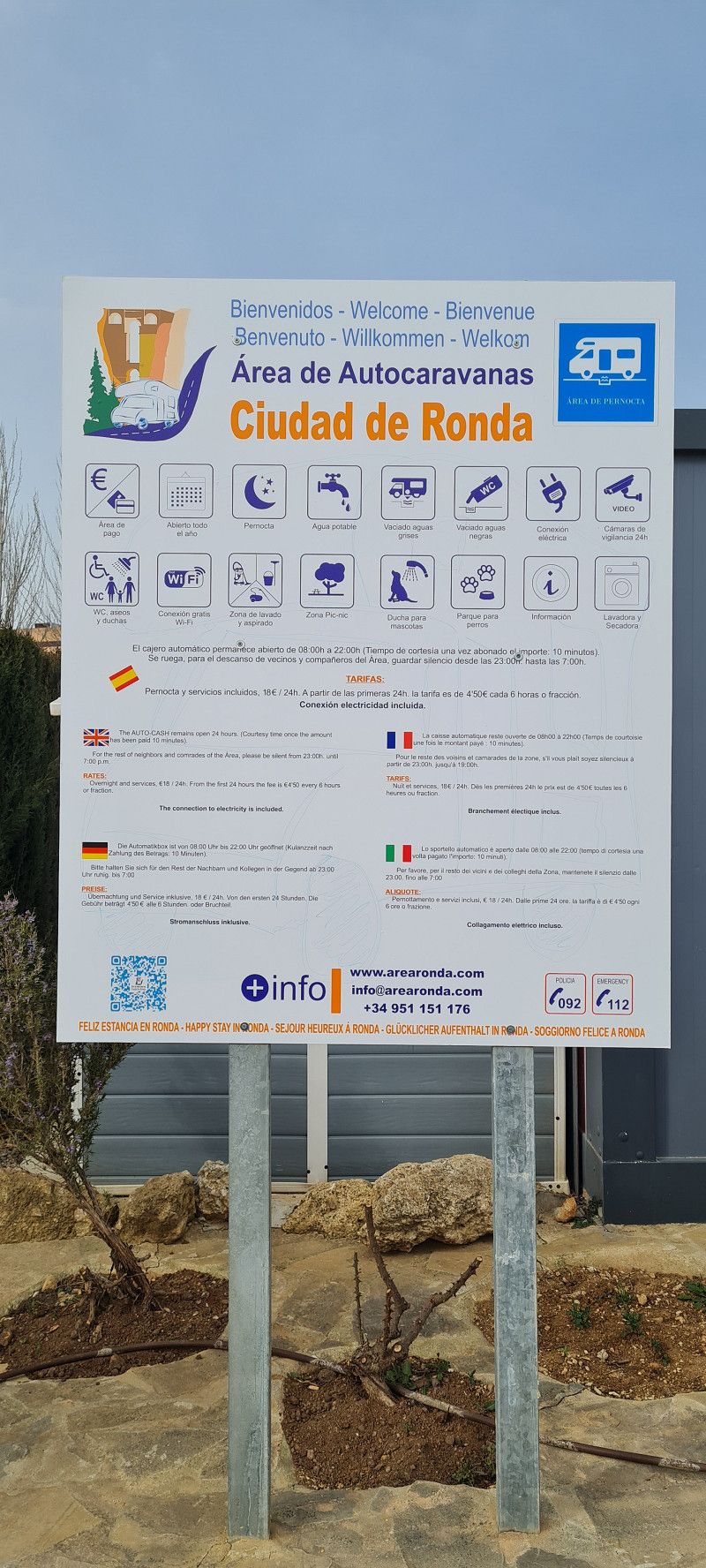
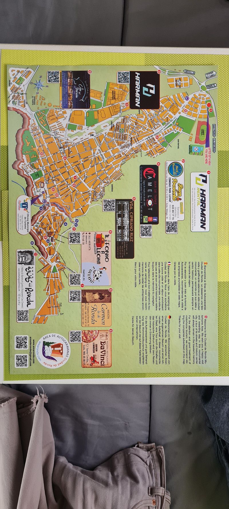
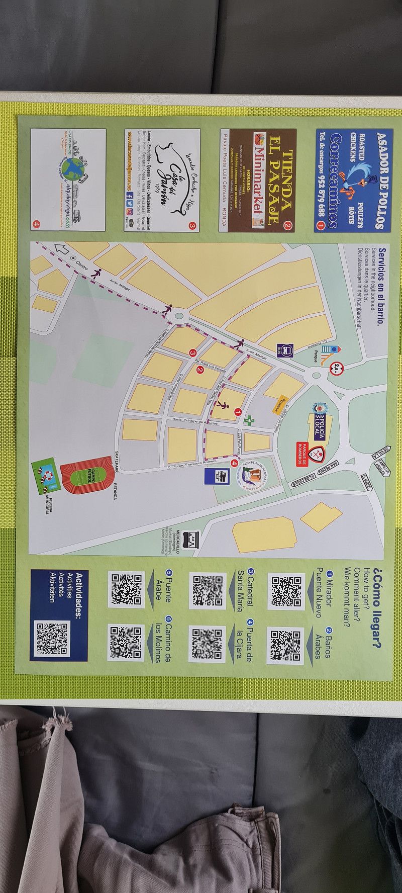
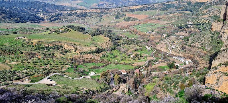
Day
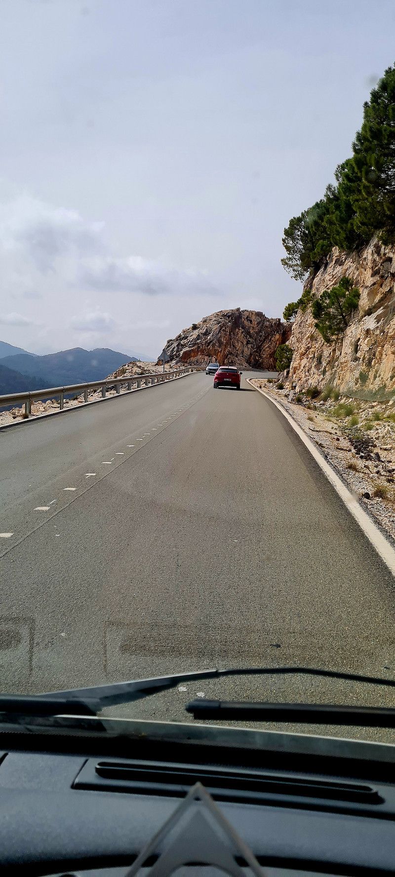
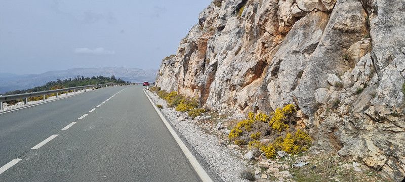
Calle Torero Francisco Romero, Spanien
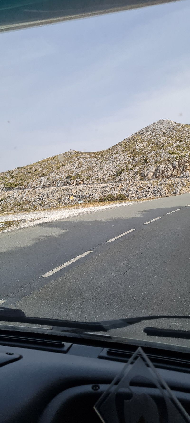
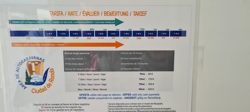
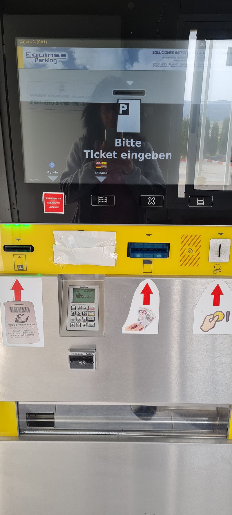
today we are on to Ronda. The route went through countless roundabouts and then through the serpentines up to over 1100 meters above sea level. Arriving at the parking space, we got a ticket from the machine at the barrier, although the parking space was already completely full (but we only knew that when we were standing on the space). Another car pulled up after us. Now we turned and looked around unsuspectingly. In order to be able to leave the pitch again, we would have had to pay the full daily price at the machine. But the couple who drove onto the square after us was probably in a bad mood and asked us to make room so that they could get out through the barrier. At that moment, a fellow camper came up to me and said that he would now free up a space because he was driving on... Well, that's what I call fate 😀
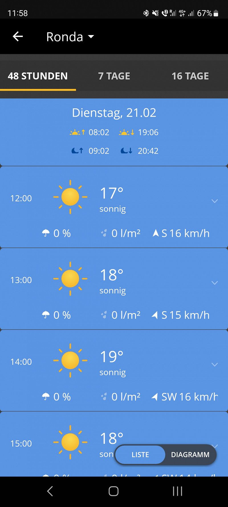
Now we stay 2 nights. Chilling today and sightseeing again tomorrow. Weather forecast: sun and 17 degrees. That's going to be great!
Here are just a few pictures from the journey. More tomorrow...
Calle Torero Francisco Romero , Ronda, Spanien
36° 45' 10" N 5° 8' 53.6" W
36.7527708 -5.1482126
• Head east on Calle Médico Luis Peralta.
• Turn right onto Calle Torero Francisco Romero. Go for 51 m.
• Turn right onto Calle Lola Peña Parrés. Go for 193 m.
• Turn left onto Avenida de Málaga. Go for 163 m.
• Pass 3 roundabouts and continue on Avenida de Málaga. Go for 1.0 km.
• Turn right onto Avenida Martínez Astein. Go for 293 m.
• Turn left onto Avenida de Andalucía. Go for 147 m.
• Turn left onto Calle Virgen del Carmen. Go for 120 m.
• Turn right onto Calle Lauria. Go for 378 m.
• Continue on Calle Pozo. Go for 124 m.
• Turn left onto Calle Jerez. Go for 10 m.
• Continue on Calle Virgen de la Paz. Go for 249 m.
• Turn right onto Plaza Teniente Arce. Go for 12 m.
• Arrive at Plaza Teniente Arce. Your destination is on the right.
☍
2,8 km
( 8 min.)
Day
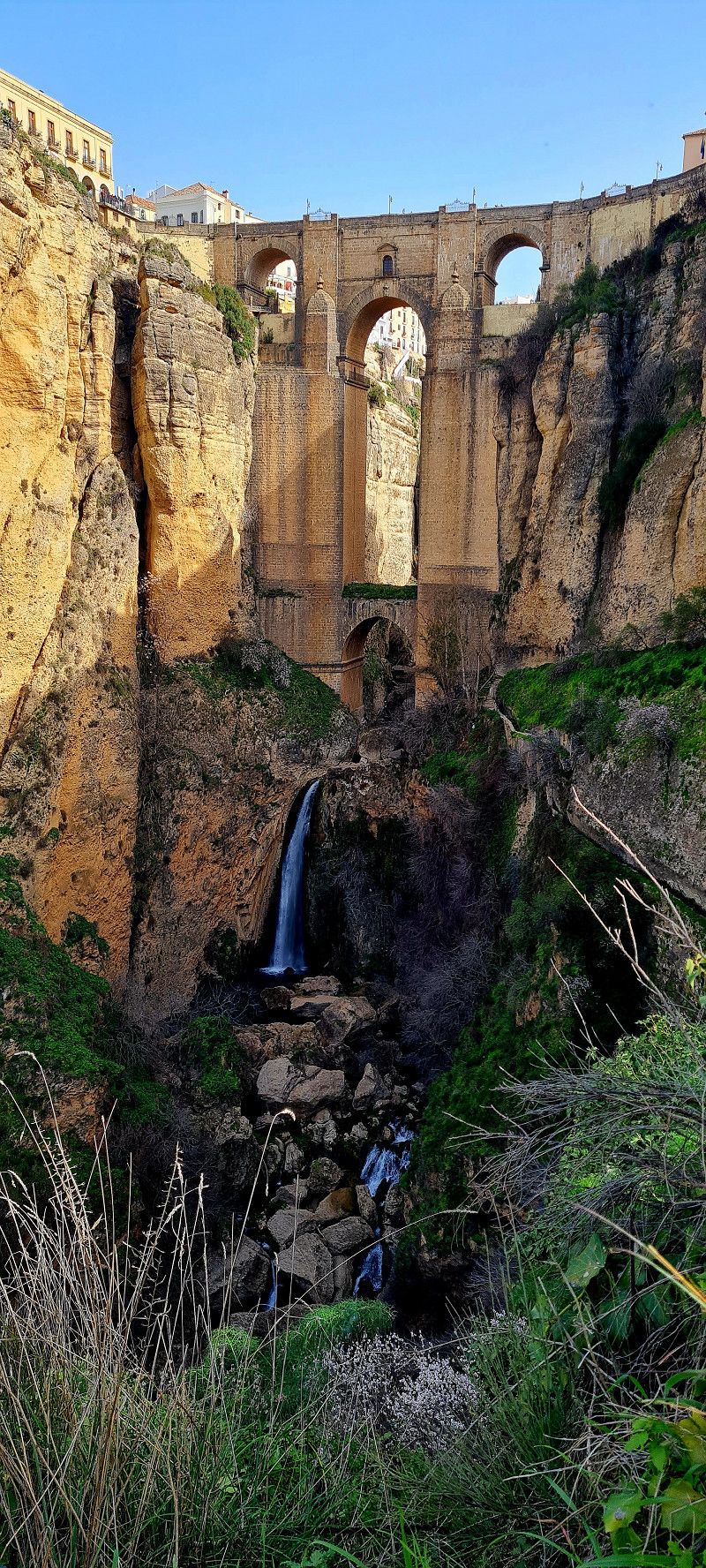
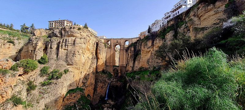
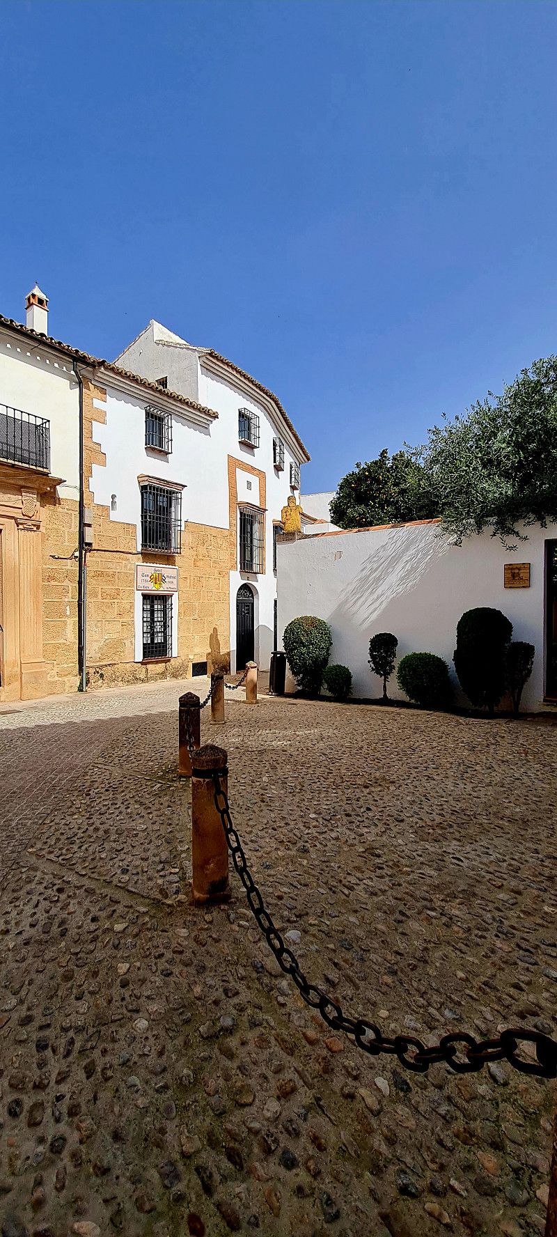
Ronda, Spanien
today we were out and about in the beautiful city of Ronda all day. I am very sugared by this beautiful little town ❤️
We let ourselves drift and eventually stopped for tapas and beer in a small bar in the sun.
Here are our impressions
Ronda , Spanien
36° 44' 31.7" N 5° 9' 59.7" W
36.7421339 -5.1665916
• Head toward Calle Virgen de la Paz on Plaza Teniente Arce. Go for 12 m.
• Turn left onto Calle Virgen de la Paz. Go for 166 m.
• Turn right onto Calle Padre Mariano Soubirón. Go for 160 m.
• Continue on Calle Infantes. Go for 426 m.
• Take the 2nd exit from Plaza del Ahorro roundabout onto Calle Jaén. Go for 98 m.
• Turn right onto Avenida Martínez Astein. Go for 77 m.
• Turn left onto Avenida de Málaga. Go for 335 m.
• Pass 4 roundabouts and continue on Avenida de Málaga. Go for 1.0 km.
• Take the 3rd exit from roundabout onto A-367 toward Campillos. Go for 40.8 km.
• Take the 2nd exit from roundabout toward A-357/Campillos. Go for 101 m.
• Take the 1st exit from roundabout onto A-357 toward Campillos. Go for 5.5 km.
• Turn right toward Parque Guadalteba. Go for 71 m.
• Turn right onto A-7286. Go for 2.2 km.
• Continue straight ahead. Go for 4.6 km.
• Turn right toward Área Pantano Chorro. Go for 816 m.
• Continue on Área Pantano Chorro. Go for 693 m.
• Turn left onto Pantano del Chorro. Go for 96 m.
• Turn right. Go for 419 m.
• Arrive at your destination on the left.
☍
57,6 km
( 59 min.)
Day
El Caminito del Rey, sendero del Kiosko, 29550 Ardales, Málaga, Spanien
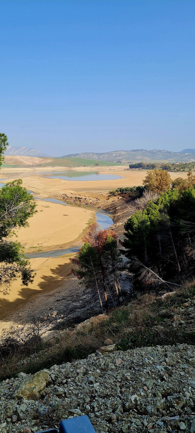
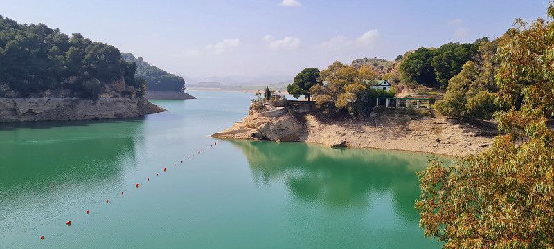
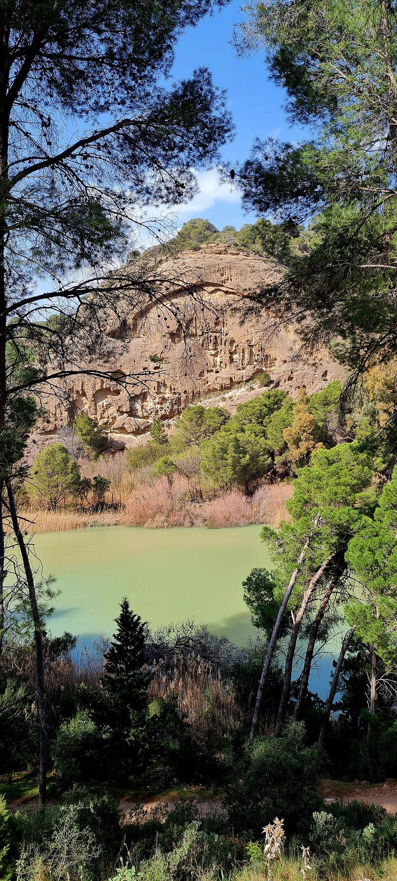
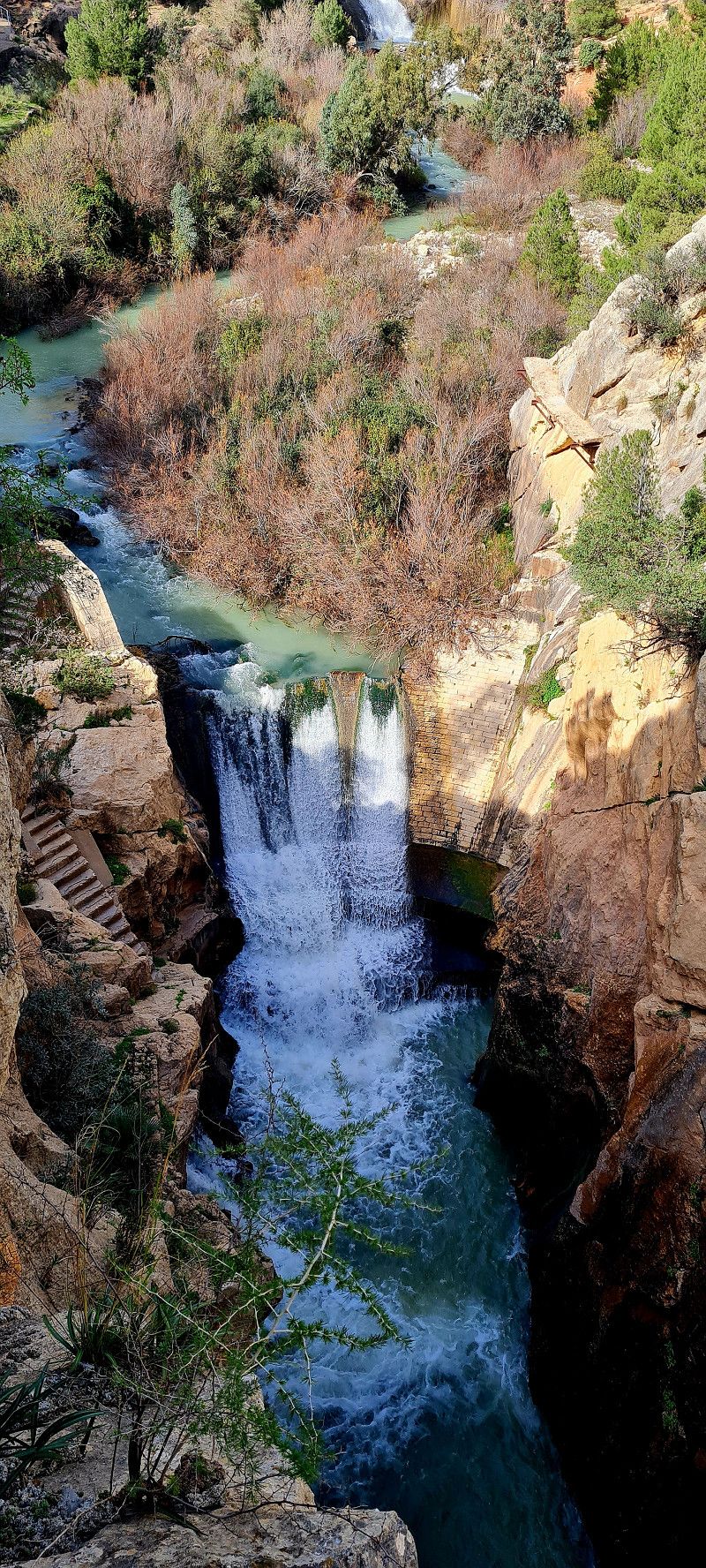
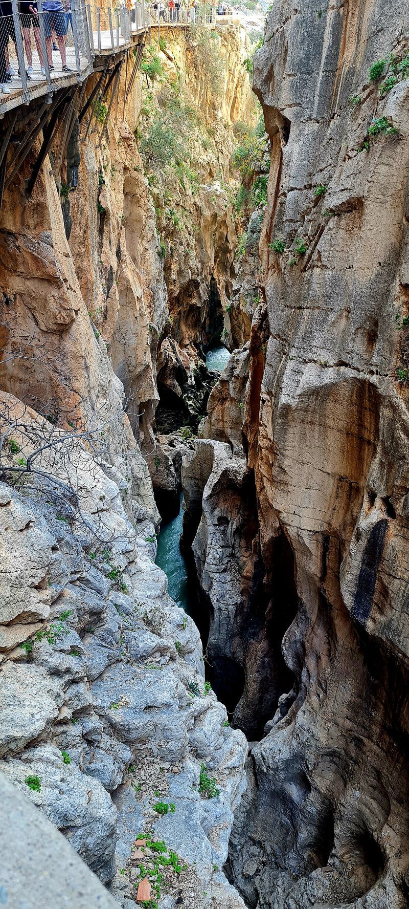
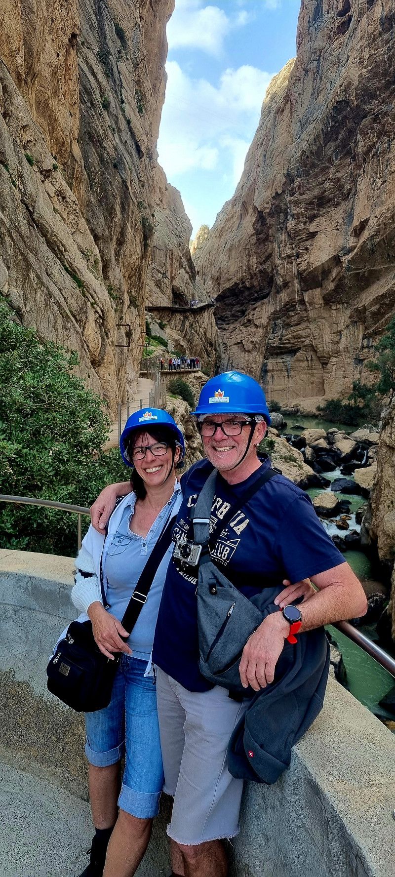
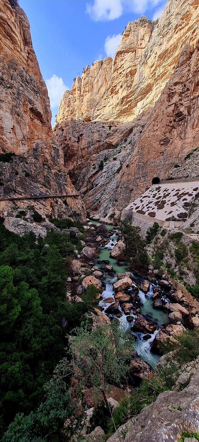
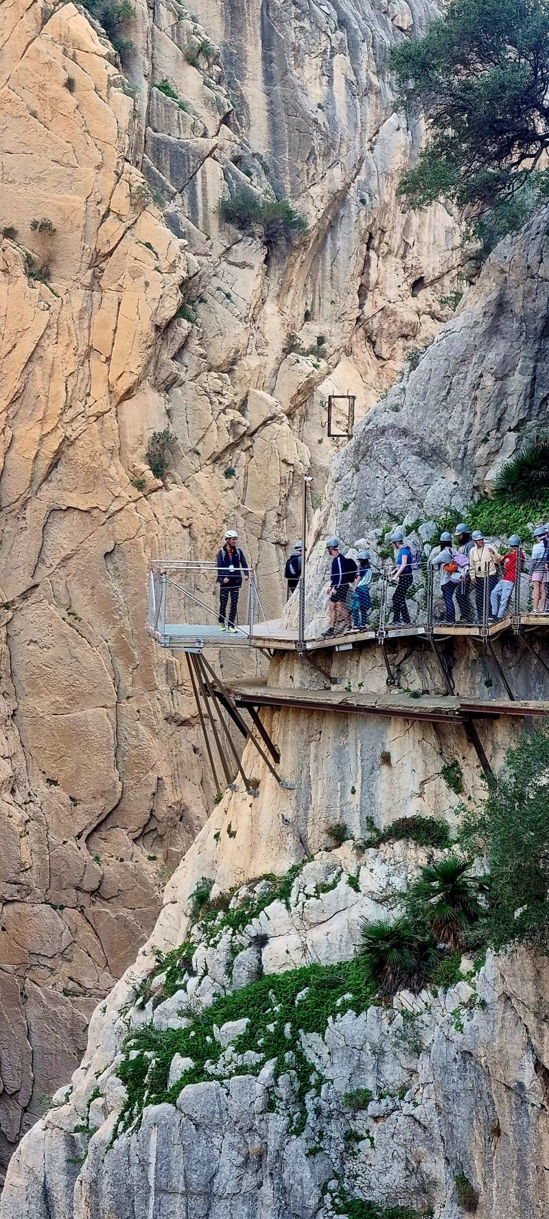
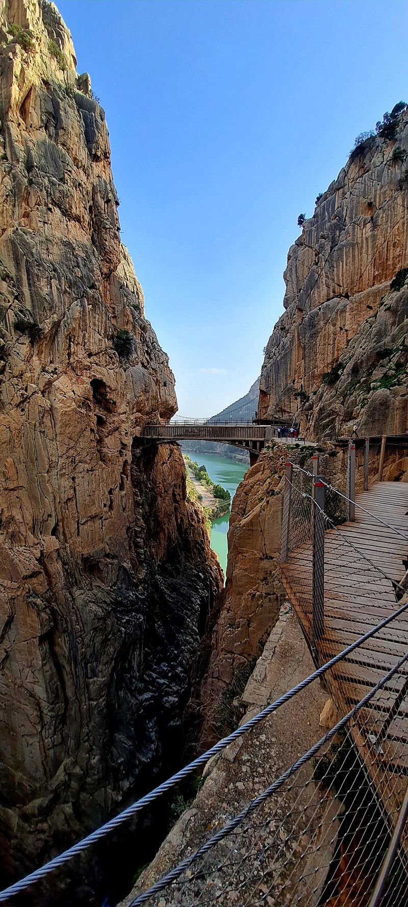
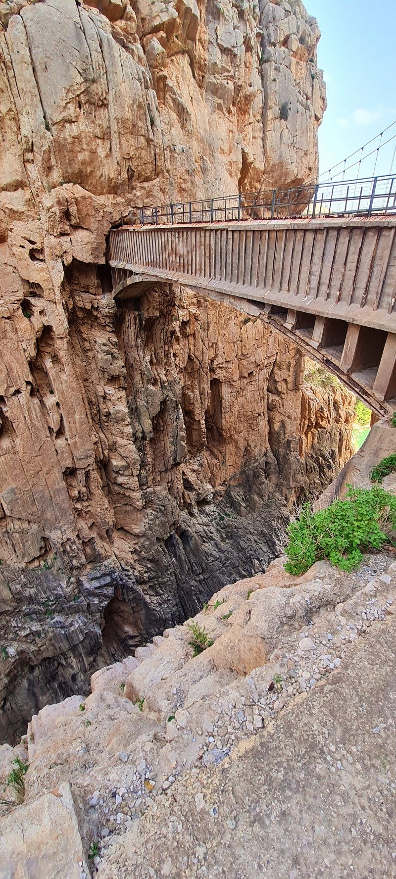
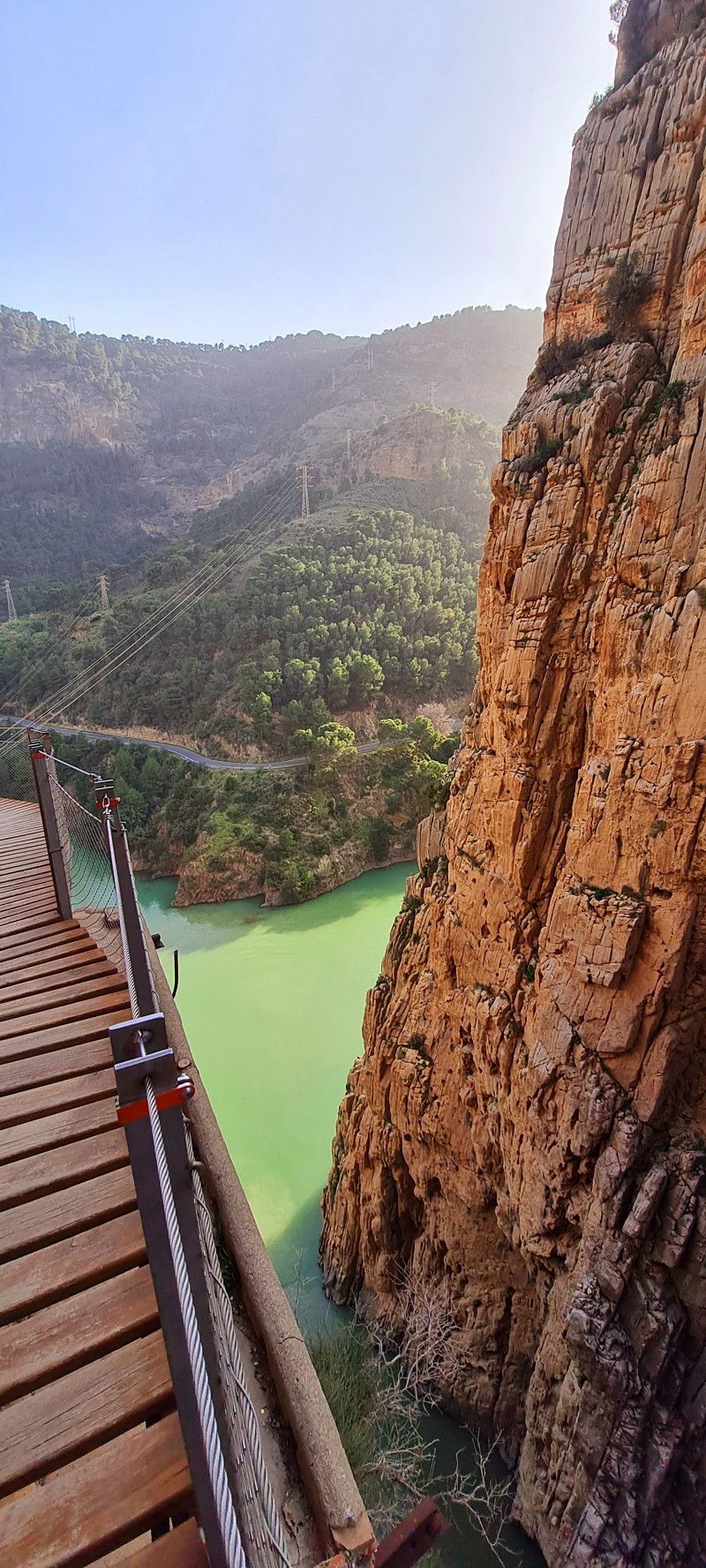
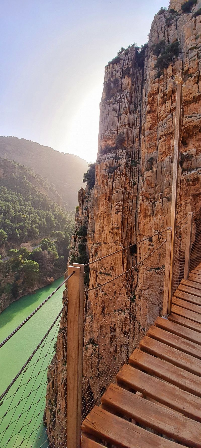
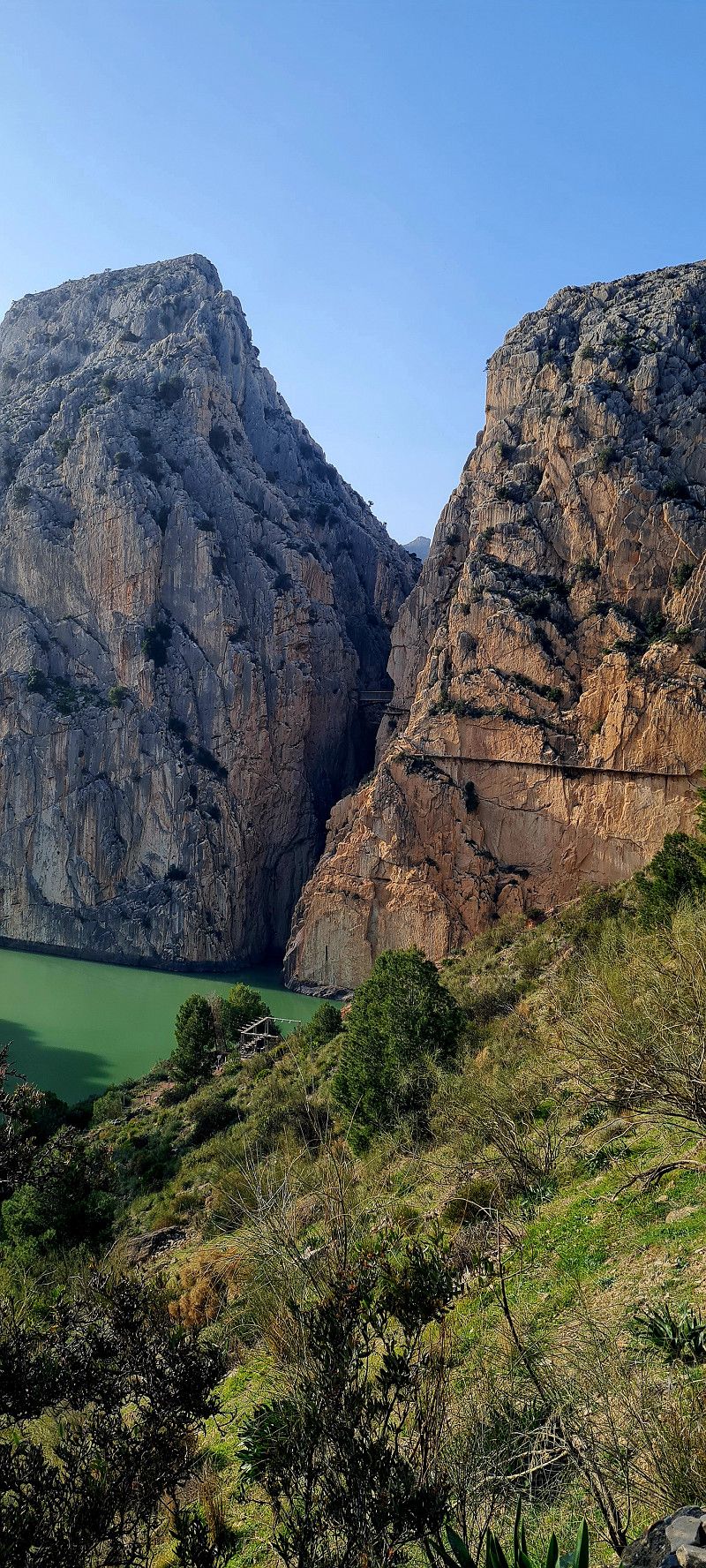
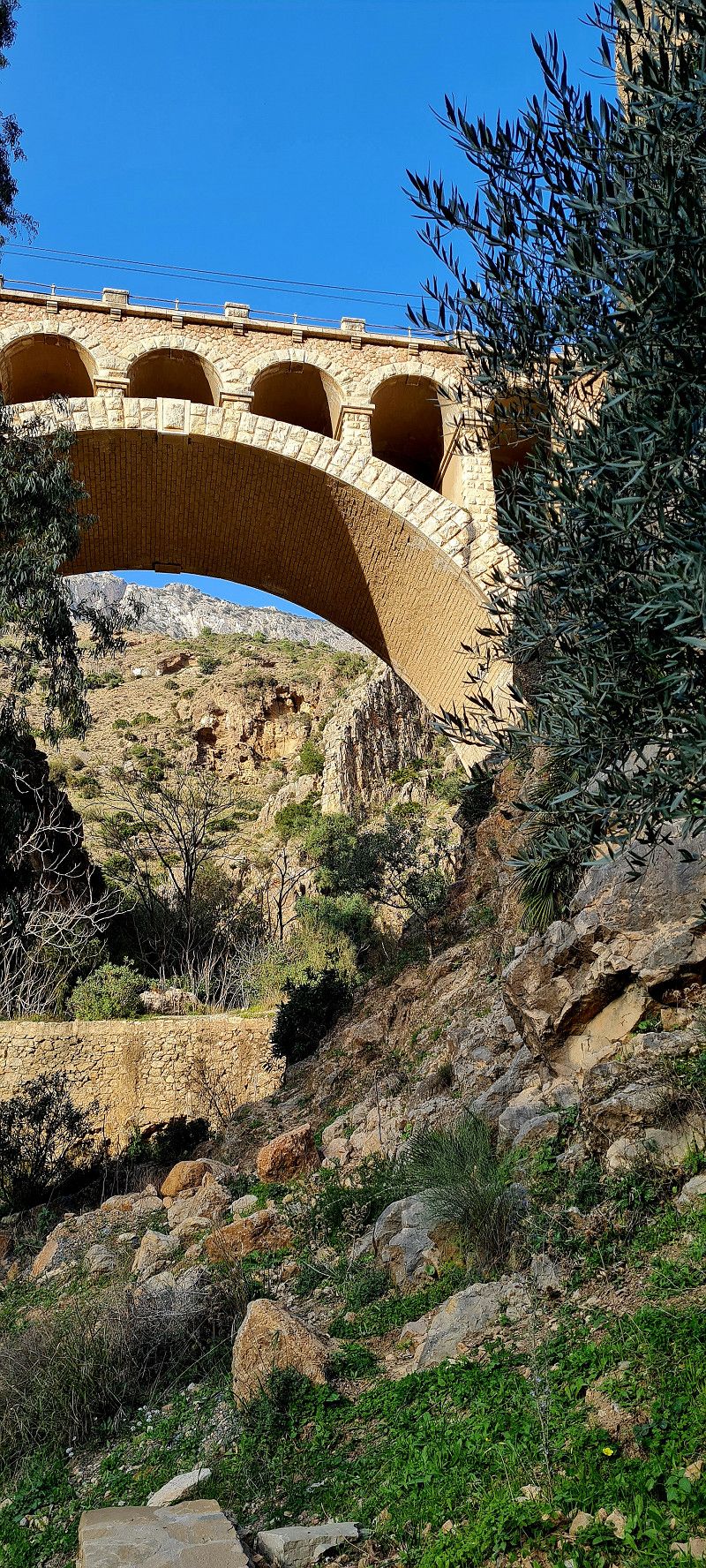
arrived in Ardales this afternoon after about 60 kilometers. It wasn't easy to find a parking space in the small town, but again we were lucky. We are somewhat hidden above the dam for free. Our goal is the hike 'Caminito del Rey' (once Europe's most dangerous hiking trail until 2001) after which it was renovated and renovated and has been accessible again since 2015.
The path is a good 7.5 km long and a one-way street. There is no turning back on this path.
We just got 2 tickets for 30 euros each (everything fully booked even at this time of the year) and off we went. (I could post 100 photos here, but I have to choose 14) so there you go 😀
El Caminito del Rey, 29550 Ardales, Málaga, Spain
36° 55' 53.9" N 4° 48' 6.2" W
36.9316467 -4.8017171
• Head toward Barriada Pantano del Chorro. Go for 419 m.
• Turn left onto Pantano del Chorro. Go for 96 m.
• Turn right onto Área Pantano Chorro. Go for 1.5 km.
• Turn left. Go for 2.7 km.
• Turn left. Go for 1.2 km.
• Continue toward A-7286. Go for 761 m.
• Continue on A-7286. Go for 2.2 km.
• Turn right onto A-357. Go for 8.7 km.
• Keep right onto A-384. Go for 23.0 km.
• Take ramp onto A-92 toward Córdoba/Málaga/Granada. Go for 63.4 km.
• Take exit 211 toward Moraleda de Zafayona/Íllora/Alhama de Granada/Hospital. Go for 163 m.
• Continue on Via Sin Nombre. Go for 317 m.
• Continue on Calle Autovía 92 (A-402). Go for 868 m.
• Take the 1st exit from roundabout onto Variante de Moraleda de Zafayona (A-402). Go for 5.8 km.
• Turn left. Go for 11 m.
• Turn right toward Camino de los Llanos. Go for 526 m.
• Continue on Camino de los Llanos. Go for 490 m.
• Turn left toward Camino de Homiceroe a Moreleda. Go for 708 m.
• Turn left onto Camino de Homiceroe a Moreleda. Go for 98 m.
• Turn slightly right. Go for 349 m.
• Turn right. Go for 325 m.
• Arrive at your destination on the right.
☍
113,5 km
(1 hrs. 23 min.)
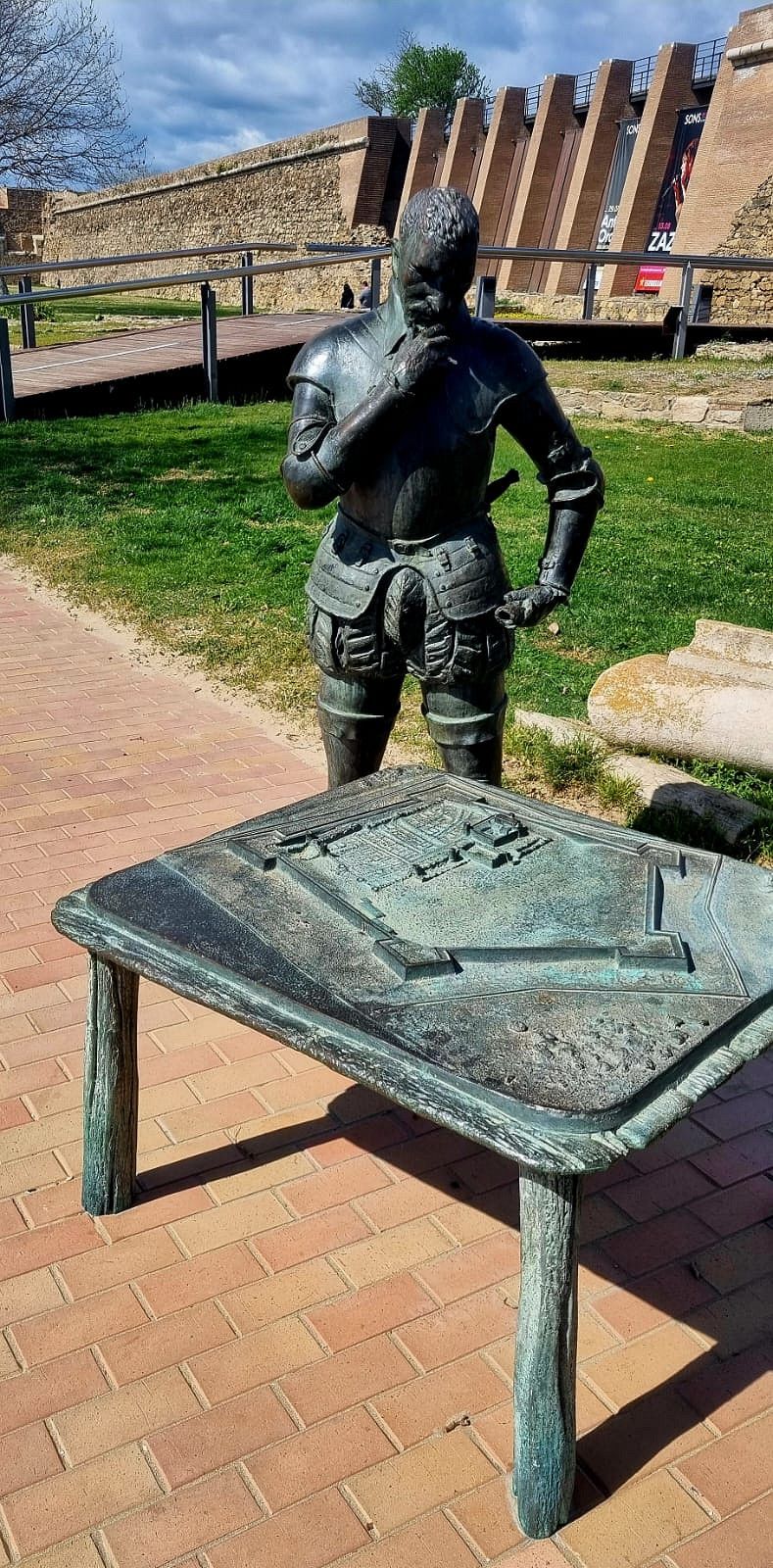
Alhama de Granada, Andalusia, Spain
Cañada Real de Sevilla a Granada, Spain
37° 8' 32" N 3° 57' 47.4" W
37.1422105 -3.9631794
• Head west. Go for 674 m.
• Turn slightly left onto Camino de Homiceroe a Moreleda. Go for 98 m.
• Turn right toward Camino de los Llanos. Go for 708 m.
• Turn right onto Camino de los Llanos. Go for 762 m.
• Keep left toward A-402. Go for 25 m.
• Turn right onto A-402. Go for 6.0 km.
• Take the 2nd exit from roundabout onto A-92 toward Granada. Go for 19.3 km.
• Take exit 230 toward Santa Fe/Granada/Sierra Nevada onto A-92G (Carretera de Málaga). Go for 4.2 km.
• Take ramp onto A-44 (Circunvalación Exterior de Granada) toward Motril. Go for 15.7 km.
• Take the exit onto A-44 (Autovía de Sierra Nevada). Go for 42.0 km.
• Take the left exit toward Almería/GR-16/Motril onto A-7 (Autovía del Mediterráneo). Go for 22.8 km.
• Take exit 873 toward Castell de Ferro. Go for 342 m.
• Take the 2nd exit from roundabout onto N-340 toward Castell de Ferro. Go for 2.7 km.
• Take ramp toward Castell de Ferro/Gualchos. Go for 99 m.
• Turn right. Go for 7 m.
• Turn right toward Calle Puntilla. Go for 131 m.
• Turn right onto Calle Puntilla. Go for 121 m.
• Continue on Carretera Málaga. Go for 48 m.
• Continue on Carretera Málaga. Go for 490 m.
• Continue on Paseo Marítimo. Go for 87 m.
• Arrive at Paseo Marítimo.
☍
116,4 km
(1 hrs. 8 min.)
Day
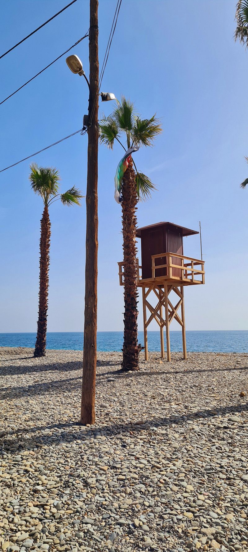
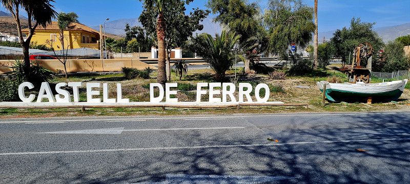
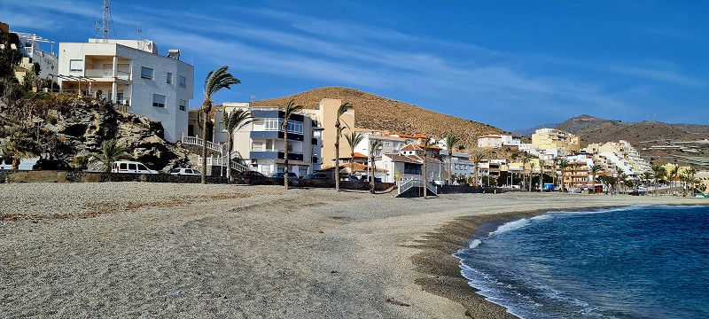
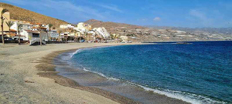
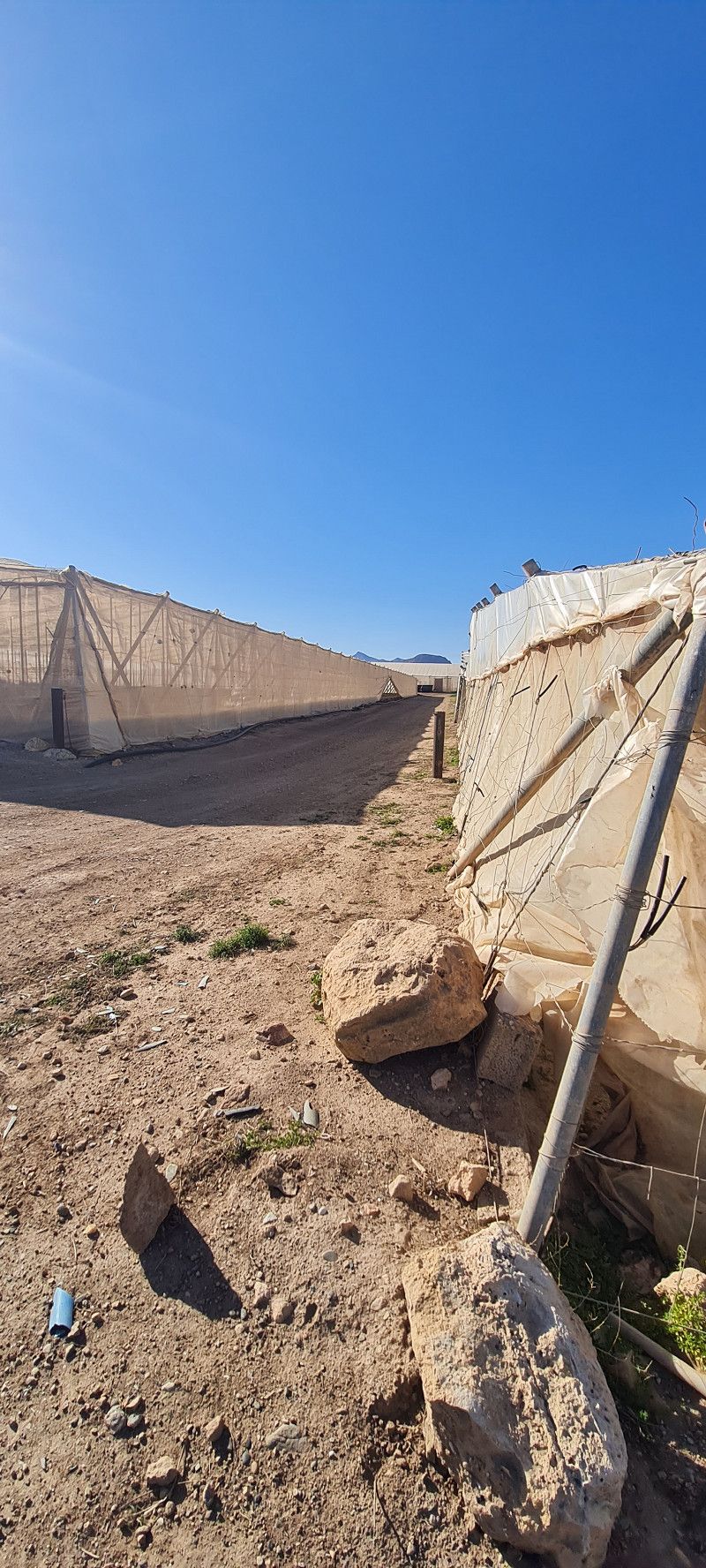
Castell De Ferro, 18740 Castell de ferro, Granada, Spanien
today we arrived at the next stopover after about 215 kilometers. The pitch is not really nice. Very narrow pitches and outdated sanitary facilities. But 14 euros for 2 people with electricity and V/E. Well, tomorrow morning we'll be gone again.
The place here is not big and surrounded by plastic greenhouses as far as the eye can see.
But so far we have also discovered something beautiful in every place.
18740 Castell de ferro, Granada, Spain
36° 43' 29" N 3° 21' 19.5" W
36.7247251 -3.3554053
• Head toward Plaza de España on Paseo Marítimo. Go for 53 m.
• Continue on Carretera de Almería. Go for 247 m.
• Turn slightly left onto Carretera de Almería. Go for 408 m.
• Take the 2nd exit from roundabout. Go for 77 m.
• Turn right and take ramp onto N-340. Go for 1.8 km.
• Take the 1st exit from roundabout onto A-7 (Autovía del Mediterráneo) toward Adra/Almería. Go for 94.6 km.
• Take exit 777 toward Viator/Guadix/A-92/Granada. Go for 311 m.
• Take the 4th exit from roundabout onto A-92 toward Guadix/Granada. Go for 17.0 km.
• Take exit 376 toward Tabernas. Go for 241 m.
• Take the 2nd exit from roundabout onto N-340a toward Tabernas. Go for 7.5 km.
• Keep left onto N-340a toward Sorbas/Murcia. Go for 2.9 km.
• Arrive at N-340a. Your destination is on the left.
☍
125,2 km
(1 hrs. 13 min.)
Day
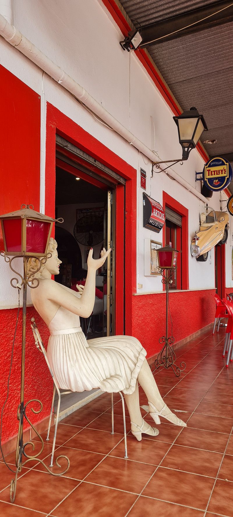
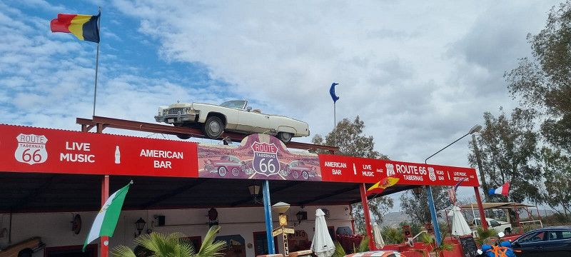
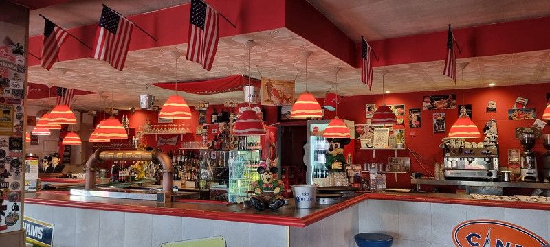
Route 66, Spanien
Today we went almost 130 kilometers to Tabernas. We had to leave our pitch at noon today and I couldn't book the next one until tomorrow.
Now we are about 10 kilometers before the actual destination on Route 66 on a free space. The whole area is still under construction. We were told that you can stand here for 5 euros. But so far nobody has wanted money from us 😀 We ate and drank well in the restaurant.
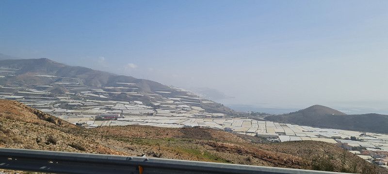
By the way.... if we buy vegetables and salad etc. from Spain, you should really know how they are grown here. We must have driven 100 kilometers only past plastic fields. Only greenhouses to the right and left of the motorway. Partly down to the beach regions... It's not nice, but people have to earn money
Route 66 , Tabernas, Spanien
37° 4' 22.9" N 2° 21' 32.8" W
37.0730329 -2.3591025
• Head toward Camino del Marchalillo on N-340a. Go for 2.8 km.
• Keep left onto N-340a toward Almería. Go for 3.3 km.
• Turn right. Go for 1.1 km.
• Arrive at your destination on the right.
☍
7,2 km
( 7 min.)
Day
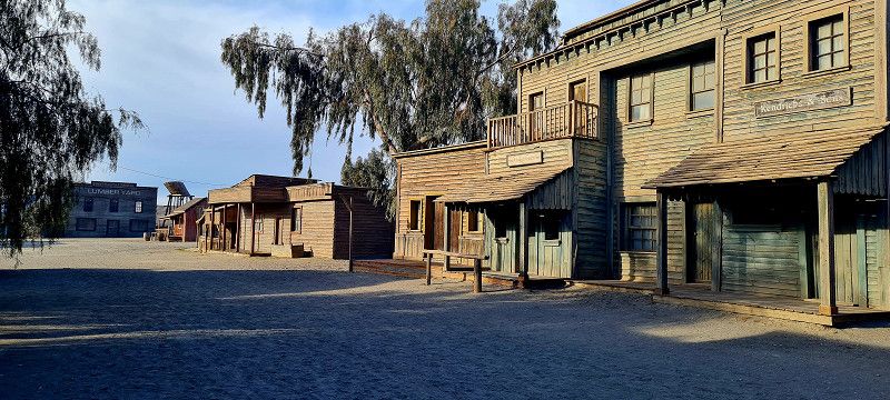
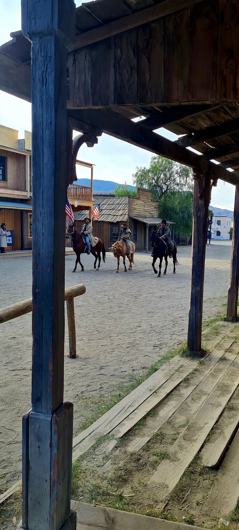
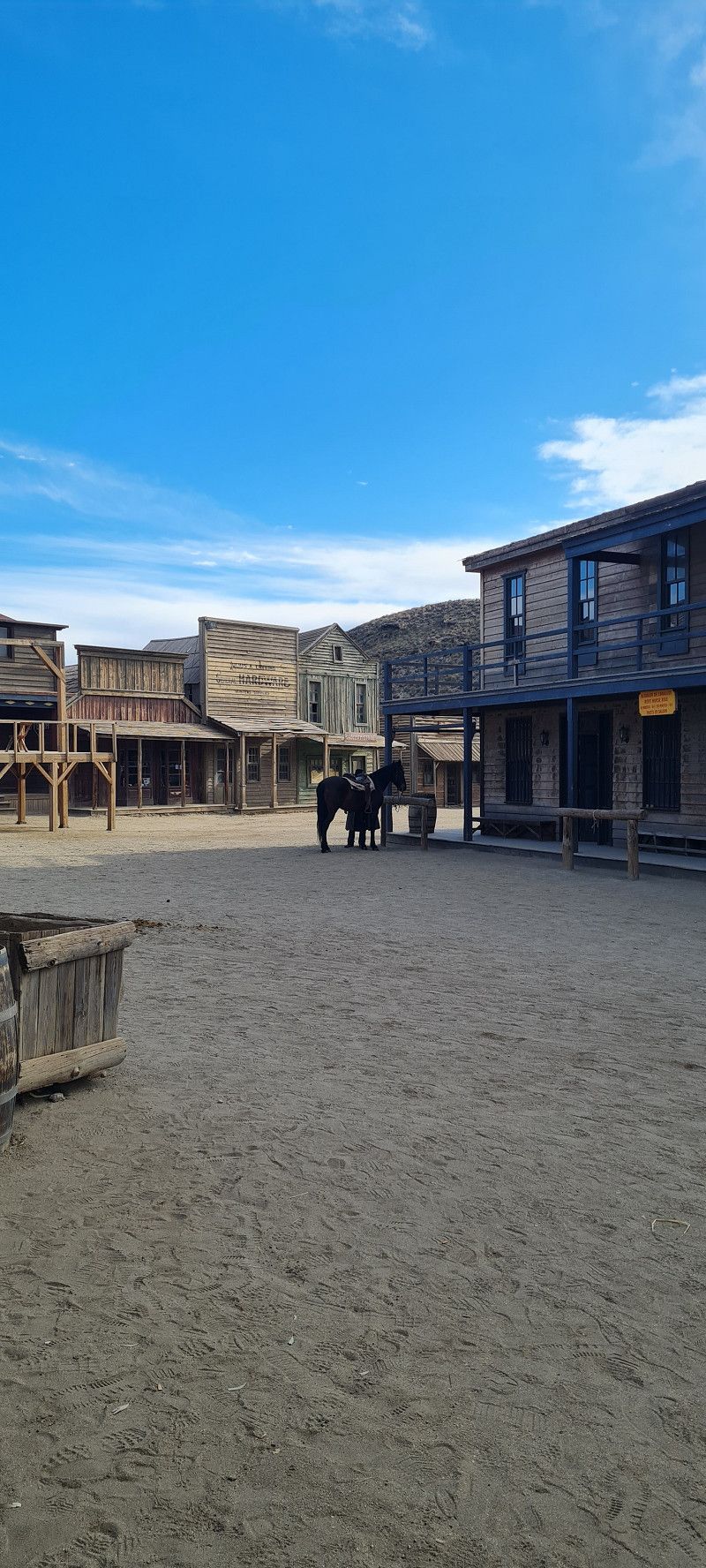
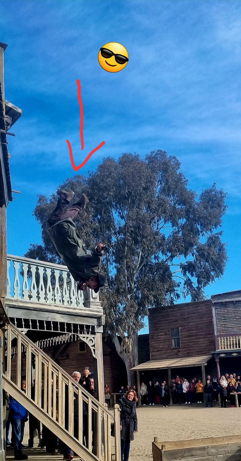
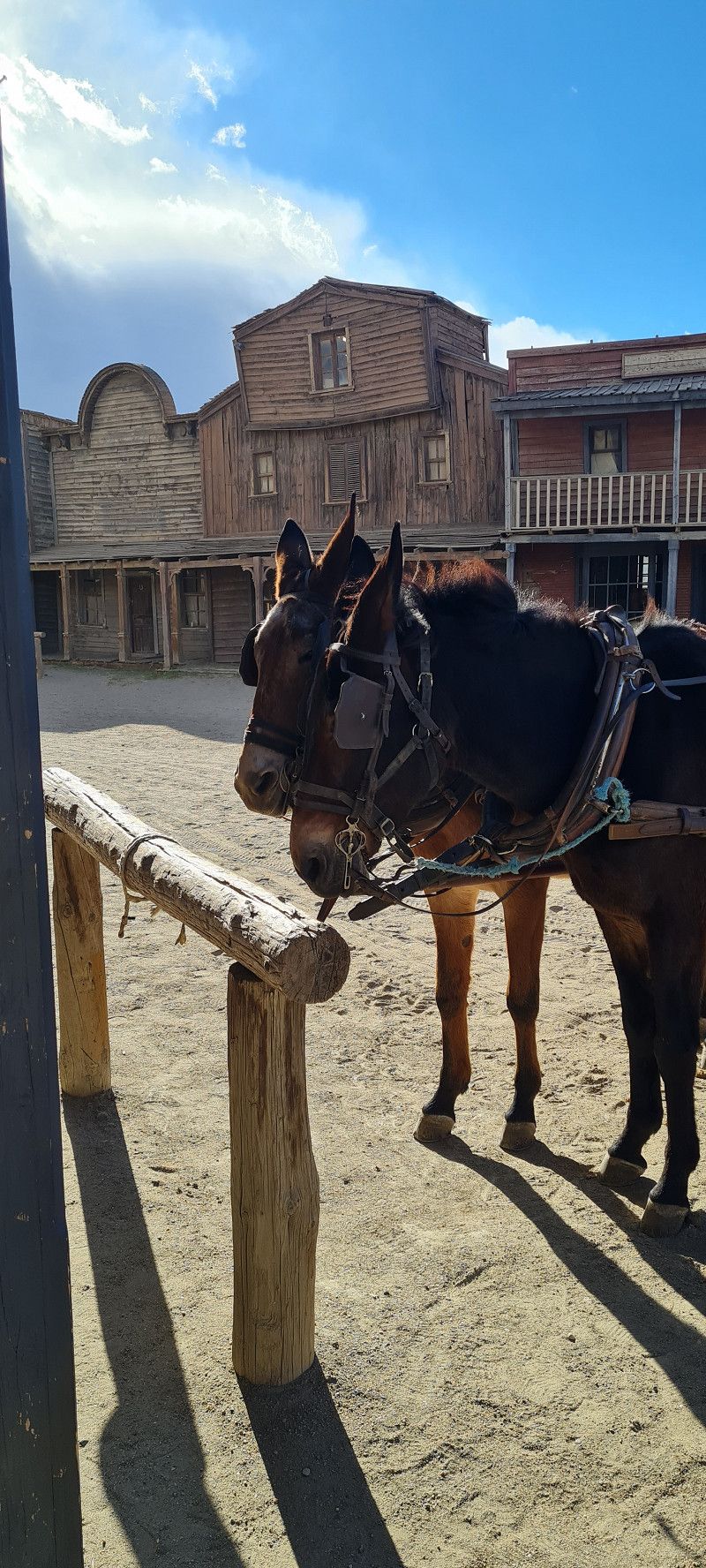
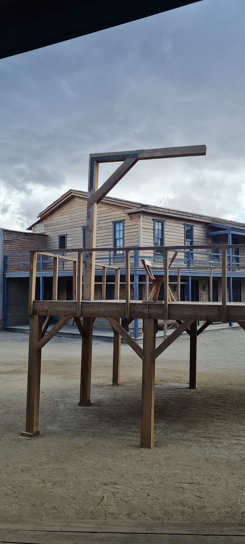
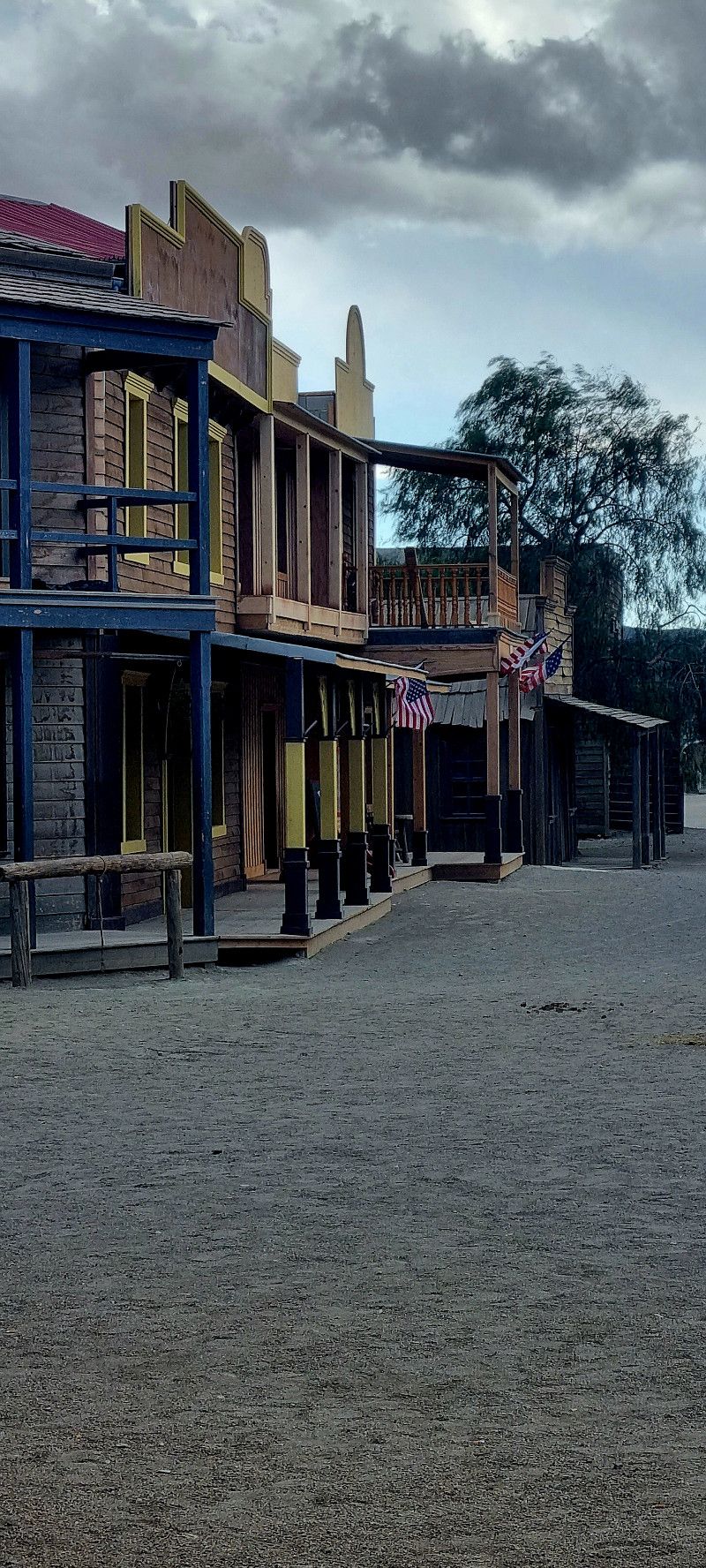
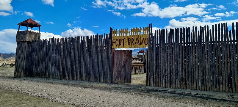
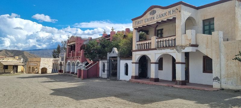
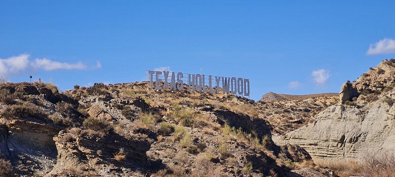
Texas Hollywood, Tabernas, Spanien
https://www.fortbravo.org/en/
today we went 10 kilometers further to the place where many westerns were filmed. For example Bud Spencer films, commercials for Pepsi with David Backham and many others.
Included in the price (70 euros for 2 nights/2 people and entry to the western town) were the parking space with electricity (adapters have to be borrowed for a deposit, showers and toilets are only available from 6 p.m. Yes, it's a bit strange.
But we think it's great in the wild west 😀
Almeria Paraje del Unihay, s/n, 04200 Tabernas, Almería, Spain
37° 2' 48.9" N 2° 25' 11.8" W
37.0469152 -2.4199335
• Head south. Go for 1.1 km.
• Turn right onto N-340a. Go for 4.4 km.
• Take the 1st exit from roundabout. Go for 863 m.
• Turn right. Go for 415 m.
• Turn right. Go for 432 m.
• Arrive at your destination.
☍
7,2 km
( 11 min.)
Day
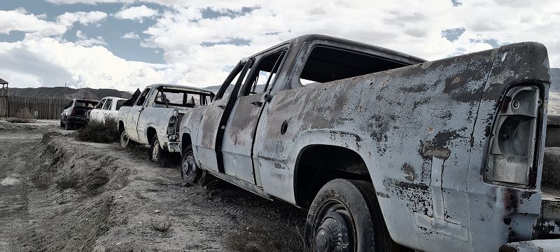
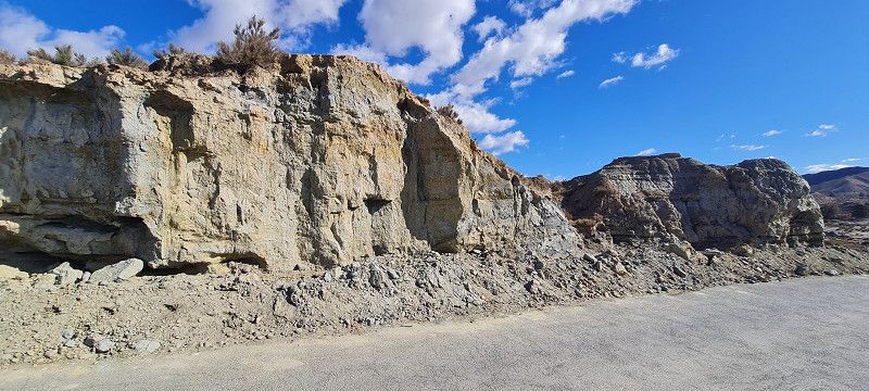
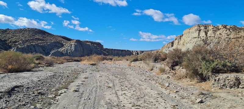
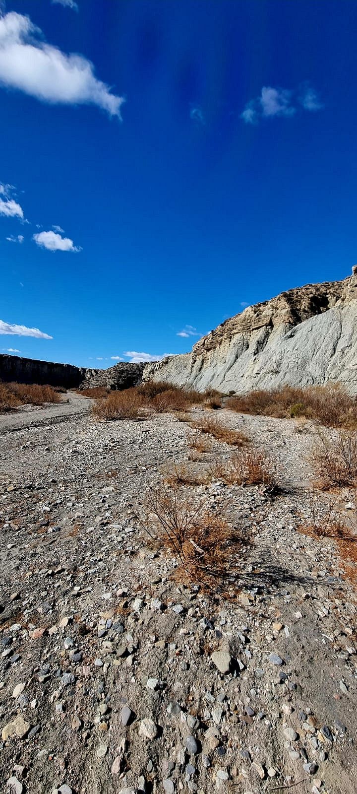
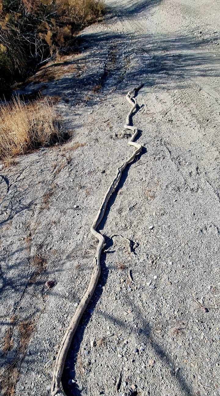
Tabernas, Andalusia, Spain
we have one more night here in texas hollywood and hiked in the desert all afternoon today. 15 kilometers in 5 hours. Again, the area is impressive. But today we didn't get lost, we walked nicely through the dried-up river bed 😀 Unfortunately, you can't show nature in photos as it is. But here are our impressions.
Autovía de Andalucía, Spain
37° 1' 57.3" N 2° 26' 47.5" W
37.0325695 -2.4465179
• Head south. Go for 216 m.
• Keep right. Go for 499 m.
• Turn slightly right. Go for 144 m.
• Turn left toward N-340a. Go for 847 m.
• Take the 4th exit from roundabout onto N-340a toward Tabernas/Sorbas. Go for 7.6 km.
• Keep left onto N-340a toward Sorbas/Murcia. Go for 23.1 km.
• Pass 2 roundabouts and continue on N-340a. Go for 19.4 km.
• Turn left toward E-15/A-7/Almería/Murcia/Los Gallardos. Go for 52 m.
• Turn right and take ramp onto A-7 (Autovía del Mediterráneo) toward Vera/Murcia/Los Gallardos. Go for 16.0 km.
• Take exit 695A toward E-15/AP-7/Cartagena. Go for 1.3 km.
• Continue on AP-7. Go for 54.3 km.
• Take exit 857 toward Cañada de Gallego/Ramonete/P. Calnegre. Go for 992 m.
• Take the 1st exit from roundabout onto RM-332. Go for 368 m.
• Turn right. Go for 641 m.
• Turn slightly right toward Calle Maestro J. Rodrigo. Go for 27 m.
• Continue on Calle Maestro J. Rodrigo. Go for 563 m.
• Continue straight ahead. Go for 1.9 km.
• Continue toward Camino a Calnegre y Los Curas. Go for 359 m.
• Turn left onto Camino a Calnegre y Los Curas. Go for 442 m.
• Turn right. Go for 1.1 km.
• Turn left. Go for 201 m.
• Turn left. Go for 717 m.
• Turn right. Go for 203 m.
• Arrive at your destination on the right.
☍
131,1 km
(1 hrs. 37 min.)
Day
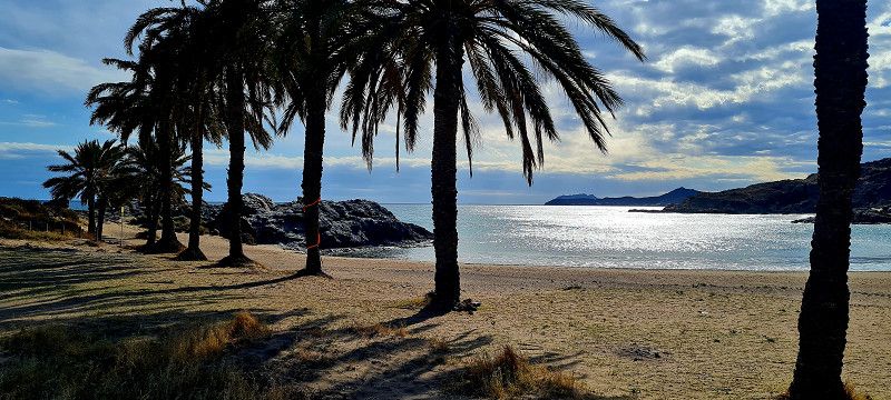
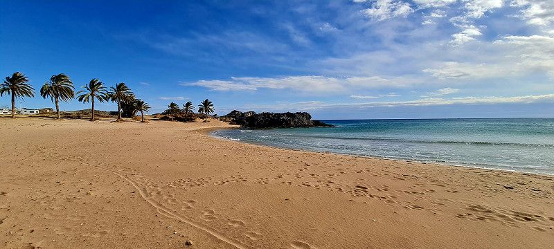
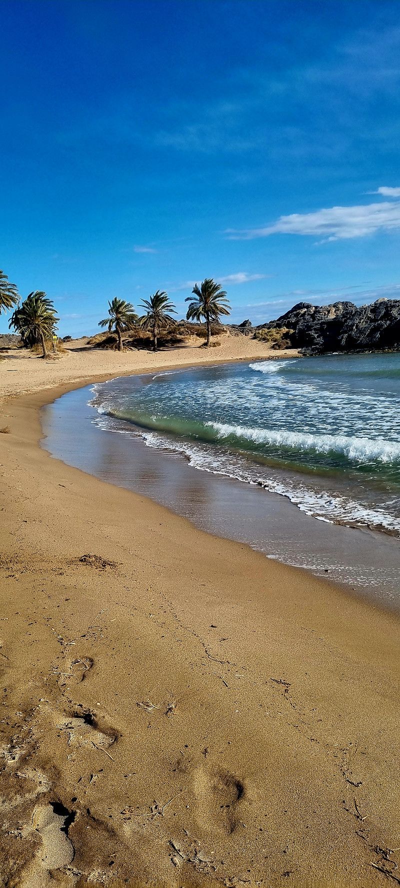
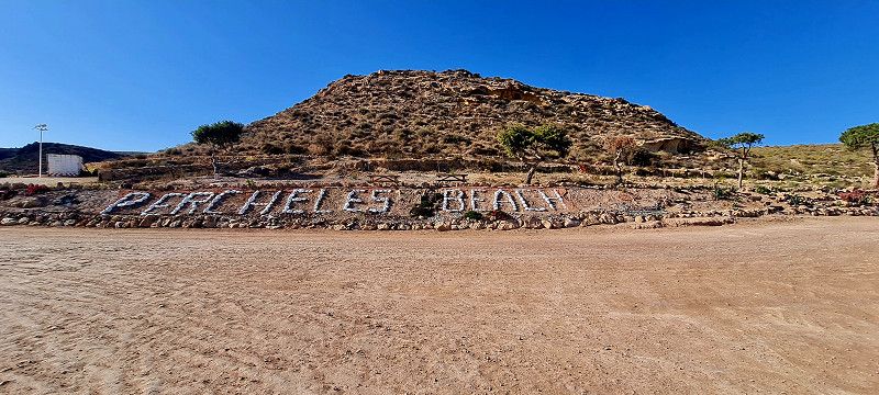
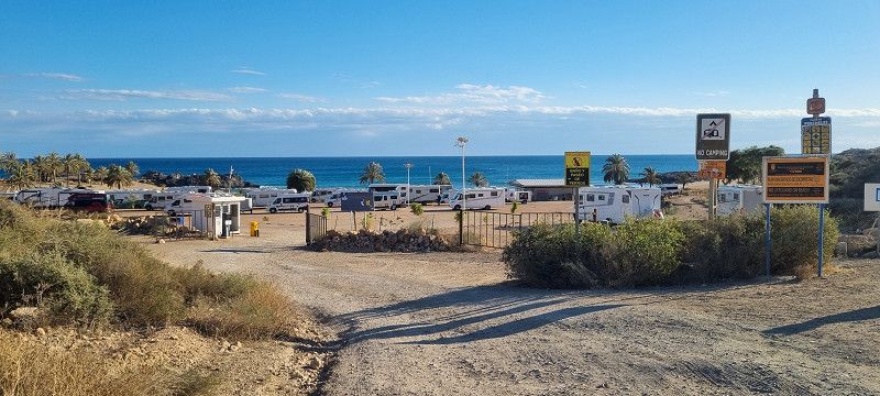
Playa Percheles, Spanien
Today we drove about 190 kilometers further to the legendary Bay of Snakes. Some love them, others hate them. So just look for yourself. And yes, the environment you have to drive through is really NOT beautiful. Plastic greenhouses and lots of rubbish around them. But when you have reached the bay (the journey is not at all problematic, no matter what vehicle) then the WOW feeling overcomes you.
The bay is great. For one night you pay 7.50 euros for everything. But you have to be self-sufficient. V/E is available. And there's a fries/beer stand. It's enough for a few days 😉
Addendum: A roll and cake delivery service also comes around 9:00 a.m
Playa Percheles, Spain
37° 31' 45.3" N 1° 22' 57.5" W
37.5292372 -1.3826506
• Head west. Go for 1.4 km.
• Continue on Urbanización Playa Castellar. Go for 1.6 km.
• Continue toward Cañada de Gallego. Go for 517 m.
• Continue on Cañada de Gallego. Go for 217 m.
• Turn slightly right onto Avenida Constitución-Gallego. Go for 735 m.
• Continue on Cañada de Gallego. Go for 1.3 km.
• Continue toward RM-332. Go for 367 m.
• Take the 2nd exit from roundabout onto RM-332 toward Mazarrón. Go for 5.2 km.
• Take the 2nd exit from roundabout onto RM-3 (Autovía de Mazarrón) toward Vera/E-15/AP-7/Almería/Cartagena/Totana/Alhama de Murcia/Murcia. Go for 14.6 km.
• Keep right onto RM-23 toward Aeropuerto/Murcia (Alhama)/RM-2/Fuente Álamo. Go for 10.0 km.
• Take the 4th exit from roundabout onto RM-2 (Autovía Alhama-Campo de Cartagena) toward A-7/Murcia. Go for 4.3 km.
• Take exit 0 toward Murcia/Alicante onto A-7 (Autovía del Mediterráneo). Go for 32.1 km.
• Take the left exit onto A-30 (Murcia Ronda Oeste). Go for 3.1 km.
• Continue on A-7 (Autovía del Mediterráneo) toward Alicante. Go for 53.8 km.
• Keep left onto A-70 (Autovía del Mediterráneo) toward Alacant/Alicante. Go for 24.5 km.
• Take exit 6 toward Alicante/Valencia/N-332. Go for 728 m.
• Take the 3rd exit from roundabout toward N-332/Valencia. Go for 318 m.
• Turn right onto Avenida de Denia (N-332). Go for 885 m.
• Take the 3rd exit from roundabout onto Avenida de Denia (N-332). Go for 595 m.
• Take the 3rd exit from roundabout onto Avenida del Hospital (CV-821). Go for 422 m.
• Continue on CV-821. Go for 23 m.
• Take the 1st exit from Plaza de Santa Faz roundabout onto Calle Barranocet. Go for 44 m.
• Continue on Avenida de Alicante. Go for 831 m.
• Take the 4th exit from roundabout onto Pasaje Climont. Go for 87 m.
• Turn right onto Calle El Quijote. Go for 135 m.
• Turn slightly left onto Calle Clara Campoamor. Go for 98 m.
• Turn right toward Calle Pintor Manuel Baeza Gómez. Go for 80 m.
• Continue on Calle Pintor Manuel Baeza Gómez. Go for 60 m.
• Turn left onto Calle Mayor. Go for 133 m.
• Continue on Plaza España. Go for 10 m.
• Arrive at Plaza España. Your destination is on the right.
☍
158,2 km
(1 hrs. 39 min.)
Day
Sant Joan d'Alacant, Spanien
Shortly after Alicante 3 parking spaces controlled. ALL full. At a parking space (Camper Área Campello Beach) opposite there is a fairly large, let's say meadow, where we stood free with 7 other campers. A German has been here for the 2nd night and says that's no problem. You won't be sent away. Wonderful. A few meters further is the sea with a kilometer-long promenade. Some restaurants are already open there. Very nice.
Sant Joan d'Alacant , Spanien
38° 24' 5.1" N 0° 26' 9.6" W
38.4014162 -0.4359957
• Head toward Calle Cervantes on Plaza España. Go for 21 m.
• Continue on Calle Comandante Seva. Go for 122 m.
• Turn right onto Travesía Cervantes. Go for 313 m.
• Turn right onto Calle José Lamaignere. Go for 47 m.
• Turn left onto Calle de San Antonio. Go for 410 m.
• Take the 2nd exit from roundabout onto Calle de San Antonio. Go for 764 m.
• Take the 4th exit from roundabout onto Carretera de Valencia (N-332). Go for 543 m.
• Take ramp toward E-15/A-31/A-70/Madrid/Murcia/Valencia/N-340/Xixona/Jijona. Go for 1.0 km.
• Take ramp onto A-70 (Autovía del Mediterráneo) toward Valencia. Go for 739 m.
• Continue on AP-7 (Autovía del Mediterráneo). Go for 150 km.
• Keep right toward Valencia. Go for 679 m.
• Continue on V-31. Go for 10.4 km.
• Take left exit 12A toward E-901/Madrid/A-3/Aeropuerto/E-15/Barcelona/A-7 onto V-30. Go for 8.9 km.
• Take exit 11 toward ronda nord/CV-31 onto CV-30 (Ronda Nord). Go for 5.3 km.
• Take the 2nd exit from roundabout. Go for 158 m.
• Take the 3rd exit from roundabout onto Avenida Hermanos Machado. Go for 938 m.
• Keep right onto Avenida Hermanos Machado toward Calle Conde Lumiares. Go for 402 m.
• Turn left onto Avenida de la Constitución toward Sant Miquel dels Reis. Go for 761 m.
• Continue on Avenida de las Cortes Valencianas (CV-300). Go for 947 m.
• Pass 5 roundabouts and continue on CV-300. Go for 3.4 km.
• Take the 3rd exit from roundabout onto Calle Mayor (CV-3017) toward CV-300/Albalat dels Sorells. Go for 578 m.
• Turn left onto Calle Padre Salvador Molla. Go for 12 m.
• Arrive at Calle Padre Salvador Molla. Your destination is on the left.
☍
186,7 km
(1 hrs. 48 min.)
Day
Albalat dels Sorells, Spanien
today we drove to Valencia. So by my mistake even 30 kilometers too far, because I stupidly entered the wrong campsite in the route planner.
So back again... but then found the right place. Is not the prettiest but about 19 kilometers from the center of Valencia and with a train connection.
That's on the agenda for tomorrow.
Don't be surprised by the photos. The EDDI has problems with his left eye and is getting a new lens these days 😀
Unfortunately, there is not much to see in these small towns, so only a few pictures
Albalat dels Sorells , Spanien
39° 32' 37.3" N 0° 20' 46.3" W
39.5436955 -0.3461912
• Head toward Plaza del Castillo on Calle Padre Salvador Molla. Go for 241 m.
• Continue on Calle de en Codinats. Go for 33 m.
• Turn right onto Calle de Valencia. Go for 248 m.
• Turn right onto Calle Major (CV-3017). Go for 36 m.
• Turn left onto Calle del Mar (CV-3022). Go for 133 m.
• Take the 2nd exit from roundabout onto Calle del Mar (CV-3022). Go for 178 m.
• Take the 3rd exit from roundabout onto CV-300 toward Museros/CV-32/V-21/A-7/Puçol. Go for 980 m.
• Pass 3 roundabouts and continue on CV-300. Go for 1.5 km.
• Turn right onto CV-32 toward V-21/València/Castelló. Go for 2.5 km.
• Take the 3rd exit from roundabout onto CV-32 toward Valencia/N-221/Castelló/València/Castelló de la Plana/V-21/Polígon Industrial Mediterrani (est). Go for 468 m.
• Take the 2nd exit from roundabout toward València. Go for 217 m.
• Take ramp onto V-21. Go for 10.0 km.
• Take the 1st exit from Plaza Cardenal Vicente Enrique y Tarancón roundabout onto Avenida Blasco Ibáñez toward Hospital Quirón/Centre Ciutat/Centro Ciudad. Go for 990 m.
• Continue on Calle General Elio toward Centro Ciudad/Centre Ciutat. Go for 184 m.
• Keep left onto Plaza Llano del Real toward Centre Ciutat. Go for 77 m.
• Turn right onto Plaza Llano del Real. Go for 30 m.
• Keep left onto Puente del Real. Go for 218 m.
• Continue on Plaza Tetuán. Go for 201 m.
• Keep right onto Plaza Tetuán toward c/La Paz/Centro Histórico/Centre Històric. Go for 25 m.
• Continue on Calle General Tovar. Go for 113 m.
• Turn right onto Plaza de Alfonso el Magnánimo. Go for 51 m.
• Continue on Calle de la Paz. Go for 319 m.
• Turn left onto Calle del Marqués de Dos Aguas. Go for 87 m.
• Continue on Calle del Poeta Querol. Go for 254 m.
• Continue on Calle de las Barcas. Go for 21 m.
• Continue on Calle Pascual y Genís. Go for 60 m.
• Turn right onto Calle Correos. Go for 174 m.
• Arrive at Calle Correos. Your destination is on the left.
☍
19,4 km
( 20 min.)
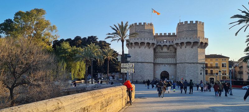
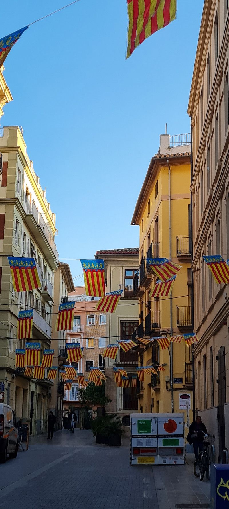
Day
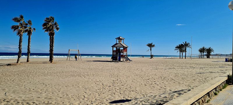
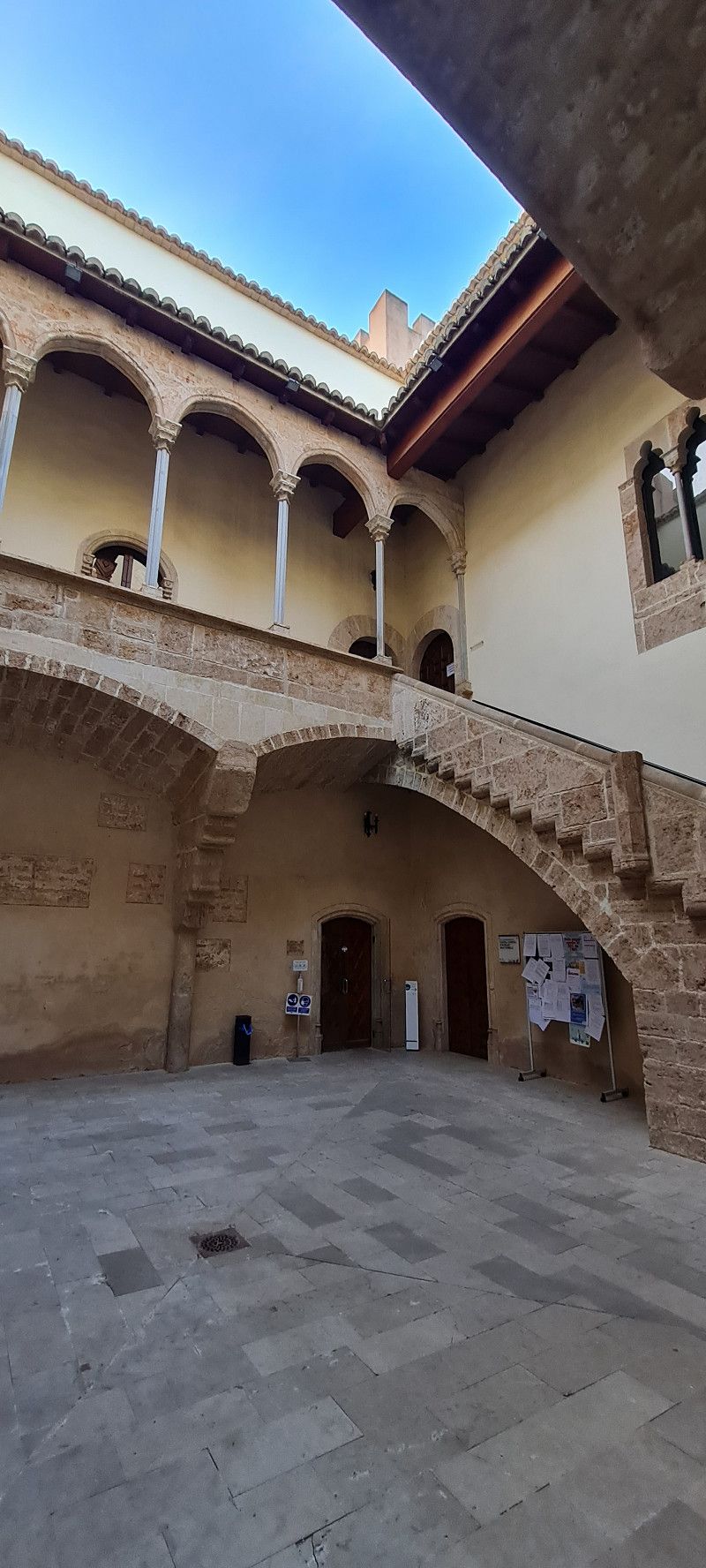
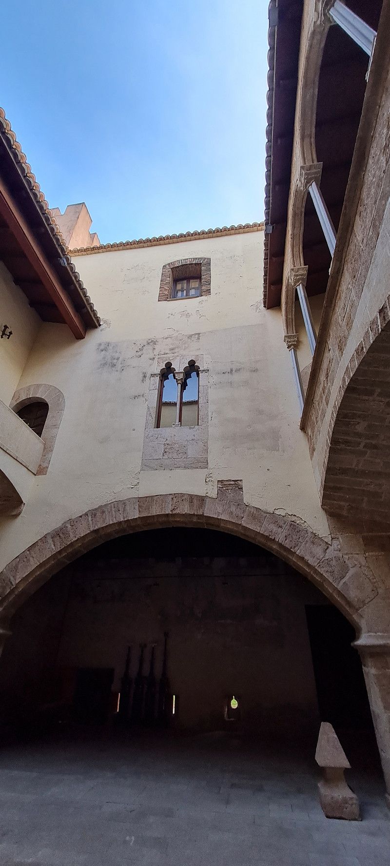
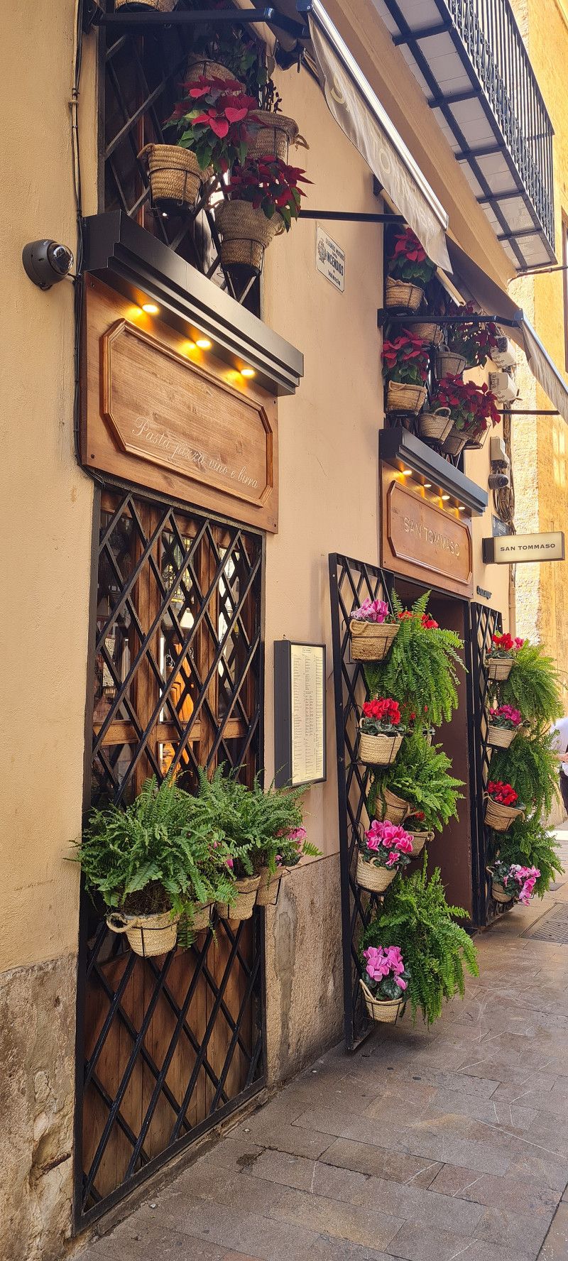
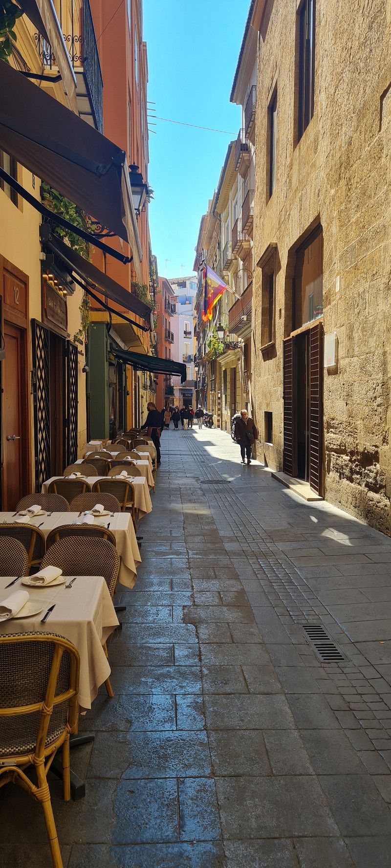
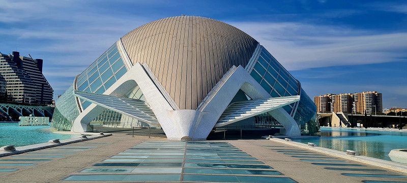
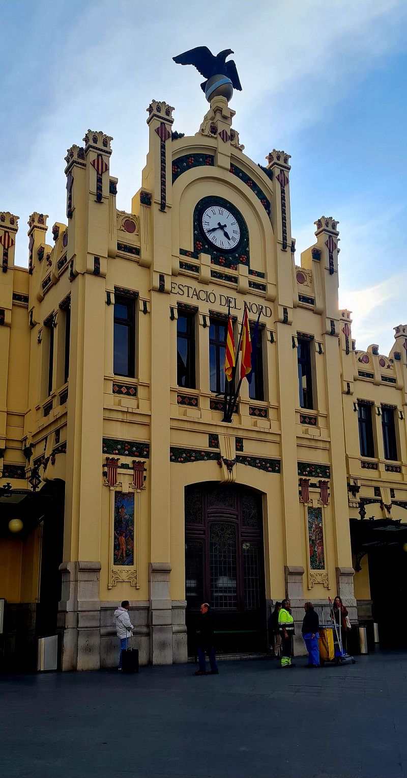
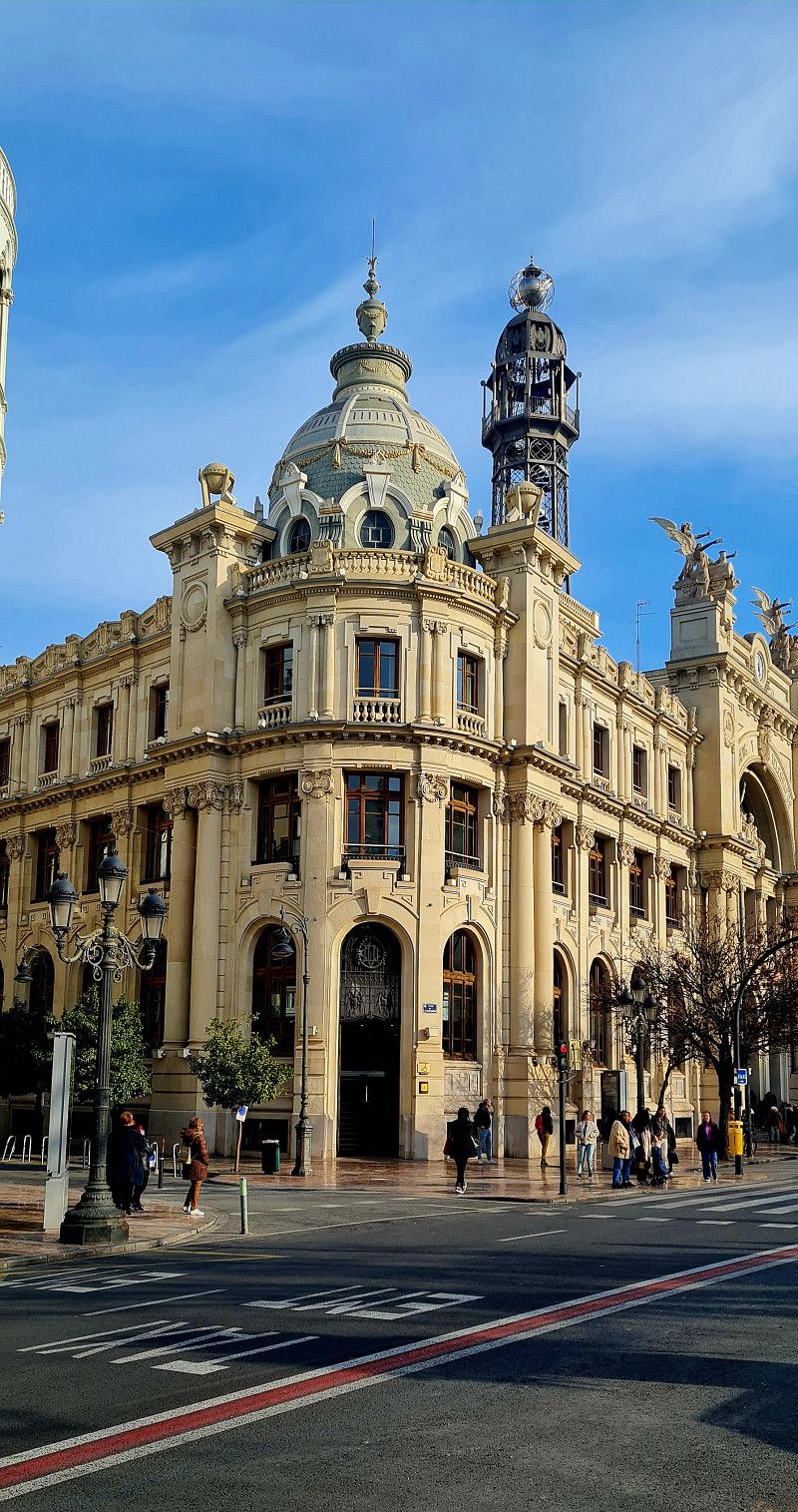
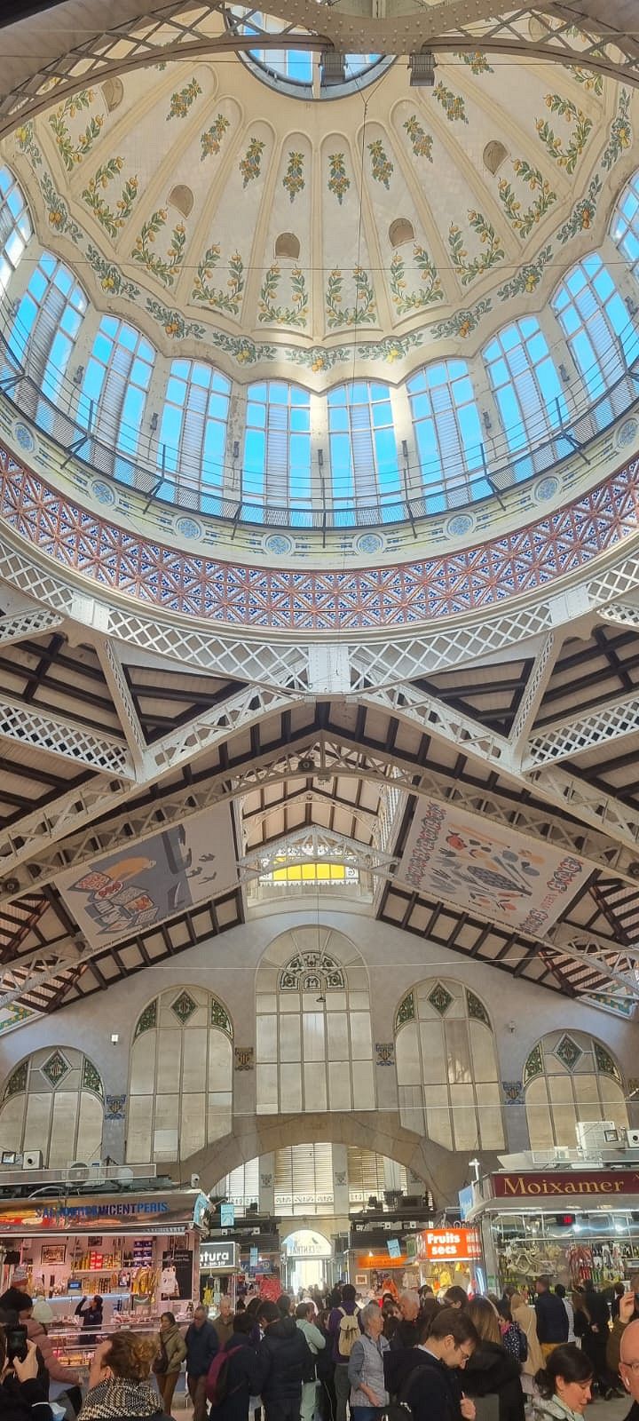
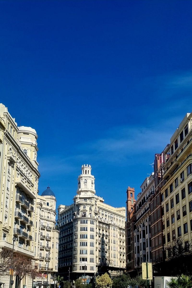
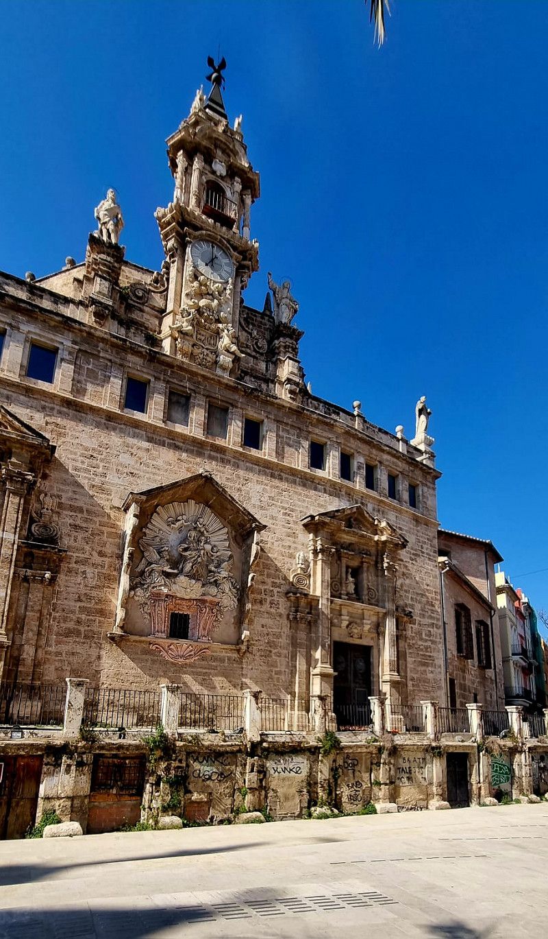
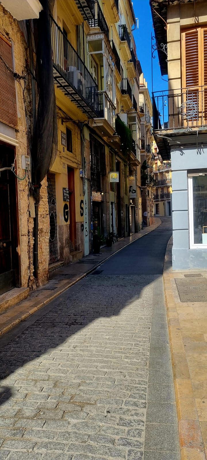
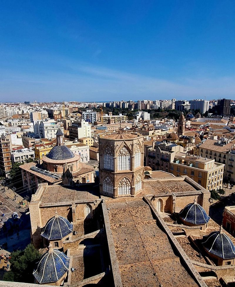
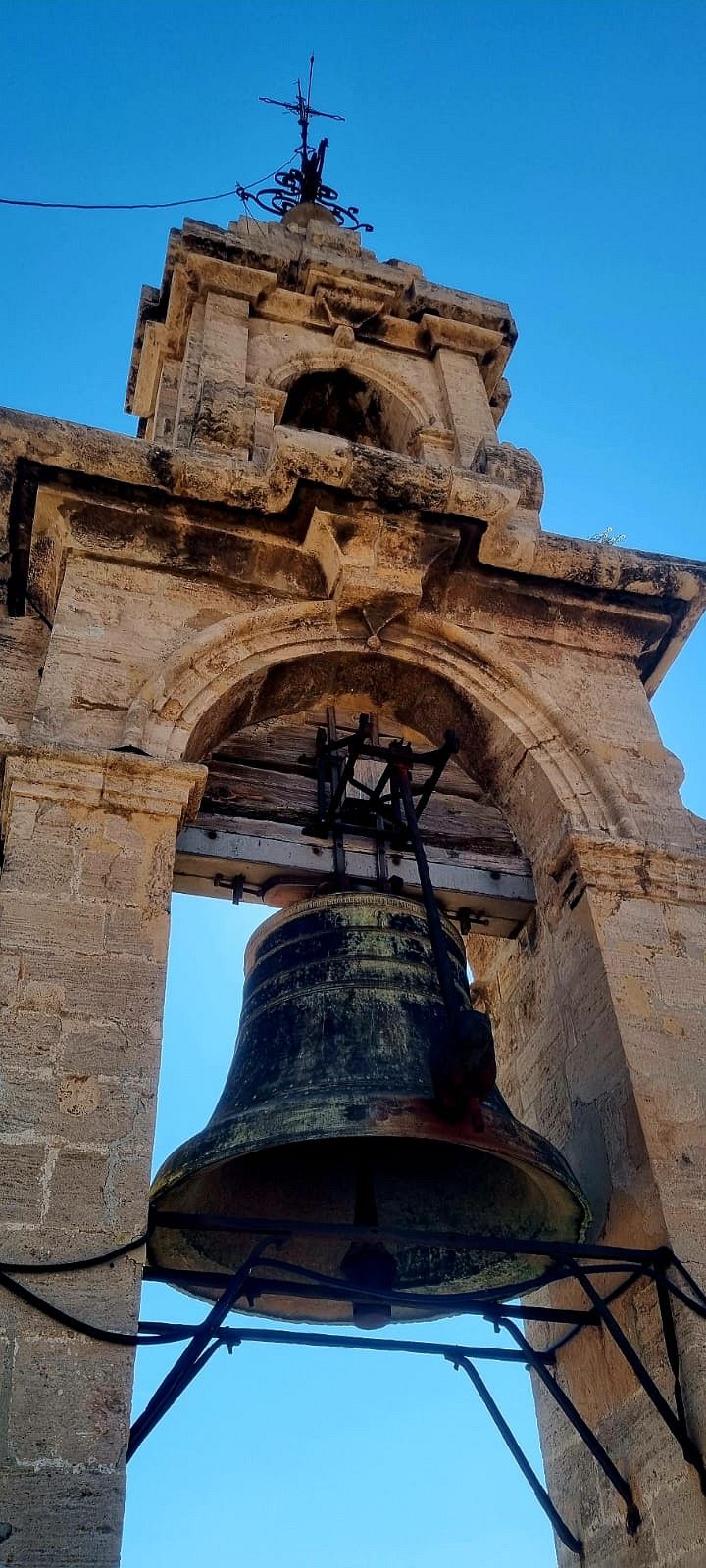
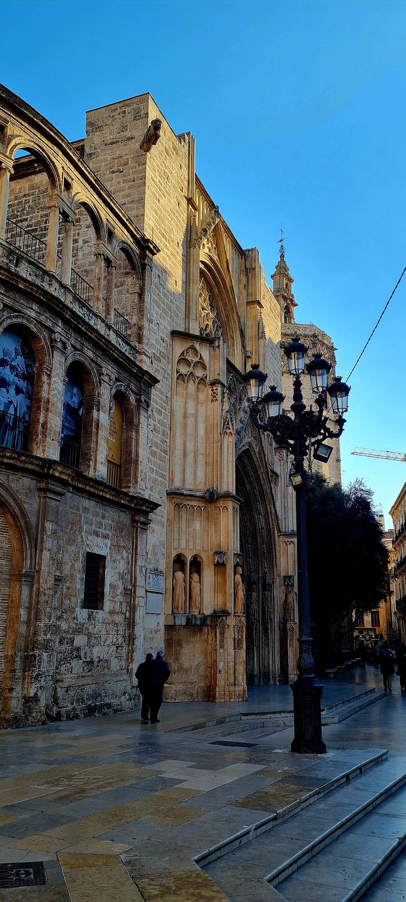
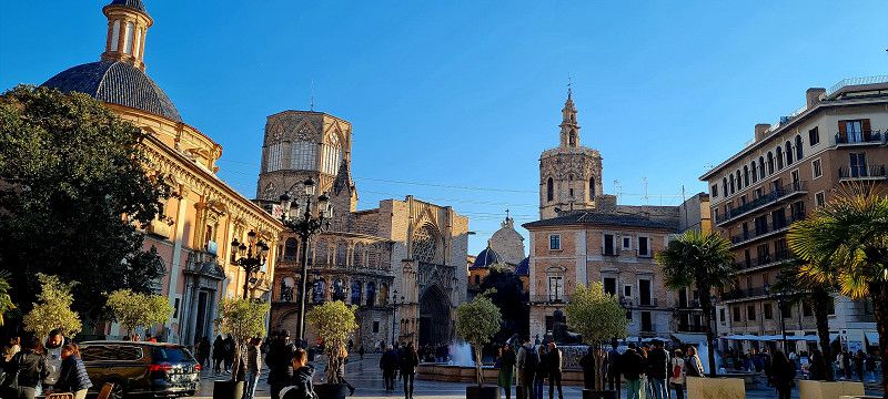
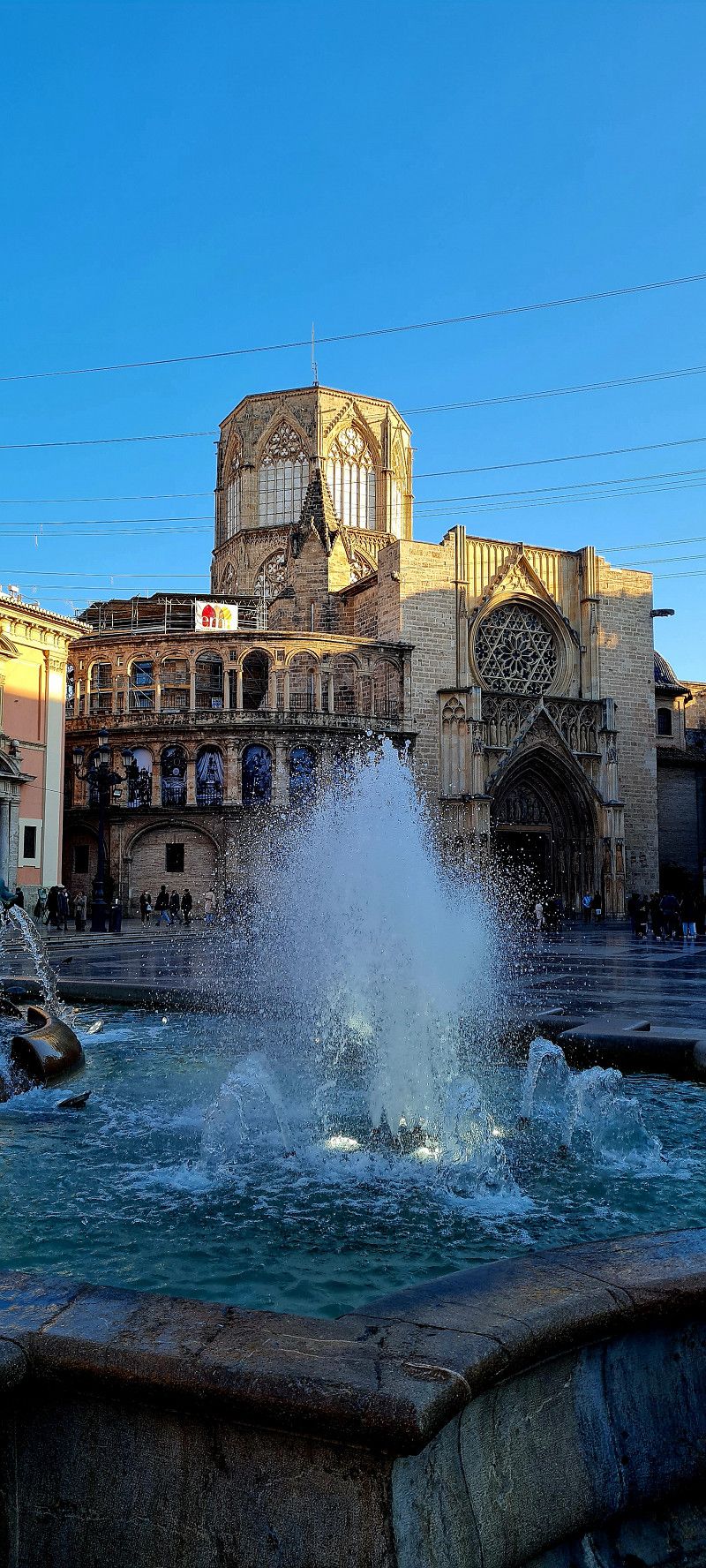
Valencia, Spanien
Today we went to Valencia for a stroll through the city.
Here on the parking lot we could easily get the tourist tickets and could use the metro, bus and train immediately. Everything really simple and clear.
Off we went... Day 1 of impressions
Valencia , Spanien
39° 28' 10.9" N 0° 22' 34.8" W
39.4697065 -0.3763353
• Head west on Calle Correos.
• Arrive at Calle Correos. Your destination is on the left.
☍
Distance not available
(Duration not available)
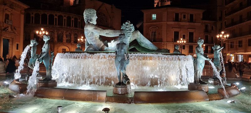
Day
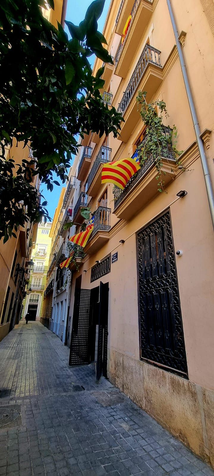
Valencia, Spanien
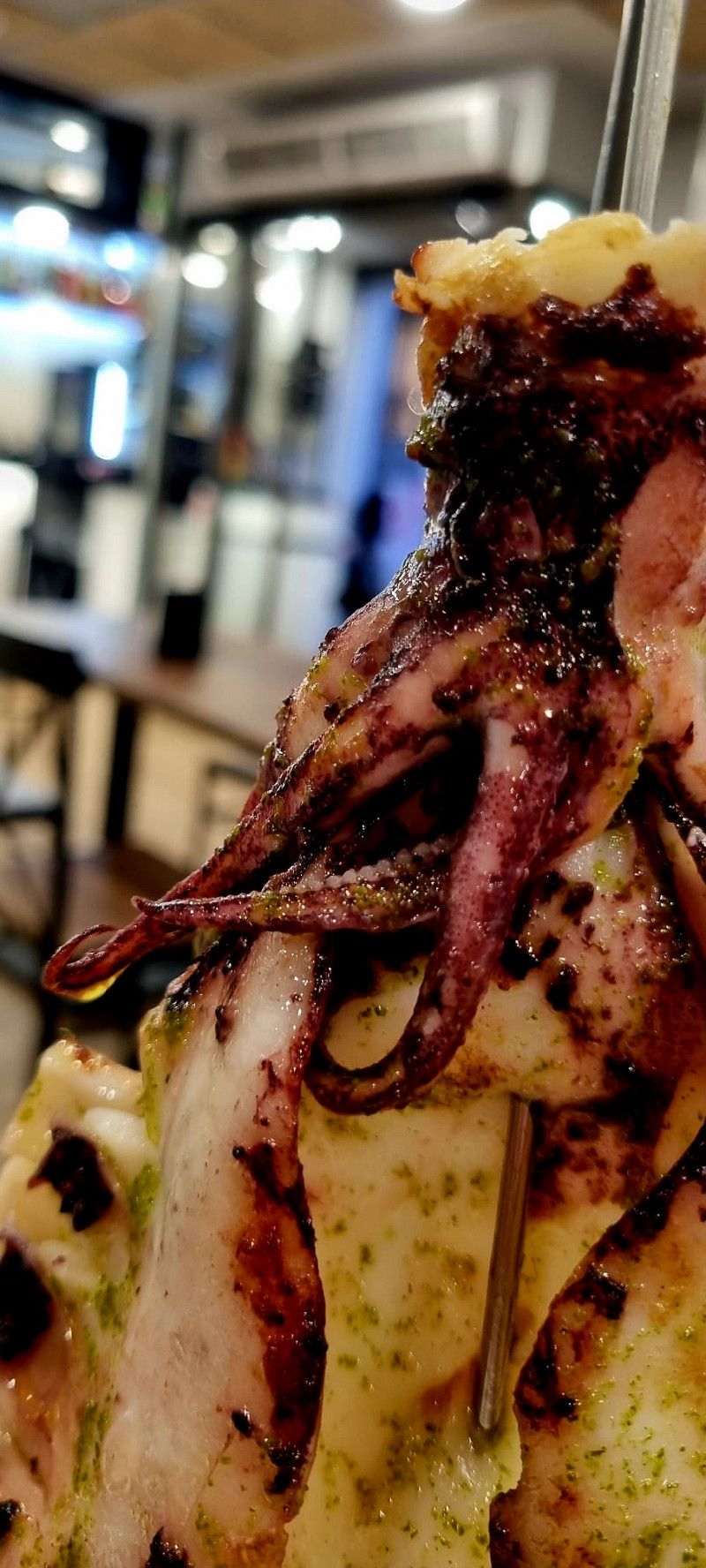
today the second day in Valencia. But only in the late afternoon. Before that we chilled out in the sun (already got a bit of a sunburn) then we went back into town. Do a little shopping and then go out for a nice meal. And Valencia in the evening is beautiful too.
Valencia , Spanien
39° 28' 10.9" N 0° 22' 34.8" W
39.4697065 -0.3763353
• Head toward Calle Pérez Pujol on Calle Correos. Go for 89 m.
• Turn left onto Calle Pérez Pujol. Go for 67 m.
• Turn right onto Calle de las Barcas. Go for 67 m.
• Continue on Calle Pintor Sorolla. Go for 296 m.
• Continue on Plaza de Alfonso el Magnánimo. Go for 51 m.
• Turn left onto Plaza de Alfonso el Magnánimo. Go for 109 m.
• Turn right onto Calle Palacio de Justicia. Go for 118 m.
• Take the 1st exit from Plaza Puerta de la Mar roundabout onto Avenida Navarro Reverter toward Alacant/V-31/Albacete/Castelló/V-21/Barcelona/Teruel/Zaragoza. Go for 321 m.
• Keep right onto Plaza América toward Alicante/Alacant/El Saler. Go for 200 m.
• Turn left onto Puente de Aragón. Go for 227 m.
• Continue toward Avenida de Aragón. Go for 57 m.
• Take the 3rd exit from Plaza Zaragoza roundabout onto Avenida de Aragón toward Barcelona/N-234/Zaragoza/Saragossa. Go for 371 m.
• Take the 1st exit from roundabout onto Avenida de Aragón. Go for 707 m.
• Take the 3rd exit from Plaza Cardenal Vicente Enrique y Tarancón roundabout onto Avenida de Cataluña (V-21) toward Castelló/Barcelona/Teruel/Zaragoza. Go for 319 m.
• Keep left onto V-21 toward Castelló/Barcelona/Teruel/Zaragoza. Go for 9.6 km.
• Take exit 9 toward Massalfassar/E-15/A-7/Alacant. Go for 288 m.
• Take the 4th exit from roundabout onto CV-32 toward Polígon Industrial de Mediterrani/Valencia/V-21/Massalfassar/Alacant/E-15/A-7. Go for 447 m.
• Pass 2 roundabouts and continue on CV-32. Go for 3.0 km.
• Take the 3rd exit from roundabout onto CV-300 toward Albalat dels Sorells. Go for 425 m.
• Pass 3 roundabouts and continue on CV-300. Go for 2.2 km.
• Take the 1st exit from roundabout onto Calle del Mar (CV-3022) toward Centre Ciutat Albalat dels Sorells. Go for 188 m.
• Take the 3rd exit from roundabout onto Calle Rey Jaime I. Go for 101 m.
• Turn right onto Calle de la Abadía. Go for 143 m.
• Turn slightly right onto Calle Padre Salvador Molla. Go for 12 m.
• Arrive at Calle Padre Salvador Molla. Your destination is on the left.
☍
19,4 km
( 19 min.)
Day
Albalat dels Sorells, Spanien
today there is nothing from us.
We sat in the 🌞 all day ❤️ tomorrow we'll continue again.
Albalat dels Sorells , Spanien
39° 32' 37.3" N 0° 20' 46.3" W
39.5436955 -0.3461912
• Head toward Plaza del Castillo on Calle Padre Salvador Molla. Go for 241 m.
• Continue on Calle de en Codinats. Go for 33 m.
• Turn right onto Calle de Valencia. Go for 248 m.
• Turn right onto Calle Major (CV-3017). Go for 36 m.
• Turn left onto Calle del Mar (CV-3022). Go for 133 m.
• Take the 2nd exit from roundabout onto Calle del Mar (CV-3022). Go for 178 m.
• Take the 3rd exit from roundabout onto CV-300 toward Museros/CV-32/V-21/A-7/Puçol. Go for 980 m.
• Pass 3 roundabouts and continue on CV-300. Go for 1.5 km.
• Turn right onto CV-32 toward V-21/València/Castelló. Go for 2.5 km.
• Take the 3rd exit from roundabout onto CV-32 toward Valencia/N-221/Castelló/València/Castelló de la Plana/V-21/Polígon Industrial Mediterrani (est). Go for 468 m.
• Take the 3rd exit from roundabout onto CV-32 toward Castelló de la Plana/E-15/A-7/Barcelona. Go for 362 m.
• Take the 3rd exit from roundabout onto V-21 toward Castelló de la Plana/E-15/AP-7/Barcelona. Go for 9.8 km.
• Continue on AP-7 (Autovía del Mediterráneo). Go for 87.8 km.
• Take exit 44 toward Torreblanca/N-340/Alcossebre. Go for 1.1 km.
• Take the 3rd exit from roundabout onto N-340 toward Tarragona. Go for 2.8 km.
• Turn right toward Capicorb. Go for 1.6 km.
• Turn right onto CV-142 toward Alcossebre. Go for 591 m.
• Take the 2nd exit from roundabout onto Carretera de las Fuentes toward Urbanización Las Fuentes. Go for 2.4 km.
• Take the 3rd exit from Plaza de las Fuentes roundabout onto Avenida Manila. Go for 787 m.
• Take the 2nd exit from Plaza de Tanduay roundabout onto Calle Piber. Go for 361 m.
• Turn right onto Calle Portell. Go for 235 m.
• Turn left onto Camino El Atall. Go for 176 m.
• Continue on Camino de Ribamar. Go for 248 m.
• Turn slightly left onto Camino de Ribamar. Go for 1.2 km.
• Arrive at Camino de Ribamar.
☍
115,8 km
(1 hrs. 15 min.)
Day
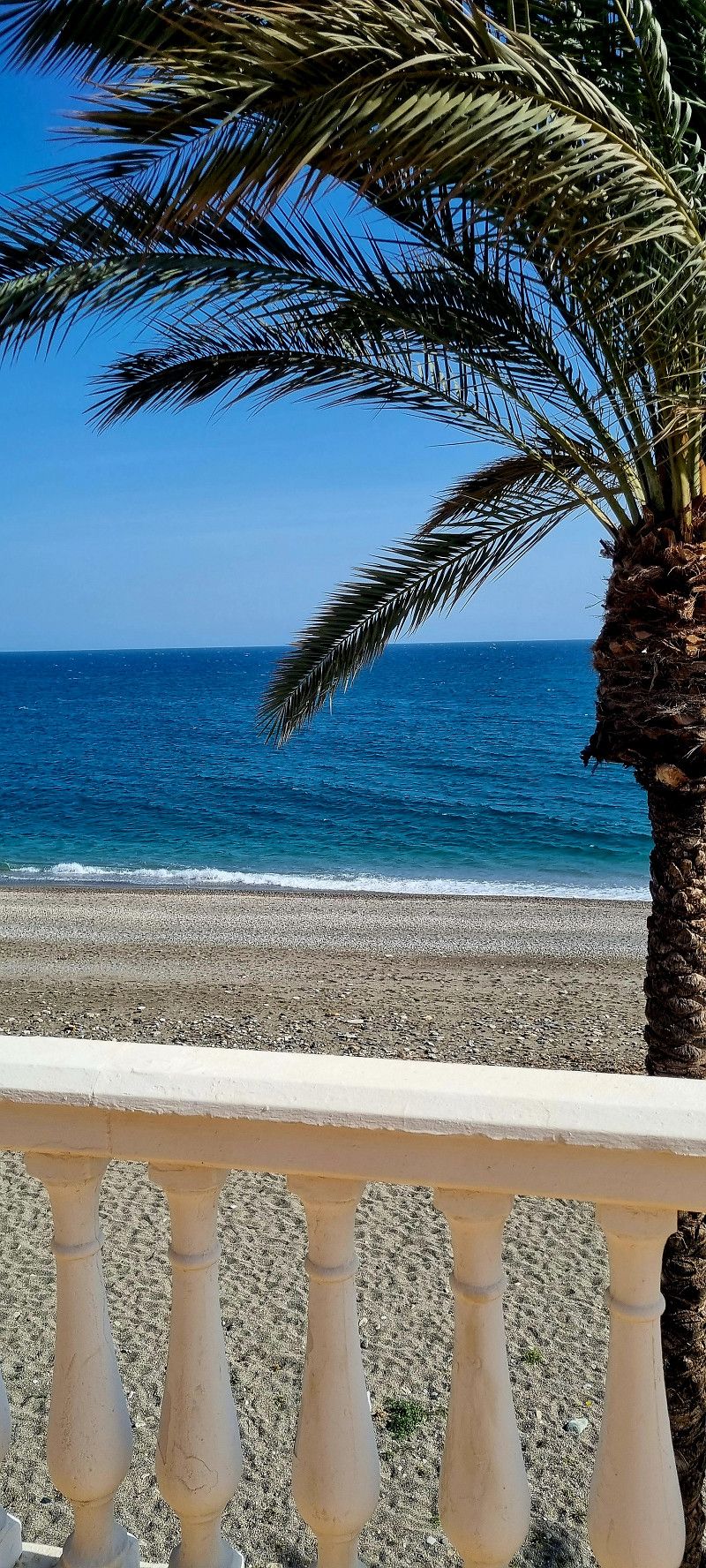
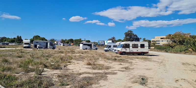
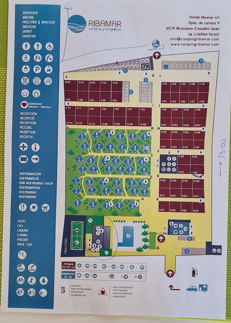
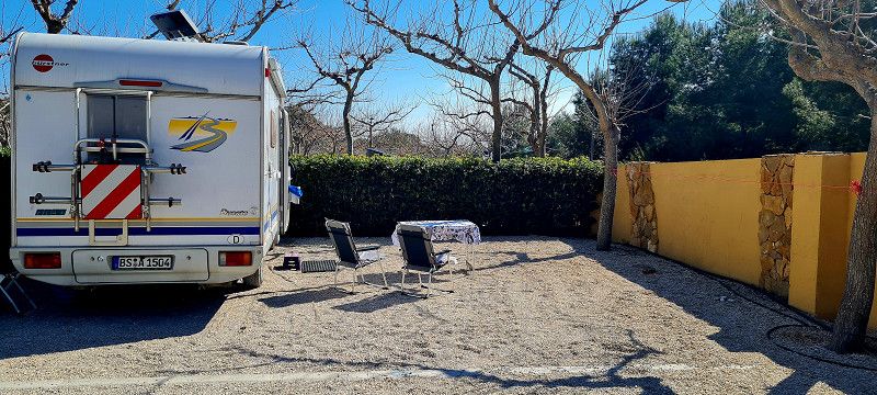
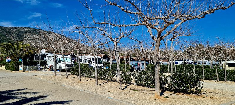
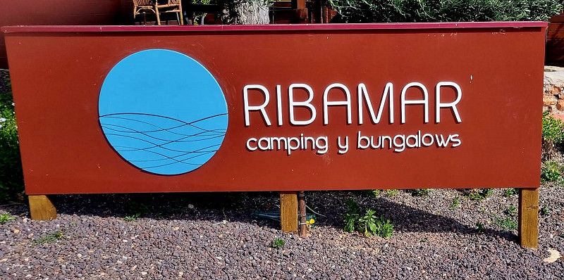
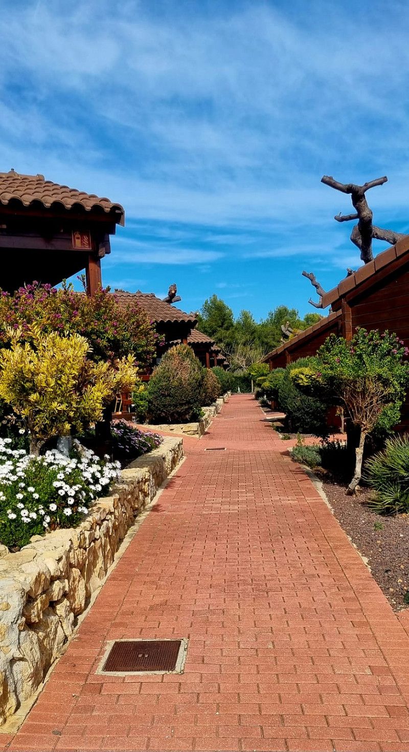
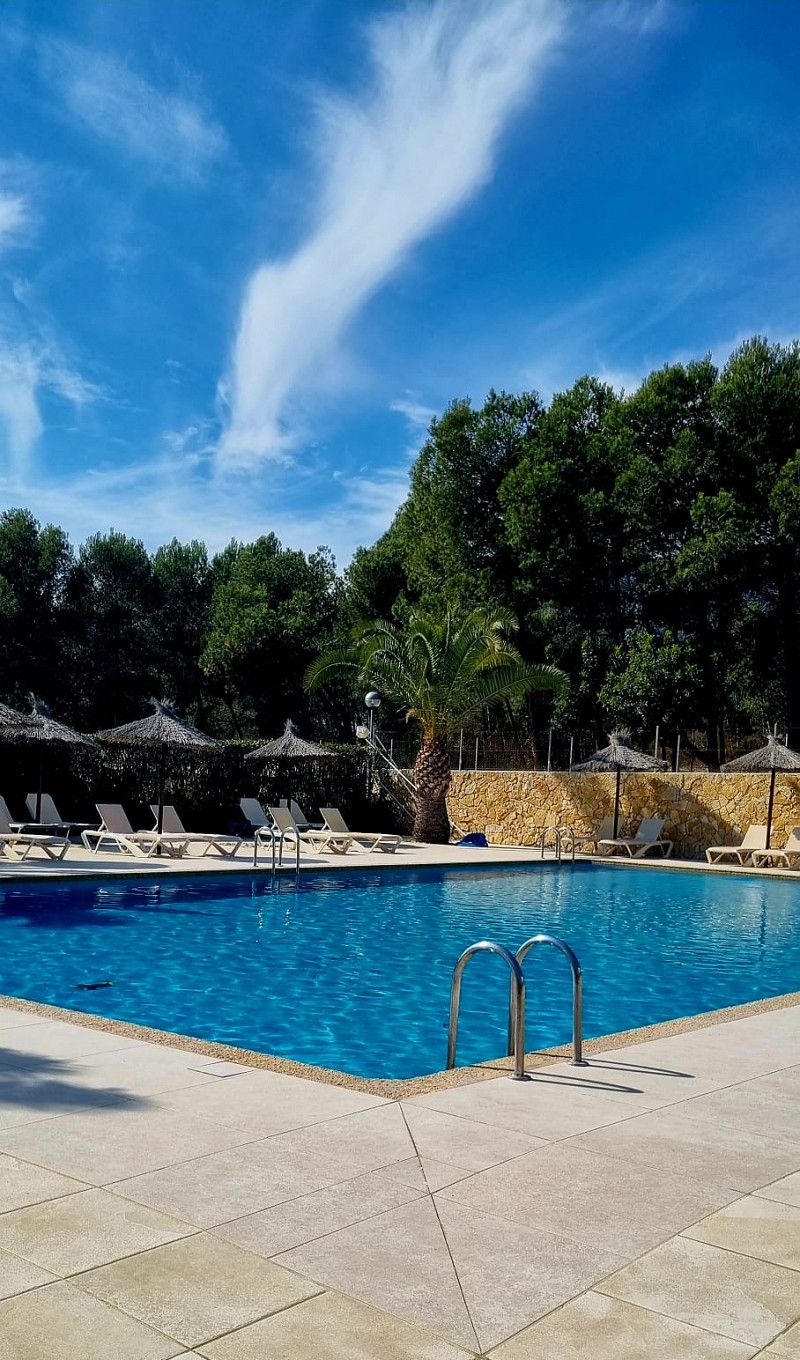
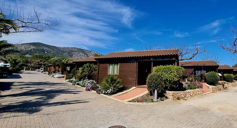
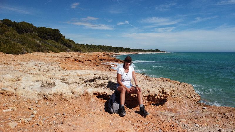
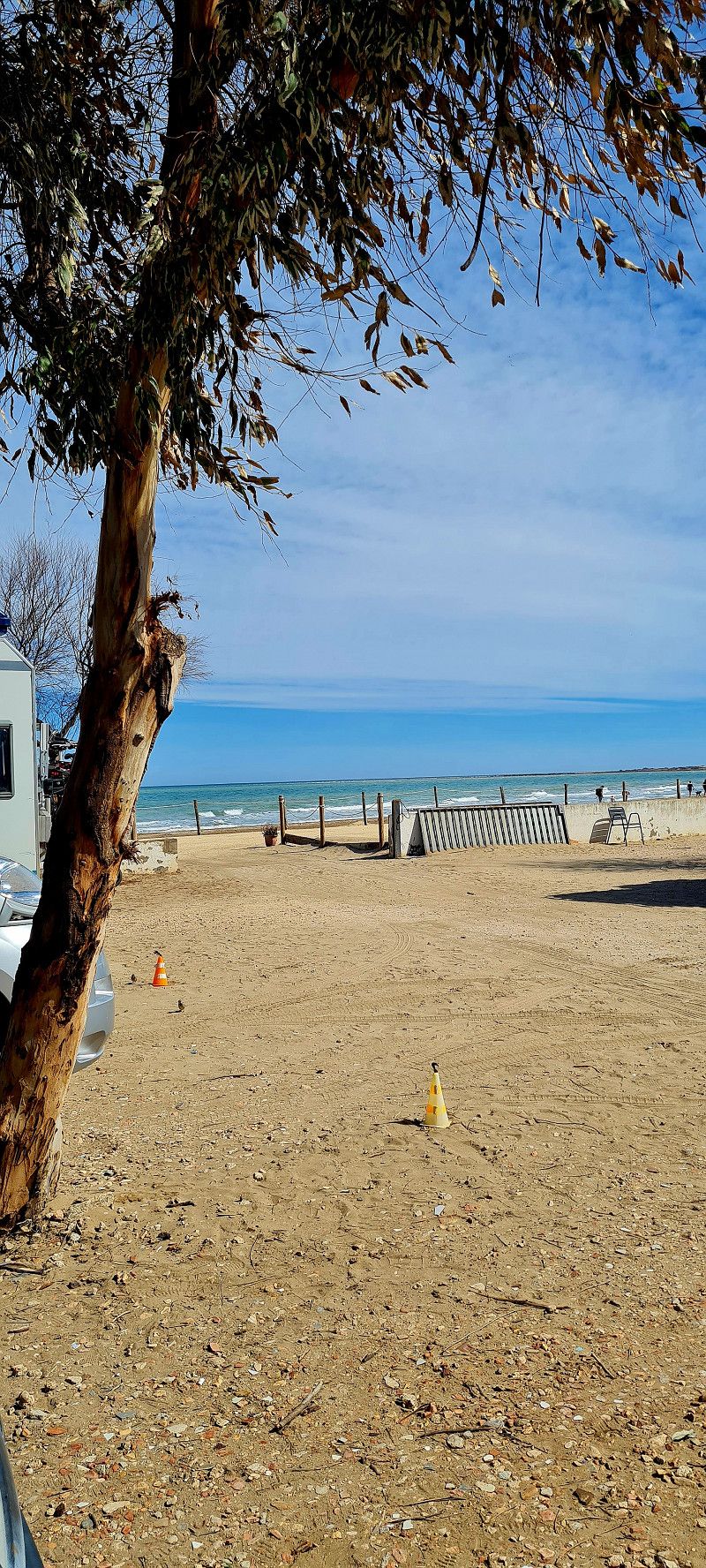
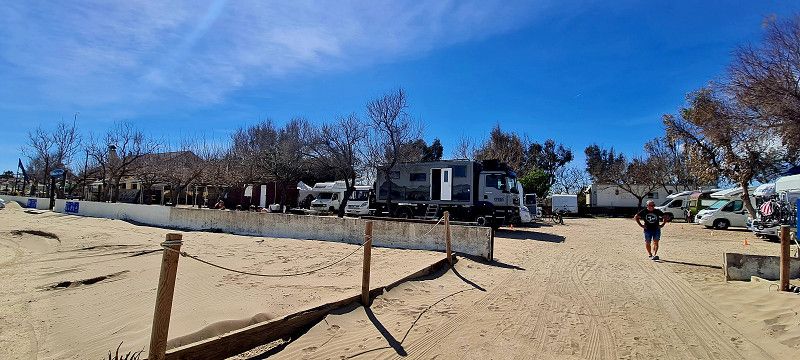
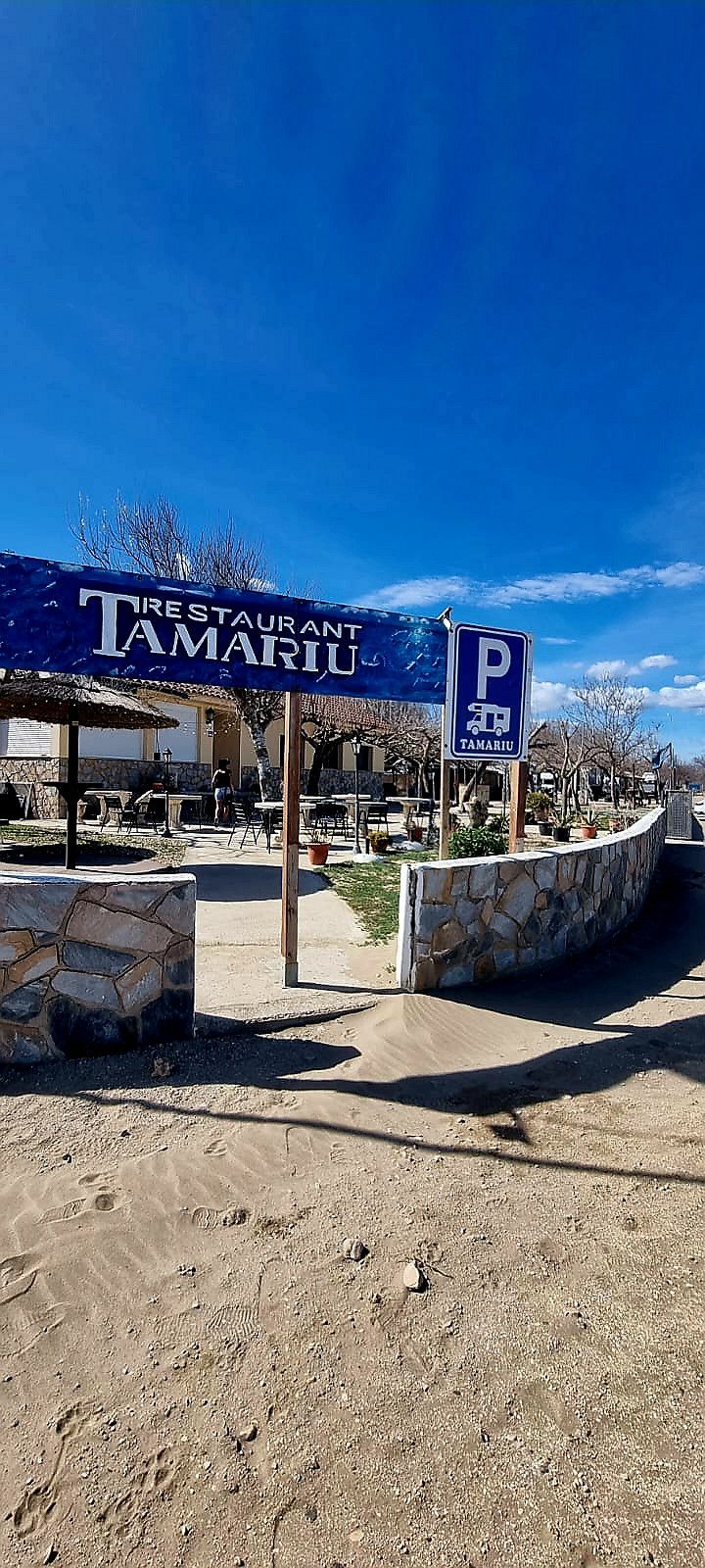
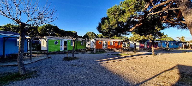
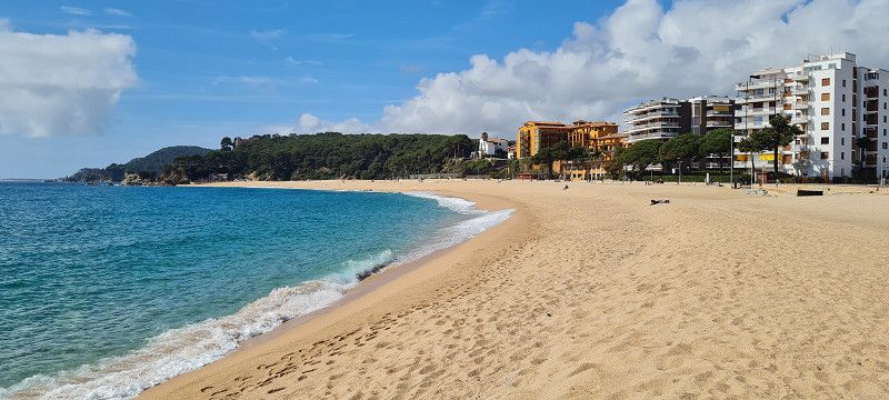
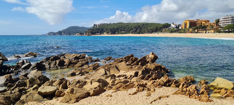
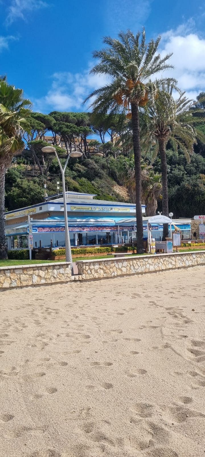
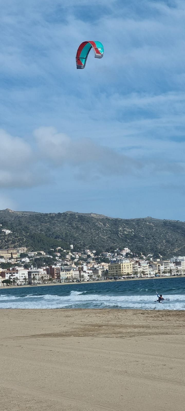
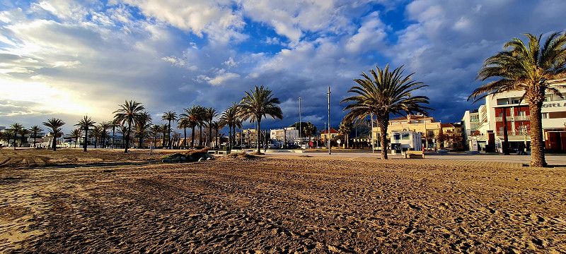
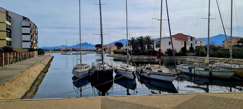
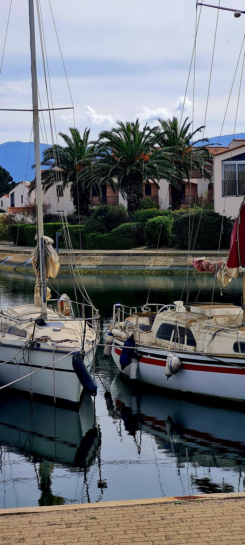
Camping Ribamar Alcossebre (Tag 1)
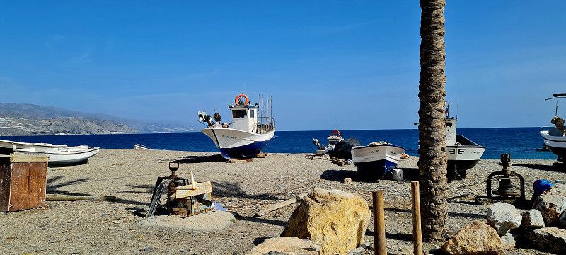
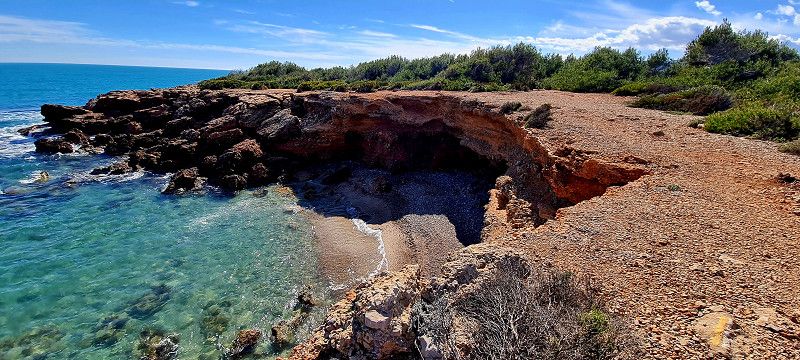
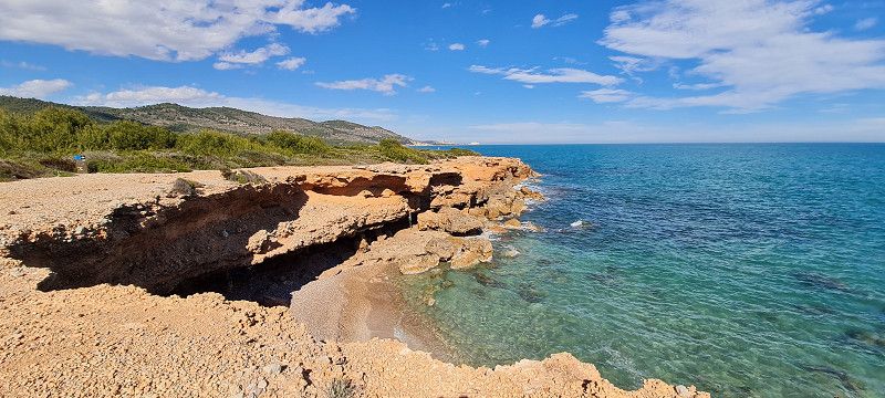
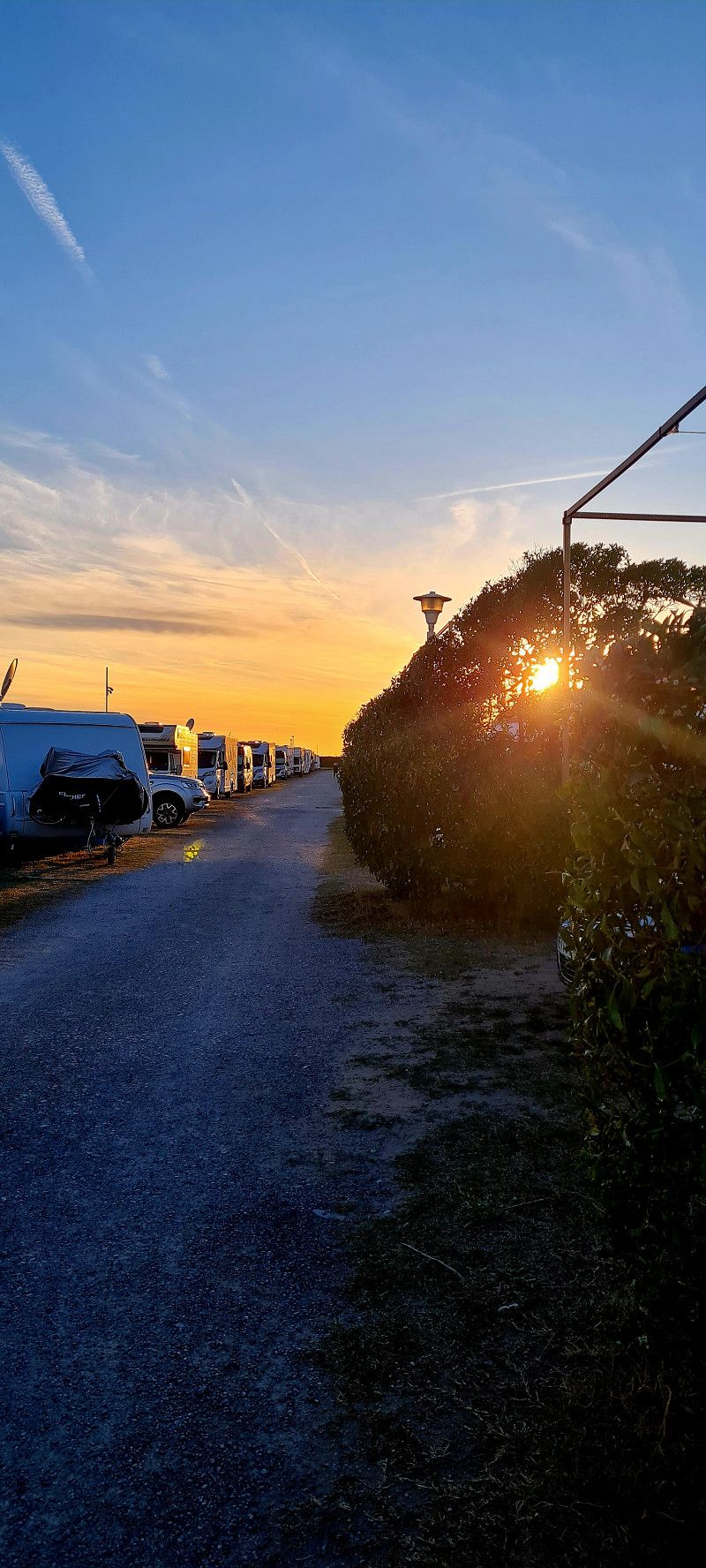
Today we went almost 120 kilometers to a super nice little campsite in the Serra d'Irta National Park.
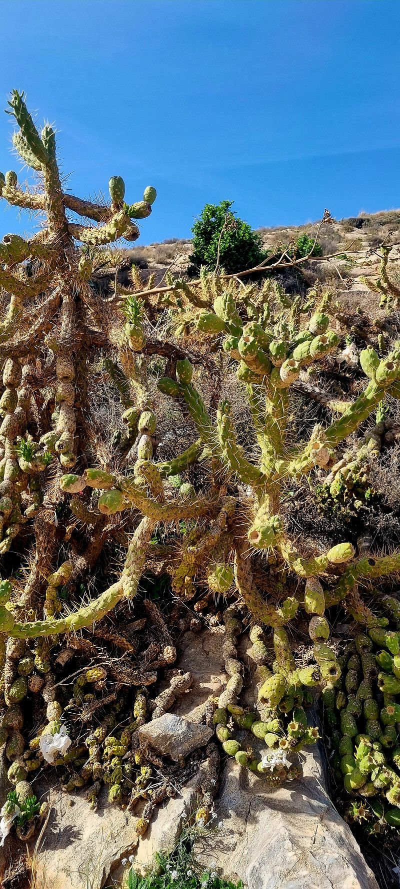
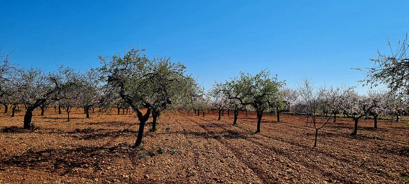
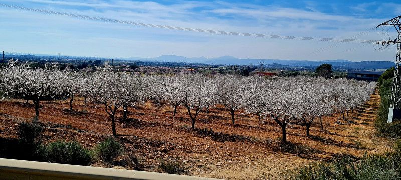
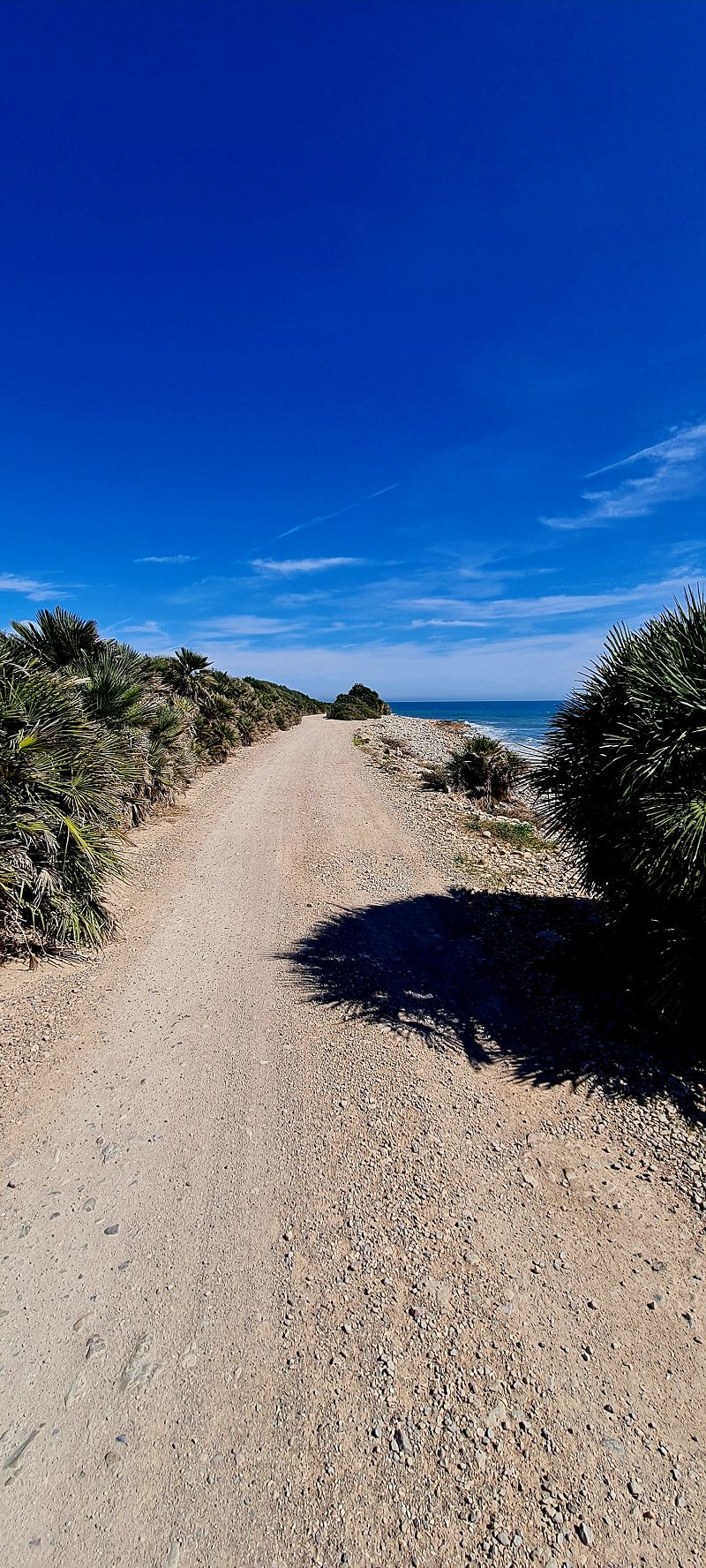
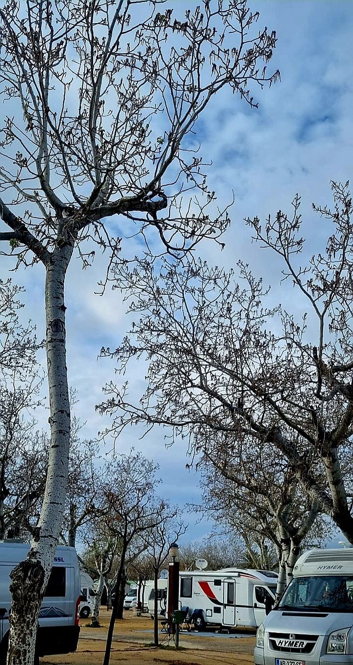
The approach was very nice. Lots of flowering almond trees instead of plastic fields. Since it went through the national park, 2 kilometers were definitely very adventurous to drive. Gravel road with potholes and larger stones. But very slowly our EDDI managed to do that.
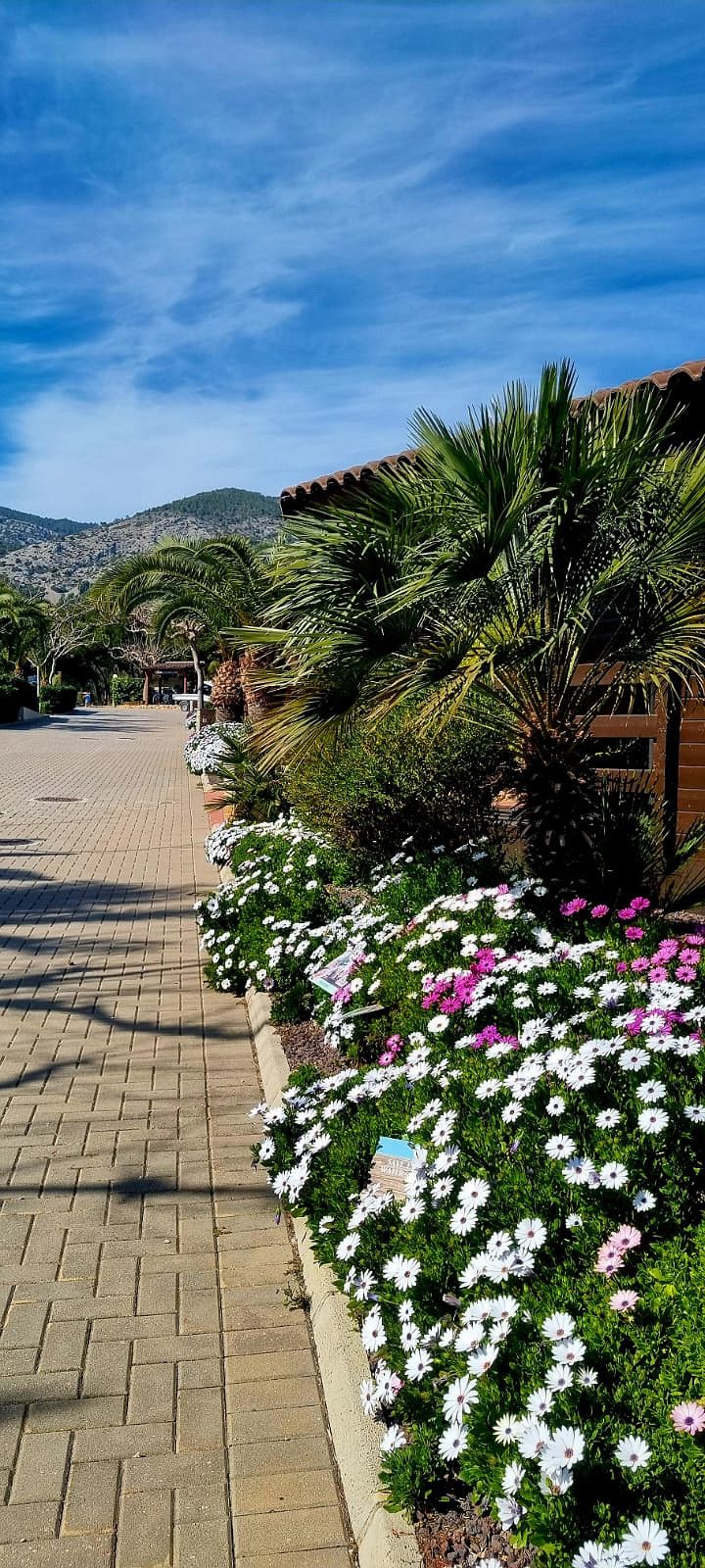
Arrived at the place we were even welcomed in German. We got a nice big place.
We're staying here for 5 days. We will hike a little here again and rest alternately.
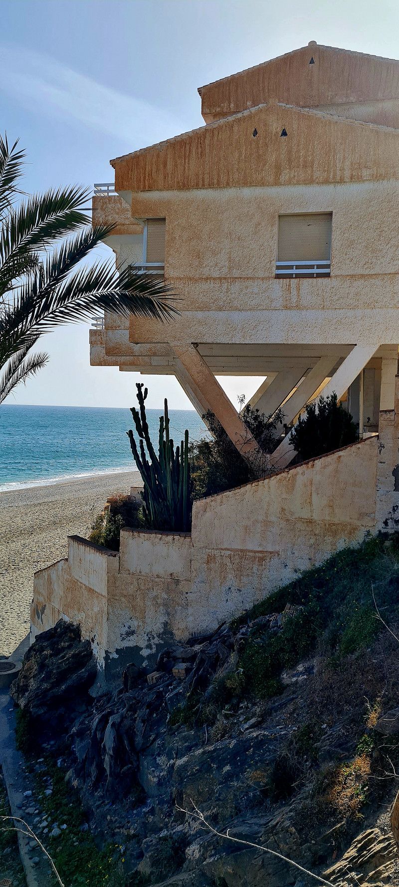
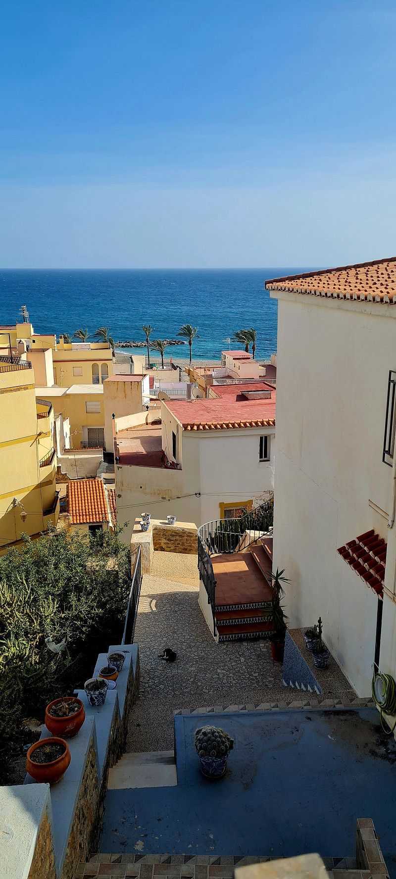
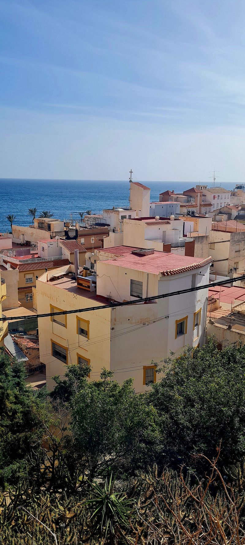
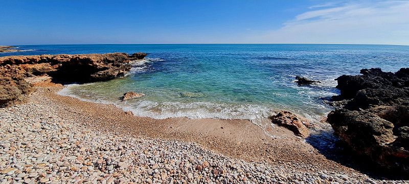
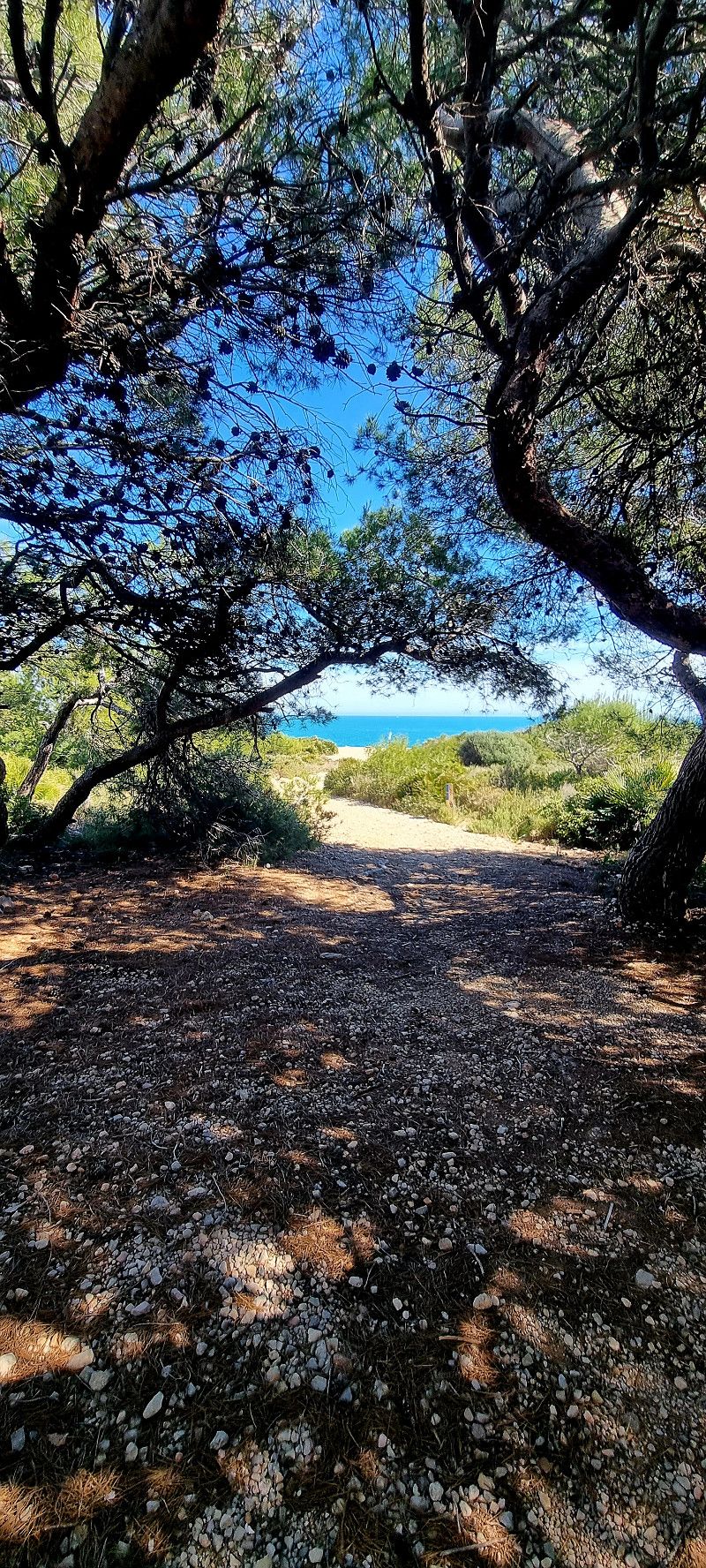
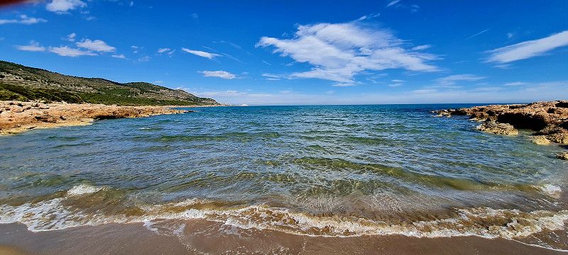
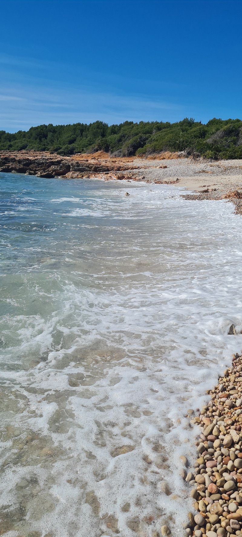
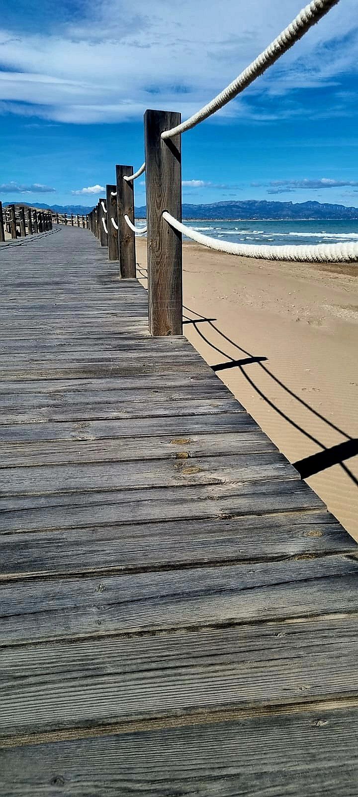
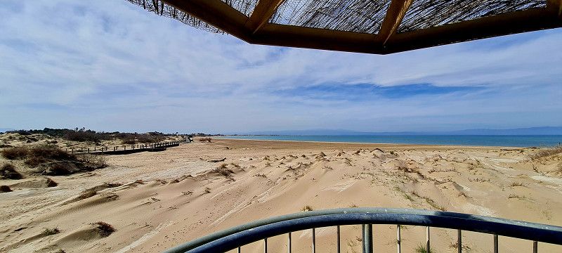
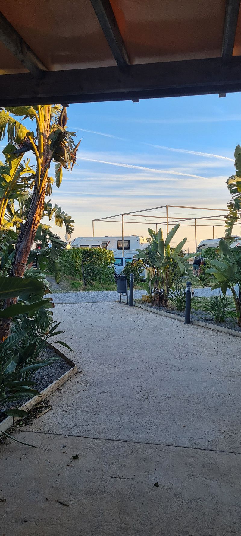
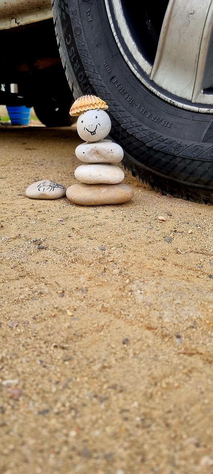
100 meters away is a small stretch of beach that belongs to the campsite. But it is not a beautiful long sandy beach but small, rocky bays. But a lot of peace and nature. Really nice.
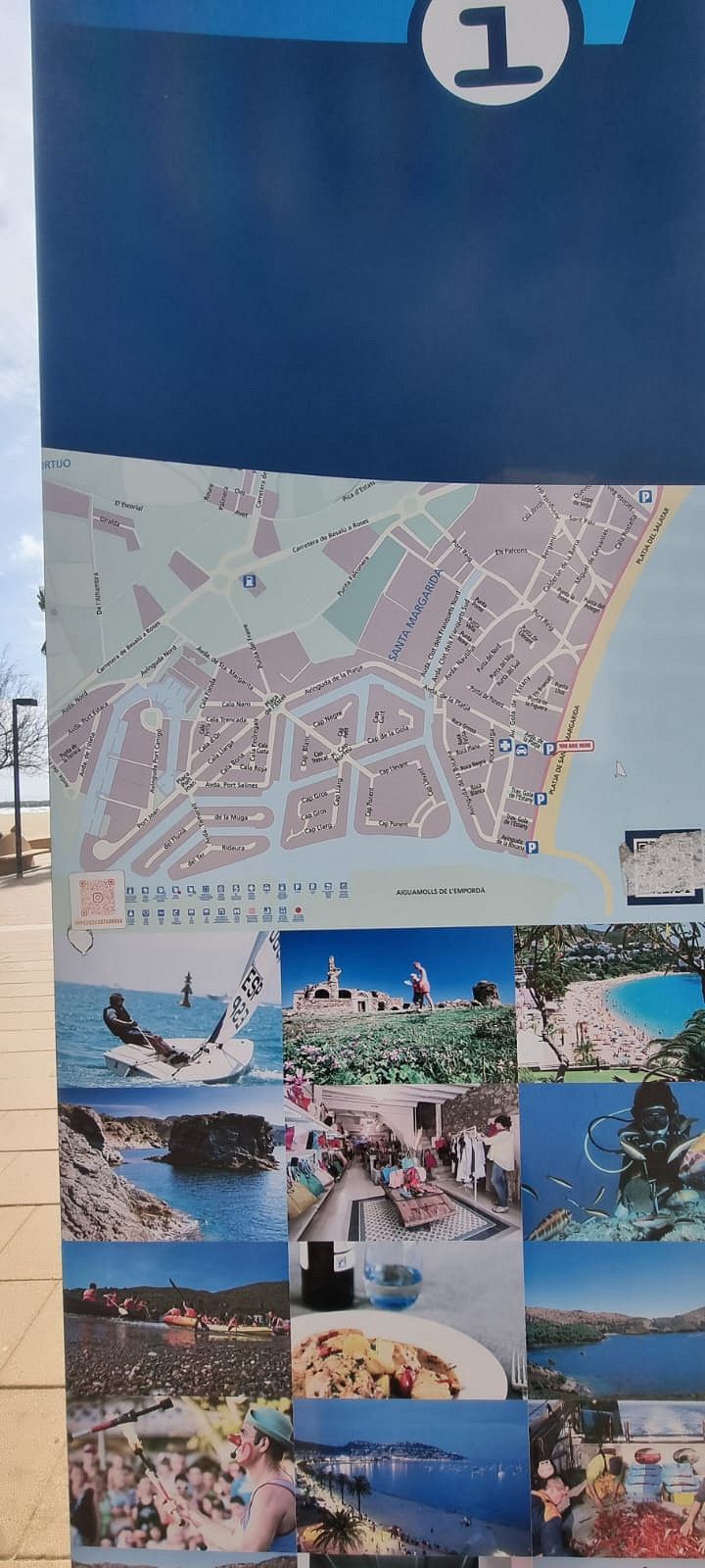
Partida Ribamar s/n, 12579, Alcossebre, Spain
40° 16' 3.8" N 0° 18' 12.6" E
40.2677300 0.3034900
• Head northeast on Camino de Ribamar.
• Arrive at Camino de Ribamar.
☍
Distance not available
(Duration not available)
Day
Camping Ribamar (Tag 2)
bit sick 😞
Partida Ribamar s/n, 12579, Alcossebre, Spanien
40° 16' 3.8" N 0° 18' 12.6" E
40.2677300 0.3034900
• Head northeast on Camino de Ribamar.
• Arrive at Camino de Ribamar.
☍
Distance not available
(Duration not available)
Day
Camping Ribamar (Tag 3)
After we just sat here in the sun yesterday and I was also ill with a bad cold, we went through the grounds again today. 16 kilometers up and down the coast.
And because it's really nice here, we're extending our stay by 2 days.
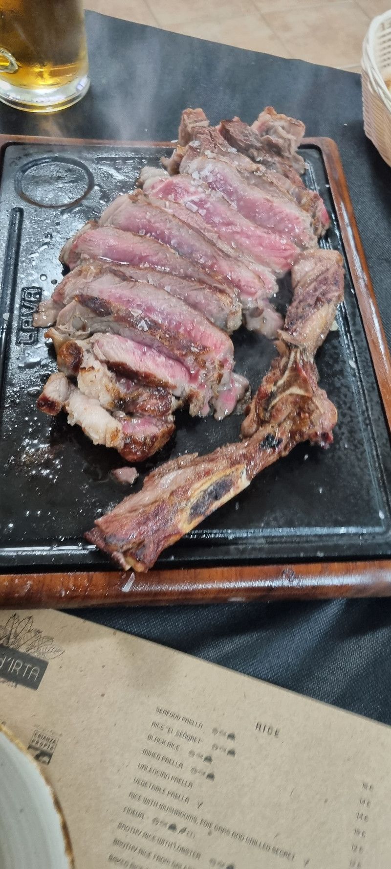
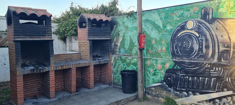
Tonight we went to the in-house restaurant for dinner. It was delicious again. Kudos to the chef and the service. And with translation apps, there are no more communication problems. You just feel good here 😀
Partida Ribamar s/n, 12579, Alcossebre, Spain
40° 16' 3.8" N 0° 18' 12.6" E
40.2677300 0.3034900
• Head toward Partida Ribamar on Camino de Ribamar. Go for 446 m.
• Turn right toward Partida Ribamar. Go for 163 m.
• Continue on Partida Ribamar. Go for 29 m.
• Arrive at Partida Ribamar. Your destination is on the left.
☍
0,6 km
( 1 min.)
Day
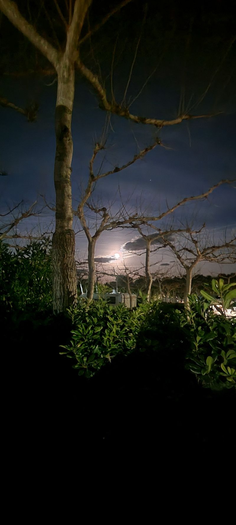
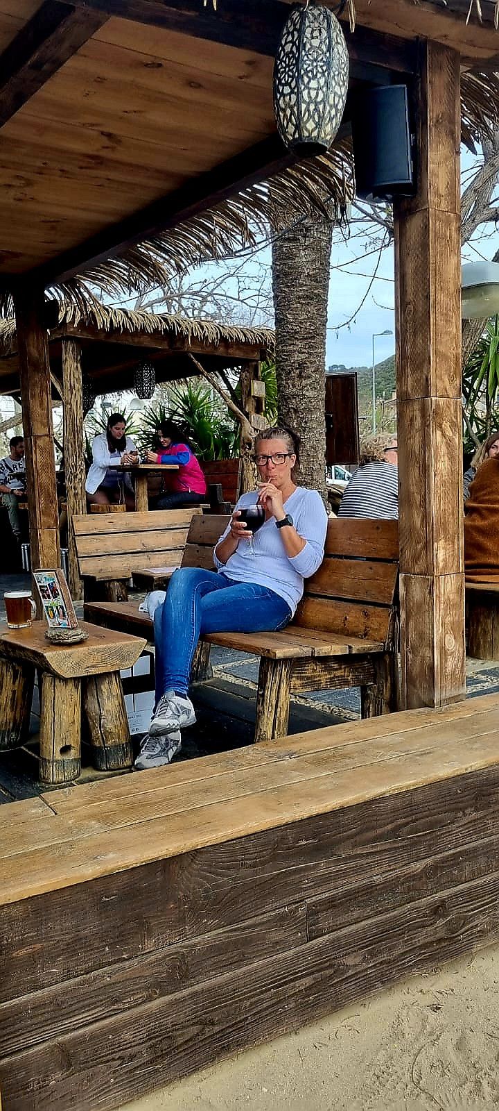
Camping Ribamar, Spanien (Tag 4)
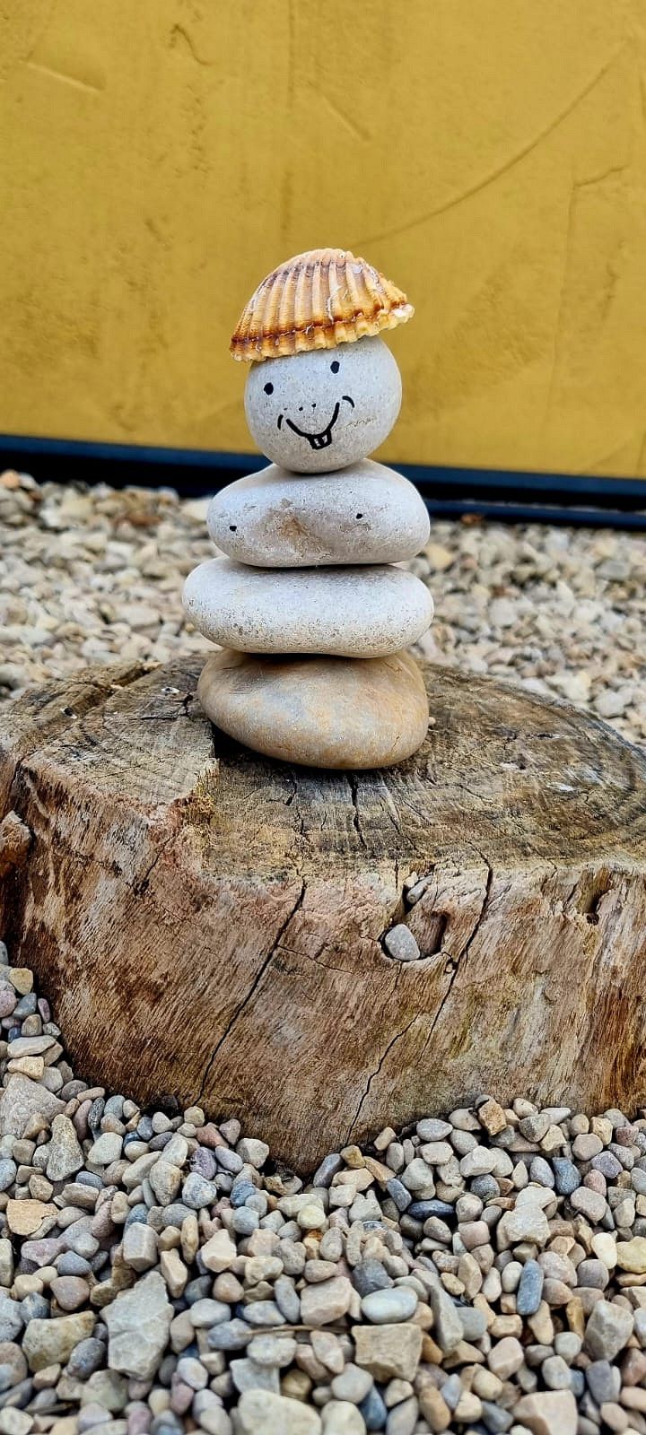
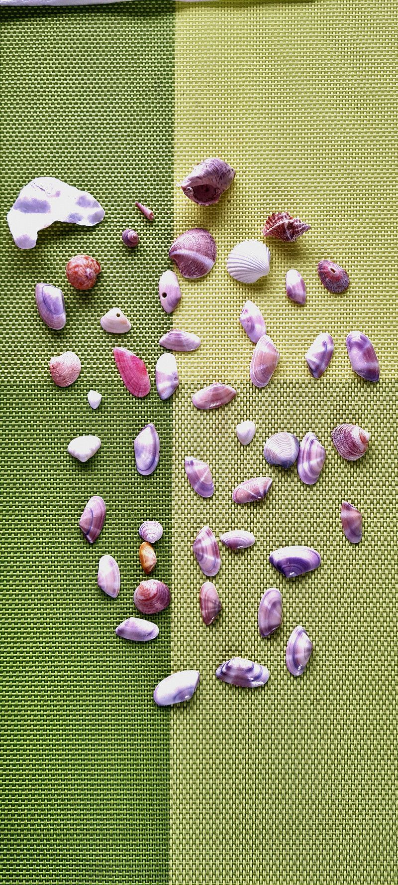
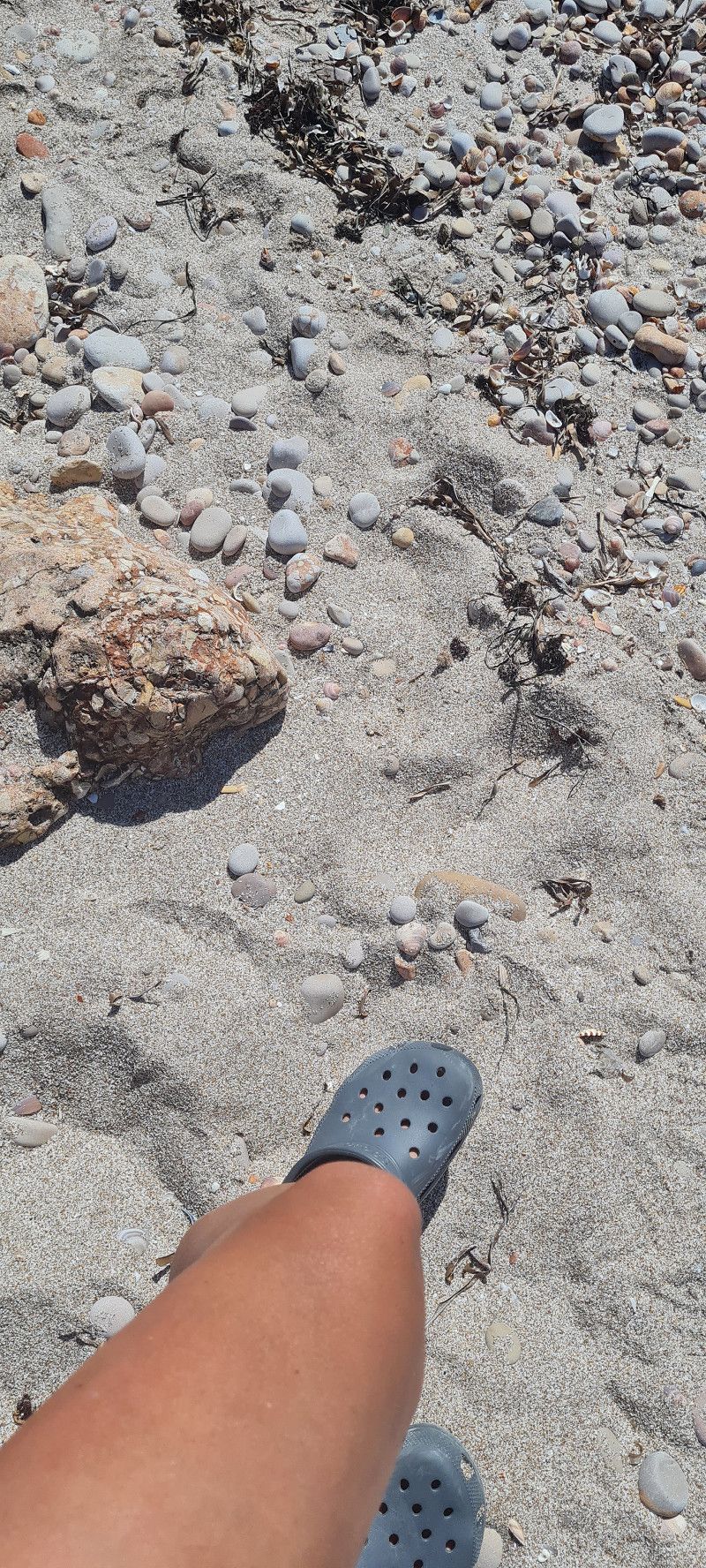
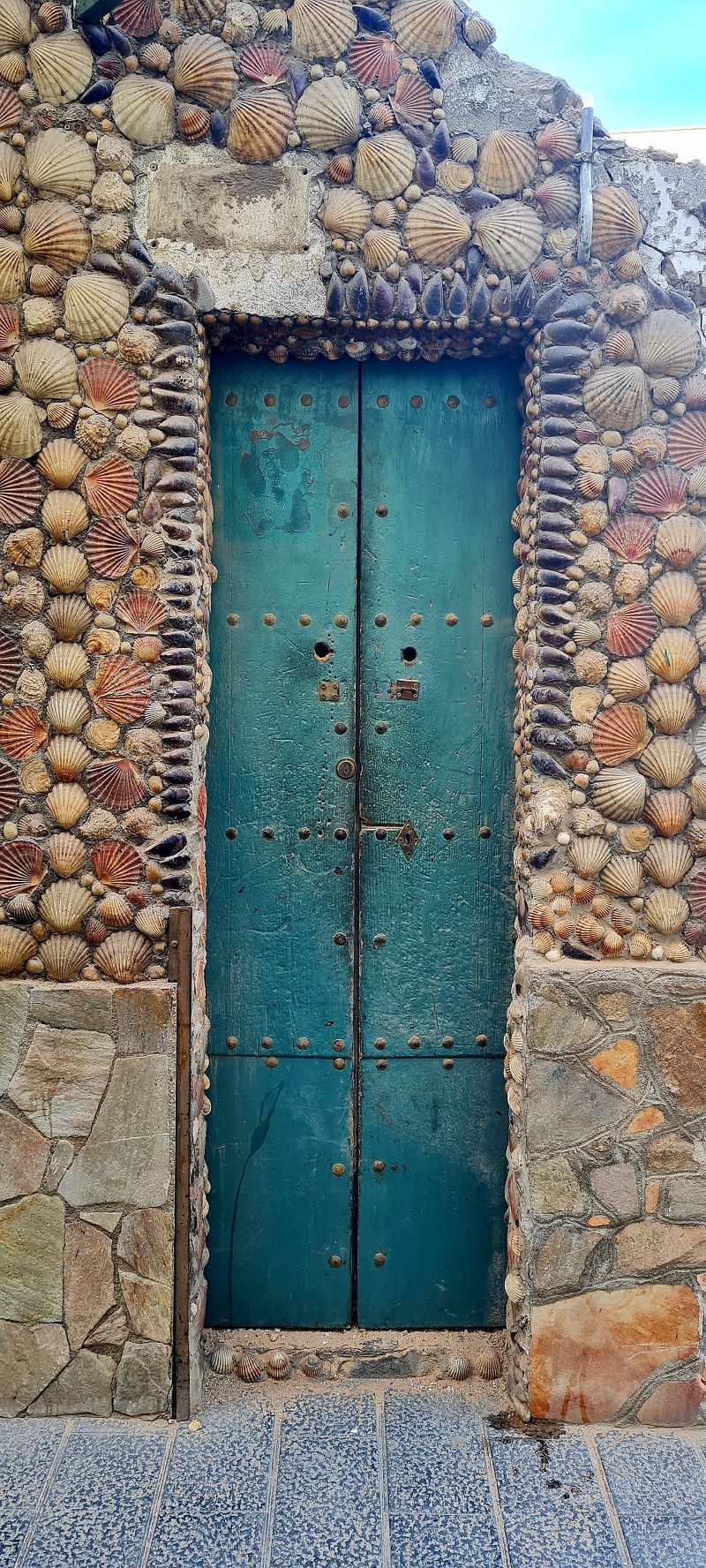
Today was the best summer weather here. Have a nice breakfast outside and later sunbathe by the sea. While one goes swimming, the other is looking for shells 😉
Camí de Ribamar, 12579, Alcalà de Xivert, Spanien
40° 16' 12.1" N 0° 18' 27.4" E
40.2700294 0.3076187
• Head southeast on Partida Ribamar.
• Arrive at Partida Ribamar. Your destination is on the left.
☍
Distance not available
(Duration not available)
Day
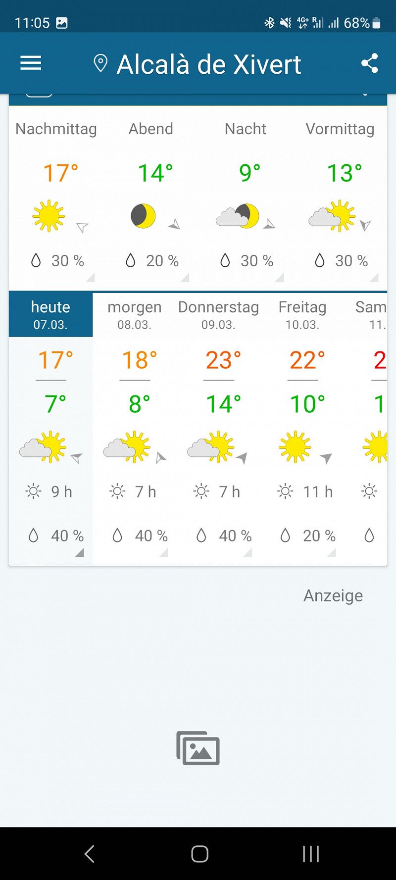
Camping Ribamar, Spanien (Tag 5)
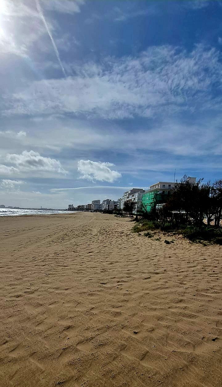
Well, unfortunately I don't have much to tell you today. It actually rained a bit this morning. By noon everything was fine again. Then we borrowed bikes. Mountain bike without battery for 10 euros for half a day. We then went to town (about 4 kilometers) to go shopping and have coffee. Alcossebre is a small town consisting of 80% apartments or rental accommodation. But there is a nice long sandy beach there. Not much was booked at this time of the year. But many restaurants and cafes are open. We paid 3.20 euros for a cappuccino and a café americano. You can't complain about that. Unfortunately we didn't see anything really outstanding in town. So no photos today
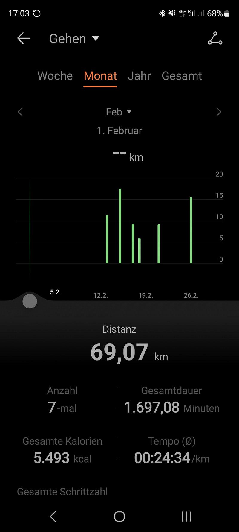
Oh yes, it's been a few days but...hey we hiked 69 kilometers in February. Hello! That's definitely worth a thumbs up 😀
Camí de Ribamar, 12579, Alcalà de Xivert, Spanien
40° 16' 12.1" N 0° 18' 27.4" E
40.2700294 0.3076187
• Head toward Camino Pebret on Partida Ribamar. Go for 192 m.
• Turn left onto Camino de Ribamar. Go for 97 m.
• Turn slightly right onto Camino de Ribamar. Go for 349 m.
• Arrive at Camino de Ribamar.
☍
0,6 km
( 1 min.)
Day
Camping Ribamar (Tag 6)
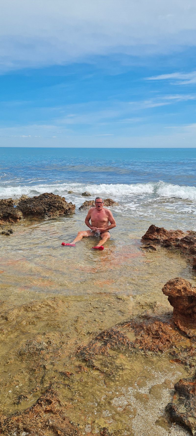
lying in the sun on the beach all afternoon today. Wow that was hot today 😀 🌞 and grilled a little tonight.
Partida Ribamar s/n, 12579, Alcossebre, Spain
40° 16' 3.8" N 0° 18' 12.6" E
40.2677300 0.3034900
• Head southwest on Camino de Ribamar.
• Arrive at Camino de Ribamar.
☍
Distance not available
(Duration not available)
Day
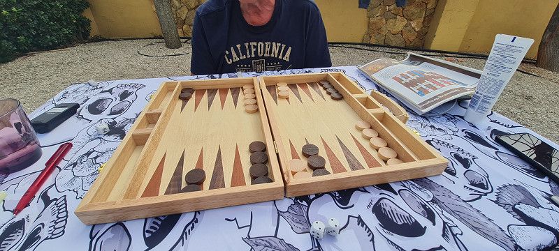
Camping Ribamar (Tag 7)
today like yesterday only with sunburn 😀
But tomorrow we'll continue again.
Partida Ribamar s/n, 12579, Alcossebre, Spain
40° 16' 3.8" N 0° 18' 12.6" E
40.2677300 0.3034900
• Head toward Partida Ribamar on Camino de Ribamar. Go for 1.4 km.
• Continue on Camino El Atall. Go for 176 m.
• Turn right onto Calle Portell. Go for 235 m.
• Turn left onto Calle Piber. Go for 313 m.
• Take the 2nd exit from Plaza de Tanduay roundabout onto Avenida Manila. Go for 799 m.
• Take the 2nd exit from Plaza de las Fuentes roundabout onto Carretera de las Fuentes. Go for 2.4 km.
• Take the 1st exit from roundabout onto CV-142 toward AP-7/N-340/CV-13. Go for 2.4 km.
• Take ramp onto N-340 toward Tarragona. Go for 22.0 km.
• Take ramp toward N-340a/Benicarló sud/Benicarló Sur/Castelló/Castellón/E-15/AP-7/Tarragona. Go for 332 m.
• Take the 1st exit from roundabout onto AP-7 (Autopista del Mediterráneo) toward Barcelona. Go for 43.7 km.
• Take exit 41 toward Amposta/N-340/Sant Carles de la Ràpita. Go for 1.7 km.
• Take the 5th exit from roundabout onto Carretera d'Amposta (N-340a) toward Deltebre/TV-3454. Go for 591 m.
• Turn left onto TV-3454 toward Deltebre. Go for 8.4 km.
• Take the 2nd exit from roundabout onto TV-3454 toward Deltebre/La Cava/Saint/Jaumes d'e./Riumar. Go for 1.6 km.
• Take the 2nd exit from roundabout onto Barri de Lepanto (TV-3454) toward Deltebre/La Cava. Go for 2.4 km.
• Pass 2 roundabouts and continue on Barri de Lepanto (TV-3454). Go for 3.1 km.
• Continue toward TV-3454. Go for 49 m.
• Continue on T-340. Go for 5.0 km.
• Take the 2nd exit from roundabout onto T-340 toward Bassa de l'Arena/Illa de Buda/Riumar. Go for 1.6 km.
• Take the 3rd exit from roundabout toward Riumar/Port de Deltebre. Go for 1.0 km.
• Continue on Carrer Riomar II. Go for 269 m.
• Take the 3rd exit from roundabout onto Carrer Riomar II. Go for 204 m.
• Turn slightly left onto Carrer Àguila Pescatera. Go for 22 m.
• Turn right onto Carrer del Fumadell. Go for 203 m.
• Turn left onto Carrer de la Capadella. Go for 180 m.
• Arrive at Carrer de la Capadella. Your destination is on the left.
☍
100,2 km
(1 hrs. 12 min.)
Day
Riumar, Spanien (Tag 1)
Today we are about 100 kilometers further into the Ebro Delta to Riumar on the hippie pitch
Area Sosta Camper Tamariu
driven. A place for old and new hippies (you can still smoke here 😀) right by the sea in a cul-de-sac. A fairly small place and the pitches are not large. 85% German campers. The night without electricity for 10 euros Electricity extra for 5 euros. A restaurant right on the square with German dishes. But tastes very good. We also immediately made a nice acquaintance and there were seven of us eating in the restaurant.
Of course we were also out and about in town and on the beach... great, great, great. There is NOT a hotel here, only pretty holiday homes and apartments, a long beautiful sandy beach and flamingos that are white like swans 😉 I recommend this place for vacation.
Riumar, 43580, Deltebre, Spanien
40° 43' 35.9" N 0° 50' 12.7" E
40.7266434 0.8368483
• Head northwest on Carrer de la Capadella.
• Arrive at Carrer de la Capadella. Your destination is on the left.
☍
Distance not available
(Duration not available)
Day
Riumar, Spanien (Tag 2)
spent another day at the beach and in the nature reserve today. We only hiked about 8 kilometers today 😉
Tomorrow we continue towards Barcelona.
Here are some nice pictures
Riumar, 43580, Deltebre, Spanien
40° 43' 35.9" N 0° 50' 12.7" E
40.7266434 0.8368483
• Head toward Carrer del Bernat on Carrer de la Capadella. Go for 46 m.
• Turn left onto Carrer del Bernat. Go for 97 m.
• Turn left onto Carrer de la Gavina. Go for 223 m.
• Turn right onto Carrer del Fumadell. Go for 105 m.
• Turn left onto Carrer Àguila Pescatera. Go for 22 m.
• Turn slightly right onto Carrer Riomar II. Go for 122 m.
• Take the 1st exit from roundabout onto Carrer Riomar II. Go for 1.3 km.
• Take the 2nd exit from roundabout onto T-340. Go for 1.6 km.
• Take the 2nd exit from roundabout onto T-340. Go for 5.0 km.
• Continue toward TV-3454. Go for 49 m.
• Continue on Barri de Lepanto (TV-3454). Go for 1.7 km.
• Take the 4th exit from roundabout onto Barri de Lepanto (TV-3454). Go for 1.4 km.
• Take the 1st exit from roundabout onto T-340 toward Camarles/l'Aldea/Tarragona. Go for 1.4 km.
• Take the 1st exit from roundabout onto TV-3401/TV-3409 toward Camarles. Go for 162 m.
• Turn right onto Carretera Camarles (TV-3401) toward l'Ampolla. Go for 306 m.
• Continue on TV-3401. Go for 7.8 km.
• Take the 1st exit from roundabout onto TV-3401 toward N-340/l'Ampolla. Go for 1.2 km.
• Turn right onto N-340. Go for 1.3 km.
• Take ramp toward E-15/AP-7/l'Ampolla Centre. Go for 346 m.
• Take the 4th exit from roundabout toward Tarragona/Castelló. Go for 251 m.
• Take ramp onto AP-7 (Autopista de la Mediterrània) toward Barcelona. Go for 87.5 km.
• Take exit 31 toward El Vendrell/N-340/Coma-ruga/Aeroport/Barcelona per Vilanova i la G. onto C-32 (Autopista Pau Casals). Go for 44.9 km.
• Take exit 44 toward Castelldefels sud. Go for 364 m.
• Keep left onto Avinguda de Castelldefels (C-31) toward Barcelona/Gavà. Go for 6.4 km.
• Turn right onto Carrer Autovia de Castelldefels. Go for 63 m.
• Turn right. Go for 107 m.
• Turn right. Go for 35 m.
• Turn slightly left. Go for 27 m.
• Arrive at your destination on the left.
☍
164,0 km
(1 hrs. 39 min.)
Day
Càmping Tres Estrellas, Spanien
Today we covered almost 200 kilometers.
Just before Barcelona to the Tres Estrellas campsite.
https://www.tresestrellascampings.com/barcelona/
Here we stay 3 nights. The place is quite big. There are plots of all sizes, rental houses, supermarket, restaurant, pool (currently closed), playground, barbecue areas and much more.
The beach is beautiful too.
We got one of the largest pitches. Second row to the beach. For 1 night we pay 30 euros.
However, it is not a place for people looking for peace. The airport and the motorway are in the immediate vicinity.
But that doesn't bother us. We want to spend 2 days in Barcelona.
The bus stop is within walking distance.
For 2.40 euros per person (one way) you can get to the center of Barcelona.
More information will follow tomorrow 👍
Avinguda d'Europa, 08850, Gavà, Spanien
41° 16' 18" N 2° 2' 36.4" E
41.2716774 2.0434467
• Head east. Go for 68 m.
• Turn left. Go for 70 m.
• Turn left. Go for 66 m.
• Turn right toward Carrer Autovia de Castelldefels. Go for 36 m.
• Turn left onto Carrer Autovia de Castelldefels. Go for 39 m.
• Turn right onto Carrer Autovia de Castelldefels. Go for 40 m.
• Turn right onto Autovia de Castelldefels (C-31). Go for 9.6 km.
• Take exit 196AB toward Polígon Industrial de Z. Franca-ZAL onto B-10 (Ronda del Litoral). Go for 7.1 km.
• Take exit 21 toward Ciutat Vella/Paral.lel/La Rambla onto Passeig de Josep Carner. Go for 881 m.
• Take the 3rd exit from Plaça de les Drassanes roundabout onto Passeig de Josep Carner toward Terminals F1 N S/Pg. Colom/Port Olímpic/Moll d'Espanya. Go for 313 m.
• Take the 3rd exit from Plaça del Portal de la Pau roundabout onto Avinguda de les Drassanes. Go for 344 m.
• Turn right onto Carrer del Portal de Santa Madrona. Go for 122 m.
• Turn left onto Carrer la Rambla. Go for 530 m.
• Turn right toward Pla de la Boqueria. Go for 21 m.
• Turn slightly left onto Pla de la Boqueria. Go for 14 m.
• Turn right onto Carrer de la Boqueria. Go for 186 m.
• Turn slightly left onto Carrer del Call. Go for 131 m.
• Turn right onto Plaça de Sant Jaume. Go for 24 m.
• Turn left onto Plaça de Sant Jaume. Go for 61 m.
• Continue on Carrer de Jaume I. Go for 11 m.
• Arrive at Carrer de Jaume I. Your destination is on the right.
☍
19,6 km
( 27 min.)
Day
Barcelona, Spanien (Tag 1)
This morning we took the bus to Barcelona.
The outward journey took about 45 minutes. We drove to the end station, that was in the middle of the city.
We were previously advised that we should determine the attractions we want to visit in advance and then head for them in a targeted manner. Otherwise you stand like an ox in front of the barn door and don't know where to go.
That's how we did it. The goal for today was the park "Güell" designed by Antoni Gaudí
We still had to take the metro a bit to get there. We then bought a tourist ticket for 18.50 euros. This ticket is valid for 48 hours and you can use all public transport. We took the metro for 10 minutes to Güellpark.
Entry to the park was 10 euros per person without an audio guide. We spent a good 2.5 hours there.
Then we walked 2.5 kilometers to the Sagrada Familia (Basilica). It is Gaudi's main work.
(I will visit them from the inside tomorrow) 😊👍
Finally, we took the metro to the market hall again. Strolled around there.
That was enough for today. Shortly before 6 p.m. we were back on the bus back to the campsite. The drive back took 1 hour due to traffic.
That's enough for today. Tomorrow we're going again 🙂
Barcelona, 08001, Spanien
41° 22' 58.4" N 2° 10' 38.8" E
41.3828939 2.1774322
• Head northeast on Carrer de Jaume I.
• Arrive at Carrer de Jaume I. Your destination is on the right.
☍
Distance not available
(Duration not available)
Day
Barcelona, Spanien (Tag 2)
Today we went back into the big city. I had a ticket for the Sagrada Familia.
Micha didn't want to come with me. I had a ticket for the basilica (26 euros) and one for the towers (10 euros)
And I absolutely loved it. I'm now a total Gaudi fan 😀 But you can also skip the towers.
FYI: to enter the basilica there is a security check like at the airport. But I didn't know that. So, unsuspectingly, I went in with a backpack including a bottle of water and electronic devices. BUT, no problem. After everything was examined, I was allowed to take everything with me.
I spent a total of 1.5 hours there.
The next goal was the Castell de Montjuïc (fortress, castle, defense system)
Here we took the cable car (up and down for 15 euros per person) you can also walk
For the Castell we paid another 9 euros per person. From up here you have a fantastic view of the city and the harbour. Wonderful 🤩
Barcelona, 08001, Spanien
41° 22' 58.4" N 2° 10' 38.8" E
41.3828939 2.1774322
• Head toward Carrer de la Dagueria on Carrer de Jaume I. Go for 127 m.
• Continue on Plaça de l'Àngel. Go for 35 m.
• Turn right onto Via Laietana. Go for 428 m.
• Continue on Moll d'Espanya toward Port Vell/Hospital del Mar/Ronda Litoral Besòs/Parc Ciutadella. Go for 83 m.
• Continue on Moll de Bosch i Alsina toward Hospital del Mar/Port Olímpic/Ronda Litoral/B-10/Besòs/Parc Ciutadella. Go for 90 m.
• Continue on Plaça de Pau Vila. Go for 215 m.
• Continue on Carrer del Doctor Aiguader toward Hospital del Mar/Port Olímpic/Ronda Litoral/B-10. Go for 349 m.
• Take left ramp onto B-10 (Ronda del Litoral) toward Ronda Litoral/Besòs. Go for 5.7 km.
• Take exit 27 toward Badalona/Mataró/Montgat/N-2 onto C-31 (Autopista de Barcelona a Mataró). Go for 9.3 km.
• Continue on C-32. Go for 49.7 km.
• Take exit 134 toward Blanes/Lloret de Mar/Tossa de Mar. Go for 355 m.
• Take the 1st exit from roundabout onto GI-600 toward Blanes/Lloret de Mar/Tossa de Mar. Go for 2.1 km.
• Take the 1st exit from roundabout onto Carretera de Tordera (GI-600) toward Blanes/Lloret M. Go for 357 m.
• Take the 2nd exit from roundabout onto Avinguda d'Europa toward Blanes. Go for 252 m.
• Take the 2nd exit from roundabout onto Avinguda d'Europa. Go for 192 m.
• Take the 4th exit from roundabout onto Carretera Accés Costa Brava (GI-682) toward Centre Ciutat. Go for 830 m.
• Pass 3 roundabouts and continue on Carretera d'Accés a la Costa Brava (GI-682). Go for 1.4 km.
• Take the 3rd exit from roundabout onto Carretera de Blanes a Sant Feliu de Guíxols (GI-682) toward Hospital Comarcal/Lloret de Mar. Go for 568 m.
• Pass 3 roundabouts and continue on Carretera de Blanes (GI-682). Go for 2.8 km.
• Take the 1st exit from roundabout onto Avinguda d'América toward Sant Pere del Bosc/Platja de Fenals. Go for 191 m.
• Turn left onto Carrer de Narcís Macià i Domènech. Go for 112 m.
• Turn right onto Carrer Buenos Aires. Go for 257 m.
• Turn slightly left onto Carrer d'Isidre Nonell. Go for 282 m.
• Arrive at Carrer d'Isidre Nonell. Your destination is on the left.
☍
75,8 km
( 58 min.)
Day
Lloret de Mar, Spanien
today we left Barcelona behind. And there is still so much to see. We have to come back 😊
We are on our way to our next destination (Roses on the Costa Brava)
But we made a short stop in Lloret de Mar for a walk on the beach.
Lloret de Mar, 17310, Spanien
41° 41' 50.5" N 2° 50' 21.3" E
41.6973503 2.8392392
• Head toward Carrer Pau Picasso on Carrer d'Isidre Nonell. Go for 34 m.
• Turn left onto Carrer Pau Picasso. Go for 84 m.
• Turn left onto Carrer Josep Maria Sert. Go for 315 m.
• Turn right onto Carrer de Francesc Cambó. Go for 303 m.
• Turn right onto Carrer de Francesc Cambó. Go for 19 m.
• Turn right onto Carretera de Blanes a Sant Feliu de Guíxols (GI-682). Go for 180 m.
• Take left ramp onto Avinguda de les Alegries (GI-680) toward GI-680a/AP-7/Vidreres/Girona/Vic. Go for 425 m.
• Pass 2 roundabouts and continue on Avinguda de les Alegries (C-63). Go for 1.2 km.
• Take the 3rd exit from roundabout onto Avinguda de les Alegries (C-63) toward AP-7/Vidreres/Girona/Sta. Coloma de F./Les Alegries. Go for 10.8 km.
• Take ramp onto C-35 toward AP-7/N-2/Barcelona/França/Maçanet S. Go for 1.3 km.
• Take the exit toward N-2/Girona onto A-2 (Autovia del Nordest). Go for 18.0 km.
• Take the exit onto AP-7 (Autopista de la Mediterrània). Go for 37.6 km.
• Take exit 4 toward Figueres S/Roses. Go for 1.5 km.
• Take the 3rd exit from roundabout toward La Jonquera/Perpignan/C-260/Roses/Cadaqués/N-260/Llançà/Centre Duaner Vilamalla. Go for 308 m.
• Take ramp onto N-2. Go for 5.8 km.
• Take ramp onto Carretera de Roses (C-260) toward Roses/Castelló d'Empúries. Go for 1.1 km.
• Pass 2 roundabouts and continue on C-260. Go for 3.4 km.
• Take the 3rd exit from roundabout onto C-260 toward Castelló d'Empúries/Roses/Cadaqués. Go for 1.9 km.
• Take the 4th exit from roundabout onto C-260 toward Roses/Cadaqués. Go for 1.8 km.
• Take the 4th exit from roundabout onto C-260 toward Empuriabrava/Roses/Cadaqués. Go for 2.0 km.
• Pass 5 roundabouts and continue on Carretera de Besalú a Roses (C-260). Go for 5.5 km.
• Take the 3rd exit from roundabout onto Carretera de Besalú a Roses (C-260) toward Centre Ciutat. Go for 760 m.
• Take the 1st exit from roundabout onto Carrer Bernat Metge. Go for 166 m.
• Arrive at Carrer Bernat Metge. Your destination is on the left.
☍
94,4 km
(1 hrs. 10 min.)
Camping Joncar Mar
Well, now we have arrived at Camping Joncar Mar in Roses.
Here we stay 4 nights and unfortunately this is our last stop in Spain 😥😢😥
We are already about 50 kilometers from the French border. The weather isn't great here today. 15 degrees and strong wind. Therefore only a few pictures today.
C/ Bernat Metge 9-10, 17480, Roses, Spain
42° 15' 56" N 3° 9' 47" E
42.2655600 3.1630600
• Head toward Carrer Joanot Martorell on Carrer Bernat Metge. Go for 148 m.
• Take the 1st exit from roundabout onto Avinguda de Rhode (C-260). Go for 721 m.
• Take the 2nd exit from roundabout onto Carrer Margarita Timoner toward C. Madrid. Go for 340 m.
• Continue on Plaça de Pep Ventura. Go for 60 m.
• Take the 2nd exit from roundabout onto Carrer Pep Ventura. Go for 197 m.
• Turn slightly left onto Carrer de l'Escorxador. Go for 91 m.
• Continue on Carrer de Girona. Go for 47 m.
• Turn right onto Carrer de Capità Ariza. Go for 51 m.
• Turn left onto Carrer Josep Sabater. Go for 117 m.
• Turn right onto Carrer Aragó. Go for 26 m.
• Turn right onto Carrer del Castell de la Trinitat. Go for 109 m.
• Turn left onto Carrer Sant Josep. Go for 16 m.
• Arrive at Carrer Sant Josep. Your destination is on the left.
☍
1,9 km
( 5 min.)
Day
Roses, Spanien
So I'm not so convinced of the campsite we're at. People here are constantly cleaning their cars and stuff. It also seems kind of impersonal. Well, let's make the best of it 😉 Unfortunately it was cloudy all day today. But it was windless and mild. We explored the place a little. It is purely a tourist place. On our exploration tour we discovered the Bodega Joan Albert and stocked up on red and white sangria from the cask. (Tasting included) A great wine merchant. Later we made ourselves comfortable in a beach bar and in the evening we went to "Las Palmeras" for tapas (so delicious) 😋😋😋
Roses, 17480, Spanien
42° 15' 47.5" N 3° 10' 31.9" E
42.2632018 3.1755328
• Head toward Carrer del Castell de la Trinitat on Carrer Sant Josep. Go for 16 m.
• Turn left onto Carrer del Castell de la Trinitat. Go for 294 m.
• Turn left onto Carrer Lluís Companys. Go for 141 m.
• Turn right onto Avinguda de Rhode. Go for 35 m.
• Take the 4th exit from roundabout onto Avinguda de Rhode (C-260) toward Figueres. Go for 752 m.
• Pass 2 roundabouts and continue on Carretera de Besalú a Roses (C-260). Go for 1.4 km.
• Take the 3rd exit from roundabout onto Carretera de Besalú a Roses (C-260) toward AP-7/Empuriabrava/Figueres/Girona. Go for 1.1 km.
• Pass 9 roundabouts. Go for 12.7 km.
• Keep left onto C-260. Go for 1.1 km.
• Pass 3 roundabouts and continue on Avinguda de Vilallonga (C-260). Go for 1.6 km.
• Turn right onto Plaça del Gra. Go for 35 m.
• Turn left onto Plaça del Gra. Go for 55 m.
• Turn right onto Carrer Concepció toward Centre Ciutat. Go for 97 m.
• Continue on Plaça de la Palmera. Go for 28 m.
• Turn left onto Plaça de la Palmera toward Centre Ciutat/Hospital. Go for 388 m.
• Turn right onto Pujada del Castell. Go for 223 m.
• Turn right onto Ronda de Jacint Verdaguer. Go for 6 m.
• Turn slightly right onto Carrer Canigó. Go for 71 m.
• Arrive at Carrer Canigó. Your destination is on the right.
☍
20,1 km
( 27 min.)
Day
Teatre-Museu Dalí, Spanien Figueres
Since the weather left a lot to be desired today, we took the bus to Figueres, about 20 kilometers away.
There we visited the Dalí Museum.
https://www.salvador-dali.org/en/
17 euros entry per person. The whole thing is super interesting. We spent a good 2 hours there and were fascinated and amused by the art 🙃 crazy guy. Was really worth it.
Carrer Canigó, 17600, Figueres, Spanien
42° 16' 4.7" N 2° 57' 34.8" E
42.2679741 2.9596556
• Head east on Carrer Canigó. Go for 34 m.
• Turn right onto Carrer la Jonquera. Go for 12 m.
• Turn left onto Baixada de la Indústria. Go for 51 m.
• Continue on Carrer Muralla. Go for 146 m.
• Turn left onto Carrer de Peralada. Go for 199 m.
• Continue on Carrer de Tapis (C-252). Go for 339 m.
• Turn right onto Carrer de Compositor Abdó Mundi toward Girona/N-2/A-7/La Jonquera/Roses/Cadaqués. Go for 212 m.
• Take the 4th exit from roundabout onto Carrer Llançà (N-260) toward N-2/Peralada/Llançà. Go for 734 m.
• Take the 2nd exit from roundabout onto Carrer Llançà (N-260) toward AP-7/N-2/Barcelona/França/Portbou. Go for 508 m.
• Continue toward Olot/Girona/Barcelona. Go for 26 m.
• Take ramp onto Cinturó de Ronda (N-2) toward Girona/Olot/Barcelona. Go for 838 m.
• Take ramp onto Carretera de Roses (C-260) toward Roses. Go for 1.6 km.
• Pass 2 roundabouts and continue on C-260. Go for 3.4 km.
• Take the 3rd exit from roundabout onto C-260 toward Castelló d'Empúries/Roses/Cadaqués. Go for 1.9 km.
• Take the 4th exit from roundabout onto C-260 toward Roses/Cadaqués. Go for 1.8 km.
• Take the 4th exit from roundabout onto C-260 toward Empuriabrava/Roses/Cadaqués. Go for 2.0 km.
• Pass 5 roundabouts and continue on Carretera de Besalú a Roses (C-260). Go for 5.5 km.
• Take the 3rd exit from roundabout onto Carretera de Besalú a Roses (C-260) toward Centre Ciutat. Go for 760 m.
• Take the 2nd exit from roundabout onto Avinguda de Rhode (C-260) toward Centre Vila/Centre Ciutat/La Ciutadella. Go for 758 m.
• Take the 2nd exit from roundabout onto Carrer Margarita Timoner toward C. Madrid. Go for 340 m.
• Continue on Plaça de Pep Ventura. Go for 60 m.
• Take the 2nd exit from roundabout onto Carrer Pep Ventura. Go for 197 m.
• Turn slightly left onto Carrer de l'Escorxador. Go for 91 m.
• Continue on Carrer de Girona. Go for 47 m.
• Turn right onto Carrer de Capità Ariza. Go for 51 m.
• Turn left onto Carrer Josep Sabater. Go for 117 m.
• Turn right onto Carrer Aragó. Go for 26 m.
• Turn right onto Carrer del Castell de la Trinitat. Go for 109 m.
• Turn left onto Carrer Sant Josep. Go for 16 m.
• Arrive at Carrer Sant Josep. Your destination is on the left.
☍
21,8 km
( 27 min.)
Roses, Spanien
Roses, 17480, Spanien
42° 15' 47.5" N 3° 10' 31.9" E
42.2632018 3.1755328
• Head southwest on Carrer Sant Josep.
• Arrive at Carrer Sant Josep. Your destination is on the left.
☍
Distance not available
(Duration not available)
Day
Roses, Spanien
unfortunately it wasn't enough for sunbathing again today. The wind is quite fresh.
So we strolled back and forth through the city. A little food here, a little drink there. In between some shopping.
This is how we ended our time here.
Tomorrow we're off to France
Roses, 17480, Spanien
42° 15' 47.5" N 3° 10' 31.9" E
42.2632018 3.1755328
• Head toward Carrer del Castell de la Trinitat on Carrer Sant Josep. Go for 16 m.
• Turn left onto Carrer del Castell de la Trinitat. Go for 294 m.
• Turn left onto Carrer Lluís Companys. Go for 141 m.
• Turn right onto Avinguda de Rhode. Go for 35 m.
• Take the 4th exit from roundabout onto Avinguda de Rhode (C-260) toward Figueres. Go for 752 m.
• Pass 2 roundabouts and continue on Carretera de Besalú a Roses (C-260). Go for 1.4 km.
• Take the 3rd exit from roundabout onto Carretera de Besalú a Roses (C-260) toward AP-7/Empuriabrava/Figueres/Girona. Go for 1.1 km.
• Pass 9 roundabouts. Go for 12.7 km.
• Keep left onto C-260. Go for 696 m.
• Take ramp onto Cinturó de Ronda (N-2) toward La Jonquera/Perpinyà. Go for 5.4 km.
• Take ramp onto AP-7 (Autopista de la Mediterrània) toward La Jonquera. Go for 21.8 km.
• Continue on A9 (La Catalane). Go for 8.4 km.
• Take exit 43 toward Le Boulou/Céret/Argelès sur Mer/Port-Vendres. Go for 1.1 km.
• Continue toward Gérone/Le Boulou/Argelès S/Mer/Port-Vendres/Le Perthus. Go for 30 m.
• Take the 3rd exit from roundabout onto D900 toward Gérone/Le Boulou/Le Perthus/Argelès S/Mer/Port-Vendres. Go for 499 m.
• Take the 1st exit from Rond-Point de l'Ordre National du Mérite roundabout onto D900 toward Gérone/Le Perthus/Les Thermes/Argelès S/Mer/Port-Vendres. Go for 1.0 km.
• Continue on D618. Go for 15.0 km.
• Take the 3rd exit from roundabout onto D618. Go for 881 m.
• Pass 2 roundabouts and continue on Avenue de Montgat (D618). Go for 942 m.
• Turn right onto Avenue de Hürth (D114). Go for 264 m.
• Turn left onto Allée Ferdinand Buisson. Go for 56 m.
• Take the 2nd exit from roundabout onto Allée Ferdinand Buisson. Go for 442 m.
• Take the 3rd exit from roundabout onto Rue des Trabucaires. Go for 394 m.
• Take the 2nd exit from Rond-Point de Pujol roundabout onto Avenue de la Retirada (C4). Go for 1.8 km.
• Keep left onto Avenue de la Retirada (C4). Go for 143 m.
• Turn left onto Route du Littoral (D81). Go for 1.2 km.
• Take the 2nd exit from roundabout onto D81. Go for 2.4 km.
• Take the 4th exit from roundabout onto D81. Go for 1.3 km.
• Take the 4th exit from roundabout onto D81. Go for 824 m.
• Take the 1st exit from roundabout onto Camí de la Mar. Go for 512 m.
• Take the 1st exit from roundabout onto Camí de la Mar. Go for 303 m.
• Take the 2nd exit from Carrefour de Las Routes roundabout onto Chemin des Douaniers. Go for 330 m.
• Turn left onto Quai Arthur Rimbaud. Go for 154 m.
• Arrive at Quai Arthur Rimbaud.
☍
82,4 km
(1 hrs. 14 min.)
Day
Saint Cyprien, Frankreich
well now the time has come. Our trip to Spain is over 😥 We really enjoyed it. We'll definitely be back.
Now we are on a pitch at the marina in Saint Cyprien "flot bleu park" (about 19 kilometers from Perpignan)
The parking space costs 10.10 euros for 24 hours including electricity and waste disposal.
The individual parking spaces are quite tight, but there was so much free that you don't have to stand close together.
The environment here is very quiet and a beautiful beach can be reached on foot in 10 minutes.
Unfortunately, there is currently no bus to Perpignan from here, although a connection is indicated here at a bus stop?? Maybe it's still too early in the year that it's not worth it just yet.
Quai Arthur Rimbaud, 66750, Saint-Cyprien, Frankreich
42° 37' 10.1" N 3° 2' 15.8" E
42.6194809 3.0377239
• Head northeast on Quai Arthur Rimbaud. Go for 12 m.
• Turn left toward Quai Arthur Rimbaud. Go for 72 m.
• Turn left onto Quai Arthur Rimbaud. Go for 141 m.
• Turn slightly left onto Rue Jean de La Fontaine. Go for 109 m.
• Turn left onto Rue Henri de Monfreid. Go for 186 m.
• Turn left onto Rue Docteur Schweitzer. Go for 127 m.
• Take the 2nd exit from Carrefour de Las Routes roundabout onto Camí de la Mar. Go for 306 m.
• Take the 3rd exit from roundabout onto Camí de la Mar. Go for 532 m.
• Pass 2 roundabouts and continue on Camí de la Mar. Go for 1.4 km.
• Take the 2nd exit from roundabout onto Rue Henri Bernstein. Go for 195 m.
• Take the 2nd exit from Rond-Point de la Tine roundabout onto Avenue du Roussillon. Go for 418 m.
• Turn left onto Rue Jules Lemaître. Go for 56 m.
• Turn right onto Rue Alexandre Dumas. Go for 47 m.
• Arrive at Rue Alexandre Dumas. Your destination is on the left.
☍
3,6 km
( 8 min.)
Day
Saint-Cyprien, Frankreich (Tag 2)
nothing today. I didn't have a good day today. Slept badly and then 2 left hands today. Wasn't my day 🙄
Saint-Cyprien, 66750, Frankreich
42° 37' 3.5" N 3° 0' 15.7" E
42.6176479 3.0043728
• Head west on Rue Alexandre Dumas.
• Arrive at Rue Alexandre Dumas. Your destination is on the left.
☍
Distance not available
(Duration not available)
Day
Saint-Cyprien, Frankreich (Tag 3)
Strolled a bit here on site today. Not much going on here at this time of the year either. So many bars and restaurants 90 percent still closed.
Saint-Cyprien, 66750, Frankreich
42° 37' 3.5" N 3° 0' 15.7" E
42.6176479 3.0043728
• Head toward Rue Clément Marot on Rue Alexandre Dumas. Go for 110 m.
• Turn left onto Rue Émile Zola. Go for 65 m.
• Turn left onto Rue Victor Hugo. Go for 25 m.
• Turn right onto Rue Vauvenargues. Go for 128 m.
• Turn right onto Rue Jean Aicard. Go for 86 m.
• Turn right onto Rue Jules Romains. Go for 19 m.
• Continue on Rue Louis Aragon. Go for 76 m.
• Turn left onto Avenue du Roussillon. Go for 9 m.
• Turn right onto Rue Blaise Cendrars. Go for 251 m.
• Take the 3rd exit from roundabout onto Rue Roland Dorgelès (D22). Go for 154 m.
• Continue on Avenue du Roussillon (D22). Go for 230 m.
• Continue on D22. Go for 24 m.
• Continue on Route d'Alénya (D22). Go for 261 m.
• Take the 2nd exit from roundabout onto Route d'Alénya (D22). Go for 312 m.
• Take the 4th exit from roundabout onto D612. Go for 1.8 km.
• Take the 2nd exit from roundabout onto D914 toward A9/Perpignan/Corneilla del Vercol. Go for 7.7 km.
• Keep left onto D914 toward A9/Porte d'Espagne/Gd St Charles. Go for 1.3 km.
• Pass 2 roundabouts and continue on D914. Go for 2.0 km.
• Continue on D900. Go for 771 m.
• Take the 2nd exit from Rond-Point du Serrat-d'en-Vaquer roundabout onto Rocade Sud (D900) toward A9/Narbonne/Andorre la V./Prades/Gd St Charles. Go for 479 m.
• Keep right toward A9/Andorre la V./Narbonne/Prades/Thuir/Gd St Charles. Go for 429 m.
• Continue on D900. Go for 1.1 km.
• Keep right toward Narbonne/Aéroport. Go for 171 m.
• Continue on Rocade Ouest (D900). Go for 860 m.
• Take the 4th exit from roundabout onto Rocade Ouest (D900) toward Narbonne/Canet en Roussillon/Aéroport. Go for 11.4 km.
• Take ramp onto D83 toward A9. Go for 613 m.
• Take the 2nd exit from roundabout onto D83 toward Barcelone/Toulouse/Montpellier/Narbonne. Go for 207 m.
• Take ramp onto A9 (La Catalane) toward Toulouse/Montpellier/Narbonne. Go for 212 km.
• Take exit 23 toward Uzès/Remoulins/Pont du Gard. Go for 1.0 km.
• Take the 3rd exit from roundabout onto D6100 toward Nîmes/Alès/Beaucaire/Tarascon/Remoulins/Uzès/Pont du Gard. Go for 1.9 km.
• Take the 3rd exit from Carrefour de l'Arnède roundabout onto Avenue Geoffroy Perret (D6100) toward Nîmes/Beaucaire/Tarascon. Go for 466 m.
• Turn right toward Allée du 8 Mai 1945. Go for 75 m.
• Turn right onto Allée du 8 Mai 1945. Go for 10 m.
• Arrive at Allée du 8 Mai 1945. Your destination is on the left.
☍
246,2 km
(2 hrs. 18 min.)
Day
Remoulins, Frankreich
Today we drove a good 280 kilometers in 4.5 hours. Actually, we had planned to stop in Montpellier. However, most campsites only open in April and May. The opportunities I found were overpriced and/or poorly rated. Then we drove on to Nimes and a bit further to Remoulins.
Since we don't drive any toll roads, getting here was a bit adventurous at times. Lots of roundabouts, narrow streets and very small towns with those nasty bumps every few meters. That was exhausting. Hard to master with any car larger than EDDI.
Arrived here (Aire de camping-cars "Flot bleu") I found a nice little pitch. Access with the PASS'ETAPES card (that wasn't easy at all. Luckily you can get this card at the terminal here. But I probably wouldn't have managed it without the help of a German fellow camper. (The story is a bit longer and I want to be here I will not go into further details) For 24 hours we pay 13.50 euros including electricity and V/E
Of course, we then took a quick look at the area. If I can find any worthwhile sights, we might stay another night.
Remoulins, 30210, Frankreich
43° 56' 24" N 4° 34' 13.2" E
43.9400074 4.5703458
• Head east on Allée du 8 Mai 1945.
• Arrive at Allée du 8 Mai 1945. Your destination is on the left.
☍
Distance not available
(Duration not available)
Day
Remoulins, Frankreich
Today was a super nice, sunny, warm day 🌞 so we went again and took a look at the aqueduct
https://de.m.wikipedia.org/wiki/Pont_du_Gard
Viewed the Pont du Gard.
Madness, great environment great building (UNESCO World Heritage). We walked another 12 kilometers through forest and meadow.
Remoulins, 30210, Frankreich
43° 56' 24" N 4° 34' 13.2" E
43.9400074 4.5703458
• Head west on Allée du 8 Mai 1945. Go for 34 m.
• Turn left onto Allée du 8 Mai 1945. Go for 75 m.
• Turn left onto Avenue Geoffroy Perret (D6100). Go for 401 m.
• Take the 2nd exit from Carrefour de l'Arnède roundabout onto D6100 toward A9/Montélimar/Nîmes/Avignon/Les Angles/Villeneuve lez A./Fournes/Roquemaure. Go for 1.8 km.
• Take the 2nd exit from roundabout onto A9 (La Languedocienne) toward Nîmes/Orange/Lyon. Go for 30.7 km.
• Continue on A7 (Autoroute du Soleil). Go for 193 km.
• Take ramp toward Oullins-Centre/La Mulatière/Lyon. Go for 211 m.
• Turn right onto Rue Stéphane Dechant (D487). Go for 2.8 km.
• Turn left onto Montée de Choulans (D75). Go for 68 m.
• Take ramp onto Autoroute du Soleil (M6) toward Roanne/Paris/Tassin/Lyon-Ménival. Go for 27.2 km.
• Take exit 31.2 toward Villefranche-Centre/Jassans-Riottier. Go for 1.3 km.
• Take the 1st exit from roundabout onto Route de Riottier toward Parc d'Activités de l'Echangeur. Go for 1.1 km.
• Turn right onto Route de Riottier. Go for 76 m.
• Arrive at Route de Riottier. Your destination is on the right.
☍
259,0 km
(2 hrs. 32 min.)
Day
Area CAMPER PARK Villefranche Beaujolais, Route de Riottier, Villefranche-sur-Saône, Frankreich
Today we continued a good 260 kilometers in over 4 hours. Of these, 30 kilometers were highways 😎 Otherwise only country roads and villages. But definitely 100 kilometers along the Rhône. Beautiful area 😍
We drove to a parking space about 30 kilometers above Lyon (seen from our direction of travel). The place is very large and natural and not even a quarter occupied. 24 hours including mobile, 2 people and electricity for 13.86 euros. There are also sanitary buildings but they are closed. However, there is a public toilet on the playground next to the parking space.
The river "Saône" runs right next to the square. Here you can go for a wonderful walk and just be 😊
https://www.campingcarpark.com/fr_FR/sejour/campin…
But we weren't out today. But too broken. But I took a few pictures from the car and from the pitch.
2788 Rte de Riottier, 69400 Villefranche-sur-Saône, France
45° 58' 21.1" N 4° 45' 7.4" E
45.9725340 4.7520420
• Head southeast on Route de Riottier. Go for 25 m.
• Take the 3rd exit from Route de Riottier roundabout onto Route de Riottier. Go for 1.3 km.
• Take the 3rd exit from roundabout onto A6 (Autoroute du Soleil) toward Paris/Mâcon/Villefranche-Nord. Go for 123 km.
• Continue on A31. Go for 27.9 km.
• Keep right onto A311 toward Dijon. Go for 4.7 km.
• Continue on Voie Georges Pompidou (M274). Go for 5.0 km.
• Keep left onto Voie Georges Pompidou (M274) toward N274/Paris/A38/Nancy/Troyes/Dijon-Nord. Go for 6.3 km.
• Take ramp toward Troyes/Is S/Tille. Go for 430 m.
• Take the 2nd exit from Rond-Point Georges Pompidou roundabout onto Route d'Is-sur-Tille (D903) toward Troyes/Is S/Tille. Go for 2.6 km.
• Continue on D3. Go for 4.2 km.
• Continue on D903 BIS. Go for 8.4 km.
• Continue on D3. Go for 4.0 km.
• Take the 2nd exit from roundabout onto Route de Dijon (D3). Go for 571 m.
• Turn right onto Place Villeneuve Moret toward A31/Marcilly S/T. Go for 309 m.
• Continue on Place Général Leclerc. Go for 28 m.
• Continue on Rue du Général Chabronnel. Go for 199 m.
• Turn left onto Rue Jean Jaurès (D959) toward Selongey/Grancey-le-Château. Go for 257 m.
• Arrive at Place Général Leclerc (D959). Your destination is on the left.
☍
189,2 km
(1 hrs. 45 min.)
Day
Is-sur-Tille, Frankreich
and it continued a little over 200 kilometers to about 30 kilometers above (from our point of view) Dijon.
Here we are on a small, simple pitch (max. 16 pitches) Camping Car Park. Unfortunately, the payment machine is not working. The screen you use to pay is "frozen" we did get onto the pitch, but we'll see if we can get down without any problems tomorrow. You pay on departure 😏
We didn't go any further today to see the place. Temperatures are approaching those in northern Germany. 7 degrees SEVEN 😪 That's why there are hardly any photos
Is-sur-Tille, 21120, Frankreich
47° 31' 18.9" N 5° 6' 44.5" E
47.5219136 5.1123622
• Head toward Rue Pierre Curie on Place Général Leclerc (D959). Go for 18 m.
• Turn left onto Place Général Leclerc. Go for 56 m.
• Turn left onto Place Général Leclerc. Go for 28 m.
• Continue on Rue du Général Chabronnel. Go for 199 m.
• Continue on Avenue Carnot (D959) toward A31/Marcilly S/Tille/Mirebeau. Go for 5.1 km.
• Take the 3rd exit from roundabout onto Route de Langres (D974) toward A31/Chaumont/Nancy/Langres/Orville/Aérodrome til-Châtel. Go for 2.8 km.
• Turn right toward E21/E17/A31/Dijon/Lyon/Chaumont/Nancy/Troyes/Langres. Go for 660 m.
• Take left ramp onto A31 toward Metz/Nancy/Troyes/Chaumont. Go for 44.4 km.
• Take the exit toward Metz/Nancy/Épinal/Langres-Nord onto A31. Go for 132 km.
• Take the left exit toward Metz/Luxembourg onto A31. Go for 26.0 km.
• Take exit 26 toward Pont à Mousson onto A313. Go for 2.9 km.
• Continue on D120. Go for 929 m.
• Pass 2 roundabouts and continue on Avenue des États-Unis (D120). Go for 680 m.
• Continue on Avenue du Général Leclerc (D657) toward Metz/Verdun/Le Breuil/Jarny. Go for 1.5 km.
• Take the 1st exit from roundabout onto Route de Metz (D657). Go for 2.7 km.
• Turn left onto Route de Champey. Go for 56 m.
• Turn right. Go for 84 m.
• Turn right. Go for 12 m.
• Turn slightly left. Go for 638 m.
• Arrive at your destination.
☍
221,1 km
(2 hrs. 8 min.)
Day
Pont-à-Mousson, Frankreich
now it is time. We have reached our last stop in France.
After we could actually only leave the pitch this morning with telephone help from customer service 🤪 we are stranded a good 200 kilometers further between Nancy and Metz on the Moselle.
11 euros for 24 hours including electricity, water, shower, toilet and V/E directly at the marina. You can't complain about that 👌😊
And since we were here quite early, we went to the city for a short tour
48° 56' 45.3" N 6° 3' 10.3" E
48.9459058 6.0528749
• Head southeast. Go for 650 m.
• Turn right toward Route de Champey. Go for 75 m.
• Turn left onto Route de Champey. Go for 72 m.
• Turn right onto Route de Metz (D657). Go for 2.6 km.
• Take the 2nd exit from roundabout onto Avenue de Metz (D657). Go for 407 m.
• Turn left onto Avenue de l'Europe (D910) toward Metz/Nancy/St Avold/Lesmenils. Go for 3.9 km.
• Take the 3rd exit from roundabout onto Route Nationale (D910) toward A31/St Avold/Faulquemont. Go for 676 m.
• Take the 4th exit from roundabout onto A31 toward Luxembourg/Metz. Go for 10.9 km.
• Take exit 29 toward Saarbrücken/Metz-Est/Marly onto N431. Go for 15.4 km.
• Continue on A315. Go for 266 m.
• Take the exit toward Boulay/St Avold/Sarrebruck/Strasbourg onto A314. Go for 2.5 km.
• Continue on A4 (Autoroute de l'Est). Go for 40.3 km.
• Take the exit toward Forbach onto A320. Go for 14.6 km.
• Continue on A6. Go for 71.9 km.
• Keep right onto Dreieck Kaiserslautern toward Frankfurt a.M./Mainz/Kaisersl.-Centrum/A63. Go for 523 m.
• Continue on A63. Go for 69.8 km.
• Take exit 2 toward Frankfurt a.M./Darmstadt onto A60. Go for 16.7 km.
• Take the left exit toward Köln/Hannover/Würzburg/Frankfurt onto A67. Go for 6.4 km.
• Take exit 1 toward Würzburg/Frankfurt/Flughafen onto A3. Go for 7.7 km.
• Take the exit toward Hannover/Kassel/Dortmund/Westkreuz F onto A5. Go for 76.9 km.
• Take exit 7 toward Grünberg/Allendorf (Lda.)/Rabenau. Go for 242 m.
• Turn right onto L3127 toward Allendorf(Lumda)/Rabenau. Go for 4.4 km.
• Turn right onto Hauptstraße (L3126) toward Homberg (Ohm)/Rüddingshausen/Odenhausen. Go for 1.5 km.
• Turn left onto L3146 toward Allendorf/Kesselbach. Go for 621 m.
• Arrive at L3146. Your destination is on the right.
☍
349,1 km
(3 hrs. 14 min.)
Day
Rabenau, Deutschland
Rabenau, 35466, Deutschland
50° 40' 4.5" N 8° 53' 26.4" E
50.6679249 8.8906618
• Head east on L3146. Go for 5.2 km.
• Continue on Bernsfelder Straße (L3125). Go for 345 m.
• Continue on Bernsfelder Straße (L3146). Go for 2.1 km.
• Turn left onto Homberger Straße (L3072) toward Homberg (Ohm). Go for 6.8 km.
• Turn right onto Ostring (L3072/L3073). Go for 1.0 km.
• Take the 1st exit from roundabout onto Berliner Straße (L3072). Go for 2.1 km.
• Take the 2nd exit from roundabout onto L3072. Go for 307 m.
• Take the 1st exit from roundabout onto A49. Go for 82.4 km.
• Take exit 2 toward Hannover onto A7. Go for 115 km.
• Take exit 64 toward Berlin/Braunschweig/Salzgitter onto A39. Go for 31.0 km.
• Take exit 14 toward Hannover/Lüneburg/BS-Gartenstadt/Zentrum onto A391. Go for 6.4 km.
• Take exit 4 toward Zentrum/Hamburger Str. onto A392. Go for 2.3 km.
• Turn right onto Hamburger Straße (K2) toward Zentrum. Go for 739 m.
• Turn left onto Rebenring (K11) toward Zentrum/Hauptbahnhof/Stadthalle/Technische Universität. Go for 990 m.
• Continue on Hans-Sommer-Straße (L295) toward Berlin/A2/B248/Wolfsburg/Flughafen Braunschweig/Gliesmarode. Go for 753 m.
• Arrive at Hans-Sommer-Straße (L295). Your destination is on the right.
☍
257,0 km
(2 hrs. 29 min.)
Day
Hans-Sommer-Straße 61
Braunschweig, Deutschland
52° 16' 38.9" N 10° 32' 45.9" E
52.2774693 10.5460795
Day
Wieder im Alltag (Zusammenfassung der Reise)
Here is a "short" summary of our trip.
So we are total
- Driven 6566 kilometers. On average, EDDI
- 11 liters per 100 kilometers needed.
The total fuel costs amounted to
- 1274.52 euros.
For pitches and campsites (incl. electricity and water) we have a total
- 888.57 euros paid.
Groceries (also a drugstore and a little bit for EDDI) and going out to eat went along
- 1414.61 euros to book.
Admissions and visits cost us
- 170.00 euros
For travel tickets (metro, bus, train, cable car) we have
- 203.60 euros spent.
Then we ever
- Spent €20 on a 100GB Orange data card.
1 x at the machine in the shop without a contract and 1 x with a contract in another
store/city)
(unfortunately we didn't quite understand for how long the use is intended
was)
Then we used 3.5 bottles of gas due to the time of year.
We still had 2 full German bottles and we had to exchange 2 Spanish ones. I bought the Spanish (red) bottle used in Germany. So there were no problems with the exchange. Adapter on it and it fits the German connection.
The exchange at the gas station cost
- 15.54 euros and at the campsite
- 20.00 euros.
If we had electricity on the pitches, we used a fan heater to save gas.
Then we still have approx.
- Spent 30 euros to do laundry.
And here are the total costs for 2 months/2 people
Tadaaa = ➡️4058.98 euros ⬅️
A good 1250.00 euros per person and month was in our budget.
The season itself wasn't bad. We got a parking space everywhere except for 1 time. Buses and trains were not overcrowded and you could go sightseeing and hiking in peace without being crushed. No long queues when visiting and always a place in the sun for tapas and beer.
However, it was still very fresh and windy at night and some days.
We'd better start the next trip to Spain in March 😉😎
I hope you had some fun joining us on the journey.
Happy Easter to you all.
Until the next adventure, many greetings Mirja & Micha