04. Feb. 2025 -
04. Feb. 2025
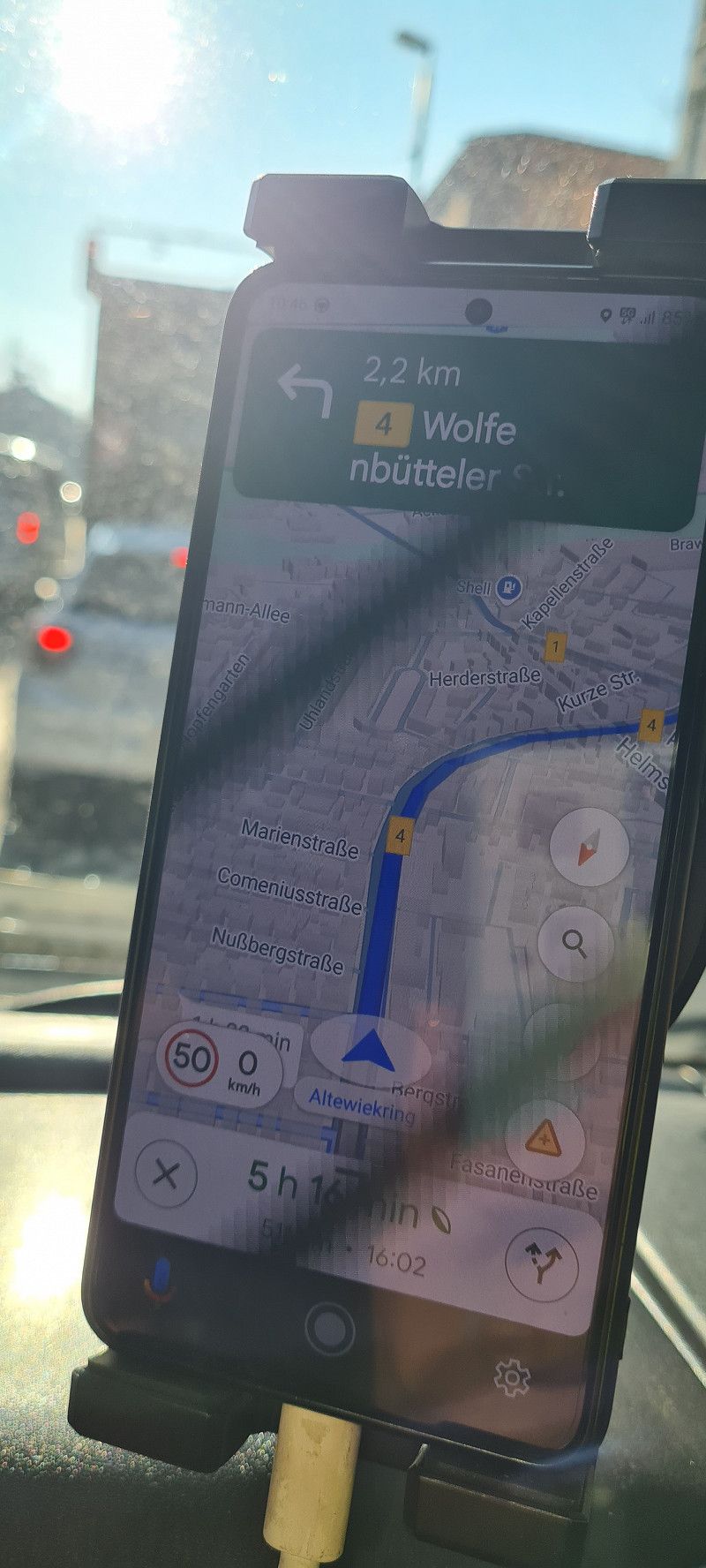
Hans-Sommer-Straße
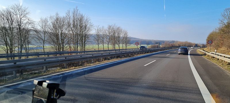
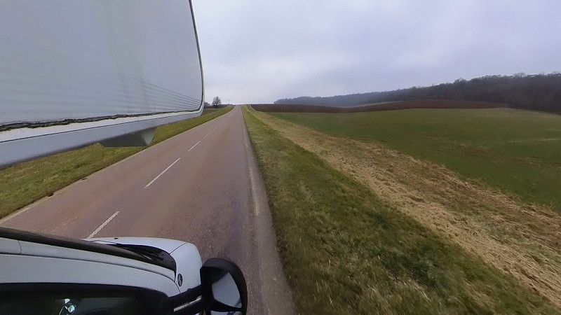
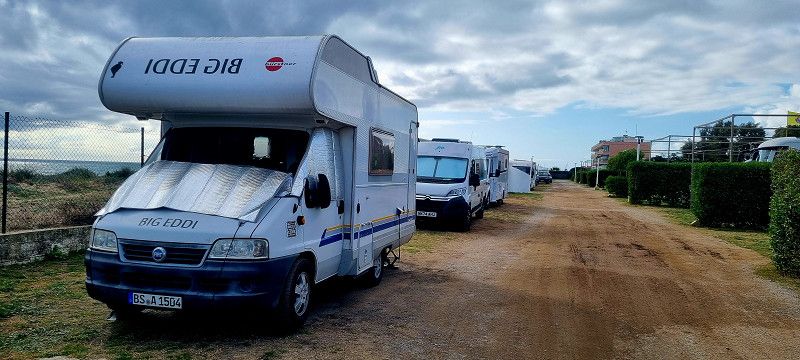
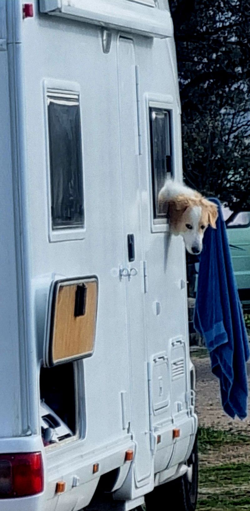
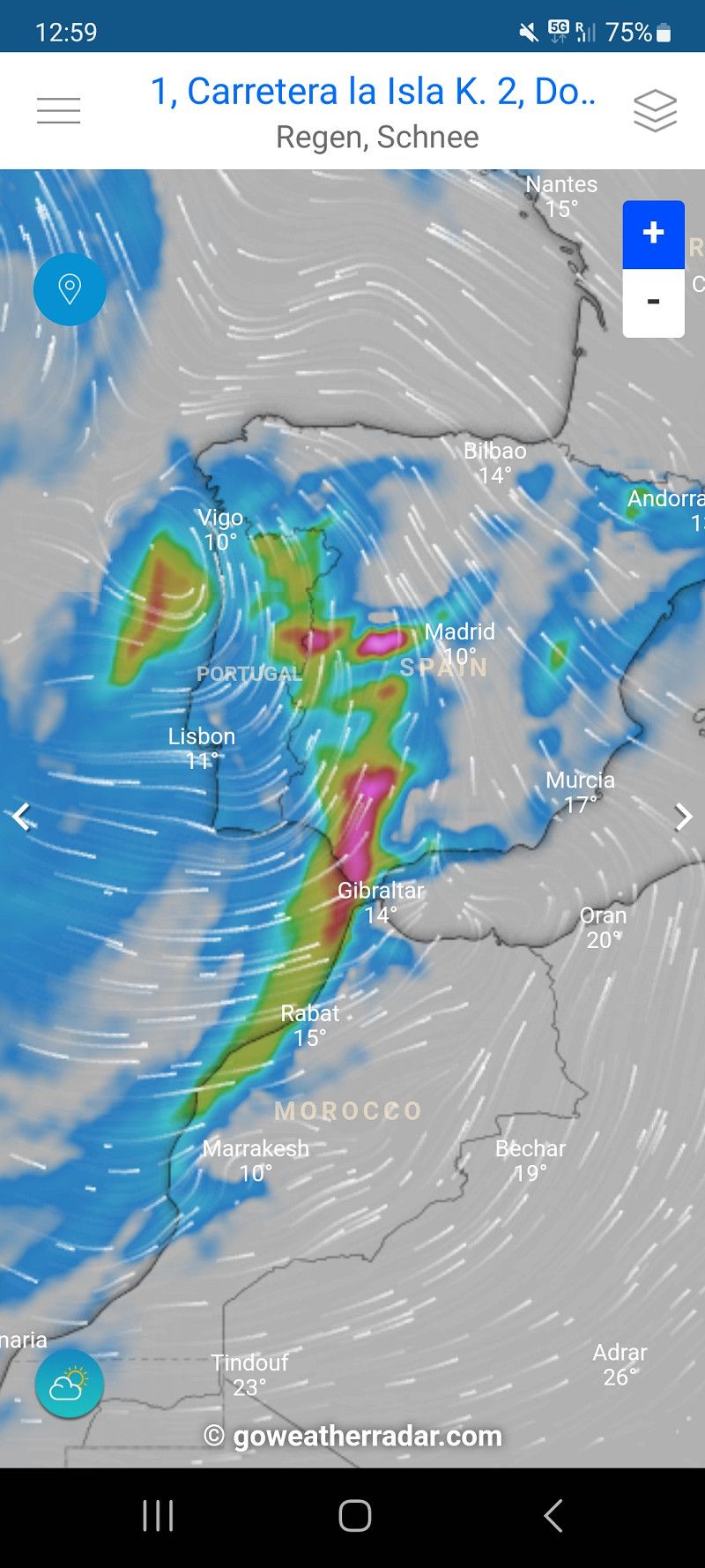
Hey guys, we're now heading south, two days late.
The first stop is planned near Saarbrücken. Let's see how we get through
Niedersachsen, Deutschland
52° 16' 39.5" N 10° 32' 44.7" E
52.2776509 10.5457434
• Head toward Beethovenstraße on Hans-Sommer-Straße (L295). Go for 724 m.
• Turn left onto Hagenring (L295) toward Kassel/A39/Bad Harzburg/A36/Hauptbahnhof/Stadthalle/Zentrum. Go for 3.3 km.
• Turn left onto Wolfenbütteler Straße (L295) toward A36/A39/Wolfenbüttel/Melverode. Go for 1.4 km.
• Take ramp onto A39 toward Kassel/Salzgitter/Hannover/Lüneburg/Celle. Go for 32.4 km.
• Take the left exit toward Kassel onto A7. Go for 115 km.
• Take exit 79 toward Marburg/Kassel onto A49 (Südtangente). Go for 86.5 km.
• Take the left exit onto A5. Go for 88.5 km.
• Take the exit toward Köln/Wiesbaden/Mainz onto A3. Go for 8.9 km.
• Take exit 48 toward Darmstadt/Mainz/Rüsselsheim onto A67. Go for 6.4 km.
• Take exit 3 toward Mainz/Wiesbaden/Rüsselsheim/Rüdesheim onto A60. Go for 17.6 km.
• Take exit 21 toward Kaiserslautern/Ludwigshafen/Alzey onto A63. Go for 70.5 km.
• Continue on Dreieck Kaiserslautern. Go for 343 m.
• Continue on A6. Go for 65.5 km.
• Keep left onto A620 toward Luxembourg/A8/Saarlouis/Sarreguemines/B51/Saarbrücken. Go for 30 m.
• Continue on A6. Go for 523 m.
• Continue on A620. Go for 448 m.
• Take exit 21 toward Sarreguemines/Kleinblittersdorf/Güdingen. Go for 325 m.
• Turn left onto Wolfseck (B51) toward Sarreguemines/Kleinblittersdorf/Güdingen/Gewerbegebiet Bübingen Brebach. Go for 1.5 km.
• Turn slightly left and take ramp toward Güdingen. Go for 226 m.
• Turn right onto Güdinger Brücke (L109). Go for 259 m.
• Arrive at Güdinger Brücke (L109). Your destination is on the left.
☍
500,0 km
(4 hrs. 32 min.)
Day
Saarbrücken
Brückenstraße, Saarbrücken, Regionalverband Saarbrücken, Saarland, Deutschland
49° 11' 44.1" N 7° 1' 39" E
49.1955766 7.0274947
• Head toward Brückenstraße on Güdinger Brücke (L109). Go for 259 m.
• Turn right and take ramp onto B51 toward A6/Saarbrücken/Sarreguemines/Kleinblittersdorf/Saarbrücken Flughafen. Go for 1.9 km.
• Take ramp onto A620 toward Paris/Metz/Mannheim/Flughafen Saarbrücken/A6/E50. Go for 658 m.
• Continue on A6 (Saartalbrücke). Go for 1.1 km.
• Take exit 4 toward Metz/Luxembourg/A8 onto A6. Go for 8.1 km.
• Continue on A320. Go for 13.5 km.
• Continue on E50 (Échangeur de Freyming). Go for 259 m.
• Take the left exit toward Paris/Metz/St Avold/Carling onto A4 (Autoroute de l'Est). Go for 41.6 km.
• Keep left onto A314 toward Metz/Nancy. Go for 1.5 km.
• Take the left exit toward Nancy/Aéroport Régional/Technopole/Actipole onto A315. Go for 1.2 km.
• Continue on N431. Go for 14.5 km.
• Take the 2nd exit from roundabout toward Nancy/Pagny S/M./Fey. Go for 178 m.
• Take the 2nd exit from roundabout onto A31 toward Nancy. Go for 43.0 km.
• Take the exit toward Lyon/Paris/Dijon/Toul onto A31. Go for 132 km.
• Take the left exit toward Lyon/Besançon/Dijon/Langres-Sud onto A31. Go for 44.7 km.
• Take exit 5 toward Selongey/Is S/Tille/Til-Châtel. Go for 889 m.
• Keep left toward Dijon/Til-Châtel/Is S/Tille/Châtillon S/S./Mirebeau S/B. Go for 59 m.
• Continue on D974 toward Dijon/Til-Châtel/Is S/Tille/Châtillon S/S./Mirebeau S/B. Go for 2.8 km.
• Take the 3rd exit from roundabout onto Route de Langres (D974) toward Dijon/Gemeaux. Go for 4.7 km.
• Turn right onto Rue du Jardin Savetier (D105) toward Gemeaux. Go for 460 m.
• Continue on Rue du Jardin Savetiers (D105). Go for 178 m.
• Turn right onto Rue du Pont aux Chèvres (D112). Go for 221 m.
• Turn left onto Rue Jean-Philippe Rameau (D105). Go for 237 m.
• Continue on Rue de la Fontaine (D105). Go for 56 m.
• Continue on Rue Jean-Philippe Rameau (D105). Go for 89 m.
• Continue on D105. Go for 3.9 km.
• Turn left onto D3. Go for 1.9 km.
• Continue on Route d'Is-sur-Tille (D3). Go for 3.8 km.
• Turn right onto Rue Meix des Puits. Go for 300 m.
• Continue on Rue Chevrières. Go for 70 m.
• Turn left onto Chemin d'Épagny. Go for 160 m.
• Turn slightly right onto Rue de la Mare. Go for 339 m.
• Arrive at Rue de la Mare. Your destination is on the right.
☍
324,8 km
(2 hrs. 59 min.)
04. Feb. 2025 -
04. Feb. 2025
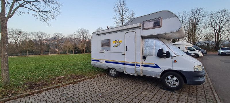
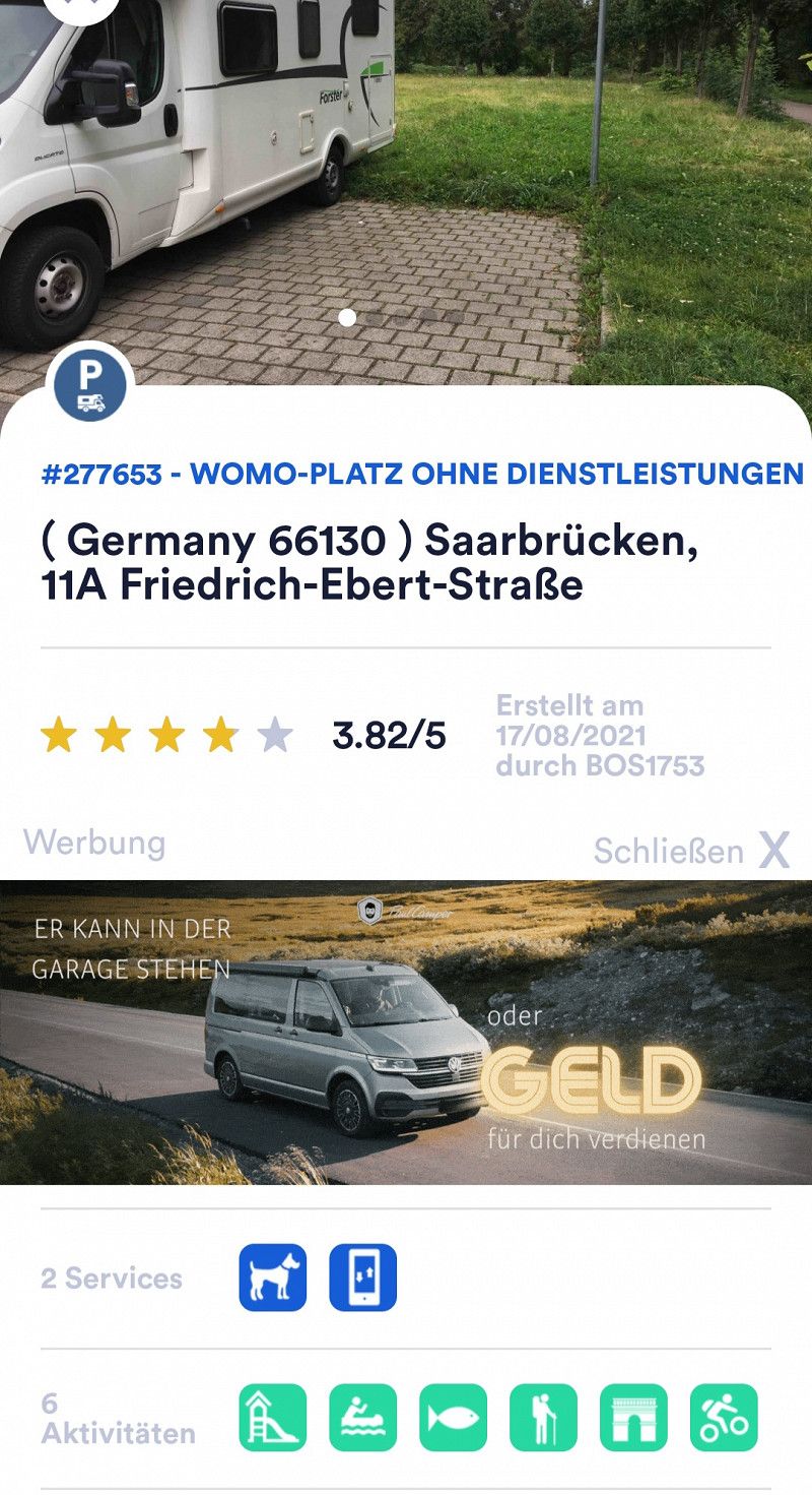
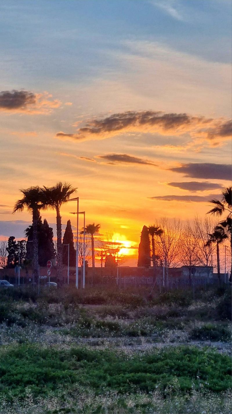
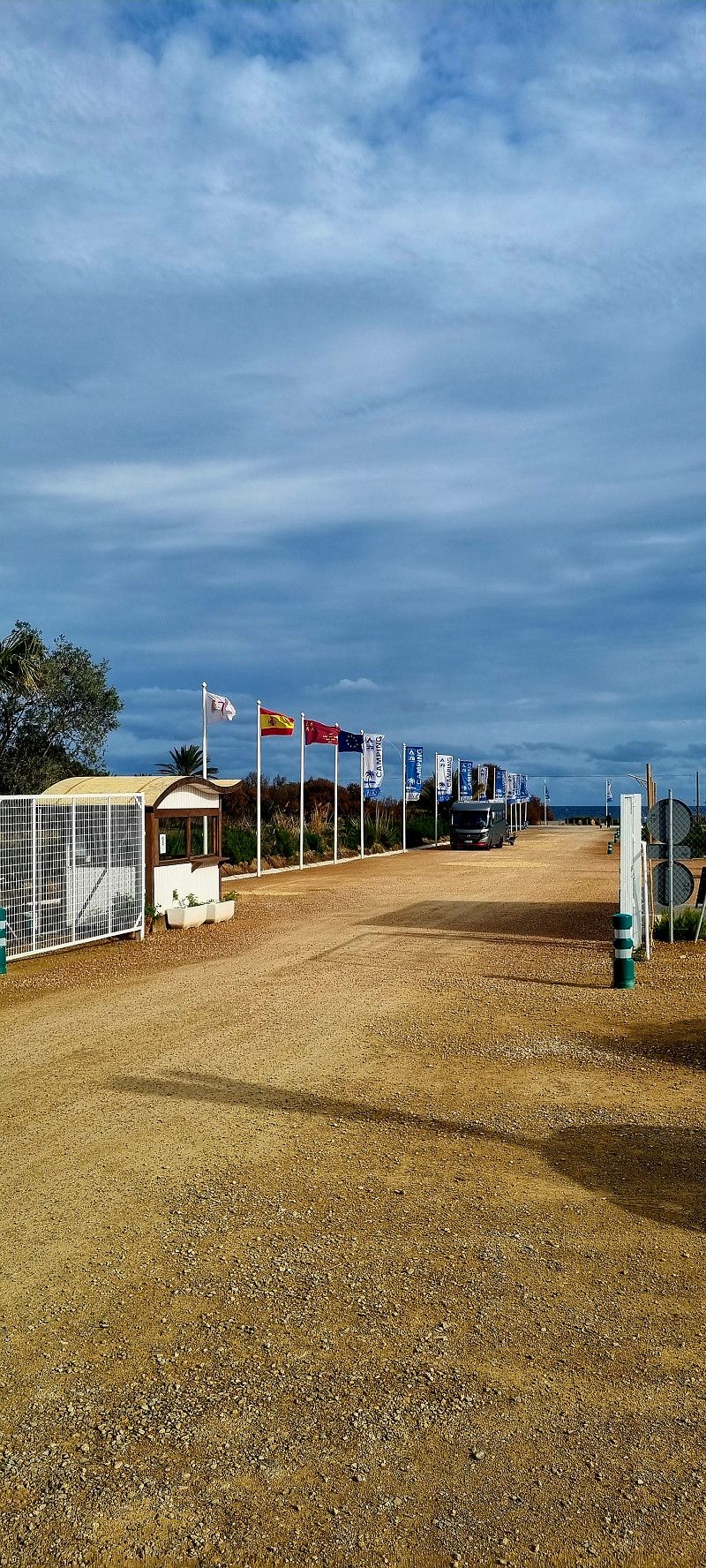
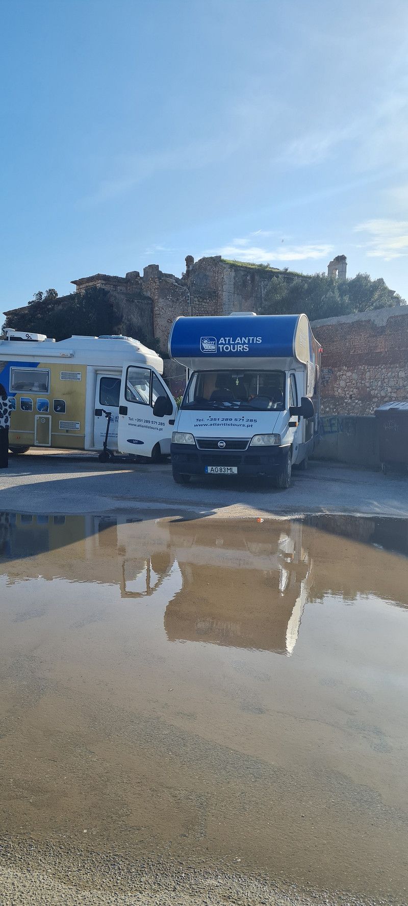
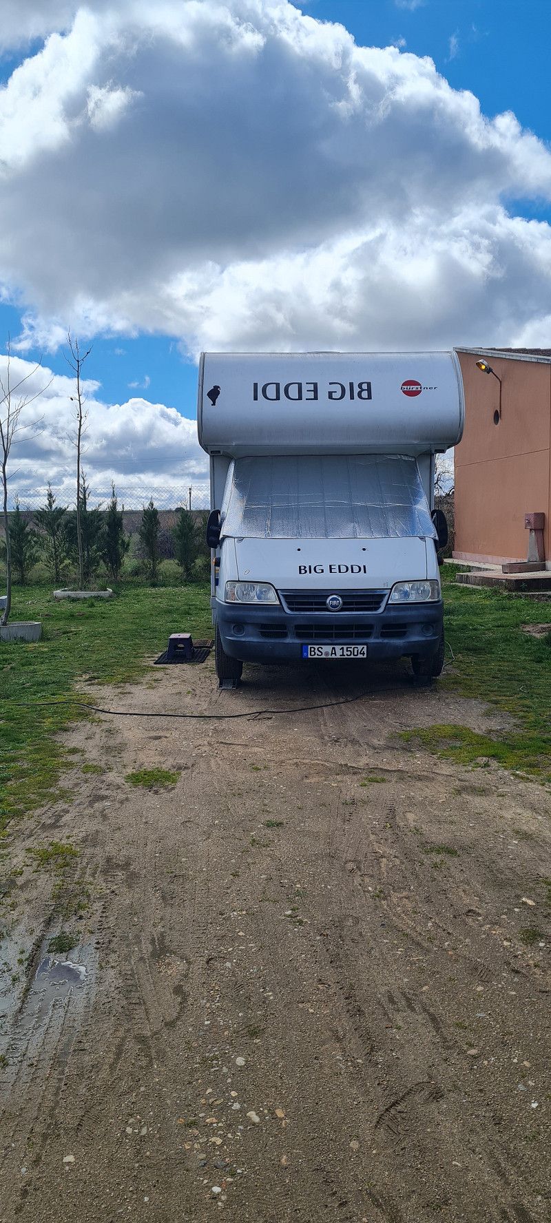
1. Stopp Saarbrücken
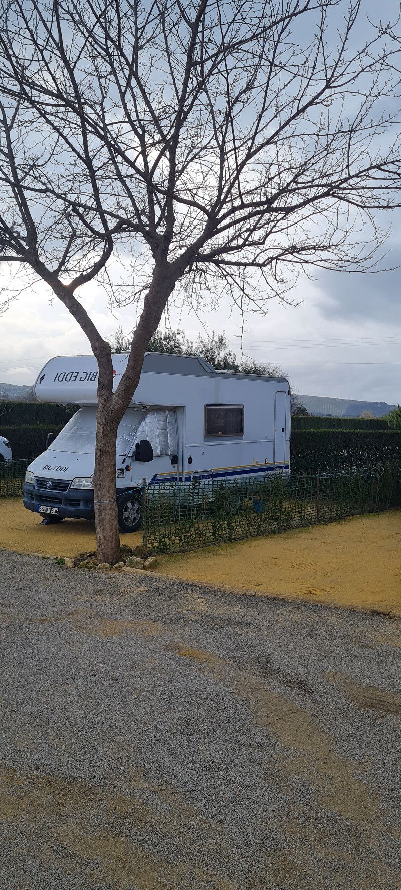
Hey guys,
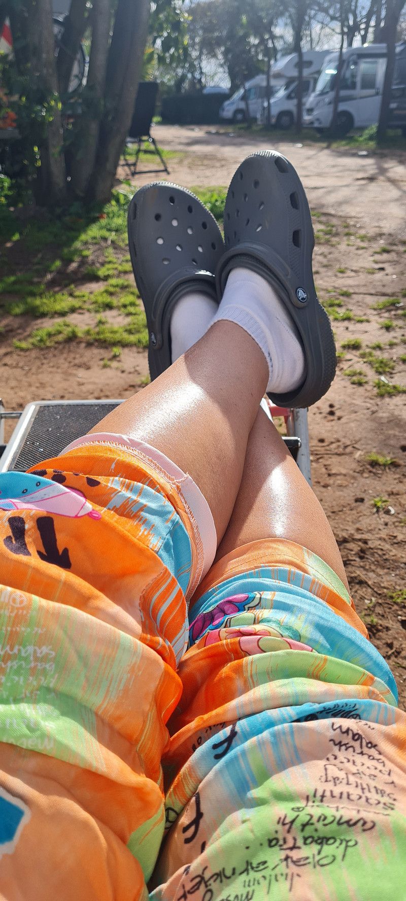
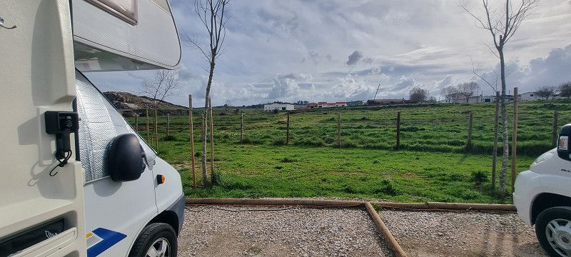
At 10:40 am we finally set off. After about 550 km in just over 6 hours, we reached our first overnight stop in Saarbrücken.
This place is free and without services.
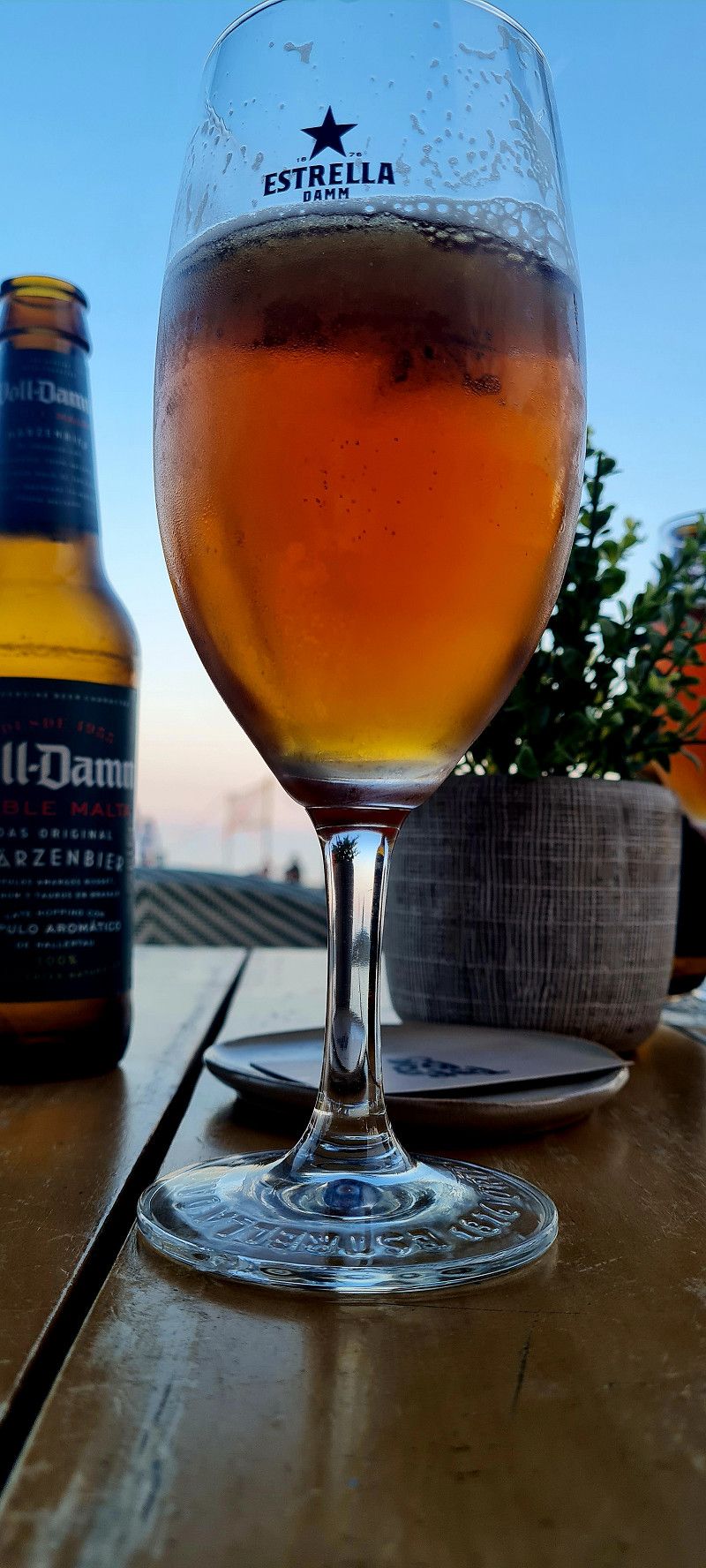
Unfortunately, there are no photos today. After arriving, we just took a short walk to Aldi Süd and got a few beers. Then it was already dark 😅
Day
Aire de Camping-cars
Chemin de Saussy, 21380, Savigny-le-Sec, Frankreich
47° 26' 4" N 5° 2' 40" E
47.4344444 5.0444444
• Head southeast on Rue de la Mare. Go for 268 m.
• Continue on Rue de la Mare. Go for 537 m.
• Turn left onto Place de la Mairie (D107 A). Go for 52 m.
• Continue on Rue de l'Église (D107 A). Go for 113 m.
• Turn right onto Route de Dijon (D3). Go for 1.5 km.
• Continue on D3. Go for 4.2 km.
• Continue on D903. Go for 2.5 km.
• Take the 3rd exit from Rond-Point Georges Pompidou roundabout toward A31/Lyon/A39/Besançon/Dijon-Sud. Go for 881 m.
• Take ramp onto Voie Georges Pompidou (M274). Go for 2.4 km.
• Keep left onto Voie Georges Pompidou (M274) toward A31/Lyon/Nancy/Troyes/A39/Besançon/Dijon-Sud. Go for 4.3 km.
• Keep left onto Voie Georges Pompidou (M274) toward A31/Lyon/Beaune/A39/Besançon/Dijon-Sud. Go for 4.1 km.
• Keep left onto A311 toward Lyon/A31/Chalon S/ S./Beaune. Go for 4.6 km.
• Continue on A31. Go for 27.8 km.
• Continue on A6 (Autoroute du Soleil). Go for 147 km.
• Keep left onto Autoroute du Soleil (M6). Go for 6.8 km.
• Keep left onto Autoroute du Soleil (M7). Go for 17.1 km.
• Take the exit toward Givors/St Étienne/Clermont-Fd/Chasse S/R. onto A47. Go for 30.0 km.
• Continue on N88. Go for 5.6 km.
• Keep right onto N488 toward A72/Clermont-Fd/Roanne/Aéroport St-Étienne-Loire/St Étienne-Centre/St Jean-Bonnefonds. Go for 1.0 km.
• Keep left onto N488 toward St Étienne-Centre/St Jean-Bonnefonds/Monthieu. Go for 1.3 km.
• Take the 2nd exit from Rond-Point Antoine Pinay roundabout onto Rue de la Montat (N488) toward St Étienne-Centre/Gare de Châteaucreux. Go for 1.8 km.
• Continue on Rue Étienne Mimard. Go for 100 m.
• Turn left onto Allée Chantegrillet. Go for 200 m.
• Turn right onto Allée Chantegrillet. Go for 151 m.
• Arrive at Allée Chantegrillet. Your destination is on the right.
☍
264,5 km
(2 hrs. 32 min.)
05. Feb. 2025 -
05. Feb. 2025
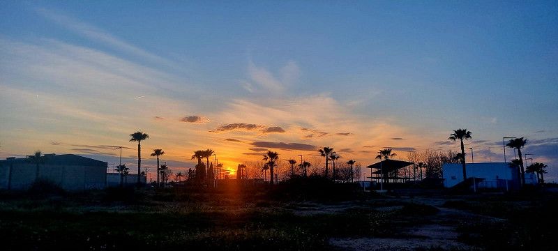
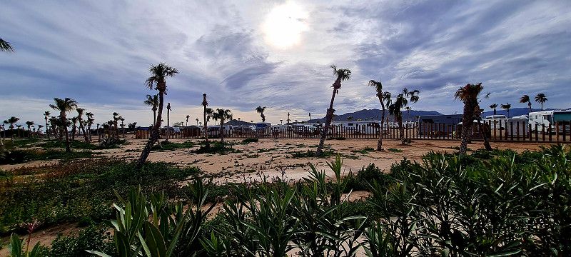
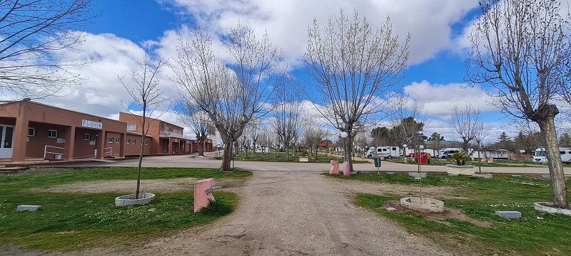
2.ter Stopp bei Dijon
Hey guys,
After a not so restful night (a lot of traffic noise) we started shortly before 10 o'clock.
We headed towards Dijon, about 290 km in 6 hours. We drove through France on completely toll-free roads, but we still made good progress. The landscape is extremely hilly. It was always nice ups and downs 😀
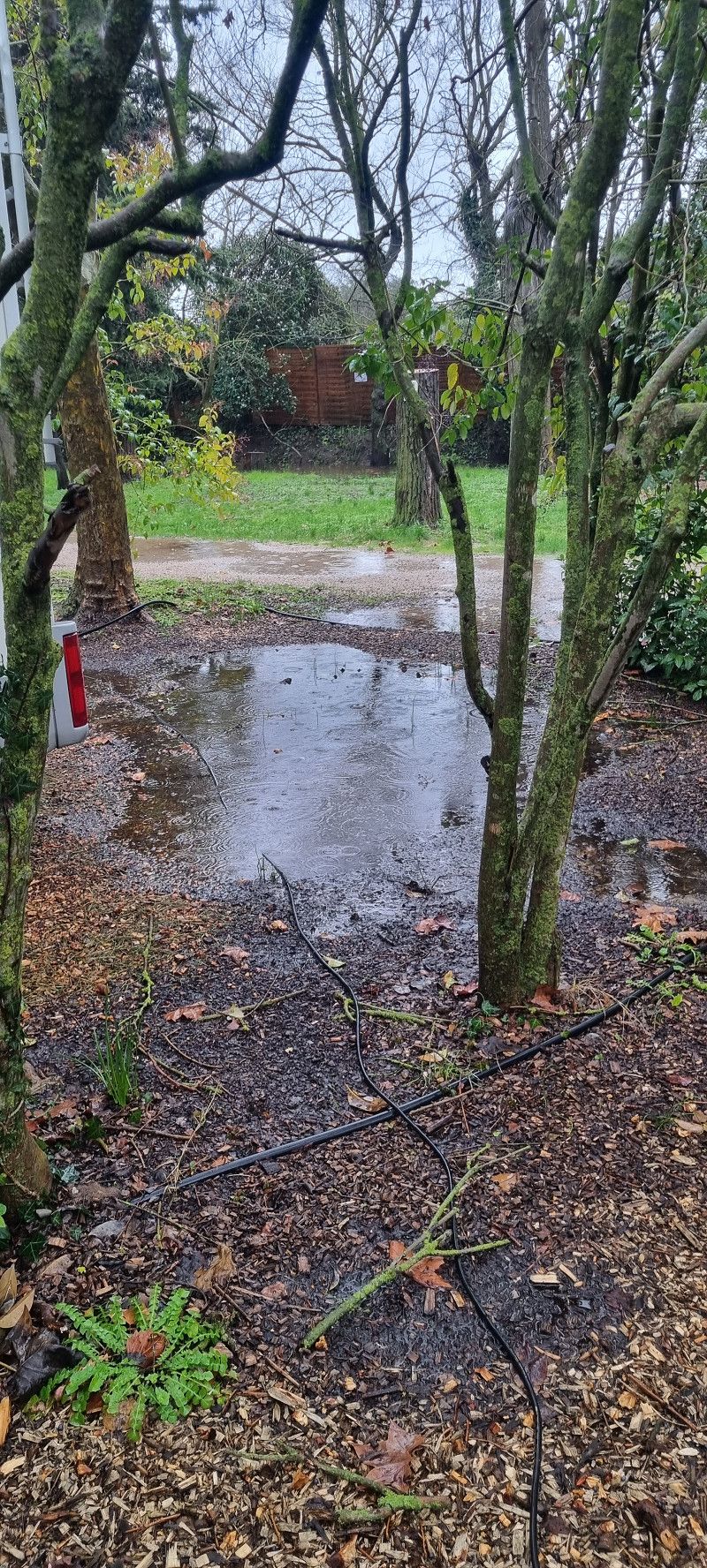
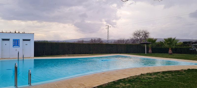
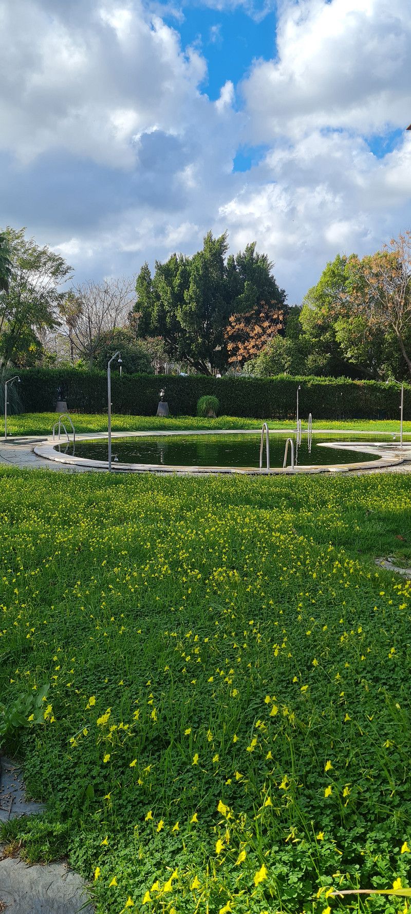
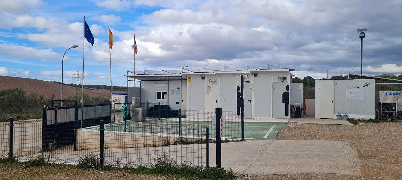
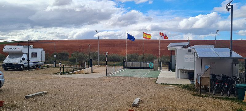
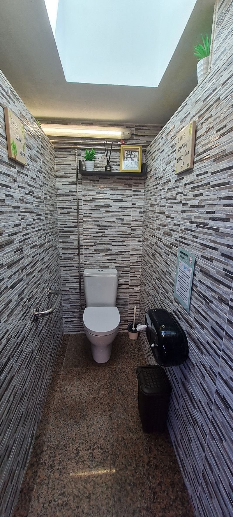
The pitch is simple. But there is a toilet and water/supply for 7 euros per night but no electricity.
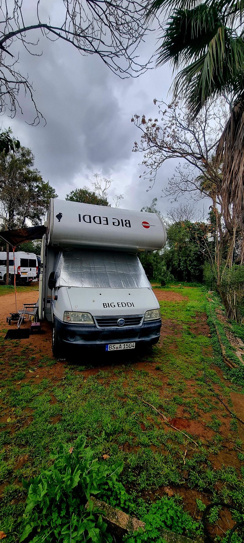
And so you don't think it's completely boring... No! The solenoid valve on the toilet flush is broken. This means that the water fills the bowl drop by drop and we now have to constantly empty the cassette without adding any of our own liquids 🤭
Day
Saint-Étienne
Allée Chantegrillet, Saint-Étienne, Saint-Étienne, Loire, Frankreich
45° 26' 10.5" N 4° 23' 50.1" E
45.4362447 4.3972551
• Head east on Allée Chantegrillet. Go for 275 m.
• Continue on Allée Shakespeare. Go for 220 m.
• Take the 1st exit from roundabout onto Allée Shakespeare. Go for 328 m.
• Turn left toward Cours Gustave Nadaud. Go for 14 m.
• Turn right onto Cours Gustave Nadaud. Go for 261 m.
• Turn right onto Rue Étienne Mimard. Go for 447 m.
• Continue on Rue de la Montat. Go for 1.7 km.
• Take the 2nd exit from Rond-Point Antoine Pinay roundabout onto N488 toward Lyon/Le Puy. Go for 2.2 km.
• Continue on N88. Go for 5.8 km.
• Keep left onto A47 toward E70/St Chamond-Stelytec/Lyon/Valence. Go for 29.4 km.
• Take the exit toward Vienne/Valence/Marseille onto A7 (Autoroute du Soleil). Go for 176 km.
• Keep right onto A9 (Échangeur d'Orange) toward Barcelone/Toulouse/Montpellier/Nîmes. Go for 86.7 km.
• Keep right onto A709 toward A75/Clermont-Ferrand/Montpellier/Aéroport. Go for 9.8 km.
• Take exit 29 toward Montpellier-Est/Montpellier-Centre/Carnon/Aéroport. Go for 1.0 km.
• Take the 4th exit from Rond-Point du Zénith roundabout onto Avenue Pierre Mendès France (M66) toward A9/Lyon/Nîmes/La Gde Motte/Aéroport Montpellier Méditerranée. Go for 1.9 km.
• Continue on D66. Go for 197 m.
• Take ramp onto D189. Go for 420 m.
• Continue on M189. Go for 231 m.
• Pass 2 roundabouts and continue on Avenue de Figuière (M189). Go for 1.2 km.
• Turn left onto Route de Carnon (M21). Go for 695 m.
• Turn right onto M21 E. Go for 272 m.
• Take the 1st exit from roundabout onto Route de Mauguio (M172). Go for 344 m.
• Turn right toward Chemin de l'Estagnol. Go for 53 m.
• Turn slightly left onto Chemin de l'Estagnol. Go for 220 m.
• Arrive at Chemin de l'Estagnol. Your destination is on the right.
☍
319,9 km
(2 hrs. 54 min.)
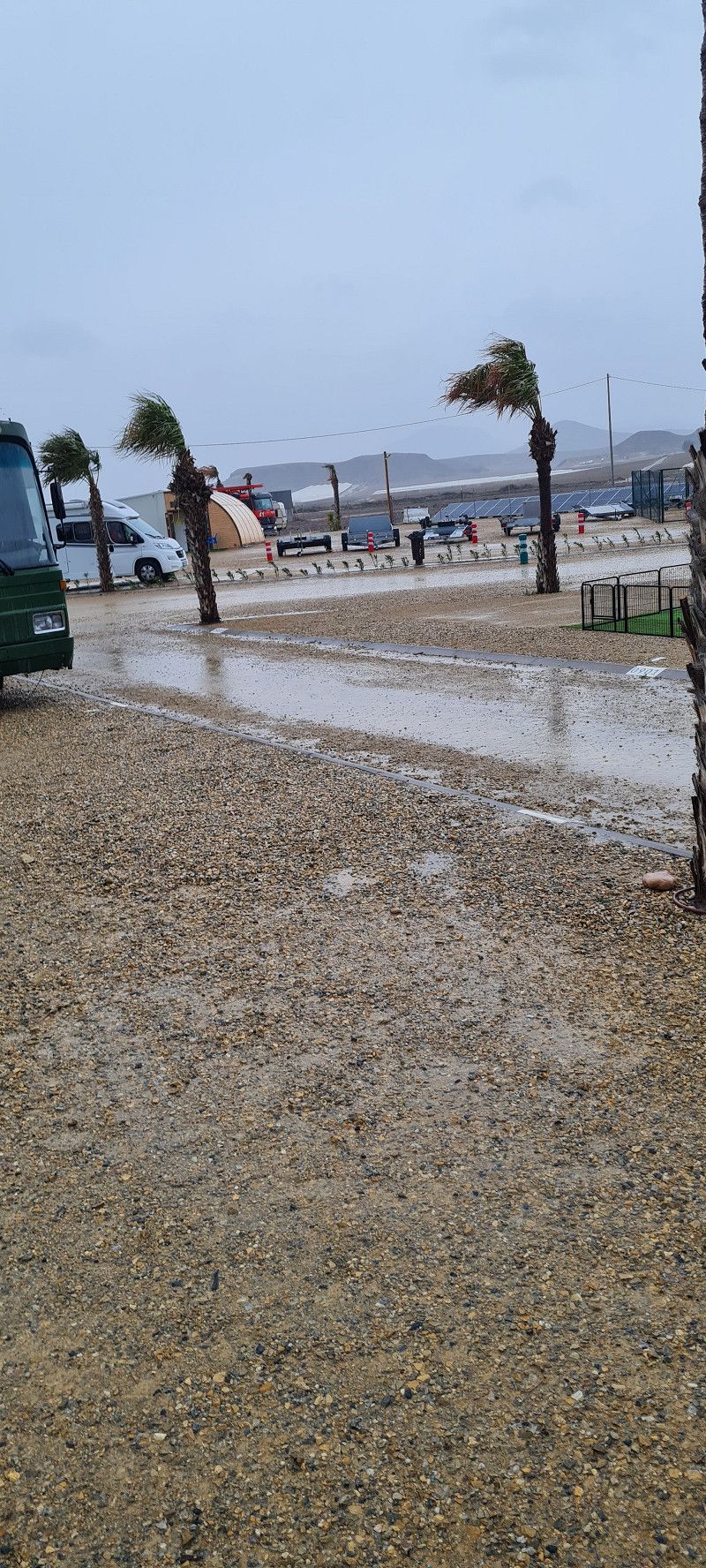
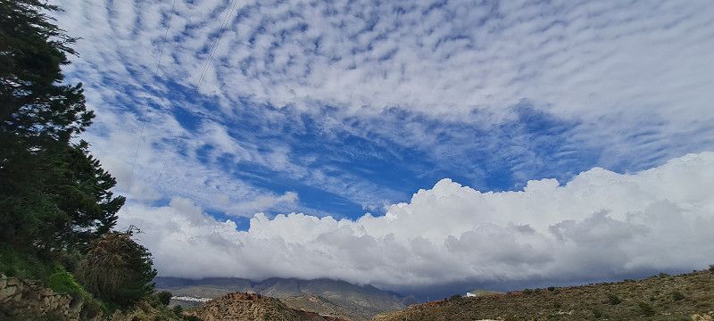
06. Feb. 2025 -
06. Feb. 2025
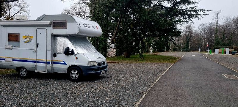
3.ter Stopp Saint-Étienne
Hey guys,
At 11am we set off again today. About 300 kilometres further and 6 hours later we arrived in Saint-Étienne.
It takes quite a long time to get through France without tolls.
The weather is really terrible. Cold, lots of fog and clouds.
Shortly after arriving at the campsite it soon becomes dark again so we don't do any more sightseeing.
Tomorrow we'll ride to Montpellier again and then things should slowly get better so that we can do a sightseeing tour of the city and take a few photos for you.
PS Fuel (diesel) is really expensive here. Between 1.67 and 1.88 euros per liter. Luckily we were able to cover almost 620 kilometers on one tank of fuel 😊
Day
CAMPING LE PARC
Chemin départemental 172 - Route de Mauguio, 34970, LATTES, Frankreich
43° 34' 34" N 3° 55' 32.6" E
43.5761000 3.9257240
• Head toward Chemin de Soriech on Chemin de l'Estagnol. Go for 184 m.
• Turn slightly left onto Chemin de Soriech. Go for 45 m.
• Turn sharp right onto Route de Mauguio (M172). Go for 651 m.
• Continue on Avenue de l'Europe (M172). Go for 889 m.
• Turn right onto Place de l'Europe. Go for 152 m.
• Continue on Avenue de l'Europe (M132). Go for 1.1 km.
• Pass 2 roundabouts and continue on Route de Saint-Jean-de-Védas (M132). Go for 1.9 km.
• Take the 4th exit from Rond-Point Paul-Louis Bret roundabout onto A709 toward Barcelone. Go for 4.9 km.
• Continue on A9 (La Languedocienne). Go for 172 km.
• Continue on AP-7 (Autopista de la Mediterrània). Go for 20.3 km.
• Take exit 3 toward Figueres N./Roses/Figueres/Girona/Barcelona/Olot/Ripoll. Go for 390 m.
• Take the 3rd exit from roundabout onto N-2 toward Figueres/Girona/Barcelona. Go for 5.4 km.
• Take ramp onto Carretera de Roses (C-260) toward Roses. Go for 1.6 km.
• Pass 2 roundabouts and continue on C-260. Go for 3.4 km.
• Take the 3rd exit from roundabout onto C-260 toward Castelló d'Empúries/Roses/Cadaqués. Go for 1.9 km.
• Take the 4th exit from roundabout onto C-260 toward Roses/Cadaqués. Go for 1.8 km.
• Take the 4th exit from roundabout onto C-260 toward Empuriabrava/Roses/Cadaqués. Go for 2.0 km.
• Pass 5 roundabouts and continue on Carretera de Besalú a Roses (C-260). Go for 5.5 km.
• Take the 3rd exit from roundabout onto Carretera de Besalú a Roses (C-260) toward Centre Ciutat. Go for 760 m.
• Take the 1st exit from roundabout onto Carrer Bernat Metge. Go for 166 m.
• Arrive at Carrer Bernat Metge. Your destination is on the left.
☍
225,4 km
(2 hrs. 5 min.)
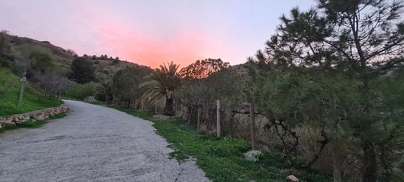
07. Feb. 2025 -
09. Feb. 2025
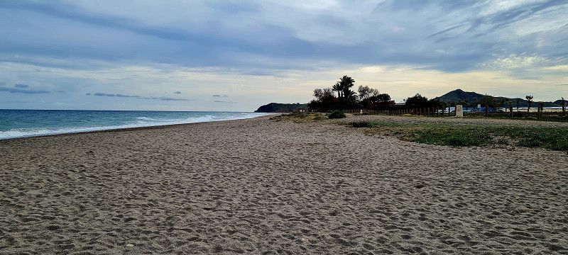
4.ter Stopp Montpellier
Hey guys,
It started today at 10:45 am.
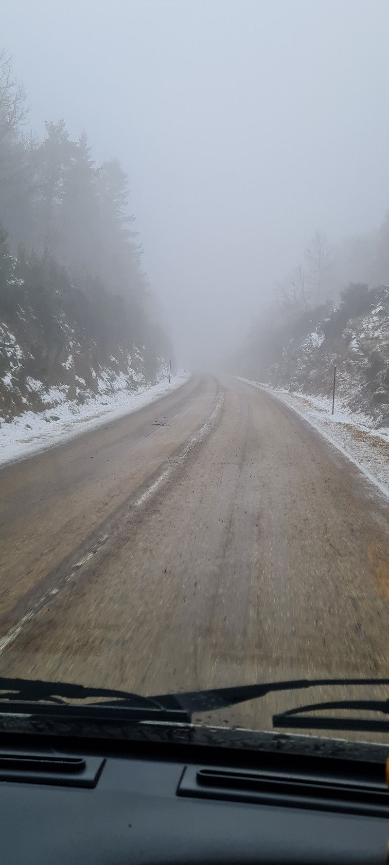
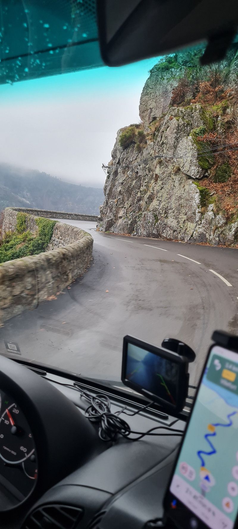
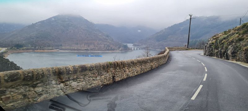
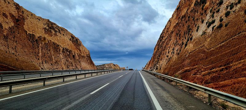
After a short stretch we reached the Massif Central, which we had to cross. It was probably well over 100 kilometers in a zigzag pattern and up to a height of almost 1300 meters above sea level through rain, snow and fog and strong gusts of wind. Really exhausting but also very interesting.
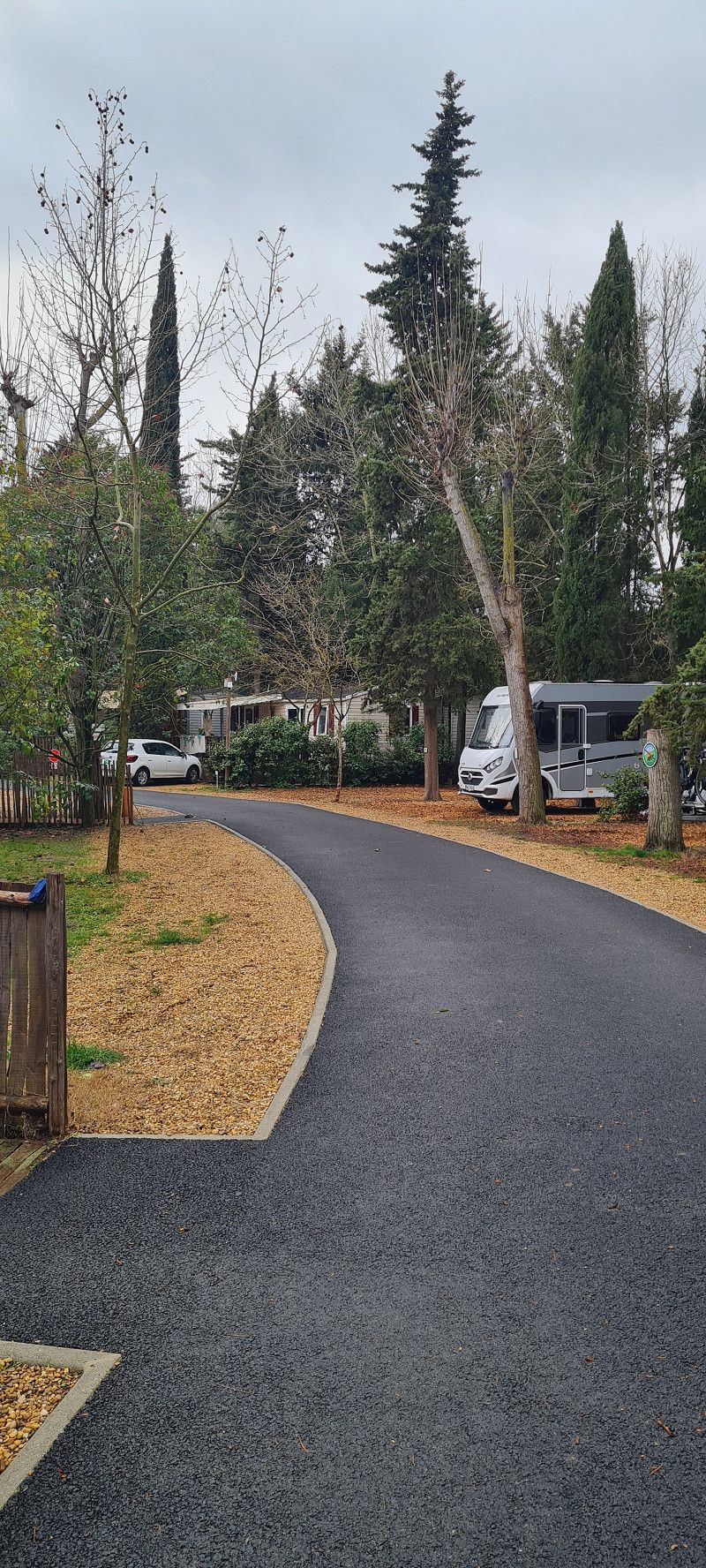
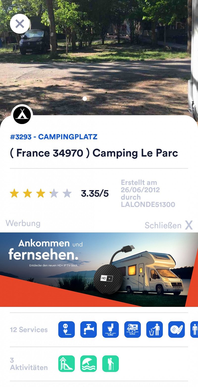
After a total of 300 kilometers and 5 hours of driving we arrived in Montpellier at the Camping le parc
https://www.leparccamping.com/
arrived. We will stay here for 2 nights, rest and wait for the rain before continuing on to Spain.
Day
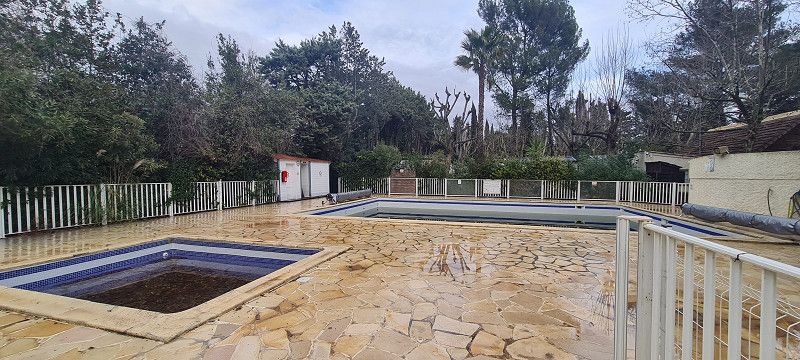
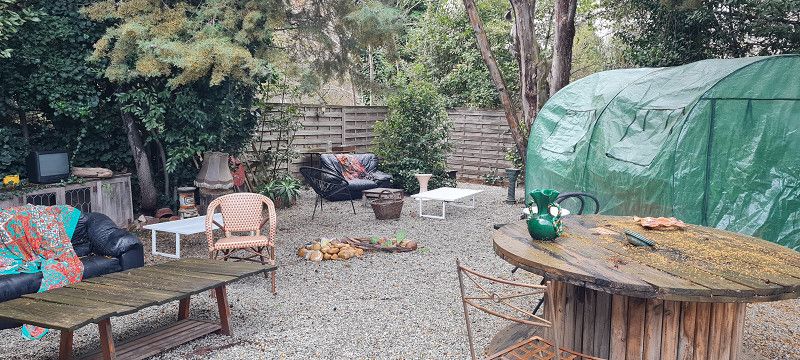
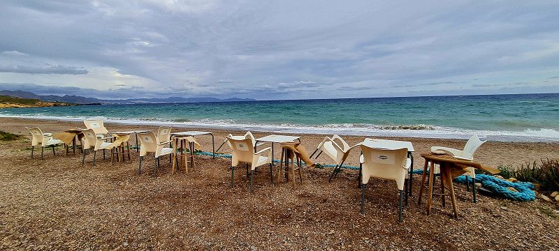
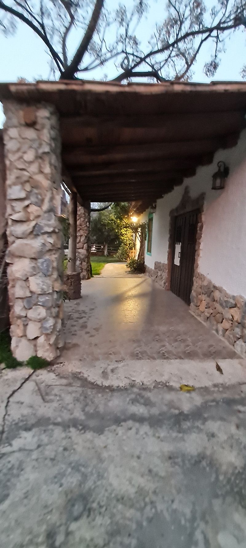
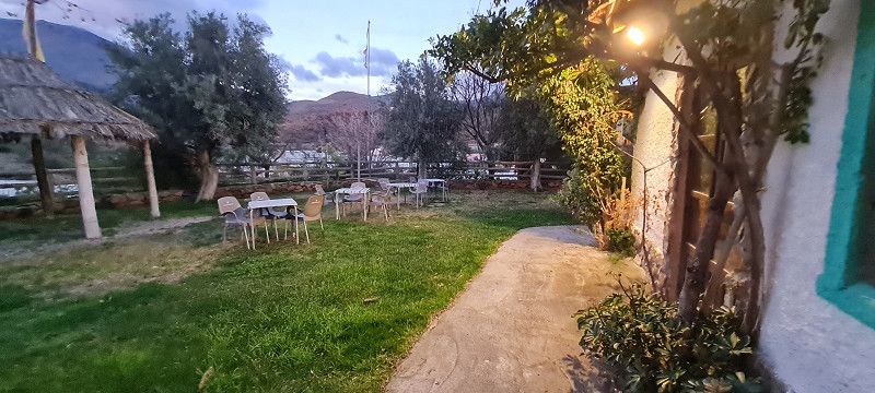
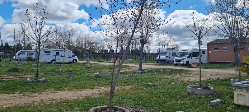
Tag 2 in Montpellier
Hey guys,
Today I slept for over 9 hours.
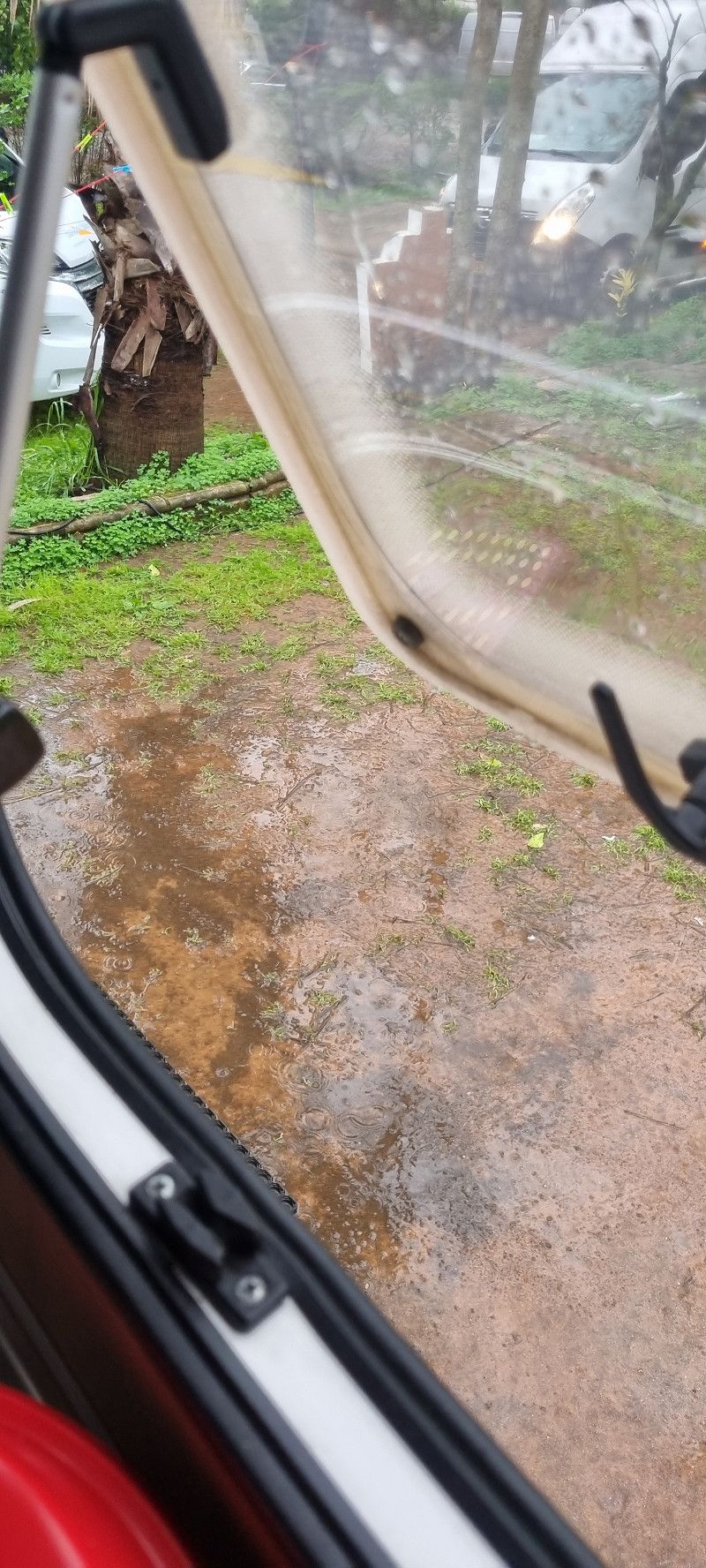
It rained all night and all day today.
Well, watch a bit of TV, book the next campsites for the next few days and play board games.
You get through the day.
But Micha still took a few impressions of the place in the rain.
Day
Camping Joncar Mar
C/ Bernat Metge 9-10, 17480, Roses, Spanien
42° 15' 56" N 3° 9' 47" E
42.2655600 3.1630600
• Head toward Carrer Joanot Martorell on Carrer Bernat Metge. Go for 148 m.
• Take the 2nd exit from roundabout onto Carretera Estació de Vilajuïga (GI-610) toward Llançà/N-260/Cadaqués/Mas Matas. Go for 320 m.
• Take the 3rd exit from roundabout onto Ronda de Circumval.lació toward Figueres/AP-7/N-2. Go for 623 m.
• Take the 1st exit from roundabout onto Carretera de Besalú a Roses (C-260) toward AP-7/Figueres/Girona/Sta. Margarida. Go for 641 m.
• Take the 3rd exit from roundabout onto Carretera de Besalú a Roses (C-260) toward AP-7/Empuriabrava/Figueres/Girona. Go for 1.1 km.
• Pass 5 roundabouts and continue on C-260. Go for 7.4 km.
• Take the 4th exit from roundabout onto Carretera Castelló (GIV-6213) toward Fortià. Go for 2.8 km.
• Take the 2nd exit from roundabout onto GI-8594 toward Vilamalla. Go for 3.3 km.
• Take the 3rd exit from roundabout. Go for 169 m.
• Take the 1st exit from roundabout onto C-31 toward AP-7/Figueres/Empordà Internacional. Go for 1.8 km.
• Take the 2nd exit from roundabout onto C-31 toward Sta. Llogaia d'Àlguema/Figueres. Go for 812 m.
• Take the 2nd exit from roundabout onto N-2A toward AP-7/Girona/Barcelona. Go for 1.3 km.
• Take the 2nd exit from roundabout onto N-2A toward Girona. Go for 555 m.
• Take the 1st exit from roundabout toward Barcelona/Girona. Go for 889 m.
• Take left ramp onto AP-7 (Autopista de la Mediterrània) toward Girona/Barcelona. Go for 108 km.
• Keep left onto AP-7 (Autopista de Barcelona a Mollet del Vallès) toward C-33/Centre Ciutat Barcelona/Aeropuerto. Go for 239 m.
• Continue on C-33 (Autopista de Barcelona a Mollet del Vallès). Go for 12.1 km.
• Keep right toward Barcelona Rondes/A-2/AP-7/C-32/C-31/N-2/Port Zal/Aeroport. Go for 533 m.
• Continue on B-10. Go for 1.2 km.
• Take the exit toward Ronda de Dalt/A-2/AP-7/C-32/Aeroport/Vall d'Hebron-Sarrià/Túnel de la Rovira/Fira onto B-20 (Ronda de Dalt). Go for 12.2 km.
• Continue on C-32 (Ronda de Dalt) toward Sitges/Aeroport/Castelldefels/Zona Franca/l'Hospitalet/Fira. Go for 4.3 km.
• Continue on B-20 toward Castelldefels/Sitges/Tarragona/B-22/Aeroport. Go for 2.1 km.
• Take exit 54 toward Castelldefels/C-31/Aeroport onto B-22. Go for 1.7 km.
• Take exit 2 toward Castelldefels/Aeroport Terminal T1/Aeroport Cargoparc onto C-31 (Autovia de Castelldefels). Go for 7.1 km.
• Keep right toward Gavà Mar. Go for 115 m.
• Continue on Carrer Autovia de Castelldefels toward Gavà Mar. Go for 81 m.
• Take ramp toward Gavà Mar. Go for 445 m.
• Take the 1st exit from roundabout onto Avinguda d'Europa toward Gavà/Barcelona. Go for 251 m.
• Take the 1st exit from roundabout toward C-31/Barcelona. Go for 46 m.
• Turn right onto Carrer Autovia de Castelldefels. Go for 258 m.
• Continue on Autovia de Castelldefels (C-31). Go for 381 m.
• Turn right onto Carrer Autovia de Castelldefels. Go for 63 m.
• Turn right. Go for 107 m.
• Turn right. Go for 167 m.
• Turn left. Go for 49 m.
• Arrive at your destination on the right.
☍
172,8 km
(1 hrs. 51 min.)
09. Feb. 2025 -
11. Feb. 2025
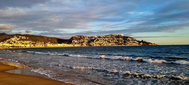
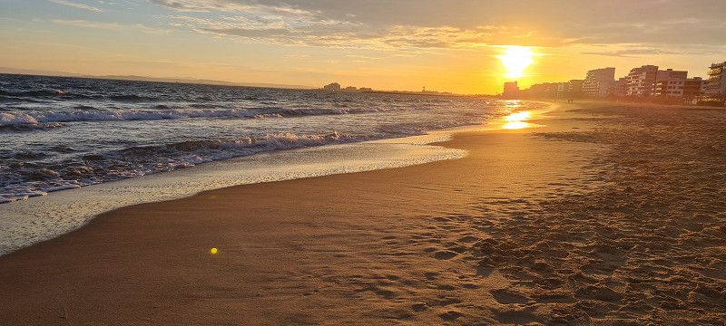
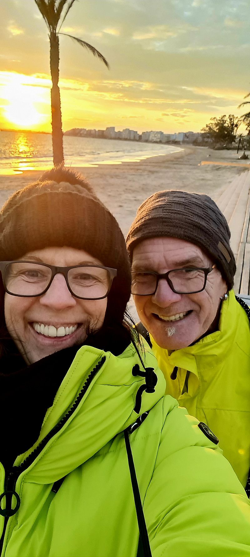
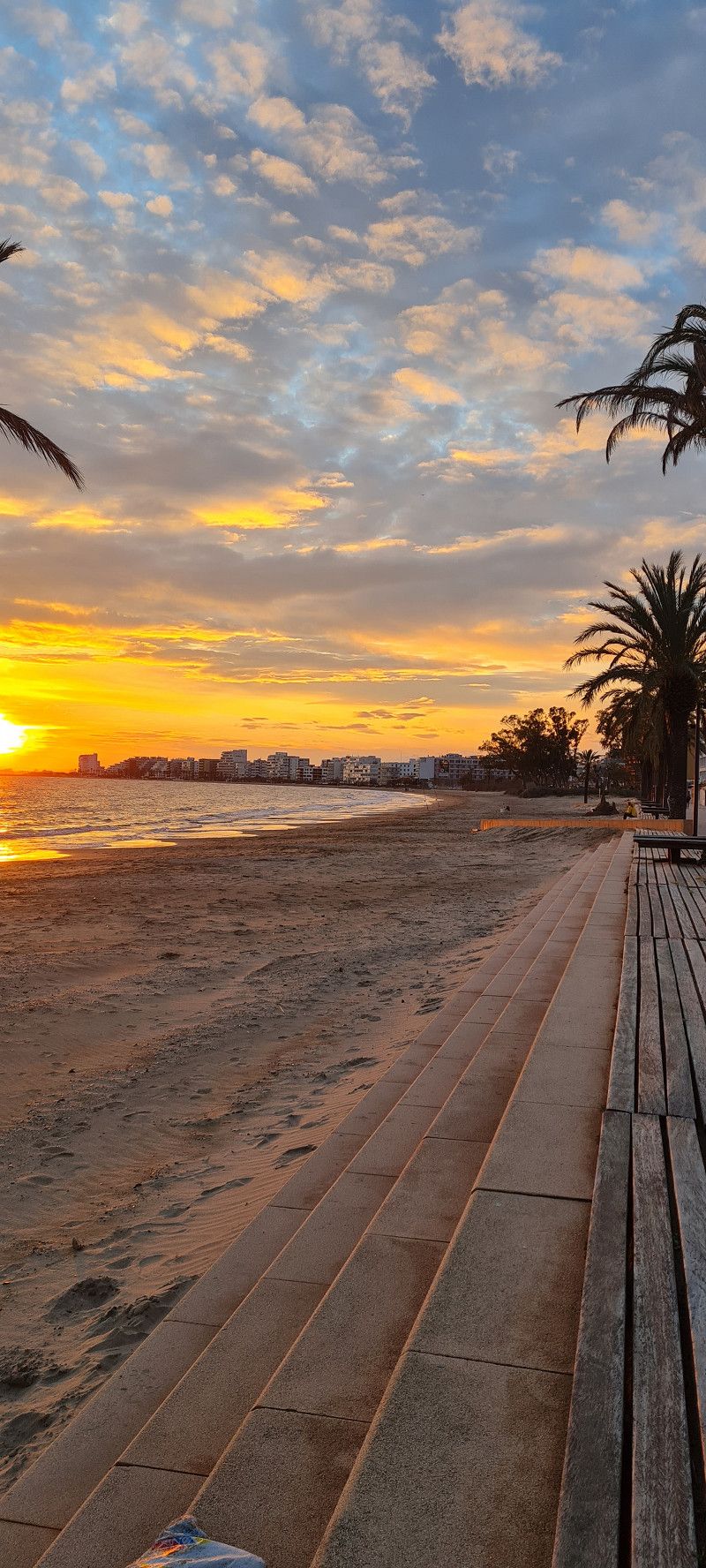
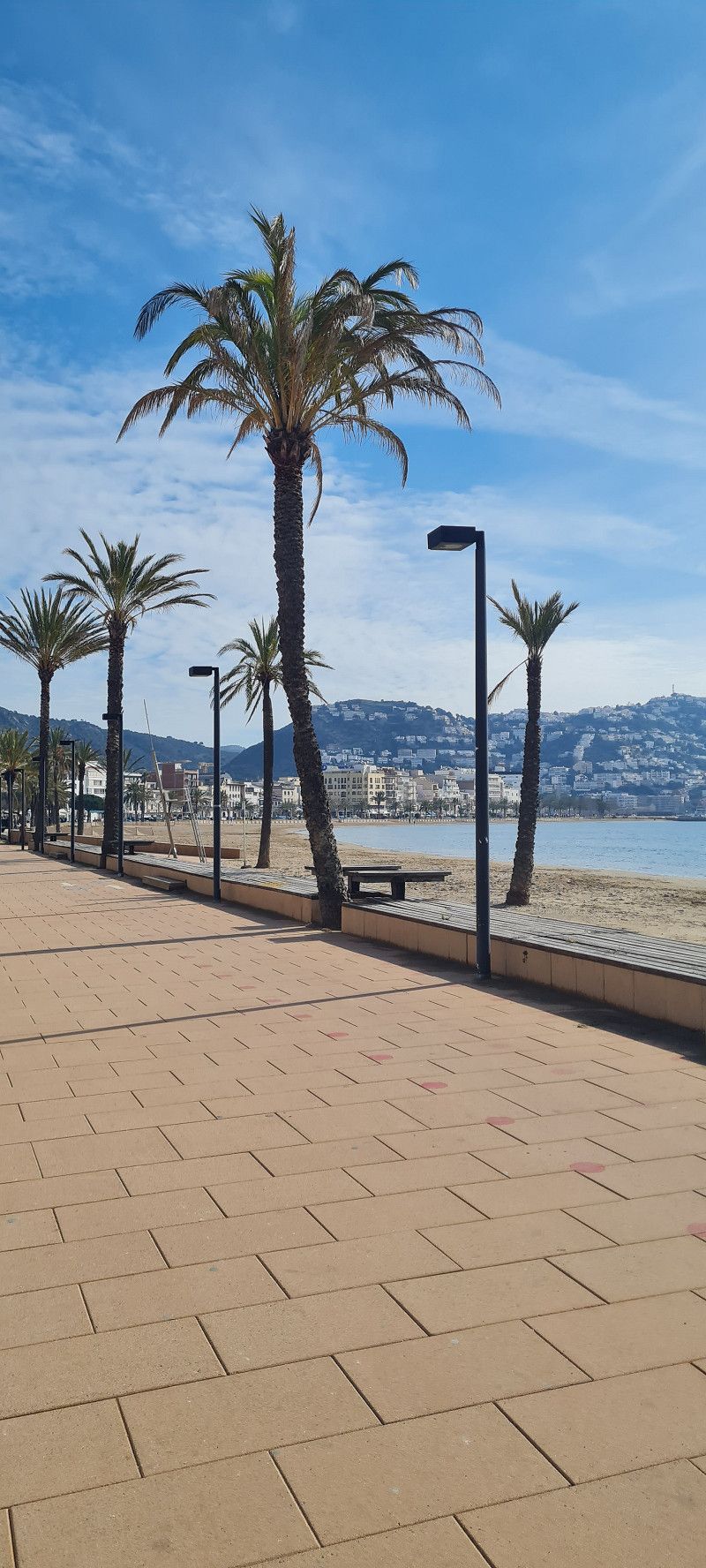
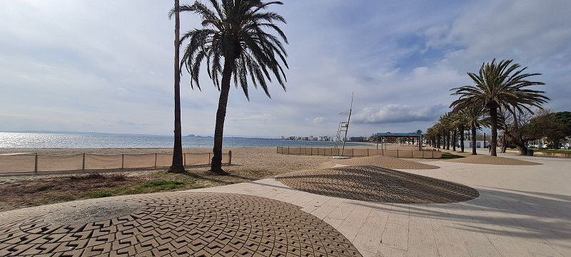
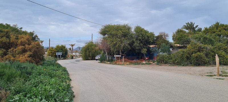
5.ter Stopp Roses
Hey guys,
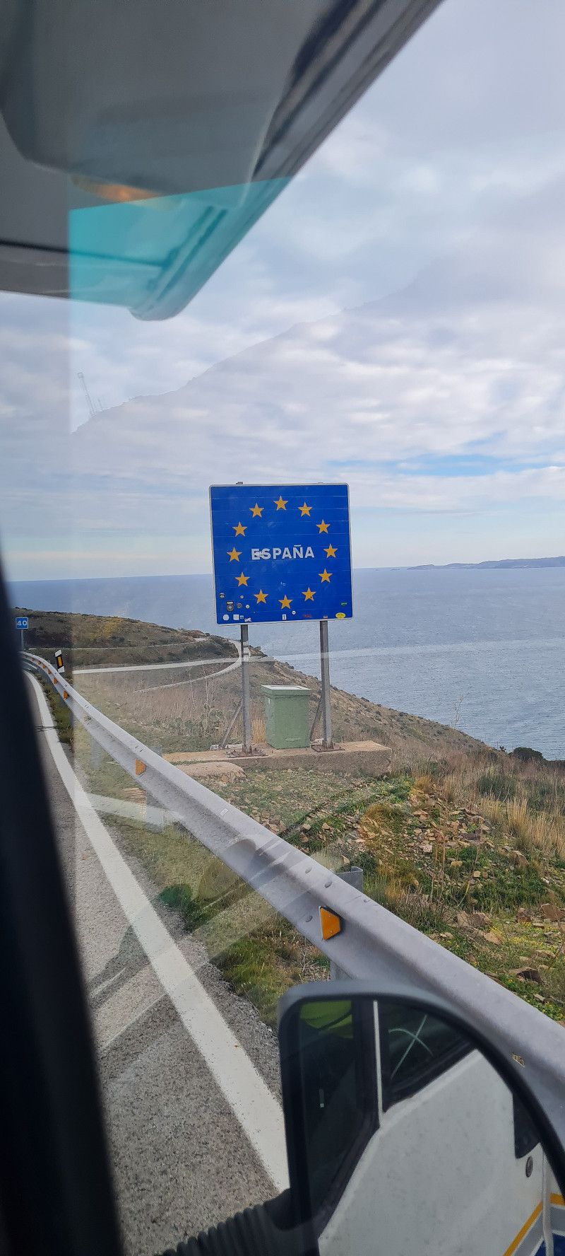
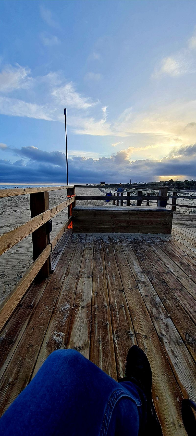
the sun is shining 🤗 10:30 a.m. departure. We had another 300 kilometers on the agenda. Shopping, refueling and changing gas bottles were also necessary. So we arrived at our first destination in Spain at around 4:30 p.m. At the campsite in Roses.
https://www.campingjoncarmar.com/de/
We will stay here for 2 nights.
Day
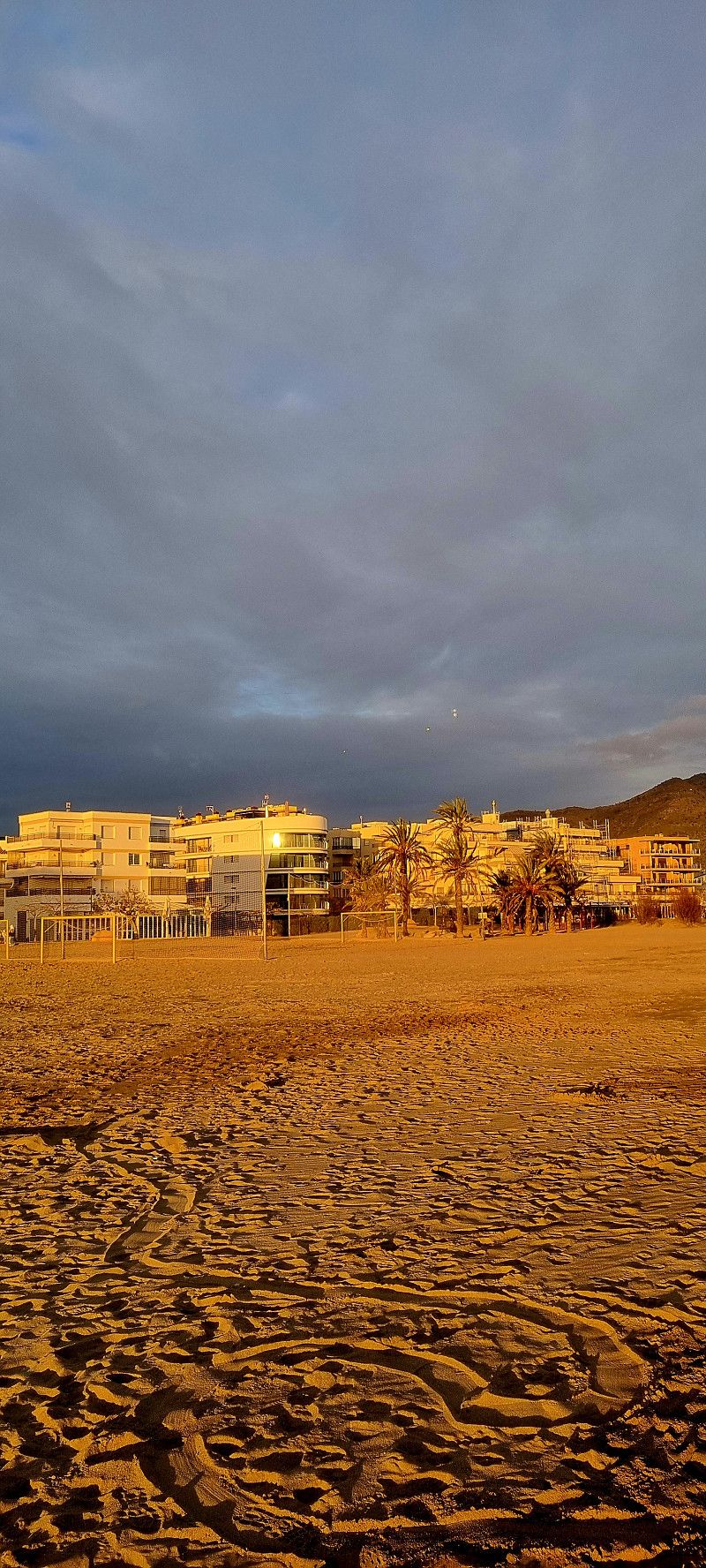
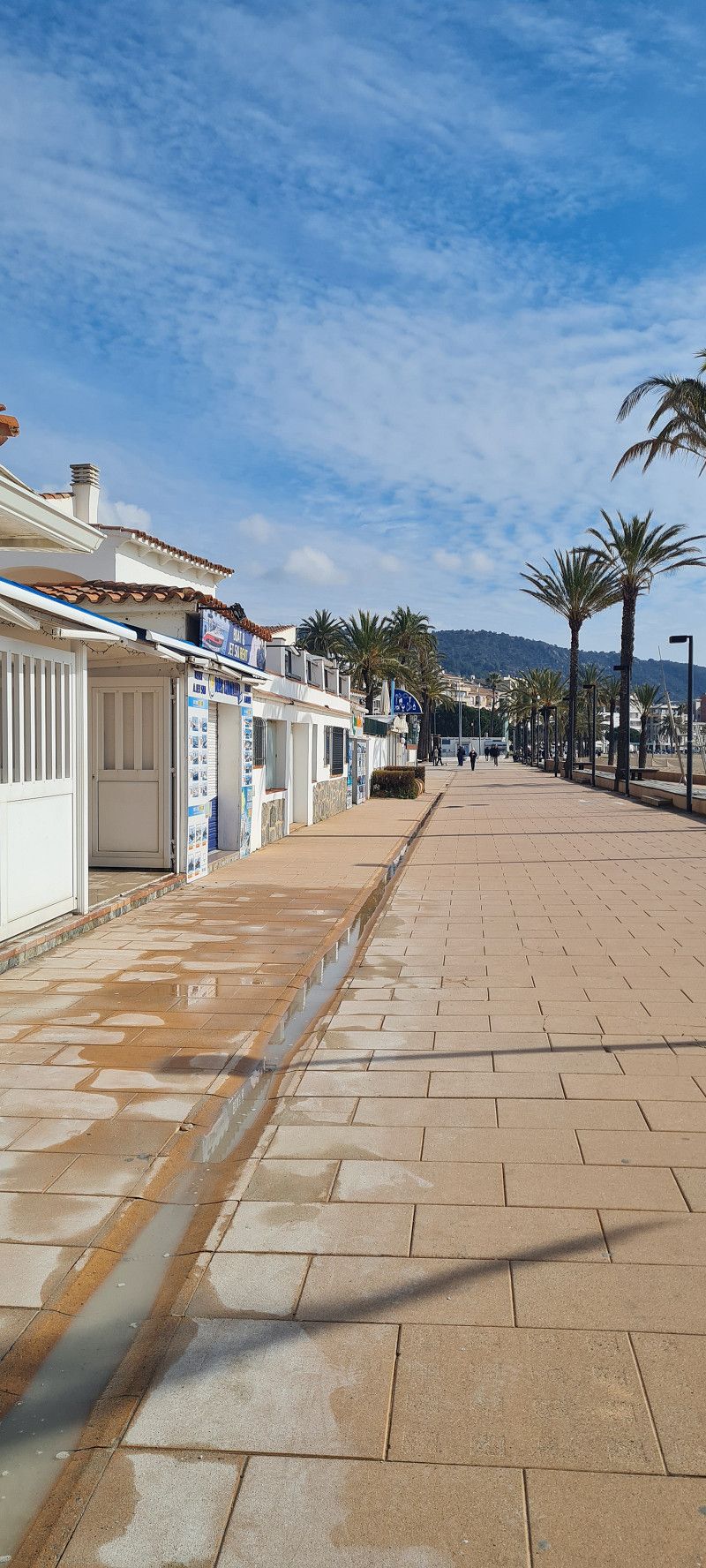
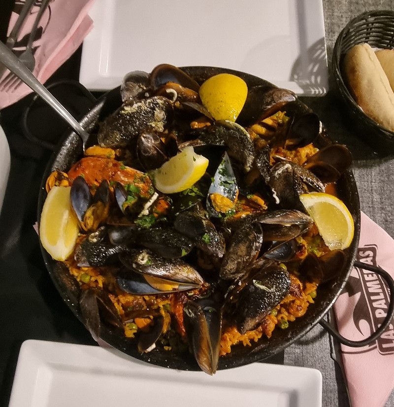
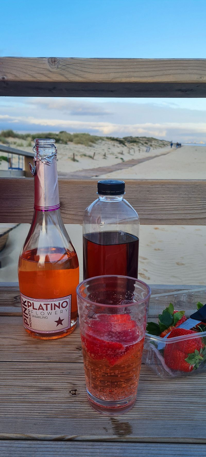
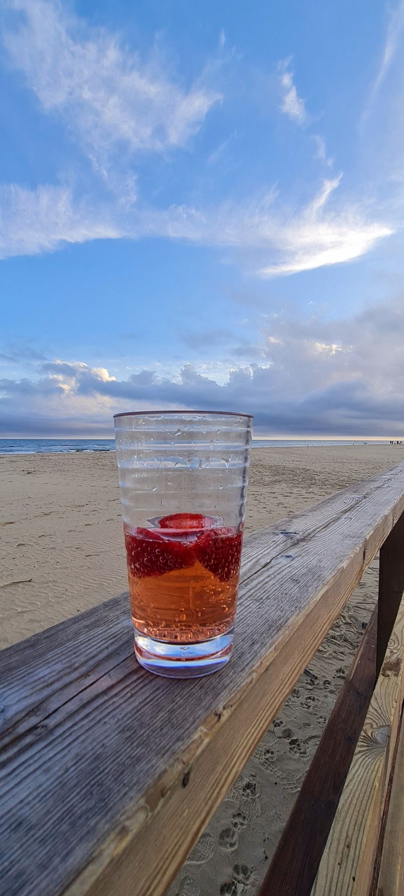
2.ter Tag Roses
Hey guys,
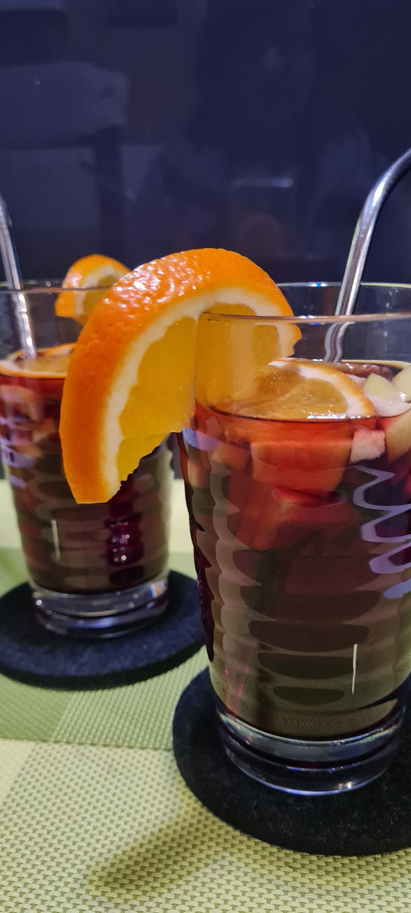
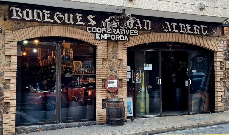
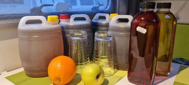
Today we went for a stroll in Roses, enjoying the sun and shopping. In our trusted bodega Joan Albert
https://bodegajoanalbert.com/
we bought 10 liters of different types of sangria from the barrel 👍😀
This evening we had a wonderful paella.
Day
Gavà
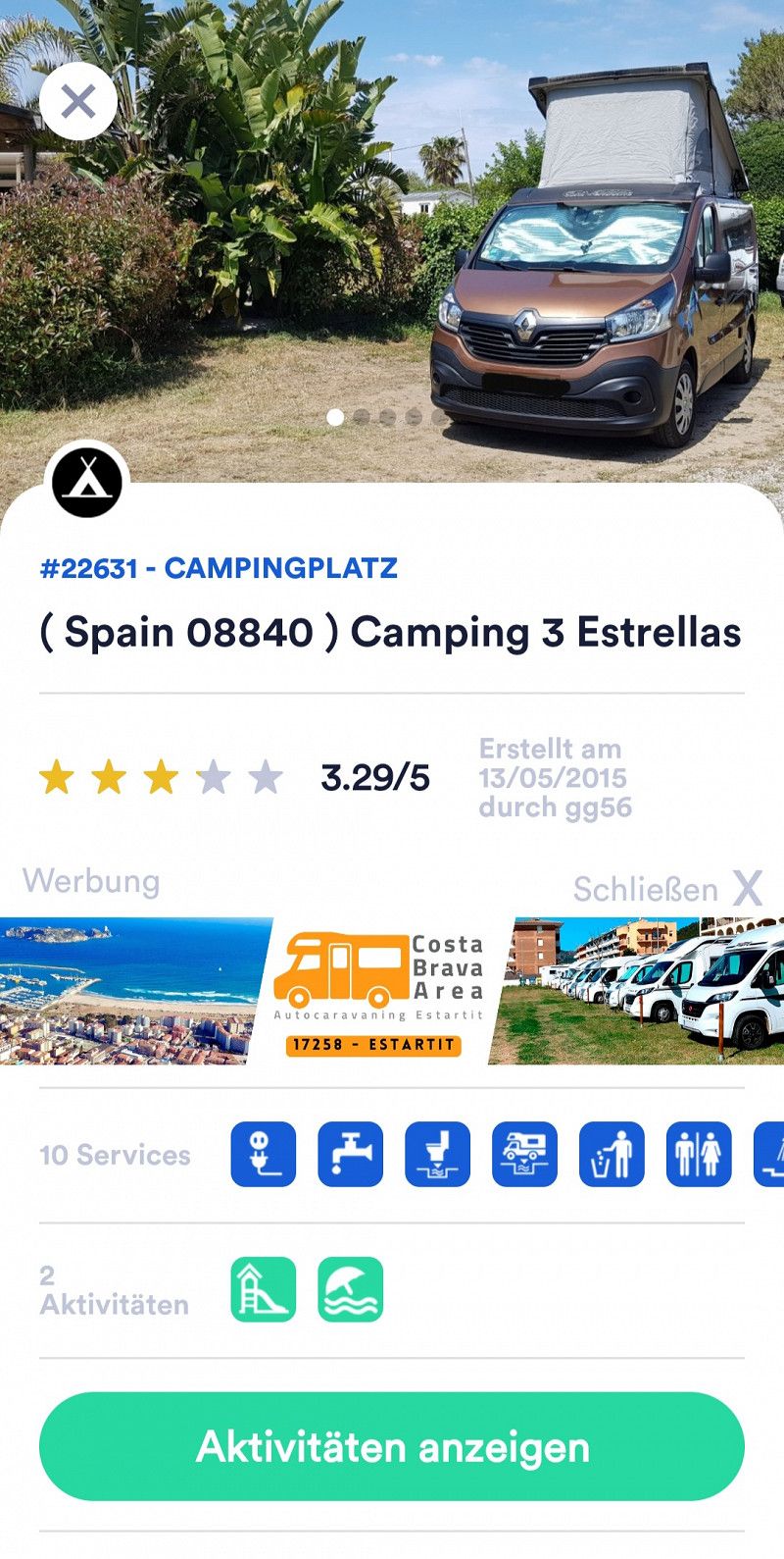
Camping 3 Estrellas, Gavà, Provinz Barcelona, Spanien
41° 16' 14.2" N 2° 2' 39.1" E
41.2706090 2.0441873
• Head east. Go for 168 m.
• Turn left. Go for 66 m.
• Turn right toward Carrer Autovia de Castelldefels. Go for 36 m.
• Turn left onto Carrer Autovia de Castelldefels. Go for 39 m.
• Turn right onto Carrer Autovia de Castelldefels. Go for 40 m.
• Turn right onto Autovia de Castelldefels (C-31). Go for 9.6 km.
• Take exit 196AB toward Polígon Industrial de Z. Franca-ZAL onto B-10 (Ronda del Litoral). Go for 7.1 km.
• Take exit 21 toward Ciutat Vella/Paral.lel/La Rambla onto Passeig de Josep Carner. Go for 881 m.
• Take the 3rd exit from Plaça de les Drassanes roundabout onto Passeig de Josep Carner toward Terminals F1 N S/Pg. Colom/Port Olímpic/Moll d'Espanya. Go for 313 m.
• Take the 3rd exit from Plaça del Portal de la Pau roundabout onto Avinguda de les Drassanes. Go for 344 m.
• Turn right onto Carrer del Portal de Santa Madrona. Go for 122 m.
• Turn left onto Carrer la Rambla. Go for 530 m.
• Turn right toward Pla de la Boqueria. Go for 21 m.
• Turn slightly left onto Pla de la Boqueria. Go for 14 m.
• Turn right onto Carrer de la Boqueria. Go for 186 m.
• Turn slightly left onto Carrer del Call. Go for 131 m.
• Continue on Plaça de Sant Jaume. Go for 56 m.
• Turn right onto Plaça de Sant Jaume. Go for 26 m.
• Turn left onto Carrer de Jaume I. Go for 11 m.
• Arrive at Carrer de Jaume I. Your destination is on the right.
☍
19,6 km
( 21 min.)
11. Feb. 2025 -
16. Feb. 2025
6.ter Stopp Casteldefells
Hey guys,
We started today at 11:15 a.m. The sections of the route are now shorter 👍😊 180 kilometers in 2.5 hours. We were able to drive a good 100 kilometers on the highway.
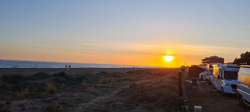
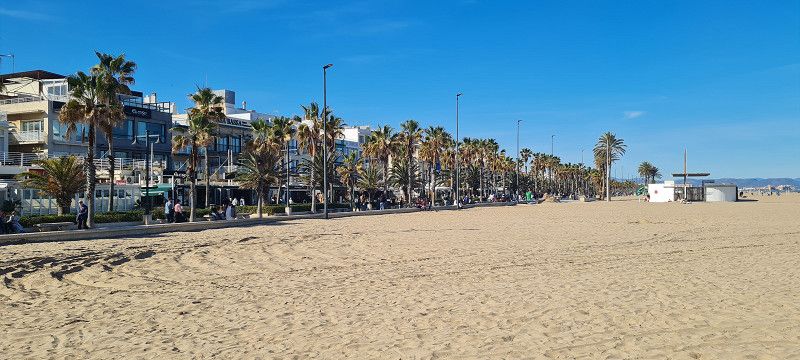
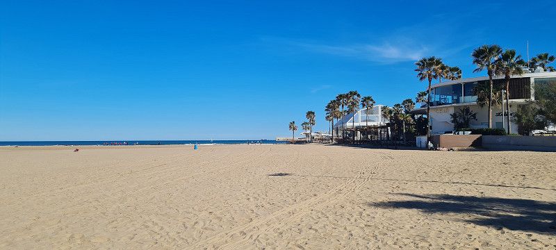
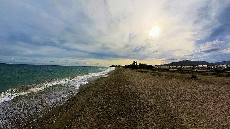
Our campsite is located about 15 kilometers southwest of downtown Barcelona in Casteldefells.
https://www.tresestrellascampings.com/barcelona/
Arrived at sunny 14-15 degrees.
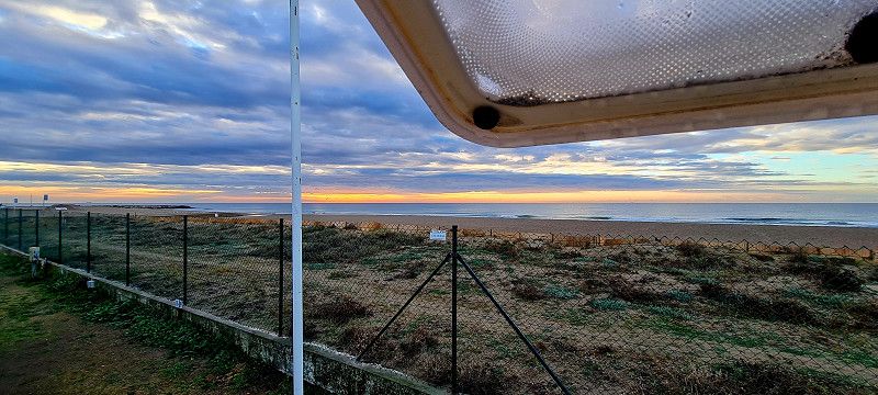
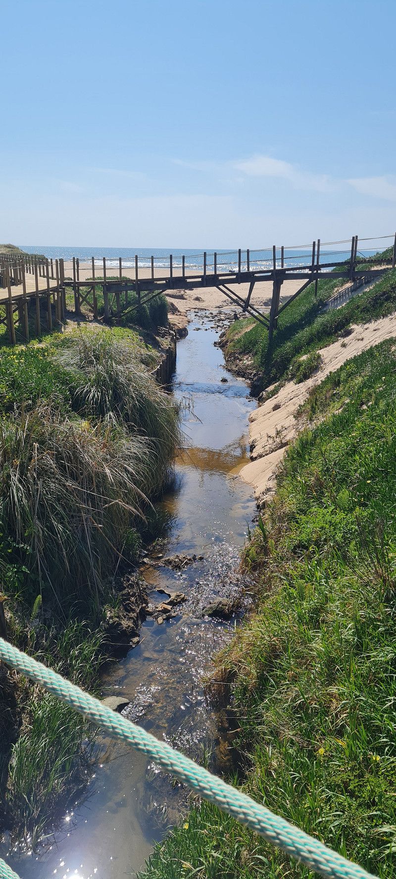
We have a good spot with a direct view and access to the beach. We will stay here until Sunday.
Day
2.ter Tag Barcelona
Hey guys,
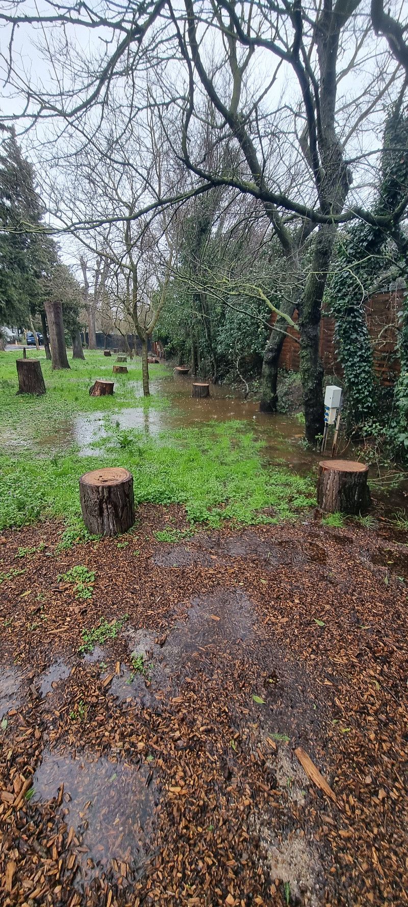
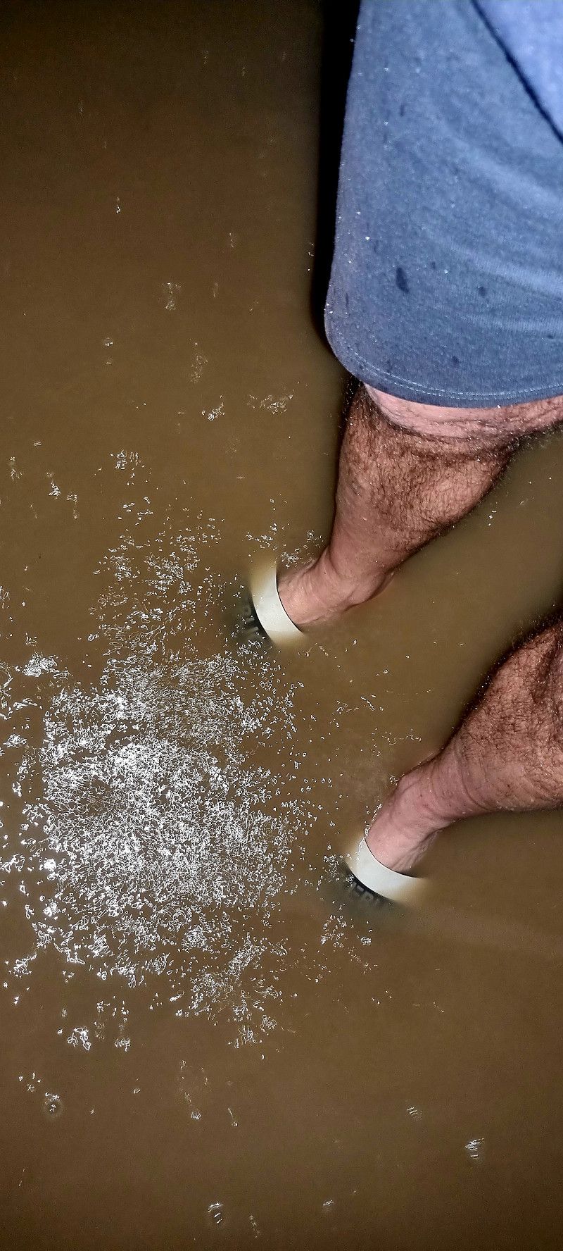
well, after yesterday was a really nice, sunny day, today is the opposite. It's been raining heavily since midday. The whole campsite is under water. So we don't really have anything to report today. But tomorrow it will be sunny again and we can drive into town 👋👍😊
Day
Barcelona
Carrer de Jaume I 1, Barcelona, Provinz Barcelona, Spanien
41° 22' 58.4" N 2° 10' 38.8" E
41.3828939 2.1774322
• Head toward Carrer de la Dagueria on Carrer de Jaume I. Go for 127 m.
• Continue on Plaça de l'Àngel. Go for 35 m.
• Turn right onto Via Laietana. Go for 408 m.
• Turn right onto Passeig de Colom toward Pg. Colom/pl. Drassanes/Estació Marítima/Montjuïc/B-10/Ronda Litoral Llobregat. Go for 691 m.
• Take the 3rd exit from Plaça del Portal de la Pau roundabout onto Passeig de Josep Carner toward Rda. Litoral/B-10/Montjuïc/Port Vell/Pl. Drassanes. Go for 248 m.
• Take the 2nd exit from Plaça de les Drassanes roundabout onto Passeig de Josep Carner toward Barcelona-Nord/Poblenou/Montjuïc-Miramar/Ronda Litoral Llobregat/B-10/Aeroport. Go for 459 m.
• Take ramp onto B-10 (Ronda del Litoral) toward Ronda Litoral/Aeroport/Passeig Montjuïc. Go for 7.7 km.
• Take exit 19 toward Aeroport onto B-20. Go for 4.2 km.
• Continue on C-32. Go for 54.5 km.
• Take the left exit toward Tarragona/València onto AP-7 (Autopista de la Mediterrània). Go for 37.1 km.
• Take exit 35 toward Vila-Seca/Salou/Reus S/Port Aventura/Reus/Castelló/València. Go for 1.3 km.
• Take the 4th exit from roundabout onto A-7 (Autovia de la Mediterrània) toward Cambrils/Castelló. Go for 30.3 km.
• Continue on N-340. Go for 970 m.
• Pass 3 roundabouts and continue on N-340. Go for 14.5 km.
• Take the 1st exit from roundabout onto N-340a toward El Perelló nord/Rasquera/Móra. Go for 660 m.
• Continue on Carrer Major (N-340a). Go for 210 m.
• Continue on Plaça Església (N-340a). Go for 16 m.
• Continue on Carrer Francesc Macià (N-340a). Go for 83 m.
• Keep right onto Plaça d'en Jaume II. Go for 55 m.
• Turn left onto Plaça d'en Jaume II. Go for 17 m.
• Arrive at Plaça d'en Jaume II. Your destination is on the left.
☍
153,6 km
(1 hrs. 31 min.)
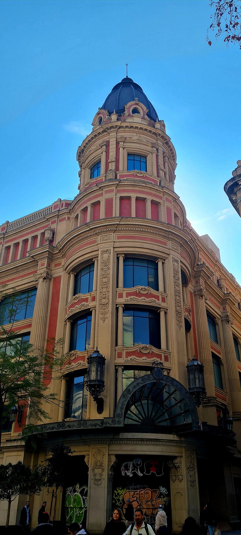
3.ter Tag Barcelona
Hey guys,
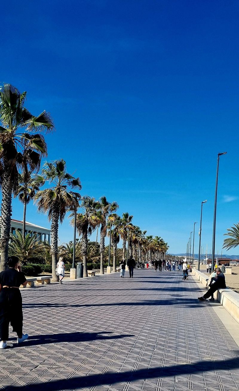
Today we have great weather. 14 degrees and sunshine 🌞 🌞 🌞 so off we go to the big city.
About a 10 minute walk to the bus stop and a 45 minute ride to the city center for 2.65 euros per person. There at the metro we bought a tourist ticket (48 hours) for 18.10 euros per person.
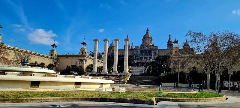
The plan was to go to Montserrat, about 35 km away. So we got on the train and set off. Until I realised that our tickets weren't valid there. We would have had to pay another 70 euros each for the train ride and the cable car there and back. We then got off the train and took the metro to the 'Camp Nou' stadium... Unfortunately, the whole stadium is under renovation. So we couldn't see much there either.
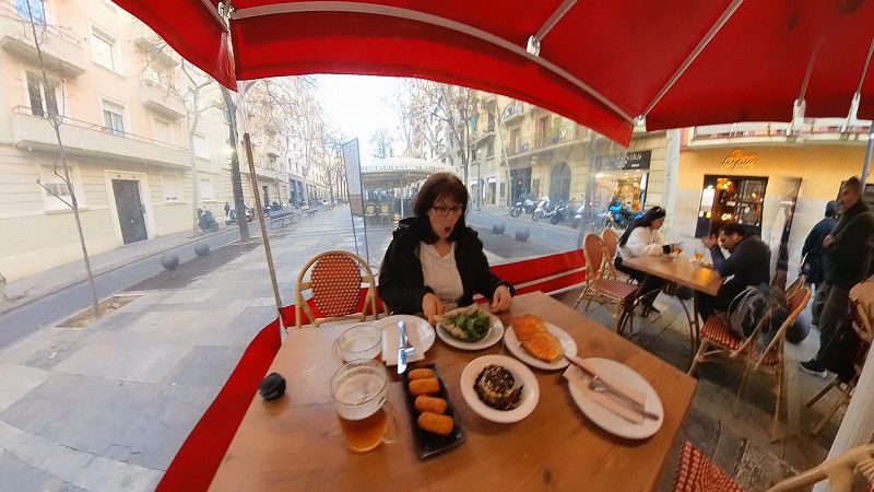
So we went back to the city center and just strolled around a bit and ate some tapas. And just like that, 6 hours had passed.
Tomorrow we'll go again
Day
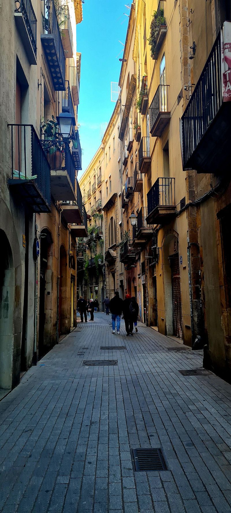
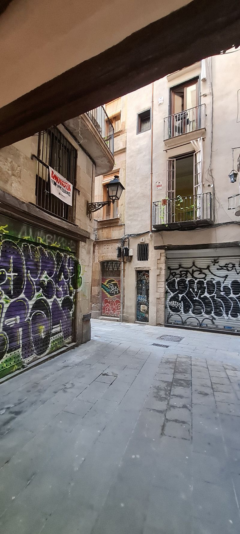
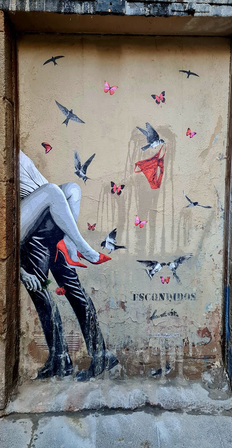
4.ter Tag Barcelona
Hey guys,
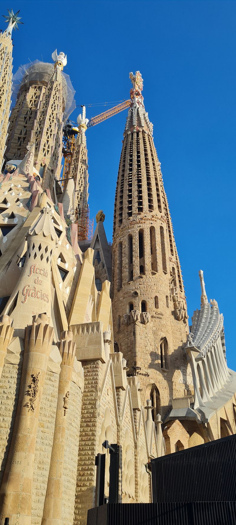
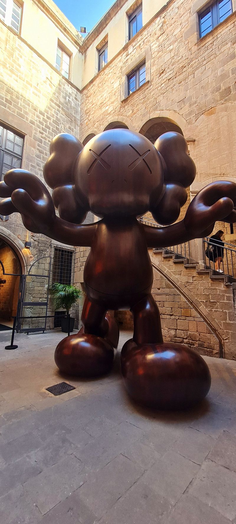
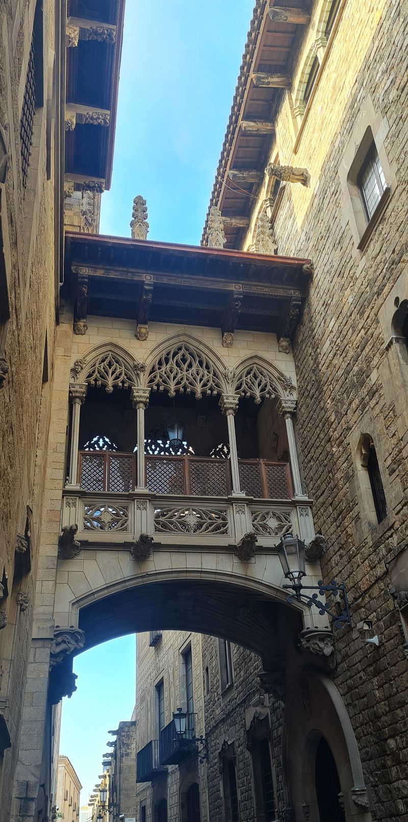
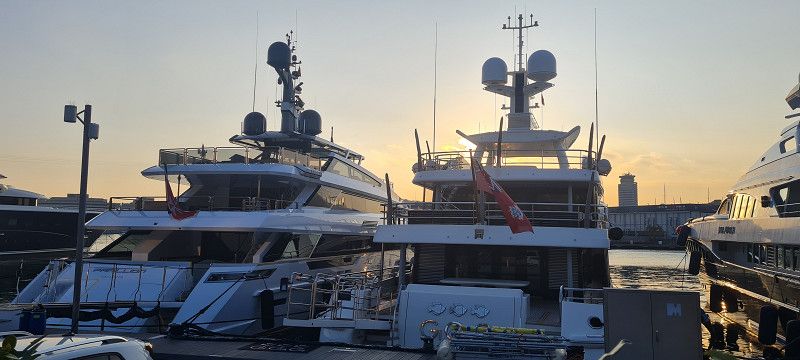
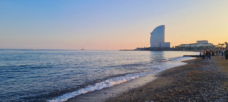
After a wasted morning we set off again. There are so many beautiful places in Barcelona. Today we dedicated ourselves to the beautiful old town including the Moco Museum and the harbor/beach. It was wonderful 🙂
Day
5.ter Tag Barcelona
Hey guys,
Today we didn't do anything. We had housework and laundry on the agenda. After that I spent half the day working on my video editing program so that I could make lots of nice things out of our videos. (Unfortunately I can't post videos here) The weather was good for that too, cloudy all day.
Tomorrow we'll continue again.
Day
el Perelló
Plaça de Jaume II, el Perelló, Baix Ebre, Katalonien, Spanien
40° 52' 31.5" N 0° 42' 44.6" E
40.8754052 0.7123762
• Head toward Carrer Alcalde Ramon de Banyeres on Plaça d'en Jaume II. Go for 24 m.
• Turn right onto Carrer Lluís Companys (N-340a). Go for 74 m.
• Turn sharp right onto Carrer Trajacapita. Go for 176 m.
• Continue on Plaça de la Constitució. Go for 26 m.
• Continue on Avinguda Sant Jordi. Go for 264 m.
• Continue on Carrer tres. Go for 125 m.
• Take the 3rd exit from roundabout toward Rasquera/Gandesa. Go for 54 m.
• Turn left onto Carretera de Rasquera (TV-3022). Go for 122 m.
• Continue on TV-3022. Go for 18.5 km.
• Turn right onto TV-3022 toward Móra/Gandesa/Tortosa. Go for 384 m.
• Turn left toward Benifallet/Gandesa/Tortosa. Go for 33 m.
• Turn left onto C-12 toward Benifallet/Gandesa/Tortosa. Go for 16.4 km.
• Turn right onto N-230b toward Prat C./Horta St. J./Vall-de-Roures. Go for 7.2 km.
• Turn slightly left toward Prat de Comte/Horta De St. J./Vall-de-Roures. Go for 27 m.
• Turn left onto T-333 toward Prat de Comte/Horta De St. J./Vall-de-Roures. Go for 4.3 km.
• Take the 2nd exit from roundabout onto T-333 toward Bot/Horta de St. Joan/Arnes/Vall-de-Roures. Go for 1.5 km.
• Continue on T-330. Go for 6.5 km.
• Continue on T-330. Go for 7.9 km.
• Continue on A-231. Go for 9.7 km.
• Take the 2nd exit from roundabout onto Calle Santiago Hernández Ruiz (A-231). Go for 488 m.
• Continue on Calle Santiago Hernández Ruiz. Go for 117 m.
• Turn right onto Calle del Baile. Go for 150 m.
• Turn left onto Calle del Carmen. Go for 107 m.
• Turn right onto Calle Codo. Go for 77 m.
• Continue on Plaza de la Iglesia. Go for 49 m.
• Turn left onto Calle Cervantes. Go for 61 m.
• Arrive at Calle Cervantes. Your destination is on the left.
☍
74,2 km
( 53 min.)
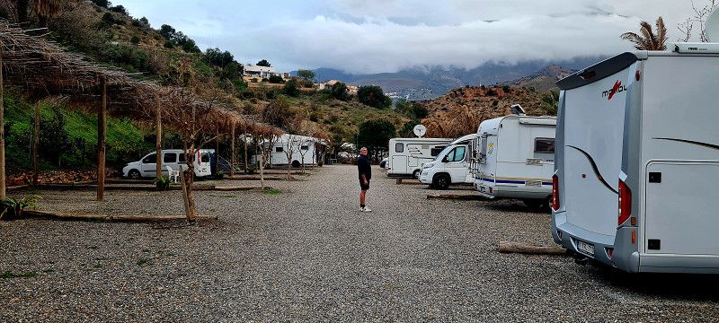
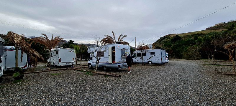
16. Feb. 2025 -
17. Feb. 2025
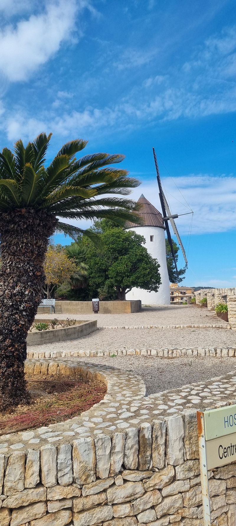
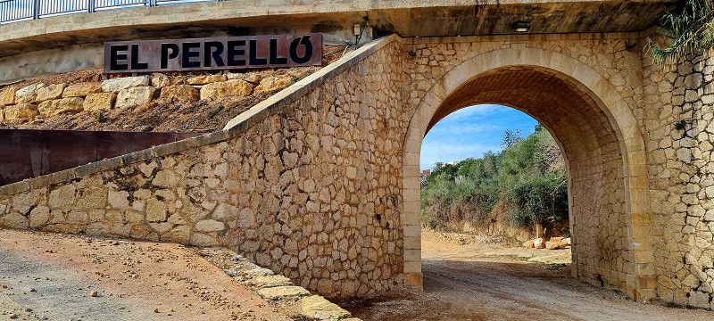
7.ter Stopp El Perelló
Hey guys,
So, let's carry on. We started at 10:30 today. The stages are getting shorter now. We covered a good 160 kilometers in 2.5 hours. We drove to the free parking space in the small town of El Perelló. They say they have the best honey and olive oil here.
We will find out tomorrow morning before we continue on to our actual destination.
Today we of course took a little walk around and later sat in the sun at the parking spot 😊
Day
Valderrobres
Calle del Buen Aire, Valderrobres, Aragonien, Spanien
40° 52' 33.9" N 0° 9' 17.7" E
40.8760871 0.1549292
• Head southeast on Calle Cervantes. Go for 61 m.
• Turn right onto Plaza de la Iglesia. Go for 49 m.
• Continue on Calle Codo. Go for 77 m.
• Turn left onto Calle del Carmen. Go for 69 m.
• Keep right onto Calle del Carmen. Go for 38 m.
• Turn right onto Calle del Baile. Go for 150 m.
• Turn left onto Calle Santiago Hernández Ruiz. Go for 566 m.
• Take the 2nd exit from roundabout onto A-231. Go for 9.8 km.
• Continue on T-330. Go for 6.2 km.
• Turn left onto T-334 toward Horta St. J./Gandesa. Go for 1.3 km.
• Continue on Avinguda Port d'Horta Sant Joan (T-334). Go for 971 m.
• Continue on Plaça de Catalunya (T-334). Go for 59 m.
• Continue on Avinguda Generalitat (T-334). Go for 516 m.
• Continue on T-334. Go for 643 m.
• Turn slightly right onto T-334. Go for 36 m.
• Continue on T-334. Go for 9.0 km.
• Continue on TV-3531. Go for 574 m.
• Continue on Carrer de Caseres (TV-3531). Go for 272 m.
• Continue on Plaça l'Església (TV-3531). Go for 30 m.
• Turn left onto Avinguda Catalunya (TV-3531). Go for 58 m.
• Turn right onto Carrer La Verge de la Fontcalda. Go for 28 m.
• Arrive at Carrer La Verge de la Fontcalda. Your destination is on the right.
☍
30,5 km
( 26 min.)
17. Feb. 2025 -
18. Feb. 2025
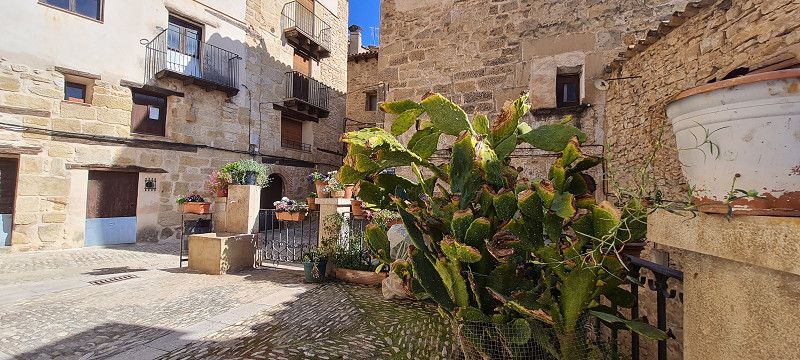
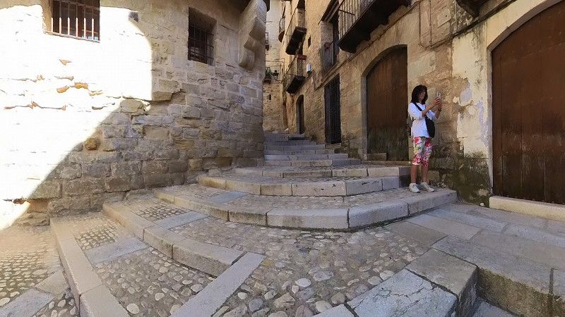
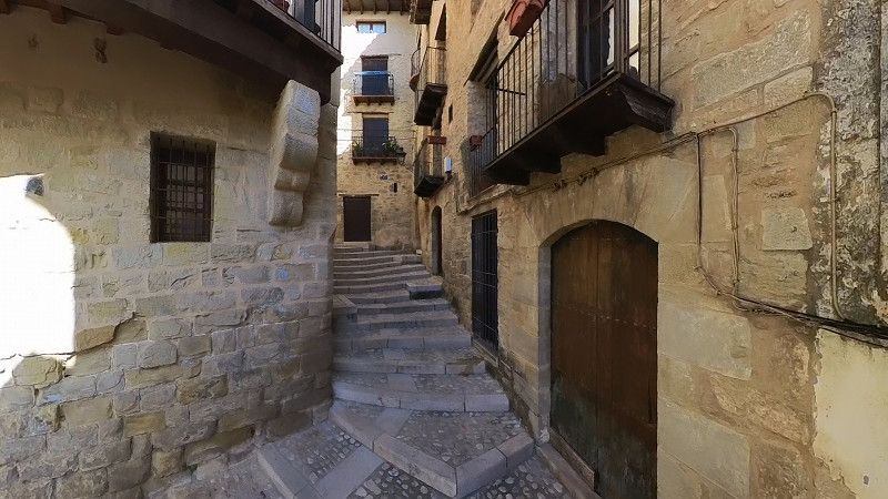
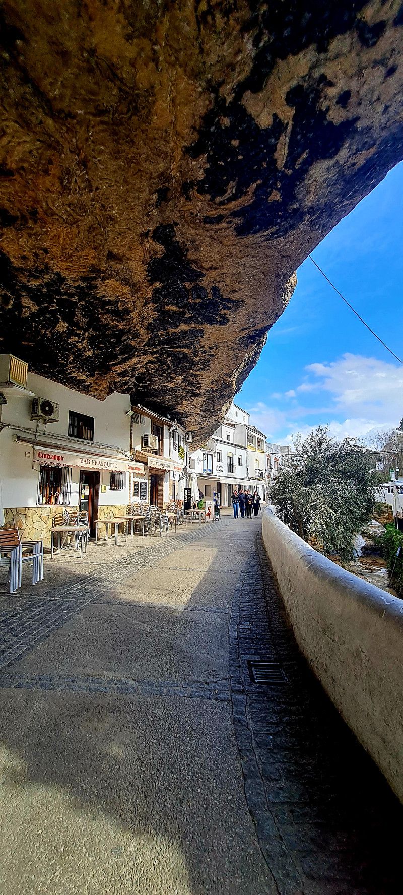
8.ter Stopp Valderrobes
Hey guys,
Today we were on the road early for our standards. Shortly after 9:00 a.m. we were already tasting olive oil and honey. With a few liters of oil and wine we set off in a good mood.
Originally, we were supposed to hike 80 kilometers into a national park. After reading up on how to get to the hiking car park, we unfortunately had to abandon the plan. Access to the car park is not permitted for vehicles over 2.10 meters wide (without mirrors). Since this route is almost 7 kilometers long, we didn't dare try it.
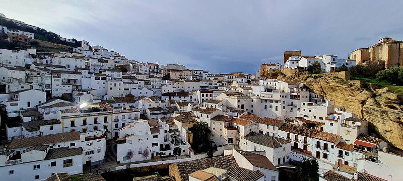
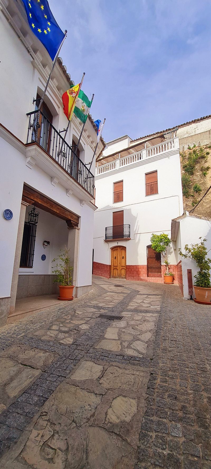
So we drove a few kilometers further to a small town that is one of the most beautiful cities in Spain.
And it's true!
Here we are on a pitch for 4.00 Euro (24 hours) without electricity and sanitary facilities
Day
Bot
Terra Alta, Katalonien, Spanien
41° 0' 34" N 0° 23' 8.4" E
41.0094492 0.3856670
• Head toward Carrer La Gandesa on Carrer La Verge de la Fontcalda. Go for 20 m.
• Turn right onto Carrer La Gandesa. Go for 41 m.
• Turn right onto Carrer Freixes. Go for 71 m.
• Turn right onto Plaça l'Església. Go for 14 m.
• Turn right onto Avinguda Catalunya (TV-3531). Go for 205 m.
• Continue on TV-3531. Go for 104 m.
• Take the 1st exit from roundabout onto TV-3531 toward Gandesa/Batea. Go for 3.3 km.
• Turn slightly left onto T-362 toward Batea/Alcañiz. Go for 2.0 km.
• Continue on N-420 toward Calaceite/Alcañiz. Go for 38.5 km.
• Turn left toward N-232/Vinaroz/Castellón. Go for 136 m.
• Continue on N-232. Go for 44.0 km.
• Turn right. Go for 234 m.
• Turn right toward CV-125. Go for 20 m.
• Turn right onto CV-125. Go for 203 m.
• Take ramp. Go for 272 m.
• Turn left. Go for 122 m.
• Arrive at your destination on the left.
☍
89,3 km
(1 hrs. 1 min.)
2.ter Tag Valderrobres/ Bot
Hey guys,
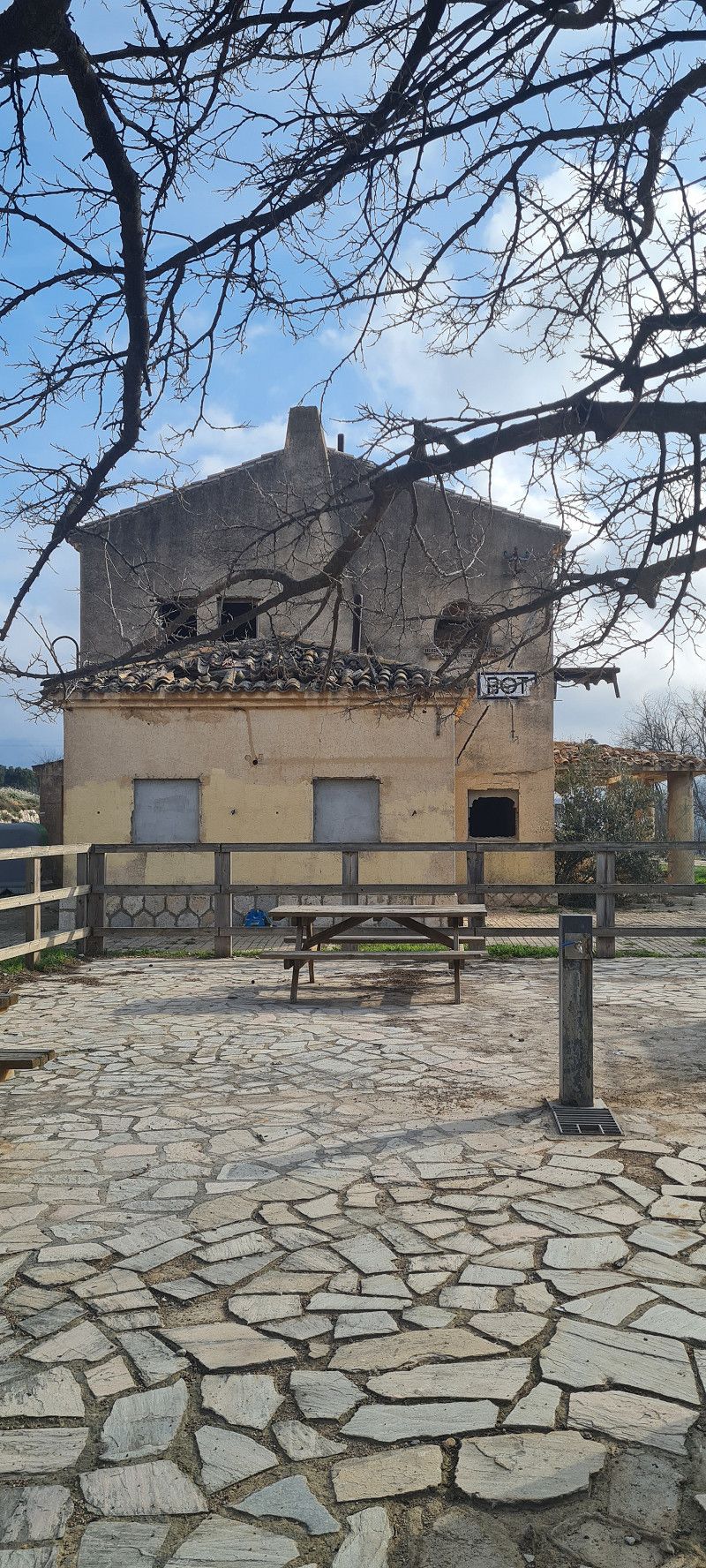
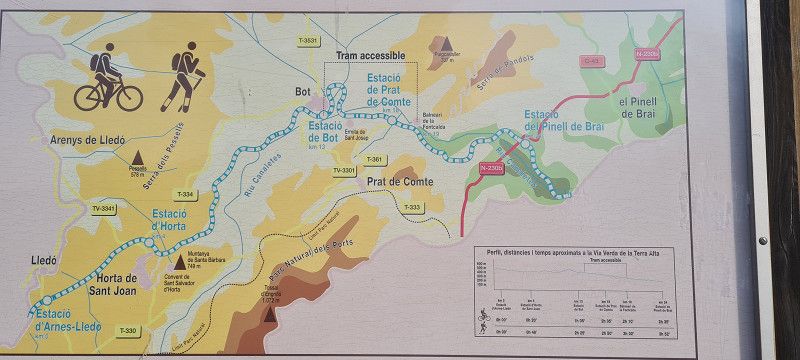
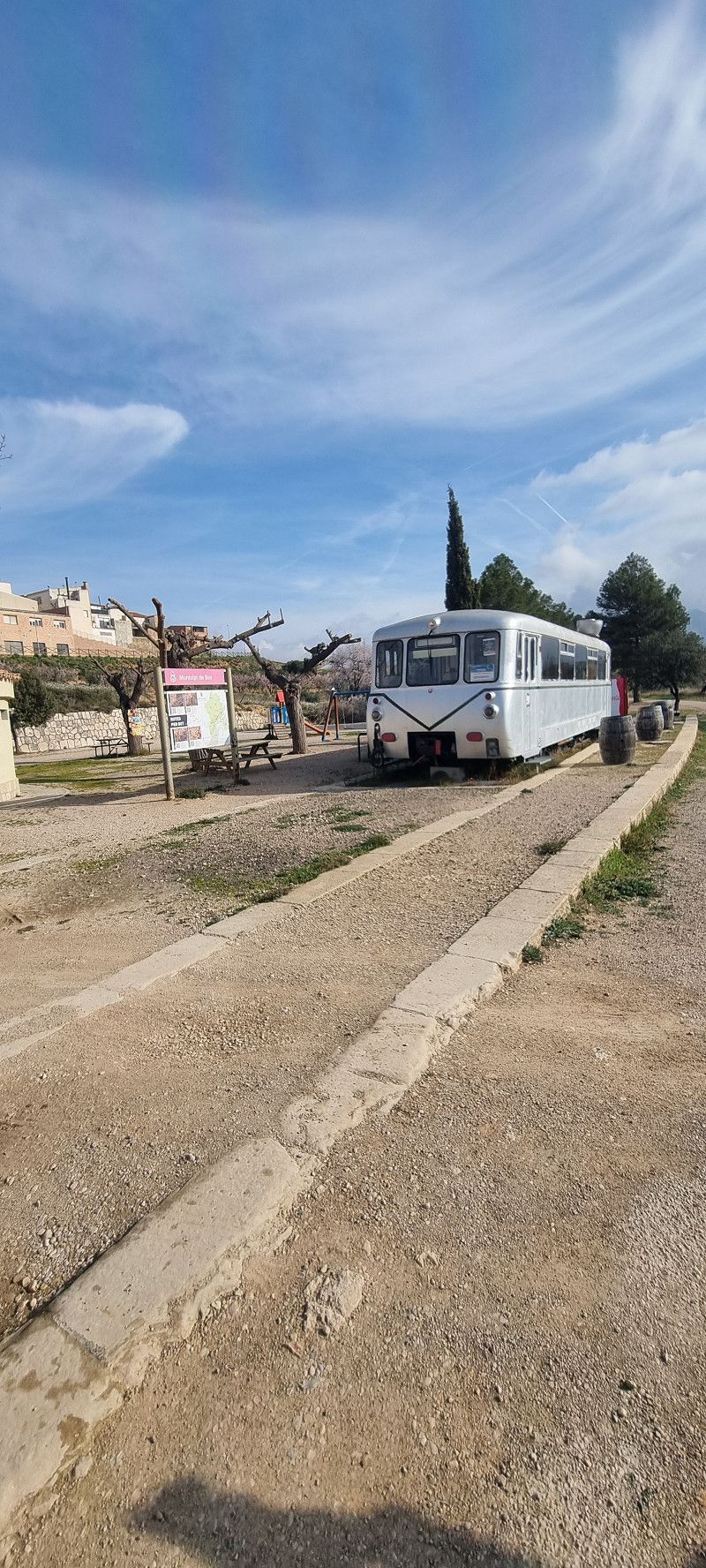
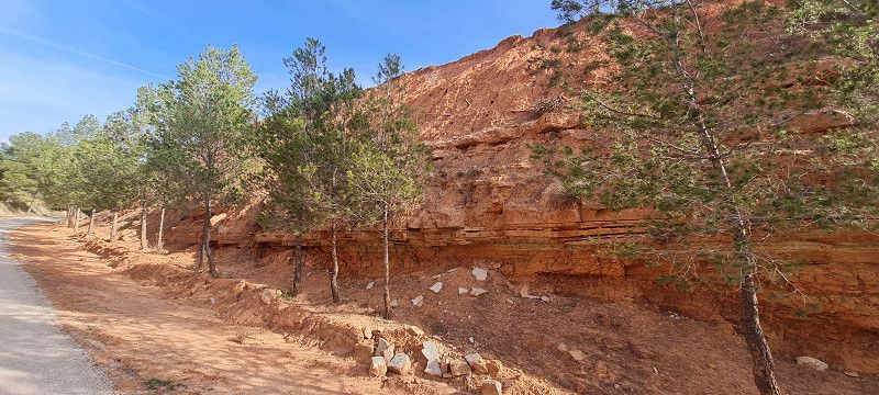
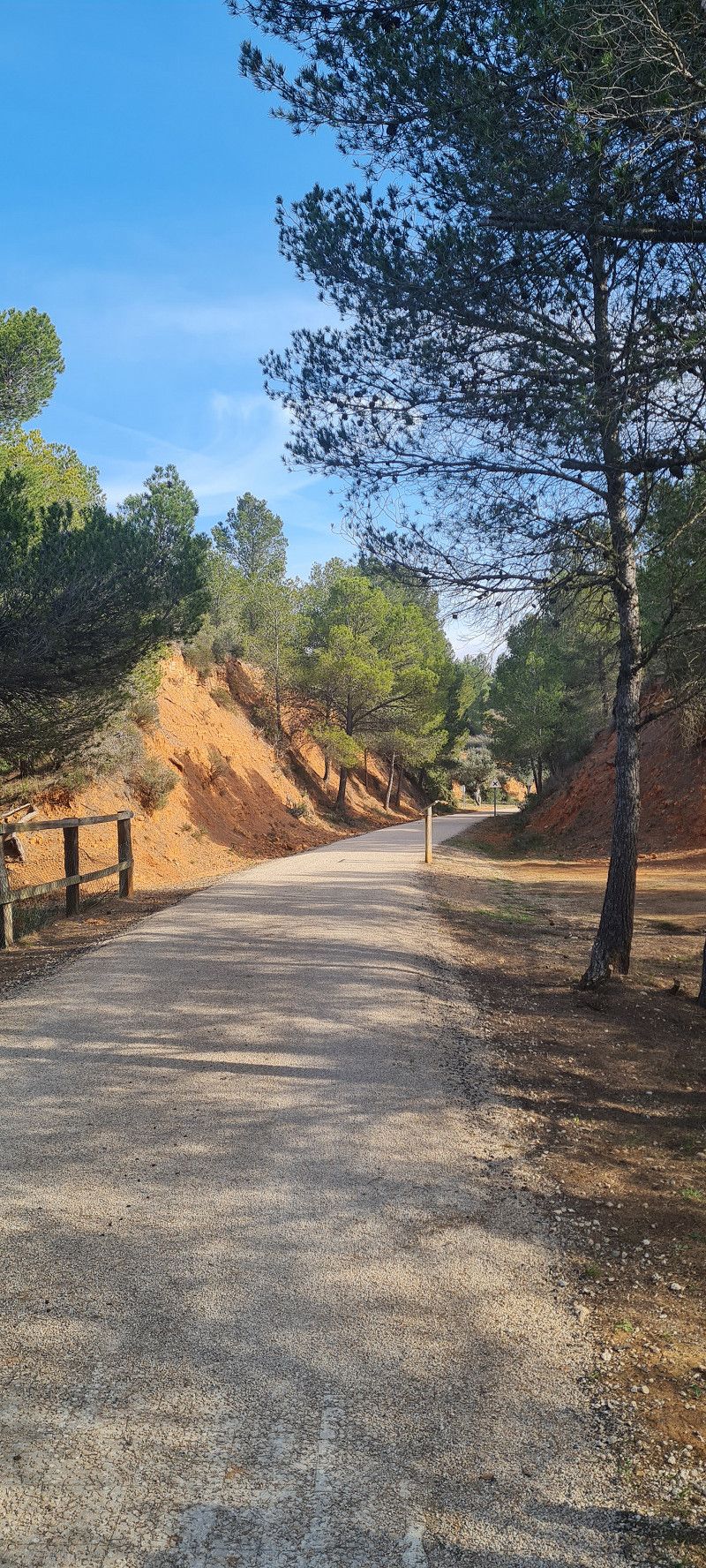
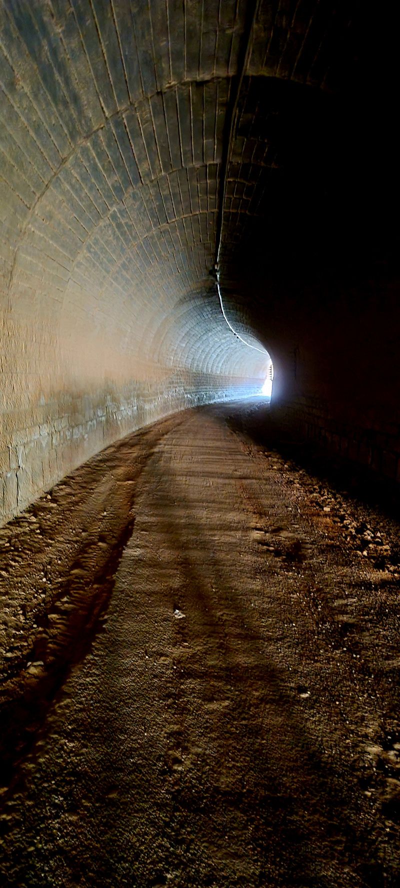
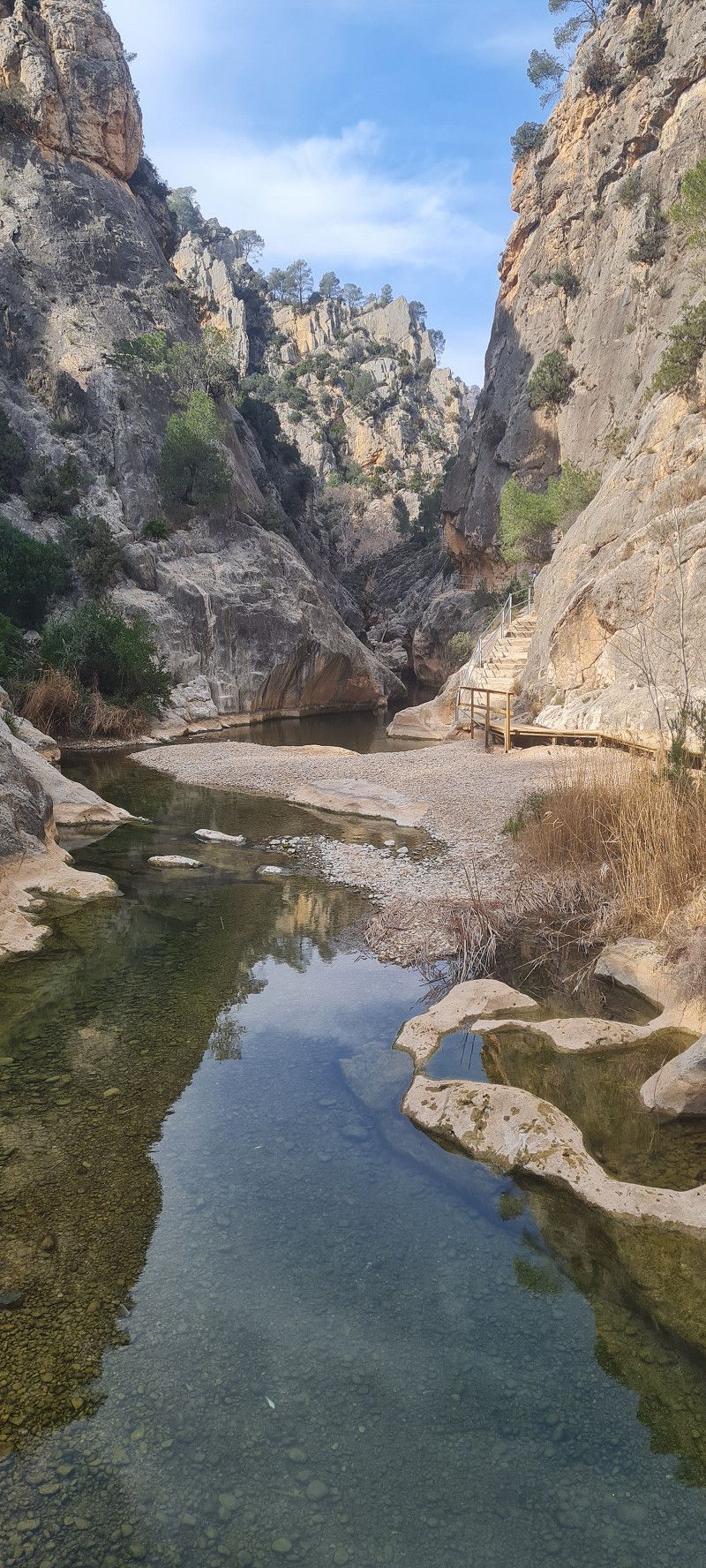
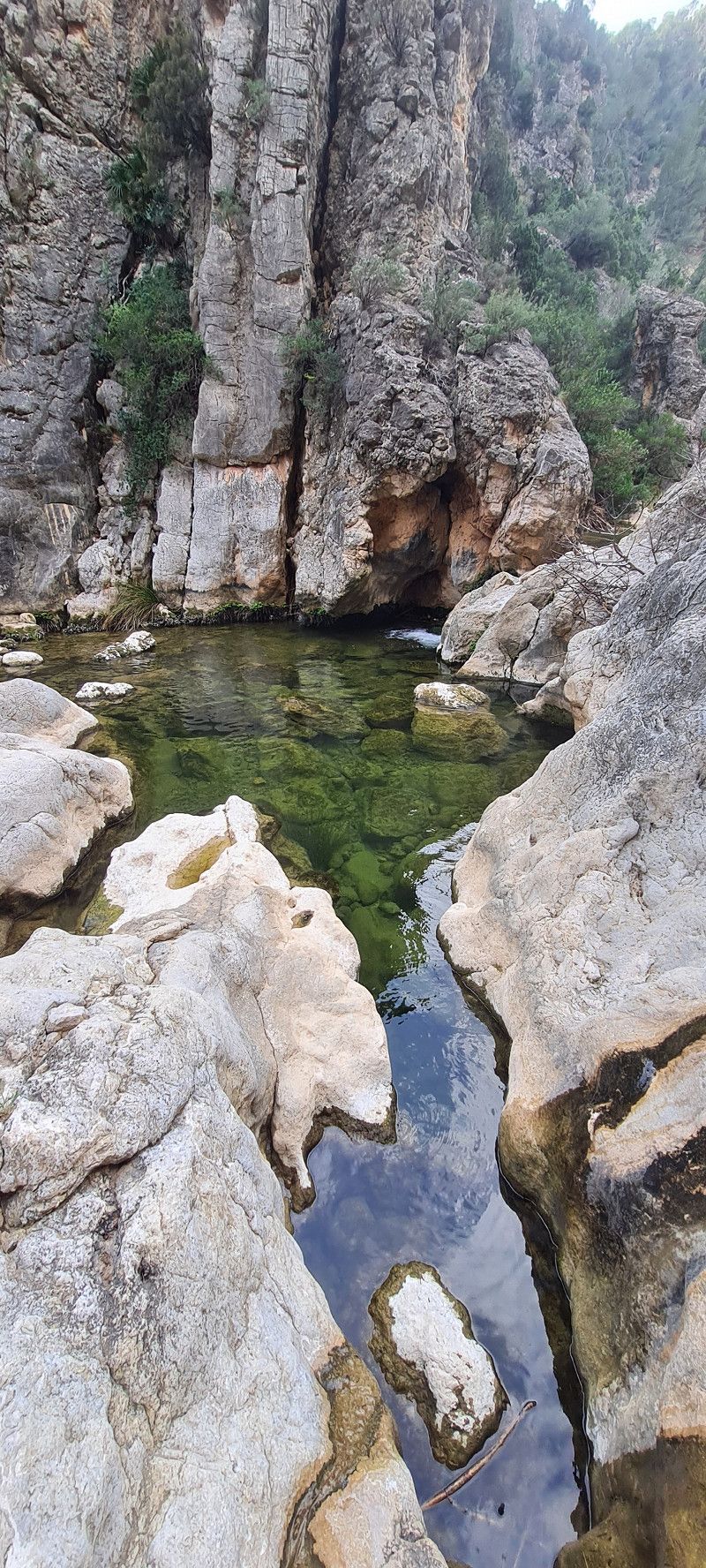
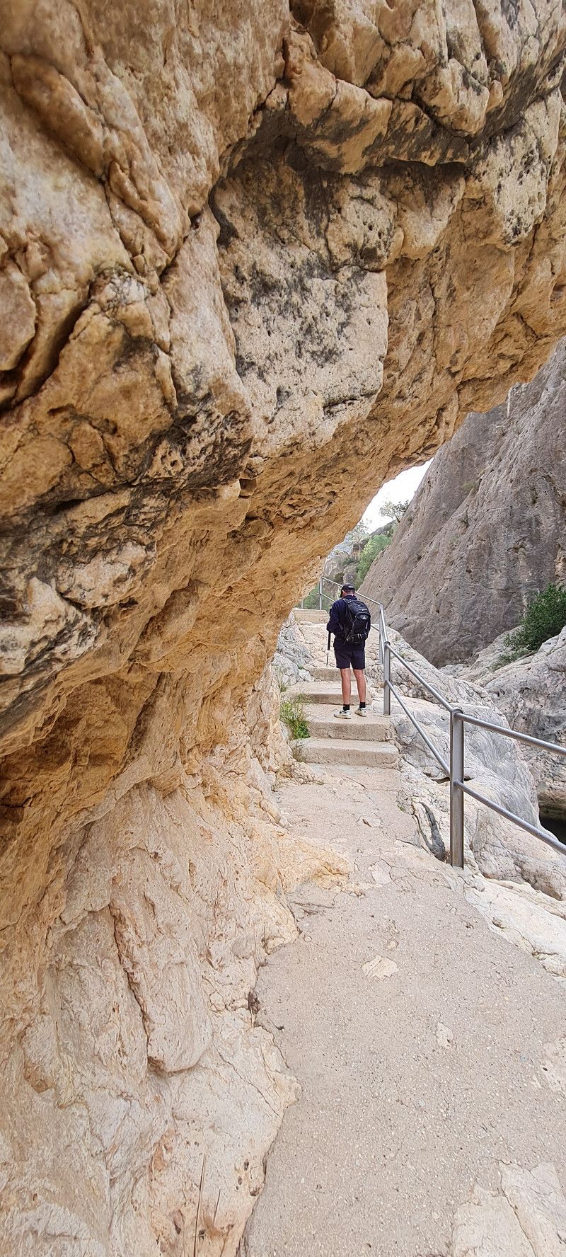
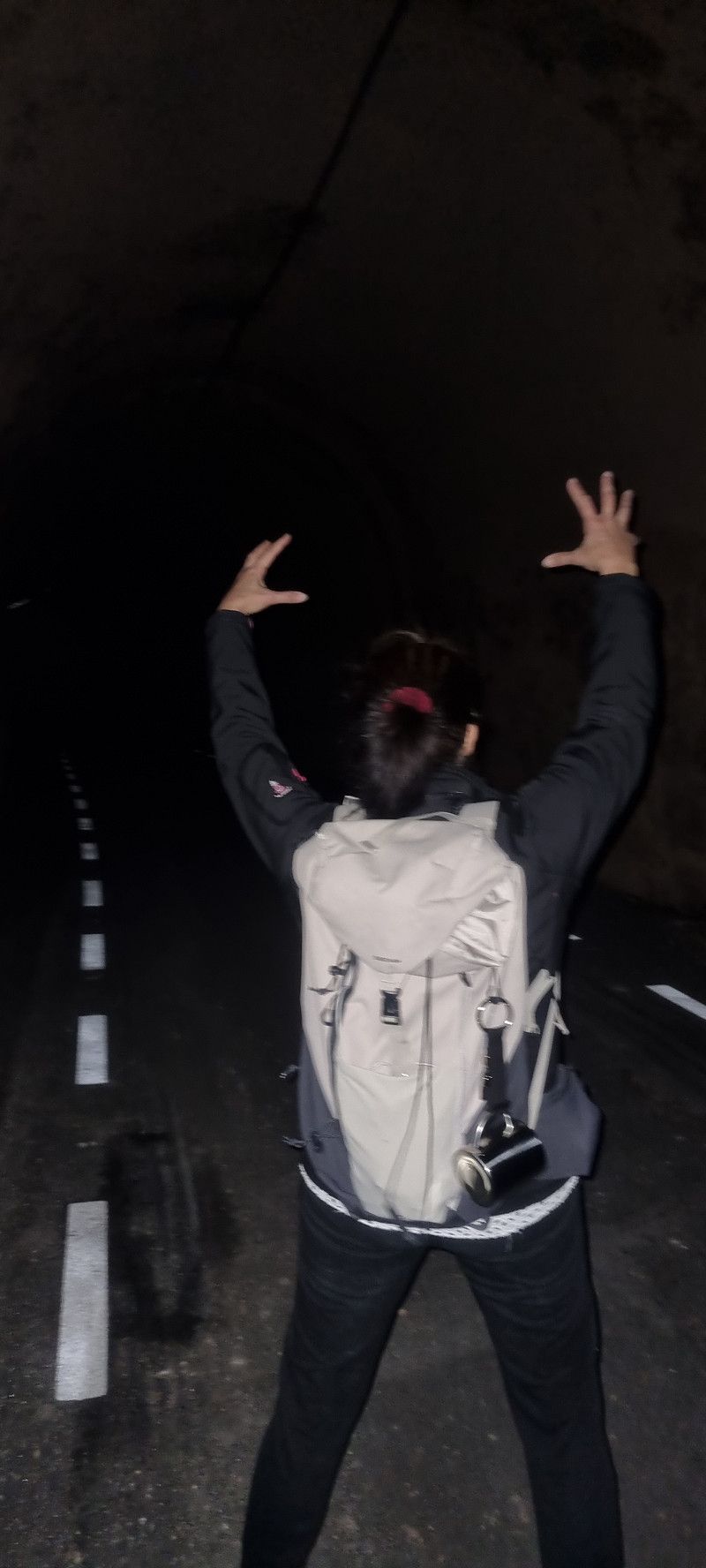
Today we drove about 30 kilometers back to the Parc Natural dels Ports. In the town of Bot we stopped at the old railway line.
Here is a railway line cycle path "via verde" and runs along a former railway line.
We hiked almost 7.5 kilometers of the route.
On this route we had to go through 7 or 8 tunnels. The longest was 750 meters long and pitch black. That was something special.
In between, we stopped at a hot spring and took a foot bath in the water, which was about 25 degrees warm.
A group of French people were already there and we were invited for a glass of wine. 😀
After the relaxing break, we walked the 7.5 kilometers back to Eddi and then drove back to the parking space in Valderrobres.
Day
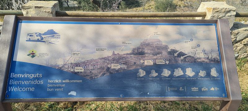
Zona Autocaravanas Morella
N-232 Vinaros-Vitoria, 12300, Morella, Spanien
40° 37' 27" N 0° 5' 29" W
40.6241667 -0.0913889
• Head southwest. Go for 558 m.
• Turn left onto N-232. Go for 30.9 km.
• Take ramp toward Sant Mateu/Chert. Go for 591 m.
• Take the 1st exit from roundabout onto CV-132 toward Sant Mateu. Go for 5.1 km.
• Take the 2nd exit from roundabout toward Castellón. Go for 72 m.
• Continue on CV-10. Go for 1.1 km.
• Take the 2nd exit from roundabout onto CV-10 toward Castelló. Go for 3.8 km.
• Take the 3rd exit from roundabout onto CV-10 toward Les Coves de Vinromà/Castelló. Go for 552 m.
• Pass 4 roundabouts and continue on CV-10. Go for 31.9 km.
• Take the 2nd exit from roundabout onto CV-10 toward La Pobla Tornesa/Castelló. Go for 21.0 km.
• Take exit 18 toward Castelló (nord)/CV-151/N-340/E-15/AP-7/Benicàssim/Tarragona. Go for 265 m.
• Take the 4th exit from roundabout onto Carretera Morella (CV-151) toward N-340. Go for 2.2 km.
• Pass 2 roundabouts and continue on Carretera de Borriol (CV-151). Go for 1.4 km.
• Take the 1st exit from Glorieta Madre Teresa de Calcuta roundabout onto Avenida de Vicente Sos Baynat. Go for 335 m.
• Take the 3rd exit from roundabout onto Avenida de Vicente Sos Baynat. Go for 548 m.
• Take the 3rd exit from Avenida de Alcora roundabout onto Avenida de Alcora (CV-1540). Go for 442 m.
• Take the 1st exit from roundabout onto Cuadra Saboner. Go for 494 m.
• Continue on Calle Cuadra Saboner. Go for 414 m.
• Turn left onto Calle Benidorm. Go for 148 m.
• Arrive at Calle Benidorm. Your destination is on the left.
☍
101,8 km
(1 hrs. 15 min.)
30. Nov. -0001 -
30. Nov. -0001
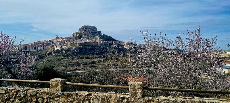
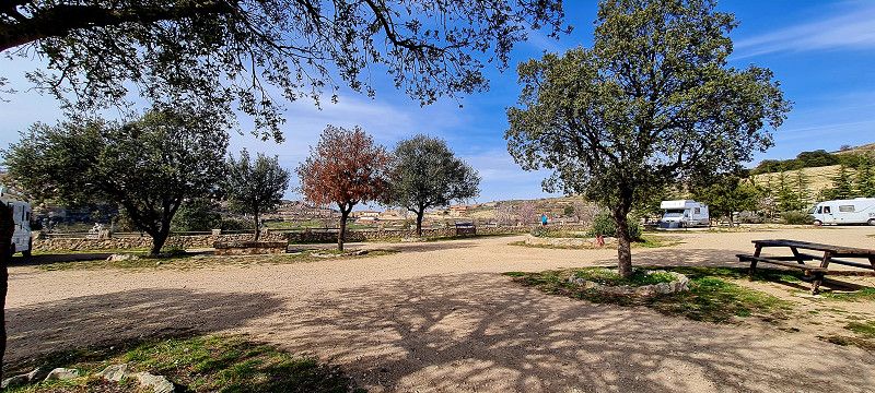
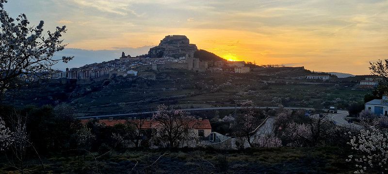
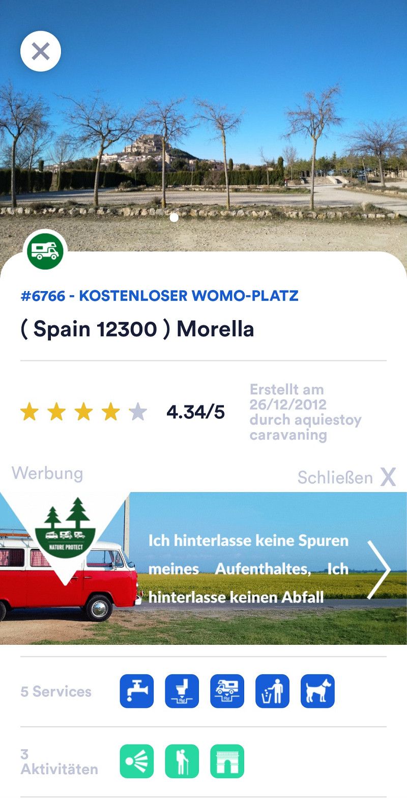
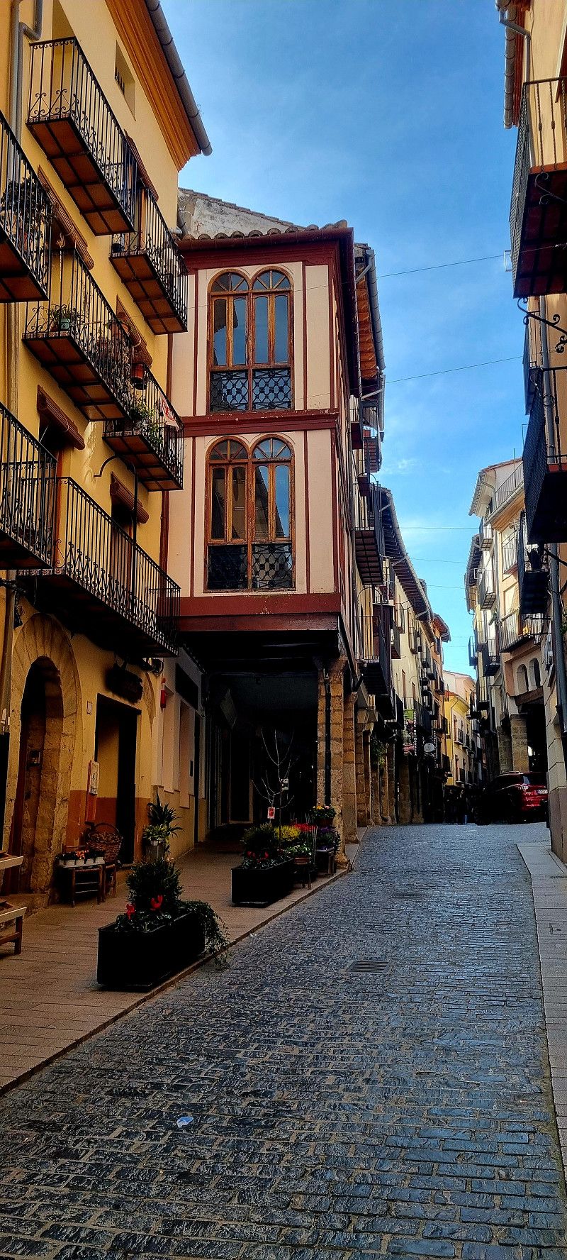
9.ter Stopp Morella
Hey guys,
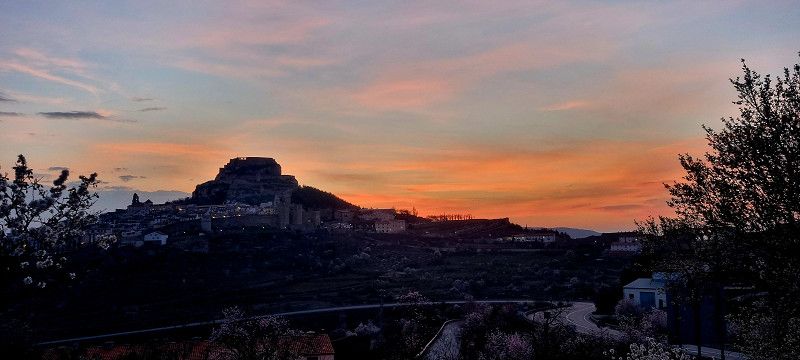
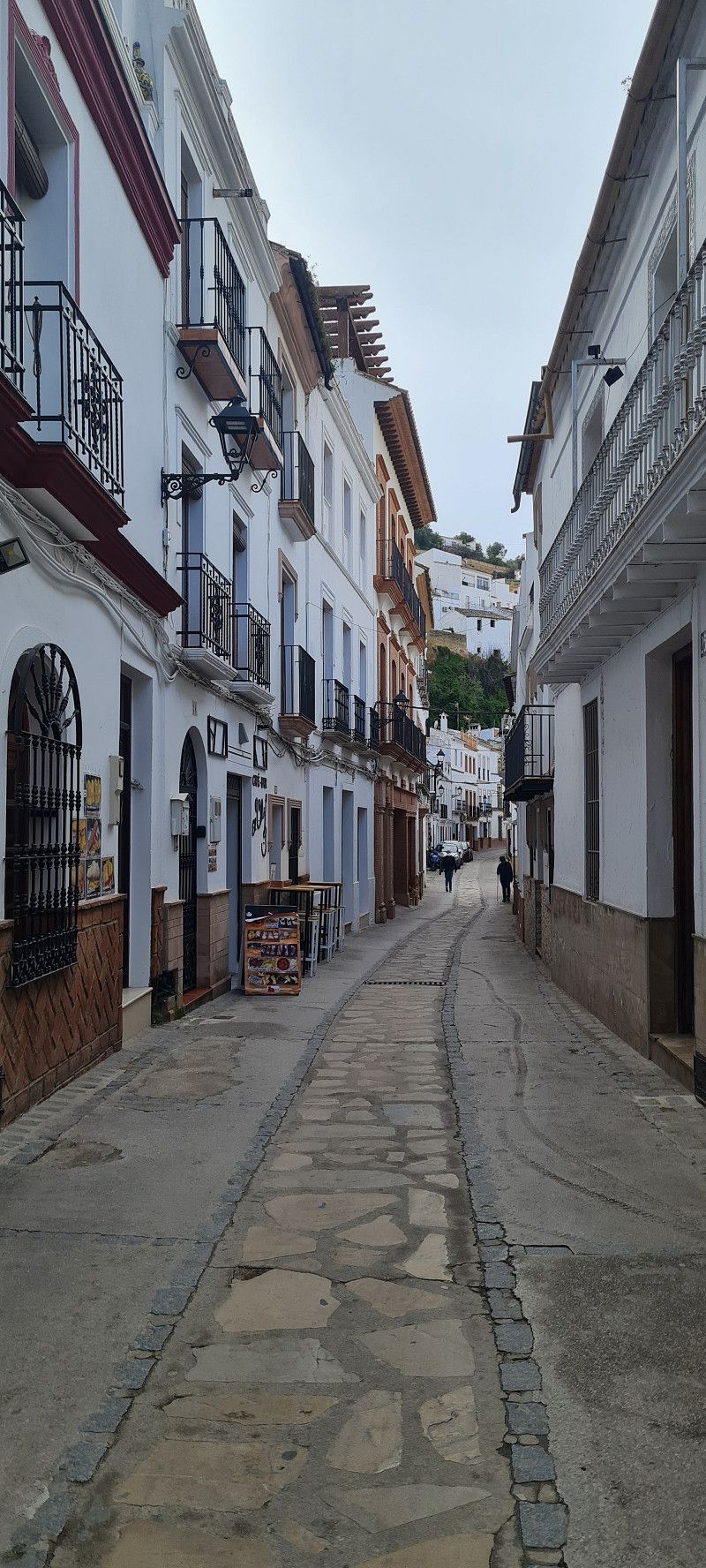
At 10:30 am sharp (which is our time, somehow) we set off again. Originally we wanted to head for Valencia, but we didn't get a spot at the campsite until Monday. So we still have a few days to get by. So we drove just 50 kilometers further to a free parking spot in Morella. This is another place that is one of the most beautiful places in Spain.
We haven't visited the town itself yet today. Today we preferred to sit in the sun all afternoon. Tomorrow we will explore the village.
Day
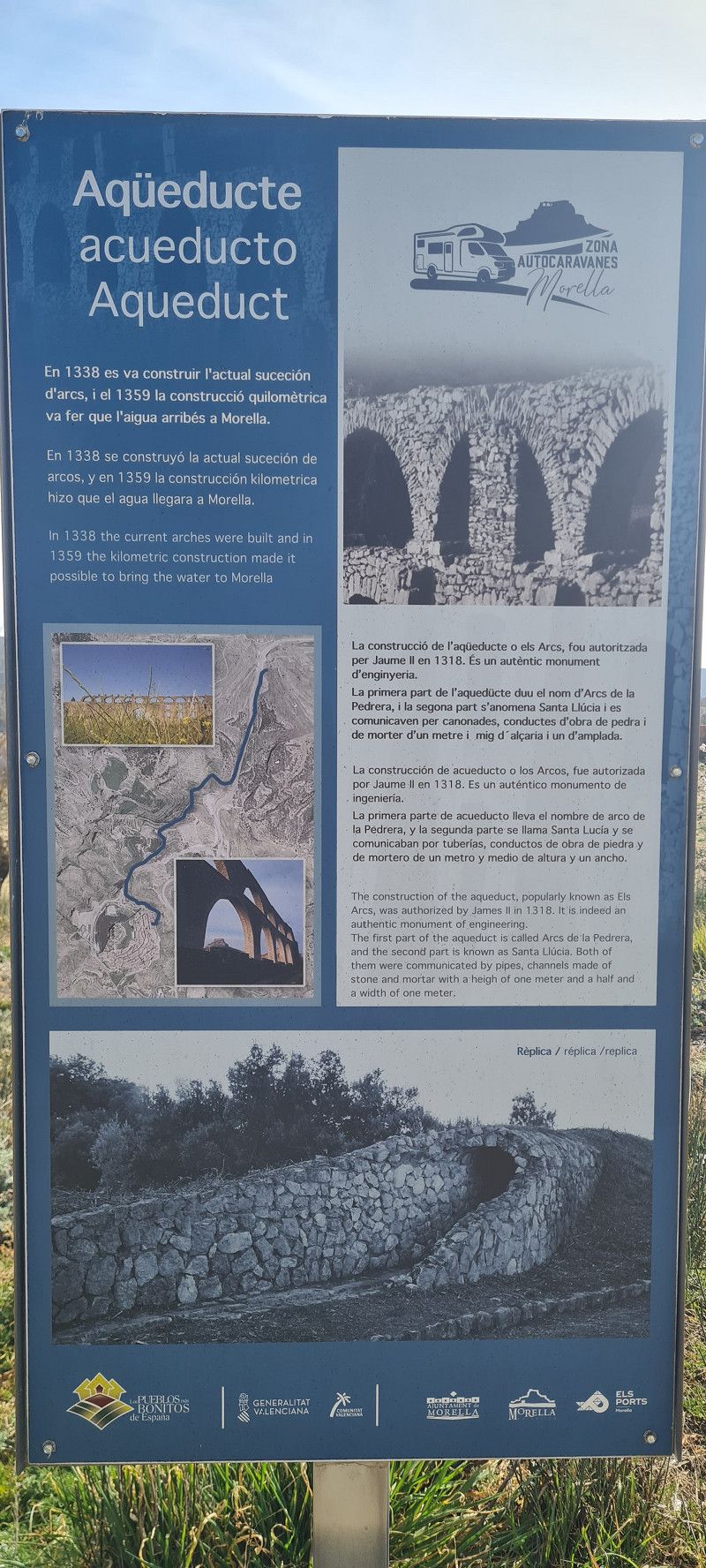
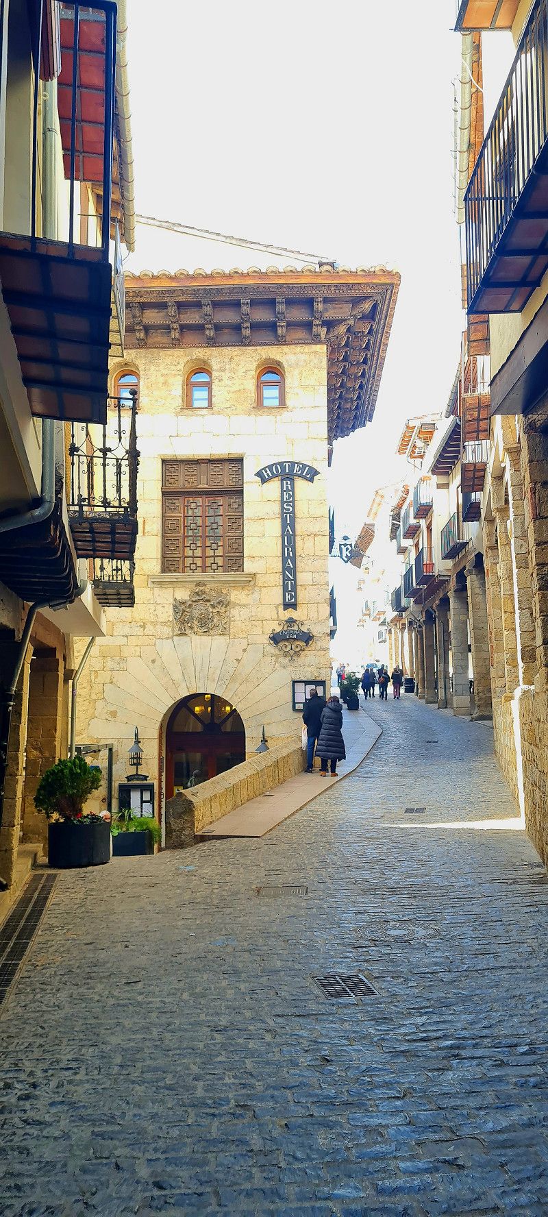
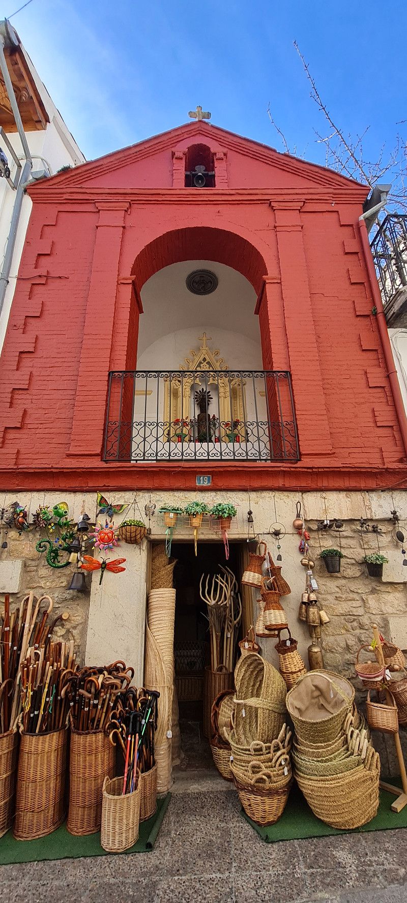
2.ter Tag Morella
Hey guys,
At 11:00 a.m. we set out to explore the place. Unfortunately, there is no footpath or cycle path from the parking space to the town. So we had to walk about 1.5 kilometers directly along the side of the main road. Not really pleasant.
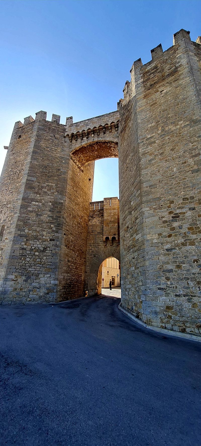
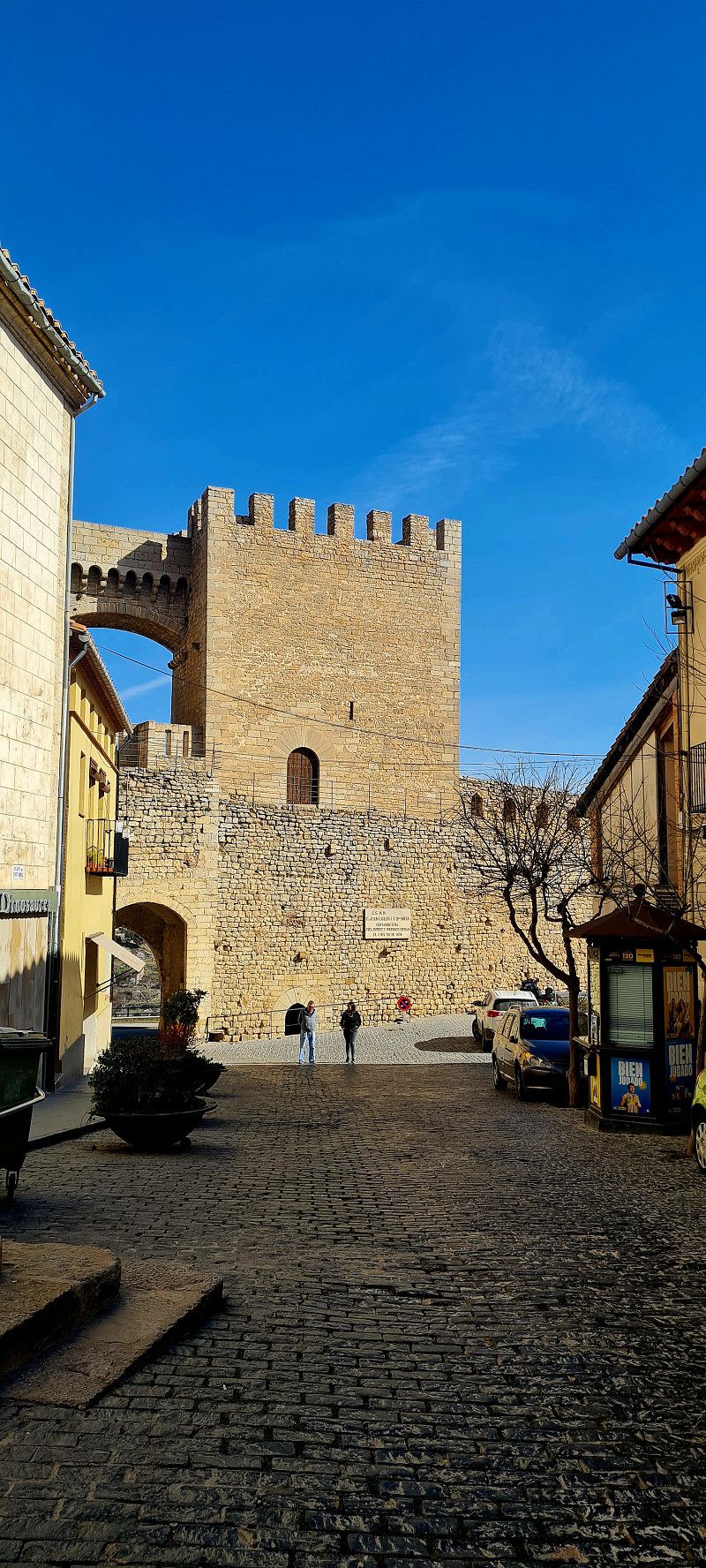
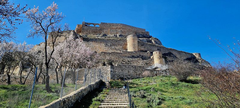
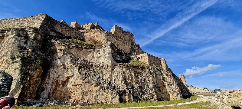
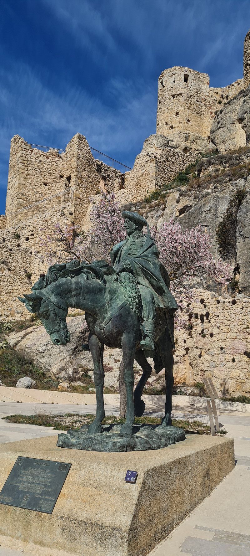
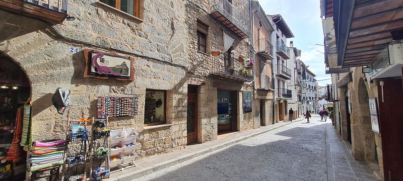
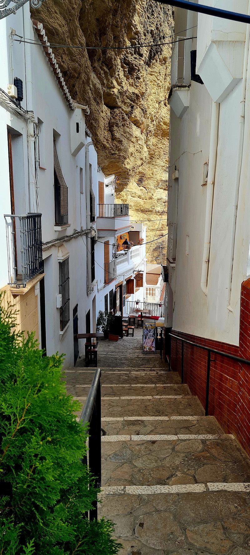
The small town with its castle and pretty streets totally made up for it.
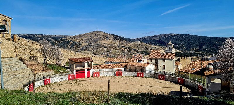
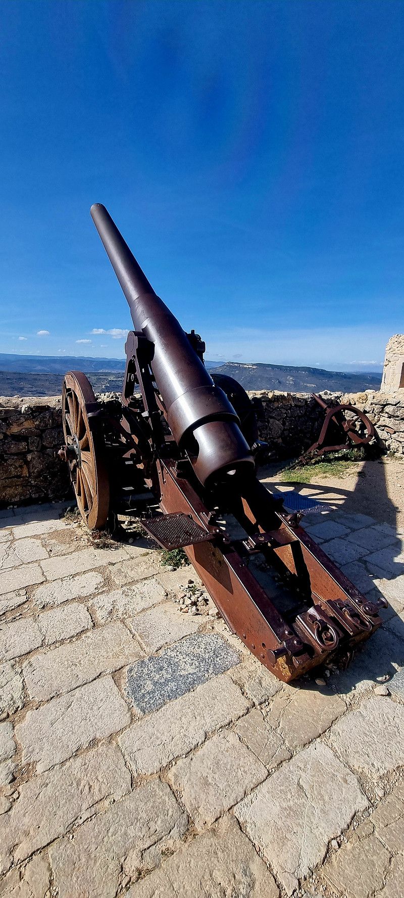
The entrance fee for the castle and the huge grounds around it was 5.00 euros per person and it was worth it!
We spent about 1.5 hours there and were at the highest point at 1060 meters and had a beautiful view of the entire surrounding area.
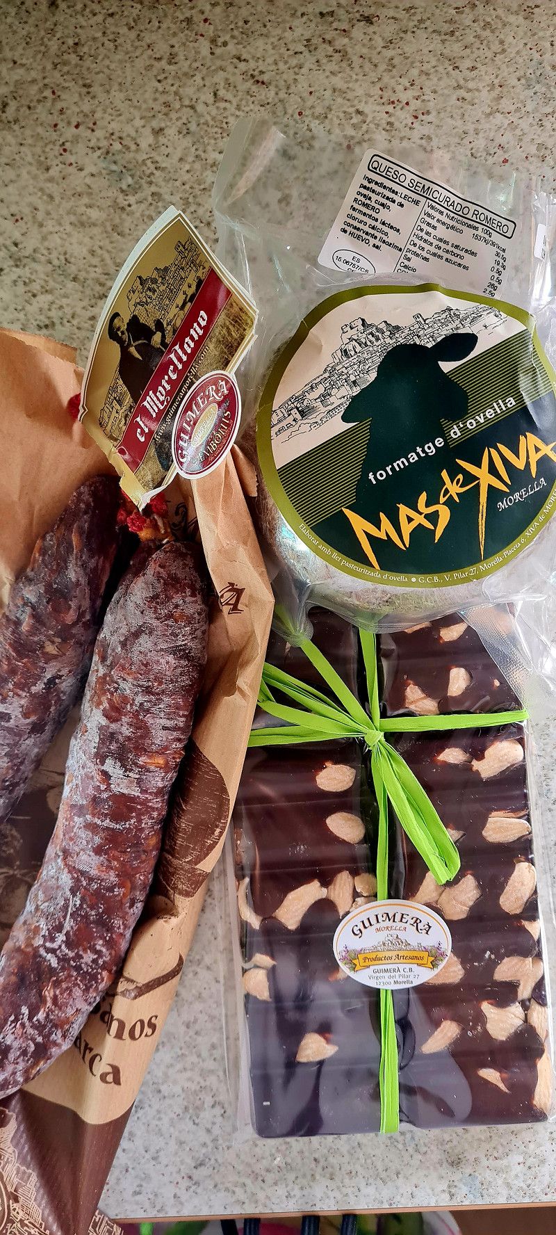
Afterwards we strolled through the small streets and treated ourselves to something in a great shop (1 x sausage, 1 x cheese and a bar of chocolate) for just under 32 euros. Yes, you should treat yourself sometimes 😄 but the parking space is (still) free
Day
Castellón De La Plana/Castelló De La Plana
Calle Torrente, Castellón De La Plana/Castelló De La Plana, Castellón, Spanien
39° 58' 52.6" N 0° 4' 2.4" W
39.9812903 -0.0673291
• Head toward Calle 36 on Calle Benidorm. Go for 148 m.
• Turn left onto Calle Cuadra Saboner. Go for 145 m.
• Turn right onto Carretera Ribesalbes (CV-1830). Go for 384 m.
• Turn left onto Cuadra Los Cubos. Go for 131 m.
• Take the 3rd exit from roundabout onto Cuadra Los Cubos. Go for 113 m.
• Take the 1st exit from roundabout onto Ronda Sur (CV-17). Go for 1.0 km.
• Take the 4th exit from roundabout onto AP-7 (Autopista del Mediterráneo) toward Barcelona/Valencia. Go for 47.6 km.
• Keep left onto V-21 toward Valencia (Norte)/Puçol/V-23/Sagunt/Sagunto. Go for 9.2 km.
• Take exit 9 toward Massalfassar/E-15/A-7. Go for 369 m.
• Pass 2 roundabouts and continue on CV-32. Go for 3.0 km.
• Take the 3rd exit from roundabout onto CV-300 toward Albalat dels Sorells. Go for 425 m.
• Pass 2 roundabouts and continue on CV-300. Go for 1.3 km.
• Take the 1st exit from roundabout onto Carretera Albuixech (CV-316) toward Emperador. Go for 287 m.
• Take the 3rd exit from roundabout onto Calle Sagunt (CV-3017) toward Polígon Industrial de Albalat dels Sorells/Albalat dels Sorells. Go for 534 m.
• Take the 2nd exit from roundabout toward Albalat dels Sorells. Go for 73 m.
• Continue on Calle Major (CV-3017). Go for 129 m.
• Turn right onto Calle Doctor Carrera. Go for 151 m.
• Turn left onto Calle Comandante Martí. Go for 77 m.
• Arrive at Calle Comandante Martí. Your destination is on the left.
☍
65,0 km
( 42 min.)
21. Feb. 2025 -
23. Feb. 2025
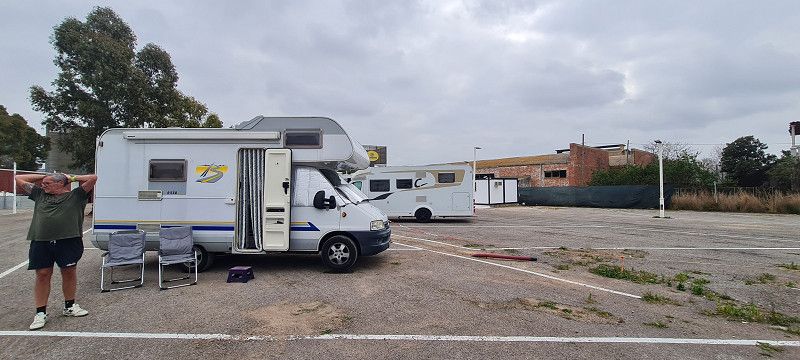
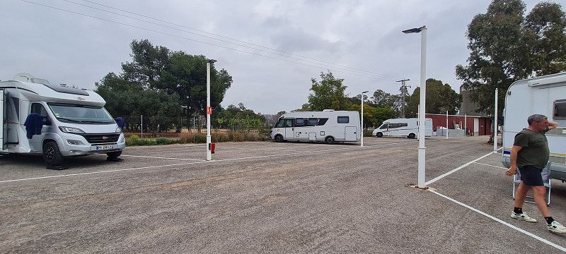
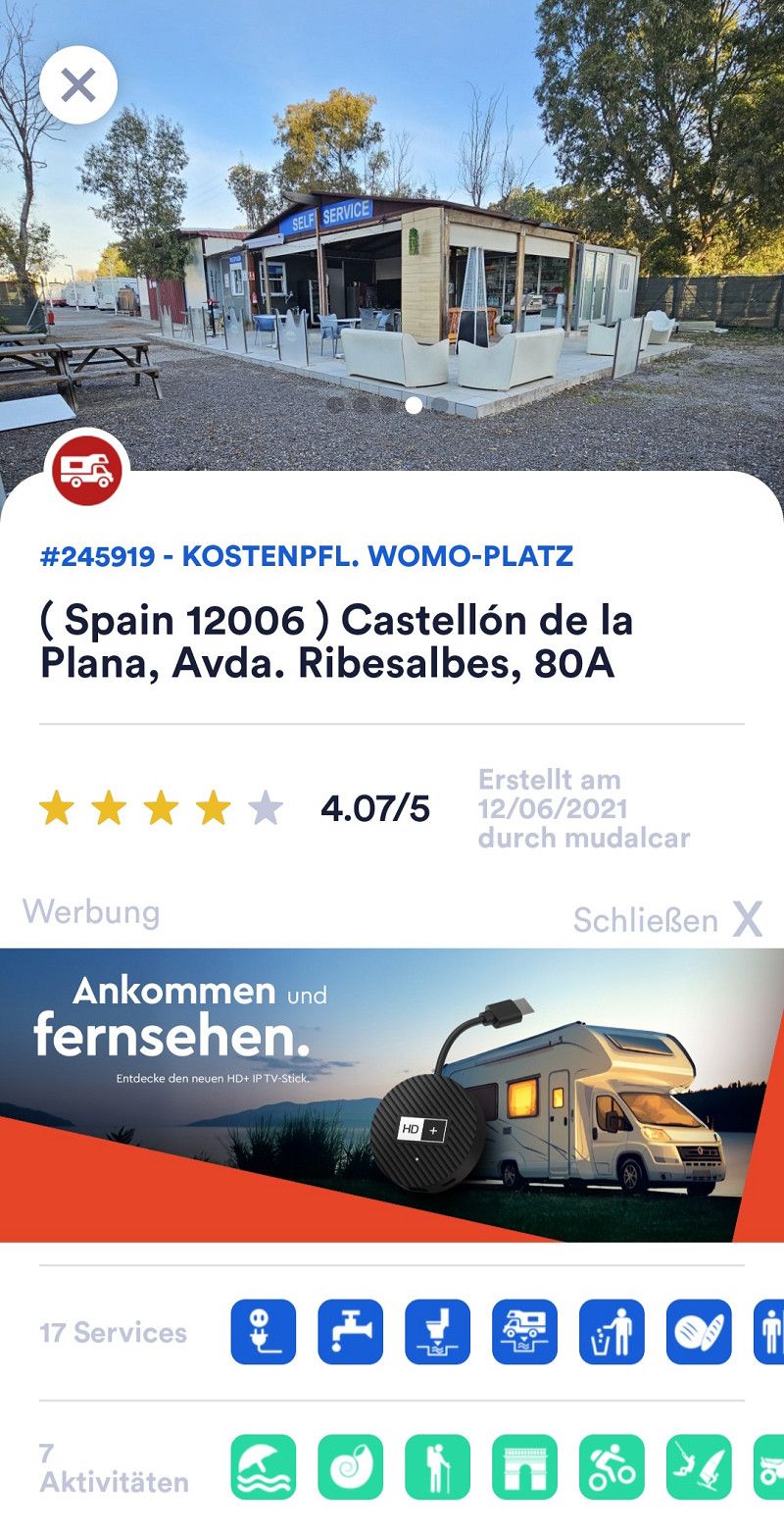
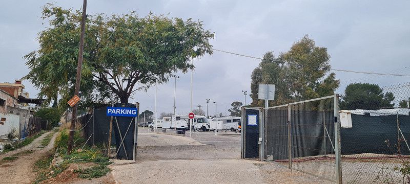
10.ter Stopp Castellón de la Plana
Hey guys,
Today we drove 100 kilometers further towards the coast. As our batteries and on-board battery were slowly running low, we pulled into a parking space where electricity was available.
The place isn't pretty, but it's functional. And we still have a few days to wait until we can get to the campsite we booked.
The price is 20.00 euros per day and everything is available: electricity, shower and toilet, supply and disposal.
There is also a small workshop here and it belongs to the place or the other way around 😀 anyway, we had our headlight adjusted (free of charge)
Tomorrow we will walk into the center
Day
2.ter Tag Castellón de la Plana
Hey guys,
After we had finished our housework, we set off around midday. It was about a 2 kilometer walk to the center.
Although it is only a few kilometers from the coast, the city does not seem to have much of a tourist appeal to me. With a population of just under 172,000, it is already a large city.
During our tour of the city, I didn't see any souvenir shops, and no obvious tourists either.
Compared to other cities, the sights are rather meager.
Everything here seemed strange to me 😊
Day
23. Feb. 2025 -
24. Feb. 2025
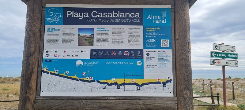
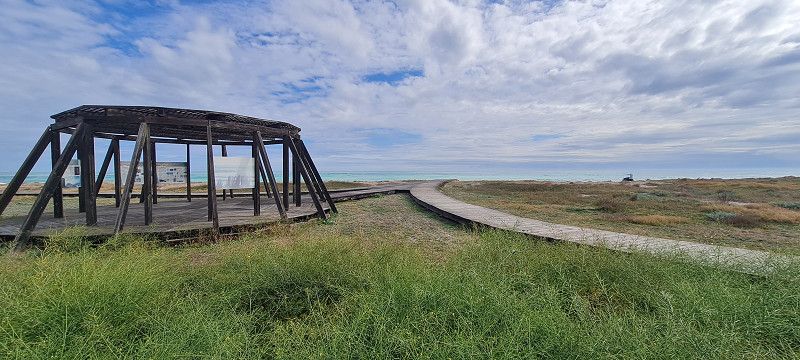
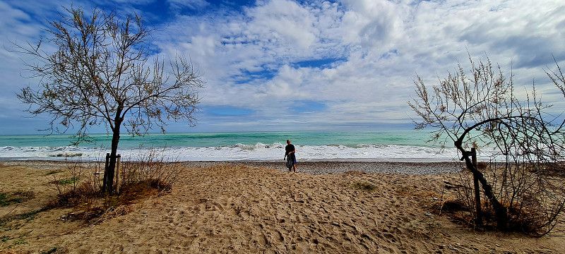
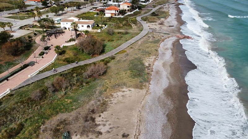
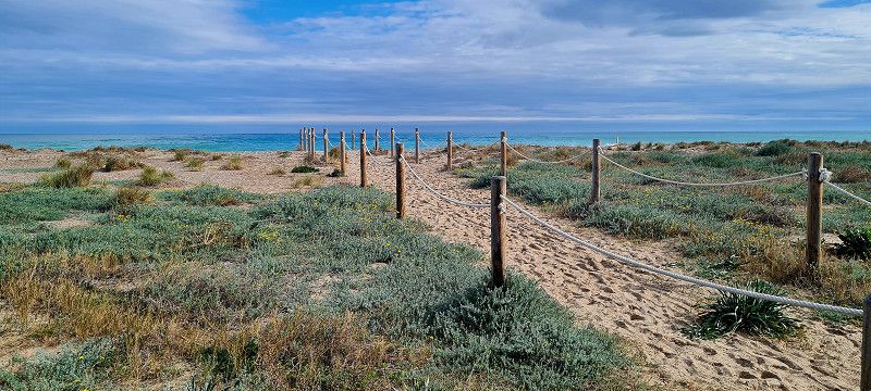
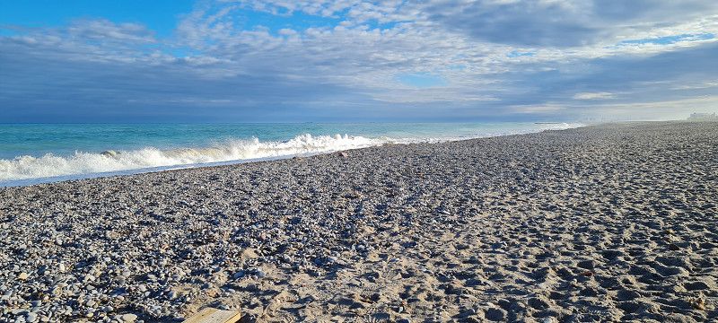
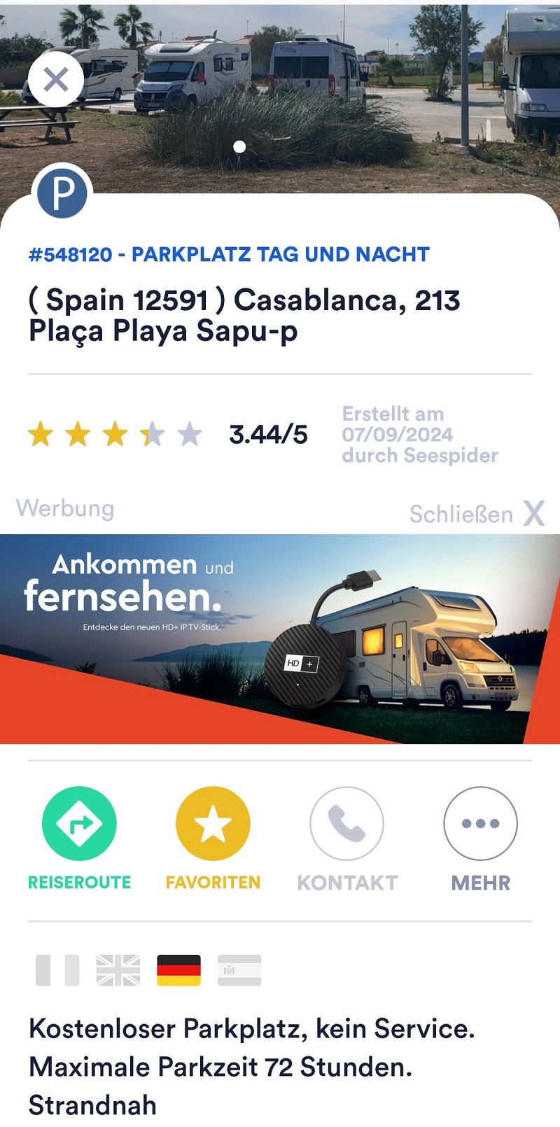
11.ter Stopp Casablanca
Hey guys,
We didn't get much further today (even if the name suggests otherwise) 😀
Only 40 kilometers from the last spot, we are right on the beach in a free parking lot with 12-13 other motorhomes.
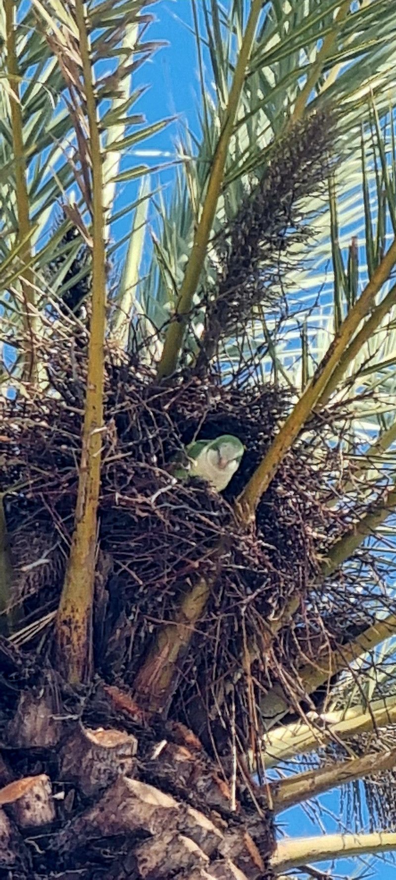
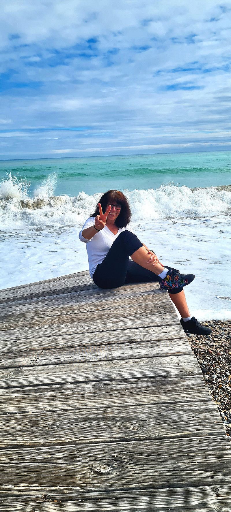
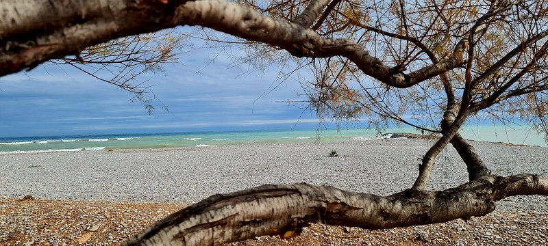
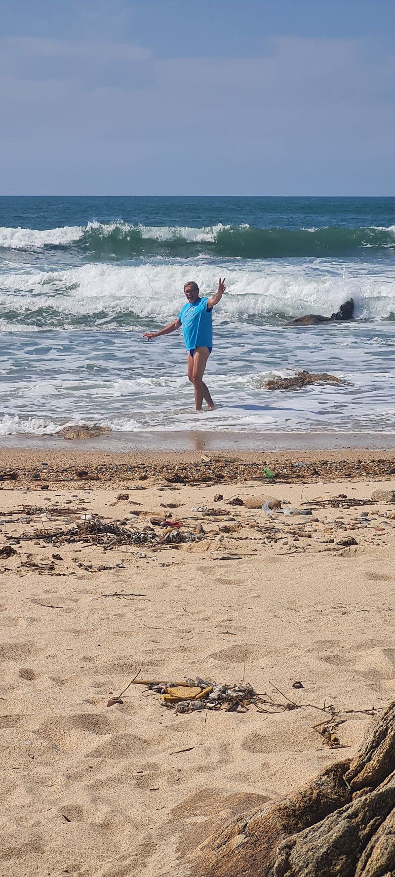
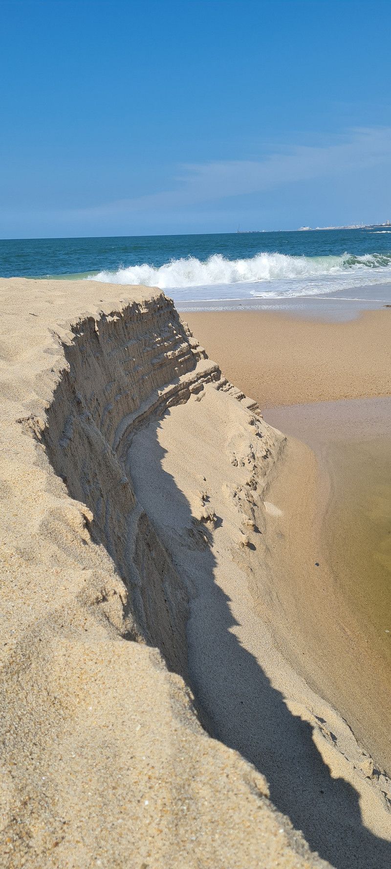
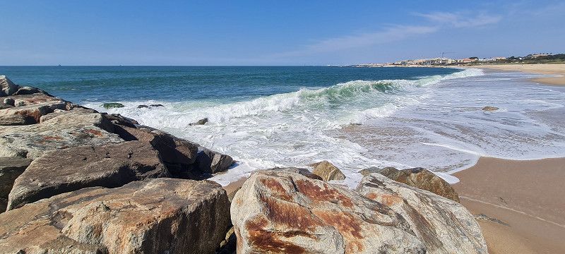
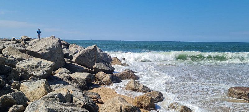
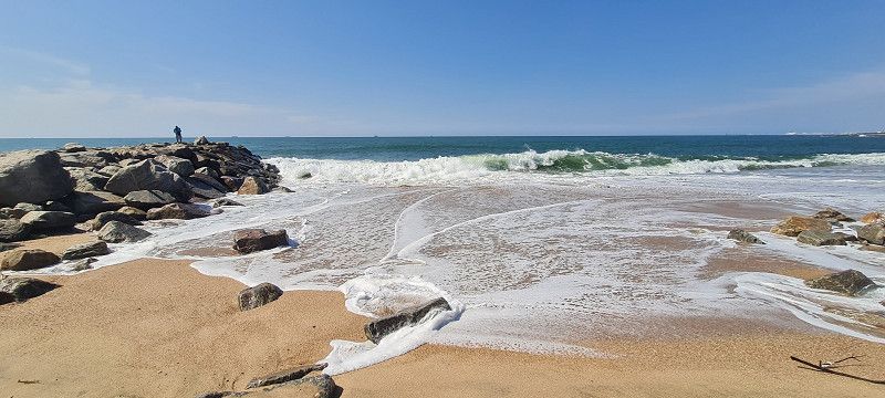
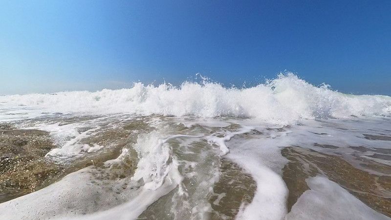
It's a small holiday resort and still completely deserted. There were only a few people walking around. It felt like a lost place. You have the long beach almost to yourself. And we even saw a small dolphin. GREAT!
Day
Albalat dels Sorells
Carrer d'Ausias March, Albalat dels Sorells, Provinz Valencia, Spanien
39° 32' 46.9" N 0° 20' 46.1" W
39.5463474 -0.3461251
• Head toward Calle Cristo de las Almas on Calle Comandante Martí. Go for 16 m.
• Turn left onto Calle Cristo de las Almas. Go for 161 m.
• Turn left onto Calle Major (CV-3017). Go for 255 m.
• Take the 1st exit from roundabout toward Puçol. Go for 47 m.
• Continue on Calle Sagunt (CV-3017). Go for 432 m.
• Take the 1st exit from roundabout onto Carretera Albuixech (CV-316) toward Albuixech. Go for 291 m.
• Take the 3rd exit from roundabout onto CV-300 toward Museros/CV-32/V-21/A-7/Puçol. Go for 711 m.
• Pass 2 roundabouts and continue on CV-300. Go for 839 m.
• Turn right onto CV-32 toward V-21/València/Castelló. Go for 2.5 km.
• Take the 3rd exit from roundabout onto CV-32 toward Valencia/N-221/Castelló/València/Castelló de la Plana/V-21/Polígon Industrial Mediterrani (est). Go for 468 m.
• Take the 2nd exit from roundabout toward València. Go for 217 m.
• Take ramp onto V-21. Go for 10.0 km.
• Take the 2nd exit from Plaza Cardenal Vicente Enrique y Tarancón roundabout onto Avenida de Aragón toward Estadi Mestalla/Av. Aragón/Av. d'Aragó/Grans Víes. Go for 749 m.
• Take the 2nd exit from roundabout onto Avenida de Aragón. Go for 209 m.
• Take the 4th exit from Plaza Zaragoza roundabout onto Paseo de la Alameda toward Alicante/Alacant. Go for 222 m.
• Continue on Paseo de la Alameda. Go for 371 m.
• Pass 2 roundabouts and continue on Paseo de la Alameda. Go for 404 m.
• Take the 2nd exit from roundabout onto Avenida Francia. Go for 215 m.
• Arrive at Avenida Francia.
☍
18,1 km
( 19 min.)
24. Feb. 2025 -
28. Feb. 2025
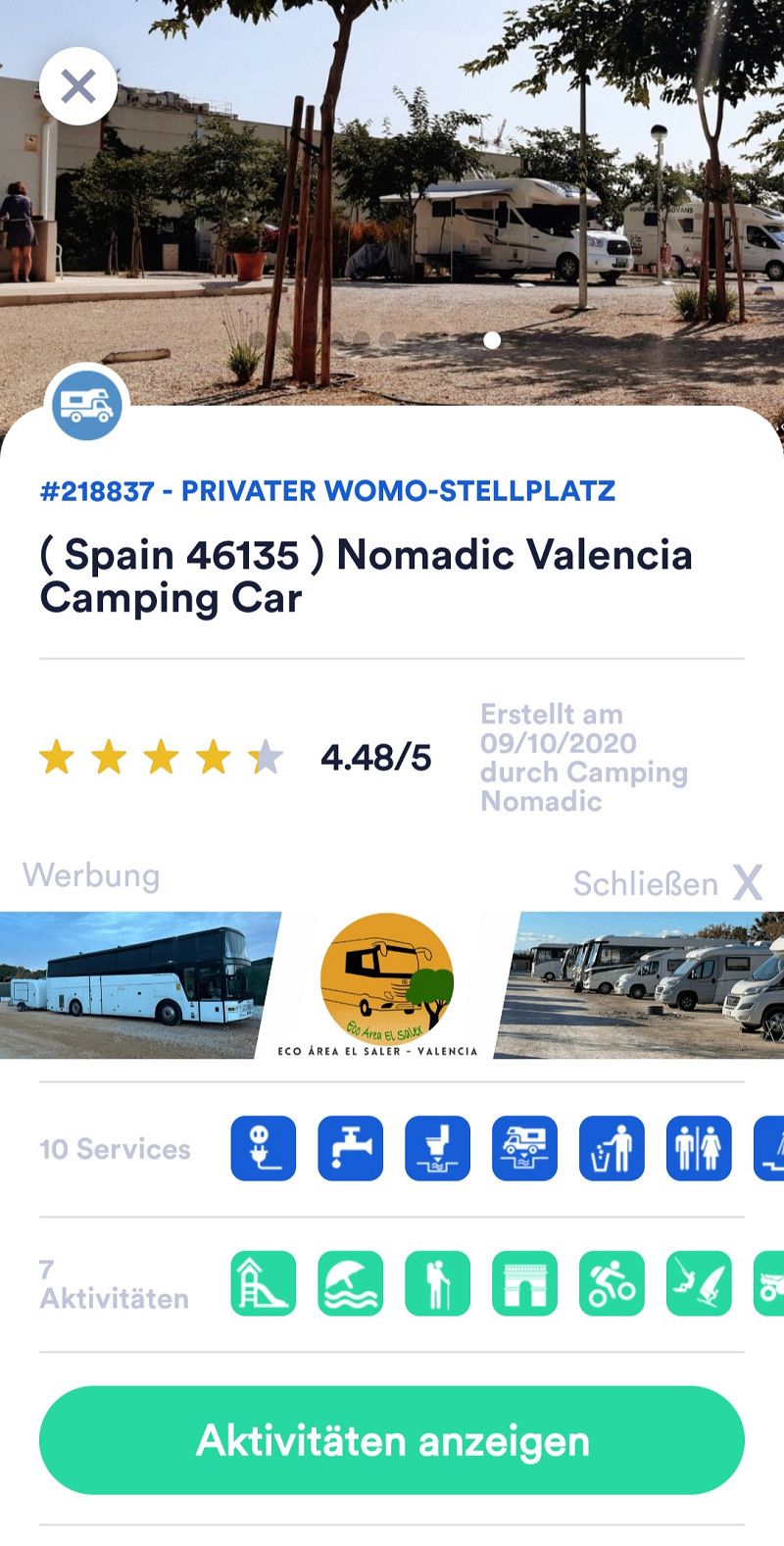
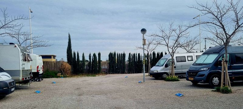
12.ter Stopp Albalat dels Sorells
Hey guys,
After another 30 kilometers we reached our parking spot for the next 4 days.
The parking space
https://nomadicvalenciacampingcar.com/
is located about 10 kilometers from the center of Valencia.
For 23 euros per day, everything a camper needs is included.
The surroundings and the small town are not the prettiest. But the metro is a 7-8 minute walk away and after a 20 minute ride you are right in the center of Valencia.
Day
2.ter Tag Valencia
Hey guys,
We started today at 11 a.m. At the campsite we were able to buy tickets for public transport (48-hour ticket for 20 euros per person)
Today's plan was to visit the city center and its sights. We walked 9 kilometers in 4.5 hours. And we still certainly didn't see all the beautiful things.
But tomorrow we'll start again.
Day
Valencia
Passeig de l'Albereda 240, Valencia, Provinz Valencia, Spanien
39° 27' 33.6" N 0° 21' 20.9" W
39.4593255 -0.3558018
• Head toward Plaza de Europa on Avenida Francia. Go for 149 m.
• Take the 5th exit from Plaza de Europa roundabout onto Avenida Francia. Go for 533 m.
• Take the 1st exit from roundabout onto Paseo de la Alameda. Go for 299 m.
• Take the 2nd exit from roundabout onto Calle Eduardo Boscá toward Castelló/V-21/Barcelona/Teruel/Zaragoza. Go for 444 m.
• Continue on Avenida Cardenal Benlloch toward V-21/Castelló/Barcelona/Teruel/Zaragoza. Go for 1.4 km.
• Keep right toward Castelló/Barcelona/Teruel/Zaragoza. Go for 9 m.
• Take left ramp onto V-21 toward Castelló/Barcelona/Teruel/Zaragoza. Go for 9.4 km.
• Take exit 9 toward Massalfassar/E-15/A-7/Alacant. Go for 288 m.
• Take the 4th exit from roundabout onto CV-32 toward Polígon Industrial de Mediterrani/Valencia/V-21/Massalfassar/Alacant/E-15/A-7. Go for 447 m.
• Pass 2 roundabouts and continue on CV-32. Go for 3.0 km.
• Take the 3rd exit from roundabout onto CV-300 toward Albalat dels Sorells. Go for 425 m.
• Pass 3 roundabouts and continue on CV-300. Go for 2.2 km.
• Take the 1st exit from roundabout onto Calle del Mar (CV-3022) toward Centre Ciutat Albalat dels Sorells. Go for 188 m.
• Take the 3rd exit from roundabout onto Calle Rey Jaime I. Go for 101 m.
• Turn right onto Calle de la Abadía. Go for 143 m.
• Turn slightly right onto Calle Padre Salvador Molla. Go for 12 m.
• Arrive at Calle Padre Salvador Molla. Your destination is on the left.
☍
19,1 km
( 20 min.)
3.ter Tag Valencia
Hey guys,
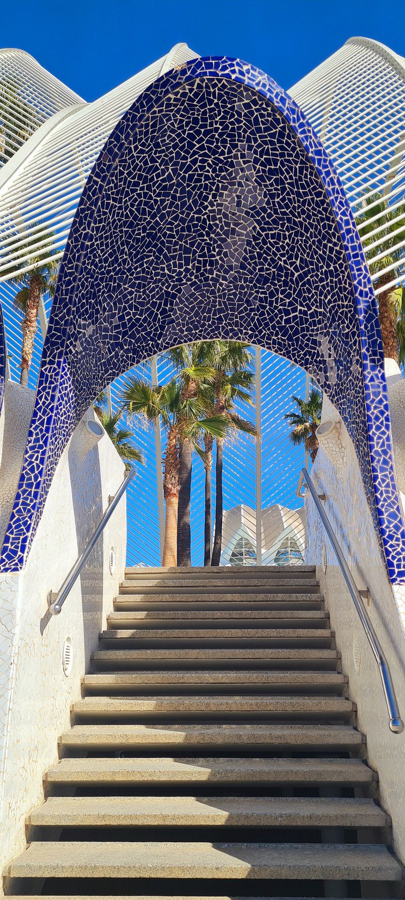
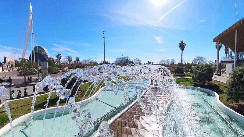
This afternoon we set off again in the best weather. This time the plan was to visit the beach, the harbor and the former Expo site (City of Arts and Sciences).
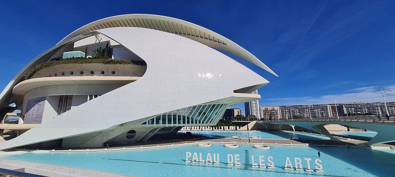
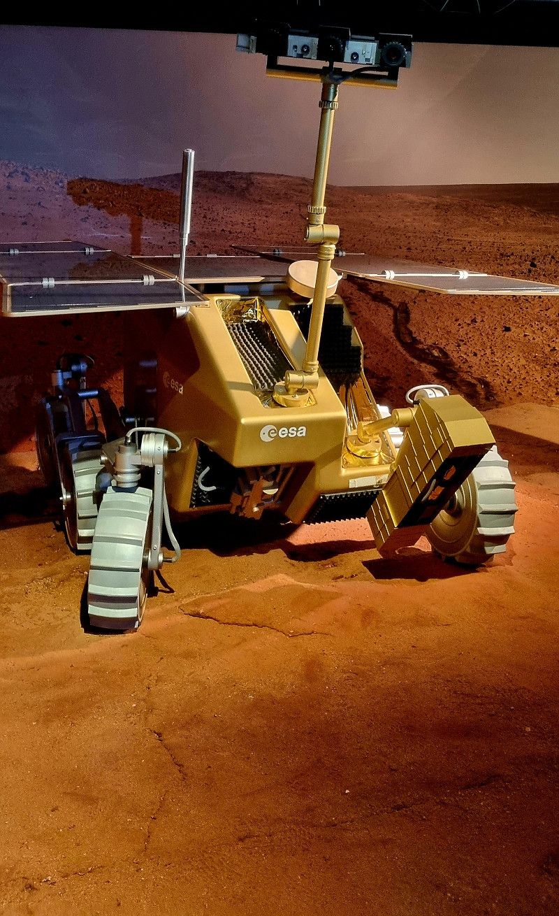
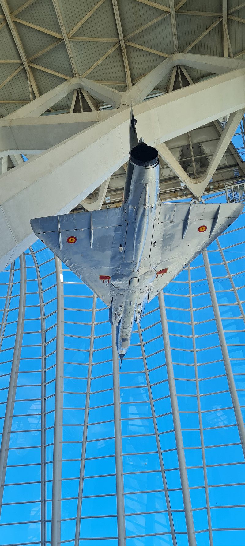
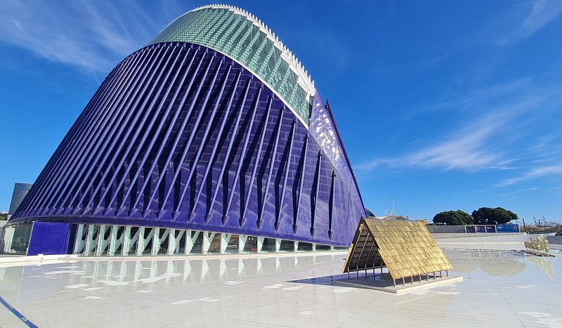
This was our second time here and I was absolutely thrilled again.
We even went to the museum there 😀
Day
Albalat dels Sorells
Carrer del Pare Salvador Mollá, Albalat dels Sorells, Valencianische Gemeinschaft, Spanien
39° 32' 37.3" N 0° 20' 46.3" W
39.5436955 -0.3461912
• Head toward Plaza del Castillo on Calle Padre Salvador Molla. Go for 241 m.
• Continue on Calle de en Codinats. Go for 33 m.
• Turn right onto Calle de Valencia. Go for 248 m.
• Turn right onto Calle Major (CV-3017). Go for 36 m.
• Turn left onto Calle del Mar (CV-3022). Go for 133 m.
• Take the 2nd exit from roundabout onto Calle del Mar (CV-3022). Go for 178 m.
• Take the 3rd exit from roundabout onto CV-300 toward Museros/CV-32/V-21/A-7/Puçol. Go for 980 m.
• Pass 3 roundabouts and continue on CV-300. Go for 1.5 km.
• Turn right onto CV-32 toward V-21/València/Castelló. Go for 2.5 km.
• Take the 3rd exit from roundabout onto CV-32 toward Valencia/N-221/Castelló/València/Castelló de la Plana/V-21/Polígon Industrial Mediterrani (est). Go for 468 m.
• Take the 2nd exit from roundabout toward València. Go for 217 m.
• Take ramp onto V-21. Go for 10.0 km.
• Take the 2nd exit from Plaza Cardenal Vicente Enrique y Tarancón roundabout onto Avenida de Aragón toward Estadi Mestalla/Av. Aragón/Av. d'Aragó/Grans Víes. Go for 749 m.
• Take the 2nd exit from roundabout onto Avenida de Aragón. Go for 209 m.
• Take the 3rd exit from Plaza Zaragoza roundabout. Go for 90 m.
• Continue on Puente de Aragón. Go for 208 m.
• Continue on Gran Vía Marqués del Turia. Go for 974 m.
• Continue on Gran Vía de las Germanías toward Aeropuerto/Madrid/A-3/CV-35/Llíria/V-31/Alacant/Albacete. Go for 243 m.
• Keep right onto Gran Vía de las Germanías toward Alacant/V-31/Albacete/València Joaquín Sorolla. Go for 164 m.
• Continue on Calle de Gibraltar. Go for 240 m.
• Continue on Calle Filipinas. Go for 516 m.
• Continue on Plaza de Manuel Sanchis Guarner. Go for 69 m.
• Turn right onto Avenida de Ausiàs March. Go for 1.3 km.
• Take the 3rd exit from roundabout onto Avenida de Ausiàs March (V-31) toward V-30/Hospital La Fe/Hospital Urgències/Urgencias. Go for 13.8 km.
• Continue on A-7 (Autovía del Mediterráneo). Go for 42.8 km.
• Continue on A-35 toward Albacete/Murcia. Go for 32.8 km.
• Take exit 11 toward La Font de la Figuera/Alacant/Alicante/Murcia onto A-33. Go for 92.9 km.
• Continue on A-30 (Autovía de Murcia). Go for 22.5 km.
• Take exit 134A toward Murcia/Ronda Oeste/Cartagena/E-15/Almería/A-7 onto A-30 (Murcia Ronda Oeste). Go for 3.0 km.
• Take exit 138 toward Almería/Granada onto A-7 (Autovía del Mediterráneo). Go for 32.1 km.
• Take exit 601 toward Fuente Álamo/Cartagena onto RM-608. Go for 921 m.
• Continue on RM-2 (Autovía Alhama-Campo de Cartagena). Go for 3.6 km.
• Take exit 4 toward Mazarrón. Go for 364 m.
• Take the 2nd exit from roundabout onto RM-23 toward Mazarrón. Go for 10.1 km.
• Take the left exit toward Mazarrón onto RM-3 (Autovía de Mazarrón). Go for 14.5 km.
• Take the 1st exit from roundabout onto RM-332 toward N-332/Águilas. Go for 5.2 km.
• Take the 3rd exit from roundabout toward Cañada de Gallego. Go for 478 m.
• Continue on Cañada de Gallego. Go for 1.3 km.
• Continue on Avenida Constitución-Gallego. Go for 735 m.
• Continue on Camino a Calnegre y Los Curas. Go for 587 m.
• Continue on Camino a Calnegre y Los Curas. Go for 2.2 km.
• Turn slightly left onto Camino a Calnegre y Los Curas. Go for 240 m.
• Continue toward Camino a Calnegre y Los Curas. Go for 1.2 km.
• Continue on Camino a Calnegre y Los Curas. Go for 365 m.
• Arrive at Camino a Calnegre y Los Curas. Your destination is on the left.
☍
303,0 km
(3 hrs. 8 min.)
4.ter Tag Valencia
Hey guys,
Today we had a rest day. We did a bit of housework, planned the route and parking spots for the next few days and of course enjoyed the sun.
After everything was done, I did some video editing.
Day Playa Parazuelos
Mazarrón
Carr. Punta a Percheles, Mazarrón, Bajo Guadalentín, Region Murcia, Spanien
37° 31' 16.9" N 1° 23' 38.8" W
37.5213522 -1.3941048
• Head northeast on Camino a Calnegre y Los Curas. Go for 365 m.
• Turn left onto Camino a Calnegre y Los Curas. Go for 1.2 km.
• Turn slightly left. Go for 411 m.
• Turn slightly right toward Calle Maestro J. Rodrigo. Go for 2.3 km.
• Continue on Calle Maestro J. Rodrigo. Go for 767 m.
• Turn left onto RM-332. Go for 319 m.
• Take the 2nd exit from roundabout onto AP-7 toward Vera/Almería. Go for 55.3 km.
• Continue toward Autovía del Mediterráneo/A-7. Go for 502 m.
• Take the left exit toward Los Gallardos/Almería onto A-7 (Autovía del Mediterráneo). Go for 127 km.
• Take exit 826 toward Balerma. Go for 275 m.
• Turn left onto AL-4302. Go for 248 m.
• Continue on AL-4300. Go for 2.8 km.
• Take the 2nd exit from roundabout onto AL-4300 toward Balerma. Go for 997 m.
• Continue on Avenida Príncipe Felipe (AL-4300). Go for 328 m.
• Take the 2nd exit from roundabout onto Calle Las Dalias (AL-4300). Go for 140 m.
• Continue on Plaza Puerta del Sol (AL-4300). Go for 43 m.
• Continue on Calle La Loma (AL-4300). Go for 265 m.
• Take the 2nd exit from roundabout onto Calle La Loma (AL-4300). Go for 176 m.
• Continue on Carretera de Balerma (AL-4300). Go for 608 m.
• Continue on AL-4300. Go for 1.3 km.
• Continue on Carretera a Balerma (AL-4300). Go for 279 m.
• Take the 1st exit from roundabout onto Carretera de Málaga (N-340a) toward E-15/A-7/Almería/Málaga. Go for 380 m.
• Continue on N-340a. Go for 631 m.
• Take the 3rd exit from roundabout onto A-7 (Autovía del Mediterráneo) toward Motril/Málaga. Go for 81.8 km.
• Take exit 910 toward Almuñécar (Este)/N-340. Go for 428 m.
• Take the 3rd exit from roundabout toward N-340/Almuñécar/E-15/A-7/Motril/Almería. Go for 150 m.
• Take the 1st exit from roundabout toward N-340/Almuñécar/Salobreña/Almería. Go for 2.0 km.
• Take the 1st exit from roundabout onto N-340 toward Almuñécar. Go for 3.5 km.
• Take the 1st exit from roundabout onto N-340 toward Almuñécar/Málaga. Go for 888 m.
• Turn left toward Avenida Fenicia. Go for 23 m.
• Turn right onto Avenida Fenicia. Go for 155 m.
• Turn right onto Calle Carrera de la Concepción. Go for 81 m.
• Take the 4th exit from Calle Carrera de la Concepción roundabout onto Calle Carrera de la Concepción. Go for 132 m.
• Turn right onto Avenida Andalucía. Go for 268 m.
• Turn right onto Calle Portillo de la Victoria. Go for 38 m.
• Continue on Calle Pescadería. Go for 49 m.
• Turn left onto Plaza Pescadería. Go for 18 m.
• Arrive at Plaza Pescadería. Your destination is on the left.
☍
286,5 km
(2 hrs. 56 min.)
27. Feb. 2025 -
28. Feb. 2025
13.ter Stopp bei Mazarrón
Hey guys,
we left early today (10:30 am) 😄
Since we don't have much time left, we had to cover a bit of distance today. 300 kilometers further and 4.5 hours later, we are at the campsite about 2.5 kilometers from the legendary "Snake Bay".
https://campingplayaparazuelos.com/
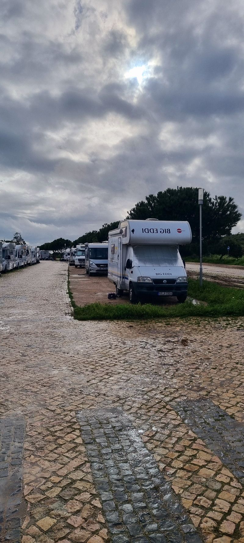
The site has only been around since the end of 2023, has around 200 plots and is 80% occupied by German campers.
We pay 18 euros for 1 night without electricity.
If the weather is nice, you can easily spend a few days here.
Day
Almuñécar
Plaza Damasco, Almuñécar, Comarca de la Costa Granadina, Andalusien, Spanien
36° 43' 58.3" N 3° 41' 22.8" W
36.7328699 -3.6896800
• Head toward Plaza Noreta on Plaza Pescadería. Go for 18 m.
• Turn right onto Calle Pescadería. Go for 49 m.
• Continue on Calle Portillo de la Victoria. Go for 38 m.
• Turn right onto Avenida Andalucía. Go for 123 m.
• Continue on Plaza de Madrid. Go for 55 m.
• Continue on Calle Alcalde Julio Fajardo. Go for 73 m.
• Turn left onto Paseo Puerta del Mar. Go for 71 m.
• Take the 1st exit from roundabout onto Paseo Puerta del Mar. Go for 152 m.
• Take the 2nd exit from roundabout onto Avenida Juan Carlos I. Go for 190 m.
• Take the 2nd exit from Avenida Juan Carlos I roundabout onto Calle La Huerta. Go for 174 m.
• Turn right onto Calle Baracoa. Go for 153 m.
• Turn left onto Calle Puerto de la Cruz. Go for 288 m.
• Turn right toward N-340. Go for 22 m.
• Turn right onto N-340. Go for 422 m.
• Take the 2nd exit from roundabout onto N-340 toward Salobreña/Almería. Go for 3.5 km.
• Take the 4th exit from roundabout toward E-15/A-7/Málaga/Almería. Go for 2.0 km.
• Take the 1st exit from roundabout onto A-7 (Autovía del Mediterráneo) toward Motril/A-2/Almería. Go for 37.1 km.
• Take exit 873 toward Costa/N-340/Castell de Ferro. Go for 342 m.
• Take the 1st exit from roundabout. Go for 299 m.
• Turn slightly right. Go for 619 m.
• Turn right toward GR-5206. Go for 348 m.
• Turn sharp right onto GR-5206. Go for 2.6 km.
• Turn left onto GR-5206. Go for 31 m.
• Turn right. Go for 93 m.
• Turn left. Go for 514 m.
• Turn left. Go for 110 m.
• Turn right. Go for 395 m.
• Turn slightly right. Go for 41 m.
• Turn slightly right. Go for 407 m.
• Turn right. Go for 136 m.
• Arrive at your destination on the left.
☍
50,4 km
( 45 min.)
Mein Standort
Carretera de A-4131 a N-340 (Castell de Ferro) por Rubite, Rubite, Comarca de la Costa Granadina, Andalusia, Spain
36° 46' 29.2" N 3° 22' 27.1" W
36.7747748 -3.3741816
• Head west. Go for 136 m.
• Turn left. Go for 250 m.
• Turn slightly right. Go for 593 m.
• Turn left. Go for 624 m.
• Turn right toward GR-5206. Go for 93 m.
• Turn left onto GR-5206. Go for 31 m.
• Turn right onto GR-5206. Go for 2.6 km.
• Turn sharp left. Go for 348 m.
• Turn left. Go for 619 m.
• Turn slightly left. Go for 284 m.
• Take the 3rd exit from roundabout toward E-15/A-7/Motril/Málaga. Go for 360 m.
• Take the 2nd exit from roundabout onto A-7 (Autovía del Mediterráneo) toward Motril/Málaga. Go for 123 km.
• Keep right toward A-357/Cártama/C.T.M./Mercamálaga. Go for 1.8 km.
• Take the exit toward Cártama onto A-357. Go for 49.6 km.
• Take ramp toward Teba/A-367/Ronda/A-7278. Go for 265 m.
• Take the 2nd exit from roundabout toward Teba/A-7278/Ronda/A-367. Go for 111 m.
• Take the 1st exit from roundabout onto A-367 toward Teba/A-7278/Ronda. Go for 22.9 km.
• Turn right toward Alcalá del Valle. Go for 24 m.
• Turn right onto A-7276. Go for 302 m.
• Continue on Carretera de Setenil a Cuevas del Becerro (A-7276). Go for 695 m.
• Continue on A-7276. Go for 10.1 km.
• Take the 3rd exit from roundabout onto CA-9121. Go for 1.6 km.
• Turn left. Go for 37 m.
• Arrive at your destination on the right.
☍
216,5 km
(2 hrs. 25 min.)
01. Mar. 2025 -
03. Mar. 2025
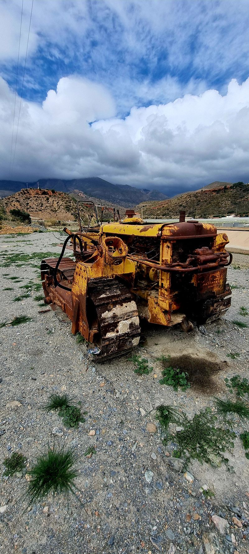
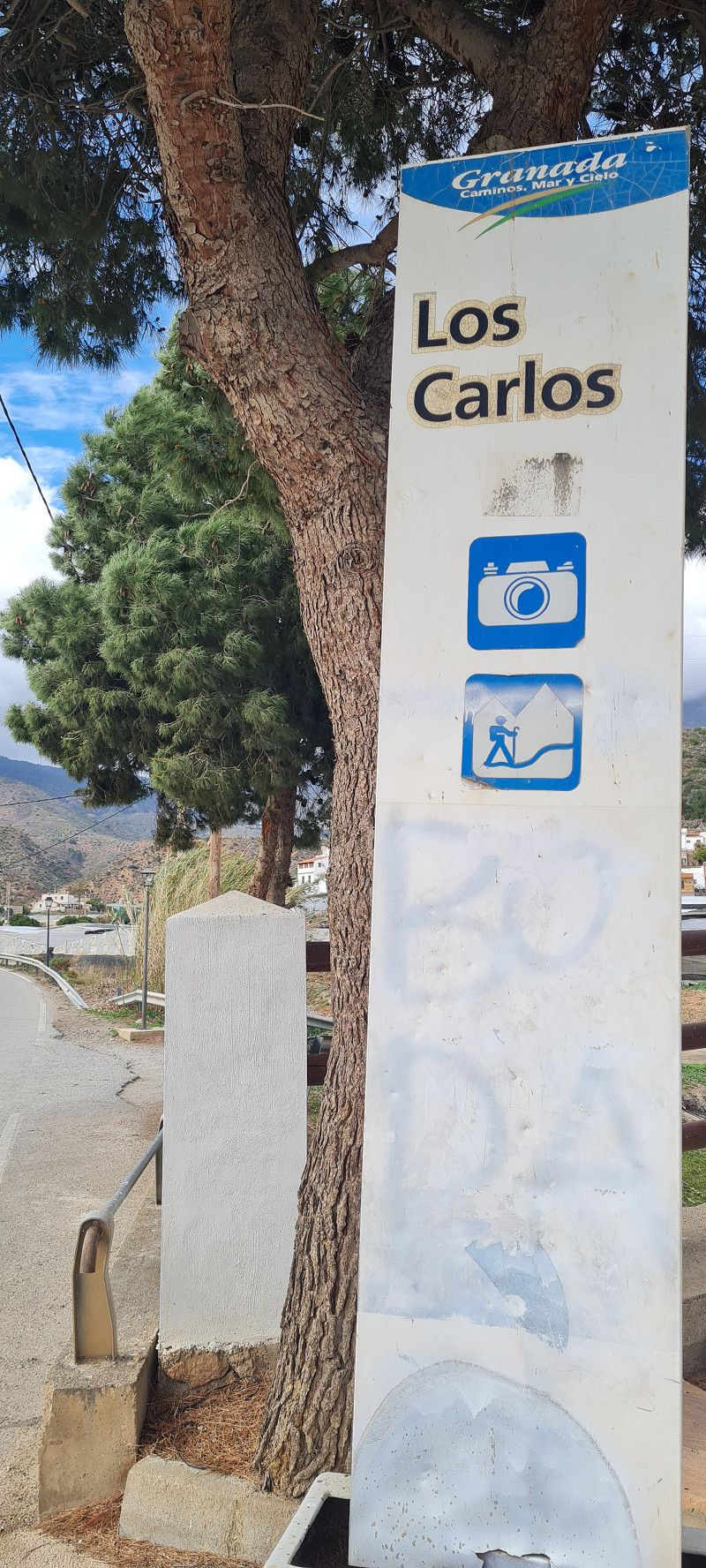
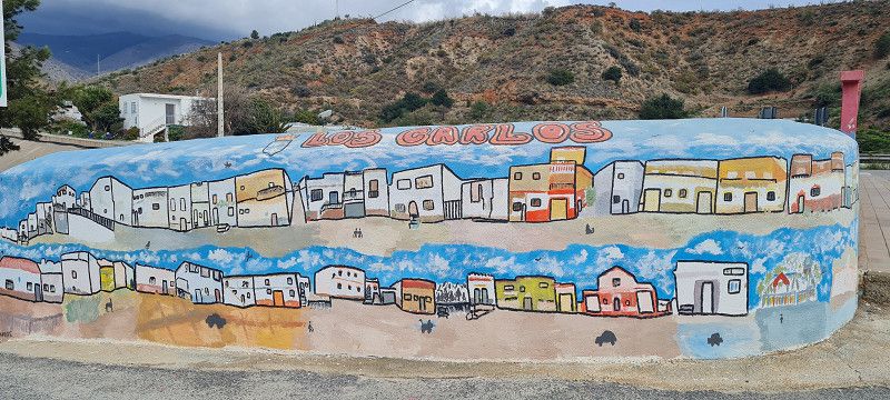
14.ter Stopp Los Carlos
Hey guys,
it was a day to forget.
Yes, even on holiday, even in Spain, not everything always goes as planned.
We set out today in rain and storms. I was very happy that we were still able to pass the roads.
The plan was to go hiking in the Tabernas desert. However, we had to abandon the plan due to the weather.
So we continued towards Malaga. The plan was to travel 300 kilometres. The parking spot we had chosen was full, however, and we tried two more, also full. All on the coast.
I was already feeling frustrated.
In the end, we actually drove back 60 kilometers, where I found a nice parking spot a few kilometers above the coast, where there were still plenty of spaces available.
Man man man 🙄 in total we drove 370 kilometers in 6 hours.
The weather is expected to be very unstable in the coming days.
We'll stay here for 2 nights for 14 euros per day (all inclusive) and then see how it goes.
Day
2.ter Tag Los Carlos
Hey guys,
Today we just lazed around. We did a bit of laundry, took a short walk and had dinner in the restaurant next to the campsite.
The food was so-so. But since it was Sunday and we didn't have anything left on board, we ate there.
The guests there all came from the parking lot. But all in all it was OK.
Day
Setenil de las Bodegas
Sierra de Cádiz, Andalusien, Spanien
36° 52' 1.9" N 5° 10' 6.2" W
36.8671980 -5.1683831
• Head toward Camino de Málaga y de las Cuevas. Go for 37 m.
• Turn left onto CA-9121. Go for 160 m.
• Continue on Casas Nuevas (CA-9121). Go for 22 m.
• Continue on CA-9121. Go for 308 m.
• Take the 1st exit from roundabout onto CA-9121. Go for 258 m.
• Continue on Calle Federico García Lorca. Go for 531 m.
• Continue on Calle Carril Alto. Go for 425 m.
• Continue on Calle Alcaide Manrique. Go for 173 m.
• Turn left onto Calle San Sebastián. Go for 650 m.
• Continue on CA-9113. Go for 12.1 km.
• Continue on Rancho Perolas (CA-9113). Go for 90 m.
• Continue on CA-9113. Go for 984 m.
• Turn right onto CA-9111 toward Algodonales/Olvera. Go for 1.1 km.
• Turn left onto CA-9109. Go for 5.4 km.
• Turn right onto A-374 toward Algodonales/Sevilla. Go for 2.6 km.
• Keep left onto A-384 toward Villamartín/Jerez de la Frontera/A-375/Pto. Serrano/Sevilla. Go for 16.8 km.
• Take ramp onto A-375 toward Puerto Serrano/Sevilla. Go for 44.8 km.
• Take ramp onto A-362 toward Los Palacios/Sevilla/E-5. Go for 10.0 km.
• Take the 2nd exit from roundabout onto A-362 toward Los Palacios. Go for 571 m.
• Take ramp onto AP-4 (Autopista del Sur) toward Sevilla. Go for 8.8 km.
• Keep right onto AP-4A toward Dos Hermanas. Go for 2.9 km.
• Take the 3rd exit from roundabout onto N-4 toward avda. 4 de Diciembre/Dos Hermanas/Sevilla. Go for 1.6 km.
• Take the 3rd exit from roundabout onto N-4 toward Sevilla. Go for 696 m.
• Take the 4th exit from roundabout onto SE-3205 toward Isla Menor. Go for 247 m.
• Turn right. Go for 27 m.
• Arrive at your destination on the right.
☍
111,4 km
(1 hrs. 28 min.)
03. Mar. 2025 -
05. Mar. 2025
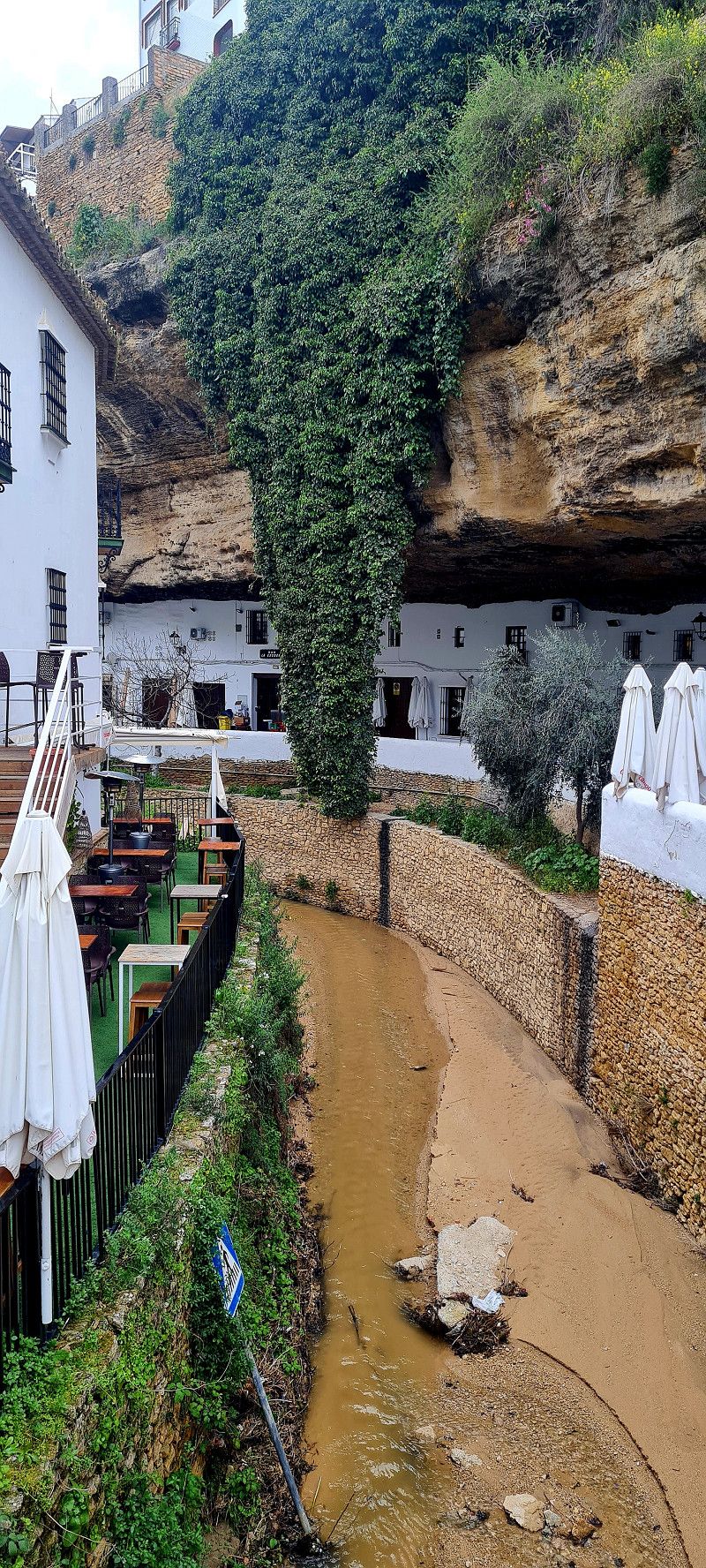
15.ter Stopp Senetil de las Bodegas
Hey guys,
well, what can I say, the weather is really ruining my plans.
Today I briefly considered canceling the trip.
The weather forecast is terrible for the next 7-10 days.
We couldn't do the Camenito del Rey hike either.
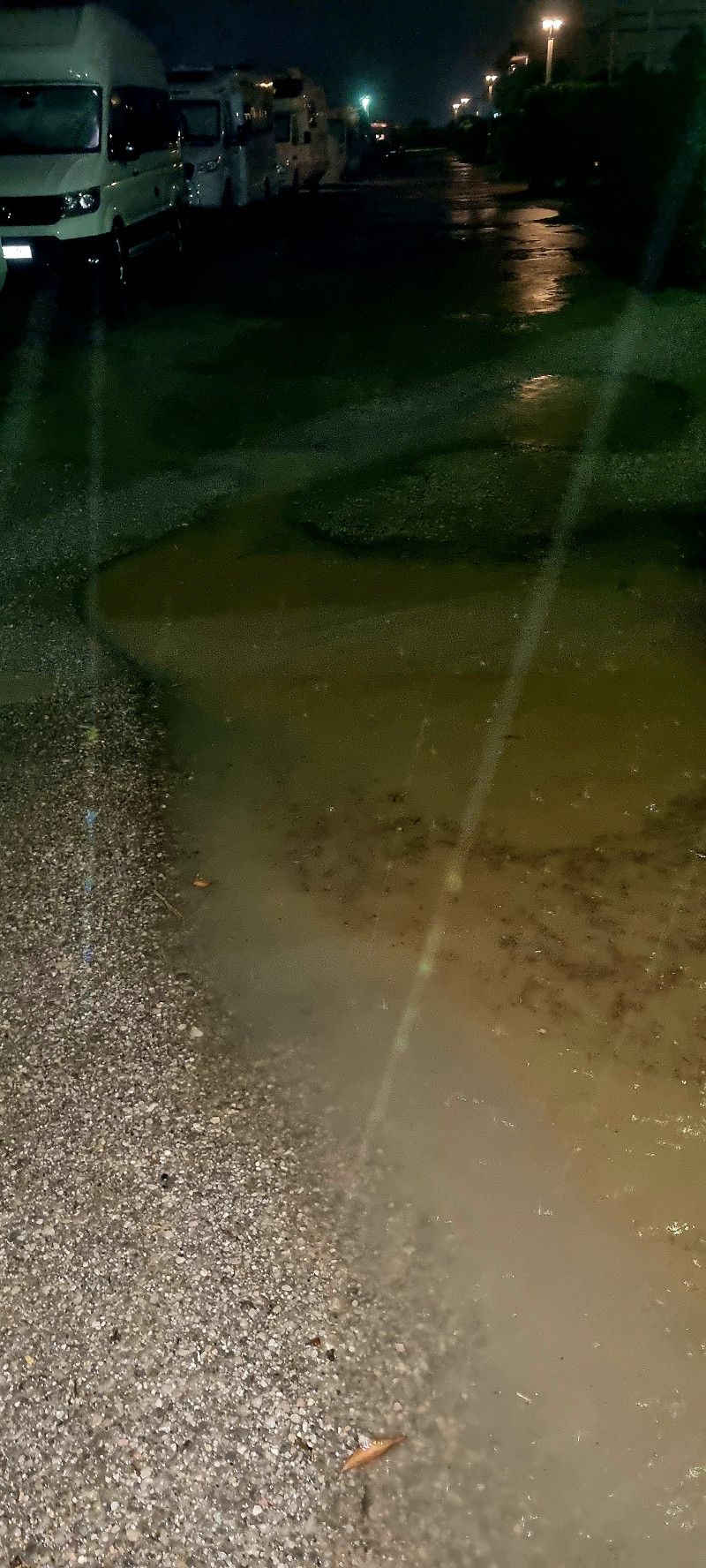
Due to the local heavy rain and partially flooded streets and squares, it is not easy to make any plans at the moment.
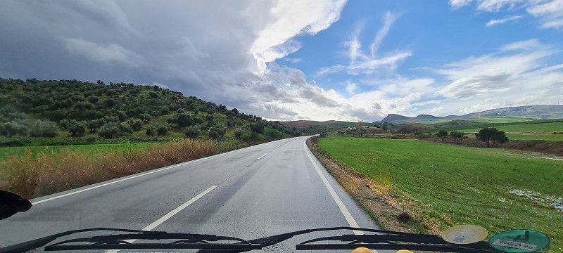
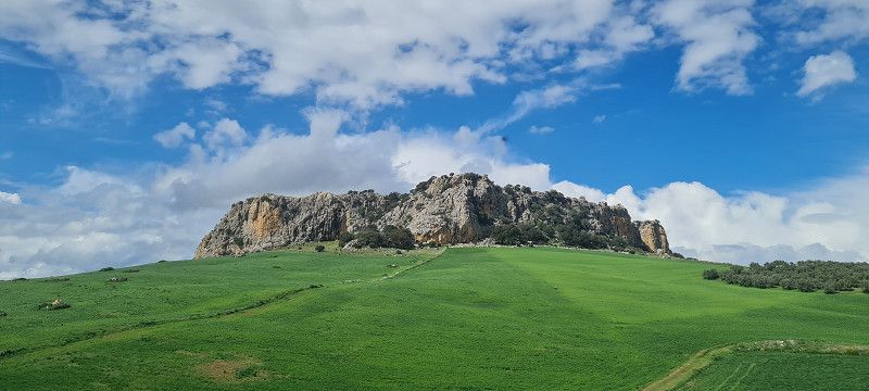
So let's move on, no matter. 220 kilometers further to the next most beautiful village in Spain.
Senetil de las Bodegas
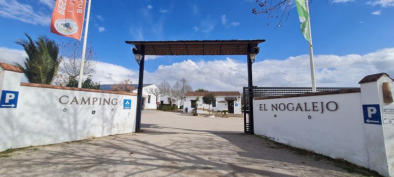
Here we ended up at a small, cozy campsite.
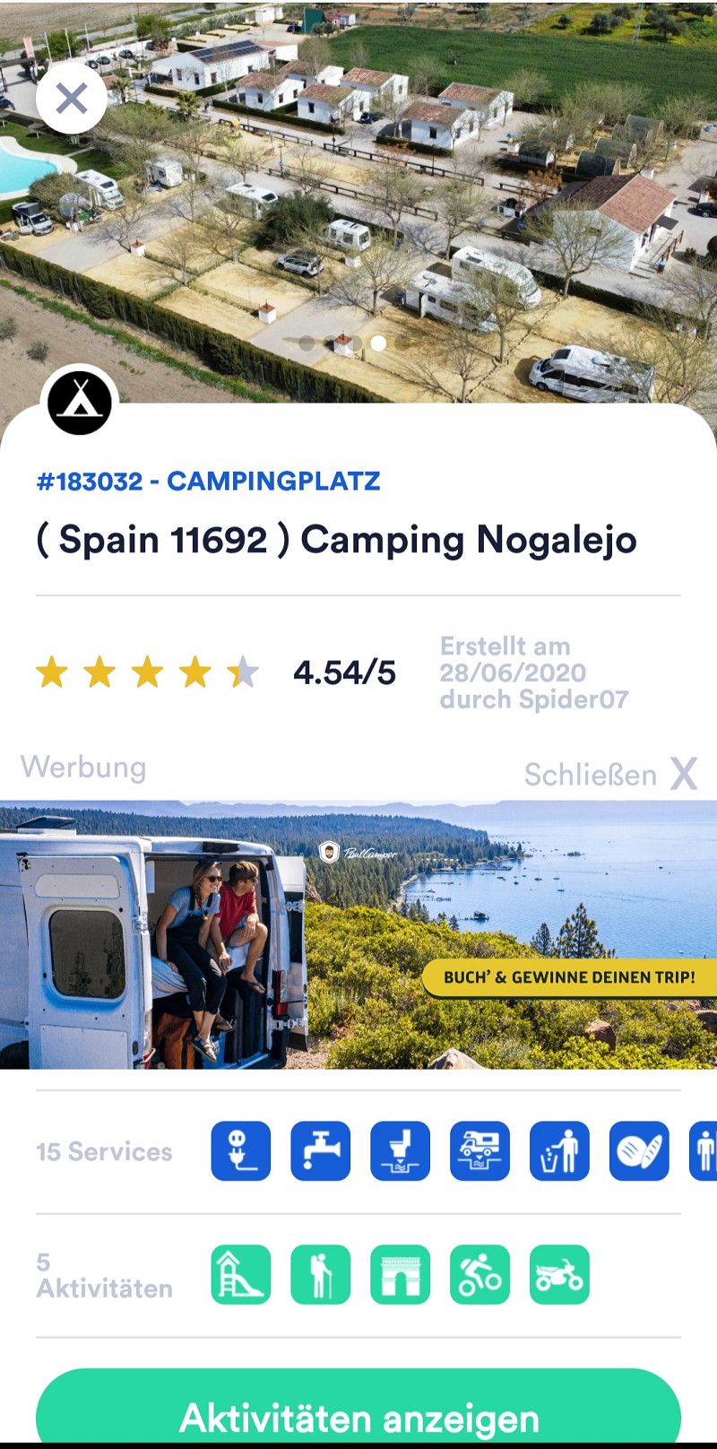
El Nogalejo
https://www.campingelnogalejo.es/
23,- per night without electricity.
Since it wasn't raining when we arrived, we quickly parked the Eddi and immediately set off to explore the area.
Approximately 1.5 kilometers from the campsite to the center.
Luckily, my mood has brightened again.
Day
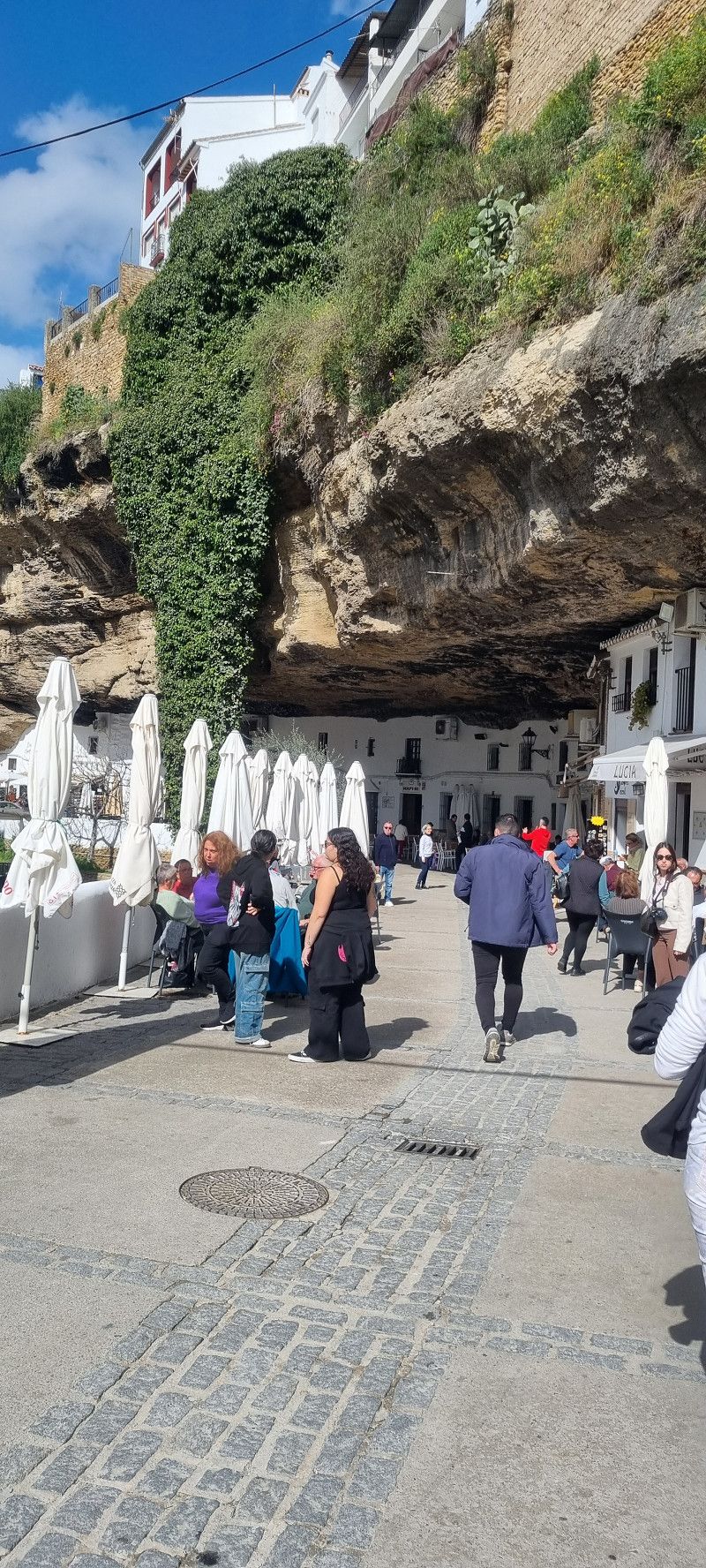
2.ter Tag Setenil de las Bodegas
Hey guys,
We were actually lucky with the weather today.
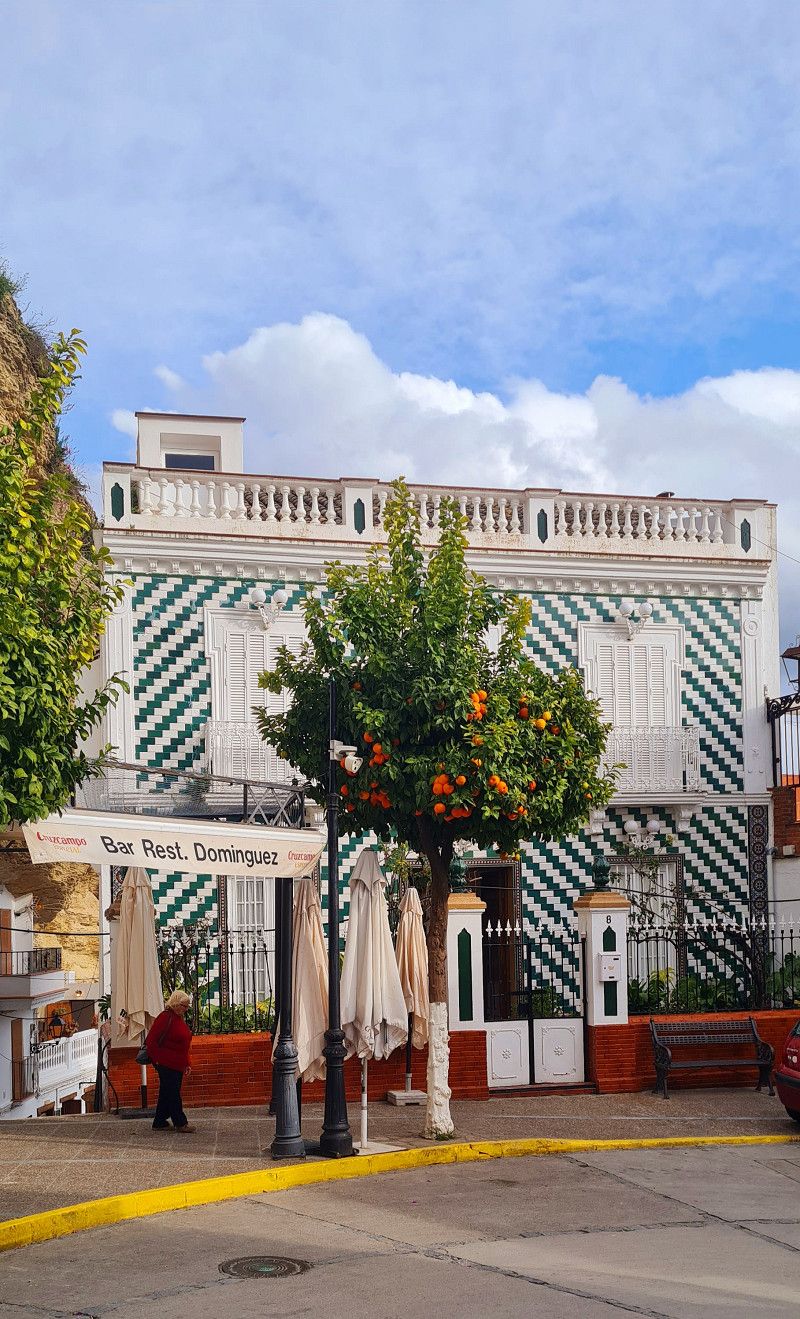
So we strolled back into town, sat down in a café for a cappuccino in the sun and watched the streams of tourists that are brought here in large tour buses 😄
Afterwards we strolled through a few shops and bought some delicacies and souvenirs.
And I even found a little lucky charm in the ladies' washroom at the campsite 😊🍀
Day
Camping Villsom
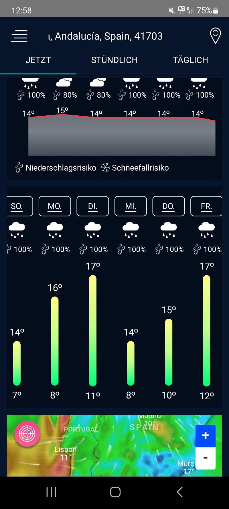
41703, Dos Hermanas, Spain
37° 16' 39.6" N 5° 56' 11.7" W
37.2776700 -5.9365700
• Head toward Calle Cable. Go for 27 m.
• Turn right onto SE-3205. Go for 141 m.
• Pass 3 roundabouts and continue on SE-3205. Go for 3.5 km.
• Take the 1st exit from roundabout onto A-4 (Autovía del Sur) toward Sevilla. Go for 8.3 km.
• Take the exit toward Sevilla Centro/Av. de la Raza. Go for 514 m.
• Take the 2nd exit from roundabout onto Avenida de la Raza toward av. de la Raza. Go for 700 m.
• Take the 1st exit from roundabout onto Avenida de la Raza toward Puerto Este/av. de la Raza/Sevilla Centro. Go for 1.5 km.
• Continue on Avenida La Raza. Go for 882 m.
• Turn right onto Calle Cardenal Bueno Monreal. Go for 33 m.
• Turn right onto Calle Cardenal Bueno Monreal. Go for 337 m.
• Turn left onto Avenida Manuel Siurot. Go for 124 m.
• Continue on Avenida de la Borbolla toward Centro Ciudad. Go for 1.2 km.
• Turn slightly left onto Calle Juan de Mata Carriazo. Go for 575 m.
• Continue on Calle José María Moreno Galván. Go for 421 m.
• Turn left onto Calle Luis Montoto. Go for 222 m.
• Continue on Calle Puerta de Carmona toward Centro Ciudad. Go for 56 m.
• Continue on Calle San Esteban. Go for 170 m.
• Continue on Plaza Pilatos. Go for 36 m.
• Keep left onto Calle Águilas. Go for 219 m.
• Continue on Calle Alfalfa. Go for 70 m.
• Turn left onto Calle Jesús de las Tres Caídas. Go for 61 m.
• Turn right onto Calle Cuesta del Rosario. Go for 134 m.
• Continue on Calle Villegas. Go for 55 m.
• Continue on Plaza El Salvador. Go for 21 m.
• Turn slightly left onto Calle Álvarez Quintero. Go for 46 m.
• Turn right onto Calle Entre Cárceles. Go for 40 m.
• Turn left onto Calle Francisco Bruna. Go for 38 m.
• Turn slightly left onto Plaza San Francisco. Go for 129 m.
• Continue on Calle Hernando Colón. Go for 145 m.
• Turn left onto Calle Alemanes. Go for 78 m.
• Turn slightly right onto Calle Cardenal Carlos Amigo Vallejo. Go for 43 m.
• Arrive at Calle Cardenal Carlos Amigo Vallejo. Your destination is on the right.
☍
19,7 km
( 24 min.)
05. Mar. 2025 -
10. Mar. 2025
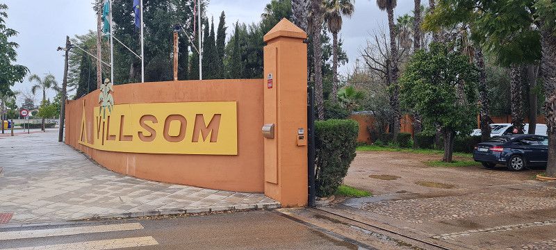
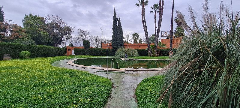
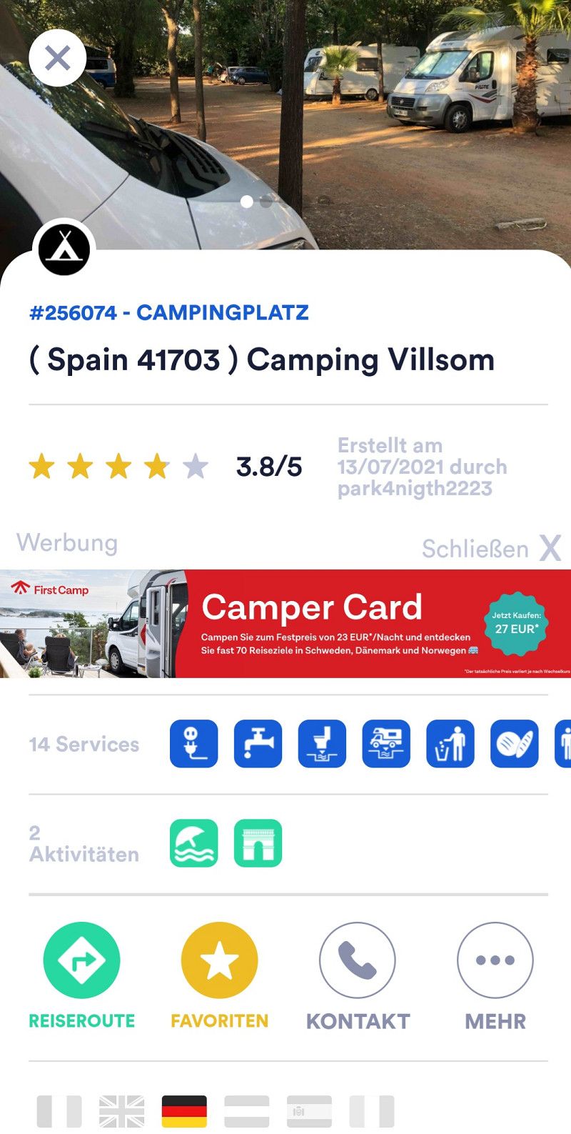
16.ter Stopp Dos Hermanas
Hey guys,
and on we go. 115 kilometers further to Dos Hermanas. About 15 kilometers from the center of Seville at the Villsom campsite.
https://campingvillsom.com/index.php
We stay here for 5 nights and wait out the next few rainy days before moving on to Portugal.
Since we are staying here for 5 nights, we get a 25% discount on the total price. So we pay about 23 euros per night with everything included.
Tomorrow is supposed to be the driest of the rainy days. Then we'll quickly take the bus into Seville. The bus stop is a 5-minute walk away.
Day
Catedral de Sevilla
Calle Fray Ceferino González, Sevilla, Sevilla, Andalusien, Spanien
37° 23' 9.3" N 5° 59' 35.3" W
37.3859150 -5.9931406
• Head toward Plaza Virgen de los Reyes on Calle Cardenal Carlos Amigo Vallejo. Go for 4 m.
• Turn slightly left onto Plaza Virgen de los Reyes. Go for 72 m.
• Turn left onto Calle Mateos Gago. Go for 266 m.
• Turn right onto Calle Fabiola. Go for 115 m.
• Turn left onto Calle Ximénez de Enciso. Go for 55 m.
• Turn right onto Calle Santa María la Blanca. Go for 137 m.
• Turn slightly left onto Calle Puerta de la Carne. Go for 67 m.
• Turn right onto Avenida Menéndez Pelayo. Go for 533 m.
• Take the 2nd exit from Plaza Don Juan de Austria roundabout onto Avenida del Cid. Go for 220 m.
• Take the 1st exit from roundabout onto Avenida María Luisa. Go for 417 m.
• Turn right onto Glorieta Marineros Voluntarios toward Cádiz/E-5/A-4/Estadio Benito Villamarín. Go for 147 m.
• Turn right onto Paseo de las Delicias toward Cádiz/E-5/A-4/Estadio Benito Villamarín. Go for 673 m.
• Continue on Glorieta de Méjico toward E-5/A-4/Cádiz/Estadio Benito Villamarín. Go for 112 m.
• Continue on Avenida de la Palmera toward Cadiz/E-5/A-4. Go for 142 m.
• Continue on Avenida de la Palmera toward Cadiz/E-5/A-4. Go for 470 m.
• Continue toward SE-30. Go for 49 m.
• Continue on Avenida de la Palmera toward SE-30. Go for 757 m.
• Continue on Glorieta Plus Ultra. Go for 134 m.
• Continue on Avenida de Jerez toward SE-30/Ronda de Circunvalación. Go for 1.4 km.
• Take the 3rd exit from roundabout onto Carretera de Cádiz. Go for 1.7 km.
• Pass 3 roundabouts and continue on Avenida Bellavista (N-4). Go for 1.5 km.
• Take the 1st exit from roundabout onto Avenida Bellavista (N-4). Go for 4.5 km.
• Pass 2 roundabouts and continue on N-4. Go for 1.2 km.
• Take the 1st exit from roundabout onto SE-3205 toward Isla Menor. Go for 189 m.
• Turn right. Go for 27 m.
• Arrive at your destination on the right.
☍
14,9 km
( 21 min.)
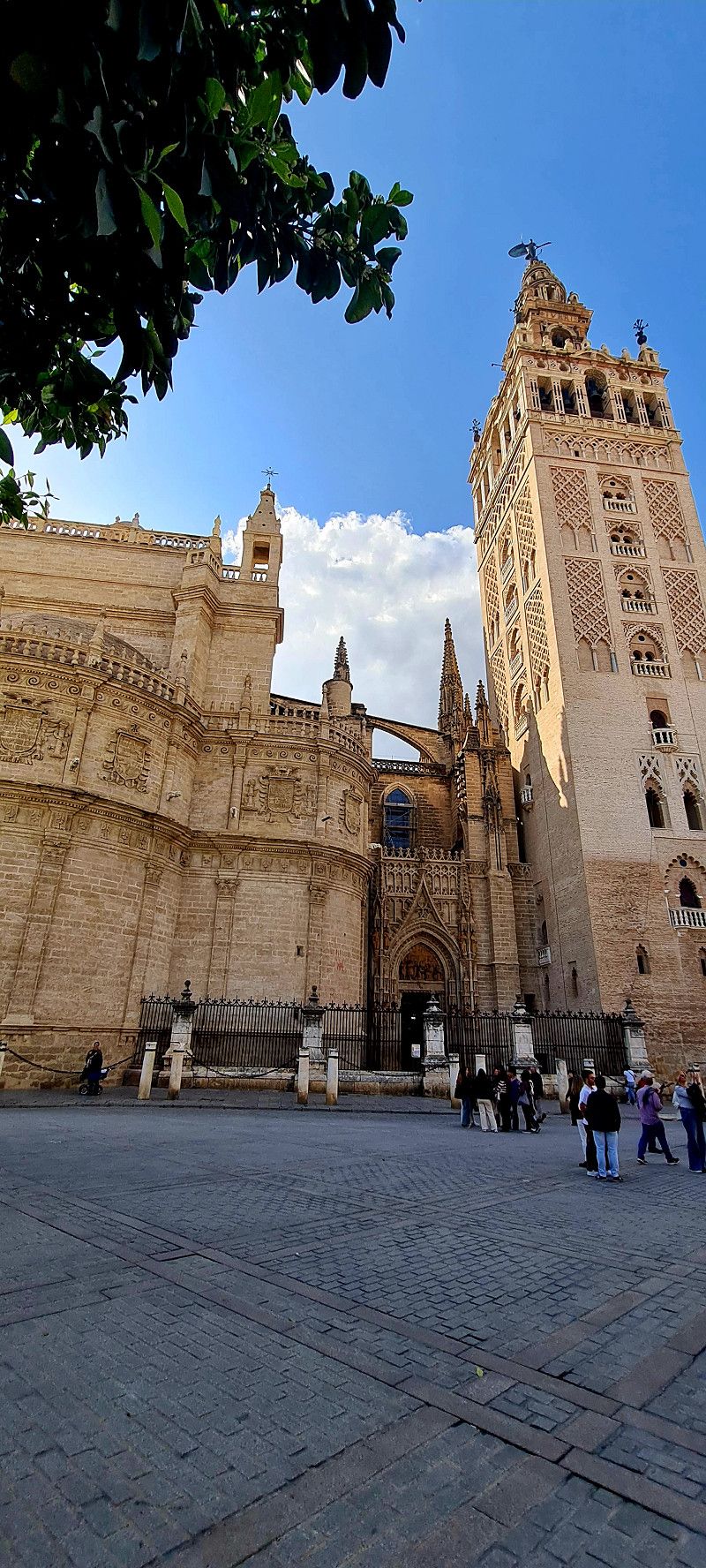
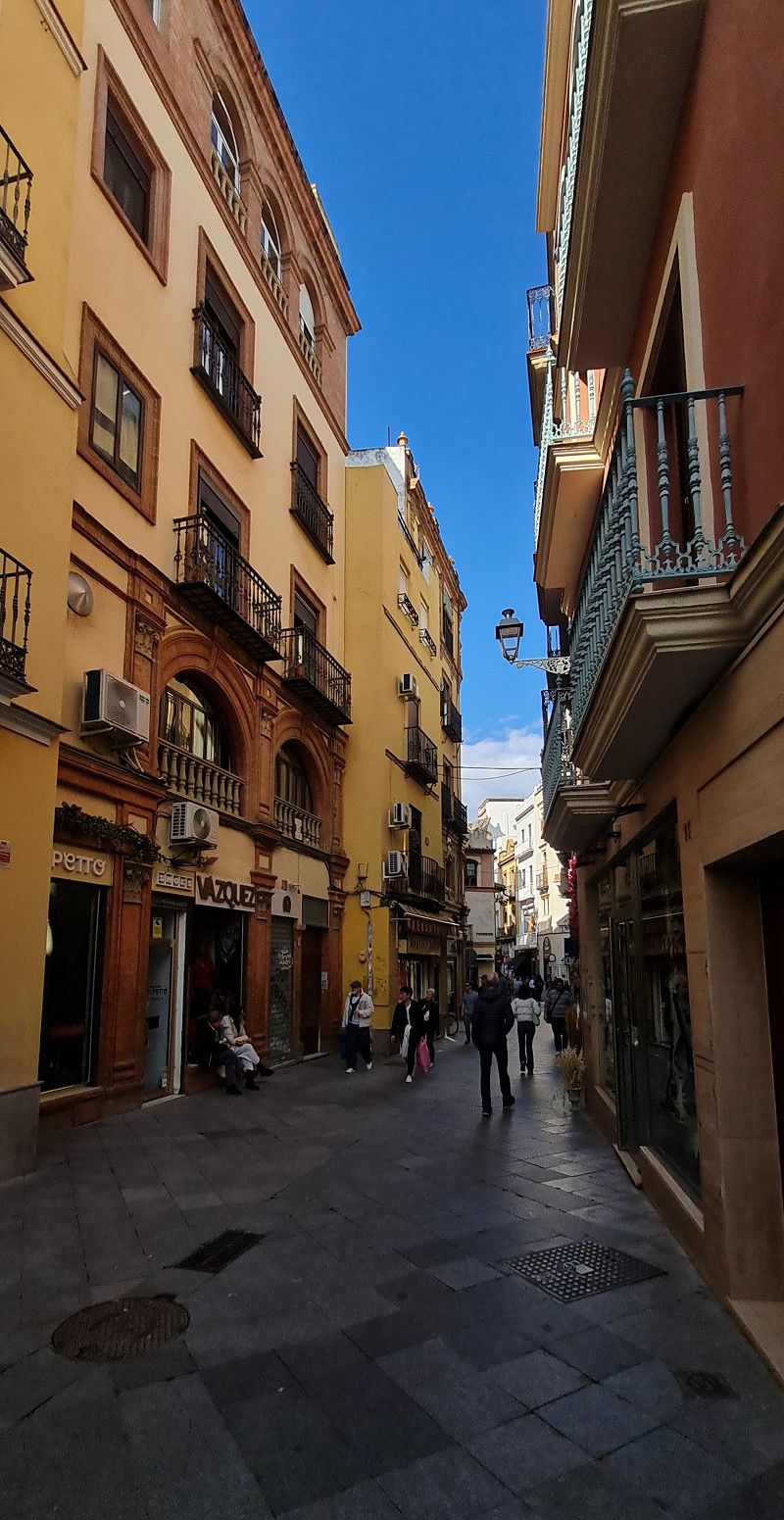
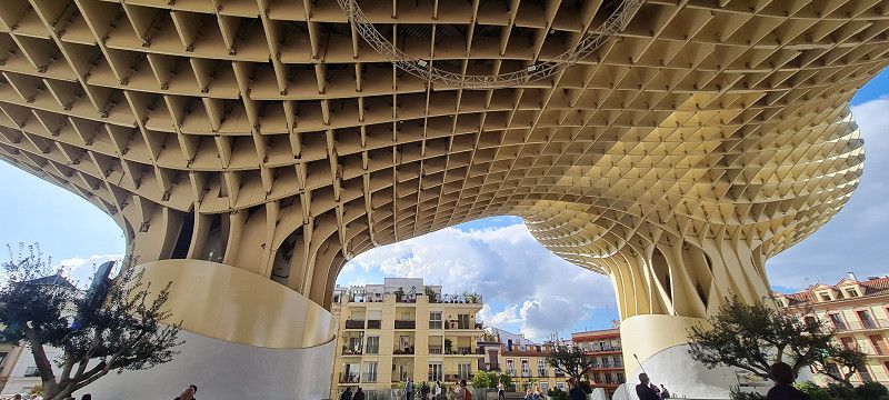
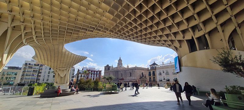
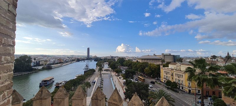
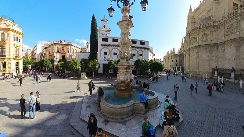
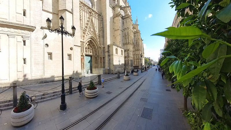
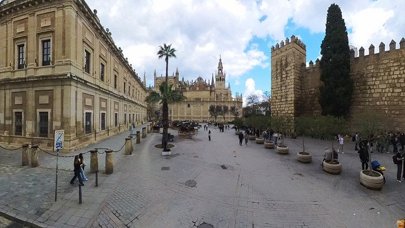
Sevilla Tagesausflug
Hey guys,
We were in Seville today when the weather was nice.
The bus ride to Plaza de España takes about 30 minutes and costs 1.80 euros per person.
We strolled about 10 kilometers back and forth through the city.
I love this city.
Beautiful little streets everywhere with interesting shops, great house facades and of course the many landmarks of the city.
(If I can no longer be found in Germany, look for me here 😃)
Day
3.ter Tag Dos Hermanas
Hey guys,
Today was a different kind of day.
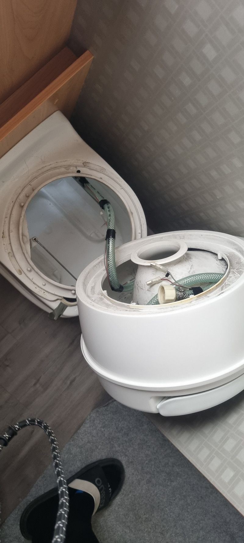
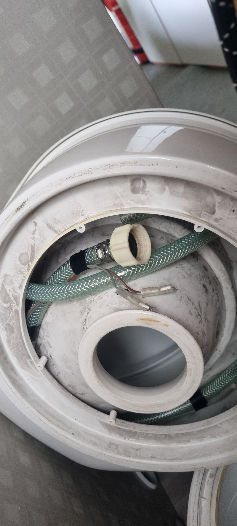
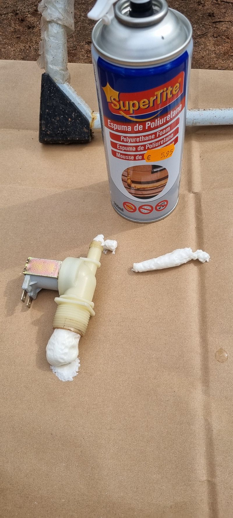
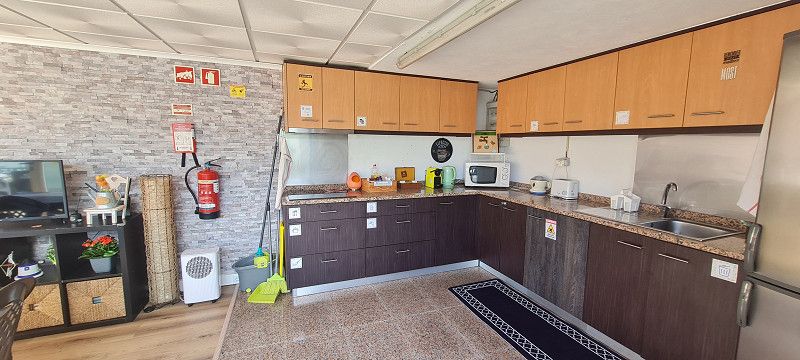
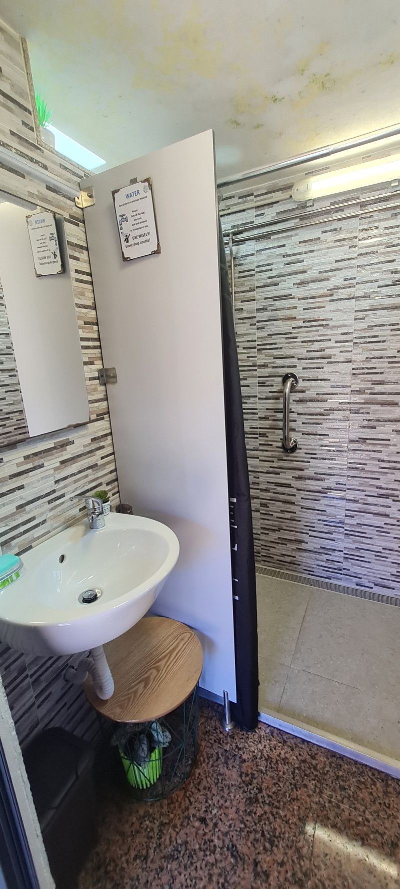
Since the weather was good today, Micha took our toilet apart to remove the solenoid valve. (It wouldn't close anymore and water was constantly running into the toilet bowl)
After intensive testing and cleaning it was determined that it was defective.
Since we can't get a replacement quickly, Micha sealed everything with construction foam.
Worked great!
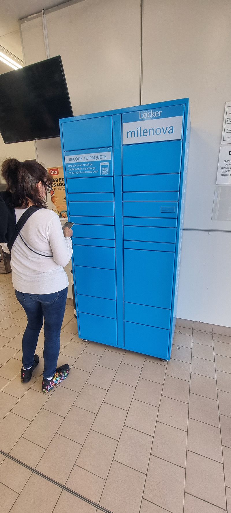
Next up was the rear view camera. A cable had come loose from the circuit board.
Yesterday I quickly ordered a soldering iron from Amazon Spain, which we were able to pick up today from an Amazon Locker.
The locker is located 1.8 kilometers from the campsite in a supermarket.
How this works: I had it translated from Spanish to German, looked for an Amazon Locker nearby, entered the address and...
Yes, it works wonderfully.
Then Micha was able to solder the cable back to the circuit board and...
well, camera screen is still dark 🤔 Since it is raining again, the troubleshooting will continue tomorrow
Day
4.ter Tag Dos Hermanas
Hey guys,
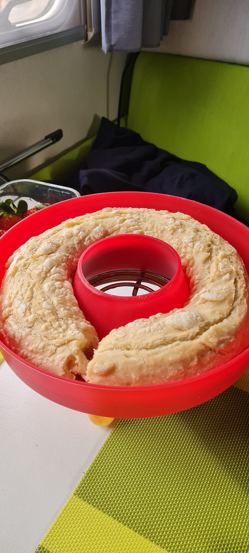
Unfortunately, I don't have much more to say. It only rained, apart from a few short breaks. There wasn't much going on except for baking bread.
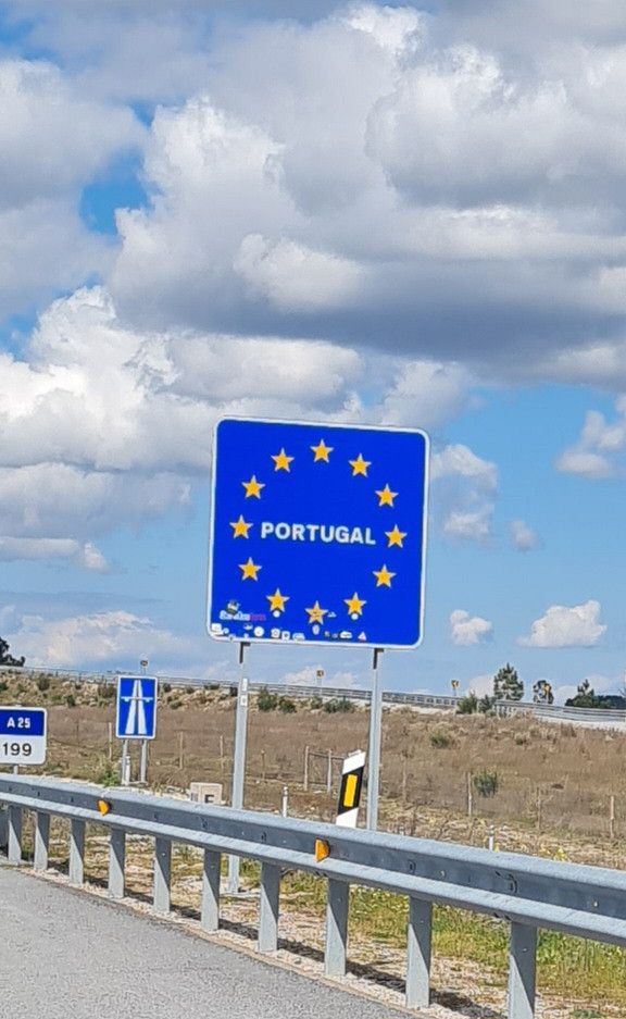
So we held an emergency meeting and decided that unfortunately we will not visit Portugal 😪
I am infinitely sad but the weather just doesn't allow it.
We simply cannot constantly
Stay at a campsite for 4-5 days and hope that the weather gets better.
We don't have that much time after all.
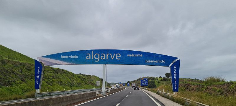
So we'll be heading north on Monday. And then towards France. That's the rough plan.
Let's wait and see how it develops.
Day
Day
Camping Villsom
41703, Dos Hermanas, Spain
37° 16' 39.6" N 5° 56' 11.7" W
37.2776700 -5.9365700
• Head toward Calle Cable. Go for 27 m.
• Turn right onto SE-3205. Go for 141 m.
• Take the 4th exit from roundabout onto SE-3205. Go for 420 m.
• Take the 5th exit from roundabout onto N-4. Go for 529 m.
• Take the 1st exit from roundabout. Go for 26 m.
• Continue on Avenida Doctor Fleming. Go for 147 m.
• Take the 3rd exit from Glorieta Comunidad Autónoma de Castilla roundabout onto Avenida de España. Go for 407 m.
• Take the 2nd exit from Glorieta Comunidad Autónoma del País Vasco roundabout onto Avenida de España. Go for 612 m.
• Take the 1st exit from Glorieta Comunidad Autónoma Cataluña roundabout onto Avenida Libertad. Go for 185 m.
• Take the 4th exit from Glorieta Comunidad Autónoma Andalucía roundabout onto Avenida Sevilla. Go for 721 m.
• Take the 1st exit from Plaza Arenal roundabout onto Calle Nuestra Señora de Valme. Go for 56 m.
• Continue on Calle Canónigo. Go for 252 m.
• Turn left onto Calle Lamarque de Novoa. Go for 38 m.
• Arrive at Calle Lamarque de Novoa. Your destination is on the right.
☍
3,6 km
( 7 min.)
Dos Hermanas
Plaza de la Constitución 1, Dos Hermanas, Andalusien, Spanien
37° 17' 1.3" N 5° 55' 21.6" W
37.2836890 -5.9226718
• Head toward Calle Canónigo on Calle Lamarque de Novoa. Go for 38 m.
• Turn left onto Calle Canónigo. Go for 67 m.
• Turn right onto Calle Santa María Magdalena. Go for 460 m.
• Take the 2nd exit from roundabout onto Calle Isaac Peral. Go for 791 m.
• Take the 5th exit from Glorieta Comunidad Autónoma Andalucía roundabout onto Avenida Libertad. Go for 246 m.
• Pass 2 roundabouts. Go for 643 m.
• Continue on Calle Gabriel Miró. Go for 223 m.
• Take the 2nd exit from roundabout onto Avenida de las Universidades. Go for 109 m.
• Continue on Avenida Pablo de Olavide. Go for 71 m.
• Continue on Avenida de las Universidades. Go for 178 m.
• Continue on Avenida Pablo de Olavide. Go for 369 m.
• Take the 3rd exit from roundabout onto SE-40 (Viaducto del Arroyo Culebras) toward A-4/Cádiz. Go for 2.3 km.
• Take exit 22AB toward Sevilla onto A-4 (Autovía del Sur). Go for 6.4 km.
• Take the exit toward E-1/Huelva/A-49/Mérida onto A-66 (Ronda Urbana Sur). Go for 7.7 km.
• Take exit 17B toward Huelva onto A-49 (Autopista del V Centenario). Go for 133 km.
• Continue on A22 (Via Infante de Sagres). Go for 8.9 km.
• Take exit 17 toward Monte Gordo/(N125). Go for 2.2 km.
• Continue toward N125. Go for 42 m.
• Take the 1st exit from roundabout onto N125. Go for 285 m.
• Pass 3 roundabouts and continue on N125. Go for 3.3 km.
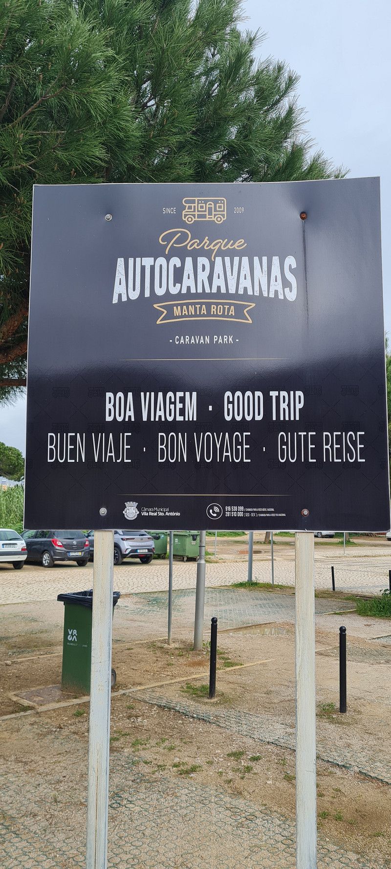
• Turn left toward Estrada da Manta Rota/M509. Go for 133 m.
• Turn left onto Estrada da Manta Rota (M509). Go for 365 m.
• Take the 2nd exit from roundabout onto Estrada da Manta Rota (M509). Go for 837 m.
• Turn right onto Rua Principal. Go for 79 m.
• Arrive at your destination on the left.
☍
169,1 km
(1 hrs. 41 min.)
Day
Day
Park Caravanas Manta Rota
Rua da Praia da Manta Rota, 8900-038, Vila Real de Santo António, Portugal
37° 9' 54" N 7° 31' 15" W
37.1650000 -7.5208333
• Head northeast. Go for 10 m.
• Continue on Rua Principal. Go for 69 m.
• Turn left onto Estrada da Manta Rota (M509). Go for 74 m.
• Turn left onto Rua Principal. Go for 93 m.
• Continue on Quinta Manta Rota. Go for 272 m.
• Turn left onto M1248. Go for 939 m.
• Continue on Fonte Santa Vila Nova de Cacela (M1248). Go for 111 m.
• Continue on M1248. Go for 443 m.
• Turn right onto M1242. Go for 57 m.
• Turn left onto N125 toward Faro/Tavira. Go for 6.5 km.
• Pass 2 roundabouts and continue on N125. Go for 3.4 km.
• Take the 3rd exit from roundabout. Go for 103 m.
• Continue toward Rua de Vale de Caranguejo. Go for 451 m.
• Take the 4th exit from roundabout onto Rua de Vale de Caranguejo. Go for 669 m.
• Arrive at Rua de Vale de Caranguejo. Your destination is on the left.
☍
13,2 km
( 15 min.)
12. Mar. 2025 -
13. Mar. 2025
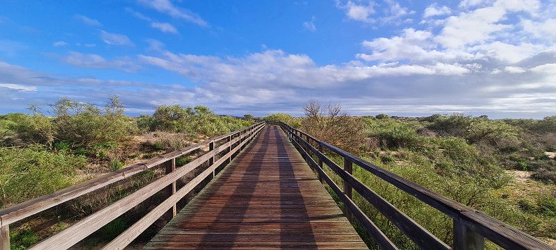
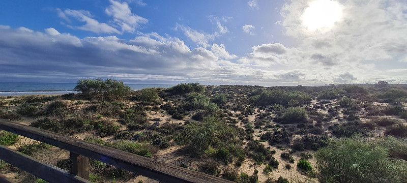
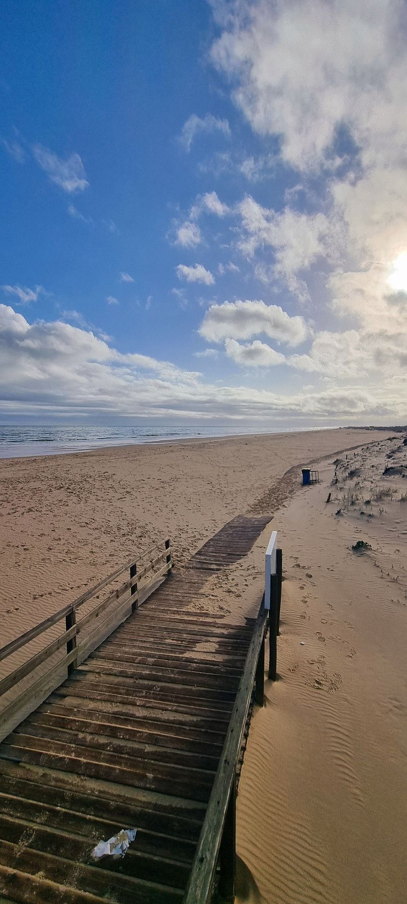
17.tee Stopp Manta Rota
Day
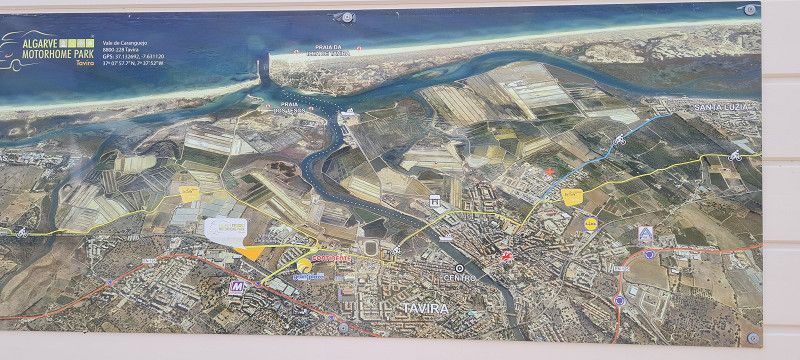
ALGARVE MOTORHOME PARK TAVIRA
Rua de Vale Caranguejo, 8800-228, TAVIRA, Portugal
37° 7' 57.7" N 7° 37' 52" W
37.1326920 -7.6311200
• Head southwest on Rua de Vale de Caranguejo. Go for 304 m.
• Turn left. Go for 208 m.
• Turn left. Go for 1.6 km.
• Continue straight ahead. Go for 368 m.
• Arrive at your destination.
☍
2,5 km
( 6 min.)
13. Mar. 2025 -
15. Mar. 2025
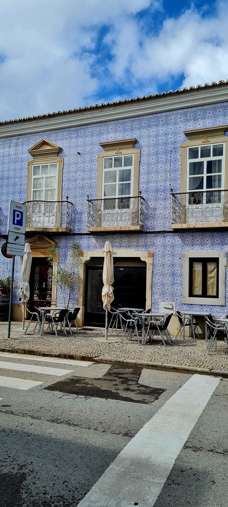
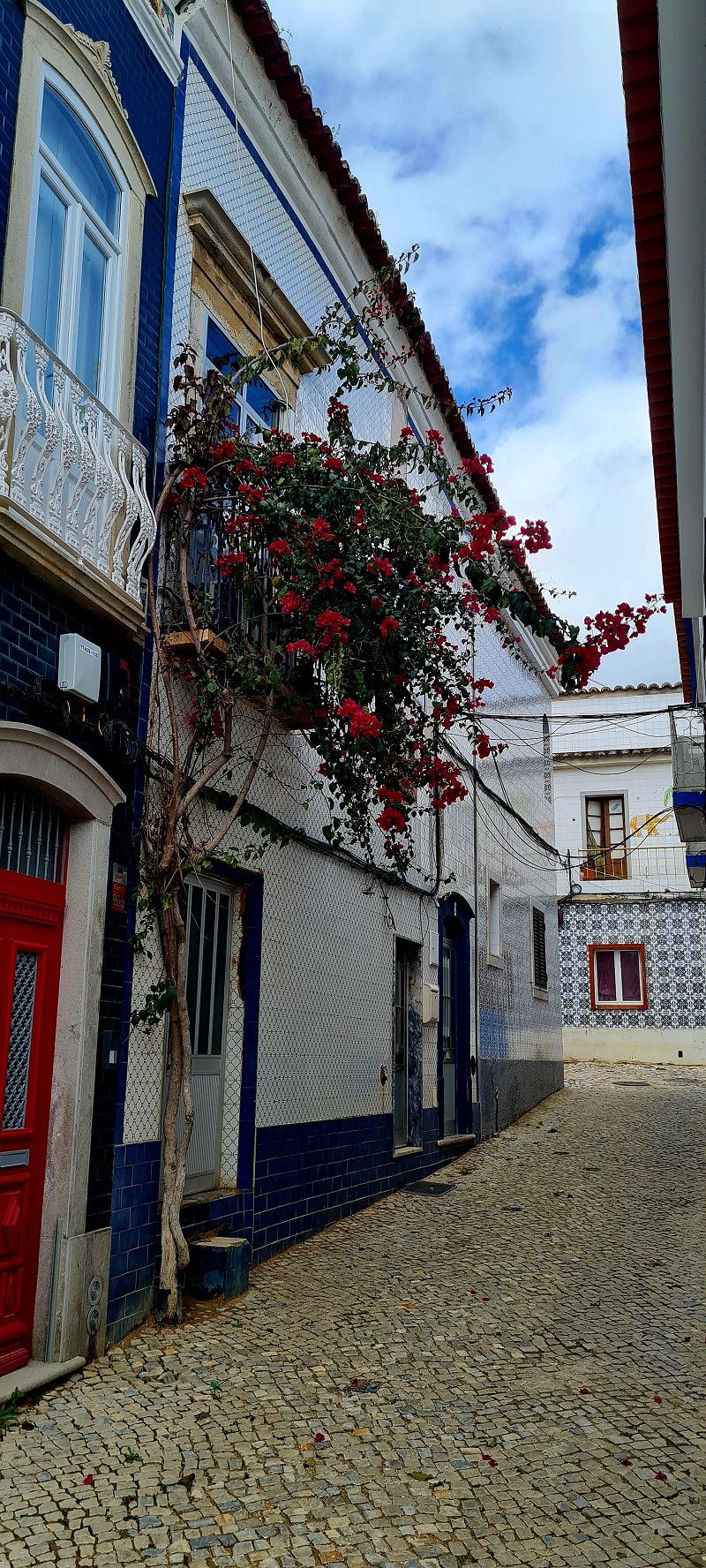
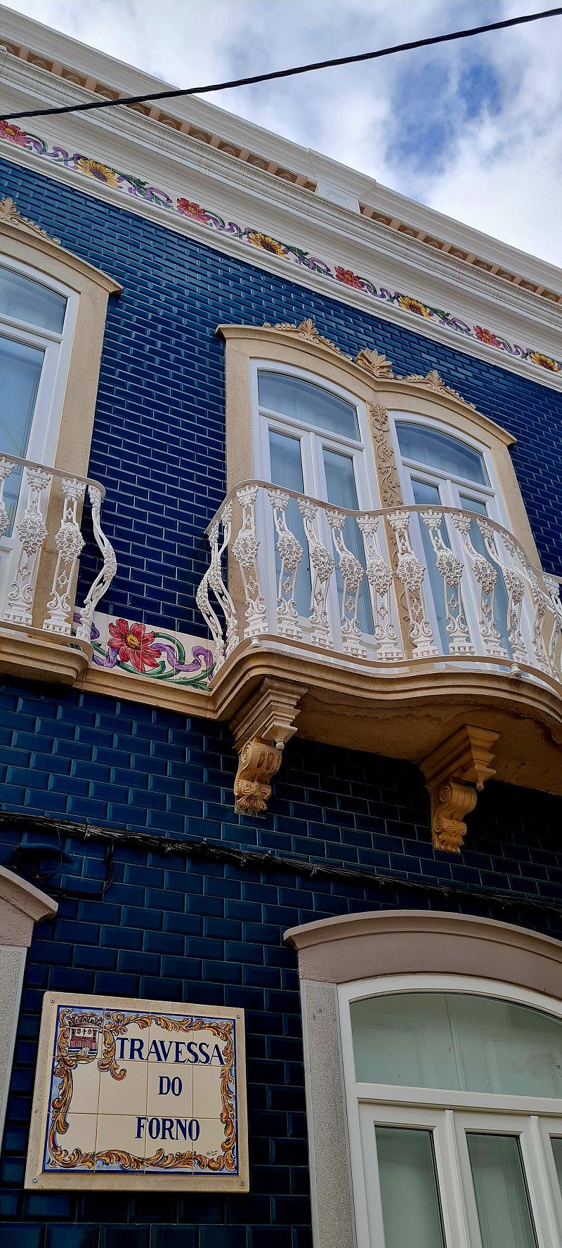
18.ter Stopp Tavira
Day
Tavira
Largo Doutor Sousa Vaz, Tavira, Faro, Portugal
37° 7' 7.4" N 7° 37' 22.4" W
37.1187182 -7.6228777
• Head northeast. Go for 2.2 km.
• Take the 2nd exit from roundabout. Go for 475 m.
• Continue toward N125. Go for 48 m.
• Take the 3rd exit from roundabout onto N125. Go for 586 m.
• Keep left toward M508. Go for 56 m.
• Take the 2nd exit from roundabout onto N125. Go for 2.3 km.
• Take the 2nd exit from roundabout onto N270. Go for 3.7 km.
• Take the 2nd exit from roundabout toward Lisboa/Faro/Espanha. Go for 174 m.
• Take left ramp onto A22 (Via Infante de Sagres) toward Lisboa/Faro. Go for 56.9 km.
• Take exit 9 toward (N395)/Albufeira/(N125)/Guia onto IC1. Go for 1.1 km.
• Take left ramp onto N125 toward (N395)/Albufeira/Ferreiras. Go for 1.4 km.
• Take ramp toward Albufeira/Ferreiras. Go for 268 m.
• Take the 1st exit from roundabout onto N395 toward Albufeira. Go for 2.0 km.
• Pass 2 roundabouts and continue on N395. Go for 1.0 km.
• Take the 1st exit from roundabout onto Avenida dos Descobrimentos (M526) toward Galé. Go for 852 m.
• Take the 2nd exit from roundabout onto Avenida dos Descobrimentos (M526) toward Pêra/Galé. Go for 1.2 km.
• Take the 4th exit from roundabout onto Avenida Dom Manuel I. Go for 284 m.
• Take the 2nd exit from Praça dos Navegantes roundabout onto Alameda da Orada. Go for 349 m.
• Arrive at Alameda da Orada. Your destination is on the right.
☍
75,0 km
( 51 min.)
Day
Albufeira
Alameda Dom Carlos, Albufeira, Faro, Portugal
37° 5' 7.1" N 8° 15' 59.1" W
37.0853106 -8.2664270
• Head toward Rua da Ermida on Alameda da Orada. Go for 125 m.
• Make a U-Turn at Rua da Ermida onto Alameda da Orada. Go for 394 m.
• Take the 1st exit from Praça dos Navegantes roundabout onto Avenida Dom Manuel I. Go for 268 m.
• Take the 4th exit from roundabout onto Avenida dos Descobrimentos (M526). Go for 695 m.
• Pass 2 roundabouts and continue on M526. Go for 6.0 km.
• Take the 1st exit from roundabout onto M526. Go for 1.6 km.
• Turn left onto Rua Infante Dom Henrique. Go for 65 m.
• Continue on Largo 1 de Maio. Go for 69 m.
• Continue on Rua Pedro Álvares Cabral. Go for 499 m.
• Take the 3rd exit from roundabout onto N269-1. Go for 650 m.
• Pass 7 roundabouts and continue on Estrada de Armação de Pera (M530-1). Go for 4.1 km.
• Turn left onto M530. Go for 596 m.
• Turn right toward Quinta Village. Go for 145 m.
• Turn left onto Quinta Village. Go for 17 m.
• Arrive at Quinta Village. Your destination is on the right.
☍
15,2 km
( 21 min.)
15. Mar. 2025 -
16. Mar. 2025
19.ter Stopp Albufeira
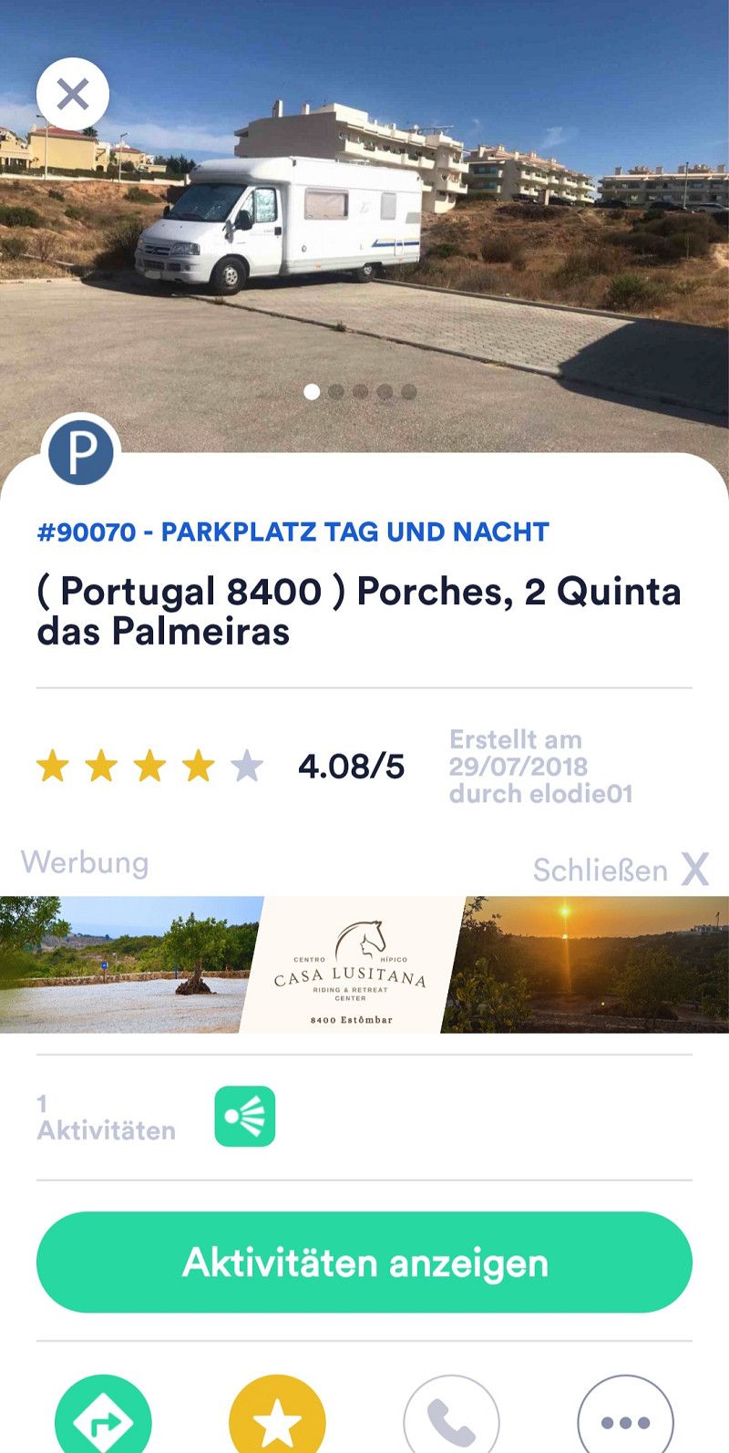
Day
Porches
Faro, Portugal
37° 6' 14.6" N 8° 23' 19" W
37.1040644 -8.3886089
• Head east on Quinta Village. Go for 17 m.
• Turn left. Go for 69 m.
• Turn slightly left. Go for 103 m.
• Turn sharp right. Go for 327 m.
• Turn right toward Rua dos Areeiros. Go for 126 m.
• Turn left onto Rua dos Areeiros. Go for 337 m.
• Turn left onto Estrada de Armação de Pera (M530-1). Go for 1.9 km.
• Take the 2nd exit from roundabout. Go for 77 m.
• Continue on Aldeamento Porches. Go for 219 m.
• Continue on Urbanização António Manuel Pequeno. Go for 120 m.
• Take the 3rd exit from roundabout onto N125. Go for 1.8 km.
• Pass 2 roundabouts and continue on N125. Go for 3.0 km.
• Turn right onto Largo Marques. Go for 51 m.
• Take the 3rd exit from roundabout onto N125. Go for 572 m.
• Take the 3rd exit from roundabout onto N125. Go for 3.9 km.
• Take ramp toward Ferragudo/Estômbar/Parchal. Go for 1.3 km.
• Take the 2nd exit from roundabout onto N125. Go for 656 m.
• Continue toward N125. Go for 54 m.
• Take the 2nd exit from roundabout onto N125. Go for 494 m.
• Take the 2nd exit from roundabout onto N125. Go for 349 m.
• Continue on Rua Infante de Sagres (N125). Go for 229 m.
• Take the 2nd exit from roundabout onto Rua Infante de Sagres (N125). Go for 172 m.
• Take the 4th exit from roundabout onto Rua Foz do Arade (M530-1). Go for 258 m.
• Turn left. Go for 48 m.
• Arrive at your destination on the right.
☍
16,2 km
( 20 min.)
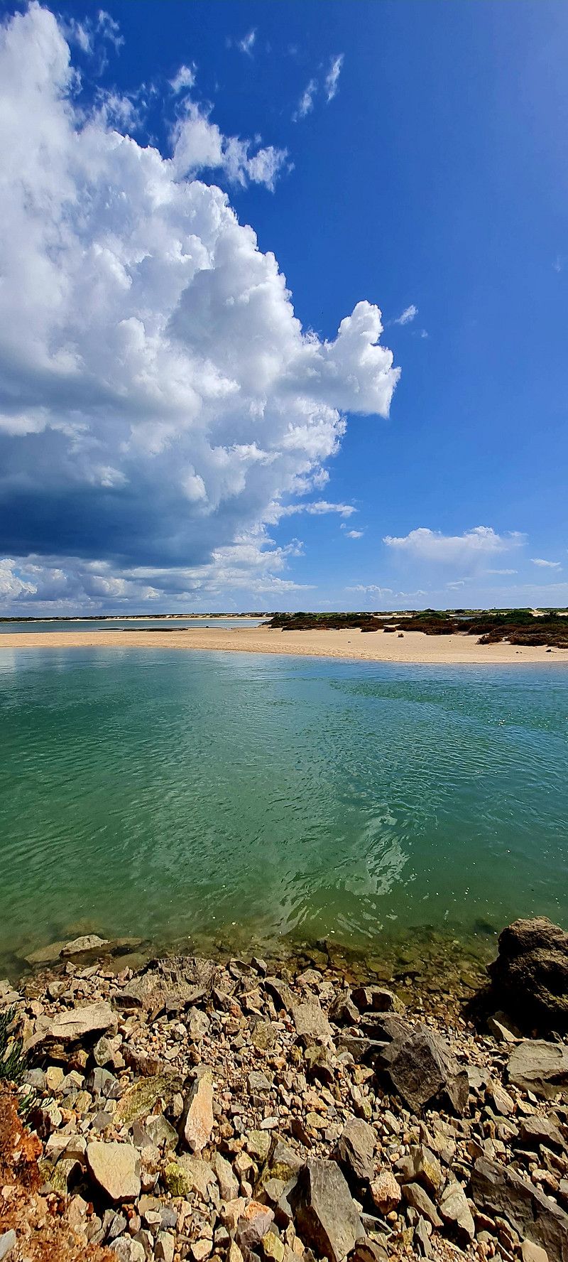
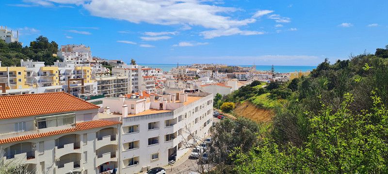
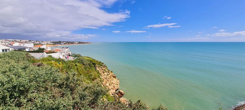
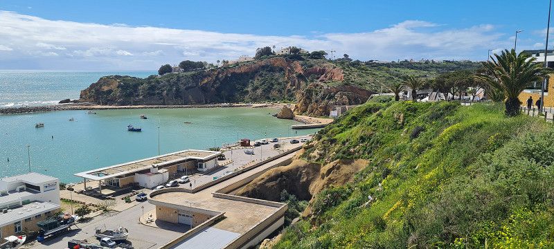
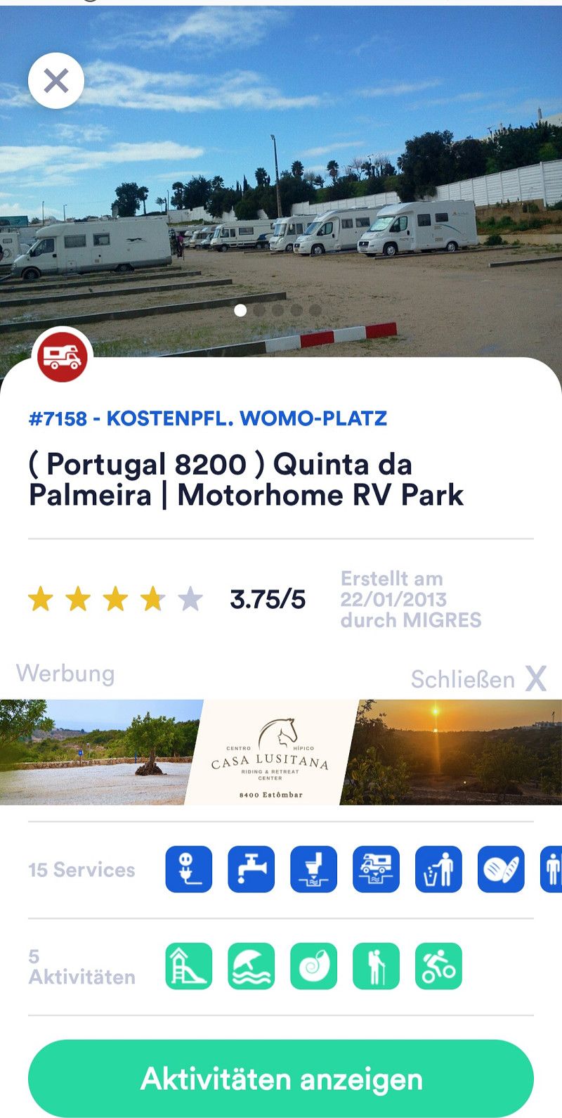
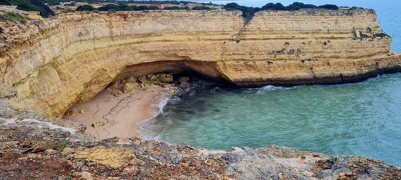
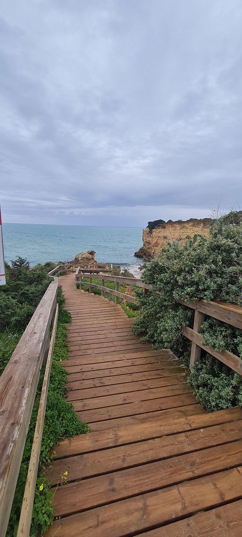
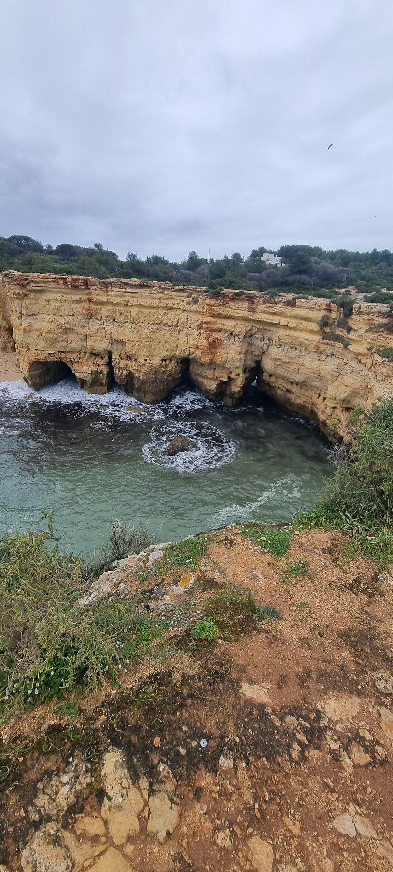
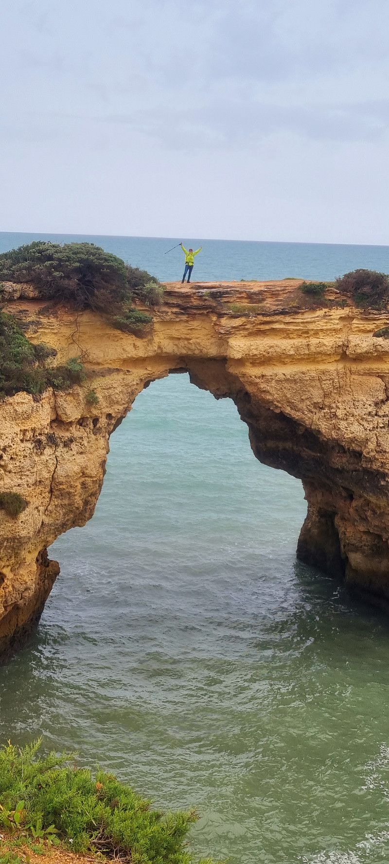
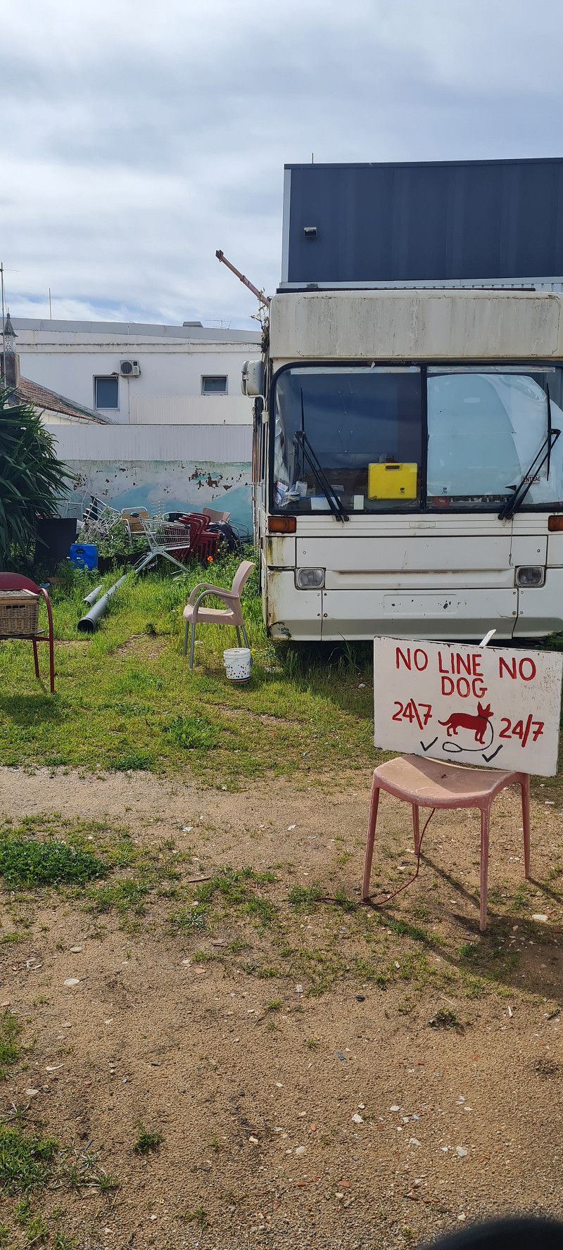
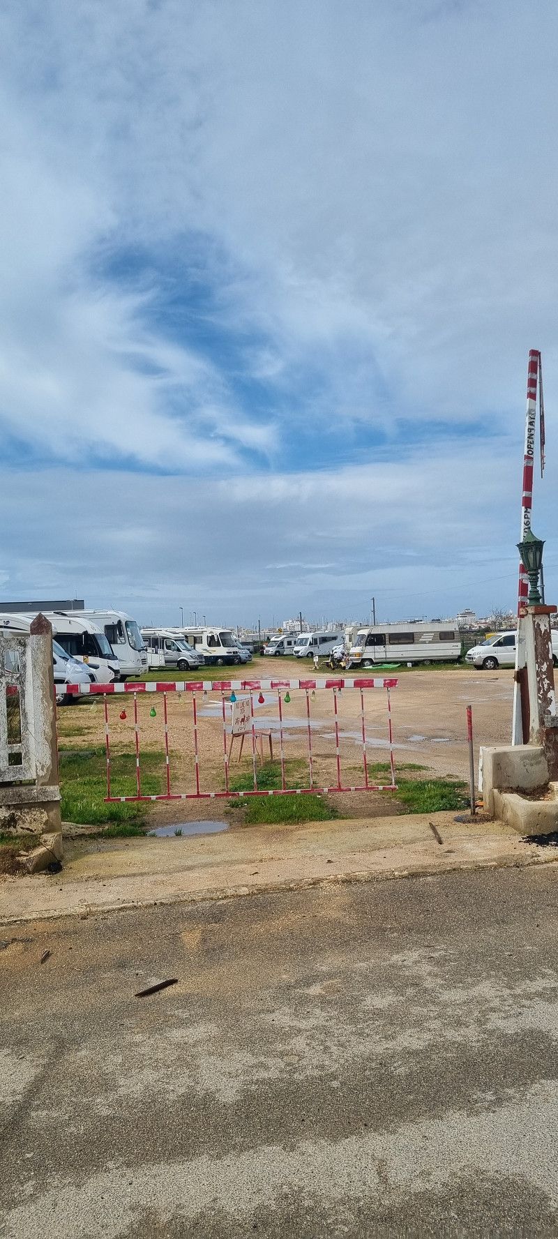
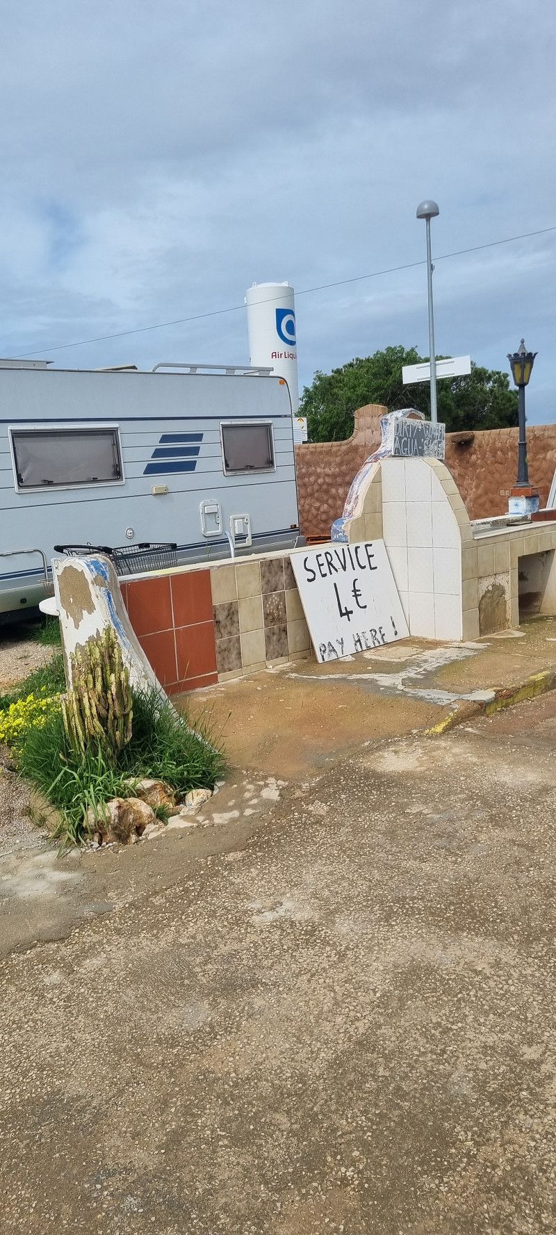
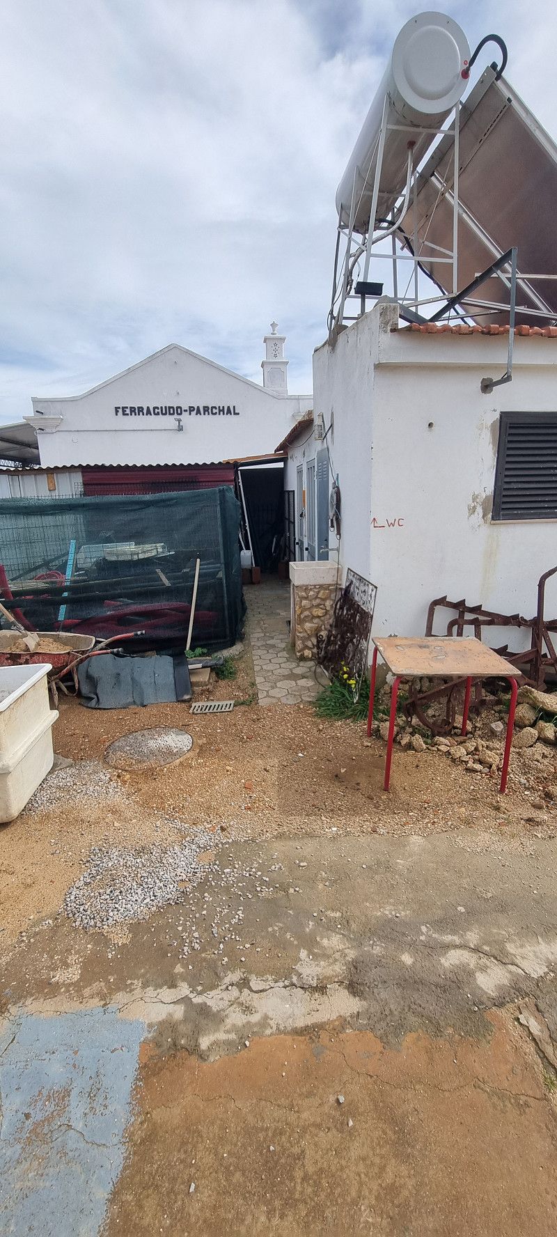
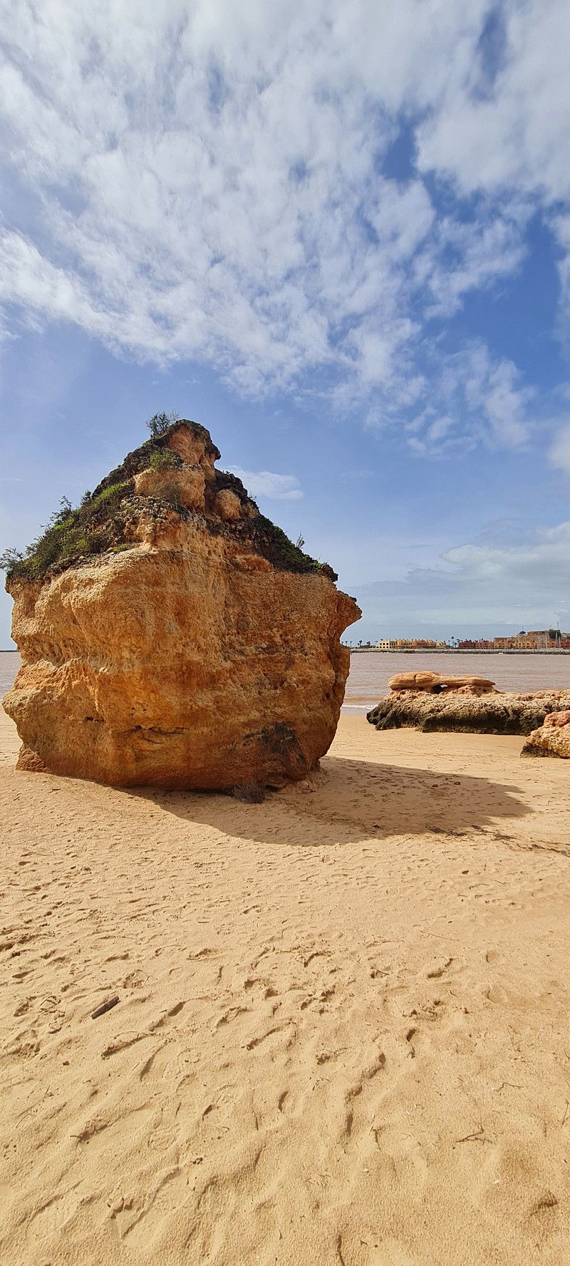
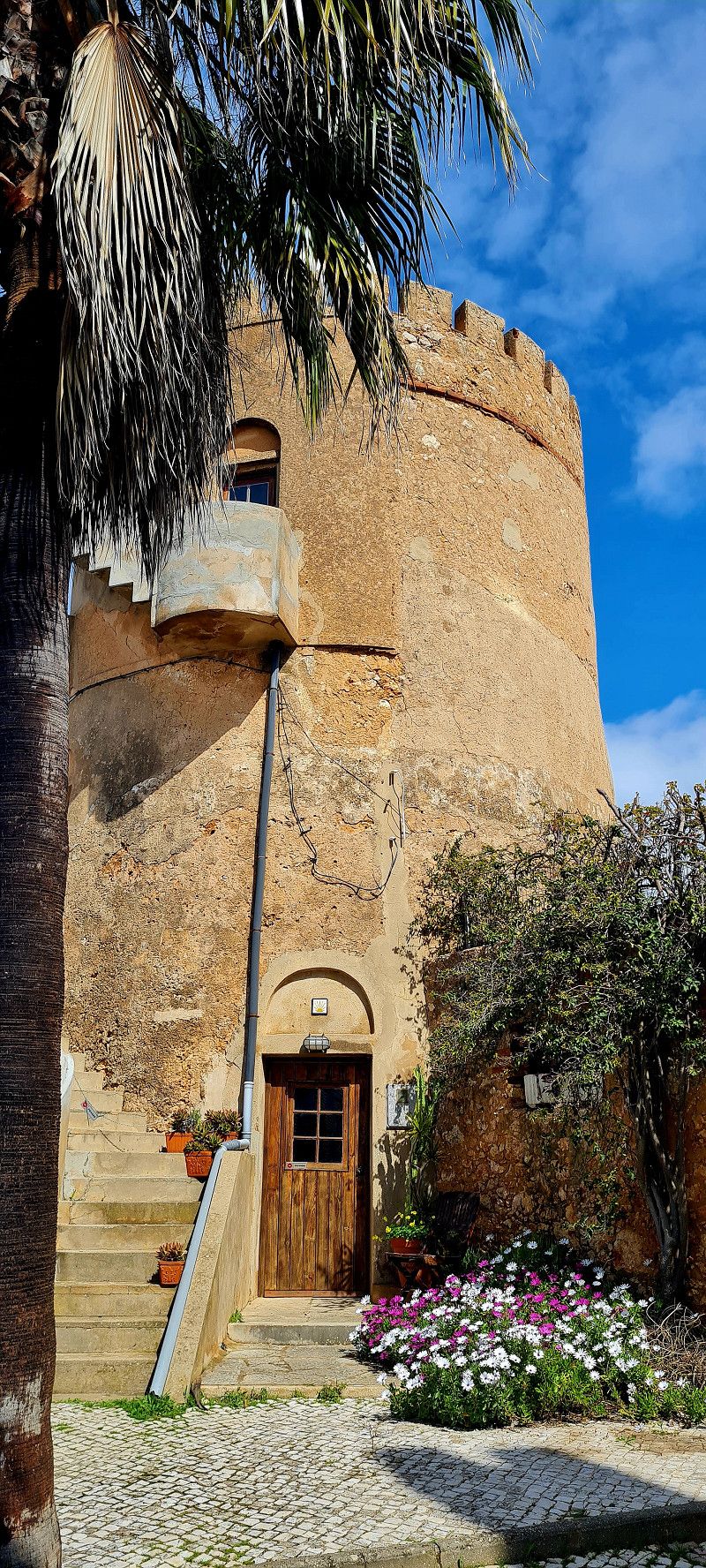
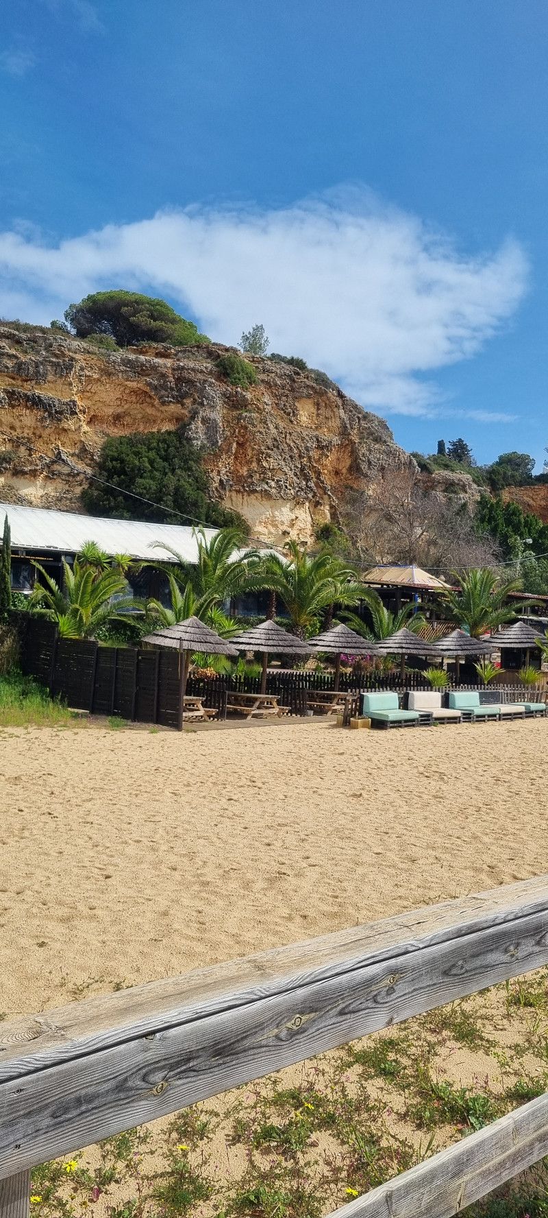
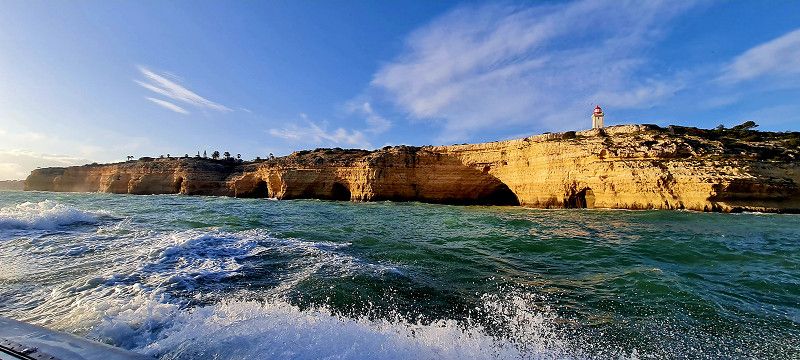
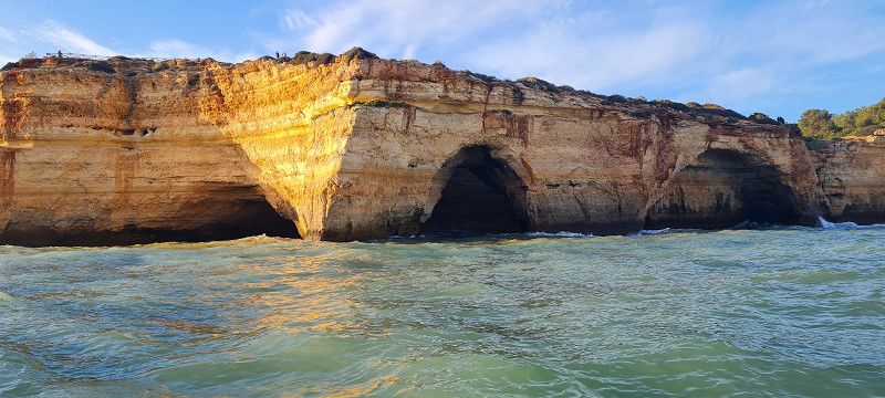
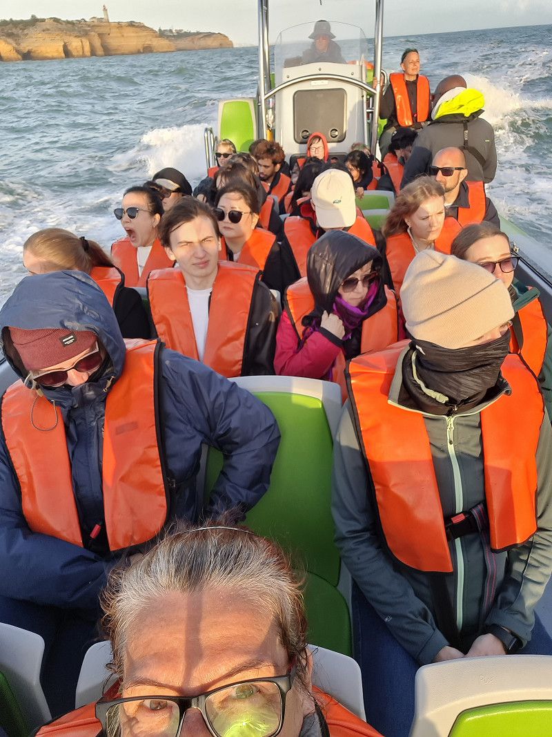
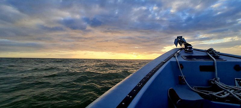
Zwischenstopp Alporchinhos
20.ster Stopp Portimão
Faro, Portugal
37° 8' 6.5" N 8° 31' 14.4" W
37.1351351 -8.5206655
• Head toward Rua Foz do Arade. Go for 48 m.
• Turn left onto Rua Foz do Arade (M530-1). Go for 31 m.
• Take the 1st exit from roundabout onto M530-1. Go for 143 m.
• Take the 2nd exit from roundabout onto N125. Go for 949 m.
• Continue on Rua Infante Dom Henrique (N125). Go for 72 m.
• Turn left onto Rua Serpa Pinto. Go for 208 m.
• Continue on Praça Visconde Bívar. Go for 98 m.
• Continue on Praça Manuel Teixeira Gomes. Go for 53 m.
• Continue on Largo 1 de Dezembro. Go for 40 m.
• Turn right onto Largo 1 de Dezembro. Go for 66 m.
• Turn left onto Largo 1 de Dezembro. Go for 40 m.
• Continue on Rua Direita. Go for 242 m.
• Continue on Estrada do Alvor. Go for 148 m.
• Keep left onto Travessa Pé da Cruz toward Praia da Rocha/Faro. Go for 100 m.
• Turn left onto Rua do Pé da Cruz. Go for 21 m.
• Turn right onto Avenida Zeca Afonso. Go for 92 m.
• Arrive at Avenida Zeca Afonso.
☍
2,4 km
( 6 min.)
Day
Portimão
Avenida Zeca Afonso, Portimão, Faro, Portugal
37° 8' 9.4" N 8° 32' 21.5" W
37.1359317 -8.5393045
• Head north on Avenida Zeca Afonso. Go for 89 m.
• Turn right onto Rua do Pé da Cruz. Go for 132 m.
• Continue on Largo 1 de Maio. Go for 53 m.
• Continue on Largo Heliodoro Salgado. Go for 81 m.
• Take the 2nd exit from Largo Primeiro de Maio roundabout onto Rua Júdice Biker. Go for 159 m.
• Continue on Largo 1 de Dezembro. Go for 80 m.
• Continue on Praça Manuel Teixeira Gomes. Go for 53 m.
• Continue on Praça Visconde Bívar. Go for 98 m.
• Continue on Rua Serpa Pinto. Go for 208 m.
• Turn right onto Rua Infante Dom Henrique (N125). Go for 72 m.
• Continue on N125. Go for 884 m.
• Take the 2nd exit from roundabout onto M530-1. Go for 174 m.
• Take the 1st exit from roundabout onto Rua Foz do Arade (M530-1). Go for 426 m.
• Take the 1st exit from roundabout onto Rua Infante Dom Henrique (M530-1). Go for 883 m.
• Continue on Rua Afonso de Albuquerque. Go for 110 m.
• Turn right toward Rua Marechal Carmona/M530-1. Go for 30 m.
• Turn left onto Rua Marechal Carmona (M530-1). Go for 60 m.
• Continue on Rua do Regato (M530-1). Go for 59 m.
• Continue on Largo do Regato (M530-1). Go for 39 m.
• Continue on Rua da Hortinha (M530-1). Go for 202 m.
• Turn right. Go for 43 m.
• Turn slightly left toward Rua Luís de Camões. Go for 46 m.
• Turn left onto Rua Luís de Camões. Go for 114 m.
• Turn right onto Rua Luís de Camões. Go for 61 m.
• Continue on Urbanização da Cerca do Moinho. Go for 61 m.
• Take the 1st exit from roundabout onto Rua Mouzinho de Albuquerque. Go for 52 m.
• Turn left onto Rua Mouzinho de Albuquerque. Go for 62 m.
• Arrive at Rua Mouzinho de Albuquerque. Your destination is on the left.
☍
4,3 km
( 8 min.)
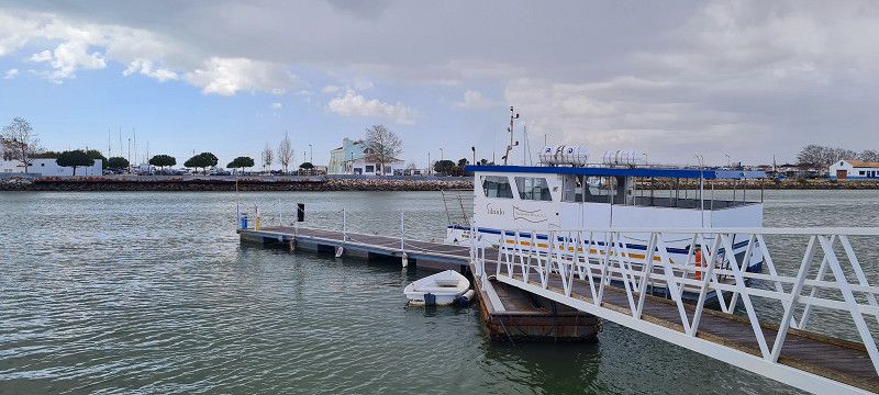
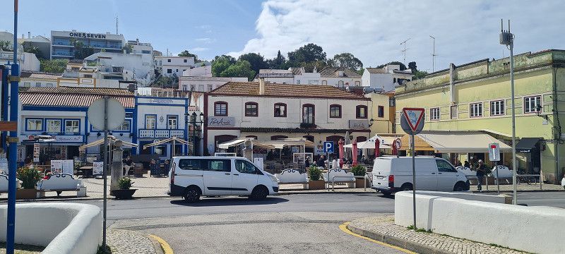
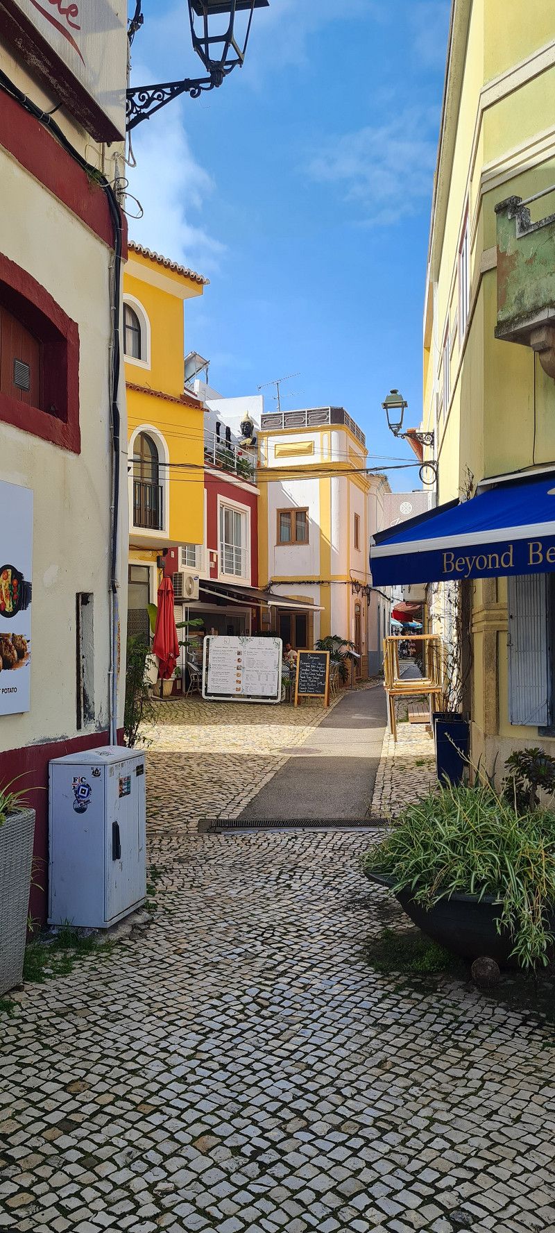
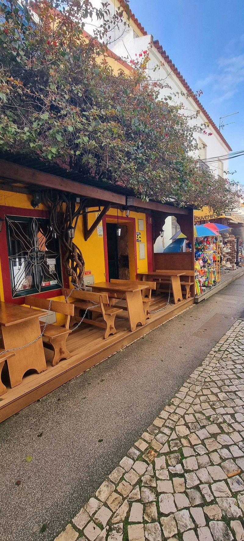
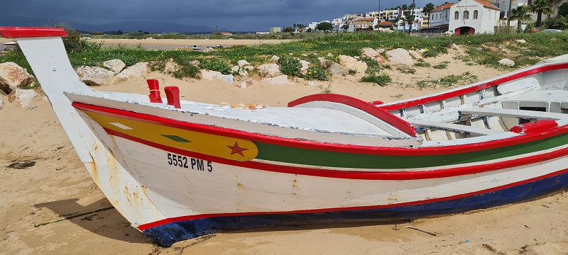
Day
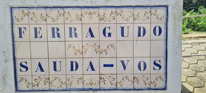
Ferragudo
Rua Doutor Luís António dos Santos, Ferragudo, Faro, Portugal
37° 7' 24.9" N 8° 31' 11.6" W
37.1235893 -8.5198921
• Head toward Urbanização da Cerca do Moinho on Rua Mouzinho de Albuquerque. Go for 62 m.
• Turn right onto Rua Mouzinho de Albuquerque. Go for 34 m.
• Take the 2nd exit from roundabout onto Urbanização da Cerca do Moinho. Go for 107 m.
• Continue on Rua Luís de Camões. Go for 61 m.
• Turn left onto Rua Luís de Camões. Go for 114 m.
• Turn right toward Rua da Hortinha/M530-1. Go for 89 m.
• Turn left onto Rua da Hortinha (M530-1). Go for 202 m.
• Continue on Largo do Regato (M530-1). Go for 39 m.
• Continue on Rua do Regato (M530-1). Go for 59 m.
• Continue on Rua Marechal Carmona (M530-1). Go for 60 m.
• Turn right toward Rua Afonso de Albuquerque. Go for 30 m.
• Turn left onto Rua Afonso de Albuquerque. Go for 110 m.
• Continue on Rua Infante Dom Henrique (M530-1). Go for 852 m.
• Take the 3rd exit from roundabout onto Rua Foz do Arade (M530-1). Go for 476 m.
• Take the 3rd exit from roundabout onto M530-1. Go for 196 m.
• Take the 2nd exit from roundabout onto N125. Go for 949 m.
• Continue on Rua Infante Dom Henrique (N125). Go for 72 m.
• Turn left onto Rua Serpa Pinto. Go for 208 m.
• Continue on Praça Visconde Bívar. Go for 98 m.
• Continue on Praça Manuel Teixeira Gomes. Go for 53 m.
• Continue on Largo 1 de Dezembro. Go for 40 m.
• Turn right onto Largo 1 de Dezembro. Go for 66 m.
• Turn left onto Largo 1 de Dezembro. Go for 40 m.
• Continue on Rua Direita. Go for 98 m.
• Turn left onto Travessa Caldeireiros. Go for 35 m.
• Turn slightly right onto Rua Doutor Bastos. Go for 11 m.
• Turn slightly left onto Largo 1 de Maio. Go for 33 m.
• Turn left onto Largo Heliodoro Salgado. Go for 81 m.
• Take the 1st exit from Largo Primeiro de Maio roundabout onto Largo Heliodoro Salgado. Go for 90 m.
• Continue on Rua Dom Carlos I. Go for 570 m.
• Take the 1st exit from roundabout onto Rua Dom Carlos I. Go for 251 m.
• Continue on Estrada da Rocha. Go for 668 m.
• Turn left onto Rua Simão Correia. Go for 350 m.
• Take the 3rd exit from roundabout onto Rua do Convento. Go for 426 m.
• Turn right onto Rua do Convento. Go for 343 m.
• Continue on Rua do Convento. Go for 29 m.
• Arrive at Rua do Convento. Your destination is on the right.
☍
7,0 km
( 15 min.)
Portimão
Faro, Portugal
37° 7' 43.7" N 8° 31' 51" W
37.1288097 -8.5308273
• Head southwest on Rua do Convento. Go for 369 m.
• Continue on Rua do Convento. Go for 375 m.
• Take the 1st exit from roundabout onto Rua Simão Correia. Go for 383 m.
• Turn right onto Estrada da Rocha. Go for 668 m.
• Continue on Rua Dom Carlos I. Go for 244 m.
• Take the 1st exit from roundabout onto Rua Gonçalo do Nascimento. Go for 59 m.
• Turn left onto Avenida Guanaré. Go for 493 m.
• Turn left onto Rua das Comunicações. Go for 101 m.
• Turn right onto Largo Heliodoro Salgado. Go for 71 m.
• Take the 1st exit from Largo Primeiro de Maio roundabout onto Rua Júdice Biker. Go for 129 m.
• Continue on Largo 1 de Dezembro. Go for 80 m.
• Continue on Praça Manuel Teixeira Gomes. Go for 53 m.
• Continue on Praça Visconde Bívar. Go for 98 m.
• Continue on Rua Serpa Pinto. Go for 208 m.
• Turn left onto Rua Infante Dom Henrique (N125). Go for 786 m.
• Continue on Largo Gil Eanes (N125). Go for 69 m.
• Continue on Estrada Monchique. Go for 358 m.
• Take the 1st exit from roundabout onto N124. Go for 46 m.
• Keep left toward N124. Go for 7 m.
• Continue on N124. Go for 686 m.
• Pass 3 roundabouts and continue on N124. Go for 2.6 km.
• Take the 2nd exit from roundabout onto A22 (Via Infante de Sagres) toward Faro/Lisboa/A2. Go for 31.0 km.
• Take exit 10 toward Lisboa/Messines onto A2 (Autoestrada do Sul). Go for 62.2 km.
• Take exit 12 toward Beja/Castro Verde onto IP2. Go for 48.7 km.
• Take the 2nd exit from roundabout onto IP2 toward Beja. Go for 940 m.
• Take the 3rd exit from roundabout onto IP2 toward Évora/Vidigueira. Go for 1.2 km.
• Take the 2nd exit from roundabout onto IP2 toward Évora/Vidigueira. Go for 1.9 km.
• Take the 2nd exit from roundabout onto IP2 toward Évora/Vidigueira/Aeroporto Base Aérea. Go for 2.3 km.
• Pass 5 roundabouts and continue on IP2. Go for 74.5 km.
• Take the 2nd exit from roundabout onto Rua Serpa Pinto toward Centro Rossio/Giraldo. Go for 99 m.
• Continue on Avenida da Gulbenkian. Go for 327 m.
• Turn right onto Rua da República. Go for 413 m.
• Continue on Praça do Giraldo. Go for 98 m.
• Arrive at Praça do Giraldo. Your destination is on the right.
☍
231,5 km
(2 hrs. 25 min.)
Day
Évora
Praça de Giraldo 16, Évora, Évora, Portugal
38° 34' 15.9" N 7° 54' 34.6" W
38.5710935 -7.9096004
• Head northwest on Praça do Giraldo. Go for 24 m.
• Continue on Rua Serpa Pinto. Go for 449 m.
• Turn right onto Avenida de Lisboa toward Espanha/A6/Estremoz/Redondo/Arraiolos. Go for 337 m.
• Pass 2 roundabouts and continue on Avenida de Lisboa. Go for 676 m.
• Take the 2nd exit from Largo da Porta de Aviz roundabout onto Avenida Dom Manuel Trindade Salgueiro toward Espanha/A6/Beja/Estremoz/Redondo. Go for 534 m.
• Take the 3rd exit from roundabout onto Avenida Lino de Carvalho (IP2) toward Espanha/A6/Estremoz. Go for 460 m.
• Take the 2nd exit from roundabout onto IP2 toward Espanha/Estremoz. Go for 465 m.
• Take the 2nd exit from roundabout onto IP2 toward Espanha/Estremoz/Canaviais. Go for 287 m.
• Turn right onto IP2 toward Espanha/A6/Estremoz. Go for 8.1 km.
• Turn left and take ramp onto A6 (Autoestrada do Alentejo Central) toward Estremoz/Espanha. Go for 42.1 km.
• Take exit 8 toward Alandroal/Borba onto N255. Go for 4.0 km.
• Turn left. Go for 1.5 km.
• Continue toward Rua Florbela Espanca/N255. Go for 40 m.
• Take the 2nd exit from roundabout onto Rua Florbela Espanca (N255). Go for 138 m.
• Arrive at Rua Florbela Espanca (N255). Your destination is on the right.
☍
59,1 km
( 38 min.)
Borba
EM 255, Borba, Évora, Portugal
38° 48' 8.8" N 7° 27' 2.9" W
38.8024523 -7.4508160
• Head northwest on Rua Florbela Espanca (N255). Go for 66 m.
• Take the 4th exit from roundabout onto Rua Florbela Espanca (N255). Go for 203 m.
• Continue straight ahead. Go for 34 m.
• Take the 2nd exit from roundabout. Go for 1.5 km.
• Turn right onto N255. Go for 3.3 km.
• Take left ramp onto A6 (Autoestrada do Alentejo Central) toward Espanha. Go for 41.6 km.
• Continue on A-5 (Autovía de Extremadura). Go for 7.2 km.
• Take exit 400 toward Badajoz/Cáceres onto N-523. Go for 1.5 km.
• Pass 3 roundabouts and continue on N-523. Go for 79.4 km.
• Keep right toward Salamanca. Go for 52 m.
• Take ramp onto A-66 (Autovía de la Plata). Go for 207 km.
• Take the 3rd exit from roundabout toward Vitigudino. Go for 999 m.
• Take the 1st exit from roundabout onto CL-517 toward Doñinos/Vitigudino. Go for 151 m.
• Keep right onto DSA-504. Go for 79 m.
• Continue on Carretera Santibáñez de Liébana (DSA-504). Go for 1.1 km.
• Continue on Carretera Santibáñez del Río (DSA-504). Go for 321 m.
• Turn right. Go for 80 m.
• Turn right. Go for 50 m.
• Turn right. Go for 401 m.
• Arrive at your destination on the left.
☍
344,7 km
(3 hrs. 13 min.)
19. Mar. 2025 -
20. Mar. 2025
21.ster Stopp Borba
Day
20. Mar. 2025 -
22. Mar. 2025
22.ster Stopp Salamanca
Day
Day
Doñinos De Salamanca
Calle Río Tormes, Doñinos De Salamanca, Salamanca, Spanien
40° 58' 11.4" N 5° 43' 43.8" W
40.9698462 -5.7288237
• Head north. Go for 182 m.
• Turn right. Go for 123 m.
• Turn left. Go for 154 m.
• Turn right toward Carretera Santibáñez del Río/DSA-504. Go for 24 m.
• Turn right onto Carretera Santibáñez del Río (DSA-504). Go for 321 m.
• Continue on Carretera Santibáñez de Liébana (DSA-504). Go for 1.1 km.
• Turn sharp right onto CL-517. Go for 375 m.
• Take the 3rd exit from Glorieta del Puerto de Aveiro roundabout onto CL-517. Go for 634 m.
• Take the 2nd exit from roundabout toward E-80/A-62/Valladolid/E-803/A-66/Cáceres/Zamora/Madrid/A-50/Salamanca (Sur). Go for 99 m.
• Continue on N-620. Go for 153 m.
• Take the 2nd exit from roundabout toward E-80/A-62/Valladolid/E-803/A-66/Cáceres/Zamora/Madrid/A-50/Salamanca (Sur). Go for 875 m.
• Keep left onto Calle El Castañar. Go for 102 m.
• Take the 1st exit from roundabout onto A-66 (Autovía Ruta de la Plata) toward Cáceres/A-50/Madrid. Go for 2.7 km.
• Take exit 343 toward SA-20/A-50/Ávila/Aeropuerto/Madrid/Salamanca/Aldeatejada. Go for 600 m.
• Take the 3rd exit from roundabout onto Ronda Sur de Salamanca (SA-20) toward N-630/E-803/A-66/Cáceres/Salamanca Centro Ciudad/Polígono Montalvo I y II/A-50/Ávila/Salamanca. Go for 2.4 km.
• Take the 2nd exit from roundabout onto Avenida Consejo de Europa (SA-20) toward A-50/Aeropuerto Matacán/Ávila/Madrid. Go for 1.3 km.
• Take the 2nd exit from roundabout onto A-50 (Autovía Ávila-Salamanca) toward Aeropuerto/Ávila/Madrid. Go for 3.2 km.
• Take exit 96 toward Pelabravo/Calvarrasa de Abajo/Sta. Marta de Tormes. Go for 449 m.
• Take the 2nd exit from roundabout onto N-501 toward A-50/Salamanca/Pelabravo/Calvarrasa de Abajo/Sta. Marta de Tormes. Go for 277 m.
• Take the 1st exit from roundabout onto N-501 toward Pelabravo/Calvarrasa de Abajo/Sta. Marta de Tormes. Go for 460 m.
• Take the 3rd exit from roundabout onto N-501a toward Santa Marta de Tormes. Go for 566 m.
• Continue on Carretera de Madrid (N-501a). Go for 883 m.
• Turn left. Go for 53 m.
• Arrive at your destination on the left.
☍
17,0 km
( 16 min.)
22. Mar. 2025 -
26. Mar. 2025
23.ster Stopp Salamanca 2. Teil
22. Mar. 2025 -
26. Mar. 2025
Camping Regio
Carretera Avila-Madrid KM.4, 37900, Santa Marta de Tormes/Salamanca, Spain
40° 56' 57.3" N 5° 36' 54.2" W
40.9492531 -5.6150612
• Head south. Go for 85 m.
• Turn left. Go for 19 m.
• Turn left. Go for 39 m.
• Turn right toward Avenida de Madrid/N-501a. Go for 101 m.
• Turn right onto Avenida de Madrid (N-501a). Go for 883 m.
• Continue on N-501a. Go for 454 m.
• Take the 2nd exit from roundabout onto N-501. Go for 457 m.
• Take the 1st exit from roundabout onto A-50 (Autovía Ávila-Salamanca) toward Salamanca. Go for 4.7 km.
• Take the 2nd exit from roundabout onto Carretera de Madrid (N-501). Go for 863 m.
• Turn right onto Puente Príncipe de Asturias. Go for 635 m.
• Take the 3rd exit from Glorieta Ciudad de Brujas Stad Brugge roundabout onto Paseo del Rector Esperabé. Go for 329 m.
• Turn right onto Calle Arroyo de Santo Domingo. Go for 278 m.
• Take the 2nd exit from roundabout onto Plaza de los Basilios. Go for 492 m.
• Turn left onto Calle Correhuela. Go for 157 m.
• Turn left onto Calle Pozo Amarillo. Go for 76 m.
• Arrive at Calle Pozo Amarillo. Your destination is on the right.
☍
9,6 km
( 12 min.)
Day
Salamanca
Plaza Mayor, Salamanca, Salamanca, Spanien
40° 57' 54.6" N 5° 39' 50.5" W
40.9651572 -5.6640182
• Head southwest on Calle Pozo Amarillo.
• Turn right onto Plaza del Mercado. Go for 40 m.
• Continue on Plaza de la Verdura. Go for 35 m.
• Continue on Plaza Poeta Iglesias. Go for 53 m.
• Turn left onto Plaza Poeta Iglesias. Go for 38 m.
• Continue on Calle de San Pablo. Go for 536 m.
• Turn right onto Paseo del Rector Esperabé. Go for 278 m.
• Continue on Calle Ribera del Puente. Go for 166 m.
• Continue on Paseo de San Gregorio. Go for 177 m.
• Continue on Calle de San Gregorio. Go for 112 m.
• Take the 3rd exit from roundabout onto Calle del Puente Sánchez Fabrés (N-630). Go for 343 m.
• Take the 1st exit from roundabout onto Avenida del Padre Ignacio Ellacuría. Go for 892 m.
• Take the 3rd exit from roundabout onto Paseo del Lunes de Aguas. Go for 389 m.
• Take the 1st exit from Paseo del Lunes de Aguas roundabout onto Avenida de Lasalle (N-630). Go for 456 m.
• Pass 3 roundabouts. Go for 1.7 km.
• Take ramp toward Portugal. Go for 649 m.
• Take the 2nd exit from roundabout onto A-62 (Autovía de Castilla) toward Portugal. Go for 111 km.
• Continue on A25 (Autoestrada Beiras Litoral e Alta). Go for 176 km.
• Take exit 7 toward Porto onto A1 (Autoestrada do Norte). Go for 52.3 km.
• Take the exit toward Valadares/Espinho onto A44 (Autoestrada de Vila Nova de Gaia). Go for 486 m.
• Keep left onto Autoestrada de Vila Nova de Gaia (A44) toward Madalena/Espinho/A29/Lisboa/(A8). Go for 445 m.
• Take ramp toward V.lar Paraiso/Madalena. Go for 339 m.
• Take the 1st exit from roundabout. Go for 173 m.
• Continue on Rua da Gândara. Go for 235 m.
• Continue on Rua Escola de Maninho. Go for 206 m.
• Take the 2nd exit from Largo Maninho roundabout onto Rua Escola de Maninho. Go for 263 m.
• Continue on Rua António Francisco de Sousa (M625-1). Go for 625 m.
• Continue on Largo da Cabine (M625-1). Go for 60 m.
• Continue on Avenida Gonçalo Ribeiro (M625-1). Go for 349 m.
• Continue on Rua do Loureiro. Go for 23 m.
• Turn right onto Rua do Rochio. Go for 94 m.
• Turn right onto Rua da Vinha. Go for 156 m.
• Turn left onto Rua da Panasqueira. Go for 114 m.
• Turn right onto Rua da Panasqueira. Go for 21 m.
• Arrive at Rua da Panasqueira. Your destination is on the right.
☍
348,2 km
(3 hrs. 39 min.)
Day
Day
Day
Madalena
R Panasqueira 116, Madalena, Distrikt Porto, Portugal
41° 6' 30.2" N 8° 38' 40.1" W
41.1083988 -8.6444590
• Head toward Travessa da Panasqueira on Rua da Panasqueira. Go for 21 m.
• Turn left onto Rua da Panasqueira. Go for 114 m.
• Turn right onto Rua da Vinha. Go for 156 m.
• Turn left onto Rua do Rochio. Go for 94 m.
• Turn right onto Rua do Loureiro. Go for 185 m.
• Turn right onto Rua do Talho. Go for 176 m.
• Turn left toward Rua do Cerro. Go for 360 m.
• Turn left onto Rua do Cerro. Go for 1.1 km.
• Turn right onto Rua 25 de Abril. Go for 250 m.
• Turn left onto Rua de Canide. Go for 118 m.
• Arrive at Rua de Canide.
☍
2,5 km
( 5 min.)
26. Mar. 2025 -
30. Mar. 2025
24.ster Stopp Madalena
Day
Madalena
R Canide 255, Madalena, Distrikt Porto, Portugal
41° 6' 32.1" N 8° 39' 52.8" W
41.1089262 -8.6646795
• Head toward Avenida Beira Mar on Rua de Canide. Go for 118 m.
• Turn right onto Rua 25 de Abril. Go for 250 m.
• Turn left onto Rua do Cerro. Go for 1.1 km.
• Turn left onto Avenida Poeta Eugénio de Andrade toward Porto/Centro V. N. Gaia/Afurada/Canidelo. Go for 638 m.
• Pass 2 roundabouts and continue on Avenida Poeta Eugénio de Andrade. Go for 1.4 km.
• Take the 2nd exit from roundabout onto Rua da Quinta do Fojo. Go for 393 m.
• Take the 1st exit from roundabout onto M627 toward Porto/Centro V. N. Gaia. Go for 263 m.
• Take the 3rd exit from roundabout onto Rua Particular do Fojo. Go for 232 m.
• Turn left and take ramp onto A1 (Autoestrada do Norte) toward Viana do Castelo/Braga/Porto. Go for 2.6 km.
• Take the exit toward Hospital/C.po Alegre onto Via Panorâmica Edgar Cardoso. Go for 890 m.
• Turn right onto Rua do Campo Alegre toward Baixa Centro. Go for 332 m.
• Turn right onto Rua do Bom Sucesso. Go for 114 m.
• Continue on Rua de Dom Pedro V. Go for 598 m.
• Turn right onto Alameda Basílio Teles toward Museu do Carro Eléctrico. Go for 718 m.
• Arrive at Rua do Ouro. Your destination is on the right.
☍
9,6 km
( 17 min.)
Day
Porto
Rua do Ouro 680, Porto, Distrikt Porto, Portugal
41° 8' 54.6" N 8° 38' 27.7" W
41.1485069 -8.6410368
Day