Day
Karlsruhe, Deutschland
49° 0' 24.8" N 8° 24' 13.1" E
49.0068901 8.4036527
• Follow the roundabout. Go for 64 m.
• Take the 3rd exit from roundabout onto Karl-Friedrich-Straße. Go for 128 m.
• Turn right onto Ettlinger-Tor-Platz. Go for 360 m.
• Turn left toward Karoline-Luise-Tunnel. Go for 167 m.
• Continue on Karoline-Luise-Tunnel. Go for 133 m.
• Turn right onto Karoline-Luise-Tunnel (B10). Go for 544 m.
• Turn left onto Brauerstraße (L605) toward dm-Arena. Go for 5.0 km.
• Continue on B3. Go for 740 m.
• Take ramp onto A5 toward Basel. Go for 182 km.
• Continue on A2. Go for 14.1 km.
• Keep right onto A2 (Verzweigung Augst) toward Chiasso/Gotthard/Luzern/Bern/Arisdorf. Go for 28.2 km.
• Take the left exit toward Chiasso/Gotthard/Luzern/Zürich/Rothrist onto A1/A2. Go for 8.8 km.
• Take exit 47 toward Chiasso/Gotthard/Luzern/Reiden onto A2 (Verzweigung Wiggertal). Go for 207 km.
• Take exit 49 toward Lugano Nord/Ponte Tresa/Aeroporto/Lugano. Go for 1.5 km.
• Take the 2nd exit from roundabout onto Autostrada Lugano-Centro toward Lugano. Go for 1.8 km.
• Take the 1st exit from roundabout onto Via Bioggio (401) toward Lugano/Massagno/Breganzona. Go for 1.3 km.
• Turn right onto Piazzale di Besso. Go for 61 m.
• Continue on Via Basilea. Go for 20 m.
• Continue on Piazzale di Besso. Go for 109 m.
• Continue on Via Sorengo. Go for 708 m.
• Continue on Via Ponte Tresa. Go for 201 m.
• Turn left onto Via Tassino. Go for 124 m.
• Turn left toward Via Tassino. Go for 47 m.
• Turn left onto Via Tassino. Go for 195 m.
• Arrive at Via Tassino.
☍
453,5 km
(4 hrs. 15 min.)
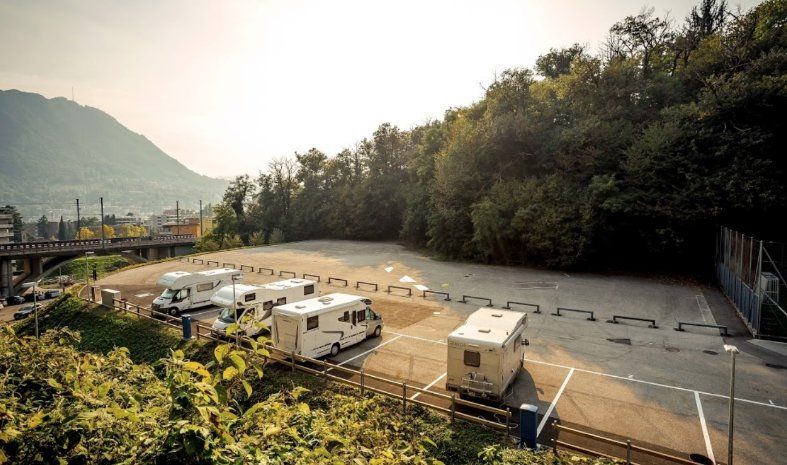
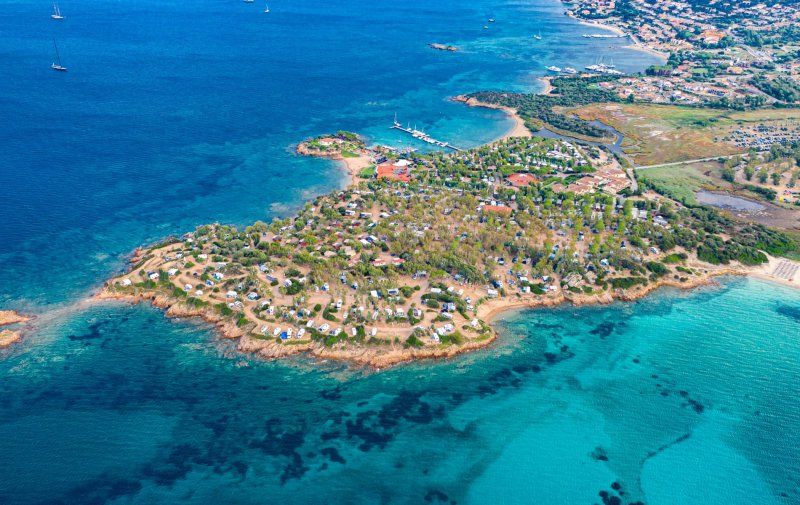
Lugano, Schweiz
Simple parking space as a stopover
Description:
https://www.campercontact.com/de/schweiz/tessin--ticino/lugano/60350/area-di-sosta-lugano
Via Tassino 27, 6900 Lugano, Schweiz
46° 0' 2.9" N 8° 56' 34.9" E
46.0008123 8.9430382
• Head west on Via Tassino. Go for 195 m.
• Turn right toward Via Tassino. Go for 47 m.
• Turn right onto Via Tassino. Go for 124 m.
• Turn left onto Via Ponte Tresa. Go for 542 m.
• Turn left onto Via Paradiso (399). Go for 1.1 km.
• Turn right onto Via Clemente Maraini (2). Go for 283 m.
• Turn right toward Lugano Sud. Go for 594 m.
• Continue on Lugano Sud toward Milano/Chiasso. Go for 25 m.
• Keep right toward Milano/Chiasso. Go for 82 m.
• Continue on Lugano Sud. Go for 95 m.
• Keep left onto Lugano Sud toward Milano/Chiasso. Go for 173 m.
• Continue on Lugano Sud. Go for 169 m.
• Take ramp onto A2 toward Milano/Chiasso. Go for 22.7 km.
• Continue on A9 (Autostrada dei Laghi). Go for 31.0 km.
• Take the left exit onto A8 (Autostrada dei Laghi). Go for 5.1 km.
• Take the exit toward E64/Torino/A4/Genova/A7/Bologna/A1 onto A50 (Tangenziale Ovest). Go for 20.5 km.
• Take the exit toward Genova onto A7 (Autostrada Milano-Genova). Go for 125 km.
• Keep left onto A12 (Autostrada Azzurra) toward Genova Est/Livorno. Go for 69.7 km.
• Take the exit toward Levanto. Go for 1.6 km.
• Turn left onto Via Levanto (SP566dir) toward Levanto/Monterosso/SS370/Bonassola/Cinque Terre. Go for 9.9 km.
• Take the 2nd exit from roundabout onto Via Nostra Signora della Guardia (SP566dir) toward Centro. Go for 564 m.
• Take the 4th exit from roundabout onto Strada Provinciale Albero d'Oro (SP43) toward Genova-Livorno/A12/Parma/A15/Carrodano/Monterosso/La Spezia. Go for 166 m.
• Turn left onto Località Albero d'Oro (SP43). Go for 50 m.
• Turn right toward Loc.Sella Mereti. Go for 42 m.
• Turn slightly left. Go for 158 m.
• Arrive at your destination on the left.
☍
289,8 km
(2 hrs. 59 min.)
Day
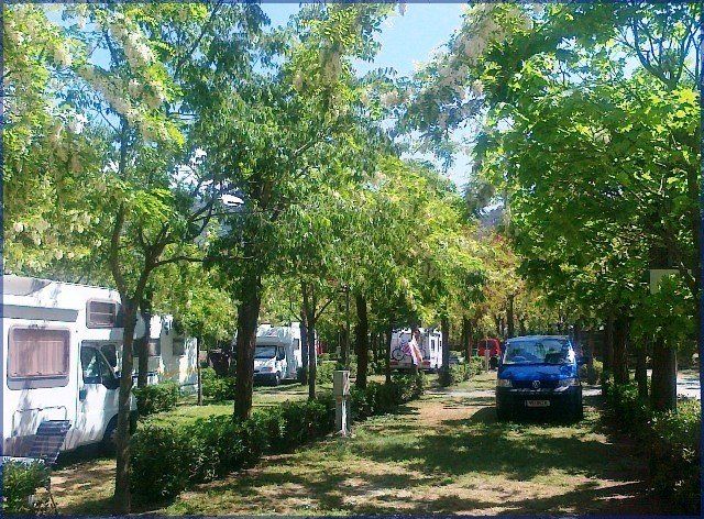
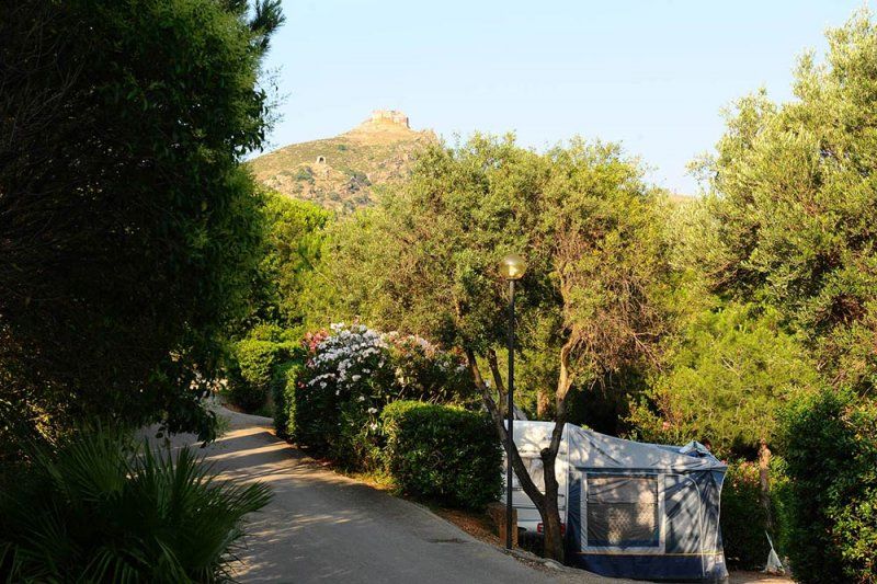
Camping Pian di Picche (Levanto)
Campsite as a start to visit the Quinte Terre
Train station 10mins. removed
Description:
https://www.tripadvisor.de/Hotel_Review-g580223-d6740404-Reviews-Camping_Pian_di_Picche-Levanto_Italian_Riviera_Liguria.html
Homepage:
https://www.piandipicche.it/ger/index.html
Alternative:
https://www.tripadvisor.de/Hotel_Review-g580223-d3313247-Reviews-Camping_Acqua_Dolce-Levanto_Italian_Riviera_Liguria.html
Camping Pian di Picche, Loc. Pian di Picche, 19015 Levanto SP, Italien
44° 10' 29.8" N 9° 37' 23.8" E
44.1749355 9.6232806
• Head northwest. Go for 200 m.
• Turn right onto Località Albero d'Oro (SP43). Go for 5.4 km.
• Continue toward SP38. Go for 28 m.
• Continue on SP38. Go for 119 m.
• Turn right onto Località Colle di Gritta. Go for 1.6 km.
• Continue on Località Molinelli. Go for 1.7 km.
• Continue on Via Padre Giovanni Semeria. Go for 868 m.
• Turn right onto Via Fegina. Go for 110 m.
• Turn right onto Via 4 Novembre. Go for 153 m.
• Arrive at Via 4 Novembre. Your destination is on the right.
☍
10,2 km
( 19 min.)
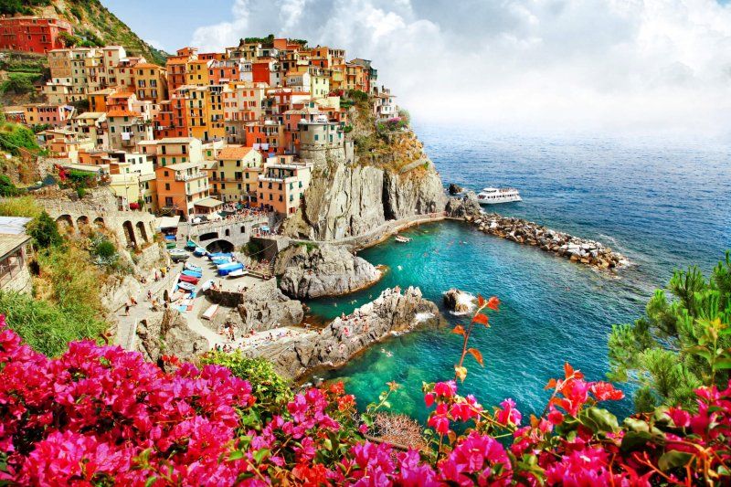
Quinte terre
UNESCO World Heritage Site
Travel report 1:
https: //www.reiseblitz.com/cin ...
Travel report 2:
https: //www.agriturismo.it/de / ...
Boat schedule:
https: //www.cinqueterre.eu.com ...
Train schedule:
https: //www.cinqueterre.eu.com ...
Via IV Novembre, 52, 19016 Monterosso al Mare SP, Italien
44° 8' 45.9" N 9° 38' 38" E
44.1460939 9.6438793
• Head toward Via Eugenio Montale on Via 4 Novembre. Go for 153 m.
• Turn left onto Via Fegina. Go for 110 m.
• Turn left onto Via Padre Giovanni Semeria. Go for 868 m.
• Continue on Località Molinelli. Go for 3.1 km.
• Turn slightly right onto Località Colle di Gritta. Go for 258 m.
• Turn left onto SP38. Go for 147 m.
• Continue on Località Piè di Legnaro (SP43). Go for 5.4 km.
• Turn right onto Strada Provinciale Albero d'Oro (SP43) toward Centro/Genova-Livorno/A12/Genova. Go for 139 m.
• Take the 1st exit from roundabout onto Via Nostra Signora della Guardia (SP566dir) toward Genova/Parma/A15/Genova-Livorno/A12/Carrodano/Montale. Go for 556 m.
• Take the 2nd exit from roundabout onto Località San Gottardo (SP566dir) toward A12/Autostrade/A15/Casella/Carrodano/Montale. Go for 9.9 km.
• Take ramp onto A12 (Autostrada Azzurra) toward Parma/A15/Livorno/E31. Go for 102 km.
• Take the exit toward Livorno onto A12 (Autostrada Azzurra). Go for 3.8 km.
• Take the exit toward Stagno/SS1. Go for 1.0 km.
• Take the 2nd exit from roundabout onto Strada Statale Aurelia (SS1) toward Livorno Centro. Go for 1.1 km.
• Take the 2nd exit from roundabout onto Via Firenze (SS1). Go for 1.3 km.
• Keep left onto Strada Statale Aurelia (SS1). Go for 318 m.
• Turn right onto Viale Genova (SP224). Go for 546 m.
• Continue on Via delle Cateratte. Go for 1.2 km.
• Continue on Via Guido Donegani. Go for 635 m.
• Take the 2nd exit from roundabout onto Via Andrea Costa. Go for 376 m.
• Take the 2nd exit from roundabout onto Calata Carrara. Go for 218 m.
• Continue on Piazzale dei Marmi. Go for 25 m.
• Arrive at Piazzale dei Marmi. Your destination is on the left.
☍
132,8 km
(1 hrs. 41 min.)
Day
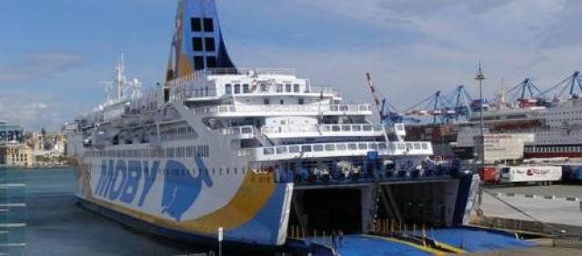
Fähre nach Sardinien (Livorno)
Stazione Marittima Calata Carrara, 57123, 57123 Livorno LI, Italien
43° 33' 19" N 10° 18' 9.6" E
43.5552772 10.3026690
• Head toward Piazza del Portuale on Piazzale dei Marmi. Go for 193 m.
• Turn right onto Calata Siena. Go for 135 m.
• Take the Livorno-Bastia Ferry. Stay on for 121 km.
• Head toward Quai Nord. Go for 230 m.
• Turn right toward Rue Chanoine Leschi. Go for 274 m.
• Take the 6th exit from roundabout toward Centre Ville/Ajaccio/Calvi/Bonifacio. Go for 249 m.
• Continue on Rue Chanoine Leschi. Go for 303 m.
• Keep left toward T11. Go for 207 m.
• Continue on T11. Go for 2.9 km.
• Keep left onto T11 toward Ajaccio/Bonifacio/Aéroport Poretta. Go for 1.7 km.
• Take the 2nd exit from roundabout onto Avenue Sampiero Corso (T11) toward Calvi/Ajaccio/Bonifacio/Aéroport Poretta. Go for 919 m.
• Keep left toward Avenue Sampiero Corso/T11. Go for 418 m.
• Continue on Avenue Sampiero Corso (T11). Go for 2.6 km.
• Pass 3 roundabouts and continue on T11. Go for 16.1 km.
• Take the 3rd exit from roundabout onto T10 toward Aléria. Go for 997 m.
• Pass 19 roundabouts and continue on T10. Go for 117 km.
• Take the 2nd exit from roundabout onto T10 toward Ajaccio/Bonifacio/Aéroport Figari. Go for 680 m.
• Take the 3rd exit from roundabout onto T10 toward Ajaccio/Bonifacio/Aéroport Figari. Go for 1.2 km.
• Pass 2 roundabouts and continue on T10. Go for 998 m.
• Turn right onto T10 toward Ajaccio/Bonifacio/Aéroport Figari. Go for 624 m.
• Pass 4 roundabouts and continue on T10. Go for 22.5 km.
• Take the 3rd exit from roundabout onto Avenue Sylver Bohn (T40) toward Bonifacio/Centre-Ville. Go for 2.2 km.
• Continue on Rue Sauveur-Paul Étienne. Go for 193 m.
• Continue on Quai Sott a Portigliola toward Gare Maritime. Go for 207 m.
• Take the Bonifacio-Santa Teresa di Gallura Ferry. Stay on for 18.2 km.
• Head southwest on SP161. Go for 96 m.
• Turn left onto SP161. Go for 455 m.
• Turn left onto Via Sandro Pertini. Go for 202 m.
• Turn right onto Via Aa17. Go for 845 m.
• Continue toward Strada Statale Santa Teresa-Ponte Liscia/SS133bis. Go for 52 m.
• Turn left onto Strada Statale Santa Teresa-Ponte Liscia (SS133bis). Go for 15.5 km.
• Continue on SS133 toward Palau Porto/Olbia. Go for 5.5 km.
• Take the 1st exit from roundabout onto Strada Statale Orientale Sarda (SS125) toward Olbia Porto/Aeroporto Olbia. Go for 10.8 km.
• Keep right onto Viale Costa Smeralda (SP115) toward Bassacutena/Circonvallazione/Olbia/Tempio/Arzachena. Go for 267 m.
• Turn left toward Circonvallazione/Olbia/Tempio. Go for 57 m.
• Continue on Circonvallazione Arzachena. Go for 1.7 km.
• Take the 2nd exit from roundabout onto Circonvallazione Arzachena (SP14) toward Olbia. Go for 915 m.
• Take the 2nd exit from roundabout onto Circonvallazione Arzachena (SP14). Go for 3.5 km.
• Take the 1st exit from roundabout onto Strada Statale Orientale Sarda (SS125) toward Aeroporto Olbia/Olbia Porto. Go for 13.8 km.
• Pass 2 roundabouts and continue on Strada Statale Orientale Sarda (SS125). Go for 6.5 km.
• Continue on Via Isola di Mezzo. Go for 540 m.
• Take the 1st exit from roundabout onto Via Isola di Mezzo. Go for 199 m.
• Take the 1st exit from roundabout onto Banchina Isola Bianca. Go for 65 m.
• Turn left onto Banchina Isola Bianca. Go for 184 m.
• Turn left onto Banchina Isola Bianca. Go for 6 m.
• Continue on Banchina Isola Bianca. Go for 74 m.
• Turn slightly right onto Banchina Isola Bianca. Go for 193 m.
• Turn right onto Banchina Isola Bianca. Go for 95 m.
• Arrive at Banchina Isola Bianca. Your destination is on the left.
☍
373,0 km
(8 hrs. 27 min.)
Fähre nach Sardinien (Olbia)
07026 Olbia, Sassari, Italien
40° 55' 25.3" N 9° 31' 19.7" E
40.9236870 9.5221424
• Head south on Banchina Isola Bianca. Go for 54 m.
• Turn right onto Banchina Isola Bianca. Go for 429 m.
• Take the 2nd exit from roundabout onto Via Isola di Mezzo. Go for 190 m.
• Take the 1st exit from roundabout onto Via Isola di Mezzo toward Olbia Centro. Go for 418 m.
• Keep left onto Via Isola di Mezzo toward Porto Cervo/S.Teresa di G./Palau/Arzachena/Portisco. Go for 351 m.
• Continue on Strada Statale Orientale Sarda (SS125). Go for 2.1 km.
• Take the 2nd exit from roundabout onto Strada Statale Orientale Sarda (SS125). Go for 4.1 km.
• Take the 2nd exit from roundabout onto Strada Statale Orientale Sarda (SS125) toward Arzachena/Palau/Olbia. Go for 13.9 km.
• Take the 2nd exit from roundabout onto Strada Statale Orientale Sarda (SS125) toward Cannigione/Arzachena/Palau. Go for 1.2 km.
• Keep right toward SP13. Go for 79 m.
• Turn right onto SP13. Go for 3.7 km.
• Continue on Via Nazionale (SP13). Go for 720 m.
• Continue on Via Nazionale (SP13). Go for 1.0 km.
• Turn slightly right onto Strada Comunale Cannigione-Saline (SP13). Go for 87 m.
• Continue on Strada Comunale Cannigione-Saline (SP13). Go for 916 m.
• Continue on Strada Comunale Cannigione-Saline (SP13). Go for 1.3 km.
• Turn right onto Località Isuledda. Go for 719 m.
• Turn left. Go for 73 m.
• Turn right. Go for 30 m.
• Turn left. Go for 42 m.
• Arrive at your destination on the left.
☍
31,5 km
( 41 min.)
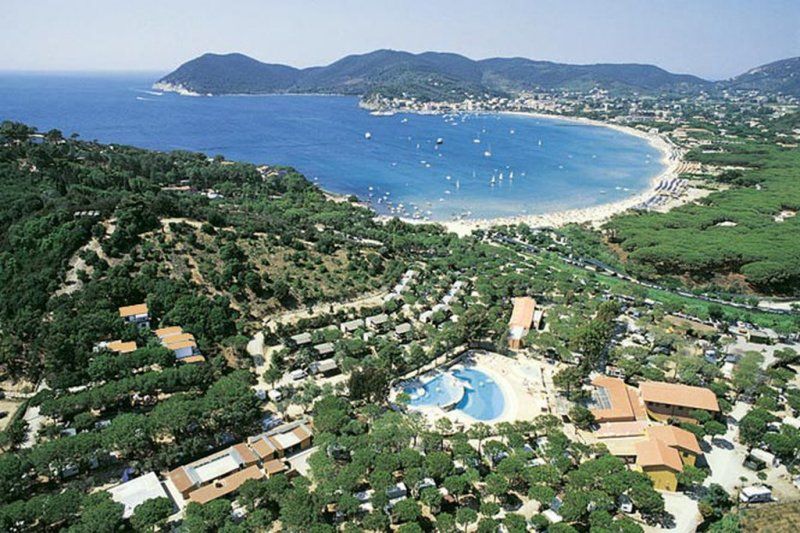
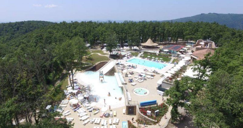
Camping Isuletta (Sardinien)
Description:
https://www.tripadvisor.de/Hotel_Review-g671579-d9596298-Reviews-Centro_Vacanze_Isuledda-Cannigione_Arzachena_Province_of_Olbia_Tempio_Sardinia.html
Homepage:
https://www.isuledda.it/de/
Ferienzentrum Isuledda, Località La Conia, 07021 Arzachena SS, Italien
41° 7' 58.5" N 9° 26' 33.3" E
41.1329260 9.4425911
• Head southwest. Go for 42 m.
• Turn right. Go for 30 m.
• Turn left. Go for 73 m.
• Turn right toward Località Isuledda. Go for 137 m.
• Continue on Località Isuledda. Go for 582 m.
• Turn left onto Strada Comunale Cannigione-Saline (SP13). Go for 412 m.
• Turn slightly right onto Via Monti Corru. Go for 449 m.
• Continue on Località La Conia. Go for 114 m.
• Take the 2nd exit from roundabout onto Via Monti Corru. Go for 959 m.
• Turn left onto Via Ischia. Go for 24 m.
• Continue on Via Sicilia. Go for 571 m.
• Turn slightly right onto Via Nazionale (SP13). Go for 1.3 km.
• Continue on SP13. Go for 3.8 km.
• Turn left onto SP13. Go for 46 m.
• Turn left onto Strada Statale Orientale Sarda (SS125). Go for 1.2 km.
• Continue toward Strada Statale Orientale Sarda/SS125. Go for 45 m.
• Take the 2nd exit from roundabout onto Strada Statale Orientale Sarda (SS125) toward Circonvallazione/Arzachena/Calangianus/Palau/S.Teresa/Aeroporto Olbia/Olbia Porto. Go for 13.9 km.
• Pass 2 roundabouts and continue on Strada Statale Orientale Sarda (SS125). Go for 6.2 km.
• Take ramp toward Tempio. Go for 226 m.
• Turn right onto Via Alessandro Nanni. Go for 576 m.
• Turn left onto Via Gabriele D'Annunzio. Go for 435 m.
• Turn left onto Via San Simplicio. Go for 117 m.
• Arrive at Via San Simplicio. Your destination is on the left.
☍
31,2 km
( 43 min.)
Day
Olbia, Italien
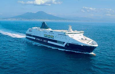
Grimaldi Lines
12:30 to 19:00
Via Canaglia, 6, 07026 Olbia SS, Italien
40° 55' 24.9" N 9° 29' 47.2" E
40.9235764 9.4964429
• Head toward Via Brigata Sassari on Via San Simplicio. Go for 117 m.
• Turn right onto Via Gabriele D'Annunzio. Go for 435 m.
• Turn right toward Via Alessandro Nanni. Go for 42 m.
• Continue on Via Alessandro Nanni. Go for 534 m.
• Turn right onto Viale Principe Umberto. Go for 23 m.
• Take the 3rd exit from roundabout onto Via Isola di Mezzo. Go for 707 m.
• Take the 1st exit from roundabout onto Via Isola di Mezzo. Go for 199 m.
• Take the 1st exit from roundabout onto Banchina Isola Bianca. Go for 622 m.
• Turn left onto Banchina Isola Bianca. Go for 18 m.
• Turn right onto Banchina Isola Bianca. Go for 51 m.
• Take the Olbia-Civitavecchia Ferry. Stay on for 233 km.
• Head northeast on Banchina Santa Fermina. Go for 308 m.
• Turn right onto Banchina Compagnia di Roma. Go for 76 m.
• Take the 2nd exit from roundabout. Go for 259 m.
• Take the 3rd exit from Calata Principe Tommaso roundabout onto Varco Amergio Vespucci. Go for 277 m.
• Take the 2nd exit from roundabout onto Raccordo Civitavecchia-Orte toward E80/A12/Roma/Grosseto/SS1. Go for 7.9 km.
• Take the 3rd exit from roundabout onto A12 (Autostrada Azzurra) toward Tarquinia/Grosseto/SS1. Go for 5.4 km.
• Take the exit toward Monte Romano onto SS1bis (Via Aurelia). Go for 412 m.
• Take the 2nd exit from roundabout onto Via Aurelia (SS1bis) toward Autostrada/A1/Monte Romano/Vetralla/Viterbo/Orte. Go for 15.9 km.
• Turn right toward Raccordo Civitavecchia-Orte/SS675. Go for 390 m.
• Continue on Raccordo Civitavecchia-Orte (SS675). Go for 18.2 km.
• Continue on Strada Statale Umbro-Laziale (SS675). Go for 7.7 km.
• Take ramp onto Strada Regionale Cassia (SR2) toward Cassia/SS2/Montefiascone/Zona Industriale Localita Poggino. Go for 560 m.
• Take the 1st exit from roundabout onto Via Cassia (SR2). Go for 12.8 km.
• Continue on Via Orvietana. Go for 455 m.
• Continue on Via Grazie. Go for 207 m.
• Turn left onto Via Santa Maria delle Grazie toward Bolsena/Siena. Go for 268 m.
• Continue on Via Cardinal Salotti. Go for 680 m.
• Turn right onto Via Cassia toward Bolsena/Acquapendente/Siena. Go for 12.0 km.
• Turn left onto Località Pietre Lanciate. Go for 227 m.
• Arrive at Località Pietre Lanciate. Your destination is on the right.
☍
319,3 km
(7 hrs. 31 min.)
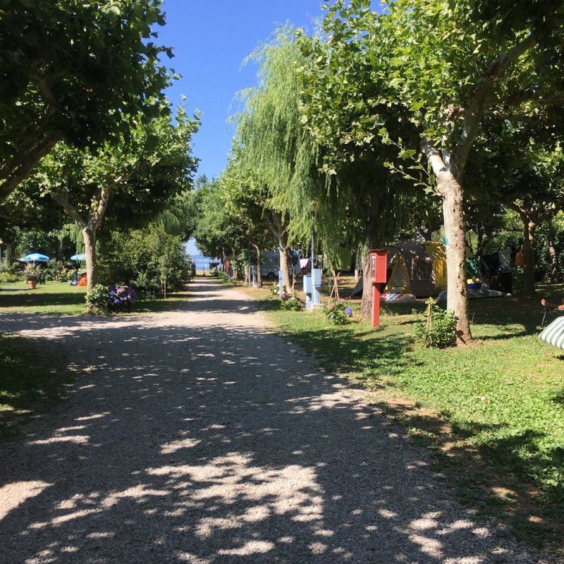
Camping blue (Lago di Bolsena)
Campsite right on Lake Bolsena
Description:
https: //www.tripadvisor.de/Hot ...
Homepage:
https: //www.blucamping.it/de/s ...
Alternative:
https: //massimo.info/de/campin ...
SR2, 01023 Bolsena VT, Italien
42° 37' 53" N 11° 59' 40.9" E
42.6314000 11.9946912
• Head toward Strada Regionale Cassia on Località Pietre Lanciate. Go for 227 m.
• Turn right onto Strada Regionale Cassia (SR2). Go for 12.0 km.
• Keep right onto Via Cassia toward Viterbo. Go for 1.0 km.
• Keep left onto Via Casa Vecchia. Go for 217 m.
• Turn right onto Strada Regionale Cassia (SR2). Go for 12.7 km.
• Take the 2nd exit from roundabout onto Via Cassia (SR2). Go for 503 m.
• Take ramp onto Strada Statale Umbro-Laziale (SS675) toward Orte/Milano-Napoli/A1. Go for 7.5 km.
• Take ramp toward Vitorchiano/Ortana/SS204/Bagnaia. Go for 343 m.
• Turn left onto Via della Stazione (SP21) toward Ortana/SS204/Bagnaia. Go for 1.2 km.
• Turn left onto Strada Provinciale Ortana. Go for 7.6 km.
• Turn left onto Strada Provinciale Bomarzese (SP20). Go for 2.4 km.
• Continue on Via Camillo Benso di Cavour. Go for 202 m.
• Continue on Via Roma. Go for 265 m.
• Continue on Corso Meonia. Go for 114 m.
• Turn right onto Piazza Giacomo Matteotti. Go for 19 m.
• Continue on Via Guglielmo Marconi. Go for 454 m.
• Turn left toward Via del Porto Rio. Go for 371 m.
• Continue on Via del Porto Rio. Go for 175 m.
• Turn slightly right onto Via Madonna della Valle. Go for 11 m.
• Turn slightly right toward Strada della Croce. Go for 238 m.
• Turn right onto Strada della Croce. Go for 251 m.
• Turn left. Go for 26 m.
• Arrive at your destination on the right.
☍
48,0 km
( 46 min.)
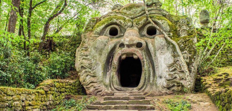
Park der Ungeheuer (Bomarzo)
Park with sculptures
Description:
https://www.tripadvisor.de/Attraction_Review-g815535-d242598-Reviews-Parco_dei_Mostri-Bomarzo_Province_of_Viterbo_Lazio.html
Opening times: 8:30 a.m. - 7:00 p.m.
Via del Porto Rio, 6, 01020 Bomarzo VT, Italien
42° 29' 30" N 12° 14' 51.3" E
42.4916599 12.2475933
• Head southeast. Go for 26 m.
• Turn right toward Strada della Croce. Go for 165 m.
• Continue on Strada della Croce. Go for 86 m.
• Turn left toward Via Madonna della Valle. Go for 238 m.
• Turn slightly left onto Via Madonna della Valle. Go for 11 m.
• Turn slightly left onto Via del Porto Rio. Go for 546 m.
• Turn left onto Strada Provinciale Bomarzese (SP20). Go for 3.1 km.
• Turn sharp left onto Strada Provinciale Valle del Tevere (SP19). Go for 7.3 km.
• Turn sharp left onto Strada Provinciale Grottana (SP18). Go for 12.7 km.
• Turn right onto Strada Provinciale Teverina (SP5). Go for 837 m.
• Turn left onto Strada Fastello (SP127). Go for 7.7 km.
• Turn left toward Via Santa Maria delle Grazie. Go for 90 m.
• Turn right onto Via Santa Maria delle Grazie toward Bolsena/Siena. Go for 270 m.
• Continue on Via Cardinal Salotti. Go for 680 m.
• Turn right onto Via Cassia toward Bolsena/Acquapendente/Siena. Go for 12.0 km.
• Turn left onto Località Pietre Lanciate. Go for 227 m.
• Arrive at Località Pietre Lanciate. Your destination is on the right.
☍
46,0 km
( 44 min.)
Camping blue (Lago di Bolsena)
Campsite right on Lake Bolsena
Description:
https: //www.tripadvisor.de/Hot ...
Homepage:
https: //www.blucamping.it/de/s ...
Alternative:
https: //massimo.info/de/campin ...
SR2, 01023 Bolsena VT, Italien
42° 37' 53" N 11° 59' 40.9" E
42.6314000 11.9946912
• Head toward Località Montesegnale on Località Pietre Lanciate. Go for 227 m.
• Turn left onto Strada Regionale Cassia (SR2). Go for 1.6 km.
• Turn right toward Piazza Giacomo Matteotti. Go for 43 m.
• Continue on Piazza Giacomo Matteotti. Go for 4.6 km.
• Continue on Strada Provinciale Capraccia (SP54). Go for 5.7 km.
• Turn right onto Strada Provinciale Divino Amore (SP135). Go for 1.7 km.
• Continue on Via Divino Amore. Go for 934 m.
• Continue on Viale Armando Diaz (SP6). Go for 129 m.
• Take the 1st exit from roundabout onto Piazza Trento e Trieste. Go for 42 m.
• Turn left onto Piazza Porta Albana. Go for 50 m.
• Continue on Via Roma. Go for 246 m.
• Continue on Piazza Camillo Benso di Cavour. Go for 51 m.
• Continue on Corso Vittorio Emanuele. Go for 270 m.
• Continue on Piazza Sant'Agostino. Go for 80 m.
• Continue on Largo Donatori di Sangue. Go for 29 m.
• Continue on Viale Alfonso e Giovanni Agosti. Go for 262 m.
• Continue toward Via Bonaventura Tecchi. Go for 115 m.
• Turn right onto Via Bonaventura Tecchi. Go for 507 m.
• Arrive at Via Bonaventura Tecchi.
☍
16,6 km
( 22 min.)
Day
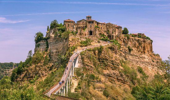
Civita di Bagnoregio
City on rock plateau
Description:
https: //www.tripadvisor.de/Att ...
Via S. Maria del Cassero, 36, 01030 Bagnoregio VT, Italien
42° 37' 39.3" N 12° 6' 46.9" E
42.6275754 12.1130386
• Head west on Via Bonaventura Tecchi. Go for 507 m.
• Turn left toward Viale Alfonso e Giovanni Agosti. Go for 115 m.
• Continue on Viale Alfonso e Giovanni Agosti. Go for 262 m.
• Continue on Largo Donatori di Sangue. Go for 29 m.
• Continue on Piazza Sant'Agostino. Go for 80 m.
• Turn right onto Via Fidanza. Go for 432 m.
• Turn right onto Viale P. Diego da Castel Cellesi. Go for 96 m.
• Turn left onto SP6. Go for 37 m.
• Continue on Strada Provinciale Bagnorese (SP6). Go for 204 m.
• Continue toward Piazza Trento e Trieste/SP6. Go for 10 m.
• Take the 1st exit from roundabout onto Viale Armando Diaz (SP6). Go for 142 m.
• Turn right toward Via Divino Amore. Go for 203 m.
• Continue on Via Divino Amore. Go for 731 m.
• Continue on Strada Provinciale Divino Amore (SP135). Go for 1.7 km.
• Turn left onto Strada Provinciale Capraccia (SP54). Go for 5.7 km.
• Continue on Strada Provinciale Bolsenese (SP53). Go for 4.7 km.
• Turn left onto Strada Regionale Cassia (SR2). Go for 1.6 km.
• Turn right onto Località Pietre Lanciate. Go for 227 m.
• Arrive at Località Pietre Lanciate. Your destination is on the right.
☍
16,7 km
( 23 min.)
Camping blue (Lago di Bolsena)
Campsite right on Lake Bolsena
Description:
https://www.tripadvisor.de/Hotel_Review-g194693-d3166040-Reviews-Blu_International_Camping-Bolsena_Province_of_Viterbo_Lazio.html
Homepage:
https: //www.blucamping.it/de/s ...
Alternative:
https: //massimo.info/de/campin ...
SR2, 01023 Bolsena VT, Italien
42° 37' 53" N 11° 59' 40.9" E
42.6314000 11.9946912
• Head toward Località Montesegnale on Località Pietre Lanciate. Go for 227 m.
• Turn left onto Strada Regionale Cassia (SR2). Go for 8.3 km.
• Turn left onto Strada Provinciale di Gradoli (SP145) toward Gradoli/Grotte di Castro. Go for 4.9 km.
• Continue on Via Roma. Go for 377 m.
• Turn right onto Via Indipendenza. Go for 74 m.
• Continue on Piazza Guglielmo Marconi. Go for 263 m.
• Continue on Strada Provinciale di Gradoli (SP145). Go for 1.5 km.
• Turn left onto Strada Statale Maremmana (SS74). Go for 972 m.
• Turn left onto Strada Statale Castrense (SS312). Go for 36.8 km.
• Take the 1st exit from roundabout onto Strada Statale Castrense (SS312). Go for 3.6 km.
• Take ramp onto Via Aurelia (SS1) toward Grosseto/Piombino. Go for 14.5 km.
• Take ramp toward Chiarone S./Pescia Fiorentina. Go for 208 m.
• Turn left onto Strada Pescia Fiorentina Chiarone (SP75). Go for 1.1 km.
• Turn left toward Strada Garavicchio. Go for 41 m.
• Continue on Strada Garavicchio. Go for 150 m.
• Turn right. Go for 30 m.
• Arrive at your destination on the right.
☍
73,0 km
( 59 min.)
Day
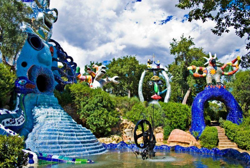
Tarot Garten (Pescia)
Colorful park in the style of Park Güell
Description:
https://www.tripadvisor.de/Attraction_Review-g12196920-d246545-Reviews-Giardino_dei_Tarocchi-Pescia_Fiorentina_Capalbio_Province_of_Grosseto_Tuscany.html
Homepage:
http://ilgiardinodeitarocchi.it/de/
Opening times: 2.30 p.m. to 7.30 p.m.
Str. Garavicchio, 2, 58011 Pescia Fiorentina GR, Italien
42° 25' 29.5" N 11° 28' 5.4" E
42.4248506 11.4681575
• Head toward Strada Garavicchio. Go for 30 m.
• Turn left onto Strada Garavicchio. Go for 191 m.
• Turn right onto Strada Pescia Fiorentina Chiarone (SP75). Go for 1.1 km.
• Take ramp onto Via Aurelia (SS1) toward Grosseto. Go for 28.8 km.
• Take ramp. Go for 389 m.
• Turn right toward Via Campo Regio. Go for 160 m.
• Continue on Via Campo Regio. Go for 447 m.
• Turn left. Go for 60 m.
• Arrive at your destination.
☍
31,1 km
( 22 min.)
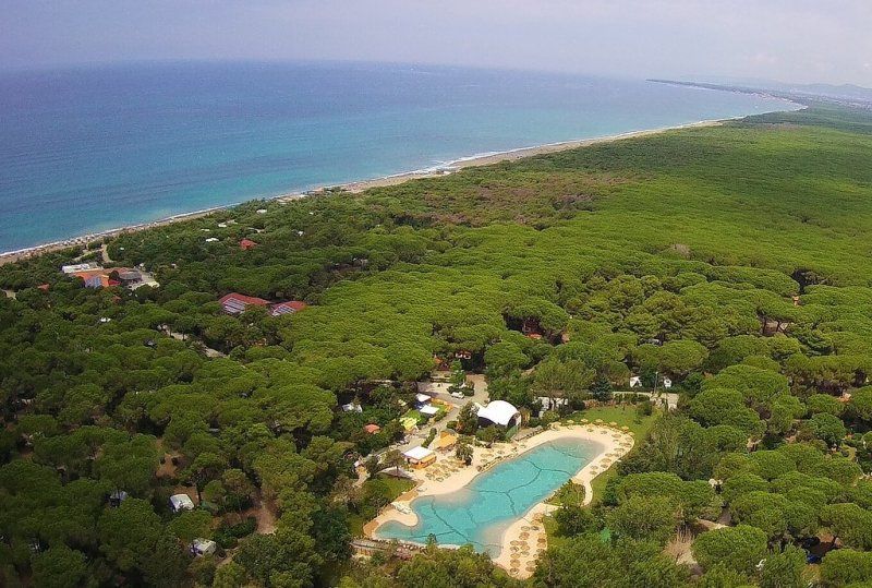
Camping Voltoncino
Camping under trees by the sea
Description:
https://www.tripadvisor.de/Hotel_Review-g1087254-d3577095-Reviews-Camping_Village_Voltoncino-Albinia_Orbetello_Province_of_Grosseto_Tuscany.html
Homepage:
https://www.voltoncino.it/it/
Strada Statale 1, 203, 58015 Albinia GR, Italien
42° 31' 39.2" N 11° 11' 16.2" E
42.5275494 11.1878333
• Head toward Via Campo Regio. Go for 60 m.
• Turn right onto Via Campo Regio. Go for 607 m.
• Turn left and take ramp onto Strada Statale Aurelia (SS1) toward Grosseto. Go for 24.6 km.
• Take ramp onto Via Aurelia Santa Maria toward Grosseto Sud. Go for 3.5 km.
• Keep left onto Via Aurelia Sud toward Livorno. Go for 77 m.
• Take the 3rd exit from roundabout onto Strada Provinciale delle Collacchie (SP158). Go for 492 m.
• Take the 1st exit from roundabout onto Via Andrea del Sarto (SP158). Go for 1.1 km.
• Continue toward Via Andrea del Sarto/SP158. Go for 24 m.
• Take the 2nd exit from roundabout onto Via Andrea del Sarto (SP158). Go for 280 m.
• Pass 4 roundabouts and continue on Via Fratelli Cervi (SP3). Go for 19.3 km.
• Turn left onto Via 4 Novembre. Go for 98 m.
• Turn left onto Via Amerigo Vespucci. Go for 107 m.
• Continue on Via Cristoforo Colombo (SP158). Go for 11.8 km.
• Turn left toward Strada Provinciale Punta Ala/SP61. Go for 60 m.
• Continue on Strada Provinciale Punta Ala (SP61). Go for 6.6 km.
• Take the 1st exit from roundabout onto Strada Provinciale Punta Ala (SP61). Go for 419 m.
• Take the 1st exit from roundabout onto Via della Molletta. Go for 91 m.
• Turn left onto Via della Molletta. Go for 372 m.
• Turn left toward Via del Pozzino. Go for 36 m.
• Turn right onto Via del Pozzino. Go for 382 m.
• Turn left onto Via del Tennis. Go for 107 m.
• Turn right onto Via del Tennis. Go for 272 m.
• Turn right onto Via del Minigolf. Go for 133 m.
• Arrive at Via del Minigolf.
☍
70,5 km
(1 hrs. 9 min.)
Day
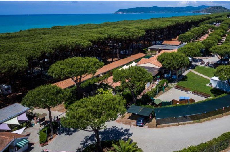
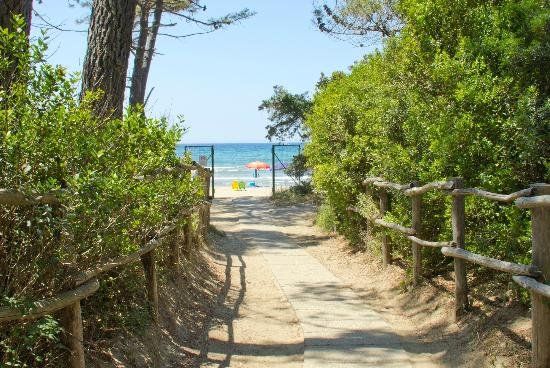
Camping Baia Verde (Punta Ala)
Campsite under trees by the sea
Description:
https://www.tripadvisor.de/Hotel_Review-g194733-d2299226-Reviews-Camping_Baia_Verde-Castiglione_Della_Pescaia_Province_of_Grosseto_Tuscany.html#REVIEWS
Homepage:
https://www.baiaverde.com/
Via della Dogana, 58043 Punta Ala GR, Italien
42° 48' 23.9" N 10° 45' 19.8" E
42.8066393 10.7555021
• Head west on Via del Minigolf. Go for 133 m.
• Turn left onto Via del Tennis. Go for 272 m.
• Turn left onto Via del Tennis. Go for 107 m.
• Turn right onto Via del Pozzino. Go for 382 m.
• Turn left toward Via della Molletta. Go for 36 m.
• Turn right onto Via della Molletta. Go for 372 m.
• Turn right onto Via della Molletta. Go for 54 m.
• Take the 4th exit from roundabout onto Via del Porto (SP61). Go for 516 m.
• Take the 2nd exit from roundabout onto Strada Provinciale Punta Ala (SP61). Go for 6.7 km.
• Turn left onto Strada Provinciale delle Collacchie (SP158). Go for 9.0 km.
• Turn right onto Via Lago Maggiore. Go for 115 m.
• Turn left onto Via Lago di Bracciano. Go for 567 m.
• Take the 3rd exit from roundabout onto Viale Europa. Go for 731 m.
• Take the 2nd exit from roundabout onto Viale Europa. Go for 362 m.
• Take the 1st exit from roundabout onto Via Litoranea. Go for 50 m.
• Take the 2nd exit from roundabout onto Via Giacomo Leopardi. Go for 475 m.
• Take the 3rd exit from roundabout onto Via Giovanni Amendola. Go for 295 m.
• Pass 2 roundabouts and continue on Via Giovanni Amendola. Go for 492 m.
• Take the 3rd exit from roundabout onto Via Giovanni Amendola. Go for 157 m.
• Take the 2nd exit from roundabout onto Via Ugo Bassi. Go for 244 m.
• Take the 2nd exit from roundabout onto Via Ugo Bassi. Go for 340 m.
• Turn slightly right onto Via Ugo Bassi. Go for 41 m.
• Turn left onto Via Aurelia (SP152). Go for 3.0 km.
• Take the 1st exit from roundabout onto Via Aurelia (SP152). Go for 4.8 km.
• Take the 3rd exit from roundabout. Go for 189 m.
• Continue toward Strada della Base Geodetica. Go for 60 m.
• Take the 2nd exit from roundabout onto Strada della Base Geodetica toward Piombino/Loc. Perelli. Go for 9.6 km.
• Continue on Strada Provinciale Fiorentina-Montegemoli (SP23bis). Go for 1.3 km.
• Keep left onto Strada Provinciale Fiorentina-Montegemoli (SP23bis). Go for 214 m.
• Continue on Strada Provinciale della Principessa (SP23). Go for 203 m.
• Keep right onto Località Asca (SP23). Go for 1.0 km.
• Take the 2nd exit from roundabout onto Località Gagno (SP23). Go for 994 m.
• Continue on Viale dell'Unità d'Italia. Go for 365 m.
• Pass 2 roundabouts and continue on Viale dell'Unità d'Italia. Go for 1.8 km.
• Turn left onto Viale della Resistenza. Go for 398 m.
• Continue on Via Felice Cavallotti. Go for 154 m.
• Take the 1st exit from roundabout onto Via Portovecchio. Go for 139 m.
• Take the 2nd exit from roundabout onto Via Portovecchio. Go for 867 m.
• Take the 1st exit from roundabout onto Via Portovecchio. Go for 154 m.
• Arrive at Via Portovecchio. Your destination is on the right.
☍
46,7 km
(1 hrs. 1 min.)
Fähre nach Elba (Piombino)
Ferry to Elba
Travel times: 5:30 a.m. to 10 p.m. every 30 minutes. Or less
https://www.infoelba.net/ankommen-sich-fortbewegen/wie-man-ankommt/faehren/buchung/
Price: 60-90 €
Via della Ferriera, 37, 57025 Piombino LI, Italien
42° 55' 50.4" N 10° 32' 34.1" E
42.9306543 10.5428101
• Head southeast on Via Portovecchio. Go for 159 m.
• Continue on Piazzale Premuda. Go for 131 m.
• Turn left. Go for 20 m.
• Turn left. Go for 75 m.
• Take the Piombino-Rio Marina Ferry. Stay on for 18.8 km.
• Head toward Via Scappini on Calata dei Voltoni. Go for 400 m.
• Continue on Lungomare Guglielmo Marconi. Go for 72 m.
• Continue on Calata dei Voltoni. Go for 29 m.
• Turn left onto Strada Provinciale Bivio Boni Cavo (SP26). Go for 1.2 km.
• Turn left onto Villaggio Palmiro Togliatti (SP26). Go for 649 m.
• Turn left onto Strada Provinciale Bivio Boni Cavo (SP26). Go for 1.2 km.
• Take the 2nd exit from roundabout onto Via del Volterraio (SP32). Go for 6.2 km.
• Turn right onto Strada Provinciale Schiopparello Magazzini Bagnaia (SP28). Go for 142 m.
• Turn right. Go for 84 m.
• Arrive at your destination on the right.
☍
29,1 km
(1 hrs. 18 min.)
Rosselba Le Palme (Elba)
Campsite on the south side of Elba
Description:
https://www.tripadvisor.de/Hotel_Review-g194861-d1166136-Reviews-Camping_Village_Rosselba_le_Palme-Portoferraio_Elba_Island_Province_of_Livorno_Tuscany.html
Homepage:
https://www.rosselbalepalme.it/
Localita Ottone, 3, 57037 Portoferraio LI, Italien
42° 48' 4.2" N 10° 21' 54.6" E
42.8011630 10.3651710
• Head toward Strada Provinciale Schiopparello Magazzini Bagnaia. Go for 84 m.
• Turn left onto Strada Provinciale Schiopparello Magazzini Bagnaia (SP28). Go for 142 m.
• Turn right onto Strada Provinciale Schiopparello Magazzini Bagnaia (SP28). Go for 3.5 km.
• Take the 2nd exit from roundabout onto Strada Provinciale Bivio Boni Cavo (SP26). Go for 2.8 km.
• Turn right onto Via Norsi (SP30). Go for 4.1 km.
• Take the 3rd exit from roundabout onto Via del Margidore (SP30). Go for 9.0 km.
• Turn left onto Via della Foce. Go for 81 m.
• Turn slightly left. Go for 16 m.
• Arrive at your destination on the right.
☍
19,7 km
( 28 min.)
Day
Ville degli Ulivi (Elba)
Campsite on the south side of Elba
Description:
https://www.tripadvisor.de/Hotel_Review-g194708-d1817213-Reviews-Camping_Ville_degli_Ulivi-Marina_di_Campo_Elba_Island_Province_of_Livorno_Tuscany.html
Homepage:
https://www.villedegliulivi.it/
Ville degli Ulivi, Via della Foce, 89, 57034 Marina di Campo LI, Italien
42° 45' 6.9" N 10° 14' 41.9" E
42.7519181 10.2449669
• Head toward Via della Foce. Go for 16 m.
• Turn slightly right onto Via della Foce. Go for 81 m.
• Turn left onto Via del Monumento (SP30). Go for 583 m.
• Take the 2nd exit from roundabout onto Via per Portoferraio (SP25). Go for 4.1 km.
• Turn right onto Strada Provinciale Bivio Boni Procchio (SP24). Go for 8.0 km.
• Take the 2nd exit from roundabout onto Strada Provinciale Portoferraio Bivio Boni (SP24). Go for 828 m.
• Pass 2 roundabouts and continue on Viale T. Tesei (SP24). Go for 976 m.
• Take the 1st exit from roundabout onto Viale T. Tesei (SP24). Go for 199 m.
• Turn right onto Banchina Capitano Vezio Dini (SP24). Go for 57 m.
• Take the Piombino-Portoferraio Ferry. Stay on for 26.9 km.
• Head southwest. Go for 95 m.
• Turn right onto Piazzale Premuda. Go for 131 m.
• Continue on Via Portovecchio. Go for 283 m.
• Take the 3rd exit from roundabout onto Via Portovecchio. Go for 887 m.
• Take the 1st exit from roundabout onto Via Portovecchio. Go for 125 m.
• Take the 1st exit from roundabout onto Via Felice Cavallotti. Go for 182 m.
• Continue on Viale della Resistenza. Go for 323 m.
• Turn right onto Viale dell'Unità d'Italia. Go for 850 m.
• Pass 2 roundabouts and continue on Viale dell'Unità d'Italia. Go for 1.3 km.
• Continue on Strada Provinciale della Principessa (SP23). Go for 951 m.
• Take the 2nd exit from roundabout onto Località Gagno (SP23). Go for 1.2 km.
• Keep right onto Strada Provinciale Fiorentina-Montegemoli (SP23bis) toward Venturina/S.G.C. Roma-Livorno. Go for 1.6 km.
• Turn left and take ramp onto Strada Statale della Val di Cornia (SS398) toward Venturina/Livorno/SS1/Roma. Go for 6.5 km.
• Take ramp onto Strada Statale Aurelia (SS1) toward Livorno. Go for 20.3 km.
• Take ramp toward Donoratico. Go for 719 m.
• Continue toward Strada Marina di Castagneto/SP17. Go for 35 m.
• Take the 1st exit from roundabout onto Strada Marina di Castagneto (SP17) toward Aurelia/SP39/Castagneto C./Sassetta. Go for 442 m.
• Turn left onto Strada Provinciale Vecchia Aurelia (SP39). Go for 8.1 km.
• Take the 3rd exit from roundabout onto Strada Provinciale dei Melograni (SP15bis). Go for 563 m.
• Pass 2 roundabouts and continue on Via dei Melograni (SP15bis). Go for 1.0 km.
• Turn right onto Via dei Cavalleggeri Nord. Go for 138 m.
• Continue on Via dei Cavalleggeri Nord. Go for 48 m.
• Continue on Via dei Cavalleggeri Nord. Go for 109 m.
• Continue on Piazza degli Oleandri. Go for 31 m.
• Continue on Via dei Cavalleggeri Nord. Go for 462 m.
• Arrive at Via dei Cavalleggeri Nord.
☍
88,1 km
(2 hrs. 15 min.)
Camping Le Esperidi (Linorvo)
Campsite ...
Description:
https://www.tripadvisor.de/Hotel_Review-g1097276-d1168868-Reviews-Le_Esperidi_Village-Marina_di_Bibbona_Province_of_Livorno_Tuscany.html
Homepage:
https://www.esperidi.it/
Campeggio Le Esperidi Snc Di Rossi Ciampolini Mannoni U. E C., Via dei Cavalleggeri Nord, 25, 57020 Bibbona LI, Italien
43° 15' 2" N 10° 31' 40.2" E
43.2505532 10.5278257
• Head north on Via dei Cavalleggeri Nord. Go for 82 m.
• Turn slightly right onto Via dei Cipressi. Go for 1.2 km.
• Take the 2nd exit from roundabout onto Via dei Melograni (SP15bis). Go for 655 m.
• Take the 2nd exit from roundabout onto Strada Provinciale dei Melograni (SP15bis). Go for 520 m.
• Take the 3rd exit from roundabout onto Strada Provinciale Vecchia Aurelia (SP39). Go for 2.4 km.
• Turn right onto Via della Camminata (SP15). Go for 494 m.
• Take the 1st exit from roundabout onto Strada Provinciale della Camminata (SP15). Go for 6.0 km.
• Continue on Strada Provinciale Camminata (SP19). Go for 7.6 km.
• Turn left onto Strada Provinciale dei Quattro Comuni (SP18). Go for 2.0 km.
• Take the 1st exit from roundabout onto Strada Regionale di Val di Cecina (SR68). Go for 7.8 km.
• Continue toward Via di Val di Cecina. Go for 34 m.
• Take the 1st exit from roundabout onto Via di Val di Cecina. Go for 211 m.
• Continue on Strada Regionale di Val di Cecina (SR68). Go for 5.3 km.
• Take the 2nd exit from Via Volterrana roundabout onto Via della Traversa (SR439). Go for 16.4 km.
• Turn right onto Strada Regionale Sarzanese Valdera Diramazione (SR439dir). Go for 6.9 km.
• Turn slightly left onto Strada Provinciale Volterrana (SP15). Go for 10.8 km.
• Turn right onto Strada Provinciale di Camporbiano (SP62) toward San Gimignano/Camporbiano. Go for 2.3 km.
• Continue on Strada Provinciale di S. Gimignano (SP63). Go for 645 m.
• Continue on Strada Provinciale di Cellole (SP69). Go for 6.1 km.
• Take the 2nd exit from roundabout onto Via Martiri di Citerna (SP1) toward S.Gimignano Centro/Colle Val d'Elsa/Poggibonsi/Siena-Firenze. Go for 2.0 km.
• Turn slightly left onto Via Quercecchio. Go for 61 m.
• Turn left onto Via Quercecchio. Go for 169 m.
• Turn left onto Via San Giovanni. Go for 9 m.
• Turn slightly left onto Via San Giovanni. Go for 17 m.
• Continue on Piazza Cisterna. Go for 32 m.
• Turn slightly left onto Via San Matteo. Go for 24 m.
• Arrive at Via San Matteo. Your destination is on the right.
☍
79,7 km
(1 hrs. 26 min.)
Day
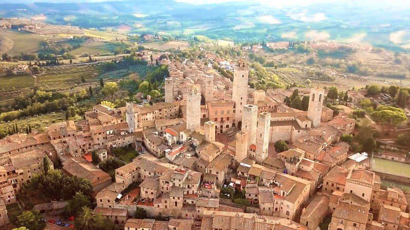
San Gimignano
Piazza Della Cisterna, 14, 53037 San Gimignano SI, Italien
43° 28' 3.5" N 11° 2' 36.6" E
43.4676324 11.0434909
• Head toward Piazza Duomo on Via San Matteo. Go for 345 m.
• Turn right onto Strada Provinciale di San Gimignano (SP1). Go for 123 m.
• Turn left onto Via Vincenzo Tamagni. Go for 52 m.
• Turn right onto Via Garibaldo Cepparelli. Go for 95 m.
• Continue on Strada Provinciale di Ulignano (SP127). Go for 7.8 km.
• Turn right onto Via Sottobosco (SP95). Go for 542 m.
• Turn left toward Poggibonsi/Certaldo/Empoli. Go for 131 m.
• Take the 1st exit from roundabout onto Strada Regionale di Val d'Elsa (SR429) toward Poggibonsi/Raccordo Si-Fi. Go for 1.7 km.
• Take the 2nd exit from roundabout onto Strada Regionale di Val d'Elsa (SR429) toward Poggibonsi/Raccordo Si-Fi. Go for 2.4 km.
• Continue on Collegamento Siena-Firenze SS429 (SR429bis). Go for 2.0 km.
• Continue toward Raccordo Siena-Firenze/Zona Industriale Pian dei Peschi. Go for 54 m.
• Take the 2nd exit from roundabout onto Superstrada Firenze-Siena (RA3) toward Zona Industriale Pian dei Peschi/Firenze. Go for 10.7 km.
• Take ramp toward San Donato/Gaiole in Chianti/Radda in Chianti/Castellina in Chianti/S.Donato. Go for 216 m.
• Continue on Strada Provinciale di San Donato in Poggio (SP101) toward Gaiole in Chianti/Radda in Chianti/Castellina in Chianti/S.Donato. Go for 3.8 km.
• Turn left onto Piazza Carlo Torrigiani. Go for 3.2 km.
• Turn right onto Strada Provinciale di San Donato in Poggio (SP76). Go for 3.3 km.
• Turn left onto Strada Regionale Chiantigiana (SR222) toward Panzano/Greve in Chianti/Gaiole in Chianti/Firenze. Go for 1.6 km.
• Turn right onto Località San Leonino (SP2). Go for 1.7 km.
• Continue on Località Lucarelli (SP2bis). Go for 8.5 km.
• Take the 2nd exit from roundabout onto Strada Regionale di Val d'Elsa (SR429) toward Radda in C./Poggibonsi. Go for 181 m.
• Turn sharp right onto Via Giorgio Amendola (SP72) toward Badiaccia M./Lucolena. Go for 95 m.
• Continue on Strada Provinciale di Badia Montemuro (SP72) toward Montevergine. Go for 901 m.
• Continue on Strada Provinciale di Badia Montemuro (SP72). Go for 6.0 km.
• Turn sharp right toward Località Piano Orlando. Go for 49 m.
• Turn left onto Località Piano Orlando. Go for 330 m.
• Arrive at Località Piano Orlando. Your destination is on the left.
☍
55,7 km
(1 hrs. 5 min.)
Camping Orlando (Chianti)
campsite
Homepage:
https://www.orlandoinchianti.it/it/
SP14 delle Miniere, 53017 Cavriglia AR, Italien
43° 32' 17.5" N 11° 24' 51.8" E
43.5381933 11.4143872