The final tour in 2022 took me to the northern Italian lakes in Lombardy and Ticino in two weeks. On October 6, 2022, I started the tour with a visit to Lago di Lugano (cover photo). From there I continued to visit Lago di Garda and Lago d'Iseo in Lombardy. On the way home via Trentino, I passed Lago Ledro, Lago d'Idro and Lago di Como before finally visiting Lago di Maggiore. I rode a total of 1,361 kilometers and saw an impressive world of lakes and mountains, interesting towns and villages, and all this with continued great autumn weather and pleasant temperatures. My conclusion: All the lakes mentioned are worth a visit.
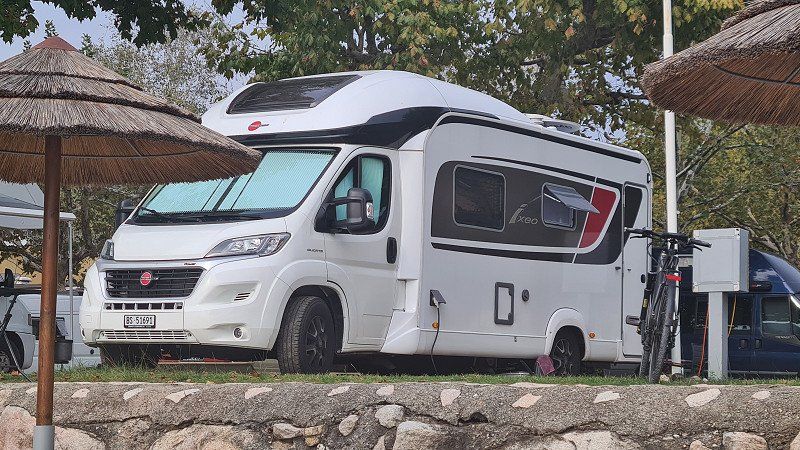
I am a pensioner from Basel, widowed and traveling alone. Together with my wife Beatrice, I look back on many eventful tours in the USA and Europe, some of which lasted several months. Together we have been able to experience and appreciate this unlimited mobility and the advantages of traveling in a mobile home over many years. The nature of this freedom has significantly enriched our lives and thus also marked the focus of our old age early on. Now "I continue to live our dreams and travel in memory of my eternal love Beatrice Ṫ 2021". Our goals were primarily nature experiences in national and nature parks, generally scenic areas, and they have remained so. At the same time, we focus on bike tours and walks to historically interesting places, events or places of cultural or national significance. Finally, we were always interested in the local culinary offer and its special features. When selecting destinations and focal points, we use what is worth knowing from the internet (e.g. Wikipedia, travel guides, recommendations from tourism organizations) as a guide, but we also use on-site inquiries and flyers from local information centers. I will keep this as well. I learned to appreciate FREEONTOUR in 2022 as a practical platform for planning and documentation. My entries are: «Spring 2022. Andalusia. Brittany. Normandy." and "Summer 2022. Scandinavia."
Day
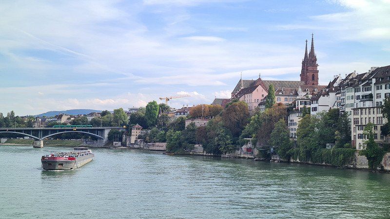
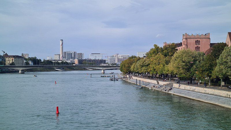
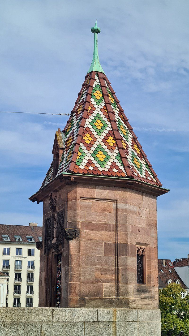
BASEL. Anfang.
Basel, Schweiz
47° 33' 34.6" N 7° 35' 18.9" E
47.5595986 7.5885761
• Head northwest on Schifflände. Go for 84 m.
• Turn slightly right onto Blumenrain. Go for 197 m.
• Turn slightly right onto Totentanz. Go for 102 m.
• Continue on Sankt Johanns-Vorstadt. Go for 555 m.
• Continue on Elsässerstrasse. Go for 497 m.
• Turn right onto Voltastrasse (320). Go for 240 m.
• Take ramp onto A3 (Dreirosenbrücke) toward Basel-Kleinhüningen Hafen/Riehen. Go for 14.5 km.
• Keep right onto A2 (Verzweigung Augst) toward Chiasso/Gotthard/Luzern/Bern/Arisdorf. Go for 28.2 km.
• Take the left exit toward Chiasso/Gotthard/Luzern/Zürich/Rothrist onto A1/A2. Go for 8.8 km.
• Take exit 47 toward Chiasso/Gotthard/Luzern/Reiden onto A2 (Verzweigung Wiggertal). Go for 218 km.
• Take exit 51 toward Melide/Bissone/Morcote/Campione. Go for 346 m.
• Take the 2nd exit from roundabout onto Via Cantonale (2). Go for 208 m.
• Take the 3rd exit from roundabout onto Via Cantonale (2) toward E35/A2/Chiasso/Bissone/Campione. Go for 65 m.
• Keep left onto Via Cantonale (2) toward San Gottardo/Lugano/Chiasso/Bissone/Campione. Go for 1.1 km.
• Take the 1st exit from roundabout onto Piazza Franco Zorzi (2) toward Mendrisio/Bissone. Go for 2.8 km.
• Turn right onto Via Tannini. Go for 278 m.
• Arrive at Via Tannini. Your destination is on the right.
☍
276,5 km
(2 hrs. 49 min.)
LAGO DI LUGANO. Erstes Ziel.
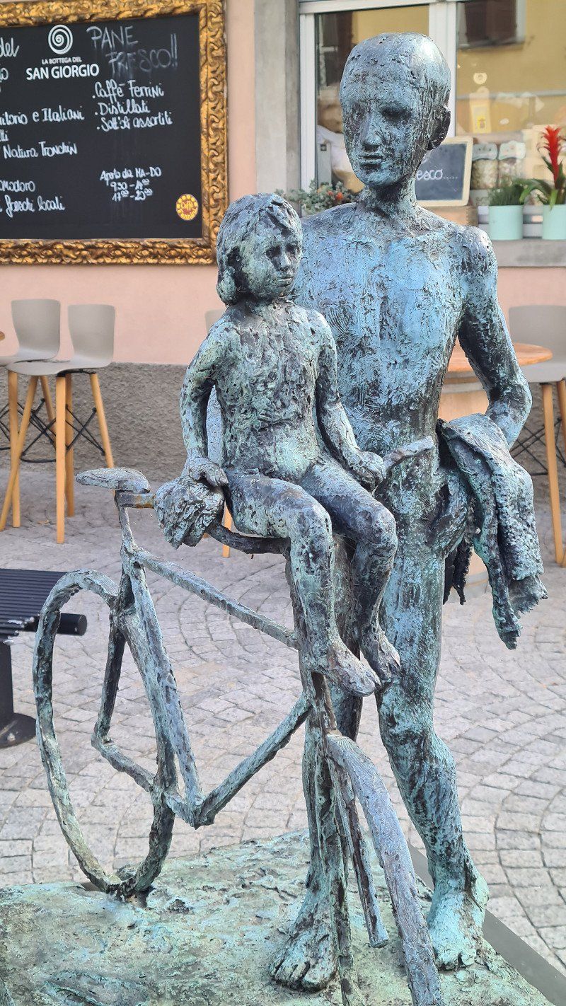
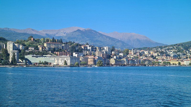
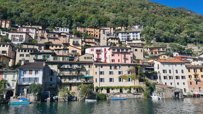
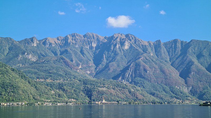
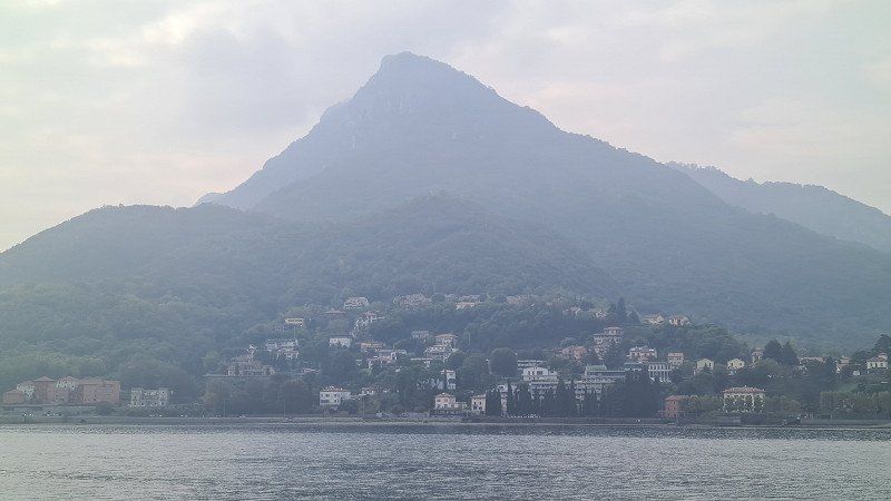
Lago di Lugano or Lago Ceresio (Luganersee) is one of the northern Italian lakes and is 63% in the Swiss canton of Ticino and 37% in Italian territory. Its surface is 271 meters above sea level and covers 48.8 square kilometers. Its deepest point is 288 meters and its volume is 5.9 cubic kilometers. The most important tributary is the Vedeggio with 4 cubic meters/second. Its shape is explained by its formation after the Ice Age in an area where two glaciers met. The artificial sea dam of Melide divides the lake into a north and south basin, plus the small basin called Laghetto of Ponte Tresa. Some foothills of the lake reach into Italy, and the Italian enclave of Campione d'Italia, known for its casino, is located on its shore, which leads to a complicated borderline. South of Lugano, the A2 motorway and the Gotthard railway cross the lake on the Melide dam. Well-known panoramic mountains on the shore are Monte Brè (925 meters above sea level) in the east, Monte San Salvatore (912 meters above sea level) in the west of Lugano and Monte Generoso (1,701 meters above sea level) on the south-eastern shore. Between the two southern arms lies the UNESCO World Heritage Site of Monte San Giorgio (1,097 meters above sea level). Since the lake is in a Mediterranean climate due to its location at the southern tip of Switzerland, it is a popular tourist destination. Various German composers have retired around the lake, such as Michael Jary, Martin Böttcher and Peter Thomas. The writer Hermann Hesse lived in Montagnola near Lugano from the age of 42 until his death. In his honor there has been a museum dedicated to him since 1997 in the old Torre Camuzzi. Wikipedia.
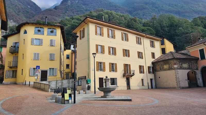
MELANO. Lago di Lugano.
Via the Gotthard to Ticino.
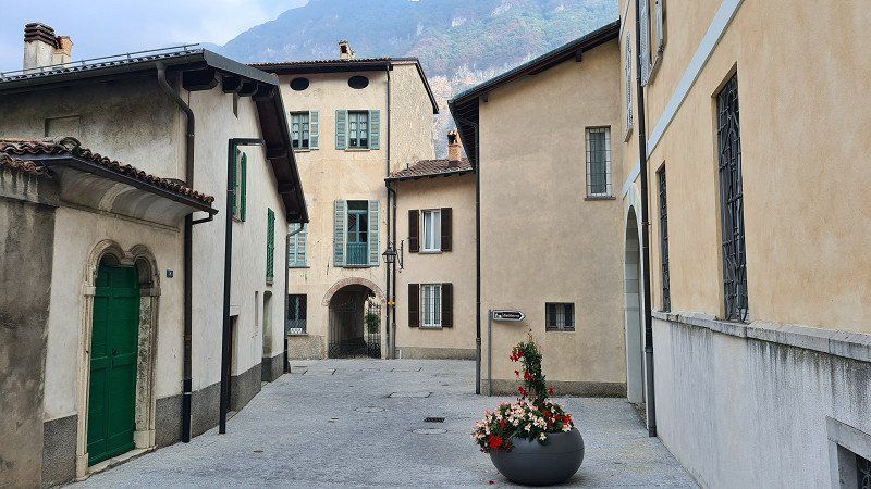
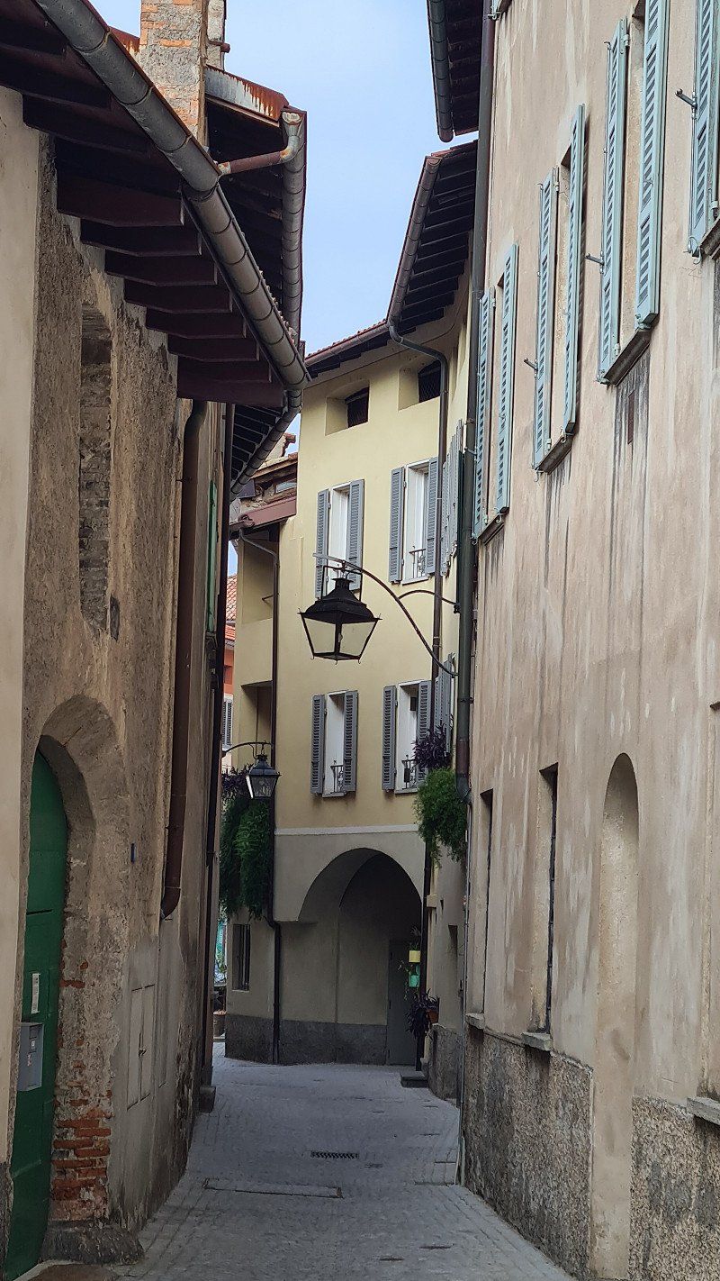
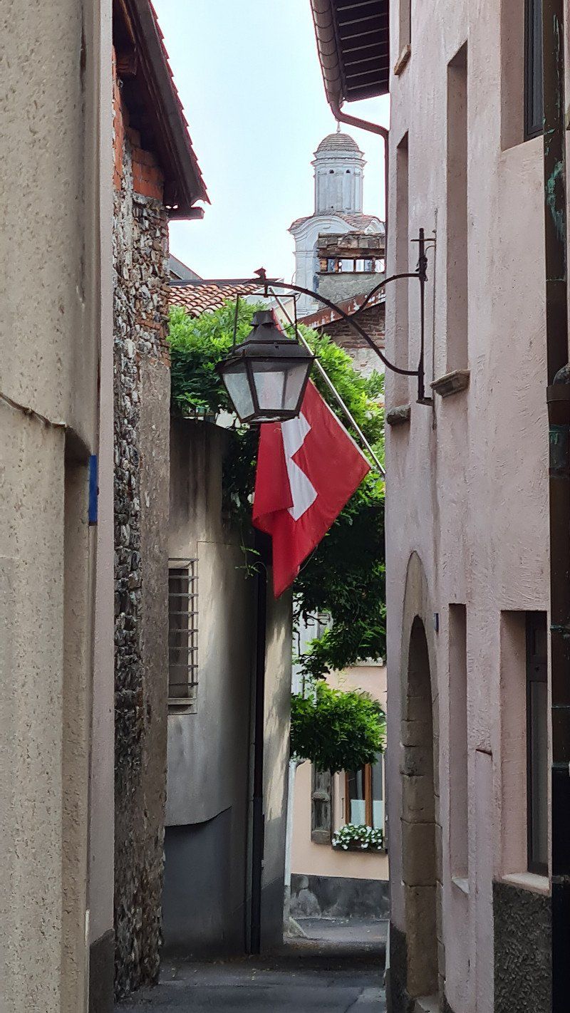
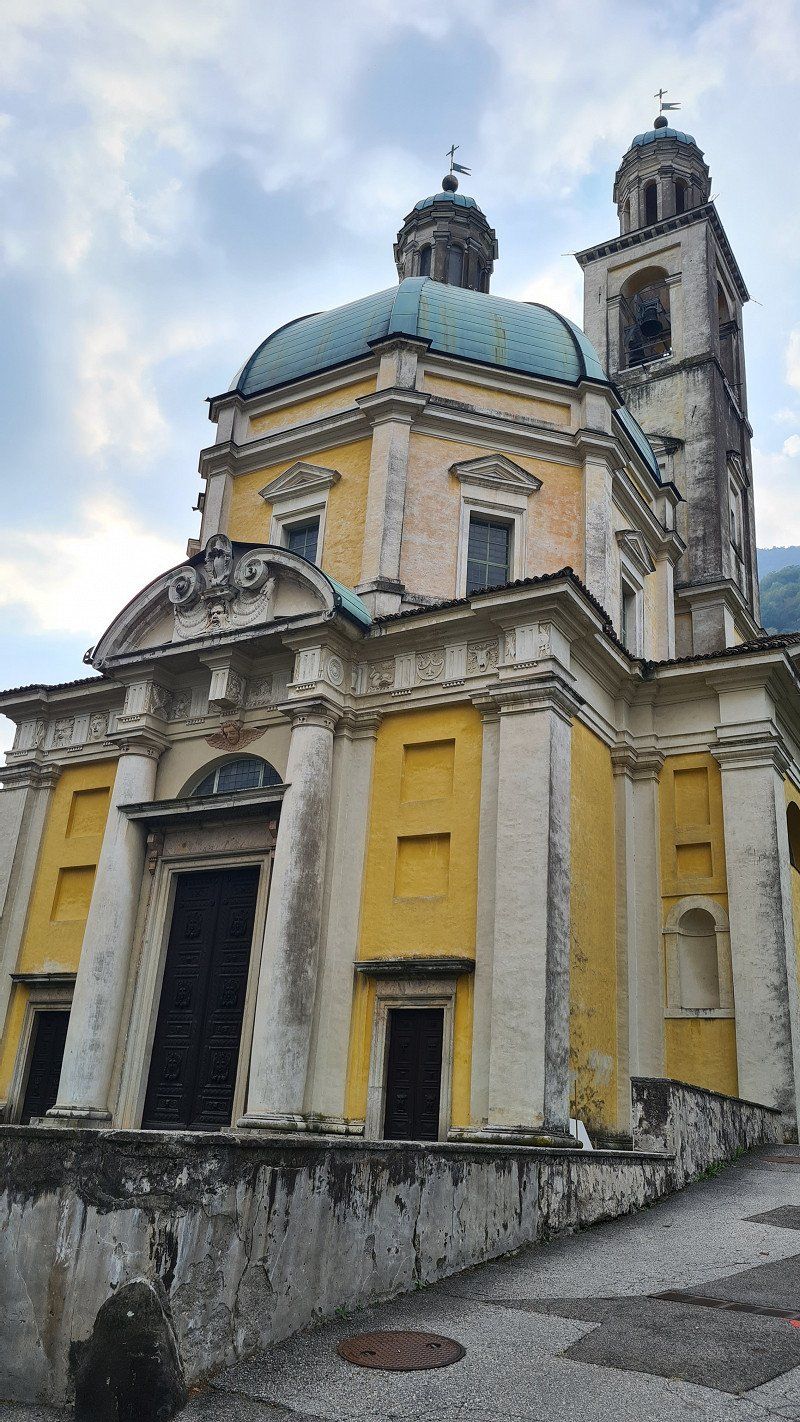
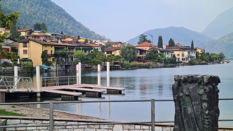
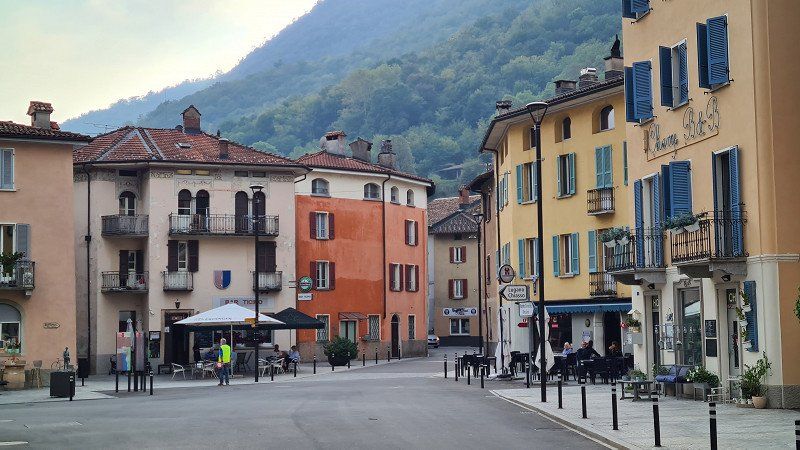
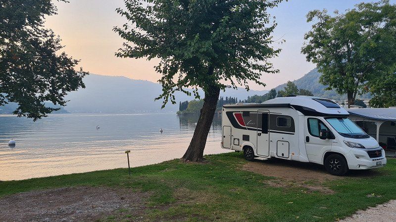
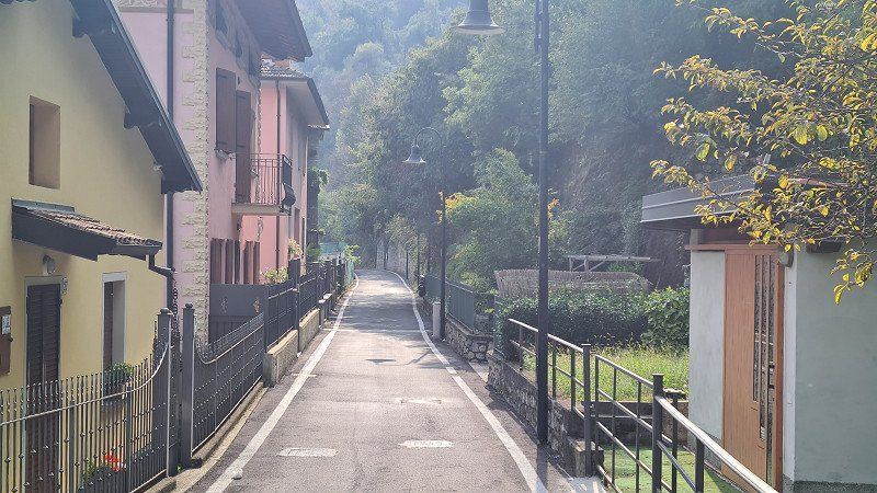
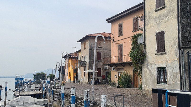
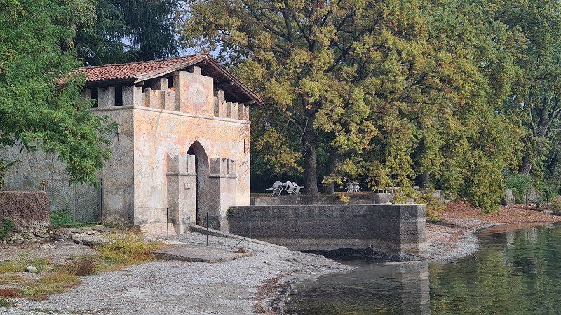
It's Thursday, October 6th, 2022 and beautiful autumn weather with 12 degrees in the morning in Basel and 22 degrees in the afternoon in Melano. Today I first drive the 30 kilometers with the e-mobile from Basel to Zullwil and then with the mobile home 278 kilometers from Zullwil to Melano on Lake Lugano. From Zullwil I take the pass road over the Hauenstein and then at Önsingen the A2 motorway over the Gotthard into Ticino. Around two o'clock I reach today's destination, the Camping Monte Generoso near Maroggia and get a pitch directly at the lake. In the afternoon I cycle along the lake first to Melano (1-4) and then to Riva San Vitale (5-15).
Melano and Riva San Vitale at Wikipedia.
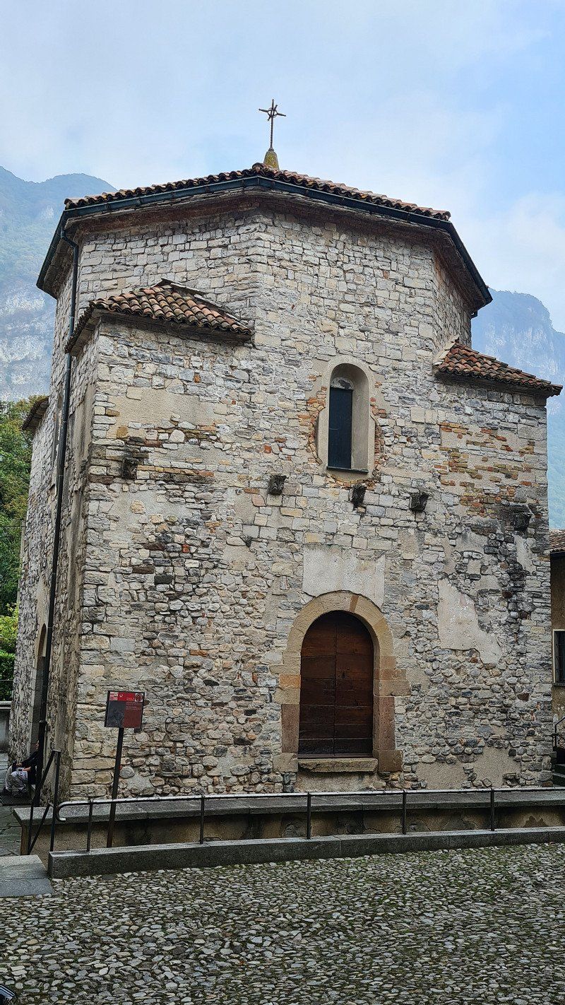
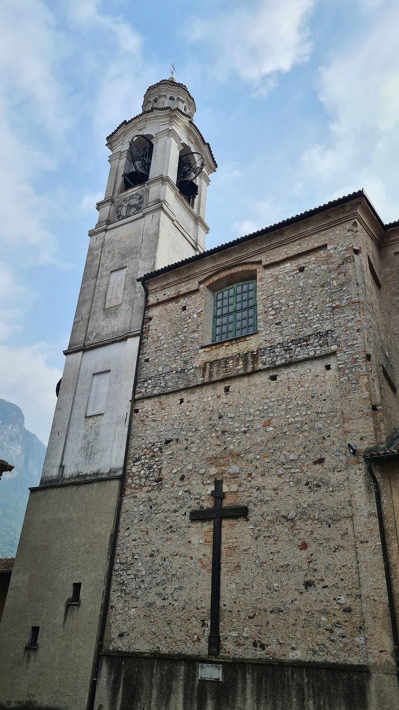
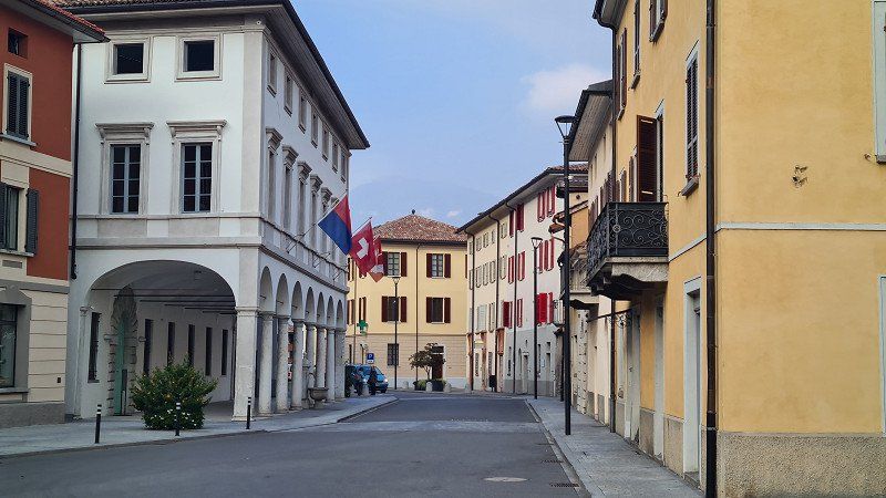
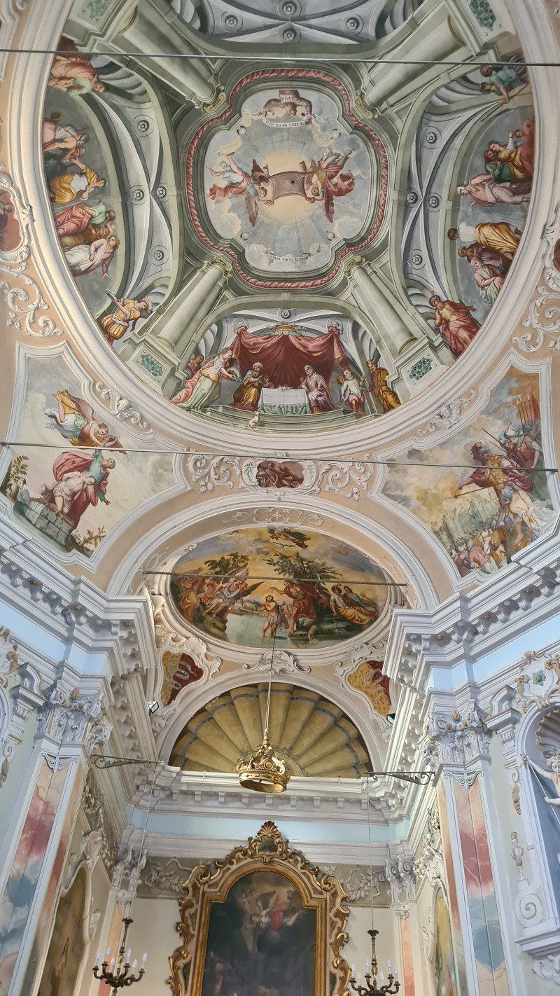
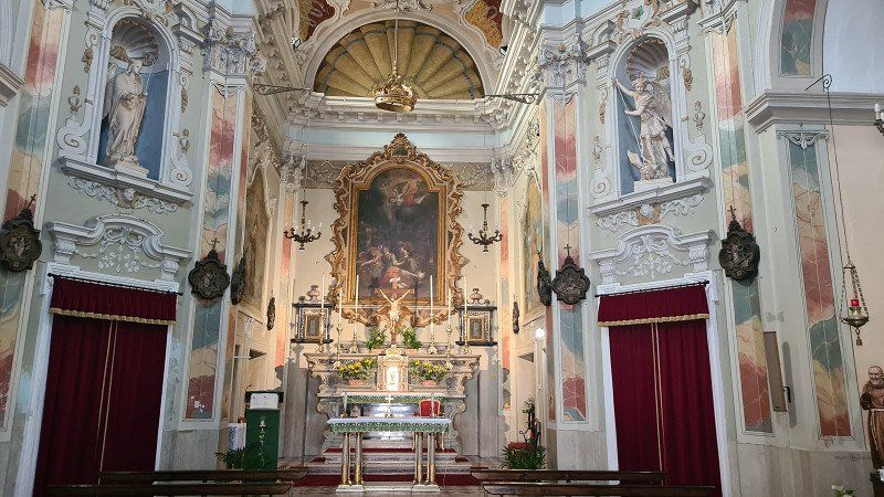
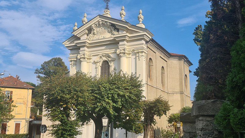
Melano is a town with 1,454 inhabitants in the municipality of Val Mara in the district of Ceresio, in the district of Lugano in the canton of Ticino in Switzerland. In April 2022, Melano merged with the municipalities of Maroggia and Rovio to form the new municipality of Val Mara. The village is located on the eastern shore of Lake Lugano at the foot of Monte Generoso and 2 kilometers south of the Maroggia station on the Bellinzona-Chiasso line of the Swiss Federal Railways. The neighboring municipalities are Maroggia to the north, Centro Valle Intelvi to the east, Mendrisio to the south and Riva San Vitale to the west. The place is first mentioned in 799 as Mellani. In the Middle Ages it was an important port on the lake. The village church of Sant'Andrea was built in 1850 by the architect Luigi Fontana. The village is classified in the inventory of Swiss sites worthy of protection (ISOS) as a Swiss site worthy of protection and of national importance. Sights: parish church of Sant'Andrea, church of the Madonna del Castelletto, old house Polatta, arched entrance with stucco work, Villa Seminario in the district of Pedemonte, Castellaccio castle ruins. Riva San Vitale is a municipality in the district of Riva San Vitale , in the district of Mendrisio in the canton of Ticino in Switzerland. Riva San Vitale is on the eastern slope of Monte San Giorgio , at the southern end of an arm of Lake Lugano , into which the Laveggio flows. The village was inhabited before the Etruscans in pre-Christian times and later under the name of Vicus Subinates, a Roman vicus. The village is classified in the inventory of Swiss sites worthy of protection (ISOS) as a Swiss site worthy of protection and of national importance. Sights: Church of Santa Croce, Baptistery of San Giovanni, the oldest Christian building in Switzerland, parish church of San Vitale and oratory of the Brotherhood of the Holy Sacraments, Bernasconi Palace, Palazzo della Croce with frescoes by the Pozzi brothers from Puria, Palazzo comunale.
Via Tannini 12, 6818, Melano, Switzerland
45° 55' 41.2" N 8° 58' 36" E
45.9281100 8.9766700
• Head south on Via Tannini.
• Arrive at Via Tannini. Your destination is on the right.
☍
Distance not available
(Duration not available)
GENEROSO. Lago di Lugano.
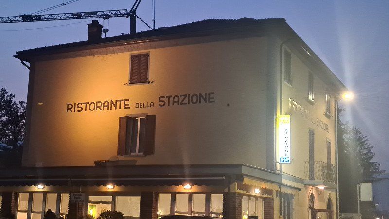
Campsite and Ristorante Stazione.
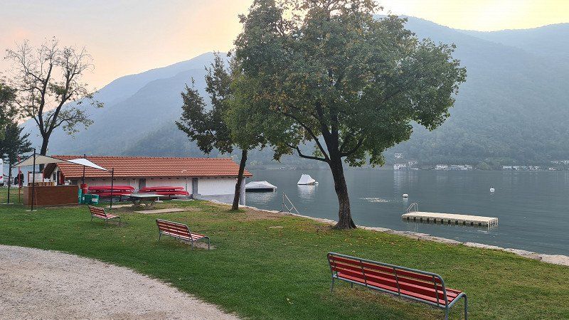
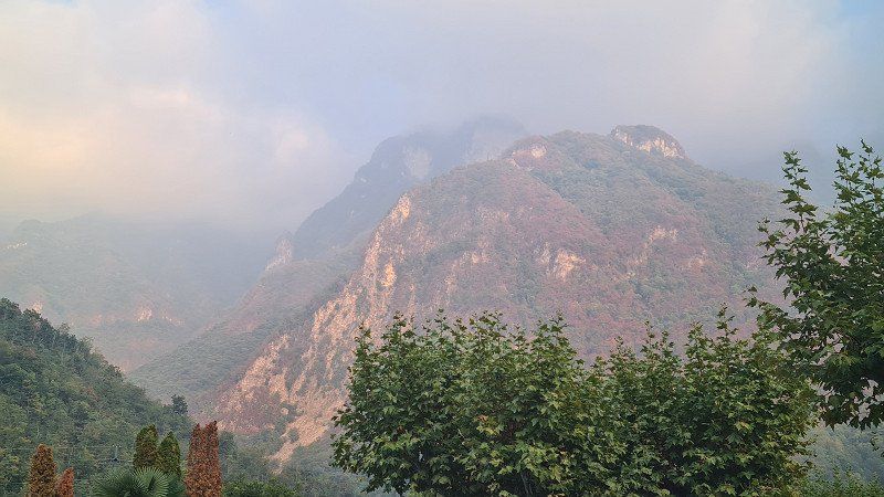
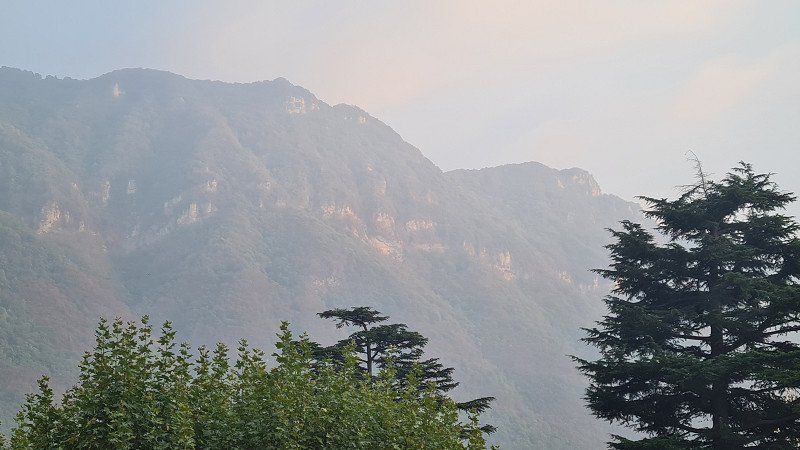
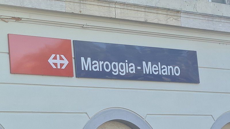
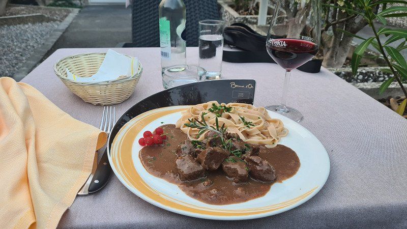
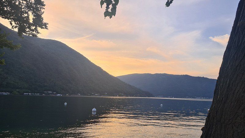
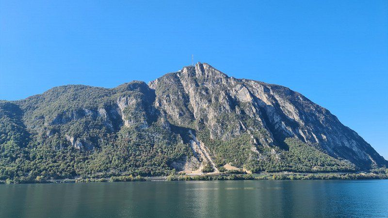
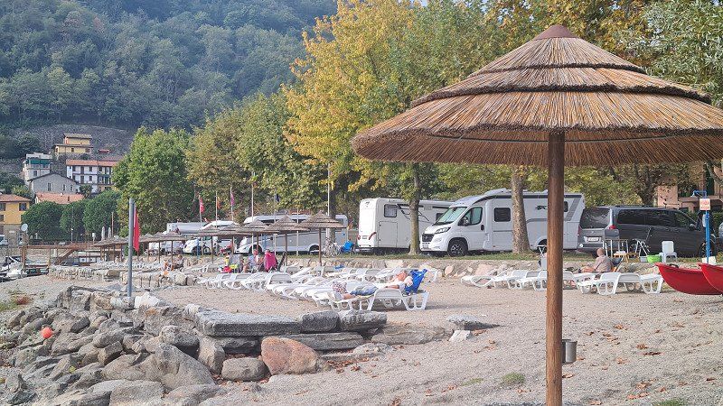
After returning from the bike tour, I first walk over the campsite (1-3) that I have grown fond of over the years, directly on Lago di Lugano and the massive Monte Generoso (4-5) in the back, slightly shrouded in autumn fog. Now in the evening the camping site fills up more and more and I find out from the operator that they are fully booked. We have been here many times and at all times, but we have not yet experienced full occupancy. At the end of the season you can feel that camping is booming. I then walk the ten minutes to the Maroggia-Melano train station to the Ristorante Stazione there (6-8) and its good plain Italian cuisine. I sit down in the small garden and order stufato di cervo (deer stew) to match the autumn mood. But now in October it is getting dark quickly and after returning to the camp I just catch one last beautiful view of the lake from the pitch (9).
Monte Generoso at Wikipedia.
At 1,701 meters above sea level, Monte Generoso or Calvagione is a Swiss -Italian border mountain on the southern edge of the Alps . He belongs to the Generoso Intelvi group, which is part of the Tambo group . The mountain is located on the eastern shore of Lake Lugano between Lugano and Chiasso and on the western shore of Lake Como. The border between Italy and Switzerland runs over the east ridge and the north ridge. The southern and western flanks belong to Switzerland, the north-eastern side to Italy. The Monte Generoso is a panoramic mountain that, on a clear day, offers an overview of the entire Alpine arc from the Maritime Alps to the Piz Bernina. Since 1890, the Ferrovia Monte Generoso rack railway has been running from Capolago to just below its summit in the summer months from April to October. Generoso-Vetta, the mountain station, is 1,605 meters above sea level right on the national border. The train is the only “typically Swiss” rack railway south of the Alps. In 1940 there was a financial threat of the cessation of railway operations. Migros founder Gottlieb Duttweiler campaigned vehemently for the preservation of the rack railway. Migros then took over the railway company. The Monte Generoso belongs geologically to the southern Alps and has a diverse flora. The first Hotel Monte Generoso Bellavista was opened in 1867. From 1897 to 1901, the German Nobel Prize winner for literature, Gerhart Hauptmann, spent a few spring weeks in nearby Rovio every year. These stays inspired him to write his novella The Heretic of Soana, published in 1918, in which he also refers to Monte Generoso. The Hotel-Restaurant Vetta, built in 1970, was closed in October 2010 for safety reasons as the ground had moved and cracks had appeared. In 2017, the new restaurant Fiore di pietra (stone flower) by Ticino architect Mario Botta was inaugurated.
Day
LUGANO. Lago di Lugano.
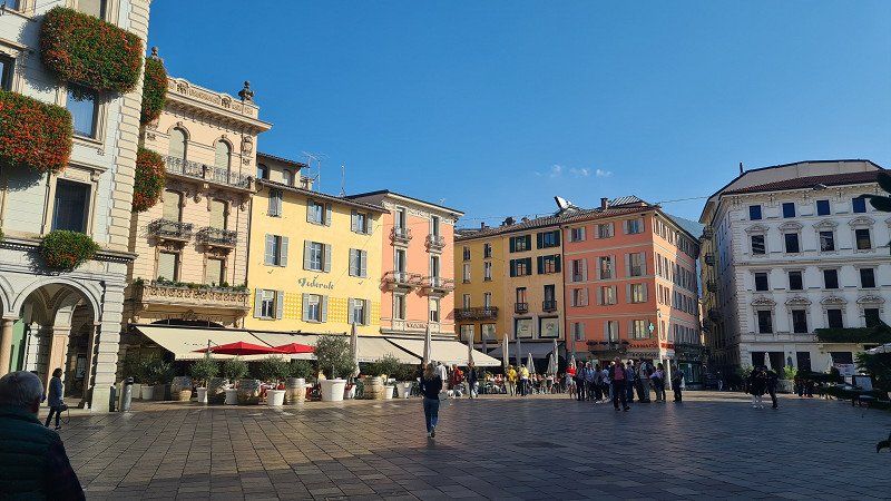
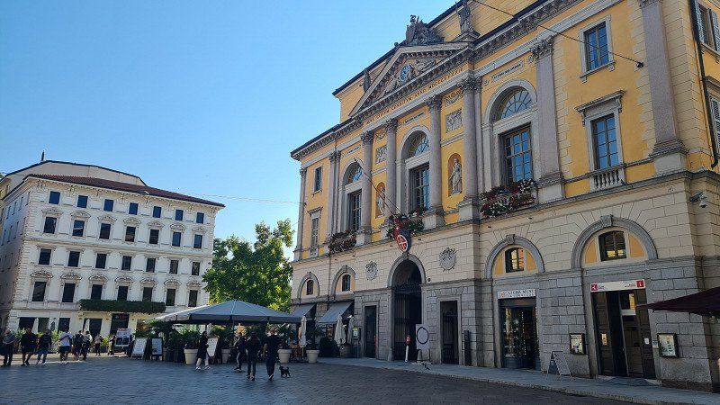
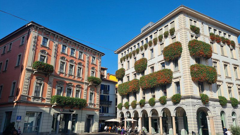
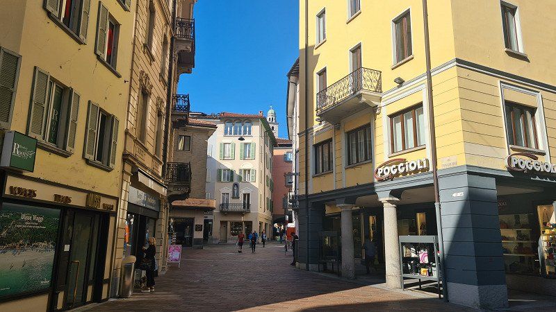
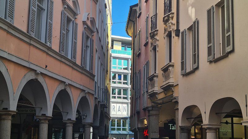
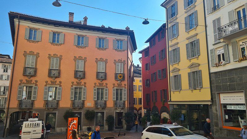
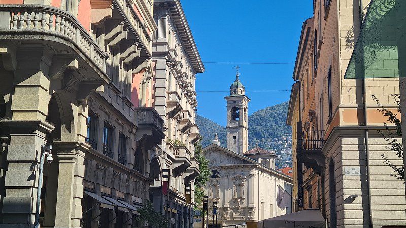
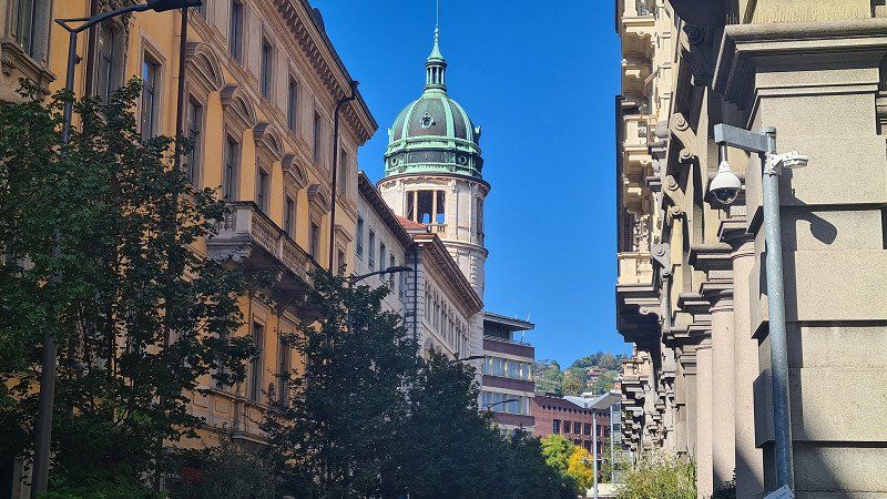
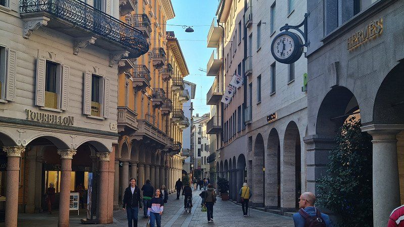
Stroll around Città di Lugano.
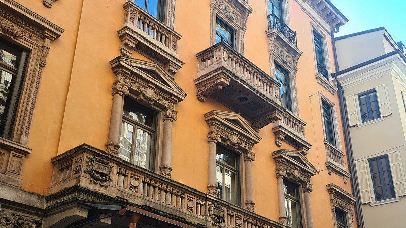
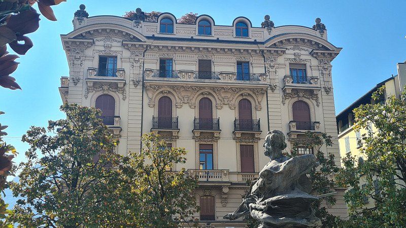
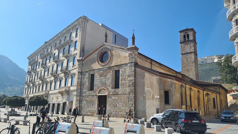
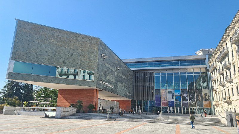
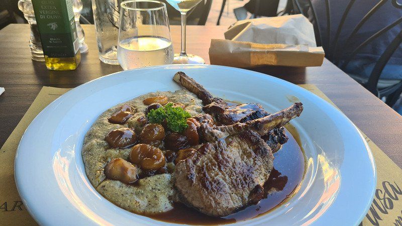
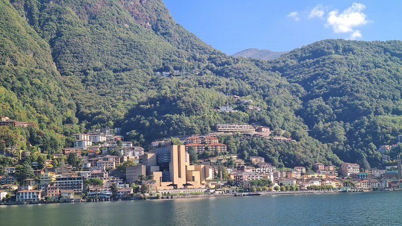
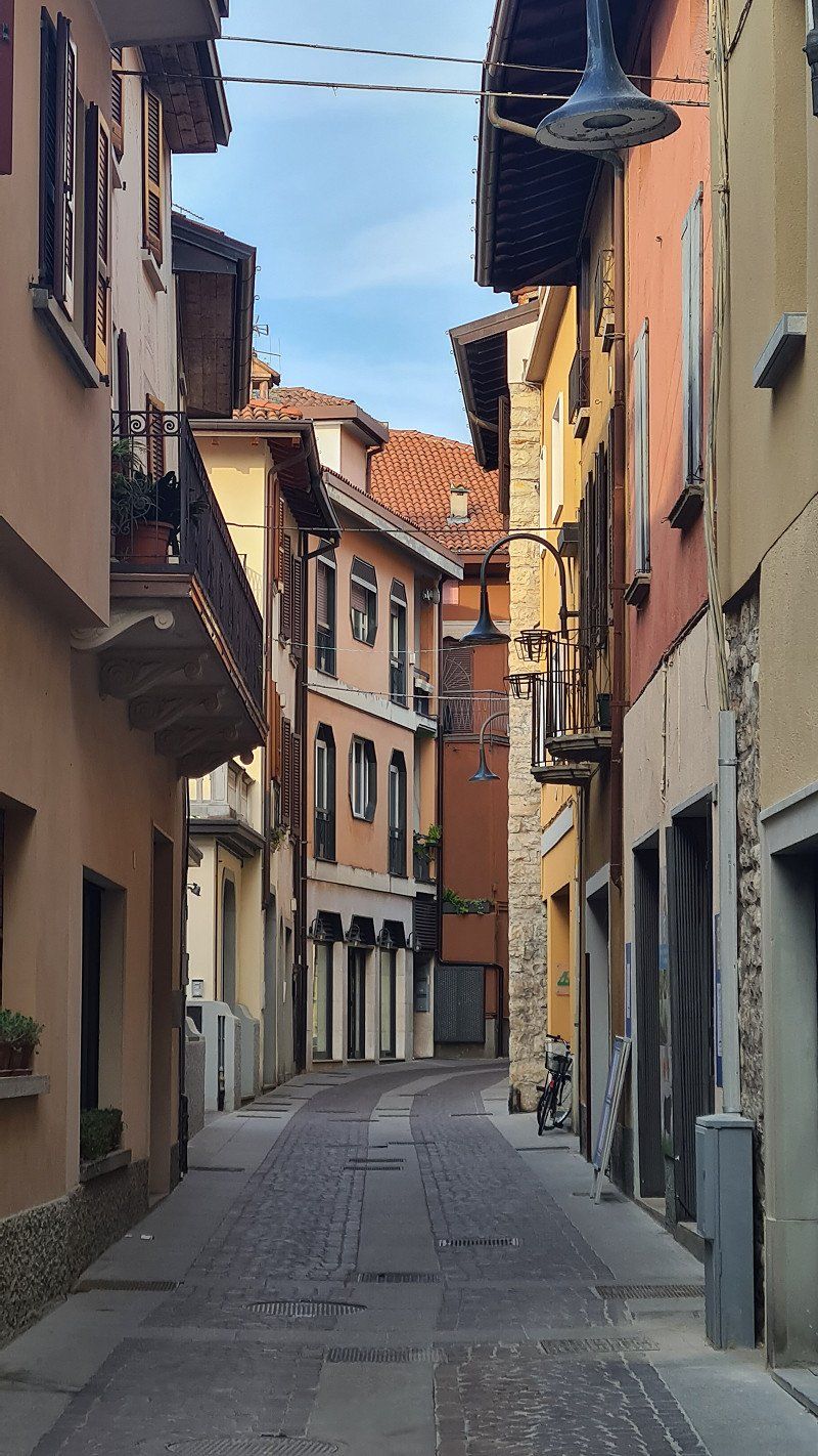
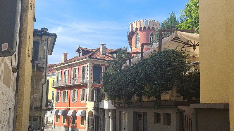
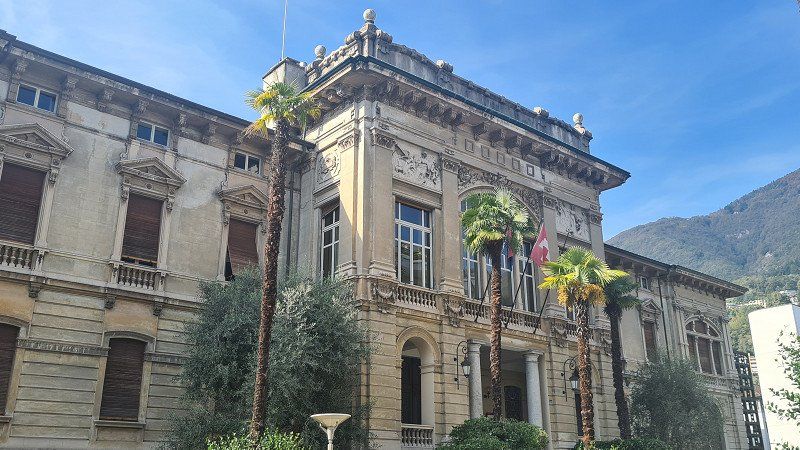
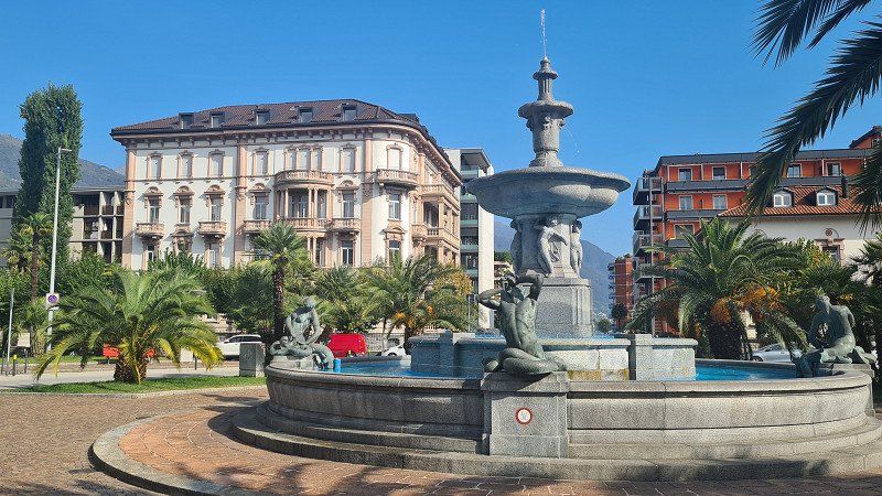
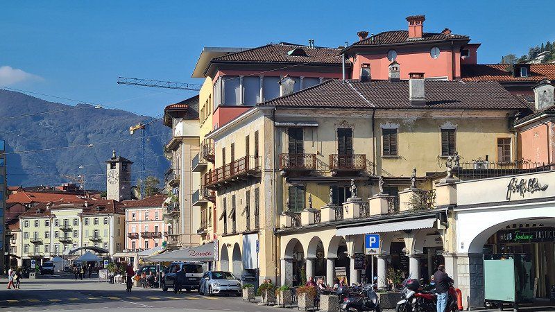
It's Friday, October 7th and again beautiful autumn weather with 23 degrees. Today I will take the S-Bahn to Lugano, visit the old town in the morning and do the big lake tour in the afternoon. At ten o'clock there is a first café americano in the Vanini on the Piazza della Riforma, before I walk for a good two hours through the streets (1-14) and along the beach promenade of Lugano. Back at the Piazza della Riforma, the venerable Ristorante Olimpia serves a very good braciola di cinghiale (wild boar cutlet) con polenta (15) with a glass of Merlot Ticino.
Lugano at Wikipedia.
Lugano is a town and municipality in the district of Lugano in the Swiss canton of Ticino with 62,615 inhabitants. It is located in the Sottoceneri and is the largest political municipality in the canton. The city is the third largest financial center in Switzerland after Zurich and Geneva and the seventh largest Swiss city. The city of Lugano is located in the south of the district and canton at the mouth of the river Cassarate in Lake Lugano. As a university, congress and cultural city, Lugano attracts numerous visitors from Italy and from beyond the Alps. Lugano is located on Lake Lugano (Italian Lago di Lugano, in Italy Lago Ceresio) and is surrounded by the three panoramic mountains Monte Brè (925 meters) in the east, Monte San Salvatore (912 meters) in the west and the Sighignola (1314 meters), whose summit Balcone d'Italia is already on Italian soil. Based on some archaeological finds and grave inscriptions found in the Lugano area, it can be assumed that the area around Lugano was inhabited by Lepontians. The presence of the Romans around Lake Lugano is documented from the first century BC; they had at least one important center north of the lake in Bioggio. Lugano was first mentioned in documents in the years 804, 844, 854 and 875; the name forms were first Luanasco, then Luano. The meaning of the name is uncertain, possibly it goes back to the Latin lūcus "grove, forest". For centuries in the Middle Ages, Lugano was affected by conflicts between Como and Milan, as these were often fought on battlefields that lie on what is now the canton of Ticino. In the second half of the fourteenth century, the city came under the rule of the Milanese Visconti. Later it was occupied by French mercenaries, who in turn were expelled by the Confederates in 1513; since then Lugano has been under Swiss rule. With the entry of French revolutionary troops into the territory of the Confederation in 1798, the subject status of Ticino ended, and Lugano became the capital of the Canton of Lugano of the Helvetic Republic for a few years. In 1803 Lugano became part of the canton of Ticino, whose main town changed every six years between Bellinzona, Locarno and Lugano until 1878. In 1972 the former municipalities of Brè-Aldesago and Castagnola were incorporated into the city of Lugano. In 2004, eight other municipalities merged with the city of Lugano: Breganzona, Cureggia, Davesco-Soragno, Gandria, Pambio-Noranco, Pazzallo, Pregassona and Viganello. As a result, both the area and the population of Lugano increased significantly. In 2007 the voters of Barbengo, Carabbia and Villa Luganese as well as Lugano approved the incorporation of these three communities. The voters of the municipality of Cadro, however, rejected the merger, which is why Villa Luganese became an exclave of the city of Lugano. The incorporation was completed in 2008. In 2013, the municipalities of Bogno, Cadro, Carona, Certara, Cimadera, Sonvico and Val Colla were merged with Lugano, giving the city around 3,400 additional residents. The cityscape is classified in the inventory of Swiss sites worthy of protection (ISOS) as a Swiss site worthy of protection and of national importance. Worth seeing is the Parco civico with its lush southern vegetation and the Villa Ciani. To the west of the park is the lake promenade, built in stages between 1864 and 1920, which leads to Paradiso. Other attractions of Lugano are the two local mountains, Monte San Salvatore and Monte Brè, which offer a panoramic view of the city, Lake Lugano and the Ticino mountains. Both mountains can be reached by train or on foot. At the foot of Monte Brè lies the village of Gandria and Villa Favorita. The medieval and early modern old town of Lugano was largely demolished or gutted between 1910 and 1942 on the basis of the 1902 structure plan and replaced by a new town centre. Therefore, only a few churches and a few secular buildings still exist from the former building structure. In addition to these, the promenade Via Nassa and the Piazza della Riforma are particularly worth a visit. In addition, numerous churches, palazzi, squares and parks can be seen.
Via Tannini 12, 6818, Melano, Switzerland
45° 55' 41.2" N 8° 58' 36" E
45.9281100 8.9766700
• Head toward Via Cantonale on Via Tannini. Go for 278 m.
• Turn right onto Via Cantonale (2). Go for 4.2 km.
• Pass 2 roundabouts and continue on Via Carlo Maderno (2). Go for 1.8 km.
• Continue on Via Vignalunga (2). Go for 551 m.
• Take the 2nd exit from roundabout onto Via Vignalunga (2). Go for 579 m.
• Take the 2nd exit from roundabout toward Valle di Muggio/M.te Generoso. Go for 121 m.
• Take the 2nd exit from roundabout onto Via Franco Zorzi. Go for 439 m.
• Pass 2 roundabouts. Go for 266 m.
• Take the 2nd exit from roundabout onto A2 toward Mendrisio/Milano/Chiasso/Varese/Stabio. Go for 7.6 km.
• Continue on A9 (Autostrada dei Laghi). Go for 31.0 km.
• Take the left exit onto A8 (Autostrada dei Laghi). Go for 11.0 km.
• Take the left exit toward E64/Venezia/A51/A52/Tangenziali/A58/Milano V.le Zara/Aeroporto Linate/Aeroporto Orio al Serio onto A4 (Svincolo Viale Certosa). Go for 134 km.
• Take the exit toward Peschiera. Go for 811 m.
• Continue on Strada Regionale Gardesana Orientale (SR249). Go for 27 m.
• Keep left onto Strada Regionale Gardesana Orientale (SR249) toward Peschiera Centro/Ospedale/Valeggio S.M. Go for 96 m.
• Keep right toward Peschiera Centro/Ospedale. Go for 57 m.
• Turn right onto Località Paradiso di Sopra (SR249). Go for 908 m.
• Continue toward Via Venezia/SR249. Go for 35 m.
• Take the 1st exit from roundabout onto Via Venezia (SR249). Go for 443 m.
• Turn left toward Garda/Lazise. Go for 58 m.
• Turn right onto Via Monte Baldo (SR249) toward Ospedale/Garda/SS249. Go for 503 m.
• Pass 4 roundabouts and continue on Strada Regionale Gardesana Orientale (SR249). Go for 4.5 km.
• Continue on Località Fossalta (SR249). Go for 2.2 km.
• Turn left. Go for 20 m.
• Arrive at your destination on the left.
☍
201,6 km
(1 hrs. 59 min.)
MS LUGANO. Lago die Lugano.
Lake cruise on the MS Lugano.
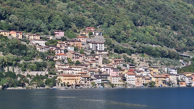
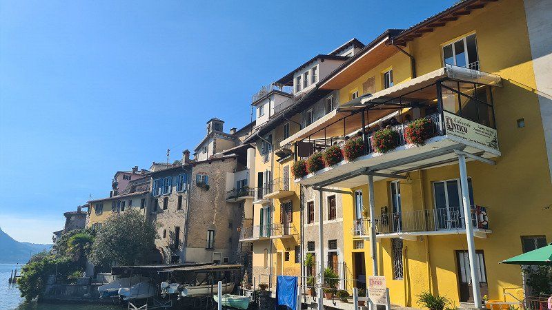
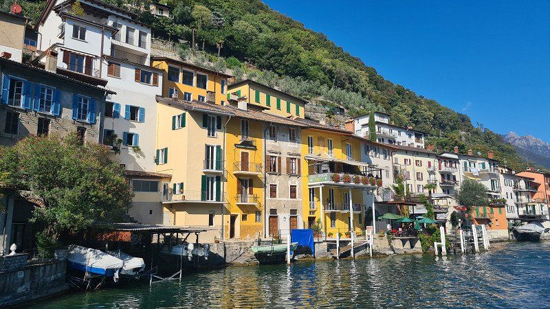
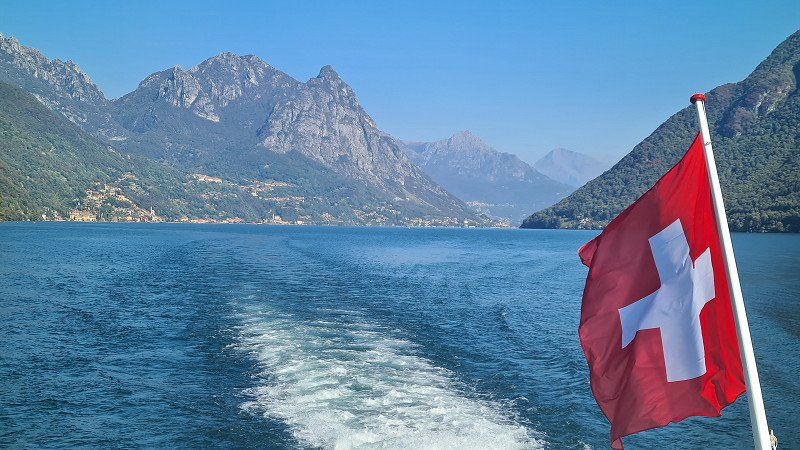
After a good lunch I board the motor ship Lugano (born 1961) at two o'clock and sit down in a corner outside on the upper deck and simply enjoy the wonderful boat trip (1-15) to Paradiso, Gandria, Cambione, Melide, Brusino, Morcorte and passing the impressive mountains of Bré, San Salvatore, San Giorgo and Generoso. The long lake tour in the afternoon has been offered by the Società Navigazione del Lago di Lugano for years. We have actually booked them every time we have visited Lugano. She is simply unique.
Società Navigazione del Lago di Lugano at Wikipedia.
Società Navigazione del Lago di Lugano is a Swiss company that operates passenger services on Lake Lugano. The company also operates bus routes in the same area and is based in Cassarate in the city of Lugano. Formerly known as the Società di Navigazione e Ferrovie per Lago di Lugano, it also once operated railways in the region. SNL's passenger ships are mainly used for tourism purposes, but also connect Lugano with other lake communities in Switzerland and Italy, some of which have no road connection. Bus connections connect Lugano with Gandria and Campione d'Italia, both of which are also served by boats. The SNL is a member of the arcobaleno tariff association, but only accepts arcobaleno tickets for its bus lines and not for ship lines. In addition, it grants holders of arcobaleno season tickets a 40% discount on all tariffs. The Società di Navigazione e Ferrovie per lago di Lugano (SNF) was founded in 1873 to build and operate a transport link from Menaggio on Lake Como via Lugano to Luino on Lake Maggiore. Although both ends of this connection were in Italy, the company was incorporated with Swiss finance and incorporated in Lugano. Previous plans called for a railway to be built throughout, but difficulties in funding the proposal and the significant engineering work required led to the revised plan, which was eventually implemented. This involved the construction of two unconnected railways, both located entirely in Italy. The Menaggio–Porlezza railway line and the Ponte Tresa–Luino railway line were connected by the use of steamboats between Porlezza and Ponte Tresa on Lake Lugano to form the desired through line. The outbreak of World War I led to significant traffic losses and financial problems, and the SNSF decided to sell its railways and concentrate on operating its steamboat service on Lake Lugano. The lines were sold to the Società Varesina per le Imprese Elettriche (SVIE) in 1919. After the sale, the company changed its name to Società Navigazione del Lago di Lugano. By 1926, the company operated nine passenger steamers on Lake Lugano, including six paddle steamers and three screw steamers, as well as two cargo motor ships. In 1927 the passenger motor ship Lugano was introduced and this ship is still in service after being renamed Milano in 1961. The last paddle steamers in the fleet were retired in 1962. In 1908, the Vedetta SA shipping company was founded by a group of Lugano hoteliers. They ordered five steel hull boats from Theodore Hitzler in Hamburg. The boats served various locations in the Bay of Lugano. The company was merged with SNL in 1944, and their earliest ship, the Vedetta, is still owned by SNL. In 2018, the SNL created a management consortium (known as "Consorzio dei Laghi") with the State Maritime Administration for the exercise of navigation on the Swiss basin of Lake Maggiore. The motor ship Lugano was built in 1961, is 47 meters long and 9 meters wide and can accommodate 300 passengers.
Day
MONTE TAMARO. Lago di Lugano.
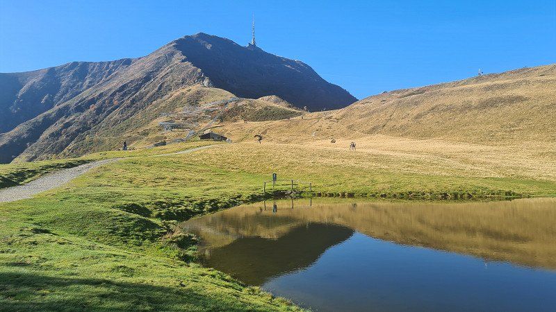
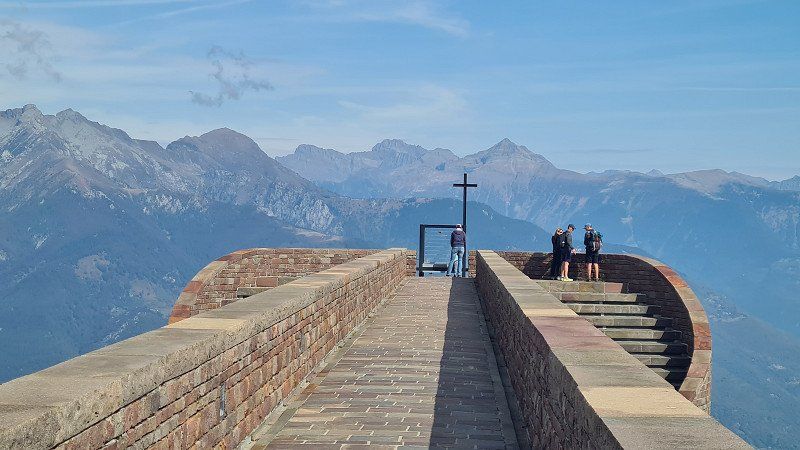
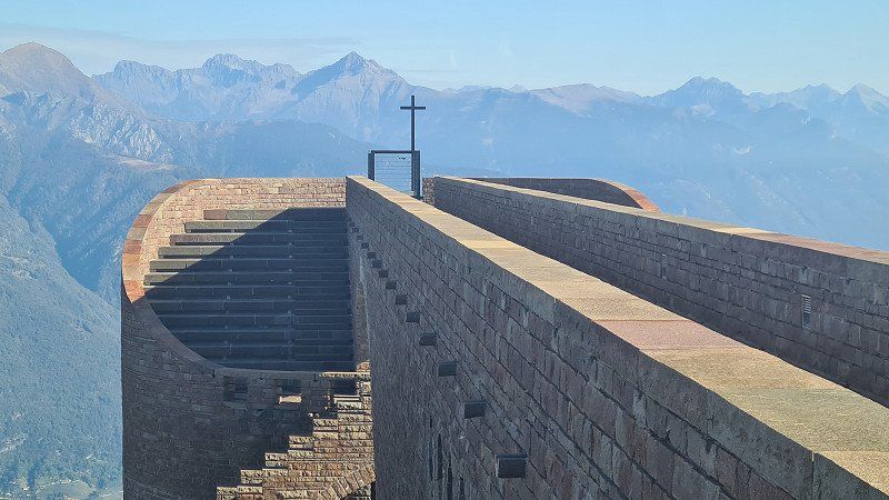
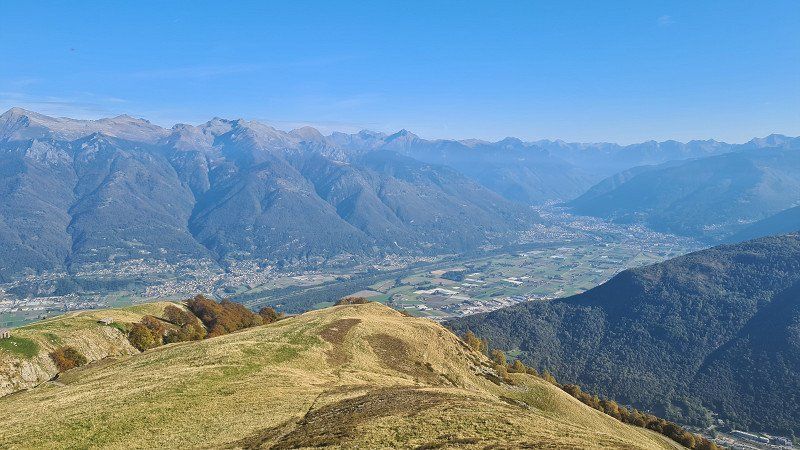
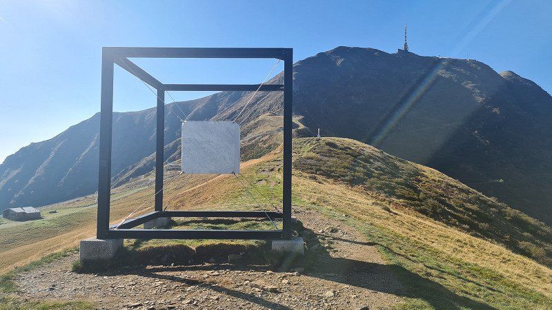
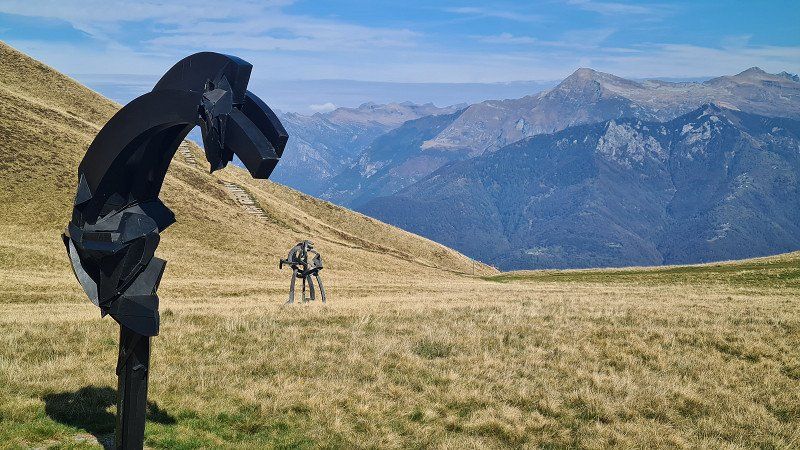
Art on Alpe Foppa on Monte Tamaro.
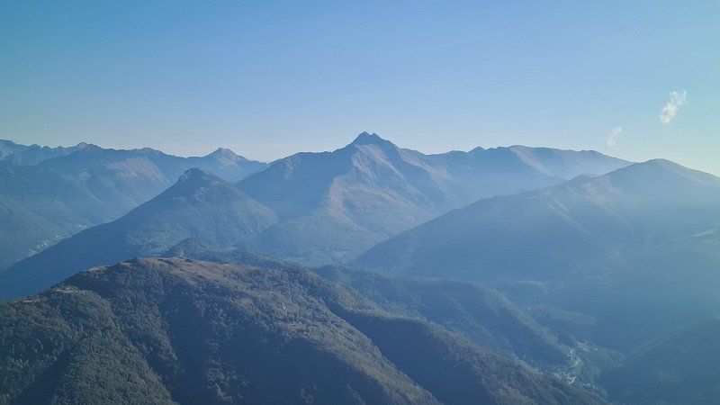
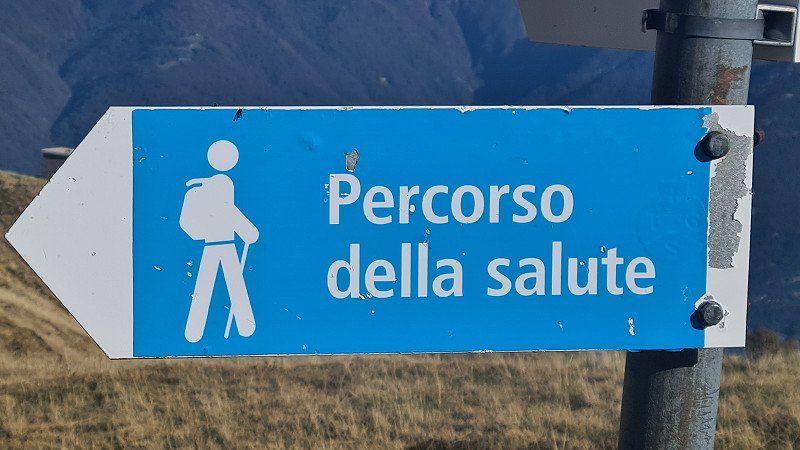
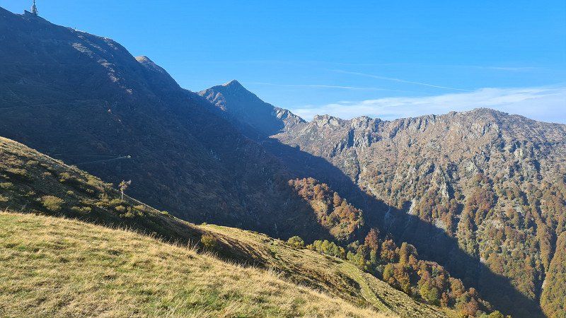
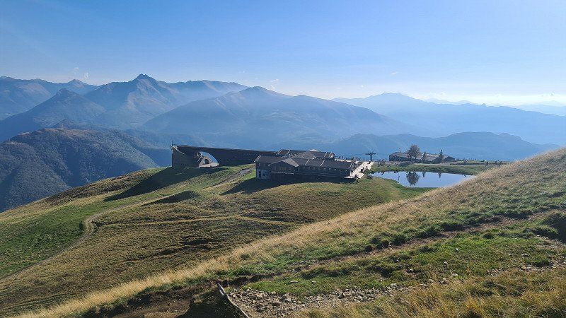
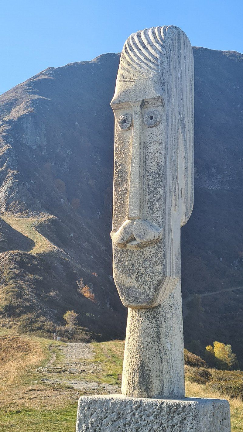
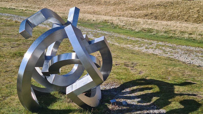
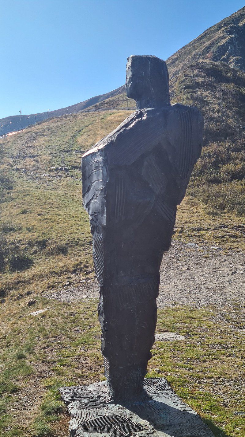
It's Saturday, October 8th and beautiful autumn weather with 23 degrees during the day. In the evening it begins to rain. Since I have to change places at the campsite, I decide to drive the 60 kilometers back and forth to Riviera in the mobile home. In Riviera, around ten o'clock, I climb the gondola to Alpe Foppa (1) below Monte Tamaro. At the Cappella di Santa Maria degli Angeli (2-3) there are wonderful panoramas. After a café in the restaurant, I go on the half-hour tour Percoso della Salute (6), which circles Alpe Foppa, allows for more beautiful views and, among other things, leads past some interesting sculptures by local artists (7-15). Shortly after noon I drive back to the camp and in the afternoon I take the S-Bahn to Lugano again for shopping and an aperitif on the Piazza della Riforma.
Monte Tamaro at Wikipedia.
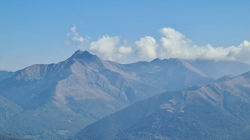
At 1,960 meters above sea level, Monte Tamaro is a mountain in the Swiss canton of Ticino above the town of Rivera. On La Manèra (1,858 meters), the eastern secondary summit of Monte Tamaro, there is a large Swisscom radio relay station. Parts of the connections from Ticino are transmitted via them to German-speaking Switzerland. The Cappella di Santa Maria degli Angeli, designed by Ticino architect Mario Botta from 1990 and built between 1992 and 1994, on Alpe Foppa at 1,567 meters above sea level made the place well-known nationwide. The chapel , inaugurated in 1996 and decorated with paintings by Enzo Cucchi , can be reached by cable car . On the Alpe Foppa there is a summer toboggan run, a zip line, a restaurant, a children's playground, various hikes and a mountain bike course at the mountain station of the cable car on the north-eastern slope of the mountain. The Monte Tamaro rope park is located at the middle station. The 2003 Mountain Bike World Championships took place on the slopes of Monte Tamaro. A hiking route leads from Monte Tamaro in about 4½ hours over several other peaks to Monte Lema. In good weather, the view extends to the Monte Rosa massif and the Matterhorn. This makes the summit of Monte Tamaro one of the few vantage points that allow a simultaneous view of the lowest point (Lake Maggiore) and the highest point (Dufourspitze) in Switzerland.
Day
LAGO DI GARDA. Zweites Ziel.
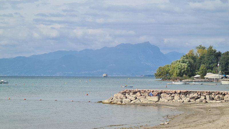
The Lago di Garda (Lake Garda), one of the northern Italian lakes , is the largest lake in Italy , named after the municipality of Garda on the eastern shore. Its ancient name was Lacus benacus in 200 BC. The name is said to derive from an ancient deity named Benacus . Lake Garda was formed during the last Ice Age by a side branch of the Adige Glacier , traces of which can still be traced, particularly through terminal moraines on the southern shore. The first settlements on the lake shore date back to around 2,000 BC. Lake Garda lies between the Alps to the north and the Po Valley to the south, and is therefore an Alpine edge lake . The north of the lake belongs to the region Trentino-Alto Adige , the west to Lombardy and the east to Veneto . Thus the three provinces share Trento (North), Verona (East) and Brescia (West) administration. Numerous pile dwelling settlements date from the Bronze Age , which were built directly on the lake shore or in the immediate hinterland of Lake Garda and have been a UNESCO World Heritage Site since 2011 . The battle of Lacus Benacus took place on its banks in 268 between the Alamanni and the Romans under Emperors Claudius Gothicus delivered. In the thirteenth and fourteenth centuries, the lake fell under the Scaligeri sphere of influence , who built numerous castles , particularly on the eastern and southern shore towns ( Malcesine , Torri del Benaco , Lazise and Sirmione ). In the fifteenth century, the lake and its shore towns became the scene of the struggle for supremacy in northern Italy between the Duchy of Milan under the Visconti and the Republic of Venice . With the border on the Adda river laid down in the Peace of Lodi in 1454 , Lake Garda finally fell under the sphere of influence of the Doge's Republic. The latter, in particular, expanded Peschiera into a fortress on the strategically important outflow of the Mincio , which was declared a World Heritage Site by UNESCO in 2017 . During the War of the Spanish Succession at the beginning of the eighteenth century, General Vendôme tried to push his troops north along the north bank, leaving a trail of destruction in their wake. In the process, numerous castles were destroyed by the French, such as Castel Penede in Nago , the Castle of Arco or Castel Drena , which survive as ruins. In 1706, Vendôme defeated the imperial troops at the Battle of Calcinato on the southern shore of the lake. The Battle of Rivoli was a key success for the French army under Napoleon Bonaparte in the Italian campaign over a numerically superior Habsburg army. Due to the Treaty of Pressburg in 1805, with which Tyrol fell to Bavaria, the northern tip of the lake now belonged to the Kingdom of Bavaria . After the Congress of Vienna in 1815, the entire lake fell to the Austrian Empire and was part of the Kingdom of Lombardy-Venetia . The Battle of Solferino in the Sardinian War between the Austrian Empire and the Kingdom of Sardinia was crucial to the unification of Italy in 1859. The ferocity of the battle prompted Henry Dunant to found the Red Cross and led to the agreement of the 1864 Geneva Convention . After the loss of Lombardy In 1859, after the Third Italian War of Independence in 1866, Austria also lost the eastern shore with Venetia , only the northern tip, with Riva del Garda, remained with Austria-Hungary until 1918 . During the First World War , the front ran directly along the north shore of the lake, where numerous fortifications had been built. After Mussolini's fall in 1943, the Repubblica Sociale Italiana (Republic of Salò ) was installed under Mussolini 's leadership as a counter-government at German demand from September 23, 1943 to April 25, 1945 . On April 30, 1945, World War II ended on Lake Garda with the liberation of Torbole and Riva by the 10th US Mountain Division . Wikipedia.
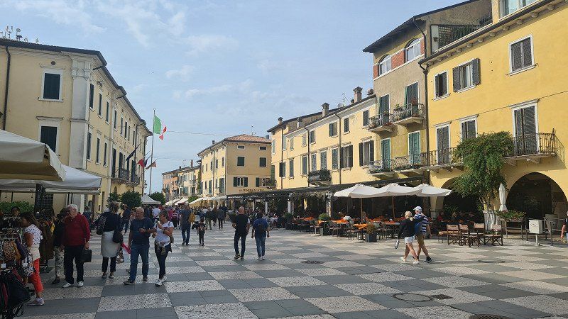
LAZISE. Lago di Garda.
Driving on the highway to Lake Garda.
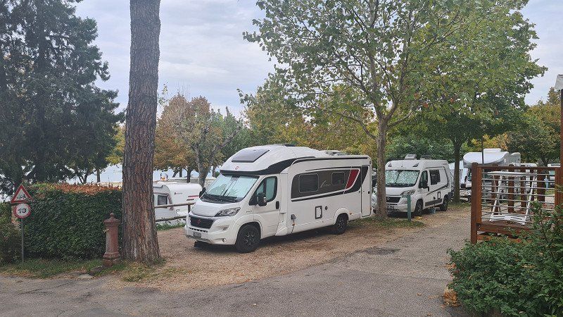
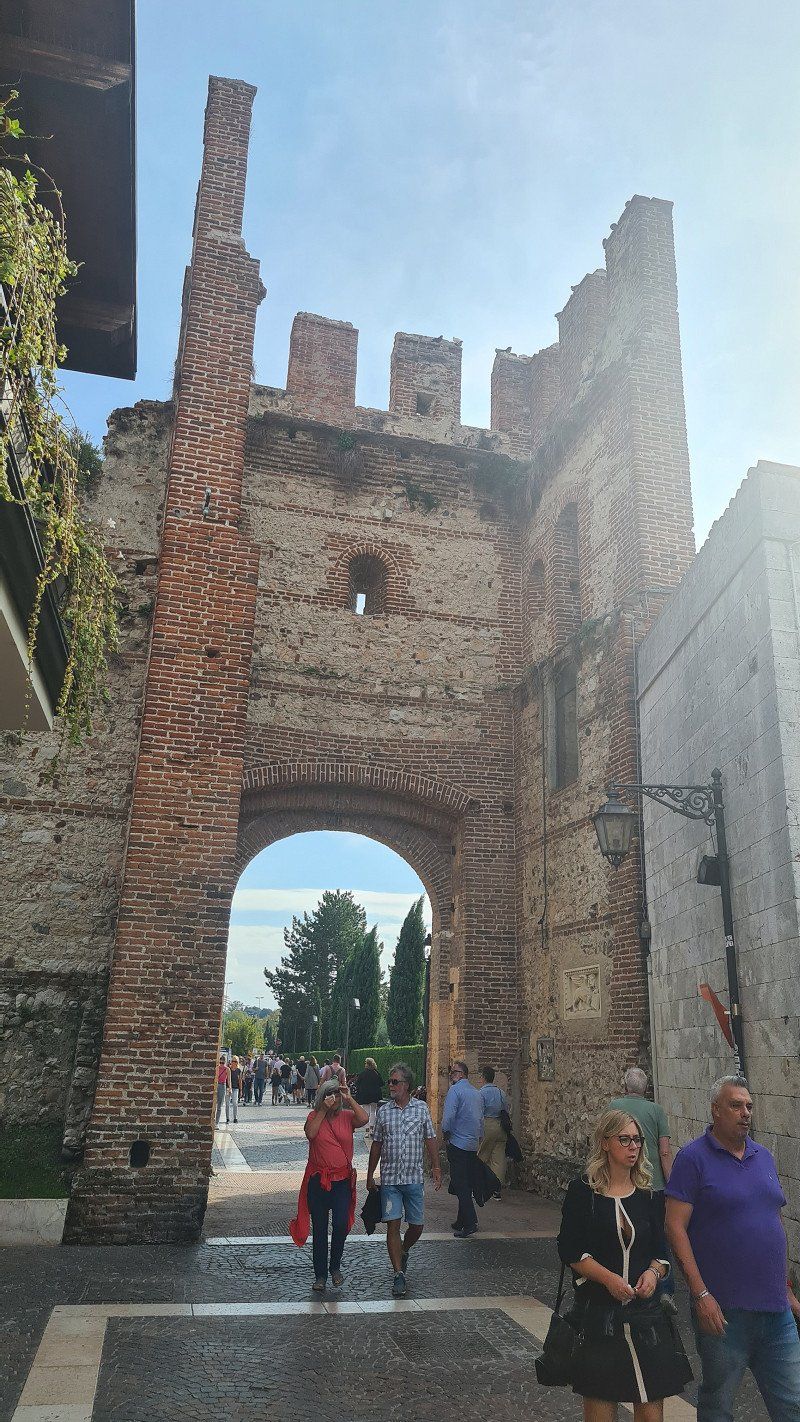
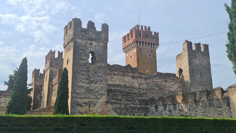
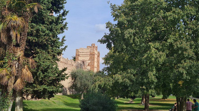
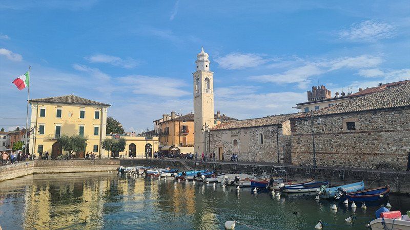
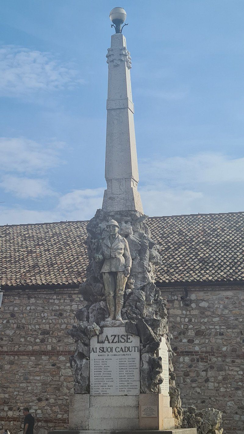
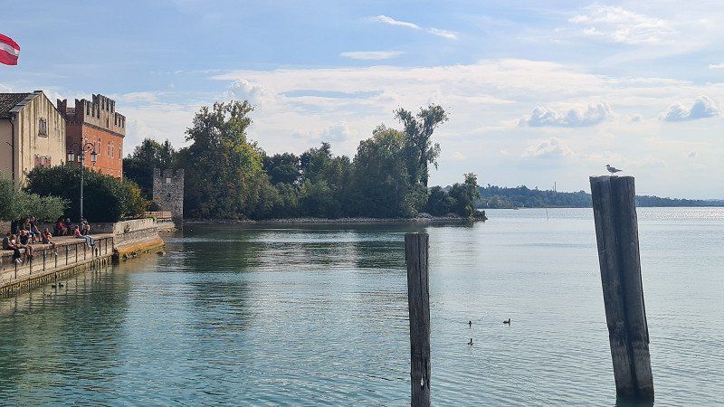
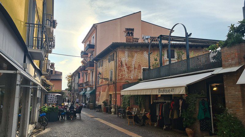
It's Sunday, October 9th, 2022 with heavy rain in the morning while driving and brighter spells while strolling through the city with a pleasant 20 degrees in the afternoon. Today I drive 200 kilometers from Melano to Lazise on Lake Garda. Because of the weather, I forgo the nicer ride on side roads past Lago di Como and instead take the motorway via Milano and Bergamo. Despite the heavy traffic, I make good progress and reach the Camping Village du Parc on the outskirts of Lazise around two o'clock. I'm moving into a nice pitch (1) near the lake. The camp is very well occupied, it was worth making a reservation. In the afternoon I walk along the lake (2) to the old town of Lazise, visit Scalingerburg (3-5) with its city wall and gate and stroll across squares (6-7) and through alleys (8-10), promenade and harbor (11-15) of the fishing village. In the Osteria due Archi there is a very well prepared orata con verdure (sea bream with vegetables). Around six o'clock I take a leisurely fifteen-minute walk back to the camp.
Lazise on Wikipedia.
Lazise is an Italian commune of 7,028 inhabitants in the province of Verona , Veneto region . Lazise is located on the south-eastern Veronese shore of Lake Garda , which has sandy beaches, between the towns of Bardolino and Peschiera del Garda . The distance to the provincial capital Verona is 23 kilometers. The name Lazise derives from the Latin "lacus" and probably means "villaggio lacustre" (lake village), as documents from the Middle Ages show. The history goes back to the Middle Bronze Age (thirteenth to sixteenth centuries BC). Numerous finds in the towns of La Quercia, Bor and Porto Pacengo bear witness to this eventful time. As early as 983, under Emperor Otto II, the town not only received customs, trade and fishing rights in the so-called Veronese Donation, but also extensive autonomy. The municipality of Lazise therefore prides itself on being the oldest municipality in Italy. In the eleventh century, Lazise was a port station owned by the House of Bevilacqua. In 1077, under Emperor Heinrich IV, permission was granted to build a castle, which was expanded under the Scaliger Cansignorio della Scala in the fourteenth century into an important fortification with its own walled harbor and probably completed under his successor Antonio della Scala. Under the Scaligeri, the city walls and city gates were renewed and strengthened. After the end of the Scaliger rule in 1387, it was the Milanese Visconti under Gian Galeazzo Visconti who took over the rule of Lazise. At this point, Lazise joined the Gardesana dell'Acqua, a kind of confederation of several Visconti-controlled communities on the lake and in the immediate hinterland of the lake. In 1405 Lazise fell to the Republic of Venice . In the Great Venetian War, Venice was defeated by the French at the Battle of Agnadello in 1509 . I n the course of the Italian campaign (1796-1797) Lazise was occupied by Napoleonic troops. With the Peace of Campo Formio, the town fell to the Habsburgs for the first time, but was already attached to the Napoleonic Kingdom of Italy in 1805, before it fell again to the Habsburg Kingdom of Lombardy-Venetia with the Congress of Vienna in 1815. With the end of the Third Italian War of Independence and the subsequent plebiscite, Lazise joined the Kingdom of Italy. The old town of Lazise still has many buildings of medieval origin. The cityscape is dominated by the city walls and the castle. Lazise has numerous picturesque corners such as Piazza Vittorio Emanuele and the small port where fishing boats are still moored. There are three large city gates through which you can enter the interior of the car-free old town. On the one hand via the entrance, which is located directly on the busy Gardesana Orientale and is also the main entrance, on the other hand via the Via Rosenheim, which was so named because of the twin town of Rosenheim, and finally via the street called Via Bastia. This was built towards the end of the ninth century to defend against the Huns. Several conversions and additional fortifications, especially under the Scaligeri, followed in the fourteenth century. The Scalingerburg is one of the best-preserved fortifications on Lake Garda. The square floor plan of the six-towered fort is characteristic. In addition to its five slightly smaller towers, it consists of a mighty keep. The castle complex is surrounded by the Villa Bernini park and cannot be visited. The old coats of arms can still be seen in the upper part of the keep, even if they were smashed under Emperor Maximilian. Two churches can also be seen: Church of SS. Zeno e Martino, mentioned for the first time in a document in 1295 and dedicated to Saint Zeno, patron saint of the Church in Verona, water and fishing; .the Church of San Nicolò, a Romanesque church built in the twelfth century and dedicated to Saint Nicholas, patron saint of water and seafarers in the Middle Ages.
Gardesana 110, 37017, Lazise, Italy
45° 29' 55.1" N 10° 44' 14.9" E
45.4986300 10.7374700
• Head toward Via Gardesana. Go for 20 m.
• Turn right onto Via Gardesana (SR249). Go for 2.4 km.
• Continue on Località Fossalta (SR249). Go for 1.2 km.
• Pass 4 roundabouts and continue on Via Gardesana (SR249). Go for 4.1 km.
• Take the 3rd exit from roundabout onto Via General Bonomi (SR249) toward Autostrade. Go for 1.1 km.
• Turn left toward Milano-Venezia/Milano-Brennero/A22. Go for 63 m.
• Take ramp onto A4 (Autostrada della Serenissima) toward Milano. Go for 31.3 km.
• Take the exit toward Brescia Est onto Svincolo Brescia Est. Go for 698 m.
• Take the 2nd exit from roundabout toward Brescia. Go for 99 m.
• Take ramp onto Tangenziale Est. Go for 1.1 km.
• Continue on Strada Statale Gardesana Occidentale (SS45bis). Go for 17.8 km.
• Take ramp toward Trento/Madonna di Campiglio. Go for 483 m.
• Continue on Via Fibbia. Go for 369 m.
• Continue on Monte Castello. Go for 1.6 km.
• Continue on La Guarda. Go for 1.8 km.
• Keep left toward Trento/Madonna di Campiglio. Go for 248 m.
• Continue on Strada Provinciale del Caffaro (SPBS237DIR). Go for 12.3 km.
• Pass 3 roundabouts and continue on Strada Provinciale del Caffaro (SPBS237). Go for 8.5 km.
• Turn right onto Via Roberto Bertini (SP58) toward Capovalle/Treviso Bresciano/Magasa. Go for 1.0 km.
• Turn slightly left onto Via Vittorio Veneto (SP58). Go for 807 m.
• Take the 3rd exit from roundabout onto Via Tregane toward Idro-Crone Centro/Vantone/Vesta. Go for 160 m.
• Turn right onto Via Tregane. Go for 155 m.
• Turn right toward Via San Michele. Go for 31 m.
• Turn right onto Via San Michele. Go for 210 m.
• Turn right onto Via Giuseppe Mazzini. Go for 19 m.
• Arrive at Via Giuseppe Mazzini. Your destination is on the right.
☍
87,7 km
(1 hrs. 8 min.)
Day
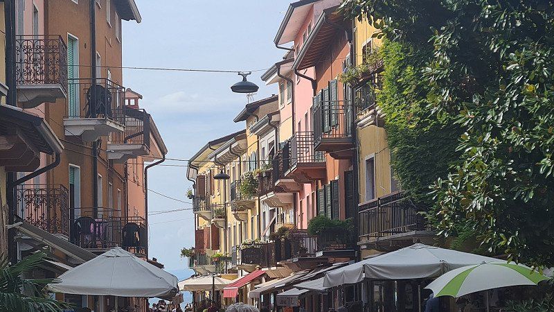
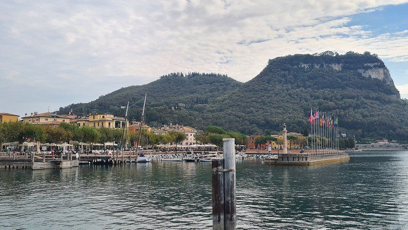
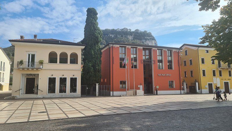
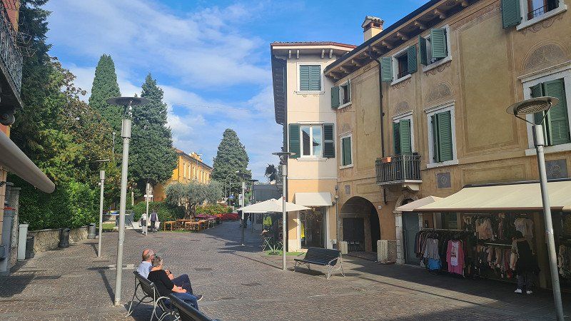
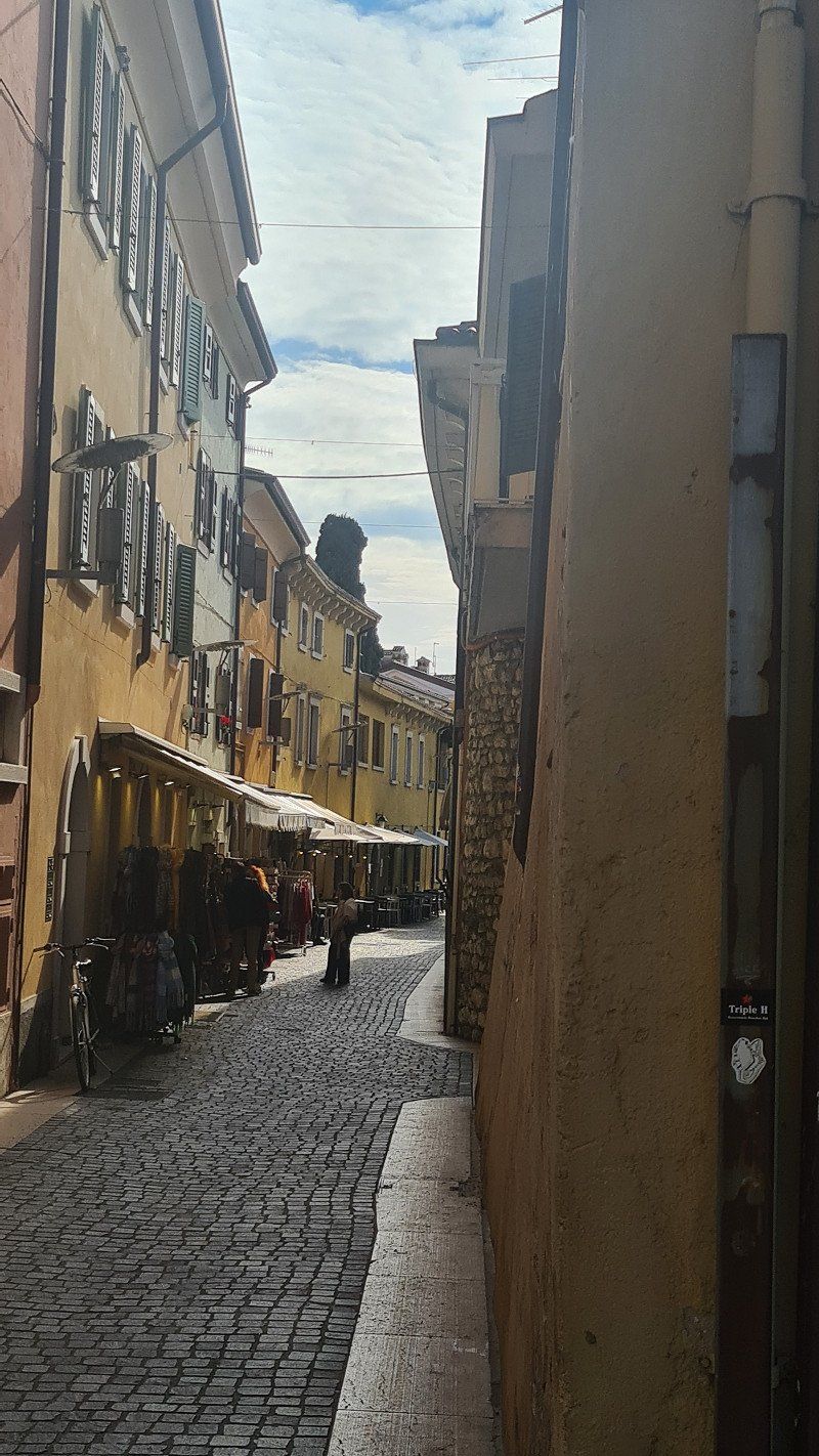
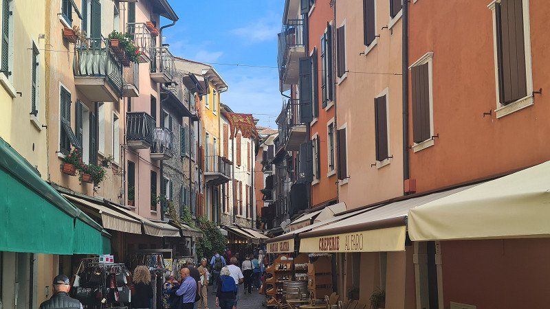
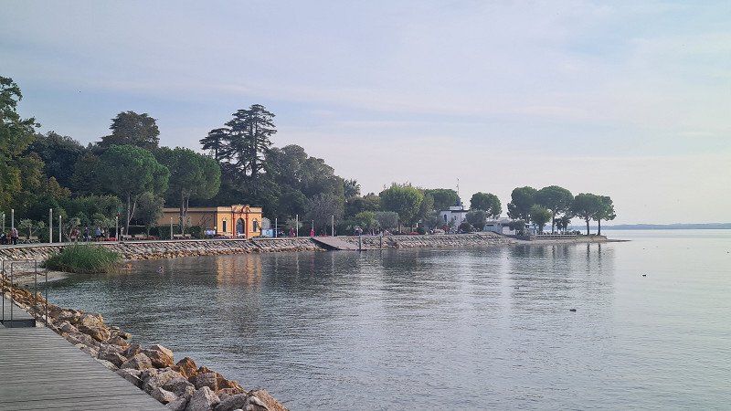
GARDA. Lago di Garda.
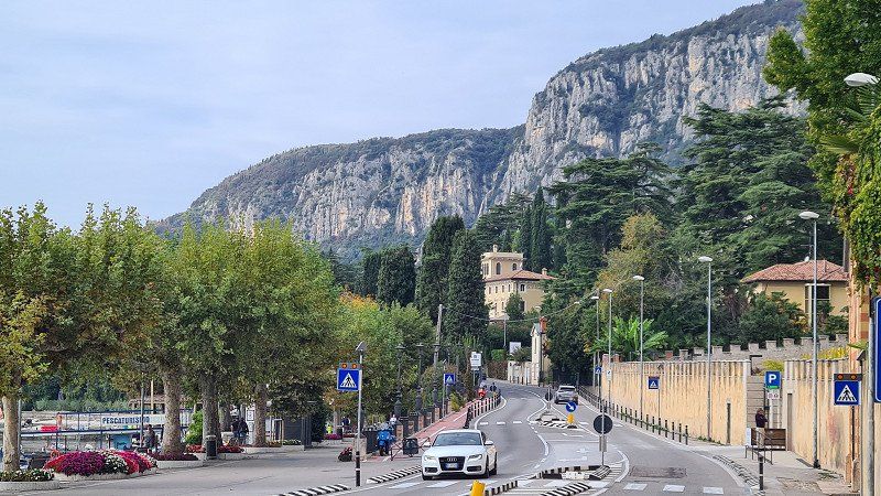
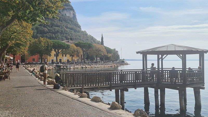
By bike to Garda.
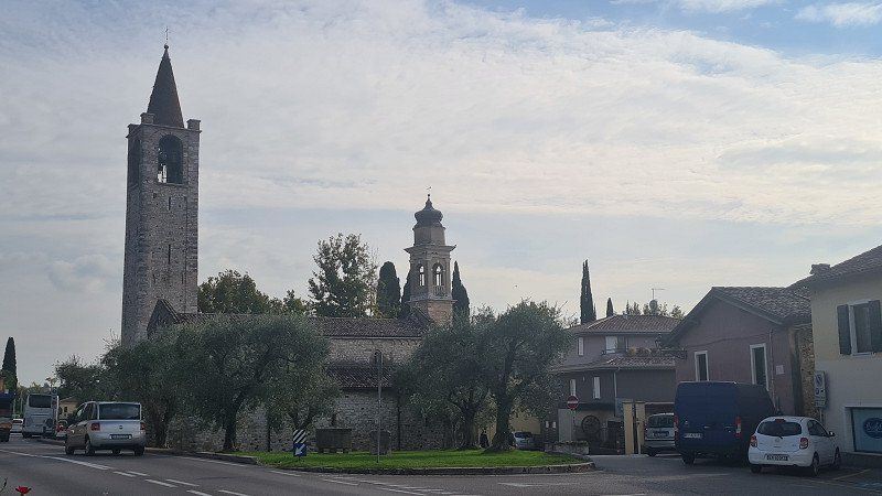
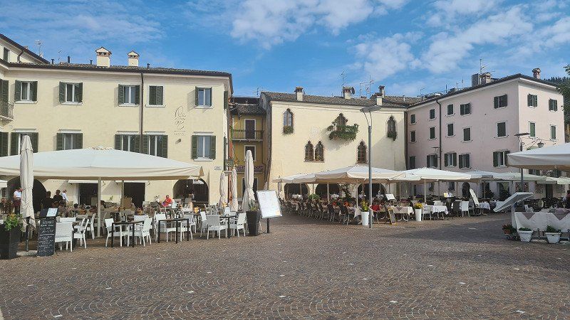
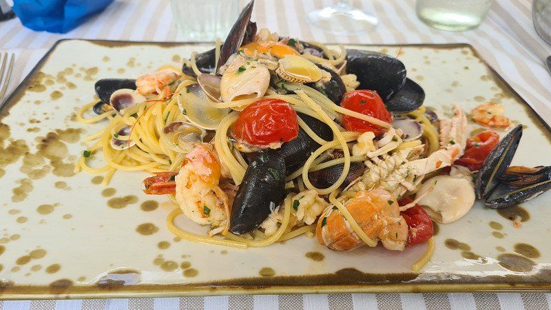
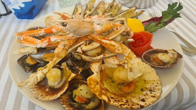
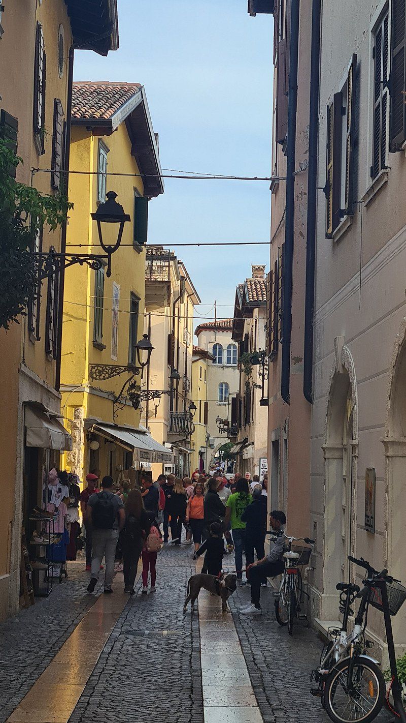
It's Monday, October 10th, 2022. It's going to be another beautiful autumn day with lots of sun and 22 degrees. Today I'm visiting the towns of Garda and Bardolino, which are a good ten and seven kilometers north of Lazise on Lake Garda. The ride is largely flat and pleasant to ride on the narrow road along the lake, even if there are no separate cycle paths. I arrive in Garda around eleven o'clock and take a leisurely stroll along the promenade and through the alleys of the pretty fishing village (1-12). In the Osteria al Porto (13-15) on the lake promenade there is first spaghetti vongole and then an excellent gratinata di frutti di mare.
Garda at Wikipedia.
Garda is a northern Italian municipality with 4'111 inhabitants in the province of Verona on the western edge of the Veneto region . Garda is located on the eastern shore and is the namesake of Lake Garda . In and around the town there is lush, almost Mediterranean vegetation. Therefore, it is a popular tourist destination. Garda is characterized by the lake promenade and the small harbor with the "Palazzo dei Capitani" from Venetian times. The headland of Punta San Vigilio juts out into the lake near Garda . For the philosopher Agostino di Brenzone it was the "most beautiful place in the world". Remains of pile dwellings are evidence of a very early settlement. It is a fact that the Gothic king Theodoric had a castle built on a rocky plateau, Rocca di Garda, high above the town in the fifth century. For a long time it was considered impregnable - even Emperor Barbarossa was unable to capture it. Five centuries later, the Lombard prince Berengar II ruled here until he was defeated by King Otto the Great and imprisoned for life in Bamberg . The castle was destroyed by the Venetians in the sixteenth century. From 1904 until it was finally closed in 1956, the town had a station on the Verona–Caprino/Garda railway . Due to its long history, Garda has a very distinctive character, which is particularly evident in its small but attractive old town and the beautiful promenade, the southern extension of which extends to Bardolino, but on the outskirts it resembles many other settlements on the shore that are shaped by tourism of Lake Garda. In this respect, the old town with the lake promenade is a sight in itself. You can see: Palazzo dei Capitani (“Palace of the Captains”) from the fourteenth century; Villa degli Albertini from the sixteenth century, Villa Canossa from the eighteenth century; the churches of Santa Maria Maggiore and the parish church of Garda from the tenth century, the church of Saint Stephen from the seventeenth century, the church of the Assumption from the eighteenth century and the hermitage of the Camaldolese from the fifteenth century.
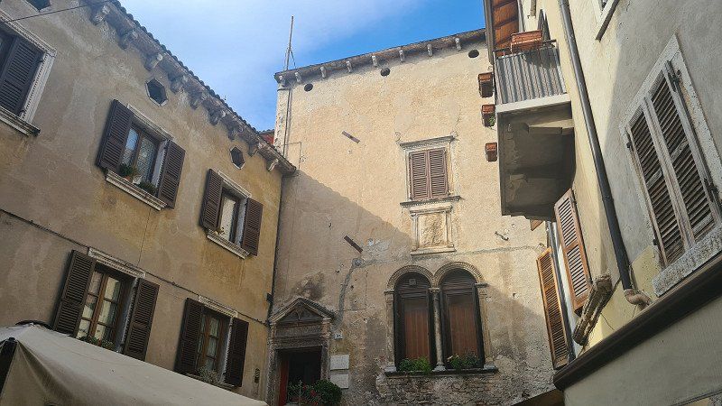
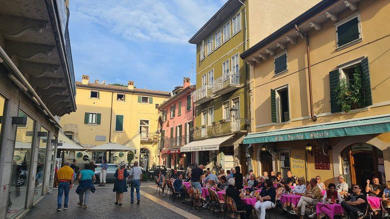
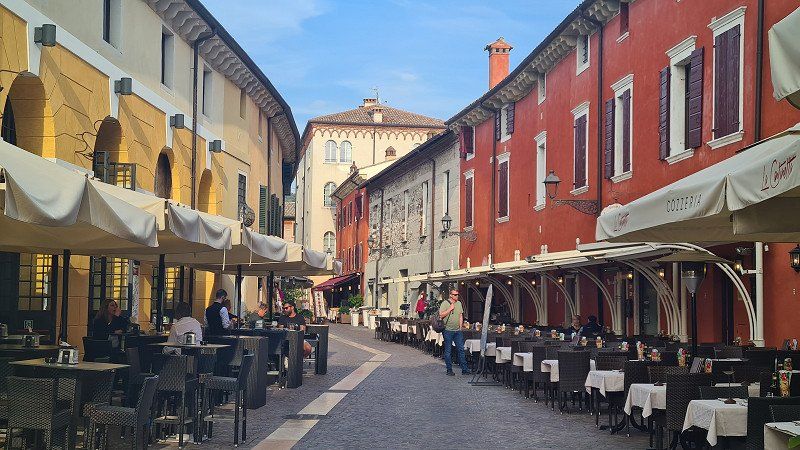
BARDOLINO. Lago di Garda.
Stop in Bardolino on the way back.
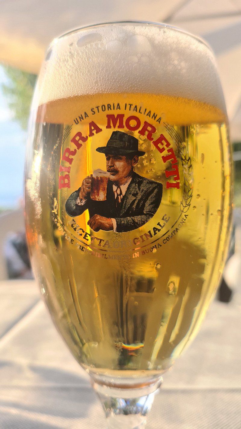
After an excellent lunch I drive back along the Seestrasse towards Lazise. On the way I visit another fishing village Bardolino. Here, too, I walk along the lake promenade and through the streets of the old town (1-14). Then another café americano before I start the further way back to the camp in Lazise. The day in the two small towns was a beautiful experience and left me with impressive images. In the evening there is a Moretti in the camp 's lakeside bistro (14-15).
Bardolino at Wikipedia.
Bardolino is an Italian municipality on Lake Garda in the province of Verona in the north-eastern Italian region of Veneto with 7,207 inhabitants. Bardolino is on the east side of the lake, north of Lazise and south of Garda . Bardolino has two million tourists a year and is the 24th tourist destination in Italy. The place is the seat of the municipality, which also includes the hamlets of Cisano and Calmasino . Cisano is located directly on the Gardesana orientale quay . The center of Bardolino can be reached on foot in 20 minutes along the promenade. Worth seeing in Cisano is the small church of St. Julian from the eighth century. The Middle Franconian community of Rednitzhembach in the district of Roth is a partner community of Bardolino. Wine festivals with winegrowers from the other region take place in both Bardolino and Rednitzhembach. Bardolino is the center of a well-known wine region of the same name . The red Bardolino and the rosé called "Chiaretto" are very popular. Like the surrounding area, the place is a popular tourist destination . You can see seven churches, a Camaldolese monastery, a wine, an olive and a bird museum.
Day
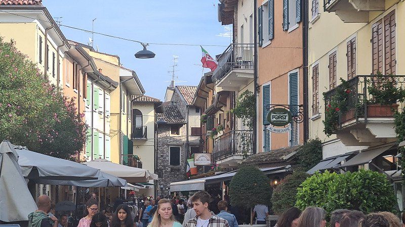
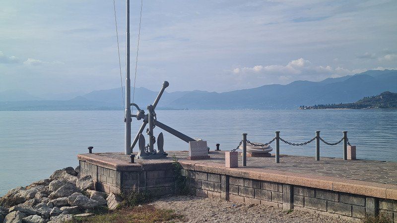
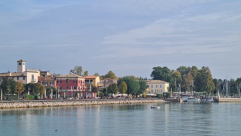
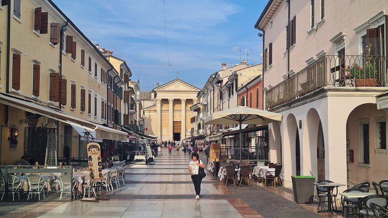
PESCHIERA. Lago di Garda.
With the bike for a stroll through the town of Peschiera.
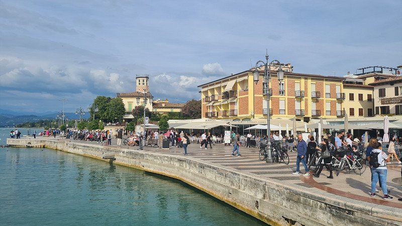
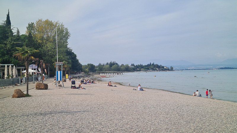
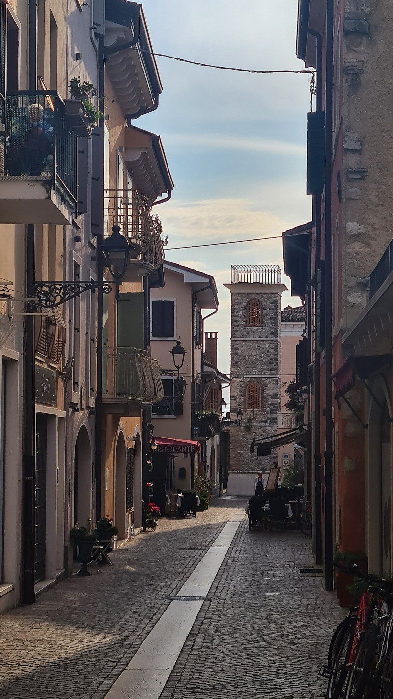
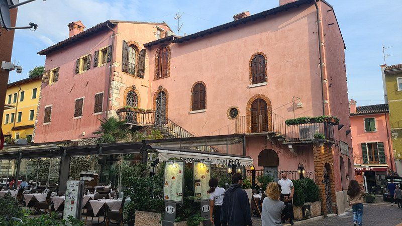
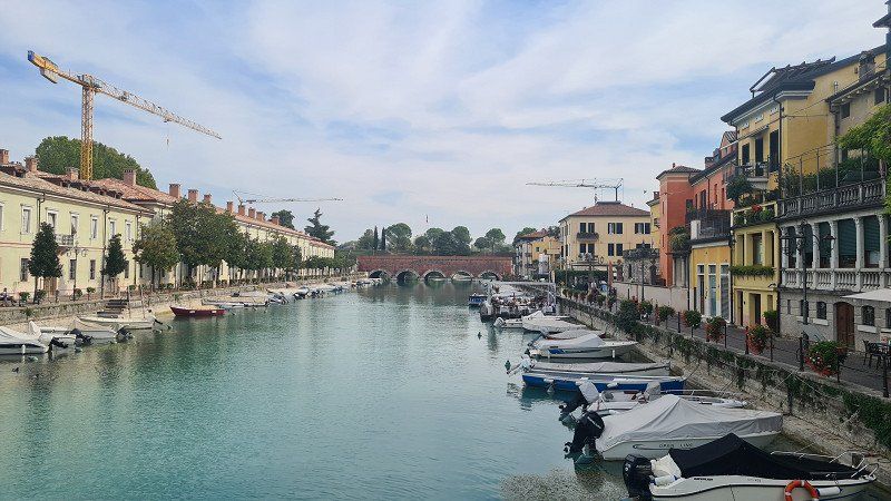
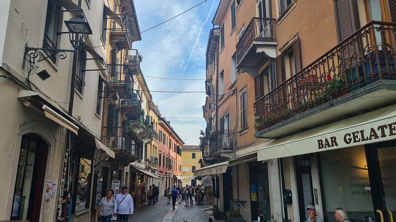
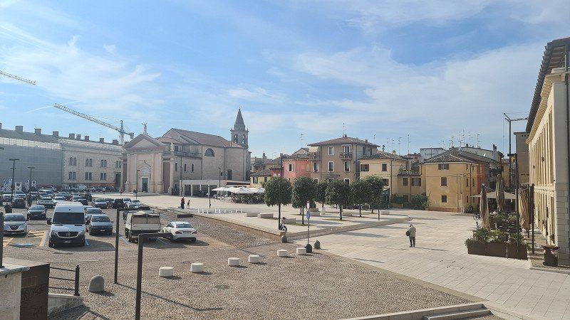
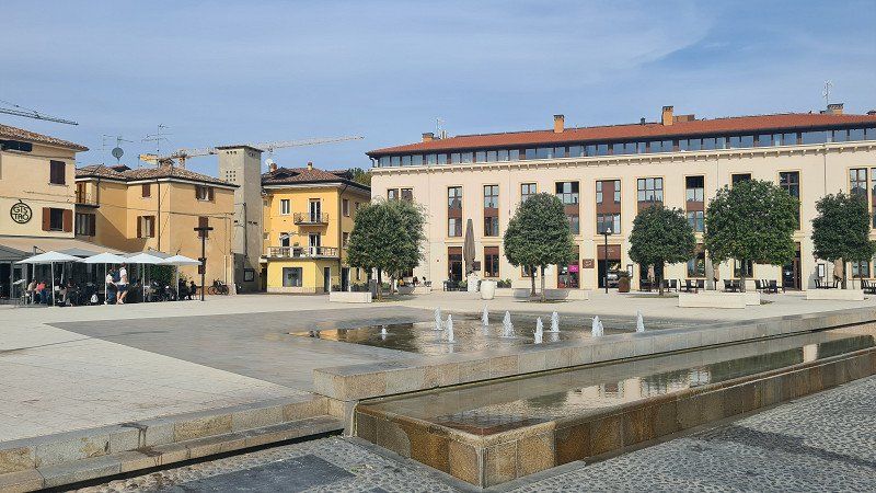
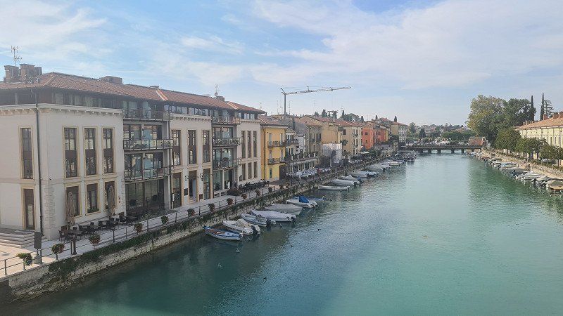
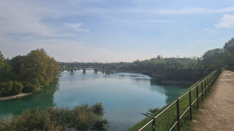
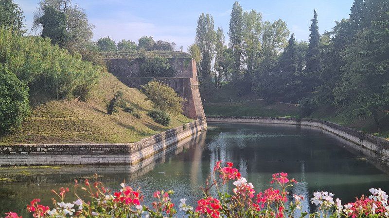
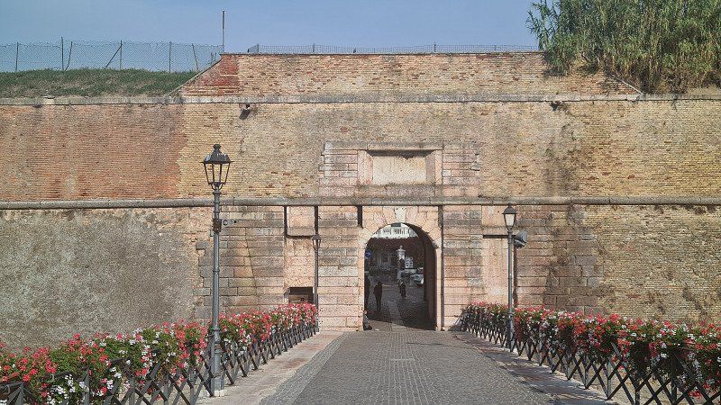
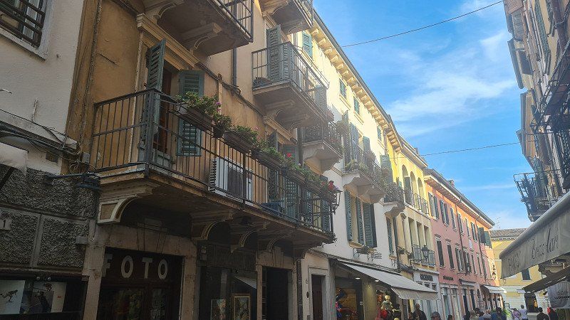
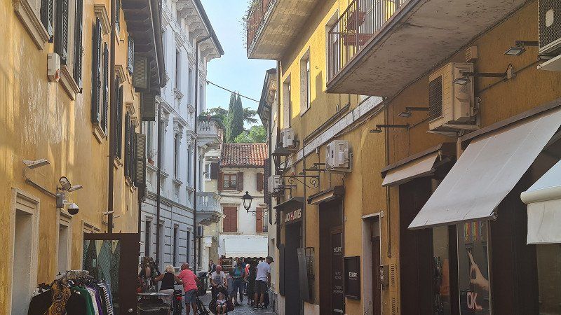
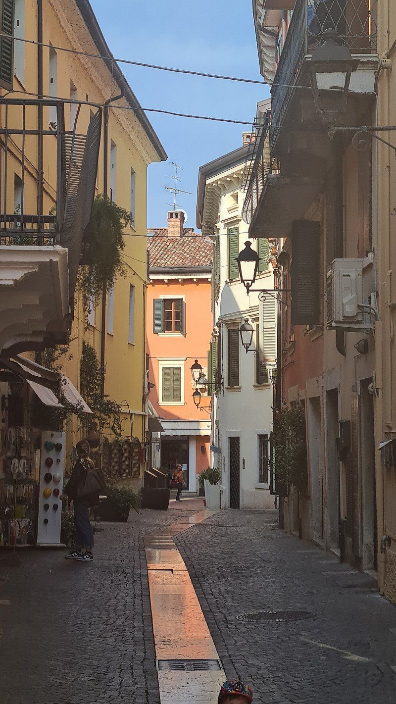
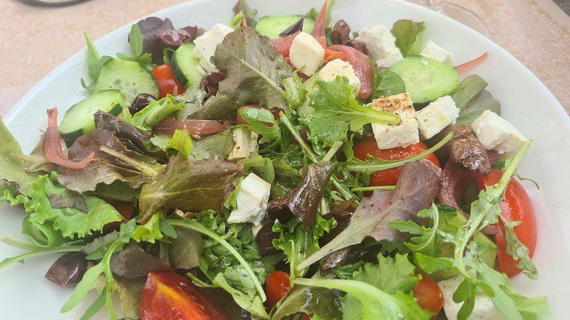
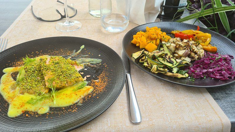
It's Tuesday, October 11, 2022. The weather is holding up, it's still autumnally nice at 22 degrees. Today I cycle south along the lake to the port of Peschiera del Garda. There is a special cycle path almost all the way. On a long walk I get to know a city (1-12) with an interesting history, an impressive harbor with fortifications and beautiful squares and old town streets. In culinary terms, I chose the Ristorante Gistrot (13-14) on the Piazza Ferdinando di Savoia, which is good. I am spoiled with Insalate Greca and a Trota con verdure al vapore . There is also a glass of excellent Soave. With great impressions I drive back to Lazise and take another walk from the camp to the promenade in Lazise (15).
Peschiera del Garda on Wikipedia.
Peschiera del Garda is an Italian commune of 10,930 inhabitants in the province of Verona in the Veneto region . Since 2017 the Fortress of Peschiera del Garda is part of the Unesco World Heritage Site, on the transnational series Venetian Defense Systems of the Sixteenth-Seventeenth Centuries . Peschiera del Garda is located on the southeastern shore of Lake Garda at the point where the Mincio , Lake Garda's only outlet, leaves the lake. Parts of the old town with their fortifications separate the town from the mainland. The town has a small marina , a train station and is home to the Italian army . For several years, Peschiera has been promoting itself as a barrier-free city. All shops can also be reached by wheelchair users via a ramp . Although they often lack the optimal slope, they are still a great relief for wheelchair users. The earliest settlement of Peschiera goes back to the Bronze Age . Two settlements on stilt houses on Lago di Frassino and on the shores of Lake Garda date from this period. They were excavated in the second half of the nineteenth century and the beginning of the twentieth and are attributed to the Peschiera period. The stilt houses of Peschiera have been a UNESCO World Heritage Site since 2011 . In Roman times, the place was noted under the name Arilica, in the Gallia cisalpina , to be read as Ariolica in the Peutinger tablet. Probably between the eighth and ninth centuries the place took the current name of Peschiera. In 899 Peschiera captured Berengar I on the Brenta River after his defeat by the Hungarians invading northern Italy . During the seignory , the town first fell under the control of the Ezzelino family. After the defeat of Ezzelinos III. In 1259 in the Battle of Cassano d'Adda and the subsequent decline of the House of Ezzelino, Peschiera fell to Mastino I della Scala in 1260 . The Scaligeri rule lasted until the end of the fourteenth century, when Peschiera fell to Gian Galeazzo Visconti . Finally, in 1440, the Republic of Venice , under its Condottiere Francesco I Sforza take the place. Venice built Peschiera into a fortress between the fifteenth and sixteenth centuries. After the Congress of Vienna , Peschiera became part of the Kingdom of Lombardy-Venetia and formed the so-called fortified quadrangle with the towns of Mantua , Verona and Legnago . Piedmontese troops took Peschiera in 1848 during the First Italian War of Independence . But it was only after the Third Italian War of Independence of 1866 that Peschiera became part of the newly established Kingdom . Sights include the historic town center with the fortress wall and excavations from Roman times.
Day
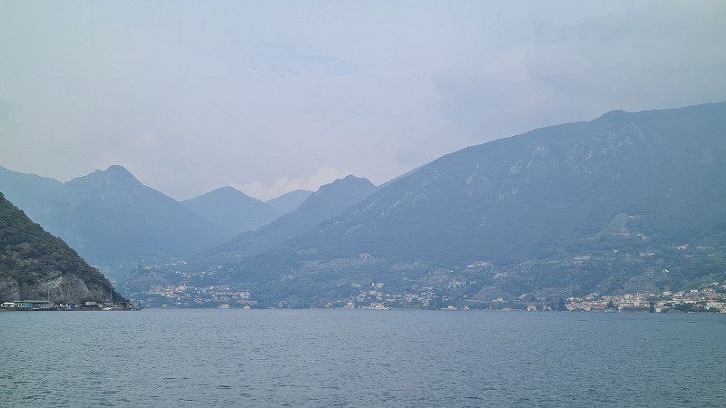
CRONE. Lago d'Idro.
Drive through Trentino.
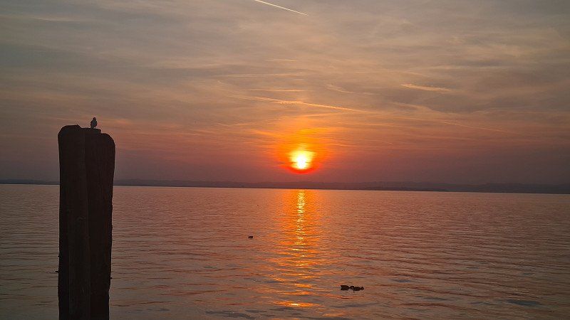
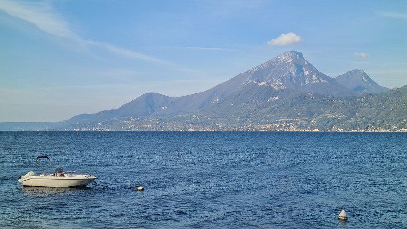
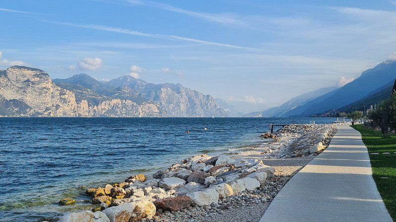
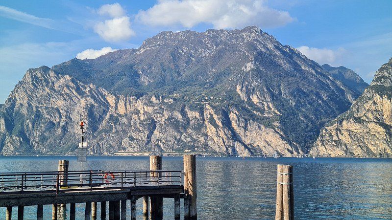
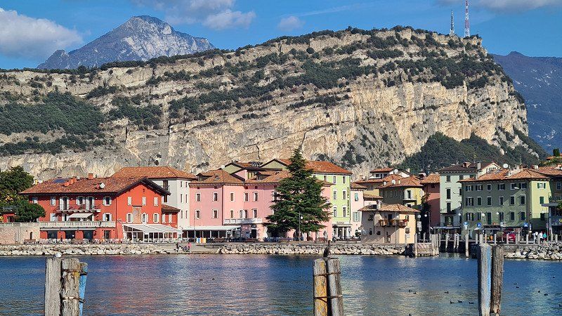
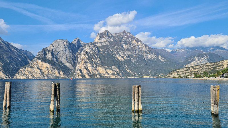
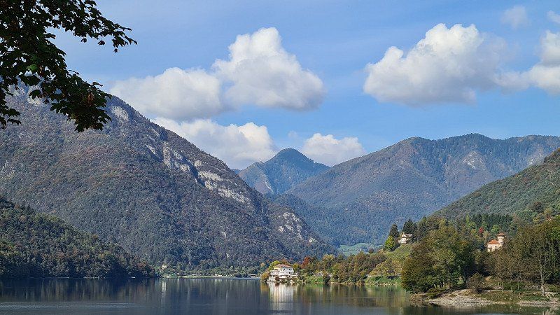
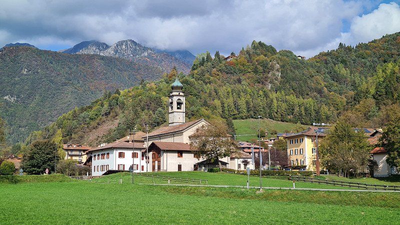
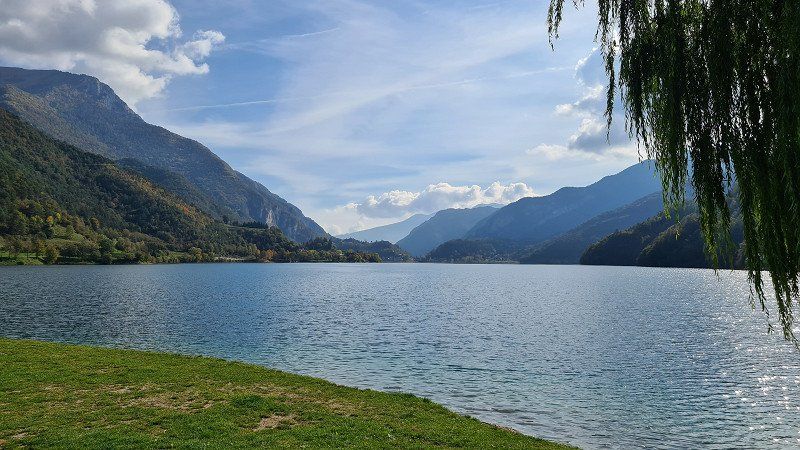
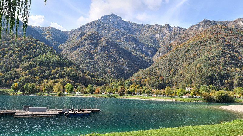
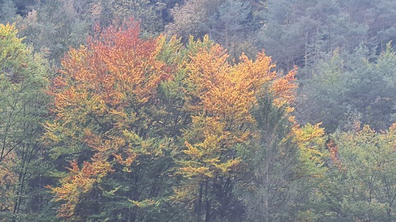
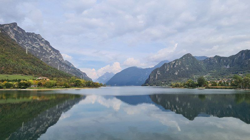
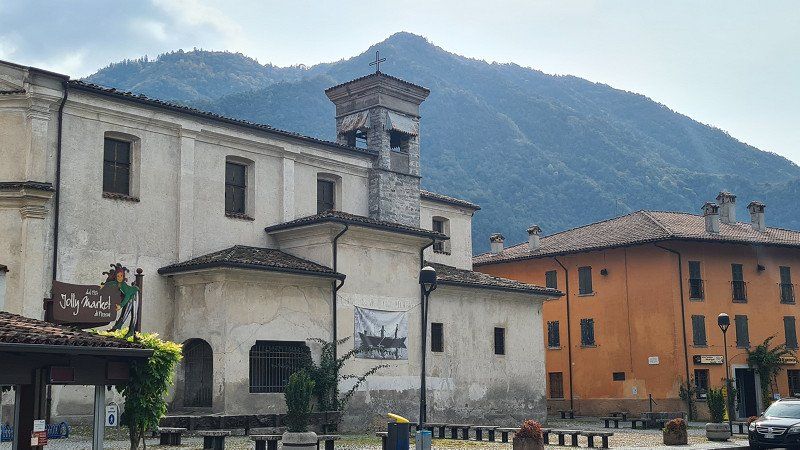
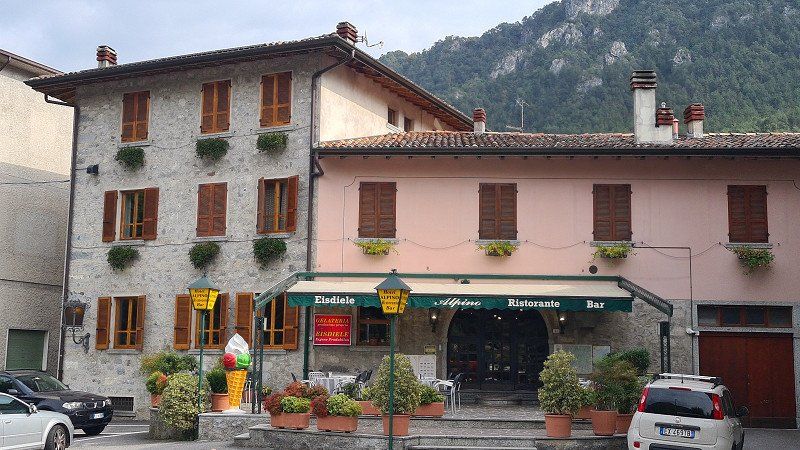
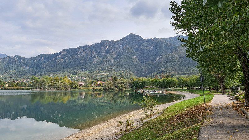
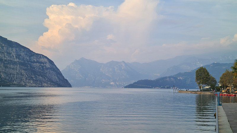
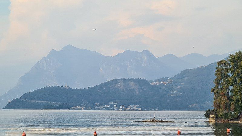
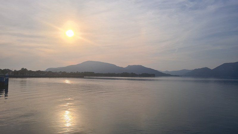
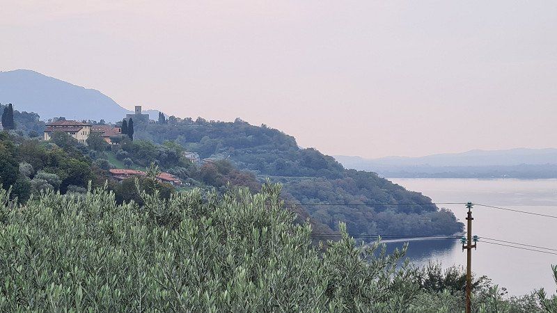
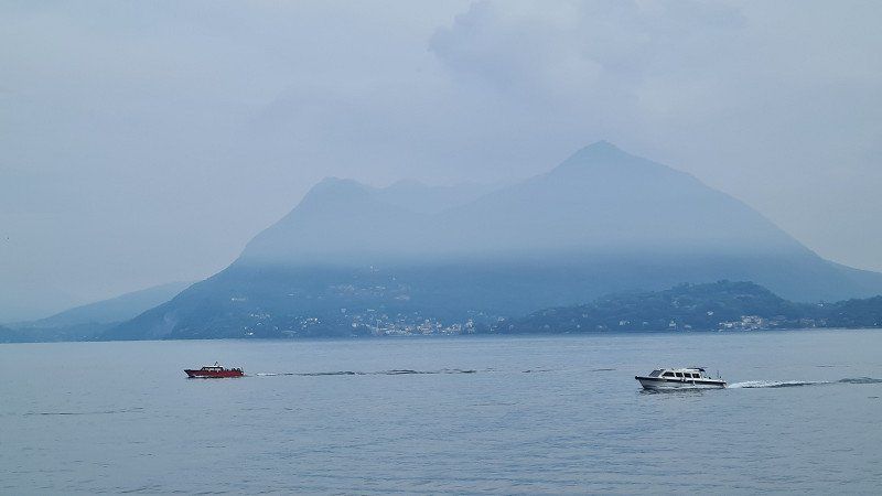
It's Wednesday, October 12, 2022. It's still beautiful autumnal weather at 21 degrees. Today I drive from Lazise up the west side of Lake Garda to the northern end at Riva del Garda and from there through Trentino past the lakes Lago Leandro and Lago d'Idro to Colvero on Lago d'Iseo. For the 168-kilometer route over country roads and mountain passes, I need almost six hours of driving time with several short stops at the end. My first stop is roughly in the middle of the lake near Brenzone (1-3), followed by another at Riva del Garda (4-6). From there it goes into the mountains of Trentino and after a good hour's drive I stop again at the idyllic Lago di Ledro (7-11) and enjoy the wonderful view of the lake. It continues through the mountains and after another hour I reach Lago d'Idro (12-15), where I get a fine homemade fichi ice cream at the Ristorante Alpine in Crone. So far the chosen path has been worth it, a nice ride.
Lago di Ledro and Lago d'Idro at Wikipedia.
Lago di Ledro ( Lake Ledro) is a mountain lake in Trentino . T he Lago di Ledro is 655 meters above sea level between Lake Garda and Lake Idro at the eastern end of the Valle di Ledro . The lake has an area of 2,187 square kilometers, the deepest point is 47 meters below the water surface. Lake Ledro is of glacial origin and formed a single lake area with Lago d'Ampola at the south-west end of the valley after the last cold period , the Ledrotal from Molina di Ledro to the Ampola Pass. The lake bed was carved out by a branch of the Etsch glacier , in which water could accumulate , favored by the moraine remains at the eastern end at Molina di Ledro and by alluvial fans of the Rio Visi at the western end. The watercourses coming from the side valleys of the Ledro Valley finally caused the original continuous lake bed to silt up due to sedimentation and separated the two lakes . There are three places on Lake Ledro that are shaped by agriculture and tourism: Molina di Ledro (on the south-east side), Pieve di Ledro (on the north-west side) and Mezzolago (between Molina and Pieve). Lake Idro or Erídio (Idrosee) is a northern Italian alpine lake. The valley belongs to the valleys of the Judicaries . Lake Idro is located in the northern Italian province of Brescia between Lake Garda , Lake Ledro and Lake Iseo . The 11 square kilometer large, 10 kilometer long and (in front of the Rocca d'Anfo ) 122 meter deep lake is at an altitude of 368 meters above sea level. The natural reservoir, a product of the Ice Age, is fed by the Chiese and Caffaro rivers. The Chiese leaves the lake at Pieve Vecchia . At the highest water level, the water volume of the lake is almost 600 million cubic meters. The lake is used, among other things, for fishing, which has been practiced here since time immemorial, and as an irrigation reserve for the areas of Brescia and Mantua . The mountain lake is almost as warm as Lake Garda , at least 20 degrees in summer. On its banks lies the greater municipality of Idro . In 1961 a first campsite was opened on Lake Idro. Today it is managed by the German company AZUR Freizeit GmbH. The lake is a meromictic body of water due to its stratification .
25074 Crone, Province of Brescia, Italien
45° 44' 21.5" N 10° 28' 47.8" E
45.7392991 10.4799337
• Head southeast on Via Giuseppe Mazzini.
• Continue on Via Cesare Battisti. Go for 109 m.
• Turn slightly left onto Via Roma. Go for 81 m.
• Turn slightly right toward Via Bonaghe. Go for 44 m.
• Turn right onto Via Bonaghe. Go for 181 m.
• Turn right onto Strada Provinciale Idro-Capovalle (SP58). Go for 299 m.
• Take the 2nd exit from roundabout onto Strada Provinciale Idro-Capovalle (SP58). Go for 845 m.
• Turn right onto Via Lungo Lago Italia toward Brescia/Trento/Ospedale. Go for 674 m.
• Continue on Via Roberto Bertini (SP58). Go for 579 m.
• Turn left onto Via Trento (SPBS237) toward Brescia. Go for 5.2 km.
• Pass 3 roundabouts and continue on Strada Provinciale del Caffaro (SPBS237). Go for 16.2 km.
• Continue on La Guarda. Go for 1.9 km.
• Continue on Monte Castello. Go for 1.6 km.
• Continue on Via Fibbia. Go for 176 m.
• Take left ramp onto Strada Statale Gardesana Occidentale (SS45bis) toward Trento/Salò-Desenzano/Autostrade/A4/A35/Brescia. Go for 17.8 km.
• Take ramp onto Strada Provinciale Padana Superiore (SPBS11var) toward Brescia. Go for 16.8 km.
• Keep right onto Strada Provinciale Sebina Orientale (SPBS510DIR) toward Pisogne/SPBS510/Rodengo Saiano. Go for 1.5 km.
• Keep left onto Strada Provinciale Sebina Orientale (SPBS510DIR) toward Pisogne/SPBS510/Zona Industriale Moie. Go for 11.9 km.
• Take ramp. Go for 324 m.
• Take the 1st exit from roundabout onto Strada Provinciale Sebina Orientale (SPBS510). Go for 1.0 km.
• Take the 1st exit from roundabout onto Via Covelo (SPBS510) toward Darfo B. T. Go for 227 m.
• Turn left onto Via Fenice. Go for 37 m.
• Arrive at Via Fenice. Your destination is on the right.
☍
77,5 km
(1 hrs. 3 min.)
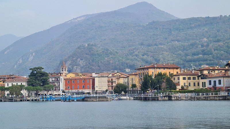
LAGO D'ISEO. Drittes Ziel.
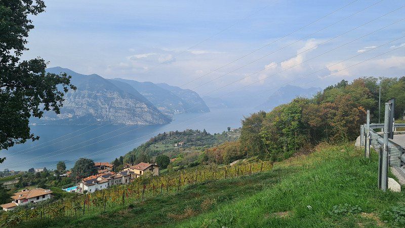
Lago d'Iseo or Sebino (Lake Iseo) is the fourth largest of the northern Italian lakes . It is located in the Lombardy provinces of Brescia and Bergamo . The lake is located northwest of Brescia , at the foot of the Bergamasque Alps and the Adamello-Presanella Alps . The lake basin was hollowed out by the glacial glaciers of the Valcamonica valley. The river Oglio feeds the lake. The 65 square kilometer lake is 181 meters above sea level , is 25 kilometers long and up to 251 meters deep. In the lake are the islands of Monte Isola (“island mountain”), the largest in southern European inland waters , as well as Isola di Loreto and Isola di San Paolo . The latter is owned by the Beretta arms manufacturing dynasty . You can drive around the lake completely, despite the many rock faces that drop steeply down to the water. The road is carved out of the rock in many places. The towns of Lovere , Marone , Pisogne , Sulzano , Iseo , Paratico , Sarnico and Riva di Solto are on the shore . Due to favorable fall winds, the lake has developed into a paradise for sailing sports . A good tourism infrastructure has developed on the few bathing beaches , but Lake Iseo is far less frequented than Lake Como or Lake Garda . The Franciacorta wine-growing region begins immediately south of the lake . In 2016, artist Christo opened his artwork The Floating Piers in the middle of the lake . With this installation it was possible to walk from Sulzano to the island of Monte Isola and from there to the island of San Paolo via 16-metre-wide footbridges floating in the water. The work of art was accessible for almost a month and was then dismantled and recycled. Wikipedia.
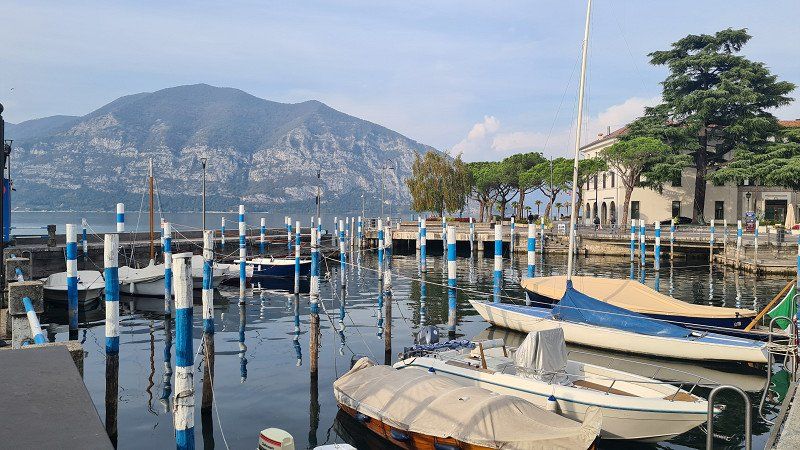
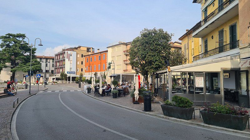
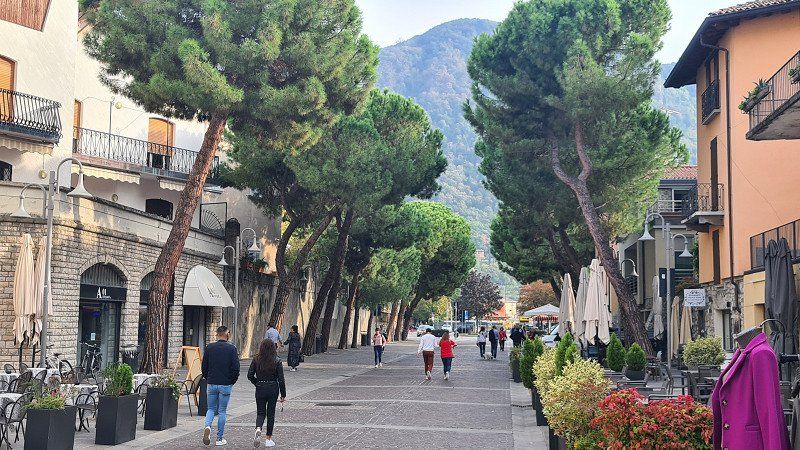
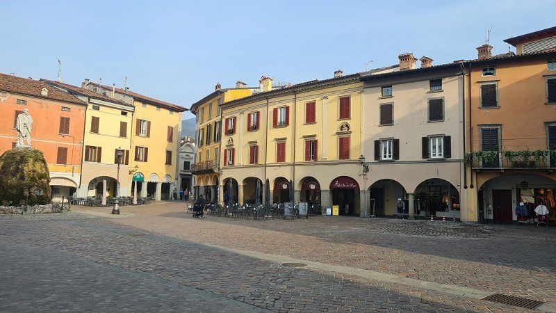
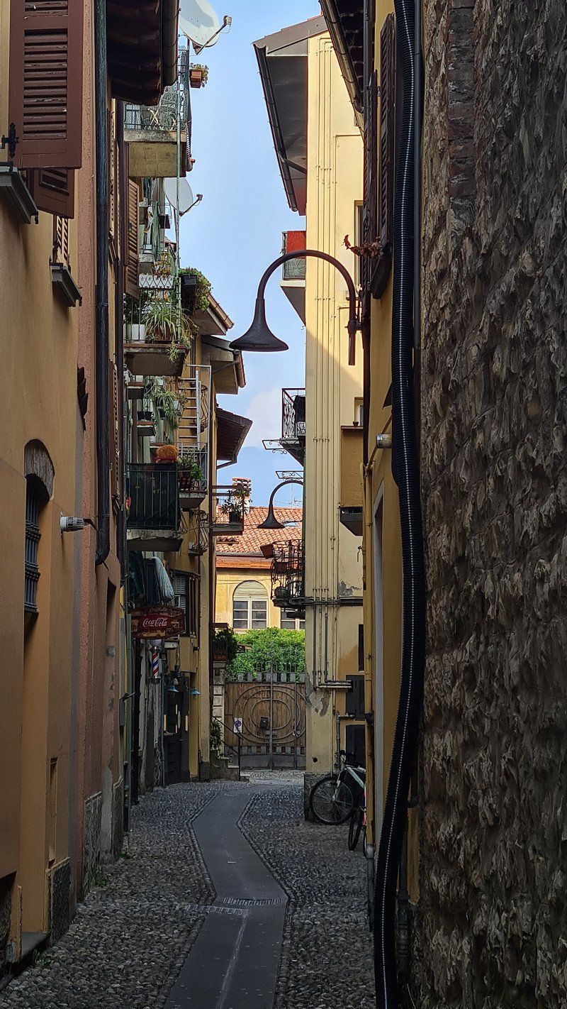
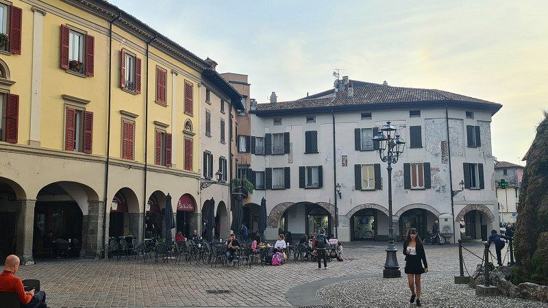
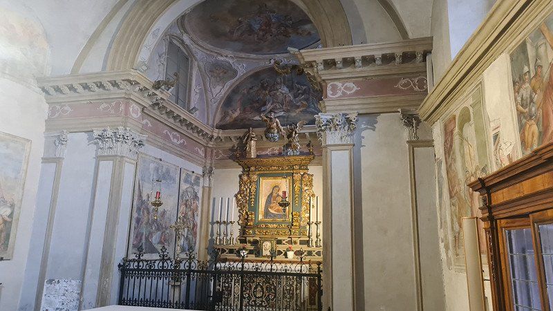
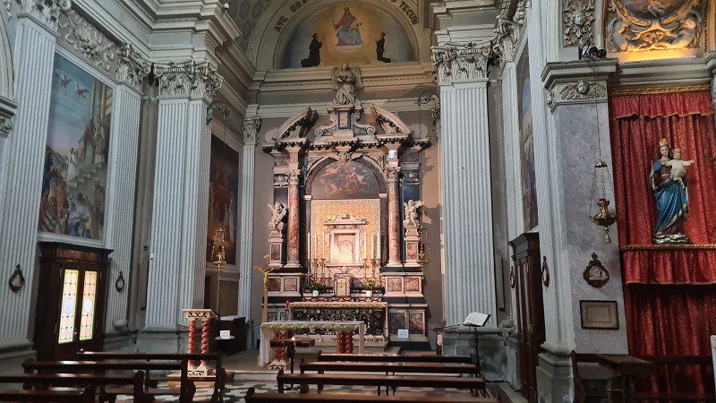
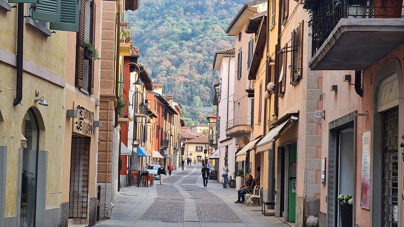
ISEO. Lago d'Iseo.
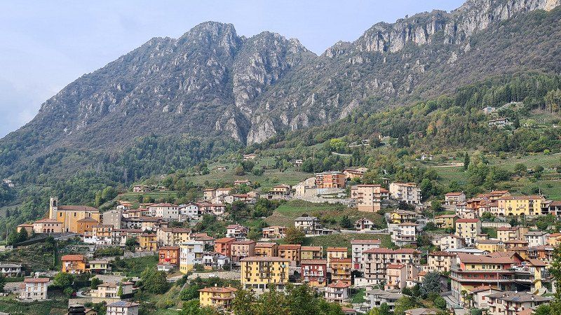
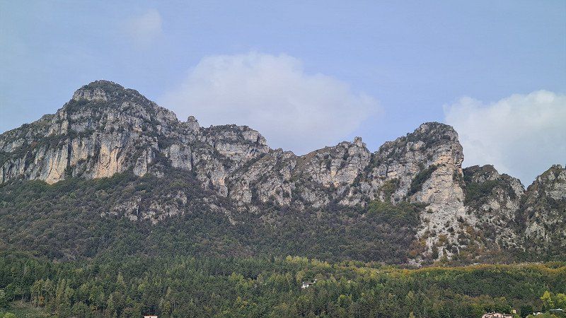
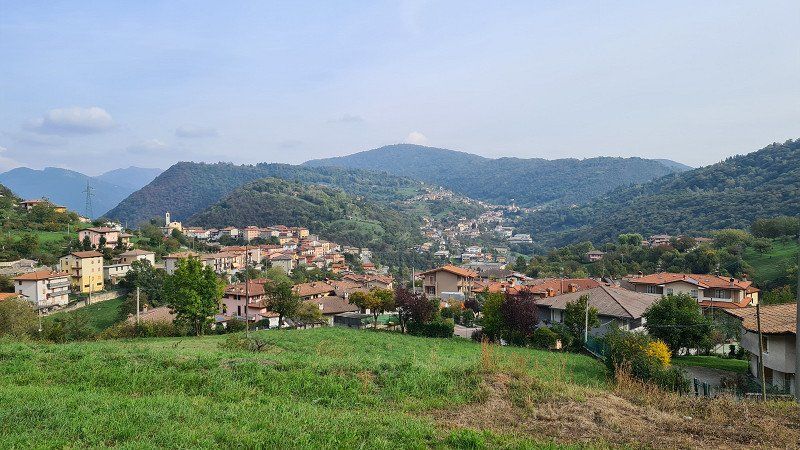
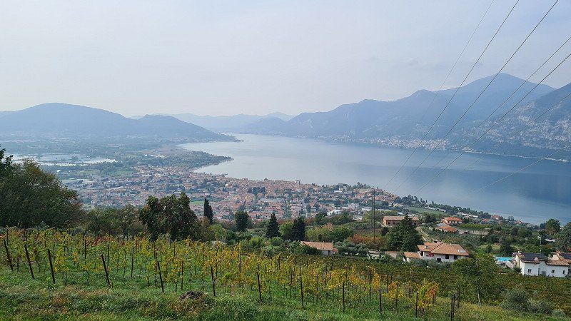
Continue to Lake Iseo.
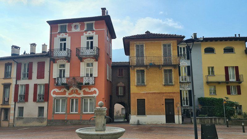
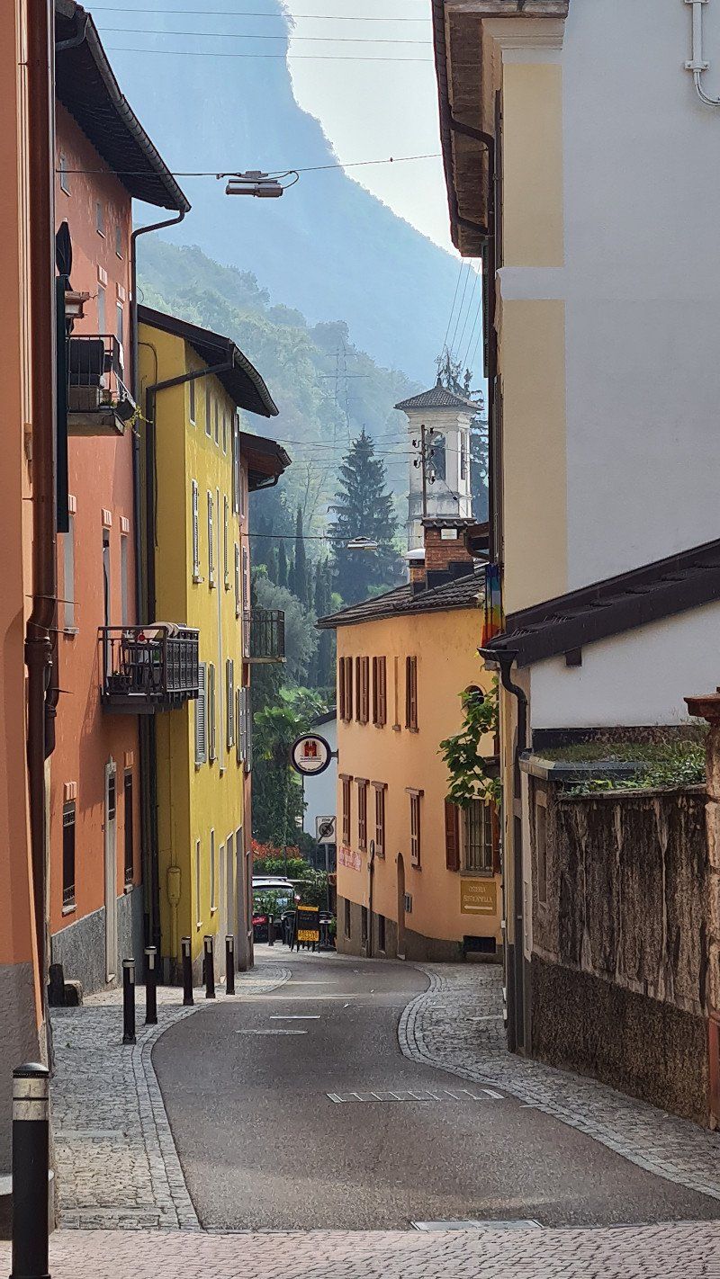
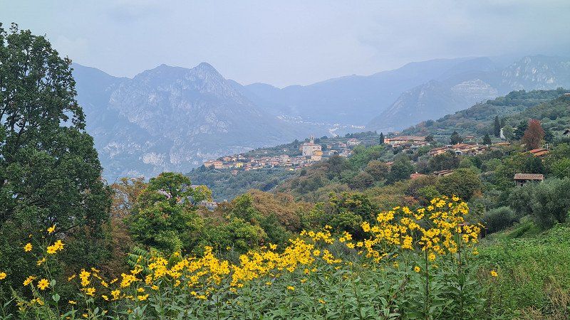
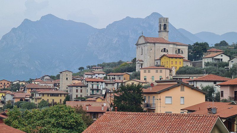
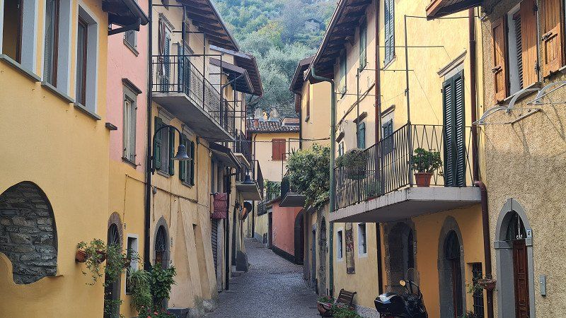
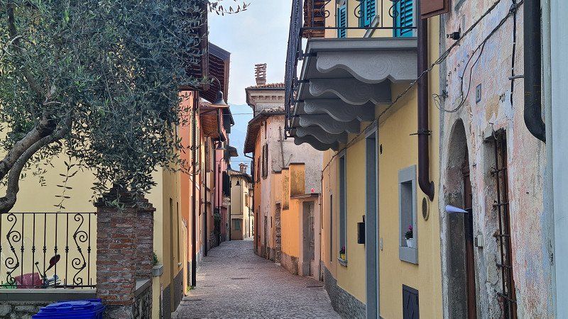
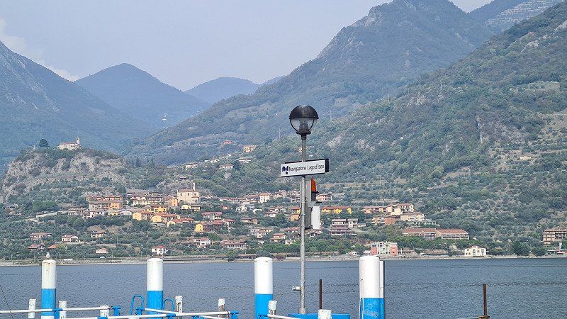
After strengthening yourself in the ice cream parlour, it's another hour through the mountains (1-5) past beautiful mountain slopes and mountain villages. Around three o'clock the view down to Iseo and Lago d'Iseo opens up in front of me (4-5). A short time later I move into the pitch at Camping Covelo. I decide to cycle the two kilometers to Iseo for a stroll (6-15). A picturesque small town with interesting squares, alleys, promenades.
Iseo at Wikipedia.
Iseo is a town in Italy with 9'155 inhabitants in Lombardy in the province of Brescia. The city covers an area of 25 square kilometers. Iseo is located 20 kilometers north-west of Brescia at the south-east end of the lake of the same name. Iseo includes the towns of Pilzone, Cóvelo and Clusane. The neighboring municipalities are Adro, Corte Franca, Monte Isola, Monticelli Brusati, Paratico, Polaveno, Predore, Provaglio d'Iseo, Sarnico, Sulzano and Tavernola Bergamasca. Iseo is on the 105 km long railway line Brescia-Iseo-Edolo. The first monument erected in honor of Garibaldi is in Iseo.
Via Covelo, 18, 25049, Iseo, Italy
45° 40' 0.9" N 10° 4' 0.1" E
45.6669149 10.0666896
• Head southeast on Via Fenice. Go for 37 m.
• Turn right onto Via Covelo (SPBS510). Go for 172 m.
• Continue toward Autostrade/Brescia/Rovato. Go for 33 m.
• Take the 2nd exit from roundabout onto Via Covelo (SPBS510) toward Autostrade. Go for 1.1 km.
• Take the 2nd exit from roundabout onto Montecognolo (SPBS510) toward Brescia. Go for 8.0 km.
• Take ramp toward Ospitaletto/A4/Concesio/SP19/Capriano D/C/Rodengo Saiano/SPBS345. Go for 95 m.
• Continue on Via Provinciale (SPBS510) toward Brescia. Go for 189 m.
• Turn right and take ramp onto Strada Provinciale Concesio-Ospitaletto-Capriano D/C (SP19) toward A4/Cremona/A21/Aeroporto Montichiari/Orzinuovi/Rovato/Ospitaletto. Go for 3.5 km.
• Take ramp toward Milano-Venezia/A4/Passirano. Go for 167 m.
• Turn left onto Via Vallosa toward Ospitaletto/Autostrade/Zona Industriale Passirano. Go for 530 m.
• Take the 1st exit from roundabout onto A4 (Autostrada Torino-Trieste) toward Autostrada/Ospitaletto. Go for 80.9 km.
• Take the exit toward E62/Varese/Aeroporto Malpensa/Gravellona T./A26/E35/Como-Chiasso/A9 onto A8 (Autostrada Milano-Varese). Go for 31.4 km.
• Keep left onto A8dir (Autostrada dei Laghi) toward A8/Genova/A26/Gravellona T. Go for 17.9 km.
• Take the exit toward Castelletto T. Go for 1.9 km.
• Take ramp onto Strada Statale Ticinese (SS32) toward Angera/Sesto Calende/Castelletto Ticino/Arona/Dormelletto. Go for 501 m.
• Continue toward Arona. Go for 47 m.
• Take the 2nd exit from roundabout onto Strada Statale del Sempione (SS33) toward Arona. Go for 420 m.
• Pass 2 roundabouts and continue on Corso Camillo Benso di Cavour (SS33). Go for 1.9 km.
• Take the 2nd exit from roundabout onto Corso Camillo Benso di Cavour (SS33). Go for 1.6 km.
• Take the 3rd exit from roundabout onto Via Milano (SS33). Go for 826 m.
• Take the 1st exit from roundabout onto Via Milano (SS33). Go for 473 m.
• Take the 1st exit from roundabout onto Corso della Liberazione. Go for 185 m.
• Take the 2nd exit from Largo Caduti Aronesi roundabout onto Corso della Liberazione. Go for 220 m.
• Continue on Piazza De Filippi. Go for 45 m.
• Continue on Viale Berrini. Go for 124 m.
• Take the 1st exit from roundabout onto Viale Berrini. Go for 187 m.
• Take the 1st exit from roundabout onto Via Angelo Cantoni (SS33). Go for 6.9 km.
• Turn right onto Via al Campeggio. Go for 178 m.
• Arrive at Via al Campeggio. Your destination is on the right.
☍
159,5 km
(1 hrs. 37 min.)
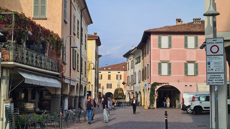
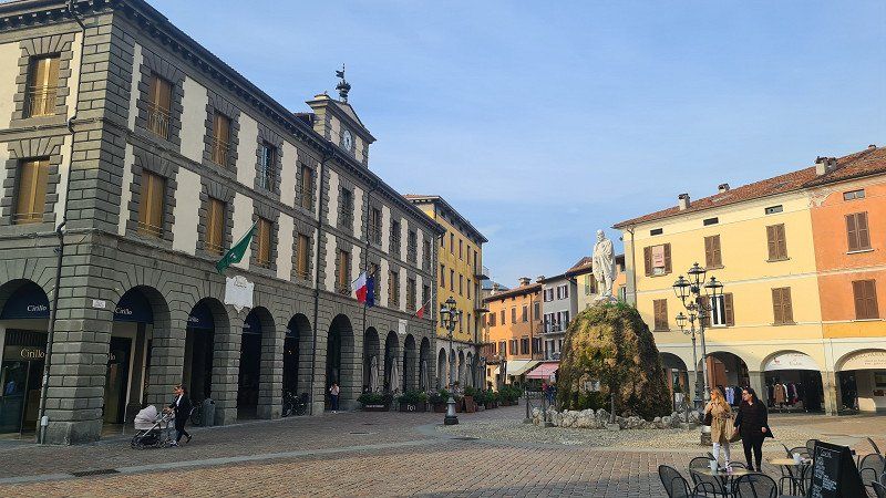
COVELO. Lago d'Iseo.
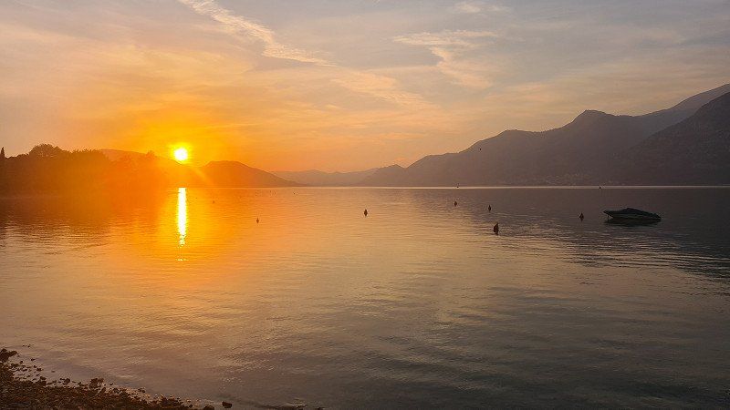
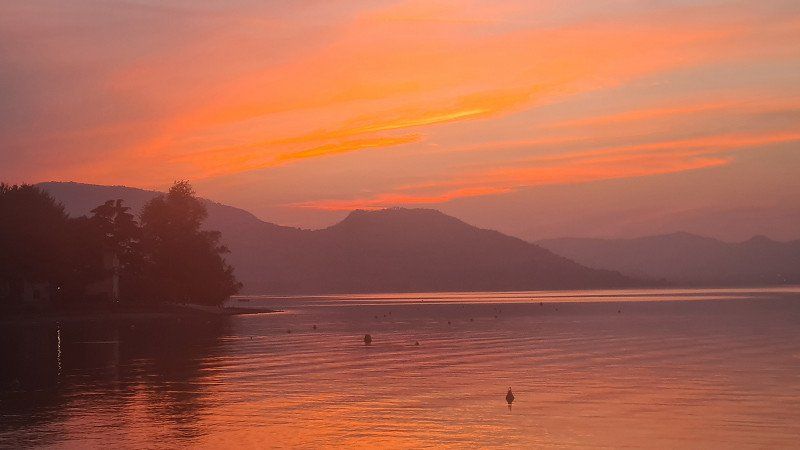
Nice pitch and sunset.
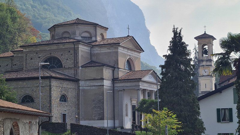
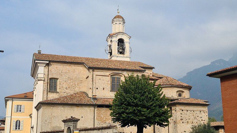
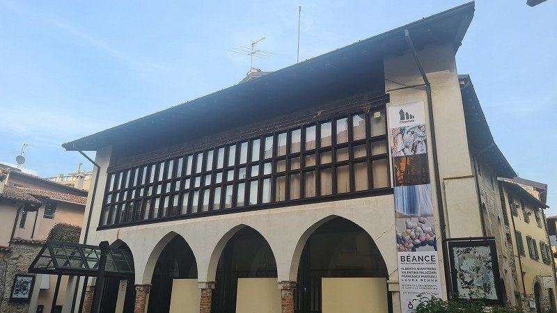
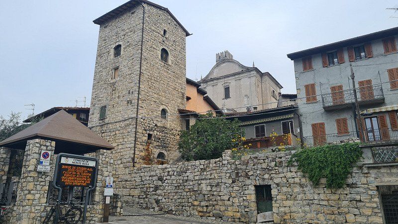
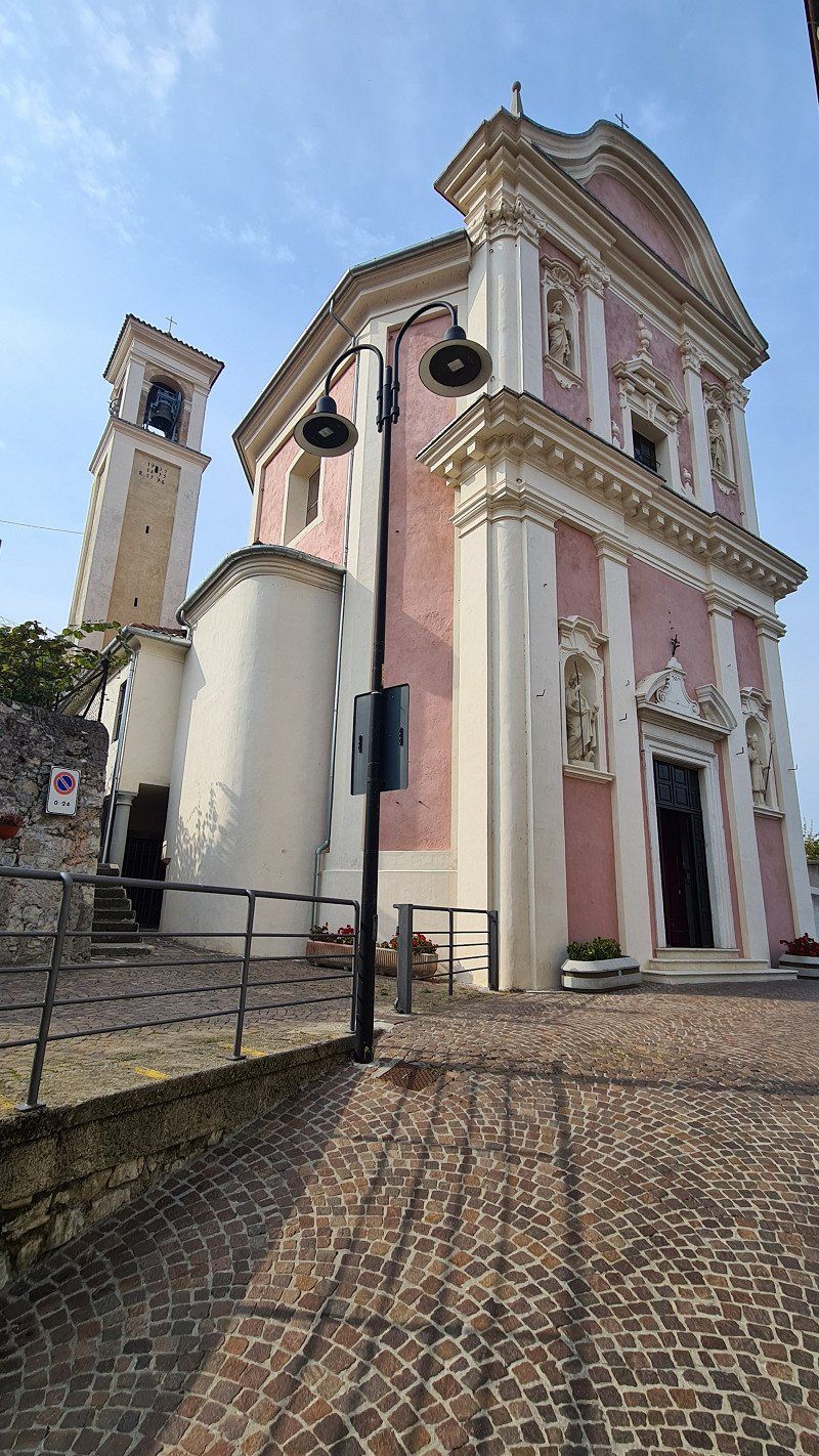
I continue the stroll through the streets (1-9) in Iseo, also visit the two churches and drink a cappuccino by the lake. Then I drive back to the camp and sit down on my beautiful pitch (10-15) directly at the lake. Time flies by as dusk falls and the sun sets in a blaze of color.
Day
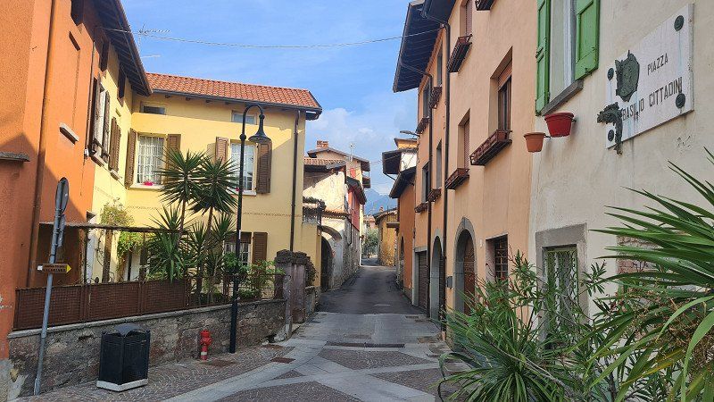
MONTE ISOLA. Lago d'Iseo
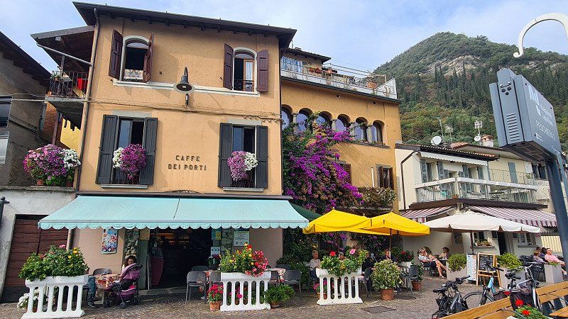
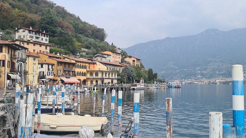
With the bike to the island.
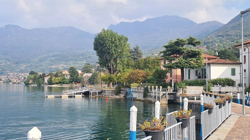
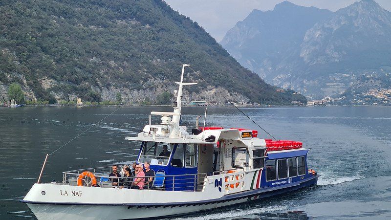
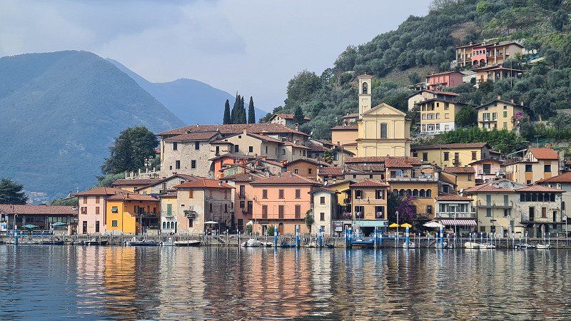
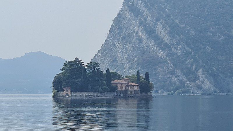
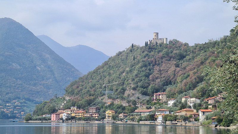
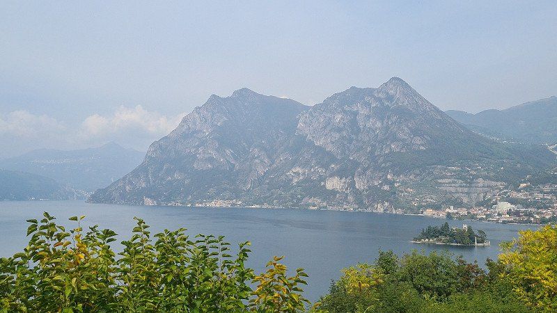
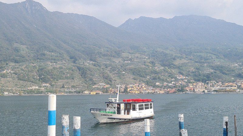
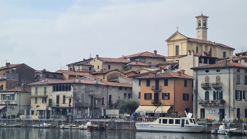
It's Thursday, October 13, 2022. And again it's going to be a beautiful autumn day with lots of sun and 21 degrees. Today I'm visiting Monte Isola, a popular attraction on Lago d'Iseo. Via Covelo (1-2) I cycle along the lake to Sulzano (3-4). There I board the small ferry (5) that takes me to the island of Peschiera Maraglio (6-8) and there to a café americano in the Caffe del Porto. I now cycle around the island clockwise, past Isola San Paolo (9), up to Torre Rocca Martinengo (10) and further up to the mountain village of Siviano (11-13), where there is a mountain village in the Albergo Bellavista second stop. Shortly thereafter I reach the northern end of the island with views of the northern part of Lago d'Iseo (14-15) with the Castello dell'Isola di Loreto .
Monte Isola at Wikipedia.
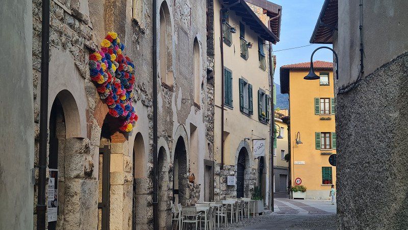
Monte Isola is the largest island in a southern European lake. It has a circumference of nine kilometers and rises more than 400 meters above the water surface of Lake Iseo in the Italian region of Lombardy. At the top of the hill is the Santuario della Madonna della Ceriola church. Monte Isola is a member of the association I borghi più belli d'Italia (The most beautiful places in Italy). The 1811 inhabitants are spread over four larger and five smaller villages, which are administered by the municipality of Monte Isola and which also includes the two small side islands Isola di Loreto (to the north) and Isola di San Paolo (to the south). The largest village is Siviano with 425 inhabitants, also the administrative center of the municipality of Monte Isola. There is a bus line on the island, residents are allowed to use mopeds and scooters. Cars and trucks are only allowed in exceptional cases. Tourists are only allowed to explore the island without a motor or by bus. There are continuous ferry connections between Peschiera Maraglio and Sulzano and between Carzano and Sale Marasino. These are also operated throughout the night. Furthermore, all liners go to destinations on the island, so that there are also boat connections in Sensole and Siviano about every hour during the day. The liners operate between Iseo, Sulzano and the island towns throughout the year from early morning until late at night. Most tourism can be found in Peschiera Maraglio on the southeast side of the inland island. In Carzano on the east side of the island there is still an old village structure with narrow streets and paths that has been renovated and maintained in an exemplary manner. The Santa Croce festival is celebrated in Carzano every five years in September. The whole place is then decorated with over 100,000 deceptively real paper flowers. The festival dates back to the Middle Ages, when the plague was widespread throughout the region. A gypsy woman brought her sick son to Carzano, and he was nursed back to health there. In gratitude, the gypsy donated a sea of flowers. The festival is one of the attractions of northern Italy and is attended by countless people, especially at weekends. In June 2016, artist Christo opened his artwork The Floating Piers . With this installation it was possible to walk from Sulzano to the island at Peschiera Maraglio via 16 meter wide footbridges floating in the water. The work of art was accessible for just under a month and was then dismantled and recycled.
MONTE ISOLA. Lago d'Iseo.
By bike from the island back to Iseo.
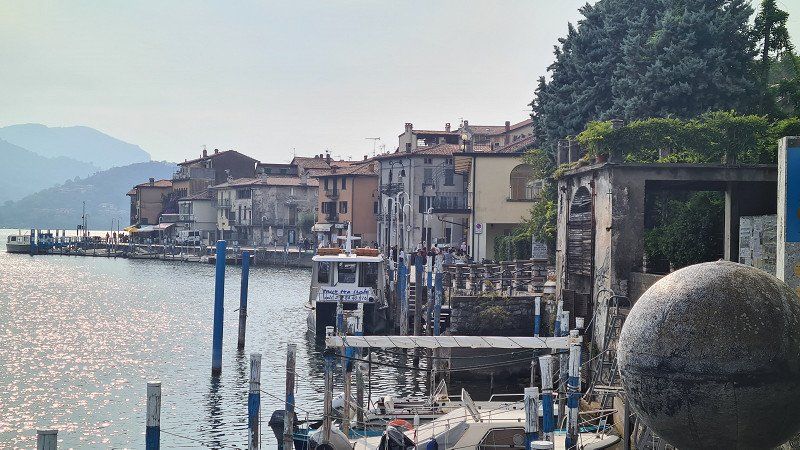
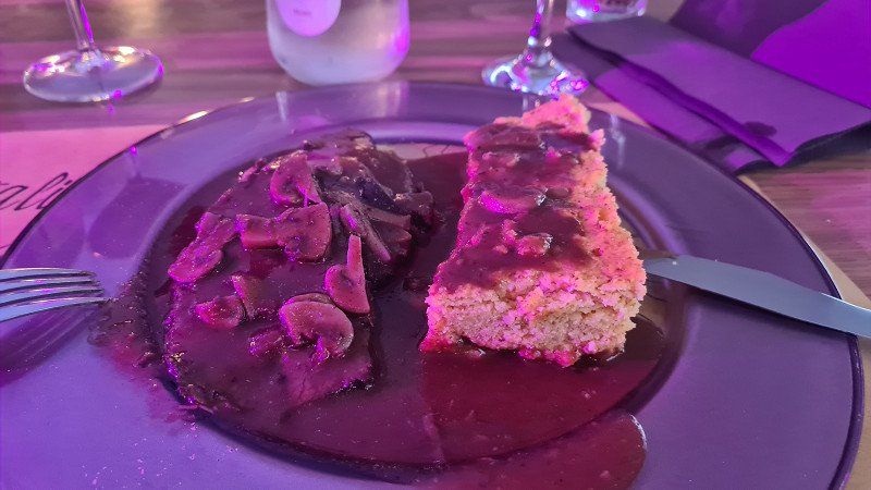
From the north side of the island it goes steeply downhill to the next fishing village of Cazano (1-6) with its romantic streets and a church with paintings worth seeing. Today's rather lonely path (7-11) continues past promenades and villages back to Peschiera Maraglio (12) and to the ferry to Sulzano. Since there is still time, I drive past the camp again to Iseo (13) and enjoy the panoramic view (14) over the lake with a good Italian ice cream cone, of course Pistachio/Stracciatella. Back in the camp, I see on the notice that today in the camp's Ristorante there is a special Stufato di Manzo con Polenta (15)
are. Although not planned, I won't miss it.
Day
LAGO MAGGIORE. Viertes Ziel.
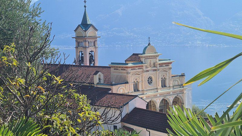
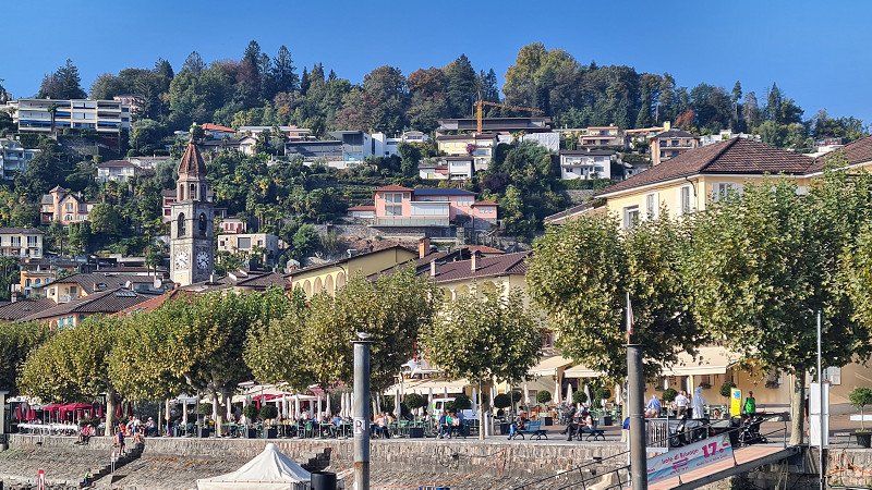
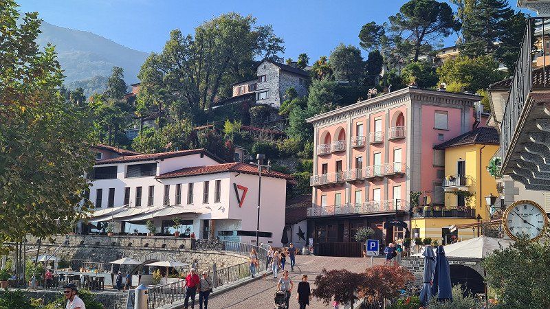
Lake Maggiore , also known as Lago Verbano ( Langensee in Switzerland) , is a northern Italian lake in the Italian regions of Piedmont and Lombardy and in the Swiss canton of Ticino, through which the Ticino (Ticino) flows. Lake Maggiore is narrow, curved and branched, and flows through it from north to south. It covers an area of 212.5 square kilometers, of which 20% belongs to Switzerland and 80% to Italy. It extends from the southern chain of the Alps to the western edge of the Po Valley. Like the other northern Italian lakes, it was created when ice age glaciers melted. Especially its northern part is surrounded by high mountains. The lake is 65 kilometers long and up to 10 kilometers wide. It is the second largest lake in Italy after Lake Garda. The lake level is 193 meters above sea level, making it the lowest point in Switzerland. The greatest depth is 372 meters. The bottom of the lake reaches up to 179 meters below sea level. The catchment area is 6386 square kilometers (3,326 square kilometers in Switzerland and 3,060 square kilometers in Italy). Several professional fishermen make their living from fishing in Lake Maggiore. The total yield is 150 tons per year. There has been passenger shipping on the lake since 1826. In 1852 it was taken over by Österreichischer Lloyd and reorganized. Today, the Italian state-owned company Gestione governativa navigazione laghi based in Milan operates a fleet of 25 ships with the Navigazione del Lago Maggiore (NLM), including the still operational paddle steamer Piemonte. Local shipping on Swiss territory has been managed by the Società Navigazione del Lago di Lugano since 2018. The main inflow and outflow Ticino flows into the lake at Magadino. The estuary, the Bolle di Magadino, (literally: bubble ...) is a species-rich nature reserve. The Maggia flows further west. It constantly brings debris with it, so that today the Maggia Delta extends far into the lake. East of the delta is Locarno, which is best known for its film festival and the pilgrimage church of Madonna del Sasso, and on the west side Ascona with its lake promenade and Monte Verità. In the hinterland, the valley divides at Ponte Brolla into the Centovalli on the left and the Maggia Valley on the right. In the north, the Verzasca flows into the lake, known above all for a bridge, the Ponte dei Salti, and the 220 m high dam. However, the hydrologically most important tributary of the lake is the Toce, since on average it brings slightly more water into the lake than the Ticino. However, the natural water volumes of these rivers have been regulated by human hands for decades due to numerous water discharges for electricity generation. The largest city on the lake is Verbania with its districts of Intra and Pallanza. Don't miss the Villa Taranto Botanical Gardens, a gift to Italy from its founder, Captain Neil Mac Eacharn. Thousands of plants imported from all over the world, as well as rare botanical collections, some of which are unique in Europe, can be studied here. South of Verbania, the lake widens into the Gulf of Verbania, where the Toce flows into the lake. Stresa is located on the Gulf and, with its Belle Epoque villas and hotel palaces, still exudes the charm of a sophisticated posh resort. In Stresa is the Villa Pallavicino with its park and a zoological garden. Centuries-old trees and many wild animal species can be seen there. Further south is the town of Arona. Two kilometers north of Arona, a 23-meter-tall copper colossal statue of Charles Borromeo was erected in 1624, which was the tallest statue that could be walked inside until the Statue of Liberty was built in New York. South of the lake near Sesto Calende is a protected wetland area. On the east side of the lake is the town of Angera with the medieval castle Rocca di Angera, the monastery of Santa Caterina del Sasso built into the steep cliffs and the town of Luino with its well-known weekly market.
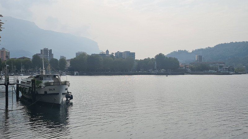
SOLCIO. Lago Maggiore.
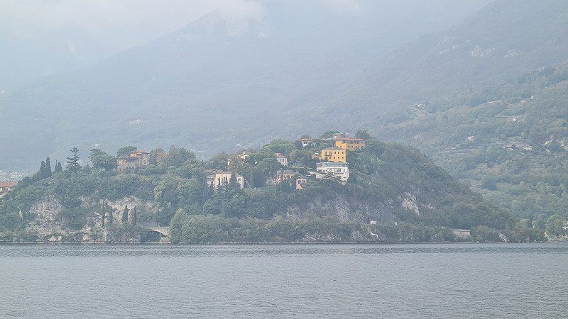
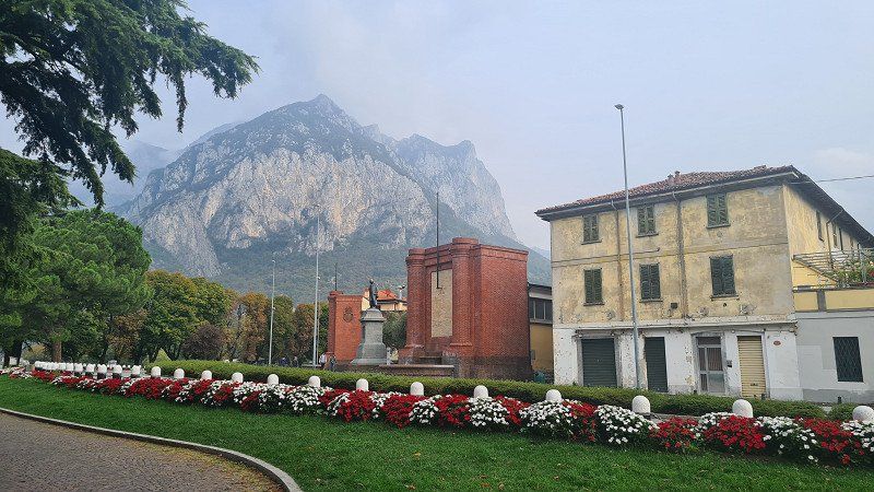
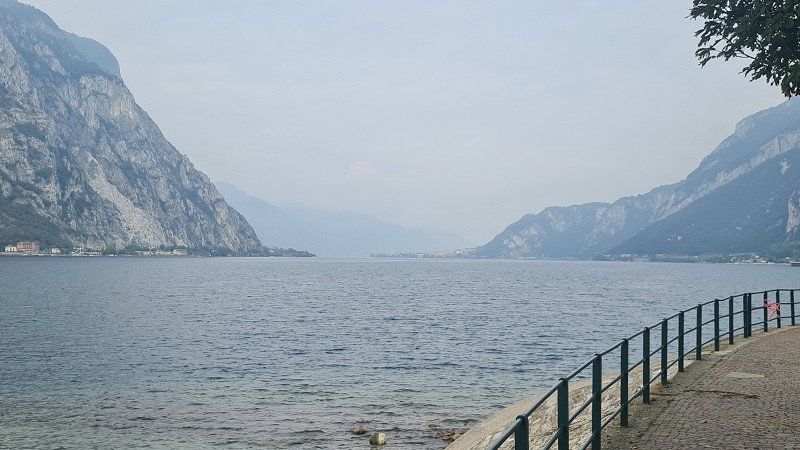
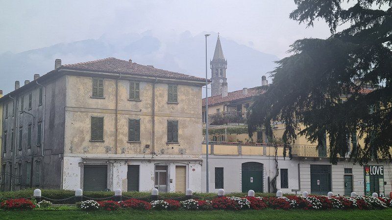
Drive to Lake Maggiore.
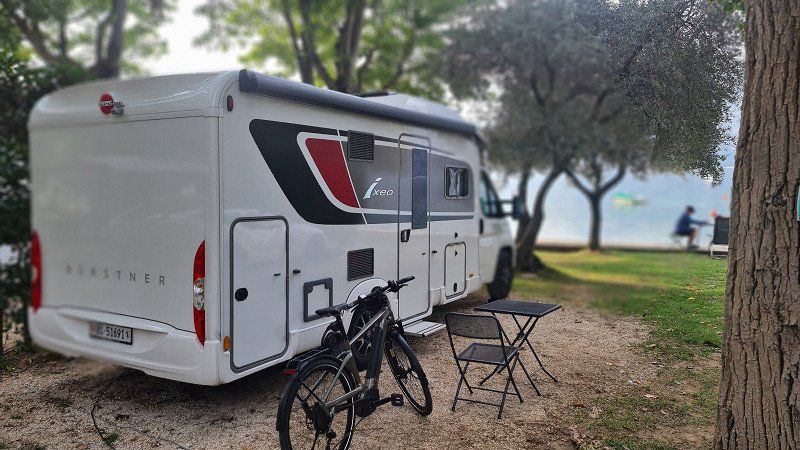
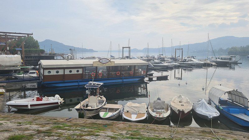
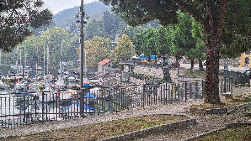
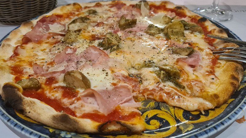
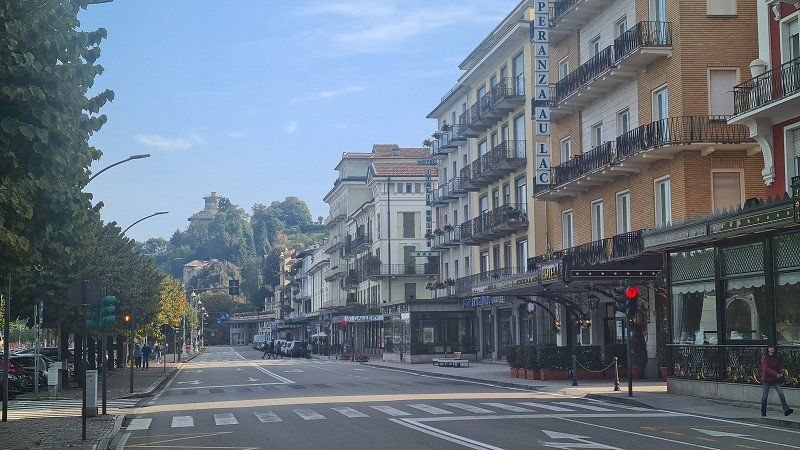
It's Friday, October 14, 2022. It'll be autumnally hazy all day with a temperature of 20 degrees. Today I ride 207 kilometers from Covelo to Solcio in the south of Lake Maggiore. In Bergamo I leave the motorway and drive on country roads to the two southern ends of Lake Como near Lecco and Como and then on to Lake Maggiore via Varesa. Near Lecco I find a parking space on the promenade and stroll along it for half an hour. Although the lighting conditions are not ideal, there are a few impressions (1-6) of the city and the lake. In Como at lunchtime, I'm less fortunate and can't find a parking space within a reasonable distance from the center. So I continue without stopping and arrive at Camping Solcio at half past two. I get one of the last pitches (7-8) directly at the lake. The remaining seats behind remain mostly free. It is becoming noticeable that the season is slowly coming to an end. A walk then takes me to the lake promenade and the port of Solcio and along the road towards Stresa to Lesa to the nearest Mercato (9-14). In the evening I visit the camp's Ristorante and choose an Insalata mista and a Pizza Boscaiolo (15) from the appealing menu, which is served here with very good prosciutto crudo and funghi porcini.
Lesa on Wikipedia.
Lesa is a municipality on the western shore of Lake Maggiore with 2,212 inhabitants in the Italian province of Novara, Piedmont region. The municipality consists of the districts of Villa Lesa, Solcio, Comnago and Calogna. The neighboring municipalities are Belgirate, Brovello-Carpugnino, Ispra, Massino Visconti, Meina, Nebbiuno, Ranco and Stresa. The patron saint of the place is San Martino. The place is located in a small bay next to Belgirate, and opposite Ispra, which is on the other side of Lake Maggiore. The municipal area covers an area of 12 square kilometers. Many historical documents and memorabilia of important personalities who stayed in the place are kept in Lesa. Among them, for example, those by Alessandro Manzoni, Giulio Carcano and Camillo Benso von Cavour. In the small village there are villas from different eras, with the oldest dating back to the Middle Ages. A castle ruin also dates from this period.
Via al Campeggio, 28040, Solcio di Lesa, Italy
45° 48' 54" N 8° 33' 0" E
45.8150000 8.5500000
• Head toward Via Sempione on Via al Campeggio. Go for 178 m.
• Turn right onto Via Sempione (SS33). Go for 14.1 km.
• Pass 2 roundabouts and continue on Strada Nazionale Sempione Feriolo (SS33). Go for 2.7 km.
• Take the 2nd exit from roundabout onto Via 42 Martiri (SP167). Go for 2.0 km.
• Take the 1st exit from Piazzale Caduti dei Lager Nazisti roundabout onto Via Quarantadue Martiri (SS34). Go for 5.0 km.
• Pass 6 roundabouts and continue on Corso Goffredo Mameli (SS34). Go for 27.5 km.
• Continue on Via Valmara (13). Go for 9.6 km.
• Take ramp toward Centovalli/Onsernone/Vallemaggia/Ascona/Losone. Go for 206 m.
• Turn right onto Via Locarno (407). Go for 51 m.
• Take the 3rd exit from roundabout onto Via Locarno (407). Go for 613 m.
• Pass 3 roundabouts and continue on Via Alberto Vigizzi (407). Go for 3.4 km.
• Turn slightly right onto Via Vallemaggia (407). Go for 1.7 km.
• Continue on Via Cantonale (407). Go for 212 m.
• Continue on Via Vallemaggia (407). Go for 92 m.
• Continue on Via Cantonale (407). Go for 429 m.
• Continue on Via Vallemaggia (407). Go for 368 m.
• Continue on Via Cantonale (407). Go for 31 m.
• Continue on Via Vallemaggia (407). Go for 322 m.
• Continue on Via Cantonale (407). Go for 224 m.
• Continue on Via Vallemaggia (407). Go for 89 m.
• Continue on Via Cantonale (407). Go for 148 m.
• Continue on Via Vallemaggia (407). Go for 1.2 km.
• Turn left onto Scigna. Go for 303 m.
• Arrive at Scigna. Your destination is on the left.
☍
70,6 km
(1 hrs. 20 min.)
Day
STRESA. Lago Maggiore.
By bike to Stresa for a stroll through the city.
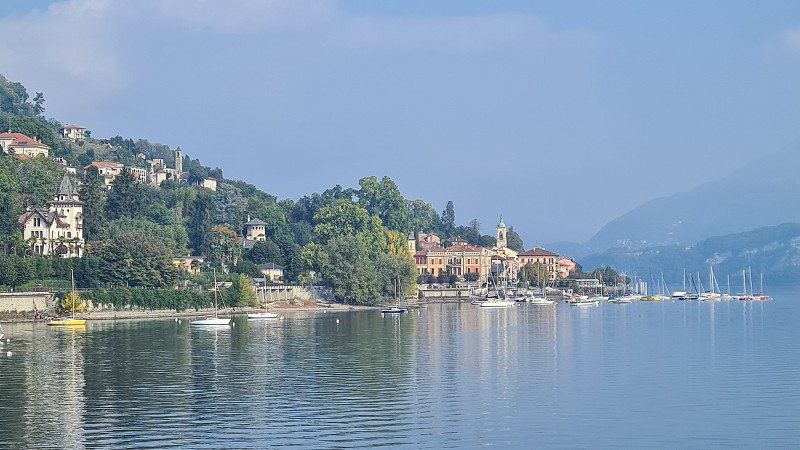
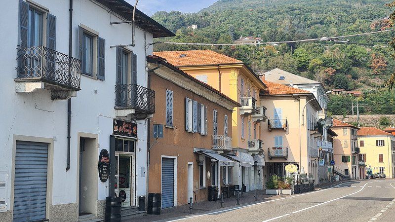
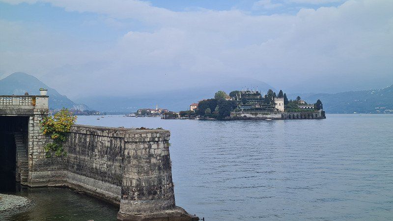
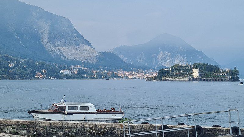
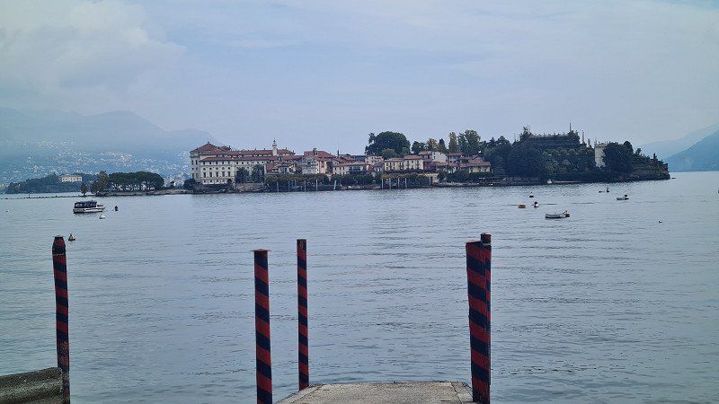
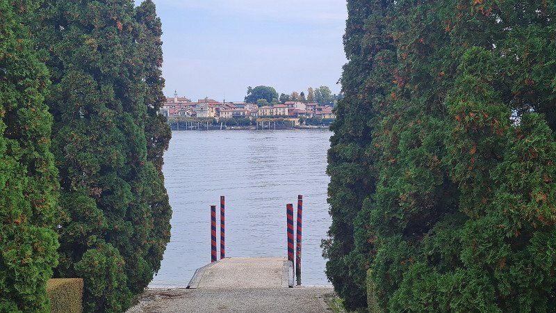
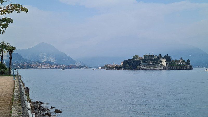
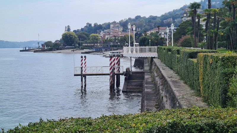
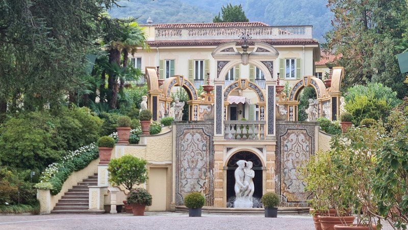
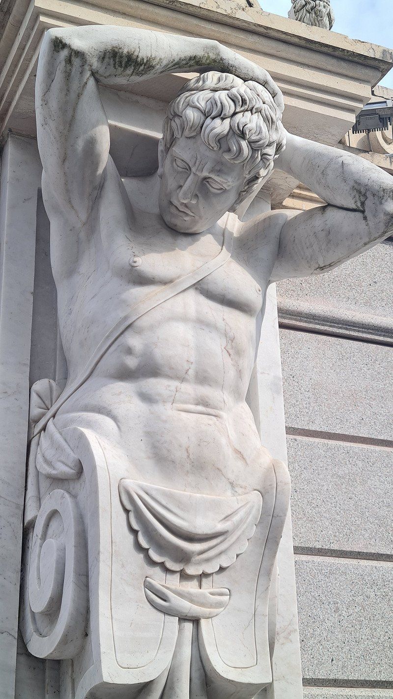
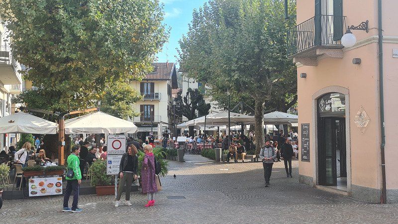
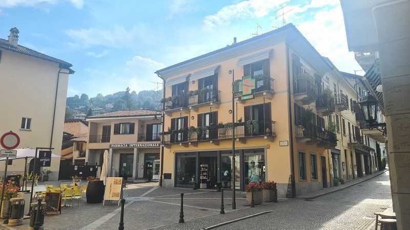
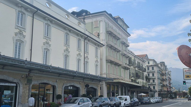
It's Saturday, October 15, 2022. It's going to be another beautiful autumn day and the sun is breaking through the haze more than yesterday at 20 degrees. Today I am cycling 11 kilometers north along Lake Maggiore from Solcio via Lesa to Stresa. The Seestrasse is easy to cycle on, although there is no cycle path and the road is sometimes narrow and heavily trafficked. My first stop and walk is to the fishing village of Lesa (1-5). On the promenade there is again a café americano. Then it's on to Stresa to its northern end with the best view of the Borromean Islands (6-14). Continue on foot along the park along the lake promenade (15) back towards the center.
Stresa at Wikipedia.
Stresa is a municipality and a spa town in the Italian province of Verbano-Cusio-Ossola and is located on the western shore of Lake Maggiore in the Piedmont region. Stresa is 200 meters above sea level and covers an area of 33 square kilometers. The Frazioni (suburbs or islands in the lake) of Stresa are Brisino, Isola Bella (see also Borromean Islands), Isola dei Pescatori, La Sacca, Levo, Lido and Mottarone. All the Borromean Islands, except Isolino di San Giovanni, belong to the Municipality of Stresa. The neighboring communes are Baveno, Belgirate, Brovello-Carpugnino, Gignese, Gravellona Toce, Laveno-Mombello, Leggiuno, Lesa, Omegna and Verbania. Not far from Stresa is the 1,491 meter high Mottarone mountain. In Roman times, the consular road Severiana Augusta led from Stresa, connecting Mediolanum (today's Milan) to Verbannus Lacus (Lake Maggiore), and from here to the Simplon Pass. The first historical source that mentions the existence of Stresa is a parchment from 998 in which the place is called Strixia, a form confirmed by a source from 1249; In 1220 it appears as Strexia. In 1935 an interwar agreement confirming the Locarno treaties was concluded in Stresa, involving Great Britain, France and Italy, the so-called Stresa Front. In 2004 the 52nd meeting of the Bilderberg Conference took place here. In the middle of the 19th century, Stresa was connected to the shipping traffic on Lake Maggiore, whereas in Stendhal's time you still had to embark in Sesto Calende or in Arona to get to the Borromean Islands. The unification of Italy that began in 1859 also boosted tourism. In 1859 the inn "Della Speranza" was built near the landing stage, followed in 1863 by the luxurious "Grand Hotel des Iles Borromées". Today, the town has numerous accommodation options, from bed & breakfasts to luxury hotels, as well as shopping facilities, restaurants and cafés. In 1906, after the completion of the Simplon railway tunnel, the first trains connecting Paris with Milan stopped in Stresa. With the Simplon Express there were connections from Calais to Venice and Trieste. From 1919 Stresa was a stop on the Simplon-Orient-Express, with direct connections to Paris and Calais (with connections to Dover and London) on the one hand, and Venice, Belgrade, Bucharest, Athens and Constantinople on the other. In the immediate vicinity of Stresa is the Villa Pallavicino, which Ruggero Bonghi had built in 1855 in a classicist style and which was acquired in 1862 by the Pallavicino noble family from Genoa. It is located in a 16-hectare park with a small zoo that is open to the public. In 2021 it was sold to Prince Vitaliano Borromeo, who also owns the Borromean Islands with Isola Bella. Several passenger ships operate between Stresa, other towns on the shores of Lake Maggiore and the Borromean Islands. Monte Mottarone is used for winter sports. In summer, a road leads far up, where there is a wide view. It can also be reached from the northern outskirts with the "Funivia Stresa-Alpino-Mottarone" cable car. The "Giardino botanico Alpinia", an alpine botanical garden set up in 1934 with an area of 4 hectares, is located at the Alpino middle station (803 metres). On May 23, 2021, a gondola of the cable car crashed after the traction cable snapped. 14 people died in the accident.
STRESA. Lago Maggiore.
The fashionable Stresa.
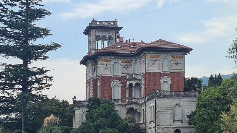
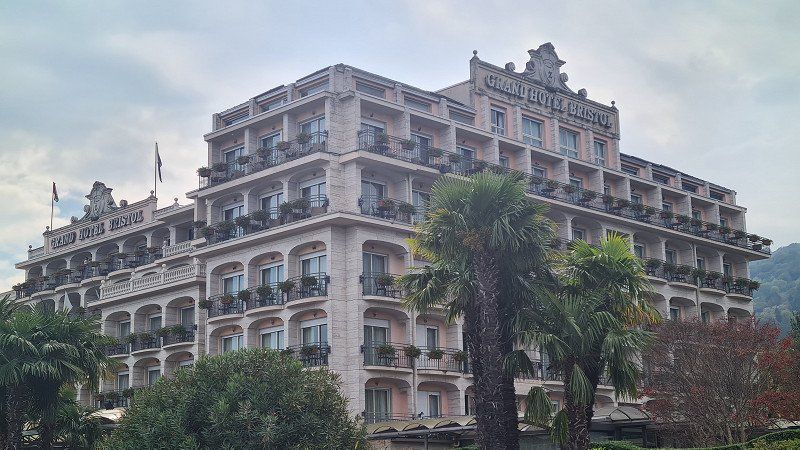
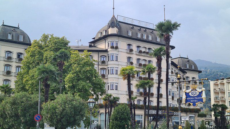
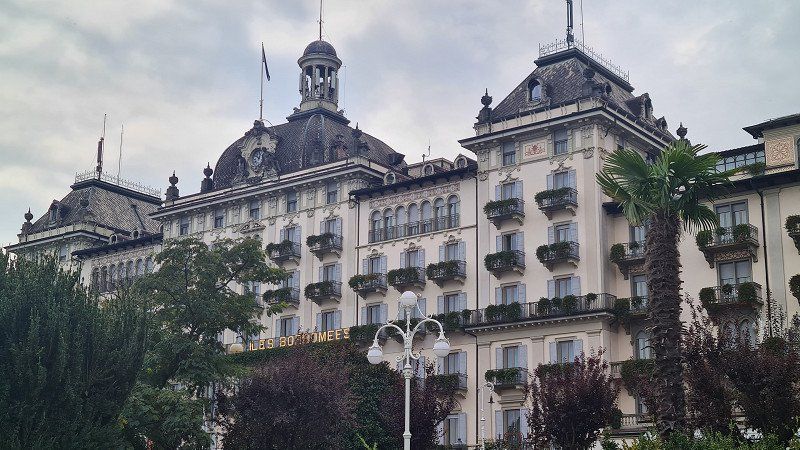
The magnificent
hotel palaces (1-7) along the lake promenade still impress and characterize the sophisticated image of Stresa. But also the small old town with few
squares and
streets (8-10) as well as the short
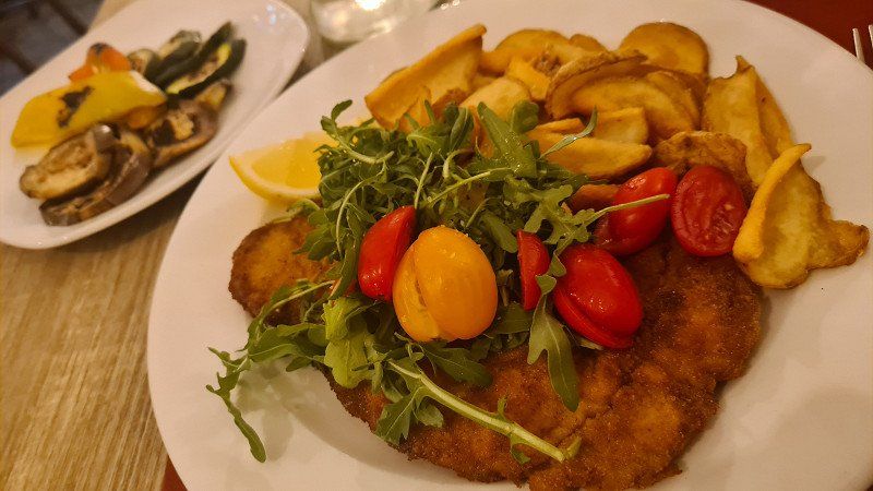
shopping mile (11-12) on the Seestrasse invite you to linger. In the Taverna del Pappagallo I order a
Cotoletta milanese (13), which I drove well with. Strengthened, I start the return trip to the camp and make one last stop in
Belgirate (14-15).
Day
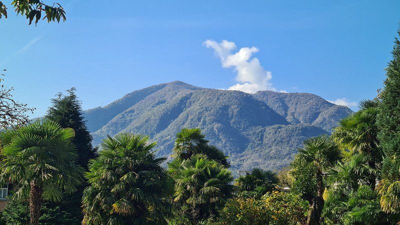
VALLEMAGGIA. Fünftes Ziel.
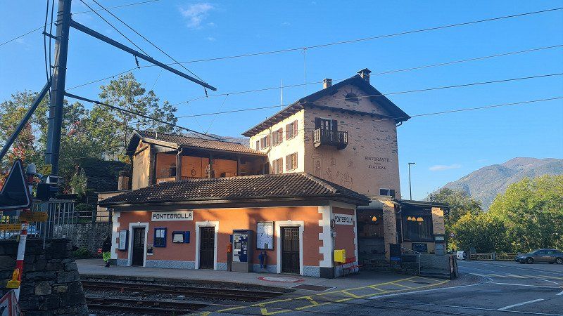
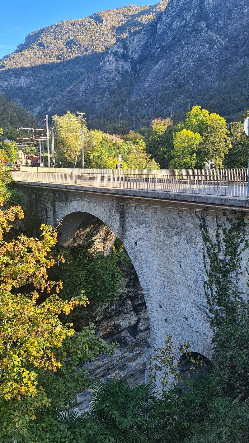
The Vallemaggia (Maggia Valley) is located in the Swiss canton of Ticino. The valley is traversed by the Maggia River and stretches 50 kilometers north from Locarno on Lake Maggiore. It is formed at the junction of the side valleys Valle Bavona from the right and Val Lavizzara from the left near the village of Cavergno. The valley and its subsidiary valleys are in the Vallemaggia district. Larger communities in the valley are Lavizzara, Avegno-Gordevio, Maggia, Sott Piodau and Cevio. The river areas neighboring the Maggia Valley are the Verzasca Valley to the east, the Ossola Valley to the west and the Bedretto Valley or the upper Valle Leventina to the north. Finds from the Copper Age show that the valley has been inhabited since at least that time. In Roman times the entire valley was sparsely populated, probably oriented towards the Vicus Muralto. It is believed that the cultural landscape of the valley with terraces, chestnut and walnut tree plantations was created in Roman times. The bottom of the valley was certainly inhabited by groups of Gauls during the Iron Age. Roman tombs have been found in Avegno, Gordevio, Aurigeno, Moghegno, Cevio and Maggia. In the Middle Ages, the Lombards reached Locarno and began to dominate the valley under the feudal rule of the Capitanei. During this period Christianity spread and the Church of San Vittore in Muralto was founded. After that, Maggia, Sornico and Cevio became independent municipalities. Gradually, the individual communities organized themselves into larger units. In the fourteenth century Bignasco, Cavergno, Brontallo and Menzonio formed an administrative unit, as did the villages of Val Lavizzara and Val Rovana (Cevio, Cavergno, Campo, Cerentino and Bosco were the Rovana Superior). In 1398 the Vallemaggia, the Verzasca Valley and the Mergoscia refused to pay taxes to the Locarnese nobility who held fiefs in these areas; In 1403 the valleys formally seceded from Locarno and established an independent judicial district with a 42-member general council and its own land rights, based in Cevio; various conflicts between the local valleys shaped their coexistence. In 1403/1404 the dispute between the municipalities of the lower valley and Cevio was ended by a treaty. In 1411-1412 the valley tried to elude the Duchy of Milan and joined the Duchy of Savoy. In 1416 the Confederates occupied the valley. They returned it to Milan in 1422 and to the Rusca family in 1439. Around 1430 the Lavizzara Valley was legally separated from the Vallemaggia. In 1513 the Confederates again occupied the valley, and for the next 300 years, from 1513 to 1798, the Vallemaggia was one of the bailiwicks of the twelve Confederate localities; its German name was Meiental or Mainthal. It was divided into the two valleys Vallemaggia and Lavizzara, but only one governor served for two years and judged the legal disputes. The Valle Lavizzara defended its independence from the Vallemaggia. It sabotaged attempts by some bailiffs and the Statute of Accounts to centralize the court in Cevio or overthrow the directors. When the Helvetic Republic was founded in 1798, the Vallemaggia became part of the canton of Lugano. In 1803 Napoleon gave the republic a federal structure and Ticino became its own independent canton with Vallemaggia as its own district and Cevio as its capital. In 1824 the first road to Bignasco was opened, in 1860 it was extended to Valle Lavizzara, 1882 to Rovana to Cimalmotta, to Valle Bosco after 1905 and to Valle Peccia only between 1922 and 1924. In the middle of the nineteenth century many families emigrated to Australia and America due to storms and economic hardship and also because of the gold rush. Between 1840 and 1870, 2,000 people emigrated, mostly men. Plinio Martini described the hard way of life in his novel Il fondo del sacco. Romance described. From 1907 to 1965, the Maggia Valley Railway ran between Locarno and Bignasco in Vallemaggia. After its decommissioning, the line was partially used to widen the valley road. A road tunnel into the upper Valle Leventina was planned at the time, but this was never realised. Apart from the junction in the Centovalli, the Vallemaggia represents a dead end for motorized traffic: there are no mountain passes that would lead to neighboring valleys. Craftsmanship involving stone has a centuries-old tradition here. Alongside wood, stone has always been the most important building material. A gray, fine-grained, crystalline rock is obtained, which is usually referred to as granite. However, it is more likely to be gneiss, otherwise the material would not be so easy to split. This stone is used in so many ways here as in few other regions. The traditional houses are covered with heavy stone slabs. Even posts for vines or pergolas are made of it. Also of great importance is the marble from the Peccia Valley, in the municipality of Lavizzara. Wikipedia.
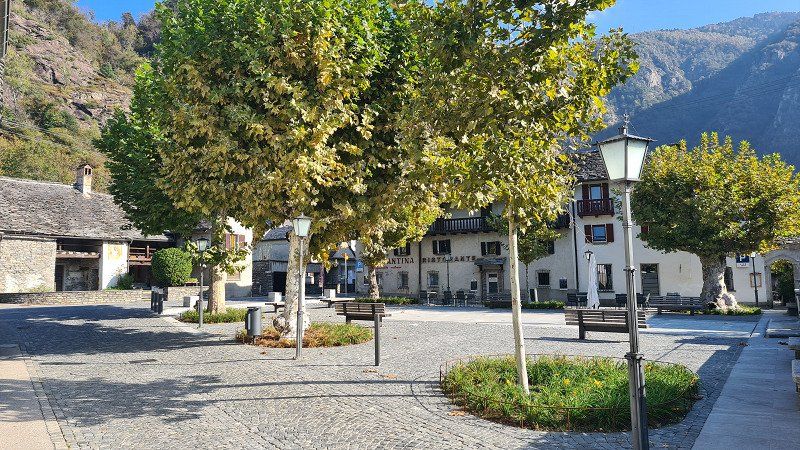
GORDEVIO. Vallemaggia.
Along Lago Maggiore into Vallemaggia.
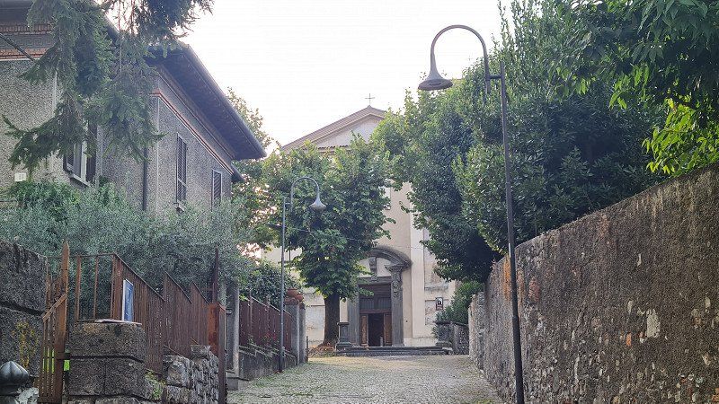
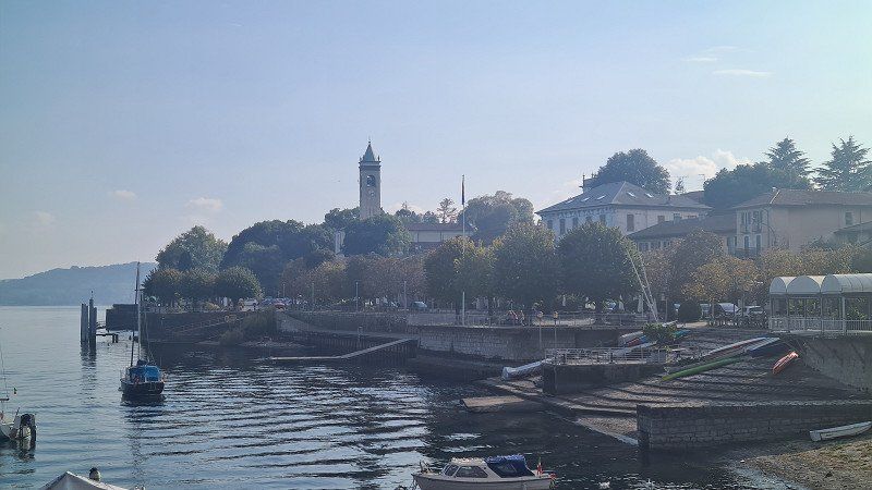
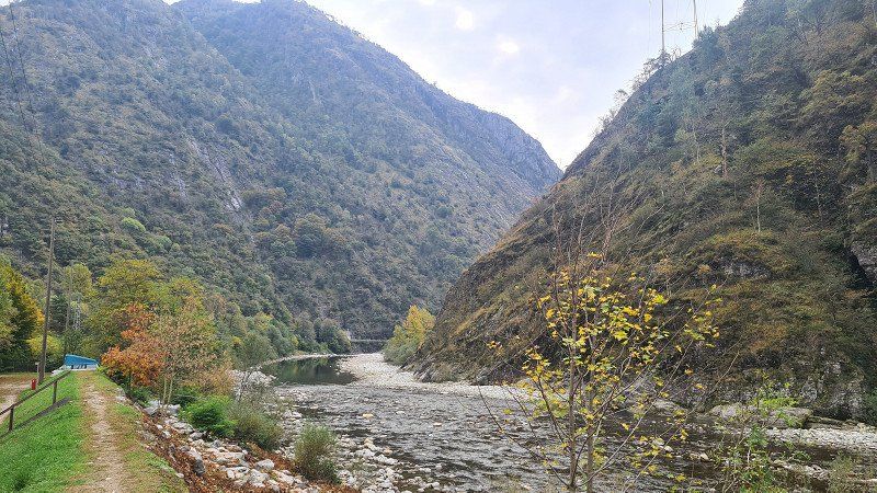
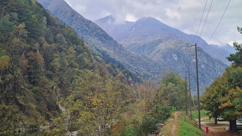
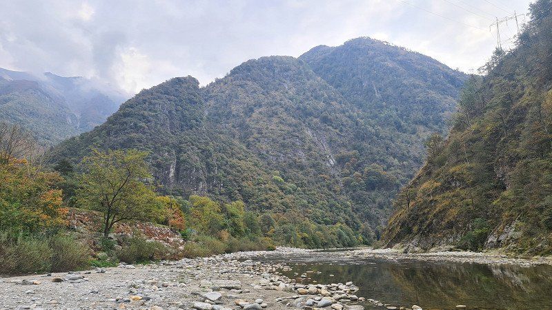
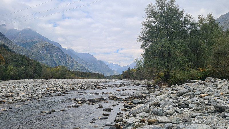
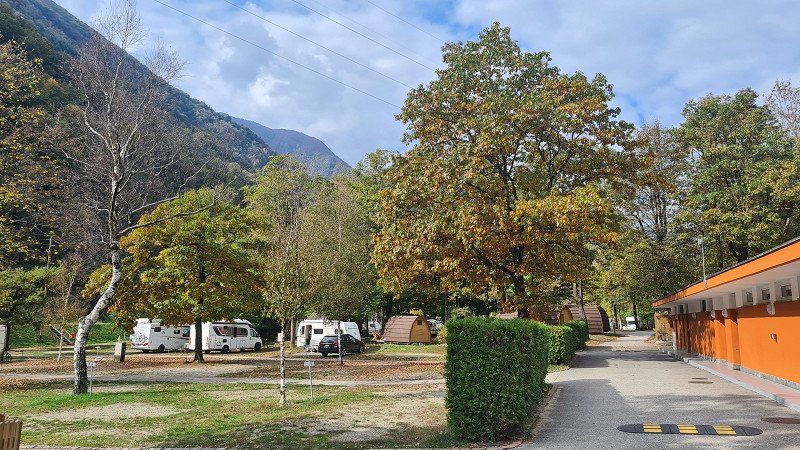
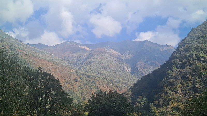
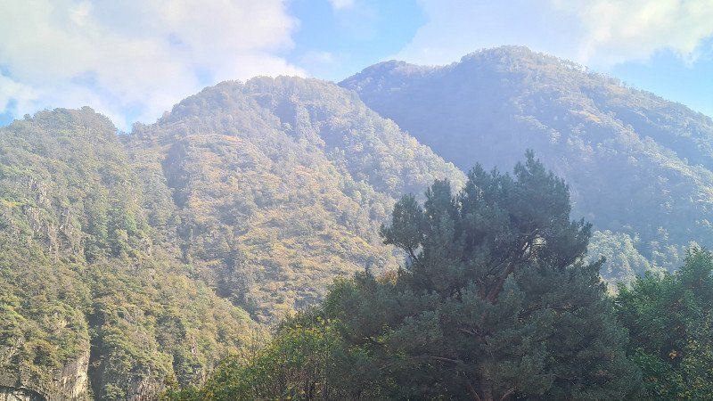
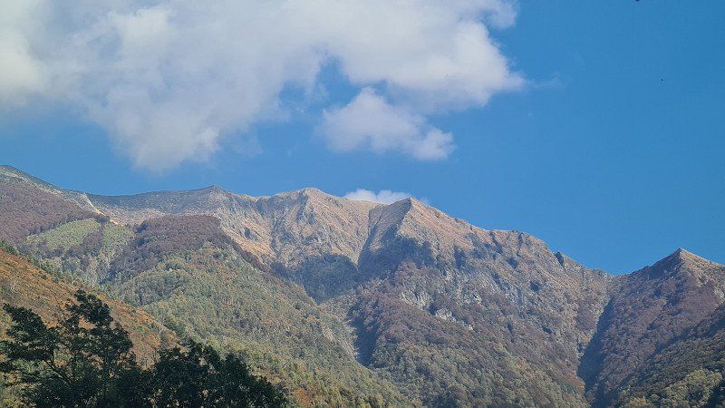
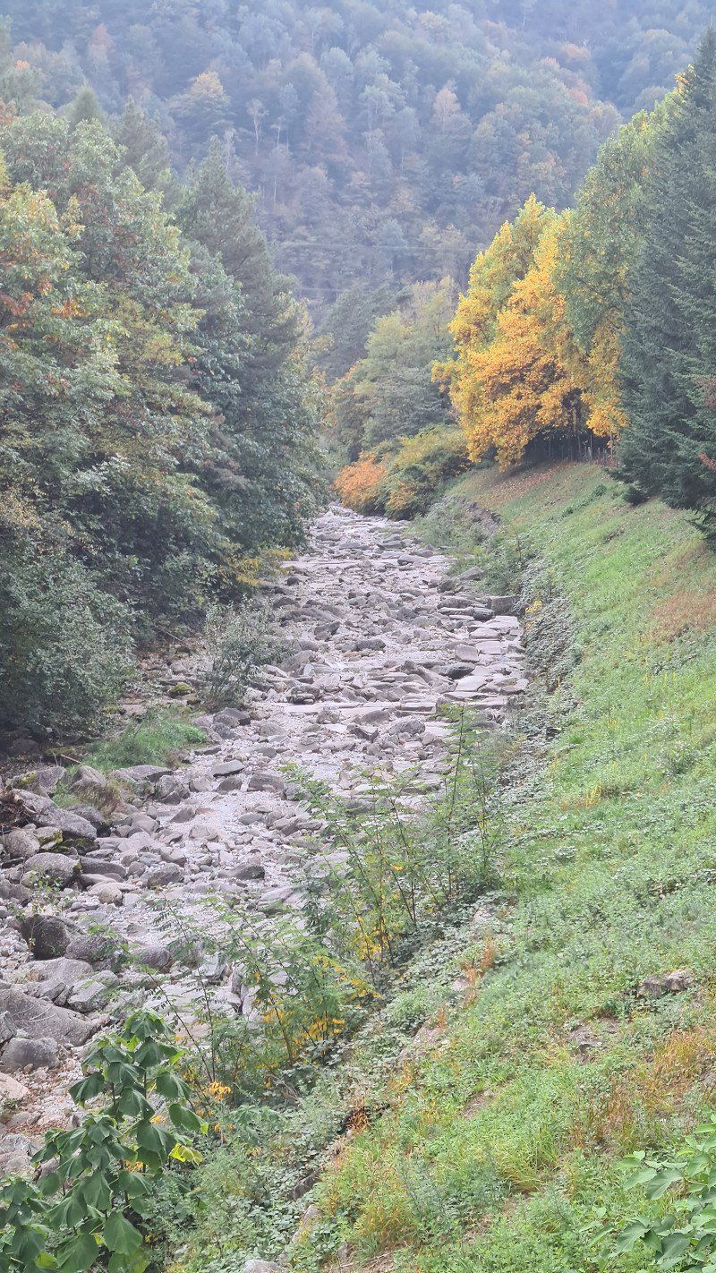
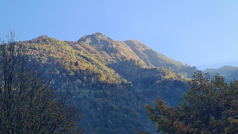
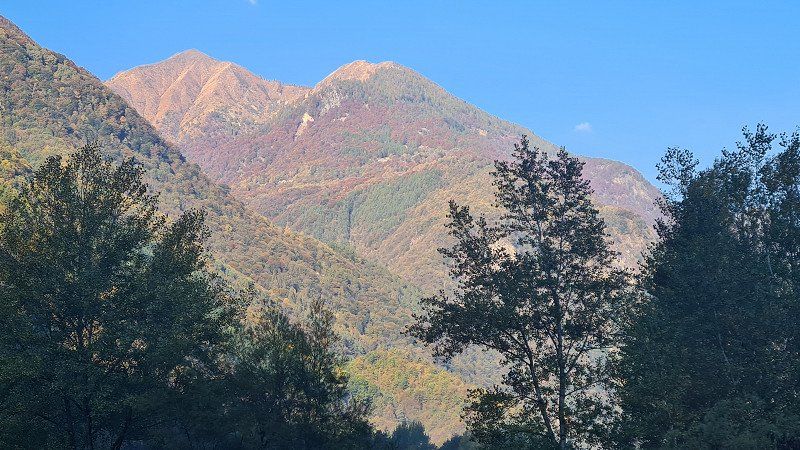
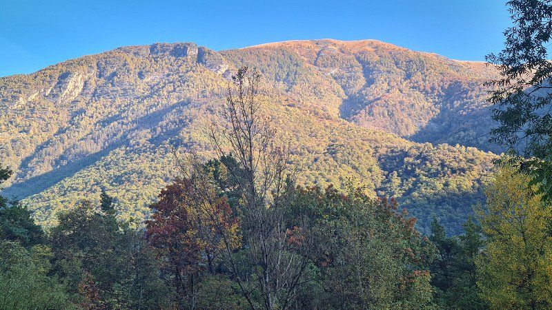
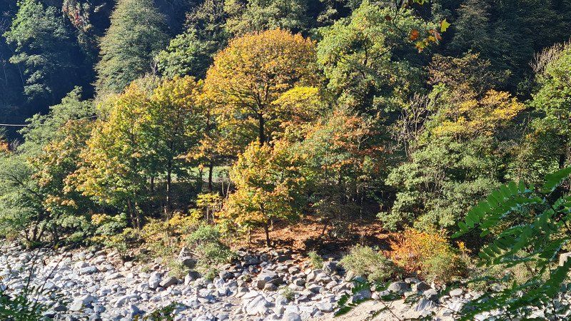
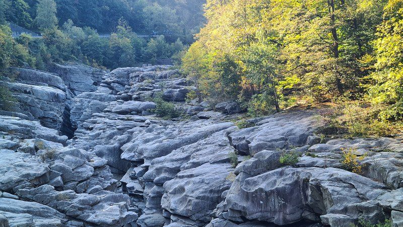
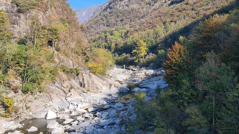
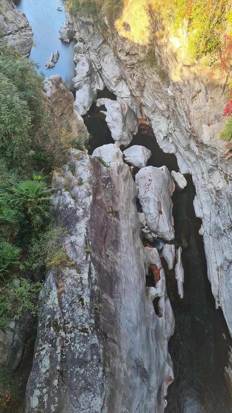
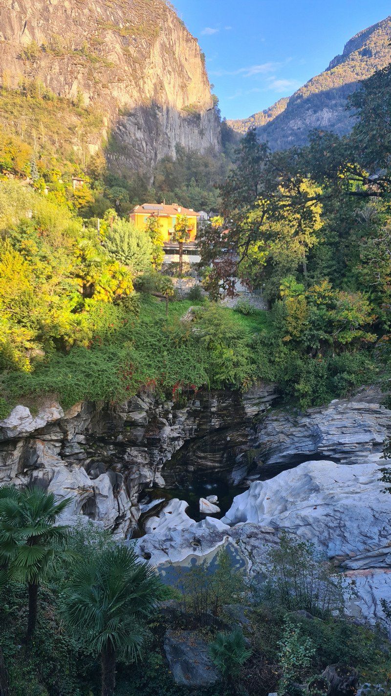
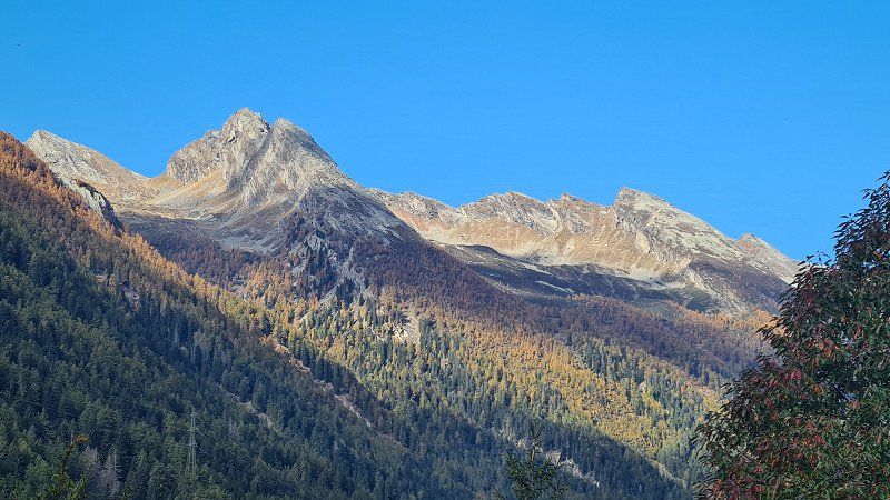
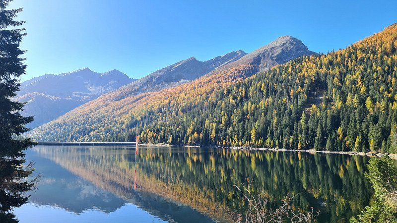
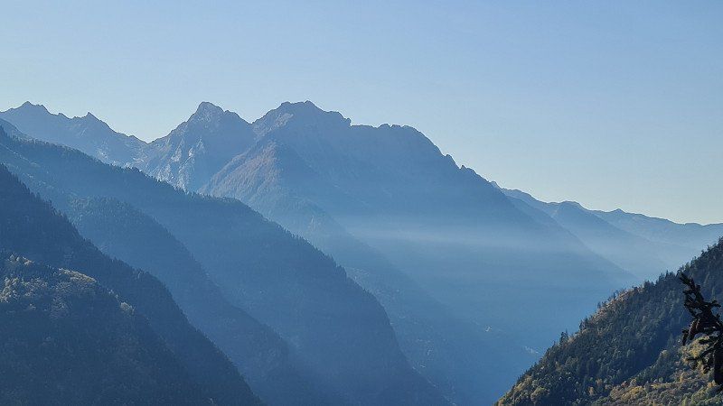
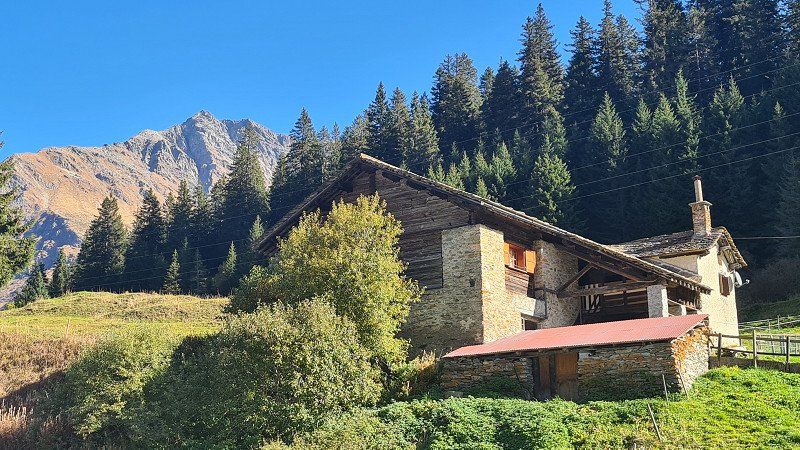
It's Sunday, October 16, 2022. Despite the announced rain, it will remain dry during the night and during the day. The haze over the lake shapes the view at 20 degrees. Today I drive 75 kilometers from Solcio along the eastern shore of Lake Maggiore via Stresa, Verbania, Cannobio to Ascono and after a stop from there up the Vallemaggia to Gordèvio. I left early, I originally wanted to visit the weekly market in Cannobio. But already at half past nine the village was already so busy there and the visible parking spaces were taken, so that I drove on without stopping. I then drove to the TCS Camping in Gordèvio at half past eleven and moved into a pitch. The place (1-3) is right on the Maggia and is now only a third occupied. In the late afternoon I walk along the Maggia. Then the sun comes through a bit and allows a great view (4-15) of the river and mountains.
Gordevio at Wikipedia.
Gordevio is a fraction of the political municipality of Avegno Gordevio in the district of Maggia, in the district of Vallemaggia in the canton of Ticino in Switzerland. In 2008 Gordevio and Avegno merged to form the Municipality of Avegno-Gordevio. The place is in the lower part of the Vallemaggia on the left bank of the Maggia, ten kilometers northwest of Locarno. It consists of the districts of Gordevio-Briee north and Gordevio-Villa south of the Ri di Gei stream at an altitude of 360 meters above sea level. A number of alpine settlements also belong to the municipality; the most important are Malai (1'141 meters), Brunescio (1'311 meters) and Aiarlo di Dentro (1'484 meters). The largest part of the municipal area consists of Alps, wooded slopes and mountainous landscape. The northern border of Gordevio leads in a northeasterly direction from the Maggia over the Cima di Aiarlo (1,904 meters) and the Cros Pizzitt to the Cima di Nimi (2,191 meters). In the east, the municipality borders on the district of Locarno. The highest peak is the Pizzo d'Orgnana (2,219 meters). Other peaks are the Mött di Pegor (2,169 meters) and the Pizzo di Corbella (2,066 meters). The southern border leads from the Maggia in an easterly direction over the Pianosto (1,338 meters) to the Cima della Trosa (1,869 meters). Of the entire municipal area of 1,925 hectares, only two percent are settlement areas. 60 percent is covered by forest and wood, 16 percent is agricultural land and 21 percent is unproductive area. Gordevio borders on the south-west, west and north with the municipality of Maggia, on the east with Lavertezzo, Corippo and Mergoscia in the district of Locarno and on the south with Avegno. Gordevio is first mentioned in 1200 under the name of Gordauio. When the Valais want to conquer the Maggia Valley in 1484, the inhabitants of Gordevio provide 18 men for the defense contingent. From the early sixteenth century until 1798 the municipality belonged to the Ennetbirgische Bailiwick, then until 1803 to the canton of Lugano. Since then it has formed part of the Canton of Ticino as part of the Vallemaggia district. The current name of Gordevio first appears in a document from 1616.
6672, Gordevio, Switzerland
46° 13' 15.7" N 8° 44' 31.2" E
46.2210200 8.7419900
• Head west on Scigna. Go for 14 m.
• Turn right onto Croci. Go for 316 m.
• Turn right onto Via Cantonale (407). Go for 203 m.
• Continue on Via Vallemaggia (407). Go for 1.2 km.
• Continue on Via Cantonale (407). Go for 148 m.
• Continue on Via Vallemaggia (407). Go for 89 m.
• Continue on Via Cantonale (407). Go for 224 m.
• Continue on Via Vallemaggia (407). Go for 322 m.
• Continue on Via Cantonale (407). Go for 31 m.
• Continue on Via Vallemaggia (407). Go for 368 m.
• Continue on Via Cantonale (407). Go for 429 m.
• Continue on Via Vallemaggia (407). Go for 92 m.
• Continue on Via Cantonale (407). Go for 212 m.
• Continue on Via Vallemaggia (407). Go for 4.5 km.
• Pass 2 roundabouts and continue on Via Alberto Vigizzi (407). Go for 563 m.
• Take the 3rd exit from roundabout onto Via Locarno (407). Go for 578 m.
• Take the 2nd exit from roundabout onto A13 toward Lugano/Bellinzona. Go for 10.4 km.
• Take the 1st exit from roundabout onto 406 toward E35/E43/A2/A13/Lugano/Gambarogno/Aeroporto. Go for 1.4 km.
• Keep left onto Via Monte Ceneri (406). Go for 373 m.
• Pass 5 roundabouts and continue on Via Cantonale (406). Go for 4.3 km.
• Take the 3rd exit from roundabout onto Via San Gottardo (406). Go for 3.6 km.
• Take the 1st exit from roundabout onto In Tirada (2). Go for 213 m.
• Take ramp onto A2 toward San Gottardo/E43/San Bernardino/A13. Go for 7.4 km.
• Take exit 45 toward E43/Chur/San Bernardino/Bellinzona Nord onto A13 (Diramazione Bellinzona Nord). Go for 44.7 km.
• Take ramp onto San Bernardino toward San Bernardino. Go for 153 m.
• Turn right onto Cantonál (13). Go for 394 m.
• Arrive at Cantonál (13).
☍
82,4 km
(1 hrs. 6 min.)
Day
MADONNA DEL SASSO. Lago Maggiore.
Pilgrimages to Madonna del Sasso.
It's Monday October 17th, 2022. The weather remains nice and sunny at 20 degrees. Today I'm visiting Locarno and Ascona on Lake Maggiore by bike. From Gordevio you descend the Vallemaggia to a first stop in Tegno (1-5). I arrive in Locarno around eleven o'clock and spontaneously decide to visit Madonna del Sasso. Steffen from TerraX comes to mind with his apt "stay fascinated". For me it's the churches. But it's not the religion (I'm an atheist), it's the buildings and their history that always attract me on my travels. And so I park my bike at the signpost ( 6) and take the footpath Sentiero della Valle (7-10) up to the pilgrimage church (11-15). It is always impressive to see the power the churches had in earlier times and enabled them to leave their monuments in every little place in the world, magnificent as here or simple
Madonna del Sasso at Wikipedia.
The Sanctuary of the Madonna del Sasso is an important pilgrimage destination and stands on a rocky outcrop inside the small valley dug by the Ramogna torrent, at an altitude of 370 meters in the municipality of Orselina, above Locarno in the Swiss canton of Ticino. In addition to the monastery, the building complex or Sacro Monte includes the Church of the Annunciation, the chapels below along the old access road with the arcade of the Cross, the ascent of the Way of the Cross and its stations in Aedicule, the chapel of the Pietà in the courtyard, the chapels of Lamentation of the dead Christ, the Last Supper and the Holy Spirit below the arcade, the stairs, the cemetery cross, the church square and finally the church of Santa Maria Assunta called Madonna del Sasso. At the end of the fifteenth century, the Franciscan Friar Bartolomeo Piatti from Ivrea settled as a hermit in a hamlet at the foot of the rock. He came from the monastery of San Francesco in Locarno, where he had no particular title or office within the community. His ascetic life fostered a strong cult of the Virgin among the local population, who, according to legend, had appeared to the friar. The construction of the Church of Santa Maria Annunciata at the foot of the promontory began, thanks to the donation of land by Antonio Guido Orelli. In the notarial deed of donation, the name "Madonna del Sasso" appears for the first time in the spelling "santa Maria del Saxo". 1498 confirms Pope Alexander VI. the donation of the Rock of Orselina to the Franciscans by the Masina del Monte family in order to build a sanctuary there. The church was consecrated in 1502. In 1514, Pope Leo X freed the hill of the sanctuary from all servitude and jurisdiction. In 1522 the walls received a series of frescoes, including that on the north wall of the choir with the Madonna Enthroned with Child, attributed to Domenico Pezzi from Puria called "Furgnicus". a painter who commuted between the Lugano area and Genoa and in the monastery church of Santa Maria degli Angioli in Lugano, in the parish church of Santa Maria del Sasso in Morcote, in the portico in front of the parish church of Villa Luganese, in the church of San Biagio of Bellinzona-Ravecchia and in Gravedona in the church of Santa Maria delle Grazie. On the southern wall of the nave is Christ and the Torah scholars, attributed to the della Rovere brothers called Fiammenghini. Fra Bartolomeo will be buried in this church a few years later. According to a parchment kept in the cantonal archives of Bellinzona, in 1487 Rolando, Bishop of Antarado, consecrated a church and an oratory "alla beata Maria vergine santissima avvocata" ("to the Blessed Virgin and Most Holy Advocate Mary"), both of which had been built by the nun and around which a great popular piety had arisen. The buildings were subordinated to the Franciscan monastery in Locarno and especially to Fra Bartolomeo until his death. At the end of the sixteenth century the construction of a second church on top of the rock began, consecrated in 1616. The coronation of the Madonna del Sasso the following year began a series of works to embellish and complete the Sacro Monte. The chapels and the clay sculptures set up in them date from this period. That of the Last Supper consists of terracotta statues by Francesco Silva from Morbio Inferiore, a sculptor who also worked at Sacro Monte di Varese. The story of the sanctuary's origins is written in Latin on a marble slab inside, dated July 10, 1624. The inscription mentions the donation of the land to the Franciscan order by the Masina del Monte family and the consecration of the church by Filippo Archinti, Bishop of Como, in 1616. In 1617 the access that leads from the Pietà to the Sanctuary was widened and in 1618 the small tower called the open portico was built, which gives access to the church, with the rooms for guests in the lower part. In 1619 a path was built on the ridge of the hill with a few chapels dedicated to the mysteries of the Rosary, to which later the chapels of the Way of the Cross were added, which still exist today: the chapel of Calvary was built in 1620, that of Veronica in 1625, that of the in 1670 Resurrection near the Chapel of Calvary. Work was completed in 1677 with the Chapel of the Ascension. With a decree of 1848, the state and republic of the canton of Ticino expropriated the monastery and the pilgrimage site of the Madonna del Sasso and expelled the inmates from the canton. The site was given to the Capuchin Father Alessandro da Giornico and since then it has remained in the hands of the canton, while the Capuchins supervised and cared for religious affairs. Major works were undertaken between 1891 and 1912, heavily remodeling the entire complex of buildings on the top of Sacro Monte. The monastery was enlarged in 1892, the facade was rebuilt in a Renaissance style, small loggias and terraces were added on the east side in 1895 and the bell tower was also renovated by the architect Alessandro Ghezzi from Lamone. Then, in 1903, the chancel was widened with the construction of a retaining wall that completely covered the rocky outcrop on which the sanctuary rests. The north side was last renovated in 1912 with the construction of a loggia, which allows access to the choir of the church directly from the monastery. This work was carried out at the initiative of the friars, albeit with strong internal opposition, notably from Father Agostino from Vezia, superior of the Ticino Capuchins, and from Fra Bernardo from Andermatt, then overseer of the monastery. The project and idea of these interventions go back to Fra Angelo Osio from Pesaro. Despite the strong criticism, the intervention was carried out by the Capuchins and financially supported by the local population. In 1918 the church was elevated to the rank of a minor basilica. The first major restorations to the convent, parts of the Assunta Church and the Way of the Cross took place between 1974 and 1980 under the direction of the architect Luigi Snozzi. Further important restoration work, subsidized by the state of the canton of Ticino, took place between 2004 and 2012.
LOCARNO. Lago Maggiore.
Walks in Locarno and Ascona.
After the Way of the Cross has led me back down to Locarno, I walk through the center of Locarno (1-8) and from there, on the recommendation of friend Hampe, to the Ristorante Sensi (9-10) on the lake promenade. This time I don't feel like fish and I choose a Ticino specialty Luganighetta (9-10). Now back on the bike, you pass the Lido Locarno and over the Ticino (11) to Ascona. I walk along the lakeside promenade there (12-15) before heading back home to the Maggia Valley.
Locarno and Ascona at Wikipedia.
Locarno is a municipality in the district of Locarno and the capital of the district of Locarno in the Swiss canton of Ticino. The former German name Luggárus still lives in the Walser dialect of the municipality of Bosco/Gurin in the Liggåårasch pronunciation. The city is the third largest city in the canton of Ticino after Lugano and Bellinzona. The city of Locarno is located on the north shore of Lake Maggiore and on the eastern edge of the Maggia Delta, where it borders with Ascona, Losone, Terre di Pedemonte and Tenero-Contra. The Monti della Trinita district nestles on the hillside above the town, and the territory of the commune also includes a large unconnected area in the Magadino plain, the Gerre di Sotto. From a structural point of view, the city of Locarno has grown together with the independent municipalities. The Locarno agglomeration with Muralto, Minusio and Orselina has around 40,000 inhabitants. Locarno, together with the rest of southern Ticino and the province of Como, is part of the Ticino metropolitan region. The place was inhabited as early as the younger Bronze Age. Later settlements can be proven on the basis of necropolises from the La Tène and Roman times. A royal court is mentioned in documents in 866. Frederick I granted Locarno new market rights in 1164 and imperial immediacy in 1186. In 1342 the Visconti conquered the city, who gave it to the Rusca as a fief from 1439 to 1503. The Confederates conquered the city in 1503, but only received the castle in 1513 from the hands of the French King Louis XII. From then on, a bailiff of the twelve places exercised civil and criminal jurisdiction. The city was governed by the three corporations of the nobility (Capitanei dei Nobili), the bourgeoisie (Borghesi) and now also the country folk (Terrieri), who met in the Provincial Council (Magnifico Consiglio). The Reformation also gained a foothold in Locarno around 1530; the Carmelite Balthasar Fontana studied the Bible and Reformation writings with other brothers. From 1539 the priest and teacher of the Latin school in the monastery of San Francesco Giovanni Beccaria, the doctor Taddeo Duno and the jurist Martino Muralto were the leading figures in the growing Reformation movement. From 1542 to 1544, the then evangelical Glarner bailiff Joachim Bäldi supported the reformatory forces. It was not until 1547 that there was a break with the Catholic Church, and an independent Protestant community was formed, which met in private homes. A faith talk in 1549, chaired by the Catholic bailiff Nikolaus Wirz, did not lead to an agreement, but to the end of the talks, to the brief arrest and expulsion of Beccaria, who fled to Roveredo and Mesocco in Misox in the canton of Grisons. In 1555 the Reformed had to give up their new evangelical faith or leave Locarno. Driven out by the evangelicals, suspicion and resentment, Locarno remained torn apart, smaller and poorer. In 1584 the plague struck the city and decimated its population so badly that only 700 of the original 4,800 people remained. After the collapse of the Ancien Régime, Locarno became part of the newly created Swiss canton of Lugano in 1798. In the 1870s, when transport links to both the north and the south improved, the Locarno region began to develop as a hotel and tourism industry, which to this day forms the economic backbone of the city. The Locarno Film Festival was first held in 1946. In 2017, Locarno was awarded the honorary title of "European City of Reformation" by the Community of Protestant Churches in Europe. Worth seeing next to Madonna del Sasso: Piazza Grande, Castello Visconteo from the twelfth century, the remains of the defensive bastion Rivellino (possibly designed by Leonardo da Vinci.), numerous churches and palaces, town houses. Ascona is a municipality in the Swiss canton of Ticino. The former German names Aschgunen or Aschgonen, based on Lombardic, are no longer used today. The former fishing village and later health resort is located on the north shore of Lake Maggiore. Ascona is the lowest-lying town in Switzerland, as the village center is right on the lake. To the west, the municipality extends beyond the wooded mountain and viewpoint of Corona dei Pinci, which is 1,293 meters above sea level. Excavations in 1969 in and around the Church of San Michele unearthed Neolithic flints and pottery shards. Middle and late Bronze Age pottery has been found in the necropolis of San Materno. Around 1,000 BC there was a fortified hilltop settlement on the nearby hill of Baladrum, of which the remains of dry stone walls still exist. Ascona first appears in written sources in 1186, when the bishop of Como gave lands in Ascona and Locarno, including the castle of San Michele, to Pietro de Duni and other nobles, who then expanded them. 1224 the village was mentioned as burgus de Scona.
Day
SAN BERNADINO. Misox.
Drive home via the San Bernadino.
It is Tuesday, October 18, 2022. The nights are getting noticeably cooler, but on the day of the journey home it will be beautiful and colorful again at 20 degrees. Today I drive 365 kilometers home from Gordevio. This time I choose the route over the San Bernadino for the crossing of the Alps. Shortly after the start of the journey, I stop for the first time at Ponterollo (1-4), where the Maggia flows impressively into the Centovalli in a deep canyon. On the further journey through the Misox up to the San Bernadino I stop several times and capture the beautiful surroundings in the Misox (5-11) in the picture. The next stop is in the village of San Bernandino (12-15), which is deserted just before the road tunnel below the pass.
San Bernardino at Wikipedia.
San Bernardino is a place in the Swiss canton of Graubünden. It is located in the upper part of the Misox, belongs to the municipality of Mesocco and is characterized by tourism and agriculture. The town is located south of the San Bernardino Pass at an altitude of 1,600 meters at the south portal of the San Bernardino Tunnel of the A13 motorway, which opened in 1967. Italian is spoken in San Bernardino. The Moësa, which rises at the Laghetto Moesola at the top of the San Bernardino Pass, flows through San Bernardino. In the Middle Ages the settlement was called Gualdo de Gareda. Gualdo possibly goes back to the Lombard word for "forest", Gareda to a personal name, a previous owner. In the seventeenth century, the name of the patron saint of the church, Saint Bernardine of Siena, became the place name. The pass is one of the oldest Alpine passes and was already used in pre-Roman times. It takes its name from Saint Bernardino of Siena, for whom a chapel was built along the road in the fifteenth century. The former name Mons Avium (bird mountain) remained for the Piz Uccello, which overlooks the street. The 4-7 meter wide road was built from Chur in 1818-1823 under the direction of the engineers Pocobelli, at a cost of 3,190,800 francs, of which the Sardinian government contributed the largest part. The healing spring (steel bath) was mentioned as early as 1717 by the natural scientist Johann Jakob Scheuchzer and rewritten in 1898. An existing acid spring was used in an inn and spa house built from 1822; in 1825 many Milanese were present as spa guests. In the early 1960s, the Moësa was dammed south of the village to form the Lago d'Isola reservoir. After the opening of the San Bernardino tunnel in 1967, the village, which had been isolated until then, experienced an upswing. A great deal of building activity began, not always to the advantage of the townscape. Until 2012, San Bernardino was best known as a ski resort; there were 40 kilometers of ski slopes up to an altitude of 2,600 meters. Most of the ski lifts are now obsolete and have been closed since 2012 due to a lack of investors. This also has negative effects on the hotel industry, trade and the entire local economy. Cross-country skiers have 24 kilometers of trails at their disposal. They are medium to easy and lead through the coniferous forest that surrounds the place. South of the village is the small moor lake Lago Dosso.
San Bernardino, 6565 Mesocco, Schweiz
46° 27' 45.4" N 9° 11' 31.1" E
46.4626200 9.1919600
• Head north on Cantonál (13). Go for 394 m.
• Turn left onto San Bernardino. Go for 36 m.
• Take ramp onto A13 toward Chur. Go for 92.1 km.
• Continue on A3 toward Zürich/Sargans. Go for 88.9 km.
• Take exit 32 toward Flughafen/Bern/Basel/St. Gallen/Westring-Zürich onto A3. Go for 5.5 km.
• Take left exit 31 toward Bern/Basel/St. Gallen/Flughafen/Westring-Zürich onto A3/A4. Go for 10.0 km.
• Take the left exit toward Bern/Basel onto A1/A3. Go for 16.4 km.
• Take exit 53 toward Basel/Brugg onto A3. Go for 54.1 km.
• Take left exit 5 toward Basel-City onto Basel-Süd/City. Go for 1.1 km.
• Turn slightly right onto 12 toward Basel-West/Universitätsspital/Zoo. Go for 896 m.
• Keep left toward Nauentunnel. Go for 132 m.
• Continue on Nauentunnel. Go for 288 m.
• Continue on Steinentorberg. Go for 10 m.
• Continue on Heuwaage-Viadukt. Go for 364 m.
• Continue on Steinengraben. Go for 330 m.
• Continue on Holbeinplatz. Go for 93 m.
• Continue on Schützengraben. Go for 388 m.
• Continue on Schönbeinstrasse. Go for 152 m.
• Turn left onto Mittlere Strasse. Go for 78 m.
• Continue on Klingelbergstrasse. Go for 233 m.
• Continue on Schanzenstrasse. Go for 193 m.
• Turn right onto Spitalstrasse. Go for 251 m.
• Continue on Totentanz. Go for 104 m.
• Turn slightly right onto Blumenrain. Go for 197 m.
• Turn slightly left onto Schifflände. Go for 84 m.
• Arrive at Schifflände.
☍
272,5 km
(2 hrs. 55 min.)
BASEL. Ende.
Passing the Walensee to Zullwil and Basel.
After crossing the San Bernadino I stop at the Viamala service area (1-2). I remember from previous visits that you can buy fine Bünder specialties from the region there. This time it's Capuns, Salzis and Bergkäse from Andeer that are taking me home. The journey continues to the next stop at a parking lot at Lake Walen (3-5). At a café, I once again enjoy an impressive lake and mountain world in the best autumn colors. I quickly continue on the A2 and A13 motorways to Duggingen (6) and to thoroughly wash the outside of my faithful companion. After that, I'll soon be in Zullwil (7-10) with the "flying change" to then drive to Basel electrically.
Basel, Schweiz
47° 33' 34.6" N 7° 35' 18.9" E
47.5595986 7.5885761