Unfortunately, we don't support your browser (Internet Explorer) anymore, some functionalities could not work. Click here to get information on how to upgrade your browser.
Autumn 2022. Northern Italian lakes.

Travelogue
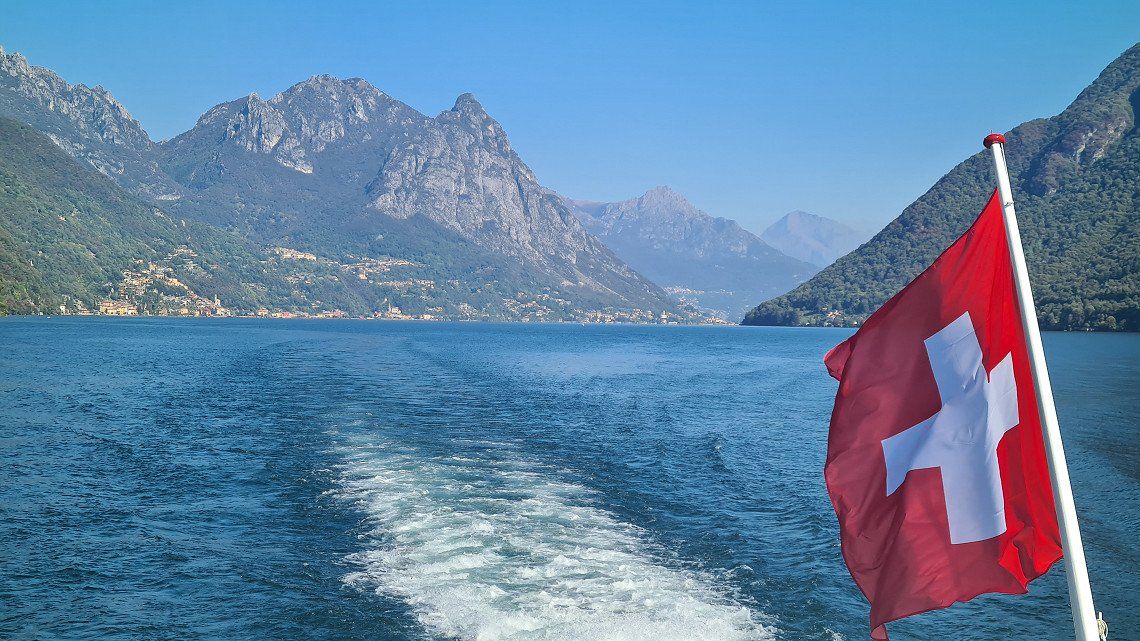
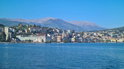
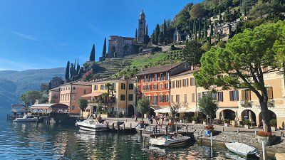
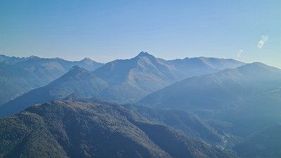
Lago di Lugano or Lago Ceresio (Luganersee) is one of the northern Italian lakes and is 63% in the Swiss canton of Ticino and 37% in Italian territory. Its surface is 271 meters above sea level and covers 48.8 square kilometers. Its deepest point is 288 meters and its volume is 5.9 cubic kilometers. The most important tributary is the Vedeggio with 4 cubic meters/second. Its shape is explained by its formation after the Ice Age in an area where two glaciers met. The artificial sea dam of Melide divides the lake into a north and south basin, plus the small basin called Laghetto of Ponte Tresa. Some foothills of the lake reach into Italy, and the Italian enclave of Campione d'Italia, known for its casino, is located on its shore, which leads to a complicated borderline. South of Lugano, the A2 motorway and the Gotthard railway cross the lake on the Melide dam. Well-known panoramic mountains on the shore are Monte Brè (925 meters above sea level) in the east, Monte San Salvatore (912 meters above sea level) in the west of Lugano and Monte Generoso (1,701 meters above sea level) on the south-eastern shore. Between the two southern arms lies the UNESCO World Heritage Site of Monte San Giorgio (1,097 meters above sea level). Since the lake is in a Mediterranean climate due to its location at the southern tip of Switzerland, it is a popular tourist destination. Various German composers have retired around the lake, such as Michael Jary, Martin Böttcher and Peter Thomas. The writer Hermann Hesse lived in Montagnola near Lugano from the age of 42 until his death. In his honor there has been a museum dedicated to him since 1997 in the old Torre Camuzzi. Wikipedia.
Lago di Lugano or Lago Ceresio (Luganersee) is one of the northern Italian lakes and is 63% in the Swiss canton of Ticino and 37% in Italian territory. Its surface is 271 meters above sea level and covers 48.8 square kilometers. Its deepest point is 288 meters and its volume is 5.9 cubic kilometers. The most important tributary is the Vedeggio with 4 cubic meters/second. Its shape is explained by its formation after the Ice Age in an area where two glaciers met. The artificial sea dam of Melide divides the lake into a north and south basin, plus the small basin called Laghetto of Ponte Tresa. Some foothills of the lake reach into Italy, and the Italian enclave of Campione d'Italia, known for its casino, is located on its shore, which leads to a complicated borderline. South of Lugano, the A2 motorway and the Gotthard railway cross the lake on the Melide dam. Well-known panoramic mountains on the shore are Monte Brè (925 meters above sea level) in the east, Monte San Salvatore (912 meters above sea level) in the west of Lugano and Monte Generoso (1,701 meters above sea level) on the south-eastern shore. Between the two southern arms lies the UNESCO World Heritage Site of Monte San Giorgio (1,097 meters above sea level). Since the lake is in a Mediterranean climate due to its location at the southern tip of Switzerland, it is a popular tourist destination. Various German composers have retired around the lake, such as Michael Jary, Martin Böttcher and Peter Thomas. The writer Hermann Hesse lived in Montagnola near Lugano from the age of 42 until his death. In his honor there has been a museum dedicated to him since 1997 in the old Torre Camuzzi. Wikipedia.
Via the Gotthard to Ticino.
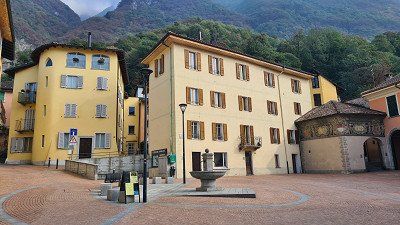
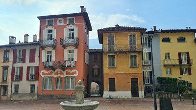
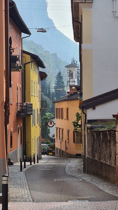
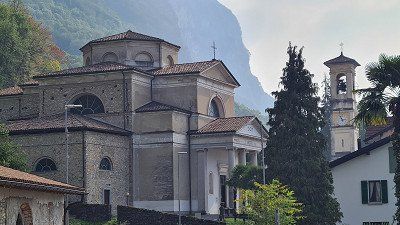
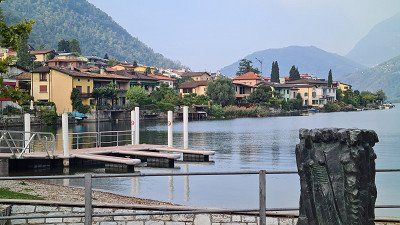
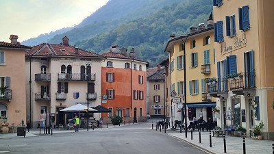
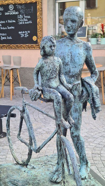
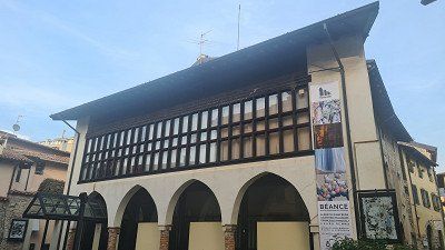
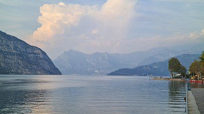
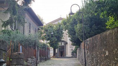
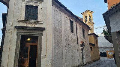
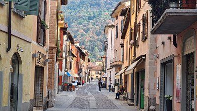
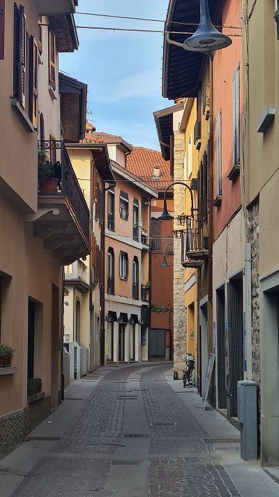
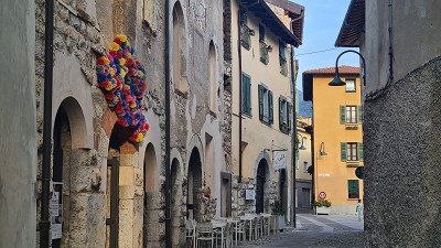
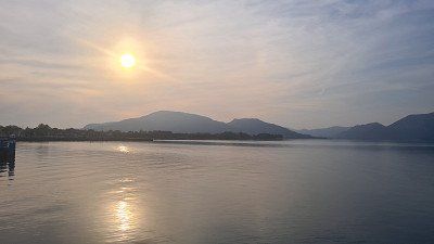
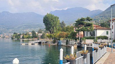
It's Thursday, October 6th, 2022 and beautiful autumn weather with 12 degrees in the morning in Basel and 22 degrees in the afternoon in Melano. Today I first drive the 30 kilometers with the e-mobile from Basel to Zullwil and then with the mobile home 278 kilometers from Zullwil to Melano on Lake Lugano. From Zullwil I take the pass road over the Hauenstein and then at Önsingen the A2 motorway over the Gotthard into Ticino. Around two o'clock I reach today's destination, the Camping Monte Generoso near Maroggia and get a pitch directly at the lake. In the afternoon I cycle along the lake first to Melano (1-4) and then to Riva San Vitale (5-15).
Melano and Riva San Vitale at Wikipedia.
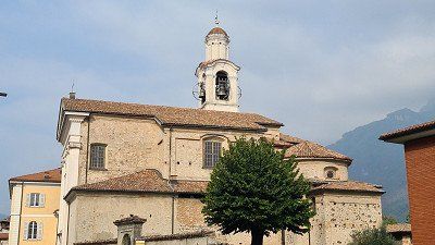
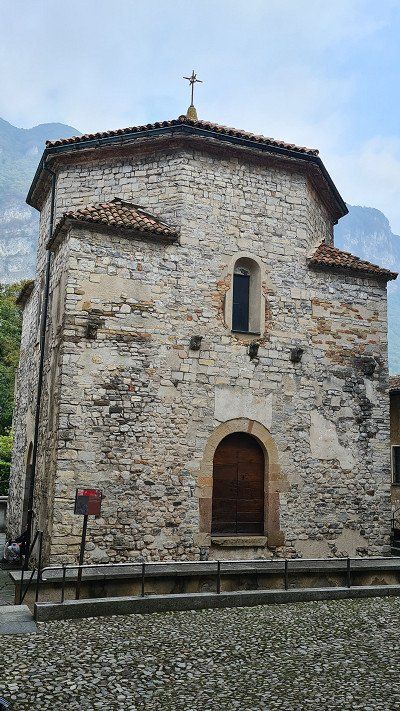
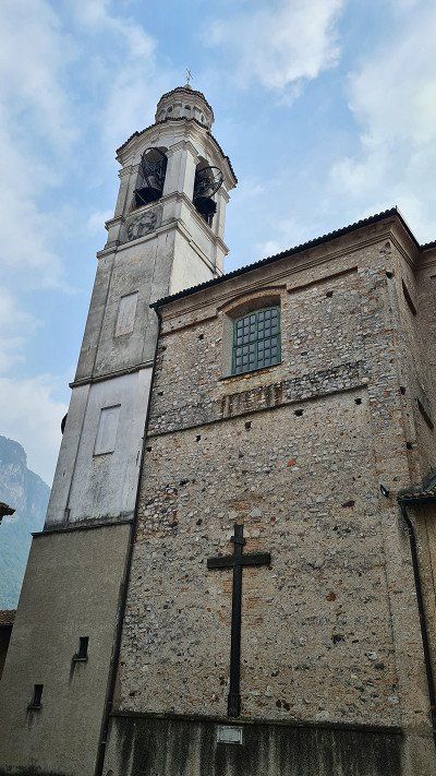
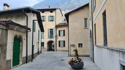
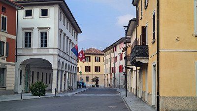
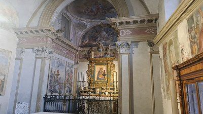
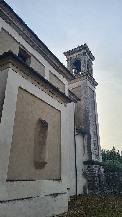
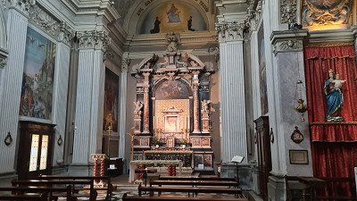
Melano is a town with 1,454 inhabitants in the municipality of Val Mara in the district of Ceresio, in the district of Lugano in the canton of Ticino in Switzerland. In April 2022, Melano merged with the municipalities of Maroggia and Rovio to form the new municipality of Val Mara. The village is located on the eastern shore of Lake Lugano at the foot of Monte Generoso and 2 kilometers south of the Maroggia station on the Bellinzona-Chiasso line of the Swiss Federal Railways. The neighboring municipalities are Maroggia to the north, Centro Valle Intelvi to the east, Mendrisio to the south and Riva San Vitale to the west. The place is first mentioned in 799 as Mellani. In the Middle Ages it was an important port on the lake. The village church of Sant'Andrea was built in 1850 by the architect Luigi Fontana. The village is classified in the inventory of Swiss sites worthy of protection (ISOS) as a Swiss site worthy of protection and of national importance. Sights: parish church of Sant'Andrea, church of the Madonna del Castelletto, old house Polatta, arched entrance with stucco work, Villa Seminario in the district of Pedemonte, Castellaccio castle ruins. Riva San Vitale is a municipality in the district of Riva San Vitale , in the district of Mendrisio in the canton of Ticino in Switzerland. Riva San Vitale is on the eastern slope of Monte San Giorgio , at the southern end of an arm of Lake Lugano , into which the Laveggio flows. The village was inhabited before the Etruscans in pre-Christian times and later under the name of Vicus Subinates, a Roman vicus. The village is classified in the inventory of Swiss sites worthy of protection (ISOS) as a Swiss site worthy of protection and of national importance. Sights: Church of Santa Croce, Baptistery of San Giovanni, the oldest Christian building in Switzerland, parish church of San Vitale and oratory of the Brotherhood of the Holy Sacraments, Bernasconi Palace, Palazzo della Croce with frescoes by the Pozzi brothers from Puria, Palazzo comunale.
Via the Gotthard to Ticino.
It's Thursday, October 6th, 2022 and beautiful autumn weather with 12 degrees in the morning in Basel and 22 degrees in the afternoon in Melano. Today I first drive the 30 kilometers with the e-mobile from Basel to Zullwil and then with the mobile home 278 kilometers from Zullwil to Melano on Lake Lugano. From Zullwil I take the pass road over the Hauenstein and then at Önsingen the A2 motorway over the Gotthard into Ticino. Around two o'clock I reach today's destination, the Camping Monte Generoso near Maroggia and get a pitch directly at the lake. In the afternoon I cycle along the lake first to Melano (1-4) and then to Riva San Vitale (5-15).
Melano and Riva San Vitale at Wikipedia.
Melano is a town with 1,454 inhabitants in the municipality of Val Mara in the district of Ceresio, in the district of Lugano in the canton of Ticino in Switzerland. In April 2022, Melano merged with the municipalities of Maroggia and Rovio to form the new municipality of Val Mara. The village is located on the eastern shore of Lake Lugano at the foot of Monte Generoso and 2 kilometers south of the Maroggia station on the Bellinzona-Chiasso line of the Swiss Federal Railways. The neighboring municipalities are Maroggia to the north, Centro Valle Intelvi to the east, Mendrisio to the south and Riva San Vitale to the west. The place is first mentioned in 799 as Mellani. In the Middle Ages it was an important port on the lake. The village church of Sant'Andrea was built in 1850 by the architect Luigi Fontana. The village is classified in the inventory of Swiss sites worthy of protection (ISOS) as a Swiss site worthy of protection and of national importance. Sights: parish church of Sant'Andrea, church of the Madonna del Castelletto, old house Polatta, arched entrance with stucco work, Villa Seminario in the district of Pedemonte, Castellaccio castle ruins. Riva San Vitale is a municipality in the district of Riva San Vitale , in the district of Mendrisio in the canton of Ticino in Switzerland. Riva San Vitale is on the eastern slope of Monte San Giorgio , at the southern end of an arm of Lake Lugano , into which the Laveggio flows. The village was inhabited before the Etruscans in pre-Christian times and later under the name of Vicus Subinates, a Roman vicus. The village is classified in the inventory of Swiss sites worthy of protection (ISOS) as a Swiss site worthy of protection and of national importance. Sights: Church of Santa Croce, Baptistery of San Giovanni, the oldest Christian building in Switzerland, parish church of San Vitale and oratory of the Brotherhood of the Holy Sacraments, Bernasconi Palace, Palazzo della Croce with frescoes by the Pozzi brothers from Puria, Palazzo comunale.
Campsite and Ristorante Stazione.
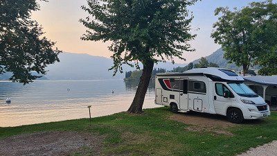
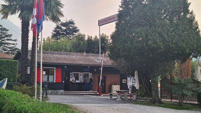
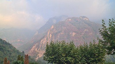
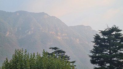
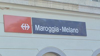
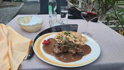
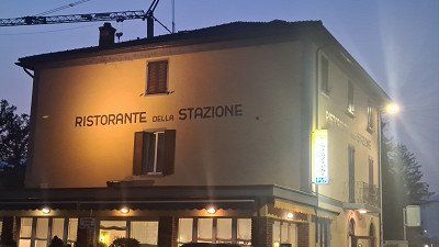
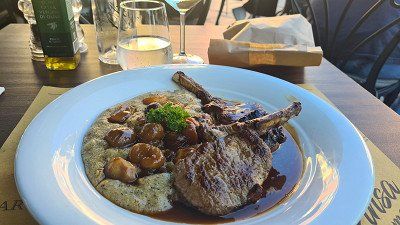
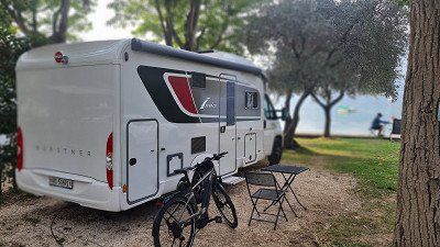
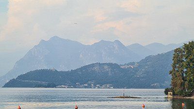
After returning from the bike tour, I first walk over the campsite (1-3) that I have grown fond of over the years, directly on Lago di Lugano and the massive Monte Generoso (4-5) in the back, slightly shrouded in autumn fog. Now in the evening the camping site fills up more and more and I find out from the operator that they are fully booked. We have been here many times and at all times, but we have not yet experienced full occupancy. At the end of the season you can feel that camping is booming. I then walk the ten minutes to the Maroggia-Melano train station to the Ristorante Stazione there (6-8) and its good plain Italian cuisine. I sit down in the small garden and order stufato di cervo (deer stew) to match the autumn mood. But now in October it is getting dark quickly and after returning to the camp I just catch one last beautiful view of the lake from the pitch (9).
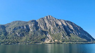
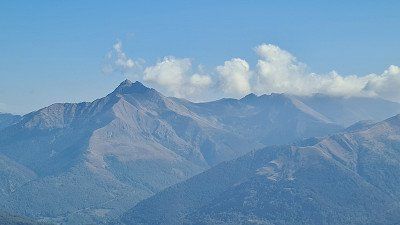
Monte Generoso at Wikipedia.
At 1,701 meters above sea level, Monte Generoso or Calvagione is a Swiss -Italian border mountain on the southern edge of the Alps . He belongs to the Generoso Intelvi group, which is part of the Tambo group . The mountain is located on the eastern shore of Lake Lugano between Lugano and Chiasso and on the western shore of Lake Como. The border between Italy and Switzerland runs over the east ridge and the north ridge. The southern and western flanks belong to Switzerland, the north-eastern side to Italy. The Monte Generoso is a panoramic mountain that, on a clear day, offers an overview of the entire Alpine arc from the Maritime Alps to the Piz Bernina. Since 1890, the Ferrovia Monte Generoso rack railway has been running from Capolago to just below its summit in the summer months from April to October. Generoso-Vetta, the mountain station, is 1,605 meters above sea level right on the national border. The train is the only “typically Swiss” rack railway south of the Alps. In 1940 there was a financial threat of the cessation of railway operations. Migros founder Gottlieb Duttweiler campaigned vehemently for the preservation of the rack railway. Migros then took over the railway company. The Monte Generoso belongs geologically to the southern Alps and has a diverse flora. The first Hotel Monte Generoso Bellavista was opened in 1867. From 1897 to 1901, the German Nobel Prize winner for literature, Gerhart Hauptmann, spent a few spring weeks in nearby Rovio every year. These stays inspired him to write his novella The Heretic of Soana, published in 1918, in which he also refers to Monte Generoso. The Hotel-Restaurant Vetta, built in 1970, was closed in October 2010 for safety reasons as the ground had moved and cracks had appeared. In 2017, the new restaurant Fiore di pietra (stone flower) by Ticino architect Mario Botta was inaugurated.


Campsite and Ristorante Stazione.
After returning from the bike tour, I first walk over the campsite (1-3) that I have grown fond of over the years, directly on Lago di Lugano and the massive Monte Generoso (4-5) in the back, slightly shrouded in autumn fog. Now in the evening the camping site fills up more and more and I find out from the operator that they are fully booked. We have been here many times and at all times, but we have not yet experienced full occupancy. At the end of the season you can feel that camping is booming. I then walk the ten minutes to the Maroggia-Melano train station to the Ristorante Stazione there (6-8) and its good plain Italian cuisine. I sit down in the small garden and order stufato di cervo (deer stew) to match the autumn mood. But now in October it is getting dark quickly and after returning to the camp I just catch one last beautiful view of the lake from the pitch (9).
Monte Generoso at Wikipedia.
At 1,701 meters above sea level, Monte Generoso or Calvagione is a Swiss -Italian border mountain on the southern edge of the Alps . He belongs to the Generoso Intelvi group, which is part of the Tambo group . The mountain is located on the eastern shore of Lake Lugano between Lugano and Chiasso and on the western shore of Lake Como. The border between Italy and Switzerland runs over the east ridge and the north ridge. The southern and western flanks belong to Switzerland, the north-eastern side to Italy. The Monte Generoso is a panoramic mountain that, on a clear day, offers an overview of the entire Alpine arc from the Maritime Alps to the Piz Bernina. Since 1890, the Ferrovia Monte Generoso rack railway has been running from Capolago to just below its summit in the summer months from April to October. Generoso-Vetta, the mountain station, is 1,605 meters above sea level right on the national border. The train is the only “typically Swiss” rack railway south of the Alps. In 1940 there was a financial threat of the cessation of railway operations. Migros founder Gottlieb Duttweiler campaigned vehemently for the preservation of the rack railway. Migros then took over the railway company. The Monte Generoso belongs geologically to the southern Alps and has a diverse flora. The first Hotel Monte Generoso Bellavista was opened in 1867. From 1897 to 1901, the German Nobel Prize winner for literature, Gerhart Hauptmann, spent a few spring weeks in nearby Rovio every year. These stays inspired him to write his novella The Heretic of Soana, published in 1918, in which he also refers to Monte Generoso. The Hotel-Restaurant Vetta, built in 1970, was closed in October 2010 for safety reasons as the ground had moved and cracks had appeared. In 2017, the new restaurant Fiore di pietra (stone flower) by Ticino architect Mario Botta was inaugurated.
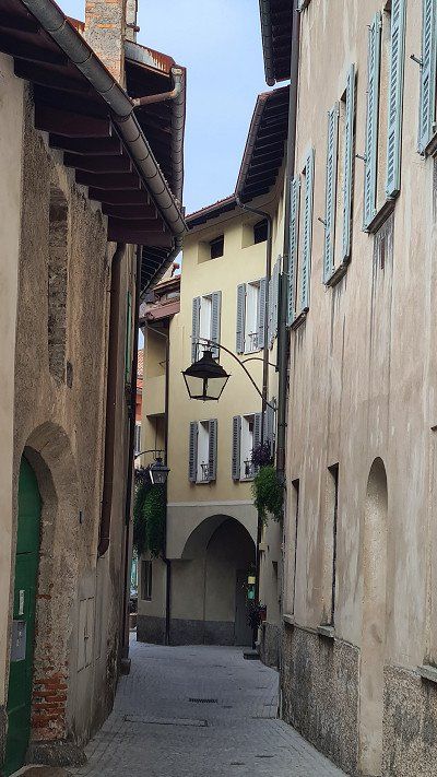
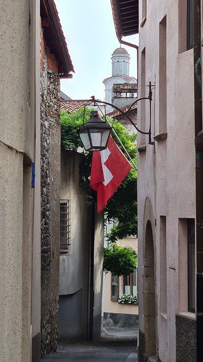
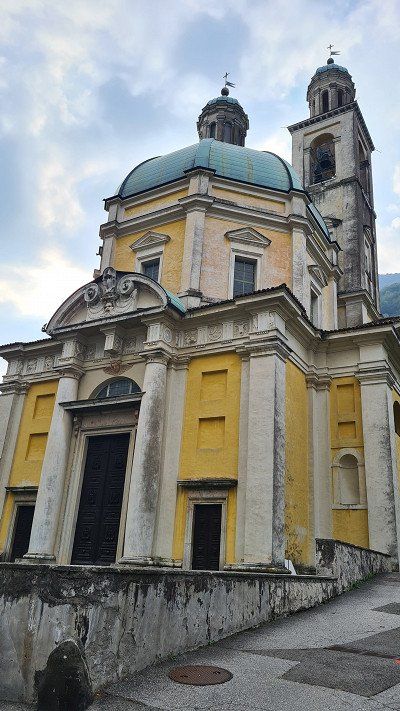
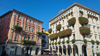
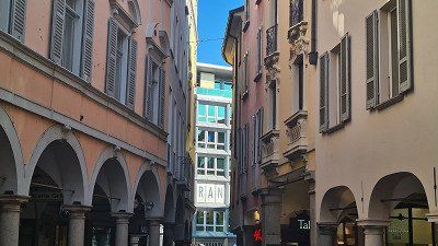
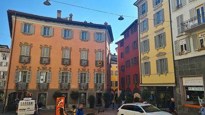
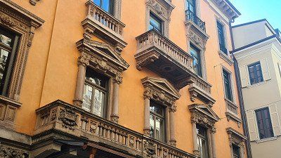
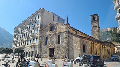
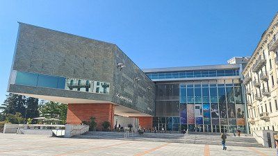
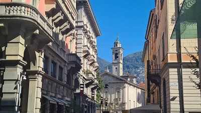
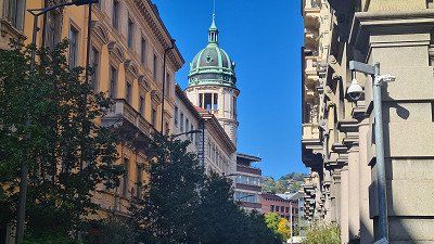
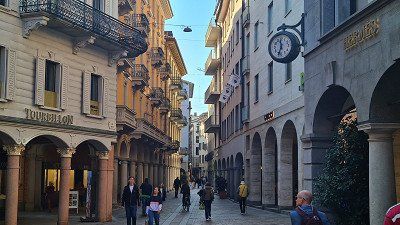
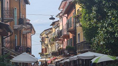
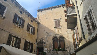
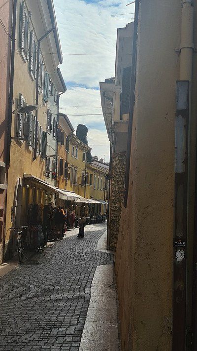
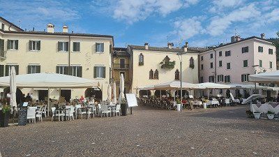
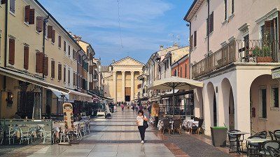
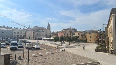
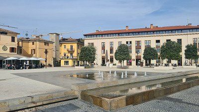
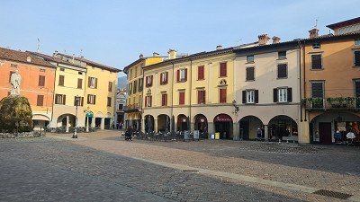
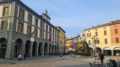
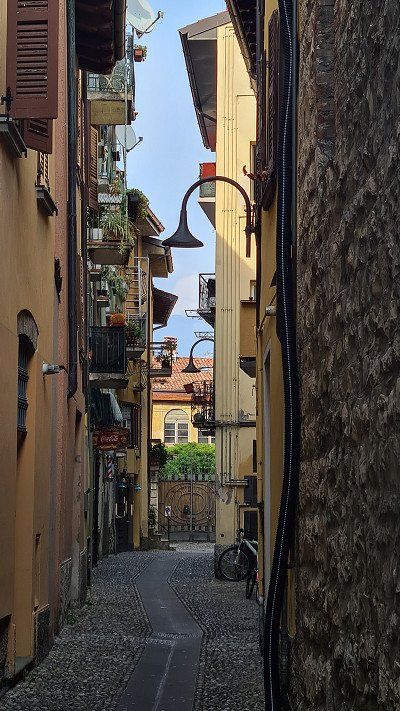
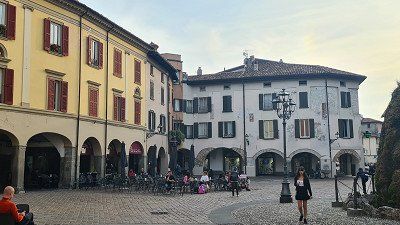
It's Friday, October 7th and again beautiful autumn weather with 23 degrees. Today I will take the S-Bahn to Lugano, visit the old town in the morning and do the big lake tour in the afternoon. At ten o'clock there is a first café americano in the Vanini on the Piazza della Riforma, before I walk for a good two hours through the streets (1-14) and along the beach promenade of Lugano. Back at the Piazza della Riforma, the venerable Ristorante Olimpia serves a very good braciola di cinghiale (wild boar cutlet) con polenta (15) with a glass of Merlot Ticino.
Lugano at Wikipedia.
Lugano is a town and municipality in the district of Lugano in the Swiss canton of Ticino with 62,615 inhabitants. It is located in the Sottoceneri and is the largest political municipality in the canton. The city is the third largest financial center in Switzerland after Zurich and Geneva and the seventh largest Swiss city. The city of Lugano is located in the south of the district and canton at the mouth of the river Cassarate in Lake Lugano. As a university, congress and cultural city, Lugano attracts numerous visitors from Italy and from beyond the Alps. Lugano is located on Lake Lugano (Italian Lago di Lugano, in Italy Lago Ceresio) and is surrounded by the three panoramic mountains Monte Brè (925 meters) in the east, Monte San Salvatore (912 meters) in the west and the Sighignola (1314 meters), whose summit Balcone d'Italia is already on Italian soil. Based on some archaeological finds and grave inscriptions found in the Lugano area, it can be assumed that the area around Lugano was inhabited by Lepontians. The presence of the Romans around Lake Lugano is documented from the first century BC; they had at least one important center north of the lake in Bioggio. Lugano was first mentioned in documents in the years 804, 844, 854 and 875; the name forms were first Luanasco, then Luano. The meaning of the name is uncertain, possibly it goes back to the Latin lūcus "grove, forest". For centuries in the Middle Ages, Lugano was affected by conflicts between Como and Milan, as these were often fought on battlefields that lie on what is now the canton of Ticino. In the second half of the fourteenth century, the city came under the rule of the Milanese Visconti. Later it was occupied by French mercenaries, who in turn were expelled by the Confederates in 1513; since then Lugano has been under Swiss rule. With the entry of French revolutionary troops into the territory of the Confederation in 1798, the subject status of Ticino ended, and Lugano became the capital of the Canton of Lugano of the Helvetic Republic for a few years. In 1803 Lugano became part of the canton of Ticino, whose main town changed every six years between Bellinzona, Locarno and Lugano until 1878. In 1972 the former municipalities of Brè-Aldesago and Castagnola were incorporated into the city of Lugano. In 2004, eight other municipalities merged with the city of Lugano: Breganzona, Cureggia, Davesco-Soragno, Gandria, Pambio-Noranco, Pazzallo, Pregassona and Viganello. As a result, both the area and the population of Lugano increased significantly. In 2007 the voters of Barbengo, Carabbia and Villa Luganese as well as Lugano approved the incorporation of these three communities. The voters of the municipality of Cadro, however, rejected the merger, which is why Villa Luganese became an exclave of the city of Lugano. The incorporation was completed in 2008. In 2013, the municipalities of Bogno, Cadro, Carona, Certara, Cimadera, Sonvico and Val Colla were merged with Lugano, giving the city around 3,400 additional residents. The cityscape is classified in the inventory of Swiss sites worthy of protection (ISOS) as a Swiss site worthy of protection and of national importance. Worth seeing is the Parco civico with its lush southern vegetation and the Villa Ciani. To the west of the park is the lake promenade, built in stages between 1864 and 1920, which leads to Paradiso. Other attractions of Lugano are the two local mountains, Monte San Salvatore and Monte Brè, which offer a panoramic view of the city, Lake Lugano and the Ticino mountains. Both mountains can be reached by train or on foot. At the foot of Monte Brè lies the village of Gandria and Villa Favorita. The medieval and early modern old town of Lugano was largely demolished or gutted between 1910 and 1942 on the basis of the 1902 structure plan and replaced by a new town centre. Therefore, only a few churches and a few secular buildings still exist from the former building structure. In addition to these, the promenade Via Nassa and the Piazza della Riforma are particularly worth a visit. In addition, numerous churches, palazzi, squares and parks can be seen.
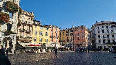
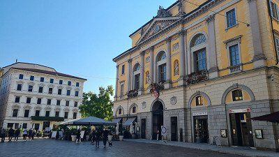
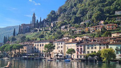
Lake cruise on the MS Lugano.
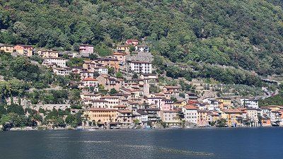
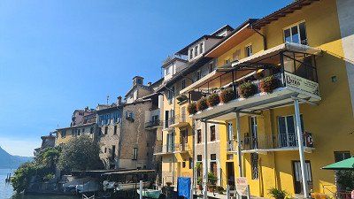
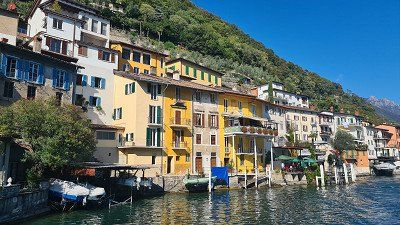
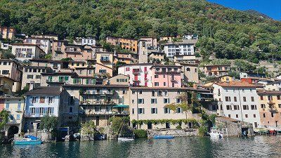
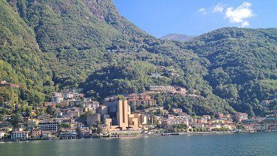
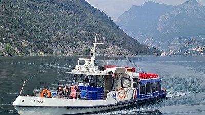
After a good lunch I board the motor ship Lugano (born 1961) at two o'clock and sit down in a corner outside on the upper deck and simply enjoy the wonderful boat trip (1-15) to Paradiso, Gandria, Cambione, Melide, Brusino, Morcorte and passing the impressive mountains of Bré, San Salvatore, San Giorgo and Generoso. The long lake tour in the afternoon has been offered by the Società Navigazione del Lago di Lugano for years. We have actually booked them every time we have visited Lugano. She is simply unique.
Società Navigazione del Lago di Lugano at Wikipedia.


Lake cruise on the MS Lugano.
After a good lunch I board the motor ship Lugano (born 1961) at two o'clock and sit down in a corner outside on the upper deck and simply enjoy the wonderful boat trip (1-15) to Paradiso, Gandria, Cambione, Melide, Brusino, Morcorte and passing the impressive mountains of Bré, San Salvatore, San Giorgo and Generoso. The long lake tour in the afternoon has been offered by the Società Navigazione del Lago di Lugano for years. We have actually booked them every time we have visited Lugano. She is simply unique.
Società Navigazione del Lago di Lugano at Wikipedia.
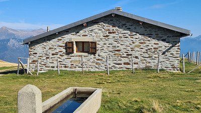
Art on Alpe Foppa on Monte Tamaro.
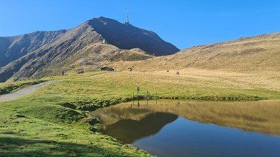
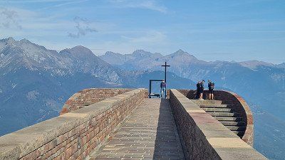
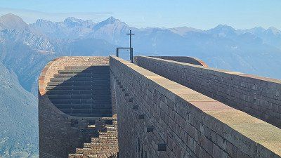
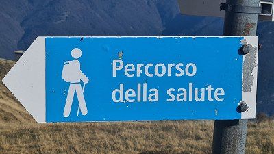
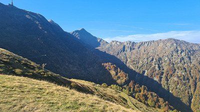
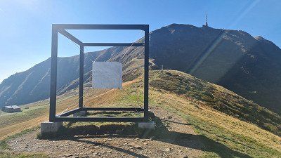
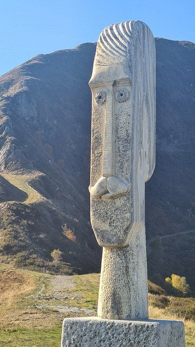
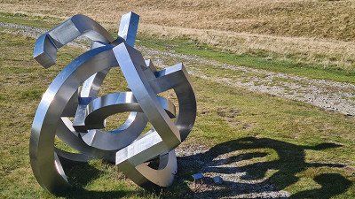
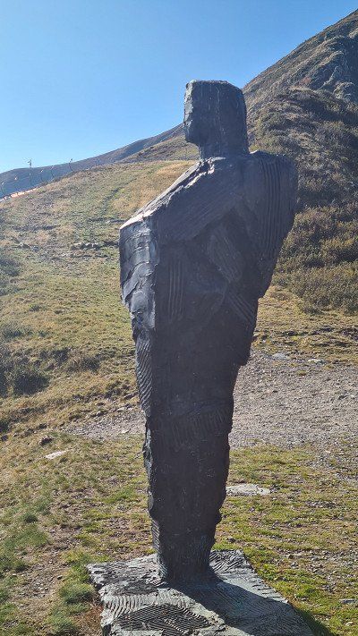
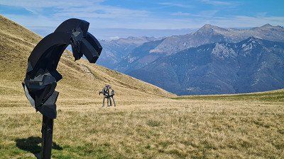
It's Saturday, October 8th and beautiful autumn weather with 23 degrees during the day. In the evening it begins to rain. Since I have to change places at the campsite, I decide to drive the 60 kilometers back and forth to Riviera in the mobile home. In Riviera, around ten o'clock, I climb the gondola to Alpe Foppa (1) below Monte Tamaro. At the Cappella di Santa Maria degli Angeli (2-3) there are wonderful panoramas. After a café in the restaurant, I go on the half-hour tour Percoso della Salute (6), which circles Alpe Foppa, allows for more beautiful views and, among other things, leads past some interesting sculptures by local artists (7-15). Shortly after noon I drive back to the camp and in the afternoon I take the S-Bahn to Lugano again for shopping and an aperitif on the Piazza della Riforma.
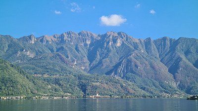
Monte Tamaro at Wikipedia.
At 1,960 meters above sea level, Monte Tamaro is a mountain in the Swiss canton of Ticino above the town of Rivera. On La Manèra (1,858 meters), the eastern secondary summit of Monte Tamaro, there is a large Swisscom radio relay station. Parts of the connections from Ticino are transmitted via them to German-speaking Switzerland. The Cappella di Santa Maria degli Angeli, designed by Ticino architect Mario Botta from 1990 and built between 1992 and 1994, on Alpe Foppa at 1,567 meters above sea level made the place well-known nationwide. The chapel , inaugurated in 1996 and decorated with paintings by Enzo Cucchi , can be reached by cable car . On the Alpe Foppa there is a summer toboggan run, a zip line, a restaurant, a children's playground, various hikes and a mountain bike course at the mountain station of the cable car on the north-eastern slope of the mountain. The Monte Tamaro rope park is located at the middle station. The 2003 Mountain Bike World Championships took place on the slopes of Monte Tamaro. A hiking route leads from Monte Tamaro in about 4½ hours over several other peaks to Monte Lema. In good weather, the view extends to the Monte Rosa massif and the Matterhorn. This makes the summit of Monte Tamaro one of the few vantage points that allow a simultaneous view of the lowest point (Lake Maggiore) and the highest point (Dufourspitze) in Switzerland.


Art on Alpe Foppa on Monte Tamaro.
It's Saturday, October 8th and beautiful autumn weather with 23 degrees during the day. In the evening it begins to rain. Since I have to change places at the campsite, I decide to drive the 60 kilometers back and forth to Riviera in the mobile home. In Riviera, around ten o'clock, I climb the gondola to Alpe Foppa (1) below Monte Tamaro. At the Cappella di Santa Maria degli Angeli (2-3) there are wonderful panoramas. After a café in the restaurant, I go on the half-hour tour Percoso della Salute (6), which circles Alpe Foppa, allows for more beautiful views and, among other things, leads past some interesting sculptures by local artists (7-15). Shortly after noon I drive back to the camp and in the afternoon I take the S-Bahn to Lugano again for shopping and an aperitif on the Piazza della Riforma.
Monte Tamaro at Wikipedia.
At 1,960 meters above sea level, Monte Tamaro is a mountain in the Swiss canton of Ticino above the town of Rivera. On La Manèra (1,858 meters), the eastern secondary summit of Monte Tamaro, there is a large Swisscom radio relay station. Parts of the connections from Ticino are transmitted via them to German-speaking Switzerland. The Cappella di Santa Maria degli Angeli, designed by Ticino architect Mario Botta from 1990 and built between 1992 and 1994, on Alpe Foppa at 1,567 meters above sea level made the place well-known nationwide. The chapel , inaugurated in 1996 and decorated with paintings by Enzo Cucchi , can be reached by cable car . On the Alpe Foppa there is a summer toboggan run, a zip line, a restaurant, a children's playground, various hikes and a mountain bike course at the mountain station of the cable car on the north-eastern slope of the mountain. The Monte Tamaro rope park is located at the middle station. The 2003 Mountain Bike World Championships took place on the slopes of Monte Tamaro. A hiking route leads from Monte Tamaro in about 4½ hours over several other peaks to Monte Lema. In good weather, the view extends to the Monte Rosa massif and the Matterhorn. This makes the summit of Monte Tamaro one of the few vantage points that allow a simultaneous view of the lowest point (Lake Maggiore) and the highest point (Dufourspitze) in Switzerland.
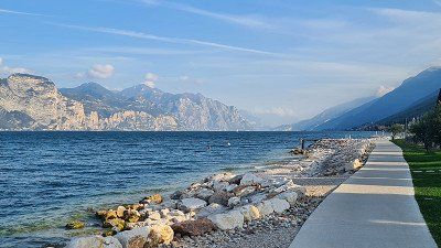
The Lago di Garda (Lake Garda), one of the northern Italian lakes , is the largest lake in Italy , named after the municipality of Garda on the eastern shore. Its ancient name was Lacus benacus in 200 BC. The name is said to derive from an ancient deity named Benacus . Lake Garda was formed during the last Ice Age by a side branch of the Adige Glacier , traces of which can still be traced, particularly through terminal moraines on the southern shore. The first settlements on the lake shore date back to around 2,000 BC. Lake Garda lies between the Alps to the north and the Po Valley to the south, and is therefore an Alpine edge lake . The north of the lake belongs to the region Trentino-Alto Adige , the west to Lombardy and the east to Veneto . Thus the three provinces share Trento (North), Verona (East) and Brescia (West) administration. Numerous pile dwelling settlements date from the Bronze Age , which were built directly on the lake shore or in the immediate hinterland of Lake Garda and have been a UNESCO World Heritage Site since 2011 . The battle of Lacus Benacus took place on its banks in 268 between the Alamanni and the Romans under Emperors Claudius Gothicus delivered. In the thirteenth and fourteenth centuries, the lake fell under the Scaligeri sphere of influence , who built numerous castles , particularly on the eastern and southern shore towns ( Malcesine , Torri del Benaco , Lazise and Sirmione ). In the fifteenth century, the lake and its shore towns became the scene of the struggle for supremacy in northern Italy between the Duchy of Milan under the Visconti and the Republic of Venice . With the border on the Adda river laid down in the Peace of Lodi in 1454 , Lake Garda finally fell under the sphere of influence of the Doge's Republic. The latter, in particular, expanded Peschiera into a fortress on the strategically important outflow of the Mincio , which was declared a World Heritage Site by UNESCO in 2017 . During the War of the Spanish Succession at the beginning of the eighteenth century, General Vendôme tried to push his troops north along the north bank, leaving a trail of destruction in their wake. In the process, numerous castles were destroyed by the French, such as Castel Penede in Nago , the Castle of Arco or Castel Drena , which survive as ruins. In 1706, Vendôme defeated the imperial troops at the Battle of Calcinato on the southern shore of the lake. The Battle of Rivoli was a key success for the French army under Napoleon Bonaparte in the Italian campaign over a numerically superior Habsburg army. Due to the Treaty of Pressburg in 1805, with which Tyrol fell to Bavaria, the northern tip of the lake now belonged to the Kingdom of Bavaria . After the Congress of Vienna in 1815, the entire lake fell to the Austrian Empire and was part of the Kingdom of Lombardy-Venetia . The Battle of Solferino in the Sardinian War between the Austrian Empire and the Kingdom of Sardinia was crucial to the unification of Italy in 1859. The ferocity of the battle prompted Henry Dunant to found the Red Cross and led to the agreement of the 1864 Geneva Convention . After the loss of Lombardy In 1859, after the Third Italian War of Independence in 1866, Austria also lost the eastern shore with Venetia , only the northern tip, with Riva del Garda, remained with Austria-Hungary until 1918 . During the First World War , the front ran directly along the north shore of the lake, where numerous fortifications had been built. After Mussolini's fall in 1943, the Repubblica Sociale Italiana (Republic of Salò ) was installed under Mussolini 's leadership as a counter-government at German demand from September 23, 1943 to April 25, 1945 . On April 30, 1945, World War II ended on Lake Garda with the liberation of Torbole and Riva by the 10th US Mountain Division . Wikipedia.
The Lago di Garda (Lake Garda), one of the northern Italian lakes , is the largest lake in Italy , named after the municipality of Garda on the eastern shore. Its ancient name was Lacus benacus in 200 BC. The name is said to derive from an ancient deity named Benacus . Lake Garda was formed during the last Ice Age by a side branch of the Adige Glacier , traces of which can still be traced, particularly through terminal moraines on the southern shore. The first settlements on the lake shore date back to around 2,000 BC. Lake Garda lies between the Alps to the north and the Po Valley to the south, and is therefore an Alpine edge lake . The north of the lake belongs to the region Trentino-Alto Adige , the west to Lombardy and the east to Veneto . Thus the three provinces share Trento (North), Verona (East) and Brescia (West) administration. Numerous pile dwelling settlements date from the Bronze Age , which were built directly on the lake shore or in the immediate hinterland of Lake Garda and have been a UNESCO World Heritage Site since 2011 . The battle of Lacus Benacus took place on its banks in 268 between the Alamanni and the Romans under Emperors Claudius Gothicus delivered. In the thirteenth and fourteenth centuries, the lake fell under the Scaligeri sphere of influence , who built numerous castles , particularly on the eastern and southern shore towns ( Malcesine , Torri del Benaco , Lazise and Sirmione ). In the fifteenth century, the lake and its shore towns became the scene of the struggle for supremacy in northern Italy between the Duchy of Milan under the Visconti and the Republic of Venice . With the border on the Adda river laid down in the Peace of Lodi in 1454 , Lake Garda finally fell under the sphere of influence of the Doge's Republic. The latter, in particular, expanded Peschiera into a fortress on the strategically important outflow of the Mincio , which was declared a World Heritage Site by UNESCO in 2017 . During the War of the Spanish Succession at the beginning of the eighteenth century, General Vendôme tried to push his troops north along the north bank, leaving a trail of destruction in their wake. In the process, numerous castles were destroyed by the French, such as Castel Penede in Nago , the Castle of Arco or Castel Drena , which survive as ruins. In 1706, Vendôme defeated the imperial troops at the Battle of Calcinato on the southern shore of the lake. The Battle of Rivoli was a key success for the French army under Napoleon Bonaparte in the Italian campaign over a numerically superior Habsburg army. Due to the Treaty of Pressburg in 1805, with which Tyrol fell to Bavaria, the northern tip of the lake now belonged to the Kingdom of Bavaria . After the Congress of Vienna in 1815, the entire lake fell to the Austrian Empire and was part of the Kingdom of Lombardy-Venetia . The Battle of Solferino in the Sardinian War between the Austrian Empire and the Kingdom of Sardinia was crucial to the unification of Italy in 1859. The ferocity of the battle prompted Henry Dunant to found the Red Cross and led to the agreement of the 1864 Geneva Convention . After the loss of Lombardy In 1859, after the Third Italian War of Independence in 1866, Austria also lost the eastern shore with Venetia , only the northern tip, with Riva del Garda, remained with Austria-Hungary until 1918 . During the First World War , the front ran directly along the north shore of the lake, where numerous fortifications had been built. After Mussolini's fall in 1943, the Repubblica Sociale Italiana (Republic of Salò ) was installed under Mussolini 's leadership as a counter-government at German demand from September 23, 1943 to April 25, 1945 . On April 30, 1945, World War II ended on Lake Garda with the liberation of Torbole and Riva by the 10th US Mountain Division . Wikipedia.
Driving on the highway to Lake Garda.
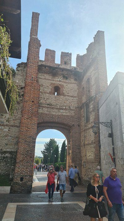
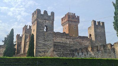
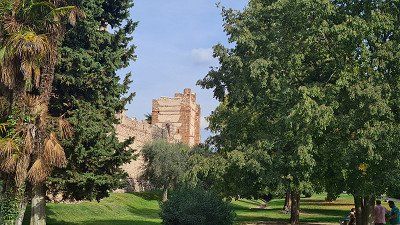
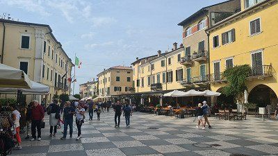
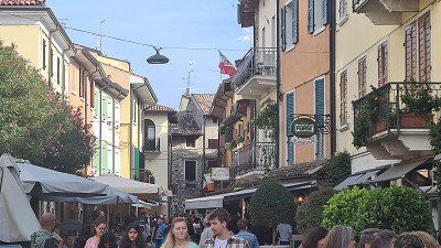
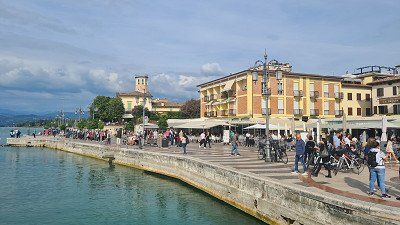
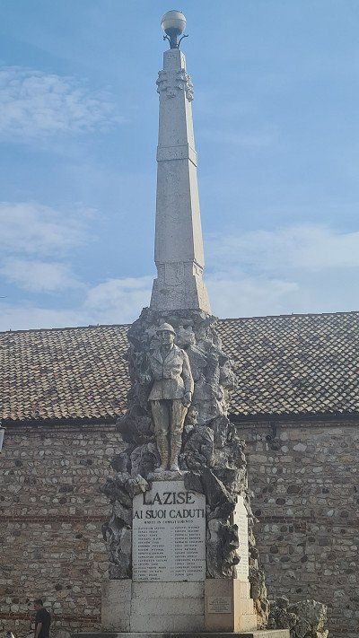
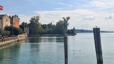
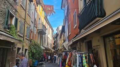
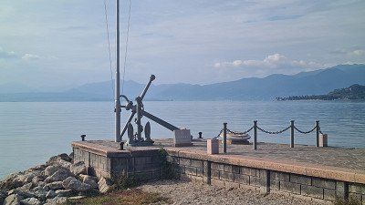
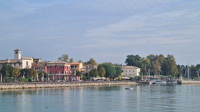
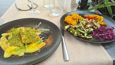
It's Sunday, October 9th, 2022 with heavy rain in the morning while driving and brighter spells while strolling through the city with a pleasant 20 degrees in the afternoon. Today I drive 200 kilometers from Melano to Lazise on Lake Garda. Because of the weather, I forgo the nicer ride on side roads past Lago di Como and instead take the motorway via Milano and Bergamo. Despite the heavy traffic, I make good progress and reach the Camping Village du Parc on the outskirts of Lazise around two o'clock. I'm moving into a nice pitch (1) near the lake. The camp is very well occupied, it was worth making a reservation. In the afternoon I walk along the lake (2) to the old town of Lazise, visit Scalingerburg (3-5) with its city wall and gate and stroll across squares (6-7) and through alleys (8-10), promenade and harbor (11-15) of the fishing village. In the Osteria due Archi there is a very well prepared orata con verdure (sea bream with vegetables). Around six o'clock I take a leisurely fifteen-minute walk back to the camp.
Lazise on Wikipedia.
Lazise is an Italian commune of 7,028 inhabitants in the province of Verona , Veneto region . Lazise is located on the south-eastern Veronese shore of Lake Garda , which has sandy beaches, between the towns of Bardolino and Peschiera del Garda . The distance to the provincial capital Verona is 23 kilometers. The name Lazise derives from the Latin "lacus" and probably means "villaggio lacustre" (lake village), as documents from the Middle Ages show. The history goes back to the Middle Bronze Age (thirteenth to sixteenth centuries BC). Numerous finds in the towns of La Quercia, Bor and Porto Pacengo bear witness to this eventful time. As early as 983, under Emperor Otto II, the town not only received customs, trade and fishing rights in the so-called Veronese Donation, but also extensive autonomy. The municipality of Lazise therefore prides itself on being the oldest municipality in Italy. In the eleventh century, Lazise was a port station owned by the House of Bevilacqua. In 1077, under Emperor Heinrich IV, permission was granted to build a castle, which was expanded under the Scaliger Cansignorio della Scala in the fourteenth century into an important fortification with its own walled harbor and probably completed under his successor Antonio della Scala. Under the Scaligeri, the city walls and city gates were renewed and strengthened. After the end of the Scaliger rule in 1387, it was the Milanese Visconti under Gian Galeazzo Visconti who took over the rule of Lazise. At this point, Lazise joined the Gardesana dell'Acqua, a kind of confederation of several Visconti-controlled communities on the lake and in the immediate hinterland of the lake. In 1405 Lazise fell to the Republic of Venice . In the Great Venetian War, Venice was defeated by the French at the Battle of Agnadello in 1509 . I n the course of the Italian campaign (1796-1797) Lazise was occupied by Napoleonic troops. With the Peace of Campo Formio, the town fell to the Habsburgs for the first time, but was already attached to the Napoleonic Kingdom of Italy in 1805, before it fell again to the Habsburg Kingdom of Lombardy-Venetia with the Congress of Vienna in 1815. With the end of the Third Italian War of Independence and the subsequent plebiscite, Lazise joined the Kingdom of Italy. The old town of Lazise still has many buildings of medieval origin. The cityscape is dominated by the city walls and the castle. Lazise has numerous picturesque corners such as Piazza Vittorio Emanuele and the small port where fishing boats are still moored. There are three large city gates through which you can enter the interior of the car-free old town. On the one hand via the entrance, which is located directly on the busy Gardesana Orientale and is also the main entrance, on the other hand via the Via Rosenheim, which was so named because of the twin town of Rosenheim, and finally via the street called Via Bastia. This was built towards the end of the ninth century to defend against the Huns. Several conversions and additional fortifications, especially under the Scaligeri, followed in the fourteenth century. The Scalingerburg is one of the best-preserved fortifications on Lake Garda. The square floor plan of the six-towered fort is characteristic. In addition to its five slightly smaller towers, it consists of a mighty keep. The castle complex is surrounded by the Villa Bernini park and cannot be visited. The old coats of arms can still be seen in the upper part of the keep, even if they were smashed under Emperor Maximilian. Two churches can also be seen: Church of SS. Zeno e Martino, mentioned for the first time in a document in 1295 and dedicated to Saint Zeno, patron saint of the Church in Verona, water and fishing; .the Church of San Nicolò, a Romanesque church built in the twelfth century and dedicated to Saint Nicholas, patron saint of water and seafarers in the Middle Ages.


Driving on the highway to Lake Garda.
It's Sunday, October 9th, 2022 with heavy rain in the morning while driving and brighter spells while strolling through the city with a pleasant 20 degrees in the afternoon. Today I drive 200 kilometers from Melano to Lazise on Lake Garda. Because of the weather, I forgo the nicer ride on side roads past Lago di Como and instead take the motorway via Milano and Bergamo. Despite the heavy traffic, I make good progress and reach the Camping Village du Parc on the outskirts of Lazise around two o'clock. I'm moving into a nice pitch (1) near the lake. The camp is very well occupied, it was worth making a reservation. In the afternoon I walk along the lake (2) to the old town of Lazise, visit Scalingerburg (3-5) with its city wall and gate and stroll across squares (6-7) and through alleys (8-10), promenade and harbor (11-15) of the fishing village. In the Osteria due Archi there is a very well prepared orata con verdure (sea bream with vegetables). Around six o'clock I take a leisurely fifteen-minute walk back to the camp.
Lazise on Wikipedia.
Lazise is an Italian commune of 7,028 inhabitants in the province of Verona , Veneto region . Lazise is located on the south-eastern Veronese shore of Lake Garda , which has sandy beaches, between the towns of Bardolino and Peschiera del Garda . The distance to the provincial capital Verona is 23 kilometers. The name Lazise derives from the Latin "lacus" and probably means "villaggio lacustre" (lake village), as documents from the Middle Ages show. The history goes back to the Middle Bronze Age (thirteenth to sixteenth centuries BC). Numerous finds in the towns of La Quercia, Bor and Porto Pacengo bear witness to this eventful time. As early as 983, under Emperor Otto II, the town not only received customs, trade and fishing rights in the so-called Veronese Donation, but also extensive autonomy. The municipality of Lazise therefore prides itself on being the oldest municipality in Italy. In the eleventh century, Lazise was a port station owned by the House of Bevilacqua. In 1077, under Emperor Heinrich IV, permission was granted to build a castle, which was expanded under the Scaliger Cansignorio della Scala in the fourteenth century into an important fortification with its own walled harbor and probably completed under his successor Antonio della Scala. Under the Scaligeri, the city walls and city gates were renewed and strengthened. After the end of the Scaliger rule in 1387, it was the Milanese Visconti under Gian Galeazzo Visconti who took over the rule of Lazise. At this point, Lazise joined the Gardesana dell'Acqua, a kind of confederation of several Visconti-controlled communities on the lake and in the immediate hinterland of the lake. In 1405 Lazise fell to the Republic of Venice . In the Great Venetian War, Venice was defeated by the French at the Battle of Agnadello in 1509 . I n the course of the Italian campaign (1796-1797) Lazise was occupied by Napoleonic troops. With the Peace of Campo Formio, the town fell to the Habsburgs for the first time, but was already attached to the Napoleonic Kingdom of Italy in 1805, before it fell again to the Habsburg Kingdom of Lombardy-Venetia with the Congress of Vienna in 1815. With the end of the Third Italian War of Independence and the subsequent plebiscite, Lazise joined the Kingdom of Italy. The old town of Lazise still has many buildings of medieval origin. The cityscape is dominated by the city walls and the castle. Lazise has numerous picturesque corners such as Piazza Vittorio Emanuele and the small port where fishing boats are still moored. There are three large city gates through which you can enter the interior of the car-free old town. On the one hand via the entrance, which is located directly on the busy Gardesana Orientale and is also the main entrance, on the other hand via the Via Rosenheim, which was so named because of the twin town of Rosenheim, and finally via the street called Via Bastia. This was built towards the end of the ninth century to defend against the Huns. Several conversions and additional fortifications, especially under the Scaligeri, followed in the fourteenth century. The Scalingerburg is one of the best-preserved fortifications on Lake Garda. The square floor plan of the six-towered fort is characteristic. In addition to its five slightly smaller towers, it consists of a mighty keep. The castle complex is surrounded by the Villa Bernini park and cannot be visited. The old coats of arms can still be seen in the upper part of the keep, even if they were smashed under Emperor Maximilian. Two churches can also be seen: Church of SS. Zeno e Martino, mentioned for the first time in a document in 1295 and dedicated to Saint Zeno, patron saint of the Church in Verona, water and fishing; .the Church of San Nicolò, a Romanesque church built in the twelfth century and dedicated to Saint Nicholas, patron saint of water and seafarers in the Middle Ages.
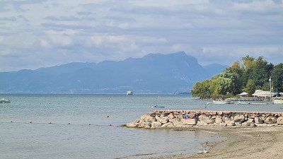
By bike to Garda.
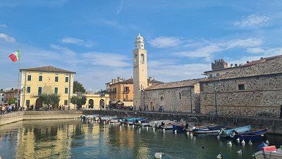
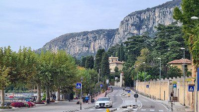
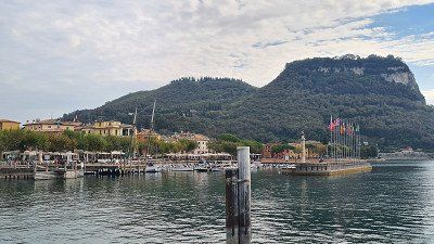
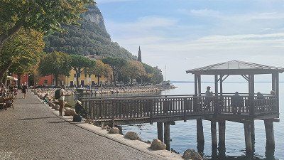
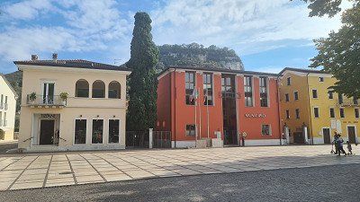
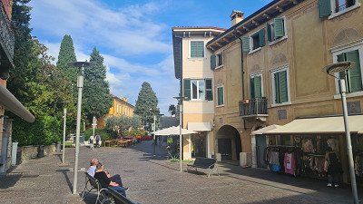
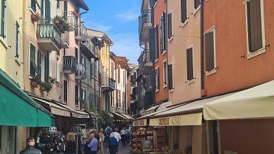
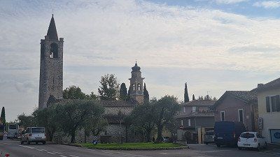
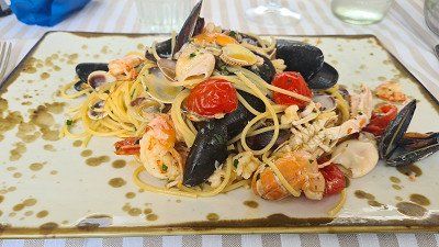
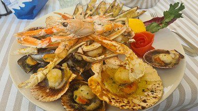
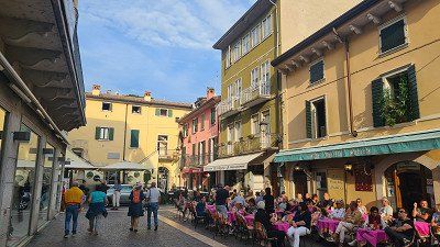
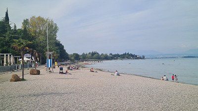
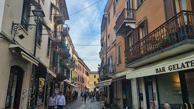
It's Monday, October 10th, 2022. It's going to be another beautiful autumn day with lots of sun and 22 degrees. Today I'm visiting the towns of Garda and Bardolino, which are a good ten and seven kilometers north of Lazise on Lake Garda. The ride is largely flat and pleasant to ride on the narrow road along the lake, even if there are no separate cycle paths. I arrive in Garda around eleven o'clock and take a leisurely stroll along the promenade and through the alleys of the pretty fishing village (1-12). In the Osteria al Porto (13-15) on the lake promenade there is first spaghetti vongole and then an excellent gratinata di frutti di mare.
Garda at Wikipedia.
Garda is a northern Italian municipality with 4'111 inhabitants in the province of Verona on the western edge of the Veneto region . Garda is located on the eastern shore and is the namesake of Lake Garda . In and around the town there is lush, almost Mediterranean vegetation. Therefore, it is a popular tourist destination. Garda is characterized by the lake promenade and the small harbor with the "Palazzo dei Capitani" from Venetian times. The headland of Punta San Vigilio juts out into the lake near Garda . For the philosopher Agostino di Brenzone it was the "most beautiful place in the world". Remains of pile dwellings are evidence of a very early settlement. It is a fact that the Gothic king Theodoric had a castle built on a rocky plateau, Rocca di Garda, high above the town in the fifth century. For a long time it was considered impregnable - even Emperor Barbarossa was unable to capture it. Five centuries later, the Lombard prince Berengar II ruled here until he was defeated by King Otto the Great and imprisoned for life in Bamberg . The castle was destroyed by the Venetians in the sixteenth century. From 1904 until it was finally closed in 1956, the town had a station on the Verona–Caprino/Garda railway . Due to its long history, Garda has a very distinctive character, which is particularly evident in its small but attractive old town and the beautiful promenade, the southern extension of which extends to Bardolino, but on the outskirts it resembles many other settlements on the shore that are shaped by tourism of Lake Garda. In this respect, the old town with the lake promenade is a sight in itself. You can see: Palazzo dei Capitani (“Palace of the Captains”) from the fourteenth century; Villa degli Albertini from the sixteenth century, Villa Canossa from the eighteenth century; the churches of Santa Maria Maggiore and the parish church of Garda from the tenth century, the church of Saint Stephen from the seventeenth century, the church of the Assumption from the eighteenth century and the hermitage of the Camaldolese from the fifteenth century.


By bike to Garda.
It's Monday, October 10th, 2022. It's going to be another beautiful autumn day with lots of sun and 22 degrees. Today I'm visiting the towns of Garda and Bardolino, which are a good ten and seven kilometers north of Lazise on Lake Garda. The ride is largely flat and pleasant to ride on the narrow road along the lake, even if there are no separate cycle paths. I arrive in Garda around eleven o'clock and take a leisurely stroll along the promenade and through the alleys of the pretty fishing village (1-12). In the Osteria al Porto (13-15) on the lake promenade there is first spaghetti vongole and then an excellent gratinata di frutti di mare.
Garda at Wikipedia.
Garda is a northern Italian municipality with 4'111 inhabitants in the province of Verona on the western edge of the Veneto region . Garda is located on the eastern shore and is the namesake of Lake Garda . In and around the town there is lush, almost Mediterranean vegetation. Therefore, it is a popular tourist destination. Garda is characterized by the lake promenade and the small harbor with the "Palazzo dei Capitani" from Venetian times. The headland of Punta San Vigilio juts out into the lake near Garda . For the philosopher Agostino di Brenzone it was the "most beautiful place in the world". Remains of pile dwellings are evidence of a very early settlement. It is a fact that the Gothic king Theodoric had a castle built on a rocky plateau, Rocca di Garda, high above the town in the fifth century. For a long time it was considered impregnable - even Emperor Barbarossa was unable to capture it. Five centuries later, the Lombard prince Berengar II ruled here until he was defeated by King Otto the Great and imprisoned for life in Bamberg . The castle was destroyed by the Venetians in the sixteenth century. From 1904 until it was finally closed in 1956, the town had a station on the Verona–Caprino/Garda railway . Due to its long history, Garda has a very distinctive character, which is particularly evident in its small but attractive old town and the beautiful promenade, the southern extension of which extends to Bardolino, but on the outskirts it resembles many other settlements on the shore that are shaped by tourism of Lake Garda. In this respect, the old town with the lake promenade is a sight in itself. You can see: Palazzo dei Capitani (“Palace of the Captains”) from the fourteenth century; Villa degli Albertini from the sixteenth century, Villa Canossa from the eighteenth century; the churches of Santa Maria Maggiore and the parish church of Garda from the tenth century, the church of Saint Stephen from the seventeenth century, the church of the Assumption from the eighteenth century and the hermitage of the Camaldolese from the fifteenth century.
Stop in Bardolino on the way back.
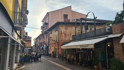
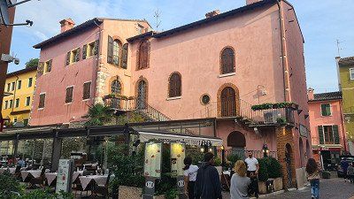
After an excellent lunch I drive back along the Seestrasse towards Lazise. On the way I visit another fishing village Bardolino. Here, too, I walk along the lake promenade and through the streets of the old town (1-14). Then another café americano before I start the further way back to the camp in Lazise. The day in the two small towns was a beautiful experience and left me with impressive images. In the evening there is a Moretti in the camp 's lakeside bistro (14-15).
Bardolino at Wikipedia.
Bardolino is an Italian municipality on Lake Garda in the province of Verona in the north-eastern Italian region of Veneto with 7,207 inhabitants. Bardolino is on the east side of the lake, north of Lazise and south of Garda . Bardolino has two million tourists a year and is the 24th tourist destination in Italy. The place is the seat of the municipality, which also includes the hamlets of Cisano and Calmasino . Cisano is located directly on the Gardesana orientale quay . The center of Bardolino can be reached on foot in 20 minutes along the promenade. Worth seeing in Cisano is the small church of St. Julian from the eighth century. The Middle Franconian community of Rednitzhembach in the district of Roth is a partner community of Bardolino. Wine festivals with winegrowers from the other region take place in both Bardolino and Rednitzhembach. Bardolino is the center of a well-known wine region of the same name . The red Bardolino and the rosé called "Chiaretto" are very popular. Like the surrounding area, the place is a popular tourist destination . You can see seven churches, a Camaldolese monastery, a wine, an olive and a bird museum.

Stop in Bardolino on the way back.
After an excellent lunch I drive back along the Seestrasse towards Lazise. On the way I visit another fishing village Bardolino. Here, too, I walk along the lake promenade and through the streets of the old town (1-14). Then another café americano before I start the further way back to the camp in Lazise. The day in the two small towns was a beautiful experience and left me with impressive images. In the evening there is a Moretti in the camp 's lakeside bistro (14-15).
Bardolino at Wikipedia.
Bardolino is an Italian municipality on Lake Garda in the province of Verona in the north-eastern Italian region of Veneto with 7,207 inhabitants. Bardolino is on the east side of the lake, north of Lazise and south of Garda . Bardolino has two million tourists a year and is the 24th tourist destination in Italy. The place is the seat of the municipality, which also includes the hamlets of Cisano and Calmasino . Cisano is located directly on the Gardesana orientale quay . The center of Bardolino can be reached on foot in 20 minutes along the promenade. Worth seeing in Cisano is the small church of St. Julian from the eighth century. The Middle Franconian community of Rednitzhembach in the district of Roth is a partner community of Bardolino. Wine festivals with winegrowers from the other region take place in both Bardolino and Rednitzhembach. Bardolino is the center of a well-known wine region of the same name . The red Bardolino and the rosé called "Chiaretto" are very popular. Like the surrounding area, the place is a popular tourist destination . You can see seven churches, a Camaldolese monastery, a wine, an olive and a bird museum.
With the bike for a stroll through the town of Peschiera.
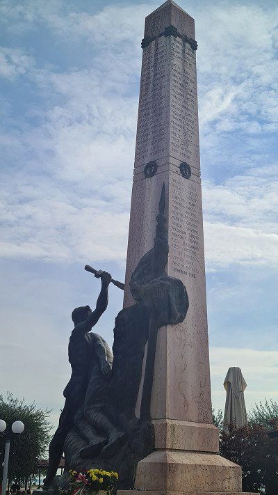
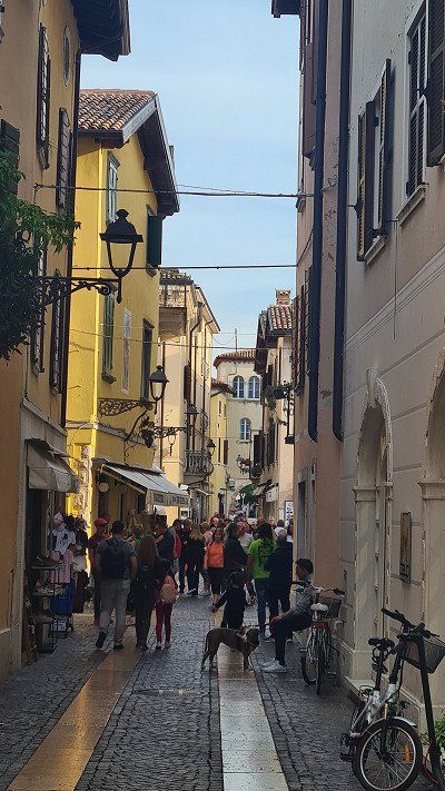
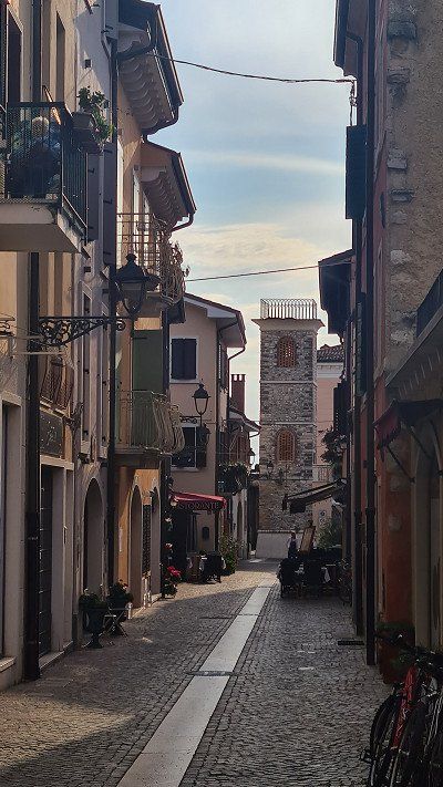
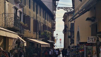
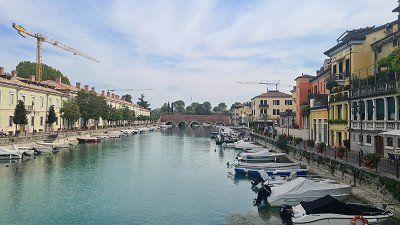
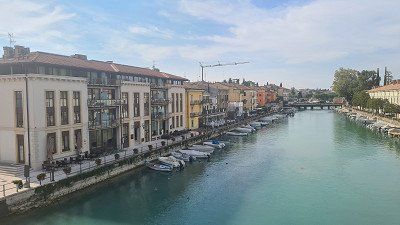
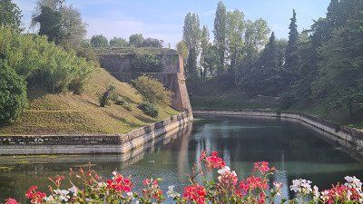
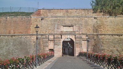
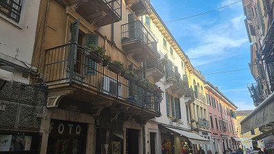
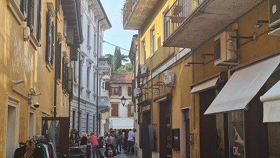
It's Tuesday, October 11, 2022. The weather is holding up, it's still autumnally nice at 22 degrees. Today I cycle south along the lake to the port of Peschiera del Garda. There is a special cycle path almost all the way. On a long walk I get to know a city (1-12) with an interesting history, an impressive harbor with fortifications and beautiful squares and old town streets. In culinary terms, I chose the Ristorante Gistrot (13-14) on the Piazza Ferdinando di Savoia, which is good. I am spoiled with Insalate Greca and a Trota con verdure al vapore . There is also a glass of excellent Soave. With great impressions I drive back to Lazise and take another walk from the camp to the promenade in Lazise (15).
Peschiera del Garda on Wikipedia.
Peschiera del Garda is an Italian commune of 10,930 inhabitants in the province of Verona in the Veneto region . Since 2017 the Fortress of Peschiera del Garda is part of the Unesco World Heritage Site, on the transnational series Venetian Defense Systems of the Sixteenth-Seventeenth Centuries . Peschiera del Garda is located on the southeastern shore of Lake Garda at the point where the Mincio , Lake Garda's only outlet, leaves the lake. Parts of the old town with their fortifications separate the town from the mainland. The town has a small marina , a train station and is home to the Italian army . For several years, Peschiera has been promoting itself as a barrier-free city. All shops can also be reached by wheelchair users via a ramp . Although they often lack the optimal slope, they are still a great relief for wheelchair users. The earliest settlement of Peschiera goes back to the Bronze Age . Two settlements on stilt houses on Lago di Frassino and on the shores of Lake Garda date from this period. They were excavated in the second half of the nineteenth century and the beginning of the twentieth and are attributed to the Peschiera period. The stilt houses of Peschiera have been a UNESCO World Heritage Site since 2011 . In Roman times, the place was noted under the name Arilica, in the Gallia cisalpina , to be read as Ariolica in the Peutinger tablet. Probably between the eighth and ninth centuries the place took the current name of Peschiera. In 899 Peschiera captured Berengar I on the Brenta River after his defeat by the Hungarians invading northern Italy . During the seignory , the town first fell under the control of the Ezzelino family. After the defeat of Ezzelinos III. In 1259 in the Battle of Cassano d'Adda and the subsequent decline of the House of Ezzelino, Peschiera fell to Mastino I della Scala in 1260 . The Scaligeri rule lasted until the end of the fourteenth century, when Peschiera fell to Gian Galeazzo Visconti . Finally, in 1440, the Republic of Venice , under its Condottiere Francesco I Sforza take the place. Venice built Peschiera into a fortress between the fifteenth and sixteenth centuries. After the Congress of Vienna , Peschiera became part of the Kingdom of Lombardy-Venetia and formed the so-called fortified quadrangle with the towns of Mantua , Verona and Legnago . Piedmontese troops took Peschiera in 1848 during the First Italian War of Independence . But it was only after the Third Italian War of Independence of 1866 that Peschiera became part of the newly established Kingdom . Sights include the historic town center with the fortress wall and excavations from Roman times.

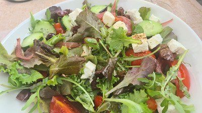
With the bike for a stroll through the town of Peschiera.
It's Tuesday, October 11, 2022. The weather is holding up, it's still autumnally nice at 22 degrees. Today I cycle south along the lake to the port of Peschiera del Garda. There is a special cycle path almost all the way. On a long walk I get to know a city (1-12) with an interesting history, an impressive harbor with fortifications and beautiful squares and old town streets. In culinary terms, I chose the Ristorante Gistrot (13-14) on the Piazza Ferdinando di Savoia, which is good. I am spoiled with Insalate Greca and a Trota con verdure al vapore . There is also a glass of excellent Soave. With great impressions I drive back to Lazise and take another walk from the camp to the promenade in Lazise (15).
Peschiera del Garda on Wikipedia.
Peschiera del Garda is an Italian commune of 10,930 inhabitants in the province of Verona in the Veneto region . Since 2017 the Fortress of Peschiera del Garda is part of the Unesco World Heritage Site, on the transnational series Venetian Defense Systems of the Sixteenth-Seventeenth Centuries . Peschiera del Garda is located on the southeastern shore of Lake Garda at the point where the Mincio , Lake Garda's only outlet, leaves the lake. Parts of the old town with their fortifications separate the town from the mainland. The town has a small marina , a train station and is home to the Italian army . For several years, Peschiera has been promoting itself as a barrier-free city. All shops can also be reached by wheelchair users via a ramp . Although they often lack the optimal slope, they are still a great relief for wheelchair users. The earliest settlement of Peschiera goes back to the Bronze Age . Two settlements on stilt houses on Lago di Frassino and on the shores of Lake Garda date from this period. They were excavated in the second half of the nineteenth century and the beginning of the twentieth and are attributed to the Peschiera period. The stilt houses of Peschiera have been a UNESCO World Heritage Site since 2011 . In Roman times, the place was noted under the name Arilica, in the Gallia cisalpina , to be read as Ariolica in the Peutinger tablet. Probably between the eighth and ninth centuries the place took the current name of Peschiera. In 899 Peschiera captured Berengar I on the Brenta River after his defeat by the Hungarians invading northern Italy . During the seignory , the town first fell under the control of the Ezzelino family. After the defeat of Ezzelinos III. In 1259 in the Battle of Cassano d'Adda and the subsequent decline of the House of Ezzelino, Peschiera fell to Mastino I della Scala in 1260 . The Scaligeri rule lasted until the end of the fourteenth century, when Peschiera fell to Gian Galeazzo Visconti . Finally, in 1440, the Republic of Venice , under its Condottiere Francesco I Sforza take the place. Venice built Peschiera into a fortress between the fifteenth and sixteenth centuries. After the Congress of Vienna , Peschiera became part of the Kingdom of Lombardy-Venetia and formed the so-called fortified quadrangle with the towns of Mantua , Verona and Legnago . Piedmontese troops took Peschiera in 1848 during the First Italian War of Independence . But it was only after the Third Italian War of Independence of 1866 that Peschiera became part of the newly established Kingdom . Sights include the historic town center with the fortress wall and excavations from Roman times.
Drive through Trentino.
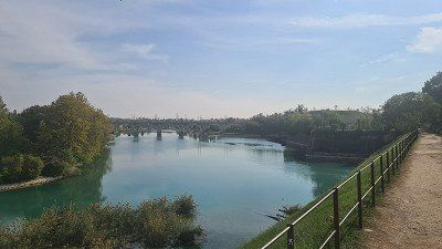
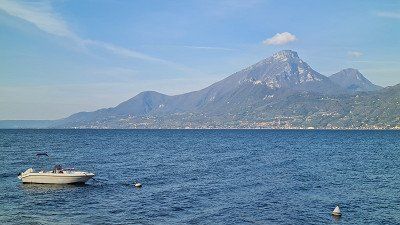
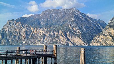
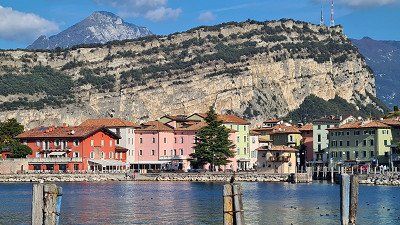
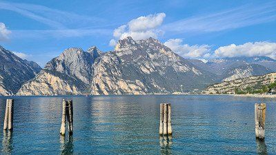
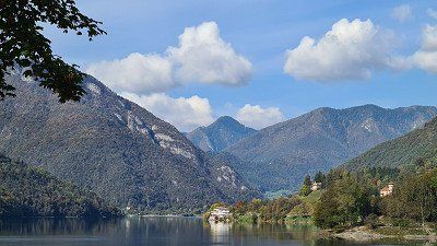
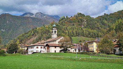
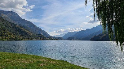
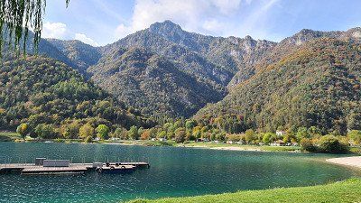
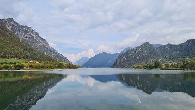
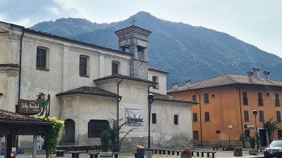
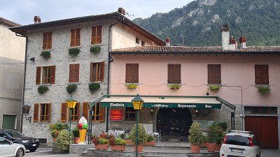
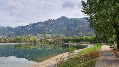
It's Wednesday, October 12, 2022. It's still beautiful autumnal weather at 21 degrees. Today I drive from Lazise up the west side of Lake Garda to the northern end at Riva del Garda and from there through Trentino past the lakes Lago Leandro and Lago d'Idro to Colvero on Lago d'Iseo. For the 168-kilometer route over country roads and mountain passes, I need almost six hours of driving time with several short stops at the end. My first stop is roughly in the middle of the lake near Brenzone (1-3), followed by another at Riva del Garda (4-6). From there it goes into the mountains of Trentino and after a good hour's drive I stop again at the idyllic Lago di Ledro (7-11) and enjoy the wonderful view of the lake. It continues through the mountains and after another hour I reach Lago d'Idro (12-15), where I get a fine homemade fichi ice cream at the Ristorante Alpine in Crone. So far the chosen path has been worth it, a nice ride.
Lago di Ledro and Lago d'Idro at Wikipedia.
Lago di Ledro ( Lake Ledro) is a mountain lake in Trentino . T he Lago di Ledro is 655 meters above sea level between Lake Garda and Lake Idro at the eastern end of the Valle di Ledro . The lake has an area of 2,187 square kilometers, the deepest point is 47 meters below the water surface. Lake Ledro is of glacial origin and formed a single lake area with Lago d'Ampola at the south-west end of the valley after the last cold period , the Ledrotal from Molina di Ledro to the Ampola Pass. The lake bed was carved out by a branch of the Etsch glacier , in which water could accumulate , favored by the moraine remains at the eastern end at Molina di Ledro and by alluvial fans of the Rio Visi at the western end. The watercourses coming from the side valleys of the Ledro Valley finally caused the original continuous lake bed to silt up due to sedimentation and separated the two lakes . There are three places on Lake Ledro that are shaped by agriculture and tourism: Molina di Ledro (on the south-east side), Pieve di Ledro (on the north-west side) and Mezzolago (between Molina and Pieve). Lake Idro or Erídio (Idrosee) is a northern Italian alpine lake. The valley belongs to the valleys of the Judicaries . Lake Idro is located in the northern Italian province of Brescia between Lake Garda , Lake Ledro and Lake Iseo . The 11 square kilometer large, 10 kilometer long and (in front of the Rocca d'Anfo ) 122 meter deep lake is at an altitude of 368 meters above sea level. The natural reservoir, a product of the Ice Age, is fed by the Chiese and Caffaro rivers. The Chiese leaves the lake at Pieve Vecchia . At the highest water level, the water volume of the lake is almost 600 million cubic meters. The lake is used, among other things, for fishing, which has been practiced here since time immemorial, and as an irrigation reserve for the areas of Brescia and Mantua . The mountain lake is almost as warm as Lake Garda , at least 20 degrees in summer. On its banks lies the greater municipality of Idro . In 1961 a first campsite was opened on Lake Idro. Today it is managed by the German company AZUR Freizeit GmbH. The lake is a meromictic body of water due to its stratification .


Drive through Trentino.
It's Wednesday, October 12, 2022. It's still beautiful autumnal weather at 21 degrees. Today I drive from Lazise up the west side of Lake Garda to the northern end at Riva del Garda and from there through Trentino past the lakes Lago Leandro and Lago d'Idro to Colvero on Lago d'Iseo. For the 168-kilometer route over country roads and mountain passes, I need almost six hours of driving time with several short stops at the end. My first stop is roughly in the middle of the lake near Brenzone (1-3), followed by another at Riva del Garda (4-6). From there it goes into the mountains of Trentino and after a good hour's drive I stop again at the idyllic Lago di Ledro (7-11) and enjoy the wonderful view of the lake. It continues through the mountains and after another hour I reach Lago d'Idro (12-15), where I get a fine homemade fichi ice cream at the Ristorante Alpine in Crone. So far the chosen path has been worth it, a nice ride.
Lago di Ledro and Lago d'Idro at Wikipedia.
Lago di Ledro ( Lake Ledro) is a mountain lake in Trentino . T he Lago di Ledro is 655 meters above sea level between Lake Garda and Lake Idro at the eastern end of the Valle di Ledro . The lake has an area of 2,187 square kilometers, the deepest point is 47 meters below the water surface. Lake Ledro is of glacial origin and formed a single lake area with Lago d'Ampola at the south-west end of the valley after the last cold period , the Ledrotal from Molina di Ledro to the Ampola Pass. The lake bed was carved out by a branch of the Etsch glacier , in which water could accumulate , favored by the moraine remains at the eastern end at Molina di Ledro and by alluvial fans of the Rio Visi at the western end. The watercourses coming from the side valleys of the Ledro Valley finally caused the original continuous lake bed to silt up due to sedimentation and separated the two lakes . There are three places on Lake Ledro that are shaped by agriculture and tourism: Molina di Ledro (on the south-east side), Pieve di Ledro (on the north-west side) and Mezzolago (between Molina and Pieve). Lake Idro or Erídio (Idrosee) is a northern Italian alpine lake. The valley belongs to the valleys of the Judicaries . Lake Idro is located in the northern Italian province of Brescia between Lake Garda , Lake Ledro and Lake Iseo . The 11 square kilometer large, 10 kilometer long and (in front of the Rocca d'Anfo ) 122 meter deep lake is at an altitude of 368 meters above sea level. The natural reservoir, a product of the Ice Age, is fed by the Chiese and Caffaro rivers. The Chiese leaves the lake at Pieve Vecchia . At the highest water level, the water volume of the lake is almost 600 million cubic meters. The lake is used, among other things, for fishing, which has been practiced here since time immemorial, and as an irrigation reserve for the areas of Brescia and Mantua . The mountain lake is almost as warm as Lake Garda , at least 20 degrees in summer. On its banks lies the greater municipality of Idro . In 1961 a first campsite was opened on Lake Idro. Today it is managed by the German company AZUR Freizeit GmbH. The lake is a meromictic body of water due to its stratification .
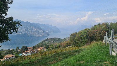
Lago d'Iseo or Sebino (Lake Iseo) is the fourth largest of the northern Italian lakes . It is located in the Lombardy provinces of Brescia and Bergamo . The lake is located northwest of Brescia , at the foot of the Bergamasque Alps and the Adamello-Presanella Alps . The lake basin was hollowed out by the glacial glaciers of the Valcamonica valley. The river Oglio feeds the lake. The 65 square kilometer lake is 181 meters above sea level , is 25 kilometers long and up to 251 meters deep. In the lake are the islands of Monte Isola (“island mountain”), the largest in southern European inland waters , as well as Isola di Loreto and Isola di San Paolo . The latter is owned by the Beretta arms manufacturing dynasty . You can drive around the lake completely, despite the many rock faces that drop steeply down to the water. The road is carved out of the rock in many places. The towns of Lovere , Marone , Pisogne , Sulzano , Iseo , Paratico , Sarnico and Riva di Solto are on the shore . Due to favorable fall winds, the lake has developed into a paradise for sailing sports . A good tourism infrastructure has developed on the few bathing beaches , but Lake Iseo is far less frequented than Lake Como or Lake Garda . The Franciacorta wine-growing region begins immediately south of the lake . In 2016, artist Christo opened his artwork The Floating Piers in the middle of the lake . With this installation it was possible to walk from Sulzano to the island of Monte Isola and from there to the island of San Paolo via 16-metre-wide footbridges floating in the water. The work of art was accessible for almost a month and was then dismantled and recycled. Wikipedia.
Lago d'Iseo or Sebino (Lake Iseo) is the fourth largest of the northern Italian lakes . It is located in the Lombardy provinces of Brescia and Bergamo . The lake is located northwest of Brescia , at the foot of the Bergamasque Alps and the Adamello-Presanella Alps . The lake basin was hollowed out by the glacial glaciers of the Valcamonica valley. The river Oglio feeds the lake. The 65 square kilometer lake is 181 meters above sea level , is 25 kilometers long and up to 251 meters deep. In the lake are the islands of Monte Isola (“island mountain”), the largest in southern European inland waters , as well as Isola di Loreto and Isola di San Paolo . The latter is owned by the Beretta arms manufacturing dynasty . You can drive around the lake completely, despite the many rock faces that drop steeply down to the water. The road is carved out of the rock in many places. The towns of Lovere , Marone , Pisogne , Sulzano , Iseo , Paratico , Sarnico and Riva di Solto are on the shore . Due to favorable fall winds, the lake has developed into a paradise for sailing sports . A good tourism infrastructure has developed on the few bathing beaches , but Lake Iseo is far less frequented than Lake Como or Lake Garda . The Franciacorta wine-growing region begins immediately south of the lake . In 2016, artist Christo opened his artwork The Floating Piers in the middle of the lake . With this installation it was possible to walk from Sulzano to the island of Monte Isola and from there to the island of San Paolo via 16-metre-wide footbridges floating in the water. The work of art was accessible for almost a month and was then dismantled and recycled. Wikipedia.
Continue to Lake Iseo.
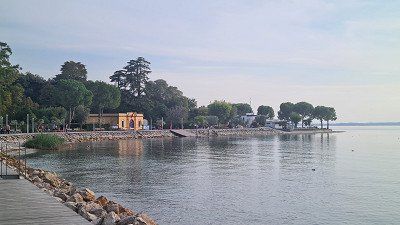
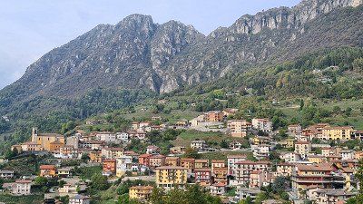
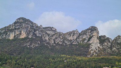
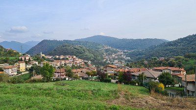
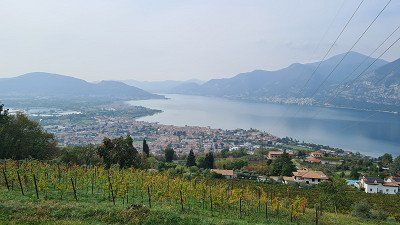
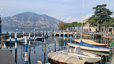
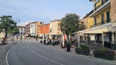
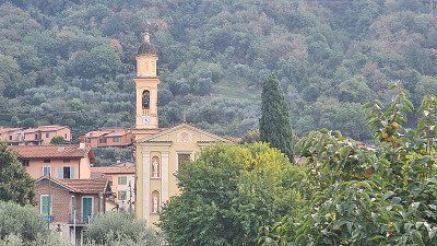
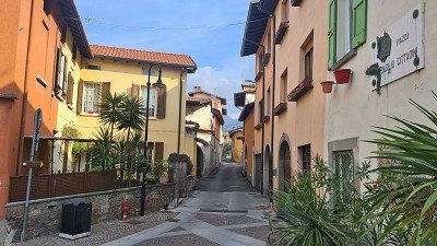
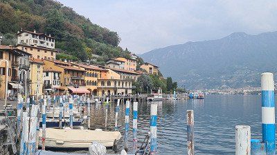
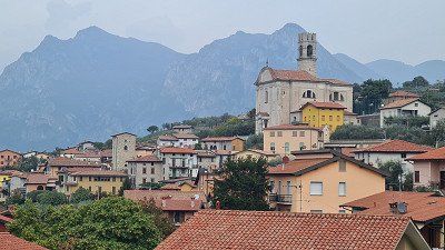
After strengthening yourself in the ice cream parlour, it's another hour through the mountains (1-5) past beautiful mountain slopes and mountain villages. Around three o'clock the view down to Iseo and Lago d'Iseo opens up in front of me (4-5). A short time later I move into the pitch at Camping Covelo. I decide to cycle the two kilometers to Iseo for a stroll (6-15). A picturesque small town with interesting squares, alleys, promenades.
Iseo at Wikipedia.
Iseo is a town in Italy with 9'155 inhabitants in Lombardy in the province of Brescia. The city covers an area of 25 square kilometers. Iseo is located 20 kilometers north-west of Brescia at the south-east end of the lake of the same name. Iseo includes the towns of Pilzone, Cóvelo and Clusane. The neighboring municipalities are Adro, Corte Franca, Monte Isola, Monticelli Brusati, Paratico, Polaveno, Predore, Provaglio d'Iseo, Sarnico, Sulzano and Tavernola Bergamasca. Iseo is on the 105 km long railway line Brescia-Iseo-Edolo. The first monument erected in honor of Garibaldi is in Iseo.


Continue to Lake Iseo.
After strengthening yourself in the ice cream parlour, it's another hour through the mountains (1-5) past beautiful mountain slopes and mountain villages. Around three o'clock the view down to Iseo and Lago d'Iseo opens up in front of me (4-5). A short time later I move into the pitch at Camping Covelo. I decide to cycle the two kilometers to Iseo for a stroll (6-15). A picturesque small town with interesting squares, alleys, promenades.
Iseo at Wikipedia.
Iseo is a town in Italy with 9'155 inhabitants in Lombardy in the province of Brescia. The city covers an area of 25 square kilometers. Iseo is located 20 kilometers north-west of Brescia at the south-east end of the lake of the same name. Iseo includes the towns of Pilzone, Cóvelo and Clusane. The neighboring municipalities are Adro, Corte Franca, Monte Isola, Monticelli Brusati, Paratico, Polaveno, Predore, Provaglio d'Iseo, Sarnico, Sulzano and Tavernola Bergamasca. Iseo is on the 105 km long railway line Brescia-Iseo-Edolo. The first monument erected in honor of Garibaldi is in Iseo.
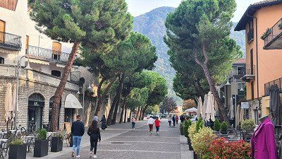
Nice pitch and sunset.
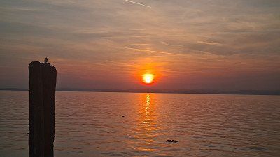
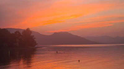
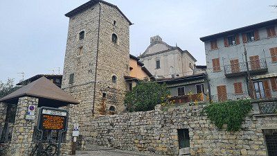
I continue the stroll through the streets (1-9) in Iseo, also visit the two churches and drink a cappuccino by the lake. Then I drive back to the camp and sit down on my beautiful pitch (10-15) directly at the lake. Time flies by as dusk falls and the sun sets in a blaze of color.


Nice pitch and sunset.
I continue the stroll through the streets (1-9) in Iseo, also visit the two churches and drink a cappuccino by the lake. Then I drive back to the camp and sit down on my beautiful pitch (10-15) directly at the lake. Time flies by as dusk falls and the sun sets in a blaze of color.
With the bike to the island.
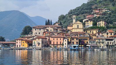
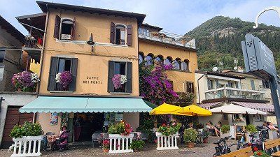
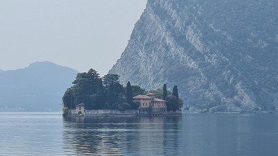
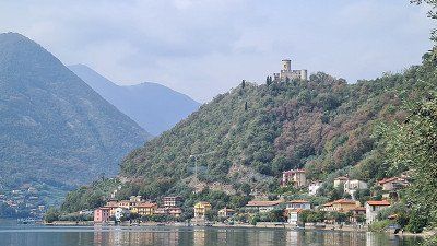
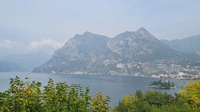
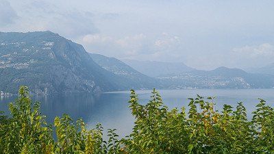
It's Thursday, October 13, 2022. And again it's going to be a beautiful autumn day with lots of sun and 21 degrees. Today I'm visiting Monte Isola, a popular attraction on Lago d'Iseo. Via Covelo (1-2) I cycle along the lake to Sulzano (3-4). There I board the small ferry (5) that takes me to the island of Peschiera Maraglio (6-8) and there to a café americano in the Caffe del Porto. I now cycle around the island clockwise, past Isola San Paolo (9), up to Torre Rocca Martinengo (10) and further up to the mountain village of Siviano (11-13), where there is a mountain village in the Albergo Bellavista second stop. Shortly thereafter I reach the northern end of the island with views of the northern part of Lago d'Iseo (14-15) with the Castello dell'Isola di Loreto .
Monte Isola at Wikipedia.
Monte Isola is the largest island in a southern European lake. It has a circumference of nine kilometers and rises more than 400 meters above the water surface of Lake Iseo in the Italian region of Lombardy. At the top of the hill is the Santuario della Madonna della Ceriola church. Monte Isola is a member of the association I borghi più belli d'Italia (The most beautiful places in Italy). The 1811 inhabitants are spread over four larger and five smaller villages, which are administered by the municipality of Monte Isola and which also includes the two small side islands Isola di Loreto (to the north) and Isola di San Paolo (to the south). The largest village is Siviano with 425 inhabitants, also the administrative center of the municipality of Monte Isola. There is a bus line on the island, residents are allowed to use mopeds and scooters. Cars and trucks are only allowed in exceptional cases. Tourists are only allowed to explore the island without a motor or by bus. There are continuous ferry connections between Peschiera Maraglio and Sulzano and between Carzano and Sale Marasino. These are also operated throughout the night. Furthermore, all liners go to destinations on the island, so that there are also boat connections in Sensole and Siviano about every hour during the day. The liners operate between Iseo, Sulzano and the island towns throughout the year from early morning until late at night. Most tourism can be found in Peschiera Maraglio on the southeast side of the inland island. In Carzano on the east side of the island there is still an old village structure with narrow streets and paths that has been renovated and maintained in an exemplary manner. The Santa Croce festival is celebrated in Carzano every five years in September. The whole place is then decorated with over 100,000 deceptively real paper flowers. The festival dates back to the Middle Ages, when the plague was widespread throughout the region. A gypsy woman brought her sick son to Carzano, and he was nursed back to health there. In gratitude, the gypsy donated a sea of flowers. The festival is one of the attractions of northern Italy and is attended by countless people, especially at weekends. In June 2016, artist Christo opened his artwork The Floating Piers . With this installation it was possible to walk from Sulzano to the island at Peschiera Maraglio via 16 meter wide footbridges floating in the water. The work of art was accessible for just under a month and was then dismantled and recycled.

With the bike to the island.
It's Thursday, October 13, 2022. And again it's going to be a beautiful autumn day with lots of sun and 21 degrees. Today I'm visiting Monte Isola, a popular attraction on Lago d'Iseo. Via Covelo (1-2) I cycle along the lake to Sulzano (3-4). There I board the small ferry (5) that takes me to the island of Peschiera Maraglio (6-8) and there to a café americano in the Caffe del Porto. I now cycle around the island clockwise, past Isola San Paolo (9), up to Torre Rocca Martinengo (10) and further up to the mountain village of Siviano (11-13), where there is a mountain village in the Albergo Bellavista second stop. Shortly thereafter I reach the northern end of the island with views of the northern part of Lago d'Iseo (14-15) with the Castello dell'Isola di Loreto .
Monte Isola at Wikipedia.
Monte Isola is the largest island in a southern European lake. It has a circumference of nine kilometers and rises more than 400 meters above the water surface of Lake Iseo in the Italian region of Lombardy. At the top of the hill is the Santuario della Madonna della Ceriola church. Monte Isola is a member of the association I borghi più belli d'Italia (The most beautiful places in Italy). The 1811 inhabitants are spread over four larger and five smaller villages, which are administered by the municipality of Monte Isola and which also includes the two small side islands Isola di Loreto (to the north) and Isola di San Paolo (to the south). The largest village is Siviano with 425 inhabitants, also the administrative center of the municipality of Monte Isola. There is a bus line on the island, residents are allowed to use mopeds and scooters. Cars and trucks are only allowed in exceptional cases. Tourists are only allowed to explore the island without a motor or by bus. There are continuous ferry connections between Peschiera Maraglio and Sulzano and between Carzano and Sale Marasino. These are also operated throughout the night. Furthermore, all liners go to destinations on the island, so that there are also boat connections in Sensole and Siviano about every hour during the day. The liners operate between Iseo, Sulzano and the island towns throughout the year from early morning until late at night. Most tourism can be found in Peschiera Maraglio on the southeast side of the inland island. In Carzano on the east side of the island there is still an old village structure with narrow streets and paths that has been renovated and maintained in an exemplary manner. The Santa Croce festival is celebrated in Carzano every five years in September. The whole place is then decorated with over 100,000 deceptively real paper flowers. The festival dates back to the Middle Ages, when the plague was widespread throughout the region. A gypsy woman brought her sick son to Carzano, and he was nursed back to health there. In gratitude, the gypsy donated a sea of flowers. The festival is one of the attractions of northern Italy and is attended by countless people, especially at weekends. In June 2016, artist Christo opened his artwork The Floating Piers . With this installation it was possible to walk from Sulzano to the island at Peschiera Maraglio via 16 meter wide footbridges floating in the water. The work of art was accessible for just under a month and was then dismantled and recycled.
By bike from the island back to Iseo.
From the north side of the island it goes steeply downhill to the next fishing village of Cazano (1-6) with its romantic streets and a church with paintings worth seeing. Today's rather lonely path (7-11) continues past promenades and villages back to Peschiera Maraglio (12) and to the ferry to Sulzano. Since there is still time, I drive past the camp again to Iseo (13) and enjoy the panoramic view (14) over the lake with a good Italian ice cream cone, of course Pistachio/Stracciatella. Back in the camp, I see on the notice that today in the camp's Ristorante there is a special Stufato di Manzo con Polenta (15) are. Although not planned, I won't miss it.
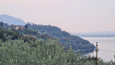
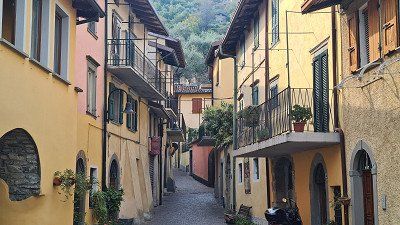
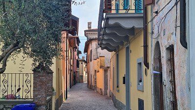
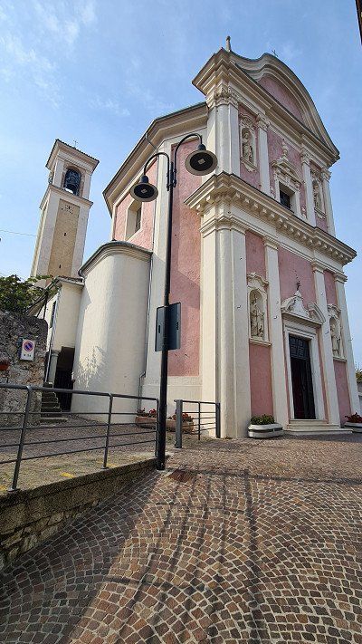
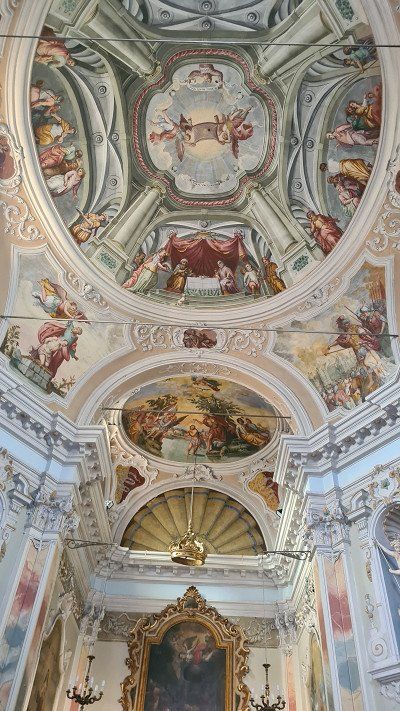
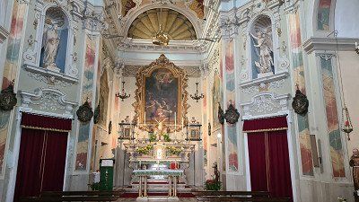
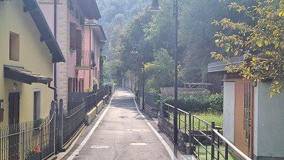
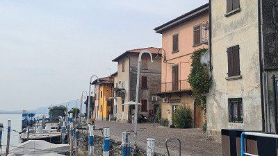
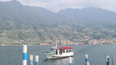
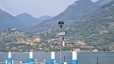
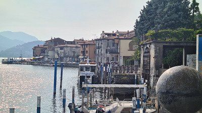
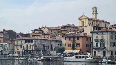
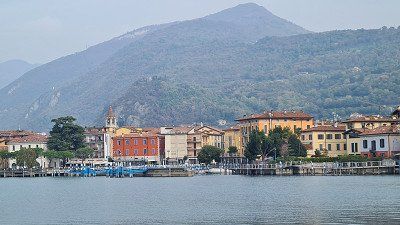
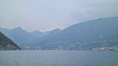
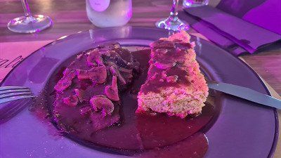
Lake Maggiore , also known as Lago Verbano ( Langensee in Switzerland) , is a northern Italian lake in the Italian regions of Piedmont and Lombardy and in the Swiss canton of Ticino, through which the Ticino (Ticino) flows. Lake Maggiore is narrow, curved and branched, and flows through it from north to south. It covers an area of 212.5 square kilometers, of which 20% belongs to Switzerland and 80% to Italy. It extends from the southern chain of the Alps to the western edge of the Po Valley. Like the other northern Italian lakes, it was created when ice age glaciers melted. Especially its northern part is surrounded by high mountains. The lake is 65 kilometers long and up to 10 kilometers wide. It is the second largest lake in Italy after Lake Garda. The lake level is 193 meters above sea level, making it the lowest point in Switzerland. The greatest depth is 372 meters. The bottom of the lake reaches up to 179 meters below sea level. The catchment area is 6386 square kilometers (3,326 square kilometers in Switzerland and 3,060 square kilometers in Italy). Several professional fishermen make their living from fishing in Lake Maggiore. The total yield is 150 tons per year. There has been passenger shipping on the lake since 1826. In 1852 it was taken over by Österreichischer Lloyd and reorganized. Today, the Italian state-owned company Gestione governativa navigazione laghi based in Milan operates a fleet of 25 ships with the Navigazione del Lago Maggiore (NLM), including the still operational paddle steamer Piemonte. Local shipping on Swiss territory has been managed by the Società Navigazione del Lago di Lugano since 2018. The main inflow and outflow Ticino flows into the lake at Magadino. The estuary, the Bolle di Magadino, (literally: bubble ...) is a species-rich nature reserve. The Maggia flows further west. It constantly brings debris with it, so that today the Maggia Delta extends far into the lake. East of the delta is Locarno, which is best known for its film festival and the pilgrimage church of Madonna del Sasso, and on the west side Ascona with its lake promenade and Monte Verità. In the hinterland, the valley divides at Ponte Brolla into the Centovalli on the left and the Maggia Valley on the right. In the north, the Verzasca flows into the lake, known above all for a bridge, the Ponte dei Salti, and the 220 m high dam. However, the hydrologically most important tributary of the lake is the Toce, since on average it brings slightly more water into the lake than the Ticino. However, the natural water volumes of these rivers have been regulated by human hands for decades due to numerous water discharges for electricity generation. The largest city on the lake is Verbania with its districts of Intra and Pallanza. Don't miss the Villa Taranto Botanical Gardens, a gift to Italy from its founder, Captain Neil Mac Eacharn. Thousands of plants imported from all over the world, as well as rare botanical collections, some of which are unique in Europe, can be studied here. South of Verbania, the lake widens into the Gulf of Verbania, where the Toce flows into the lake. Stresa is located on the Gulf and, with its Belle Epoque villas and hotel palaces, still exudes the charm of a sophisticated posh resort. In Stresa is the Villa Pallavicino with its park and a zoological garden. Centuries-old trees and many wild animal species can be seen there. Further south is the town of Arona. Two kilometers north of Arona, a 23-meter-tall copper colossal statue of Charles Borromeo was erected in 1624, which was the tallest statue that could be walked inside until the Statue of Liberty was built in New York. South of the lake near Sesto Calende is a protected wetland area. On the east side of the lake is the town of Angera with the medieval castle Rocca di Angera, the monastery of Santa Caterina del Sasso built into the steep cliffs and the town of Luino with its well-known weekly market.
Lake Maggiore , also known as Lago Verbano ( Langensee in Switzerland) , is a northern Italian lake in the Italian regions of Piedmont and Lombardy and in the Swiss canton of Ticino, through which the Ticino (Ticino) flows. Lake Maggiore is narrow, curved and branched, and flows through it from north to south. It covers an area of 212.5 square kilometers, of which 20% belongs to Switzerland and 80% to Italy. It extends from the southern chain of the Alps to the western edge of the Po Valley. Like the other northern Italian lakes, it was created when ice age glaciers melted. Especially its northern part is surrounded by high mountains. The lake is 65 kilometers long and up to 10 kilometers wide. It is the second largest lake in Italy after Lake Garda. The lake level is 193 meters above sea level, making it the lowest point in Switzerland. The greatest depth is 372 meters. The bottom of the lake reaches up to 179 meters below sea level. The catchment area is 6386 square kilometers (3,326 square kilometers in Switzerland and 3,060 square kilometers in Italy). Several professional fishermen make their living from fishing in Lake Maggiore. The total yield is 150 tons per year. There has been passenger shipping on the lake since 1826. In 1852 it was taken over by Österreichischer Lloyd and reorganized. Today, the Italian state-owned company Gestione governativa navigazione laghi based in Milan operates a fleet of 25 ships with the Navigazione del Lago Maggiore (NLM), including the still operational paddle steamer Piemonte. Local shipping on Swiss territory has been managed by the Società Navigazione del Lago di Lugano since 2018. The main inflow and outflow Ticino flows into the lake at Magadino. The estuary, the Bolle di Magadino, (literally: bubble ...) is a species-rich nature reserve. The Maggia flows further west. It constantly brings debris with it, so that today the Maggia Delta extends far into the lake. East of the delta is Locarno, which is best known for its film festival and the pilgrimage church of Madonna del Sasso, and on the west side Ascona with its lake promenade and Monte Verità. In the hinterland, the valley divides at Ponte Brolla into the Centovalli on the left and the Maggia Valley on the right. In the north, the Verzasca flows into the lake, known above all for a bridge, the Ponte dei Salti, and the 220 m high dam. However, the hydrologically most important tributary of the lake is the Toce, since on average it brings slightly more water into the lake than the Ticino. However, the natural water volumes of these rivers have been regulated by human hands for decades due to numerous water discharges for electricity generation. The largest city on the lake is Verbania with its districts of Intra and Pallanza. Don't miss the Villa Taranto Botanical Gardens, a gift to Italy from its founder, Captain Neil Mac Eacharn. Thousands of plants imported from all over the world, as well as rare botanical collections, some of which are unique in Europe, can be studied here. South of Verbania, the lake widens into the Gulf of Verbania, where the Toce flows into the lake. Stresa is located on the Gulf and, with its Belle Epoque villas and hotel palaces, still exudes the charm of a sophisticated posh resort. In Stresa is the Villa Pallavicino with its park and a zoological garden. Centuries-old trees and many wild animal species can be seen there. Further south is the town of Arona. Two kilometers north of Arona, a 23-meter-tall copper colossal statue of Charles Borromeo was erected in 1624, which was the tallest statue that could be walked inside until the Statue of Liberty was built in New York. South of the lake near Sesto Calende is a protected wetland area. On the east side of the lake is the town of Angera with the medieval castle Rocca di Angera, the monastery of Santa Caterina del Sasso built into the steep cliffs and the town of Luino with its well-known weekly market.
Drive to Lake Maggiore.
It's Friday, October 14, 2022. It'll be autumnally hazy all day with a temperature of 20 degrees. Today I ride 207 kilometers from Covelo to Solcio in the south of Lake Maggiore. In Bergamo I leave the motorway and drive on country roads to the two southern ends of Lake Como near Lecco and Como and then on to Lake Maggiore via Varesa. Near Lecco I find a parking space on the promenade and stroll along it for half an hour. Although the lighting conditions are not ideal, there are a few impressions (1-6) of the city and the lake. In Como at lunchtime, I'm less fortunate and can't find a parking space within a reasonable distance from the center. So I continue without stopping and arrive at Camping Solcio at half past two. I get one of the last pitches (7-8) directly at the lake. The remaining seats behind remain mostly free. It is becoming noticeable that the season is slowly coming to an end. A walk then takes me to the lake promenade and the port of Solcio and along the road towards Stresa to Lesa to the nearest Mercato (9-14). In the evening I visit the camp's Ristorante and choose an Insalata mista and a Pizza Boscaiolo (15) from the appealing menu, which is served here with very good prosciutto crudo and funghi porcini.
Lesa on Wikipedia.
Lesa is a municipality on the western shore of Lake Maggiore with 2,212 inhabitants in the Italian province of Novara, Piedmont region. The municipality consists of the districts of Villa Lesa, Solcio, Comnago and Calogna. The neighboring municipalities are Belgirate, Brovello-Carpugnino, Ispra, Massino Visconti, Meina, Nebbiuno, Ranco and Stresa. The patron saint of the place is San Martino. The place is located in a small bay next to Belgirate, and opposite Ispra, which is on the other side of Lake Maggiore. The municipal area covers an area of 12 square kilometers. Many historical documents and memorabilia of important personalities who stayed in the place are kept in Lesa. Among them, for example, those by Alessandro Manzoni, Giulio Carcano and Camillo Benso von Cavour. In the small village there are villas from different eras, with the oldest dating back to the Middle Ages. A castle ruin also dates from this period.
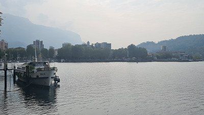
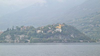
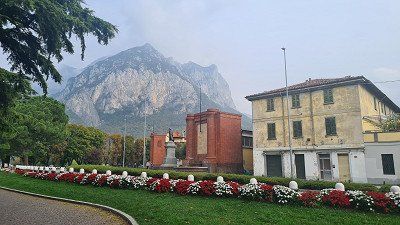
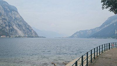
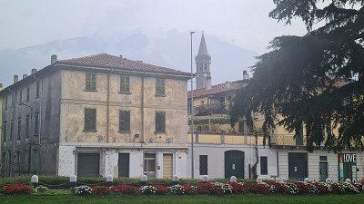
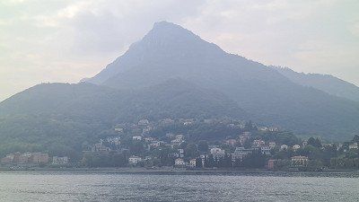
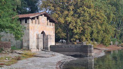
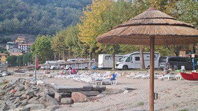
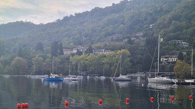
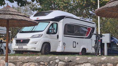
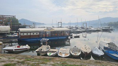
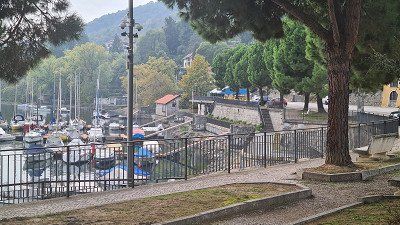
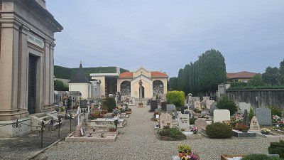
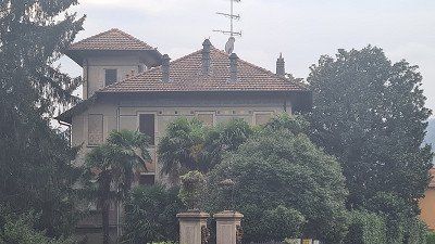
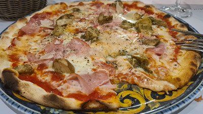
By bike to Stresa for a stroll through the city.
It's Saturday, October 15, 2022. It's going to be another beautiful autumn day and the sun is breaking through the haze more than yesterday at 20 degrees. Today I am cycling 11 kilometers north along Lake Maggiore from Solcio via Lesa to Stresa. The Seestrasse is easy to cycle on, although there is no cycle path and the road is sometimes narrow and heavily trafficked. My first stop and walk is to the fishing village of Lesa (1-5). On the promenade there is again a café americano. Then it's on to Stresa to its northern end with the best view of the Borromean Islands (6-14). Continue on foot along the park along the lake promenade (15) back towards the center.
Stresa at Wikipedia.
Stresa is a municipality and a spa town in the Italian province of Verbano-Cusio-Ossola and is located on the western shore of Lake Maggiore in the Piedmont region. Stresa is 200 meters above sea level and covers an area of 33 square kilometers. The Frazioni (suburbs or islands in the lake) of Stresa are Brisino, Isola Bella (see also Borromean Islands), Isola dei Pescatori, La Sacca, Levo, Lido and Mottarone. All the Borromean Islands, except Isolino di San Giovanni, belong to the Municipality of Stresa. The neighboring communes are Baveno, Belgirate, Brovello-Carpugnino, Gignese, Gravellona Toce, Laveno-Mombello, Leggiuno, Lesa, Omegna and Verbania. Not far from Stresa is the 1,491 meter high Mottarone mountain. In Roman times, the consular road Severiana Augusta led from Stresa, connecting Mediolanum (today's Milan) to Verbannus Lacus (Lake Maggiore), and from here to the Simplon Pass. The first historical source that mentions the existence of Stresa is a parchment from 998 in which the place is called Strixia, a form confirmed by a source from 1249; In 1220 it appears as Strexia. In 1935 an interwar agreement confirming the Locarno treaties was concluded in Stresa, involving Great Britain, France and Italy, the so-called Stresa Front. In 2004 the 52nd meeting of the Bilderberg Conference took place here. In the middle of the 19th century, Stresa was connected to the shipping traffic on Lake Maggiore, whereas in Stendhal's time you still had to embark in Sesto Calende or in Arona to get to the Borromean Islands. The unification of Italy that began in 1859 also boosted tourism. In 1859 the inn "Della Speranza" was built near the landing stage, followed in 1863 by the luxurious "Grand Hotel des Iles Borromées". Today, the town has numerous accommodation options, from bed & breakfasts to luxury hotels, as well as shopping facilities, restaurants and cafés. In 1906, after the completion of the Simplon railway tunnel, the first trains connecting Paris with Milan stopped in Stresa. With the Simplon Express there were connections from Calais to Venice and Trieste. From 1919 Stresa was a stop on the Simplon-Orient-Express, with direct connections to Paris and Calais (with connections to Dover and London) on the one hand, and Venice, Belgrade, Bucharest, Athens and Constantinople on the other. In the immediate vicinity of Stresa is the Villa Pallavicino, which Ruggero Bonghi had built in 1855 in a classicist style and which was acquired in 1862 by the Pallavicino noble family from Genoa. It is located in a 16-hectare park with a small zoo that is open to the public. In 2021 it was sold to Prince Vitaliano Borromeo, who also owns the Borromean Islands with Isola Bella. Several passenger ships operate between Stresa, other towns on the shores of Lake Maggiore and the Borromean Islands. Monte Mottarone is used for winter sports. In summer, a road leads far up, where there is a wide view. It can also be reached from the northern outskirts with the "Funivia Stresa-Alpino-Mottarone" cable car. The "Giardino botanico Alpinia", an alpine botanical garden set up in 1934 with an area of 4 hectares, is located at the Alpino middle station (803 metres). On May 23, 2021, a gondola of the cable car crashed after the traction cable snapped. 14 people died in the accident.
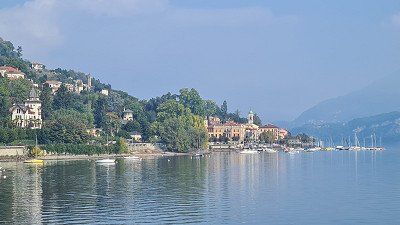
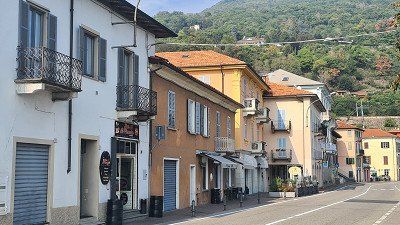
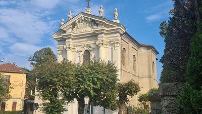
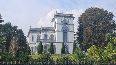
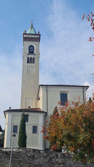
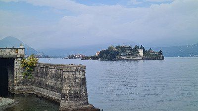
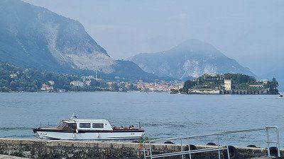
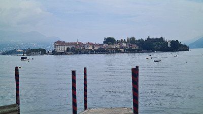
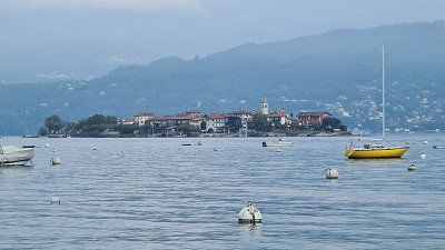
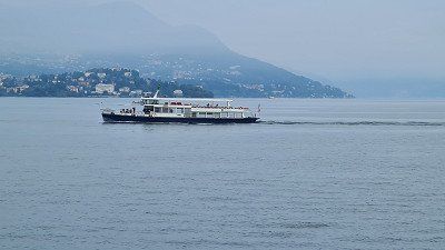
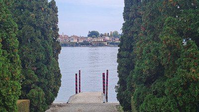
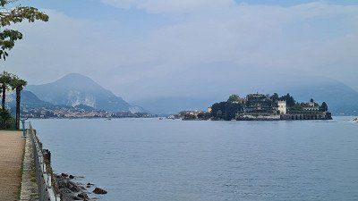
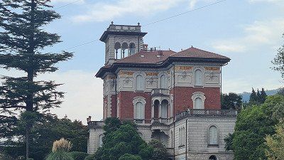
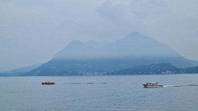
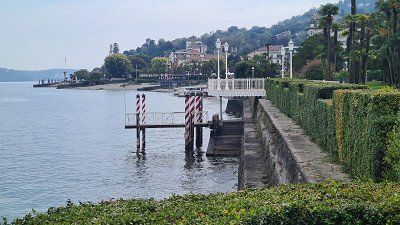
The fashionable Stresa.
The magnificent hotel palaces (1-7) along the lake promenade still impress and characterize the sophisticated image of Stresa. But also the small old town with few squares and streets (8-10) as well as the short shopping mile (11-12) on the Seestrasse invite you to linger. In the Taverna del Pappagallo I order a Cotoletta milanese (13), which I drove well with. Strengthened, I start the return trip to the camp and make one last stop in Belgirate (14-15).
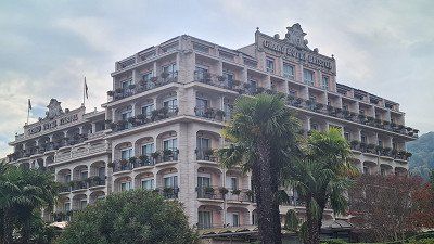
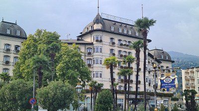
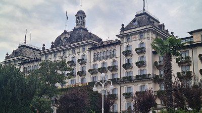
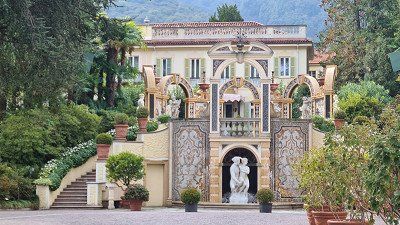
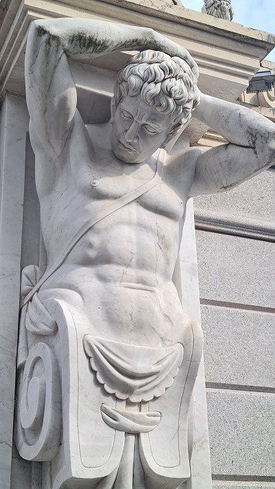
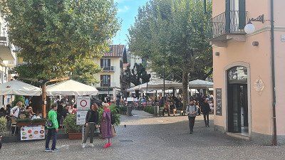
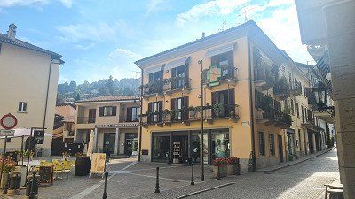
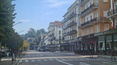
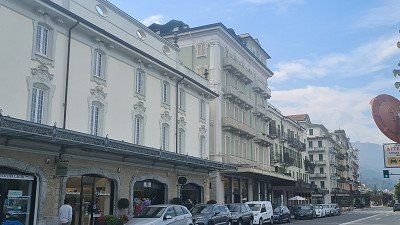
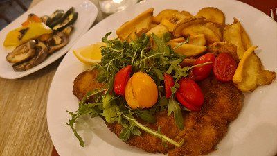
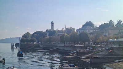
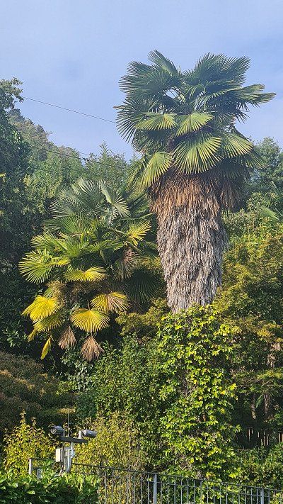
The Vallemaggia (Maggia Valley) is located in the Swiss canton of Ticino. The valley is traversed by the Maggia River and stretches 50 kilometers north from Locarno on Lake Maggiore. It is formed at the junction of the side valleys Valle Bavona from the right and Val Lavizzara from the left near the village of Cavergno. The valley and its subsidiary valleys are in the Vallemaggia district. Larger communities in the valley are Lavizzara, Avegno-Gordevio, Maggia, Sott Piodau and Cevio. The river areas neighboring the Maggia Valley are the Verzasca Valley to the east, the Ossola Valley to the west and the Bedretto Valley or the upper Valle Leventina to the north. Finds from the Copper Age show that the valley has been inhabited since at least that time. In Roman times the entire valley was sparsely populated, probably oriented towards the Vicus Muralto. It is believed that the cultural landscape of the valley with terraces, chestnut and walnut tree plantations was created in Roman times. The bottom of the valley was certainly inhabited by groups of Gauls during the Iron Age. Roman tombs have been found in Avegno, Gordevio, Aurigeno, Moghegno, Cevio and Maggia. In the Middle Ages, the Lombards reached Locarno and began to dominate the valley under the feudal rule of the Capitanei. During this period Christianity spread and the Church of San Vittore in Muralto was founded. After that, Maggia, Sornico and Cevio became independent municipalities. Gradually, the individual communities organized themselves into larger units. In the fourteenth century Bignasco, Cavergno, Brontallo and Menzonio formed an administrative unit, as did the villages of Val Lavizzara and Val Rovana (Cevio, Cavergno, Campo, Cerentino and Bosco were the Rovana Superior). In 1398 the Vallemaggia, the Verzasca Valley and the Mergoscia refused to pay taxes to the Locarnese nobility who held fiefs in these areas; In 1403 the valleys formally seceded from Locarno and established an independent judicial district with a 42-member general council and its own land rights, based in Cevio; various conflicts between the local valleys shaped their coexistence. In 1403/1404 the dispute between the municipalities of the lower valley and Cevio was ended by a treaty. In 1411-1412 the valley tried to elude the Duchy of Milan and joined the Duchy of Savoy. In 1416 the Confederates occupied the valley. They returned it to Milan in 1422 and to the Rusca family in 1439. Around 1430 the Lavizzara Valley was legally separated from the Vallemaggia. In 1513 the Confederates again occupied the valley, and for the next 300 years, from 1513 to 1798, the Vallemaggia was one of the bailiwicks of the twelve Confederate localities; its German name was Meiental or Mainthal. It was divided into the two valleys Vallemaggia and Lavizzara, but only one governor served for two years and judged the legal disputes. The Valle Lavizzara defended its independence from the Vallemaggia. It sabotaged attempts by some bailiffs and the Statute of Accounts to centralize the court in Cevio or overthrow the directors. When the Helvetic Republic was founded in 1798, the Vallemaggia became part of the canton of Lugano. In 1803 Napoleon gave the republic a federal structure and Ticino became its own independent canton with Vallemaggia as its own district and Cevio as its capital. In 1824 the first road to Bignasco was opened, in 1860 it was extended to Valle Lavizzara, 1882 to Rovana to Cimalmotta, to Valle Bosco after 1905 and to Valle Peccia only between 1922 and 1924. In the middle of the nineteenth century many families emigrated to Australia and America due to storms and economic hardship and also because of the gold rush. Between 1840 and 1870, 2,000 people emigrated, mostly men. Plinio Martini described the hard way of life in his novel Il fondo del sacco. Romance described. From 1907 to 1965, the Maggia Valley Railway ran between Locarno and Bignasco in Vallemaggia. After its decommissioning, the line was partially used to widen the valley road. A road tunnel into the upper Valle Leventina was planned at the time, but this was never realised. Apart from the junction in the Centovalli, the Vallemaggia represents a dead end for motorized traffic: there are no mountain passes that would lead to neighboring valleys. Craftsmanship involving stone has a centuries-old tradition here. Alongside wood, stone has always been the most important building material. A gray, fine-grained, crystalline rock is obtained, which is usually referred to as granite. However, it is more likely to be gneiss, otherwise the material would not be so easy to split. This stone is used in so many ways here as in few other regions. The traditional houses are covered with heavy stone slabs. Even posts for vines or pergolas are made of it. Also of great importance is the marble from the Peccia Valley, in the municipality of Lavizzara. Wikipedia.
The Vallemaggia (Maggia Valley) is located in the Swiss canton of Ticino. The valley is traversed by the Maggia River and stretches 50 kilometers north from Locarno on Lake Maggiore. It is formed at the junction of the side valleys Valle Bavona from the right and Val Lavizzara from the left near the village of Cavergno. The valley and its subsidiary valleys are in the Vallemaggia district. Larger communities in the valley are Lavizzara, Avegno-Gordevio, Maggia, Sott Piodau and Cevio. The river areas neighboring the Maggia Valley are the Verzasca Valley to the east, the Ossola Valley to the west and the Bedretto Valley or the upper Valle Leventina to the north. Finds from the Copper Age show that the valley has been inhabited since at least that time. In Roman times the entire valley was sparsely populated, probably oriented towards the Vicus Muralto. It is believed that the cultural landscape of the valley with terraces, chestnut and walnut tree plantations was created in Roman times. The bottom of the valley was certainly inhabited by groups of Gauls during the Iron Age. Roman tombs have been found in Avegno, Gordevio, Aurigeno, Moghegno, Cevio and Maggia. In the Middle Ages, the Lombards reached Locarno and began to dominate the valley under the feudal rule of the Capitanei. During this period Christianity spread and the Church of San Vittore in Muralto was founded. After that, Maggia, Sornico and Cevio became independent municipalities. Gradually, the individual communities organized themselves into larger units. In the fourteenth century Bignasco, Cavergno, Brontallo and Menzonio formed an administrative unit, as did the villages of Val Lavizzara and Val Rovana (Cevio, Cavergno, Campo, Cerentino and Bosco were the Rovana Superior). In 1398 the Vallemaggia, the Verzasca Valley and the Mergoscia refused to pay taxes to the Locarnese nobility who held fiefs in these areas; In 1403 the valleys formally seceded from Locarno and established an independent judicial district with a 42-member general council and its own land rights, based in Cevio; various conflicts between the local valleys shaped their coexistence. In 1403/1404 the dispute between the municipalities of the lower valley and Cevio was ended by a treaty. In 1411-1412 the valley tried to elude the Duchy of Milan and joined the Duchy of Savoy. In 1416 the Confederates occupied the valley. They returned it to Milan in 1422 and to the Rusca family in 1439. Around 1430 the Lavizzara Valley was legally separated from the Vallemaggia. In 1513 the Confederates again occupied the valley, and for the next 300 years, from 1513 to 1798, the Vallemaggia was one of the bailiwicks of the twelve Confederate localities; its German name was Meiental or Mainthal. It was divided into the two valleys Vallemaggia and Lavizzara, but only one governor served for two years and judged the legal disputes. The Valle Lavizzara defended its independence from the Vallemaggia. It sabotaged attempts by some bailiffs and the Statute of Accounts to centralize the court in Cevio or overthrow the directors. When the Helvetic Republic was founded in 1798, the Vallemaggia became part of the canton of Lugano. In 1803 Napoleon gave the republic a federal structure and Ticino became its own independent canton with Vallemaggia as its own district and Cevio as its capital. In 1824 the first road to Bignasco was opened, in 1860 it was extended to Valle Lavizzara, 1882 to Rovana to Cimalmotta, to Valle Bosco after 1905 and to Valle Peccia only between 1922 and 1924. In the middle of the nineteenth century many families emigrated to Australia and America due to storms and economic hardship and also because of the gold rush. Between 1840 and 1870, 2,000 people emigrated, mostly men. Plinio Martini described the hard way of life in his novel Il fondo del sacco. Romance described. From 1907 to 1965, the Maggia Valley Railway ran between Locarno and Bignasco in Vallemaggia. After its decommissioning, the line was partially used to widen the valley road. A road tunnel into the upper Valle Leventina was planned at the time, but this was never realised. Apart from the junction in the Centovalli, the Vallemaggia represents a dead end for motorized traffic: there are no mountain passes that would lead to neighboring valleys. Craftsmanship involving stone has a centuries-old tradition here. Alongside wood, stone has always been the most important building material. A gray, fine-grained, crystalline rock is obtained, which is usually referred to as granite. However, it is more likely to be gneiss, otherwise the material would not be so easy to split. This stone is used in so many ways here as in few other regions. The traditional houses are covered with heavy stone slabs. Even posts for vines or pergolas are made of it. Also of great importance is the marble from the Peccia Valley, in the municipality of Lavizzara. Wikipedia.
Along Lago Maggiore into Vallemaggia.
It's Sunday, October 16, 2022. Despite the announced rain, it will remain dry during the night and during the day. The haze over the lake shapes the view at 20 degrees. Today I drive 75 kilometers from Solcio along the eastern shore of Lake Maggiore via Stresa, Verbania, Cannobio to Ascono and after a stop from there up the Vallemaggia to Gordèvio. I left early, I originally wanted to visit the weekly market in Cannobio. But already at half past nine the village was already so busy there and the visible parking spaces were taken, so that I drove on without stopping. I then drove to the TCS Camping in Gordèvio at half past eleven and moved into a pitch. The place (1-3) is right on the Maggia and is now only a third occupied. In the late afternoon I walk along the Maggia. Then the sun comes through a bit and allows a great view (4-15) of the river and mountains.
Gordevio at Wikipedia.
Gordevio is a fraction of the political municipality of Avegno Gordevio in the district of Maggia, in the district of Vallemaggia in the canton of Ticino in Switzerland. In 2008 Gordevio and Avegno merged to form the Municipality of Avegno-Gordevio. The place is in the lower part of the Vallemaggia on the left bank of the Maggia, ten kilometers northwest of Locarno. It consists of the districts of Gordevio-Briee north and Gordevio-Villa south of the Ri di Gei stream at an altitude of 360 meters above sea level. A number of alpine settlements also belong to the municipality; the most important are Malai (1'141 meters), Brunescio (1'311 meters) and Aiarlo di Dentro (1'484 meters). The largest part of the municipal area consists of Alps, wooded slopes and mountainous landscape. The northern border of Gordevio leads in a northeasterly direction from the Maggia over the Cima di Aiarlo (1,904 meters) and the Cros Pizzitt to the Cima di Nimi (2,191 meters). In the east, the municipality borders on the district of Locarno. The highest peak is the Pizzo d'Orgnana (2,219 meters). Other peaks are the Mött di Pegor (2,169 meters) and the Pizzo di Corbella (2,066 meters). The southern border leads from the Maggia in an easterly direction over the Pianosto (1,338 meters) to the Cima della Trosa (1,869 meters). Of the entire municipal area of 1,925 hectares, only two percent are settlement areas. 60 percent is covered by forest and wood, 16 percent is agricultural land and 21 percent is unproductive area. Gordevio borders on the south-west, west and north with the municipality of Maggia, on the east with Lavertezzo, Corippo and Mergoscia in the district of Locarno and on the south with Avegno. Gordevio is first mentioned in 1200 under the name of Gordauio. When the Valais want to conquer the Maggia Valley in 1484, the inhabitants of Gordevio provide 18 men for the defense contingent. From the early sixteenth century until 1798 the municipality belonged to the Ennetbirgische Bailiwick, then until 1803 to the canton of Lugano. Since then it has formed part of the Canton of Ticino as part of the Vallemaggia district. The current name of Gordevio first appears in a document from 1616.
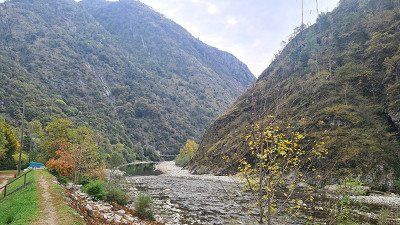
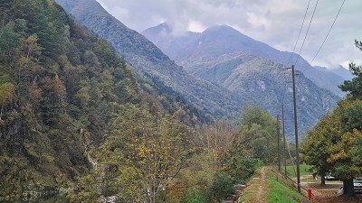
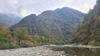
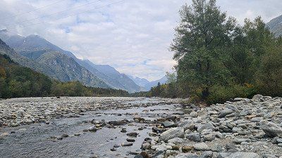
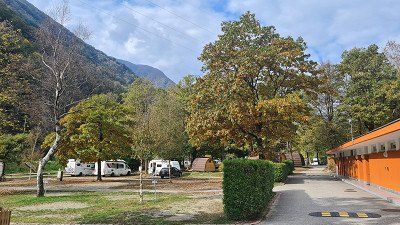
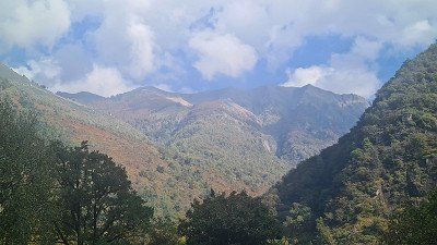
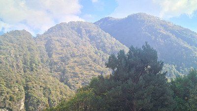
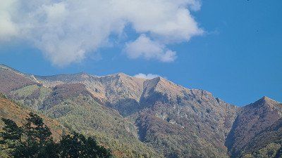
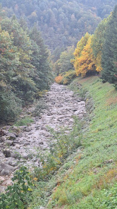
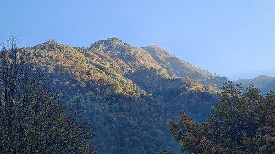
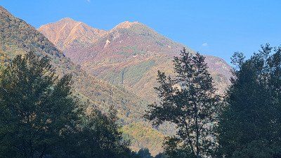
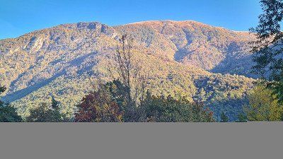
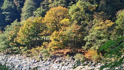
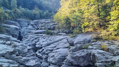
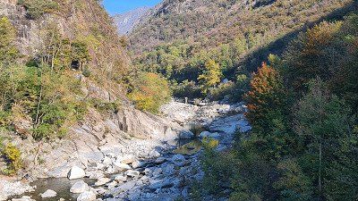
Pilgrimages to Madonna del Sasso.
It's Monday October 17th, 2022. The weather remains nice and sunny at 20 degrees. Today I'm visiting Locarno and Ascona on Lake Maggiore by bike. From Gordevio you descend the Vallemaggia to a first stop in Tegno (1-5). I arrive in Locarno around eleven o'clock and spontaneously decide to visit Madonna del Sasso. Steffen from TerraX comes to mind with his apt "stay fascinated". For me it's the churches. But it's not the religion (I'm an atheist), it's the buildings and their history that always attract me on my travels. And so I park my bike at the signpost ( 6) and take the footpath Sentiero della Valle (7-10) up to the pilgrimage church (11-15). It is always impressive to see the power the churches had in earlier times and enabled them to leave their monuments in every little place in the world, magnificent as here or simple
Madonna del Sasso at Wikipedia.
The Sanctuary of the Madonna del Sasso is an important pilgrimage destination and stands on a rocky outcrop inside the small valley dug by the Ramogna torrent, at an altitude of 370 meters in the municipality of Orselina, above Locarno in the Swiss canton of Ticino. In addition to the monastery, the building complex or Sacro Monte includes the Church of the Annunciation, the chapels below along the old access road with the arcade of the Cross, the ascent of the Way of the Cross and its stations in Aedicule, the chapel of the Pietà in the courtyard, the chapels of Lamentation of the dead Christ, the Last Supper and the Holy Spirit below the arcade, the stairs, the cemetery cross, the church square and finally the church of Santa Maria Assunta called Madonna del Sasso. At the end of the fifteenth century, the Franciscan Friar Bartolomeo Piatti from Ivrea settled as a hermit in a hamlet at the foot of the rock. He came from the monastery of San Francesco in Locarno, where he had no particular title or office within the community. His ascetic life fostered a strong cult of the Virgin among the local population, who, according to legend, had appeared to the friar. The construction of the Church of Santa Maria Annunciata at the foot of the promontory began, thanks to the donation of land by Antonio Guido Orelli. In the notarial deed of donation, the name "Madonna del Sasso" appears for the first time in the spelling "santa Maria del Saxo". 1498 confirms Pope Alexander VI. the donation of the Rock of Orselina to the Franciscans by the Masina del Monte family in order to build a sanctuary there. The church was consecrated in 1502. In 1514, Pope Leo X freed the hill of the sanctuary from all servitude and jurisdiction. In 1522 the walls received a series of frescoes, including that on the north wall of the choir with the Madonna Enthroned with Child, attributed to Domenico Pezzi from Puria called "Furgnicus". a painter who commuted between the Lugano area and Genoa and in the monastery church of Santa Maria degli Angioli in Lugano, in the parish church of Santa Maria del Sasso in Morcote, in the portico in front of the parish church of Villa Luganese, in the church of San Biagio of Bellinzona-Ravecchia and in Gravedona in the church of Santa Maria delle Grazie. On the southern wall of the nave is Christ and the Torah scholars, attributed to the della Rovere brothers called Fiammenghini. Fra Bartolomeo will be buried in this church a few years later. According to a parchment kept in the cantonal archives of Bellinzona, in 1487 Rolando, Bishop of Antarado, consecrated a church and an oratory "alla beata Maria vergine santissima avvocata" ("to the Blessed Virgin and Most Holy Advocate Mary"), both of which had been built by the nun and around which a great popular piety had arisen. The buildings were subordinated to the Franciscan monastery in Locarno and especially to Fra Bartolomeo until his death. At the end of the sixteenth century the construction of a second church on top of the rock began, consecrated in 1616. The coronation of the Madonna del Sasso the following year began a series of works to embellish and complete the Sacro Monte. The chapels and the clay sculptures set up in them date from this period. That of the Last Supper consists of terracotta statues by Francesco Silva from Morbio Inferiore, a sculptor who also worked at Sacro Monte di Varese. The story of the sanctuary's origins is written in Latin on a marble slab inside, dated July 10, 1624. The inscription mentions the donation of the land to the Franciscan order by the Masina del Monte family and the consecration of the church by Filippo Archinti, Bishop of Como, in 1616. In 1617 the access that leads from the Pietà to the Sanctuary was widened and in 1618 the small tower called the open portico was built, which gives access to the church, with the rooms for guests in the lower part. In 1619 a path was built on the ridge of the hill with a few chapels dedicated to the mysteries of the Rosary, to which later the chapels of the Way of the Cross were added, which still exist today: the chapel of Calvary was built in 1620, that of Veronica in 1625, that of the in 1670 Resurrection near the Chapel of Calvary. Work was completed in 1677 with the Chapel of the Ascension. With a decree of 1848, the state and republic of the canton of Ticino expropriated the monastery and the pilgrimage site of the Madonna del Sasso and expelled the inmates from the canton. The site was given to the Capuchin Father Alessandro da Giornico and since then it has remained in the hands of the canton, while the Capuchins supervised and cared for religious affairs. Major works were undertaken between 1891 and 1912, heavily remodeling the entire complex of buildings on the top of Sacro Monte. The monastery was enlarged in 1892, the facade was rebuilt in a Renaissance style, small loggias and terraces were added on the east side in 1895 and the bell tower was also renovated by the architect Alessandro Ghezzi from Lamone. Then, in 1903, the chancel was widened with the construction of a retaining wall that completely covered the rocky outcrop on which the sanctuary rests. The north side was last renovated in 1912 with the construction of a loggia, which allows access to the choir of the church directly from the monastery. This work was carried out at the initiative of the friars, albeit with strong internal opposition, notably from Father Agostino from Vezia, superior of the Ticino Capuchins, and from Fra Bernardo from Andermatt, then overseer of the monastery. The project and idea of these interventions go back to Fra Angelo Osio from Pesaro. Despite the strong criticism, the intervention was carried out by the Capuchins and financially supported by the local population. In 1918 the church was elevated to the rank of a minor basilica. The first major restorations to the convent, parts of the Assunta Church and the Way of the Cross took place between 1974 and 1980 under the direction of the architect Luigi Snozzi. Further important restoration work, subsidized by the state of the canton of Ticino, took place between 2004 and 2012.
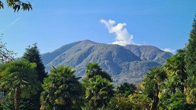
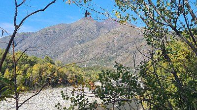
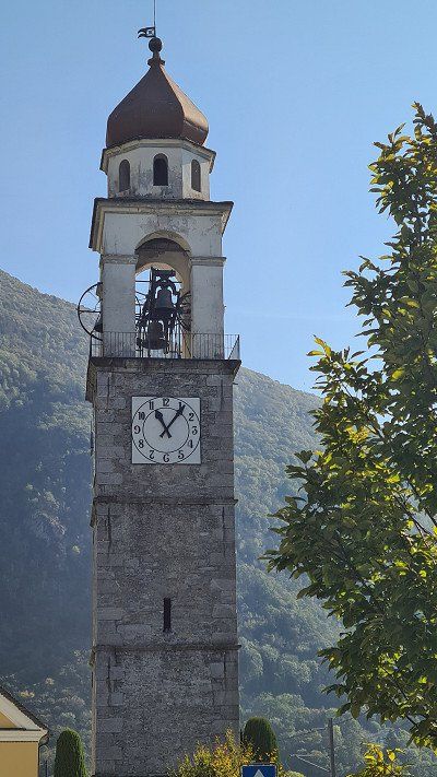
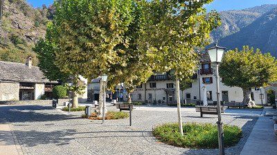
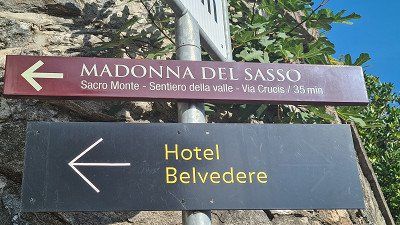
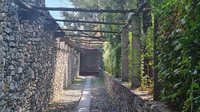
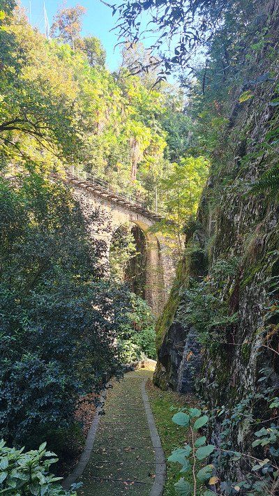
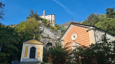
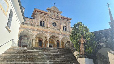
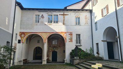
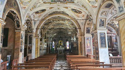
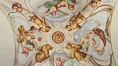
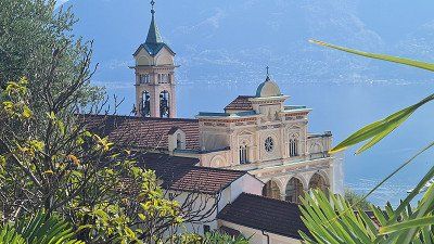
Walks in Locarno and Ascona.
After the Way of the Cross has led me back down to Locarno, I walk through the center of Locarno (1-8) and from there, on the recommendation of friend Hampe, to the Ristorante Sensi (9-10) on the lake promenade. This time I don't feel like fish and I choose a Ticino specialty Luganighetta (9-10). Now back on the bike, you pass the Lido Locarno and over the Ticino (11) to Ascona. I walk along the lakeside promenade there (12-15) before heading back home to the Maggia Valley.
Locarno and Ascona at Wikipedia.
Locarno is a municipality in the district of Locarno and the capital of the district of Locarno in the Swiss canton of Ticino. The former German name Luggárus still lives in the Walser dialect of the municipality of Bosco/Gurin in the Liggåårasch pronunciation. The city is the third largest city in the canton of Ticino after Lugano and Bellinzona. The city of Locarno is located on the north shore of Lake Maggiore and on the eastern edge of the Maggia Delta, where it borders with Ascona, Losone, Terre di Pedemonte and Tenero-Contra. The Monti della Trinita district nestles on the hillside above the town, and the territory of the commune also includes a large unconnected area in the Magadino plain, the Gerre di Sotto. From a structural point of view, the city of Locarno has grown together with the independent municipalities. The Locarno agglomeration with Muralto, Minusio and Orselina has around 40,000 inhabitants. Locarno, together with the rest of southern Ticino and the province of Como, is part of the Ticino metropolitan region. The place was inhabited as early as the younger Bronze Age. Later settlements can be proven on the basis of necropolises from the La Tène and Roman times. A royal court is mentioned in documents in 866. Frederick I granted Locarno new market rights in 1164 and imperial immediacy in 1186. In 1342 the Visconti conquered the city, who gave it to the Rusca as a fief from 1439 to 1503. The Confederates conquered the city in 1503, but only received the castle in 1513 from the hands of the French King Louis XII. From then on, a bailiff of the twelve places exercised civil and criminal jurisdiction. The city was governed by the three corporations of the nobility (Capitanei dei Nobili), the bourgeoisie (Borghesi) and now also the country folk (Terrieri), who met in the Provincial Council (Magnifico Consiglio). The Reformation also gained a foothold in Locarno around 1530; the Carmelite Balthasar Fontana studied the Bible and Reformation writings with other brothers. From 1539 the priest and teacher of the Latin school in the monastery of San Francesco Giovanni Beccaria, the doctor Taddeo Duno and the jurist Martino Muralto were the leading figures in the growing Reformation movement. From 1542 to 1544, the then evangelical Glarner bailiff Joachim Bäldi supported the reformatory forces. It was not until 1547 that there was a break with the Catholic Church, and an independent Protestant community was formed, which met in private homes. A faith talk in 1549, chaired by the Catholic bailiff Nikolaus Wirz, did not lead to an agreement, but to the end of the talks, to the brief arrest and expulsion of Beccaria, who fled to Roveredo and Mesocco in Misox in the canton of Grisons. In 1555 the Reformed had to give up their new evangelical faith or leave Locarno. Driven out by the evangelicals, suspicion and resentment, Locarno remained torn apart, smaller and poorer. In 1584 the plague struck the city and decimated its population so badly that only 700 of the original 4,800 people remained. After the collapse of the Ancien Régime, Locarno became part of the newly created Swiss canton of Lugano in 1798. In the 1870s, when transport links to both the north and the south improved, the Locarno region began to develop as a hotel and tourism industry, which to this day forms the economic backbone of the city. The Locarno Film Festival was first held in 1946. In 2017, Locarno was awarded the honorary title of "European City of Reformation" by the Community of Protestant Churches in Europe. Worth seeing next to Madonna del Sasso: Piazza Grande, Castello Visconteo from the twelfth century, the remains of the defensive bastion Rivellino (possibly designed by Leonardo da Vinci.), numerous churches and palaces, town houses. Ascona is a municipality in the Swiss canton of Ticino. The former German names Aschgunen or Aschgonen, based on Lombardic, are no longer used today. The former fishing village and later health resort is located on the north shore of Lake Maggiore. Ascona is the lowest-lying town in Switzerland, as the village center is right on the lake. To the west, the municipality extends beyond the wooded mountain and viewpoint of Corona dei Pinci, which is 1,293 meters above sea level. Excavations in 1969 in and around the Church of San Michele unearthed Neolithic flints and pottery shards. Middle and late Bronze Age pottery has been found in the necropolis of San Materno. Around 1,000 BC there was a fortified hilltop settlement on the nearby hill of Baladrum, of which the remains of dry stone walls still exist. Ascona first appears in written sources in 1186, when the bishop of Como gave lands in Ascona and Locarno, including the castle of San Michele, to Pietro de Duni and other nobles, who then expanded them. 1224 the village was mentioned as burgus de Scona.
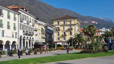
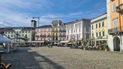
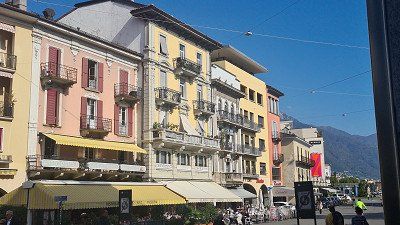
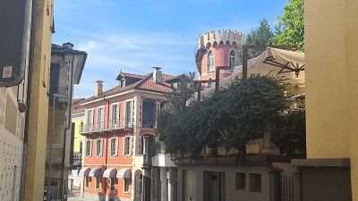
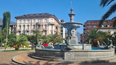
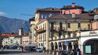
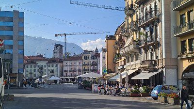
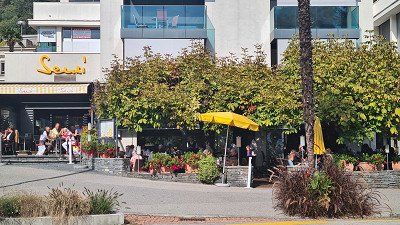
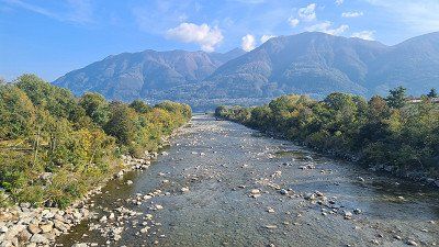
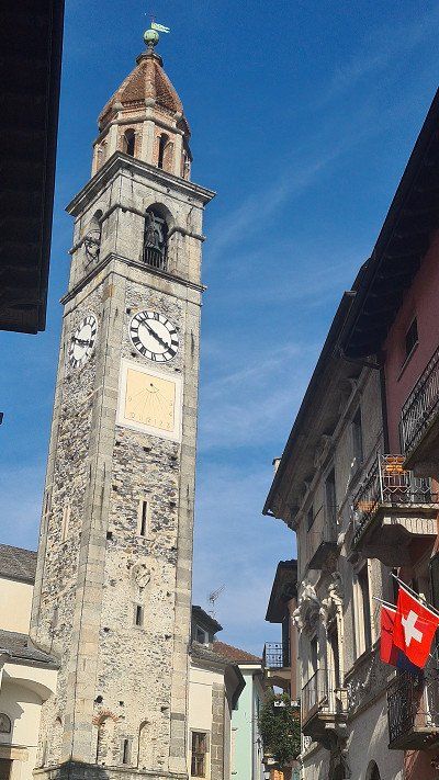
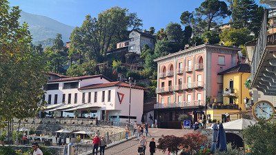
Drive home via the San Bernadino.
It is Tuesday, October 18, 2022. The nights are getting noticeably cooler, but on the day of the journey home it will be beautiful and colorful again at 20 degrees. Today I drive 365 kilometers home from Gordevio. This time I choose the route over the San Bernadino for the crossing of the Alps. Shortly after the start of the journey, I stop for the first time at Ponterollo (1-4), where the Maggia flows impressively into the Centovalli in a deep canyon. On the further journey through the Misox up to the San Bernadino I stop several times and capture the beautiful surroundings in the Misox (5-11) in the picture. The next stop is in the village of San Bernandino (12-15), which is deserted just before the road tunnel below the pass.
San Bernardino at Wikipedia.
San Bernardino is a place in the Swiss canton of Graubünden. It is located in the upper part of the Misox, belongs to the municipality of Mesocco and is characterized by tourism and agriculture. The town is located south of the San Bernardino Pass at an altitude of 1,600 meters at the south portal of the San Bernardino Tunnel of the A13 motorway, which opened in 1967. Italian is spoken in San Bernardino. The Moësa, which rises at the Laghetto Moesola at the top of the San Bernardino Pass, flows through San Bernardino. In the Middle Ages the settlement was called Gualdo de Gareda. Gualdo possibly goes back to the Lombard word for "forest", Gareda to a personal name, a previous owner. In the seventeenth century, the name of the patron saint of the church, Saint Bernardine of Siena, became the place name. The pass is one of the oldest Alpine passes and was already used in pre-Roman times. It takes its name from Saint Bernardino of Siena, for whom a chapel was built along the road in the fifteenth century. The former name Mons Avium (bird mountain) remained for the Piz Uccello, which overlooks the street. The 4-7 meter wide road was built from Chur in 1818-1823 under the direction of the engineers Pocobelli, at a cost of 3,190,800 francs, of which the Sardinian government contributed the largest part. The healing spring (steel bath) was mentioned as early as 1717 by the natural scientist Johann Jakob Scheuchzer and rewritten in 1898. An existing acid spring was used in an inn and spa house built from 1822; in 1825 many Milanese were present as spa guests. In the early 1960s, the Moësa was dammed south of the village to form the Lago d'Isola reservoir. After the opening of the San Bernardino tunnel in 1967, the village, which had been isolated until then, experienced an upswing. A great deal of building activity began, not always to the advantage of the townscape. Until 2012, San Bernardino was best known as a ski resort; there were 40 kilometers of ski slopes up to an altitude of 2,600 meters. Most of the ski lifts are now obsolete and have been closed since 2012 due to a lack of investors. This also has negative effects on the hotel industry, trade and the entire local economy. Cross-country skiers have 24 kilometers of trails at their disposal. They are medium to easy and lead through the coniferous forest that surrounds the place. South of the village is the small moor lake Lago Dosso.
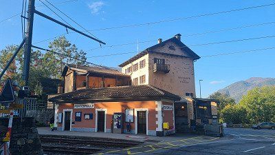
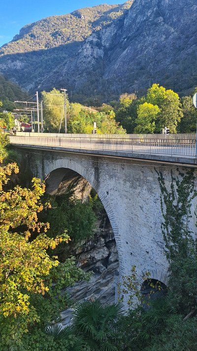
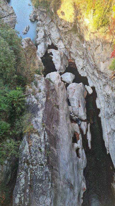
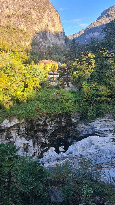
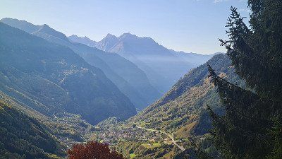
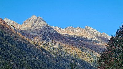
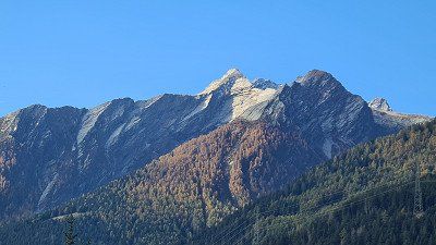
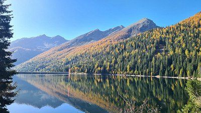
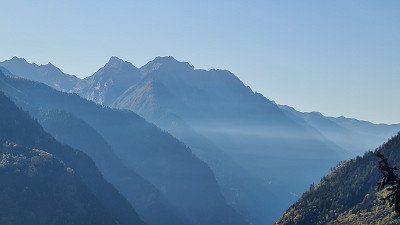
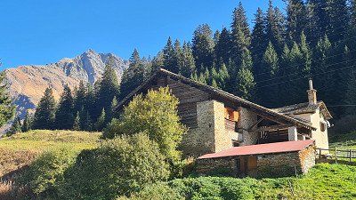
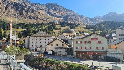
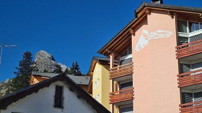
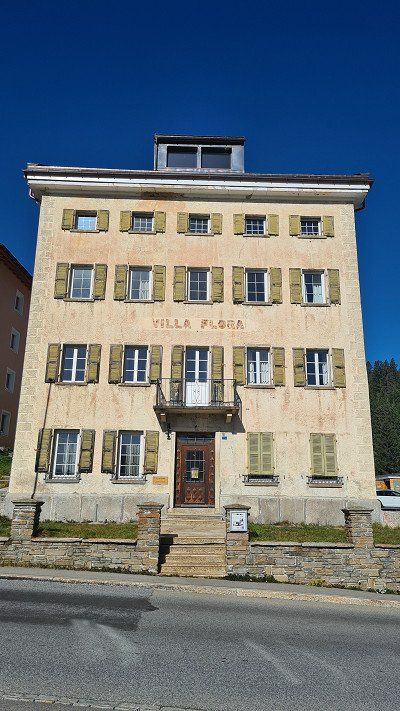
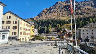
Passing the Walensee to Zullwil and Basel.
After crossing the San Bernadino I stop at the Viamala service area (1-2). I remember from previous visits that you can buy fine Bünder specialties from the region there. This time it's Capuns, Salzis and Bergkäse from Andeer that are taking me home. The journey continues to the next stop at a parking lot at Lake Walen (3-5). At a café, I once again enjoy an impressive lake and mountain world in the best autumn colors. I quickly continue on the A2 and A13 motorways to Duggingen (6) and to thoroughly wash the outside of my faithful companion. After that, I'll soon be in Zullwil (7-10) with the "flying change" to then drive to Basel electrically.
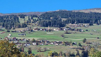
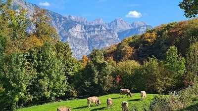
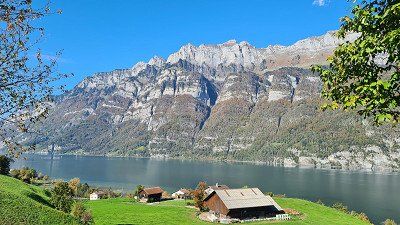
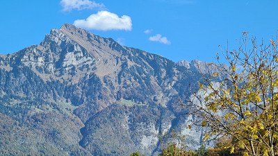
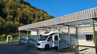
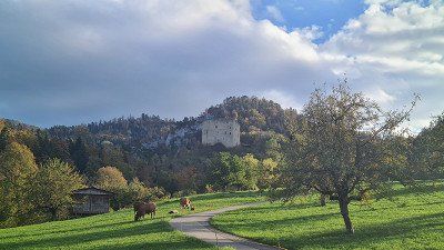
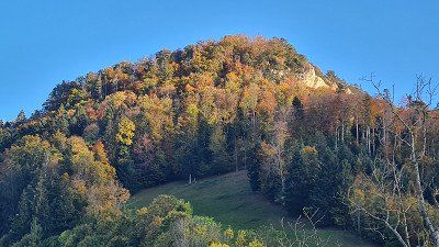
Route
Show newest first- 47.5596 7.5886
- 47° 33' 34.6" N 7° 35' 18.9" E
Der Lago di Lugano oder Lago Ceresio (Luganersee) ist einer der oberitalienischen Seen und befindet sich zu 63 % im Schweizer Kanton Tessin und 37 % in italienischem Gebiet. Seine Oberfläche liegt 271 Meter über dem Meeresspiegel und umfasst 48.8 Quadratkilometer. Seine tiefste Stelle liegt bei 288 Meter, sein Volumen beträgt 5,9 Kubikkilometer. Der wichtigste Zufluss ist der Vedeggio mit 4 Kubikmeter/Sekunde. Seine Form erklärt sich durch seine Entstehung nach der Eiszeit in einem Gebiet, in dem zwei Gletscher zusammentrafen. Durch den künstlichen Seedamm von Melide wird der See in ein Nord- und Südbecken geteilt, dazu kommt das kleine Becken, genannt Laghetto, von Ponte Tresa. Einige Ausläufer des Sees reichen nach Italien, dazu befindet sich die durch ihr Spielkasino bekannte italienische Exklave Campione d’Italia an seinem Ufer, was zu einem komplizierten Grenzverlauf führt. Südlich von Lugano überqueren die Autobahn 2 und die Gotthardbahn den See auf dem Seedamm von Melide. Bekannte Aussichtsberge am Ufer sind der Monte Brè (925 Meter über Meer) im Osten, der Monte San Salvatore (912 Meter über Meer) im Westen von Lugano und der Monte Generoso (1'701 Meter über Meer) am südöstlichen Ufer. Zwischen den beiden südlichen Armen liegt das UNESCO-Weltnaturerbe Monte San Giorgio (1'097 Meter über Meer). Da der See durch seine Lage an der Südspitze der Schweiz in einem mediterranen Klima liegt, ist er ein beliebtes Touristenziel. Rund um den See haben sich verschiedene deutsche Komponisten zurückgezogen, wie Michael Jary, Martin Böttcher oder auch Peter Thomas. Der Schriftsteller Hermann Hesse lebte ab seinem 42. Lebensjahr bis zu seinem Tod in Montagnola bei Lugano. Zu seinen Ehren gibt es dort seit 1997 ein ihm gewidmetes Museum im alten Torre Camuzzi. Wikipedia.
Campingplatz und Ristorante Stazione.
Nach Rückkehr von der Velotour spaziere ich erst über den in all den Jahren liebgewonnen Campingplatz (1-3) direkt am Lago di Lugano und dem massiven Monte Generoso (4-5) im Rücken, leicht verhüllt im Herbstnebel. Jetzt am Abend füllt sich der Campingplatz immer mehr, und vom Betreiber erfahre ich, dass sie ausbucht sind. Wir waren viele Male und zu allen Zeiten schon hier, aber Vollbelegung haben wir noch nicht erlebt. Man spürt zum Saisonabschluss, dass das Campen boomt. Ich laufe dann die zehn Minuten zum Bahnhof Maroggia-Melano zum dortigen Ristorante Stazione (6-8) und seiner gut bürgerlichen, italienischen Küche. Ich setze mich in den kleinen Garten und bestelle Stufato di cervo (Hirschragout) passend zur Herbststimmung. Es dunkelt jetzt im Oktober aber schnell ein und ich erwische nach der Rückkehr zum Camp gerade noch einen letzten schönen Blick vom Stellplatz auf den See (9).
Monte Generoso bei Wikipedia.
Der Monte Generoso oder Calvagione ist mit 1’701 Meter über Meer ein schweizerisch-italienischer Grenzberg am Südrand der Alpen. Er zählt zur Generoso-Intelvi-Gruppe, die Teil der Tambogruppe ist. Der Berg liegt am östlichen Ufer des Luganersees zwischen Lugano und Chiasso sowie am westlichen Ufer des Comersees. Die Grenze zwischen Italien und der Schweiz verläuft über den Ostgrat und den Nordgrat. Südflanke und Westflanke gehören zur Schweiz, die Nordostseite zu Italien. Der Monte Generoso ist ein Aussichtsberg, der bei klarem Wetter einen Überblick über den gesamten Alpenbogen von den Seealpen bis zum Piz Bernina ermöglicht. Bis kurz unter seinen Gipfel führt seit 1890 von Capolago aus die Zahnradbahn Ferrovia Monte Generoso in den Sommermonaten von April bis Oktober. Generoso-Vetta, die Bergstation, liegt auf 1’605 Meter über Meer direkt an der Landesgrenze. Die Bahn ist die einzige «typisch schweizerische» Zahnradbahn südlich der Alpen. 1940 drohte finanziell die Einstellung des Bahnbetriebs. Der Migros-Gründer Gottlieb Duttweiler setzte sich vehement für die Erhaltung der Zahnradbahn ein. Migros übernahm dann die Bahngesellschaft. Der Monte Generoso gehört geologisch zu den Südalpen und weist eine vielfältige Flora auf. Bereits 1867 wurde das erste Hotel Monte Generoso Bellavista eröffnet. Von 1897 bis 1901 verbrachte der deutsche Nobelpreisträger für Literatur Gerhart Hauptmann jedes Jahr ein paar Frühlingswochen im nahen Rovio. Diese Aufenthalte inspirierten ihn zu seiner 1918 veröffentlichten Novelle Der Ketzer von Soana, in der er auch auf den Monte Generoso Bezug nimmt. Das 1970 erbaute Hotel-Restaurant Vetta wurde im Oktober 2010 aus Sicherheitsgründen geschlossen, da sich der Untergrund bewegt hatte und Risse aufgetreten waren. 2017 wurde das neue Restaurant Fiore di pietra (Steinblume) des Tessiner Architekten Mario Botta eingeweiht.
Seerundfahrt auf der MS Lugano.
Nach dem guten Mittagsessen besteige ich um zwei Uhr das Motorschiff Lugano (Jahrgang 1961) und setze mich in eine Ecke draussen auf dem Oberdeck und geniesse einfach die herrliche Schifffahrt (1-15) nach Paradiso, Gandria, Cambione, Melide, Brusino, Morcorte und vorbei an den beeindruckenden Bergen Bré, San Salvatore, San Giorgo und Generoso. Die grosse Seerundfahrt am Nachmittag wird schon schon seit Jahren von der Società Navigazione del Lago di Lugano angeboten. Wir haben sie eigentlich jedes Mal bei einem Besuch Luganos gerne gebucht. Sie ist schlicht einmalig.
Società Navigazione del Lago di Lugano bei Wikipedia.
Kunst auf der Alpe Foppa am Monte Tamaro.
Es ist Samstag, der 8. Oktober und tagsüber weiter schönes Herbstwetter mit 23 Grad. Am Abend beginnt es zu regnen. Da ich den Platz auf dem Campingplatz wechseln muss, beschliesse ich, mit dem Wohnmobil die 60 Kilometer nach Riviera hin und zurück zu fahren. In Riviera besteige ich gegen zehn Uhr die Gondelbahn auf die Alpe Foppa (1) unterhalb des Monte Tamaro. Bei der Cappella di Santa Maria degli Angeli (2-3) zeigen sich herrliche Panoramen. Nach einem Café im Restaurant gehe ich auf den halbstündigen Rundgang Percoso della Salute (6), der die Alpe Foppa umrundet, weitere schöne Ausblicke ermöglicht und unter anderm an einigen interessanten Plastiken lokaler Künstler (7-15) vorbei führt. Kurz nach Mittag fahre ich wieder zurück zum Camp und am Nachmittag mit der S-Bahn nochmals nach Lugano zum Einkaufen und einen Apero auf dem Piazza della Riforma.
Monte Tamaro bei Wikipedia.
Der Monte Tamaro ist mit 1'960 Meter über Meer ein Berg im Schweizer Kanton Tessin oberhalb des Ortes Rivera. Auf La Manèra (1’858 Meter), dem östlichen Nebengipfel des Monte Tamaro, befindet sich eine grosse Richtfunkstation der Swisscom. Über sie werden Teile der Verbindungen aus dem Tessin in die Deutschschweiz übertragen. Die vom Tessiner Architekten Mario Botta ab 1990 entworfene und zwischen 1992 und 1994 erbaute Cappella di Santa Maria degli Angeli auf der Alpe Foppa auf 1’567 Meter über Meer machte den Ort überregional bekannt. Die 1996 eingeweihte und mit Malereien von Enzo Cucchi ausgeschmückte Kapelle ist über eine Luftseilbahn zu erreichen. Auf der Alpe Foppa gibt es bei der Bergstation der Seilbahn am Nordosthang des Berges es eine Sommerrodelbahn, eine Tyrolienne, ein Restaurant, ein Kinderspielplatz, diverse Wanderungen und Mountainbike-Parcours. Auf der Mittelstation befindet sich der Seilpark Monte Tamaro. An den Hängen des Monte Tamaro fanden die Mountainbike-Weltmeisterschaften 2003 statt. Eine Wanderroute führt vom Monte Tamaro in etwa 4½ Stunden über mehrere weitere Gipfel zum Monte Lema. Bei gutem Wetter reicht die Aussicht bis zum Monte-Rosa-Massiv und zum Matterhorn. Dies macht den Gipfel des Monte Tamaro zu einem der wenigen Aussichtspunkten, die einen gleichzeitigen Blick auf den tiefstgelegenen (am Lago Maggiore) und den höchstgelegenen Punkt (Dufourspitze) der Schweiz erlauben.
Der Lago die Garda (Gardasee), einer der oberitalienischen Seen, ist der grösste See Italiens, benannt nach der Gemeinde Garda am Ostufer. Sein antiker Name lautete 200 vor Christus Lacus benacus. Der Name soll von einer alten Gottheit namens Benacus abstammen. Der Gardasee wurde in der vergangenen Eiszeit durch einen Seitenast des Etschgletschers geformt, dessen Spuren noch verfolgt werden können, insbesondere durch Endmoränen am Südufer. Erste Besiedlungen des Seeufers datieren um 2’000 vor Christus. Der Gardasee liegt zwischen den Alpen im Norden und der Po-Ebene im Süden und ist daher ein Alpenrandsee. Der Norden des Sees gehört zur RegionTrentino-Südtirol, der Westen zur Lombardei und der Osten zu Venetien. Damit teilen sich die drei ProvinzenTrient (Norden), Verona (Osten) und Brescia (Westen) die Verwaltung. Aus der Bronzezeit stammen zahlreiche Pfahlbausiedlungen, die direkt am Seeufer oder im unmittelbaren Hinterland des Gardasees errichtet wurden und seit 2011 zum UNESCO-Weltkulturerbe zählen. Die Schlacht am Lacus Benacus wurde 268 an dessen Ufern zwischen Alamannen und Römern unter KaiserClaudius Gothicus ausgetragen. Im dreizehnten und vierzehnten Jahrhundert fiel der See unter den Einflussbereich der Scaliger, die zahlreiche Burgen insbesondere an den östlichen und südlichen Uferorten (Malcesine, Torri del Benaco, Lazise und Sirmione) errichteten. Im fünfzehnten Jahrhundert wurde der See und seine Uferorte zum Schauplatz im Kampf um die Vorherrschaft in Oberitalien zwischen dem Herzogtum Mailand unter den Viscontis und der Republik Venedig. Mit der im Frieden von Lodi 1454 festgelegten Grenze am Fluss Adda fiel der Gardasee endgültig unter den Einflussbereich der Dogenrepublik. Letztere baute insbesondere Peschiera am strategisch wichtigen Abfluss des Mincio zur Festung aus, die 2017 von der UNESCO zum Weltkulturerbe erklärt wurde. Während des Spanischen Erbfolgekrieges zu Beginn des achtzehnten Jahrhunderts versuchte General Vendôme mit seinen Truppen über das Nordufer in Richtung Norden vorzustoßen und hinterließ eine Spur der Verwüstung. Dabei wurden zahlreiche Burgen von den Franzosen zerstört, wie Castel Penede in Nago, die Burg von Arco oder Castel Drena, die als Ruinen erhalten sind. 1706 schlug Vendôme in der Schlacht bei Calcinato am Südufer des Sees die kaiserlichen Truppen. Die Schlacht bei Rivoli war ein Schlüsselerfolg der französischen Armee unter Napoleon Bonaparte im Italienfeldzug über ein zahlenmäßig überlegenes habsburgisches Heer. Aufgrund des Vertrages von Pressburg 1805, mit dem Tirol zu Bayern fiel, gehörte die Nordspitze des Sees nun zum Königreich Bayern. Nach dem Wiener Kongress 1815 fiel der gesamte See dem Kaisertum Österreich zu und war Bestandteil des Königreichs Lombardo-Venetien. Die Schlacht von Solferino im Sardinischen Krieg zwischen dem Kaisertum Österreich und dem Königreich Sardinien war entscheidend für die Einigung Italiens 1859. Die Grausamkeit der Schlacht veranlassten Henry Dunant zur Gründung des Roten Kreuzes und führten zur Vereinbarung der Genfer Konvention von 1864. Nach dem Verlust der Lombardei 1859 verlor Österreich 1866 nach dem Dritten Italienischen Unabhängigkeitskrieg mit Venetien auch das Ostufer, nur die Nordspitze, mit Riva del Garda, verblieb bis 1918 bei Österreich-Ungarn. Während des Ersten Weltkrieges verlief die Front direkt am Nordufer des Sees entlang, an dem zahlreiche Festungsanlagen errichtet worden waren. Nach dem Sturz Mussolinis 1943 wurde auf deutsche Forderung von 23. September 1943 bis 25. April 1945 die Repubblica Sociale Italiana (Republik von Salò) unter Mussolinis Führung als Gegenregierung installiert. Am 30. April 1945 endete mit der Befreiung von Torbole und Riva durch die 10. US-Gebirgsdivision der Zweite Weltkrieg am Gardasee. Wikipedia.
Mit dem Velo nach Garda.
Es ist Montag, der 10. Oktober 2022. Es wird wieder ein schöner Herbsttag mit viel Sonne und 22 Grad. Ich besuche heute die Orte Garda und Bardolino, die gut zehn und sieben Kilometer nördlich von Lazise am Gardasee liegen. Die Fahrt ist weitgehend flach und angenehm auch auf der schmalen Strasse entlang des Sees angenehm zu fahren, wenn teilweise gesonderte Velowege fehlen. Ich treffe gegen elf Uhr in Garda ein und spaziere gemütlich entlang der Promenade und durch die Gassen es schmucken Fischerdorfs (1-12). In der Osteria al Porto (13-15) an der Seepromenade gibt es erst Spaghetti Vongole und dann eine ausgezeichnete Gratinata di frutti di mare.
Garda bei Wikipedia.
Garda ist eine norditalienische Gemeinde mit 4’111 Einwohnern in der Provinz Verona am Westrand der Region Venetien. Garda liegt am Ostufer und ist Namensgeber des Gardasees. Im und um den Ort gibt es eine üppige, schon fast mediterrane Vegetation. Daher ist er ein beliebtes Touristenziel. Garda wird geprägt von der Seepromenade und dem kleinen Hafen mit dem „Palazzo dei Capitani“ aus venezianischer Zeit. In der Nähe von Garda ragt die Landzunge Punta San Vigilio in den See. Für den Philosophen Agostino di Brenzone war es der „schönste Ort der Welt“. Reste von Pfahlbauten zeugen von einer sehr frühen Besiedlung. Verbürgt ist, dass hier der Gotenkönig Theoderich im fünften Jahrhundert eine Burg Rocca di Garda auf einem Felsplateau hoch über dem Ort errichten liess. Sie galt lange als uneinnehmbar – auch Kaiser Barbarossa gelang es nicht, sie einzunehmen. Fünf Jahrhunderte später herrschte hier der Langobardenfürst Berengar II. bis er von König Otto dem Grossen besiegt und lebenslang in Bamberg eingekerkert wurde. Die Burg wurde im sechzehnten Jahrhundert von den Venezianern zerstört. Von 1904 bis zur endgültigen Stilllegung 1956 besass der Ort eine Station an der Bahnstrecke Verona–Caprino/Garda. Garda hat aufgrund seiner langen Geschichte einen durchaus unverwechselbaren Charakter, der sich vor allem in seiner kleinen, aber attraktiven Altstadt und der schönen Uferpromenade präsentiert, deren südliche Verlängerung bis nach Bardolino reicht, ähnelt aber an den Ortsrändern vielen anderen, vom Tourismus geprägten Siedlungen am Ufer des Gardasees. Insoweit ist die Altstadt mit der Seepromenade für sich schon eine Sehenswürdigkeit. Zu sehen sind: Palazzo dei Capitani („Palast der Kapitäne“) aus dem vierzehnten Jahrhundert; Villa degli Albertini aus dem sechzehnten Jahrhundert, Villa Canossa aus dem achtzehnten Jahrhundert; die Kirchen Santa Maria Maggiore und die Pfarrkirche Garda aus dem zehnten Jahrhundert, die Sankt-Stefan-Kirche aus dem siebzehnten Jahrhundert, die Mariä-Himmelfahrts-Kirche aus dem achtzehnten Jahrhundert und die Einsiedelei der Kamaldulenser aus dem fünfzehnten Jahrhundert.
Auf der Rückfahrt Halt in Bardolino.
Nach dem ausgezeichneten Mittagessen fahre ich die Seestrasse wieder zurück Richtung Lazise. Unterwegs besuche ich noch ein weiteres Fischerdorf Bardolino. Auch hier spaziere ich entlang der Seepromenade und durch die Altstadtgassen (1-14). Dann noch ein Café americano bevor ich den weiteren Rückweg zum Camp in Lazise in Angriff nehme. Der Tag in den beiden Kleinstädten war ein schönes Erlebnis und hat bei mir eindrückliche Bilder hinterlassen. Am Abend gibt es noch im Seebistrot des Camps (14-15) ein Moretti.
Bardolino bei Wikipedia.
Bardolinoist eine italienische Gemeinde am Gardasee in der Provinz Verona in der nordostitalienischen Region Venetien mit 7’207 Einwohnern. Bardolino liegt an der Ostseite des Sees nördlich von Lazise und südlich von Garda. Bardolino hat zwei Millionen Touristen pro Jahr und liegt auf Platz 24 unter den Reisezielen in Italien. Der Ort ist Sitz der Gemeinde, zu der gauch die Fraktionen Cisano und Calmasino gehören. Cisano liegt direkt an der Uferstrasse Gardesana orientale. Zu Fuss erreicht man über die Uferpromenade in 20 Minuten den Ortskern von Bardolino. Sehenswert ist in Cisano die kleine Kirche St. Julian aus dem achten Jahrhundert. Die mittelfränkische Gemeinde Rednitzhembach im Landkreis Roth ist Partnergemeinde von Bardolino. Sowohl in Bardolino als auch in Rednitzhembach finden Weinfeste mit Winzern aus der jeweils anderen Region statt. Bardolino ist das Zentrum eines bekannten Weinbaugebiets gleichen Namens. Der rote Bardolino sowie der Rosé mit dem Namen „Chiaretto“ sind sehr beliebt. Wie auch das umliegende Gebiet ist der Ort ein beliebtes Tourismus-Ziel. Zu sehen sind sieben Kirchen, ein Kamaldulenser-Kloster, ein Wein-, ein Oliven- und ein Vogelmuseum.
Mit dem Velo zum Stadtbummel nach Peschiera.
Es ist Dienstag, der 11. Oktober 2022. Das Wetter hält, es bleibt heute herbstlich schön bei 22 Grad. Ich fahre heute mit dem Velo dem See entlang nach Süden zur Hafenstadt Peschiera del Garda. Fast den ganzen Weg gibt es einen speziellen Veloweg. Auf einem ausgedehnten Spaziergang lerne ich eine Stadt (1-12) mit interessanter Geschichte, eindrücklichem Hafen mit Befestigung und schönen Plätzen und Altstadtgassen kennen. Kulinarisch habe ich mit dem Ristorante Gistrot (13-14) an der Piazza Ferdinando di Savoia eine gute Küche gewählt. Ich werde mit Insalate Greca und einer Trota con verdure al vapore verwöhnt. Dazu gibt es ein Glas ausgezeichneten Soave. Mit grossen Eindrücken fahre ich zurück nach Lazise und unternehme dort nochmals einen Spaziergang vom Camp an die Promenade in Lazise (15).
Peschiera del Garda bei Wikipedia.
Peschiera del Garda ist eine italienische Gemeinde mit 10’930 Einwohnern in der Provinz Verona der Region Venetien. Seit 2017 ist die Festung von Peschiera del Garda Teil der Unesco Welterbestätte, auf der transnationalen Serie Venezianisches Verteidigungssystem des sechzehnten bis siebzehnten Jahrhunderts. Peschiera del Garda liegt am Südostufer des Gardasees an der Stelle, an der der Mincio, der einzige Abfluss des Gardasees, den See verlässt. Teile der Altstadt trennen mit ihren Festungsanlagen den Ort vom Festland. Der Ort verfügt über einen kleinen Yachthafen, einen Bahnhof und ist Standort der italienischen Armee.. Seit mehreren Jahren wirbt Peschiera für sich als eine barrierefreie Stadt. Sämtliche Läden sind über eine Rampe auch für Rollstuhlfahrer erreichbar. Ihnen fehlt zwar oft die optimale Steigung, sie sind aber trotzdem eine große Erleichterung für Rollstuhlfahrer. Die früheste Besiedlung Peschieras geht auf die Bronzezeit zurück. Aus dieser Zeit stammen zwei Pfahlbautensiedlungen am Lago di Frassino und am Ufer des Gardasees, die in der zweiten Hälfte des neunzehnten und zu Beginn des zwanzigsten Jahrhunderts ausgegraben wurden und zur Peschierazeit zugeordnet werden. Seit 2011 zählen die Pfahlbauten von Peschiera zum UNESCO-Weltkulturerbe. In der Römerzeit wurde der Ort unter dem Namen Arilica, in der Gallia cisalpina, vermerkt, in der Peutingertafel als Ariolica zu lesen. Wahrscheinlich zwischen dem achten und neunten Jahrhundert nahm der Ort den heutigen Namen Peschiera an. 899 nahm Peschiera Berengar I. nach seiner Niederlage gegen die nach Norditalien einfallenden Ungarn am Fluss Brenta auf. Während der Signorie fiel der Ort erst unter die Kontrolle der Familie Ezzelino. Nach der Niederlage Ezzelinos III. 1259 in der Schlacht bei Cassano d’Adda und dem darauffolgenden Niedergang des Hauses Ezzelino fiel Peschiera 1260 an Mastino I. della Scala. Die Herrschaft der Scaliger dauerte bis zum Ende des vierzehnten Jahrhunderts, als Peschiera an Gian Galeazzo Visconti fiel. 1440 konnte schliesslich die Republik Venedig unter ihrem CondottiereFrancesco I. Sforza den Ort einnehmen. Venedig baute zwischen dem fünfzehnten und sechzehnten Jahrhundert Peschiera zu einer Festung aus. Nach dem Wiener Kongress wurde Peschiera Teil des Königreiches Lombardo-Venetien und bildete mit den Orten Mantua, Verona und Legnago das sogenannte Festungsviereck. Während des ersten italienischen Unabhängigkeitskriegs nahmen piemontesische Truppen Peschiera 1848 ein. Aber erst nach dem dritten italienischen Unabhängigkeitskrieg von 1866 gelangte Peschiera zum neu gegründeten Königreich. Sehenswürdigkeiten sind unter anderem der historische Ortskern mit der Festungsmauer sowie Ausgrabungen aus der römischen Zeit.
- 45.7393 10.4799
- 45° 44' 21.5" N 10° 28' 47.8" E
Der Lago d’Iseo oder Sebino (Iseosee) ist der viertgrösste der oberitalienischen Seen. Er liegt in den lombardischen Provinzen Brescia und Bergamo. Der See befindet sich nordwestlich von Brescia am Fuss der Bergamasker Alpen und der Adamello-Presanella-Alpen. Das Seebecken wurde von den eiszeitlichen Gletschern des Valcamonica-Tals ausgehöhlt. Der Fluss Oglio speist den See. Der 65 Quadratkilometer grosse See liegt auf 181 Meter über Meer, ist 25 Kilometer lang und bis zu 251 Meter tief. Im See liegen die Inseln Monte Isola („Inselberg“), die grösste in einem südeuropäischen Binnengewässer, sowie Isola di Loreto und Isola di San Paolo. Letztere befindet sich im Besitz der Waffenherstellerdynastie Beretta.Man kann den See trotz vieler bis ans Wasser steil abfallender Felswände komplett umfahren. Die Strasse ist an vielen Stellen aus dem Felsen gehauen. Am Ufer liegen die Orte Lovere, Marone, Pisogne, Sulzano, Iseo, Paratico, Sarnico und Riva di Solto. Aufgrund günstiger Fallwinde hat sich der See zu einem Paradies für Segelsport entwickelt. An den wenigen Badestränden hat sich eine gute Tourismusinfrastruktur herausgebildet, jedoch ist der Iseosee im Vergleich zum Comer See oder zum Gardasee weit weniger frequentiert. Unmittelbar südlich des Sees beginnt das Weinanbaugebiet Franciacorta. 2016 eröffnete der Künstler Christo inmitten des Sees sein Kunstwerk The Floating Piers. Mit dieser Installation war es möglich, von Sulzano aus die Insel Monte Isola und von dort aus die Insel Isola di San Paolo zu Fuß über 16 Meter breite, im Wasser schwimmende Stege zu erreichen. Das Kunstwerk war einen knappen Monat begehbar und wurde dann wieder abgebaut und recycelt. Wikipedia.
Schöner Stellplatz und Sonnenuntergang.
Ich setze den Stadtbummel durch die Gassen (1-9) in Iseo fort, besuche auch die beiden Kirchen und trinke am See noch einen Cappuccino. Dann fahre ich zurück ins Camp und setze mich auf meinen schönen Stellplatz (10-15) direkt am See. Die Zeit vergeht wie im Flug während die Dämmerung hereinbricht und die Sonne farbenprächtig untergeht.
Mit dem Velo auf die Insel.
Es ist Donnerstag, der 13. Oktober 2022. Und erneut wird es wieder ein schöner Herbsttag mit viel Sonne bei 21 Grad. Ich besuche heute die Monte Isola, eine viel besuchte Attraktion am Lago d’Iseo. Über Covelo (1-2) fahre ich mit dem Velo dem see entlang nach Sulzano (3-4). Dort besteige ich die kleine Fähre (5), die mich zur Insel nach Peschiera Maraglio (6-8) und dort zu einem Café americano im Caffe del Porto bringt. Ich umfahre nun mit dem Velo die Insel im Uhrzeigersinn, vorbei an der Isola San Paolo (9), hinauf zum Torre Rocca Martinengo (10) und auf der Höhe weiter bis zum Bergdorf Siviano (11-13), wo es im Albergo Bellavista einen zweiten Halt gibt. Kurz darauf erreiche ich das Nordende der Insel mit Blicken auf den Nordteil des Lago d’Iseo (14-15) mit dem Castello dell’Isola di Loreto.
Monte Isola bei Wikipedia.
Monte Isola ist die grösste Insel in einem südeuropäischen See. Sie hat neun Kilometer Umfang und ragt mehr als 400 Meter über die Wasseroberfläche des Iseosees in der italienischen Region Lombardei hinaus. Auf der Bergspitze liegt die Kirche Santuario della Madonna della Ceriola. Monte Isola ist Mitglied der Vereinigung I borghi più belli d’Italia (Die schönsten Orte Italiens). Die 1811 Einwohner verteilen sich auf vier grössere und fünf kleinere Dörfer, die von der Gemeinde Monte Isola verwaltet werden und die auch die beiden kleinen Nebeninseln Isola di Loreto (im Norden) und Isola di San Paolo (im Süden) umfasst. Grösstes Dorf ist Siviano mit 425 Einwohnern, auch der Verwaltungssitz der Gemeinde Monte Isola. Auf der Insel gibt es eine Buslinie, die Bewohner dürfen Mopeds und Motorroller nutzen. Autos und LKW sind nur in Ausnahmefällen zugelassen. Touristen dürfen die Insel nur unmotorisiert oder mit dem Linienbus erkunden. Es bestehen durchgehend Fährverbindungen zwischen Peschiera Maraglio und Sulzano sowie zwischen Carzano und Sale Marasino. Diese werden auch die ganze Nacht über betrieben. Weiterhin fahren alle Linienschiffe Ziele auf der Insel an, sodass es auch in Sensole und Siviano tagsüber etwa stündlich Schiffsverbindungen gibt. Die Linienschiffe verkehren zwischen Iseo, Sulzano und den Inselorten während des ganzen Jahres von morgens früh bis spät in die Nacht. Am meisten Tourismus findet man in Peschiera Maraglio auf der Südostseite der Binneninsel. In Carzano auf der Ostseite der Insel ist noch eine alte Dorfstruktur mit engen Gassen und Wegen erhalten, die vorbildlich renoviert und gepflegt ist. Alle fünf Jahre im September wird in Carzano das Fest Santa Croce gefeiert. Der ganze Ort ist dann mit über 100’000 täuschend echten Papierblumen geschmückt. Das Fest geht auf das Mittelalter zurück, als in der ganzen Region die Pest verbreitet war. Eine Zigeunerin brachte ihren kranken Sohn nach Carzano, und er wurde dort gesund gepflegt. Zum Dank stiftete die Zigeunerin ein Blumenmeer. Das Fest gehört zu den Attraktionen Norditaliens und wird, vor allem am Wochenende, von unzähligen Menschen besucht. Im Juni 2016 eröffnete der Künstler Christo sein Kunstwerk The Floating Piers. Mit dieser Installation war es möglich, von Sulzano aus die Insel in der Höhe von Peschiera Maraglio zu Fuss über 16 Meter breite, im Wasser schwimmende Stege zu erreichen. Das Kunstwerk war nur einen knappen Monat begehbar und wurde dann wieder abgebaut und recycelt.
Mit dem Velo von der Insel zurück nach Iseo.
Von der Nordseite der Insel geht es nun steil bergab zum nächsten Fischerdorf Cazano (1-6) mit seinen romantischen Gassen und einer Kirche mit sehenswerten Malereien. Weiter geht der heute eher einsame Weg (7-11) vorbei an Promenaden und Dörfern zurück nach Peschiera Maraglio (12) und zur Fähre nach Sulzano. Da noch Zeit ist, fahre ich dann am Camp vorbei nochmals nach Iseo (13) und geniesse den Rundblick (14) über den See bei einem guten italienischen Eis in der Waffel, natürlich Pistachio/Stracciatella. Zurück im Camp sehe ich im Aushang, dass es heute im Ristorante des Camps speziell Stufato di Manzo con Polenta (15)gibt. Obwohl nicht geplant, lasse ich mir das nicht entgehen.
Der Lago Maggiore auch Lago Verbano (in der Schweiz Langensee), ist ein in den italienischen Regionen Piemont und Lombardei sowie im Schweizer Kanton Tessin gelegener, vom Ticino (Tessin) durchflossener oberitalienischer See. Der Lago Maggiore ist schmal, gekurvt sowie verästelt und wird von Nord nach Süd durchflossen. Er nimmt 212,5 Quadratkilometer Fläche ein, wovon 20 % zur Schweiz und 80 % zu Italien gehören. Er reicht von der südlichen Alpenkette bis an den westlichen Rand der Poebene. Wie die anderen oberitalienischen Seen entstand er beim Abschmelzen eiszeitlicher Gletscher. Vor allem sein Nordteil ist von hohen Bergen umgeben. Der See ist 65 Kilometer lang und bis zu 10 Kilometer breit. Er ist nach dem Gardasee der flächenmässig zweitgrösste See Italiens. Der Seespiegel liegt bei 193 Meter über Meer und bildet damit den tiefsten Punkt der Schweiz. Die grösste Tiefe beträgt 372 Meter. Der Seegrund reicht damit bis zu 179 Meter unter den Meeresspiegel. Das Einzugsgebiet beträgt 6386 Quadratkilometer (3’326 Quadratkilometer in der Schweiz und 3’060 Quadratkilometer in Italien). Von der Fischerei im Lago Maggiore leben mehrere Berufsfischer. Der Gesamtertrag liegt bei 150 Tonnen pro Jahr. Seit 1826 gibt es auf dem See eine Passagierschifffahrt. 1852 wurde sie vom Österreichischen Lloyd übernommen und neu organisiert. Heute betreibt der italienische Staatsbetrieb Gestione governativa navigazione laghi mit Sitz in Mailand mit der Navigazione del Lago Maggiore (NLM) eine Flotte von 25 Schiffen, darunter der noch betriebsfähige Raddampfer Piemonte. Die lokale Schifffahrt auf Schweizer Territorium wird seit 2018 von der Società Navigazione del Lago di Lugano wahrgenommen. Der Hauptzu- und -abfluss Ticino mündet bei Magadino in den See ein. Das Mündungsgebiet, die Bolle di Magadino, (wörtlich: Blase …) ist ein artenreiches Naturschutzgebiet. Weiter westlich mündet die Maggia. Sie bringt ständig Geschiebe mit sich, so dass das Maggia-Delta heute weit in den See hinausreicht. Östlich des Deltas liegt Locarno, das vor allem durch sein Filmfestival und die Wallfahrtskirche Madonna del Sasso bekannt ist, auf der Westseite Ascona mit seiner Seepromenade und dem Monte Verità. Im Hinterland teilt sich das Tal bei Ponte Brolla ins Centovalli zur linken und das Maggiatal zur rechten Seite. Im Norden mündet die Verzasca in den See, vor allem bekannt durch eine Brücke, die Ponte dei Salti, und die 220 m hohe Staumauer. Der hydrologisch bedeutendste Zufluss des Sees ist allerdings der Toce, da dieser durchschnittlich etwas mehr Wasser als der Ticino in den See einbringt. Allerdings sind die natürlichen Wassermengen dieser Flüsse aufgrund zahlreicher Wasserableitungen zur Stromgewinnung seit Jahrzehnten von Menschenhand reguliert. Grösste Stadt am See ist Verbania mit ihren Teilorten Intra und Pallanza. Sehenswert sind die Botanischen Gärten der Villa Taranto, ein Geschenk ihres Gründers, Kapitän Neil Mac Eacharn, an Italien. Tausende aus aller Welt importierte Pflanzen, sowie seltene, in Europa zum Teil auch einzigartige botanische Sammlungen lassen sich hier studieren. Südlich von Verbania weitet sich der See zum Golf von Verbania, wo der Toce in den See einmündet. Am Golf liegt Stresa, das mit seinen Belle-Epoque-Villen und -Hotelpalästen heute noch den Charme eines mondänen Nobelkurortes ausstrahlt. In Stresa befindet sich die Villa Pallavicino mit ihrem Park und einem Zoologischen Garten. Jahrhundertealte Bäume und viele freilebende Tierarten sind dort zu sehen. Weiter südlich liegt die Stadt Arona. Zwei Kilometer nördlich von Arona wurde 1624 eine 23 Meter hohe Kupfer-Kolossalstatue von Karl Borromäus errichtet, die bis zum Bau der Freiheitsstatue in New York die höchste innen begehbare Statue war. Südlich des Sees liegt bei Sesto Calende ein unter Naturschutz stehendes Auengebiet. Auf der Ostseite des Sees liegen der Ort Angera mit der mittelalterlichen Burg Rocca di Angera, das in den steil aufragenden Felsen hineingebaute Kloster Santa Caterina del Sasso sowie die Stadt Luino mit ihrem bekannten Wochenmarkt.
Mit dem Velo nach Stresa zum
Stadtbummel.
Es ist Samstag, der 15. Oktober 2022. Es wird wieder ein schöner Herbsttag und die Sonne durchbricht den Dunst mehr als gestern bei 20 Grad. Ich fahre heute mit dem Velo 11 Kilometer dem Lago Maggiore entlang nach Norden von Solcio über Lesa nach Stresa. Die Seestrasse ist mit dem Velo gut zu befahren, obwohl es keinen Veloweg gibt und die Strasse teilweise eng und stark befahren ist . Mein erster Halt und Spaziergang gilt dem Fischerdorf Lesa (1-5). An der Promenade gibt es wieder einen Café americano. Dann geht es weiter nach Stresa bis an dessen nördlichem Ende mit dem bestem Blick auf die Borromäischen Inseln (6-14). Zu Fuss geht es nun weiter der Parkanlage der Seepromenade (15) entlang zurück Richtung Zentrum.
Stresa bei Wikipedia.
Stresaist eine Gemeinde und ein Kurort in der italienischen Provinz Verbano-Cusio-Ossola und liegt am westlichen Ufer des Lago Maggiore in der Region Piemont. Stresa liegt 200 Meter über Meer und erstreckt sich auf einer Fläche von 33 Quadratkilometern. Die Frazioni (Vororte oder Inseln im See) von Stresa sind Brisino, Isola Bella (siehe auch Borromäische Inseln), Isola dei Pescatori, La Sacca, Levo, Lido und Mottarone. Alle Borromäischen Inseln ausser Isolino di San Giovanni gehören zur Gemeinde Stresa. Die angrenzenden Gemeinden sind Baveno, Belgirate, Brovello-Carpugnino, Gignese, Gravellona Toce, Laveno-Mombello, Leggiuno, Lesa, Omegna und Verbania. In der Nähe Stresas liegt der 1’491 Meter hohe Berg Mottarone. In Römerzeit führte die Konsularstrasse Severiana Augusta von Stresa aus, die Mediolanum (das heutige Mailand) mit Verbannus Lacus (Lago Maggiore) verband, und von hier aus zum Simplonpass. Die erste historische Quelle, die die Existenz von Stresa erwähnt, ist ein Pergament aus dem Jahr 998, in dem der Ort Strixia genannt wird, eine Form, die durch eine Quelle aus dem Jahr 1249 bestätigt wird; 1220 erscheint es als Strexia. 1935 wurde in Stresa ein Abkommen der Zwischenkriegszeit zur Bestätigung der Verträge von Locarno geschlossen, daran waren Grossbritannien, Frankreich und Italien beteiligt, die so genannte Stresa-Front. 2004 fand hier das 52. Treffen der Bilderberg-Konferenz statt. In der Mitte des 19. Jahrhunderts wurde Stresa an den Schiffsverkehr auf dem Lago Maggiore angeschlossen, wogegen man sich zu Stendhals Zeiten noch in Sesto Calende oder in Arona einschiffen musste, um zu den Borromäischen Inseln zu gelangen. Auch durch die 1859 begonnene Einigung Italiens erhielt der Fremdenverkehr Aufschwung. So entstand 1859 das Gasthaus „Della Speranza“ in der Nähe der Anlegestelle, 1863 folgte das luxuriöse „Grand Hotel des Iles Borromées“. Heute verfügt der Ort vom Bed & Breakfast bis zum Luxushotel über zahlreiche Unterkünfte sowie Einkaufsmöglichkeiten, Restaurants und Cafés. Im Jahre 1906, nach der Fertigstellung des Simplon-Eisenbahntunnels, hielten in Stresa die ersten Züge, die Paris mit Mailand verbanden. Mit dem Simplon-Express bestanden Verbindungen Calais bis Venedig und Triest. Ab 1919 war Stresa ein Zwischenhalt des Simplon-Orient-Express, mit dem Direktverbindungen nach Paris und Calais (mit Anschlüssen nach Dover und London) auf der einen Seite, sowie mit Venedig, Belgrad, Bukarest, Athen und Konstantinopel auf der anderen Seite bestanden. In unmittelbarer Nähe Stresas befindet sich die Villa Pallavicino, die Ruggero Bonghi 1855 in klassizistischem Stil erbauen ließ und die 1862 von der Genueser Adelsfamilie Pallavicino erworben wurde. Sie liegt in einem 16 Hektar grossen Park mit einem kleinen Zoo, der öffentlich zugänglich ist. 2021 wurde sie an den Fürsten Vitaliano Borromeo verkauft, der auch die Borromäischen Inseln mit der Isola Bella besitzt. Mehrere Passagierschiffe verkehren zwischen Stresa, anderen Orten am Ufer des Lago Maggiore und den Borromäischen Inseln. Der Monte Mottarone dient dem Wintersport. Im Sommer führt eine Strasse weit hinauf, wo sich eine weite Aussicht bietet. Er ist auch vom nördlichen Stadtrand mit der Seilbahn „Funivia Stresa-Alpino-Mottarone“ erreichbar. Bei der Mittelstation Alpino (803 Meter) befindet sich der „Giardino botanico Alpinia“, ein 1934 eingerichteter alpiner botanischer Garten mit einer Fläche von 4 Hektar. Am 23. Mai 2021 stürzte eine Gondel der Seilbahn ab, nachdem das Zugseil gerissen war. Bei dem Unglück kamen 14 Menschen ums Leben.
Das mondäne Stresa.
Noch immer beeindrucken die prachtvollen Hotelpaläste (1-7) entlang der Seepromenade und prägen das mondäne Bild von Stresa. Aber auch die kleine Altstadt mit wenigen Plätzen und Gassen (8-10) wie auch die kurze Einkaufsmeile (11-12) an der Seestrasse laden zum Verweilen ein. In der Taverna del Pappagallo bestelle ich ein Cotoletta milanese (13), mit dem ich gut gefahren bin. Gestärkt trete ich die Rückfahrt ins Camp an und mache in Belgirate (14-15) nochmals einen letzten Halt.
Das Vallemaggia (Maggiatal) liegt im Schweizer Kanton Tessin. Das Tal wird vom Fluss Maggia durchflossen und erstreckt sich von Locarno am Lago Maggiore 50 Kilometer nach Norden. Es entsteht bei der Vereinigung der Seitentäler Valle Bavona von rechts und Val Lavizzara von links beim Dorf Cavergno. Das Tal und die Nebentäler liegen im Bezirk Vallemaggia. Grössere Gemeinden im Tal sind Lavizzara, Avegno-Gordevio, Maggia, Sott Piodau und Cevio. Die dem Maggiatal benachbarten Flussgebiete sind im Osten das Verzascatal, im Westen das Ossolatal und im Norden das Bedrettotal bzw. die obere Valle Leventina. Funde aus der Kupferzeit belegen, dass das Tal mindestens seit dieser Zeit besiedelt war. In römischer Zeit war das gesamte Tal dünn besiedelt, wahrscheinlich mit Ausrichtung auf den Vicus Muralto. Es wird angenommen, dass die Kulturlandschaft des Tals mit Terrassen, Kastanien- und Nussbaumpflanzungen bereits in römischer Zeit entstanden ist. Die Talsohle war sicherlich während der Eisenzeit von Gruppen von Galliern besiedelt. Römische Gräber wurden in Avegno, Gordevio, Aurigeno, Moghegno, Cevio und Maggia gefunden. Im Mittelalter erreichten die Langobarden Locarno und begannen, das Tal unter der Feudalherrschaft der Capitanei zu beherrschen. In dieser Zeit verbreitete sich das Christentum, und die Kirche San Vittore in Muralto wurde gegründet. Danach wurden Maggia, Sornico und Cevio zu eigenständigen Gemeinden. Nach und nach organisierten sich die einzelnen Gemeinden in grösseren Einheiten. Im vierzehnten Jahrhundert bildeten Bignasco, Cavergno, Brontallo und Menzonio eine Verwaltungseinheit, ebenso die Dörfer des Val Lavizzara und des Val Rovana (Cevio, Cavergno, Campo, Cerentino und Bosco waren die Rovana Superior). 1398 weigerten sich das Vallemaggia, das Verzascatal und das Mergoscia, dem Locarneser Adel, der in diesen Gebieten Lehen besass, Abgaben zu zahlen; 1403 trennten sich die Täler formell von Locarno und gründeten einen unabhängigen Gerichtsbezirk mit einem 42-köpfigen Generalrat und eigenem Landrecht mit Sitz in Cevio; verschiedene Konflikte zwischen den lokalen Tälern prägten ihr Zusammenleben. 1403/1404 wurde der Streit zwischen den Gemeinden des unteren Tals und Cevio durch einen Vertrag beendet. 1411 bis 1412 versuchte das Tal, sich dem Herzogtum Mailand zu entziehen, und schloss sich dem Herzogtum Savoyen an. 1416 besetzten die Eidgenossen das Tal. Sie gaben es 1422 an Mailand und 1439 an die Familie Rusca zurück. Um 1430 wurde das Lavizzaratal rechtlich vom Vallemaggia getrennt. 1513 besetzten wieder die Eidgenossen das Tal, und für die nächsten 300 Jahre, von 1513 bis 1798, war das Vallemaggia eine der Vogteien der zwölf eidgenössischen Orte; sein deutscher Name war Meiental oder Mainthal. Es war in die beiden Täler Vallemaggia und Lavizzara aufgeteilt, aber nur ein Vorsteher amtete jeweils für zwei Jahre und beurteilte die Rechtsstreitigkeiten. Das Valle Lavizzara verteidigte seine Eigenständigkeit gegenüber dem Vallemaggia. Es sabotierte die Versuche einiger Landvögte und des Jahresrechnungsstatuts, das Gericht zentral in Cevio anzusiedeln oder die Direktoren zu stürzen. Als 1798 die Helvetische Republik gegründet wurde, wurde das Vallemaggia Teil des Kantons Lugano. 1803 gab Napoleon der Republik eine föderale Struktur und das Tessin wurde ein eigener selbständiger Kanton mit dem Vallemaggia als eigenem Bezirk und Cevio als Hauptstadt. 1824 wird die erste Strasse nach Bignasco eröffnet, 1860 wird sie ins Valle Lavizzara, 1882 ins Rovana bis Cimalmotta, ins Valle Bosco nach 1905 und ins Valle Peccia erst zwischen 1922 und 1924 ausgebaut. Mitte des neunzehnten Jahrhunderts wanderten aufgrund Unwetter und wirtschaftlicher Not und auch wegen des Goldrauschs viele Familien nach Australien und Amerika aus. Zwischen 1840 und 1870 wanderten 2’000 Menschen aus, vor allem Männer. Plinio Martini hat die harte Lebensweise in seinem Roman Il fondo del sacco. Romanzo beschrieben. Vom 1907 bis 1965 verkehrte die Maggiatalbahn zwischen Locarno und Bignasco in Vallemaggia. Nach deren Stilllegung wurde die Trasse teilweise zur Verbreiterung der Talstrasse genutzt. Geplant war damals ein Strassentunnel ins obere Valle Leventina, der jedoch nie verwirklicht wurde. Abgesehen vom Abzweig in das Centovalli stellt das Vallemaggia für den motorisierten Verkehr eine Sackgasse dar: Es gibt keine Passstrassen, die in benachbarte Täler führen würden. Das Handwerk rund um den Stein hat hier eine jahrhundertealte Tradition. Seit jeher war Stein neben Holz das wichtigste Baumaterial. Es wird ein graues feinkörnig-kristallines Gestein gewonnen, das meist als Granit bezeichnet wird. Es dürfte sich jedoch eher um einen Gneis handeln, sonst wäre das Material auch nicht so leicht zu spalten. Dieser Stein wird hier in so vielfältiger Weise verwendet, wie in nur wenigen anderen Regionen. Die traditionellen Häuser sind mit schweren Steinplatten eingedeckt. Sogar Pfosten für Weinreben oder Pergolas werden daraus gefertigt. Ebenfalls von grosser Bedeutung ist der Marmor aus dem Pecciatal, in der Gemeinde Lavizzara. Wikipedia.
Pilgern nach Madonna del Sasso.
Es ist Montag, der 17. Oktober 2022. Das Wetter bleibt schön und sonnig bei 20 Grad. Ich besuche heute mit dem Velo Locarno und Ascona am Lago Maggiore. Von Gordevio geht es das Vallemaggia hinab zu einem ersten Halt in Tegno (1-5). Gegen elf Uhr treffe ich in Locarno ein entscheide mich spontan für einen Besuch von Madonna del Sasso. Steffen von TerraX kommt mir in den Sinn mit seinem treffenden "Bleiben Sie fasziniert". Bei mir sind es die Kirchen. Aber es ist nicht die Religion (ich bin Atheist), sondern es sind die Bauwerke und ihre Geschichte, die mich auf den Reisen immer wieder anziehen. Und so parkiere ich beim Wegweiser (6) mein Velo und nehme den Fussweg Sentiero della Valle (7-10) hinauf zur Wallfahrtskirche (11-15). Es ist immer wieder beeindruckend zu sehen, über welche Macht die Kirchen in früheren Zeiten verfügten und ihnen ermöglichte, uns in jedem noch so kleinen Ort dieser Welt ihre Monumente zu hinterlassen, prunkvoll wie hier oder auch schlicht
Madonna del Sasso bei Wikipedia.
Die Wallfahrtskirche der Madonna del Sasso ist ein wichtiges Ziel von Pilgerfahrten und erhebt sich auf einem Felsvorsprung innerhalb des kleinen Tals, das der Wildbach Ramogna gegraben hat, in einer Höhe von 370 Metern in der Gemeinde Orselina oberhalb von Locarno im schweizerischen Kanton Tessin. Ausser dem Kloster umfasst der Gebäudekomplex bzw. Sacro Monte die Kirche der Verkündigung, die unterhalb liegenden Kapellen entlang der alten Zufahrtsstrasse mit dem Laubengang des Kreuzes, den Aufstieg des Kreuzwegs und seine Stationen in Ädikulä, die Kapelle der Pietà im Hof, die Kapellen der Beweinung des toten Christus, des Letzten Abendmahls und des Heiligen Geistes unterhalb des Laubengangs, die Treppe, das Friedhofskreuz, den Kirchplatz und schliesslich die Kirche Santa Maria Assunta genannt Madonna del Sasso. Ende des fünfzehnten Jahrhunderts siedelte sich der Franziskaner Fra Bartolomeo Piatti aus Ivrea als Einsiedler an einem Örtchen am Fuss des Felsens an. Er kam vom Kloster San Francesco in Locarno, wo er innerhalb der Gemeinschaft keinen besonderen Titel hatte und kein Amt bekleidete. Sein asketisches Leben förderte in der lokalen Bevölkerung einen starken Kult der Jungfrau, die der Legende zufolge dem Ordensbruder erschienen war. Es wurde der Bau der Kirche Santa Maria Annunciata am Fuss des Felsvorsprungs begonnen, dank der Spende des Grundstücks durch Antonio Guido Orelli. In der notariellen Schenkungsurkunde taucht erstmals der Name «Madonna del Sasso» in der Schreibart «santa Maria del Saxo» auf. 1498 bestätigt Papst Alexander VI. die von der Familie Masina del Monte erfolgte Schenkung des Felsens von Orselina an die Franziskaner, um dort eine Wallfahrtsstätte zu errichten. Die Kirche wurde 1502 geweiht. 1514 befreite Papst Leo X. den Berg der Wallfahrtsstätte von jeder Dienstbarkeit und Gerichtsbarkeit.1522 erhielten die Wände eine Reihe von Fresken, darunter dasjenige der Nordwand des Chors mit der Madonna auf dem Thron mit Kind, das Domenico Pezzi aus Puria genannt «Furgnicus» zugeschrieben werden kann, einem Maler, der zwischen der Gegend von Lugano und Genua pendelte und in der Klosterkirche Santa Maria degli Angioli in Lugano, in der Pfarrkirche Santa Maria del Sasso in Morcote, im Laubengang vor der Pfarrkirche von Villa Luganese, in der Kirche San Biagio von Bellinzona-Ravecchia und in Gravedona in der Kirche Santa Maria delle Grazie nachgewiesen ist. An der Südwand des Kirchenschiffs findet sich Christus und die Toragelehrten, das den Gebrüdern della Rovere genannt Fiammenghini zugeschrieben wird. In dieser Kirche wird einige Jahre später Fra Bartolomeo begraben werden. Nach einem im kantonalen Archiv von Bellinzona aufbewahrten Pergament wurden 1487 von Rolando, Bischof von Antarado eine Kirche und ein Oratorium «alla beata Maria vergine santissima avvocata» («der seligen Jungfrau und heiligsten Fürsprecherin Maria») geweiht, die beide vom Ordensbruder errichtet worden waren und um die herum eine grosse Volksfrömmigkeit entstanden war. Die Gebäude wurden dem Franziskanerkloster in Locarno und vor allem Fra Bartolomeo bis zu seinem Tode unterstellt. Ende des sechzehnten Jahrhundert begann der Bau einer zweiten Kirche oben auf dem Felsen, die 1616 geweiht wurde. Mit der Krönung der Madonna del Sasso im darauffolgenden Jahr begann eine Reihe von Arbeiten zur Verschönerung und Vervollständigung des Sacro Monte. Aus dieser Zeit stammen die Kapellen und die darin aufgestellten Tonskulpturen. Die des Letzten Abendmahls besteht aus Terrakottastatuen von Francesco Silva aus Morbio Inferiore, ein Modellierer, der auch am Sacro Monte di Varese tätig war. Die Geschichte von den Ursprüngen der Wallfahrtsstätte ist in lateinischer Sprache auf einer Marmorplatte im Innern wiedergegeben, die das Datum 10. Juli 1624 trägt. In der Inschrift wird die Schenkung des Grundstücks an den Orden der Franziskaner durch die Familie Masina del Monte und die Einweihung der Kirche durch Filippo Archinti, Bischof von Como 1616 erwähnt. 1617 wurde der Zugang erweitert, der von der Pietà zur Wallfahrtsstätte führt, und 1618 wurde der kleine Turm mit der Bezeichnung offener Laubengang errichtet, über den man zur Kirche gelangt, mit den Zimmern für die Gäste im unteren Teil. 1619 wurde auf dem Rücken des Hügels ein Weg mit einigen Kapellen angelegt, die den Mysterien des Rosenkranzes gewidmet sind, zu denen später die heute noch vorhandenen Kapellen des Kreuzweges hinzukommen: 1620 wurde die Kapelle des Kalvarienbergs errichtet, 1625 diejenige der Veronika, 1670 diejenige der Auferstehung in der Nähe der Kapelle des Kalvarienbergs. Die Arbeiten wurden 1677 mit der Kapelle der Himmelfahrt abgeschlossen. Mit Dekret 1848 enteignete der Staat und die Republik des Kantons Tessin das Kloster und die Wallfahrtsstätte der Madonna del Sasso und wies die Klosterinsassen aus dem Kanton aus. Die Aufsicht über die Stätte erhielt der Kapuzinerpater Alessandro da Giornico und seither ist sie im Besitz des Kantons geblieben, während die Kapuziner die Aufsicht und Pflege der religiösen Angelegenheiten übernahmen. Grosse Arbeiten wurden zwischen 1891 und 1912 unternommen, wobei der gesamte Gebäudekomplex auf dem Gipfel des Sacro Monte stark umgebaut wurde. Das Kloster wurde 1892 erweitert, die Fassade in einem die Renaissance nachahmenden Stil neu errichtet, 1895 kamen kleine Loggien und Terrassen an der Ostseite hinzu, und auch der Glockenturm wurde erneuert von Architekt Alessandro Ghezzi aus Lamone. Danach 1903 wurde der Chor mit dem Bau einer Stützmauer verbreitert, die vollständig den Felsvorsprung bedeckte, auf dem die Wallfahrtsstätte ruht. Zuletzt 1912 wurde die Nordseite erneuert mit dem Bau einer Loggia, die den Zugang zum Chor der Kirche direkt vom Kloster aus ermöglicht. Diese Arbeiten erfolgten auf Initiative der Fratres, wenn auch mit einer starken internen Opposition, insbesondere von Pater Agostino aus Vezia, Oberer der Tessiner Kapuziner, und von Fra Bernardo aus Andermatt, damals Aufseher des Klosters. Projekt und Idee dieser Eingriffe gehen auf Fra Angelo Osio aus Pesaro zurück. Trotz der starken Kritik wurde der Eingriff von den Kapuzinern ausgeführt und finanziell von der lokalen Bevölkerung unterstützt. 1918 wurde die Kirche in den Rang einer Basilica minor erhoben. Erste grössere Restaurierungen an Konvent, an Teilen der Assunta-Kirche und am Kreuzweg erfolgten zwischen 1974 und 1980 unter der Leitung des Architekten Luigi Snozzi. Weitere, bedeutende und vom Staat des Kantons Tessin subventionierte Restaurierungsarbeiten erfolgten 2004 bis 2012.
Spaziergänge in Locarno und Ascona.
Nachdem mich der Kreuzweg wieder hinunter nach Locarno geführt hat, spaziere ich durch das Zentrum Locarnos (1-8) und von dort weiter auf Empfehlung von Freund Hampe zum Ristorante Sensi (9-10) an der Seepromenade. Mir ist diesmal nicht nach Fisch und ich wähle eine Tessiner Spezialität Luganighetta (9-10). Nun wieder unterwegs mit dem Velo geht es vorbei am Lido Locarno und über den Ticino (11) nach Ascona. Zu Fuss spaziere ich dort die Seepromenade entlang (12-15) ehe ich mich wieder auf den Heimweg ins Maggiatal mache.
Locarno und Ascona bei Wikipedia.
Locarno ist eine politische Gemeinde im Kreis Locarno und Hauptort des Bezirks Locarno im Schweizer Kanton Tessin. Der frühere deutsche Name Luggárus lebt noch im Walserdialekt der Gemeinde Bosco/Gurin in der Lautung Liggåårasch. Die Stadt ist nach Lugano und Bellinzona die drittgrösste Stadt des Kantons Tessin. Die Stadt Locarno liegt am Nordufer des Lago Maggiore und am Ostrand des Maggia-Deltas, wo sie an Ascona, Losone, Terre di Pedemonte und Tenero-Contra grenzt. An den Hang oberhalb der Stadt schmiegt sich das Quartier Monti della Trinita, und zum Territorium der Gemeinde gehört auch eine grosse, nicht mit dem Stadtgebiet zusammenhängende Fläche in der Magadinoebene, die Gerre di Sotto. In baulicher Hinsicht ist das Stadtgebiet von Locarno mit den selbständigen Gemeinden zusammengewachsen. Die Agglomeration Locarno mit Muralto, Minusio und Orselina umfasst etwa 40’000 Einwohner. Locarno gehört zusammen mit dem restlichen Südtessin und der Provinz Como zur Metropolregion Tessin. Der Ort war schon in der jüngeren Bronzezeit besiedelt. Spätere Besiedlungen lassen sich aufgrund von Nekropolen der Latène- und der Römerzeit nachweisen. 866 wird ein königlicher Hof urkundlich genannt. Friedrich I. gewährte Locarno 1164 ein neues Marktrecht und 1186 die Reichsunmittelbarkeit. 1342 eroberten die Visconti die Stadt, die es von 1439 bis 1503 den Rusca als Lehen vergaben. Die Eidgenossen eroberten die Stadt 1503, erhielten das Schloss allerdings erst 1513 aus der Hand des französischen Königs Ludwig XII. Ein Landvogt der Zwölf Orte übte fortan die Zivil- und Strafgerichtsbarkeit aus. Regiert wurde die Stadt von den drei Korporationen des Adels (Capitanei dei Nobili), des Bürgertums (Borghesi) und neu auch der Landsassen (Terrieri), die im Landschaftsrat (Magnifico Consiglio) zusammentraten. Die Reformation fasste um 1530 auch in Locarno Fuss; der Karmelit Balthasar Fontana studierte zusammen mit weiteren Brüdern die Bibel und reformatorische Schriften. Ab 1539 waren der Priester und Lehrer der Lateinschule im Kloster San Francesco Giovanni Beccaria, der Arzt Taddeo Duno und der Jurist Martino Muralto die führenden Köpfe der wachsenden Reformationsbewegung. 1542 bis 1544 unterstützte der damalige evangelische Glarner Landvogt Joachim Bäldi die reformatorischen Kräfte. Erst 1547 kam es zum Bruch mit der katholischen Kirche, und eine eigenständige evangelische Gemeinde entstand, die sich aber in Privathäusern traf. Ein Glaubensgespräch 1549 unter dem Vorsitz des katholischen Landvogts Nikolaus Wirz führte zu keiner Einigung, sondern zum Gesprächsabbruch, zur kurzzeitigen Gefangennahme und Ausweisung Beccarias, der nach Roveredo und Mesocco im bündnerischen Misox flüchtete. 1555 mussten die Reformierten ihren neuen evangelischen Glauben aufgeben oder Locarno verlassen. Durch die Vertreibung der Evangelischen, Verdächtigungen und Groll blieb Locarno zerrissen, kleiner und ärmer. 1584 suchte zudem die Pest die Stadt heim und dezimierte deren Bevölkerung so stark, dass nur 700 Bewohner der ursprünglich 4'800 Personen übrig geblieben sind. Nach dem Zusammenbruch des Ancien Régime kam Locarno 1798 zum neu geschaffenen helvetischen Kanton Lugano. In den 1870er Jahren, als die Verkehrsverbindungen sowohl nach Norden wie nach Süden besser wurden, begannen sich in der Region Locarno die Hotellerie und der Tourismus zu entwickeln, die bis heute das wirtschaftliche Rückgrat der Stadt bilden. Das Filmfestival von Locarno fand erstmals 1946 statt. 2017 wurde Locarno der Ehrentitel «Reformationsstadt Europas» durch die Gemeinschaft Evangelischer Kirchen in Europa verliehen. Sehenswert neben Madonna del Sasso: Piazza Grande, Castello Visconteo aus dem zwälften Jahrhundert, die Reste der Verteidigungsbastion Rivellino (möglicherweise von Leonardo da Vinci projektiert.), zahlreiche Kirchen und Palazzos, Stadthäuser. Ascona ist eine politische Gemeinde im Schweizer Kanton Tessin. Die früheren deutschen, auf dem Lombardischen beruhenden Namen Aschgunen beziehungsweise Aschgonen werden heute nicht mehr verwendet. Das ehemalige Fischerdorf und der spätere Kurort liegt am Nordufer des Lago Maggiore. Ascona ist die tiefstgelegene Ortschaft der Schweiz, da der Dorfkern unmittelbar am See liegt. Im Westen reicht die Gemeinde über den bewaldeten Berg und Aussichtspunkt Corona dei Pinci hinaus, der auf 1’293 Meter über Meer liegt. Ausgrabungen von 1969 in und um die Kirche San Michele brachten neolithische Feuersteine und Keramikscherben zutage. In der Nekropole von San Materno wurde Keramik aus der mittleren und späten Bronzezeit gefunden. Auf dem nahen Hügel Baladrum lag um 1’000 vor Christus eine befestigte Höhensiedlung, von der noch Reste von Trockenmauern vorhanden sind. Ascona taucht in schriftlichen Quellen erstmals 1186 auf, als der Bischof von Como Ländereien in Ascona und Locarno samt der Burg San Michele dem Pietro de Duni und anderen Adligen zu Lehen gab, die diese danach ausbauten. 1224 wurde das Dorf als burgus de Scona erwähnt.
- 46.4626 9.192
- 46° 27' 45.4" N 9° 11' 31.1" E
- 47.5596 7.5886
- 47° 33' 34.6" N 7° 35' 18.9" E
Travelogue
Lago di Lugano or Lago Ceresio (Luganersee) is one of the northern Italian lakes and is 63% in the Swiss canton of Ticino and 37% in Italian territory. Its surface is 271 meters above sea level and covers 48.8 square kilometers. Its deepest point is 288 meters and its volume is 5.9 cubic kilometers. The most important tributary is the Vedeggio with 4 cubic meters/second. Its shape is explained by its formation after the Ice Age in an area where two glaciers met. The artificial sea dam of Melide divides the lake into a north and south basin, plus the small basin called Laghetto of Ponte Tresa. Some foothills of the lake reach into Italy, and the Italian enclave of Campione d'Italia, known for its casino, is located on its shore, which leads to a complicated borderline. South of Lugano, the A2 motorway and the Gotthard railway cross the lake on the Melide dam. Well-known panoramic mountains on the shore are Monte Brè (925 meters above sea level) in the east, Monte San Salvatore (912 meters above sea level) in the west of Lugano and Monte Generoso (1,701 meters above sea level) on the south-eastern shore. Between the two southern arms lies the UNESCO World Heritage Site of Monte San Giorgio (1,097 meters above sea level). Since the lake is in a Mediterranean climate due to its location at the southern tip of Switzerland, it is a popular tourist destination. Various German composers have retired around the lake, such as Michael Jary, Martin Böttcher and Peter Thomas. The writer Hermann Hesse lived in Montagnola near Lugano from the age of 42 until his death. In his honor there has been a museum dedicated to him since 1997 in the old Torre Camuzzi. Wikipedia.
Lago di Lugano or Lago Ceresio (Luganersee) is one of the northern Italian lakes and is 63% in the Swiss canton of Ticino and 37% in Italian territory. Its surface is 271 meters above sea level and covers 48.8 square kilometers. Its deepest point is 288 meters and its volume is 5.9 cubic kilometers. The most important tributary is the Vedeggio with 4 cubic meters/second. Its shape is explained by its formation after the Ice Age in an area where two glaciers met. The artificial sea dam of Melide divides the lake into a north and south basin, plus the small basin called Laghetto of Ponte Tresa. Some foothills of the lake reach into Italy, and the Italian enclave of Campione d'Italia, known for its casino, is located on its shore, which leads to a complicated borderline. South of Lugano, the A2 motorway and the Gotthard railway cross the lake on the Melide dam. Well-known panoramic mountains on the shore are Monte Brè (925 meters above sea level) in the east, Monte San Salvatore (912 meters above sea level) in the west of Lugano and Monte Generoso (1,701 meters above sea level) on the south-eastern shore. Between the two southern arms lies the UNESCO World Heritage Site of Monte San Giorgio (1,097 meters above sea level). Since the lake is in a Mediterranean climate due to its location at the southern tip of Switzerland, it is a popular tourist destination. Various German composers have retired around the lake, such as Michael Jary, Martin Böttcher and Peter Thomas. The writer Hermann Hesse lived in Montagnola near Lugano from the age of 42 until his death. In his honor there has been a museum dedicated to him since 1997 in the old Torre Camuzzi. Wikipedia.
Via the Gotthard to Ticino.
It's Thursday, October 6th, 2022 and beautiful autumn weather with 12 degrees in the morning in Basel and 22 degrees in the afternoon in Melano. Today I first drive the 30 kilometers with the e-mobile from Basel to Zullwil and then with the mobile home 278 kilometers from Zullwil to Melano on Lake Lugano. From Zullwil I take the pass road over the Hauenstein and then at Önsingen the A2 motorway over the Gotthard into Ticino. Around two o'clock I reach today's destination, the Camping Monte Generoso near Maroggia and get a pitch directly at the lake. In the afternoon I cycle along the lake first to Melano (1-4) and then to Riva San Vitale (5-15).
Melano and Riva San Vitale at Wikipedia.
Melano is a town with 1,454 inhabitants in the municipality of Val Mara in the district of Ceresio, in the district of Lugano in the canton of Ticino in Switzerland. In April 2022, Melano merged with the municipalities of Maroggia and Rovio to form the new municipality of Val Mara. The village is located on the eastern shore of Lake Lugano at the foot of Monte Generoso and 2 kilometers south of the Maroggia station on the Bellinzona-Chiasso line of the Swiss Federal Railways. The neighboring municipalities are Maroggia to the north, Centro Valle Intelvi to the east, Mendrisio to the south and Riva San Vitale to the west. The place is first mentioned in 799 as Mellani. In the Middle Ages it was an important port on the lake. The village church of Sant'Andrea was built in 1850 by the architect Luigi Fontana. The village is classified in the inventory of Swiss sites worthy of protection (ISOS) as a Swiss site worthy of protection and of national importance. Sights: parish church of Sant'Andrea, church of the Madonna del Castelletto, old house Polatta, arched entrance with stucco work, Villa Seminario in the district of Pedemonte, Castellaccio castle ruins. Riva San Vitale is a municipality in the district of Riva San Vitale , in the district of Mendrisio in the canton of Ticino in Switzerland. Riva San Vitale is on the eastern slope of Monte San Giorgio , at the southern end of an arm of Lake Lugano , into which the Laveggio flows. The village was inhabited before the Etruscans in pre-Christian times and later under the name of Vicus Subinates, a Roman vicus. The village is classified in the inventory of Swiss sites worthy of protection (ISOS) as a Swiss site worthy of protection and of national importance. Sights: Church of Santa Croce, Baptistery of San Giovanni, the oldest Christian building in Switzerland, parish church of San Vitale and oratory of the Brotherhood of the Holy Sacraments, Bernasconi Palace, Palazzo della Croce with frescoes by the Pozzi brothers from Puria, Palazzo comunale.
Campsite and Ristorante Stazione.
After returning from the bike tour, I first walk over the campsite (1-3) that I have grown fond of over the years, directly on Lago di Lugano and the massive Monte Generoso (4-5) in the back, slightly shrouded in autumn fog. Now in the evening the camping site fills up more and more and I find out from the operator that they are fully booked. We have been here many times and at all times, but we have not yet experienced full occupancy. At the end of the season you can feel that camping is booming. I then walk the ten minutes to the Maroggia-Melano train station to the Ristorante Stazione there (6-8) and its good plain Italian cuisine. I sit down in the small garden and order stufato di cervo (deer stew) to match the autumn mood. But now in October it is getting dark quickly and after returning to the camp I just catch one last beautiful view of the lake from the pitch (9).
Monte Generoso at Wikipedia.
At 1,701 meters above sea level, Monte Generoso or Calvagione is a Swiss -Italian border mountain on the southern edge of the Alps . He belongs to the Generoso Intelvi group, which is part of the Tambo group . The mountain is located on the eastern shore of Lake Lugano between Lugano and Chiasso and on the western shore of Lake Como. The border between Italy and Switzerland runs over the east ridge and the north ridge. The southern and western flanks belong to Switzerland, the north-eastern side to Italy. The Monte Generoso is a panoramic mountain that, on a clear day, offers an overview of the entire Alpine arc from the Maritime Alps to the Piz Bernina. Since 1890, the Ferrovia Monte Generoso rack railway has been running from Capolago to just below its summit in the summer months from April to October. Generoso-Vetta, the mountain station, is 1,605 meters above sea level right on the national border. The train is the only “typically Swiss” rack railway south of the Alps. In 1940 there was a financial threat of the cessation of railway operations. Migros founder Gottlieb Duttweiler campaigned vehemently for the preservation of the rack railway. Migros then took over the railway company. The Monte Generoso belongs geologically to the southern Alps and has a diverse flora. The first Hotel Monte Generoso Bellavista was opened in 1867. From 1897 to 1901, the German Nobel Prize winner for literature, Gerhart Hauptmann, spent a few spring weeks in nearby Rovio every year. These stays inspired him to write his novella The Heretic of Soana, published in 1918, in which he also refers to Monte Generoso. The Hotel-Restaurant Vetta, built in 1970, was closed in October 2010 for safety reasons as the ground had moved and cracks had appeared. In 2017, the new restaurant Fiore di pietra (stone flower) by Ticino architect Mario Botta was inaugurated.
It's Friday, October 7th and again beautiful autumn weather with 23 degrees. Today I will take the S-Bahn to Lugano, visit the old town in the morning and do the big lake tour in the afternoon. At ten o'clock there is a first café americano in the Vanini on the Piazza della Riforma, before I walk for a good two hours through the streets (1-14) and along the beach promenade of Lugano. Back at the Piazza della Riforma, the venerable Ristorante Olimpia serves a very good braciola di cinghiale (wild boar cutlet) con polenta (15) with a glass of Merlot Ticino.
Lugano at Wikipedia.
Lugano is a town and municipality in the district of Lugano in the Swiss canton of Ticino with 62,615 inhabitants. It is located in the Sottoceneri and is the largest political municipality in the canton. The city is the third largest financial center in Switzerland after Zurich and Geneva and the seventh largest Swiss city. The city of Lugano is located in the south of the district and canton at the mouth of the river Cassarate in Lake Lugano. As a university, congress and cultural city, Lugano attracts numerous visitors from Italy and from beyond the Alps. Lugano is located on Lake Lugano (Italian Lago di Lugano, in Italy Lago Ceresio) and is surrounded by the three panoramic mountains Monte Brè (925 meters) in the east, Monte San Salvatore (912 meters) in the west and the Sighignola (1314 meters), whose summit Balcone d'Italia is already on Italian soil. Based on some archaeological finds and grave inscriptions found in the Lugano area, it can be assumed that the area around Lugano was inhabited by Lepontians. The presence of the Romans around Lake Lugano is documented from the first century BC; they had at least one important center north of the lake in Bioggio. Lugano was first mentioned in documents in the years 804, 844, 854 and 875; the name forms were first Luanasco, then Luano. The meaning of the name is uncertain, possibly it goes back to the Latin lūcus "grove, forest". For centuries in the Middle Ages, Lugano was affected by conflicts between Como and Milan, as these were often fought on battlefields that lie on what is now the canton of Ticino. In the second half of the fourteenth century, the city came under the rule of the Milanese Visconti. Later it was occupied by French mercenaries, who in turn were expelled by the Confederates in 1513; since then Lugano has been under Swiss rule. With the entry of French revolutionary troops into the territory of the Confederation in 1798, the subject status of Ticino ended, and Lugano became the capital of the Canton of Lugano of the Helvetic Republic for a few years. In 1803 Lugano became part of the canton of Ticino, whose main town changed every six years between Bellinzona, Locarno and Lugano until 1878. In 1972 the former municipalities of Brè-Aldesago and Castagnola were incorporated into the city of Lugano. In 2004, eight other municipalities merged with the city of Lugano: Breganzona, Cureggia, Davesco-Soragno, Gandria, Pambio-Noranco, Pazzallo, Pregassona and Viganello. As a result, both the area and the population of Lugano increased significantly. In 2007 the voters of Barbengo, Carabbia and Villa Luganese as well as Lugano approved the incorporation of these three communities. The voters of the municipality of Cadro, however, rejected the merger, which is why Villa Luganese became an exclave of the city of Lugano. The incorporation was completed in 2008. In 2013, the municipalities of Bogno, Cadro, Carona, Certara, Cimadera, Sonvico and Val Colla were merged with Lugano, giving the city around 3,400 additional residents. The cityscape is classified in the inventory of Swiss sites worthy of protection (ISOS) as a Swiss site worthy of protection and of national importance. Worth seeing is the Parco civico with its lush southern vegetation and the Villa Ciani. To the west of the park is the lake promenade, built in stages between 1864 and 1920, which leads to Paradiso. Other attractions of Lugano are the two local mountains, Monte San Salvatore and Monte Brè, which offer a panoramic view of the city, Lake Lugano and the Ticino mountains. Both mountains can be reached by train or on foot. At the foot of Monte Brè lies the village of Gandria and Villa Favorita. The medieval and early modern old town of Lugano was largely demolished or gutted between 1910 and 1942 on the basis of the 1902 structure plan and replaced by a new town centre. Therefore, only a few churches and a few secular buildings still exist from the former building structure. In addition to these, the promenade Via Nassa and the Piazza della Riforma are particularly worth a visit. In addition, numerous churches, palazzi, squares and parks can be seen.
Lake cruise on the MS Lugano.
After a good lunch I board the motor ship Lugano (born 1961) at two o'clock and sit down in a corner outside on the upper deck and simply enjoy the wonderful boat trip (1-15) to Paradiso, Gandria, Cambione, Melide, Brusino, Morcorte and passing the impressive mountains of Bré, San Salvatore, San Giorgo and Generoso. The long lake tour in the afternoon has been offered by the Società Navigazione del Lago di Lugano for years. We have actually booked them every time we have visited Lugano. She is simply unique.
Società Navigazione del Lago di Lugano at Wikipedia.
Art on Alpe Foppa on Monte Tamaro.
It's Saturday, October 8th and beautiful autumn weather with 23 degrees during the day. In the evening it begins to rain. Since I have to change places at the campsite, I decide to drive the 60 kilometers back and forth to Riviera in the mobile home. In Riviera, around ten o'clock, I climb the gondola to Alpe Foppa (1) below Monte Tamaro. At the Cappella di Santa Maria degli Angeli (2-3) there are wonderful panoramas. After a café in the restaurant, I go on the half-hour tour Percoso della Salute (6), which circles Alpe Foppa, allows for more beautiful views and, among other things, leads past some interesting sculptures by local artists (7-15). Shortly after noon I drive back to the camp and in the afternoon I take the S-Bahn to Lugano again for shopping and an aperitif on the Piazza della Riforma.
Monte Tamaro at Wikipedia.
At 1,960 meters above sea level, Monte Tamaro is a mountain in the Swiss canton of Ticino above the town of Rivera. On La Manèra (1,858 meters), the eastern secondary summit of Monte Tamaro, there is a large Swisscom radio relay station. Parts of the connections from Ticino are transmitted via them to German-speaking Switzerland. The Cappella di Santa Maria degli Angeli, designed by Ticino architect Mario Botta from 1990 and built between 1992 and 1994, on Alpe Foppa at 1,567 meters above sea level made the place well-known nationwide. The chapel , inaugurated in 1996 and decorated with paintings by Enzo Cucchi , can be reached by cable car . On the Alpe Foppa there is a summer toboggan run, a zip line, a restaurant, a children's playground, various hikes and a mountain bike course at the mountain station of the cable car on the north-eastern slope of the mountain. The Monte Tamaro rope park is located at the middle station. The 2003 Mountain Bike World Championships took place on the slopes of Monte Tamaro. A hiking route leads from Monte Tamaro in about 4½ hours over several other peaks to Monte Lema. In good weather, the view extends to the Monte Rosa massif and the Matterhorn. This makes the summit of Monte Tamaro one of the few vantage points that allow a simultaneous view of the lowest point (Lake Maggiore) and the highest point (Dufourspitze) in Switzerland.
The Lago di Garda (Lake Garda), one of the northern Italian lakes , is the largest lake in Italy , named after the municipality of Garda on the eastern shore. Its ancient name was Lacus benacus in 200 BC. The name is said to derive from an ancient deity named Benacus . Lake Garda was formed during the last Ice Age by a side branch of the Adige Glacier , traces of which can still be traced, particularly through terminal moraines on the southern shore. The first settlements on the lake shore date back to around 2,000 BC. Lake Garda lies between the Alps to the north and the Po Valley to the south, and is therefore an Alpine edge lake . The north of the lake belongs to the region Trentino-Alto Adige , the west to Lombardy and the east to Veneto . Thus the three provinces share Trento (North), Verona (East) and Brescia (West) administration. Numerous pile dwelling settlements date from the Bronze Age , which were built directly on the lake shore or in the immediate hinterland of Lake Garda and have been a UNESCO World Heritage Site since 2011 . The battle of Lacus Benacus took place on its banks in 268 between the Alamanni and the Romans under Emperors Claudius Gothicus delivered. In the thirteenth and fourteenth centuries, the lake fell under the Scaligeri sphere of influence , who built numerous castles , particularly on the eastern and southern shore towns ( Malcesine , Torri del Benaco , Lazise and Sirmione ). In the fifteenth century, the lake and its shore towns became the scene of the struggle for supremacy in northern Italy between the Duchy of Milan under the Visconti and the Republic of Venice . With the border on the Adda river laid down in the Peace of Lodi in 1454 , Lake Garda finally fell under the sphere of influence of the Doge's Republic. The latter, in particular, expanded Peschiera into a fortress on the strategically important outflow of the Mincio , which was declared a World Heritage Site by UNESCO in 2017 . During the War of the Spanish Succession at the beginning of the eighteenth century, General Vendôme tried to push his troops north along the north bank, leaving a trail of destruction in their wake. In the process, numerous castles were destroyed by the French, such as Castel Penede in Nago , the Castle of Arco or Castel Drena , which survive as ruins. In 1706, Vendôme defeated the imperial troops at the Battle of Calcinato on the southern shore of the lake. The Battle of Rivoli was a key success for the French army under Napoleon Bonaparte in the Italian campaign over a numerically superior Habsburg army. Due to the Treaty of Pressburg in 1805, with which Tyrol fell to Bavaria, the northern tip of the lake now belonged to the Kingdom of Bavaria . After the Congress of Vienna in 1815, the entire lake fell to the Austrian Empire and was part of the Kingdom of Lombardy-Venetia . The Battle of Solferino in the Sardinian War between the Austrian Empire and the Kingdom of Sardinia was crucial to the unification of Italy in 1859. The ferocity of the battle prompted Henry Dunant to found the Red Cross and led to the agreement of the 1864 Geneva Convention . After the loss of Lombardy In 1859, after the Third Italian War of Independence in 1866, Austria also lost the eastern shore with Venetia , only the northern tip, with Riva del Garda, remained with Austria-Hungary until 1918 . During the First World War , the front ran directly along the north shore of the lake, where numerous fortifications had been built. After Mussolini's fall in 1943, the Repubblica Sociale Italiana (Republic of Salò ) was installed under Mussolini 's leadership as a counter-government at German demand from September 23, 1943 to April 25, 1945 . On April 30, 1945, World War II ended on Lake Garda with the liberation of Torbole and Riva by the 10th US Mountain Division . Wikipedia.
The Lago di Garda (Lake Garda), one of the northern Italian lakes , is the largest lake in Italy , named after the municipality of Garda on the eastern shore. Its ancient name was Lacus benacus in 200 BC. The name is said to derive from an ancient deity named Benacus . Lake Garda was formed during the last Ice Age by a side branch of the Adige Glacier , traces of which can still be traced, particularly through terminal moraines on the southern shore. The first settlements on the lake shore date back to around 2,000 BC. Lake Garda lies between the Alps to the north and the Po Valley to the south, and is therefore an Alpine edge lake . The north of the lake belongs to the region Trentino-Alto Adige , the west to Lombardy and the east to Veneto . Thus the three provinces share Trento (North), Verona (East) and Brescia (West) administration. Numerous pile dwelling settlements date from the Bronze Age , which were built directly on the lake shore or in the immediate hinterland of Lake Garda and have been a UNESCO World Heritage Site since 2011 . The battle of Lacus Benacus took place on its banks in 268 between the Alamanni and the Romans under Emperors Claudius Gothicus delivered. In the thirteenth and fourteenth centuries, the lake fell under the Scaligeri sphere of influence , who built numerous castles , particularly on the eastern and southern shore towns ( Malcesine , Torri del Benaco , Lazise and Sirmione ). In the fifteenth century, the lake and its shore towns became the scene of the struggle for supremacy in northern Italy between the Duchy of Milan under the Visconti and the Republic of Venice . With the border on the Adda river laid down in the Peace of Lodi in 1454 , Lake Garda finally fell under the sphere of influence of the Doge's Republic. The latter, in particular, expanded Peschiera into a fortress on the strategically important outflow of the Mincio , which was declared a World Heritage Site by UNESCO in 2017 . During the War of the Spanish Succession at the beginning of the eighteenth century, General Vendôme tried to push his troops north along the north bank, leaving a trail of destruction in their wake. In the process, numerous castles were destroyed by the French, such as Castel Penede in Nago , the Castle of Arco or Castel Drena , which survive as ruins. In 1706, Vendôme defeated the imperial troops at the Battle of Calcinato on the southern shore of the lake. The Battle of Rivoli was a key success for the French army under Napoleon Bonaparte in the Italian campaign over a numerically superior Habsburg army. Due to the Treaty of Pressburg in 1805, with which Tyrol fell to Bavaria, the northern tip of the lake now belonged to the Kingdom of Bavaria . After the Congress of Vienna in 1815, the entire lake fell to the Austrian Empire and was part of the Kingdom of Lombardy-Venetia . The Battle of Solferino in the Sardinian War between the Austrian Empire and the Kingdom of Sardinia was crucial to the unification of Italy in 1859. The ferocity of the battle prompted Henry Dunant to found the Red Cross and led to the agreement of the 1864 Geneva Convention . After the loss of Lombardy In 1859, after the Third Italian War of Independence in 1866, Austria also lost the eastern shore with Venetia , only the northern tip, with Riva del Garda, remained with Austria-Hungary until 1918 . During the First World War , the front ran directly along the north shore of the lake, where numerous fortifications had been built. After Mussolini's fall in 1943, the Repubblica Sociale Italiana (Republic of Salò ) was installed under Mussolini 's leadership as a counter-government at German demand from September 23, 1943 to April 25, 1945 . On April 30, 1945, World War II ended on Lake Garda with the liberation of Torbole and Riva by the 10th US Mountain Division . Wikipedia.
Driving on the highway to Lake Garda.
It's Sunday, October 9th, 2022 with heavy rain in the morning while driving and brighter spells while strolling through the city with a pleasant 20 degrees in the afternoon. Today I drive 200 kilometers from Melano to Lazise on Lake Garda. Because of the weather, I forgo the nicer ride on side roads past Lago di Como and instead take the motorway via Milano and Bergamo. Despite the heavy traffic, I make good progress and reach the Camping Village du Parc on the outskirts of Lazise around two o'clock. I'm moving into a nice pitch (1) near the lake. The camp is very well occupied, it was worth making a reservation. In the afternoon I walk along the lake (2) to the old town of Lazise, visit Scalingerburg (3-5) with its city wall and gate and stroll across squares (6-7) and through alleys (8-10), promenade and harbor (11-15) of the fishing village. In the Osteria due Archi there is a very well prepared orata con verdure (sea bream with vegetables). Around six o'clock I take a leisurely fifteen-minute walk back to the camp.
Lazise on Wikipedia.
Lazise is an Italian commune of 7,028 inhabitants in the province of Verona , Veneto region . Lazise is located on the south-eastern Veronese shore of Lake Garda , which has sandy beaches, between the towns of Bardolino and Peschiera del Garda . The distance to the provincial capital Verona is 23 kilometers. The name Lazise derives from the Latin "lacus" and probably means "villaggio lacustre" (lake village), as documents from the Middle Ages show. The history goes back to the Middle Bronze Age (thirteenth to sixteenth centuries BC). Numerous finds in the towns of La Quercia, Bor and Porto Pacengo bear witness to this eventful time. As early as 983, under Emperor Otto II, the town not only received customs, trade and fishing rights in the so-called Veronese Donation, but also extensive autonomy. The municipality of Lazise therefore prides itself on being the oldest municipality in Italy. In the eleventh century, Lazise was a port station owned by the House of Bevilacqua. In 1077, under Emperor Heinrich IV, permission was granted to build a castle, which was expanded under the Scaliger Cansignorio della Scala in the fourteenth century into an important fortification with its own walled harbor and probably completed under his successor Antonio della Scala. Under the Scaligeri, the city walls and city gates were renewed and strengthened. After the end of the Scaliger rule in 1387, it was the Milanese Visconti under Gian Galeazzo Visconti who took over the rule of Lazise. At this point, Lazise joined the Gardesana dell'Acqua, a kind of confederation of several Visconti-controlled communities on the lake and in the immediate hinterland of the lake. In 1405 Lazise fell to the Republic of Venice . In the Great Venetian War, Venice was defeated by the French at the Battle of Agnadello in 1509 . I n the course of the Italian campaign (1796-1797) Lazise was occupied by Napoleonic troops. With the Peace of Campo Formio, the town fell to the Habsburgs for the first time, but was already attached to the Napoleonic Kingdom of Italy in 1805, before it fell again to the Habsburg Kingdom of Lombardy-Venetia with the Congress of Vienna in 1815. With the end of the Third Italian War of Independence and the subsequent plebiscite, Lazise joined the Kingdom of Italy. The old town of Lazise still has many buildings of medieval origin. The cityscape is dominated by the city walls and the castle. Lazise has numerous picturesque corners such as Piazza Vittorio Emanuele and the small port where fishing boats are still moored. There are three large city gates through which you can enter the interior of the car-free old town. On the one hand via the entrance, which is located directly on the busy Gardesana Orientale and is also the main entrance, on the other hand via the Via Rosenheim, which was so named because of the twin town of Rosenheim, and finally via the street called Via Bastia. This was built towards the end of the ninth century to defend against the Huns. Several conversions and additional fortifications, especially under the Scaligeri, followed in the fourteenth century. The Scalingerburg is one of the best-preserved fortifications on Lake Garda. The square floor plan of the six-towered fort is characteristic. In addition to its five slightly smaller towers, it consists of a mighty keep. The castle complex is surrounded by the Villa Bernini park and cannot be visited. The old coats of arms can still be seen in the upper part of the keep, even if they were smashed under Emperor Maximilian. Two churches can also be seen: Church of SS. Zeno e Martino, mentioned for the first time in a document in 1295 and dedicated to Saint Zeno, patron saint of the Church in Verona, water and fishing; .the Church of San Nicolò, a Romanesque church built in the twelfth century and dedicated to Saint Nicholas, patron saint of water and seafarers in the Middle Ages.
By bike to Garda.
It's Monday, October 10th, 2022. It's going to be another beautiful autumn day with lots of sun and 22 degrees. Today I'm visiting the towns of Garda and Bardolino, which are a good ten and seven kilometers north of Lazise on Lake Garda. The ride is largely flat and pleasant to ride on the narrow road along the lake, even if there are no separate cycle paths. I arrive in Garda around eleven o'clock and take a leisurely stroll along the promenade and through the alleys of the pretty fishing village (1-12). In the Osteria al Porto (13-15) on the lake promenade there is first spaghetti vongole and then an excellent gratinata di frutti di mare.
Garda at Wikipedia.
Garda is a northern Italian municipality with 4'111 inhabitants in the province of Verona on the western edge of the Veneto region . Garda is located on the eastern shore and is the namesake of Lake Garda . In and around the town there is lush, almost Mediterranean vegetation. Therefore, it is a popular tourist destination. Garda is characterized by the lake promenade and the small harbor with the "Palazzo dei Capitani" from Venetian times. The headland of Punta San Vigilio juts out into the lake near Garda . For the philosopher Agostino di Brenzone it was the "most beautiful place in the world". Remains of pile dwellings are evidence of a very early settlement. It is a fact that the Gothic king Theodoric had a castle built on a rocky plateau, Rocca di Garda, high above the town in the fifth century. For a long time it was considered impregnable - even Emperor Barbarossa was unable to capture it. Five centuries later, the Lombard prince Berengar II ruled here until he was defeated by King Otto the Great and imprisoned for life in Bamberg . The castle was destroyed by the Venetians in the sixteenth century. From 1904 until it was finally closed in 1956, the town had a station on the Verona–Caprino/Garda railway . Due to its long history, Garda has a very distinctive character, which is particularly evident in its small but attractive old town and the beautiful promenade, the southern extension of which extends to Bardolino, but on the outskirts it resembles many other settlements on the shore that are shaped by tourism of Lake Garda. In this respect, the old town with the lake promenade is a sight in itself. You can see: Palazzo dei Capitani (“Palace of the Captains”) from the fourteenth century; Villa degli Albertini from the sixteenth century, Villa Canossa from the eighteenth century; the churches of Santa Maria Maggiore and the parish church of Garda from the tenth century, the church of Saint Stephen from the seventeenth century, the church of the Assumption from the eighteenth century and the hermitage of the Camaldolese from the fifteenth century.
Stop in Bardolino on the way back.
After an excellent lunch I drive back along the Seestrasse towards Lazise. On the way I visit another fishing village Bardolino. Here, too, I walk along the lake promenade and through the streets of the old town (1-14). Then another café americano before I start the further way back to the camp in Lazise. The day in the two small towns was a beautiful experience and left me with impressive images. In the evening there is a Moretti in the camp 's lakeside bistro (14-15).
Bardolino at Wikipedia.
Bardolino is an Italian municipality on Lake Garda in the province of Verona in the north-eastern Italian region of Veneto with 7,207 inhabitants. Bardolino is on the east side of the lake, north of Lazise and south of Garda . Bardolino has two million tourists a year and is the 24th tourist destination in Italy. The place is the seat of the municipality, which also includes the hamlets of Cisano and Calmasino . Cisano is located directly on the Gardesana orientale quay . The center of Bardolino can be reached on foot in 20 minutes along the promenade. Worth seeing in Cisano is the small church of St. Julian from the eighth century. The Middle Franconian community of Rednitzhembach in the district of Roth is a partner community of Bardolino. Wine festivals with winegrowers from the other region take place in both Bardolino and Rednitzhembach. Bardolino is the center of a well-known wine region of the same name . The red Bardolino and the rosé called "Chiaretto" are very popular. Like the surrounding area, the place is a popular tourist destination . You can see seven churches, a Camaldolese monastery, a wine, an olive and a bird museum.
With the bike for a stroll through the town of Peschiera.
It's Tuesday, October 11, 2022. The weather is holding up, it's still autumnally nice at 22 degrees. Today I cycle south along the lake to the port of Peschiera del Garda. There is a special cycle path almost all the way. On a long walk I get to know a city (1-12) with an interesting history, an impressive harbor with fortifications and beautiful squares and old town streets. In culinary terms, I chose the Ristorante Gistrot (13-14) on the Piazza Ferdinando di Savoia, which is good. I am spoiled with Insalate Greca and a Trota con verdure al vapore . There is also a glass of excellent Soave. With great impressions I drive back to Lazise and take another walk from the camp to the promenade in Lazise (15).
Peschiera del Garda on Wikipedia.
Peschiera del Garda is an Italian commune of 10,930 inhabitants in the province of Verona in the Veneto region . Since 2017 the Fortress of Peschiera del Garda is part of the Unesco World Heritage Site, on the transnational series Venetian Defense Systems of the Sixteenth-Seventeenth Centuries . Peschiera del Garda is located on the southeastern shore of Lake Garda at the point where the Mincio , Lake Garda's only outlet, leaves the lake. Parts of the old town with their fortifications separate the town from the mainland. The town has a small marina , a train station and is home to the Italian army . For several years, Peschiera has been promoting itself as a barrier-free city. All shops can also be reached by wheelchair users via a ramp . Although they often lack the optimal slope, they are still a great relief for wheelchair users. The earliest settlement of Peschiera goes back to the Bronze Age . Two settlements on stilt houses on Lago di Frassino and on the shores of Lake Garda date from this period. They were excavated in the second half of the nineteenth century and the beginning of the twentieth and are attributed to the Peschiera period. The stilt houses of Peschiera have been a UNESCO World Heritage Site since 2011 . In Roman times, the place was noted under the name Arilica, in the Gallia cisalpina , to be read as Ariolica in the Peutinger tablet. Probably between the eighth and ninth centuries the place took the current name of Peschiera. In 899 Peschiera captured Berengar I on the Brenta River after his defeat by the Hungarians invading northern Italy . During the seignory , the town first fell under the control of the Ezzelino family. After the defeat of Ezzelinos III. In 1259 in the Battle of Cassano d'Adda and the subsequent decline of the House of Ezzelino, Peschiera fell to Mastino I della Scala in 1260 . The Scaligeri rule lasted until the end of the fourteenth century, when Peschiera fell to Gian Galeazzo Visconti . Finally, in 1440, the Republic of Venice , under its Condottiere Francesco I Sforza take the place. Venice built Peschiera into a fortress between the fifteenth and sixteenth centuries. After the Congress of Vienna , Peschiera became part of the Kingdom of Lombardy-Venetia and formed the so-called fortified quadrangle with the towns of Mantua , Verona and Legnago . Piedmontese troops took Peschiera in 1848 during the First Italian War of Independence . But it was only after the Third Italian War of Independence of 1866 that Peschiera became part of the newly established Kingdom . Sights include the historic town center with the fortress wall and excavations from Roman times.
Drive through Trentino.
It's Wednesday, October 12, 2022. It's still beautiful autumnal weather at 21 degrees. Today I drive from Lazise up the west side of Lake Garda to the northern end at Riva del Garda and from there through Trentino past the lakes Lago Leandro and Lago d'Idro to Colvero on Lago d'Iseo. For the 168-kilometer route over country roads and mountain passes, I need almost six hours of driving time with several short stops at the end. My first stop is roughly in the middle of the lake near Brenzone (1-3), followed by another at Riva del Garda (4-6). From there it goes into the mountains of Trentino and after a good hour's drive I stop again at the idyllic Lago di Ledro (7-11) and enjoy the wonderful view of the lake. It continues through the mountains and after another hour I reach Lago d'Idro (12-15), where I get a fine homemade fichi ice cream at the Ristorante Alpine in Crone. So far the chosen path has been worth it, a nice ride.
Lago di Ledro and Lago d'Idro at Wikipedia.
Lago di Ledro ( Lake Ledro) is a mountain lake in Trentino . T he Lago di Ledro is 655 meters above sea level between Lake Garda and Lake Idro at the eastern end of the Valle di Ledro . The lake has an area of 2,187 square kilometers, the deepest point is 47 meters below the water surface. Lake Ledro is of glacial origin and formed a single lake area with Lago d'Ampola at the south-west end of the valley after the last cold period , the Ledrotal from Molina di Ledro to the Ampola Pass. The lake bed was carved out by a branch of the Etsch glacier , in which water could accumulate , favored by the moraine remains at the eastern end at Molina di Ledro and by alluvial fans of the Rio Visi at the western end. The watercourses coming from the side valleys of the Ledro Valley finally caused the original continuous lake bed to silt up due to sedimentation and separated the two lakes . There are three places on Lake Ledro that are shaped by agriculture and tourism: Molina di Ledro (on the south-east side), Pieve di Ledro (on the north-west side) and Mezzolago (between Molina and Pieve). Lake Idro or Erídio (Idrosee) is a northern Italian alpine lake. The valley belongs to the valleys of the Judicaries . Lake Idro is located in the northern Italian province of Brescia between Lake Garda , Lake Ledro and Lake Iseo . The 11 square kilometer large, 10 kilometer long and (in front of the Rocca d'Anfo ) 122 meter deep lake is at an altitude of 368 meters above sea level. The natural reservoir, a product of the Ice Age, is fed by the Chiese and Caffaro rivers. The Chiese leaves the lake at Pieve Vecchia . At the highest water level, the water volume of the lake is almost 600 million cubic meters. The lake is used, among other things, for fishing, which has been practiced here since time immemorial, and as an irrigation reserve for the areas of Brescia and Mantua . The mountain lake is almost as warm as Lake Garda , at least 20 degrees in summer. On its banks lies the greater municipality of Idro . In 1961 a first campsite was opened on Lake Idro. Today it is managed by the German company AZUR Freizeit GmbH. The lake is a meromictic body of water due to its stratification .
Lago d'Iseo or Sebino (Lake Iseo) is the fourth largest of the northern Italian lakes . It is located in the Lombardy provinces of Brescia and Bergamo . The lake is located northwest of Brescia , at the foot of the Bergamasque Alps and the Adamello-Presanella Alps . The lake basin was hollowed out by the glacial glaciers of the Valcamonica valley. The river Oglio feeds the lake. The 65 square kilometer lake is 181 meters above sea level , is 25 kilometers long and up to 251 meters deep. In the lake are the islands of Monte Isola (“island mountain”), the largest in southern European inland waters , as well as Isola di Loreto and Isola di San Paolo . The latter is owned by the Beretta arms manufacturing dynasty . You can drive around the lake completely, despite the many rock faces that drop steeply down to the water. The road is carved out of the rock in many places. The towns of Lovere , Marone , Pisogne , Sulzano , Iseo , Paratico , Sarnico and Riva di Solto are on the shore . Due to favorable fall winds, the lake has developed into a paradise for sailing sports . A good tourism infrastructure has developed on the few bathing beaches , but Lake Iseo is far less frequented than Lake Como or Lake Garda . The Franciacorta wine-growing region begins immediately south of the lake . In 2016, artist Christo opened his artwork The Floating Piers in the middle of the lake . With this installation it was possible to walk from Sulzano to the island of Monte Isola and from there to the island of San Paolo via 16-metre-wide footbridges floating in the water. The work of art was accessible for almost a month and was then dismantled and recycled. Wikipedia.
Lago d'Iseo or Sebino (Lake Iseo) is the fourth largest of the northern Italian lakes . It is located in the Lombardy provinces of Brescia and Bergamo . The lake is located northwest of Brescia , at the foot of the Bergamasque Alps and the Adamello-Presanella Alps . The lake basin was hollowed out by the glacial glaciers of the Valcamonica valley. The river Oglio feeds the lake. The 65 square kilometer lake is 181 meters above sea level , is 25 kilometers long and up to 251 meters deep. In the lake are the islands of Monte Isola (“island mountain”), the largest in southern European inland waters , as well as Isola di Loreto and Isola di San Paolo . The latter is owned by the Beretta arms manufacturing dynasty . You can drive around the lake completely, despite the many rock faces that drop steeply down to the water. The road is carved out of the rock in many places. The towns of Lovere , Marone , Pisogne , Sulzano , Iseo , Paratico , Sarnico and Riva di Solto are on the shore . Due to favorable fall winds, the lake has developed into a paradise for sailing sports . A good tourism infrastructure has developed on the few bathing beaches , but Lake Iseo is far less frequented than Lake Como or Lake Garda . The Franciacorta wine-growing region begins immediately south of the lake . In 2016, artist Christo opened his artwork The Floating Piers in the middle of the lake . With this installation it was possible to walk from Sulzano to the island of Monte Isola and from there to the island of San Paolo via 16-metre-wide footbridges floating in the water. The work of art was accessible for almost a month and was then dismantled and recycled. Wikipedia.
Continue to Lake Iseo.
After strengthening yourself in the ice cream parlour, it's another hour through the mountains (1-5) past beautiful mountain slopes and mountain villages. Around three o'clock the view down to Iseo and Lago d'Iseo opens up in front of me (4-5). A short time later I move into the pitch at Camping Covelo. I decide to cycle the two kilometers to Iseo for a stroll (6-15). A picturesque small town with interesting squares, alleys, promenades.
Iseo at Wikipedia.
Iseo is a town in Italy with 9'155 inhabitants in Lombardy in the province of Brescia. The city covers an area of 25 square kilometers. Iseo is located 20 kilometers north-west of Brescia at the south-east end of the lake of the same name. Iseo includes the towns of Pilzone, Cóvelo and Clusane. The neighboring municipalities are Adro, Corte Franca, Monte Isola, Monticelli Brusati, Paratico, Polaveno, Predore, Provaglio d'Iseo, Sarnico, Sulzano and Tavernola Bergamasca. Iseo is on the 105 km long railway line Brescia-Iseo-Edolo. The first monument erected in honor of Garibaldi is in Iseo.
Nice pitch and sunset.
I continue the stroll through the streets (1-9) in Iseo, also visit the two churches and drink a cappuccino by the lake. Then I drive back to the camp and sit down on my beautiful pitch (10-15) directly at the lake. Time flies by as dusk falls and the sun sets in a blaze of color.
With the bike to the island.
It's Thursday, October 13, 2022. And again it's going to be a beautiful autumn day with lots of sun and 21 degrees. Today I'm visiting Monte Isola, a popular attraction on Lago d'Iseo. Via Covelo (1-2) I cycle along the lake to Sulzano (3-4). There I board the small ferry (5) that takes me to the island of Peschiera Maraglio (6-8) and there to a café americano in the Caffe del Porto. I now cycle around the island clockwise, past Isola San Paolo (9), up to Torre Rocca Martinengo (10) and further up to the mountain village of Siviano (11-13), where there is a mountain village in the Albergo Bellavista second stop. Shortly thereafter I reach the northern end of the island with views of the northern part of Lago d'Iseo (14-15) with the Castello dell'Isola di Loreto .
Monte Isola at Wikipedia.
Monte Isola is the largest island in a southern European lake. It has a circumference of nine kilometers and rises more than 400 meters above the water surface of Lake Iseo in the Italian region of Lombardy. At the top of the hill is the Santuario della Madonna della Ceriola church. Monte Isola is a member of the association I borghi più belli d'Italia (The most beautiful places in Italy). The 1811 inhabitants are spread over four larger and five smaller villages, which are administered by the municipality of Monte Isola and which also includes the two small side islands Isola di Loreto (to the north) and Isola di San Paolo (to the south). The largest village is Siviano with 425 inhabitants, also the administrative center of the municipality of Monte Isola. There is a bus line on the island, residents are allowed to use mopeds and scooters. Cars and trucks are only allowed in exceptional cases. Tourists are only allowed to explore the island without a motor or by bus. There are continuous ferry connections between Peschiera Maraglio and Sulzano and between Carzano and Sale Marasino. These are also operated throughout the night. Furthermore, all liners go to destinations on the island, so that there are also boat connections in Sensole and Siviano about every hour during the day. The liners operate between Iseo, Sulzano and the island towns throughout the year from early morning until late at night. Most tourism can be found in Peschiera Maraglio on the southeast side of the inland island. In Carzano on the east side of the island there is still an old village structure with narrow streets and paths that has been renovated and maintained in an exemplary manner. The Santa Croce festival is celebrated in Carzano every five years in September. The whole place is then decorated with over 100,000 deceptively real paper flowers. The festival dates back to the Middle Ages, when the plague was widespread throughout the region. A gypsy woman brought her sick son to Carzano, and he was nursed back to health there. In gratitude, the gypsy donated a sea of flowers. The festival is one of the attractions of northern Italy and is attended by countless people, especially at weekends. In June 2016, artist Christo opened his artwork The Floating Piers . With this installation it was possible to walk from Sulzano to the island at Peschiera Maraglio via 16 meter wide footbridges floating in the water. The work of art was accessible for just under a month and was then dismantled and recycled.
By bike from the island back to Iseo.
From the north side of the island it goes steeply downhill to the next fishing village of Cazano (1-6) with its romantic streets and a church with paintings worth seeing. Today's rather lonely path (7-11) continues past promenades and villages back to Peschiera Maraglio (12) and to the ferry to Sulzano. Since there is still time, I drive past the camp again to Iseo (13) and enjoy the panoramic view (14) over the lake with a good Italian ice cream cone, of course Pistachio/Stracciatella. Back in the camp, I see on the notice that today in the camp's Ristorante there is a special Stufato di Manzo con Polenta (15) are. Although not planned, I won't miss it.
Lake Maggiore , also known as Lago Verbano ( Langensee in Switzerland) , is a northern Italian lake in the Italian regions of Piedmont and Lombardy and in the Swiss canton of Ticino, through which the Ticino (Ticino) flows. Lake Maggiore is narrow, curved and branched, and flows through it from north to south. It covers an area of 212.5 square kilometers, of which 20% belongs to Switzerland and 80% to Italy. It extends from the southern chain of the Alps to the western edge of the Po Valley. Like the other northern Italian lakes, it was created when ice age glaciers melted. Especially its northern part is surrounded by high mountains. The lake is 65 kilometers long and up to 10 kilometers wide. It is the second largest lake in Italy after Lake Garda. The lake level is 193 meters above sea level, making it the lowest point in Switzerland. The greatest depth is 372 meters. The bottom of the lake reaches up to 179 meters below sea level. The catchment area is 6386 square kilometers (3,326 square kilometers in Switzerland and 3,060 square kilometers in Italy). Several professional fishermen make their living from fishing in Lake Maggiore. The total yield is 150 tons per year. There has been passenger shipping on the lake since 1826. In 1852 it was taken over by Österreichischer Lloyd and reorganized. Today, the Italian state-owned company Gestione governativa navigazione laghi based in Milan operates a fleet of 25 ships with the Navigazione del Lago Maggiore (NLM), including the still operational paddle steamer Piemonte. Local shipping on Swiss territory has been managed by the Società Navigazione del Lago di Lugano since 2018. The main inflow and outflow Ticino flows into the lake at Magadino. The estuary, the Bolle di Magadino, (literally: bubble ...) is a species-rich nature reserve. The Maggia flows further west. It constantly brings debris with it, so that today the Maggia Delta extends far into the lake. East of the delta is Locarno, which is best known for its film festival and the pilgrimage church of Madonna del Sasso, and on the west side Ascona with its lake promenade and Monte Verità. In the hinterland, the valley divides at Ponte Brolla into the Centovalli on the left and the Maggia Valley on the right. In the north, the Verzasca flows into the lake, known above all for a bridge, the Ponte dei Salti, and the 220 m high dam. However, the hydrologically most important tributary of the lake is the Toce, since on average it brings slightly more water into the lake than the Ticino. However, the natural water volumes of these rivers have been regulated by human hands for decades due to numerous water discharges for electricity generation. The largest city on the lake is Verbania with its districts of Intra and Pallanza. Don't miss the Villa Taranto Botanical Gardens, a gift to Italy from its founder, Captain Neil Mac Eacharn. Thousands of plants imported from all over the world, as well as rare botanical collections, some of which are unique in Europe, can be studied here. South of Verbania, the lake widens into the Gulf of Verbania, where the Toce flows into the lake. Stresa is located on the Gulf and, with its Belle Epoque villas and hotel palaces, still exudes the charm of a sophisticated posh resort. In Stresa is the Villa Pallavicino with its park and a zoological garden. Centuries-old trees and many wild animal species can be seen there. Further south is the town of Arona. Two kilometers north of Arona, a 23-meter-tall copper colossal statue of Charles Borromeo was erected in 1624, which was the tallest statue that could be walked inside until the Statue of Liberty was built in New York. South of the lake near Sesto Calende is a protected wetland area. On the east side of the lake is the town of Angera with the medieval castle Rocca di Angera, the monastery of Santa Caterina del Sasso built into the steep cliffs and the town of Luino with its well-known weekly market.
Lake Maggiore , also known as Lago Verbano ( Langensee in Switzerland) , is a northern Italian lake in the Italian regions of Piedmont and Lombardy and in the Swiss canton of Ticino, through which the Ticino (Ticino) flows. Lake Maggiore is narrow, curved and branched, and flows through it from north to south. It covers an area of 212.5 square kilometers, of which 20% belongs to Switzerland and 80% to Italy. It extends from the southern chain of the Alps to the western edge of the Po Valley. Like the other northern Italian lakes, it was created when ice age glaciers melted. Especially its northern part is surrounded by high mountains. The lake is 65 kilometers long and up to 10 kilometers wide. It is the second largest lake in Italy after Lake Garda. The lake level is 193 meters above sea level, making it the lowest point in Switzerland. The greatest depth is 372 meters. The bottom of the lake reaches up to 179 meters below sea level. The catchment area is 6386 square kilometers (3,326 square kilometers in Switzerland and 3,060 square kilometers in Italy). Several professional fishermen make their living from fishing in Lake Maggiore. The total yield is 150 tons per year. There has been passenger shipping on the lake since 1826. In 1852 it was taken over by Österreichischer Lloyd and reorganized. Today, the Italian state-owned company Gestione governativa navigazione laghi based in Milan operates a fleet of 25 ships with the Navigazione del Lago Maggiore (NLM), including the still operational paddle steamer Piemonte. Local shipping on Swiss territory has been managed by the Società Navigazione del Lago di Lugano since 2018. The main inflow and outflow Ticino flows into the lake at Magadino. The estuary, the Bolle di Magadino, (literally: bubble ...) is a species-rich nature reserve. The Maggia flows further west. It constantly brings debris with it, so that today the Maggia Delta extends far into the lake. East of the delta is Locarno, which is best known for its film festival and the pilgrimage church of Madonna del Sasso, and on the west side Ascona with its lake promenade and Monte Verità. In the hinterland, the valley divides at Ponte Brolla into the Centovalli on the left and the Maggia Valley on the right. In the north, the Verzasca flows into the lake, known above all for a bridge, the Ponte dei Salti, and the 220 m high dam. However, the hydrologically most important tributary of the lake is the Toce, since on average it brings slightly more water into the lake than the Ticino. However, the natural water volumes of these rivers have been regulated by human hands for decades due to numerous water discharges for electricity generation. The largest city on the lake is Verbania with its districts of Intra and Pallanza. Don't miss the Villa Taranto Botanical Gardens, a gift to Italy from its founder, Captain Neil Mac Eacharn. Thousands of plants imported from all over the world, as well as rare botanical collections, some of which are unique in Europe, can be studied here. South of Verbania, the lake widens into the Gulf of Verbania, where the Toce flows into the lake. Stresa is located on the Gulf and, with its Belle Epoque villas and hotel palaces, still exudes the charm of a sophisticated posh resort. In Stresa is the Villa Pallavicino with its park and a zoological garden. Centuries-old trees and many wild animal species can be seen there. Further south is the town of Arona. Two kilometers north of Arona, a 23-meter-tall copper colossal statue of Charles Borromeo was erected in 1624, which was the tallest statue that could be walked inside until the Statue of Liberty was built in New York. South of the lake near Sesto Calende is a protected wetland area. On the east side of the lake is the town of Angera with the medieval castle Rocca di Angera, the monastery of Santa Caterina del Sasso built into the steep cliffs and the town of Luino with its well-known weekly market.
Drive to Lake Maggiore.
It's Friday, October 14, 2022. It'll be autumnally hazy all day with a temperature of 20 degrees. Today I ride 207 kilometers from Covelo to Solcio in the south of Lake Maggiore. In Bergamo I leave the motorway and drive on country roads to the two southern ends of Lake Como near Lecco and Como and then on to Lake Maggiore via Varesa. Near Lecco I find a parking space on the promenade and stroll along it for half an hour. Although the lighting conditions are not ideal, there are a few impressions (1-6) of the city and the lake. In Como at lunchtime, I'm less fortunate and can't find a parking space within a reasonable distance from the center. So I continue without stopping and arrive at Camping Solcio at half past two. I get one of the last pitches (7-8) directly at the lake. The remaining seats behind remain mostly free. It is becoming noticeable that the season is slowly coming to an end. A walk then takes me to the lake promenade and the port of Solcio and along the road towards Stresa to Lesa to the nearest Mercato (9-14). In the evening I visit the camp's Ristorante and choose an Insalata mista and a Pizza Boscaiolo (15) from the appealing menu, which is served here with very good prosciutto crudo and funghi porcini.
Lesa on Wikipedia.
Lesa is a municipality on the western shore of Lake Maggiore with 2,212 inhabitants in the Italian province of Novara, Piedmont region. The municipality consists of the districts of Villa Lesa, Solcio, Comnago and Calogna. The neighboring municipalities are Belgirate, Brovello-Carpugnino, Ispra, Massino Visconti, Meina, Nebbiuno, Ranco and Stresa. The patron saint of the place is San Martino. The place is located in a small bay next to Belgirate, and opposite Ispra, which is on the other side of Lake Maggiore. The municipal area covers an area of 12 square kilometers. Many historical documents and memorabilia of important personalities who stayed in the place are kept in Lesa. Among them, for example, those by Alessandro Manzoni, Giulio Carcano and Camillo Benso von Cavour. In the small village there are villas from different eras, with the oldest dating back to the Middle Ages. A castle ruin also dates from this period.
By bike to Stresa for a stroll through the city.
It's Saturday, October 15, 2022. It's going to be another beautiful autumn day and the sun is breaking through the haze more than yesterday at 20 degrees. Today I am cycling 11 kilometers north along Lake Maggiore from Solcio via Lesa to Stresa. The Seestrasse is easy to cycle on, although there is no cycle path and the road is sometimes narrow and heavily trafficked. My first stop and walk is to the fishing village of Lesa (1-5). On the promenade there is again a café americano. Then it's on to Stresa to its northern end with the best view of the Borromean Islands (6-14). Continue on foot along the park along the lake promenade (15) back towards the center.
Stresa at Wikipedia.
Stresa is a municipality and a spa town in the Italian province of Verbano-Cusio-Ossola and is located on the western shore of Lake Maggiore in the Piedmont region. Stresa is 200 meters above sea level and covers an area of 33 square kilometers. The Frazioni (suburbs or islands in the lake) of Stresa are Brisino, Isola Bella (see also Borromean Islands), Isola dei Pescatori, La Sacca, Levo, Lido and Mottarone. All the Borromean Islands, except Isolino di San Giovanni, belong to the Municipality of Stresa. The neighboring communes are Baveno, Belgirate, Brovello-Carpugnino, Gignese, Gravellona Toce, Laveno-Mombello, Leggiuno, Lesa, Omegna and Verbania. Not far from Stresa is the 1,491 meter high Mottarone mountain. In Roman times, the consular road Severiana Augusta led from Stresa, connecting Mediolanum (today's Milan) to Verbannus Lacus (Lake Maggiore), and from here to the Simplon Pass. The first historical source that mentions the existence of Stresa is a parchment from 998 in which the place is called Strixia, a form confirmed by a source from 1249; In 1220 it appears as Strexia. In 1935 an interwar agreement confirming the Locarno treaties was concluded in Stresa, involving Great Britain, France and Italy, the so-called Stresa Front. In 2004 the 52nd meeting of the Bilderberg Conference took place here. In the middle of the 19th century, Stresa was connected to the shipping traffic on Lake Maggiore, whereas in Stendhal's time you still had to embark in Sesto Calende or in Arona to get to the Borromean Islands. The unification of Italy that began in 1859 also boosted tourism. In 1859 the inn "Della Speranza" was built near the landing stage, followed in 1863 by the luxurious "Grand Hotel des Iles Borromées". Today, the town has numerous accommodation options, from bed & breakfasts to luxury hotels, as well as shopping facilities, restaurants and cafés. In 1906, after the completion of the Simplon railway tunnel, the first trains connecting Paris with Milan stopped in Stresa. With the Simplon Express there were connections from Calais to Venice and Trieste. From 1919 Stresa was a stop on the Simplon-Orient-Express, with direct connections to Paris and Calais (with connections to Dover and London) on the one hand, and Venice, Belgrade, Bucharest, Athens and Constantinople on the other. In the immediate vicinity of Stresa is the Villa Pallavicino, which Ruggero Bonghi had built in 1855 in a classicist style and which was acquired in 1862 by the Pallavicino noble family from Genoa. It is located in a 16-hectare park with a small zoo that is open to the public. In 2021 it was sold to Prince Vitaliano Borromeo, who also owns the Borromean Islands with Isola Bella. Several passenger ships operate between Stresa, other towns on the shores of Lake Maggiore and the Borromean Islands. Monte Mottarone is used for winter sports. In summer, a road leads far up, where there is a wide view. It can also be reached from the northern outskirts with the "Funivia Stresa-Alpino-Mottarone" cable car. The "Giardino botanico Alpinia", an alpine botanical garden set up in 1934 with an area of 4 hectares, is located at the Alpino middle station (803 metres). On May 23, 2021, a gondola of the cable car crashed after the traction cable snapped. 14 people died in the accident.
The fashionable Stresa.
The magnificent hotel palaces (1-7) along the lake promenade still impress and characterize the sophisticated image of Stresa. But also the small old town with few squares and streets (8-10) as well as the short shopping mile (11-12) on the Seestrasse invite you to linger. In the Taverna del Pappagallo I order a Cotoletta milanese (13), which I drove well with. Strengthened, I start the return trip to the camp and make one last stop in Belgirate (14-15).
The Vallemaggia (Maggia Valley) is located in the Swiss canton of Ticino. The valley is traversed by the Maggia River and stretches 50 kilometers north from Locarno on Lake Maggiore. It is formed at the junction of the side valleys Valle Bavona from the right and Val Lavizzara from the left near the village of Cavergno. The valley and its subsidiary valleys are in the Vallemaggia district. Larger communities in the valley are Lavizzara, Avegno-Gordevio, Maggia, Sott Piodau and Cevio. The river areas neighboring the Maggia Valley are the Verzasca Valley to the east, the Ossola Valley to the west and the Bedretto Valley or the upper Valle Leventina to the north. Finds from the Copper Age show that the valley has been inhabited since at least that time. In Roman times the entire valley was sparsely populated, probably oriented towards the Vicus Muralto. It is believed that the cultural landscape of the valley with terraces, chestnut and walnut tree plantations was created in Roman times. The bottom of the valley was certainly inhabited by groups of Gauls during the Iron Age. Roman tombs have been found in Avegno, Gordevio, Aurigeno, Moghegno, Cevio and Maggia. In the Middle Ages, the Lombards reached Locarno and began to dominate the valley under the feudal rule of the Capitanei. During this period Christianity spread and the Church of San Vittore in Muralto was founded. After that, Maggia, Sornico and Cevio became independent municipalities. Gradually, the individual communities organized themselves into larger units. In the fourteenth century Bignasco, Cavergno, Brontallo and Menzonio formed an administrative unit, as did the villages of Val Lavizzara and Val Rovana (Cevio, Cavergno, Campo, Cerentino and Bosco were the Rovana Superior). In 1398 the Vallemaggia, the Verzasca Valley and the Mergoscia refused to pay taxes to the Locarnese nobility who held fiefs in these areas; In 1403 the valleys formally seceded from Locarno and established an independent judicial district with a 42-member general council and its own land rights, based in Cevio; various conflicts between the local valleys shaped their coexistence. In 1403/1404 the dispute between the municipalities of the lower valley and Cevio was ended by a treaty. In 1411-1412 the valley tried to elude the Duchy of Milan and joined the Duchy of Savoy. In 1416 the Confederates occupied the valley. They returned it to Milan in 1422 and to the Rusca family in 1439. Around 1430 the Lavizzara Valley was legally separated from the Vallemaggia. In 1513 the Confederates again occupied the valley, and for the next 300 years, from 1513 to 1798, the Vallemaggia was one of the bailiwicks of the twelve Confederate localities; its German name was Meiental or Mainthal. It was divided into the two valleys Vallemaggia and Lavizzara, but only one governor served for two years and judged the legal disputes. The Valle Lavizzara defended its independence from the Vallemaggia. It sabotaged attempts by some bailiffs and the Statute of Accounts to centralize the court in Cevio or overthrow the directors. When the Helvetic Republic was founded in 1798, the Vallemaggia became part of the canton of Lugano. In 1803 Napoleon gave the republic a federal structure and Ticino became its own independent canton with Vallemaggia as its own district and Cevio as its capital. In 1824 the first road to Bignasco was opened, in 1860 it was extended to Valle Lavizzara, 1882 to Rovana to Cimalmotta, to Valle Bosco after 1905 and to Valle Peccia only between 1922 and 1924. In the middle of the nineteenth century many families emigrated to Australia and America due to storms and economic hardship and also because of the gold rush. Between 1840 and 1870, 2,000 people emigrated, mostly men. Plinio Martini described the hard way of life in his novel Il fondo del sacco. Romance described. From 1907 to 1965, the Maggia Valley Railway ran between Locarno and Bignasco in Vallemaggia. After its decommissioning, the line was partially used to widen the valley road. A road tunnel into the upper Valle Leventina was planned at the time, but this was never realised. Apart from the junction in the Centovalli, the Vallemaggia represents a dead end for motorized traffic: there are no mountain passes that would lead to neighboring valleys. Craftsmanship involving stone has a centuries-old tradition here. Alongside wood, stone has always been the most important building material. A gray, fine-grained, crystalline rock is obtained, which is usually referred to as granite. However, it is more likely to be gneiss, otherwise the material would not be so easy to split. This stone is used in so many ways here as in few other regions. The traditional houses are covered with heavy stone slabs. Even posts for vines or pergolas are made of it. Also of great importance is the marble from the Peccia Valley, in the municipality of Lavizzara. Wikipedia.
The Vallemaggia (Maggia Valley) is located in the Swiss canton of Ticino. The valley is traversed by the Maggia River and stretches 50 kilometers north from Locarno on Lake Maggiore. It is formed at the junction of the side valleys Valle Bavona from the right and Val Lavizzara from the left near the village of Cavergno. The valley and its subsidiary valleys are in the Vallemaggia district. Larger communities in the valley are Lavizzara, Avegno-Gordevio, Maggia, Sott Piodau and Cevio. The river areas neighboring the Maggia Valley are the Verzasca Valley to the east, the Ossola Valley to the west and the Bedretto Valley or the upper Valle Leventina to the north. Finds from the Copper Age show that the valley has been inhabited since at least that time. In Roman times the entire valley was sparsely populated, probably oriented towards the Vicus Muralto. It is believed that the cultural landscape of the valley with terraces, chestnut and walnut tree plantations was created in Roman times. The bottom of the valley was certainly inhabited by groups of Gauls during the Iron Age. Roman tombs have been found in Avegno, Gordevio, Aurigeno, Moghegno, Cevio and Maggia. In the Middle Ages, the Lombards reached Locarno and began to dominate the valley under the feudal rule of the Capitanei. During this period Christianity spread and the Church of San Vittore in Muralto was founded. After that, Maggia, Sornico and Cevio became independent municipalities. Gradually, the individual communities organized themselves into larger units. In the fourteenth century Bignasco, Cavergno, Brontallo and Menzonio formed an administrative unit, as did the villages of Val Lavizzara and Val Rovana (Cevio, Cavergno, Campo, Cerentino and Bosco were the Rovana Superior). In 1398 the Vallemaggia, the Verzasca Valley and the Mergoscia refused to pay taxes to the Locarnese nobility who held fiefs in these areas; In 1403 the valleys formally seceded from Locarno and established an independent judicial district with a 42-member general council and its own land rights, based in Cevio; various conflicts between the local valleys shaped their coexistence. In 1403/1404 the dispute between the municipalities of the lower valley and Cevio was ended by a treaty. In 1411-1412 the valley tried to elude the Duchy of Milan and joined the Duchy of Savoy. In 1416 the Confederates occupied the valley. They returned it to Milan in 1422 and to the Rusca family in 1439. Around 1430 the Lavizzara Valley was legally separated from the Vallemaggia. In 1513 the Confederates again occupied the valley, and for the next 300 years, from 1513 to 1798, the Vallemaggia was one of the bailiwicks of the twelve Confederate localities; its German name was Meiental or Mainthal. It was divided into the two valleys Vallemaggia and Lavizzara, but only one governor served for two years and judged the legal disputes. The Valle Lavizzara defended its independence from the Vallemaggia. It sabotaged attempts by some bailiffs and the Statute of Accounts to centralize the court in Cevio or overthrow the directors. When the Helvetic Republic was founded in 1798, the Vallemaggia became part of the canton of Lugano. In 1803 Napoleon gave the republic a federal structure and Ticino became its own independent canton with Vallemaggia as its own district and Cevio as its capital. In 1824 the first road to Bignasco was opened, in 1860 it was extended to Valle Lavizzara, 1882 to Rovana to Cimalmotta, to Valle Bosco after 1905 and to Valle Peccia only between 1922 and 1924. In the middle of the nineteenth century many families emigrated to Australia and America due to storms and economic hardship and also because of the gold rush. Between 1840 and 1870, 2,000 people emigrated, mostly men. Plinio Martini described the hard way of life in his novel Il fondo del sacco. Romance described. From 1907 to 1965, the Maggia Valley Railway ran between Locarno and Bignasco in Vallemaggia. After its decommissioning, the line was partially used to widen the valley road. A road tunnel into the upper Valle Leventina was planned at the time, but this was never realised. Apart from the junction in the Centovalli, the Vallemaggia represents a dead end for motorized traffic: there are no mountain passes that would lead to neighboring valleys. Craftsmanship involving stone has a centuries-old tradition here. Alongside wood, stone has always been the most important building material. A gray, fine-grained, crystalline rock is obtained, which is usually referred to as granite. However, it is more likely to be gneiss, otherwise the material would not be so easy to split. This stone is used in so many ways here as in few other regions. The traditional houses are covered with heavy stone slabs. Even posts for vines or pergolas are made of it. Also of great importance is the marble from the Peccia Valley, in the municipality of Lavizzara. Wikipedia.
Along Lago Maggiore into Vallemaggia.
It's Sunday, October 16, 2022. Despite the announced rain, it will remain dry during the night and during the day. The haze over the lake shapes the view at 20 degrees. Today I drive 75 kilometers from Solcio along the eastern shore of Lake Maggiore via Stresa, Verbania, Cannobio to Ascono and after a stop from there up the Vallemaggia to Gordèvio. I left early, I originally wanted to visit the weekly market in Cannobio. But already at half past nine the village was already so busy there and the visible parking spaces were taken, so that I drove on without stopping. I then drove to the TCS Camping in Gordèvio at half past eleven and moved into a pitch. The place (1-3) is right on the Maggia and is now only a third occupied. In the late afternoon I walk along the Maggia. Then the sun comes through a bit and allows a great view (4-15) of the river and mountains.
Gordevio at Wikipedia.
Gordevio is a fraction of the political municipality of Avegno Gordevio in the district of Maggia, in the district of Vallemaggia in the canton of Ticino in Switzerland. In 2008 Gordevio and Avegno merged to form the Municipality of Avegno-Gordevio. The place is in the lower part of the Vallemaggia on the left bank of the Maggia, ten kilometers northwest of Locarno. It consists of the districts of Gordevio-Briee north and Gordevio-Villa south of the Ri di Gei stream at an altitude of 360 meters above sea level. A number of alpine settlements also belong to the municipality; the most important are Malai (1'141 meters), Brunescio (1'311 meters) and Aiarlo di Dentro (1'484 meters). The largest part of the municipal area consists of Alps, wooded slopes and mountainous landscape. The northern border of Gordevio leads in a northeasterly direction from the Maggia over the Cima di Aiarlo (1,904 meters) and the Cros Pizzitt to the Cima di Nimi (2,191 meters). In the east, the municipality borders on the district of Locarno. The highest peak is the Pizzo d'Orgnana (2,219 meters). Other peaks are the Mött di Pegor (2,169 meters) and the Pizzo di Corbella (2,066 meters). The southern border leads from the Maggia in an easterly direction over the Pianosto (1,338 meters) to the Cima della Trosa (1,869 meters). Of the entire municipal area of 1,925 hectares, only two percent are settlement areas. 60 percent is covered by forest and wood, 16 percent is agricultural land and 21 percent is unproductive area. Gordevio borders on the south-west, west and north with the municipality of Maggia, on the east with Lavertezzo, Corippo and Mergoscia in the district of Locarno and on the south with Avegno. Gordevio is first mentioned in 1200 under the name of Gordauio. When the Valais want to conquer the Maggia Valley in 1484, the inhabitants of Gordevio provide 18 men for the defense contingent. From the early sixteenth century until 1798 the municipality belonged to the Ennetbirgische Bailiwick, then until 1803 to the canton of Lugano. Since then it has formed part of the Canton of Ticino as part of the Vallemaggia district. The current name of Gordevio first appears in a document from 1616.
Pilgrimages to Madonna del Sasso.
It's Monday October 17th, 2022. The weather remains nice and sunny at 20 degrees. Today I'm visiting Locarno and Ascona on Lake Maggiore by bike. From Gordevio you descend the Vallemaggia to a first stop in Tegno (1-5). I arrive in Locarno around eleven o'clock and spontaneously decide to visit Madonna del Sasso. Steffen from TerraX comes to mind with his apt "stay fascinated". For me it's the churches. But it's not the religion (I'm an atheist), it's the buildings and their history that always attract me on my travels. And so I park my bike at the signpost ( 6) and take the footpath Sentiero della Valle (7-10) up to the pilgrimage church (11-15). It is always impressive to see the power the churches had in earlier times and enabled them to leave their monuments in every little place in the world, magnificent as here or simple
Madonna del Sasso at Wikipedia.
The Sanctuary of the Madonna del Sasso is an important pilgrimage destination and stands on a rocky outcrop inside the small valley dug by the Ramogna torrent, at an altitude of 370 meters in the municipality of Orselina, above Locarno in the Swiss canton of Ticino. In addition to the monastery, the building complex or Sacro Monte includes the Church of the Annunciation, the chapels below along the old access road with the arcade of the Cross, the ascent of the Way of the Cross and its stations in Aedicule, the chapel of the Pietà in the courtyard, the chapels of Lamentation of the dead Christ, the Last Supper and the Holy Spirit below the arcade, the stairs, the cemetery cross, the church square and finally the church of Santa Maria Assunta called Madonna del Sasso. At the end of the fifteenth century, the Franciscan Friar Bartolomeo Piatti from Ivrea settled as a hermit in a hamlet at the foot of the rock. He came from the monastery of San Francesco in Locarno, where he had no particular title or office within the community. His ascetic life fostered a strong cult of the Virgin among the local population, who, according to legend, had appeared to the friar. The construction of the Church of Santa Maria Annunciata at the foot of the promontory began, thanks to the donation of land by Antonio Guido Orelli. In the notarial deed of donation, the name "Madonna del Sasso" appears for the first time in the spelling "santa Maria del Saxo". 1498 confirms Pope Alexander VI. the donation of the Rock of Orselina to the Franciscans by the Masina del Monte family in order to build a sanctuary there. The church was consecrated in 1502. In 1514, Pope Leo X freed the hill of the sanctuary from all servitude and jurisdiction. In 1522 the walls received a series of frescoes, including that on the north wall of the choir with the Madonna Enthroned with Child, attributed to Domenico Pezzi from Puria called "Furgnicus". a painter who commuted between the Lugano area and Genoa and in the monastery church of Santa Maria degli Angioli in Lugano, in the parish church of Santa Maria del Sasso in Morcote, in the portico in front of the parish church of Villa Luganese, in the church of San Biagio of Bellinzona-Ravecchia and in Gravedona in the church of Santa Maria delle Grazie. On the southern wall of the nave is Christ and the Torah scholars, attributed to the della Rovere brothers called Fiammenghini. Fra Bartolomeo will be buried in this church a few years later. According to a parchment kept in the cantonal archives of Bellinzona, in 1487 Rolando, Bishop of Antarado, consecrated a church and an oratory "alla beata Maria vergine santissima avvocata" ("to the Blessed Virgin and Most Holy Advocate Mary"), both of which had been built by the nun and around which a great popular piety had arisen. The buildings were subordinated to the Franciscan monastery in Locarno and especially to Fra Bartolomeo until his death. At the end of the sixteenth century the construction of a second church on top of the rock began, consecrated in 1616. The coronation of the Madonna del Sasso the following year began a series of works to embellish and complete the Sacro Monte. The chapels and the clay sculptures set up in them date from this period. That of the Last Supper consists of terracotta statues by Francesco Silva from Morbio Inferiore, a sculptor who also worked at Sacro Monte di Varese. The story of the sanctuary's origins is written in Latin on a marble slab inside, dated July 10, 1624. The inscription mentions the donation of the land to the Franciscan order by the Masina del Monte family and the consecration of the church by Filippo Archinti, Bishop of Como, in 1616. In 1617 the access that leads from the Pietà to the Sanctuary was widened and in 1618 the small tower called the open portico was built, which gives access to the church, with the rooms for guests in the lower part. In 1619 a path was built on the ridge of the hill with a few chapels dedicated to the mysteries of the Rosary, to which later the chapels of the Way of the Cross were added, which still exist today: the chapel of Calvary was built in 1620, that of Veronica in 1625, that of the in 1670 Resurrection near the Chapel of Calvary. Work was completed in 1677 with the Chapel of the Ascension. With a decree of 1848, the state and republic of the canton of Ticino expropriated the monastery and the pilgrimage site of the Madonna del Sasso and expelled the inmates from the canton. The site was given to the Capuchin Father Alessandro da Giornico and since then it has remained in the hands of the canton, while the Capuchins supervised and cared for religious affairs. Major works were undertaken between 1891 and 1912, heavily remodeling the entire complex of buildings on the top of Sacro Monte. The monastery was enlarged in 1892, the facade was rebuilt in a Renaissance style, small loggias and terraces were added on the east side in 1895 and the bell tower was also renovated by the architect Alessandro Ghezzi from Lamone. Then, in 1903, the chancel was widened with the construction of a retaining wall that completely covered the rocky outcrop on which the sanctuary rests. The north side was last renovated in 1912 with the construction of a loggia, which allows access to the choir of the church directly from the monastery. This work was carried out at the initiative of the friars, albeit with strong internal opposition, notably from Father Agostino from Vezia, superior of the Ticino Capuchins, and from Fra Bernardo from Andermatt, then overseer of the monastery. The project and idea of these interventions go back to Fra Angelo Osio from Pesaro. Despite the strong criticism, the intervention was carried out by the Capuchins and financially supported by the local population. In 1918 the church was elevated to the rank of a minor basilica. The first major restorations to the convent, parts of the Assunta Church and the Way of the Cross took place between 1974 and 1980 under the direction of the architect Luigi Snozzi. Further important restoration work, subsidized by the state of the canton of Ticino, took place between 2004 and 2012.
Walks in Locarno and Ascona.
After the Way of the Cross has led me back down to Locarno, I walk through the center of Locarno (1-8) and from there, on the recommendation of friend Hampe, to the Ristorante Sensi (9-10) on the lake promenade. This time I don't feel like fish and I choose a Ticino specialty Luganighetta (9-10). Now back on the bike, you pass the Lido Locarno and over the Ticino (11) to Ascona. I walk along the lakeside promenade there (12-15) before heading back home to the Maggia Valley.
Locarno and Ascona at Wikipedia.
Locarno is a municipality in the district of Locarno and the capital of the district of Locarno in the Swiss canton of Ticino. The former German name Luggárus still lives in the Walser dialect of the municipality of Bosco/Gurin in the Liggåårasch pronunciation. The city is the third largest city in the canton of Ticino after Lugano and Bellinzona. The city of Locarno is located on the north shore of Lake Maggiore and on the eastern edge of the Maggia Delta, where it borders with Ascona, Losone, Terre di Pedemonte and Tenero-Contra. The Monti della Trinita district nestles on the hillside above the town, and the territory of the commune also includes a large unconnected area in the Magadino plain, the Gerre di Sotto. From a structural point of view, the city of Locarno has grown together with the independent municipalities. The Locarno agglomeration with Muralto, Minusio and Orselina has around 40,000 inhabitants. Locarno, together with the rest of southern Ticino and the province of Como, is part of the Ticino metropolitan region. The place was inhabited as early as the younger Bronze Age. Later settlements can be proven on the basis of necropolises from the La Tène and Roman times. A royal court is mentioned in documents in 866. Frederick I granted Locarno new market rights in 1164 and imperial immediacy in 1186. In 1342 the Visconti conquered the city, who gave it to the Rusca as a fief from 1439 to 1503. The Confederates conquered the city in 1503, but only received the castle in 1513 from the hands of the French King Louis XII. From then on, a bailiff of the twelve places exercised civil and criminal jurisdiction. The city was governed by the three corporations of the nobility (Capitanei dei Nobili), the bourgeoisie (Borghesi) and now also the country folk (Terrieri), who met in the Provincial Council (Magnifico Consiglio). The Reformation also gained a foothold in Locarno around 1530; the Carmelite Balthasar Fontana studied the Bible and Reformation writings with other brothers. From 1539 the priest and teacher of the Latin school in the monastery of San Francesco Giovanni Beccaria, the doctor Taddeo Duno and the jurist Martino Muralto were the leading figures in the growing Reformation movement. From 1542 to 1544, the then evangelical Glarner bailiff Joachim Bäldi supported the reformatory forces. It was not until 1547 that there was a break with the Catholic Church, and an independent Protestant community was formed, which met in private homes. A faith talk in 1549, chaired by the Catholic bailiff Nikolaus Wirz, did not lead to an agreement, but to the end of the talks, to the brief arrest and expulsion of Beccaria, who fled to Roveredo and Mesocco in Misox in the canton of Grisons. In 1555 the Reformed had to give up their new evangelical faith or leave Locarno. Driven out by the evangelicals, suspicion and resentment, Locarno remained torn apart, smaller and poorer. In 1584 the plague struck the city and decimated its population so badly that only 700 of the original 4,800 people remained. After the collapse of the Ancien Régime, Locarno became part of the newly created Swiss canton of Lugano in 1798. In the 1870s, when transport links to both the north and the south improved, the Locarno region began to develop as a hotel and tourism industry, which to this day forms the economic backbone of the city. The Locarno Film Festival was first held in 1946. In 2017, Locarno was awarded the honorary title of "European City of Reformation" by the Community of Protestant Churches in Europe. Worth seeing next to Madonna del Sasso: Piazza Grande, Castello Visconteo from the twelfth century, the remains of the defensive bastion Rivellino (possibly designed by Leonardo da Vinci.), numerous churches and palaces, town houses. Ascona is a municipality in the Swiss canton of Ticino. The former German names Aschgunen or Aschgonen, based on Lombardic, are no longer used today. The former fishing village and later health resort is located on the north shore of Lake Maggiore. Ascona is the lowest-lying town in Switzerland, as the village center is right on the lake. To the west, the municipality extends beyond the wooded mountain and viewpoint of Corona dei Pinci, which is 1,293 meters above sea level. Excavations in 1969 in and around the Church of San Michele unearthed Neolithic flints and pottery shards. Middle and late Bronze Age pottery has been found in the necropolis of San Materno. Around 1,000 BC there was a fortified hilltop settlement on the nearby hill of Baladrum, of which the remains of dry stone walls still exist. Ascona first appears in written sources in 1186, when the bishop of Como gave lands in Ascona and Locarno, including the castle of San Michele, to Pietro de Duni and other nobles, who then expanded them. 1224 the village was mentioned as burgus de Scona.
Drive home via the San Bernadino.
It is Tuesday, October 18, 2022. The nights are getting noticeably cooler, but on the day of the journey home it will be beautiful and colorful again at 20 degrees. Today I drive 365 kilometers home from Gordevio. This time I choose the route over the San Bernadino for the crossing of the Alps. Shortly after the start of the journey, I stop for the first time at Ponterollo (1-4), where the Maggia flows impressively into the Centovalli in a deep canyon. On the further journey through the Misox up to the San Bernadino I stop several times and capture the beautiful surroundings in the Misox (5-11) in the picture. The next stop is in the village of San Bernandino (12-15), which is deserted just before the road tunnel below the pass.
San Bernardino at Wikipedia.
San Bernardino is a place in the Swiss canton of Graubünden. It is located in the upper part of the Misox, belongs to the municipality of Mesocco and is characterized by tourism and agriculture. The town is located south of the San Bernardino Pass at an altitude of 1,600 meters at the south portal of the San Bernardino Tunnel of the A13 motorway, which opened in 1967. Italian is spoken in San Bernardino. The Moësa, which rises at the Laghetto Moesola at the top of the San Bernardino Pass, flows through San Bernardino. In the Middle Ages the settlement was called Gualdo de Gareda. Gualdo possibly goes back to the Lombard word for "forest", Gareda to a personal name, a previous owner. In the seventeenth century, the name of the patron saint of the church, Saint Bernardine of Siena, became the place name. The pass is one of the oldest Alpine passes and was already used in pre-Roman times. It takes its name from Saint Bernardino of Siena, for whom a chapel was built along the road in the fifteenth century. The former name Mons Avium (bird mountain) remained for the Piz Uccello, which overlooks the street. The 4-7 meter wide road was built from Chur in 1818-1823 under the direction of the engineers Pocobelli, at a cost of 3,190,800 francs, of which the Sardinian government contributed the largest part. The healing spring (steel bath) was mentioned as early as 1717 by the natural scientist Johann Jakob Scheuchzer and rewritten in 1898. An existing acid spring was used in an inn and spa house built from 1822; in 1825 many Milanese were present as spa guests. In the early 1960s, the Moësa was dammed south of the village to form the Lago d'Isola reservoir. After the opening of the San Bernardino tunnel in 1967, the village, which had been isolated until then, experienced an upswing. A great deal of building activity began, not always to the advantage of the townscape. Until 2012, San Bernardino was best known as a ski resort; there were 40 kilometers of ski slopes up to an altitude of 2,600 meters. Most of the ski lifts are now obsolete and have been closed since 2012 due to a lack of investors. This also has negative effects on the hotel industry, trade and the entire local economy. Cross-country skiers have 24 kilometers of trails at their disposal. They are medium to easy and lead through the coniferous forest that surrounds the place. South of the village is the small moor lake Lago Dosso.
Passing the Walensee to Zullwil and Basel.
After crossing the San Bernadino I stop at the Viamala service area (1-2). I remember from previous visits that you can buy fine Bünder specialties from the region there. This time it's Capuns, Salzis and Bergkäse from Andeer that are taking me home. The journey continues to the next stop at a parking lot at Lake Walen (3-5). At a café, I once again enjoy an impressive lake and mountain world in the best autumn colors. I quickly continue on the A2 and A13 motorways to Duggingen (6) and to thoroughly wash the outside of my faithful companion. After that, I'll soon be in Zullwil (7-10) with the "flying change" to then drive to Basel electrically.
Comments (3)
Comments from Freeontour users
Hallo Herr Kocher,
tolle Beschreibung !!!!
Da gibt es ja wirklich interessante + ausführliche Infos - das hilft mir bei so manchen Planungen für meine eigene Route im Oktober 2024.
Sie haben einige See besucht und vielleicht haben Sie einen Tipp für mich.
Lago Maggiore + schweizer Seite des Luganer Sees + Gardasee kennen wir bereits - diesmal wollen wir die "kleinen" See sowie den Comer See erkunden.
Ich dachte an die italienische Seite des Luganer Sees sowie Comer See + Lago Idro + Lago Iseo. Wir haben nur 14 Tage Ferien und Zeit - zudem sind viele Campingpläte schon geschlossen.
Wenn Sie nur eine begrenzte Zeit hätten? Welche See würden Sie bevorzugen oder nur bei einem Tagesausflug erkunden? Vielleicht haben Sie dazu Tipps für mich und wir können miteinander Kontakt aufnehmen. Das wäre toll und würde mir helfen
DANKE zugleich !!!!
tolle Route mit wunderschönen Bildern. Wir waren dieses Jahr das 1. Mal am Lago Maggiore und werden auf jeden Fall wiederkommen. Eure Route annimiert zum Nachfahren. Danke für die ausführlichen Informationen.
Sehr schöne Route. Mit welchem Womo bist Du denn unterwegs gewesen ? Viele scheuen ja diese Strecken, da viele Straßen wegen der Womoabmessungen angeblich sehr schwer zu fahren sind.
Gruß Dieter
Hallo Dieter. Danke für den Kommentar. Ich fahre einen Teilintegrierten 699/230/299 und hatte keine Probleme. Wie vielerorts auf dem Lande ist es meines Erachtens eine Frage "vorausschauenden Fahrens" auf schmaleren See- und Bergstrassen oder bei engeren Stellen in Küsten- oder Bergdörfern. Ich halte dann auch mal an, wenn mich an solchen Stellen einer der dort zahlreich verkehrenden Reisebusse, Linienbusse, Lastwagen oder Wohnmobile kreuzt. Beste Grüsse. Markus