Unfortunately, we don't support your browser (Internet Explorer) anymore, some functionalities could not work. Click here to get information on how to upgrade your browser.

Spring 2022. Andalusia. Brittany. Normandy.

Travelogue
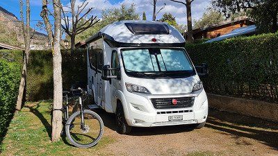
It is Sunday April 10th, 2022 . The morning is still cool, but the day will be beautiful and sunny with a pleasant 16 degrees. As before every tour, I first drive in our BMWi3 at eight o'clock in thirty minutes from my home in Basel am Rhein (1) 30 kilometers south to Zullwil in the Solothurn Jura. There, directly below the ruins of Gilgenberg (2) from the 12th century, is our Bürstner Ixeo in its place in the garage (3).
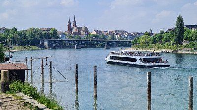
It is Sunday April 10th, 2022 . The morning is still cool, but the day will be beautiful and sunny with a pleasant 16 degrees. As before every tour, I first drive in our BMWi3 at eight o'clock in thirty minutes from my home in Basel am Rhein (1) 30 kilometers south to Zullwil in the Solothurn Jura. There, directly below the ruins of Gilgenberg (2) from the 12th century, is our Bürstner Ixeo in its place in the garage (3).
At nine o'clock I start the tour with the aim of
this day the first of two parts of the way to that
driving in the Mediterranean. The chosen route leads me first
on country roads over green and yellow blooming Jura heights,
from then on on the motorway only past Montbéliard and
Besançon, then through picturesque Burgundy near Beaune,
passing Chalon-sur-Saône, Mâcon and Lyon through the
beautiful Rhône valley to La Roche-de-Glun. moderate traffic,
no traffic jams or construction sites allow me a pleasant,
stress-free and quick journey. Three times I raced a half
Hour on the most beautifully situated "Aire de ..." at the
French motorways, but refrain from sightseeing
on road. I ride a total of 545 kilometers (of which 441
kilometers of motorway) and needed seven hours for it
the breaks. Around four o'clock I reach mine as planned
Daily goal and move into the camping car park
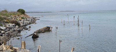
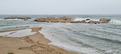
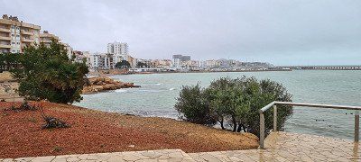
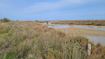
on the outskirts of La Roche-du-Glun. I go for a walk in the evening
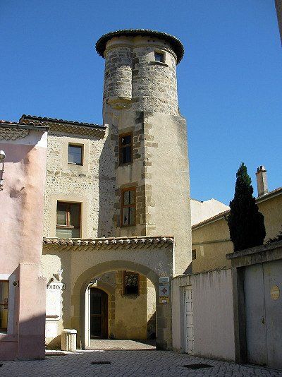
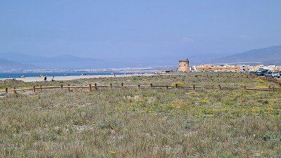
to the center of La Roche-de-Glun to the Mairie (1), to
Tower of Diane of Poitiers (2), through the gate after
Roussillon (3), to the dam with a small hydroelectric power station
with a view of the place (4) and along the Rhône Promenade (5)
back to the pitch (6-7). The place itself does not offer
a lot of interesting things and also has a great effect on me
extinct. As in many places today, these are small
Communities deserted on Sundays, so not a single restaurant was open. However, it was very beautiful along the
Walk along the Rhône promenade.
●●○○○ Day of transit. Safely at the destination.
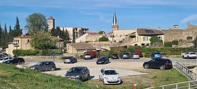
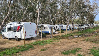
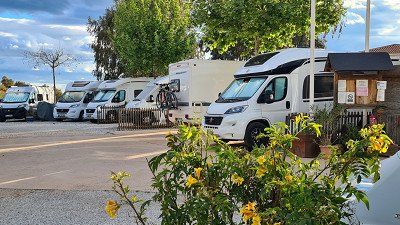
I found La Roche-de-Glun as a stage destination on the Camping-Car Park website. This company calls itself " the 1st European network of stopover sites and services areas" and includes 350 pitches throughout France. The organization largely meets my needs because (a) the current occupancy is visible online in an app, (b) the pitches are mostly located close to town, are spacious and well-kept, (c) the use is very inexpensive with electricity included and ( d) the pitches are accessible at all times thanks to the access card. The fact that there are no sanitary facilities doesn't bother me, the space with a power connection is enough for me. I read about this facility in advance of the tour and immediately bought the necessary access card. It worked for me, because in the end I spent a good half of all nights on this tour at Camping-Car Park sites and I would not go to just two of these twenty sites.
Wikipedia states that La Roche-de-Glun has 3,333 inhabitants and is picturesquely situated on a river island in the Rhône
in the Drôme department in the Auvergne-Rhône-Alpes region
lies. Sights are: The dam with small
Hydroelectric power station on the Rhône, the Tower of Diane de Poitiers from the 14th century (monument historique), the gateway to Roussillon and the gate wall (relic of the city wall) from the 13th and 14th centuries.


At nine o'clock I start the tour with the aim of
this day the first of two parts of the way to that
driving in the Mediterranean. The chosen route leads me first
on country roads over green and yellow blooming Jura heights,
from then on on the motorway only past Montbéliard and
Besançon, then through picturesque Burgundy near Beaune,
passing Chalon-sur-Saône, Mâcon and Lyon through the
beautiful Rhône valley to La Roche-de-Glun. moderate traffic,
no traffic jams or construction sites allow me a pleasant,
stress-free and quick journey. Three times I raced a half
Hour on the most beautifully situated "Aire de ..." at the
French motorways, but refrain from sightseeing
on road. I ride a total of 545 kilometers (of which 441
kilometers of motorway) and needed seven hours for it
the breaks. Around four o'clock I reach mine as planned
Daily goal and move into the camping car park
on the outskirts of La Roche-du-Glun. I go for a walk in the evening
to the center of La Roche-de-Glun to the Mairie (1), to
Tower of Diane of Poitiers (2), through the gate after
Roussillon (3), to the dam with a small hydroelectric power station
with a view of the place (4) and along the Rhône Promenade (5)
back to the pitch (6-7). The place itself does not offer
a lot of interesting things and also has a great effect on me
extinct. As in many places today, these are small
Communities deserted on Sundays, so not a single restaurant was open. However, it was very beautiful along the
Walk along the Rhône promenade.
●●○○○ Day of transit. Safely at the destination.
I found La Roche-de-Glun as a stage destination on the Camping-Car Park website. This company calls itself " the 1st European network of stopover sites and services areas" and includes 350 pitches throughout France. The organization largely meets my needs because (a) the current occupancy is visible online in an app, (b) the pitches are mostly located close to town, are spacious and well-kept, (c) the use is very inexpensive with electricity included and ( d) the pitches are accessible at all times thanks to the access card. The fact that there are no sanitary facilities doesn't bother me, the space with a power connection is enough for me. I read about this facility in advance of the tour and immediately bought the necessary access card. It worked for me, because in the end I spent a good half of all nights on this tour at Camping-Car Park sites and I would not go to just two of these twenty sites.
Wikipedia states that La Roche-de-Glun has 3,333 inhabitants and is picturesquely situated on a river island in the Rhône
in the Drôme department in the Auvergne-Rhône-Alpes region
lies. Sights are: The dam with small
Hydroelectric power station on the Rhône, the Tower of Diane de Poitiers from the 14th century (monument historique), the gateway to Roussillon and the gate wall (relic of the city wall) from the 13th and 14th centuries.
It's Monday April 11, 2022. The night was cool,
the day is mostly cloudy and windy with a high of 13 degrees.
Today I drive the second part of the way to the Mediterranean Sea.
This only takes me further on the Autobahn
the Rhône Valley past Nîmes and then on the delightful
Languedocienne along the sea past Montpellier
and Narbonne to Port la Nouvelle. After 328 kilometers,
with moderate traffic and three and a half hours more entertaining
and pleasant driving time, I reach the shortly after noon
selected parking space from Camping-Car Park on the outskirts of
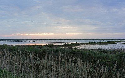
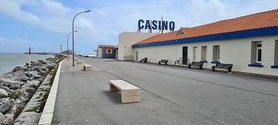
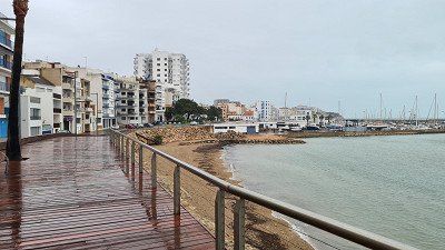
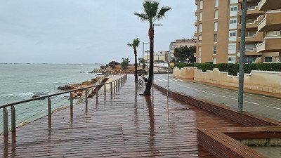
Port La Nouvelle. Later in the afternoon I'll take the
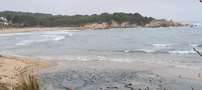
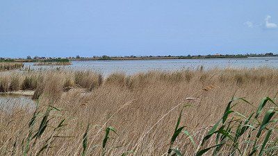
Bike a bit along the Réserve Naturelle Régionale de
Sainte-Lucie (1-2), to the beach (3), to the harbor with the casino
(4) and in the Center ville of Port la Nouvelle (4-8) and
back to the pitch (9). The place seems outside of the
Quite deserted season, especially seen on the mostly
closed shutters in the seaside resorts.
●●○○○ Day of transit. Safely at the destination.
According to Wikipedia, Port-la-Nouvelle has 5,686 inhabitants
in the Aude department in the Occitania region. The community
is both a transshipment port for oil and grain and a
Bathing resort with 13 kilometers of sandy beaches. In addition, the
touristically significant Canal de la Robine here in the Mediterranean Sea.
Port-la Nouvelle also includes the island of Sainte-Lucie
north of the town and the island of La Nadière in the Étang de
Bages-Sigean with a former fishing village. The well-known hiking trail “Sentier cathare” also starts in the village
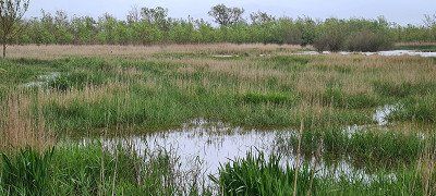
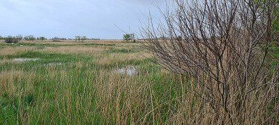
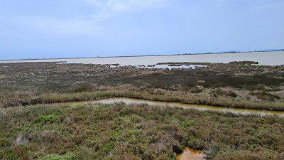
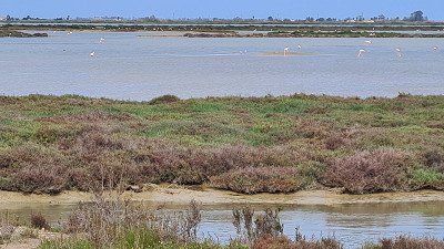
Port la Nouvelle to Foix. Nothing worth seeing is mentioned about the place itself. The Sainte-Lucie Regional Nature Reserve was classified in 2009, occupies an area of
825 hectares and protects the island of Sainte-Lucie as well as the
Wetlands and river beaches. The nature reserve
consists of two sectors through the Robine Canal
are separated: the western sector corresponds to the island
Sainte-Lucie, the pond of Bages-Sigean from the pond of
Ayrolle separates. The eastern sector is an area with lagoons,
Wetlands and beaches between the island and the
Mediterranean Sea. The highest elevation at 39 meters is enclosed
Roc Saint Antoine. The lock of Sainte-Lucie allows
the transition from one sector to another.

It's Monday April 11, 2022. The night was cool,
the day is mostly cloudy and windy with a high of 13 degrees.
Today I drive the second part of the way to the Mediterranean Sea.
This only takes me further on the Autobahn
the Rhône Valley past Nîmes and then on the delightful
Languedocienne along the sea past Montpellier
and Narbonne to Port la Nouvelle. After 328 kilometers,
with moderate traffic and three and a half hours more entertaining
and pleasant driving time, I reach the shortly after noon
selected parking space from Camping-Car Park on the outskirts of
Port La Nouvelle. Later in the afternoon I'll take the
Bike a bit along the Réserve Naturelle Régionale de
Sainte-Lucie (1-2), to the beach (3), to the harbor with the casino
(4) and in the Center ville of Port la Nouvelle (4-8) and
back to the pitch (9). The place seems outside of the
Quite deserted season, especially seen on the mostly
closed shutters in the seaside resorts.
●●○○○ Day of transit. Safely at the destination.
According to Wikipedia, Port-la-Nouvelle has 5,686 inhabitants
in the Aude department in the Occitania region. The community
is both a transshipment port for oil and grain and a
Bathing resort with 13 kilometers of sandy beaches. In addition, the
touristically significant Canal de la Robine here in the Mediterranean Sea.
Port-la Nouvelle also includes the island of Sainte-Lucie
north of the town and the island of La Nadière in the Étang de
Bages-Sigean with a former fishing village. The well-known hiking trail “Sentier cathare” also starts in the village
Port la Nouvelle to Foix. Nothing worth seeing is mentioned about the place itself. The Sainte-Lucie Regional Nature Reserve was classified in 2009, occupies an area of
825 hectares and protects the island of Sainte-Lucie as well as the
Wetlands and river beaches. The nature reserve
consists of two sectors through the Robine Canal
are separated: the western sector corresponds to the island
Sainte-Lucie, the pond of Bages-Sigean from the pond of
Ayrolle separates. The eastern sector is an area with lagoons,
Wetlands and beaches between the island and the
Mediterranean Sea. The highest elevation at 39 meters is enclosed
Roc Saint Antoine. The lock of Sainte-Lucie allows
the transition from one sector to another.
It's Tuesday, April 12, 2022. The night stayed again
cool at 9 degrees, the day is dry but unfortunately also mostly
cloudy at 14 degrees. I have a shorter route for today
planned, because the first nature park awaits at the destination
Trip. I leave at nine o'clock and need 143
Kilometers of mostly country roads two and a half hours
driving time. The path leads along the Mediterranean coast
Perpignan, Port Vendres and Roses to Sant Pere Pescador.
There is little traffic again and the journey goes quickly
through the beautiful, now very Mediterranean landscape. Both
I cross the border from the foothills of the Pyrenees to the sea
of Spain. Since the Parc Natural dels Aiguamolls de l'Empordà near Sant Pere Pescator is my destination for the day, I don't go there
on sightseeing. Meet at Las Palmeras campsite
me just before noon. The place is well chosen, it is obvious
of place and sights, has spacious parking spaces
on lawn, clean sanitary facilities, a pool, a small one
Mercado and a restaurant. I'll be with you in the afternoon
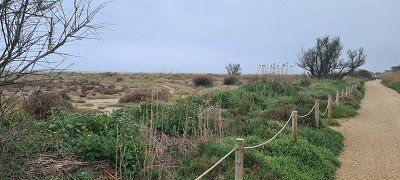
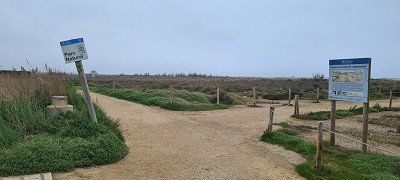
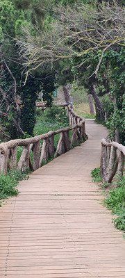
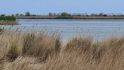
cycled the 10 kilometers north to the nature park
and went on a half-hour walk through the Parc
Natural dels Aiguamolls de l'Empordà (1-4) Insight into a
very nice nature reserve can take a real
remarkable natural landscape. With the bike I'm the one
10 kilometers back and another 15 kilometers south
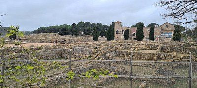
drove to the Ruïnes de Empúries (5-8) and also visited the archaeological site and the harbor pier on a short walk. This visit was also worthwhile. On the way back to the campsite I stopped and shopped in Sant Pere Pescator (9-11).
●●●●○ Attractive coastal roads, beautiful nature park, interesting archaeological site and good campsite.
The municipality of Sant Pere Pescador has 2'039 inhabitants
in the Autonomous Region of Catalonia in the province of Girona and
in the comarca Alt Empordà and lives from tourism and the
Agriculture (apple cultivation). For the place mentions Wikipedia
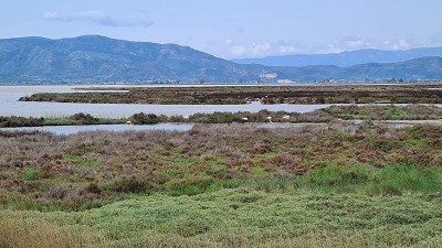
nothing worth seeing. The Parc Natural dels Aiguamolls de
l'Empordà is located in the confluence of the rivers Muga and
Fluvià in the Bay of Roses on the Costa Brava of Catalonia. The nature park extends over the protected areas of Estanys
(Fish weirs, cattails and meadows), Llaunes (lagoons at
the coast) and the island of Caramyany (in the middle of the river Fluvià with
large bird life) and covers 4,783 hectares. The Ruïnes de Empúries are witnesses of an ancient Greek colony that dates back to a trading post in 600 BC
goes. The archaeological three-part park with museum and
Hafenmole consists of the earliest "old town", the
Greek-Iberian new town and the Roman municipal town.
It's Tuesday, April 12, 2022. The night stayed again
cool at 9 degrees, the day is dry but unfortunately also mostly
cloudy at 14 degrees. I have a shorter route for today
planned, because the first nature park awaits at the destination
Trip. I leave at nine o'clock and need 143
Kilometers of mostly country roads two and a half hours
driving time. The path leads along the Mediterranean coast
Perpignan, Port Vendres and Roses to Sant Pere Pescador.
There is little traffic again and the journey goes quickly
through the beautiful, now very Mediterranean landscape. Both
I cross the border from the foothills of the Pyrenees to the sea
of Spain. Since the Parc Natural dels Aiguamolls de l'Empordà near Sant Pere Pescator is my destination for the day, I don't go there
on sightseeing. Meet at Las Palmeras campsite
me just before noon. The place is well chosen, it is obvious
of place and sights, has spacious parking spaces
on lawn, clean sanitary facilities, a pool, a small one
Mercado and a restaurant. I'll be with you in the afternoon
cycled the 10 kilometers north to the nature park
and went on a half-hour walk through the Parc
Natural dels Aiguamolls de l'Empordà (1-4) Insight into a
very nice nature reserve can take a real
remarkable natural landscape. With the bike I'm the one
10 kilometers back and another 15 kilometers south
drove to the Ruïnes de Empúries (5-8) and also visited the archaeological site and the harbor pier on a short walk. This visit was also worthwhile. On the way back to the campsite I stopped and shopped in Sant Pere Pescator (9-11).
●●●●○ Attractive coastal roads, beautiful nature park, interesting archaeological site and good campsite.
The municipality of Sant Pere Pescador has 2'039 inhabitants
in the Autonomous Region of Catalonia in the province of Girona and
in the comarca Alt Empordà and lives from tourism and the
Agriculture (apple cultivation). For the place mentions Wikipedia
nothing worth seeing. The Parc Natural dels Aiguamolls de
l'Empordà is located in the confluence of the rivers Muga and
Fluvià in the Bay of Roses on the Costa Brava of Catalonia. The nature park extends over the protected areas of Estanys
(Fish weirs, cattails and meadows), Llaunes (lagoons at
the coast) and the island of Caramyany (in the middle of the river Fluvià with
large bird life) and covers 4,783 hectares. The Ruïnes de Empúries are witnesses of an ancient Greek colony that dates back to a trading post in 600 BC
goes. The archaeological three-part park with museum and
Hafenmole consists of the earliest "old town", the
Greek-Iberian new town and the Roman municipal town.
It is Wednesday April 13, 2022. During the night it has
at 8 degrees it started to rain, during the day it rained continuously
stopped and the temperature did not rise above 14 degrees. as
Today's goal I have chosen a nature park again,
those in the mouth of the Ebro. The way of 330
Kilometers, largely on freeways leads me past
Girona, Barcelona and Tarragona to L'Eucaliptus/Amporta.
Despite some heavy rain along the Costa Brava and Costa
Daurado, but moderate traffic, hardly any construction sites and none
I make good progress in traffic jams and need a good three and a half
hours driving time. Shortly after noon I get the last one
Pitch at Camping Ampolla Playa in L'Ampolla,
which I got when I called the day before
(fully booked due to Easter approaching). I'm a good one then
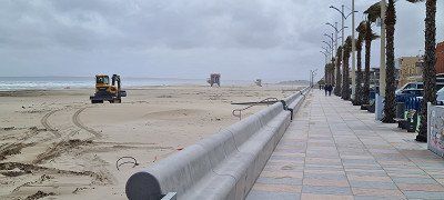
half hour on the coastal promenade (1-4) to Ampolla
walked and I was looking for a shelter due to the weather
and found what I was looking for in the Can Pinana restaurant at the port.
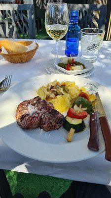
Their lenguado a la plancha was very good. After return on
but I decided to leave the campsite. Although I could accept that he fully
and also unkempt, but then it got extreme
noisy, the place was slowly running under water and so was the electricity
still failed. I called around and got a seat
found on the other side of the delta. And so am in the evening
30 kilometers further to the Eucaliptus campsite on the
Playa of the place of the same name L'Eucaliptus/Amporta.
The decision was right, because this campsite was indeed
also fully occupied, but was closer to the nature park and had
also have a modern but well-maintained infrastructure
with pool, mercado and restaurant and I also got one
Premium pitch with sea view. I then finish the day with a walk to the dunes behind the
campsite (5-9) and a glass of red wine in the restaurant
let it fade away. The dunes were worth seeing, but because
Floods only partially accessible.
●●●○○ Spanish-Mediterranean cuisine and ultimately beautiful
Pitch directly at the dunes.
Wikipedia. L'Ampolla is a Catalan municipality. It has 3,280 inhabitants and is located in the province of Tarragona in northeastern Spain or in the comarca of Baix Ebre at the northern end of the Ebro Delta. Nothing worth seeing is mentioned. L'E ukaliptus/Amporta is a small bathing settlement with a beautiful beach and a district of the Ebro Delta, whose main town, Amposta, with 20,738 inhabitants, mainly cultivates rice. In addition to the nature park, the suspension bridge over the Ebro and the remains of a medieval castle are also worth seeing in the Ebro Delta. The extensive Ebro delta with the lagoons of Tancada and l'Encanyissada as well as the rice fields in the canal-crossed delta landscape are ideal for hiking. The water springs and swamps are also worth seeing.
It is Wednesday April 13, 2022. During the night it has
at 8 degrees it started to rain, during the day it rained continuously
stopped and the temperature did not rise above 14 degrees. as
Today's goal I have chosen a nature park again,
those in the mouth of the Ebro. The way of 330
Kilometers, largely on freeways leads me past
Girona, Barcelona and Tarragona to L'Eucaliptus/Amporta.
Despite some heavy rain along the Costa Brava and Costa
Daurado, but moderate traffic, hardly any construction sites and none
I make good progress in traffic jams and need a good three and a half
hours driving time. Shortly after noon I get the last one
Pitch at Camping Ampolla Playa in L'Ampolla,
which I got when I called the day before
(fully booked due to Easter approaching). I'm a good one then
half hour on the coastal promenade (1-4) to Ampolla
walked and I was looking for a shelter due to the weather
and found what I was looking for in the Can Pinana restaurant at the port.
Their lenguado a la plancha was very good. After return on
but I decided to leave the campsite. Although I could accept that he fully
and also unkempt, but then it got extreme
noisy, the place was slowly running under water and so was the electricity
still failed. I called around and got a seat
found on the other side of the delta. And so am in the evening
30 kilometers further to the Eucaliptus campsite on the
Playa of the place of the same name L'Eucaliptus/Amporta.
The decision was right, because this campsite was indeed
also fully occupied, but was closer to the nature park and had
also have a modern but well-maintained infrastructure
with pool, mercado and restaurant and I also got one
Premium pitch with sea view. I then finish the day with a walk to the dunes behind the
campsite (5-9) and a glass of red wine in the restaurant
let it fade away. The dunes were worth seeing, but because
Floods only partially accessible.
●●●○○ Spanish-Mediterranean cuisine and ultimately beautiful
Pitch directly at the dunes.
Wikipedia. L'Ampolla is a Catalan municipality. It has 3,280 inhabitants and is located in the province of Tarragona in northeastern Spain or in the comarca of Baix Ebre at the northern end of the Ebro Delta. Nothing worth seeing is mentioned. L'E ukaliptus/Amporta is a small bathing settlement with a beautiful beach and a district of the Ebro Delta, whose main town, Amposta, with 20,738 inhabitants, mainly cultivates rice. In addition to the nature park, the suspension bridge over the Ebro and the remains of a medieval castle are also worth seeing in the Ebro Delta. The extensive Ebro delta with the lagoons of Tancada and l'Encanyissada as well as the rice fields in the canal-crossed delta landscape are ideal for hiking. The water springs and swamps are also worth seeing.
It is Wednesday April 14, 2022. It was at night
still cool with 9 degrees, but the rain let up and the
Day became sunny and warmer up to 19 degrees. the morning
I dedicated myself to taking care of the camper and myself.
In the afternoon I have a three-hour bike tour
undertaken by the Parc Natural del Delta de l'Ebre and
multiple stops and short walks at well-located viewing platforms (1-9) inserted. On the way between two of these visits I came across an inconspicuous country estate. The mariscos and the paella in the local one
Taverna La Tancada are highly recommended. I am in the evening
walked back to the dunes at the campsite (10-11).
●•••• The species-rich bird life in a lagoon landscape that is really worth seeing and for culinary enjoyment of Mediterranean specialties.
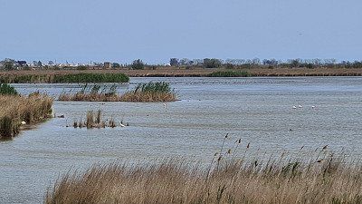
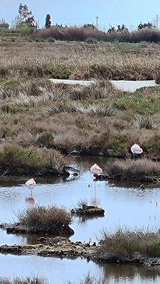
According to Wikipedia, the Parc Natural del Delta de l'Ebre
Alluvium area at its mouth in the Mediterranean Sea
and is located in the Ebro Delta in southern Catalonia. The park is
next to the national park Coto de Donana the most important
Wetland in Spain and, with 32,500 hectares , is one of the largest deltas in the world, along with those of the Rhône and Po
European Mediterranean coast. A third of the delta was
assigned to the nature park in 1983, a species-rich breeding
and resting area for many species of birds and wintering area
of migratory birds from Northern Europe. Around 300 different ones
native bird species, migratory birds and flamingos are here too
see. Today the ecosystem is threatened by blue crab and
Louisiana Cancer.

It is Wednesday April 14, 2022. It was at night
still cool with 9 degrees, but the rain let up and the
Day became sunny and warmer up to 19 degrees. the morning
I dedicated myself to taking care of the camper and myself.
In the afternoon I have a three-hour bike tour
undertaken by the Parc Natural del Delta de l'Ebre and
multiple stops and short walks at well-located viewing platforms (1-9) inserted. On the way between two of these visits I came across an inconspicuous country estate. The mariscos and the paella in the local one
Taverna La Tancada are highly recommended. I am in the evening
walked back to the dunes at the campsite (10-11).
●•••• The species-rich bird life in a lagoon landscape that is really worth seeing and for culinary enjoyment of Mediterranean specialties.
According to Wikipedia, the Parc Natural del Delta de l'Ebre
Alluvium area at its mouth in the Mediterranean Sea
and is located in the Ebro Delta in southern Catalonia. The park is
next to the national park Coto de Donana the most important
Wetland in Spain and, with 32,500 hectares , is one of the largest deltas in the world, along with those of the Rhône and Po
European Mediterranean coast. A third of the delta was
assigned to the nature park in 1983, a species-rich breeding
and resting area for many species of birds and wintering area
of migratory birds from Northern Europe. Around 300 different ones
native bird species, migratory birds and flamingos are here too
see. Today the ecosystem is threatened by blue crab and
Louisiana Cancer.
It's Good Friday, April 15, 2022. The nights stay
unchanged cool at 10 degrees, the days are sunny again and
are slowly getting warmer up to 20 degrees. I originally
with Futura in the hinterland of Murcia the next stopover
chosen. I had to give up this goal because the two places
occupied at the thermal baths in Fortuna because of Easter or
were no longer in operation. Since I have the only alternative, the
Campsite in the Sierra Espuña cannot be reached by phone
I decided to skip the goal
and straight to the next destination, the Parque Natural de Cabo de
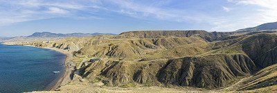
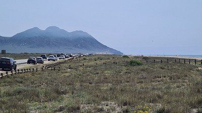
to drive Gata-Níjar. I'm whole that day
Drove 638 kilometers (555 kilometers on motorways) past Valencia and Alicante to Camping Cabo de Gata
outside the coastal town of the same name, Cabo de Gata.
The drive over the last 250 was particularly impressive
kilometers. I felt like I was almost alone for two hours
to be on the road on a freeway, also past one of the
most impressive landscapes I have seen so far,
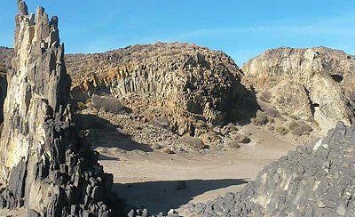
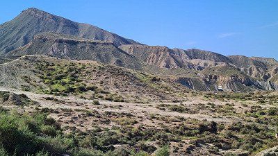
Mediterranean shaped full of Colinas, Ramblas and Barrancos (1-3). Since I'm quite fast again with only moderate traffic
progressed, no visits planned on the way
and only turned on three short stops, I am
after a good eight hours of driving in the late afternoon
Place arrived (I reserved in the morning as a precaution).
The place was then about two-thirds occupied. I have on
Evening walk around the camp
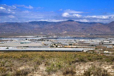
along the countless white greenhouses (4-5).
Taken tomato and the day with a glass of wine
Round off the camp restaurant by the pool.
●●●●○ The last two hours of driving "almost alone on the road through an impressive landscape".
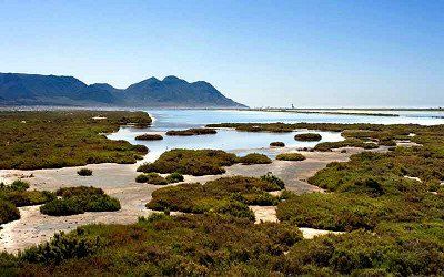
According to Wikivoyage, Cabo de Gata is a place in the province of Almeria in the Cabo de Gata Natural Park. Mentioned as sights are: Faro de Gata lighthouse with views of the Arrecife de las Sirenas rock formations, Iglesia de las Salinas, Torre de San Miguel and the Salinas de Cabo de Gata with vantage points for bird watching.
It's Good Friday, April 15, 2022. The nights stay
unchanged cool at 10 degrees, the days are sunny again and
are slowly getting warmer up to 20 degrees. I originally
with Futura in the hinterland of Murcia the next stopover
chosen. I had to give up this goal because the two places
occupied at the thermal baths in Fortuna because of Easter or
were no longer in operation. Since I have the only alternative, the
Campsite in the Sierra Espuña cannot be reached by phone
I decided to skip the goal
and straight to the next destination, the Parque Natural de Cabo de
to drive Gata-Níjar. I'm whole that day
Drove 638 kilometers (555 kilometers on motorways) past Valencia and Alicante to Camping Cabo de Gata
outside the coastal town of the same name, Cabo de Gata.
The drive over the last 250 was particularly impressive
kilometers. I felt like I was almost alone for two hours
to be on the road on a freeway, also past one of the
most impressive landscapes I have seen so far,
Mediterranean shaped full of Colinas, Ramblas and Barrancos (1-3). Since I'm quite fast again with only moderate traffic
progressed, no visits planned on the way
and only turned on three short stops, I am
after a good eight hours of driving in the late afternoon
Place arrived (I reserved in the morning as a precaution).
The place was then about two-thirds occupied. I have on
Evening walk around the camp
along the countless white greenhouses (4-5).
Taken tomato and the day with a glass of wine
Round off the camp restaurant by the pool.
●●●●○ The last two hours of driving "almost alone on the road through an impressive landscape".
According to Wikivoyage, Cabo de Gata is a place in the province of Almeria in the Cabo de Gata Natural Park. Mentioned as sights are: Faro de Gata lighthouse with views of the Arrecife de las Sirenas rock formations, Iglesia de las Salinas, Torre de San Miguel and the Salinas de Cabo de Gata with vantage points for bird watching.
It's Easter Saturday, April 16th, 2022. The weather is going to be
noticeably to be further south now. The night was with
13 degrees a bit warmer, the day sunny and despite the wind until April 22
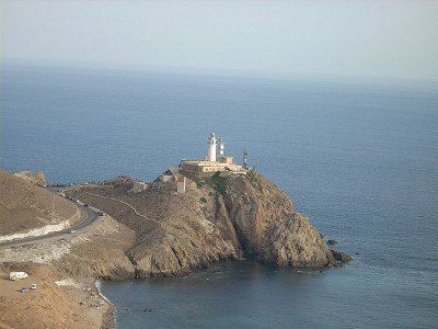
Degrees warm. I explore the west side of the cape in the morning
of the nature park. I first cycle to the center of
Cabo de Gata with the Torreón de San Miguel (1) and then
further along the infinitely long beach in the bay of
Almeria (2) to Faro de Cabo Gata (3) at the southernmost
point of the natural park. On the initially same way back
I stop in the small seaside resort of La Fabriquilla and enjoy it
Restaurante Angelita a bocadillo di tonno marocchino con
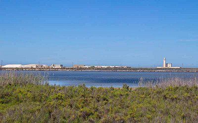
olive and the views across the bay and to the cape. From there I take the route on the
other side of the big lagoon and drive along the
Salinas de Cabo de gata (4-6) and stop several times at the viewing platforms for observing the diverse
bird life were established. The rest of the afternoon and on
In the evening it's "Dolce far niente" and I let my soul go
simply dangle in a Mediterranean atmosphere on the surprisingly quiet campsite (7).
●●●●○ Natural park worth seeing.
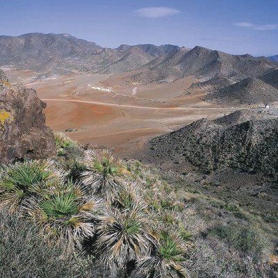
According to Wikipedia, the Parque Natural de Cabo de Gata-Níjar begins immediately after the retort town of Retamar, stretches across the actual Cabo de Gata (Cape of Agate) and ends in front of the port of Carboneras. The coastline is rugged and bounded inland by mountains, the Sierra del Cabo de Gata and the Sierra de la Higuera. The geological origin lies in a strong volcanic activity in the Tertiary, when the Betic Cordillera unfolded. All volcanoes are extinct, but the region is still affected by earthquakes.
It's Easter Saturday, April 16th, 2022. The weather is going to be
noticeably to be further south now. The night was with
13 degrees a bit warmer, the day sunny and despite the wind until April 22
Degrees warm. I explore the west side of the cape in the morning
of the nature park. I first cycle to the center of
Cabo de Gata with the Torreón de San Miguel (1) and then
further along the infinitely long beach in the bay of
Almeria (2) to Faro de Cabo Gata (3) at the southernmost
point of the natural park. On the initially same way back
I stop in the small seaside resort of La Fabriquilla and enjoy it
Restaurante Angelita a bocadillo di tonno marocchino con
olive and the views across the bay and to the cape. From there I take the route on the
other side of the big lagoon and drive along the
Salinas de Cabo de gata (4-6) and stop several times at the viewing platforms for observing the diverse
bird life were established. The rest of the afternoon and on
In the evening it's "Dolce far niente" and I let my soul go
simply dangle in a Mediterranean atmosphere on the surprisingly quiet campsite (7).
●●●●○ Natural park worth seeing.
According to Wikipedia, the Parque Natural de Cabo de Gata-Níjar begins immediately after the retort town of Retamar, stretches across the actual Cabo de Gata (Cape of Agate) and ends in front of the port of Carboneras. The coastline is rugged and bounded inland by mountains, the Sierra del Cabo de Gata and the Sierra de la Higuera. The geological origin lies in a strong volcanic activity in the Tertiary, when the Betic Cordillera unfolded. All volcanoes are extinct, but the region is still affected by earthquakes.
It's Easter Sunday, April 17, 2022. The weather is staying the same
unchanged from the day before, up to 12 degrees at night, sunny during the day
up to 22 degrees. I intend to do the east side today, in the morning
of the Natural Park of Cabo de Gata and then
my next goal, to drive to the Sierra Nevada. First leads
me my way to San José and a viewpoint that allows the view of the cape and its beaches (1). At the
later in the morning I'll drive on, but make a note of it
the area for another visit. I take it very much
beautifully landscaped A92 motorway through the Sierra Nevada (2-3)
via Guadix and Grenada to my destination for the day, the campsite
Las Lomas on the Carretera Güéjar-Sierra. For the 246 kilo
meters I need a pure driving time of three hours.
Persistently little traffic but allow a speedy again
Ride, the many stops along the way leave me alone
Reach destination in the early afternoon. I have precautions for
Reserved three nights and put the mobile home on one
nice shady place (4). The campsite is well occupied.
Then I cycle the three kilometers
to Güéjar Sierra. The beautifully situated mountain village (5-9) with
a few old buildings and casas that are worth seeing
bustling with many families at this afternoon
Sunday brunch in the restaurants on the market square. On the
On the way back I enjoy the beautiful views of the nearby
Mountain Landscape (10-11). When I come back, I visit first
the camp's restaurant. It's busy and I have to
waited half an hour for my seat. The filet de
Ternera (12) Tastes great and justifies the wait.
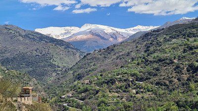
At the beginning of the evening I sit on the camp's own
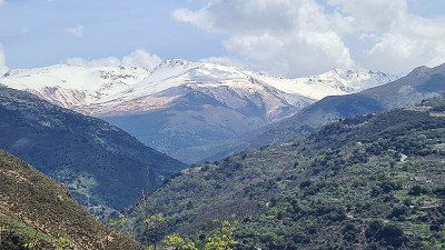
Mirador with again a beautiful view of the reservoir and the snow-capped peaks of the Sierra Nevada (13-14).
●•••• The views of unique landscapes on the Cabo
de Gata and in the Sierra Sierra Nevada.
At Wikipedia, San José is a village in the municipality of Níjar in the
Spanish province of Almería in southern Andalusia. The popular holiday resort is located in the Cabo-de-Gata-Níjar Nature Park on the extreme south-east coast of Spain and has 1,012 inhabitants,
up to 20,000 visitors at times in the summer months. Of the
San José Beach is located on a shallow bay on the Costa de Almería, near the marina. South from
San José is Playa de los Genoveses, a bathing beach
with rocky headlands at each end and the Playa de
Mónsul covered with gray volcanic sand and huge dark boulders of volcanic rock. Both beaches are among the most beautiful in Spain. Portions of numerous films have been shot on both beaches, including Pirates of the Caribbean (2003) and Indiana Jones and the Last Crusade (1989). Above all, nature is still pure here, which also means that in summer you are not allowed to drive your own car to the beach. You can either walk or use the San Jóse shuttle bus to get to the two beaches. In winter, the beaches and numerous bays can again be accessed by car. The municipality of Güéjar-Sierra with 2,820 inhabitants in the province of Granada lies at the foot of the Sierra Nevada at the source of the river Genil. The castle El Castillejo (ruins above the village) as a historical witness was first built by the Romans, then settled by the Moors around 711 and occupied by the Christians in 1491.

It's Easter Sunday, April 17, 2022. The weather is staying the same
unchanged from the day before, up to 12 degrees at night, sunny during the day
up to 22 degrees. I intend to do the east side today, in the morning
of the Natural Park of Cabo de Gata and then
my next goal, to drive to the Sierra Nevada. First leads
me my way to San José and a viewpoint that allows the view of the cape and its beaches (1). At the
later in the morning I'll drive on, but make a note of it
the area for another visit. I take it very much
beautifully landscaped A92 motorway through the Sierra Nevada (2-3)
via Guadix and Grenada to my destination for the day, the campsite
Las Lomas on the Carretera Güéjar-Sierra. For the 246 kilo
meters I need a pure driving time of three hours.
Persistently little traffic but allow a speedy again
Ride, the many stops along the way leave me alone
Reach destination in the early afternoon. I have precautions for
Reserved three nights and put the mobile home on one
nice shady place (4). The campsite is well occupied.
Then I cycle the three kilometers
to Güéjar Sierra. The beautifully situated mountain village (5-9) with
a few old buildings and casas that are worth seeing
bustling with many families at this afternoon
Sunday brunch in the restaurants on the market square. On the
On the way back I enjoy the beautiful views of the nearby
Mountain Landscape (10-11). When I come back, I visit first
the camp's restaurant. It's busy and I have to
waited half an hour for my seat. The filet de
Ternera (12) Tastes great and justifies the wait.
At the beginning of the evening I sit on the camp's own
Mirador with again a beautiful view of the reservoir and the snow-capped peaks of the Sierra Nevada (13-14).
●•••• The views of unique landscapes on the Cabo
de Gata and in the Sierra Sierra Nevada.
At Wikipedia, San José is a village in the municipality of Níjar in the
Spanish province of Almería in southern Andalusia. The popular holiday resort is located in the Cabo-de-Gata-Níjar Nature Park on the extreme south-east coast of Spain and has 1,012 inhabitants,
up to 20,000 visitors at times in the summer months. Of the
San José Beach is located on a shallow bay on the Costa de Almería, near the marina. South from
San José is Playa de los Genoveses, a bathing beach
with rocky headlands at each end and the Playa de
Mónsul covered with gray volcanic sand and huge dark boulders of volcanic rock. Both beaches are among the most beautiful in Spain. Portions of numerous films have been shot on both beaches, including Pirates of the Caribbean (2003) and Indiana Jones and the Last Crusade (1989). Above all, nature is still pure here, which also means that in summer you are not allowed to drive your own car to the beach. You can either walk or use the San Jóse shuttle bus to get to the two beaches. In winter, the beaches and numerous bays can again be accessed by car. The municipality of Güéjar-Sierra with 2,820 inhabitants in the province of Granada lies at the foot of the Sierra Nevada at the source of the river Genil. The castle El Castillejo (ruins above the village) as a historical witness was first built by the Romans, then settled by the Moors around 711 and occupied by the Christians in 1491.
It's Easter Monday, April 18th, 2022. The weather is staying the same today
very, constant on a clear night with 12 degrees and lots of sun
Day with up to 22 degrees. I want to use the day today to
to explore the magnificent mountains around Güéjar-Sierra. the
However, the recommendations received on site and on the Internet were not
all three or more hour hikes, which I like
would have walked, but currently due to current foot problems
are too long for me. So based on the card I have a good
One and a half hour round trip. am around noon
I then also started at the campsite and as the first
walked up the opposite slope (1). I came
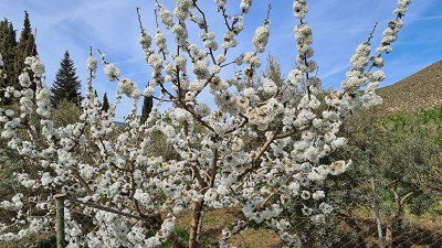
past blossoming fruit trees (2) and had again and again
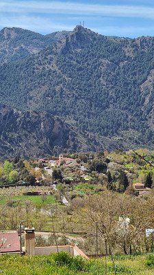
a look back at the beautifully situated campsite (3).
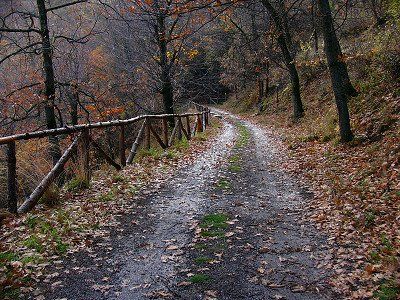
After crossing the slope, the path led me back down through the forest (4) in the direction of Güéjar-Sierra. had before me
I always have views of the beautiful mountains of the Sierra
Nevada (5). Just before the village, found himself back on the road
a contemporary witness, a restored relic for the water supply
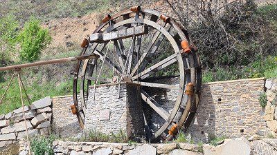
earlier time (6) to marvel at. Then after another
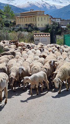
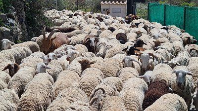
At the turn I suddenly saw about 300 goats and sheep
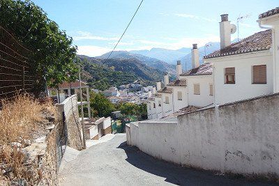
towards their alpine ascension (7-8). Soon I was in the village of Güéjar-Sierra and it was now going down steeply (9) towards the market square,
from which, after a short rest, I tackled the road back to the campsite. Towards evening it was heart-
liable self-sufficiency (10) announced before it me because of
the special view (11) again for part of the evening
moved to the Mirador. I will for sure come back to this place
drive, then especially in the hope of at least one of the
to be able to go on hikes.
●●●●● Close to nature and eventful day.
Opened in 1999, the Parque Nacional de Sierra Nevada protects part of the Sierra Nevada, covers an area of 86,208 hectares and is representative of the medium and high mountain ranges of the Mediterranean Sea. With Mulhacén 3480 m and the Veleta peak 3396 m, the highest mountains of the Iberian Peninsula are here. Winters are cold and summers are warm and dry. The Sierra Nevada National Park is known for its rich flora with numerous endemic species and the Iberian ibex. Wikipedia.


It's Easter Monday, April 18th, 2022. The weather is staying the same today
very, constant on a clear night with 12 degrees and lots of sun
Day with up to 22 degrees. I want to use the day today to
to explore the magnificent mountains around Güéjar-Sierra. the
However, the recommendations received on site and on the Internet were not
all three or more hour hikes, which I like
would have walked, but currently due to current foot problems
are too long for me. So based on the card I have a good
One and a half hour round trip. am around noon
I then also started at the campsite and as the first
walked up the opposite slope (1). I came
past blossoming fruit trees (2) and had again and again
a look back at the beautifully situated campsite (3).
After crossing the slope, the path led me back down through the forest (4) in the direction of Güéjar-Sierra. had before me
I always have views of the beautiful mountains of the Sierra
Nevada (5). Just before the village, found himself back on the road
a contemporary witness, a restored relic for the water supply
earlier time (6) to marvel at. Then after another
At the turn I suddenly saw about 300 goats and sheep
towards their alpine ascension (7-8). Soon I was in the village of Güéjar-Sierra and it was now going down steeply (9) towards the market square,
from which, after a short rest, I tackled the road back to the campsite. Towards evening it was heart-
liable self-sufficiency (10) announced before it me because of
the special view (11) again for part of the evening
moved to the Mirador. I will for sure come back to this place
drive, then especially in the hope of at least one of the
to be able to go on hikes.
●●●●● Close to nature and eventful day.
Opened in 1999, the Parque Nacional de Sierra Nevada protects part of the Sierra Nevada, covers an area of 86,208 hectares and is representative of the medium and high mountain ranges of the Mediterranean Sea. With Mulhacén 3480 m and the Veleta peak 3396 m, the highest mountains of the Iberian Peninsula are here. Winters are cold and summers are warm and dry. The Sierra Nevada National Park is known for its rich flora with numerous endemic species and the Iberian ibex. Wikipedia.
It is Tuesday April 19, 2022. The weather remains today
still constant, during the day the sun shows itself with 23 degrees. A change in the weather is then predicted for the following days. For this
me the actually planned hikes in the national park
are not possible, I intend to go to Granada as an alternative
to visit. Shortly before ten o'clock I take the 390 bus, which runs every hour and stops right at the campsite, and that
takes me to Granada in forty minutes. From Paseo de
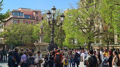
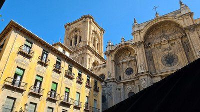
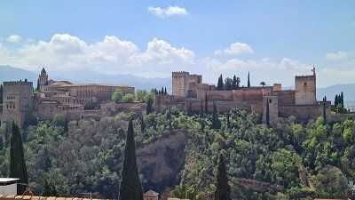
los Basilios I walk first to the old town of Granada (1-8) and
admire the squares and the architecture. I continue to stroll through the pedestrian zones before I leave shortly after noon
Way up take to Mirador San Nicolás. The view of the
opposite Alhambra (9), but also down to the
The city of Granada (10) is unique and definitely worth the
short but steep ascent to the Mirador. In the restaurant
I sweep Estrellas de San Nicolás near Plaza San Nicolás
and spontaneously select "Huevos revueltos con
gambas", a Spanish speciality. I have no regrets.
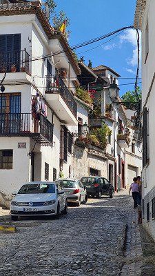
The walk now leads me through the picturesque quarter
Albaicin (11-13) back down to the new town of Granada.
At one of the busy plazas (14) there are still people around in the evening
an aperitif before heading to the bus stop that will take me
then brings him back to the campsite around eight in the evening.
●●●●● The uniquely beautiful view from the Mirador San Nicolás and the historic district of Albaicin, which is well worth seeing.
According to Wikipedia, Granada is the capital of the city of the same name
Province, located in a metropolitan area of the Vega de Granada
and counts 232'462 inhabitants, mostly in processing
agricultural products or work in tourism.
Granada is one of the largest educational institutions in Spain
w ith 60,000 students . Albaicin is the oldest part of the city
and goes back in its origin to late antiquity,
pre-Moorish settlement of Illiberis, with remains of walls on a
Settlement already closed in Iberian and Roman times
to let. The district is located on one of the three ridges
on which the city of Granada was built, overlooking the
Alhambra. Not only because of this well-known view, but
also because of the many alleys between the predominantly
white houses, Albaicín is one of the sights
of the city and has been a UNESCO World Heritage Site since 1994.

It is Tuesday April 19, 2022. The weather remains today
still constant, during the day the sun shows itself with 23 degrees. A change in the weather is then predicted for the following days. For this
me the actually planned hikes in the national park
are not possible, I intend to go to Granada as an alternative
to visit. Shortly before ten o'clock I take the 390 bus, which runs every hour and stops right at the campsite, and that
takes me to Granada in forty minutes. From Paseo de
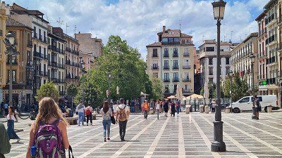
los Basilios I walk first to the old town of Granada (1-8) and
admire the squares and the architecture. I continue to stroll through the pedestrian zones before I leave shortly after noon
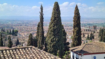
Way up take to Mirador San Nicolás. The view of the
opposite Alhambra (9), but also down to the
The city of Granada (10) is unique and definitely worth the
short but steep ascent to the Mirador. In the restaurant
I sweep Estrellas de San Nicolás near Plaza San Nicolás
and spontaneously select "Huevos revueltos con
gambas", a Spanish speciality. I have no regrets.
The walk now leads me through the picturesque quarter
Albaicin (11-13) back down to the new town of Granada.
At one of the busy plazas (14) there are still people around in the evening
an aperitif before heading to the bus stop that will take me
then brings him back to the campsite around eight in the evening.
●●●●● The uniquely beautiful view from the Mirador San Nicolás and the historic district of Albaicin, which is well worth seeing.
According to Wikipedia, Granada is the capital of the city of the same name
Province, located in a metropolitan area of the Vega de Granada
and counts 232'462 inhabitants, mostly in processing
agricultural products or work in tourism.
Granada is one of the largest educational institutions in Spain
w ith 60,000 students . Albaicin is the oldest part of the city
and goes back in its origin to late antiquity,
pre-Moorish settlement of Illiberis, with remains of walls on a
Settlement already closed in Iberian and Roman times
to let. The district is located on one of the three ridges
on which the city of Granada was built, overlooking the
Alhambra. Not only because of this well-known view, but
also because of the many alleys between the predominantly
white houses, Albaicín is one of the sights
of the city and has been a UNESCO World Heritage Site since 1994.
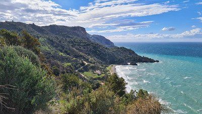
It's Wednesday. April 20, 2022. The weather in the mountains
has turned over. Sleet falls at night at 3 degrees, early in the morning it is wet and cold, the campsite is overcast, full of fog (1). So I decided not to go on the planned trip
through the hinterland of Andalusia to the Parque Nacional
Sierra de las Nieves and alternatively drive back to the Mediterranean Sea
to Motril and then when the weather is sunny again along the
Much described coastal road N340 (2) to El Rincon de
la Victoria near Malaga. Arrived there around noon
I get it at Camper Area El Rincon (3) in the district of Torre
de Benagalbón one of the last pitches. It is a
small, narrow but functional pitch of the Aeras group
Autocaravanes Andalucia with electricity, small sanitary facilities
and small Mercado. In the evening the place is fully occupied.
I drove 165 kilometers. of which 62 kilometers to Motril,
then 103 kilometers on the mentioned coastal road. I was
with short stops at some vantage points
A good four hours along the coast road. on
I refrained from viewings, because my goal was now
Visit Málaga in the afternoon. And so am shortly after
Arrive at the campsite about a kilometer to
Walked to the bus stop 163, which then took me to 40
minutes to the port of Málaga. I have only with the
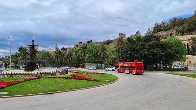
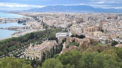
Hip on Hip off Zweistöcker (4) made a tour,
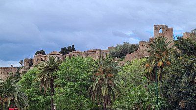
which also took me to the Mirador near the castle
Brought Gibralfaro from which I had the wonderful view of the
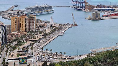
city (5) and the harbor (6). Afterward
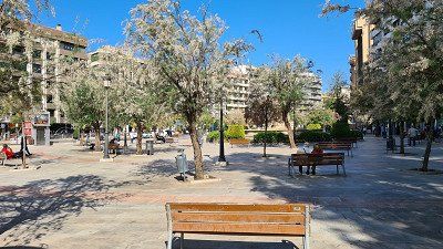
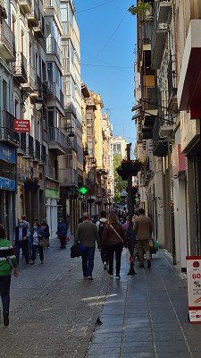
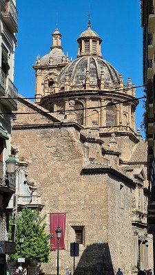
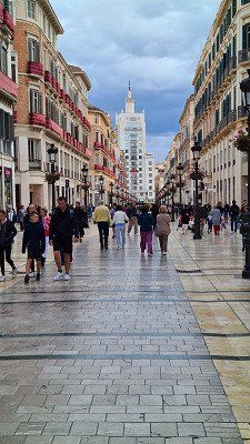
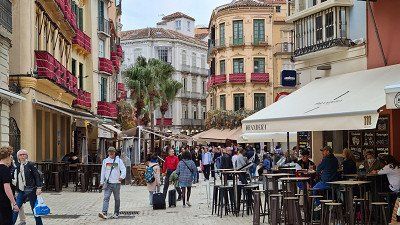
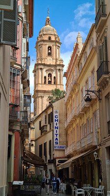
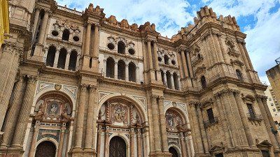
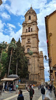
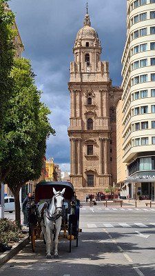
I'm strolling through the old town of Málaga (7-10), to
Alcazaba (11) and to the Cathedral of Sanata Iglesia (12-14).
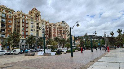
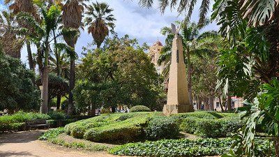
To finish I'm still beautiful by the one along the bay
located Parque de Málaga (15) walked back to the port,
from where the bus will pick me up again in forty minutes
brought back to the campsite at eight o'clock.
●●●●○ The view of Málaga from Mirador Gibralfaro.
I read on Wikipedia that Malaga is the second largest city in
Andalusia is and sixth largest city in Spain, it ranks
594,654 inhabitants and has one of the largest Spanish
Airports, a commercial port and a university. Malaga is
one of the most important holiday destinations in Spain because of its climate on the Costa del Sol and also a city of art and culture
countless museums. Also worth seeing are the Catedral de la
Encarnación, the Bishop's Palace, the Moorish Fortress
Alcazaba, the Castle of Gibralfaro, the Paseo
del Parque de Málaga, a botanical garden on the promenade
nade with 30,000 square meters and more parks and
Investments. Picasso's birthplace is also in Málaga .
It's Wednesday. April 20, 2022. The weather in the mountains
has turned over. Sleet falls at night at 3 degrees, early in the morning it is wet and cold, the campsite is overcast, full of fog (1). So I decided not to go on the planned trip
through the hinterland of Andalusia to the Parque Nacional
Sierra de las Nieves and alternatively drive back to the Mediterranean Sea
to Motril and then when the weather is sunny again along the
Much described coastal road N340 (2) to El Rincon de
la Victoria near Malaga. Arrived there around noon
I get it at Camper Area El Rincon (3) in the district of Torre
de Benagalbón one of the last pitches. It is a
small, narrow but functional pitch of the Aeras group
Autocaravanes Andalucia with electricity, small sanitary facilities
and small Mercado. In the evening the place is fully occupied.
I drove 165 kilometers. of which 62 kilometers to Motril,
then 103 kilometers on the mentioned coastal road. I was
with short stops at some vantage points
A good four hours along the coast road. on
I refrained from viewings, because my goal was now
Visit Málaga in the afternoon. And so am shortly after
Arrive at the campsite about a kilometer to
Walked to the bus stop 163, which then took me to 40
minutes to the port of Málaga. I have only with the
Hip on Hip off Zweistöcker (4) made a tour,
which also took me to the Mirador near the castle
Brought Gibralfaro from which I had the wonderful view of the
city (5) and the harbor (6). Afterward
I'm strolling through the old town of Málaga (7-10), to
Alcazaba (11) and to the Cathedral of Sanata Iglesia (12-14).
To finish I'm still beautiful by the one along the bay
located Parque de Málaga (15) walked back to the port,
from where the bus will pick me up again in forty minutes
brought back to the campsite at eight o'clock.
●●●●○ The view of Málaga from Mirador Gibralfaro.
I read on Wikipedia that Malaga is the second largest city in
Andalusia is and sixth largest city in Spain, it ranks
594,654 inhabitants and has one of the largest Spanish
Airports, a commercial port and a university. Malaga is
one of the most important holiday destinations in Spain because of its climate on the Costa del Sol and also a city of art and culture
countless museums. Also worth seeing are the Catedral de la
Encarnación, the Bishop's Palace, the Moorish Fortress
Alcazaba, the Castle of Gibralfaro, the Paseo
del Parque de Málaga, a botanical garden on the promenade
nade with 30,000 square meters and more parks and
Investments. Picasso's birthplace is also in Málaga .
It's Thursday April 21, 2022. The night was pleasant
at 10 degrees, the day will be partly cloudy, partly sunny with up to
16 degrees. I already had problems with the hub the night before
bed and sometimes had to lower it manually to sleep
be able. In the morning the motor system failed completely and I laboriously raised the pull-down bed manually.
I then tried unsuccessfully to go to an authorized dealer
von Bürstner in Málaga to rectify the problem on site
organize and finally decided to break off the tour and drive back home to the home workshop. Around
In order not to have to take the same route as on the way there recently, I chose the slightly longer route via Cordoba, Madrid and Bordeaux and so I am around ten o'clock
departed from Malaga. I still have for the first stretch
no specific destination planned, I wanted to ride as long as I felt comfortable. I have short breaks every two hours-
placed. The ride was also unproblematic with rather moderate
Traffic. So I was progressing briskly and I never felt either
unwell or tired. And so I reached after 1'017 kilometers
(996 kilometers of motorway) and a driving time of almost eleven
Hours around half past nine the French border. I have
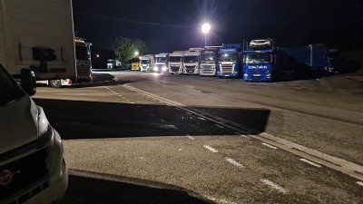
then didn't think twice and drove to the first parking lot after crossing the border in Urrugne and I did
there also found a place to stay (1) between
many trucks and next to a Spanish camper. To the
That night, in an emergency, I also used the seat
bank (the manual process was simply too tedious for me). It
Surprisingly, it went quite well and I didn't sleep too badly on the bench. The route right through
Spain itself, despite the moderate mood, was very
nice to drive. Again and again near or far the
Highway interesting landscapes to linger on
invite and I have noted for another time.
●○○○○ Annoying interruption of the trip, but a good, nice trip.
It's Thursday April 21, 2022. The night was pleasant
at 10 degrees, the day will be partly cloudy, partly sunny with up to
16 degrees. I already had problems with the hub the night before
bed and sometimes had to lower it manually to sleep
be able. In the morning the motor system failed completely and I laboriously raised the pull-down bed manually.
I then tried unsuccessfully to go to an authorized dealer
von Bürstner in Málaga to rectify the problem on site
organize and finally decided to break off the tour and drive back home to the home workshop. Around
In order not to have to take the same route as on the way there recently, I chose the slightly longer route via Cordoba, Madrid and Bordeaux and so I am around ten o'clock
departed from Malaga. I still have for the first stretch
no specific destination planned, I wanted to ride as long as I felt comfortable. I have short breaks every two hours-
placed. The ride was also unproblematic with rather moderate
Traffic. So I was progressing briskly and I never felt either
unwell or tired. And so I reached after 1'017 kilometers
(996 kilometers of motorway) and a driving time of almost eleven
Hours around half past nine the French border. I have
then didn't think twice and drove to the first parking lot after crossing the border in Urrugne and I did
there also found a place to stay (1) between
many trucks and next to a Spanish camper. To the
That night, in an emergency, I also used the seat
bank (the manual process was simply too tedious for me). It
Surprisingly, it went quite well and I didn't sleep too badly on the bench. The route right through
Spain itself, despite the moderate mood, was very
nice to drive. Again and again near or far the
Highway interesting landscapes to linger on
invite and I have noted for another time.
●○○○○ Annoying interruption of the trip, but a good, nice trip.
It's Friday April 22, 2022. The night was pleasant
warm at 13 degrees, the day stayed mostly sunny up to 18 degrees.
Surprisingly, it was still fairly quiet until four o'clock
the many trucks, then began in the parking lot
relatively noisy everyday life and every few minutes one of these boomed
vice of his way. Sleeping was out of the question
and I went to mine shortly before six o'clock
Removed. Already after 20 kilometers the first rest
place and I fell in love with Grande Café and Croissant
cares. I called the shop and they said I
could the camper be delivered the next day at ten o'clock
submit repair. I then considered going to the workshop
nearest camping car park one last intermediate
stop and drive straight to the workshop from there. So
the way led me past Bordeaux, Clemant-Ferrand
and Macon to the beautifully situated camp of Seurre (1).
Driving on the Autobahn was brisk for a long time and became
only on the last 150 kilometers of country roads through it
Burgundy to Macon still quite ponderous. And so I was relieved after having driven 816 kilometers
(of which 645 kilometers of motorway) and nine and a half hours
Driving time around four o'clock in the afternoon to be on the pitch. I'm also glad I didn't arrive too late. So I still had some time, the coarsest dirt from the mobile home
to wash off. I slept on the bench again.
●○○○○ Completed two long journeys without damage.
It is Saturday, April 23, 2022. During the night it starts to close
rain at 10 degrees, in the morning the continuous rain stays at 13
Degree. I get up early again and drive off at seven o'clock on the autobahn to the next service area and my Grand Café
with croissant. The journey to the workshop takes me first through Burgundy, then via Besançon, Montbéliard and Delsberg
to Duggingen. Despite heavy rain, some construction sites and
upcoming heavy traffic I need for the route
of 228 kilometers (152 kilometers of motorway) exactly the
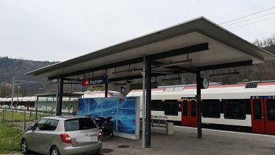
planned three hours driving time. I'm at the workshop at ten o'clock sharp and can solve the problem with the service manager
discuss. He quickly confirms that one of the two electric motors and also the electronic control of the pull-down bed is defective and that you have to order spare parts for the repair. I have to reckon with one to three weeks until the execution and handover of the mobile home. I then walked to the Duggingen train station and took the S-Bahn to our apartment in Basel.
●●●●● Decided to go home. I gave it a lot of thought,
but it was the right decision. We wanted this special
model without fixed beds, but large living room and bathroom.
Now if the only bed doesn't work anymore, that's it
Of course very, very annoying, but not the end of the world either. But it must be professionally repaired immediately
because the manual alternative is simply not justifiable for the time being and can really only be used in an emergency.
It is Saturday, April 23, 2022. During the night it starts to close
rain at 10 degrees, in the morning the continuous rain stays at 13
Degree. I get up early again and drive off at seven o'clock on the autobahn to the next service area and my Grand Café
with croissant. The journey to the workshop takes me first through Burgundy, then via Besançon, Montbéliard and Delsberg
to Duggingen. Despite heavy rain, some construction sites and
upcoming heavy traffic I need for the route
of 228 kilometers (152 kilometers of motorway) exactly the
planned three hours driving time. I'm at the workshop at ten o'clock sharp and can solve the problem with the service manager
discuss. He quickly confirms that one of the two electric motors and also the electronic control of the pull-down bed is defective and that you have to order spare parts for the repair. I have to reckon with one to three weeks until the execution and handover of the mobile home. I then walked to the Duggingen train station and took the S-Bahn to our apartment in Basel.
●●●●● Decided to go home. I gave it a lot of thought,
but it was the right decision. We wanted this special
model without fixed beds, but large living room and bathroom.
Now if the only bed doesn't work anymore, that's it
Of course very, very annoying, but not the end of the world either. But it must be professionally repaired immediately
because the manual alternative is simply not justifiable for the time being and can really only be used in an emergency.
Wednesday. May 18, 2022. Sunny to 28 degrees.
waited The electric motors of the pull-down bed had to be replaced. I have the model without fixed beds with a fold-down bed above the living area, so continuing the trip was not an option. There was - as in many places today - a delay in the delivery of the replacement engines. In all, I had to wait 24 days for the journey to resume.
Driven. 251 km. 146 km of highway. 3h10 driving time. Via Montbéliard and Besançon to Seurre. Problem-free, speedy journey through the well-known lovely landscapes in the Jura and Burgundy. Two short stops at Montbéliard and at a motorway car park. Moderate heavy traffic, few construction sites, no traffic jams.
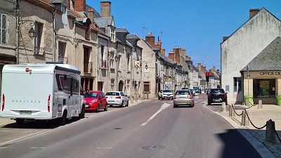
seen on the way. Château and old town Montbéliard within a short walk. Montbéliard is a town of 25,806 inhabitants in the Doubs department of the Bourgogne-Franche-Comté region. In addition to the 13th-century Montbéliard Castle, France's first Lutheran church, Temple Saint-Martin, from 1607 is worth seeing. Wikipedia.
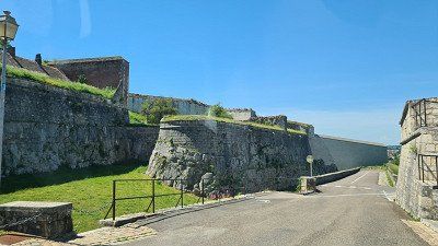
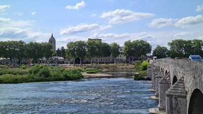
seen on the way. Citadelle and old town of Besançon on a motorhome tour. Not recommended due to the sometimes very narrow streets and alleys in the old town and on the hill of the Citadelle. Besançon is a town of 117,912 inhabitants, administrative center of the Doubs department and seat of the Archdiocese of Besançon. In France's greenest city lies the citadel of Besançon, a masterpiece by Sébastien Le Prestre de Vauban (1633-1707), military engineer of King Louis XIV. The fortification is a historic monument by decree of 1942/1944 and counts together with eleven other constructions by Vauban since 2008 a UNESCO World Heritage Site. Other sights include: Fort Griffon and Fort of Bregille, the birthplace of Victor Hugo. Wikipedia.
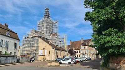
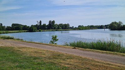
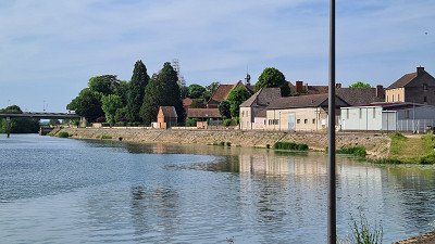
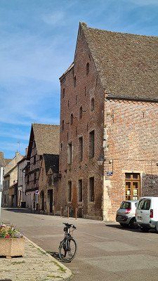
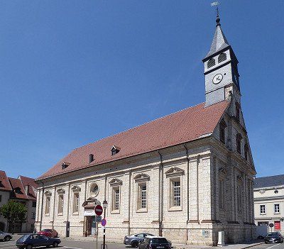
See campsite. Bike tour to the open-air museum, to the old town and along the Sâone. Seurre owes its idyll to the local lock and a small, elongated island in the middle of the Sâone, which allows for the quiet, natural marina and the waterfront promenade. Seurre is a small town with 2,326 inhabitants in the Côte-d'Or department in the Bourgogne-Franche-Comté region. A small marina is idyllically situated on the Saône. Despite an eventful history with destruction, there are still several buildings worth seeing in the old town. The Church of St. Martin is notable for its architecture, organ and carillon. On the outskirts of town there is an open-air museum L'étang rouge with reconstructed old village houses of the Saône valley. Wikipedia.
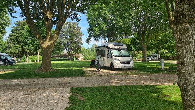
slept. Camping Car Park, Rue de la Perche a l'Oiseau, Seurre. Well located, close to the motorway and the center of Seurre. Beautiful complex with old trees, spacious parking spaces. One tenth occupied. Sanitary facilities closed.
rated. ●●●●○ for resuming the journey and some interesting visits.


Wednesday. May 18, 2022. Sunny to 28 degrees.
waited The electric motors of the pull-down bed had to be replaced. I have the model without fixed beds with a fold-down bed above the living area, so continuing the trip was not an option. There was - as in many places today - a delay in the delivery of the replacement engines. In all, I had to wait 24 days for the journey to resume.
Driven. 251 km. 146 km of highway. 3h10 driving time. Via Montbéliard and Besançon to Seurre. Problem-free, speedy journey through the well-known lovely landscapes in the Jura and Burgundy. Two short stops at Montbéliard and at a motorway car park. Moderate heavy traffic, few construction sites, no traffic jams.
seen on the way. Château and old town Montbéliard within a short walk. Montbéliard is a town of 25,806 inhabitants in the Doubs department of the Bourgogne-Franche-Comté region. In addition to the 13th-century Montbéliard Castle, France's first Lutheran church, Temple Saint-Martin, from 1607 is worth seeing. Wikipedia.
seen on the way. Citadelle and old town of Besançon on a motorhome tour. Not recommended due to the sometimes very narrow streets and alleys in the old town and on the hill of the Citadelle. Besançon is a town of 117,912 inhabitants, administrative center of the Doubs department and seat of the Archdiocese of Besançon. In France's greenest city lies the citadel of Besançon, a masterpiece by Sébastien Le Prestre de Vauban (1633-1707), military engineer of King Louis XIV. The fortification is a historic monument by decree of 1942/1944 and counts together with eleven other constructions by Vauban since 2008 a UNESCO World Heritage Site. Other sights include: Fort Griffon and Fort of Bregille, the birthplace of Victor Hugo. Wikipedia.
See campsite. Bike tour to the open-air museum, to the old town and along the Sâone. Seurre owes its idyll to the local lock and a small, elongated island in the middle of the Sâone, which allows for the quiet, natural marina and the waterfront promenade. Seurre is a small town with 2,326 inhabitants in the Côte-d'Or department in the Bourgogne-Franche-Comté region. A small marina is idyllically situated on the Saône. Despite an eventful history with destruction, there are still several buildings worth seeing in the old town. The Church of St. Martin is notable for its architecture, organ and carillon. On the outskirts of town there is an open-air museum L'étang rouge with reconstructed old village houses of the Saône valley. Wikipedia.
slept. Camping Car Park, Rue de la Perche a l'Oiseau, Seurre. Well located, close to the motorway and the center of Seurre. Beautiful complex with old trees, spacious parking spaces. One tenth occupied. Sanitary facilities closed.
rated. ●●●●○ for resuming the journey and some interesting visits.
Thursday, April 19, 2022. Sunny to 27 degrees.
Driven. 395 km. 341 km of highway. 4h30 driving time. Via Auxerre and Orléans to Vailly-en-Val, past Chablis, my favorite white wine. Speedy journey through Burgundy and the Loire Valley. Moderate traffic but some road works, no congestion but tiring nonetheless. Therefore several short stops at service areas and parking lots.
seen on the way. Due to the countless sights on the route from Seurre to Vailly-En-Val, I have noted the route as a to-do for an autumn trip (vintage). Including Orléans, which I only drove through but couldn't find an adequate parking space. Orléans is a municipality with 116,269 inhabitants in the Center-Val de Loire region, is a university and bishopric with an impressive Sainte-Croix cathedral and an interesting history. You can also see: the old town with the Place du Martroi and the equestrian statue of Joan of Arc , the house in which she lived in 1429, as well as buildings and monuments. Wikipedia.
seen on the way. Basilica of Notre Dame de Cléry-Saint-André, accidentally looking for the right way from Orléans to Château Meung. Notre-Dame de Cléry is a former collegiate church, a minor basilica since 1894 and is considered one of the most important religious buildings with windows in the Flamboyant style. Wikipedia.
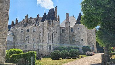
seen on the way. Château and old town of Meung-sur-Loire. The "Loire Castle" is located in the center of Meung-sur-Loire on a small hill 20 km west of Orléans. Originally a medieval castle, the château served as the residence of the Bishops of Orléans from the 12th to the 18th centuries. Occupied by the English during the Hundred Years' War and liberated by Joan of Arc in 1429. Today, furniture from different stylistic eras can be seen in the 21 differently furnished rooms. The commune of Meung-sur-Loirei has 6,540 and is located in the Loiret department of the Centre-Val de Loire region. Wikipedia.
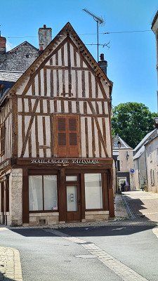
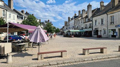
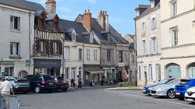
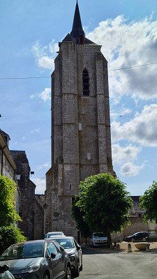
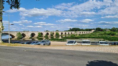
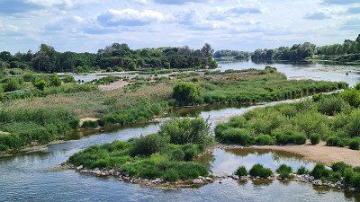
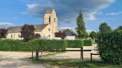
See campsite. Center of Beaugency and Lailly-en-Val and along the Loire riverside promenades on a 2-hour bike ride with short walks. Beaugency is worth seeing thanks to its medieval flair. Beaugency is a neighboring commune of Lailly-en-Valle with 7,339 inhabitants and has some historic monuments around the Place d Saint-Firmin (Wikipedia). Lailly-en-Val is a commune in France with 3,104 inhabitants in the Loiret department in the Centre-Val de Loire region. The municipality belongs to the arrondissement of Orléans and the canton of Beaugency. To see: Saint-Sulpice church from the 16th century, Fonpertuis castle from the 15th century and three other castles (Wikipedia).
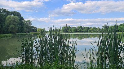
See campsite. Idyllic fish pond in one
half-hour evening walk.
slept. Camping Car Park, Place de l'Eglise, Lailly-en-Val. Beautiful, small complex between the Saint-Sulpice church and a fishpond. About a third full.
rated. ●●●●○ for an eventful day with many impressions gained.


Thursday, April 19, 2022. Sunny to 27 degrees.
Driven. 395 km. 341 km of highway. 4h30 driving time. Via Auxerre and Orléans to Vailly-en-Val, past Chablis, my favorite white wine. Speedy journey through Burgundy and the Loire Valley. Moderate traffic but some road works, no congestion but tiring nonetheless. Therefore several short stops at service areas and parking lots.
seen on the way. Due to the countless sights on the route from Seurre to Vailly-En-Val, I have noted the route as a to-do for an autumn trip (vintage). Including Orléans, which I only drove through but couldn't find an adequate parking space. Orléans is a municipality with 116,269 inhabitants in the Center-Val de Loire region, is a university and bishopric with an impressive Sainte-Croix cathedral and an interesting history. You can also see: the old town with the Place du Martroi and the equestrian statue of Joan of Arc , the house in which she lived in 1429, as well as buildings and monuments. Wikipedia.
seen on the way. Basilica of Notre Dame de Cléry-Saint-André, accidentally looking for the right way from Orléans to Château Meung. Notre-Dame de Cléry is a former collegiate church, a minor basilica since 1894 and is considered one of the most important religious buildings with windows in the Flamboyant style. Wikipedia.
seen on the way. Château and old town of Meung-sur-Loire. The "Loire Castle" is located in the center of Meung-sur-Loire on a small hill 20 km west of Orléans. Originally a medieval castle, the château served as the residence of the Bishops of Orléans from the 12th to the 18th centuries. Occupied by the English during the Hundred Years' War and liberated by Joan of Arc in 1429. Today, furniture from different stylistic eras can be seen in the 21 differently furnished rooms. The commune of Meung-sur-Loirei has 6,540 and is located in the Loiret department of the Centre-Val de Loire region. Wikipedia.
See campsite. Center of Beaugency and Lailly-en-Val and along the Loire riverside promenades on a 2-hour bike ride with short walks. Beaugency is worth seeing thanks to its medieval flair. Beaugency is a neighboring commune of Lailly-en-Valle with 7,339 inhabitants and has some historic monuments around the Place d Saint-Firmin (Wikipedia). Lailly-en-Val is a commune in France with 3,104 inhabitants in the Loiret department in the Centre-Val de Loire region. The municipality belongs to the arrondissement of Orléans and the canton of Beaugency. To see: Saint-Sulpice church from the 16th century, Fonpertuis castle from the 15th century and three other castles (Wikipedia).
See campsite. Idyllic fish pond in one
half-hour evening walk.
slept. Camping Car Park, Place de l'Eglise, Lailly-en-Val. Beautiful, small complex between the Saint-Sulpice church and a fishpond. About a third full.
rated. ●●●●○ for an eventful day with many impressions gained.
Friday 20 May 2022. Partly sunny, partly cloudy. Up to 23 degrees.
Driven. 224 km. 43 km highway. 3h10. Via Chambord, Bois, Tours and Le Mans to Saint-Suzanne. A brisk journey along the Loire, moderate traffic to Tours, then almost alone on the road. Few construction sites.
seen on the way. Round trip through the forest belonging to the chateau (10 km drive through the hunting area alone) and a short walk to Château Chambord and its park. Impressive contemporary witness to the French period of splendor, but also the wealth and excessiveness of the nobility from this era. Château Chambord is the largest castle in the Loire Valley, is located near Blois in an extensive former hunting ground, was built in the first half of the 16th century under King Francis I as a stately hunting lodge and is considered the most magnificent of all Loire castles. Wikipedia.
seen on the way. A short stop and walk along the banks of the Loire near Blois as an example of many idyllic places in the Loire Valley.
seen on the way. Brief stop at Le Mans Cathedral. Le Mans is a city with 143,847 inhabitants and is located at the confluence of the Sarthe and Huisne, is the capital of the Sarthe department in the Pays de la Loire region and is known for its 24-hour race. You can see: historic old town, Gothic Saint-Julien Cathedral and Roman city walls.
See campsite. Evening walk to the château and old town Sainte-Suzanne. The visit is worthwhile. Built on a hill, today it has a well-preserved medieval village and castle character and is rightly considered one of the most beautiful villages in France. The commune of Sainte-Suzanne with 1,282 inhabitants is located in the Mayenne department of the Pays de la Loire region, the château is an 11th century fortified castle, the medieval walled city has been classified as a historic monument since 1862 and that of Guillaume Fouquet de la Varenne dwelling house built in 1613 has been classified. Next to it stands the ruins of Le Donjon de Hubert II de Beaumont, another historic sight. Wikipedia.
slept. Camping Car Park, 15 rue du Camp des Anglais, Sainte Suzanne et Chammes. Well located, right next to the sights. Simple pitches, half occupied.
rated. ●●●●● for a milestone that is really worth seeing.
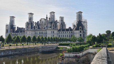
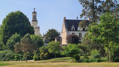
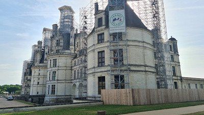
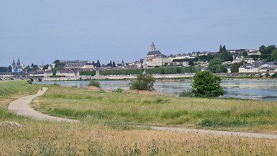
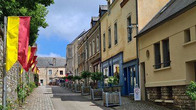
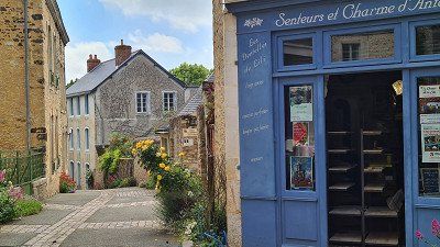
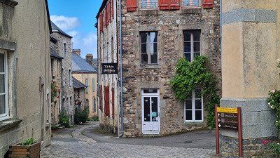
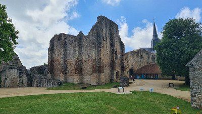
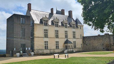
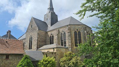
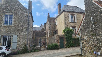
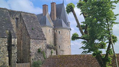
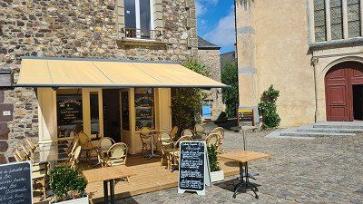
Today I enter my first between Laval and Vitré
Destination, Brittany . Wikipedia says that the
Brittany region as a peninsula in northwestern France
is surrounded by 2,700 kilometers of coastline. This coast draws
stand out because of their diversity: The Côte de Granit Rose
is located in the north of Brittany in the Côtes-
d'Armor and extends over 30 kilometers from Plestin-les-
Greves to Louannec. The pink granite is very rare
and only found in three other places on earth: Ontario in
Canada, Corsica and China. One of the most characteristic and
The most famous headland in Brittany is the wild Pointe du
Raz in the southwest, rising 70 meters above the sea.
The panorama over the wild Atlantic has always been an inspiration
the French authors Victor Hugo and Gustave Flaubert.
In the distance you can see the small island of Sein amidst numerous
richer lighthouses, including the famous Ar Men. To the rough
The landscape of the Pointe du Raz is formed by the white sandy beaches
and green islands of the Gulf of Morbihan contrast.
The Gulf of Morbihan is one connected to the Atlantic
Inland sea with 42 green islands in southern Brittany
Department of Morbihan. The coast is as diverse as it is
the more than 800 small and large islands that make up Brittany
surround. Some of them are: Île-de-Bréhat (Island of Flowers);
Île de Batz (tropical garden); Ouessant (most western island of the
mainland France); Île-Molène (Archipelago of Molène,
wild paradise with beaches of white sand and reefs);
Glénan Islands (archipelago with paradisiacal landscapes like
in tropical countries); Belle-Île (natural harbours, beautiful small coves, fine sand beaches, dunes and cliffs with numerous coastal caves); Ile aux Moines; Sept Îles (page
1912 Nature Reserve for Rare Bird Species). The "villes et
pays d'Art et d'Histoire” were awarded by the French Ministry of
sterium for its cultural and historical heritage. In a joint charter, they are committed to preserving and promoting this heritage, including Brittany's cities: Dinan,
Nantes, Rennes, Concarneau, Fougeres, Quimper, Vannes,
Vitré (Ille et Vilaine) and Saint Malo. In Brittany are over
There are 6,000 megaliths and 1,000 dolmens to be found, the largest concentration of 3,000 stones is in Carnac. the
Brittany is a western French region. It exists today
from the departments of Côtes-d'Armor, Finistère, Ille-et-Vilaine
and Morbihan. The region measures 27'208 square kilometers and 3'354'854 inhabitants (Bretons) lived here in 2019. Rennes is
Capital city. The department of Loire-Atlantique, part of the historic
ric Brittany, but not equal to the administrative region
Naming counts was used in the creation of the regions in the
Sixties together with the original Breton
Capital Nantes split off from the rest of Brittany. the
Brittany is the largest peninsula in France and the westernmost foothills of mainland Europe north of the Iberian
Peninsula. The Gauls called it Aremorica, "land by the sea".
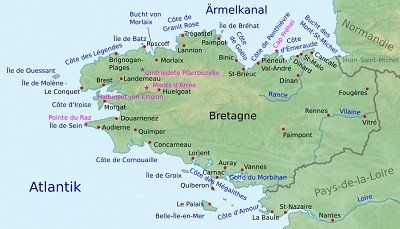
Saturday. May 21, 2022. Sunny to 27 degrees.
Driven. 224 km. 82 km of highway. 3h20. Via Laval, Rennes, Monteneuf to Rochefort-en-Terre. Trouble-free, speedy driving on country roads, some of which are alternatives to the motorway, and in beautifully situated locations, past a few charming villages with the charm of Brittany. Lots of traffic up to Rennes, from Rennes almost alone on the road.
seen on the way. Old town Laval during a walk along the banks of the Mayenne. The town of Laval has 49,733 inhabitants and is the seat of the prefecture of the Mayenne department. You can see: Sainte Trinité Cathedral and Laval Castle. Wikipedia.
seen on the way. Menhirs from Monteneuf on a half-hour walk through the forest. The contemporary witnesses and the reconstructive drawings are impressive and worth seeing. The Monteneuf menhirs in the Paimpont forest in the Morbihan department are made of reddish slate and were probably destroyed in the year 1000 and only discovered in 1989 as a result of forest fires. 420 menhirs on seven hectares were uncovered, 42 of which were re-erected in their original location. The stone row is a monument historique. Menhir is a prehistoric, towering block of stone (Menhir) that served as a landmark, hearthstone, memorial stone, or road marking. A dolmen is a tomb built of blocks of stone (megaliths).
See campsite. Château Rochefort-en-Terre and Rochefort-en-Terre old town in an evening walk with many places to stop. The visit is only recommended. The village in particular looks like an intact open-air museum with its very well-preserved and restored half-timbered and half-timbered buildings. Rochefort-en-Terre is a commune with 641 inhabitants in the Morbihan department in the Brittany region and is one of the most beautiful villages in France. You can see: Grand Rue with some medieval houses, Notre-Dame de la Tronchaye collegiate church from the 12th century and Rochefort castle ruins from the 13th century. Wikipedia.
slept. Camping Sites & Paysages au Gre des Vents, Chemin de Bogeais 2, Rochefort en Terre. Nice well located deposit with pool and clean sanitary facilities. Spacious pitches, half occupied.
rated. ●●●●● for the many impressions on another well-chosen travel day.
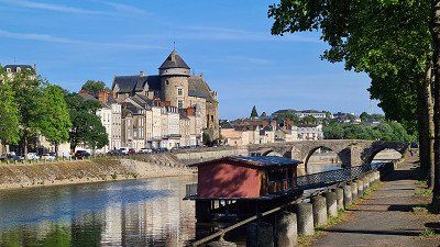
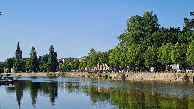
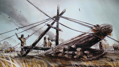
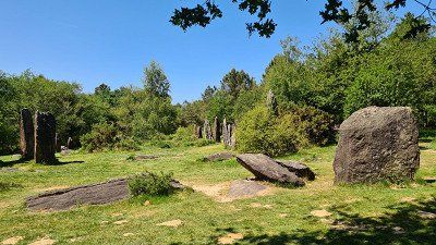
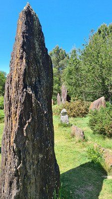
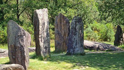
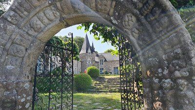
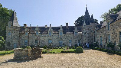
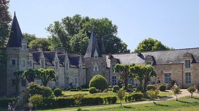
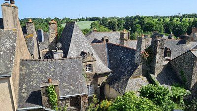
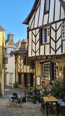
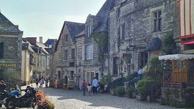
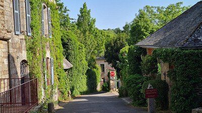
Sunday. 22 May 2022. Cloudy to sunny. Up to 26 degrees.
Groomed. The front of the mobile home was cleaned and washed from insects in the morning. Stubborn and labor intensive.
See campsite. Bike tour in the afternoon around the campsite via Questembert, Pluherlin, the Etang Moulin neuf and back via Rochefort-en Terre to the campsite with many stops and visits. Little traffic, country roads that are easy to drive on, but in some towns they are in a questionable condition. It's a pity that the market hall in Questembert was closed because of a small comptoir and the Etang Moulin neuf pond is now a much-visited "leisure park". The municipality of Questembert (Breton: Kistreberzh) with 7,862 inhabitants in the Morbihan department of Brittany, where in 888 King Alain the Great together with the Count of Rennes Judicael defeated the Normans in battle. To see: the Saint-Pierre church and the market hall, 56 meters long, 16 meters wide and built in 1675 in oak. The hall consists of a single nave with 17 cross braces. The Saint-Gentien Church (1902) and the 15th-century Château de Talhouët are located in the municipality of Pluherlin with 1,532 inhabitants in the Morbihan department. Wikipedia.
slept. Camping Sites & Paysages au Gré des Vents as the day before
rated. ●●●○○ for a good impression of the villages and fields in Brittany.
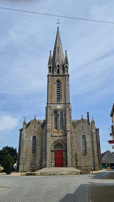
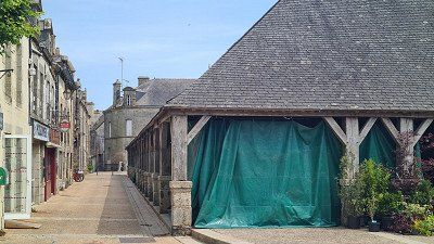
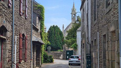
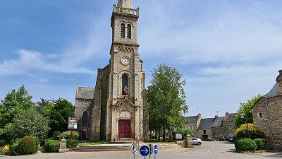
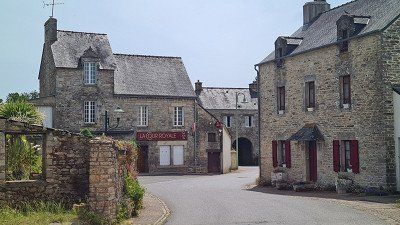
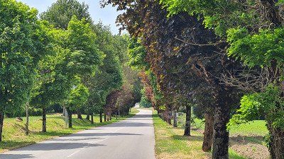
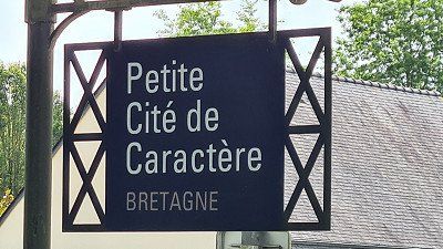
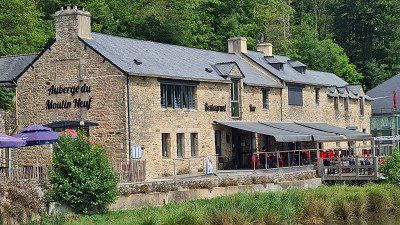
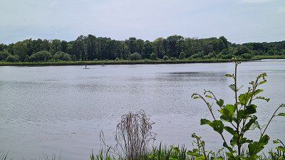
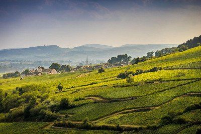
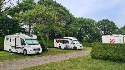
Monday. May 23, 2022. Cloudy and windy. Up to 23 degrees.
Driven. 86 km. On country roads. 1h30 driving time. Via Vannes and Auray to Carnac. Relatively brisk journey with sometimes heavy traffic, characterized by the typical landscapes of Brittany.
seen on the way. Old town of Vannes on a 3 hour walk with many sightseeing stops. An absolute must when visiting Brittany. The old town and the preserved city wall are worth seeing as described. With 53,719 inhabitants, Vannes is the capital of the Morbihan department in the Brittany region. The city is part of the Golfe du Morbihan Regional Nature Park. The entire cityscape is worth seeing, but especially the city wall and the wash house. Also worth seeing: the cathedral, Château de l'Hermine, town hall on Place Maurice-Marchais. Wikipedia.
seen on the way. Old town of Auray on a 2 hour walk with many sightseeing stops and lunch at Bistrot des Halles. Very touristy, but worth seeing for me was the area around the Pont de Saint-Goustan with its alleys. Auray is a commune with 14,141 inhabitants in the Morbihan department of the Brittany region and a popular tourist destination. Worth seeing in town is the triangular Place de la République in the upper town with half-timbered houses and the town hall built in 1882. The Saint-Gildas church from 1641 is a monument historique. Wikipedia.
See campsite. Old town and port of Carnac on a one-hour bike tour. You can feel the flair of a more exclusive tourist resort on the Atlantic near the Gulf of Morbihan. Carnac is a commune with 4,236 inhabitants in the Morbihan department in the Brittany region. It is located on the Côte des Mégalithes and is famous for its more than 3,000 menhirs grouped into rows of stones. The climatically stable southern coast of Brittany, with its many bays and sandy beaches, has been popular with the French since the 1920s, and since the 1960s other Europeans have also come to visit the many prehistoric sites. Wikipedia.
slept. Camping les Druides, 55 Chemin de Beaumer, Carnac. Nice complex with pool and clean sanitary facilities. Slightly more expensive due to the great location. Spacious pitches, about half occupied.
rated. ●●●●● for historically impressive images.
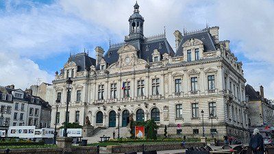
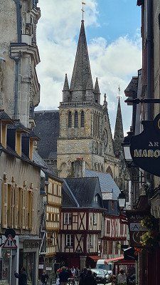
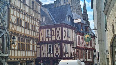
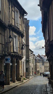
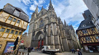
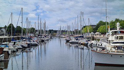
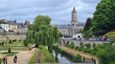
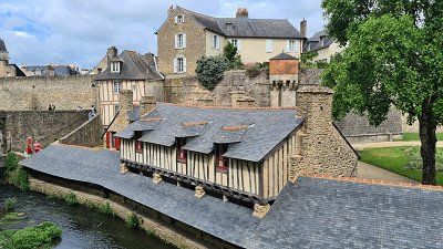
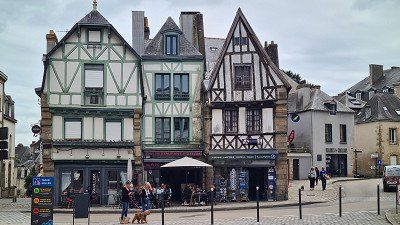
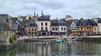
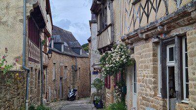
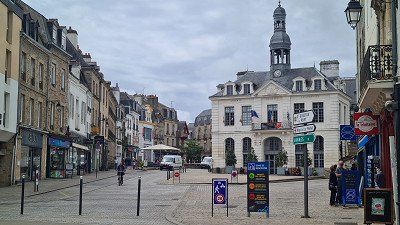
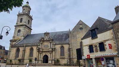
Tuesday. 24 May 2022. Mostly sunny, cool wind. Up to 20 degrees.
See campsite. The Grand Menhir Brisé, the fishing village of Locmariaquer on the Gulf of Morbihan and the Carnac stone series on an extended bike tour with many stops and walks for many individual visits. A small but fine complex shows the originally 20 meter high Grand Menhir Brisé, a single grave Tumulus d'Er and a mass grave Dolmen de la Table des Marchand, including a visitor center and video with everything worth knowing about the cult of megaliths. The layout impressed me almost even more than the three-kilometre drive along the Carnac stone ridges. In my opinion, the latter are most impressive in the middle part of Kermario. Culinary: No visit to Brittany without Huîtres (Entrée) et Moules au Roquefort (Principal), enjoyed in L'Escale right on the sea in the idyllic port of Locmariaquer. The Grand Menhir Brisé near Locmariaquer is the largest known menhir in the world. The municipality of Locmariaquer with 1,552 inhabitants is best known for its impressive monuments from the megalithic period. Composed of three groups, Kerlescan, Kermario and Le Menec, the Carnac stone series are over three kilometers long and originally contained over 3000 stones ranging in height from 0.5 to 4.0 m. The largest stones are at the west end. The original length was probably eight kilometers and included the monuments of Le Petit Menec, St. Barbe and Kerzerho and stretched from Crac'h to Plouharnel. Wikipedia.
slept. Camping les Druides, like the day before.
rated. ●●●●● for a simply great eventful day.
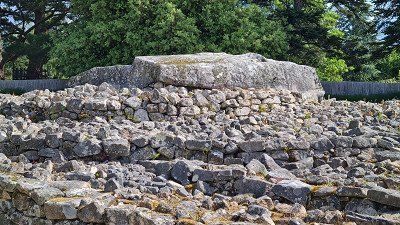
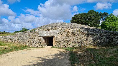
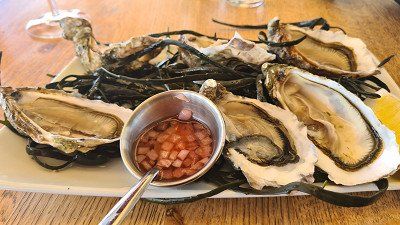
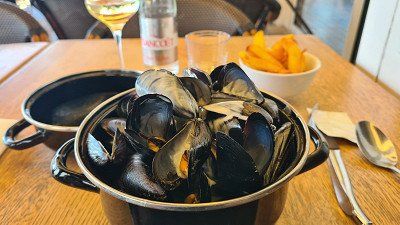
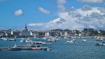
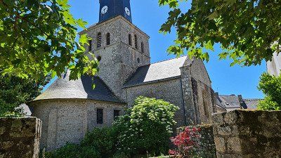
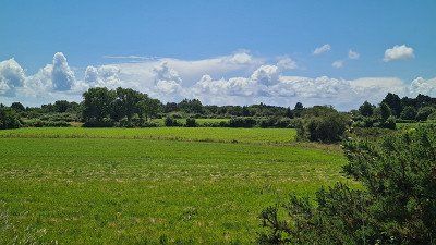
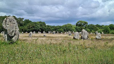
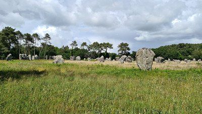
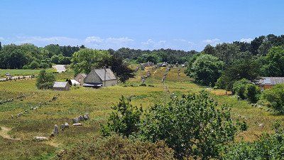
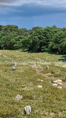
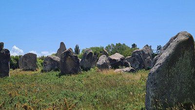
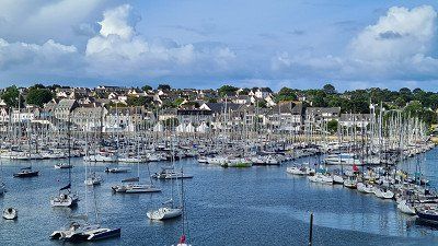
Wednesday. May 25, 2022. Cloudy, partly drizzle. Up to 18 degrees.
See campsite. The Cote Sauvage, dune parks and the port district of Port-Haliguen on an extended bike tour across the long Quiberon peninsula with several walks along the coast and at individual vantage points in the wide dune landscape. Worth seeing is the small nature park at Pointe de Goulvars and along Port-Haliguen with its lighthouse. I did without Quiberon and the Belle-Île-en-Mer (too many people and too stormy sea). Culinary: Very good John Dory in L'Atlantic right on the harbor in Port-Haliguen. On the way home, we briefly visited the Benedictine Abbey of Saint-Anne de Kergonan and the Eglise Saint-Cornély in Carnac. Quiberon with its port city of the same name and 4,658 inhabitants is a peninsula in the Morbihan department and lives from fishing and tourism. You can see: Château Turpault and the harbor with a view of the Côte Sauvage and the offshore Belle-Île-en-Mer. Wikipedia.
slept. Camping les Druides, like the day before.
rated. ●●●●○ for beautiful walks in impressive coastal and dune landscapes of a special promontory.
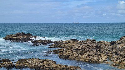
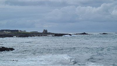
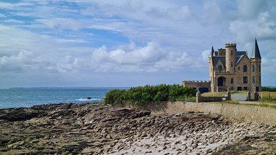
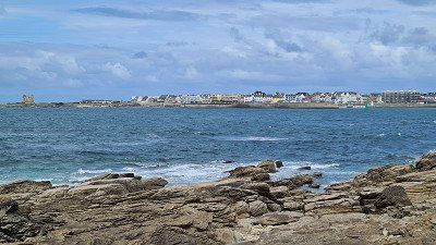
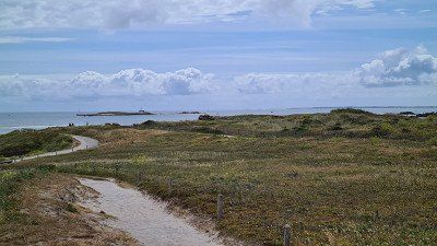
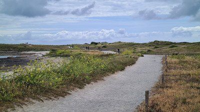
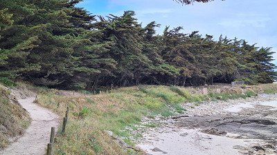
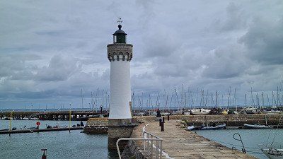
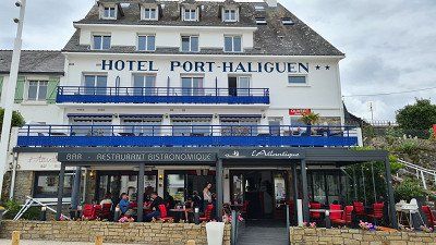
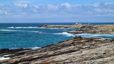
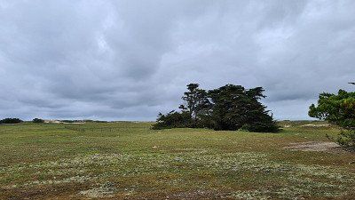
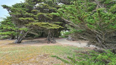
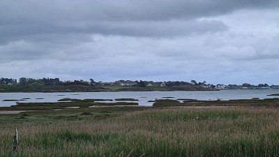
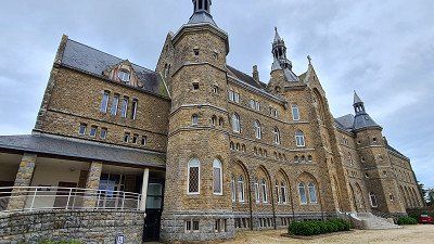
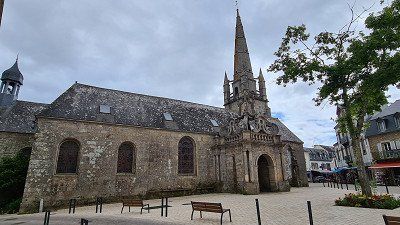
Driveway. 26 May 2022. Cloudy, partly sunny. Up to 17 degrees.
Driven. 97 km. 1h30 driving time. Via Hennebont, past Lorient to Port-Aven. Beautiful route on coastal roads through villages and fields. Heavy holiday traffic, but no heavy traffic and no construction sites. Brief stop in Hennebont at the abbey, but full because of the market and drove on. Lorient left out.
See campsite. Extended walk through the artists' village, the harbor and through the parks along the canal. Pont-Aven is rightly ranked among the most beautiful villages in France and is always worth a visit. The Bois d'Armour park is recommended, with information boards at the places where Paul Gauguin painted. I'm not an art connoisseur, but in the countless galleries today you see little that compares to the masters of their craft. Pont -Aven is a municipality with 2,821 inhabitants in the FinisPont-tère department of the Brittany region and is located in Cornouaille at the beginning of the Aven estuary in the Atlantic. Worth seeing in the well-known and idyllic artists' village are the Musée de Pont-Aven and the surrounding menhirs of Kerangosquer, the Allée couverte of Coat Luzuen, the Allée couverte of Moulin René and the rock tombs Tombeaux des Geants. Wikipedia.
slept. Camping Car Park, Rue Louis Lomenech, Pont Aven. Simple, practical parking space. Well located walking distance to the center. Fully occupied (driveway).
rated. ●●●●○ for a "picturesque" tour of the village despite the slowly beginning tourist crowds.
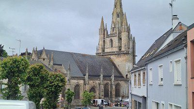
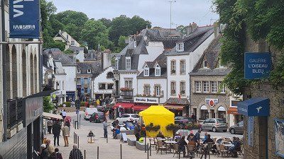
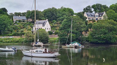
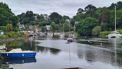
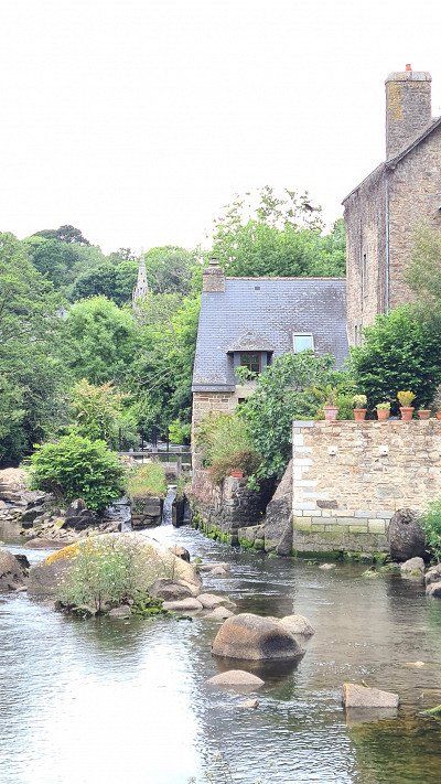
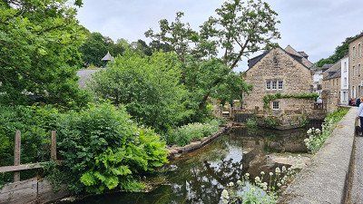
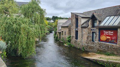
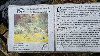
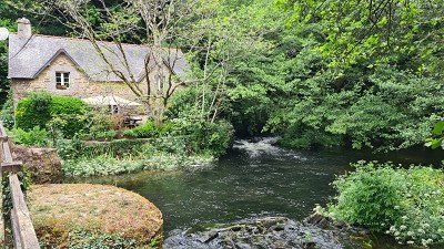
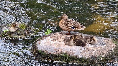
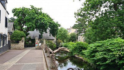
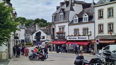
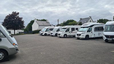
Friday. May 27, 2022. Cloudy. Up to 19 degrees.
See campsite. Many landscape pictures of Brittany on the bike tour from Pont-Aven via Nervez to Concarneau and back again, partly on country roads, partly on cycle paths. The old town "Ville close", the fortress walls, the harbour, the small but fine market "des Halles" and the Friday market of the traveling traders on a long walk. The well-preserved fortress with the shops and restaurants in the old houses is worth seeing, even if it naturally attracts masses of tourists. Concarneau is a commune in the arrondissement of Quimper and in the department of Finistère, belongs to the historical region of Cornouaille and has 19,816 inhabitants. A tour of the city wall offers beautiful insights into the streets and views of the harbors and the new town. The Ville close is situated on an island in the harbor bay and is completely surrounded by fortress walls. Within the walls there are souvenir shops, small restaurants and a fishing museum. If you move away from the battlements and alleys, then new treasures are revealed in the fishing port or on the beaches. Wikipedia.
slept. Camping Car Park, Pont Aven. Like yesterday.
rated. ●●●●○ for the historical landmark.
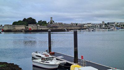
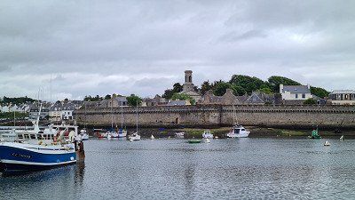
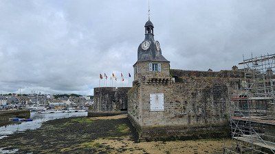
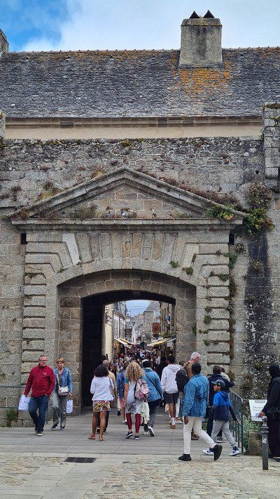
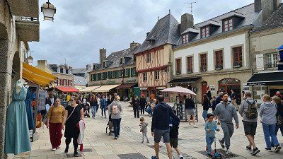
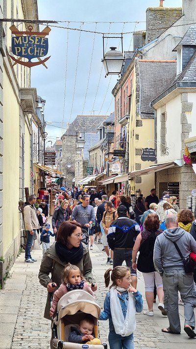
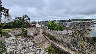
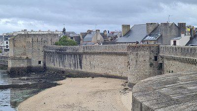
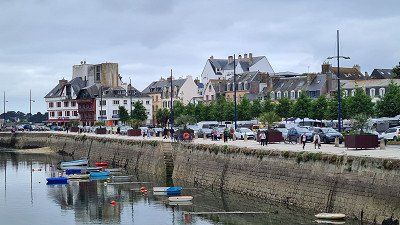
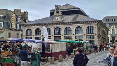
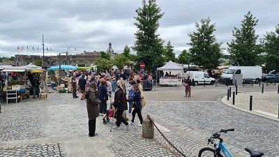
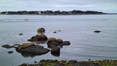
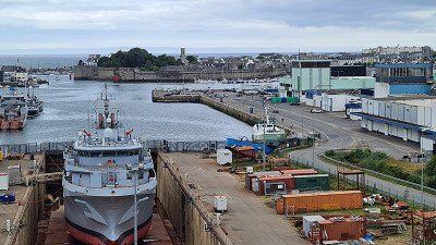
Saturday. 28 May 2022. Sunny. Up to 20 degrees.
Driven. 141 km. 3h30 driving time. On country and coastal roads via Loctudy, Guilvinec and Audiene to Cap Sizun to the Pointe du Raz and Pointe du Van views and along the coast to Douarnenez. Moderate traffic, some detours due to construction sites, some narrow roads at the viewpoints.
seen on the way. Harbor with views of Île Tudy and the lighthouse at Loctudy within a short walk at the first stop. Café with croissant in the Café du Port. The municipality of Loctudy with 4,013 inhabitants in the Finistère department is a well-known port and bathing resort. You can also see: Saint-Rudy church from the 11th century; Manoir de Kerazan with a spacious park and tall, old trees; Le Domaine du Dourdy with chateau from 1913; Manoir de Kervéréguen from 1242; Chapelle Notre Dame du Croaziou; Menhir de Penglaouic; Phare La Perdrix; Phare de Langoz; Ile-Tudy. Wikipedia.
seen on the way. The Pointe du Raz and the Pointe du Van on extended walks at intermediate stops on the Cap Sizun circuit. The Pointe du Raz is better known and therefore often overcrowded with tourists, while the Pointe du Van is less frequented and, in my opinion, is no less interesting. The Point du Raz is a rocky cape that forms the top of Cap Sizun and is located in western Finistère. The sheer cliff that juts out into the sea with a height difference of 72 meters is one of the most characteristic places on the Brittany coast. Numerous legends surround Pointe du Raz. The Hell of Plogoff, a tunnel dug through the sea into the cape, is said to be the place to which the drowned are brought back, whose groans can be heard. A tourist center and car park have been built at some distance and are connected to the Pointe by a shuttle bus. Wikipedia.
See campsite. Port and old town of Douarnenez on a bike tour in the evening. Offers little special. Douarnenez is the administrative center with 18,227 inhabitants and is located in the west of the historical region of Cornouaille at the mouth of the Pouldavid estuary on the south bank of the Bay of Douarnenez. In front of Douarnenez is the rocky island of Ile de Tristan. You can see the built church of Saint-Herlé with a Gothic tower from the 16th century, the chapels of Saint-Michel, Sainte-Hélène and Sainte-Croix from the 17th century. Wikipedia.
slept. Camping Car Park, 14 route de Trezulien, Douarnenez. Easiest place in the group that I've approached so far. Accordingly also hardly occupied.
rated. ●●●●○ for the beautiful natural landscapes on Cap Sizun.
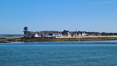
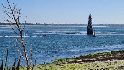
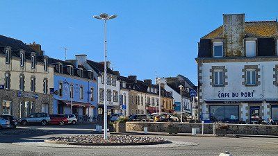
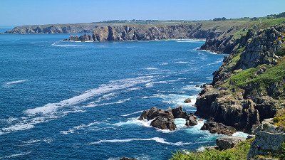
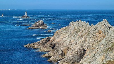
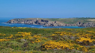
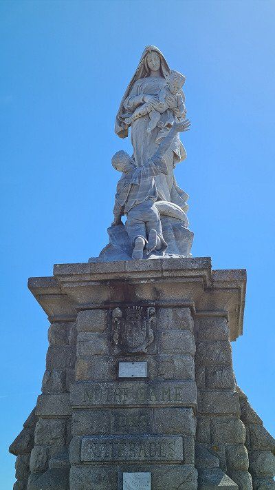
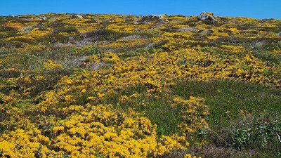
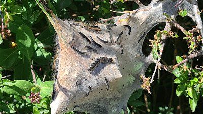
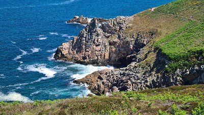
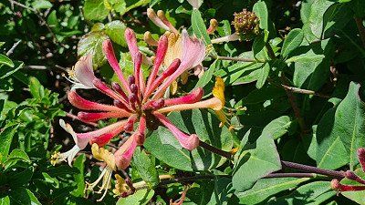
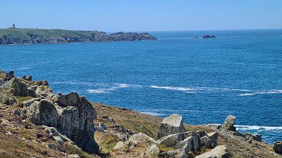
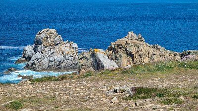
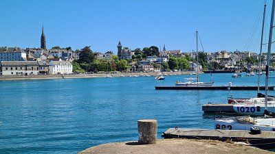
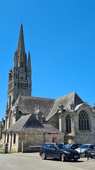
Sunday. 29 May 2022. Sunny. Up to 21 degrees.
Driven. 146 km. 4h30 driving time. On country and coastal roads first made a detour to Quimper and via Crozon on the peninsula of the same name to the three sightseeing points Cap de la Chèvre, Camaret-sur-Mer with Tour Vauvan and the Pointe de Espagnols and back to Crozon. Little traffic like the day before, but partly very narrow coastal roads to the vantage points.
seen on the way. Cathedral and Odet Quai in Quimper on a morning walk. Everything overslept, so no problem with a central parking lot. Quimper is the capital of the historical region of Cornoalle and seat of the prefecture of the department of Finistère and has 63,283 inhabitants. The city name means confluence because it was built at the confluence of the Jet, the Steir and the Frout with the Odet. The city is famous for its porcelain manufacture. Quimper has a picturesque old town, some of whose houses date back to the Middle Ages and is therefore a popular tourist destination. Visible from afar, the pointed towers of the Cathédrale Saint Corentin tower over the city. The Benedictine Priory Church of Notre-Dame from the 11th century is located in the district of Locmaria. Wikipedia.
seen on the way. The Crozon peninsula on a round trip to the three striking vantage points. Both scenically worth seeing and historically interesting impressions were gained. The view of Brest from Pointe des Espagnols across the bay is also beautiful. Located in the extreme west of the Finistière department, the Crozon Peninsula is part of the Armorique Regional Natural Park, the only natural park in Brittany . You can see: the Cap de la Chèvre with the large heath areas, the Pointe Penhir, the Vauban tower at Camaret-sur-Mer from 1683 (like the Besançon Citadel Unesco World Heritage Site) and the Pointe des Espagnols.
See campsite. Bike tour through center ville Crozon and to the seaside resort of Morgat with its well-known caves. Crozon is insignificant (everything is closed on Sundays), Morgat, on the other hand, is very busy with tourists and is beautifully situated on a bay with a wide beach. With 7,386 inhabitants, the municipality of Crozon is the main town on the Crozon peninsula in the Finistère department and is gradually growing together with the port and bathing resort of Morgat. You can see the stone rows of Lagatjar and Lostmarch, in Morgat the rock grottoes that are only accessible from the sea. Otherwise no sights mentioned. Wikipedia.
slept. Camping Car Park, Rue de Poulpatré, Crozon.
rated. ●●●●○ for an eventful round trip through an area of scenic and historical interest.
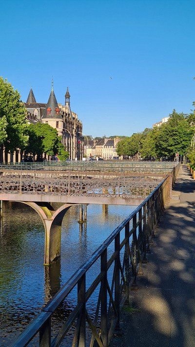
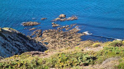
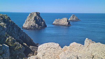
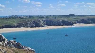
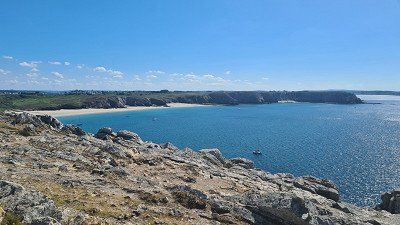
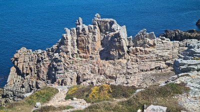
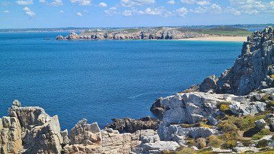
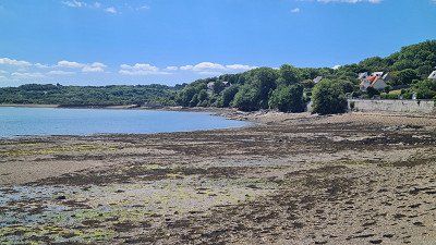
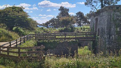
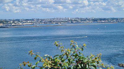
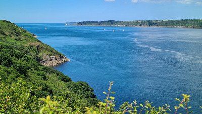
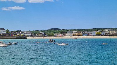
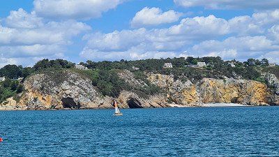
Monday. 30 May 2022. Sunny. Up to 20 degrees.
Driven. 274 km. 5h20 driving time. Through the nature park via Pleyben and Mont d'Arrée to La Faou, further past Brest around the peninsula via Le Conquet, Ploudalmézeau and Plouescat to Cléder. Largely on country and coastal roads, some of which are narrow again and have many detours. Moderate traffic, no heavy traffic, only slow traffic at the Brest bypass.
seen on the way. Circular drive through the nature park via Pleyben (important walled parish) and over the Mont d'Arrée (ancient mountain range of the Armorican massif consisting of moorland as in Ireland and Wales) and on to La Faou with short walks through Pleyben, the moorland in the park and through La Faou. Everything worth seeing. Created in 1969, the d'Armorique Natural Park covers an area of 112,000 hectares (of which 60,000 hectares are marine). 39 communes make up the park, which consists of the islands of the Iroise Sea with the megaliths of the Molene archipelago, the Crozon peninsula, the Aulne-Maritime and the Monts-d'Arrée mountains. The park administration is in Le Faou, a commune in the Finistère department with 1,744 inhabitants and once classified as one of the most beautiful villages in France. Sights in the old town include the 16th-century slate-roofed granite houses, the 16th-century Church of St. Sauveur and the 17th-century Sanctuary of Notre-Dame-de-Rumengol. Wikipedia.
seen on the way. Short bike ride to the port, the old town and the forts of Le Conquet. In my opinion, there is nothing special about driving around this peninsula. The scenery is beautiful and charming, but the roads are too far from the coasts. Brest is a port city with 139,926 inhabitants, sheltered in a deep inland bay of the Atlantic with a natural harbor in the mouth of the Penfeld river. Brest is an important naval port in France, has no mentioned sights apart from the fortress and remains of Vauban fortifications, the Tour Tanguy tower, the Pont de Recouvrance lift bridge from 1954, an Océanopolis adventure park, a church and a museum. Le Conquet is a small fishing and ferry port with 2,750 inhabitants. In addition to a few churches and chapels from the last few centuries, the small harbor and the lighthouse that characterizes the townscape, the two Forts Saint-Louis and l'Îlette de Kermorvan, which date from the middle of the 19th century, are worth seeing. Wikipedia.
Seen campsite . Dunes and covered market at Plouescat, beaches and church at Cléder. Maison de Garde des Amiets and Cam-Louis Menhir on a 2-hour evening bike tour. The variety of scenic and cultural impressions of the area is impressive. Cléder is a commune with 3,683 inhabitants in the Finitère department and is known for its beaches. Also worth seeing are three old noble residences: Tronjoly Castle from the 16th century, ruins of Kergournadeac'h Castle intentionally destroyed in 1760 and Kermenguy Castle from 1632. Wikipedia.
slept. Camping Car Park, Le Poulennou, Cléder. Well located near the sea. Half occupied.
rated . ●●●●○ for the morning in the nature park.
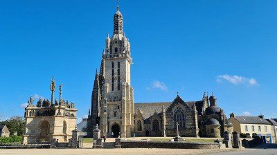
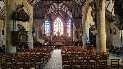
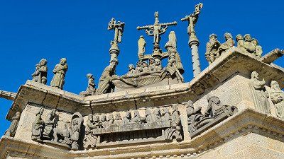
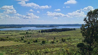
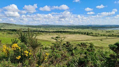
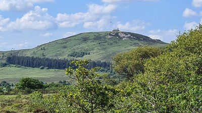
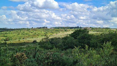
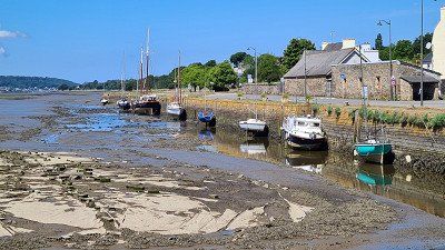
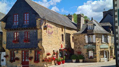
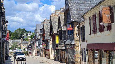
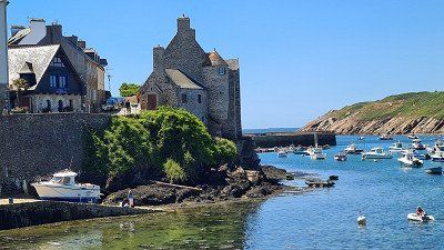
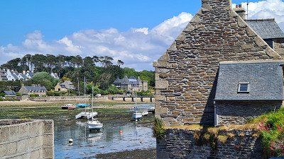
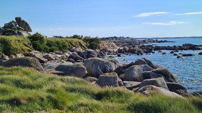
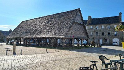
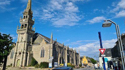
Tuesday. 31 May 2022. Sunny. Up to 19 degrees.
Driven. 44 km. 1h00 driving time. On country roads via Roscoff to Henvic. Little traffic, fast journey.
seen on the way. Château de Kérouzéré on a short walk. Remote and rarely visited, but the detour was worth it for me, historically worth seeing. The Château de Kérouzéré is a 15th-century Breton castle in the commune of Sibiril in the French department of Finistère. Wikipedia.
seen on the way. Old town and port of Roscoff on a long morning walk. In my opinion one of the most historically interesting places of the trip so far. Lots of nice impressions. Breton three-course lunch with Merluc at Café au Port. Recommended. Roscoff is a commune with 3,489 inhabitants, has a historic town center and was a first center for thalassotherapy in the 19th century because of its mild sea climate. Important ferry port for travelers to Great Britain and the Île de Batz. Wikipedia.
See campsite. Carantec old town, Château Taureau and the white beach of Carantec on an extended bike tour in the afternoon. Carantec is a popular seaside resort with 3,189 inhabitants. The 16th-century Château Taureau is a fortress built on a cliff to protect the town of Morlaix from English attacks. Wikipedia.
slept. Camping Car Park, Rue du Pont, Henvic. Beautiful facility, laid out in a circle with spacious parking spaces. Barely occupied.
rated. ●●●●● for historically valuable Roscoff.
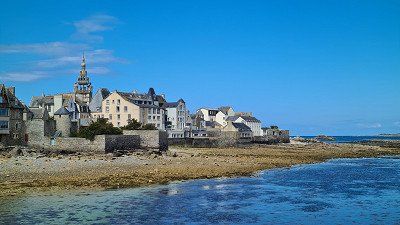
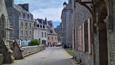
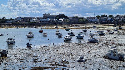
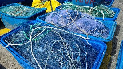
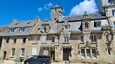
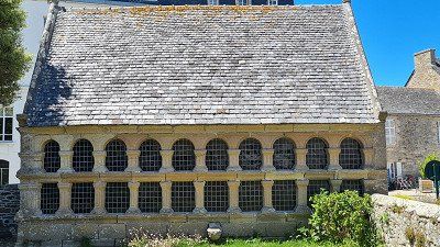
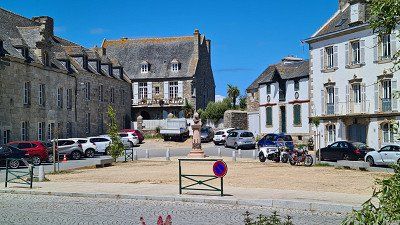
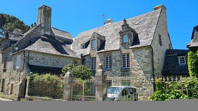
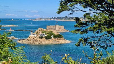
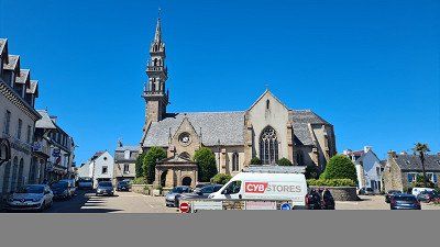
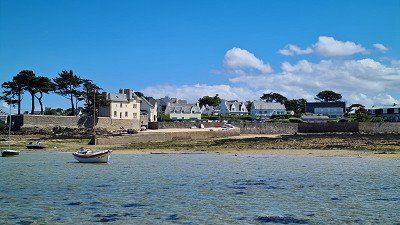
Wednesday. 1 June 2022. Sunny. Up to 17 degrees.
Driven. 118 km. 2h30 driving time. On country and coastal roads via Morlaix, Lannion and from Trébeurden to Paimbol along the Côte de Granit Rose. Pleasantly quiet ride with moderate traffic.
seen on the way. The beginning of the Côte de Granit Rose at Trébeurden with a short walk at the port. The Côte de Granit Rose is a stretch of coast in northern Brittany between Trébeurden and Paimbol. Because of its bizarre rock formations made of reddish granite, especially around Perros-Guirec, it is considered a tourist attraction. The pink-colored granite formed 300 million years ago in the Upper Carboniferous during the Variscan Orggenesis, a phase of mountain building as a result of the collision of the supercontinents Gondwana and Laurussia and several microplates. These can best be seen on the old customs officers' path from Perros-Guirec to Ploumanac'h. The granite owes its characteristic coloring to its content of hematite and alkaline feldspar. Wikipedia.
seen on the way. The aforementioned customs officer's path on a good one-hour walk across the Phare de Mean Ruz and the old customs officer's house next to it. Absolutely worth seeing. One of the best visits of my trip so far. The rock formations are uniquely interesting and impressively embedded in the coast. They remind me of the granite fields in the Seychelles. The Phare de Ploumanac'h, officially Phare de Mean Ruz, is a lighthouse built in 1945 on the Channel coast of Brittany. Wikipedia..
See campsite. The l'Abbaye de Beauport, the port and the old town of Paimpol. The abbey was once again a good example for me that ruins are just as interesting historically as restored cultural assets. In the harbor observed the beginning of the tide between five and seven. In Brittany, the tide reaches its highest level (with a rise of 9 metres) around midnight. Beauport Abbey was founded in 1202 with the support of Alain I, Count of Penthièvre. He made land available between the mouth of the Correc and a swamp area, the "Pré aux oies" (goose pasture), where monks from the Premonstratensian Abbey of La Lucerne near Avenches settled. Equipped with papal privileges, they began building the monastery in 1203. Beauport thrived mainly in the 13th and 14th centuries and flourished again in the first half of the 18th century. The decline from 1750 was followed by closure in 1790. The abbey was not classified as a monument historique until 1862. The restoration work started in 1992 made Beauport one of the most important tourist destinations in Brittany. The municipality of Paimbol with 7,179 inhabitants in the department of Côtes-d'Armor is the administrative center and its name means "at the extreme end of the water surface"Wikipedia.
slept. Camping de Cruckin, Rue de Cruckin, Paimpol. Beautiful campsite almost directly on the sea with clean sanitary facilities. Inexpensive. Two-thirds full.
rated. ●•••• for the unique Côte de Granit Rose.
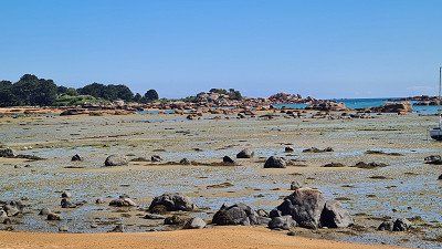
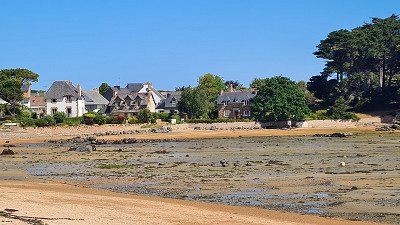
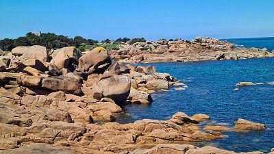
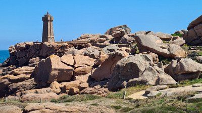
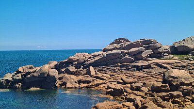
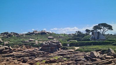
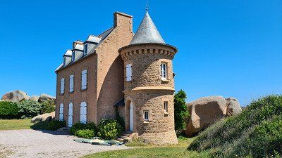
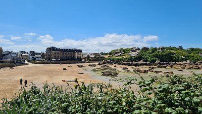
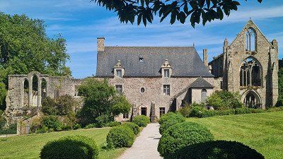
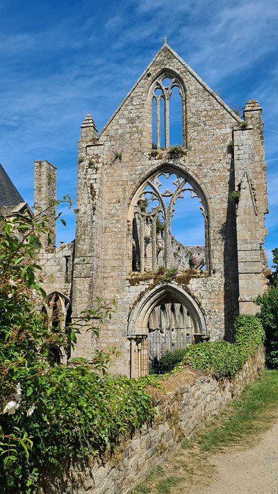
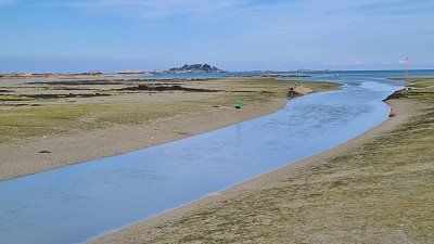
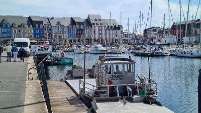
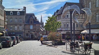
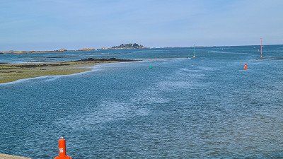
Thursday. June 2, 2022.
felt. Weather mostly cloudy with 11 to 18 degrees.
Driven. 168 km. 3h40 driving time. Mainly on rural and coastal roads Pléneuf-Val-André, Saint-Malo and Cancale to Hirel. Despite heavy traffic and a few detours, the journey was relatively quick. First seen a traffic jam near Saint-Brieuc, a good five kilometers, but on the opposite lane.
seen on the way. Megalithic cairn de la Ville-Pichard at Pléneuf-Val-André, the natural part of the port of Dahouët on short stops and walks and the seaside resort of Pléneuf-Val-André when passing through. Typical French seaside resort, partly showing its age. I'm probably too critical here, but once you've seen Biarritz, you've seen them all. The heavily overgrown Cairn de Ville-Pichard sits on a cliff overlooking the tidal island of Île du Verdelet. On a small hill lie the remains of three round dolmens from the Middle Neolithic. The complex was excavated in 1887 and placed under protection in 1965. A megalith (here a dolmen heap) is a Neolithic drystone monument, circular or square, completely covering one or more passage dolmens. The rooms of these dolmens can be made of dry stone or corbelled vaults, the most common case at the beginning of the 5th millennium, or be entirely maglithic
Dahouët is a small Breton port in the town of Pleneuf-Val-André. The road gently enters this port, passing the foot of the 1821 tide mill. The marina offers 185 places on buoys and 313 places in a floating pool. the basin of the saline. Its natural character, heritage and some shops make it an important tourist site. A coastal path allows you to reach the beach of Val-André in less than half an hour along a very pleasant route.
Pléneuf-Val-André is a commune with 4,083 inhabitants in the department of Côtes-d'Armor and is known as a seaside resort. The Îlot du Verdelet is a tidal island off the Point of Piégu. Wikipedia.
seen on the way. The fortified city of Saint-Malo on an extended bike tour and the walkable city walls on short walks. Parked in a suburb and cycled to and through the city. The tourist traffic is immense, but this place of worship is simply unique. In any case, plan and see. Had lunch at Brasserie Amoricaine, but there have been better. Saint-Malo is a town with 46,803 inhabitants in the Îlle-et-Vilaine department, the most important port on the north coast of Brittany and one of the most visited places in France due to the faithfully reconstructed historic town center and the fortifications. Wikipedia.
seen on the way. Fishing village Cancale on transit (centre, promenade, port). No parking space found within a useful time, also heavy traffic and very busy streets. The location at the beginning of the Bay of Saint-Michel is uniquely beautiful. Cancale is a commune with 5,226 inhabitants in the Îlle-et-Vilaine department and is located in the bay of Mont Saint-Michel on the Côte d'Emeraude. The upper town is 45 m above sea level and is the center with a church, market, shops and the bathing villa settlement at the Pointe du Hock and along the Rue Robert Surcouf, which is famous for its architecture and the picturesque view of Mont-Saint-Michel becomes. The romantic harbor is located directly on the sea, in the Port-Mer district there is a popular sandy beach. The Pointe du Grouin, about four kilometers from the city center, is a popular destination. Wikipedia.
See campsite. The bay of Mont Saint-Michel on a bike tour along the dam to the small towns of Hirel and Le Vivier-sur-Mer. The Bay of Mont Saint-Michel is a depression of about 500 km² between Cancale and Granville. The bay is the scene of the largest tidal range in Europe, with the difference between low and high tide being almost 15 m. It also harbors a varied natural landscape that includes the largest salt marsh and polder area in France. Wikipedia.
slept. Camping Car Park, Ville es Brune, Hirel. Beautiful location directly on the coast road along the bay of Mont Saint-Michel.
rated. ●•••• for Saint Malo. exclamation mark.
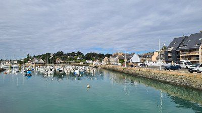
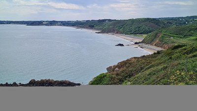
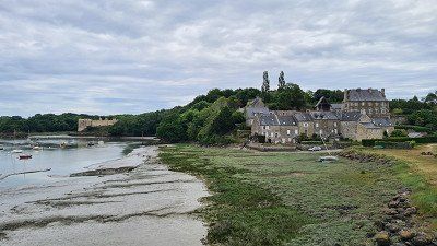
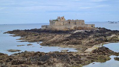
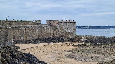
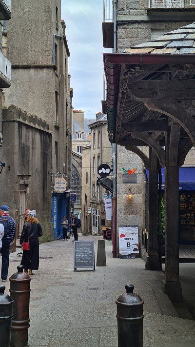
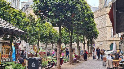
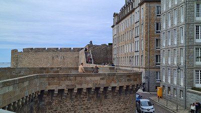
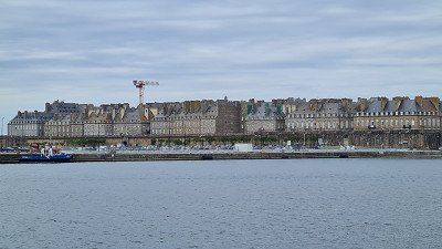
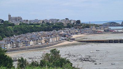
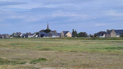
Today I leave Brittany and enter Normandy.
I read on Wikipedia about Normandy: Already at the beginning of the
nineteenth century, Normandy developed too
a popular travel destination. As Napoleon and his wife
Marie-Louise of Austria visited the port city of Dieppe,
Dieppe was already a popular holiday spot for British high schoolers
Society. Hortense de Beauharnais and the Duchess of Berry
shortly thereafter made Dieppe the first sea resort in France.
They were enthusiastic about romantic castles and abbeys
and thus to be able to walk in the footsteps of their ancestors.
Marie-Henri Beyle (Stendhal) then coined the term tourism and William Turner illustrated the first Romantic Normandy travel guide in 1828. Special attractions of Normandy are the legendary Mont-Saint-Michel and
the world famous Bayeux Tapestry. More Sights-
properties are Claude Monet's house and gardens at Giverny, the
white chalk cliffs of Étretat and the landing coast of the Allied invasion on D-Day, June 6, 1944. La Cité de
la Mer is a museum in Cherbourg dedicated to the sea. The neighboring towns of Deauville and Trouville-sur-Mer
are popular seaside resorts. Christian pilgrims visit in turn
the places of birth and death of Alençon and Lisieux of the saint
Therese of Lisieux, as well as Rouen as the place of the martyrdom of
Saint Joan of Arc. Normandy is a region
in northern France and founded in 996 AD as
historical province. The area is divided into the lower
Seine area (former Haute-Normandie) from Giverny to the
Sea and land to the west (former Basse-Normandie)
with the Cotentin Peninsula. To the former duchy
Normandy also included the Channel Islands. Between punchline
de Barfleur and Cap de la Hève, the Baie de
Seine, the most striking bay in Normandy. The Duchy
began as a fief to Rollo, a Viking chieftain through the
West Frankish King Charles (911). Rollo's descendants succeeded
conquest of England. The Dukes of Normandy were too
Kings of England (until 1087, from 1106 to 1144 and from 1154).
The duchy then fell in the Hundred Years' War
reign of the French kings. With the creation of the
Départements in the wake of the French Revolution and
the two regions of Haute-Normandie and Basse-Normandie
Normandy was no longer a political entity from 1972, but
the question of the reunification of Normandy remained popular,
so that the merger took place again, in 2016 as part of the reorganization of the French regions. To this region
Normandy today includes the departments of Calvados, Eure,
Manche, Orne and Seine-Maritime. lived in Normandy
2019 3'325'032 people. Le Havre is the largest city, followed by Rouen, Caen and Cherbourg.
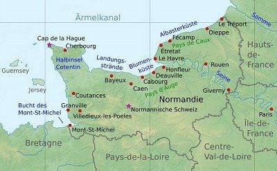
Friday. June 3, 2022.
felt. Weather first cloudy, then rain at 12 to 19 degrees.
Driven. 171 km. 120 km of highway. 2h30. Via Mont Saint-Michel, Avrenches, Saint-Lo to Utah Beach. Heavy traffic at times, but still a quick journey as there are hardly any construction sites, diversions or heavy traffic.
seen on the way. Mont Saint-Michel Abbey a good two-hour walk from the car park and through the town and up the ramparts which can be walked. In the morning between 10 a.m. and 12 p.m. the flow of visitors was still limited. Lunch at Auberge St. Pierre, one of the countless restaurants on the "main street" leading up to the abbey. Mont Saint-Michel is a commune with 29 inhabitants in the department of Manche in Normandy and consists of the rocky island of Mont Saint-Michel in the bay of the same name in the Wadden Sea and parts of the mainland. The island, named after Archangel Michael, is about a kilometer from the coast. The fortified abbey dominates the islet and is an example of the Norman architectural style from 1022. Unesco World Heritage Site since 1979. Wikipedia.
See campsite. Utah Beach and associated museum on a short bike tour. Since the anniversary of the invasion on June 6, 1944, one can see many "remembrance people" in old uniforms and vehicles (military jeeps and motorcycles) on the beach and especially in the town of Sainte-Marie-du Mont on the approach to Utah -Beach. Utah Beach is the place and code name for a partial Allied landing during World War II for the five-kilometer stretch of coast between Poppeville and La Madeleine. The next landing sectors were Omaha Beach, Gold Beach, Juno Beach and Sword Beach and the Pointe du Hoc gun emplacement. In Utah Beach, the US Army began the invasion on June 6, 1944, an hour before the other Allies on the other beaches. Wikipedia.
slept. Camping Car Park, La Madeleine, Utah Beach. Rather desolate facility in "no man's land" except for the nearby sea and the museum.
rated. ●•••• for Mont Saint-Michel. exclamation mark.
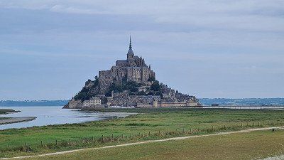
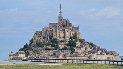
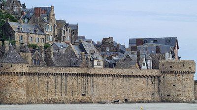
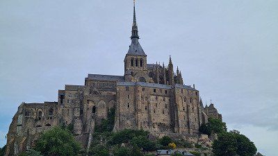
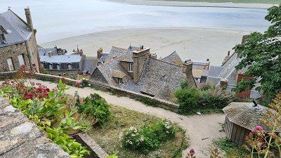
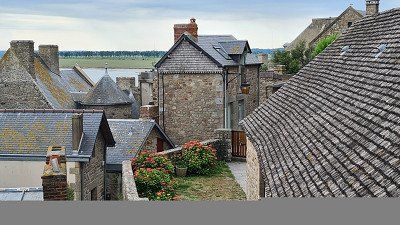
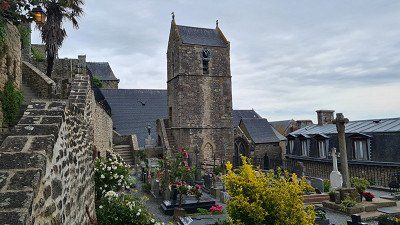
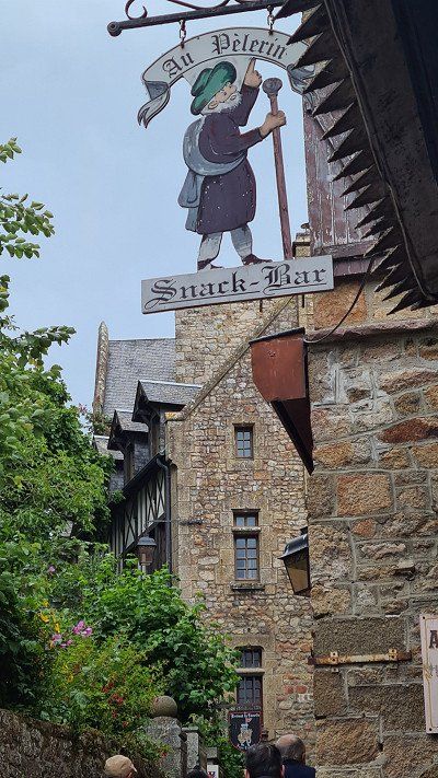
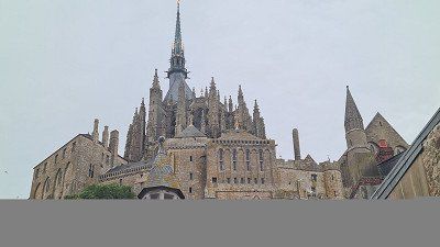
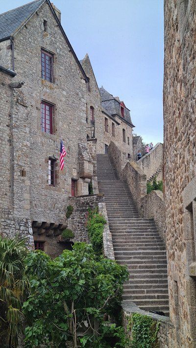
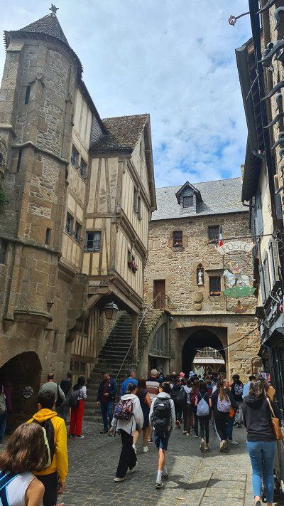
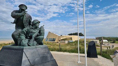
Pentecost Saturday. June 4, 2022.
felt. Weather at night storms, thunderstorms and rain, brightening in the afternoon at 12 to 19 degrees.
See campsite. Villages in the hinterland of Utah Beach on an extended bike tour in the morning with brief stops at countless monuments and for shopping in Saint-Mêre-Eglise. At the Airborn Museum there, a big commemorative event with a bazaar of historical military paraphernalia and a "Chilbi" is taking place these days. The surrounding villages are full of "military souvenir" shops.
See campsite. Dunes and beach in the afternoon on a long walk along the coast and a short visit to the Utah Beach Landing Museum. The museum, opened in 1962, is located on the spot where a German bunker secured the stretch of coast. It was destroyed by the American attack on the morning of June 6, 1944. The museum commemorates in particular the US troops involved in the invasion. In addition to a landing craft and many smaller war-related exhibits, the museum features one of the few surviving American Martin B-26 "Maurauder" medium bombers.
slept. Camping Car Park, Utah Beach. Like yesterday.
rated. ●●●○○ for the opportunity to spend a quiet day commemorating the countless victims of war around the world in a place as historically special as Utah Beach. On the other hand, I was personally - without being moralistic - astonished by the currently more "folkloric" number of visitors, also in view of the renewed misery in the Ukraine.
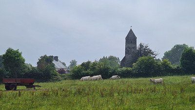
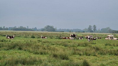
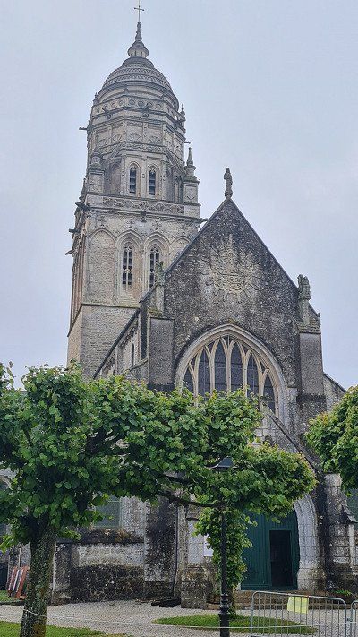
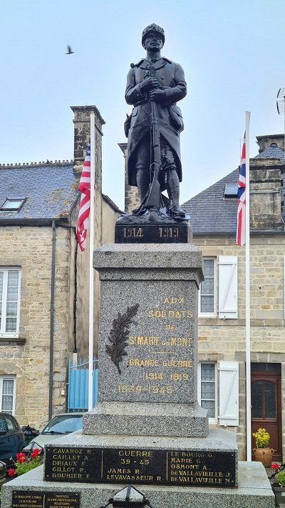
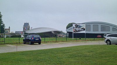
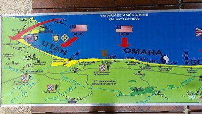
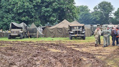
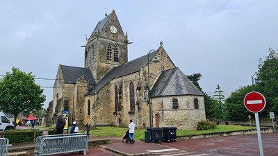
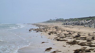
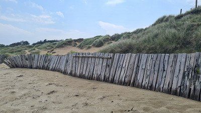
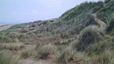
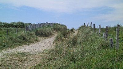
Pentecost Sunday. June 5, 2022.
felt. Weather first cloudy, then sunny at 12 to 19 degrees.
Driven. 219 km. 110 km of highway. 4h30 driving time. Via Goury, Cherbourg, Carentan to Caen. On country and coastal roads on the Cotentin Peninsula and in the Natural Park, on the motorways to Caen. Fast ride without major hindrances.
seen on the way. Along the coast on the Cotentin peninsula to Cape La Hague with the Goury lighthouse, continuing with a short stopover at the port of Cherbourg and through the Marais et du Bessin Regional Nature Park near Carentan and finally to Caen. The Cotentin is a French peninsula in the department of Manche on the English Channel with the main town of Cherbourg. The Goury lighthouse stands 800 meters from the cape on the Gros du Raz rock. It signals the Raz Blanchard, one of the strongest tidal currents in Europe, between Cap de la Hague and the Channel Island of Alderney, and the northern entrance to the Passage de la Déroute, which leads to the east coast of Jersey Island. The historic port city of Cherbourg, with a population of 25,370, has a seaport with a naval base for the French Navy and a marina. In Cherbourg is the museum La Cité de la Mer, which houses the largest nuclear submarine open to the public, Le Redoutable, as well as the Bathyscaphe Archimède. The museum also has a 12-meter high aquarium and an ocean-themed exhibition. Above the port is the Gothic basilica of Ste-Trinité. Located in the departments of Calvados and Manche, the Marais du Cotentin et du Bessin Natural Park was created in 1991 and covers an area of 150,000 hectares, of which 30,000 hectares are wetlands and marshes of European importance on the Contentin peninsula. River valleys and salt marshes on the east coast create a variety of natural habitats with heaths, marshes, bogs as well as hedgerows and coastal landscapes. At the center of the park is Carentan, from where boat trips on the Douve and Taute through the park depart.
See campsite. Château de Caen, abbeys, Vaugueux half-timbered district, pedestrian zone on a two-hour bike tour with short stops and walks. In my opinion, the large, partly well-preserved castle (château) is worth seeing, also thanks to the view of the city from the fortress walls. Caen is a city with 106,230 inhabitants in the department of Calvados and is situated on the river Orne, 15 kilometers upstream of its mouth in the English Channel. The two Romanesque churches of the Abbaye aux Hommes Saint-Etienne and Abbaye aux Dames Sainte-Trinité as well as the castle of William the Conqueror are the most important sights and at the same time the most important monuments. Wikipedia.
slept. Camping Car Park, Rue de Roquemonts, Caen. Nice, small, well-located parking space with spacious pitches. Almost full.
rated. ●○○○○ ●●○○○ ●••○○ ●•••○ ●••••.
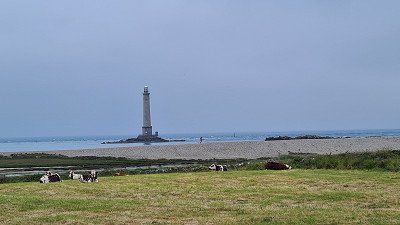
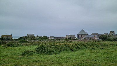
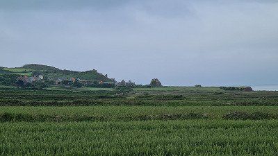
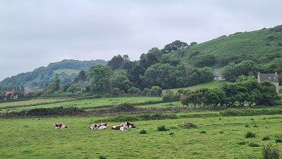
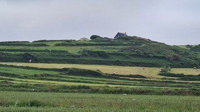
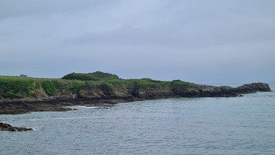
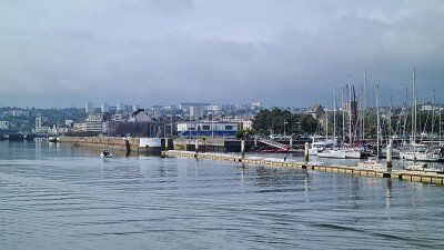
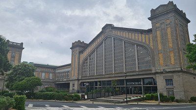
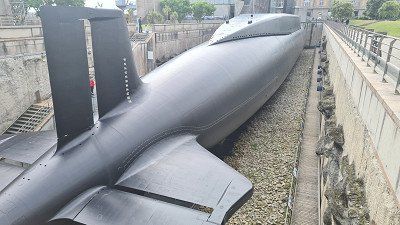
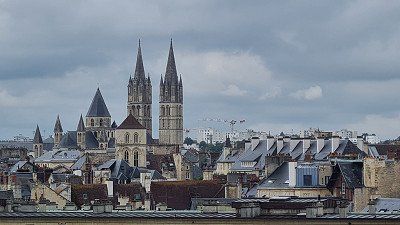
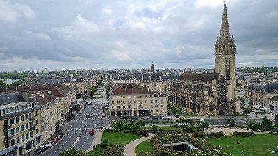
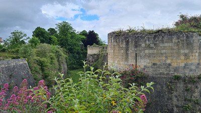
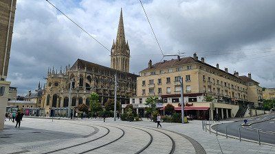
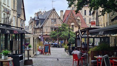
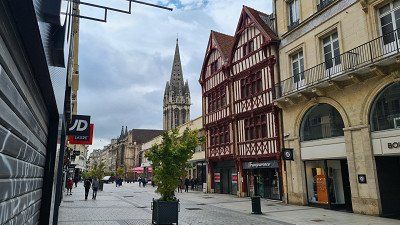
Whit Monday. June 6, 2022.
felt. Weather at night thunderstorms and rain, during the day sun at 12 to 18 degrees.
See campsite. Bayeux old town with the tapestry in the Center Guillaume le Conquérant on an extended bike tour from Caen via Creully to Bayeux with short walks in the Musée des Tapissier and the old town. Definitely worth a visit in my opinion. Bayeux is a municipality with 12,682 inhabitants in the Calvados department and has an almost completely preserved urban structure around the cathedral . These include city palaces from the 17th and 18th centuries, some of which are still privately owned, parish churches at the city exits and especially the tanning district. The Museum of the Allied Landings in World War II comprehensively shows the events of 1944 in the region. The medieval Bayeux Tapestry is on display at the Musée de la Tapisserie. It depicts the history of the Norman conquest of England at the famous Battle of Hastings in 1066. h. T he tapestry was embroidered in the second half of the 11th century on a 52 centimeter high, 68 meter long strip of cloth and shows the conquest of England by the Norman Duke William the Conqueror in 58 individual scenes over a distance of 68 meters and ends with the battle in Hastings . The carpet has been part of UNESCO's Memory of the World program since 2007. Wikipedia.
See campsite. Evening stroll through the park at the nearby Caen Memorial. The Mémorial de Caen documents Operation Neptune with the Allied landings in Normandy on June 6, 1944 and the ensuing battles to liberate Normandy from German occupation, and embeds this in 20th-century European history from World War I to fall of the wall. Annually 630,000 visitors. Wikipedia.
slept. Camping Car Park, Caen. Like yesterday.
rated. ●•••• for a unique historical document and a historically well-preserved old town.
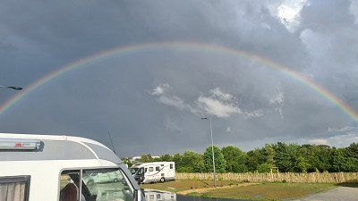
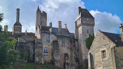
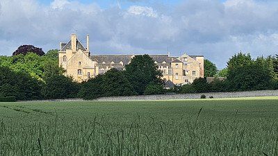
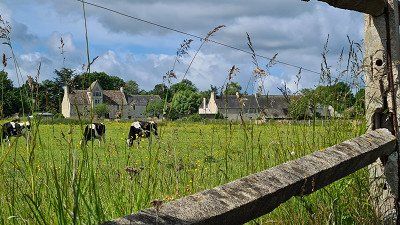
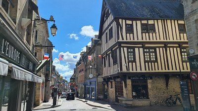
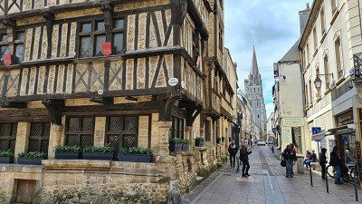
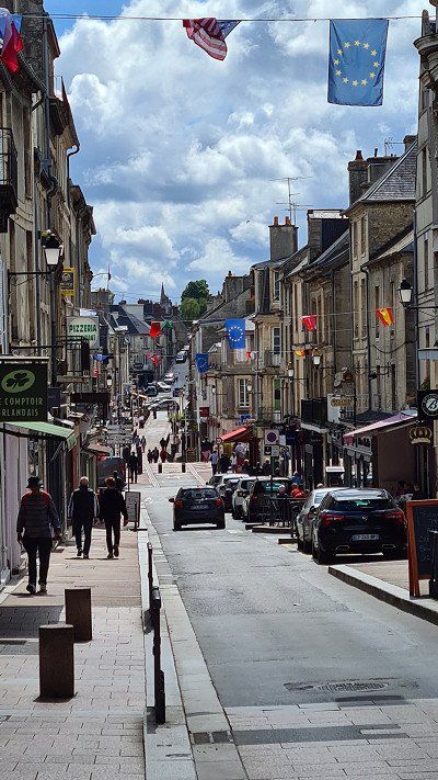
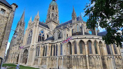
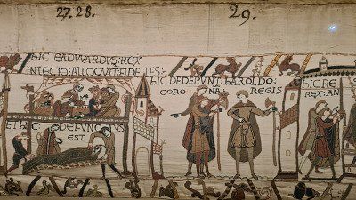
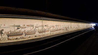
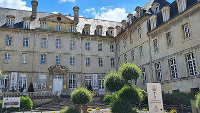
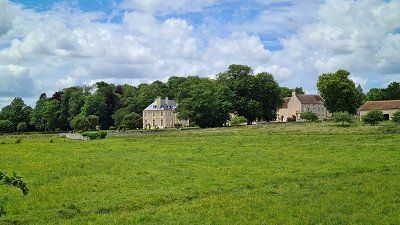
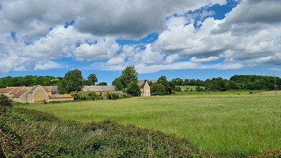
Tuesday. June 7, 2022.
felt. Weather alternately cloudy and sunny at 12 to 20 degrees.
Driven. 90 km. 2h00 driving time. Mostly country and coastal roads via Cabourg to Deauville. After slow traffic on the Caen bypass, proceed quickly with moderate traffic.
See campsite. Seaside resorts of Deauville and Trouville-sur-Mer on a short bike tour and several short walks in the ports, on the promenades and the pedestrian zones in the centers. The places are in the immediate vicinity separated by the river Toques. Deauville looks to me like a large, sophisticated shopping center on a film set, while Trouville-sur-Mer has retained more of a historical charm. Deauville is a municipality with 3,565 inhabitants in the Calvados department and a well-known seaside resort. The important marina, racecourse, sumptuous villas and hotels, casino and wide sandy beach and promenade all contribute to Deauville being regarded as one of Normandy's most elegant seaside resorts. Deauville was a popular subject for the Impressionists. An important building is the church of St. Laurent with a medieval hagioscope, the so-called leprosy column. Trouville-sur-Mer is a commune with 4,603 inhabitants. In contrast to Deauville, which was designed on the drawing board by the architect Brunet in 1859, Trouville is a historically grown fishing port and has gradually become more popular, as evidenced by numerous magnificent buildings from the turn of the century. The fish hall from 1936 is a historical monument. Wikipedia.
slept. Camping le Chant des Oiseaux, 11 route d'Honfleur, Trouville-sur-mer. Beautifully located campsite about three kilometers outside of Trouvaille-sur-Mer. The pitches are terraced on a cliff some 60 meters high, right by the sea.
rated. ●●●○○ for the beautifully situated parking space and the contrast between historic and more modern seaside resorts.
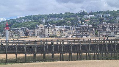
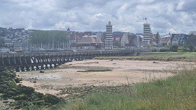
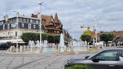
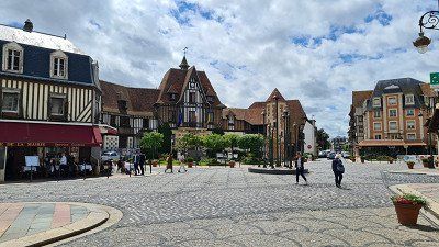
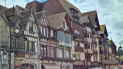
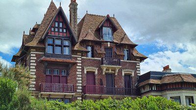
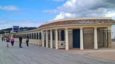
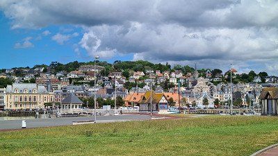
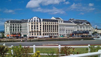
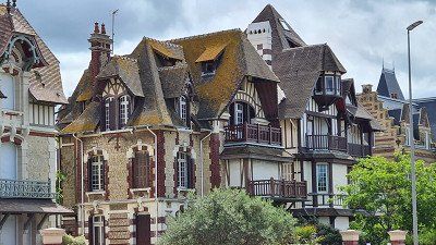
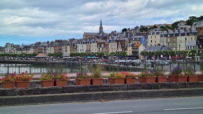
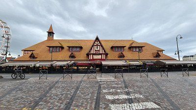
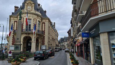
Wednesday. June 8, 2022.
felt. Weather alternately cloudy and sunny at 13 to 20 degrees.
See campsite. Beach below the campsite with a view of Trouvaille-sur-Mer and the port of Le Havre on a morning stroll. A beautiful beach almost to myself.
See campsite. Beaches and promenades of Trouvaille-sur-Mer and Deauville on shorter walks with afternoon stops. I was particularly struck by the old stone bathhouses. Also visit the fish market, the today's "moving" market and the church of St. Laurent in Trouvaille-sur-Mer.
slept. Camping le Chant des Oiseaux. Like yesterday.
rated. ●●●○○ for a relaxing "rest day".
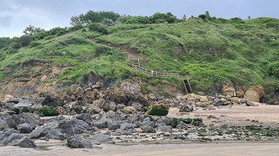
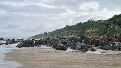
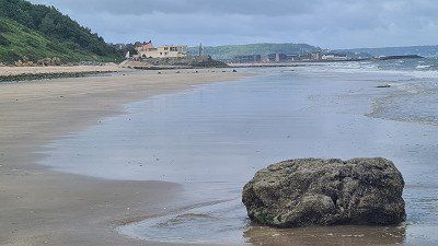
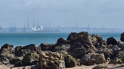
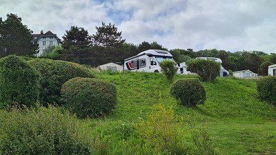
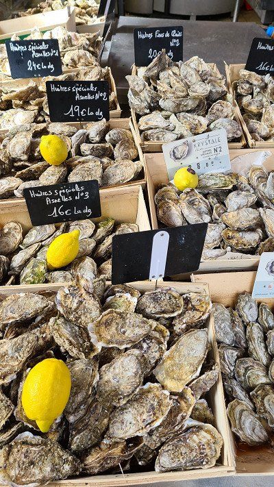
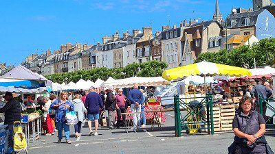
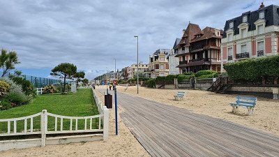
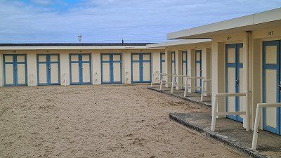
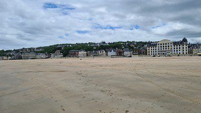
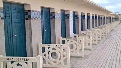
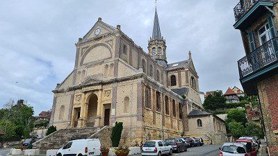
felt. Weather largely sunny at 14 to 18 degrees.
seen on the way. Seaside resort of Honfleur on a long walk with stops at the port, in the old town, at the church of Saint Catherine and the warehouses of Grenier à sel. In my opinion, a must-see place to visit. Honfleur is a port city with 6,733 inhabitants. Today the painters still stand on the Honfleur quay and in the Greniers à sel, two warehouses built in 1670 east of the Vieux Bassin in l'Enclos, a defensive structure built in the 13th century. The Sainte Catherine church with the free-standing tower was built entirely of wood by ship carpenters in the 15th century with two twin naves and a roof structure like ship hulls. The church is a historical monument. A masterpiece of engineering is the Ponte de Normandie, inaugurated in 1995; it is one of the longest bridges in Europe. Wikipedia.
See campsite. Chalk cliffs of Étretat, old town and Chapelle Notre-Dame on a walk from the old town to one of the cliffs, after a short bike ride from the campsite. Etretat is a seaside resort with 1,237 inhabitants in the Seine-Maritime department and is known for the steep cliffs with their extraordinary rock formations that frame the town on both sides. The town is geared towards tourism with hotels, restaurants, souvenir shops and a wide range of leisure and sports activities. Wikipedia.
slept. Camping L'Aiguille Creuse. 24, Residence L'Aiguille Creuse, Les Loges. Beautifully located, quiet, family campsite. Generous parking spaces in the roundabout. Two-thirds full. 6 km to Etretat.
rated. ●●●●● for must-see places.
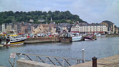
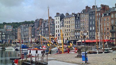
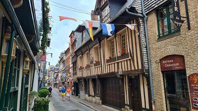
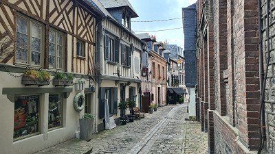
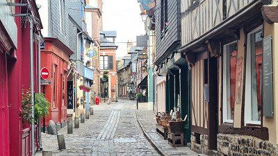
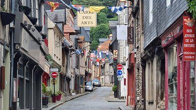
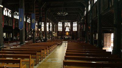
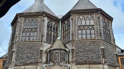
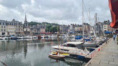
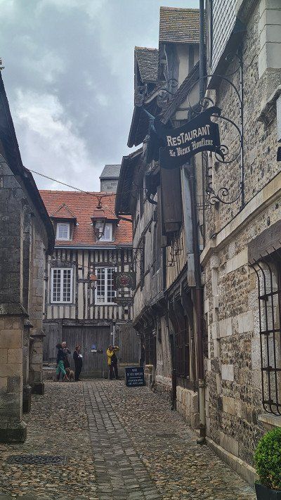
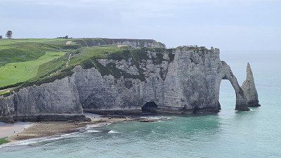
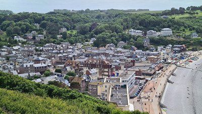
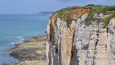
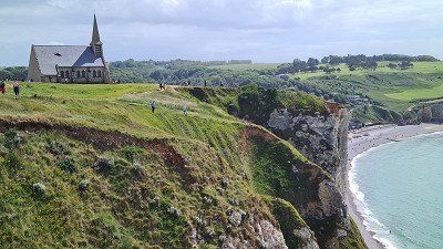
Friday. June 10, 2022.
felt. Mostly cloudy and windy at 14 to 19 degrees.
See campsite. The port city of Fécamp and the seaside resort of Yport on an extensive bike tour with a few short stops and walks, especially in Fécamp. The place didn't look very attractive to me (getting old), but the historical buildings and the view from Cap Fagnet are worth a visit. Yport was only interesting for the detour because of the chalk cliffs that surround the town impressively closely. Fécamp is a port city with 18,041 inhabitants in the department of Seine-Maritime in the Normandy region and is located at sea level on the English Channel. The city maintains a commercial port, a fishing port and a marina. The cliffs of the area are known as the Alabaster Coast and the most famous product from Fécamp is the liqueur Bénédictine distilled here. Fécamp has been recognized as a City of Art and History by the Ministry of Culture. You can see the abbey church Sainte-Trinité in Norman style built 1175-1220 (now Hotel de ville); The historicist 19th-century Palais Bénédictine is an art museum with medieval sacred art and the distillery of the herbal liqueur DOM Bénédicte; The 16th-century Saint-Etienne church is a monument historique; Cap Fagnet rises 95 meters above the city and shows the remains of bunkers from a German WWII Atlantic Wall radar station. The seaside resort of Yport is a municipality with 726 inhabitants in the same department of Seine-Maritime and geographically belongs to the Pays de Caux. The former fishing port and today's tourist resort lies below steep chalk cliffs (Falaises) of the Alabaster Coast. Like the entire Côte d'Albâtre, Yport is on the "Impressionist route" and inspired Claude Monet (watercolor Les falaises à Yport, 1861), Paul Colin (La vallée d'Yport, 1880), Pierre-Auguste Renoir (Marée basse à Yport, 1883) or Albert-Auguste Fourie (Un repas de noces à Yport, 1886). Apart from the main attraction, the chalk cliffs on both sides of the town, which drop perpendicularly to the sea, nothing worth seeing is mentioned. Wikipedia.
slept. Camping L'Aiguille Creuse. Like yesterday.
rated. ●●●○○ to visit Fécamp.
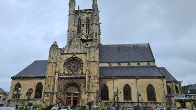
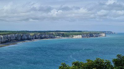
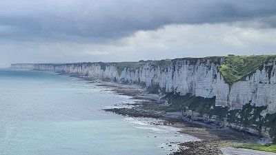
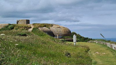
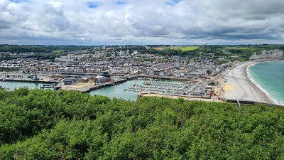
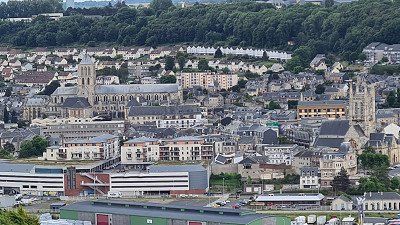
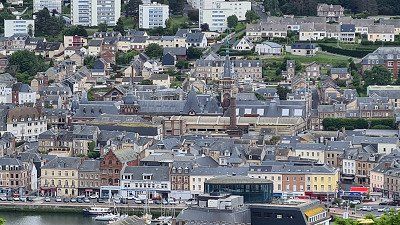
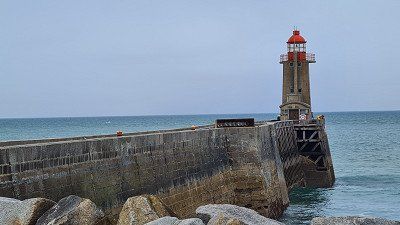
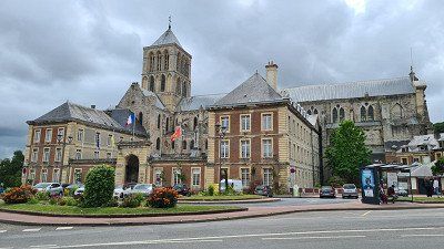
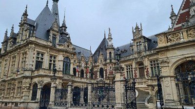
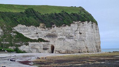
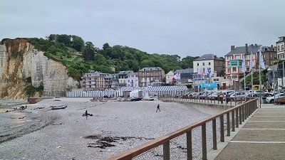
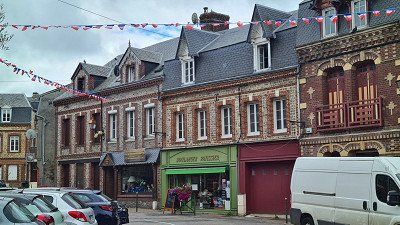
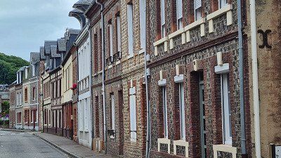
Saturday. June 10, 2022.
felt. Weather sunny at 13 to 19 degrees.
See campsite. By bike to the Phare d'Antifer and walk along the cliffs on both sides of the Cap d'Antifer. Continue by bike to Etretat and walk up to the Porte d'Aval cliffs, also called "Elephant" because of the shape of the trunk, La Porte Manne and on to Cap Ponte de la Courtine. The natural scenes are uniquely beautiful, I was almost alone on the Cap d'Antifer, but there were crowds of people on the Falaises near Etretat. And everywhere on the coast you will find witnesses of the Second World War (bunkers). La Poterie-Cap-d'Antifer is a municipality with 453 inhabitants in the Seine-Maritime department, its coast is part of the Alabaster Coast and includes prominent points such as the Cap d'Antifer with the lighthouse, the Point du Fourquet and some beaches such as the Plage de Tilleuil and the Plage d'Antifer. The cliffs of Étretat were formed in the Upper Cretaceous and consist primarily of white chalk and flint. Other minerals common to the east Normandy coast are not found at Étretat. One does not find there the sandstone that occurs to the north at Dieppe, nor the yellowish oolite from the Caen area. The three distinctive rock arches Porte d'Amont, Port d'Aval and Porte Manne go back to the surf of the sea and were not created by an estuary, as is wrongly assumed. The Aiguille rock needle consists of somewhat harder limestone, which has withstood this progressive erosion to this day. Another well-known formation is the Pointe de la Courtine. Wikipedia..
slept. Camping L'Aiguille Creuse. Like yesterday.
rated. ●●●●○ for unique nature experiences, one star deduction for the migration of peoples at the "Elephant".
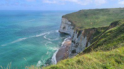
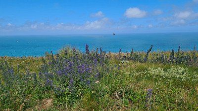
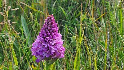
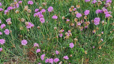
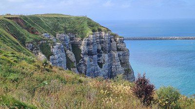
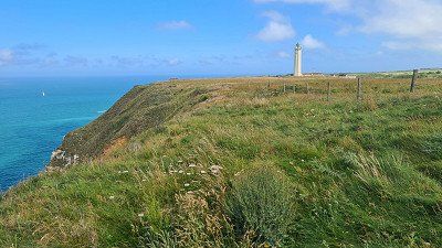
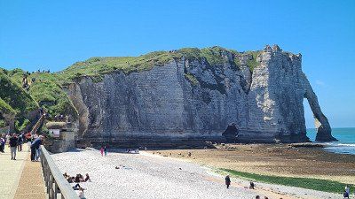
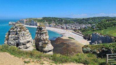
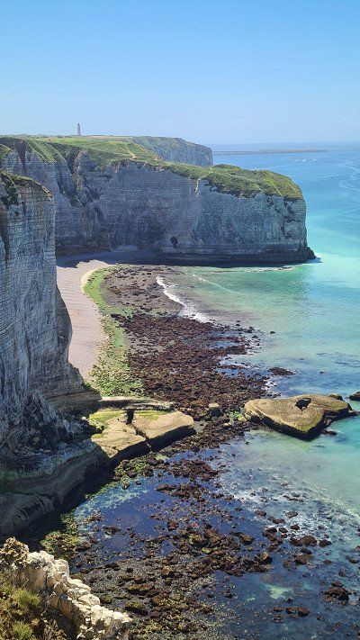
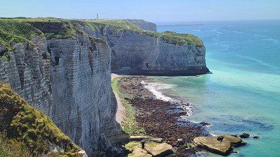
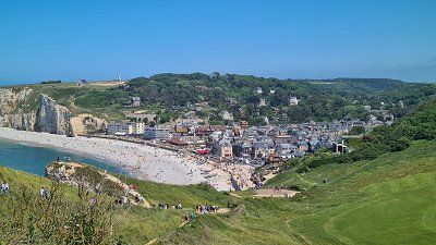
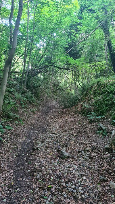
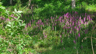
Sunday. June 12, 2022.
felt. Weather sunny at 13 to 19 degrees.
Driven. 108 km. 2h30 driving time. Continue on country and coastal roads along the Alabaster Coast (Côte d'Albâtre) via Veules-Les-Roses and Dieppe to Flocques near Le Tréport and the end of the Alabaster Coast. Fast ride, little traffic.
seen on the way. Artists' village of Veules-Les-Roses on a long walk along the canalized Veules. The picturesque village is worth a visit. The municipality of Veules-Les-Roses in the Seine-Maritime department with 550 inhabitants is located in a bay of the Norman cliffs, where the river Veules flows into the English Channel. To see: Saint-Martin church from the 13th century, ruins of the 16th-century fisherman's church of St Nicolas. Wikipedia.
seen on the way. Old town, churches and castle on a long walk and a ride on the Petit Train Touristique. What a contrast to tranquil Veules-Les-Roses. Dieppe looks rather sophisticated and was heavily frequented by streams of visitors. Dieppe is a sea and fishing port with 28,241 inhabitants on the Alabaster Coast at the mouth of the Arques in the English Channel. Across from England is Newhaven in East Sussex. You can see: the Castle of Dieppe from 1433 now houses the Municipal Museum; the Gothic Saint-Jacques Cathedral; the Saint-Rémy church from the 16th and 17th centuries; the church of Notre-Dame-de-Bon-Secours from 1876. Wikipedia.
See campsite. Seaside resorts of Le Tréport and Mers-les Bains on an evening bike tour. Like Dieppe, rather sophisticated and very lively. Le Tréport is a commune with 4,582 inhabitants in the department of Seine-Maritime and has the highest chalk cliff in Europe at 110 meters. You can also see the Saint-Jacques church from the 14th century, the lighthouse from 1844, the inclined elevators on the route of the former funicular and the Kahlburg, a tunnel system dug into the rock during the German occupation. Mers-les-Bains, a municipality with 2,655 inhabitants, is just on the other side of the Bresle. Characteristic of the place are numerous colorful villas in the style of the 1860s. Wikipedia.
slept. Camping Car Park, 1 Rue des Pommiers, Floques. Nice, simple facility. Barely occupied. 3.5 km from Le Treport.
rated. ●●●●○ for the charm of Veules-Les-Roses.
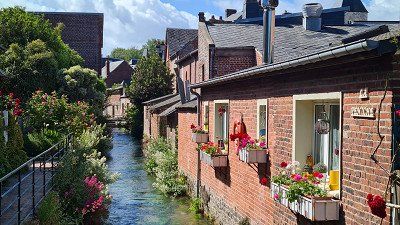
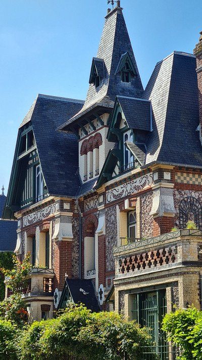
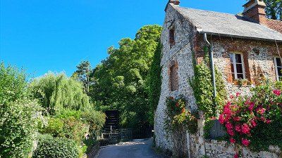
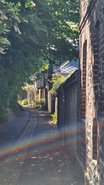
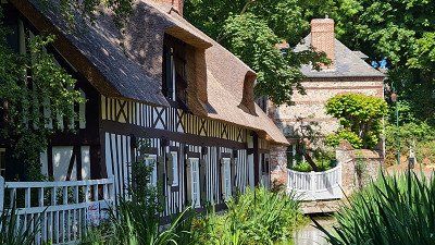
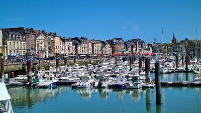
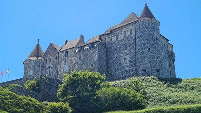
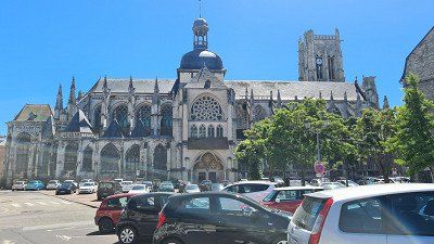
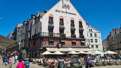
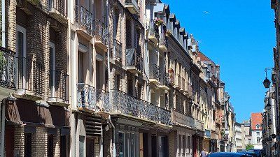
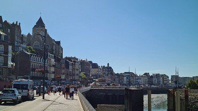
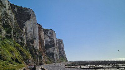
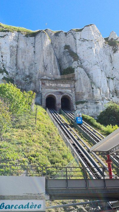
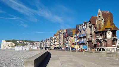
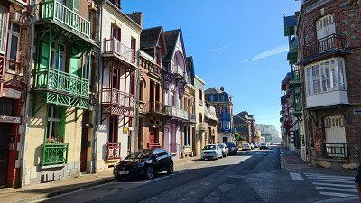
Monday. June 13, 2022.
felt. Weather sunny at 13 to 25 degrees.
Driven. 144 km. 2h10 driving time. Half highway and half country roads. via Dieppe, Rouen, Gallion to Les Andelys. Relatively quick ride with heavy traffic coming up, some construction sites, no traffic jams.
seen on the way. Cathedral, churches, Memorial Joan of Arc, Vieux Marché and half-timbered houses in the old town of Rouen on a long walk. Parked at Port Pleasance and cycled along the Seine Qaui to the old town. Rouen is a commune and port city with 112,321 inhabitants and prefecture of the department of Seine-Maritimend, seat of the Archdiocese of Rouen, primate of Normandy and the municipal association Métropole Rouen Normandie. Featured are: The Gothic Cathedral of 1180, completed in 1237; The Gothic abbey church of Saint Quen from 1318; The Saint-Maclou church was built in 1436 on the site of an older Flamboyant Gothic church; The late Gothic Reformed Church of St-Etoi. In addition to the religious buildings, there are also secular buildings worth seeing: the Jeanne d'Arc tower is one of the last remnants of the castle built around 1200 as a keep. Here Joan of Arc was interrogated by the judges in 1431. The Great Clock Tower, a large 14th-century astronomical clock; the Palais de Justice and others. Joan of Arc was burned at the Place du Vieux Marché in 1431. The church of Ste-Jeanne-d'Arc has stood on the square since 1979, which also accommodated the stained glass windows of the 16th-century church of St-Vincent, which was destroyed in 1944. Wikipedia.
See campsite. Old town Les Andelys and C hâteau Gaillard on a short bike tour in the evening. Les Andelys is a commune of 8,070 inhabitants in the Eure department in the Normandy region. There are two museums, the Musées Nicolas Poussin with Gallo-Roman exhibitions and the Mémorial Normandie Niemen . Next to the Château Gaillard are the Saint-Sauveur church, the Gothic collegiate church of Notre-Dame-du-Grand-Andely and the 13th-century church in Le Petit Andely. The Château Gaillard is a castle complex built at the end of the 12th century by Richard the Lionheart, King of England and Duke of Normandy, but was already destroyed in the Middle Ages and in the early modern period. The complex, which is one of the most important castles of the Middle Ages, is based on the crusader castles of Palestine and cost the enormous sum of around 50,000 livres at the time. In 1862 the ruins were included in the Monuments historique. Wikipedia.
slept. Camping de l'Île des Trois Rois, 1 rue Gilles Nicole, Les Andelys. Very nice facility with large parking spaces directly on the Seine.
rated. ●•••• for impressive contemporary witnesses of the Middle Ages.
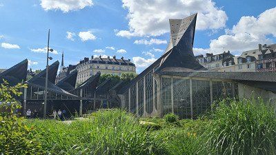
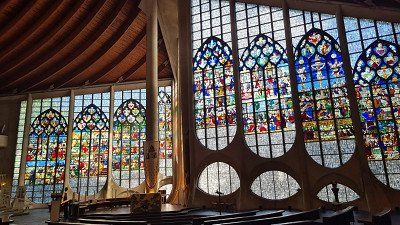
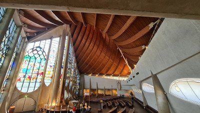
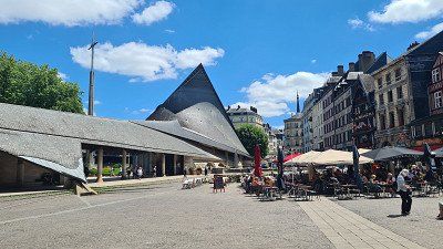
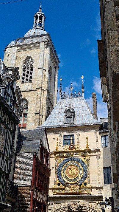
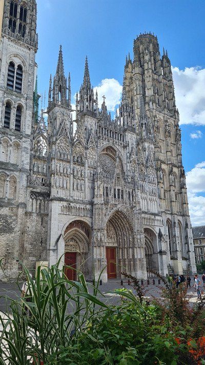
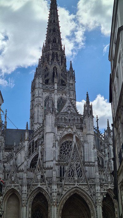
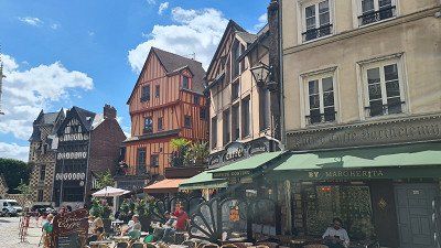
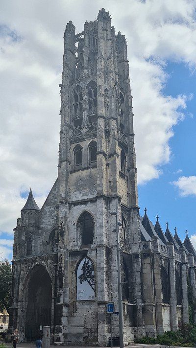
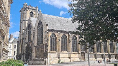
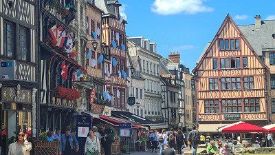
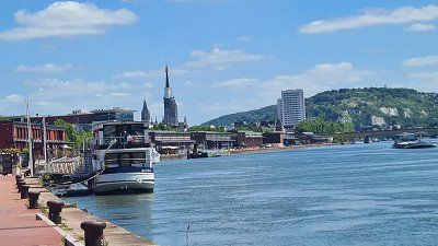
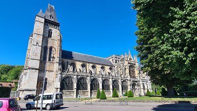
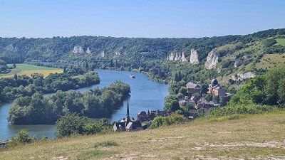
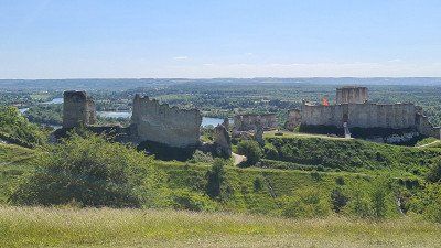
Tuesday. June 14, 2022.
felt. Weather sunny at 10 to 25 degrees.
See campsite. Old town, market and château in Gaillon on a long walk through the old town and up to the château Gaillon and its garden. By bike along the eastern bend of the Sehne to Gaillon and back via Heudebouville on the western bend of the Seine. It happened to be a market in Gaillon again. The château appears neglected and is accordingly undergoing renovation. Gaillon is a commune of 6,860 inhabitants in the Eure department in the Normandy region. The townscape is dominated by the mighty gate of the Renaissance castle on the ledge above the town. The large gatehouse of the Renaissance castle above the town is the town's landmark. It was restored in 1980. The parts of the large castle complex behind it are in need of serious renovation. In the early Middle Ages a Norman castle was built on the site on the chalk cliff to protect the Normandy border from the King of France. In 1453, Archbishop Guillaume d'Estouteville began building what he considered to be worthy of the title "castle" and Cardinal Georges d'Amboise expanded the complex from 1502 to 1509 into one of the largest and most magnificent Renaissance castles in France. The old town of Gaillon is characterized by numerous Norman-style half-timbered houses from the 18th and 19th centuries. Wikipedia.
slept. Camping de l'Île des Trois Rois, Les Andelys. Like yesterday.
rated. ●●●●○ for a nice cruise along the Seine.
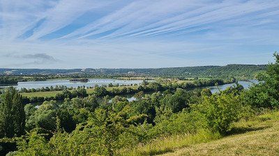
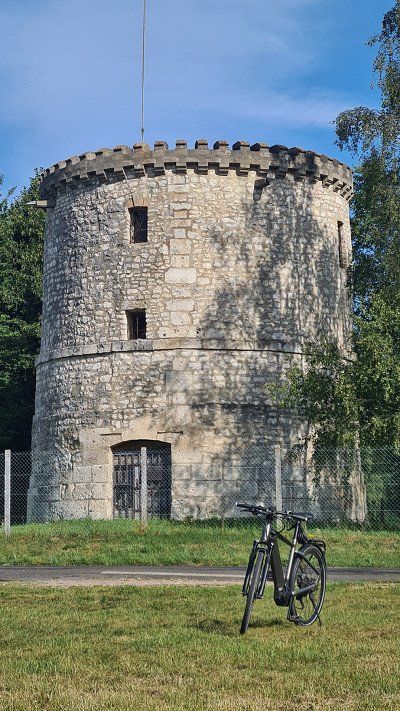
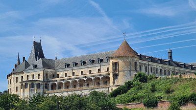
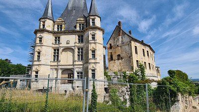
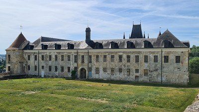
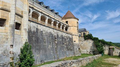
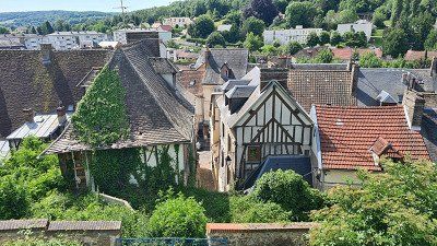
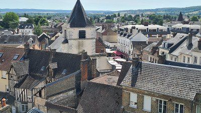
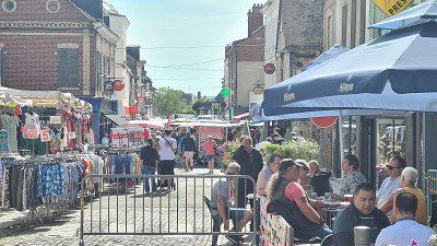
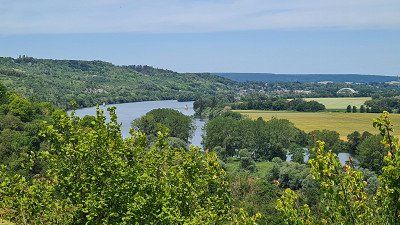
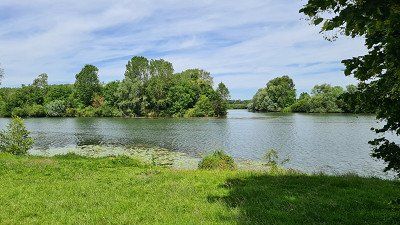
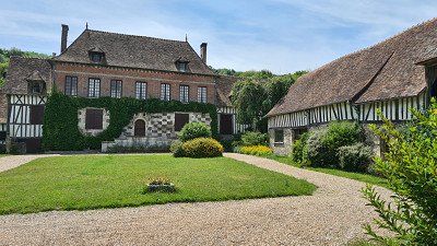
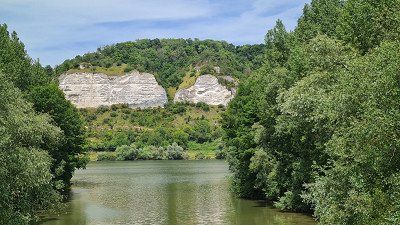
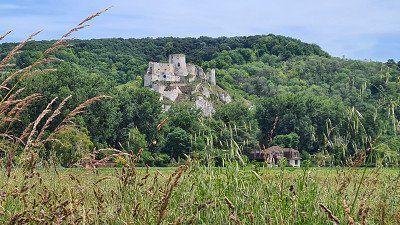
Wednesday. June 15, 2022.
felt. Weather sunny and hot with 16 to 30 degrees.
Driven. 291 km. 4h30 driving time. Mostly brisk driving on largely motorways or regional expressways via Cléry, the long Paris bypass to Reims and on to Chalon-en-Champagne. But as expected, it took me an hour longer because of slow traffic and sometimes traffic jams when bypassing Paris. Accordingly, I had the Eiffel Tower, the hill with Montmartre and the Paris skyline in view for a long time.
seen on the way. The city of Reims and its sights on an extended bike tour. I parked the mobile home at the Stade de Reims, about two kilometers from the center. For me, Reims was definitely worth a visit. The religious buildings, but also the squares and promenades are worth seeing. Unfortunately, the town hall and the bishop's palace were covered. Reims is a city of 181,194 inhabitants in the "historical province" of Champagne and sub-prefecture of the arrondissement of Reims in the Marne department in the Grand Est region. The city is also the seat of an Archbishop. In addition to champagne, Reims also produces textiles, food and equipment for space travel. The history of the city dates back to Roman times. The most important squares in Reims are the Place Royale and the Place du Parvis with a statue of Joan of Arc. The main street, Rue de Vesle, crosses the city from southwest to northeast, the oldest monument in the city is Porte de Mars, 33 meters long and 13 meters high triumphal arch. Notre-Dame Cathedral is considered one of the most architecturally important Gothic churches in France. From the 12th to the 19th century, the French kings were crowned here. It has been a UNESCO World Heritage Site since 1991, along with the Palais du Tau and the Basilica of Saint-Remi. The Archbishop's Palace (Palais du Tau) was built between 1498 and 1509. It hosted the French kings at their coronation celebrations. Wikipedia.
Seen campesite. The center with the two churches and the town hall of Châlons-en-Champagne and along the Marne Canal on a short bike tour. Châlons-en-Champagne is a town of 44,379 inhabitants in the historic region of Champagne and capital of the Marne department. In Roman times, Châlons-en-Champagne was called Catalaunum or Durocatalaunum and was the capital of the Gallic tribe of the Catalauni and an important city in the Gallia Begica. You can see the Saint-Etienne Cathedral and the Notre-Dame-en-Vaux Church. The city is associated with the Montagne de Reims Regional Nature Park as an access point. Wikipedia.
slept. Camping Châlons-en-Champagne, Rue de Plaisance, 51000 Châlons-en-Champagne. Although well located (3 km from the center) and also relatively spacious pitches under trees, but appears unkempt including sanitary facilities and restaurant. Not recommended except for one night.
rated. ●●●●● alone for the Reims Cathedral.
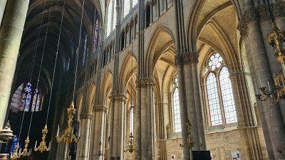
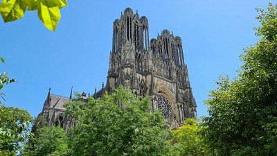
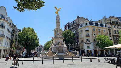
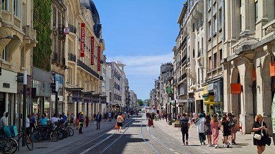
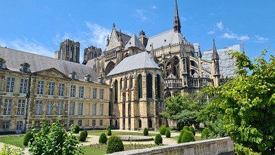
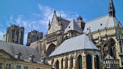
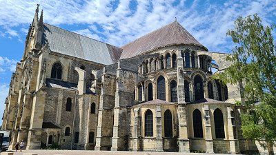
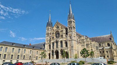
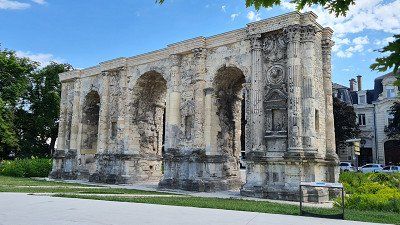
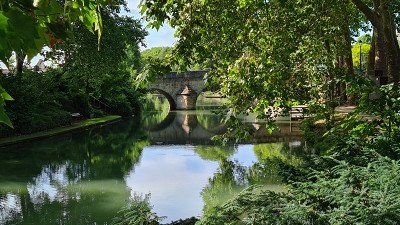
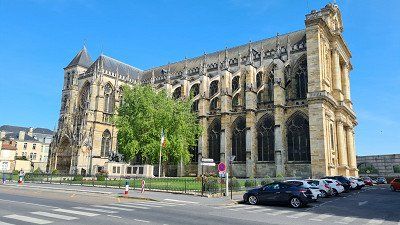
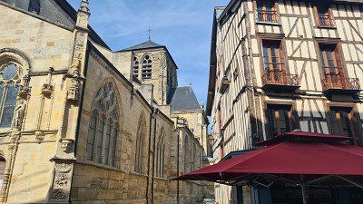
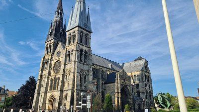
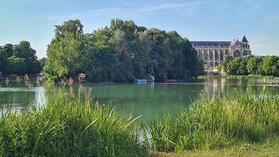
It is Thursday , June 16th, 2022. The night was warm with almost 20 degrees, the day became cloudless and hot up to 32 degrees. I left at nine o'clock with the aim of visiting Nancy and had a good three hours for the 163 kilometers on expressways. Around noon, paysant found a parking space right next to the Parc de Pepinière for the mobile home. I then walked almost a kilometer through the Parc de Pepinière and soon came across the imposing Place Stanislas . The first impression of this square with its cultural buildings on each side, the gilded gates with the fountains is overwhelming. I took the Petit Train touristique on the square and had it drive me on an hour-long tour of the sights of Nancy. Then I visited the most important points again on foot: I really liked the View Ville with the Basilica of Saint Epyre . I also wanted to take a closer look at the picturesque Place de la Carrière and Place d'Alliance, the Palais des Ducs (parts of which are still preserved) and the historic Porte de la Craffe and Porte de la Citadelle . Very impressed by Nancy's wealth of cultural assets, including the splendor on Place Stanilas, I walked back to the mobile home at 3:30 p.m. For the overnight stay, I have again planned a pitch from the Camping Car Park group in Mirecourt . For the 52 kilometers I chose toll-free expressways and country roads again and, despite some heavy traffic, I arrived in Mirecourt after a good hour's drive. The pitch is beautifully situated on the river Marne, just one kilometer from the center, looks well-kept and quiet, also because it is hardly occupied. An evening walk to the (rather dull) center ville of Mirecourt and along the (tired, arid) Marne round off my interesting day.
My goals on Wikipedia include: Nancy is a city with 105,058 inhabitants and the capital (prefecture) of the department of Meurte-et-Moselle. Historically, Nancy was the capital of the Duchy of Lorraine and, since 1777, the seat of a Roman Catholic diocese. The city's motto is "non inultus premor" (no one harasses me with impunity), which alludes to the Battle of Nancy in 1477 and the death of Charles the Bold. Nancy has a city center that is well worth seeing Old town shaped in the early modern period with the former ducal palace and the neo-Gothic church of Saint Epyre. The new town to the south has its center around the Place Stanislas. The squares Stanislas, de la Carrière and d'Alliance are one of the most important ensembles of enlightened-absolutist urban planning and were built in 1983 Inscribed on the Unesco World Heritage List.The squares were laid out by the architect Emmanuel Héré between 1752 and 1760. Mirecourt is a town of 4,949 inhabitants in the Vosges department in the Grand-Est region (until 2015 Lorraine).To see: old town and some churches , chapels.
●●●●● alone for the imposing Place Stanislas.
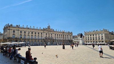
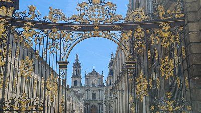
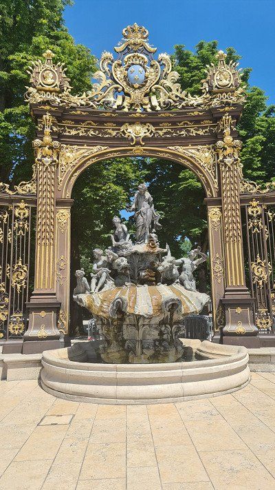
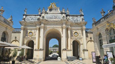
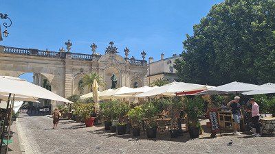
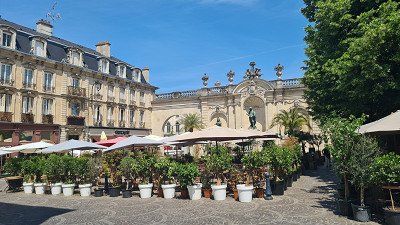
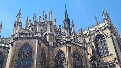
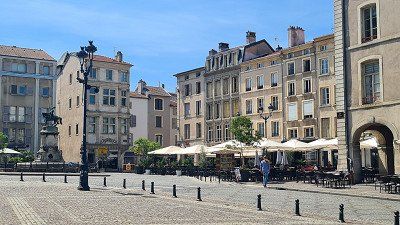
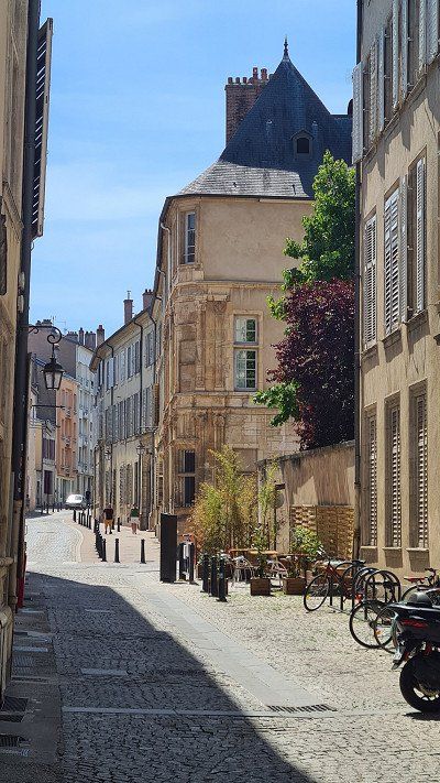
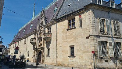
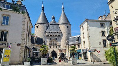
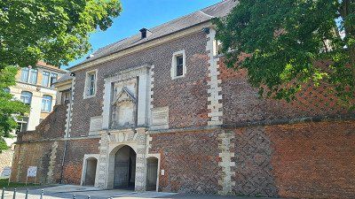
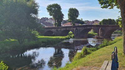
Wikipedia writes about today's destination Strassbourg : Strassbourg is a city with 287,228 inhabitants in Alsace, a region in eastern France on the border with Germany. Strasbourg is the capital of the Bas-Rhin department, which has been a member of the Alsace European local authority since January 2021. The city is the seat of the regional council and the regional prefect of the Grand-Est region. With 790,000 inhabitants in the Aire urbaine, Strasbourg is the largest city in the Grand Est. In addition to Basel (BIS), Geneva (ICRC and UN Europe) and New York (UN headquarters worldwide), Strasbourg is one of the few cities in the world with the headquarters of an important international organization, including the Council of Europe, the European Parliament and the European Court of Human Rights Because of this, Strasbourg sees itself as the capital of Europe. Parts of the city center, the medieval old town on the Grand-Île and the new town are UNESCO World Heritage Sites under the title "Strasbourg from the Grand-Île to the New Town, a European city scenery". Strassbourg was first mentioned in 589 and goes back to Celtic and Roman predecessor settlements. The name with street and castle probably means "fortified place on the army road from Inner Gaul".
It's Friday , June 17, 2022. The night was warm again at almost 20 degrees and during the day it was sunny again and very hot up to 32 degrees. I set off again at 9 a.m. and after a good 3 hours of driving and 175 kilometers on rural and expressways of the Vosges via Epinal, Saint-Dié-de-Vosges and Schirmeck, with moderate traffic, I reached Strasbourg around noon. I parked the mobile home in an avenue on the outskirts of Neudorf and cycled the almost three kilometers to the center. I first drove around the city center along the canal and then first visited the new town to the Place de la République with its imposing buildings (including the Palais de Rhin and the Imperial Palace). From there I walked through the historic old town of La Grand Île (unfortunately overcrowded with tourists) to the cathedral square with the 12th-century Notre-Dame Cathedral and the Palais Rohan , the bishop's seat. I then cycled along the canal again to the Quartier des Tanneurs (tanners' quarter) in the district of La Petite France and visited the half-timbered houses , locks and bridges on foot. From there I drove back to the mobile home. Rather accidentally on the bike tour I stumbled across the wine bar Le Burgatoire at lunchtime . The meal with a terrine de foie gras and an echine de cochon braisée was sensational. After another 40 minutes of driving I have reached Dambach-La-Ville in Alsace, my destination for the night after 55 kilometers of motorway. The simple but well-maintained pitches at Camping Car Park are rarely occupied. In the evening I cycle the three kilometers to visit the center of Dambach and to buy a baguette in the boulangerie. Dambach-La-Ville is a small but picturesque wine village with a few wineries and many well-preserved half-timbered buildings.
rated. ●●●●● for the ubiquitous charm of the "European capital".
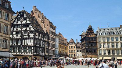
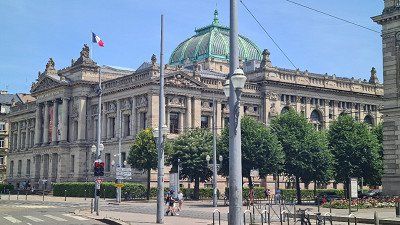
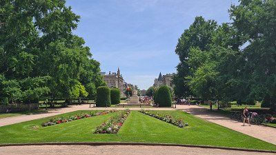
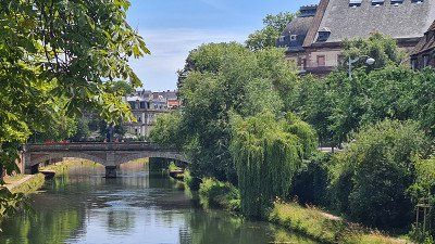
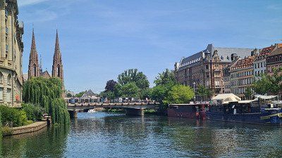
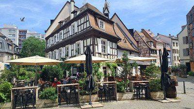
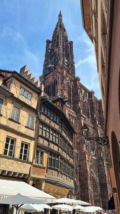
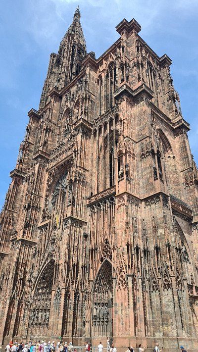
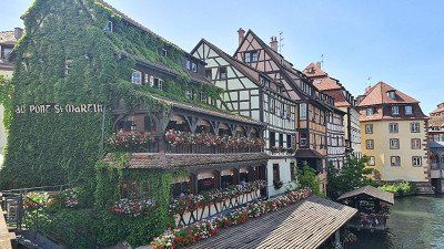
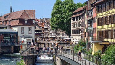
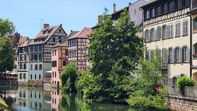
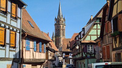
It's Saturday, June 18, 2022. The night was warm again with almost 20 degrees. As announced, it was tropically hot with 37 degrees during the day. I got up early to remove the worst dirt from the last few weeks on the camper and bike while the temperatures were still pleasant. Before noon I actually wanted to do a bike tour along the Route des Vins. After a few kilometers I gave up because it was getting too hot. I have therefore contented myself with walking through the picturesque streets of Dambach-La-Ville with the beautiful half-timbered houses ((photos 1-9) and the preserved city gates (photos 10-12) and through the local vineyards (photo 13) to the field chapel of St -Jean-Baptiste (photo 14) On the market square there is the restaurant A La Vignette (photo 15) about which Gault Millau writes: " The place is typical, the half-timbered house sits in the middle of the town, master of the wine route with its sixty listed monuments Some comment on this traditional menu, which draws a little from the terroirs, tarte flambée and Munstiflette , Bouchée à la Reine, pork cheeks..." and give it ten out of twenty points. My escargot and the truite were very good anyway Since the heat was slowly becoming unbearable, especially in the camper van on the shadeless pitch, I decided to drive home towards evening meter autobahn arrived in Zullwill at around seven in the evening and parked the mobile home, as planned after a stop at the car wash in Duggingen. So today "our" eventful spring trip finds its happy end.
●●●●○ for the charm and culinary delights of the wine village.
Dambach-la-Ville is on Wikipedia: The French municipality with 2,215 inhabitants is located in the Bas-Rhin department of the Grand Est region and belongs to the European regional authority of Alsace. Dambach-la-Ville is part of the Alsace Wine Route and describes itself as a "medieval wine town". Your single vineyard "Frankstein" is part of the Alsace Grand Cru appellation. Dambach was elevated to the status of a town in the 11th century and expanded into a fortified bishopric in the 14th century. From 1871 until the end of the First World War, Dambach was part of the Reich Estate of Alsace-Lorraine of the German Empire. In the town center there are many half-timbered houses and Renaissance buildings. In addition, the three gates of the former fortification are still standing. You can also see the town hall, the Saint-Sebastien chapel with the ossuary, the Notre-Dame chapel, the St-Jean-Baptiste field chapel and the Bernstein castle ruins. The Route des Vins d'Alsace from 1953 is one of the oldest tourist routes in France, stretches 170 kilometers between the Vosges and the Upper Rhine plain through the departments of Bas-Rhin and Haut-Rhin and forms the southern continuation of the German Wine Route in the Palatinate. 67 of the 119 Alsace wine-growing communities or 49 of the 51 vineyards designated as Alsace Grand Cru are located on the Route des Vins.
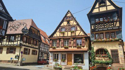
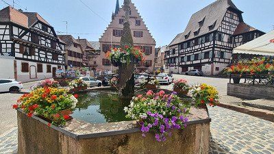
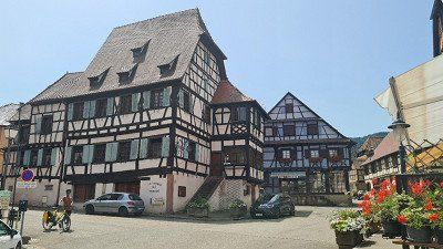
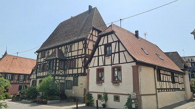
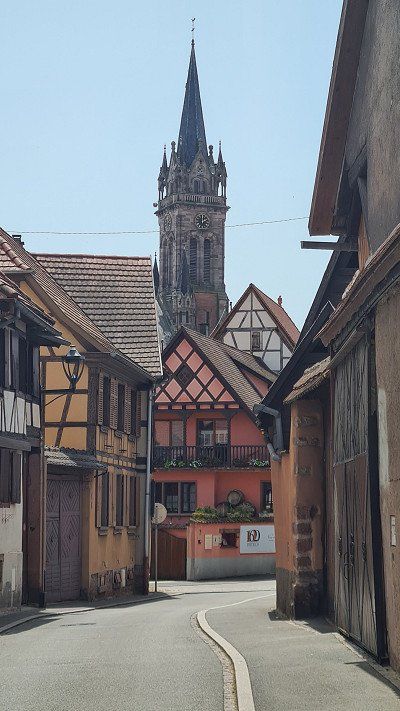
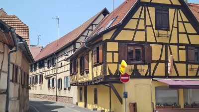
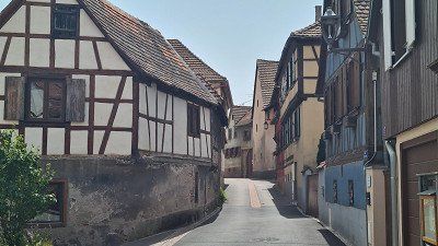
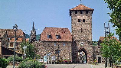
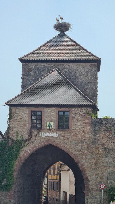
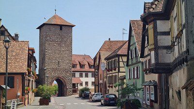
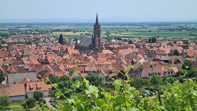
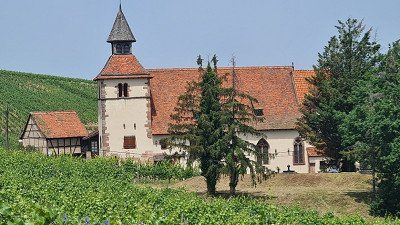
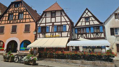
Route
Show newest first- 47.3912 7.5998
- 47° 23' 28.2" N 7° 35' 59.4" E
- 45.0135 4.8454
- 45° 0' 48.5" N 4° 50' 43.5" E
- 43.02 3.039
- 43° 1' 11.8" N 3° 2' 20.3" E
- 42.1888 3.0814
- 42° 11' 19.8" N 3° 4' 53.1" E
- 40.6593 0.786
- 40° 39' 33.5" N 0° 47' 9.5" E
- 40.6593 0.786
- 40° 39' 33.5" N 0° 47' 9.5" E
- 36.7817 -2.2422
- 36° 46' 54.3" N 2° 14' 32.1" W
- 36.7817 -2.2422
- 36° 46' 54.3" N 2° 14' 32.1" W
- 37.1591 -3.4404
- 37° 9' 32.7" N 3° 26' 25.6" W
- 37.1591 -3.4404
- 37° 9' 32.7" N 3° 26' 25.6" W
- 37.1591 -3.4404
- 37° 9' 32.7" N 3° 26' 25.6" W
- 36.7166 -4.2385
- 36° 42' 59.7" N 4° 14' 18.6" W
- 43.3623 -1.7001
- 43° 21' 44.3" N 1° 42' 0.4" W
- 46.9993 5.1455
- 46° 59' 57.5" N 5° 8' 43.9" E
- 47.4527 7.605
- 47° 27' 9.9" N 7° 36' 18.1" E
- 46.9993 5.1455
- 46° 59' 57.5" N 5° 8' 43.9" E
- 47.7704 1.6864
- 47° 46' 13.3" N 1° 41' 11" E
- 48.0977 -0.3516
- 48° 5' 51.7" N 0° 21' 5.6" W
Heute betrete ich zwischen Laval und Vitré mein erstes
Reiseziel, die Bretagne. Dazu steht bei Wikipedia, dass die
Region Bretagne als Halbinsel im Nordwesten Frankreichs
umgeben ist von 2'700 Kilometer Küste. Diese Küste zeichnet
sich aufgrund ihrer Vielfältigkeit aus: Die Côte de Granit Rose
befindet sich im Norden der Bretagne im Département Côtes-
d’Armor und erstreckt sich über 30 Kilometer von Plestin-les-
Grèves bis Louannec. Der rosafarbene Granit ist sehr selten
und nur an drei weiteren Orten der Erde zu finden: Ontario in
Kanada, Korsika und China. Eine der charakteristischsten und
bekanntesten Landspitzen der Bretagne ist die wilde Pointe du
Raz im Südwesten, die sich 70 Meter über dem Meer erhebt.
Das Panorama über den wilden Atlantik inspirierte schon einst
die französischen Autoren Victor Hugo und Gustave Flaubert.
In der Ferne zu erkennen ist die kleine Insel Sein inmitten zahl-
reicher Leuchttürme, auch der berühmte Ar Men. Zur rauen
Landschaft der Pointe du Raz bilden die weissen Sandstrände
und grünen Inseln des Golfs von Morbihan einen Kontrast.
Der Golf von Morbihan ist ein mit dem Atlantik verbundenes
Binnenmeer mit 42 grünen Inseln im Süden der Bretagne im
Département Morbihan. So vielfältig wie die Küste sind auch
die mehr als 800 kleinen und großen Inseln, die die Bretagne
umgeben. Einige von ihnen sind: Île-de-Bréhat (Blumeninsel);
Île de Batz (Tropengarten); Ouessant (westlichste Insel des
französischen Festlands); Île-Molène (Archipel von Molène,
wildes Paradies mit Stränden aus weissem Sand und Riffen);
Glénan-Inseln (Archipel mit paradiesische Landschaften wie
in tropischen Ländern); Belle-Île (natürliche Häfen, kleine schöne Buchten, Strände mit feinem Sand, Dünen und Kliffs mit zahlreichen Küstengrotten); Île-aux-Moines; Sept Îles (Seit
1912 Naturschutzgebiet für seltene Vogelarten). Die „villes et
pays d’Art et d’Histoire“ wurden vom französischen Kultusmini-
sterium für ihr kulturelles und historisches Erbe ausgezeichnet. Sie setzen sich in einer gemeinsamen Charta für den Erhalt und die Förderung dieses Erbes ein, auch Bretagnes Städte: Dinan,
Nantes, Rennes, Concarneau, Fougères, Quimper, Vannes,
Vitré (Ille-et-Vilaine) und Saint-Malo. In der Bretagne sind über
6'000 Megalithen und 1'000 Dolmen zu finden, die grösste Ansammlung mit 3'000 Steinen befindet sich in Carnac. Die
Bretagne ist eine westfranzösische Region. Sie besteht heute
aus den Départements Côtes-d’Armor, Finistère, Ille-et-Vilaine
und Morbihan. Die Region misst 27'208 Quadratkilometer und 3'354'854 Einwohner "Bretonen) lebten 2019 hier. Rennes ist
Hauptstadt. Das Département Loire-Atlantique, das zur histo-
rischen Bretagne, nicht aber zur Verwaltungsregion gleichen
Namens zählt, wurde bei der Schaffung der Regionen in den
Sechziger Jahren mitsamt der ursprünglichen bretonischen
Hauptstadt Nantes vom Rest der Bretagne abgespalten. Die
Bretagne ist die grösste Halbinsel Frankreichs und westlichster Ausläufer des europäischen Festlands nördlich der Iberischen
Halbinsel. Die Gallier nannten sie Aremorica „Land am Meer“.
- 47.6997 -2.3362
- 47° 41' 58.9" N 2° 20' 10.2" W
- 47.6997 -2.3362
- 47° 41' 58.9" N 2° 20' 10.2" W
- 47.5847 -3.0778
- 47° 35' 4.9" N 3° 4' 40" W
- 47.5847 -3.0778
- 47° 35' 4.9" N 3° 4' 40" W
- 47.5847 -3.0778
- 47° 35' 4.9" N 3° 4' 40" W
- 47.8564 -3.7446
- 47° 51' 22.9" N 3° 44' 40.7" W
- 47.8564 -3.7446
- 47° 51' 22.9" N 3° 44' 40.7" W
- 48.0932 -4.3286
- 48° 5' 35.6" N 4° 19' 43" W
- 48.2463 -4.4896
- 48° 14' 46.7" N 4° 29' 22.4" W
- 48.6627 -4.103
- 48° 39' 45.6" N 4° 6' 10.9" W
- 48.6325 -3.9275
- 48° 37' 56.8" N 3° 55' 39.1" W
- 48.7798 -3.0488
- 48° 46' 47.2" N 3° 2' 55.8" W
- 48.6056 -1.8014
- 48° 36' 20" N 1° 48' 5.2" W
Heute verlasse ich die Bretagne und betrete die Normandie.
Ich lese bei Wikipedia zur Normandie: Bereits Anfang des
neunzehnten Jahrhunderts entwickelte sich die Normandie zu
einem beliebten Reiseziel. Als Napoleon und seine Gattin
Marie-Louise von Österreich die Hafenstadt Dieppe besuchten,
war Dieppe schon ein populärer Urlaubsort der britischen High
Society. Hortense de Beauharnais und die Herzogin von Berry
machten Dieppe kurz darauf zum ersten Seebad Frankreichs.
Sie waren begeistert von romantischen Burgen und Abteien
und damit auf den Spuren ihrer Ahnen wandeln zu können.
Marie-Henri Beyle (Stendhal) prägte daraufhin den Begriff Tourismus und William Turner illustrierte 1828 den ersten Reiseführer Romantic Normandy. Besondere Attraktionen der Normandie sind der sagenumwobene Mont-Saint-Michel und
der weltberühmte Teppich von Bayeux. Weitere Sehenswürdig-
keiten sind Claude Monets Haus und Garten in Giverny, die
weissen Kreidefelsen von Étretat und die Landungsküste der Invasion der Alliierten am D-Day, dem 6. Juni 1944. La Cité de
la Mer ist ein Museum in Cherbourg, das dem Meer gewidmet ist. Die angrenzenden Orte Deauville und Trouville-sur-Mer
sind beliebte Seebäder. Christliche Pilger besuchen wiederum
die Geburts- und Sterbeorte Alençon und Lisieux der Heiligen
Therese von Lisieux, sowie Rouen als Ort des Martyriums der
Heiligen Johanna von Orléans. Die Normandie ist eine Region
im Norden Frankreichs und begründet 996 nach Christus als
historische Provinz. Das Gebiet gliedert sich in das untere
Seine-Gebiet (frühere Haute-Normandie) von Giverny bis ans
Meer und das Land westlich davon (frühere Basse-Normandie)
mit der Halbinsel Cotentin. Zum ehemaligen Herzogtum
Normandie gehörten auch die Kanalinseln. Zwischen Pointe
de Barfleur und Cap de la Hève erstreckt sich die Baie de
Seine, die markanteste Bucht der Normandie. Das Herzogtum
begann als Lehen an Rollo, einen Wikingeranführer durch den
westfränkischen König Karl (911). Rollos Nachfahren gelang die
Eroberung Englands. Die Herzöge der Normandie waren auch
Könige von England (bis 1087, von 1106 bis 1144 und ab 1154).
Das Herzogtum kam dann im Hundertjährigen Krieg unter die
Herrschaft der französischen Könige. Mit der Schaffung der
Départements im Gefolge der Französischen Revolution und
der zwei Regionen Haute-Normandie und Basse-Normandie
war die Normandie ab 1972 keine politische Einheit mehr, aber
die Frage der Wiedervereinigung der Normandie blieb populär,
so dass die Zusammenführung wieder erfolgte, 2016 im Zuge der Neuordnung der französischen Regionen. Zu dieser Region
Normandie gehören heute die Départements Calvados, Eure,
Manche, Orne und Seine-Maritime. In der Normandie lebten
2019 3'325'032 Menschen. Le Havre ist die grösste Stadt, gefolgt von Rouen, Caen und Cherbourg.
- 49.379 -1.226
- 49° 22' 44.5" N 1° 13' 33.6" W
- 49.379 -1.226
- 49° 22' 44.5" N 1° 13' 33.6" W
- 49.1829 -0.3707
- 49° 10' 58.3" N 0° 22' 14.4" W
- 49.1829 -0.3707
- 49° 10' 58.3" N 0° 22' 14.4" W
- 49.354 0.0751
- 49° 21' 14.3" N 0° 4' 30.4" E
- 49.354 0.0751
- 49° 21' 14.3" N 0° 4' 30.4" E
- 49.6986 0.283
- 49° 41' 54.9" N 0° 16' 58.8" E
- 49.6986 0.283
- 49° 41' 54.9" N 0° 16' 58.8" E
- 49.6986 0.283
- 49° 41' 54.9" N 0° 16' 58.8" E
- 50.0371 1.3627
- 50° 2' 13.6" N 1° 21' 45.6" E
- 49.2466 1.4192
- 49° 14' 47.6" N 1° 25' 9.1" E
- 49.2466 1.4192
- 49° 14' 47.6" N 1° 25' 9.1" E
- 48.9567 4.3631
- 48° 57' 24.1" N 4° 21' 47.1" E
- 48.3022 6.1339
- 48° 18' 7.8" N 6° 8' 1.9" E
- 48.3231 7.4263
- 48° 19' 23" N 7° 25' 34.9" E
- 48.3231 7.4263
- 48° 19' 23" N 7° 25' 34.9" E
- 47.3912 7.5998
- 47° 23' 28.2" N 7° 35' 59.4" E
Travelogue
It is Sunday April 10th, 2022 . The morning is still cool, but the day will be beautiful and sunny with a pleasant 16 degrees. As before every tour, I first drive in our BMWi3 at eight o'clock in thirty minutes from my home in Basel am Rhein (1) 30 kilometers south to Zullwil in the Solothurn Jura. There, directly below the ruins of Gilgenberg (2) from the 12th century, is our Bürstner Ixeo in its place in the garage (3).
It is Sunday April 10th, 2022 . The morning is still cool, but the day will be beautiful and sunny with a pleasant 16 degrees. As before every tour, I first drive in our BMWi3 at eight o'clock in thirty minutes from my home in Basel am Rhein (1) 30 kilometers south to Zullwil in the Solothurn Jura. There, directly below the ruins of Gilgenberg (2) from the 12th century, is our Bürstner Ixeo in its place in the garage (3).
At nine o'clock I start the tour with the aim of
this day the first of two parts of the way to that
driving in the Mediterranean. The chosen route leads me first
on country roads over green and yellow blooming Jura heights,
from then on on the motorway only past Montbéliard and
Besançon, then through picturesque Burgundy near Beaune,
passing Chalon-sur-Saône, Mâcon and Lyon through the
beautiful Rhône valley to La Roche-de-Glun. moderate traffic,
no traffic jams or construction sites allow me a pleasant,
stress-free and quick journey. Three times I raced a half
Hour on the most beautifully situated "Aire de ..." at the
French motorways, but refrain from sightseeing
on road. I ride a total of 545 kilometers (of which 441
kilometers of motorway) and needed seven hours for it
the breaks. Around four o'clock I reach mine as planned
Daily goal and move into the camping car park
on the outskirts of La Roche-du-Glun. I go for a walk in the evening
to the center of La Roche-de-Glun to the Mairie (1), to
Tower of Diane of Poitiers (2), through the gate after
Roussillon (3), to the dam with a small hydroelectric power station
with a view of the place (4) and along the Rhône Promenade (5)
back to the pitch (6-7). The place itself does not offer
a lot of interesting things and also has a great effect on me
extinct. As in many places today, these are small
Communities deserted on Sundays, so not a single restaurant was open. However, it was very beautiful along the
Walk along the Rhône promenade.
●●○○○ Day of transit. Safely at the destination.
I found La Roche-de-Glun as a stage destination on the Camping-Car Park website. This company calls itself " the 1st European network of stopover sites and services areas" and includes 350 pitches throughout France. The organization largely meets my needs because (a) the current occupancy is visible online in an app, (b) the pitches are mostly located close to town, are spacious and well-kept, (c) the use is very inexpensive with electricity included and ( d) the pitches are accessible at all times thanks to the access card. The fact that there are no sanitary facilities doesn't bother me, the space with a power connection is enough for me. I read about this facility in advance of the tour and immediately bought the necessary access card. It worked for me, because in the end I spent a good half of all nights on this tour at Camping-Car Park sites and I would not go to just two of these twenty sites.
Wikipedia states that La Roche-de-Glun has 3,333 inhabitants and is picturesquely situated on a river island in the Rhône
in the Drôme department in the Auvergne-Rhône-Alpes region
lies. Sights are: The dam with small
Hydroelectric power station on the Rhône, the Tower of Diane de Poitiers from the 14th century (monument historique), the gateway to Roussillon and the gate wall (relic of the city wall) from the 13th and 14th centuries.
It's Monday April 11, 2022. The night was cool,
the day is mostly cloudy and windy with a high of 13 degrees.
Today I drive the second part of the way to the Mediterranean Sea.
This only takes me further on the Autobahn
the Rhône Valley past Nîmes and then on the delightful
Languedocienne along the sea past Montpellier
and Narbonne to Port la Nouvelle. After 328 kilometers,
with moderate traffic and three and a half hours more entertaining
and pleasant driving time, I reach the shortly after noon
selected parking space from Camping-Car Park on the outskirts of
Port La Nouvelle. Later in the afternoon I'll take the
Bike a bit along the Réserve Naturelle Régionale de
Sainte-Lucie (1-2), to the beach (3), to the harbor with the casino
(4) and in the Center ville of Port la Nouvelle (4-8) and
back to the pitch (9). The place seems outside of the
Quite deserted season, especially seen on the mostly
closed shutters in the seaside resorts.
●●○○○ Day of transit. Safely at the destination.
According to Wikipedia, Port-la-Nouvelle has 5,686 inhabitants
in the Aude department in the Occitania region. The community
is both a transshipment port for oil and grain and a
Bathing resort with 13 kilometers of sandy beaches. In addition, the
touristically significant Canal de la Robine here in the Mediterranean Sea.
Port-la Nouvelle also includes the island of Sainte-Lucie
north of the town and the island of La Nadière in the Étang de
Bages-Sigean with a former fishing village. The well-known hiking trail “Sentier cathare” also starts in the village
Port la Nouvelle to Foix. Nothing worth seeing is mentioned about the place itself. The Sainte-Lucie Regional Nature Reserve was classified in 2009, occupies an area of
825 hectares and protects the island of Sainte-Lucie as well as the
Wetlands and river beaches. The nature reserve
consists of two sectors through the Robine Canal
are separated: the western sector corresponds to the island
Sainte-Lucie, the pond of Bages-Sigean from the pond of
Ayrolle separates. The eastern sector is an area with lagoons,
Wetlands and beaches between the island and the
Mediterranean Sea. The highest elevation at 39 meters is enclosed
Roc Saint Antoine. The lock of Sainte-Lucie allows
the transition from one sector to another.
It's Tuesday, April 12, 2022. The night stayed again
cool at 9 degrees, the day is dry but unfortunately also mostly
cloudy at 14 degrees. I have a shorter route for today
planned, because the first nature park awaits at the destination
Trip. I leave at nine o'clock and need 143
Kilometers of mostly country roads two and a half hours
driving time. The path leads along the Mediterranean coast
Perpignan, Port Vendres and Roses to Sant Pere Pescador.
There is little traffic again and the journey goes quickly
through the beautiful, now very Mediterranean landscape. Both
I cross the border from the foothills of the Pyrenees to the sea
of Spain. Since the Parc Natural dels Aiguamolls de l'Empordà near Sant Pere Pescator is my destination for the day, I don't go there
on sightseeing. Meet at Las Palmeras campsite
me just before noon. The place is well chosen, it is obvious
of place and sights, has spacious parking spaces
on lawn, clean sanitary facilities, a pool, a small one
Mercado and a restaurant. I'll be with you in the afternoon
cycled the 10 kilometers north to the nature park
and went on a half-hour walk through the Parc
Natural dels Aiguamolls de l'Empordà (1-4) Insight into a
very nice nature reserve can take a real
remarkable natural landscape. With the bike I'm the one
10 kilometers back and another 15 kilometers south
drove to the Ruïnes de Empúries (5-8) and also visited the archaeological site and the harbor pier on a short walk. This visit was also worthwhile. On the way back to the campsite I stopped and shopped in Sant Pere Pescator (9-11).
●●●●○ Attractive coastal roads, beautiful nature park, interesting archaeological site and good campsite.
The municipality of Sant Pere Pescador has 2'039 inhabitants
in the Autonomous Region of Catalonia in the province of Girona and
in the comarca Alt Empordà and lives from tourism and the
Agriculture (apple cultivation). For the place mentions Wikipedia
nothing worth seeing. The Parc Natural dels Aiguamolls de
l'Empordà is located in the confluence of the rivers Muga and
Fluvià in the Bay of Roses on the Costa Brava of Catalonia. The nature park extends over the protected areas of Estanys
(Fish weirs, cattails and meadows), Llaunes (lagoons at
the coast) and the island of Caramyany (in the middle of the river Fluvià with
large bird life) and covers 4,783 hectares. The Ruïnes de Empúries are witnesses of an ancient Greek colony that dates back to a trading post in 600 BC
goes. The archaeological three-part park with museum and
Hafenmole consists of the earliest "old town", the
Greek-Iberian new town and the Roman municipal town.
It is Wednesday April 13, 2022. During the night it has
at 8 degrees it started to rain, during the day it rained continuously
stopped and the temperature did not rise above 14 degrees. as
Today's goal I have chosen a nature park again,
those in the mouth of the Ebro. The way of 330
Kilometers, largely on freeways leads me past
Girona, Barcelona and Tarragona to L'Eucaliptus/Amporta.
Despite some heavy rain along the Costa Brava and Costa
Daurado, but moderate traffic, hardly any construction sites and none
I make good progress in traffic jams and need a good three and a half
hours driving time. Shortly after noon I get the last one
Pitch at Camping Ampolla Playa in L'Ampolla,
which I got when I called the day before
(fully booked due to Easter approaching). I'm a good one then
half hour on the coastal promenade (1-4) to Ampolla
walked and I was looking for a shelter due to the weather
and found what I was looking for in the Can Pinana restaurant at the port.
Their lenguado a la plancha was very good. After return on
but I decided to leave the campsite. Although I could accept that he fully
and also unkempt, but then it got extreme
noisy, the place was slowly running under water and so was the electricity
still failed. I called around and got a seat
found on the other side of the delta. And so am in the evening
30 kilometers further to the Eucaliptus campsite on the
Playa of the place of the same name L'Eucaliptus/Amporta.
The decision was right, because this campsite was indeed
also fully occupied, but was closer to the nature park and had
also have a modern but well-maintained infrastructure
with pool, mercado and restaurant and I also got one
Premium pitch with sea view. I then finish the day with a walk to the dunes behind the
campsite (5-9) and a glass of red wine in the restaurant
let it fade away. The dunes were worth seeing, but because
Floods only partially accessible.
●●●○○ Spanish-Mediterranean cuisine and ultimately beautiful
Pitch directly at the dunes.
Wikipedia. L'Ampolla is a Catalan municipality. It has 3,280 inhabitants and is located in the province of Tarragona in northeastern Spain or in the comarca of Baix Ebre at the northern end of the Ebro Delta. Nothing worth seeing is mentioned. L'E ukaliptus/Amporta is a small bathing settlement with a beautiful beach and a district of the Ebro Delta, whose main town, Amposta, with 20,738 inhabitants, mainly cultivates rice. In addition to the nature park, the suspension bridge over the Ebro and the remains of a medieval castle are also worth seeing in the Ebro Delta. The extensive Ebro delta with the lagoons of Tancada and l'Encanyissada as well as the rice fields in the canal-crossed delta landscape are ideal for hiking. The water springs and swamps are also worth seeing.
It is Wednesday April 14, 2022. It was at night
still cool with 9 degrees, but the rain let up and the
Day became sunny and warmer up to 19 degrees. the morning
I dedicated myself to taking care of the camper and myself.
In the afternoon I have a three-hour bike tour
undertaken by the Parc Natural del Delta de l'Ebre and
multiple stops and short walks at well-located viewing platforms (1-9) inserted. On the way between two of these visits I came across an inconspicuous country estate. The mariscos and the paella in the local one
Taverna La Tancada are highly recommended. I am in the evening
walked back to the dunes at the campsite (10-11).
●•••• The species-rich bird life in a lagoon landscape that is really worth seeing and for culinary enjoyment of Mediterranean specialties.
According to Wikipedia, the Parc Natural del Delta de l'Ebre
Alluvium area at its mouth in the Mediterranean Sea
and is located in the Ebro Delta in southern Catalonia. The park is
next to the national park Coto de Donana the most important
Wetland in Spain and, with 32,500 hectares , is one of the largest deltas in the world, along with those of the Rhône and Po
European Mediterranean coast. A third of the delta was
assigned to the nature park in 1983, a species-rich breeding
and resting area for many species of birds and wintering area
of migratory birds from Northern Europe. Around 300 different ones
native bird species, migratory birds and flamingos are here too
see. Today the ecosystem is threatened by blue crab and
Louisiana Cancer.
It's Good Friday, April 15, 2022. The nights stay
unchanged cool at 10 degrees, the days are sunny again and
are slowly getting warmer up to 20 degrees. I originally
with Futura in the hinterland of Murcia the next stopover
chosen. I had to give up this goal because the two places
occupied at the thermal baths in Fortuna because of Easter or
were no longer in operation. Since I have the only alternative, the
Campsite in the Sierra Espuña cannot be reached by phone
I decided to skip the goal
and straight to the next destination, the Parque Natural de Cabo de
to drive Gata-Níjar. I'm whole that day
Drove 638 kilometers (555 kilometers on motorways) past Valencia and Alicante to Camping Cabo de Gata
outside the coastal town of the same name, Cabo de Gata.
The drive over the last 250 was particularly impressive
kilometers. I felt like I was almost alone for two hours
to be on the road on a freeway, also past one of the
most impressive landscapes I have seen so far,
Mediterranean shaped full of Colinas, Ramblas and Barrancos (1-3). Since I'm quite fast again with only moderate traffic
progressed, no visits planned on the way
and only turned on three short stops, I am
after a good eight hours of driving in the late afternoon
Place arrived (I reserved in the morning as a precaution).
The place was then about two-thirds occupied. I have on
Evening walk around the camp
along the countless white greenhouses (4-5).
Taken tomato and the day with a glass of wine
Round off the camp restaurant by the pool.
●●●●○ The last two hours of driving "almost alone on the road through an impressive landscape".
According to Wikivoyage, Cabo de Gata is a place in the province of Almeria in the Cabo de Gata Natural Park. Mentioned as sights are: Faro de Gata lighthouse with views of the Arrecife de las Sirenas rock formations, Iglesia de las Salinas, Torre de San Miguel and the Salinas de Cabo de Gata with vantage points for bird watching.
It's Easter Saturday, April 16th, 2022. The weather is going to be
noticeably to be further south now. The night was with
13 degrees a bit warmer, the day sunny and despite the wind until April 22
Degrees warm. I explore the west side of the cape in the morning
of the nature park. I first cycle to the center of
Cabo de Gata with the Torreón de San Miguel (1) and then
further along the infinitely long beach in the bay of
Almeria (2) to Faro de Cabo Gata (3) at the southernmost
point of the natural park. On the initially same way back
I stop in the small seaside resort of La Fabriquilla and enjoy it
Restaurante Angelita a bocadillo di tonno marocchino con
olive and the views across the bay and to the cape. From there I take the route on the
other side of the big lagoon and drive along the
Salinas de Cabo de gata (4-6) and stop several times at the viewing platforms for observing the diverse
bird life were established. The rest of the afternoon and on
In the evening it's "Dolce far niente" and I let my soul go
simply dangle in a Mediterranean atmosphere on the surprisingly quiet campsite (7).
●●●●○ Natural park worth seeing.
According to Wikipedia, the Parque Natural de Cabo de Gata-Níjar begins immediately after the retort town of Retamar, stretches across the actual Cabo de Gata (Cape of Agate) and ends in front of the port of Carboneras. The coastline is rugged and bounded inland by mountains, the Sierra del Cabo de Gata and the Sierra de la Higuera. The geological origin lies in a strong volcanic activity in the Tertiary, when the Betic Cordillera unfolded. All volcanoes are extinct, but the region is still affected by earthquakes.
It's Easter Sunday, April 17, 2022. The weather is staying the same
unchanged from the day before, up to 12 degrees at night, sunny during the day
up to 22 degrees. I intend to do the east side today, in the morning
of the Natural Park of Cabo de Gata and then
my next goal, to drive to the Sierra Nevada. First leads
me my way to San José and a viewpoint that allows the view of the cape and its beaches (1). At the
later in the morning I'll drive on, but make a note of it
the area for another visit. I take it very much
beautifully landscaped A92 motorway through the Sierra Nevada (2-3)
via Guadix and Grenada to my destination for the day, the campsite
Las Lomas on the Carretera Güéjar-Sierra. For the 246 kilo
meters I need a pure driving time of three hours.
Persistently little traffic but allow a speedy again
Ride, the many stops along the way leave me alone
Reach destination in the early afternoon. I have precautions for
Reserved three nights and put the mobile home on one
nice shady place (4). The campsite is well occupied.
Then I cycle the three kilometers
to Güéjar Sierra. The beautifully situated mountain village (5-9) with
a few old buildings and casas that are worth seeing
bustling with many families at this afternoon
Sunday brunch in the restaurants on the market square. On the
On the way back I enjoy the beautiful views of the nearby
Mountain Landscape (10-11). When I come back, I visit first
the camp's restaurant. It's busy and I have to
waited half an hour for my seat. The filet de
Ternera (12) Tastes great and justifies the wait.
At the beginning of the evening I sit on the camp's own
Mirador with again a beautiful view of the reservoir and the snow-capped peaks of the Sierra Nevada (13-14).
●•••• The views of unique landscapes on the Cabo
de Gata and in the Sierra Sierra Nevada.
At Wikipedia, San José is a village in the municipality of Níjar in the
Spanish province of Almería in southern Andalusia. The popular holiday resort is located in the Cabo-de-Gata-Níjar Nature Park on the extreme south-east coast of Spain and has 1,012 inhabitants,
up to 20,000 visitors at times in the summer months. Of the
San José Beach is located on a shallow bay on the Costa de Almería, near the marina. South from
San José is Playa de los Genoveses, a bathing beach
with rocky headlands at each end and the Playa de
Mónsul covered with gray volcanic sand and huge dark boulders of volcanic rock. Both beaches are among the most beautiful in Spain. Portions of numerous films have been shot on both beaches, including Pirates of the Caribbean (2003) and Indiana Jones and the Last Crusade (1989). Above all, nature is still pure here, which also means that in summer you are not allowed to drive your own car to the beach. You can either walk or use the San Jóse shuttle bus to get to the two beaches. In winter, the beaches and numerous bays can again be accessed by car. The municipality of Güéjar-Sierra with 2,820 inhabitants in the province of Granada lies at the foot of the Sierra Nevada at the source of the river Genil. The castle El Castillejo (ruins above the village) as a historical witness was first built by the Romans, then settled by the Moors around 711 and occupied by the Christians in 1491.
It's Easter Monday, April 18th, 2022. The weather is staying the same today
very, constant on a clear night with 12 degrees and lots of sun
Day with up to 22 degrees. I want to use the day today to
to explore the magnificent mountains around Güéjar-Sierra. the
However, the recommendations received on site and on the Internet were not
all three or more hour hikes, which I like
would have walked, but currently due to current foot problems
are too long for me. So based on the card I have a good
One and a half hour round trip. am around noon
I then also started at the campsite and as the first
walked up the opposite slope (1). I came
past blossoming fruit trees (2) and had again and again
a look back at the beautifully situated campsite (3).
After crossing the slope, the path led me back down through the forest (4) in the direction of Güéjar-Sierra. had before me
I always have views of the beautiful mountains of the Sierra
Nevada (5). Just before the village, found himself back on the road
a contemporary witness, a restored relic for the water supply
earlier time (6) to marvel at. Then after another
At the turn I suddenly saw about 300 goats and sheep
towards their alpine ascension (7-8). Soon I was in the village of Güéjar-Sierra and it was now going down steeply (9) towards the market square,
from which, after a short rest, I tackled the road back to the campsite. Towards evening it was heart-
liable self-sufficiency (10) announced before it me because of
the special view (11) again for part of the evening
moved to the Mirador. I will for sure come back to this place
drive, then especially in the hope of at least one of the
to be able to go on hikes.
●●●●● Close to nature and eventful day.
Opened in 1999, the Parque Nacional de Sierra Nevada protects part of the Sierra Nevada, covers an area of 86,208 hectares and is representative of the medium and high mountain ranges of the Mediterranean Sea. With Mulhacén 3480 m and the Veleta peak 3396 m, the highest mountains of the Iberian Peninsula are here. Winters are cold and summers are warm and dry. The Sierra Nevada National Park is known for its rich flora with numerous endemic species and the Iberian ibex. Wikipedia.
It is Tuesday April 19, 2022. The weather remains today
still constant, during the day the sun shows itself with 23 degrees. A change in the weather is then predicted for the following days. For this
me the actually planned hikes in the national park
are not possible, I intend to go to Granada as an alternative
to visit. Shortly before ten o'clock I take the 390 bus, which runs every hour and stops right at the campsite, and that
takes me to Granada in forty minutes. From Paseo de
los Basilios I walk first to the old town of Granada (1-8) and
admire the squares and the architecture. I continue to stroll through the pedestrian zones before I leave shortly after noon
Way up take to Mirador San Nicolás. The view of the
opposite Alhambra (9), but also down to the
The city of Granada (10) is unique and definitely worth the
short but steep ascent to the Mirador. In the restaurant
I sweep Estrellas de San Nicolás near Plaza San Nicolás
and spontaneously select "Huevos revueltos con
gambas", a Spanish speciality. I have no regrets.
The walk now leads me through the picturesque quarter
Albaicin (11-13) back down to the new town of Granada.
At one of the busy plazas (14) there are still people around in the evening
an aperitif before heading to the bus stop that will take me
then brings him back to the campsite around eight in the evening.
●●●●● The uniquely beautiful view from the Mirador San Nicolás and the historic district of Albaicin, which is well worth seeing.
According to Wikipedia, Granada is the capital of the city of the same name
Province, located in a metropolitan area of the Vega de Granada
and counts 232'462 inhabitants, mostly in processing
agricultural products or work in tourism.
Granada is one of the largest educational institutions in Spain
w ith 60,000 students . Albaicin is the oldest part of the city
and goes back in its origin to late antiquity,
pre-Moorish settlement of Illiberis, with remains of walls on a
Settlement already closed in Iberian and Roman times
to let. The district is located on one of the three ridges
on which the city of Granada was built, overlooking the
Alhambra. Not only because of this well-known view, but
also because of the many alleys between the predominantly
white houses, Albaicín is one of the sights
of the city and has been a UNESCO World Heritage Site since 1994.
It's Wednesday. April 20, 2022. The weather in the mountains
has turned over. Sleet falls at night at 3 degrees, early in the morning it is wet and cold, the campsite is overcast, full of fog (1). So I decided not to go on the planned trip
through the hinterland of Andalusia to the Parque Nacional
Sierra de las Nieves and alternatively drive back to the Mediterranean Sea
to Motril and then when the weather is sunny again along the
Much described coastal road N340 (2) to El Rincon de
la Victoria near Malaga. Arrived there around noon
I get it at Camper Area El Rincon (3) in the district of Torre
de Benagalbón one of the last pitches. It is a
small, narrow but functional pitch of the Aeras group
Autocaravanes Andalucia with electricity, small sanitary facilities
and small Mercado. In the evening the place is fully occupied.
I drove 165 kilometers. of which 62 kilometers to Motril,
then 103 kilometers on the mentioned coastal road. I was
with short stops at some vantage points
A good four hours along the coast road. on
I refrained from viewings, because my goal was now
Visit Málaga in the afternoon. And so am shortly after
Arrive at the campsite about a kilometer to
Walked to the bus stop 163, which then took me to 40
minutes to the port of Málaga. I have only with the
Hip on Hip off Zweistöcker (4) made a tour,
which also took me to the Mirador near the castle
Brought Gibralfaro from which I had the wonderful view of the
city (5) and the harbor (6). Afterward
I'm strolling through the old town of Málaga (7-10), to
Alcazaba (11) and to the Cathedral of Sanata Iglesia (12-14).
To finish I'm still beautiful by the one along the bay
located Parque de Málaga (15) walked back to the port,
from where the bus will pick me up again in forty minutes
brought back to the campsite at eight o'clock.
●●●●○ The view of Málaga from Mirador Gibralfaro.
I read on Wikipedia that Malaga is the second largest city in
Andalusia is and sixth largest city in Spain, it ranks
594,654 inhabitants and has one of the largest Spanish
Airports, a commercial port and a university. Malaga is
one of the most important holiday destinations in Spain because of its climate on the Costa del Sol and also a city of art and culture
countless museums. Also worth seeing are the Catedral de la
Encarnación, the Bishop's Palace, the Moorish Fortress
Alcazaba, the Castle of Gibralfaro, the Paseo
del Parque de Málaga, a botanical garden on the promenade
nade with 30,000 square meters and more parks and
Investments. Picasso's birthplace is also in Málaga .
It's Thursday April 21, 2022. The night was pleasant
at 10 degrees, the day will be partly cloudy, partly sunny with up to
16 degrees. I already had problems with the hub the night before
bed and sometimes had to lower it manually to sleep
be able. In the morning the motor system failed completely and I laboriously raised the pull-down bed manually.
I then tried unsuccessfully to go to an authorized dealer
von Bürstner in Málaga to rectify the problem on site
organize and finally decided to break off the tour and drive back home to the home workshop. Around
In order not to have to take the same route as on the way there recently, I chose the slightly longer route via Cordoba, Madrid and Bordeaux and so I am around ten o'clock
departed from Malaga. I still have for the first stretch
no specific destination planned, I wanted to ride as long as I felt comfortable. I have short breaks every two hours-
placed. The ride was also unproblematic with rather moderate
Traffic. So I was progressing briskly and I never felt either
unwell or tired. And so I reached after 1'017 kilometers
(996 kilometers of motorway) and a driving time of almost eleven
Hours around half past nine the French border. I have
then didn't think twice and drove to the first parking lot after crossing the border in Urrugne and I did
there also found a place to stay (1) between
many trucks and next to a Spanish camper. To the
That night, in an emergency, I also used the seat
bank (the manual process was simply too tedious for me). It
Surprisingly, it went quite well and I didn't sleep too badly on the bench. The route right through
Spain itself, despite the moderate mood, was very
nice to drive. Again and again near or far the
Highway interesting landscapes to linger on
invite and I have noted for another time.
●○○○○ Annoying interruption of the trip, but a good, nice trip.
It's Friday April 22, 2022. The night was pleasant
warm at 13 degrees, the day stayed mostly sunny up to 18 degrees.
Surprisingly, it was still fairly quiet until four o'clock
the many trucks, then began in the parking lot
relatively noisy everyday life and every few minutes one of these boomed
vice of his way. Sleeping was out of the question
and I went to mine shortly before six o'clock
Removed. Already after 20 kilometers the first rest
place and I fell in love with Grande Café and Croissant
cares. I called the shop and they said I
could the camper be delivered the next day at ten o'clock
submit repair. I then considered going to the workshop
nearest camping car park one last intermediate
stop and drive straight to the workshop from there. So
the way led me past Bordeaux, Clemant-Ferrand
and Macon to the beautifully situated camp of Seurre (1).
Driving on the Autobahn was brisk for a long time and became
only on the last 150 kilometers of country roads through it
Burgundy to Macon still quite ponderous. And so I was relieved after having driven 816 kilometers
(of which 645 kilometers of motorway) and nine and a half hours
Driving time around four o'clock in the afternoon to be on the pitch. I'm also glad I didn't arrive too late. So I still had some time, the coarsest dirt from the mobile home
to wash off. I slept on the bench again.
●○○○○ Completed two long journeys without damage.
It is Saturday, April 23, 2022. During the night it starts to close
rain at 10 degrees, in the morning the continuous rain stays at 13
Degree. I get up early again and drive off at seven o'clock on the autobahn to the next service area and my Grand Café
with croissant. The journey to the workshop takes me first through Burgundy, then via Besançon, Montbéliard and Delsberg
to Duggingen. Despite heavy rain, some construction sites and
upcoming heavy traffic I need for the route
of 228 kilometers (152 kilometers of motorway) exactly the
planned three hours driving time. I'm at the workshop at ten o'clock sharp and can solve the problem with the service manager
discuss. He quickly confirms that one of the two electric motors and also the electronic control of the pull-down bed is defective and that you have to order spare parts for the repair. I have to reckon with one to three weeks until the execution and handover of the mobile home. I then walked to the Duggingen train station and took the S-Bahn to our apartment in Basel.
●●●●● Decided to go home. I gave it a lot of thought,
but it was the right decision. We wanted this special
model without fixed beds, but large living room and bathroom.
Now if the only bed doesn't work anymore, that's it
Of course very, very annoying, but not the end of the world either. But it must be professionally repaired immediately
because the manual alternative is simply not justifiable for the time being and can really only be used in an emergency.
Wednesday. May 18, 2022. Sunny to 28 degrees.
waited The electric motors of the pull-down bed had to be replaced. I have the model without fixed beds with a fold-down bed above the living area, so continuing the trip was not an option. There was - as in many places today - a delay in the delivery of the replacement engines. In all, I had to wait 24 days for the journey to resume.
Driven. 251 km. 146 km of highway. 3h10 driving time. Via Montbéliard and Besançon to Seurre. Problem-free, speedy journey through the well-known lovely landscapes in the Jura and Burgundy. Two short stops at Montbéliard and at a motorway car park. Moderate heavy traffic, few construction sites, no traffic jams.
seen on the way. Château and old town Montbéliard within a short walk. Montbéliard is a town of 25,806 inhabitants in the Doubs department of the Bourgogne-Franche-Comté region. In addition to the 13th-century Montbéliard Castle, France's first Lutheran church, Temple Saint-Martin, from 1607 is worth seeing. Wikipedia.
seen on the way. Citadelle and old town of Besançon on a motorhome tour. Not recommended due to the sometimes very narrow streets and alleys in the old town and on the hill of the Citadelle. Besançon is a town of 117,912 inhabitants, administrative center of the Doubs department and seat of the Archdiocese of Besançon. In France's greenest city lies the citadel of Besançon, a masterpiece by Sébastien Le Prestre de Vauban (1633-1707), military engineer of King Louis XIV. The fortification is a historic monument by decree of 1942/1944 and counts together with eleven other constructions by Vauban since 2008 a UNESCO World Heritage Site. Other sights include: Fort Griffon and Fort of Bregille, the birthplace of Victor Hugo. Wikipedia.
See campsite. Bike tour to the open-air museum, to the old town and along the Sâone. Seurre owes its idyll to the local lock and a small, elongated island in the middle of the Sâone, which allows for the quiet, natural marina and the waterfront promenade. Seurre is a small town with 2,326 inhabitants in the Côte-d'Or department in the Bourgogne-Franche-Comté region. A small marina is idyllically situated on the Saône. Despite an eventful history with destruction, there are still several buildings worth seeing in the old town. The Church of St. Martin is notable for its architecture, organ and carillon. On the outskirts of town there is an open-air museum L'étang rouge with reconstructed old village houses of the Saône valley. Wikipedia.
slept. Camping Car Park, Rue de la Perche a l'Oiseau, Seurre. Well located, close to the motorway and the center of Seurre. Beautiful complex with old trees, spacious parking spaces. One tenth occupied. Sanitary facilities closed.
rated. ●●●●○ for resuming the journey and some interesting visits.
Thursday, April 19, 2022. Sunny to 27 degrees.
Driven. 395 km. 341 km of highway. 4h30 driving time. Via Auxerre and Orléans to Vailly-en-Val, past Chablis, my favorite white wine. Speedy journey through Burgundy and the Loire Valley. Moderate traffic but some road works, no congestion but tiring nonetheless. Therefore several short stops at service areas and parking lots.
seen on the way. Due to the countless sights on the route from Seurre to Vailly-En-Val, I have noted the route as a to-do for an autumn trip (vintage). Including Orléans, which I only drove through but couldn't find an adequate parking space. Orléans is a municipality with 116,269 inhabitants in the Center-Val de Loire region, is a university and bishopric with an impressive Sainte-Croix cathedral and an interesting history. You can also see: the old town with the Place du Martroi and the equestrian statue of Joan of Arc , the house in which she lived in 1429, as well as buildings and monuments. Wikipedia.
seen on the way. Basilica of Notre Dame de Cléry-Saint-André, accidentally looking for the right way from Orléans to Château Meung. Notre-Dame de Cléry is a former collegiate church, a minor basilica since 1894 and is considered one of the most important religious buildings with windows in the Flamboyant style. Wikipedia.
seen on the way. Château and old town of Meung-sur-Loire. The "Loire Castle" is located in the center of Meung-sur-Loire on a small hill 20 km west of Orléans. Originally a medieval castle, the château served as the residence of the Bishops of Orléans from the 12th to the 18th centuries. Occupied by the English during the Hundred Years' War and liberated by Joan of Arc in 1429. Today, furniture from different stylistic eras can be seen in the 21 differently furnished rooms. The commune of Meung-sur-Loirei has 6,540 and is located in the Loiret department of the Centre-Val de Loire region. Wikipedia.
See campsite. Center of Beaugency and Lailly-en-Val and along the Loire riverside promenades on a 2-hour bike ride with short walks. Beaugency is worth seeing thanks to its medieval flair. Beaugency is a neighboring commune of Lailly-en-Valle with 7,339 inhabitants and has some historic monuments around the Place d Saint-Firmin (Wikipedia). Lailly-en-Val is a commune in France with 3,104 inhabitants in the Loiret department in the Centre-Val de Loire region. The municipality belongs to the arrondissement of Orléans and the canton of Beaugency. To see: Saint-Sulpice church from the 16th century, Fonpertuis castle from the 15th century and three other castles (Wikipedia).
See campsite. Idyllic fish pond in one
half-hour evening walk.
slept. Camping Car Park, Place de l'Eglise, Lailly-en-Val. Beautiful, small complex between the Saint-Sulpice church and a fishpond. About a third full.
rated. ●●●●○ for an eventful day with many impressions gained.
Friday 20 May 2022. Partly sunny, partly cloudy. Up to 23 degrees.
Driven. 224 km. 43 km highway. 3h10. Via Chambord, Bois, Tours and Le Mans to Saint-Suzanne. A brisk journey along the Loire, moderate traffic to Tours, then almost alone on the road. Few construction sites.
seen on the way. Round trip through the forest belonging to the chateau (10 km drive through the hunting area alone) and a short walk to Château Chambord and its park. Impressive contemporary witness to the French period of splendor, but also the wealth and excessiveness of the nobility from this era. Château Chambord is the largest castle in the Loire Valley, is located near Blois in an extensive former hunting ground, was built in the first half of the 16th century under King Francis I as a stately hunting lodge and is considered the most magnificent of all Loire castles. Wikipedia.
seen on the way. A short stop and walk along the banks of the Loire near Blois as an example of many idyllic places in the Loire Valley.
seen on the way. Brief stop at Le Mans Cathedral. Le Mans is a city with 143,847 inhabitants and is located at the confluence of the Sarthe and Huisne, is the capital of the Sarthe department in the Pays de la Loire region and is known for its 24-hour race. You can see: historic old town, Gothic Saint-Julien Cathedral and Roman city walls.
See campsite. Evening walk to the château and old town Sainte-Suzanne. The visit is worthwhile. Built on a hill, today it has a well-preserved medieval village and castle character and is rightly considered one of the most beautiful villages in France. The commune of Sainte-Suzanne with 1,282 inhabitants is located in the Mayenne department of the Pays de la Loire region, the château is an 11th century fortified castle, the medieval walled city has been classified as a historic monument since 1862 and that of Guillaume Fouquet de la Varenne dwelling house built in 1613 has been classified. Next to it stands the ruins of Le Donjon de Hubert II de Beaumont, another historic sight. Wikipedia.
slept. Camping Car Park, 15 rue du Camp des Anglais, Sainte Suzanne et Chammes. Well located, right next to the sights. Simple pitches, half occupied.
rated. ●●●●● for a milestone that is really worth seeing.
Today I enter my first between Laval and Vitré
Destination, Brittany . Wikipedia says that the
Brittany region as a peninsula in northwestern France
is surrounded by 2,700 kilometers of coastline. This coast draws
stand out because of their diversity: The Côte de Granit Rose
is located in the north of Brittany in the Côtes-
d'Armor and extends over 30 kilometers from Plestin-les-
Greves to Louannec. The pink granite is very rare
and only found in three other places on earth: Ontario in
Canada, Corsica and China. One of the most characteristic and
The most famous headland in Brittany is the wild Pointe du
Raz in the southwest, rising 70 meters above the sea.
The panorama over the wild Atlantic has always been an inspiration
the French authors Victor Hugo and Gustave Flaubert.
In the distance you can see the small island of Sein amidst numerous
richer lighthouses, including the famous Ar Men. To the rough
The landscape of the Pointe du Raz is formed by the white sandy beaches
and green islands of the Gulf of Morbihan contrast.
The Gulf of Morbihan is one connected to the Atlantic
Inland sea with 42 green islands in southern Brittany
Department of Morbihan. The coast is as diverse as it is
the more than 800 small and large islands that make up Brittany
surround. Some of them are: Île-de-Bréhat (Island of Flowers);
Île de Batz (tropical garden); Ouessant (most western island of the
mainland France); Île-Molène (Archipelago of Molène,
wild paradise with beaches of white sand and reefs);
Glénan Islands (archipelago with paradisiacal landscapes like
in tropical countries); Belle-Île (natural harbours, beautiful small coves, fine sand beaches, dunes and cliffs with numerous coastal caves); Ile aux Moines; Sept Îles (page
1912 Nature Reserve for Rare Bird Species). The "villes et
pays d'Art et d'Histoire” were awarded by the French Ministry of
sterium for its cultural and historical heritage. In a joint charter, they are committed to preserving and promoting this heritage, including Brittany's cities: Dinan,
Nantes, Rennes, Concarneau, Fougeres, Quimper, Vannes,
Vitré (Ille et Vilaine) and Saint Malo. In Brittany are over
There are 6,000 megaliths and 1,000 dolmens to be found, the largest concentration of 3,000 stones is in Carnac. the
Brittany is a western French region. It exists today
from the departments of Côtes-d'Armor, Finistère, Ille-et-Vilaine
and Morbihan. The region measures 27'208 square kilometers and 3'354'854 inhabitants (Bretons) lived here in 2019. Rennes is
Capital city. The department of Loire-Atlantique, part of the historic
ric Brittany, but not equal to the administrative region
Naming counts was used in the creation of the regions in the
Sixties together with the original Breton
Capital Nantes split off from the rest of Brittany. the
Brittany is the largest peninsula in France and the westernmost foothills of mainland Europe north of the Iberian
Peninsula. The Gauls called it Aremorica, "land by the sea".
Saturday. May 21, 2022. Sunny to 27 degrees.
Driven. 224 km. 82 km of highway. 3h20. Via Laval, Rennes, Monteneuf to Rochefort-en-Terre. Trouble-free, speedy driving on country roads, some of which are alternatives to the motorway, and in beautifully situated locations, past a few charming villages with the charm of Brittany. Lots of traffic up to Rennes, from Rennes almost alone on the road.
seen on the way. Old town Laval during a walk along the banks of the Mayenne. The town of Laval has 49,733 inhabitants and is the seat of the prefecture of the Mayenne department. You can see: Sainte Trinité Cathedral and Laval Castle. Wikipedia.
seen on the way. Menhirs from Monteneuf on a half-hour walk through the forest. The contemporary witnesses and the reconstructive drawings are impressive and worth seeing. The Monteneuf menhirs in the Paimpont forest in the Morbihan department are made of reddish slate and were probably destroyed in the year 1000 and only discovered in 1989 as a result of forest fires. 420 menhirs on seven hectares were uncovered, 42 of which were re-erected in their original location. The stone row is a monument historique. Menhir is a prehistoric, towering block of stone (Menhir) that served as a landmark, hearthstone, memorial stone, or road marking. A dolmen is a tomb built of blocks of stone (megaliths).
See campsite. Château Rochefort-en-Terre and Rochefort-en-Terre old town in an evening walk with many places to stop. The visit is only recommended. The village in particular looks like an intact open-air museum with its very well-preserved and restored half-timbered and half-timbered buildings. Rochefort-en-Terre is a commune with 641 inhabitants in the Morbihan department in the Brittany region and is one of the most beautiful villages in France. You can see: Grand Rue with some medieval houses, Notre-Dame de la Tronchaye collegiate church from the 12th century and Rochefort castle ruins from the 13th century. Wikipedia.
slept. Camping Sites & Paysages au Gre des Vents, Chemin de Bogeais 2, Rochefort en Terre. Nice well located deposit with pool and clean sanitary facilities. Spacious pitches, half occupied.
rated. ●●●●● for the many impressions on another well-chosen travel day.
Sunday. 22 May 2022. Cloudy to sunny. Up to 26 degrees.
Groomed. The front of the mobile home was cleaned and washed from insects in the morning. Stubborn and labor intensive.
See campsite. Bike tour in the afternoon around the campsite via Questembert, Pluherlin, the Etang Moulin neuf and back via Rochefort-en Terre to the campsite with many stops and visits. Little traffic, country roads that are easy to drive on, but in some towns they are in a questionable condition. It's a pity that the market hall in Questembert was closed because of a small comptoir and the Etang Moulin neuf pond is now a much-visited "leisure park". The municipality of Questembert (Breton: Kistreberzh) with 7,862 inhabitants in the Morbihan department of Brittany, where in 888 King Alain the Great together with the Count of Rennes Judicael defeated the Normans in battle. To see: the Saint-Pierre church and the market hall, 56 meters long, 16 meters wide and built in 1675 in oak. The hall consists of a single nave with 17 cross braces. The Saint-Gentien Church (1902) and the 15th-century Château de Talhouët are located in the municipality of Pluherlin with 1,532 inhabitants in the Morbihan department. Wikipedia.
slept. Camping Sites & Paysages au Gré des Vents as the day before
rated. ●●●○○ for a good impression of the villages and fields in Brittany.
Monday. May 23, 2022. Cloudy and windy. Up to 23 degrees.
Driven. 86 km. On country roads. 1h30 driving time. Via Vannes and Auray to Carnac. Relatively brisk journey with sometimes heavy traffic, characterized by the typical landscapes of Brittany.
seen on the way. Old town of Vannes on a 3 hour walk with many sightseeing stops. An absolute must when visiting Brittany. The old town and the preserved city wall are worth seeing as described. With 53,719 inhabitants, Vannes is the capital of the Morbihan department in the Brittany region. The city is part of the Golfe du Morbihan Regional Nature Park. The entire cityscape is worth seeing, but especially the city wall and the wash house. Also worth seeing: the cathedral, Château de l'Hermine, town hall on Place Maurice-Marchais. Wikipedia.
seen on the way. Old town of Auray on a 2 hour walk with many sightseeing stops and lunch at Bistrot des Halles. Very touristy, but worth seeing for me was the area around the Pont de Saint-Goustan with its alleys. Auray is a commune with 14,141 inhabitants in the Morbihan department of the Brittany region and a popular tourist destination. Worth seeing in town is the triangular Place de la République in the upper town with half-timbered houses and the town hall built in 1882. The Saint-Gildas church from 1641 is a monument historique. Wikipedia.
See campsite. Old town and port of Carnac on a one-hour bike tour. You can feel the flair of a more exclusive tourist resort on the Atlantic near the Gulf of Morbihan. Carnac is a commune with 4,236 inhabitants in the Morbihan department in the Brittany region. It is located on the Côte des Mégalithes and is famous for its more than 3,000 menhirs grouped into rows of stones. The climatically stable southern coast of Brittany, with its many bays and sandy beaches, has been popular with the French since the 1920s, and since the 1960s other Europeans have also come to visit the many prehistoric sites. Wikipedia.
slept. Camping les Druides, 55 Chemin de Beaumer, Carnac. Nice complex with pool and clean sanitary facilities. Slightly more expensive due to the great location. Spacious pitches, about half occupied.
rated. ●●●●● for historically impressive images.
Tuesday. 24 May 2022. Mostly sunny, cool wind. Up to 20 degrees.
See campsite. The Grand Menhir Brisé, the fishing village of Locmariaquer on the Gulf of Morbihan and the Carnac stone series on an extended bike tour with many stops and walks for many individual visits. A small but fine complex shows the originally 20 meter high Grand Menhir Brisé, a single grave Tumulus d'Er and a mass grave Dolmen de la Table des Marchand, including a visitor center and video with everything worth knowing about the cult of megaliths. The layout impressed me almost even more than the three-kilometre drive along the Carnac stone ridges. In my opinion, the latter are most impressive in the middle part of Kermario. Culinary: No visit to Brittany without Huîtres (Entrée) et Moules au Roquefort (Principal), enjoyed in L'Escale right on the sea in the idyllic port of Locmariaquer. The Grand Menhir Brisé near Locmariaquer is the largest known menhir in the world. The municipality of Locmariaquer with 1,552 inhabitants is best known for its impressive monuments from the megalithic period. Composed of three groups, Kerlescan, Kermario and Le Menec, the Carnac stone series are over three kilometers long and originally contained over 3000 stones ranging in height from 0.5 to 4.0 m. The largest stones are at the west end. The original length was probably eight kilometers and included the monuments of Le Petit Menec, St. Barbe and Kerzerho and stretched from Crac'h to Plouharnel. Wikipedia.
slept. Camping les Druides, like the day before.
rated. ●●●●● for a simply great eventful day.
Wednesday. May 25, 2022. Cloudy, partly drizzle. Up to 18 degrees.
See campsite. The Cote Sauvage, dune parks and the port district of Port-Haliguen on an extended bike tour across the long Quiberon peninsula with several walks along the coast and at individual vantage points in the wide dune landscape. Worth seeing is the small nature park at Pointe de Goulvars and along Port-Haliguen with its lighthouse. I did without Quiberon and the Belle-Île-en-Mer (too many people and too stormy sea). Culinary: Very good John Dory in L'Atlantic right on the harbor in Port-Haliguen. On the way home, we briefly visited the Benedictine Abbey of Saint-Anne de Kergonan and the Eglise Saint-Cornély in Carnac. Quiberon with its port city of the same name and 4,658 inhabitants is a peninsula in the Morbihan department and lives from fishing and tourism. You can see: Château Turpault and the harbor with a view of the Côte Sauvage and the offshore Belle-Île-en-Mer. Wikipedia.
slept. Camping les Druides, like the day before.
rated. ●●●●○ for beautiful walks in impressive coastal and dune landscapes of a special promontory.
Driveway. 26 May 2022. Cloudy, partly sunny. Up to 17 degrees.
Driven. 97 km. 1h30 driving time. Via Hennebont, past Lorient to Port-Aven. Beautiful route on coastal roads through villages and fields. Heavy holiday traffic, but no heavy traffic and no construction sites. Brief stop in Hennebont at the abbey, but full because of the market and drove on. Lorient left out.
See campsite. Extended walk through the artists' village, the harbor and through the parks along the canal. Pont-Aven is rightly ranked among the most beautiful villages in France and is always worth a visit. The Bois d'Armour park is recommended, with information boards at the places where Paul Gauguin painted. I'm not an art connoisseur, but in the countless galleries today you see little that compares to the masters of their craft. Pont -Aven is a municipality with 2,821 inhabitants in the FinisPont-tère department of the Brittany region and is located in Cornouaille at the beginning of the Aven estuary in the Atlantic. Worth seeing in the well-known and idyllic artists' village are the Musée de Pont-Aven and the surrounding menhirs of Kerangosquer, the Allée couverte of Coat Luzuen, the Allée couverte of Moulin René and the rock tombs Tombeaux des Geants. Wikipedia.
slept. Camping Car Park, Rue Louis Lomenech, Pont Aven. Simple, practical parking space. Well located walking distance to the center. Fully occupied (driveway).
rated. ●●●●○ for a "picturesque" tour of the village despite the slowly beginning tourist crowds.
Friday. May 27, 2022. Cloudy. Up to 19 degrees.
See campsite. Many landscape pictures of Brittany on the bike tour from Pont-Aven via Nervez to Concarneau and back again, partly on country roads, partly on cycle paths. The old town "Ville close", the fortress walls, the harbour, the small but fine market "des Halles" and the Friday market of the traveling traders on a long walk. The well-preserved fortress with the shops and restaurants in the old houses is worth seeing, even if it naturally attracts masses of tourists. Concarneau is a commune in the arrondissement of Quimper and in the department of Finistère, belongs to the historical region of Cornouaille and has 19,816 inhabitants. A tour of the city wall offers beautiful insights into the streets and views of the harbors and the new town. The Ville close is situated on an island in the harbor bay and is completely surrounded by fortress walls. Within the walls there are souvenir shops, small restaurants and a fishing museum. If you move away from the battlements and alleys, then new treasures are revealed in the fishing port or on the beaches. Wikipedia.
slept. Camping Car Park, Pont Aven. Like yesterday.
rated. ●●●●○ for the historical landmark.
Saturday. 28 May 2022. Sunny. Up to 20 degrees.
Driven. 141 km. 3h30 driving time. On country and coastal roads via Loctudy, Guilvinec and Audiene to Cap Sizun to the Pointe du Raz and Pointe du Van views and along the coast to Douarnenez. Moderate traffic, some detours due to construction sites, some narrow roads at the viewpoints.
seen on the way. Harbor with views of Île Tudy and the lighthouse at Loctudy within a short walk at the first stop. Café with croissant in the Café du Port. The municipality of Loctudy with 4,013 inhabitants in the Finistère department is a well-known port and bathing resort. You can also see: Saint-Rudy church from the 11th century; Manoir de Kerazan with a spacious park and tall, old trees; Le Domaine du Dourdy with chateau from 1913; Manoir de Kervéréguen from 1242; Chapelle Notre Dame du Croaziou; Menhir de Penglaouic; Phare La Perdrix; Phare de Langoz; Ile-Tudy. Wikipedia.
seen on the way. The Pointe du Raz and the Pointe du Van on extended walks at intermediate stops on the Cap Sizun circuit. The Pointe du Raz is better known and therefore often overcrowded with tourists, while the Pointe du Van is less frequented and, in my opinion, is no less interesting. The Point du Raz is a rocky cape that forms the top of Cap Sizun and is located in western Finistère. The sheer cliff that juts out into the sea with a height difference of 72 meters is one of the most characteristic places on the Brittany coast. Numerous legends surround Pointe du Raz. The Hell of Plogoff, a tunnel dug through the sea into the cape, is said to be the place to which the drowned are brought back, whose groans can be heard. A tourist center and car park have been built at some distance and are connected to the Pointe by a shuttle bus. Wikipedia.
See campsite. Port and old town of Douarnenez on a bike tour in the evening. Offers little special. Douarnenez is the administrative center with 18,227 inhabitants and is located in the west of the historical region of Cornouaille at the mouth of the Pouldavid estuary on the south bank of the Bay of Douarnenez. In front of Douarnenez is the rocky island of Ile de Tristan. You can see the built church of Saint-Herlé with a Gothic tower from the 16th century, the chapels of Saint-Michel, Sainte-Hélène and Sainte-Croix from the 17th century. Wikipedia.
slept. Camping Car Park, 14 route de Trezulien, Douarnenez. Easiest place in the group that I've approached so far. Accordingly also hardly occupied.
rated. ●●●●○ for the beautiful natural landscapes on Cap Sizun.
Sunday. 29 May 2022. Sunny. Up to 21 degrees.
Driven. 146 km. 4h30 driving time. On country and coastal roads first made a detour to Quimper and via Crozon on the peninsula of the same name to the three sightseeing points Cap de la Chèvre, Camaret-sur-Mer with Tour Vauvan and the Pointe de Espagnols and back to Crozon. Little traffic like the day before, but partly very narrow coastal roads to the vantage points.
seen on the way. Cathedral and Odet Quai in Quimper on a morning walk. Everything overslept, so no problem with a central parking lot. Quimper is the capital of the historical region of Cornoalle and seat of the prefecture of the department of Finistère and has 63,283 inhabitants. The city name means confluence because it was built at the confluence of the Jet, the Steir and the Frout with the Odet. The city is famous for its porcelain manufacture. Quimper has a picturesque old town, some of whose houses date back to the Middle Ages and is therefore a popular tourist destination. Visible from afar, the pointed towers of the Cathédrale Saint Corentin tower over the city. The Benedictine Priory Church of Notre-Dame from the 11th century is located in the district of Locmaria. Wikipedia.
seen on the way. The Crozon peninsula on a round trip to the three striking vantage points. Both scenically worth seeing and historically interesting impressions were gained. The view of Brest from Pointe des Espagnols across the bay is also beautiful. Located in the extreme west of the Finistière department, the Crozon Peninsula is part of the Armorique Regional Natural Park, the only natural park in Brittany . You can see: the Cap de la Chèvre with the large heath areas, the Pointe Penhir, the Vauban tower at Camaret-sur-Mer from 1683 (like the Besançon Citadel Unesco World Heritage Site) and the Pointe des Espagnols.
See campsite. Bike tour through center ville Crozon and to the seaside resort of Morgat with its well-known caves. Crozon is insignificant (everything is closed on Sundays), Morgat, on the other hand, is very busy with tourists and is beautifully situated on a bay with a wide beach. With 7,386 inhabitants, the municipality of Crozon is the main town on the Crozon peninsula in the Finistère department and is gradually growing together with the port and bathing resort of Morgat. You can see the stone rows of Lagatjar and Lostmarch, in Morgat the rock grottoes that are only accessible from the sea. Otherwise no sights mentioned. Wikipedia.
slept. Camping Car Park, Rue de Poulpatré, Crozon.
rated. ●●●●○ for an eventful round trip through an area of scenic and historical interest.
Monday. 30 May 2022. Sunny. Up to 20 degrees.
Driven. 274 km. 5h20 driving time. Through the nature park via Pleyben and Mont d'Arrée to La Faou, further past Brest around the peninsula via Le Conquet, Ploudalmézeau and Plouescat to Cléder. Largely on country and coastal roads, some of which are narrow again and have many detours. Moderate traffic, no heavy traffic, only slow traffic at the Brest bypass.
seen on the way. Circular drive through the nature park via Pleyben (important walled parish) and over the Mont d'Arrée (ancient mountain range of the Armorican massif consisting of moorland as in Ireland and Wales) and on to La Faou with short walks through Pleyben, the moorland in the park and through La Faou. Everything worth seeing. Created in 1969, the d'Armorique Natural Park covers an area of 112,000 hectares (of which 60,000 hectares are marine). 39 communes make up the park, which consists of the islands of the Iroise Sea with the megaliths of the Molene archipelago, the Crozon peninsula, the Aulne-Maritime and the Monts-d'Arrée mountains. The park administration is in Le Faou, a commune in the Finistère department with 1,744 inhabitants and once classified as one of the most beautiful villages in France. Sights in the old town include the 16th-century slate-roofed granite houses, the 16th-century Church of St. Sauveur and the 17th-century Sanctuary of Notre-Dame-de-Rumengol. Wikipedia.
seen on the way. Short bike ride to the port, the old town and the forts of Le Conquet. In my opinion, there is nothing special about driving around this peninsula. The scenery is beautiful and charming, but the roads are too far from the coasts. Brest is a port city with 139,926 inhabitants, sheltered in a deep inland bay of the Atlantic with a natural harbor in the mouth of the Penfeld river. Brest is an important naval port in France, has no mentioned sights apart from the fortress and remains of Vauban fortifications, the Tour Tanguy tower, the Pont de Recouvrance lift bridge from 1954, an Océanopolis adventure park, a church and a museum. Le Conquet is a small fishing and ferry port with 2,750 inhabitants. In addition to a few churches and chapels from the last few centuries, the small harbor and the lighthouse that characterizes the townscape, the two Forts Saint-Louis and l'Îlette de Kermorvan, which date from the middle of the 19th century, are worth seeing. Wikipedia.
Seen campsite . Dunes and covered market at Plouescat, beaches and church at Cléder. Maison de Garde des Amiets and Cam-Louis Menhir on a 2-hour evening bike tour. The variety of scenic and cultural impressions of the area is impressive. Cléder is a commune with 3,683 inhabitants in the Finitère department and is known for its beaches. Also worth seeing are three old noble residences: Tronjoly Castle from the 16th century, ruins of Kergournadeac'h Castle intentionally destroyed in 1760 and Kermenguy Castle from 1632. Wikipedia.
slept. Camping Car Park, Le Poulennou, Cléder. Well located near the sea. Half occupied.
rated . ●●●●○ for the morning in the nature park.
Tuesday. 31 May 2022. Sunny. Up to 19 degrees.
Driven. 44 km. 1h00 driving time. On country roads via Roscoff to Henvic. Little traffic, fast journey.
seen on the way. Château de Kérouzéré on a short walk. Remote and rarely visited, but the detour was worth it for me, historically worth seeing. The Château de Kérouzéré is a 15th-century Breton castle in the commune of Sibiril in the French department of Finistère. Wikipedia.
seen on the way. Old town and port of Roscoff on a long morning walk. In my opinion one of the most historically interesting places of the trip so far. Lots of nice impressions. Breton three-course lunch with Merluc at Café au Port. Recommended. Roscoff is a commune with 3,489 inhabitants, has a historic town center and was a first center for thalassotherapy in the 19th century because of its mild sea climate. Important ferry port for travelers to Great Britain and the Île de Batz. Wikipedia.
See campsite. Carantec old town, Château Taureau and the white beach of Carantec on an extended bike tour in the afternoon. Carantec is a popular seaside resort with 3,189 inhabitants. The 16th-century Château Taureau is a fortress built on a cliff to protect the town of Morlaix from English attacks. Wikipedia.
slept. Camping Car Park, Rue du Pont, Henvic. Beautiful facility, laid out in a circle with spacious parking spaces. Barely occupied.
rated. ●●●●● for historically valuable Roscoff.
Wednesday. 1 June 2022. Sunny. Up to 17 degrees.
Driven. 118 km. 2h30 driving time. On country and coastal roads via Morlaix, Lannion and from Trébeurden to Paimbol along the Côte de Granit Rose. Pleasantly quiet ride with moderate traffic.
seen on the way. The beginning of the Côte de Granit Rose at Trébeurden with a short walk at the port. The Côte de Granit Rose is a stretch of coast in northern Brittany between Trébeurden and Paimbol. Because of its bizarre rock formations made of reddish granite, especially around Perros-Guirec, it is considered a tourist attraction. The pink-colored granite formed 300 million years ago in the Upper Carboniferous during the Variscan Orggenesis, a phase of mountain building as a result of the collision of the supercontinents Gondwana and Laurussia and several microplates. These can best be seen on the old customs officers' path from Perros-Guirec to Ploumanac'h. The granite owes its characteristic coloring to its content of hematite and alkaline feldspar. Wikipedia.
seen on the way. The aforementioned customs officer's path on a good one-hour walk across the Phare de Mean Ruz and the old customs officer's house next to it. Absolutely worth seeing. One of the best visits of my trip so far. The rock formations are uniquely interesting and impressively embedded in the coast. They remind me of the granite fields in the Seychelles. The Phare de Ploumanac'h, officially Phare de Mean Ruz, is a lighthouse built in 1945 on the Channel coast of Brittany. Wikipedia..
See campsite. The l'Abbaye de Beauport, the port and the old town of Paimpol. The abbey was once again a good example for me that ruins are just as interesting historically as restored cultural assets. In the harbor observed the beginning of the tide between five and seven. In Brittany, the tide reaches its highest level (with a rise of 9 metres) around midnight. Beauport Abbey was founded in 1202 with the support of Alain I, Count of Penthièvre. He made land available between the mouth of the Correc and a swamp area, the "Pré aux oies" (goose pasture), where monks from the Premonstratensian Abbey of La Lucerne near Avenches settled. Equipped with papal privileges, they began building the monastery in 1203. Beauport thrived mainly in the 13th and 14th centuries and flourished again in the first half of the 18th century. The decline from 1750 was followed by closure in 1790. The abbey was not classified as a monument historique until 1862. The restoration work started in 1992 made Beauport one of the most important tourist destinations in Brittany. The municipality of Paimbol with 7,179 inhabitants in the department of Côtes-d'Armor is the administrative center and its name means "at the extreme end of the water surface"Wikipedia.
slept. Camping de Cruckin, Rue de Cruckin, Paimpol. Beautiful campsite almost directly on the sea with clean sanitary facilities. Inexpensive. Two-thirds full.
rated. ●•••• for the unique Côte de Granit Rose.
Thursday. June 2, 2022.
felt. Weather mostly cloudy with 11 to 18 degrees.
Driven. 168 km. 3h40 driving time. Mainly on rural and coastal roads Pléneuf-Val-André, Saint-Malo and Cancale to Hirel. Despite heavy traffic and a few detours, the journey was relatively quick. First seen a traffic jam near Saint-Brieuc, a good five kilometers, but on the opposite lane.
seen on the way. Megalithic cairn de la Ville-Pichard at Pléneuf-Val-André, the natural part of the port of Dahouët on short stops and walks and the seaside resort of Pléneuf-Val-André when passing through. Typical French seaside resort, partly showing its age. I'm probably too critical here, but once you've seen Biarritz, you've seen them all. The heavily overgrown Cairn de Ville-Pichard sits on a cliff overlooking the tidal island of Île du Verdelet. On a small hill lie the remains of three round dolmens from the Middle Neolithic. The complex was excavated in 1887 and placed under protection in 1965. A megalith (here a dolmen heap) is a Neolithic drystone monument, circular or square, completely covering one or more passage dolmens. The rooms of these dolmens can be made of dry stone or corbelled vaults, the most common case at the beginning of the 5th millennium, or be entirely maglithic
Dahouët is a small Breton port in the town of Pleneuf-Val-André. The road gently enters this port, passing the foot of the 1821 tide mill. The marina offers 185 places on buoys and 313 places in a floating pool. the basin of the saline. Its natural character, heritage and some shops make it an important tourist site. A coastal path allows you to reach the beach of Val-André in less than half an hour along a very pleasant route.
Pléneuf-Val-André is a commune with 4,083 inhabitants in the department of Côtes-d'Armor and is known as a seaside resort. The Îlot du Verdelet is a tidal island off the Point of Piégu. Wikipedia.
seen on the way. The fortified city of Saint-Malo on an extended bike tour and the walkable city walls on short walks. Parked in a suburb and cycled to and through the city. The tourist traffic is immense, but this place of worship is simply unique. In any case, plan and see. Had lunch at Brasserie Amoricaine, but there have been better. Saint-Malo is a town with 46,803 inhabitants in the Îlle-et-Vilaine department, the most important port on the north coast of Brittany and one of the most visited places in France due to the faithfully reconstructed historic town center and the fortifications. Wikipedia.
seen on the way. Fishing village Cancale on transit (centre, promenade, port). No parking space found within a useful time, also heavy traffic and very busy streets. The location at the beginning of the Bay of Saint-Michel is uniquely beautiful. Cancale is a commune with 5,226 inhabitants in the Îlle-et-Vilaine department and is located in the bay of Mont Saint-Michel on the Côte d'Emeraude. The upper town is 45 m above sea level and is the center with a church, market, shops and the bathing villa settlement at the Pointe du Hock and along the Rue Robert Surcouf, which is famous for its architecture and the picturesque view of Mont-Saint-Michel becomes. The romantic harbor is located directly on the sea, in the Port-Mer district there is a popular sandy beach. The Pointe du Grouin, about four kilometers from the city center, is a popular destination. Wikipedia.
See campsite. The bay of Mont Saint-Michel on a bike tour along the dam to the small towns of Hirel and Le Vivier-sur-Mer. The Bay of Mont Saint-Michel is a depression of about 500 km² between Cancale and Granville. The bay is the scene of the largest tidal range in Europe, with the difference between low and high tide being almost 15 m. It also harbors a varied natural landscape that includes the largest salt marsh and polder area in France. Wikipedia.
slept. Camping Car Park, Ville es Brune, Hirel. Beautiful location directly on the coast road along the bay of Mont Saint-Michel.
rated. ●•••• for Saint Malo. exclamation mark.
Today I leave Brittany and enter Normandy.
I read on Wikipedia about Normandy: Already at the beginning of the
nineteenth century, Normandy developed too
a popular travel destination. As Napoleon and his wife
Marie-Louise of Austria visited the port city of Dieppe,
Dieppe was already a popular holiday spot for British high schoolers
Society. Hortense de Beauharnais and the Duchess of Berry
shortly thereafter made Dieppe the first sea resort in France.
They were enthusiastic about romantic castles and abbeys
and thus to be able to walk in the footsteps of their ancestors.
Marie-Henri Beyle (Stendhal) then coined the term tourism and William Turner illustrated the first Romantic Normandy travel guide in 1828. Special attractions of Normandy are the legendary Mont-Saint-Michel and
the world famous Bayeux Tapestry. More Sights-
properties are Claude Monet's house and gardens at Giverny, the
white chalk cliffs of Étretat and the landing coast of the Allied invasion on D-Day, June 6, 1944. La Cité de
la Mer is a museum in Cherbourg dedicated to the sea. The neighboring towns of Deauville and Trouville-sur-Mer
are popular seaside resorts. Christian pilgrims visit in turn
the places of birth and death of Alençon and Lisieux of the saint
Therese of Lisieux, as well as Rouen as the place of the martyrdom of
Saint Joan of Arc. Normandy is a region
in northern France and founded in 996 AD as
historical province. The area is divided into the lower
Seine area (former Haute-Normandie) from Giverny to the
Sea and land to the west (former Basse-Normandie)
with the Cotentin Peninsula. To the former duchy
Normandy also included the Channel Islands. Between punchline
de Barfleur and Cap de la Hève, the Baie de
Seine, the most striking bay in Normandy. The Duchy
began as a fief to Rollo, a Viking chieftain through the
West Frankish King Charles (911). Rollo's descendants succeeded
conquest of England. The Dukes of Normandy were too
Kings of England (until 1087, from 1106 to 1144 and from 1154).
The duchy then fell in the Hundred Years' War
reign of the French kings. With the creation of the
Départements in the wake of the French Revolution and
the two regions of Haute-Normandie and Basse-Normandie
Normandy was no longer a political entity from 1972, but
the question of the reunification of Normandy remained popular,
so that the merger took place again, in 2016 as part of the reorganization of the French regions. To this region
Normandy today includes the departments of Calvados, Eure,
Manche, Orne and Seine-Maritime. lived in Normandy
2019 3'325'032 people. Le Havre is the largest city, followed by Rouen, Caen and Cherbourg.
Friday. June 3, 2022.
felt. Weather first cloudy, then rain at 12 to 19 degrees.
Driven. 171 km. 120 km of highway. 2h30. Via Mont Saint-Michel, Avrenches, Saint-Lo to Utah Beach. Heavy traffic at times, but still a quick journey as there are hardly any construction sites, diversions or heavy traffic.
seen on the way. Mont Saint-Michel Abbey a good two-hour walk from the car park and through the town and up the ramparts which can be walked. In the morning between 10 a.m. and 12 p.m. the flow of visitors was still limited. Lunch at Auberge St. Pierre, one of the countless restaurants on the "main street" leading up to the abbey. Mont Saint-Michel is a commune with 29 inhabitants in the department of Manche in Normandy and consists of the rocky island of Mont Saint-Michel in the bay of the same name in the Wadden Sea and parts of the mainland. The island, named after Archangel Michael, is about a kilometer from the coast. The fortified abbey dominates the islet and is an example of the Norman architectural style from 1022. Unesco World Heritage Site since 1979. Wikipedia.
See campsite. Utah Beach and associated museum on a short bike tour. Since the anniversary of the invasion on June 6, 1944, one can see many "remembrance people" in old uniforms and vehicles (military jeeps and motorcycles) on the beach and especially in the town of Sainte-Marie-du Mont on the approach to Utah -Beach. Utah Beach is the place and code name for a partial Allied landing during World War II for the five-kilometer stretch of coast between Poppeville and La Madeleine. The next landing sectors were Omaha Beach, Gold Beach, Juno Beach and Sword Beach and the Pointe du Hoc gun emplacement. In Utah Beach, the US Army began the invasion on June 6, 1944, an hour before the other Allies on the other beaches. Wikipedia.
slept. Camping Car Park, La Madeleine, Utah Beach. Rather desolate facility in "no man's land" except for the nearby sea and the museum.
rated. ●•••• for Mont Saint-Michel. exclamation mark.
Pentecost Saturday. June 4, 2022.
felt. Weather at night storms, thunderstorms and rain, brightening in the afternoon at 12 to 19 degrees.
See campsite. Villages in the hinterland of Utah Beach on an extended bike tour in the morning with brief stops at countless monuments and for shopping in Saint-Mêre-Eglise. At the Airborn Museum there, a big commemorative event with a bazaar of historical military paraphernalia and a "Chilbi" is taking place these days. The surrounding villages are full of "military souvenir" shops.
See campsite. Dunes and beach in the afternoon on a long walk along the coast and a short visit to the Utah Beach Landing Museum. The museum, opened in 1962, is located on the spot where a German bunker secured the stretch of coast. It was destroyed by the American attack on the morning of June 6, 1944. The museum commemorates in particular the US troops involved in the invasion. In addition to a landing craft and many smaller war-related exhibits, the museum features one of the few surviving American Martin B-26 "Maurauder" medium bombers.
slept. Camping Car Park, Utah Beach. Like yesterday.
rated. ●●●○○ for the opportunity to spend a quiet day commemorating the countless victims of war around the world in a place as historically special as Utah Beach. On the other hand, I was personally - without being moralistic - astonished by the currently more "folkloric" number of visitors, also in view of the renewed misery in the Ukraine.
Pentecost Sunday. June 5, 2022.
felt. Weather first cloudy, then sunny at 12 to 19 degrees.
Driven. 219 km. 110 km of highway. 4h30 driving time. Via Goury, Cherbourg, Carentan to Caen. On country and coastal roads on the Cotentin Peninsula and in the Natural Park, on the motorways to Caen. Fast ride without major hindrances.
seen on the way. Along the coast on the Cotentin peninsula to Cape La Hague with the Goury lighthouse, continuing with a short stopover at the port of Cherbourg and through the Marais et du Bessin Regional Nature Park near Carentan and finally to Caen. The Cotentin is a French peninsula in the department of Manche on the English Channel with the main town of Cherbourg. The Goury lighthouse stands 800 meters from the cape on the Gros du Raz rock. It signals the Raz Blanchard, one of the strongest tidal currents in Europe, between Cap de la Hague and the Channel Island of Alderney, and the northern entrance to the Passage de la Déroute, which leads to the east coast of Jersey Island. The historic port city of Cherbourg, with a population of 25,370, has a seaport with a naval base for the French Navy and a marina. In Cherbourg is the museum La Cité de la Mer, which houses the largest nuclear submarine open to the public, Le Redoutable, as well as the Bathyscaphe Archimède. The museum also has a 12-meter high aquarium and an ocean-themed exhibition. Above the port is the Gothic basilica of Ste-Trinité. Located in the departments of Calvados and Manche, the Marais du Cotentin et du Bessin Natural Park was created in 1991 and covers an area of 150,000 hectares, of which 30,000 hectares are wetlands and marshes of European importance on the Contentin peninsula. River valleys and salt marshes on the east coast create a variety of natural habitats with heaths, marshes, bogs as well as hedgerows and coastal landscapes. At the center of the park is Carentan, from where boat trips on the Douve and Taute through the park depart.
See campsite. Château de Caen, abbeys, Vaugueux half-timbered district, pedestrian zone on a two-hour bike tour with short stops and walks. In my opinion, the large, partly well-preserved castle (château) is worth seeing, also thanks to the view of the city from the fortress walls. Caen is a city with 106,230 inhabitants in the department of Calvados and is situated on the river Orne, 15 kilometers upstream of its mouth in the English Channel. The two Romanesque churches of the Abbaye aux Hommes Saint-Etienne and Abbaye aux Dames Sainte-Trinité as well as the castle of William the Conqueror are the most important sights and at the same time the most important monuments. Wikipedia.
slept. Camping Car Park, Rue de Roquemonts, Caen. Nice, small, well-located parking space with spacious pitches. Almost full.
rated. ●○○○○ ●●○○○ ●••○○ ●•••○ ●••••.
Whit Monday. June 6, 2022.
felt. Weather at night thunderstorms and rain, during the day sun at 12 to 18 degrees.
See campsite. Bayeux old town with the tapestry in the Center Guillaume le Conquérant on an extended bike tour from Caen via Creully to Bayeux with short walks in the Musée des Tapissier and the old town. Definitely worth a visit in my opinion. Bayeux is a municipality with 12,682 inhabitants in the Calvados department and has an almost completely preserved urban structure around the cathedral . These include city palaces from the 17th and 18th centuries, some of which are still privately owned, parish churches at the city exits and especially the tanning district. The Museum of the Allied Landings in World War II comprehensively shows the events of 1944 in the region. The medieval Bayeux Tapestry is on display at the Musée de la Tapisserie. It depicts the history of the Norman conquest of England at the famous Battle of Hastings in 1066. h. T he tapestry was embroidered in the second half of the 11th century on a 52 centimeter high, 68 meter long strip of cloth and shows the conquest of England by the Norman Duke William the Conqueror in 58 individual scenes over a distance of 68 meters and ends with the battle in Hastings . The carpet has been part of UNESCO's Memory of the World program since 2007. Wikipedia.
See campsite. Evening stroll through the park at the nearby Caen Memorial. The Mémorial de Caen documents Operation Neptune with the Allied landings in Normandy on June 6, 1944 and the ensuing battles to liberate Normandy from German occupation, and embeds this in 20th-century European history from World War I to fall of the wall. Annually 630,000 visitors. Wikipedia.
slept. Camping Car Park, Caen. Like yesterday.
rated. ●•••• for a unique historical document and a historically well-preserved old town.
Tuesday. June 7, 2022.
felt. Weather alternately cloudy and sunny at 12 to 20 degrees.
Driven. 90 km. 2h00 driving time. Mostly country and coastal roads via Cabourg to Deauville. After slow traffic on the Caen bypass, proceed quickly with moderate traffic.
See campsite. Seaside resorts of Deauville and Trouville-sur-Mer on a short bike tour and several short walks in the ports, on the promenades and the pedestrian zones in the centers. The places are in the immediate vicinity separated by the river Toques. Deauville looks to me like a large, sophisticated shopping center on a film set, while Trouville-sur-Mer has retained more of a historical charm. Deauville is a municipality with 3,565 inhabitants in the Calvados department and a well-known seaside resort. The important marina, racecourse, sumptuous villas and hotels, casino and wide sandy beach and promenade all contribute to Deauville being regarded as one of Normandy's most elegant seaside resorts. Deauville was a popular subject for the Impressionists. An important building is the church of St. Laurent with a medieval hagioscope, the so-called leprosy column. Trouville-sur-Mer is a commune with 4,603 inhabitants. In contrast to Deauville, which was designed on the drawing board by the architect Brunet in 1859, Trouville is a historically grown fishing port and has gradually become more popular, as evidenced by numerous magnificent buildings from the turn of the century. The fish hall from 1936 is a historical monument. Wikipedia.
slept. Camping le Chant des Oiseaux, 11 route d'Honfleur, Trouville-sur-mer. Beautifully located campsite about three kilometers outside of Trouvaille-sur-Mer. The pitches are terraced on a cliff some 60 meters high, right by the sea.
rated. ●●●○○ for the beautifully situated parking space and the contrast between historic and more modern seaside resorts.
Wednesday. June 8, 2022.
felt. Weather alternately cloudy and sunny at 13 to 20 degrees.
See campsite. Beach below the campsite with a view of Trouvaille-sur-Mer and the port of Le Havre on a morning stroll. A beautiful beach almost to myself.
See campsite. Beaches and promenades of Trouvaille-sur-Mer and Deauville on shorter walks with afternoon stops. I was particularly struck by the old stone bathhouses. Also visit the fish market, the today's "moving" market and the church of St. Laurent in Trouvaille-sur-Mer.
slept. Camping le Chant des Oiseaux. Like yesterday.
rated. ●●●○○ for a relaxing "rest day".
felt. Weather largely sunny at 14 to 18 degrees.
seen on the way. Seaside resort of Honfleur on a long walk with stops at the port, in the old town, at the church of Saint Catherine and the warehouses of Grenier à sel. In my opinion, a must-see place to visit. Honfleur is a port city with 6,733 inhabitants. Today the painters still stand on the Honfleur quay and in the Greniers à sel, two warehouses built in 1670 east of the Vieux Bassin in l'Enclos, a defensive structure built in the 13th century. The Sainte Catherine church with the free-standing tower was built entirely of wood by ship carpenters in the 15th century with two twin naves and a roof structure like ship hulls. The church is a historical monument. A masterpiece of engineering is the Ponte de Normandie, inaugurated in 1995; it is one of the longest bridges in Europe. Wikipedia.
See campsite. Chalk cliffs of Étretat, old town and Chapelle Notre-Dame on a walk from the old town to one of the cliffs, after a short bike ride from the campsite. Etretat is a seaside resort with 1,237 inhabitants in the Seine-Maritime department and is known for the steep cliffs with their extraordinary rock formations that frame the town on both sides. The town is geared towards tourism with hotels, restaurants, souvenir shops and a wide range of leisure and sports activities. Wikipedia.
slept. Camping L'Aiguille Creuse. 24, Residence L'Aiguille Creuse, Les Loges. Beautifully located, quiet, family campsite. Generous parking spaces in the roundabout. Two-thirds full. 6 km to Etretat.
rated. ●●●●● for must-see places.
Friday. June 10, 2022.
felt. Mostly cloudy and windy at 14 to 19 degrees.
See campsite. The port city of Fécamp and the seaside resort of Yport on an extensive bike tour with a few short stops and walks, especially in Fécamp. The place didn't look very attractive to me (getting old), but the historical buildings and the view from Cap Fagnet are worth a visit. Yport was only interesting for the detour because of the chalk cliffs that surround the town impressively closely. Fécamp is a port city with 18,041 inhabitants in the department of Seine-Maritime in the Normandy region and is located at sea level on the English Channel. The city maintains a commercial port, a fishing port and a marina. The cliffs of the area are known as the Alabaster Coast and the most famous product from Fécamp is the liqueur Bénédictine distilled here. Fécamp has been recognized as a City of Art and History by the Ministry of Culture. You can see the abbey church Sainte-Trinité in Norman style built 1175-1220 (now Hotel de ville); The historicist 19th-century Palais Bénédictine is an art museum with medieval sacred art and the distillery of the herbal liqueur DOM Bénédicte; The 16th-century Saint-Etienne church is a monument historique; Cap Fagnet rises 95 meters above the city and shows the remains of bunkers from a German WWII Atlantic Wall radar station. The seaside resort of Yport is a municipality with 726 inhabitants in the same department of Seine-Maritime and geographically belongs to the Pays de Caux. The former fishing port and today's tourist resort lies below steep chalk cliffs (Falaises) of the Alabaster Coast. Like the entire Côte d'Albâtre, Yport is on the "Impressionist route" and inspired Claude Monet (watercolor Les falaises à Yport, 1861), Paul Colin (La vallée d'Yport, 1880), Pierre-Auguste Renoir (Marée basse à Yport, 1883) or Albert-Auguste Fourie (Un repas de noces à Yport, 1886). Apart from the main attraction, the chalk cliffs on both sides of the town, which drop perpendicularly to the sea, nothing worth seeing is mentioned. Wikipedia.
slept. Camping L'Aiguille Creuse. Like yesterday.
rated. ●●●○○ to visit Fécamp.
Saturday. June 10, 2022.
felt. Weather sunny at 13 to 19 degrees.
See campsite. By bike to the Phare d'Antifer and walk along the cliffs on both sides of the Cap d'Antifer. Continue by bike to Etretat and walk up to the Porte d'Aval cliffs, also called "Elephant" because of the shape of the trunk, La Porte Manne and on to Cap Ponte de la Courtine. The natural scenes are uniquely beautiful, I was almost alone on the Cap d'Antifer, but there were crowds of people on the Falaises near Etretat. And everywhere on the coast you will find witnesses of the Second World War (bunkers). La Poterie-Cap-d'Antifer is a municipality with 453 inhabitants in the Seine-Maritime department, its coast is part of the Alabaster Coast and includes prominent points such as the Cap d'Antifer with the lighthouse, the Point du Fourquet and some beaches such as the Plage de Tilleuil and the Plage d'Antifer. The cliffs of Étretat were formed in the Upper Cretaceous and consist primarily of white chalk and flint. Other minerals common to the east Normandy coast are not found at Étretat. One does not find there the sandstone that occurs to the north at Dieppe, nor the yellowish oolite from the Caen area. The three distinctive rock arches Porte d'Amont, Port d'Aval and Porte Manne go back to the surf of the sea and were not created by an estuary, as is wrongly assumed. The Aiguille rock needle consists of somewhat harder limestone, which has withstood this progressive erosion to this day. Another well-known formation is the Pointe de la Courtine. Wikipedia..
slept. Camping L'Aiguille Creuse. Like yesterday.
rated. ●●●●○ for unique nature experiences, one star deduction for the migration of peoples at the "Elephant".
Sunday. June 12, 2022.
felt. Weather sunny at 13 to 19 degrees.
Driven. 108 km. 2h30 driving time. Continue on country and coastal roads along the Alabaster Coast (Côte d'Albâtre) via Veules-Les-Roses and Dieppe to Flocques near Le Tréport and the end of the Alabaster Coast. Fast ride, little traffic.
seen on the way. Artists' village of Veules-Les-Roses on a long walk along the canalized Veules. The picturesque village is worth a visit. The municipality of Veules-Les-Roses in the Seine-Maritime department with 550 inhabitants is located in a bay of the Norman cliffs, where the river Veules flows into the English Channel. To see: Saint-Martin church from the 13th century, ruins of the 16th-century fisherman's church of St Nicolas. Wikipedia.
seen on the way. Old town, churches and castle on a long walk and a ride on the Petit Train Touristique. What a contrast to tranquil Veules-Les-Roses. Dieppe looks rather sophisticated and was heavily frequented by streams of visitors. Dieppe is a sea and fishing port with 28,241 inhabitants on the Alabaster Coast at the mouth of the Arques in the English Channel. Across from England is Newhaven in East Sussex. You can see: the Castle of Dieppe from 1433 now houses the Municipal Museum; the Gothic Saint-Jacques Cathedral; the Saint-Rémy church from the 16th and 17th centuries; the church of Notre-Dame-de-Bon-Secours from 1876. Wikipedia.
See campsite. Seaside resorts of Le Tréport and Mers-les Bains on an evening bike tour. Like Dieppe, rather sophisticated and very lively. Le Tréport is a commune with 4,582 inhabitants in the department of Seine-Maritime and has the highest chalk cliff in Europe at 110 meters. You can also see the Saint-Jacques church from the 14th century, the lighthouse from 1844, the inclined elevators on the route of the former funicular and the Kahlburg, a tunnel system dug into the rock during the German occupation. Mers-les-Bains, a municipality with 2,655 inhabitants, is just on the other side of the Bresle. Characteristic of the place are numerous colorful villas in the style of the 1860s. Wikipedia.
slept. Camping Car Park, 1 Rue des Pommiers, Floques. Nice, simple facility. Barely occupied. 3.5 km from Le Treport.
rated. ●●●●○ for the charm of Veules-Les-Roses.
Monday. June 13, 2022.
felt. Weather sunny at 13 to 25 degrees.
Driven. 144 km. 2h10 driving time. Half highway and half country roads. via Dieppe, Rouen, Gallion to Les Andelys. Relatively quick ride with heavy traffic coming up, some construction sites, no traffic jams.
seen on the way. Cathedral, churches, Memorial Joan of Arc, Vieux Marché and half-timbered houses in the old town of Rouen on a long walk. Parked at Port Pleasance and cycled along the Seine Qaui to the old town. Rouen is a commune and port city with 112,321 inhabitants and prefecture of the department of Seine-Maritimend, seat of the Archdiocese of Rouen, primate of Normandy and the municipal association Métropole Rouen Normandie. Featured are: The Gothic Cathedral of 1180, completed in 1237; The Gothic abbey church of Saint Quen from 1318; The Saint-Maclou church was built in 1436 on the site of an older Flamboyant Gothic church; The late Gothic Reformed Church of St-Etoi. In addition to the religious buildings, there are also secular buildings worth seeing: the Jeanne d'Arc tower is one of the last remnants of the castle built around 1200 as a keep. Here Joan of Arc was interrogated by the judges in 1431. The Great Clock Tower, a large 14th-century astronomical clock; the Palais de Justice and others. Joan of Arc was burned at the Place du Vieux Marché in 1431. The church of Ste-Jeanne-d'Arc has stood on the square since 1979, which also accommodated the stained glass windows of the 16th-century church of St-Vincent, which was destroyed in 1944. Wikipedia.
See campsite. Old town Les Andelys and C hâteau Gaillard on a short bike tour in the evening. Les Andelys is a commune of 8,070 inhabitants in the Eure department in the Normandy region. There are two museums, the Musées Nicolas Poussin with Gallo-Roman exhibitions and the Mémorial Normandie Niemen . Next to the Château Gaillard are the Saint-Sauveur church, the Gothic collegiate church of Notre-Dame-du-Grand-Andely and the 13th-century church in Le Petit Andely. The Château Gaillard is a castle complex built at the end of the 12th century by Richard the Lionheart, King of England and Duke of Normandy, but was already destroyed in the Middle Ages and in the early modern period. The complex, which is one of the most important castles of the Middle Ages, is based on the crusader castles of Palestine and cost the enormous sum of around 50,000 livres at the time. In 1862 the ruins were included in the Monuments historique. Wikipedia.
slept. Camping de l'Île des Trois Rois, 1 rue Gilles Nicole, Les Andelys. Very nice facility with large parking spaces directly on the Seine.
rated. ●•••• for impressive contemporary witnesses of the Middle Ages.
Tuesday. June 14, 2022.
felt. Weather sunny at 10 to 25 degrees.
See campsite. Old town, market and château in Gaillon on a long walk through the old town and up to the château Gaillon and its garden. By bike along the eastern bend of the Sehne to Gaillon and back via Heudebouville on the western bend of the Seine. It happened to be a market in Gaillon again. The château appears neglected and is accordingly undergoing renovation. Gaillon is a commune of 6,860 inhabitants in the Eure department in the Normandy region. The townscape is dominated by the mighty gate of the Renaissance castle on the ledge above the town. The large gatehouse of the Renaissance castle above the town is the town's landmark. It was restored in 1980. The parts of the large castle complex behind it are in need of serious renovation. In the early Middle Ages a Norman castle was built on the site on the chalk cliff to protect the Normandy border from the King of France. In 1453, Archbishop Guillaume d'Estouteville began building what he considered to be worthy of the title "castle" and Cardinal Georges d'Amboise expanded the complex from 1502 to 1509 into one of the largest and most magnificent Renaissance castles in France. The old town of Gaillon is characterized by numerous Norman-style half-timbered houses from the 18th and 19th centuries. Wikipedia.
slept. Camping de l'Île des Trois Rois, Les Andelys. Like yesterday.
rated. ●●●●○ for a nice cruise along the Seine.
Wednesday. June 15, 2022.
felt. Weather sunny and hot with 16 to 30 degrees.
Driven. 291 km. 4h30 driving time. Mostly brisk driving on largely motorways or regional expressways via Cléry, the long Paris bypass to Reims and on to Chalon-en-Champagne. But as expected, it took me an hour longer because of slow traffic and sometimes traffic jams when bypassing Paris. Accordingly, I had the Eiffel Tower, the hill with Montmartre and the Paris skyline in view for a long time.
seen on the way. The city of Reims and its sights on an extended bike tour. I parked the mobile home at the Stade de Reims, about two kilometers from the center. For me, Reims was definitely worth a visit. The religious buildings, but also the squares and promenades are worth seeing. Unfortunately, the town hall and the bishop's palace were covered. Reims is a city of 181,194 inhabitants in the "historical province" of Champagne and sub-prefecture of the arrondissement of Reims in the Marne department in the Grand Est region. The city is also the seat of an Archbishop. In addition to champagne, Reims also produces textiles, food and equipment for space travel. The history of the city dates back to Roman times. The most important squares in Reims are the Place Royale and the Place du Parvis with a statue of Joan of Arc. The main street, Rue de Vesle, crosses the city from southwest to northeast, the oldest monument in the city is Porte de Mars, 33 meters long and 13 meters high triumphal arch. Notre-Dame Cathedral is considered one of the most architecturally important Gothic churches in France. From the 12th to the 19th century, the French kings were crowned here. It has been a UNESCO World Heritage Site since 1991, along with the Palais du Tau and the Basilica of Saint-Remi. The Archbishop's Palace (Palais du Tau) was built between 1498 and 1509. It hosted the French kings at their coronation celebrations. Wikipedia.
Seen campesite. The center with the two churches and the town hall of Châlons-en-Champagne and along the Marne Canal on a short bike tour. Châlons-en-Champagne is a town of 44,379 inhabitants in the historic region of Champagne and capital of the Marne department. In Roman times, Châlons-en-Champagne was called Catalaunum or Durocatalaunum and was the capital of the Gallic tribe of the Catalauni and an important city in the Gallia Begica. You can see the Saint-Etienne Cathedral and the Notre-Dame-en-Vaux Church. The city is associated with the Montagne de Reims Regional Nature Park as an access point. Wikipedia.
slept. Camping Châlons-en-Champagne, Rue de Plaisance, 51000 Châlons-en-Champagne. Although well located (3 km from the center) and also relatively spacious pitches under trees, but appears unkempt including sanitary facilities and restaurant. Not recommended except for one night.
rated. ●●●●● alone for the Reims Cathedral.
It is Thursday , June 16th, 2022. The night was warm with almost 20 degrees, the day became cloudless and hot up to 32 degrees. I left at nine o'clock with the aim of visiting Nancy and had a good three hours for the 163 kilometers on expressways. Around noon, paysant found a parking space right next to the Parc de Pepinière for the mobile home. I then walked almost a kilometer through the Parc de Pepinière and soon came across the imposing Place Stanislas . The first impression of this square with its cultural buildings on each side, the gilded gates with the fountains is overwhelming. I took the Petit Train touristique on the square and had it drive me on an hour-long tour of the sights of Nancy. Then I visited the most important points again on foot: I really liked the View Ville with the Basilica of Saint Epyre . I also wanted to take a closer look at the picturesque Place de la Carrière and Place d'Alliance, the Palais des Ducs (parts of which are still preserved) and the historic Porte de la Craffe and Porte de la Citadelle . Very impressed by Nancy's wealth of cultural assets, including the splendor on Place Stanilas, I walked back to the mobile home at 3:30 p.m. For the overnight stay, I have again planned a pitch from the Camping Car Park group in Mirecourt . For the 52 kilometers I chose toll-free expressways and country roads again and, despite some heavy traffic, I arrived in Mirecourt after a good hour's drive. The pitch is beautifully situated on the river Marne, just one kilometer from the center, looks well-kept and quiet, also because it is hardly occupied. An evening walk to the (rather dull) center ville of Mirecourt and along the (tired, arid) Marne round off my interesting day.
My goals on Wikipedia include: Nancy is a city with 105,058 inhabitants and the capital (prefecture) of the department of Meurte-et-Moselle. Historically, Nancy was the capital of the Duchy of Lorraine and, since 1777, the seat of a Roman Catholic diocese. The city's motto is "non inultus premor" (no one harasses me with impunity), which alludes to the Battle of Nancy in 1477 and the death of Charles the Bold. Nancy has a city center that is well worth seeing Old town shaped in the early modern period with the former ducal palace and the neo-Gothic church of Saint Epyre. The new town to the south has its center around the Place Stanislas. The squares Stanislas, de la Carrière and d'Alliance are one of the most important ensembles of enlightened-absolutist urban planning and were built in 1983 Inscribed on the Unesco World Heritage List.The squares were laid out by the architect Emmanuel Héré between 1752 and 1760. Mirecourt is a town of 4,949 inhabitants in the Vosges department in the Grand-Est region (until 2015 Lorraine).To see: old town and some churches , chapels.
●●●●● alone for the imposing Place Stanislas.
Wikipedia writes about today's destination Strassbourg : Strassbourg is a city with 287,228 inhabitants in Alsace, a region in eastern France on the border with Germany. Strasbourg is the capital of the Bas-Rhin department, which has been a member of the Alsace European local authority since January 2021. The city is the seat of the regional council and the regional prefect of the Grand-Est region. With 790,000 inhabitants in the Aire urbaine, Strasbourg is the largest city in the Grand Est. In addition to Basel (BIS), Geneva (ICRC and UN Europe) and New York (UN headquarters worldwide), Strasbourg is one of the few cities in the world with the headquarters of an important international organization, including the Council of Europe, the European Parliament and the European Court of Human Rights Because of this, Strasbourg sees itself as the capital of Europe. Parts of the city center, the medieval old town on the Grand-Île and the new town are UNESCO World Heritage Sites under the title "Strasbourg from the Grand-Île to the New Town, a European city scenery". Strassbourg was first mentioned in 589 and goes back to Celtic and Roman predecessor settlements. The name with street and castle probably means "fortified place on the army road from Inner Gaul".
It's Friday , June 17, 2022. The night was warm again at almost 20 degrees and during the day it was sunny again and very hot up to 32 degrees. I set off again at 9 a.m. and after a good 3 hours of driving and 175 kilometers on rural and expressways of the Vosges via Epinal, Saint-Dié-de-Vosges and Schirmeck, with moderate traffic, I reached Strasbourg around noon. I parked the mobile home in an avenue on the outskirts of Neudorf and cycled the almost three kilometers to the center. I first drove around the city center along the canal and then first visited the new town to the Place de la République with its imposing buildings (including the Palais de Rhin and the Imperial Palace). From there I walked through the historic old town of La Grand Île (unfortunately overcrowded with tourists) to the cathedral square with the 12th-century Notre-Dame Cathedral and the Palais Rohan , the bishop's seat. I then cycled along the canal again to the Quartier des Tanneurs (tanners' quarter) in the district of La Petite France and visited the half-timbered houses , locks and bridges on foot. From there I drove back to the mobile home. Rather accidentally on the bike tour I stumbled across the wine bar Le Burgatoire at lunchtime . The meal with a terrine de foie gras and an echine de cochon braisée was sensational. After another 40 minutes of driving I have reached Dambach-La-Ville in Alsace, my destination for the night after 55 kilometers of motorway. The simple but well-maintained pitches at Camping Car Park are rarely occupied. In the evening I cycle the three kilometers to visit the center of Dambach and to buy a baguette in the boulangerie. Dambach-La-Ville is a small but picturesque wine village with a few wineries and many well-preserved half-timbered buildings.
rated. ●●●●● for the ubiquitous charm of the "European capital".
It's Saturday, June 18, 2022. The night was warm again with almost 20 degrees. As announced, it was tropically hot with 37 degrees during the day. I got up early to remove the worst dirt from the last few weeks on the camper and bike while the temperatures were still pleasant. Before noon I actually wanted to do a bike tour along the Route des Vins. After a few kilometers I gave up because it was getting too hot. I have therefore contented myself with walking through the picturesque streets of Dambach-La-Ville with the beautiful half-timbered houses ((photos 1-9) and the preserved city gates (photos 10-12) and through the local vineyards (photo 13) to the field chapel of St -Jean-Baptiste (photo 14) On the market square there is the restaurant A La Vignette (photo 15) about which Gault Millau writes: " The place is typical, the half-timbered house sits in the middle of the town, master of the wine route with its sixty listed monuments Some comment on this traditional menu, which draws a little from the terroirs, tarte flambée and Munstiflette , Bouchée à la Reine, pork cheeks..." and give it ten out of twenty points. My escargot and the truite were very good anyway Since the heat was slowly becoming unbearable, especially in the camper van on the shadeless pitch, I decided to drive home towards evening meter autobahn arrived in Zullwill at around seven in the evening and parked the mobile home, as planned after a stop at the car wash in Duggingen. So today "our" eventful spring trip finds its happy end.
●●●●○ for the charm and culinary delights of the wine village.
Dambach-la-Ville is on Wikipedia: The French municipality with 2,215 inhabitants is located in the Bas-Rhin department of the Grand Est region and belongs to the European regional authority of Alsace. Dambach-la-Ville is part of the Alsace Wine Route and describes itself as a "medieval wine town". Your single vineyard "Frankstein" is part of the Alsace Grand Cru appellation. Dambach was elevated to the status of a town in the 11th century and expanded into a fortified bishopric in the 14th century. From 1871 until the end of the First World War, Dambach was part of the Reich Estate of Alsace-Lorraine of the German Empire. In the town center there are many half-timbered houses and Renaissance buildings. In addition, the three gates of the former fortification are still standing. You can also see the town hall, the Saint-Sebastien chapel with the ossuary, the Notre-Dame chapel, the St-Jean-Baptiste field chapel and the Bernstein castle ruins. The Route des Vins d'Alsace from 1953 is one of the oldest tourist routes in France, stretches 170 kilometers between the Vosges and the Upper Rhine plain through the departments of Bas-Rhin and Haut-Rhin and forms the southern continuation of the German Wine Route in the Palatinate. 67 of the 119 Alsace wine-growing communities or 49 of the 51 vineyards designated as Alsace Grand Cru are located on the Route des Vins.
Comments (5)
Comments from Freeontour users
Servus Markus,
habe grad deine Reise entdeckt. Bin ganz begeistert von deiner Einstellung und deinen Prioritäten, die unseren ähneln. Wir sind gerade von 2 Wochen Kroatien zurückgekommen (Bericht s. hier - Ugljan - Pasman Mai 22), haben heuer noch einiges am Plan. Nächstes Jahr im Frühjahr haben wir eigentlich "Rund Ostsee" mit Polen und Baltikum geplant. Aufgrund der aktuellen Situation denke ich aber stark an eine Alternative, die uns dann in die Bretagne und Normandie führen kann. Darum hoffe ich noch auf viele aussagekräftige Tagesberichte von dir. Da kann ich mir sicher einiges abschauen. Danke schon im voraus, bleib xund und noch viele schöne Tage wünschen dir mona&rudi aus Österreich.
Grüezi lieber Markus,
wir sind berührt und begeistert von deiner wundervollen Reportage aus der Bretagne. Du hast uns inspiriert mit deinem Fotoauge! Dank deinen genauen Ausführungen werden wir jetzt ganz unbelastet übermorgen losfahren und unsere 1.Tour in die Bretagne für 3.5 Wochen geniessen können. Ganz herzlichen Dank dafür und allzeit gute Fahrt mit netten Begegnungen. Esther und Victor Kern Klingnau
Hallo Markus,
es berührt mich, dass Du Eure Träume weiterlebst. Das Leben geht weiter und nehmen in Gedanken den Liebsten mit.
Eine tolle detailliert beschriebene Tour. Bleib gesund und pass auf Dich auf.
Ulli Konitzer
Berlin
Vielen Dank, Ulrich, für Deine anteilhmenden und aufmunternden Worte. Sie haben mich sehr gefreut. Markus
Wir werden wieder im Herbst starten!
Vorher kürzere Routen in Deutschland und im Sommer nach Bad Gastein.. wandern, Pilze und Heidelbeeren!
Allzeit gute Fahrt
Guten Morgen
Deine ausgesuchte Route ist sehr gut ausgewählt! Da ich mich jedes Jahr in Spanien und Portugal im Frühling und auch des öfteren im Herbst aufhalte ist mir die eine oder andere Stadt und Region bekannt. Tolle Impressionen voraus… allzeit gute Fahrt.
Wenn’s passt schau mal nach
Sanlucar de Barrameda!!!
Chipiona
Trujillo
Caseres
Córdoba
Merida
In Portugal nicht vergessen
Obidos
Guimaraes (älteste Stadt Portugal und krönungsstadt des ersten Königs von Portugal)
Einfach tolle Städte.
Wenn nicht dieses Mal dann nächstes mal.
Unsere frühjahrsreise musste ausfallen da das neue Womo (Cartago chic c line I5.9 X LE auf Mercedes Basis)
Erst Anfang Mai geliefert wird.