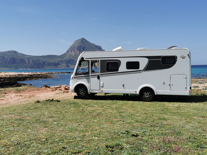
It is our first major trip to Italy ever that goes beyond the north of Italy. We (my wife, I and my dog Gina) want to take the ferry from Genoa to Palermo/Sicily with our Carado i338 (Frieda) and do an island tour there first. Then we cross over to the mainland and head for selected locations as part of a relaxed return trip through the bootleg. Our focus is on experiencing nature, culture, cuisine and history. We want to deliberately avoid crowds.
Day
OBERGRIESBACH, Deutschland
Departure day: Tuesday, April 11, 9 a.m
Daily km: approx. 307 km
At 7:30 out of bed. small breakfast, fridge contents "move" to the Frieda and off we go. Frieda was otherwise well prepared. It goes through Switzerland towards Genoa. On the way over the A7, we picked up the Austrian GO box reserved for us for the section toll at the Illertissen-West service area. Then booked/paid the Swiss heavy goods charge via mobile app and everything is fine.
Obergriesbach, 86573, Obergriesbach, Deutschland
48° 25' 16.2" N 11° 3' 57.8" E
48.4211698 11.0660623
• Head east on Stefanstraße. Go for 740 m.
• Turn right onto Am Bahnhof (AIC10). Go for 18 m.
• Continue on AIC10. Go for 2.4 km.
• Turn left onto Marienstraße (AIC10) toward Dasing. Go for 628 m.
• Continue on AIC10. Go for 662 m.
• Turn right and take ramp. Go for 277 m.
• Turn left onto B300 toward Augsburg/Friedberg. Go for 10.1 km.
• Continue on Friedberger Straße (B2/B300). Go for 2.6 km.
• Turn left and take ramp onto Inverness-Allee (B300) toward Memmingen/Landsberg a. Lech/B17/Messe-Uni/FH/A.-Süd u. West/Stadion/Zentralklinikum. Go for 2.4 km.
• Turn right onto Rumplerstraße (B300) toward A8/Landsberg a. Lech/Donauwörth/B2/Memmingen/Messe-Uni/A.-West u. Ost/Zentralklinikum/Flughafen. Go for 1.5 km.
• Take ramp onto B17 toward Landsberg/Königsbrunn. Go for 33.6 km.
• Take ramp onto A96 toward Lindau. Go for 117 km.
• Continue on A14 (Rheintal Autobahn). Go for 8.8 km.
• Take exit 9 toward Bregenz onto A14 (Rheintal Autobahn). Go for 247 m.
• Take the exit toward Bregenz-Weidach. Go for 263 m.
• Take the 2nd exit from roundabout onto Kennelbacher Straße (L13) toward Bregenz. Go for 112 m.
• Turn left onto Weidachstraße. Go for 658 m.
• Continue on Landstraße. Go for 235 m.
• Turn left onto Arlbergstraße (L190). Go for 3.0 km.
• Take the 2nd exit from roundabout onto Vorarlberger Straße (L190). Go for 2.0 km.
• Take ramp onto A14 (Rheintal Autobahn) toward Innsbruck. Go for 13.7 km.
• Take exit 27 toward Götzis. Go for 286 m.
• Turn left onto Schweizer Straße (L55) toward Mäder. Go for 546 m.
• Take the 1st exit from roundabout onto Alte Landstraße (L58). Go for 1.1 km.
• Take the 2nd exit from roundabout onto Mäderer Landesstraße (L58). Go for 467 m.
• Continue on Zollstrasse. Go for 324 m.
• Take left ramp onto A13 toward Chur/Sargans. Go for 40.7 km.
• Take the left exit toward Chiasso/San Bernardino/Chur/Bad Ragaz onto A13. Go for 53.1 km.
• Take ramp toward Viamala. Go for 96 m.
• Turn left onto 13. Go for 2.3 km.
• Arrive at Rania (13). Your destination is on the right.
☍
300,4 km
(3 hrs. 15 min.)
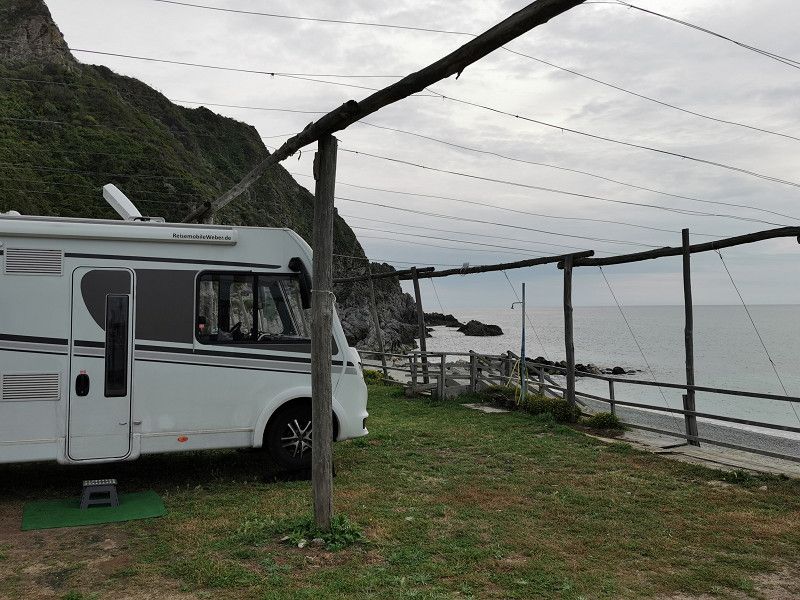
Camping Rania, ZILLIS-REISCHEN, Schweiz
Tuesday April 11th
Lodging source: Park4Night
Phone +41 (0)81 661 11 62
GPS: 46°38'58.8",N 9°26'54.5"E
Italian Street 120 A, 7432 Zillis
info@campingrania.ch
38 CHF + 3 € electricity flat rate, dog free
On the square Restaurant Rania, home-style
Via Mala gorge within walking distance, 9 a.m. to 6 p.m., 4 CHF/person, dogs allowed
At the CP very nice, extremely friendly reception by the boss. A ***CP with everything you need. The sanitary equipment is quite old, but clean and functional. We can live with the little quirks here and there, even if the price is "high", but that's how expensive Switzerland is. The electrical equipment is not state-of-the-art (old Swiss plugs/sockets, no CCE or Schuko plugs). Adapters are not available. However, a friend of the boss was so kind and fetched an adapter from home by car especially for us. I couldn't expect so much friendliness and support.
In the evening we ate in the restaurant. We were almost the only guests and the manager cooked especially for us (mixed salad, 1 cordon bleu, 1 cream schnitzel, both with fries, 0.2 l wine each). Altogether €66, but everything was fresh, very tasty and there were 2 coffees "on the house" and nice conversation.
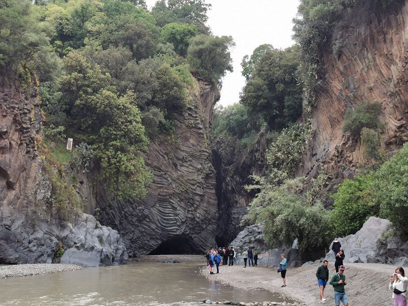
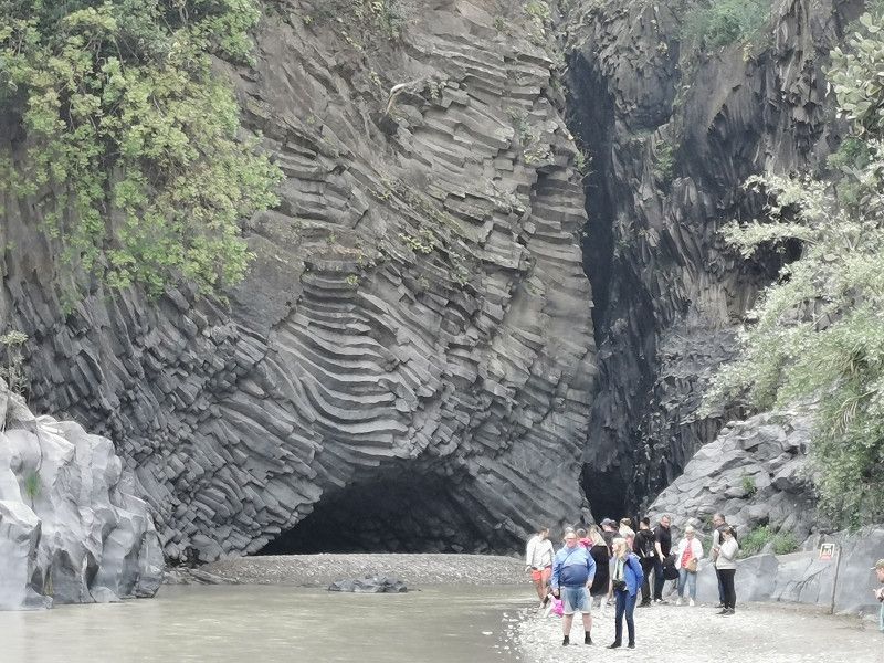
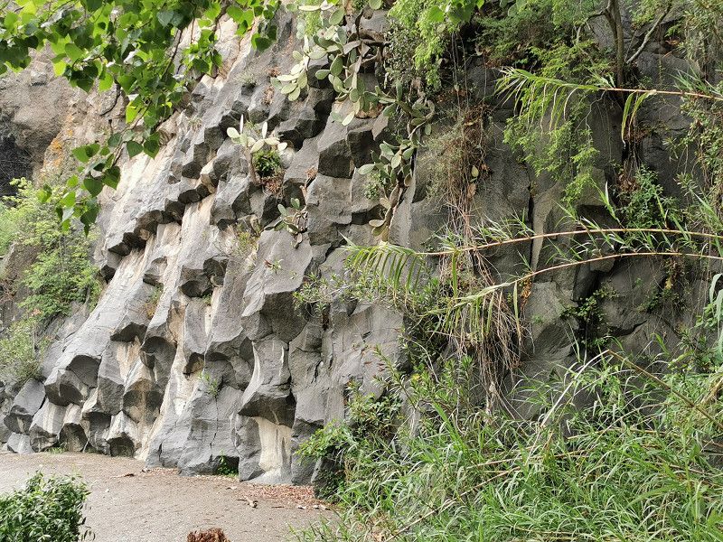
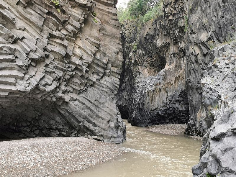
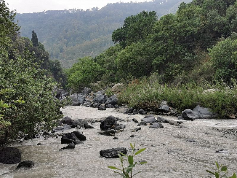
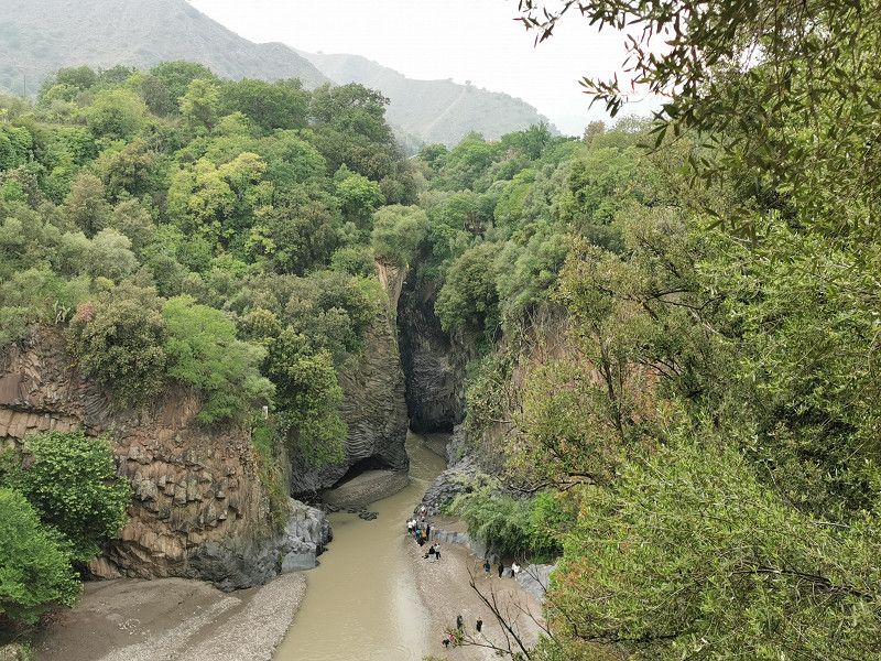
The CP is in the immediate vicinity of the famous Via Mala gorge (approx. 1 km). We wanted to look at them, but access from the CP is quite difficult for people who are not good on foot, so we stopped about halfway through. However, you can drive/bike to the official entrance (approx. 3 km, with visitor center) and enter the gorge from there. Supposedly absolutely worth seeing and experiencing! We will definitely catch up when we get a chance.
When driving on the San Bernardino Pass, there is always the option of staying on the A13 motorway (then through the San B. tunnel. A good 6 km long) or turning off to the old pass road No. 13 immediately before the tunnel, which is of course much narrower and well takes longer but is certainly nicer and allows for many stopping points. At the apex of the pass you should even be able to stand freely for one night. The route should be easily feasible for WoMos up to 7.50 m in length. In bad weather, the Autobahn is recommended, because you can't see anything.
Camping Rania, 7432 Zillis, Switzerland
46° 38' 59.7" N 9° 26' 54.4" E
46.6499090 9.4484465
• Head south on Rania (13). Go for 6.1 km.
• Take ramp onto A13 toward San Bernardino. Go for 75.4 km.
• Take the left exit toward E35/Milano/Lugano/Locarno/Bellinzona Sud onto A2. Go for 55.7 km.
• Continue on A9 (Autostrada dei Laghi). Go for 31.0 km.
• Take the left exit onto A8 (Autostrada dei Laghi). Go for 5.1 km.
• Take the exit toward E64/Torino/A4/Genova/A7/Bologna/A1 onto A50 (Tangenziale Ovest). Go for 20.5 km.
• Take the exit toward Genova onto A7 (Autostrada Milano-Genova). Go for 68.0 km.
• Take the exit toward Genova Prà/E25/Gravellona T./Savona/E80/Ventimiglia/A10 onto A26 (Diramazione A26-A7 Predosa-Bettole). Go for 17.3 km.
• Take the left exit toward Genova/Ventimiglia/A10 onto A26 (Autostrada Genova Voltri-Gravellona Toce). Go for 46.4 km.
• Continue on A10 (Autostrada Genova-Ventimiglia). Go for 5.3 km.
• Take the exit toward Genova Pegli. Go for 546 m.
• Turn right onto Via dei Reggio toward Genova Centro. Go for 141 m.
• Turn right onto Via Simone Pacoret De Saint Bon. Go for 219 m.
• Keep right onto Via Simone Pacoret De Saint Bon toward Centro/Ospedale Padre Antero/Porto Petroli/Aeroporto. Go for 51 m.
• Continue on Via Ronchi (SS1). Go for 920 m.
• Turn right onto Piazza Porticciolo. Go for 25 m.
• Continue on Viale Giorgio Modugno. Go for 111 m.
• Continue on Via Argentina. Go for 180 m.
• Continue on Via Gerolamo Rovetta. Go for 174 m.
• Turn right onto Via Marcello Prestinari. Go for 127 m.
• Turn left onto Via Amerigo Vespucci. Go for 211 m.
• Turn slightly right onto Via Amerigo Vespucci. Go for 245 m.
• Turn slightly right onto Via Campeggio Villa Doria. Go for 151 m.
• Arrive at Via Campeggio Villa Doria. Your destination is on the left.
☍
334,0 km
(3 hrs. 34 min.)
Day
GENUA - Camping Villa Doria, Via Al Campeggio Villa Doria
Wednesday April 12th
Daily km: approx. 332 km
Accommodation source: ProMobil Stellplatz-Radar
Campeggio Villa Doria - Genova
Via al Campeggio Villa Doria 15 N,
16156 Genova Pegli - Ge
GPS: 44°25'53"N, 8°48'48"E
Telephone: +39 010.6969600
E-mail: campingvilladoria@gmail.com
https://www.campingvilladoria.it/?lang=en
38€ tuttifrutti
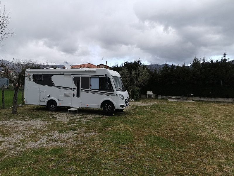
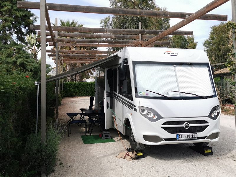
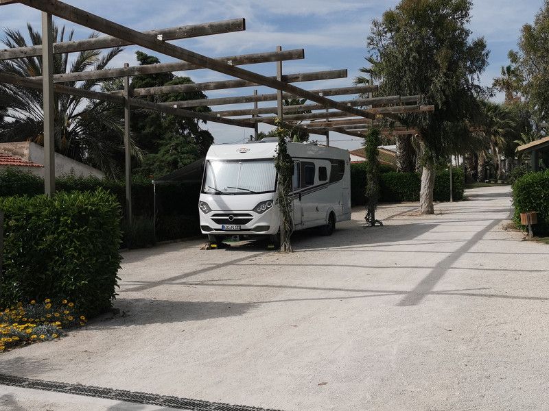
After breakfast we left at around 10 a.m. on the A13 towards Genoa. The weather was pretty bad with only a few sunny sections and we were stuck in 3 big traffic jams and lost a lot of time as a result. Certainly very beautiful in terms of scenery, especially when the weather is nice, exciting bridge constructions on the route, interesting, long tunnel and otherwise relaxed driving!
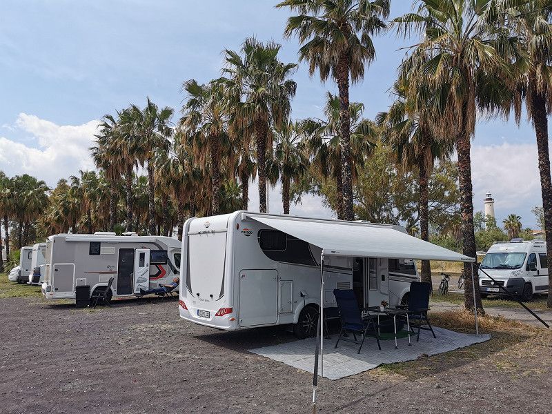
Arrived in Genoa, the journey to the booked campsite turned out to be a real adventure. The travel recommendation for WoMos > 3 m height on the internet must be followed, otherwise you are guaranteed to get stuck somewhere with a large WoMo! It goes straight through old town areas, narrow streets, trees on both sides of the street, up, down, left, right and after a short time you completely lose your bearings as to where you actually are and where the CP is supposed to be. And it's very narrow in places! But don't think, stay stubborn, follow the instructions and signs and everything will be fine!
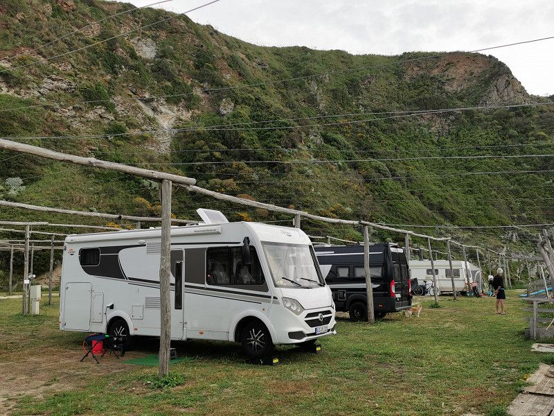
Have bought food from EKOM (EDEKA) (crabs, squid salad, bread, etc.). The CP itself is OK, very shady in a forest-like inner city area and ideal for visiting Genoa due to its central location. The plots are narrow and apparently well occupied at any time of the year, mostly by guests from the various ferry lines. However, we would not want to camp there for a longer period of time because of the relative narrowness.
As soon as we arrived, it started pouring rain again. Construction under the rain poncho. Heavy rain all night, occasional hail. We only slept part of the time.
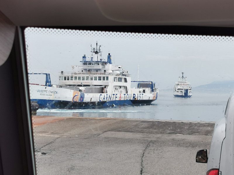
Well, and then we had massive problems with our ferry booking for April 13th to Palermo. 2 days before we were informed that we had to take another ship due to technical problems, which also leaves at 2 a.m. on April 14th. Then yesterday we were informed that this ship was also canceled due to technical problems and that another ship had to be taken, but we only had pullman seats, no cabin with our dog Gina, and the animal had to be put in a cage below deck. Of course that didn't work at all. A ship with a cabin for us and dog would not be available until Saturday 15th April.
Long story short: ferry canceled for fare refund. We drive overland in 3 stages of about 400 km each to Sicily and lose only the planned visit of Genoa and max. 1 day. What the heck, can we do it...
Via Al Campeggio Villa Doria, 15, 16156 Genova GE, Italy
44° 25' 53.3" N 8° 48' 48.1" E
44.4314800 8.8133600
• Head toward Via Amerigo Vespucci on Via Campeggio Villa Doria. Go for 151 m.
• Turn slightly left onto Via Amerigo Vespucci. Go for 651 m.
• Turn left onto Via Martiri della Libertà. Go for 78 m.
• Turn right onto Via de Nicolay. Go for 128 m.
• Turn left onto Via Sabotino. Go for 10 m.
• Turn right onto Via de Nicolay. Go for 110 m.
• Turn left onto Lungomare di Pegli (SS1). Go for 652 m.
• Continue on Via Ronchi (SS1). Go for 437 m.
• Turn sharp left onto Via Multedo di Pegli. Go for 37 m.
• Continue on Via Simone Pacoret De Saint Bon. Go for 151 m.
• Turn right onto Via dei Reggio toward Autostrade. Go for 141 m.
• Turn left and take ramp onto A10 (Galleria Chiesa) toward Autostrade/Aeroporto/Genova/Livorno. Go for 6.3 km.
• Take the exit toward Milano onto A7 (Autostrada Milano-Genova). Go for 2.8 km.
• Take the exit toward Genova Est/Livorno onto A12 (Autostrada Azzurra). Go for 136 km.
• Take the exit toward E76/Lucca/Firenze/Viareggio/Camaiore. Go for 744 m.
• Keep left onto A11 toward E76/Lucca/Firenze. Go for 19.4 km.
• Take the left exit toward Firenze/Lucca Est onto A11 (Autostrada Firenze Mare). Go for 62.0 km.
• Take the exit toward Roma/Siena onto A1 (Autostrada del Sole). Go for 199 km.
• Take the exit toward Attigliano/Giove/Lugnano/Amelia/Alviano onto SP11. Go for 809 m.
• Turn left onto Viale Cesare Battisti (SP86). Go for 834 m.
• Continue on Viale Giuseppe Mazzini (SP33). Go for 507 m.
• Continue on SP33. Go for 2.4 km.
• Continue on Casali (SP33). Go for 45 m.
• Continue on SP33. Go for 121 m.
• Continue on Vocabolo Camporiccio (SP33). Go for 235 m.
• Continue on SP33. Go for 5.4 km.
• Continue on Viale Dante Alighieri (SP33). Go for 107 m.
• Turn left onto Via San Francesco. Go for 63 m.
• Turn slightly right onto Via San Francesco. Go for 183 m.
• Turn sharp right onto Viale della Rimembranza. Go for 27 m.
• Turn left onto Viale Regina Margherita. Go for 300 m.
• Turn right onto Piazza della Rocca. Go for 31 m.
• Continue on Via Umberto I. Go for 182 m.
• Turn left onto Via Duca degli Abruzzi. Go for 99 m.
• Arrive at Via Duca degli Abruzzi. Your destination is on the left.
☍
440,4 km
(4 hrs. 18 min.)
Day
LUGNANO IN TEVERINA, Stellplatz
Thursday April 13th
Daily km: 421 km
Lodging source: Park4Night
Free WoMo parking space with chargeable V&E
Lugnano in Teverina
GPS: N42°34'30.16", E12°20'2.54"
On to our 1st leg of the previously unplanned overland route to Sicily: leaving the CP in Genoa at 9:30 a.m. after breakfast, a shower and V&E in the pouring rain. Destination: the A1 motorway in the direction of Rome. And who thought that the way to the CP through Genoa the day before was already a real adventure was taught that the journey was only a foretaste of the way to the motorway across Genoa. Was handy for practice! I wouldn't have thought it possible, but if you know your vehicle, you can survive it without dents or scratches. However, I have never experienced anything like this in my short camper career and did not think it was possible. Tight ass, stressful, really exhausting. The thought of a 360° camera system for Frieda is slowly taking hold... But in the old city of Genoa, which has grown wild over the centuries, there really aren't any alternatives in terms of transport technology.
When we left the city after about an hour, we drove over dozens (!), daringly built bridges spanning valleys and at least as many tunnels. But here, too, the landscape and geology do not seem to leave any alternatives. Just crazy! But also incredibly beautiful (when the sun is shining...).
On the way repeated heavy rain, thunderstorms, hail in places. Arrived at the actually beautiful, small and lonely SP in Lugnano in Teverina, the rain poncho proved itself again. Must be a great area around us. If only we could see a little more of it! But maybe it will clear up overnight and we can take a look around tomorrow.
For dinner we had spaghetti aglio, olio et pomodoro, salad, wine, fresh pineapple for dessert, coffee, limoncello. Yummy! Tomorrow we start the 2nd stage of our journey to Sicily.
Lugnano in Teverina, 05020, Italien
42° 34' 27.2" N 12° 19' 50.8" E
42.5742259 12.3307848
• Head toward Via Savoia on Via Duca degli Abruzzi. Go for 81 m.
• Turn slightly right onto Porta Sant'Antonio. Go for 16 m.
• Turn right onto Via Sant'Antonio. Go for 107 m.
• Turn sharp left onto Via Roma. Go for 120 m.
• Turn right onto SP33. Go for 308 m.
• Continue on Viale Dante Alighieri (SP33). Go for 307 m.
• Continue on SP33. Go for 5.4 km.
• Continue on Vocabolo Camporiccio (SP33). Go for 235 m.
• Continue on SP33. Go for 121 m.
• Continue on Casali (SP33). Go for 45 m.
• Continue on SP33. Go for 2.9 km.
• Continue on Viale Cesare Battisti (SP86). Go for 834 m.
• Turn right onto SP11. Go for 272 m.
• Turn left and take ramp onto A1 (Autostrada del Sole) toward Roma. Go for 259 km.
• Take the exit toward Salerno/Reggio Calabria/A3/Avellino/A16/Bari/A14 onto A30 (Autostrada Caserta-Salerno). Go for 56.3 km.
• Continue on A2 (Autostrada del Mediterraneo). Go for 7.9 km.
• Continue toward Autostrada del Mediterraneo/A2. Go for 119 m.
• Take the left exit toward Reggio Calabria/Aeroporto onto A2 (Autostrada del Mediterraneo). Go for 100 km.
• Take the exit toward Padula. Go for 327 m.
• Continue on Via Nazionale (SS19) toward Padula. Go for 4.5 km.
• Turn right onto SP51a. Go for 375 m.
• Continue on Via Provinciale (SP51a). Go for 2.4 km.
• Turn left onto Via Europa (SP273). Go for 457 m.
• Turn left onto Via Italo Balbo (SP273). Go for 854 m.
• Turn right onto Via Italo Balbo. Go for 176 m.
• Turn right onto Largo San Paolo. Go for 59 m.
• Continue on Via Silvio Spaventa. Go for 89 m.
• Turn left onto Via Silvio Spaventa. Go for 11 m.
• Turn slightly left onto Piazza Umberto I. Go for 91 m.
• Arrive at Piazza Umberto I. Your destination is on the right.
☍
444,1 km
(3 hrs. 52 min.)
Day
Il Tiglio B&B Rural House, PADULA
Friday April 14th
Daily km: 416 km
Lodging source: Park4Night
Il Tiglio B&B Rural House
15€/night incl. electricity, V&E
Via Nationale 422, 84034 Padula
N40°19'25.69", E15°37'28.82"
Woke up in the sunshine and saw for the first time that we were in a great, well-kept area that would actually be worth exploring (abandoned mountain village!). Instead, we quickly made V&E and continued on stage 2 in the direction of Padula. Our hopes of finally leaving the bad, far too cool weather behind us were severely disappointed. Alternating little sun, lots of rain and occasional hail. Nevertheless, we made very good progress (95% motorway, average speed 93 km/h).
Arriving at the new pitch, we were greeted very nicely by Mario and his 7 hunting dogs (in the kennel). We are the only guests on the well-kept site for 24 WoMos and Gina can walk freely. And then during assembly I realized that I had left our aluminum step for the WoMo on the last SP. Real disk paste, annoy me blue and green for a few minutes! We'll try to get a short-term replacement somewhere tomorrow.
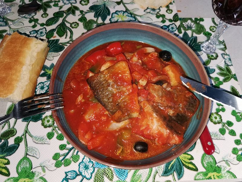
For dinner there was zarzuela, freshly prepared, very tasty. My wife is a real chef! But washing dishes is my job again. division of labour.
We continue to hope that the weather will now switch to holiday and summer mode and that we can finally put on our short clothes and no longer have to heat the mobile home. We will see...
Tomorrow evening we will already be in Sicily!
Padula, Italien
40° 20' 29.9" N 15° 39' 29.7" E
40.3416425 15.6582540
• Head toward Vico Giardinetto on Piazza Umberto I. Go for 20 m.
• Turn left onto Vico Giardinetto. Go for 52 m.
• Turn right onto Largo San Paolo. Go for 44 m.
• Turn left onto Largo San Paolo. Go for 7 m.
• Turn slightly left onto Via Dante Alighieri. Go for 193 m.
• Turn left onto Via Italo Balbo (SP273). Go for 735 m.
• Turn right onto Via Europa (SP273). Go for 457 m.
• Turn right onto Via Provinciale (SP51a). Go for 2.4 km.
• Continue on SP51a. Go for 375 m.
• Turn left onto Strada Statale delle Calabrie (SS19). Go for 4.5 km.
• Turn left and take ramp onto A2 (Autostrada del Mediterraneo) toward Reggio Calabria. Go for 153 km.
• Take the exit toward Cosenza onto Raccordo Autostradale A3. Go for 1.5 km.
• Take the 2nd exit from Giardino Giovanni Adamo roundabout onto Via Pasquale Rossi toward Cosenza/Centro. Go for 366 m.
• Continue on Viale della Repubblica (SP241). Go for 1.2 km.
• Pass 2 roundabouts and continue on Via Donato Morelli (SP241). Go for 1.7 km.
• Turn left onto Via Donato Morelli (SP241). Go for 4.5 km.
• Turn right onto Contrada Bivio Donnici (SP241). Go for 8.1 km.
• Turn right onto SS108. Go for 12.0 km.
• Continue on Via Aldo Moro (SP57). Go for 5.1 km.
• Turn right onto SS616. Go for 3.0 km.
• Turn left and take ramp onto A2 (Autostrada del Mediterraneo) toward Reggio C. Go for 141 km.
• Keep right toward Villa S. Giovanni. Go for 2.8 km.
• Take ramp toward Villa S. Giovanni. Go for 2.2 km.
• Keep left. Go for 48 m.
• Turn right toward Villa S. Giovanni/Via Zanotti Bianco Centro. Go for 286 m.
• Continue on Via Guglielmo Marconi. Go for 88 m.
• Turn left onto Viale Italia. Go for 158 m.
• Turn left onto Via Giuseppe Garibaldi. Go for 69 m.
• Continue on Via dei Martiri d'Italia. Go for 278 m.
• Turn left. Go for 357 m.
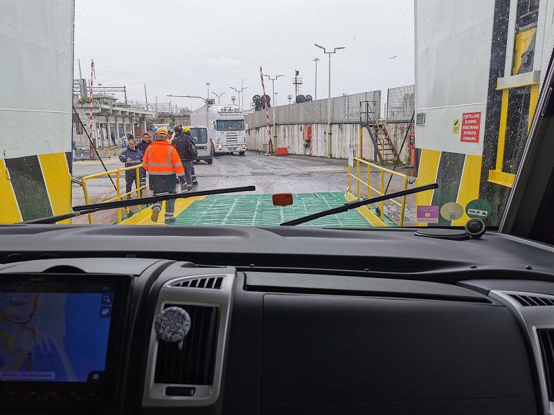
• Take the Villa San Giovanni-Messina Ferry. Stay on for 6.8 km.
• Head toward Rotonda San Francesco di Paola on Rada San Francesco. Go for 194 m.
• Continue on Imbarco Traghetti Caronte. Go for 363 m.
• Turn right toward Viale della Libertà. Go for 103 m.
• Turn left onto Viale della Libertà toward Centro/Autostrade. Go for 727 m.
• Continue on Piazza dell'Unità d'Italia. Go for 139 m.
• Keep right onto Corso Camillo Benso di Cavour toward Via Vitt. Emanuele II/Autostrade. Go for 189 m.
• Turn right onto Viale Boccetta toward Autostrade. Go for 913 m.
• Keep right toward Autostrade. Go for 222 m.
• Continue on Contrada Scoppo. Go for 495 m.
• Take left ramp onto A20 (Autostrada Messina-Palermo) toward Palermo. Go for 37.8 km.
• Take the exit toward Barcellona P.G. Go for 2.2 km.
• Take ramp onto SS113 toward Palermo. Go for 3.9 km.
• Turn right onto Piazza Bartolo Cattafi. Go for 109 m.
• Continue on Via Benedettina Inferiore. Go for 261 m.
• Turn right onto Via del Mare Terme. Go for 312 m.
• Arrive at Via del Mare Terme. Your destination is on the right.
☍
401,7 km
(4 hrs. 42 min.)
Day
Sosta Camper Trinacera, TERME VIGLIATORE (Sizilien)
Saturday April 15th
Daily km: 388 km
Accommodation source: ACSI
Sosta Camper Trinacera
15€
N38°8'25", E15°8'45"
On to stage 3 and our first stop in Sicily!
Woke up around 8 a.m., had breakfast, V&E and then looked for a replacement step. All the locals who were approached were very helpful and made phone calls and gave tips on where such a part could be found. The language barrier wasn't helpful, but as always: you can get through anything with hands and feet and Aunt Google.
Of course, there was nothing sensible to get locally and so a simple plastic folding stool for €6.99 from the local supermarket should do for the holiday in Sicily. Anyway, we hope he makes it through! The odds are maybe 50/50. ;-)
On the way to the ferry to Sicily at the southern tip of the Italian boot, I passed an endless number of bridges and tunnels. We hadn't really dealt with the geography of Italy so far and imagined the country (with the exception of the Italian Alps) to be relatively flat, but nothing could be more wrong. There are many mountain ranges, some of them high, that run through the whole country and require masterpieces of bridge and tunnel construction in order to create easily navigable traffic connections through impressive landscapes. It must have been well over 100 along the entire route. One must break away from the generalization of the flat Po Valley as a synonym for Italian geography. And the weather seems to be improving slowly: the rain is getting warmer and only showery. :-)
The ferry between Villa San Giovanni and Messina in Sicily runs every hour, 24/7. Our crossing took about 40 minutes and was uneventful. You could stay in the vehicle or get out and go to the passenger deck. We stayed in the vehicle. I wonder why? Exactly, because of rain! Arriving in Messina, we continue about 60 km to our first overnight stay in Sicily in Therme Vigilatore. A pitch with electricity, V&E and very simple sanitary facilities for €15. Spacious, beautifully laid out and maintained, only separated from the sea by the coastal road. The site is looked after/supervised by a German-Italian couple in their 50s who have dropped out and who themselves live permanently in 2 WoMos, 1 mobile home, 1 tent and a trailer with 2 dogs in a kind of "wagon castle". We had a good chat, even if some conspiracy theory-like views were ringing in my ears, but we got one or the other good tip for our Sicily tour.
Terme Vigliatore, 98050, Italien
38° 8' 12.3" N 15° 9' 45.6" E
38.1367636 15.1626753
• Head northwest on Via del Mare Terme. Go for 37 m.
• Turn left onto Via 25 Aprile. Go for 78 m.
• Turn right toward Via Maceo. Go for 78 m.
• Turn left onto Via Maceo. Go for 488 m.
• Turn left toward Via Nazionale Terme/SS113. Go for 37 m.
• Turn right onto Via Nazionale Terme (SS113). Go for 8.8 km.
• Turn left and take ramp onto A20 (Autostrada Messina-Palermo) toward Messina-Palermo/Palermo. Go for 109 km.
• Take the exit toward Cefalù. Go for 463 m.
• Continue on SS113 toward Messina/Cefalù/Isnello. Go for 804 m.
• Turn left onto Via Zante. Go for 253 m.
• Turn right. Go for 66 m.
• Arrive at your destination on the left.
☍
120,6 km
(1 hrs. 20 min.)
Day
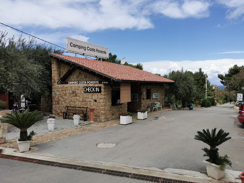
CEFALÚ - Camping Costa Ponente
Sunday April 16th
Daily km: approx. 72 km
Accommodation Source: ACSI, #2722
Ogliastrillo 113
90015 Cefalu
GPS: 8°1'38"N 13°58'59"E
Web: http://camping-costaponente.com/en/
Phone +39 09 2142 4492
Costs: €21 incl., ACSI price
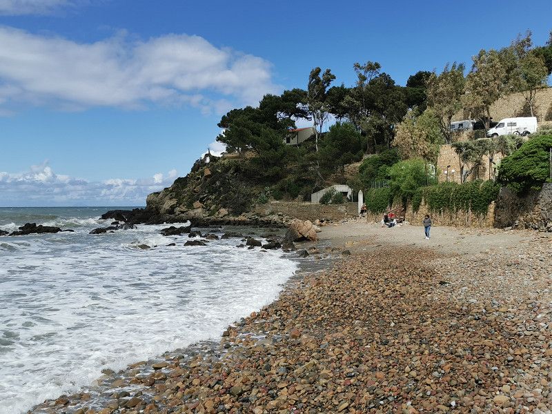
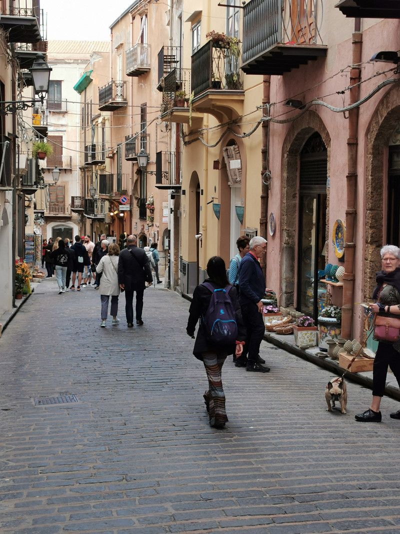
Due to the weather, breakfast is still only possible in the WoMo, even if it doesn't necessarily rain. But whatever. Today we went to Cefalu, our first stop with a "cultural program" in Sicily. The drive itself was relaxed, relatively uneventful in mostly sunny but cool weather, through very beautiful scenery and... over numerous bridges and just as many tunnels. That always surprises.
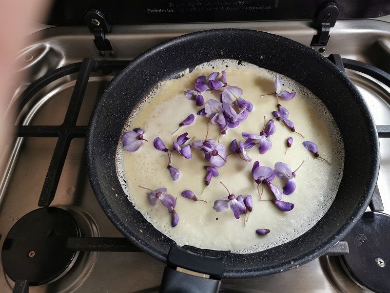
Arrived at the beautiful CP, we let the day end comfortably after a coffee with wisteria pancakes (wisteria flowers freshly picked on site!) and a walk to the CP's own small beach. It was just too cool for us to use the great pools (18 degrees) in the very changeable, windy weather.
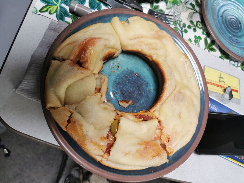
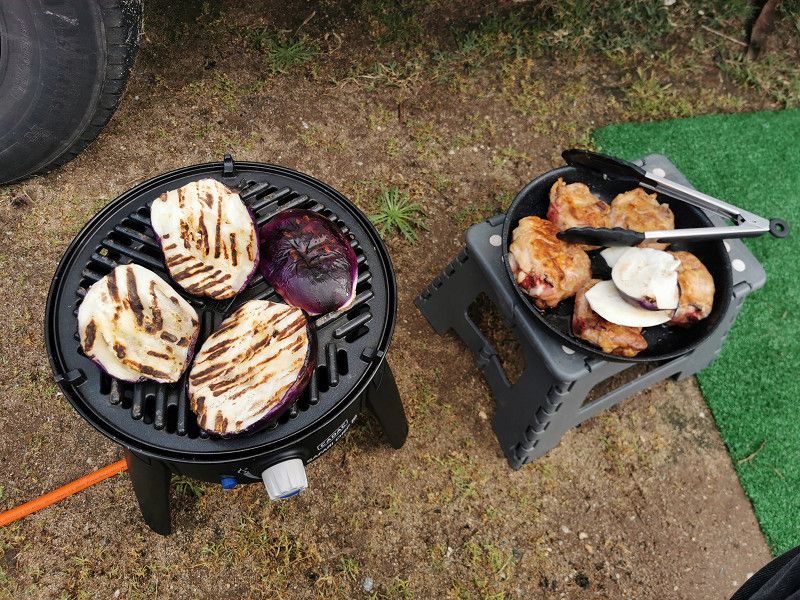
And of course there was some rain at the end of the day. The heating in the WoMo will probably have to run for a while. I'm slowly beginning to squint at the filling level of the first gas bottle. But that didn't prevent us from finally inaugurating the OMNIA and making a thoroughly successful "roll pizza" for dinner.
Strada statale 113 Settentrionale Sicula , Cefalù, Italien
38° 1' 41.6" N 13° 59' 0.7" E
38.0282361 13.9835357
• Head east. Go for 27 m.
• Turn right. Go for 109 m.
• Turn left toward Via Zante. Go for 145 m.
• Continue on Via Zante. Go for 96 m.
• Turn right onto Strada Statale Settentrionale Sicula (SS113). Go for 879 m.
• Turn left and take ramp onto A20 (Autostrada Messina-Palermo) toward Messina. Go for 13.7 km.
• Take the exit toward Pollina/Castelbuono. Go for 849 m.
• Continue on Ponte Malpasso. Go for 783 m.
• Continue on Galleria Serra Guarnieri. Go for 332 m.
• Turn right onto SS286 toward Castelbuono/Pollina/Geraci S./Gangi/SS120/Carabinieri/Parco Naturale delle Madonie. Go for 11.5 km.
• Keep left onto SS286. Go for 328 m.
• Continue on Via Dante Alighieri (SS286). Go for 770 m.
• Turn right onto Via Principe Umberto. Go for 23 m.
• Arrive at Via Principe Umberto. Your destination is on the right.
☍
29,5 km
( 28 min.)
Day
CEFALÚ - Stehtag/Besichtigungen
Monday April 17th
We slept late and had a good breakfast. In the WoMo ;-).
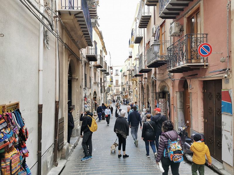
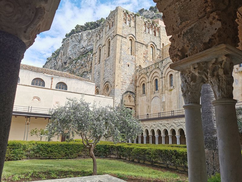
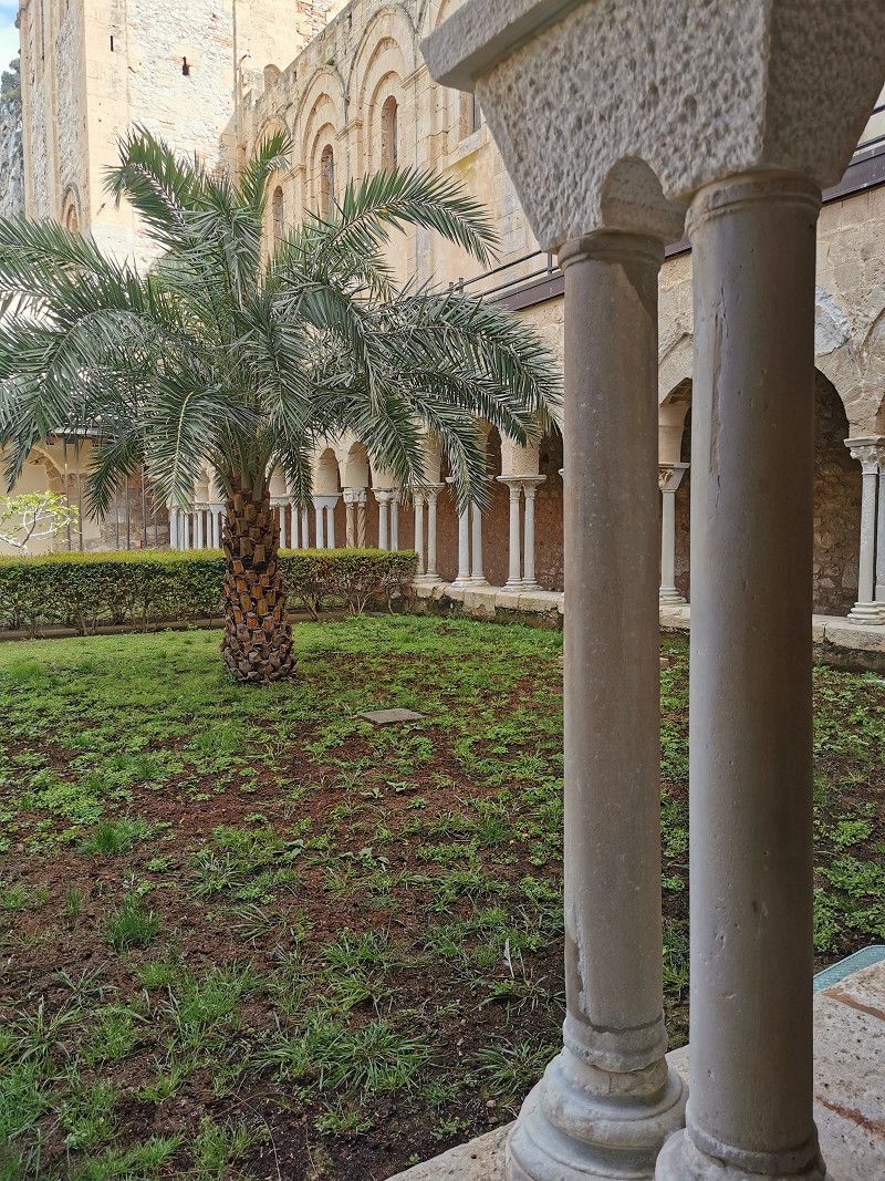
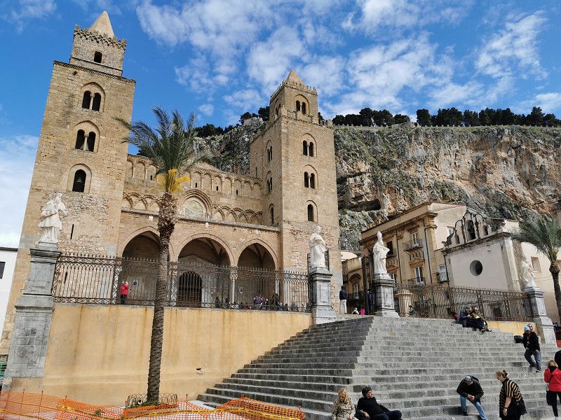
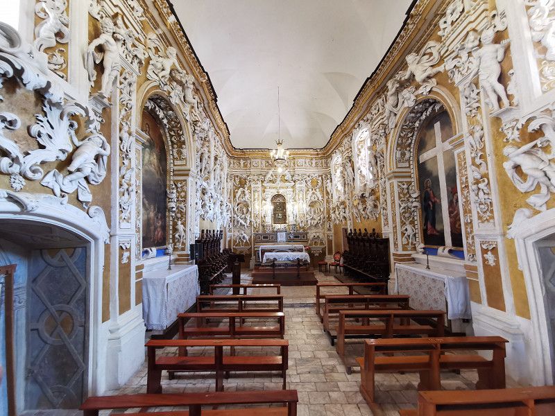
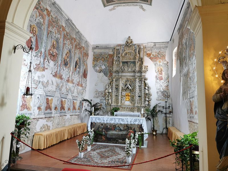
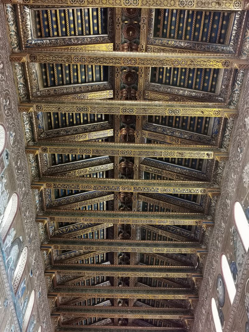
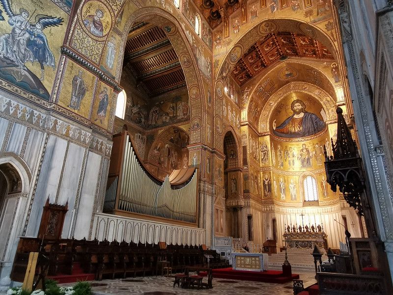
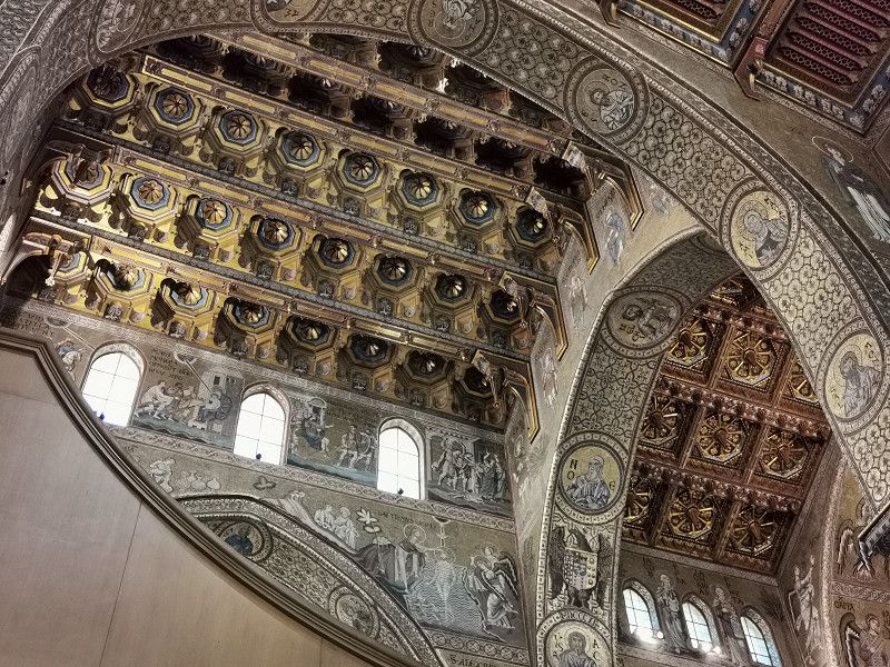
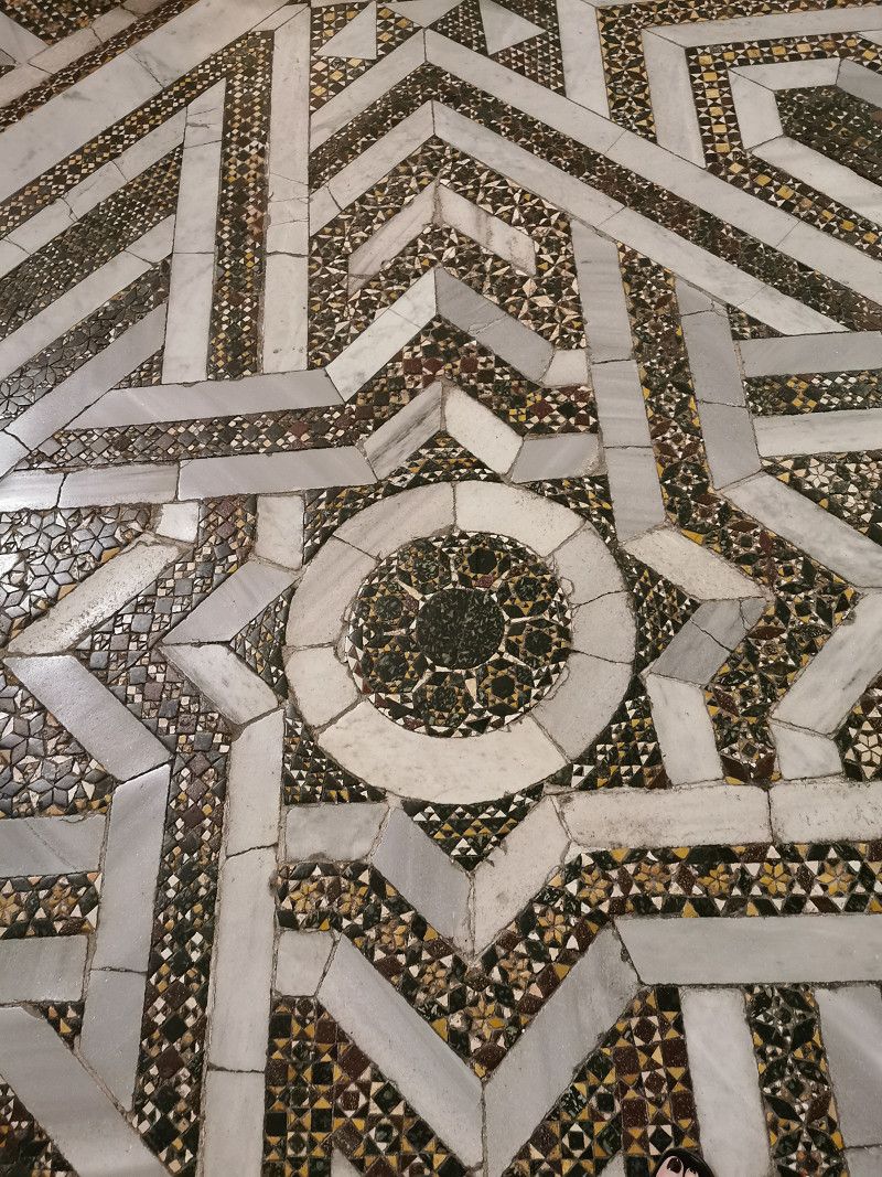
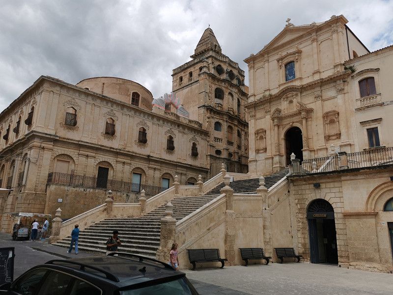
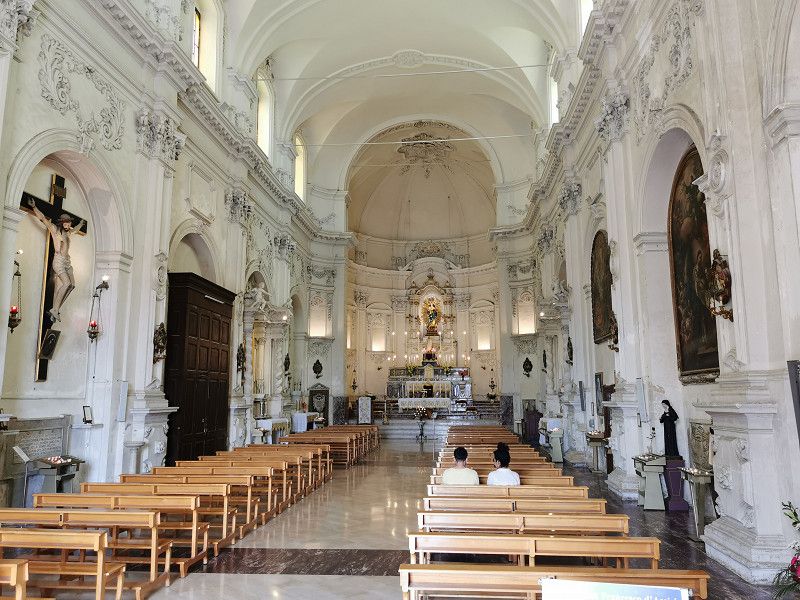
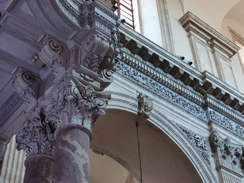
Then we took the bus to Cefalu right in front of the campsite. Initially, the weather was kind to us and nothing stood in the way of a sightseeing tour through the nice old town. The cathedral and its small museum were impressive. The craftsmanship of the people of earlier centuries never ceases to amaze, regardless of whether it is architecture, silver and goldsmithing, embroidery or painting. Much of this craftsmanship has unfortunately died out today or has to be re-learned.
Undoubtedly, Cefalu has charm, but in the meantime the old town is clearly (but still tolerably) touristy and is somewhat "overhyped" in travel guides. Of course, the view from afar of the city clinging to the foot of a vertical cliff is simply gigantic. That alone is worth a visit.
After a late lunch at a small restaurant, we went in search of something very practical, a wool and haberdashery shop. Supplies for the handicraft woman had to be found, as the previously mediocre weather had allowed the handicraft supplies for the trip to melt away. As it turned out, the description of the assortment in stores in Google Maps is not necessarily reliable. Well, at least we found the buttons to complete a warm woolen jacket that we made during the trip. :-) Then the weather, which was too cold and rainy for the time of year, hit us again and it was time for the bus ride back to the CP. Gina did well all day, but was absolutely exhausted in the evening. And another cozy evening in the WoMo, this time with the "Cave of the Lions". Holidays in Sicily are OK, but it doesn't work without "HdL". ;-)
Day
CASTELBUONO - Altes Bergdorf mit Stellplatz
Tuesday April 18th
Daily km: approx. 70 km
Lodging source: Park4Night
Campo Sportivo parking space (also the only parking space for WoMos in Castelbuono)
GPS N 37.93730, E 14.09429
Simple parking space without V&E, free of charge, 500 m to the center
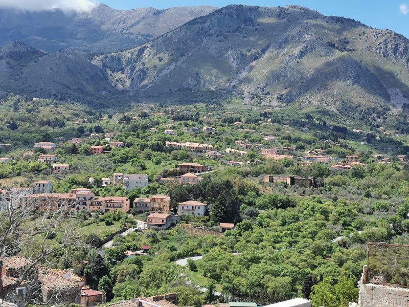
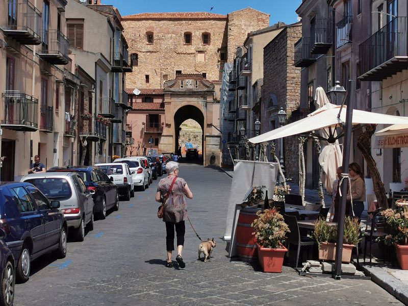
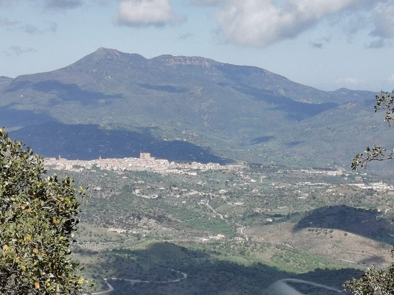
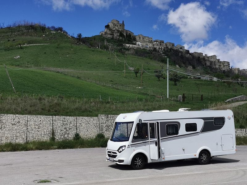
Breakfast, V&E and on we go on our tour, today to Castelbuono a picturesque mountain village. The approach is very nice on a winding road with almost no traffic. We reach Castelbuono in the late morning and park our Frieda on a rough gravel parking lot next to the small local sports facility. Although it is an area designated for WoMos, you can't really call it a parking space. Theoretically there is "basic V&E", but for hygienic reasons I can only advise you to keep your distance from it. But you can park there and spend the night. We have everything we need on board. Only we and 2 other campers took advantage of this opportunity.
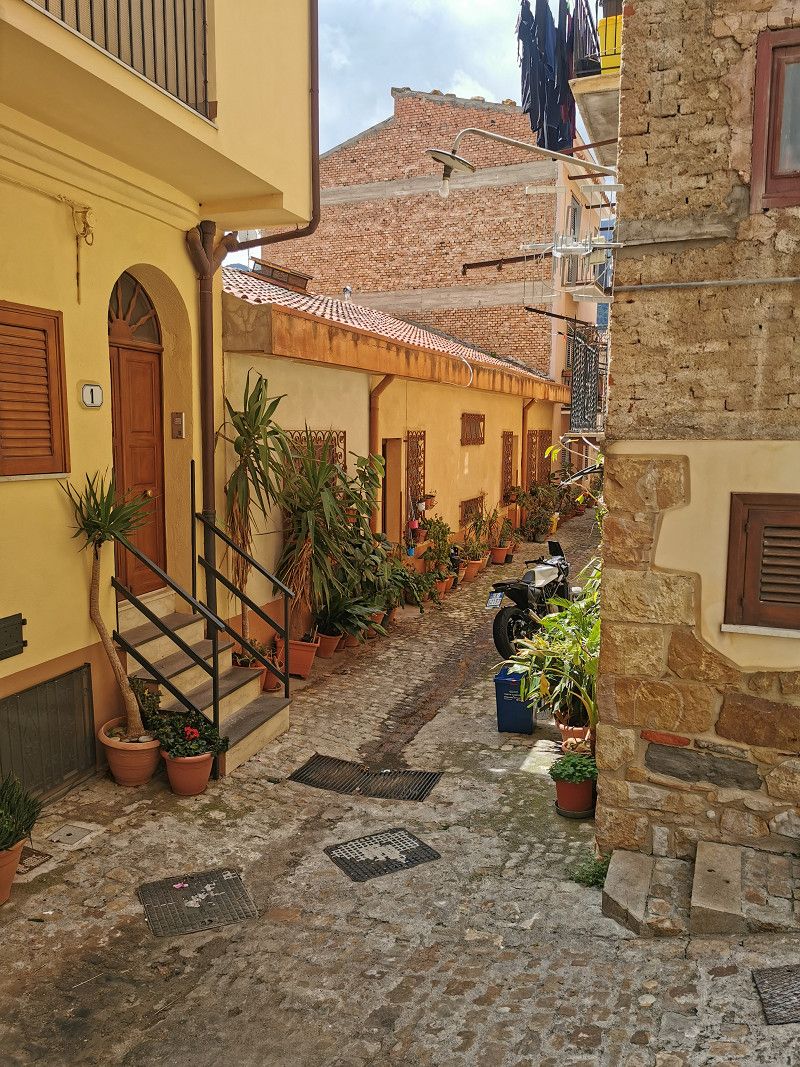
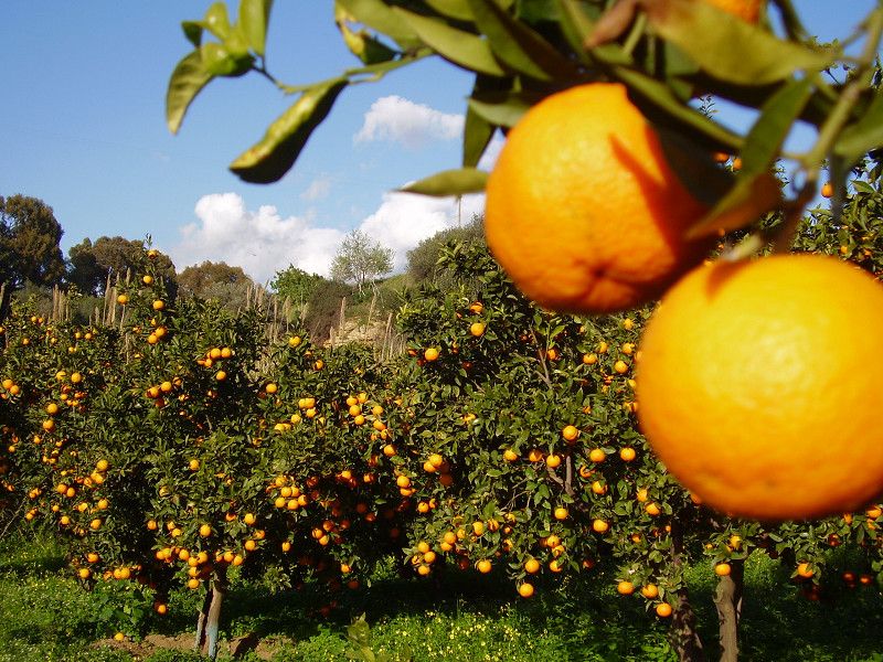
On the 500 m walk to the old town, we stocked up on fruit and vegetables from a hawker: oranges, bananas, Japanese medlars (nespolene, a yellow fruit similar to plums, with a smooth core similar to lychees), beans, tomatoes, lettuce . Everything organic (like almost everything that is grown in Sicily!) super fresh, sun-ripened and very tasty! As the pack mule on duty, I immediately turned around and stowed everything in the Frieda.
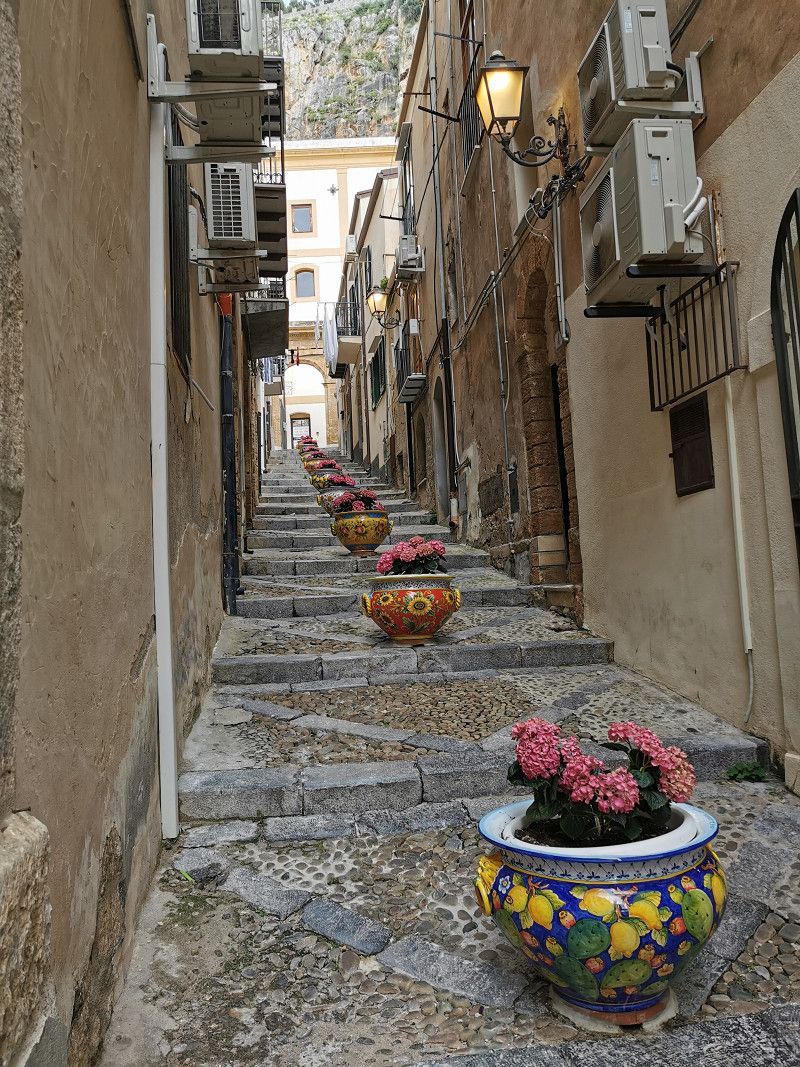
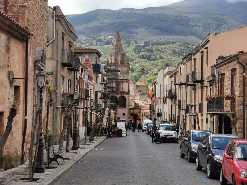
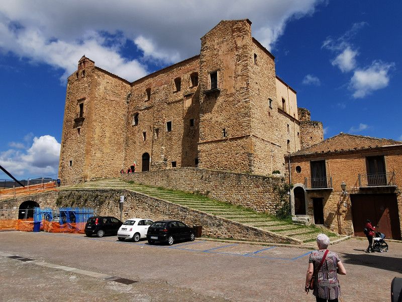
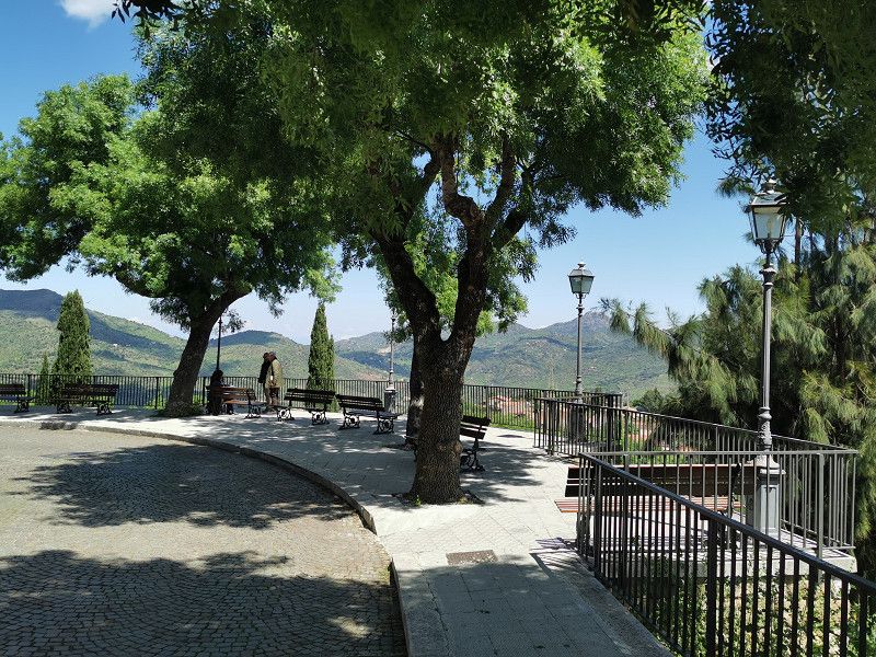
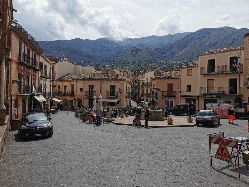
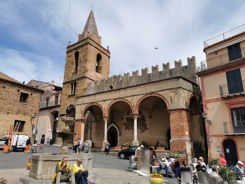
The charming, well-preserved medieval old town of Castelbuono is worth seeing. The mighty Norman castle "Castello Ventimiglia" with a beautiful baroque chapel and the "Chiesa Madrice Vecchia" with what is said to be the most beautiful main altar in Sicily and medieval frescoes stand out. Well, if the main altar inspires storms of enthusiasm, then you have never seen a German high altar by Balthasar Neumann or other artists of the era... ;-) But still beautiful, and it doesn't always have to be superlative.
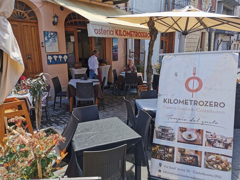
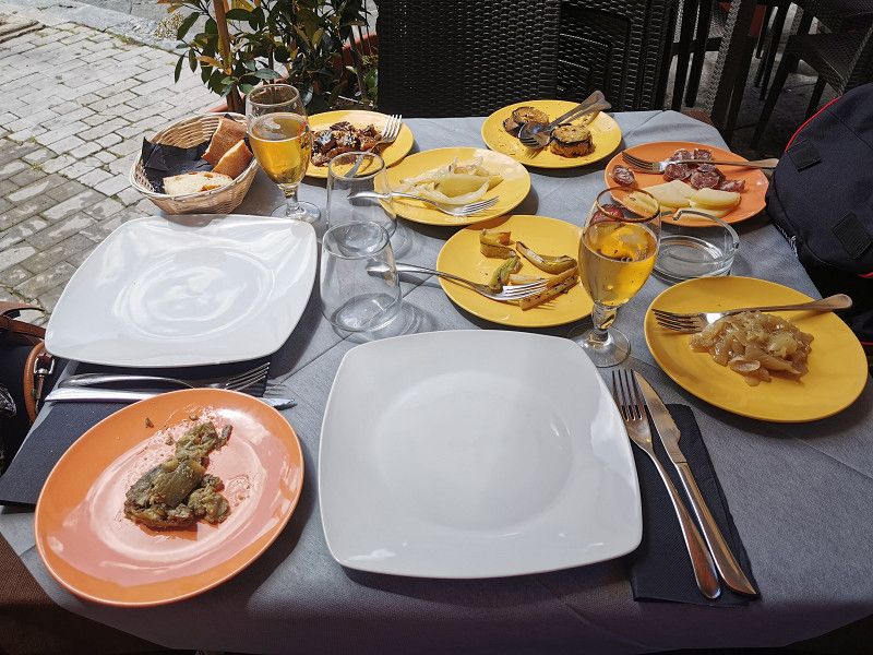
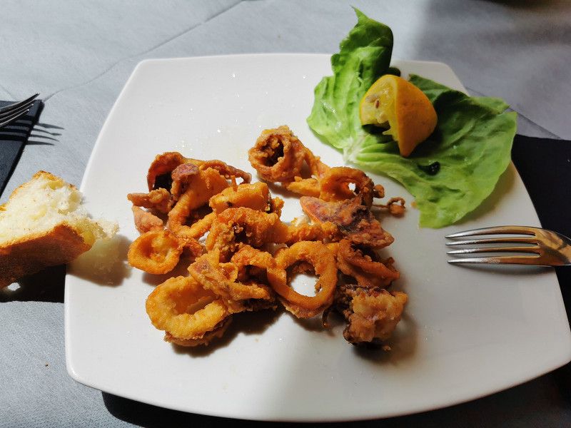
After the visits, hunger made itself felt. Late lunch at the small osteria "Kilometrozero" with super delicious mixed starters, calamari friti and pasta dish, coffee. Quiet end of the day at the pitch.
Castelbuono , Italien
37° 55' 55" N 14° 5' 18.8" E
37.9319530 14.0885620
• Head toward Cortile del Popolo on Via Principe Umberto. Go for 79 m.
• Turn slightly left onto Piazza Giacomo Matteotti. Go for 11 m.
• Turn left onto Via Enrico Bertola Gambaro. Go for 38 m.
• Continue on Via Enrico Bertola Gambaro. Go for 52 m.
• Turn slightly left onto Via Fonti di Camar. Go for 21 m.
• Turn left onto Via Dante Alighieri (SS286). Go for 836 m.
• Continue on SS286. Go for 11.7 km.
• Turn left toward Palermo/A20. Go for 147 m.
• Continue on Galleria Serra Guarnieri. Go for 614 m.
• Continue on Ponte Malpasso. Go for 735 m.
• Keep left toward E90/Palermo/A20. Go for 74 m.
• Take ramp onto A20 (Autostrada Messina-Palermo). Go for 27.1 km.
• Take the left exit toward Palermo onto A19 (Autostrada Palermo-Catania). Go for 38.8 km.
• Take the exit toward Villabate. Go for 782 m.
• Take the 1st exit from roundabout onto SP76 toward Palermo/SS113. Go for 1.8 km.
• Turn left onto Via Messina Marine. Go for 4.6 km.
• Continue on Via Ponte di Mare. Go for 412 m.
• Continue on Foro Umberto I. Go for 1.0 km.
• Continue on Via Cala. Go for 531 m.
• Continue on Via Francesco Crispi. Go for 1.3 km.
• Continue on Piazza Ucciardone. Go for 50 m.
• Continue on Via Piano dell'Ucciardone. Go for 372 m.
• Continue on Piazza Antonino Caponnetto. Go for 80 m.
• Continue on Via Montepellegrino toward Messina/A20/Catania/A19/Mazara del Vallo/A29/Dir. Trapani. Go for 131 m.
• Continue on Via Montepellegrino toward Autostrade/A29. Go for 707 m.
• Continue on Piazza Generale Antonino Cascino. Go for 120 m.
• Continue on Via Isaac Rabin. Go for 548 m.
• Take the 3rd exit from Largo Antonio Sellerio roundabout onto Via Martin Luther King. Go for 297 m.
• Continue on Largo Willy Brandt. Go for 87 m.
• Take the 1st exit from Rotonda Domenico Intravaia roundabout onto Via Imperatore Federico. Go for 64 m.
• Turn right. Go for 105 m.
• Arrive at your destination on the left.
☍
93,3 km
(1 hrs. 23 min.)
Day
PALERMO - Freesbee Parking (Camperpark Idea Vacanze)
Wednesday April 19th
Day's stage: approx. 120 km
Accommodation source: ProMobil Stellplatz-Radar
Phone +39 091 542555 & +39 091 540323
Email: ideavacanzepalermo@gmail.com or idea_vacanze@tin.it
Web: https://ideavacanzepa.it/
GPS N 38.147180, E 13.353026
Costs €20 (WoMo, 2 people, dog, V&E), €5 electricity, €1 shower
With workshop and camping shop on site.
Bus in the immediate vicinity for sightseeing.
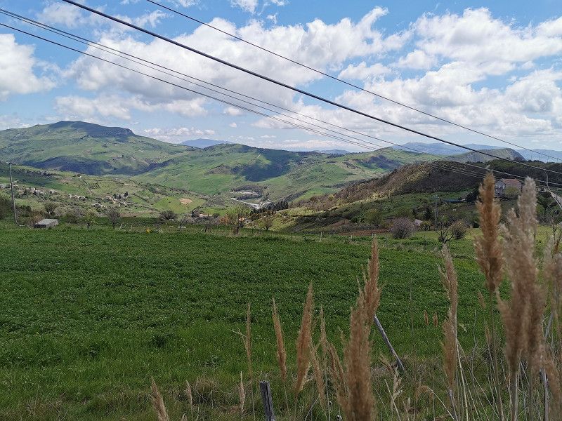
The visit to Palermo was actually the beginning of our time in Sicily, but after the ferry journey was canceled we adjusted our planning. The way to Palermo led us from Castelbuono on very winding, partly narrow but easily passable roads across the very beautiful Madonie National Park. Very relaxing, could/should spend more time here.
We reached Palermo at the time of the rush hour and made acquaintance with the original Italian traffic turmoil. Nevertheless, everything follows clear rules (not traffic rules, they are only non-binding recommendations) and you make progress if you swim along, don't hesitate and behave clearly and decisively (don't think, signal and drive, honk the horn if necessary). Genoa was much more stressful due to the narrowness.
The continuously asphalted, narrow parking space was easy to find, is relatively centrally located in Palermo, everything you need is available (electricity, V&E, showers, toilets) but very basic. The vehicles are close together, a comfortable stay outside of the WoMo is not really possible. You don't want to stay here longer, but ideal for visiting the city and waiting for ferries and with no real alternative.
Via Imperatore Federico 116, 90143, Palermo, Italy
38° 8' 52" N 13° 21' 8" E
38.1477778 13.3522222
• Head toward Via Imperatore Federico. Go for 105 m.
• Turn right onto Via Imperatore Federico. Go for 641 m.
• Continue on Piazza Don Bosco. Go for 161 m.
• Continue on Via Generale Antonino di Giorgio. Go for 132 m.
• Continue on Viale Lazio. Go for 1.0 km.
• Turn sharp right toward Viale della Regione Siciliana Nord Ovest. Go for 175 m.
• Turn left onto Viale della Regione Siciliana Nord Ovest. Go for 572 m.
• Keep left onto Viale della Regione Siciliana Nord Ovest. Go for 3.0 km.
• Keep left onto Via Tasca Lanza. Go for 371 m.
• Continue on Via Giuseppe Pollaci. Go for 86 m.
• Turn right onto Via Rosina Anselmi. Go for 314 m.
• Turn right onto Corso Calatafimi. Go for 3.0 km.
• Continue on Strada Provinciale di Monreale (SP69). Go for 1.2 km.
• Continue on Via Palermo (SP69). Go for 369 m.
• Turn right onto Piazza Vittorio Emanuele (SP69). Go for 34 m.
• Turn left onto Piazza Vittorio Emanuele. Go for 61 m.
• Arrive at Piazza Vittorio Emanuele. Your destination is on the right.
☍
11,2 km
( 23 min.)
Day
PALERMO - Sight-Seeing
Thursday April 20th
Standing and viewing day.
Overnight stay on the pitch.
We took the bus to the historic center of the city relatively early and unwound what was probably the classic "1-day tourist program". Almost all of the sights mentioned below are within walking distance and not far from each other. We took a good 15,000 steps and wife and Gina held up surprisingly well. This makes happy!
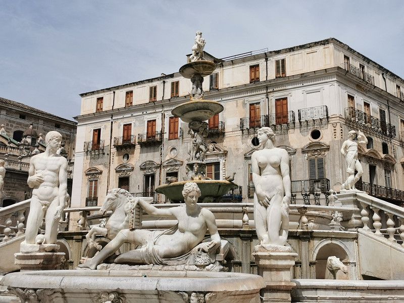
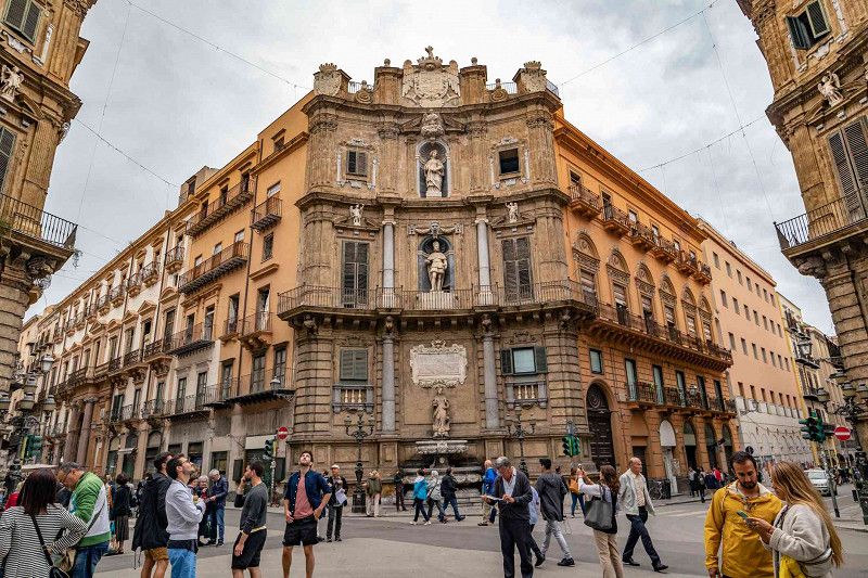
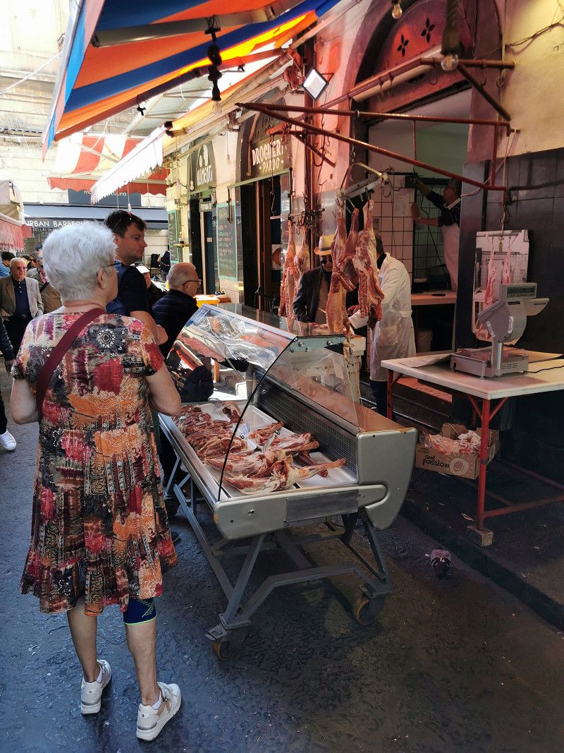
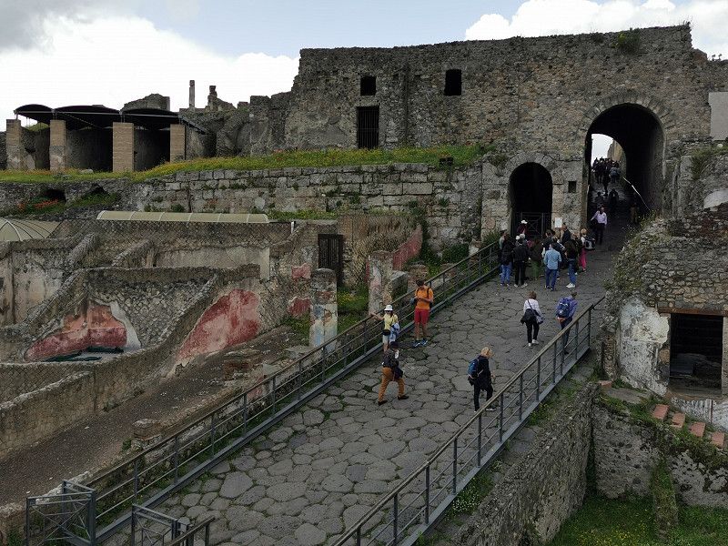
If you stroll through the old town like this, you can understand that Palermo is said to have been the most magnificent city in Europe about 200 years ago. Then came the loss of importance caused by political, economic and military turmoil and paralyzing mafia influences with a long-lasting decline and decay of the city. Many formerly magnificent buildings are in a deplorable condition. A rethinking and reconstruction has only been taking place for a few years, and there are countless construction sites where repairs, renovations and restorations are being carried out. But that will take years. Nevertheless, Palermo is definitely worth a visit, has charm and there are numerous unique treasures that are among the most beautiful things this world has to offer and are rightfully UNESCO World Heritage Sites.
We had lunch in a small street bistro (pesce fritti, pasta). Not a special culinary experience, but it filled you up and was relatively inexpensive. ;-)
The planned return trip by bus to the parking space was a bit adventurous, because some of the official stops of line 107 according to the ÖffiApp apparently no longer existed and a timetable was not discernible either. We started at several alleged stops but there was nothing by bus. Well then, just a taxi. And as soon as the taxi came, the bus came. Stupid walk, but didn't particularly upset us. And a taxi was more comfortable after a long day, and it was worth the almost €20 to us... ;-)
What have we seen?
- The old quarter of Kalsa, the oldest quarter of Palermo
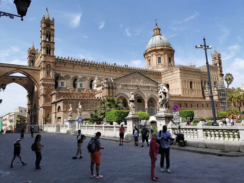
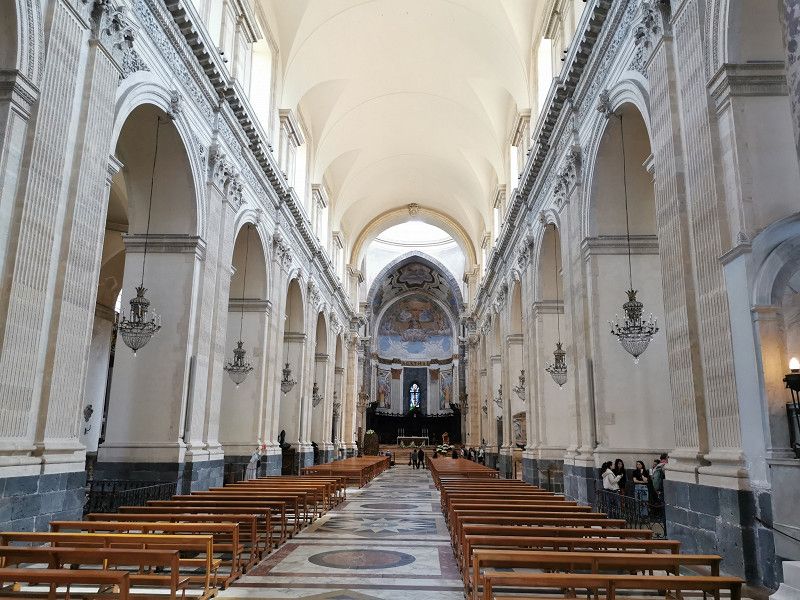
- Cathedral of Maria Santissima Assunta, a must-see!
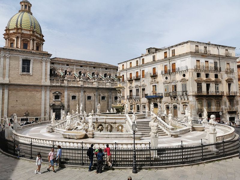
- Piazza Pretoria & Fontana Pretoria
- Quattro Canti
- Church of San Giuseppe
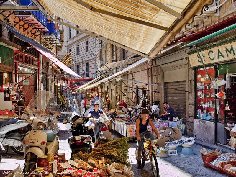
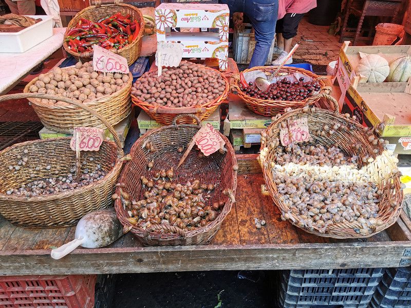
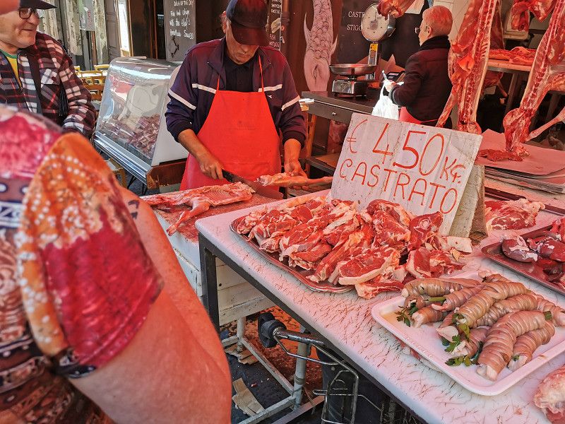
- Mercato di Capo (Palermo's Farmers' Market), at least what remains after the end of the main business
- Teatro Massimo, the largest opera house in Italy and one of the largest in Europe
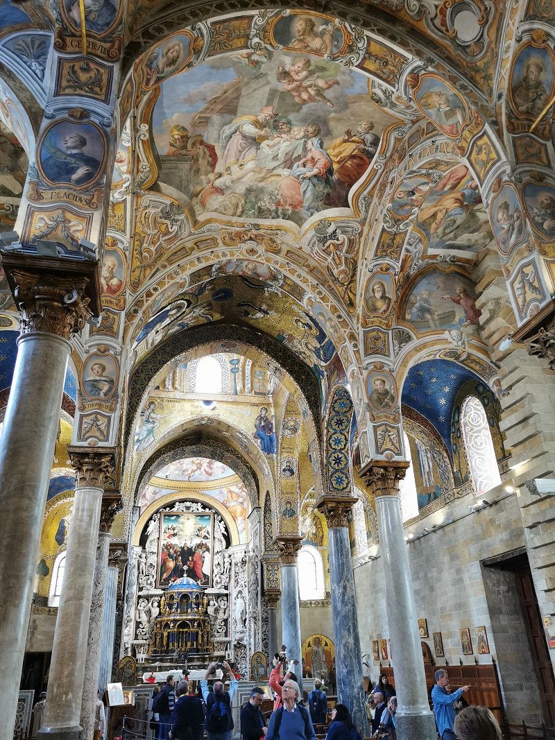
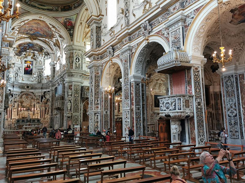
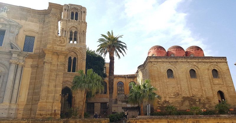
- The Churches of San Cataldo & La Martorana (Admiral's Church), next to each other in Piazza Bellini
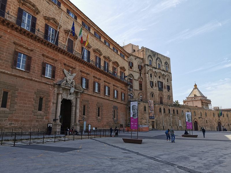
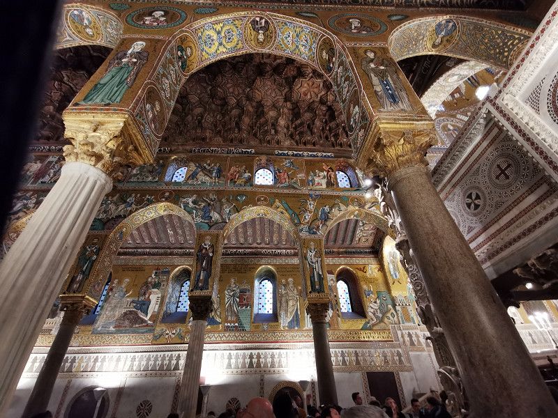
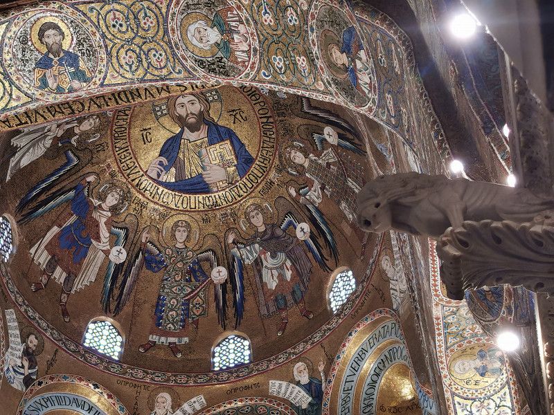
- Palazzo dei Normanni (Palazzo Reale) with Cappella Palatina, in Piazza Indipendenza
- Church of the Gesu
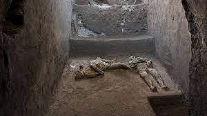
Unfortunately, we didn't make it to the Catacombe dei Cappuccini (Capuchian Crypt), actually a must-see in the Santa Maria della Pace monastery church. One of the most famous burial sites in the world with 2063 fully clothed natural mummies. So we have to come back to Sicily after all...
Day
Zwischenstop: Duomo di Monreale
Friday April 21st
Daily stage: approx. 100 km
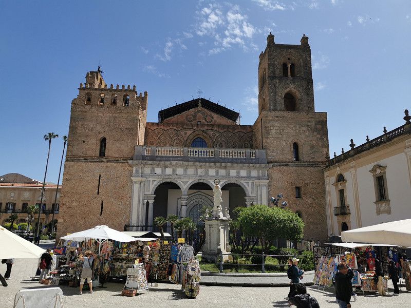
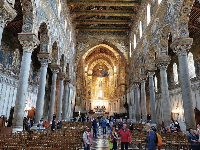
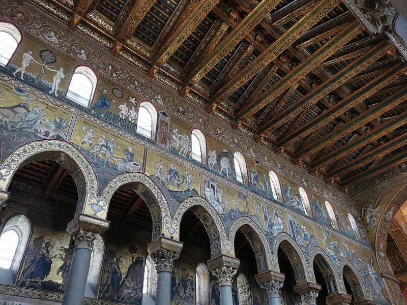
After breakfast extensive V&E done as we want to have at least one night free in Segesta Archaeological Park, our next destination for the day. But before that, a "must-see stopover" in Monreale, about 12 km from Palermo, to visit one of the most famous cathedrals in the world, another UNESCO World Heritage Site. We are lucky and just about noon get the last parking space in the immediate vicinity of the cathedral. 2 hours for 6€! Otherwise we would have had to walk quite a distance. The old downtown of Monreale is quite nice and the cathedral itself is an absolute gem, roughly comparable in style to the Admiral's Church in Palermo, only 5 times larger, even more magnificent, fully equipped with mosaics and absolutely breathtaking. Truly a "must see"!
Then a late lunch in the restaurant "Il Giardino degli Aranchi" with a nice ambience and a wonderful view of the countryside, city and bay of Palermo.
Via degli Angeli, 90131, Monreale, Italien
38° 4' 55.3" N 13° 17' 32.2" E
38.0820217 13.2922768
• Head toward Via Palermo on Piazza Vittorio Emanuele. Go for 47 m.
• Turn left onto Piazza Vittorio Emanuele (SP69). Go for 34 m.
• Continue on Via Roma (SP69). Go for 84 m.
• Turn right onto Via Antonio Veneziano (SP69). Go for 332 m.
• Continue on Via Pietro Novelli (SP69). Go for 2.1 km.
• Continue on SS186. Go for 18.7 km.
• Take the 1st exit from roundabout onto Via Circonvallazione (SS186). Go for 886 m.
• Continue toward SS113. Go for 40 m.
• Take the 2nd exit from roundabout onto SS113 toward Aeroporto Falcone Borsellino/Palermo/A29/Mazara del V./Alcamo/A29dir/Trapani. Go for 4.1 km.
• Take ramp onto A29 (Autostrada Palermo-Mazara del Vallo) toward Trapani/A29dir. Go for 20.7 km.
• Take the exit toward Alcamo Ovest/Alcamo/Calatafimi/Sett. Sicula/SS113/Zona Industriale Fegotto. Go for 305 m.
• Continue toward Ponte Parrino. Go for 531 m.
• Continue on Ponte Parrino. Go for 809 m.
• Continue on Ponte Eremita. Go for 293 m.
• Turn right onto SS113 toward Calatafimi/Sett.Sicula/Zona Industriale Fegotto/Trapani. Go for 9.4 km.
• Turn right. Go for 2.6 km.
• Continue straight ahead. Go for 6 m.
• Turn left. Go for 210 m.
• Arrive at your destination.
☍
61,1 km
(1 hrs. 2 min.)
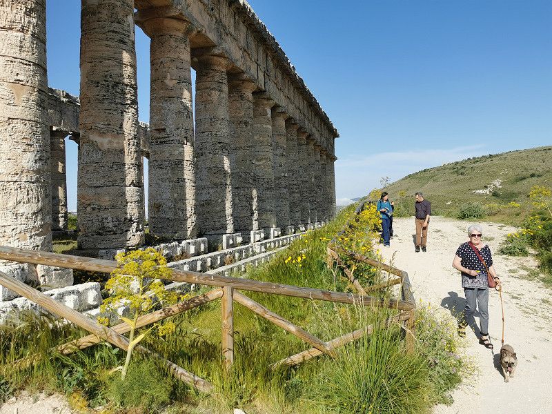
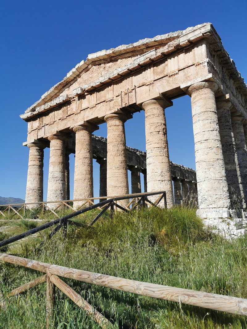
CALATAFIMI SEGESTA - Parco Archeologico di Segesta
Still Friday, April 21st
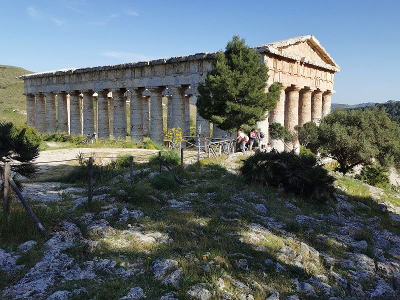
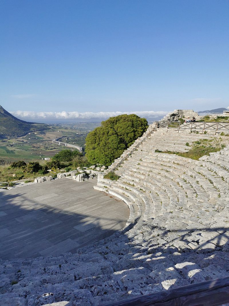
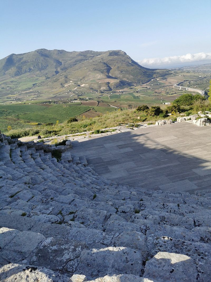
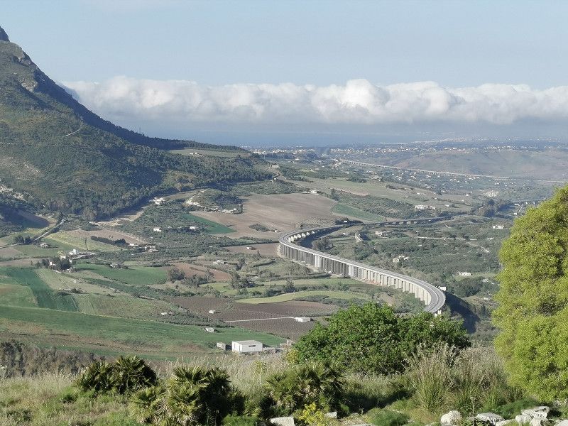
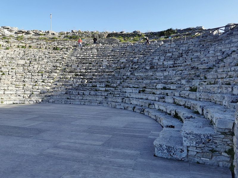
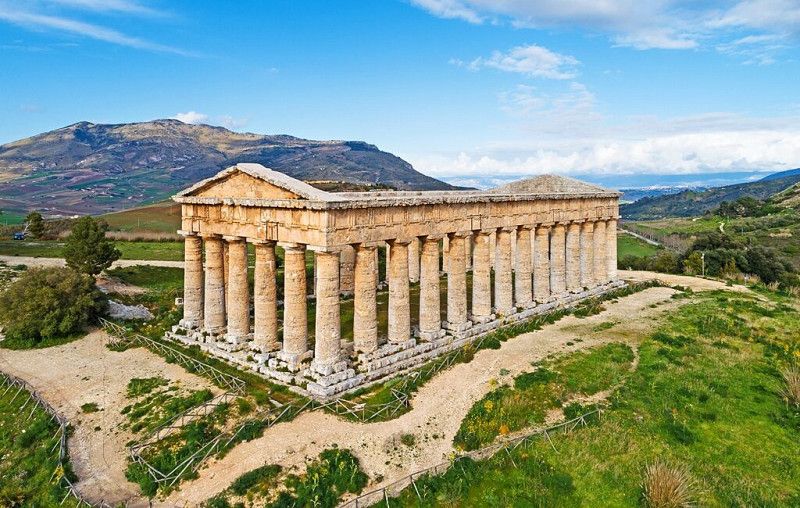
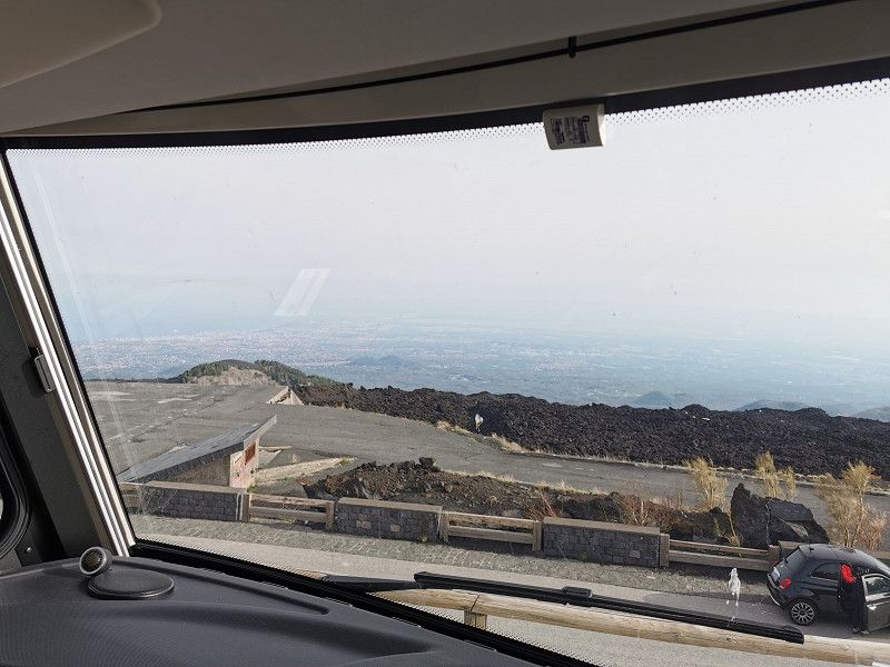
The Frieda continues inland to Segesta. A beautiful temple complex and an amphitheater from around 400 BC (UNESCO World Heritage Site) with a magnificent view of the surrounding area and the sea. We are enjoying the now much better and warmer weather.
Unfortunately, we have to cancel our plan to spend the night in the parking lot near the archaeological park with a view of the temple complex, which is illuminated at night. On the one hand, there are now clear prohibition signs and the place is used by some idiots, among other things, as a parking space for one or the other wrecked car and is quite unsightly. You don't want to stay there overnight. Without further ado, we decide to go to the "Nausicaa" campsite in Castelammare del Golfo, about 20 km away.
Strada Provinciale 57 Buseto Palizzolo - Bruca - Pocorobba - Segesta , Calatafimi Segesta, Italien
37° 56' 19.1" N 12° 50' 18.6" E
37.9386493 12.8385039
• Head southeast. Go for 90 m.
• Turn slightly left. Go for 120 m.
• Turn right. Go for 6 m.
• Turn left toward A29dir. Go for 720 m.
• Take ramp toward Trapani/Palermo/A29. Go for 99 m.
• Take ramp onto A29dir toward Palermo. Go for 8.9 km.
• Take the left exit toward Aeroporto Falcone Borsellino/Palermo onto A29 (Autostrada Palermo-Mazara del Vallo). Go for 5.6 km.
• Take the exit toward Castellammare del Golfo. Go for 3.2 km.
• Continue on Contrada Gemma d'Oro. Go for 368 m.
• Continue toward Via Gemma d'Oro. Go for 281 m.
• Continue on Via Gemma d'Oro. Go for 283 m.
• Continue toward Viale Leonardo da Vinci/SS187. Go for 27 m.
• Take the 2nd exit from roundabout onto Viale Leonardo da Vinci (SS187). Go for 128 m.
• Take the 2nd exit from roundabout onto Viale Umberto I (SS187). Go for 246 m.
• Turn right onto Via Francesco Crispi. Go for 495 m.
• Turn right onto Corso Giuseppe Garibaldi. Go for 404 m.
• Turn left onto Via Quintino Sella. Go for 148 m.
• Turn right onto Via Generale Michele di Gaetano. Go for 36 m.
• Arrive at Via Generale Michele di Gaetano.
☍
21,2 km
( 20 min.)
CASTELLAMMARE DEL GOLFO - Campeggio Nausicaa
Still Friday, April 21st
Campeggio Nausicaa
Spiaggia Plaia 38, 91014 Castellammare del Golfo
GPS N 38° 1' 30.0", E 12° 52' 46.0"
ACSI price 25€/night + local tax
On the beautiful, shady and well-equipped CP with its own beach access, we only briefly explore the beach and the surrounding area after arrival and otherwise let God be a good man. In case the weather doesn't cooperate 100%, we decide to cancel the next day's trip to the Segesta hot springs and just hang out. Has to be too...
Spiaggia Plaia 38, 91014, Castellammare del Golfo, Italy
38° 1' 30" N 12° 52' 46" E
38.0250000 12.8794400
• Head toward Via della Libertà on Via Generale Michele di Gaetano. Go for 13 m.
• Turn right onto Via della Libertà. Go for 19 m.
• Turn right onto Via Roma. Go for 48 m.
• Turn right onto Via Quintino Sella. Go for 163 m.
• Continue on Piazza Benedetto Croce. Go for 951 m.
• Turn sharp right onto SS187. Go for 10.8 km.
• Take the 1st exit from roundabout onto SS187. Go for 9.3 km.
• Turn right toward SP16. Go for 1.9 km.
• Continue on SP16. Go for 483 m.
• Take the 2nd exit from roundabout. Go for 1.2 km.
• Turn right onto Via Scucina. Go for 868 m.
• Turn right toward SP16. Go for 26 m.
• Continue on Via Purgatorio (SP16). Go for 926 m.
• Continue on SP16. Go for 4 m.
• Continue on Via Purgatorio (SP16). Go for 632 m.
• Continue on Contrada Purgatorio (SP16). Go for 1.1 km.
• Continue on SP16. Go for 161 m.
• Continue on Contrada Purgatorio (SP16). Go for 144 m.
• Continue on SP16. Go for 404 m.
• Continue on SP16. Go for 1.2 km.
• Continue on SP16. Go for 2.7 km.
• Turn left onto Viale Cristoforo Colombo (SP16). Go for 2.1 km.
• Take the 1st exit from roundabout onto Viale Cristoforo Colombo (SP16). Go for 518 m.
• Continue on SP16. Go for 12 m.
• Continue on Viale Cristoforo Colombo (SP16). Go for 825 m.
• Continue on SP16. Go for 946 m.
• Turn left. Go for 502 m.
• Turn right. Go for 231 m.
• Arrive at your destination on the left.
☍
37,9 km
( 52 min.)
Day
CASTELLAMMARE DEL GOLFO - Stehtag
Saturday April 22nd
Standing day on the CP, vehicle interior cleaning, washing clothes, hanging out and the travel diary also wants to be written and photos want to be sorted.
The weather is actually great now, but there's a really stiff breeze with heavy wind chill, and you can only endure it "packed up" for a long time outside, even when the sun is shining. At night our Frieda is shaken up properly. When camping, you experience nature up close.
Day
Nähe SAN VITO LO CAPO - Spiaggia di Santa Margherita
Sunday April 23rd
Daily stage: 38 km
Spiaggia Baia Santa Margherita,
Strada Provinciale, Via dell'Acqua Macari 16, San Vito Lo Capo.
GPS: N 38.125324, E 12.728999
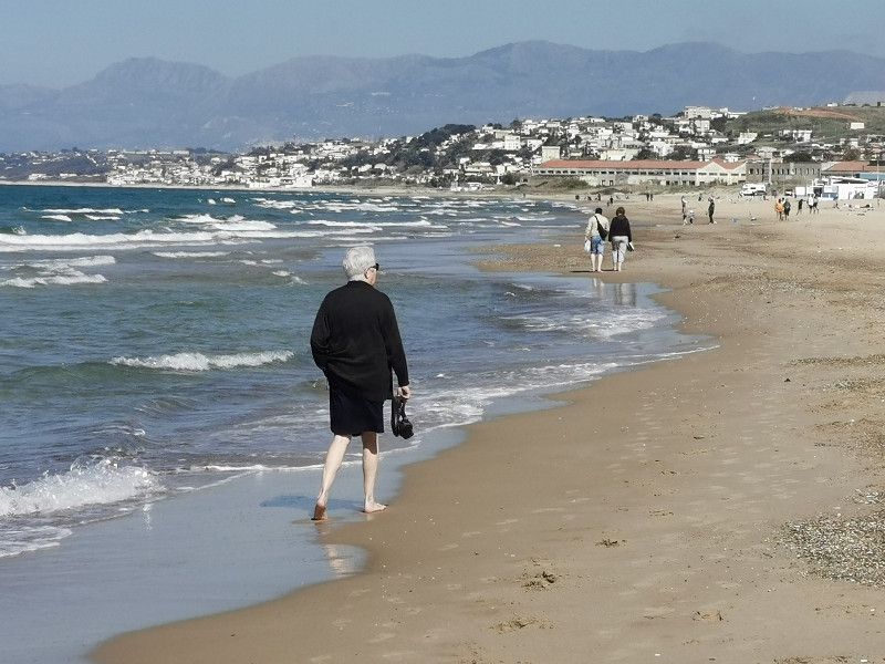
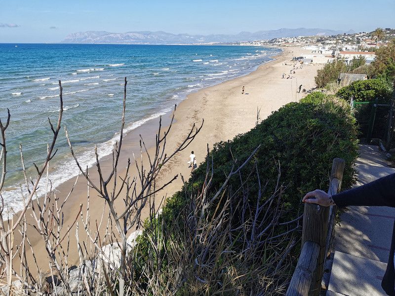
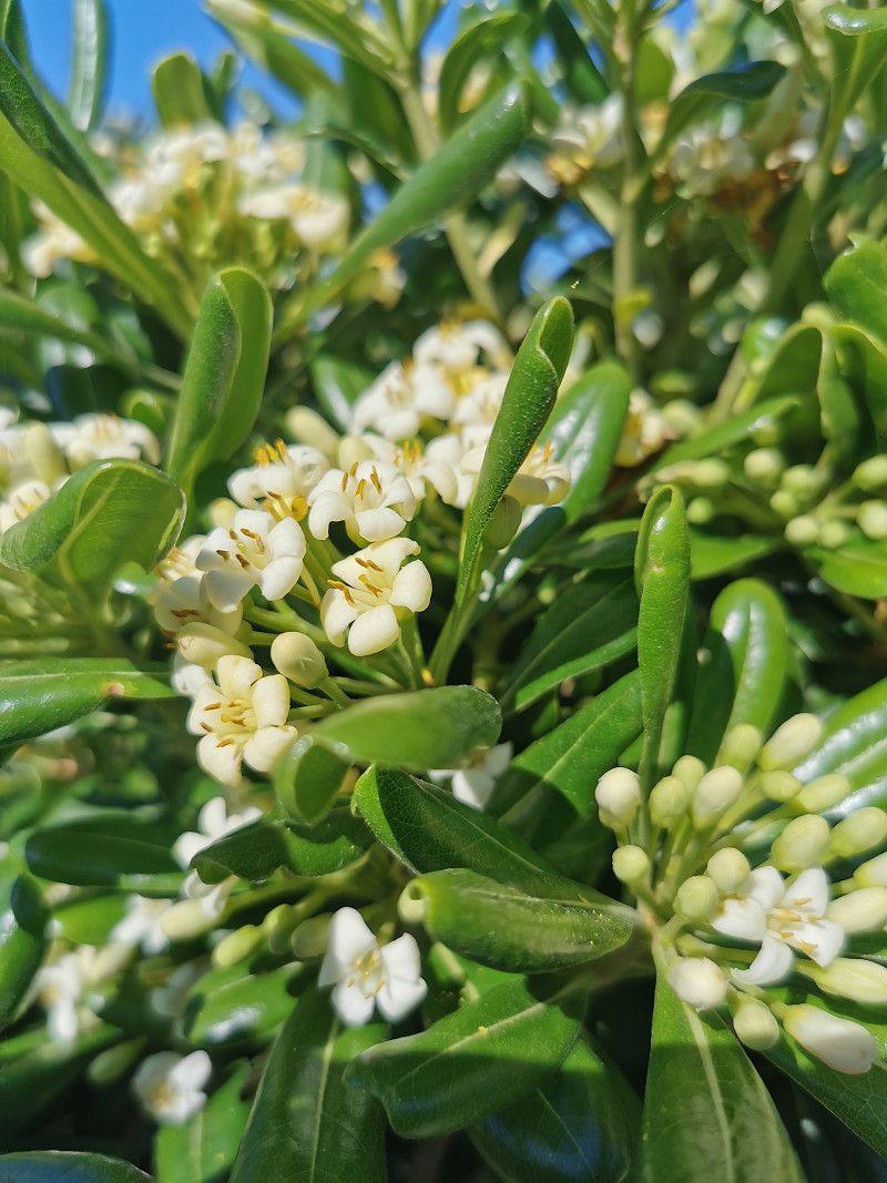
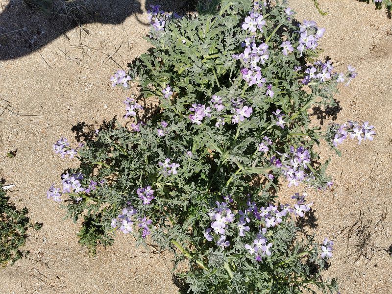
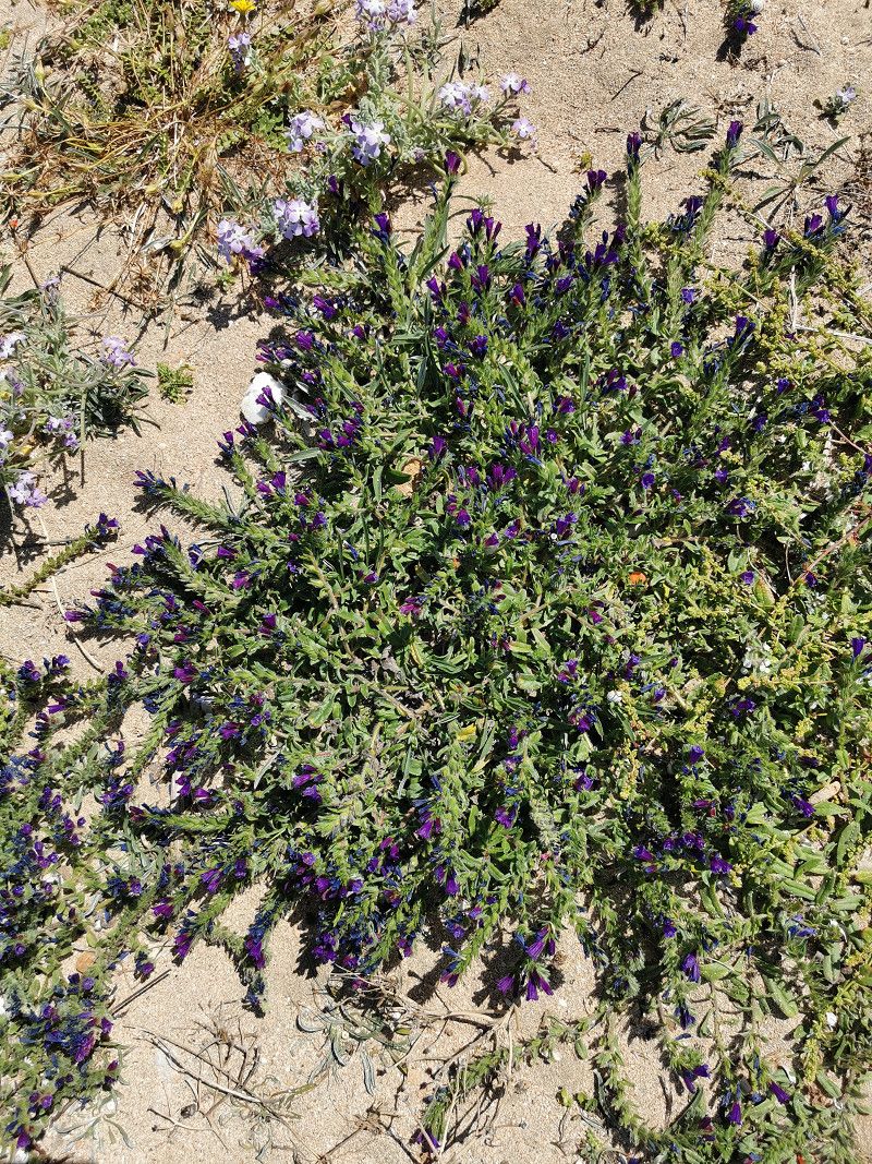
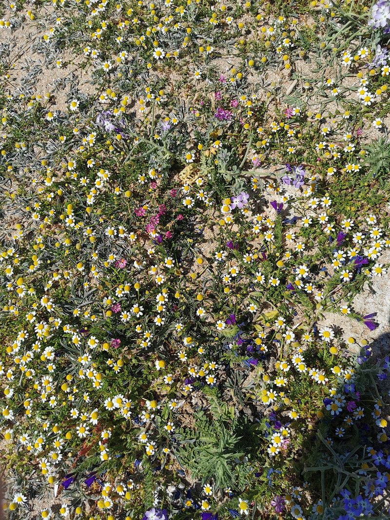
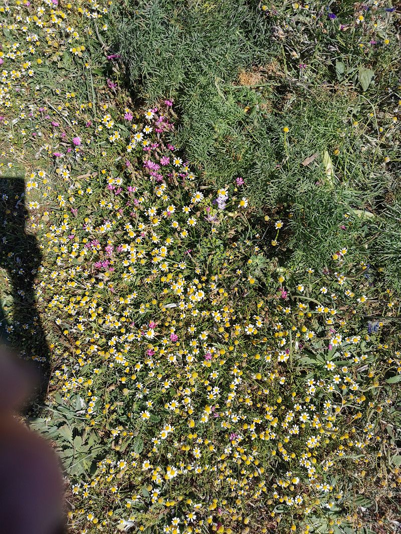
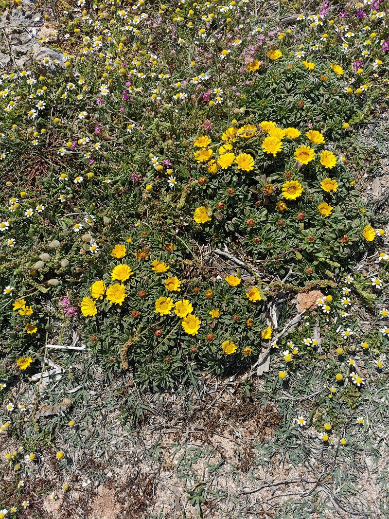
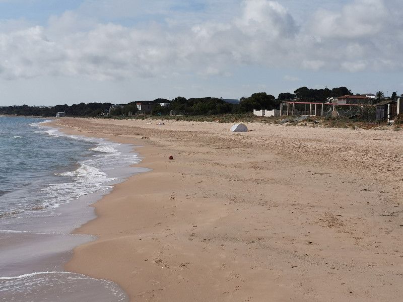
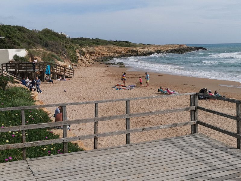
It is legal to stand freely on the waterfront on this beautiful, mostly rocky stretch of beach from October to April. We were also amazed by the splendor of flowers that could be seen everywhere on this beach.
Even though the weekend, public holiday and bridging day came together this time in Italy and many Italians were out and about with their WoMos, there was plenty of space for everyone. At other times you're pretty much alone here. The weather was sunny during the day with a good 20 degrees, but there was still a very strong wind, which increased at night and made the overnight stay quite uncomfortable. As a precaution, we retracted the awning in the evening despite the storm protection. And that was a good decision, as the night showed, when it also rained. Other WoMo drivers had to go out at night to save their awnings. No gift in this weather! :-(
We only stayed one night because of the strong, uncomfortable wind. It's really a pity, because it was simply brilliantly beautiful here! You just have to stop here!
Spiaggia di Santa Margherita, 91010, Italien
38° 7' 33.1" N 12° 43' 45.7" E
38.1258499 12.7293658
• Head north. Go for 418 m.
• Turn right. Go for 297 m.
• Turn right. Go for 635 m.
• Turn slightly right toward Via Cristoforo Colombo/SP16. Go for 42 m.
• Turn left onto Via Cristoforo Colombo (SP16). Go for 868 m.
• Continue on SP16. Go for 14 m.
• Continue on Via Cristoforo Colombo (SP16). Go for 669 m.
• Turn left onto Via Savoia (SP16). Go for 1.5 km.
• Continue on SP16. Go for 9 m.
• Continue on Via Savoia (SP16). Go for 202 m.
• Turn right toward Strada Comunale Mondello. Go for 9 m.
• Continue on Strada Comunale Mondello. Go for 2.3 km.
• Turn left onto Via del Secco (SP63). Go for 354 m.
• Turn left. Go for 163 m.
• Arrive at your destination.
☍
7,4 km
( 17 min.)
SAN VITO LO CAPO - Campeggio La Pineta
Monday April 24th
Daily km: approx. 8 km
Source: ACSI, #2739
Via del Secco 90
91010 San Vito Lo Capo
GPS: 38°10'26"N, 12°44'53"E
Phone +39 0923621382
Web: https://www.campinglapineta.it/germany/
ACSI price: 21€
La Pineta is a nice 4* campsite, beautifully shaded by numerous pine trees, located near the sea with two beautiful, very well-kept pools and its own restaurant. The town of San Vito Lo Capo (approx. 800 m away) is one of the northernmost points in Sicily in a scenic area (mountains & sea & beach). A colorful, small, quiet place in the off-season with a clear North African touch and great restaurants (couscous!), cafés and ice cream parlors, even if everything is now heavily influenced by tourism and is no longer as "originally authentic" as most travel guides advertise .
Del Secco 88, 91010, San Vito Lo Capo, Italy
38° 10' 19" N 12° 44' 54" E
38.1719400 12.7483300
• Head toward Via del Secco. Go for 163 m.
• Turn right onto Via del Secco (SP63). Go for 318 m.
• Turn right onto Strada Comunale Mondello. Go for 2.3 km.
• Turn left onto Via Savoia (SP16). Go for 202 m.
• Continue on SP16. Go for 9 m.
• Continue on Via Savoia (SP16). Go for 1.5 km.
• Turn right onto Via Cristoforo Colombo (SP16). Go for 359 m.
• Continue on Via Cristoforo Colombo (SP16). Go for 310 m.
• Continue on SP16. Go for 14 m.
• Continue on Via Cristoforo Colombo (SP16). Go for 1.5 km.
• Continue on SP16. Go for 585 m.
• Turn right. Go for 1.9 km.
• Turn right. Go for 39 m.
• Turn slightly left. Go for 2.9 km.
• Turn slightly right toward Contrada Tuono. Go for 237 m.
• Continue on Contrada Tuono. Go for 494 m.
• Continue on Contrada Tonnara Cofano. Go for 699 m.
• Turn left. Go for 1.6 km.
• Turn right toward Baglio Cofano. Go for 744 m.
• Turn left onto Baglio Cofano. Go for 523 m.
• Turn left onto Baglio Cofano. Go for 390 m.
• Turn left. Go for 58 m.
• Arrive at your destination on the left.
☍
16,9 km
( 40 min.)
Day
Zwischenstop - Grotta Mangiapane
Tuesday April 25th
Daily stage: 80 km
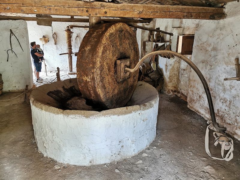
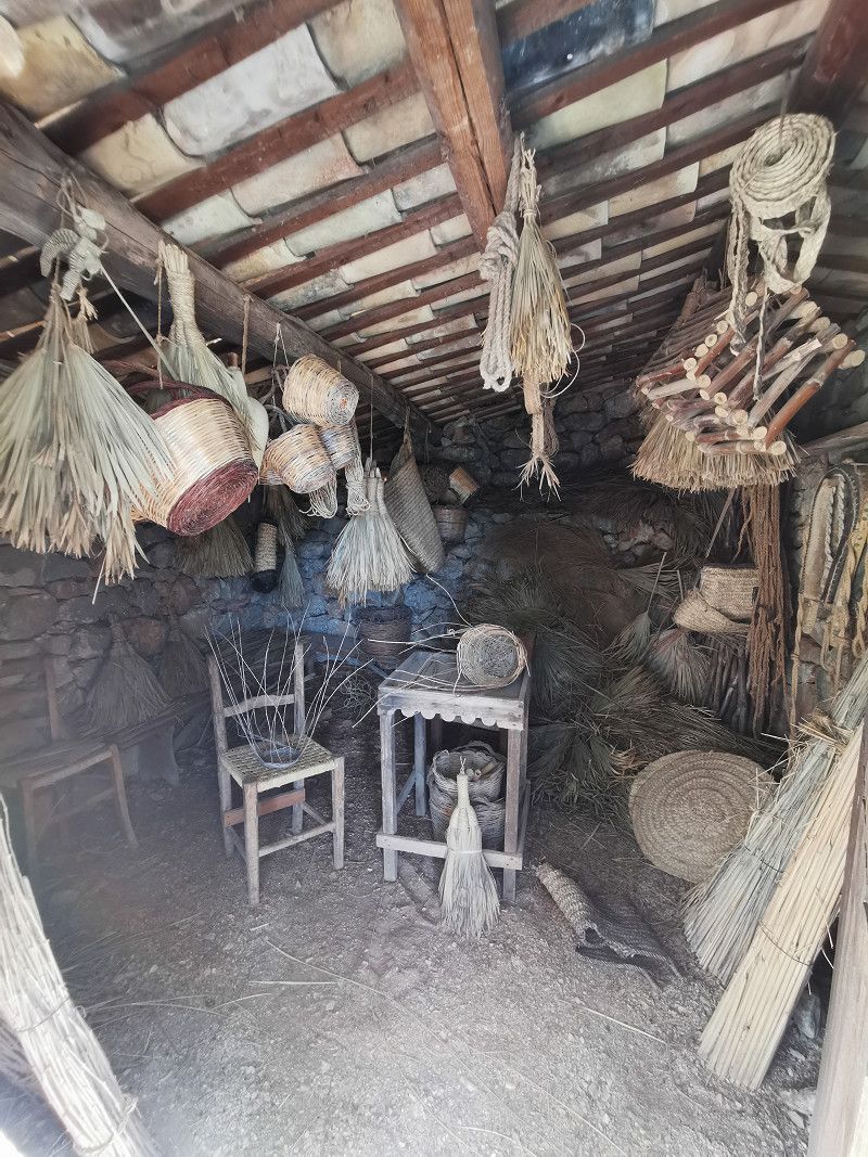
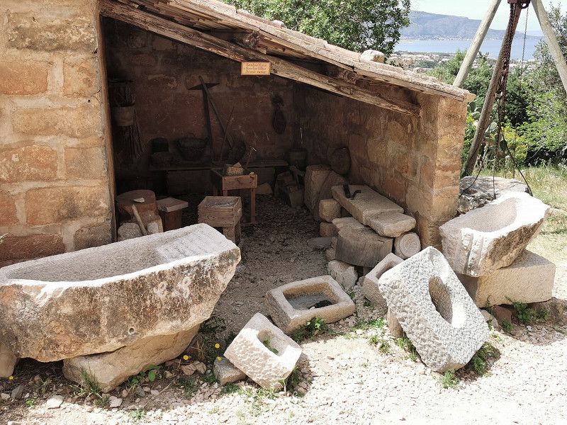
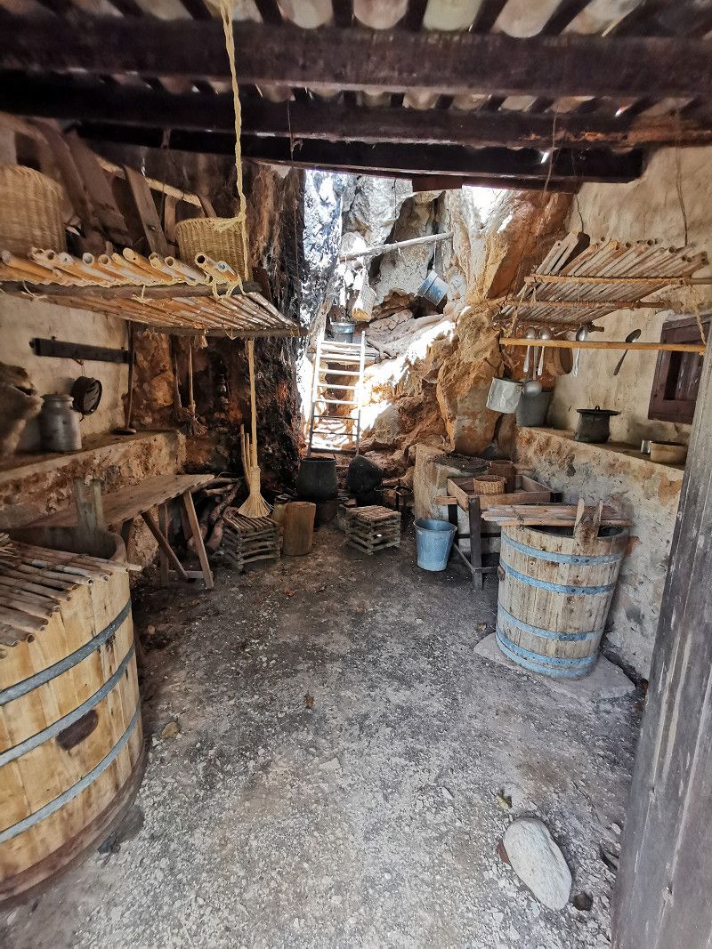
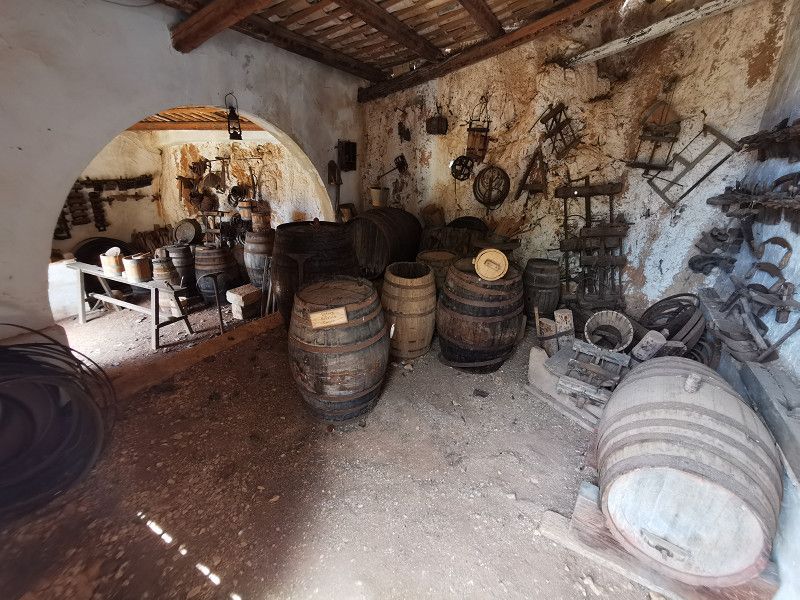
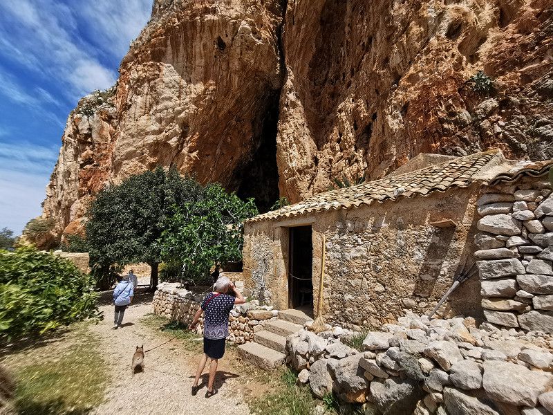
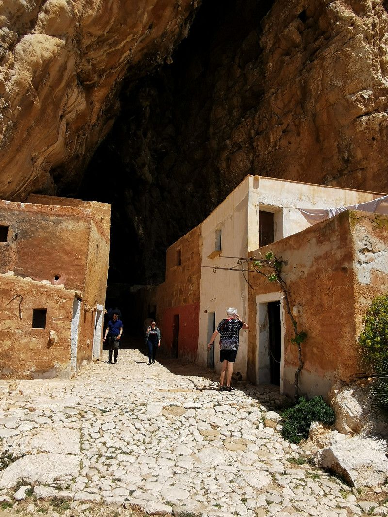
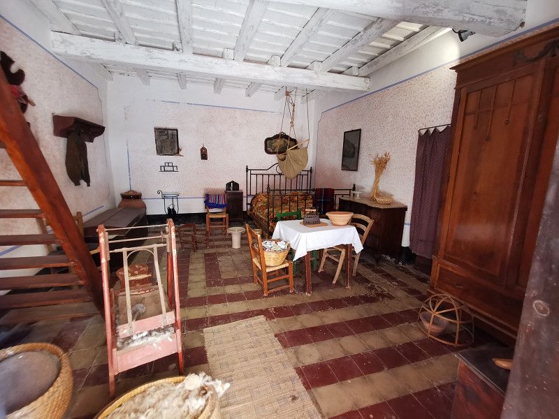
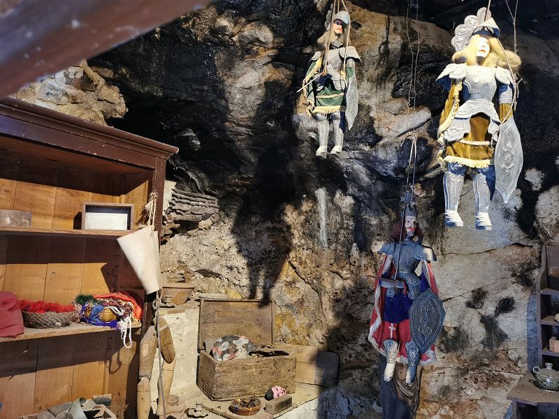
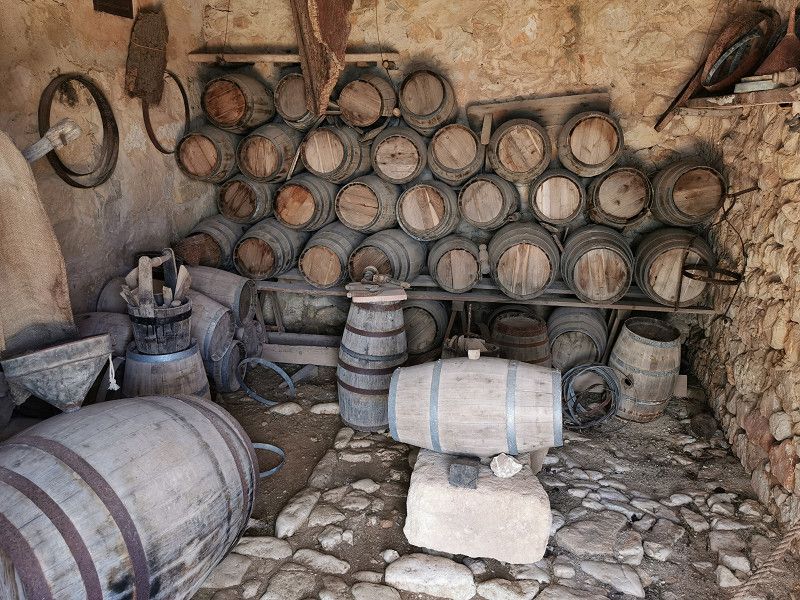
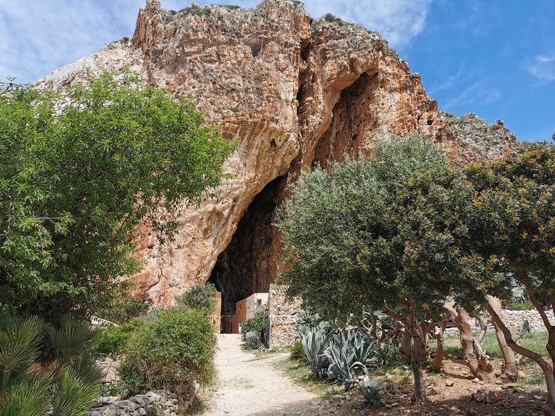
Who rests, rusts. We keep touring. The first stage today is a prehistoric grotto settlement that was regularly inhabited until about 1950 and provided itself with everything you need to live. All of the traditional trades were represented in the settlement.
Well preserved, equipped with many contemporary details, cared for and presented with a lot of love and commitment. There is no entrance fee, but a donation is requested. Definitely worth seeing!
The grotto settlement cannot be reached directly with a large mobile home (no parking space if something is busy). There is a WoMo parking lot in Custonaci (GPS: N 38.09693 E 12.66292). From there it is a walk of about 15 minutes.
Via Brenta , Custonaci, Italien
38° 5' 35.9" N 12° 40' 15.1" E
38.0933025 12.6708723
• Head west. Go for 33 m.
• Turn left. Go for 106 m.
• Turn right toward Via Libeccio. Go for 686 m.
• Turn right onto Via Libeccio. Go for 123 m.
• Continue on Contrada Scurati. Go for 166 m.
• Turn left onto Contrada Scurati. Go for 539 m.
• Take the 2nd exit from roundabout onto Via Baglio Mogli Belle. Go for 3.7 km.
• Continue on Via dei Marmi (SP18). Go for 2.1 km.
• Turn right onto Via Cristoforo Colombo (SP20). Go for 949 m.
• Continue on Via Asmara (SP20). Go for 881 m.
• Continue on SP20. Go for 250 m.
• Continue on Via Crocifissello (SP20). Go for 505 m.
• Continue on Via Enea (SP20). Go for 1.0 km.
• Pass 3 roundabouts and continue on Via Enea (SP20). Go for 4.1 km.
• Continue on Lungomare Dante Alighieri. Go for 78 m.
• Take the 2nd exit from roundabout onto Via Madonna di Fatima (SP20). Go for 806 m.
• Take the 2nd exit from roundabout onto Viale della Provincia. Go for 323 m.
• Turn left onto Via Vecchia Martogna. Go for 18 m.
• Turn right onto Viale della Provincia. Go for 484 m.
• Continue on Via Salvatore Caruso. Go for 261 m.
• Turn left onto Via Ravenna. Go for 88 m.
• Turn slightly right onto Via Villa San Giovanni. Go for 135 m.
• Turn left onto Via Filippo Corridoni. Go for 177 m.
• Turn right onto Via Fratelli Aiuto. Go for 312 m.
• Turn left onto Via Caserta. Go for 57 m.
• Arrive at Via Caserta.
☍
17,9 km
( 28 min.)
Zwischenstop - Bergdorf ERICE (Trapani)
Still Tuesday, April 25th
After visiting the cave settlement, continue to Trapani to the valley station of the cable car (Funivia) to the mountain village of Erice. Parking GPS: N 38.024228, E 12.550211, 100 m from the valley station. The cable car takes you steeply up to the mountain village in about 15 minutes. On the way very nice views of Trapani and the crescent-shaped bay that gave the place its name. In principle, you can also drive to Erice with the WoMo via a scenically very beautiful, narrow, very winding road, but there are hardly any parking spaces for WoMos there. We were glad to have come with the cable car, because it was quite busy and we definitely couldn't have found a parking space for our Frieda and therefore had to drive back!
Erice is a mountain village, founded in antiquity, with narrow streets and squares with elaborate stone paving, mighty city walls, 3 city gates, countless churches, 2 castles. You have fantastic views of the surrounding area. The place is also historically famous for its special local patisseries. In the meantime very touristy: numerous shops that always sell the same junk souvenirs, some beautifully prepared, old patisserie bakeries that are very busy. Many of the old buildings appear to be only partially inhabited and some are in a poor to deplorable state of preservation. Nevertheless, the place is definitely worth seeing, has a lot of charm and is worth a visit. However, it seems to me that it gets a bit "overhyped" in travel guides. So don't set your expectations too high, otherwise you will be disappointed.
Via Capua , Erice, Italien
38° 1' 24.4" N 12° 33' 4.1" E
38.0234401 12.5511327
• Head east on Via Caserta.
• Turn right onto Via Capua. Go for 96 m.
• Turn right onto Via Alessandro Manzoni. Go for 623 m.
• Continue on Corso Piersanti Mattarella (SP31). Go for 734 m.
• Turn left onto Via Pantelleria. Go for 86 m.
• Continue on Via Capitano Giuseppe Verri. Go for 217 m.
• Continue on Via Mazara. Go for 94 m.
• Continue on Via Valderice. Go for 89 m.
• Turn right onto Via Castelvetrano. Go for 71 m.
• Turn left onto Via Marsala (SS115). Go for 8.1 km.
• Take ramp onto A29dir/A toward Aeroporto Birgi. Go for 6.3 km.
• Continue on SP21. Go for 2.9 km.
• Take the 2nd exit from roundabout onto SP21 toward Marsala-Birgi. Go for 7.4 km.
• Turn right. Go for 314 m.
• Arrive at your destination on the right.
☍
27,0 km
( 31 min.)
MARSALA - Camping bei Mamma Colette
Still Tuesday, April 25th
Source: Park4Night
Mamma Colette B&B & Restaurant
66s Contrada Spagnola, 91025 Marsala
GPS: N 37°50'39.1596” E 12°27'56.4372”
Email: commercialecolette@gmail.com
Phone +393391739320
Approx. 25€ tuttifrutti, including breakfast (!)
After Erice's visit, we headed towards Marsala to "Mama Colette". Your campsite is 5 km before Marsala. Mamma Colette is a multilingual, 78-year-old and still energetic "typical Italian mamma" (although actually French from Martinique) and offers quiet pitches under palm trees directly on the sea and a real "Sicilian food experience": simple, but typical and delicious Dishes with products from the region. Unfortunately it was nothing to do with "sleeping under palm trees", because due to the Italian national holiday there was a lot going on and we got the last parking space, quite off the beaten path on a less beautiful, slightly dingy parking lot in places. V&E and sanitary facilities were "very basic" (Dixis) but who cares... The welcome wine and the good food at Mama Colette's at an extremely fair price and her touching care made up for it. A real character, a one-of-a-kind with a big heart! We can only recommend a visit.
Contrada Spagnola , Marsala, Italien
37° 50' 15.5" N 12° 28' 22.9" E
37.8376295 12.4730254
• Head east. Go for 273 m.
• Turn right onto SP21. Go for 4.2 km.
• Take the 3rd exit from roundabout onto Via Grotta del Toro. Go for 742 m.
• Turn sharp left onto Via Trapani (SS115). Go for 311 m.
• Take the 1st exit from roundabout onto Via Dante Alighieri. Go for 469 m.
• Take the 1st exit from roundabout onto Via Dante Alighieri. Go for 1.2 km.
• Turn right onto Via Nino Bixio (SS188) toward Mazara del Vallo/SS115. Go for 302 m.
• Turn left onto Piazza Caprera (SS115) toward Mazara del Vallo/Petrosino/Castelvetrano/Palermo/A29. Go for 64 m.
• Continue on Via Mazara (SS115). Go for 17.6 km.
• Pass 2 roundabouts and continue on Strada Statale Sud Occidentale Sicula (SS115). Go for 2.0 km.
• Continue on A29 (Autostrada Palermo-Mazara del Vallo). Go for 20.9 km.
• Take the exit toward Castelvetrano. Go for 652 m.
• Turn left onto Via Caduti di Nassiriya toward Agrigento/Sciacca/Menfi/Castelvetrano. Go for 445 m.
• Take the 3rd exit from roundabout onto Strada Statale Sud Occidentale Sicula (SS115) toward Agrigento/Sciacca. Go for 1.9 km.
• Take ramp onto Strada Statale Sud Occidentale Sicula (SS115) toward Agrigento/Sciacca. Go for 8.2 km.
• Take ramp toward Montevago. Go for 188 m.
• Turn right onto SP48. Go for 2.6 km.
• Turn left onto SP79. Go for 3.9 km.
• Turn right onto Strada Provinciale Menfi-Portopalo (SP40). Go for 171 m.
• Turn left onto SP50. Go for 7.1 km.
• Turn right onto Strada Comunale 4 Ex Consortile Bertolino-Lagano. Go for 2.2 km.
• Turn slightly right onto Strada Comunale 4 Ex Consortile Bertolino-Lagano. Go for 345 m.
• Arrive at Strada Comunale 4 Ex Consortile Bertolino-Lagano.
☍
75,9 km
(1 hrs. 23 min.)
Day
BERTOLINO, freier Stellplatz Nähe Menfi
Wednesday April 26th
Stage km: 85 km
Contrada Bertolino, 92013 Menfi S.A
GPS: N37.543772, E12.985283
After a really sumptuous breakfast at Mama Colette’s (which was worth the overnight price for both of us alone), our goal for the day was a pitch without V&E directly by the sea, about 5 km from Menfi, with a white sand/pebble beach. Ideal for relaxation and rest and planned for a minimum of 2 nights. The path led us past the Marsala salt pans, which have been in operation for around 2000 years.
But unfortunately nothing came of being free on the seashore. The place is now under video surveillance and staying overnight is forbidden under threat of heavy fines, and the police check in the evenings, according to a friendly resident. Stupid and disappointing. Some campers have probably misbehaved again. It's a shame, but unfortunately that's how it often is. During the day, however, you can stand there and swim, have a barbecue, etc. After a walk on the beautiful beach, we then decided to go to the CP "La Palma" in Menfi, despite the moderate ratings, because we couldn't find an alternative within an acceptable distance was..
Italy
37° 32' 37.5" N 12° 59' 6.6" E
37.5437607 12.9851532
• Head northwest on Strada Comunale 4 Ex Consortile Bertolino-Lagano. Go for 2.5 km.
• Turn left onto SP50. Go for 3.4 km.
• Turn left onto Via dei Lupi. Go for 1.2 km.
• Continue toward Via delle Palme. Go for 112 m.
• Turn left onto Via delle Palme. Go for 602 m.
• Arrive at Via delle Palme. Your destination is on the right.
☍
7,9 km
( 14 min.)
MENFI - Camping La Palma
Wednesday, April 26th
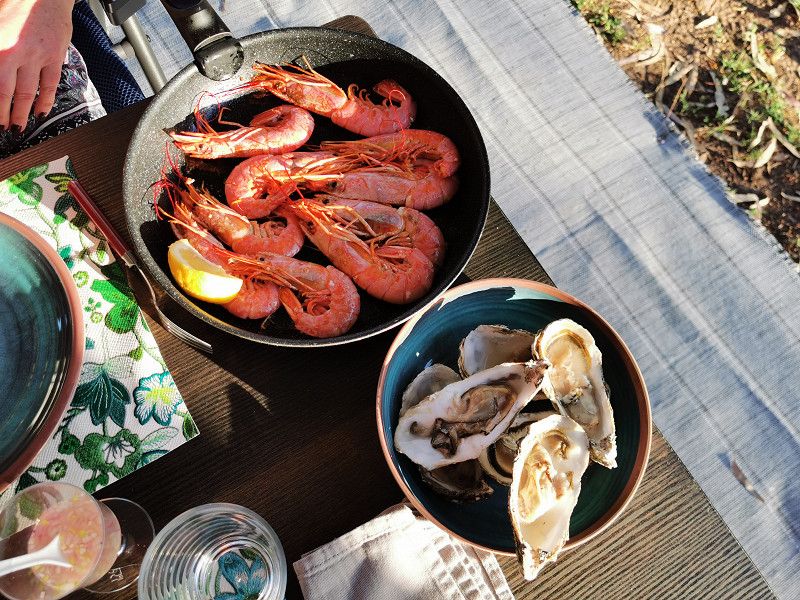
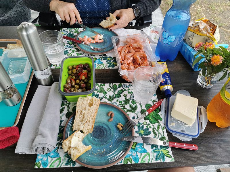
On the CP "La Palma" we are received super nice by the owners and Gina is once again the hit and contact catalyst and breaks every language barrier. The tidy CP, beautifully shaded by old eucalyptus trees, has direct access to the sea and after a thorough inspection we book in for 2 nights. We definitely cannot understand the negative reviews in some camping apps. Since the weather has also turned out great (23 degrees, no more wind), there is also a "large build-up" outside, as we now hope to finally be able to spend most of our time outside. We treat ourselves to crabs and also some very tasty oysters.
Via Delle Palme 29, 92013, Menfi, Italy
37° 33' 54" N 12° 57' 49" E
37.5650000 12.9636100
• Head northwest on Via delle Palme. Go for 602 m.
• Turn right toward Via dei Lupi. Go for 112 m.
• Continue on Via dei Lupi. Go for 1.2 km.
• Turn right onto SP50. Go for 4.9 km.
• Turn right onto SP79. Go for 657 m.
• Turn left onto SP39. Go for 5.2 km.
• Turn right onto Scorrimento Veloce Palermo-Sciacca (SS624). Go for 3.2 km.
• Take ramp onto Strada Statale Sud Occidentale Sicula (SS115) toward Agrigento/Sciacca. Go for 7.6 km.
• Keep left onto Strada Statale Sud Occidentale Sicula (SS115). Go for 15.0 km.
• Pass 2 roundabouts and continue on Strada Statale Sud Occidentale Sicula (SS115). Go for 36.3 km.
• Turn left toward Porto Empedocle. Go for 544 m.
• Continue on Via dell'Albero. Go for 172 m.
• Turn sharp right onto Via Nereo. Go for 63 m.
• Keep right onto Via Nereo. Go for 498 m.
• Arrive at Via Nereo.
☍
76,0 km
(1 hrs. 9 min.)
Day
MENFI - Stehtag
Thursday April 27th
As planned, today is a standing day that we enjoy. During our long walk on the beach, Gina surprises us by constantly walking in the water, which she otherwise avoids like the devil avoids holy water (unfortunately, you can't post videos here on freeontour). In her old age, the water-shy creature turns into a real dog.
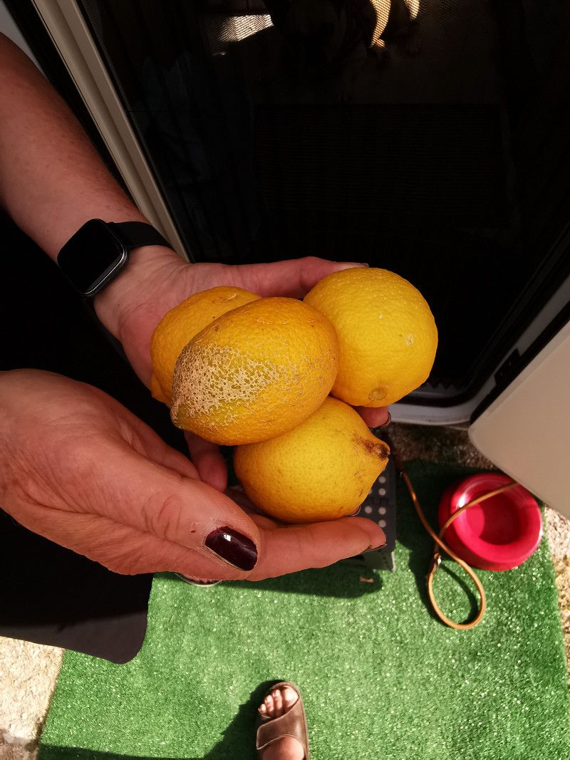
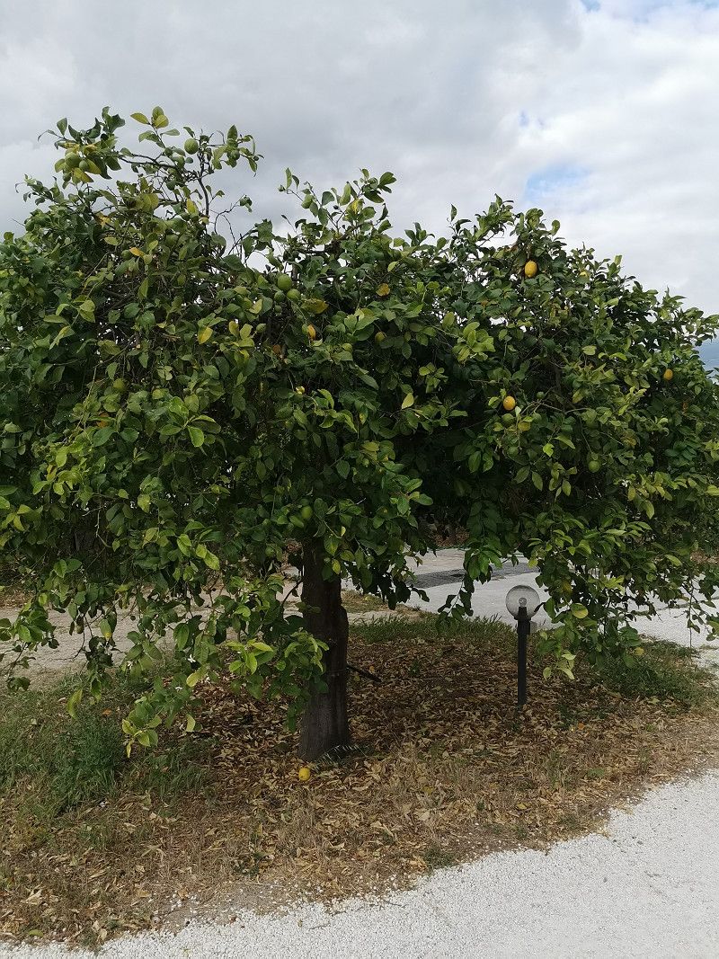
The vegetation here in Sicily is impressive: the lemons on the trees on the neighboring property are the size of a child's head! I haven't seen anything like this before. If there hadn't been a high fence in between I would have "organized" one.
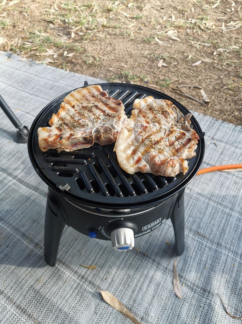
In the evening we started the Cadac and grilled delicious pork chops. The weather is perfect, we're doing really well, it can stay that way... ;-)
Day
PORTO EMPEDOCLE - Area Sosta Camper Punta Piccola / Scala dei Turchi
Friday April 28th
Daily km: 67 km
Source: Park4Night
21 Via Nereo, 92014 Porto Empedocle
GPS: N 37.289001, E 13.492800
Phone +393475298525
Costs: around €19
Guarded camper place locked at night right on the beach with V&E and simple toilets/showers. Ideal as only a 1.5km walk across the beach from the famous Scala dei Turchi (Stairs of the Turks).
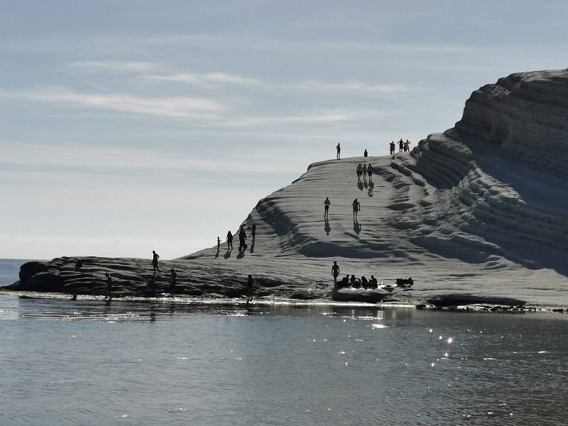
The extraordinary step formation is not a man-made staircase, but a gigantic rock. The Scala dei Turchi consists of so-called marl, a sedimentary rock. Over time, wind and precipitation have carved the steps into the bright white marl rock, to which it owes its name today.
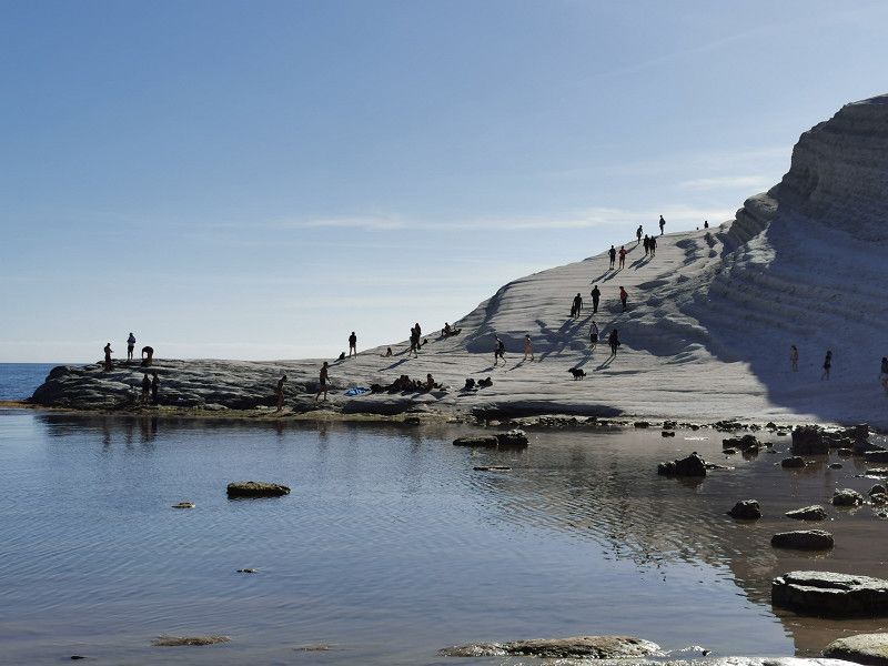
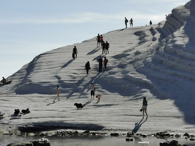
After arriving at the SP in the early afternoon, we made our way across the beach to the Scala dei Turchi. Despite the manageable distance, the path turned out to be a bit more difficult than expected due to the dry sand in places. Entering the Scala dei Turchi has apparently been forbidden for some time and access via the beach in front of the Scala is blocked off by fences and warning signs. But that doesn't prevent numerous visitors from recklessly avoiding the barriers on the rocky subsoil because of the water, which is only about knee-high at low tide, and climbing the Scala anyway. As German-French people who always followed instructions, we did not take the effort and risk and marveled at the natural wonder from the required distance. On the way back to the SP we stopped at a nice beach bar and treated ourselves to an Aperol Spritz, enjoyed the scenery and gained new momentum. Later in the WoMo, delicious tortellini with homemade tomato sauce and green asparagus were served for dinner.
Via Nereo , Porto Empedocle, Italien
37° 17' 30.7" N 13° 29' 48.5" E
37.2918609 13.4968097
• Head southwest on Via Nereo. Go for 911 m.
• Continue on SP68. Go for 285 m.
• Turn right. Go for 23 m.
• Turn sharp right toward SP68. Go for 62 m.
• Turn left onto SP68. Go for 238 m.
• Continue on Via Nereo. Go for 1.4 km.
• Continue on Via Nereo. Go for 63 m.
• Continue on Via Francesco Crispi. Go for 1.4 km.
• Continue on Via Vescovo Gioieni. Go for 261 m.
• Continue on Via Francesco Crispi. Go for 233 m.
• Continue on Via Vescovo Gioeni. Go for 388 m.
• Continue on Via Empedocle. Go for 454 m.
• Continue on Via dell'Industria. Go for 118 m.
• Turn right onto Via G. Guazzelli. Go for 93 m.
• Take the 2nd exit from roundabout onto Lungomare Luigi Pirandello. Go for 2.7 km.
• Take ramp onto Strada Statale Sud Occidentale Sicula (SS115/SS640). Go for 2.6 km.
• Take ramp onto Via Luca Crescente toward Agrigento. Go for 1.3 km.
• Take the 2nd exit from roundabout onto Via Passeggiata Archeologica (SP4). Go for 526 m.
• Arrive at Via Passeggiata Archeologica (SP4). Your destination is on the right.
☍
13,1 km
( 16 min.)
Day
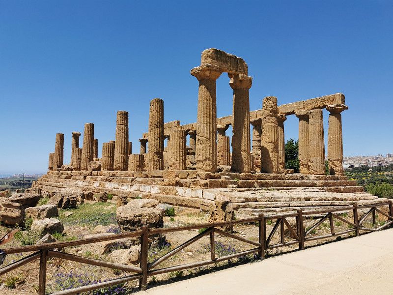
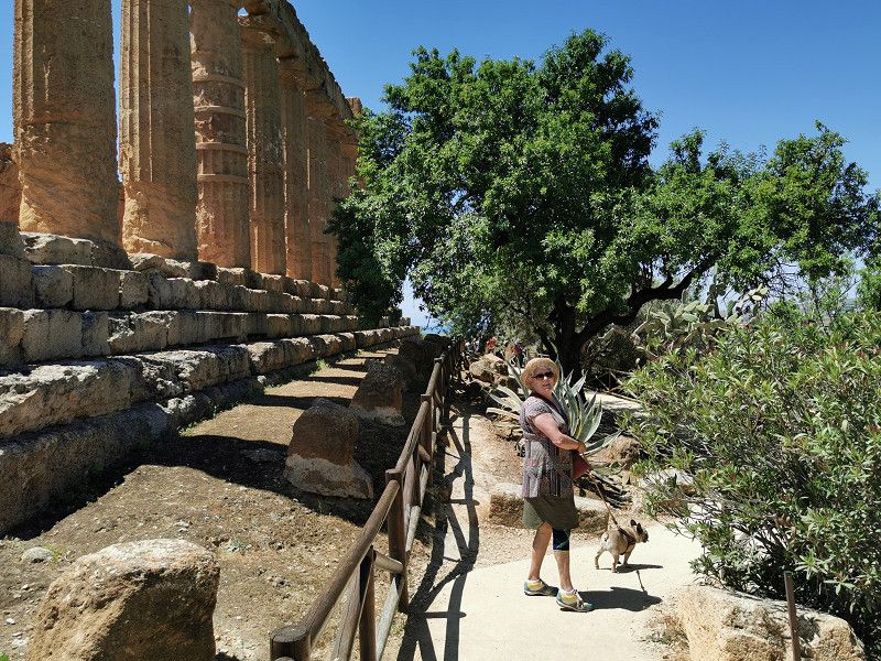
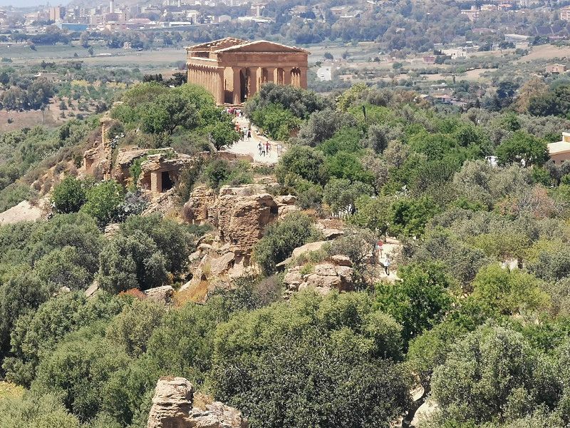
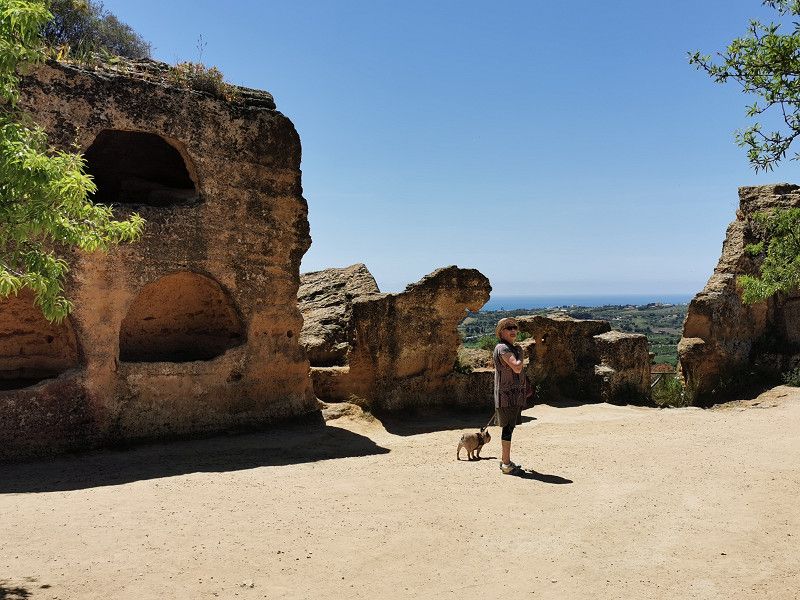
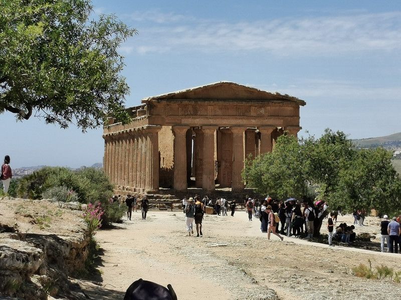
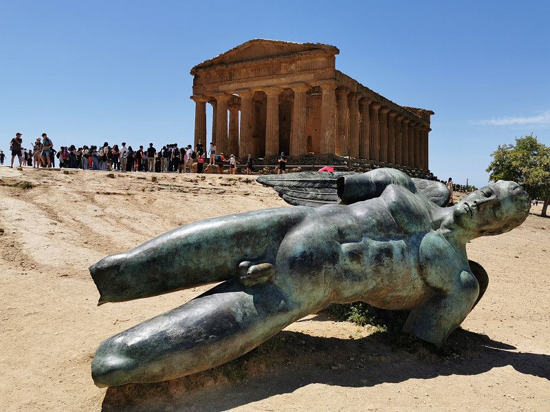
AGRIGENT - Tal der Tempel
Saturday April 29th
Daily stage: 115 km
AGRIGENTO - Valley of the Temples
Parking GPS: N 37.28885 E 13.58176 (Porta V)
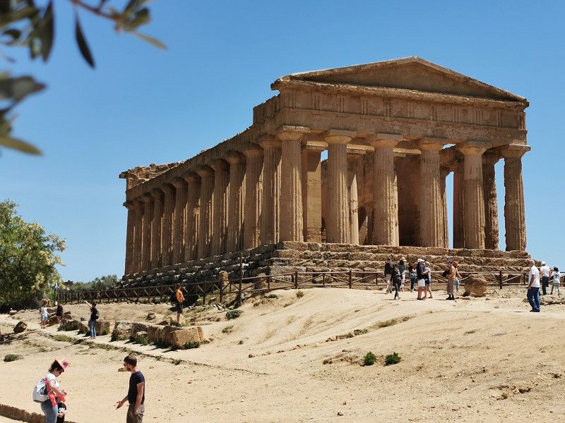
A visit to the archaeological park "Valle dei Templi" near Agrigento is one of the highlights of any trip to Sicily. We got the ideal weather for this: not too hot (about 22 degrees) with a pleasant, light breeze. We still sweated a lot!
The complex covers 1,300 hectares, making it the largest of its kind in the world and is a UNESCO World Heritage Site. Actually, the name "Valley of the Temples" is misleading, since the temple complexes are located on a small chain of hills; the name comes from the fact that they are located below the city of Agrigento. It is ideal to park the mobile home in the parking lot at Porta V and take a taxi to the Porta 1 entrance, the highest point of the facility (3€/person) and buy the tickets there and start the tour. This reduces your own running distance to a good 2 km, mostly slightly downhill over the chain of hills, and makes the whole thing less difficult. Without visiting the museum, you have to reckon with 2-3 hours of sightseeing.
The archaeological park consists of a number of Doric temples, some of which are excellently preserved, which were built in the 5th century BC. were built and reflect the power and wealth of the then Greek colony of Akragas.
Also worth seeing is the Garden of Kolymbetra (Giardino Kolymbetra) on the premises, a 2500 year old garden with almond, lemon and orange trees, all in bloom in April/May and exuding intoxicating scents.
Via Angelo Bonfiglio , Agrigent, Italien
37° 17' 28.5" N 13° 35' 20.3" E
37.2912549 13.5889750
• Head southwest on Via Passeggiata Archeologica (SP4). Go for 510 m.
• Take the 3rd exit from roundabout onto Viale Giuseppe La Loggia. Go for 1.4 km.
• Continue toward Strada Statale Degli Scrittori/SS640. Go for 40 m.
• Take the 3rd exit from roundabout onto Strada Statale Degli Scrittori (SS640) toward Favara. Go for 3.2 km.
• Take the 2nd exit from roundabout onto Strada Statale Degli Scrittori (SS640) toward PA-CT/A19/Caltanissetta. Go for 43.5 km.
• Continue on SS640. Go for 78 m.
• Take ramp. Go for 388 m.
• Take the 2nd exit from roundabout onto Strada Statale Degli Scrittori (SS640). Go for 853 m.
• Take ramp onto Raccordo SS640 Pietraperzia toward Caltanissetta-Gela/SSV626/Palermo-Catania/A19. Go for 14.9 km.
• Continue toward Strada Statale di Pietraperzia/SS191. Go for 54 m.
• Take the 2nd exit from roundabout. Go for 142 m.
• Continue on Strada Statale di Pietraperzia (SS191). Go for 6.0 km.
• Turn left onto SP78. Go for 72 m.
• Continue on Contrada Camitrice (SP78). Go for 514 m.
• Continue on SP78. Go for 4.4 km.
• Turn left onto SP49. Go for 12 m.
• Continue on SP78. Go for 2.7 km.
• Continue on Strada Extraurbana N 147 (SP78). Go for 2.8 km.
• Arrive at Strada Extraurbana N 147 (SP78). Your destination is on the left.
☍
81,5 km
(1 hrs. 1 min.)
ENNA - Villa Gerace Azienda Bio
Still Saturday, April 29th
Source: Live2Travel
Agricampeggio Villa Gerace Azienda Bio
Contrada Gerace, 94100 Enna EN
GPS: N 37.468765, E 14.250584
Email: info@agrigerace.com
Web: https://www.agrigerace.com/
Cost: 25€ low season tuttifrutti
Parking space for 15 Mobile outside of Enna in the hinterland in the mountains. Mostly flat, partly shady course with olive, orange and tangerine groves. There is also a pool, spacious, well-equipped sanitary facilities, a restaurant and a farm shop with its own organic products. Ideal for relaxing and being pampered for a few days in great surroundings. The owner Christoph welcomed and instructed us in fluent German. The facility is very well maintained and clean, the food is delicious and relatively inexpensive (flat rate of €30 for 4 courses, including wine, water, coffee, etc.). We liked it very much, but since the weather unfortunately decided again for cooler days and rain showers, we still only decided for an overnight stay and to continue our journey to other sights.
Contrada Gerace , Enna, Italien
37° 27' 55.1" N 14° 14' 40.7" E
37.4653041 14.2446327
• Head south on Strada Extraurbana N 147 (SP78). Go for 2.8 km.
• Continue on SP78. Go for 2.7 km.
• Continue on SP49. Go for 4.9 km.
• Turn left onto Contrada Abate (SP42). Go for 942 m.
• Take the 2nd exit from roundabout onto SP42. Go for 1.3 km.
• Continue on SP15. Go for 14.0 km.
• Turn right onto Contrada Casale (SP90). Go for 1.2 km.
• Continue on Contrada Casale. Go for 174 m.
• Arrive at Contrada Casale.
☍
28,0 km
( 29 min.)
Day
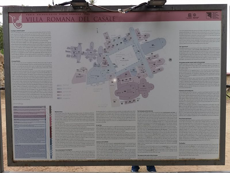
PIAZZA AMERINA - Villa Romana del Casale
Sunday April 30th
Daily stage: 60 km
Parking GPS: N 37.36914, E 14.33236 , chargeable
Admission: 10€/person.
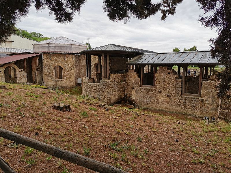
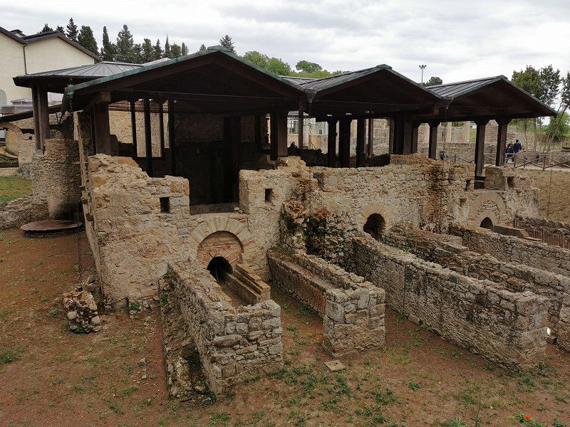
Finding the villa was not at all easy as our sat nav kept misleading us, apparently due to a digital map error. GoogleMaps with AndroidAuto was then able to fix the problem for us. In any case, we got around quite a bit until we found the villa and it was significantly more than the approx. 60 km planned that day.
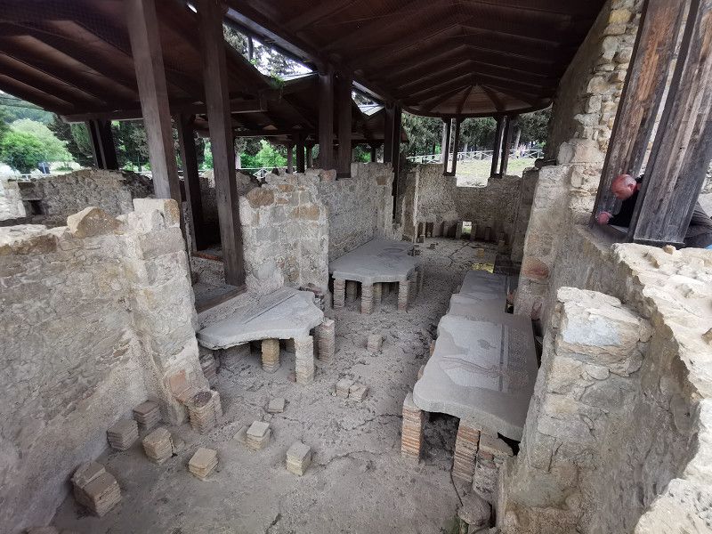
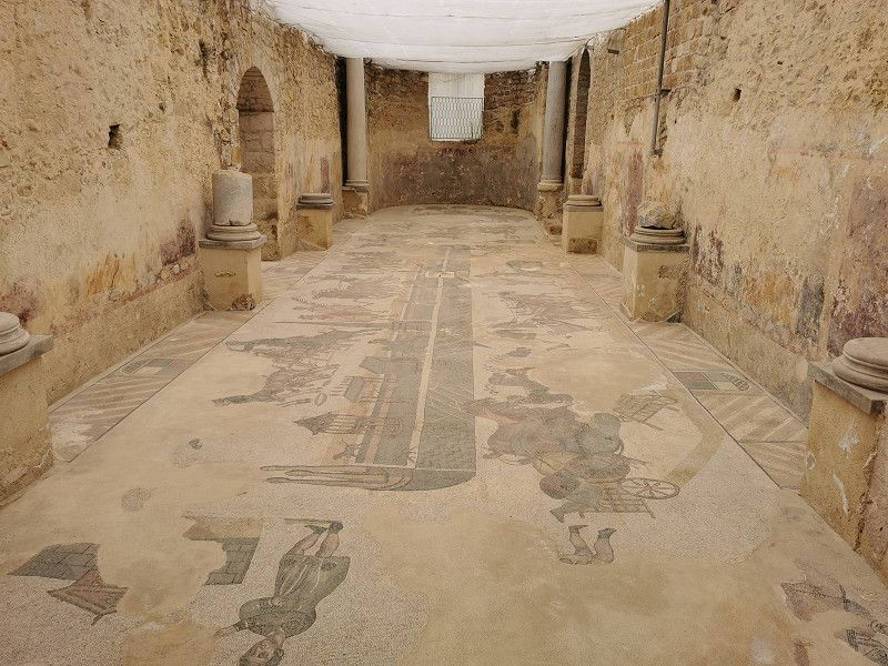
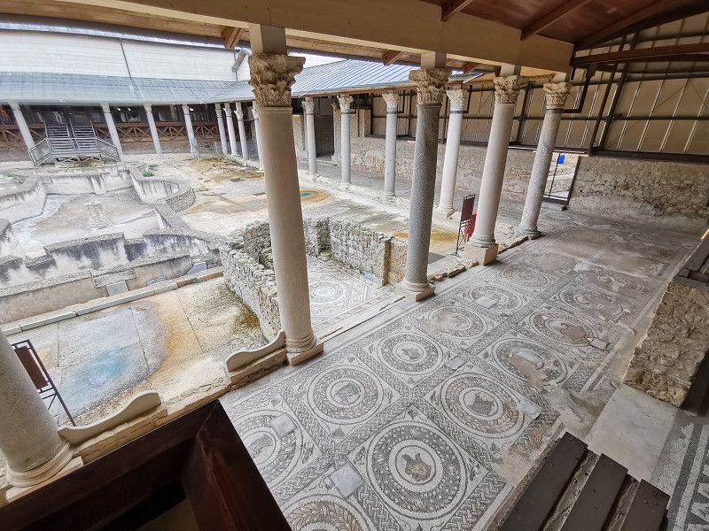
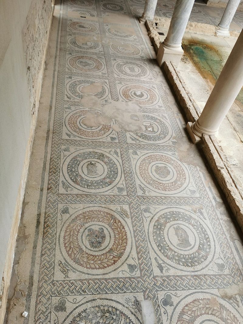
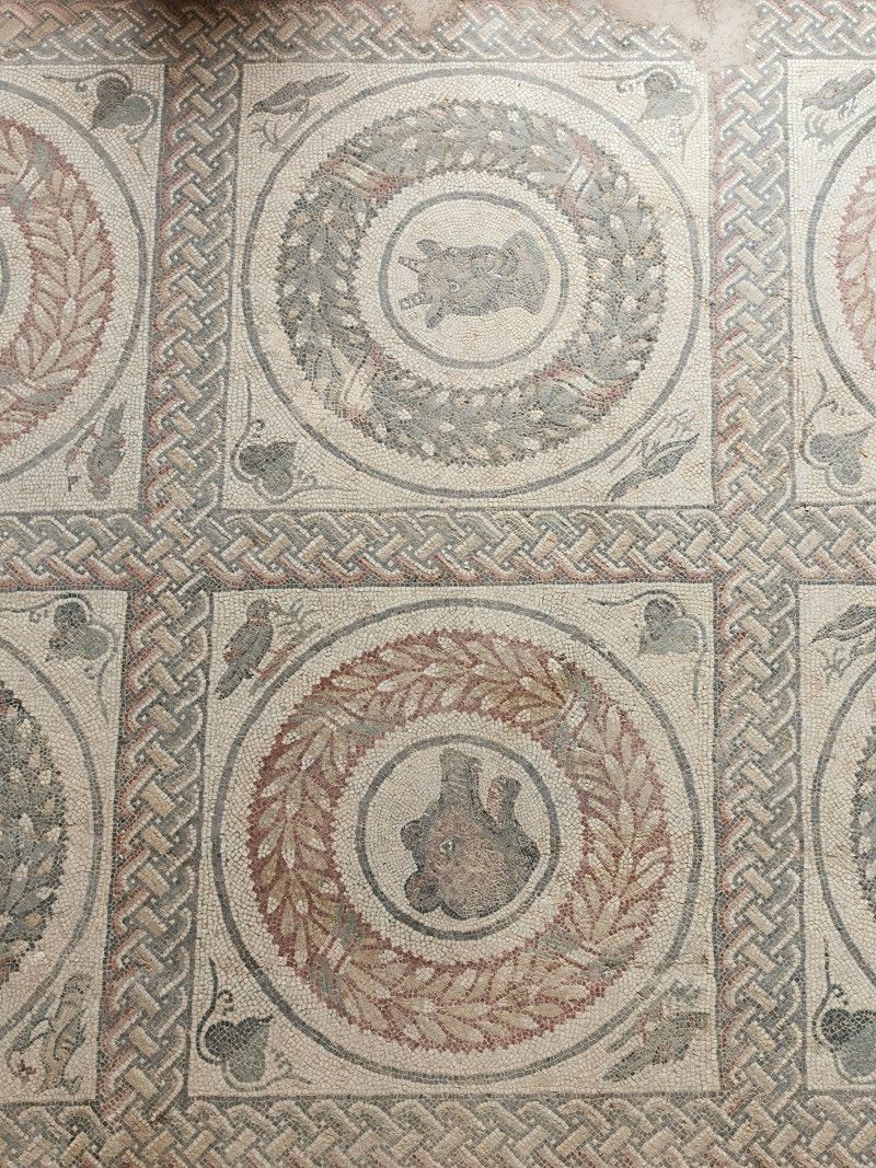
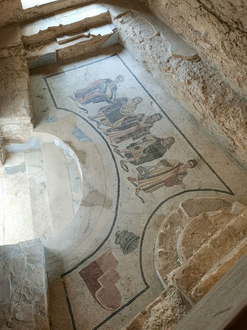
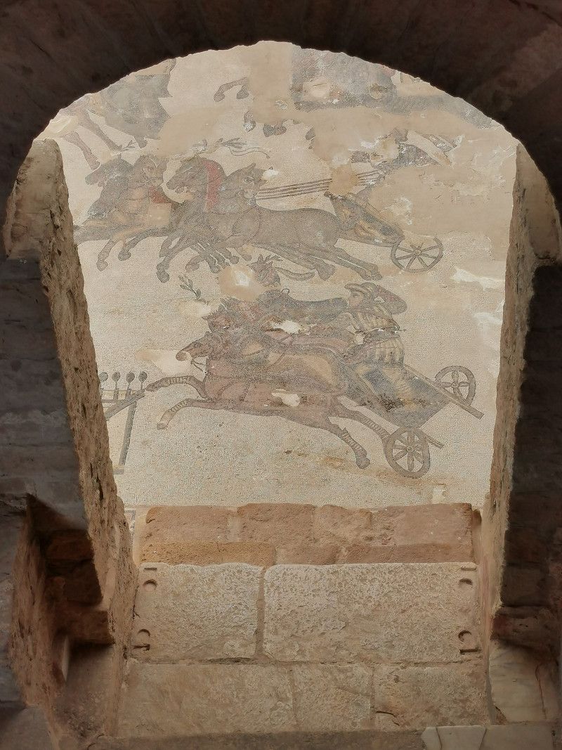
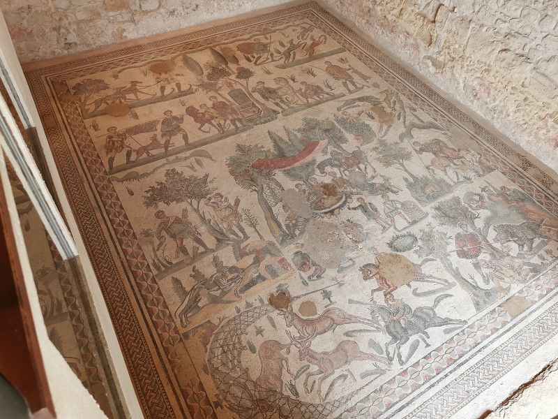
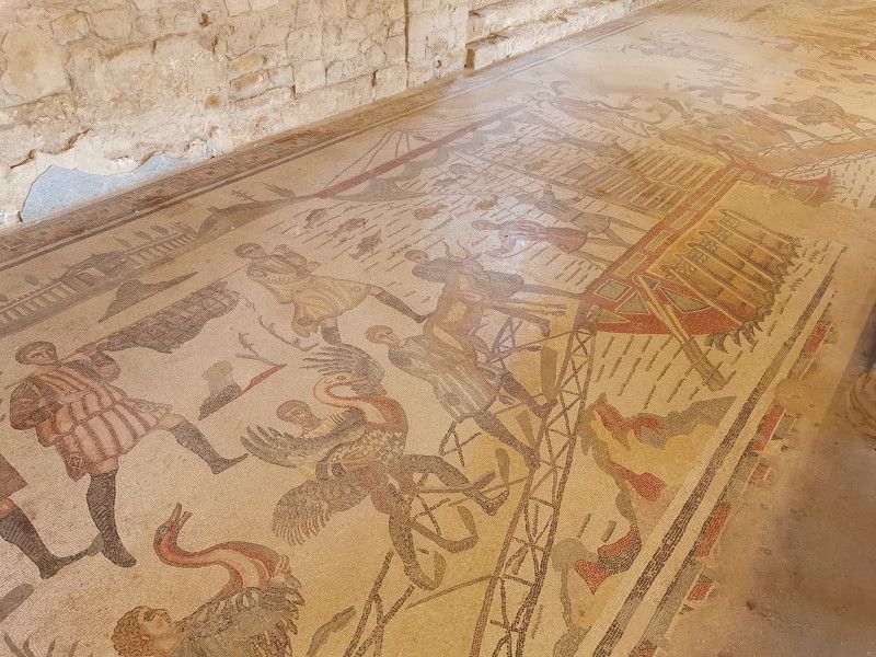
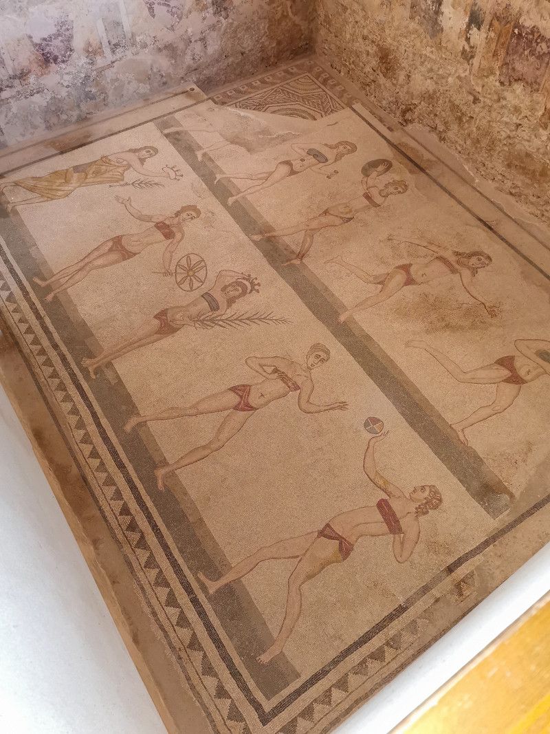
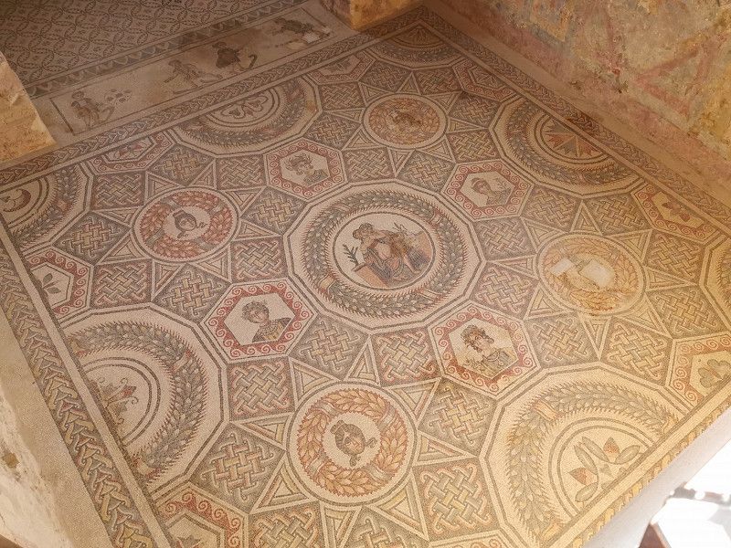
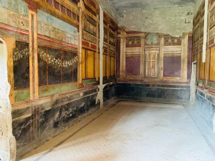
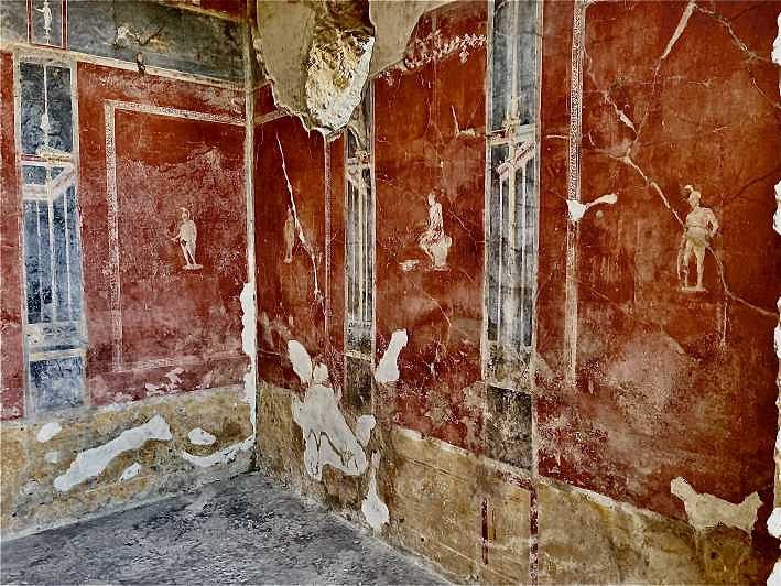
The Villa Romana del Casale is a late Roman villa urbana near the town of Piazza Amerina (probably built between 310 and 325 AD). The villa is an important monument of Roman Sicily and famous for its floor mosaics. In 1997 UNESCO declared the Villa Romana del Casale a World Heritage Site. The Villa del Casale building complex covers about 1.5 hectares. About 45 rooms have survived to this day. The floor of almost every room in the estate is covered with mosaics of colored tesserae, covering a total area of around 3,500 m² and composed of around 120 million individual stones, more than in any other known building of the Roman Empire.
The whole thing is extremely impressive, even if today you can certainly only see a copy of the original condition, and you get a good impression of the beauty and splendor that the system must have exuded in its heyday.
Strada provinciale Accesso Villa del Casale , Piazza Armerina, Italien
37° 21' 51.5" N 14° 20' 1.8" E
37.3643043 14.3338465
• Head northwest on Contrada Casale. Go for 174 m.
• Continue on Contrada Casale (SP90). Go for 1.2 km.
• Turn right onto SP15. Go for 2.3 km.
• Continue on Contrada Orto Vallone di Riso. Go for 945 m.
• Continue on Via Scarpello. Go for 109 m.
• Continue on Piazza Regione Siciliana. Go for 562 m.
• Turn sharp right onto Piazza Alcide De Gasperi. Go for 32 m.
• Continue on Via della Libertà. Go for 23 m.
• Continue on Viale della Libertà. Go for 319 m.
• Continue on Via Alessandro Manzoni. Go for 854 m.
• Pass 2 roundabouts and continue on Via Alessandro Manzoni (SP16). Go for 522 m.
• Keep left onto Contrada Santa Marina. Go for 225 m.
• Take ramp onto SS117bis. Go for 11.5 km.
• Take ramp onto SS124 toward San Michele di Ganzaria/San Cono/Caltagirone/Catania/Siracusa. Go for 4.1 km.
• Turn left onto Via Giuseppe Muscia. Go for 21 m.
• Turn left onto Via Giuseppe Lionti. Go for 40 m.
• Turn right onto Via Antonino Costa. Go for 24 m.
• Turn left onto Via Colonnello Maddalena. Go for 8 m.
• Turn left onto Via Roma. Go for 9 m.
• Turn right onto Via delle Scuole. Go for 46 m.
• Turn left onto Via Carlo Del Prete. Go for 26 m.
• Arrive at Via Carlo Del Prete. Your destination is on the left.
☍
23,2 km
( 26 min.)
SAN MICHELE DI GANZARIA - Agritourismo-Camping Gigliotto
Still Sunday, April 30th
Source: ACSI, #2737
Agritourism camping Gigliotto
SS117 to km 60, 95040 San Michele di Ganzaria
GPS: 37°17'26"N 14°23'17"E
Phone +39 0933970898
Web: www.gigliotto.com
Email: gigliotto@gigliotto.com
Cost: 25€ ACSI price
After a thorough inspection of the Roman villa, we continued to our planned parking space. The campsite with around 15 pitches is located on an estate in the Sicilian hinterland. Wine and oil are grown and sold here. Great views, nice saltwater pool, farm shop and a very good restaurant are advertised. That's exactly what we were looking for today, isn't it?
Unfortunately, the good pitches with a view were already occupied, the sanitary facilities and the V&E facilities were unkempt, dirty and only partially working (e.g. no hot water), and the SP site was partially occupied with building material and rubble, so that the stay was not pleasure was. The condition of the camper facility did not correspond at all to the picture of the rest of the property, which was well maintained and first-class renovated. The pool was also not filled although it should be available and heated from the beginning of April. At least that's how it's advertised. According to other campers, the restaurant is said to be very good and "good value for money", but we did not test it. We decided to continue the next morning. After a fair discussion with the operator, we only paid €15 for accommodation and electricity, which was still ok for the offer.
San Michele di Ganzaria, 95040, Italien
37° 16' 46.4" N 14° 25' 33.7" E
37.2795627 14.4260202
• Head toward Via Roma on Via Carlo Del Prete. Go for 26 m.
• Turn right onto Via delle Scuole. Go for 46 m.
• Turn left onto Via Roma. Go for 9 m.
• Turn right onto Via Colonnello Maddalena. Go for 8 m.
• Turn right onto Via Antonino Costa. Go for 24 m.
• Turn left onto Via Giuseppe Lionti. Go for 40 m.
• Turn right onto Via Giuseppe Muscia. Go for 21 m.
• Turn right onto Via 4 Novembre (SS124). Go for 3.9 km.
• Take ramp onto SS117bis. Go for 10.4 km.
• Take ramp onto Strada Statale di Caltagirone (SS417) toward Gela. Go for 539 m.
• Continue on SS117bis. Go for 3.7 km.
• Pass 4 roundabouts and continue on SS117bis. Go for 13.5 km.
• Take the 2nd exit from roundabout onto SS117bis toward Vittoria/Ragusa/SS115/Agrigento/Licata. Go for 1.2 km.
• Take the 3rd exit from roundabout onto Strada Statale Sud Occidentale Sicula (SS115) toward Vittoria/Caltagirone/Piazza Armerina/Ragusa/Catania. Go for 4.9 km.
• Turn right onto SP51 toward Scoglitti. Go for 7.9 km.
• Take the 1st exit from roundabout onto SP51. Go for 71 m.
• Continue on SP31. Go for 3.2 km.
• Take the 2nd exit from roundabout onto SP31. Go for 11.5 km.
• Continue on Via Plebiscito (SP31). Go for 349 m.
• Turn left onto Via Neli Maltese. Go for 300 m.
• Turn right onto Via Neli Maltese. Go for 21 m.
• Turn left onto Via Eugenio Montale. Go for 208 m.
• Turn left onto Via Pescara (SP17). Go for 315 m.
• Continue toward Via Strada S. P. 102 Cammarana/SP19/SP102. Go for 29 m.
• Take the 1st exit from roundabout onto Via Strada S. P. 102 Cammarana (SP19/SP102). Go for 4.9 km.
• Continue on SP85. Go for 4.9 km.
• Turn right onto SC25. Go for 2.4 km.
• Take the 1st exit from roundabout. Go for 28 m.
• Continue on Via dei Canalotti (SC24). Go for 874 m.
• Turn left onto Via dei Gabbiani. Go for 79 m.
• Arrive at Via dei Gabbiani. Your destination is on the right.
☍
75,3 km
(1 hrs. 6 min.)
Day
PUNTA BRACCETTO - Scarabeo Camping
Monday May 1st
Daily stage: 80 km
Source: ACSI, #2734
Via dei Canalotti, 97017 Punta Braccetto/Santa Croce Camerina
GPS: 6°49'1"N 14°28'2"E
Phone +39 0932918096
Web: https://www.campingcard.com/en/italy/sicily/ragusa/punta-bracetto/scarabeo-camping-111780/
Cost: 21€ ACSI price
After the bankruptcy of the previous day, we were looking forward to the small, very well-kept and quiet square with lots of flowers and greenery. Large, delimited pitches. Beautiful sandy beach directly at the CP. Private toilets for each pitch. Stylish lighting, daily bread, fish and vegetable service on site.
We stayed here for 2 nights. If the weather gets warmer and less windy, we might stay longer.
S. Croce Camerina, 97017, Punta Braccetto, Italy
36° 48' 60" N 14° 27' 60" E
36.8166600 14.4666600
• Head toward Via dei Canalotti on Via dei Gabbiani. Go for 79 m.
• Turn right onto Via dei Canalotti (SC24). Go for 850 m.
• Continue toward SC25. Go for 40 m.
• Take the 3rd exit from roundabout onto SC25. Go for 2.4 km.
• Turn right onto SP85. Go for 4.5 km.
• Turn right onto Via Ugo Foscolo (SP20). Go for 219 m.
• Turn left onto Via Psaumide (SP60). Go for 10.4 km.
• Keep left onto SP60. Go for 6.3 km.
• Take the 2nd exit from roundabout onto SP60. Go for 440 m.
• Take ramp onto Strada Statale Sud Occidentale Sicula (SS115). Go for 13.6 km.
• Pass 2 roundabouts and continue on Strada Statale Sud Occidentale Sicula (SS115). Go for 3.1 km.
• Continue on Strada Statale Ragusana (SS194). Go for 5.7 km.
• Take ramp. Go for 441 m.
• Take the 1st exit from roundabout onto A18 (Autostrada Siracusa-Gela) toward Siracusa. Go for 35.0 km.
• Take the exit toward Noto. Go for 902 m.
• Take the 3rd exit from roundabout onto SP59. Go for 1.3 km.
• Take the 1st exit from roundabout onto SP59. Go for 546 m.
• Take the 2nd exit from roundabout onto Strada Provinciale Noto-Calabernardo (SP34). Go for 163 m.
• Take the 1st exit from roundabout onto Contrada Faldino (SP19). Go for 812 m.
• Turn sharp left onto Strada Statale Sud Occidentale Sicula (SS115). Go for 681 m.
• Take the 2nd exit from roundabout onto Via Napoli. Go for 597 m.
• Turn left onto Viale Guglielmo Marconi. Go for 221 m.
• Continue on Largo Porta Nazionale. Go for 321 m.
• Arrive at Corso Vittorio Emanuele. Your destination is on the left.
☍
88,7 km
(1 hrs. 12 min.)
Day
PUNTA BRACCETTO - Stehtag
Tuesday May 2nd
It rained several times during the night. The weather was mixed during the day, the sky was cloudy, the temperatures were changing (15 - 20 degrees) and there was a fresh, again increasing wind. The now high waves on the beach are ideal for surfers and make a lot of noise.
For dinner I have spaghetti with tomatoes and olive oil, garlic, parmesan. Show me how the weather is developing. The next stop is Noto, one of Sicily's baroque cities. In rainy weather, however, visiting the city makes little sense.
Day
NOTO - Stellplatz Antico Trappeto Agricampeggio (Noto Parking)
Wednesday May 3rd
Daily stage: 100 km
Source: Park4Night
Contrada Faldino-Noto
GPS: 36.883690, 15.086031
Phone +39 328 8065260
Email: info@anticotrappetonoto.it
Cost: 22€ tuttifrutti
We slept for a relatively long time and are getting Frieda ready to go. In the late morning we are on our way to Noto, our next stop with a cultural program. After stocking up, we cruise relaxed to our camp site for the next two nights on the outskirts of Noto, about 100 km away, a good half of the way along the sea, which has been churned up by the renewed strong wind.
Embedded in a magnificent grove of fragrant lemon trees, the Antico Trappeto Agricampeggio offers the usual services of a 2-3* CP. The partially blooming lemon trees are the show for us. We are right in the middle of it and (legally) picked a few lemons and prepared a really delicious lemonade. The Antico Trappeto offers a free shuttle service to Noto's historic centre, around 2 km away.
The weather is slightly thundery in the evening and the mosquitoes start to piss us off, which is why we retreat to the WoMo. The meal consists of grilled beef steaks, fresh beans with cherry tomatoes, lettuce and melon for dessert.
Noto , Italien
36° 53' 27.2" N 15° 4' 14.3" E
36.8908864 15.0706454
• Head toward Largo Landolina on Corso Vittorio Emanuele. Go for 495 m.
• Take the 1st exit from roundabout onto Via Duca Giordano. Go for 328 m.
• Take the 2nd exit from roundabout onto Via Duca Giordano (SS115). Go for 983 m.
• Turn left onto Traversa Zupparda (SP35). Go for 2.0 km.
• Take the 2nd exit from roundabout onto Strada Provinciale Noto-Calabernardo (SP34). Go for 156 m.
• Take the 1st exit from roundabout onto SP59. Go for 522 m.
• Take the 2nd exit from roundabout onto SP59. Go for 1.3 km.
• Take the 1st exit from roundabout onto A18 (Autostrada Siracusa-Gela) toward Siracusa. Go for 50.2 km.
• Continue on A18 (Autostrada Catania-Siracusa). Go for 24.6 km.
• Continue on RA15 (Tangenziale di Catania). Go for 3.4 km.
• Take the exit toward Aeroporto/Catania Centro onto SP70i (Asse dei Servizi). Go for 6.3 km.
• Turn right onto Viale Presidente Kennedy (SP53var). Go for 482 m.
• Take the 2nd exit from roundabout onto Viale Presidente Kennedy (SP53var). Go for 487 m.
• Turn right. Go for 14 m.
• Arrive at your destination on the left.
☍
91,2 km
( 59 min.)
Day
NOTO - Sight-Seeing
Thursday May 4th
Noto is one of the 7 Sicilian late baroque cities (like Catania, which we will visit later) and was declared a UNESCO World Heritage Site in 2002. Today's Noto was built from 1703 about 15 km southeast of the original Noto Antica, which was completely destroyed by an earthquake in 1693. As a result, Noto was completely rebuilt at a new location, according to plan and uniformly in the style of the Sicilian Baroque.
The new old Noto is definitely a "must see" and the term "pearl of the late baroque" is by no means exaggerated, even if the splendor inside the villas and churches cannot be compared with the exuberant abundance of the baroque sights in Palermo and Monreale, for example. But that is not a shortcoming, just an observation and does not take away from the extraordinary beauty of the town center, which impressed us even with today's very changeable weather. Due to the onset of heavy rain, we ended the sightseeing tour in the late afternoon and returned to the campsite, just in time to avoid the heaviest rain.
For dinner there was fresh ravioli with ricotta filling, salad and a delicious melon for dessert. We decided to skip the optional visit to Noto Antica and to go directly to Syracuse and on to Catania tomorrow.
Day
CATANIA - Stellplatz Lua Beach
Friday May 5th
Daily stage: approx. 100 km
Source: Freeontour
Viale Presidente Kennedy 1, 95121 Catania
GPS: N 37°29'14.01” E 15°5'6.6912”
Phone +39 351 541 2425
Cost: 17€ tuttifrutti
Slept until 9 a.m., showered, had breakfast, made V&E and off we went around 11 a.m. relaxed on our trip to Catania today. On the way there we actually wanted to make a stopover in old Greek Syracuse for a visit. In order to save time, we wanted to drive as close as possible to the bridges to the old town peninsula, which we managed to do in heavy traffic and narrow streets (almost by Genoa standards!). However, there were no suitable parking spaces for a mobile home and the streets were getting narrower and narrower... :-(
With a heavy heart we then left it at the impressions of Syracuse that we were able to get from the vehicle, which was definitely worth it, and drove on to Catania.
We reached the Lua Beach pitch, which is simply equipped but very nicely located by the sea (200 m), in the best of weather. We looked for a nice, semi-shady place under palm trees and "built it up" because we will be staying here for at least 2 nights.
It is only a 2 km walk to the old town center of Catania, so the place is unbeatable for sightseeing in Catania. Shops are also available in the immediate vicinity. So you can have a good time here.
Dinner was shrimp, olives, bread, yoghurt and delicious, fresh, sun-ripened Sicilian oranges (always a revelation compared to the crap you can/must buy from us). End of the evening with "Lets Dance" quarterfinals on TV and coffee and Cantuccini.
Viale Presidente Kennedy 1, 95121, Catania, Italy
37° 29' 15.8" N 15° 5' 3.8" E
37.4877200 15.0843900
• Head toward Viale Presidente Kennedy. Go for 14 m.
• Turn right onto Viale Presidente Kennedy (SP53var). Go for 15 m.
• Turn right. Go for 140 m.
• Keep left toward Siracusa/SS114. Go for 86 m.
• Continue on Via Acquicella Porto (SP53var) toward Tangenziale Ovest/Via Acquicella Porto/Viale Kennedy. Go for 338 m.
• Continue on Via Priolo toward Aeroporto/Tangenziale/Messina/A18/Siracusa/Enna/A19/Palermo. Go for 5.8 km.
• Take ramp onto RA15 (Tangenziale di Catania) toward E932/Palermo-Catania/A19/Messina/A18/Catania Circonvallazione. Go for 13.3 km.
• Take the exit toward Gravina. Go for 438 m.
• Continue on Via Etnea. Go for 77 m.
• Take the 2nd exit from roundabout onto Via Etnea. Go for 279 m.
• Continue toward Via Etnea/SP10var. Go for 51 m.
• Take the 4th exit from roundabout onto Via Etnea (SP10var). Go for 516 m.
• Turn right onto Via Etnea (SP10var). Go for 887 m.
• Continue on Via Etnea (SP10var). Go for 421 m.
• Turn right onto Via Giotto. Go for 91 m.
• Turn left onto Via Santa Maria dei Monti. Go for 159 m.
• Take the 3rd exit from roundabout onto Via Antonio Gramsci (SP10). Go for 805 m.
• Pass 4 roundabouts and continue on Via Pulei (SP10). Go for 5.0 km.
• Take the 3rd exit from roundabout onto Via Bosco (SP10). Go for 186 m.
• Take the 1st exit from roundabout onto Via Bosco (SP10). Go for 353 m.
• Continue on Via Raimondo Galvagno. Go for 34 m.
• Continue on Via Etnea. Go for 604 m.
• Take the 2nd exit from roundabout onto Via Etnea. Go for 2.0 km.
• Continue on SP92. Go for 3.8 km.
• Continue on Contrada Monte Sona (SP92). Go for 2.6 km.
• Continue on Contrada Piano Bottara (SP92). Go for 826 m.
• Continue on SP92. Go for 9.3 km.
• Keep left. Go for 208 m.
• Turn left. Go for 48 m.
• Arrive at your destination on the left.
☍
48,4 km
( 55 min.)
Day
CATANIA - Sight-Seeing
Saturday May 6th
We got up relatively early and after a short breakfast we took a taxi to the old town. save your feet! ;-) Catania is one of the so-called. Baroque cities of Sicily and has countless sights. The particularly worth seeing are close together, and we have limited ourselves to these:
- Cathedral of S. Agatha in Piazza Duomo
- Piazza Duomu with elephant fountain and various other baroque buildings
- Porta Uzeda
- Palazzo Biscari
- Achilles thermal baths
- Via Etnae (numerous baroque facades)
- numerous daily markets
The baroque buildings in Catania are often richer, larger, more elaborate and elaborate than in Noto, although they were mostly built around the same time after the great earthquake of 1693. This is probably due to the city's exuberant wealth during this period.
We were particularly impressed by the vegetable, meat and fish markets, where the range of products is almost unmanageably rich and very inexpensive, and especially loudly advertised by the market criers. That's how I've always imagined markets. We stocked up on fresh vegetables, various types of oranges, peppermint, lamb chops, swordfish fillets and almost a kilo of king crabs, both cheaply and plentifully. After returning to the campsite, swordfish and crabs were grilled and eaten. A decadent but utterly delicious and satisfying food spree...! :-)
We ended the evening relaxed with coffee and cantuccini and fruit and decided on the course of the rest of the trip. Due to various other appointments that have arisen in the meantime, we want to be home by May 17 at the latest and therefore had to shorten the originally planned program by a few days. At the same time we have decided that this won't be our last longer trip to Italy, because there is still so much to see. So in the end we won't miss anything.
Day
NATURPARK ETNA - Rifugio Giovannino Sapienza
Sunday May 7th
Daily stage: 60 km
GPS: N 37.69903, E 15.00229, at about 2000 m altitude
Large paid car park (9 a.m. to 8 p.m.) with a cable car station. Restaurants, souvenir shops, etc. Official accommodation with camper (self-sufficient, without V&E), €12/night.
After a relaxed breakfast, the usual preparations for the descent and a few necessary purchases, we headed towards Etna Nature Park. Surprisingly, we encounter the worst roads in Sicily so far in the communities we drive through. Despite the "slalom ride" around huge potholes, we and Frieda are pretty shaken up. The roads in Etna Nature Park, on the other hand, are good to very good. Through numerous curves and serpentines it goes steadily uphill to about 2000 m to the parking space Rifugio Giovannino Sapienza (the current consumption display is between 30 and 40 l/100 km the whole time). Despite the bright sunshine, long trousers, a warm jacket and sturdy shoes are appropriate here. There are also remains of snow.
Access to the Etna summit region at an altitude of 2500 m is obtained by cable car. In the meantime, you take 50 €/person for the trip (round trip), really exorbitant! We do not book the offered connecting trip with the 4x4 bus. This turned out to be an error. You can explore the region on foot from the mountain station of the cable car (e.g. older lava fields, side craters, lava grottos, etc.), but the distances are not insignificant, the paths are very steep in places (up to 45 degrees!) and the ground is soft and crumbly the "Generation Over 65" definitely not recommended in the thin air! We therefore broke off quite quickly and went back to the WoMo, which was a bit disappointing overall in terms of "experience potential". I had promised myself more. Well, at least we saw the main craters smoking from a distance... ;-)
Access to one of the 3 active main craters at approx. 3300 m is not possible. Tours up to approx. 3000 m can be booked with mountain guides, are expensive and require appropriate equipment.
Back at the camper, we first put our feet up and then had a delicious meal: tomatoes stuffed with tuna as a starter, then turkey schnitzel with fresh peas (from the market in Catania) and tomato sauce, and 2 super-juicy, sweet oranges for dessert. By nightfall, the large parking lot has been completely emptied, except for about 10 WoMos. We enjoy the beautiful, illuminated panorama of Catania and surrounding communities at the foot of Mount Etna. A gigantic sight that the photos can't even begin to do justice to...
Via Salvatore Magrì , Nicolosi, Italien
37° 42' 2.2" N 14° 59' 54.1" E
37.7006003 14.9983645
• Head southwest. Go for 48 m.
• Turn left. Go for 123 m.
• Take the 2nd exit from roundabout. Go for 339 m.
• Continue on SP92. Go for 1.1 km.
• Continue on Via Cassone (SP92). Go for 16.2 km.
• Turn left onto Via San Giacomo. Go for 21 m.
• Turn right onto Via Pittore Sciuti. Go for 320 m.
• Turn left onto Via Roma. Go for 149 m.
• Continue on Via Libertà (SP59i). Go for 123 m.
• Turn right onto Via delle Rose. Go for 454 m.
• Turn left onto Via Vitaliano Brancati. Go for 117 m.
• Continue on Via Cancelliere (SP4III). Go for 100 m.
• Continue on SP4III. Go for 20 m.
• Continue on Via Zafferana (SP4III). Go for 2.0 km.
• Turn slightly left onto Via Duccio Galimberti (SP145). Go for 1.1 km.
• Turn right onto Via Salvatore Quasimodo. Go for 383 m.
• Turn right onto Via Trieste (SP118). Go for 353 m.
• Take the 3rd exit from roundabout onto Via Stabilimenti. Go for 75 m.
• Continue on Via Stabilimenti (SP4i). Go for 3.4 km.
• Take the 3rd exit from roundabout toward Messina/A18/Catania/E45. Go for 322 m.
• Take ramp onto A18 (Autostrada Messina-Catania) toward Messina. Go for 59.4 km.
• Continue on A20 (Autostrada Messina-Palermo) toward Palermo/E90/Messina Boccetta/Messina Centro/Messina Gazzi/Messina San Filippo. Go for 8.9 km.
• Take the exit toward Messina Boccetta/Traghetti. Go for 932 m.
• Continue on Contrada Scoppo. Go for 277 m.
• Continue on Viale Boccetta. Go for 1.0 km.
• Turn right onto Via Vittorio Emanuele II. Go for 998 m.
• Continue on Via Luigi Rizzo. Go for 368 m.
• Continue on Marittima. Go for 46 m.
• Turn left. Go for 35 m.
• Take the Messina-Villa San Giovanni Ferry. Stay on for 8.2 km.
• Head southeast. Go for 272 m.
• Continue on Piazzale Stazione Imbarco Automezzi. Go for 153 m.
• Continue toward Autostrada del Mediterraneo/A2. Go for 1.2 km.
• Take ramp onto A2 (Autostrada del Mediterraneo) toward Salerno. Go for 48.9 km.
• Take the exit toward Rosarno/Porto di Gioia Tauro. Go for 904 m.
• Take ramp toward Gioiosa J./Rosarno/Jonio-Tirreno. Go for 136 m.
• Turn right onto SP54 toward Limbaid/SS18. Go for 2.0 km.
• Continue on Strada Provinciale Cinquantaquattro (SP54). Go for 1.2 km.
• Turn right onto Via Nazionale (SS18). Go for 3.4 km.
• Turn left onto SP35 toward Tropea/Limbadi/Nicotera. Go for 6.2 km.
• Continue on Viale Madonna delle Grazie (SP35). Go for 1.3 km.
• Continue on SP35. Go for 57 m.
• Continue on Viale Madonna delle Grazie (SP35). Go for 1.5 km.
• Continue on Via Madonna della Grazie (SP35). Go for 158 m.
• Turn left toward SP23. Go for 967 m.
• Continue toward SP23. Go for 44 m.
• Turn slightly left onto SP23. Go for 2.7 km.
• Continue on Contrada Siroto Prima (SP23). Go for 423 m.
• Continue on SP23. Go for 63 m.
• Continue on Contrada Siroto Prima (SP23). Go for 430 m.
• Continue on Contrada Oliveto Seconda (SP23). Go for 1.1 km.
• Turn left onto Contrada Rocola. Go for 757 m.
• Continue on Contrada Fontanelle. Go for 648 m.
• Continue on SP23. Go for 2.8 km.
• Continue on Via Provinciale (SP23). Go for 1.1 km.
• Continue on SP23. Go for 824 m.
• Continue on Via Provinciale (SP23). Go for 1.4 km.
• Turn left onto Via 20 Settembre (SP22). Go for 83 m.
• Continue on SP22. Go for 387 m.
• Take the 2nd exit from roundabout onto SP22. Go for 278 m.
• Continue on Strada Provinciale Spilinga Tropea (SP22). Go for 916 m.
• Continue on Via Monaci. Go for 809 m.
• Turn left onto Via Giuseppe Garibaldi (SP22). Go for 2.5 km.
• Turn slightly left onto Viale Giuseppe Berto. Go for 1.9 km.
• Turn right onto Viale Giuseppe Berto. Go for 1.1 km.
• Arrive at Viale Giuseppe Berto.
☍
195,3 km
(3 hrs. 19 min.)
Day
Umfahrung des Etna / Gole di Alcantara in CAMASTRA
Monday, May 8th
Daily stage: 110 km
In the middle of the night, without prior notice, a veritable storm with heavy rain surprised us and shook us up again. No wonder in this exposed and rough location at an altitude of 2000 meters. Thank God the nightmare was over by morning and only very changeable weather with frequent rain showers remained. After breakfast we set off for the planned Etna bypass, roughly within the boundaries of Etna National Park from Rifugio Sapienca south and then clockwise to the northeast and further towards the sea to the Alacantara Gorge (Gole di Alcantara) for sightseeing. Adrano, Bronte and Randazzo are on this path. When the weather is nice, this tour must be terrific, when the weather is raining with very limited visibility, you can only guess at the beauty of the landscape and the majesty of Mount Etna. But you have to take the weather as it comes, and we still got a lot of nice impressions.
And also experienced adventures: on the way to Bronte, for some inexplicable reason, our navigation system takes us right through the old town of Adrano, although (in retrospect) this would not have been necessary. The streets got narrow, narrower, even narrower and then we stood at a bottleneck where an Italian woman stupidly parked her Mercedes. Since there was only "forward" and "no going back" (one-way street without any possibility of maneuvering or turning), skill, courage and the support of a few Italians were required. No shit: there weren't more than 2 cm on each side. It's a good thing that 2 men loudly grabbed the good Mercedes owner, who was on the verge of going crazy, and almost hit Frieda when she was moving her car completely insanely. The fact that we brought the traffic to a standstill for about 15 minutes was accepted calmly by the local road users. We also mastered another bottleneck in a similarly adventurous way and then, ignoring and cursing the navigation system, escaped from the city center "according to our inner compass". Was really exciting and stressful at the moment but we stayed calm and now it's just a nice anecdote (and boosts confidence in mastering Frieda).
We then reached the Alcantara Gorge without any problems. Treated ourselves to a fast food refreshment before the visit and then took the lift into the gorge. Impressive rock formations that are well worth seeing with an informative small museum that explains the formation of the gorge and the special features of the flora and fauna in several languages.
Gole di Alcantara
SS185, 2, 98030 Motta Camastra
GPS: N37.87899, E15.17592
Tel. +390942989061
Open 9am-6pm
Costs: from €7/person. incl. elevator
Since the weather got rainier again with no prospect of a short-term improvement, we decided against the actually planned free standing in CATALABIANO on San Marco Free Beach and drove to the next campsite, which offers more comfort and possibilities when the weather is lousy.
Source: Park4Night
Camping Almoetia Catania
17 Via San Marco
95011 Recanati - San Marco
N 37°48'16.9164” E 15°14'38.76”
30€/night including electricity and local taxes
For dinner we had lamb chops (from the market in Catania) with fresh beans. Fantastically delicious... ;-)
Day
CAPO VATICANO - La Scogliera di Capo Vaticano
Tuesday May 9th
Stage km: 150 km
Source: Live2Travel
La Scogliera SNC di Capo Vaticano
Contrada Fine Tono Snc, 89866 Ricadi
GPS: N 38.626456, E 15.829479
Phone +390963663002
Email: info@villaggiocampinglascogliera.com
Web: https://www.villaggiocampingglascogliera.com/
Today we enjoy our last breakfast in Sicily, which we have completely circumnavigated. The end of the tour is near and it's the long way home today. But there is still so much to see along the way and we decided to focus on 4 points: Capo Vaticano, Pompeii, Tivoli near Rome and Modena. We'll see everything else on the next tour of Italy, which we'll definitely do!
First it went about 60 km to Messina to the ferry back to the mainland to Villa San Giovanni. The crossing went smoothly. Although the weather and visibility were still "moderate to modest", we decided to take the approx. 90 km to Capo Vaticano as close to the sea as possible over the numerous mountains and gorges of the Calabrian west coast. You have to force your luck!
A very winding and beautiful route with wonderful panoramas, where you change heights between 200 and 1000 m several times and tinker through small villages. Frieda works really hard, but masters all challenges with flying colors. A mountain road that was suddenly closed unannounced and without a signposted detour forced us to "crank around" and take a decent detour. But without this detour we would not have seen some beautiful things, and my wife would not have "found" her long-awaited cactus offshoot. So all good.
In the late afternoon we reach the camp site with idyllic pitches directly on the beach on the edge of Capo Vaticano, about 13 km from Tropea. A beautiful piece of earth, with a view of the island of Stromboli with a smoking volcano, where you could easily endure a few days. In view of the now increasing rain and ever worsening visibility for us unfortunately no real pleasure, but nothing to change. We stay for 2 nights to sit out the bad weather front, because visiting Pompei (our next stop) in the rain would definitely be a non starter. We're making the best of it, and it's supposed to get better.
In total there are only about 10 WoMos in the facility, which is getting old and urgently needs renovation. But the environment and panorama are unbeatable even without the sun and are super cool! One can gladly accept the shortcomings. We don't use what we don't like.
We end the day with a delicious dinner: in a rain break, grilled chicken thighs with grilled thighs and strawberries and peaches for dessert.
Capo Vaticano , Ricadi, Italien
38° 37' 7.9" N 15° 49' 41.1" E
38.6188572 15.8280802
• Head east on Viale Giuseppe Berto. Go for 1.1 km.
• Turn left onto Viale Giuseppe Berto. Go for 1.9 km.
• Turn right onto Viale G. Berto (SP22). Go for 2.5 km.
• Turn right onto Via Monaci. Go for 809 m.
• Continue on Strada Provinciale Spilinga Tropea (SP22). Go for 916 m.
• Continue on SP22. Go for 241 m.
• Take the 2nd exit from roundabout. Go for 450 m.
• Continue on Strada Provinciale Ventidue. Go for 1.9 km.
• Continue on Via Michele Pugliese. Go for 1.2 km.
• Continue on SP22. Go for 6.3 km.
• Turn right onto SP17. Go for 9.6 km.
• Turn left onto Via Nazionale (SS18). Go for 310 m.
• Turn right onto Via Orazio Falduti toward San Gregorio d'Ippona. Go for 2.0 km.
• Turn left toward Strada Comunale per San Gregorio. Go for 734 m.
• Continue on Strada Comunale per San Gregorio. Go for 1.2 km.
• Turn left onto Viale Sandro Pertini. Go for 189 m.
• Continue toward Viale Papa Giovanni Paolo II. Go for 33 m.
• Take the 1st exit from roundabout onto Viale Papa Giovanni Paolo II. Go for 696 m.
• Take the 2nd exit from roundabout onto Viale Papa Giovanni Paolo II. Go for 367 m.
• Take the 1st exit from roundabout onto Via degli Artigiani (SS182). Go for 476 m.
• Continue toward Via Forgiari/SP15. Go for 57 m.
• Take the 2nd exit from roundabout onto Via Forgiari (SP15). Go for 169 m.
• Turn right onto Via Ugo Boccioni (SP15). Go for 354 m.
• Turn right onto Via Alessandro Volta (SP15). Go for 1.4 km.
• Continue on Via Dottor Nicola Matina (SP15). Go for 933 m.
• Take the 2nd exit from roundabout onto Strada Provinciale 15 (SP15). Go for 2.8 km.
• Continue on Piazza Umberto I (SP15). Go for 197 m.
• Keep left onto Via Castelvecchio (SP4). Go for 277 m.
• Continue on Via Salvador Allende (SP5). Go for 430 m.
• Take ramp onto A2 (Autostrada del Mediterraneo) toward Salerno. Go for 54.3 km.
• Take the exit toward San Mango d'Aquino. Go for 339 m.
• Take the 2nd exit from roundabout onto SP95. Go for 2.6 km.
• Turn slightly left onto SP95. Go for 388 m.
• Continue on Viale Carlo Alberto Dalla Chiesa (SP95). Go for 609 m.
• Turn left onto Via John Fitzgerald Kennedy (SP93). Go for 35 m.
• Continue on Via Nazionale (SP93). Go for 37 m.
• Turn left onto SP96. Go for 2.1 km.
• Turn left onto Contrada Santa Croce Beratta (SP93). Go for 594 m.
• Continue on SP93. Go for 513 m.
• Turn slightly left toward SP93. Go for 59 m.
• Continue on Via Gaspare Colosimo (SP93). Go for 822 m.
• Turn left onto Via Roma (SP93). Go for 288 m.
• Continue on Piazza Giacomo Matteotti (SP93). Go for 52 m.
• Continue on Via Franco Berardelli (SP93). Go for 163 m.
• Continue on SP93. Go for 5.0 km.
• Turn left toward Viale Giuseppe Mazzini/SP72. Go for 440 m.
• Turn left onto Viale Giuseppe Mazzini (SP72). Go for 1.1 km.
• Continue on Piazza Vescovado. Go for 63 m.
• Turn left onto Via Saraceni. Go for 2.6 km.
• Turn left onto SS616. Go for 5.2 km.
• Turn left onto SP57. Go for 5.1 km.
• Continue on SS108. Go for 12.0 km.
• Turn left onto Via Piano Lago (SP241). Go for 8.1 km.
• Turn left onto Contrada Bivio Donnici (SP241). Go for 4.5 km.
• Turn right onto Via Donato Morelli (SP241). Go for 944 m.
• Take the 2nd exit from roundabout onto Ponte Pietro Mancini (SP241). Go for 695 m.
• Take the 1st exit from roundabout onto Via Felice Migliori. Go for 299 m.
• Continue on Via del Sempione. Go for 36 m.
• Continue on Via Vittorio Veneto. Go for 1.1 km.
• Turn left onto Via Francesco Simonetta. Go for 173 m.
• Turn slightly right onto Via Pasquale Rossi. Go for 245 m.
• Turn right onto Via Pasquale Rossi. Go for 124 m.
• Take the 3rd exit from Giardino Giovanni Adamo roundabout toward Salerno/A3. Go for 215 m.
• Continue on Raccordo Autostradale A3. Go for 637 m.
• Take ramp onto A2 (Autostrada del Mediterraneo) toward Salerno. Go for 253 km.
• Continue on A3 (Autostrada Salerno-Reggio Calabria) toward Salerno/Napoli. Go for 11.5 km.
• Take the exit toward Cava dei Tirreni. Go for 540 m.
• Take the 3rd exit from roundabout onto A3 (Autostrada Napoli-Salerno) toward Roma/A1/Napoli. Go for 21.1 km.
• Take the exit toward Pompei Scavi onto Svincolo Pompei. Go for 402 m.
• Turn left onto Via Provinciale Villa dei Misteri. Go for 301 m.
• Turn slightly left. Go for 28 m.
• Arrive at your destination on the left.
☍
437,5 km
(4 hrs. 48 min.)
Day
CAPO VATICANO - Stehtag & Strandleben
Wednesday May 10th
Unfortunately, the title of the diary entry is only 50% correct. Standing day yes, but beach life? Definitely not. It rained all night and only in the morning could one stay outside during longer rain breaks. The island of Stromboli has also disappeared somewhere on the cloudy horizon. From noon then continuous rain. So we just hang out at Frieda: sleeping, playing on the PC/mobile phone, reading, handicrafts, some TV, writing a travel diary. Also good. However, it was disappointing, because we were really looking forward to a longer stay here in this fantastic environment with the best weather typical of the season. Instead we have the worst weather of our trip. So it's a total failure. Will we survive?
Since the tide is low in the fridge, we visited the restaurant on the CP in the evening. A decision that we have not regretted. Very tasty food (large antipasti platter, ravioli with salmon filling, pizza frutti di mare) and friendly service. We were actually the only guests, and yet the large, wood-fired pizza oven was fired up for 1 pizza (!) after registration. Who is still complaining...
Day
POMPEI - Camping Zeus
Thursday May 11th
Daily stage: 420 km
Source: Park4Night & ACSI #2675
Camping Zeus
Via Villa dei Misteri 3, 80045 Pompei
Phone +390818615320
ACSI price €23, otherwise €29
The night passed without rain and the morning woke us up at 7am with sunshine. After shortening our holiday program, we have a few kilometers to eat today. Quick breakfast, V&E, refuel and off we went to Pompei. A really scenic route, partly by the sea, but mainly through/over mountains and valleys via countless bridges and tunnels, mostly on the motorway. We change the altitude between approx. 100 m and 1100 m several times a day. A constant up and down. Arriving in Pompeii, there was still shopping to be done for the next few days, as the empty fridge and storage box caused existential fears.
Then on to CP. Very nice place in a magnificent, Mediterranean-style park at the foot of Mount Vesuvius, surrounded by orange trees. The sanitary facilities are brand new and perfect. D ut is less than 200 m from the entrance to the Pompeii excavations and the Circumvesuviana train station. It is ideal for visiting the archaeological sites, Mount Vesuvius and the city of Naples. Although it is still not the travel season, the place is almost full and we got one of the last places.
Villa dei Misteri, 80045, Pompei, Italy
40° 44' 57" N 14° 28' 50" E
40.7491600 14.4805500
• Head northwest. Go for 15 m.
• Turn slightly left. Go for 16 m.
• Turn right. Go for 18 m.
• Turn right toward Via Provinciale Villa dei Misteri. Go for 59 m.
• Turn slightly right onto Via Provinciale Villa dei Misteri. Go for 301 m.
• Turn right onto Svincolo Pompei. Go for 272 m.
• Take ramp onto A3 (Autostrada Napoli-Salerno). Go for 18.0 km.
• Continue on E45 toward Caserta-Roma/A1/E842/Avellino/A16/Bari/A14/Tangenziale/Aeroporto. Go for 854 m.
• Continue on A1 (Autostrada del Sole). Go for 89.4 km.
• Take the exit toward Cassino. Go for 701 m.
• Take the 3rd exit from roundabout onto Strada Regionale Ausonia (SR630) toward Cassino. Go for 416 m.
• Take the 1st exit from roundabout onto Strada Regionale Ausonia (SR630). Go for 1.1 km.
• Keep left onto Strada Regionale Ausonia (SR630) toward Roma. Go for 1.2 km.
• Continue toward Strada Regionale Casilina/SR6. Go for 43 m.
• Take the 1st exit from roundabout onto Strada Regionale Casilina (SR6) toward Cassino. Go for 781 m.
• Turn left onto Via Crocifisso. Go for 348 m.
• Turn right onto Via Crocifisso. Go for 275 m.
• Turn sharp left onto Via Montecassino (SR149). Go for 429 m.
• Turn left onto Strada Regionale per Montecassino (SR149). Go for 62 m.
• Keep right onto Via Montecassino (SR149). Go for 1.0 km.
• Turn slightly left onto Strada Regionale per Montecassino (SR149). Go for 5.5 km.
• Continue toward Strada Regionale per Montecassino/SR149. Go for 270 m.
• Continue on Strada Regionale per Montecassino (SR149). Go for 373 m.
• Arrive at Strada Regionale per Montecassino (SR149).
☍
121,5 km
(1 hrs. 19 min.)
Day
POMPEI - Besichtigung der historischen Ausgrabungen
Friday May 12th
To visit the excavations, we treated ourselves to a guided tour of around 2.5 hours. In retrospect, this is also strongly recommended in order to at least see the highlights of the facility and have them explained in context. 39€/person which is a good investment (single entry 18€/person). We got the tickets online the night before, and looking back that was also a great idea when you saw the queues at the ticket office. By the way, we left Gina in the mobile home, which was also a good decision, because the tour would have degenerated into unhealthy stress for the old lady (and us) with the crowds.
I visited Pompeii with my mother almost 50 years ago. The excavations have continued since then and a well-organized tourist infrastructure (and also commercialization) emerged, which did not even exist in the beginning at the time. The complex itself has also grown in size and development and has little to do with the Pompeii of yesteryear, even if I can still remember some of the highlights from back then. Of course, we were only able to visit part of the gigantic complex in the 2 hours, and you could spend days here and still not have seen everything worth seeing. Absolutely impressive and a "must see". But we had enough after the tour. Feet hurt and the crowds didn't exactly make you feel good. And we're still in pre-season! However admirable Pompeii may be, we would not want to visit during the peak holiday season and with the very hot weather usual in July/August.
We spent the rest of the day relaxing in/around the camper. Dinner was rabbit in a lemon basil cream cheese sauce with fresh beans, tomato salad and yogurt for dessert.
Day
MONTECASSINO - Abbazia di Montecassino
Saturday May 13th
Daily stage: approx. 260 km
During the night it rained several times again and the weather is now really raining. Climbing/visiting Mount Vesuvius today will not be a pleasure, nor will you see much due to the low clouds. That's why we skip the visit to Vesuvius and instead drive to our next overnight stop: Tivoli in the north-east of Rome.
About halfway along the way we will visit the Abbey of Montecassino. The abbey is one of the two largest monasteries in Italy, a national shrine, was founded by Saint Benedict in the 6th century and is still the center of the Benedictine Order and also its burial place.
Mount Montecassino was part of the 161 km long German Gustav Line during WWII, designed to stem the Allied advance into Italy's interior and became a focal point of one of the largest and deadliest battles of WWII. 55,000 Allied and 20,000 German soldiers lost their lives there. In 1944 the monastery was bombed by the Allied Air Force, although there were never any German soldiers in the complex, and it was completely destroyed (for the 4th time in its long history), if not to say "obliterated". Only after the destruction did Wehrmacht forces dig into the ruins.
After the war it was rebuilt within 10 years according to the preserved original plans - in the condition/mixture of styles of the 18th century - and completed and dedicated in 1966. A beautiful winding road leads to the top, affording fabulous views of Abruzzo's valleys and mountains (cloud permitting) and it becomes apparent why Mount Montecassino was of such crucial military importance in WWII.
The monastery is definitely worth a visit. Even if it is not "old" in the classical sense, it has enormous cultural and religious significance and charisma. You have the opportunity to admire the building as it was in the 18th century, as if you were there at that time. Exciting...
After a chicken broth with egg in the WoMo to warm up, we continue to the selected parking space in Tivoli. Of course it rains on the way...
Chiostro dei Benefattori, 03043, Cassino, Italien
41° 29' 27.2" N 13° 48' 49.5" E
41.4908815 13.8137556
• Head south on Strada Regionale per Montecassino (SR149). Go for 373 m.
• Turn slightly right onto Strada Regionale per Montecassino (SR149). Go for 5.8 km.
• Turn slightly right onto Via Montecassino (SR149). Go for 669 m.
• Continue on Via Montecassino (SR149). Go for 862 m.
• Turn sharp right onto Via Crocifisso. Go for 275 m.
• Turn left onto Via Crocifisso. Go for 348 m.
• Turn right onto Strada Regionale Casilina (SR6). Go for 714 m.
• Continue toward Strada Regionale Ausonia/SR630. Go for 31 m.
• Take the 4th exit from roundabout onto Strada Regionale Ausonia (SR630). Go for 2.4 km.
• Take the 2nd exit from roundabout onto Strada Regionale Ausonia (SR630). Go for 393 m.
• Take the 1st exit from roundabout onto A1 (Autostrada del Sole) toward Roma. Go for 107 km.
• Take the exit toward L'Aquila-Teramo onto A24 (Autostrada dei Parchi). Go for 1.8 km.
• Take the exit toward Tivoli onto SP51ab (Strada Provinciale Maremmana Inf. Seconda). Go for 3.0 km.
• Turn left onto Strada Provinciale Maremmana Inf. Seconda (SP51ab). Go for 72 m.
• Take the 1st exit from roundabout onto Strada Provinciale Maremmana Inf. Seconda (SP51ab). Go for 1.0 km.
• Continue on Strada di Ponte Lucano. Go for 20 m.
• Turn right onto Strada di Ponte Lucano. Go for 258 m.
• Continue on Via Nazionale Tiburtina (SR5). Go for 320 m.
• Turn left onto Via Val Gardena. Go for 189 m.
• Turn right onto Strada di Paterno. Go for 1.1 km.
• Turn left onto Strada dell'Acquoria. Go for 682 m.
• Turn left onto Strada dell'Acquoria. Go for 314 m.
• Keep right onto Via Colle Nocello. Go for 464 m.
• Turn right onto Strada della Cacciavilla. Go for 214 m.
• Arrive at Strada della Cacciavilla.
☍
128,6 km
(1 hrs. 27 min.)
TIVOLI - Stellplatz "Il Sogno"
Still Saturday, May 13th
Source: Park4Night
"Il Sogno", 8b Strada della Cacciavilla, 00019 Tivoli
GPS: N 41.971870, E 12.784320
Phone +393472769219
Email: goldenkey65@gmail.com
Costs: €17, electricity €3
Private, very well-kept parking space. Fenced and guarded grass pitch, with very clean and rational V&E services. Quiet location surrounded by greenery with electricity, showers, sinks and garbage cans. Excellent strategic point to visit Tivoli, Villa Adriana and Villa d'Este. Nice and helpful operator couple (she is Swiss), even campers. Slightly narrow access road with some overhanging trees/shrubs that protrude into the road, but can be managed with a little caution and skill using WoMos up to 7.50 m in length and 3.30 m in height.
Upon arrival, we just had time for a chat and chocking up the vehicle before it started raining again. Let's see what the weather looks like tomorrow morning and whether our planned cultural program (a visit to Villa Adriana and Villa d`Este, both large outdoor facilities) and another night's stay on "Il Sogno" make sense. Otherwise we continue our journey home and are home a day earlier.
Strada della Cacciavilla , Tivoli, Italien
41° 58' 10.6" N 12° 47' 2.8" E
41.9696231 12.7841131
• Head toward Via Colle Nocello on Strada della Cacciavilla. Go for 214 m.
• Turn left onto Via Colle Nocello. Go for 464 m.
• Turn right toward Roma-L'Aquila/A24/Roma/SS5/Villanova/Favale/Campolimpido. Go for 428 m.
• Continue on Via Campolimpido. Go for 477 m.
• Turn slightly right onto Via Giuseppe Radiciotti. Go for 258 m.
• Turn right toward Via Giuseppe Radiciotti. Go for 57 m.
• Turn left onto Via Giuseppe Radiciotti. Go for 225 m.
• Turn right onto Via Campolimpido. Go for 2.1 km.
• Take the 1st exit from roundabout onto Strada per Marcellina (SP636). Go for 127 m.
• Take the 2nd exit from roundabout onto Strada Provinciale Guidonia le Sprete (SP27b) toward Autostrada/A1. Go for 1.8 km.
• Take the 2nd exit from roundabout onto Strada Provinciale Guidonia le Sprete (SP27b). Go for 1.6 km.
• Continue on Via Casal Bianco. Go for 1.1 km.
• Take the 3rd exit from roundabout onto Via Casal Bianco. Go for 1.5 km.
• Take the 4th exit from roundabout toward Roma/A24. Go for 735 m.
• Take left ramp onto A1 (Autostrada del Sole) toward Firenze. Go for 295 km.
• Keep right onto A1var toward Bologna/Barberino. Go for 39.1 km.
• Continue on A1 (Autostrada del Sole). Go for 48.5 km.
• Take the exit toward Modena Sud/Ospedale Civile Baggiovara/Modena/Via Emilia/Castelfranco E./Maranello/Sassuolo/Bologna onto SP623 (Strada Provinciale del Passo Brasa). Go for 2.7 km.
• Take the 3rd exit from roundabout onto Strada Gherbella toward Castelnuovo R. Go for 317 m.
• Turn right onto Strada Gherbella. Go for 4.0 km.
• Take the 1st exit from roundabout onto Strada Statale dell'Abetone e del Brennero (SS12). Go for 326 m.
• Take the 3rd exit from roundabout onto Strada Morane. Go for 379 m.
• Pass 2 roundabouts and continue on Strada Morane. Go for 876 m.
• Keep right onto Strada Morane. Go for 2.0 km.
• Turn left onto Via Carlo Sigonio. Go for 49 m.
• Turn right onto Via Don Celestino Cavedoni. Go for 253 m.
• Turn left onto Viale delle Rimembranze. Go for 400 m.
• Turn right onto Corso Canalchiaro. Go for 86 m.
• Continue on Corso Canalchiaro. Go for 301 m.
• Turn right onto Via Cervetta. Go for 82 m.
• Turn left onto Via Francesco Selmi. Go for 39 m.
• Continue on Piazza Grande. Go for 23 m.
• Arrive at Piazza Grande. Your destination is on the right.
☍
405,0 km
(3 hrs. 56 min.)
Day
MODENA - Camper Club Mutina
Sunday May 14th
Stage km: 420 km
Source: Park4Night
Camper Club Mutina
S.da Collegarola 76/A 41126 MODENA
GPS: N 44° 36' 49", E 10° 56' 40"
Phone +39335427561
Cost: 20€ tuttifrutti, 5€ only V&E
Web: https://www.camperclubmutina.it/wpdemo1/
Email: info@camperclubmutina.it
As expected, it rained all night. At breakfast we decided to call off the planned visits to the villas, as there was no real sign of the weather improving and trudging around in the rain is not our thing. So today we continue directly to Modena and we will be home a day early (or not if we can think of something great and the weather allows it).
A rain break is used to get the vehicle ready to travel, and then it starts. The sat nav says " Why return to the main road on the familiar path? We'll just take a shortcut! " Well, the road chosen by the sat nav was very narrow - about Frieda width ;-) - and you had to get between overhanging trees and into the street cleverly circling through protruding bushes at walking pace, but the trust in the navigation system initially remained! It knows exactly how long, wide and high our WoMo is! Then came a sharp right turn and in front of us an old, narrow stone bridge built up, maybe a good 2 meters wide, but definitely too narrow. It definitely doesn't go any further! A déja vu (Genoa, Adrano...)! And whether this bridge can withstand 4 t of vehicle weight? I wouldn't want to make a bet there!
Thank God there was a branching, sloping, washed-out dirt road with very deep potholes and opposite a narrow embankment of the stream over which the bridge leads, and we tried to turn the Frieda inch by inch. It took maybe 20 minutes and required a number of millimeter-precise back-and-forths and unshakable trust in the stability of the embankment (after all, people have to believe in something) until Frieda finally looked the other way! The automatic transmission got pretty hot and was about to cut out, and the traction aid worked well. But adventures and challenges have to be obvious...
Then it was back on the familiar route and the rest of the day trip to Modena was relaxed and uneventful. The fact that it rained like cats and dogs at times on the way probably doesn't need to be mentioned in particular... ;-)
Our pitch in Modena is very well equipped, very clean and is in a very quiet area. Better than many a campsite and need not fear "German standards". After a delicious dinner (pork chop á la Napoli with fresh green beans, frisée salad with lots of garlic, bread cake for dessert) we end the evening relaxed with coffee, news, Terra-X and Tatort on TV. By the way: it's raining again...
Modena , Italien
44° 38' 45.2" N 10° 55' 32.1" E
44.6458885 10.9255707
• Head toward Via Cervetta on Piazza Grande. Go for 23 m.
• Continue on Via Francesco Selmi. Go for 140 m.
• Continue on Via Francesco Selmi. Go for 81 m.
• Turn right onto Piazzale Francesco Torti. Go for 52 m.
• Continue on Via dei Balugola. Go for 92 m.
• Turn left onto Corso Canalchiaro. Go for 141 m.
• Continue on Corso Canalchiaro. Go for 51 m.
• Turn left onto Corso Canalchiaro. Go for 35 m.
• Turn right onto Piazzale Risorgimento Italiano. Go for 157 m.
• Continue on Piazzale Risorgimento Italiano. Go for 13 m.
• Continue on Via Pietro Giardini. Go for 1.6 km.
• Turn right onto Tangenziale Sud Pablo Neruda. Go for 789 m.
• Take the 2nd exit from roundabout onto Tangenziale Sud Salvatore Quasimodo toward Autostrade/A1/A22/Milano/SS9/Sassuolo/SS486/Tangenziale. Go for 514 m.
• Take the 2nd exit from roundabout onto Tangenziale Sud Salvatore Quasimodo. Go for 375 m.
• Take ramp onto Tangenziale Sud Gabriela Mistral toward Autostrada/Tangenziale/Milano/Verona/Bologna. Go for 2.2 km.
• Continue on Tangenziale Nord Luigi Pirandello. Go for 446 m.
• Take ramp toward A1. Go for 731 m.
• Take the 2nd exit from roundabout onto A1 (Autostrada del Sole) toward Milano/Milano-Bologna. Go for 3.1 km.
• Take the exit toward Brennero onto A22 (Autostrada del Brennero). Go for 313 km.
• Continue on A13 (Brennerpass). Go for 31.7 km.
• Keep right onto A13 (Knoten Innsbruck-Berg Isel) toward Bregenz/Garmisch/Innsbruck-West. Go for 2.0 km.
• Continue on A12 (Inntal Autobahn). Go for 8.9 km.
• Take exit 87 toward Garmisch/Seefeld/Zirl-Ost onto B177 (Seefelder Bundesstraße). Go for 1.4 km.
• Keep left onto Seefelder Bundesstraße (B177) toward Garmisch/Seefeld. Go for 20.5 km.
• Continue on Am Brunnstein (B2). Go for 40.3 km.
• Keep left onto A95 toward München. Go for 67.2 km.
• Take exit 2 toward M.-Kreuzhof P+R/Laim/Hadern onto Fürstenrieder Straße. Go for 3.0 km.
• Turn left and take ramp onto A96 (Ammerseestraße) toward Lindau/Stuttgart/A8. Go for 7.3 km.
• Take exit 35 toward Nürnberg/Stuttgart/München-West/Fürstenfeldbruck onto A99. Go for 5.9 km.
• Take exit 8 toward Stuttgart/Augsburg onto A8. Go for 38.3 km.
• Take exit 74B toward Dasing. Go for 397 m.
• Take the 1st exit from roundabout onto B300 toward A8/München/Dasing/Friedberg. Go for 432 m.
• Turn right onto B300 toward Friedberg/Gewerbegebiet Dasing-Taitinger-Str. Go for 952 m.
• Turn left and take ramp toward Dasing-Nord/Taiting/Gewerbegebiet Taitinger Straße. Go for 277 m.
• Turn left onto AIC10. Go for 662 m.
• Continue on Marienstraße (AIC10). Go for 628 m.
• Turn right onto AIC10 toward Haberskirch/Bitzenhofen. Go for 2.4 km.
• Continue on Am Bahnhof (AIC10). Go for 18 m.
• Turn left onto Stefanstraße. Go for 740 m.
• Arrive at Stefanstraße. Your destination is on the left.
☍
556,7 km
(5 hrs. 53 min.)
Day
Obergriesbach, Deutschland
Monday May 15th
Daily stage: 560 km
After V&E, refueling and shopping for Italian specialties and delicacies for home, we set off towards the Brenner Pass when the weather improves. On the way we heard from the radio about the severe flooding in Emilia Romagna and the Po Valley, which we apparently escaped just in time.
Our next overnight stop was planned in Steinegg in South Tyrol. A simple, private pitch on a mountain farm set back from the motorway with what is said to be a magnificent view over the mountains. Unfortunately, a precautionary call there revealed that due to the continuous rain of the last few days, the ground has softened so much that large motorhomes cannot be parked at the intended overnight accommodations and visibility continues to fluctuate between "zero" and "very moderate" due to clouds. Accommodation would only be possible on the farm itself next to a barn with no view. Since we have made good progress in terms of traffic, we decide to cancel the overnight stay in the Alps and drive straight home. We no longer register the rain showers on the way. We reach our home around 7:30 p.m.
This is the end of a very nice road trip to Italy after 34 days of the tour, despite the unusual, sometimes unusually changeable or rainy and too cool weather for the time of year, which we wouldn't want to miss. A comprehensive summary is drawn in the following article.
Obergriesbach , Deutschland
48° 25' 16.2" N 11° 3' 57.8" E
48.4211698 11.0660623
Resümee unseres Sizilien/Italien Road Trips
In the following, we consider the most important facts and experiences of our trip:
- We covered 5233 km in 34 days. That's an average of 154 km/day and can be done very relaxed.
- For coffee drinkers: Senseo coffee pads are rarely used in Italy and are practically unknown in the south of Italy and not available. So stock up on sufficient supplies!
- From our point of view, the condition of the roads in Sicily is surprisingly good, but there are also terrible sections that can only be driven on with the camper at walking pace. However, even on the best roads/motorways, individual, unexpectedly occurring, deep potholes must always be expected.
- The driving style of the Italians "takes getting used to", especially south of Naples: speed limits/traffic rules are apparently only recommendations. You have to reckon with everything, just like the Italians do it themselves, don't hesitate but act decisively and predictably, then everything will work out. In our experience, WoMos are taken into account, but you always have to watch out for scooters/motorcycles, which are usually skillful, but always with a very high risk of danger.
- AdBlue in canisters is not always available at petrol stations in the south and is quite expensive (2.50 - 3.50€/litre). AdBlue petrol pumps are rare but inexpensive (approx. €1.30/litre). seize opportunities! The diesel costs (self-service) ranged between €1.55 and €1.70 on our trip. Many gas stations offer gas pumps with gas station attendant service, which has to be paid extra at around €0.22/litre. Always look at which pillar you drive up to!
- On provincial roads (SP) you should not rely 100% on the correct guidance of the navigation system based on the latitude, longitude and height of the WoMo. Despite the latest version, the IGo navigation maps of our navigation system often had digitization errors in remote areas or were inaccurate/unreliable. Our navigation system occasionally tended to unnecessarily guide us through narrow inner cities. Consult route overview!
- There are a lot of reports about tricksters and burglaries in WoMos in Italy. We have not had any negative experiences and felt completely safe at all times, even when standing alone in remote areas.
- The quality standard of the CP/SP is very different. The number of stars cannot be compared with Germany and is not always meaningful. The facilities are occasionally unkempt to dirty, but it wasn't really "really disgusting" even in more extreme cases. The CP/SP operators were always very friendly and very helpful with us.
- Environmental pollution in Italy is a problem that is often raised. In our experience, the problem is clearly visible in places, but overall far less pronounced than many travel guides and comments/posts on forums suggest.
- In our experience, no registration/reservation on CP/SP is necessary in the pre-season (April/May) if you arrive by around 4 p.m. If you come later, it can sometimes become scarce in individual cases at tourist hotspots even in the pre-season.