Mainhausen, Deutschland
63533 Mainhausen, Deutschland
50° 0' 58.3" N 8° 59' 38.1" E
50.0161870 8.9939091
• Head northwest on Babenhäuser Straße (L3065). Go for 1.6 km.
• Turn left onto Dudenhöfer Straße (L3121). Go for 2.6 km.
• Turn left onto Dudenhöfer Straße (L3121) toward A3/Dietzenbach/Rodgau. Go for 1.1 km.
• Take ramp onto A3 toward Frankfurt. Go for 196 km.
• Take exit 28 toward Köln-Süd/Aachen/Köln-Deutz onto A4. Go for 72.0 km.
• Take the exit onto A4. Go for 10.2 km.
• Continue on A76. Go for 27.0 km.
• Continue on E314 (Scharbergbrug). Go for 86.6 km.
• Take the exit toward Brussel onto E40 (Autoroute Hesbignonne). Go for 14.3 km.
• Take exit 20 toward Ziekenhuis U.C.L. St.-Luc. Go for 177 m.
• Turn right onto Bevrijdingslaan. Go for 299 m.
• Continue on Tramlaan (N294). Go for 215 m.
• Turn slightly left onto Woluwelaan (R22). Go for 1.6 km.
• Take left ramp onto R22 toward Gent/E40/Antwerpen/E19/Luchthaven Zaventem. Go for 1.2 km.
• Take the left exit onto E40. Go for 14.6 km.
• Take the exit toward Gent/Aalst onto E40. Go for 136 km.
• Continue on A16 (Autoroute des Estuaires). Go for 50.3 km.
• Take exit 47 toward Calais-Port/Calais-Z.I.Est/Centre Universitaire onto A216 (Rocade Est). Go for 5.3 km.
• Take ramp toward Calais-Port. Go for 498 m.
• Turn slightly right toward Avenue Antoine Nicolas Magret. Go for 471 m.
• Turn right onto Avenue Antoine Nicolas Magret. Go for 682 m.
• Arrive at Avenue Antoine Nicolas Magret.
☍
623,3 km
(5 hrs. 47 min.)
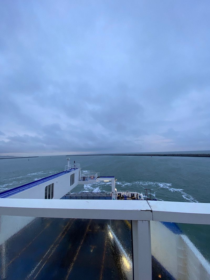
Calais car ferry, Calais, Frankreich
Calais, Frankreich
50° 58' 33.9" N 1° 52' 41.8" E
50.9760909 1.8782672
• Head south on Avenue Antoine Nicolas Magret. Go for 337 m.
• Take the 3rd exit from roundabout. Go for 847 m.
• Turn right toward Avenue de l'Embarquement. Go for 857 m.
• Continue on Avenue de l'Embarquement. Go for 852 m.
• Take the Calais-Dover Ferry. Stay on for 40.6 km.
• Head northwest. Go for 133 m.
• Turn right toward Ramp B. Go for 129 m.
• Continue on Ramp B. Go for 69 m.
• Turn right toward The Fan. Go for 143 m.
• Continue on The Fan. Go for 269 m.
• Keep right onto Inward Car Lanes. Go for 115 m.
• Keep left onto North Exit Road. Go for 439 m.
• Continue on Dock Exit Road. Go for 99 m.
• Keep left toward London/(M20)/Folkestone/Dover town centre. Go for 511 m.
• Continue on A20. Go for 1.7 km.
• Take the 3rd exit from Limekiln Roundabout roundabout onto Archcliffe Road (A20) toward London/(M20)/Folkestone. Go for 496 m.
• Take the 1st exit from Western Heights Roundabout roundabout onto A20 toward London/(M20)/Channel Tnl/Folkestone. Go for 11.3 km.
• Keep right onto M20 toward London/Channel Tnl/Ashford. Go for 80.5 km.
• Take exit 1 toward M25(S)/Swanley/B2173. Go for 1.1 km.
• Take the 2nd exit from Swanley Interchange roundabout toward Gatwick Airport. Go for 145 m.
• Take ramp onto M25. Go for 31.1 km.
• Take exit 7 toward M23(S)/Brighton/Crawley/Gatwick Airport onto M23. Go for 23.8 km.
• Continue on A23. Go for 12.7 km.
• Keep right onto A23 toward Brighton. Go for 12.7 km.
• Keep right onto London Road (A23) toward Brighton. Go for 119 m.
• Pass 2 roundabouts and continue on London Road (A23). Go for 4.2 km.
• Keep right onto Beaconsfield Road (A23). Go for 485 m.
• Keep left onto Beaconsfield Road (A23). Go for 48 m.
• Turn left onto Viaduct Road (A23). Go for 294 m.
• Keep right onto Ditchling Road (A23). Go for 464 m.
• Turn right onto Waterloo Place (A23). Go for 717 m.
• Arrive at Grand Parade (A23). Your destination is on the left.
☍
227,2 km
(3 hrs. 42 min.)
Day
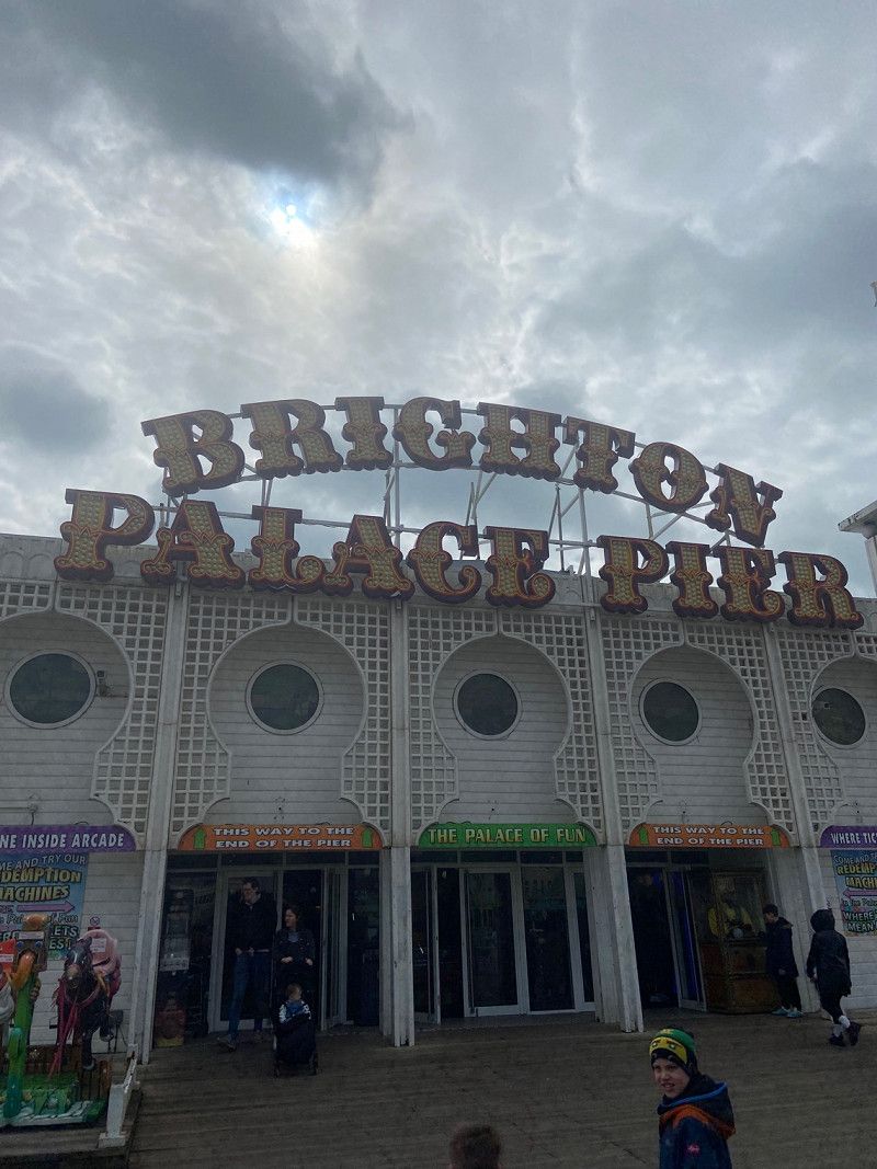
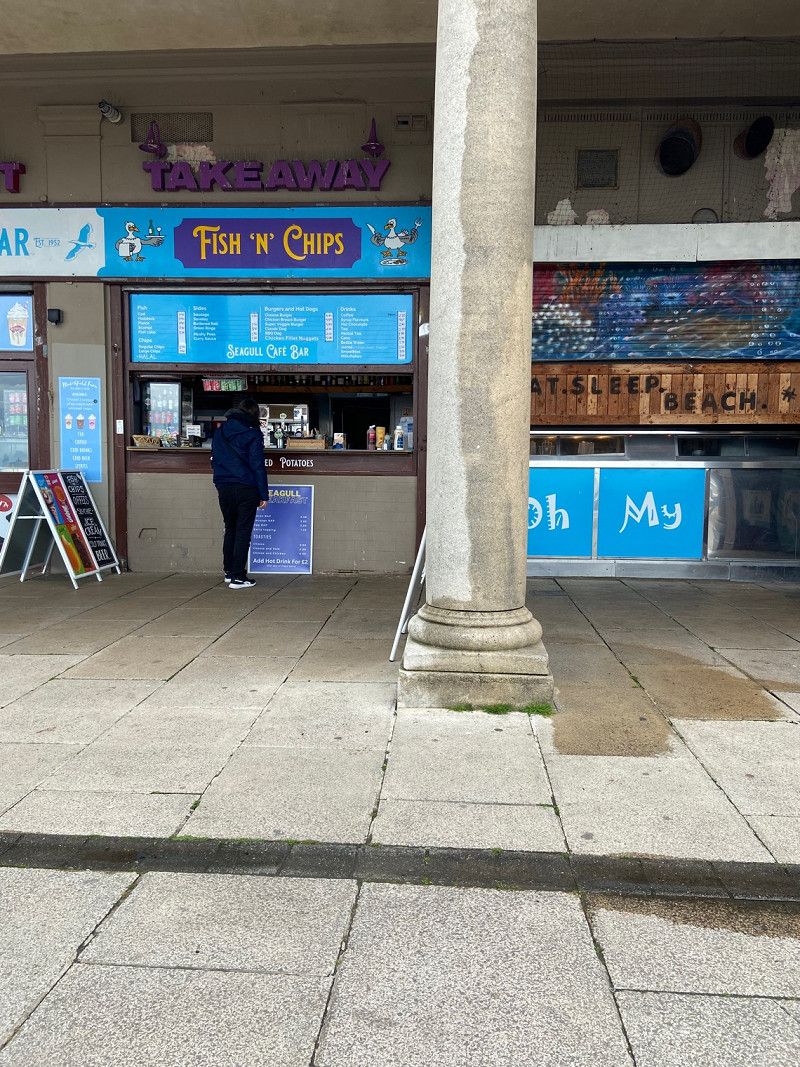
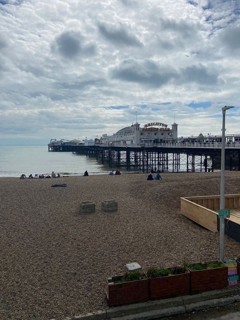
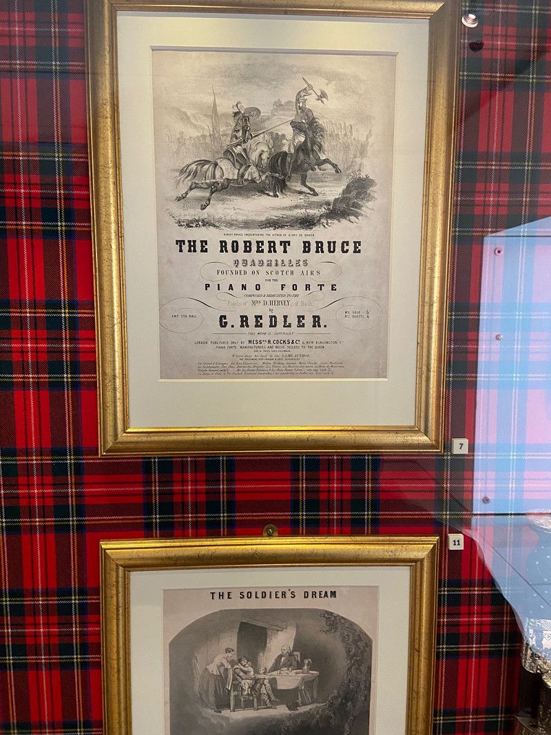
Brighton, Vereinigtes Königreich
On the pier?
50° 49' 22.6" N 0° 8' 10.6" W
50.8229402 -0.1362672
• Head south on Grand Parade (A23).
• Turn left onto Edward Street. Go for 91 m.
• Make a U-Turn at William Street onto Edward Street. Go for 94 m.
• Turn right onto Old Steine (A23). Go for 719 m.
• Turn left onto St Peter's Place (A23). Go for 111 m.
• Turn right onto London Road (A23). Go for 24 m.
• Turn left onto Cheapside (A270). Go for 709 m.
• Turn left onto New England Road (A270). Go for 199 m.
• Turn right onto Old Shoreham Road (A270). Go for 493 m.
• Turn right onto Dyke Road. Go for 1.6 km.
• Continue on Dyke Road Avenue. Go for 1.6 km.
• Take the 2nd exit from roundabout onto A27 toward Worthing. Go for 8.7 km.
• Keep right onto Shoreham By-pass (A27) toward Worthing/Lancing/Airport. Go for 1.3 km.
• Take the 2nd exit from roundabout onto Old Shoreham Road (A27) toward Worthing/Portsmouth/London/Horsham/(A24). Go for 1.2 km.
• Take the 2nd exit from roundabout onto Upper Brighton Road (A27) toward Portsmouth/Worthing/Sompting/London/(A24)/Horsham. Go for 4.6 km.
• Take the 2nd exit from Grove Lodge Roundabout roundabout onto Warren Road (A27) toward Portsmouth/London/Horsham/(A24). Go for 1.2 km.
• Take the 3rd exit from roundabout onto Crockhurst Hill (A27) toward Chichester/Portsmouth. Go for 10.7 km.
• Take the 2nd exit from roundabout onto Lyminster Road (A27) toward Chichester/Portsmouth/London/Dorking/(A284). Go for 1.2 km.
• Pass 2 roundabouts and continue on Chichester Road (A27). Go for 7.0 km.
• Take the 1st exit from roundabout onto A27 toward Barnham/Goodwood. Go for 646 m.
• Take the 3rd exit from roundabout onto Arundel Road (A27) toward Chichester/Portsmouth/Tangmere/Goodwood. Go for 4.4 km.
• Take the 2nd exit from roundabout onto A27 toward Goodwood. Go for 3.5 km.
• Take the 2nd exit from Portfield Roundabout roundabout onto Portfield Way (A285) toward Chichester/Hospital. Go for 361 m.
• Take the 1st exit from roundabout onto Westhampnett Road (A285) toward Chichester/Midhurst. Go for 111 m.
• Pass 2 roundabouts and continue on Westhampnett Road (A285). Go for 449 m.
• Take the 2nd exit from roundabout onto Spitalfield Lane. Go for 330 m.
• Take the 1st exit from roundabout onto Spitalfield Lane. Go for 406 m.
• Turn left toward Spitalfield Lane. Go for 44 m.
• Take the 2nd exit from roundabout onto Oaklands Way (A286) toward Ring Road/Midhurst/Portsmouth/(A27)/Northgate. Go for 369 m.
• Keep left onto Orchard Street (A286) toward Ring Road/Witterings/Portsmouth/(A27)/Westgate. Go for 526 m.
• Take the 3rd exit from Westgate Roundabout roundabout onto Avenue de Chartres (A286). Go for 415 m.
• Take the 3rd exit from Avenue de Chartres Roundabout roundabout onto Via Ravenna (A259) toward Fishbourne/Portsmouth/(A27). Go for 261 m.
• Pass 2 roundabouts and continue on Cathedral Way (A259). Go for 1.1 km.
• Take the 4th exit from Fishbourne Roundabout roundabout onto A27 toward Emsworth/Portsmouth/Havant. Go for 18.6 km.
• Keep right onto A27 toward Southampton/Portsmouth (W)/City Centre/(M27). Go for 2.2 km.
• Keep right onto M27 toward The West/Southampton/Fareham/Portsmouth/(M275). Go for 45.4 km.
• Continue on A31. Go for 18.4 km.
• Keep right onto Ringwood Road (A31) toward The West/Dorchester/Poole/(A349)/Wimborne. Go for 2.4 km.
• Pass 3 roundabouts and continue on Ringwood Road (A31). Go for 3.1 km.
• Take the 2nd exit from Palmersford Roundabout roundabout onto A31 toward Dorchester/Poole/(A349). Go for 2.5 km.
• Take the 2nd exit from roundabout onto A31 toward Dorchester/Poole/(A349). Go for 6.4 km.
• Take the 1st exit from Merley Roundabout roundabout onto A349 toward Poole/Bournemouth/(A341)/Wimborne/(B3073). Go for 178 m.
• Take the 2nd exit from roundabout onto Oakley Hill (A349). Go for 2.4 km.
• Take the 3rd exit from Dunyeats Roundabout roundabout onto Dunyeats Road. Go for 1.3 km.
• Take the 2nd exit from Broadstone Roundabout roundabout onto Broadstone Way. Go for 1.3 km.
• Turn right onto Beechbank Avenue. Go for 141 m.
• Pass 2 roundabouts and continue on Beechbank Avenue. Go for 832 m.
• Continue on Longmeadow Lane. Go for 734 m.
• Take the 3rd exit from roundabout onto Poole Road toward Dorchester/Blandford/(A350)/Upton/Hamworthy/Wareham. Go for 204 m.
• Take ramp onto A35 toward Dorchester/Blandford/(A350)/Wareham/(A351). Go for 4.2 km.
• Take the 1st exit from Bakers Arms Roundabout roundabout onto King's Bridge (A351) toward Sandford. Go for 1.6 km.
• Pass 4 roundabouts and continue on A351. Go for 4.4 km.
• Take the 3rd exit from roundabout onto A351. Go for 1.3 km.
• Take the 3rd exit from roundabout onto A352. Go for 2.2 km.
• Turn left onto B3070. Go for 8.8 km.
• Turn left onto B3070. Go for 987 m.
• Continue on Main Road (B3070). Go for 1.5 km.
• Arrive at Main Road.
☍
185,2 km
(2 hrs. 43 min.)
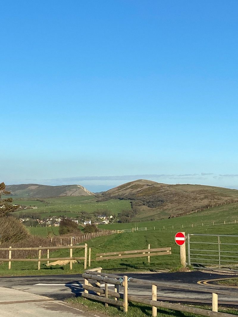
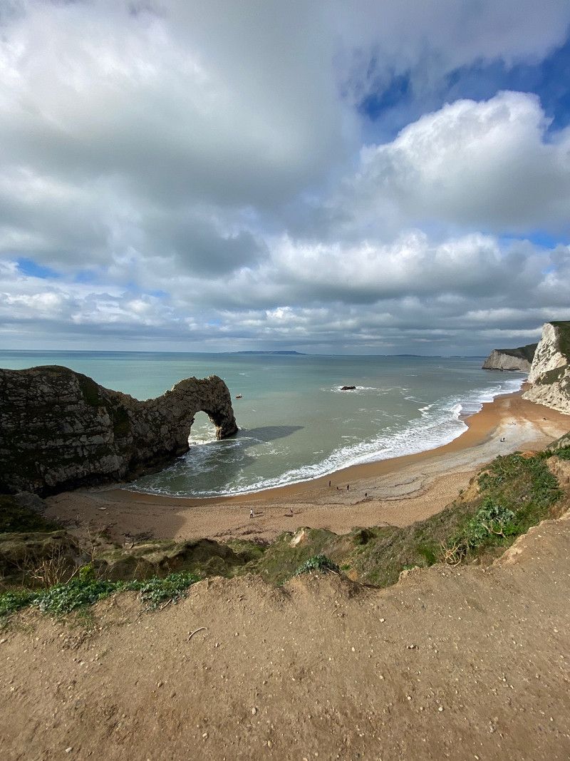
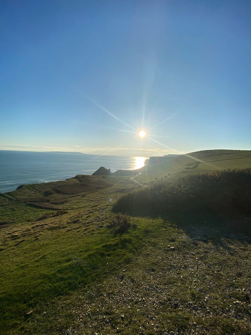
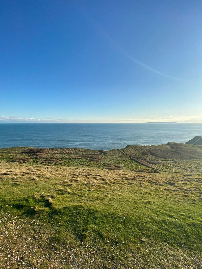
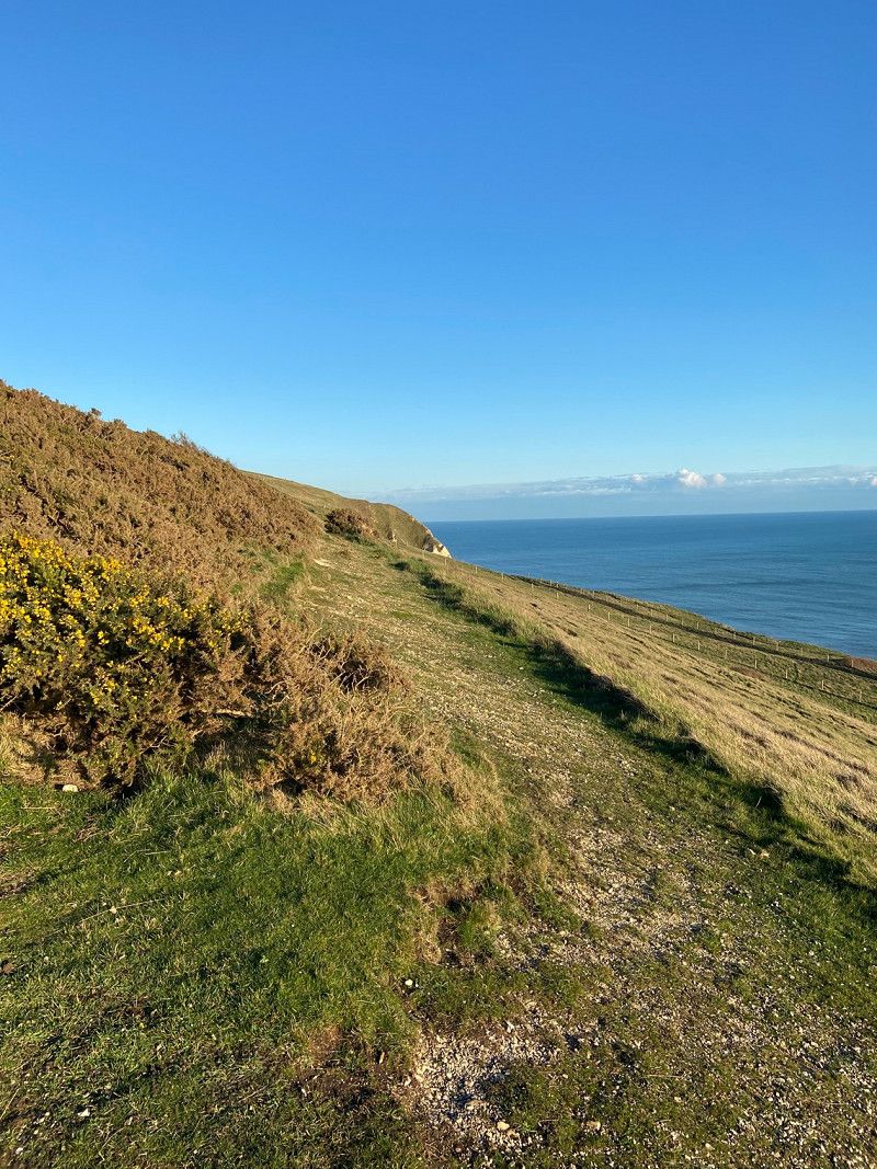
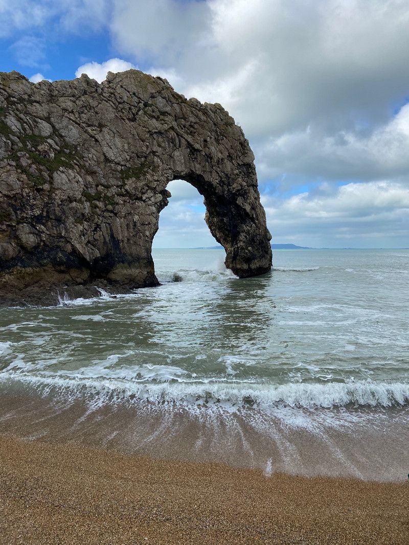
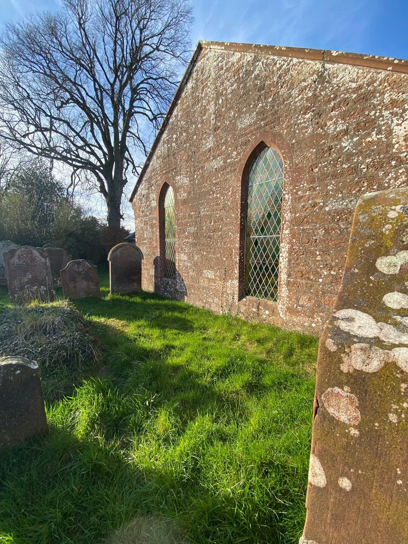
Lulworth Cove, Vereinigtes Königreich
Lulworth-Bucht, Vereinigtes Königreich
50° 37' 5.6" N 2° 14' 49.3" W
50.6182125 -2.2470177
• Head toward Britwell Drive on Main Road. Go for 795 m.
• Turn left onto Church Road. Go for 5.0 km.
• Turn right onto High Street. Go for 502 m.
• Continue on Water Lane. Go for 557 m.
• Turn left onto A352. Go for 5.8 km.
• Take the 2nd exit from Warmwell Cross roundabout onto A352. Go for 6.5 km.
• Take the 1st exit from roundabout onto A352. Go for 318 m.
• Take the 1st exit from Max Gate Roundabout roundabout. Go for 279 m.
• Turn left onto A35 toward Honiton/Weymouth/(A354)/Yeovil/(A37)/Sherborne/(A352)/Bridport. Go for 2.0 km.
• Take the 2nd exit from roundabout onto A35 toward Honiton/Yeovil/(A37). Go for 2.3 km.
• Take the 3rd exit from roundabout onto A37 toward Yeovil/Sherborne/(A352). Go for 2.0 km.
• Take the 1st exit from roundabout onto A37 toward Sherborne. Go for 27.2 km.
• Take the 2nd exit from Keyford Roundabout roundabout onto Dorchester Road (A37). Go for 1.3 km.
• Take the 2nd exit from Quicksilver Roundabout roundabout onto Hendford Hill (A30) toward Salisbury/Town Centre. Go for 747 m.
• Take the 2nd exit from Horsey Roundabout roundabout onto Queensway (A30) toward Salisbury/Sherborne/Bristol/(A37)/Frome/(A359). Go for 847 m.
• Keep left toward Bristol/Frome/(A359). Go for 74 m.
• Continue on Kingston (A37) toward Bristol/Frome/(A359). Go for 253 m.
• Pass 2 roundabouts and continue on Ilchester Road (A37). Go for 7.0 km.
• Take the 2nd exit from roundabout onto Yeovil Road (B3151) toward Ilchester/Yeovilton. Go for 194 m.
• Continue on Church Street (B3151). Go for 263 m.
• Continue on Market Place (B3151). Go for 34 m.
• Continue on Northover (B3151). Go for 579 m.
• Take the 1st exit from roundabout onto B3151. Go for 570 m.
• Take the 2nd exit from roundabout onto B3151. Go for 875 m.
• Continue on Bondip Hill (B3151). Go for 424 m.
• Continue on Edmonds Hill (B3151). Go for 500 m.
• Turn right onto A372. Go for 32 m.
• Turn left onto B3151. Go for 425 m.
• Continue on Rocky Hill (B3151). Go for 1.1 km.
• Continue on B3151. Go for 2.7 km.
• Continue on Lodge Hill (B3151). Go for 208 m.
• Continue on B3151. Go for 272 m.
• Continue on Littleton Hill (B3151). Go for 1.6 km.
• Continue on B3151. Go for 2.4 km.
• Continue on Castlebrook (B3151). Go for 189 m.
• Continue on B3151. Go for 272 m.
• Continue on Main Road (B3151). Go for 1.5 km.
• Continue on Marshall's Elm (B3151). Go for 125 m.
• Continue on Ivythorn Hill (B3151). Go for 364 m.
• Turn right onto Somerton Road (B3151). Go for 1.1 km.
• Turn left onto Portway. Go for 689 m.
• Continue on Middle Leigh. Go for 364 m.
• Turn right onto Stonehill. Go for 176 m.
• Turn left onto West End. Go for 584 m.
• Turn left onto Quarry Batch (A39). Go for 17.0 km.
• Take the 1st exit from roundabout onto Puriton Hill (A39). Go for 535 m.
• Take the 3rd exit from roundabout onto M5 toward The Midlands/London/Bristol. Go for 189 km.
• Continue on M6. Go for 13.7 km.
• Keep right onto M6. Go for 298 km.
• Continue on A74(M). Go for 946 m.
• Take exit 22 toward Gretna. Go for 886 m.
• Turn left onto Glasgow Road (B7076) toward Glasgow/Edinburgh/(A74(M))/Gretna Green/Springfield. Go for 336 m.
• Turn right onto Gretna Loaning (B7076) toward (Springfield). Go for 378 m.
• Turn right. Go for 10 m.
• Arrive at your destination.
☍
601,6 km
(6 hrs. 12 min.)
Day
Gretna Green, Gretna, Vereinigtes Königreich
Gretna Green, Gretna DG16, Vereinigtes Königreich
55° 0' 18.1" N 3° 3' 45.4" W
55.0050199 -3.0626071
• Head west. Go for 10 m.
• Turn left onto Gretna Loaning (B7076) toward Glasgow/(A74(M))/Edinburgh/Carlisle/(M6)/Dumfries/(A75)/Gretna. Go for 378 m.
• Turn left onto Glasgow Road (B7076) toward Carlisle/(M6)/Dumfries/(A75)/Stranraer/Gretna. Go for 897 m.
• Take the 2nd exit from Crossways Roundabout roundabout onto Glasgow Road (B7076). Go for 864 m.
• Continue on A6071. Go for 124 m.
• Turn right and take ramp onto M6 toward Carlisle. Go for 182 km.
• Take exit 26 toward Skelmersdale/Liverpool/Southport. Go for 483 m.
• Take the 1st exit from roundabout onto M58 toward Skelmersdale/Liverpool/Southport. Go for 288 m.
• Take the 2nd exit from roundabout onto M58 toward Liverpool/Skelmersdale/Southport. Go for 18.6 km.
• Keep left toward L'Pool S/Airport. Go for 144 m.
• Keep right onto A59 toward Liverpool/Southport/A570/Ormskirk. Go for 88 m.
• Keep left onto A59. Go for 3.3 km.
• Turn slightly left toward City centre/Birkenhead/Wallasey/(Tunnels)/A59/Kirkdale. Go for 34 m.
• Turn right onto Longmoor Lane (A506) toward City centre/Birkenhead/Wallasey/(Tunnels)/A59/Kirkdale. Go for 60 m.
• Continue on Walton Vale (A59). Go for 1.9 km.
• Take the 2nd exit from roundabout onto County Road (A59) toward City Centre. Go for 1.9 km.
• Continue on Kirkdale Vale (A5050). Go for 137 m.
• Turn left onto Everton Valley (A5089). Go for 94 m.
• Turn slightly right onto Walton Breck Road (A5089). Go for 692 m.
• Arrive at Walton Breck Road (A5089). Your destination is on the left.
☍
212,2 km
(2 hrs. 1 min.)
Day
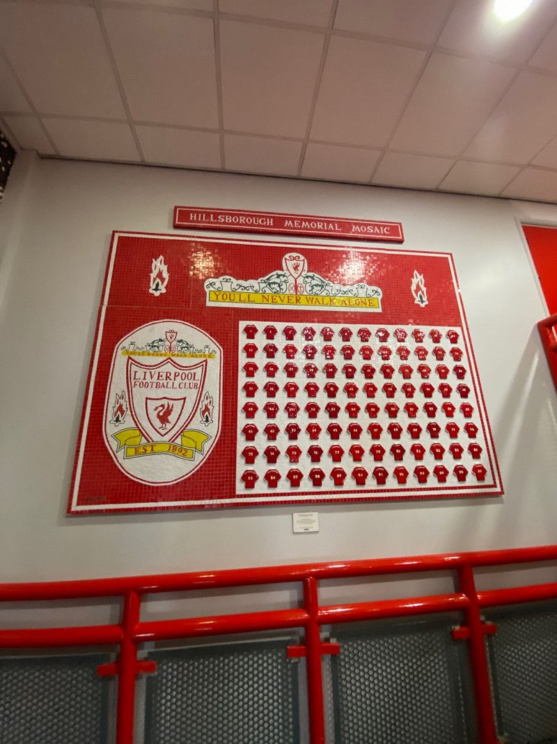
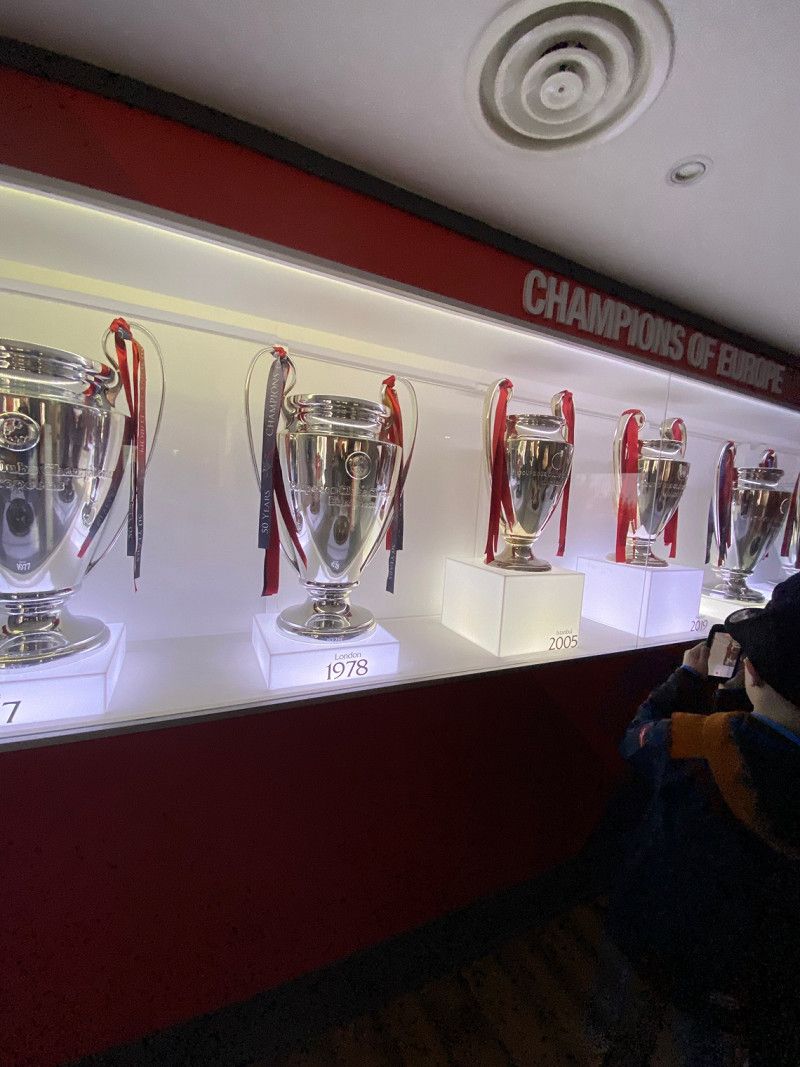
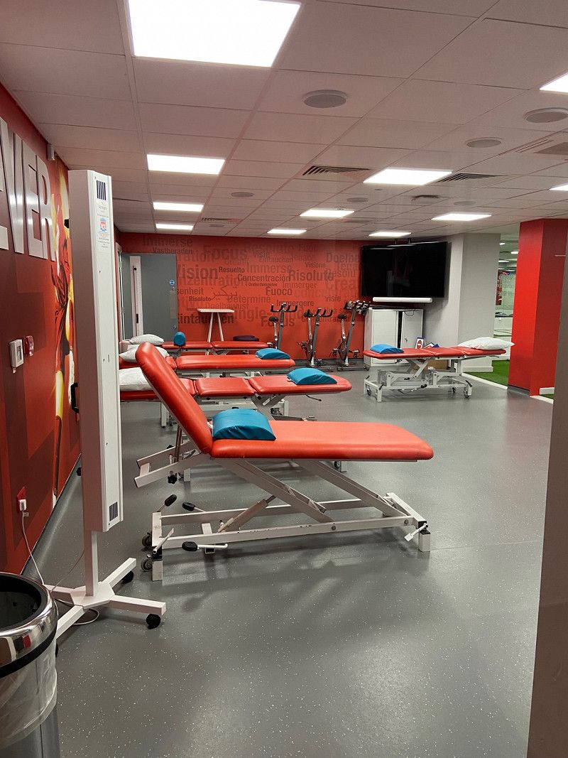
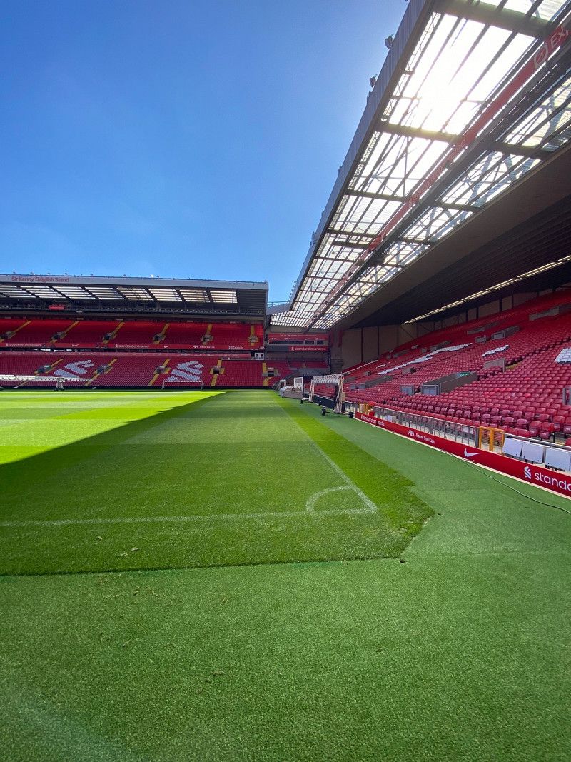
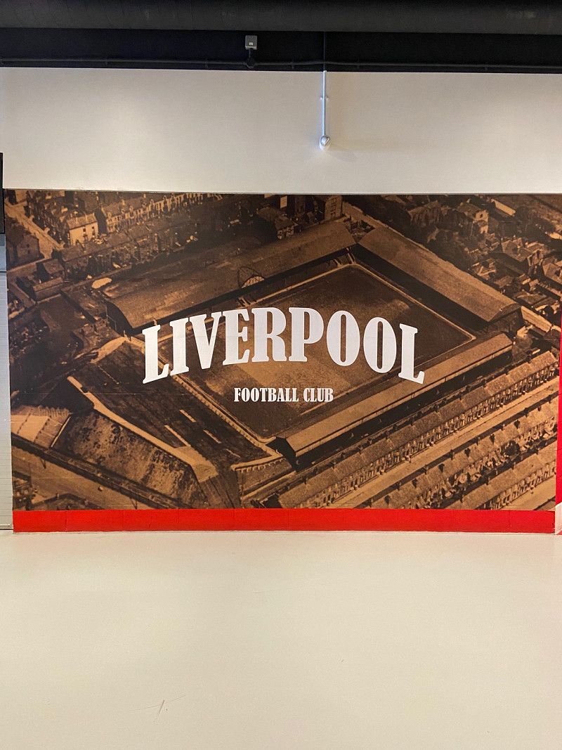
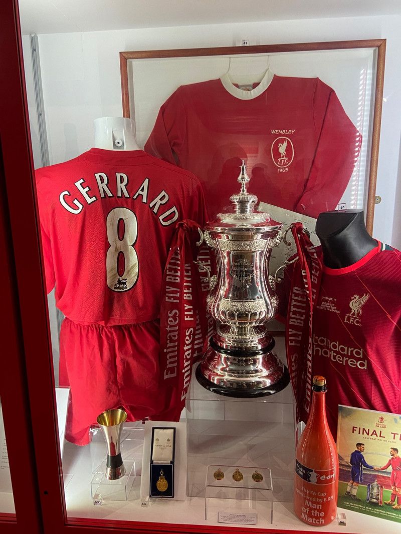
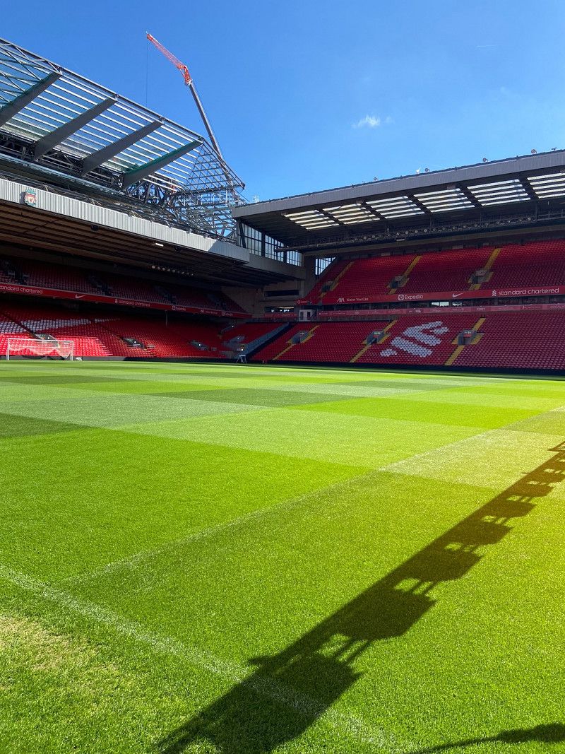
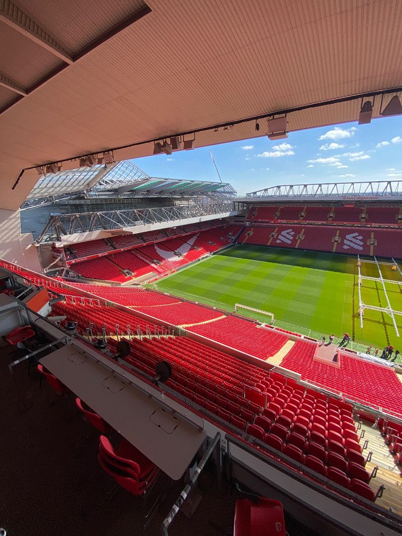
Liverpool FC Museum, Walton Breck Road, Anfield, Liverpool, Vereinigtes Königreich
Anfield Stadium, Walton Breck Rd, Anfield, Liverpool L4 0TF, Vereinigtes Königreich
53° 25' 48.7" N 2° 57' 43.2" W
53.4302082 -2.9619974
• Head toward Venmore Street on Walton Breck Road (A5089). Go for 640 m.
• Turn slightly right onto Royal Street. Go for 181 m.
• Turn right onto Walton Road (A59). Go for 1.8 km.
• Take the 2nd exit from roundabout onto Rice Lane (A59) toward (M57)/(M58)/Fazakerley/(A506)/Aintree/Walton/University Hospital Aintree. Go for 2.0 km.
• Keep left onto Warbreck Moor (A59) toward (M57)/Preston/(M58)/Southport/Aintree. Go for 3.3 km.
• Keep right toward Preston/(M6)/Skelmersdale/Ormskirk. Go for 43 m.
• Turn right onto A59 toward Preston/(M6)/Skelmersdale/Ormskirk. Go for 62 m.
• Keep left onto A59 toward Preston/(M6)/Skelmersdale/Ormskirk. Go for 470 m.
• Keep right onto M58 toward Skelmersdale/Preston/(M6). Go for 18.4 km.
• Take the 2nd exit from roundabout onto M6 toward Preston. Go for 183 km.
• Continue on A74(M). Go for 78.6 km.
• Continue on M74 toward The North/Glasgow. Go for 59.8 km.
• Take the exit toward Glasgow Airport/Greenock onto M8. Go for 17.0 km.
• Take exit 30 toward Erskine Bridge/Erskine/Bishopton onto M898 (Craigton Interchange). Go for 1.8 km.
• Continue on A898. Go for 2.2 km.
• Take ramp onto Great Western Road (A82) toward Crianlarich. Go for 3.7 km.
• Pass 3 roundabouts and continue on A82. Go for 10.8 km.
• Take the 2nd exit from Stoneymollan Roundabout roundabout onto A82 toward Tarbet/Crianlarich. Go for 4.1 km.
• Take the 2nd exit from roundabout onto A82 toward Crianlarich/Campbeltown/(A83). Go for 21.7 km.
• Turn right onto A82 toward Crianlarich/Ft. William/Oban/(A85). Go for 25.8 km.
• Take the 2nd exit from roundabout onto A82 toward An Gearasdan/Fort William/An t-Òban/Oban/(A85)/A' Chrìon-Làraich/Crianlarich. Go for 926 m.
• Take the 1st exit from roundabout onto A82 toward An Gearasdan/Fort William/An t-Òban/(A85)/Oban. Go for 60.8 km.
• Pass 2 roundabouts and continue on A82. Go for 21.1 km.
• Take the 2nd exit from roundabout onto Belford Road (A82) toward Inbhir Nis/Inverness/Mallaig/(A830)/Stèisean Train Station. Go for 955 m.
• Take the 1st exit from roundabout onto A82 toward Inverness/Mallaig/(A830). Go for 199 m.
• Pass 2 roundabouts and continue on A82. Go for 1.7 km.
• Take the 1st exit from Lochy Bridge Roundabout roundabout onto A830 toward Mallaig. Go for 828 m.
• Take the 2nd exit from roundabout onto A830. Go for 55.1 km.
• Turn left toward B8008. Go for 360 m.
• Continue on B8008. Go for 1.9 km.
• Continue on Portnaluchaig (B8008). Go for 125 m.
• Continue on B8008. Go for 1.0 km.
• Continue on Traigh Ho (B8008). Go for 48 m.
• Arrive at Traigh Ho (B8008).
☍
580,1 km
(6 hrs. 3 min.)
Day
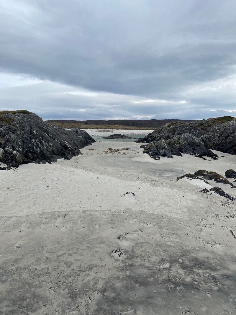
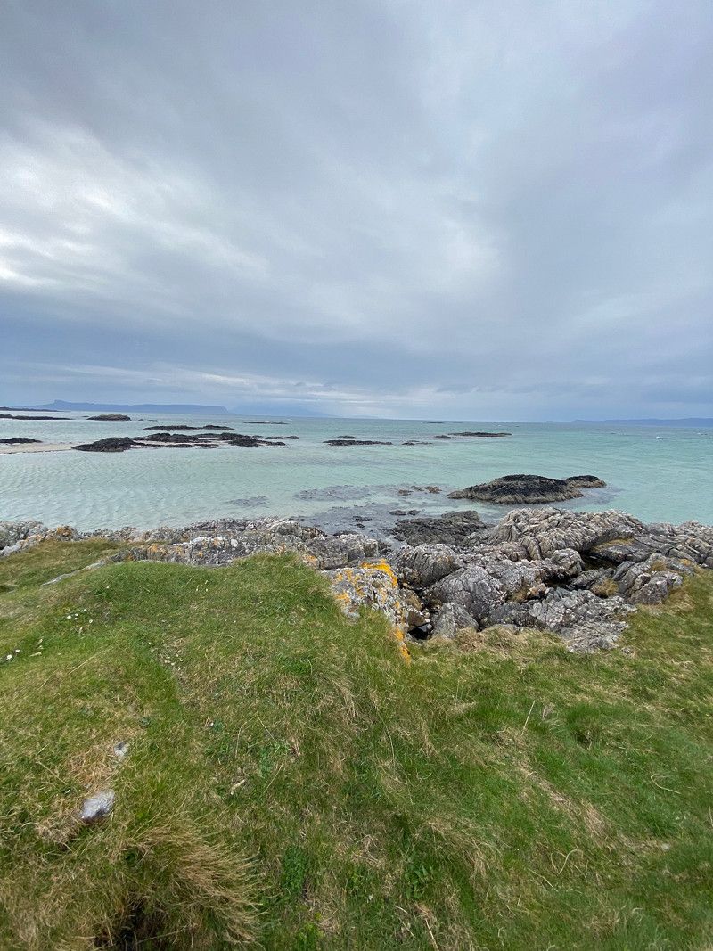
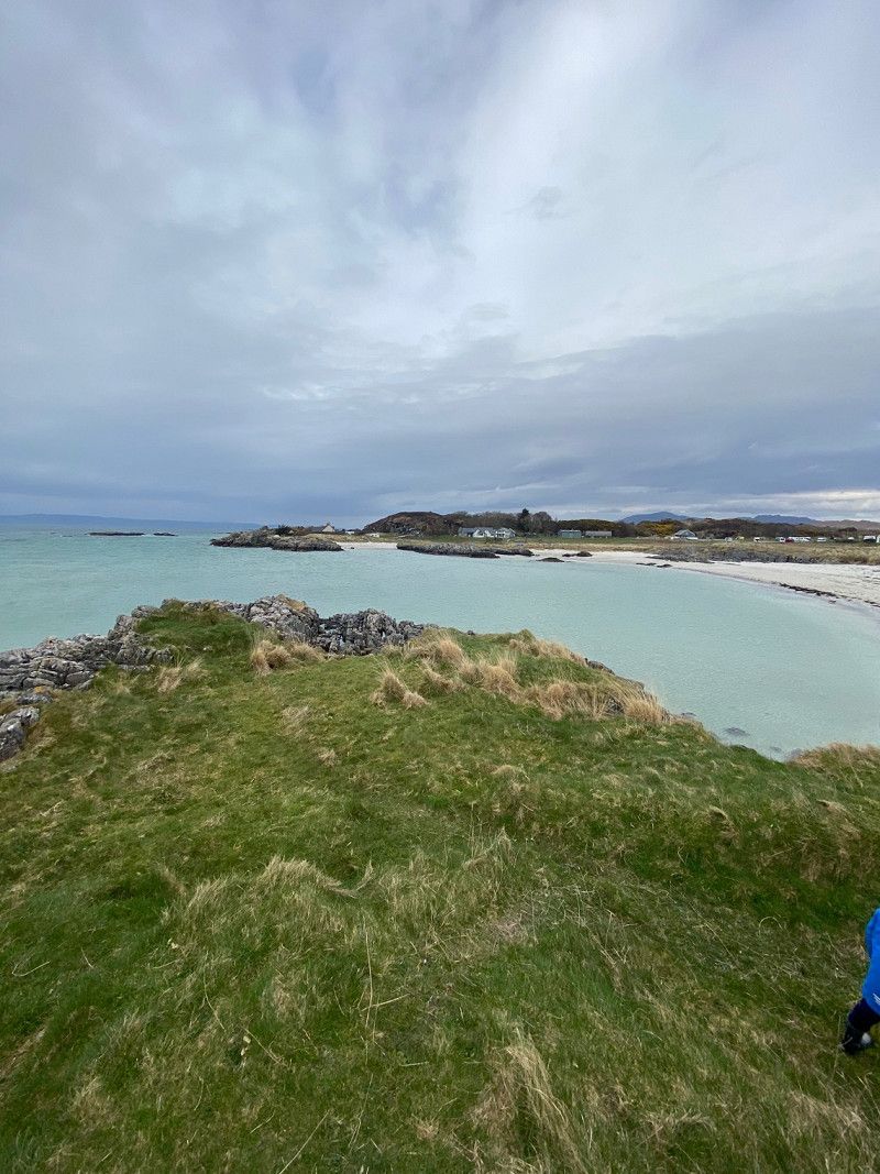
Silversands
PH39 4NT, Arisaig, Großbritannien
56° 56' 41.7" N 5° 51' 0" W
56.9449200 -5.8500100
• Head north on Traigh Ho (B8008). Go for 129 m.
• Continue on B8008. Go for 1.4 km.
• Continue on Camusdarach (B8008). Go for 228 m.
• Continue on B8008. Go for 22 m.
• Continue on Camusdarach (B8008). Go for 147 m.
• Continue on Glenancross (B8008). Go for 199 m.
• Continue on B8008. Go for 1.9 km.
• Turn left onto A830. Go for 5.5 km.
• Take the 2nd exit from roundabout. Go for 210 m.
• Turn right. Go for 41 m.
• Take the Armadale-Mallaig Ferry. Stay on for 8.0 km.
• Head southwest on A851. Go for 71 m.
• Turn right onto A851. Go for 1.2 km.
• Continue on Castle Armadale (A851). Go for 162 m.
• Continue on A851. Go for 1.6 km.
• Continue on Kilbeg (A851). Go for 140 m.
• Continue on A851. Go for 1.4 km.
• Continue on Kilmore (A851). Go for 126 m.
• Continue on A851. Go for 323 m.
• Continue on Ferrindonald (A851). Go for 131 m.
• Continue on A851. Go for 6.6 km.
• Continue on Duisdale Beag (A851). Go for 171 m.
• Continue on A851. Go for 527 m.
• Continue on Duisdalemore (A851). Go for 141 m.
• Continue on A851. Go for 5.0 km.
• Continue on Kinloch (A851). Go for 138 m.
• Continue on A851. Go for 5.9 km.
• Continue on Skulamus (A851). Go for 276 m.
• Turn left onto A87. Go for 223 m.
• Continue on Moorlands (A87). Go for 205 m.
• Continue on A87. Go for 725 m.
• Continue on Harrapool (A87). Go for 230 m.
• Continue on A87. Go for 551 m.
• Continue on Limepark Terrace (A87). Go for 58 m.
• Continue on A87. Go for 3.9 km.
• Continue on Scalpay Ho (A87). Go for 207 m.
• Continue on A87. Go for 3.9 km.
• Continue on Dunan (A87). Go for 122 m.
• Continue on A87. Go for 18.5 km.
• Continue on Sligachan Hotel (A87). Go for 127 m.
• Continue on Sligachan (A87). Go for 66 m.
• Continue on A87. Go for 13.7 km.
• Continue on Viewfield Road (A87). Go for 680 m.
• Continue on Bridge Road (A855). Go for 305 m.
• Turn right onto Lisigarry Court. Go for 93 m.
• Arrive at Lisigarry Court. Your destination is on the left.
☍
85,3 km
(1 hrs. 47 min.)
Day
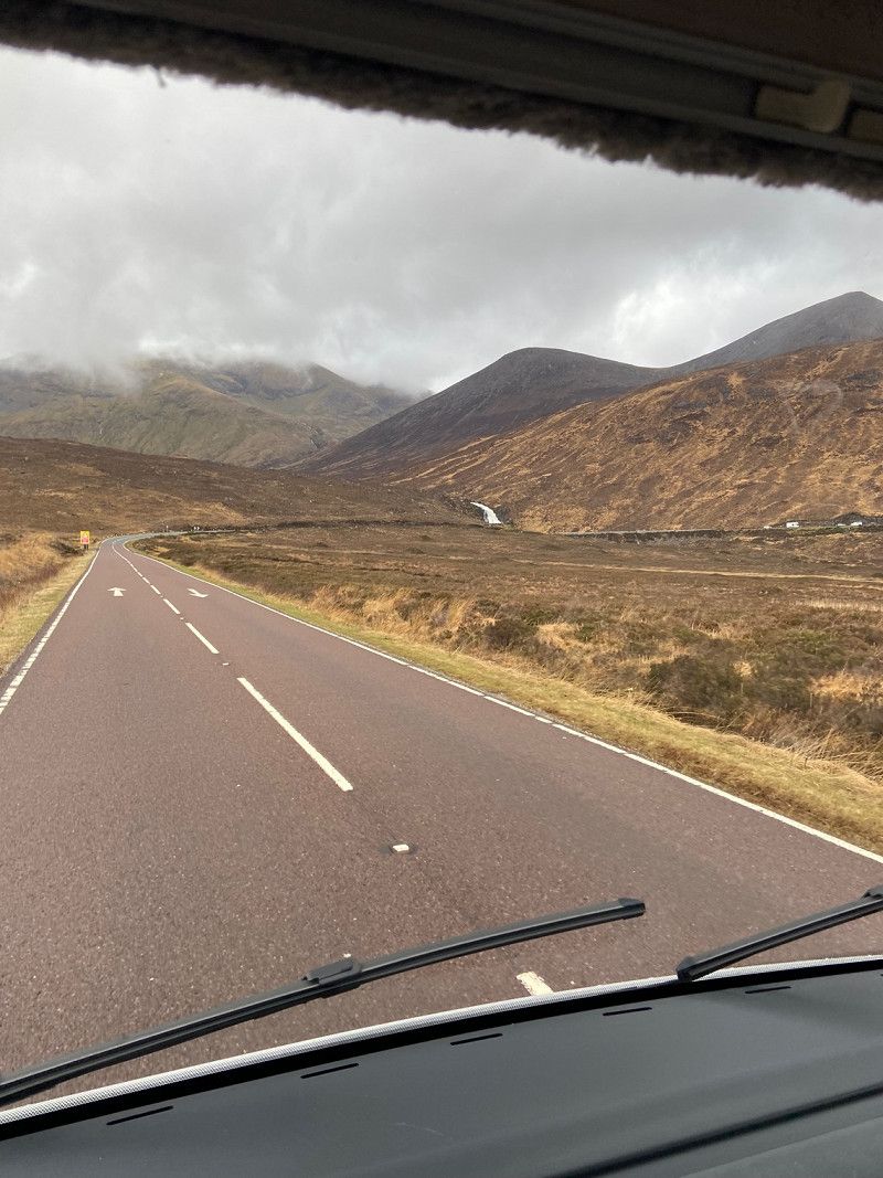
Portree, Vereinigtes Königreich
Portree IV51, Vereinigtes Königreich
57° 24' 44.9" N 6° 11' 45.7" W
57.4124740 -6.1960230
• Head toward Bridge Road on Lisigarry Court. Go for 93 m.
• Turn left onto Bridge Road (A855). Go for 305 m.
• Continue on Viewfield Road (A87). Go for 680 m.
• Continue on A87. Go for 2.2 km.
• Turn right onto A87. Go for 11.6 km.
• Continue on Sligachan (A87). Go for 66 m.
• Continue on Sligachan Hotel (A87). Go for 127 m.
• Continue on A87. Go for 18.5 km.
• Continue on Dunan (A87). Go for 122 m.
• Continue on A87. Go for 3.9 km.
• Continue on Scalpay Ho (A87). Go for 207 m.
• Continue on A87. Go for 3.9 km.
• Continue on Limepark Terrace (A87). Go for 58 m.
• Continue on A87. Go for 551 m.
• Continue on Harrapool (A87). Go for 230 m.
• Continue on A87. Go for 725 m.
• Continue on Moorlands (A87). Go for 205 m.
• Continue on A87. Go for 3.2 km.
• Continue on Ashaig (A87). Go for 78 m.
• Continue on A87. Go for 6.0 km.
• Take the 1st exit from roundabout onto A87. Go for 159 m.
• Continue on Skye Bridge (A87). Go for 480 m.
• Continue on A87. Go for 1.8 km.
• Continue on Station Road (A87). Go for 277 m.
• Continue on A87. Go for 7.2 km.
• Continue on Kirkton (A87). Go for 136 m.
• Continue on A87. Go for 6.3 km.
• Turn right. Go for 23 m.
• Take the 2nd exit from roundabout. Go for 81 m.
• Turn left. Go for 11 m.
• Arrive at your destination.
☍
69,1 km
( 57 min.)
Eilean Donan Castle, Vereinigtes Königreich
Eilean Donan IV40 8DX, Vereinigtes Königreich
57° 16' 27.1" N 5° 30' 58.7" W
57.2741989 -5.5162980
• Head southwest. Go for 65 m.
• Take the 2nd exit from roundabout. Go for 37 m.
• Turn right onto A87. Go for 44.5 km.
• Continue on A887. Go for 24.3 km.
• Turn right onto A82. Go for 10.1 km.
• Turn left onto Glendoe Road (B862) toward Whitebridge/Errogie/Dores/Foyers/(B852). Go for 263 m.
• Continue on B862. Go for 3.1 km.
• Continue on Glendoe Lodge (B862). Go for 89 m.
• Continue on B862. Go for 1.3 km.
• Continue on Glendoebeg (B862). Go for 124 m.
• Continue on B862. Go for 5.8 km.
• Continue on Knockie Lodge (B862). Go for 149 m.
• Continue on B862. Go for 6.1 km.
• Turn left onto B852. Go for 3.8 km.
• Continue on Glenlia (B852). Go for 213 m.
• Continue on B852. Go for 2.2 km.
• Continue on Easter Boleskine (B852). Go for 194 m.
• Continue on B852. Go for 213 m.
• Continue on General Wades Military Road (B852). Go for 77 m.
• Continue on B852. Go for 1.6 km.
• Continue on South Loch Ness Trail (B852). Go for 258 m.
• Continue on B852. Go for 50 m.
• Continue on Hillhead (B852). Go for 58 m.
• Continue on B852. Go for 4.8 km.
• Arrive at B852.
☍
109,3 km
(1 hrs. 36 min.)
Day
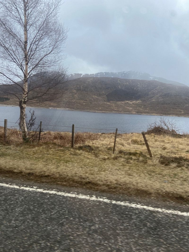
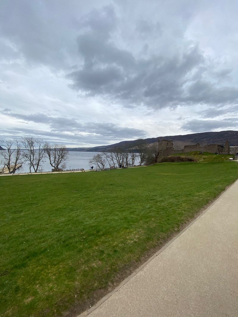
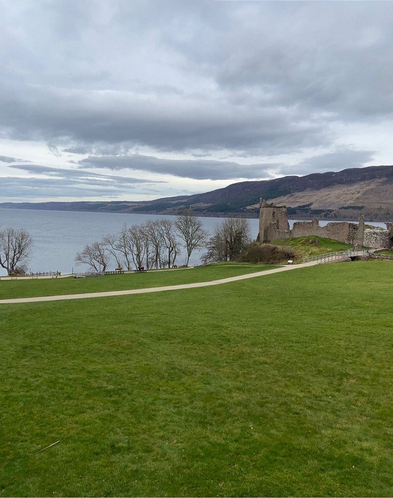
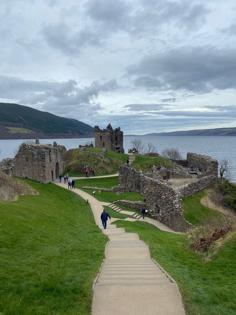
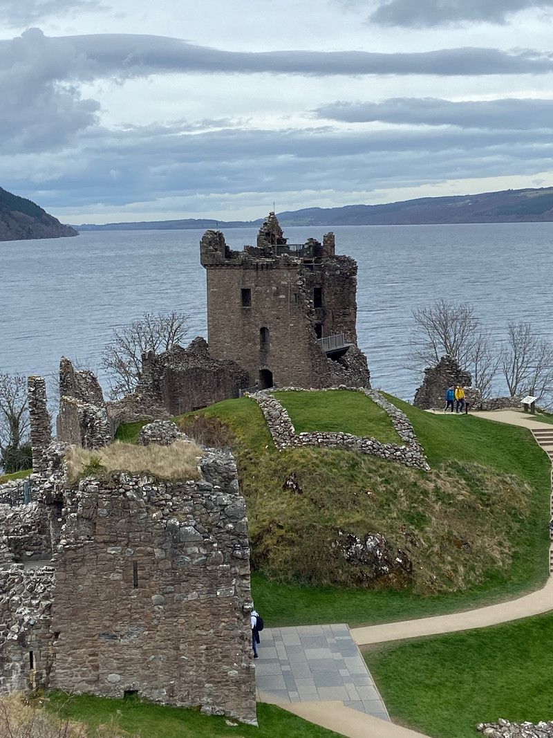
Loch Ness, Vereinigtes Königreich
57° 19' 22.3" N 4° 25' 27.8" W
57.3228575 -4.4243817
• Head northeast on B852. Go for 797 m.
• Continue on Whitefield (B852). Go for 322 m.
• Continue on B852. Go for 7.1 km.
• Continue on Strath Gardens (B852). Go for 39 m.
• Continue on B852. Go for 199 m.
• Continue on B862. Go for 9.3 km.
• Take the 4th exit from Holm Roundabout roundabout onto Holm Road (A8082). Go for 875 m.
• Pass 7 roundabouts and continue on Sir Walter Scott Drive (A8082). Go for 4.5 km.
• Take the 4th exit from roundabout onto Culloden Road (B9006) toward Culloden Moor/Croy/Perth/(A9). Go for 635 m.
• Turn right onto B9006 toward Perth. Go for 42 m.
• Take ramp onto A9 toward Perth. Go for 155 km.
• Continue on A9 toward Inverness. Go for 18.9 km.
• Take the 2nd exit from Inveralmound Roundabout roundabout onto A9 toward Stirling/Glasgow/Edinburgh/(M90)/Dundee/Football Stadium. Go for 4.1 km.
• Take the 2nd exit from Broxden Roundabout roundabout onto M90 toward Edinburgh/Dundee. Go for 4.1 km.
• Take right exit 10 toward Edinburgh onto M90. Go for 50.5 km.
• Continue on A90. Go for 2.0 km.
• Take ramp onto A90 toward Edinburgh. Go for 8.8 km.
• Keep right onto Hillhouse Road (A90) toward City Centre/Craigleith/West End. Go for 1.9 km.
• Take the 1st exit from roundabout onto Queensferry Road (A90). Go for 1.3 km.
• Turn left onto Randolph Crescent. Go for 94 m.
• Turn left onto Great Stuart Street. Go for 94 m.
• Turn right onto Ainslie Place. Go for 61 m.
• Turn right onto St Colme Street. Go for 153 m.
• Continue on Queen Street. Go for 819 m.
• Turn right onto North St David Street. Go for 100 m.
• Continue on St Andrew Square. Go for 131 m.
• Continue on South St David Street. Go for 101 m.
• Turn left onto Princes Street. Go for 274 m.
• Continue on Waterloo Place (A1). Go for 48 m.
• Arrive at Waterloo Place (A1). Your destination is on the right.
☍
272,0 km
(3 hrs. 16 min.)
Day
Day
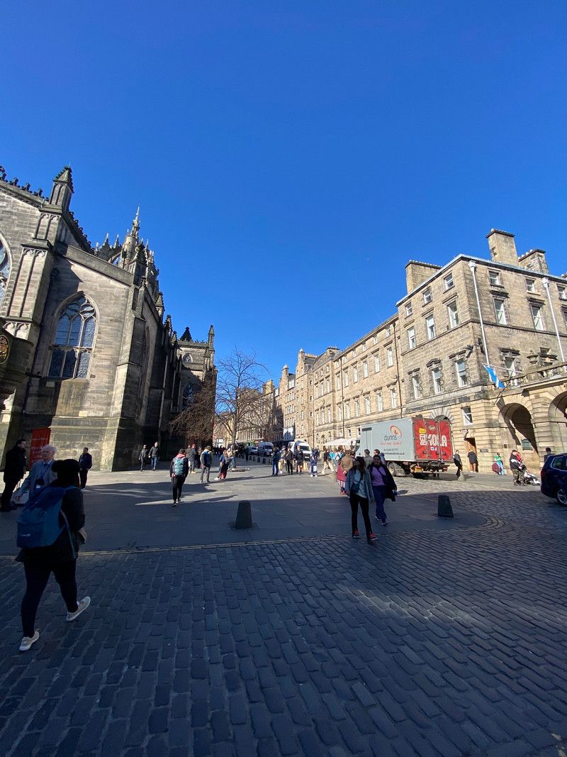
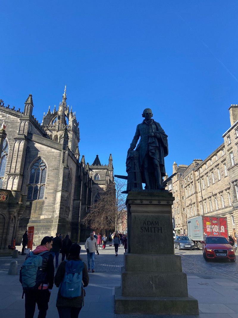
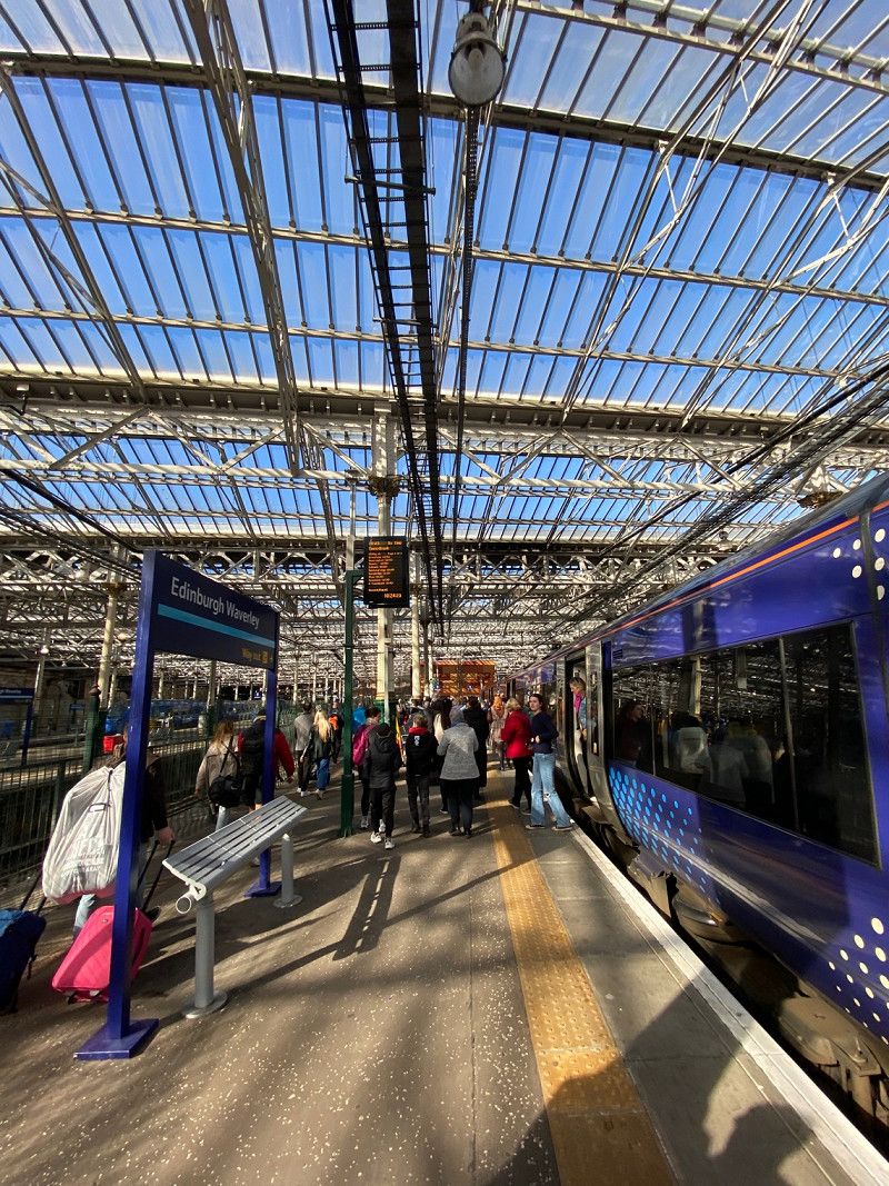
Edinburgh, Vereinigtes Königreich
55° 57' 11.7" N 3° 11' 17.8" W
55.9532520 -3.1882670
• Head east on Waterloo Place (A1). Go for 371 m.
• Take the 2nd exit from roundabout onto Regent Road (A1). Go for 999 m.
• Continue on London Road (A1). Go for 1.3 km.
• Continue on Portobello Road (A1140). Go for 1.7 km.
• Turn right onto Sir Harry Lauder Road (A199) toward Baileyfield Ind. Estate/(A720)/Dalkeith/(A68)/Berwick upon Tweed/(A1). Go for 2.3 km.
• Continue on Milton Link (A1) toward City Bypass/(A720)/Berwick upon Tweed. Go for 431 m.
• Take the 2nd exit from roundabout onto A1 toward City Bypass/(A720)/Berwick upon Tweed. Go for 36.6 km.
• Take the 3rd exit from Thistly Cross Roundabout roundabout onto A1 toward Berwick upon Tweed. Go for 3.1 km.
• Take the 3rd exit from Spott Roundabout roundabout onto A1 toward Berwick upon Tweed/Dunbar/(A1087)/Berwick. Go for 11.3 km.
• Take the 3rd exit from roundabout onto A1 toward Berwick upon Tweed. Go for 31.2 km.
• Take the 3rd exit from roundabout onto A1 toward Alnwick/Newcastle. Go for 4.0 km.
• Take the 3rd exit from roundabout onto A1 toward Alnwick/Newcastle. Go for 3.4 km.
• Take the 2nd exit from roundabout onto A1 toward Alnwick/Newcastle. Go for 84.4 km.
• Take ramp toward Tyne Tunnel/Cramlington/Blyth/Ashington. Go for 481 m.
• Take the 3rd exit from roundabout onto A19 toward Tyne Tunnel/Blyth/Ashington/(A189). Go for 3.5 km.
• Take the 3rd exit from Moor Farm roundabout onto A19 toward Tyne Tunnel. Go for 63.3 km.
• Keep right onto Fleet Bridge Road (A19) toward The South/Darlington/Middlesbrough/Airport/(A66). Go for 1.8 km.
• Keep right onto Tees Viaduct (A19) toward The South/Stockton/(A66)/Darlington. Go for 1.7 km.
• Keep right onto A19 toward The SOUTH/Thirsk/Whitby/Redcar/Teesport/Yarm/(A174). Go for 1.9 km.
• Take ramp toward Whitby/Redcar/Teesport/Wilton. Go for 310 m.
• Keep left onto A174 toward Whitby/Redcar/Teesport/Wilton. Go for 5.0 km.
• Take ramp toward Guisborough/Stokesley/Whitby. Go for 291 m.
• Turn right onto Stokesley Road (A172) toward Guisborough/Stokesley/Whitby. Go for 2.7 km.
• Take the 2nd exit from Poole Roundabout roundabout onto A1043 toward Teesport/(A174)/Whitby/Scarborough/Guisborough/(A171). Go for 1.9 km.
• Take the 3rd exit from roundabout onto Middlesbrough Road (A171) toward Whitby/Scarborough. Go for 4.2 km.
• Pass 5 roundabouts and continue on Guisborough Road (A171). Go for 35.1 km.
• Take the 3rd exit from Cross Butts Roundabout roundabout onto Guisborough Road (A171) toward Whitby/Scarborough. Go for 1.1 km.
• Take the 2nd exit from roundabout onto Mayfield Road (A171) toward Scarborough. Go for 893 m.
• Turn right onto A171 toward Larpool Lane Industrial Estate. Go for 2.0 km.
• Take the 1st exit from roundabout onto Stainsacre Lane (A171) toward Scarborough. Go for 2.4 km.
• Turn left onto B1447. Go for 1.1 km.
• Continue on Raw Pasture Bank (B1447). Go for 2.2 km.
• Continue on B1447. Go for 439 m.
• Continue on Whitby Road. Go for 327 m.
• Arrive at Whitby Road. Your destination is on the left.
☍
313,7 km
(3 hrs. 36 min.)
Day
Day
Robin Hoods Bay, Whitby, Vereinigtes Königreich
Robin Hood’s Bay, Whitby YO22, Vereinigtes Königreich
54° 26' 3.7" N 0° 32' 6" W
54.4343549 -0.5350049
• Head southeast on Whitby Road.
• Continue on New Road. Go for 82 m.
• Take the 3rd exit from roundabout onto New Road. Go for 130 m.
• Continue on Whitby Road. Go for 327 m.
• Continue on B1447. Go for 439 m.
• Continue on Raw Pasture Bank (B1447). Go for 2.2 km.
• Continue on B1447. Go for 1.1 km.
• Turn right onto A171. Go for 2.4 km.
• Take the 3rd exit from roundabout onto Stainsacre Lane (A171) toward Whitby. Go for 2.0 km.
• Turn left onto Prospect Hill (A171) toward Teesside/Guisborough/Pickering/(A169)/Ruswarp/(B1416). Go for 861 m.
• Pass 2 roundabouts and continue on Guisborough Road (A171). Go for 1.7 km.
• Take the 1st exit from roundabout onto A169 toward Goathland/Pickering. Go for 29.7 km.
• Pass 2 roundabouts and continue on A169. Go for 10.9 km.
• Take the 3rd exit from roundabout onto A64 toward Leeds/York/Castle Howard. Go for 25.5 km.
• Keep left toward Hull/(A1079)/Selby/(A19)/Leeds/(A1(M)). Go for 136 m.
• Continue on A64. Go for 29.8 km.
• Take ramp onto A1(M) (Aberford By Pass) toward The SOUTH/Leeds/M1/Manchester/M62. Go for 4.8 km.
• Take exit 43 toward A1/The SOUTH/(M62)/Hull onto A1(M). Go for 17.0 km.
• Continue on A1. Go for 828 m.
• Keep right onto A1 toward The South. Go for 12.4 km.
• Continue on A1(M) (Doncaster By-pass). Go for 141 km.
• Keep right onto A1(M) toward London. Go for 18.2 km.
• Keep right onto A1(M) toward (M11, A14)/London/Stansted Airport/Cambridge. Go for 2.6 km.
• Continue on A1. Go for 4.6 km.
• Keep right onto A1 toward London (C&W). Go for 3.1 km.
• Take the 3rd exit from roundabout onto Great North Road (A1) toward London/Stevenage. Go for 12.9 km.
• Pass 4 roundabouts and continue on London Road (A1). Go for 21.3 km.
• Keep right onto A1(M) toward London/Stevenage. Go for 44.6 km.
• Take the 2nd exit from Stirling Corner roundabout onto Barnet Way (Barnet By-Pass) (A1) toward Edgware/Mill Hill. Go for 2.4 km.
• Turn left onto Watford Way (Barnet By-Pass) (A1) toward C. London/Brent Cross/(A41). Go for 925 m.
• Take the 2nd exit from Mill Hill Circus roundabout onto Watford Way (Barnet By-Pass) (A1) toward C. London/Brent Cross/(A41). Go for 1.9 km.
• Keep right onto Watford Way (Barnet By-Pass) toward C.London/(West End)/(N Circular)/(A406 West)/A41/Wembley/Brent Cross/Hendon. Go for 69 m.
• Continue on Watford Way (A41). Go for 3.0 km.
• Keep right onto Brent Cross Flyover (A41) toward Central London/Kilburn/Cricklewood. Go for 2.7 km.
• Keep right onto Finchley Road (A41). Go for 2.6 km.
• Keep right onto Adelaide Road (A41) toward Central London/St John's Wood/Kilburn/(B509). Go for 117 m.
• Keep left onto Finchley Road (A41). Go for 1.5 km.
• Take the 2nd exit from roundabout onto Park Road (A41) toward Marylebone. Go for 975 m.
• Continue on Allsop Place. Go for 290 m.
• Turn left onto Marylebone Road (A501). Go for 1.0 km.
• Keep right onto Euston Road (A501) toward Ring Road/(A1,A10,A11)/The CITY. Go for 543 m.
• Make a U-Turn at Euston Square onto Euston Road (A501). Go for 148 m.
• Keep left onto Euston Road toward West End/Westminster/Holloway/Camden Town/Euston Train Station. Go for 45 m.
• Turn left onto Gower Street (A400). Go for 769 m.
• Continue on Bedford Square (A400). Go for 105 m.
• Continue on Bloomsbury Street (A400). Go for 256 m.
• Continue on Bloomsbury Avenue (A401). Go for 85 m.
• Continue on Shaftesbury Avenue (A401). Go for 383 m.
• Turn left onto Charing Cross Road (A400). Go for 389 m.
• Continue on St Martin's Place (A400). Go for 169 m.
• Continue on Trafalgar Square (A4). Go for 135 m.
• Enter the roundabout. Go for 40 m.
• Arrive at Charing Cross. Your destination is on the right.
☍
411,8 km
(4 hrs. 47 min.)
Day
London, Vereinigtes Königreich
51° 30' 26" N 0° 7' 39.3" W
51.5072178 -0.1275862
• Follow the roundabout. Go for 110 m.
• Take the 4th exit from roundabout onto Northumberland Avenue (A400). Go for 361 m.
• Turn left onto Victoria Embankment (A3211). Go for 1.2 km.
• Keep right onto Blackfriars Underpass (A3211). Go for 2.0 km.
• Continue on Byward Street (A100). Go for 162 m.
• Continue on Tower Hill (A100). Go for 235 m.
• Keep right onto Tower Hill (A100). Go for 4.3 km.
• Continue on Aspen Way (A1261). Go for 481 m.
• Keep right onto Aspen Way (A1261). Go for 721 m.
• Take ramp onto Aspen Way (A1261). Go for 272 m.
• Take the 4th exit from roundabout onto Lower Lea Crossing (A1026) toward Woolwich Ferry/City Airport/Royal Docks/Excel. Go for 2.9 km.
• Continue on A102. Go for 3.4 km.
• Keep right onto Rochester Way Relief Road (A2). Go for 688 m.
• Keep left onto Rochester Way Relief Road (A2) toward Dover/Channel Tnl/Bexleyheath/Lewisham/(A20). Go for 6.7 km.
• Keep right onto East Rochester Way (A2) toward Dover/Channel Tnl/Dartford Crossing/(M25). Go for 2.6 km.
• Keep right onto East Rochester Way (A2) toward Dover/Channel Tnl/Dartford Crossing/(M25). Go for 9.1 km.
• Keep right onto A2 toward Dover/(M2)/Canterbury. Go for 11.9 km.
• Keep right onto M2 toward Dover/Channel Tunnel/Canterbury/Chatham. Go for 40.8 km.
• Take exit 7 toward Canterbury/Dover. Go for 441 m.
• Take the 4th exit from Brenley Cor roundabout onto A2 toward Dover/Canterbury. Go for 32.7 km.
• Pass 2 roundabouts and continue on Jubilee Way (A2). Go for 5.6 km.
• Keep right onto Jubilee Way (A2) toward Eastern Docks. Go for 27 m.
• Take the 2nd exit from Eastern Docks Roundabout roundabout toward Eastern Docks. Go for 66 m.
• Continue on Back Road West. Go for 273 m.
• Continue on West Ramp. Go for 700 m.
• Continue on North Camber Way. Go for 640 m.
• Turn left onto South Camber Way. Go for 111 m.
• Continue on Lower Road East. Go for 318 m.
• Turn left. Go for 263 m.
• Take the Dover-Calais Ferry. Stay on for 40.6 km.
• Head southeast. Go for 281 m.
• Continue on Boulevard du Débarquement. Go for 921 m.
• Turn right toward Avenue du Commandant Cousteau. Go for 221 m.
• Continue on Avenue du Commandant Cousteau. Go for 79 m.
• Take the 4th exit from roundabout onto Avenue du Commandant Cousteau. Go for 921 m.
• Take the 2nd exit from roundabout onto Avenue du Commandant Cousteau toward A16/A26/Terminal Intermodal/Terminal Ferroviaire. Go for 316 m.
• Take the 2nd exit from roundabout. Go for 525 m.
• Continue straight ahead. Go for 18 m.
• Take the 2nd exit from roundabout. Go for 223 m.
• Turn right. Go for 27 m.
• Turn left toward Avenue Antoine Nicolas Magret. Go for 351 m.
• Continue on Avenue Antoine Nicolas Magret. Go for 682 m.
• Arrive at Avenue Antoine Nicolas Magret.
☍
174,1 km
(3 hrs. 20 min.)
Day
Day
Calais car ferry, Calais, Frankreich
Calais, Frankreich
50° 58' 33.9" N 1° 52' 41.8" E
50.9760909 1.8782672
• Head south on Avenue Antoine Nicolas Magret. Go for 337 m.
• Take the 3rd exit from roundabout. Go for 847 m.
• Turn right toward Avenue de l'Embarquement. Go for 857 m.
• Continue on Avenue de l'Embarquement. Go for 852 m.
• Make a U-Turn at Calais-Dover. Go for 281 m.
• Continue on Boulevard du Débarquement. Go for 1.4 km.
• Continue on Rocade Est (N216). Go for 5.9 km.
• Take the left exit toward Dunkerque/Lille onto A16 (Autoroute des Estuaires). Go for 51.1 km.
• Continue on E40. Go for 91.3 km.
• Take the exit toward Antwerpen onto E17. Go for 52.6 km.
• Continue on E34 (Ring Antwerpen 2). Go for 8.6 km.
• Take the exit toward E313/Luik/Eindhoven/Aken/Aachen onto E34 (Antwerpen-Oost). Go for 9.3 km.
• Keep left onto E313 (Koning Boudewijnsnelweg) toward Aken/Aachen/Luik/Hasselt. Go for 52.6 km.
• Take the exit toward Aken/Aachen/Genk onto E314. Go for 40.0 km.
• Continue on A76 (Scharbergbrug). Go for 27.0 km.
• Continue on A4. Go for 80.3 km.
• Take the left exit toward Frankfurt a.M./Siegburg onto A3. Go for 198 km.
• Take exit 55 toward Seligenstadt/Mainhausen. Go for 291 m.
• Turn right onto L3121 toward Seligenstadt/Hainburg/Mainhausen. Go for 1.4 km.
• Turn right onto Dudenhöfer Straße (L3121) toward Aschaffenburg/Babenhausen/Mainhausen/Sel.-Kl.-Welzheim. Go for 2.6 km.
• Turn right onto L3065 toward Babenhausen/Mainh.-Zellhausen. Go for 1.6 km.
• Arrive at Babenhäuser Straße (L3065). Your destination is on the right.
☍
627,6 km
(5 hrs. 55 min.)
Day
Mainhausen, Deutschland
63533 Mainhausen, Deutschland
50° 0' 58.3" N 8° 59' 38.1" E
50.0161870 8.9939091