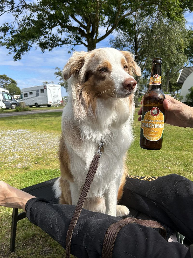
We have eight days of vacation and want to go to the "end of the world" with our RV MaJa and our Australian Shepherd Mister Sam. For us that is "Grenen" near Skagen. That's where the North Sea and the Baltic Sea, the Skagerrak and the Kattegat meet. A little adventure for us. Let's see how it goes.
Wunstorf
We set off on Friday afternoon after work. The goal today is to reach the Am Stucksberg commuter car park and spend the night there.
Bruchdamm, Wunstorf, Region Hannover, Niedersachsen, Deutschland
52° 26' 55.5" N 9° 21' 16.4" E
52.4487569 9.3545469
• Head north. Go for 12 m.
• Continue on Bruchdamm. Go for 13 m.
• Turn right onto Bruchdamm. Go for 167 m.
• Turn right onto Im Sandbrinke (K331). Go for 309 m.
• Continue on K331. Go for 684 m.
• Continue on Steinhuder Straße (K41). Go for 245 m.
• Continue on Altenhäger Straße (K41). Go for 92 m.
• Turn right onto Wunstorfer Straße (B441) toward Stolzenau/Loccum/Stadthagen/Auhagen. Go for 7.3 km.
• Turn right onto Hagenburger Straße (K10) toward Rehburg/Winzlar/Steinhuder Meer-Nordseite. Go for 742 m.
• Continue on Langes Feld (K10). Go for 1.8 km.
• Continue on Winzlarer Straße (K10). Go for 1.3 km.
• Turn right onto Weidendamm (L370) toward Nienburg/Loccum/Steinhuder Meer-Nordseite/Stadtmitte. Go for 668 m.
• Continue on Mühlentorstraße (L360) toward Nienburg/Neustadt/Steinhuder Meer-Nordseite. Go for 575 m.
• Take the 2nd exit from roundabout onto Heidtorstraße (L360). Go for 538 m.
• Continue on Nienburger Straße (L370) toward Nienburg. Go for 10.2 km.
• Turn left onto Zum Horstberg (K62). Go for 969 m.
• Continue on Kirchweg (K62). Go for 4.0 km.
• Continue on Führser Mühlweg toward Langendamm. Go for 3.9 km.
• Turn left onto Kräher Weg (K3). Go for 3.2 km.
• Turn right onto B215. Go for 449 m.
• Take ramp onto B6 toward Hannover. Go for 575 m.
• Arrive at B6. Your destination is on the right.
☍
37,8 km
( 41 min.)
Nienburg/Weser
Our route takes us via Nienburg, Verden an Aller,
Rotenburg Wümme, purely federal highway. We want to avoid the traffic jams on the motorway.
B 6, Nienburg/Weser, Landkreis Nienburg/Weser, Niedersachsen, Deutschland
52° 38' 39.9" N 9° 14' 4.7" E
52.6444100 9.2346272
• Head southeast on B6. Go for 2.7 km.
• Take ramp toward Minden/B215/Nienburg-Süd/N.-Langendamm/Gewerbegebiet Süd. Go for 230 m.
• Take the 3rd exit from roundabout onto Hannoversche Straße toward Langendamm. Go for 190 m.
• Turn slightly left toward Bremen/B6/Langendamm. Go for 432 m.
• Turn right and take ramp onto B6 toward Bremen. Go for 3.7 km.
• Take ramp toward B214/Stadtmitte/Krankenhaus/Gewerbegebiet Kräher Weg/Nienburg-Mitte/Rotenburg/Verden/Walsrode/Celle/Gewerbegebiet Nord. Go for 446 m.
• Turn left onto B215 toward Rotenburg/Verden/Walsrode/Celle/Gewerbegebiet Nord. Go for 797 m.
• Continue on Nordring (B214/B215) toward Rotenburg/Verden/Walsrode/Gewerbegebiet Nord. Go for 312 m.
• Take the 1st exit from roundabout onto Verdener Landstraße (B215) toward Rotenburg/Verden/Walsrode. Go for 2.4 km.
• Take the 2nd exit from roundabout onto Verdener Landstraße (B215) toward Rotenburg/Verden/Walsrode/B209/Gewerbegebiet Drakenburg. Go for 2.7 km.
• Continue on Verdener Landstraße (B215) toward Rotenburg/Verden/Eystrup. Go for 27.5 km.
• Take the 3rd exit from roundabout onto Bremer Straße (B215) toward Bremen/A27/Rotenburg. Go for 2.8 km.
• Pass 2 roundabouts and continue on Mühlenstraße (B215). Go for 21.7 km.
• Turn slightly left onto Burgstraße (B215) toward Hamburg/A1/Bremen/Bahnhof. Go for 949 m.
• Take the 2nd exit from roundabout onto Hansestraße (B215) toward Bremen/Hamburg/Flugplatz. Go for 277 m.
• Take ramp onto Nordumgehung (B71/B75) toward Hamburg/Gewerbegebiet-Ost. Go for 2.8 km.
• Arrive at Nordumgehung (B75).
☍
69,9 km
(1 hrs. 11 min.)
Scheeßel
B 75, Scheeßel, Landkreis Rotenburg (Wümme), Niedersachsen, Deutschland
53° 7' 49.1" N 9° 25' 46.3" E
53.1303118 9.4295258
• Head east on Nordumgehung (B75). Go for 6.0 km.
• Take the 3rd exit from roundabout onto Harburger Straße (B75) toward Hamburg/Tostedt. Go for 1.1 km.
• Take the 2nd exit from roundabout onto Harburger Straße (B75) toward Hamburg/A1/Tostedt. Go for 33.2 km.
• Take ramp toward Buchholz i.d.N. Go for 262 m.
• Take the 1st exit from roundabout onto Dibberser Straße (K13) toward Buchholz i.d.N./Gewerbegebiet Vaenser Heide II/Zentrum/Vaenser Heide II. Go for 98 m.
• Turn left. Go for 27 m.
• Turn left. Go for 32 m.
• Arrive at your destination.
☍
40,7 km
( 37 min.)
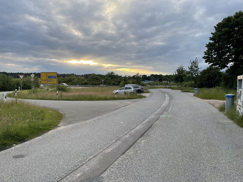
Buchholz in der Nordheide
We stopped at the commuter parking lot, just outside Hamburg. The next day we set off on time to get through the Elbe tunnel before the weekend traffic jam.
Am Stucksberg, Buchholz in der Nordheide, Harburg, Niedersachsen, Deutschland
53° 21' 42.5" N 9° 52' 28.3" E
53.3618105 9.8745161
• Head toward Am Stucksberg. Go for 32 m.
• Turn right toward Dibberser Straße/K13. Go for 27 m.
• Turn right onto Dibberser Straße (K13). Go for 67 m.
• Take the 1st exit from roundabout onto B75 toward Hamburg/Bremen/A1. Go for 1.1 km.
• Continue on B75 toward Bremen/A1/Flensburg/HH-Harburg/Nenndorf. Go for 126 m.
• Take the 2nd exit from roundabout onto B75 toward Bremen/A1/Flensburg/HH-Harburg/Nenndorf. Go for 388 m.
• Take ramp onto A1 toward Bremen/Flensburg. Go for 1.7 km.
• Take exit 43 toward Flensburg/Kiel/Hamburg-West/Tötensen onto A261 (Buchholzer Dreieck). Go for 9.5 km.
• Continue on A7. Go for 11.6 km.
• Keep left onto A7. Go for 159 km.
• Continue on E45 (Sønderjyske Motorvej). Go for 89.5 km.
• Keep left onto E45 (Kolding) toward Århus/Vejle. Go for 90.7 km.
• Take the exit toward Lufthavn/Grenaa/180/Århus N/21/Ebeltoft onto 15 (Djurslandmotorvejen). Go for 3.0 km.
• Keep left onto 15 (Djurslandmotorvejen) toward Lufthavn Grenaa/Ebeltoft/21. Go for 10.4 km.
• Take exit 16 toward Skødstrup/Skæring. Go for 388 m.
• Take the 1st exit from roundabout onto Grenåvej (505) toward Skæring. Go for 318 m.
• Turn left onto Skovlundvej. Go for 1.4 km.
• Turn right onto Åstrup Strandvej. Go for 100 m.
• Turn right onto Åstrup Strandvej. Go for 1.1 km.
• Turn left onto Åstrup Strandvej. Go for 411 m.
• Arrive at Åstrup Strandvej. Your destination is on the right.
☍
380,8 km
(3 hrs. 46 min.)
Aarhus
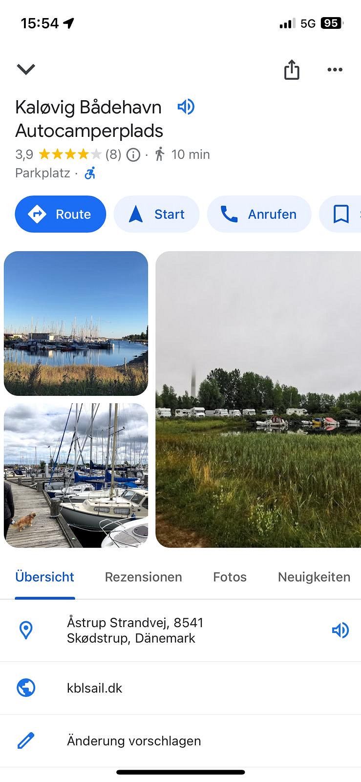
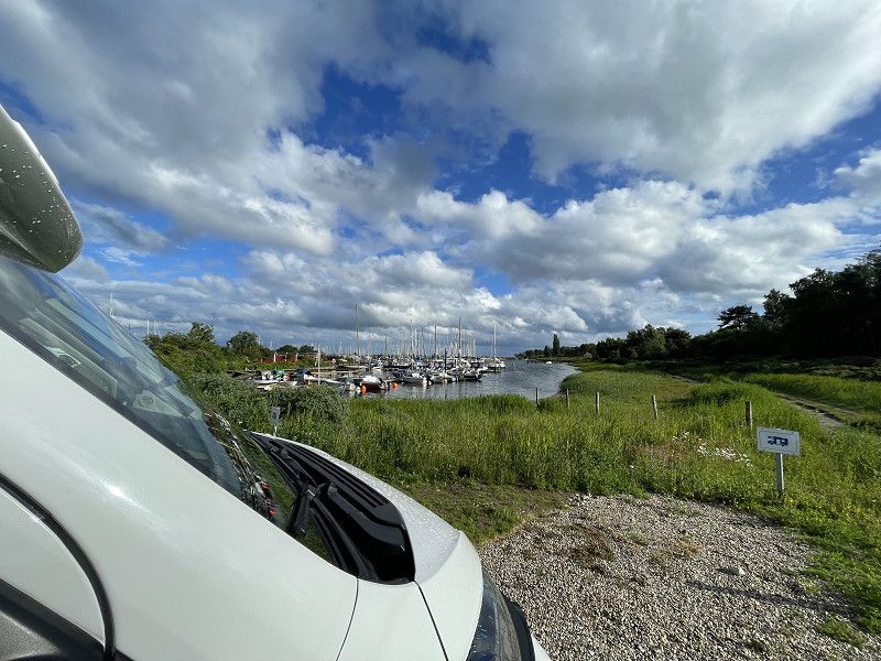
About 15 km from the motorway, we discovered this beautiful parking space. The price is OK and everything is there. What the motorhome owner needs
Kaløvig Bådehavn, Aarhus, Region Mitteljütland, Dänemark
56° 14' 44.4" N 10° 20' 23" E
56.2456620 10.3397231
• Head north on Åstrup Strandvej. Go for 411 m.
• Turn right onto Åstrup Strandvej. Go for 1.1 km.
• Turn left onto Åstrup Strandvej. Go for 100 m.
• Turn left onto Skovlundvej. Go for 1.4 km.
• Turn right onto Grenåvej (505). Go for 309 m.
• Take the 2nd exit from roundabout. Go for 185 m.
• Continue toward Djurslandmotorvejen/15. Go for 30 m.
• Take the 2nd exit from roundabout onto 15 (Djurslandmotorvejen) toward E45/Århus. Go for 12.9 km.
• Take ramp onto E45 (Nordjyske Motorvej) toward Aalborg. Go for 114 km.
• Keep right onto E39 (Vendsyssel) toward Hirtshals/Hjørring/Brønderslev/Høvejen/Thisted. Go for 57.6 km.
• Take the 1st exit from roundabout onto Tverstedvej (597) toward Skagen/Tversted. Go for 10.6 km.
• Take the 2nd exit from roundabout onto Skagensvej (597). Go for 15.3 km.
• Take the 3rd exit from roundabout onto Ålbækvej (40). Go for 6.4 km.
• Take the 2nd exit from roundabout onto Ålbækvej (40). Go for 9.3 km.
• Continue on Frederikshavnsvej (40). Go for 1.7 km.
• Take the 2nd exit from roundabout onto Kattegatvej. Go for 652 m.
• Turn right onto Buttervej. Go for 82 m.
• Turn left onto Skagavej. Go for 2.2 km.
• Turn left onto Fyrvej (40). Go for 202 m.
• Turn right onto Gammel Fyrvej. Go for 41 m.
• Turn left onto Gammel Fyrvej. Go for 432 m.
• Turn left onto Gammel Fyrvej. Go for 89 m.
• Arrive at Gammel Fyrvej. Your destination is on the right.
☍
234,8 km
(2 hrs. 22 min.)
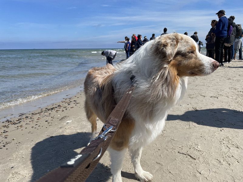
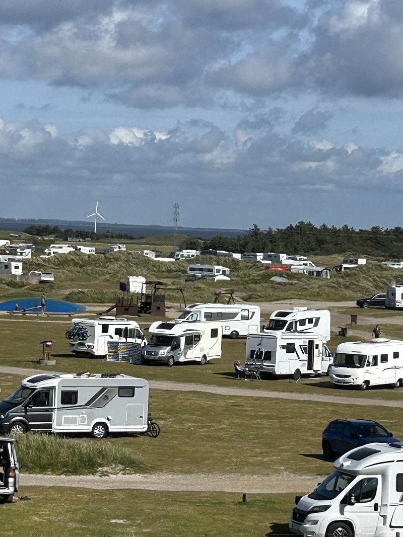
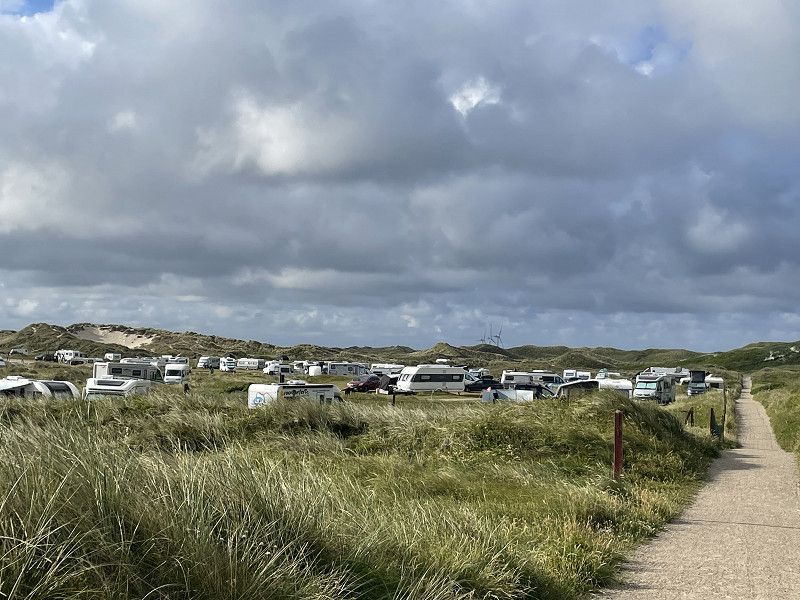
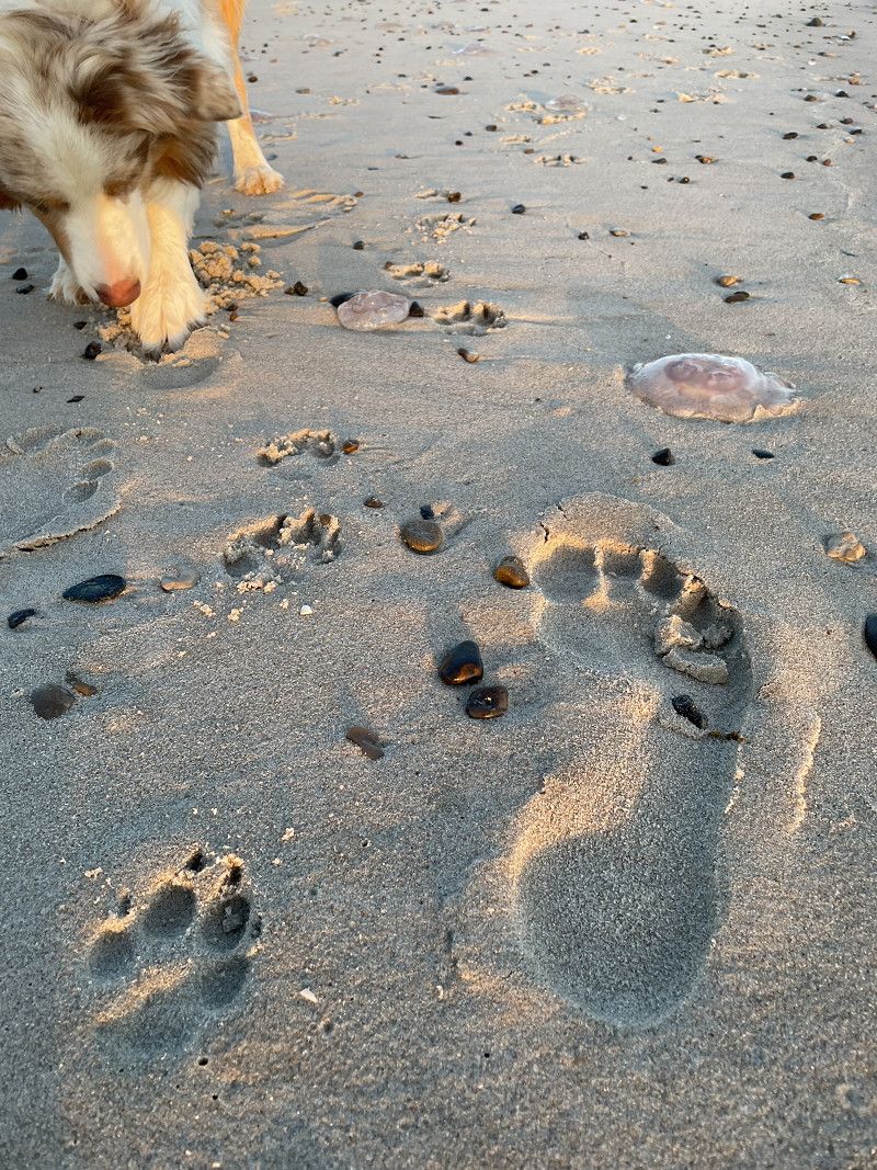
CampOne Grenen Strand
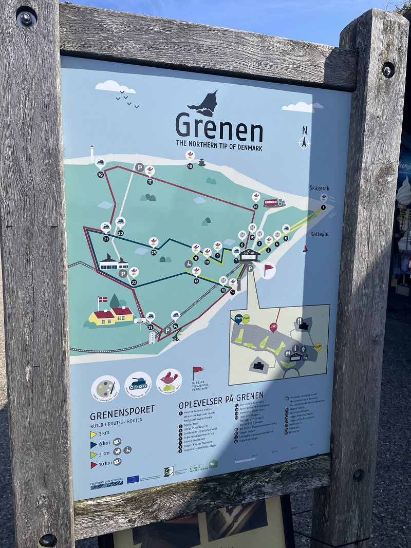
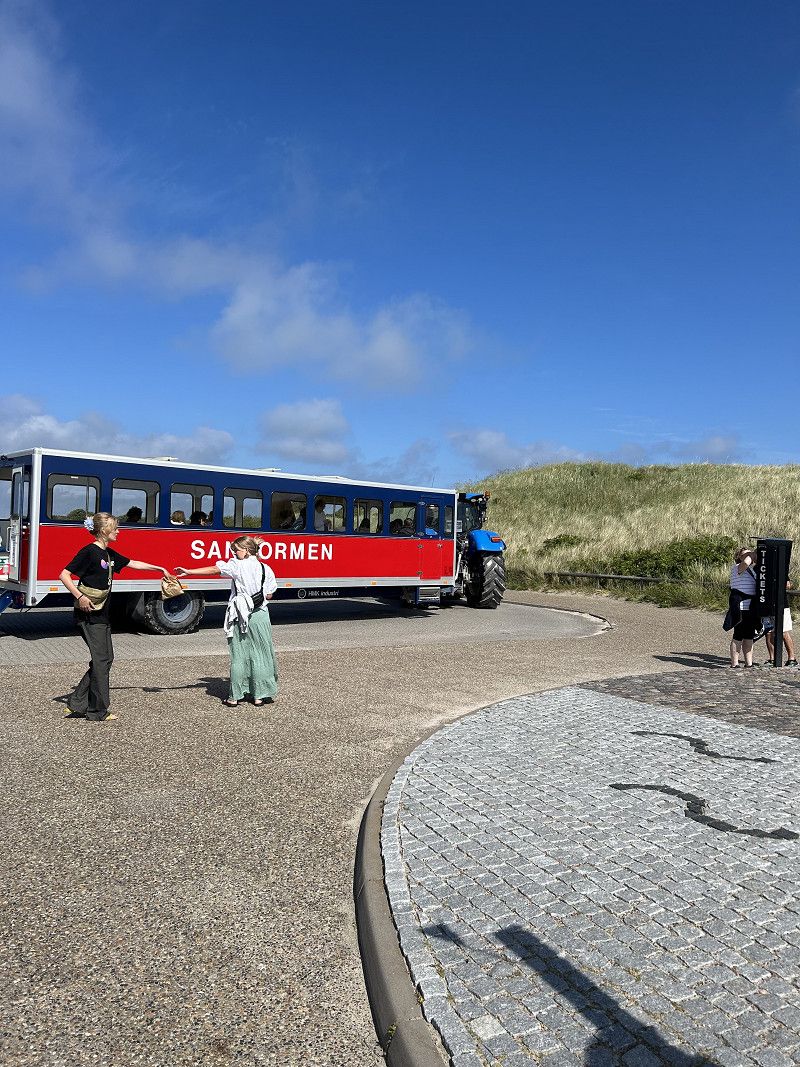
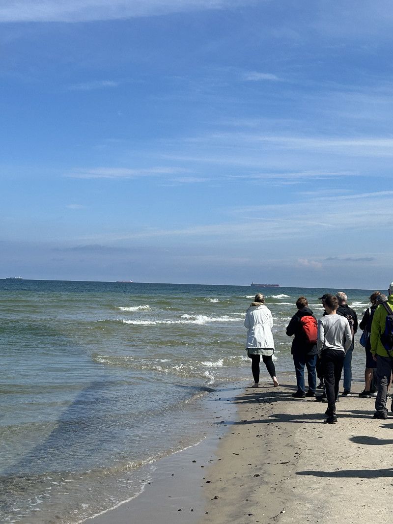
We stayed at the First Camp campsite for three days. From there you can easily walk to Grenen, "the end of the world", where the North Sea and the Baltic Sea meet.
Fyrvej 16, 9990, Skagen, Dänemark
57° 43' 52" N 10° 36' 56" E
57.7311100 10.6155500
• Head south on Gammel Fyrvej. Go for 89 m.
• Turn right onto Gammel Fyrvej. Go for 432 m.
• Turn right onto Gammel Fyrvej. Go for 41 m.
• Turn left onto Fyrvej (40). Go for 201 m.
• Turn right onto Skagavej. Go for 2.2 km.
• Turn right onto Buttervej. Go for 82 m.
• Turn left onto Kattegatvej. Go for 563 m.
• Take the 1st exit from roundabout onto Frederikshavnsvej (40). Go for 10.9 km.
• Take the 1st exit from roundabout onto Kandestedvej. Go for 3.0 km.
• Turn left onto Milevejen. Go for 8 m.
• Continue on Råbjerg Mile Vej. Go for 666 m.
• Arrive at Råbjerg Mile Vej.
☍
18,2 km
( 20 min.)
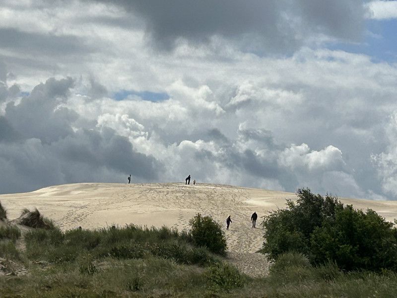
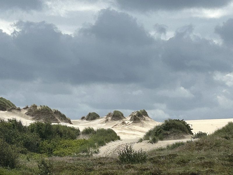
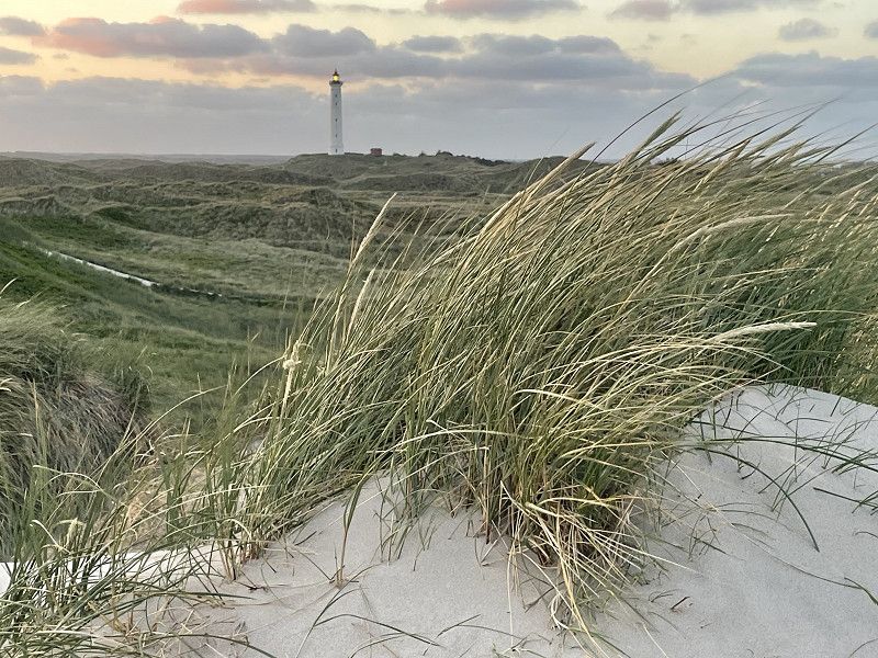
Råbjerg Mile
Now we head back. We stop briefly at the large shifting dune, which is simply impressive.
Råbjerg Mile Vej, Kandestederne, Region Nordjütland, Dänemark
57° 38' 52.1" N 10° 24' 34.6" E
57.6478060 10.4096111
• Head northwest on Råbjerg Mile Vej. Go for 666 m.
• Continue on Milevejen. Go for 8 m.
• Turn right onto Kandestedvej. Go for 3.0 km.
• Take the 1st exit from roundabout onto Ålbækvej (40). Go for 6.3 km.
• Take the 1st exit from roundabout onto Hirtshalsvej (597). Go for 15.3 km.
• Take the 2nd exit from roundabout onto Skagensvej (597). Go for 10.6 km.
• Take the 3rd exit from roundabout onto E39 (Hirtshalsmotorvejen) toward Aalborg. Go for 42.5 km.
• Take exit 8 toward Tylstrup/Blokhus/Hjallerup/Thisted. Go for 487 m.
• Take the 1st exit from roundabout onto Luneborgvej (515/559) toward Thisted/Blokhus/Store Vildmose. Go for 2.4 km.
• Turn left onto Luneborgvej (515/559). Go for 4.1 km.
• Take the 3rd exit from roundabout onto Centralgårdsvej (515). Go for 10.0 km.
• Turn left onto Brogårdsvej (55) toward Aalborg/Nørresundby/Thisted/11. Go for 1.2 km.
• Take the 1st exit from roundabout onto Thisted Landevej (11) toward Thisted/Brovst/Fjerritslev. Go for 2.0 km.
• Turn right onto Tranumvej toward Tranum/Tranumenge/Birkelse. Go for 386 m.
• Take the 2nd exit from roundabout onto Tranumvej. Go for 4.8 km.
• Continue on Tranum Engevej. Go for 2.1 km.
• Take the 2nd exit from roundabout onto Tranum Engevej. Go for 5.0 km.
• Continue on Dybdalsvej. Go for 1.3 km.
• Continue on Drosselvej. Go for 12 m.
• Continue on Dybdalsvej. Go for 898 m.
• Take the 2nd exit from roundabout onto Hjortdalvej. Go for 3.5 km.
• Turn left onto Bonderupvej. Go for 2.0 km.
• Continue on Mellemmøllevej. Go for 792 m.
• Turn right onto Ålborgvej (11). Go for 20.4 km.
• Turn right. Go for 129 m.
• Arrive at your destination on the right.
☍
140,0 km
(1 hrs. 38 min.)
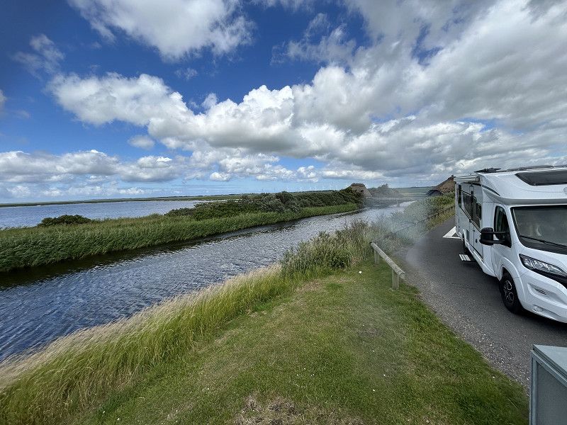
Bygholmvejlevej
The way back will take us along the North Sea coast. We will be driving on the main road the whole way. We have found a nice stopping point/rest area here. In the middle of a nature reserve with a shelter and a lookout point.
Bygholmvejlevej 640, Fjerritslev, Region Nordjütland, Dänemark
57° 1' 59.1" N 9° 6' 5.8" E
57.0330860 9.1016050
• Head toward Bygholmvejlevej. Go for 81 m.
• Turn right onto Bygholmvejlevej (11/29). Go for 8.4 km.
• Pass 2 roundabouts and continue on Oddesundvej (11/26). Go for 26.3 km.
• Take the 1st exit from roundabout onto Oddesundvej (11/26) toward Holstebro/Nykøbing. Go for 50.6 km.
• Arrive at Oddesundvej (11). Your destination is on the right.
☍
85,5 km
(1 hrs. 1 min.)
Oddesundvej, Region Mitteljütland, Dänemark
The drive over this bridge was spectacular. There was a construction site here and it was so narrow that we had to fold in both mirrors.
56° 34' 36.7" N 8° 33' 45.3" E
56.5768639 8.5625755
• Head toward Gammel Færgevej on Oddesundvej (11). Go for 7.3 km.
• Take the 2nd exit from roundabout onto Oddesundvej (11/513) toward Holstebro/Struer. Go for 3.1 km.
• Turn right onto Vester Ringgade toward Struer Vest. Go for 3.2 km.
• Continue on Kløvenhøj. Go for 415 m.
• Continue on Lindevej. Go for 357 m.
• Pass 2 roundabouts and continue on Lindtorpvej (509). Go for 13.5 km.
• Turn right onto Burvej (509). Go for 6.7 km.
• Turn left onto Søndergade (28). Go for 5.6 km.
• Turn right onto Holstebrovej (16/28) toward Ulfborg/Ringkøbing. Go for 10.9 km.
• Take the 2nd exit from roundabout onto Holstebrovej (16/28) toward Ringkøbing/Skjern. Go for 8.2 km.
• Continue on Holstebrovej (16). Go for 2.3 km.
• Take the 1st exit from roundabout onto Vestre Ringvej (15). Go for 2.5 km.
• Take the 1st exit from roundabout onto Søndervig Landevej (15). Go for 3.4 km.
• Take the 2nd exit from roundabout onto Søndervig Landevej (15). Go for 3.6 km.
• Take the 3rd exit from roundabout onto Holmsland Klitvej (181). Go for 9.0 km.
• Turn right onto Holmsland Klitvej. Go for 136 m.
• Arrive at Holmsland Klitvej. Your destination is on the left.
☍
80,2 km
(1 hrs. 3 min.)
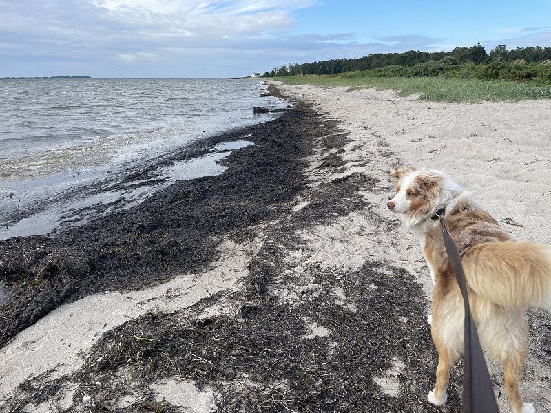
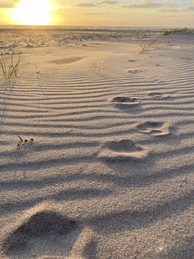
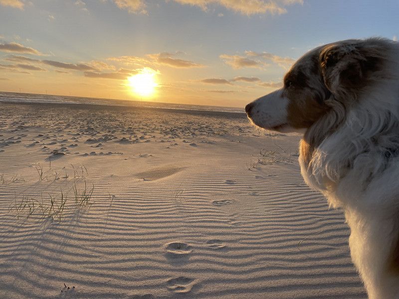
DCU-Camping Lyngvig Strand
There are around 1200 pitches at this campsite. There is always something available here.
Free choice of location. You stand here between the dunes, and to get to the beach you have to
over a large dune. Simply wonderful here, super wide beach, sunsets with Mister Sam are magnificent.
Holmsland Klitvej 81, 6960, Hvide Sande, Dänemark
56° 2' 30.4" N 8° 6' 55.9" E
56.0417800 8.1155400
• Head east on Holmsland Klitvej. Go for 136 m.
• Turn right onto Holmsland Klitvej (181). Go for 2.3 km.
• Pass 6 roundabouts and continue on Vestre Landevej (181/431). Go for 53.4 km.
• Turn right onto Nordre Boulevard (431). Go for 2.5 km.
• Take the 2nd exit from roundabout onto Søndermarksvej (475). Go for 2.4 km.
• Turn right onto Ribevej. Go for 920 m.
• Continue on Ribevej (11) toward E20/Ribe. Go for 10.3 km.
• Take the 3rd exit from roundabout onto E20 (Esbjergmotorvejen) toward Kolding. Go for 54.8 km.
• Take the exit toward Flensborg onto E45 (Sønderjyske Motorvej). Go for 82.9 km.
• Continue on A7. Go for 90.4 km.
• Take exit 13 toward Neumünster-Nord/GVZ/Neumünster/Holstenhallen/Gewerbegebiet Eichhof onto L328. Go for 4.5 km.
• Turn right onto Sauerbruchstraße (B430). Go for 1.5 km.
• Turn right. Go for 62 m.
• Arrive at your destination on the left.
☍
306,1 km
(3 hrs. 4 min.)
Neumünster
We made a stopover in Neumünster for an overnight stay, totally okay
Hansaring 177, Neumünster, Schleswig-Holstein, Deutschland
54° 4' 52" N 9° 57' 35.4" E
54.0811226 9.9598425
• Head north. Go for 22 m.
• Turn right. Go for 49 m.
• Turn left toward Hansaring/B430. Go for 15 m.
• Turn right onto Hansaring (B430). Go for 946 m.
• Continue on Hansaring (L323) toward Plön/Lübeck/Krankenhaus FEK. Go for 2.2 km.
• Turn right onto Boostedter Straße (K18) toward Großenaspe/Boostedt/Industriegebiet Gardeland-Süd. Go for 3.2 km.
• Take ramp onto B205 toward Lübeck/Bad Segeberg. Go for 19.1 km.
• Take ramp onto A21. Go for 32.5 km.
• Continue on B404. Go for 26.4 km.
• Turn right onto Zubringer Nord toward Schwarzenbek/Zentrum. Go for 1.6 km.
• Continue on Kerntangente (K17) toward Lüneburg/B209/Lauenburg. Go for 955 m.
• Turn left onto Lauenburger Straße (B209) toward Lüneburg/Lauenburg. Go for 9.5 km.
• Turn left onto Basedower Weg (K70) toward Basedow. Go for 568 m.
• Continue on K70. Go for 2.1 km.
• Turn right onto Landstraße (L200). Go for 4.6 km.
• Turn left onto Dorfstraße (K41). Go for 1.9 km.
• Continue on Buchhorster Weg (K41). Go for 419 m.
• Turn left onto Berliner Straße (B5/B209). Go for 230 m.
• Turn right onto Hafenstraße (B209) toward Lüneburg. Go for 2.0 km.
• Arrive at Bundesstraße (B209).
☍
108,2 km
(1 hrs. 22 min.)
Hohnstorf (Elbe)
On the long way back we definitely didn't want to drive through Hamburg. So we chose the route via Lauenburg on the Elbe and spent another night at the Waldbad in Amelinghausen.
Dorfstraße, Hohnstorf (Elbe), Lüneburg, Niedersachsen, Deutschland
53° 22' 3.4" N 10° 33' 48.8" E
53.3676235 10.5635485
• Head toward Basedowsweg on Bundesstraße (B209). Go for 17.9 km.
• Take ramp onto B4 toward Braunschweig/Uelzen/Soltau/Dannenberg. Go for 10.3 km.
• Keep left onto B209 toward Soltau. Go for 16.3 km.
• Turn left onto Schulweg. Go for 343 m.
• Continue on Am Bahndamm. Go for 198 m.
• Turn right onto Am Bahndamm. Go for 166 m.
• Turn left onto Zum Lopautal. Go for 519 m.
• Turn left. Go for 32 m.
• Turn right. Go for 23 m.
• Arrive at your destination on the left.
☍
45,9 km
( 40 min.)
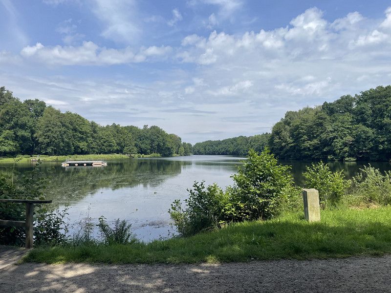
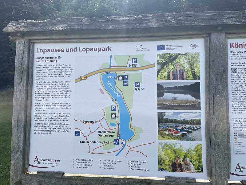
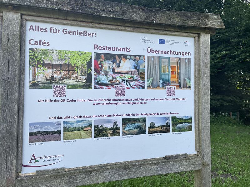
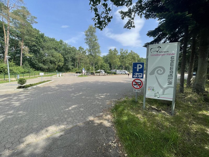
Stellplatz am Waldbad
Taking a break at the forest pool in Amelinghausen is always worth a trip. A visit to the world pool is always a must.
Zum Lopautal, 21385, Amelinghausen, Deutschland
53° 7' 27" N 10° 13' 50" E
53.1241667 10.2305556
• Head west. Go for 23 m.
• Turn left toward Zum Lopautal. Go for 32 m.
• Turn right onto Zum Lopautal. Go for 1.1 km.
• Turn left onto Lüneburger Straße (B209). Go for 18.2 km.
• Take the 2nd exit from roundabout onto B209 toward A7/Soltau. Go for 4.1 km.
• Turn right onto B71/B209 toward A7/Soltau. Go for 3.1 km.
• Take ramp onto A7 toward Hannover. Go for 60.7 km.
• Keep right onto A352 (Dreieck Hannover-Nord) toward Dortmund/Flughafen/Hannover-Nord. Go for 18.1 km.
• Continue on A2. Go for 10.0 km.
• Take exit 40 toward Wunstorf-Luthe/Steinhude/Seelze. Go for 384 m.
• Turn right onto B441 toward Wunstorf/Luthe/Steinhude. Go for 7.0 km.
• Turn left onto Hagenburger Straße (B441/B442) toward Stolzenau/Steinhude/Bad Nenndorf. Go for 771 m.
• Continue on Hagenburger Straße (B441) toward Stolzenau/Steinhude. Go for 5.0 km.
• Turn right onto Altenhäger Straße (K41) toward Steinhude. Go for 104 m.
• Continue on Steinhuder Straße (K41). Go for 245 m.
• Continue on K331. Go for 684 m.
• Continue on Im Sandbrinke (K331). Go for 309 m.
• Turn left onto Bruchdamm. Go for 152 m.
• Turn right. Go for 106 m.
• Turn left. Go for 10 m.
• Arrive at your destination on the right.
☍
130,0 km
(1 hrs. 26 min.)
Wunstorf
In total we have now driven 1738 km and were on the road for eight days with Maja and Mister Sam.
Bruchdamm, Wunstorf, Region Hannover, Niedersachsen, Deutschland
52° 26' 57.8" N 9° 21' 21.8" E
52.4493945 9.3560688