Unfortunately, we don't support your browser (Internet Explorer) anymore, some functionalities could not work. Click here to get information on how to upgrade your browser.
Summer holidays Germany

Travelogue


Today we went to Aachen by bike. Some vague cycle paths here and there, but it was doable. When we arrived at the Elisebrunnen, we first had a cup of coffee. It remains strange to see people walking with face masks--- under their chin!
We did a city walk. Via the Cathedral, the town hall and back to the Elisebrinnen. Got a good idea of the city. History dating back to Emperor Charles and the Carolingian Empire.
Had lunch on a terrace. We had to fill out a form with our contact details. Ate delicious spaghetti, but way too much.
All in all a fun, educational day.
Once upstairs, first have a cup of coffee. After taking the usual photos, we cycled through the beautiful Limburg countryside. The Netherlands is so beautiful.
In Vijlen we ate a delicious apple strudel and Harry had a delicious wheat beer.
In the evening it started to rain lightly. And so we fell asleep peacefully.
The route planner is set to “avoid highways”. Well, then it may happen that you end up on a road where you are allowed to drive up to 2.5 tons: too heavy!
Fortunately we were able to return easily.
Beautiful ride through the Eifel. We even came across 2 deer along the way!
Made a long stop in Blankenheim. Parked in parking lot P 3. Great stop.
Since it was Monday, the shops were closed. Not that busy, but no terrace open either.
We drove on to Altenahr.
Found a spot at the campsite and walked to Altenahr. Was only a few minutes.
Went for a walk there and did a wine tasting on a terrace. Well, I know who will sleep well tonight!
We are at the campsite exactly opposite the entrance and yes: a blow! Drive a camper into the barrier.


The beautiful town on the Ahr has approximately 1,871 inhabitants and is located in the German state of Rhineland-Palatinate, in the north of the Eifel.
It belongs to the Verbandsgemeinde Altenahr and consists of the four village centers of the municipality; Reimerzhoven, Altenburg, Kreuzberg and Altenahr itself of course.
The town is best known for its wine growing. It is a popular tourist place with cozy alleys and beautiful half-timbered houses. You can also find wine bars and tastings there. Well worth a visit!
View of Altenahr. Photo © Peter van Stenis. Instagram: @pjvs66The history of Altenahr in short.
The history of the place is inextricably linked to the construction of Burg Are around 1100, when Altenahr was founded. It is true that the area around it was already inhabited in Frankish times. Are Castle was first inhabited by Count Theoderic I of Are.
In 1246 the castle came into the possession of the Archbishop of Cologne through a donation. He did not decide this donation by Count Frederik of Are-Hochstaden alone, but with the consent of his family. From then on, the Patriarch of Cologne governed this area from the castle. Burg Are also served as a prison at that time.
After the castle was conquered by the French in 1690, the village of Altenahr was deliberately destroyed by fire. Burg Are itself was destroyed in 1714 and became a nest of robbers for the Cologne troops.
The castle ruins in the middle of beautiful nature. Photo © Rheinland-Pfalz Tourismus GmbH.
Even though much of the castle has been destroyed, it is certainly worth a visit. Corner towers and gate towers have been preserved. And part of the walls are still there. There are even remains of the chapel's cross vaults visible.
The ruin is located 113 meters above the Ahr and from here you have a beautiful view over the Ahr valley.
TIP. If you want to know more about Burg Are, read our article: Burg Are. A beautiful castle ruin near Altenahr.
The changes in power in the area were detrimental to the development of the roads that were important for wine growing.
The wine was still transported in small carts over the heights of the Ahr valley. Road construction only started after 1800. In 1834 the road through the Ahr valley between Ahrweiler and Altenahr was completed.
The first wine festival was held in the 1930s. And since 1970, Altenahr has had its own wine queen every year with her princesses who welcome guests to the wine festivals.
Altenahr is now increasingly becoming a tourist attraction that mainly lives from tourism and wine growing.
Viticulture is inextricably linked to Altenahr and the surrounding area. Photo © Rheinland-Pfalz Tourismus GmbH. Sights and things to do in Altenahr.
Altenahr is very beautiful just to walk around because it still has parts that date back to the Middle Ages. There are still old fortress walls and gate turrets.
Walking through narrow streets with picturesque half-timbered houses, you will feel like you are in another time.
The town is officially recognized as a tourist resort by the German government and is completely aimed at tourists. There is much to do and see. Of course, the wine shops and tastings are certainly not lacking here.
Wine festivals are part of this region.
Every year, from the last Sunday in September and all Sundays in October, the so-called “Weinsonntage” is held.
But all year round there is a lot to do in the Ahrdahl when it comes to wine. At Pentecost, for example, the season starts with a wine festival in the Ahr Valley. Followed by a Burgundian festival, a national wine festival and a historic wine festival.
Many of these wine festivals end with beautiful fireworks.
View beautiful chapels and churches.
You can also view a beautiful church and chapels in Altenahr.
The Annunciation Church of Mary.
The Maria Boodschapkerk is the parish church of Altenahr. This monumental church has a Romanesque architectural style.
The parish church was first mentioned in 1166 and was founded by the counts of Are. In 1326 a room was added in the church where the main altar is located.
The vault of the nave dates from the fifteenth century.
This beautiful church is located at Pützgasse 2, 53505 Altenahr.
St Apollonia Chapel.
Then there is the St Appolonia Chapel in Altenahr. The current chapel next to the rectory was built in 1898 with the statue of Our Lady. The chapel was renovated in 1964.
This beautiful chapel is located on the Markt, 53505 in Altenahr.
The Nikolaus Chapel.
The Nikolauskapelle is a small chapel with a three-sided finish, corner pilaster.
This is located at Rossberg Ecke, Tunnelstraße, 53505 in Altenahr.
Beautiful churches to visit. Photo © Viktoria Stodolska. Instagram: @xxvickytravels96xxMore to do in and around Altenahr.
But there is more to do in the Altenahr area!
Below are some tips. (click on the links, if available, for more information)
• Burg Are. A beautiful castle ruin near Altenahr.
• Wine cellar with tasting: Winzergenossenschaft Mayschoß-Altenahr, address: Ahr-Rotweinstrasse 42, 53508 in Mayschoss.
• Bad Neuenahr – Ahrweiler in the Ahr valley. A beautiful place in the middle of the German vineyards.
• Dokumentationsstätte Regierungsbunker. The most secret bunker in the history of Germany.
• Roman villa museum in Bad Neuenahr – Ahrweiler.
• The Teufelsloch, which is also called the devil's hole. From an opening in a rock near Altenahr you have a beautiful view of the Ahr valley. Pay close attention because the signage is not always clearly indicated.
Source: eifelinfo.nl
So we will not visit a lot of places on the half-timbered house route.
But Homberg. A nice town with a beautiful center. A castle above the center. Cannot be visited, as most sights are closed during this corona time.
We parked on the camperplat sister rathaus: great place.
We walked the rathaus route. This passes the most beautiful half-timbered houses. Some are more than 500 years old.
Then we drove on to the Edersee. We drove to the parking lot via the hour barrier and walked the last part to the Edertallsperre. In my youth I once saw a film that told the story of the bombing. On the night of May 16 to 17, 1943, as part of Operation Chastise, the dam was destroyed by a bomb attack by the British. This caused enormous destruction. The twelve-metre high tidal wave caused between 1,300 and 1,600 victims in the Möhne Valley. More than half (at least 1,026) of them were Allied prisoners of war and forced laborers. In the Ruhr valley between Neheim and Niederense, for example, a camp with Ukrainian forced laborers was wiped out and at least 526 victims were killed. The destruction of the Ederdam resulted in 47 to 68 victims.
The center was also closed, but the dam is a beautiful structure despite its troubled past.
After this cultural part, of course take a seat on a terrace. Coffee and Harry coughs.
We drove on to the campsite: Camping in Naumburg. We received a friendly welcome from dogs, parrots and the owner. We were allowed to choose a spot ourselves as long as we left Rapunsel alone. Well, I don't have any good memories of that anyway, so that wasn't a problem.
We are in a good position here: tomorrow morning it will still be dry and then it may rain again. Time to continue!

We drove for a long time today to avoid the rain. We arrive in Magdeburg with beautiful weather. The sun shines exuberantly.
For the first time we are at a camper place. And it is completely self-sufficient. We have a great location on the Elbe. In addition to the camper spot, there is a place for Magdeburg youth to get together, drink and chat.We grabbed the bikes and rode to the Cathedral. The Cathedral was severely damaged by bombing during the war, but was subsequently rebuilt. They have now been renovating for 30 years. It is a somewhat bare building with little decoration. A few altars and a beautiful bacon chair: that's it. Naturally in keeping with evangelical Lutheran thoughts.
It was quite warm and there was a terrace opposite the Cathedral: with a delicious beer.
Well, that's nice! After walking some more we decide to go back to the camper. We cycle past a restaurant with fresh asparagus....well we can't let it get cold.
Once back at the camper we made ourselves comfortable.
We drove to Schwerin on quiet roads. We know it will rain in the coming days and we cannot avoid it. So: tomorrow we will also stay in Schwerin and laze around for a day.
We drove to Schwerin on quiet roads. We know it will rain in the coming days and we cannot avoid it. So: tomorrow we will also stay in Schwerin and laze around for a day.
We walk quietly further and are intrigued by a sign along the side with; Kriegesgedankstatte.
The forest cemetery is located in the middle of the Flessenow forest, about two kilometers from Flessenow. Here rest 235 victims of the Second World War and its aftermath: refugees, displaced persons, soldiers. They died in the period from October 1945 to April 1947 in the Neu-Flessenow quarantine camp. In the fenced area, the names of the buried victims are listed in three rows of graves on large stone tablets, as well as some individual gravestones. What is striking is the age of the deceased: born 1852, 1872, etc. Mostly old people and some small children.
The quarantine camp consisted of 35 log cabins with space for up to 1,100 people, passing through thousands of German refugees from the Giant Mountains, Masuria, Danzig Bay, Königsberg or Litzmannstadt and the Sudentenland. There was only a water supply after February 1946. Lice and vermin spread quickly and therefore in February 1946 the basement of the Flessenow country house became a ventilation station. Due to typhoid fever and pneumonia, about 20-40 people were found dead in the barracks every night. They were buried in mass graves in paper bags or linen cloths. Due to the circumstances, the country house also served as an infirmary from the spring of 1946, it was also called the "white house".


We visit the historical technical museum Kraftwerk. From 1936 to 1945, the research stations in Peenemünde formed the largest armament center in Europe. On an area of 25 km², up to 12,000 people worked simultaneously on guided weapons, most famously the world's first cruise missiles and the first ever working large-scale missiles. Both were designed as a weapon of terror against the civilian population, made mainly by forced laborers and from 1944 they were used in World War II as "Vergeltungswaffen" (V-weapons).
The Historical Technical Museum Peenemünde reconstructs the history of the creation and use of these weapons. The exhibitions document who worked in Peenemünde, how the people lived and why the enormously extensive weapons projects were carried out. We walk across the site and see a V1 and V2. Impressive what they did in this area in the 1940s, regardless of the horrors it caused.
We wake up with sunshine. Simply delicious. After breakfast and using the toilet we drive to Rugen. A ride of just under 2 hours. We enter the island over the bridge at Stralsund. Ruge is the largest island in Germany. Located in the Baltic Sea and has numerous beaches and nature reserves. There are also nice seaside resorts such as Binz and Sellin. But the majestic chalk cliffs that rise in the north of the island, the varied cultural offer and the excellent health and wellness facilities also attract more than a million visitors every year.
On the way to the campsite in Lietzow, we will make a stop in Sellin. After doing some shopping, we grab our bikes and head towards the pier. The cycle route goes through a small shopping center. But just get off and walk. To the left and right of the road are the typical Sellin bath villas. Most of them are now hotels, but you can still read about the old grandeur.
When we arrive at the pier we are amazed. How beautiful it is. Just as we arrive, the sun shines exuberantly on the white roofs of the buildings on the pier and the beach. We go down and walk to the end of the pier. There is a kind of diving bell with which you sink into the Baltic Sea. Harry doesn't mind and goes downstairs. I wait in the lovely sunshine and have to be careful not to burn.
We drive to the campsite via a different route than we came and already see some of Prora. We will take a closer look at this in the coming days.
We are assigned a spot at the campsite. We're in a good position again.
We first cycle to Prora. A brief history: on July 30, 1935, Max von Veltheim, Duke of Putbus, transferred a seven-kilometer-long coastal strip with 22 hectares of land from his area to the German Labor Front (DAF), which wanted to build a bathing hotel here, KdF-Seebad Rügen or Kraft durch Freude - Seebad Rügen. From 1936 onwards, during the Nazi era, a gigantic bath hotel was built in Prora for the Kraft durch Freude project. The order for the construction was given in 1935 by Adolf Hitler himself. Twenty thousand holidaymakers from the working class were supposed to be able to relax in the Kraft durch Freude bath hotel. Hitler assumed that workers who could relax well also developed strong nerves. He believed that only a people who control their nerves are capable of great achievements. The military leaders at the time were also pragmatic with the idea of having the complex also serve as a hospital during a possible war. In total, five such gigantic bath hotels were planned. In addition to Prora in Rügen, which was actually built, similar projects were planned in the Arcadian Kolberg, in East Prussia and on the Timmendorfer Strand. Construction work started on May 2, 1936. A design competition was held, but it had already been determined that the complex would be designed by Clemens Klotz, the favorite architect of DAF leader Robert Ley. The DAF was the only permitted trade union during the Nazi regime. Klotz had already earned his stripes with the construction of Burg Vogelsang in the Eifel, a training center for the ideal Aryan. Klotz's design was awarded the Grand Prix for Architecture at the 1937 World Exhibition in Paris.
Klotz designed the entire complex except for the banquet hall. Everything about the design was colossal, megalomaniac and outsized. He drew two wings (northern and southern wings), each with four large building blocks, each 550 meters long, for a total of 4.5 km long. The entire project formed one line that follows the gentle curve of the bay. The complex had a total of ten thousand double rooms, all facing east with a sea view. There would also be two wave pools, a theater, a cinema and a banquet hall designed by Erich zu Putlitz with 25,000 seats. Cruise ships and even submarines could moor at a quay. The rooms are otherwise quite modest in terms of dimensions and type of furniture. The individual rooms measured 5 by 2.5 meters, and only had a bed, a sitting area, and a sink and all offered a sea view. All rooms had central heating and resembled cabins. The communal toilets and bathrooms were located in side wings, situated perpendicular to the main direction of the complex. The stairwells, elevators and staff rooms were also located in these side wings.
Almost all major German construction companies were involved in the construction. The complex would be put into use in the summer of 1940. When the Second World War broke out in September 1939, construction was halted. Eight hotel blocks, the theater and the quay were finished in shell at that time. The banquet hall and wave pools were never built. Prora has also never been used for the purpose for which it was designed. It is therefore one of the Great Useless Works. During the war, part of the complex was made provisionally habitable for the temporary housing of civilians who had fled the bombing of Hamburg. At the end of the war, a training institute for Flak helpers was established there.
Underlying architectural concept
The designer Clemens Klotz was familiar with the new trend of modernism in the architecture of the 1930s. He was familiar with the idea of the linear city and, in terms of implementation, repetitive concrete construction on a large scale. The Prora plan is about a linear city in one large building volume. The whole was not built in the pseudo-classical style of Hitler's personal architect Albert Speer, but is more rational in design and related to the social housing of that time. This had fairly minimalist plans for houses for the Existenzminimum , the canon of which was elaborated in 1936 in Neuferts Bauentwurfslehre. Klotz's source of inspiration is Le Corbusier's Plan Obus. More specifically, the 1930 design depicting a kilometre-long seaside town for Algiers with a so-called Rue intérieure or a hundreds of meters long continuous street, which is also found in the Prora complex. Le Corbusier would later apply this idea further in his Unité d'Habitation in Marseille. The Prora plan also resembles the Russian mining city of Magnitogorsk by Ivan Leonidov.
Situation after the Second World War
In May 1945, the complex was taken over by the Red Army, which interned landowners there. Exiles from the German Eastern areas were also housed there. An attempt was made to demolish the whole thing, but it was so well built that it was decided against. Until 1947, parts of the complex were dismantled and transferred to the Soviet Union. In 1948, Russian soldiers were housed there, and then the National People's Armee (NVA), which housed a sanatorium and a training institute for non-commissioned officers. Soldiers from liberation armies from the Third World were also trained there. After the Cold War, Prora was transferred to the Bundeswehr. The army left the complex at the end of 1992.
We cycled on to the Baumwipfelpadt. It is an experience park. You walk up via a specially built scaffolding. With a total length of 1250 meters and a height of up to 40 meters, the treetop path meanders through the natural beech forest - past numerous learning and experience stations. In good weather you can see for miles from the high viewpoint and take beautiful photos of the surroundings. It was beautiful and doable.
After this walk we cycled to Binz. Harry a pizza and I a tea. Enjoy the walk along the boulevard. What a nice place, typical seaside resort.
We decide to go back to the campsite. We follow the route that Aunt Google gives us. Well that got exciting. After some time we have to turn off and we end up between the cornfields. It became increasingly difficult to cycle, but we persevered. We finally arrive in Lietzow via a walking path. Pfff, exciting.
We first visited the Ernst Moritz Arnt tower. Ernst was a famous 19th century German poet. In preparation for the 100th anniversary of Ernst's birth, a "Committee for the Construction of an Arndt Monument" was founded in 1869 under the leadership of the district administrator of Rügen. The foundation stone was laid on December 26, 1869, the anniversary day. The design of the royal government leader Hermann Eggert of Berlin was selected, who supervised the construction from start to finish. In the summer of 1872, the tower's 43-foot rock foundation was constructed and the earth was excavated the following winter. The first floor was built in 1873. After that, resources ran out for a while. However, donations were once again appealed to by Kaiser Wilhelm I who supplied 3,000 marks. It was not until 1875 that the second floor and interior staircase could be built. The third floor and dome followed in 1876, so that the topping-out ceremony could be celebrated on October 6 of the year. The 26.7 m high monument was completed in 1877.
The tower served as a lookout tower for locals and guests. In 1944, the once brick dome was removed and an anti-aircraft gun was installed. From 1945 to 1953 the tower was used by the Red Army. The platform was demolished in 1955 and replaced by a new wooden dome.
I had a nice Weisser and Harry went upstairs.
Then a visit to the Maria Church. Beautiful church.
Then the great search began: where is a backerei! Well, I didn't find anything, so I got sandwiches at the campsite.
Every self-respecting town on Rugen has at least 1 street with cobblestones. You stumble a bit.
Back at the campsite a delicious apple pie. Let's do some tidying up, because tomorrow we're leaving for another place.
A beautiful part of Rugen: wheat fields, poppies, cornflowers and the weather was beautiful.
We drove to the island of Ummanz. We crossed by ferry. That was a great price: €7, which wasn't too bad. We arrived just in time, and we sailed away straight away.
Stopped along the way in Gingst. On the square near the church. And a beautiful church it is. There was another local who felt it necessary to wedge our camper, but after our tour around the church this man was nowhere to be seen.
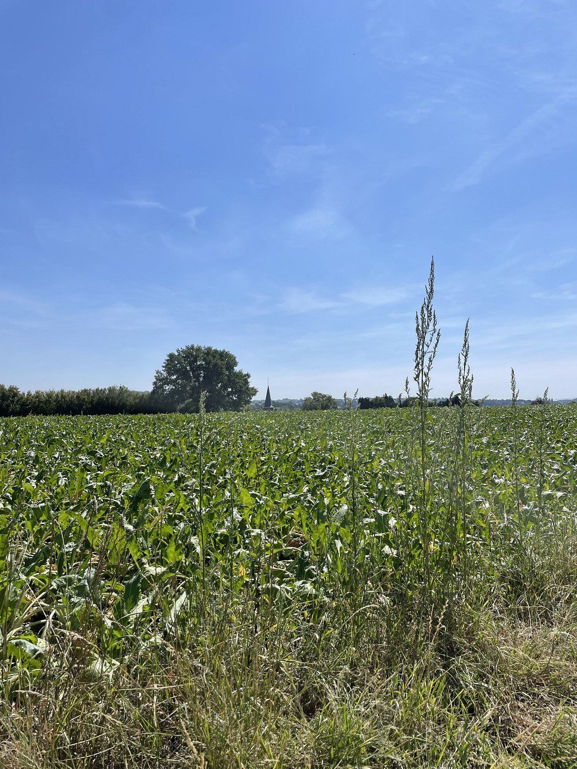
After a short lunch we continued. Harry misses a turn and Mrs. Google knows an alternative. straight through the cornfields via a very quiet road (fortunately quiet)
We drive over the bridge into 'Ummanz and arrive at the campsite. Our spot is reserved. At the reception we receive a full explanation. Well, it seemed like a crash course "what do I do and how at the campsite"
But we are in a beautiful spot and are looking forward to tomorrow.


A beautiful part of Rugen: wheat fields, poppies, cornflowers and the weather was beautiful.
We drove to the island of Ummanz. We crossed by ferry. That was a great price: €7, which wasn't too bad. We arrived just in time, and we sailed away straight away.
Stopped along the way in Gingst. On the square near the church. And a beautiful church it is. There was another local who felt it necessary to wedge our camper, but after our tour around the church this man was nowhere to be seen.
After a short lunch we continued. Harry misses a turn and Mrs. Google knows an alternative. straight through the cornfields via a very quiet road (fortunately quiet)
We drive over the bridge into 'Ummanz and arrive at the campsite. Our spot is reserved. At the reception we receive a full explanation. Well, it seemed like a crash course "what do I do and how at the campsite"
But we are in a beautiful spot and are looking forward to tomorrow.
After returning we enjoyed the sun. Tomorrow a day at the beach!

After returning we enjoyed the sun. Tomorrow a day at the beach!
Today we drive to Busum. There we will meet father and Thomas. They are in Northern Germany this week with the camper.
We discussed at Nordsee campsite. After arrival we decide to stay until Thursday and then drive to Munster.
The weather is not getting any better and it is going to rain again. But wherever we look; everywhere it gets bad. We just make the best of it.
This morning we will visit Wohnmobil arena to have the fold-down bed made. The new part is there, but no matter how hard they try, the bed doesn't lower as it should. We will have that made in the Netherlands.
The weather is nice and we get on our bikes. The center of Busum is nice. There is a beautiful historic harbour. It is really touristy, but that doesn't spoil the fun. After a great ice cream we go back and have a nice dinner. The day can't go wrong anymore.
We stay at the campsite. The rain is pouring down. The wind is blowing hard, it looks like autumn. We easily get through the day by reading, doing puzzles and chatting.
We stay at the campsite. The rain is pouring down. The wind is blowing hard, it looks like autumn. We easily get through the day by reading, doing puzzles and chatting.
We are going for a nice tour in Schleeswijk Holstein. We start with Eidersperwerk.
The Eidersperrwerk is a storm surge barrier and is located where the Eider flows into the Wadden Sea.
The aim of the barrier is to protect the hinterland against storm surges. After Tönning was hit by the storm surge of 1962, they wanted to take measures to better protect the area against high water. The first option was to raise the dikes along the banks of the Eider, the second option was a flood defense at the mouth of the river. The latter was chosen and construction started in 1967. The main difficulty was to control the water movement in the estuary. The coastline in the estuary was shortened from 60 to 4.8 km. The cost of the project was approximately DM 170 million (EUR 87 million). The Eidersperrwerk was officially opened on March 20, 1973. It is the largest flood defense along the German coast.
Eidersperrwerk with river Eider and country road 305, lock and control tower
The changed coastline and the enormous current through the opening washed away an enormous amount of sand. Gullies of up to 28 meters deep formed on both sides of the barrier. In 1993 these were filled in with 45,000 sandbags.
There is a lock for shipping next to the flood defense and a motorway runs over the barrier.
We walked back and forth and visited the building's residents. Father has been there several times and was an ideal guide. Harry thought he was being a bit clever, but a tern clearly stopped him.
We had a bit of a breath of fresh air, even though the weather is a lot better than yesterday, so we first have a coffee and a cough. Well, that was lunch.
We drive on to Tonning and after some searching we park the camper. We walk to multimat Wattforum, the largest visitor center of the Schleswig-Holstein Wadden Sea National Park. In the interactive experience exhibition you will learn impressive and exciting stories from the habitats between salt marshes, mudflats and the North Sea - lively, understandable and entertaining. Well that wasn't saying too much. Beautiful aquariums and nice arrangement and explanations.
Was worth it.
We skip lunch and drive to Friedrichstadt, a Dutch town in Germany. Friedrichstadt originated in the seventeenth century. The place was founded in 1621 by Duke Frederick III of Schleswig-Holstein-Gottorp. His idea was that the place could play a role in the trade between Spain and its colonies on the one hand and Russia. His idea was that such a project would have the best chance if it offered opportunities to Dutch people who were second-class citizens in their own country, but who were familiar with the international trade of that time. He had a particular eye on the Remonstrants, such as Willem van Dam and his brother, whom he tried to lure to his project with a promise for religious freedom and Dutch as the administrative language. In the same period, the Danish king, Christian IV, an uncle of Frederick, started a similar project in Glückstadt. We took a walk and had a beer on the square. Of course, dry sausage was bought. It was so nice to see my father visibly enjoying himself.
We break up and drive via the Elbe tunnel to Munster. We have a good ride and arrive at 4 run. We don't feel like going to Munster and decide to laze around.
We break up and drive via the Elbe tunnel to Munster. We have a good ride and arrive at 4 run. We don't feel like going to Munster and decide to laze around.
Route
Show newest first- 50.775 6.0828
- 50° 46' 30" N 6° 4' 58.1" E
Eenmaal boven eerst maar een kop koffie. Na de gebruikelijke foto,s te hebben genomen weer op de fiets door het prachtige limburgsche land. Wat is nederland toch mooi.
In Vijlen hebben we een heerlijke appelstrudel gegeten en Harry een lekker witbiertje.
In de avond begon het zachtjes te regenen. En zo sliepen we rustig in.
De routeplanner staat op “ vermijd snelwegen” Tja dan kan het gebeuren dat je op een weg uitkom waar je tot 2.5 ton op mag: te zwaar!
Gelukkig konden we makkelijk terug.
Prachtige rit door de Eifel. Onderweg kwamen we zelfs 2 herten tegen!
Een lange stop gemaakt in Blankenheim. Gestaan op parking P 3. Prima stop.
Omdat het maandag was, waren de winkels gesloten. Niet zo druk, maar ook geen terras open.
We zijn doorgereden naar Altenahr.
Op de camping een plekje gezocht en naar Altenahr gelopen. Was maar een paar minuten.
Daar wat gewandeld en op een terras een wijnproeverij gedaan.Nou, ik weet wie er vanavond goed zal slapen!
We staan op de camping precies tegenover de ingang en ja hoor: een klap! Rijd een camper tegen de slagboom aan.
- 50.4394 6.6455
- 50° 26' 21.7" N 6° 38' 43.9" E
- 50.517 6.9921
- 50° 31' 1.1" N 6° 59' 31.4" E
Dus een heleboel plaatsjes van de vakwerkhuis route gaan we niet bezoeken.
Maar wel Homberg. Een leuk plaatsje met een mooi uit centrum. Boven het centrum een Burcht. Niet te bezoeken, zoals de meeste bezienswaardigheden gesloten zijn in deze corona tijd.
Geparkeerd hebben we op de camperplat zus rathaus: prima plek.
We hebben de rathausroute gelopen. Deze komt langs de meest mooie vakwerkhuizen. Sommige al meer dan 500 jaar oud.
Daarna doorgereden naar de Edersee. Via de uur sperrmauer zijn we naar de parkeerplaats gereden en het laatste stukje naar de Edertallsperre hebben we gelopen. In mijn jeugd heb ik ooit een film gezien die het verhaal verteld van het bombardement. In de nacht van 16 op 17 mei 1943 werd, als onderdeel van Operatie Chastise, de stuwdam vernietigd door een bomaanval van de Britten. Hierdoor ontstond een enorme verwoesting. Door de twaalf meter hoge vloedgolf vielen in het Möhnedal tussen 1300 en 1600 slachtoffers. Meer dan de helft (minstens 1026) van hen waren geallieerde krijgsgevangenen en dwangarbeiders. In het Ruhrdal tussen Neheim en Niederense werd bijv. een kamp met Oekraïense dwangarbeidsters weggevaagd en vielen zeker 526 slachtoffers. Door de verwoesting van de Ederdam vielen 47 tot 68 slachtoffers.
Het centrum was ook gesloten, maar de dam is ondanks zijn beladen verleden een prachtig bouwwerk.
Na dit culturele deel, natuurlijk een terrasje pakken. Koffie en Harry kuchen.
We zijn doorgereden naar de camping: Camping in Naumburg. Een vriendelijke ontvangst door honden, papegaaien en de eigenaresse viel ons ter deel. We mochten zelf een plekje uitzoeken als we Rapunsel maar met rust lieten. Nou, daar heb ik sowieso al geen goede herinneringen aan, dus dat was geen probleem.
We staan hier prima: morgen ochtend is het nog droog en dan kan het weer regenen. Tijd om door te gaan!
- 50.7309 9.0007
- 50° 43' 51.2" N 9° 0' 2.5" E
- 51.1803 9.0049
- 51° 10' 48.9" N 9° 0' 17.7" E
- 51.2506 9.16
- 51° 15' 2" N 9° 9' 35.8" E
We hebben vandaag lang gereden om de regen wat te ontlopen. We komen in Maagdenburg aan met stralend weer. De zon schijnt uitbundig.
Voor het eerst staan we op een camperplaats. En deze is helemaal zelfvoorzienend. We staan prima aan de Elbe. Naast de camperplek is er een plek voor de Maagdenburger jeugd om samen te komen, te drinken en te kletsen.We hebben de fietsen gepakt en zijn naar de Dom gereden. De Dom is in de oorlog zwaar beschadigd geraakt door een bombardement, maar daarna herbouwd. Inmiddels zijn ze al weer 30 jaar aan het renoveren. Het is een wat kale gebouw met weinig versiering. Een paar altaren en een prachtige spekstoel: dat is het. Natuurlijk passend bij de evangelisch lutherse gedachten.
Het was best warm en tegenover de Dom was een terras: met een heerlijk biertje.
Zo, dat is lekker! Na nog wat gewandeld te hebben besluiten we om terug te gaan naar de camper. We fietsen langs een restaurant met verse asperges....nou die kunnen we niet laten koud worden.
Eenmaal terug bij de camper hebben we het ons gemakkelijk gemaakt.
- 52.1205 11.6276
- 52° 7' 13.9" N 11° 37' 39.4" E
- 52.1336 11.6486
- 52° 8' 1" N 11° 38' 55" E
Over rustige wegen zijn we naar Schwerin gereden. We weten dat het de komende dagen gaat regenen en kunnen het niet ontlopen. Dus: we blijven morgen ook Schwerin en gaan een dag luieren.
- 53.7522 11.4984
- 53° 45' 8" N 11° 29' 54.3" E
- 53.7522 11.4984
- 53° 45' 8" N 11° 29' 54.3" E
We wandelen rustig verder en zijn geïntrigeerd door een bord langs de kant met; kriegesgedankstatte.
Midden in het Flessenow-bos, ongeveer twee kilometer van Flessenow, ligt de bosbegraafplaats. Hier rusten 235 slachtoffers van de Tweede Wereldoorlog en de nasleep ervan: vluchtelingen, ontheemden, soldaten. Ze stierven in de periode van oktober 1945 tot april 1947 in het quarantainekamp Neu-Flessenow. In het omheinde gebied worden de namen van de begraven slachtoffers vermeld in drie rijen graven op grote stenen tafelen, daarnaast zijn er enkele individuele grafstenen. Wat opvalt is de leeftijd van de overledenen: geboren 1852, 1872 etc. Meest oude mensen en enkele kleine kindjes.
Het quarantainekamp bestond uit 35 blokhutten met ruimte voor maximaal 1100 personen, die duizenden Duitse vluchtelingen uit het Reuzengebergte, Mazurië, Danzig Bay, Königsberg of Litzmannstadt en het Sudentenland passeerden. Pas na februari 1946 was er watervoorziening. Luizen en ongedierte verspreidden zich snel en daarom werd in februari 1946 de kelder van het landhuis Flessenow een ontluchtings station. Door tyfus en longontsteking werden elke nacht ongeveer 20-40 mensen dood in de kazerne gevonden. Ze werden begraven in massagraven in papieren zakken of linnen doeken. Door de omstandigheden diende het landhuis vanaf het voorjaar van 1946 ook als ziekenboeg, het werd ook wel het "witte huis" genoemd.
- 53.6355 11.4012
- 53° 38' 7.8" N 11° 24' 4.5" E
- 53.6247 11.4182
- 53° 37' 28.9" N 11° 25' 5.7" E
We bezoeken het historisch technisch museum Kraftwerk. Van 1936 tot 1945 vormden de onderzoeksstations in Peenemünde het grootste bewapeningscentrum van Europa. Op een oppervlakte van 25 km² werkten tot 12.000 mensen tegelijkertijd aan geleide wapens, de beroemdste 's werelds eerste kruisraketten en de eerste ooit werkende grootschalige raketten. Beiden waren ontworpen als een terreurwapen tegen de burgerbevolking, voornamelijk gemaakt door dwangarbeiders en vanaf 1944 werden ze in de Tweede Wereldoorlog gebruikt als "Vergeltungswaffen" (V-wapens).
Het Historisch Technisch Museum Peenemünde reconstrueert de geschiedenis van de creatie en het gebruik van deze wapens. De tentoonstellingen documenteren wie in Peenemünde werkte, hoe de mensen leefden en waarom de enorm uitgebreide wapenprojecten werden uitgevoerd. We lopen over de site en zien een V1 en V2 staan. Indrukwekkend wat ze in de 40 er jaren deden op dit gebied, los van de verschrikkingen die het veroorzaakte.
- 54.1384 13.7577
- 54° 8' 18.3" N 13° 45' 27.9" E
We worden met een zonnetje wakker. Heerlijk gewoon. Na het ontbijt en lozen van het toilet rijden we naar Rugen. Een ritje van krap 2 uur. Over de brug bij Stralsund komen we het eiland op. Ruge is het grootste eiland van Duitsland. Ligt in de Oostzee en heeft talrijke stranden en natuurgebieden. Ook zijn er leuke badplaatsen zoals Binz en Sellin. Maar ook de majestueuze krijtrotsen die in het noorden van het eiland omhoog rijzen, het gevarieerde culturele aanbod en de voortreffelijke voorzieningen voor gezondheid en wellness trekken jaarlijks meer dan een miljoen bezoekers aan.
Op weg naar de camping in Lietzow, gaan we een stop maken in Sellin. na boodschappen te hebben gedaan, pakken we de fiets en gaan richting de pier. De fietsroute gaat door een klein winkelcentrum. Maar even afstappen en lopen. Links en rechts van de weg staan de typerend voor Sellin badvilla's. De meeste inmiddels hotel, maar je kan de oude grandeur en nog van af lezen.
Aangekomen bij de pier kijken we onze ogen uit. Wat is het prachtig. Net als we aankomen schijnt de zon uitbundig op de witte daken van de gebouwen op de pier en het strand. We gaan naar beneden en lopen naar het eind van de pier. Daar is een soort duikklok waarmee je de Oostzee inzakt. Harry heeft er wel oren na en gaat naar beneden. Ik wacht in een heerlijk zonnetje en moet uitkijken niet te verbranden.
We rijden via een andere route dan we gekomen zijn naar de camping en zien al wat van Prora. Daar gaan we nog een nadere blik op werpen de komende dagen.
We krijgen een plekje toegewezen op de camping. We staan weer prima.
- 54.377 13.6918
- 54° 22' 37.1" N 13° 41' 30.5" E
- 54.4022 13.606
- 54° 24' 8" N 13° 36' 21.7" E
- 54.4842 13.5106
- 54° 29' 3.2" N 13° 30' 38" E
We fietsen eerst naar Prora. Kort wat geschiedenis: op 30 juli 1935 droeg Max von Veltheim, hertog van Putbus, een zeven kilometer lange kuststrook met 22 ha land van zijn gebied over aan het Deutsche Arbeitsfront (DAF), dat hier een badhotel wilde laten bouwen, KdF-Seebad Rügen of Kraft durch Freude - Seebad Rügen. In Prora werd vanaf 1936, in de nazitijd, een gigantisch badhotel gebouwd voor het Kraft durch Freude-project. De opdracht voor de bouw werd in 1935 gegeven door Adolf Hitler zelf. In het badhotel van Kraft durch Freudemoesten twintigduizend vakantiegangers uit de arbeidersklasse zich kunnen ontspannen. Hitler ging ervan uit dat arbeiders die zich goed konden ontspannen ook sterke zenuwen kweekten. Hij meende dat alleen een volk dat zijn zenuwen beheerst in staat is tot grote prestaties. De militaire leiders destijds dachten ook pragmatisch met het idee het complex tijdens een eventuele oorlog ook als hospitaal te laten dienen. In totaal plande men een vijftal van dergelijke reusachtige badhotels. Naast Prora in Rügen, dat daadwerkelijk gebouwd werd, voorzag men gelijkaardige project in het arcadische Kolberg, in Oost-Pruisen en aan het Timmendorfer Strand. Op 2 mei 1936 startten de bouwwerkzaamheden. Er werd nog wel een ontwerpwedstrijd uitgeschreven, maar eigenlijk stond al vast dat het complex zou worden getekend door Clemens Klotz, de favoriete architect van DAF-leider Robert Ley. Het DAF was tijdens het nazi-regime de enig toegelaten vakbond. Klotz had zijn strepen al verdiend met de bouw van Burg Vogelsang in de Eifel, een opleidingscentrum voor de ideale ariër. Klotz' ontwerp werd tijdens de Wereldtentoonstelling van 1937 in Parijs bekroond met de Grand Prix voor architectuur.
Klotz ontwierp op de feestzaal na het hele complex. Alles aan het ontwerp was kolossaal, megalomaan en buitenmaats. Hij tekende twee vleugels (noordelijke en zuidelijke vleugel) met ieder vier grote bouwblokken van elk 550 meter lang, in het totaal 4,5 km lang. Het gehele project vormde één lijn die de zachte ronding van de baai volgt. In totaal telde het complex tienduizend tweepersoonskamers, alle naar het oosten gericht met uitzicht op zee. Verder zouden er twee golfslagbaden komen, een theater, een bioscoop en een door Erich zu Putlitz ontworpen feestzaal met 25.000 zitplaatsen. Aan een kade zouden cruiseschepen en zelfs onderzeeërs kunnen afmeren. De kamers zijn overigens vrij bescheiden wat betreft afmetingen en aard van het meubilair. De afzonderlijke kamers meten 5 bij 2,5 meter, en hadden alleen een bed, een zithoek, en een wastafel en boden alle een zicht op zee. Alle kamers waren voorzien van centrale verwarming en hadden veel weg van kajuiten. De gemeenschappelijke toiletten en badkamersbevonden zich in zijvleugels, loodrecht gesitueerd op de hoofdrichting van het complex. In deze zijvleugels waren ook de trappenhuizen, de liften en de personeelsruimten gesitueerd.
Bij de bouw waren vrijwel alle grote Duitse bouwbedrijven betrokken. Het complex zou in de zomer van 1940 in gebruik worden genomen. Toen in september 1939 de Tweede Wereldoorlog uitbrak, legde men de bouw stil. Acht hotelblokken, het theater en de kade waren op dat moment in ruwbouw klaar. De feestzaal en de golfslagbaden zijn nooit gebouwd. Prora is ook nooit gebruikt voor het doel, waarvoor het werd ontworpen. Het behoort daarom tot de Grote nutteloze werken. Tijdens de oorlog werd een deel van het complex provisorisch bewoonbaar gemaakt voor de tijdelijke huisvesting van burgers, die de bombardementen op Hamburg waren ontvlucht. Aan het eind van de oorlog was er een opleidingsinstituut voor Flak-helpsters gevestigd.
Achterliggend bouwkundig concept
De ontwerper Clemens Klotz was vertrouwd met de nieuwe trend van het modernisme in de architectuur van de jaren 30. Hij kende het idee van de lineaire stad en wat betreft de uitvoering, de repeterende betonbouw op grote schaal. Daarbij gaat het voor het plan Prora om een lineaire stad in één groots bouwvolume. Het geheel is niet opgetrokken in de pseudo-klassieke stijl van Hitlers persoonlijke architect Albert Speer maar is rationeler van opzet en verwant met de sociale woningbouw van die tijd. Deze had vrij minimalistisch opgevatte plattegronden voor woningen voor het Existenzminimumwaarvan het canon uitgewerkt werkt in 1936 in Neuferts Bauentwurfslehre. Klotz' inspiratiebron is het Plan Obus van Le Corbusier. Meer bepaald het ontwerp uit 1930 voorstellende een kilometerslange zeebad-stad voor Algiers met een zogenaamde Rue intérieure of een honderden meters lange doorlopende straat, die men ook aantreft in het complex Prora. Dit idee zal Le Corbusier later nog verder toepassen in zijn Unité d'Habitation in Marseille. Het Prora-plan heeft ook veel weg van de Russische mijnstad Magnitogorsk van de hand van Ivan Leonidov.
Toestand na de Tweede Wereldoorlog
In mei 1945 werd het complex overgenomen door het Rode Leger, dat er grondbezitters interneerde. Ook werden er verdrevenen uit de Duitse Oostgebieden ondergebracht. Men heeft getracht het geheel af te breken maar het was zo degelijk gebouwd dat men ervan afzag. Tot in 1947 werden delen van het complex ontmanteld om naar de Sovjet-Unie te worden overgebracht. In 1948 werden er Russische soldaten gehuisvest, en daarna de Nationale Volksarmee (NVA), die er een sanatorium en een opleidingsinstituut voor onderofficieren in onderbracht. Ook werden er soldaten van bevrijdingslegers uit de Derde Wereld opgeleid. Na afloop van de Koude Oorlog werd Prora overgedragen aan de Bundeswehr. Eind 1992 verliet het leger het complex.
We zij doorgefietst naar het Baumwipfelpadt. Het is een belevingspark. Je loop via een speciaal gebouwde stellage naar boven. Met een totale lengte van 1250 meter en een hoogte tot 40 meter meandert het boomtoppad door het natuurlijke beukenbos - langs talrijke leer- en belevingsstations. Bij mooi weer kun je vanaf het hoge uitzichtpunt kilometers ver kijken en prachtige foto’s maken van de omgeving. Het was prachtig en goed te doen.
Na deze wandeling zijn we doorgefietst naar Binz. Harry een pizza en ik een thee. Genieten van d wandelaar over de boulevard. Wat een leuke plaats, typisch badplaats.
We besluiten om terug te gaan naar de camping. We volgen de route die tante google ons geeft. Nou dat werd nog spannend. Na enige tijd moeten we afslaan en belanden we tussen de korenvelden. Het werd steeds moeilijker om te fietsen, maar we zetten door. Via een wandelpadje komen we uiteindelijk in Lietzow aan. Pfff, spannend hoor.
- 54.4842 13.5106
- 54° 29' 3.2" N 13° 30' 38" E
We hebben eerst een bezoek gebracht aan de Ernst Moritz Arnt toren. Ernst was een bekende 19e eeuw duitse dichter. Ter voorbereiding op de 100ste geboortedag van Ernst werd in 1869 een "Comité voor de bouw van een Arndt-monument" opgericht onder leiding van de districtsbestuurder van Rügen. De eerste steen werd gelegd op 26 december 1869, de jubileumdag. Het ontwerp van de koninklijke regeringsleider Hermann Eggert uit Berlijn werd geselecteerd, die van begin tot eind de leiding had over de bouw. In de zomer van 1872 werd de 13 meter hoge rotsfundering van de toren uitgevoerd en de aarde werd de volgende winter opgegraven. De eerste verdieping is gebouwd in 1873. Daarna raakten de middelen voorlopig op. Er werd echter opnieuw een beroep op donaties gedaanKaiser Wilhelm I leverde 3.000 mark. Het duurde tot 1875 voordat de tweede verdieping en de binnentrap konden worden gebouwd. De derde verdieping en de koepel volgden in 1876, zodat de topping-out ceremonie op 6 oktober van het jaar kon worden gevierd. Het 26,7 m hoge monument werd in 1877 voltooid.
De toren diende als uitkijktoren voor de lokale bevolking en gasten. In 1944 werd de ooit gemetselde koepel verwijderd en werd een luchtafweergeschut geplaatst. Van 1945 tot 1953 werd de toren gebruikt door het Rode Leger . Het platform werd in 1955 afgebroken en vervangen door een nieuwe houten koepel.
Ik een lekkere weisser en Harry even naar boven.
Daarna een bezoekje aan de Maria kerk. Prachtig kerkje.
Daarna begon het grote zoeken: waar is een backerei! Nou, mooi niet gevonden, dus maar broodjes gehaald op de camping.
Elk zich zelf respecterend plaatsje op Rugen heeft minstens 1 straat met kasseien. Je hobbelt wat af.
Terug op de camping een lekkere apfelkuchen. Alvast wat opruimen, want morgen vertrekken we weer naar een ander plekje.
- 54.4842 13.5106
- 54° 29' 3.2" N 13° 30' 38" E
Een mooi deel van Rugen: graanvelden, klaprozen, korenbloemen en het weer was prachtig.
We zijn gaan rijden naar het eiland Ummanz. Met de pont zijn we over gegaan. Dat was een vette prijs: 7,-: viel weer mee. We kwamen net op tijd aanrijden, en we voeren gelijk weg.
Onderweg gestopt in Gingst. Op het plein bij de kerk. En een mooie kerk is het. Er was nog een local die het nodig vond om onze camper klem te zetten, maar na ons rondje om de kerk was deze man in geen velden of wegen meer te zien.
Na een korte lunch zijn we verder gegaan. Harry mist een afslag en mevr. google weet een alternatief. dwars door de korenvelden via een erg rustig weggetje (gelukkig rustig)
We rijden via de brug `Ummanz op en komen aan op de camping. Onze plek is gereserveerd. Bij de receptie krijgen we en hele uitleg. Nou, het leek wel een snelcursus " wat doe ik wel en hoe op de camping"
Maar we staat op een mooi plekje en hebben zin in morgen.
- 54.6781 13.4266
- 54° 40' 41.2" N 13° 25' 35.9" E
- 54.5209 13.2551
- 54° 31' 15.2" N 13° 15' 18.5" E
Na terugkomst hebben we genoten van de zon. Morgen een dagje strand!
- 54.4641 13.1383
- 54° 27' 50.8" N 13° 8' 17.9" E
Vandaag rijden we naar Busum. Daar zullen we vader en Thomas ontmoeten. Zij zijn deze week in Noord Duitsland met de camper.
We hebben besproken op camping Nordsee. Na aankomst besluiten we te blijven tot donderdag en dan naar Munster te rijden.
Het weer wordt er niet beter op en het gaat weer eens regenen. Maar waar we ook kijken; overal wordt ht slecht. We maken er maar het beste van.
We gaan vanochtend langs bij Wohnmobil arena om het hefbed te laten maken. Het nieuwe onderdeel is er, maar hoe ze ook proberen: het bed zakt niet zoals het zou moeten. Dat laten we dan wel in Nederland maken.
Het is lekker weer en we stappen op de fiets. Het centrum van Busum is leuk. Er is een prachtige historische haven. Het is er echt toeristisch, maar dat kan de pret niet drukken. Na een geweldig ijs(je) gaan we terug en lekker uit eten. De dag kan niet meer stuk.
- 54.0933 9.1513
- 54° 5' 35.9" N 9° 9' 4.7" E
We blijven op de camping. De regen komt met bakken uit de lucht. De wind waait hard, het lijkt wel herfst. We komen de dag makkelijk door met lezen-puzzelen en kletsen.
We gaan een leuk rondje doen in Schleeswijk Holstein. We starten met Eidersperwerk.
Het Eidersperrwerk is een stormvloedkering en ligt op de plaats waar de Eider uitmondt in de waddenzee.
De kering heeft tot doel het achterland te beschermen tegen stormvloeden. Nadat Tönning door de stormvloed van 1962was getroffen, wilde men maatregelen nemen om het gebied beter te beschermen tegen het hoge water. De eerste optie was om de dijken langs de oevers van de Eider te verhogen, de tweede optie was een waterkering in de monding van de rivier. Men koos voor het laatste en startte in 1967 met de bouw. De belangrijkste moeilijkheid was om de waterbeweging in de riviermonding onder controle te krijgen. De kustlijn in het estuarium werd hiertoe verkort van 60 tot 4,8 km. De kosten van het project bedroegen circa 170 miljoen DM (87 miljoen euro). Op 20 maart 1973 werd het Eidersperrwerk officieel geopend. Het is de grootste waterkering langs de Duitse kust.
Eidersperrwerk met rivier Eider en landweg 305, sluis en control tower
Door de gewijzigde kustlijn en de enorme stroming door de opening spoelde enorm veel zand weg. Er ontstonden aan beide zijden van de kering kolkenvan wel 28 meter diep. In 1993 werden deze met 45.000 zandzakken gedempt.
Naast de waterkering ligt een schutsluis voor de scheepvaart en over de kering loopt een autoweg.
We hebben wat heen en weer gelopen en het bouwwerk bewoners. Vader is er diverse keren geweest en was een ideale gids. Harry dacht nog wat slim te zijn, maar een stern hield hem op duidelijke wijze tegen.
We waren toch wel wat uitgewaaid, ondanks dat het weer een stuk beter is dan gisteren en gaan eerst koffie en kuchen nemen. Nou, dat was gelijk dan ook de lunch.
We rijden door naar Tonning en na wat zoeken parkeren we de camper. We lopen naar multimat Wattforum, het grootste bezoekerscentrum van het Nationaal Park Sleeswijk-Holstein Waddenzee. In de interactieve belevingstentoonstelling leer je indrukwekkende en spannende verhalen uit de leefgebieden tussen kwelders, wadden en de Noordzee - levendig, begrijpelijk en onderhoudend. Nou dat was niet teveel gezegd. Prachtige aquariums en mooie opstelling en verduidelijkingen.
Was de moeite waard.
De lunch slaan we over en we rijden door naar Friedrichstadt, een nederlands stadje in Duitsland. Friedrichstadt is ontstaan in de zeventiende eeuw. De plaats werd in 1621 gesticht door hertog Frederik III van Sleeswijk-Holstein-Gottorp. Zijn idee was dat de plaats een rol kon gaan spelen in de handel tussen Spanje en zijn koloniën enerzijds en Rusland. Daarbij was zijn idee dat een dergelijk project de meeste kans zou hebben als hij kansen zou bieden aan Nederlanders die in eigen land tweederangsburger waren, maar wel thuis waren in de internationale handel van die tijd. Hij had daarbij met name het oog op de remonstranten, zoals Willem van Dam en zijn broer, die hij met een belofte voor godsdienstvrijheid en Nederlands als bestuurstaal naar zijn project probeerde te lokken. In dezelfde periode begon de Deense koning, Christian IV, een oom van Frederik, een vergelijkbaar project in Glückstadt. We hebben wat gewandeld en een biertje genomen op het plein. Natuurlijk werd er droge worst gekocht. Het was zo leuk om mn vader zichtbaar te zien genieten.
- 54.2646 8.8455
- 54° 15' 52.5" N 8° 50' 43.9" E
- 54.2686 8.8468
- 54° 16' 7" N 8° 50' 48.4" E
- 54.3177 8.9527
- 54° 19' 3.8" N 8° 57' 9.8" E
- 54.376 9.0897
- 54° 22' 33.6" N 9° 5' 22.8" E
- 52.2619 7.7314
- 52° 15' 43" N 7° 43' 53" E
We breken op en rijden via de Elbetunnel naar Munster. We hebben een goede rit en komen tegen 4ren aan. We hebben geen zin om naar Munster te gaan en besluiten te luieren.
- 51.9607 7.6261
- 51° 57' 38.4" N 7° 37' 34.1" E
- 51.7762 7.4432
- 51° 46' 34.4" N 7° 26' 35.6" E
- 51.7682 7.4466
- 51° 46' 5.6" N 7° 26' 47.6" E
- 51.4207 6.1066
- 51° 25' 14.4" N 6° 6' 23.9" E
Travelogue
Today we went to Aachen by bike. Some vague cycle paths here and there, but it was doable. When we arrived at the Elisebrunnen, we first had a cup of coffee. It remains strange to see people walking with face masks--- under their chin!
We did a city walk. Via the Cathedral, the town hall and back to the Elisebrinnen. Got a good idea of the city. History dating back to Emperor Charles and the Carolingian Empire.
Had lunch on a terrace. We had to fill out a form with our contact details. Ate delicious spaghetti, but way too much.
All in all a fun, educational day.
Once upstairs, first have a cup of coffee. After taking the usual photos, we cycled through the beautiful Limburg countryside. The Netherlands is so beautiful.
In Vijlen we ate a delicious apple strudel and Harry had a delicious wheat beer.
In the evening it started to rain lightly. And so we fell asleep peacefully.
The route planner is set to “avoid highways”. Well, then it may happen that you end up on a road where you are allowed to drive up to 2.5 tons: too heavy!
Fortunately we were able to return easily.
Beautiful ride through the Eifel. We even came across 2 deer along the way!
Made a long stop in Blankenheim. Parked in parking lot P 3. Great stop.
Since it was Monday, the shops were closed. Not that busy, but no terrace open either.
We drove on to Altenahr.
Found a spot at the campsite and walked to Altenahr. Was only a few minutes.
Went for a walk there and did a wine tasting on a terrace. Well, I know who will sleep well tonight!
We are at the campsite exactly opposite the entrance and yes: a blow! Drive a camper into the barrier.
The beautiful town on the Ahr has approximately 1,871 inhabitants and is located in the German state of Rhineland-Palatinate, in the north of the Eifel.
It belongs to the Verbandsgemeinde Altenahr and consists of the four village centers of the municipality; Reimerzhoven, Altenburg, Kreuzberg and Altenahr itself of course.
The town is best known for its wine growing. It is a popular tourist place with cozy alleys and beautiful half-timbered houses. You can also find wine bars and tastings there. Well worth a visit!
View of Altenahr. Photo © Peter van Stenis. Instagram: @pjvs66The history of Altenahr in short.
The history of the place is inextricably linked to the construction of Burg Are around 1100, when Altenahr was founded. It is true that the area around it was already inhabited in Frankish times. Are Castle was first inhabited by Count Theoderic I of Are.
In 1246 the castle came into the possession of the Archbishop of Cologne through a donation. He did not decide this donation by Count Frederik of Are-Hochstaden alone, but with the consent of his family. From then on, the Patriarch of Cologne governed this area from the castle. Burg Are also served as a prison at that time.
After the castle was conquered by the French in 1690, the village of Altenahr was deliberately destroyed by fire. Burg Are itself was destroyed in 1714 and became a nest of robbers for the Cologne troops.
The castle ruins in the middle of beautiful nature. Photo © Rheinland-Pfalz Tourismus GmbH.
Even though much of the castle has been destroyed, it is certainly worth a visit. Corner towers and gate towers have been preserved. And part of the walls are still there. There are even remains of the chapel's cross vaults visible.
The ruin is located 113 meters above the Ahr and from here you have a beautiful view over the Ahr valley.
TIP. If you want to know more about Burg Are, read our article: Burg Are. A beautiful castle ruin near Altenahr.
The changes in power in the area were detrimental to the development of the roads that were important for wine growing.
The wine was still transported in small carts over the heights of the Ahr valley. Road construction only started after 1800. In 1834 the road through the Ahr valley between Ahrweiler and Altenahr was completed.
The first wine festival was held in the 1930s. And since 1970, Altenahr has had its own wine queen every year with her princesses who welcome guests to the wine festivals.
Altenahr is now increasingly becoming a tourist attraction that mainly lives from tourism and wine growing.
Viticulture is inextricably linked to Altenahr and the surrounding area. Photo © Rheinland-Pfalz Tourismus GmbH. Sights and things to do in Altenahr.
Altenahr is very beautiful just to walk around because it still has parts that date back to the Middle Ages. There are still old fortress walls and gate turrets.
Walking through narrow streets with picturesque half-timbered houses, you will feel like you are in another time.
The town is officially recognized as a tourist resort by the German government and is completely aimed at tourists. There is much to do and see. Of course, the wine shops and tastings are certainly not lacking here.
Wine festivals are part of this region.
Every year, from the last Sunday in September and all Sundays in October, the so-called “Weinsonntage” is held.
But all year round there is a lot to do in the Ahrdahl when it comes to wine. At Pentecost, for example, the season starts with a wine festival in the Ahr Valley. Followed by a Burgundian festival, a national wine festival and a historic wine festival.
Many of these wine festivals end with beautiful fireworks.
View beautiful chapels and churches.
You can also view a beautiful church and chapels in Altenahr.
The Annunciation Church of Mary.
The Maria Boodschapkerk is the parish church of Altenahr. This monumental church has a Romanesque architectural style.
The parish church was first mentioned in 1166 and was founded by the counts of Are. In 1326 a room was added in the church where the main altar is located.
The vault of the nave dates from the fifteenth century.
This beautiful church is located at Pützgasse 2, 53505 Altenahr.
St Apollonia Chapel.
Then there is the St Appolonia Chapel in Altenahr. The current chapel next to the rectory was built in 1898 with the statue of Our Lady. The chapel was renovated in 1964.
This beautiful chapel is located on the Markt, 53505 in Altenahr.
The Nikolaus Chapel.
The Nikolauskapelle is a small chapel with a three-sided finish, corner pilaster.
This is located at Rossberg Ecke, Tunnelstraße, 53505 in Altenahr.
Beautiful churches to visit. Photo © Viktoria Stodolska. Instagram: @xxvickytravels96xxMore to do in and around Altenahr.
But there is more to do in the Altenahr area!
Below are some tips. (click on the links, if available, for more information)
• Burg Are. A beautiful castle ruin near Altenahr.
• Wine cellar with tasting: Winzergenossenschaft Mayschoß-Altenahr, address: Ahr-Rotweinstrasse 42, 53508 in Mayschoss.
• Bad Neuenahr – Ahrweiler in the Ahr valley. A beautiful place in the middle of the German vineyards.
• Dokumentationsstätte Regierungsbunker. The most secret bunker in the history of Germany.
• Roman villa museum in Bad Neuenahr – Ahrweiler.
• The Teufelsloch, which is also called the devil's hole. From an opening in a rock near Altenahr you have a beautiful view of the Ahr valley. Pay close attention because the signage is not always clearly indicated.
Source: eifelinfo.nl
So we will not visit a lot of places on the half-timbered house route.
But Homberg. A nice town with a beautiful center. A castle above the center. Cannot be visited, as most sights are closed during this corona time.
We parked on the camperplat sister rathaus: great place.
We walked the rathaus route. This passes the most beautiful half-timbered houses. Some are more than 500 years old.
Then we drove on to the Edersee. We drove to the parking lot via the hour barrier and walked the last part to the Edertallsperre. In my youth I once saw a film that told the story of the bombing. On the night of May 16 to 17, 1943, as part of Operation Chastise, the dam was destroyed by a bomb attack by the British. This caused enormous destruction. The twelve-metre high tidal wave caused between 1,300 and 1,600 victims in the Möhne Valley. More than half (at least 1,026) of them were Allied prisoners of war and forced laborers. In the Ruhr valley between Neheim and Niederense, for example, a camp with Ukrainian forced laborers was wiped out and at least 526 victims were killed. The destruction of the Ederdam resulted in 47 to 68 victims.
The center was also closed, but the dam is a beautiful structure despite its troubled past.
After this cultural part, of course take a seat on a terrace. Coffee and Harry coughs.
We drove on to the campsite: Camping in Naumburg. We received a friendly welcome from dogs, parrots and the owner. We were allowed to choose a spot ourselves as long as we left Rapunsel alone. Well, I don't have any good memories of that anyway, so that wasn't a problem.
We are in a good position here: tomorrow morning it will still be dry and then it may rain again. Time to continue!
We drove for a long time today to avoid the rain. We arrive in Magdeburg with beautiful weather. The sun shines exuberantly.
For the first time we are at a camper place. And it is completely self-sufficient. We have a great location on the Elbe. In addition to the camper spot, there is a place for Magdeburg youth to get together, drink and chat.We grabbed the bikes and rode to the Cathedral. The Cathedral was severely damaged by bombing during the war, but was subsequently rebuilt. They have now been renovating for 30 years. It is a somewhat bare building with little decoration. A few altars and a beautiful bacon chair: that's it. Naturally in keeping with evangelical Lutheran thoughts.
It was quite warm and there was a terrace opposite the Cathedral: with a delicious beer.
Well, that's nice! After walking some more we decide to go back to the camper. We cycle past a restaurant with fresh asparagus....well we can't let it get cold.
Once back at the camper we made ourselves comfortable.
We drove to Schwerin on quiet roads. We know it will rain in the coming days and we cannot avoid it. So: tomorrow we will also stay in Schwerin and laze around for a day.
We drove to Schwerin on quiet roads. We know it will rain in the coming days and we cannot avoid it. So: tomorrow we will also stay in Schwerin and laze around for a day.
We walk quietly further and are intrigued by a sign along the side with; Kriegesgedankstatte.
The forest cemetery is located in the middle of the Flessenow forest, about two kilometers from Flessenow. Here rest 235 victims of the Second World War and its aftermath: refugees, displaced persons, soldiers. They died in the period from October 1945 to April 1947 in the Neu-Flessenow quarantine camp. In the fenced area, the names of the buried victims are listed in three rows of graves on large stone tablets, as well as some individual gravestones. What is striking is the age of the deceased: born 1852, 1872, etc. Mostly old people and some small children.
The quarantine camp consisted of 35 log cabins with space for up to 1,100 people, passing through thousands of German refugees from the Giant Mountains, Masuria, Danzig Bay, Königsberg or Litzmannstadt and the Sudentenland. There was only a water supply after February 1946. Lice and vermin spread quickly and therefore in February 1946 the basement of the Flessenow country house became a ventilation station. Due to typhoid fever and pneumonia, about 20-40 people were found dead in the barracks every night. They were buried in mass graves in paper bags or linen cloths. Due to the circumstances, the country house also served as an infirmary from the spring of 1946, it was also called the "white house".
We visit the historical technical museum Kraftwerk. From 1936 to 1945, the research stations in Peenemünde formed the largest armament center in Europe. On an area of 25 km², up to 12,000 people worked simultaneously on guided weapons, most famously the world's first cruise missiles and the first ever working large-scale missiles. Both were designed as a weapon of terror against the civilian population, made mainly by forced laborers and from 1944 they were used in World War II as "Vergeltungswaffen" (V-weapons).
The Historical Technical Museum Peenemünde reconstructs the history of the creation and use of these weapons. The exhibitions document who worked in Peenemünde, how the people lived and why the enormously extensive weapons projects were carried out. We walk across the site and see a V1 and V2. Impressive what they did in this area in the 1940s, regardless of the horrors it caused.
We wake up with sunshine. Simply delicious. After breakfast and using the toilet we drive to Rugen. A ride of just under 2 hours. We enter the island over the bridge at Stralsund. Ruge is the largest island in Germany. Located in the Baltic Sea and has numerous beaches and nature reserves. There are also nice seaside resorts such as Binz and Sellin. But the majestic chalk cliffs that rise in the north of the island, the varied cultural offer and the excellent health and wellness facilities also attract more than a million visitors every year.
On the way to the campsite in Lietzow, we will make a stop in Sellin. After doing some shopping, we grab our bikes and head towards the pier. The cycle route goes through a small shopping center. But just get off and walk. To the left and right of the road are the typical Sellin bath villas. Most of them are now hotels, but you can still read about the old grandeur.
When we arrive at the pier we are amazed. How beautiful it is. Just as we arrive, the sun shines exuberantly on the white roofs of the buildings on the pier and the beach. We go down and walk to the end of the pier. There is a kind of diving bell with which you sink into the Baltic Sea. Harry doesn't mind and goes downstairs. I wait in the lovely sunshine and have to be careful not to burn.
We drive to the campsite via a different route than we came and already see some of Prora. We will take a closer look at this in the coming days.
We are assigned a spot at the campsite. We're in a good position again.
We first cycle to Prora. A brief history: on July 30, 1935, Max von Veltheim, Duke of Putbus, transferred a seven-kilometer-long coastal strip with 22 hectares of land from his area to the German Labor Front (DAF), which wanted to build a bathing hotel here, KdF-Seebad Rügen or Kraft durch Freude - Seebad Rügen. From 1936 onwards, during the Nazi era, a gigantic bath hotel was built in Prora for the Kraft durch Freude project. The order for the construction was given in 1935 by Adolf Hitler himself. Twenty thousand holidaymakers from the working class were supposed to be able to relax in the Kraft durch Freude bath hotel. Hitler assumed that workers who could relax well also developed strong nerves. He believed that only a people who control their nerves are capable of great achievements. The military leaders at the time were also pragmatic with the idea of having the complex also serve as a hospital during a possible war. In total, five such gigantic bath hotels were planned. In addition to Prora in Rügen, which was actually built, similar projects were planned in the Arcadian Kolberg, in East Prussia and on the Timmendorfer Strand. Construction work started on May 2, 1936. A design competition was held, but it had already been determined that the complex would be designed by Clemens Klotz, the favorite architect of DAF leader Robert Ley. The DAF was the only permitted trade union during the Nazi regime. Klotz had already earned his stripes with the construction of Burg Vogelsang in the Eifel, a training center for the ideal Aryan. Klotz's design was awarded the Grand Prix for Architecture at the 1937 World Exhibition in Paris.
Klotz designed the entire complex except for the banquet hall. Everything about the design was colossal, megalomaniac and outsized. He drew two wings (northern and southern wings), each with four large building blocks, each 550 meters long, for a total of 4.5 km long. The entire project formed one line that follows the gentle curve of the bay. The complex had a total of ten thousand double rooms, all facing east with a sea view. There would also be two wave pools, a theater, a cinema and a banquet hall designed by Erich zu Putlitz with 25,000 seats. Cruise ships and even submarines could moor at a quay. The rooms are otherwise quite modest in terms of dimensions and type of furniture. The individual rooms measured 5 by 2.5 meters, and only had a bed, a sitting area, and a sink and all offered a sea view. All rooms had central heating and resembled cabins. The communal toilets and bathrooms were located in side wings, situated perpendicular to the main direction of the complex. The stairwells, elevators and staff rooms were also located in these side wings.
Almost all major German construction companies were involved in the construction. The complex would be put into use in the summer of 1940. When the Second World War broke out in September 1939, construction was halted. Eight hotel blocks, the theater and the quay were finished in shell at that time. The banquet hall and wave pools were never built. Prora has also never been used for the purpose for which it was designed. It is therefore one of the Great Useless Works. During the war, part of the complex was made provisionally habitable for the temporary housing of civilians who had fled the bombing of Hamburg. At the end of the war, a training institute for Flak helpers was established there.
Underlying architectural concept
The designer Clemens Klotz was familiar with the new trend of modernism in the architecture of the 1930s. He was familiar with the idea of the linear city and, in terms of implementation, repetitive concrete construction on a large scale. The Prora plan is about a linear city in one large building volume. The whole was not built in the pseudo-classical style of Hitler's personal architect Albert Speer, but is more rational in design and related to the social housing of that time. This had fairly minimalist plans for houses for the Existenzminimum , the canon of which was elaborated in 1936 in Neuferts Bauentwurfslehre. Klotz's source of inspiration is Le Corbusier's Plan Obus. More specifically, the 1930 design depicting a kilometre-long seaside town for Algiers with a so-called Rue intérieure or a hundreds of meters long continuous street, which is also found in the Prora complex. Le Corbusier would later apply this idea further in his Unité d'Habitation in Marseille. The Prora plan also resembles the Russian mining city of Magnitogorsk by Ivan Leonidov.
Situation after the Second World War
In May 1945, the complex was taken over by the Red Army, which interned landowners there. Exiles from the German Eastern areas were also housed there. An attempt was made to demolish the whole thing, but it was so well built that it was decided against. Until 1947, parts of the complex were dismantled and transferred to the Soviet Union. In 1948, Russian soldiers were housed there, and then the National People's Armee (NVA), which housed a sanatorium and a training institute for non-commissioned officers. Soldiers from liberation armies from the Third World were also trained there. After the Cold War, Prora was transferred to the Bundeswehr. The army left the complex at the end of 1992.
We cycled on to the Baumwipfelpadt. It is an experience park. You walk up via a specially built scaffolding. With a total length of 1250 meters and a height of up to 40 meters, the treetop path meanders through the natural beech forest - past numerous learning and experience stations. In good weather you can see for miles from the high viewpoint and take beautiful photos of the surroundings. It was beautiful and doable.
After this walk we cycled to Binz. Harry a pizza and I a tea. Enjoy the walk along the boulevard. What a nice place, typical seaside resort.
We decide to go back to the campsite. We follow the route that Aunt Google gives us. Well that got exciting. After some time we have to turn off and we end up between the cornfields. It became increasingly difficult to cycle, but we persevered. We finally arrive in Lietzow via a walking path. Pfff, exciting.
We first visited the Ernst Moritz Arnt tower. Ernst was a famous 19th century German poet. In preparation for the 100th anniversary of Ernst's birth, a "Committee for the Construction of an Arndt Monument" was founded in 1869 under the leadership of the district administrator of Rügen. The foundation stone was laid on December 26, 1869, the anniversary day. The design of the royal government leader Hermann Eggert of Berlin was selected, who supervised the construction from start to finish. In the summer of 1872, the tower's 43-foot rock foundation was constructed and the earth was excavated the following winter. The first floor was built in 1873. After that, resources ran out for a while. However, donations were once again appealed to by Kaiser Wilhelm I who supplied 3,000 marks. It was not until 1875 that the second floor and interior staircase could be built. The third floor and dome followed in 1876, so that the topping-out ceremony could be celebrated on October 6 of the year. The 26.7 m high monument was completed in 1877.
The tower served as a lookout tower for locals and guests. In 1944, the once brick dome was removed and an anti-aircraft gun was installed. From 1945 to 1953 the tower was used by the Red Army. The platform was demolished in 1955 and replaced by a new wooden dome.
I had a nice Weisser and Harry went upstairs.
Then a visit to the Maria Church. Beautiful church.
Then the great search began: where is a backerei! Well, I didn't find anything, so I got sandwiches at the campsite.
Every self-respecting town on Rugen has at least 1 street with cobblestones. You stumble a bit.
Back at the campsite a delicious apple pie. Let's do some tidying up, because tomorrow we're leaving for another place.
A beautiful part of Rugen: wheat fields, poppies, cornflowers and the weather was beautiful.
We drove to the island of Ummanz. We crossed by ferry. That was a great price: €7, which wasn't too bad. We arrived just in time, and we sailed away straight away.
Stopped along the way in Gingst. On the square near the church. And a beautiful church it is. There was another local who felt it necessary to wedge our camper, but after our tour around the church this man was nowhere to be seen.
After a short lunch we continued. Harry misses a turn and Mrs. Google knows an alternative. straight through the cornfields via a very quiet road (fortunately quiet)
We drive over the bridge into 'Ummanz and arrive at the campsite. Our spot is reserved. At the reception we receive a full explanation. Well, it seemed like a crash course "what do I do and how at the campsite"
But we are in a beautiful spot and are looking forward to tomorrow.
After returning we enjoyed the sun. Tomorrow a day at the beach!
After returning we enjoyed the sun. Tomorrow a day at the beach!
Today we drive to Busum. There we will meet father and Thomas. They are in Northern Germany this week with the camper.
We discussed at Nordsee campsite. After arrival we decide to stay until Thursday and then drive to Munster.
The weather is not getting any better and it is going to rain again. But wherever we look; everywhere it gets bad. We just make the best of it.
This morning we will visit Wohnmobil arena to have the fold-down bed made. The new part is there, but no matter how hard they try, the bed doesn't lower as it should. We will have that made in the Netherlands.
The weather is nice and we get on our bikes. The center of Busum is nice. There is a beautiful historic harbour. It is really touristy, but that doesn't spoil the fun. After a great ice cream we go back and have a nice dinner. The day can't go wrong anymore.
We stay at the campsite. The rain is pouring down. The wind is blowing hard, it looks like autumn. We easily get through the day by reading, doing puzzles and chatting.
We stay at the campsite. The rain is pouring down. The wind is blowing hard, it looks like autumn. We easily get through the day by reading, doing puzzles and chatting.
We are going for a nice tour in Schleeswijk Holstein. We start with Eidersperwerk.
The Eidersperrwerk is a storm surge barrier and is located where the Eider flows into the Wadden Sea.
The aim of the barrier is to protect the hinterland against storm surges. After Tönning was hit by the storm surge of 1962, they wanted to take measures to better protect the area against high water. The first option was to raise the dikes along the banks of the Eider, the second option was a flood defense at the mouth of the river. The latter was chosen and construction started in 1967. The main difficulty was to control the water movement in the estuary. The coastline in the estuary was shortened from 60 to 4.8 km. The cost of the project was approximately DM 170 million (EUR 87 million). The Eidersperrwerk was officially opened on March 20, 1973. It is the largest flood defense along the German coast.
Eidersperrwerk with river Eider and country road 305, lock and control tower
The changed coastline and the enormous current through the opening washed away an enormous amount of sand. Gullies of up to 28 meters deep formed on both sides of the barrier. In 1993 these were filled in with 45,000 sandbags.
There is a lock for shipping next to the flood defense and a motorway runs over the barrier.
We walked back and forth and visited the building's residents. Father has been there several times and was an ideal guide. Harry thought he was being a bit clever, but a tern clearly stopped him.
We had a bit of a breath of fresh air, even though the weather is a lot better than yesterday, so we first have a coffee and a cough. Well, that was lunch.
We drive on to Tonning and after some searching we park the camper. We walk to multimat Wattforum, the largest visitor center of the Schleswig-Holstein Wadden Sea National Park. In the interactive experience exhibition you will learn impressive and exciting stories from the habitats between salt marshes, mudflats and the North Sea - lively, understandable and entertaining. Well that wasn't saying too much. Beautiful aquariums and nice arrangement and explanations.
Was worth it.
We skip lunch and drive to Friedrichstadt, a Dutch town in Germany. Friedrichstadt originated in the seventeenth century. The place was founded in 1621 by Duke Frederick III of Schleswig-Holstein-Gottorp. His idea was that the place could play a role in the trade between Spain and its colonies on the one hand and Russia. His idea was that such a project would have the best chance if it offered opportunities to Dutch people who were second-class citizens in their own country, but who were familiar with the international trade of that time. He had a particular eye on the Remonstrants, such as Willem van Dam and his brother, whom he tried to lure to his project with a promise for religious freedom and Dutch as the administrative language. In the same period, the Danish king, Christian IV, an uncle of Frederick, started a similar project in Glückstadt. We took a walk and had a beer on the square. Of course, dry sausage was bought. It was so nice to see my father visibly enjoying himself.
We break up and drive via the Elbe tunnel to Munster. We have a good ride and arrive at 4 run. We don't feel like going to Munster and decide to laze around.
We break up and drive via the Elbe tunnel to Munster. We have a good ride and arrive at 4 run. We don't feel like going to Munster and decide to laze around.
Comments (2)
Comments from Freeontour users
Dank je wel Harry. Maar de voorpret is fijn. Misschien komen wij jullie tegen!
Mooie route Marjon. Lijkt mij wel wat.