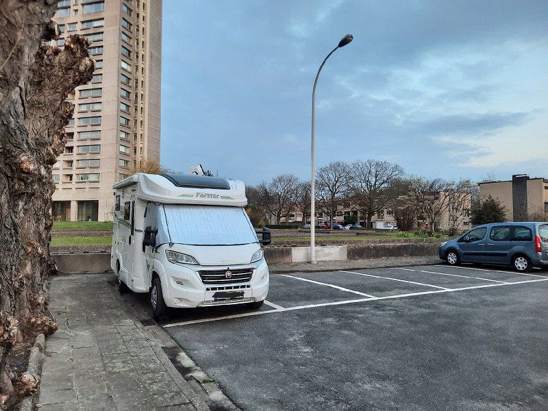
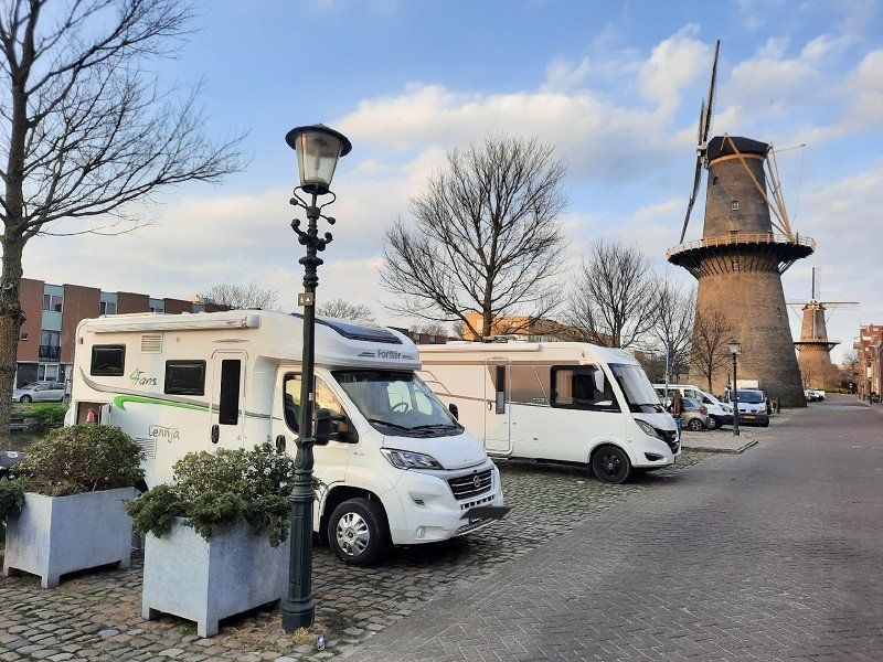
We traveled from Stuttgart to Amsterdam over Easter. We identified Luxembourg, Brussels, Antwerp, Rotterdam, The Hague, Noordwijkerhout (that's where the tulip fields are), Aalsmeer (that's where the flower auction is) and finally Amsterdam as travel destinations. Except in Holland we camped wild. We take the bikes with us and are therefore mobile in the cities.
Schwäbisch Gmünd, Deutschland
Schwäbisch Gmünd , Deutschland
48° 47' 59.7" N 9° 47' 51.9" E
48.7999036 9.7977584
• Head toward Imhofstraße on Rinderbacher Gasse. Go for 370 m.
• Turn left onto Turmgasse. Go for 156 m.
• Turn right onto Vordere Schmiedgasse. Go for 37 m.
• Take the 2nd exit from Baldungskreisel roundabout onto Vordere Schmiedgasse (L1075) toward Aalen/B29. Go for 222 m.
• Continue on Aalener Straße (B298). Go for 128 m.
• Turn right and take ramp onto B29 toward Stuttgart. Go for 39.2 km.
• Take ramp onto B14 toward Schw. Hall/Backnang/Winnenden/Waiblingen. Go for 8.7 km.
• Take ramp toward Winnenden-West/Leutenbach/Ludwigsburg/Marbach. Go for 215 m.
• Take the 3rd exit from roundabout onto L1127. Go for 188 m.
• Pass 3 roundabouts and continue on L1127. Go for 12.0 km.
• Turn left onto Charlottenstraße (K1695). Go for 88 m.
• Turn right onto Grabenstraße (K1602). Go for 304 m.
• Turn left onto Ludwigsburger Straße (K1602). Go for 481 m.
• Turn right onto Umgehungsstraße (L1100). Go for 2.2 km.
• Turn left onto L1125. Go for 2.3 km.
• Take ramp onto A81 toward Heilbronn. Go for 22.9 km.
• Keep left onto Autobahnkreuz Weinsberg toward Mannheim/Heilbronn/Neckarsulm/A6. Go for 1.5 km.
• Continue on A6. Go for 59.3 km.
• Take exit 30 toward Koblenz/Saarbrücken/Ludwigshafen/Speyer onto A61. Go for 38.0 km.
• Take exit 59 toward Saarbrücken/Kaiserslautern onto A6. Go for 62.6 km.
• Take exit 12 toward Trier/Kusel/Flughafen Hahn onto A62. Go for 52.3 km.
• Continue on A1. Go for 9.0 km.
• Take exit 133 toward Hermeskeil/B52. Go for 416 m.
• Turn left onto Gusenburger Straße (L147) toward Hermeskeil/B52. Go for 320 m.
• Turn left onto Trierer Straße (B52). Go for 2.9 km.
• Continue on L151. Go for 21.5 km.
• Continue on A64a. Go for 1.1 km.
• Keep left onto A64a toward Luxembourg/Bitburg/A64. Go for 4.9 km.
• Continue on A64. Go for 11.8 km.
• Continue on A1 (Sauertalbrücke). Go for 26.9 km.
• Take exit 8 toward Luxembourg-Centre. Go for 1.3 km.
• Take the 2nd exit from roundabout onto Avenue John F. Kennedy toward Luxembourg-Centre/Kirchberg/Quartier du Parc/Quartiers Européens/D'Coque. Go for 322 m.
• Continue on Avenue John F. Kennedy (N51). Go for 3.9 km.
• Turn right onto Boulevard Robert Schuman (N51). Go for 460 m.
• Turn right onto Avenue de la Faïencerie (CR217). Go for 51 m.
• Turn right. Go for 149 m.
• Arrive at your destination.
☍
388,1 km
(3 hrs. 48 min.)
Luxembourg, Parkplatz Glacis in der Innenstadt (GEBUCHT)
Parking, €1 per hour during the day. Free from 6:00 p.m. to 8:00 a.m., also free on weekends
Allée Scheffer, Luxembourg, Luxembourg
49° 37' 0.8" N 6° 7' 25.7" E
49.6168830 6.1238158
• Head northeast. Go for 78 m.
• Turn right toward Boulevard de la Foire/N51. Go for 92 m.
• Turn right onto Boulevard de la Foire (N51). Go for 572 m.
• Turn right onto Route d'Arlon (N6). Go for 2.6 km.
• Take ramp onto A6 toward Aéroport/Plateau de Kirchberg/Arlon/Bruxelles/Liège. Go for 13.9 km.
• Continue on E25/E411. Go for 42.6 km.
• Continue on E411 toward Bruxelles/Namur. Go for 120 km.
• Take exit 9 toward Chaumont-Gistoux/N25/Ottignies/Louvain-la-Neuve/Mont-St-Guibert/Nivelles/Corroy-le-Grand/E19/Walibi. Go for 443 m.
• Turn left onto Chemin de Grez (N25a). Go for 16.5 km.
• Take ramp onto Chaussée de Bruxelles (N5) toward Bruxelles/Waterloo. Go for 7.8 km.
• Take the 1st exit from roundabout onto Chaussée de Charleroi (N5). Go for 158 m.
• Take the 3rd exit from roundabout onto Chaussée de Charleroi (N5). Go for 340 m.
• Take the 3rd exit from roundabout onto Chaussée de Nivelles (N27) toward Nivelles/Braine-l'Alleud. Go for 1.1 km.
• Turn left onto Route du Lion toward N27/Bruxelles/R0/Aéroport Zaventem. Go for 121 m.
• Continue on Route du Lion. Go for 220 m.
• Arrive at Route du Lion. Your destination is on the right.
☍
206,2 km
(1 hrs. 58 min.)
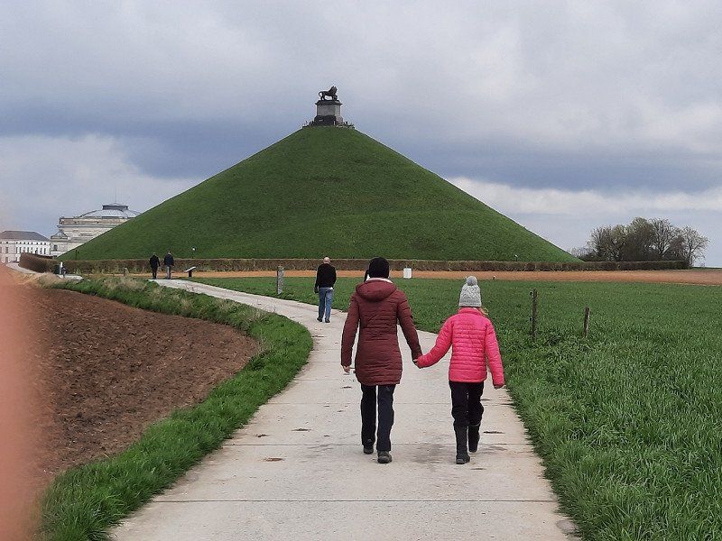
Schlachtfeld von Waterloo Mémorial de Waterloo 1815, Belgien
Stopover on the way to Brussels
Route du Lion 1815, 1420, Braine-l'Alleud, Belgien
50° 40' 47.1" N 4° 24' 15.7" E
50.6797455 4.4043642
• Head northwest on Route du Lion. Go for 52 m.
• Turn right. Go for 165 m.
• Turn left toward Route du Lion. Go for 22 m.
• Turn right onto Route du Lion. Go for 150 m.
• Turn right onto Chaussée de Nivelles (N27) toward Lasne/Waterloo. Go for 429 m.
• Take ramp onto R0 toward Gand/E40/Mons/E19/Charleroi/Ring Ouest. Go for 7.3 km.
• Take the exit toward Gand/E40/Bruxelles onto E19. Go for 22.8 km.
• Take exit 13 toward Ninove/Molenbeek. Go for 730 m.
• Turn right onto Ninoofsesteenweg (N8) toward Brussel/Molenbeek. Go for 3.5 km.
• Turn left onto Hertogin van Brabantplaats. Go for 34 m.
• Turn right onto Vanderstraetenstraat. Go for 282 m.
• Continue on Olifantstraat. Go for 187 m.
• Arrive at Olifantstraat. Your destination is on the right.
☍
35,7 km
( 29 min.)
Jugendherberge Génération Europe, Belgien (GEBUCHT)
Payment on site, credit card details provided
Rue de l'Éléphant - Olifantstraat 4, Molenbeek-Saint-Jean - Sint-Jans-Molenbeek, Belgien
50° 51' 10.5" N 4° 20' 4.4" E
50.8529033 4.3345424
• Head toward Paalstraat on Olifantstraat. Go for 51 m.
• Turn slightly right onto Paalstraat. Go for 182 m.
• Turn right onto Steenweg op Gent (N9). Go for 433 m.
• Turn left onto Nieuwpoortlaan (R20). Go for 698 m.
• Turn right onto Sainctelettesquare (R20b). Go for 173 m.
• Turn left onto Willebroekkaai (N201). Go for 1.6 km.
• Keep left onto Groendreef (N201) toward Ring/Anvers/Antwerpen. Go for 160 m.
• Continue on Koninginnelaan (N277a). Go for 793 m.
• Continue on Koninklijk Parklaan (N277). Go for 1.0 km.
• Turn left onto Abelenlaan (N284). Go for 152 m.
• Keep left onto Witte-Acacialaan (N291). Go for 491 m.
• Continue on Ebbebomenlaan. Go for 484 m.
• Turn right onto Jan Sobieskilaan. Go for 25 m.
• Continue on Eeuwfeestlaan. Go for 271 m.
• Take the 2nd exit from Louis Steensplein roundabout onto Eeuwfeestlaan. Go for 258 m.
• Continue on Atomiumsquare. Go for 82 m.
• Continue on Eeuwfeestlaan. Go for 128 m.
• Make a U-Turn onto Eeuwfeestlaan. Go for 150 m.
• Continue on Atomiumsquare. Go for 61 m.
• Arrive at Atomiumsquare. Your destination is on the left.
☍
7,3 km
( 15 min.)
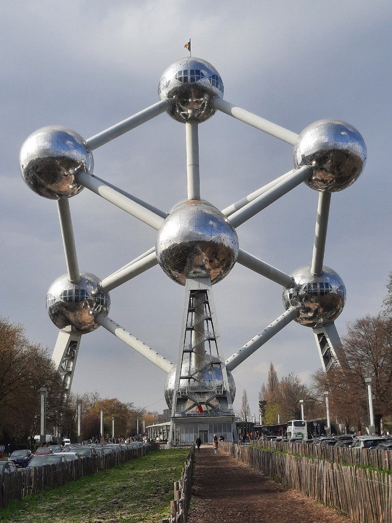
Atomiumsquare
Brüssel, Belgien
50° 53' 41.2" N 4° 20' 29.2" E
50.8947767 4.3414440
• Head east on Atomiumsquare. Go for 17 m.
• Continue on Eeuwfeestlaan. Go for 188 m.
• Take the 4th exit from Louis Steensplein roundabout onto Eeuwfeestlaan. Go for 363 m.
• Continue on Atomiumsquare. Go for 82 m.
• Continue on Eeuwfeestlaan. Go for 309 m.
• Turn right onto Belgiëplein. Go for 253 m.
• Continue on Esplanade. Go for 360 m.
• Turn left onto Madridlaan (N277). Go for 93 m.
• Turn right toward Madridlaan. Go for 29 m.
• Continue on Romeinsesteenweg. Go for 155 m.
• Turn left onto Antwerpselaan (N276). Go for 406 m.
• Turn left and take ramp onto A12 toward Antwerpen/Boom/St.-Niklaas/Namen/E411/Luik/E40/Luchthaven Zaventem/Bergen/E19/Charleroi/Gent. Go for 434 m.
• Take the exit toward E411 onto E19/E40. Go for 7.3 km.
• Take the exit toward Antwerpen/Mechelen/Luchthaven Cargo onto E19. Go for 18.4 km.
• Take exit 9 toward Lier onto N16. Go for 821 m.
• Take ramp onto R6 toward Lier/Heist-o/d-Berg/St.-Katelijne-Waver. Go for 2.7 km.
• Take ramp toward Lier/Duffel. Go for 382 m.
• Turn left onto Liersesteenweg (N14) toward Lier/Duffel. Go for 4.9 km.
• Continue on Berkhoevelaan (N108) toward Lier/St.-Kat.-Waver/Koningshooikt. Go for 6.4 km.
• Continue on Hoogveldweg (N10b). Go for 474 m.
• Continue on Paul Krugerstraat (N10b). Go for 146 m.
• Turn left onto Berlarij. Go for 56 m.
• Turn right onto Berlarij. Go for 317 m.
• Continue on Berlaarsestraat. Go for 205 m.
• Continue on Heilige Geeststraat. Go for 101 m.
• Continue on Rechtestraat. Go for 193 m.
• Turn right onto Vismarkt. Go for 83 m.
• Turn left onto Brouwerijstraat. Go for 94 m.
• Arrive at Brouwerijstraat. Your destination is on the left.
☍
45,2 km
( 40 min.)
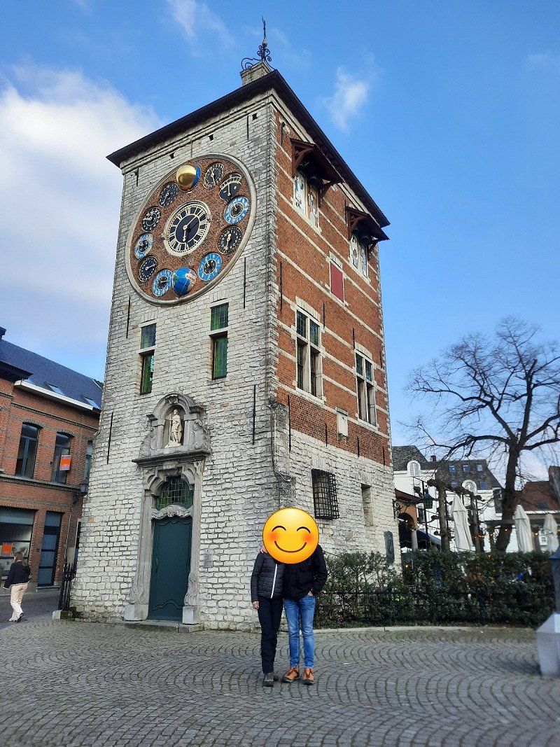
Lier mit Zimmerturm u. astronomischer Uhr Stadhuis Lier, Belgien
Lier with room tower and astronomical clock
Großer Marktplatz 58, 2500, Lier, Belgien
51° 7' 51.6" N 4° 34' 11.8" E
51.1309868 4.5699372
• Head toward Vismarkt on Brouwerijstraat. Go for 94 m.
• Turn right onto Vismarkt. Go for 83 m.
• Turn left onto Rechtestraat (N10). Go for 35 m.
• Turn right onto Werf (N10). Go for 158 m.
• Continue on Netelaan (N10). Go for 283 m.
• Take the 1st exit from roundabout onto Netelaan (N10). Go for 114 m.
• Continue on Aarschotsesteenweg (N10). Go for 385 m.
• Continue on Aarschotsesteenweg (N10). Go for 59 m.
• Turn right onto Ring (R16). Go for 1.5 km.
• Keep right onto Ring (R16). Go for 279 m.
• Turn left onto Mechelsesteenweg (N14) toward E19/Mechelen/Duffel. Go for 4.5 km.
• Take the 3rd exit from roundabout onto G. van der Lindenlaan (N14) toward Mechelen/Rumst/E19. Go for 475 m.
• Keep right onto Hondiuslaan. Go for 977 m.
• Take the 2nd exit from roundabout onto Hondiuslaan. Go for 137 m.
• Continue on A. Stocletlaan. Go for 1.8 km.
• Continue on Lage Vosbergstraat. Go for 1.2 km.
• Continue on Bussestraat (N1c). Go for 512 m.
• Take ramp onto E19 toward Antwerpen. Go for 12.0 km.
• Take the left exit toward Brugge/Gent/Haven 1000-2000 onto E34 (Kleine Ring). Go for 5.2 km.
• Take the exit. Go for 835 m.
• Turn right onto Antwerpen-West. Go for 478 m.
• Turn left toward Blancefloerlaan/N70. Go for 313 m.
• Turn right onto Blancefloerlaan (N70). Go for 2.1 km.
• Continue on Blancefloerlaan. Go for 626 m.
• Turn left onto Thonetlaan. Go for 1.6 km.
• Turn right onto Jachthavenweg. Go for 102 m.
• Turn left onto Jachthavenweg. Go for 24 m.
• Turn right. Go for 287 m.
• Turn right. Go for 100 m.
• Arrive at your destination on the right.
☍
36,2 km
( 38 min.)
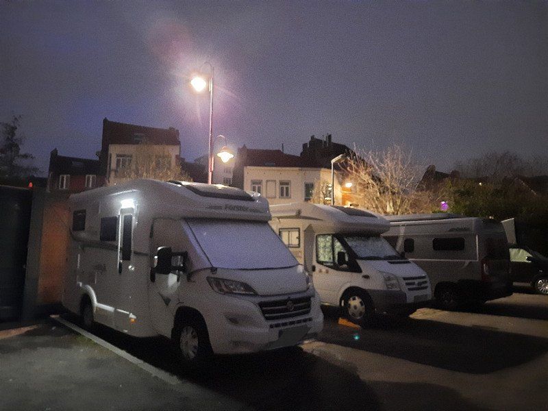
Camping De Molen
Parked the camper in a parking lot near the campsite. Lots of wild campers in this area.
Jachthavenweg 2, 2050, Antwerpen, Belgien
51° 14' 2" N 4° 23' 33" E
51.2338900 4.3925000
• Head south. Go for 25 m.
• Turn right toward Jachthavenweg. Go for 22 m.
• Turn left onto Jachthavenweg. Go for 24 m.
• Turn right onto Jachthavenweg. Go for 102 m.
• Turn left onto Thonetlaan. Go for 701 m.
• Turn right onto Charles de Costerlaan. Go for 943 m.
• Make a U-Turn at Halewijnlaan onto Charles de Costerlaan (N49a). Go for 462 m.
• Continue on Waaslandtunnel (N49a). Go for 1.8 km.
• Continue on Ankerrui (N49a). Go for 336 m.
• Turn left onto Italiëlei (N1). Go for 536 m.
• Turn right onto Noorderlaan (N1). Go for 2.0 km.
• Continue on Noorderlaan (N180). Go for 2.3 km.
• Take ramp onto A12 (Havenweg) toward Rotterdam/Haven 491-2000. Go for 16.6 km.
• Continue on A4. Go for 5.9 km.
• Take the exit toward Rotterdam/Breda/Bergen op Zoom onto A4/A58 (Zeelandweg). Go for 9.2 km.
• Continue on A4 (Randweg-Oost) toward Bergen op Zoom-Noord/Rotterdam/Industrieterrein Bergen op Zoom/Amsterdam. Go for 25.2 km.
• Continue on A29/A59 (Zoomweg). Go for 5.3 km.
• Continue on A29. Go for 20.1 km.
• Take the left exit toward Ring-Z/W/Europoort/Amsterdam/Schiedam onto A15 (Knooppunt Vaanplein). Go for 2.6 km.
• Keep right onto RING-Zuid (A15) toward Amsterdam/Den Haag/Schiedam/Ring. Go for 2.4 km.
• Keep left onto RING-Zuid. Go for 1.1 km.
• Keep right onto RING-Zuid (A15) toward Europoort/Amsterdam/Den Haag/Schiedam/RING. Go for 297 m.
• Take ramp onto A4 (Knooppunt Benelux) toward Ring-West/Rotterdam-Noord/Amsterdam/Den Haag/Schiedam/Ring. Go for 5.0 km.
• Keep right onto A4 (Beneluxweg) toward afrit 16/Rotterdam-Noord/Vlaardingen/Schiedam/RING. Go for 2.4 km.
• Take exit 16 toward Vlaardingen-Oost/Schiedam-West. Go for 383 m.
• Turn left onto Vlaardingerdijk. Go for 218 m.
• Keep left onto Vlaardingerdijk toward Centrum. Go for 260 m.
• Continue on Burgemeester Knappertlaan. Go for 270 m.
• Continue on Rubensplein. Go for 46 m.
• Turn slightly left onto Rubensplein. Go for 82 m.
• Continue on Burgemeester Knappertlaan. Go for 958 m.
• Take the 2nd exit from roundabout onto Nieuwe Haven. Go for 621 m.
• Take the 1st exit from Vlaardingerdijk roundabout onto Vlaardingerstraat. Go for 54 m.
• Turn left onto Vellevest. Go for 116 m.
• Turn slightly right onto Noordvest. Go for 211 m.
• Arrive at Noordvest. Your destination is on the left.
☍
108,5 km
(1 hrs. 16 min.)
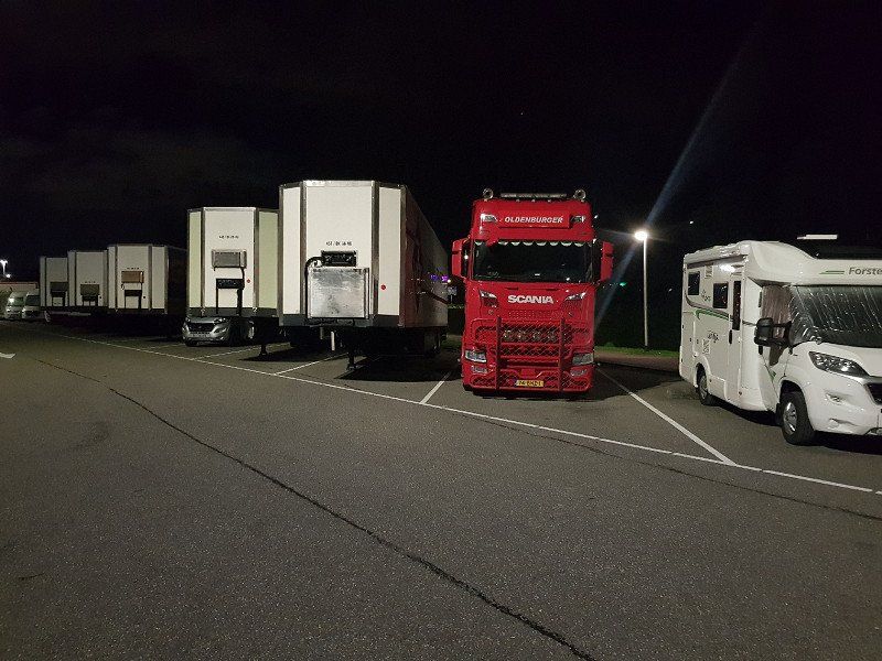
Parking Noordvest Schiedam, Niederlande (Stellplatz, kann nicht gebucht werden)
7.50 euros / night. Space for 6 motorhomes
Noordvest 40, Schiedam, Niederlande
51° 55' 10.8" N 4° 23' 41.4" E
51.9196627 4.3948452
• Head toward Spinhuispad on Noordvest. Go for 120 m.
• Turn left onto Spoelingbrug. Go for 41 m.
• Continue on Parkweg. Go for 426 m.
• Turn left onto Burgemeester van Haarenlaan. Go for 735 m.
• Keep right toward Nieuwe Damlaan. Go for 22 m.
• Take the 1st exit from roundabout onto Nieuwe Damlaan. Go for 743 m.
• Continue on Churchillweg. Go for 222 m.
• Turn left and take ramp onto A4 (Ketheltunnel) toward H. v. Holland/Havens 500-700/Amsterdam/Den Haag/Delft. Go for 14.1 km.
• Take the exit toward E19/Rotterdam/Delft onto S107 (Rotterdamsebaan). Go for 5.0 km.
• Turn left onto Mercuriusweg (s100) toward Centrumring-Zuid/Rijswijk. Go for 824 m.
• Keep left onto Neherkade (s100). Go for 898 m.
• Turn right onto Calandstraat (s100). Go for 430 m.
• Continue on Vaillantlaan (s100). Go for 1.1 km.
• Enter the roundabout. Go for 96 m.
• Arrive at Vaillantplein. Your destination is on the left.
☍
24,7 km
( 23 min.)
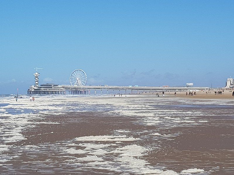
Den Haag
on the beach and sightseeing
Niederlande
52° 4' 13.8" N 4° 18' 2.5" E
52.0704978 4.3006999
• Follow the roundabout. Go for 78 m.
• Take the 3rd exit from roundabout onto Vaillantplein (s100). Go for 42 m.
• Continue on Buitenom (s100). Go for 494 m.
• Turn right onto Noord West Buitensingel (s100). Go for 328 m.
• Continue on Koningin Emmaplein (s100). Go for 18 m.
• Continue on Waldeck Pyrmontkade (s100). Go for 1.2 km.
• Continue on Stadhouderslaan (s103). Go for 397 m.
• Turn right onto President Kennedy Laan (s200). Go for 2.4 km.
• Keep left onto Hubertusviaduct (s200) toward Wassenaar (N44)/Amsterdam (A4). Go for 4.0 km.
• Keep right. Go for 723 m.
• Continue straight ahead. Go for 74 m.
• Continue toward Rijksstraatweg/N44. Go for 101 m.
• Take ramp onto Rijksstraatweg (N44) toward Wassenaar/Leiden/Amsterdam/Duinrell. Go for 14.8 km.
• Take exit 5 toward Sassenheim/Voorhout. Go for 508 m.
• Continue on Rijksstraatweg. Go for 240 m.
• Take the 3rd exit from roundabout onto Oosthoutlaan. Go for 686 m.
• Take the 1st exit from roundabout onto Teylingerdreef. Go for 1.1 km.
• Pass 2 roundabouts and continue on Teylingerdreef. Go for 1.1 km.
• Take the 1st exit from roundabout onto Jacoba van Beierenweg (N450). Go for 678 m.
• Turn left onto Jacoba van Beierenweg. Go for 122 m.
• Arrive at Jacoba van Beierenweg. Your destination is on the left.
☍
29,1 km
( 31 min.)
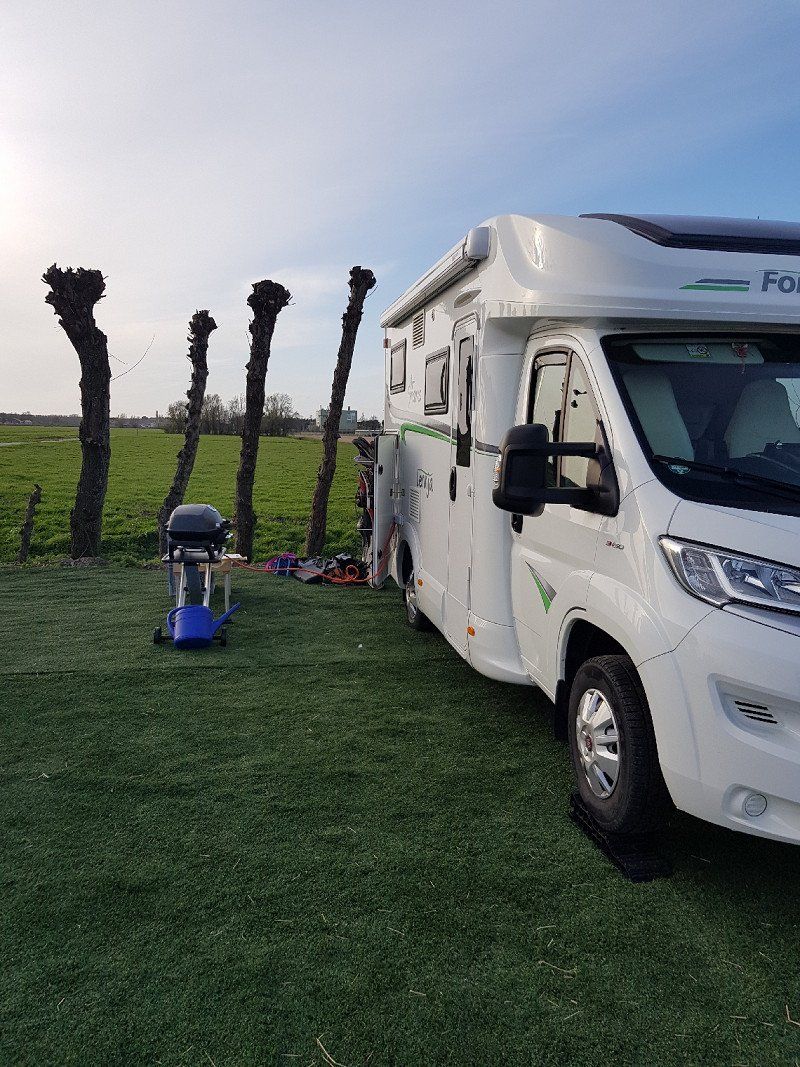
Wohnmobil Stellplatzfür 12,50Eur/Person
on a farm
Jacoba van Beierenweg 144-a, 2215 KX Voorhout, Niederlande
52° 14' 10.7" N 4° 29' 57.2" E
52.2363124 4.4992181
• Head southeast on Jacoba van Beierenweg. Go for 122 m.
• Turn left onto Jacoba van Beierenweg (N450). Go for 479 m.
• Take the 1st exit from roundabout onto Teylingerlaan (N443). Go for 1.7 km.
• Take the 2nd exit from roundabout onto Van Pallandtlaan (N208). Go for 356 m.
• Pass 2 roundabouts and continue on Noordwijkerhout (N208). Go for 1.3 km.
• Take ramp onto A44 toward Kaag (Dorp)/Amsterdam. Go for 8.7 km.
• Continue on A4 (Knooppunt Burgerveen). Go for 4.0 km.
• Take the exit toward Hoofddorp/Aalsmeer. Go for 2.3 km.
• Turn right onto Rozenburgdreef (N201) toward Aalsmeer/Schiphol-Rijk/Oude Meer/Schiphol Logistics Park. Go for 7.1 km.
• Take ramp onto Legmeerdijk (N231) toward De Kwakel/Kudelstaart. Go for 848 m.
• Turn right toward Ring Centrum. Go for 106 m.
• Take the 3rd exit from roundabout onto Ring Centrum. Go for 148 m.
• Turn right. Go for 76 m.
• Arrive at your destination on the left.
☍
27,2 km
( 24 min.)
Aalsmeer Blumenversteigerung Parkplatz P 23. Busse: P 20.Legmeerdijk, Niederlande (GEbucht)
Parking of passenger cars in the parking lot P 23. Buses: P 20.
There are several mobile homes with trucks and trailers in the parking lot. The only thing that can be annoying is the noise from the flight path from the airport.
Legmeerdijk 313, Aalsmeer, Niederlande
52° 15' 31.3" N 4° 47' 3.7" E
52.2586829 4.7843629
• Head northeast. Go for 42 m.
• Take the 2nd exit from roundabout. Go for 142 m.
• Turn left onto Legmeerdijk (N231). Go for 518 m.
• Take ramp onto Burgemeester Brouwerweg (N201) toward Hoofddorp/Den Haag/Amsterdam/Utrecht. Go for 3.3 km.
• Turn right onto Fokkerweg (N232) toward Amsterdam (A9)/Utrecht (A9). Go for 4.0 km.
• Keep left onto Schipholdijk (N232) toward Amsterdam/Utrecht/Den Haag/Haarlem/Luchthaven Schiphol. Go for 784 m.
• Take the 2nd exit from roundabout onto A9 toward Amsterdam/Den Haag/Haarlem/Luchthaven Schiphol. Go for 1.3 km.
• Take the exit toward Amsterdam onto A4. Go for 3.4 km.
• Continue on E19 (Knooppunt de Nieuwe Meer) toward RING-Zuid/Groningen/Hengelo/Utrecht/A10. Go for 965 m.
• Continue on A10 (Ring Amsterdam). Go for 13.5 km.
• Take exit 15 toward Schellingwoude/Nieuwendam/Durgerdam. Go for 431 m.
• Turn left onto Zuiderzeeweg (s115). Go for 539 m.
• Take the 2nd exit from roundabout onto IJdoornlaan (s115). Go for 454 m.
• Take the 3rd exit from roundabout onto Volendammerweg. Go for 723 m.
• Turn right onto Purmerweg. Go for 242 m.
• Continue on Purmerplein. Go for 134 m.
• Continue on Purmerweg. Go for 119 m.
• Turn left onto Nieuwendammerstraat. Go for 113 m.
• Turn right onto Nieuwendammerdijk. Go for 939 m.
• Arrive at Nieuwendammerdijk. Your destination is on the left.
☍
31,7 km
( 30 min.)
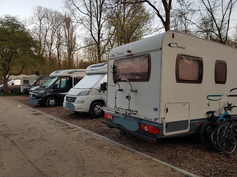
Camping Vliegenbos (GEBUCHT)
right next to the city, 2km to the center and still quiet
Meeuwenlaan 138, 1015 MK, Amsterdam-nord, Netherlands
52° 23' 27" N 4° 55' 39" E
52.3908300 4.9275000
• Head west on Nieuwendammerdijk. Go for 146 m.
• Turn sharp right onto Waddenweg. Go for 654 m.
• Turn left onto Nieuwe Purmerweg. Go for 197 m.
• Take ramp onto Nieuwe Leeuwarderweg (s116). Go for 1.6 km.
• Turn right and take ramp onto A10 (Ring Amsterdam) toward Ring/s117/Zaanstad/Purmerend/Rotterdam/Leeuwarden. Go for 4.2 km.
• Take the exit toward Leeuwarden/Purmerend/Zaanstad/E22 onto A8 (Knooppunt Coenplein). Go for 10.0 km.
• Take the exit toward Zaanstad-Noord/Alkmaar/Beverwijk. Go for 894 m.
• Turn right onto N8/N246 toward Industrieterrein Assendelft/Industrieterrein Zaanstad-Noord/Wormer/Alkmaar. Go for 8.0 km.
• Take the 2nd exit from roundabout onto Provincialeweg (N246). Go for 1.3 km.
• Turn left onto Zuiddijk (N244) toward Alkmaar. Go for 9.6 km.
• Turn left onto Nieuwe Schermerweg (N243). Go for 660 m.
• Turn left onto Edisonweg. Go for 84 m.
• Turn left onto Keesomstraat. Go for 126 m.
• Arrive at Keesomstraat. Your destination is on the left.
☍
37,5 km
( 35 min.)
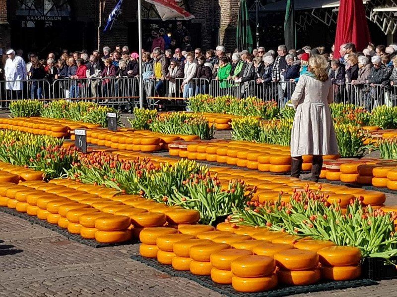
P&R Parkplatz Outrup, Besichtigung des Käsemarktes
Visit to the cheese market which takes place every week from March to September on three day mornings.
We went there from Amsterdam on a day trip. Parking is great for cycling into town. There is a sign that the height is limited to 2.10 m. However, we were able to enter with a height of 3.25 m without any problems. The trees were probably shorter in the past.
Alkmaar, Niederlande
52° 37' 31.6" N 4° 46' 22.4" E
52.6254512 4.7728915
• Head northwest on Keesomstraat. Go for 116 m.
• Turn right onto Edisonweg. Go for 70 m.
• Turn right onto Nieuwe Schermerweg. Go for 641 m.
• Turn right onto N244. Go for 9.6 km.
• Turn right onto N246 toward Zaanstad. Go for 1.3 km.
• Take the 2nd exit from roundabout onto Provincialeweg (N246). Go for 8.5 km.
• Turn left and take ramp toward Assendelft. Go for 181 m.
• Keep left toward Assendelft. Go for 191 m.
• Take the 1st exit from roundabout toward Zaandam/Amsterdam. Go for 441 m.
• Continue on A8 (Coentunnelweg). Go for 8.0 km.
• Take the left exit toward Ring-Noord/Utrecht/Amersfoort/E35 onto A10 (Knooppunt Coenplein). Go for 5.3 km.
• Take exit 16 toward Nieuwendam/Centrum/Volendam/N247. Go for 559 m.
• Turn right onto Nieuwe Leeuwarderweg (s116) toward Centrum/Nieuwendam/Industrieterrein Noord 250-400/Ziekenhuizen Bovenij. Go for 274 m.
• Keep left onto Nieuwe Leeuwarderweg (s116) toward Centrum/Industrieterrein Noord 100-400. Go for 807 m.
• Take ramp toward s115/Buikslotermeer. Go for 228 m.
• Take the 4th exit from Nieuwe Purmerweg roundabout onto Nieuwe Purmerweg. Go for 340 m.
• Continue on Nieuwe Purmerweg. Go for 675 m.
• Continue on Purmerweg. Go for 225 m.
• Turn right onto Brede Kerkepad. Go for 102 m.
• Continue on Kerkepad. Go for 37 m.
• Turn right onto Nieuwendammerdijk. Go for 890 m.
• Arrive at Nieuwendammerdijk. Your destination is on the left.
☍
38,4 km
( 40 min.)
Camping Vliegenbos
See first entry
Meeuwenlaan 138, 1015 MK, Amsterdam-nord, Niederlande
52° 23' 27" N 4° 55' 39" E
52.3908300 4.9275000
• Head west on Nieuwendammerdijk. Go for 146 m.
• Turn sharp right onto Waddenweg. Go for 654 m.
• Turn left onto Nieuwe Purmerweg. Go for 197 m.
• Take ramp onto Nieuwe Leeuwarderweg (s116). Go for 1.3 km.
• Turn right and take ramp onto A10 (Ring Amsterdam) toward Rotterdam/Ring/s117/Purmerend/Leeuwarden/s115/Utrecht/Hengelo. Go for 11.1 km.
• Take the exit toward Eindhoven/Utrecht onto A2. Go for 76.2 km.
• Keep left onto A2 toward Maastricht/Eindhoven/Tilburg. Go for 31.3 km.
• Take the exit toward Maastricht/Venlo onto A2 (Knooppunt Ekkersweijer). Go for 93.9 km.
• Take the exit toward Cadier en Keer/Berg en Terblijt/Hasselt/Maastricht onto N2. Go for 1.6 km.
• Take ramp onto Viaductweg toward Hasselt. Go for 1.3 km.
• Continue on Noorderbrug. Go for 1.4 km.
• Continue on Noorderbrugsingel toward Randweg Noord/Industrieterrein 22500-23000/Hasselt. Go for 258 m.
• Turn right onto Cabergerweg toward Industrieterrein 22525-23000. Go for 54 m.
• Arrive at Cabergerweg.
☍
219,5 km
(2 hrs. 17 min.)
Rückweg mit Stopp in Maastricht
Maastricht, Niederlande
50° 51' 25.8" N 5° 40' 46.7" E
50.8571663 5.6796426
• Head toward Fort Willemweg on Cabergerweg. Go for 53 m.
• Make a U-Turn at Fort Willemweg onto Cabergerweg. Go for 114 m.
• Turn left onto Noorderbrugsingel. Go for 280 m.
• Continue on Noorderbrug. Go for 1.4 km.
• Continue on Viaductweg toward Randweg Noord/MECC/Ziekenhuis Azm/A2/A79. Go for 376 m.
• Take ramp onto A2 toward Eindhoven/Aachen (A79)/Valkenburg (A79)/Industrieterrein 10000-21300/Luchthaven. Go for 2.1 km.
• Keep right onto A79 (Knooppunt Kruisdonk) toward Heerlen/Aachen/Valkenburg. Go for 16.3 km.
• Take the exit toward Aachen/Kerkrade onto A76. Go for 8.8 km.
• Continue on A4. Go for 49.9 km.
• Take exit 8 toward Koblenz onto A61. Go for 17.3 km.
• Continue on A61 toward Koblenz/Weilerswist. Go for 239 km.
• Take the left exit toward Stuttgart/Heilbronn/Karlsruhe onto A6. Go for 60.5 km.
• Keep left onto Autobahnkreuz Weinsberg toward Stuttgart/Weinsberg/Ellhofen. Go for 2.3 km.
• Continue on A81. Go for 22.3 km.
• Take exit 14 toward Pleidelsheim/Freiberg (Neckar)/Marbach (Neckar)/Steinheim (Murr)/Marbach a. Neckar/Steinheim a.d. Murr/Benningen a. Neckar/Murr. Go for 495 m.
• Turn left onto L1125 toward Marbach a. Neckar/Steinheim a.d. Murr/Benningen a. Neckar/Murr. Go for 2.8 km.
• Turn right onto Marbacher Straße (L1100). Go for 1.5 km.
• Continue on Umgehungsstraße (L1100). Go for 689 m.
• Turn left onto Ludwigsburger Straße (K1602). Go for 481 m.
• Turn right onto Grabenstraße (K1602). Go for 304 m.
• Turn left onto König-Wilhelm-Platz (K1695). Go for 88 m.
• Turn right onto Wildermuthstraße (L1127). Go for 6.3 km.
• Pass 2 roundabouts and continue on L1127. Go for 5.7 km.
• Take the 1st exit from roundabout onto B14. Go for 8.7 km.
• Take ramp onto B29 toward Aalen/Schorndorf/Weinstadt/Kernen i.R. Go for 40.2 km.
• Take ramp toward Zentrum. Go for 168 m.
• Turn left onto Vordere Schmiedgasse (L1075) toward Zentrum. Go for 189 m.
• Take the 3rd exit from Baldungskreisel roundabout onto Baldungstraße toward Waldstetten/Bettringen. Go for 169 m.
• Turn right onto Königsturmstraße. Go for 550 m.
• Turn right onto Königsturmstraße. Go for 35 m.
• Turn right onto Kornhausstraße. Go for 103 m.
• Turn right toward Kornhausstraße. Go for 7 m.
• Turn left onto Kornhausstraße. Go for 76 m.
• Arrive at Kornhausstraße. Your destination is on the left.
☍
488,9 km
(4 hrs. 52 min.)
Schwäbisch Gmünd, Deutschland
Schwäbisch Gmünd , Deutschland
48° 47' 59.7" N 9° 47' 51.9" E
48.7999036 9.7977584