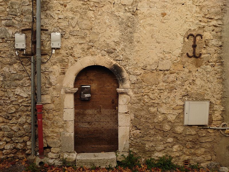
We start in the Vaucluse and drive across Provence, off the usual route to the Italian border and back to the starting point. Our destinations are small places that we have not seen before because we had not visited these places in the respective region in the past. The route is described in great detail on my website: https://www.frankreich-in-wort-und-bild.de/wohnmobiltouren/mit-dem-wohnmobil-in-frankreich/provence-wohnmobilreise-zu-entlegenen-bergd%C3%B6rfern-herbst-2023/.
You can find more of my motorhome trips on my website: https://www.frankreich-in-wort-und-bild.de/
Then go to the motorhome trips on this page.
The page also contains detailed descriptions of the places visited.
Day
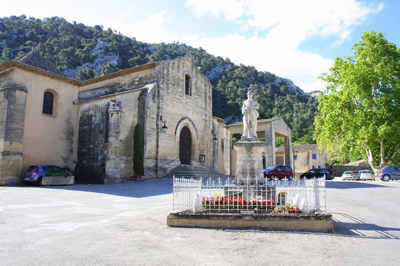
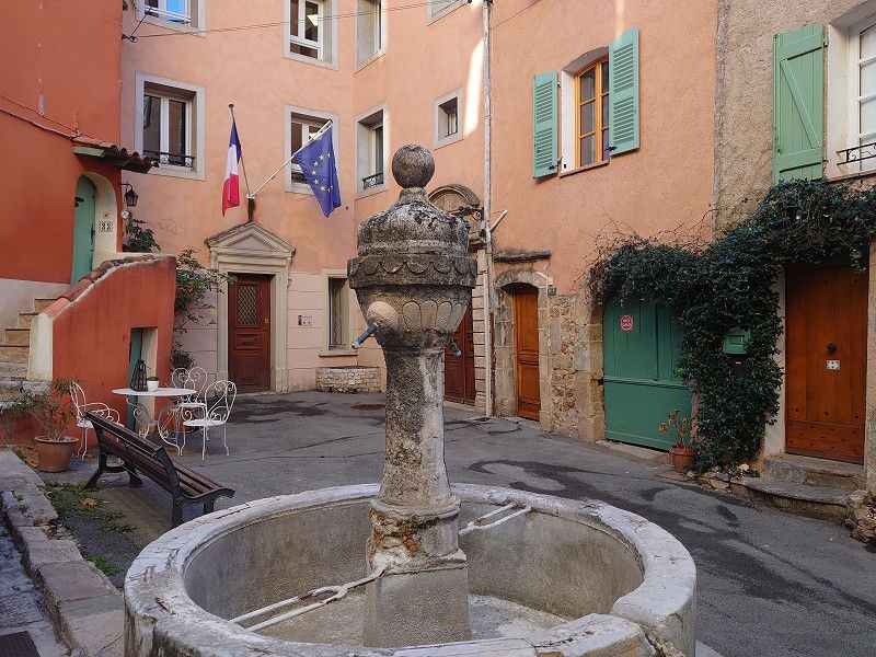
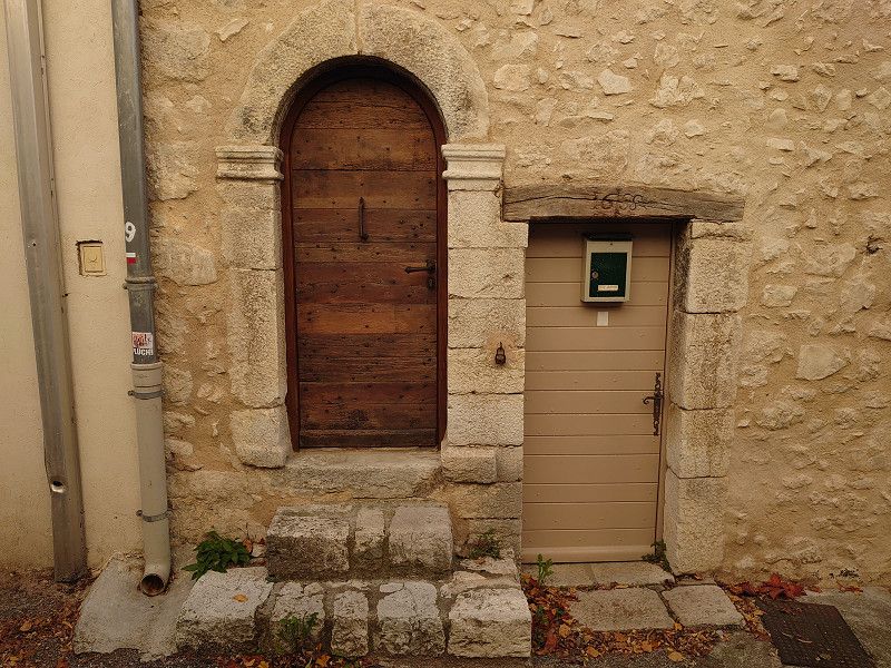
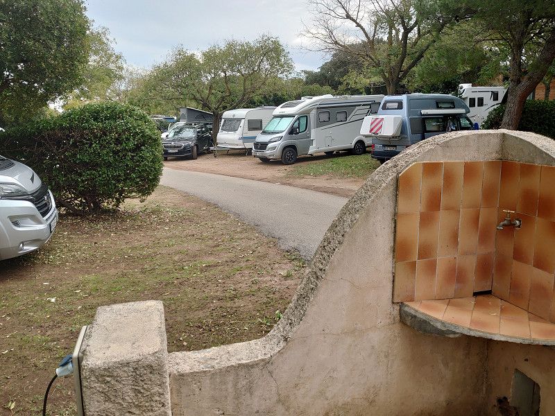
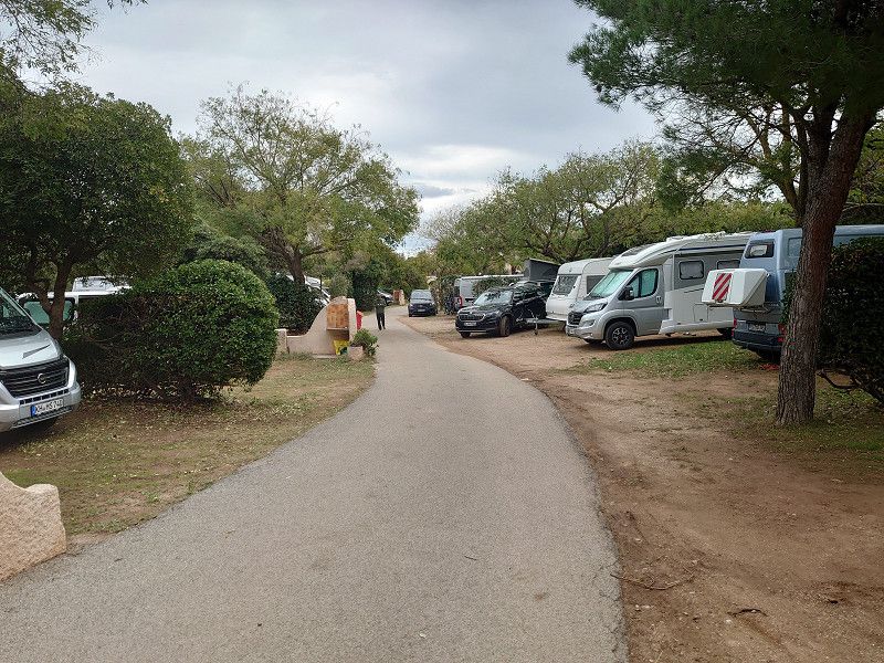
Robion 43.847502, 5.107614
In the afternoon we left Robion, where we will end our short autumn tour.
43.847502, 5.107614
43° 50' 51" N 5° 6' 27.4" E
43.8475020 5.1076140
• Head east on Avenue Aristide Briand (D2). Go for 1.1 km.
• Take the 2nd exit from roundabout onto Route des Alpes (D2) toward Maubec/Coustellet/Cavaillon/Apt. Go for 2.8 km.
• Turn right onto Route d'Apt (D900). Go for 7.8 km.
• Pass 5 roundabouts and continue on Avenue de Lançon (D900). Go for 12.8 km.
• Take the 3rd exit from roundabout onto Avenue de Lançon (D900) toward Sisteron/Digne. Go for 2.0 km.
• Take the 2nd exit from roundabout onto Avenue de la Libération (D900) toward Digne/Sisteron/Céreste/Forcalquier/Manosque. Go for 15.2 km.
• Continue on D4100. Go for 2.6 km.
• Pass 2 roundabouts and continue on D4100. Go for 7.8 km.
• Turn right onto D907 toward A51/Manosque. Go for 3.3 km.
• Turn left onto D907. Go for 8.3 km.
• Pass 2 roundabouts and continue on Avenue du Luberon (D907). Go for 1.4 km.
• Take the 4th exit from roundabout onto Place du Docteur Caire (D907). Go for 153 m.
• Continue on Rue Léon Mure. Go for 329 m.
• Turn sharp right onto Boulevard Élémir Bourges (D5). Go for 79 m.
• Turn left toward Square Bouteille. Go for 56 m.
• Keep left onto Square Bouteille. Go for 24 m.
• Continue on Place du Terreau. Go for 18 m.
• Turn slightly left onto Place du Terreau. Go for 50 m.
• Turn left onto Place du Terreau. Go for 74 m.
• Turn left onto Place du Terreau. Go for 99 m.
• Arrive at Place du Terreau. Your destination is on the right.
☍
66,0 km
(1 hrs. )
Manosque 43.83261, 5.78154
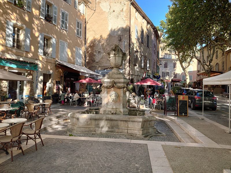
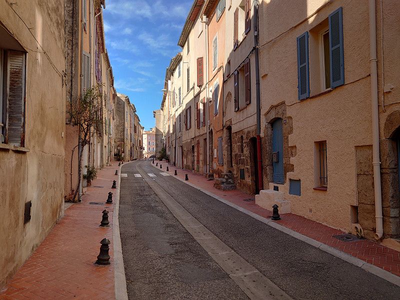
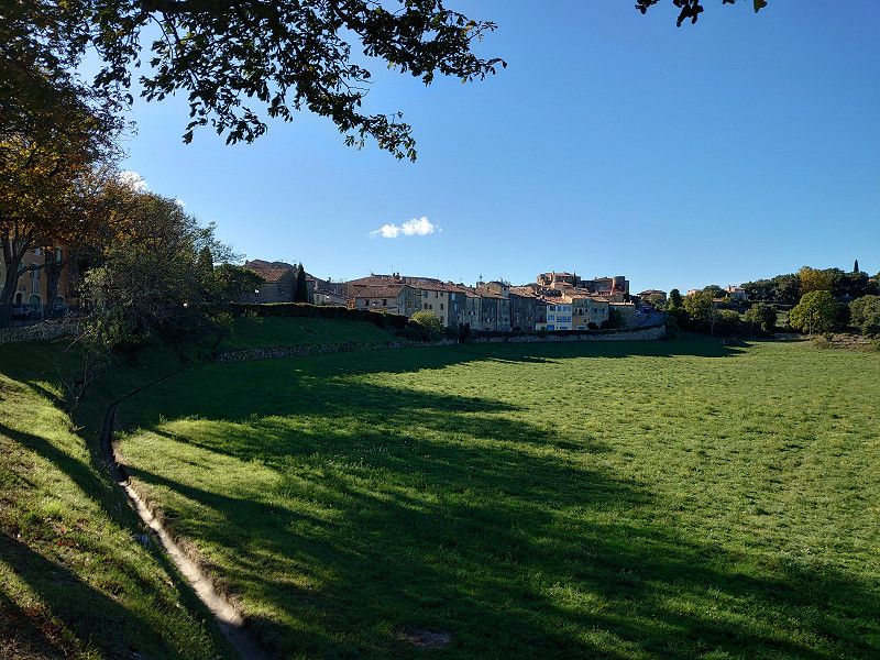
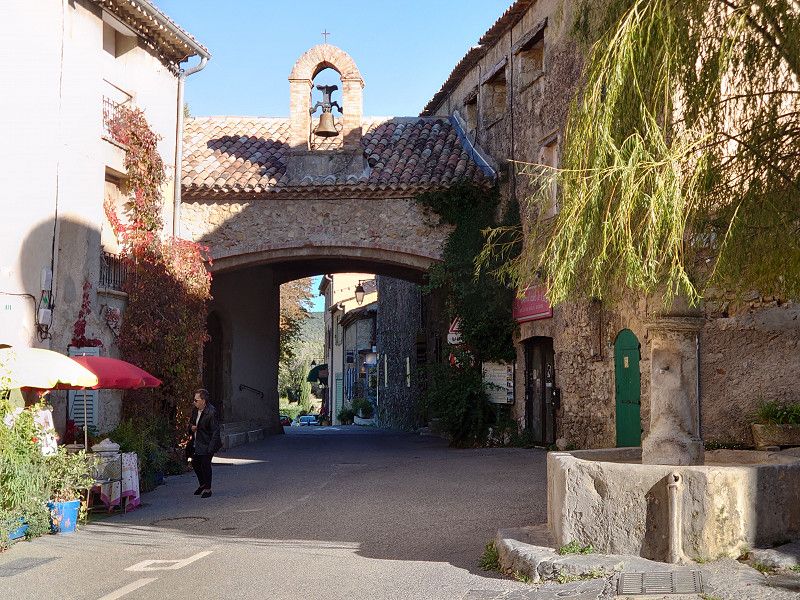
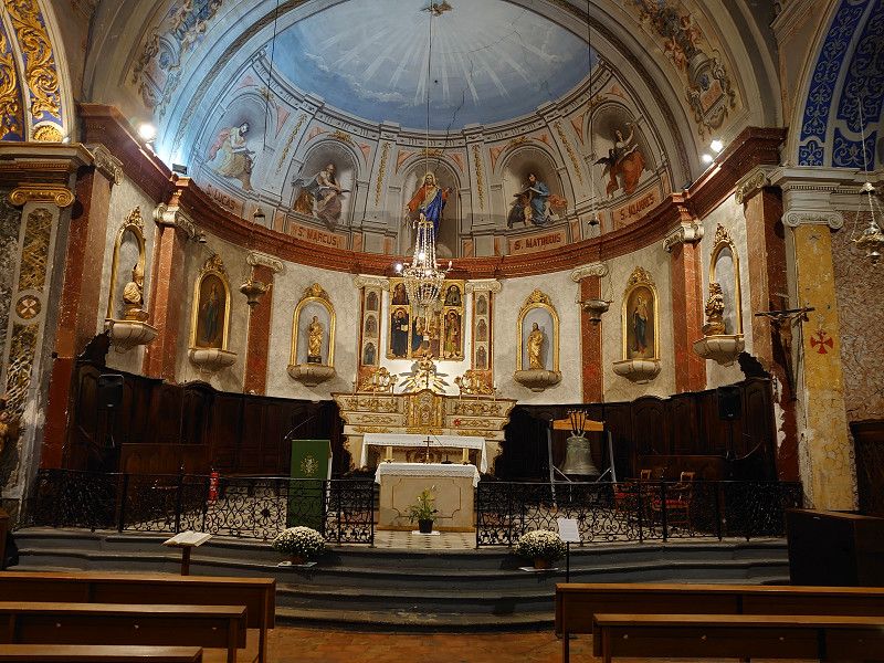
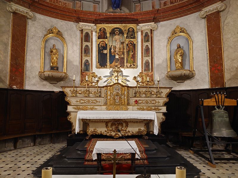
We have often driven through the town, but we have never been there to visit it. We drove to the car park in Manosque and then went into the old town. The square is very close to the centre. We visited the old town with the city gates and the two churches, Église Notre Dame de Romigier and Église Saint-Sauveur. We really liked the town and now that we have a first impression of our location in the Vaucluse, we want to come back in the summer.
43.83261, 5.78154
43° 49' 57.4" N 5° 46' 53.5" E
43.8326100 5.7815400
• Head toward Rue de l'Île on Place du Terreau. Go for 5 m.
• Continue on Square Bouteille. Go for 104 m.
• Turn left onto Boulevard Élémir Bourges (D5). Go for 184 m.
• Turn right onto Avenue Jean Giono (D5). Go for 118 m.
• Take the 2nd exit from roundabout onto Avenue Jean Giono (D907). Go for 338 m.
• Keep right onto Avenue Jean Giono (D907). Go for 280 m.
• Take the 2nd exit from roundabout onto Avenue de Lattre de Tassigny (D907) toward A51/Valensole/Gréoux/Vinon. Go for 478 m.
• Take the 2nd exit from Place Damase Arbaud roundabout onto Avenue de la Libération (D907) toward A51/Valensole/Gréoux/Vinon. Go for 386 m.
• Pass 3 roundabouts and continue on Route de la Durance (D907). Go for 1.9 km.
• Take the 3rd exit from Rond-Point des Grandes Terres roundabout onto Route de la Durance (D907) toward Gréoux les Bains/Vinon S/Verdon/Valensole/Z.I. St Maurice. Go for 747 m.
• Take the 2nd exit from roundabout onto D907. Go for 1.3 km.
• Take the 1st exit from roundabout onto Lieu-dit La Tuilière (D4). Go for 6.2 km.
• Continue on D554. Go for 1.9 km.
• Take the 3rd exit from roundabout onto Route de Manosque (D554) toward Vinon S/Verdon. Go for 789 m.
• Pass 3 roundabouts and continue on Avenue de la République (D554). Go for 1.1 km.
• Take the 3rd exit from roundabout onto Route de Ginasservis (D554). Go for 7.3 km.
• Pass 2 roundabouts and continue on D554. Go for 9.6 km.
• Take the 3rd exit from roundabout onto Route des Lacs (D30) toward Montmeyan. Go for 11.4 km.
• Take the 1st exit from roundabout onto D13. Go for 2.4 km.
• Turn left onto Route de Barjols (D13). Go for 4.2 km.
• Take the 2nd exit from roundabout onto Lieu-dit Le Logis (D13). Go for 884 m.
• Turn right onto D13. Go for 4.2 km.
• Turn right onto D13/D560. Go for 27 m.
• Turn left onto D13. Go for 3.6 km.
• Turn right onto Chemin de la Source Saint-Martin. Go for 957 m.
• Turn slightly left onto Chemin de Notre-Dame. Go for 1.6 km.
• Turn sharp left onto Chemin de Notre-Dame. Go for 209 m.
• Arrive at Chemin de Notre-Dame. Your destination is on the right.
☍
62,0 km
(1 hrs. 2 min.)
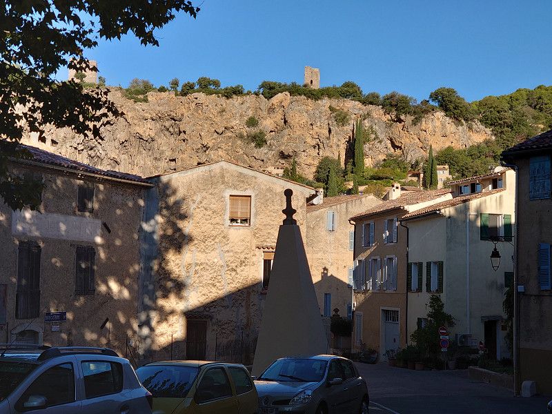
Cotignac 43.52091, 6.14636
We wanted to park at the Chapelle Notre-Dame-de-la-Grâce. But in the evening, in the dark, we couldn't find the parking lot to spend the night in, despite having a satnav. I would advise any other motorhome driver not to do this either. We got into very narrow paths and once, on the second attempt, we got stuck for almost half an hour. It was so steep that the wheels spun on the concrete surface. We only managed to get back up the hill by laying towels underneath us. Luckily, there was no damage to the vehicle. But we did spend the night down in the parking lot.
43.52091, 6.14636
43° 31' 15.3" N 6° 8' 46.9" E
43.5209100 6.1463600
• Head north on Chemin de Notre-Dame. Go for 240 m.
• Continue on Chemin de Notre-Dame (D613). Go for 1.3 km.
• Turn left onto Cours Gambetta (D13). Go for 324 m.
• Take the 2nd exit from roundabout onto Avenue Jean Moulin (D13). Go for 54 m.
• Turn left. Go for 68 m.
• Arrive at your destination on the right.
☍
2,0 km
( 5 min.)
Cotignac 43.5276, 6.153
Parking lot in Cotignac. We were able to sleep well. The place is a bit uneven, but we were able to park so that the vehicle was facing forward.
43.5276, 6.153
43° 31' 39.4" N 6° 9' 10.8" E
43.5276000 6.1530000
• Head toward Rue des Écoles. Go for 124 m.
• Turn right onto Rue des Écoles. Go for 30 m.
• Turn right onto Avenue Jean Moulin (D13). Go for 252 m.
• Take the 2nd exit from roundabout onto Avenue Jean Moulin (D13). Go for 232 m.
• Turn sharp right onto Cours Gambetta toward Centre Ville. Go for 127 m.
• Turn right onto Rue de la Victoire. Go for 129 m.
• Arrive at Rue de la Victoire. Your destination is on the right.
☍
0,9 km
( 2 min.)
Day
Cotignac
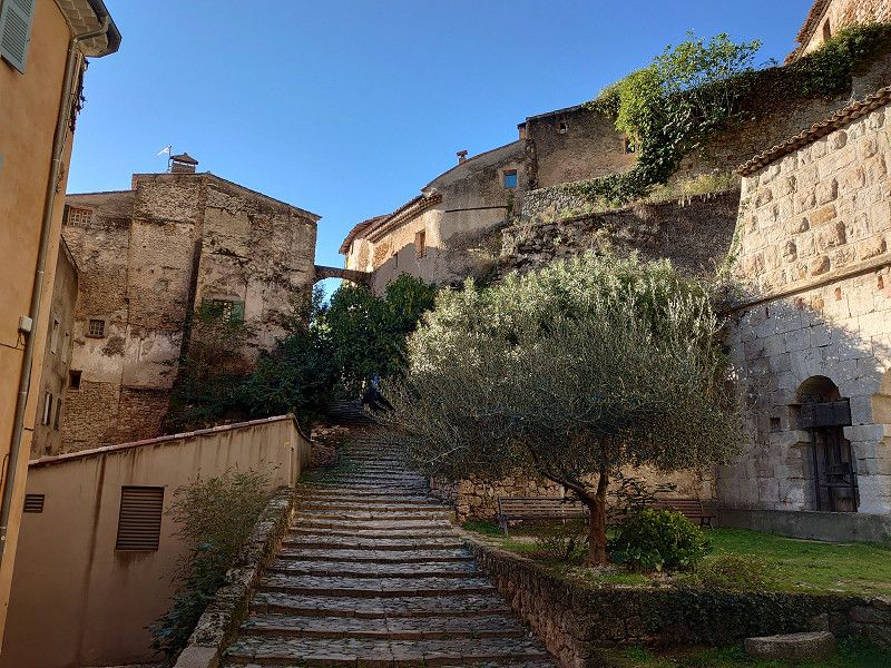
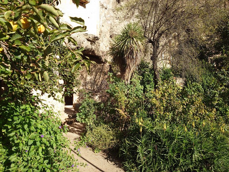
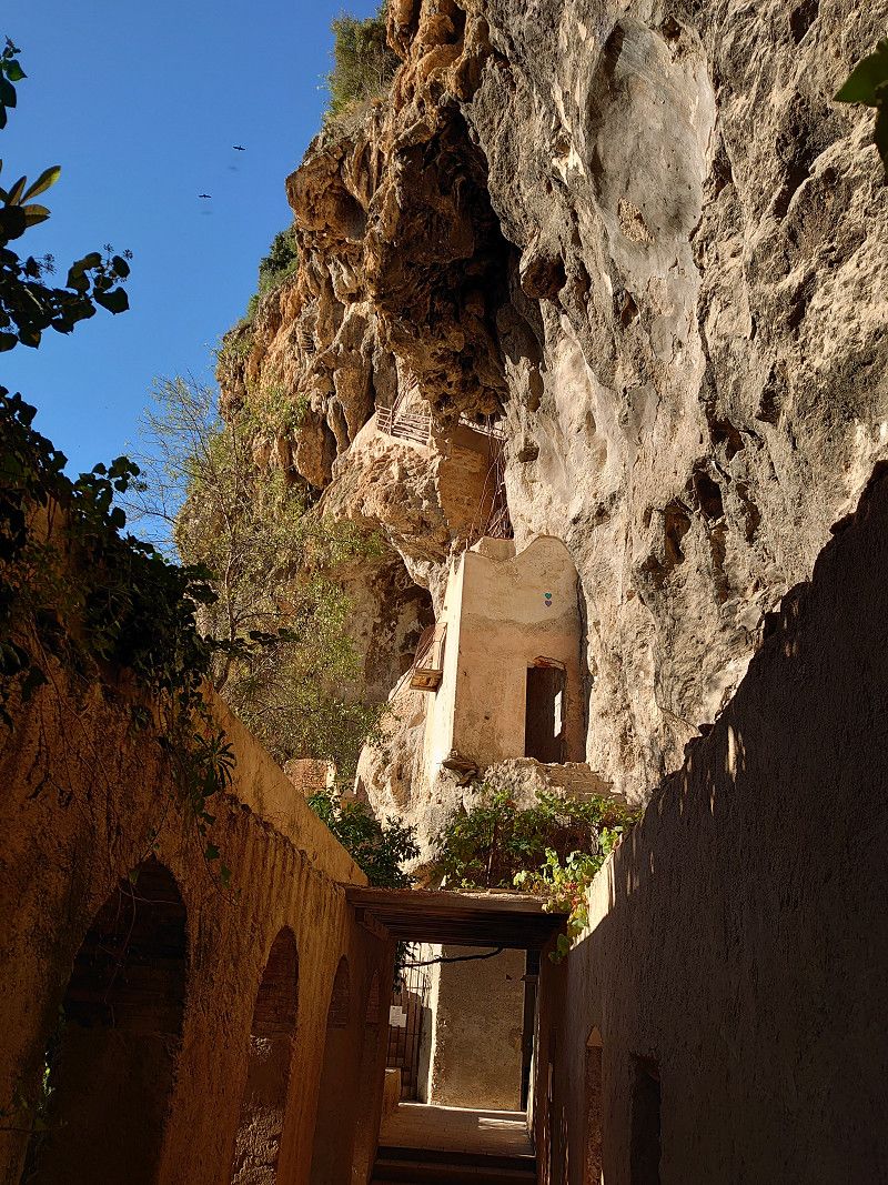
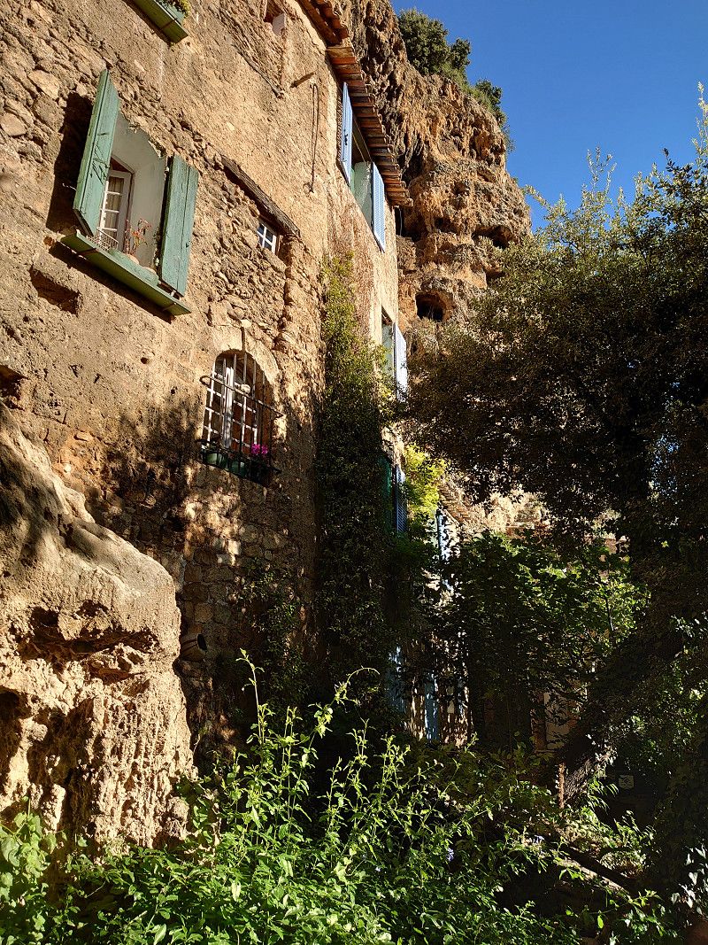
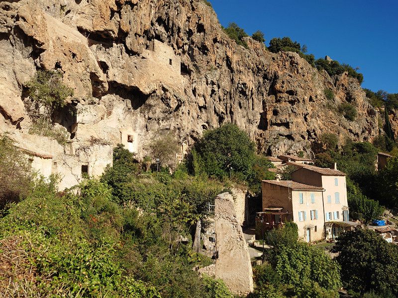
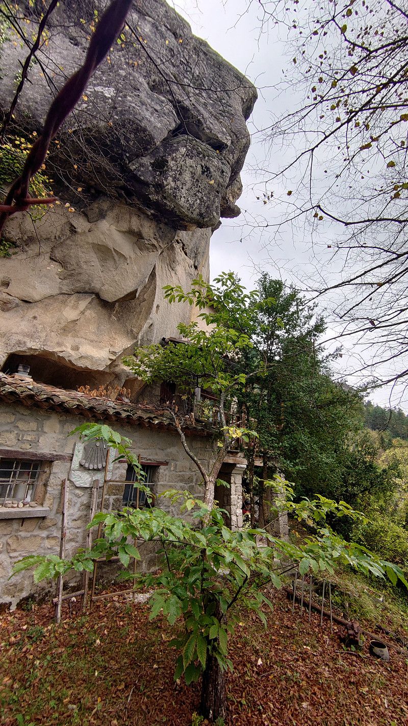
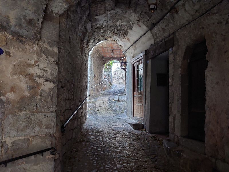
We stopped in the car park because it is not far from here to the town. A walk around and a hike along the grottos that lead up to two towers on the rocks were quite impressive. The path to the grottos and up to the towers is something you should not miss. Pure idyll with the many small houses built into the rocks.
Var, Provence-Alpes-Côte d'Azur, Frankreich
43° 31' 41" N 6° 9' 1" E
43.5280531 6.1502672
• Head southeast on Rue de la Victoire. Go for 55 m.
• Turn left onto Rue Georges Clemenceau. Go for 114 m.
• Turn left onto Avenue Jean Moulin (D13). Go for 87 m.
• Take the 1st exit from roundabout onto Route d'Entrecasteaux (D50). Go for 4.4 km.
• Continue on Route de Cotignac (D50). Go for 3.7 km.
• Turn left onto Route de Carcès (D31) toward Entrecasteaux. Go for 632 m.
• Turn left onto Rue du Portail (D31). Go for 460 m.
• Turn left onto Place du Souvenir (D31). Go for 294 m.
• Arrive at Cours Gabriel Péri (D31). Your destination is on the right.
☍
9,7 km
( 14 min.)
Entrecasteaux 43.5152, 6.2403
We headed for the car park in Entrecasteaux. We would have liked to visit the château, but it is only open during the high season. The church was also closed. So we drove on, as there was nothing more we could do here. However, we did not want to be there during peak travel times, as the place is small and will certainly be overcrowded.
43.5152, 6.2403
43° 30' 54.7" N 6° 14' 25.1" E
43.5152000 6.2403000
• Head toward Rue de Lubac on Cours Gabriel Péri (D31). Go for 143 m.
• Continue on D31. Go for 8 m.
• Turn left onto Route d'Entrecasteaux (D31). Go for 7.2 km.
• Turn left onto Route des 4 Chemins. Go for 59 m.
• Turn left onto Route des 4 Chemins. Go for 153 m.
• Arrive at Route des 4 Chemins. Your destination is on the left.
☍
7,5 km
( 8 min.)
Salernes 43.5588, 6.2335
The parking space in Salernes was originally planned. However, we drove about 200 meters further to a parking lot right at the entrance to the town, as we knew that we would not be staying overnight here. We then visited the town, including the old part of Salernes, Vieux Salernes. We also went to the local church. A beautiful little place with its own flair.
43.5588, 6.2335
43° 33' 31.7" N 6° 14' 0.6" E
43.5588000 6.2335000
• Head north on Route des 4 Chemins. Go for 153 m.
• Turn right onto Route des 4 Chemins. Go for 59 m.
• Turn left onto Rue Édouard Basset (D31). Go for 118 m.
• Turn right onto Avenue Pierre Gaudin. Go for 188 m.
• Turn right onto Avenue Victor Hugo (D2560). Go for 96 m.
• Continue on D2560. Go for 11 m.
• Continue on Boulevard de la Libération (D2560). Go for 162 m.
• Take the 3rd exit from roundabout onto Route de Draguignan (D2560). Go for 418 m.
• Take the 3rd exit from roundabout onto Route de Villecroze (D51). Go for 877 m.
• Take the 2nd exit from roundabout onto Route de Villecroze (D51) toward Villecroze/Tourtour. Go for 724 m.
• Continue on Route de Salernes (D51). Go for 2.5 km.
• Continue on Place Gabriel Péri (D51). Go for 32 m.
• Turn left onto Rue Ambroise Croizat (D557). Go for 761 m.
• Turn right onto Route de Tourtour (D51). Go for 1.7 km.
• Continue on Route de Villecroze (D51). Go for 2.9 km.
• Take the 1st exit from Rond-Point d'Aups roundabout onto Chemin des Peiroues (D51). Go for 504 m.
• Continue on Rue Grande (D51). Go for 270 m.
• Turn right onto Place des Ormeaux (D51). Go for 43 m.
• Continue on D51. Go for 25 m.
• Continue on Rue de l'Église (D51). Go for 168 m.
• Take the 2nd exit from Rond-Point Sainte-Anne roundabout onto Chemin du Gour. Go for 111 m.
• Arrive at Chemin du Gour. Your destination is on the right.
☍
11,9 km
( 17 min.)
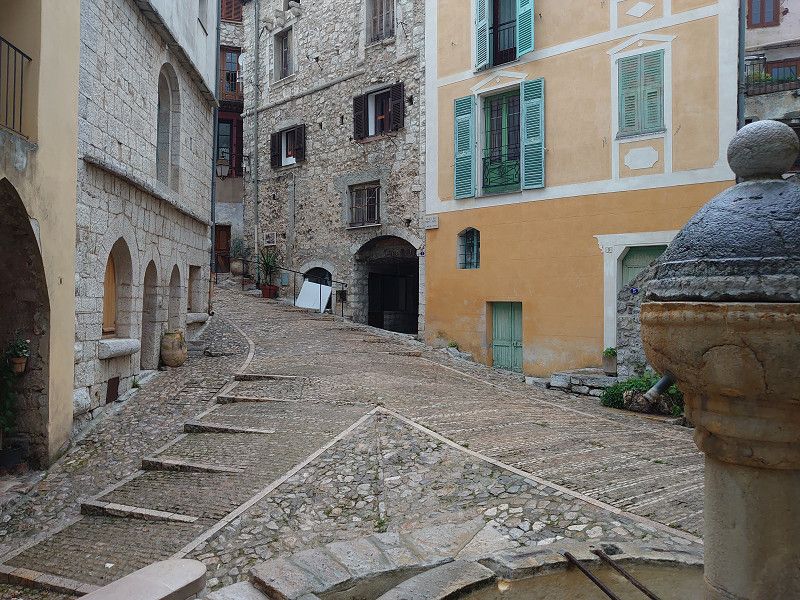
Tourtour
We parked our camper van right at the roundabout that is also the entrance to the town of Tourtour. Right at the beginning of the town is the tourist office, where we got a map. With this map we were able to do a detailed tour of the town, which was of course very helpful. Nevertheless, we were through the town after two hours, so we decided to drive on to Bargemon because we wanted to spend the night on a parking spot there.
43.5890, 6.3060
43° 35' 20.4" N 6° 18' 21.6" E
43.5890000 6.3060000
• Head toward Rond-Point Sainte-Anne on Chemin du Gour. Go for 75 m.
• Take the 1st exit from Rond-Point Sainte-Anne roundabout onto Route d'Ampus (D51). Go for 2.6 km.
• Take the 2nd exit from roundabout onto Route d'Ampus (D51). Go for 673 m.
• Continue on Route de Tourtour (D51). Go for 4.0 km.
• Turn left onto D49. Go for 22 m.
• Continue on Quartier Saint-Roch (D49). Go for 278 m.
• Turn right onto Boulevard Georges Clemenceau. Go for 295 m.
• Continue on D51. Go for 101 m.
• Continue on Route de Châteaudouble (D51). Go for 705 m.
• Continue on D51. Go for 1.2 km.
• Continue on Lieu-dit La Gouargue (D51). Go for 155 m.
• Continue on D51. Go for 1.9 km.
• Continue on Route d'Ampus (D51). Go for 5.6 km.
• Turn left onto Route de Montferrat (D955). Go for 110 m.
• Turn slightly left onto Route de Montferrat (D955). Go for 5.9 km.
• Turn right onto Route de Comps (D19) toward Bargemon/Fayence. Go for 5.7 km.
• Turn right onto D19. Go for 211 m.
• Continue on Route de Broves (D19). Go for 586 m.
• Turn left onto Place Philippe Chauvier (D55). Go for 34 m.
• Turn left onto Rue Jean Jaurès (D19). Go for 578 m.
• Turn right. Go for 37 m.
• Arrive at your destination on the left.
☍
30,6 km
( 38 min.)
Bargemon 43.6244, 6.5509
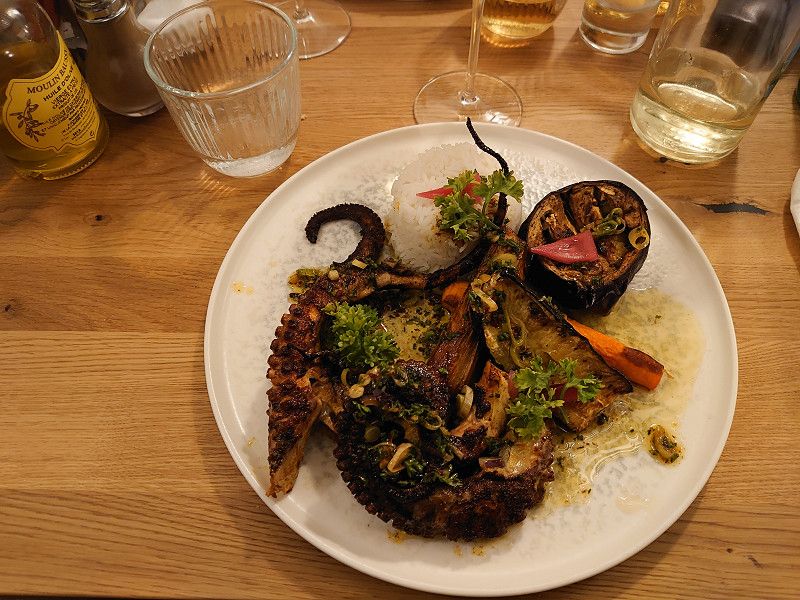
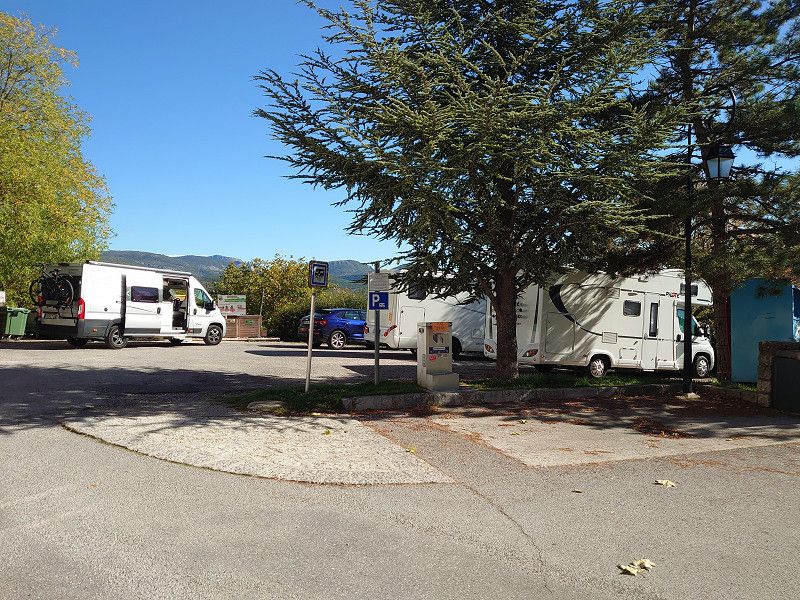
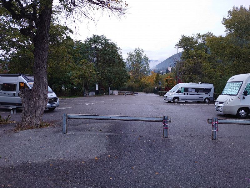
Arrival at the parking space in Bargemon, which is free of charge and has electricity, waste disposal and fresh water. 5 minutes and you are in the center. We used it in the evening and had dinner here in the restaurant La Taverna. Starter was frog legs and main course was octopus, fantastic. But we already know the place from a previous trip. It was our destination because of the parking space.
43.6244, 6.5509
43° 37' 27.8" N 6° 33' 3.2" E
43.6244000 6.5509000
• Head toward Route de Seillans. Go for 37 m.
• Turn left onto Route de Seillans (D19). Go for 578 m.
• Turn right onto Place Philippe Chauvier (D55). Go for 34 m.
• Turn right onto Rue François Maurel (D19/D25). Go for 46 m.
• Turn right onto Rue Marceau. Go for 119 m.
• Turn right onto Chemin du Clos. Go for 73 m.
• Turn right onto D19. Go for 60 m.
• Turn right onto Lieu-dit Le Clos (D25). Go for 15.1 km.
• Turn left onto D37. Go for 1.7 km.
• Continue on D37. Go for 208 m.
• Turn left onto D37. Go for 321 m.
• Continue on D37. Go for 608 m.
• Continue on D37. Go for 843 m.
• Turn left onto D37. Go for 278 m.
• Arrive at your destination on the left.
☍
20,0 km
( 25 min.)
Day
Bargème
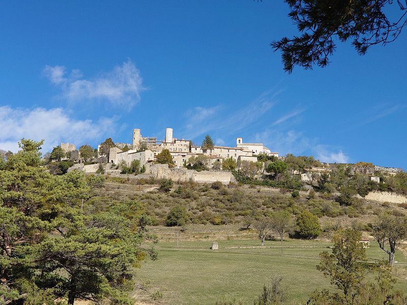
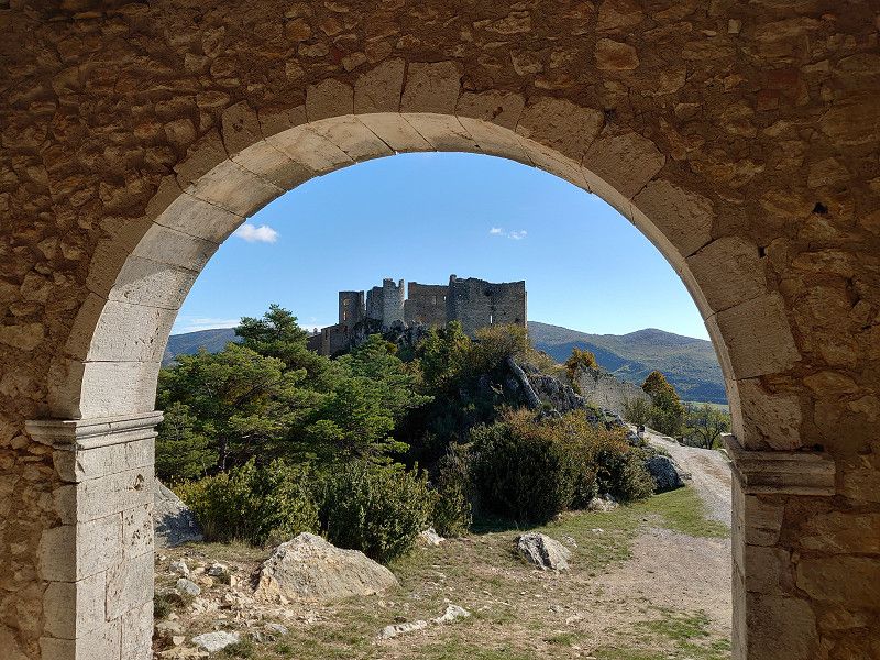
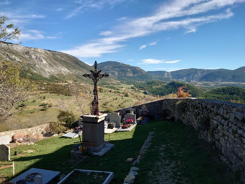
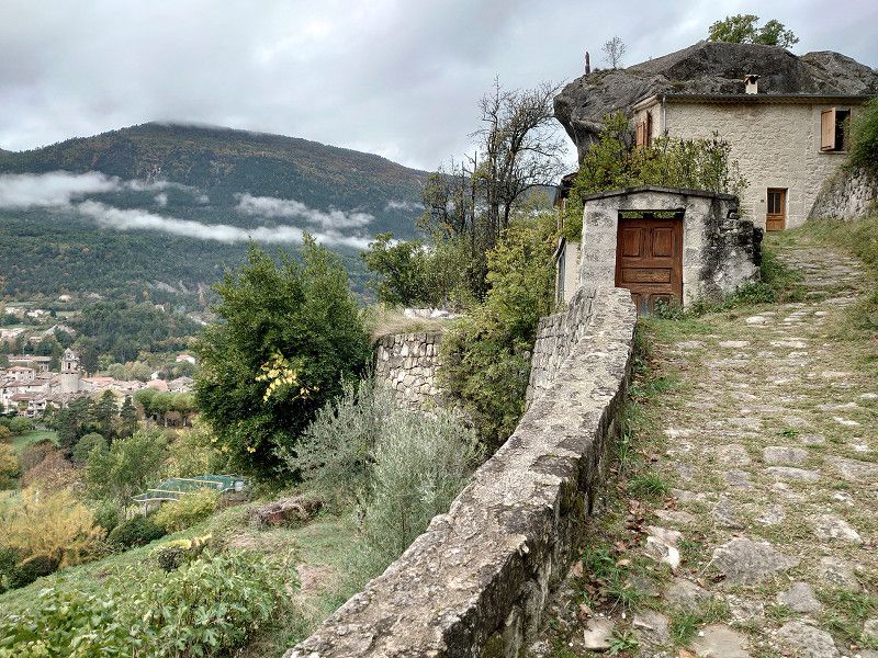
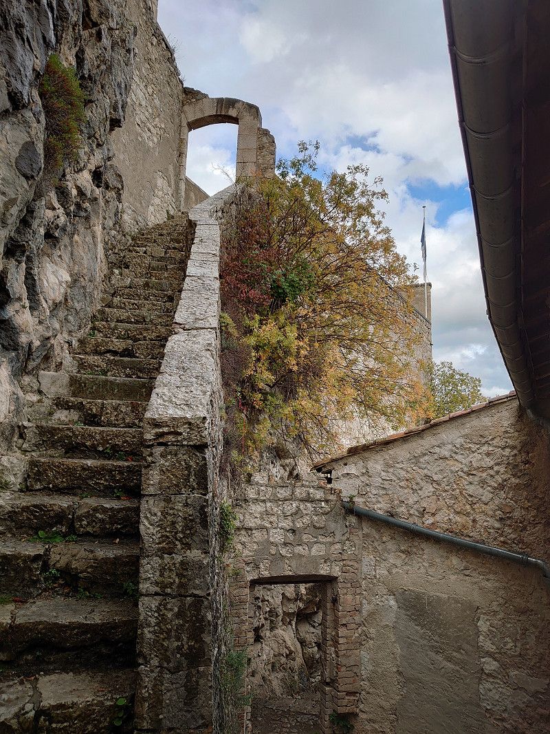
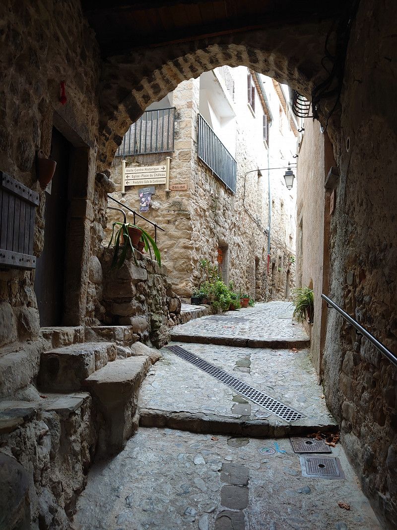
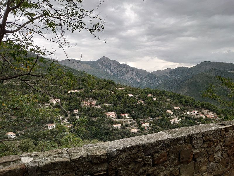
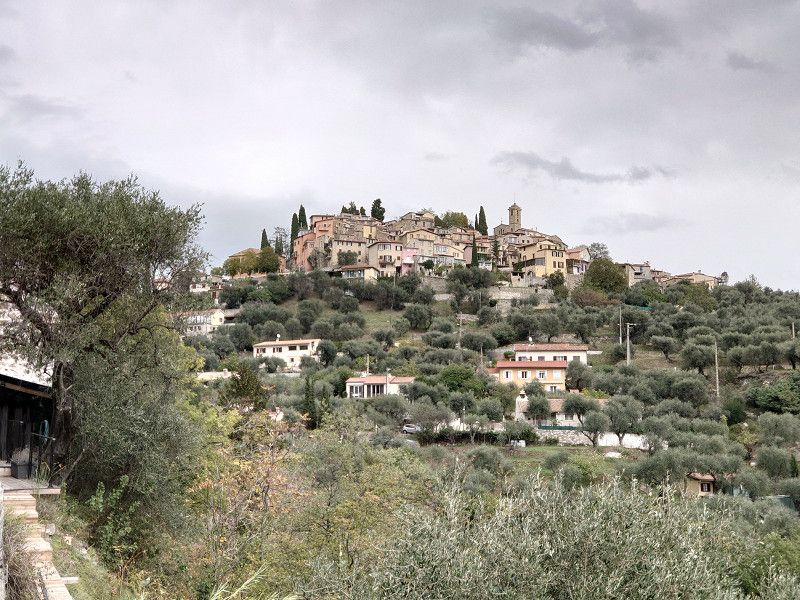
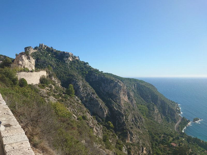
In the morning we disposed of waste and filled up with fresh water in Bargemon. We already knew the place from a previous visit. Then we went to Bargème. We didn't drive to the parking space below the town, but to the car park in Bargéme 43.72991, 6.57119. I would definitely advise large motorhomes to stay down at the site. I wouldn't drive up there in high season either, it's just too narrow. The location of the town is impressive. Of course we visited the small town with its imposing castle ruins, which are currently being renovated. A really worth seeing place, also with its small church and the fantastic panoramic view.
43.72991, 6.57119
43° 43' 47.7" N 6° 34' 16.3" E
43.7299100 6.5711900
• Head southeast. Go for 176 m.
• Continue on D37. Go for 102 m.
• Turn right onto D37. Go for 2.0 km.
• Turn right onto Lieu-dit Plan Cousset (D21). Go for 6.1 km.
• Turn right toward D955. Go for 384 m.
• Turn right onto D955. Go for 7.7 km.
• Turn left onto Route de la Cornuelle (D90). Go for 1.5 km.
• Turn right. Go for 47 m.
• Arrive at your destination.
☍
18,0 km
( 20 min.)
Trigance 43.7605, 6.4422
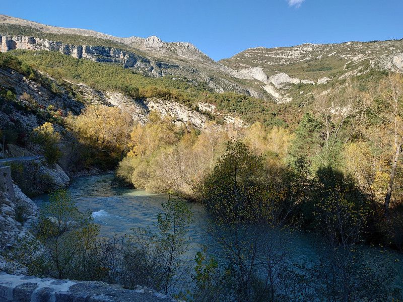
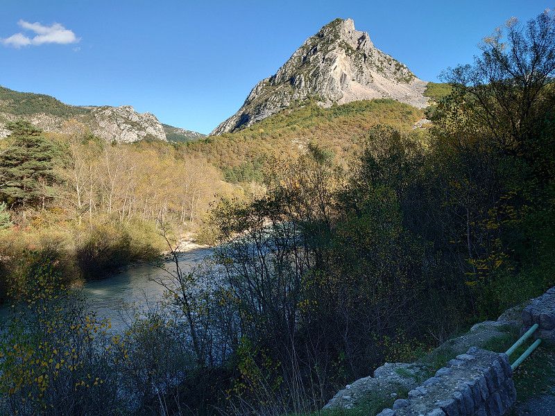
We got a place on the small parking lot with waste disposal. A small, charming place on a rock, which is also crowned by the ruins of a castle. You can visit the place in an hour, as it really isn't that big. But you need more time for the castle. The drive from Bargème to Trigance was through a beautiful landscape, especially the last part.
43.7605, 6.4422
43° 45' 37.8" N 6° 26' 31.9" E
43.7605000 6.4422000
• Head toward Route de Draguignan. Go for 21 m.
• Turn right onto Rue du Four. Go for 90 m.
• Turn slightly right onto Rue du Portail. Go for 97 m.
• Turn right onto Rue de la Bote. Go for 54 m.
• Turn left onto Rue de la Tribune. Go for 23 m.
• Turn right onto Chemin de la Fontaine. Go for 232 m.
• Turn left onto Route de la Cornuelle (D90). Go for 538 m.
• Turn left onto D955. Go for 6.2 km.
• Continue on Lieu-dit Pont de Soleils (D952). Go for 11.9 km.
• Take the 1st exit from roundabout onto Boulevard de la République (D4085) toward Grasse/Cannes/La Garde. Go for 138 m.
• Turn left onto Ancienne Route de Grasse. Go for 104 m.
• Turn right. Go for 9 m.
• Turn slightly left. Go for 14 m.
• Arrive at your destination on the left.
☍
19,4 km
( 26 min.)
Castellane
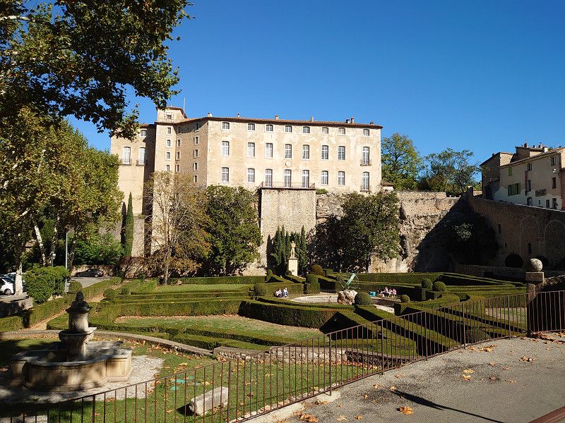
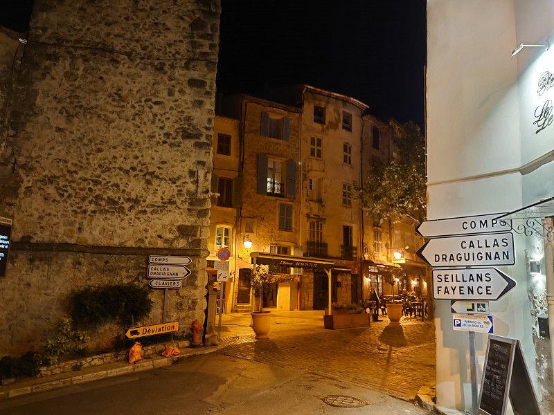
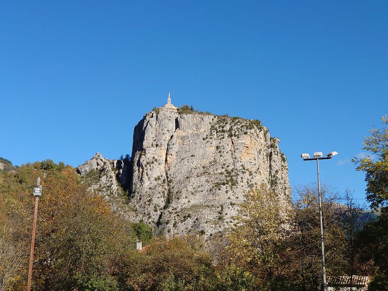
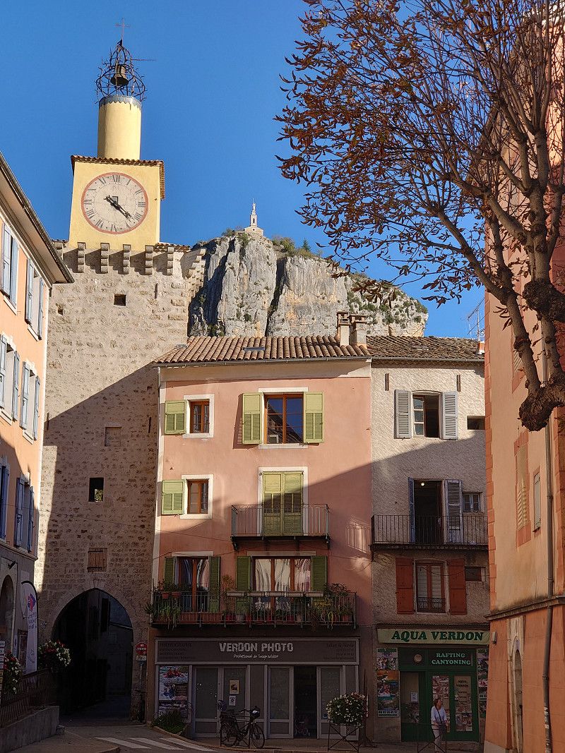
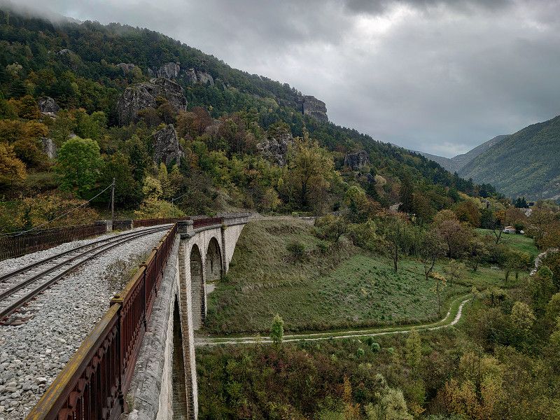
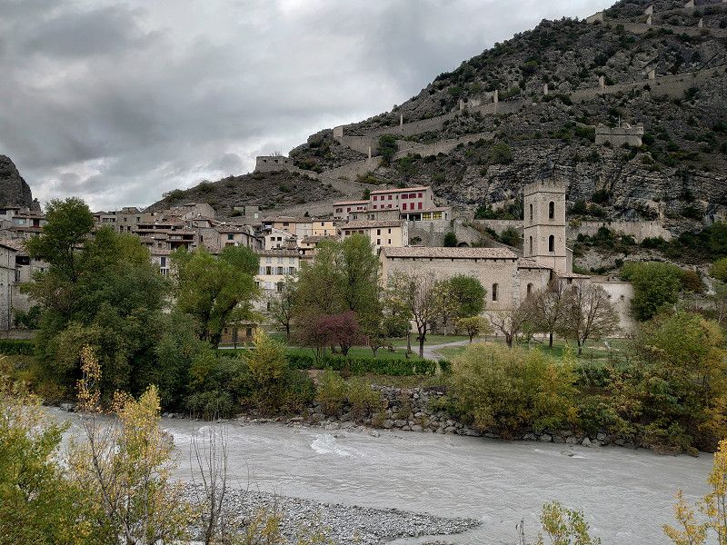
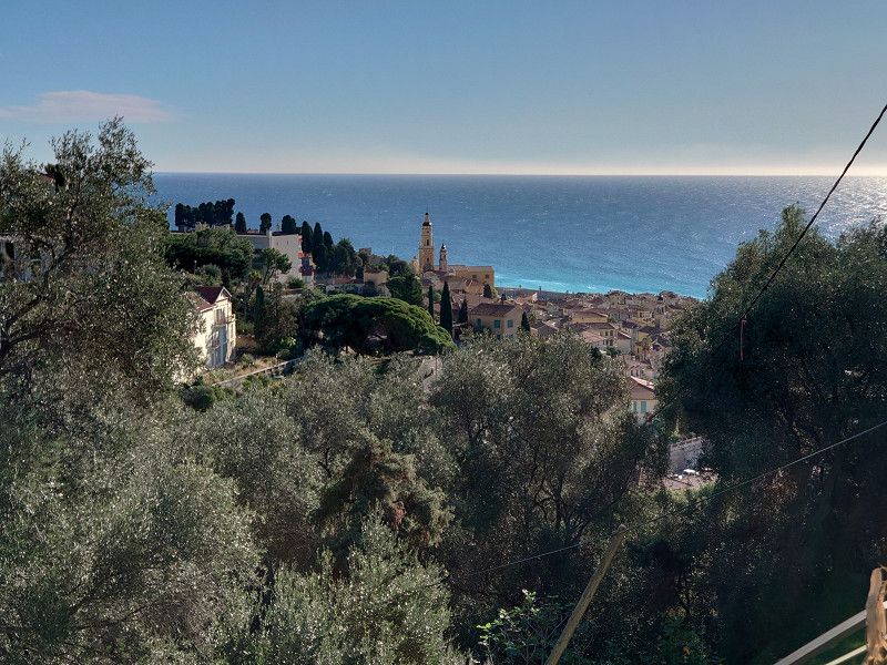
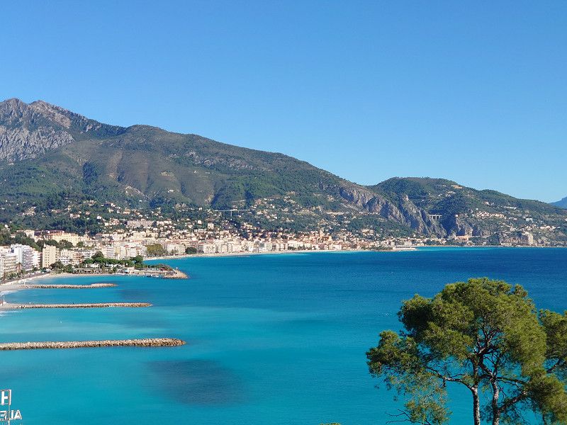
From Tigance we then go through a small part of the Verdon Gorges to Castellane, where parking is also free in the center at 43.8453, 6.5107. The parking space (120 spaces) is also close to the center, but on a road, costs €9. We had originally planned to spend the night here, but Castellane disappointed us a little with its town. Of course there is a small historic part with a town gate, also two churches, Église St. Victor and Église du Sacré-Coeur, as well as the Chapelle Notre-Dame du Roc on top of the rock. We did not go up the rock, however, even though you are supposed to have a great view of the town from there. We then went through a beautiful landscape on the D955 past the Barrage de Castillon and then over the Col de Toutes Aures (1124 m) to Annot to the parking space where we are spending the night. We will look at the town tomorrow.
43.8463, 6.5152
43° 50' 46.7" N 6° 30' 54.7" E
43.8463000 6.5152000
• Head east. Go for 136 m.
• Turn left toward Ancienne Route de Grasse. Go for 17 m.
• Turn left onto Ancienne Route de Grasse. Go for 68 m.
• Turn right onto Route Napoléon (D4085). Go for 120 m.
• Take the 1st exit from roundabout onto Rue Nationale (D4085) toward Digne/Grenoble/Barrême/St André. Go for 748 m.
• Take the 2nd exit from roundabout onto D955 toward St André les Alpes/Annot/St Julien du Verdon/Lac de Castillon. Go for 12.3 km.
• Turn right onto N202. Go for 16.8 km.
• Turn left onto D908 toward Annot. Go for 2.1 km.
• Turn left onto Place du Germe. Go for 171 m.
• Continue on Chemin de la Colle Basse. Go for 229 m.
• Arrive at Chemin de la Colle Basse. Your destination is on the left.
☍
32,7 km
( 39 min.)
Day
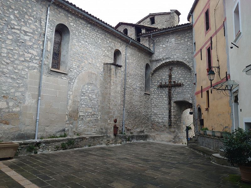
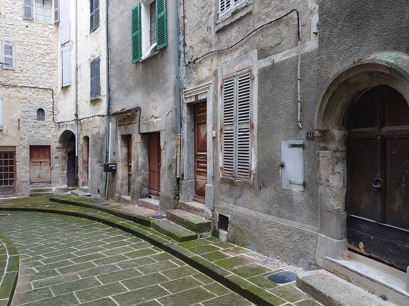
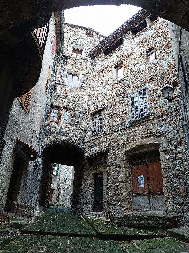
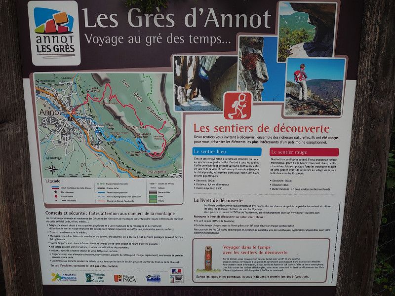
Annot 43.9635, 6.6640
Parking lot and parking space with supply and disposal in Annot. We'll look at the place tomorrow. We looked at the place on the morning of October 29th, 2023. Unfortunately, the nice weather was over today. Always overcast skies and sometimes light rain, all day. Annot is a magical place that is sure to be even more enjoyable in good weather. A short hike to the chapel on the sandstone cliffs was possible, but we decided against the whole circuit that you can do here from 2.5 to 4 hours, especially since Marianne couldn't do it anyway with her hip. An old, dreamy place presented itself to us. With this environment, you can go on holiday there.
43.9635, 6.6640
43° 57' 48.6" N 6° 39' 50.4" E
43.9635000 6.6640000
• Head toward Lieu-dit Pré Martin on Chemin de la Colle Basse. Go for 357 m.
• Continue on Place du Germe. Go for 43 m.
• Turn right onto Avenue du Foulon (D908). Go for 2.1 km.
• Turn left onto N202. Go for 6.6 km.
• Continue on Route de Nice (D4202) toward Nice/Entrevaux. Go for 5.7 km.
• Turn right onto Avenue Vauban. Go for 112 m.
• Turn left toward Lieu-dit Le Vieux Chemin. Go for 9 m.
• Continue on Lieu-dit Le Vieux Chemin. Go for 156 m.
• Arrive at Lieu-dit Le Vieux Chemin. Your destination is on the right.
☍
15,1 km
( 16 min.)
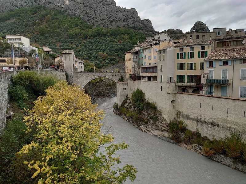
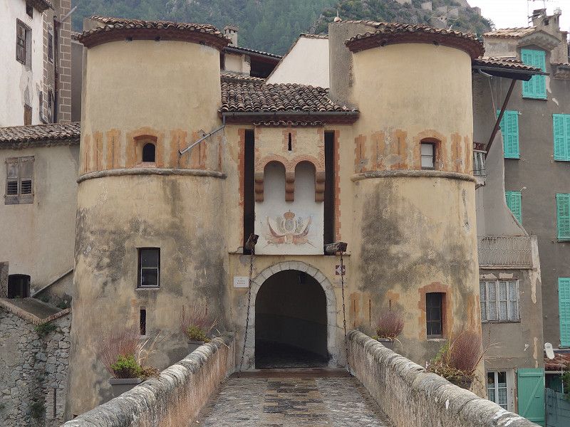
Entrevaux 43.94875, 6.81377
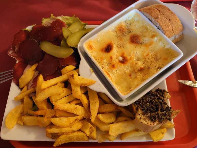
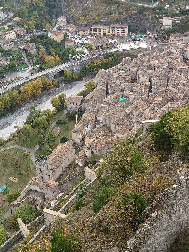
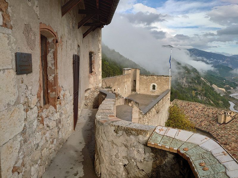
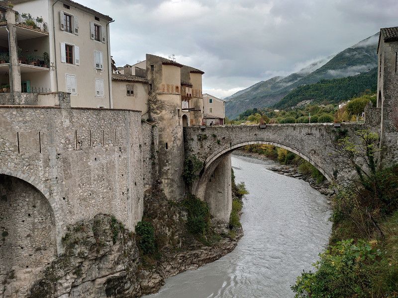
We continued on to Entrevaux, a place I've wanted to visit for a long time. It's just a shame that it rained at times. The town with its citadel certainly delights many tourists in the summer. The cathedral is also worth seeing. On October 29, 2023, although it was Sunday, there was not much going on. At lunchtime we had an excellent, typical local meal in the Le Ménestrel restaurant. And it was inexpensive too. Now, after the calories, I've decided to climb the citadel. A great view from up there. In the afternoon, as it was raining harder, we decided to drive to Puget-Theniers to the parking space for the night. The town also has a parking space, but right next to the railway line. So we drove one town further for the night.
43.94875, 6.81377
43° 56' 55.5" N 6° 48' 49.6" E
43.9487500 6.8137700
• Head east on Lieu-dit Le Vieux Chemin. Go for 346 m.
• Turn left toward Avenue Vauban/D4202. Go for 126 m.
• Turn right onto Avenue Vauban (D4202). Go for 4.7 km.
• Continue on D6202. Go for 1.8 km.
• Turn right onto Lieu-dit Le Serret (D2211 A) toward Roquesteron/La Penne/Col St Raphael. Go for 117 m.
• Turn left onto Avenue Bischoffsheim. Go for 271 m.
• Continue on Route de la Condamine. Go for 20 m.
• Arrive at Route de la Condamine. Your destination is on the right.
☍
7,4 km
( 9 min.)
Puget-Theniers 43.9535, 6.8994
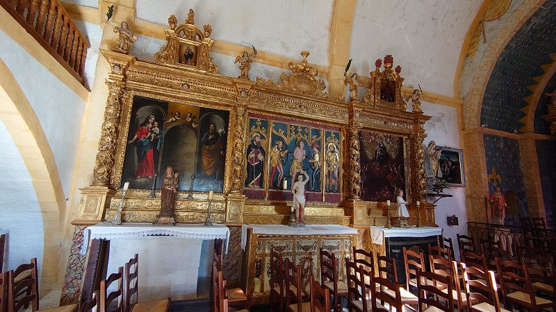
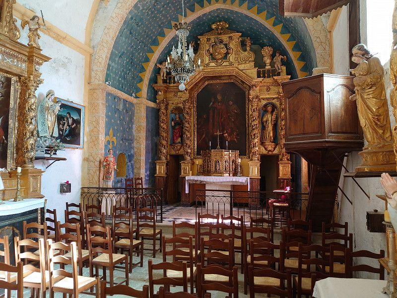
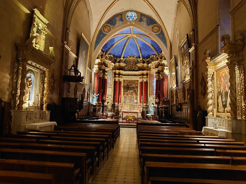
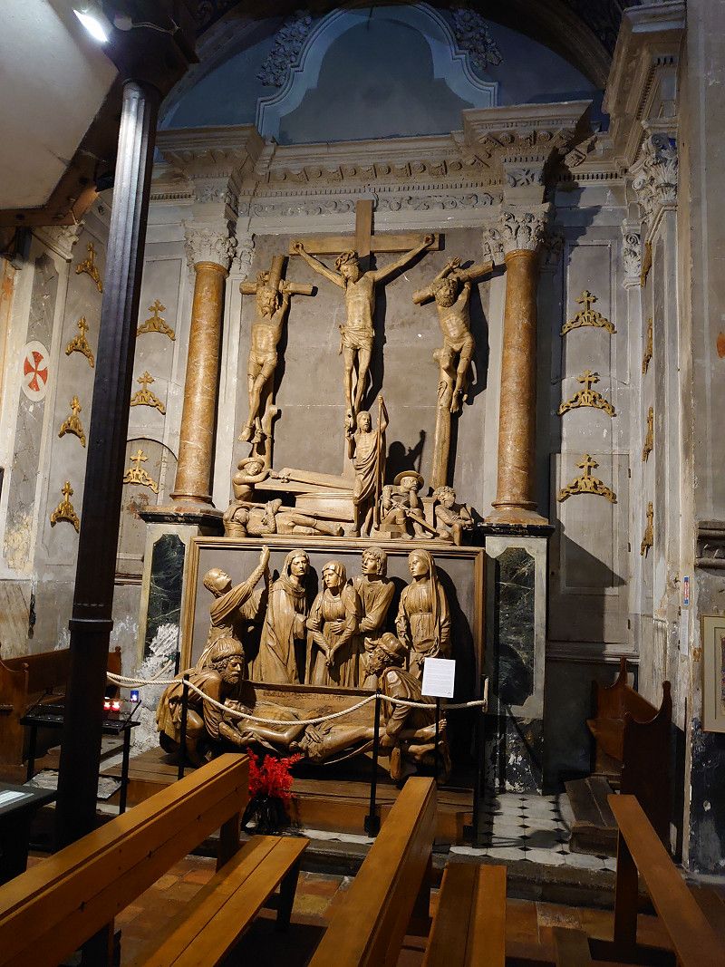
The parking space in Puget-Theniers is also an ideal starting point for visiting the town. A Vieux Village and the church with a precious altarpiece and a Retable de la Pasion from the 16th century are the highlights of the town.
43.9535, 6.8994
43° 57' 12.6" N 6° 53' 57.8" E
43.9535000 6.8994000
• Head northwest on Route de la Condamine. Go for 20 m.
• Continue on Avenue Bischoffsheim. Go for 271 m.
• Turn right onto Lieu-dit Le Serret (D2211 A). Go for 117 m.
• Turn right onto Rue Alexandre Bottin (D6202). Go for 7.9 km.
• Take the 1st exit from roundabout onto D6202. Go for 18.6 km.
• Take ramp onto Tunnel de la Mescla (D6102) toward Nice/St Martin du Var. Go for 2.7 km.
• Keep right onto M6102. Go for 5.0 km.
• Continue on Route de Grenoble (M6202). Go for 740 m.
• Pass 10 roundabouts and continue on Boulevard du Mercantour (M6202). Go for 16.9 km.
• Keep left onto Boulevard du Mercantour (M6202) toward Nice-Nord/Monaco/Gênes. Go for 95 m.
• Take the 3rd exit from roundabout onto A8 (La Provençale) toward Gênes/Monaco/Nice-Nord. Go for 10.4 km.
• Take exit 55 toward St André de la R./La Trinité/Port Nice/Nice-Est. Go for 805 m.
• Continue on Pont Garigliano. Go for 152 m.
• Turn left onto Square Cunéo toward Nice-Centre/Cannes/Digne/Aix en Provence/L'Ariane/Saint André de La Roche. Go for 74 m.
• Take ramp onto Pénétrante du Paillon (M2204 B) toward La Trinité/Contes/L'Escarène. Go for 2.3 km.
• Continue on M2204. Go for 847 m.
• Take ramp onto M2204 toward Contes/Sospel/Cantaron. Go for 270 m.
• Continue on D2204. Go for 364 m.
• Continue on M2204. Go for 931 m.
• Continue on D2204 C. Go for 311 m.
• Take the 2nd exit from roundabout onto Rue du Moulin (M2204 B) toward L'Escarène/Contes. Go for 2.8 km.
• Take the 3rd exit from roundabout onto D15 toward Contes. Go for 339 m.
• Continue on Route Départementale 15 la Roseyre (D15). Go for 278 m.
• Continue on D15. Go for 20 m.
• Continue on Route Départementale 15 la Roseyre (D15). Go for 246 m.
• Continue on D15. Go for 203 m.
• Continue on Lieu-dit La Roseraie (D15). Go for 157 m.
• Continue on D15. Go for 62 m.
• Continue on Lieu-dit Trancasse (D15). Go for 192 m.
• Continue on D15. Go for 385 m.
• Take the 1st exit from roundabout onto D15. Go for 329 m.
• Take the 2nd exit from roundabout onto Avenue Charles Alunni (D15). Go for 982 m.
• Take the 3rd exit from roundabout onto Rue Charles Alunni (D15). Go for 546 m.
• Continue on Avenue Raiberti (D15). Go for 94 m.
• Take the 3rd exit from roundabout onto Avenue Raiberti (D15). Go for 285 m.
• Continue on D15. Go for 38 m.
• Continue on Avenue Flaminius Raiberti (D15). Go for 997 m.
• Continue on Avenue René Fatou (D15). Go for 3.5 km.
• Continue on D15. Go for 14 m.
• Continue on Avenue René Fatou (D15). Go for 482 m.
• Continue on D15. Go for 14 m.
• Continue on Avenue René Fatou (D15). Go for 155 m.
• Continue on Route du Soleil (D15). Go for 171 m.
• Continue on D15. Go for 12 m.
• Turn right onto Route du Soleil (D15). Go for 3.3 km.
• Turn left onto Place Alexandre Mari. Go for 46 m.
• Arrive at Place Alexandre Mari. Your destination is on the right.
☍
84,4 km
(1 hrs. 26 min.)
Day
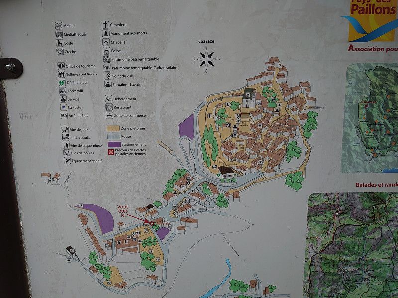
Coaraze 43.8650, 7.2932
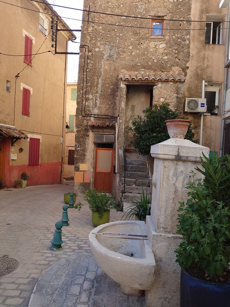
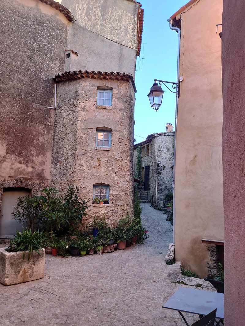
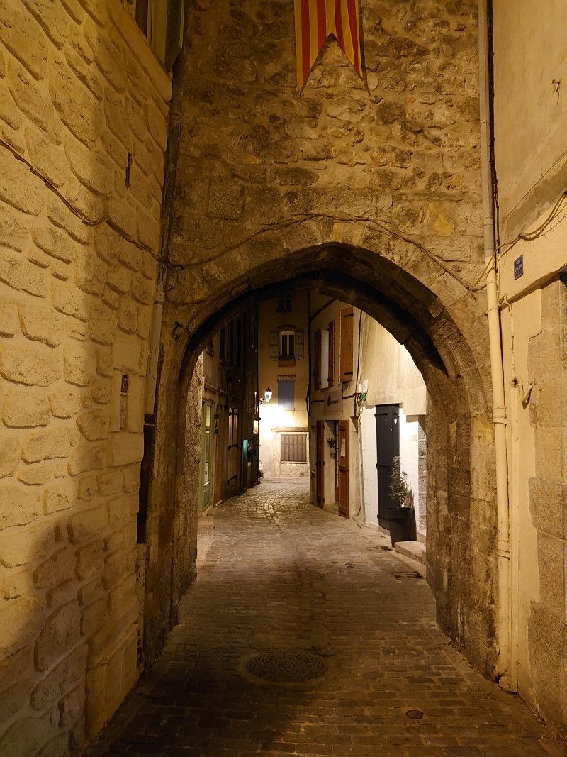
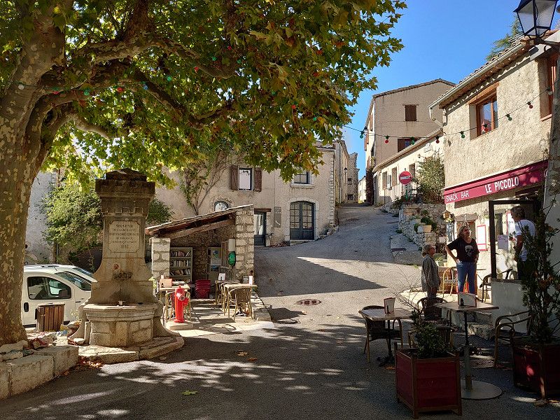
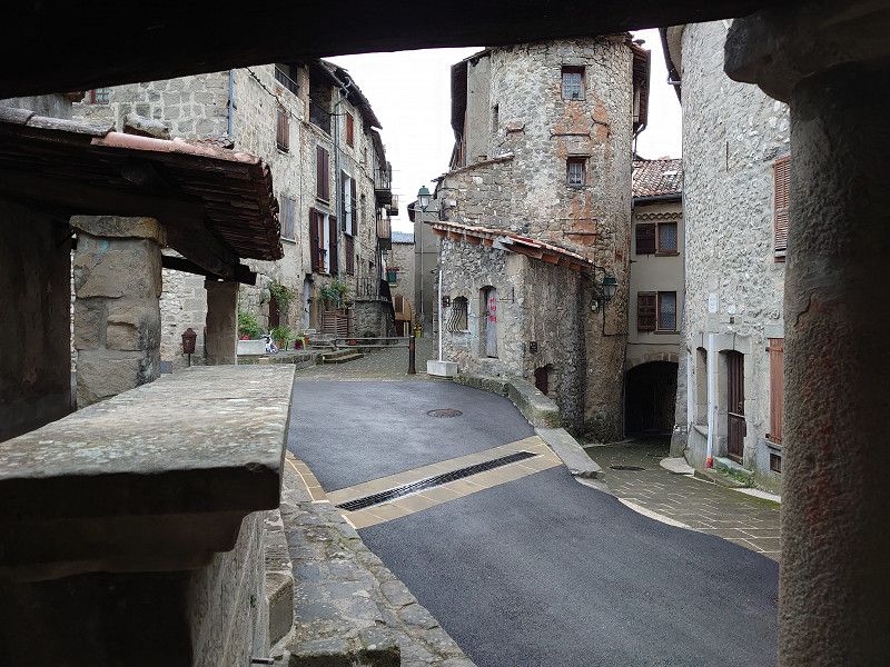
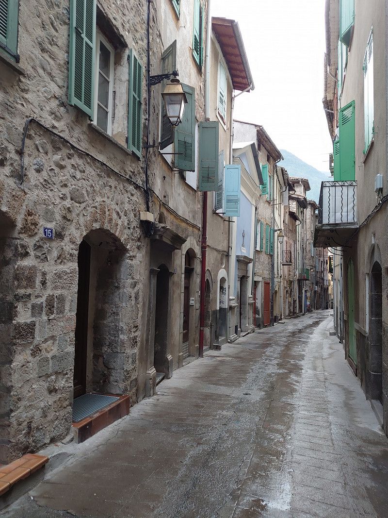
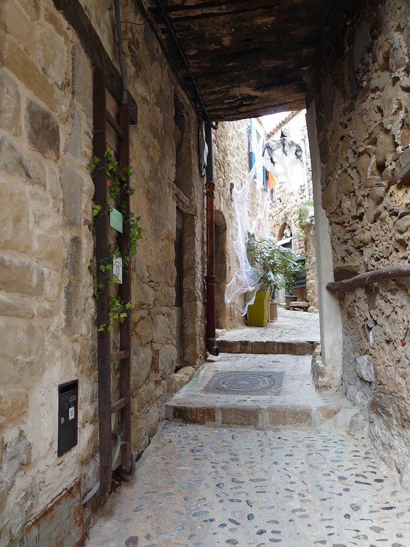
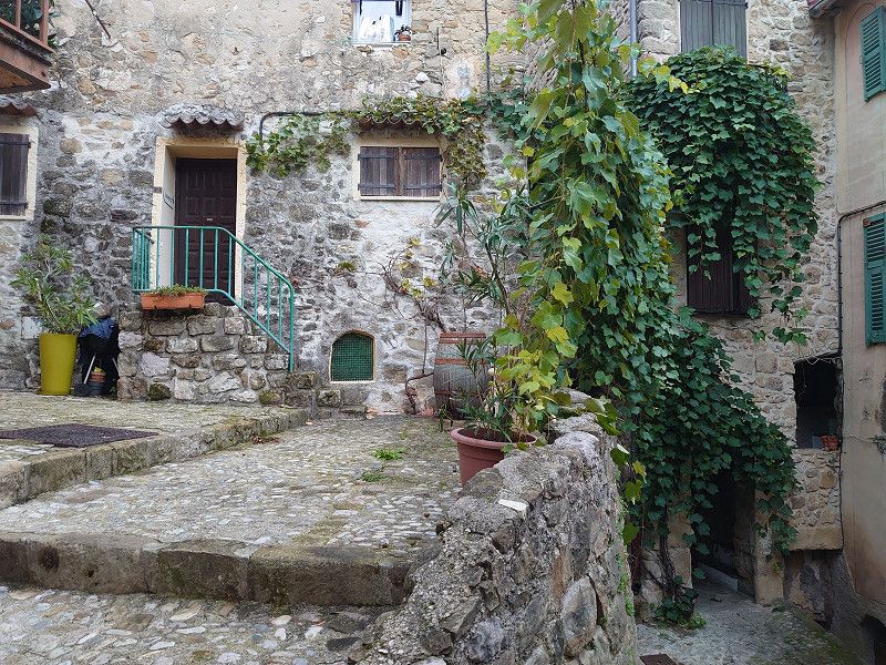
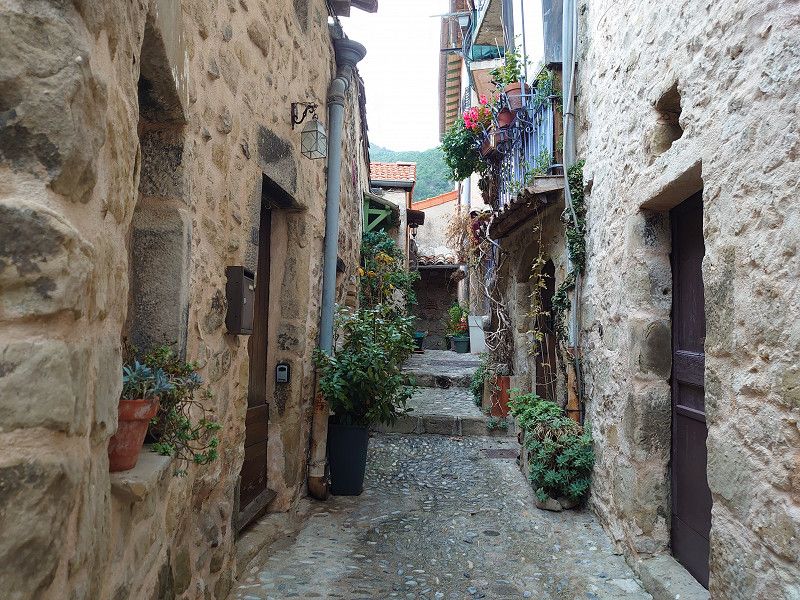
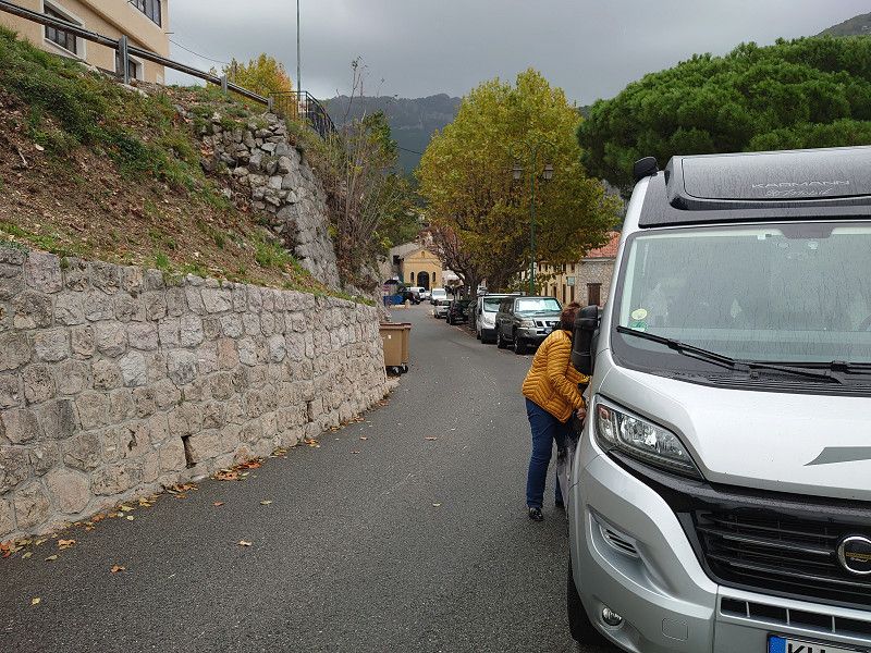
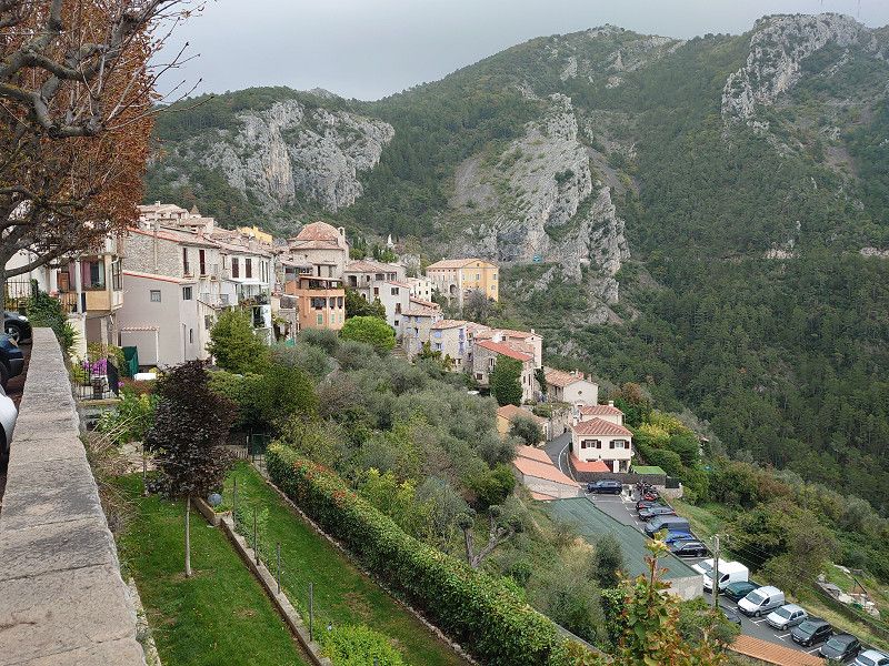
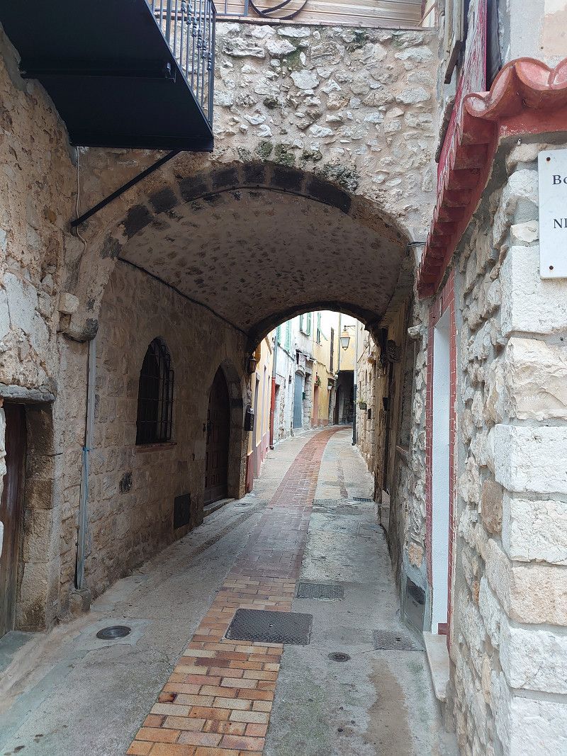
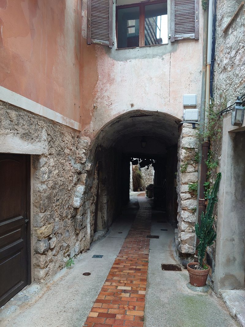
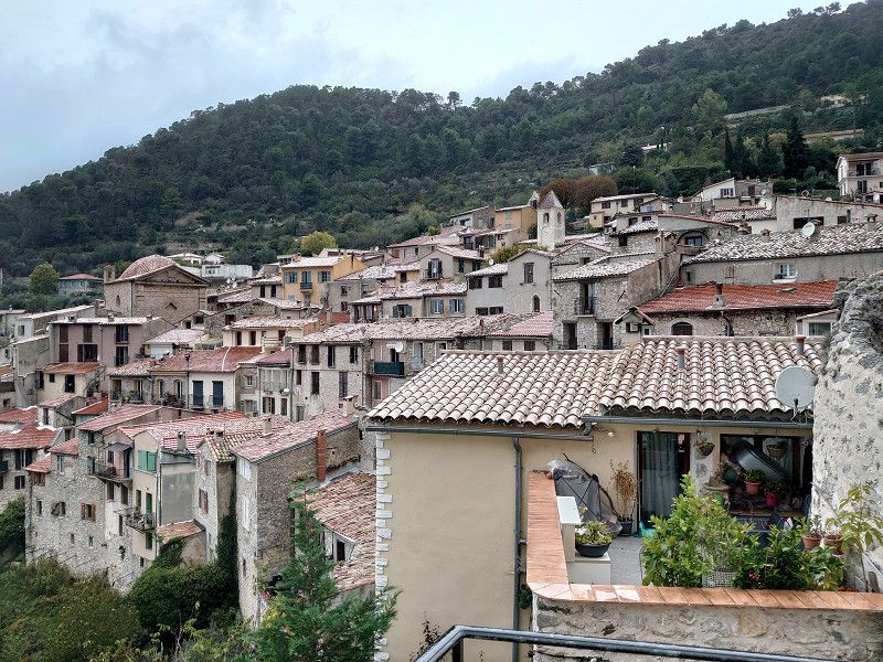
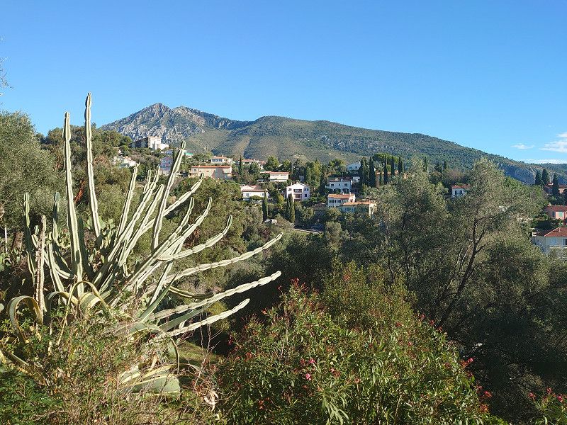
In the morning we continued on to Coaraze. The journey went along the river Var on the D6202 to the turnoff to Levens. This meant a narrow road and lots of hairpin bends. Then in Contes we continued on the narrow D15 and also hairpin bends to Coaraze. In the town we were really lucky to have a parking space as the only motorhome. In high season it would certainly be impossible to find a parking space here. We then visited the beautiful town, unfortunately in light rain, which was to last all day. Here in the town the church was even open. It is a really old place, as the pictures show. I really only recommend that you drive here with a van. Larger motorhomes will have considerable problems.
43.8650, 7.2932
43° 51' 54" N 7° 17' 35.5" E
43.8650000 7.2932000
• Head toward Avenue Théophile Gilli on Place Alexandre Mari. Go for 13 m.
• Turn right onto Avenue Théophile Gilli. Go for 43 m.
• Turn right onto Route du Col Saint-Roch (D15). Go for 43 m.
• Turn right onto Place Alexandre Mari (D15). Go for 3.3 km.
• Turn left onto D15. Go for 12 m.
• Continue on Route du Soleil (D15). Go for 171 m.
• Continue on Avenue René Fatou (D15). Go for 155 m.
• Continue on D15. Go for 14 m.
• Continue on Avenue René Fatou (D15). Go for 482 m.
• Continue on D15. Go for 14 m.
• Continue on Avenue René Fatou (D15). Go for 3.5 km.
• Continue on Avenue Flaminius Raiberti (D15). Go for 997 m.
• Continue on D15. Go for 38 m.
• Continue on Avenue Raiberti (D15). Go for 249 m.
• Take the 1st exit from roundabout onto Avenue Raiberti (D15). Go for 119 m.
• Continue on Rue Charles Alunni (D15). Go for 503 m.
• Take the 2nd exit from roundabout onto Avenue Charles Alunni (D15). Go for 981 m.
• Take the 1st exit from roundabout onto D15. Go for 332 m.
• Take the 3rd exit from roundabout onto D15. Go for 441 m.
• Continue on Lieu-dit Trancasse (D15). Go for 192 m.
• Continue on D15. Go for 62 m.
• Continue on Route de la Roseyre (D15). Go for 157 m.
• Continue on D15. Go for 203 m.
• Continue on Route Départementale 15 la Roseyre (D15). Go for 246 m.
• Continue on D15. Go for 20 m.
• Continue on Route Départementale 15 la Roseyre (D15). Go for 278 m.
• Continue on D15. Go for 257 m.
• Take the 3rd exit from roundabout onto Route Nationale (D2204) toward Peille/Peillon. Go for 486 m.
• Take the 1st exit from roundabout onto Route Nationale (D2204). Go for 1.2 km.
• Take the 2nd exit from roundabout onto D21. Go for 629 m.
• Continue on Boulevard de la Vallée (D21). Go for 3.3 km.
• Take the 2nd exit from roundabout onto Boulevard de la Vallée (D21). Go for 2.6 km.
• Continue on D21. Go for 221 m.
• Keep right onto D53. Go for 157 m.
• Continue on Route de la Grave (D53). Go for 143 m.
• Continue on D53. Go for 31 m.
• Continue on Route de la Grave (D53). Go for 186 m.
• Take the 2nd exit from roundabout onto D53. Go for 397 m.
• Continue on Route de la Grave (D53). Go for 305 m.
• Continue on Route de la Grave (D53). Go for 67 m.
• Turn right onto D53. Go for 144 m.
• Continue on Route de la Grave (D53). Go for 287 m.
• Turn right onto Route de la Grave (D53). Go for 2.1 km.
• Turn right onto Route de la Grave (D53). Go for 503 m.
• Continue on Route de la Grave (D53). Go for 1.1 km.
• Continue on D53. Go for 66 m.
• Continue on Route de la Grave (D53). Go for 284 m.
• Turn right onto Boulevard du Général de Gaulle (D53). Go for 317 m.
• Turn left onto Boulevard Aristide Briand (D53). Go for 367 m.
• Continue on D53. Go for 58 m.
• Continue on Boulevard Aristide Briand (D53). Go for 183 m.
• Turn left onto Chemin de Saint-Bernard. Go for 150 m.
• Turn slightly right onto Chemin du Carcaïs. Go for 64 m.
• Turn right onto Chemin du Carcaïs (VC4). Go for 30 m.
• Arrive at Chemin du Carcaïs (VC4). Your destination is on the right.
☍
28,2 km
( 46 min.)
Peille 43.8055, 7.4049
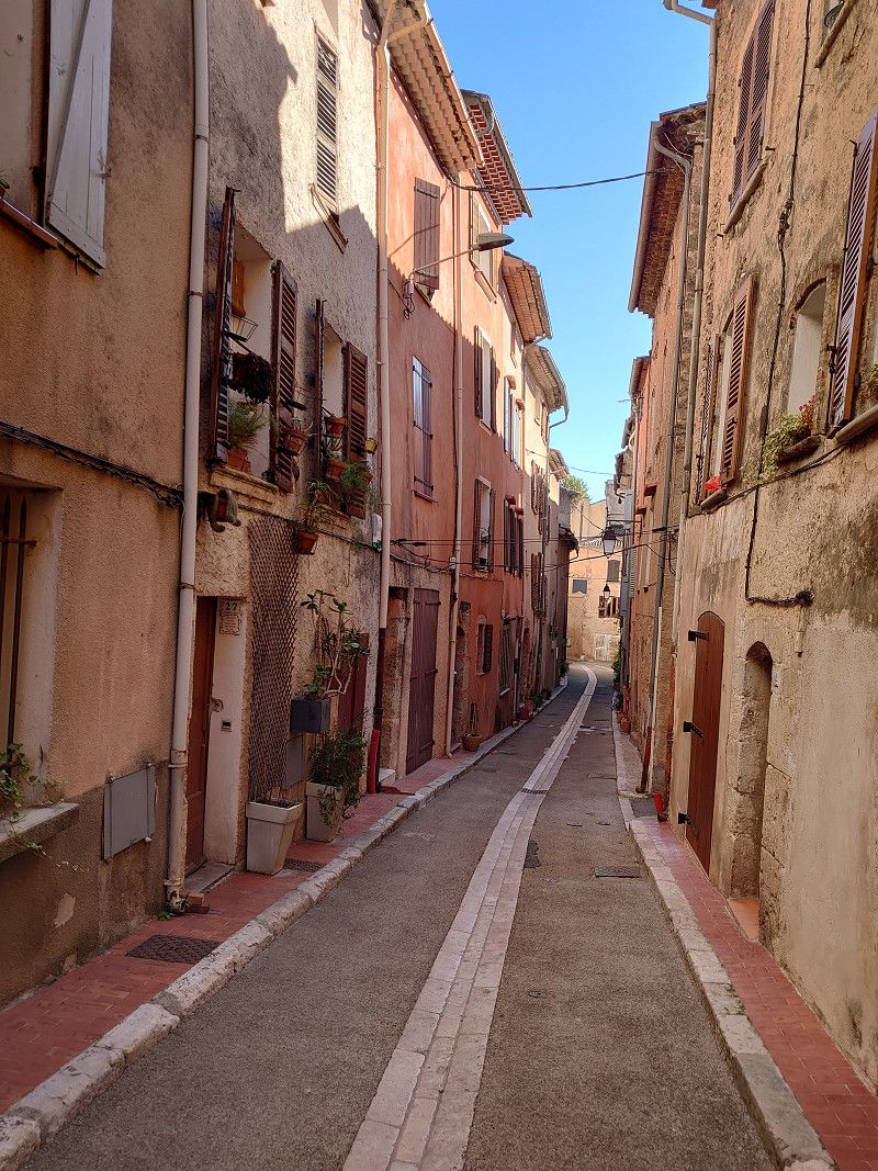
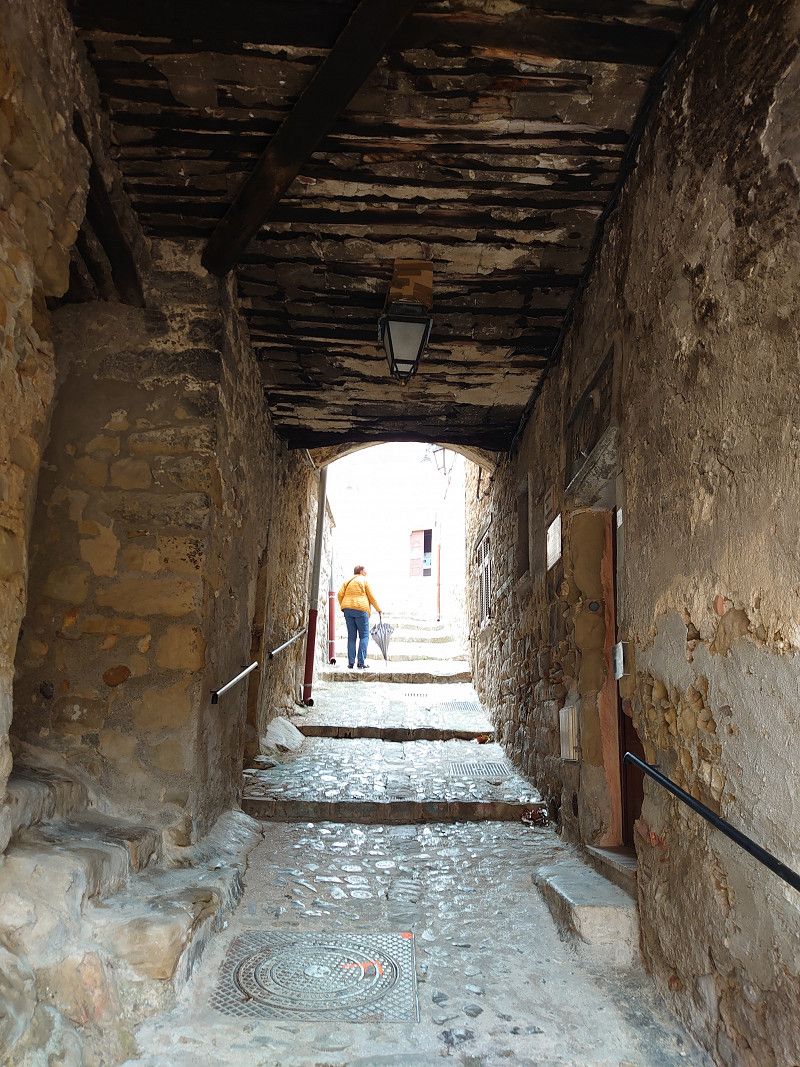
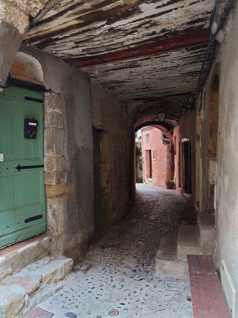
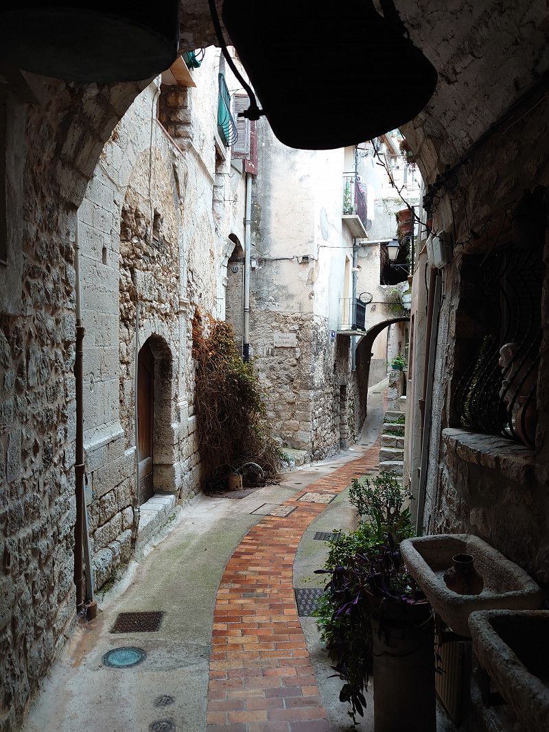
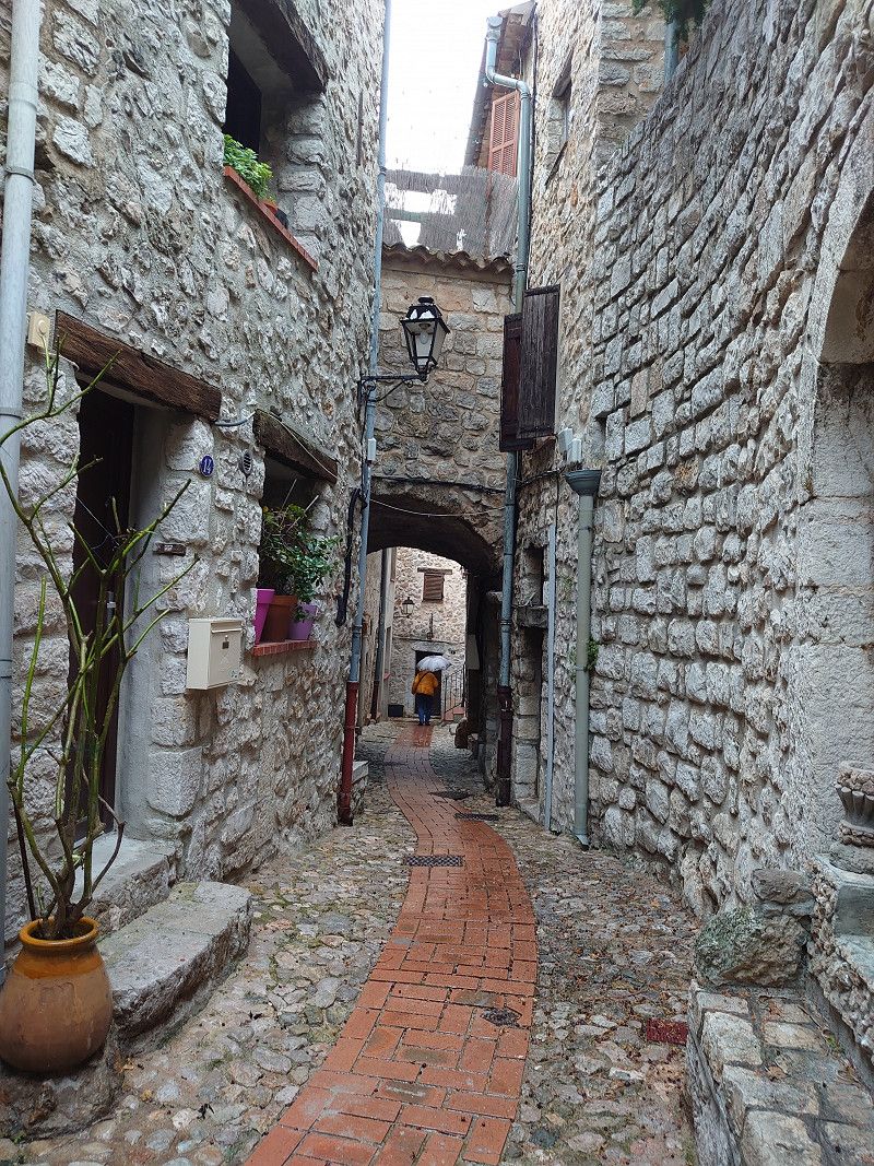
We actually wanted to go to Peillon. But from what we've heard, there is no parking space in or near the town. So we drove on to Peille. Another narrow road with lots of hairpin bends. I had to reverse in some hairpin bends to get through them. When we got to the top, the parking spaces were all much too small for my van (6.40 m). We then drove a little further up, to about the middle of the village, where we found a parking space on the side of the road. Again, I wouldn't want to go here during peak holiday season. Unfortunately, we had to visit the place worth seeing in the drizzle. Lots of small, narrow streets. Narrow streets covered in buildings, take a look at the pictures. The place is definitely worth seeing. We had just got back to our motorhome when the rain got heavier and a thunderstorm even came up. Then we were supposed to go to the campsite in Menton.
43.8055, 7.4049
43° 48' 19.8" N 7° 24' 17.6" E
43.8055000 7.4049000
• Head north on Chemin du Carcaïs (VC4). Go for 30 m.
• Turn left onto Chemin du Carcaïs. Go for 64 m.
• Turn slightly left onto Chemin de Saint-Bernard. Go for 150 m.
• Turn sharp left onto Boulevard Aristide Briand (D53). Go for 195 m.
• Continue on D53. Go for 1.5 km.
• Continue on Route de Saint-Martin de Peille (D53). Go for 2.1 km.
• Continue on D53. Go for 711 m.
• Continue on Route de Saint-Martin de Peille (D53). Go for 1.6 km.
• Continue on D53. Go for 27 m.
• Turn left onto Route de Saint-Martin de Peille (D53). Go for 165 m.
• Continue on Route de Saint-Martin de Peille (D53). Go for 1.4 km.
• Continue on D53. Go for 152 m.
• Continue on Route de Peille (D53). Go for 967 m.
• Continue on Route du Mont-Agel (D53). Go for 1.1 km.
• Turn sharp left onto Grande Corniche (D2564). Go for 1.4 km.
• Take the 1st exit from roundabout onto Route de Menton (D2564) toward A8 (Gênes)/Menton/Roquebrune-Cap Martin/Beausoleil/Monaco-Est. Go for 3.5 km.
• Take the 2nd exit from roundabout onto Grande Corniche (D2564). Go for 111 m.
• Take left ramp onto A8 (La Provençale) toward Menton/Vintimille (Vtmiglia)/Gênes (Genova)/Péage (Pedaggio). Go for 6.2 km.
• Take exit 59 toward Menton/Sospel. Go for 618 m.
• Turn right onto D22 A toward Menton/Sospel. Go for 192 m.
• Take the 1st exit from roundabout onto Route de Sospel (D2566) toward Menton. Go for 664 m.
• Pass 5 roundabouts and continue on Avenue de Sospel (D2566). Go for 2.2 km.
• Take the 3rd exit from Avenue de Sospel roundabout onto Rue du Colonel Hébert toward I.U.T. Go for 169 m.
• Turn right onto Square Arnault Tzanck. Go for 113 m.
• Turn left onto Chemin des Terres Chaudes. Go for 85 m.
• Turn left onto Allée des Acacias. Go for 120 m.
• Turn slightly left onto Allée des Acacias. Go for 96 m.
• Turn left onto Allée des Acacias. Go for 26 m.
• Turn right onto Résidence Le Grand Large. Go for 54 m.
• Turn right onto Sentier du Parc Saint-Michel. Go for 34 m.
• Turn left onto Sentier du Parc Saint-Michel. Go for 36 m.
• Continue on Lieu-dit Plateau Saint-Michel. Go for 124 m.
• Turn slightly right onto Allée des Oliviers. Go for 64 m.
• Arrive at Allée des Oliviers. Your destination is on the left.
☍
25,7 km
( 38 min.)
Camping Le Parc Saint Michel
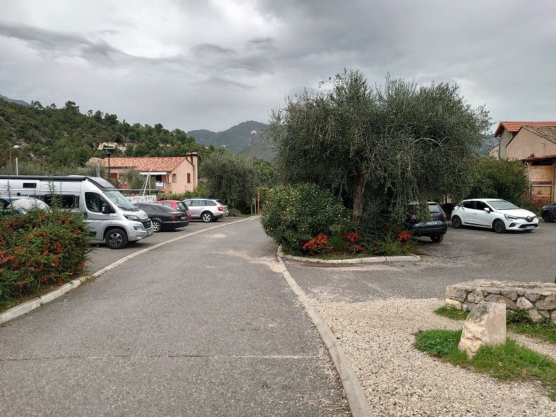
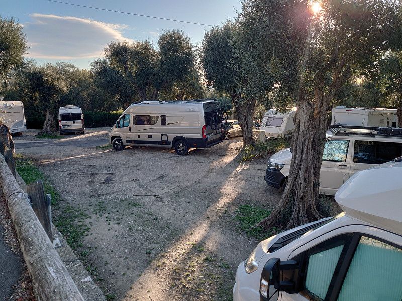
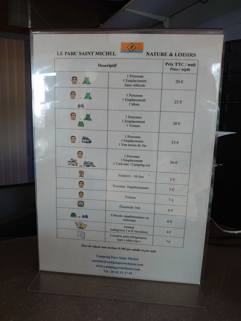
We had actually left Peille in time to arrive at the campsite in daylight. But shortly after Peille there was a roadblock. All the cars were waiting in line. Reversing from here was impossible as it was too narrow. After about an hour and a half a workman came and announced that the work would take another two hours before the road was reopened. So all the vehicles had to go back. That meant a detour to the campsite which cost time. So we arrived in the dark at around 6:30 p.m. Luckily the reception was still open. We got a very small space for €44.60 a night. But we were happy to be able to stop for a quiet night as parking spaces are very rare on the Côte. I only recommend the site for an overnight stay or to visit Menton.
Plateau Saint Michel, 06500, Menton, Frankreich
43° 46' 47.2" N 7° 29' 52.6" E
43.7797700 7.4979400
• Head north on Allée des Oliviers.
• Arrive at Allée des Oliviers. Your destination is on the left.
☍
Distance not available
(Duration not available)
Day
Camping Le Parc Saint Michel
In the morning, after the rainy day before, there was bright sunshine, just right for our tour from Menton along the coast, which was to go over the Corniche, past Monaco, La Turbie, Èze, Nice and the coastal road in the Esterel.
Plateau Saint Michel, 06500, Menton, France
43° 46' 47.2" N 7° 29' 52.6" E
43.7797700 7.4979400
• Head toward Plateau Saint-Michel on Allée des Oliviers. Go for 64 m.
• Turn slightly left onto Lieu-dit Plateau Saint-Michel. Go for 124 m.
• Continue on Sentier du Parc Saint-Michel. Go for 36 m.
• Turn right onto Sentier du Parc Saint-Michel. Go for 34 m.
• Turn left onto Résidence Le Grand Large. Go for 54 m.
• Turn left onto Allée des Acacias. Go for 26 m.
• Turn right onto Allée des Acacias. Go for 216 m.
• Turn left onto Chemin des Terres Chaudes. Go for 300 m.
• Continue on Chemin des Rigaudis. Go for 135 m.
• Keep right onto Route Ciappes Castellar. Go for 96 m.
• Turn right onto Rue Henri Greville (D6007). Go for 656 m.
• Turn right onto Avenue de Sospel (D2566) toward A8/(Gênes)/(Nice)/Sospel/Castillon/Z.I. du Haut Careï. Go for 111 m.
• Take the 2nd exit from Avenue de Sospel roundabout onto Avenue de Sospel (D2566) toward A8/(Gênes)/(Nice)/Sospel/Castillon. Go for 710 m.
• Take the 3rd exit from Rond-Point Dondera roundabout onto Allée Maréchal de Lattre de Tassigny (D2566) toward A8/(Gênes)/(Nice)/Sospel/Castillon. Go for 331 m.
• Take the 2nd exit from Rond-Point Taulaigo roundabout onto Allée Maréchal de Lattre de Tassigny (D2566) toward A8/(Gênes)/(Nice)/Sospel/Castillon. Go for 651 m.
• Take the 3rd exit from roundabout onto Route de Sospel (D2566) toward Sospel/Castillon/A8/(Gênes)/(Nice). Go for 287 m.
• Take the 2nd exit from roundabout onto Route de Sospel (D2566). Go for 192 m.
• Take the 3rd exit from Rond-Point des Douanes roundabout onto Route de Sospel (D2566) toward A8/(Gênes)/(Nice). Go for 702 m.
• Take the 2nd exit from roundabout onto D22 A toward Nice/Monaco/Gênes/Ste Agnès. Go for 229 m.
• Turn right onto D22 A toward A8/Monaco/Nice. Go for 415 m.
• Take ramp onto A8 (La Provençale). Go for 5.8 km.
• Take exit 58 toward Monaco/Èze/La Turbie/Beausoleil/Roquebrune-Cap Martin onto D2564 (Grande Corniche). Go for 590 m.
• Take the 2nd exit from roundabout onto Avenue Agerbol (D51). Go for 2.0 km.
• Continue on Moyenne Corniche (D6007) toward Monaco/Cap d'Ail. Go for 3.8 km.
• Take the 1st exit from roundabout onto Route de la Moyenne Corniche (M6007) toward Nice/Cap d'Ail-Centre/Èze Village. Go for 977 m.
• Turn right onto Chemin des Cyclamens toward Cap d'Ail-Centre/Èze-Bord de Mer/Nice/Monaco. Go for 14 m.
• Turn left onto Chemin des Cyclamens. Go for 14 m.
• Turn left onto Chemin des Cyclamens. Go for 17 m.
• Turn right onto Avenue Général de Gaulle (M37). Go for 1.3 km.
• Take the 1st exit from roundabout onto Avenue du Trois Septembre (M6098). Go for 1.2 km.
• Continue on Avenue Raymond Poincaré (M6098). Go for 1.0 km.
• Arrive at Tunnel du Cap Estel (M6098). Your destination is on the left.
☍
22,0 km
( 34 min.)
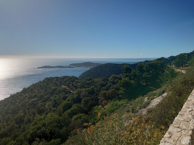
Èze
We know Èze and only drove through. However, we enjoyed the viewpoint from the Corniche over the town and Cap Ferrat. More on my website:
https://www.frankreich-in-wort-und-bild.de/provence-alpes-c%C3%B4te-d-azur/dep-alpes-maritimes/corniches-de-la-riviera/
Tunnel du Cap Estel, Èze-Bord-de-Mer, Èze, Nizza, Seealpen, Provence-Alpes-Côte d'Azur, Metropolitanes Frankreich, 06360, Frankreich
43° 43' 13.2" N 7° 22' 32.7" E
43.7203465 7.3757483
• Head toward Chemin des Salettes on Tunnel du Cap Estel (M6098). Go for 4.9 km.
• Keep left onto Avenue des Hellènes (M125). Go for 732 m.
• Turn right onto Pont Saint-Jean (M25). Go for 100 m.
• Continue on Boulevard Napoléon III (M6098). Go for 1.9 km.
• Turn right onto Chemin de la Jeunesse. Go for 121 m.
• Continue on Avenue de la Grande Bretagne. Go for 113 m.
• Turn slightly right onto Avenue Général Leclerc. Go for 151 m.
• Turn right onto Chemin François Ferry. Go for 240 m.
• Turn left onto Chemin François Ferry (D133). Go for 179 m.
• Turn right toward Boulevard de la Corne d'Or/M6007. Go for 26 m.
• Turn left onto Boulevard de la Corne d'Or (M6007). Go for 2.4 km.
• Take the 3rd exit from roundabout onto Place Max Barel (N7) toward Antibes/Digne/Nice-Centre/Musée d'Art Contemporain. Go for 768 m.
• Turn left onto Avenue Saint-Jean-Baptiste. Go for 321 m.
• Continue on Jardin Cardinal Clément Ferrero. Go for 695 m.
• Continue on Place Masséna. Go for 24 m.
• Continue on Avenue de Verdun. Go for 131 m.
• Arrive at Avenue de Verdun. Your destination is on the left.
☍
12,8 km
( 27 min.)
Nizza
We only drove through Nice. If you want to see more of Nice, visit my website:
https://www.frankreich-in-wort-und-bild.de/provence-alpes-c%C3%B4te-d-azur/dep-alpes-maritimes/nice/
10bis, Avenue De Verdun, Nizza, Nizza, Département Alpes-Maritimes, 06000, Frankreich
43° 41' 48" N 7° 16' 6.9" E
43.6966669 7.2685934
• Head southwest on Avenue de Verdun. Go for 247 m.
• Turn slightly right onto Promenade des Anglais (M6098) toward Antibes/Digne/Aéroport Nice Côte d'Azur/Parc Phoenix. Go for 6.2 km.
• Take ramp toward M6202/A8/Digne/Grenoble/Sophia-Antipolis/Carros. Go for 154 m.
• Continue on Boulevard Georges Pompidou. Go for 504 m.
• Take ramp onto A8 (La Provençale) toward Marseille/Cannes/Antibes. Go for 29.1 km.
• Take exit 40 toward Théoule S/Mer/La Napoule. Go for 360 m.
• Turn left onto Avenue de Cannes (D6007) toward Théoule S/Mer/Tanneron/La Napoule. Go for 547 m.
• Take the 2nd exit from Carrefour de l'Espace roundabout onto Avenue de Fréjus Paul Ricard (D6007) toward Fréjus/St Raphaël/La Napoule. Go for 347 m.
• Take the 2nd exit from Rond-Point des Golfs roundabout onto Avenue du Maréchal Juin (D2098) toward La Napoule/Théoule S/Mer. Go for 1.1 km.
• Take the 2nd exit from Rond-Point de San Peyre roundabout onto Boulevard du Bon Puits. Go for 1.3 km.
• Take the 1st exit from Rond-Point Balcon d'Azur roundabout onto Avenue du Capitaine de Corvette Marche (D6098). Go for 3.4 km.
• Arrive at Boulevard de la Corniche d'Or (D6098).
☍
43,2 km
( 44 min.)
Théoule-sur-Mer
8, Chemin De La Source, Théoule-sur-Mer, Mandelieu-la-Napoule, Département Alpes-Maritimes, 06590, Frankreich
43° 30' 21.5" N 6° 56' 39.4" E
43.5059651 6.9442877
• Head toward Allée des Pins on Boulevard de la Corniche d'Or (D6098). Go for 5.8 km.
• Continue on Route des Calanques (D559). Go for 7.5 km.
• Turn left onto Avenue du Corail. Go for 38 m.
• Arrive at Avenue du Corail.
☍
13,3 km
( 19 min.)
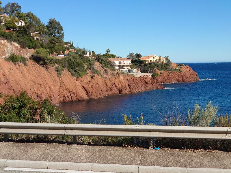
Calanque d'Anthéor
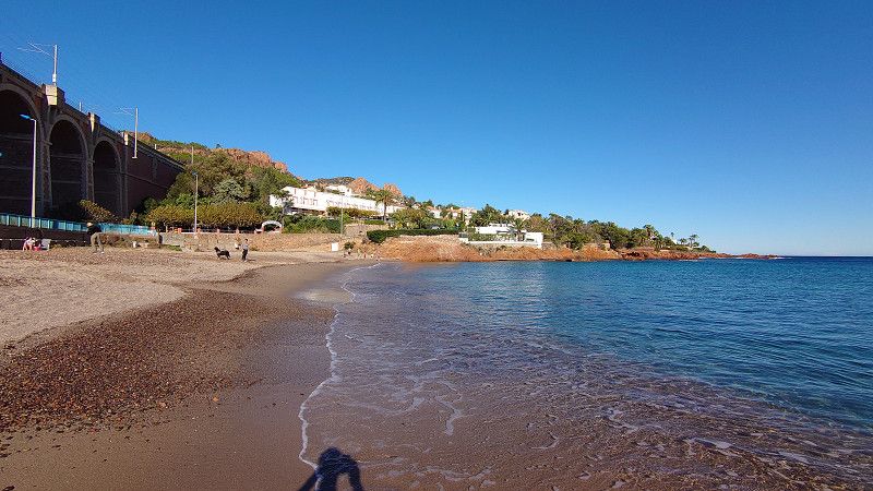
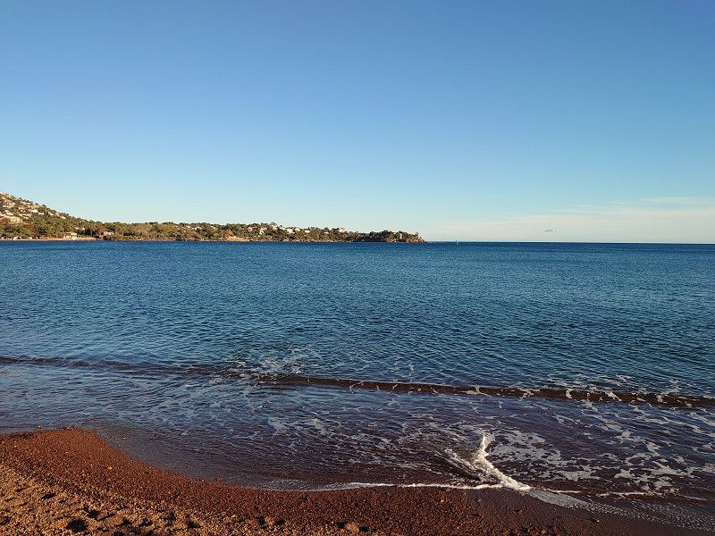
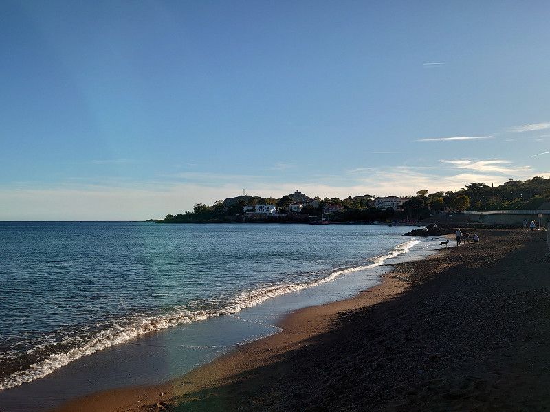
We stood on the beach at the Calanque d'Anthéor for 2 hours and enjoyed the sun. We only had our feet in the water. It would have been too cold for us after swimming, despite the sunshine.
Frankreich
43° 26' 11.2" N 6° 53' 39.8" E
43.4364362 6.8943769
• Head toward Boulevard des Myrtes on Avenue du Corail. Go for 38 m.
• Turn left onto Route de Saint-Barthélemy (D559). Go for 4.8 km.
• Take the 2nd exit from roundabout onto Boulevard de la Plage (D559). Go for 145 m.
• Arrive at Boulevard de la Plage (D559). Your destination is on the right.
☍
5,0 km
( 7 min.)
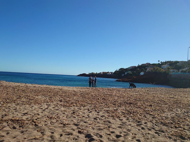
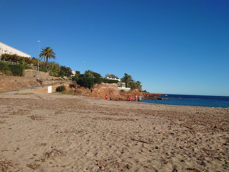
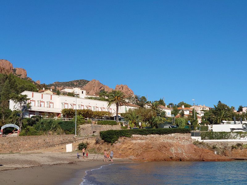
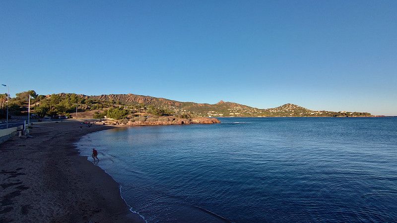
Saint-Raphael
Agay and the district of Sainte-Guitte have a very long sandy beach with a view of the Esterel Mountains. We stopped here because there is a boulangerie and patisserie called "La Mie Adorée" that we know.
Boulevard De La Plage 105, Saint-Raphael, Saint-Raphaël, Var, Frankreich
43° 25' 58.7" N 6° 51' 28.1" E
43.4329720 6.8578060
• Head southwest on Boulevard de la Plage (D559). Go for 1.2 km.
• Arrive at Boulevard de la 36ème Division du Texas (D559). Your destination is on the right.
☍
1,2 km
( 1 min.)
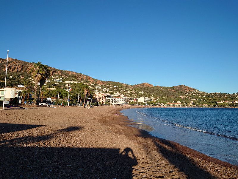
Saint-Raphael
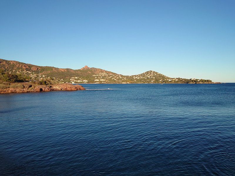
Short photo stop. If you want to see more of the Esterel Mountains and the coastal road, visit my website: https://www.frankreich-in-wort-und-bild.de/departements-provence/var/massif-de-l-est%C3%A9rel/
The entire route along the coastal road at the Esterel Mountains is described here.
Boulevard de la 36e Division d'Infanterie du Texas, Saint-Raphaël, Saint-Raphael, Saint-Raphaël, Var, Frankreich
43° 25' 27.5" N 6° 51' 23.5" E
43.4242963 6.8565160
• Head toward Rue Germaine Sablon on Boulevard de la 36ème Division du Texas (D559). Go for 1.2 km.
• Take the 2nd exit from roundabout onto Boulevard de la 36ème Division du Texas (D559). Go for 5.4 km.
• Turn left onto Allée du Château. Go for 132 m.
• Turn right onto Allée Calvet. Go for 269 m.
• Turn right onto Allée du Temple d'Amour. Go for 93 m.
• Turn right onto Allée de la Pointe des Moines. Go for 311 m.
• Arrive at Allée de la Pointe des Moines. Your destination is on the right.
☍
7,3 km
( 11 min.)
Saint-Raphael
We only drove through Saint-Raphael. If you want to see more of the place, visit my website:
https://www.frankreich-in-wort-und-bild.de/departements-provence/var/saint-raphael/
406, Allée De La Pointe Des Moines, Saint-Raphaël, Saint-Raphael, Saint-Raphaël, Var, 83700, Frankreich
43° 24' 37.6" N 6° 47' 13.6" E
43.4104511 6.7871224
• Head northeast on Allée de la Pointe des Moines. Go for 311 m.
• Turn left onto Allée du Temple d'Amour. Go for 157 m.
• Turn slightly left onto Allée du Château. Go for 60 m.
• Turn slightly right onto Allée du Château. Go for 278 m.
• Turn left onto Rue de la Corniche (D559). Go for 651 m.
• Pass 2 roundabouts and continue on Boulevard du Général de Gaulle (D559). Go for 1.7 km.
• Keep right onto Avenue du Commandant Guilbaud (D559). Go for 186 m.
• Take the 2nd exit from Rond-Point John Fitzgerald Kennedy roundabout onto Square de Provence (D559) toward A8/Fréjus. Go for 171 m.
• Take the 1st exit from Rond-Point de la 1ère Armée Française Rhin-Danube roundabout onto Rue du Maréchal Gallieni (D559). Go for 137 m.
• Take the 3rd exit from Rond-Point Victor Hugo roundabout onto Avenue Victor Hugo (D559). Go for 594 m.
• Take the 2nd exit from Rond-Point de Provence roundabout onto Avenue de Provence (D559) toward A8/Fréjus-Centre. Go for 577 m.
• Take the 3rd exit from Rond-Point de la Gendarmerie Nationale roundabout onto Avenue de Provence (D559). Go for 650 m.
• Pass 3 roundabouts and continue on D559. Go for 1.6 km.
• Take the 2nd exit from roundabout onto D559. Go for 1.3 km.
• Take the 2nd exit from roundabout onto Avenue de la Corniche d'Azur (D559). Go for 2.1 km.
• Take the 1st exit from roundabout onto Avenue de la Corniche d'Azur (D559) toward St Tropez/Ste Maxime. Go for 355 m.
• Take the 2nd exit from roundabout onto Avenue de la Corniche d'Azur (D559). Go for 601 m.
• Take the 3rd exit from roundabout onto Avenue de la Corniche d'Azur (D559) toward St Tropez/Ste Maxime. Go for 2.6 km.
• Turn left. Go for 13 m.
• Turn left. Go for 104 m.
• Arrive at your destination on the right.
☍
14,1 km
( 26 min.)
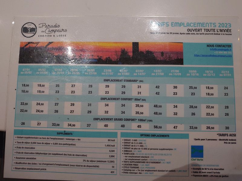
Camping Au Paradis des Campeurs
We spend our last evening of this short autumn trip at the Au Paradies des Campeurs campsite in Les Issambres. The site is open all year round and is located directly on a sandy beach that can be reached by road, but is still very quiet. The price of 26.30 euros includes electricity and water directly on site and of course waste disposal.
Directly in front of the entrance to the campsite there is also the Aire camping-car Chez Marcel which was closed, although it is supposedly open all year round.
la Gaillarde Plage D559, 83380, Les Issambres, Frankreich
43° 22' 0.1" N 6° 42' 45.5" E
43.3667070 6.7126420
• Head toward Corniche des Issambres. Go for 18 m.
• Turn right onto Corniche des Issambres (D559). Go for 2.5 km.
• Pass 4 roundabouts and continue on D559. Go for 4.2 km.
• Keep right onto D559 toward Fréjus/St Raphaël. Go for 462 m.
• Take the 2nd exit from Rond-Point de l'Aéronautique Navale roundabout onto Avenue de l'Argens (D559) toward A8/Draguignan/Toulon/Fréjus-Centre/St-Raphaël/Port de Fréjus-Est/Fréjus Centre/St Raphaël/Port Fréjus-Est. Go for 770 m.
• Take the 3rd exit from Rond-Point de la Miougrano roundabout onto Boulevard Séverin Decuers. Go for 360 m.
• Turn right onto Boulevard Séverin Decuers. Go for 32 m.
• Turn right onto Rue des Moulins. Go for 251 m.
• Take the 1st exit from roundabout onto Rue Aristide Briand (D98 C). Go for 307 m.
• Take the 3rd exit from Rond-Point des Bravadeurs roundabout onto Rue du Docteur Louis Turcan toward A8/Fréjus-Centre. Go for 316 m.
• Take the 3rd exit from roundabout onto Place Paul Vernet. Go for 137 m.
• Arrive at Place Paul Vernet.
☍
9,4 km
( 16 min.)
Day
Fréjus
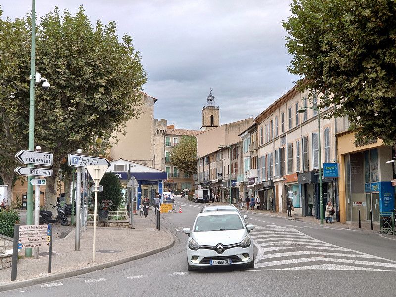
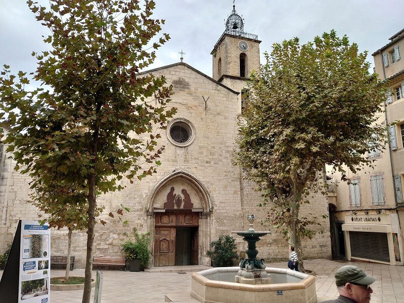
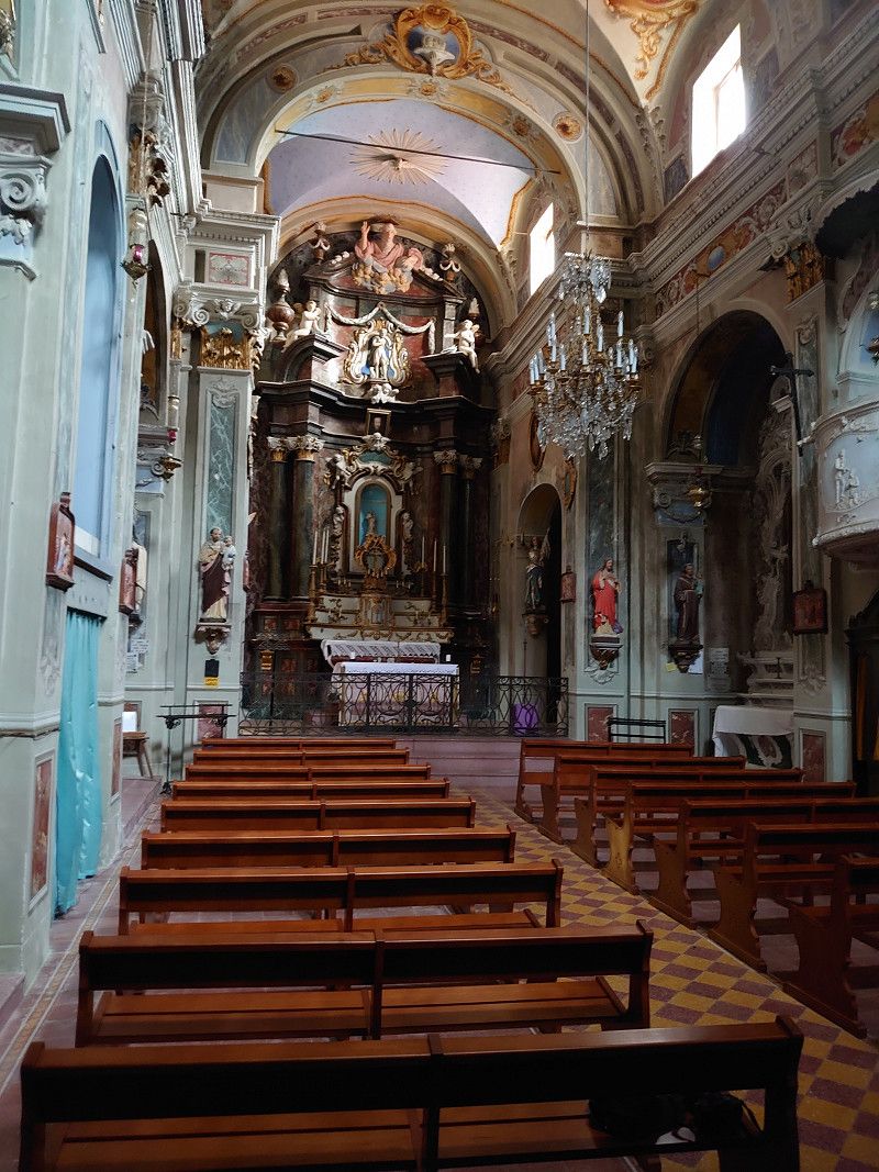
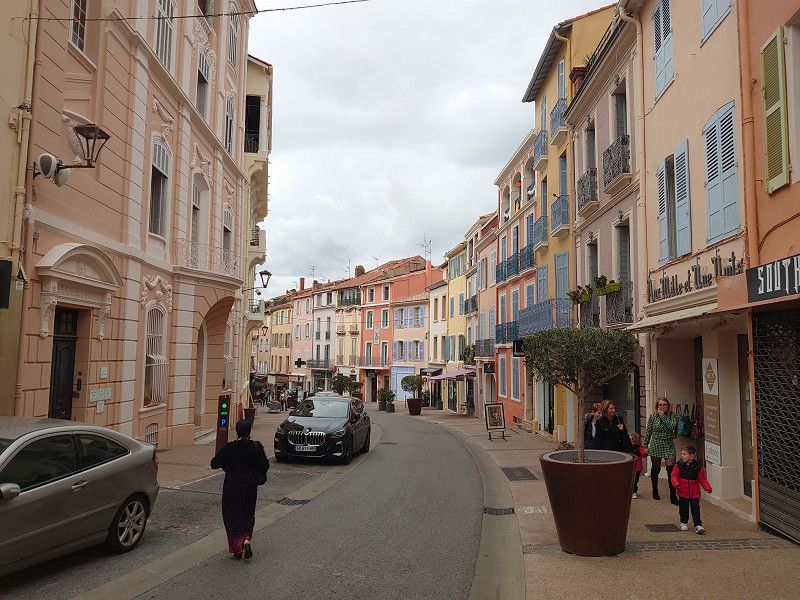
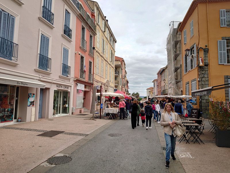
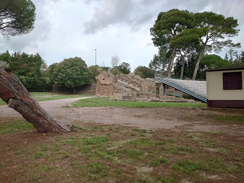
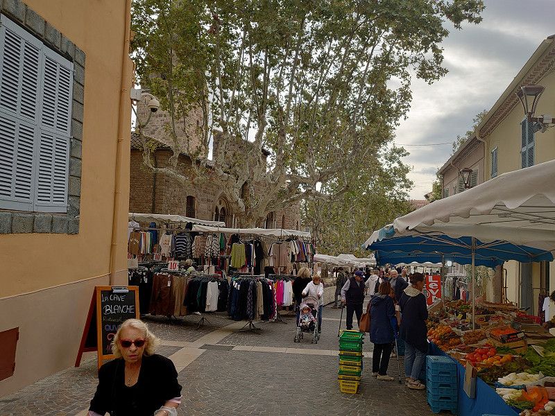
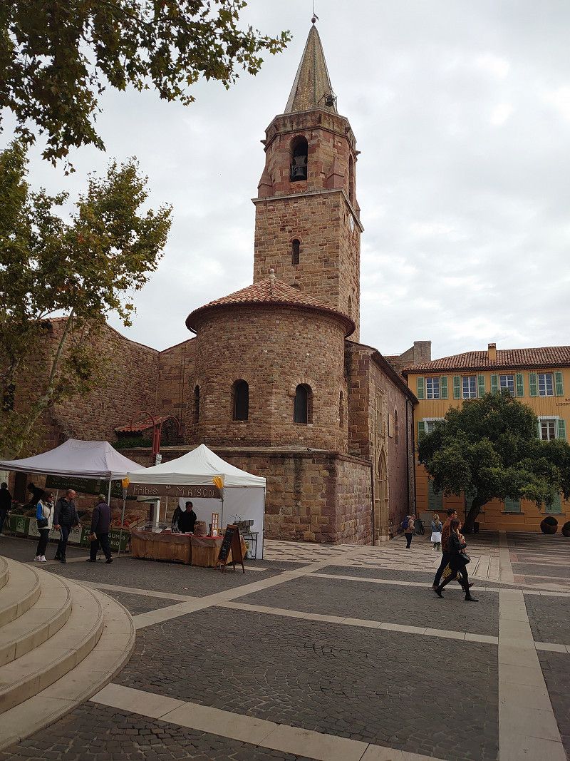
On the morning of our departure day we visited the old town of Fréjus. (It was market day) The Théâtre romain was unfortunately closed, but what we saw from the outside was very little preserved anyway. There are only a few walls and a new stage building. The compensation was the beautiful old town with its pastel-colored houses. We were also able to visit the cathedral and, lastly, admire the 5 monstrances with relics of saints unknown to us, as they were only on display that day during and shortly after mass. The baptistery and the cloister were closed for renovation. We were able to take a quick look into the cloister through a plastic window. After a small lunch in a restaurant in front of the cathedral, we then set off on the return journey of our lovely tour of Provence to the starting point of Robion.
Place Paul Vernet, Fréjus, Fréjus, Var, Frankreich
43° 26' 1.1" N 6° 44' 18.1" E
43.4336410 6.7383510
• Head southeast on Place Paul Vernet. Go for 31 m.
• Turn left onto Place Paul Vernet. Go for 120 m.
• Take the 3rd exit from roundabout onto Rue Gustave Bret. Go for 92 m.
• Take the 3rd exit from roundabout onto Rue Joseph Aubenas. Go for 573 m.
• Turn left onto Rue Henri Vadon. Go for 87 m.
• Take the 1st exit from Rond-Point de l'Appel du 18 Juin 1940 roundabout onto Avenue de Verdun. Go for 343 m.
• Take the 2nd exit from roundabout onto Avenue de Verdun. Go for 519 m.
• Keep left toward DN7. Go for 471 m.
• Continue on DN7. Go for 839 m.
• Pass 3 roundabouts and continue on DN7. Go for 2.2 km.
• Keep middle onto DN7. Go for 138 m.
• Take the 2nd exit from roundabout onto A8 (La Provençale) toward Aix en Pce/Toulon. Go for 130 km.
• Continue on A7 (Autoroute du Soleil). Go for 33.5 km.
• Take exit 25 toward Cavaillon/Apt onto D99. Go for 1.9 km.
• Continue on D99 C. Go for 1.3 km.
• Continue on Avenue Boscodomini. Go for 95 m.
• Take the 2nd exit from roundabout onto Avenue Boscodomini. Go for 725 m.
• Take the 4th exit from roundabout onto Avenue Boscodomini. Go for 994 m.
• Take the 2nd exit from Carrefour Vieux-les-Asfeld roundabout onto Avenue des Banquets toward Les Puits des Gavottes. Go for 286 m.
• Take the 3rd exit from roundabout onto Chemin de Vidauque (D234). Go for 1.8 km.
• Turn left onto D31. Go for 609 m.
• Continue on Route de Mourre-Poussin (D31). Go for 1.2 km.
• Take the 1st exit from roundabout onto Route de Mourre-Poussin (D31). Go for 281 m.
• Take the 2nd exit from roundabout onto Avenue du Moulin (D31). Go for 499 m.
• Continue on D31. Go for 351 m.
• Continue on Route des Taillades (D31). Go for 762 m.
• Turn right onto Avenue Alphonse Daudet. Go for 110 m.
• Turn left onto Chemin de la Dévalade. Go for 316 m.
• Turn slightly left onto Chemin de la Justice. Go for 17 m.
• Continue on Rue Frédéric Mistral. Go for 92 m.
• Continue on Avenue Frédéric Mistral. Go for 223 m.
• Turn right onto Rue Oscar Roulet. Go for 36 m.
• Turn right onto Place de l'Église. Go for 11 m.
• Arrive at Place de l'Église. Your destination is on the right.
☍
180,9 km
(1 hrs. 47 min.)
Robion
Return journey via motorway to the starting point in the Luberon.
Here the trip is documented again in detail:
https://www.frankreich-in-wort-und-bild.de/wohnmobiltouren/mit-dem-wohnmobil-in-frankreich/provence-wohnmobilreise-zu-entlegenen-bergd%C3%B6rfern-herbst-2023/
Vaucluse, Provence-Alpes-Côte d'Azur, Frankreich
43° 50' 38.7" N 5° 6' 44.3" E
43.8440906 5.1123102