Unfortunately, we don't support your browser (Internet Explorer) anymore, some functionalities could not work. Click here to get information on how to upgrade your browser.

Short autumn tour in Provence


Travelogue
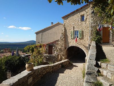
In the afternoon we left Robion, where we will end our short autumn tour.
In the afternoon we left Robion, where we will end our short autumn tour.
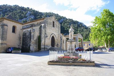
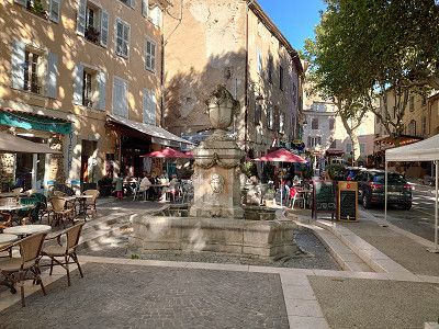
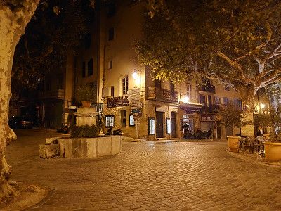
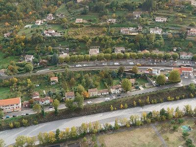
We have often driven through the town, but we have never been there to visit it. We drove to the car park in Manosque and then went into the old town. The square is very close to the centre. We visited the old town with the city gates and the two churches, Église Notre Dame de Romigier and Église Saint-Sauveur. We really liked the town and now that we have a first impression of our location in the Vaucluse, we want to come back in the summer.
We have often driven through the town, but we have never been there to visit it. We drove to the car park in Manosque and then went into the old town. The square is very close to the centre. We visited the old town with the city gates and the two churches, Église Notre Dame de Romigier and Église Saint-Sauveur. We really liked the town and now that we have a first impression of our location in the Vaucluse, we want to come back in the summer.
We wanted to park at the Chapelle Notre-Dame-de-la-Grâce. But in the evening, in the dark, we couldn't find the parking lot to spend the night in, despite having a satnav. I would advise any other motorhome driver not to do this either. We got into very narrow paths and once, on the second attempt, we got stuck for almost half an hour. It was so steep that the wheels spun on the concrete surface. We only managed to get back up the hill by laying towels underneath us. Luckily, there was no damage to the vehicle. But we did spend the night down in the parking lot.
We wanted to park at the Chapelle Notre-Dame-de-la-Grâce. But in the evening, in the dark, we couldn't find the parking lot to spend the night in, despite having a satnav. I would advise any other motorhome driver not to do this either. We got into very narrow paths and once, on the second attempt, we got stuck for almost half an hour. It was so steep that the wheels spun on the concrete surface. We only managed to get back up the hill by laying towels underneath us. Luckily, there was no damage to the vehicle. But we did spend the night down in the parking lot.
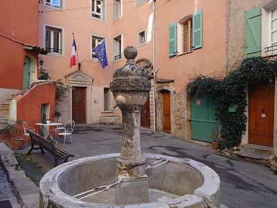
Parking lot in Cotignac. We were able to sleep well. The place is a bit uneven, but we were able to park so that the vehicle was facing forward.
Parking lot in Cotignac. We were able to sleep well. The place is a bit uneven, but we were able to park so that the vehicle was facing forward.
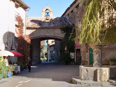
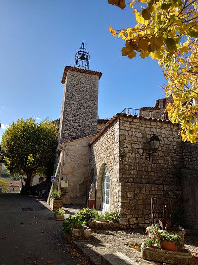
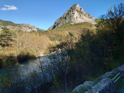
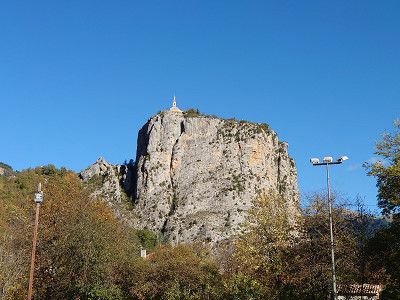
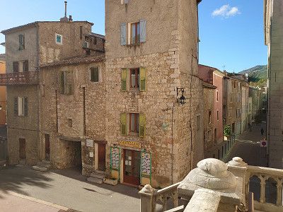
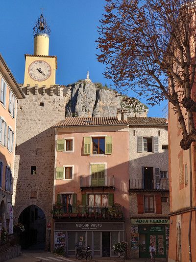
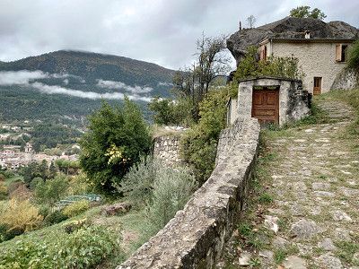
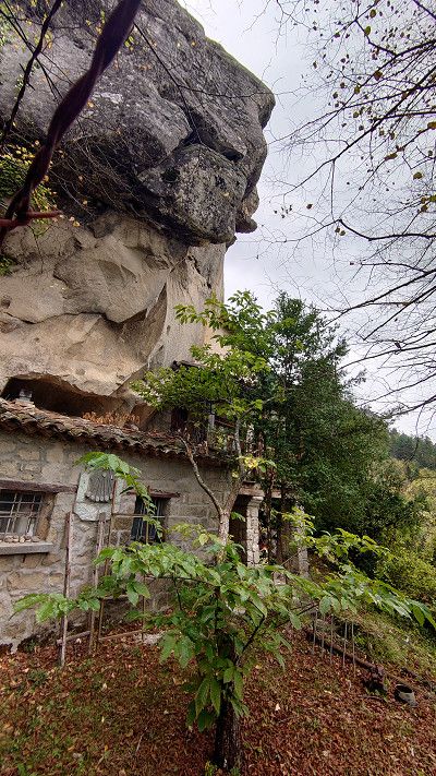
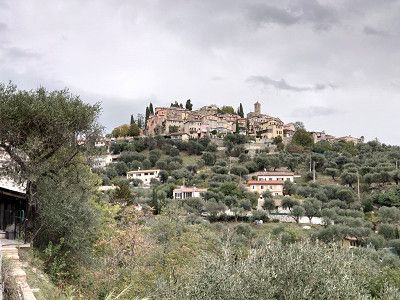
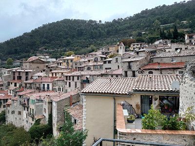
We stopped in the car park because it is not far from here to the town. A walk around and a hike along the grottos that lead up to two towers on the rocks were quite impressive. The path to the grottos and up to the towers is something you should not miss. Pure idyll with the many small houses built into the rocks.
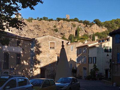

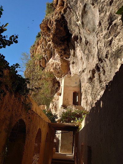
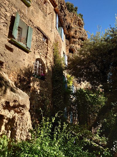
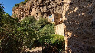

We stopped in the car park because it is not far from here to the town. A walk around and a hike along the grottos that lead up to two towers on the rocks were quite impressive. The path to the grottos and up to the towers is something you should not miss. Pure idyll with the many small houses built into the rocks.
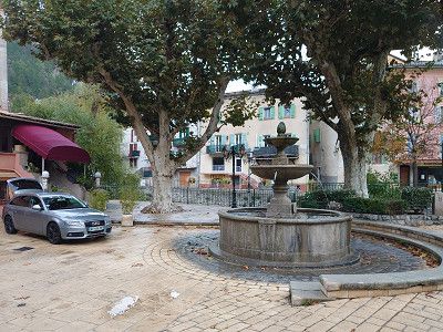
We headed for the car park in Entrecasteaux. We would have liked to visit the château, but it is only open during the high season. The church was also closed. So we drove on, as there was nothing more we could do here. However, we did not want to be there during peak travel times, as the place is small and will certainly be overcrowded.
We headed for the car park in Entrecasteaux. We would have liked to visit the château, but it is only open during the high season. The church was also closed. So we drove on, as there was nothing more we could do here. However, we did not want to be there during peak travel times, as the place is small and will certainly be overcrowded.
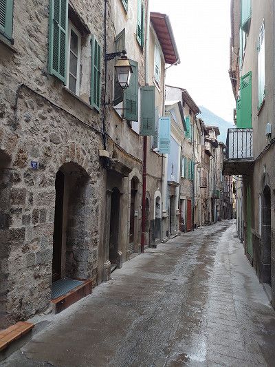
The parking space in Salernes was originally planned. However, we drove about 200 meters further to a parking lot right at the entrance to the town, as we knew that we would not be staying overnight here. We then visited the town, including the old part of Salernes, Vieux Salernes. We also went to the local church. A beautiful little place with its own flair.
The parking space in Salernes was originally planned. However, we drove about 200 meters further to a parking lot right at the entrance to the town, as we knew that we would not be staying overnight here. We then visited the town, including the old part of Salernes, Vieux Salernes. We also went to the local church. A beautiful little place with its own flair.
We parked our camper van right at the roundabout that is also the entrance to the town of Tourtour. Right at the beginning of the town is the tourist office, where we got a map. With this map we were able to do a detailed tour of the town, which was of course very helpful. Nevertheless, we were through the town after two hours, so we decided to drive on to Bargemon because we wanted to spend the night on a parking spot there.
We parked our camper van right at the roundabout that is also the entrance to the town of Tourtour. Right at the beginning of the town is the tourist office, where we got a map. With this map we were able to do a detailed tour of the town, which was of course very helpful. Nevertheless, we were through the town after two hours, so we decided to drive on to Bargemon because we wanted to spend the night on a parking spot there.
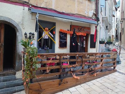
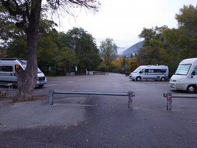
Arrival at the parking space in Bargemon, which is free of charge and has electricity, waste disposal and fresh water. 5 minutes and you are in the center. We used it in the evening and had dinner here in the restaurant La Taverna. Starter was frog legs and main course was octopus, fantastic. But we already know the place from a previous trip. It was our destination because of the parking space.
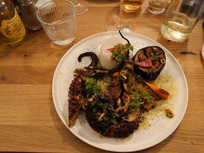

Arrival at the parking space in Bargemon, which is free of charge and has electricity, waste disposal and fresh water. 5 minutes and you are in the center. We used it in the evening and had dinner here in the restaurant La Taverna. Starter was frog legs and main course was octopus, fantastic. But we already know the place from a previous trip. It was our destination because of the parking space.
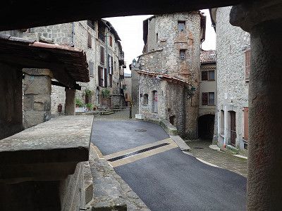
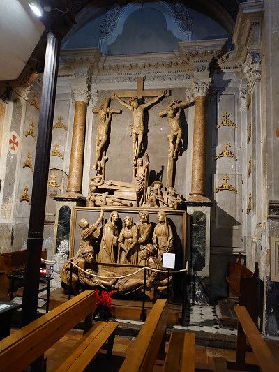
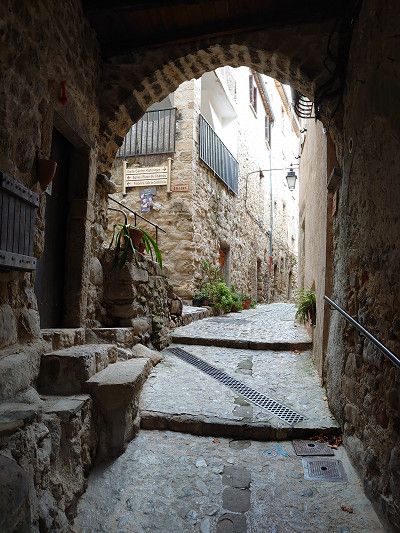
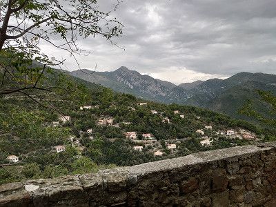
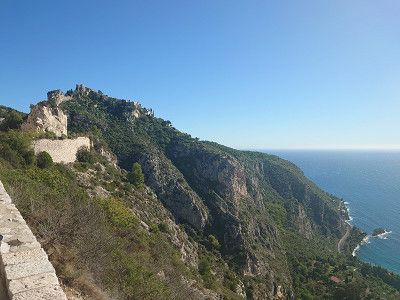
In the morning we disposed of waste and filled up with fresh water in Bargemon. We already knew the place from a previous visit. Then we went to Bargème. We didn't drive to the parking space below the town, but to the car park in Bargéme 43.72991, 6.57119. I would definitely advise large motorhomes to stay down at the site. I wouldn't drive up there in high season either, it's just too narrow. The location of the town is impressive. Of course we visited the small town with its imposing castle ruins, which are currently being renovated. A really worth seeing place, also with its small church and the fantastic panoramic view.
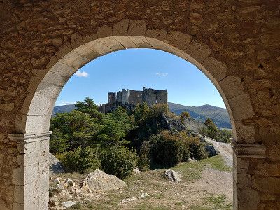
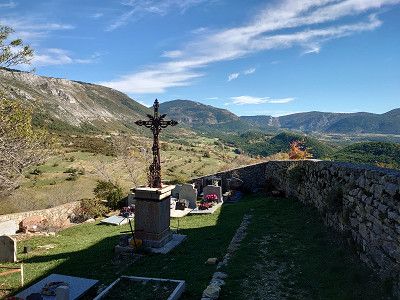
In the morning we disposed of waste and filled up with fresh water in Bargemon. We already knew the place from a previous visit. Then we went to Bargème. We didn't drive to the parking space below the town, but to the car park in Bargéme 43.72991, 6.57119. I would definitely advise large motorhomes to stay down at the site. I wouldn't drive up there in high season either, it's just too narrow. The location of the town is impressive. Of course we visited the small town with its imposing castle ruins, which are currently being renovated. A really worth seeing place, also with its small church and the fantastic panoramic view.
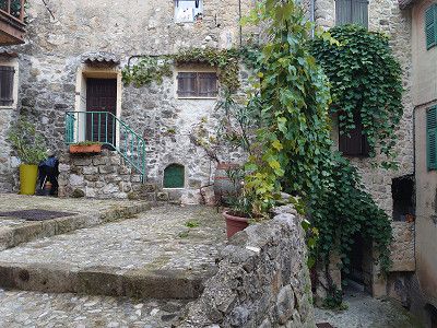
We got a place on the small parking lot with waste disposal. A small, charming place on a rock, which is also crowned by the ruins of a castle. You can visit the place in an hour, as it really isn't that big. But you need more time for the castle. The drive from Bargème to Trigance was through a beautiful landscape, especially the last part.
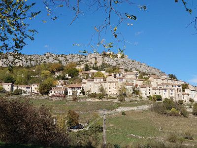
We got a place on the small parking lot with waste disposal. A small, charming place on a rock, which is also crowned by the ruins of a castle. You can visit the place in an hour, as it really isn't that big. But you need more time for the castle. The drive from Bargème to Trigance was through a beautiful landscape, especially the last part.
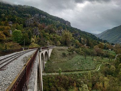
From Tigance we then go through a small part of the Verdon Gorges to Castellane, where parking is also free in the center at 43.8453, 6.5107. The parking space (120 spaces) is also close to the center, but on a road, costs €9. We had originally planned to spend the night here, but Castellane disappointed us a little with its town. Of course there is a small historic part with a town gate, also two churches, Église St. Victor and Église du Sacré-Coeur, as well as the Chapelle Notre-Dame du Roc on top of the rock. We did not go up the rock, however, even though you are supposed to have a great view of the town from there. We then went through a beautiful landscape on the D955 past the Barrage de Castillon and then over the Col de Toutes Aures (1124 m) to Annot to the parking space where we are spending the night. We will look at the town tomorrow.

From Tigance we then go through a small part of the Verdon Gorges to Castellane, where parking is also free in the center at 43.8453, 6.5107. The parking space (120 spaces) is also close to the center, but on a road, costs €9. We had originally planned to spend the night here, but Castellane disappointed us a little with its town. Of course there is a small historic part with a town gate, also two churches, Église St. Victor and Église du Sacré-Coeur, as well as the Chapelle Notre-Dame du Roc on top of the rock. We did not go up the rock, however, even though you are supposed to have a great view of the town from there. We then went through a beautiful landscape on the D955 past the Barrage de Castillon and then over the Col de Toutes Aures (1124 m) to Annot to the parking space where we are spending the night. We will look at the town tomorrow.
Parking lot and parking space with supply and disposal in Annot. We'll look at the place tomorrow. We looked at the place on the morning of October 29th, 2023. Unfortunately, the nice weather was over today. Always overcast skies and sometimes light rain, all day. Annot is a magical place that is sure to be even more enjoyable in good weather. A short hike to the chapel on the sandstone cliffs was possible, but we decided against the whole circuit that you can do here from 2.5 to 4 hours, especially since Marianne couldn't do it anyway with her hip. An old, dreamy place presented itself to us. With this environment, you can go on holiday there.


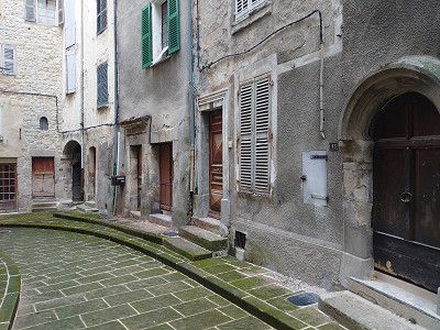
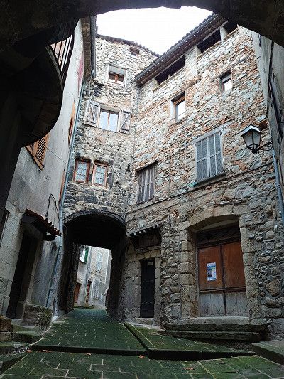
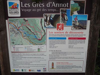
Parking lot and parking space with supply and disposal in Annot. We'll look at the place tomorrow. We looked at the place on the morning of October 29th, 2023. Unfortunately, the nice weather was over today. Always overcast skies and sometimes light rain, all day. Annot is a magical place that is sure to be even more enjoyable in good weather. A short hike to the chapel on the sandstone cliffs was possible, but we decided against the whole circuit that you can do here from 2.5 to 4 hours, especially since Marianne couldn't do it anyway with her hip. An old, dreamy place presented itself to us. With this environment, you can go on holiday there.
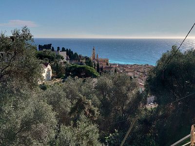
We continued on to Entrevaux, a place I've wanted to visit for a long time. It's just a shame that it rained at times. The town with its citadel certainly delights many tourists in the summer. The cathedral is also worth seeing. On October 29, 2023, although it was Sunday, there was not much going on. At lunchtime we had an excellent, typical local meal in the Le Ménestrel restaurant. And it was inexpensive too. Now, after the calories, I've decided to climb the citadel. A great view from up there. In the afternoon, as it was raining harder, we decided to drive to Puget-Theniers to the parking space for the night. The town also has a parking space, but right next to the railway line. So we drove one town further for the night.
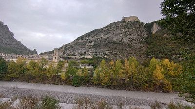
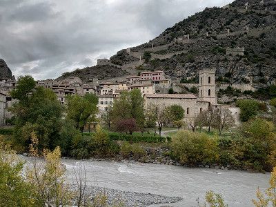
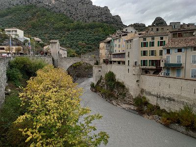
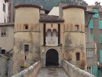
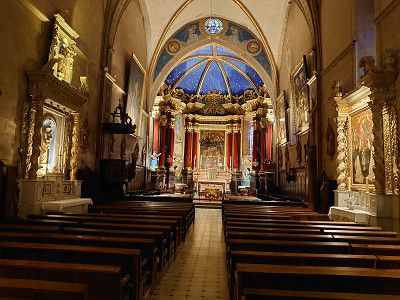
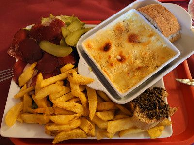
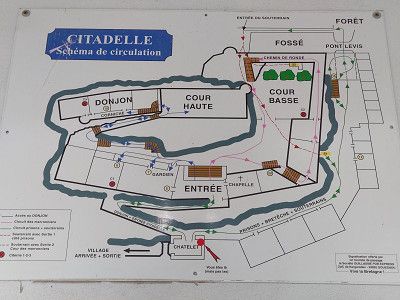
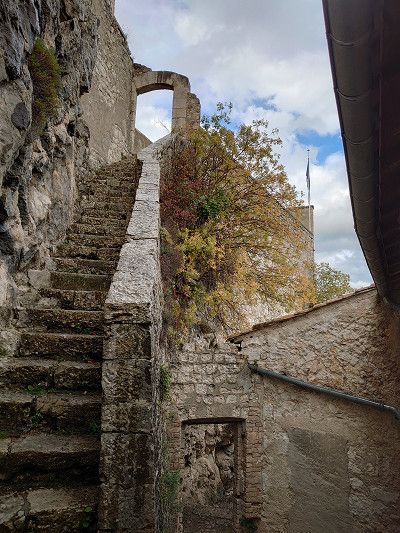
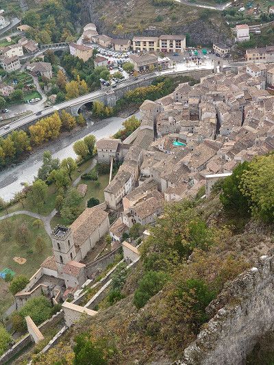
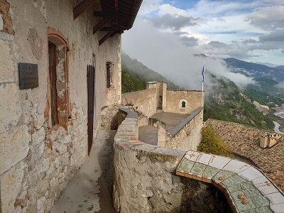
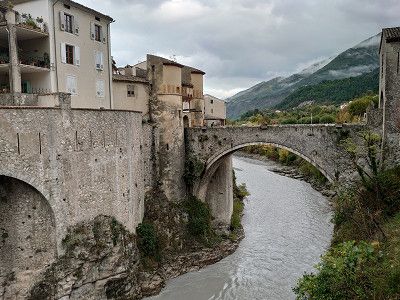
We continued on to Entrevaux, a place I've wanted to visit for a long time. It's just a shame that it rained at times. The town with its citadel certainly delights many tourists in the summer. The cathedral is also worth seeing. On October 29, 2023, although it was Sunday, there was not much going on. At lunchtime we had an excellent, typical local meal in the Le Ménestrel restaurant. And it was inexpensive too. Now, after the calories, I've decided to climb the citadel. A great view from up there. In the afternoon, as it was raining harder, we decided to drive to Puget-Theniers to the parking space for the night. The town also has a parking space, but right next to the railway line. So we drove one town further for the night.
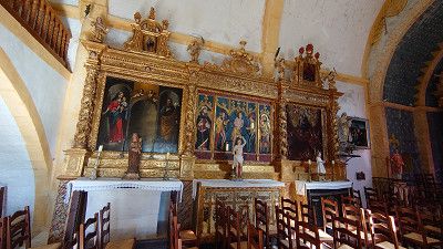
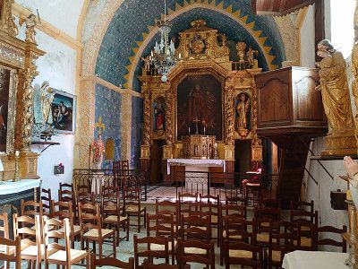
The parking space in Puget-Theniers is also an ideal starting point for visiting the town. A Vieux Village and the church with a precious altarpiece and a Retable de la Pasion from the 16th century are the highlights of the town.
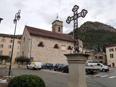
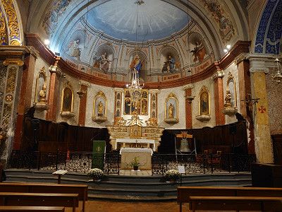

The parking space in Puget-Theniers is also an ideal starting point for visiting the town. A Vieux Village and the church with a precious altarpiece and a Retable de la Pasion from the 16th century are the highlights of the town.
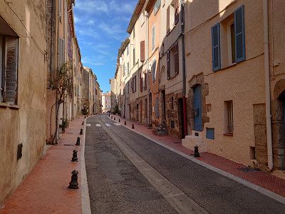
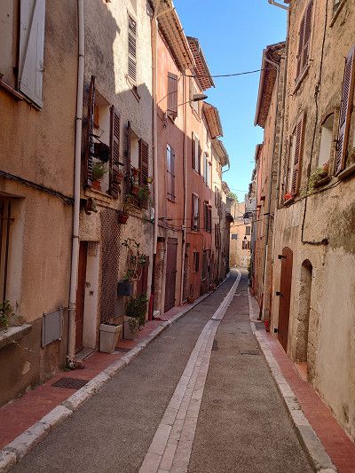
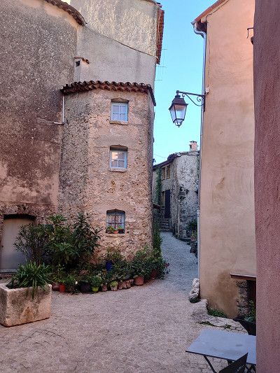
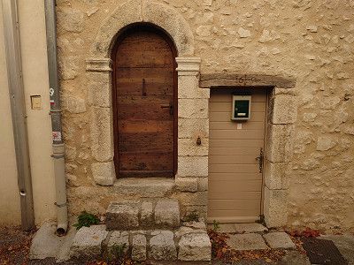
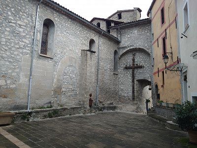
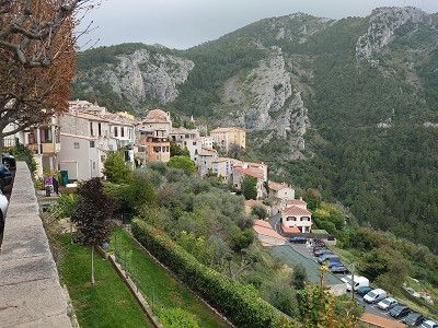
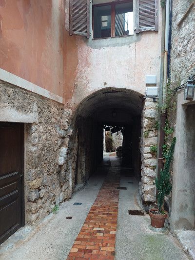
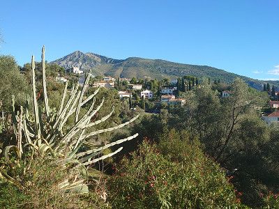
In the morning we continued on to Coaraze. The journey went along the river Var on the D6202 to the turnoff to Levens. This meant a narrow road and lots of hairpin bends. Then in Contes we continued on the narrow D15 and also hairpin bends to Coaraze. In the town we were really lucky to have a parking space as the only motorhome. In high season it would certainly be impossible to find a parking space here. We then visited the beautiful town, unfortunately in light rain, which was to last all day. Here in the town the church was even open. It is a really old place, as the pictures show. I really only recommend that you drive here with a van. Larger motorhomes will have considerable problems.


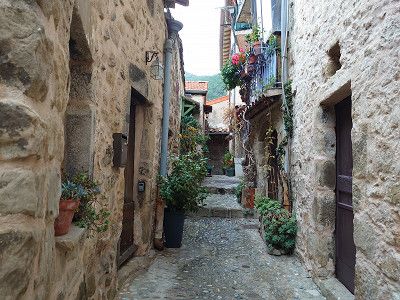

In the morning we continued on to Coaraze. The journey went along the river Var on the D6202 to the turnoff to Levens. This meant a narrow road and lots of hairpin bends. Then in Contes we continued on the narrow D15 and also hairpin bends to Coaraze. In the town we were really lucky to have a parking space as the only motorhome. In high season it would certainly be impossible to find a parking space here. We then visited the beautiful town, unfortunately in light rain, which was to last all day. Here in the town the church was even open. It is a really old place, as the pictures show. I really only recommend that you drive here with a van. Larger motorhomes will have considerable problems.
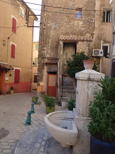
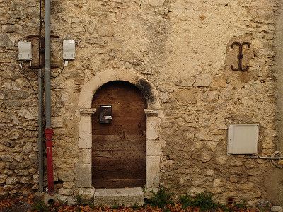
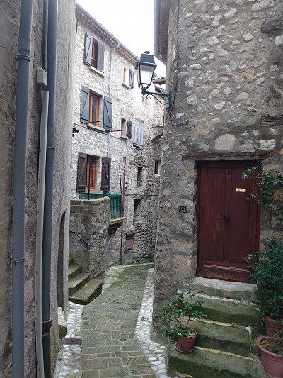
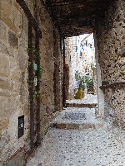
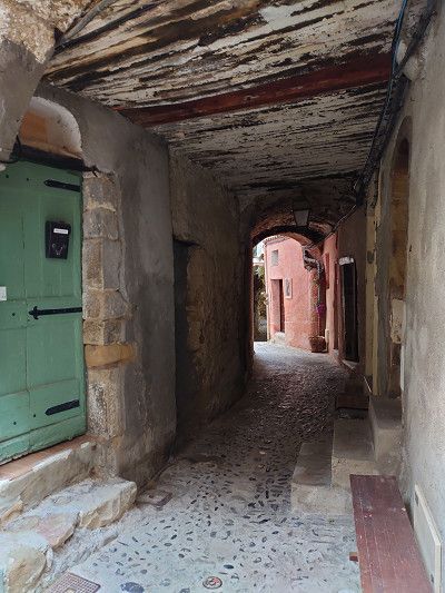
We actually wanted to go to Peillon. But from what we've heard, there is no parking space in or near the town. So we drove on to Peille. Another narrow road with lots of hairpin bends. I had to reverse in some hairpin bends to get through them. When we got to the top, the parking spaces were all much too small for my van (6.40 m). We then drove a little further up, to about the middle of the village, where we found a parking space on the side of the road. Again, I wouldn't want to go here during peak holiday season. Unfortunately, we had to visit the place worth seeing in the drizzle. Lots of small, narrow streets. Narrow streets covered in buildings, take a look at the pictures. The place is definitely worth seeing. We had just got back to our motorhome when the rain got heavier and a thunderstorm even came up. Then we were supposed to go to the campsite in Menton.
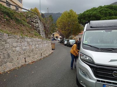
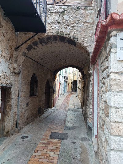
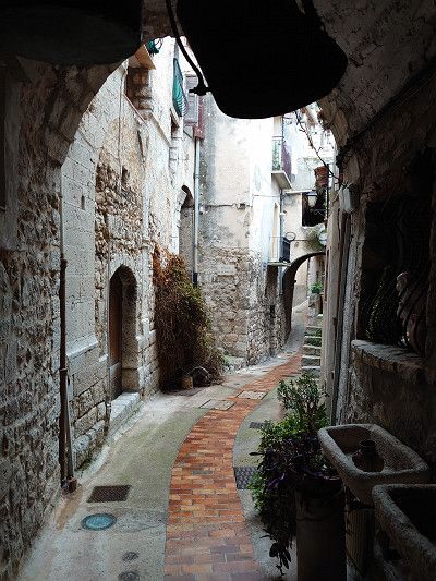
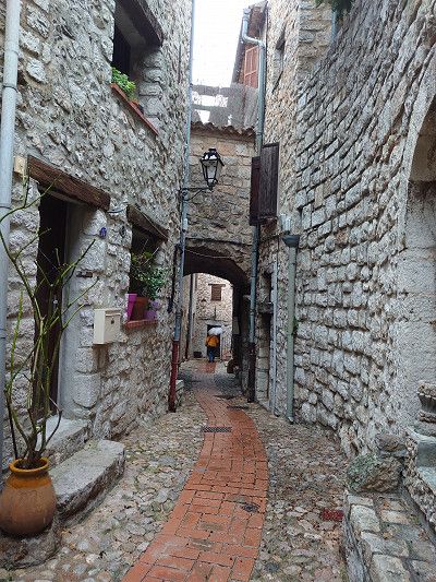
We actually wanted to go to Peillon. But from what we've heard, there is no parking space in or near the town. So we drove on to Peille. Another narrow road with lots of hairpin bends. I had to reverse in some hairpin bends to get through them. When we got to the top, the parking spaces were all much too small for my van (6.40 m). We then drove a little further up, to about the middle of the village, where we found a parking space on the side of the road. Again, I wouldn't want to go here during peak holiday season. Unfortunately, we had to visit the place worth seeing in the drizzle. Lots of small, narrow streets. Narrow streets covered in buildings, take a look at the pictures. The place is definitely worth seeing. We had just got back to our motorhome when the rain got heavier and a thunderstorm even came up. Then we were supposed to go to the campsite in Menton.
We had actually left Peille in time to arrive at the campsite in daylight. But shortly after Peille there was a roadblock. All the cars were waiting in line. Reversing from here was impossible as it was too narrow. After about an hour and a half a workman came and announced that the work would take another two hours before the road was reopened. So all the vehicles had to go back. That meant a detour to the campsite which cost time. So we arrived in the dark at around 6:30 p.m. Luckily the reception was still open. We got a very small space for €44.60 a night. But we were happy to be able to stop for a quiet night as parking spaces are very rare on the Côte. I only recommend the site for an overnight stay or to visit Menton.
We had actually left Peille in time to arrive at the campsite in daylight. But shortly after Peille there was a roadblock. All the cars were waiting in line. Reversing from here was impossible as it was too narrow. After about an hour and a half a workman came and announced that the work would take another two hours before the road was reopened. So all the vehicles had to go back. That meant a detour to the campsite which cost time. So we arrived in the dark at around 6:30 p.m. Luckily the reception was still open. We got a very small space for €44.60 a night. But we were happy to be able to stop for a quiet night as parking spaces are very rare on the Côte. I only recommend the site for an overnight stay or to visit Menton.
In the morning, after the rainy day before, there was bright sunshine, just right for our tour from Menton along the coast, which was to go over the Corniche, past Monaco, La Turbie, Èze, Nice and the coastal road in the Esterel.
In the morning, after the rainy day before, there was bright sunshine, just right for our tour from Menton along the coast, which was to go over the Corniche, past Monaco, La Turbie, Èze, Nice and the coastal road in the Esterel.
We know Èze and only drove through. However, we enjoyed the viewpoint from the Corniche over the town and Cap Ferrat. More on my website:
https://www.frankreich-in-wort-und-bild.de/provence-alpes-c%C3%B4te-d-azur/dep-alpes-maritimes/corniches-de-la-riviera/
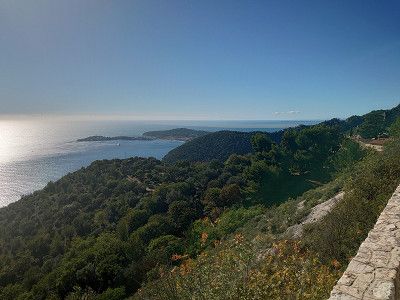
We know Èze and only drove through. However, we enjoyed the viewpoint from the Corniche over the town and Cap Ferrat. More on my website:
https://www.frankreich-in-wort-und-bild.de/provence-alpes-c%C3%B4te-d-azur/dep-alpes-maritimes/corniches-de-la-riviera/
We only drove through Nice. If you want to see more of Nice, visit my website:
https://www.frankreich-in-wort-und-bild.de/provence-alpes-c%C3%B4te-d-azur/dep-alpes-maritimes/nice/
We only drove through Nice. If you want to see more of Nice, visit my website:
https://www.frankreich-in-wort-und-bild.de/provence-alpes-c%C3%B4te-d-azur/dep-alpes-maritimes/nice/
Passage only
Passage only
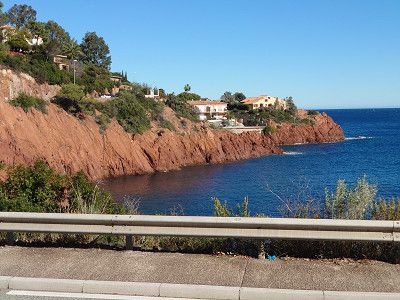
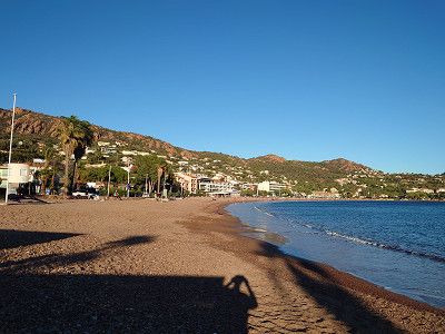
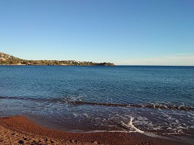
We stood on the beach at the Calanque d'Anthéor for 2 hours and enjoyed the sun. We only had our feet in the water. It would have been too cold for us after swimming, despite the sunshine.
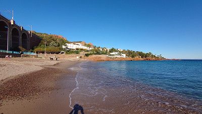
We stood on the beach at the Calanque d'Anthéor for 2 hours and enjoyed the sun. We only had our feet in the water. It would have been too cold for us after swimming, despite the sunshine.
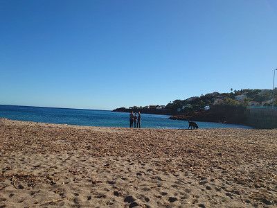
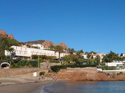
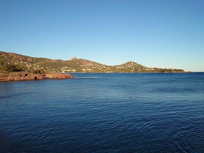
Agay and the district of Sainte-Guitte have a very long sandy beach with a view of the Esterel Mountains. We stopped here because there is a boulangerie and patisserie called "La Mie Adorée" that we know.
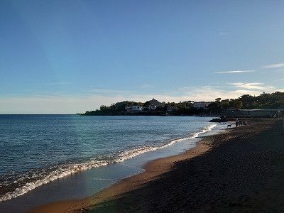
Agay and the district of Sainte-Guitte have a very long sandy beach with a view of the Esterel Mountains. We stopped here because there is a boulangerie and patisserie called "La Mie Adorée" that we know.
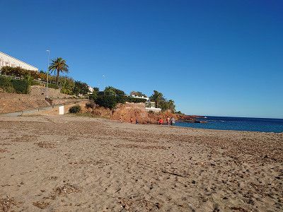
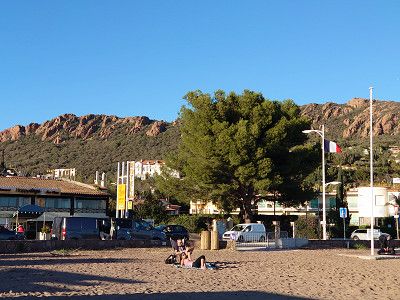
Short photo stop. If you want to see more of the Esterel Mountains and the coastal road, visit my website: https://www.frankreich-in-wort-und-bild.de/departements-provence/var/massif-de-l-est%C3%A9rel/
The entire route along the coastal road at the Esterel Mountains is described here.
Short photo stop. If you want to see more of the Esterel Mountains and the coastal road, visit my website: https://www.frankreich-in-wort-und-bild.de/departements-provence/var/massif-de-l-est%C3%A9rel/
The entire route along the coastal road at the Esterel Mountains is described here.
We only drove through Saint-Raphael. If you want to see more of the place, visit my website:
https://www.frankreich-in-wort-und-bild.de/departements-provence/var/saint-raphael/
We only drove through Saint-Raphael. If you want to see more of the place, visit my website:
https://www.frankreich-in-wort-und-bild.de/departements-provence/var/saint-raphael/
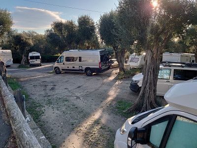
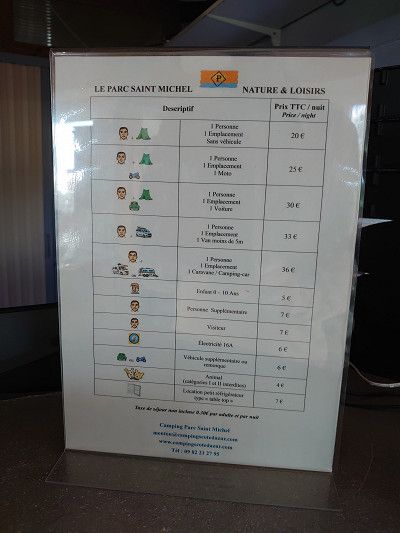
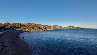
We spend our last evening of this short autumn trip at the Au Paradies des Campeurs campsite in Les Issambres. The site is open all year round and is located directly on a sandy beach that can be reached by road, but is still very quiet. The price of 26.30 euros includes electricity and water directly on site and of course waste disposal.
Directly in front of the entrance to the campsite there is also the Aire camping-car Chez Marcel which was closed, although it is supposedly open all year round.
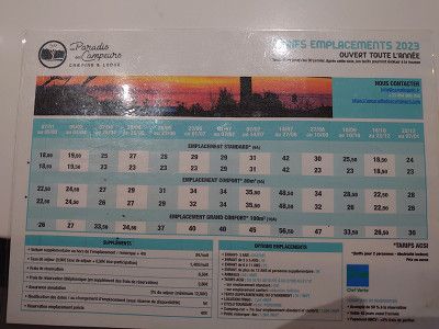
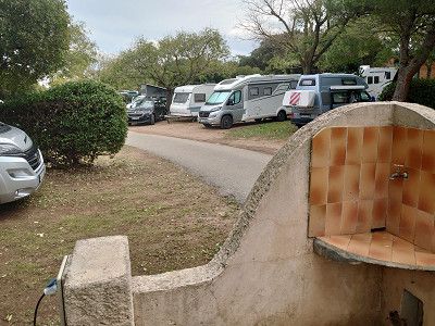
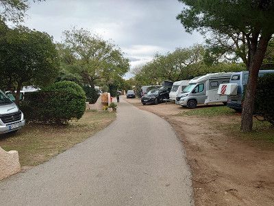
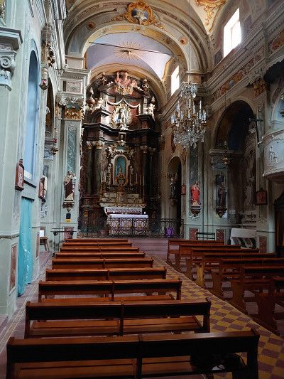
On the morning of our departure day we visited the old town of Fréjus. (It was market day) The Théâtre romain was unfortunately closed, but what we saw from the outside was very little preserved anyway. There are only a few walls and a new stage building. The compensation was the beautiful old town with its pastel-colored houses. We were also able to visit the cathedral and, lastly, admire the 5 monstrances with relics of saints unknown to us, as they were only on display that day during and shortly after mass. The baptistery and the cloister were closed for renovation. We were able to take a quick look into the cloister through a plastic window. After a small lunch in a restaurant in front of the cathedral, we then set off on the return journey of our lovely tour of Provence to the starting point of Robion.
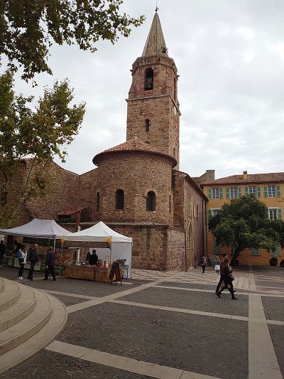
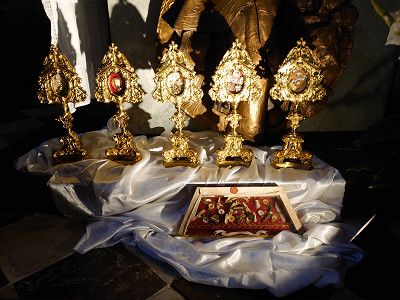
On the morning of our departure day we visited the old town of Fréjus. (It was market day) The Théâtre romain was unfortunately closed, but what we saw from the outside was very little preserved anyway. There are only a few walls and a new stage building. The compensation was the beautiful old town with its pastel-colored houses. We were also able to visit the cathedral and, lastly, admire the 5 monstrances with relics of saints unknown to us, as they were only on display that day during and shortly after mass. The baptistery and the cloister were closed for renovation. We were able to take a quick look into the cloister through a plastic window. After a small lunch in a restaurant in front of the cathedral, we then set off on the return journey of our lovely tour of Provence to the starting point of Robion.
Return journey via motorway to the starting point in the Luberon.
Here the trip is documented again in detail:
https://www.frankreich-in-wort-und-bild.de/wohnmobiltouren/mit-dem-wohnmobil-in-frankreich/provence-wohnmobilreise-zu-entlegenen-bergd%C3%B6rfern-herbst-2023/
Return journey via motorway to the starting point in the Luberon.
Here the trip is documented again in detail:
https://www.frankreich-in-wort-und-bild.de/wohnmobiltouren/mit-dem-wohnmobil-in-frankreich/provence-wohnmobilreise-zu-entlegenen-bergd%C3%B6rfern-herbst-2023/
Route
Show newest first- 43.8475 5.1076
- 43° 50' 51" N 5° 6' 27.4" E
- 43.8326 5.7815
- 43° 49' 57.4" N 5° 46' 53.5" E
- 43.5209 6.1464
- 43° 31' 15.3" N 6° 8' 46.9" E
- 43.5276 6.153
- 43° 31' 39.4" N 6° 9' 10.8" E
- 43.5281 6.1503
- 43° 31' 41" N 6° 9' 1" E
- 43.5152 6.2403
- 43° 30' 54.7" N 6° 14' 25.1" E
- 43.5588 6.2335
- 43° 33' 31.7" N 6° 14' 0.6" E
- 43.6244 6.5509
- 43° 37' 27.8" N 6° 33' 3.2" E
- 43.7299 6.5712
- 43° 43' 47.7" N 6° 34' 16.3" E
- 43.7605 6.4422
- 43° 45' 37.8" N 6° 26' 31.9" E
- 43.8463 6.5152
- 43° 50' 46.7" N 6° 30' 54.7" E
- 43.9635 6.664
- 43° 57' 48.6" N 6° 39' 50.4" E
- 43.9488 6.8138
- 43° 56' 55.5" N 6° 48' 49.6" E
- 43.9535 6.8994
- 43° 57' 12.6" N 6° 53' 57.8" E
- 43.865 7.2932
- 43° 51' 54" N 7° 17' 35.5" E
- 43.8055 7.4049
- 43° 48' 19.8" N 7° 24' 17.6" E
- 43.7203 7.3757
- 43° 43' 13.2" N 7° 22' 32.7" E
- 43.6967 7.2686
- 43° 41' 48" N 7° 16' 6.9" E
- 43.506 6.9443
- 43° 30' 21.5" N 6° 56' 39.4" E
- 43.4364 6.8944
- 43° 26' 11.2" N 6° 53' 39.8" E
- 43.433 6.8578
- 43° 25' 58.7" N 6° 51' 28.1" E
- 43.4243 6.8565
- 43° 25' 27.5" N 6° 51' 23.5" E
- 43.4105 6.7871
- 43° 24' 37.6" N 6° 47' 13.6" E
- 43.4336 6.7384
- 43° 26' 1.1" N 6° 44' 18.1" E
- 43.8441 5.1123
- 43° 50' 38.7" N 5° 6' 44.3" E
Travelogue
In the afternoon we left Robion, where we will end our short autumn tour.
In the afternoon we left Robion, where we will end our short autumn tour.
We have often driven through the town, but we have never been there to visit it. We drove to the car park in Manosque and then went into the old town. The square is very close to the centre. We visited the old town with the city gates and the two churches, Église Notre Dame de Romigier and Église Saint-Sauveur. We really liked the town and now that we have a first impression of our location in the Vaucluse, we want to come back in the summer.
We have often driven through the town, but we have never been there to visit it. We drove to the car park in Manosque and then went into the old town. The square is very close to the centre. We visited the old town with the city gates and the two churches, Église Notre Dame de Romigier and Église Saint-Sauveur. We really liked the town and now that we have a first impression of our location in the Vaucluse, we want to come back in the summer.
We wanted to park at the Chapelle Notre-Dame-de-la-Grâce. But in the evening, in the dark, we couldn't find the parking lot to spend the night in, despite having a satnav. I would advise any other motorhome driver not to do this either. We got into very narrow paths and once, on the second attempt, we got stuck for almost half an hour. It was so steep that the wheels spun on the concrete surface. We only managed to get back up the hill by laying towels underneath us. Luckily, there was no damage to the vehicle. But we did spend the night down in the parking lot.
We wanted to park at the Chapelle Notre-Dame-de-la-Grâce. But in the evening, in the dark, we couldn't find the parking lot to spend the night in, despite having a satnav. I would advise any other motorhome driver not to do this either. We got into very narrow paths and once, on the second attempt, we got stuck for almost half an hour. It was so steep that the wheels spun on the concrete surface. We only managed to get back up the hill by laying towels underneath us. Luckily, there was no damage to the vehicle. But we did spend the night down in the parking lot.
Parking lot in Cotignac. We were able to sleep well. The place is a bit uneven, but we were able to park so that the vehicle was facing forward.
Parking lot in Cotignac. We were able to sleep well. The place is a bit uneven, but we were able to park so that the vehicle was facing forward.
We stopped in the car park because it is not far from here to the town. A walk around and a hike along the grottos that lead up to two towers on the rocks were quite impressive. The path to the grottos and up to the towers is something you should not miss. Pure idyll with the many small houses built into the rocks.
We stopped in the car park because it is not far from here to the town. A walk around and a hike along the grottos that lead up to two towers on the rocks were quite impressive. The path to the grottos and up to the towers is something you should not miss. Pure idyll with the many small houses built into the rocks.
We headed for the car park in Entrecasteaux. We would have liked to visit the château, but it is only open during the high season. The church was also closed. So we drove on, as there was nothing more we could do here. However, we did not want to be there during peak travel times, as the place is small and will certainly be overcrowded.
We headed for the car park in Entrecasteaux. We would have liked to visit the château, but it is only open during the high season. The church was also closed. So we drove on, as there was nothing more we could do here. However, we did not want to be there during peak travel times, as the place is small and will certainly be overcrowded.
The parking space in Salernes was originally planned. However, we drove about 200 meters further to a parking lot right at the entrance to the town, as we knew that we would not be staying overnight here. We then visited the town, including the old part of Salernes, Vieux Salernes. We also went to the local church. A beautiful little place with its own flair.
The parking space in Salernes was originally planned. However, we drove about 200 meters further to a parking lot right at the entrance to the town, as we knew that we would not be staying overnight here. We then visited the town, including the old part of Salernes, Vieux Salernes. We also went to the local church. A beautiful little place with its own flair.
We parked our camper van right at the roundabout that is also the entrance to the town of Tourtour. Right at the beginning of the town is the tourist office, where we got a map. With this map we were able to do a detailed tour of the town, which was of course very helpful. Nevertheless, we were through the town after two hours, so we decided to drive on to Bargemon because we wanted to spend the night on a parking spot there.
We parked our camper van right at the roundabout that is also the entrance to the town of Tourtour. Right at the beginning of the town is the tourist office, where we got a map. With this map we were able to do a detailed tour of the town, which was of course very helpful. Nevertheless, we were through the town after two hours, so we decided to drive on to Bargemon because we wanted to spend the night on a parking spot there.
Arrival at the parking space in Bargemon, which is free of charge and has electricity, waste disposal and fresh water. 5 minutes and you are in the center. We used it in the evening and had dinner here in the restaurant La Taverna. Starter was frog legs and main course was octopus, fantastic. But we already know the place from a previous trip. It was our destination because of the parking space.
Arrival at the parking space in Bargemon, which is free of charge and has electricity, waste disposal and fresh water. 5 minutes and you are in the center. We used it in the evening and had dinner here in the restaurant La Taverna. Starter was frog legs and main course was octopus, fantastic. But we already know the place from a previous trip. It was our destination because of the parking space.
In the morning we disposed of waste and filled up with fresh water in Bargemon. We already knew the place from a previous visit. Then we went to Bargème. We didn't drive to the parking space below the town, but to the car park in Bargéme 43.72991, 6.57119. I would definitely advise large motorhomes to stay down at the site. I wouldn't drive up there in high season either, it's just too narrow. The location of the town is impressive. Of course we visited the small town with its imposing castle ruins, which are currently being renovated. A really worth seeing place, also with its small church and the fantastic panoramic view.
In the morning we disposed of waste and filled up with fresh water in Bargemon. We already knew the place from a previous visit. Then we went to Bargème. We didn't drive to the parking space below the town, but to the car park in Bargéme 43.72991, 6.57119. I would definitely advise large motorhomes to stay down at the site. I wouldn't drive up there in high season either, it's just too narrow. The location of the town is impressive. Of course we visited the small town with its imposing castle ruins, which are currently being renovated. A really worth seeing place, also with its small church and the fantastic panoramic view.
We got a place on the small parking lot with waste disposal. A small, charming place on a rock, which is also crowned by the ruins of a castle. You can visit the place in an hour, as it really isn't that big. But you need more time for the castle. The drive from Bargème to Trigance was through a beautiful landscape, especially the last part.
We got a place on the small parking lot with waste disposal. A small, charming place on a rock, which is also crowned by the ruins of a castle. You can visit the place in an hour, as it really isn't that big. But you need more time for the castle. The drive from Bargème to Trigance was through a beautiful landscape, especially the last part.
From Tigance we then go through a small part of the Verdon Gorges to Castellane, where parking is also free in the center at 43.8453, 6.5107. The parking space (120 spaces) is also close to the center, but on a road, costs €9. We had originally planned to spend the night here, but Castellane disappointed us a little with its town. Of course there is a small historic part with a town gate, also two churches, Église St. Victor and Église du Sacré-Coeur, as well as the Chapelle Notre-Dame du Roc on top of the rock. We did not go up the rock, however, even though you are supposed to have a great view of the town from there. We then went through a beautiful landscape on the D955 past the Barrage de Castillon and then over the Col de Toutes Aures (1124 m) to Annot to the parking space where we are spending the night. We will look at the town tomorrow.
From Tigance we then go through a small part of the Verdon Gorges to Castellane, where parking is also free in the center at 43.8453, 6.5107. The parking space (120 spaces) is also close to the center, but on a road, costs €9. We had originally planned to spend the night here, but Castellane disappointed us a little with its town. Of course there is a small historic part with a town gate, also two churches, Église St. Victor and Église du Sacré-Coeur, as well as the Chapelle Notre-Dame du Roc on top of the rock. We did not go up the rock, however, even though you are supposed to have a great view of the town from there. We then went through a beautiful landscape on the D955 past the Barrage de Castillon and then over the Col de Toutes Aures (1124 m) to Annot to the parking space where we are spending the night. We will look at the town tomorrow.
Parking lot and parking space with supply and disposal in Annot. We'll look at the place tomorrow. We looked at the place on the morning of October 29th, 2023. Unfortunately, the nice weather was over today. Always overcast skies and sometimes light rain, all day. Annot is a magical place that is sure to be even more enjoyable in good weather. A short hike to the chapel on the sandstone cliffs was possible, but we decided against the whole circuit that you can do here from 2.5 to 4 hours, especially since Marianne couldn't do it anyway with her hip. An old, dreamy place presented itself to us. With this environment, you can go on holiday there.
Parking lot and parking space with supply and disposal in Annot. We'll look at the place tomorrow. We looked at the place on the morning of October 29th, 2023. Unfortunately, the nice weather was over today. Always overcast skies and sometimes light rain, all day. Annot is a magical place that is sure to be even more enjoyable in good weather. A short hike to the chapel on the sandstone cliffs was possible, but we decided against the whole circuit that you can do here from 2.5 to 4 hours, especially since Marianne couldn't do it anyway with her hip. An old, dreamy place presented itself to us. With this environment, you can go on holiday there.
We continued on to Entrevaux, a place I've wanted to visit for a long time. It's just a shame that it rained at times. The town with its citadel certainly delights many tourists in the summer. The cathedral is also worth seeing. On October 29, 2023, although it was Sunday, there was not much going on. At lunchtime we had an excellent, typical local meal in the Le Ménestrel restaurant. And it was inexpensive too. Now, after the calories, I've decided to climb the citadel. A great view from up there. In the afternoon, as it was raining harder, we decided to drive to Puget-Theniers to the parking space for the night. The town also has a parking space, but right next to the railway line. So we drove one town further for the night.
We continued on to Entrevaux, a place I've wanted to visit for a long time. It's just a shame that it rained at times. The town with its citadel certainly delights many tourists in the summer. The cathedral is also worth seeing. On October 29, 2023, although it was Sunday, there was not much going on. At lunchtime we had an excellent, typical local meal in the Le Ménestrel restaurant. And it was inexpensive too. Now, after the calories, I've decided to climb the citadel. A great view from up there. In the afternoon, as it was raining harder, we decided to drive to Puget-Theniers to the parking space for the night. The town also has a parking space, but right next to the railway line. So we drove one town further for the night.
The parking space in Puget-Theniers is also an ideal starting point for visiting the town. A Vieux Village and the church with a precious altarpiece and a Retable de la Pasion from the 16th century are the highlights of the town.
The parking space in Puget-Theniers is also an ideal starting point for visiting the town. A Vieux Village and the church with a precious altarpiece and a Retable de la Pasion from the 16th century are the highlights of the town.
In the morning we continued on to Coaraze. The journey went along the river Var on the D6202 to the turnoff to Levens. This meant a narrow road and lots of hairpin bends. Then in Contes we continued on the narrow D15 and also hairpin bends to Coaraze. In the town we were really lucky to have a parking space as the only motorhome. In high season it would certainly be impossible to find a parking space here. We then visited the beautiful town, unfortunately in light rain, which was to last all day. Here in the town the church was even open. It is a really old place, as the pictures show. I really only recommend that you drive here with a van. Larger motorhomes will have considerable problems.
In the morning we continued on to Coaraze. The journey went along the river Var on the D6202 to the turnoff to Levens. This meant a narrow road and lots of hairpin bends. Then in Contes we continued on the narrow D15 and also hairpin bends to Coaraze. In the town we were really lucky to have a parking space as the only motorhome. In high season it would certainly be impossible to find a parking space here. We then visited the beautiful town, unfortunately in light rain, which was to last all day. Here in the town the church was even open. It is a really old place, as the pictures show. I really only recommend that you drive here with a van. Larger motorhomes will have considerable problems.
We actually wanted to go to Peillon. But from what we've heard, there is no parking space in or near the town. So we drove on to Peille. Another narrow road with lots of hairpin bends. I had to reverse in some hairpin bends to get through them. When we got to the top, the parking spaces were all much too small for my van (6.40 m). We then drove a little further up, to about the middle of the village, where we found a parking space on the side of the road. Again, I wouldn't want to go here during peak holiday season. Unfortunately, we had to visit the place worth seeing in the drizzle. Lots of small, narrow streets. Narrow streets covered in buildings, take a look at the pictures. The place is definitely worth seeing. We had just got back to our motorhome when the rain got heavier and a thunderstorm even came up. Then we were supposed to go to the campsite in Menton.
We actually wanted to go to Peillon. But from what we've heard, there is no parking space in or near the town. So we drove on to Peille. Another narrow road with lots of hairpin bends. I had to reverse in some hairpin bends to get through them. When we got to the top, the parking spaces were all much too small for my van (6.40 m). We then drove a little further up, to about the middle of the village, where we found a parking space on the side of the road. Again, I wouldn't want to go here during peak holiday season. Unfortunately, we had to visit the place worth seeing in the drizzle. Lots of small, narrow streets. Narrow streets covered in buildings, take a look at the pictures. The place is definitely worth seeing. We had just got back to our motorhome when the rain got heavier and a thunderstorm even came up. Then we were supposed to go to the campsite in Menton.
We had actually left Peille in time to arrive at the campsite in daylight. But shortly after Peille there was a roadblock. All the cars were waiting in line. Reversing from here was impossible as it was too narrow. After about an hour and a half a workman came and announced that the work would take another two hours before the road was reopened. So all the vehicles had to go back. That meant a detour to the campsite which cost time. So we arrived in the dark at around 6:30 p.m. Luckily the reception was still open. We got a very small space for €44.60 a night. But we were happy to be able to stop for a quiet night as parking spaces are very rare on the Côte. I only recommend the site for an overnight stay or to visit Menton.
We had actually left Peille in time to arrive at the campsite in daylight. But shortly after Peille there was a roadblock. All the cars were waiting in line. Reversing from here was impossible as it was too narrow. After about an hour and a half a workman came and announced that the work would take another two hours before the road was reopened. So all the vehicles had to go back. That meant a detour to the campsite which cost time. So we arrived in the dark at around 6:30 p.m. Luckily the reception was still open. We got a very small space for €44.60 a night. But we were happy to be able to stop for a quiet night as parking spaces are very rare on the Côte. I only recommend the site for an overnight stay or to visit Menton.
In the morning, after the rainy day before, there was bright sunshine, just right for our tour from Menton along the coast, which was to go over the Corniche, past Monaco, La Turbie, Èze, Nice and the coastal road in the Esterel.
In the morning, after the rainy day before, there was bright sunshine, just right for our tour from Menton along the coast, which was to go over the Corniche, past Monaco, La Turbie, Èze, Nice and the coastal road in the Esterel.
We know Èze and only drove through. However, we enjoyed the viewpoint from the Corniche over the town and Cap Ferrat. More on my website:
https://www.frankreich-in-wort-und-bild.de/provence-alpes-c%C3%B4te-d-azur/dep-alpes-maritimes/corniches-de-la-riviera/
We know Èze and only drove through. However, we enjoyed the viewpoint from the Corniche over the town and Cap Ferrat. More on my website:
https://www.frankreich-in-wort-und-bild.de/provence-alpes-c%C3%B4te-d-azur/dep-alpes-maritimes/corniches-de-la-riviera/
We only drove through Nice. If you want to see more of Nice, visit my website:
https://www.frankreich-in-wort-und-bild.de/provence-alpes-c%C3%B4te-d-azur/dep-alpes-maritimes/nice/
We only drove through Nice. If you want to see more of Nice, visit my website:
https://www.frankreich-in-wort-und-bild.de/provence-alpes-c%C3%B4te-d-azur/dep-alpes-maritimes/nice/
Passage only
Passage only
We stood on the beach at the Calanque d'Anthéor for 2 hours and enjoyed the sun. We only had our feet in the water. It would have been too cold for us after swimming, despite the sunshine.
We stood on the beach at the Calanque d'Anthéor for 2 hours and enjoyed the sun. We only had our feet in the water. It would have been too cold for us after swimming, despite the sunshine.
Agay and the district of Sainte-Guitte have a very long sandy beach with a view of the Esterel Mountains. We stopped here because there is a boulangerie and patisserie called "La Mie Adorée" that we know.
Agay and the district of Sainte-Guitte have a very long sandy beach with a view of the Esterel Mountains. We stopped here because there is a boulangerie and patisserie called "La Mie Adorée" that we know.
Short photo stop. If you want to see more of the Esterel Mountains and the coastal road, visit my website: https://www.frankreich-in-wort-und-bild.de/departements-provence/var/massif-de-l-est%C3%A9rel/
The entire route along the coastal road at the Esterel Mountains is described here.
Short photo stop. If you want to see more of the Esterel Mountains and the coastal road, visit my website: https://www.frankreich-in-wort-und-bild.de/departements-provence/var/massif-de-l-est%C3%A9rel/
The entire route along the coastal road at the Esterel Mountains is described here.
We only drove through Saint-Raphael. If you want to see more of the place, visit my website:
https://www.frankreich-in-wort-und-bild.de/departements-provence/var/saint-raphael/
We only drove through Saint-Raphael. If you want to see more of the place, visit my website:
https://www.frankreich-in-wort-und-bild.de/departements-provence/var/saint-raphael/
We spend our last evening of this short autumn trip at the Au Paradies des Campeurs campsite in Les Issambres. The site is open all year round and is located directly on a sandy beach that can be reached by road, but is still very quiet. The price of 26.30 euros includes electricity and water directly on site and of course waste disposal.
Directly in front of the entrance to the campsite there is also the Aire camping-car Chez Marcel which was closed, although it is supposedly open all year round.
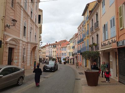
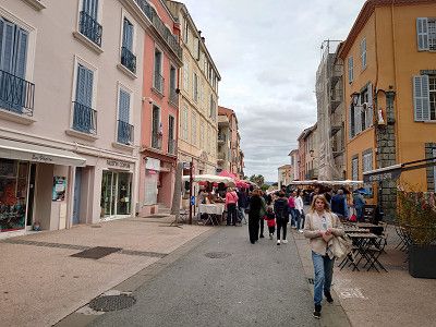
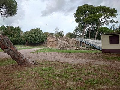
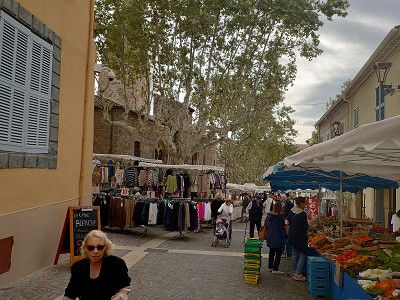
On the morning of our departure day we visited the old town of Fréjus. (It was market day) The Théâtre romain was unfortunately closed, but what we saw from the outside was very little preserved anyway. There are only a few walls and a new stage building. The compensation was the beautiful old town with its pastel-colored houses. We were also able to visit the cathedral and, lastly, admire the 5 monstrances with relics of saints unknown to us, as they were only on display that day during and shortly after mass. The baptistery and the cloister were closed for renovation. We were able to take a quick look into the cloister through a plastic window. After a small lunch in a restaurant in front of the cathedral, we then set off on the return journey of our lovely tour of Provence to the starting point of Robion.
On the morning of our departure day we visited the old town of Fréjus. (It was market day) The Théâtre romain was unfortunately closed, but what we saw from the outside was very little preserved anyway. There are only a few walls and a new stage building. The compensation was the beautiful old town with its pastel-colored houses. We were also able to visit the cathedral and, lastly, admire the 5 monstrances with relics of saints unknown to us, as they were only on display that day during and shortly after mass. The baptistery and the cloister were closed for renovation. We were able to take a quick look into the cloister through a plastic window. After a small lunch in a restaurant in front of the cathedral, we then set off on the return journey of our lovely tour of Provence to the starting point of Robion.
Return journey via motorway to the starting point in the Luberon.
Here the trip is documented again in detail:
https://www.frankreich-in-wort-und-bild.de/wohnmobiltouren/mit-dem-wohnmobil-in-frankreich/provence-wohnmobilreise-zu-entlegenen-bergd%C3%B6rfern-herbst-2023/
Return journey via motorway to the starting point in the Luberon.
Here the trip is documented again in detail:
https://www.frankreich-in-wort-und-bild.de/wohnmobiltouren/mit-dem-wohnmobil-in-frankreich/provence-wohnmobilreise-zu-entlegenen-bergd%C3%B6rfern-herbst-2023/
Comments (1)
Comments from Freeontour users
mooie route