Unfortunately, we don't support your browser (Internet Explorer) anymore, some functionalities could not work. Click here to get information on how to upgrade your browser.
High Pyrenees - Basque Country Part 2


Travelogue
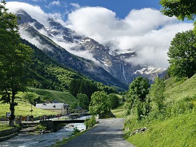
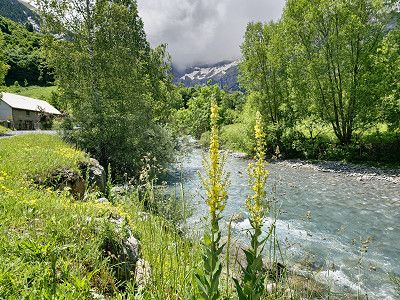
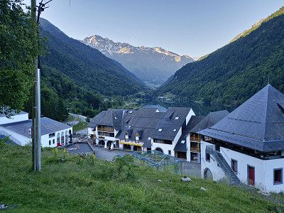
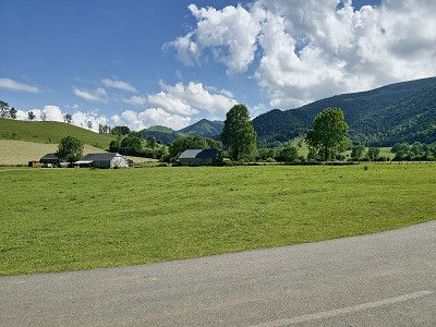
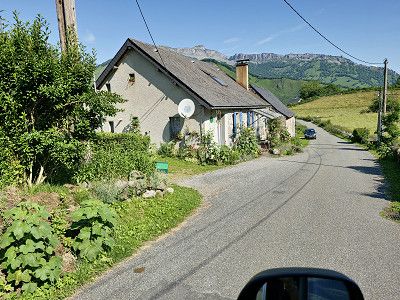
Arrival to Gavernie via motorway on 22.6.2024
Arrival to Gavernie via motorway on 22.6.2024
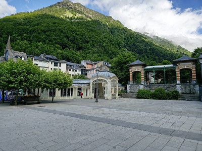
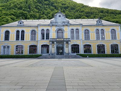
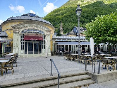
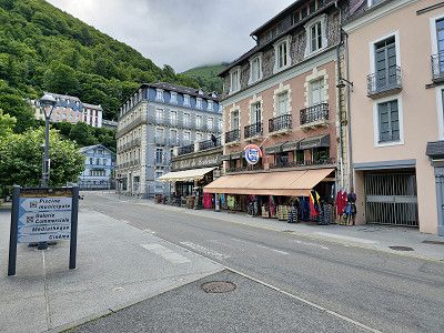
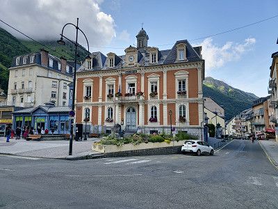
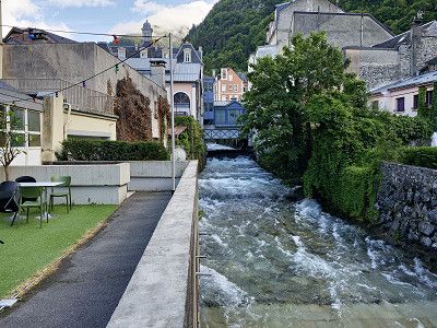
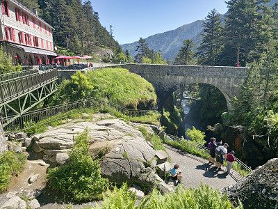
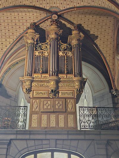
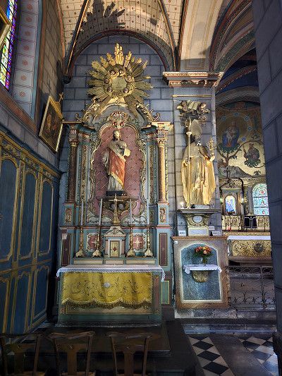
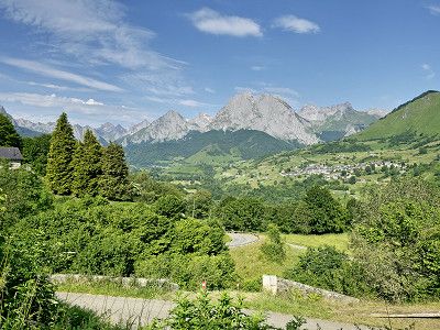
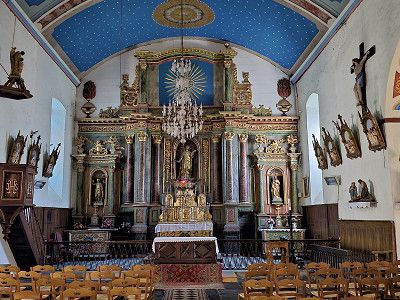
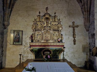
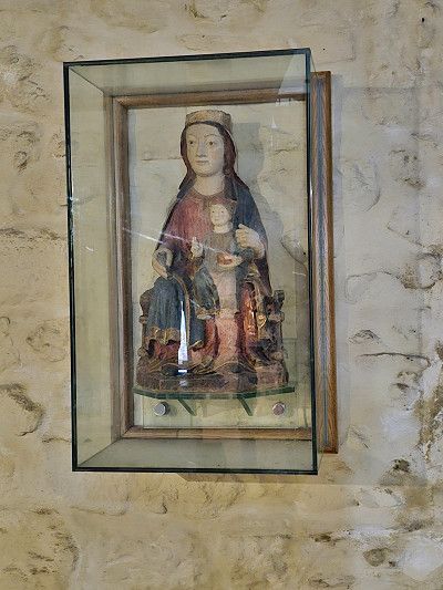
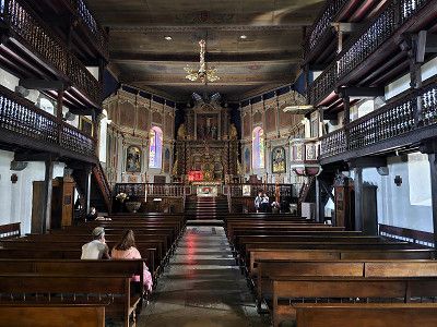
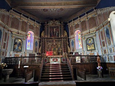
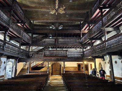
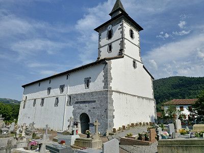
We visited the small mountain town and bought a fantastic Brebis (aged for 5 months), which tasted simply fantastic. The Église des Templiers was interesting, a massive church that also served as a defense.
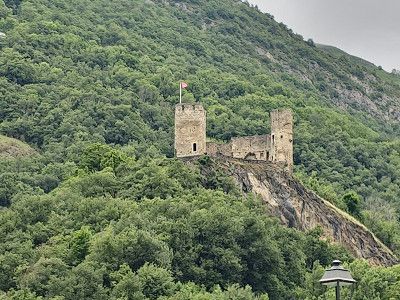
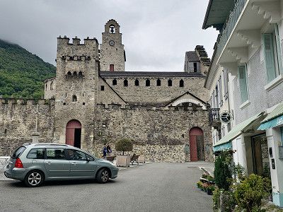
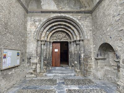
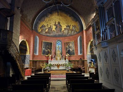

We visited the small mountain town and bought a fantastic Brebis (aged for 5 months), which tasted simply fantastic. The Église des Templiers was interesting, a massive church that also served as a defense.
Here overnight stay in the parking lot of VIVAL, GPS: 42.732786, -0.00951218
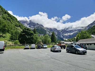
We arrived around 6:00 p.m. and everything was covered in clouds. According to the weather forecast, it should be sunny around noon tomorrow. We will definitely wait and make the hike towards the waterfall when the weather is good.
Here overnight stay in the parking lot of VIVAL, GPS: 42.732786, -0.00951218
We arrived around 6:00 p.m. and everything was covered in clouds. According to the weather forecast, it should be sunny around noon tomorrow. We will definitely wait and make the hike towards the waterfall when the weather is good.
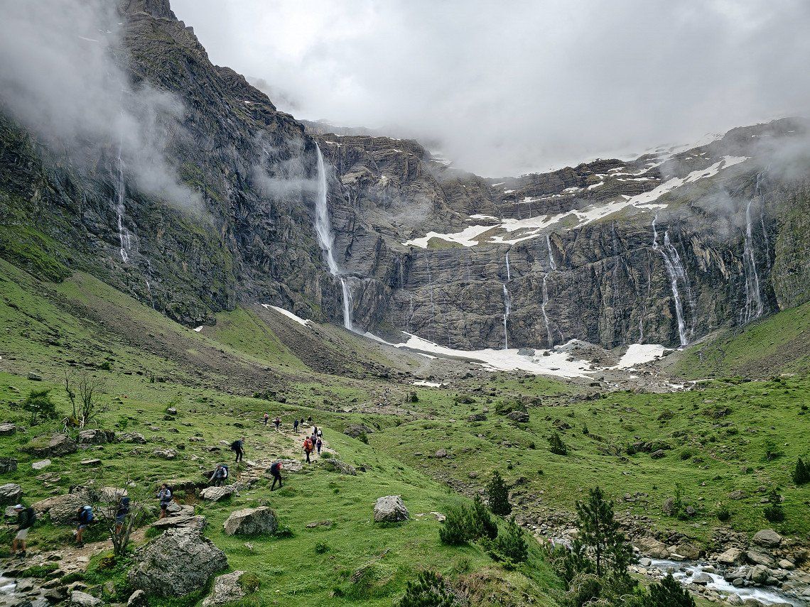
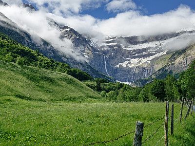
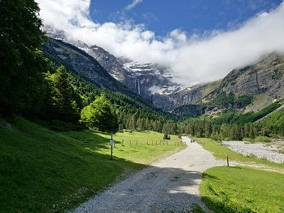
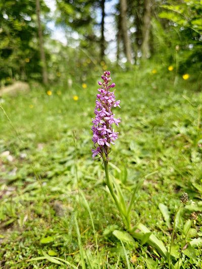
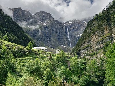
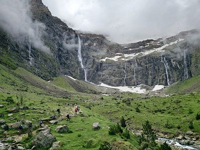
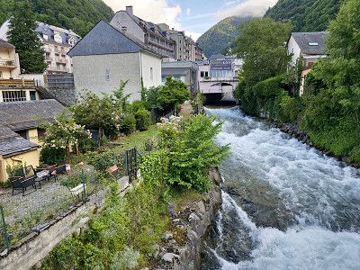
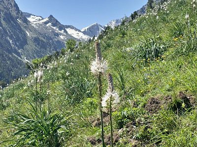
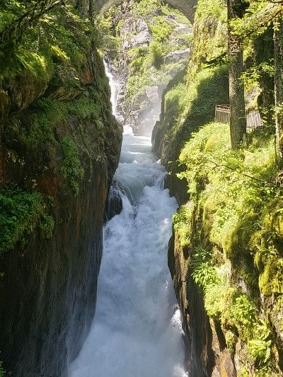
Hike from Cirque de Gavernie to Cascade de Gavernie, approx. 5.2 km with 472 meters of elevation. 1 hour 45 minutes.
To the Hotel du Cirque 3.8 km 238 meters altitude difference 1:15 hours
Times are just a simple way, going back is another thing. Bicycles are prohibited.
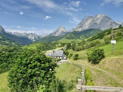
It was partly cloudy, but it was a wonderful day and a unique natural spectacle. I'm glad we came here again. The pictures certainly don't reflect the experience.
Hike from Cirque de Gavernie to Cascade de Gavernie, approx. 5.2 km with 472 meters of elevation. 1 hour 45 minutes.
To the Hotel du Cirque 3.8 km 238 meters altitude difference 1:15 hours
Times are just a simple way, going back is another thing. Bicycles are prohibited.
It was partly cloudy, but it was a wonderful day and a unique natural spectacle. I'm glad we came here again. The pictures certainly don't reflect the experience.
Parking space in Cauterets for the night.
The parking space has everything you need, fresh water, waste disposal, electricity and is in a quiet location. The cost for the night is €12 at the parking machine. In the evening we went to the small (880 inhabitants) fashionable seaside resort for dinner.
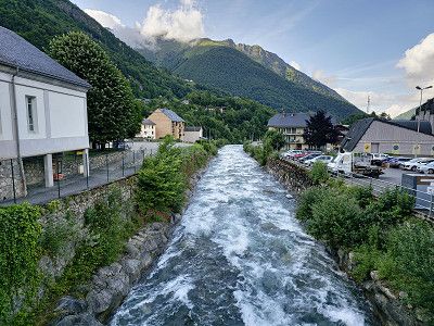
Set off early in the morning to the Pont d'Espagne.
Parking space in Cauterets for the night.
The parking space has everything you need, fresh water, waste disposal, electricity and is in a quiet location. The cost for the night is €12 at the parking machine. In the evening we went to the small (880 inhabitants) fashionable seaside resort for dinner.
Set off early in the morning to the Pont d'Espagne.
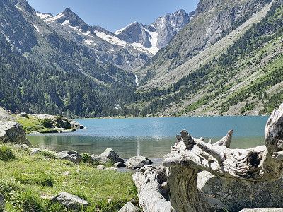
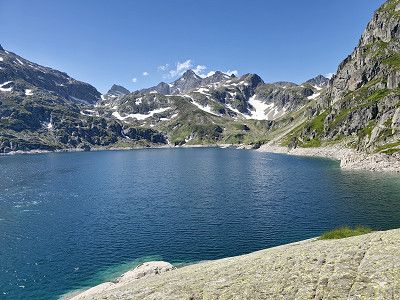
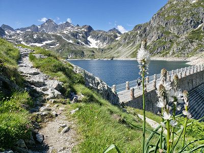
Parking lot for the Pont d'Espagne. Here there is a cable car (for Marianne) up to the top of the actual Pont d'Espagne (there is also a restaurant there). I drive on to the Lac and then hike the path to Lac de Gaube.
Costs for parking, Puntas cable car and Gaube chairlift €16.00 per person. (See printout)
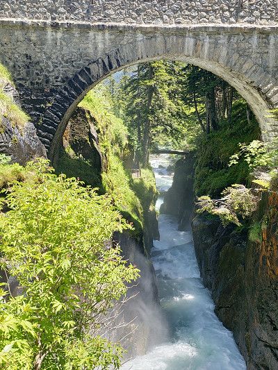
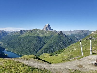
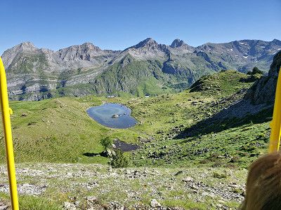
Time required: cable car and chair lift 20 minutes. Hike to the lake 15 minutes. Then walk to the Pont d'Espagne. Plan 3 - 4 hours in total. If you only want to see the waterfalls at the Pont d'Espagne, you don't need the cable car and chair lift. You can also hike from the car park to Lac de Gaube, but you'll need a whole day for everything. It was definitely one of the highlights of the trip.
Parking lot for the Pont d'Espagne. Here there is a cable car (for Marianne) up to the top of the actual Pont d'Espagne (there is also a restaurant there). I drive on to the Lac and then hike the path to Lac de Gaube.
Costs for parking, Puntas cable car and Gaube chairlift €16.00 per person. (See printout)
Time required: cable car and chair lift 20 minutes. Hike to the lake 15 minutes. Then walk to the Pont d'Espagne. Plan 3 - 4 hours in total. If you only want to see the waterfalls at the Pont d'Espagne, you don't need the cable car and chair lift. You can also hike from the car park to Lac de Gaube, but you'll need a whole day for everything. It was definitely one of the highlights of the trip.
Waypoint
Waypoint
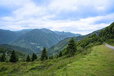
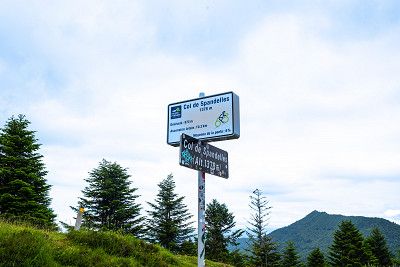
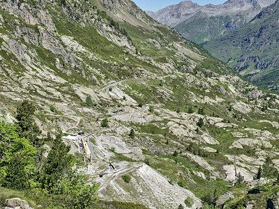
Our original plan to go over the Col de Soulor was not possible due to a total closure (landslide). So we went over the Col de Spandelles, which is very narrow in many places and hardly suitable for large motorhomes over 7 meters. We were very sorry because the originally planned trip would certainly have been even more scenic. This meant that the Gourette waypoint was also canceled.
Our original plan to go over the Col de Soulor was not possible due to a total closure (landslide). So we went over the Col de Spandelles, which is very narrow in many places and hardly suitable for large motorhomes over 7 meters. We were very sorry because the originally planned trip would certainly have been even more scenic. This meant that the Gourette waypoint was also canceled.
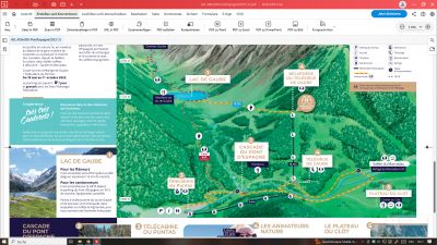
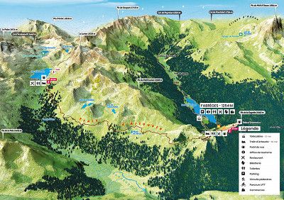
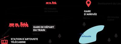
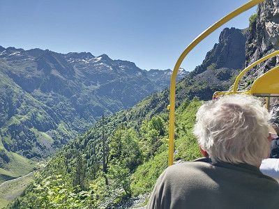
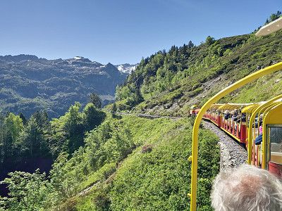
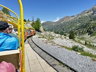
Parking for overnight stay for the miniature train ride to Lac d'Artouste. Plan at least 5 hours for the train ride.
We may have to stand on the road or at the reservoir.
Reservations at:
https://artouste.fr/ete/reservation/
Customer service is open daily from 9:00 a.m. to 6:00 p.m.
Tickets purchased online must be printed or downloaded from home.
Since the internet network in the village of Fabrèges is very weak, you cannot download the files there.
Think about it before you take the little train!
A screenshot may also be sufficient (assuming you can clearly see the QR code of each ticket).
How it works ?
15-minute gondola ride
55 minutes crossing at 2000 m altitude
1h20 free time at the lake with the Discovery ticket (1h40 in low season), the day with the Escapade ticket
Discovery ticket 27 €
We spent the night here 42.88059963, -0.39710498 on a spot above the cable car.
Today we take a miniature train to Lac d'Artouste. Allow at least 5 hours for the train stop.
https://artouste.fr/ete/le-train-dartouste/
High season:
6 July to 1 September
Trains depart every 30 minutes from 9 a.m. to 5 p.m.
Low season:
from 8 May to 5 July and from 2 September to 6 October.
Trains depart every hour from 10 a.m. to 3 p.m.
Discovery Ticket
3h30 excursion with 55 minutes crossing and 1h20 free time upon arrival of the train (1h40 free time in low season)
Gondola + return ticket.
Our conclusion: Simply a dream and definitely worth recommending
Houses from the 16th and 17th centuries. We only drove through the town without visiting it.
Houses from the 16th and 17th centuries. We only drove through the town without visiting it.
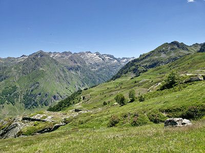
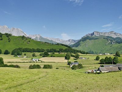
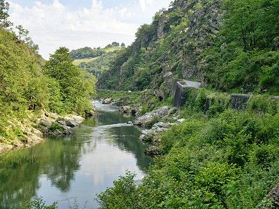
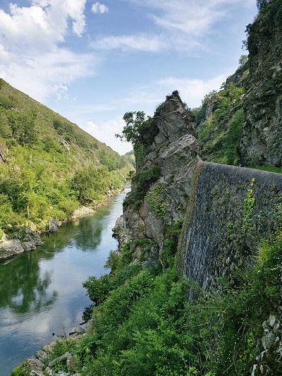
We drove through a beautiful landscape. The col is 1035 metres high and narrow in places, which is why it is probably forbidden for vehicles over 3.5 tonnes.

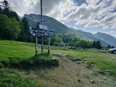
We drove through a beautiful landscape. The col is 1035 metres high and narrow in places, which is why it is probably forbidden for vehicles over 3.5 tonnes.
Here you will find Monastere de Sarrance
If necessary, overnight stay at CP Aire Naturelle Camping Maison Bousquet about 6 km further. GPS: 43.0122236, -0.6012326
or
Camping Municipal de Carolle GPS: 42.99819, -0.604525We visited the monasteries and then moved on.
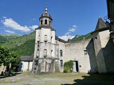
Here you will find Monastere de Sarrance
If necessary, overnight stay at CP Aire Naturelle Camping Maison Bousquet about 6 km further. GPS: 43.0122236, -0.6012326
or
Camping Municipal de Carolle GPS: 42.99819, -0.604525We visited the monasteries and then moved on.
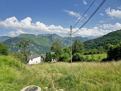
We went to the campsite near Lescun, which really offers everything for €10. A wonderful landscape from which you can go on lots of hikes. Electricity costs an extra €4. But included is a sanitary facility with showers, toilets, washrooms, etc. The cleanliness here is absolutely perfect, something you rarely see at campsites. Of course, fresh water and waste disposal are also included. Can really be recommended.
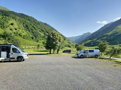
We went to the campsite near Lescun, which really offers everything for €10. A wonderful landscape from which you can go on lots of hikes. Electricity costs an extra €4. But included is a sanitary facility with showers, toilets, washrooms, etc. The cleanliness here is absolutely perfect, something you rarely see at campsites. Of course, fresh water and waste disposal are also included. Can really be recommended.
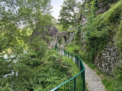
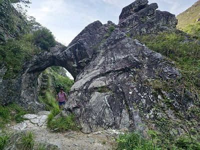
We visited the place that is said to be one of the most beautiful villages in the Pyrenees because of its location. It is simply stunning, there are very few tourists and it offers fabulous hikes in the Cirque de Lescun.
For us it would be another goal for the future.
In Lesun you can only park on the outskirts of the town GPS: 42.931456 -0.636726. There is also a campsite (see below) in Lescun towards Cirque, which is also beautifully situated.
But also quiet parking on the WOMOS stand 42.927557609972084, -0.6599638261288415
We were not here as previously written
But also quiet parking on the WOMOS stand 42.927557609972084, -0.6599638261288415
We were not here as previously written
It was a day of pass rides because in total it is about 165 km to the destination Sare, the start of the Train de la Rhune
It was a day of pass rides because in total it is about 165 km to the destination Sare, the start of the Train de la Rhune
We made a short stop here and after our lunch break we visited the small town, which is already part of the Basque Country.
Afterwards we continued over the Col Bagargiak.
We made a short stop here and after our lunch break we visited the small town, which is already part of the Basque Country.
Afterwards we continued over the Col Bagargiak.
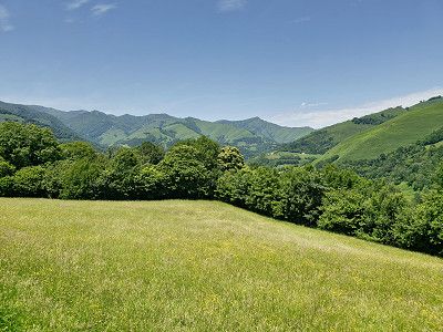
A scenic drive through the Basque countryside.
A scenic drive through the Basque countryside.
We are just driving through because we have already been in the town.
I am attaching some pictures of our previous visit. If you visit the place you can park at the following spot: GPS: 43.165312, -1.23245 or one of the 2 CP
I have described the place here: https://www.frankreich-in-wort-und-bild.de/regionen-departement-orte/dep-pyr%C3%A9n%C3%A9es-atlantiques/saint-jean-pied-de-port/
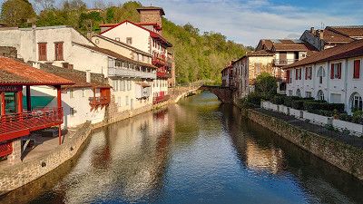
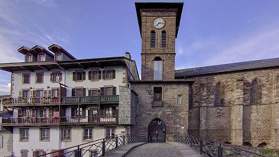
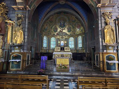
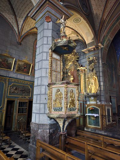
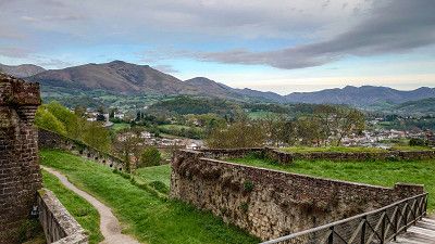
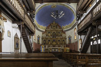
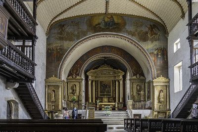
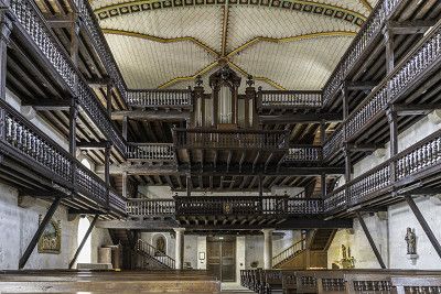
We visited the Saint-Fructueux church and then went on a short hike to the Pas de Roland. Please note that the car park (you can also stay overnight but no camping) at the church can be reached via GPS: 43.325575, -1.405257
We visited the Saint-Fructueux church and then went on a short hike to the Pas de Roland. Please note that the car park (you can also stay overnight but no camping) at the church can be reached via GPS: 43.325575, -1.405257
We know Espelette and so we only drove through. If you want to see more, go to my website with information about parking spaces: https://www.frankreich-in-wort-und-bild.de/regionen-departement-orte/dep-pyr%C3%A9n%C3%A9es-atlantiques/espelette/
We know Espelette and so we only drove through. If you want to see more, go to my website with information about parking spaces: https://www.frankreich-in-wort-und-bild.de/regionen-departement-orte/dep-pyr%C3%A9n%C3%A9es-atlantiques/espelette/
We also know Ainhoa, so here is my website with information about the parking space: https://www.frankreich-in-wort-und-bild.de/regionen-departement-orte/dep-pyr%C3%A9n%C3%A9es-atlantiques/ainhoa/
We also know Ainhoa, so here is my website with information about the parking space: https://www.frankreich-in-wort-und-bild.de/regionen-departement-orte/dep-pyr%C3%A9n%C3%A9es-atlantiques/ainhoa/
We know Sare, so here is my website with parking info: https://www.frankreich-in-wort-und-bild.de/regionen-departement-orte/dep-pyr%C3%A9n%C3%A9es-atlantiques/sare/
We know Sare, so here is my website with parking info: https://www.frankreich-in-wort-und-bild.de/regionen-departement-orte/dep-pyr%C3%A9n%C3%A9es-atlantiques/sare/
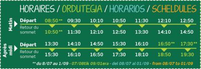
You can spend the night there in the parking lot. Take the Train de la Rhune to the summit the next day
https://www.rhune.com/fr/
Ticket price 24 €
Excursion ticket
An authentic cog railway from 1924 takes you to the summit of La Rhune at an altitude of 905 m in 35 minutes.
La Rhune is a nature reserve and is home to a particular flora and fauna such as the griffon vulture, but also the pottok (Basque pony) which lives freely on the massif. Let yourself be seduced by the beauty of nature while walking on the immense plateau of the summit of La Rhune!
Duration: total 2h30:
35 minutes ascent
1h20 stop at the summit
35 min. descent
As the weather had already changed that evening, we decided not to make the trip the next day. And this train ride certainly couldn't top the previous tour to Lac d'Artouste. However, we did spend the night in the parking lot further back and it was very quiet.
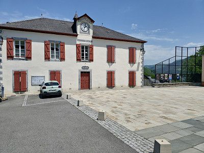
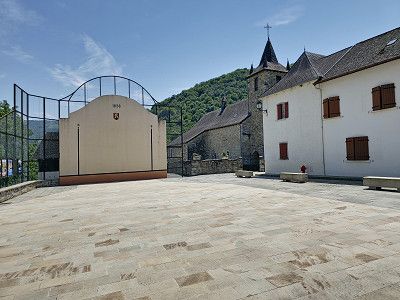
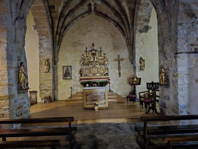
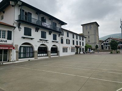
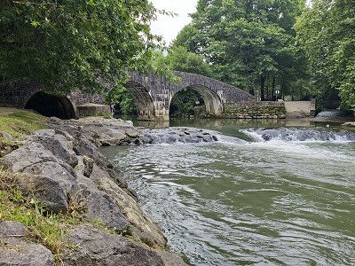
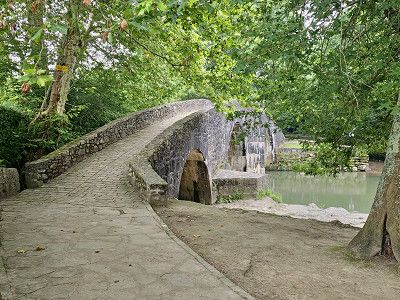
Typical Basque village, visit around the village square and there the church Notre-Dame de l'Assomption 13th century and old Roman bridge.
Parking in car parks on Rue Burdin Bidea = GPS: 43.346147, -1.6233678
Since the weather was really not nice anymore and it would be overcast and rainy on the Atlantic for the next few days, we started our journey home after visiting the area. The Mediterranean was supposed to be sunny.
Alternative to pitch, Tel: 05 59 26 11 94. CP has bus line to Biarritz and San Sebastian.
If we stay at the sea for several days we only use CP so
- Flower Camping La Ferme Erromardie, Tel: 05 59 26 34 26 (recommended by a FB friend)
GPS: 43.40666, -1.641268
- Camping Merko-Laccara, GPS: 43.41874, -1.623329
- CP L´International Erromardie,
GPS: 43.40627, -1.63727
- CP Inter-Plages
GPS: 43.414980, -1.626539
- CP Soubelet
GPS: 43.416584, -1.62528
- CP Tamaris Plage
GPS: 43.418085, -1.624158
Cancelled due to bad weather
Pitch at Camping Car Park in front of Biarritz, 200 meters from the bus stop, 2 km from the old town. Very noisy. Only if we can't get another place.
Another quiet pitch at Camping Car Park 43.459671° -1.56886° about 1.2 km from the sea.
Additional parking space 3 km north of the center of Biarritz on the beach, 43.50695, -1.53372
Cancelled due to bad weather
The pitch is about 100-150 metres from the sandy beach. It has waste disposal, fresh water and electricity, costs €16.88
What I didn't like was the fresh water right next to the toilet flush, a real disadvantage. Luckily, we didn't need fresh water.
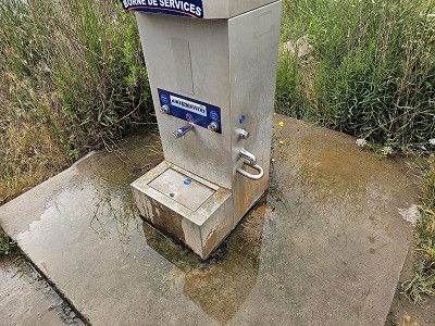
The pitch is about 100-150 metres from the sandy beach. It has waste disposal, fresh water and electricity, costs €16.88
What I didn't like was the fresh water right next to the toilet flush, a real disadvantage. Luckily, we didn't need fresh water.
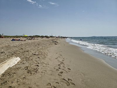
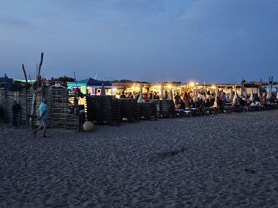
We enjoyed the beach and the sea here. We had a two-day delay because the bad weather followed the next day.
There is a beach bar right in front of the pitch on the beach where you can also get food in the evening. At the time we were there there was even a small party with music and a 3-course meal
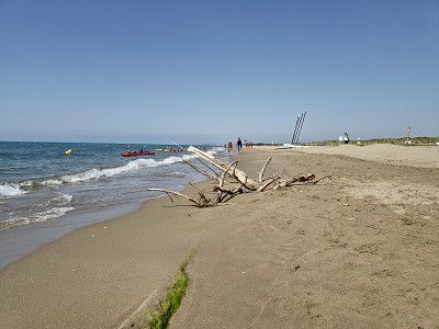
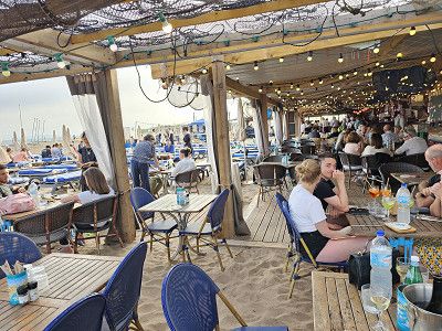
Return to the Luberon
Return to the Luberon
Route
Show newest first- 43.8441 5.1122
- 43° 50' 38.8" N 5° 6' 44" E
- 42.8721 -0.0043
- 42° 52' 19.6" N 0° 0' 15.6" W
- 42.7322 -0.0094
- 42° 43' 55.9" N 0° 0' 33.7" W
- 42.7322 -0.0094
- 42° 43' 55.9" N 0° 0' 33.7" W
- 42.8865 -0.1153
- 42° 53' 11.4" N 0° 6' 55.1" W
- 42.8532 -0.1336
- 42° 51' 11.3" N 0° 8' 1.1" W
- 43.0051 -0.0998
- 43° 0' 18.4" N 0° 5' 59.2" W
- 43.0113 -0.2186
- 43° 0' 40.8" N 0° 13' 7" W
- 42.8796 -0.3983
- 42° 52' 46.5" N 0° 23' 53.8" W
- 42.8583 -0.3317
- 42° 51' 29.8" N 0° 19' 54.2" W
- 43.0559 -0.4325
- 43° 3' 21.3" N 0° 25' 57.1" W
- 43.0705 -0.5075
- 43° 4' 13.7" N 0° 30' 27" W
- 43.0517 -0.6014
- 43° 3' 6" N 0° 36' 5.1" W
- 42.9105 -0.6191
- 42° 54' 37.9" N 0° 37' 8.7" W
- 42.9357 -0.6349
- 42° 56' 8.5" N 0° 38' 5.8" W
- 43.0495 -0.6668
- 43° 2' 58.2" N 0° 40' 0.5" W
- 43.0954 -0.7172
- 43° 5' 43.5" N 0° 43' 2" W
- 43.0977 -0.8183
- 43° 5' 51.8" N 0° 49' 6" W
- 43.0184 -0.9559
- 43° 1' 6.2" N 0° 57' 21.3" W
- 43.0384 -1.0271
- 43° 2' 18.1" N 1° 1' 37.4" W
- 43.163 -1.2381
- 43° 9' 46.6" N 1° 14' 17" W
- 43.3335 -1.4091
- 43° 20' 0.4" N 1° 24' 32.7" W
- 43.3412 -1.4481
- 43° 20' 28.2" N 1° 26' 53.1" W
- 43.3067 -1.4988
- 43° 18' 24.2" N 1° 29' 55.7" W
- 43.313 -1.5793
- 43° 18' 46.7" N 1° 34' 45.5" W
- 43.3252 -1.6008
- 43° 19' 30.6" N 1° 36' 2.8" W
- 43.3449 -1.6208
- 43° 20' 41.8" N 1° 37' 15" W
- 43.2748 3.3517
- 43° 16' 29.1" N 3° 21' 6.2" E
- 43.8441 5.1122
- 43° 50' 38.8" N 5° 6' 44" E
Travelogue
Arrival to Gavernie via motorway on 22.6.2024
Arrival to Gavernie via motorway on 22.6.2024
We visited the small mountain town and bought a fantastic Brebis (aged for 5 months), which tasted simply fantastic. The Église des Templiers was interesting, a massive church that also served as a defense.
We visited the small mountain town and bought a fantastic Brebis (aged for 5 months), which tasted simply fantastic. The Église des Templiers was interesting, a massive church that also served as a defense.
Here overnight stay in the parking lot of VIVAL, GPS: 42.732786, -0.00951218
We arrived around 6:00 p.m. and everything was covered in clouds. According to the weather forecast, it should be sunny around noon tomorrow. We will definitely wait and make the hike towards the waterfall when the weather is good.
Hike from Cirque de Gavernie to Cascade de Gavernie, approx. 5.2 km with 472 meters of elevation. 1 hour 45 minutes.
To the Hotel du Cirque 3.8 km 238 meters altitude difference 1:15 hours
Times are just a simple way, going back is another thing. Bicycles are prohibited.
It was partly cloudy, but it was a wonderful day and a unique natural spectacle. I'm glad we came here again. The pictures certainly don't reflect the experience.
Parking space in Cauterets for the night.
The parking space has everything you need, fresh water, waste disposal, electricity and is in a quiet location. The cost for the night is €12 at the parking machine. In the evening we went to the small (880 inhabitants) fashionable seaside resort for dinner.
Set off early in the morning to the Pont d'Espagne.
Parking lot for the Pont d'Espagne. Here there is a cable car (for Marianne) up to the top of the actual Pont d'Espagne (there is also a restaurant there). I drive on to the Lac and then hike the path to Lac de Gaube.
Costs for parking, Puntas cable car and Gaube chairlift €16.00 per person. (See printout)
Time required: cable car and chair lift 20 minutes. Hike to the lake 15 minutes. Then walk to the Pont d'Espagne. Plan 3 - 4 hours in total. If you only want to see the waterfalls at the Pont d'Espagne, you don't need the cable car and chair lift. You can also hike from the car park to Lac de Gaube, but you'll need a whole day for everything. It was definitely one of the highlights of the trip.
Waypoint
Waypoint
Our original plan to go over the Col de Soulor was not possible due to a total closure (landslide). So we went over the Col de Spandelles, which is very narrow in many places and hardly suitable for large motorhomes over 7 meters. We were very sorry because the originally planned trip would certainly have been even more scenic. This meant that the Gourette waypoint was also canceled.
Our original plan to go over the Col de Soulor was not possible due to a total closure (landslide). So we went over the Col de Spandelles, which is very narrow in many places and hardly suitable for large motorhomes over 7 meters. We were very sorry because the originally planned trip would certainly have been even more scenic. This meant that the Gourette waypoint was also canceled.
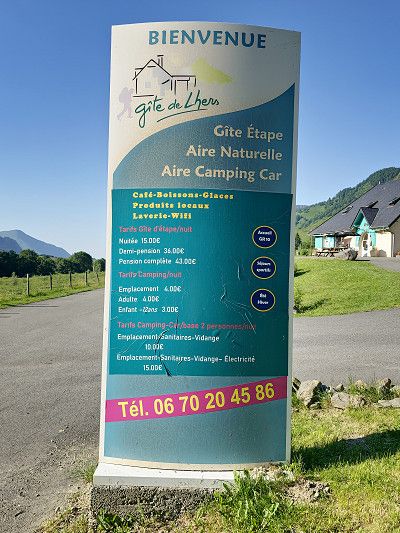
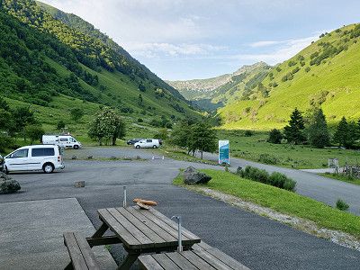
Parking for overnight stay for the miniature train ride to Lac d'Artouste. Plan at least 5 hours for the train ride.
We may have to stand on the road or at the reservoir.
Reservations at:
https://artouste.fr/ete/reservation/
Customer service is open daily from 9:00 a.m. to 6:00 p.m.
Tickets purchased online must be printed or downloaded from home.
Since the internet network in the village of Fabrèges is very weak, you cannot download the files there.
Think about it before you take the little train!
A screenshot may also be sufficient (assuming you can clearly see the QR code of each ticket).
How it works ?
15-minute gondola ride
55 minutes crossing at 2000 m altitude
1h20 free time at the lake with the Discovery ticket (1h40 in low season), the day with the Escapade ticket
Discovery ticket 27 €
We spent the night here 42.88059963, -0.39710498 on a spot above the cable car.
Today we take a miniature train to Lac d'Artouste. Allow at least 5 hours for the train stop.
https://artouste.fr/ete/le-train-dartouste/
High season:
6 July to 1 September
Trains depart every 30 minutes from 9 a.m. to 5 p.m.
Low season:
from 8 May to 5 July and from 2 September to 6 October.
Trains depart every hour from 10 a.m. to 3 p.m.
Discovery Ticket
3h30 excursion with 55 minutes crossing and 1h20 free time upon arrival of the train (1h40 free time in low season)
Gondola + return ticket.
Our conclusion: Simply a dream and definitely worth recommending
Houses from the 16th and 17th centuries. We only drove through the town without visiting it.
Houses from the 16th and 17th centuries. We only drove through the town without visiting it.
We drove through a beautiful landscape. The col is 1035 metres high and narrow in places, which is why it is probably forbidden for vehicles over 3.5 tonnes.
We drove through a beautiful landscape. The col is 1035 metres high and narrow in places, which is why it is probably forbidden for vehicles over 3.5 tonnes.
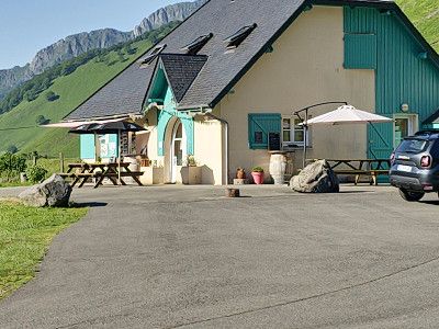
Here you will find Monastere de Sarrance
If necessary, overnight stay at CP Aire Naturelle Camping Maison Bousquet about 6 km further. GPS: 43.0122236, -0.6012326
or
Camping Municipal de Carolle GPS: 42.99819, -0.604525We visited the monasteries and then moved on.
Here you will find Monastere de Sarrance
If necessary, overnight stay at CP Aire Naturelle Camping Maison Bousquet about 6 km further. GPS: 43.0122236, -0.6012326
or
Camping Municipal de Carolle GPS: 42.99819, -0.604525We visited the monasteries and then moved on.
We went to the campsite near Lescun, which really offers everything for €10. A wonderful landscape from which you can go on lots of hikes. Electricity costs an extra €4. But included is a sanitary facility with showers, toilets, washrooms, etc. The cleanliness here is absolutely perfect, something you rarely see at campsites. Of course, fresh water and waste disposal are also included. Can really be recommended.
We went to the campsite near Lescun, which really offers everything for €10. A wonderful landscape from which you can go on lots of hikes. Electricity costs an extra €4. But included is a sanitary facility with showers, toilets, washrooms, etc. The cleanliness here is absolutely perfect, something you rarely see at campsites. Of course, fresh water and waste disposal are also included. Can really be recommended.
We visited the place that is said to be one of the most beautiful villages in the Pyrenees because of its location. It is simply stunning, there are very few tourists and it offers fabulous hikes in the Cirque de Lescun.
For us it would be another goal for the future.
In Lesun you can only park on the outskirts of the town GPS: 42.931456 -0.636726. There is also a campsite (see below) in Lescun towards Cirque, which is also beautifully situated.
But also quiet parking on the WOMOS stand 42.927557609972084, -0.6599638261288415
We were not here as previously written
But also quiet parking on the WOMOS stand 42.927557609972084, -0.6599638261288415
We were not here as previously written
It was a day of pass rides because in total it is about 165 km to the destination Sare, the start of the Train de la Rhune
It was a day of pass rides because in total it is about 165 km to the destination Sare, the start of the Train de la Rhune
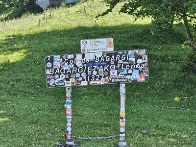
We made a short stop here and after our lunch break we visited the small town, which is already part of the Basque Country.
Afterwards we continued over the Col Bagargiak.
We made a short stop here and after our lunch break we visited the small town, which is already part of the Basque Country.
Afterwards we continued over the Col Bagargiak.
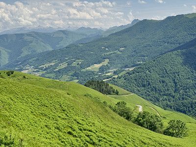
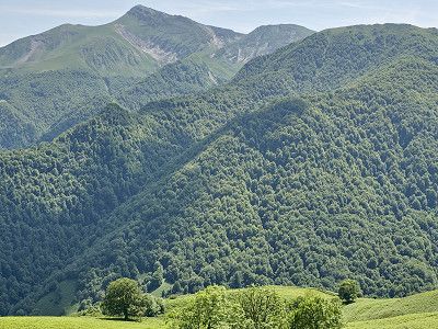
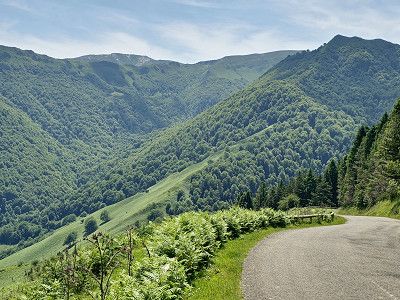
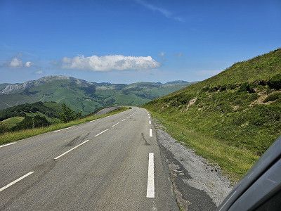
A scenic drive through the Basque countryside.
A scenic drive through the Basque countryside.
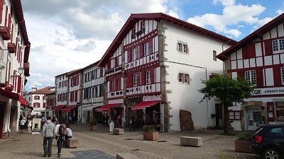
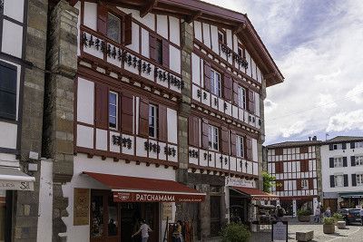
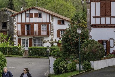
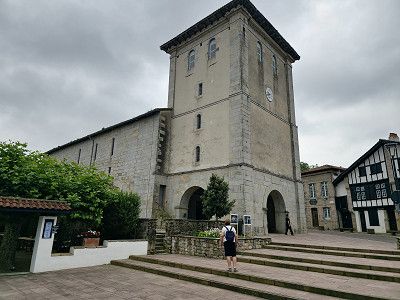
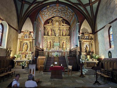
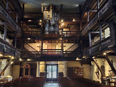
We are just driving through because we have already been in the town.
I am attaching some pictures of our previous visit. If you visit the place you can park at the following spot: GPS: 43.165312, -1.23245 or one of the 2 CP
I have described the place here: https://www.frankreich-in-wort-und-bild.de/regionen-departement-orte/dep-pyr%C3%A9n%C3%A9es-atlantiques/saint-jean-pied-de-port/
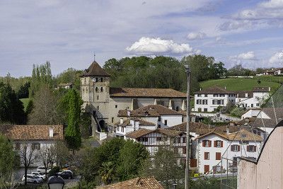
We visited the Saint-Fructueux church and then went on a short hike to the Pas de Roland. Please note that the car park (you can also stay overnight but no camping) at the church can be reached via GPS: 43.325575, -1.405257
We visited the Saint-Fructueux church and then went on a short hike to the Pas de Roland. Please note that the car park (you can also stay overnight but no camping) at the church can be reached via GPS: 43.325575, -1.405257
We know Espelette and so we only drove through. If you want to see more, go to my website with information about parking spaces: https://www.frankreich-in-wort-und-bild.de/regionen-departement-orte/dep-pyr%C3%A9n%C3%A9es-atlantiques/espelette/
We know Espelette and so we only drove through. If you want to see more, go to my website with information about parking spaces: https://www.frankreich-in-wort-und-bild.de/regionen-departement-orte/dep-pyr%C3%A9n%C3%A9es-atlantiques/espelette/
We also know Ainhoa, so here is my website with information about the parking space: https://www.frankreich-in-wort-und-bild.de/regionen-departement-orte/dep-pyr%C3%A9n%C3%A9es-atlantiques/ainhoa/
We also know Ainhoa, so here is my website with information about the parking space: https://www.frankreich-in-wort-und-bild.de/regionen-departement-orte/dep-pyr%C3%A9n%C3%A9es-atlantiques/ainhoa/
We know Sare, so here is my website with parking info: https://www.frankreich-in-wort-und-bild.de/regionen-departement-orte/dep-pyr%C3%A9n%C3%A9es-atlantiques/sare/
We know Sare, so here is my website with parking info: https://www.frankreich-in-wort-und-bild.de/regionen-departement-orte/dep-pyr%C3%A9n%C3%A9es-atlantiques/sare/
You can spend the night there in the parking lot. Take the Train de la Rhune to the summit the next day
https://www.rhune.com/fr/
Ticket price 24 €
Excursion ticket
An authentic cog railway from 1924 takes you to the summit of La Rhune at an altitude of 905 m in 35 minutes.
La Rhune is a nature reserve and is home to a particular flora and fauna such as the griffon vulture, but also the pottok (Basque pony) which lives freely on the massif. Let yourself be seduced by the beauty of nature while walking on the immense plateau of the summit of La Rhune!
Duration: total 2h30:
35 minutes ascent
1h20 stop at the summit
35 min. descent
As the weather had already changed that evening, we decided not to make the trip the next day. And this train ride certainly couldn't top the previous tour to Lac d'Artouste. However, we did spend the night in the parking lot further back and it was very quiet.
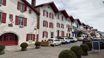
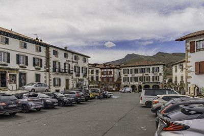
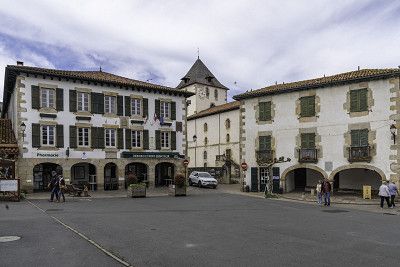
Typical Basque village, visit around the village square and there the church Notre-Dame de l'Assomption 13th century and old Roman bridge.
Parking in car parks on Rue Burdin Bidea = GPS: 43.346147, -1.6233678
Since the weather was really not nice anymore and it would be overcast and rainy on the Atlantic for the next few days, we started our journey home after visiting the area. The Mediterranean was supposed to be sunny.
Alternative to pitch, Tel: 05 59 26 11 94. CP has bus line to Biarritz and San Sebastian.
If we stay at the sea for several days we only use CP so
- Flower Camping La Ferme Erromardie, Tel: 05 59 26 34 26 (recommended by a FB friend)
GPS: 43.40666, -1.641268
- Camping Merko-Laccara, GPS: 43.41874, -1.623329
- CP L´International Erromardie,
GPS: 43.40627, -1.63727
- CP Inter-Plages
GPS: 43.414980, -1.626539
- CP Soubelet
GPS: 43.416584, -1.62528
- CP Tamaris Plage
GPS: 43.418085, -1.624158
Cancelled due to bad weather
Pitch at Camping Car Park in front of Biarritz, 200 meters from the bus stop, 2 km from the old town. Very noisy. Only if we can't get another place.
Another quiet pitch at Camping Car Park 43.459671° -1.56886° about 1.2 km from the sea.
Additional parking space 3 km north of the center of Biarritz on the beach, 43.50695, -1.53372
Cancelled due to bad weather
The pitch is about 100-150 metres from the sandy beach. It has waste disposal, fresh water and electricity, costs €16.88
What I didn't like was the fresh water right next to the toilet flush, a real disadvantage. Luckily, we didn't need fresh water.
The pitch is about 100-150 metres from the sandy beach. It has waste disposal, fresh water and electricity, costs €16.88
What I didn't like was the fresh water right next to the toilet flush, a real disadvantage. Luckily, we didn't need fresh water.
We enjoyed the beach and the sea here. We had a two-day delay because the bad weather followed the next day.
There is a beach bar right in front of the pitch on the beach where you can also get food in the evening. At the time we were there there was even a small party with music and a 3-course meal
Return to the Luberon
Return to the Luberon
Comments (0)
Comments from Freeontour users