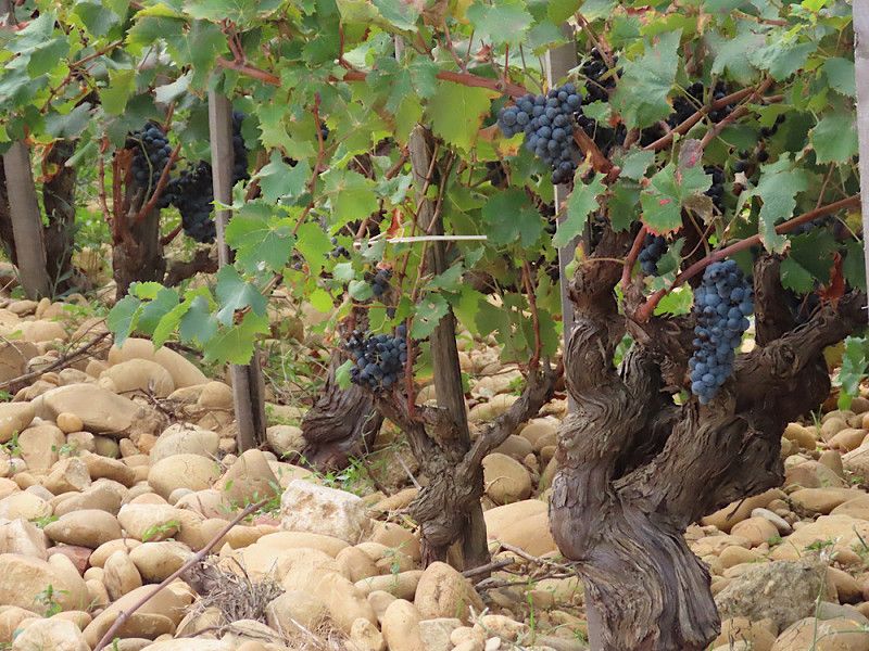
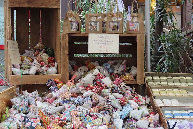
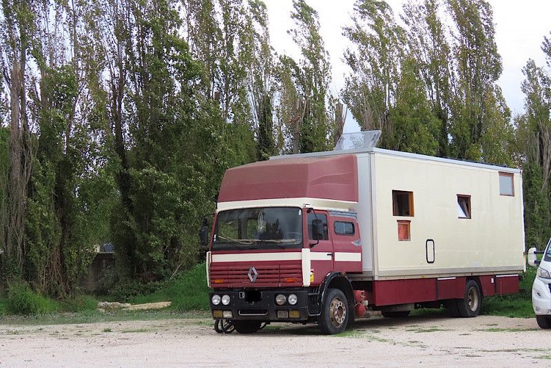
From September 11th to October 19th, 2024, I was traveling in the South of France via Heidelberg and Strasbourg 💃. The focus of my trip was the Ardèche Gorge, the Camargue and the Luberon Nature Park. All of this is part of Provence.
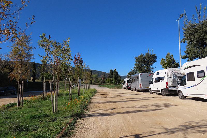
I rarely go to campsites - here only for a week in Saintes-Maries-de-la-Mer right by the sea. Otherwise, I prefer to camp freely or on urban or small pitches.
The tour was great with lots of great experiences and nice encounters. Simply having time and staying where you like was really good and the five weeks were well worth it.
Day
Retzstadt, Deutschland
Retzstadt, 97282, Deutschland
49° 54' 45" N 9° 52' 55" E
49.9125000 9.8819400
• Head west on Goldbrunnenstraße. Go for 218 m.
• Turn right onto Hauptstraße (MSP7). Go for 951 m.
• Continue on Retzbacher Straße (MSP7). Go for 2.8 km.
• Continue on MSP7. Go for 292 m.
• Continue on Kolpingstraße (MSP7). Go for 691 m.
• Turn right onto Obere Hauptstraße (MSP7). Go for 510 m.
• Take the 3rd exit from roundabout onto St2437. Go for 1.6 km.
• Take the 2nd exit from roundabout onto St2300. Go for 765 m.
• Take the 2nd exit from roundabout onto St2300. Go for 12.0 km.
• Keep right onto Hettstadter Steige (St2298). Go for 2.3 km.
• Turn left onto St2436. Go for 130 m.
• Take the 2nd exit from Werner-Pomikal-Ring roundabout onto St2436. Go for 429 m.
• Continue on Zeller Straße (St2436). Go for 342 m.
• Turn left onto Zeller Straße (St2436). Go for 135 m.
• Take ramp onto St2312 toward Würzburg/B8. Go for 1.0 km.
• Take ramp onto Umgehungsstraße (B27) toward Nürnberg/Stuttgart/Heidelberg/Mosbach/Tauberbischofsheim. Go for 5.2 km.
• Take the 2nd exit from roundabout onto A81 toward Stuttgart/Tauberbischofsheim. Go for 50.9 km.
• Take exit 6 toward Osterburken/Adelsheim/Mosbach. Go for 389 m.
• Turn left onto B292 toward Osterburken/Adelsheim/Mosbach/Schöntal. Go for 427 m.
• Turn left onto L1046 toward Widdern/Schöntal/Oberkessach. Go for 13.0 km.
• Turn left onto Klosterhof. Go for 164 m.
• Arrive at Klosterhof. Your destination is on the right.
☍
94,2 km
(1 hrs. 5 min.)
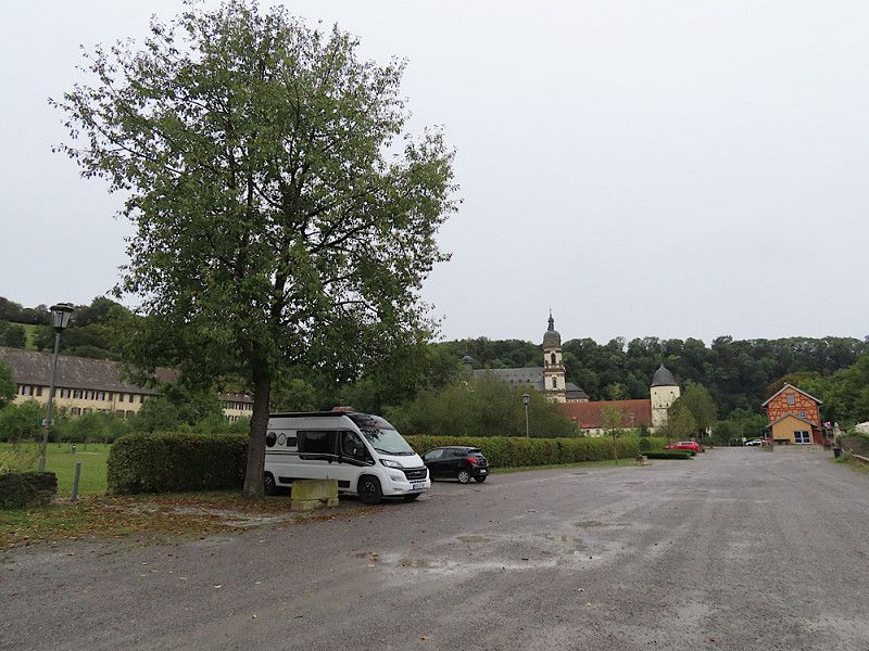
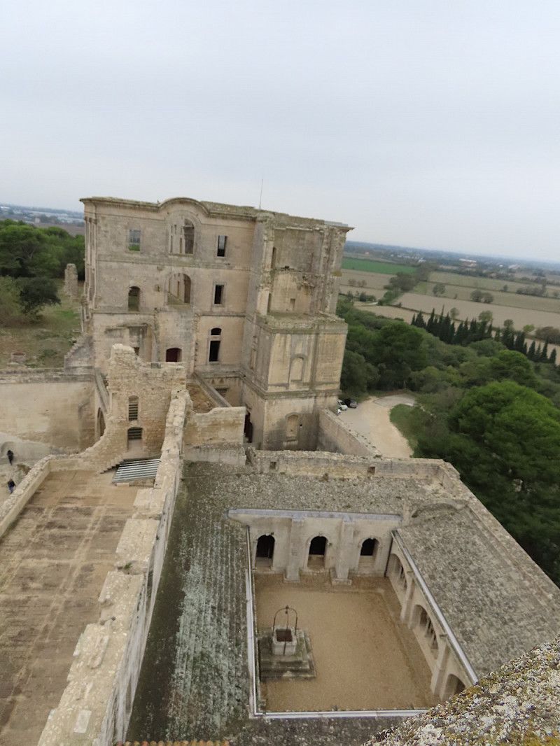
Kloster Schöntal
Overnight stay at Schöntal Monastery, situated in a very scenic location in the Jagst Valley
Hohenlohekreis, Baden-Württemberg, Deutschland
49° 19' 43" N 9° 30' 17.7" E
49.3286190 9.5049091
• Head toward Großer Garten on Klosterhof. Go for 164 m.
• Turn right onto Großer Garten (L1025). Go for 2.3 km.
• Continue on Max-Eyth-Straße (L1046). Go for 10.7 km.
• Turn left onto B292. Go for 22.4 km.
• Turn left onto B27/B292 toward Karlsruhe/Mosbach. Go for 2.2 km.
• Continue on Hauptstraße (B27/B292) toward Karlsruhe/Mosbach/Gewerbegebiet Brühl. Go for 4.6 km.
• Turn left onto Hauptstraße toward Stadtmitte/Alte Mälzerei. Go for 433 m.
• Continue on Hauptstraße. Go for 262 m.
• Turn left onto Alte Bergsteige. Go for 191 m.
• Turn slightly right onto Zwingerstraße. Go for 55 m.
• Turn right onto Collekturgasse. Go for 30 m.
• Turn left onto Alter Schulplatz. Go for 83 m.
• Turn slightly right onto Heissensteingasse. Go for 59 m.
• Turn right onto Heugasse. Go for 31 m.
• Arrive at Heugasse. Your destination is on the right.
☍
43,5 km
( 41 min.)
Day
Mosbach
Stopover to buy a gas tank at Hornbach. It's more idyllic through the Odenwald than on the A6 anyway 😉.
Neckar-Odenwald-Kreis, Baden-Württemberg, Deutschland
49° 21' 7.6" N 9° 8' 45.7" E
49.3521085 9.1460205
• Head toward Heissensteingasse on Heugasse. Go for 73 m.
• Turn left onto Heugasse. Go for 47 m.
• Turn right onto Heugasse. Go for 32 m.
• Turn right onto Zwingerstraße. Go for 35 m.
• Turn slightly right onto Oberer Mühlenweg. Go for 55 m.
• Turn slightly right onto Pfalzgraf-Otto-Straße. Go for 190 m.
• Turn slightly right onto Franz-Roser-Platz. Go for 495 m.
• Turn right onto Scheffelstraße. Go for 127 m.
• Turn left onto Neckarelzer Straße (B27/B292). Go for 12.9 km.
• Continue on B292 toward A6/Karlsruhe/Sinsheim/Aglasterhausen. Go for 1.2 km.
• Turn right onto L590 toward Heidelberg/Schwarzach/Aglasterhausen. Go for 774 m.
• Continue on Heidelberger Straße (L532). Go for 145 m.
• Take the 2nd exit from roundabout onto Heidelberger Straße (L532) toward Heidelberg/Lobbach. Go for 8.0 km.
• Turn right onto K4101 toward Dilsberg/Mückenloch. Go for 2.2 km.
• Continue on Waldwimmersbacher Straße (K4101). Go for 772 m.
• Continue on Talstraße (K4101). Go for 462 m.
• Continue on Mückenlocher Straße (K4101). Go for 1.2 km.
• Turn left onto An der Steige (K4101). Go for 67 m.
• Keep right onto Neuhofer Straße (K4101). Go for 408 m.
• Turn right onto Neckargemünder Straße (K4200). Go for 3.2 km.
• Turn left onto K4200 toward Heidelberg/B37/Sinsheim/B45/Eberbach. Go for 610 m.
• Turn right onto Bammentaler Straße (B45). Go for 362 m.
• Turn left onto Bahnhofstraße (B37) toward Mannheim/Heidelberg. Go for 8.0 km.
• Turn left. Go for 69 m.
• Turn right toward Zentrum. Go for 61 m.
• Continue on Schloßbergtunnel. Go for 901 m.
• Continue on Friedrich-Ebert-Anlage. Go for 968 m.
• Turn right onto Sofienstraße (B3) toward Weinheim/Eberbach/B37. Go for 130 m.
• Turn right onto Plöck. Go for 68 m.
• Arrive at Plöck. Your destination is on the left.
☍
43,6 km
( 53 min.)
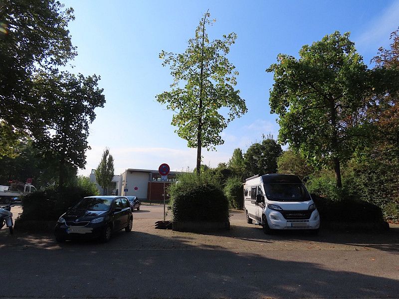
Heidelberg
Overnight stay while visiting friends in Pfaffengrund.
Parking lot at a community center at the end of Schwalbenweg - from here you can safely explore the city in peace and leave your RV there for free. There were no restrictions.
Baden-Württemberg, Deutschland
49° 24' 33.7" N 8° 41' 41" E
49.4093582 8.6947240
• Head east on Plöck. Go for 49 m.
• Turn right onto Nadlerstraße. Go for 113 m.
• Turn right onto Friedrich-Ebert-Anlage (K9708). Go for 240 m.
• Continue on Kurfürsten-Anlage. Go for 595 m.
• Continue on Römerkreis toward Schwetzingen/Kirchheim/Bahnstadt. Go for 36 m.
• Turn left toward Schwetzingen/Kirchheim/Bahnstadt. Go for 64 m.
• Turn slightly right onto Ringstraße toward Schwetzingen/Kirchheim/Bahnstadt. Go for 458 m.
• Continue on Montpellierbrücke. Go for 5.2 km.
• Take ramp onto A5 toward Karlsruhe/Stuttgart. Go for 111 km.
• Take exit 54 toward Appenweier/Kehl/Strasbourg-Mitte/Bad Peterstal-Griesbach/Oberkirch/Strasbourg/Kehl onto B28. Go for 12.0 km.
• Continue on Pont de l'Europe (N4). Go for 469 m.
• Keep left onto Avenue de Vitry-le-François toward Strasbourg/Illkirch-Graffenstaden. Go for 418 m.
• Continue toward Rue du Rhin Napoléon. Go for 42 m.
• Take the 1st exit from roundabout onto Rue du Rhin Napoléon. Go for 423 m.
• Continue on Route du Petit Rhin. Go for 155 m.
• Continue on Rue du Péage. Go for 738 m.
• Turn left onto Rue du Port du Rhin. Go for 151 m.
• Continue on Rue du Grand Pont. Go for 87 m.
• Continue on Pont d'Anvers. Go for 179 m.
• Continue on Rue du Grand Pont. Go for 161 m.
• Turn right onto Boulevard d'Anvers. Go for 117 m.
• Take the 1st exit from roundabout onto Rue d'Ostende toward Robertsau/Wacken. Go for 167 m.
• Take the 2nd exit from roundabout onto Rue du Général Picquart toward Robertsau. Go for 470 m.
• Continue on Rue du Général Conrad. Go for 694 m.
• Continue on Rue Boussingault. Go for 269 m.
• Turn right onto Pont de la Porte du Canal. Go for 104 m.
• Turn left onto Quai Jacoutot. Go for 258 m.
• Turn right onto Rue Toreau. Go for 264 m.
• Continue on Allée Kastner. Go for 252 m.
• Continue on Allée René Cassin. Go for 157 m.
• Continue on Route de la Wantzenau. Go for 14 m.
• Keep left onto Pont Germain Muller. Go for 166 m.
• Continue on Boulevard Pierre Pflimlin. Go for 355 m.
• Continue on Rue Pierre de Coubertin. Go for 28 m.
• Continue on Pont Joseph Bech. Go for 75 m.
• Continue on Boulevard de Dresde. Go for 249 m.
• Make a U-Turn onto Boulevard de Dresde. Go for 252 m.
• Arrive at Boulevard de Dresde. Your destination is on the left.
☍
136,5 km
(1 hrs. 32 min.)
Day
Heidelberg & Hirschberg
Staying with friends in and near Heidelberg
Day
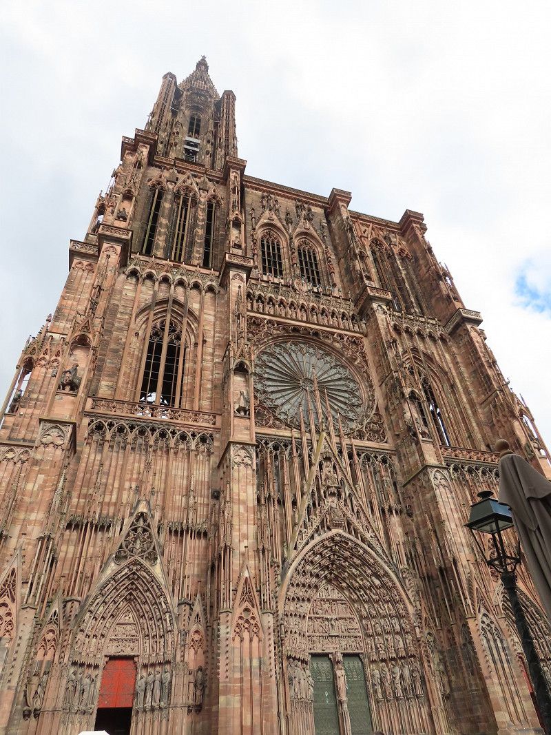
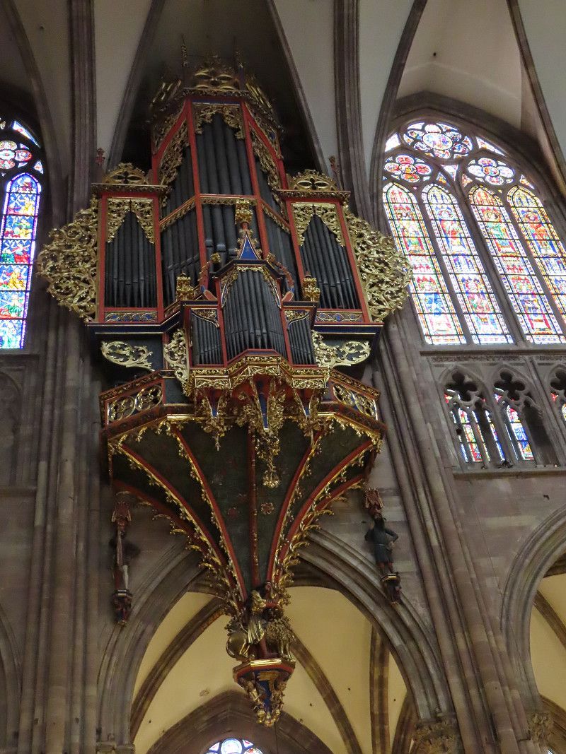
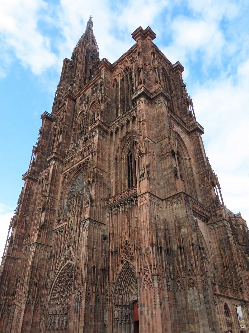
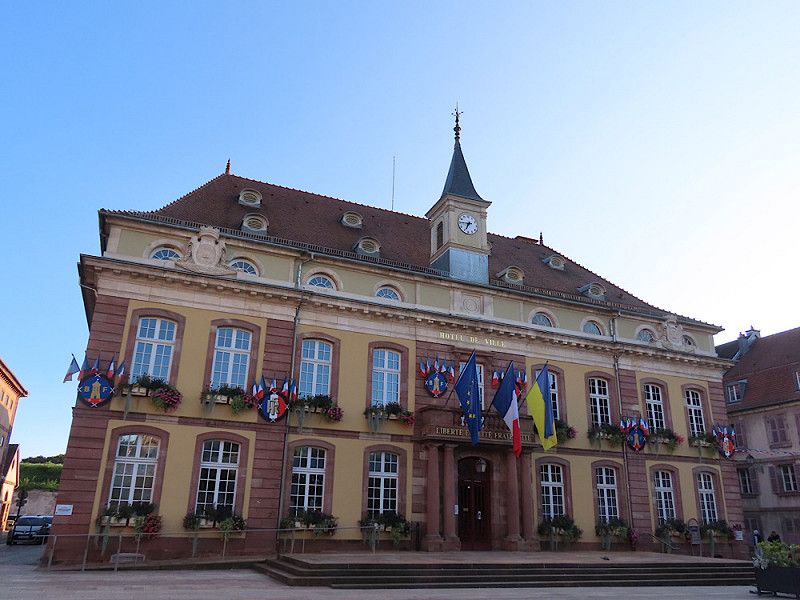
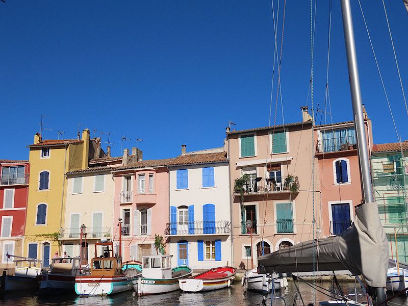
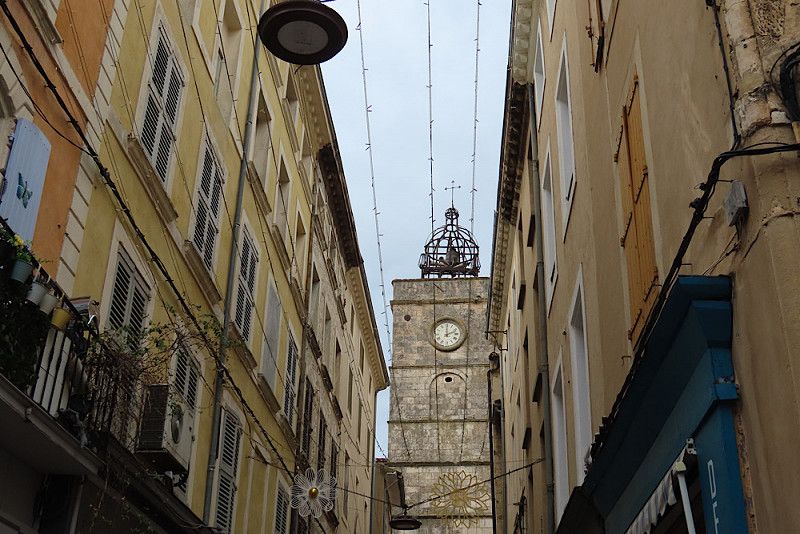
Straßburg
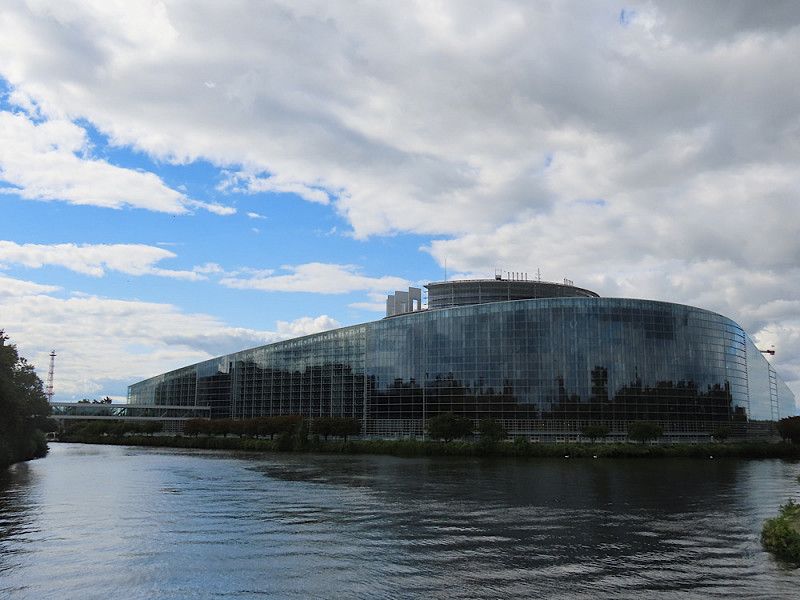
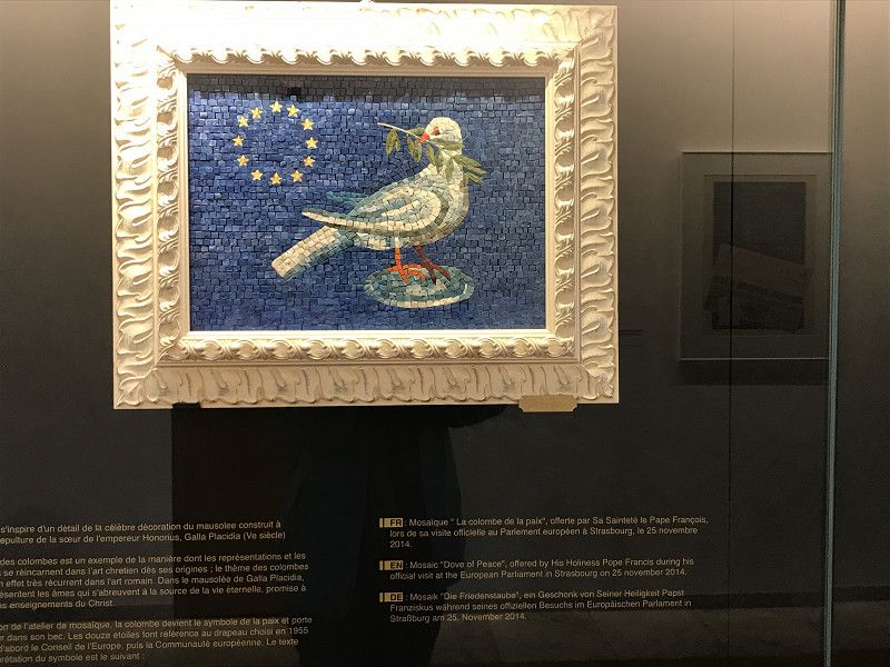
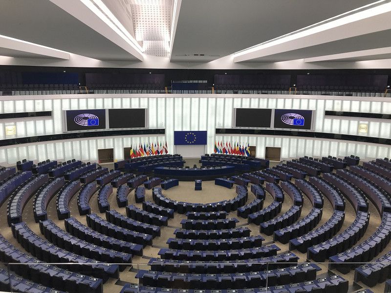
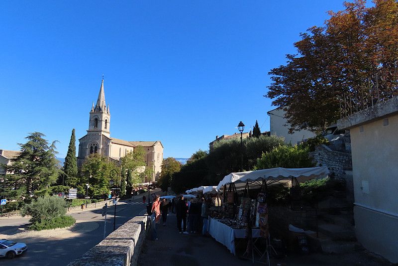
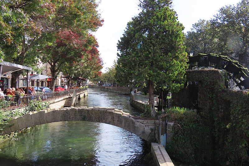
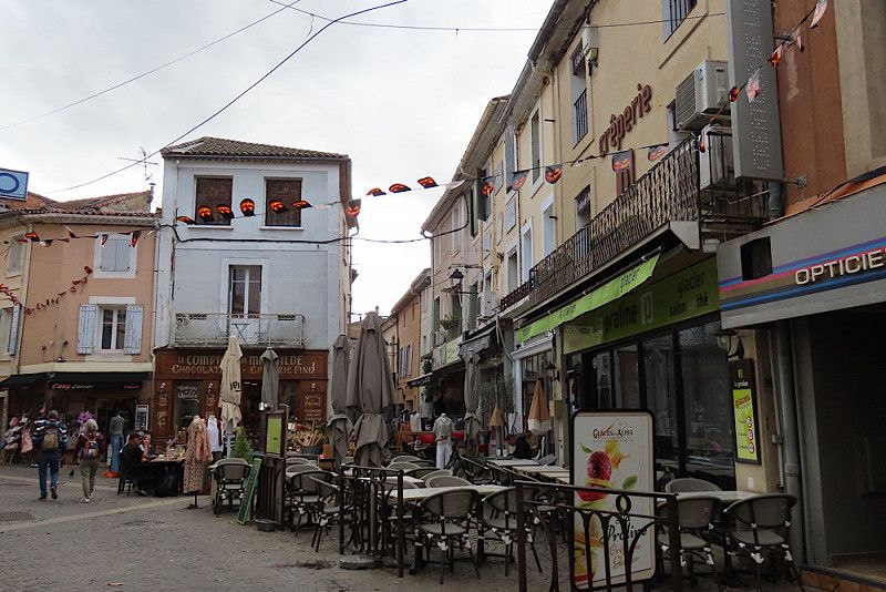
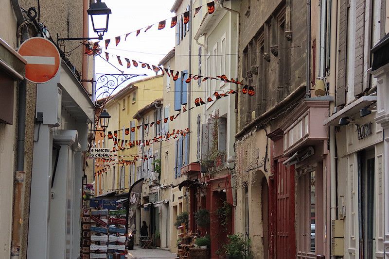
Brilliant parking lot for visiting Strasbourg - opposite the European Parliament, free at weekends, not far from a tram stop. But be careful: the access is limited by concrete blocks to a maximum width of 2.20 meters. I managed to get through there just about easily with my campervan, but it won't work for a "normal" RV!
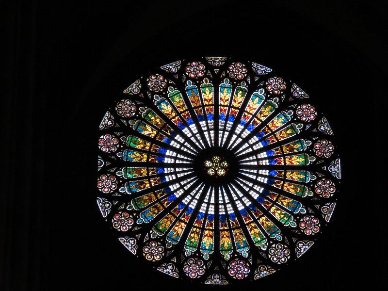
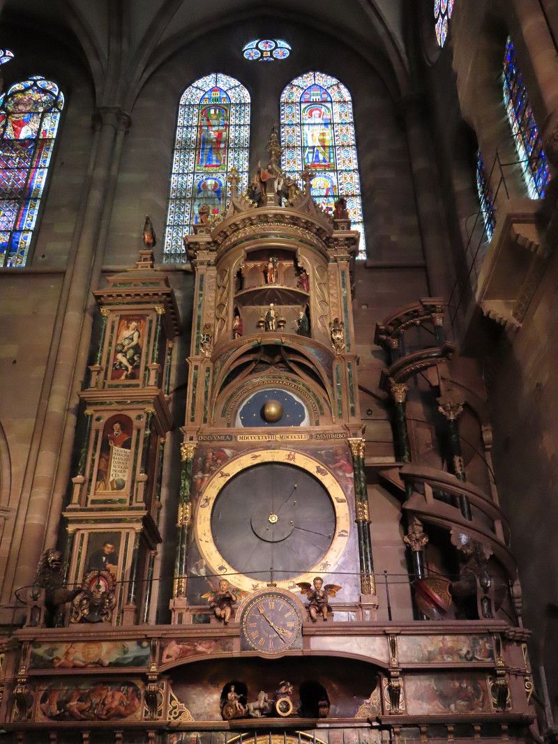
A 24-hour tram ticket costs just €4.60. A stroll through the city is worthwhile: the cathedral is well worth seeing with its magnificent stained glass windows and impressive architecture, the Petite France district is very pretty with many beautiful half-timbered houses. Overall, the city is very green and has many canals running through it. A stroll is varied and you can spend a lot of time here. There are plenty of restaurants and cafés, so everyone should be happy here.
Boulevard de Dresde, Strasbourg, Bas-Rhin, Grand Est, France
48° 35' 57.8" N 7° 46' 1.9" E
48.5993765 7.7671935
• Head toward Pont Joseph Bech on Boulevard de Dresde. Go for 25 m.
• Make a U-Turn at Pont Joseph Bech onto Boulevard de Dresde. Go for 416 m.
• Continue on Rue Jean Wenger-Valentin. Go for 350 m.
• Continue on Rue Frédéric-Guillaume Raiffeisen. Go for 220 m.
• Continue on Rue Frédéric-Guillaume Raiffeisen. Go for 61 m.
• Turn left onto Avenue Herrenschmidt. Go for 180 m.
• Continue on N2350 toward A350/A4-A35/Cronenbourg. Go for 672 m.
• Keep left onto N2350 toward Nancy/Metz Par R.N./Saint-Dié/Mulhouse. Go for 1.1 km.
• Continue on A35. Go for 50.9 km.
• Take exit 17 toward St Dié/Sélestat-Ouest/Ste Marie aux M./Villé onto D424. Go for 901 m.
• Take the 2nd exit from roundabout onto D1059 toward Nancy/Saint-Dié des V/Ste Marie aux M./Villé. Go for 3.4 km.
• Pass 3 roundabouts and continue on D1059. Go for 14.2 km.
• Take the 1st exit from roundabout onto N159 toward D459/Nancy/St Dié des Vosges/Lusse. Go for 11.2 km.
• Take the 4th exit from roundabout onto N159 toward Saint-Dié des-Vosges/Nancy/Raves/Ste Marguerite. Go for 3.6 km.
• Take ramp onto Rue de la Mairie (D459) toward Raves/Ste Marie aux M. Go for 2.8 km.
• Turn right onto Lieu-dit Le Giron (D23). Go for 14.2 km.
• Turn left onto Place Demenemey (D415) toward Colmar/Plainfaing. Go for 169 m.
• Turn left onto Rue du Général Ingold. Go for 25 m.
• Turn right. Go for 48 m.
• Turn right. Go for 27 m.
• Arrive at your destination on the left.
☍
104,5 km
(1 hrs. 26 min.)
Day
Mittagspause
I had actually planned to take the Vosges High Road, but I quickly realised that it was too winding for me. And I wanted to go south! So I gave up and took a well-maintained route to Belmont.
I spent my lunch break in a small town where there was a (currently closed) supermarket with a large parking lot.
Rue Général François Ingold 14, Fraize, Vosges, Grand Est, France
48° 11' 0.4" N 7° 0' 15.8" E
48.1834423 7.0043982
• Head east. Go for 202 m.
• Turn left onto Rue du Général Ingold. Go for 61 m.
• Turn left onto Rue Général François Ingold (D415). Go for 22.4 km.
• Take the 2nd exit from roundabout onto Route de Saint-Dié (D415) toward Colmar/Hachimette/Kaysersberg. Go for 3.1 km.
• Pass 3 roundabouts and continue on D415. Go for 11.5 km.
• Take the 1st exit from roundabout onto Avenue de Lorraine (D83) toward Épinal/Belfort/Colmar/Munster/Wintzenheim/Ingersheim. Go for 250 m.
• Pass 3 roundabouts and continue on D83. Go for 4.2 km.
• Take the 3rd exit from roundabout onto D83 toward Belfort/Basel/Mulhouse/Rouffach/Z.A. les Erlen. Go for 23.1 km.
• Take the 2nd exit from roundabout onto D83 toward Belfort/Thann/Cernay. Go for 18.8 km.
• Take ramp onto A36 (La Comtoise) toward Lyon/Belfort. Go for 23.9 km.
• Take exit 13 toward Belfort-Glacis du Château. Go for 455 m.
• Take the 2nd exit from roundabout onto Rue Xavier Bichat. Go for 364 m.
• Take the 2nd exit from Rond-Point du Pied des Gouttes roundabout onto Rue Xavier Bichat. Go for 391 m.
• Turn left onto Rue René Cassin. Go for 210 m.
• Turn right onto Boulevard Pierre Mendès France (D583). Go for 1.1 km.
• Turn right onto Avenue de la Miotte. Go for 39 m.
• Arrive at Avenue de la Miotte. Your destination is on the right.
☍
110,0 km
(1 hrs. 29 min.)
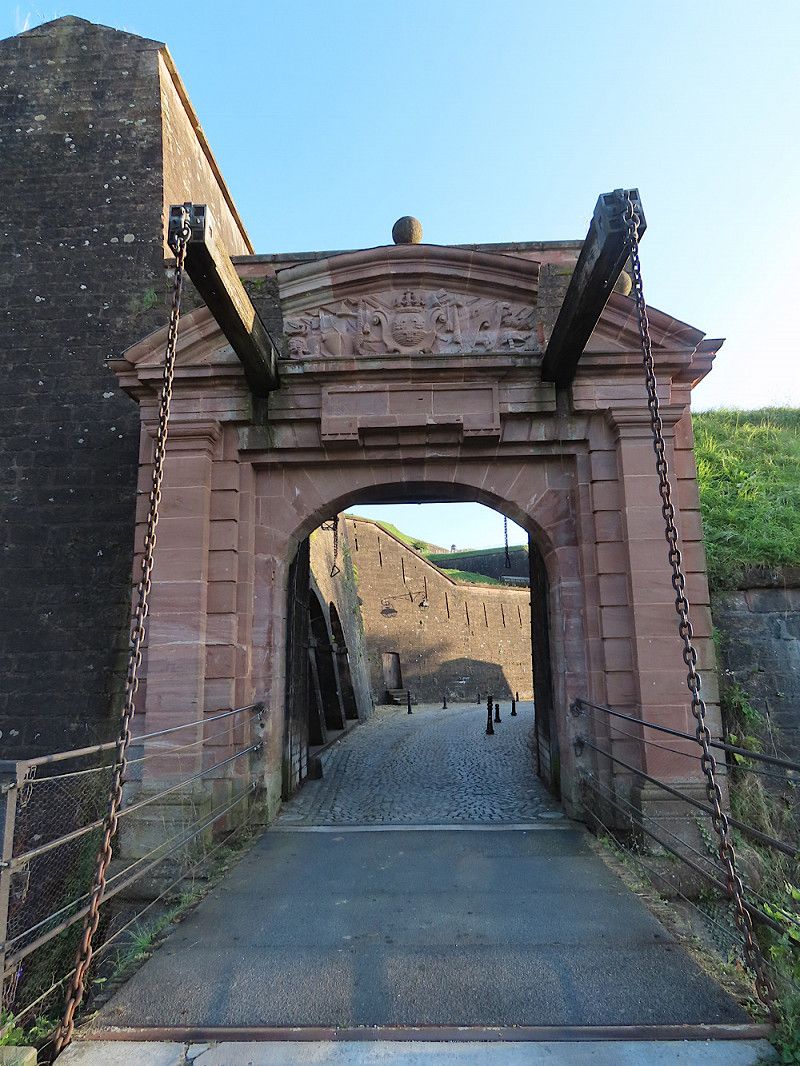
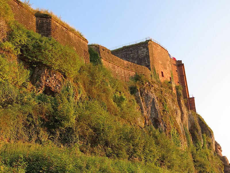
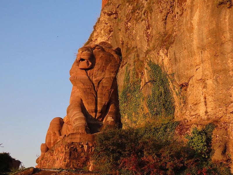
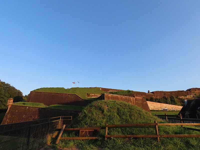
Belfort - WoMo-Stellplatz der Stadt
Large parking space near the old town, free of charge, including supplies and waste disposal! But it's not as comfortable as it seems, here you're parked close together. But it's definitely OK for an overnight stop.
From the parking space it is only a short walk into the old town. The town is quite pretty for a little stroll. The citadel that towers over the town is very impressive!
Avenue de la Miotte, Belfort, Territoire-de-Belfort, Bourgogne – Franche-Comté, France
47° 38' 31.6" N 6° 51' 57.6" E
47.6421236 6.8659867
• Head toward Avenue Capitaine de la Laurencie on Avenue de la Miotte. Go for 39 m.
• Turn left onto Avenue Capitaine de la Laurencie (D83). Go for 226 m.
• Continue on Avenue Capitaine de la Laurencie (D583) toward A36/Bâle/Glacis du Château/Z.A. de la Justice/P.A. des Hauts de Belfort. Go for 1.0 km.
• Take ramp onto A36 (La Comtoise) toward Paris/Lyon/Montbéliard. Go for 142 km.
• Take the exit toward Lyon/Lons le S./Dole/Choisey onto A39 (Autoroute Verte). Go for 113 km.
• Continue on A40. Go for 22.4 km.
• Continue on A42 toward Grenoble/Chambéry/Lyon/Aéroport Saint-Exupéry. Go for 48.9 km.
• Take the left exit toward Marseille/Grenoble/Lyon/N346 onto A42. Go for 990 m.
• Take the exit toward Lyon onto A42. Go for 3.6 km.
• Take the left exit toward Marseille/Grenoble/Périphérique Sud/Porte de Cusset onto D383 (Boulevard Laurent Bonnevay). Go for 6.0 km.
• Keep left onto Boulevard Laurent Bonnevay (D383) toward St Étienne/Marseille/Vénissieux. Go for 1.9 km.
• Keep left onto Boulevard Laurent Bonnevay (D383) toward Paris/Saint-Étienne/Marseille/Lyon-Centre/Vénissieux-Centre. Go for 3.3 km.
• Keep left onto D383 toward Paris/Marseille/Saint-Étienne/Pierre Bénite/Saint Fons-Centre/Port E. Herriot. Go for 2.3 km.
• Keep left onto Boulevard Pierre Sémard (D383) toward A7/Paris/Lyon/Pierre-Bénite/Marseille/St Étienne/Vénissieux/Feyzin. Go for 188 m.
• Take ramp onto A7 (Autoroute du Soleil) toward St Étienne/Feyzin/Marseille. Go for 147 km.
• Take exit 18 toward Nyons/Valréas/Pierrelatte/Viviers. Go for 683 m.
• Take the 2nd exit from roundabout onto N7 toward Nîmes/Donzère/Pierrelatte/Valréas/Nyons. Go for 2.3 km.
• Pass 2 roundabouts and continue on N7. Go for 4.3 km.
• Take the 1st exit from roundabout onto Avenue Koenigsberg (D541) toward Donzère. Go for 532 m.
• Turn left onto Rue Loys-Prat (D541). Go for 167 m.
• Turn left onto Rue Basse Bourgade (D844). Go for 12 m.
• Turn right onto Cours de la Liberté (D213). Go for 262 m.
• Continue on D213. Go for 154 m.
• Continue on Chemin des Ribières. Go for 92 m.
• Take the 1st exit from roundabout onto Rue Félix Clément. Go for 134 m.
• Continue on Avenue du Rhône (D486). Go for 596 m.
• Continue on D486. Go for 629 m.
• Continue on D86 J. Go for 1.0 km.
• Turn left onto D86. Go for 1.1 km.
• Keep right onto D86 toward Nîmes/Bourg St Andéol/St Montan. Go for 3.2 km.
• Take the 1st exit from roundabout onto Lieu-dit Montmale (D262) toward Centre d'Imbours/Larnas/St Montan. Go for 74 m.
• Continue on D262. Go for 235 m.
• Continue on Lieu-dit Canelle (D262). Go for 71 m.
• Continue on D262. Go for 1.8 km.
• Continue on Route du Rhône (D262). Go for 409 m.
• Turn left onto Route de Courbier (D190). Go for 108 m.
• Turn right. Go for 67 m.
• Arrive at your destination on the right.
☍
510,7 km
(4 hrs. 45 min.)
Day
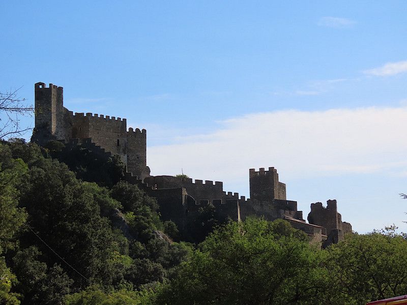
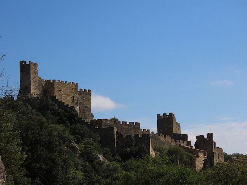
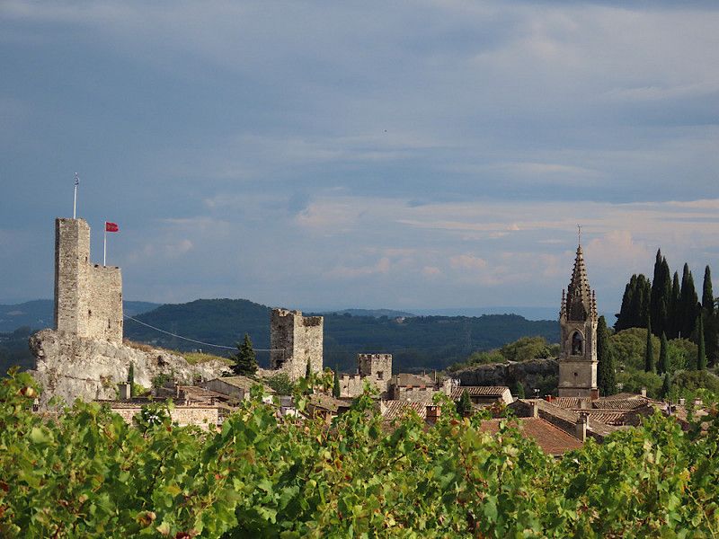
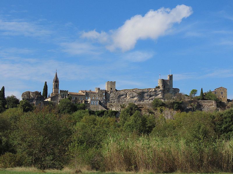
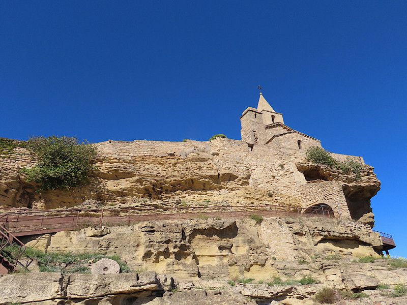
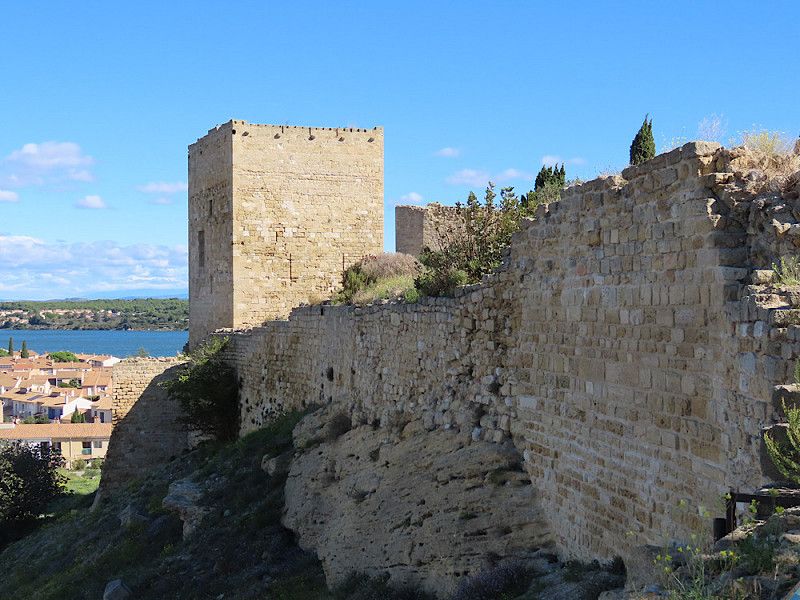
Saint-Montan
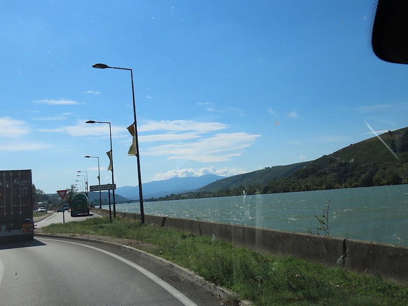
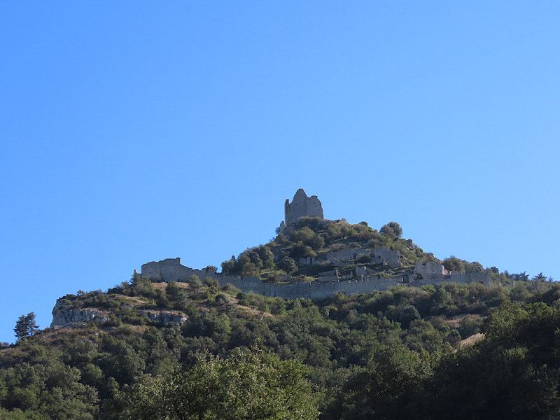
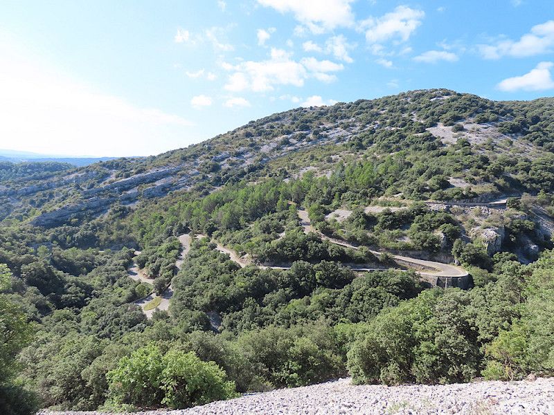
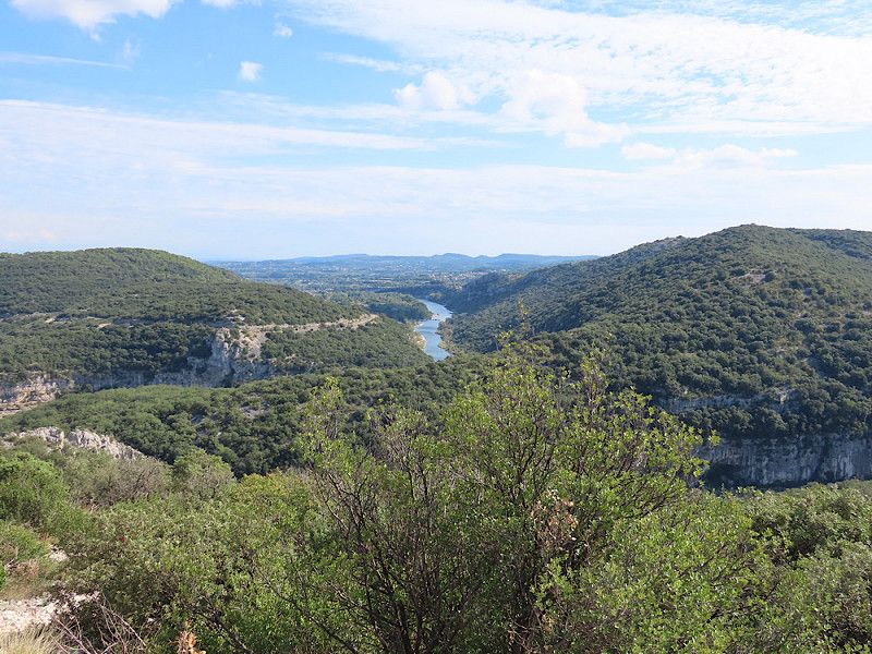
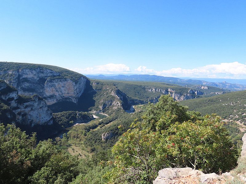
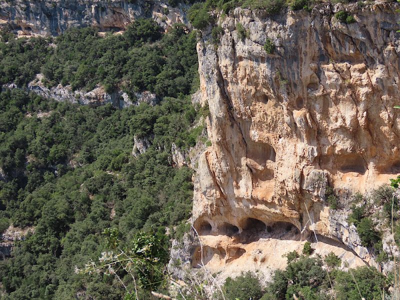
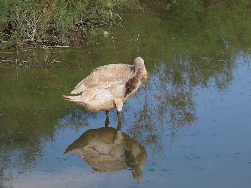
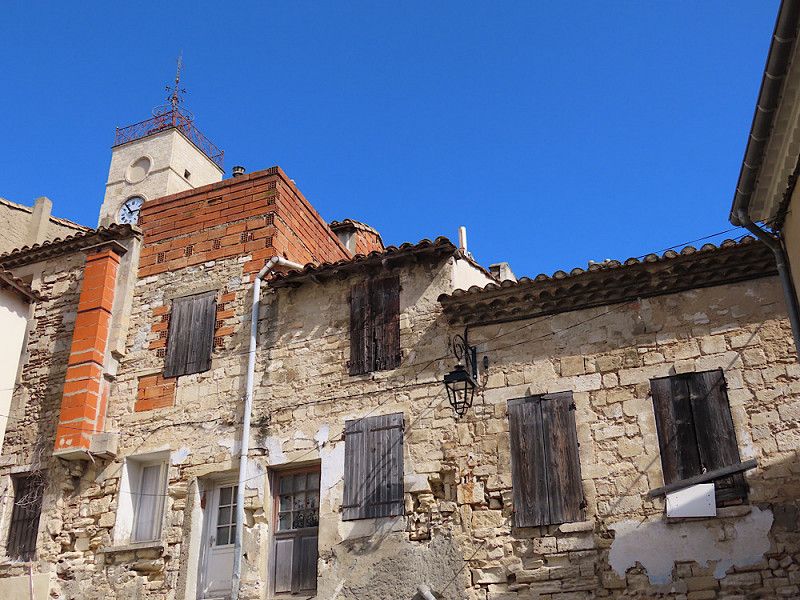
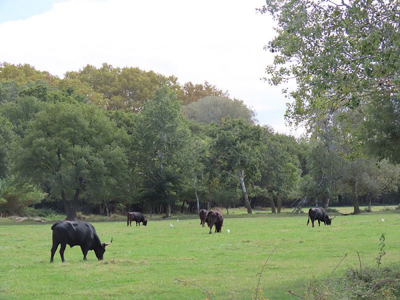
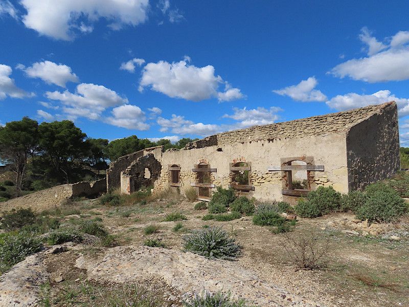
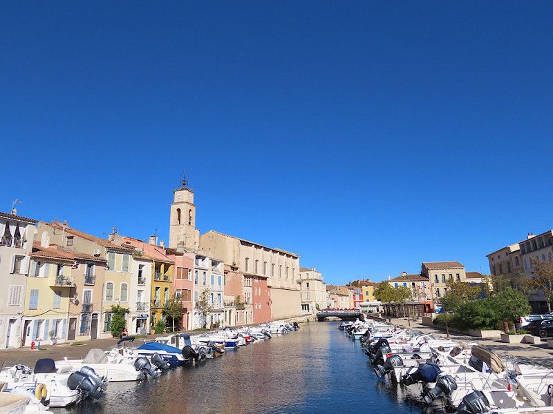
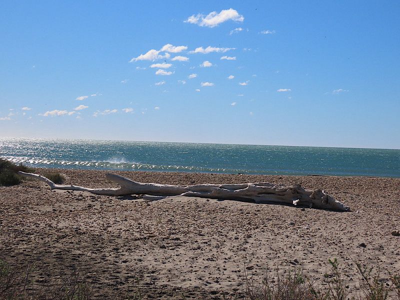
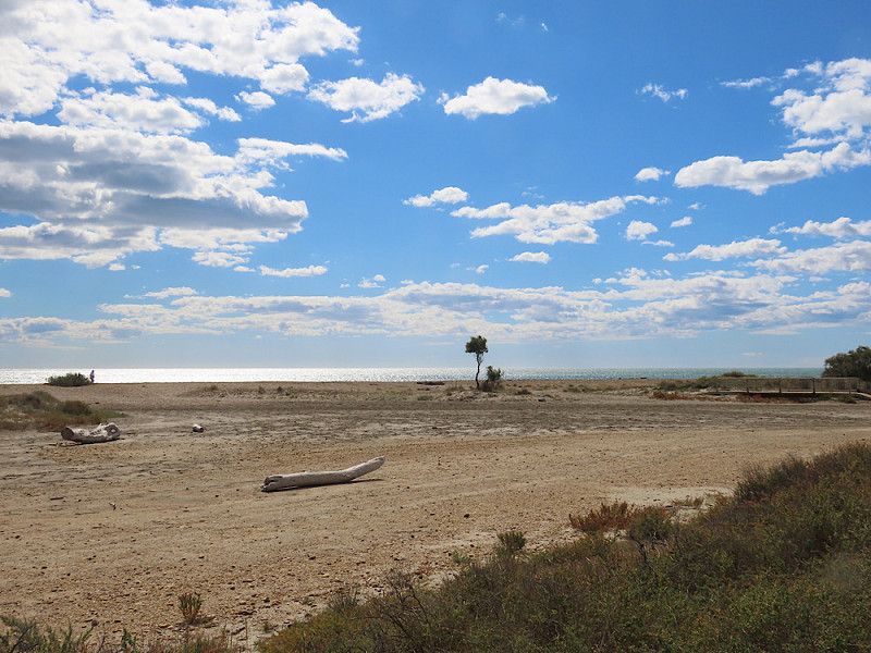
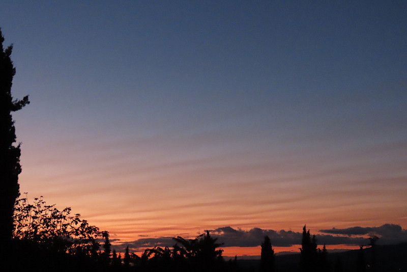
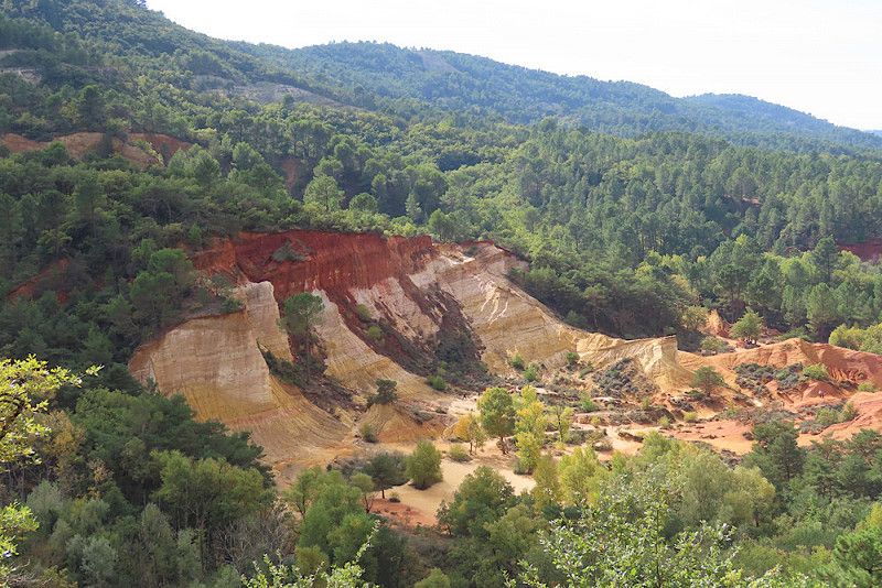
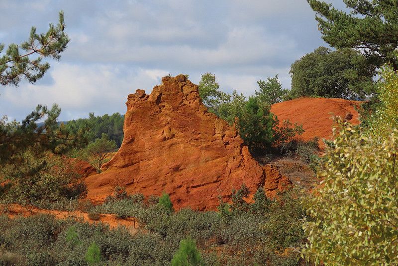
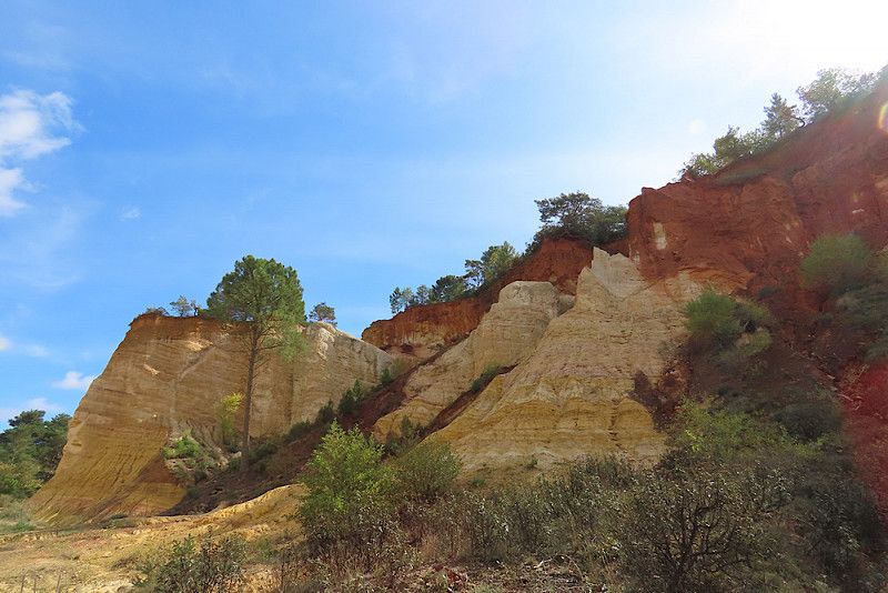
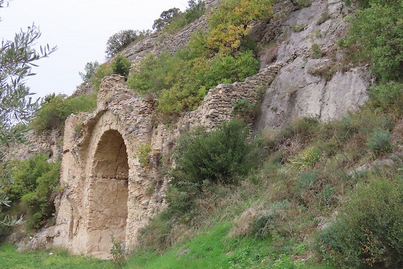
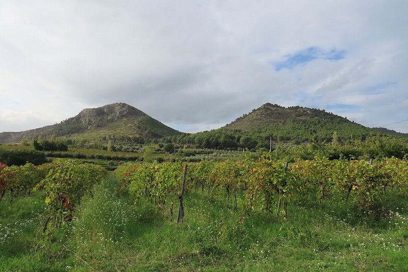
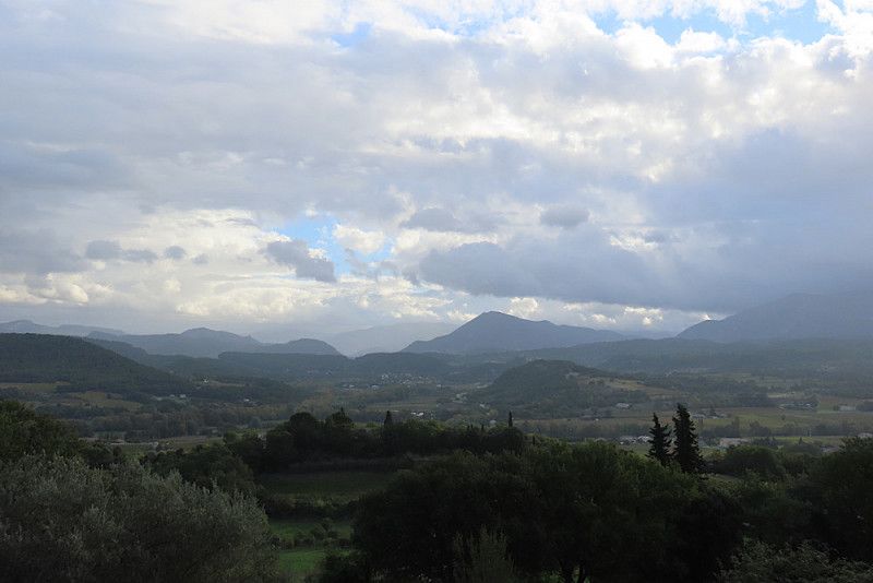
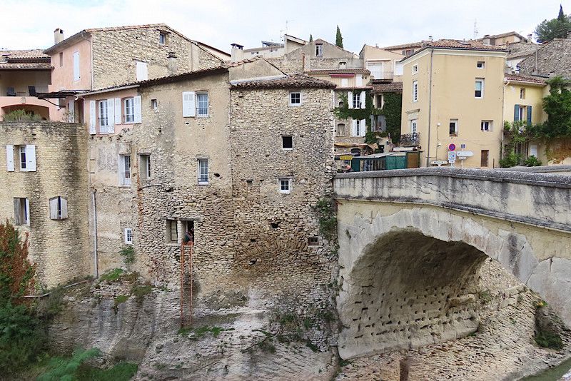
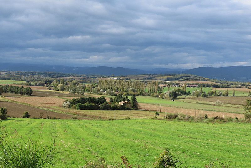
Today was a driving day. On the motorway to Lyon for €49.10!!! From Lyon I drove on country roads, which was exhausting and tough as it goes through many villages. A large part of the route ran along the Rhône, and from around Valence the landscape became more varied and more southern. I only made a few photo stops to stretch my legs a bit, for example in Saint-Vallier, below the Crussol Castle (Château de Crussol) and in Cruas. There is an ancient church there (Abbatiale Sainte-Marie), but unfortunately it is already closed.
Tonight I'm spending the night in a large car park in the municipality of Saint-Montan in the Ardèche valley. Tomorrow I want to visit the castle and the medieval town, then continue on to the Ardèche Gorge.
Chemin du Muret, Saint-Montan, Ardèche, Auvergne-Rhône-Alpes, France
44° 26' 21.1" N 4° 37' 28.5" E
44.4391848 4.6245780
• Head toward Route de Courbier. Go for 67 m.
• Turn left onto Route de Courbier (D190). Go for 108 m.
• Turn left onto Place des Brusses (D262). Go for 103 m.
• Turn left onto Place du Poussiac (D262). Go for 74 m.
• Continue on D262. Go for 62 m.
• Continue on Rue du Portalet (D262). Go for 173 m.
• Continue on D262. Go for 1.7 km.
• Continue on Route de Saint-Remèze (D262). Go for 3.7 km.
• Continue on D262. Go for 483 m.
• Continue on Lieu-dit Gadis (D262). Go for 199 m.
• Continue on D262. Go for 1.4 km.
• Continue on Lieu-dit Mas de Gras (D262). Go for 129 m.
• Continue on Route de Saint-Remèze (D362) toward Bourg St Andéol/St Remèze. Go for 1.7 km.
• Continue on Lieu-dit Saint-Vincent (D362). Go for 86 m.
• Continue on D362. Go for 194 m.
• Continue on Route de Saint-Remèze (D362). Go for 1.7 km.
• Continue on Route de Gras (D362). Go for 3.0 km.
• Take the 3rd exit from roundabout onto Route de Bourg (D4) toward Bourg St Andéol/Aven Marzal. Go for 775 m.
• Turn right onto Route de Bidon (D201) toward St Marcel d'Ardèche/Grotte de la Madeleine/Bidon/Aven Marzal. Go for 2.8 km.
• Turn right onto Route de Plance (D590). Go for 4.5 km.
• Turn right onto D290. Go for 122 m.
• Turn left. Go for 122 m.
• Arrive at your destination.
☍
23,3 km
( 27 min.)
Day
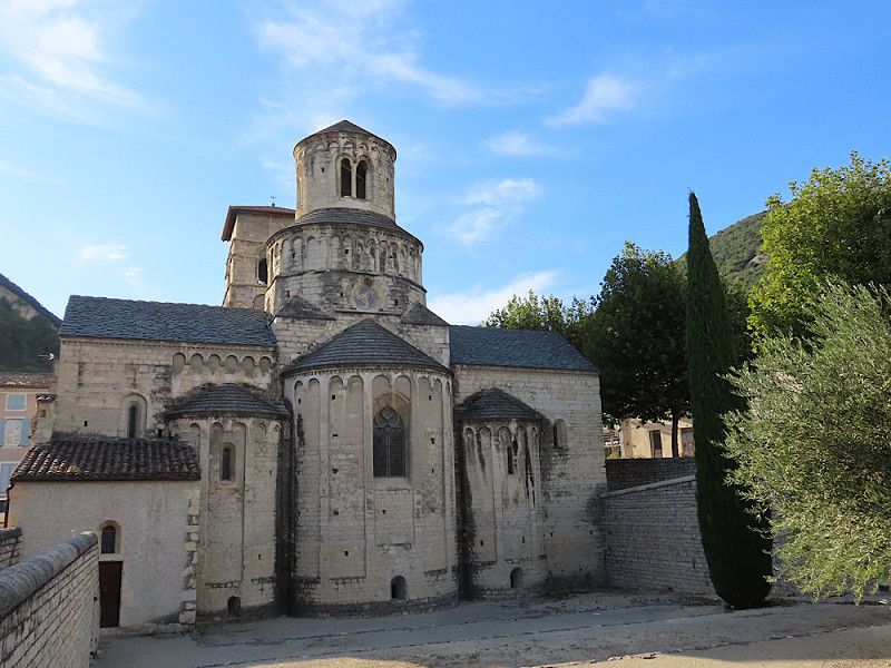
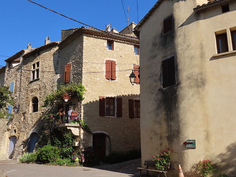
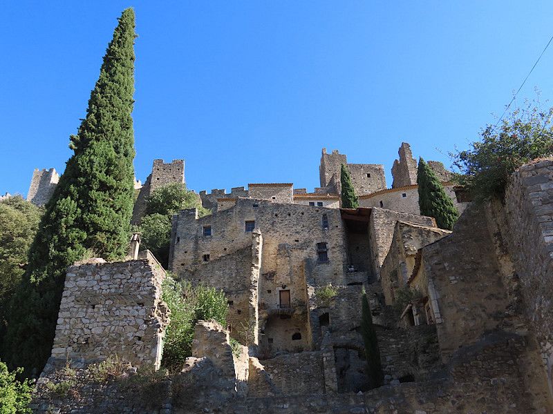
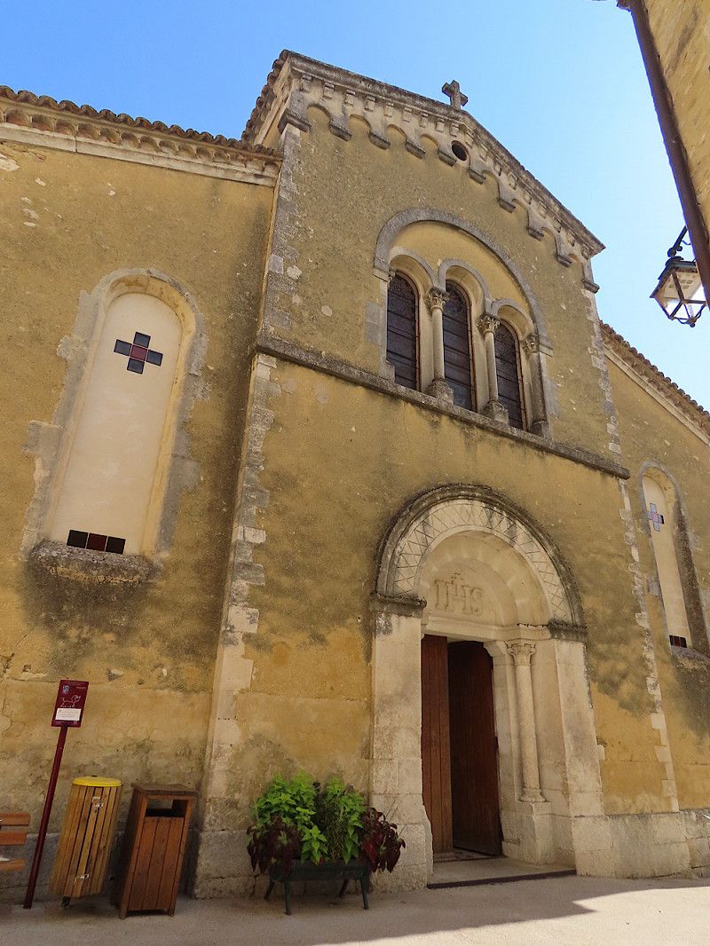
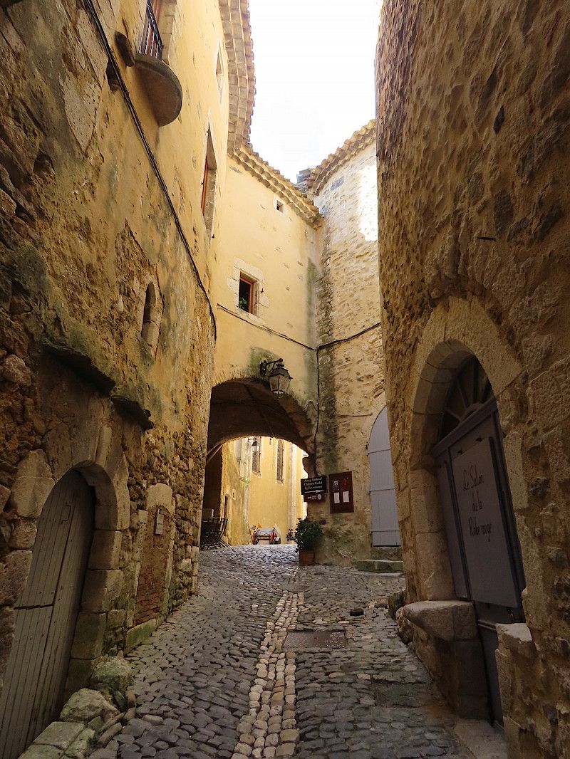
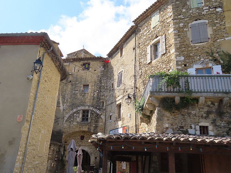
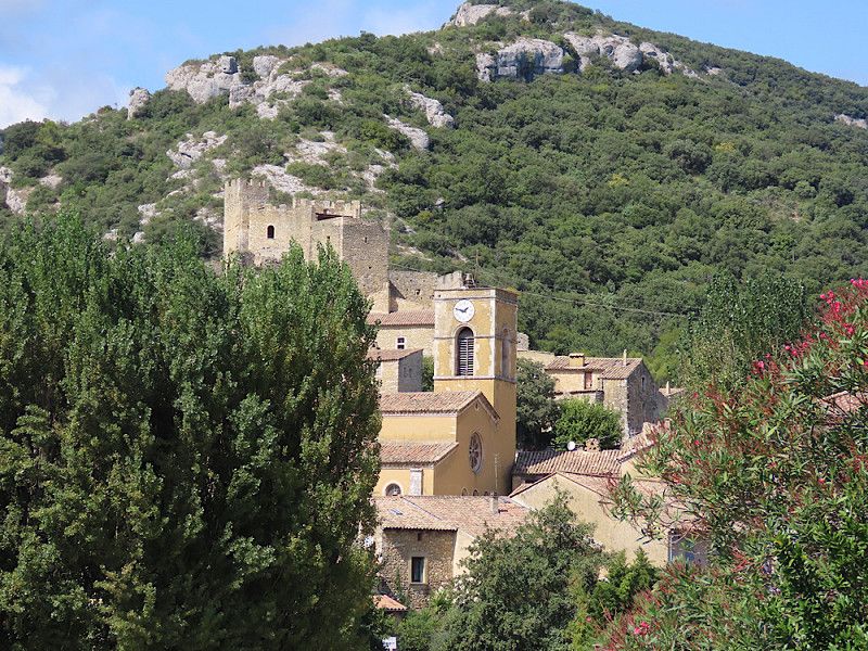
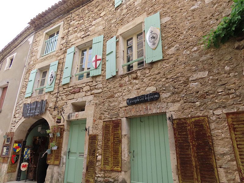
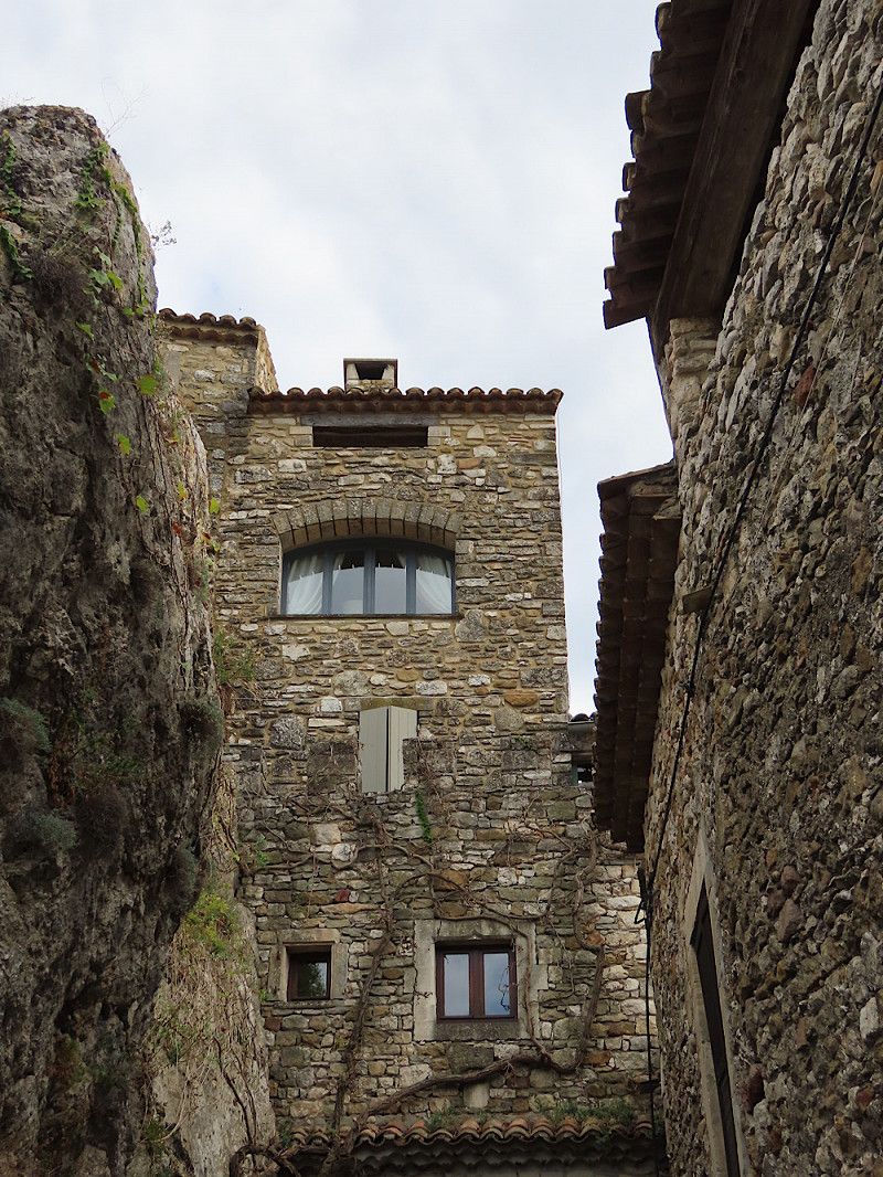
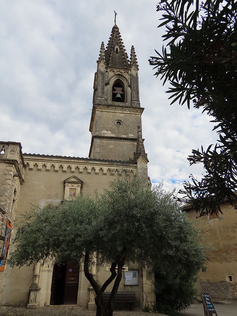
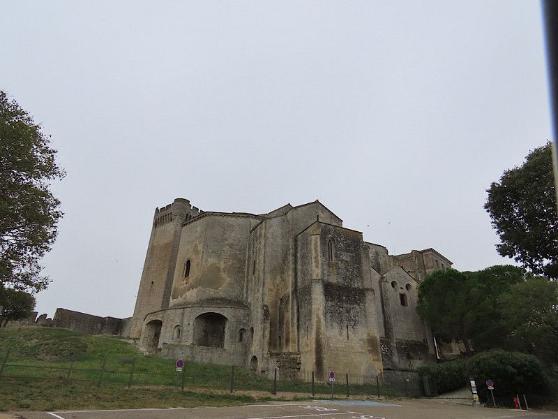
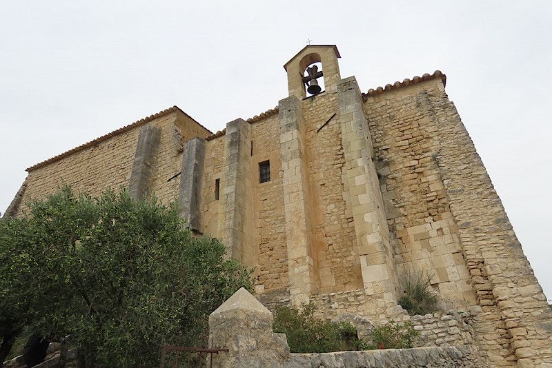
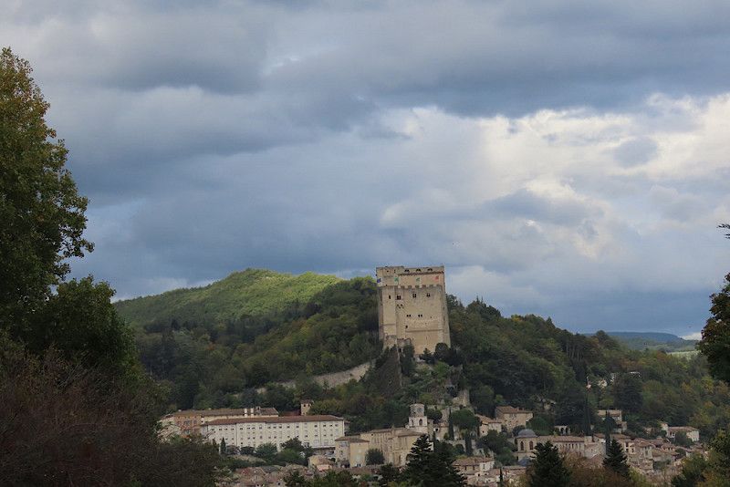
Mittelalterliches Dorf Saint-Montan
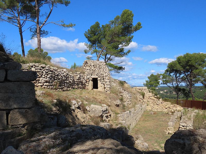
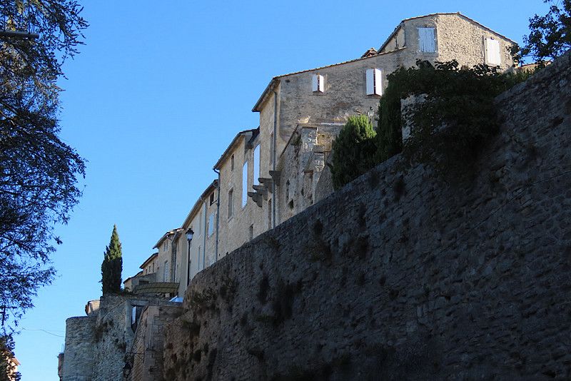
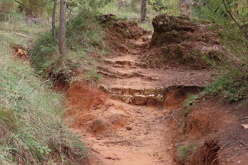
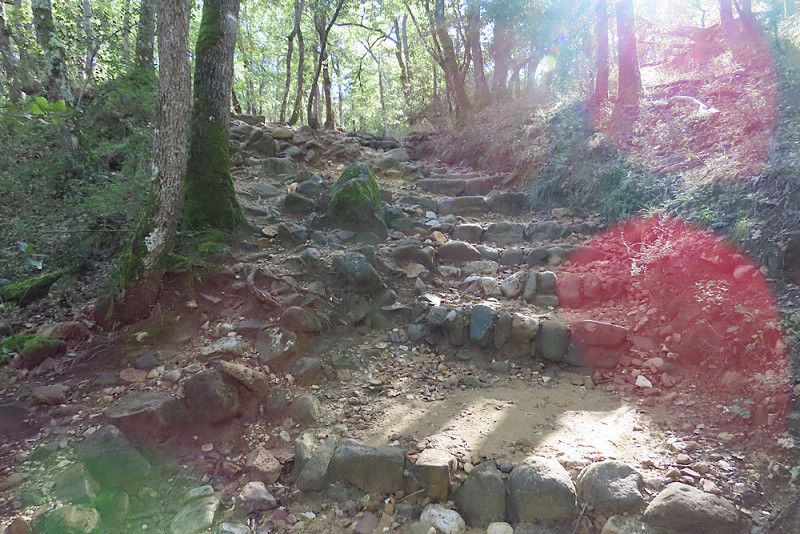
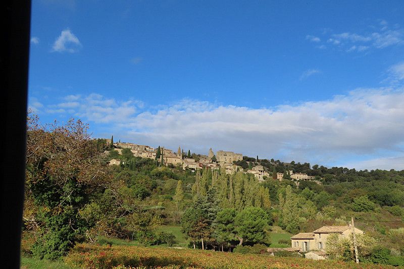
The village is well worth seeing, many old houses have been restored. I immediately fell in love with the pretty little town and would come back anytime. It was just a shame that the castle was closed. In the low season it is only open for tours on weekends. I hiked to the "Hermit's Cave", but as I thought it was much closer to the town, I set off without a water bottle. I later regretted this very much, as the path was steeply uphill in places and over hill and dale. So I walked the same route back. With water, you could have done a circular tour of the neighboring town, which is about 10 km long. Nevertheless, it was a very beautiful day here with beautiful weather (around 22 degrees).
After lunch we continue to the Ardèche Gorge.
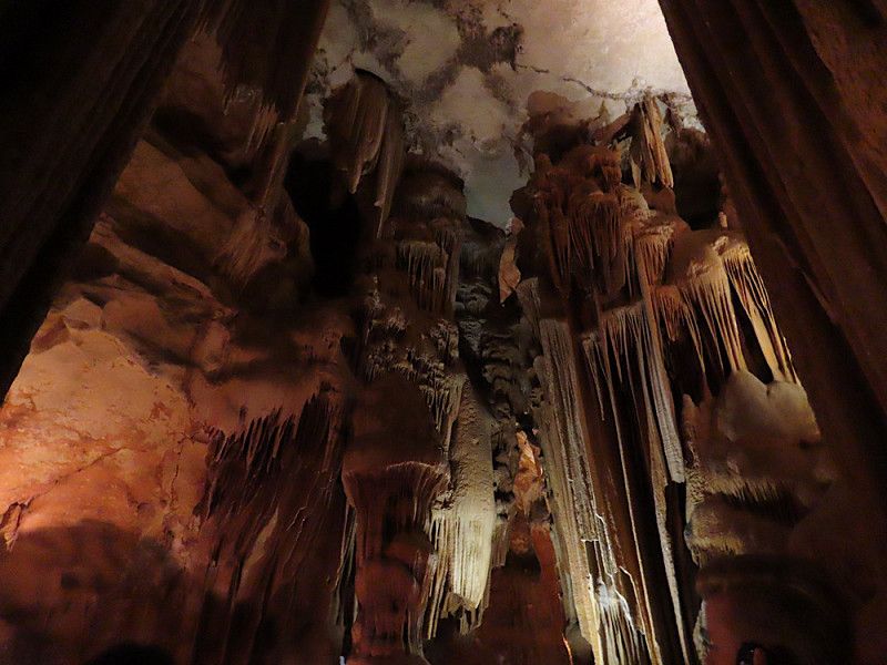
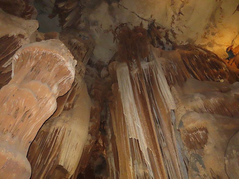
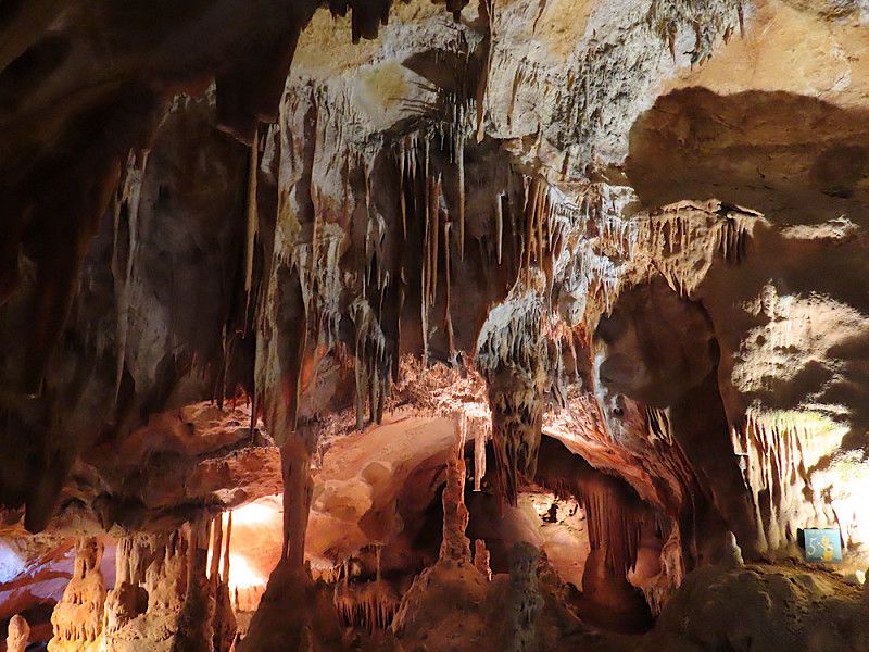
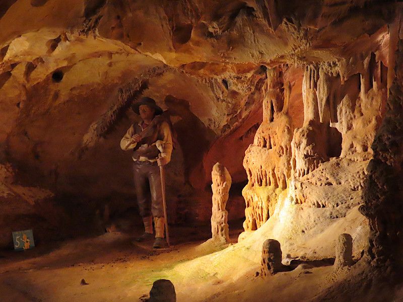
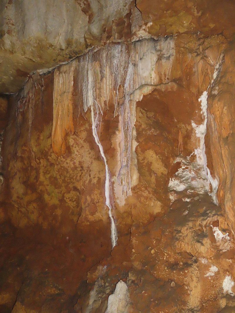
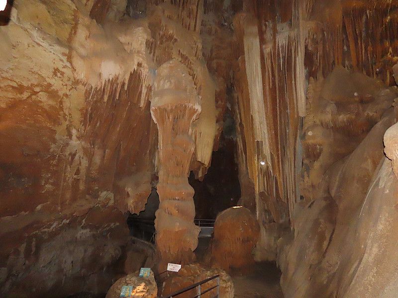
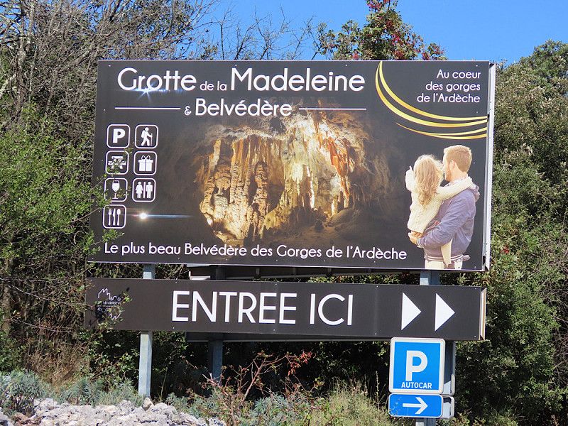
Grotte de la Madeleine
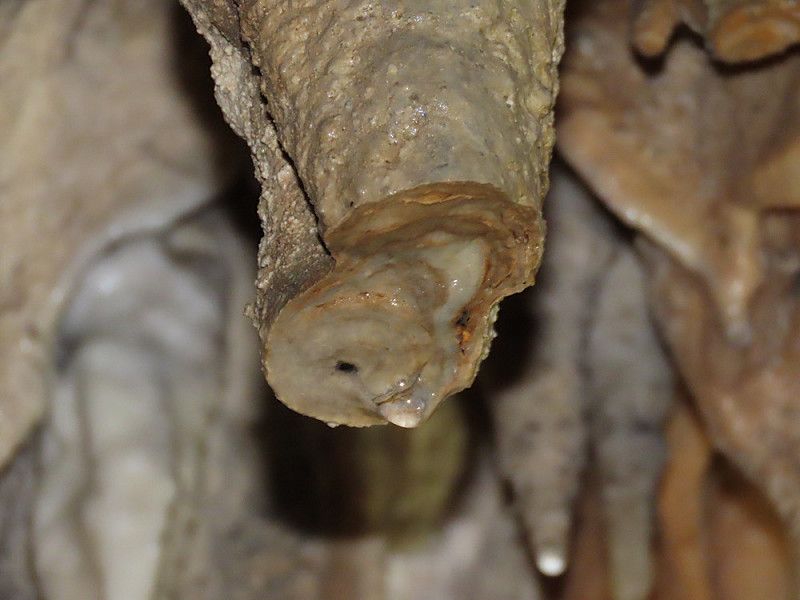
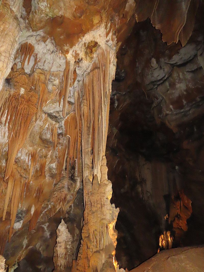
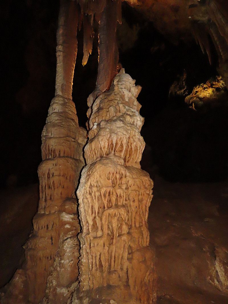
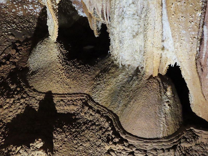
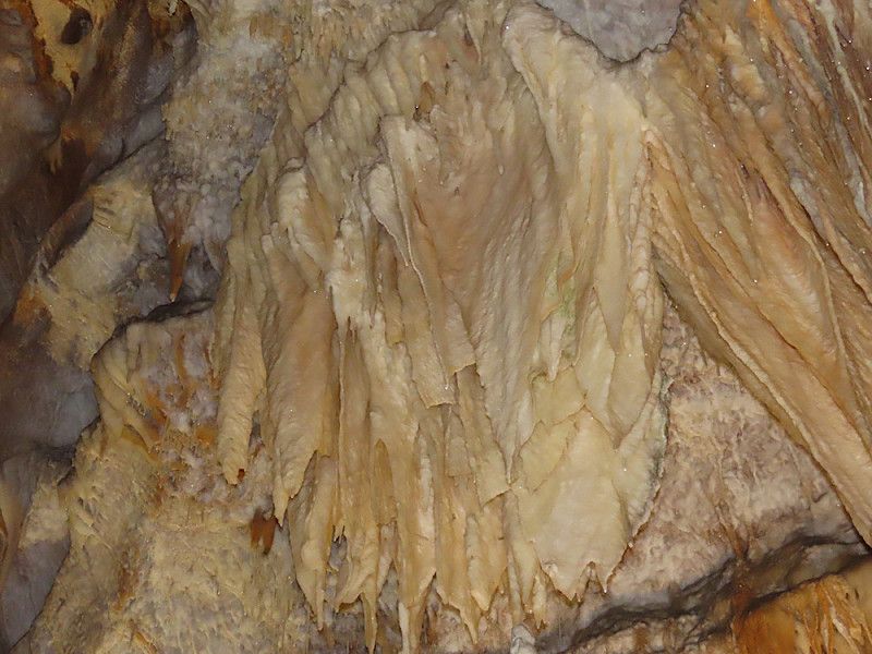
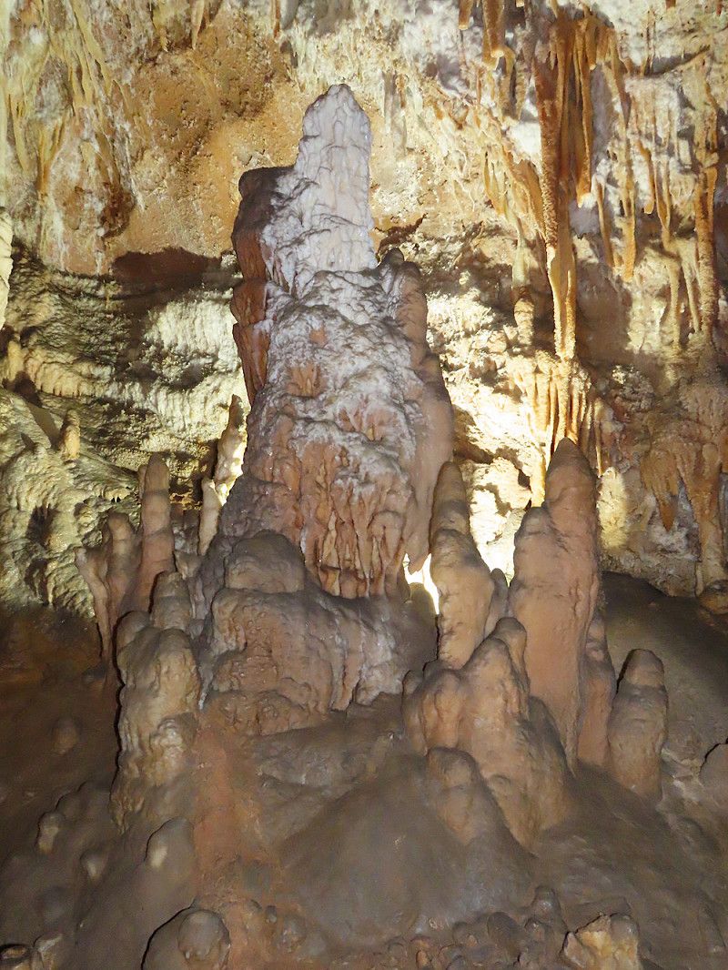
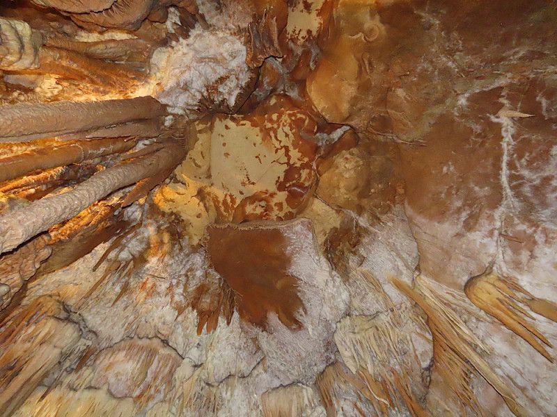
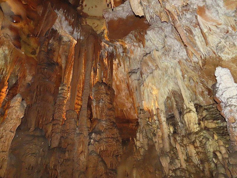
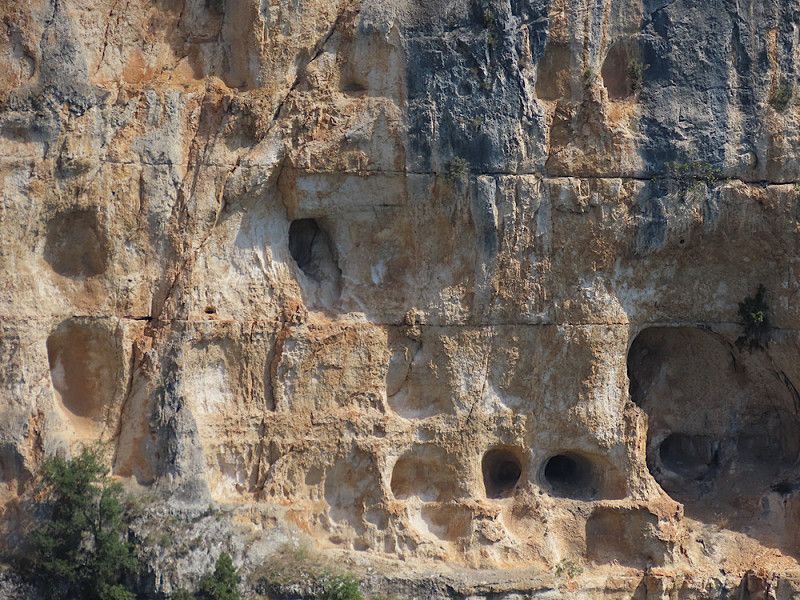
A stopover to visit one of the caves in the Ardèche valley. Entrance fee 14 euros. You basically go into two connected caves, the tour lasts an hour. In the cave you mainly go down 65 meters of stairs, which you then have to climb back up again.
Ardèche, Auvergne-Rhone-Alpen, Frankreich
44° 20' 23" N 4° 29' 6.1" E
44.3397350 4.4850213
• Head northwest. Go for 122 m.
• Turn right onto D290. Go for 122 m.
• Turn left onto Route de Plance (D590) toward Saint-Remèze/Aven Marzal. Go for 4.5 km.
• Turn left onto Route de Bidon (D201). Go for 2.8 km.
• Turn left onto Route de Bourg (D4) toward Vallon Pont d'Arc/St Remèze. Go for 731 m.
• Pass 2 roundabouts and continue on Route de Bourg (D4). Go for 12.5 km.
• Take the 3rd exit from roundabout onto D390 toward Aven d'Orgnac/Gorges de l'Ardèche-Le Pont d'Arc. Go for 842 m.
• Take the 1st exit from roundabout onto Chemin du Chastelas. Go for 241 m.
• Arrive at Chemin du Chastelas. Your destination is on the left.
☍
22,0 km
( 24 min.)
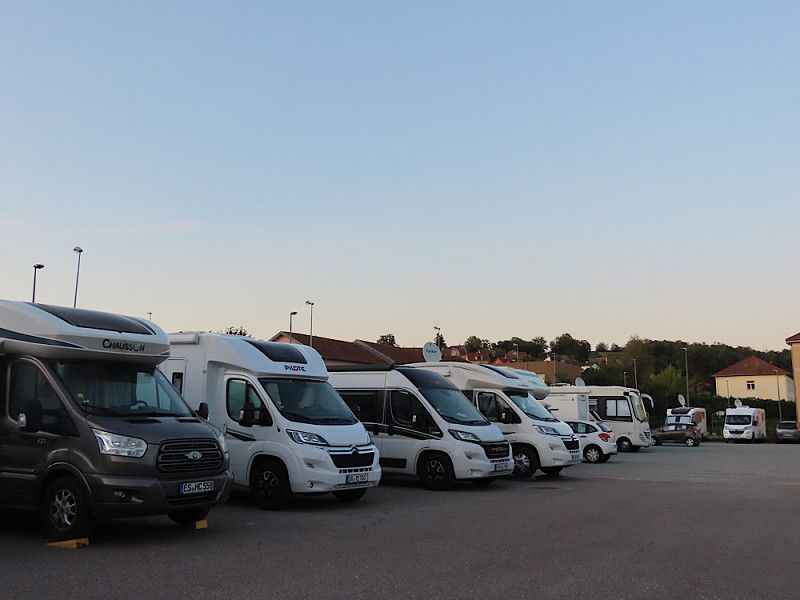
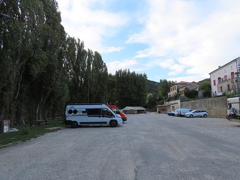
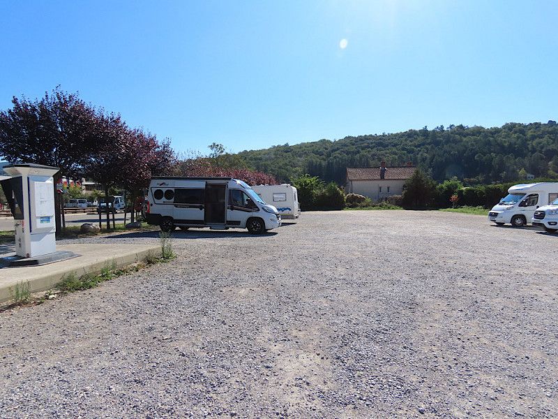
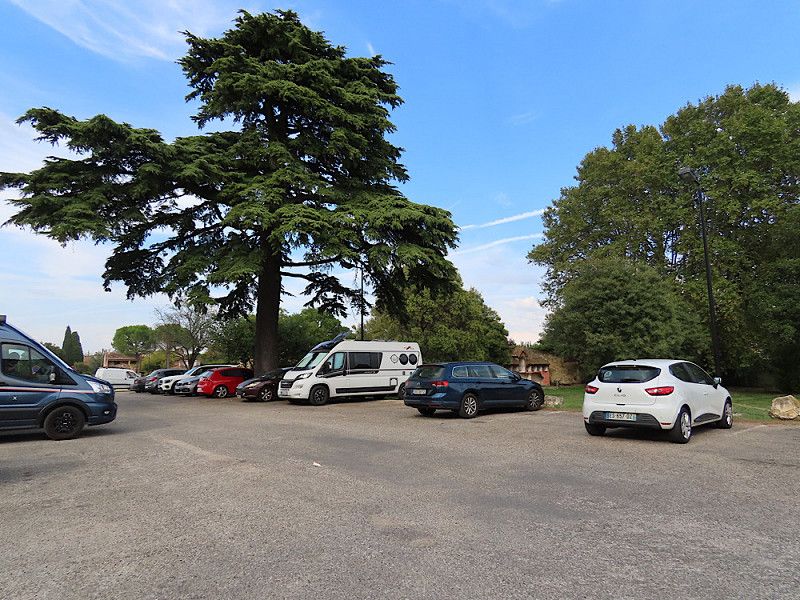
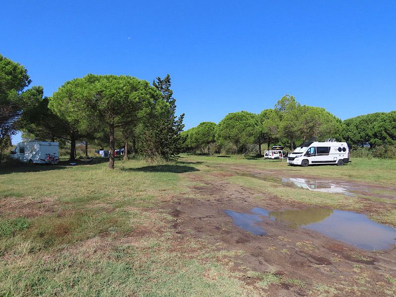
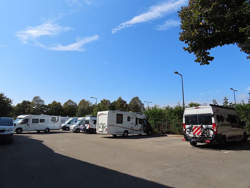
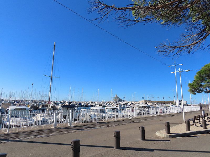
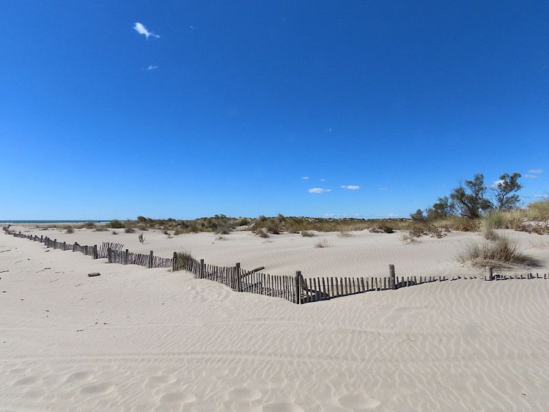
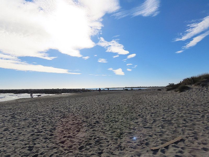
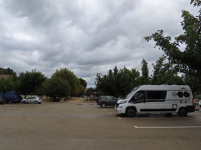
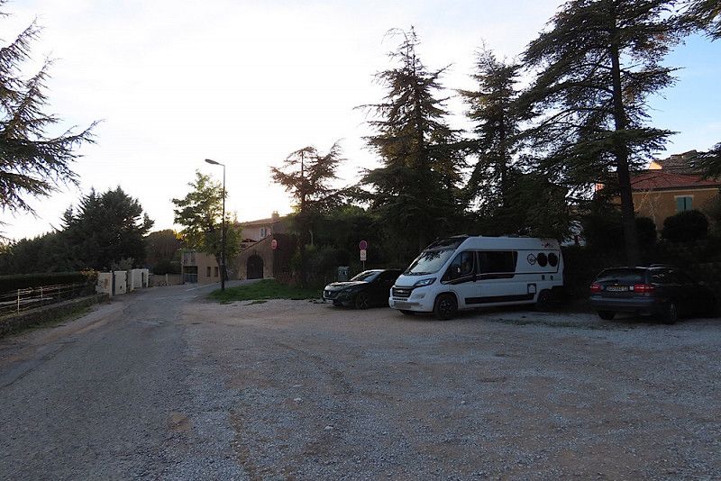
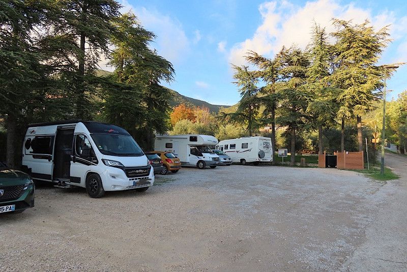
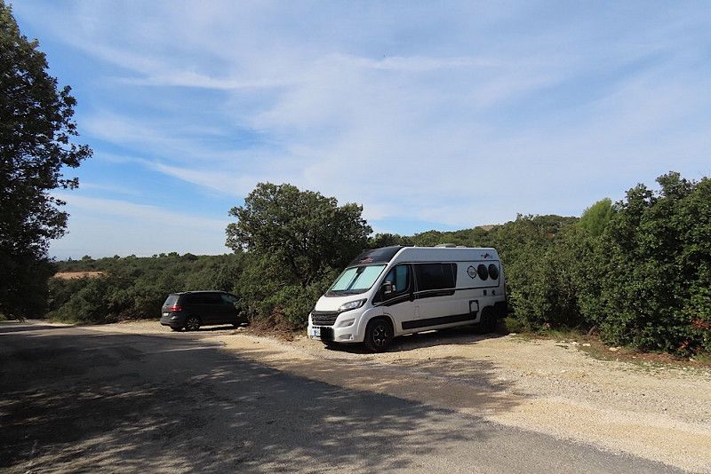
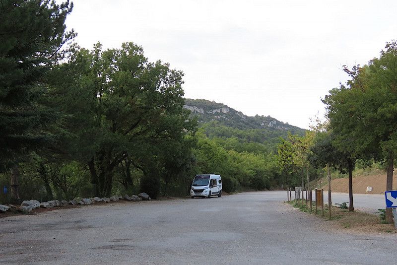
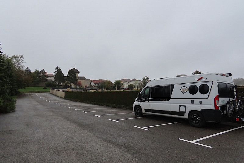
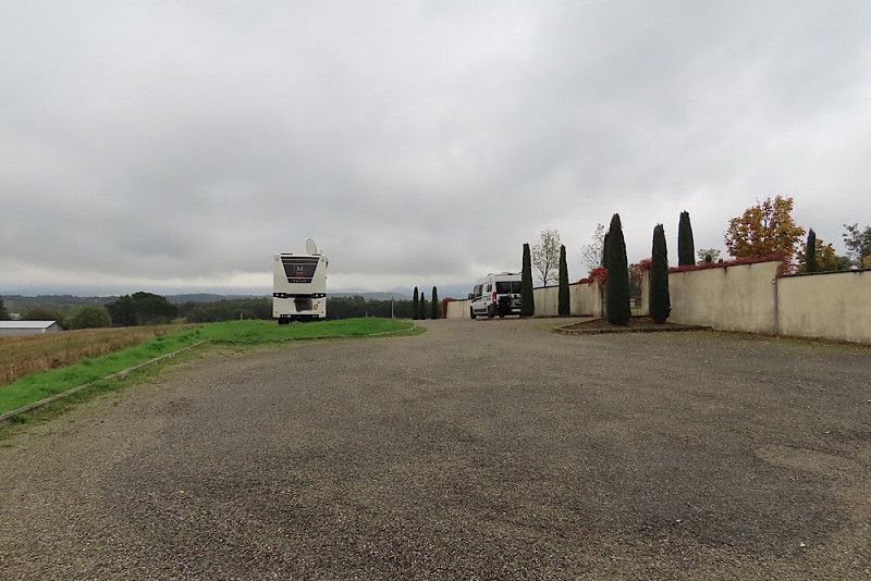
Stellplatz im Ardéche-Tal
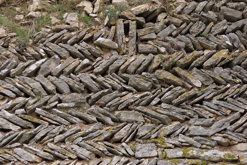
Parking space in the city, currently costs €9.80 for 24 hours - that's okay considering that there are otherwise only campsites here.
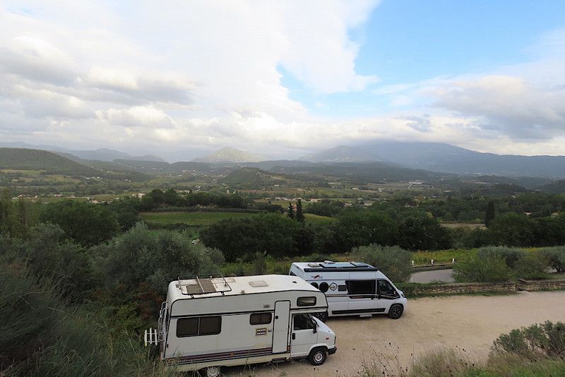
However, I cannot recommend the site for people like me who are sensitive to noise - the night was short because there was a lot of traffic around it early in the morning. I wouldn't spend the night here again, I would rather stay at one of the many campsites. Incidentally, the parking is very close together here - the photo is deceptive, it was taken the next morning when most of the RVs were already on the road again.
Chemin du Chastelas, Vallon-Pont-d'Arc, Ardèche, Auvergne-Rhône-Alpes, France
44° 24' 19.2" N 4° 23' 48.6" E
44.4053348 4.3968313
• Head toward Place de l'Ancien Couvent on Chemin du Chastelas. Go for 53 m.
• Turn left onto Vieille Route du Pont-d'Arc. Go for 641 m.
• Turn right onto Vieille Route du Pont-d'Arc (D390). Go for 141 m.
• Take the 2nd exit from roundabout onto D290 toward Aven d'Orgnac/Barjac/Ruoms/Salavas. Go for 673 m.
• Take the 3rd exit from roundabout onto Route de Salavas (D579) toward Aven d'Orgnac/Barjac/Salavas. Go for 613 m.
• Take the 2nd exit from roundabout onto Route de Barjac (D579) toward Aven d'Orgnac/Barjac/Salavas/Labastide-de-Virac. Go for 3.7 km.
• Turn left onto D217 toward Orgnac l'Aven/Labastide-de-Virac. Go for 3.1 km.
• Continue on Lieu-dit Chambon (D217). Go for 97 m.
• Continue on D217. Go for 378 m.
• Continue on Route de Vallon (D217). Go for 237 m.
• Continue on D217. Go for 3.8 km.
• Continue on Lieu-dit La Forestière (D217) toward Aven d'Orgnac/Orgnac l'Aven. Go for 108 m.
• Continue on D217. Go for 2.3 km.
• Continue on Route de Periguil (D217). Go for 633 m.
• Continue on D217. Go for 836 m.
• Continue on Route de Pont Saint-Esprit (D217). Go for 2.8 km.
• Continue on D217. Go for 108 m.
• Continue on Lieu-dit Clos des Agneaux (D174). Go for 154 m.
• Continue on D174. Go for 1.6 km.
• Continue on Route de Pont Saint-Esprit (D174). Go for 271 m.
• Continue on D174. Go for 1.9 km.
• Continue on Route du Garn (D174). Go for 1.4 km.
• Turn left onto Rue des Platanes (D901). Go for 4.2 km.
• Turn left onto Chemin Vieux. Go for 322 m.
• Turn slightly right toward Rue du Cèdre. Go for 32 m.
• Turn sharp left onto Rue du Cèdre. Go for 109 m.
• Arrive at your destination on the left.
☍
30,1 km
( 35 min.)
Day
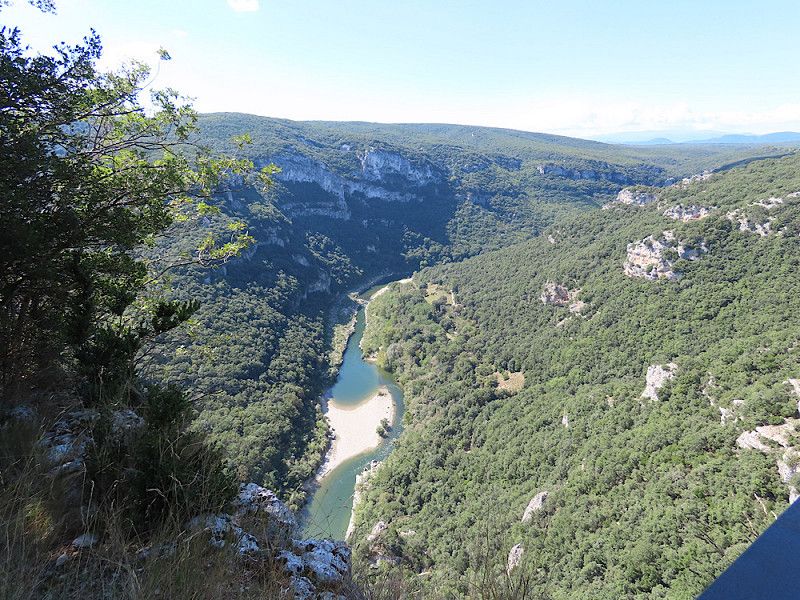
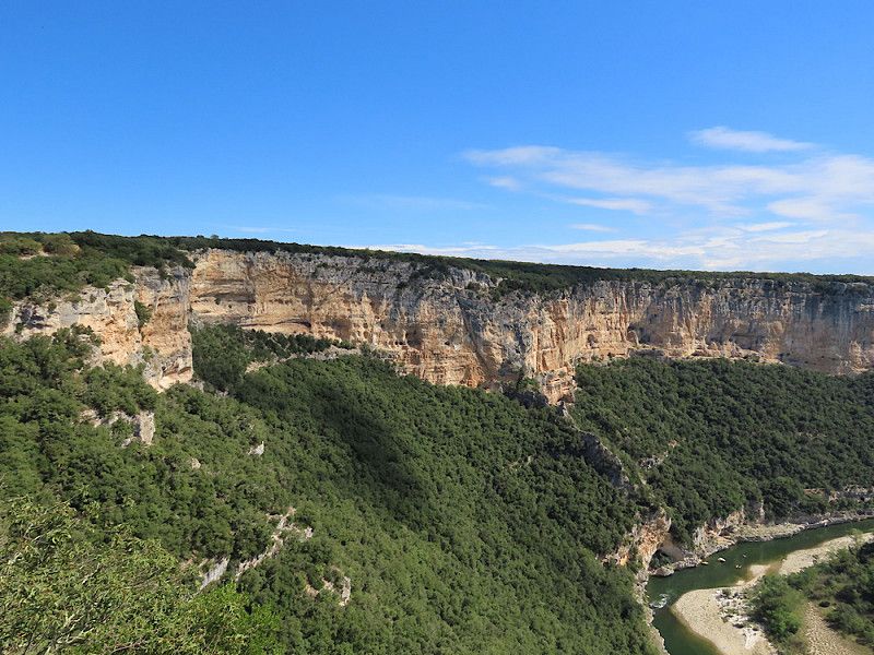
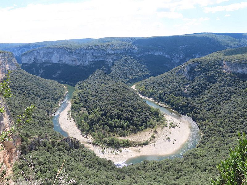
Zurück durchs Ardèche-Tal
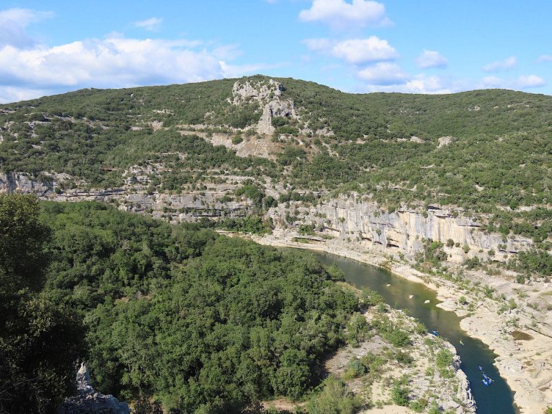
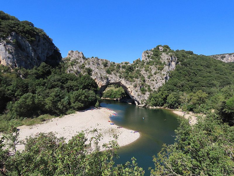
I drive back through the Gorge d'Ardèche because the landscape is so fascinating that I enjoy the views again with many photo stops.
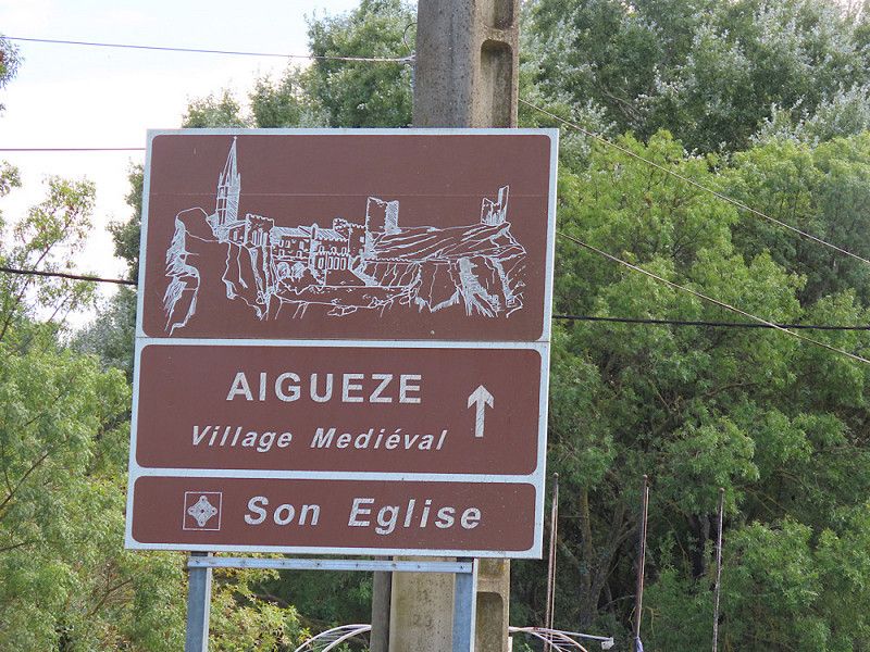
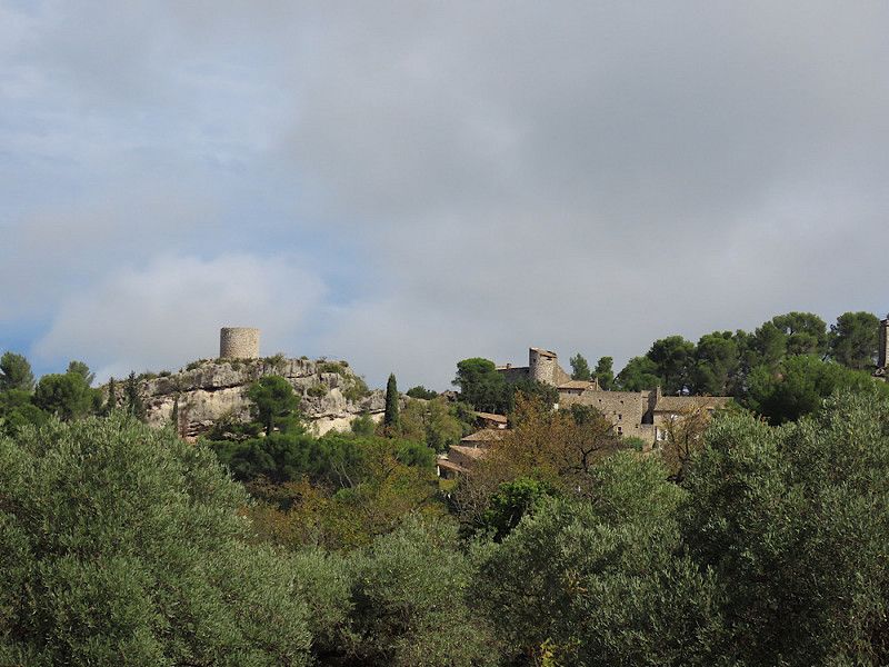
Aiguèze
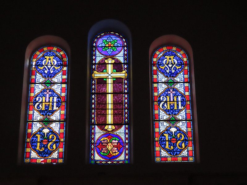
Another beautiful medieval village with only about 215 inhabitants, located directly above the Ardèche. It's worth a stroll and there are nice little boutiques to browse. The church has very beautiful stained glass windows for such a small place.
The parking space costs €6 per day, is beautifully located and really quiet. However, there are only garbage cans and pit toilets (or something similar, they smelled pretty bad anyway), so the site is more suitable for self-sufficient vehicles.
Chemin Des Hières 51, Aiguèze, Bourg-Saint-Andéol, Ardèche, France
44° 18' 7.8" N 4° 33' 13.2" E
44.3021754 4.5536583
• Head toward Route d'Aigueze. Go for 47 m.
• Continue on Rue du Cèdre. Go for 62 m.
• Turn sharp right toward Route d'Aigueze/D180. Go for 32 m.
• Turn left onto Route d'Aigueze (D180). Go for 256 m.
• Turn slightly left onto D901. Go for 6.9 km.
• Turn right onto Avenue Kennedy (D6086). Go for 2.6 km.
• Take the 3rd exit from Carrefour de l'Europe roundabout onto Avenue Pasteur (D994) toward Nîmes/Alès/St Nazaire/Bagnols S C./Centre Ville/A7/Montélimar/Bollène/Mondragon/Orange. Go for 1.2 km.
• Continue toward Route de Pont-Saint-Esprit/D44. Go for 56 m.
• Pass 2 roundabouts and continue on Route de Pont-Saint-Esprit (D44). Go for 5.3 km.
• Turn right onto N7. Go for 7.6 km.
• Pass 3 roundabouts and continue on Rond-Point de l'Arc de Triomphe (N7). Go for 7.8 km.
• Turn left onto Boulevard Édouard Daladier (N7) toward Avignon/Carpentras/Camaret/Vaison la R. Go for 437 m.
• Turn right onto Rue de la République toward Centre Ville. Go for 197 m.
• Turn left onto Rue Caristie. Go for 47 m.
• Turn right onto Rue Petite Fusterie. Go for 40 m.
• Turn right onto Rue Segond Weber. Go for 54 m.
• Arrive at Rue Segond Weber. Your destination is on the left.
☍
32,6 km
( 38 min.)
Day
Aiguèze
Today I'm taking a day off and enjoying the great weather and the beautiful surroundings. It's about 25 degrees and the sky is clear blue - I like it that way 😉.
Day
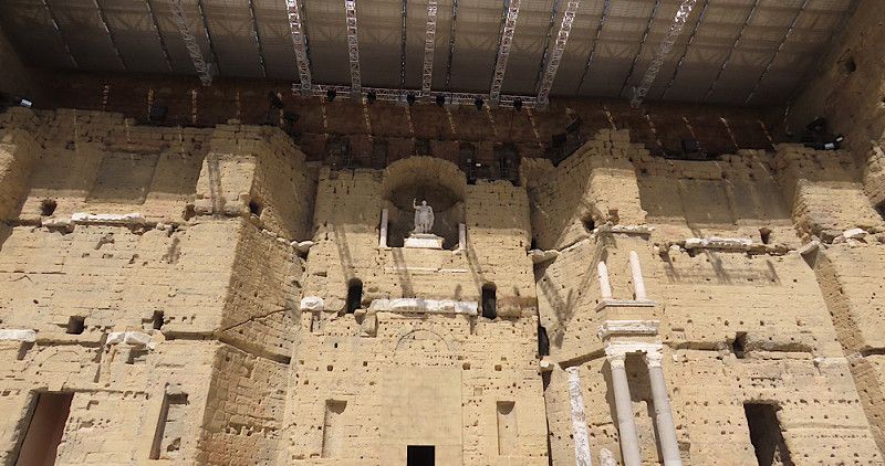
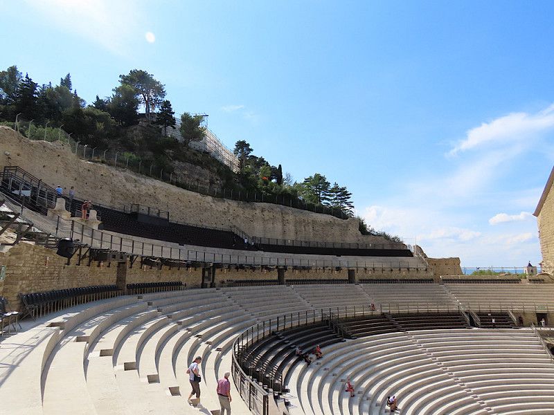
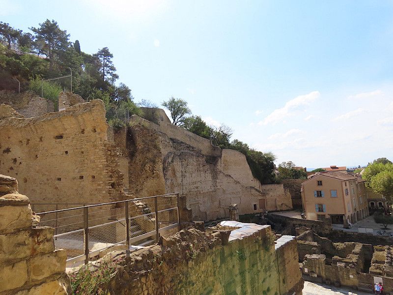
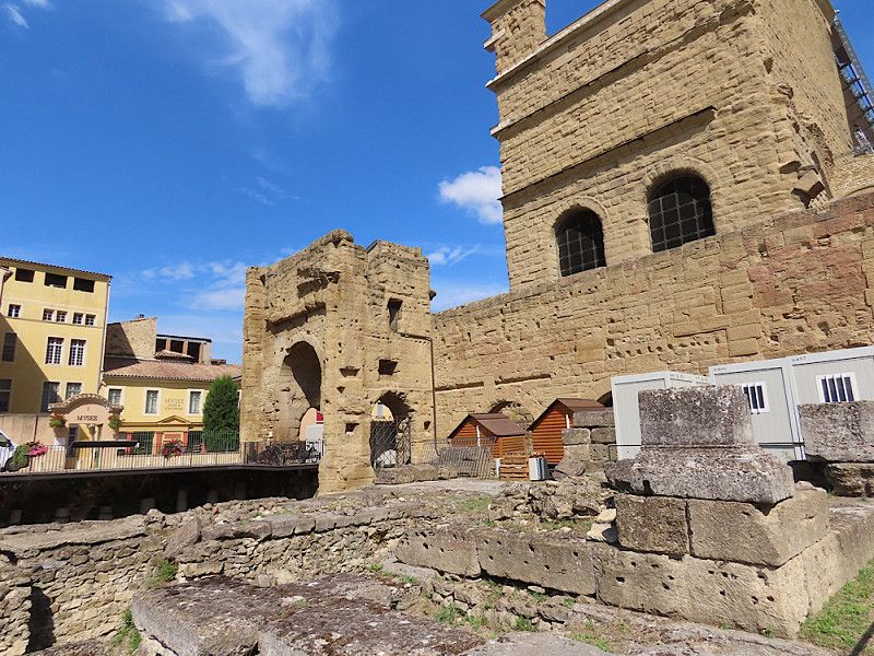
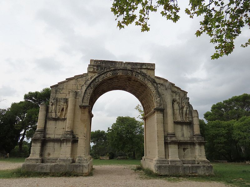
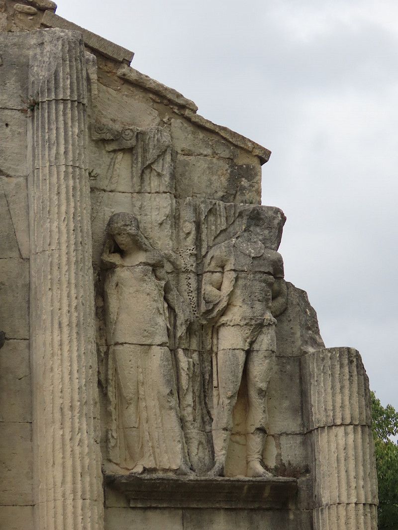
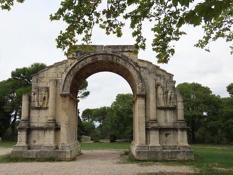
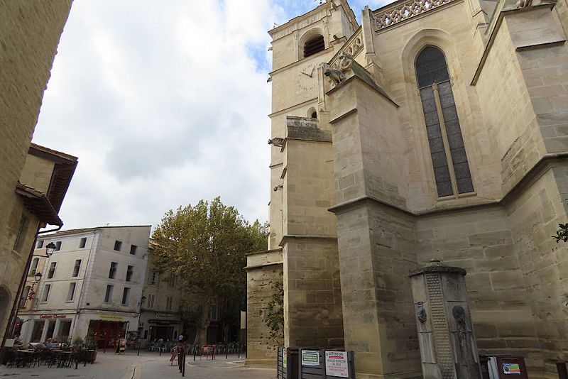
Orange, Frankreich
Visit the triumphal arch, where there is free parking opposite. Visit the amphitheater, which is well worth seeing (it's amazing what the Romans built!) and the museum opposite.
Orange, 84100, Frankreich
44° 8' 13.7" N 4° 48' 28.4" E
44.1371311 4.8078783
• Head toward Rue Gabriel Boissy on Rue Segond Weber. Go for 54 m.
• Turn left onto Rue Petite Fusterie. Go for 40 m.
• Turn sharp right onto Rue Caristie. Go for 65 m.
• Turn left onto Place des Frères Mounet. Go for 87 m.
• Continue on Rue Pourtoules. Go for 142 m.
• Keep left onto Avenue Général Leclerc. Go for 176 m.
• Continue on Boulevard Édouard Daladier (N7) toward Avignon/Carpentras. Go for 41 m.
• Turn right onto Rue de Châteauneuf (D68) toward Châteauneuf du Pape/Quartier de l'Étang. Go for 1.3 km.
• Take the 2nd exit from roundabout onto Rue de Châteauneuf (D68). Go for 213 m.
• Take the 1st exit from roundabout onto Route de Châteauneuf (D68). Go for 295 m.
• Continue on Rue de Châteauneuf (D68). Go for 13 m.
• Continue on Route de Châteauneuf (D68). Go for 436 m.
• Take the 2nd exit from roundabout onto Route de Châteauneuf (D68). Go for 1.3 km.
• Continue on D68. Go for 897 m.
• Take the 2nd exit from roundabout onto D68. Go for 432 m.
• Continue on Lieu-dit Allard (D68). Go for 167 m.
• Continue on Lieu-dit Cabrières (D68). Go for 146 m.
• Continue on D68. Go for 3.4 km.
• Take the 2nd exit from roundabout onto Route d'Orange (D68). Go for 705 m.
• Turn left onto Rue de la Nouvelle Poste (D68). Go for 84 m.
• Continue on D68. Go for 10 m.
• Continue on Avenue Général de Gaulle (D17). Go for 87 m.
• Turn right onto Avenue Louis Pasteur (D17). Go for 378 m.
• Take the 3rd exit from roundabout onto Route de Bédarrides (D192) toward Bédarrides. Go for 1.2 km.
• Turn right. Go for 436 m.
• Arrive at your destination on the right.
☍
12,1 km
( 16 min.)
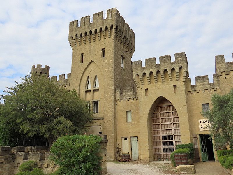
Châteauneuf-du-Pape
Parking space on a winery. Really nice welcome, quiet location, there is a shop with wine and regional products, wine tasting is also possible. Just rubbish bins, no water and sewage available, so more suitable for self-sufficient vehicles.
Good stopover, for example on the way to Avignon.
Route de Sorgues, Châteauneuf-du-Pape, Arrondissement Avignon, Département Vaucluse, Frankreich
44° 3' 0.6" N 4° 50' 56.8" E
44.0501799 4.8491187
• Head toward Route de Sorgues. Go for 1.1 km.
• Turn left onto Route de Sorgues (D17). Go for 665 m.
• Continue on Route de Sorgues (D17). Go for 283 m.
• Continue on Route de Châteauneuf du Pape (D17). Go for 2.2 km.
• Take the 2nd exit from roundabout onto Route de Châteauneuf du Pape (D17). Go for 190 m.
• Take the 2nd exit from roundabout onto D907. Go for 2.4 km.
• Pass 2 roundabouts and continue on Route de Sorgues (D907). Go for 2.6 km.
• Take ramp onto D907 toward A7/Avignon/Cavaillon. Go for 4.2 km.
• Take ramp toward Saint-Jean/Pont des 2 Eaux. Go for 123 m.
• Take the 3rd exit from roundabout onto Avenue de la Folie. Go for 645 m.
• Take the 2nd exit from roundabout onto Avenue de la Folie. Go for 288 m.
• Arrive at Avenue de la Folie. Your destination is on the left.
☍
14,6 km
( 16 min.)
Day
Guter Parkplatz für Stadtbesichtigung von Avignon
No overnight accommodation for people sensitive to noise, but theoretically there is no ban
Rue Combe 2, Avignon, Avignon, Vaucluse, France
43° 56' 51.2" N 4° 49' 31.8" E
43.9475503 4.8255056
• Head west on Avenue de la Folie. Go for 558 m.
• Turn right onto Boulevard Limbert. Go for 164 m.
• Turn slightly left onto Place Saint-Lazare toward Nîmes/Pont d'Avignon/St Bénezet/Centre des Congrès. Go for 164 m.
• Continue on Boulevard Saint-Lazare. Go for 694 m.
• Continue on Boulevard du Quai de la Ligne. Go for 516 m.
• Continue on Boulevard du Rhône. Go for 325 m.
• Keep right onto Boulevard du Rhône. Go for 195 m.
• Continue on Allée de l'Oulle. Go for 329 m.
• Keep left onto Allée de l'Oulle toward A9/Nîmes. Go for 56 m.
• Turn sharp left onto Boulevard Saint-Dominique. Go for 133 m.
• Turn right onto Porte Saint-Dominique. Go for 27 m.
• Turn slightly left onto Rue Victor Hugo. Go for 249 m.
• Turn right onto Rue Joseph Vernet. Go for 398 m.
• Turn left onto Rue de la République. Go for 393 m.
• Turn left onto Place de l'Horloge. Go for 17 m.
• Turn right onto Place de l'Horloge. Go for 31 m.
• Turn right onto Place de l'Horloge. Go for 13 m.
• Arrive at Place de l'Horloge. Your destination is on the left.
☍
4,3 km
( 10 min.)
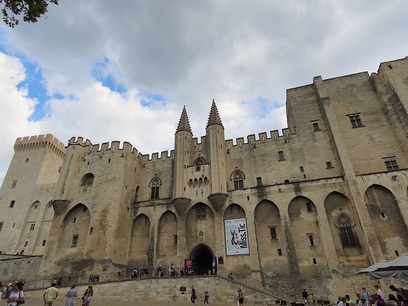
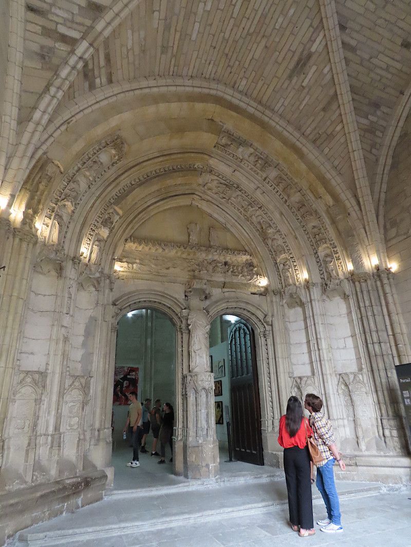
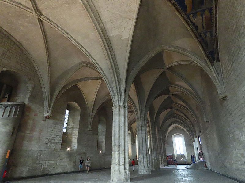
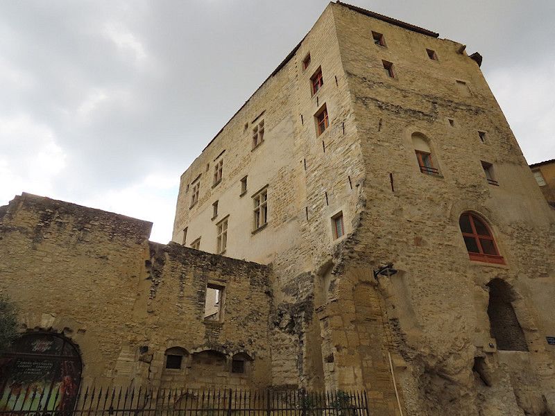
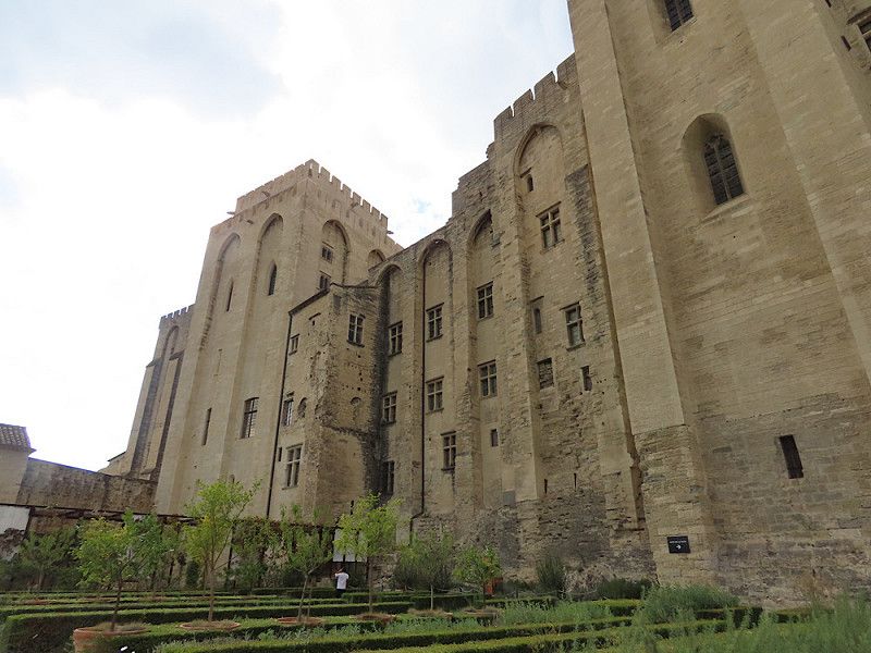
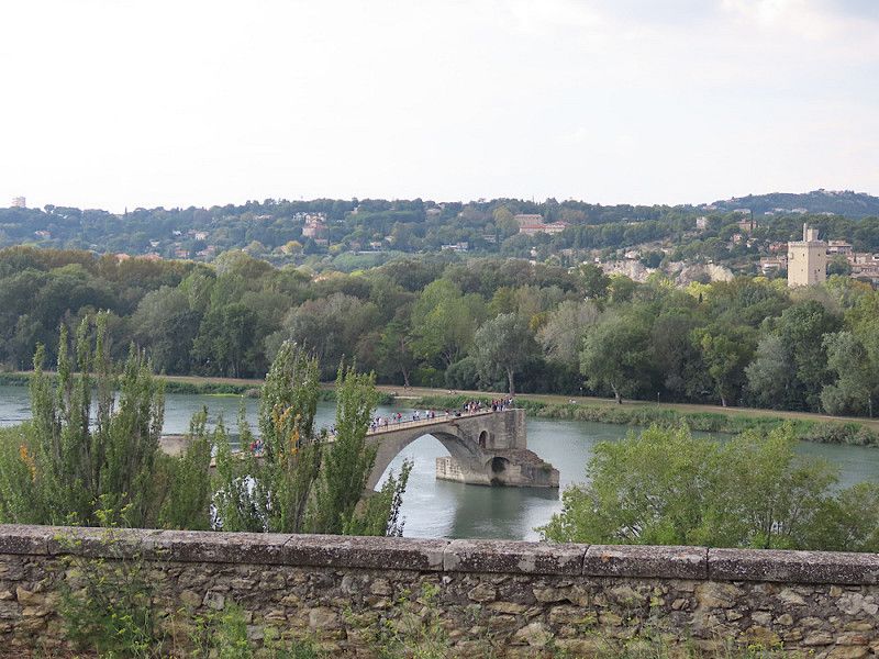
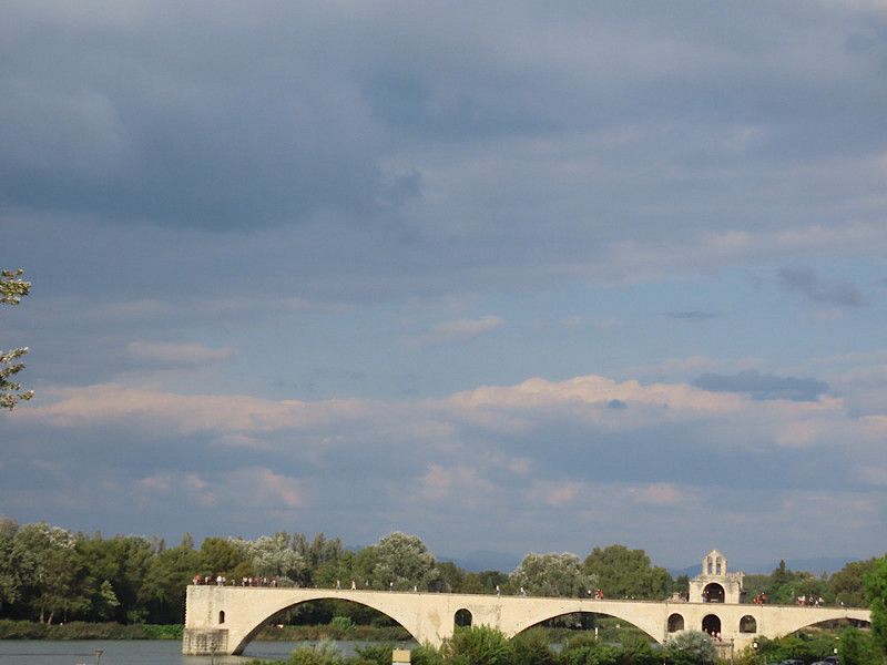
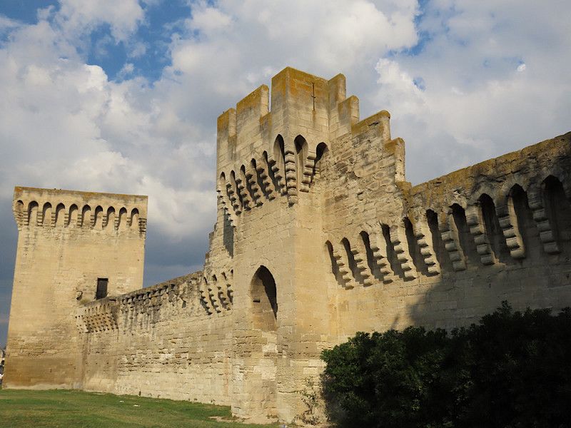
Avignon, Frankreich
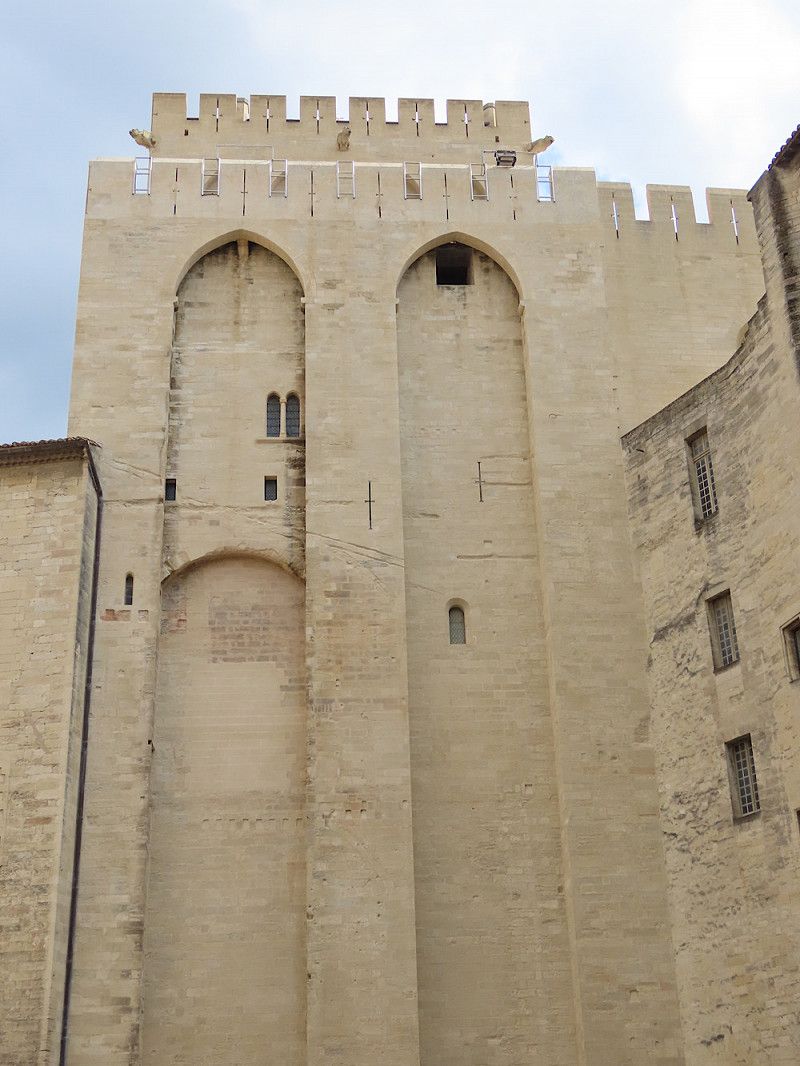
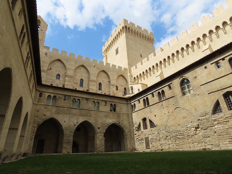
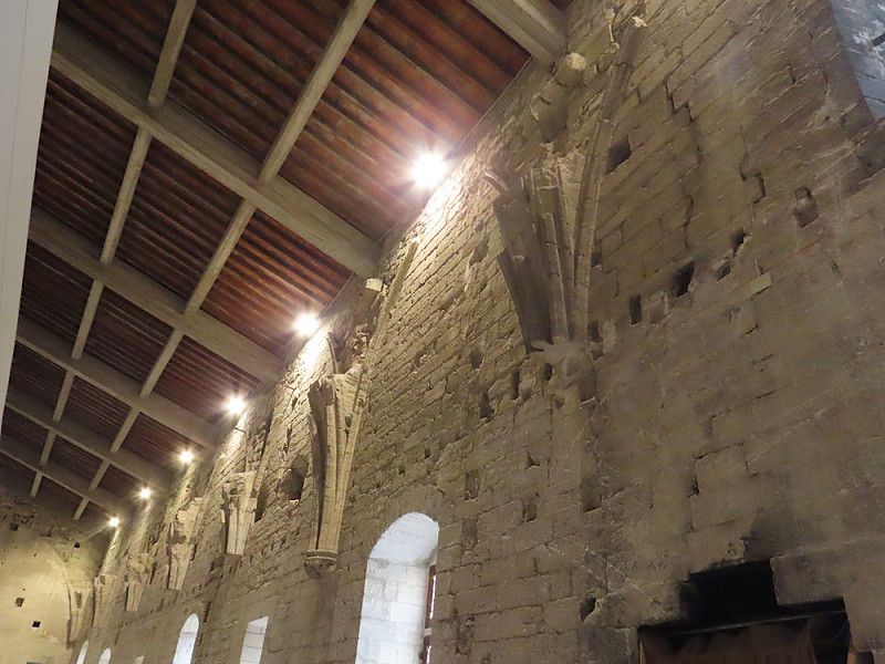
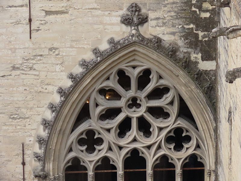
Visit to the Pope's Palace and the famous bridge, known from the children's song “Sur le Pont d'Avignon…”😉.
The Pope's Palace is absolutely huge - it's unimaginable how much money and time must have gone into building it! Even if you're not interested in churches etc., you should still stop by just for the impressive architecture.
Old town with many impressive old houses, almost palaces - you have to take your time. There is also a city wall with a total length of 4.3 km and it is very well preserved.
By the way, that was my lucky day: admission to the Pope's Palace and the gardens was free today. Normally admission is free every Sunday. But this way I saved €14.50, so I can't say no to that.
Avignon, 84000;84140, Avignon, Frankreich
43° 56' 57.3" N 4° 48' 21.2" E
43.9492493 4.8059012
• Head southwest on Place de l'Horloge. Go for 13 m.
• Turn slightly right onto Rue Félicien David. Go for 62 m.
• Turn right onto Rue Racine. Go for 138 m.
• Continue on Place de la Madeleine. Go for 16 m.
• Turn left onto Rue Saint-Étienne. Go for 169 m.
• Turn slightly left onto Rue du Rempart du Rhône. Go for 78 m.
• Turn right onto Porte de l'Oulle. Go for 9 m.
• Turn slightly right onto Boulevard du Rhône. Go for 26 m.
• Continue on Pont Édouard Daladier. Go for 930 m.
• Turn right toward Route d'Aramon/D2. Go for 92 m.
• Turn right onto Route d'Aramon (D2). Go for 617 m.
• Turn right toward A9/Bagnols S/C./Les Angles/Nîmes. Go for 114 m.
• Take ramp onto N100. Go for 3.8 km.
• Take the 3rd exit from roundabout onto N100 toward A9/Alès/Rochefort/Remoulins. Go for 1.1 km.
• Take the 1st exit from roundabout onto D111 toward La Bégude de R. Nord. Go for 156 m.
• Continue on Route d'Avignon (D111). Go for 402 m.
• Continue on Avenue Charles de Gaulle (D111). Go for 305 m.
• Take the 2nd exit from roundabout onto Route d'Avignon (D111). Go for 151 m.
• Continue on Avenue Charles de Gaulle (D111). Go for 33 m.
• Continue on Route d'Avignon (D111). Go for 980 m.
• Continue on D111. Go for 36 m.
• Continue on Route d'Avignon (D111). Go for 137 m.
• Take the 2nd exit from roundabout onto Route d'Avignon (D111). Go for 2.0 km.
• Continue on D111. Go for 56 m.
• Turn left onto Lieu-dit Puits de Ferrane (D976). Go for 9 m.
• Turn right onto Avenue de Signargues. Go for 765 m.
• Arrive at Route d'Orange (D976). Your destination is on the right.
☍
12,1 km
( 15 min.)
Stellplatz auf Weingut
Compared to yesterday's parking spot at a winery, this one is less beautiful and idyllic - it is in the middle of the village above the road. If I hadn't arrived so late, I would have looked for a quieter area. But it's OK for one night and I'm grateful that there are many farms, wineries, etc. in the area that offer free parking. Unfortunately, the shop was closed because it was the weekend.
Avenue de Signargues, Rochefort-du-Gard, Gard, Occitania, France
43° 58' 28.9" N 4° 41' 0.1" E
43.9746954 4.6833671
• Head toward Impasse des Giroflées on Route d'Orange (D976). Go for 1.1 km.
• Take the 3rd exit from roundabout onto D976. Go for 2.1 km.
• Take the 1st exit from roundabout onto N100 toward A9/Nîmes/Alès/Uzès/Remoulins. Go for 1.6 km.
• Take the 2nd exit from roundabout onto N100 toward A9/Nîmes/Uzès/Alès/Remoulins. Go for 3.5 km.
• Take the 2nd exit from roundabout onto D6100 toward Remoulins/Uzès/Pont du Gard. Go for 1.8 km.
• Take the 2nd exit from Carrefour de l'Arnède roundabout onto Impasse des Oliviers (D6101) toward Alès/Bagnols S/C./Pont du Gard. Go for 565 m.
• Take the 3rd exit from roundabout onto Route de Bagnols (D6086) toward Montélimar/Alès/Bagnols S/C./Uzès/Pont du Gard. Go for 1.3 km.
• Take the 3rd exit from roundabout toward Alès/Uzès/Pont du Gard. Go for 53 m.
• Turn right onto Chemin des Croisées (D19 A). Go for 1.2 km.
• Take the 2nd exit from roundabout onto Route Impériale (D19 A) toward Alès/Uzès/Pont du Gard. Go for 486 m.
• Take the 2nd exit from roundabout onto Route d'Uzès (D19) toward Alès/Uzès/Pont du Gard. Go for 587 m.
• Take the 3rd exit from roundabout toward Pont du Gard/Rive Gauche. Go for 109 m.
• Continue on Route du Pont du Gard (D981). Go for 335 m.
• Turn right onto Route du Pont du Gard. Go for 200 m.
• Continue straight ahead. Go for 46 m.
• Turn slightly left. Go for 113 m.
• Turn slightly right. Go for 29 m.
• Arrive at your destination.
☍
15,2 km
( 16 min.)
Day
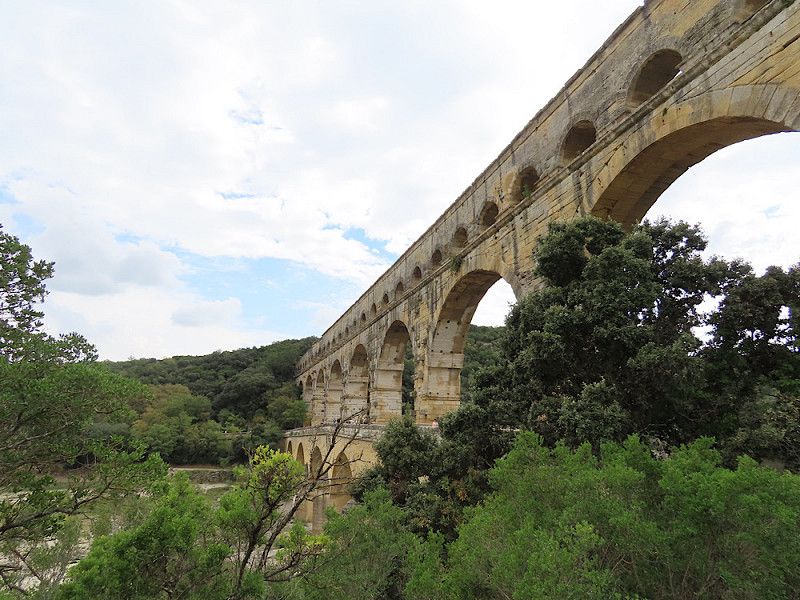
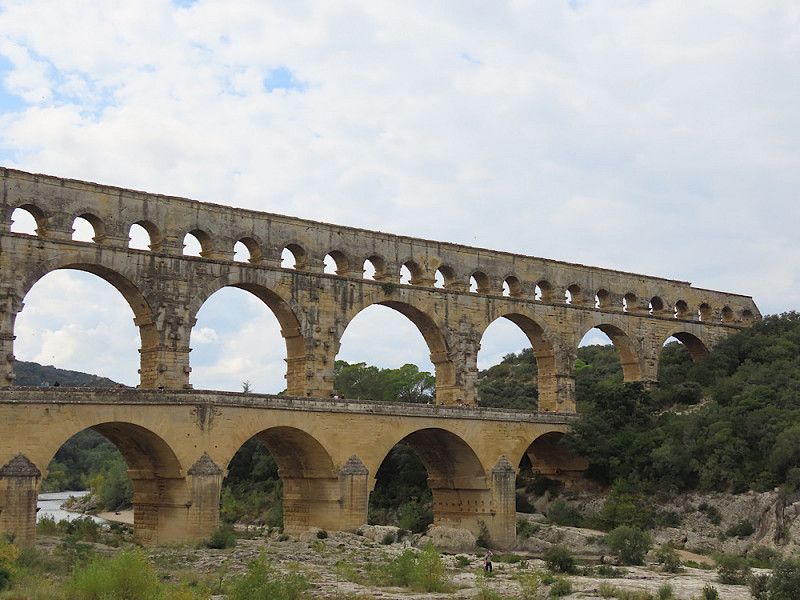
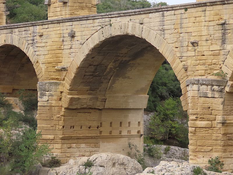
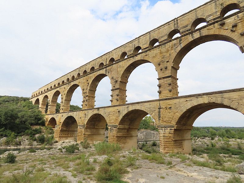
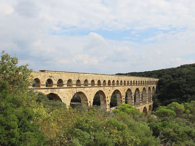
Pont du Gard
All I can think of right now is: “The Romans are crazy!” 😂 An incredible building and a masterpiece of craftsmanship!
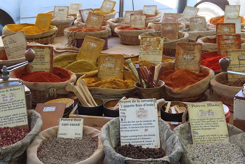
There was a small market with regional products. On a short circular path you could enjoy the view of the Pont du Gard again and learn something about the cultivation of wine, olives, etc. (if you understand enough French 😏). Unfortunately, the signs were only in French.
Parking costs €9, but you can register online and then use the parking space free of charge for a year – ideal for repeat offenders.
Route De Remoulins 305, Vers-Pont-du-Gard, Remoulins, Gard, France
43° 57' 15.7" N 4° 32' 3.8" E
43.9543576 4.5343806
• Head south. Go for 188 m.
• Continue on Route du Pont du Gard. Go for 200 m.
• Turn left onto Route du Pont du Gard (D981). Go for 335 m.
• Continue toward Route de Rémoulins/D19. Go for 37 m.
• Take the 1st exit from roundabout onto Route de Rémoulins (D19) toward A9/Avignon/Bagnols S/C. Go for 515 m.
• Take the 2nd exit from roundabout onto Chemin des Croisées (D19 A) toward A9/Avignon/Bagnols S/C./Nîmes. Go for 510 m.
• Take the 2nd exit from roundabout onto Chemin des Croisées (D19 A) toward A9/Avignon/Bagnols S/C. Go for 1.3 km.
• Take the 1st exit from roundabout onto D6086 toward A9/Nîmes/Avignon/Remoulins. Go for 1.2 km.
• Take the 2nd exit from roundabout onto D6101 toward A9/Avignon/Nîmes/Beaucaire/Tarascon. Go for 618 m.
• Take the 3rd exit from Carrefour de l'Arnède roundabout onto D6100 toward A9/Nîmes/Avignon/Les Angles. Go for 1.8 km.
• Take the 2nd exit from roundabout onto A9 (La Languedocienne) toward Nîmes/Aéroport Garons/Arles/Montpellier/Toulouse/Barcelone. Go for 43.2 km.
• Take the exit onto A9. Go for 3.4 km.
• Take the 3rd exit from roundabout onto D6313 toward Vauvert/Aimargues. Go for 1.6 km.
• Take the 2nd exit from roundabout onto Route des Plages (D6313) toward Arles/Le Grau du Roi/Aigues-Mortes/Vauvert/Aimargues. Go for 1.2 km.
• Take the 2nd exit from roundabout onto D979 toward Aigues-Mortes/Le Grau du Roi. Go for 716 m.
• Pass 4 roundabouts and continue on Route du Grau du Roi (D979). Go for 6.6 km.
• Take the 3rd exit from roundabout onto Avenue du Général Trouchaud. Go for 196 m.
• Turn sharp left. Go for 58 m.
• Arrive at your destination on the right.
☍
63,8 km
( 43 min.)
V/E-Station
Good stopover for supplies and disposal if, like me, you mainly stay at (private) campsites such as wineries, etc. Draining the grey water and emptying the toilet cassette was no problem.
Avenue du Général Trouchaud 180, Saint-Laurent-d'Aigouze, Aigues-Mortes, Gard, France
43° 37' 43.7" N 4° 11' 29.7" E
43.6288065 4.1915858
• Head northwest.
• Turn right. Go for 16 m.
• Turn right toward Avenue du Général Trouchaud. Go for 39 m.
• Turn slightly right onto Avenue du Général Trouchaud. Go for 76 m.
• Take the 3rd exit from roundabout onto D979. Go for 1.3 km.
• Take the 2nd exit from roundabout onto D979. Go for 4.6 km.
• Take the 2nd exit from roundabout onto D46. Go for 986 m.
• Take the 1st exit from roundabout onto D58 toward Arles/Les Stes Maries de la Mer. Go for 8.1 km.
• Turn right onto Route des Saintes-Maries-de-la-Mer. Go for 35 m.
• Arrive at Route des Saintes-Maries-de-la-Mer. Your destination is on the right.
☍
15,2 km
( 11 min.)
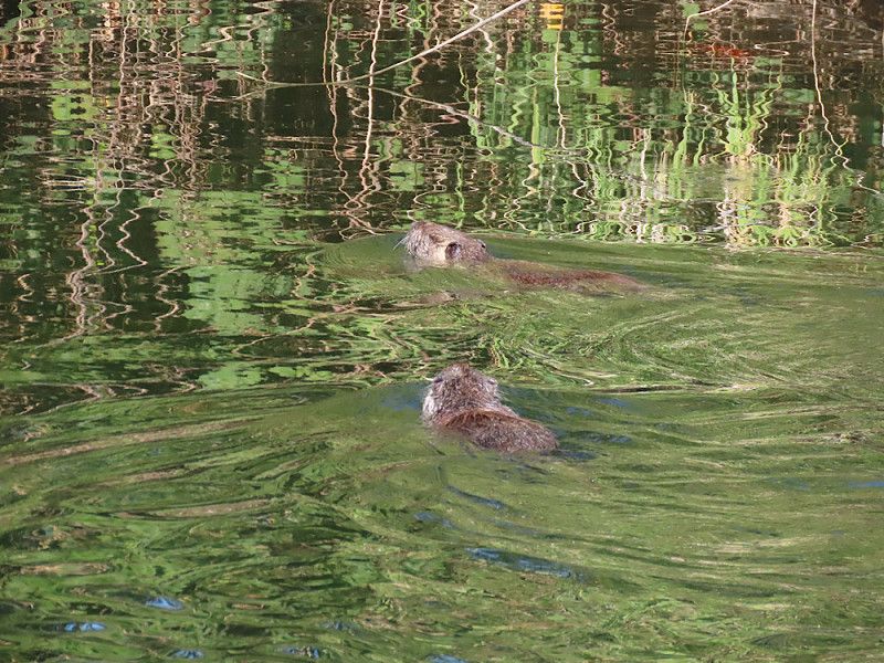
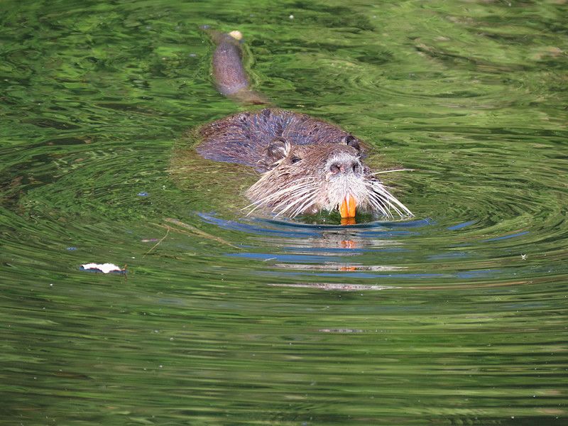
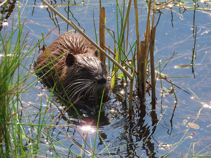
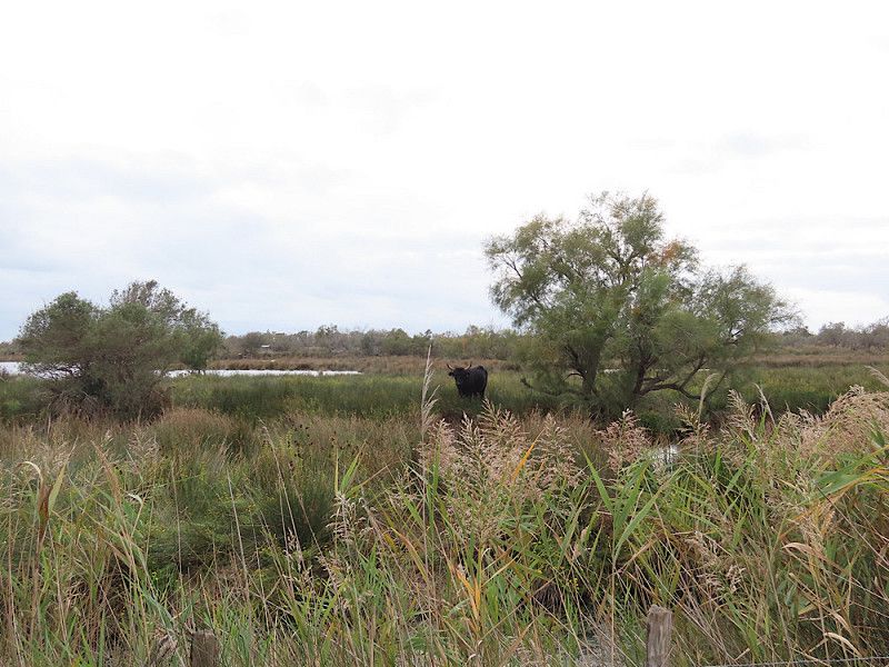
Stellplatz auf einem Weingut in der Camargue
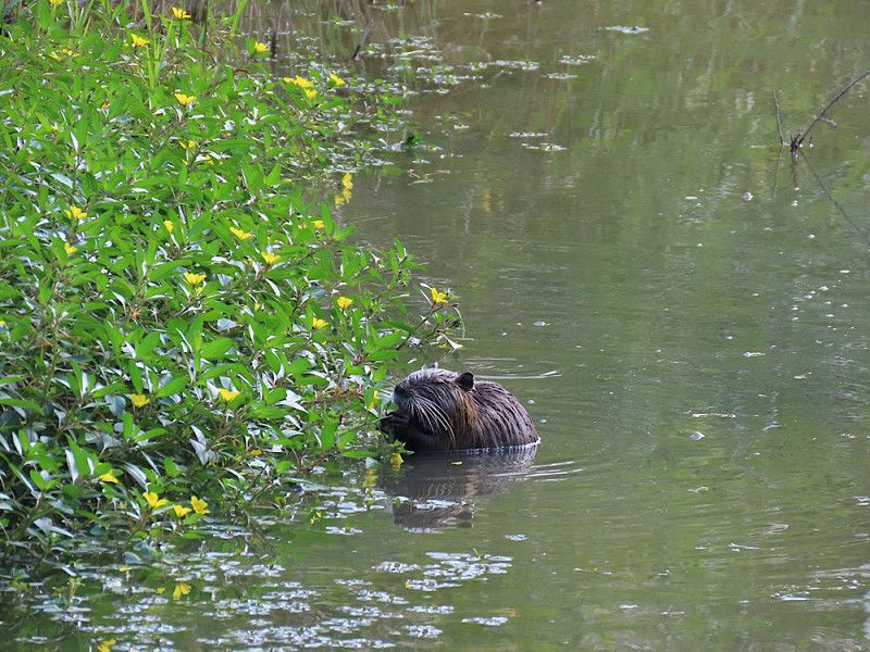
Quiet parking space on a farm/winery in the middle of the Camargue. The small shop offers a good selection of regional products (wine, olive oil, sausage, soaps, ceramics, etc.) at absolutely fair prices. A bottle of organic Merlot, for example, costs €4.80 - that's a really good price!
I was able to observe a few nutrias in a small pond (canal?) directly at the campsite.
D 58, Vauvert, Vauvert, Gard, France
43° 34' 20.8" N 4° 18' 14.7" E
43.5724450 4.3040806
• Head toward Lieu-dit Mas du Chêne on Route des Saintes-Maries-de-la-Mer. Go for 46 m.
• Turn right onto Lieu-dit Mas du Chêne (D58). Go for 234 m.
• Take the 3rd exit from roundabout onto D179 toward St Gilles/Vauvert/Gallician/Montcalm. Go for 3.4 km.
• Continue on Lieu-dit Mas Terro Novo (D179). Go for 40 m.
• Continue on D179. Go for 334 m.
• Continue on Lieu-dit Mas Paula (D179). Go for 72 m.
• Continue on D179. Go for 630 m.
• Continue on Lieu-dit Quatret (D179). Go for 184 m.
• Continue on D179. Go for 2.5 km.
• Continue on Lieu-dit Mas des Iscles (D179). Go for 20 m.
• Turn right onto D179. Go for 116 m.
• Arrive at D179. Your destination is on the left.
☍
7,5 km
( 6 min.)
Day
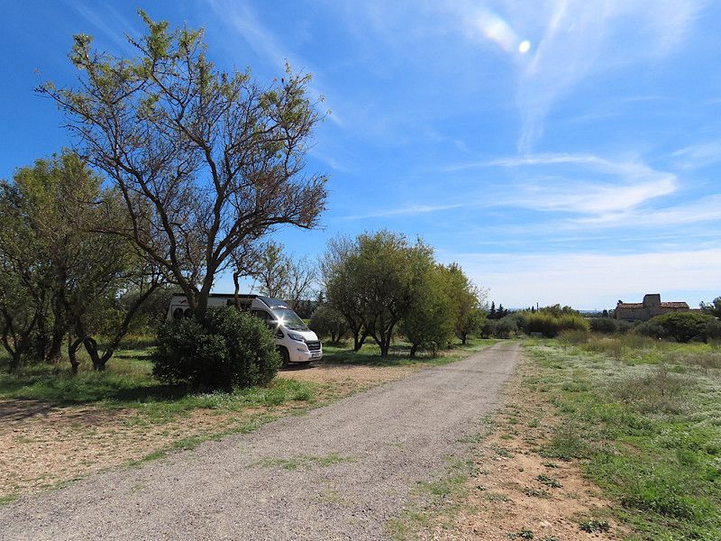
Stellplatz auf Weingut – ein Urlaubstag
Today I simply enjoyed the beautiful surroundings and treated myself to a little time out to process the many impressions of the last few days.
Day
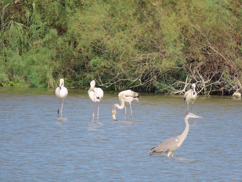
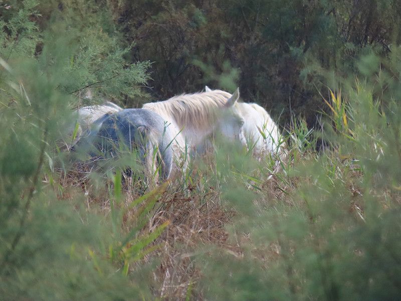
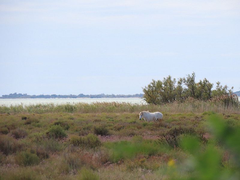
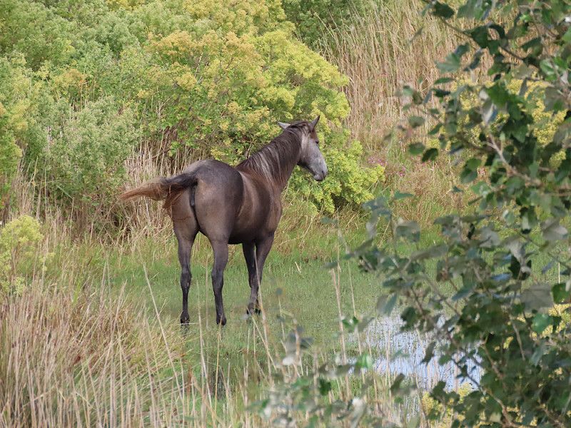
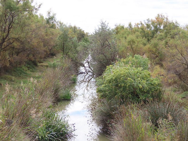
Centre de découverte du Scamandre
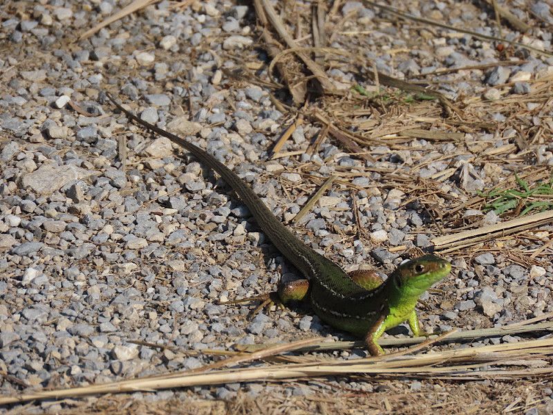
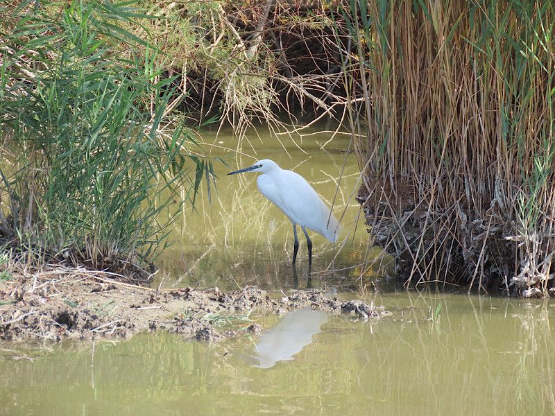
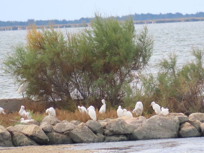
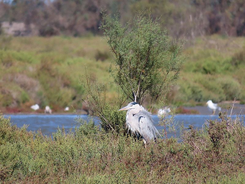
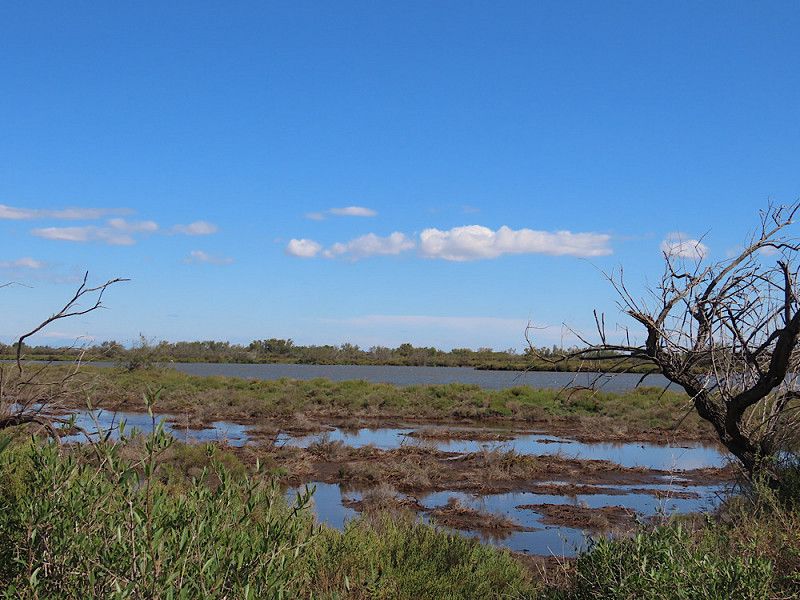
Hike through the Camargue "discovery center" in Scamandre. Beautiful bird watching, nutrias and a few "wild horses" (?). Part of the path is on logs. Very easy and pleasant to walk.
Sentier de la Fromagère, Vauvert, Gard, Occitania, France
43° 36' 19.8" N 4° 20' 16.3" E
43.6055022 4.3378746
• Head west on D179. Go for 116 m.
• Turn left onto Lieu-dit Mas des Iscles (D179). Go for 20 m.
• Continue on D179. Go for 2.5 km.
• Continue on Lieu-dit Quatret (D179). Go for 184 m.
• Continue on D179. Go for 630 m.
• Continue on Lieu-dit Mas Paula (D179). Go for 72 m.
• Continue on D179. Go for 334 m.
• Continue on Lieu-dit Mas Terro Novo (D179). Go for 40 m.
• Continue on D179. Go for 3.3 km.
• Take the 1st exit from roundabout onto D58 toward Aigues-Mortes. Go for 8.3 km.
• Take the 3rd exit from roundabout onto D46 toward Aigues-Mortes/Le Grau du Roi/Nîmes. Go for 1.0 km.
• Take the 4th exit from roundabout onto D979. Go for 348 m.
• Continue on Route de Nîmes (D979). Go for 184 m.
• Turn right toward D979. Go for 30 m.
• Take the 3rd exit from roundabout onto Route de Nîmes (D979). Go for 1.0 km.
• Continue on Avenue de la Tour de Constance (D979). Go for 110 m.
• Turn left onto Rue du Faubourg du 12 Avril. Go for 11 m.
• Turn left onto Rue de la Pinède. Go for 216 m.
• Turn slightly right onto Rue Jeanne Demessieux. Go for 119 m.
• Turn left onto Rue Alphonse Daudet. Go for 95 m.
• Turn left. Go for 22 m.
• Arrive at your destination on the left.
☍
18,7 km
( 17 min.)
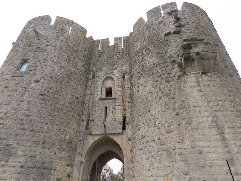
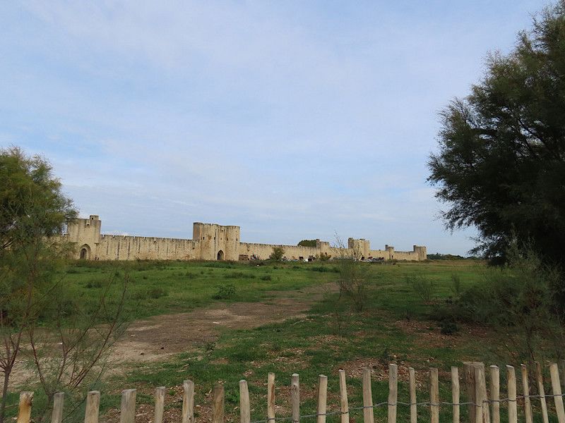
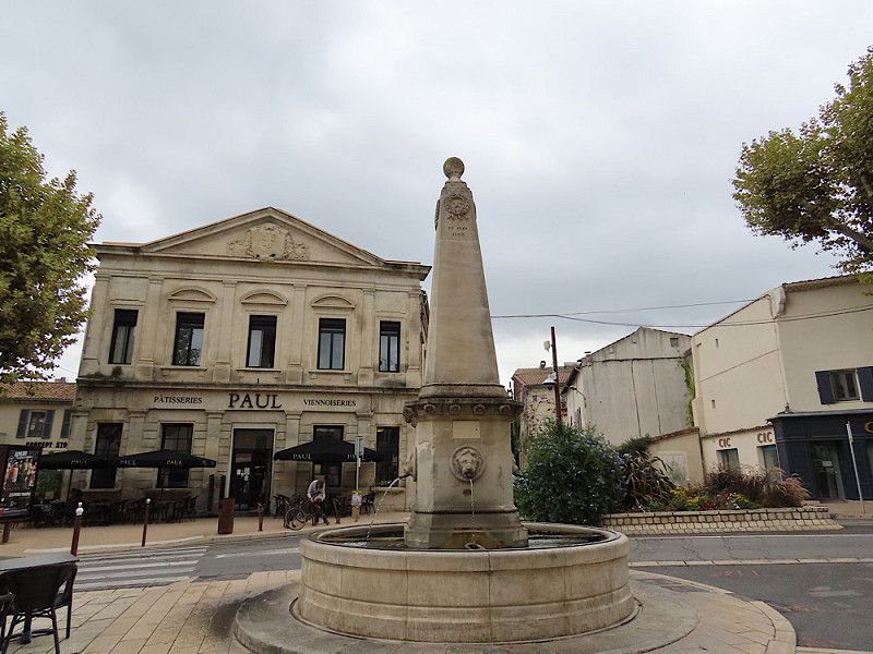
Parkplatz in Aigues-Mortes
Free parking space for 4 RVs near the tennis courts/cemetery. Even marked with RV signs.
Good stopover or for a day stay in Aigues-Mortes.
Impasse Des Tourterelles 1, Aigues-Mortes, Aigues-Mortes, Gard, France
43° 34' 15.8" N 4° 11' 46.1" E
43.5710495 4.1961334
• Head toward Rue de la Pinède. Go for 17 m.
• Turn left onto Rue de la Pinède. Go for 381 m.
• Turn left onto Rue du Faubourg du 12 Avril. Go for 205 m.
• Turn right onto Rue Alphonse Daudet. Go for 29 m.
• Continue on Faubourg National. Go for 177 m.
• Turn slightly right onto Porte Saint-Antoine. Go for 32 m.
• Continue on Boulevard Gambetta. Go for 95 m.
• Continue on Boulevard Gambetta. Go for 96 m.
• Turn right onto Rue Marceau. Go for 79 m.
• Arrive at Rue Marceau. Your destination is on the right.
☍
1,1 km
( 3 min.)
Day
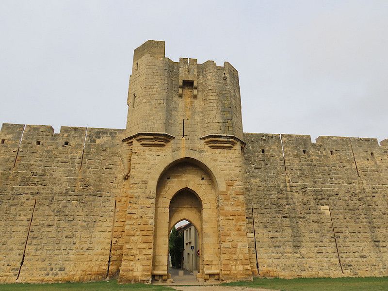
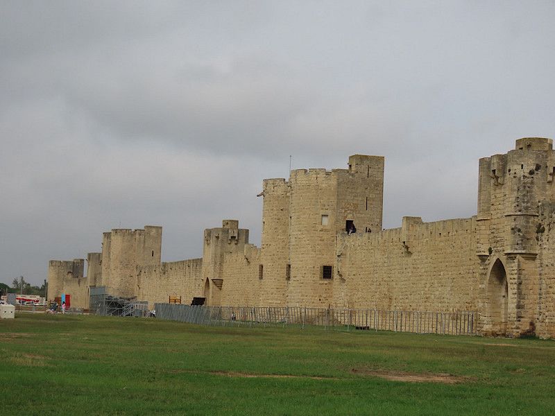
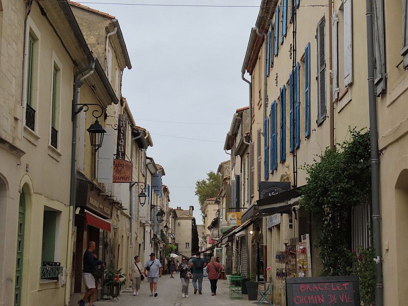
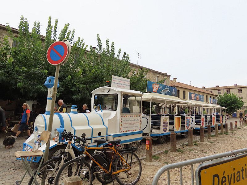
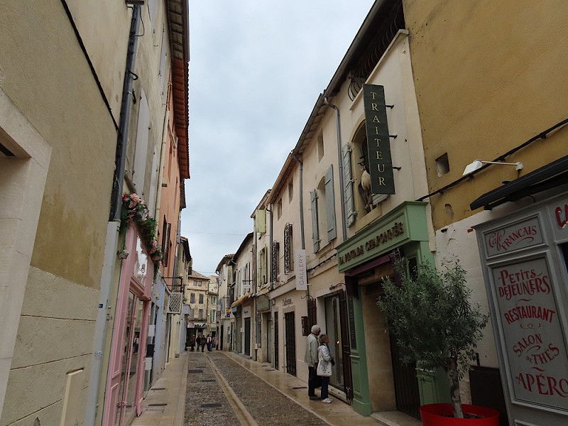
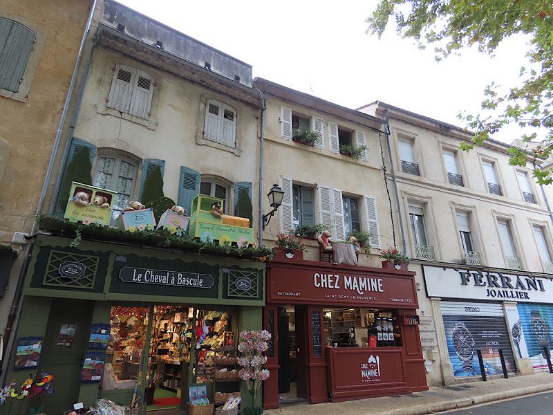
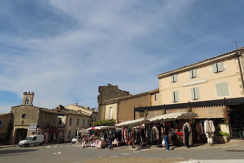
Ein Tag in Aigues-Mortes
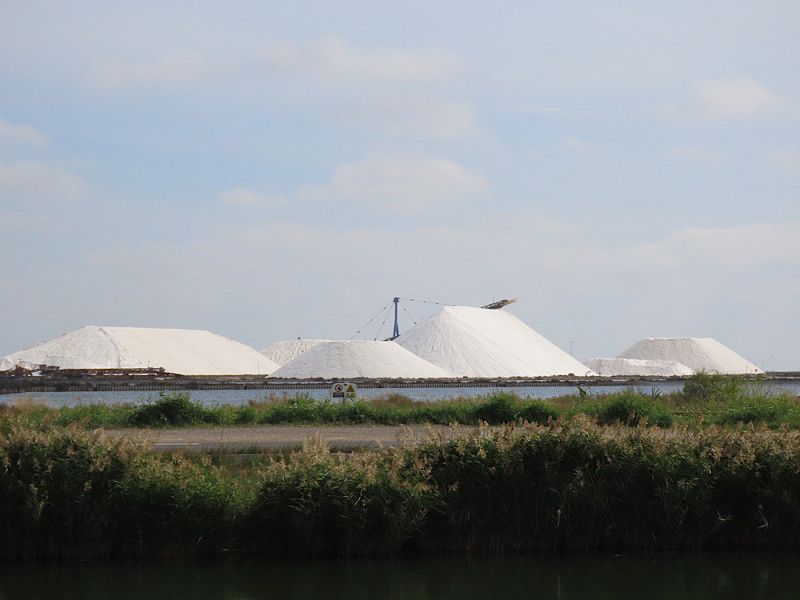
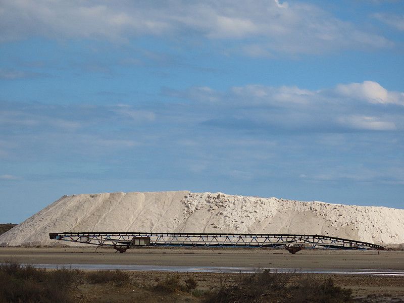
Bike tour along the canal with (not a very good view) of the saltworks with their mountains of salt and a tour of the city, including on the little tourist train - it was fun 😉. There is a leaflet with German descriptions of the various stops, so you can easily follow everything.
I really liked the town, the shops were so pretty, everything was clean and well-kept and the place was so small and easy to navigate that it was impossible to get lost. There are still quite a lot of tourists around, but if you take your time, you can really spend a lovely day here.
Aigues-Mortes, 30220, Frankreich
43° 33' 57" N 4° 11' 28.6" E
43.5658225 4.1912837
• Head toward Rue Theaulon on Rue Marceau. Go for 92 m.
• Turn left onto Rue Theaulon. Go for 99 m.
• Continue on Porte des Moulins. Go for 94 m.
• Turn right toward Rue des Casernes. Go for 162 m.
• Turn left onto Rue des Casernes. Go for 64 m.
• Turn slightly right toward D979. Go for 37 m.
• Turn right onto D979. Go for 542 m.
• Take the 1st exit from roundabout onto D979 toward Nîmes/Centre Ville. Go for 148 m.
• Turn left onto Avenue de la Tour de Constance (D979). Go for 245 m.
• Continue on Route de Nîmes (D979). Go for 964 m.
• Take the 3rd exit from roundabout. Go for 48 m.
• Continue on Route de Nîmes (D979). Go for 184 m.
• Continue on D979. Go for 126 m.
• Keep right toward D46. Go for 135 m.
• Turn right onto D46. Go for 853 m.
• Take the 1st exit from roundabout onto D58 toward Arles/Les Stes Maries de la Mer. Go for 8.4 km.
• Take the 3rd exit from roundabout onto D179 toward St Gilles/Vauvert/Gallician/Montcalm. Go for 3.4 km.
• Continue on Lieu-dit Mas Terro Novo (D179). Go for 40 m.
• Continue on D179. Go for 334 m.
• Continue on Lieu-dit Mas Paula (D179). Go for 72 m.
• Continue on D179. Go for 630 m.
• Continue on Lieu-dit Quatret (D179). Go for 184 m.
• Continue on D179. Go for 2.5 km.
• Continue on Lieu-dit Mas des Iscles (D179). Go for 20 m.
• Turn right onto D179. Go for 1.8 km.
• Continue on Lieu-dit Bramasset (D179). Go for 94 m.
• Continue on D179. Go for 1.7 km.
• Continue on Lieu-dit Grand Canavère (D179). Go for 86 m.
• Continue on D179. Go for 523 m.
• Continue on Lieu-dit Mas Combet (D179). Go for 106 m.
• Continue on Lieu-dit Mas Melon (D179). Go for 155 m.
• Continue on D179. Go for 175 m.
• Continue on Lieu-dit Petit Canavère (D179). Go for 96 m.
• Continue on D179. Go for 2.3 km.
• Continue on Lieu-dit Petit Biserty (D179). Go for 92 m.
• Continue on D179. Go for 697 m.
• Continue on Lieu-dit La Fosse (D179). Go for 107 m.
• Continue on D179. Go for 189 m.
• Continue on Lieu-dit Saint-Roch (D179). Go for 81 m.
• Continue on D179. Go for 1.4 km.
• Continue on Lieu-dit Le Versadou (D179). Go for 103 m.
• Continue on D179. Go for 1.3 km.
• Continue on Lieu-dit Le Mas Blanc (D179). Go for 157 m.
• Continue on D179. Go for 919 m.
• Continue on Lieu-dit Mas de la Saque (D179). Go for 91 m.
• Continue on D179. Go for 809 m.
• Turn right toward Lieu-dit Beau Figuier. Go for 197 m.
• Continue on Lieu-dit Beau Figuier. Go for 408 m.
• Turn left onto Route d'Arles (D6572). Go for 980 m.
• Turn left onto Rue Sadi Carnot toward Nîmes/Montpellier/Vauvert/Stade d'Espeyran. Go for 93 m.
• Turn right onto Rue Ledru-Rollin. Go for 115 m.
• Turn left onto Impasse Ledru-Rollin. Go for 120 m.
• Turn right. Go for 14 m.
• Turn right. Go for 55 m.
• Arrive at your destination on the right.
☍
34,3 km
( 33 min.)
Day
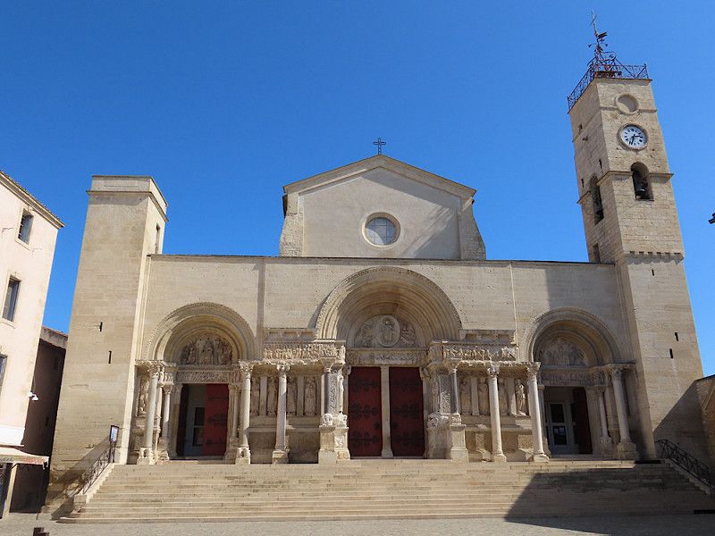
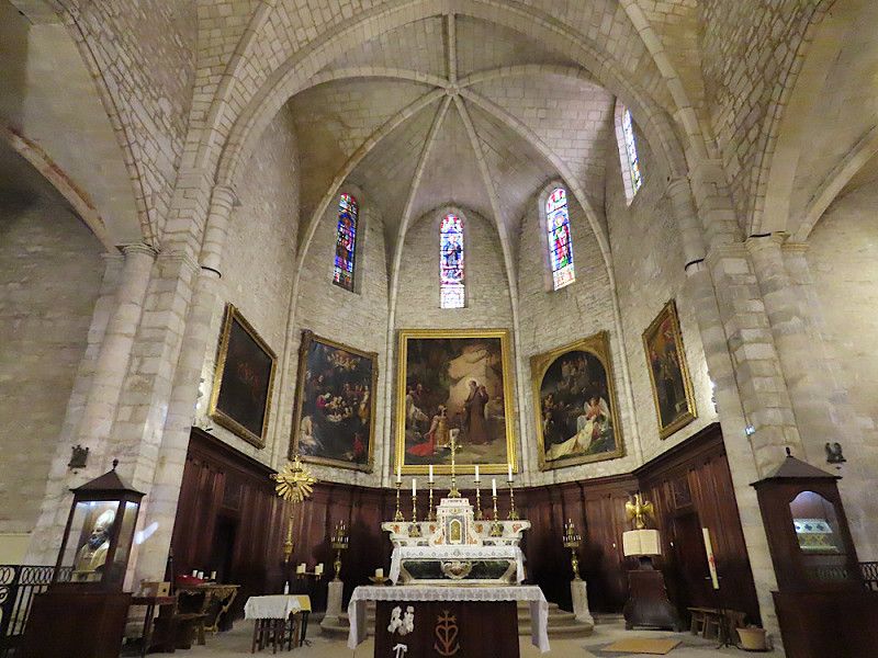
Saint-Gilles
Visit to the large church. Otherwise a leisurely day.
Overnight stay in the community's free RV parking space. All water and electricity options available. Very quiet night here, even though the parking spaces are tight. I got the outermost spot, which was of course great ☺️.
Rue De l’Ecurie 7, Saint-Gilles, Saint-Gilles, Gard, France
43° 40' 24" N 4° 25' 52.2" E
43.6733343 4.4311796
• Head southwest. Go for 55 m.
• Turn left toward Chemin du Vin. Go for 153 m.
• Take the 2nd exit from roundabout onto Chemin du Vin toward Arles/Marseille/Beaucaire. Go for 184 m.
• Continue on Rue Sadi Carnot. Go for 242 m.
• Turn right onto Boulevard Chanzy (D6572) toward Arles. Go for 1.9 km.
• Continue on Route de Dours (D572 N). Go for 1.3 km.
• Turn right onto Route du Vaccarès (D37) toward Albaron/Les Stes Maries/Saliers. Go for 7.5 km.
• Turn right onto Route des Saintes-Maries-de-la-Mer (D570). Go for 251 m.
• Turn left onto Route du Vaccarès (D37). Go for 17.2 km.
• Turn right onto Route de Salin de Giraud (D36). Go for 21.5 km.
• Continue on Route de la Mer (D36 D). Go for 26 m.
• Turn right onto Allée des Platanes. Go for 260 m.
• Continue on Boulevard des Arènes Salin. Go for 115 m.
• Arrive at Boulevard des Arènes Salin. Your destination is on the right.
☍
50,7 km
( 38 min.)
Day
Salin-de-Giraud
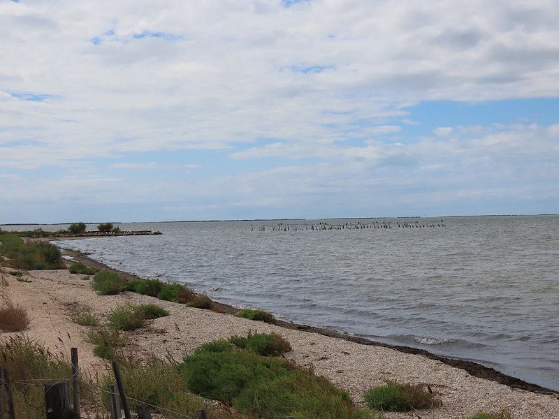
Drive from Saint-Gilles through the Camargue National Park with many photo stops.
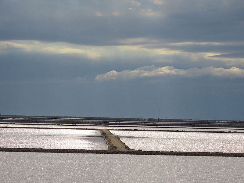
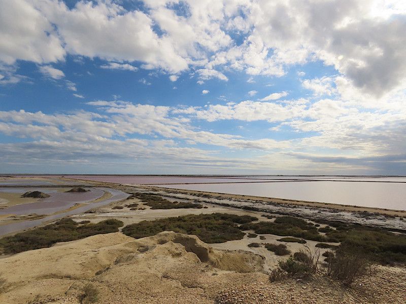
The highlight was the salt flats in Giraud, where there was a viewing hill from which you could get a really wonderful view of the salt flats. Huge parking lot and access to the viewing point is free. If you were to hike/cycle through the area there would be an entrance fee.
Bouches-du-Rhône, Provence-Alpes-Côte d'Azur, Frankreich
43° 24' 49" N 4° 44' 2.2" E
43.4136059 4.7339545
• Head toward Rue des Gabians on Boulevard des Arènes Salin. Go for 61 m.
• Turn right onto Rue des Gabians. Go for 10 m.
• Turn right onto Rue des Sansouires Salin. Go for 121 m.
• Turn left onto Rue des Sansouires Salin. Go for 21 m.
• Turn slightly right onto Rue des Sansouires Salin. Go for 65 m.
• Turn right onto Place des Gardians. Go for 449 m.
• Turn left onto Route de Salin de Giraud (D36). Go for 32.5 km.
• Turn right onto Avenue Abbé Pierre (D570). Go for 2.0 km.
• Take the 2nd exit from Rond-Point Maurice Étienne roundabout onto D570. Go for 622 m.
• Take the 1st exit from Rond-Point du Vittier roundabout onto Route de Dours (N113/N572) toward Arles-Centre/Aix en Pce/Marseille/Avignon. Go for 12.2 km.
• Take ramp toward A55/Fos/Martigues. Go for 983 m.
• Continue on Route de Boujan (N568). Go for 19.6 km.
• Pass 3 roundabouts and continue on N568. Go for 7.8 km.
• Take the 2nd exit from Carrefour Saint-Gervais roundabout onto N568 toward Martigues/Marseille/Port de Bouc. Go for 764 m.
• Turn left onto Avenue Jean Jaurès (N579) toward Fos-Ville/Le Cavaou. Go for 210 m.
• Take the 2nd exit from roundabout onto Route des Plages. Go for 531 m.
• Continue on Chemin des Targaires. Go for 48 m.
• Take the 2nd exit from Rond-Point des Tintaines roundabout onto Avenue de l'Estagnon. Go for 214 m.
• Turn right onto Avenue du Sable d'Or. Go for 15 m.
• Turn left onto Chemin du Douanier. Go for 34 m.
• Arrive at Chemin du Douanier. Your destination is on the left.
☍
78,2 km
( 54 min.)
Fos-sur-Mer
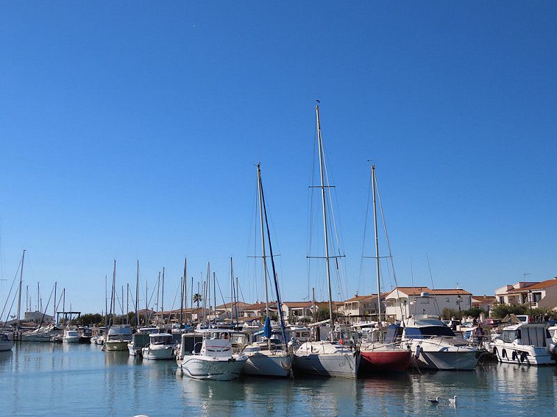
Free parking directly at the marina. Garbage cans available. Quiet in the evenings and at night, but the surrounding area is very industrial.
Avenue Du Sable d'Or 150, Fos-sur-Mer, Istres, Bouches-du-Rhône, France
43° 25' 46.6" N 4° 56' 30.5" E
43.4296051 4.9417929
• Head toward Avenue du Sable d'Or on Chemin du Douanier. Go for 34 m.
• Turn right onto Avenue du Sable d'Or. Go for 46 m.
• Turn left onto Rue du Port. Go for 73 m.
• Turn slightly right toward Route des Plages. Go for 20 m.
• Turn right onto Route des Plages. Go for 407 m.
• Take the 3rd exit from roundabout onto Avenue Jean Jaurès (N579). Go for 453 m.
• Turn slightly right onto Place de la République. Go for 72 m.
• Continue on Place de la République. Go for 26 m.
• Continue on Place de l'Hôtel de Ville. Go for 36 m.
• Continue on Square Casimir Demoustier. Go for 82 m.
• Turn left onto Boulevard Victor Hugo. Go for 47 m.
• Continue on Chemin des Ruines. Go for 116 m.
• Arrive at Chemin des Ruines.
☍
1,4 km
( 3 min.)
Day
Fos-sur-Mer
Stopover to visit the old church of Saint-Sauveur and the Château de l'Hauture in Fos-sur-Mer. The whole complex looks very impressive from the outside, but unfortunately there is hardly anything to see inside the church as the ceiling is currently removed, probably because of renovation work.
I drove to a small car park directly below the church, but I can't recommend it: the access was incredibly narrow and turning around at the top is also a challenge when all the parking spaces are taken. So it's better to park down in the village and walk the few meters up the hill.
Chemin Des Ruines 10b, Fos-sur-Mer, Istres, Bouches-du-Rhône, France
43° 26' 18.3" N 4° 56' 47.4" E
43.4384238 4.9465009
• Head toward Montée des Porcelets on Chemin des Ruines. Go for 116 m.
• Turn right onto Traverse de la Fortune. Go for 40 m.
• Turn left onto Rue Pasteur. Go for 24 m.
• Turn right onto Rue Pasteur. Go for 52 m.
• Continue on Place de la République. Go for 21 m.
• Continue on Montée Bel-Air. Go for 45 m.
• Turn left onto Avenue Camille Pelletan (N579). Go for 134 m.
• Continue on Avenue Jean Jaurès (N579). Go for 428 m.
• Take the 3rd exit from roundabout onto Avenue Jean Jaurès (N579). Go for 132 m.
• Turn sharp right onto N568. Go for 351 m.
• Keep right onto N568 toward Montpellier/Nîmes/Arles/Istres/Port St Louis. Go for 2.2 km.
• Take the 3rd exit from roundabout onto Route d'Arles (N568) toward Nîmes/Montpellier/Istres/Port St Louis. Go for 1.8 km.
• Take the 1st exit from Carrefour de la Fenouillère roundabout onto N569 toward A54 (A7)/Salon/Istres/St Blaise/Le Mazet. Go for 4.9 km.
• Take ramp onto D569 N toward Rassuen/Lavalduc. Go for 1.3 km.
• Turn right onto Avenue Ange Bertolloti (D52) toward Rassuen. Go for 155 m.
• Take the 1st exit from roundabout onto Route de la Cabane Noire (D52). Go for 1.7 km.
• Continue on Route de Saint-Blaise (D52 A). Go for 2.1 km.
• Turn right onto Chemin de Castillon. Go for 25 m.
• Turn sharp right. Go for 73 m.
• Arrive at your destination on the left.
☍
15,5 km
( 15 min.)
Étang de Lavalduc & St. Blaise mit Ruinenfeld
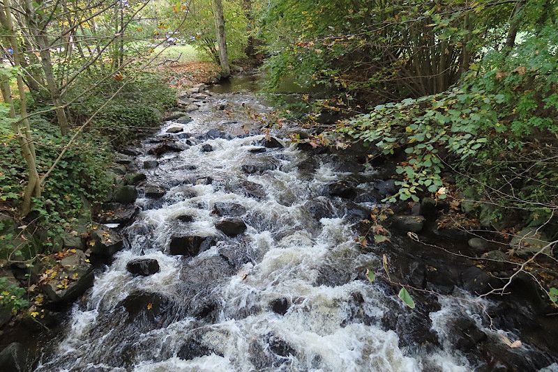
Visit the ancient church of St. Blaise and the ruins of the ancient village next to it. Wonderful views of the bright pink lake "Étang de Lavalduc", but a very strong wind. But it is definitely worth a stop if you are in the area!
Route de Saint-Blaise, Saint-Mitre-les-Remparts, Bouches-du-Rhône, Provence-Alpes-Côte d'Azur, France
43° 27' 55" N 4° 58' 48.8" E
43.4652854 4.9802239
• Head toward Chemin de Castillon. Go for 73 m.
• Turn sharp left onto Chemin de Castillon. Go for 25 m.
• Turn sharp right onto Route de Saint-Blaise (D51). Go for 2.0 km.
• Continue on D51. Go for 314 m.
• Take the 1st exit from roundabout onto D5. Go for 3.2 km.
• Take the 1st exit from roundabout onto D5. Go for 315 m.
• Pass 3 roundabouts and continue on Route d'Istres (D5). Go for 2.5 km.
• Turn left onto Avenue du Docteur Fleming. Go for 621 m.
• Take the 1st exit from roundabout onto Avenue du Docteur Fleming. Go for 925 m.
• Turn right onto Boulevard du 14 Juillet. Go for 188 m.
• Turn right onto Avenue du Président John Fitzgerald Kennedy (N568). Go for 239 m.
• Arrive at Avenue du Président John Fitzgerald Kennedy (N568). Your destination is on the right.
☍
10,4 km
( 12 min.)
Martigues
Free parking for a stroll through the old town of Martigues.
Small, pretty village with very cute little houses along the canals. However, most of the shops were closed - I don't know if that was because it was a Saturday afternoon or because it was autumn and there were fewer tourists.
It was a nice stroll, but I wouldn't drive here just for that.
Av Pdt John Fitzgerald Kennedy 21bis, Martigues, Martigues, Bouches-du-Rhône, France
43° 24' 31.6" N 5° 3' 4.1" E
43.4087676 5.0511450
• Head northwest on Avenue du Président John Fitzgerald Kennedy (N568). Go for 372 m.
• Continue on Avenue Clément Escoffier (N568). Go for 297 m.
• Take the 1st exit from roundabout onto Avenue du Moulin de France. Go for 175 m.
• Turn left onto Avenue Francis Turcan (D5). Go for 390 m.
• Continue toward A55. Go for 142 m.
• Take ramp onto A55 toward Martigues Sud/Marseille. Go for 23.4 km.
• Take the left exit toward Aéroport Marignane/Avignon/Lyon onto A7 (Autoroute du Soleil). Go for 13.4 km.
• Take exit 28 toward Salon de Pce/Berre-l'Étang/Rognac onto D21. Go for 2.1 km.
• Take ramp onto D113. Go for 4.3 km.
• Take the 2nd exit from roundabout onto D113 toward Salon de Pce/Lançon-Pce/La Fare les O./St Chamas. Go for 2.9 km.
• Take the 4th exit from roundabout onto Route de Saint-Chamas (D10). Go for 1.2 km.
• Arrive at Route de Calameau au Département du Var (D10).
☍
48,6 km
( 32 min.)
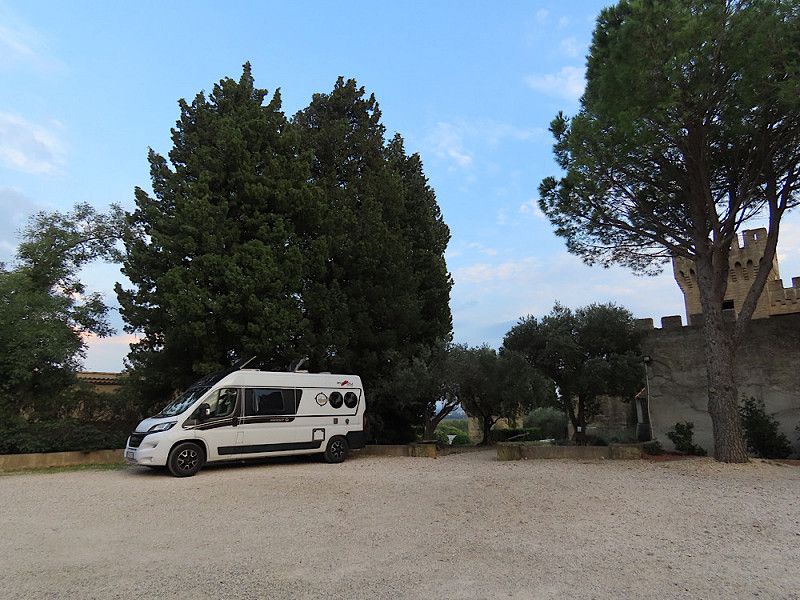
Stellplatz „Perle de Provence“
Nice parking spot, unfortunately only for one night, under olive and almond trees on a farm. No water/electricity, but ideal for self-sufficient people like me and quiet at night.
Route Departementale 10 626, Lancon-Provence, Pélissanne, Bouches-du-Rhône, France
43° 32' 57.7" N 5° 10' 5.3" E
43.5493739 5.1681345
• Head toward Chemin des Plans on Route de Calameau au Département du Var (D10). Go for 1.7 km.
• Turn right onto Route de Rognac à Lançon Par Berre (D21). Go for 3.9 km.
• Continue on Route de Rognac à Lançon Provence (D21). Go for 635 m.
• Continue on Route de Rognac à Lançon Par Berre (D21). Go for 762 m.
• Continue on Route de Rognac à Lançon-de-Provence (D21). Go for 218 m.
• Turn left onto Route de Bordeaux à Marseille (D113). Go for 1.5 km.
• Take the 2nd exit from roundabout onto Route de Bordeaux à Marseille (D113) toward A54/Salon de Pce. Go for 2.8 km.
• Take the 3rd exit from roundabout onto D113 toward A54/Nîmes/Arles/Salon de Pce-Ouest. Go for 993 m.
• Take the 3rd exit from roundabout toward E80/A54/Arles/Nîmes/Aix en Pce/Aéroport Marignane Marseille/Avignon. Go for 189 m.
• Take ramp onto A54 toward Arles/Nîmes/St Martin de Crau. Go for 21.1 km.
• Continue on N113. Go for 19.6 km.
• Take ramp toward Nîmes/Arles-Trinquetaille/Bellegarde/Stes Maries de la Mer/Salin de Giraud. Go for 300 m.
• Take the 4th exit from Rond-Point du Vittier roundabout onto D570 toward Stes Maries de la Mer/Salin de Giraud. Go for 722 m.
• Take the 2nd exit from Rond-Point Maurice Étienne roundabout onto Avenue Abbé Pierre (D570). Go for 26.4 km.
• Continue on D570. Go for 1.9 km.
• Continue on Lieu-dit Mas de Taxil (D570). Go for 201 m.
• Continue on D570. Go for 1.4 km.
• Continue on Lieu-dit Pont de Gau (D570). Go for 72 m.
• Continue on D570. Go for 2.3 km.
• Continue on Lieu-dit La Brouzetière (D570). Go for 93 m.
• Continue on D570. Go for 467 m.
• Continue on Lieu-dit Le Pont des Bannes (D570). Go for 97 m.
• Continue on D570. Go for 431 m.
• Continue on Lieu-dit Les Arnelles (D570). Go for 121 m.
• Continue on D570. Go for 217 m.
• Continue on Route d'Arles (D570). Go for 84 m.
• Continue on Route d'Arles (D570). Go for 413 m.
• Take the 1st exit from Rond-Point Marie-Madeleine Fourcade roundabout onto Avenue d'Arles (D570). Go for 517 m.
• Turn right onto Avenue de la République (D38). Go for 21 m.
• Turn left onto Rue Jean Roche. Go for 99 m.
• Continue on Rue Jean Roche. Go for 143 m.
• Turn slightly left onto Avenue Gilbert Leroy. Go for 179 m.
• Take the 2nd exit from Rond-Point Pierre Pastré roundabout onto Avenue du Docteur Cambon. Go for 170 m.
• Turn right onto Avenue Jacques-Yves Cousteau. Go for 219 m.
• Turn slightly right onto Rond-Point Vallée des Lys. Go for 623 m.
• Arrive at your destination on the left.
☍
90,6 km
(1 hrs. 5 min.)
Day
CP in Saintes-Maries-de-la-Mer
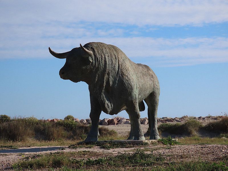
After not liking the area around Marseille (lots of industry and oil refineries), I decided to drive a good 90 km back to the Camargue and go to the campsite in Saintes-Maries-de-la-Mer. I'm going on holiday for a week right by the sea and enjoying the warmth (around 20 degrees) and the salty air. I also want to relax and not be on the move every day. Saintes Maries with its beaches is perfect for that!
Excursions from the campsite:
- City stroll and climb to the church roof (entrance fee 4.-)
- Cycling tour through the Camargue National Park to the Gacholle lighthouse
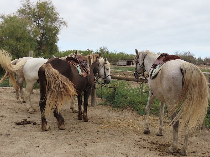
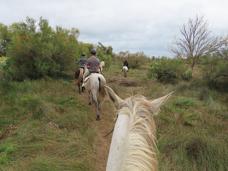
- Horse riding (Promenade de la Valette, 2 hours 45.-)
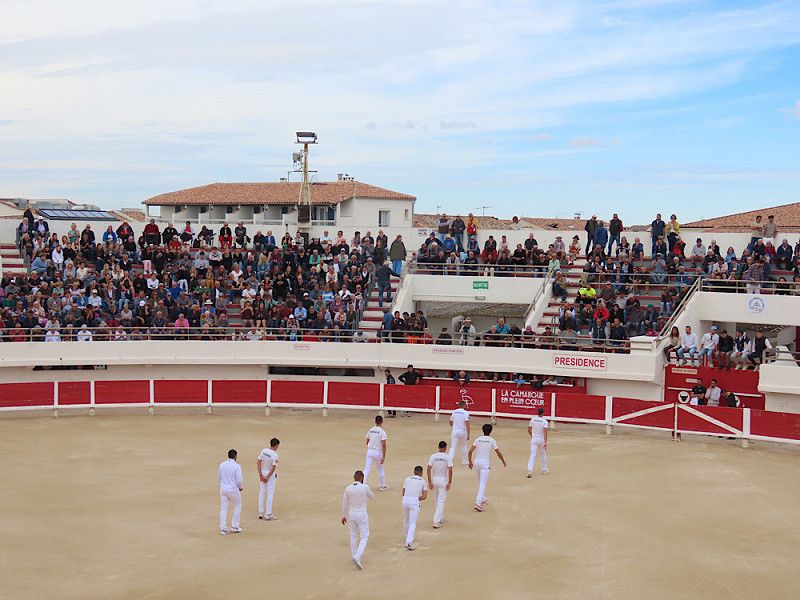
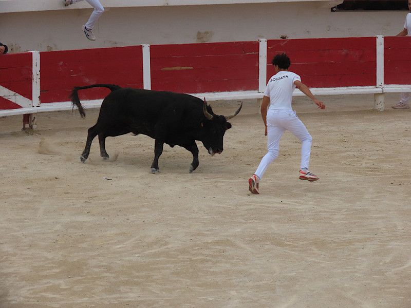
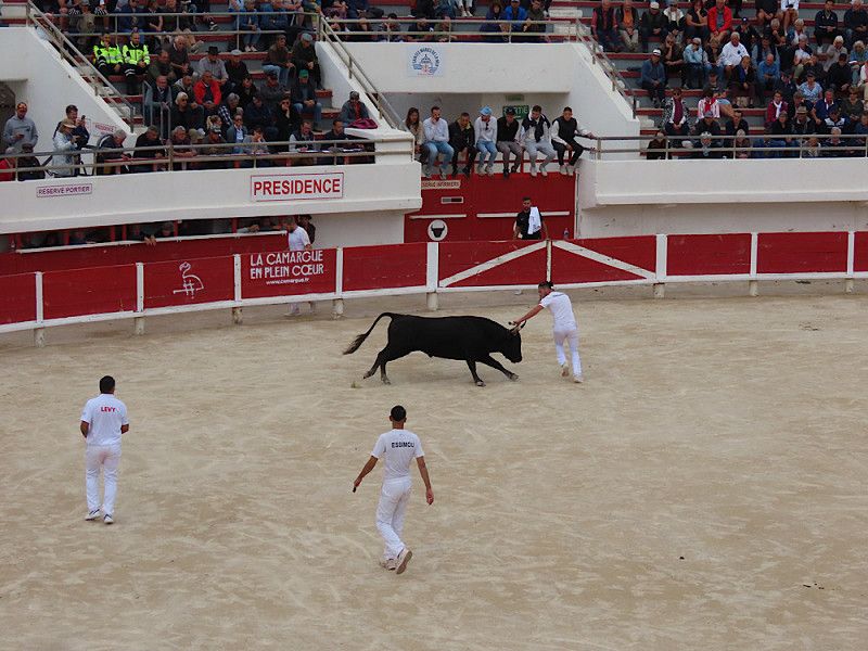
- Bullfight in the arena (bloodless! Entrance fee 3.-)
- Bike tour to the ornithological park at Pont du Gau, entrance fee 8.-)
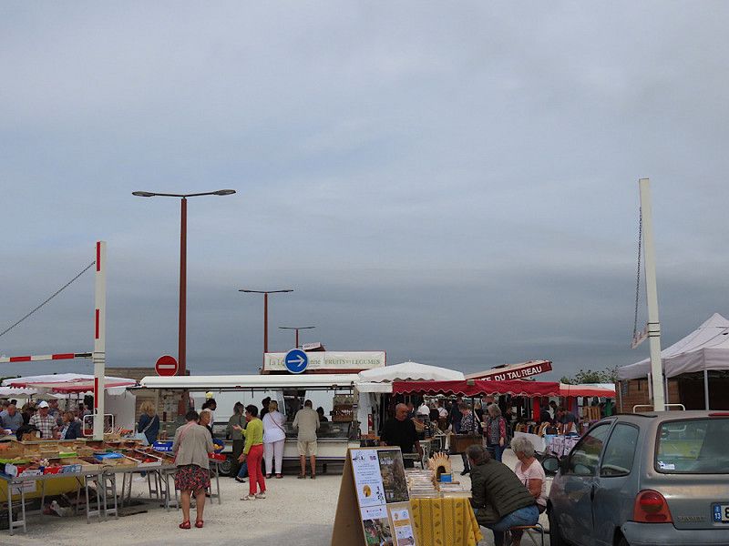
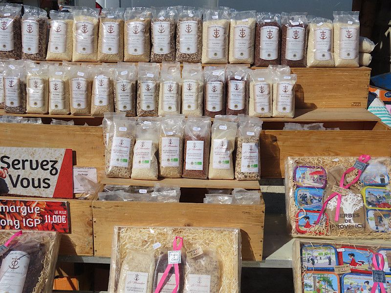
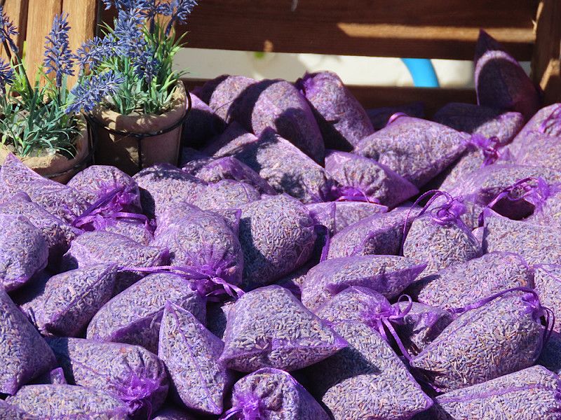
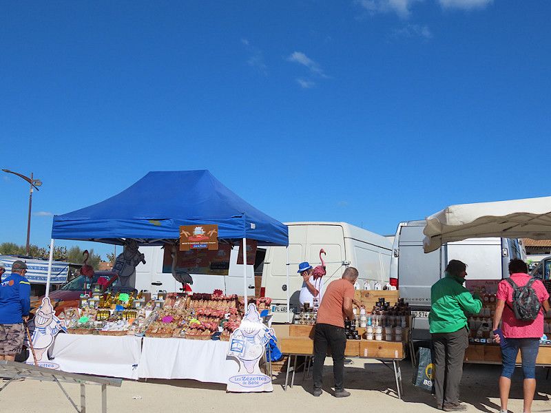
- Visit to the weekly market
Carriera dau Levant, Saintes-Maries-de-la-Mer, Bouches-du-Rhône, Provence-Alpes-Côte d'Azur, France
43° 27' 22.3" N 4° 26' 32.5" E
43.4561880 4.4423599
• Head southwest. Go for 563 m.
• Turn right onto Rond-Point Vallée des Lys. Go for 36 m.
• Continue on Avenue Jacques-Yves Cousteau. Go for 192 m.
• Turn right onto Avenue du Docteur Cambon. Go for 142 m.
• Take the 2nd exit from roundabout onto Avenue du Docteur Cambon. Go for 195 m.
• Turn right onto Route de Cacharel (D85 A). Go for 226 m.
• Continue on Route de Frigoulès (D85 A). Go for 1.5 km.
• Continue on Chemin de Frigoulès (D85 A). Go for 1.9 km.
• Continue on Route de Cacharel (D85 A). Go for 2.6 km.
• Continue on D85 A. Go for 1.2 km.
• Continue on Lieu-dit Mas Saint-Henri (D85 A). Go for 153 m.
• Continue on D85 A. Go for 403 m.
• Continue on Lieu-dit Frigoulès (D85 A). Go for 117 m.
• Continue on Route de Frigoulès (D85 A). Go for 1.2 km.
• Continue on Route des Saintes-Maries-de-la-Mer à Avignon (D85 A). Go for 420 m.
• Turn right onto Route des Saintes-Maries-de-la-Mer à Avignon (D570). Go for 25.7 km.
• Take the 2nd exit from Rond-Point Maurice Étienne roundabout onto D570. Go for 622 m.
• Take the 1st exit from Rond-Point du Vittier roundabout onto Route de Dours (N113/N572) toward Arles-Centre/Aix en Pce/Marseille/Avignon. Go for 3.3 km.
• Take ramp onto Lieu-dit Mas Privas (D570 N) toward Avignon/Tarascon/Beaucaire/Z.I. Nord/Pont de Crau. Go for 1.3 km.
• Pass 3 roundabouts and continue on D570 N. Go for 4.0 km.
• Take the 1st exit from Rond-Point Germaine Tillion roundabout onto Route de Montmajour (D17) toward Fontvieille/Les Baux/Abbaye de Montmajour. Go for 2.2 km.
• Turn left toward Lieu-dit Clos Bernard. Go for 142 m.
• Turn slightly right onto Lieu-dit Clos Bernard. Go for 44 m.
• Arrive at Lieu-dit Clos Bernard. Your destination is on the left.
☍
48,1 km
( 39 min.)
Day
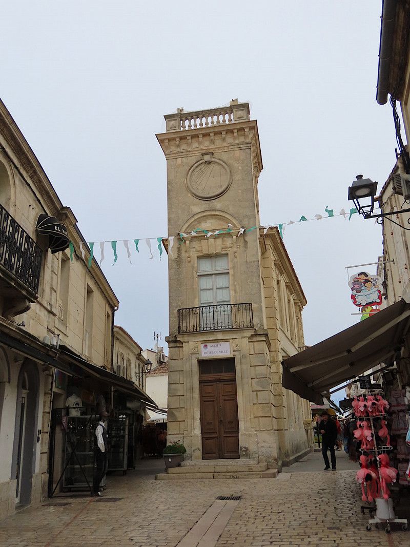
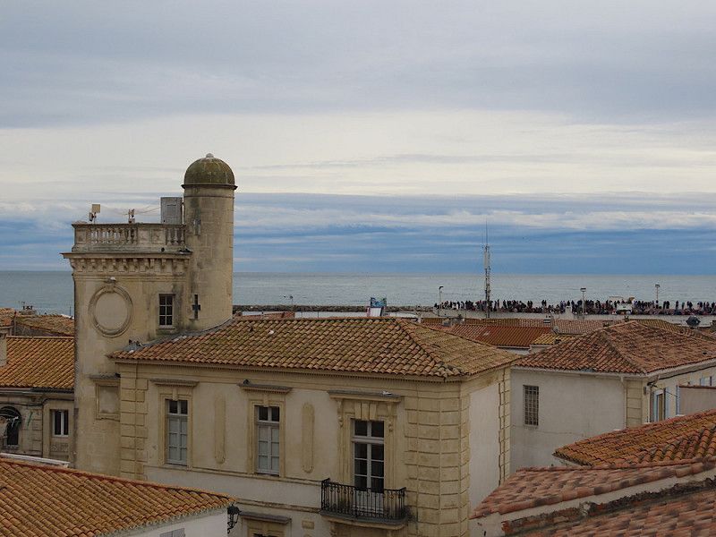
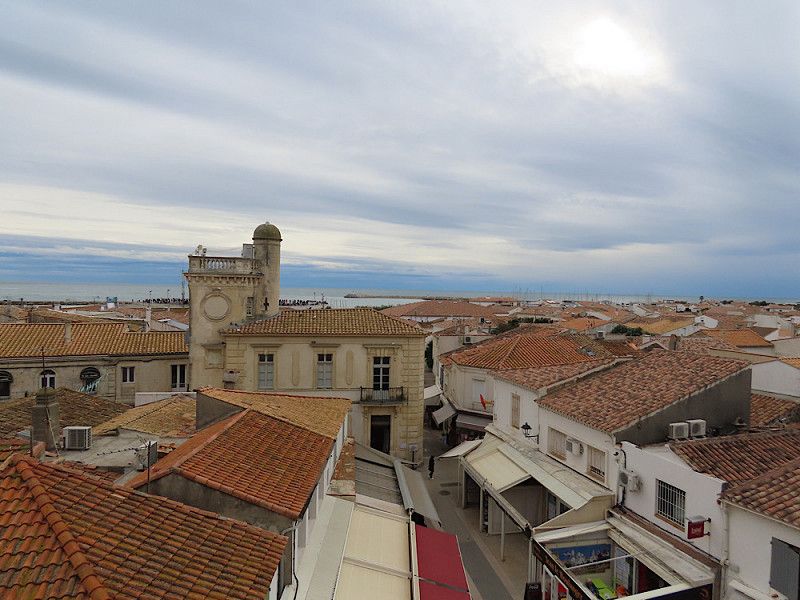
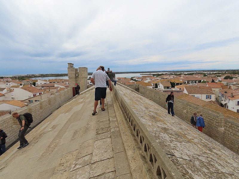
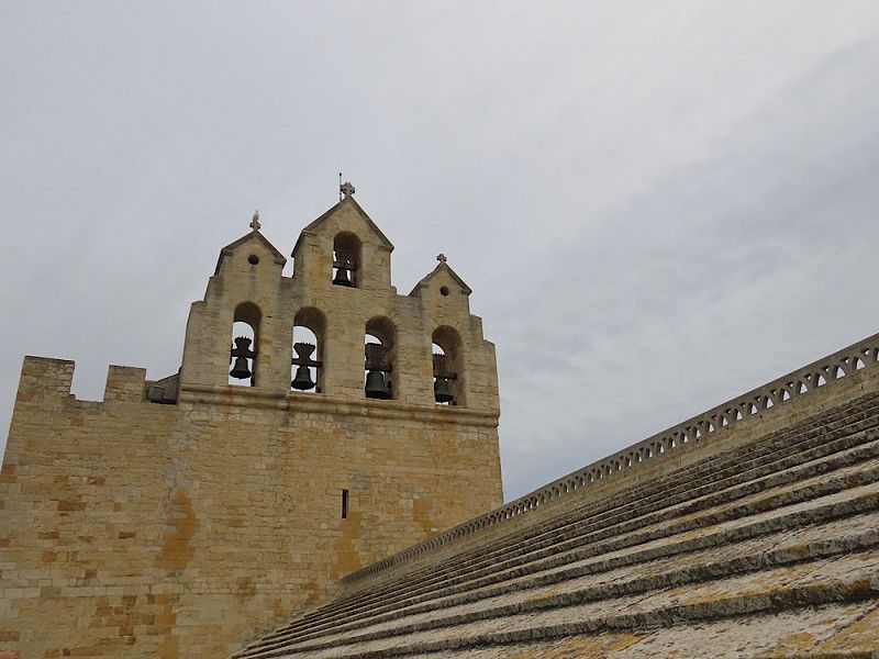
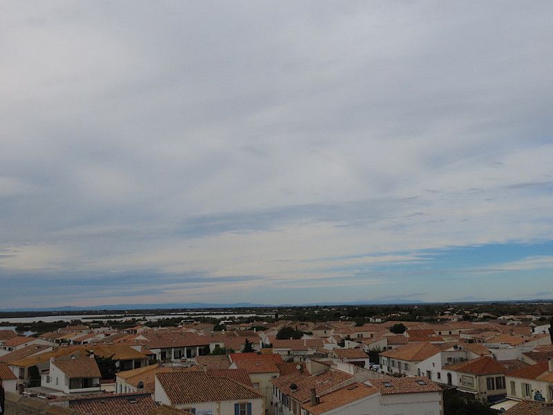
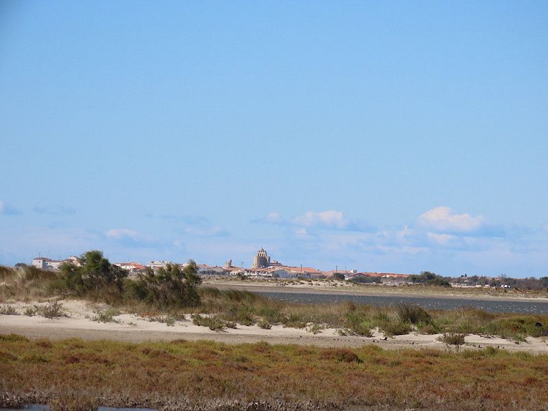
Stadtbummel und Aufstieg aufs Kirchendach
Visit the market in Saintes-Maries, which takes place twice a week. Then stroll through the small town and climb up to the roof of the church, from where you have a wonderful panoramic view of the town and the sea.
Day
Day
Day
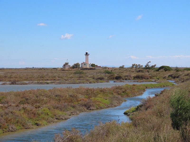
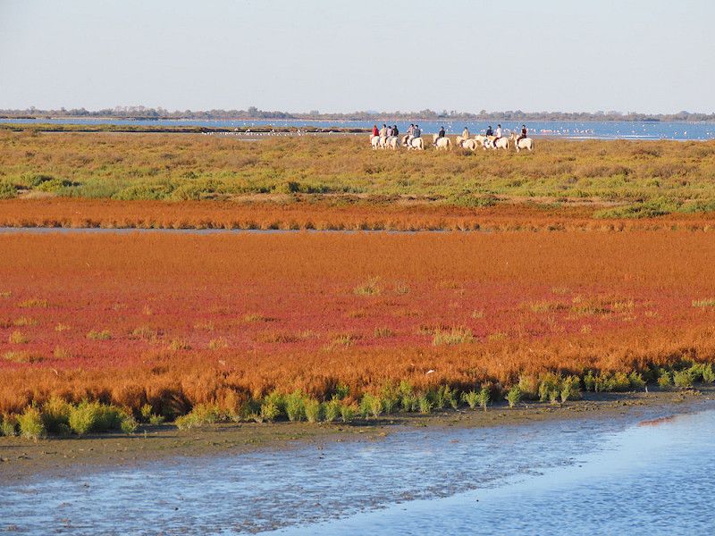
Radtour zum Leuchtturm Gacholle
The tour was wonderful! If you set off early enough and have enough stamina and energy, you can go on a long bike tour around the Camargue National Park, which starts shortly after the campsite.
The only downside: the Mistral was so strong that it almost blew me over with my bike at times. It was still warm, but if you're sensitive to wind and drafts like me, you should definitely pull something over your ears - luckily I had my hooded jacket with me.
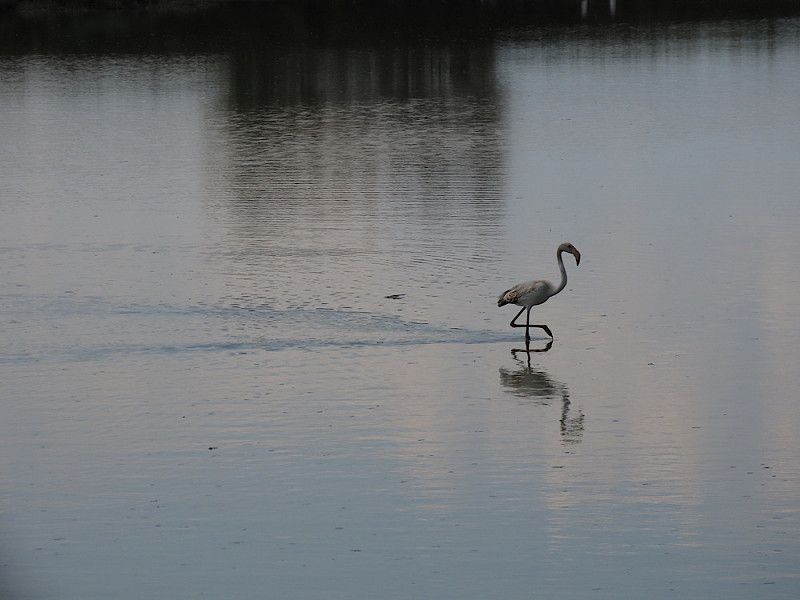
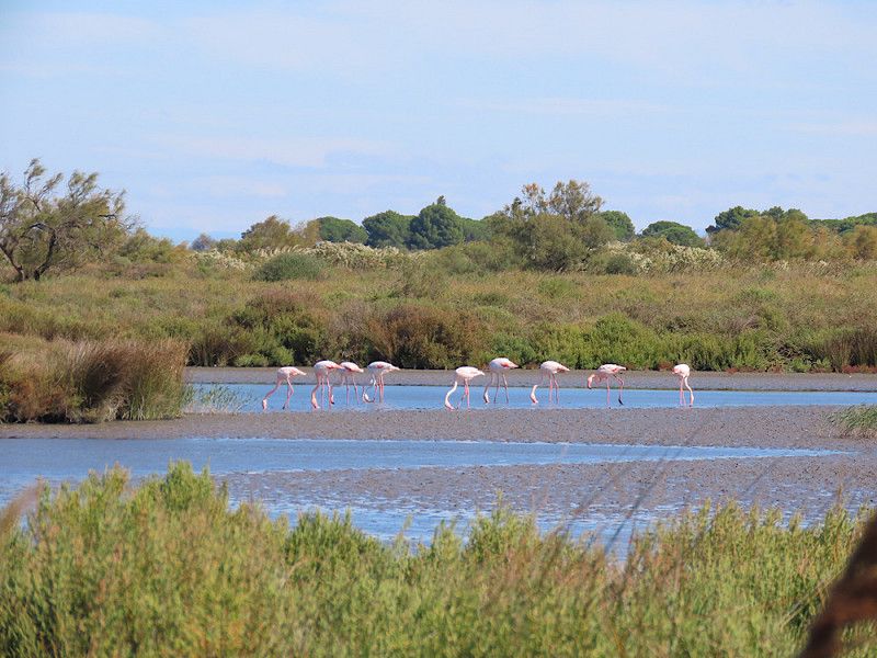
The landscape was simply magnificent, the route practically runs directly along the sea. You can see lots of flamingos, dunes and admire the lighthouse, which is apparently open for a snack in the summer months. Otherwise, bring your own food and enjoy the view!
Day
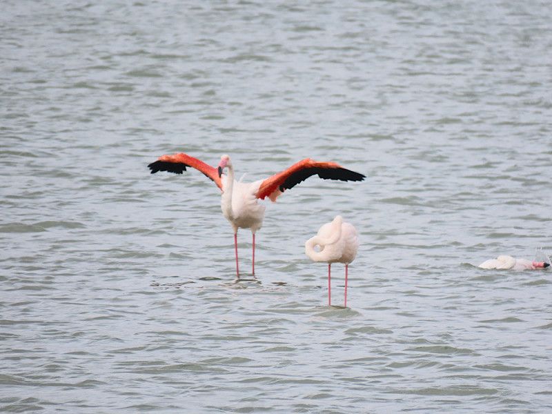
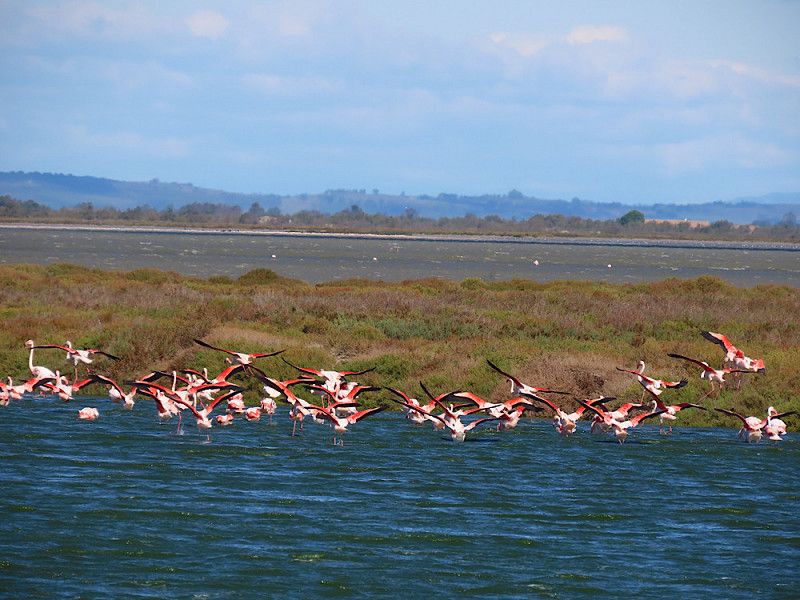
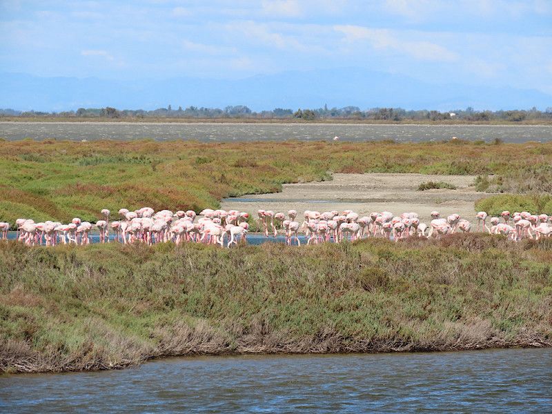
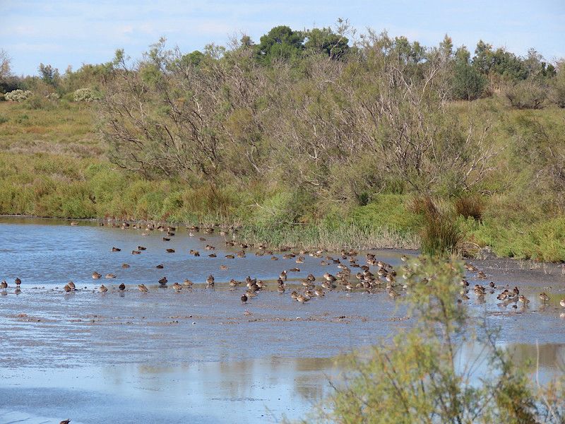
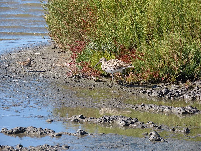
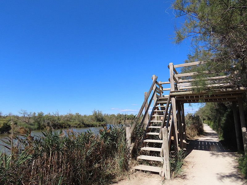
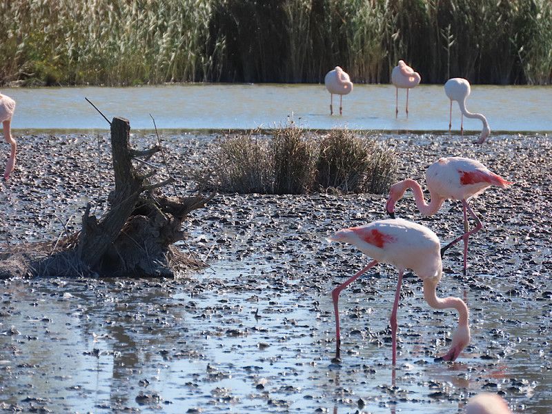
Radtour: Ornithologischer Park Pont du Gau
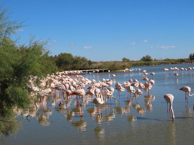
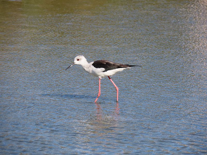
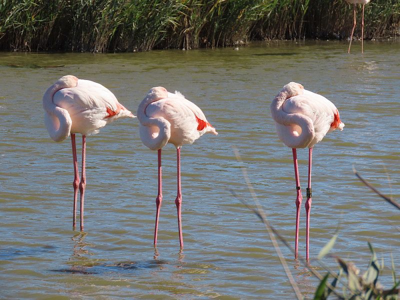
Very nice trip, only about 5 km from the campsite. Now in October there were not so many bird species there, but still enough for great impressions and observations. Nowhere else can you get as close to the flamingos as here.
The only thing I found a little steep was the entrance fee of €8, but on the other hand, there are well-maintained hiking trails through the large protected area. There is a leaflet at the ticket office showing two tours, a short and a long one. The short tour was quite well attended, but there were significantly fewer people on the longer route. There are good signs in French and English. All in all, I thought the trip was a great success!
Day
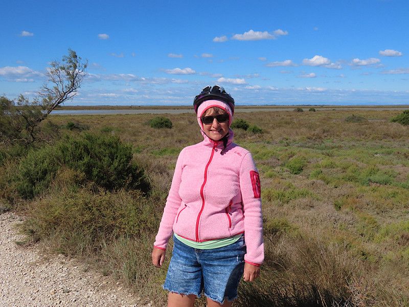
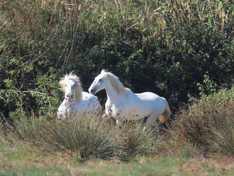
Radtour um Saintes-Maries
Today I'm going to get on my bike again. I'm just going to ride a long way out of Saintes-Maries on country roads, enjoy the scenery and cycle back through the town.
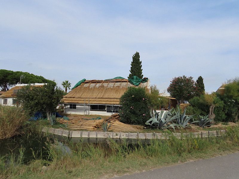
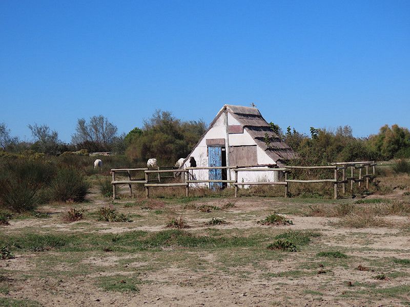
Along the way you will often see the reed-covered houses that are typical of the Camargue.
Day
Abendspaziergang am Meer
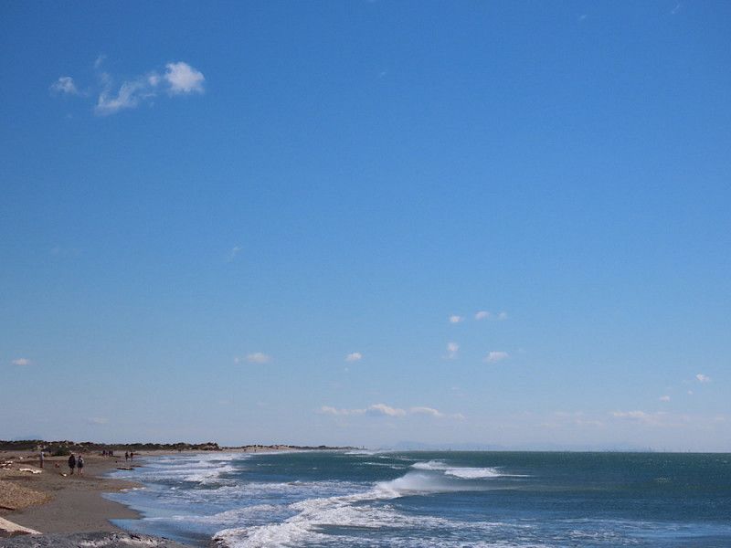
As I say goodbye to Saintes-Maries, I take a long walk along the sea and enjoy the salty air and the great views.
Day
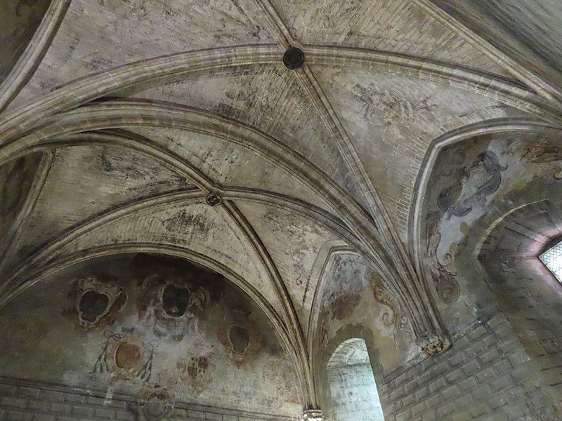
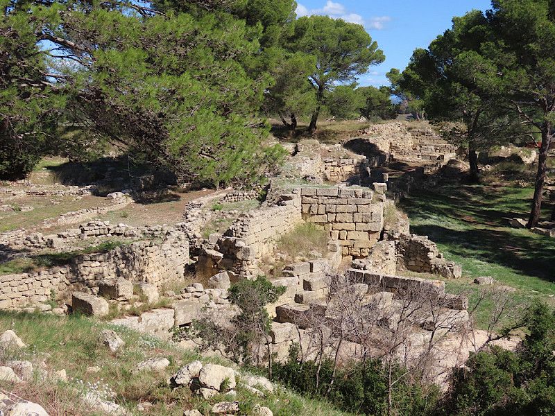
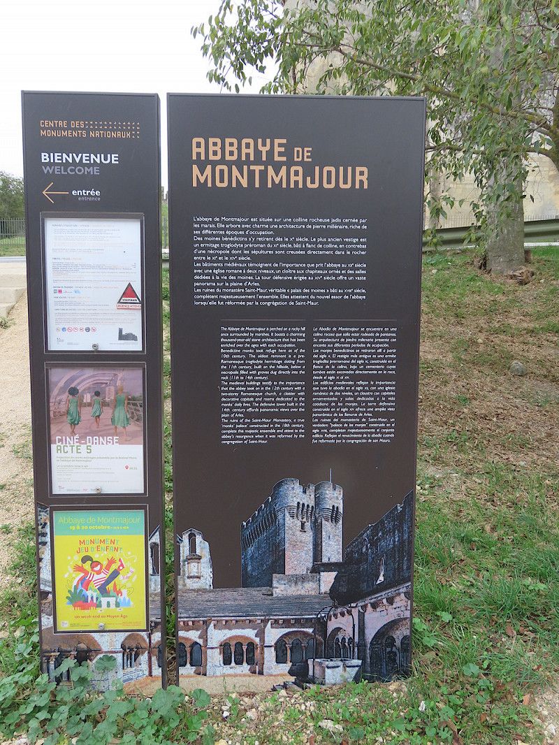
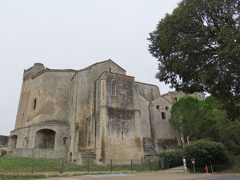
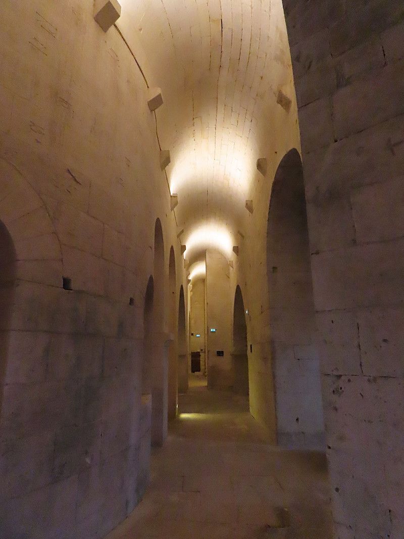
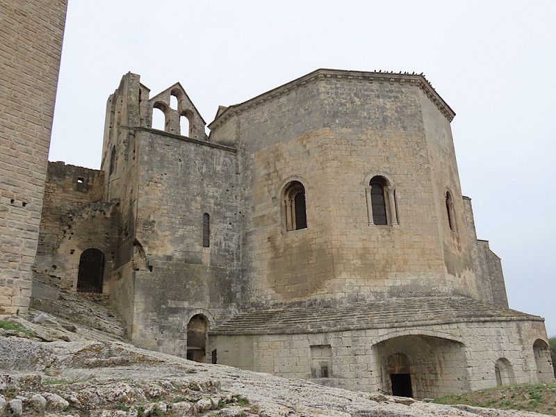
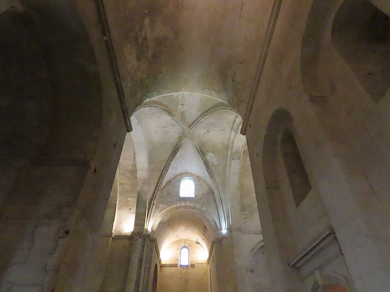
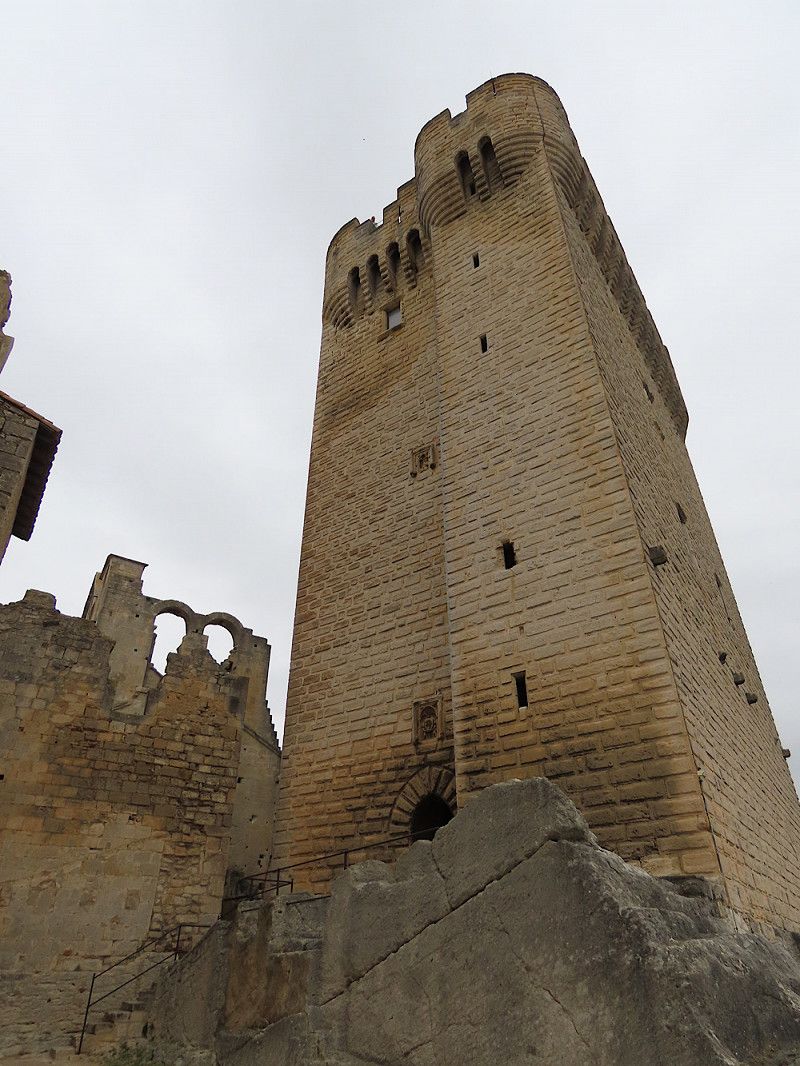
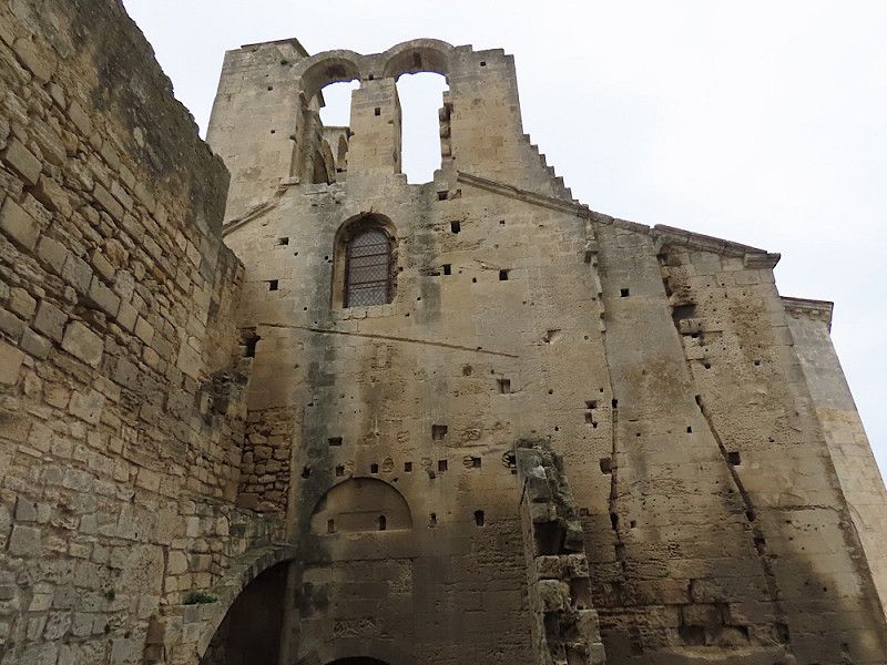
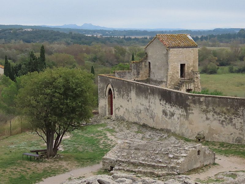
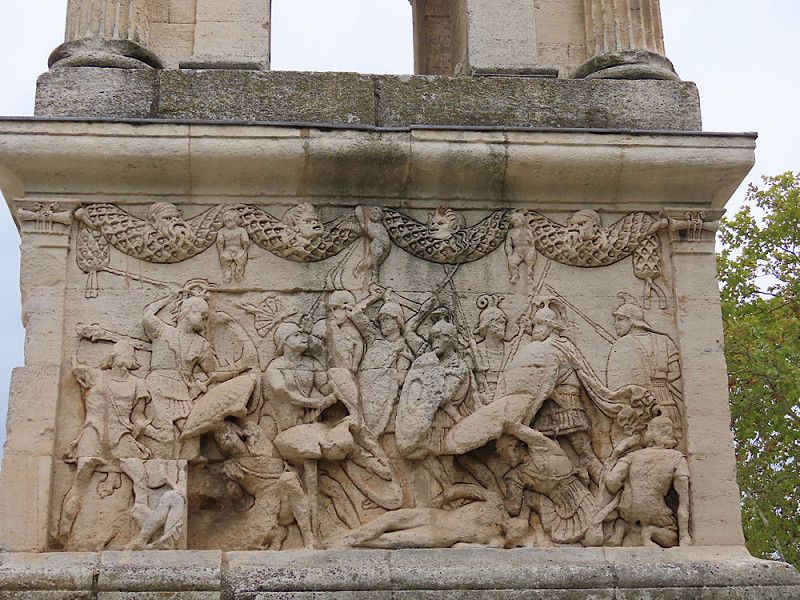
Abbaye de Montmajour
Spontaneous stopover between Arles and Fontveille. An old abbey worth seeing - no ecclesiastical furnishings inside, but the architecture is incredibly impressive. Entrance fee € 7.-
D 17, Arles, Bouches-du-Rhône, Provence-Alpes-Côte d'Azur, France
43° 42' 22.7" N 4° 39' 52.1" E
43.7062976 4.6644840
• Head west on Lieu-dit Clos Bernard. Go for 259 m.
• Turn slightly right toward Route de Montmajour/D17. Go for 22 m.
• Turn right onto Route de Montmajour (D17). Go for 2.2 km.
• Take the 1st exit from Rond-Point Germaine Tillion roundabout onto D570 N toward Avignon/Beaucaire/Tarascon. Go for 1.6 km.
• Take the 1st exit from roundabout onto Route de Tarascon (D570 N) toward Avignon/Beaucaire/Tarascon/Châteaurenard/St Rémy de Pce. Go for 7.9 km.
• Take the 1st exit from roundabout onto D32 toward Maussane les Alpilles/Les Baux de Pce/Fontvieille/St Rémy de Pce/St Étienne du Grès. Go for 228 m.
• Turn left onto Lieu-dit La Baume (D32). Go for 3.5 km.
• Turn left onto Place de la Mairie (D32 A). Go for 20 m.
• Take the 1st exit from roundabout onto Avenue de Saint-Rémy (D99). Go for 2.5 km.
• Pass 2 roundabouts and continue on Avenue du Maréchal Juin (D99). Go for 5.9 km.
• Take the 1st exit from Chemin de Marseille à Graveson roundabout onto Avenue Frédéric Mistral (D5) toward Les Baux/Maussane. Go for 350 m.
• Continue on Boulevard Marceau. Go for 287 m.
• Turn left onto Boulevard Victor Hugo (D99 A). Go for 345 m.
• Turn right onto Avenue de la Libération (D99 A). Go for 806 m.
• Turn right onto Chemin de Bigau. Go for 651 m.
• Turn left onto Chemin de Bigau. Go for 103 m.
• Arrive at Chemin de Bigau. Your destination is on the right.
☍
26,7 km
( 26 min.)
Saint-Rémy-de-Provence, Bouches-du-Rhône, France
Arrive in the late afternoon, spend the night in a small parking lot above the official cemetery parking lot. There are so many cars and a camper van there that I don't really fit in there, despite the overhangs. A few meters above, however, there are a few parking spaces along a small canal, where two other vans are already parked. It might be a bit tight for large camper vans.
Chemin d’Ussol 900, 13210, Saint-Rémy-de-Provence, France
43° 47' 7.3" N 4° 51' 3.3" E
43.7853497 4.8509033
• Head southwest on Chemin de Bigau. Go for 103 m.
• Turn right onto Chemin de Bigau. Go for 651 m.
• Turn sharp right onto Route d'Orgon (D99 A). Go for 752 m.
• Turn right onto Route d'Aix-en-Provence à Montauban (D99). Go for 6.0 km.
• Turn right onto Route de Branquay (D24) toward Eygalières/Mouriès/Aureille. Go for 858 m.
• Continue on Chemin de Mas-Thibert au Pont de Bompas (D24). Go for 1.4 km.
• Turn left onto Route d'Orgon (D24 B). Go for 1.9 km.
• Turn left onto Route d'Orgon. Go for 35 m.
• Arrive at Route d'Orgon. Your destination is on the left.
☍
11,7 km
( 11 min.)
Day
Saint-Remy
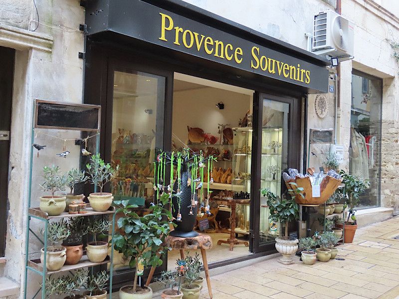
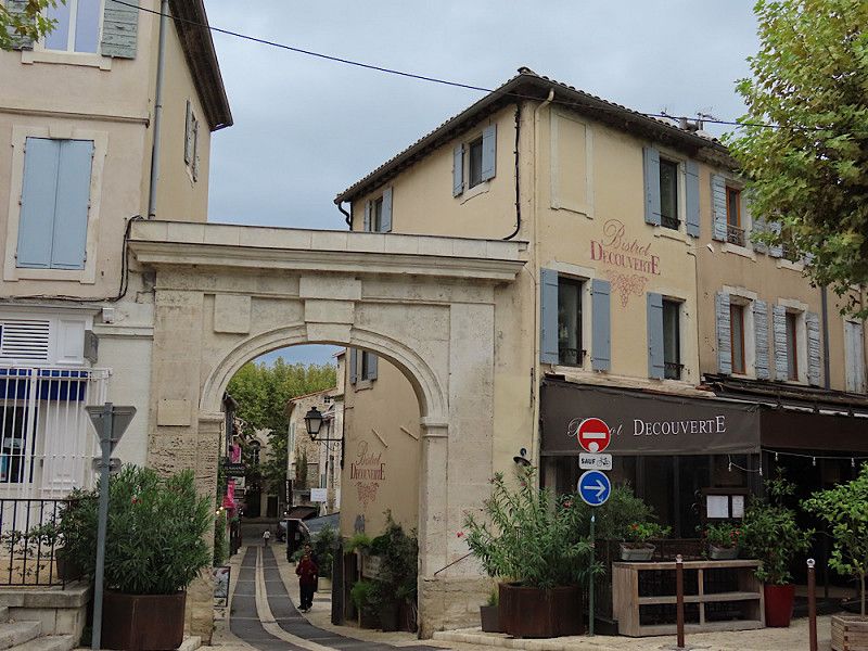
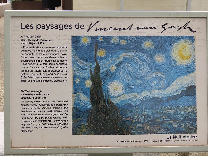
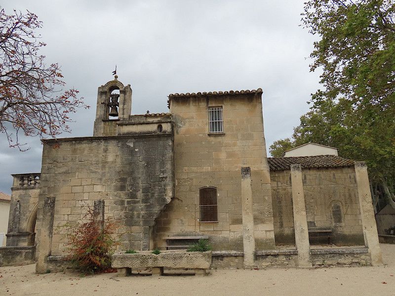
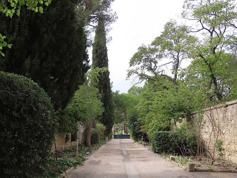
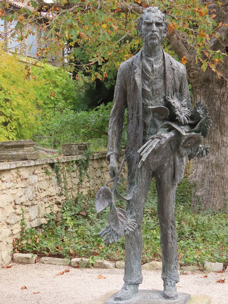
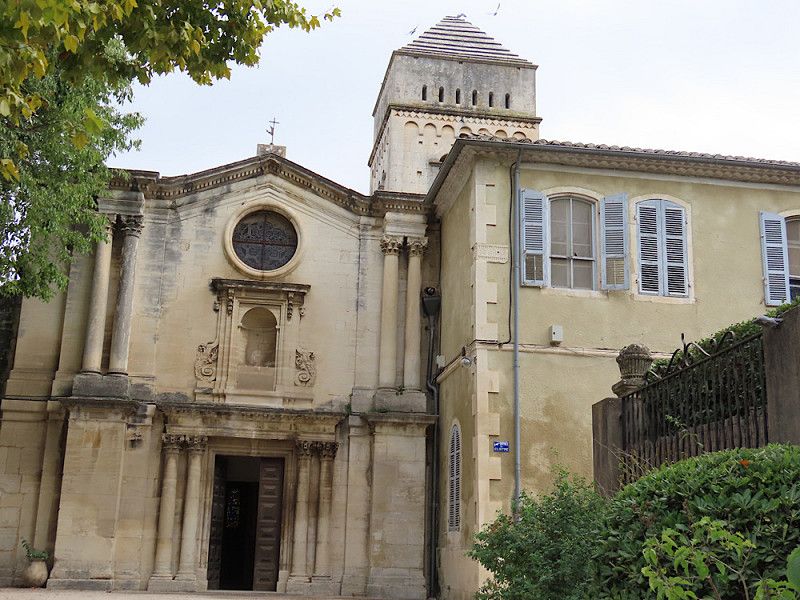
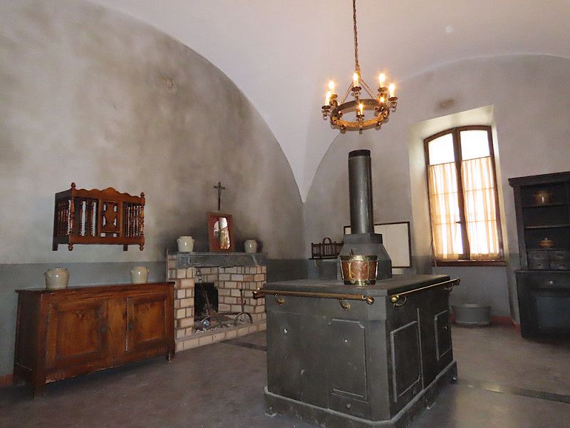
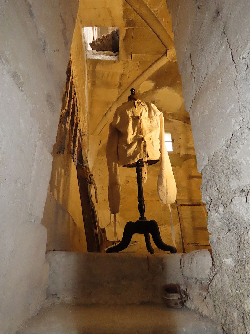
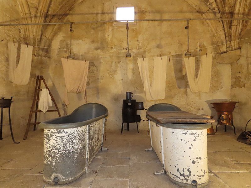
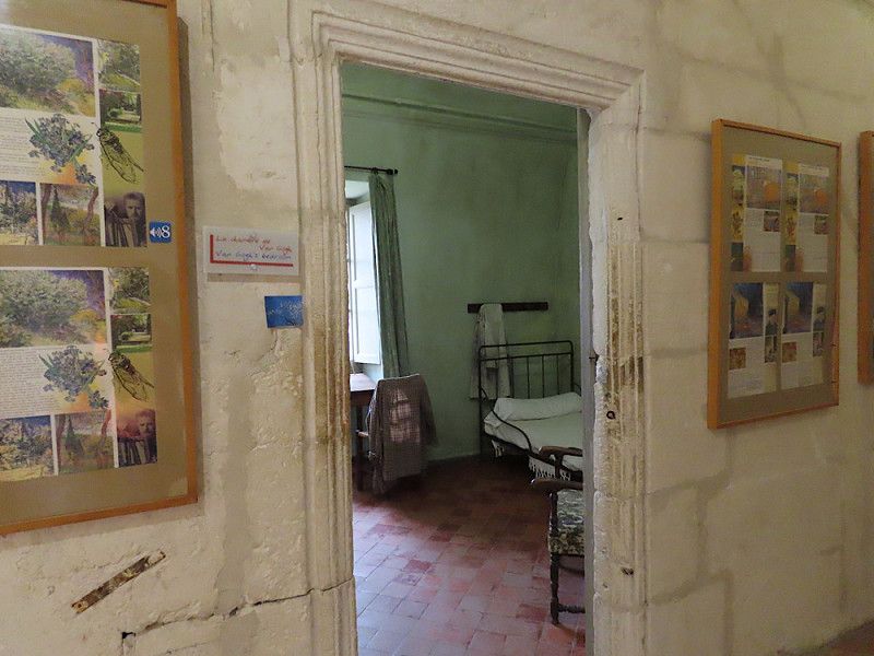
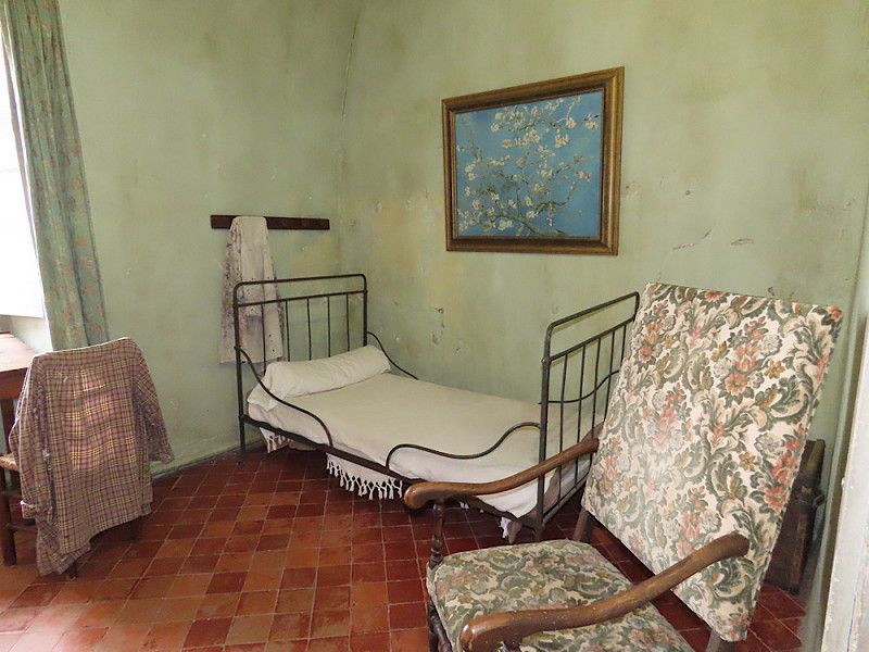
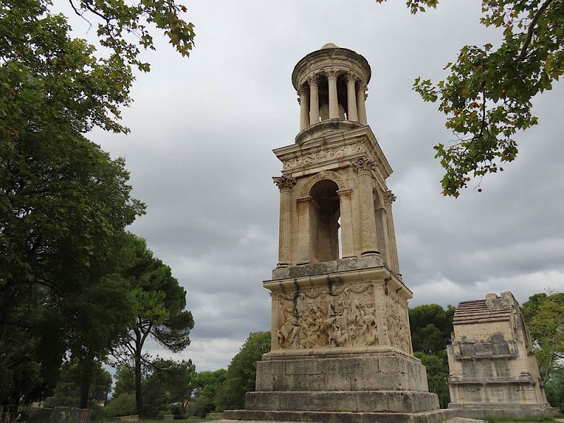
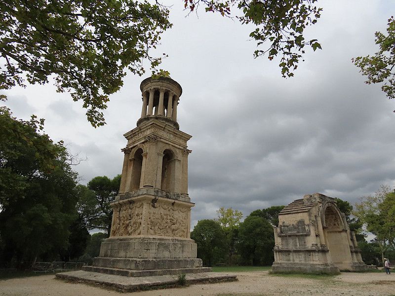
Stroll through the really pretty old town. "Vincent van Gogh" hiking trail to the monastery with psychiatric clinic where he lived for a year. Sightseeing tour there, then on to Glanum. The area has unfortunately been closed on Mondays since the beginning of October, but there was a triumphal arch to see outside.
Kloster Saint Paule du Mausole / van Gogh-Museum
Eygalières
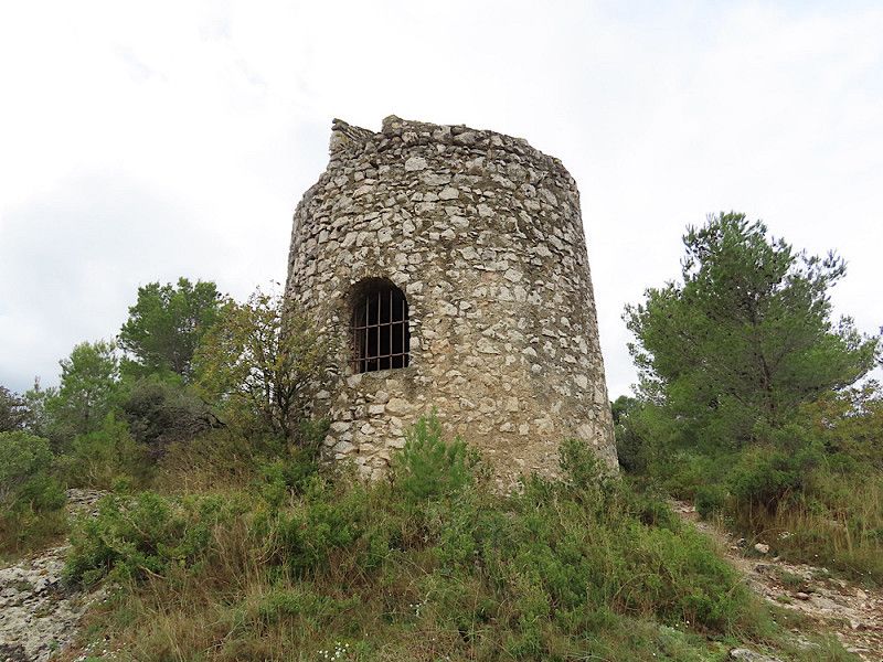
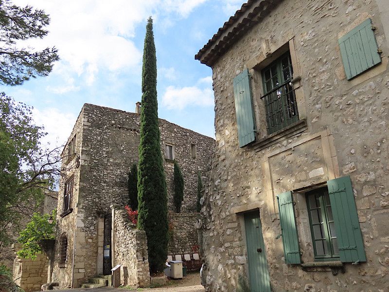
Pretty medieval village nestled on a hillside. Above it is an old defensive tower and a clock tower. Explanations are given in French and English. The place was a chance discovery, but I would go back anytime - so cute!
Overnight stay in a large free car park at the entrance to the town next to the sports ground. The night was very restless though! Cars, buses, trucks arriving and departing...😏
Avenue Léon Blum, Eygalières, Bouches-du-Rhône, Provence-Alpes-Côte d'Azur, France
43° 45' 39.8" N 4° 56' 49.3" E
43.7610606 4.9470228
• Head northwest on Route d'Orgon. Go for 107 m.
• Turn left onto Avenue Léon Blum (D24 B). Go for 197 m.
• Turn left onto Rue de la République (D74 B). Go for 93 m.
• Arrive at Rue de la République (D74 B). Your destination is on the left.
☍
0,4 km
( 1 min.)
Day
Eygalières
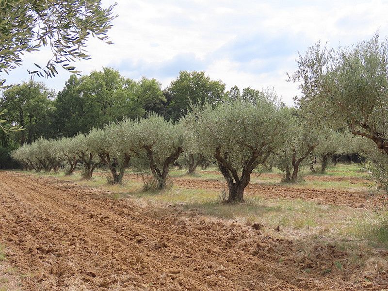
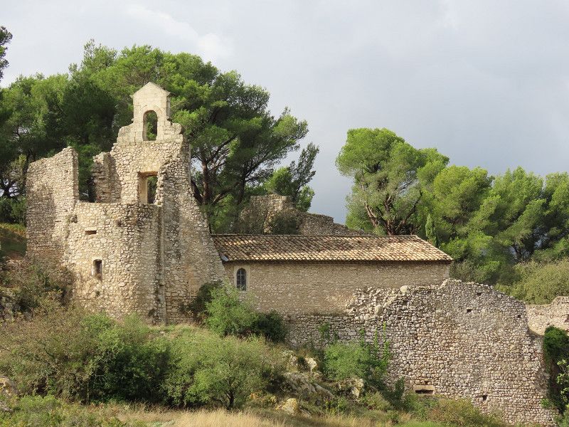
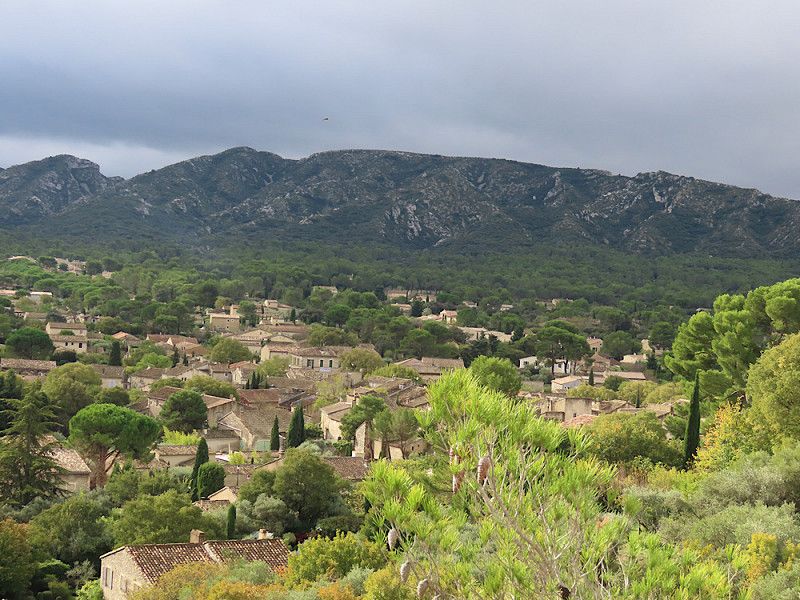
I really liked the place itself. If you take your time, you can discover lots of pretty little things. The climb up the hill with the ruins and the clock tower was very worthwhile with wonderful views of the landscape and the many olive groves.
At the end of my stroll, a heavy thunderstorm came up - I just got back to my camper in time with the first big drops of rain.
Bouches-du-Rhône, Provence-Alpes-Côte d'Azur, Frankreich
43° 45' 40.9" N 4° 56' 57.7" E
43.7613682 4.9493545
• Head toward Impasse Bouchet on Rue de la République (D74 B). Go for 77 m.
• Turn right onto Avenue Lazare Kaspi (D74 A). Go for 154 m.
• Turn right onto Avenue Charles de Gaulle. Go for 205 m.
• Turn left onto Avenue Jean Jaurès (D24 B). Go for 3.1 km.
• Continue on Route de Jean Moulin (D24 B). Go for 4.3 km.
• Continue on D24 B. Go for 6 m.
• Continue on Route d'Eygalières (D24 B). Go for 81 m.
• Take the 1st exit from roundabout onto Route de Paris à Antibes (D7 N) toward Aix en Pce/Salon de Pce/Sénas/Eyguières/Orgon-Centre. Go for 7.2 km.
• Turn slightly left onto Avenue André Aune (D7 N) toward A7/Salon-de-P./Aix-en-Pce/Mallemort/Lambesc/Marseille. Go for 511 m.
• Take the 2nd exit from roundabout onto Route d'Alleins (D71). Go for 2.8 km.
• Turn right onto D71 C. Go for 1.8 km.
• Continue on D71 D. Go for 83 m.
• Continue on D17 D. Go for 11 m.
• Continue on D71 D. Go for 723 m.
• Keep right onto Route d'Eyguières (D71 D). Go for 2.5 km.
• Take the 2nd exit from Rond-Point Général de Gaulle roundabout onto Avenue René Cassin (D17 D). Go for 192 m.
• Continue on Cours Victor Hugo (D17 D). Go for 350 m.
• Turn right onto Avenue Sadi Carnot (D16). Go for 294 m.
• Continue on Route d'Istres à Mallemort (D16). Go for 492 m.
• Continue on Lieu-dit La Coste (D16). Go for 196 m.
• Continue on D16. Go for 1.5 km.
• Continue on D22 D. Go for 30 m.
• Turn left onto D22 D. Go for 1.1 km.
• Continue on Lieu-dit Avon (D22 D). Go for 102 m.
• Continue on D22 D. Go for 265 m.
• Turn left onto Rue Alpilles Lubéron (D22 B) toward Aurons/Pélissanne/Salon. Go for 177 m.
• Turn left onto Chemin de Sainte-Anne. Go for 328 m.
• Turn sharp left onto D22 C. Go for 330 m.
• Turn slightly left. Go for 10 m.
• Turn slightly right. Go for 51 m.
• Arrive at your destination on the right.
☍
29,0 km
( 31 min.)
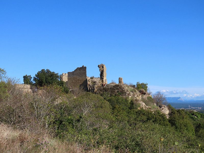
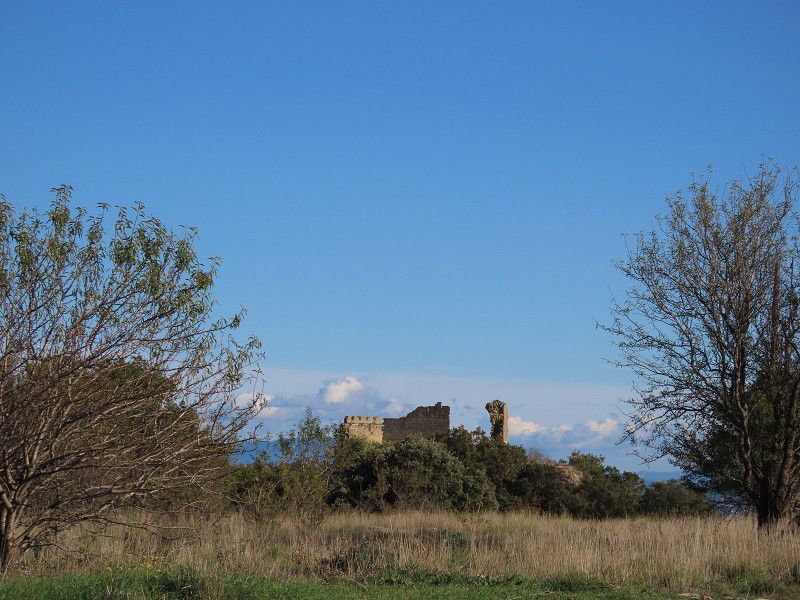
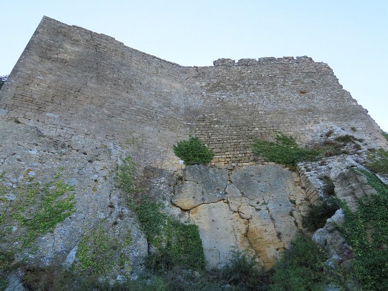
Château de Vernègues
The castle ruins are closed due to the danger of collapse; you can only view the ruins from the outside. Further up the mountain there is a small observation tower with views of the Luberon and as far as the coast.
It's not worth driving there especially, but if you're travelling with a small RV/campervan, you'll find a large and very quiet car park just below the ruins (but no water/electricity!).
Rue Du Vieux Vernegues 798, Vernègues, Eyguières, Bouches-du-Rhône, France
43° 41' 23.6" N 5° 9' 49.8" E
43.6898928 5.1638211
• Head southwest. Go for 60 m.
• Turn slightly right onto D22 C. Go for 433 m.
• Turn slightly right onto Rue du Vieux Vernègues (D22 C). Go for 217 m.
• Continue on Rue Louis Le Cardonnel (D22 C). Go for 96 m.
• Turn slightly right onto Route de la Barben (D22 C). Go for 1.8 km.
• Turn left onto D22 toward Cazan/Charleval. Go for 2.1 km.
• Turn right. Go for 82 m.
• Turn right. Go for 37 m.
• Arrive at your destination on the left.
☍
4,8 km
( 7 min.)
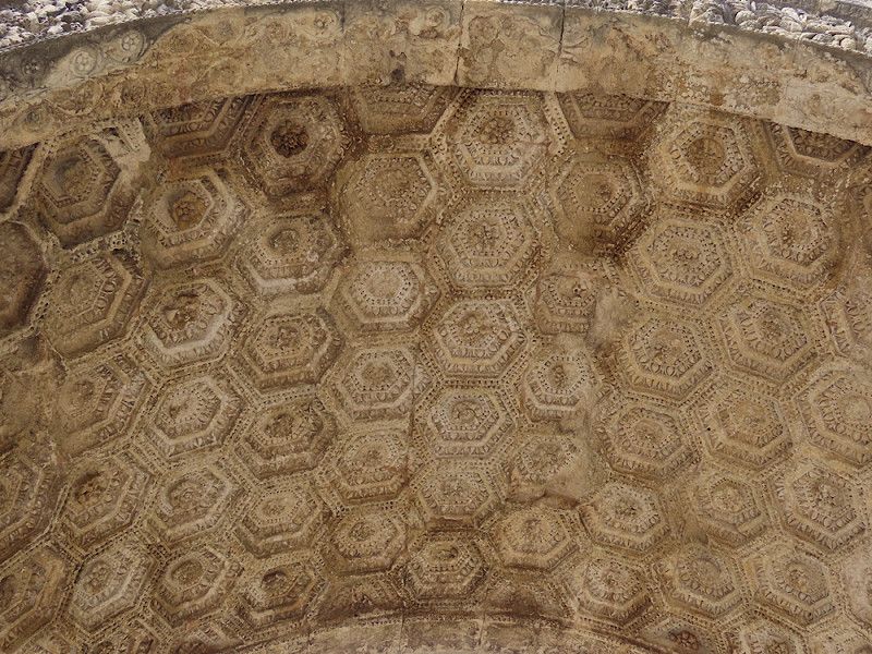
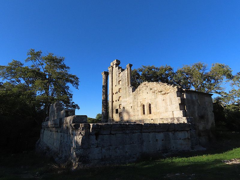
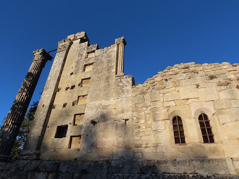
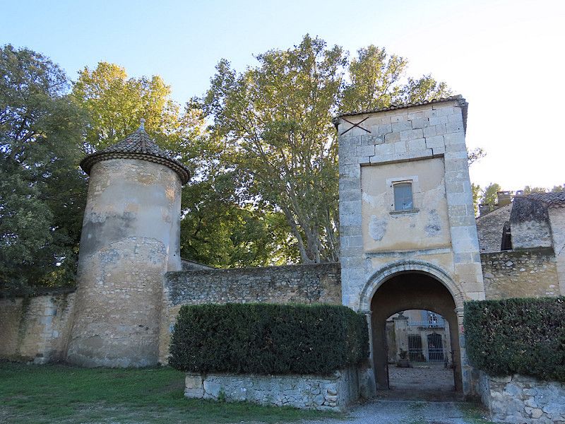
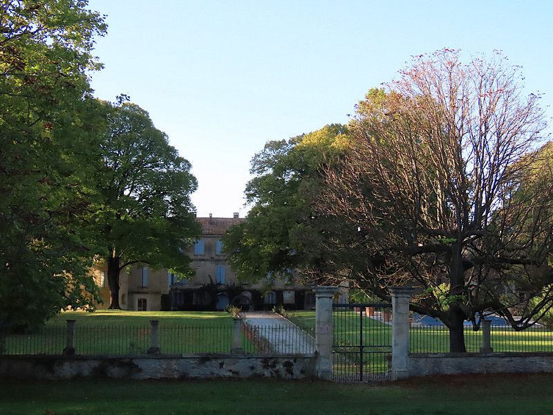
Temple de Diane
Nice little temple, but there is nothing to see except this small ruin. The castle (winery) looks very nice from the outside, but unfortunately the boutique was closed.
Conclusion: Nice stop for a short walk if it's on the way.
Route Du Viaduc 1131, Vernègues, Eyguières, Bouches-du-Rhône, France
43° 41' 1" N 5° 11' 41.1" E
43.6836154 5.1947452
• Head southeast. Go for 37 m.
• Turn left toward D22. Go for 82 m.
• Turn right onto D22. Go for 808 m.
• Continue on Route de Château Bas (D22). Go for 15 m.
• Continue on D22. Go for 292 m.
• Take the 2nd exit from roundabout onto Lieu-dit Terre-Noble toward Charleval/D22. Go for 402 m.
• Continue on Route de Charleval (D22). Go for 2.1 km.
• Continue on Route de la Barben à la Durance (D22). Go for 1.7 km.
• Continue on D22. Go for 502 m.
• Continue on Avenue du Bois (D22). Go for 279 m.
• Continue on Avenue Louis Charnet (D22). Go for 129 m.
• Turn right onto Avenue Gaston Roux (D561). Go for 1.6 km.
• Turn right onto D561. Go for 49 m.
• Turn left onto D561 toward La Roque d'A. Go for 3.0 km.
• Take the 3rd exit from roundabout onto D561. Go for 5.6 km.
• Turn left onto D543. Go for 406 m.
• Continue on D943. Go for 2.4 km.
• Pass 4 roundabouts and continue on Avenue du 8 Mai 1945 (D943). Go for 5.0 km.
• Take the 3rd exit from roundabout onto Avenue du 8 Mai 1945 (D943) toward Apt/Bonnieux. Go for 396 m.
• Turn left onto Boulevard du Rayol (D139) toward Centre/Village/Château. Go for 28 m.
• Arrive at Boulevard du Rayol (D139). Your destination is on the left.
☍
24,9 km
( 26 min.)
Lourmarin
Overnight stay in a free parking lot on the outskirts of town. This is actually a car park, but the overhangs mean you can park a camper van here, as long as it's not a huge liner.
Here I met a nice couple from Fürth (Hello Gerdi & Eddy, if you're reading this 🤗!). Incredibly, I met them again a week later on the way home to Germany in a supermarket parking lot. We were very surprised and all three of us were really happy - the world is so small ☺️!
Avenue Philippe de Girard, Lourmarin, Cadenet, Vaucluse, France
43° 45' 58.3" N 5° 21' 39.8" E
43.7661972 5.3610544
• Head southwest on Boulevard du Rayol (D139).
• Turn left onto Boulevard du Rayol (D139). Go for 19 m.
• Arrive at Boulevard du Rayol (D139). Your destination is on the right.
☍
0,0 km
( )
Day
Lourmarin
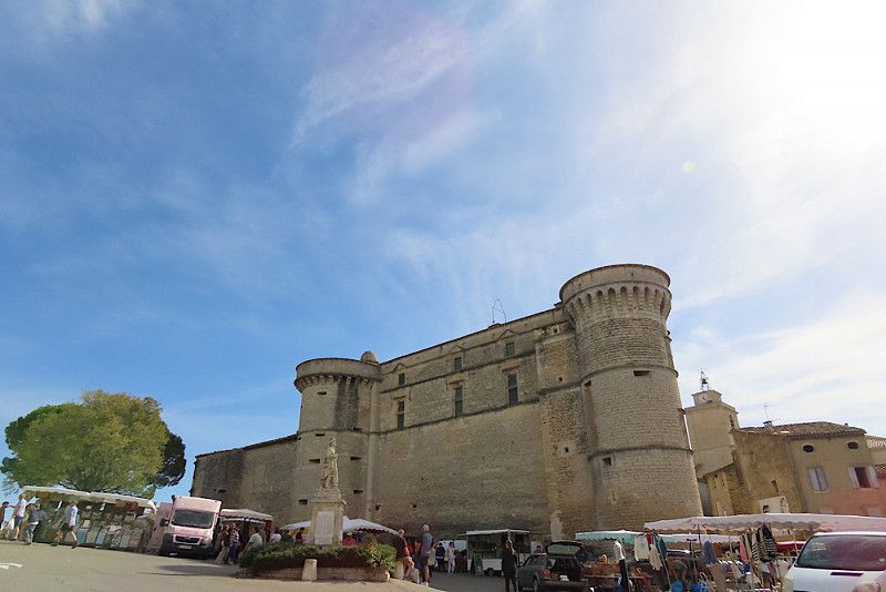
A pretty little place, but unfortunately quite overpriced. I thought the castle was great and it was easy to visit: at the ticket office you get a leaflet with German descriptions of everything worth seeing. The individual points within the castle are clearly marked so that you can find your way around easily.
Lourmarin itself is a nice place, but there are definitely nicer villages in Provence (in my opinion). The plane tree avenues in the area are great, by the way!
Avenue Philippe de Girard, Lourmarin, Vaucluse, Provence-Alpes-Côte d'Azur, France
43° 45' 58.1" N 5° 21' 40" E
43.7661354 5.3611206
• Head northwest on Boulevard du Rayol (D139). Go for 19 m.
• Continue on Avenue Philippe de Girard (D139). Go for 76 m.
• Turn left onto Route d'Apt (D943). Go for 6.2 km.
• Turn left onto Route de Lourmarin (D36). Go for 4.3 km.
• Turn left onto Avenue Philippe de Girard. Go for 136 m.
• Continue on Route de Lourmarin. Go for 356 m.
• Continue on Rue Jean-Baptiste Aurard (D36). Go for 178 m.
• Turn left onto Rue Pasteur. Go for 28 m.
• Turn left onto Place Gambetta. Go for 67 m.
• Turn slightly right onto Rue Lucien Blanc. Go for 54 m.
• Turn left onto Rue Victor Hugo (D3). Go for 91 m.
• Turn right onto Place du 4 Septembre (D3). Go for 12 m.
• Turn left onto D3. Go for 18 m.
• Continue on Avenue Clovis Hugues (D3). Go for 111 m.
• Continue on D3. Go for 1.6 km.
• Continue on Lieu-dit Terres Blanches (D3). Go for 115 m.
• Continue on D3. Go for 1.1 km.
• Continue on Lieu-dit La Bastide Basse (D3). Go for 84 m.
• Continue on D3. Go for 1.2 km.
• Continue on Lieu-dit Bel-Air (D3). Go for 86 m.
• Continue on D3. Go for 244 m.
• Turn right onto Chemin de Puget (D106) toward Lacoste. Go for 1.1 km.
• Continue on Chemin de Puget (D106). Go for 242 m.
• Turn left onto Chemin de la Teppe (D109 BIS). Go for 519 m.
• Turn slightly right onto Chemin du Château. Go for 14 m.
• Turn right onto Chemin du Château. Go for 459 m.
• Arrive at Chemin du Château. Your destination is on the left.
☍
18,4 km
( 25 min.)
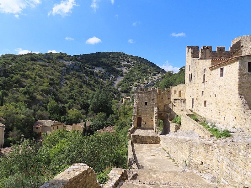
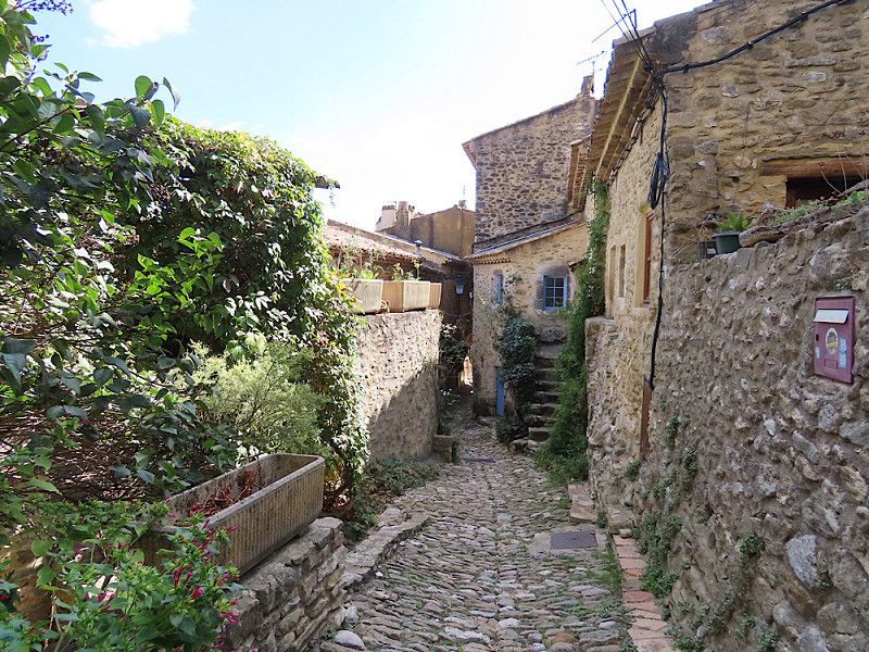
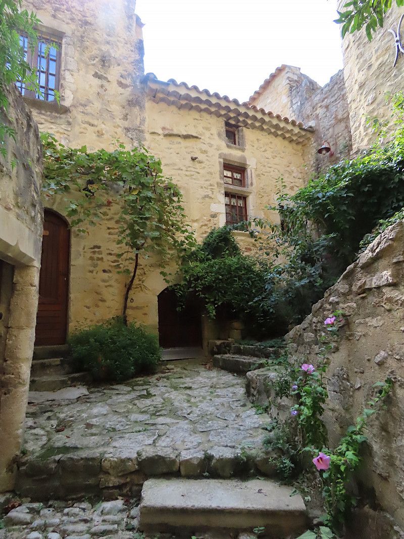
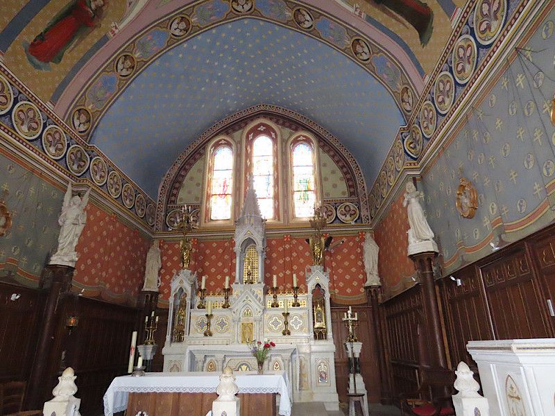
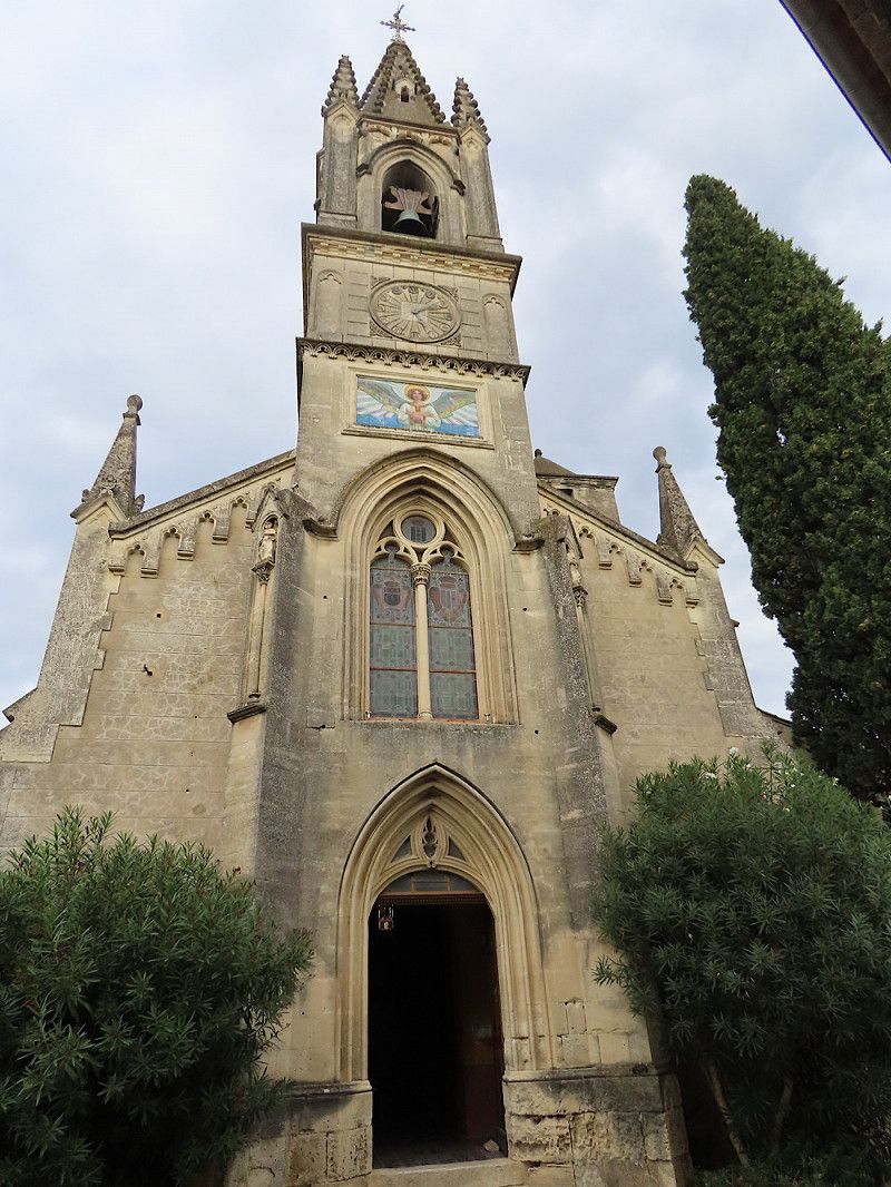
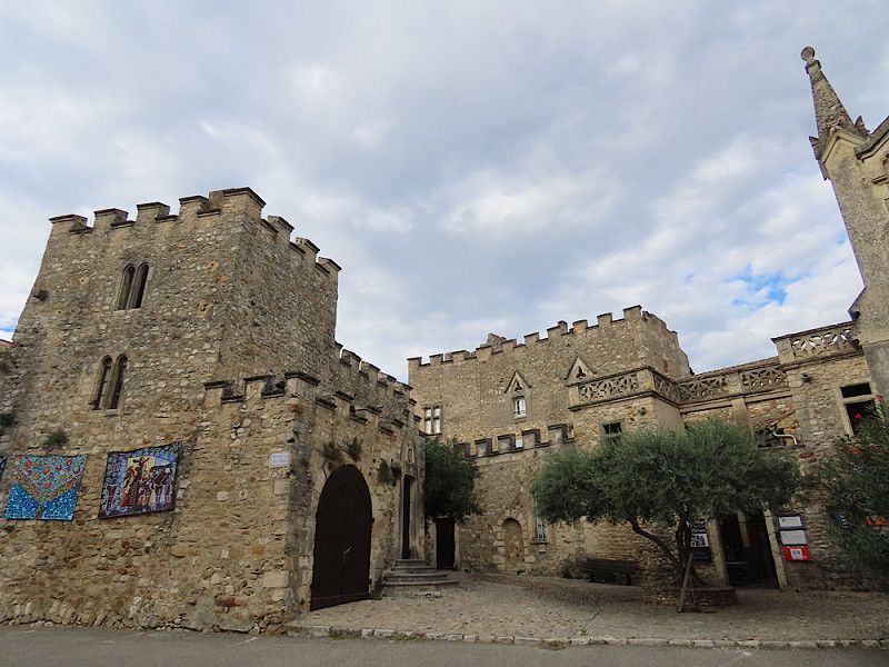
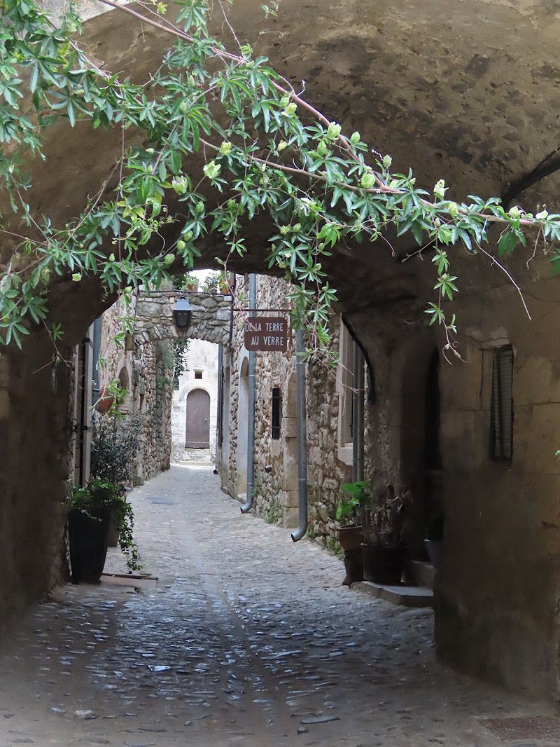
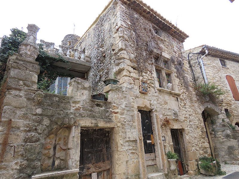
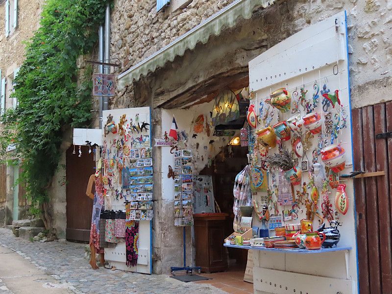
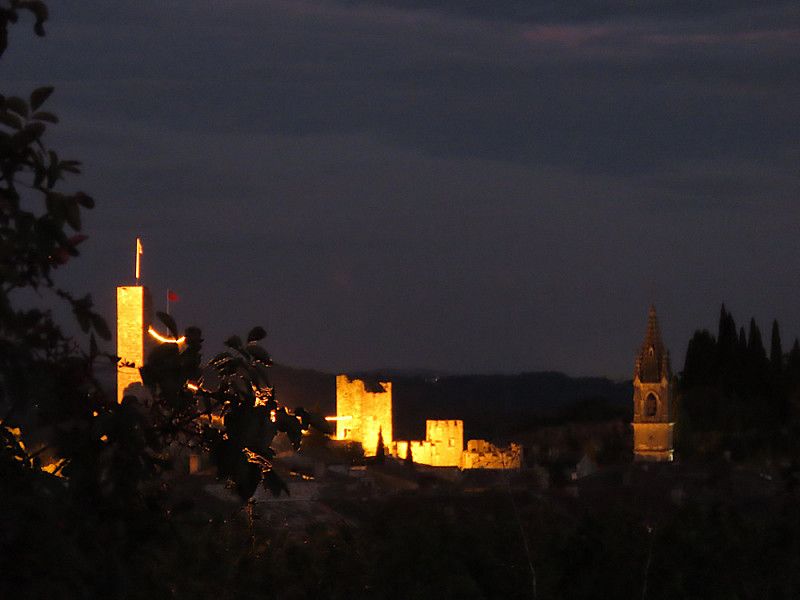
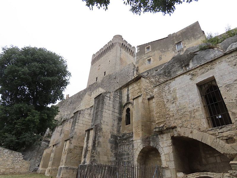
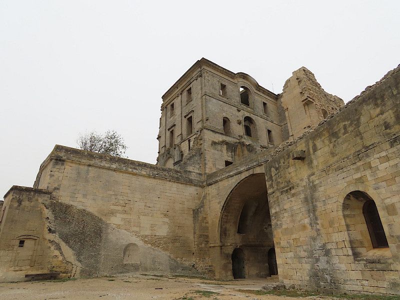
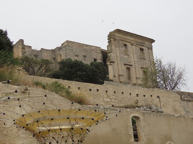
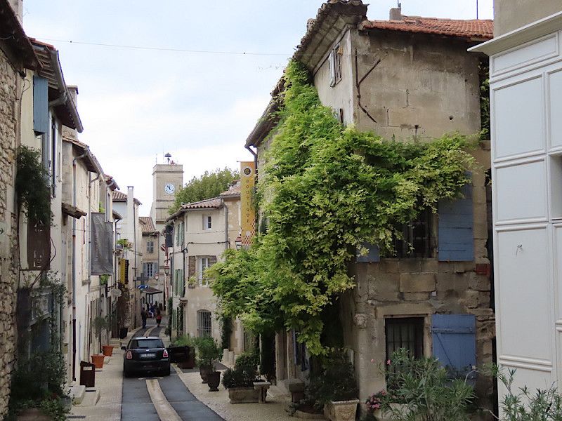
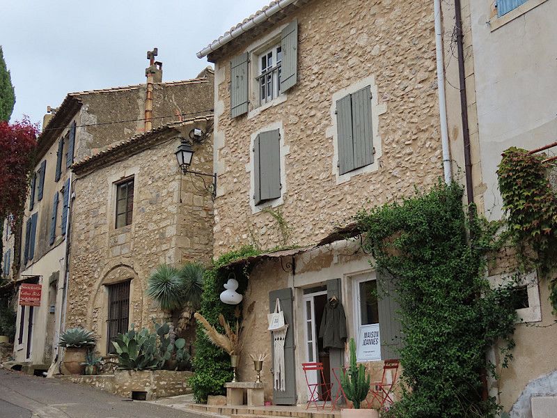
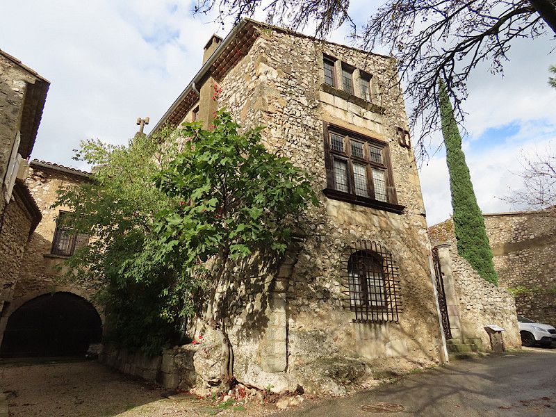
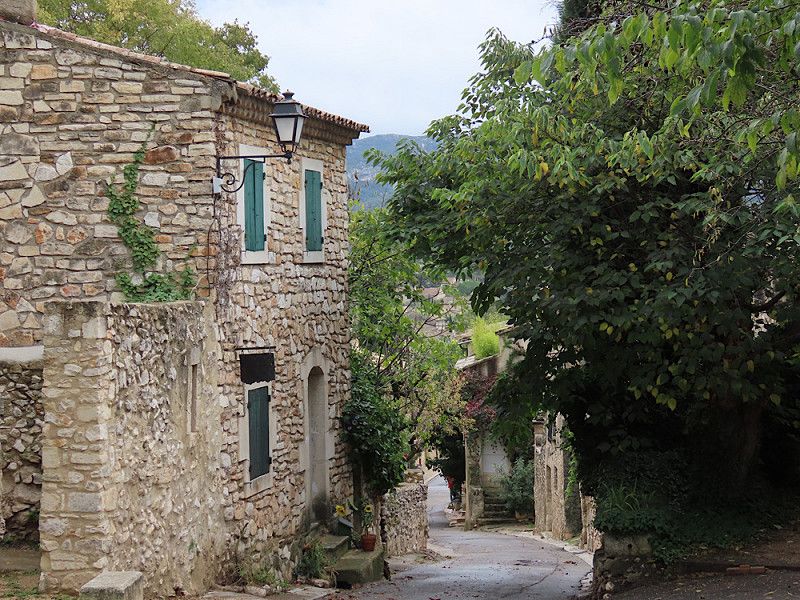
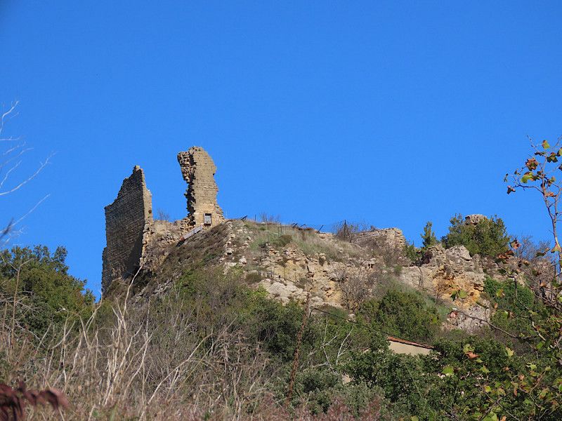
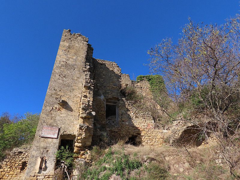
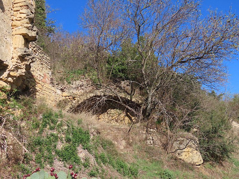
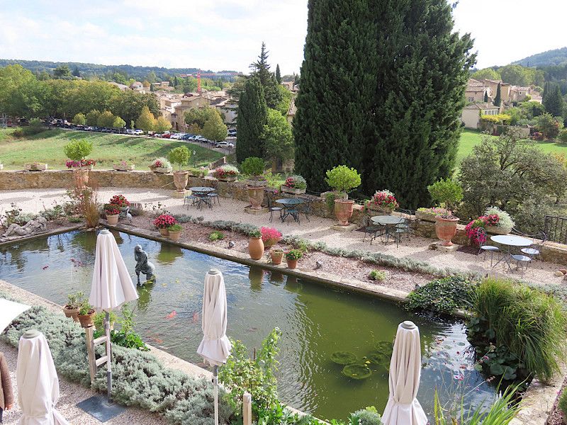
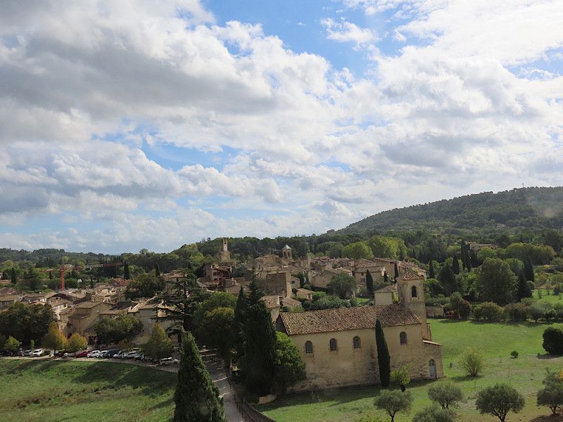
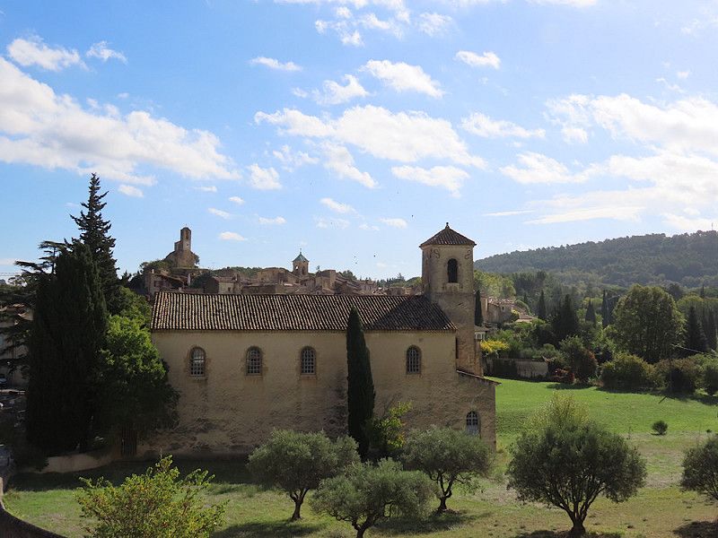
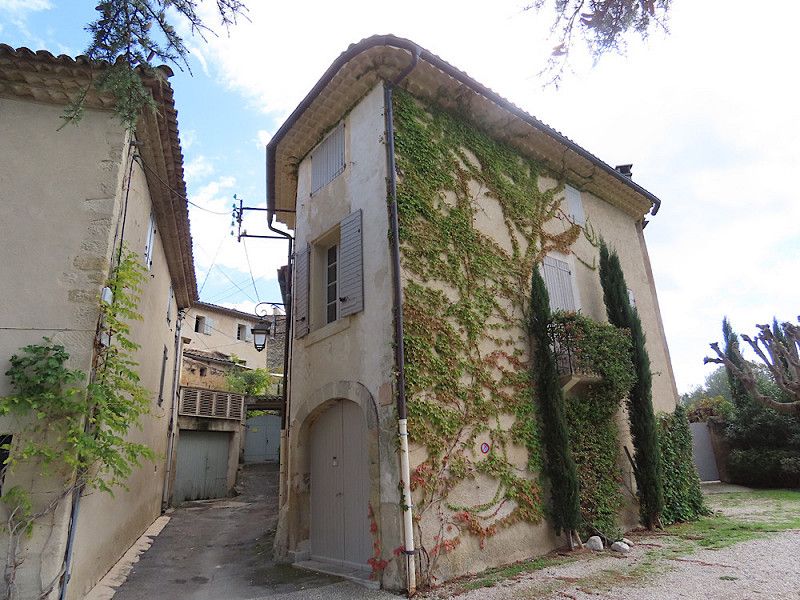
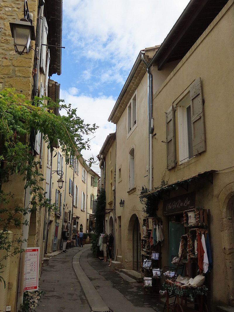
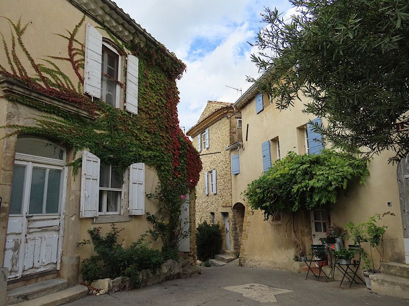
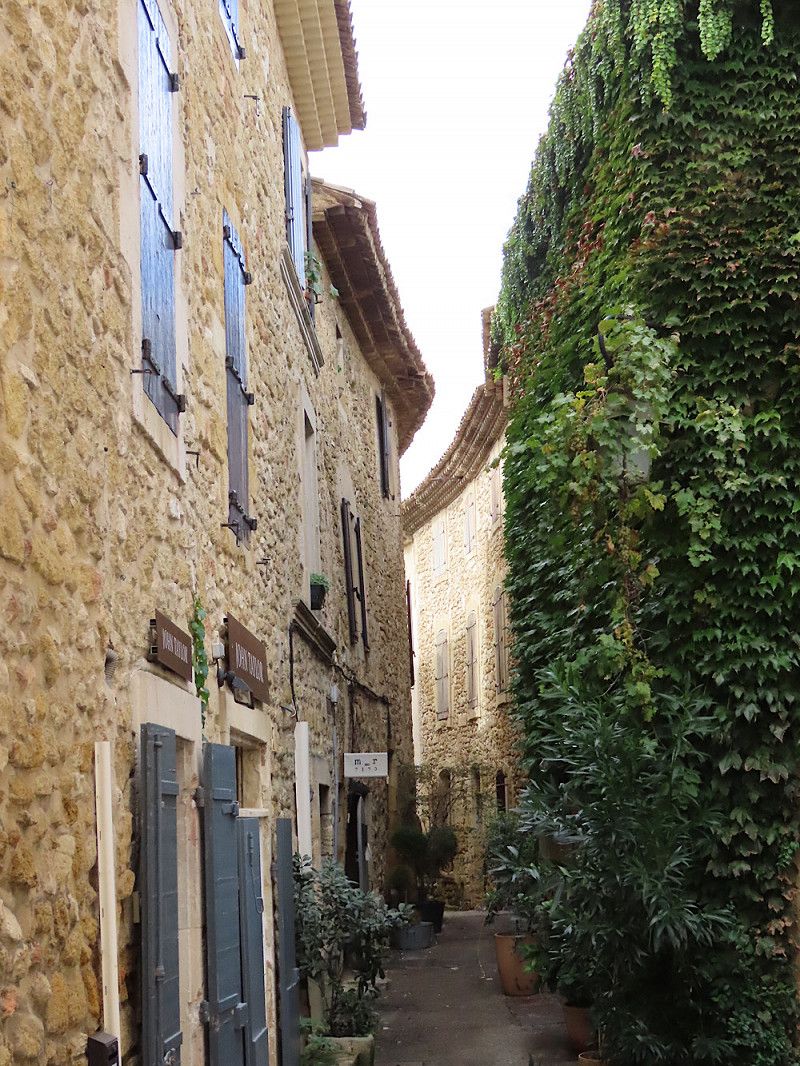
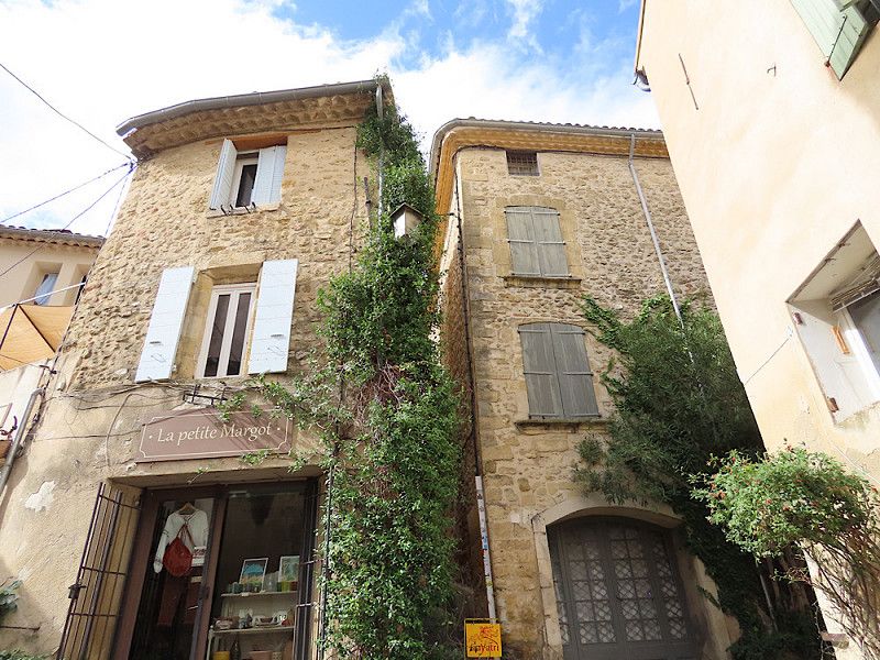
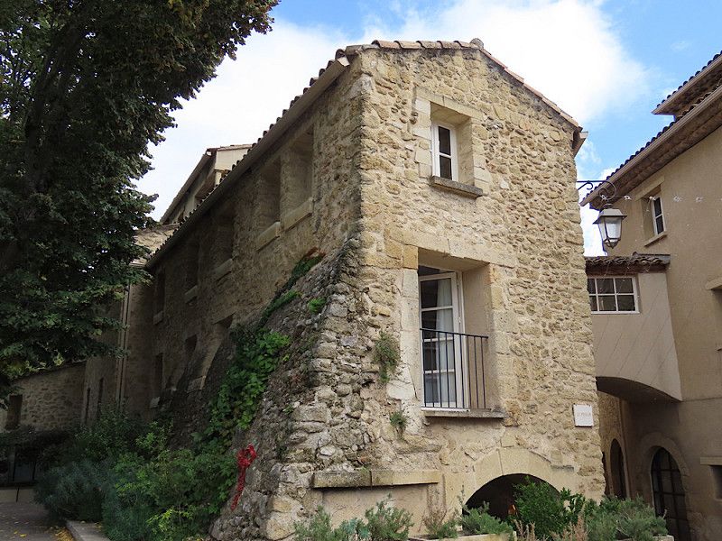
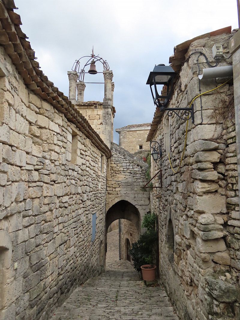
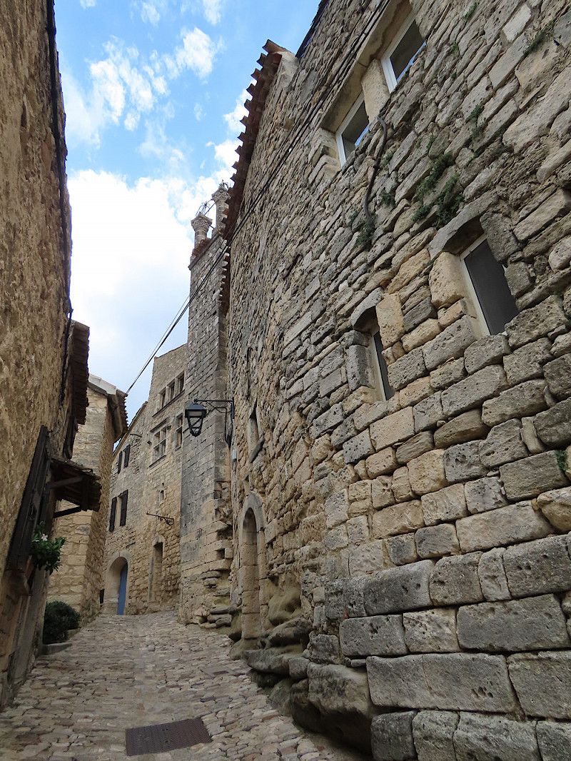
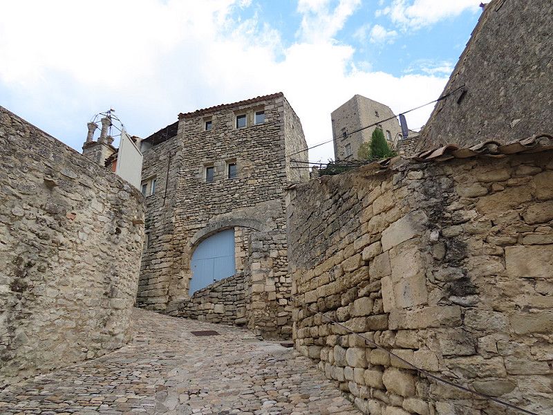
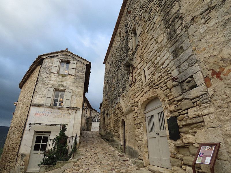
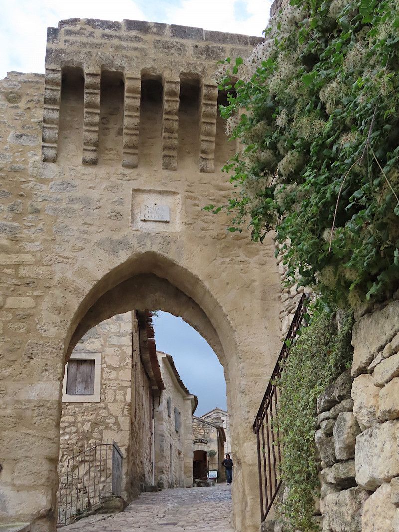
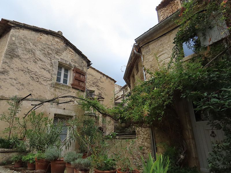
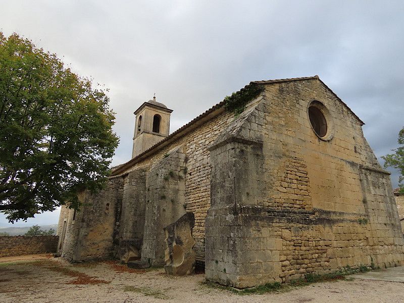
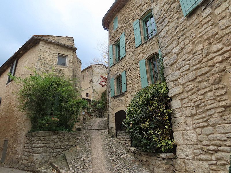
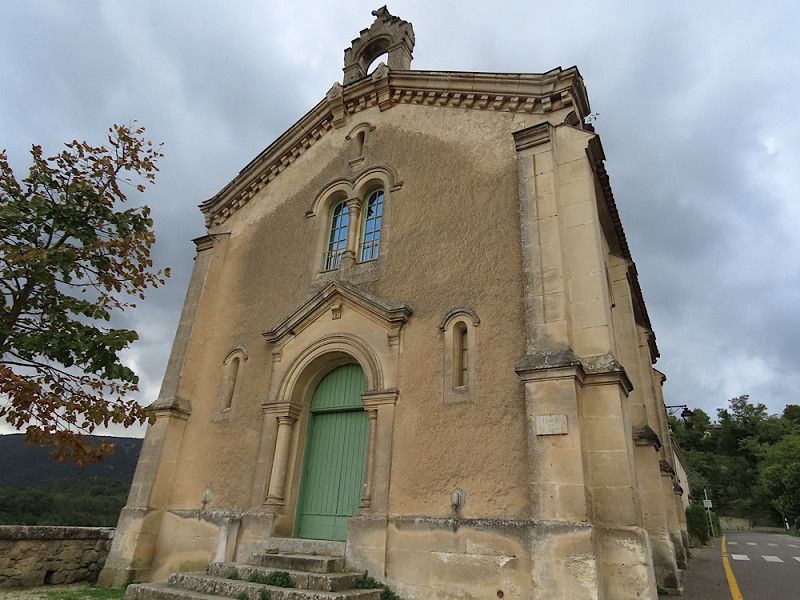
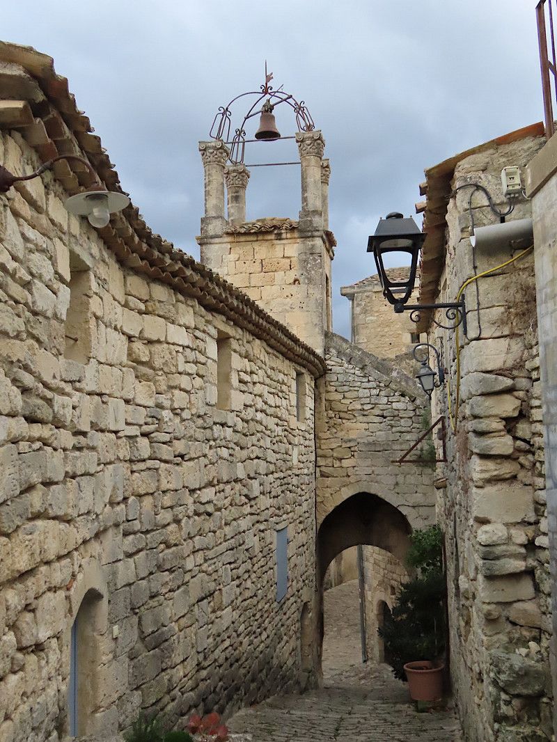
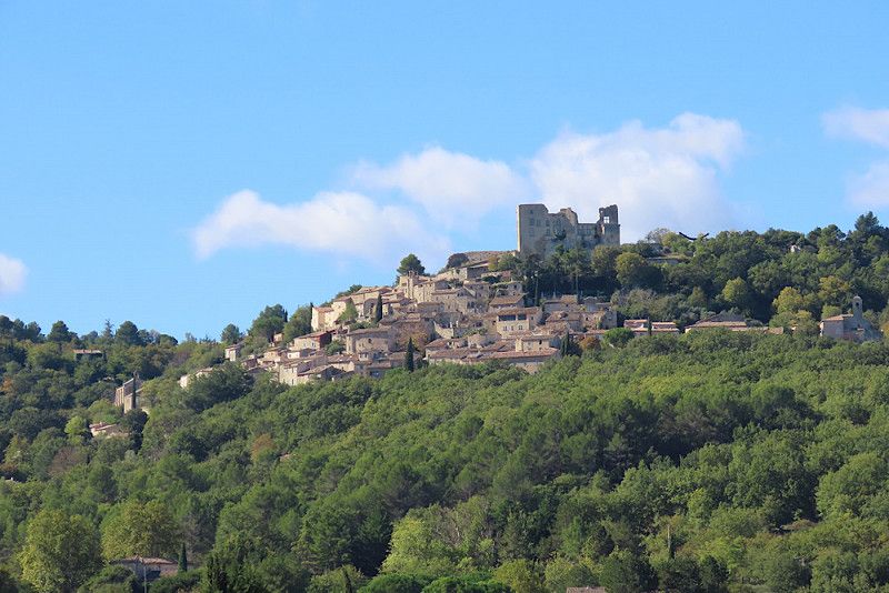
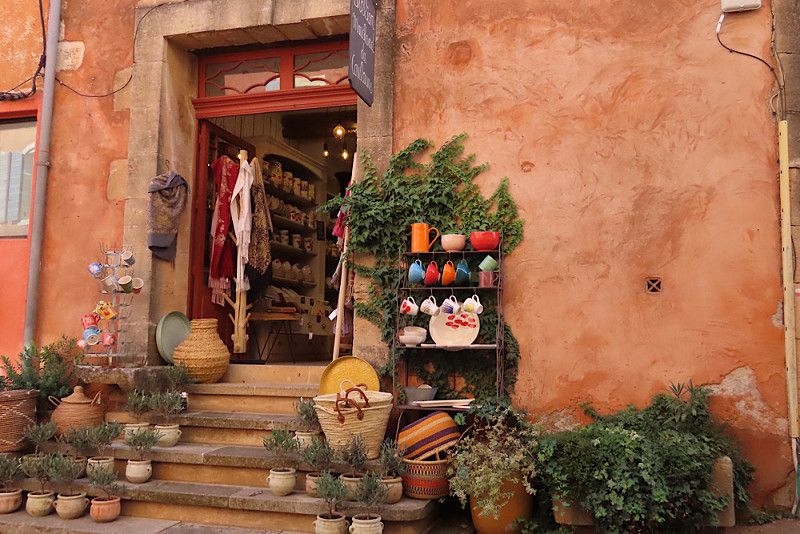
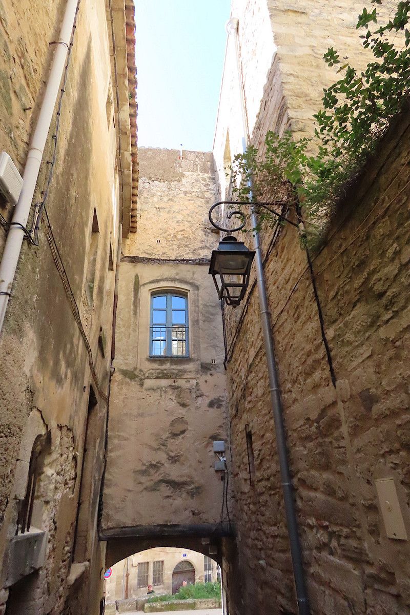
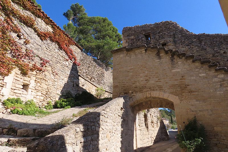
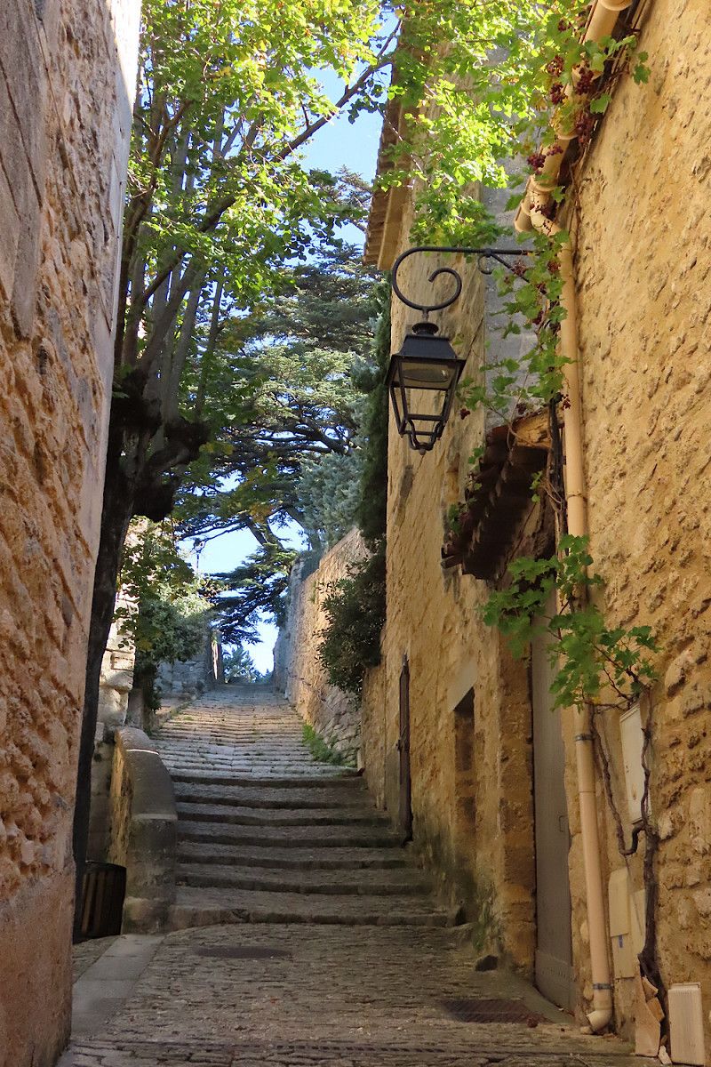
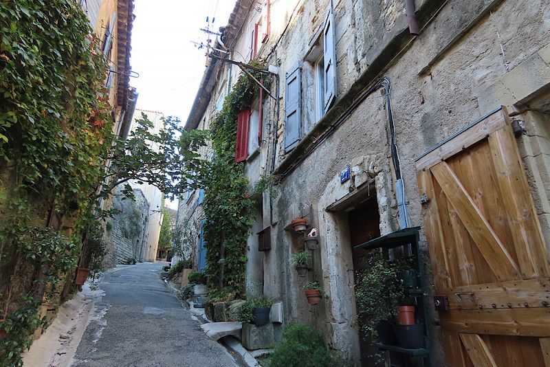
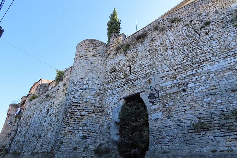
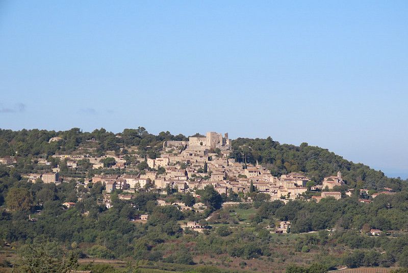
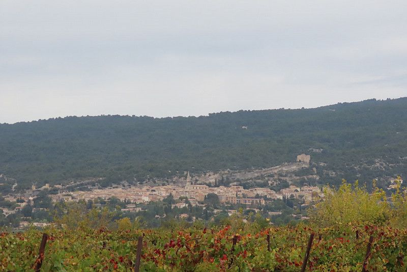
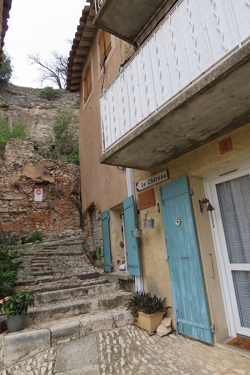
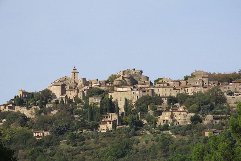
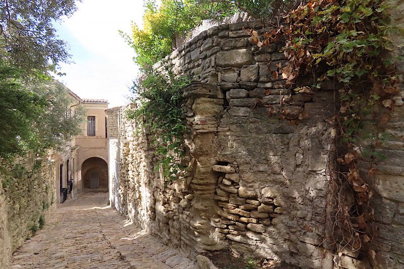
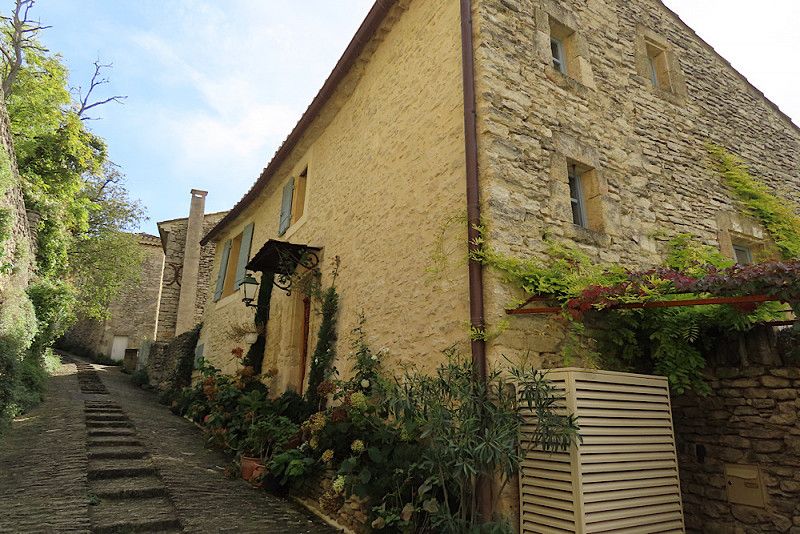
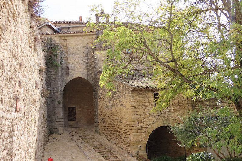
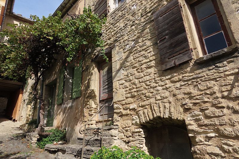
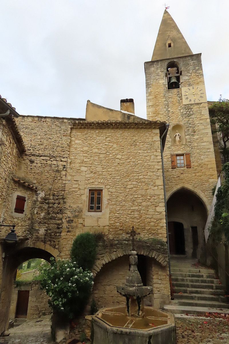
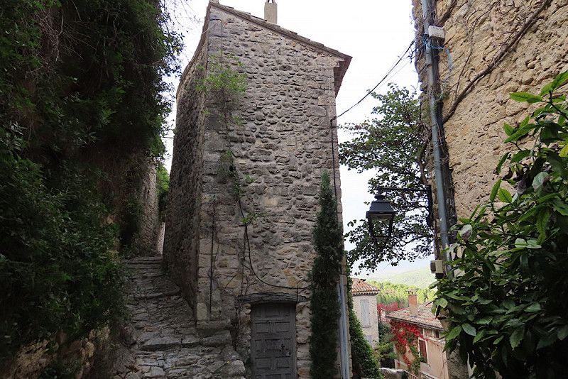
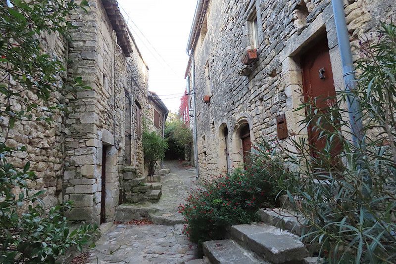
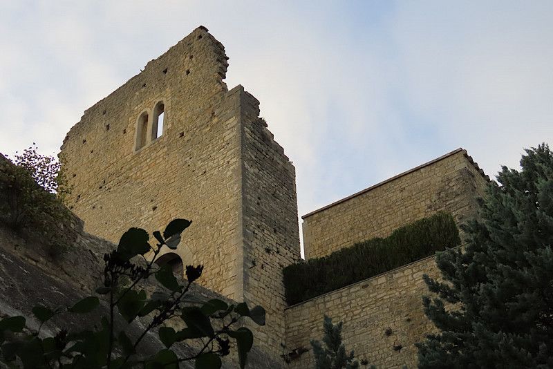
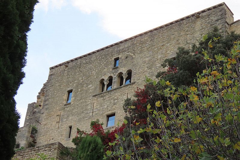
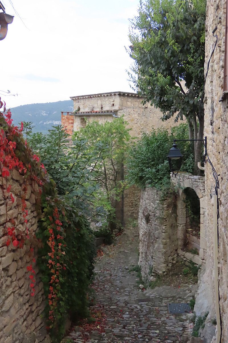
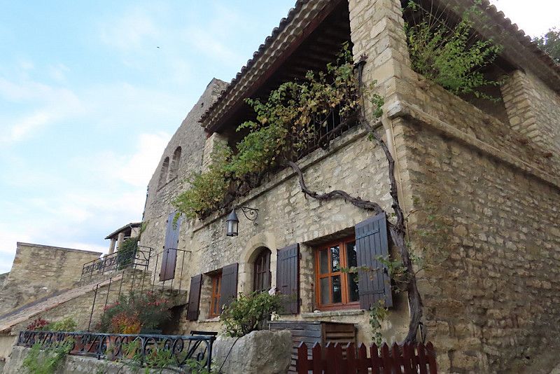
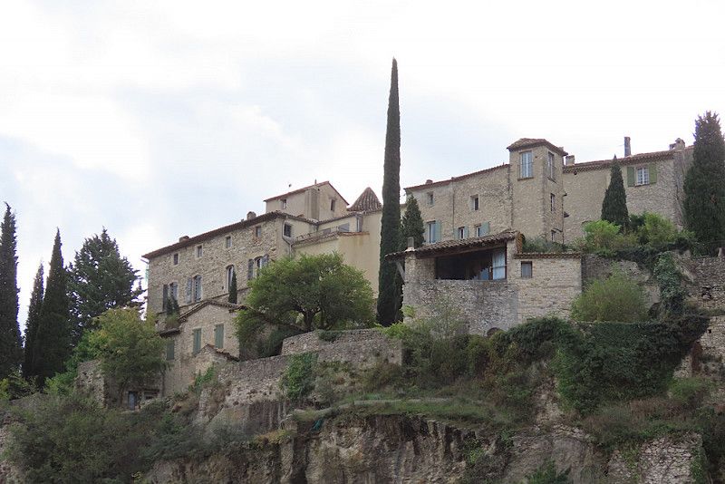
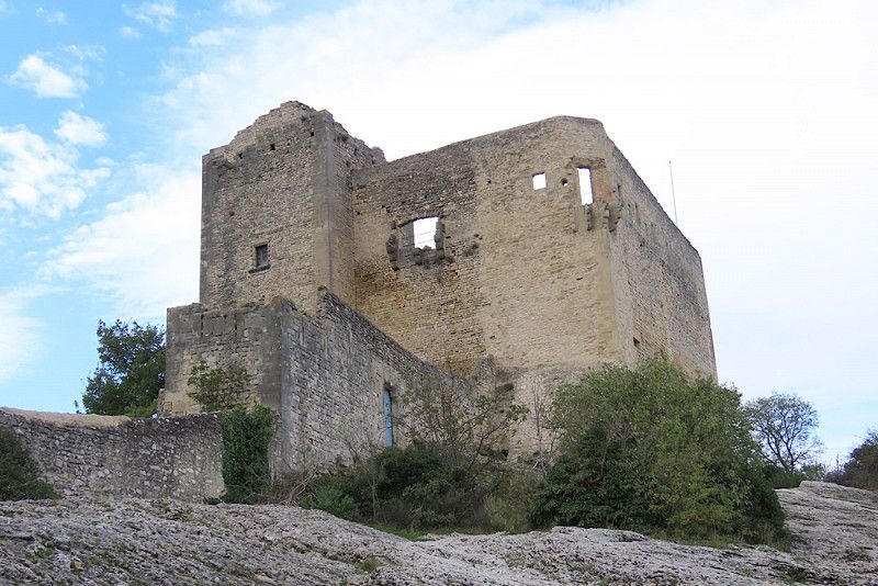
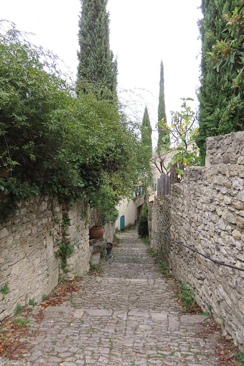
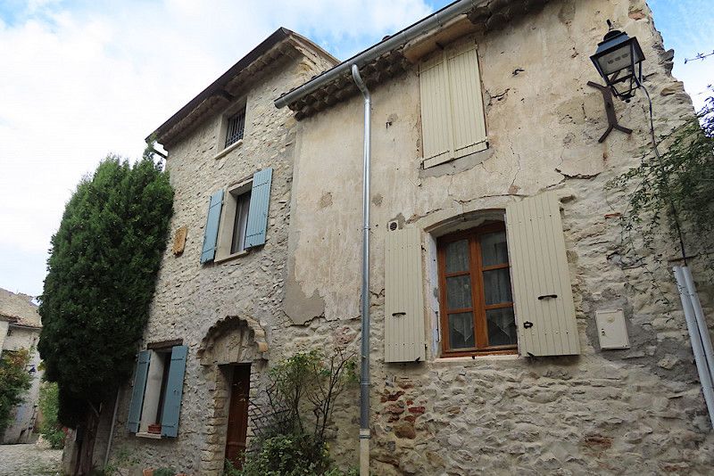
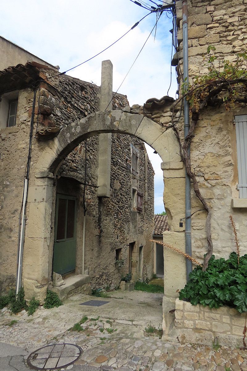
Lacoste
A great place! Also "only" a small village, but I liked it much better than Lourmarin. Here the streets are more rustic and steeper, there is more to discover and overall I found the atmosphere much more pleasant.
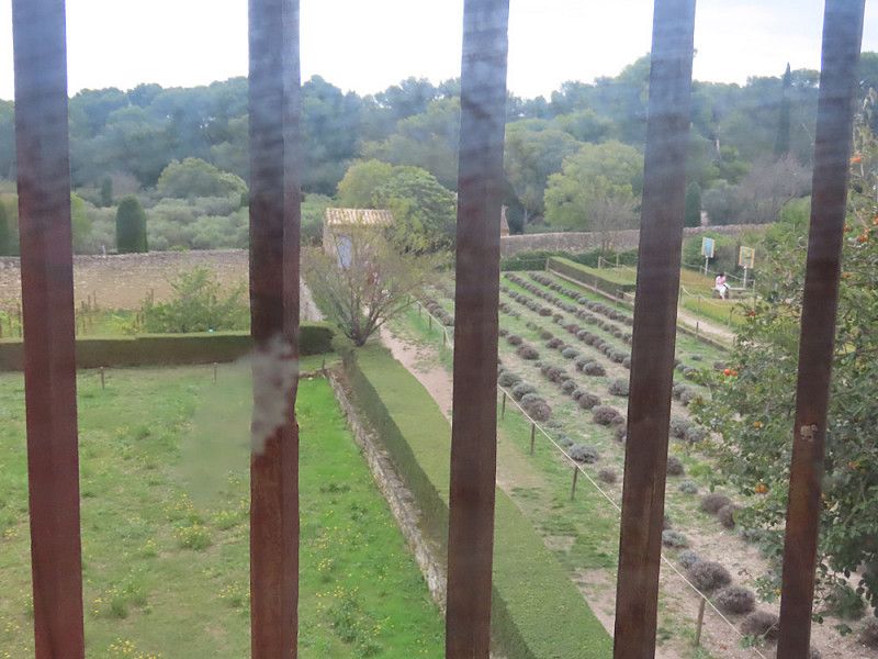
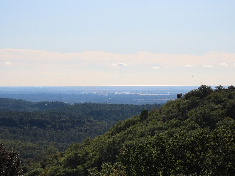
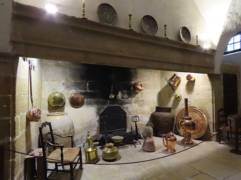
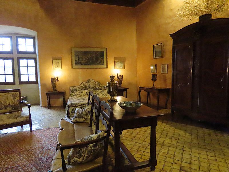
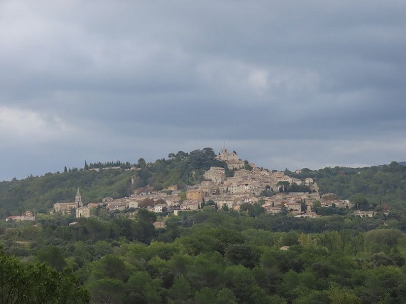
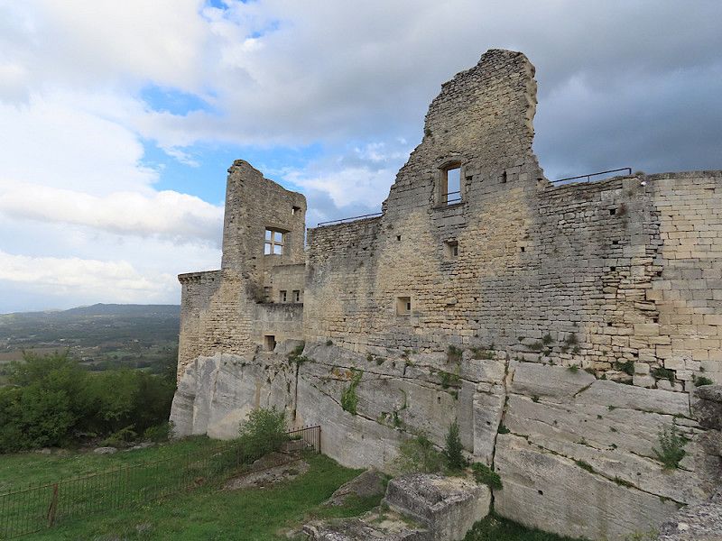
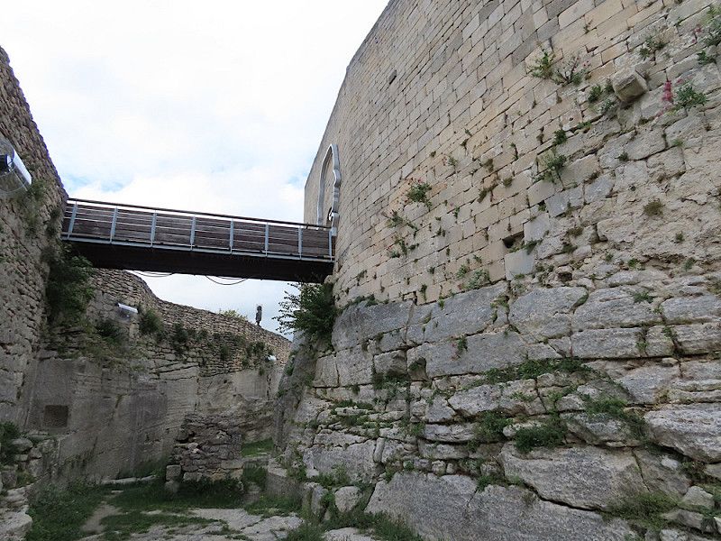
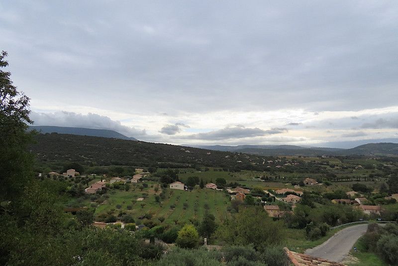
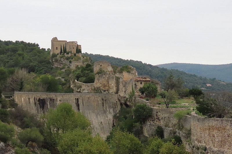
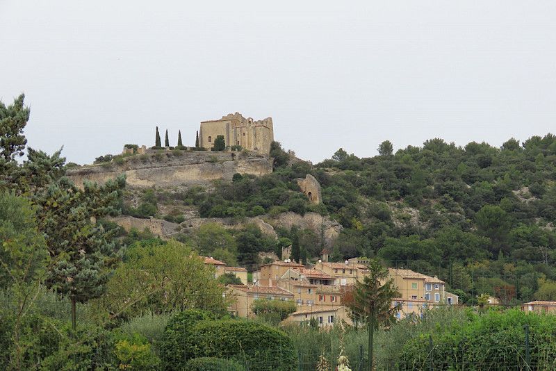
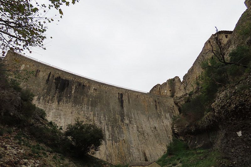
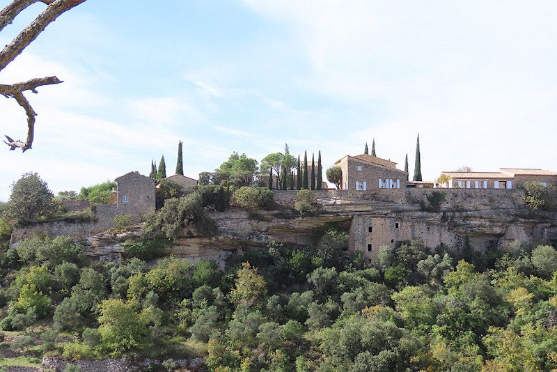
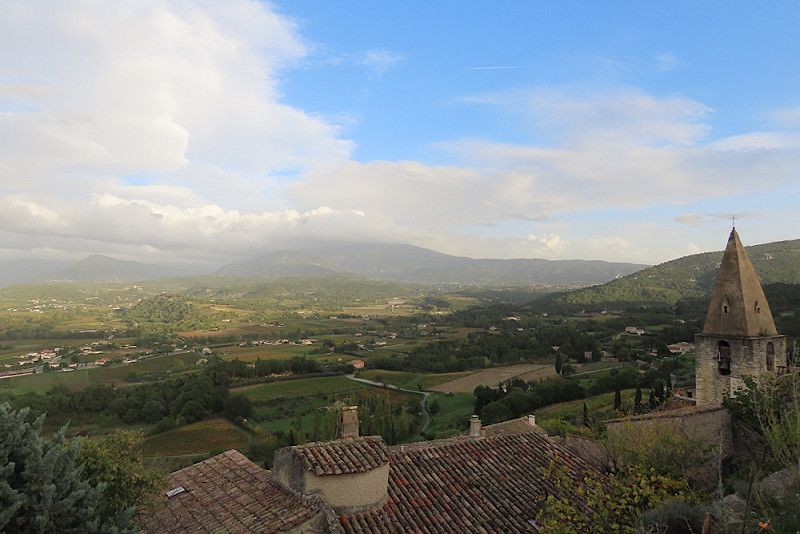
I only visited the outside of the château above the town, as I had just toured the castle this morning. It is also much smaller than the castle in Lourmarin. You can get in for €5. The castle once belonged to the Marquis de Sade, but according to the reviews on Google Maps there is not much explanation. From the castle hill there are wonderful views of the surrounding countryside and the town of Bonnieux opposite (1st photo).
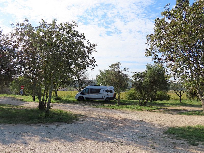
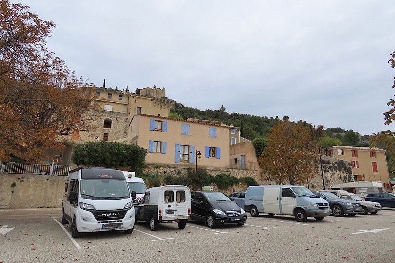
Overnight stay in a free car park below the town. Up at the castle would have been possible, but unfortunately a few young people came with loud music, so I didn't want to spend the evening and night there alone. Caution is the mother of all safety 😉...
Chemin Du Chateau 495, Lacoste, Bonnieux, Vaucluse, France
43° 49' 55.9" N 5° 16' 15" E
43.8322014 5.2708244
• Head southwest on Chemin du Château. Go for 459 m.
• Turn left onto Chemin du Château. Go for 14 m.
• Turn left onto Route de Ménerbes (D109). Go for 816 m.
• Turn left onto D109. Go for 214 m.
• Continue on Rue Sous Barri (D109). Go for 170 m.
• Continue on Route de Lumières (D109). Go for 101 m.
• Continue on Chemin des Restanques. Go for 33 m.
• Arrive at Chemin des Restanques. Your destination is on the right.
☍
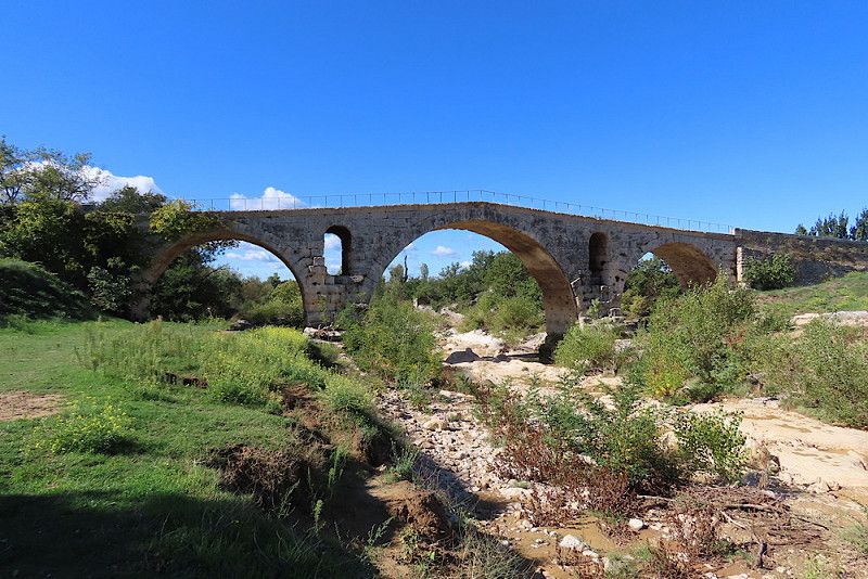
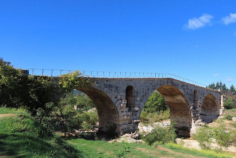
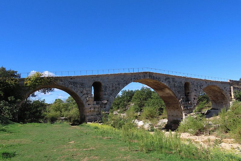
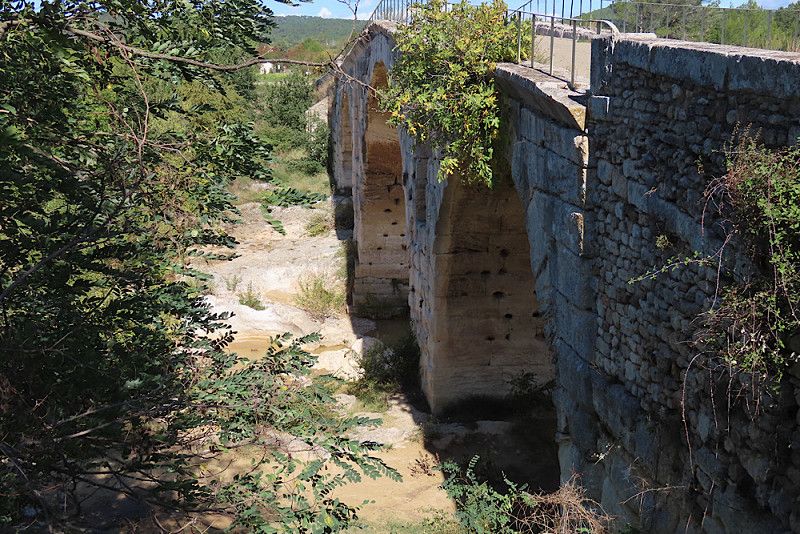
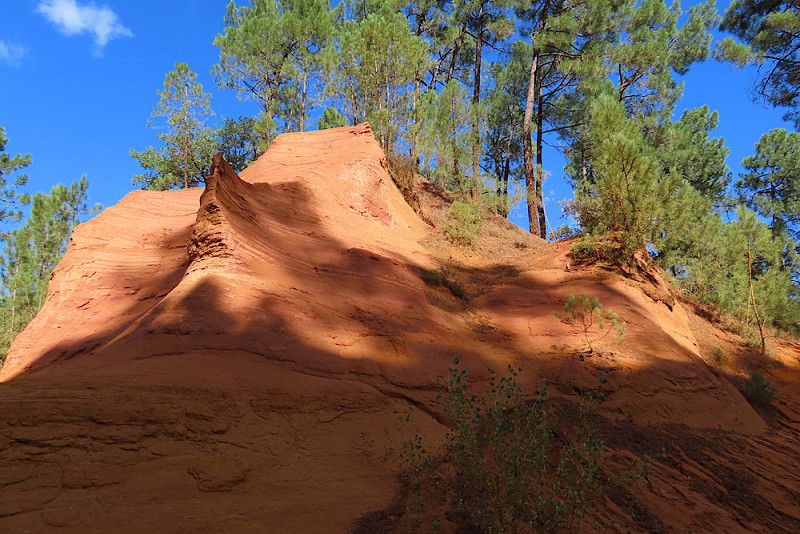
1,8 km
( 4 min.)
Übernachtungsplatz in Lacoste
Very quiet night with a great view of the surrounding area and Bonnieux when you wake up!
D 106, Lacoste, Vaucluse, Provence-Alpes-Côte d'Azur, France
43° 49' 56" N 5° 16' 27.9" E
43.8322223 5.2744044
• Head toward Route de Lumières on Chemin des Restanques. Go for 33 m.
• Turn right onto D106. Go for 113 m.
• Continue on Route d'Apt (D106). Go for 526 m.
• Keep right onto Route d'Apt (D108). Go for 2.0 km.
• Continue on D108. Go for 191 m.
• Continue on Lieu-dit La Maréchale (D108). Go for 108 m.
• Continue on D108. Go for 138 m.
• Continue on Lieu-dit Le Bastidon (D108). Go for 106 m.
• Continue on D108. Go for 224 m.
• Turn left onto D36. Go for 15 m.
• Turn right onto D108. Go for 235 m.
• Continue on Lieu-dit Meille (D108). Go for 146 m.
• Continue on D108. Go for 510 m.
• Continue on Lieu-dit Les Routes (D108). Go for 169 m.
• Continue on D108. Go for 825 m.
• Continue on Lieu-dit La Bourdonne (D108). Go for 92 m.
• Continue on D108. Go for 499 m.
• Take the 3rd exit from roundabout onto Chemin Romieu. Go for 171 m.
• Arrive at Chemin Romieu. Your destination is on the right.
☍
6,1 km
( 7 min.)
Day
Pont Julien
Photo stop at a beautiful ancient, very well preserved bridge
Véloroute du Calavon, Bonnieux, Vaucluse, Provence-Alpes-Côte d'Azur, Frankreich
43° 51' 45.8" N 5° 18' 23.4" E
43.8627239 5.3064863
• Head south on Chemin Romieu. Go for 109 m.
• Take the 3rd exit from roundabout onto D108 toward D149/Roussillon/Apt. Go for 566 m.
• Take the 2nd exit from roundabout onto D108 toward Roussillon/Les Huguets. Go for 561 m.
• Continue on Lieu-dit Les Grosses Vaines (D108). Go for 135 m.
• Continue on D108. Go for 689 m.
• Continue on Route de Roussillon à Bonnieux (D108). Go for 600 m.
• Continue on Route du Pont Julien (D108). Go for 2.1 km.
• Take the 1st exit from roundabout onto Route de Gordas au Chêne (D104). Go for 848 m.
• Turn right onto Route d'Apt. Go for 14 m.
• Turn left. Go for 22 m.
• Turn left. Go for 10 m.
• Arrive at your destination on the right.
☍
5,7 km
( 6 min.)
Roussillon – Weg des Ockers
Hiking trail with great views of interesting ochre formations. When the sun shines, the rock formations literally glow - a great sight and a great short hike! Highly recommended!
Entrance fee € 3.50.
Route D Apt 570, 84220, Roussillon, France
43° 53' 45.3" N 5° 18' 21.2" E
43.8959132 5.3058815
• Head southeast. Go for 10 m.
• Turn right toward Route d'Apt. Go for 22 m.
• Turn right onto Route d'Apt. Go for 14 m.
• Turn left onto Route de Gordas au Chêne (D104). Go for 834 m.
• Take the 1st exit from roundabout onto Avenue Jean-Étienne Astier (D104). Go for 205 m.
• Turn right onto Avenue de la Burlière (D105). Go for 713 m.
• Take the 2nd exit from roundabout onto Avenue Dame Sirmonde (D169). Go for 242 m.
• Turn left onto Rue de Porte Heureuse. Go for 234 m.
• Turn slightly right onto Rue du Jeu de Paume. Go for 91 m.
• Arrive at Rue du Jeu de Paume. Your destination is on the left.
☍
2,4 km
( 5 min.)
Roussillon
Pretty place, especially when the sun is shining, as it was when I visited. The houses are painted in different shades of ochre, creating a very warm atmosphere.
Vaucluse, Provence-Alpes-Côte d'Azur, Frankreich
43° 54' 8.9" N 5° 17' 31.5" E
43.9024768 5.2920876
• Head toward Montée du Beffroi on Rue du Jeu de Paume. Go for 28 m.
• Turn slightly right onto Place de l'Abbé Avon. Go for 9 m.
• Continue on Rue de l'Arcade. Go for 41 m.
• Turn left onto Rue des Bourgades. Go for 54 m.
• Turn right onto Place du Pasquier. Go for 48 m.
• Turn right onto Avenue de la Burlière (D105). Go for 477 m.
• Turn left onto Avenue Jean-Étienne Astier (D104). Go for 189 m.
• Take the 1st exit from roundabout onto Route du Pont Julien (D149). Go for 1.5 km.
• Continue on Route du Pont Julien (D108). Go for 617 m.
• Continue on Route de Roussillon à Bonnieux (D108). Go for 600 m.
• Continue on D108. Go for 689 m.
• Continue on Lieu-dit Les Grosses Vaines (D108). Go for 135 m.
• Continue on D108. Go for 500 m.
• Pass 2 roundabouts and continue on D108. Go for 1.1 km.
• Continue on Lieu-dit La Bourdonne (D108). Go for 92 m.
• Continue on D108. Go for 825 m.
• Continue on Lieu-dit Les Routes (D108). Go for 169 m.
• Continue on D108. Go for 510 m.
• Continue on Lieu-dit Meille (D108). Go for 146 m.
• Continue on D108. Go for 235 m.
• Turn left onto D36. Go for 1.8 km.
• Continue on Route de la Gare (D194). Go for 1.1 km.
• Arrive at Route de la Gare (D194). Your destination is on the left.
☍
10,9 km
( 12 min.)
WoMo-Stellplatz in Bonnieux
The only possible place for motorhomes in Bonnieux. All other parking spaces are now closed to campers, what a pity.
The place itself is flat, gravelled, with water/emissions.
Route De La Gare 338, Bonnieux, Bonnieux, Vaucluse, France
43° 49' 31.6" N 5° 18' 14.3" E
43.8254437 5.3039822
• Head toward Lieu-dit La Gardiole on Route de la Gare (D194). Go for 346 m.
• Take the 1st exit from roundabout onto Rue Victor Hugo (D3). Go for 209 m.
• Turn left onto Place du 4 Septembre (D36). Go for 45 m.
• Turn left onto Rue Jean-Baptiste Aurard (D36). Go for 173 m.
• Arrive at Place Carnot (D36). Your destination is on the right.
☍
0,8 km
( 1 min.)
Day
Bonnieux
Visit the market in Bonnieux. There are regional products (olive oil, olive wood products, soaps, sausage, cheese, linen clothing, etc.) and handicrafts - small but nice market.
Afterwards we took a tour of the town. Well... The location on the hill is very picturesque, but the town itself didn't really blow me away. The church above the town is currently closed for renovation work.
From up there you have a great view of the town of Lacoste opposite.
Vaucluse, Provence-Alpes-Côte d'Azur, Frankreich
43° 49' 25" N 5° 18' 28" E
43.8236191 5.3077869
• Head northeast on Place Carnot (D36). Go for 5 m.
• Turn left onto Rue Pasteur. Go for 28 m.
• Keep right onto Rue Pasteur. Go for 183 m.
• Continue on Route du Pont Julien (D149). Go for 4.8 km.
• Take the 1st exit from roundabout onto D108 toward D149/Roussillon/Apt. Go for 519 m.
• Take the 1st exit from roundabout onto D900 toward Digne/Sisteron/Apt. Go for 5.1 km.
• Pass 2 roundabouts and continue on Avenue de Lançon (D900). Go for 1.9 km.
• Take the 5th exit from roundabout onto Avenue du Viaduc (D943) toward Villars/Sault/St Saturnin lès Apt. Go for 7.1 km.
• Turn right onto Chemin de l'Eau Légère. Go for 221 m.
• Continue on Chemin de l'Eau Légère. Go for 53 m.
• Turn sharp left toward Cours de la Liberté. Go for 21 m.
• Continue on Cours de la Liberté. Go for 129 m.
• Arrive at Cours de la Liberté. Your destination is on the left.
☍
20,1 km
( 20 min.)
Saint-Saturnin-lès-Apt
Overnight stay in a free community car park with a view of the Luberon. Camper parking time limited to a maximum of 48 hours. Very quiet night. Not suitable for large motorhomes - it is a car park, which means that even I, with my length of just over 6 meters, have 1.5 spaces (probably not a problem in the off-season). The access is also quite narrow.
Cours De La Liberté 12, Saint-Saturnin-lès-Apt, Apt, Vaucluse, France
43° 56' 42.7" N 5° 23' 9.3" E
43.9451884 5.3859195
• Head southwest on Cours de la Liberté. Go for 107 m.
• Continue on Rue Henri Pascal. Go for 65 m.
• Continue on Rue Blanche Gaillard. Go for 21 m.
• Turn left onto Rue Jehan Rippert. Go for 84 m.
• Turn left onto Route d'Apt (D943). Go for 7.2 km.
• Take the 4th exit from roundabout onto Avenue de Lançon (D900) toward Sisteron/Digne. Go for 1.9 km.
• Turn right onto Cours Lauze de Perret toward Buoux/Sivergues/Centre Ville. Go for 138 m.
• Keep right onto Cours Lauze de Perret. Go for 33 m.
• Turn right onto Cours Lauze de Perret. Go for 14 m.
• Turn slightly left onto Rue Louis Rousset. Go for 64 m.
• Turn right onto Rue Paul Achard. Go for 43 m.
• Turn right onto Place Jean Jaurès. Go for 49 m.
• Turn left onto Place Jean Jaurès. Go for 32 m.
• Arrive at Place Jean Jaurès. Your destination is on the right.
☍
9,8 km
( 12 min.)
Day
Apt
Visit to the large market in Apt. Definitely worth seeing - the market stalls are spread out over the entire old town. I didn't find the place itself very impressive, or rather, I didn't like it at all! But I met a couple who have been coming here on holiday for years. This just goes to show that beauty is in the eye of the beholder 🤭.
Vaucluse, Provence-Alpes-Côte d'Azur, Frankreich
43° 52' 32.9" N 5° 23' 49.4" E
43.8757936 5.3970648
• Head toward Rue des Muraires on Place Jean Jaurès. Go for 50 m.
• Turn left onto Place Jean Jaurès. Go for 34 m.
• Continue on Rue Paul Achard. Go for 43 m.
• Turn left onto Rue Louis Rousset. Go for 64 m.
• Turn slightly right onto Cours Lauze de Perret. Go for 171 m.
• Take the 3rd exit from roundabout onto Place Lauze de Perret (D900) toward Avignon/Cavaillon/Carpentras/Aix en Provence/Isle sur la Sorgue/Sault. Go for 201 m.
• Turn right onto Pont des Cordeliers (D22) toward Rustrel/Banon/St Christol/St Michel. Go for 1.5 km.
• Take the 1st exit from roundabout onto Avenue de Viton (D22). Go for 7.5 km.
• Take the 3rd exit from roundabout onto Route d'Apt (D30) toward Sault/Saint-Christol/Rustrel. Go for 532 m.
• Arrive at Route d'Apt (D30). Your destination is on the right.
☍
10,1 km
( 11 min.)
Rustrel
Overnight stay in Rustrel with a visit to the hiking area “Colorado Provençale” planned for tomorrow.
There is a relatively small, free parking lot right in the town. There are trash cans, slightly slanted. There was surprisingly a lot of traffic there at the weekend. There were 3-4 other RVs there besides me. There is also a view towards the “Ockerberge”.
Route d’Apt 92, Rustrel, Apt, Vaucluse, France
43° 55' 24.2" N 5° 29' 1.8" E
43.9233828 5.4838424
• Head toward Vieille Route d'Apt on Route d'Apt (D30). Go for 489 m.
• Take the 4th exit from roundabout onto D22 toward Banon/Gignac/Colorado-Provençal. Go for 1.0 km.
• Turn right onto Chemin Saint-Joseph. Go for 424 m.
• Arrive at Chemin Saint-Joseph.
☍
2,0 km
( 2 min.)
Day
Le Colorado Provençal
A fantastic natural experience, especially when the sun comes out and the rocks literally glow in the various ochre tones. If you're a good walker, you'll definitely want to take the longer route, which offers wonderful views of the various rock formations. But here you really have to go over hill and dale!
For information on entrance fees etc. see: http://www.coloradoprovencal.fr/
Chemin de Saint-Joseph, Rustrel, Vaucluse, Provence-Alpes-Côte d'Azur, Frankreich
43° 54' 48.1" N 5° 29' 46.3" E
43.9133511 5.4961869
• Head north on Chemin Saint-Joseph. Go for 424 m.
• Turn left onto D22. Go for 975 m.
• Take the 2nd exit from roundabout onto Route de Saint-Saturnin (D179) toward St Saturnin/Lagarde-d'Apt. Go for 357 m.
• Continue on Lieu-dit Meille (D179). Go for 84 m.
• Continue on Route Saint-Saturnin (D179). Go for 1.1 km.
• Continue on Lieu-dit Saint-Maurin (D179). Go for 89 m.
• Continue on Route Saint-Saturnin (D179). Go for 878 m.
• Continue on D214 toward St Saturnin-lès-Apt. Go for 101 m.
• Continue on D179. Go for 959 m.
• Continue on Route de Rustrel (D179). Go for 4.7 km.
• Turn right onto Route d'Apt (D943). Go for 831 m.
• Turn right onto Place Gambetta. Go for 55 m.
• Turn slightly right onto Rue Albert Trouchet. Go for 67 m.
• Turn right onto Place de la Fraternité. Go for 114 m.
• Continue on Place de la Mairie. Go for 23 m.
• Turn right onto Place de la Mairie. Go for 25 m.
• Continue on Rue Pasteur. Go for 14 m.
• Keep left onto Rue Pasteur. Go for 218 m.
• Arrive at Rue Pasteur. Your destination is on the right.
☍
11,0 km
( 12 min.)
Day
Saint-Saturnin-lès-Apt
Visit to the castle ruins, which are impressively built on a rocky outcrop. I found it very fascinating! The fortress walls in particular are incredibly cleverly built. From the top you have a wonderful panoramic view of the Luberon.
Afterwards, we took a tour of the charming town in absolute peace and quiet - there was hardly anyone around. There is also an old windmill in which flour was ground. Apparently it can be visited in the summer months and there are demonstrations from time to time. The walk there was still worth it, though, because you get another wonderful view of the fortress from there. It's just a shame that it was overcast and later rained.
Rue Pasteur 36, Saint-Saturnin-lès-Apt, Apt, Vaucluse, France
43° 56' 43.7" N 5° 23' 9.3" E
43.9454763 5.3859050
• Head northeast on Rue Pasteur. Go for 15 m.
• Continue on Place Bel Air. Go for 12 m.
• Continue on Rue de l'Oratoire. Go for 108 m.
• Turn right onto Chemin de l'Eau Légère. Go for 274 m.
• Turn right onto Route d'Apt (D943). Go for 577 m.
• Turn left onto D2. Go for 7.7 km.
• Turn right onto Route de Carpentras à Apt (D4). Go for 327 m.
• Continue on D4. Go for 1.1 km.
• Turn right onto D60. Go for 1.4 km.
• Continue on Lieu-dit La Combe (D60). Go for 220 m.
• Turn left onto Lieu-dit La Combe (D60 A) toward Sault/St Lambert. Go for 87 m.
• Arrive at Lieu-dit La Combe (D60 A). Your destination is on the right.
☍
11,8 km
( 11 min.)
Übernachtung in Lioux
Small hamlet near Gordes, where I actually wanted to go today. But since it's raining, I'm spending a leisurely afternoon here and will continue on tomorrow.
The parking here (free) is located directly below the road, but is very quiet as there are only a few cars driving by. Beautiful view of a "cliff" opposite ("La Falaise de la Madeleine").
On the outskirts of the village there is a beautifully renovated castle (unfortunately the inside cannot be visited) and countless orchards and vineyards.
D 60A, Lioux, Vaucluse, Provence-Alpes-Côte d'Azur, France
43° 56' 44.2" N 5° 17' 41.9" E
43.9456006 5.2949740
• Head southwest on Lieu-dit La Combe (D60 A). Go for 87 m.
• Turn right onto Lieu-dit La Combe (D60) toward Joucas/Gordes. Go for 220 m.
• Continue on D60. Go for 2.2 km.
• Continue on Route de Lioux (D60). Go for 1.4 km.
• Continue on D102. Go for 145 m.
• Continue on D60. Go for 223 m.
• Continue on Lieu-dit Les Minchons (D60). Go for 98 m.
• Continue on D60. Go for 252 m.
• Continue on D102. Go for 478 m.
• Continue on Lieu-dit La Bastide Neuve (D102). Go for 96 m.
• Continue on D102. Go for 351 m.
• Continue on Route de Gordes à Apt (D102). Go for 601 m.
• Continue on D102. Go for 33 m.
• Turn right onto Route de Cavaillon à Saint-Saturnin-lès-Apt (D2) toward Cavaillon/Gordes. Go for 4.4 km.
• Take the 1st exit from roundabout onto Route de Cavaillon à Sault-de-Vaucluse (D15) toward Gordes/Abbaye de Senanque. Go for 1.4 km.
• Keep right onto Route de Cavaillon à Sault-de-Vaucluse (D15) toward Gordes Centre/Saint-Firmin. Go for 614 m.
• Take the 2nd exit from Place du Marché roundabout onto Place du Château (D15). Go for 1.6 km.
• Turn left onto Chemin du Vallon des Caquettes. Go for 17 m.
• Arrive at Chemin du Vallon des Caquettes. Your destination is on the right.
☍
14,1 km
( 14 min.)
Day
Parkplatz für Besichtigung Gordes
It is almost impossible to find a parking space in Gordes. The only parking space designated for motorhomes was hopelessly overcrowded. There are many critical voices on the Internet that advise against visiting the place altogether. I found a small parking space about 2 km above the town opposite the entrance to a hotel. There were no prohibition signs there and I walked comfortably into the town. Of course, it would also be easy to do by bike from here.
Overall, I found the search for a parking space very annoying, but the place, although very touristy, was still very worth it!
Chemin Du Vallon Des Caquettes 952, Gordes, Gordes, Vaucluse, France
43° 55' 28.4" N 5° 12' 14.1" E
43.9245456 5.2039119
• Head toward Route de Murs on Chemin du Vallon des Caquettes. Go for 17 m.
• Turn right onto Route de Cavaillon à Sault (D15). Go for 1.5 km.
• Take the 1st exit from Place du Château roundabout onto Rue de la Combe (D15). Go for 1.0 km.
• Arrive at Route des Moines (D15). Your destination is on the left.
☍
2,6 km
( 4 min.)
Gordes, Vaucluse, France
It was market day in Gordes, so it's no surprise that there was a lot going on and the parking lots were full.
The prices here are quite high due to the popularity of the place and the large number of tourists. I could easily do without a scoop of ice cream for 3 euros. However, I can only recommend the bakery "Le Fournil de Mamie Jeanne": They have homemade bread, incredibly tasty, and at reasonable prices. I treated myself to a focaccia with chicken and onions and a croissant and would have loved to take a whole box of them home with me, it tasted so good!
Route Des Moines 381, 84220, Gordes, France
43° 54' 30.5" N 5° 11' 52.2" E
43.9084674 5.1978207
• Head north on Route des Moines (D15). Go for 381 m.
• Turn left onto Route de Sénanque (D177) toward Venasque/Abbaye de Senanque. Go for 135 m.
• Continue on Route de l'Abbaye Gordes à Sénanque (D177). Go for 1.7 km.
• Continue on Chemin de l'Abbaye Gordes à Sénanque (D177). Go for 1.1 km.
• Continue on D177. Go for 434 m.
• Turn left. Go for 590 m.
• Arrive at your destination.
☍
4,3 km
( 6 min.)
Abbaye Notre-Dame de Sénanque
The monastery is very famous for the great view during the lavender blossom in summer. But since it is only a few kilometers from Gordes, I drove there in the late afternoon. The access road is very narrow and only one-way, which means you have to drive out of the valley on the other side and then make a big loop back towards Gordes or into the next valley. In hindsight, I probably would have cycled or hiked instead, so I could have cycled/walked straight back to Gordes.
The monastery itself is really pretty in a narrow valley and has a huge monastery shop. It would also be possible to visit the inside, but it is not supposed to be particularly worth seeing, so I decided not to. I had also promised a friend that I would help her with documents in the evening, and since there was no reception at the monastery at all, I had to drive on anyway.
But I would really like to come back here at some point, when the lavender is still in bloom. The lavender fields are now fenced off (unlike before), but it must still be amazing.
Chemin de l'Abbaye de Sénanque, Gordes, Vaucluse, Provence-Alpes-Côte d'Azur, Frankreich
43° 55' 42.4" N 5° 11' 13.7" E
43.9284546 5.1871502
• Head northeast. Go for 590 m.
• Turn left onto D177. Go for 4.3 km.
• Continue on Lieu-dit La Corneirette (D177). Go for 93 m.
• Continue on D177. Go for 2.7 km.
• Turn left onto Route d'Apt (D4) toward Carpentras/Venasque. Go for 4.3 km.
• Continue on Route de Carpentras (D4). Go for 3.3 km.
• Turn left onto Chemin de Saint-Geniès. Go for 77 m.
• Turn right onto Allée des Entrepreneurs. Go for 174 m.
• Turn left onto Allée des Entrepreneurs. Go for 53 m.
• Arrive at Allée des Entrepreneurs. Your destination is on the left.
☍
15,6 km
( 18 min.)
Übernachtungsplatz in Venasque
After I drove out of the valley of the monastery and in the only direction away from Gordes, it took a while until I found a suitable place to stay for the night. As a stopgap solution, I parked in a small industrial estate in Venasque, where I finally had good internet again. It was absolutely quiet here and I would use this place for a stopover at any time.
Allée des Entrepreneurs, Venasque, Pernes-les-Fontaines, Vaucluse, France
44° 1' 12.2" N 5° 7' 1.1" E
44.0200516 5.1169770
• Head southwest on Allée des Entrepreneurs. Go for 225 m.
• Turn left onto Chemin de Saint-Geniès. Go for 130 m.
• Turn left onto Route de Carpentras (D4). Go for 326 m.
• Continue on D4. Go for 67 m.
• Continue on Route d'Apt (D4). Go for 278 m.
• Continue on Chemin d'Apt à Carpentras (D4). Go for 447 m.
• Take the 3rd exit from roundabout onto Route de Mazan (D1). Go for 1.0 km.
• Pass 2 roundabouts and continue on Cours Ledru-Rollin (D1). Go for 4.3 km.
• Take the 2nd exit from roundabout onto Avenue de la Perle du Comtat (D938). Go for 912 m.
• Pass 5 roundabouts and continue on Cours Fernande Peyre (D938). Go for 9.2 km.
• Take the 4th exit from roundabout onto Avenue du Général de Gaulle (D938). Go for 142 m.
• Take the 1st exit from Rond-Point Général de Gaulle roundabout onto Avenue des 4 Otages (D901). Go for 600 m.
• Take the 2nd exit from roundabout onto Avenue de l'Égalité (D938). Go for 341 m.
• Take the 2nd exit from roundabout onto Avenue de l'Égalité (D938). Go for 362 m.
• Arrive at Route de Cavaillon (D938). Your destination is on the left.
☍
18,3 km
( 22 min.)
Day
Stellplatz für Besichtigung L'Isle-sur-la-Sorgue
Free parking for visiting the town of L'Isle-sur-la-Sorgue, about 10 minutes walk from the old town. Specially signposted for motorhomes.
There was also an interesting self-converted RV to admire. As impressive as I find something like that, I prefer my small, relatively maneuverable van 😉.
Route de Cavaillon, L'Isle-sur-la-Sorgue, Vaucluse, Provence-Alpes-Côte d'Azur, France
43° 54' 45" N 5° 2' 56" E
43.9124876 5.0488773
• Head south on Route de Cavaillon (D938). Go for 1.2 km.
• Turn left onto Route de Cavaillon. Go for 60 m.
• Turn right onto Lotissement l'Oree de Velorgue. Go for 106 m.
• Turn right onto Route de Cavaillon (D938). Go for 1.6 km.
• Take the 1st exit from roundabout onto Avenue de l'Égalité (D938). Go for 322 m.
• Take the 1st exit from roundabout onto Avenue de la Libération (D901). Go for 30 m.
• Turn left onto Place Émile Char. Go for 33 m.
• Turn right onto Quai Rouget de l'Isle. Go for 157 m.
• Turn left onto Rue Lirette. Go for 66 m.
• Turn right onto Rue Paul Monition. Go for 13 m.
• Arrive at Rue Paul Monition. Your destination is on the left.
☍
3,7 km
( 5 min.)
L'Isle-sur-la-Sorgue
On the way home I stop off in L'Isle-sur-la-Sorgue. The town is known above all for its many antique dealers. There are a number of shops that sell what I would call art and junk. For lovers of unusual art objects and old collector's items, the place is sure to be a treasure trove.
There are a few small canals where you can sit, especially in summer. There are also many sculptures spread throughout the old town.
Vaucluse, Provence-Alpes-Côte d'Azur, Frankreich
43° 55' 6.7" N 5° 3' 5.5" E
43.9185354 5.0515385
• Head toward Rue du Crédit on Rue Paul Monition. Go for 41 m.
• Turn right onto Passage du Mont-de Piété. Go for 14 m.
• Turn left onto Rue de la République. Go for 83 m.
• Turn left onto Place de la Liberté. Go for 32 m.
• Turn left onto Rue Ledru-Rollin. Go for 150 m.
• Turn left onto Rue Michelet. Go for 34 m.
• Turn right onto Rue Lirette. Go for 66 m.
• Turn left onto Quai Rouget de l'Isle. Go for 49 m.
• Turn slightly right onto Pont A. Benoit. Go for 28 m.
• Turn right onto Avenue de la Libération (D901). Go for 258 m.
• Pass 2 roundabouts and continue on Cours Émile Zola (D901). Go for 1.7 km.
• Take ramp onto D31. Go for 1.0 km.
• Pass 2 roundabouts and continue on Route de Monteux à Velleron (D31). Go for 8.3 km.
• Take the 1st exit from roundabout onto Route de la Gasqui (D38) toward Carpentras/Pernes/Les Fontaines. Go for 4.5 km.
• Take the 3rd exit from roundabout onto Route de Velleron à Carpentras (D235) toward A7/Avignon/Monteux/Z.A. Villenfranche-Kennedy/Pôle Santé. Go for 568 m.
• Take the 2nd exit from roundabout onto D235 toward A7/Avignon/Monteux/Z.A. Villefranche-Kenndy/Pôle Santé. Go for 749 m.
• Take the 2nd exit from roundabout onto D942 toward D235/A7/Avignon/Monteux. Go for 891 m.
• Turn right onto D942 R toward A7/(Lyon)/Gap/Orange/Aubignan/Vaison la Romaine/Mont-Ventoux. Go for 2.1 km.
• Take the 2nd exit from roundabout onto D942 R toward Gap/Vaison la Romaine/Mont-Ventoux/Aubignan/Bédoin. Go for 1.5 km.
• Take the 4th exit from roundabout onto Avenue Saint-Roch (D938) toward Gap/Serres/Malaucène/Mont-Ventoux/Vaison la Romaine. Go for 4.7 km.
• Pass 3 roundabouts and continue on Avenue de Verdun (D938). Go for 12.2 km.
• Take the 1st exit from roundabout onto Route de Vaison (D938). Go for 5.4 km.
• Turn left onto Route de Sainte-Anne. Go for 1.1 km.
• Turn slightly right onto D76. Go for 254 m.
• Arrive at D76. Your destination is on the right.
☍
45,6 km
( 52 min.)
Crestet
This is such a charming little place, just after my own heart! Similar to Lacoste, but even smaller and more winding and almost without shops. I practically had the place to myself on a rather dull day.
There are beautifully renovated houses and alleys that end in a dead end or a dirt track. The town is located on a hill, surrounded by vineyards and ancient olive trees.
I was able to park and spend the night in the visitor parking lot below the village. But be careful: the narrow and winding access road is definitely not suitable for large RVs. It is better to park at the foot of the hill and walk or cycle up.
The next morning, when the sun came out, I was able to enjoy the beautiful view of the surrounding hills.
Crestet le Village, Crestet, Vaison-la-Romaine, Vaucluse, France
44° 12' 56.5" N 5° 5' 7.8" E
44.2156863 5.0854906
• Head toward Route du Village on D76. Go for 254 m.
• Turn slightly left onto Route de Sainte-Anne. Go for 1.1 km.
• Turn left onto Route de Malaucène (D938). Go for 255 m.
• Take the 2nd exit from roundabout onto Route de Malaucène (D938) toward Gap/Vaison la Romaine. Go for 1.4 km.
• Turn right onto D938 toward Gap. Go for 1.9 km.
• Take the 4th exit from roundabout onto Avenue des Choralies (D975) toward A7/Orange/Avignon/Valréas. Go for 557 m.
• Take the 3rd exit from roundabout onto Avenue François Mitterrand (D975) toward A7/A9/Valréas/Bollène/Orange/Avignon. Go for 314 m.
• Take the 4th exit from roundabout onto Avenue Général de Gaulle (D51). Go for 172 m.
• Arrive at Avenue Général de Gaulle (D51). Your destination is on the left.
☍
5,9 km
( 10 min.)
Day
Vaison-la-Romaine
Parking in a car park on the side of the road - I'm 6.40m tall and I'm hanging over onto the very wide sidewalk. NOT suitable for large RVs - my campervan just about fits in width-wise.
There is a "new town" on the river, which is also nice to stroll around. Unfortunately, the Gallic-Roman archaeological museum was closed, but from the outside you could see many of the uncovered ruins and also some statues.
The two districts are connected by an ancient Roman bridge.
The medieval old town nestles on a slope above the town. The walk up is worth it and you will be rewarded with beautiful old streets and wonderful views. Time well spent on a leisurely stroll around the area is well spent!
Avenue du Général de Gaulle, Vaison-la-Romaine, Vaucluse, Provence-Alpes-Côte d'Azur, France
44° 14' 37.9" N 5° 4' 19.9" E
44.2438571 5.0721870
• Head toward Rue de la Duranette on Avenue Général de Gaulle (D51). Go for 87 m.
• Take the 4th exit from roundabout onto Avenue de Saint-Quenin (D975) toward A7/A9/Valréas/Bollène/Orange/Avignon/Villedieu. Go for 2.7 km.
• Take the 2nd exit from roundabout onto Route d'Orange (D975) toward A7/Roaix. Go for 2.0 km.
• Take the 1st exit from roundabout onto D20. Go for 5.3 km.
• Take the 2nd exit from roundabout onto D20 toward A7/Valréas/Bollène. Go for 1.2 km.
• Take the 3rd exit from roundabout onto D94 toward Orange/Tulette/Bollène/Visan/Valréas. Go for 10.1 km.
• Pass 2 roundabouts and continue on Avenue des Côtes du Rhône (D94). Go for 3.2 km.
• Continue on Route de Rochegude (D117). Go for 100 m.
• Take the 1st exit from roundabout onto D94. Go for 2.8 km.
• Continue on D994. Go for 3.6 km.
• Take the 1st exit from roundabout onto Avenue Salvador Allende (D8) toward A7/Pierrelatte/St Paul/Pont St Esprit. Go for 1.7 km.
• Take the 2nd exit from Rond-Point des Portes de Provence roundabout toward Lyon/Montélimar/Marseille/Nîmes/Orange. Go for 164 m.
• Take ramp onto A7 (Autoroute du Soleil) toward Montélimar/Valence/Lyon. Go for 72.9 km.
• Take exit 15 toward Genève/Chambéry/Grenoble/Romans/Valence onto E713 (Échangeur de Valence-Sud). Go for 708 m.
• Continue on N7. Go for 9.7 km.
• Continue on E713. Go for 168 m.
• Continue on N532. Go for 7.2 km.
• Take ramp toward Alixan/Châteauneuf S/I./Rovaltain Nord. Go for 240 m.
• Take the 2nd exit from roundabout onto Route de Châteauneuf (D101) toward Alixan/Z.A. les Marlhes. Go for 3.4 km.
• Turn right onto Avenue Dauphiné-Provence (D538). Go for 27 m.
• Turn left onto Avenue du Vercors (D101). Go for 121 m.
• Continue on Route de Bésayes (D101). Go for 550 m.
• Continue on D101. Go for 75 m.
• Continue on Route de Bésayes (D101). Go for 818 m.
• Continue on D101. Go for 118 m.
• Continue on Route de l'Hermitage (D101). Go for 2.0 km.
• Continue on Rue du Baraban (D101). Go for 544 m.
• Turn left onto Rue de la Liberté (D102). Go for 212 m.
• Continue on D102. Go for 116 m.
• Continue on Lieu-dit Les Malbâties (D102). Go for 109 m.
• Turn left onto D102. Go for 3.1 km.
• Continue on Lieu-dit Les Omis (D102). Go for 83 m.
• Continue on D102. Go for 129 m.
• Turn sharp right toward Route d'Alixan. Go for 739 m.
• Continue on Route d'Alixan. Go for 346 m.
• Continue on Route d'Alixan. Go for 153 m.
• Turn left. Go for 100 m.
• Arrive at your destination.
☍
136,6 km
(1 hrs. 34 min.)
Übernachtung in Chatuzange-le-Goubet
Since this afternoon I have been on my way home. This is a stopover next to the cemetery in a small town near Valence, not far from the motorway.
Chemin Joseph Royan 345, Chatuzange-le-Goubet, Bourg-de-Péage, Drôme, France
44° 59' 53.6" N 5° 4' 51.5" E
44.9982194 5.0809605
• Head toward Route d'Alixan. Go for 100 m.
• Turn left onto Route d'Alixan. Go for 462 m.
• Continue on Route du Vieux Village (D449). Go for 288 m.
• Turn slightly right onto Route du Vieux Village (D449). Go for 446 m.
• Take the 1st exit from roundabout onto Route du Vieux Village (D449). Go for 233 m.
• Turn left onto Rue des Monts du Matin (D149). Go for 582 m.
• Continue on D149. Go for 68 m.
• Continue on Route Charlemagne (D149). Go for 2.0 km.
• Turn right onto Rue du Vercors (D149 B). Go for 618 m.
• Take the 1st exit from roundabout onto Rue du 19 Mars 1962 (C29). Go for 227 m.
• Take the 1st exit from roundabout onto D532. Go for 644 m.
• Take left ramp onto A49 toward Chambéry/Grenoble. Go for 57.0 km.
• Take the exit toward Voiron/Lyon/Chambéry/Genève onto A48. Go for 41.8 km.
• Take the exit toward Genève/Chambéry/La Tour du Pin onto A43. Go for 46.8 km.
• Continue on A41 toward Genève/Annecy/Aix les Bains. Go for 13.9 km.
• Take exit 14 toward Grésy S/Aix/Aix les Bains-Mont Revard. Go for 828 m.
• Take the 2nd exit from roundabout toward Aix les Bains/Grésy S/Aix/Parc du Massif des Bauges. Go for 124 m.
• Take the 1st exit from roundabout onto Route des Baugés (D911) toward Grésy S/Aix. Go for 393 m.
• Take the 4th exit from roundabout onto Route des Gorges du Sierroz (D49 E). Go for 92 m.
• Turn right onto Route des Gorges du Sierroz (D49 E). Go for 575 m.
• Take the 1st exit from roundabout onto Route de l'Albanais (D1201) toward Annecy/La Biolle/Albens. Go for 3.9 km.
• Turn left onto Rue de l'Ébène (D52). Go for 93 m.
• Turn right onto Rue du Glatey. Go for 64 m.
• Turn right. Go for 24 m.
• Turn right. Go for 28 m.
• Arrive at your destination on the left.
☍
171,3 km
(1 hrs. 38 min.)
Day
Einkaufsstopp in 73410 La Biolle
Almost unbelievable: I just wanted to go shopping for a bit and in the parking lot in front of the supermarket I actually met the couple from Fürth that I had met in Lourmarin exactly a week ago. None of us can believe that we are seeing each other again here so far away - the world really does seem small!
Rue de l'Ébène, La Biolle, Savoy, Auvergne-Rhône-Alpes, France
45° 45' 36.3" N 5° 55' 57.5" E
45.7600904 5.9326267
• Head northeast. Go for 28 m.
• Turn left toward Rue du Glatey. Go for 24 m.
• Turn left onto Rue du Glatey. Go for 64 m.
• Turn left onto Rue de l'Ébène (D52). Go for 93 m.
• Turn left onto Route d'Annecy (D1201). Go for 3.1 km.
• Turn left onto Rue du 8 Mai 1945 (D910) toward Rumilly. Go for 4.3 km.
• Take the 2nd exit from roundabout onto Route de Rumilly (D910). Go for 1.9 km.
• Take the 2nd exit from roundabout. Go for 61 m.
• Continue on Route d'Aix-les-Bains (D910). Go for 1.0 km.
• Take the 2nd exit from roundabout onto Rue René Cassin (D910). Go for 601 m.
• Turn left onto Boulevard de l'Europe (D910). Go for 2.1 km.
• Take the 1st exit from Rond-Point du Chérand roundabout onto Boulevard Louis Dagand (D910). Go for 210 m.
• Take the 3rd exit from roundabout onto Rue Joseph Béard (D910). Go for 3.3 km.
• Take the 2nd exit from roundabout onto Route de Genève (D910). Go for 714 m.
• Turn right onto Route de Genève (D910). Go for 15.9 km.
• Take the 2nd exit from roundabout onto D910 toward D1508/A40/Bourg en B./Frangy/St Julien en G./Bellegarde/Seyssel. Go for 161 m.
• Take the 2nd exit from roundabout onto Route des Plats (D1508) toward A40/Bourg en B./Bellegarde/Seyssel. Go for 8.0 km.
• Take the 2nd exit from roundabout onto D1508 toward Bourg en B./Bellegarde. Go for 423 m.
• Take the 1st exit from roundabout onto A40 (Autoroute Blanche) toward Paris/Lyon. Go for 35.5 km.
• Take exit 8 toward Oyonnax onto A404. Go for 16.6 km.
• Take exit 11 toward Oyonnax-Ouest/Parc Industriel Ouest/Géovreisset/Veyziat. Go for 361 m.
• Take the 3rd exit from roundabout onto D13 toward Géovreisset/Veyziat. Go for 255 m.
• Take the 1st exit from roundabout onto Route d'Oyonnax (D13) toward Thoirette/Samognat/Veyziat. Go for 822 m.
• Take the 1st exit from roundabout onto Rue Édouard Herriot (D106). Go for 513 m.
• Turn left onto Rue de la Jarbonne. Go for 136 m.
• Continue on Place Louis Maire toward Chatonnax. Go for 53 m.
• Continue on Rue de la Jarbonne. Go for 74 m.
• Arrive at Rue de la Jarbonne. Your destination is on the right.
☍
96,2 km
(1 hrs. 22 min.)
Übernachtung in 01100 Oyonnax-Veyziat
I have enough time for the return journey, so I drive comfortably north on country roads. I spend the night in this small town, where there is a large parking lot right next to the cemetery. It is slightly sloping, but that's OK for one night.
It's a full moon, which you can still see quite well in the evening. During the night there's a heavy thunderstorm that shakes the whole campervan. Luckily I'm sitting in the dry!
The journey since my stop in La Biolle was very winding in places, but with enough time and a camper van that isn't that wide, it was easily doable. I deliberately decided against the route through Switzerland and found the journey very varied through many different landscapes.
At the beginning, the road was still clear of many olive trees, but towards Grenoble, walnut tree plantations dominate. I have actually never seen so many walnut trees as here - the climate seems to be perfect for them!
Route des Teppes, Oyonnax, Ain, Auvergne-Rhône-Alpes, France
46° 16' 21.9" N 5° 37' 36.1" E
46.2727379 5.6266998
• Head toward Rue de Percin on Rue de la Jarbonne. Go for 74 m.
• Continue on Place Louis Maire. Go for 53 m.
• Continue on Rue de la Jarbonne. Go for 136 m.
• Turn left onto Rue Édouard Herriot (D106). Go for 239 m.
• Turn right onto Route de Bouvent et Dortan (D106). Go for 1.4 km.
• Continue on Route des Genevrils (D106). Go for 382 m.
• Continue on Route de la Grande Vie (D106). Go for 45 m.
• Continue on Montée de la Saugette (D106). Go for 309 m.
• Continue on D106. Go for 1.3 km.
• Continue on Chemin de Dortan à Oyonnax. Go for 1.6 km.
• Take the 1st exit from roundabout onto D31 toward Lons le S/St Claude/Moirans/Lavancia-Epercy. Go for 2.6 km.
• Take the 2nd exit from roundabout onto D436. Go for 5.4 km.
• Turn left onto D27. Go for 6.3 km.
• Take the 3rd exit from roundabout onto D470. Go for 2.0 km.
• Pass 2 roundabouts and continue on D470. Go for 18.2 km.
• Take the 1st exit from Place du Col Varroz roundabout onto Rue des Fossés (D470). Go for 1.5 km.
• Take the 1st exit from roundabout onto Avenue de Franche-Comté (D470). Go for 1.2 km.
• Continue on Lieu-dit La Thoreigne (D52). Go for 7.0 km.
• Keep left onto D52. Go for 2.3 km.
• Take the 2nd exit from roundabout onto D52. Go for 5.5 km.
• Take the 4th exit from roundabout onto Route de Conliège (D678) toward A39/Lons le S. Go for 213 m.
• Turn right onto Boulevard Théodore Vernier (D1083 E1). Go for 3.3 km.
• Take the 2nd exit from roundabout onto D1083 E1 toward A39/Dole/Besançon/Chalon S/S. Go for 1.6 km.
• Take the 1st exit from roundabout onto D1083 toward Dole/Besançon/Poligny/Sellières/Plainoiseau. Go for 12.4 km.
• Take the 3rd exit from roundabout onto Route de Dôle (D475) toward A39/Dole/Sellières/Toulouse le Ch. Go for 3.4 km.
• Take the 1st exit from roundabout onto D192 toward Lyon/Lons le S./Strasbourg/Dijon/Dole/Bersaillin. Go for 1.0 km.
• Take the 1st exit from roundabout onto D192 toward Bersaillin. Go for 502 m.
• Take the 2nd exit from roundabout onto A391 toward Lyon/Bourg en B./Dijon/Dole. Go for 815 m.
• Take the exit toward Strasbourg/Dijon/Dole onto A39 (Autoroute Verte). Go for 35.1 km.
• Take the exit toward Strasbourg/Besançon/Dole/Authume onto A36 (La Comtoise). Go for 123 km.
• Keep left onto A36 (La Comtoise) toward Strasbourg/Mulhouse/Belfort/Montbéliard. Go for 17.0 km.
• Take exit 12 toward Belfort-Centre onto D19 (Échangeur de Belfort-Sud). Go for 980 m.
• Take the 1st exit from roundabout. Go for 153 m.
• Continue on Avenue de la République. Go for 144 m.
• Keep right onto Avenue de la République. Go for 444 m.
• Continue on Rue de Besançon. Go for 239 m.
• Continue on Faubourg de Montbéliard. Go for 1.2 km.
• Turn right onto Boulevard Sadi Carnot. Go for 74 m.
• Continue on Boulevard Sadi Carnot. Go for 142 m.
• Continue on Boulevard Sadi Carnot. Go for 69 m.
• Turn slightly right onto Place de la République. Go for 59 m.
• Turn right onto Rue des Nouvelles. Go for 68 m.
• Turn right onto Place d'Armes. Go for 49 m.
• Arrive at Place d'Armes. Your destination is on the left.
☍
259,6 km
(2 hrs. 47 min.)
Day
Mittagspause in Belfort
On the way back home, I had a lunch break at the parking spot in Belfort where I had spent the night on the way there. Up to this point, I had only been on country roads, some of which had been converted into dual carriageways. The journey was problem-free and there were no traffic jams.
Territoire-de-Belfort, Burgund und Freigrafschaft, Frankreich
47° 38' 16.7" N 6° 51' 46.4" E
47.6379599 6.8628942
• Head toward Rue de l'Ancien Théâtre on Place d'Armes. Go for 7 m.
• Continue on Rue Hubert Metzger. Go for 46 m.
• Continue on Avenue du Général Sarrail. Go for 239 m.
• Turn left onto Avenue du Général Sarrail (D465). Go for 690 m.
• Take the 3rd exit from roundabout onto Avenue d'Altkirch (D465). Go for 1.4 km.
• Turn right onto Boulevard Pierre Mendès France (D419). Go for 555 m.
• Take the 3rd exit from roundabout onto A36 (La Comtoise) toward Bâle/Strasbourg/Colmar/Mulhouse. Go for 54.3 km.
• Continue on A5/A36. Go for 87 m.
• Continue on A5. Go for 104 m.
• Take the left exit toward Karlsruhe/Stuttgart/Freiburg onto A5. Go for 35.4 km.
• Take exit 62 toward Donaueschingen/Freiburg onto B31A. Go for 5.0 km.
• Keep left onto Autobahnzubringer Mitte (B31A) toward Donaueschingen/Titisee-Neustadt/FR-Stadtmitte. Go for 13.0 km.
• Take ramp toward Sankt Märgen/Buchenbach/Burg. Go for 195 m.
• Turn left onto Höllentalstraße toward St. Märgen/Buchenbach. Go for 266 m.
• Turn left onto Höfener Straße. Go for 251 m.
• Arrive at Höfener Straße. Your destination is on the right.
☍
111,5 km
(1 hrs. 15 min.)
Übernachtungsplatz im Südschwarzwald
I have time, so I didn't drive any further today ☺️.
Overnight stay near Freiburg im Breisgau. Small parking lot next to a playground and right by the stream - only for self-sufficient RVs, not suitable for larger vehicles and not possible due to the narrow access road!
A lovely last experience on my tour were the alpacas that came past with a hiking group. I'm always totally fascinated by these mini camels, they're just so cuddly!
Höfener Straße, Burg im Dreisamtal, Landkreis Breisgau-Hochschwarzwald, Baden-Württemberg, Germany
47° 57' 39.1" N 7° 59' 6.3" E
47.9608664 7.9850901
• Head east on Höfener Straße. Go for 251 m.
• Turn right onto Höllentalstraße. Go for 4.3 km.
• Turn right onto Spirzenstraße (K4907) toward Thurner. Go for 1.7 km.
• Continue on K4907. Go for 1.2 km.
• Continue on In der Spirzen (K4907). Go for 1.5 km.
• Continue on K4907. Go for 562 m.
• Continue on In der Spirzen (K4907). Go for 1.3 km.
• Turn right onto K4907. Go for 429 m.
• Continue on Schweighöfe (K4907). Go for 1.1 km.
• Continue on K4907. Go for 157 m.
• Continue on Thurner (K4907). Go for 383 m.
• Turn left onto Thurner (B500). Go for 7.2 km.
• Take ramp toward Donaueschingen/Urach. Go for 215 m.
• Continue on Urachtalstraße (L180). Go for 9.5 km.
• Turn right onto Eisenbachstraße (L172). Go for 2.5 km.
• Turn left onto Bubenbacher Straße (K4905). Go for 3.3 km.
• Turn left onto Oberbränder Straße (K4993). Go for 1.7 km.
• Continue on K5740. Go for 10.3 km.
• Continue on Zähringerstraße. Go for 287 m.
• Continue on Hüfinger Straße. Go for 309 m.
• Turn right onto Hüfinger Straße (L181). Go for 245 m.
• Turn left onto Donaueschinger Straße (K5740). Go for 445 m.
• Continue on K5740. Go for 1.8 km.
• Continue on Bräunlinger Straße (K5740). Go for 378 m.
• Continue on K5740. Go for 134 m.
• Continue on Bräunlinger Straße (K5740). Go for 653 m.
• Continue on Schellenbergbrücke (K5740). Go for 412 m.
• Continue on Bahnhofstraße (K5740). Go for 298 m.
• Take the 2nd exit from roundabout onto Josefstraße. Go for 127 m.
• Turn right. Go for 104 m.
• Turn left. Go for 42 m.
• Turn left. Go for 20 m.
• Turn right. Go for 15 m.
• Turn left. Go for 14 m.
• Arrive at your destination on the left.
☍
52,9 km
( 50 min.)
Day
Donaueschingen
Drive through the southern Black Forest past Lake Titisee and stop for shopping at the bakery in Donaueschingen. Unfortunately, the Black Forest is full of high fog, so I hardly have any great views.
Prinz-Fritzi-Allee 2a, Donaueschingen, Schwarzwald-Baar-Kreis, Baden-Württemberg, Deutschland
47° 56' 57.2" N 8° 30' 3.2" E
47.9492333 8.5008754
• Head southeast. Go for 14 m.
• Turn right. Go for 15 m.
• Turn left. Go for 20 m.
• Turn right. Go for 42 m.
• Turn right toward Josefstraße. Go for 104 m.
• Turn left onto Josefstraße. Go for 74 m.
• Take the 2nd exit from roundabout onto Josefstraße. Go for 207 m.
• Continue on Außer Ort. Go for 89 m.
• Continue on Friedrich-Ebert-Straße. Go for 235 m.
• Take the 2nd exit from roundabout onto Friedrich-Ebert-Straße (L171). Go for 733 m.
• Take the 2nd exit from roundabout onto Friedrich-Ebert-Straße (L171). Go for 194 m.
• Turn left toward B27/B33. Go for 958 m.
• Take left ramp onto B27/B33 toward Villingen-Schwenningen/Bad Dürrheim. Go for 7.1 km.
• Take ramp onto A864 toward Stuttgart/Singen. Go for 5.1 km.
• Take the exit toward Stuttgart onto A81. Go for 100 km.
• Take the exit toward Karlsruhe/Heilbronn onto A8/A81. Go for 7.4 km.
• Take the exit toward Würzburg/Mannheim/Heilbronn onto A81. Go for 133 km.
• Take the left exit toward Köln/Frankfurt a.M. onto A3. Go for 4.8 km.
• Take exit 67 toward Helmstadt/Uettingen. Go for 542 m.
• Turn left onto B468 toward Marktheidenfeld/Würzburg/Uettingen. Go for 397 m.
• Turn left onto B8 toward Marktheidenfeld/Uettingen. Go for 4.1 km.
• Turn right onto St2310 toward Zellingen/Greußenheim. Go for 2.3 km.
• Turn right onto Würzburger Straße (St2310). Go for 58 m.
• Turn left onto Würzburger Straße (St2310). Go for 240 m.
• Turn left onto Leinacher Straße (St2310). Go for 6.9 km.
• Turn right onto Rathausstraße (St2310). Go for 3.2 km.
• Turn right onto Billingshäuser Straße (St2299). Go for 383 m.
• Take the 3rd exit from roundabout onto St2300. Go for 771 m.
• Take the 1st exit from roundabout onto St2437. Go for 1.5 km.
• Take the 1st exit from roundabout onto Obere Hauptstraße (MSP7). Go for 537 m.
• Turn left onto Kolpingstraße (MSP7). Go for 691 m.
• Continue on MSP7. Go for 292 m.
• Continue on Retzbacher Straße (MSP7). Go for 2.8 km.
• Continue on Hauptstraße (MSP7). Go for 951 m.
• Turn left onto Goldbrunnenstraße. Go for 218 m.
• Arrive at Goldbrunnenstraße. Your destination is on the right.
☍
286,8 km
(2 hrs. 47 min.)
Retzstadt, Deutschland
Back home after five and a half weeks on tour full of impressions and wonderful memories! The time was very good for me, I was able to leave the stress of everyday life behind me and once again met lots of great people.
Retzstadt, 97282, Deutschland
49° 54' 45" N 9° 52' 55" E
49.9125000 9.8819400