Let yourself be inspired and discover a little more of Europe yourself.
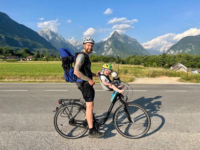
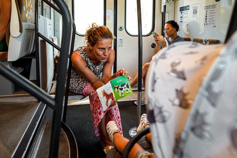
If you have any questions about our trip or traveling with a small child, please feel free to use the comments.
Day
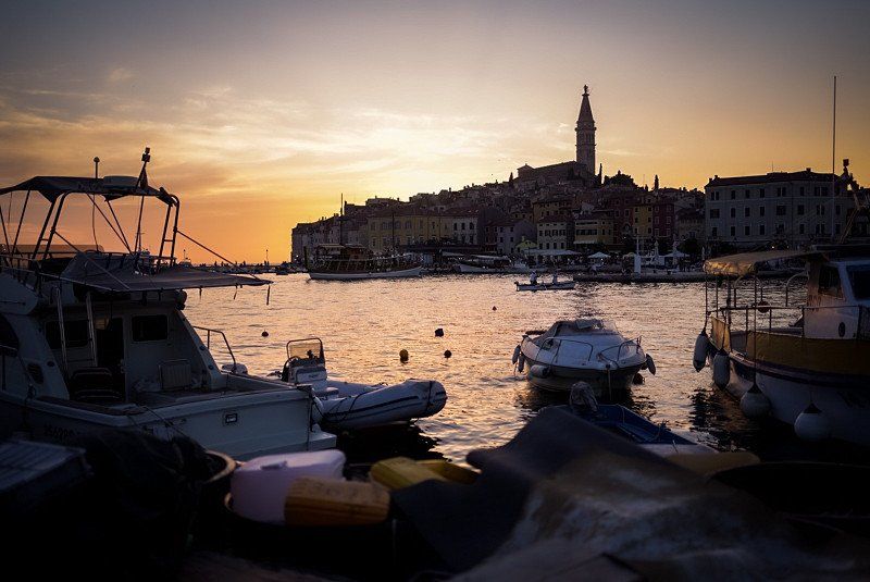
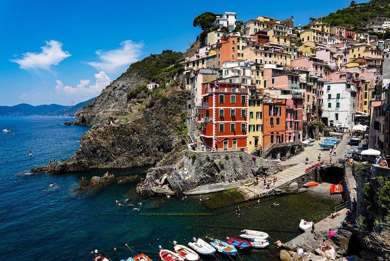
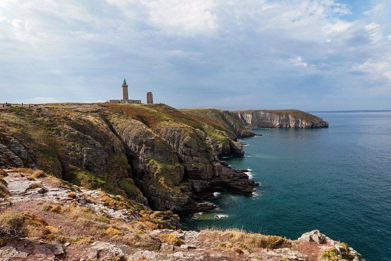
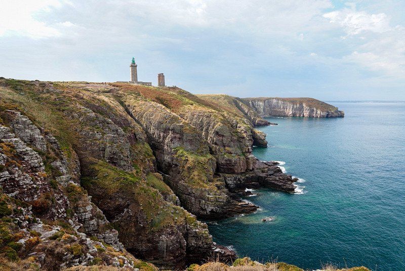
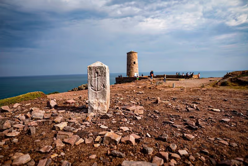
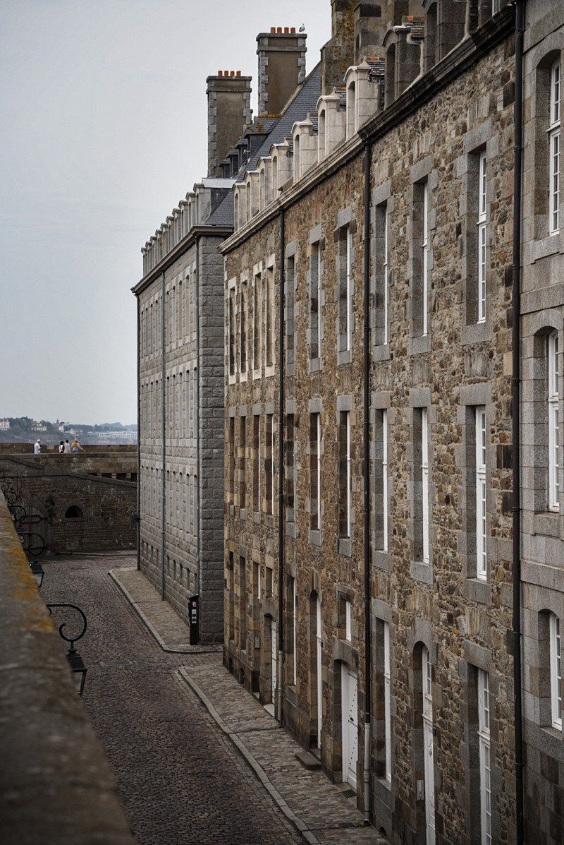
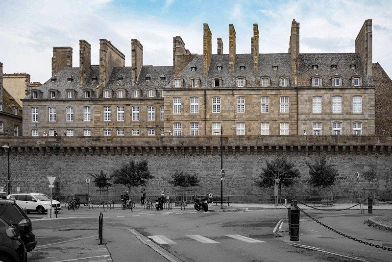
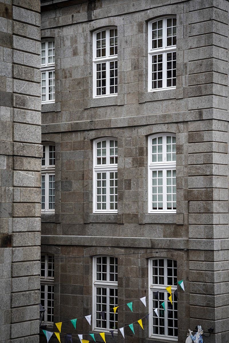
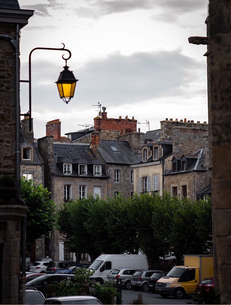
Berlin, Deutschland
3rd of June
52° 31' 12" N 13° 24' 17.8" E
52.5200066 13.4049540
• Head toward Karl-Liebknecht-Straße on Spandauer Straße. Go for 8 m.
• Make a U-Turn onto Spandauer Straße. Go for 408 m.
• Turn right onto Mühlendamm (B1) toward Potsdamer Platz. Go for 121 m.
• Turn left onto Molkenmarkt. Go for 111 m.
• Continue on Stralauer Straße. Go for 560 m.
• Continue on Holzmarktstraße. Go for 1.0 km.
• Turn right onto An der Schillingbrücke. Go for 66 m.
• Continue on Schillingbrücke. Go for 86 m.
• Continue on An der Schillingbrücke. Go for 116 m.
• Continue on Engeldamm. Go for 67 m.
• Turn left onto Köpenicker Straße. Go for 1.2 km.
• Continue on Schlesische Straße. Go for 660 m.
• Continue on Vor dem Schlesischen Tor. Go for 860 m.
• Turn right onto Elsenstraße (B96A). Go for 167 m.
• Turn left onto Am Treptower Park (B96A) toward Dresden/A117/Flughafen Schönefeld/Spreepark/Treptower Hafen. Go for 2.1 km.
• Turn right onto Dammweg. Go for 1.3 km.
• Continue on Grenzallee. Go for 775 m.
• Turn left onto Bergiusstraße toward Hamburg/A100/Dresden/A113/Flughafen. Go for 202 m.
• Take ramp onto A113 (Autobahnzubringer Dresden). Go for 19.2 km.
• Continue on A13. Go for 62.2 km.
• Take exit 10 toward Chemnitz/Dresden onto A13. Go for 88.2 km.
• Take exit 23 toward Chemnitz/Prag/Praha/Dresden/Flughafen onto A4. Go for 14.3 km.
• Take exit 77B toward Prag/Praha/Pirna/Dresden-Gorbitz onto A17. Go for 3.5 km.
• Take exit 2 toward Dresden-Gorbitz/Freital/Kesselsdorf. Go for 451 m.
• Turn left onto Coventrystraße (B173) toward Freiberg/Freital/Kesselsdorf. Go for 517 m.
• Turn left onto Wurgwitzer Landstraße (S36). Go for 5.8 km.
• Turn right onto Dresdner Straße (S194) toward Tharandt/Rabenau/Possendorf. Go for 1.0 km.
• Arrive at Dresdner Straße (S194). Your destination is on the left.
☍
205,1 km
(2 hrs. 33 min.)
Freital, Deutschland
3rd of June
51° 0' 3.1" N 13° 39' 4.5" E
51.0008667 13.6512413
• Head toward Bahnhofstraße on Dresdner Straße (S194). Go for 370 m.
• Turn left onto Poisentalstraße (S36). Go for 4.1 km.
• Turn left onto Hengstberg (K9017). Go for 1.0 km.
• Turn right onto Horkenstraße (K9016). Go for 18 m.
• Take the 1st exit from roundabout onto Horkenstraße (K9016). Go for 538 m.
• Continue on S191 toward A17/Prag (Praha)/Dresden-Prohlis. Go for 3.8 km.
• Turn right and take ramp onto A17 toward Prag (Praha)/Pirna. Go for 29.2 km.
• Continue on D8. Go for 5.0 km.
• Take exit 87 toward Tisá/Petrovice. Go for 872 m.
• Turn right onto 248 toward Telnice. Go for 624 m.
• Continue on Krásný les (248). Go for 272 m.
• Continue on 248. Go for 1.6 km.
• Continue on Nakléřov (248) toward Teplice/Ústí n. L. Go for 329 m.
• Continue on 248. Go for 1.5 km.
• Turn left onto 25362H toward Děčín. Go for 703 m.
• Continue on Knínice (25362H). Go for 575 m.
• Continue on 25362H. Go for 534 m.
• Turn right onto 13 toward Teplice. Go for 911 m.
• Take the 2nd exit from roundabout onto 13 toward Teplice/Praha/Ústí n. L. Go for 335 m.
• Take ramp onto D8 toward Praha/Ústí n. L. Go for 82.9 km.
• Continue on Cínovecká (E55). Go for 3.5 km.
• Keep left onto Cínovecká (8) toward Městský okruh/Centrum/Kobylisy/Letňany. Go for 5.0 km.
• Take ramp onto Nová Povltavská toward K. Vary/Troja/Zoo. Go for 884 m.
• Continue on Bubenečský tunel. Go for 5.4 km.
• Keep left onto Patočkova toward Městský okruh/Brno/Plzeň/Braník/Smíchov. Go for 29 m.
• Continue on Brusnický tunel. Go for 340 m.
• Continue on Strahovský tunel. Go for 2.9 km.
• Keep left onto tunel Mrázovka toward Radlice. Go for 280 m.
• Turn right onto Radlická. Go for 218 m.
• Continue on Dobříšská. Go for 99 m.
• Keep right onto Křížová toward Hlubočepy. Go for 1.6 km.
• Turn left onto Na Zlíchově. Go for 245 m.
• Turn sharp right onto Nádražní toward Zbraslav. Go for 171 m.
• Continue on Strakonická. Go for 87 m.
• Make a U-Turn onto Strakonická. Go for 194 m.
• Turn right onto Císařská louka. Go for 177 m.
• Keep right onto Císařská louka. Go for 1.2 km.
• Turn left onto Císařská louka. Go for 26 m.
• Arrive at Císařská louka. Your destination is on the left.
☍
157,4 km
(1 hrs. 48 min.)
Day
Day
Caravan Camp Prag
June 5th
Císarská louka 162, 15000, Prag, Tschechien
50° 3' 44" N 14° 24' 49" E
50.0622222 14.4136111
• Head east on Císařská louka. Go for 26 m.
• Turn right onto Císařská louka. Go for 658 m.
• Turn slightly right onto Císařská louka. Go for 711 m.
• Turn right onto Strakonická. Go for 1.0 km.
• Turn left onto Moulíkova toward Zlíchov/Hlubočepy. Go for 117 m.
• Turn left onto Nádražní toward Zlíchov. Go for 949 m.
• Turn left onto Nádražní. Go for 206 m.
• Continue on Strakonická. Go for 854 m.
• Keep right onto Strakonická toward Strakonice/Dobříš/Slapy/4. Go for 6.4 km.
• Keep left onto Strakonická (4) toward Strakonice. Go for 9.0 km.
• Continue on D4. Go for 75.0 km.
• Take exit 84 toward Strakonice/20/Plzeň/E49 onto 4. Go for 14.6 km.
• Take the 3rd exit from roundabout onto Písecká (4) toward Passau/Vimperk/Č. Budějovice/22/Vodňany. Go for 879 m.
• Take the 3rd exit from roundabout onto Písecká (4) toward Č. Budějovice/22/Vimperk. Go for 730 m.
• Take the 1st exit from roundabout onto Volyňská (4) toward Vimperk. Go for 27.9 km.
• Turn right onto 1. máje toward 145/K. Hory/Zdíkov/Prachatice/U Sloupů/Centrum. Go for 246 m.
• Take the 1st exit from roundabout onto Sušická (145). Go for 3.6 km.
• Turn left onto 168 toward Horská Kvilda/Kvilda/Nové Hutě. Go for 5.5 km.
• Turn left onto 1672 toward Borová Lada. Go for 957 m.
• Continue on Paseka (1672). Go for 824 m.
• Continue on 1672. Go for 488 m.
• Continue on Šindlov (1672). Go for 974 m.
• Continue on Nový Svět (1672). Go for 1.2 km.
• Continue on 1672. Go for 158 m.
• Continue on Nový Svět (1672). Go for 701 m.
• Continue on Černá Lada (1672). Go for 107 m.
• Continue on 1672. Go for 235 m.
• Continue on Borová Lada (1672). Go for 1.1 km.
• Turn left onto Borová Lada (167) toward H. Vltavice. Go for 632 m.
• Continue on 167. Go for 5.8 km.
• Continue on Slatina (167). Go for 696 m.
• Continue on 167. Go for 1.0 km.
• Continue on Račí (167). Go for 449 m.
• Continue on 167. Go for 813 m.
• Continue on Račí (167). Go for 1.1 km.
• Continue on Horní Vltavice (167). Go for 906 m.
• Turn right onto Horní Vltavice (4) toward Strážný. Go for 13.2 km.
• Continue on B12. Go for 16.4 km.
• Turn left onto Bannholz (St2630). Go for 1.2 km.
• Continue on Stadtplatz. Go for 206 m.
• Turn right onto Passauer Straße (St2132). Go for 492 m.
• Take the 2nd exit from roundabout onto Passauer Straße (St2132). Go for 1.2 km.
• Keep left toward Ort/St2132. Go for 30 m.
• Turn left onto Ort (B12). Go for 31.5 km.
• Turn right onto Ilzbrücke (B12) toward A3/Rohrbach/Wegscheid/Obernzell/Hauzenberg/B388/Zentrum. Go for 65 m.
• Turn right onto Halser Straße. Go for 16 m.
• Turn slightly right. Go for 66 m.
• Arrive at your destination on the right.
☍
231,0 km
(3 hrs. )
Day
Day
Stellplatz Ilzbrücke
June 7th
Halser Straße, 94032, Passau, Deutschland
48° 34' 42" N 13° 28' 26" E
48.5783333 13.4738889
• Head toward Halser Straße. Go for 66 m.
• Turn slightly left onto Halser Straße. Go for 16 m.
• Turn right onto Ferdinand-Wagner-Straße (B12). Go for 122 m.
• Keep right onto Ferdinand-Wagner-Straße (B12). Go for 1.2 km.
• Keep left onto B12 toward München/Zollamt Hafen/Regensburg/A3/Linz/B85/Regen/Vilshofen/Passau-West. Go for 2.3 km.
• Keep left onto B12 toward A3/Regensburg/Linz/Vilshofen/Messepark Kohlbruck/Zollamt Hafen. Go for 386 m.
• Continue on St2125. Go for 635 m.
• Turn left onto Franz-Josef-Strauß-Brücke toward Linz/A3/Straubing/Vilshofen/Neustift/Passau Zentrum/Zollamt Hafen/Fürstenzell/Gewerbegebiet Sperrwies. Go for 3.1 km.
• Take ramp onto A3 toward Linz. Go for 20.1 km.
• Continue on A3/A8 (Innkreis Autobahn). Go for 305 m.
• Continue on A8 (Innkreis Autobahn). Go for 1.7 km.
• Take exit 74 toward Schärding/Suben. Go for 581 m.
• Take the 1st exit from roundabout onto Andiesen (L512) toward Braunau/Braunau am Inn/Reichersberg/Therme Geinberg. Go for 9.0 km.
• Turn right onto Altheimer Bundesstraße (B148) toward Braunau/Altheim/Obernberg. Go for 10.8 km.
• Pass 2 roundabouts and continue on Altheimer Bundesstraße (B148). Go for 6.1 km.
• Take the 3rd exit from roundabout onto Anton-Hargassner-Straße (B142) toward Straßwalchen/Mattighofen/Mauerkirchen/Weng i. I. Go for 8.9 km.
• Turn left onto Heiligengeistgasse (B142). Go for 3.1 km.
• Turn left onto Braunauer Bundesstraße (B147). Go for 1.4 km.
• Turn right onto Uttendorf (B147). Go for 356 m.
• Turn left onto Braunauer Ersatzstraße (B147). Go for 6.1 km.
• Take the 3rd exit from roundabout onto Stadtplatz (B147) toward Salzburg/Straßwalchen/Munderfing/Ach-Burghausen. Go for 616 m.
• Turn right onto Mattseerstraße (L505). Go for 3.5 km.
• Take the 2nd exit from roundabout onto Hauptstraße (L505). Go for 697 m.
• Turn right onto Siegertshafter Landesstraße (L1050). Go for 6.2 km.
• Turn left onto Baier Landesstraße (L1044). Go for 2.2 km.
• Turn right onto Palting (L505). Go for 10.0 km.
• Take the 3rd exit from roundabout onto Mattseer Straße (L101). Go for 192 m.
• Pass 3 roundabouts and continue on Mattseer Landstraße (L101). Go for 11.3 km.
• Take the 2nd exit from roundabout onto Lamprechtshausener Straße (B156) toward Wien/München/Salzburg. Go for 787 m.
• Turn left onto Moosfeldstraße toward Hallwang/Kasern/Lengfelden Siedlung. Go for 205 m.
• Continue on Alte Mattseer Straße. Go for 442 m.
• Turn right onto Carl-Zuckmayer-Straße. Go for 206 m.
• Turn left onto Carl-Zuckmayer-Straße. Go for 57 m.
• Turn left. Go for 9 m.
• Turn right. Go for 28 m.
• Arrive at your destination.
☍
112,8 km
(1 hrs. 36 min.)
Day
Day
Reisemobil-Stellplatz Salzburg
June 9th
Carl-Zuckmayer-Straße 26, 5101, Salzburg, Österreich
47° 50' 8.8" N 13° 3' 37.5" E
47.8357800 13.0604300
• Head southwest. Go for 28 m.
• Turn left. Go for 9 m.
• Turn right toward Carl-Zuckmayer-Straße. Go for 16 m.
• Continue on Carl-Zuckmayer-Straße. Go for 41 m.
• Turn right onto Carl-Zuckmayer-Straße. Go for 206 m.
• Turn left onto Alte Mattseer Straße. Go for 442 m.
• Continue on Moosfeldstraße. Go for 196 m.
• Turn left onto Lamprechtshausener Straße (B156). Go for 674 m.
• Take ramp onto A1 (West Autobahn) toward Innsbruck/München/Villach/A10/Messe/Flughafen. Go for 8.1 km.
• Take exit 297 toward Wals onto B1 (Walser Bundesstraße). Go for 325 m.
• Take the 2nd exit from roundabout onto Bundesstraße (B1) toward Wals/Großgmain/Lofer/Bad Reichenhall. Go for 3.4 km.
• Continue on B21. Go for 8.3 km.
• Keep left onto Loferer Straße (B20/B21) toward Innsbruck/Lofer/Berchtesgaden/Zentrum Bad Reichenhall. Go for 14.5 km.
• Continue on Loferer Bundesstraße (B178). Go for 9.3 km.
• Take ramp onto B311f toward Zell am See/Saalfelden/Lofer. Go for 2.2 km.
• Take the 3rd exit from roundabout onto Lofer (B311). Go for 20.5 km.
• Turn right toward Marzon. Go for 54 m.
• Continue on Marzon. Go for 778 m.
• Continue on Euring. Go for 710 m.
• Continue on Lenzing. Go for 215 m.
• Turn left onto Lenzing. Go for 764 m.
• Continue on Uttenhofen. Go for 258 m.
• Turn right onto Uttenhofen (B164). Go for 6.5 km.
• Turn right onto Sonnberg. Go for 301 m.
• Turn right onto Sonnberg. Go for 199 m.
• Arrive at Sonnberg. Your destination is on the right.
☍
78,0 km
(1 hrs. 7 min.)
Day
Day
Sonnberg 86, Leogang, Österreich
June 11th
Sonnberg 86, 5771 Leogang, Österreich
47° 26' 30.5" N 12° 44' 10.8" E
47.4417930 12.7363390
• Head northwest on Sonnberg. Go for 199 m.
• Turn left onto Sonnberg. Go for 70 m.
• Keep left onto Sonnberg. Go for 231 m.
• Turn left onto Sonnberg (B164). Go for 8.7 km.
• Take the 1st exit from roundabout onto Zeller Bundesstraße (B311). Go for 290 m.
• Pass 2 roundabouts and continue on Thor (B311). Go for 11.0 km.
• Take ramp onto Zeller Straße (L247) toward Zell am See/Thumersbach. Go for 731 m.
• Turn left onto Thumersbacher Straße (L247). Go for 895 m.
• Turn right onto Thumersbacher Straße. Go for 43 m.
• Arrive at your destination on the right.
☍
22,2 km
( 20 min.)
Day
Seecamp Zell am See
12th of June
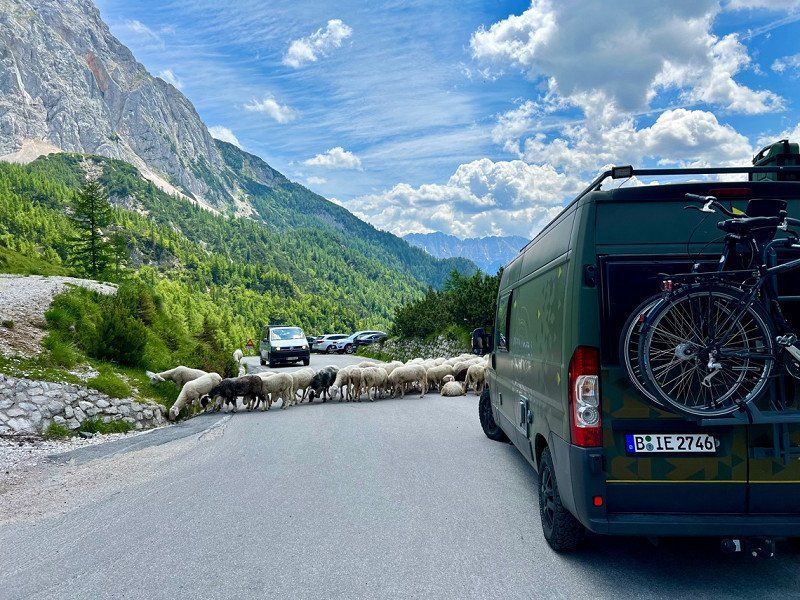
Day trip to Zell am See
Thumersbacherstraße 34, 5700, Zell am See, Österreich
47° 20' 22.8" N 12° 48' 32.8" E
47.3396600 12.8091200
• Head north. Go for 22 m.
• Continue on Thumersbacher Straße. Go for 21 m.
• Turn right onto Thumersbacher Straße (L247). Go for 6.3 km.
• Take the 3rd exit from roundabout onto Pinzgauer Bundesstraße (B311) toward Salzburg/A10/Villach/Bischofshofen/Bruck Mitte. Go for 45.5 km.
• Take ramp onto A10 (Tauern Autobahn) toward Graz/Villach. Go for 132 km.
• Take exit 178 toward Villach. Go for 267 m.
• Continue on Ossiacher Bundesstraße (B94). Go for 437 m.
• Turn right and take ramp toward Töbring/St. Ruprecht. Go for 30 m.
• Turn left onto Töbringer Straße. Go for 133 m.
• Continue on Millstätter Straße. Go for 2.3 km.
• Turn left onto Ossiacher Straße. Go for 167 m.
• Turn right onto Hauptschulstraße (L49). Go for 300 m.
• Turn right onto Ossiacher See Südufer Landesstraße (L49) toward Udine/Klagenfurt. Go for 107 m.
• Turn right. Go for 47 m.
• Keep right. Go for 20 m.
• Arrive at your destination on the right.
☍
188,0 km
(2 hrs. 1 min.)
Day
Carglass® Villach, Triester Straße, Villach, Österreich
Triester Str. 50, 9523 Villach, Österreich
46° 37' 37.6" N 13° 52' 51.2" E
46.6271103 13.8808833
• Head toward Triester Straße. Go for 14 m.
• Turn left onto Triester Straße. Go for 16 m.
• Turn left and take ramp. Go for 137 m.
• Continue on Ossiacher See Südufer Landesstraße (L49). Go for 49 m.
• Keep right toward Udine/Klagenfurt. Go for 57 m.
• Take ramp onto Triester Straße (B83). Go for 10.1 km.
• Turn right onto Selpritscher Landesstraße (L60) toward Rosegg/Maria Wörth/Wörthersee Süd. Go for 970 m.
• Turn right onto Rosegger Landesstraße (L52). Go for 1.3 km.
• Turn left onto Schlossweg. Go for 117 m.
• Arrive at Schlossweg. Your destination is on the right.
☍
12,8 km
( 11 min.)
Stellplatz Gasthof Roseggerhof
June 13th
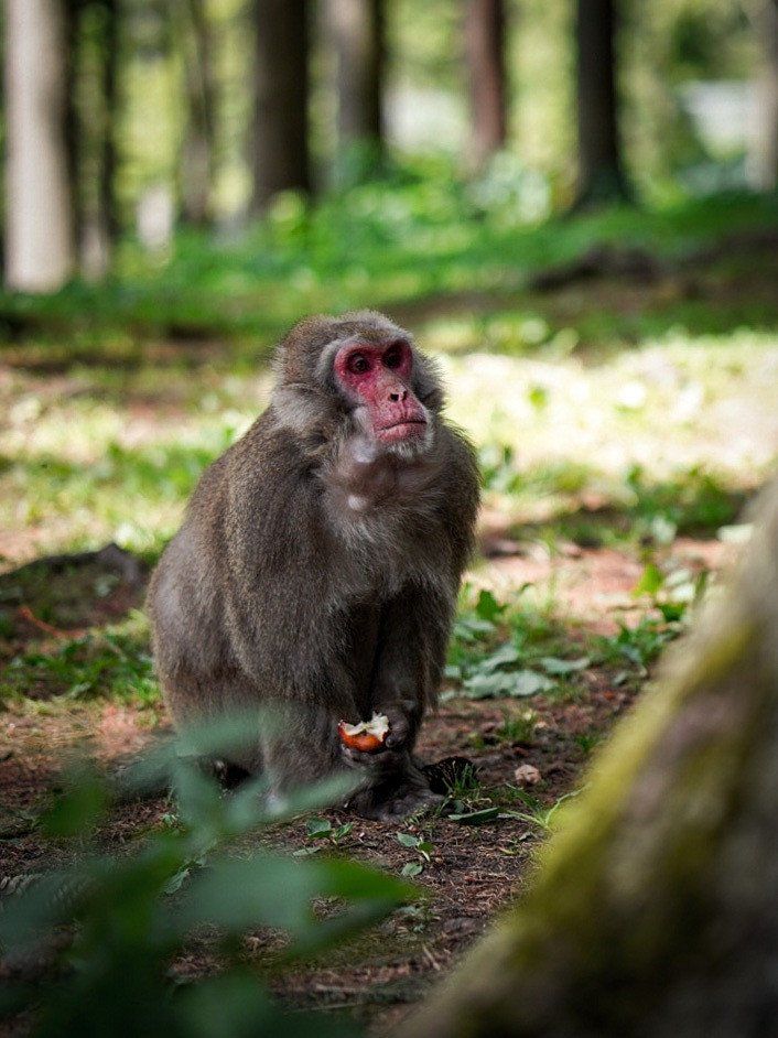
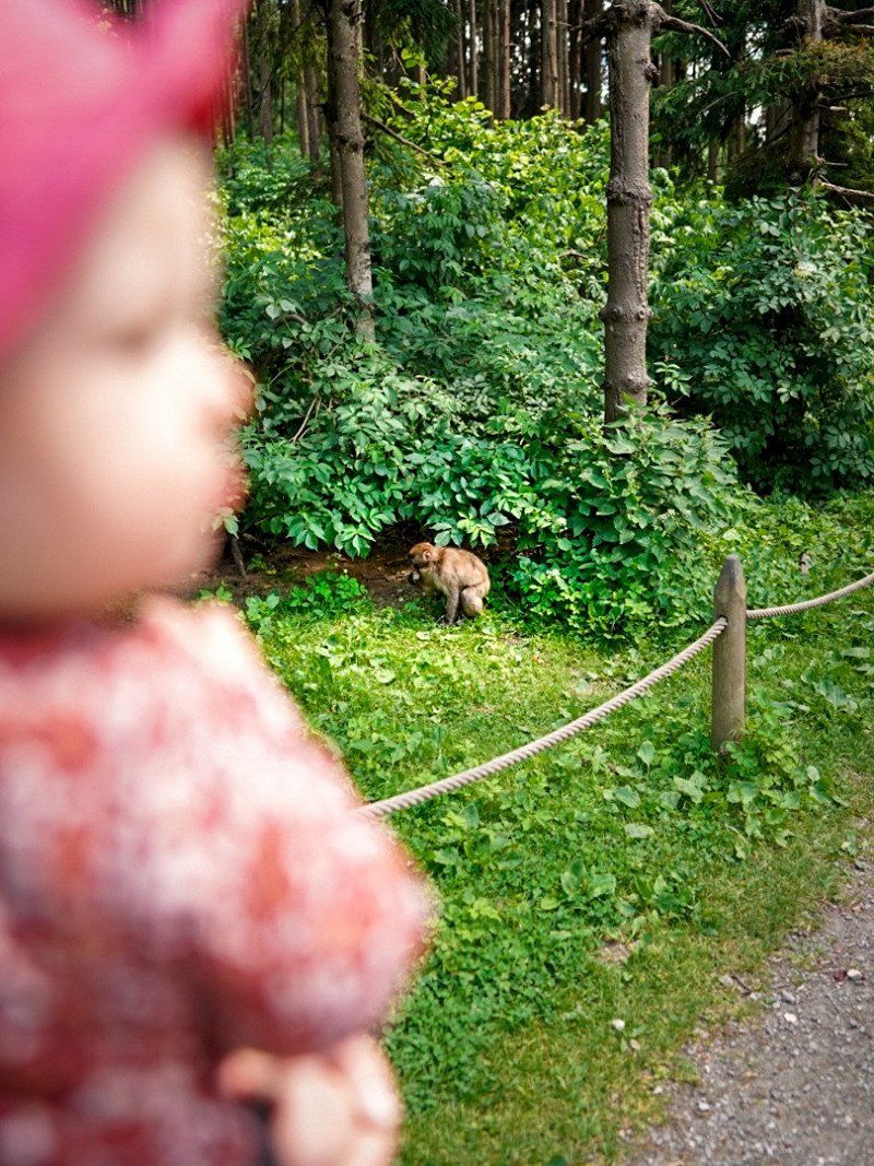
Very good pitch for max 2 nights. Before that I exchanged the windscreen at Carglass and in the meantime I visited the Affenberg in Villach.
Schulweg 4, 9232, Rosegg, Österreich
46° 35' 25" N 14° 1' 13" E
46.5902778 14.0202778
• Head toward Schulweg on Schlossweg. Go for 6 m.
• Turn left onto Schulweg. Go for 104 m.
• Turn left onto Schlossallee. Go for 41 m.
• Turn right onto Rosegger Straße (L52). Go for 1.2 km.
• Turn left onto Selpritscher Landesstraße (L60). Go for 967 m.
• Turn right onto Villacher Straße (B83). Go for 2.0 km.
• Take the 1st exit from roundabout onto Villacher Straße (B83) toward Velden. Go for 3.7 km.
• Arrive at Saag (B83). Your destination is on the right.
☍
8,0 km
( 9 min.)
Day
Electric Garden, Saag, Gemeinde Techelsberg am Wörther See, Österreich
14th June
Day trip at Lake Wörthersee
And saw the moonrise in the evening
Saag 15, 9220 Gemeinde Techelsberg am Wörther See, Österreich
46° 37' 21.4" N 14° 4' 25.2" E
46.6226225 14.0736614
• Head west on Saag (B83). Go for 3.7 km.
• Take the 2nd exit from roundabout onto Villacher Straße (B83) toward Villach/Wernberg/Rosegg/Maria Wörth/Wörthersee Süd. Go for 2.1 km.
• Turn left onto Selpritscher Landesstraße (L60) toward Rosegg/Maria Wörth/Wörthersee Süd. Go for 929 m.
• Turn right onto Rosegger Landesstraße (L52). Go for 1.3 km.
• Turn left onto Schlossweg. Go for 117 m.
• Arrive at Schlossweg. Your destination is on the right.
☍
8,1 km
( 9 min.)
Stellplatz Gasthof Roseggerhof
Schulweg 4, 9232, Rosegg, Österreich
46° 35' 25" N 14° 1' 13" E
46.5902778 14.0202778
• Head toward Schulweg on Schlossweg. Go for 6 m.
• Turn left onto Schulweg. Go for 104 m.
• Turn left onto Schlossallee. Go for 41 m.
• Turn left onto Rosegger Straße (L52). Go for 482 m.
• Turn left onto Rosegger Straße (L52). Go for 26 m.
• Continue on Mühlbacher Straße (L55). Go for 4.5 km.
• Take ramp. Go for 96 m.
• Turn right onto Rosental Bundesstraße (B85). Go for 1.8 km.
• Take ramp onto A11 (Karawanken Autobahn) toward Ljubljana. Go for 11.3 km.
• Continue on Predor Karavanke (A2). Go for 12.2 km.
• Take exit 2 toward Lipce. Go for 319 m.
• Turn left onto Lipce (634) toward Jesenice/Lipce. Go for 520 m.
• Turn right onto Lipce toward Lipce. Go for 12 m.
• Turn right onto Lipce. Go for 1.1 km.
• Turn slightly left onto Blejska Dobrava. Go for 383 m.
• Arrive at Blejska Dobrava. Your destination is on the right.
☍
32,9 km
( 28 min.)
Day
Camping Perun Lipce
15th June
Blejska Dobrava 160, 4273, Blejska Dobrava, Slowenien
46° 24' 54.8" N 14° 6' 20" E
46.4152300 14.1055600
• Head northwest on Blejska Dobrava. Go for 383 m.
• Turn slightly right onto Lipce. Go for 1.1 km.
• Turn left onto Lipce. Go for 12 m.
• Turn left onto Lipce (634) toward Sp. Gorje. Go for 473 m.
• Take ramp onto A2 toward Ljubljana. Go for 8.1 km.
• Take exit 3 toward Lesce/Bohinj/Pokljuka/Bled/Begunje na Gorenjskem/Vrba. Go for 459 m.
• Take the 2nd exit from roundabout onto 209 toward Bohinj/Pokljuka/Bled/Lešče. Go for 1.3 km.
• Pass 2 roundabouts and continue on Alpska cesta (209). Go for 1.7 km.
• Take the 1st exit from roundabout onto Ljubljanska cesta (209). Go for 524 m.
• Take the 2nd exit from roundabout onto Ljubljanska cesta (209) toward Bohinj/Pokljuka. Go for 159 m.
• Arrive at Ljubljanska cesta (209). Your destination is on the right.
☍
14,2 km
( 14 min.)
Day
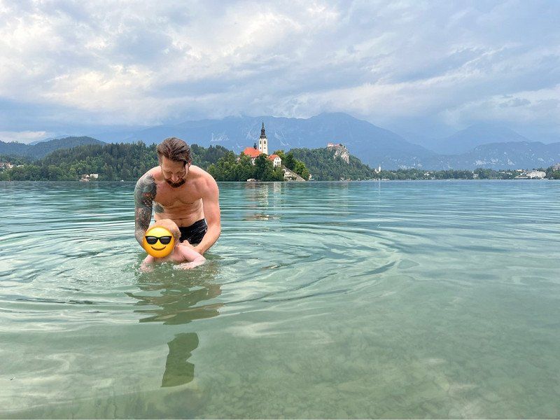
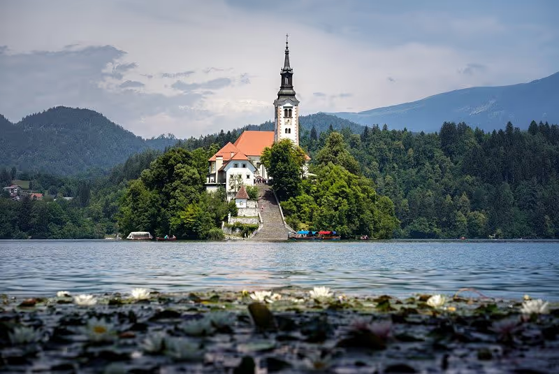
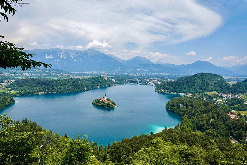
Bled, Slowenien
June 16th
Day trip Bled
4260 Bled, Slowenien
46° 22' 6" N 14° 6' 52.5" E
46.3683266 14.1145798
• Head west on Ljubljanska cesta (209).
• Turn left onto Ribenska cesta. Go for 34 m.
• Turn left onto Ribenska cesta. Go for 29 m.
• Continue on Ljubljanska cesta. Go for 19 m.
• Turn right onto Ljubljanska cesta (209). Go for 104 m.
• Take the 2nd exit from roundabout onto Ljubljanska cesta (209). Go for 465 m.
• Take the 1st exit from roundabout onto Ljubljanska cesta (209). Go for 1.4 km.
• Pass 2 roundabouts and continue on Alpska cesta (209). Go for 1.5 km.
• Take the 2nd exit from roundabout onto A2 toward Jesenice. Go for 15.8 km.
• Take exit 1 toward Trbiž/Tarvisio/Kranjska Gora. Go for 623 m.
• Turn left onto Dovje (201). Go for 18.3 km.
• Take the 2nd exit from roundabout onto 206 toward Bovec/Vršič/Center. Go for 43.2 km.
• Turn left toward Nova Gorica/Bovec. Go for 31 m.
• Turn left onto Ravni Laz (203). Go for 1.4 km.
• Take the 2nd exit from roundabout onto 203. Go for 226 m.
• Turn right onto Ledina. Go for 23 m.
• Arrive at Ledina. Your destination is on the right.
☍
83,2 km
(1 hrs. 37 min.)
Day
Kamp Polovnik
17th of June
Arrived and relaxed at the place, as well as planned for the next day.
Ledina 8, 5230, Bovec, Slowenien
46° 20' 10.2" N 13° 33' 29.5" E
46.3361700 13.5581900
• Head east on Ledina. Go for 23 m.
• Turn right onto Ledina (203). Go for 498 m.
• Pass 2 roundabouts and continue on 203. Go for 20.7 km.
• Turn left onto 203 toward Tolmin/Idrsko. Go for 459 m.
• Take the 2nd exit from roundabout onto Goriška cesta (102) toward Tolmin. Go for 9.1 km.
• Turn left toward Volarje. Go for 103 m.
• Continue on Volarje. Go for 472 m.
• Turn right onto Volarje. Go for 786 m.
• Continue on Volarje. Go for 131 m.
• Keep right onto Volarje. Go for 104 m.
• Continue on Gabrje. Go for 702 m.
• Turn right. Go for 611 m.
• Turn slightly left. Go for 132 m.
• Turn right. Go for 25 m.
• Arrive at your destination on the right.
☍
33,9 km
( 39 min.)
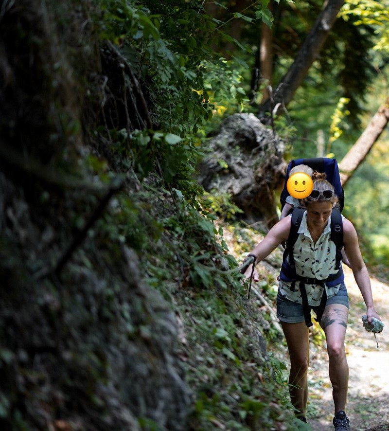
Day
Ausflug
18th of June
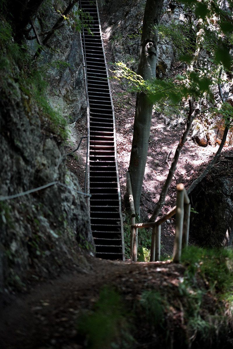
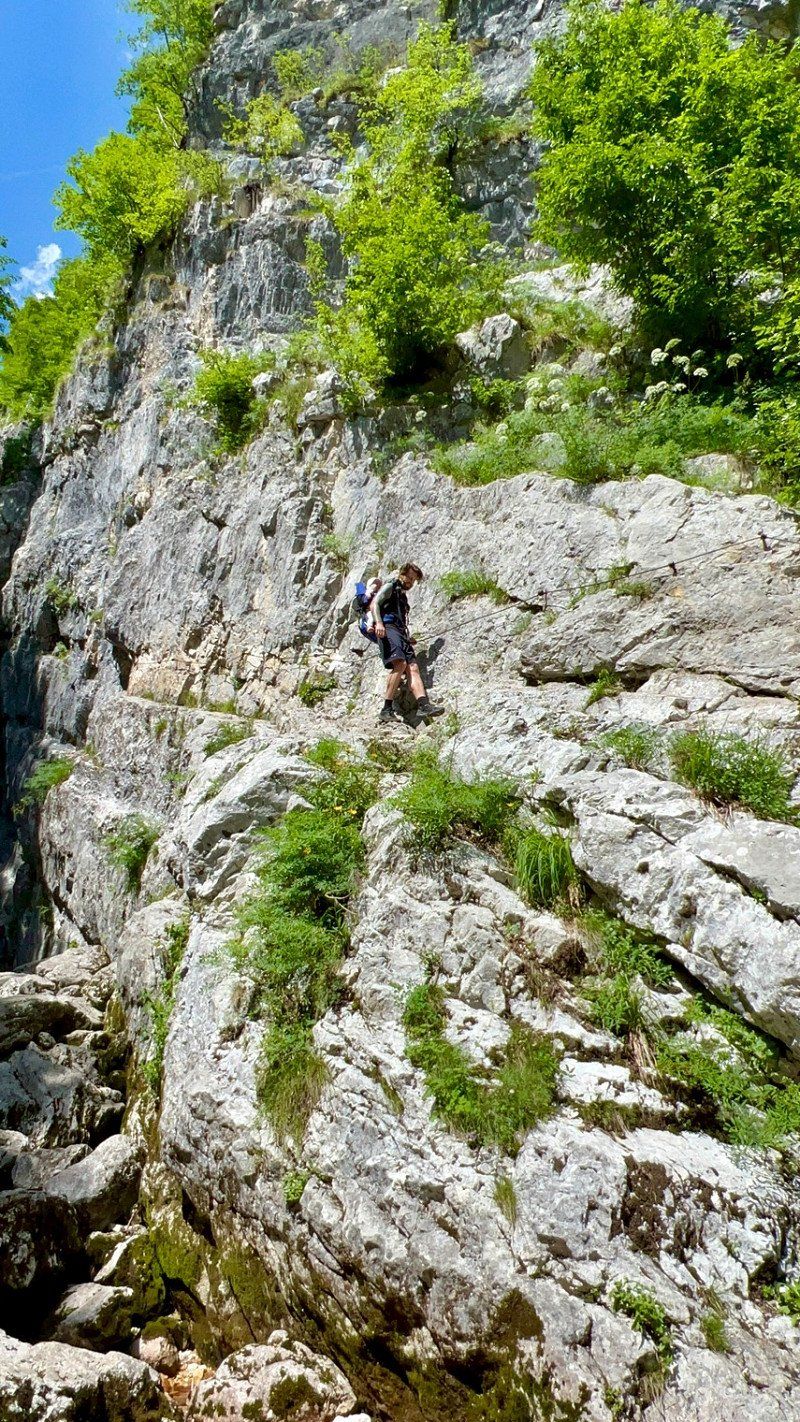
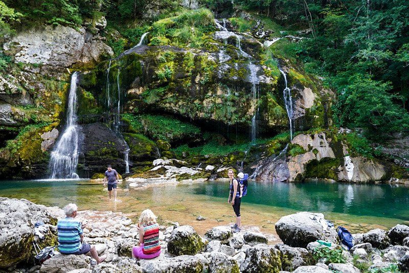
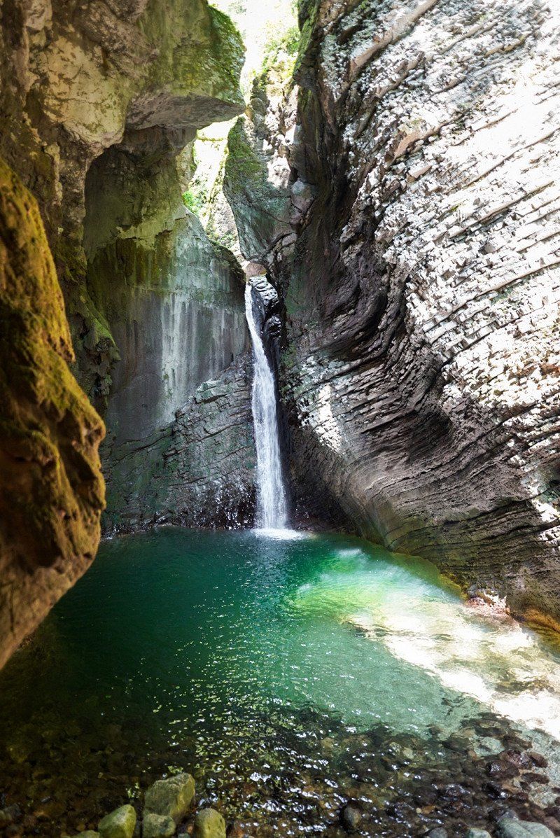
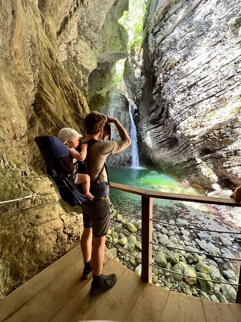
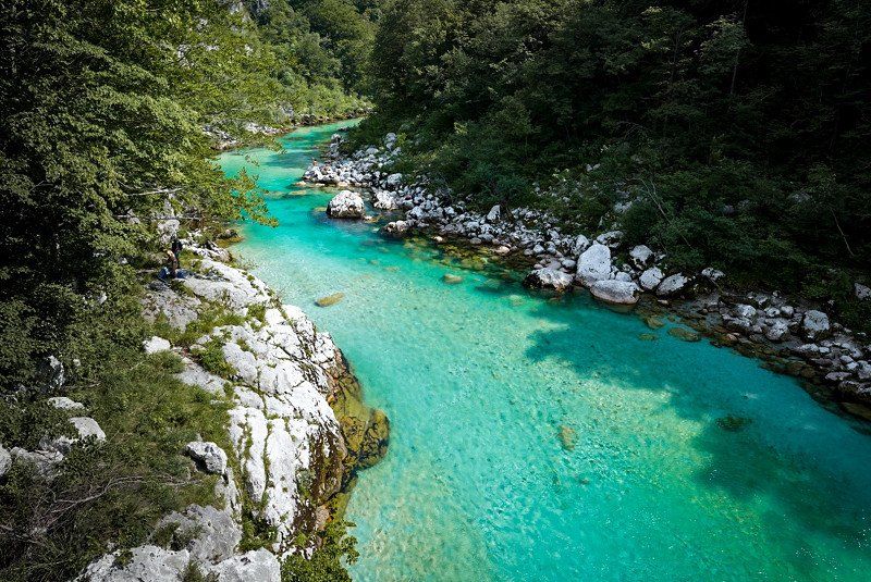
Bike and hike to Virje waterfall and Glijuna spring
Day
Camp Gabrje, Gabrje, Tolmin, Slowenien
June 19th
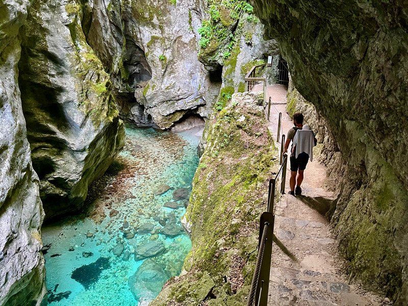
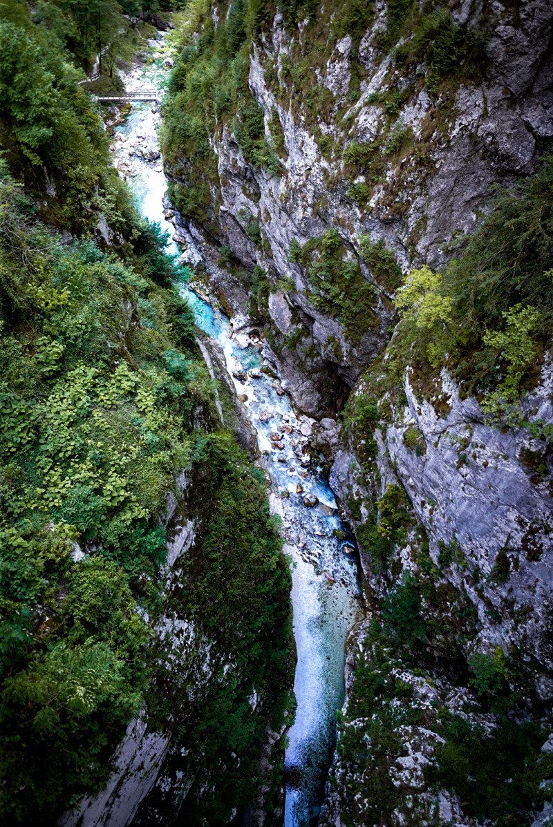
Tolmin Klamm
Gabrje 29, 5220 Tolmin, Slowenien
46° 11' 49" N 13° 41' 45.6" E
46.1969521 13.6960086
• Head southwest. Go for 13 m.
• Turn left. Go for 37 m.
• Turn left. Go for 1.0 km.
• Turn slightly right toward Tolmin/102. Go for 1.7 km.
• Turn right onto Tolmin (102). Go for 446 m.
• Continue on Volče (102). Go for 311 m.
• Take the 2nd exit from roundabout onto Volče (103) toward N. Gorica/Nova Gorica. Go for 36.1 km.
• Take the 3rd exit from roundabout onto Kromberška cesta (613) toward Ajdovščina/Kromberk. Go for 4.0 km.
• Take the 1st exit from roundabout onto Ajševica (613) toward Ljubljana. Go for 36 m.
• Turn left onto Ajševica (444) toward Ljubljana. Go for 2.0 km.
• Turn right onto Ozeljan (615) toward Ljubljana/Italija. Go for 3.0 km.
• Turn left and take ramp onto H4 toward Ljubljana/Nova Gorica. Go for 35.1 km.
• Continue on Nanos toward Ljubljana/Reka/Rijeka/Postojna. Go for 584 m.
• Take the exit onto A1. Go for 11.0 km.
• Take exit 41 toward Postojna. Go for 398 m.
• Continue on Reška cesta (6) toward Postojna. Go for 1.2 km.
• Keep right toward Predjamski grad/jama/grotte/cave. Go for 47 m.
• Take the 2nd exit from roundabout onto Reška cesta toward Predjamski grad/jama/grotte/cave. Go for 253 m.
• Take the 1st exit from roundabout onto Tržaška cesta toward Studeno/Predjamski grad/Jama/Grotte/Cave/Pivka jama. Go for 193 m.
• Take the 3rd exit from roundabout onto Kosovelova ulica toward Studeno/Predjamski grad/jama/grotta/cave/Pivka jama. Go for 519 m.
• Continue on Pot k Pivki. Go for 14 m.
• Continue on Kosovelova ulica. Go for 366 m.
• Turn left onto Jamska cesta (913). Go for 451 m.
• Turn right onto Jamska cesta. Go for 41 m.
• Continue on Jamska cesta. Go for 137 m.
• Arrive at Jamska cesta.
☍
98,9 km
(1 hrs. 34 min.)
Day
Day
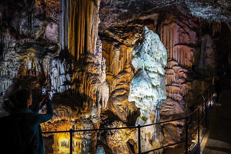
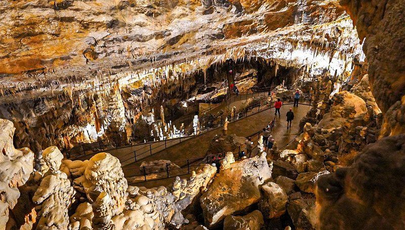
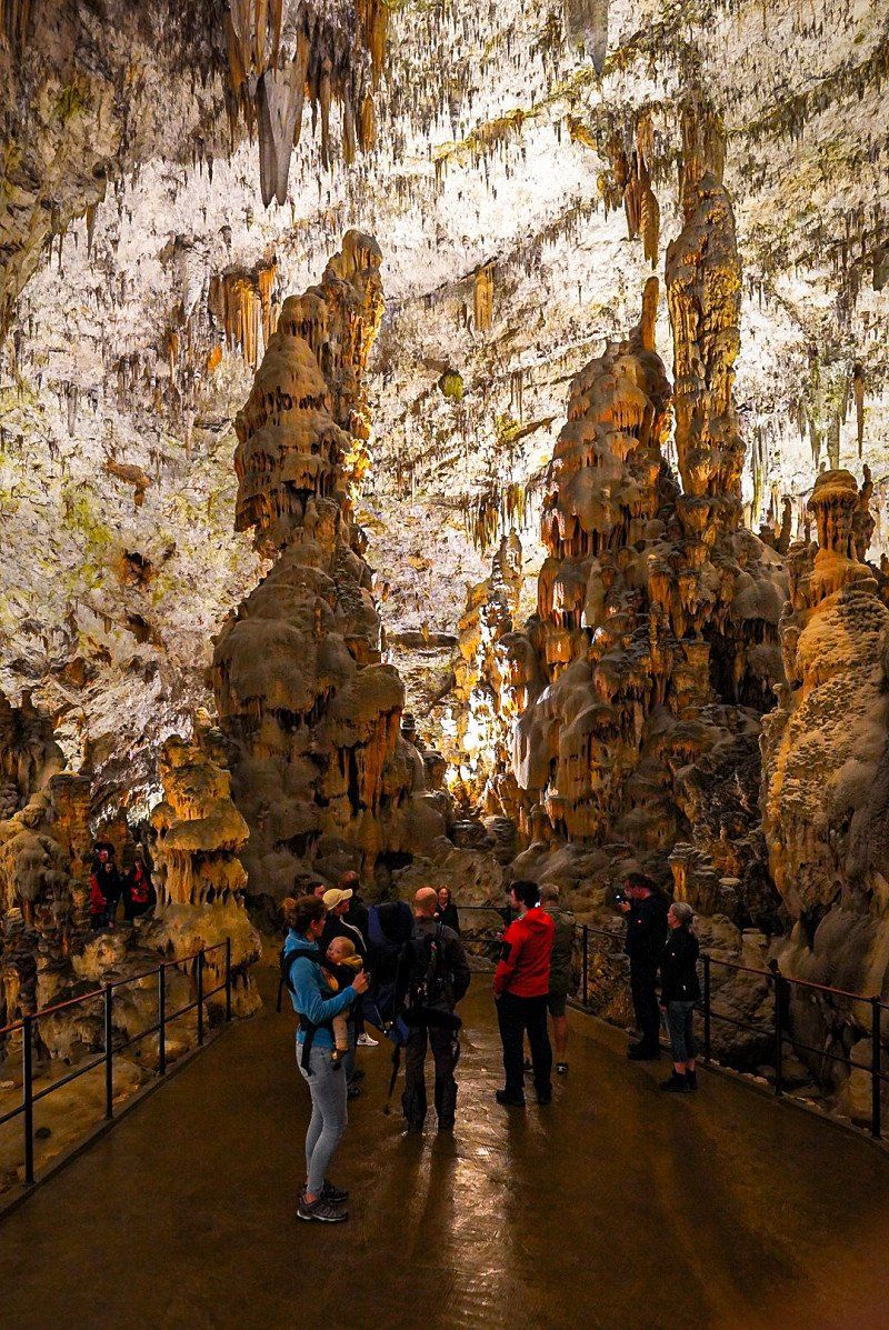
Grotte di Postumia (Slovenia), Jamska cesta, Adelsberg, Slowenien
Second largest cave opened for tourism in the world
Jamska cesta 30, 6230 Postojna, Slowenien
45° 46' 58.9" N 14° 12' 13.8" E
45.7830298 14.2038417
• Head north on Jamska cesta. Go for 214 m.
• Take the 2nd exit from roundabout onto Jamska cesta. Go for 501 m.
• Turn right onto Kosovelova ulica. Go for 366 m.
• Continue on Pot k Pivki. Go for 14 m.
• Continue on Kosovelova ulica. Go for 480 m.
• Take the 2nd exit from roundabout onto Tržaška cesta toward Ilirska Bistrica/Koper/Ljubljana/Nova Gorica. Go for 194 m.
• Take the 3rd exit from roundabout onto Reška cesta toward Ljubljana/Koper/Ilirska Bistrica. Go for 184 m.
• Keep right toward Reška cesta/6. Go for 46 m.
• Take the 2nd exit from roundabout onto Reška cesta (6). Go for 965 m.
• Turn left and take ramp onto A1 toward Koper/N. Gorica. Go for 48.7 km.
• Take the exit toward Dekani/Skofije. Go for 692 m.
• Turn left onto 406 toward Skofije. Go for 635 m.
• Take the 3rd exit from roundabout onto 406 toward Ankaran/Ljubljana/Koper/Capodistria. Go for 2.2 km.
• Take the 1st exit from roundabout onto Jadranska cesta (406). Go for 2.2 km.
• Take the 3rd exit from roundabout onto Jadranska cesta. Go for 144 m.
• Turn left. Go for 37 m.
• Turn right. Go for 22 m.
• Arrive at your destination on the left.
☍
57,6 km
( 43 min.)
Adria Ankaran, Jadranska cesta, Ankaran - Ancarano, Slowenien
June 21st
Jadranska cesta 25, 6280 Ankaran - Ancarano, Slowenien
45° 34' 39.8" N 13° 44' 8.6" E
45.5777100 13.7357201
• Head southwest. Go for 137 m.
• Turn right toward Jadranska cesta. Go for 25 m.
• Turn right onto Jadranska cesta. Go for 64 m.
• Continue toward Jadranska cesta. Go for 101 m.
• Continue on Jadranska cesta. Go for 109 m.
• Take the 1st exit from roundabout onto Jadranska cesta (406) toward Koper/Capodistria. Go for 2.2 km.
• Take the 2nd exit from roundabout onto Jadranska cesta (406). Go for 1.3 km.
• Continue on 406 toward Škofije/Ljubljana/Koper/Capodistria/Trst/Trieste. Go for 662 m.
• Turn left and take ramp onto H5 toward Ljubljana/Koper/Capodistria. Go for 1.5 km.
• Take left ramp onto H5 toward Pulj/Pula/Pola/Koper/Capodistria/Portorož/Portorose/Bertoki/Bertocchi. Go for 9.9 km.
• Continue on E751. Go for 2.8 km.
• Pass 3 roundabouts and continue on E751. Go for 4.2 km.
• Take the 1st exit from roundabout onto Koprska cesta (629) toward Piran/Pirano/Portorož/Portorose. Go for 794 m.
• Take the 1st exit from roundabout onto Koprska cesta (629) toward Piran/Pirano. Go for 86 m.
• Continue on Belokriška cesta (629). Go for 1.5 km.
• Turn right onto Belokriška cesta toward Fiesa/Fiesso. Go for 254 m.
• Continue on Arze. Go for 343 m.
• Turn right onto Fiesa. Go for 361 m.
• Turn slightly left onto Fiesa. Go for 206 m.
• Turn right onto Fiesa. Go for 97 m.
• Arrive at Fiesa. Your destination is on the left.
☍
26,8 km
( 28 min.)
Day
Day
Camp Fiesa
23rd June
Day trip to Piran
Fiesa 57b, 6330, Piran, Slowenien
45° 31' 25.2" N 13° 34' 45.4" E
45.5236600 13.5792700
• Head east on Fiesa. Go for 38 m.
• Turn slightly left onto Fiesa. Go for 59 m.
• Turn sharp left onto Fiesa. Go for 567 m.
• Turn left onto Arze. Go for 343 m.
• Continue on Belokriška cesta. Go for 11 m.
• Continue on Belokriška cesta. Go for 243 m.
• Turn left onto Belokriška cesta (629). Go for 522 m.
• Turn right onto Belokriška cesta (629). Go for 1.0 km.
• Continue on Koprska cesta (629) toward Koper/Capodistria. Go for 70 m.
• Take the 2nd exit from roundabout onto Koprska cesta (629) toward Koper/Capodistria. Go for 808 m.
• Take the 1st exit from roundabout onto E751 toward Pulj/Pula/Pola/Letališče. Go for 1.8 km.
• Take the 2nd exit from roundabout onto E751 toward Pulj/Pula/Pola/Letališče. Go for 5.5 km.
• Continue on Škrile (200). Go for 1.6 km.
• Keep right onto 200 toward Pula/Poreč/Umag. Go for 134 m.
• Continue on Istarski Ipsilon (A9). Go for 49.7 km.
• Take exit 7 toward Rovinj/Rovigno/Kanfanar/303/5077 onto Istarski Ipsilon. Go for 980 m.
• Take the 2nd exit from roundabout onto 303 toward Rovinj/Bale. Go for 1.8 km.
• Continue on Kurili (303). Go for 343 m.
• Continue on 303. Go for 2.5 km.
• Continue on Putini (303). Go for 607 m.
• Continue on 303. Go for 5.9 km.
• Continue on Aleja Ruđera Boškovića (303). Go for 482 m.
• Take the 4th exit from roundabout onto Cesta za Rovinjsko Selo (5096) toward Pula/Pola/Bale/5036/Valle/Rovinj jug/Rovigno sud. Go for 328 m.
• Keep right onto Naselje Gripole (5096). Go for 1.5 km.
• Continue on Gripole (5096). Go for 60 m.
• Continue on Ulica štanga (5096). Go for 298 m.
• Take the 3rd exit from roundabout onto Aleja 30. svibnja (5105). Go for 694 m.
• Take the 2nd exit from roundabout onto Aleja 30. svibnja (5105) toward Polari. Go for 375 m.
• Continue on 5105. Go for 993 m.
• Turn right onto Polari. Go for 185 m.
• Continue on Polari. Go for 1.1 km.
• Turn slightly left. Go for 48 m.
• Continue straight ahead. Go for 670 m.
• Turn slightly left toward Cesta sv. Maksimijana iz Veštra. Go for 792 m.
• Continue on Cesta sv. Maksimijana iz Veštra. Go for 220 m.
• Turn right onto Cesta sv. Maksimijana iz Veštra. Go for 48 m.
• Turn left. Go for 12 m.
• Arrive at your destination on the left.
☍
82,3 km
(1 hrs. 15 min.)
Day
Relaxing am Meer und Piran Essen
June 24th
Day
Camping Vestar
July 25th
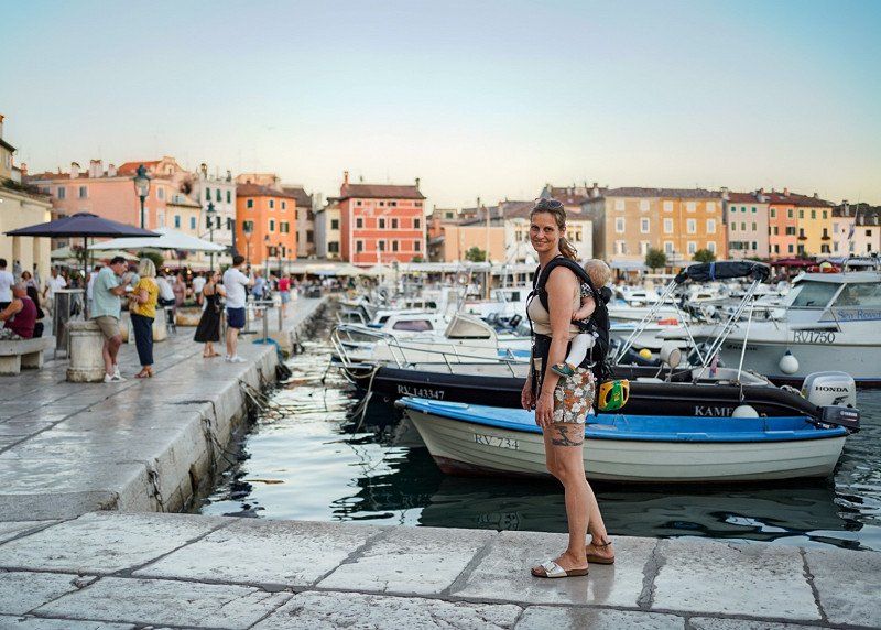
Veštar b.b., 52210, Rovinj, Kroatien
45° 3' 8.6" N 13° 41' 13.9" E
45.0523930 13.6871980
• Head northeast. Go for 43 m.
• Turn right. Go for 23 m.
• Turn right toward Cesta sv. Maksimijana iz Veštra. Go for 27 m.
• Turn right onto Cesta sv. Maksimijana iz Veštra. Go for 70 m.
• Turn left onto Cesta sv. Maksimijana iz Veštra. Go for 1.7 km.
• Turn slightly right onto Polari. Go for 1.3 km.
• Turn left onto 5105. Go for 993 m.
• Continue on Aleja 30. svibnja (5105). Go for 326 m.
• Take the 1st exit from roundabout onto Aleja 30. svibnja (5105) toward Rijeka/Pula/303/Pola/5096. Go for 675 m.
• Take the 2nd exit from roundabout onto Ulica štanga (5096) toward Trst/Trieste/Rijeka/Fiume/Pula/Pola. Go for 322 m.
• Continue on Gripole (5096). Go for 60 m.
• Continue on Naselje Gripole (5096). Go for 1.7 km.
• Take the 1st exit from roundabout onto Aleja Ruđera Boškovića (303) toward Rijeka/A8/Pula/A9/Pola. Go for 521 m.
• Continue on 303 toward Rijeka/A8/Pula/A9/Pola. Go for 5.9 km.
• Continue on Putini (303). Go for 607 m.
• Continue on 303. Go for 2.5 km.
• Continue on Kurili (303). Go for 343 m.
• Continue on 303. Go for 1.8 km.
• Take the 1st exit from roundabout onto Istarski Ipsilon (303) toward Rijeka/Pula/Poreč. Go for 908 m.
• Take exit 1 toward Umag/Poreč onto A9 (Istarski Ipsilon). Go for 50.8 km.
• Take the 2nd exit from roundabout onto 510 toward Trieste/Koper/Kaštel. Go for 1.8 km.
• Continue on Dragonja (11). Go for 227 m.
• Keep left onto Dragonja (11). Go for 8.3 km.
• Take the 2nd exit from roundabout onto Srgaši (11) toward Ljubljana/Koper. Go for 5.2 km.
• Keep right toward Ljubljana/Trst/Trieste/Center/Centro. Go for 98 m.
• Take the 2nd exit from roundabout onto Šmarska cesta (11) toward Trst/Trieste/Ljubljana/Center. Go for 518 m.
• Turn right onto Šmarska cesta toward Ljubljana/Trst/Trieste. Go for 294 m.
• Take the 2nd exit from roundabout onto Istrska cesta (H5) toward Ljubljana/Trst/Trieste. Go for 3.7 km.
• Take the exit toward Trst/Trieste/Ankaran/Ancarano/Škofije/Dekani onto H5. Go for 4.0 km.
• Continue on Raccordo Lacotisce-Rabuiese (SS15). Go for 3.9 km.
• Take ramp onto Strada Statale Triestina (SS202) toward Fernetti/E70/RA14/Venezia/A4/E55/Tarvisio/A23. Go for 32.3 km.
• Continue on A4 (Autostrada della Serenissima). Go for 203 km.
• Take the exit toward Strada Pedemontana Veneta/Montecchio/A27/Treviso-Belluno onto SPV (Strada Regionale di Montecchio Maggiore). Go for 508 m.
• Take ramp toward Montecchio. Go for 582 m.
• Take the 2nd exit from roundabout onto Strada Regionale di Montecchio Maggiore toward Arzignano/SR11/Montebello/Montecchio. Go for 251 m.
• Take the 3rd exit from roundabout onto Viale Milano (SR11) toward Spv/Treviso/SP246/Recoaro/Zona Industriale Montecchio M./Verona/Montebello. Go for 717 m.
• Take the 2nd exit from roundabout onto Località Signolo (SR11) toward Verona. Go for 3.6 km.
• Continue toward Via 24 Maggio. Go for 54 m.
• Take the 2nd exit from roundabout onto Via 24 Maggio toward Montebello Centro. Go for 224 m.
• Turn left onto Via Po. Go for 709 m.
• Continue on Via Giuseppe Mazzini. Go for 105 m.
• Turn right onto Via Fusinato. Go for 170 m.
• Turn left onto Viale Verona. Go for 64 m.
• Turn right. Go for 23 m.
• Arrive at your destination on the right.
☍
341,0 km
(3 hrs. 38 min.)
Day
Day
Day
Day
Day
Day
Day
Day
Day
Day
Day
Day
Day
Day
Piazzale Campo dello Sport
8th of July
Via Generale Vaccari, 36054, Montebello Vicentino, Italien
45° 27' 10" N 11° 22' 50" E
45.4527778 11.3805556
• Head northwest. Go for 29 m.
• Turn left toward Viale Verona. Go for 171 m.
• Turn right onto Viale Verona. Go for 78 m.
• Take the 2nd exit from roundabout onto Viale Verona. Go for 568 m.
• Take the 2nd exit from roundabout onto Viale Verona. Go for 176 m.
• Continue on Via Fracanzana. Go for 355 m.
• Take the 2nd exit from roundabout onto Via Fracanzana (SR11). Go for 1.4 km.
• Take ramp toward E70/Milano/A4/Venezia/Valdastico/A31. Go for 277 m.
• Take ramp onto A4 (Autostrada della Serenissima) toward Milano. Go for 60.7 km.
• Take the exit toward Sirmione. Go for 1.0 km.
• Continue on Via dei Colli Storici (SP13). Go for 776 m.
• Take the 4th exit from roundabout onto Via dei Colli Storici. Go for 530 m.
• Take the 2nd exit from roundabout onto Via dei Colli Storici toward Desenzano/Sirmione/Tangenziale. Go for 382 m.
• Continue toward Via dei Colli Storici. Go for 35 m.
• Take the 2nd exit from roundabout toward Sirmione. Go for 146 m.
• Continue on Via dei Colli Storici. Go for 156 m.
• Take the 2nd exit from roundabout. Go for 141 m.
• Continue on Via Salvo D'Acquisto. Go for 1.5 km.
• Continue toward Sirmione/Desenzano D/G/Verona. Go for 45 m.
• Take the 2nd exit from roundabout toward Desenzano D/G/Verona. Go for 49 m.
• Continue on Viale della Comunità Europea. Go for 309 m.
• Continue on Via Brescia. Go for 36 m.
• Take the 2nd exit from roundabout onto Via Brescia toward Colombare Centro/Peschiera D/G/Verona. Go for 380 m.
• Take the 3rd exit from roundabout onto Via Colombare. Go for 59 m.
• Continue on Via Colombare. Go for 41 m.
• Pass 3 roundabouts and continue on Via Colombare. Go for 918 m.
• Continue on Via 25 Aprile. Go for 188 m.
• Take the 1st exit from roundabout onto Via 25 Aprile. Go for 1.4 km.
• Continue on Viale Guglielmo Marconi. Go for 291 m.
• Arrive at Viale Guglielmo Marconi.
☍
72,2 km
( 52 min.)
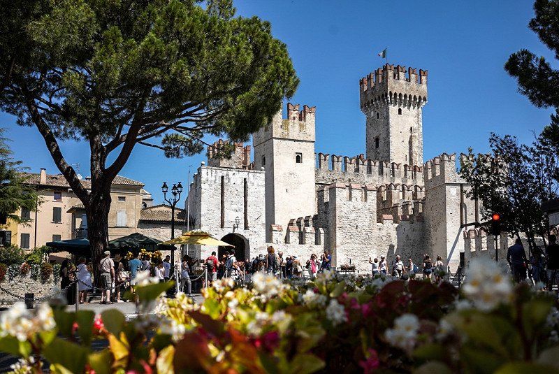
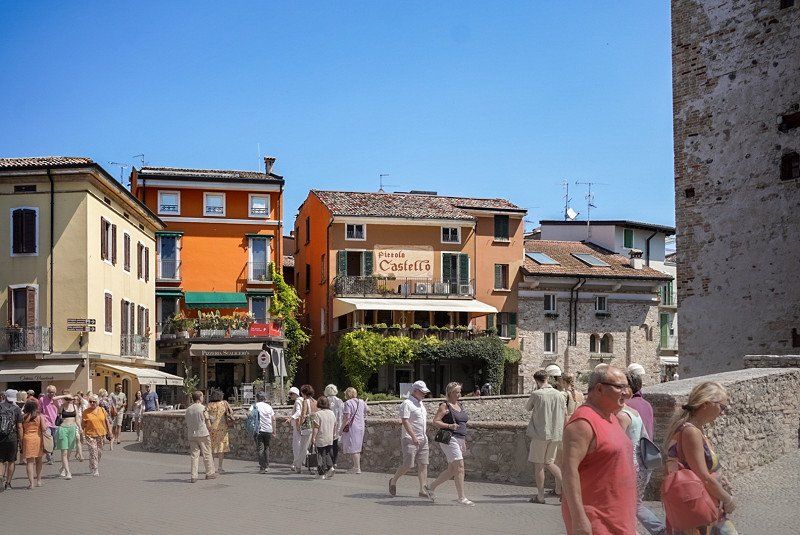
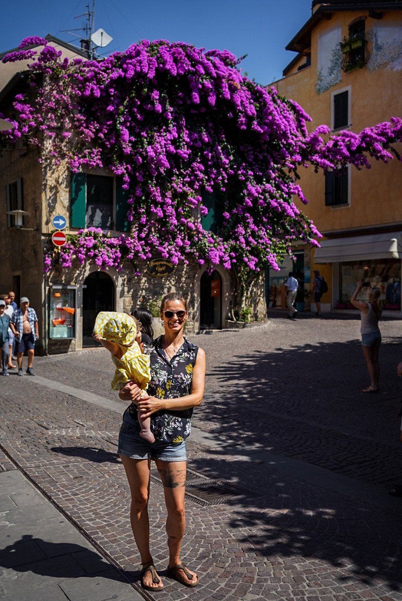
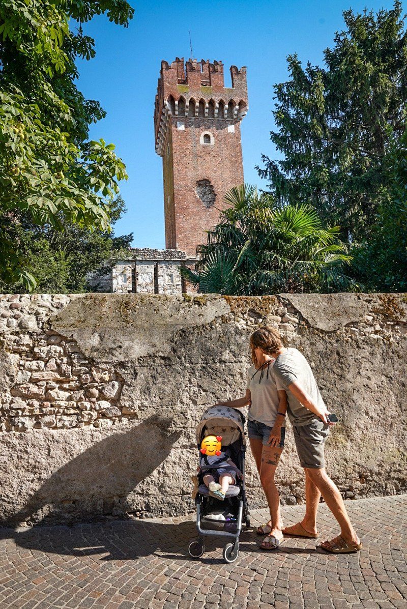
Sirmione
Viale Guglielmo Marconi 25–27
45° 29' 21.6" N 10° 36' 29.7" E
45.4893334 10.6082483
• Head north on Viale Guglielmo Marconi. Go for 140 m.
• Turn slightly left onto Largo del Faselo Bitinico. Go for 55 m.
• Turn left onto Lungolago Armando Diaz. Go for 152 m.
• Turn left toward Viale Guglielmo Marconi. Go for 17 m.
• Turn slightly right onto Viale Guglielmo Marconi. Go for 279 m.
• Continue on Via 25 Aprile. Go for 1.4 km.
• Take the 2nd exit from roundabout onto Via 25 Aprile. Go for 216 m.
• Continue on Via Colombare. Go for 196 m.
• Take the 2nd exit from roundabout. Go for 88 m.
• Continue on Via Aldo Moro. Go for 384 m.
• Take the 2nd exit from roundabout onto Viale Giacomo Matteotti. Go for 262 m.
• Take the 2nd exit from roundabout onto Viale Giacomo Matteotti. Go for 320 m.
• Take the 2nd exit from roundabout onto Via Brescia toward Aeroporto Montichiari/Autostrada/A4/S. Martino D.B./Lonato/Salò/Brescia/Mantova. Go for 93 m.
• Turn right onto Viale della Comunità Europea. Go for 286 m.
• Continue toward Via Salvo D'Acquisto. Go for 39 m.
• Take the 2nd exit from roundabout toward MI-VE/A4/Brescia. Go for 51 m.
• Continue on Via Salvo D'Acquisto. Go for 1.6 km.
• Take the 2nd exit from roundabout onto Via dei Colli Storici toward Autostrada/A4/Brescia/Verona. Go for 212 m.
• Continue toward Rivoltella Centro/Desenzano Est. Go for 72 m.
• Take the 3rd exit from roundabout onto Strada Padana Superiore (SPBS11VAR) toward Rivoltella Centro/Desenzano Est/A4/Verona/Peschiera D G. Go for 3.4 km.
• Continue on SPBS11. Go for 3.2 km.
• Continue on Via Tangenziale (SR11). Go for 2.7 km.
• Keep left onto Paradiso di Sotto toward Autostrada/A22/Affi/SR450/Verona/SR11. Go for 601 m.
• Continue on SS11dir. Go for 3.7 km.
• Continue on Strada Regionale di Affi (SR450). Go for 10.4 km.
• Take ramp toward Bardolino. Go for 209 m.
• Turn left onto SP29 toward Cavaion/Bardolino. Go for 671 m.
• Take the 3rd exit from roundabout onto Via Ca' Nove toward Lazise/Bardolino. Go for 509 m.
• Take the 2nd exit from roundabout onto Via Ca' Nove. Go for 409 m.
• Take the 2nd exit from roundabout onto Strada del Trenin (SP31) toward Bardolino. Go for 2.1 km.
• Continue on Via Europa Unita (SP31). Go for 2.3 km.
• Take the 2nd exit from roundabout onto Via Europa Unita (SP31) toward Bardolino/Bardolino Centro. Go for 73 m.
• Continue on Via Molini (SP31). Go for 235 m.
• Continue on Via Benedetto Croce (SP31). Go for 298 m.
• Take the 1st exit from roundabout onto Via Guglielmo Marconi (SR249). Go for 39 m.
• Pass 3 roundabouts and continue on Località Ca' Nova di sotto (SR249). Go for 1.4 km.
• Arrive at Via Gardesana dell'Acqua (SR249). Your destination is on the left.
☍
38,0 km
( 41 min.)
Day
Campeggio Serenella
July 9th
Lake Garda. A little stop for swimming, cycling and TRAVEL NO FURTHER because it's much warmer everywhere else.
Loc. Mezarivva 19, 37011, Bardolino, Italien
45° 33' 32" N 10° 43' 2" E
45.5588900 10.7172200
• Head northwest on Via Gardesana dell'Acqua (SR249). Go for 2.0 km.
• Take the 2nd exit from roundabout onto Corso Italia (SR249). Go for 143 m.
• Take the 1st exit from roundabout onto Via Don Carlo Gnocchi (SP8) toward A22/Autostrade/Costermano/Caprino V.Se/Ferrara di M.B. Go for 959 m.
• Pass 2 roundabouts and continue on Via della Pace (SP8). Go for 2.0 km.
• Take the 3rd exit from roundabout onto Salita degli Olivi (SP8). Go for 167 m.
• Take the 3rd exit from roundabout onto Salita degli Olivi (SP8). Go for 532 m.
• Take the 1st exit from roundabout onto Via 1 Maggio (SP9) toward Autostrade/Affi/Verona/SP5. Go for 1.9 km.
• Pass 2 roundabouts and continue on Via Costabella (SP9). Go for 3.1 km.
• Take the 3rd exit from roundabout toward Autostrade/Peschiera D.G./SR450/Verona/SP5/Trento/SS12. Go for 114 m.
• Continue straight ahead. Go for 36 m.
• Take the 2nd exit from roundabout toward SS12/A22/Brennero-Modena/A4/Venezia. Go for 556 m.
• Take the 2nd exit from roundabout onto A22 (Autostrada del Brennero) toward Milano-Venezia/A4. Go for 106 km.
• Take the exit toward Reggio E.-Milano/Parma/A15/La Spezia onto A1 (Autostrada del Sole). Go for 53.2 km.
• Take the exit toward La Spezia/Parma Ovest onto A15 (Autostrada della Cisa). Go for 51.4 km.
• Take the exit toward Berceto. Go for 671 m.
• Turn left onto Strada Provinciale di Valbona (SP114) toward P.Sso Cisa/SS62/Berceto/Bosco C./Corniglio. Go for 3.7 km.
• Turn left onto Via Enrico Berlinguer. Go for 309 m.
• Turn left onto Via Pianello. Go for 42 m.
• Turn slightly right onto Via Divisione Julia. Go for 128 m.
• Turn slightly right onto Via Divisione Julia. Go for 54 m.
• Turn left onto Via San Francesco di Sales. Go for 167 m.
• Arrive at Via San Francesco di Sales. Your destination is on the right.
☍
227,5 km
(2 hrs. 16 min.)
Day
Day
Day
Day
Day
Day
Berceto
15th of July
Free parking space as a stopover. Perfectly adequate.
Nice village.
Via Giuseppe Saragat
44° 30' 40.8" N 9° 59' 12" E
44.5113471 9.9866735
• Head toward Via Giuseppe Saragat on Via San Francesco di Sales. Go for 167 m.
• Turn right onto Via Divisione Julia. Go for 54 m.
• Turn slightly left onto Via Divisione Julia. Go for 128 m.
• Turn slightly left onto Via Pianello. Go for 42 m.
• Turn right onto Via Enrico Berlinguer. Go for 309 m.
• Turn right onto Strada Provinciale di Valbona (SP114). Go for 3.7 km.
• Turn right and take ramp onto A15 (Autostrada della Cisa) toward La Spezia. Go for 49.6 km.
• Take the exit toward Genova onto A12 (Autostrada Azzurra). Go for 24.8 km.
• Take the exit toward Levanto. Go for 1.6 km.
• Turn left onto Via Levanto (SP566dir) toward Levanto/Monterosso/SS370/Bonassola/Cinque Terre. Go for 9.9 km.
• Take the 2nd exit from roundabout onto Via Nostra Signora della Guardia (SP566dir) toward Centro. Go for 564 m.
• Take the 4th exit from roundabout onto Strada Provinciale Albero d'Oro (SP43) toward Genova-Livorno/A12/Parma/A15/Carrodano/Monterosso/La Spezia. Go for 166 m.
• Turn left onto Località Albero d'Oro (SP43). Go for 50 m.
• Turn right toward Loc.Sella Mereti. Go for 57 m.
• Continue on Località Sella-Mereti. Go for 318 m.
• Turn slightly left onto Località Sella-Mereti. Go for 121 m.
• Arrive at Località Sella-Mereti. Your destination is on the left.
☍
91,5 km
(1 hrs. 7 min.)
Day
Camping 5 Terre
16th of July
Cinque Terre
Località Sella Mereti, 19015, Levanto, Italien
44° 10' 26.6" N 9° 37' 29.4" E
44.1740600 9.6248200
• Head northwest on Località Sella-Mereti. Go for 496 m.
• Turn left onto Località Albero d'Oro (SP43). Go for 50 m.
• Turn right onto Strada Provinciale Albero d'Oro (SP43) toward Centro/Genova-Livorno/A12/Genova. Go for 139 m.
• Take the 1st exit from roundabout onto Via Nostra Signora della Guardia (SP566dir) toward Genova/Parma/A15/Genova-Livorno/A12/Carrodano/Montale. Go for 556 m.
• Take the 2nd exit from roundabout onto Località San Gottardo (SP566dir) toward A12/Autostrade/A15/Casella/Carrodano/Montale. Go for 9.9 km.
• Take ramp onto A12 (Autostrada Azzurra) toward Genova. Go for 22.4 km.
• Take the exit toward Sestri Levante onto Svincolo Sestri Levante. Go for 1.0 km.
• Take the 2nd exit from roundabout toward Genova/Moneglia/La Spezia. Go for 56 m.
• Continue on Via Giorgio Bo. Go for 200 m.
• Take the 3rd exit from roundabout onto Traversa Aurelia (SS1) toward Riva/Trigoso/Moneglia/La Spezia. Go for 684 m.
• Keep right onto Traversa Aurelia (SS1) toward Trigoso/Moneglia/La Spezia/Riva. Go for 250 m.
• Turn right onto Via Antonio Gramsci (SS370). Go for 823 m.
• Continue on Via Gianbattista Ponzerone (SS370). Go for 106 m.
• Turn left onto Via Alessandria. Go for 336 m.
• Arrive at Via Alessandria. Your destination is on the right.
☍
37,0 km
( 35 min.)
Day
Day
Camping La Pineta
July 18th
Only used for transit and as a 1-day swim stop.
Unfortunately there was no space at the La Secca campsite, which was warmly recommended to us.
Via Alessandria 23, 16039, Riva Trigoso- Sestri Levante, Italien
44° 15' 28.2" N 9° 25' 56.6" E
44.2578335 9.4323962
• Head toward Via Gianbattista Ponzerone on Via Alessandria. Go for 336 m.
• Turn right onto Via Gianbattista Ponzerone (SS370). Go for 106 m.
• Continue on Via Antonio Gramsci (SS370). Go for 823 m.
• Turn left onto Traversa Aurelia (SS1) toward Genova/A12/Livorno/SP1. Go for 201 m.
• Turn right onto Via Tino Paggi. Go for 284 m.
• Take the 2nd exit from roundabout onto Via Bruno Primi. Go for 197 m.
• Take the 1st exit from roundabout onto Via Bruno Primi (SP523) toward Autostrada/Centro. Go for 352 m.
• Take the 1st exit from roundabout onto Svincolo Sestri Levante toward Genova/A12/Livorno. Go for 125 m.
• Take ramp onto A12 (Autostrada Azzurra) toward Genova. Go for 49.1 km.
• Continue on A7 (Autostrada Milano-Genova). Go for 2.6 km.
• Take the exit toward Alessandria/A26/Ventimiglia/Aeroporto onto A10 (Ponte Genova San Giorgio). Go for 72.5 km.
• Take the exit toward Borghetto/Santo Spirito. Go for 1.5 km.
• Take the 3rd exit from roundabout onto Via Toirano toward Borghetto S.Spirito/Loano/Ceriale/SP1/Toirano/SP60/Bardineto. Go for 524 m.
• Take the 2nd exit from roundabout onto Strada Provinciale Borghetto Santo Sprito Bardineto (SP60) toward Loano/SP1/Ceriale/Borghetto S.Spirito Centro. Go for 887 m.
• Take the 2nd exit from roundabout onto Strada Provinciale Borghetto Santo Sprito Bardineto (SP60) toward Ceriale/Loano/Aurelia/SP1. Go for 301 m.
• Take the 1st exit from roundabout onto Via Trilussa. Go for 315 m.
• Turn right onto Via Dante Alighieri. Go for 127 m.
• Turn left onto Strada Provinciale Borghetto Santo Sprito Bardineto (SP60). Go for 73 m.
• Take the 2nd exit from roundabout onto Corso 4 Novembre (SS1). Go for 1.2 km.
• Take the 1st exit from roundabout onto Via Aurelia (SS1) toward Albenga. Go for 722 m.
• Take the 3rd exit from roundabout onto Via Aurelia (SS1). Go for 230 m.
• Take the 1st exit from roundabout onto Via Romana (SP3) toward Castelbianco/Cisano sul Neva/Peagna. Go for 1.8 km.
• Turn right onto Via Nuova di Peagna toward Frazione Peagna. Go for 167 m.
• Arrive at Via Nuova di Peagna. Your destination is on the left.
☍
134,4 km
(1 hrs. 30 min.)
Day
Campeggio Baciccia
July 19th
Nice campsite, but packed in high season. Could only stay 1 night because we had a stupid place in the middle of the way.
Via Torino 19, 17023, Ceriale, Italien
44° 4' 60" N 8° 12' 56" E
44.0833300 8.2155600
• Head southeast on Via Nuova di Peagna. Go for 167 m.
• Continue on Via Torino. Go for 465 m.
• Take the 1st exit from roundabout onto Via Aurelia (SS1). Go for 3.3 km.
• Turn right onto Strada Provinciale del Colle San Bernardo (SP582) toward Torino/Garessio/Genova/A10/Ventimiglia/Albenga/SS453/Casanova L./SS582/Castelbianco/Ortovero/Albenga Centro. Go for 255 m.
• Pass 3 roundabouts and continue on Regione Bagnoli (SP582). Go for 1.6 km.
• Take the 1st exit from roundabout onto Strada Provinciale del Colle San Bernardo (SP582) toward Garessio/Aurelia/SP1bis. Go for 743 m.
• Take the 2nd exit from roundabout onto Strada Provinciale del Colle San Bernardo (SP582). Go for 245 m.
• Take the 2nd exit from roundabout onto A10 (Autostrada dei Fiori) toward Ventimiglia. Go for 71.4 km.
• Take the exit toward Ventimiglia. Go for 458 m.
• Take ramp toward Ventimiglia/SS1/SS20. Go for 202 m.
• Take the 2nd exit from roundabout. Go for 686 m.
• Take ramp onto Strada Statale del Colle di Tenda e di Valle Roja (SS20) toward Genova/Francia/Ventimiglia. Go for 1.8 km.
• Turn right onto Ponte Gian Domenico Cassini (SS1). Go for 164 m.
• Turn right onto Ponte Gian Domenico Cassini (SS1) toward Francia. Go for 3.6 km.
• Take the 2nd exit from roundabout onto Corso Nizza (SS1) toward Confine di Stato/SP1/Ponte San Luigi/Grimaldi/Mortola/SS1dir/Ponte Sen Loduvico. Go for 238 m.
• Turn left onto Strada Statale dei Balzi Rossi (SS1dir) toward Strada Statale dei Balzi Rossi/Confine di Stato/Ponte Sen Loduvico. Go for 299 m.
• Make a U-Turn onto Strada Statale dei Balzi Rossi (SS1dir). Go for 264 m.
• Turn right onto Via del Ricovero. Go for 104 m.
• Arrive at Via del Ricovero. Your destination is on the left.
☍
85,9 km
(1 hrs. )
Day
Camping Por La Mar
20th of July
Nice little campsite. Much better than its reputation, in our opinion. Very nice people and the prices are fair for the high season. In addition, a cool and cheap shuttle service is offered: Nice, Monaco, etc.
Corso Nizza 107, 18039, Ventimiglia, Italien
43° 47' 31.2" N 7° 33' 50.4" E
43.7920000 7.5640000
• Head toward Strada Statale dei Balzi Rossi on Via del Ricovero. Go for 104 m.
• Turn right onto Corso Nizza (SS1) toward Genova/A10/Nizza/San Remo/Ventimiglia. Go for 240 m.
• Take the 3rd exit from roundabout onto Corso Nizza (SS1). Go for 268 m.
• Turn left onto Strada Statale dei Balzi Rossi (SS1dir) toward Strada Statale dei Balzi Rossi/Confine di Stato/Ponte Sen Loduvico. Go for 3.4 km.
• Continue on Esplanade Président Robert Schuman (D6327). Go for 733 m.
• Continue on Avenue Porte de France (D6007). Go for 1.3 km.
• Take the 2nd exit from roundabout onto Quai Bonaparte (D6007). Go for 463 m.
• Take the 3rd exit from roundabout onto Esplanade Francis Palmero (D6007) toward Nice/Monaco/Roquebrune/Hôpital La Palmosa. Go for 307 m.
• Take the 2nd exit from roundabout onto Promenade du Soleil (D6007) toward Roquebrune/Cap Martin (Par Bord de Mer). Go for 505 m.
• Turn left onto Promenade du Soleil toward Roquebrune. Go for 1.3 km.
• Turn right onto Pont Élisabeth. Go for 57 m.
• Take the 3rd exit from roundabout onto Avenue Jean Monnet (D6007) toward Monaco/Nice/Centre Ville/Carnolès/Hôpital La Palmosa. Go for 372 m.
• Take the 3rd exit from roundabout onto Rue Victor Hugo (D6007) toward Monaco/Roquebrune-Cap Martin. Go for 280 m.
• Turn slightly right onto Place du Commissaire Harang (D6007) toward Cap Martin/Cabanon le Corbusier. Go for 160 m.
• Take the 2nd exit from Carrefour Jean Moulin roundabout onto Avenue Louis Pasteur (D6007) toward A8/Nice/Monaco/Vieux Village/Cabanon le Corbusier. Go for 1.7 km.
• Continue on Avenue Gabriel Hanotaux (D2564) toward Monaco/Beausoleil/St Roman. Go for 54 m.
• Take the 2nd exit from roundabout onto Avenue Pierre Curie (D6007) toward Monaco/Beausoleil/St Roman. Go for 518 m.
• Take the 1st exit from roundabout onto Avenue Pierre Curie (D6007). Go for 1.5 km.
• Take the 2nd exit from roundabout onto Avenue Jean Jaurès (D6098) toward Monaco/St Roman. Go for 1.7 km.
• Continue on Place Antoine Repaire. Go for 31 m.
• Turn right onto Boulevard d'Italie. Go for 654 m.
• Take the 3rd exit from roundabout onto Boulevard d'Italie. Go for 376 m.
• Continue on Boulevard des Moulins. Go for 237 m.
• Turn right onto Avenue Saint-Laurent. Go for 173 m.
• Continue on Avenue Saint-Charles. Go for 100 m.
• Take the 2nd exit from roundabout onto Boulevard des Moulins. Go for 175 m.
• Continue on Avenue de la Costa. Go for 92 m.
• Turn right onto Avenue de la Costa. Go for 150 m.
• Arrive at Avenue de la Costa. Your destination is on the left.
☍
16,9 km
( 29 min.)
Day
Day
Monaco
With a small child we didn't stop in Monaco because of the temperatures and the air quality. However, we did a few laps through the center.
43° 44' 18.3" N 7° 25' 28.6" E
43.7384176 7.4246158
• Head toward Avenue de l'Hermitage on Avenue de la Costa. Go for 404 m.
• Turn right onto Avenue d'Ostende. Go for 203 m.
• Take the 2nd exit from roundabout onto Rue Grimaldi. Go for 400 m.
• Turn right onto Bretelle Louis Auréglia. Go for 29 m.
• Take the 2nd exit from Giratoire Auréglia roundabout onto Tunnel Dorsale. Go for 303 m.
• Take the 2nd exit from Giratoire Canton roundabout onto Tunnel Dorsale. Go for 136 m.
• Turn right onto Tunnel Rainier III. Go for 369 m.
• Continue on Tunnel Rainier III. Go for 1.2 km.
• Continue on Route de la Moyenne Corniche (M6007). Go for 2.6 km.
• Continue on M6007. Go for 153 m.
• Keep left toward A500/A8/La Turbie/Nice/Toulon/Marseille. Go for 133 m.
• Continue on Tunnel de Monaco. Go for 2.4 km.
• Take ramp onto A8 (La Provençale). Go for 9.5 km.
• Take exit 54 toward Nice-Nord/Nice-Quartiers Nord. Go for 595 m.
• Take the 2nd exit from roundabout onto Boulevard Paul Rémond toward Le Ray. Go for 197 m.
• Continue on Boulevard Comte de Falicon. Go for 302 m.
• Continue on Boulevard Gorbella. Go for 1.0 km.
• Continue on Boulevard Auguste Raynaud. Go for 748 m.
• Turn left onto Boulevard Joseph Garnier toward Nice-Ouest par Voie Rapide/Gambetta. Go for 84 m.
• Continue on Boulevard Joseph Garnier. Go for 156 m.
• Arrive at Place du Général de Gaulle. Your destination is on the right.
☍
21,0 km
( 22 min.)
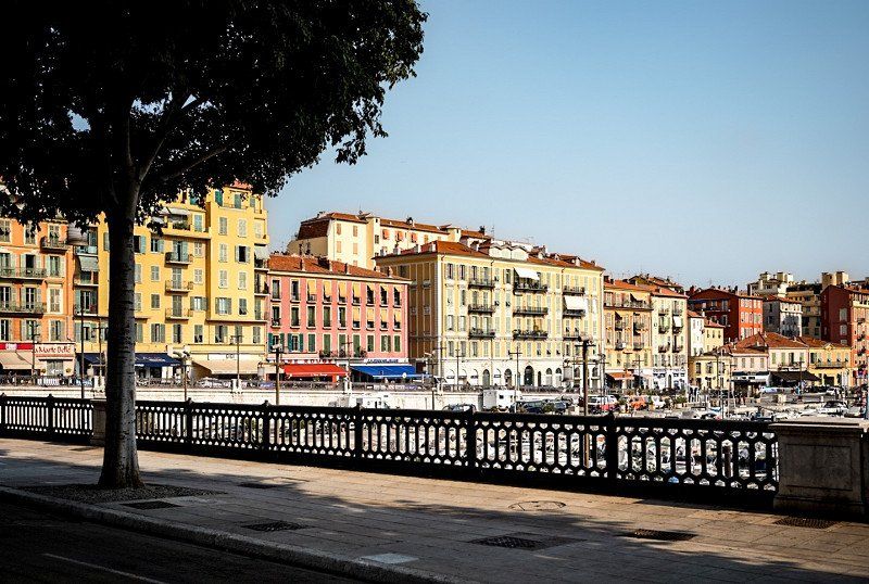
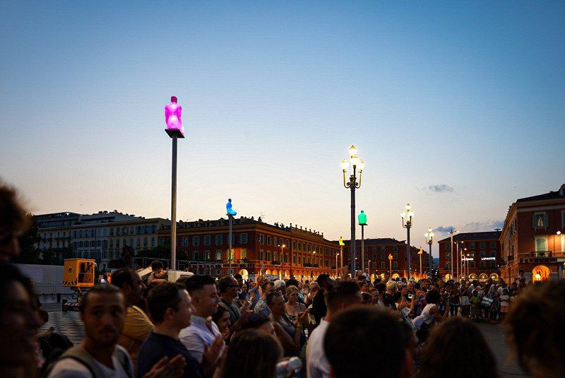
Nizza, Frankreich
Nice, looked good from the van. We will take a day trip.
43° 42' 36.6" N 7° 15' 43" E
43.7101728 7.2619532
• Head southwest on Place du Général de Gaulle. Go for 31 m.
• Continue on Boulevard Joseph Garnier. Go for 125 m.
• Turn left onto Rue Alfred Binet. Go for 215 m.
• Continue on Rue des Combattants d'Afrique du Nord. Go for 269 m.
• Turn right onto Rue Reine Jeanne. Go for 129 m.
• Turn slightly left onto Rue Reine Jeanne. Go for 33 m.
• Take ramp onto Voie Pierre Mathis (N7) toward Antibes/Digne/Aéroport Nice-Côte d'Azur/Nice-Ouest/Magnan. Go for 1.6 km.
• Keep left onto Voie Pierre Mathis toward Antibes/Digne/Aéroport Nice Côte d'Azur/Nice-Ouest/Fabron/Hôpital l'Archet. Go for 3.5 km.
• Turn left toward Caucade/La Lanterne. Go for 22 m.
• Continue on Avenue Édouard Grinda. Go for 306 m.
• Turn left onto Avenue Henri Matisse toward Caucade la Lanterne. Go for 1.4 km.
• Turn left onto Traverse de la Digue des Français. Go for 380 m.
• Continue on Rue du Mont Ténibre (M6222). Go for 239 m.
• Take ramp onto A8 (La Provençale). Go for 6.8 km.
• Take exit 47 toward Villeneuve-Loubet/Grasse/Villeneuve Loubet. Go for 414 m.
• Continue on D2. Go for 90 m.
• Take the 2nd exit from Rond-Point du Logis du Loup roundabout onto D2 toward A8/Antibes/Biot. Go for 148 m.
• Keep left onto D2. Go for 111 m.
• Continue on D6007. Go for 429 m.
• Continue on N7. Go for 20 m.
• Keep left onto D6007 toward A8/Nice/Antibes/Sophia Antipolis. Go for 149 m.
• Take the 2nd exit from roundabout onto D6007 toward Antibes. Go for 481 m.
• Take the 3rd exit from roundabout onto D6007 toward Antibes/Biot/Sophia Antipolis/Parc Marineland/Parc Départemental de Vaugrenier. Go for 1.0 km.
• Turn right onto Avenue des Maurettes. Go for 350 m.
• Turn left onto Avenue Docteur Julien Lefebvre. Go for 16 m.
• Arrive at Avenue Docteur Julien Lefebvre. Your destination is on the right.
☍
18,3 km
( 21 min.)
Parc des Maurettes
22nd of July
Nice campsite with many services.
730 avenue du Doct. Julien Lefèbvre, 06270, Villeneuve Loubet plage, Frankreich
43° 37' 51.1" N 7° 7' 46.8" E
43.6308600 7.1296550
• Head northeast on Avenue Docteur Julien Lefebvre. Go for 16 m.
• Turn right onto Avenue des Maurettes. Go for 350 m.
• Turn left onto D6007. Go for 946 m.
• Take the 3rd exit from roundabout onto D6007 toward Nice/Roquefort les Pins/Cagnes S/ Mer/Villeneuve Loubet-Village. Go for 478 m.
• Take the 1st exit from roundabout onto Avenue des Rives toward Nice/Bouches du Loup. Go for 79 m.
• Take ramp onto A8 (La Provençale) toward A8/Nice. Go for 6.5 km.
• Take exit 50 toward Nice-Ouest onto M6202 (Boulevard Georges Pompidou). Go for 685 m.
• Keep right toward Boulevard René Cassin/M6007. Go for 123 m.
• Keep right onto Boulevard René Cassin (M6007) toward Nice. Go for 821 m.
• Turn slightly left onto N7 toward Monaco/Menton/Nice-Centre/Nice-Est. Go for 5.4 km.
• Take ramp toward Nice-Nord. Go for 349 m.
• Turn left onto Rue Miollis. Go for 268 m.
• Turn left onto Rue Clément Roassal. Go for 76 m.
• Turn right onto Rue Alfred Binet. Go for 215 m.
• Turn right onto Boulevard Joseph Garnier. Go for 156 m.
• Arrive at Place du Général de Gaulle. Your destination is on the right.
☍
16,5 km
( 17 min.)
Day
Day
Day
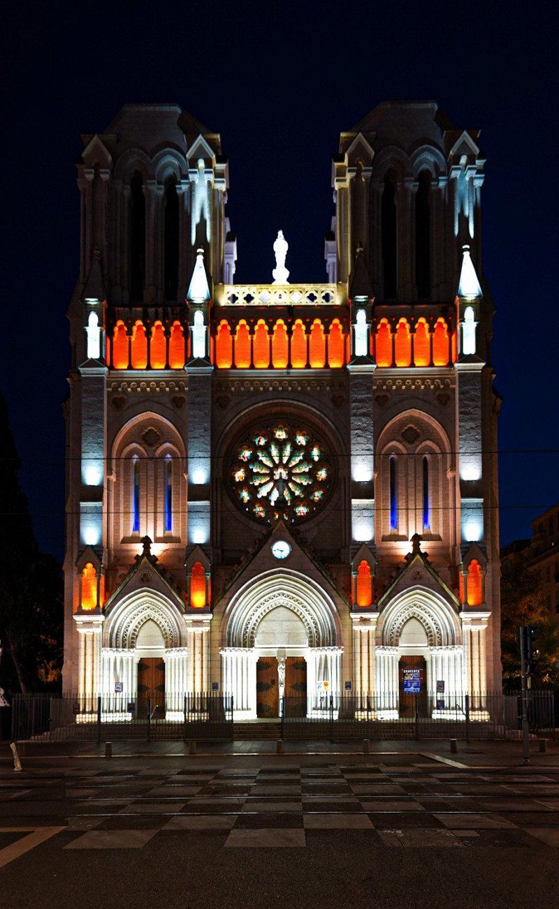
Nizza, Frankreich
July 25th
Day trip to Nice. A really worth seeing city, which could easily be explored by train and on foot.
43° 42' 36.6" N 7° 15' 43" E
43.7101728 7.2619532
• Head southwest on Place du Général de Gaulle. Go for 31 m.
• Continue on Boulevard Joseph Garnier. Go for 125 m.
• Turn left onto Rue Alfred Binet. Go for 215 m.
• Continue on Rue des Combattants d'Afrique du Nord. Go for 269 m.
• Turn right onto Rue Reine Jeanne. Go for 129 m.
• Turn slightly left onto Rue Reine Jeanne. Go for 33 m.
• Take ramp onto Voie Pierre Mathis (N7) toward Antibes/Digne/Aéroport Nice-Côte d'Azur/Nice-Ouest/Magnan. Go for 1.6 km.
• Keep left onto Voie Pierre Mathis toward Antibes/Digne/Aéroport Nice Côte d'Azur/Nice-Ouest/Fabron/Hôpital l'Archet. Go for 1.7 km.
• Take ramp toward Les Bosquets. Go for 169 m.
• Continue on Traverse des Bosquets toward Antibes/Digne/Aéroport Nice Côte d'Azur/Carras. Go for 37 m.
• Turn left onto Avenue Raymond Féraud. Go for 123 m.
• Continue on Rue Docteur Levesi. Go for 54 m.
• Turn right onto Promenade des Anglais (M6098) toward Aéroport Nice Côte d'Azur/Digne/Antibes. Go for 3.1 km.
• Keep right onto Promenade des Anglais (M6098). Go for 6.4 km.
• Keep right onto Route du Bord-de-Mer (D6098). Go for 117 m.
• Continue on Boulevard Georges Pompidou (D6098). Go for 224 m.
• Continue on Route du Bord-de-Mer (D6098). Go for 108 m.
• Continue on Boulevard Georges Pompidou (D6098). Go for 726 m.
• Continue on Route du Bord-de-Mer (D6098). Go for 76 m.
• Continue on D6098. Go for 25 m.
• Continue on Route du Bord-de-Mer (D6098). Go for 1.4 km.
• Pass 3 roundabouts and continue on Route du Bord-de-Mer (D6098). Go for 2.7 km.
• Continue on Avenue du Bord de Mer (D6098). Go for 754 m.
• Keep right onto Avenue du Bord de Mer (N98). Go for 240 m.
• Continue on Avenue de la Libération (N98). Go for 24 m.
• Continue on Avenue Robert Soleau (N98). Go for 164 m.
• Turn slightly left toward Avenue Robert Soleau/N98. Go for 43 m.
• Continue on Avenue Robert Soleau (N98). Go for 343 m.
• Continue on Place du Général de Gaulle (N98). Go for 74 m.
• Turn right onto Place du Général de Gaulle (N98). Go for 18 m.
• Turn left onto Boulevard Albert 1er (D255 9). Go for 488 m.
• Keep left onto Boulevard Maréchal Leclerc. Go for 81 m.
• Turn slightly left onto Avenue Barquier. Go for 94 m.
• Turn right onto Avenue Général Maizière. Go for 134 m.
• Continue on Rue de la Tourraque. Go for 161 m.
• Turn left onto Rue de la Pompe. Go for 32 m.
• Turn left onto Rue de la Pompe. Go for 55 m.
• Turn right onto Rue des Paveurs. Go for 12 m.
• Arrive at Rue des Paveurs.
☍
22,2 km
( 31 min.)
Day
Day
Antibes, Frankreich
July 27th
Day trip to Antibes. Small cute place for the whole family.
43° 34' 49.5" N 7° 7' 30.4" E
43.5804180 7.1251020
• Head east on Rue des Paveurs. Go for 12 m.
• Turn left onto Rue de la Pompe. Go for 102 m.
• Turn right onto Rue des Bains. Go for 28 m.
• Turn slightly left onto Cours Masséna. Go for 153 m.
• Continue on Rue Aubernon. Go for 44 m.
• Turn right onto Rue Aubernon. Go for 127 m.
• Turn slightly left onto Rue Aubernon. Go for 17 m.
• Continue on Avenue de Verdun. Go for 50 m.
• Take the 1st exit from roundabout onto Avenue de Verdun. Go for 473 m.
• Take the 3rd exit from Rond-Point Saint-Roch roundabout onto Avenue de la Libération. Go for 277 m.
• Turn left onto Avenue Robert Soleau (N98). Go for 216 m.
• Keep right onto Carrefour du Marseillais. Go for 48 m.
• Continue on Boulevard Général Vautrin. Go for 181 m.
• Turn left onto Avenue Philippe Rochat (D35) toward Sophia Antipolis/Nova Antipolis. Go for 2.9 km.
• Pass 2 roundabouts and continue on Route de Grasse (D35). Go for 542 m.
• Keep left onto D35 toward Cannes/Grasse/Vallauris/Sophia Antipolis. Go for 848 m.
• Take ramp onto A8 (La Provençale) toward Cannes. Go for 54.2 km.
• Take exit 36 toward St Tropez/Draguignan/Ste Maxime/Vidauban/Le Muy onto D1555. Go for 920 m.
• Pass 9 roundabouts and continue on Avenue du Général Charles de Gaulle. Go for 9.8 km.
• Continue on Avenue du Général Charles de Gaulle (D1555). Go for 721 m.
• Take the 2nd exit from roundabout onto Avenue du Général Charles de Gaulle (D1555). Go for 419 m.
• Take the 3rd exit from Rond-Point Charles de Gaulle roundabout onto Avenue du 18 Juin 1940 toward D955/Lorgues/Flayosc/L'Esplanade/Fournas/Incapis/Centre Hospitalier. Go for 573 m.
• Take the 2nd exit from Place Louise Michel roundabout onto Boulevard Pierre Mendès France toward D955/L'Esplanade/Centre Hospitalier. Go for 274 m.
• Take the 1st exit from Place Célestin Freinet roundabout onto Avenue des Vignerons toward D955/Lorgues/Flayosc/L'Esplanade/Centre Hospitalier. Go for 182 m.
• Take the 2nd exit from Place Maurice Allard roundabout onto Avenue des Anciens Combattants d'Afr. du N. toward Lorgues/Flayosc. Go for 538 m.
• Take the 2nd exit from Place Condorcet roundabout onto Boulevard Léo Lagrange (D955). Go for 343 m.
• Pass 2 roundabouts and continue on Boulevard Léo Lagrange (D955). Go for 799 m.
• Continue on Boulevard Léon Gambetta (D955). Go for 292 m.
• Take the 2nd exit from Place Henry Sénès roundabout onto Boulevard Léon Gambetta (D955). Go for 470 m.
• Take the 3rd exit from Place Marcel Meiffret roundabout onto Avenue Frédéric Henri Manhès (D955). Go for 2.0 km.
• Turn left onto Route de Lentier (D49). Go for 9.5 km.
• Continue on D49. Go for 23 m.
• Continue on Route de Tourtour (D49). Go for 2.2 km.
• Turn right onto Route de Vérignon (D49) toward Vérignon/Lac de Ste Croix. Go for 4.0 km.
• Continue on D49. Go for 35 m.
• Continue on Route de Vérignon (D49). Go for 1.2 km.
• Continue on D49. Go for 4.6 km.
• Continue on D6. Go for 3.4 km.
• Turn right onto D49 toward Bauduen/Les Salles S/Verdon/Moustiers Ste Marie. Go for 1.6 km.
• Turn right onto D957. Go for 210 m.
• Turn left onto D49. Go for 3.4 km.
• Continue on Lieu-dit La Colle (D49). Go for 87 m.
• Continue on D49. Go for 395 m.
• Continue on Lieu-dit Le Beaumont (D49). Go for 101 m.
• Continue on D49. Go for 573 m.
• Continue on Lieu-dit Brun (D49). Go for 129 m.
• Continue on D49. Go for 1.4 km.
• Continue toward D249. Go for 29 m.
• Continue on D71. Go for 2.7 km.
• Continue on Lieu-dit Le Bas Cavalet (D71). Go for 87 m.
• Continue on D71. Go for 277 m.
• Continue on Lieu-dit Les Cavalets (D71). Go for 100 m.
• Continue on D71. Go for 2.8 km.
• Continue on D111. Go for 4.5 km.
• Continue on Lieu-dit Le Castelas (D111). Go for 60 m.
• Continue on D111. Go for 577 m.
• Turn right onto D111. Go for 308 m.
• Continue toward Route du Lac. Go for 145 m.
• Continue on Route du Lac. Go for 103 m.
• Arrive at Route du Lac. Your destination is on the right.
☍
122,0 km
(1 hrs. 43 min.)
Day
Aire de Camping-cars
July 28th
Very nice and cheap parking space. The lake at this point is more beautiful in pictures than in reality. At least for bathing.
Le Cours, 04500, Ste.-Croix-du-Verdon, Frankreich
43° 45' 39" N 6° 9' 4" E
43.7608333 6.1511111
• Head west on Route du Lac. Go for 248 m.
• Continue on D111. Go for 308 m.
• Turn right onto D111. Go for 3.6 km.
• Turn right onto D11. Go for 5.4 km.
• Turn left onto Rue Hilarion François. Go for 365 m.
• Take the 2nd exit from roundabout onto Route de Marseille (D952). Go for 7.8 km.
• Turn right onto Rue Félix Arnoux (D952). Go for 11.2 km.
• Take the 3rd exit from roundabout onto Avenue des Alpes (D952). Go for 7.8 km.
• Take the 2nd exit from roundabout onto Rue Saint-André (D554). Go for 421 m.
• Pass 4 roundabouts and continue on D952. Go for 7.1 km.
• Take the 2nd exit from roundabout onto A51 (Autoroute du Val de Durance) toward Aix en Pce/Pertuis. Go for 38.5 km.
• Keep left onto Rocade Ouest (N296) toward Aix-Jas de Bouffan/Aix-Encagnane. Go for 2.0 km.
• Take the exit toward Lyon/Avignon/Salon de Pce onto A8 (La Provençale). Go for 18.5 km.
• Continue on A7 (Autoroute du Soleil). Go for 10.6 km.
• Take the exit toward Salon de Pce/Arles/Nîmes/Barcelone onto A54. Go for 24.8 km.
• Continue on N113. Go for 19.6 km.
• Take ramp toward Nîmes/Arles-Trinquetaille/Bellegarde/Stes Maries de la Mer/Salin de Giraud. Go for 300 m.
• Take the 4th exit from Rond-Point du Vittier roundabout onto D570 toward Stes Maries de la Mer/Salin de Giraud. Go for 722 m.
• Take the 2nd exit from Rond-Point Maurice Étienne roundabout onto Avenue Abbé Pierre (D570). Go for 23.4 km.
• Turn right onto Route de Balarin (D38 C) toward Aigues Mortes. Go for 9.4 km.
• Take the 2nd exit from roundabout onto D58 toward Aigues-Mortes. Go for 8.4 km.
• Take the 3rd exit from roundabout onto D46 toward Aigues-Mortes/Le Grau du Roi/Nîmes. Go for 1.0 km.
• Take the 2nd exit from roundabout onto D62. Go for 1.3 km.
• Pass 2 roundabouts and continue on D62. Go for 3.4 km.
• Take the 4th exit from roundabout onto D62 A. Go for 1.6 km.
• Take the 2nd exit from roundabout onto D62 B. Go for 1.4 km.
• Pass 2 roundabouts and continue on D62 B. Go for 1.7 km.
• Take the 3rd exit from roundabout onto Route de l'Espiguette (D255 B). Go for 438 m.
• Take the 3rd exit from roundabout onto Route de l'Espiguette (D255 B). Go for 720 m.
• Take the 3rd exit from roundabout onto Route de l'Espiguette (D255 B). Go for 1.1 km.
• Take the 2nd exit from roundabout. Go for 1.4 km.
• Turn left. Go for 11 m.
• Arrive at your destination on the left.
☍
214,5 km
(2 hrs. 33 min.)
Day
Camping De L'Espiguette
29th of July
The campsite has light and shadow. Most people here misbehave and treat poorly equipped sanitary facilities badly. Really bah! We were very far back on the campsite, recommended for families with children. The walk to the outdoor pool is longer, but it's quieter in the evening. The night show is turned up properly.
The beach is great. Attention, you need some time to get to the water, because the dunes are wide.
We didn't see much of the national park, our focus was on the beach.
The prices at the campsite were very fair!
route de l'Espiguette, 30240, Le Grau Du Roi, Frankreich
43° 30' 21" N 4° 7' 45" E
43.5058300 4.1291600
• Head southwest. Go for 84 m.
• Turn right toward Route de l'Espiguette/D255 B. Go for 1.4 km.
• Take the 3rd exit from roundabout onto Route de l'Espiguette (D255 B). Go for 1.1 km.
• Pass 2 roundabouts and continue on Route de l'Espiguette (D255 B). Go for 1.0 km.
• Continue on Route de l'Espiguette (D255 B). Go for 73 m.
• Take the 1st exit from roundabout onto D62 B. Go for 1.2 km.
• Take the 1st exit from Rond-Point du Fanal roundabout onto D62 B. Go for 447 m.
• Keep right onto D979 toward Listel. Go for 136 m.
• Continue on Lieu-dit Pêcherie (D979). Go for 126 m.
• Continue on D979. Go for 4.9 km.
• Take the 1st exit from roundabout onto D979 toward Nîmes/Centre Ville. Go for 148 m.
• Turn right onto Boulevard Diderot. Go for 51 m.
• Turn slightly right. Go for 128 m.
• Arrive at your destination on the right.
☍
10,8 km
( 15 min.)
Day
Day
Day
Day
Day
Aigues-Mortes, Frankreich
3rd August
The small village within the beautifully preserved city walls is really worth seeing. It's a shame, because it's also a nice, not-so-conspicuous tourist trap. Actually like a Christmas market. Still worth seeing, it doesn't have to be with a small child.
30220 Aigues-Mortes, Frankreich
43° 34' 1.8" N 4° 11' 33.3" E
43.5671720 4.1925869
• Head toward Boulevard Diderot. Go for 128 m.
• Turn slightly left onto Boulevard Diderot. Go for 51 m.
• Turn left onto D979. Go for 131 m.
• Take the 1st exit from roundabout onto Rue de la Fraternité (D718). Go for 353 m.
• Continue on Chemin de la Pataquière (D718). Go for 954 m.
• Take the 3rd exit from roundabout onto D62. Go for 2.2 km.
• Pass 2 roundabouts and continue on D62. Go for 4.9 km.
• Keep left onto D62 toward (Barcelone)/A9/La Grande Motte/Carnon/Montpellier. Go for 11.2 km.
• Continue on M62. Go for 744 m.
• Continue on Avenue Georges Frêche (M66). Go for 984 m.
• Keep left onto M66. Go for 2.2 km.
• Continue on D66. Go for 2.0 km.
• Continue on M66. Go for 1.4 km.
• Take ramp toward A9/Barcelone/Grammont. Go for 157 m.
• Take the 3rd exit from Rond-Point du Zénith roundabout onto A709 toward A9/Barcelone/A75/Clermont-Fd/Palavas les Flots/Prés d'Arènes. Go for 10.8 km.
• Continue on A9 (La Languedocienne). Go for 40.4 km.
• Take exit 34 toward Pézenas/Agde/Vias/Bessan. Go for 952 m.
• Take the 2nd exit from roundabout onto D13 toward Pézenas/Bessan/Florensac. Go for 304 m.
• Take the 1st exit from roundabout onto Route de Saint-Thibéry (D13) toward Bessan. Go for 1.3 km.
• Turn left onto Grand Rue (D28). Go for 246 m.
• Continue on Place de l'Hôtel de Ville (D28). Go for 16 m.
• Continue on Avenue de Marseillan (D28). Go for 594 m.
• Continue on D28. Go for 1.5 km.
• Continue on Lieu-dit Saint-Louis (D28). Go for 63 m.
• Continue on D28. Go for 403 m.
• Continue on Domaine Sainte-Claire (D28). Go for 114 m.
• Continue on Lieu-dit Domaine Sainte-Claire (D28). Go for 149 m.
• Continue on D28. Go for 1.3 km.
• Continue on Lieu-dit La Gaufrèze (D28). Go for 105 m.
• Continue on D28. Go for 316 m.
• Turn right. Go for 12 m.
• Arrive at your destination.
☍
86,0 km
( 57 min.)
Aire privee Camping Car - Florensac, D28, Florensac, Frankreich
3rd August
A fine, clean pitch with a polite and friendly lady (unfortunately forgot her name). We were greeted with a wine from our own production.
Unfortunately, the pitches are not shady. And there is only sewage, fresh water, electricity and a boule pitch.
It's also only 6km to the beach! If you like it quiet, right next to the vineyards, this is a good place.
Lieu dit de Veyrac ,route de Bessan, D28, 34510 Florensac, Frankreich
43° 21' 44.2" N 3° 28' 36" E
43.3622818 3.4766586
• Head toward Lieu-dit Domaine de Veyrac. Go for 12 m.
• Turn left onto D28. Go for 316 m.
• Continue on Lieu-dit La Gaufrèze (D28). Go for 105 m.
• Continue on D28. Go for 1.3 km.
• Continue on Lieu-dit Domaine Sainte-Claire (D28). Go for 149 m.
• Continue on Domaine Sainte-Claire (D28). Go for 114 m.
• Continue on D28. Go for 403 m.
• Continue on Lieu-dit Saint-Louis (D28). Go for 63 m.
• Continue on D28. Go for 1.5 km.
• Continue on Avenue de Marseillan (D28). Go for 594 m.
• Turn slightly right onto Place de l'Hôtel de Ville. Go for 308 m.
• Turn right onto Avenue du 8 Mai 1945 (D13) toward A9/Pézenas. Go for 1.2 km.
• Take the 3rd exit from roundabout onto D13 toward D612/A9/Agde. Go for 212 m.
• Take the 1st exit from roundabout onto A9 (La Languedocienne) toward Béziers. Go for 45.6 km.
• Take the exit toward Toulouse/Carcassonne onto A61 (Autoroute des Deux Mers). Go for 125 km.
• Take exit 19.1 toward Castanet-Tolosan/Escalquens/Montgiscard/Parcs d'Activités Sicoval Sud. Go for 819 m.
• Take the 1st exit from roundabout onto D24 toward Montgiscard/Castanet-T./Ayguesvives/Baziège/Villefranche de L. Go for 1.3 km.
• Take the 3rd exit from roundabout onto Route Nationale (D813) toward Carcassonne/Ayguesvives/Baziège/Villenouvelle/Villefranche de L. Go for 335 m.
• Turn left onto Chemin de la Val Priout. Go for 182 m.
• Turn left. Go for 52 m.
• Arrive at your destination on the right.
☍
179,9 km
(1 hrs. 36 min.)
Day
camping les peupliers, 31450 Ayguesvives, 31450 Ayguesvives, Frankreich
4th of August
A fine little campsite that is really recommended, even if it doesn't look like it at first glance!!!
Shady places and some with sun, super friendly, very clean despite rustic furnishings, good WiFi!, fridge with drinks and the cash register of trust at fair prices (almost everything 1 €), supermarket and hardware store nearby (refill and repair), ... so really great.
Not 100% ideal for small children, something is still missing, but there is a slide, a table tennis table, toys for free at the "reception" (a freely accessible shed)
RD 813 31450 Ayguesvives, 31450 Ayguesvives, Frankreich
43° 27' 4.4" N 1° 35' 39" E
43.4512171 1.5941629
• Head toward Lieu-dit La Val Priout. Go for 52 m.
• Turn right onto Chemin de la Val Priout. Go for 182 m.
• Turn right onto Route Nationale (D813). Go for 232 m.
• Take the 2nd exit from roundabout onto D24 toward A61-A66/Carcassonne/Toulouse/Montlaur/Escalquens. Go for 1.3 km.
• Take the 2nd exit from roundabout toward Toulouse/Montpellier/Carcassonne/Foix. Go for 535 m.
• Take ramp onto A61 (Autoroute des Deux Mers) toward Barcelone/Montpellier/Carcassonne/Foix. Go for 49.4 km.
• Take exit 22 toward Bram/Mirepoix/Limoux. Go for 1.2 km.
• Take the 1st exit from roundabout onto Voie d'Évitement (D533) toward Foix/Carcassonne/Mirepoix/Limoux/Montréal/Z.A.E de l'Autan. Go for 428 m.
• Take the 3rd exit from roundabout onto Route d'Évitement de Bram (D533) toward Carcassonne/Arzens/Montréal/Z.A.E de l'Autan. Go for 1.3 km.
• Take the 3rd exit from roundabout onto D533 toward Carcassonne/Arzens/Alzonne/Z.A.E de l'Autan. Go for 908 m.
• Take the 2nd exit from roundabout onto D33 toward Carcassonne/Arzens/Villesèquelande/Alzonne. Go for 760 m.
• Take the 2nd exit from roundabout onto D33 toward Carcassonne/Arzens/Villesèquelande/Alzonne. Go for 3.3 km.
• Turn right onto D8. Go for 1.2 km.
• Continue on Avenue du Stade (D8). Go for 95 m.
• Continue on Avenue Antoine Gayraud (D8). Go for 437 m.
• Take the 1st exit from roundabout onto Avenue Antoine Courrière (D6113). Go for 6.0 km.
• Take the 2nd exit from roundabout onto Route de Marseille à Bordeaux (D6113) toward Carcassonne/Pezens. Go for 1.2 km.
• Turn left onto Chemin des Tuileries à Arzens (D35) toward Villegailhenc/Ventenac C./Brousses et Villaret. Go for 91 m.
• Continue on D35. Go for 345 m.
• Continue on Route des Brousses (D48) toward Brousses et Villaret. Go for 916 m.
• Continue on Lotissement Les Amandiers (D48). Go for 443 m.
• Continue on Lieu-dit Les Amandiers (D48). Go for 119 m.
• Continue on D48. Go for 4.4 km.
• Continue on Lieu-dit Malportel (D48). Go for 664 m.
• Continue on D48. Go for 642 m.
• Continue on D148. Go for 2.5 km.
• Turn left onto D203. Go for 405 m.
• Arrive at D203. Your destination is on the left.
☍
79,0 km
( 55 min.)
Day
Day
Camping LE MARTINET ROUGE
6th of August
Stranded in the absolute high season, the great campsites are fully booked, you think. Certainly this place isn't directly on the sea or near the crass sights. However, this place trumps with a lot of peace, friendliness and cleanliness. Definitely recommended for a stopover.
There is also a lot on offer: pool, playground and entertainment from the owners who come up with something.
Camping Le Martinet Rouge, 2 chemin du lac des rochers, 11390, Brousses et Villaret, Frankreich
43° 20' 23.8" N 2° 15' 12.5" E
43.3399425 2.2534850
• Head south on D203. Go for 405 m.
• Turn right onto D148 toward D48/Pezens/Montolieu. Go for 2.5 km.
• Continue on D48. Go for 642 m.
• Turn right onto Lieu-dit Malportel (D48). Go for 664 m.
• Continue on D48. Go for 4.4 km.
• Continue on Lieu-dit Les Amandiers (D48). Go for 119 m.
• Continue on Lotissement Les Amandiers (D48). Go for 443 m.
• Continue on Route des Brousses (D48). Go for 916 m.
• Continue on D35 toward Pezens. Go for 345 m.
• Continue on Chemin des Tuileries à Arzens (D35). Go for 91 m.
• Turn right onto Route de Marseille à Bordeaux (D6113). Go for 1.1 km.
• Take the 3rd exit from roundabout onto Route de Marseille à Bordeaux (D6113) toward Toulouse/Castres/Revel/Castelnaudary/Alzonne. Go for 6.0 km.
• Take the 2nd exit from roundabout onto Avenue Antoine Gayraud (D8) toward Montréal/Bram. Go for 167 m.
• Turn slightly right onto Rue du Fresquel. Go for 192 m.
• Turn right onto Avenue Antoine Gayraud (D8). Go for 117 m.
• Continue on Avenue du Stade (D8). Go for 95 m.
• Continue on D8. Go for 1.1 km.
• Turn right onto D33. Go for 3.3 km.
• Take the 2nd exit from roundabout onto Route de Carcassonne (D33) toward A61/Foix/Mirepoix/Bram. Go for 749 m.
• Take the 2nd exit from roundabout onto D533 toward A61/Foix/Mirepoix/Villesiscle/Z.A.E. du Lauragais. Go for 861 m.
• Pass 2 roundabouts and continue on Voie d'Évitement (D533). Go for 1.7 km.
• Take the 3rd exit from roundabout onto A61 (Autoroute des Deux Mers) toward Toulouse. Go for 72.7 km.
• Continue on A62 (Autoroute des Deux Mers). Go for 205 km.
• Take exit 2 toward Podensac/Cadillac onto D117 E2. Go for 1.5 km.
• Turn left onto D11. Go for 6.8 km.
• Take the 2nd exit from roundabout onto Rue André Dubourg (D11). Go for 616 m.
• Turn right onto Route de Guillos (D125). Go for 537 m.
• Continue on D125. Go for 1.8 km.
• Turn left toward Lieu-dit Ricalot. Go for 607 m.
• Continue on Lieu-dit Ricalot. Go for 320 m.
• Continue on Lieu-dit Tanon. Go for 462 m.
• Continue on Lieu-dit Batseres Sud. Go for 138 m.
• Arrive at Lieu-dit Batseres Sud.
☍
316,5 km
(3 hrs. )
Day
Day
Day
Chateau Clare, Batseres Sud, Landiras, Frankreich
August 9th
We actually wanted to use it much sooner, but we have handled it differently with our little one, France Passion. We ended up at Château Clare on our way to the Atlantic. On the one hand because we don't want to drive more than 3 hours at a time with a child, on the other hand because france Passion really is a great alternative. If there were two of us, we would probably travel from château to château 😅
To the Château Clare: nice big place, we were offered the private pool, wine tasting, extra toilets and shower (not usual). Top! Super nice!
2224 Batseres S, 33720 Landiras, Frankreich
44° 32' 45.2" N 0° 26' 53.5" W
44.5458805 -0.4481950
• Head north on Lieu-dit Batseres Sud. Go for 313 m.
• Continue on Lieu-dit Tanon. Go for 374 m.
• Continue on Lieu-dit Ricalot. Go for 840 m.
• Turn right onto D125. Go for 1.8 km.
• Continue on Route de Guillos (D125). Go for 236 m.
• Turn right onto Rue du 15 Août. Go for 68 m.
• Turn left onto Rue Jean Trènit. Go for 130 m.
• Turn left onto Route de Balizac (D11). Go for 860 m.
• Take the 2nd exit from roundabout onto Rue de la Libération (D11). Go for 6.8 km.
• Turn right onto D117 E2. Go for 565 m.
• Take ramp onto A62 (Autoroute des Deux Mers) toward Bordeaux/Aéroport Mérignac. Go for 25.1 km.
• Take the left exit toward Bassin d'Arcachon/Mérignac Aéroport/Pessac/Villenave d'Ornon onto A630 (Rocade de Bordeaux). Go for 17.4 km.
• Take exit 8 toward Le Verdon S/ Mer/Lacanau/Le Taillan-Médoc/Eysines-Centre onto D1215. Go for 1.7 km.
• Pass 3 roundabouts and continue on Route de Lacanau (D1215). Go for 3.4 km.
• Take the 2nd exit from roundabout onto Route de Lacanau (D1215) toward Le Verdon S/Mer/Lacanau/St Médard/St Aubin de M. Go for 1.3 km.
• Take the 2nd exit from roundabout onto Route de Lacanau (D1215) toward Le Verdon S/Mer/Lacanau/St Aubin de M. Go for 1.0 km.
• Take the 1st exit from roundabout onto D1215 E1 toward Le Verdon S/Mer/Castelnau de M./Le Pian-Médoc. Go for 3.1 km.
• Pass 4 roundabouts and continue on D1215 E1. Go for 11.6 km.
• Take the 2nd exit from roundabout onto D1215 toward Listrac-Médoc/St Laurent/Lesparre/Le Verdon. Go for 890 m.
• Take the 2nd exit from roundabout onto D1215 toward Listrac-Médoc/St Laurent/Lesparre/Le Verdon. Go for 1.6 km.
• Take the 1st exit from roundabout onto D1215 toward Listrac-Médoc/St Laurent/Lesparre/Le Verdon. Go for 13.3 km.
• Pass 7 roundabouts and continue on Place du 19 Mars 1962 (D1215). Go for 47.2 km.
• Turn left onto Route de Bordeaux (D1 E4) toward Soulac S/Mer. Go for 1.8 km.
• Turn left onto Rue Jean Laporte (D1 E6). Go for 724 m.
• Take the 2nd exit from roundabout onto Rue Périer de Larsan. Go for 610 m.
• Continue on Rue Aristide Briand. Go for 216 m.
• Take the 4th exit from Place Georges Clemenceau roundabout onto Rue Antoine de Saint-Exupéry. Go for 710 m.
• Turn right onto Boulevard Marsan de Montbrun. Go for 399 m.
• Make a U-Turn at Rue Docteur Prioleau onto Boulevard Marsan de Montbrun. Go for 25 m.
• Arrive at Boulevard Marsan de Montbrun. Your destination is on the right.
☍
144,0 km
(2 hrs. 9 min.)
Day
Camping Le Palace
August 10th
The goal was to relax one last time by the sea with a sandy beach before it gets colder.
In Le Palace, where we probably got the last place for a week in the high season, that was quite possible. Great beach, super fun pool for the little ones, quiet (after the evening program), good food and sanitary facilities unfortunately not quite as good (but that can be related to the different expectations).
33780, Soulac Sur Mer, Frankreich
45° 30' 6.2" N 1° 7' 54.8" W
45.5017200 -1.1318900
• Head east on Boulevard Marsan de Montbrun. Go for 189 m.
• Make a U-Turn onto Boulevard Marsan de Montbrun. Go for 434 m.
• Turn right onto Boulevard de l'Amélie (D101 E1). Go for 387 m.
• Turn left onto Avenue Ospedaletti. Go for 209 m.
• Continue on Boulevard du Front de Mer. Go for 143 m.
• Make a U-Turn onto Boulevard du Front de Mer. Go for 152 m.
• Continue on Avenue Ospedaletti. Go for 14 m.
• Arrive at Avenue Ospedaletti. Your destination is on the right.
☍
1,5 km
( 3 min.)
Day
Day
Day
Day
Day
2 Avenue d'Ospedaletti
15th of August
Unfortunately, you can't specify the small parking lot here... In the curve is a top parking space right by the sea! So set campers right and wake up in the morning with a beautiful view of the Atlantic. Super awesome. On the other hand the Kurz is a pull-up bar for morning exercise. :D
Or you go swimming. But the water in the Atlantic is only 16 degrees, not 28 like in the Mediterranean.
45° 30' 24.2" N 1° 8' 4.2" W
45.5067257 -1.1344934
• Head south on Avenue Ospedaletti. Go for 216 m.
• Turn left onto Boulevard Louis Constant (D101 E1). Go for 536 m.
• Continue on Rue Bremontier (D101 E1). Go for 209 m.
• Turn right onto Rue Ausone. Go for 390 m.
• Turn left onto Rue Périer de Larsan. Go for 434 m.
• Take the 2nd exit from roundabout onto Rue Jean Laporte (D1 E6). Go for 344 m.
• Turn left onto Rue Jean Goudineau (D1 E5). Go for 450 m.
• Turn left onto Route de Soulac (D1 E4) toward Royan/Le Verdon S Mer. Go for 2.5 km.
• Turn left onto D1215. Go for 3.2 km.
• Take the 3rd exit from roundabout onto Rue du Capitaine Henri de Bournazel (D1215) toward Royan-Par Pte de Grave/Port-Médoc. Go for 2.7 km.
• Turn right onto D1215 toward Royan-Embarquement. Go for 308 m.
• Turn left onto D1215. Go for 209 m.
• Take the Royan-Le-Verdon-sur-Mer Ferry. Stay on for 6.1 km.
• Head toward Quai des Sabliers on Rue de la Galiote. Go for 115 m.
• Turn right onto Rue de la Tartane. Go for 260 m.
• Turn left onto Boulevard Thiers toward A10. Go for 61 m.
• Continue on Boulevard Thiers. Go for 74 m.
• Continue on Lieu-dit Façade de Foncillon. Go for 203 m.
• Continue on Avenue de Pontaillac. Go for 1.3 km.
• Pass 3 roundabouts and continue on Avenue de Pontaillac. Go for 517 m.
• Take the 4th exit from roundabout onto Boulevard de la Côte de Beauté. Go for 902 m.
• Pass 2 roundabouts and continue on Boulevard de la Côte de Beauté. Go for 1.5 km.
• Continue on Avenue de Pontaillac. Go for 153 m.
• Pass 2 roundabouts and continue on Avenue de Pontaillac. Go for 708 m.
• Take the 3rd exit from roundabout onto Place de l'Océan. Go for 120 m.
• Continue on Avenue de la République. Go for 318 m.
• Take the 2nd exit from roundabout onto Avenue de la République. Go for 82 m.
• Continue on Avenue de la Grande Côte. Go for 2.2 km.
• Arrive at Avenue de la Grande Côte. Your destination is on the left.
☍
26,1 km
(1 hrs. 14 min.)
Day
Airotel Puits de l'auture
August 16th
A really beautiful place. The family campsite (languages: French, English, German) is very well maintained. And for France rather a rarity WARM SHOWERS & GOOD WLAN!!!
In the village there is a market every day with fruit, vegetables, fish, wine and Schrumms. There is also a small market with a restaurant just a few meters from the campsite. The prices are fair. The beautiful Plage de la Grande Côte beach is only a few minutes away by bike. If you don't want to swim with the crowds at the beginning of the beach, drive another 5 minutes. Right between the crowds and the old bunkers in the sea, it's calm and empty.
There are also some destinations that are easy to reach. Such as the Plage de la Coubre.
17420, Saint Palais Sur Mer, Frankreich
45° 38' 57.5" N 1° 7' 5.2" W
45.6493000 -1.1181000
• Head northwest on Avenue de la Grande Côte. Go for 549 m.
• Continue on Avenue des Tamaris. Go for 220 m.
• Turn right onto Avenue des Combots d'Ansoine (D25). Go for 315 m.
• Turn right onto Avenue de la Palmyre (D25). Go for 2.6 km.
• Pass 2 roundabouts and continue on D25. Go for 2.5 km.
• Take the 3rd exit from roundabout onto D140 E2. Go for 762 m.
• Continue on Route de Royan (D140 E2). Go for 837 m.
• Turn right onto Route de Champagnolles (D140). Go for 1.0 km.
• Continue on Route de Saint-Palais (D140). Go for 2.6 km.
• Continue on Rue des Vieilles Forges (D140). Go for 146 m.
• Turn left onto Route de Rochefort (D733 E). Go for 1.2 km.
• Turn left onto Route de Rochefort. Go for 544 m.
• Take the 3rd exit from roundabout onto D733 toward Île d'Oléron/Rochefort/L'Éguille. Go for 3.0 km.
• Take the 2nd exit from roundabout onto Chemin des 4 Allées (D733) toward Rochefort/Île d'Oléron/Le Gua. Go for 3.7 km.
• Take the 2nd exit from roundabout onto D733 toward Rochefort. Go for 6.2 km.
• Keep left onto D733 toward Pont Abbé. Go for 16.6 km.
• Keep left onto D733. Go for 2.1 km.
• Take the 2nd exit from Rond-Point Albert Bignon roundabout onto Boulevard Albert Bignon (D733) toward A837 (A10)/Saintes/Niort/La Rochelle/Fouras. Go for 1.3 km.
• Take the 2nd exit from roundabout onto Boulevard Albert Bignon (D733) toward A837/A10/Saintes/La Rochelle. Go for 1.5 km.
• Take the 3rd exit from Rond-Point du Brillouet roundabout onto Route de la Rochelle (D733) toward La Rochelle/St Laurent de la Prée/Fouras/Vergeroux-Nord. Go for 1.1 km.
• Take the 1st exit from roundabout onto Route de la Rochelle (D137) toward La Rochelle/St Laurent de la Prée/Fouras. Go for 21.6 km.
• Continue on N137. Go for 6.1 km.
• Take ramp onto N11 toward E3/Poitiers/Nantes/Niort/La Roche S Yon. Go for 2.4 km.
• Take ramp toward Chagnolet/St Xandre/La Roche S Yon/Luçon/Villedoux. Go for 236 m.
• Take the 5th exit from roundabout onto D9. Go for 269 m.
• Pass 3 roundabouts and continue on D9. Go for 6.5 km.
• Take the 3rd exit from roundabout onto D9. Go for 1.1 km.
• Take the 2nd exit from roundabout onto D10. Go for 1.6 km.
• Take the 2nd exit from roundabout onto D9. Go for 6.3 km.
• Take the 2nd exit from roundabout onto Chemin de la Rochelle (D9). Go for 1.4 km.
• Continue on D10 A. Go for 6.6 km.
• Take the 3rd exit from roundabout onto Rue de Puyravault (D25). Go for 1.9 km.
• Pass 2 roundabouts and continue on Rue de Triaize (D25). Go for 7.0 km.
• Turn left onto Rue Nationale (D746). Go for 325 m.
• Pass 2 roundabouts and continue on Route de Luçon (D746). Go for 10.5 km.
• Take the 2nd exit from roundabout onto D46. Go for 2.7 km.
• Take the 2nd exit from roundabout onto D46. Go for 4.4 km.
• Take the 3rd exit from roundabout onto D1046. Go for 292 m.
• Continue on Boulevard du Maréchal de Lattre de Tassigny (D1046). Go for 121 m.
• Take the 1st exit from roundabout onto Boulevard du Maréchal de Lattre de Tassigny (D46). Go for 2.1 km.
• Take the 3rd exit from roundabout onto Avenue de Sainte-Anne. Go for 623 m.
• Turn right onto Avenue des Mouettes. Go for 3 m.
• Arrive at Avenue des Mouettes. Your destination is on the left.
☍
132,9 km
(2 hrs. )
Day
Day
Day
Day
Day
Day
Day
Parc Naturel Régional du Marais Poitevin
Aug. 23
A small car park by the sea, just behind Camping Anne. But be careful, campers are not allowed to stand overnight and they will be checked.
46° 20' 29.9" N 1° 23' 36.5" W
46.3416293 -1.3934613
• Head toward Avenue du Rocher on Avenue des Mouettes. Go for 3 m.
• Turn left onto Avenue de Sainte-Anne. Go for 588 m.
• Take the 3rd exit from roundabout onto Boulevard du Maréchal de Lattre de Tassigny (D46). Go for 680 m.
• Continue on Boulevard des Vendéens (D46). Go for 181 m.
• Pass 2 roundabouts and continue on Route des Plages. Go for 623 m.
• Turn left onto D1046. Go for 1.6 km.
• Take the 1st exit from Rond-Point du Forcin roundabout onto D747. Go for 4.7 km.
• Pass 2 roundabouts and continue on D747. Go for 2.7 km.
• Take the 3rd exit from roundabout onto D747. Go for 4.5 km.
• Take the 2nd exit from roundabout onto D747. Go for 2.9 km.
• Take the 2nd exit from roundabout onto D747. Go for 2.3 km.
• Take the 3rd exit from roundabout onto D747. Go for 1.5 km.
• Take the 2nd exit from roundabout onto D747. Go for 1.5 km.
• Take the 2nd exit from roundabout onto D747. Go for 5.6 km.
• Pass 2 roundabouts and continue on D747. Go for 7.4 km.
• Take ramp toward A87/Nantes/Angers/Cholet/Les Sables d'One/La Roche S/Yon-Nord/Z.A. la Tignonnière. Go for 314 m.
• Take the 3rd exit from roundabout toward Angers/Nantes/Cholet/Les Sables d'One/La Roche S/Yon. Go for 335 m.
• Take ramp onto A87 toward Angers/Nantes/Cholet. Go for 28.1 km.
• Take the exit toward Nantes onto A83. Go for 49.9 km.
• Take the exit toward Périphérique-Ouest/Vannes/Rennes/Noirmoutier/Aéroport Nantes-Atlantique onto N844 (Périphérique Sud). Go for 14.0 km.
• Take ramp toward Vannes/St Nazaire/St Herblain-Centre. Go for 399 m.
• Take the 4th exit from roundabout onto N444 toward Vannes/St Nazaire/St Herblain-Centre. Go for 5.8 km.
• Take ramp onto N165. Go for 23.2 km.
• Keep left onto N165 toward Brest/Lorient/Vannes/Savenay-Nord. Go for 69.9 km.
• Keep left onto N165 toward Vannes-Centre/Lorient/Brest/Rennes. Go for 6.8 km.
• Keep left onto Rocade de Vannes (N165) toward Lorient/Brest/Vannes-Ouest/Arradon/Auray. Go for 19.0 km.
• Take ramp toward Quiberon/La Trinité S/ Mer/Carnac/Auray-Z.A. Go for 318 m.
• Take the 4th exit from Giratoire de Kerbois roundabout onto Route de Quiberon (D768) toward La Trinité S/ Mer/Carnac/Quiberon/Belle Île en Mer/Plouharnel/Z.A. de Toul-Garros. Go for 795 m.
• Take the 3rd exit from roundabout onto D768. Go for 920 m.
• Pass 3 roundabouts and continue on Lieu-dit Le Paradis (D768). Go for 7.1 km.
• Take the 3rd exit from roundabout onto D768. Go for 2.0 km.
• Take the 3rd exit from Rond-Point de l'Océan roundabout onto Avenue d'Auray (D768). Go for 255 m.
• Take the 4th exit from roundabout onto Avenue de l'Océan (D768). Go for 3.9 km.
• Pass 3 roundabouts and continue on Rue de la Baie (D768). Go for 6.0 km.
• Take the 2nd exit from roundabout. Go for 25 m.
• Take the 1st exit from roundabout onto Avenue de Bretagne (D768). Go for 306 m.
• Pass 8 roundabouts and continue on Rue de la Gare (D768). Go for 4.3 km.
• Turn slightly right onto Rue de Verdun. Go for 512 m.
• Turn left onto Place Hoche. Go for 19 m.
• Turn right onto Place Hoche. Go for 697 m.
• Continue on Boulevard René Cassin. Go for 600 m.
• Continue on Boulevard du Goviro. Go for 197 m.
• Continue on Boulevard du Goulvars. Go for 87 m.
• Arrive at Boulevard du Goulvars. Your destination is on the left.
☍
282,4 km
(3 hrs. 16 min.)
Day
Camping Municipal Du Goviro
August 24th
56178, Quiberon, Frankreich
47° 28' 27.1" N 3° 6' 20.5" W
47.4742000 -3.1057000
• Head northeast on Boulevard du Goulvars. Go for 76 m.
• Turn right onto Boulevard du Goulvars. Go for 28 m.
• Turn right onto Boulevard du Conguel. Go for 35 m.
• Turn left onto Boulevard du Goulvars. Go for 124 m.
• Continue on Boulevard du Goviro. Go for 197 m.
• Continue on Boulevard René Cassin. Go for 600 m.
• Continue on Rue de la Bonne Fontaine. Go for 470 m.
• Turn right onto Boulevard Anatole France. Go for 176 m.
• Continue on Boulevard Anatole France. Go for 163 m.
• Continue on Boulevard Anatole France. Go for 44 m.
• Take the 2nd exit from roundabout onto Rue de Port Haliguen (D200). Go for 60 m.
• Continue on Rue du Puits. Go for 144 m.
• Turn right onto Rue de Kermorvan. Go for 69 m.
• Continue on Rue du Butoir. Go for 102 m.
• Turn right onto Rue de la Gare (D768). Go for 187 m.
• Pass 8 roundabouts and continue on Avenue de Bretagne (D768). Go for 4.3 km.
• Take the 2nd exit from roundabout. Go for 28 m.
• Take the 1st exit from roundabout onto Avenue de Saint-Pierre (D768). Go for 1.2 km.
• Pass 10 roundabouts and continue on D768. Go for 19.5 km.
• Take the 3rd exit from Giratoire de Kerbois roundabout onto N165 toward Pontivy/Lorient. Go for 33.1 km.
• Keep left onto Voie Express de Nantes à Brest (N165) toward Quimper/Brest/Quéven/Ploemeur/Quimperlé/Aéroport Lorient Lann-Bihoué. Go for 18.9 km.
• Take ramp toward Kergostiou/D16/Moëlan S/Mer/Clohars-Carnoët/Quimperlé-Centre. Go for 267 m.
• Turn right onto Rue de Croas-Chuz toward Quimperlé/Moëlan S/Mer/Clohars-Carnoët. Go for 15 m.
• Continue on Rue Samuel Billette. Go for 418 m.
• Take the 2nd exit from roundabout onto Rue de Moélan (D16). Go for 992 m.
• Take the 3rd exit from Rond-Point des Plages roundabout onto Rue d'Armorique (D16). Go for 2.4 km.
• Take the 1st exit from Giratoire de Gare la Forêt roundabout onto Lieu-dit Gare la Forêt (D116). Go for 385 m.
• Continue on Lieu-dit Kerfleury (D116). Go for 296 m.
• Continue on Lieu-dit Lambeurnou (D116). Go for 232 m.
• Continue on Lieu-dit Kerguillaouet (D116). Go for 229 m.
• Continue on D116. Go for 2.1 km.
• Continue on Rue de Quimperlé (D116). Go for 97 m.
• Take the 2nd exit from roundabout onto Rue de Quimperlé (D116). Go for 1.2 km.
• Continue on Rue des Écoles (D116). Go for 371 m.
• Take the 2nd exit from roundabout onto Rue des Plages (D116). Go for 235 m.
• Take the 1st exit from roundabout onto Rue des Plages (D116). Go for 605 m.
• Continue on Route de Kerfany (D116). Go for 17 m.
• Take the 1st exit from roundabout onto Route de Kerfany (D116). Go for 2.4 km.
• Continue on Rue de Lann Kerguipp (D116). Go for 973 m.
• Continue on Rue Louis le Guennec (D116). Go for 682 m.
• Turn right onto Rue du Belon (C50). Go for 1.0 km.
• Continue on Rue Bel Air. Go for 1.1 km.
• Continue on Lotissement de Kerfany les Pins. Go for 191 m.
• Turn left onto Lotissement de Kerfany les Pins. Go for 74 m.
• Arrive at Lotissement de Kerfany les Pins. Your destination is on the right.
☍
95,7 km
(1 hrs. 21 min.)
Day
Camping Tal Ar Moor
August 25th
Cute little and super clean. The beach isn't big either, but that's exactly what's nice. We can't say more about the place because we are only passing through for a short time.
29350, Moelan sur Mer, Frankreich
47° 48' 11.4" N 3° 43' 0.9" W
47.8031800 -3.7169200
• Head northwest on Lotissement de Kerfany les Pins. Go for 74 m.
• Turn right onto Lotissement de Kerfany les Pins. Go for 191 m.
• Continue on Rue Bel Air. Go for 1.1 km.
• Continue on Rue du Belon (C50). Go for 1.0 km.
• Turn left onto Rue Louis le Guennec (D116). Go for 682 m.
• Continue on Rue de Lann Kerguipp (D116). Go for 973 m.
• Continue on Route de Kerfany (D116). Go for 2.0 km.
• Turn left onto Rue Marcel Gannat (C14). Go for 582 m.
• Turn left onto Lieu-dit Kerberthou (D24). Go for 5.9 km.
• Take the 4th exit from roundabout onto Rue de la Gare (D783). Go for 557 m.
• Take the 2nd exit from roundabout onto Rue Alain Berthou (D783). Go for 4.4 km.
• Take the 2nd exit from roundabout onto Rue du Général de Gaulle (D783). Go for 376 m.
• Turn right onto Rue Émile Bernard (D783). Go for 1.1 km.
• Pass 3 roundabouts and continue on Place de la Mairie (D783). Go for 7.2 km.
• Take the 2nd exit from roundabout onto Place de la Mairie (D783). Go for 514 m.
• Pass 3 roundabouts and continue on Route de Concarneau (D783). Go for 2.5 km.
• Take the 2nd exit from Giratoire de Kerviniou roundabout onto Rue de Trégunc (D322). Go for 1.1 km.
• Take the 2nd exit from roundabout onto Cours Charlemagne. Go for 276 m.
• Take the 1st exit from roundabout onto Allée Jean Bouin. Go for 181 m.
• Turn right. Go for 19 m.
• Arrive at your destination on the left.
☍
30,8 km
( 35 min.)
Day
Aire du Porzou
26th of August
A top pitch. Public toilet super clean, disposal available, garbage available and quickly by bike in town.
If you are traveling by bike, you can use the e-ferry to the island. 1€. However, only 2 bicycles can be taken per tour.
Allée Jean Bouin, 29185, Concarneau, Frankreich
47° 51' 48" N 3° 54' 20" W
47.8633333 -3.9055556
• Head toward Allée Jean Bouin. Go for 19 m.
• Turn left onto Allée Jean Bouin. Go for 163 m.
• Take the 3rd exit from roundabout onto Cours Charlemagne. Go for 254 m.
• Take the 2nd exit from roundabout onto Rue de Trégunc (D322). Go for 650 m.
• Take the 2nd exit from roundabout onto Rue de Trégunc (D322). Go for 616 m.
• Continue on Rue de Penzance (D322). Go for 515 m.
• Turn left onto D783. Go for 309 m.
• Pass 4 roundabouts and continue on Rue de la Villeneuve (D783). Go for 2.6 km.
• Take the 1st exit from Rond-Point Keramporiel roundabout onto D70. Go for 247 m.
• Take the 3rd exit from roundabout onto Rue de Colguen (D70). Go for 2.4 km.
• Take the 2nd exit from Giratoire de la Boissière roundabout onto D70 toward N165/Rosporden. Go for 718 m.
• Take the 1st exit from roundabout onto N165 toward Quimper/Brest. Go for 55.9 km.
• Take ramp toward Le Faou. Go for 334 m.
• Turn left onto Route de Rumengol (D42). Go for 763 m.
• Turn right onto Place aux Foires. Go for 38 m.
• Turn left onto Place aux Foires. Go for 39 m.
• Turn slightly right onto Rue de Guern (D791). Go for 22.2 km.
• Take the 2nd exit from roundabout onto Route de Crozon (D887). Go for 2.1 km.
• Take the 2nd exit from roundabout onto D887. Go for 1.9 km.
• Take the 1st exit from Giratoire de Sligo roundabout onto Boulevard Pierre Mendès France. Go for 318 m.
• Take the 3rd exit from roundabout onto Boulevard Pierre Mendès France. Go for 1.4 km.
• Take the 1st exit from roundabout onto Boulevard Pierre Mendès France. Go for 255 m.
• Take the 2nd exit from roundabout onto Boulevard de Pralognan. Go for 713 m.
• Take the 2nd exit from roundabout onto Route de Camaret (D8). Go for 1.7 km.
• Continue on D8. Go for 3.1 km.
• Continue on Lieu-dit Kerloc'h (D8). Go for 1.4 km.
• Continue on Lieu-dit École de Kerloch (D8). Go for 1.2 km.
• Continue on Rue de Crozon (D8). Go for 163 m.
• Take the 3rd exit from roundabout onto Rue de Crozon (D8). Go for 294 m.
• Take the 2nd exit from roundabout onto Rue du Chanoine Bossënec (D8). Go for 373 m.
• Take the 2nd exit from roundabout onto Rue du Chanoine Bossënec (D8). Go for 92 m.
• Take the 3rd exit from roundabout onto Rue André Antoine (D8). Go for 228 m.
• Take the 4th exit from roundabout onto Rue André Antoine (D8). Go for 360 m.
• Turn right onto Rue de Lagatjar. Go for 52 m.
• Continue on Rue de Lagatjar. Go for 216 m.
• Turn right onto Rue Saint-Pol Roux (D8 A). Go for 98 m.
• Continue on Rue du Général Leclerc (D8 A). Go for 256 m.
• Turn left onto Rue du Grouanoc'h. Go for 102 m.
• Arrive at Rue du Grouanoc'h.
☍
104,1 km
(1 hrs. 18 min.)
Day
Camping Municipal Du Lannic
August 27th
Good starting point for hikes to the Point de Vue viewpoints and Aux Breton Monuments.
Best managed with Kraxe.
29570, Camaret sur Mer, Frankreich
48° 16' 37.3" N 4° 36' 13.5" W
48.2770200 -4.6037400
• Head west on Rue du Grouanoc'h. Go for 36 m.
• Turn right onto Rue du Golf. Go for 259 m.
• Turn right onto Rue du Toulinguet (C3). Go for 206 m.
• Take the 3rd exit from roundabout onto Rue du Général Leclerc (D8 A). Go for 196 m.
• Take the 2nd exit from roundabout onto Quai Vauban (D8 A). Go for 54 m.
• Turn left onto Quai Gustave Toudouze (D8 A). Go for 383 m.
• Take the 1st exit from roundabout onto Quai Gustave Toudouze (D8 A). Go for 104 m.
• Turn right onto Place Charles de Gaulle. Go for 306 m.
• Continue on Rue des Quatre Vents (D8 A). Go for 365 m.
• Take the 3rd exit from roundabout onto Rue de Crozon (D8). Go for 291 m.
• Take the 2nd exit from roundabout onto Rue de Crozon (D8). Go for 194 m.
• Continue on Route de Crozon (D8). Go for 1.2 km.
• Continue on Lieu-dit Keranguyader (D8). Go for 1.4 km.
• Continue on D8. Go for 3.1 km.
• Continue on Route de Camaret (D8). Go for 1.7 km.
• Take the 3rd exit from roundabout onto Boulevard de Pralognan. Go for 740 m.
• Take the 2nd exit from roundabout onto Boulevard Pierre Mendès France. Go for 265 m.
• Take the 2nd exit from roundabout onto Boulevard Pierre Mendès France. Go for 1.3 km.
• Take the 1st exit from roundabout onto Boulevard Pierre Mendès France. Go for 311 m.
• Take the 4th exit from Giratoire de Sligo roundabout onto Rue de Poulpatre (D887). Go for 2.0 km.
• Take the 2nd exit from roundabout onto D887. Go for 2.1 km.
• Take the 3rd exit from roundabout onto Route de Brest (D791). Go for 22.3 km.
• Turn right onto Place aux Foires. Go for 68 m.
• Turn right onto Place aux Foires (D42). Go for 663 m.
• Take ramp onto N165 toward Brest/Daoulas/Landerneau/Abbaye de Daoulas/Sizun. Go for 23.3 km.
• Keep left onto Pénétrante Sud (N165) toward Brest-Centre/Brest-Ports/Océanopolis. Go for 4.4 km.
• Take the 1st exit from Rond-Point des Foulques roundabout onto Route du Vieux Saint-Marc (E60) toward Brest-Centre/Port du Château. Go for 1.0 km.
• Take the 4th exit from Rond-Point Herman Melville roundabout onto Rue du Sénateur Pichon toward Brest-Centre/Hôpital Morvan. Go for 385 m.
• Take the 2nd exit from Place des Formes roundabout onto Place des Formes. Go for 70 m.
• Take the 2nd exit from Place des Formes roundabout onto Rue de l'Élorn toward Brest-Centre/Hôpital Morvan/Gare Maritime. Go for 414 m.
• Take the 2nd exit from Rond-Point du Sergent Pepper roundabout onto Rue Jean-Marie Le Bris. Go for 383 m.
• Take the 1st exit from Rond-Point du Parc à Chaines roundabout onto Rampe d'Accès au Port toward Brest-Centre/Hôpital Morvan/Recouvrance/Musée de la Marine. Go for 189 m.
• Take the 2nd exit from roundabout onto Avenue Franklin Roosevelt toward Recouvrance/Musée de la Marine. Go for 373 m.
• Continue on Boulevard des Français Libres. Go for 57 m.
• Take the 1st exit from roundabout onto Rue du Château. Go for 81 m.
• Turn left onto Rue Pierre Brossolette. Go for 152 m.
• Take the 2nd exit from roundabout onto Rue Pierre Brossolette. Go for 71 m.
• Turn left onto Rond-Point Général Delestraint. Go for 85 m.
• Continue on Pont de Recouvrance. Go for 244 m.
• Continue on Rue de la Porte. Go for 154 m.
• Keep right onto Rue de la Porte. Go for 412 m.
• Continue on Rue Anatole France. Go for 1.7 km.
• Take the 2nd exit from Rond-Point de la Suède roundabout onto Rue Anatole France. Go for 274 m.
• Continue on Rue Victor Eusen. Go for 348 m.
• Pass 2 roundabouts and continue on Rue Victor Eusen. Go for 285 m.
• Continue on Rue du Conquet. Go for 378 m.
• Turn left onto Avenue 1ère D.F.L. Go for 220 m.
• Keep right onto Avenue 1ère D.F.L. (D789). Go for 1.0 km.
• Pass 4 roundabouts and continue on Lieu-dit Berbouguis (D789). Go for 13.0 km.
• Take the 3rd exit from Giratoire du Lannou roundabout onto Rue du Lannou (D85). Go for 1.1 km.
• Turn right onto Rue du Stade (D85). Go for 794 m.
• Turn right onto Rue Pen Ar Bed (D85). Go for 264 m.
• Continue on D85. Go for 13 m.
• Continue on Rue Saint-Mathieu (D85). Go for 332 m.
• Continue on Rue Saint-Mathieu (D85). Go for 216 m.
• Continue on Lieu-dit Trémeur (D85). Go for 396 m.
• Continue on D85. Go for 1.5 km.
• Continue on Rue Saint-Mathieu (D85). Go for 736 m.
• Continue on Place Saint-Tanguy (D85). Go for 142 m.
• Turn left onto Place Saint-Tanguy. Go for 29 m.
• Arrive at Place Saint-Tanguy.
☍
94,0 km
(1 hrs. 25 min.)
Day
Pointe de Saint-Mathieu, Plougonvelin, Frankreich
A great setting.
Pointe Saint-Mathieu, 29217 Plougonvelin, Frankreich
48° 19' 49.4" N 4° 46' 25.5" W
48.3303910 -4.7737440
• Head toward Rue des Korrigans on Place Saint-Tanguy. Go for 29 m.
• Turn right onto Place Saint-Tanguy (D85). Go for 142 m.
• Continue on Rue Saint-Mathieu (D85). Go for 736 m.
• Continue on D85. Go for 1.5 km.
• Continue on Lieu-dit Trémeur (D85). Go for 396 m.
• Continue on Rue Saint-Mathieu (D85). Go for 216 m.
• Continue on Lieu-dit Kerbrat (D85). Go for 332 m.
• Continue on D85. Go for 13 m.
• Continue on Rue Saint-Mathieu (D85). Go for 274 m.
• Turn left onto Rue du Stade (D85). Go for 785 m.
• Turn left onto Rue du Lannou (D85). Go for 988 m.
• Take the 1st exit from Giratoire du Lannou roundabout onto D789. Go for 1.4 km.
• Take the 2nd exit from roundabout onto Route de Brest (D789). Go for 774 m.
• Turn left toward Lieu-dit Kergroas. Go for 31 m.
• Turn right onto Route de Saint-Renan. Go for 251 m.
• Continue on Lieu-dit Kergroas. Go for 784 m.
• Continue on Lieu-dit Ty Baol. Go for 265 m.
• Continue on Lieu-dit Ty Bras. Go for 284 m.
• Continue on C8. Go for 994 m.
• Continue on Lieu-dit La Madeleine (C8). Go for 100 m.
• Continue on C8. Go for 730 m.
• Continue on Lieu-dit Croas Ar Go (C8). Go for 139 m.
• Continue on C8. Go for 157 m.
• Continue on Lieu-dit Keryaouen (C8). Go for 152 m.
• Continue on C8. Go for 417 m.
• Turn right onto D67. Go for 2.5 km.
• Continue on C58. Go for 51 m.
• Take the 2nd exit from roundabout. Go for 82 m.
• Continue on D67. Go for 1.0 km.
• Take the 1st exit from Rond-Point de Ty-Ruz roundabout onto D67. Go for 832 m.
• Take the 2nd exit from Rond-Point de Cloz Nevez roundabout onto D67. Go for 1.6 km.
• Take the 3rd exit from Rond-Point de Pontavennec roundabout onto D67. Go for 507 m.
• Keep left onto D67. Go for 132 m.
• Pass 2 roundabouts and continue on Route de Gouesnou (D67). Go for 4.3 km.
• Take the 3rd exit from Rond-Point de Beg Avel roundabout onto D67. Go for 1.4 km.
• Take the 2nd exit from roundabout onto Lieu-dit Kerhuel (D67). Go for 1.8 km.
• Take the 3rd exit from Rond-Point de Kervalguen roundabout onto Route de Ploudalmézeau (D26). Go for 3.6 km.
• Take the 1st exit from Giratoire des 3 Curés roundabout onto Route de Milizac (D38). Go for 2.2 km.
• Continue on Rue Saint-Yves (D38). Go for 604 m.
• Continue on Rue Saint-Yves (D38). Go for 295 m.
• Continue on Rue Notre-Dame (D38). Go for 302 m.
• Turn right onto Rue Notre-Dame (D38). Go for 116 m.
• Take the 2nd exit from roundabout onto Route de Plouvien (D38). Go for 1.0 km.
• Continue on Lieu-dit Lagaduzic (D38). Go for 391 m.
• Continue on D38. Go for 2.1 km.
• Continue on Lieu-dit Le Mézou (D38). Go for 17 m.
• Continue on D38. Go for 882 m.
• Continue on Rue Duchesse Anne (D38). Go for 468 m.
• Take the 2nd exit from roundabout onto Rue du Général de Gaulle (D38). Go for 293 m.
• Turn right onto Rue de la Libération (D38). Go for 648 m.
• Take the 2nd exit from roundabout onto Rue de la Libération (D38). Go for 258 m.
• Continue on D38. Go for 735 m.
• Continue on Lieu-dit Saint-Jean Balanan (D38). Go for 169 m.
• Continue on D38. Go for 572 m.
• Continue on Lieu-dit Kereozen (D38). Go for 168 m.
• Continue on D38. Go for 192 m.
• Continue on Lieu-dit Saint-Séverin (D38). Go for 357 m.
• Continue on D38. Go for 455 m.
• Continue on Lieu-dit Coat Saliou (D38). Go for 114 m.
• Continue on D38. Go for 493 m.
• Continue on Lieu-dit Kersimon (D38). Go for 189 m.
• Continue on Lieu-dit Kerven (D38). Go for 84 m.
• Continue on Lieu-dit Kerdreyer (D38). Go for 57 m.
• Continue on Lieu-dit Coat Saliou (D38). Go for 88 m.
• Continue on D38. Go for 215 m.
• Continue on Lieu-dit Poul Ar Baquet (D38). Go for 399 m.
• Continue on D38. Go for 749 m.
• Continue on Lieu-dit Keralan (D38). Go for 423 m.
• Continue on D38. Go for 609 m.
• Turn right onto Lieu-dit Croas Hent Botéden (D28). Go for 21 m.
• Turn left onto D38. Go for 1.6 km.
• Continue on Lieu-dit Penmarc'h (D38). Go for 539 m.
• Continue on D38. Go for 789 m.
• Continue on Lieu-dit Kerdroc (D38). Go for 998 m.
• Continue on D38. Go for 407 m.
• Continue on Lieu-dit Ravelin (D38). Go for 93 m.
• Continue on D38. Go for 476 m.
• Continue on Lieu-dit Le Rest (D38). Go for 87 m.
• Continue on D38. Go for 151 m.
• Continue on Lieu-dit Le Carpont (D38). Go for 166 m.
• Continue on D38. Go for 705 m.
• Continue on Lieu-dit Kergroas (D38). Go for 148 m.
• Continue on D38. Go for 320 m.
• Continue on Lieu-dit Keramps (D38). Go for 58 m.
• Continue on Lieu-dit Poul Ar March (D38). Go for 224 m.
• Continue on D38. Go for 472 m.
• Continue on De l'Etang du Pont (D38). Go for 337 m.
• Continue on Lieu-dit Perzel (D38). Go for 51 m.
• Continue on De l'Etang du Pont (D38). Go for 1.1 km.
• Turn right onto Avenue du 1er Maitre l'Her (D10). Go for 615 m.
• Take the 1st exit from roundabout onto Rue de la Côte des Légendes (D10). Go for 331 m.
• Turn left onto Rue Saint-Brevalaire. Go for 235 m.
• Turn left onto Rue Saint-Brevalaire. Go for 52 m.
• Turn right onto Rue de l'Arvor (C4). Go for 953 m.
• Continue on Hent Avel Norzh. Go for 38 m.
• Turn left onto Hent Avel Walarn. Go for 978 m.
• Continue on Rue de la Chaumière. Go for 593 m.
• Turn right onto Route du Bendin. Go for 429 m.
• Arrive at Route du Bendin.
☍
58,3 km
( 58 min.)
Camping les blancs sablons
August 28th
Wonderfully located, with direct access to the beach. For us, Phare Kermorvan was the goal. With a bit of luck the sky was fantastic 🌌
Day
Kerlouan Beach, Kerlouan, Frankreich
29th August
A beautiful stretch of beach with a lot of stones, a great view, Blokuhaka, etc. Also suitable for bouldering.
MJ9M+GG, Kerlouan, Frankreich
48° 40' 7.6" N 4° 21' 58.4" W
48.6687648 -4.3662180
• Head southwest on Route du Bendin. Go for 429 m.
• Turn left onto Rue de la Chaumière. Go for 593 m.
• Continue on Route de Meneham. Go for 978 m.
• Turn right onto Hent Avel Norzh. Go for 7 m.
• Turn left onto Hent Avel Reter (C4). Go for 395 m.
• Continue on Route de Piscavaloc. Go for 1.6 km.
• Turn right onto D770. Go for 341 m.
• Continue on Lieu-dit Menmeur (D770). Go for 186 m.
• Continue on D770. Go for 160 m.
• Continue on Lieu-dit La Gare (D770). Go for 356 m.
• Continue on D770. Go for 756 m.
• Take the 3rd exit from Giratoire Roudouan roundabout onto D10. Go for 1.2 km.
• Take the 1st exit from roundabout onto D10. Go for 1.3 km.
• Take the 3rd exit from roundabout onto D10. Go for 8.6 km.
• Take the 2nd exit from roundabout onto Rue de Brest. Go for 1.0 km.
• Continue on Rue Général Leclerc. Go for 478 m.
• Turn left onto Rue de la Mairie. Go for 36 m.
• Turn right onto Place du Général de Gaulle. Go for 30 m.
• Turn left onto Place du Général de Gaulle (D330). Go for 35 m.
• Turn right onto Rue Maréchal Joffre (D330). Go for 200 m.
• Continue on Rue Maréchal Joffre (D330). Go for 3.2 km.
• Take the 1st exit from roundabout onto Rue de Theven Meur. Go for 354 m.
• Continue on Rue du Poulfoen. Go for 236 m.
• Continue on Rue du Brouan. Go for 690 m.
• Take the 2nd exit from roundabout onto Rue de Théven Kerbrat. Go for 1.8 km.
• Take the 2nd exit from roundabout onto Lieu-dit Théven-Kerbrat (VC5). Go for 539 m.
• Turn left toward Lieu-dit Poulennou. Go for 197 m.
• Turn left onto Lieu-dit Poulennou. Go for 82 m.
• Arrive at Lieu-dit Poulennou.
☍
25,8 km
( 29 min.)
Camping De Poulennou
Overnight stay here, as no overnight stays were accepted at the other campsite in town.
Very nice place with lots of lawn, right on the sea (some with sea views), cheap and clean.
Playground not suitable for small children, but the spacious lawn also offers plenty of opportunities. :)
29233, Cleder, Frankreich
48° 41' 29.4" N 4° 7' 16.2" W
48.6914900 -4.1211800
• Head southeast on Lieu-dit Poulennou. Go for 82 m.
• Turn right toward Lieu-dit Poulennou/VC5. Go for 197 m.
• Turn left onto Lieu-dit Poulennou (VC5). Go for 95 m.
• Continue on Lieu-dit Kervaliou (VC5). Go for 192 m.
• Continue on VC5. Go for 108 m.
• Continue on Lieu-dit Bougourouan (VC5). Go for 177 m.
• Continue on VC5. Go for 1.3 km.
• Continue on VC2. Go for 50 m.
• Continue on Port Neuf. Go for 319 m.
• Take the 2nd exit from roundabout. Go for 132 m.
• Turn right onto Rue de Keraval. Go for 695 m.
• Continue on Lieu-dit Kersauzon (VC6). Go for 36 m.
• Take the 1st exit from roundabout onto Poul Ar Streat (VC5). Go for 366 m.
• Continue on VC5. Go for 683 m.
• Continue on VC2. Go for 106 m.
• Continue on Lieu-dit Le Croissant (VC15). Go for 161 m.
• Continue on VC15. Go for 178 m.
• Continue on Lieu-dit Kersingar (VC15). Go for 112 m.
• Continue on VC15. Go for 170 m.
• Continue on Lieu-dit Rumeur (VC15). Go for 36 m.
• Continue on VC15. Go for 128 m.
• Continue on Lieu-dit Le Band (VC15). Go for 119 m.
• Continue on VC15. Go for 133 m.
• Turn left onto D10. Go for 5.9 km.
• Take the 1st exit from Rond-Point de Kergompez roundabout onto Route de Brest à Saint-Pol-de-Léon (D788) toward Morlaix/Landivisiau/Brest. Go for 809 m.
• Take the 2nd exit from Rond-Point de Lesvestric roundabout onto D58 toward Morlaix/Carantec. Go for 1.7 km.
• Pass 2 roundabouts and continue on Route Départementale No58 (D58). Go for 13.9 km.
• Keep left onto D19. Go for 1.6 km.
• Take the 2nd exit from roundabout onto Route de Plouvorn (D19) toward Morlaix/St Martin des C. Go for 399 m.
• Take the 4th exit from Rond-Point du Puits roundabout onto N12 toward St Brieuc/Rennes. Go for 4.0 km.
• Take ramp toward Morlaix-Centre. Go for 405 m.
• Take the 3rd exit from Rond-Point du 19 Mars 1962 roundabout onto D786 toward Morlaix-Centre. Go for 633 m.
• Take the 2nd exit from Rond-Point La Vierge Noire roundabout onto Rue du Cosquer (D46). Go for 686 m.
• Pass 2 roundabouts and continue on Route de Morlaix à Plougasnou (D46). Go for 12.4 km.
• Take the 2nd exit from roundabout onto Rue Mendès France (D79 A). Go for 365 m.
• Take the 3rd exit from Rond-Point du 19 Mars 1962 roundabout onto Rue François Charles (D79 A). Go for 268 m.
• Take the 1st exit from roundabout onto Rue François Charles (D79 A). Go for 55 m.
• Take the 2nd exit from roundabout onto Rue François Charles (D79 A). Go for 240 m.
• Arrive at Rue François Charles (D79 A). Your destination is on the right.
☍
49,0 km
( 42 min.)
Day
Plougasnou, Frankreich
29630 Plougasnou, Frankreich
48° 41' 44" N 3° 47' 24.1" W
48.6955480 -3.7900330
• Head southeast on Rue François Charles (D79 A). Go for 224 m.
• Take the 1st exit from roundabout onto Rue François Charles (D79 A). Go for 59 m.
• Take the 2nd exit from roundabout onto Rue François Charles (D79 A). Go for 260 m.
• Take the 2nd exit from Rond-Point du 19 Mars 1962 roundabout onto Rue Mendès France (D79 A). Go for 338 m.
• Take the 3rd exit from roundabout onto Route du Lanmeur (D78). Go for 6.5 km.
• Turn left onto Route de Locquirec (D64). Go for 8.1 km.
• Turn left onto Vieille Côte. Go for 82 m.
• Continue on Place du Port. Go for 60 m.
• Continue on Rue de l'Église. Go for 155 m.
• Continue on Place de la France Libre. Go for 37 m.
• Arrive at Place de la France Libre. Your destination is on the left.
☍
15,8 km
( 16 min.)
Locquirec, Frankreich
48° 41' 33.4" N 3° 38' 42.3" W
48.6926230 -3.6450830
• Head southwest on Place de la France Libre. Go for 37 m.
• Turn right onto Rue de l'Église. Go for 91 m.
• Turn right onto Rue de l'Église. Go for 31 m.
• Turn left onto Rue Pors Ar Villiec. Go for 111 m.
• Turn left onto Rue Pors Ar Villiec (D64). Go for 3.4 km.
• Turn right onto Rue Claude Coty (D42). Go for 913 m.
• Take the 2nd exit from roundabout onto Rue de Poul Scornet. Go for 218 m.
• Turn slightly right onto Rue de Poul Scornet. Go for 95 m.
• Turn left onto Avenue des Frères le Gall (D786). Go for 8.4 km.
• Pass 3 roundabouts and continue on Route de Morlaix (D786). Go for 5.4 km.
• Take the 4th exit from Rond-Point du Bel Air roundabout onto Boulevard Pierre Mendès France (D786) toward Lannion. Go for 1.9 km.
• Take the 2nd exit from roundabout onto Pont Viarmes (D786) toward Perros-Guirec. Go for 75 m.
• Take the 2nd exit from roundabout onto Quai du Maréchal Joffre (D788) toward Perros-Guirec/Trégastel/Pleumeur-Bodou/Trébeurden/Servel/Beg Leguer. Go for 770 m.
• Keep left onto Avenue de la Résistance (D788) toward Perros-Guirec/Trégastel/Aéroport. Go for 27 m.
• Continue on Avenue de la Résistance (D788). Go for 1.1 km.
• Take the 3rd exit from Rond-Point Armor roundabout onto Avenue de la Résistance (D788). Go for 763 m.
• Take the 6th exit from Rond-Point Pégase roundabout onto Avenue Pierre Marzin (D11). Go for 1.3 km.
• Pass 3 roundabouts and continue on Route de Lannion (D11). Go for 8.3 km.
• Take the 2nd exit from roundabout onto Rue de Poul Palud (D788). Go for 134 m.
• Take the 2nd exit from Place Sainte-Anne roundabout onto Place Sainte-Anne (D788). Go for 437 m.
• Arrive at Rue Charles Le Goffic (D788). Your destination is on the left.
☍
33,5 km
( 37 min.)
Côte de Granit Rose, Frankreich
August 30th
We're further along the coast. The impressive view of the sea at low tide has not let us go. Not infrequently, the water withdrew 1-2km.
Granit Rose used to be nice to see, but I don't think it's a must. Too many tourists for a few reddish stones.
48° 49' 39.5" N 3° 30' 57.7" W
48.8276424 -3.5160200
• Head west on Rue Charles Le Goffic (D788). Go for 9 m.
• Take the 5th exit from roundabout onto Rue Charles Le Goffic (D788). Go for 467 m.
• Take the 1st exit from Place Sainte-Anne roundabout onto Rue de Poul Palud (D788). Go for 124 m.
• Take the 2nd exit from roundabout onto Route de Lannion (D11). Go for 850 m.
• Take the 2nd exit from roundabout onto Route de Lannion (D11). Go for 3.8 km.
• Take the 2nd exit from roundabout onto Route de Perros-Guirec (D6). Go for 921 m.
• Turn right onto Route de Kervélégan (D6). Go for 2.3 km.
• Continue on D6. Go for 56 m.
• Continue on Rue du Colombier (D6). Go for 1.1 km.
• Turn right onto Rue Ernest Renan (D788). Go for 152 m.
• Take the 2nd exit from Pont Couennec roundabout onto Route de Perros (D6). Go for 1.2 km.
• Arrive at Route de Perros (D6). Your destination is on the left.
☍
10,9 km
( 12 min.)
Camping municipal Ernest Renan
Well-kept facility with a nice playground 🛝 and pool, as well as a large bathroom for small children and babies.
66 route Perros, 22700, Louannec, Frankreich
48° 47' 47.8" N 3° 25' 35.8" W
48.7966000 -3.4266000
• Head east on Route de Perros (D6).
• Arrive at Route de Perros (D6). Your destination is on the left.
☍
Distance not available
(Duration not available)
Camping municipal Ernest Renan
Well-kept facility with a nice playground 🛝 and pool, as well as a large bathroom for small children and babies.
66 route Perros, 22700, Louannec, Frankreich
48° 47' 47.8" N 3° 25' 35.8" W
48.7966000 -3.4266000
• Head west on Route de Perros (D6). Go for 1.1 km.
• Take the 4th exit from Pont Couennec roundabout onto Pont Covennec (D788). Go for 1.5 km.
• Take the 3rd exit from roundabout onto D788. Go for 1.6 km.
• Take the 2nd exit from roundabout onto D788. Go for 856 m.
• Take the 2nd exit from Rond-Point de Kurguilh roundabout onto D767. Go for 1.2 km.
• Take the 2nd exit from roundabout onto D767. Go for 572 m.
• Take the 2nd exit from Rond-Point du Rusquet roundabout onto D767. Go for 2.0 km.
• Take the 2nd exit from roundabout onto Route de Perros (D767). Go for 1.4 km.
• Take the 3rd exit from Rond-Point Kroafhent-Tro Boutilh roundabout onto Route de Guingamp (D767) toward St Brieuc/Guingamp/Caouënnec-Lanvézéac/Rospez/Buhulien. Go for 25.8 km.
• Take the 2nd exit from roundabout onto N12 toward St Brieuc/Guingamp-Centre. Go for 47.0 km.
• Take ramp toward Pléneuf-Val-André. Go for 191 m.
• Take the 5th exit from Rond-Point de la Ferrère roundabout onto D765 toward St René/Pléneuf-Val-André. Go for 257 m.
• Take the 2nd exit from Rond-Point des Grands Champs roundabout onto D786 toward Pléneuf-Val-André/Église St Gobrien. Go for 3.4 km.
• Pass 6 roundabouts and continue on Route de la Libération (D786). Go for 15.9 km.
• Turn right onto Lieu-dit La Croix Rouge (D786) toward Sables d'Or les Pins/Matignon/Dinard/Cap Fréhel/Cap d'Erquy/Z.A. des Jeannettes. Go for 3.9 km.
• Take the 2nd exit from roundabout onto Rue de Quélard (D786) toward Fréhel/Matignon/Dinard/Plurien/Sables d'Or les Pins/Cap Fréhel. Go for 1.9 km.
• Take the 3rd exit from roundabout onto D34 toward Plurien/Sables d'Or les Pins/Cap Fréhel. Go for 2.2 km.
• Pass 2 roundabouts and continue on Avenue Victoria (D34). Go for 4.2 km.
• Turn left onto Boulevard de la Manche (D34 A). Go for 739 m.
• Turn left. Go for 84 m.
• Arrive at your destination on the left.
☍
115,8 km
(1 hrs. 19 min.)
Day
Camping du Pont de l'Étang, Pléhérel-Plage, Fréhel, Frankreich
August 31st
We followed a tip and found a great campsite with a view of the sea. Located near Fréhel. At low tide there are small pools for swimming. When the sun shines, these are significantly warmer than the sea, including small animals.
However, very bad network and internet (not suitable for further planning on the go) and lots of Germans here 😅. Must be in a blog, a magazine or somewhere else.
We'd say nice, but no better or worse than the average campsite in Brittany.
The hike to the lighthouse takes 1 to 2 hours depending on your speed. It drags on and you often stop at the look. The time given on Maps may be accurate if you run through it quickly.
Pléhérel-Plage, 22240 Fréhel, Frankreich
48° 39' 6.9" N 2° 21' 23.6" W
48.6519167 -2.3565547
• Head northeast.
• Turn right toward D34 A. Go for 37 m.
• Turn left onto D34 A. Go for 4.6 km.
• Take the 2nd exit from roundabout onto D34. Go for 292 m.
• Continue on D34. Go for 298 m.
• Arrive at D34. Your destination is on the left.
☍
5,2 km
( 6 min.)
Day
Cap Fréhel, Frankreich
September 1
Very beautiful. If you have time and are keen on hiking, you can discover a lot here.
48° 41' 0.7" N 2° 19' 4.7" W
48.6835323 -2.3179711
• Head south on D34. Go for 555 m.
• Take the 2nd exit from roundabout onto D34. Go for 8.0 km.
• Turn left onto Rue de la Vieille Côte (D786). Go for 6.1 km.
• Turn right onto Place Rioust des Villes Audrains (D786). Go for 3.3 km.
• Take the 1st exit from roundabout onto D786 toward N.D. du Guildo/St Malo. Go for 1.5 km.
• Take the 3rd exit from roundabout onto Rue de la Croix aux Merles (D786) toward Dinard/Ploubalay. Go for 4.4 km.
• Take the 2nd exit from roundabout onto Rue de la Côte d'Émeraude (D768) toward Dinard/Ploubalay. Go for 1.5 km.
• Pass 3 roundabouts and continue on Lieu-dit Brenan (D768). Go for 2.6 km.
• Take the 1st exit from Giratoire de la Côte d'Émeraude roundabout onto Rue du Colonel Pleven (D768) toward Dinard/St Malo/Centre Ville. Go for 407 m.
• Pass 2 roundabouts and continue on Rue du Général de Gaulle (D768). Go for 1.9 km.
• Continue on D168. Go for 4.6 km.
• Take the 2nd exit from roundabout onto Rue de la Ville-Ès-Passants (D168) toward St Malo/Dinard/Rennes/Barrage de la Rance. Go for 5.1 km.
• Take ramp toward D201/Saint Servan/Quelmer/Château du Bos. Go for 251 m.
• Continue on Boulevard de la Rance. Go for 528 m.
• Take the 2nd exit from roundabout onto Boulevard de la Rance. Go for 359 m.
• Continue on Rue Doutreleau. Go for 331 m.
• Take the 2nd exit from roundabout onto Rue de la Balue. Go for 311 m.
• Take the 2nd exit from Rond-Point du Mouchoir Vert roundabout onto Rue de la Marne toward St Malo-Centre/Le Port/Centre Hospitalier/Alet. Go for 1.2 km.
• Take the 3rd exit from roundabout onto Rue des Grèves de Chasles (D126) toward Saint-Servan. Go for 159 m.
• Pass 4 roundabouts and continue on Quai Saint-Louis (D126). Go for 1.5 km.
• Turn left onto Porte Saint-Louis. Go for 17 m.
• Continue on Rue de Toulouse. Go for 47 m.
• Turn right onto Rue d'Asfeld. Go for 64 m.
• Turn left onto Rue des Forgeurs. Go for 81 m.
• Continue on Rue Saint-François. Go for 58 m.
• Turn right onto Rue Robert Surcouf. Go for 21 m.
• Turn left onto Rue Sainte-Catherine. Go for 32 m.
• Continue on Place Brevet. Go for 28 m.
• Continue on Rue Saint-Sauveur. Go for 71 m.
• Turn right onto Rue des Bouchers. Go for 75 m.
• Continue on Rue de la Crosse. Go for 113 m.
• Continue on Rue Sainte-Anne. Go for 80 m.
• Continue on Rue Grout de Saint-Georges. Go for 48 m.
• Turn right onto Rue Toullier. Go for 34 m.
• Turn right onto Rue Toullier. Go for 43 m.
• Turn left onto Place Gasnier-Duparc. Go for 55 m.
• Turn right onto Place Jean de Châtillon. Go for 38 m.
• Turn left onto Rue Guillaume Le Gouverneur. Go for 22 m.
• Arrive at Rue Guillaume Le Gouverneur. Your destination is on the left.
☍
45,6 km
( 53 min.)
Saint-Malo, Frankreich
The architecture of the old town was really impressive. Even if it's a bit touristy, it's definitely worth seeing.
We did not drive the indicated route. We are along the sea via Dinard. A place with many old villas that you should definitely remember.
48° 38' 57.6" N 2° 1' 32.4" W
48.6493370 -2.0256740
• Head toward Place Jean de Châtillon on Rue Guillaume Le Gouverneur. Go for 22 m.
• Turn left onto Rue du Pourpris. Go for 43 m.
• Continue on Rue Broussais. Go for 121 m.
• Continue on Rue de Dinan. Go for 177 m.
• Continue on Porte de Dinan. Go for 25 m.
• Turn left onto Esplanade de la Bourse. Go for 38 m.
• Turn right onto Esplanade de la Bourse. Go for 141 m.
• Take the 3rd exit from Rond-Point de l'Île Maurice roundabout onto Quai Saint-Louis (D126). Go for 351 m.
• Take the 2nd exit from roundabout onto Quai Saint-Vincent (D126). Go for 157 m.
• Take the 1st exit from roundabout onto Avenue Louis Martin. Go for 132 m.
• Take the 2nd exit from roundabout. Go for 150 m.
• Take the 1st exit from roundabout onto Quai Duguay-Trouin. Go for 796 m.
• Turn left onto Rue Roger Vercel. Go for 145 m.
• Turn right onto Chaussée du Sillon (D155). Go for 1.2 km.
• Turn slightly left onto Boulevard Chateaubriand (D201). Go for 828 m.
• Turn slightly left onto Avenue du Président John Kennedy (D201). Go for 1.7 km.
• Continue on Boulevard de Rothéneuf (D201). Go for 769 m.
• Continue on Boulevard Saint-Michel des Sablons (D201). Go for 407 m.
• Turn right onto Place du Canada (D201). Go for 81 m.
• Turn left onto Rue du Hâvre (D201). Go for 252 m.
• Continue on Avenue de la Guimorais (D201). Go for 229 m.
• Continue on Rue de la Sablière (D201). Go for 827 m.
• Continue on D201. Go for 570 m.
• Continue on Lieu-dit Le Lupin (D201). Go for 128 m.
• Continue on D201. Go for 527 m.
• Continue on Lieu-dit le moulin de Mer (D201). Go for 73 m.
• Continue on D201. Go for 486 m.
• Continue on Lieu-dit Le Vieux Châtel (D201). Go for 55 m.
• Continue on D201. Go for 300 m.
• Turn left onto Rue de la Guimorais. Go for 348 m.
• Turn slightly right onto Rue de la Guimorais. Go for 268 m.
• Turn left onto Rue de la Guimorais. Go for 84 m.
• Turn slightly left onto Rue de la Guimorais. Go for 92 m.
• Arrive at Rue de la Guimorais. Your destination is on the left.
☍
11,5 km
( 20 min.)
Camping des Chevrets, La Guimorais, Saint-Coulomb, Frankreich
Clean property and not too far from Saint Malo.
38 rue de, La Guimorais, 35350 Saint-Coulomb, Frankreich
48° 41' 21.5" N 1° 56' 29.6" W
48.6892925 -1.9415599
• Head northeast on Rue de la Guimorais. Go for 176 m.
• Turn right onto Rue de la Guimorais. Go for 360 m.
• Turn left onto Rue des Chevrets. Go for 209 m.
• Turn left onto Rue de la Marette (D201). Go for 380 m.
• Continue on Lieu-dit Le Terquetay (D201). Go for 711 m.
• Continue on D201. Go for 166 m.
• Turn right onto Rue de la Mare (D74). Go for 1.6 km.
• Continue on Place de l'Église (D74). Go for 64 m.
• Turn left onto Grande Rue de la Poste (D355). Go for 248 m.
• Take the 2nd exit from roundabout onto Rue de la Croix Blanche (D74). Go for 351 m.
• Continue on D74. Go for 332 m.
• Continue on Lieu-dit La Croix Blanche (D74). Go for 416 m.
• Continue on Lieu-dit Les Grandes Millières (D74). Go for 56 m.
• Continue on Lieu-dit Le Plessis-Bertrand (D74). Go for 75 m.
• Continue on D74. Go for 83 m.
• Continue on Lieu-dit Le Fieu (D74). Go for 105 m.
• Continue on D74. Go for 362 m.
• Continue on Lieu-dit Le Pont (D74). Go for 299 m.
• Continue on D74. Go for 62 m.
• Continue on Lieu-dit Le Rocher (D74). Go for 94 m.
• Continue on D74. Go for 634 m.
• Continue on Lieu-dit La Croix de l'Ormel (D74). Go for 157 m.
• Turn left onto Lieu-dit La Croix de l'Ormel (D155) toward St Benoît des Ondes. Go for 1.2 km.
• Turn right onto Lieu-dit Les Portes Rouges (D3076) toward D76/Rennes. Go for 183 m.
• Turn right toward D76. Go for 182 m.
• Continue on D76. Go for 1.1 km.
• Take the 3rd exit from roundabout onto D76. Go for 3.6 km.
• Take the 2nd exit from roundabout onto D76 toward Châteauneuf-d'Ille et Vilaine/St Guinoux/Dinan/Rennes. Go for 3.2 km.
• Continue on D74. Go for 1.9 km.
• Take the 2nd exit from roundabout onto D74 toward Rennes/Dinan/Châteauneuf d'I. et V./St Suliac. Go for 119 m.
• Take the 3rd exit from roundabout onto D137 toward Rennes/Dinan. Go for 1.9 km.
• Take ramp onto N176 toward St Brieuc/Dinan/Plouër S/Rance. Go for 15.7 km.
• Take ramp toward Quévert/Dinan-Z.A./Ploubalay. Go for 252 m.
• Turn left onto D2 toward Quévert/Dinan. Go for 469 m.
• Take the 1st exit from Giratoire L'Émeraude roundabout onto Route de Ploubalay (D2). Go for 535 m.
• Take the 3rd exit from Rond-Point de Préval roundabout onto Rue Capitaine Hesry. Go for 630 m.
• Turn right onto Place du 11 Novembre 1918. Go for 36 m.
• Turn left onto Place du 11 Novembre 1918. Go for 23 m.
• Continue on Rue Carnot. Go for 212 m.
• Continue toward Place du Général Leclerc. Go for 21 m.
• Take the 1st exit from Place du Général Leclerc roundabout onto Rue Thiers (D166). Go for 201 m.
• Take the 4th exit from Place Duclos roundabout onto Place Duclos (D795). Go for 178 m.
• Arrive at Place Duclos (D795). Your destination is on the left.
☍
38,6 km
( 37 min.)
Day
Dinan, Frankreich
September 2nd
Another beautiful place with historic, well-preserved buildings. We looked at the place because the weather was even better here than on the coast.
22100 Dinan, Frankreich
48° 27' 15.7" N 2° 2' 50.4" W
48.4543660 -2.0473270
• Head west on Place Duclos (D795). Go for 68 m.
• Take the 4th exit from Place Duclos roundabout onto Rue Chateaubriand (D12). Go for 894 m.
• Arrive at Rue Chateaubriand (D12). Your destination is on the left.
☍
1,0 km
( 2 min.)
Camping Municipal Chateaubriand
Nothing special. Completely adequate.
However, the washing machine and dryer were great: very fast and good results!
22100, Dinan, Frankreich
48° 26' 51" N 2° 2' 46.7" W
48.4475000 -2.0463000
• Head toward Rue Tiphaine Raguenel on Rue Chateaubriand (D12). Go for 752 m.
• Take the 2nd exit from Place Duclos roundabout onto Rue Thiers (D166). Go for 282 m.
• Take the 3rd exit from Place du Général Leclerc roundabout. Go for 65 m.
• Continue on Rue Carnot. Go for 161 m.
• Turn right onto Rue Capitaine Hesry. Go for 623 m.
• Take the 1st exit from Rond-Point de Préval roundabout onto Route de Ploubalay-Taden (D2). Go for 523 m.
• Take the 2nd exit from Giratoire L'Émeraude roundabout onto Route de Ploubalay (D2). Go for 365 m.
• Take ramp onto N176 toward Dinard/St Malo/Pleudihen S/R./Dol de Bretagne/Lanvallay. Go for 44.6 km.
• Take ramp toward Pontorson. Go for 400 m.
• Take the 1st exit from roundabout onto D997 toward Pontorson/Pleine-Fougères. Go for 1.5 km.
• Take the 2nd exit from roundabout onto Chaussée de Ville Chérel (D776). Go for 261 m.
• Take the 2nd exit from Rue Couesnon roundabout onto Boulevard du Général Patton (D19) toward Le Mont St Michel/Beauvoir. Go for 643 m.
• Take the 3rd exit from roundabout onto Boulevard Général de Gaulle (D776). Go for 4.5 km.
• Turn right onto Route du Mont-Saint-Michel. Go for 81 m.
• Turn right onto Route du Mont-Saint-Michel. Go for 10 m.
• Arrive at Route du Mont-Saint-Michel. Your destination is on the left.
☍
54,7 km
( 38 min.)
Day
Camping aux Pommiers****
September 3rd
2 nights near Le Mont Saint Michel. Unfortunately, the weather was a bit bad, so we made the pool at the campsite unsafe. The water was a bit chilly in my opinion. Also not really suitable for small children, since the water depth of 40 cm is a bit high for younger children. But at least. There is also a bouncy castle and swings.
route du Mont Saint Michel 28 , 50170, Beauvoir, Frankreich
48° 35' 47" N 1° 30' 40.8" W
48.5963800 -1.5113300
• Head northwest on Route du Mont-Saint-Michel. Go for 91 m.
• Turn right onto Route du Mont-Saint-Michel (D776). Go for 1.4 km.
• Turn left onto Route du Mont-Saint-Michel. Go for 256 m.
• Turn right. Go for 144 m.
• Turn left toward Lieu-dit Le Bas Pays. Go for 190 m.
• Turn left onto Lieu-dit Le Bas Pays. Go for 165 m.
• Turn right onto Route du Mont-Saint-Michel. Go for 195 m.
• Continue on Route du Mont-Saint-Michel. Go for 2.5 km.
• Turn left onto Montée aux Poulains. Go for 261 m.
• Arrive at Montée aux Poulains. Your destination is on the left.
☍
5,2 km
( 13 min.)
Day
Le Mont-Saint-Michel, Frankreich
One of the sights.
We're in and we've done the walking tour. Expensive for around €20 a head. The halls are definitely designed for mass tourism. It's all very empty. We did much more impressive tours in Venice for less money. So you don't necessarily have to do it. However, the view from the top is great. And if you want to make a donation to conservation, you can take a look.
For all Asterix and Obelix fans: I read that the idea of the Gallic village came from Saint Michel.
50170 Le Mont-Saint-Michel, Frankreich
48° 38' 9.8" N 1° 30' 41.2" W
48.6360630 -1.5114570
• Head west on Montée aux Poulains. Go for 261 m.
• Turn right toward Route du Mont-Saint-Michel. Go for 104 m.
• Continue on Route du Mont-Saint-Michel. Go for 2.6 km.
• Turn left onto Lieu-dit Le Bas Pays. Go for 178 m.
• Turn sharp right toward D776. Go for 443 m.
• Turn left onto D776. Go for 806 m.
• Take the 1st exit from roundabout onto D275. Go for 4.6 km.
• Continue on Rue du Mont Saint-Michel (D75). Go for 6.9 km.
• Take left ramp onto N175 toward Saint-Lô/Caen/Cherbourg/Avranches. Go for 1.8 km.
• Take ramp onto N175. Go for 11.3 km.
• Keep left onto A84 toward Cherbourg/Caen/Saint-Lô/Villedieu-les-Poêles. Go for 90.2 km.
• Take the exit toward Paris/Alençon/Flers/Caen-Centre onto N814 (Périphérique). Go for 12.7 km.
• Take ramp onto A13 (Autoroute de Normandie) toward A13 (A813)/Deauville/Trouville/Le Havre/Rouen/Paris. Go for 50.3 km.
• Take the exit toward Le Havre/Amiens/Calais/Honfleur/Pont de Normandie onto A29. Go for 18.0 km.
• Continue on N1029. Go for 7.1 km.
• Continue on A29. Go for 9.9 km.
• Take exit 6 toward St Romain de Colbosc/Étretat. Go for 1.2 km.
• Take the 2nd exit from roundabout onto Hameau de Berville (D39) toward Épretot/Étainhus/Sainneville/Montivilliers/Étretat. Go for 957 m.
• Take the 2nd exit from roundabout onto D39. Go for 128 m.
• Continue on Route d'Étretat (D39). Go for 4.4 km.
• Continue on Chemin d'Étretat à Tancarville (D39). Go for 85 m.
• Take the 2nd exit from roundabout. Go for 868 m.
• Take the 3rd exit from roundabout onto Rue d'Auzouville. Go for 661 m.
• Continue on Rue du Cap (D125). Go for 596 m.
• Continue on Route d'Angerville (D125). Go for 292 m.
• Take the 2nd exit from roundabout onto Route du Village (D125) toward Hermeville/Turretot/Gonneville la Mallet. Go for 1.4 km.
• Continue on D125. Go for 423 m.
• Continue on Route d'Hermeville (D125). Go for 846 m.
• Continue on D125. Go for 269 m.
• Continue on Route d'Hermeville (D125). Go for 1.2 km.
• Continue on Lieu-dit Les Buquets (D125). Go for 87 m.
• Continue on D125. Go for 282 m.
• Continue on Route de Turretot (D125). Go for 520 m.
• Continue on D125. Go for 208 m.
• Continue on Chemin de Gonneville à Beuzeville (D125). Go for 563 m.
• Continue on Rue Léon Delaquerrière (D125). Go for 612 m.
• Turn left onto Rue de la République (D139). Go for 124 m.
• Continue on Rue Pierre Doutreleau (D32). Go for 607 m.
• Continue on Route de Beaurepaire (D32). Go for 840 m.
• Continue on Lieu-dit Le Haut de la Paroisse (D32). Go for 166 m.
• Continue on Route de Gonneville (D32). Go for 687 m.
• Continue on Lieu-dit La Forge (D32). Go for 155 m.
• Continue on Route de Gonneville (D32). Go for 592 m.
• Continue on D32. Go for 37 m.
• Continue on Route de Gonneville (D32). Go for 692 m.
• Turn right onto Route du Havre (D940). Go for 4.2 km.
• Arrive at Route du Havre (D940). Your destination is on the left.
☍
240,9 km
(2 hrs. 39 min.)
Day
2 Route du Havre
5th September
Since all campsites were full (low season) 😱 we had to switch to a parking lot. 5€ minimum is cheap though. From 7 p.m. to 9 a.m. it is free of charge.
49° 42' 8.7" N 0° 12' 0.4" E
49.7024226 0.2001196
• Head north on Route du Havre (D940). Go for 452 m.
• Turn slightly left onto Rue Anicet Bourgeois (VC11). Go for 99 m.
• Turn left onto Rue Mathurin Lenormand. Go for 109 m.
• Turn left onto Place du Général de Gaulle. Go for 23 m.
• Turn right onto Rue de Traz Périer (VC6). Go for 30 m.
• Turn left onto Rue du Docteur de Miramont. Go for 126 m.
• Arrive at Rue du Docteur de Miramont.
☍
0,8 km
( 2 min.)
Falaises d'Etretat vues de la mer, Étretat, Frankreich
Much more impressive in reality than in the pictures.
With small children only recommended with Kraxe. Nothing is secured there and the ground is rocky and not suitable for a pram.
76790 Étretat, Frankreich
49° 42' 14" N 0° 11' 23" E
49.7038993 0.1897163
• Head toward Rue de Traz Périer on Rue du Docteur de Miramont. Go for 126 m.
• Continue on Place du Général de Gaulle. Go for 47 m.
• Turn right onto Rue Alphonse Karr. Go for 26 m.
• Continue on Rue Alphonse Karr. Go for 221 m.
• Turn left onto Avenue George V (D940). Go for 6.3 km.
• Turn right onto Lieu-dit La Grande Rue (D72). Go for 1.2 km.
• Keep right onto Lieu-dit La Grande Rue (D72). Go for 2.0 km.
• Continue on D72. Go for 2.4 km.
• Continue on Route des Loges (D72). Go for 673 m.
• Continue on Route de Goderville (D72). Go for 1.7 km.
• Continue on D72. Go for 81 m.
• Continue on Lieu-dit Ferme Duboc (D72). Go for 103 m.
• Continue on Rue des Prés (D72). Go for 710 m.
• Turn right onto Rue Jean Prévost (D925 A). Go for 481 m.
• Continue on Place Godard des Vaux (D925 A). Go for 136 m.
• Continue on Rue Jean Prévost (D910a). Go for 7 m.
• Turn left onto Rue Émile Bénard (D910a). Go for 34 m.
• Continue on Rue Émile Bénard (D910a). Go for 716 m.
• Continue on D910a. Go for 95 m.
• Take the 2nd exit from roundabout onto D910. Go for 5.4 km.
• Take the 1st exit from roundabout onto Route de Goderville (D910). Go for 3.1 km.
• Take the 1st exit from roundabout onto A29 toward Rouen/Amiens. Go for 65.4 km.
• Continue on A28. Go for 56.2 km.
• Take exit 4 toward Oisemont/Friville-Escarbotin/Le Vimeu/Friville-Esc/Feuquières en V./Tours-en-V. Go for 352 m.
• Turn left onto D29. Go for 3.5 km.
• Take the 2nd exit from roundabout onto Rue de Feuquières Corroy (D29). Go for 3.4 km.
• Continue on Route de Oisemont (D29) toward Eu/Le Tréport/Friville-Esc./Feuquières en V. Go for 2.9 km.
• Take the 1st exit from roundabout onto D48. Go for 6.5 km.
• Take the 2nd exit from roundabout onto Rue Basse Boulogne (D48). Go for 1.9 km.
• Turn left onto Rue de Catigny (C7). Go for 2.7 km.
• Turn right onto Rue du 11 Novembre (D2). Go for 569 m.
• Turn right onto Rue de Saint-Valéry (D2). Go for 642 m.
• Continue on Lieu-dit Le Voyeul (D2). Go for 88 m.
• Continue on Rue de Saint-Valéry (D2). Go for 340 m.
• Continue on D2. Go for 1.4 km.
• Take the 3rd exit from roundabout onto D940 toward Eu/Le Tréport/Cayeux S/Mer. Go for 1.4 km.
• Take the 2nd exit from roundabout onto D3 toward Cayeux S/Mer/Pointe du Hourdel. Go for 3.8 km.
• Take the 2nd exit from roundabout onto D3. Go for 1.1 km.
• Continue on Rue de la République (D3). Go for 1.3 km.
• Continue on Rue des Pins (D3). Go for 319 m.
• Turn right onto Avenue Parmentier. Go for 171 m.
• Turn right onto Rue de Bapaume. Go for 228 m.
• Turn right onto Rue de Bapaume. Go for 7 m.
• Turn slightly left onto Rue de Bapaume. Go for 63 m.
• Continue on Avenue Faidherbe. Go for 143 m.
• Turn right onto Route Blanche (D102). Go for 251 m.
• Arrive at Route Blanche (D102). Your destination is on the right.
☍
180,3 km
(2 hrs. 5 min.)
Day
Camping Municipal Le Bois de Brighton Les Pins
September 6th to 7th
It's a bit weird. After such a long time on the road, you miss your four walls a bit and yet you don't want to go home.
We actually had a different goal, but the weather and planning brought us here.
The beach at high tide is made of stones, at low tide the sand comes out. Kind of funny. Millions of blackberries grow on and around the campsite!!! We have been busy collecting.
80410, Cayeux sur mer, Frankreich
50° 11' 53" N 1° 30' 60" E
50.1980500 1.5166600
• Head southwest on Route Blanche (D102). Go for 251 m.
• Turn left onto Avenue Faidherbe. Go for 143 m.
• Continue on Rue de Bapaume. Go for 70 m.
• Turn left onto Rue de Bapaume. Go for 228 m.
• Turn left onto Avenue Parmentier. Go for 171 m.
• Turn left onto Rue des Pins (D3). Go for 319 m.
• Continue on Rue de la République (D3). Go for 1.3 km.
• Continue on D3. Go for 1.1 km.
• Take the 1st exit from roundabout onto D3. Go for 3.8 km.
• Take the 2nd exit from roundabout onto D940 toward A28/A16/Abbeville/Le Crotoy. Go for 1.4 km.
• Pass 3 roundabouts and continue on D940. Go for 6.4 km.
• Take the 2nd exit from roundabout onto D940 toward Berck-Plage/Noyelles S/M./Le Crotoy/Crécy-en-P. Go for 510 m.
• Keep left onto D940. Go for 1.5 km.
• Turn right onto Route Départementale 140 (D140). Go for 1.6 km.
• Turn right onto Route de Morlay (D235). Go for 1.7 km.
• Turn left onto Route de Forest-Montiers (D235). Go for 573 m.
• Continue on D235. Go for 3.0 km.
• Continue on Route de Ponthoile (D235). Go for 337 m.
• Continue on D235. Go for 285 m.
• Take the 2nd exit from roundabout onto D32 toward A16/Abbeville. Go for 1.1 km.
• Take the 2nd exit from roundabout toward Abbeville. Go for 85 m.
• Take ramp onto A16 (Autoroute des Estuaires) toward Berck/Calais. Go for 99.2 km.
• Take exit 49 toward Marck-Est. Go for 262 m.
• Turn right toward D940. Go for 383 m.
• Continue on D940. Go for 1.1 km.
• Take the 1st exit from roundabout onto Avenue François Mitterrand (D940) toward Oye-Plage/Offekerque. Go for 11.1 km.
• Turn left onto D11 G toward Gravelines/Gd Fort-Philippe. Go for 101 m.
• Continue on Lieu-dit Le Cochon Noir (D11 G). Go for 30 m.
• Continue on D11 G. Go for 122 m.
• Take the 2nd exit from roundabout onto Rue de Gravelines (D11 G). Go for 668 m.
• Keep right onto Rue de Gravelines (D11 G). Go for 1.1 km.
• Turn left onto Rue des Alouettes. Go for 209 m.
• Turn right onto Avenue de la Mer. Go for 216 m.
• Turn left onto Rue du Maréchal Foch. Go for 128 m.
• Arrive at Rue du Maréchal Foch. Your destination is on the left.
☍
140,4 km
(1 hrs. 37 min.)
Day
Day
Camping Municipal De La Plage
September 8th
Our destination was Bruges. Unfortunately, our teething Isadore caught a fever overnight. So the plan for the day didn't work out and we cut out Bruges, because tomorrow we'll be in Brussels and towards the end we treated ourselves to a booth. :)
59153, Grand Fort Philippe, Frankreich
51° 0' 9" N 2° 5' 49.9" E
51.0025000 2.0972000
• Head toward Avenue de la Mer on Rue du Maréchal Foch. Go for 337 m.
• Turn right onto Rue du Maréchal Leclerc. Go for 96 m.
• Turn right onto Rue Félix Faure (D11 G). Go for 40 m.
• Turn left onto Rue de Gravelines (D11 G). Go for 1.7 km.
• Take the 1st exit from roundabout onto D11 G. Go for 139 m.
• Continue on Lieu-dit Le Cochon Noir (D11 G). Go for 30 m.
• Continue on D11 G. Go for 48 m.
• Continue toward D11 G. Go for 55 m.
• Turn slightly left onto D940. Go for 1.9 km.
• Turn right onto Route de Gravelines (D218) toward A16/Dunkerque/Calais/St Folquin/Audruicq. Go for 2.7 km.
• Turn left and take ramp onto A16 (Autoroute des Estuaires) toward Dunkerque. Go for 34.6 km.
• Continue on E40. Go for 133 km.
• Continue on A10 toward Brussel/Koekelberg. Go for 2.4 km.
• Continue on Keizer Karellaan (R20) toward Brussel/Koekelberg. Go for 2.0 km.
• Turn right onto Basiliektunnel (R20). Go for 2.9 km.
• Take ramp onto Antwerpselaan (R20b). Go for 133 m.
• Turn slightly right onto R20. Go for 783 m.
• Turn right onto Pachecolaan. Go for 413 m.
• Take the 1st exit from roundabout onto De Berlaimontlaan. Go for 324 m.
• Continue on Keizerinlaan. Go for 93 m.
• Arrive at Keizerinlaan. Your destination is on the left.
☍
184,0 km
(1 hrs. 57 min.)
Day
Brüssel, Belgien
September 9th
I didn't know how beautiful Brussels is as a city. Just google the top sights in Brussels yourself and you will get a first impression. The city has far more to offer than we could explore in 2 days.
Definitely recommended.
photos to follow.
50° 50' 51.5" N 4° 21' 25.8" E
50.8476424 4.3571696
• Head southwest on Keizerinlaan.
• Turn left onto Loksumstraat. Go for 177 m.
• Continue on Houtmarkt. Go for 24 m.
• Turn left onto Koloniënstraat. Go for 285 m.
• Continue on Wetstraat (N3a). Go for 322 m.
• Turn right onto Hertogsstraat. Go for 322 m.
• Turn left onto Lambermontstraat. Go for 117 m.
• Continue on N23. Go for 758 m.
• Keep left onto Belliard-Cortenberghtunnel (N23b) toward Liège/Luik/Antwerpen/Anvers/Luchthaven Brussel Nationaal/Aéroport Bruxelles National/Namur/Namen. Go for 538 m.
• Keep left onto Belliard-Cortenberghtunnel (N23b). Go for 1.5 km.
• Take ramp onto E40 toward Liège/Luik/Leuven/Louvain. Go for 4.9 km.
• Take the exit toward Ring/Gent/E40/Antwerpen/E19/Luchthaven Zaventem onto R0. Go for 1.3 km.
• Continue on E40. Go for 3.6 km.
• Take the exit toward Antwerpen/Mechelen/Luchthaven Cargo onto E19. Go for 34.8 km.
• Take the exit toward Breda/Luik/Haven 1-999 onto E19/E34 (Kleine Ring). Go for 3.8 km.
• Continue on E19 (Ring Antwerpen 2) toward Ring 2/Breda/Haven. Go for 41.0 km.
• Continue on A16. Go for 10.3 km.
• Continue on A16 toward Breda-Noord/Industrieterrein Breda 0-5000/Utrecht/Rotterdam. Go for 15.0 km.
• Continue on A16 toward Dordrecht/Rotterdam. Go for 12.0 km.
• Keep left onto A16 toward Rotterdam. Go for 9.8 km.
• Keep left onto A16 (Knooppunt Ridderkerk) toward Den Haag/Havens 200-1000. Go for 8.8 km.
• Take the exit onto A20 (Knooppunt Terbregseplein). Go for 6.5 km.
• Take the exit toward Vliegveld/Amsterdam/Den Haag onto A13 (Knooppunt Kleinpolderplein). Go for 14.0 km.
• Take exit 7 toward E30/Ring-Zuid/Den Haag-Zuid/Rijswijk/A4. Go for 732 m.
• Turn right onto Rotterdamsebaan (S107) toward Den Haag-Centrum/Industrieterrein Binckhorst/s107. Go for 3.6 km.
• Turn left onto Mercuriusweg (s100) toward Centrumring-Zuid/Rijswijk. Go for 824 m.
• Keep left onto Neherkade (s100). Go for 898 m.
• Turn right onto Calandstraat (s100). Go for 430 m.
• Continue on Vaillantlaan (s100). Go for 1.1 km.
• Enter the roundabout. Go for 96 m.
• Arrive at Vaillantplein. Your destination is on the left.
☍
177,4 km
(1 hrs. 56 min.)
Day
Day
Den Haag, Niederlande
September 11
Visit friends.
52° 4' 13.8" N 4° 18' 2.5" E
52.0704978 4.3006999
Day