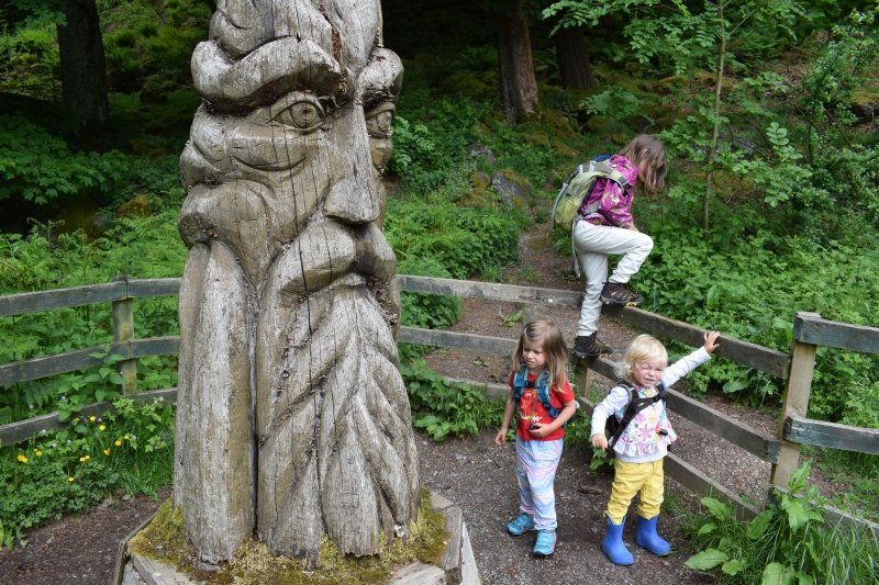
In May and June 2018, five of us traveled the English-Welsh border with the LMC Vivo 520 K. My mother, my three daughters and I traveled in a caravan for the first time.
As a travel guide author and sole driver, this trip was hard work for me, a welcome change for my mother and paradise on earth for my children.
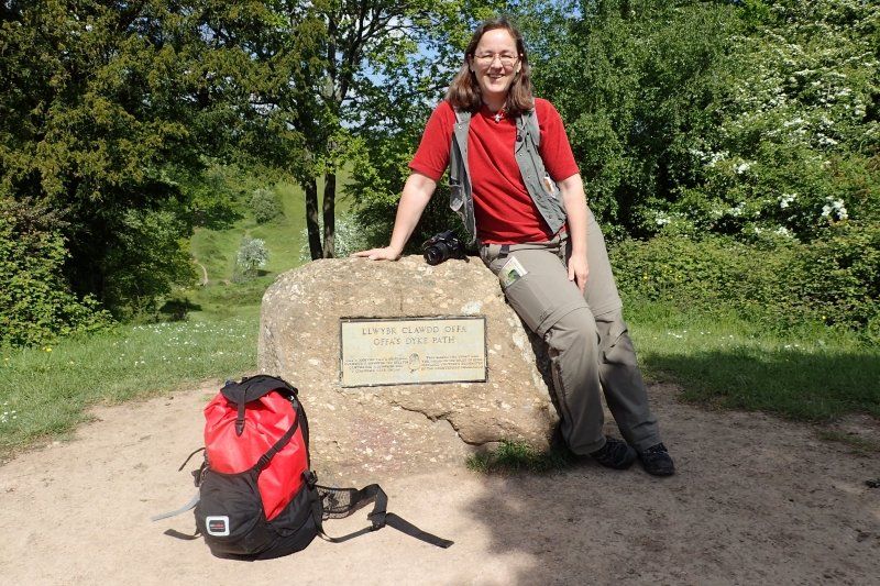
I have a very special affection for Offa's Dyke Path. It follows the Offa's Dyke border wall for about 284 km from Chepstow on the Bristol Channel up to Prestatyn on the Irish Sea. The rampart and its deep ditch were built Anno Pief to protect "against the savages in the west". The supreme builder was Offa, King of Mercia. The long-distance hiking trail therefore leads along the border of England and Wales in a very varied way through the most beautiful landscapes in Great Britain. Here I keep crossing borders again and again - geographically and historically!
This was my fourth hike on Offas's Dyke Path and it definitely won't be my last. It was my first caravan holiday and certainly not the last!
Day
Sassenberg, Deutschland
Rudolf-Diesel-Straße 4, 48336 Sassenberg, Deutschland
51° 58' 43.2" N 8° 3' 46.1" E
51.9786749 8.0628167
• Head northeast on Rudolf-Diesel-Straße. Go for 407 m.
• Turn left onto Greffener Straße (B513). Go for 2.1 km.
• Turn left onto Warendorfer Straße (B475). Go for 3.0 km.
• Take the 3rd exit from roundabout onto B475 toward A2/Beckum/Ennigerloh/Paderborn. Go for 18.6 km.
• Turn right onto Ennigerstraße (B475) toward Hannover/A2/Dortmund/Beckum. Go for 1.1 km.
• Take ramp onto B475 toward Hannover/A2/Dortmund/Beckum/Neubeckum. Go for 4.0 km.
• Take ramp onto A2 toward Dortmund. Go for 33.9 km.
• Take exit 16 toward Köln/Frankfurt a.M./Flughafen Dortmund onto A1. Go for 107 km.
• Take the exit toward Olpe onto A4. Go for 6.4 km.
• Take exit 11A toward Hürth. Go for 420 m.
• Turn left onto Luxemburger Straße (B265) toward Hürth. Go for 1.3 km.
• Turn right onto Jägerpfad. Go for 146 m.
• Turn right onto Luxemburger Straße. Go for 361 m.
• Continue on Beselerstraße. Go for 93 m.
• Turn left onto Bahnstraße. Go for 227 m.
• Turn right onto Hebbelstraße. Go for 104 m.
• Arrive at Hebbelstraße. Your destination is on the left.
☍
179,7 km
(1 hrs. 56 min.)
Meine erste Fahrt mit einem Wohnwagen
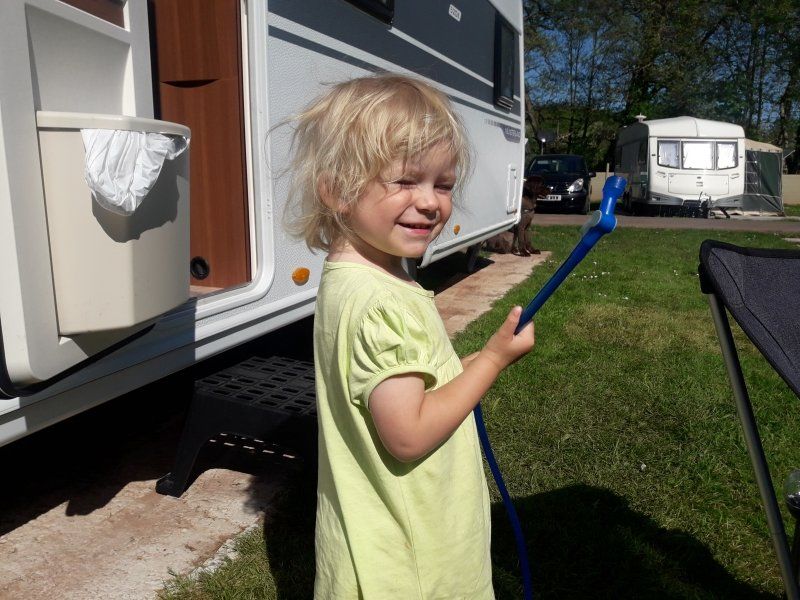
Today I pick up the LMC caravan in Sassenberg - and then celebrate a five-hour stowage party between the Kamener Kreuz and the Kölner Südkreuz. Although I left Cologne at 8:30 a.m. and nobody dawdled to hand it over, I'm late for school.
The children wait with two supervisors in the foyer. I can only apologize, shoo the children into the car and be marginally happy that I didn't have any problems with parking because of my delay in front of school.
At home, I add to the amusement of the entire neighborhood. Because with three happily screeching directors between 91 and 125 cm high and an excited dog in the car, it is not that easy to come backwards into our driveway.
After driving through grandma’s flowers twice, I disconnect and push.
Alone.
The neighbors stand by in amazement with their hands in their trouser pockets and comment: “Wow, you can really do it on your own!” - “Then nothing can go wrong on the campsites in Wales!” - “Phew, and that in the heat! Don't you sweat? "
I then got help for the very last meter from a DHL driver driving past. He stops, jumps out, gives the trailer the last nudge and gives each of the children a 'high five', jumps back into his van and drives on before the onlookers notice what has just happened.
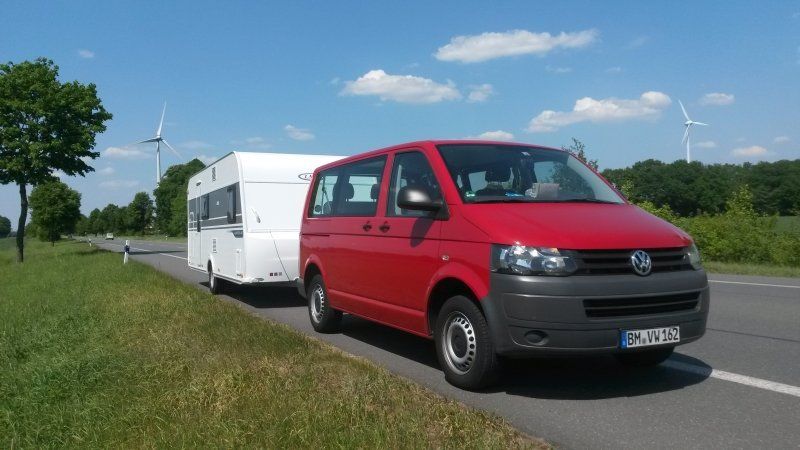
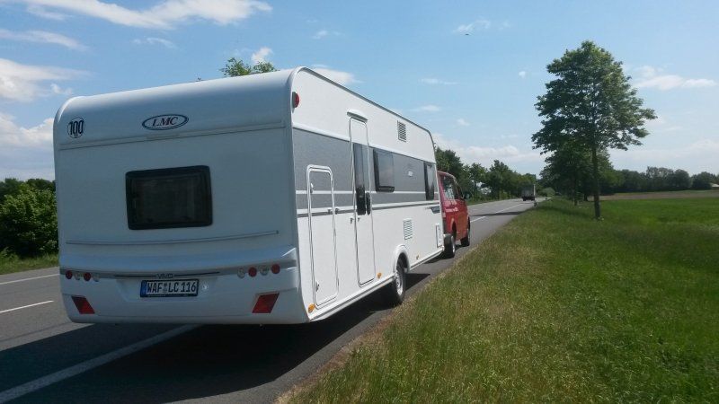
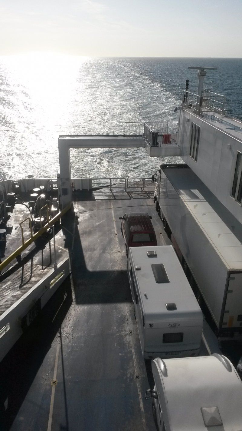
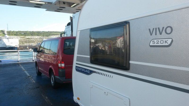
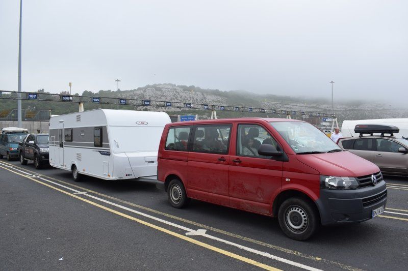
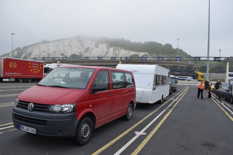
When you look at the photos, you notice: it's all a question of perspective.
Left the little trailer ...
... and on the right the huge caravan shortly after the start
Hürth, Deutschland
Hebbelstraße 14, 50354 Hürth, Deutschland
50° 53' 21.6" N 6° 53' 47.4" E
50.8893360 6.8964948
• Head northwest on Hebbelstraße. Go for 53 m.
• Turn right onto Uhlandstraße. Go for 83 m.
• Turn right onto Heinrich-Heine-Straße. Go for 129 m.
• Turn left onto Bahnstraße. Go for 121 m.
• Turn right onto Beselerstraße. Go for 93 m.
• Continue on Luxemburger Straße. Go for 306 m.
• Take the 4th exit from roundabout onto Jägerpfad toward Brühl/K.-Meschenich/Gewerbegebiet Nord-Ost. Go for 269 m.
• Turn left onto B265. Go for 1.6 km.
• Turn right and take ramp onto A4 toward Aachen. Go for 58.8 km.
• Take the exit onto A4. Go for 10.2 km.
• Continue on A76. Go for 27.0 km.
• Continue on E314 (Scharbergbrug). Go for 38.2 km.
• Take the exit toward Antwerpen onto E313 (Koning Boudewijnsnelweg). Go for 62.5 km.
• Continue on E34 (Antwerpen-Oost) toward Ring Antwerpen 1/Brugge/Gent/Haven 1000-2000/Brussel/Ring Antwerpen 2/Breda/Haven 1-999. Go for 1.8 km.
• Continue on E19 (Ring Antwerpen 1). Go for 2.5 km.
• Continue on E34 (Kleine Ring) toward Brugge/Gent/Haven 1000-2000. Go for 5.2 km.
• Continue on E17. Go for 49.5 km.
• Take the exit toward Brussel/Oostende onto E40. Go for 94.1 km.
• Continue on A16 (Autoroute des Estuaires). Go for 50.3 km.
• Take exit 47 toward Calais-Port/Calais-Z.I.Est/Centre Universitaire onto A216 (Rocade Est). Go for 5.3 km.
• Take ramp toward Calais-Port. Go for 631 m.
• Turn left. Go for 27 m.
• Turn right. Go for 160 m.
• Continue straight ahead. Go for 22 m.
• Take the 2nd exit from roundabout. Go for 166 m.
• Take the 3rd exit from roundabout. Go for 847 m.
• Turn right toward Avenue de l'Embarquement. Go for 857 m.
• Continue on Avenue de l'Embarquement. Go for 225 m.
• Turn left toward Quai Calais 5. Go for 380 m.
• Turn left onto Quai Calais 5. Go for 207 m.
• Arrive at Quai Calais 5. Your destination is on the left.
☍
411,6 km
(4 hrs. 2 min.)
Day
Packen und Abreise
In the mornings, I pack everything my family brings me into the trailer. It's huge and has so many good storage options.
After the stressful pick-up action yesterday, I only really realize today what I'm getting myself into.
Starting this afternoon, I'll be driving on the left-hand side or on single track roads as the sole driver for a full four weeks. My mother can't even push an empty wheelbarrow because of her severe osteoporosis, the children are far too small.
Hopefully I won't have any problems with the team on the ferry, in left-hand traffic and on single track roads - and if so, please with such nice, uncomplicated help as yesterday afternoon.
Well, after all, with the required slow driving style, I make sure that I will never drive faster than my guardian angel can fly.
I've never been in a caravan before. I have already driven a trailer, but the trailers in the DRK disaster control were only two or three meters long.
No matter.
Today it's off to my favorite travel destination.
Wales!
The land of castles, rocks, mountains, bays, sheep, male voice choirs, seaweed cakes and dream hiking trails.
Now finally, after a 7 year break, I am going back there.
And I can show my children where I like to be in Europe.
We start in the afternoon in order to have enough time for the journey. Whenever we reach the ferry port that night, there will be enough time until the departure of the booked ferry.
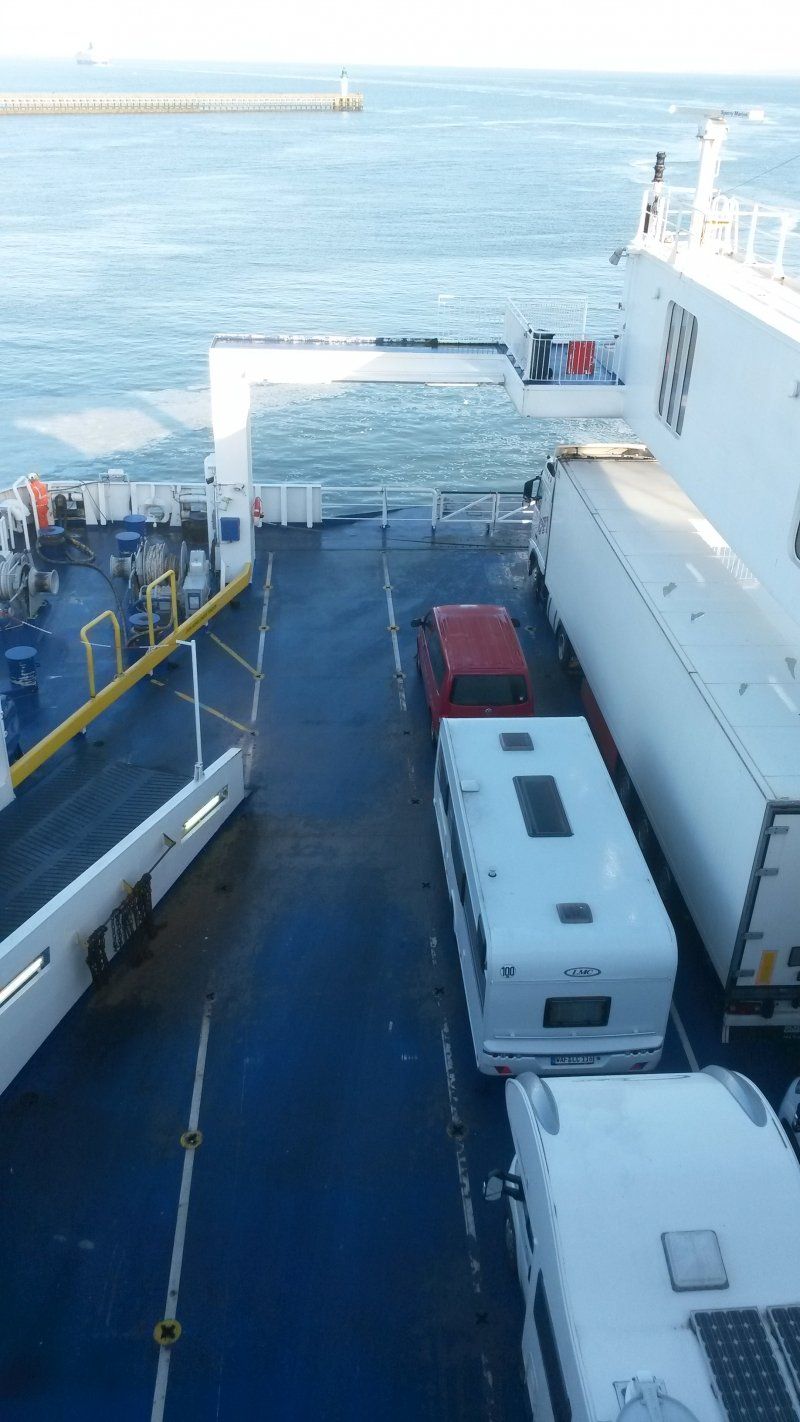
Fährhafen Calais
We reach Calais relatively relaxed. If you are traveling with a caravan, you cannot speed.
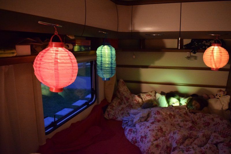
Unfortunately, only after three desperate laps through the harbor car park and the surrounding area do we find an at least semi-legal place where we can beat each other on the ear for the remaining hours until departure. The children sleep just fine in their new cot, which they have lovingly furnished with lanterns. Dog, grandma and mom startle at every noise.
Quai de la Marée, 62100 Calais, Frankreich
50° 57' 59.4" N 1° 50' 55.7" E
50.9664901 1.8488100
• Head southeast on Quai Calais 5. Go for 228 m.
• Turn left. Go for 267 m.
• Take the Calais-Dover Ferry. Stay on for 40.6 km.
• Head northwest. Go for 133 m.
• Turn right toward Ramp B. Go for 129 m.
• Continue on Ramp B. Go for 69 m.
• Turn right toward The Fan. Go for 143 m.
• Continue on The Fan. Go for 269 m.
• Keep right onto Inward Car Lanes. Go for 115 m.
• Keep left onto North Exit Road. Go for 439 m.
• Continue on Dock Exit Road. Go for 99 m.
• Keep left toward London/(M20)/Folkestone/Dover town centre. Go for 511 m.
• Continue on A20. Go for 706 m.
• Turn left onto Wellesley Road. Go for 109 m.
• Turn right onto Marine Parade. Go for 121 m.
• Continue on Waterloo Crescent. Go for 222 m.
• Arrive at Waterloo Crescent. Your destination is on the right.
☍
44,1 km
(1 hrs. 39 min.)
Day
Geburtstag auf dem Ärmelkanal
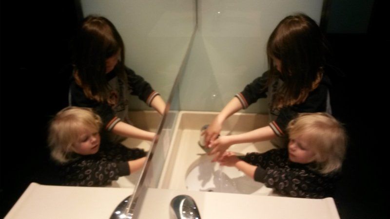
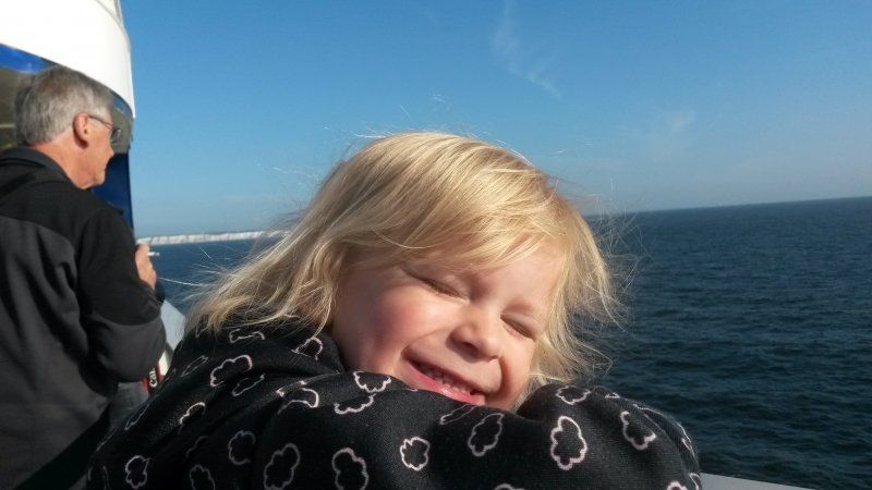
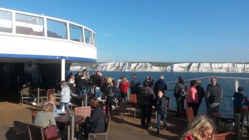
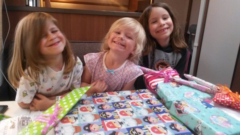
It's the twins' birthday today. They will be three years old and firmly believe that this sea voyage is their birthday present. Of course we don't clarify that.
We look forward to the beautiful weather, the wind, the waves, the sight of the white cliffs of Dover and the pole position of the team, which we reached without bumps when embarking.
Everything is exciting on the ferry, even washing your hands! Only after the crossing are they awake enough to unwrap the presents.
Port of Dover, Marine Parade, Dover, Vereinigtes Königreich
Disembarkation also works smoothly. We don't touch any other vehicle, I immediately find the microchip on Bathida's neck with the customs officer’s scanner and the border guard accepts the now two and a half year old photos in the children's passports.
Harbour House, Marine Parade, Dover CT17 9BU, Vereinigtes Königreich
51° 7' 15.3" N 1° 18' 48.3" E
51.1209060 1.3134200
• Head toward Cambridge Road on Waterloo Crescent. Go for 12 m.
• Continue on Esplanade. Go for 136 m.
• Continue on Esplanade. Go for 35 m.
• Turn right onto Union Street. Go for 200 m.
• Turn left onto Limekiln Street (A20). Go for 312 m.
• Take the 3rd exit from Limekiln Roundabout roundabout onto Archcliffe Road (A20) toward London/(M20)/Folkestone. Go for 496 m.
• Take the 1st exit from Western Heights Roundabout roundabout onto A20 toward London/(M20)/Channel Tnl/Folkestone. Go for 11.3 km.
• Keep right onto M20 toward London/Channel Tnl/Ashford. Go for 44.7 km.
• Take exit 8 toward Maidstone (E)/A20. Go for 440 m.
• Take the 3rd exit from Hollingbourne Intr roundabout. Go for 375 m.
• Continue on Maidstone Services. Go for 69 m.
• Turn slightly right. Go for 10 m.
• Arrive at your destination on the right.
☍
58,0 km
( 36 min.)
Linksverkehr
What a six-year-old can do when the motivation is right is unbelievable. If I couldn't see exactly whether it was free when I was driving onto a new motorway, Aurelia would give me information without asking. It didn't take her 10 minutes to understand why I insisted on her taking the passenger seat.
She also looks attentively at roundabouts and in narrow spaces, shines with happiness and comments: "I'm sitting on the driver's side here in England. My eyes are your eyes!"
Maidenhead Services
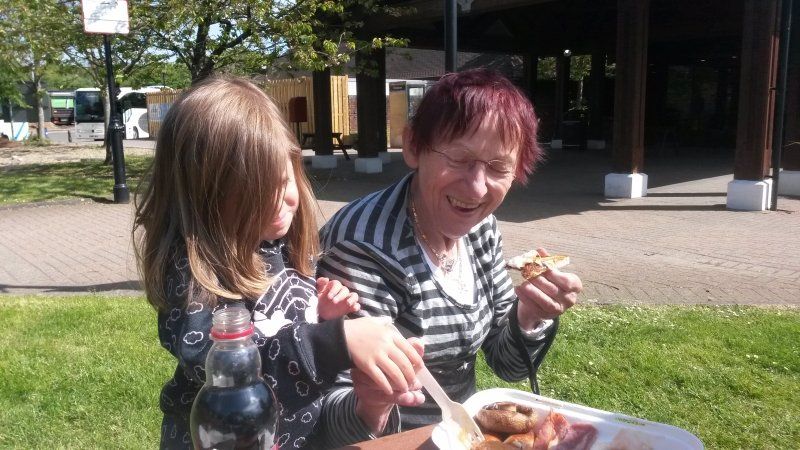
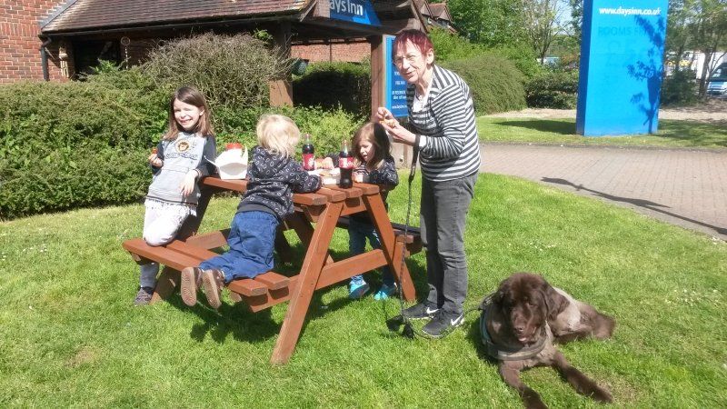
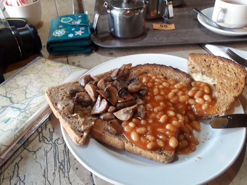
Ein weiteres Aha-Erlebnis haben die Kinder bei unserem ersten Halt an einer Autobahnraststätte. Das ist eine ganz andere Liga als in Deutschland - egal, ob man sich die Größe, die Auswahl, den Service oder die Sauberkeit anschaut. Der Tag ist noch jung, also verputzen wir ein original Full Cooked British Breakfast. Da ist für jeden etwas dabei, sogar der Hund ist glücklich mit den Würstchen, die von uns Zweibeinern keiner so richtig mag.
Unnamed Road, Maidstone ME17 1SS, Vereinigtes Königreich
51° 15' 56.4" N 0° 36' 54.8" E
51.2656568 0.6152253
• Head north. Go for 202 m.
• Turn slightly left toward M20. Go for 242 m.
• Take the 3rd exit from Hollingbourne Intr roundabout onto M20 toward London/Maidstone (West). Go for 19.8 km.
• Keep left onto M26 toward Heathrow Airport/(M25(W))/Gatwick Airport/Sevenoaks/(A25). Go for 15.6 km.
• Keep left onto M26. Go for 344 m.
• Continue on M25. Go for 57.2 km.
• Take exit 12 toward Basingstoke/Southampton onto M3. Go for 11.2 km.
• Take exit 3 toward Bracknell/Lightwater. Go for 624 m.
• Take the 3rd exit from roundabout onto A322 toward Bracknell/Bagshot. Go for 3.1 km.
• Keep left onto A322 toward The West/(M4)/Bracknell/Reading/(A329). Go for 4.3 km.
• Pass 2 roundabouts and continue on Downshire Way (A322). Go for 1.9 km.
• Take the 2nd exit from Twin Bridges Roundabout roundabout onto Berkshire Way (A329) toward Wokingham/(M4)/(A329(M))/Reading. Go for 1.1 km.
• Take the 2nd exit from Doncastle Roundabout roundabout onto Berkshire Way (A329) toward Wokingham/(M4)/Reading/(A329(M)). Go for 936 m.
• Take the 2nd exit from Jennett's Park Roundabout roundabout onto Berkshire Way (A329) toward (M4)/Reading/(A329(M))/Wokingham. Go for 648 m.
• Keep right onto A329(M) toward (M4)/Reading. Go for 4.5 km.
• Take the exit toward Newbury/Reading (Cen.,S & W)/South Wales onto M4. Go for 132 km.
• Keep left onto M48 toward Chepstow. Go for 7.0 km.
• Arrive at Severn Road Bridge (M48). Your destination is on the right.
☍
260,5 km
(2 hrs. 31 min.)
Severn Bridge, Chepstow, Vereinigtes Königreich
Strengthened by breakfast, the adrenaline level drops for all of us and we swim in the stream of other vehicles to the Severn Bridge. Only a short stop for the bridge toll * separates us from Wales.
* Bridge tariffs have not been levied since winter 2018/2019
Vereinigtes Königreich
51° 36' 44.1" N 2° 38' 47.1" W
51.6122597 -2.6464104
• Head northwest on M48 (Severn Road Bridge). Go for 1.6 km.
• Take exit 2 toward Chepstow/Cas-Gwent/(A48). Go for 412 m.
• Take the 3rd exit from Newhouse roundabout onto Wye Valley Link Road (A466) toward Chepstow/A48/Cas-Gwent. Go for 1.9 km.
• Take the 2nd exit from Highbeech roundabout onto Wye Valley Link Road (A466) toward Monmouth. Go for 1.5 km.
• Take the 1st exit from roundabout onto Itton Road (B4293) toward Itton/Devauden/Trelleck. Go for 3.6 km.
• Continue on B4293. Go for 702 m.
• Continue on Itton Common (B4293). Go for 42 m.
• Continue on B4293. Go for 4.5 km.
• Continue on New Inn (B4293). Go for 181 m.
• Continue on B4293. Go for 4.6 km.
• Continue on Chepstow Road (B4293). Go for 1.5 km.
• Continue on Church Street (B4293). Go for 299 m.
• Turn left onto Monmouth Road (B4293). Go for 2.1 km.
• Continue on B4293. Go for 4.8 km.
• Turn sharp left. Go for 1.5 km.
• Arrive at your destination on the right.
☍
29,3 km
( 27 min.)
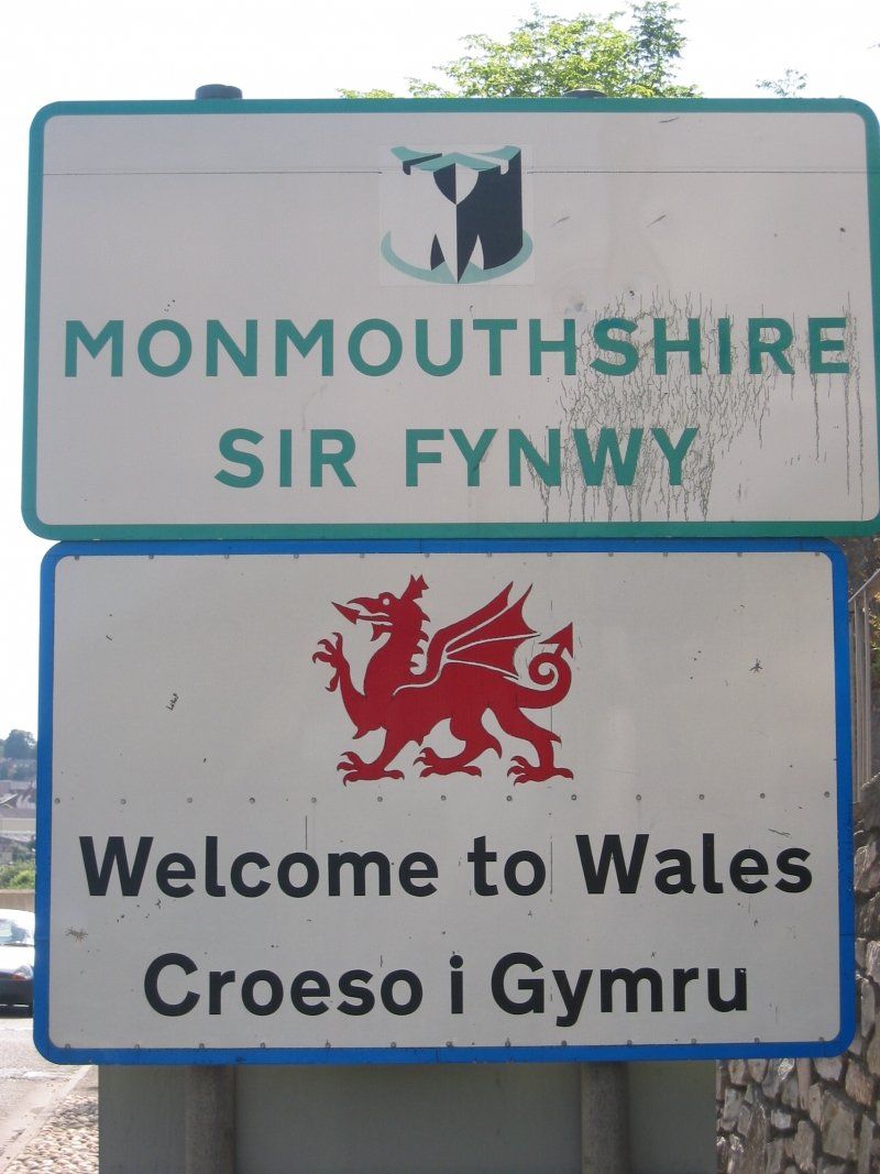
Endlich Wales!
My heart leaps when I read Croeso y Cymru = Welcome to Wales on the Welsh side of the bridge.
Now it's not far to Monmouth, where we're looking for a campsite at random.
I remember from my hikes that the two campsites in the town center have very narrow driveways, so I spontaneously decide on the campsite in Mitchel Troy, about 10 minutes outside of town.
Glen Trothy Camping & Caravan Park, Mitchel Troy
Der Campingplatz macht es uns leicht, uns ans Wohnwagenleben zu gewöhnen. Die Inhaber sind jung und freundlich, die anderen Camper hilfsbereit beim Rangieren. Es gibt viele Kinder, mit denen meine Mädchen spielen können.
Glen Trothy Camping & Caravan Park, Telefon 01600 712295, geöffnet März bis Oktober
2 Longstone Cottages, Mitchel Troy, Monmouth NP25 4BD, Vereinigtes Königreich
51° 47' 29.3" N 2° 43' 59.6" W
51.7914717 -2.7332340
• Head east. Go for 1.5 km.
• Turn sharp right onto B4293. Go for 4.9 km.
• Continue on Monmouth Road (B4293). Go for 2.1 km.
• Turn right onto Church Street (B4293). Go for 299 m.
• Continue on Chepstow Road (B4293). Go for 1.5 km.
• Continue on B4293. Go for 4.6 km.
• Continue on New Inn (B4293). Go for 181 m.
• Continue on B4293. Go for 4.5 km.
• Continue on Itton Common (B4293). Go for 42 m.
• Continue on B4293. Go for 702 m.
• Continue on Itton Road (B4293). Go for 3.6 km.
• Take the 2nd exit from roundabout onto Welsh Street (B4293) toward Town Centre/Canol y dref. Go for 1.2 km.
• Turn left onto High Street. Go for 177 m.
• Turn slightly right onto Beaufort Square. Go for 8 m.
• Turn left onto Beaufort Square. Go for 33 m.
• Continue on Middle Street. Go for 89 m.
• Turn slightly left onto Bridge Street. Go for 198 m.
• Turn left. Go for 26 m.
• Turn right. Go for 13 m.
• Arrive at your destination on the left.
☍
25,6 km
( 26 min.)
Day
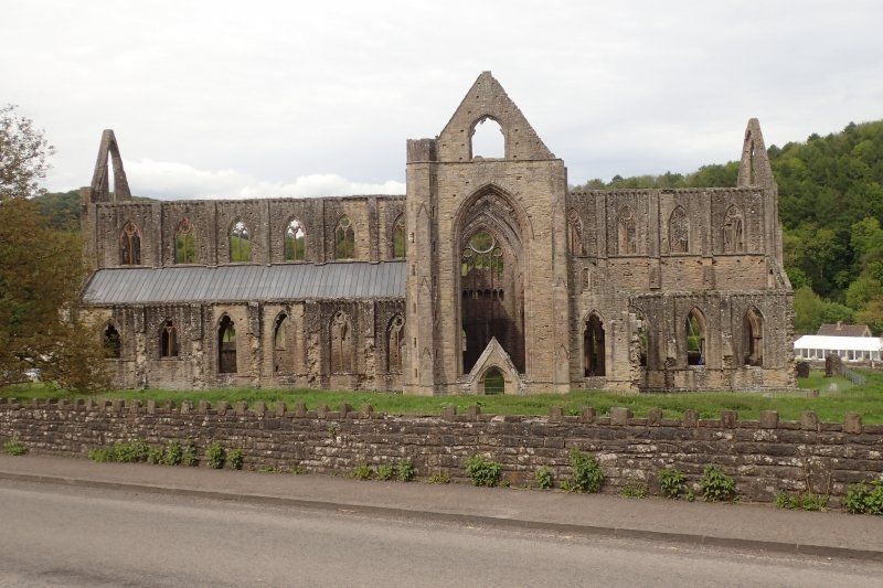
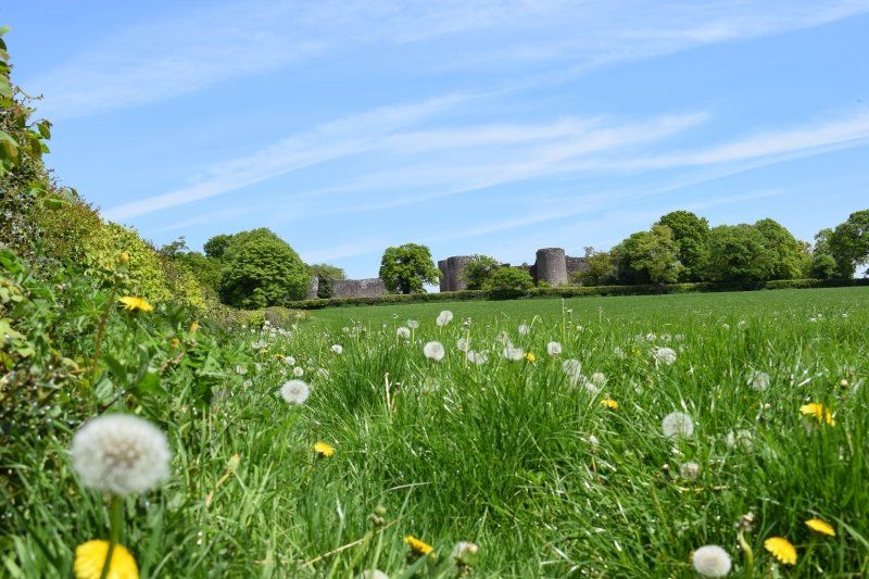
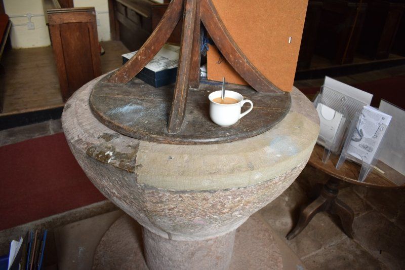
Chepstow Castle
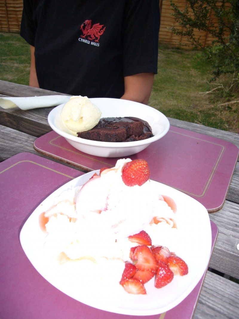
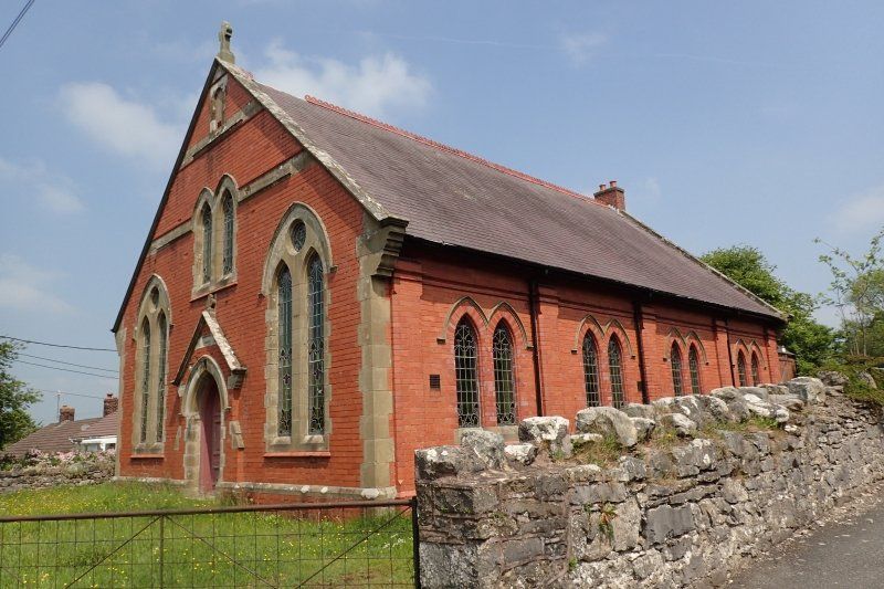
Wir parken an Chepstow Castle, weil ich in die Touristinformation hüpfen will, die sich dort auf dem Parkplatz befindet. Ohne großartige Erwartungen, denn bei meinen letzten drei besuchen gab es keine verwertbaren Informationen für mich dort. Und so bin ich auch nicht enttäuscht, dass die beiden Damen über den Offa's Dyke Path so gut wie nichts wissen, kein Stempelheft haben und mir auch sonst nicht so richtig weiterzuhelfen wissen.
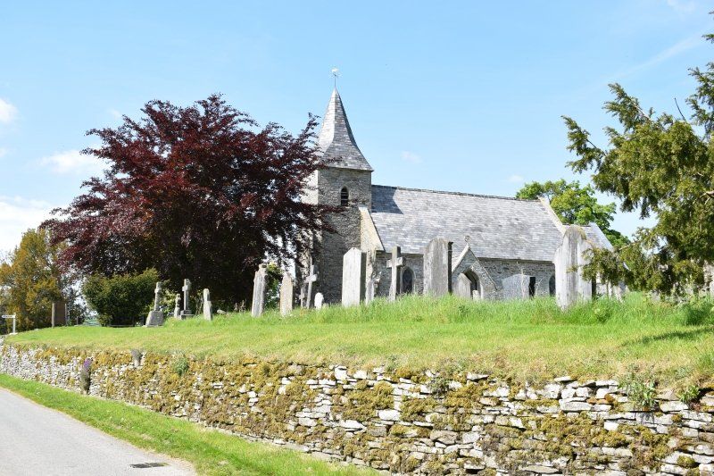
Wir trösten uns bei einem Cafébesuch mit Strawberry Delight & Hot Chocolate Fudge Cake. Danach schauen wir uns die Kirche St.
Mary an. Sie wurde als Benediktiner-Priorat gegründet, mit dem Bau wurde bereits 1072
begonnen, also nur kurz nach Chepstow Castle. Fast noch
beeindruckender als die Steinmetzarbeiten sind die zahlreichen liebevoll
bestickten Kniekissen. Neben dem Chor ist das alte Uhrwerk
ausgestellt. Der Grabstein hinter der Kinderspielecke ist einer
männlichen Hebamme aus dem 18. Jahrhundert gewidmet, täglich geöffnet,
sogar Hunde werden herein gebeten.
Die Oma hat Schmerzen beim Laufen, also sehen wir uns die Burg nur von außen an. Chepstow
Castle: Sofort nach dem Battle of Hastings 1066 begann William Fitz-Osbern,
ein Verbündeter von William dem Eroberer, mit dem Bau dieser
Burganlage. Sie ist eine der ältesten steinernen Burgen in
Großbritannien. In der Ausstellung "A Castle at War" wird
mit lebensgroßen Puppen eine Kriegsszene aus dem 13. Jahrhundert
nachgestellt. Telefon 01291 624065, geöffnet März bis Juni/Sep/Okt 9:30 bis 17:00, Jul/Aug bis 18:00, Nov bis
Feb Mo bis Sa 10:00 bis 16:00, So 11:00 bis 16:00, Eintritt £ 6,90,
ermäßigt £ 4,10, CADW. Hunde erlaubt
30 Bridge St, Chepstow NP16 5EZ, Vereinigtes Königreich
51° 38' 41.9" N 2° 40' 22.5" W
51.6449861 -2.6729251
• Head north.
• Turn right toward Bridge Street. Go for 26 m.
• Turn left onto Bridge Street. Go for 86 m.
• Turn right onto St Ann Street. Go for 158 m.
• Turn slightly right onto Lower Church Street. Go for 185 m.
• Turn slightly right onto Church Road. Go for 164 m.
• Continue on Nelson Street. Go for 201 m.
• Turn left onto Beaufort Square. Go for 8 m.
• Turn slightly left onto High Street. Go for 177 m.
• Turn right onto Welsh Street (B4293). Go for 1.2 km.
• Take the 3rd exit from roundabout onto A466 toward Tintern/Monmouth. Go for 382 m.
• Take the 2nd exit from roundabout onto A466. Go for 6.6 km.
• Turn right. Go for 101 m.
• Turn left. Go for 28 m.
• Arrive at your destination on the right.
☍
9,3 km
( 13 min.)
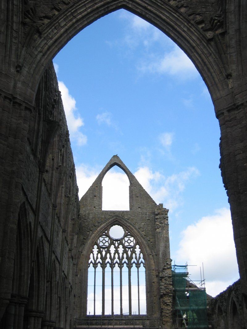
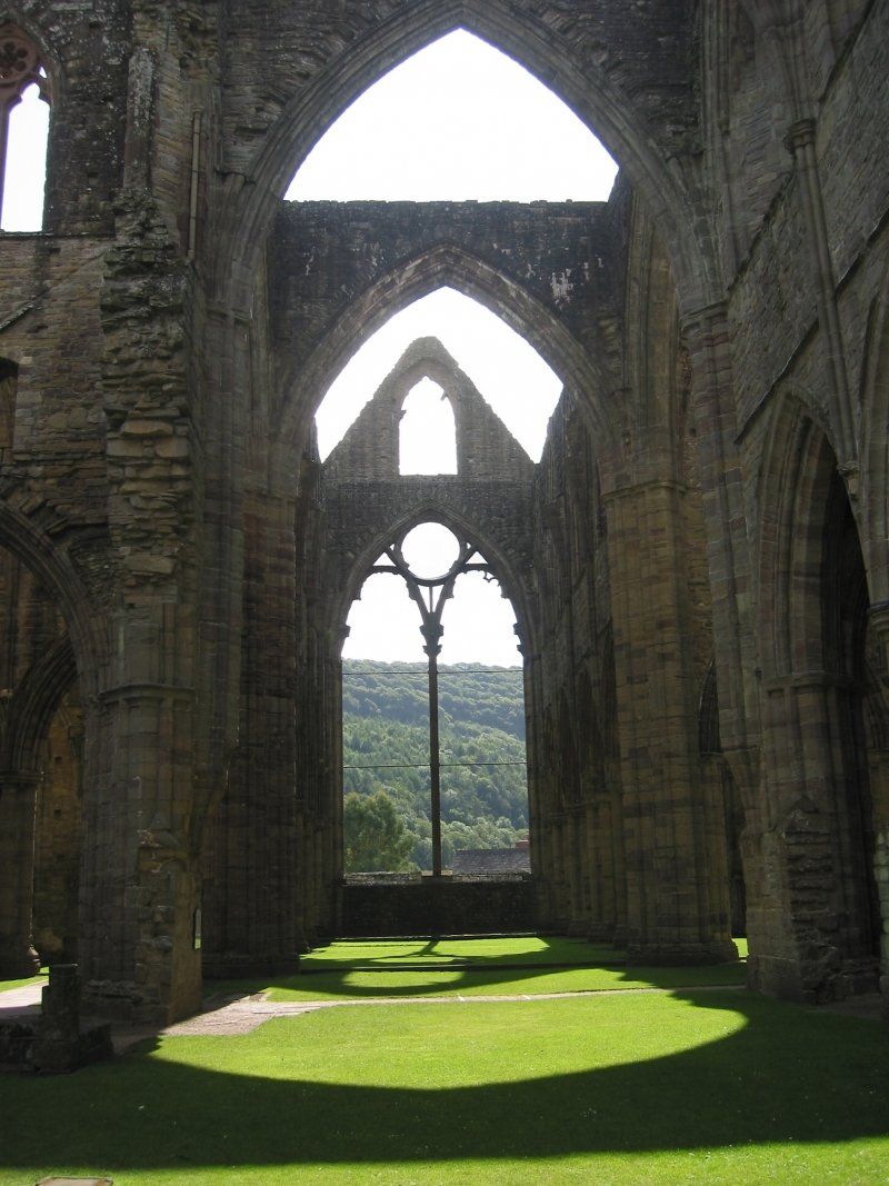
Tintern Abbey
Meine erste Erinnerung an Wales ist Tintern Abbey. Beim Schüleraustausch nach Bath (bei Bristol) machte meine Gastfamilie einen Ausflug nach Tintern. Diese Ruine beeindruckt mich immer wieder aufs Neue. Auch heute wieder.
Tintern
Abbey:
Romantische Klosterruine, 1131 von Zisterziensern gegründet und
heute die am besten erhaltene mittelalterliche Kirche in Wales. Die
Audiotour ist sehr empfehlenswert.
Info: Telefon 01291 689251,
TinternAbbey@gov.wales, März
bis Juni/Sep/Okt 9:30 bis 17:00, Jul/Aug bis 18:00, Nov bis Feb Mo
bis Sa 10:00 bis 16:00, So 11:00 bis 16:00, Eintritt £ 6,90, Ermäßigungen für Senioren, Studenten,
Jugendliche und Kinder, CADW, Hunde sind erlaubt. WC, Shop.
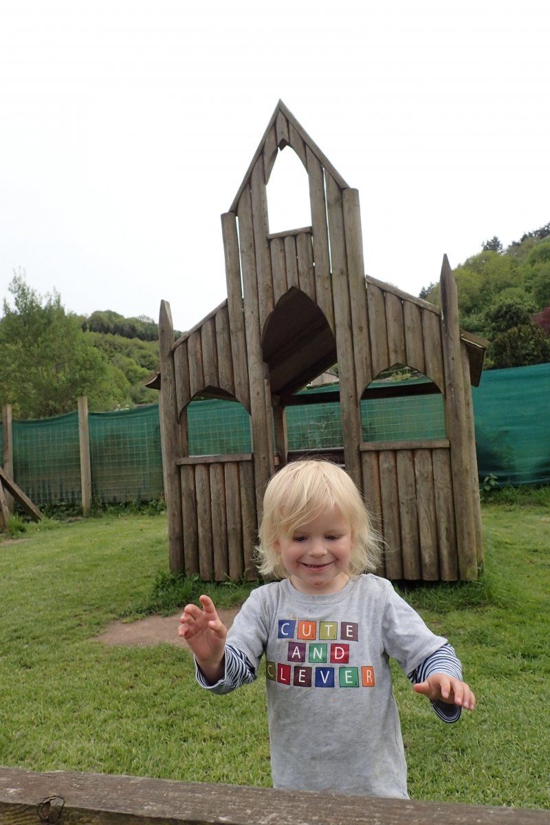
Nach der Besichtigung schlemmen wir im Biergarten vom Abbey Mill Inn, die Kinder amüsieren sich auf dem Spielplatz. Das Klettergerüst sieht Tintern Abbey so ähnlich, dass es sogar den beiden Kleinen auffällt.
Info: Abbey
Mill, Telefon 01291 689228, www.abbeymill.com, 10:30
bis 17:30. Preiswerte Lunches, guter Cream Tea, lokale Produkte.
Tintern Abbey, Tintern, Chepstow NP16 6TE, Vereinigtes Königreich
51° 41' 50.9" N 2° 40' 41.2" W
51.6974633 -2.6781021
• Head west. Go for 16 m.
• Turn right. Go for 36 m.
• Turn right toward A466. Go for 126 m.
• Turn right onto A466. Go for 17.0 km.
• Take the 1st exit from roundabout onto A466 toward Monmouth. Go for 259 m.
• Turn left onto A40 toward Abergavenny/Y Fenni/Newport/A449/Casnewydd/Town Centre/B4293/Canol Y Dref. Go for 754 m.
• Turn left onto B4293 toward Trellech/Monmouth/Trefynwy. Go for 78 m.
• Continue on Beech Road (B4293). Go for 220 m.
• Turn left onto B4293 toward Mitchel Troy/Treleck. Go for 577 m.
• Turn right. Go for 1.5 km.
• Arrive at your destination on the right.
☍
20,6 km
( 21 min.)
Mitchel Troy, Vereinigtes Königreich
2 Longstone Cottages, Mitchel Troy, Monmouth NP25 4BD, Vereinigtes Königreich
51° 47' 28.5" N 2° 43' 58" W
51.7912638 -2.7327805
• Head east. Go for 2.1 km.
• Continue on Portal Road (B4293). Go for 528 m.
• Take the 2nd exit from roundabout onto B4293 toward Forest of Dean/Ross-on-Wye/Chepstow. Go for 260 m.
• Continue on A40. Go for 1.6 km.
• Take the 2nd exit from roundabout onto A40 toward The Midlands/(M50)/Ross-on-Wye. Go for 6.8 km.
• Take ramp toward Hereford/Symonds Yat (East). Go for 59 m.
• Continue on A4137. Go for 8.2 km.
• Turn slightly left onto A49 toward Hereford. Go for 3.0 km.
• Turn left onto B4348 toward Hay-on-Wye/Llanwarne/Wormelow/Kingstone. Go for 3.4 km.
• Turn right onto A466. Go for 200 m.
• Turn left onto B4348. Go for 960 m.
• Continue on Church View (B4348). Go for 398 m.
• Continue on B4348. Go for 4.5 km.
• Turn right onto A465. Go for 45 m.
• Turn left onto B4348. Go for 13.6 km.
• Continue on Thornberry Close (B4348). Go for 115 m.
• Continue on B4348. Go for 7.2 km.
• Continue on The Bage (B4348). Go for 193 m.
• Continue on B4348. Go for 161 m.
• Turn right onto Newton Lane. Go for 1.2 km.
• Turn right toward B4352. Go for 691 m.
• Turn right onto B4352. Go for 136 m.
• Arrive at B4352. Your destination is on the right.
☍
55,4 km
( 49 min.)
Day
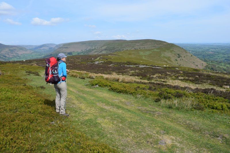
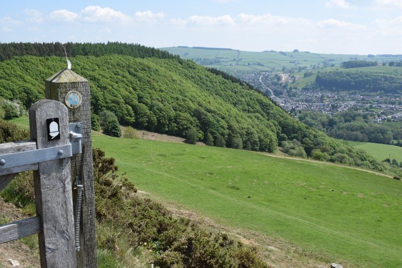
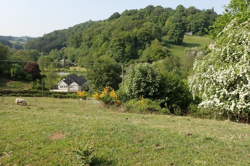
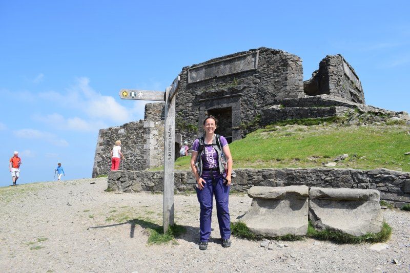
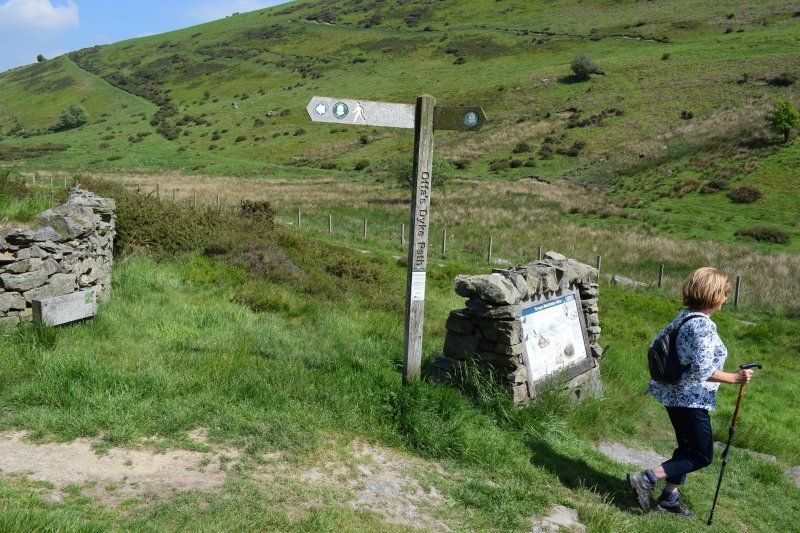
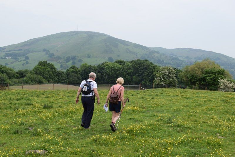
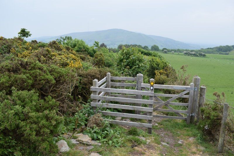
1. Wandertag: Sedbury Cliffs - Brockweir
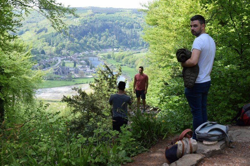
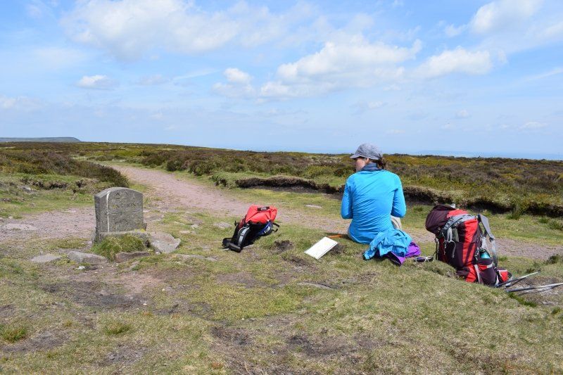
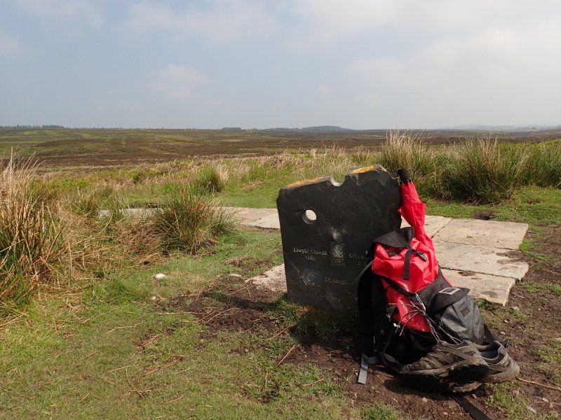
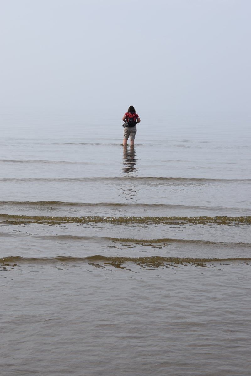
Here I am. At Offa's Dyke Stone high above the dirty gray waters of the Bristol Channel.
This is my fourth time on the Offa's Dyke Path. The first time privately in 1996, then in 2000 and 2005 for the first two editions of my hiking guide.
Twice I was out with a man, when I felt myself constantly chased away and once I was the scareer.
Once we started with four women, but only two of us reached the finish.
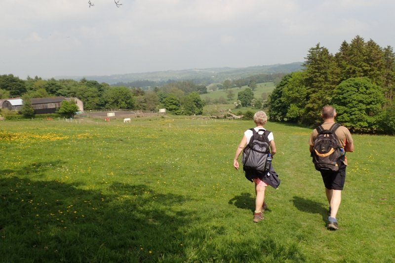
This path is not an easy one for me. I run it alone now and that's a good thing. I need this loneliness because memories roll over me. At every step, the wrong decisions in my life become clear to me. I'm not only a border crosser between England and Wales, but also between the present and the past.
I make progress accordingly slowly and my fear of the Hatterhall Ridge and some other exposed stages is correspondingly great.
Totally strange, because I know my way around, am well prepared and should rather have a queasy feeling when driving a trailer. But that still works without any problems.
It is easier to face the practical demands of everyday life and to maneuver a VW bus with a 7.82 m long trailer between the hedges of the single track roads than to deal with myself. With my past, my mistakes, my disappointments, my losses, my longings, my dreams.
But every step on the Offa's Dyke Path is a step towards greater clarity. I was even able to clarify a topic with the person I was talking to on the first day of hiking. For many years we were silent about it and now - in retrospect - we were able to draw a line and laugh together. What a relief on both sides!
I'm curious to see what else the path has in store for me.
Actually, I should be lucky because I packed fresh bird poop on Sedbury Cliffs during the self-timer shot on the starting stone and my grandma always said that you are lucky if you grab the shit.
So I hope, with the help of a British seagull, to be able to escape the reflective phases and to arrive in Prestatyn strengthened ...
Day
2. Wandertag: Brockweir - Monmouth
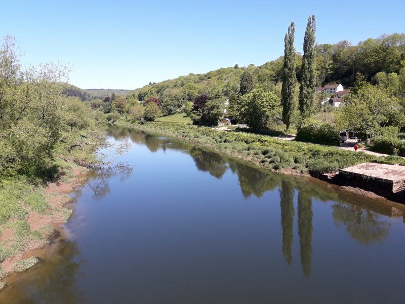
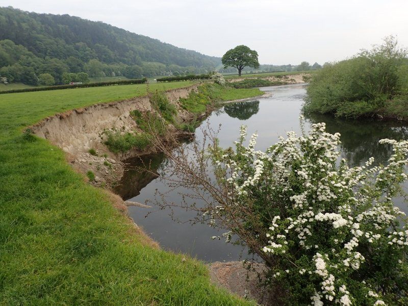
In Brockweir I start with a clear sky. The Wye flows so quietly that everything is beautifully reflected in it. I take a leisurely break at Bigsweir Bridge.
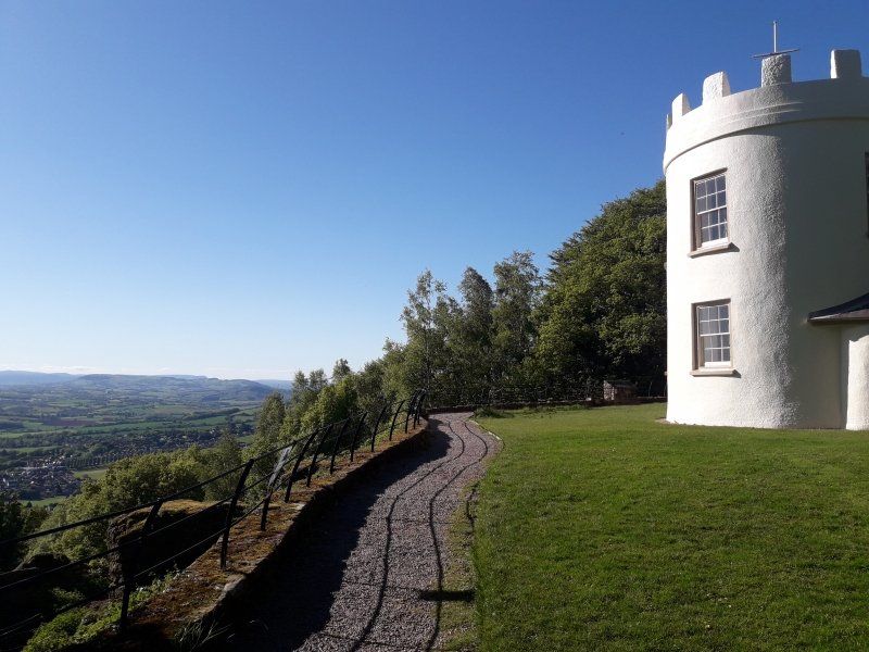
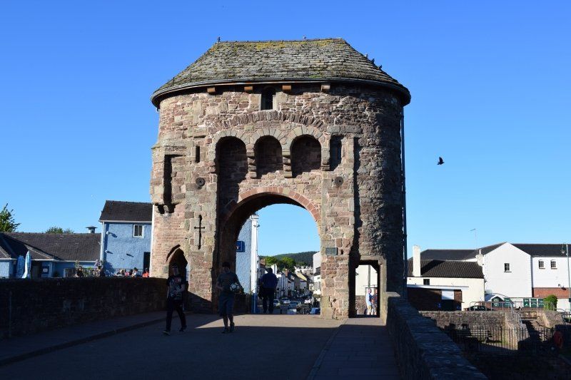
I'm lucky enough to hike alone, but I also know that on the long climb behind Redbrook in the afternoon I'll fall into a motivation hole. That was also the case with the three previous Offa's Dyke hikes. How good that a nice friend calls me and talks up the mountain.
As a thank you, I send him an MMS with a photo of the pretty white turret The Kymin and the view down into the Wyetal.
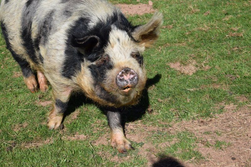
On the descent to Monmouth, a fat pig grunts at me from the neighboring pasture. I answer it, it answers with a grunt and we both enjoy the unusual dialogue for a few minutes. Days later I wonder if it's Mampfred ...
Day
3. Wandertag: Monmouth - Llantilio Crosseny
Today I start in Monmouth at the Monnow Bridge with its eye-catching bridge building.
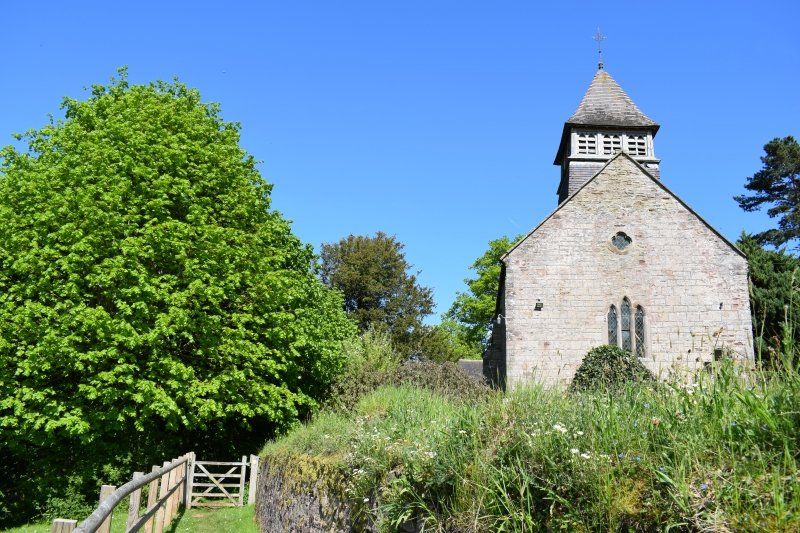
I make a first short stop at the small chapel of Llanfihangel-Ystern-Llewern , in German: St. Michael's Church of the Fiery Meteor (unfortunately neither residents nor history books know about a meteor).
Wonderful hilly Welsh landscape accompanies me to Llantilio Crosseny, where today's stage is already over. In years with "normal" rainfall you need two hours more for the last part of the stage, because it leads through soaking wet fields. In these cow pastures the foot gets stuck in the mud with every step. Today, however, it was just a little dusty, but very easy to walk. Great, my children will be happy if I'm at the caravan a little earlier than usual.
Day
Standortwechsel Richtung Hay on Wye
Bore there!
Everyone (except Bathida) can now say good morning in the local language. Bore because I'm really simple, compared to danke = diolch or please = os gwellwch yn dda .
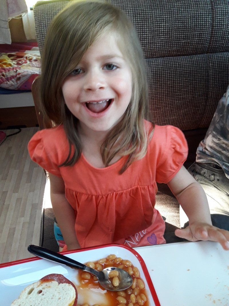
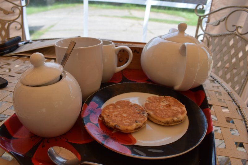
In the caravan, too, we indulge in British breakfast habits, sometimes with eggs, sometimes baked beans, sometimes porridge - and always sandwiches.
I am very happy to see three children who have not asked for a television for a week and are fighting over who can dry off.
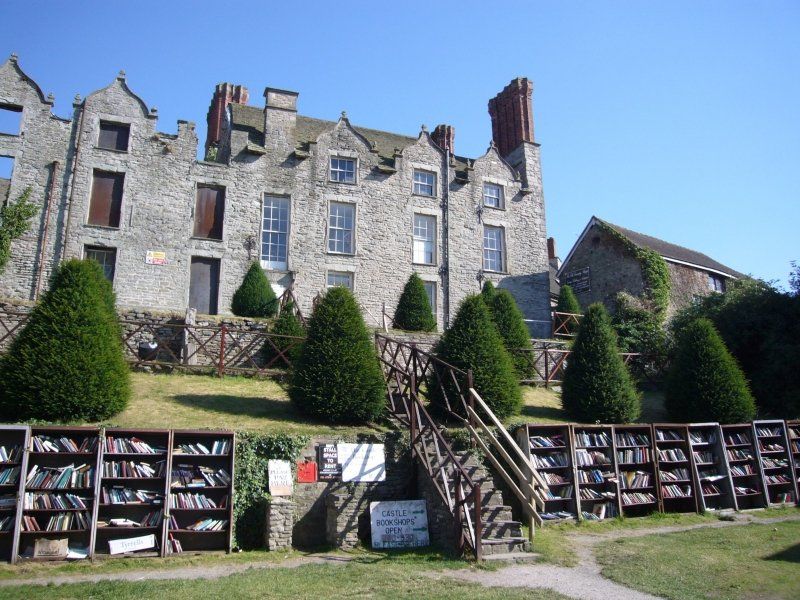
We spend the whole afternoon in the countless bookstores in Hay on Wye. The children find the Hay Cinema Bookshop in a former cinema and the Castle Book Shop particularly impressive: open shelves from which you can take books day and night. Payment is made at a slot in the castle wall.
Hay Castle was built by William de Breos II in the 12th century and attacked several times because of its favorable location on the border with England. King John largely destroyed the walls as early as 1216, shortly afterwards Prince Llewellyn set it on fire. Although Henry III. it was opened again, but it fell victim to angry attackers again in 1322 and 1453. The remaining remains can be visited unhindered.
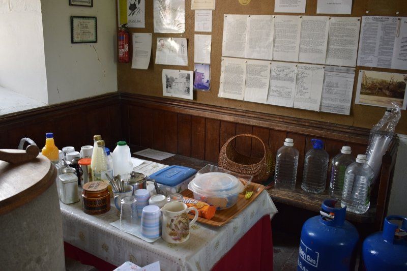
The Castlefields Inn and Campsite
Der neue Campingplatz ist ein echter Glücksgriff. Er ist winzig klein, hat nur etwa ein Deutzend Stellplätze und je ein WC für Männlein und Weiblein. Aber er befindet sich im Backyard eines guten Country Inns mit Spielplatz, sodass meine Mutter und die Kinder dort mittags Fish & Chips essen gehen können und nach Herzenslust toben. Unter den weinigen anderen Campern sind erstaunlich viele andere Kinder. Langeweile hat also keine Chance.
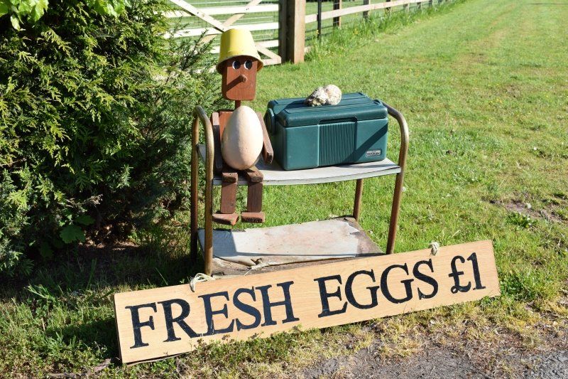
Was meine Kinder am meisten fasziniert ist die Eierbox auf der anderen Straßenseite. Hier gehen wir jeden Morgen frische Eier kaufen. Einfach so am Straßenrand, wie ich es beim Wandern oft sehe.
The Castlefields Inn and Campsite, Telefon 01497 831554 thecastlefields.co.uk
B4352, Hereford HR3 5HB, Vereinigtes Königreich
52° 6' 3.7" N 3° 2' 5.2" W
52.1010333 -3.0347775
• Head east on B4352. Go for 1.2 km.
• Continue on Merbach (B4352). Go for 159 m.
• Continue on B4352. Go for 3.5 km.
• Turn left toward Old Court. Go for 87 m.
• Continue on Old Court. Go for 636 m.
• Turn left onto Brobury Lane. Go for 1.6 km.
• Turn left onto A438. Go for 2.9 km.
• Continue on A4111 toward Kington/Rhayader/(A44). Go for 9.8 km.
• Take the 2nd exit from roundabout onto A44 toward Rhayader/Presteigne/(B4355). Go for 514 m.
• Take the 2nd exit from roundabout onto A44 toward Rhayader. Go for 6.3 km.
• Turn right onto B4357 toward Tref-Y-Clawdd/Knighton. Go for 8.0 km.
• Continue on Maes-Yr-Afon (B4357). Go for 27 m.
• Continue on B4357. Go for 3.0 km.
• Turn left onto B4355. Go for 1.9 km.
• Continue on Presteigne Road (B4355). Go for 918 m.
• Turn left onto Bridge Street (A4113). Go for 289 m.
• Turn right onto Station Road (A488). Go for 11.5 km.
• Turn left onto High Street (A488). Go for 9.6 km.
• Turn left onto School House Lane (B4384). Go for 626 m.
• Turn right onto Bull Lane (B4385). Go for 238 m.
• Turn right onto Castle Green (B4385). Go for 96 m.
• Continue on Montgomery Road (B4385). Go for 870 m.
• Continue on Heblands Bank (B4385). Go for 401 m.
• Continue on B4385. Go for 8.0 km.
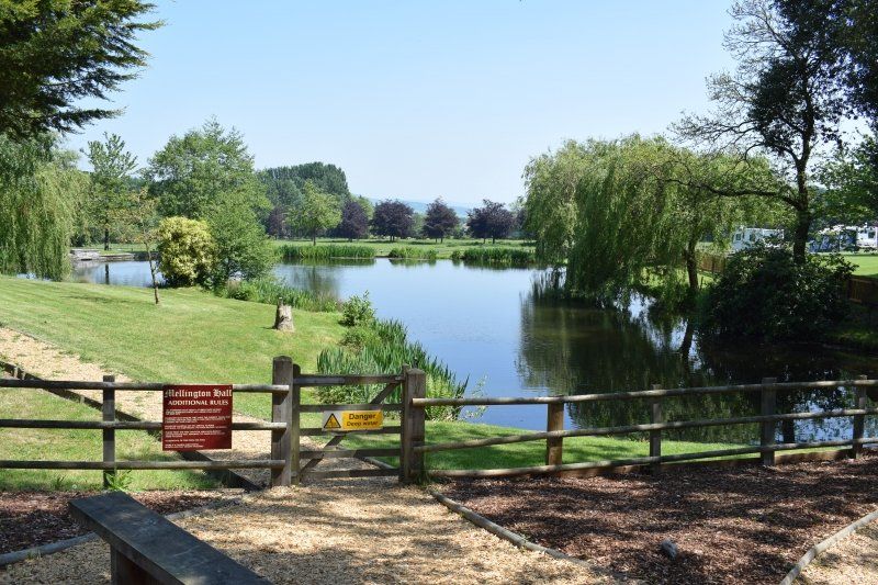
• Turn left toward Mellington Hall. Go for 1.2 km.
• Turn slightly left onto Mellington Hall. Go for 162 m.
• Turn right. Go for 84 m.
• Turn right. Go for 56 m.
• Arrive at your destination on the right.
☍
73,7 km
(1 hrs. 10 min.)
Day
4. Wandertag: Llantilio Crosseny - Pandy
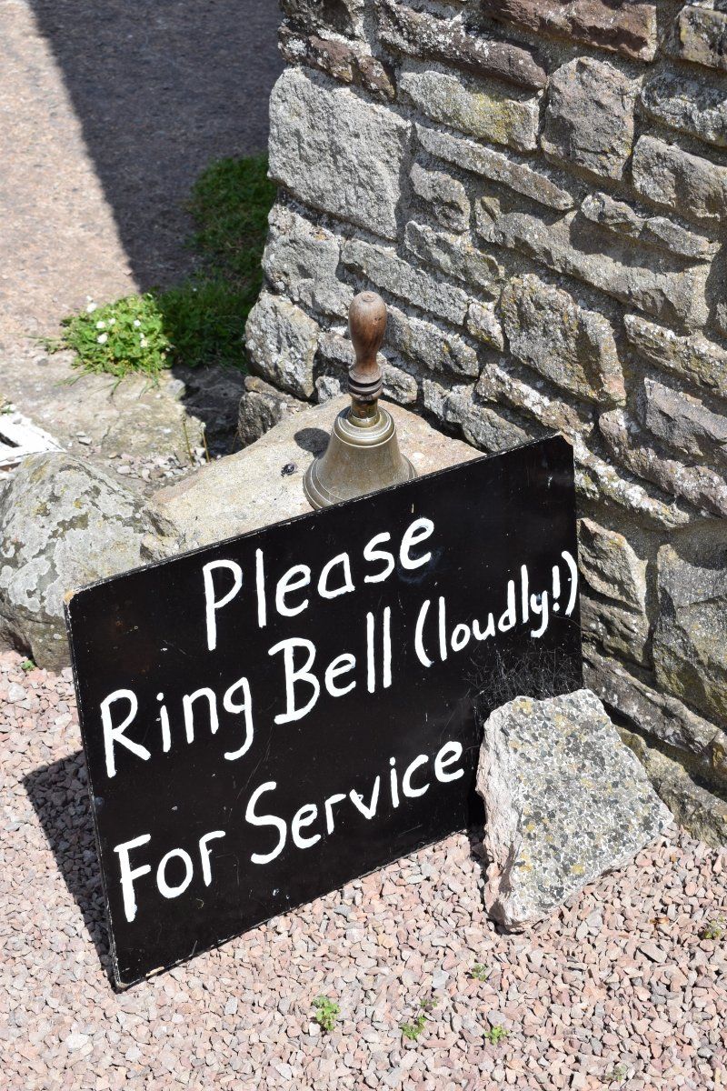
Today I wander around and am very sad about the many stops and village shops that have been closed in the meantime. In the corner of my eye in the hamlet of Tre Adam I noticed a wooden sign with the words "refreshments".
Oh, a ray of hope. I enter the courtyard and find another sign "Please ring bell (loudly) for service". I don't do this just to inform my readers, but primarily out of curiosity.
After my (loud) ring, I am warmly welcomed by a man in his mid-fifties who is very happy that someone has seen his sign. In the blink of an eye he conjures up tea with catfish on the garden table under a tarpaulin and sits down with me for a chat. He always felt so sorry for the hikers who couldn't find any places to stop for a rest on today's stage after the kiosk at White Castle was closed. That is why he and his wife are now offering the hikers refreshments for the rest of the way.
Soon his wife will join us and we happily chat about her time in Germany when she sang for the WDR ensemble.
Lively and with a delay of over an hour I climb up to White Castle , where I actually wanted to rest. Now I have enough energy to hike through to Llangattock-Lingoed . I know I can have my next tea at St. Cadoc's.
St. Cadoc's Church was built on Celtic ruins. Rare plants, insects, reptiles, amphibians and bats thrive in the masonry and on the grounds. Please take the time to write down your discoveries in the “Nature Diary” on display.
I only know churches like this from Wales: with a kettle, tea, coffee and cocoa for hikers in the tower room and a picnic table in the cemetery!
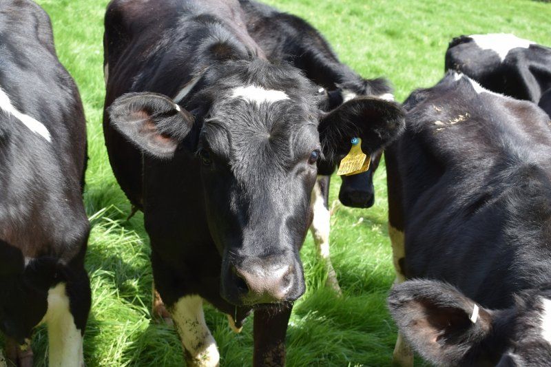
Shortly before Pandy, I have to discuss with a larger group of cows for a while that I can walk across their pasture, but not (!) Open the gate for them at the other end.
Day
5. Wandertag: Pandy - Hay Bluff
On a long-distance hike, I don't always like all stages equally. There are rather ugly, rather strenuous, unspeakably boring or extremely demanding stages.
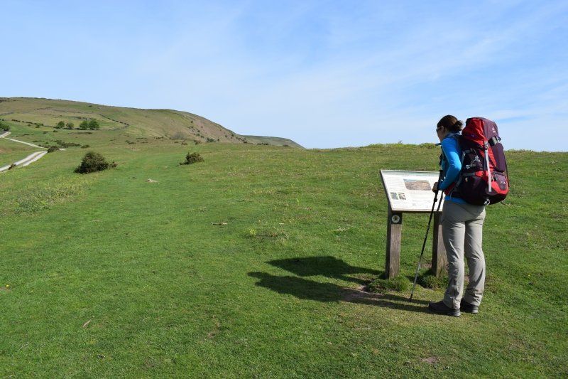
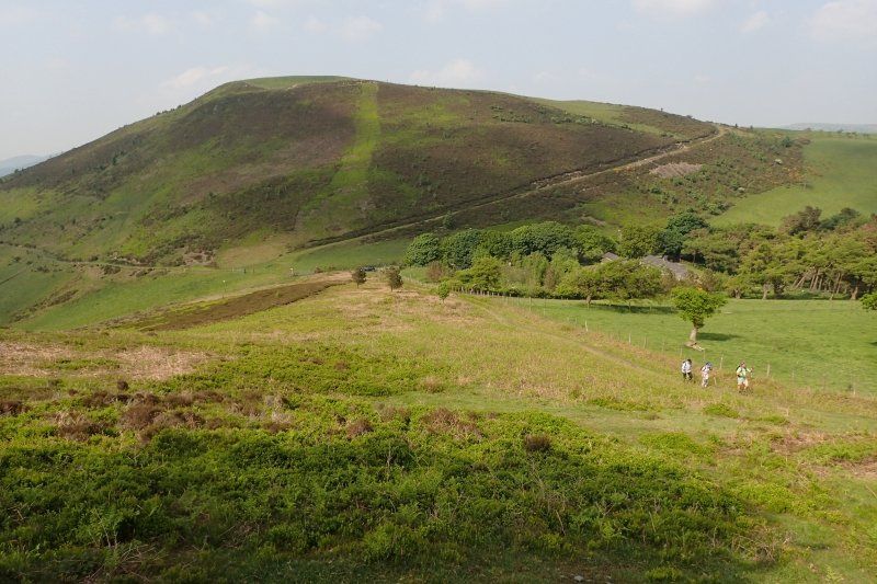
The Hatterhall Ridge between Pandy and Hay-on-Wye is a stage that I have grown very fond of, but before which it was also a bit quivering. Now it's behind me - and was almost a walk.
The route over the ridge should not be underestimated. You walk 28 km without refreshment stops, over 20 km without shade and 18 km more or less steeply uphill. After a steep ascent it goes uphill for 11 km. You see places that you won't be able to reach for two hours.
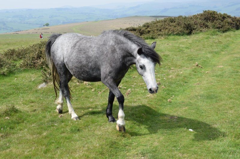
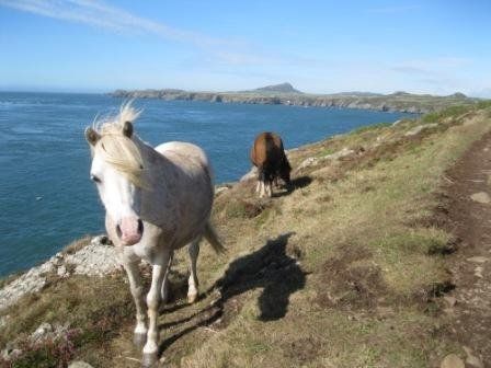
On some days it is very monotonous. On other days, the lack of slipstream is a nuisance. On other days you get scared when the bog is steaming in the scorching heat or the storm clouds sweep over grass, bog, wild horses and hikers.
I had known Hatterhall Ridge so far in fog, rain, hail and a thunderstorm that forced us to hurry down. I have already sunk into the moor above ankle-deep on two hikes. This time I was sunburned and was happy when some clouds came up around noon.
I also had a nice chat, because at the entrance to the treeless part of the route I met a nice Swiss woman who is hiking from Lands End to John o'Groats. For them, the Offa's Dyke Path is only a short intermediate stage on a total of more than 2000 km. Chapeau!
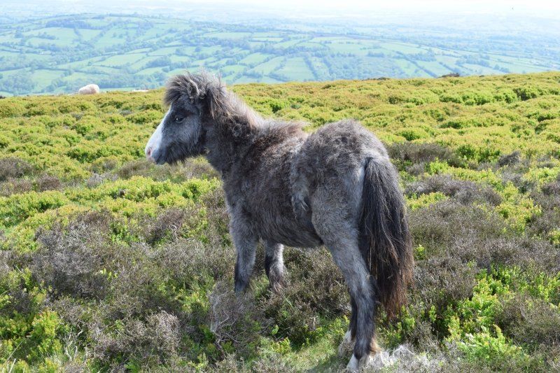
We laughed at a very trusting, shaggy foal, chatted with hikers who were traveling in the opposite direction and looked for geocaches together.
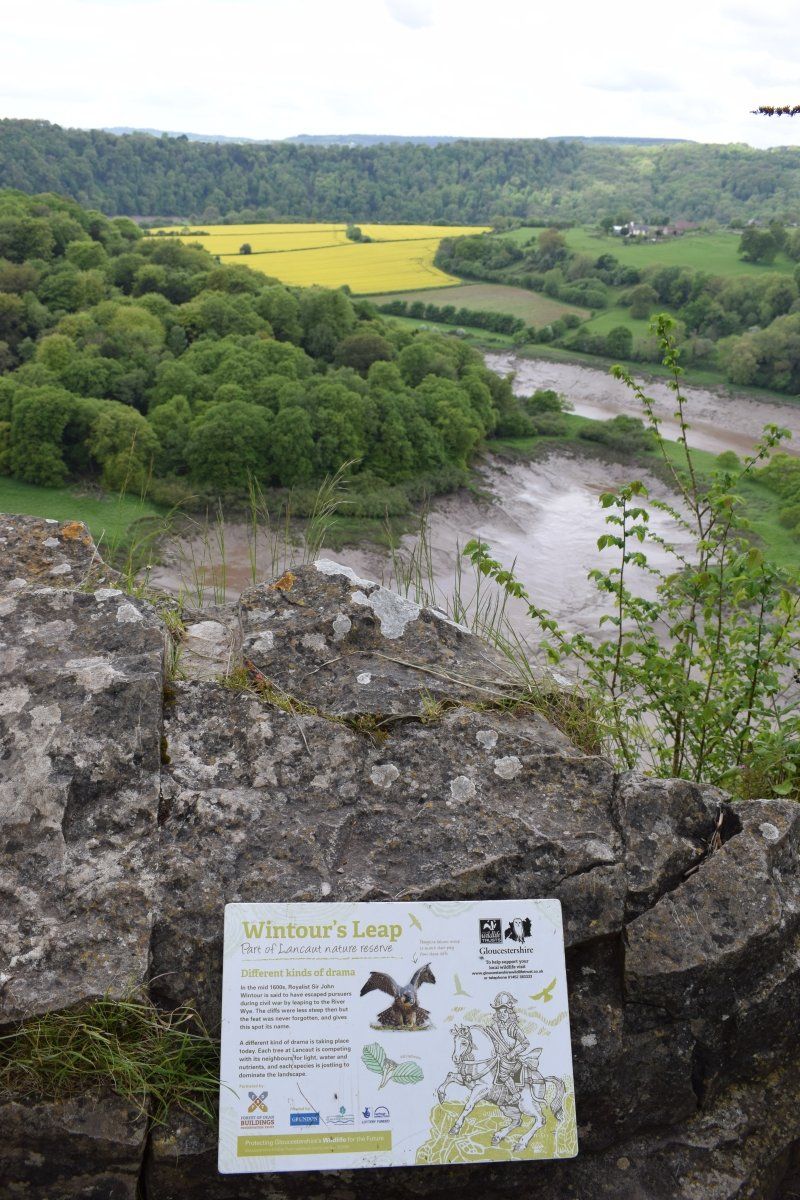
I was also able to clear up her confusion because she wanted to know why this ridge is sometimes called Black Mountain when the Black Mountains are much further west.
The Twyn Llech is the only peak that lies exactly on the border between England and Wales. Even the English like to refer to it by its Welsh name, because the English name Black Mountain is very misleading: less than 2 km east there is a secondary peak called Black Hill . Even more confusing, however, is the Black Mountains at the other end of the Brecon Beacons National Park, around 45 km west of here. The constant confusion of Black Mountain and Black Mountains leads to wrong dates, long detours and rough jokes in the Brecon Beacons.
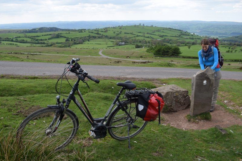
At the foot of the Hay Bluff my bike is waiting for me, which is parked there in the morning, with which I cycle back to Pandy via the Gospel Pass, and then drive to the campsite. This is my daily research triathlon: hiking, cycling, driving a car.
Completely unexpectedly, I arrive at the caravan much earlier than announced and my girls celebrate like a rock star. Grandma had told them that I had a long and exhausting stage ahead of me and they praised me with “Well done!” And “Great!”. They seem happy to be able to praise me, because in the evening when falling asleep, Nele says: “You hiked so well today. Sooo good. Well done. Today I was very good and didn't do any nonsense. Grandma says I did that fine too. We are both good today. Well done! ”Raises her hand and high five before she turns and falls asleep.
Day
6. Wandertag: Hay Bluff - Gladestry
After the descent from the pass road, I fortify myself with a full cooked British breakfast in The Granary, the best bistro in Hay + 50 miles. I look longingly after the paddlers on the Wye and enjoy life.
Timing while hiking
I am mostly alone on the pilgrimage routes, but in Wales this is a new experience. Tremendously important to me, as I wrote earlier. But sometimes difficult for timing.
I remember that the locals always greeted us in a friendly manner and also liked to talk to us for longer when we asked a question. On their own, however, they never started a long conversation when I was out with other hikers.
Different with this Offa's Dyke Walk. I am traveling alone and therefore seem automatically lonely in the eyes of the locals. Almost everyone I meet engages in a conversation.
Small talk about the weather, where I'm from and where I'm going, as well as 100 other topics show that the locals are interested in me. I get tips and recommendations on the way, I know what nationality the hikers are in front of me, I now know the most important rules for drywall construction and can take part in the last 6 km of a charity walk with the finisher's final drink. I am asked about the German school system, my attitude towards the royal family and my opinion on Brexit. A retired teacher praised me for my pronunciation of Welsh words, an overweight teenager asks me about the ultimate weight-loss trend on the continent, a young mother enjoyed a chat about defiance, an older gentleman about my kind words to a beautiful flower garden and a 10 year old girl told me that selling ice cream to Offa's Dyke Walker is filling her vacation budget.
With all of this, I am invited to a “quick cup of tea” at least twice a day, today even by a pastor in a church with picnic tables in the cemetery.
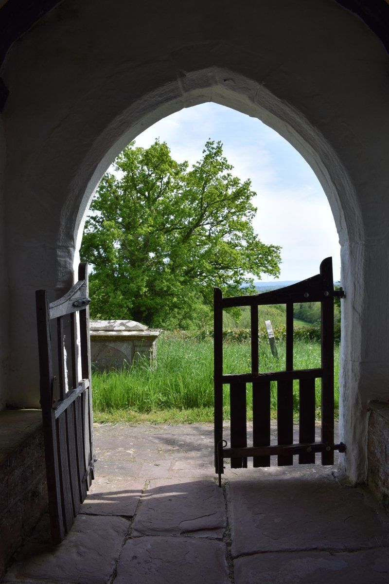
That is also such a lovely detail of this hike: almost all churches are open. They offer cool shade on hot days and good weather protection in bad weather. In at least three churches along this route, hikers can find drinks (even with biscuits). The water for tea, coffee or cocoa is heated by kettles that can be found in the bell tower, in a pew or on the lid of the baptismal font. In addition, there are sitting areas with coloring sheets for children inside or picnic tables outside in the cemetery (there is something morbid about drinking tea sitting between the graves).
Oh, Wales, you are and will remain MY COUNTRY.
But my schedule is completely screwed up and I have to hike faster between these conversations so that my mother isn't worried because I'll be at the caravan much later than announced.
Also good, then all the biscuits and Welsh cakes served with tea have no chance of spreading on your hips.
Day
Standortwechsel nach Mellington
In the nature of long-distance hiking trails, it is in the nature of things to change quarters regularly. On my previous Dyke hikes, this was the case every evening, because we always hiked from one quarter to another.
Now with the family in the caravan it is no longer necessary every day. I leave the campsite in the morning, bring the bike to the planned stage destination and the car to the start. Then I hike my stage, bike to the car and by car to the campsite. We change campgrounds about every four days so that my driving distances don't get too long.
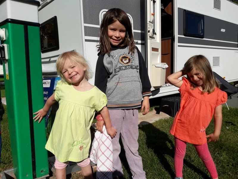
And see who has been rolling up their sleeves when dismantling and assembling the caravan since the second campsite: Little Cari, who has just turned three, is 91 cm tall!
Mellington Hall Caravan Park
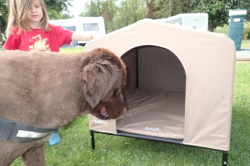
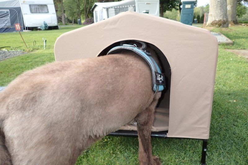
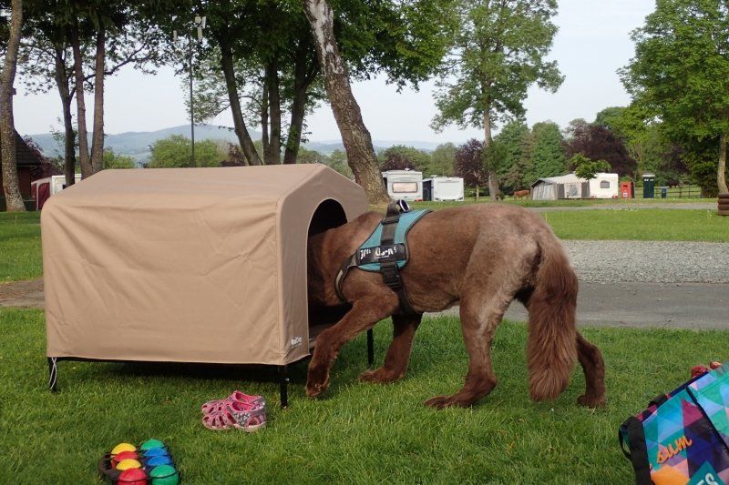
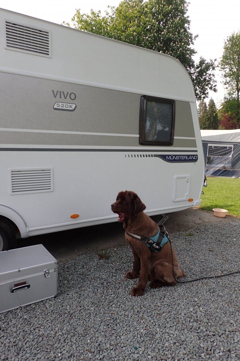
Armer obdachloser Hund
Wir wussten vor der Reise nicht, wie eng es in dem Wohnwagen wird und gingen davon aus, dass Bathida dann vielleicht lieber im Auto schläft, weil dort mehr Platz ist. Also bauten wir die mittlere Sitzreihe aus, so ergab sich eine sehr geräumige Schlafstelle.
Kurz vor der Abfahrt bekam sie dann aber sogar eine Hütte geschenkt. Transportabel, klappbar, also genau richtig. Danke Melanie und Stephan.
Sie findet das Bettchen auch ganz nett und legt sich immer mal wieder hinein. Wer jetzt aber glaubt, dass sie ihr neues Eigenheim auch allein benutzen darf, irrt gewaltig. Nur wenn die Kinder auf dem Spielplatz sind, hat sie eine Chance.
Ansonsten sitzt sie etwas irritiert davor und wundert sich, dass bis zu drei kleine Menschen sich in die Hütte quetschen, darin singen und picknicken. Dabei ist doch überall drumherum soooo viel Platz.
Versteh ein Hund die Menschen!
Also schläft sie dann oft vor dem Wohnwagen, manchmal auch im Wohnwagen. Näher am Rudel ist wichtiger als eigene Hütte oder viel Platz.
Und Aurelia zweifelt an der Rechtschreibung. Grade hatte ich ihr erklärt, dass any mit Ypsilon geschrieben wird. Schon muss ich ihr sagen, dass bei Wortspielen von den geltenden Regeln abgewichen wird. Denn die Hundehütte ist von AniOne…
Mellington, Montgomery SY15 6HX, Vereinigtes Königreich
52° 31' 15.2" N 3° 5' 39.4" W
52.5209027 -3.0942825
• Head south. Go for 56 m.
• Turn left toward Mellington Hall. Go for 84 m.
• Turn left onto Mellington Hall. Go for 162 m.
• Turn slightly right. Go for 80 m.
• Turn slightly left toward B4385. Go for 1.1 km.
• Turn left onto B4385. Go for 415 m.
• Continue on B4385. Go for 4.3 km.
• Continue on Bishops Castle Street (B4385). Go for 132 m.
• Continue on Princes Street (B4385). Go for 260 m.
• Keep left onto Pool Road (B4385). Go for 219 m.
• Turn right onto Forden Road (B4388). Go for 446 m.
• Continue on B4388. Go for 5.0 km.
• Continue on A490. Go for 3.8 km.
• Take the 3rd exit from roundabout onto A483 toward Oswestry/Shrewsbury/(A458). Go for 2.7 km.
• Take the 3rd exit from roundabout onto A483 toward Oswestry/Shrewsbury/(A458). Go for 2.1 km.
• Pass 3 roundabouts and continue on A483. Go for 22.0 km.
• Take the 1st exit from roundabout onto A5. Go for 2.1 km.
• Pass 2 roundabouts and continue on A5. Go for 5.7 km.
• Take the 3rd exit from Gledrid Roundabout roundabout onto A5 toward North Wales/Llangollen/Wrexham/(A483). Go for 3.6 km.
• Take the 2nd exit from Halton Roundabout roundabout onto A483 toward Wrexham/Wrecsam. Go for 3.4 km.
• Take ramp toward Whitchurch/Llangollen. Go for 360 m.
• Take the 1st exit from roundabout onto A539 toward Llangollen. Go for 456 m.
• Take the 4th exit from roundabout onto Llangollen Road (A539). Go for 9.2 km.
• Turn right onto Wharf Hill. Go for 36 m.
• Turn left onto Wharf Hill. Go for 87 m.
• Turn right onto Wern Road. Go for 295 m.
• Turn slightly left. Go for 591 m.
• Arrive at your destination on the right.
☍
68,7 km
(1 hrs. 3 min.)
Day
7. Wandertag: Gladestry - Dolley Green
The first time I look at the map my geocaching app shows me. today I'm going to raise my geocache number 1000.
Up on Hergest Ridge, that's a nice place for that round number. Otherwise, there are three more cans on my hiking route, which I look for briefly. Of course only for research purposes because the caches are named in the book.
But I don't look for it very long on this hike, that would go beyond my time frame. But a single grip is usually enough along the way. Either the owner and I tick the same when it comes to good hiding spots, or the caches are simply easier to hide than at home.
Day
8. Wandertag: Dolley Green - Churchtown
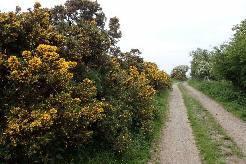
Today walk behind Dolley Green between the last primroses and the first gorse continuously uphill to Hawthorn Hill.
The landscape is terrific. Some animal species also feel very comfortable here. With all the panoramic views I therefore have to pay close attention to the path so as not to put my ankles in abandoned rabbit holes, ants and molehills.
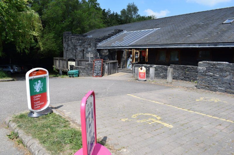
I'm taking a long lunch break in Knighton. The Welsh name is Tref y Clawd, which means town on the Dyke. Knighton not only carries the Dyke in their name, but also in their heart. This is where the Offa's Dyke Center is located, an incredibly well-equipped information office with a huge selection of hiking maps, an attractive exhibition and delicious cakes for tea.
Strengthened this way, I manage the steep ascent to Panpwnton Hill, Cwm Sanaham Hill and Llanfair Hill surprisingly well. I remember this route as harder from the previous tours.
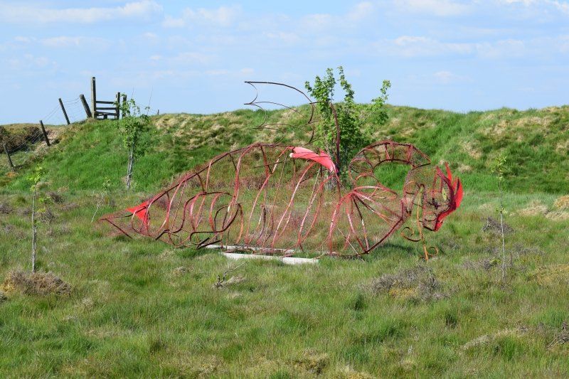
On Llanfair Hill I am amused by a work of art made of red painted iron in the shape of a dragon. The Welsh people just can't help it. Your Welsh Dragon is everywhere.
At the height of Newcastle I refresh myself briefly on a tap that was installed by the neighboring farmer especially for dyke walkers.
A really wonderful day of hiking!
Day
9. Wandertag: Churchtown - Kingswood
Churchtown, my starting point today, amuses me again and again. This patch of earth in an inconspicuous valley consists only of a road and a church. That might explain the word CHURCH, but not the ending TOWN. Are British authorities looser when it comes to giving names or how does this name come about? Nobody can tell me.
After a steep ascent it goes down to Cwm. This is not exactly an original place name, because Cwm stands for 'valley' in Welsh.
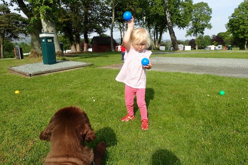
I'm spending my lunch break today 'at home' because I'm walking past our campsite. The kids play bocce, so my mom and I go to Mellington Hall for a Cup of Tea. We chat with the hotel guests, then it goes on for me.
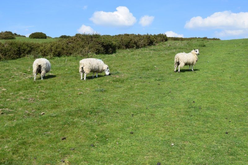
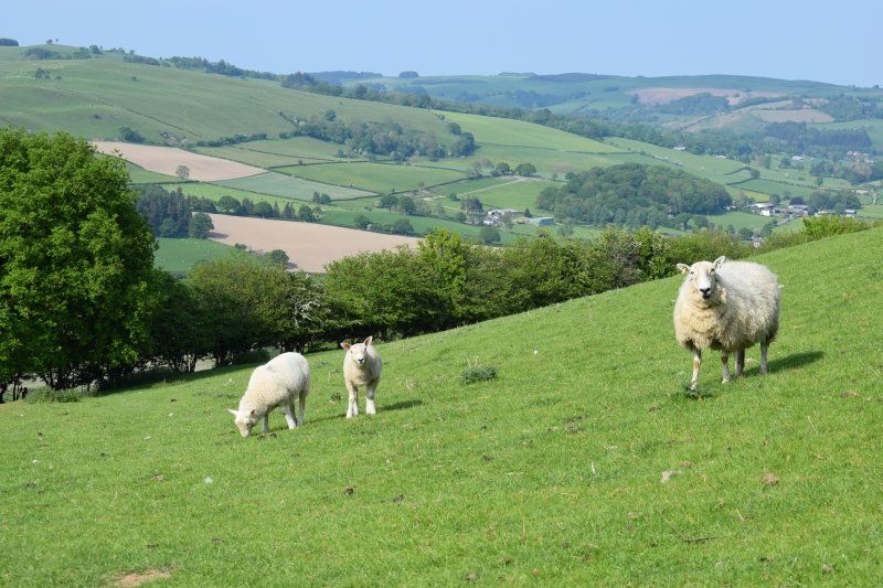
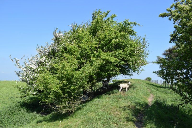
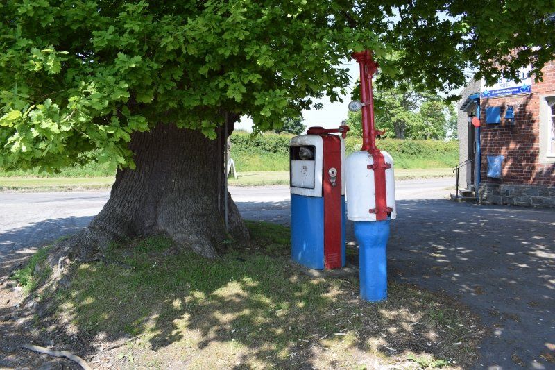
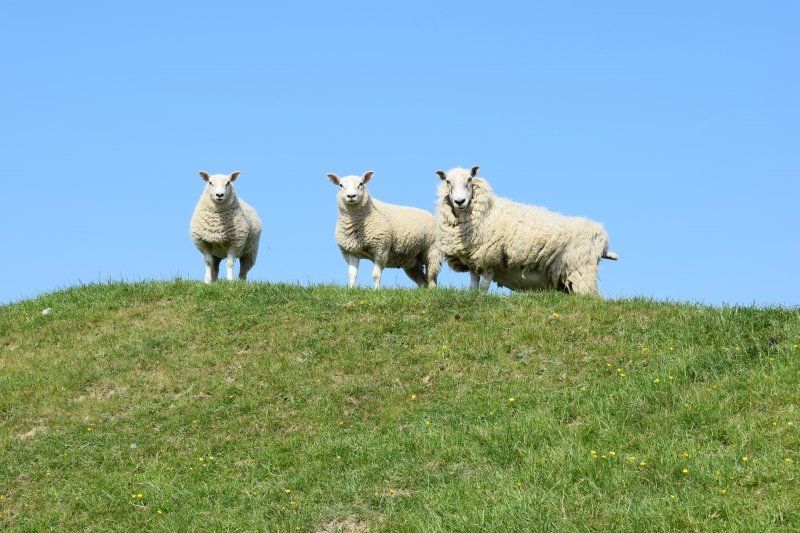
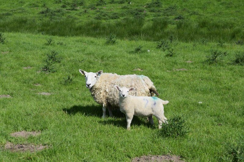
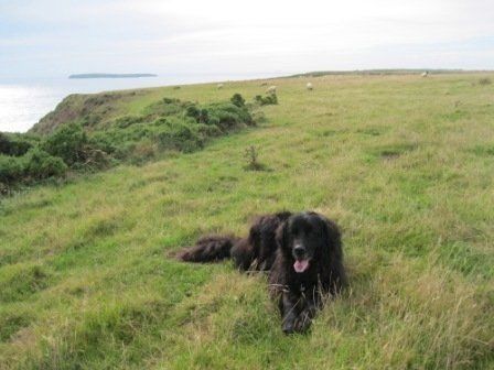
I am pleased that the old gas pump at the Bell Inn on Brompton Crossroads has not been dismantled since my last visit, but now has a new coat of paint and a geocache. Some sheep grazing on the Dyke look after me with interest. My curiosity, in turn, is drawn to a sign with boot and boot.
Day
10. Wandertag: Kingswood - Four Crosses
Today's stage of the day does not have a height profile in the book. It goes without major gradients along the River Severn and the Montgomery Canal.
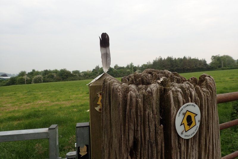
For days I have noticed feathers that are in every style and every signpost. Was there a hiker just bored or does that have a deeper meaning? I can't figure it out.
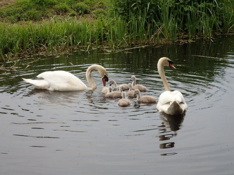
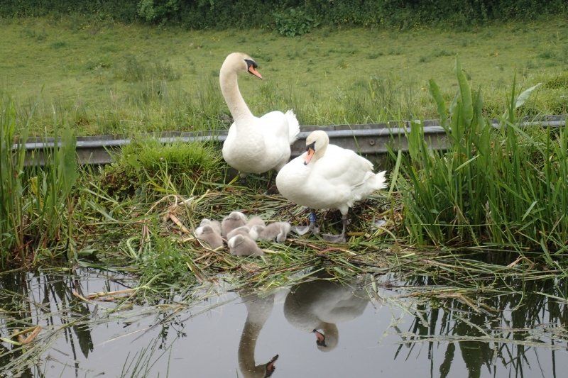
Several pairs of swans are busy rearing their chicks on the canal. So the living conditions seem to be very good.
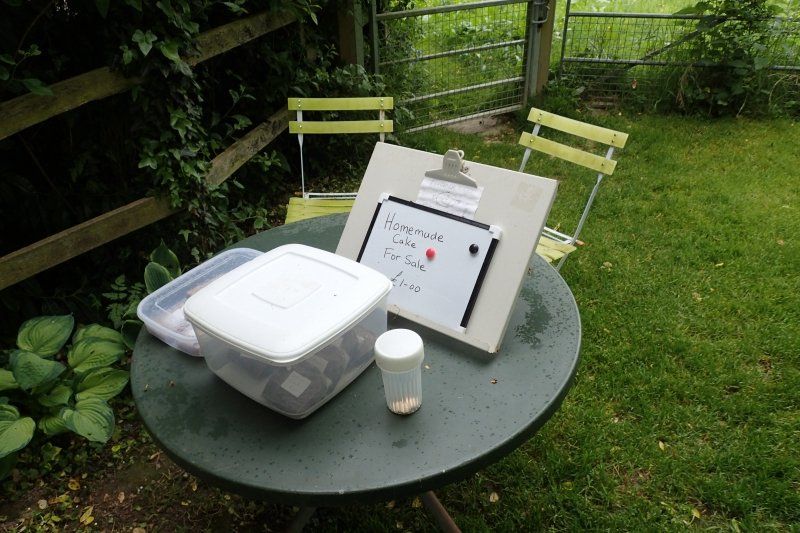
On a flood protection dam on the Severn, a nice resident has set up a table with some chairs right next to Offa's Dyke Path. The tired hiker is even offered freshly baked cakes. Very friendly!
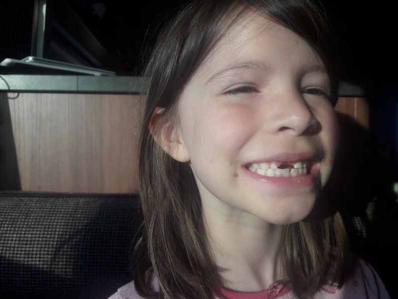
Emma Toothless
Today Aurelia lost her first upper incisor. Well, "lost" is the wrong word, because she had wiggled and pulled her wobbly tooth all day. She had barely been able to fall asleep in the evening because she was worried that she would swallow it in her sleep. When I woke up, it was still there and was being processed further. Without success.
At breakfast he suddenly found himself stuck in the jam sandwich next to a strawberry. Because it was bleeding a little, Grandma reassured her and affectionately called her "My toothless Emma".
When I started the hike and said “Bye, Aurelia”, I blinked to the answer “I'm Emma now”. Since then, the young lady has wanted to be addressed as Emma. She likes the name. U.S. as well. Especially after Grandma told us that her grandmother's name was Emma and that she had fond memories of her.
Day
Standortwechsel nach Llangollen
After packing, Bathida doesn't want to get in. She likes Mellington so much that she doesn't want to leave. I actually have to lift her into the car while my mother lures her inside with a sausage sandwich.
We are now heading for our last campsite. Actually, I only wanted to stay 2-3 nights in Llangollen and then at the end of the day one more time in one of the big places in Prestatyn. But they are all fully booked.
I know Llangollen is getting really tight. But I couldn't have guessed that my idiotic sat nav would lead me to a dead end parked on the right and left of the school 3 minutes before my destination. None of the parkers come to my aid, these are the teachers' cars and we don't feel like waiting until school closes at 4 p.m. at 10 a.m. We cure for a whole hour until I have uncoupled and turned the caravan on a slightly wider stretch of road, maneuvered the van on its other side and put the trailer together again.
Phew, there is no maneuvering on the campsite, we have to go into the middle of the pasture, because the day after tomorrow there will be places with electricity.
Camping Wern Isaf
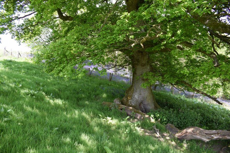
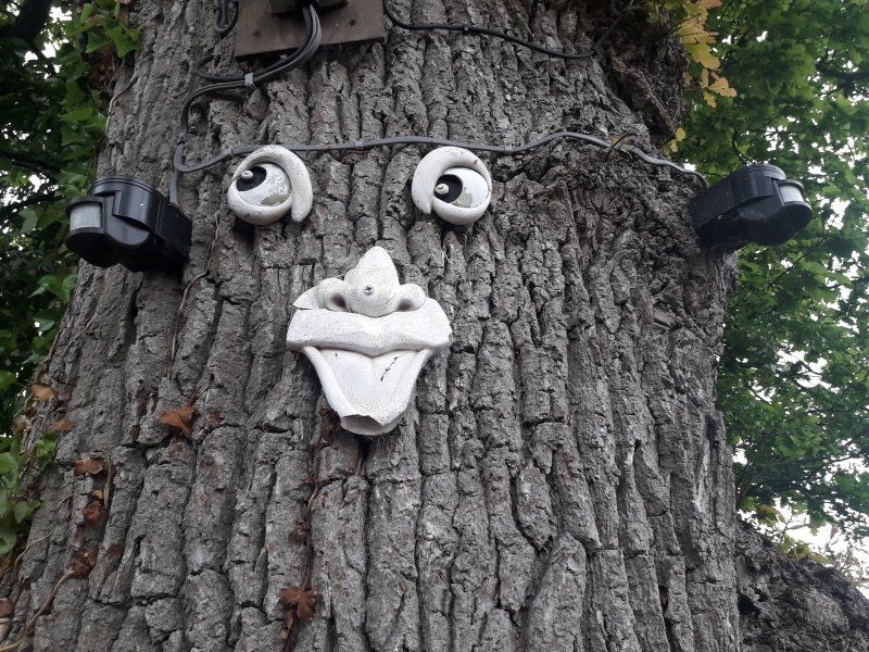
Nach dem Aufbau vertrete ich mir erst etwas die Füße und entdecke einen sehr freundlichen Baum.
C.
E. Williams, Wern
Isaf Farm Camping Site, Wern Road, Llangollen LL20 8DU, Telefon 01978860632, mobil 07974/797828 (ggfs. mehrfach versuchen, Telefon wird bei
manchen Farmarbeiten nicht gehört), www.wernisaf.co.uk, wernisaf@btopenworld.com, Entfernung: 750 m, 20 Stellplätze, außerdem Miet-Wohnwagen, Camping für Wanderer £ 8, Dusche £ 0,20. Hunde erlaubt. Sehr freundlich und hilfsbereit.
So steht der Campingplatz am Ende in meinem Buch, das sagt doch alles, oder?
Wern Isaf Farm, Wern Rd, Llangollen LL20 8DU, Vereinigtes Königreich
52° 58' 28.8" N 3° 9' 34.9" W
52.9746697 -3.1596888
• Head toward Wern Road. Go for 591 m.
• Turn slightly right onto Wern Road. Go for 295 m.
• Turn left onto Wharf Hill. Go for 87 m.
• Turn right onto Wharf Hill. Go for 36 m.
• Turn right onto Mill Street (A539). Go for 36 m.
• Turn left onto Castle Street (A539). Go for 282 m.
• Turn left onto Regent Street (A5) toward Oswestry/Shrewsbury. Go for 8.5 km.
• Take the 1st exit from Whitehurst Roundabout roundabout onto A5 toward Shrewsbury/Wrexham/Wrecsam/(A483). Go for 1.1 km.
• Take the 3rd exit from Halton Roundabout roundabout onto A5 toward Oswestry/Shrewsbury/Welshpool/Trallwng/A483. Go for 3.6 km.
• Take the 2nd exit from Gledrid Roundabout roundabout onto A5 toward Oswestry/Shrewsbury/Welshpool/(A483). Go for 4.1 km.
• Take the 3rd exit from roundabout onto A5 toward Shrewsbury/Whitchurch/(A495)/Welshpool/(A483). Go for 1.6 km.
• Take the 2nd exit from roundabout onto A5 toward Shrewsbury/Welshpool/(A483). Go for 2.1 km.
• Take the 3rd exit from roundabout onto A483 toward SOUTH WALES/Welshpool/Oswestry/(B4579). Go for 225 m.
• Take the 2nd exit from Mile End Roundabout roundabout onto A483 toward Welshpool. Go for 5.5 km.
• Turn right onto A495 toward Llansantffraid/Machynlleth/(A458)/Bala/(B4396). Go for 3.3 km.
• Continue on B4396. Go for 4.4 km.
• Continue on Pen-Y-Bont (B4396). Go for 142 m.
• Continue on Dol Emrys (B4396). Go for 155 m.
• Continue on B4396. Go for 2.4 km.
• Continue on Maes Cedwyn (B4396). Go for 150 m.
• Continue on B4396. Go for 4.9 km.
• Continue on B4580. Go for 1.1 km.
• Take the 2nd exit from roundabout onto Llys-Yr-Esgob (B4580). Go for 190 m.
• Continue on B4580. Go for 524 m.
• Continue on Market Street. Go for 59 m.
• Turn right onto Waterfall Street. Go for 6.3 km.
• Arrive at your destination.
☍
51,7 km
( 50 min.)
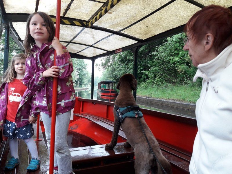
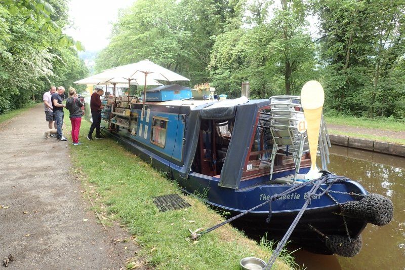
Bootfahrt auf dem Kanal
We are on our way to town.
Since my first trip to Wales, I keep hearing two sentences when I am making small talk about the weather:
"You don't like our weather? Wait for half an hour and it'll have changed "
and
"Sometimes in Wales you'll have all four seasons in one day."
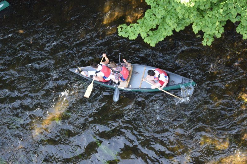
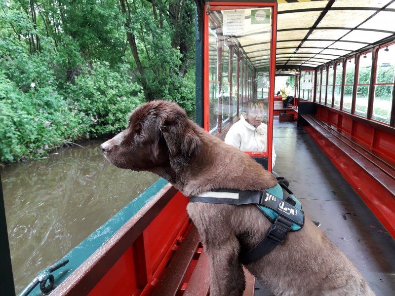
Today is such a four seasons in one day day. We are woken up by raindrops that patter on our roof, we couple the caravan in wind and freezing cold, have rainbow sun while driving, reach the new campsite in drizzle, drive into Llangollen under thick clouds, get heavy rain in the supermarket parking lot and Hail attacks. None of this lets us deviate from our daily schedule, because we want to take a towboat on the Llangollen Canal.
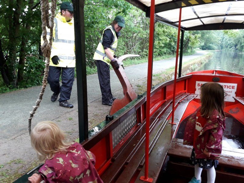
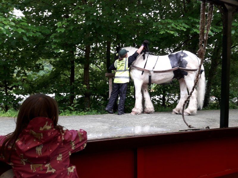
And not just with a motorized longboat, but a classic towboat with a horse.
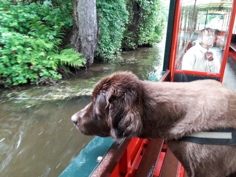
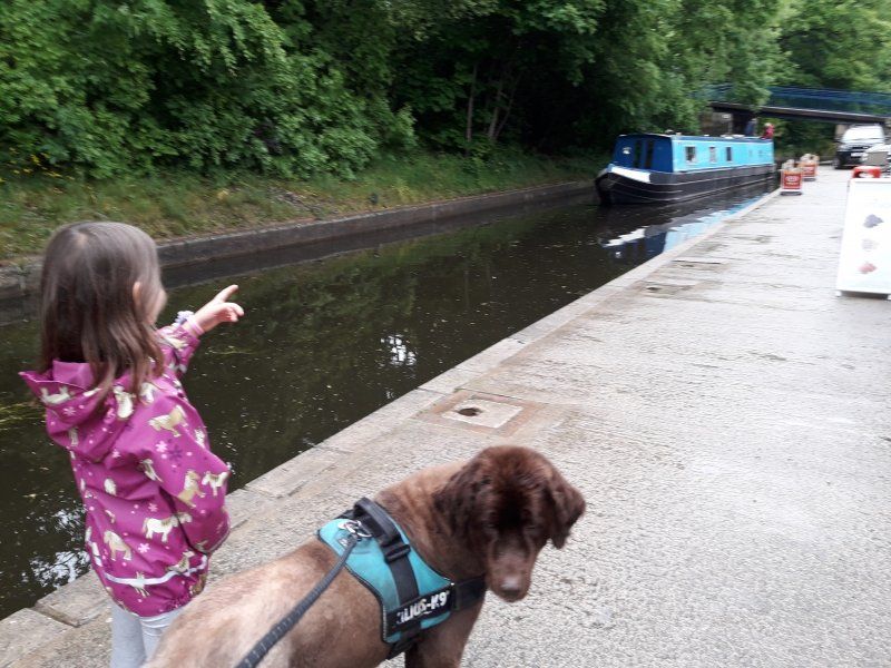
We are the only passengers and even Bathida is allowed to ride. That's a real advantage in this weather.
The draft horse has a lot of fun with the dog and the two sniff each other long before we start.
The horse and dog twitch fearfully several times when we hear gunshots. Probably a hunting party, the horse guide suspects and apologizes for the speed of our journey. The horse had usually shortened the 45-minute ride to 30 minutes, it was like a speedboat ride ...
We get to know our draft horse and it can even be petted. A real advantage in the rain: we have the boat to ourselves. Bathida thinks the trip is totally exciting, much better and less fearful than driving a car. At the turning point of the tour, the horse is brought to the other end of the boat
Day
11. Wandertag: Four Crosses - Candy
I walk along the canal for a while, then it gets hilly again after Llanymynech.
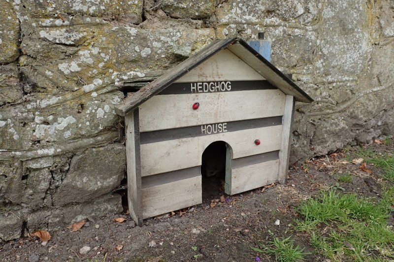
A curiosity of this route is that you climb Moelydd Uchaf at a very acute angle. At this point I meet participants on a charity walk, we have the same path for an hour and I make good progress. We chat lively and someone familiar with the area points out a very special hedgehog den.
On the way back to the trailer, I remember that we missed Mother's Day entirely. That has to be done immediately, of course.
Day
12. Wandertag: Candy - Llangollen
The weather has been far too hot so far. That's why I'm far from whining about today's rainy day.
I even like a light drizzle while hiking and with this feeling I am very much in line with the Welsh people. While many Germans hunch their shoulders and speak of "useless continuous rain", the British call this "refreshing mist". That's it, refreshing! I like the light drizzle on my face, it cools me down well, while in the sun I just overheat.
My publishers don't like it that much because the books tend to see fair weather photos. But it's British weather, only sunshine does not go well with the wonderfully green land.
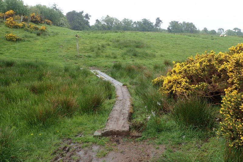
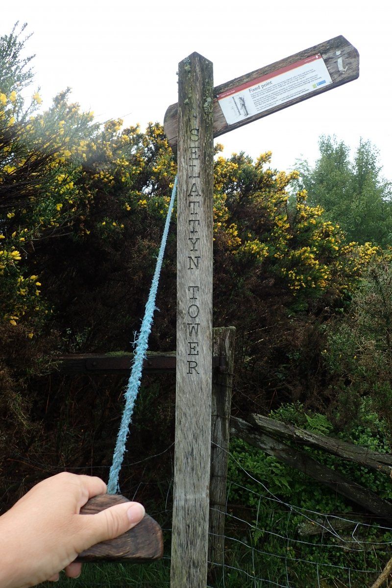
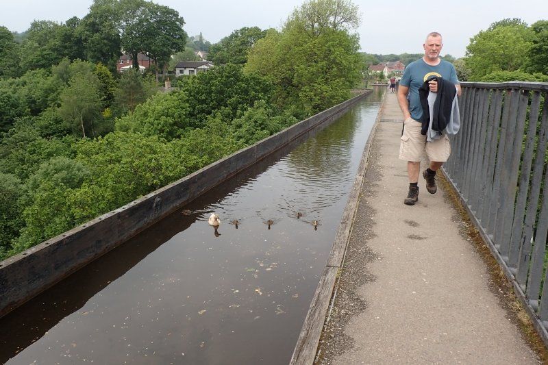
In a place that would have become very muddy today, I am happy about wooden planks to walk on. I pass Chirk Castle and discover a funny information post on Selattyn Hill. Then it goes along the Llangollen Canal * to the Pontcysyllte Aqueduct. Behind Trevor I climb up to the Panorama Walk, which takes me to the Dinas Bran castle ruins, under which our caravan is.
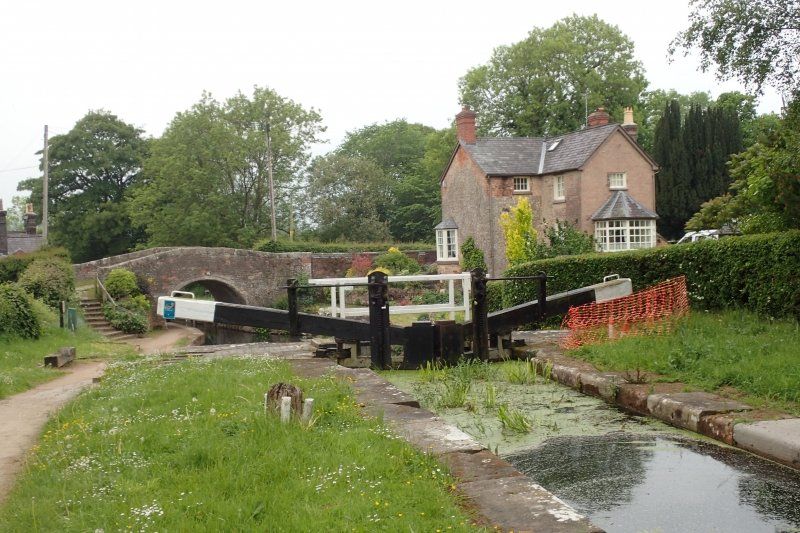
* Llangollen Canal
The Llangollen Canal is a branch of the Shropshire Union Canal. The builders had bigger plans for him, but had to find out shortly after Llangollen that a canal through the north Welsh hilly landscape could only be built with enormous financial and technical effort. The Pontcysyllte Aqueduct near Froncysyllte, with its 40 m high columns, was built under the master builder Thomas Telford 1795-1805 at a price of £ 47,018 at the time. It is still the largest canal aqueduct in Great Britain and a popular fairway for recreational captains.
Day
13. Wandertag: Llangollen - Clwyd Gate
The rain yesterday is yesterday's snow, today the sun is shining mercilessly down on me.
On the panorama walk I walk to a Gehört, from there the path meanders for about 3 km through a scree slope, where every step needs to be well placed. At Worlds End I follow the road into the high moor.
When the weather is bad, it really feels like the end of the world here: The road sinks into the water of a ford and leads into the high moor. The desolate scree fields are replaced by even desolate, dripping wet moorland. And Plas Uchaf, the noble mansion from the 17th century down there in the valley, doesn't seem to have been inhabited for ages.
When the weather is good, the ford invites you to take a refreshing footbath, larks chirp and you can meet day trippers, mountain bikers and grouse in the moor. In the western part of the moor hunters cavort at dusk.
Today, however, it's so hot again that nobody dares to go outside. I walk alone through the moor and only meet people again in the little wood in front of Nant yr Hafod: completely sweaty mountain bikers, one of them in shock, another on the phone with the emergency services.
In Llandegla I stop at the Llandegla Community Village Shop. Some oncoming hikers have raved about this to me and I don't think their reports are exaggerated. It's cozy there, the old ladies are very friendly and the cake is delicious.
Café & Shop, Allt yr Efail (opposite the church), www.llandeglashop.com, open Mon - Sat 8:00 a.m. to 6:30 p.m. Sun 8:00 a.m. to 4:00 p.m. The villagers got together after the last shop closed and now run their own village shop and café.
St. Tecla's used to be a pilgrimage destination. The spring next door was said to have been able to cure epilepsy, it was named after St. Tecla. Thecla of Iconium was a holy virgin and disciple of the apostle Paul. Because of her refusal to give up her virginity for an arranged marriage, she was rejected by her family, denounced as a Christian, and accused of the wild animals. Her execution miraculously survived because the animals did not touch her. That is why she is often depicted with lions and other wild animals. After the death of her teacher Paul, she lived as a hermit into old age. Their existence is often contested, especially by churchmen for whom a teaching and baptizing woman was a thorn in the side. The place name is derived from it (Llan = holy, Degla = Tecla). The church is open to hikers, and there is even a kettle, tea bags and biscuits available.
Now there are only two climbs left to my destination for the day: Clwyd Gate. It used to be a great place to stay in a hotel so that tomorrow wouldn't be so far through the mountains of the Clwydian Range. But for years the hotel operators have been giving each other the handle - and after a few months they give up. A shame for us hikers, but economically this is certainly a rather difficult location.
Day
14. Wandertag: Clwyd Gate - Bodfari
My penultimate day of hiking leads over the peaks of the Clwydian Range. It's exhausting and wonderful. Everywhere I have distant views, the wind blows me through properly. On the Moel Famau (= Mutterberg) I have my lunch break, at the Moel Athur I have a nice chat with a lady from the neighboring town who has been hiking to Moel Arthur and back every day since she retired, regardless of wind and weather. Fantastic!
Day
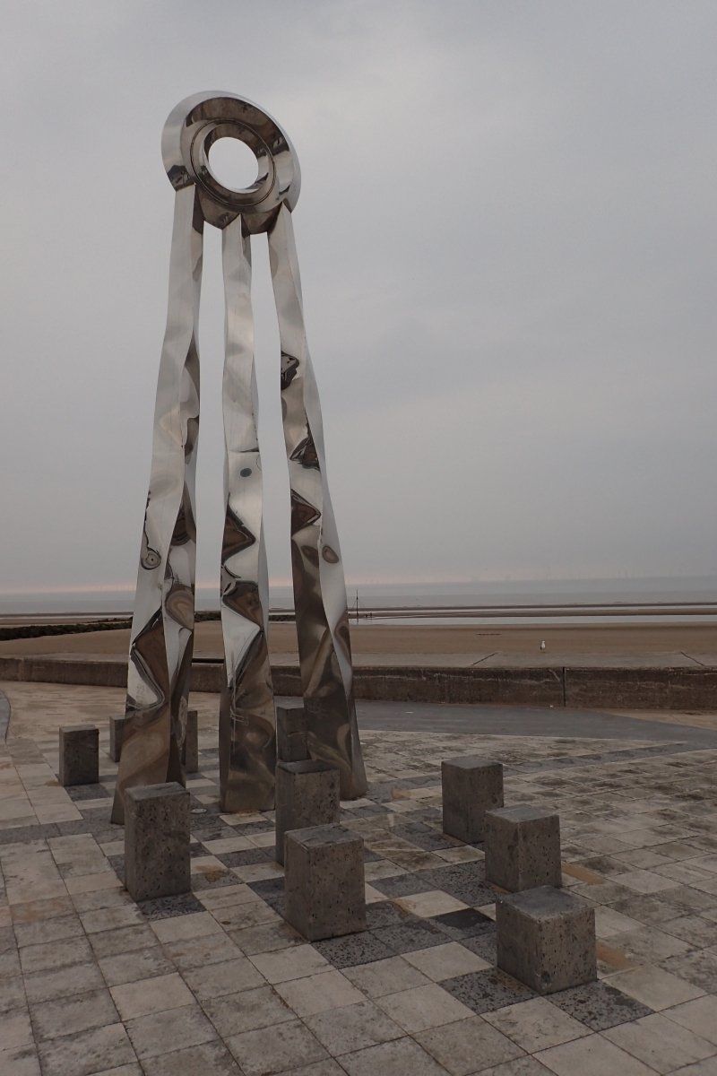
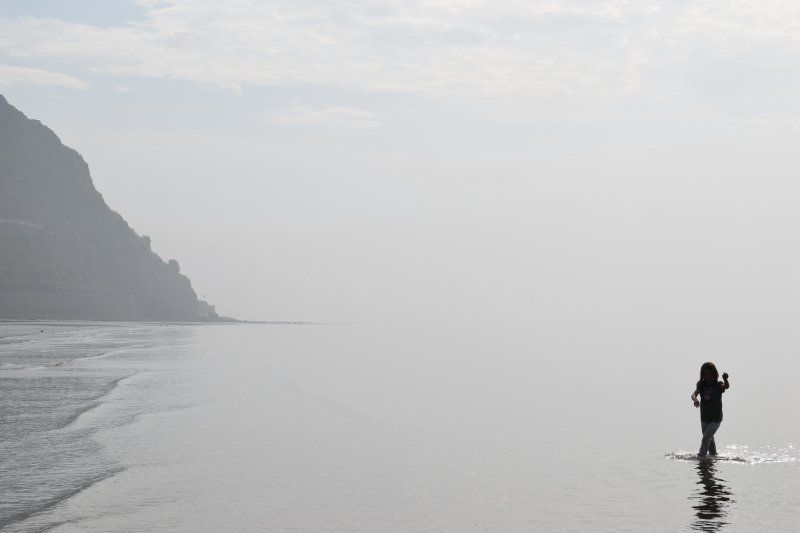
15. Wandertag: Bodfari - Prestatyn
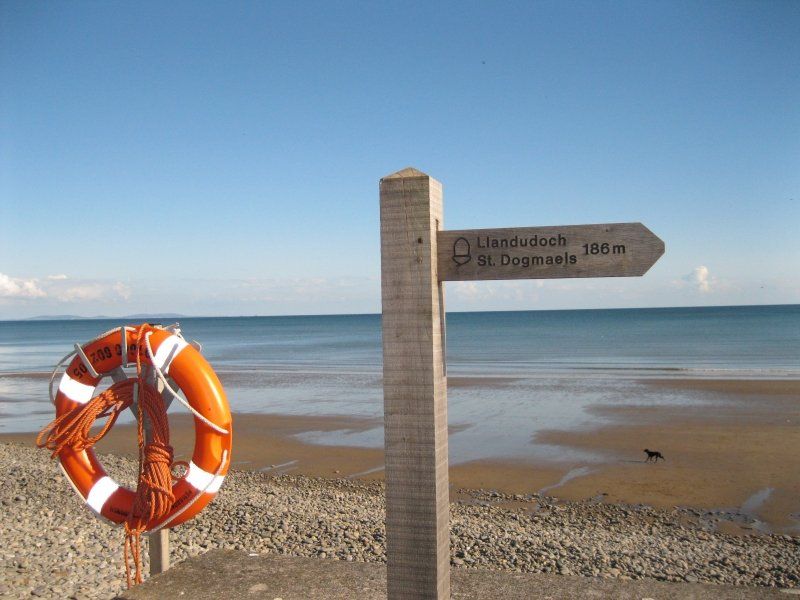
From Bodfari it goes over the last hills on a rocky path down to Prestatyn and on the main road to the sea.
A memorial for the trail has been built next to Offa's Dyke Center. The rock in front of the entrance marks the end of the marked path. For every Offa's Dyke Path hiker, however, it is a matter of honor to keep going:
According to the - if dubious - story, the Dyke ran along today's Fford-las and got lost in the Irish Sea. Traditionally, walkers follow the road past Offa's Dyke Center to the beach.
I enjoy the fresh air, the refreshing mist and the cool water and wade into the sea as far as I dare, according to the motto of the Offa hikers - "as far as you dare".
Yes, it was exhausting on the Offa's Dyke Path again. But also incredibly beautiful. I am proud of my achievement, after all, between the last two Offa hikes, I got twelve years older and during that time I gave birth to three children and gained 30 kg. If someone had strapped 30 kg onto my back at the time, I would have just collapsed.
Day
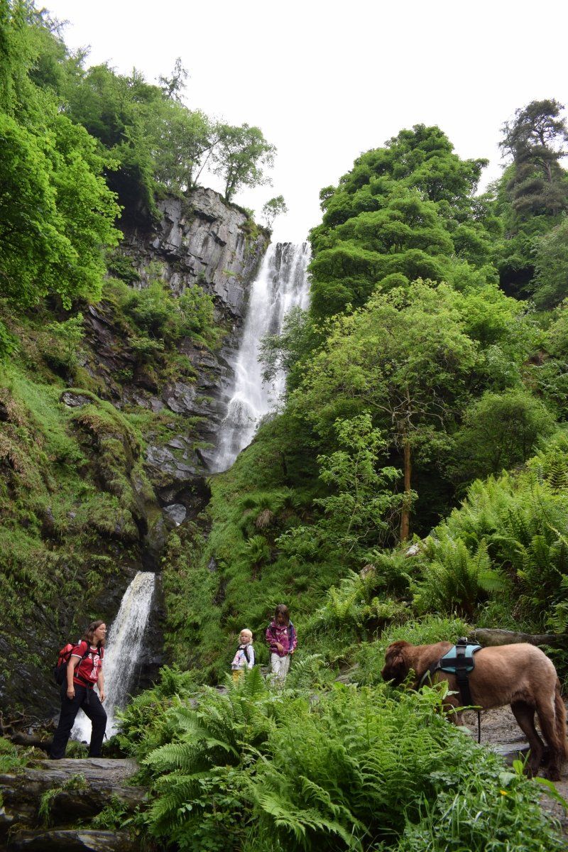
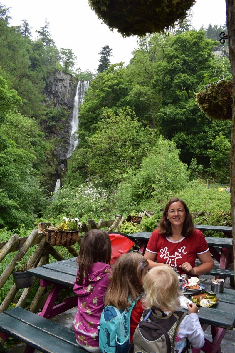
Pistyll Rhaedr Falls, Llanrhaeadr-ym-Mochnant
Diesen Wasserfall "in the middle of nowhere" kenne ich auch schon seit meiner Teenagerzeit. Wann immer ich in Mittelwales unterwegs war, zog es mich in diese grüne Oase.
Einerseits bin ich traurig, dass er durch den langen, regenarmen Sommer ziemlich dünn ist. Andererseits trauen sie die Kinder auf diese Weise näher an ihn heran.
Nach unserer Wasserfall-Expedition gibt es Eis für die Mädels, Oma und ich bestellen uns Tea, Scones & Jam.
Köstlich!
Kaum sitzen wir im Auto, murmelt die Große "Dein Wales ist wirklich schön, Mama!" und alle drei schlafen ein.
Unnamed Road, Llanrhaeadr-ym-Mochnant, Oswestry SY10 0BZ, Vereinigtes Königreich
52° 51' 18.2" N 3° 22' 43.8" W
52.8550545 -3.3788368
• Head northeast. Go for 6.0 km.
• Turn slightly left onto Waterfall Street. Go for 160 m.
• Turn slightly right onto Waterfall Street. Go for 92 m.
• Turn right onto Market Street. Go for 3.7 km.
• Continue on Station Road. Go for 402 m.
• Turn right onto B4391. Go for 53 m.
• Continue on Barrog Terrace (B4391). Go for 51 m.
• Continue on B4391. Go for 3.9 km.
• Turn right onto Berwyn Street (B4391). Go for 163 m.
• Continue on B4391. Go for 841 m.
• Continue on Pencraig (B4391). Go for 239 m.
• Continue on B4391. Go for 17.8 km.
• Continue on Llangynog Road (B4391). Go for 62 m.
• Continue on B4391. Go for 1.2 km.
• Turn right onto Station Road (A494) toward Llangollen/(A5). Go for 31 m.
• Turn left onto Ffrydan Road (A4212) toward Trawsfynydd/Ffestinog/(B4391)/Porthmadog/(A487). Go for 3.9 km.
• Turn right onto B4501. Go for 1.9 km.
• Continue on Glan-Yr-Afon (B4501). Go for 165 m.
• Continue on B4501. Go for 5.4 km.
• Continue on Gellioedd (B4501). Go for 183 m.
• Continue on B4501. Go for 3.9 km.
• Turn left onto A5. Go for 20.1 km.
• Turn left onto A5 toward Betws-Y-Coed/Bangor/Capel Curig. Go for 29.6 km.
• Take the 2nd exit from roundabout onto A5 toward Caergybi/Holyhead/Conwy/(A55). Go for 174 m.
• Take the 1st exit from roundabout onto North Wales Expressway (A55) toward Caergybi/Holyhead/(A487)/Caernarfon. Go for 6.8 km.
• Take ramp onto Holyhead Road (A5) toward Llanfair/Pwllgwyngyll/Porthaethwy/Menai Bridge/Beaumaris/(A545)/Llanfair Pwllgwyngyll. Go for 1.6 km.
• Turn left. Go for 94 m.
• Arrive at your destination on the right.
☍
108,5 km
(1 hrs. 40 min.)
Kölle Alaaf in Wales
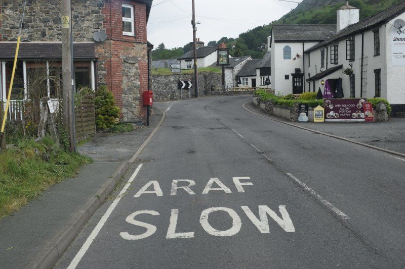
My novice reader wakes up after driving for half an hour, blinks and yells: "Mom, stop!" I stop and ask why. "Are carnivals allowed to paint on the floor?" she asks, grabs the camera, climbs on my lap and takes a picture.
No my Darling! It doesn't say Alaaf , as we call it at home in carnival. It says Araf , that's Welsh and means slow .
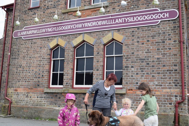
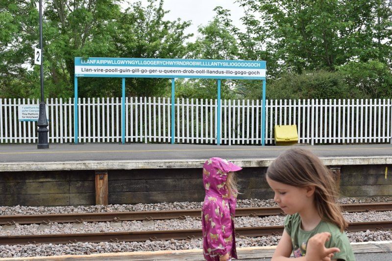
Laughing, we drive on to Ynys Môn, the Isle of Anglesey
Llanfairpwllgwyngyllgogerychwyrndrobwllllantysiliogogogoch...
Holyhead Rd, Llanfairpwllgwyngyll LL61 5UJ, Vereinigtes Königreich
53° 13' 15.4" N 4° 12' 33.5" W
53.2209445 -4.2093194
• Head west. Go for 94 m.
• Turn right onto Holyhead Road (A5). Go for 1.5 km.
• Turn right and take ramp onto North Wales Expressway (A55) toward Bangor/Caernarfon/(A487). Go for 18.1 km.
• Pass 2 roundabouts and continue on North Wales Expressway (A55). Go for 29.8 km.
• Take ramp toward Rhuddlan/Prestatyn. Go for 300 m.
• Take the 1st exit from Faenol Interchange roundabout onto Rhuddlan Road (A547) toward Rhuddlan/Prestatyn. Go for 4.2 km.
• Take the 2nd exit from roundabout onto Abergele Road (A547). Go for 2.5 km.
• Take the 1st exit from roundabout onto A525. Go for 1.6 km.
• Take the 2nd exit from roundabout onto A547. Go for 851 m.
• Take the 1st exit from roundabout onto A547. Go for 6.0 km.
• Take the 1st exit from roundabout onto Ffordd Pendyffryn (B5120). Go for 566 m.
• Continue on Penisardre Road (B5120). Go for 89 m.
• Continue on Bridge Road (B5120). Go for 247 m.
• Turn slightly left onto Bastion Road (B5120). Go for 114 m.
• Continue on Bastion Road. Go for 560 m.
• Arrive at Bastion Road. Your destination is on the right.
☍
66,6 km
( 51 min.)
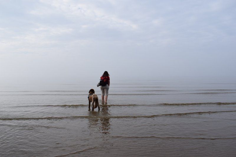
Prestatyn - As far as you dare
An meinem letzten Wandertag, war ich zwar so tief ins Wasser gegangen, wie ich mich traute. Aber ich war allein am Strand und konnte keine Fotos machen.
Also ist unsere dritte Station heute der Strand, an dem meine Mutter "As far aus you dare"- Fotos macht, während die Kinder und der Hund ausgelassen durch das Wasser toben, bis es dunkel wird.
Ein schöner Abschluss für diese Reise. Ich bin sehr zufrieden mit dem Ergebnis.
Beach Rd W, Prestatyn LL19 7EY, Vereinigtes Königreich
53° 20' 32.9" N 3° 24' 44.8" W
53.3424643 -3.4124503
• Head southeast on Bastion Road. Go for 560 m.
• Turn left onto Marine Road (A548). Go for 5.4 km.
• Take the 3rd exit from roundabout onto A548. Go for 11.2 km.
• Take the 2nd exit from roundabout onto Bagillt Road (A548). Go for 7.7 km.
• Pass 4 roundabouts and continue on Shotwick Road (A548). Go for 9.3 km.
• Take the 1st exit from roundabout onto Deeside Park Junction toward Manchester/(M56)/Birkenhead/A550. Go for 893 m.
• Keep right toward M'chester/(M56). Go for 59 m.
• Take ramp onto A494 toward M'chester/(M56). Go for 3.9 km.
• Continue on M56. Go for 31.6 km.
• Take exit 9 toward Birmingham onto M6. Go for 89.6 km.
• Keep right onto M6 TOLL toward The SOUTH. Go for 36.2 km.
• Continue on M42. Go for 1.4 km.
• Keep right onto M42 toward (M5,M40)/M6(S)/London (N & E)/(M1)/Coventry (N & E). Go for 341 m.
• Keep right onto M6 TOLL toward London (N & E)/M1/Coventry (N & E). Go for 5.4 km.
• Continue on M6. Go for 33.7 km.
• Take the exit toward The SOUTH/London/N'pton onto M1. Go for 101 km.
• Take exit 6A toward Stansted Airport/(M11, M20)/Dartford onto M25. Go for 65.9 km.
• Continue on A282. Go for 6.7 km.
• Continue on M25. Go for 478 m.
• Take the exit toward Canterbury/(M2) onto A2. Go for 2.9 km.
• Keep right onto A2 toward Dover/(M2)/Canterbury. Go for 11.9 km.
• Keep right onto M2 toward Dover/Channel Tunnel/Canterbury/Chatham. Go for 40.8 km.
• Take exit 7 toward Canterbury/Dover. Go for 441 m.
• Take the 4th exit from Brenley Cor roundabout onto A2 toward Dover/Canterbury. Go for 32.7 km.
• Pass 2 roundabouts and continue on Jubilee Way (A2). Go for 5.6 km.
• Keep right onto Jubilee Way (A2) toward Eastern Docks. Go for 27 m.
• Take the 2nd exit from Eastern Docks Roundabout roundabout toward Eastern Docks. Go for 66 m.
• Continue on Back Road West. Go for 273 m.
• Continue on West Ramp. Go for 700 m.
• Continue on North Camber Way. Go for 640 m.
• Turn left onto South Camber Way. Go for 111 m.
• Continue on Lower Road East. Go for 512 m.
• Turn right. Go for 359 m.
• Turn left. Go for 105 m.
• Arrive at your destination on the left.
☍
508,0 km
(5 hrs. 26 min.)
Day
Zurück nach Dover
Aus dem Norden von Wales nehmen wir zwar eine andere Strecke zurück nach Dover als auf dem Hinweg, benötigen aber ungefähr die gleiche Zeit. Rund um London muss meine Beifahrerin alles geben: Ich muss mich so sehr auf den dichten Verkehr konzentrieren, dass sie mir möglichst früh ansagen muss, auf welcher Spur es (zunächst) nach London bzw. (später) nach Dover geht. Beim Spurwechsel und Spurzusammenführungen hat sie ein gutes Auge für Fahrzeuge, die sich auf unserer rechten Seite sehr schnell von hinten annähern. Das macht sie prima. Sie merkt, dass ich nicht mit ihr spiele, sondern sie wirklich brauche und gibt alles. Besser hätte es auch ein erwachsener Beifahrer nicht machen können. Wir stoppen am letzten Rastplatz vor dem Fährhafen, ziehen uns für viel Geld ein Übernachtungsparkticket und schlafen entspannt ein letztes Mal im Wohnwagen, bevor es ganz früh am nächsten Tag wieder auf die Fähre geht. Die weißen Felsen von Dover sind heute von Nebel und Regenwolken verhängt. Nein, jetzt ist es zu spät, um uns typisch britisches Wetter vorspielen zu wollen. Wir sind knackig braun gebrannt, als hätten wir vier Wochen auf Mallorca verbracht.
Dover Ferry Port, Dover CT16 1JN, Vereinigtes Königreich
51° 7' 28.2" N 1° 19' 46.2" E
51.1245061 1.3294950
• Head southeast. Go for 288 m.
• Turn left. Go for 29 m.
• Turn right. Go for 420 m.
• Turn right. Go for 133 m.
• Take the Dover-Calais Ferry. Stay on for 40.6 km.
• Head southeast. Go for 267 m.
• Turn right toward Quai Calais 5. Go for 21 m.
• Turn slightly right onto Quai Calais 5. Go for 178 m.
• Arrive at Quai Calais 5. Your destination is on the left.
☍
41,9 km
(1 hrs. 36 min.)
Day
Die zweite Überfahrt
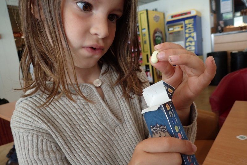
Die Kinder wissen nun schon, wie eine Fährfahrt über den Ärmelkanal ist. Während ich im Bordrestaurant Croissants und Getränke hole, lassen sie ihre Oma allein an ihrem schönen Fensterplatz sitzen und machen es sich in der Kinderecke vor einem Trickfilm bequem. Danach schleift Aurelia die Oma in den Duty Free Shop, wo sie typische Harry Potter Jelly Beans kauft. Neben den gängigen Sorten wie Apfel oder Tuttifrutti finden sich in dieser besonderen Packung auch Geschmacksrichtungen wie Senf, Erbrochenes und Ohrenschmalz. Uns schüttelt es allein bei dem Gedanken, wir lachen uns schlapp bei jeder neuen von Aurelia entzifferten und von mir für Oma ins Deutsche übersetzten Bezeichnung.
Calais, 62100 Calais, Frankreich
50° 57' 59.1" N 1° 51' 0.2" E
50.9664039 1.8500564
• Head southeast on Quai Calais 5. Go for 199 m.
• Turn right toward Boulevard du Débarquement. Go for 14 m.
• Continue on Boulevard du Débarquement. Go for 1.4 km.
• Continue on Rocade Est (N216). Go for 5.9 km.
• Take the left exit toward Dunkerque/Lille onto A16 (Autoroute des Estuaires). Go for 51.1 km.
• Continue on E40. Go for 91.3 km.
• Take the exit toward Antwerpen onto E17. Go for 52.6 km.
• Continue on E34 (Ring Antwerpen 2). Go for 8.6 km.
• Take the exit toward E313/Luik/Eindhoven/Aken/Aachen onto E34 (Antwerpen-Oost). Go for 9.3 km.
• Keep left onto E313 (Koning Boudewijnsnelweg) toward Aken/Aachen/Luik/Hasselt. Go for 52.6 km.
• Take the exit toward Aken/Aachen/Genk onto E314. Go for 40.0 km.
• Continue on A76 (Scharbergbrug). Go for 27.0 km.
• Continue on A4. Go for 68.6 km.
• Take exit 11A toward Hürth. Go for 420 m.
• Turn left onto Luxemburger Straße (B265) toward Hürth. Go for 1.3 km.
• Turn right onto Jägerpfad. Go for 146 m.
• Turn right onto Luxemburger Straße. Go for 361 m.
• Continue on Beselerstraße. Go for 93 m.
• Turn left onto Bahnstraße. Go for 227 m.
• Turn right onto Hebbelstraße. Go for 90 m.
• Arrive at Hebbelstraße. Your destination is on the right.
☍
411,4 km
(3 hrs. 48 min.)
Das Ende einer schönen Reise
Nun sind wir wieder zuhause und räumen Auto und Wohnwagen aus. Schade, dass es schon vorbei ist und schön, dass wir so viel erleben und erledigen konnten.
Hebbelstraße 9, 50354 Hürth, Deutschland
50° 53' 21.5" N 6° 53' 48.3" E
50.8892957 6.8967540
• Head northwest on Hebbelstraße. Go for 67 m.
• Turn right onto Uhlandstraße. Go for 83 m.
• Turn right onto Heinrich-Heine-Straße. Go for 129 m.
• Turn left onto Bahnstraße. Go for 121 m.
• Turn right onto Beselerstraße. Go for 93 m.
• Continue on Luxemburger Straße. Go for 306 m.
• Take the 4th exit from roundabout onto Jägerpfad toward Brühl/K.-Meschenich/Gewerbegebiet Nord-Ost. Go for 269 m.
• Turn left onto B265. Go for 1.6 km.
• Turn right and take ramp onto A4 toward Aachen. Go for 5.6 km.
• Take exit 10 toward Dortmund/Düsseldorf/Köln-Nord onto A1. Go for 106 km.
• Take exit 82 toward Hannover/Bielefeld onto A2. Go for 34.6 km.
• Take exit 20 toward Warendorf/Ennigerloh/Sendenhorst. Go for 335 m.
• Turn left onto Geißlerstraße (B58) toward Warendorf/Ennigerloh/Münster/Sendenhorst/Neubeckum. Go for 751 m.
• Turn right onto Geißlerstraße toward Neubeckum. Go for 182 m.
• Continue on Hauptstraße. Go for 1.4 km.
• Take the 2nd exit from roundabout onto Hauptstraße. Go for 188 m.
• Turn left onto Kaiser-Wilhelm-Straße (L882). Go for 186 m.
• Turn right onto Bahnhofstraße. Go for 364 m.
• Keep left onto Ennigerloher Straße. Go for 607 m.
• Continue on Ennigerloher Straße (B475) toward Warendorf/Ennigerloh. Go for 18.6 km.
• Take the 1st exit from roundabout onto B475 toward Osnabrück/Sassenberg. Go for 3.0 km.
• Turn right onto Greffener Straße (B513) toward Gütersloh/Harsewinkel/Sassenberg. Go for 2.1 km.
• Turn right onto Rudolf-Diesel-Straße. Go for 407 m.
• Arrive at Rudolf-Diesel-Straße. Your destination is on the left.
☍
177,4 km
(1 hrs. 52 min.)
Day
Putztag
With every empty compartment and every swept and wiped surface, I say goodbye to the caravan like a dear friend. I take my time and think about what I liked and noticed.
Day
Sassenberg, Deutschland
So schwer mir der Abschied von "unserem Vivo" auch fällt, so erleichtert bin ich darüber, dass ich ihn unfallfrei und pünktlich wieder zurück gebracht habe.
Rudolf-Diesel-Straße 4, 48336 Sassenberg, Deutschland
51° 58' 43.2" N 8° 3' 46.1" E
51.9786749 8.0628167
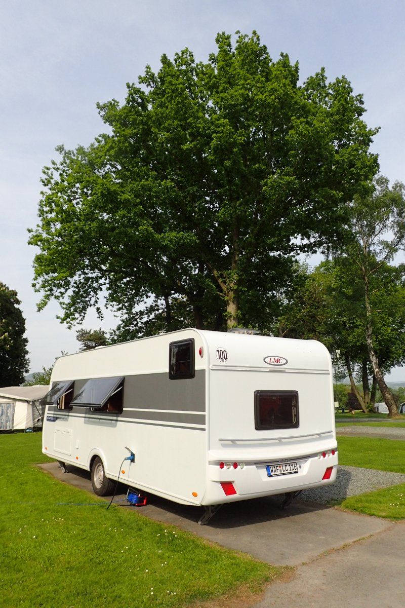
Fazit
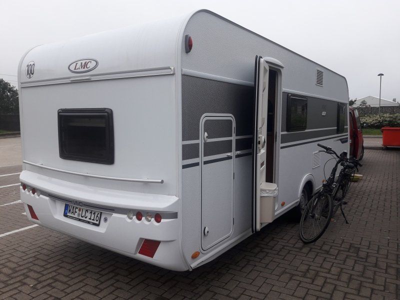
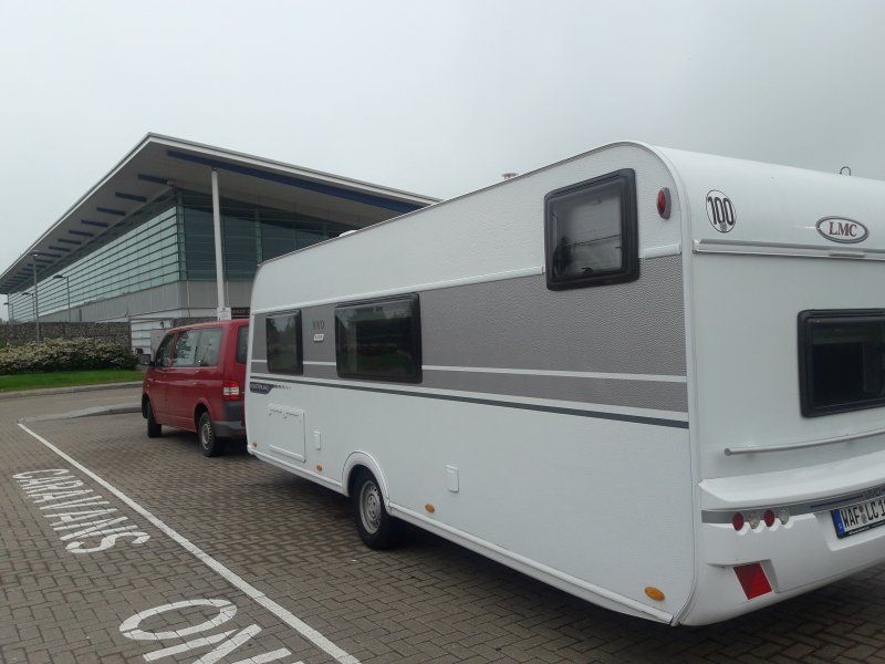
The LMC Vivo 520 K was our home in May / June 2018 when we were traveling in the borderland of England and Wales for the third edition of the Offa's Dyke Path.
I had also reported about some of our experiences: from being picked up in Sassenberg, from changing quarters and from everyday camping. Now I want to introduce you to our fantastic “research mobile”.
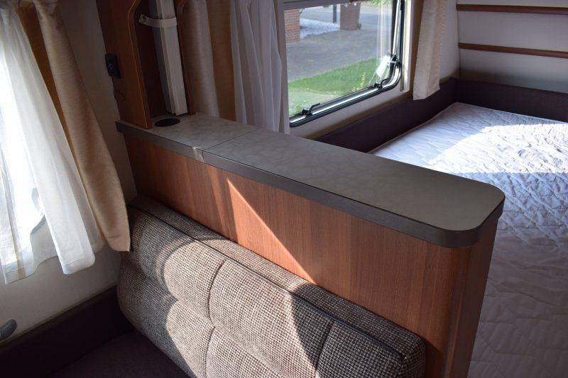
LMC Vivo 520 K
The name of the caravan has the following meaning:
- LMC is the name of the manufacturer. Written out, this means Lord Münsterland Caravan
- Vivo is the equipment line. LMC produces four different ones: Style (entry-level model), Vivo (for real life), Musica (upscale equipment) and Maestro (the luxury class)
- 520 says something about the length. But not the total length that I pull behind the car, just the usable living space. 520 probably means that something inside is 520 cm long - whatever, because in the documents for "body length inside" 5920 mm. Well, the Vivo 520 is definitely longer than the Vivo 470 and shorter than the Vivo 735 ...
- K stands for child and means that there is a bunk bed in the caravan. Alternatively you can have D = double bed and E = single beds.
My summary:
The LMC Vivo 520 K made our research much easier and embellished. We didn't have to move luggage from the car to the hotel room and rearrange it and stow it back in the car. We didn't have to rely on rigid mealtimes in hotels. Despite a few changes of location, the children always had a “feeling of home” because inside the caravan everything stayed the same.
On my very first trip as a caravan user, I noticed:
1. Trailer
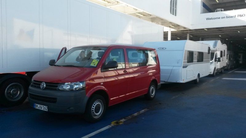
1.1. The caravan is 7284 mm long in total. If a VW Transporter is hanging in front of it, the team has dimensions that made me shudder at first. But the towing vehicle continues to drive comfortably and the trailer follows it well. Much better than I first suspected. Very pleasant!
1.2. For one person alone, however, it is too heavy when pushing, at least when they have as little strength in their arms as I do. It was clear to me from the start that neither my mother nor the children could help. So I bet that there is always someone on site whom I can briefly ask for help. In the end, that was not necessary because someone always jumped in and helped out at home and at the campsites.
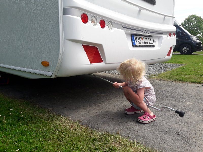
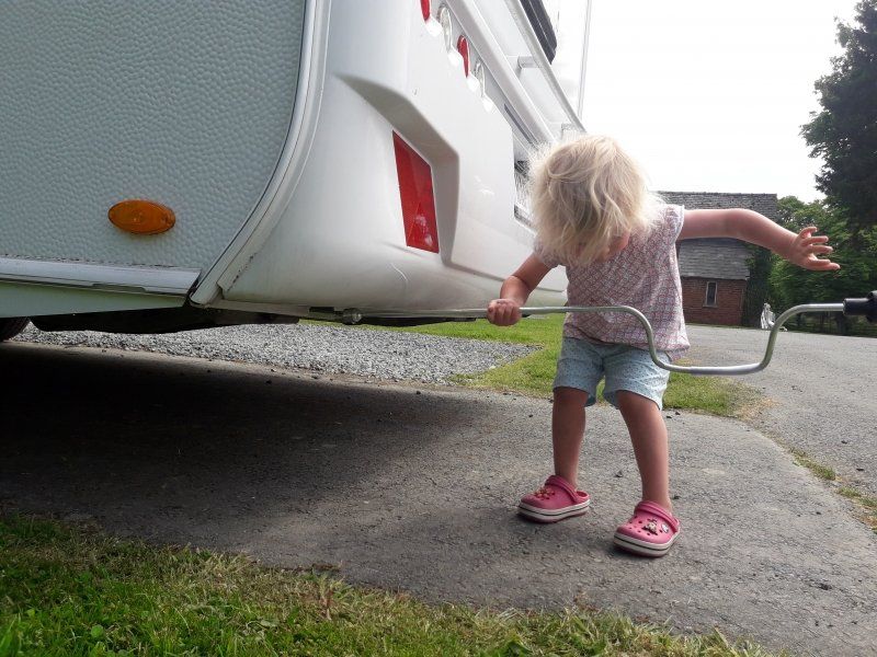
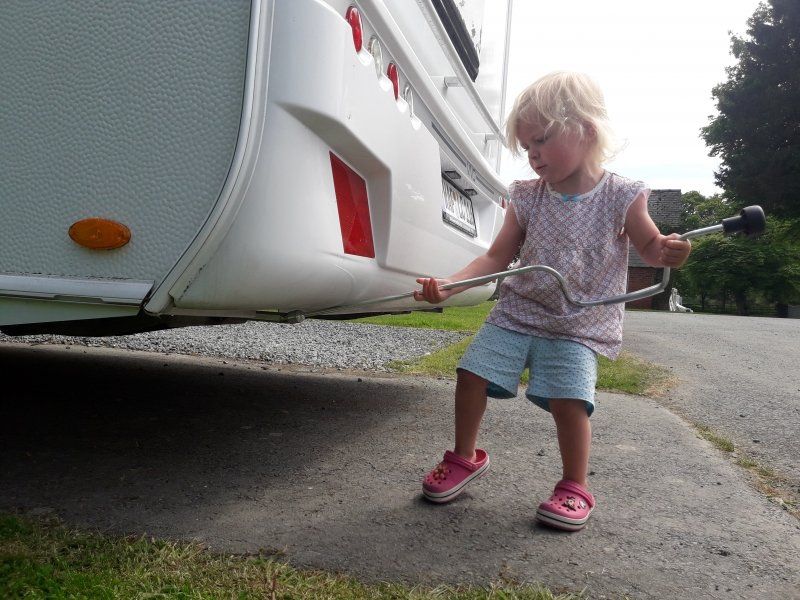
1.3. At the campsite, it can be placed on the supports so easily with an attachable crank that even my little technician Cari could take care of this task and I only had to help with the first and last rotation of each support.
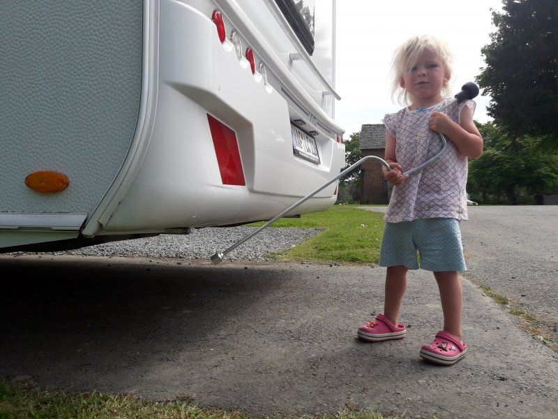
1.4. It was also pleasant that the trailer's support wheel did not have to be completely cranked up for this purpose. Half of it can simply be pulled up by briefly releasing a small lever and then pulling it back up again.
1.5. I am glad that I had driven a team before - even if that was more than a decade ago. At least I knew how to connect the power supply and where to attach the brake fuse to the car. But that didn't protect me from pretty stupid beginner mistakes:
1.5.1. The day before leaving, I went to my authorized workshop full of worry. For a few days now, the warning signal from the sensors when reversing has sounded not only when there was really an obstacle behind the vehicle, but continuously. My first thought were dirty reversing sensors, but the sound continued after the sensors were spontaneously cleaned with baby wipes and after driving through the car wash. So from my layman's point of view, there had to be a defect. My information was recorded in the workshop. After an hour and a half of waiting and three cups of strong coffee, the first free workshop foreman took me to the vehicle. His diagnosis was: “You haven't had the trailer hitch very long!” And his therapy consisted of a casual rotation of the protective cap on the trailer hitch by about 5 °. Lo and behold: the alarm sound was gone! To my reassurance and amusement, he explained to me that, according to his feeling, more than 90% of all vehicle owners who are driving with reversing sensors and trailer hitch and protective cap for the first time come to him in the workshop with this problem. The layman cannot imagine that even a slightly twisted cap could protrude into the measuring range of the sensors ...
1.5.2. It is even more stupid to think that you have outgrown the beginner status: After everything went much easier with driving and camping than I expected, I assumed when preparing to leave the second campsite that I was already experienced. The children were already in the towing vehicle, I happily wound up the supports. First one, then the second and third, everything is very easy. But on the fourth I noticed that there was movement in the trailer. Control look - the brake was pulled. So keep going. Stop! The trailer lowered with every turn of the crank. The children smirked from the back seat. I asked for some rest and stood helplessly in front of the trailer with the handle in my hand. At the first "But mom ..." I reacted so harshly that the child fell silent. But the mice didn't give up. They whispered and shouted “Das Rad!” Together - just the second I noticed that it was only advisable to crank up all four supports when the caravan is either on the support wheel or is already hanging on the towing vehicle! Can you beat that in terms of embarrassment? Fortunately, my three assistants accepted my instant apology without resentment - and of course the apology ice cream anyway.
2. Outside
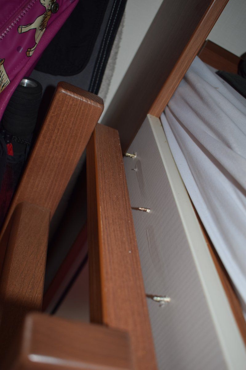
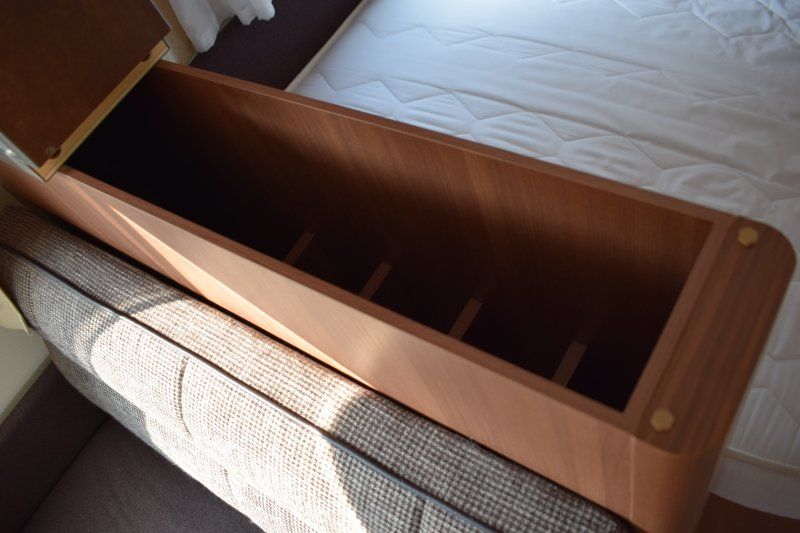
2.1. Lots of storage space - if you don't completely block one of them with a bike.
2.1.1. At the back there is a flap in which you can transport a whole bike if you fold it up under the bunk bed. Very convenient!
2.1.2. We clearly lacked a bike rack. Loading and unloading, which was always necessary, was very annoying to me. But it can certainly be retrofitted if you not only rent such a caravan, but buy it.
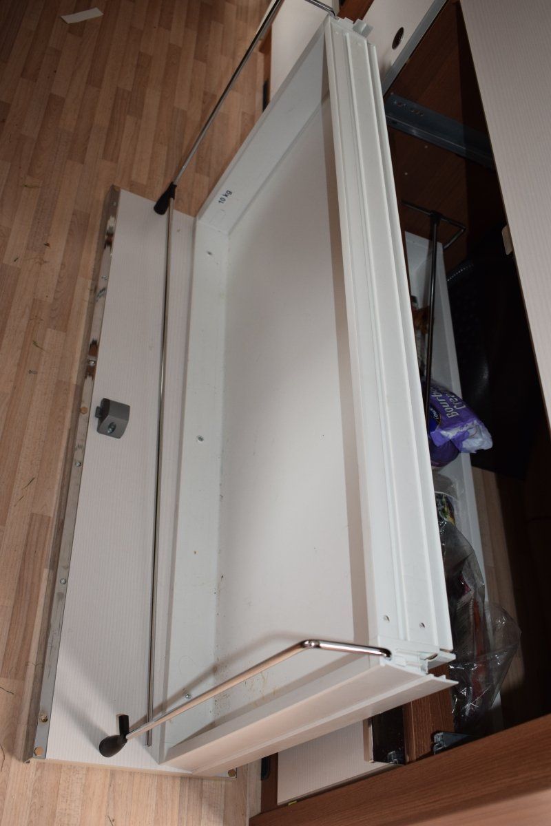
2.1.3. The gas bottles are accessible from the outside. I like that a lot better than the motorhome we had two and a half years ago.
2.1.4. The outside light above the door is very practical in dark parking spaces.
3. Technology
3.1. Lots of light, appropriately distributed. Direct light from the ceiling, but also indirect light and reading spots.
3.2. There are even two USB sockets right on the table, perfect for smartphones, tablets and cameras!
3.3. Electricity and water can easily be fed in from the outside. The level indicator for the water tank shows realistic values.
3.4. The heating was strong enough even at night in the draughty port area. It can be regulated continuously, we managed with level 2 even in frozen moments (overall possible: 1-2-3-4).
3.5. If I had taken the time to read the operating instructions before or during the trip, I would certainly have understood how to adjust the heater fan. That way it was always a bit warmer on the bunk bed than on the double bed, but that was perfectly fine because my mother was more cold than us.
3.6. If I were to buy a caravan, it would have heating that ran on both gas and electricity. Is there anything like that on the German market? I get electricity at many campsites and parking spaces at a flat rate, so I don't have to pay extra for each heating night.
3.7. In the meantime I've been thinking about a voltage converter to charge the batteries for my GPS and the children's tablets. We then made do with bought batteries, the charging cable of the navigation system and longer visits to restaurants near a socket.
4. Housing
4.1. Lots of storage space, especially under the seats. This small “wall” between the dining table and the double bed, where the lid can be opened, is particularly practical. Underneath there are compartments for at least six large (1.5 l) bottles of drink, which can be transported and stored safely.
4.2. The gaps are too big for clumsy people like us: one of our batteries for the GPS disappeared, never to be seen again, in a crack after it had rolled off the table.
4.3. The table leg can be folded down halfway so that the table can be lowered and converted into a bed. The folding mechanism is quite difficult. In the full length it looks a bit wobbly when you lean on the table.
4.4. The trash can doesn't make the most robust impression on me. If I were to buy this caravan, I could be sure that this would be one of the first parts I would have to reorder.
4.5. The coat hooks right next to the door could be mounted a little deeper in the room. Every time the door was closed we pinched the front jacket. But there were three more coat hooks “around the corner”, so enough space for the jackets of five people.
5. Cooking
5.1. Lots of storage space. Above the stove there are wall cupboards locked with flaps, under the stove there are more cupboards with doors and drawers.
5.2. The drawers are too big and heavy for the locks mounted on them. You press a button that locks the drawer so that it does not open while driving. I already knew that from mobile homes, but together with the employee from whom I took over the caravan, I made sure that all cupboards and drawers were not only locked but also locked. On the drive from the Münsterland to Hürth, however, the middle drawer jumped out of its holder, fell to the floor and could no longer be used. Because if a lock doesn't hold an empty drawer, we don't even need to fill it anymore. On the way, I learned from a Dutch camper that this is a well-known problem with most makes. As the owner, you then move the lock a little higher. If the caravan is rented or borrowed, you look as tired as we do from the laundry and save on your own.
5.3. Three flames on the gas stove! Excellent! That gave us some delicious lunches and dinners. With hot water for fresh coffee or tea, of course!
5.4. Without external power, not even operate the piezo igniter on the stove. It was good that I still remembered that from the motorhome and that we had packed matches and a stick lighter.
5.5. The fridge is huge and invites you to cook for yourself.
5.6. Somehow I don't understand why the refrigerator only runs on electricity from the campsite socket, but is not fed from the cable that feeds turn signals, brake lights, etc. while driving. Was it because of my towbar, the refrigerator or a lack of technical understanding?
5.7. The sink is big enough for daily rinsing and the water even drains if the cart is not exactly level.
5.8. As is likely with most caravans, the work surface is very tight. So we were forced to always tidy up in this area so that we could lower the glass plates on the sink and stove if we needed more space for cutting board and the like.
6. Personal hygiene
6.1. We enjoyed using the toilet and sink. Nele hasn't been out of diapers for that long, because on some days the way to the sanitary facilities at the campsite would have been too long.
6.2. My nose and I find it very pleasant that the toilet and sink are separate from each other.
6.3. There is plenty of space in the toilet room for all bathroom utensils. Very important for us: One of the compartments was so high that the mini mice couldn't even reach when they climbed on the toilet lid. So this was the ideal place for my mother's strong medication, which should never fall into the hands of small children.
6.4. There is even a small tumble dryer on which we always had towels, drying sheets and children's linen hung up.
6.5. Disposing of the contents of the Thetford toilet was straightforward. It can be easily removed and cleaned. I didn't even have to carry it, because it has wheels and a telescopic handle. So I could pull her behind me like a board case. The only point of criticism: if the bars were a bit longer, people over 1.70 m could walk a little more upright.
6.6. Unfortunately, we couldn't rely on the level indicator on the toilet. It had proven that the light works before it was first emptied. According to the operating instructions, about three transactions are still possible when it is lit. After that, the little light didn't have much to do, because I simply emptied it every third day or before moving. Of course I asked the children to tell me immediately when the red light came on. Nevertheless, it happened at the last campsite that the toilet cassette (which had only just been emptied in the morning) overflowed because Nele kept flushing until the fresh water tank was empty for fun. Although the tank was full and the water was already running into the emergency collection basin below, there was no red light above. Oh, you can't imagine how glad I was that it was just water ...
7. Sleep
7.1. The double bed has been built very comfortably in a corner, we set up a cozy dream there.
7.2. Lots of storage space, even extra compartments for glasses and smartphones on the double bed.
7.3. The height of the double bed was also ideal for us to change diapers.
7.4. The double bed is wide enough for an adult and two children, even if they are restless sleepers.
7.5. The bunk bed is space-saving and ideal for families with children. The child has a great view from above, but the fall protection is high enough to be really safe. The lower bed can be folded up and there is more storage space underneath. Or you can leave it folded up if you want to transport bulky items, e.g. a bicycle.
7.6. The ladder to the upper bunk bed is only attached with three tiny screws / nails. She was very accommodating when Aurelia first tried to climb up. Unfortunately, she squeezed a finger between the ladder and the bed and didn't want to sleep upstairs. She used the upper bunk as a storage space for her personal effects throughout the trip, but only used the ladder when I was holding it.
7.7. So she slept either with Grandma in the lower bunk bed or with us in the double bed. That was a bit tighter than we actually wanted, but still brought restful sleep. Because the bed frames and mattresses exactly meet our sleeping needs.
Thank you, dear LMC team! You have finally made avowed campers for us.
Ausblick auf die nächste Walesreise
In 2019, research for two books on Wales is on the agenda.
On the one hand, there should be a new edition for the Pembrokeshire Coast Path.
On the other hand, a band with short hikes all over Wales.
Hopefully Brexit will turn out to be such that I can find a caravan early, book the ferry and organize everything. Because I can only start when I know what legal rules there are for taking dogs with me.
Dear readers, please keep your fingers crossed for me.
Maybe we'll read each other here again next year. Otherwise on my private blog http://fernwehkinder.de.
Your Ingrid.