In June 2021 there is still Corona, albeit with a decreasing number of infections. Entry into Germany, Austria and Italy is still only possible with restrictions. Although fully vaccinated, we don't want to expose ourselves to any unnecessary risks and are therefore staying in Switzerland. Inspired by previous trips to the Engadin and Munster Valley, we want to explore new places and landscapes there. We are most interested in Val Mora, which we were unable to cross two years ago due to unfavorable snow forecasts.
Day
Zürich, Schweiz
In June 2021 there are still corona restrictions and entry into Germany, Austria and Italy is still only possible with restrictions. Although fully vaccinated, we don't want to expose ourselves to any unnecessary risks and are therefore staying in Switzerland. Inspired by previous trips to the Engadin and Munster Valley, we want to explore new places and landscapes there. We are most interested in Val Mora, which we were unable to cross two years ago due to unfavorable snow forecasts.
Bahnhofpl., 8001 Zürich, Schweiz
47° 22' 36.8" N 8° 32' 30.1" E
47.3768866 8.5416940
• Head toward Bahnhofquai on Bahnhofplatz. Go for 10 m.
• Make a U-Turn at Bahnhofquai onto Bahnhofplatz. Go for 356 m.
• Turn left onto Gessnerallee. Go for 651 m.
• Continue on Selnaustrasse. Go for 262 m.
• Continue on Sihlhölzlistrasse. Go for 320 m.
• Turn right onto Sihlhölzlibrücke (3). Go for 256 m.
• Turn left onto Manessestrasse (4). Go for 159 m.
• Keep left onto A3W toward A3. Go for 3.3 km.
• Continue on A3. Go for 89.3 km.
• Continue on A13. Go for 9.5 km.
• Take exit 14 toward Landquart/Davos/Autoverlad Vereina. Go for 284 m.
• Take the 3rd exit from roundabout onto Ragazerstrasse (3/13) toward Landquart/Davos/Autoverlad Vereina. Go for 143 m.
• Take the 2nd exit from roundabout onto Ragazerstrasse (3/13). Go for 492 m.
• Keep left toward Karlihof. Go for 262 m.
• Continue on Karlihof. Go for 1.4 km.
• Continue on Prättigauerstrasse (28). Go for 24.3 km.
• Pass 2 roundabouts and continue on Prättigauerstrasse (28). Go for 15.8 km.
• Turn left onto Sandstrasse (28). Go for 51 m.
• Turn left onto Flüelastrasse (28). Go for 4.9 km.
• Turn right onto Flüelapassstrasse. Go for 116 m.
• Turn right onto Flüelapassstrasse (28). Go for 7.8 km.
• Arrive at Flüelapass (28). Your destination is on the left.
☍
159,7 km
(1 hrs. 48 min.)
Flüelapass, Zernez, Schweiz
Flüelapass, 7260 Zernez, Schweiz
46° 45' 1.1" N 9° 56' 50.8" E
46.7503000 9.9474400
• Head toward Wägerhus on Flüelapass (28). Go for 12.7 km.
• Turn right onto Sandstrasse (28). Go for 51 m.
• Turn right onto Bahnhofstrasse (28). Go for 8.1 km.
• Take ramp. Go for 107 m.
• Take the 1st exit from roundabout. Go for 211 m.
• Take the 3rd exit from roundabout. Go for 688 m.
• Continue on Vereinatunnel. Go for 85 m.
• Take the Vereinatunnel car shuttle train. Stay on for 19.5 km.
• Head northeast. Go for 953 m.
• Keep right onto 27. Go for 8.2 km.
• Continue on Via Sura (27). Go for 765 m.
• Turn sharp right onto Madinas. Go for 102 m.
• Turn left onto Madinas. Go for 97 m.
• Turn right onto Cul. Go for 162 m.
• Arrive at Cul. Your destination is on the right.
☍
51,7 km
(1 hrs. 28 min.)
Fahrt ins Engadin
At 8:50 a.m. we leave our parking lot and chug towards the canton of Graubünden. At Grüsch
we change the driver's seat and shortly after 11:00 a.m.
we reach the top of the Flüela Pass.
We decide to drive through to Zernez and
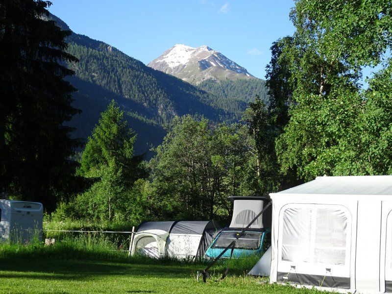
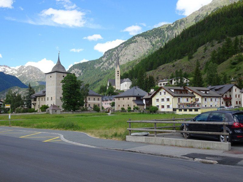
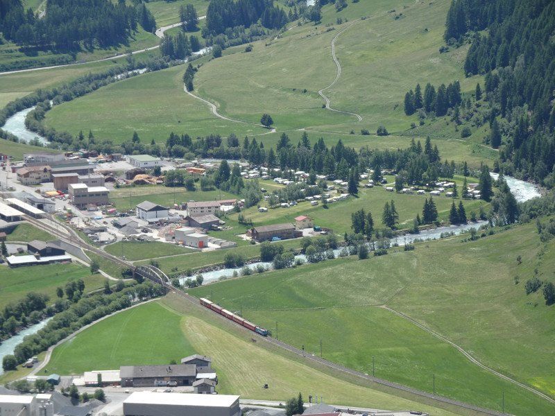
eat there. Shortly before 12:00 p.m. we reach the Zernez campsite. The reception has been closed since 11:00 a.m. We should look for a seat and register after the reception opens at 3:00 p.m., it says on a notice. We inspect the places around the reception and shortly thereafter find a place that meets our requirements. We go back to the mobile home and drive to the site, where we park and connect the vehicle within minutes. We pull out the table and chairs and we can already enjoy the aperitif, followed by the sandwiches we brought.
We enjoy the sun and the temperature, which exceeds 22 degrees. After registering, we walk to the center of Zernez, which we already know from holidays and other stays, to find a place for our evening meal. We rattle off all the restaurants and decide on the Hotel Spöl and walk back to the campsite.
Now it starts to rain and
storm. However, the rain only lasts a few minutes and we can get on our bikes. After a few minutes we reach the Hotel Spöl and can still get two seats inside. We order two beers, an Engadine sausage with potato salad and a fitness plate. We'll drink the coffee afterwards in the mobile home.
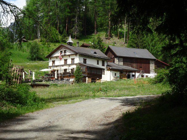
Camping Cul
Nice, large square, 5 minutes from the train station with train and postbus connections
Madinas s/n, 7530, Zernez, Switzerland
46° 41' 51.3" N 10° 5' 13" E
46.6975800 10.0869400
• Head northwest on Cul.
• Arrive at Cul. Your destination is on the right.
☍
Distance not available
(Duration not available)
Day
Wanderung über Susch nach Lavin
After breakfast we discuss how to proceed
and decide to set off directly from the campsite to Susch.
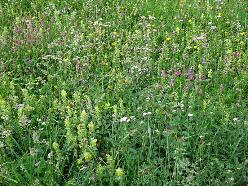
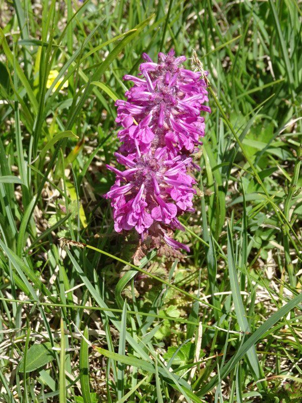
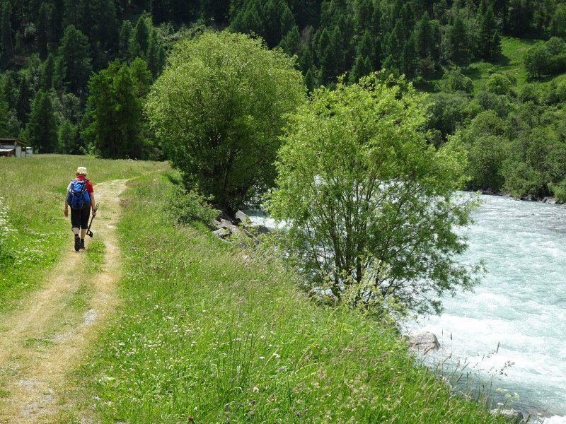
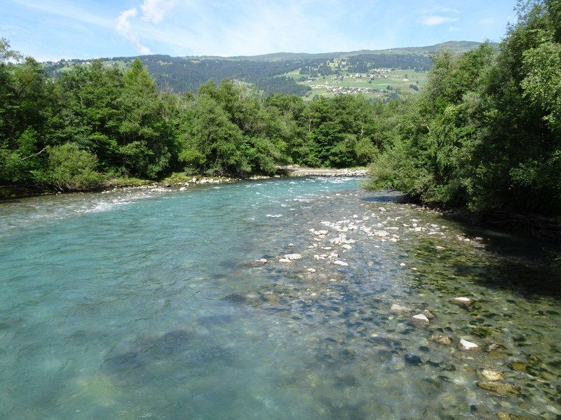
The path leads along the Inn and is lined with a sea of flowers. The fire lilies and the Turk's cap lilies are particularly worth mentioning, although their buds are usually still closed. Whole meadows of daisies pass us by, scabious and carnations also appear again and again.
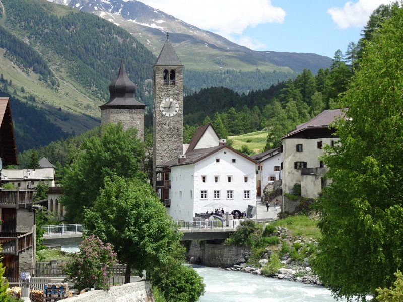
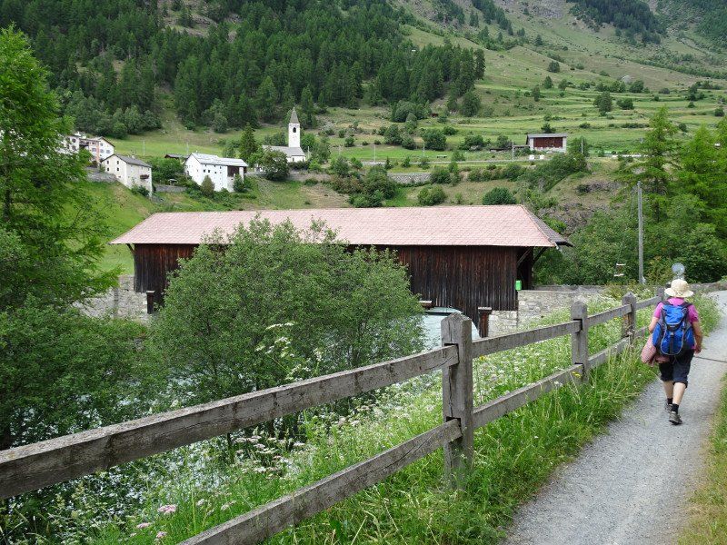
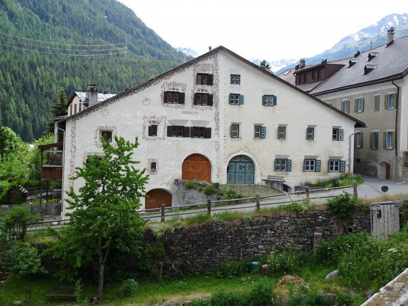
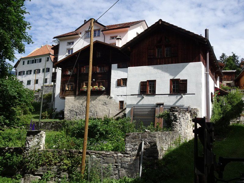
We reach the other bank over the covered bridge and climb up the road to Susch, lined with Engadine houses. Right on the other side of the street is the Flüela restaurant with a garden, which is recommended for our lunch.
After lunch, we visit the Susch Museum, which consists of a residential building with a farm and vis-à-vis a brewery existed. Today the buildings have been beautifully renovated and the past shines through everywhere. However, the exhibition is modern and has nothing to do with the village.
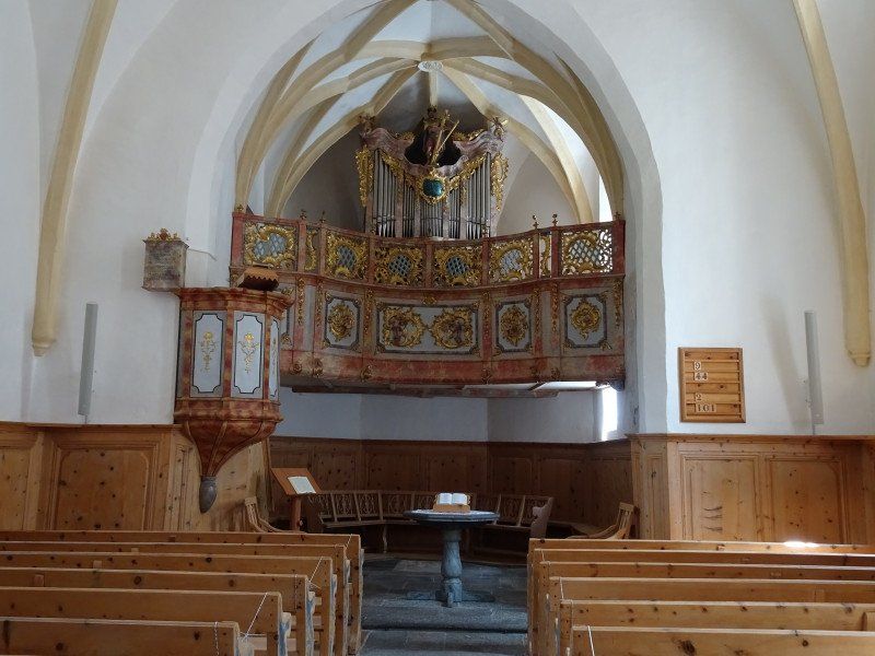
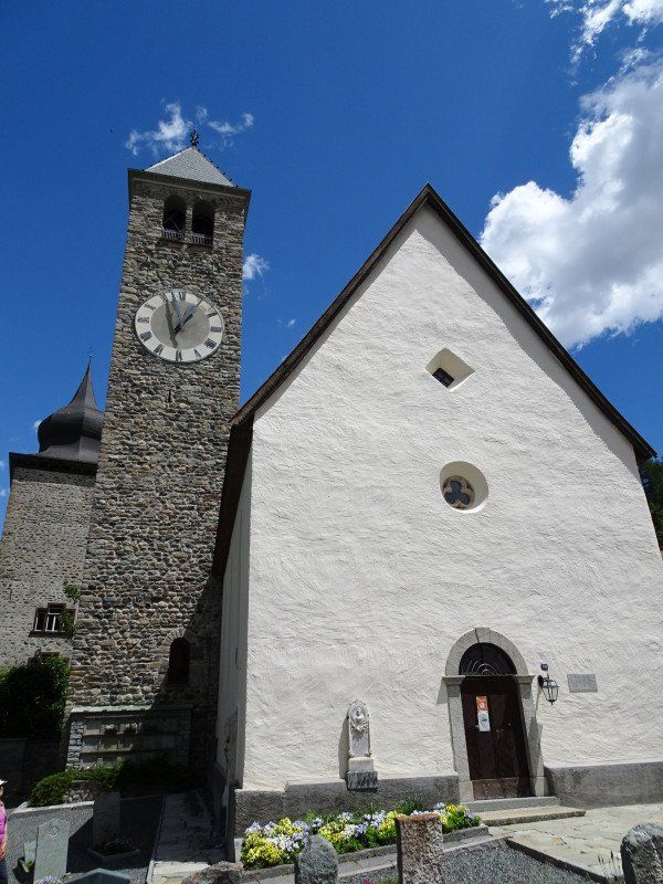
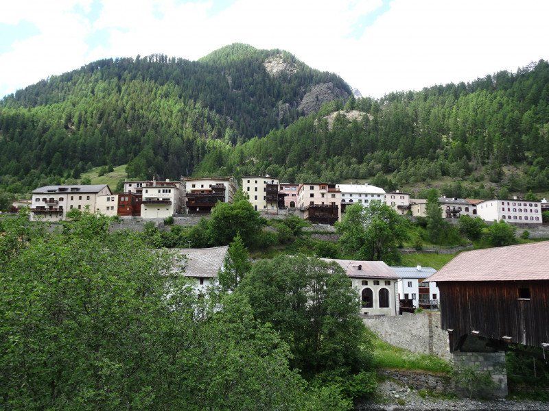
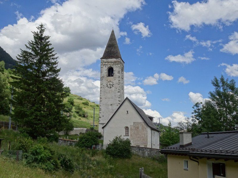
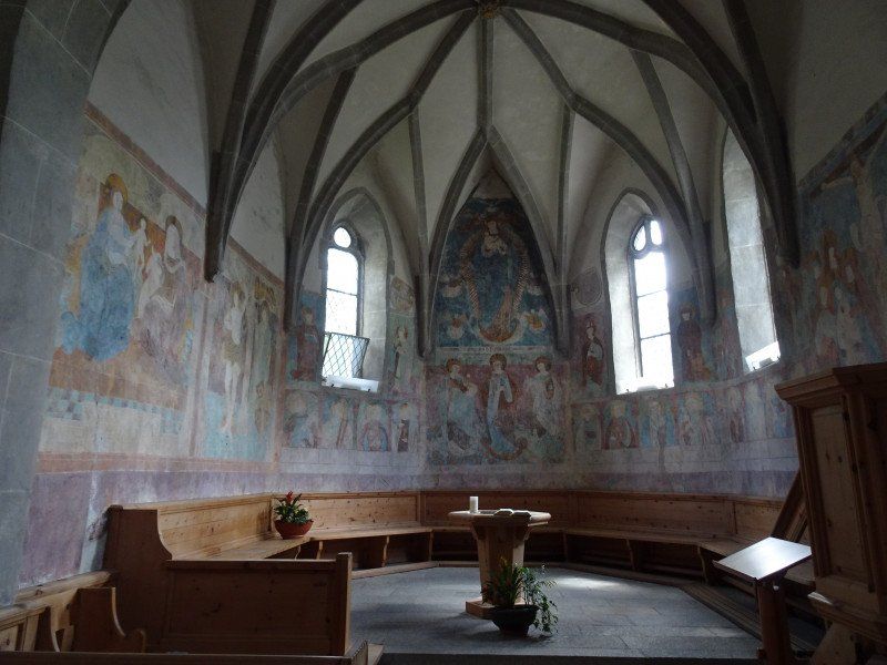
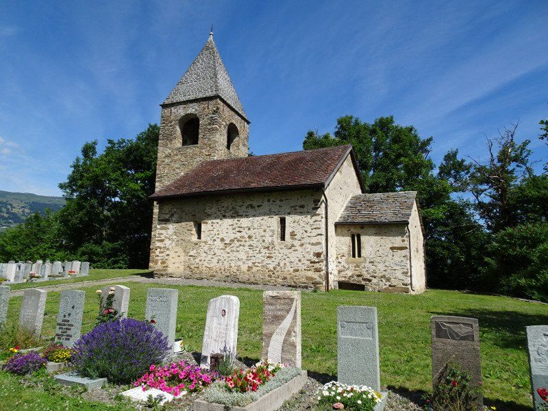
Just behind the museum is the village church with its baroque furnishings, which are tailored to the Reformed service. Passing the neighboring Tuor Planta, the path leads back to the Lavin fields. The floral splendor is again beguilingly rich in species. In contrast to Susch, Lavin is not on the valley floor, but elevated above the Inn. Over a covered bridge and a steep ascent we reach Lavin, some of whose houses have bay windows on the valley side. Here, too, the streets are lined with beautiful Engadine houses.
At the end of the hike, we look for the old, medieval church with frescoes from the 15th century. Then we take the Rhaetian Railway back to Zernetz, where we reward ourselves with a Greek salad.
Camping Cul
Madinas s/n, 7530, Zernez, Switzerland
46° 41' 51.3" N 10° 5' 13" E
46.6975800 10.0869400
• Head northwest on Cul.
• Arrive at Cul. Your destination is on the right.
☍
Distance not available
(Duration not available)
Day
Ruhetag
In the morning we rest a bit, just take a short bike ride and then go shopping.
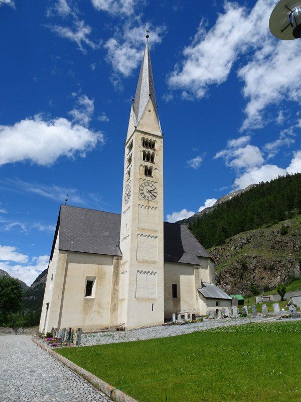
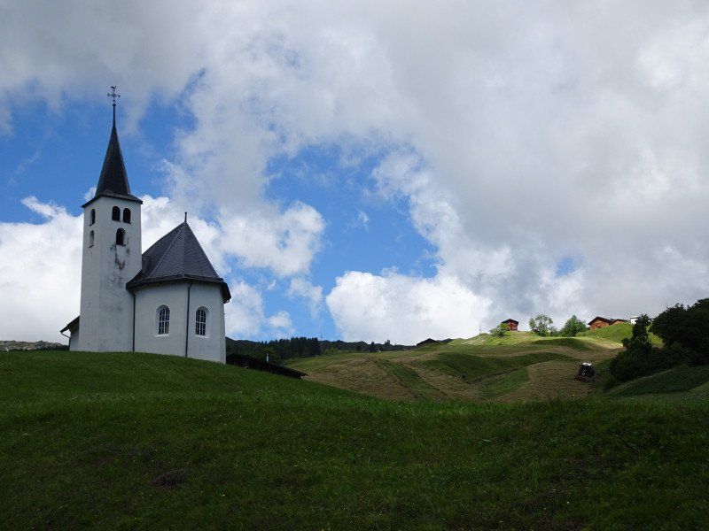
In the afternoon we take a tour of the village of Zernez. The reformed village church, the chapel of San Bastian next to it with its medieval frescoes are worth a visit. Wildenberg Castle and its park are now on the way to the National Park Museum. You should definitely allow 2 hours for the visit, even with children!
Camping Cul
Madinas s/n, 7530, Zernez, Switzerland
46° 41' 51.3" N 10° 5' 13" E
46.6975800 10.0869400
• Head northwest on Cul.
• Arrive at Cul. Your destination is on the right.
☍
Distance not available
(Duration not available)
Day
Kurzwanderung oberhalb Ftan und Scuol
We take the train to Scuol, where the postbus to Ftan is already waiting for us. From Ftan you can take the chairlift up to Prui, from where you can hike to Motta Naluns in less than an hour. However, we take the path up to the plain of Naluns Sura. One more we enjoy the flowers. Here we meet several species of orchids. This time lunch comes out of the backpack while we can watch the insects around us.
In Mottag Naluns we stop for a beer and then let ourselves be carried down to Scuol in the valley to save energy (for us). You can then take the train back to Zernez.
Camping Cul
Madinas s/n, 7530, Zernez, Switzerland
46° 41' 51.3" N 10° 5' 13" E
46.6975800 10.0869400
• Head northwest on Cul.
• Arrive at Cul. Your destination is on the right.
☍
Distance not available
(Duration not available)
Day
Kurzwanderung um Zernez
Today we hike towards Susch and then uphill via Clüs to Sivü.
From there the path continues more or less horizontally and then descends again to Zernez, where you reach the village again at the church. The hike is slightly more strenuous than expected and takes just under 3 hours over 10 km with 390 meters of up and down. However, you will be rewarded with a beautiful view over the village of Zernez and its campsite. The hiking trail is also very varied, as it crosses Alps and streams and offers beautiful views upwards too. The last part of the way leads along the Inn back to the campsite.
Camping Cul
Madinas s/n, 7530, Zernez, Switzerland
46° 41' 51.3" N 10° 5' 13" E
46.6975800 10.0869400
• Head northwest on Cul.
• Arrive at Cul. Your destination is on the right.
☍
Distance not available
(Duration not available)
Day
Wanderung ins Val Sinestra
At 08:49 a.m. we take the train to Scuol and
change there to the post bus in the direction of Martina. In Ramosch we switch to a small post bus that takes us to Vna. The postbus is full and we are expecting a radio hike to Zuort or Val Sinestra.
We start our hike quickly so that
not have to overtake everyone. But far from it, apart from a young couple, nobody is following us. We relieve ourselves on a bench and continue to smear ourselves with sunscreen. The young couple overtakes us and will always walk about 100 meters in front of us in the future. We choose the mountain path, but soon realize that it follows the road at a distance of a few meters. The small difference: the road leads straight ahead, the mountain path uphill and downhill. So we switch back to the road, which leads us to the Zuort farm.
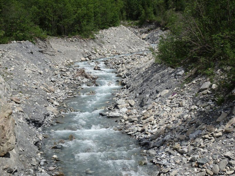
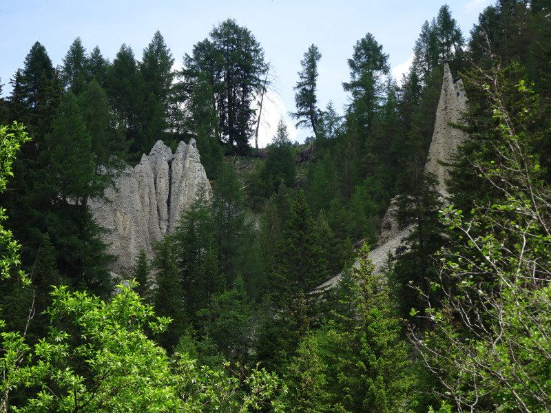
On the way we pass stream beds, each of which brings down a lot of
debris and earth pyramids, like the ones we saw
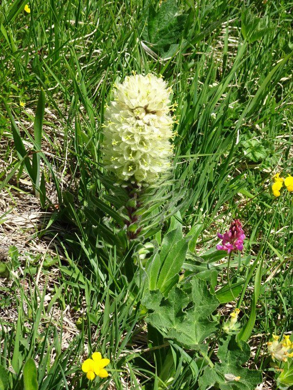
from the know Valais. The path is again lined with many flowers, including lady's slippers and martagon lilies. However, the flowers of the Turk's cap lilies are not yet open. After a last bridge crossing we approach the courtyard Zuort. At first glance, the building looks like a school building, but with barns and stables attached. As we get closer, we realize that the courtyard is also a customs post.
We step onto the terrace
and reserve a table and order the house
omelette, one with bacon and one with bacon with vegetables and first an elderflower syrup with peppermint, 5 dl each. After a short time we receive our dishes and enjoy them. The wall behind us reflects the hot sunlight and makes you really warm. In the meantime, cyclists (New German «bikers») have arrived, who dominate the whole pub with their mouths. Luckily they don't stay long. We have several hours, but we have to catch the bus at 2:53 p.m. at the Hotel Val Sinestra so that we don't miss our village tour in Zernez.
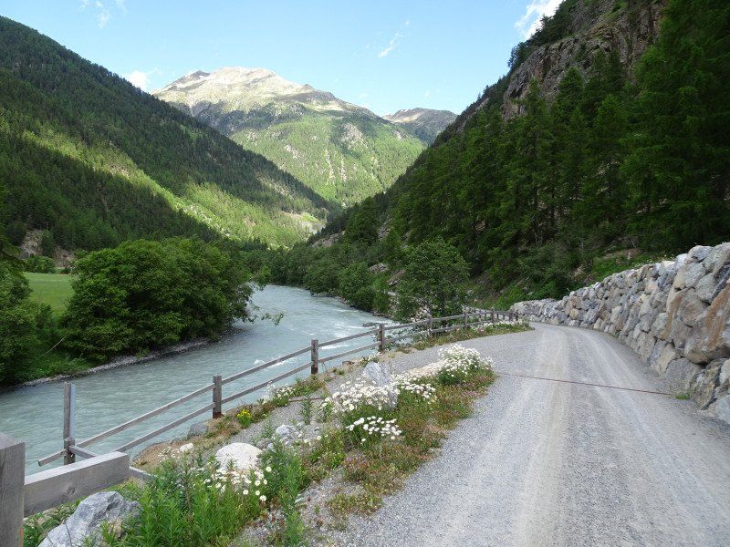
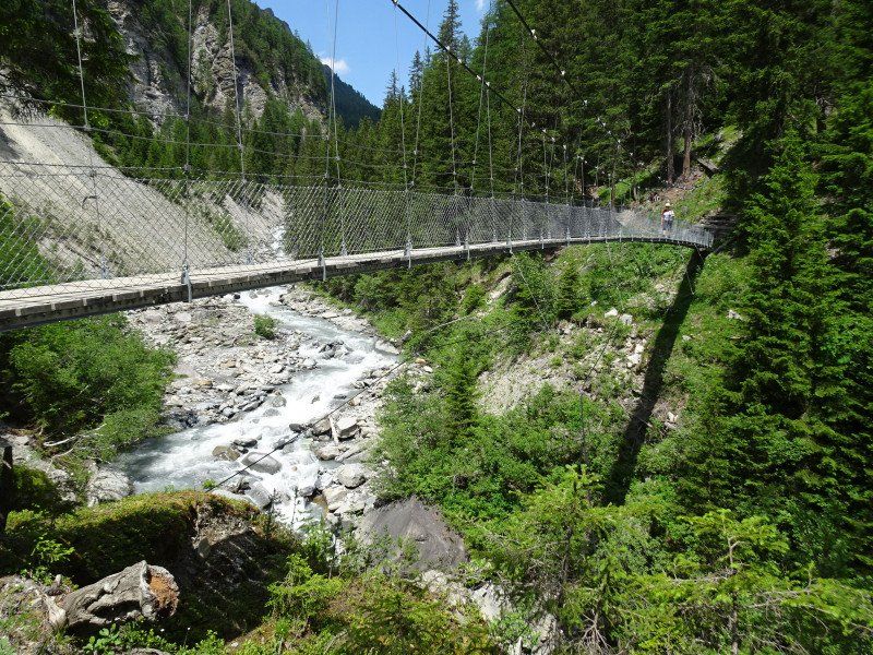
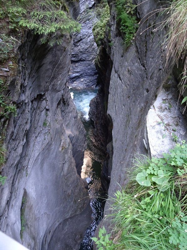
We leave the Zuort farm and walk the Brückenweg. This leads uphill and downhill along the gorge. Once we are almost at water level, then again far above the water. After an hour of hiking we reach the first suspension bridge. The bridge is not special. We've seen longer bridges. But the gorge below the bridge is spectacular. After a short time we reach the second suspension bridge and then the path climbs again. We also have to climb up because part of the way has crashed
. And then follows the bridge to the Hotel Val Sinestra.
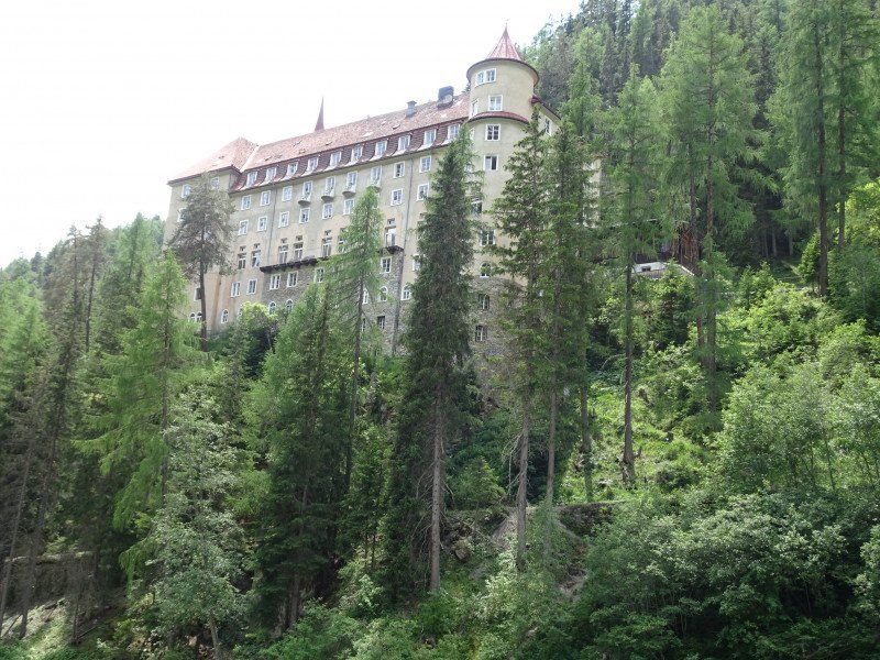
It is not spectacular, but the sight of the hotel
high above the creek. So high that we groan at the thought of climbing it. We start the ascent, but can break off after about 100 meters, because there is an inn in the first bend and the sign for the bus stop in front of it.
We take the Postbus via Sent to Scuol and
can switch to the train to Zernez straight away, where we hurry home and have dinner on the table at 4:22 p.m. After less than half an hour we make our way back to the village center, where we meet the group of tourists at the visitor center of the national park, who are also taking part in the guided tour alongside us. The tour lasts a little more than two hours with an aperitif break and is nothing special.
At home in the camper we prepare the food for the hike on Tuesday and load the backpacks. We're in bed earlier than ever before and dreaming about the following day.
Camping Cul
Madinas s/n, 7530, Zernez, Switzerland
46° 41' 51.3" N 10° 5' 13" E
46.6975800 10.0869400
• Head northwest on Cul.
• Arrive at Cul. Your destination is on the right.
☍
Distance not available
(Duration not available)
Day
Wanderung durch das Val Mora
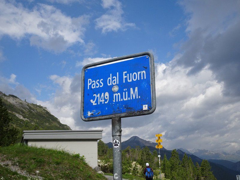
At 08:15 the post bus leaves Zernez station for the Ofen Pass. The drive through the national park does not take long. Lots of people get on and off. At the top of the pass there are still three of us and two of them get out.
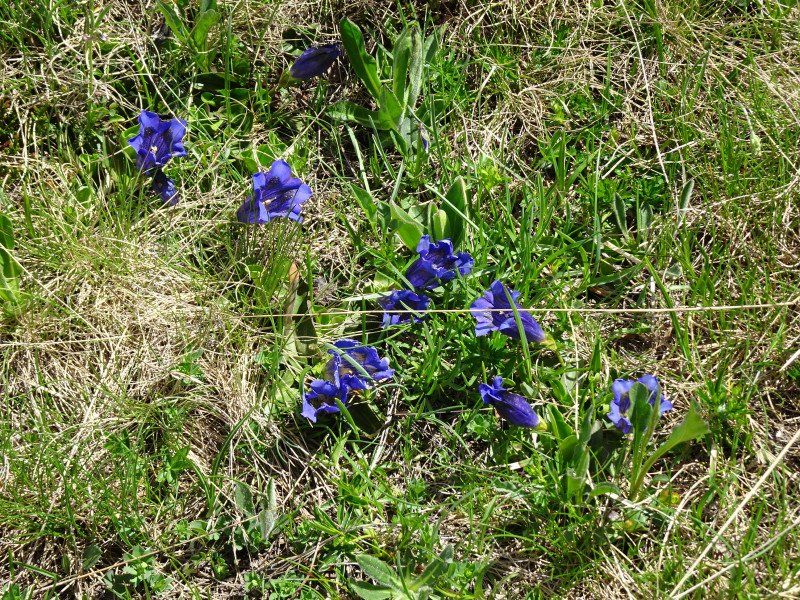
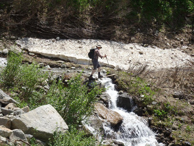
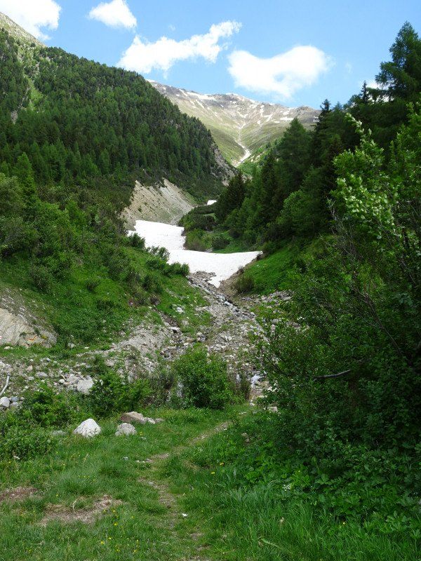
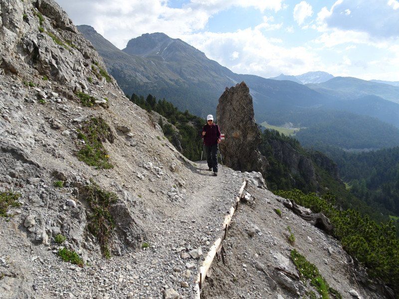
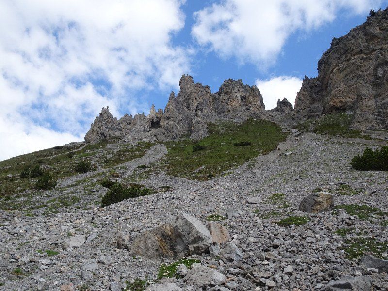
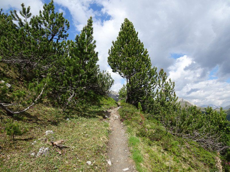
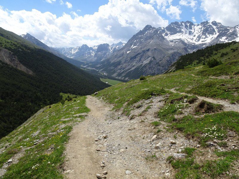
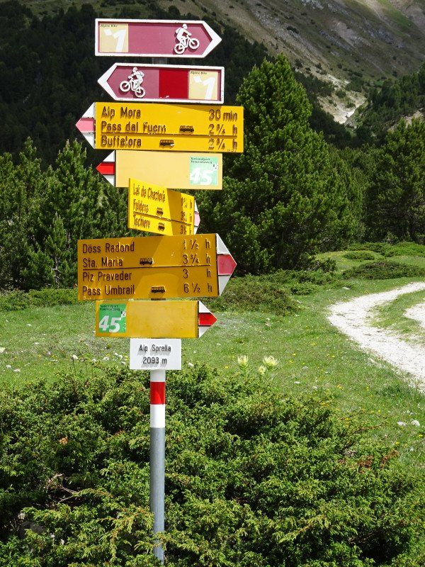
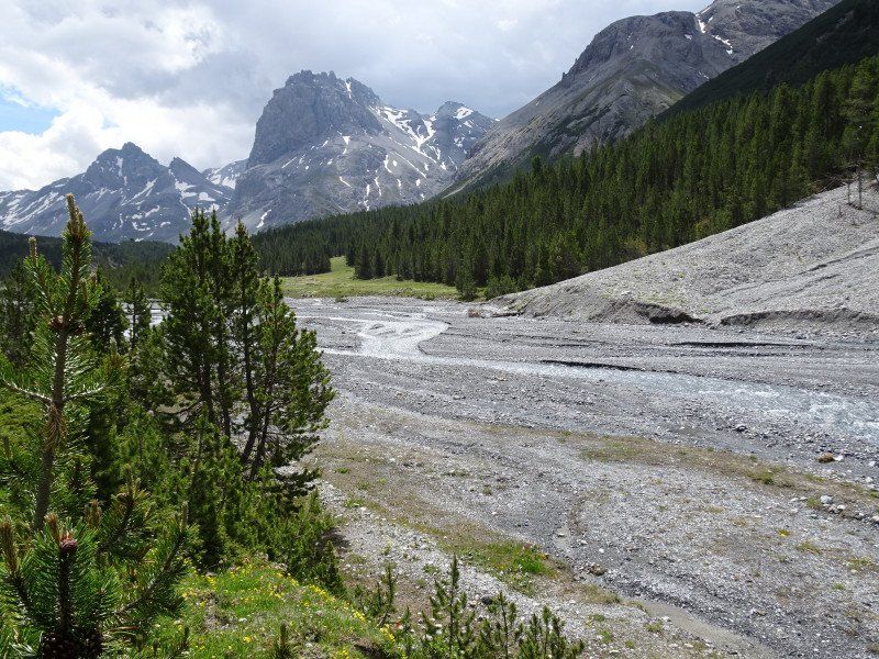
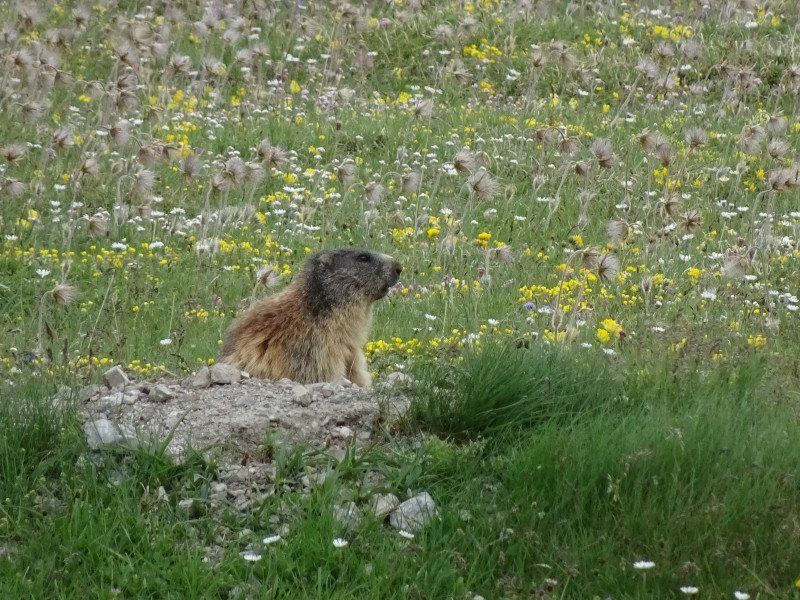
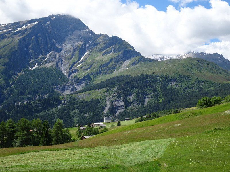
The path rises immediately behind the hotel. The first 100 meters of a good 20 kilometers are done. Along slopes, it goes over a pass in the Engadine Dolomites over to Val Mora. The last "point of no return" is coming soon, where you could branch off to Buffalora and shorten the route. We keep marching. Far below us, the Val Mora opens up with its alp. We pass Alp Mora and Alp Sprella and dive into one of the wildest and most natural valleys with an undeveloped river landscape and meadows full of pioneer plants. But it's not just plants that thrive here, but also marmots that are slowly making us tired hikers happy.
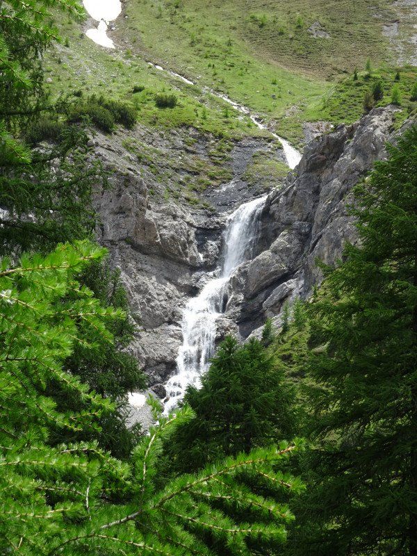
After crossing the watershed in the direction of Münstertal, the Val Döss Radond opens up with its wonderful waterfall. Yellow gentians and alpine roses now line the descent. The village of Valchava beckons through the spruce forest and after 7 hours of hiking we reach the Valchava bus stop, from where the bus takes us back to Zernez.
Camping Cul
Madinas s/n, 7530, Zernez, Switzerland
46° 41' 51.3" N 10° 5' 13" E
46.6975800 10.0869400
• Head northwest on Cul.
• Arrive at Cul. Your destination is on the right.
☍
Distance not available
(Duration not available)
Day
Ruhetag
After the long hike, we deserve a rest day. Grocery shopping in the morning, taking a train trip to La Punt in the afternoon is just about in.
Camping Cul
Madinas s/n, 7530, Zernez, Switzerland
46° 41' 51.3" N 10° 5' 13" E
46.6975800 10.0869400
• Head toward Sur Crusch on Cul. Go for 162 m.
• Turn left onto Madinas. Go for 97 m.
• Turn right onto Madinas. Go for 102 m.
• Turn right onto 27. Go for 26.0 km.
• Pass 2 roundabouts and continue on Via da Puntraschigna (27/29). Go for 2.4 km.
• Take the 1st exit from roundabout onto 27. Go for 3.1 km.
• Pass 5 roundabouts and continue on Via San Gian (27). Go for 5.3 km.
• Take the 2nd exit from roundabout onto Sviamaint da Silvaplauna (3) toward Chur/Julierpass. Go for 8.5 km.
• Turn right onto Ospiz dal Giüglia. Go for 17 m.
• Turn left onto Ospiz dal Giüglia. Go for 18 m.
• Arrive at your destination on the right.
☍
45,7 km
( 42 min.)
Day
Julierpass, Surses, Schweiz
Julierpass, 7457 Surses, Schweiz
46° 28' 12.6" N 9° 43' 3.8" E
46.4701639 9.7177092
• Head northeast. Go for 11 m.
• Continue on Ospiz dal Giüglia. Go for 7 m.
• Turn right onto Ospiz dal Giüglia. Go for 17 m.
• Turn right onto Via da Güglia (3). Go for 34.5 km.
• Take the 2nd exit from roundabout onto Albulastrasse (3/417) toward Chur/Thusis/Lenzerheide. Go for 10.4 km.
• Continue on Tunnel Sils. Go for 2.0 km.
• Continue on Compognastrasse. Go for 254 m.
• Turn right onto Compognastrasse. Go for 66 m.
• Turn right onto Pantunweg. Go for 335 m.
• Arrive at Pantunweg. Your destination is on the left.
☍
47,6 km
( 48 min.)
Verlegung auf den Camping Viamala in Thusis
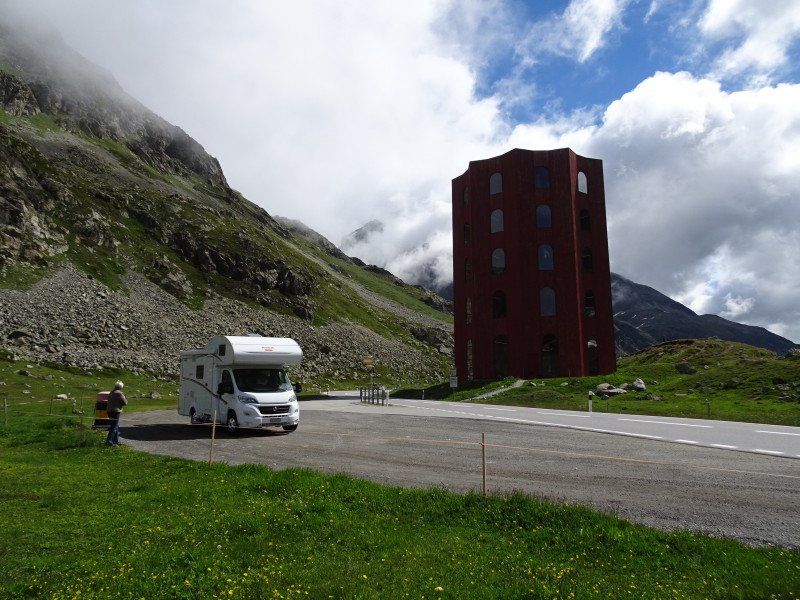
We drive via St. Moritz and Silvaplana to the Julier Pass, on which stands a tower dedicated to art. Then it goes down via Bivio - Savognin - Tiefencastel to Thusis, where we are checked in at Camping Viamala shortly before noon. A campsite awaits us in a pine forest. We just enjoy the rest of the day!
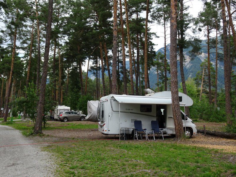
TCS Camping Thusis - Viamala
Place in a light pine forest with spacious plots. Train station a good 5 minutes from the square with many post bus connections. The city center can be reached in 10 minutes via the post bus station with the lift.
Sanitary facilities and restaurant newly built and functional.
Pantunweg, 7430, Thusis, Switzerland
46° 41' 55.7" N 9° 26' 41.9" E
46.6988100 9.4449600
• Head north on Pantunweg.
• Arrive at Pantunweg. Your destination is on the left.
☍
Distance not available
(Duration not available)
Day
Via Mala und Obertschappina
Today we want to look at some of the sights of the valley called Domleschg. The first is the Via Mala gorge, which we can reach in a few minutes by post bus. The gorge is impressive, but so are the roads that have been built here over the centuries since the Romans.
Unfortunately, visiting the gorge is affected by the noise of construction work on a bridge. But otherwise the gorge is impressive.
We take the next post bus back to Thusis, get on the post bus to Obertschappina and let it carry us higher and higher. Masein. Flerden, Urmein and Tschappina are passed through until we arrive in Obertschappina, almost 1000 meters above the valley floor. From there it is a few kilometers on foot through flower meadows to Oberurmein, a sleeping place that only seems to wake up in winter. It's now downhill to the road to Urmein, where the postbus picks us up again and carries us down to the valley.
TCS Camping Thusis - Viamala
Pantunweg, 7430, Thusis, Switzerland
46° 41' 55.7" N 9° 26' 41.9" E
46.6988100 9.4449600
• Head north on Pantunweg.
• Arrive at Pantunweg. Your destination is on the left.
☍
Distance not available
(Duration not available)
Day
Wanderung entlang der Albula
We take the post bus to Fürstenau, one of the smallest towns with city rights dating back to the Middle Ages. As guardian of the Alpine road to the Albula and Julier passes, there was probably a lot to be made from customs duties. In any case, there are several castles within the former city fortifications.
From there we move up the Hinterrhein, then along the Albula and reach Baldenstein Castle and the church of Sant Cassian above Sils. From there it goes back to Thusis.
TCS Camping Thusis - Viamala
Pantunweg, 7430, Thusis, Switzerland
46° 41' 55.7" N 9° 26' 41.9" E
46.6988100 9.4449600
• Head south on Pantunweg. Go for 335 m.
• Turn left onto Compognastrasse. Go for 66 m.
• Turn left onto Compognastrasse. Go for 254 m.
• Keep left toward A13. Go for 107 m.
• Turn left and take ramp onto A13 toward Chur. Go for 48.8 km.
• Continue on A3 toward Zürich/Sargans. Go for 24.8 km.
• Take exit 47 toward Murg/Kerenzerberg. Go for 796 m.
• Continue on Kerenzerbergstrasse (3). Go for 13.4 km.
• Turn right. Go for 303 m.
• Take the 2nd exit from roundabout. Go for 810 m.
• Continue on Stichstrasse. Go for 160 m.
• Take the 1st exit from roundabout. Go for 226 m.
• Continue on Zubringerstrasse. Go for 1.9 km.
• Take left ramp onto A3 toward Zürich/Luzern/St. Gallen/Rapperswil. Go for 54.2 km.
• Continue on A3W (Zürich-Süd) toward Zürich-City/Brunau. Go for 3.5 km.
• Continue on Manessestrasse (4). Go for 225 m.
• Keep right onto Manessestrasse (3) toward Chur/Rapperswil. Go for 133 m.
• Turn left onto Stauffacherquai. Go for 346 m.
• Continue on Stauffacherquai. Go for 247 m.
• Continue on Kasernenstrasse. Go for 433 m.
• Turn right onto Gessnerbrücke. Go for 51 m.
• Continue on Usteribrücke. Go for 80 m.
• Continue on Usteristrasse. Go for 297 m.
• Continue on Bahnhofplatz. Go for 219 m.
• Arrive at Bahnhofplatz.
☍
151,7 km
(1 hrs. 41 min.)
Day
Rückfahrt
The direct route back to Zurich, where wonderful holidays will now end.
Zürich, Schweiz
47° 22' 36.8" N 8° 32' 30.1" E
47.3768866 8.5416940