There are still high numbers of Covid cases at the end of May. Traveling abroad is still taboo. Half of Switzerland travels to Ticino. We are not! As an alternative, the Valais or the Vaud would come into question. We decide to go to Vaud.
Day
Zürich, Schweiz
47° 22' 36.8" N 8° 32' 30.1" E
47.3768866 8.5416940
• Head toward Bahnhofquai on Bahnhofplatz. Go for 10 m.
• Turn left onto Bahnhofquai. Go for 159 m.
• Turn left onto Museumstrasse. Go for 359 m.
• Turn right onto Sihlquai. Go for 1.6 km.
• Keep right onto Sihlquai toward Bern/Basel/Höngg/Wipkingen. Go for 197 m.
• Continue on Escher-Wyss-Platz. Go for 65 m.
• Turn right onto Hardturmstrasse. Go for 350 m.
• Turn left onto Förrlibuckstrasse (1). Go for 603 m.
• Turn right onto Pfingstweidstrasse (1/3). Go for 775 m.
• Keep left onto Pfingstweidbrücke (A1H) toward Bern/Basel. Go for 6.5 km.
• Continue on A1 (Limmattaler Kreuz). Go for 15.6 km.
• Continue on A1 (Verzweigung Birrfeld) toward Bern/Aarau/Mägenwil. Go for 40.6 km.
• Continue on A1 (Härkingen) toward E25/Lausanne/Bern/Biel/Bienne/Oensingen. Go for 50.8 km.
• Take the exit toward Lausanne/Fribourg/Neuchâtel/Bern-Neufeld onto A1 (Wankdorf). Go for 99.9 km.
• Continue on A1. Go for 2.7 km.
• Take the exit toward Genève onto A1. Go for 20.1 km.
• Take exit 13 toward Rolle. Go for 519 m.
• Turn left onto Route de la Vallée toward Rolle. Go for 83 m.
• Take the 1st exit from roundabout onto Route de la Vallée. Go for 187 m.
• Continue on Route de la Vallée. Go for 198 m.
• Continue on Avenue de la Gare. Go for 108 m.
• Pass 2 roundabouts and continue on Avenue de la Gare. Go for 376 m.
• Take the 3rd exit from roundabout onto Grand-Rue (1) toward Lausanne. Go for 152 m.
• Take the 1st exit from roundabout onto Route de Lausanne (1). Go for 406 m.
• Turn right onto Chemin de la Plage. Go for 85 m.
• Turn left onto Chemin de la Plage. Go for 62 m.
• Arrive at Chemin de la Plage. Your destination is on the right.
☍
242,6 km
(2 hrs. 24 min.)
Fahrt nach Rolle
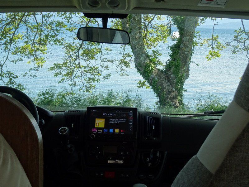
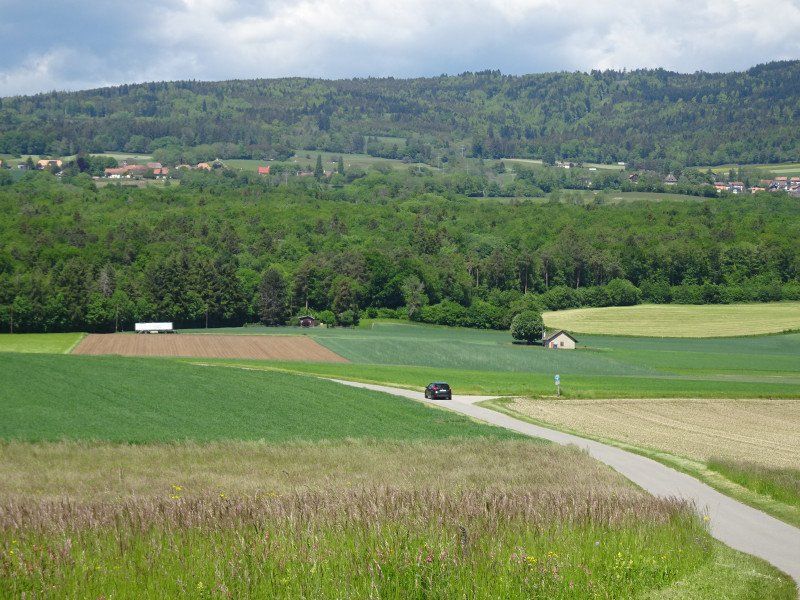
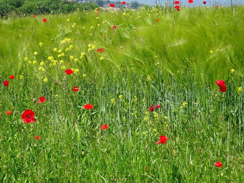
The drive to Rolle is unspectacular. Who goes on vacation shortly before noon on a Sunday? And trucks don't go today either. Apart from a large construction site in front of Kirchberg, nothing stops us.
Day
Camping de Rolle Aux Vernes
We leave the autobahn at the Rolle junction, drive into the center and then follow the signs to the campsite. In front of the barrier we have to wait until the reception opens again. Then we are assigned a place directly at the lake.
Chemin de la Plage 4, 1180, Rolle, Switzerland
46° 27' 42.2" N 6° 20' 49" E
46.4617100 6.3469500
• Head toward Rue Arthur Vittel on Chemin de la Plage. Go for 62 m.
• Turn right onto Chemin de la Plage. Go for 85 m.
• Turn left onto Route de Lausanne (1). Go for 389 m.
• Take the 1st exit from roundabout onto Avenue Châtelain. Go for 163 m.
• Take the 2nd exit from roundabout onto Avenue de la Gare toward Genève/Lausanne/Mont-sur-Rolle. Go for 198 m.
• Take the 1st exit from roundabout onto Avenue de la Gare toward Genève/Lausanne/Mont-sur-Rolle. Go for 128 m.
• Continue on Route de la Vallée. Go for 235 m.
• Continue on Route de la Vallée. Go for 107 m.
• Take the 1st exit from roundabout onto A1. Go for 12.6 km.
• Take exit 15 toward Morges/Bière. Go for 389 m.
• Turn right onto Route de la Longeraie. Go for 303 m.
• Take the 2nd exit from roundabout onto Promenade du Petit-Bois. Go for 64 m.
• Turn right onto Promenade du Petit-Bois. Go for 49 m.
• Turn left onto Promenade du Petit-Bois. Go for 81 m.
• Turn left onto Promenade du Petit-Bois. Go for 90 m.
• Arrive at Promenade du Petit-Bois.
☍
14,9 km
( 14 min.)
Einkäufe und Ortsbesichtigung
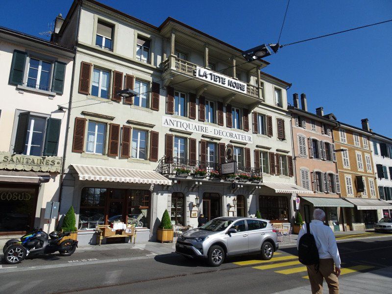
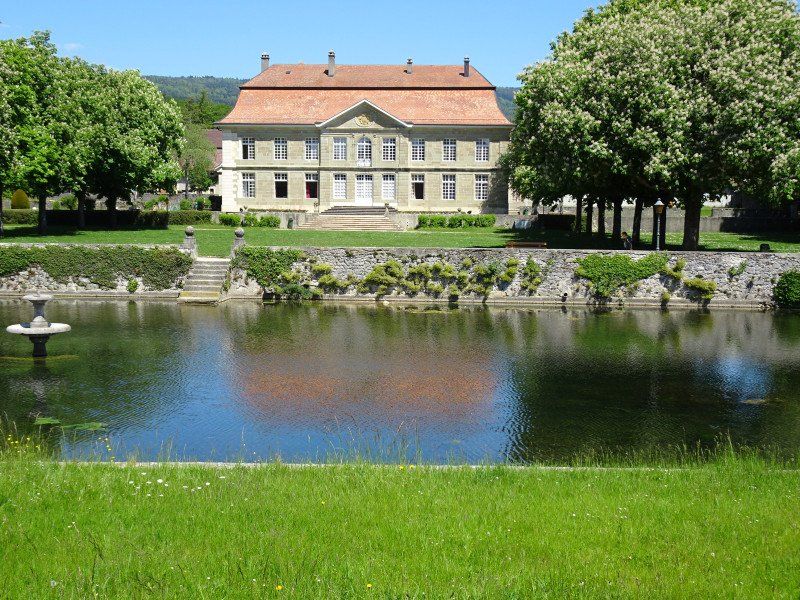
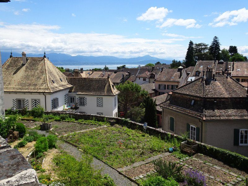
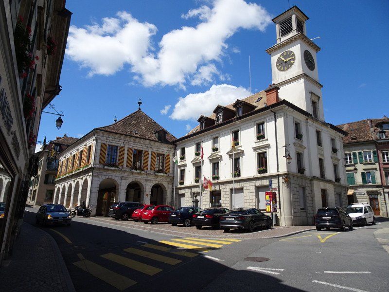
It is Monday and we can go on a shopping tour and visit the place at the same time. Rolle is a wine-growing community and the old town consists essentially of a single street with beautiful old houses on both sides of the street, almost all of which have shops, workshops or restaurants on the ground floor. An old castle forms the center and to the west of it a wide, heaped-up promenade beckons.
Wanderung nach St-Prex
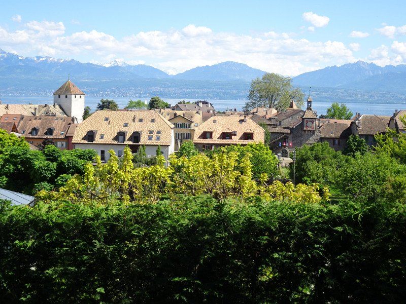
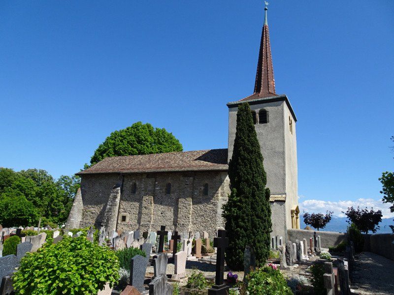
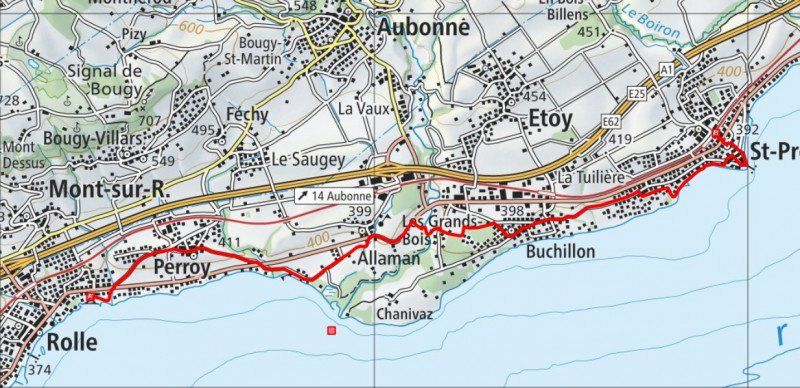
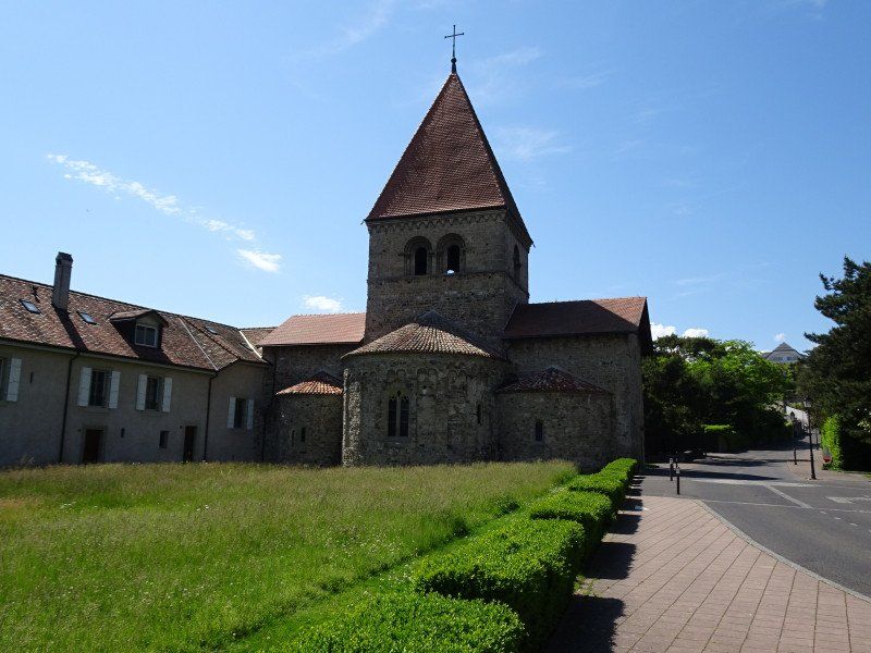
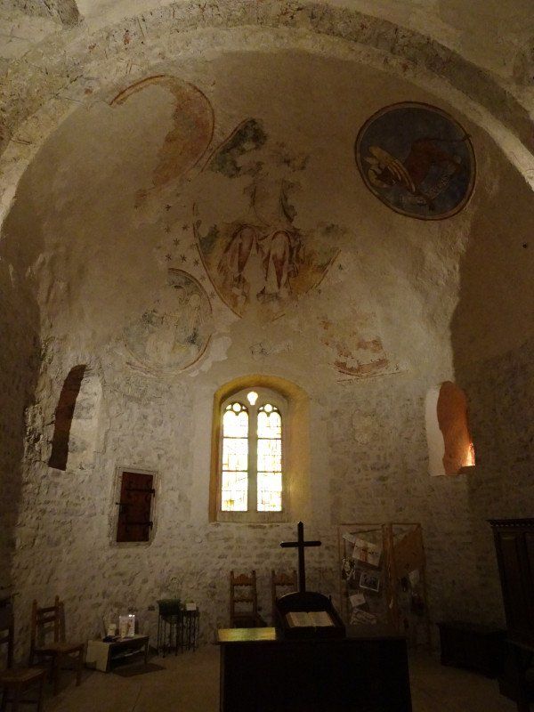
In the afternoon we go on a hike to St-Prex along Lake Geneva. Whereby "along" is a bit exaggerated. Most of the kilometers are completed inland or at least separated from the lake by a property. Nevertheless, the company is varied, you get a beautiful view of the lake in Perroy and a little refreshment in the shade along the Aubonne river in the forest. In Buchillon we cross an old wine-growing village where you can still smell the smell of the wine cellars. Shortly before St-Prex it goes back along the bank. The town of St-Prex has well preserved its medieval appearance with its alleys. It is located on a peninsula and is still characterized by its city fortifications and its castle. This creates a real holiday mood.
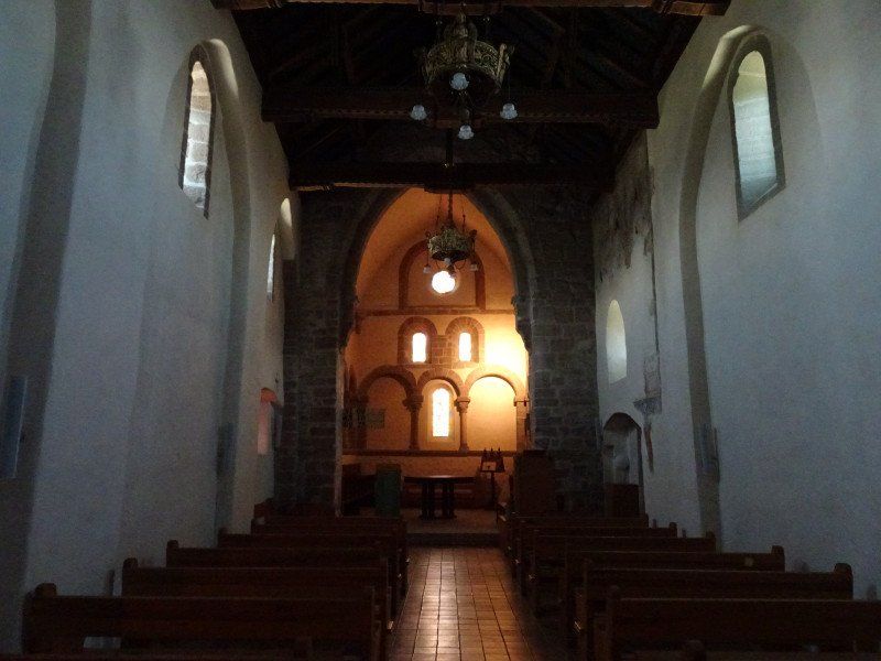
On the way to the train station we pay a visit to the Romanesque church. A real gem.
Day
Velotour durch das zentrale Waadtland
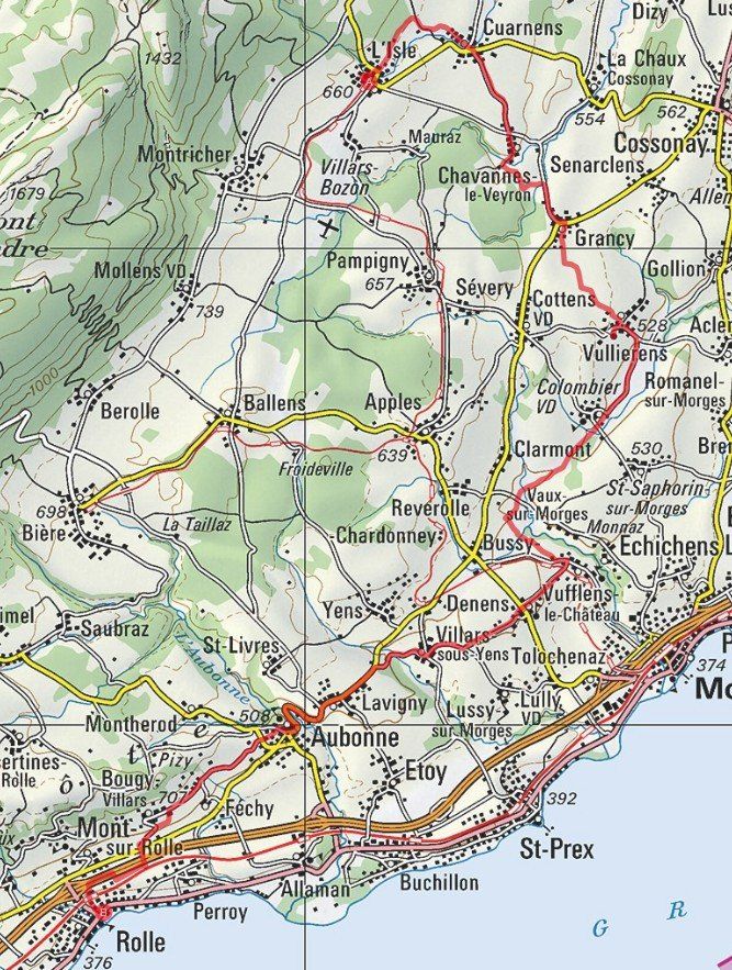
We first take the train to Morges, then the BAM train via Apples to L'Isle. We have our bikes with us and can start cycling straight away. The beautiful little castle in L'sle with its park captivates us first. Then we drive through a wonderful agricultural landscape with not too large plots.
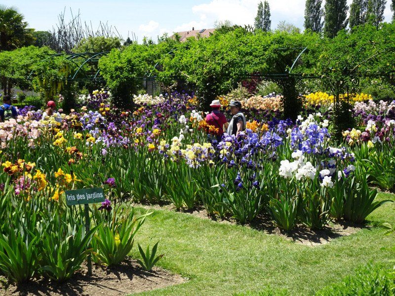
The next point to visit is Vullierens Castle. The castle is a magnet for iris lovers in spring. But his park is also worth seeing. But first we eat our sandwiches.
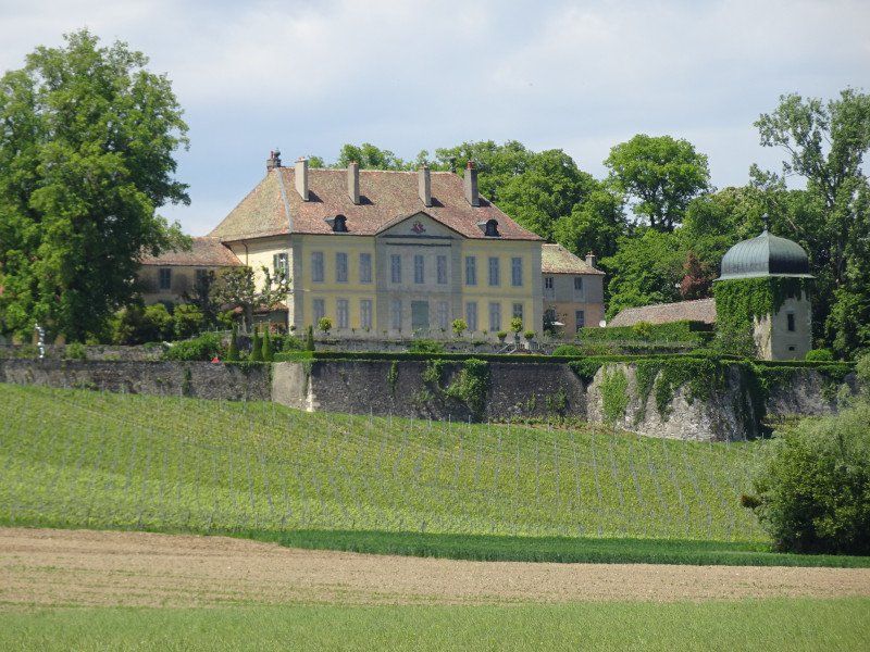
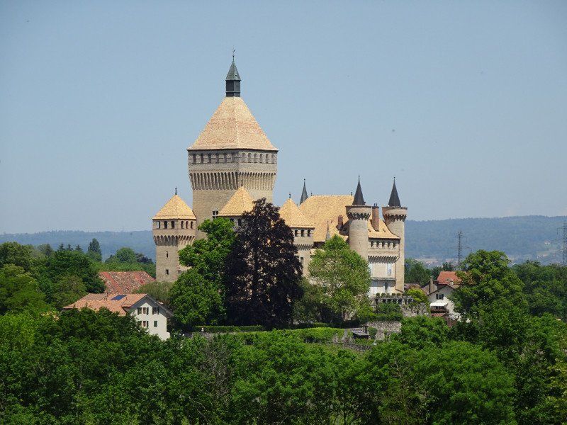
After further kilometers we reach Vufflens-le-Châteu with its fantastic castle, which unfortunately cannot be visited.
Day
Umzug nach Morges
Since our space for the next few days has already been allocated elsewhere (Corpus Christi), we are moving to the Morges campsite, which has only just reopened after construction work.
TCS Camping Morges
Promenade du Petit-Bois 15, 1110, Morges, Switzerland
46° 30' 18" N 6° 29' 28" E
46.5050000 6.4911100
• Head north on Promenade du Petit-Bois. Go for 90 m.
• Turn right onto Promenade du Petit-Bois. Go for 81 m.
• Turn right onto Promenade du Petit-Bois. Go for 49 m.
• Turn left onto Promenade du Petit-Bois. Go for 28 m.
• Take the 2nd exit from roundabout onto Route de la Longeraie. Go for 274 m.
• Turn right onto Chemin des Zizelettes toward Lausanne. Go for 48 m.
• Take ramp onto A1 toward Lausanne. Go for 6.7 km.
• Take the exit toward Bern/Neuchâtel/Simplon/Gd-St-Bernard/Lausanne-Nord/Lausanne-Crissier onto A1 (Ecublens). Go for 2.9 km.
• Take exit 19 toward Fribourg/Simplon/Gd-St-Bernard/Lausanne-Nord/Vevey onto A9 (Villars-Sainte-Croix). Go for 12.3 km.
• Take exit 11 toward Belmont. Go for 222 m.
• Turn left onto Route du Landar toward Belmont. Go for 263 m.
• Turn right toward Route du Landar. Go for 20 m.
• Take the 2nd exit from roundabout onto Route des Monts-de-Lavaux. Go for 862 m.
• Take the 2nd exit from roundabout onto Route des Monts-de-Lavaux. Go for 2.0 km.
• Turn right onto Route du Signal. Go for 1.0 km.
• Continue on Route de Chenaux. Go for 1.1 km.
• Turn left onto Côte-aux-Vignes. Go for 828 m.
• Take the 1st exit from roundabout onto Route de la Corniche. Go for 627 m.
• Arrive at Route de la Corniche. Your destination is on the left.
☍
29,4 km
( 25 min.)
Spaziergang durch Morges
Morges is also an old town that used to be fortified by a city wall. There is a main street in the middle and a side street on both sides. Like most places, however, the town expands into the surrounding area, not always with architectural marvels. In Hauptgasse it is compulsory to wear a mask, as at the train stations or in the shops and in public transport.
After a first visit, we return to the campsite, which is located directly on the lake.
Day
Day
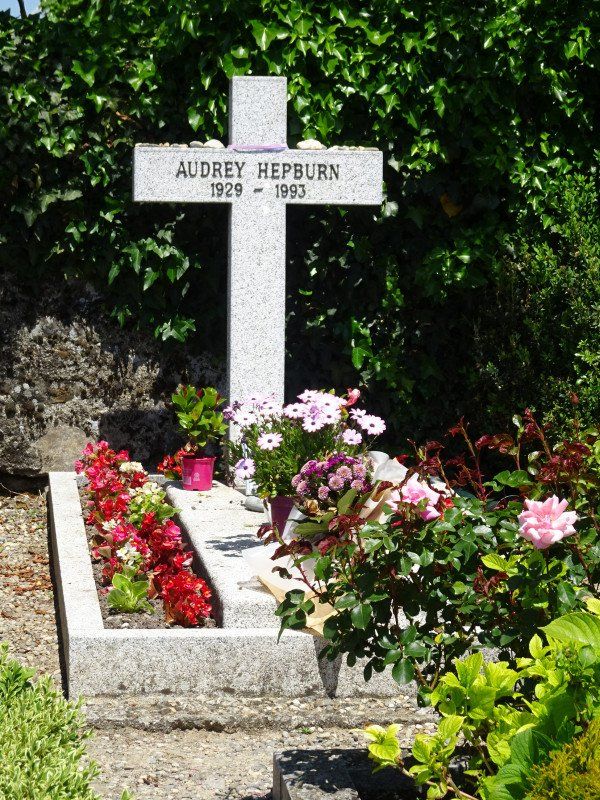
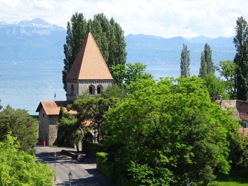
Radausflug nach St-Sulpce VD
By bike we first go to the Polochenaz cemetery, where the grave of Audrey Hepburn is located.
Then it goes along the lake to St-Sulpice with its Romanesque church on the lake.
We drive back on the main road.
Day
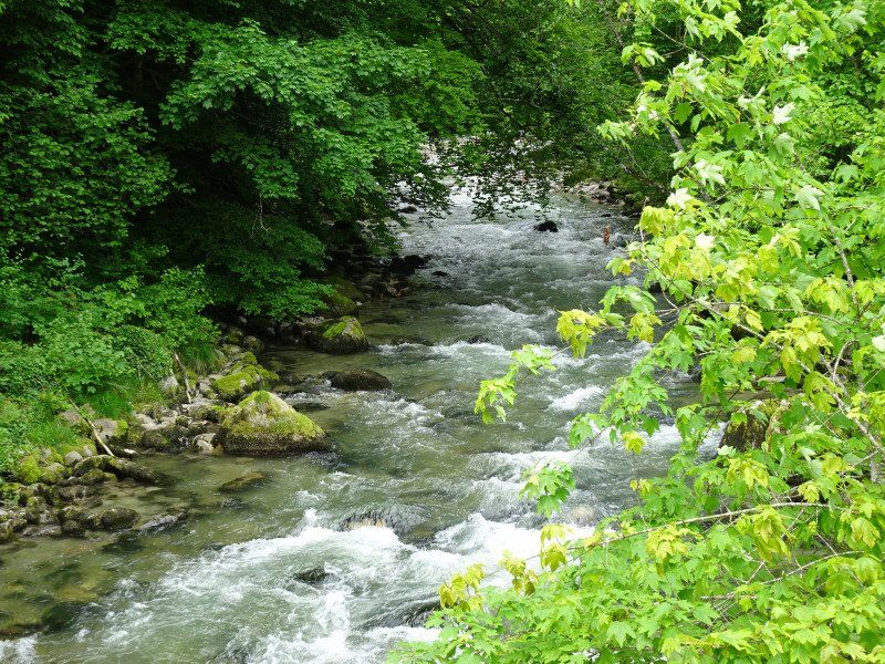
Wanderung entlang des Flüsschens Aubonne
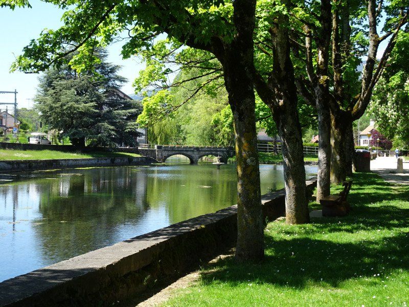
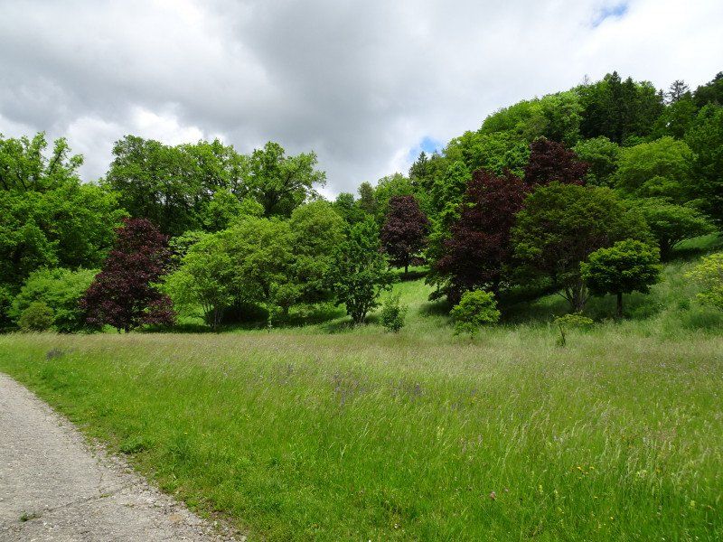
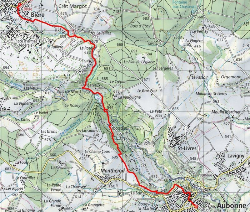
The train takes you up to the village of Bière, whose name has nothing to do with the similarly written liquid. From there we walk through the valley of the Aubonne river. There is one of the largest arboretums, a park with a wide variety of tree species and subspecies. This park is recommended and can be easily combined with a hike from Bière to Aubonne.
We also end our hike in Aubonne.
From Aubonne we take the post bus and train back to Morges.
Day
Cully, Bourg-en-Lavaux, Schweiz
Cully VD, Bourg-en-Lavaux, Schweiz
46° 29' 22.6" N 6° 43' 44.7" E
46.4895985 6.7290888
• Head southwest on Route de la Corniche. Go for 186 m.
• Take the 4th exit from roundabout onto Route de la Corniche. Go for 847 m.
• Take the 1st exit from roundabout onto Route de la Corniche. Go for 4.0 km.
• Take the 2nd exit from roundabout onto Place du Nord. Go for 114 m.
• Continue on Route du Genevrex. Go for 527 m.
• Turn left and take ramp onto A9 (Autoroute du Léman) toward Simplon/Gd-St-Bernard/Bern. Go for 7.3 km.
• Take exit 14 toward Bern/Fribourg onto A12. Go for 78.3 km.
• Take the exit toward Zürich/Basel/Interlaken/Flughafen onto A1. Go for 5.4 km.
• Take the left exit toward Zürich/Basel/Biel/Bienne onto A1/A6. Go for 5.8 km.
• Continue on A1 toward Zürich/Basel/Kirchberg. Go for 53.9 km.
• Continue on A1 (Verzweigung Wiggertal) toward Zürich/Aarau/Oftringen/Zofingen. Go for 47.9 km.
• Continue on A1H toward Zürich-City. Go for 6.5 km.
• Keep right onto A1H toward Winterthur/Chur/Flughafen. Go for 292 m.
• Continue on Pfingstweidstrasse (1/3). Go for 777 m.
• Turn left onto Duttweilerstrasse (1). Go for 569 m.
• Turn right onto Hardturmstrasse (1). Go for 368 m.
• Turn left onto Escher-Wyss-Platz. Go for 61 m.
• Keep right onto Escher-Wyss-Platz. Go for 15 m.
• Continue on Zöllystrasse. Go for 159 m.
• Continue on Sihlquai. Go for 1.7 km.
• Turn left onto Museumstrasse. Go for 334 m.
• Continue on Bahnhofquai. Go for 41 m.
• Keep right onto Bahnhofquai. Go for 110 m.
• Continue on Bahnhofplatz. Go for 156 m.
• Make a U-Turn onto Bahnhofplatz. Go for 251 m.
• Arrive at Bahnhofplatz.
☍
215,5 km
(2 hrs. 17 min.)
Rückfahrt
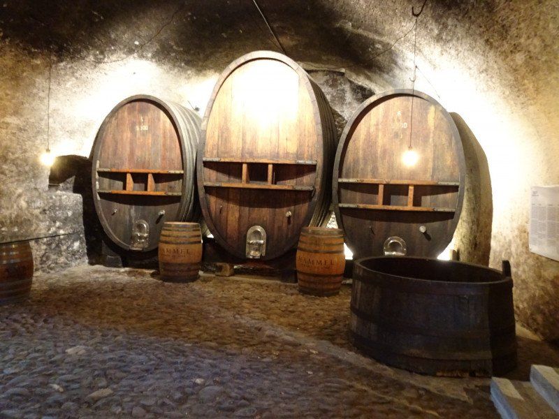
We choose the way back so that we can still buy wine in the winery in Cully, then we can save ourselves a separate trip there.
Zürich, Schweiz
47° 22' 36.8" N 8° 32' 30.1" E
47.3768866 8.5416940