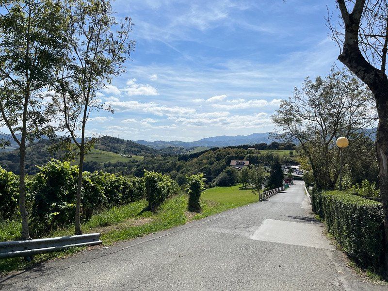
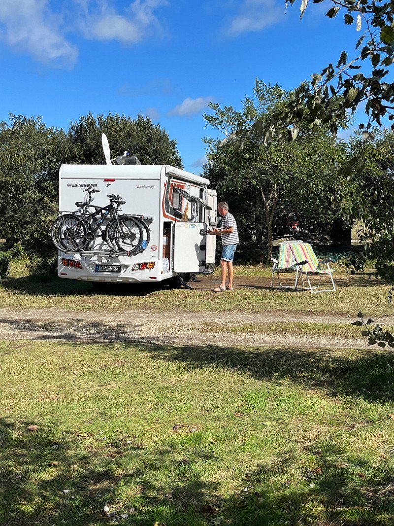
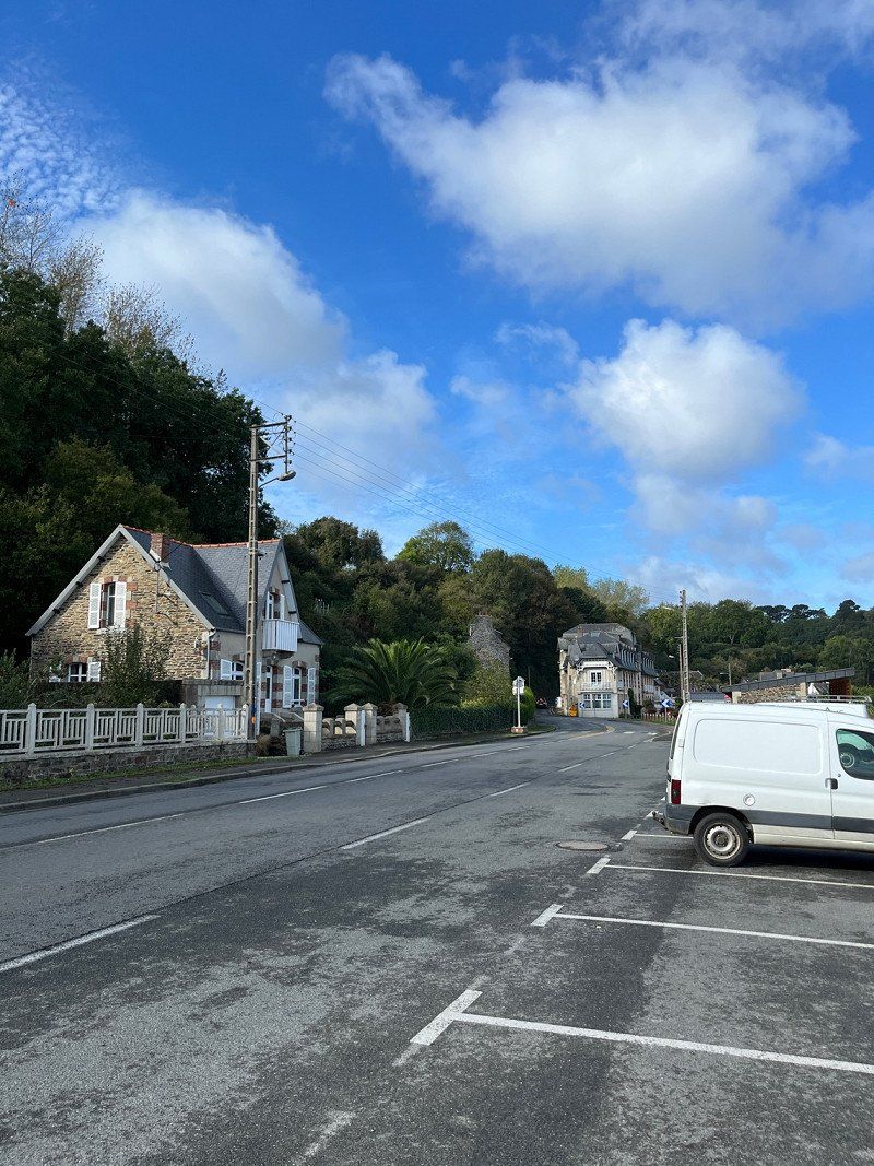
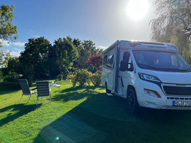
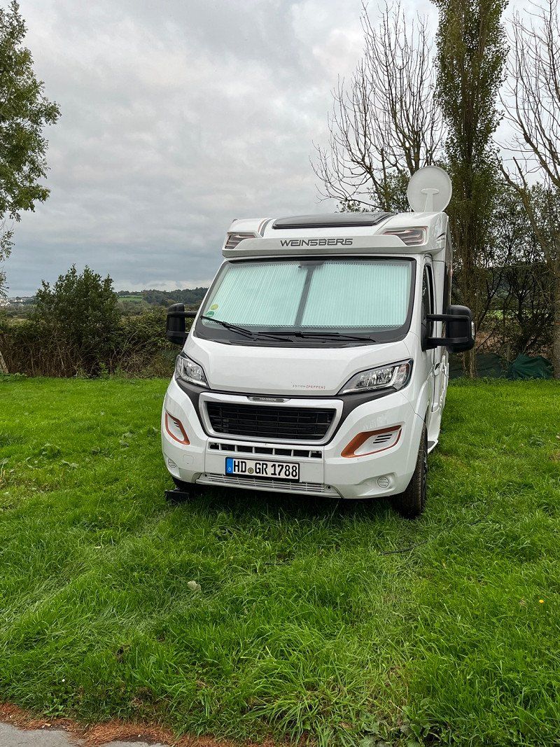
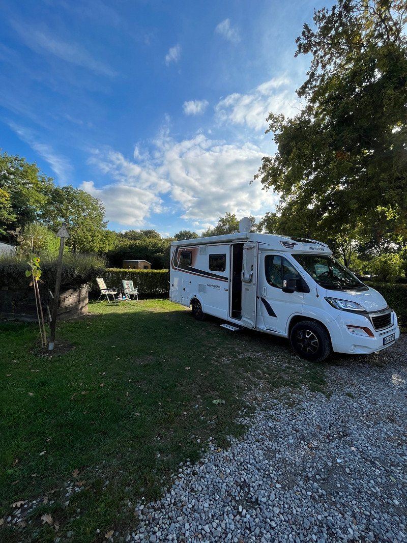
The camper is packed and we set off towards France, looking at the weather map. It was supposed to be Brittany, but the weather is not ideal at the moment. So we plan our trip a bit on the 2nd day, fortunately we have enough time. There is still a lot for us to travel to in northern Spain and the weather here is entirely to our liking. Always around 22-25°C and the nights so that you can sleep well. In the spring we only drove along the coast and this time we drive through the interior of Spain, namely from the east coast to the north coast of Spain. We also haven't seen a lot of things on the French Atlantic and so it's still on our plan to end the tour with Brittany and Normandy. Let's foam where it takes us. 😎😃
Day
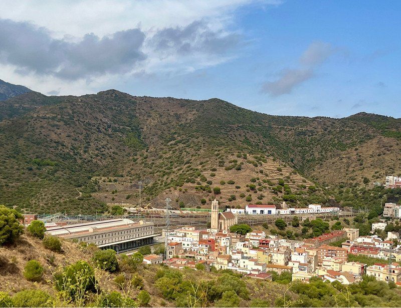
Wald-Michelbach, Deutschland
69483 Wald-Michelbach, Deutschland
49° 34' 12.7" N 8° 49' 51.4" E
49.5701937 8.8309380
• Head toward Ludwigstraße on Friedhofsweg. Go for 56 m.
• Turn right onto Ludwigstraße (L3120). Go for 2.5 km.
• Pass 2 roundabouts and continue on Weiherer Straße (L3120). Go for 8.5 km.
• Turn left onto Weinheimer Straße (B38) toward Mannheim/Heppenheim. Go for 9.3 km.
• Turn right onto B38 toward Mannheim/Gewerbegebiet W.-West. Go for 1.6 km.
• Continue on A659. Go for 5.6 km.
• Take the exit toward Hannover/Frankfurt/Köln/Saarbrücken onto A6. Go for 2.9 km.
• Take exit 25 toward Saarbrücken/Kaiserslautern/Ludwigshafen onto A6. Go for 133 km.
• Continue on A320. Go for 13.5 km.
• Continue on E50 (Échangeur de Freyming). Go for 259 m.
• Take the left exit toward Paris/Metz/St Avold/Carling onto A4 (Autoroute de l'Est). Go for 202 km.
• Take the exit toward St Gibrien/Épernay/Troyes/Orléans onto A26. Go for 89.5 km.
• Take exit 23 toward Troyes-Est. Go for 809 m.
• Take the 4th exit from roundabout onto D619 toward Chaumont/Lusigny S/Barse/Bar sur-Aube. Go for 7.3 km.
• Turn left onto D1 F. Go for 1.5 km.
• Continue on D1. Go for 74 m.
• Continue on Hameau de Larivour (D1). Go for 759 m.
• Continue on D1. Go for 1.3 km.
• Continue on Lieu-dit Ferme de la Fontainerie (D1). Go for 126 m.
• Continue on Lieu-dit Ferme de la Porcherie (D1). Go for 174 m.
• Continue on D1. Go for 614 m.
• Continue on Lieu-dit La Fromentelle (D1). Go for 185 m.
• Continue on D1. Go for 1.1 km.
• Continue on Lieu-dit Vaudemanche (D1). Go for 190 m.
• Continue on D1. Go for 1.4 km.
• Continue on Rue du Général Bertrand (D1). Go for 1.1 km.
• Take the 1st exit from roundabout onto D43. Go for 80 m.
• Take the 1st exit from roundabout onto Rue du Fort Saint-Georges (D43). Go for 1.2 km.
• Turn left. Go for 118 m.
• Turn left. Go for 64 m.
• Arrive at your destination on the right.
☍
487,1 km
(4 hrs. 31 min.)
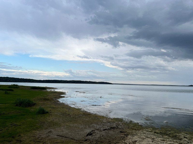
Camping Aux Rives du Lac, Rue du Fort Saint-Georges, Géraudot, Frankreich
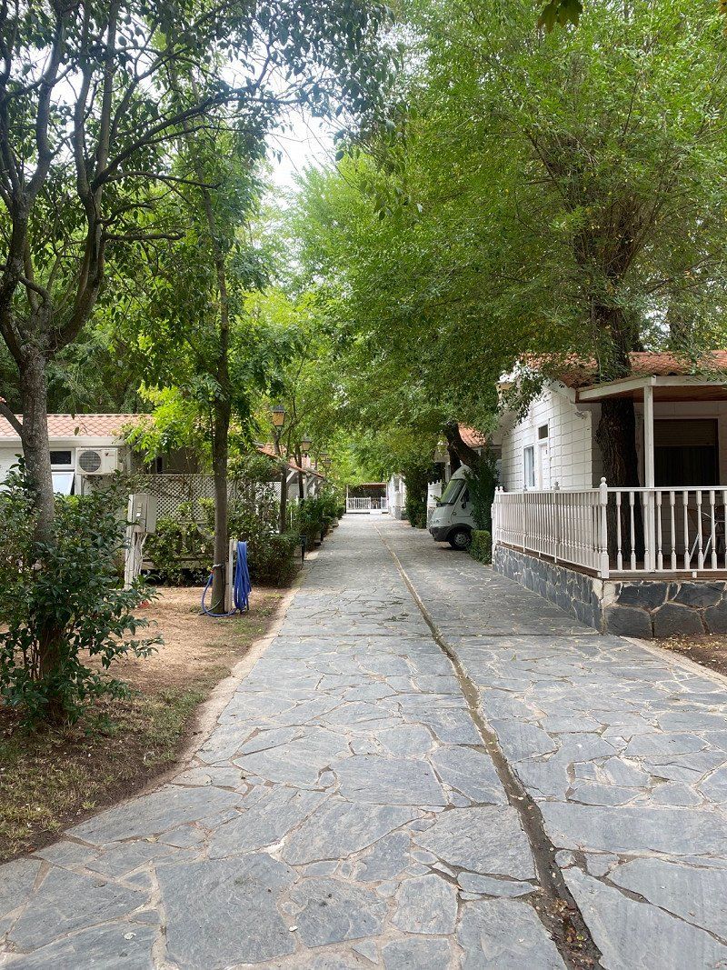
Close to a large lake, simple CP, sanitary building a bit dated, but warm water. ACSI pitch for €16 + tourist tax.
Rue du Fort Saint-Georges, 10220 Géraudot, Frankreich
48° 18' 11.5" N 4° 20' 14.5" E
48.3032010 4.3373573
• Head toward Rue du Fort Saint-Georges. Go for 182 m.
• Turn right onto Rue du Fort Saint-Georges (D43). Go for 1.2 km.
• Take the 2nd exit from roundabout onto D43. Go for 93 m.
• Take the 2nd exit from roundabout onto Rue du Général Bertrand (D1). Go for 1.1 km.
• Keep right onto D1. Go for 1.4 km.
• Continue on Lieu-dit Vaudemanche (D1). Go for 190 m.
• Continue on D1. Go for 1.1 km.
• Continue on Lieu-dit La Fromentelle (D1). Go for 185 m.
• Continue on D1. Go for 614 m.
• Continue on Lieu-dit Ferme de la Porcherie (D1). Go for 174 m.
• Continue on Lieu-dit Ferme de la Fontainerie (D1). Go for 126 m.
• Continue on D1. Go for 1.3 km.
• Continue on Lieu-dit Larrivour (D1). Go for 759 m.
• Continue on D1. Go for 74 m.
• Continue on D1 F. Go for 1.5 km.
• Turn right onto D619. Go for 1.9 km.
• Turn left onto D123 toward Montaulin/Verrières. Go for 1.4 km.
• Continue on Grande Rue (D123). Go for 2.5 km.
• Turn right onto Rue de la Libération (D123). Go for 2.1 km.
• Continue on D123. Go for 398 m.
• Continue on Rue des Acacias (D123). Go for 456 m.
• Turn left onto Rue de la République (D49). Go for 353 m.
• Turn right onto Rue du Général de Gaulle (D123). Go for 496 m.
• Continue on Route de Verrières (D123). Go for 868 m.
• Continue on Route de Verrières (D123 A). Go for 719 m.
• Continue on Route de Maisons Blanches (D444 A). Go for 776 m.
• Continue on Route de Chaource (D444). Go for 346 m.
• Take the 3rd exit from roundabout onto Route de Chaource (D444). Go for 455 m.
• Take the 2nd exit from roundabout onto D444. Go for 2.3 km.
• Turn right onto D123. Go for 1.0 km.
• Continue on D85. Go for 248 m.
• Continue on Rue de la Mairie (D123). Go for 1.5 km.
• Continue on Rue de la Croix Blanche (D123). Go for 403 m.
• Continue on D25 B. Go for 426 m.
• Continue on D25. Go for 2.3 km.
• Continue on Rue de Villemereuil (D25). Go for 992 m.
• Continue on Rue des Riots (D25). Go for 204 m.
• Turn right onto D108. Go for 1.5 km.
• Continue on Rue du Champ Bertin (D108). Go for 588 m.
• Turn left onto Route Nationale (N77). Go for 32.6 km.
• Turn right onto Route de la Gare (D43) toward Vérigny. Go for 1.5 km.
• Continue on Rue Bernard Liège (D43). Go for 530 m.
• Continue on Rue Bernard Liège (D43). Go for 714 m.
• Turn left onto D203. Go for 312 m.
• Continue on Chemin d'Auxerre à Saint-Florentin (D203). Go for 5.1 km.
• Continue on Route d'Auxerre à Saint-Florentin (D203). Go for 964 m.
• Continue on Rue d'Auxerre (D203). Go for 130 m.
• Continue on Rue de Saint-Florentin (D203). Go for 2.7 km.
• Take the 2nd exit from roundabout onto Rue de Sougères (D203). Go for 450 m.
• Continue on Route d'Auxerre à Saint-Florentin (D203). Go for 3.1 km.
• Continue on D203. Go for 866 m.
• Continue on Route d'Auxerre à Saint-Florentin (D203). Go for 489 m.
• Continue on Rue Saint-Laurent-Sougères (D203). Go for 70 m.
• Take the 1st exit from roundabout onto Rue Saint-Laurent-Sougères (D203). Go for 550 m.
• Continue on Route d'Auxerre à Saint-Florentin (D203). Go for 2.0 km.
• Turn right onto Route d'Auxerre à Châlons-sur-Marne (N77). Go for 2.4 km.
• Take the 4th exit from roundabout onto N6 toward Z.I. Champoulains/Auxerrexpo/A6 (Lyon)/Dijon/Chalons S/S./Avallon. Go for 4.2 km.
• Take ramp toward A6/Dijon/Chalon S/S./Chaumont/Auxerre/Chablis/Tonnerre. Go for 311 m.
• Take the 4th exit from roundabout onto Route de Lyon (D606) toward Dijon/Chalon S/S./Augy/Avallon. Go for 9.0 km.
• Turn left toward Lieu-dit Ferme de la Bazine. Go for 318 m.
• Continue on Lieu-dit Ferme de la Bazine. Go for 72 m.
• Turn slightly right. Go for 89 m.
• Arrive at your destination on the right.
☍
103,0 km
(1 hrs. 37 min.)
Day
Umplanung - wir fahren erst in den Süden Frankreichs
It rained a bit last night and the forecast for Normandy and Brittany is very mixed for the next few days. So we decide to go south first.
PJF7+MV Escolives-Sainte-Camille, Frankreich
47° 43' 27.1" N 3° 36' 52.8" E
47.7241895 3.6146779
• Head west. Go for 89 m.
• Turn slightly left onto Lieu-dit Ferme de la Bazine. Go for 390 m.
• Turn left onto D606. Go for 2.4 km.
• Take the 1st exit from roundabout onto Route de Coulanges (D85) toward Coulanges la V./Courson les C. Go for 985 m.
• Turn left onto D38. Go for 2.3 km.
• Continue on Rue de Vincelles (D38). Go for 1.4 km.
• Continue on Place de l'Église (D38). Go for 306 m.
• Continue on Route de Charentenay (D38). Go for 1.2 km.
• Continue on D38. Go for 2.8 km.
• Continue on Grande Rue (D38). Go for 579 m.
• Continue on Rue de Courson (D38). Go for 771 m.
• Turn left onto D38. Go for 2.5 km.
• Turn left onto Rue de Charentenay (D38). Go for 2.4 km.
• Turn right onto Boulevard Dussautoy (D950). Go for 440 m.
• Turn left onto Rue de la Tour (D38). Go for 134 m.
• Turn slightly right onto Place du Château (D104). Go for 10.4 km.
• Turn left onto Rue du Capitaine Coignet (D104). Go for 12.0 km.
• Continue on D1. Go for 18.2 km.
• Continue on D33. Go for 2.4 km.
• Turn left onto Rue Notre-Dame (D2). Go for 645 m.
• Take the 1st exit from roundabout onto D1. Go for 20.0 km.
• Turn right onto Route Jean Dequennes (N151). Go for 2.8 km.
• Take left ramp onto A77 toward Nevers/Pougues les Eaux. Go for 33.0 km.
• Continue on N7. Go for 42.4 km.
• Take the 1st exit from roundabout onto N7 toward Moulins. Go for 20.5 km.
• Take left ramp onto A79 toward Clermont-Fd/Montluçon/St Pourçain S/S. Go for 37.1 km.
• Take the exit toward Clermont-Fd onto A71. Go for 67.6 km.
• Continue on A71. Go for 4.6 km.
• Continue on A75 (La Méridienne). Go for 18.3 km.
• Take exit 7 toward Coudes/Montpeyroux. Go for 214 m.
• Turn left onto D797. Go for 631 m.
• Turn left onto D797 C. Go for 482 m.
• Take the 1st exit from Place de l'Hume roundabout onto Rue de la Chacusse. Go for 220 m.
• Turn right onto Rue des Perreux. Go for 68 m.
• Turn left onto Chemin de Souleirat. Go for 71 m.
• Arrive at Chemin de Souleirat. Your destination is on the left.
☍
310,4 km
(3 hrs. 26 min.)
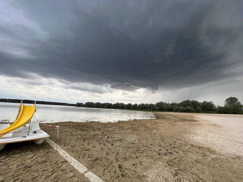
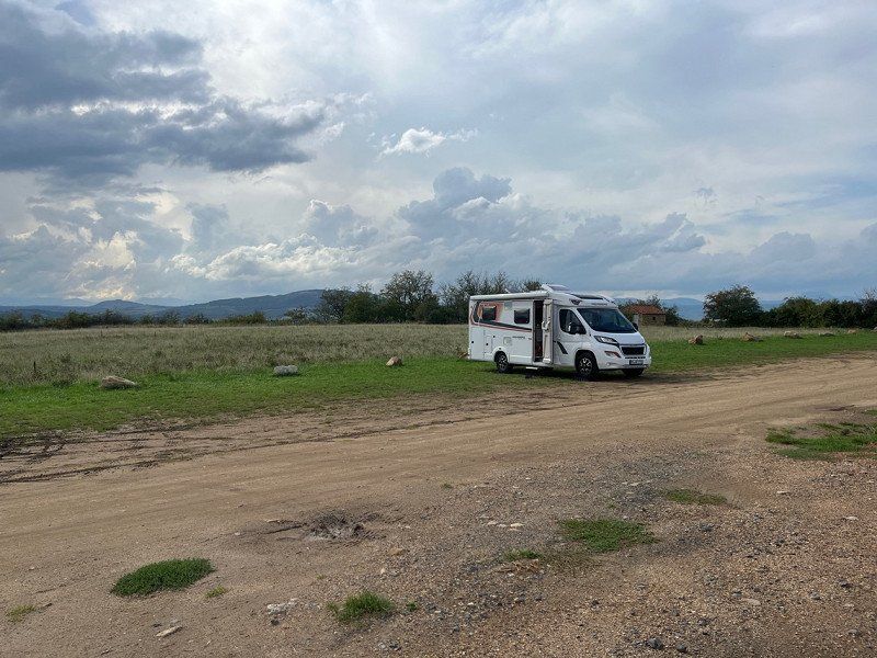
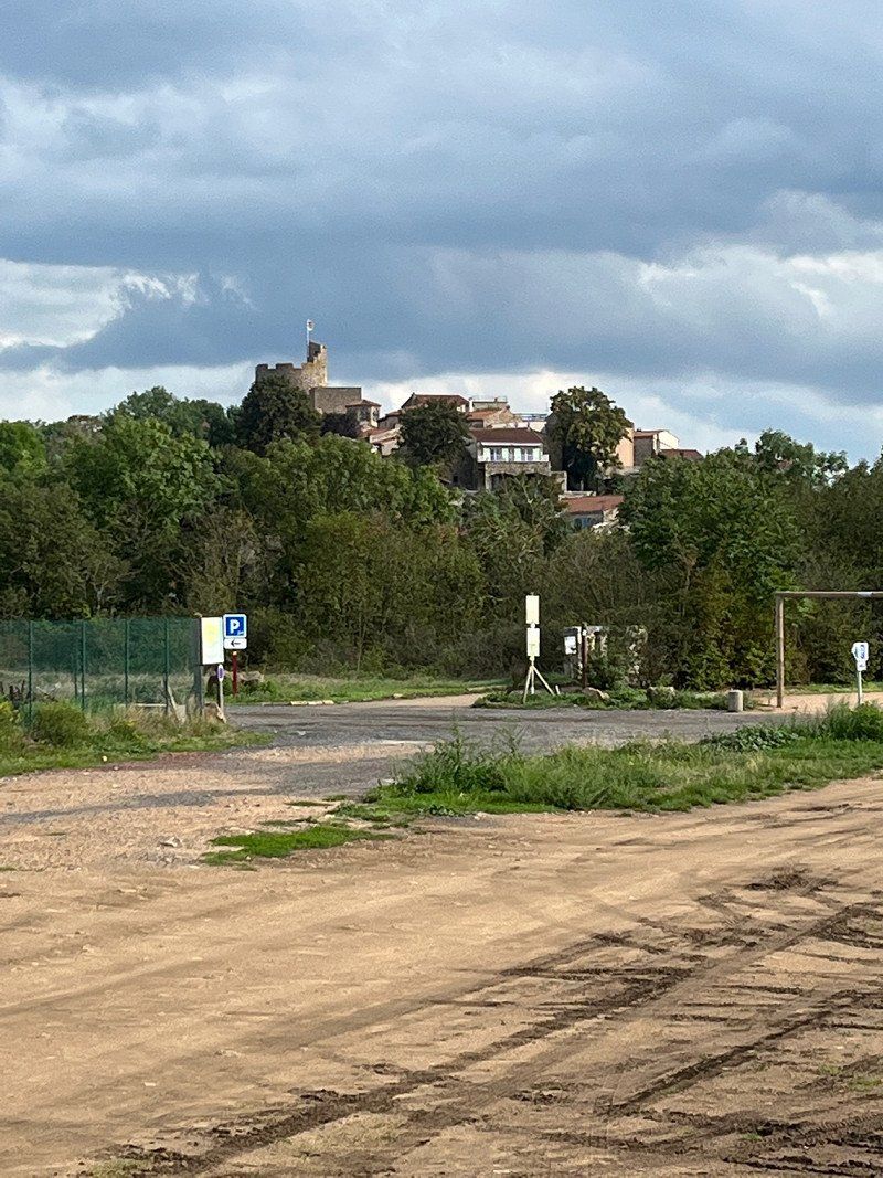
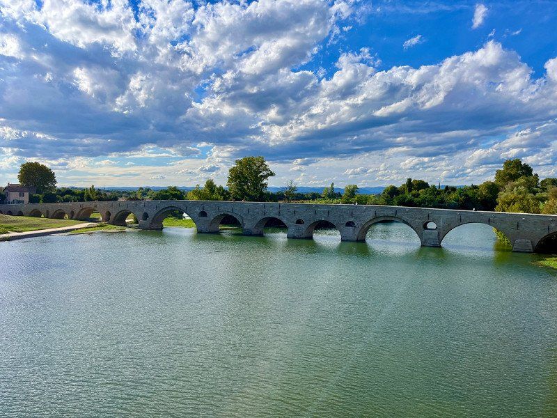
Montpeyroux, Frankreich
a free SP opposite a small animal park and the village of Montpeyroux. It's worth a visit.
V+E possible against payment.
63114 Montpeyroux, Frankreich
45° 37' 17.6" N 3° 12' 11.7" E
45.6215670 3.2032490
• Head toward Rue des Perreux on Chemin de Souleirat. Go for 71 m.
• Turn right onto Rue des Perreux. Go for 68 m.
• Turn left onto Rue de la Chacusse. Go for 203 m.
• Take the 2nd exit from Place de l'Hume roundabout onto D797 C. Go for 471 m.
• Take left ramp onto A75 (La Méridienne). Go for 192 km.
• Take exit 44.1 toward Meyrueis/Aguessac/Pont de Salars/Vézins de Lévézou. Go for 469 m.
• Turn right onto D29. Go for 5.6 km.
• Continue on D809. Go for 1.5 km.
• Pass 5 roundabouts and continue on Avenue Jean Jaurès. Go for 6.8 km.
• Turn right onto Rue Ferrer. Go for 85 m.
• Turn sharp left onto Avenue de la République. Go for 11 m.
• Arrive at Avenue de la République. Your destination is on the right.
☍
206,8 km
(2 hrs. 1 min.)
Day
Millau, Frankreich
12100 Millau, Frankreich
44° 6' 2.1" N 3° 4' 40.1" E
44.1005750 3.0778010
• Head toward Place du Mandarous on Avenue de la République. Go for 102 m.
• Take the 1st exit from Place du Mandarous roundabout onto Boulevard de l'Ayrolle. Go for 545 m.
• Take the 1st exit from roundabout onto Rue Louis Blanc. Go for 236 m.
• Take the 4th exit from Place des Martyrs de la Résistance roundabout onto Avenue du Pont Lerouge. Go for 513 m.
• Take the 2nd exit from Giratoire de Bèches roundabout onto Avenue du Languedoc (D992) toward A75/Montpellier/Rodez/Clermont-Fd. Go for 403 m.
• Take the 2nd exit from Giratoire du Larzac roundabout onto Route de la Cavalerie (D809) toward Montpellier/A75/Béziers/Sète/La Cavalerie/Nant/Lodève. Go for 17.0 km.
• Take the 2nd exit from roundabout onto D999 toward Sète/Béziers/Montpellier/Albi/St Rome de C./Roquefort/St Affrique. Go for 179 m.
• Take the 2nd exit from roundabout onto A75 (La Méridienne) toward Sète/Béziers/Montpellier. Go for 97.3 km.
• Take exit 64 toward Sérignan. Go for 1.4 km.
• Take the 2nd exit from Rond-Point des Étoiles roundabout toward Sérignan/Villeneuve lès B./Aéroport Béziers Cap d'Agde/Béziers-Gare/Béziers-la Devèze. Go for 193 m.
• Take the 1st exit from Rond-Point du 9 Mai roundabout onto Avenue du Viguier toward Béziers-la Devèze/Béziers-Gare/P.A.E. du Capiscol/Stade de la Méditérranée. Go for 1.0 km.
• Take the 2nd exit from roundabout onto Avenue du Viguier toward Béziers-Centre/Stade de la Méditérranée. Go for 555 m.
• Take the 2nd exit from Rond-Point François Mitterrand roundabout onto Avenue Jean Foucault toward Narbonne. Go for 444 m.
• Pass 2 roundabouts and continue on Avenue Jean Foucault. Go for 656 m.
• Take the 3rd exit from Rond-Point Georges Pompidou roundabout onto Avenue de la Devèze toward Béziers-Gare/Centre Ville. Go for 946 m.
• Take the 1st exit from Rond-Point Jean-Jacques Beucler roundabout onto Route d'Agde (D612 B) toward Centre Ville. Go for 563 m.
• Take the 2nd exit from Rond-Point Winston Churchill roundabout onto Avenue du Président Wilson (D612 B) toward Narbonne/Centre Ville. Go for 397 m.
• Take the 2nd exit from roundabout onto Avenue du Président Wilson (D612 B). Go for 153 m.
• Keep left onto Boulevard de Verdun (D612 B). Go for 332 m.
• Take the 2nd exit from Rond-Point Neil Alden Armstrong roundabout onto Rue du Pont Noir toward Narbonne. Go for 211 m.
• Take the 2nd exit from Rond-Point Paul-Émile Victor roundabout onto Avenue Joseph Lazare toward A9 (Montpellier)/Sète/Aéroport Béziers-Vias/Stade de Sauclières/Éperon Biterrois. Go for 318 m.
• Keep right onto Avenue Fernand Sastre. Go for 395 m.
• Turn right. Go for 126 m.
• Arrive at your destination on the left.
☍
123,9 km
(1 hrs. 23 min.)
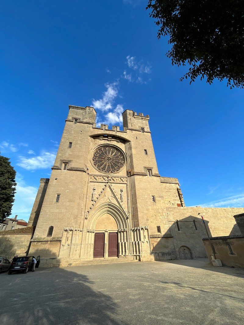
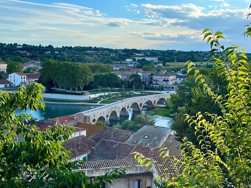
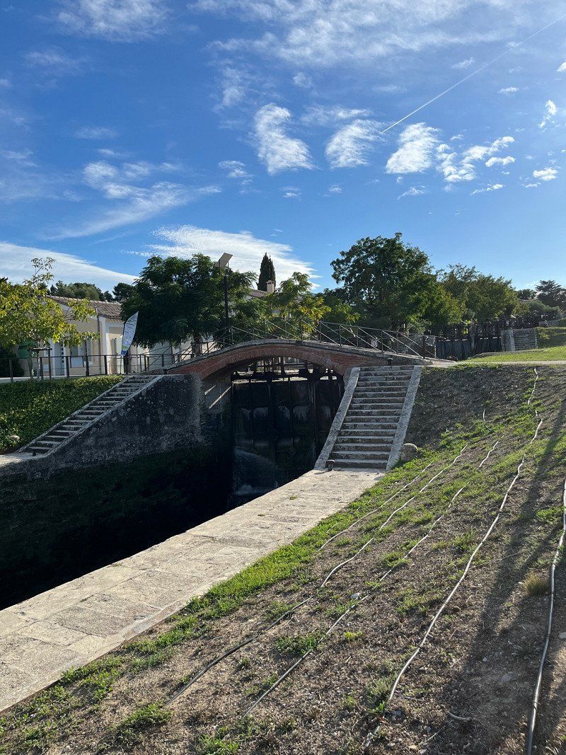
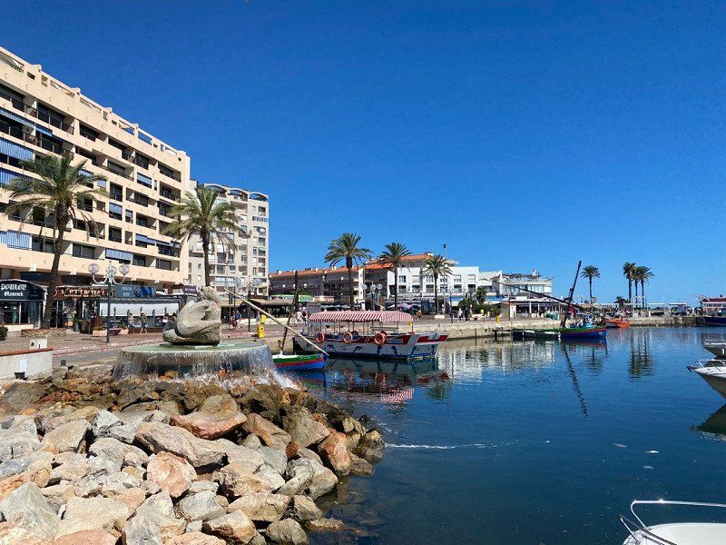
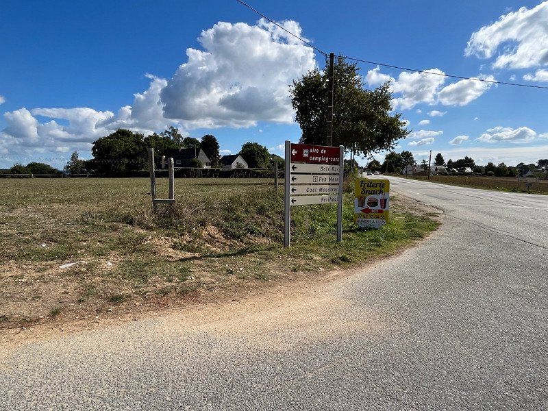
L'aire de stationnement pour Camping-Cars de Sauclières, Béziers, Avenue Fernand Sastre, Béziers, Frankreich
SP directly in Beziers. Easy to drive, despite the direct road, sleeping went quite well. €10.32/night without electricity. Paid €2 for water which was free. So don't be honest at the machine, don't book water.
Short distances to the old town and by bike to the lock staircase.
Av. Fernand Sastre, 34500 Béziers, Frankreich
43° 19' 52.5" N 3° 13' 35.3" E
43.3312377 3.2264759
• Head toward Rond-Point Éric Tabarly. Go for 150 m.
• Continue on Avenue Fernand Sastre. Go for 322 m.
• Take the 4th exit from Rond-Point Éric Tabarly roundabout onto Avenue Fernand Sastre. Go for 953 m.
• Continue on Avenue Joseph Lazare. Go for 220 m.
• Turn right onto Avenue Joseph Lazare. Go for 35 m.
• Take the 2nd exit from Rond-Point Paul-Émile Victor roundabout onto Rue Lieutenant Pasquet toward Quai du Port Neuf/Narbonne. Go for 695 m.
• Take the 2nd exit from Rond-Point Pierre Brousse roundabout onto Pont Georges-Fontès toward A9/Narbonne/Les Neuf Écluses/Fonséranes. Go for 376 m.
• Take the 3rd exit from Rond-Point d'Occitanie roundabout onto Route de Sérignan (D19) toward Sauvian/Sérignan/Valras.Plage. Go for 264 m.
• Pass 4 roundabouts and continue on Route de Sérignan (D19). Go for 2.7 km.
• Turn right onto D37 E7. Go for 1.5 km.
• Take the 3rd exit from Rond-Point Max Rouquette roundabout onto D37 E. Go for 142 m.
• Take the 3rd exit from roundabout onto D64. Go for 774 m.
• Take the 3rd exit from Rond-Point de la Mer roundabout onto A9 (La Languedocienne) toward Narbonne. Go for 52.9 km.
• Take exit 40 toward Salses le Ch./Port-Leucate/Leucate. Go for 883 m.
• Continue on D627. Go for 2.4 km.
• Take the 2nd exit from roundabout onto D627. Go for 5.9 km.
• Take the 3rd exit from roundabout. Go for 131 m.
• Turn right toward Avenue du Général de Gaulle/D327. Go for 70 m.
• Turn right onto Avenue du Général de Gaulle (D327). Go for 236 m.
• Continue on Avenue Charles de Gaulle (D327). Go for 960 m.
• Turn slightly right onto Chemin de Mouret. Go for 46 m.
• Turn left. Go for 58 m.
• Arrive at your destination.
☍
71,7 km
( 48 min.)
Day
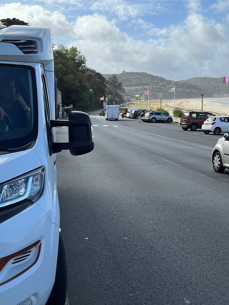
Leucate-Plage, Leucate, Frankreich
Leucate-Plage, 11370 Leucate, Frankreich
42° 54' 13" N 3° 3' 6.8" E
42.9035980 3.0518869
• Head west. Go for 58 m.
• Turn right onto Chemin de Mouret. Go for 46 m.
• Turn slightly left onto Avenue de la Rouino. Go for 185 m.
• Turn left toward D627. Go for 94 m.
• Continue on D627. Go for 908 m.
• Take the 4th exit from roundabout onto D627. Go for 8.7 km.
• Continue on D83. Go for 5.9 km.
• Take ramp onto D81 toward Canet en Roussillon/Torreilles/St Laurent de la Salanque. Go for 3.5 km.
• Take the 2nd exit from roundabout onto D81. Go for 3.4 km.
• Take the 3rd exit from roundabout. Go for 250 m.
• Continue on D81. Go for 3.4 km.
• Take the 1st exit from Rond-Point Charles de Gaulle roundabout onto Avenue Joseph Sauvy. Go for 442 m.
• Take the 1st exit from Rond-Point Georges Brassens roundabout onto Avenue Joseph Sauvy. Go for 56 m.
• Continue on Avenue du Corps de Garde. Go for 114 m.
• Turn right onto Avenue de Sainte-Marie (D11). Go for 19 m.
• Arrive at Avenue de Sainte-Marie (D11). Your destination is on the left.
☍
27,1 km
( 23 min.)
Canet-en-Roussillon, Frankreich
66140 Canet-en-Roussillon, Frankreich
42° 42' 21.9" N 3° 0' 35.6" E
42.7060910 3.0098980
• Head northeast on Avenue de Sainte-Marie (D11).
• Turn right onto Chemin de la Clavaguère. Go for 80 m.
• Continue on Boulevard de Las Bigues. Go for 536 m.
• Turn right toward D81. Go for 210 m.
• Continue on D81. Go for 55 m.
• Take the 4th exit from Rond-Point Charles de Gaulle roundabout onto Voie de la Méditerranée (D617). Go for 955 m.
• Take the 1st exit from Rond-Point de l'Esparrou roundabout onto Avenue de Lesparrou (D81 A). Go for 2.6 km.
• Pass 3 roundabouts and continue on D81 A. Go for 4.1 km.
• Take the 2nd exit from roundabout onto Boulevard François Desnoyer (D81 A). Go for 1.3 km.
• Take the 1st exit from roundabout onto Boulevard Aristide Maillol (D81 A). Go for 293 m.
• Take the 2nd exit from roundabout onto Boulevard Aristide Maillol (D81 A). Go for 640 m.
• Take the 2nd exit from roundabout onto D81. Go for 1.2 km.
• Take the 2nd exit from roundabout onto D81. Go for 820 m.
• Take the 3rd exit from roundabout onto D81. Go for 1.3 km.
• Pass 2 roundabouts and continue on Chemin du Littoral (D81). Go for 3.7 km.
• Turn right onto Avenue de la Retirada (C4). Go for 1.5 km.
• Arrive at Avenue de la Retirada (C4). Your destination is on the left.
☍
19,3 km
( 23 min.)
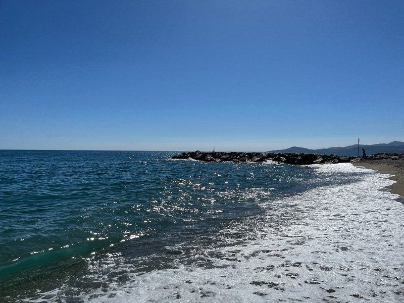
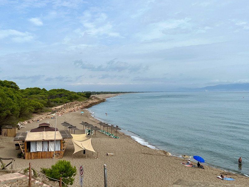
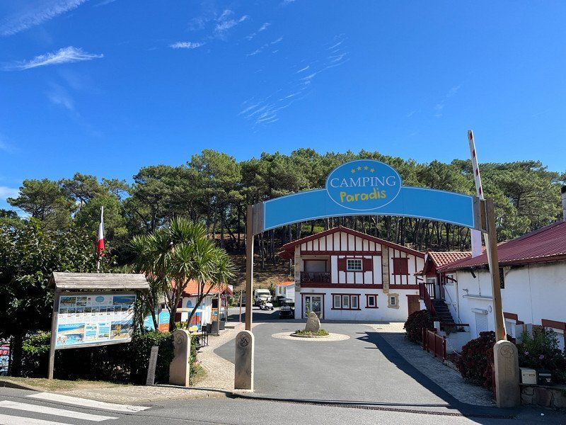
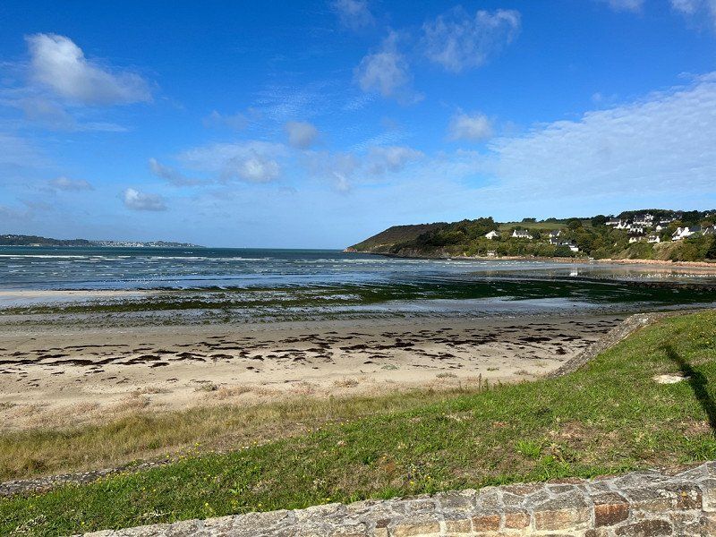
Argeles sur Mer - unser erstes Ziel
I wanted to go here in the spring, so it works now.
Camping de Pujol
Simple CP, a wash house only open,
ASCI 12€/night + tourist tax, we stay 3 nights, we are waiting for friends who are going to northern Spain on the WE.
66700, Argelès Sur Mer, Frankreich
42° 33' 25.6" N 3° 1' 45.5" E
42.5571000 3.0293000
• Head toward Rond-Point de Pujol on Avenue de la Retirada (C4). Go for 423 m.
• Take the 3rd exit from Rond-Point de Pujol roundabout onto Rue des Trabucaires. Go for 400 m.
• Take the 2nd exit from roundabout onto Allée Ferdinand Buisson. Go for 436 m.
• Take the 2nd exit from roundabout onto Allée Ferdinand Buisson. Go for 69 m.
• Turn left onto Avenue de Hürth (D114). Go for 24 m.
• Continue on D114. Go for 65 m.
• Continue on Route Nationale (D114). Go for 560 m.
• Pass 2 roundabouts and continue on Route de Collioure (D114). Go for 2.8 km.
• Take the 3rd exit from roundabout onto Route de Collioure (D114). Go for 2.6 km.
• Take the 2nd exit from roundabout onto Route d'Argelès (D114). Go for 1.1 km.
• Take the 3rd exit from Carrefour du Christ roundabout onto Rue de la République. Go for 230 m.
• Turn right onto Avenue Camille Pelletan. Go for 132 m.
• Turn left onto Place du 18 Juin. Go for 29 m.
• Arrive at Place du 18 Juin. Your destination is on the right.
☍
8,8 km
( 14 min.)
Day
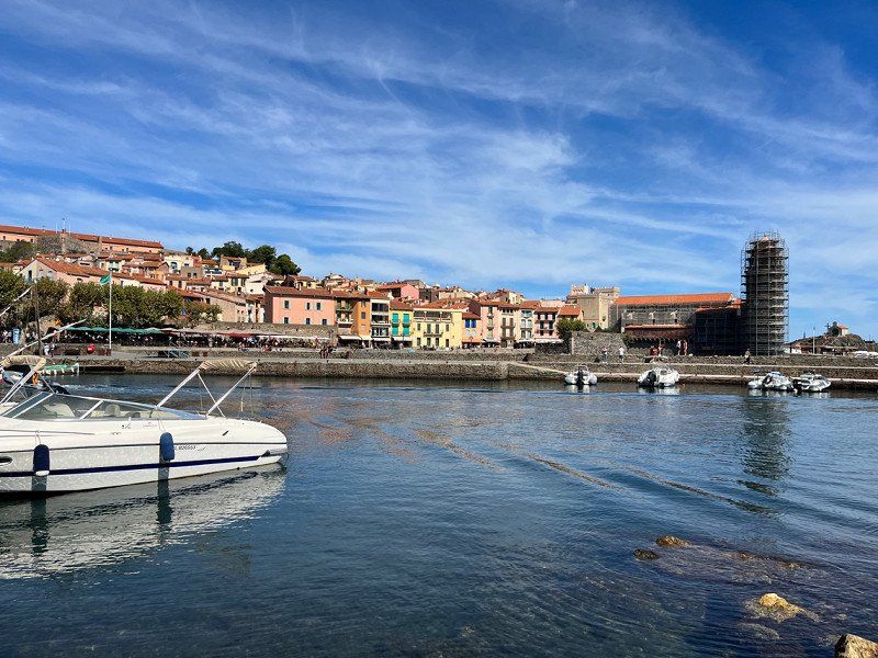
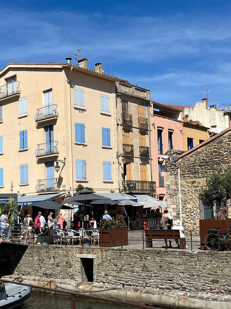
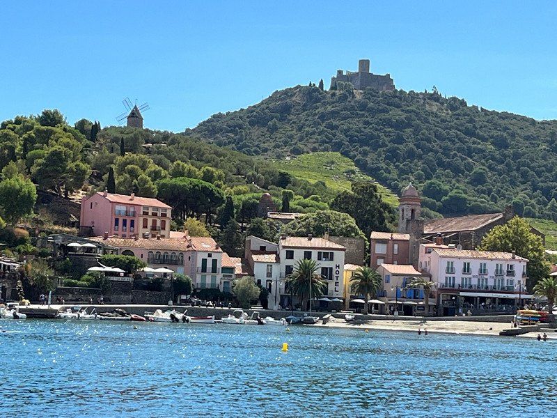
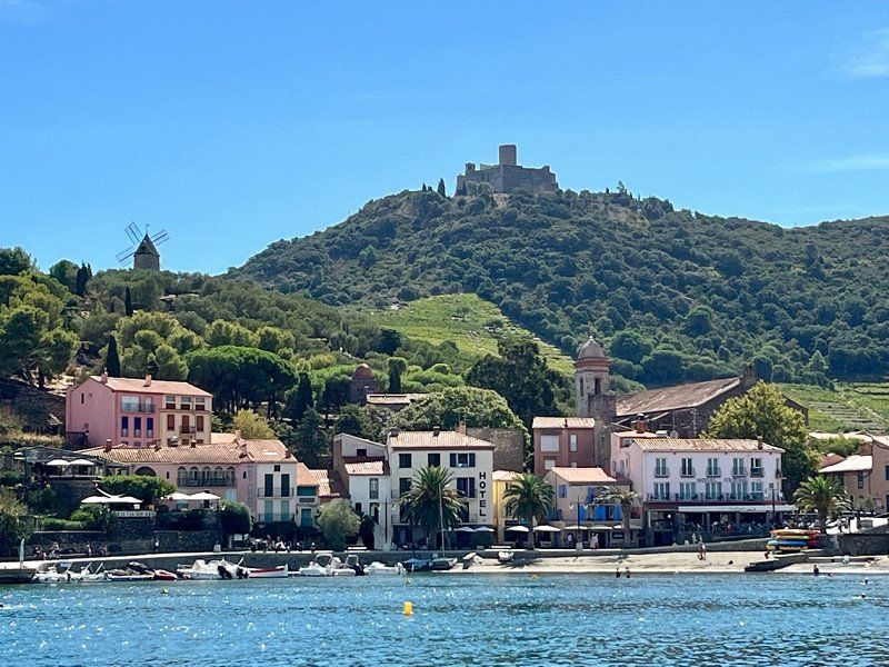
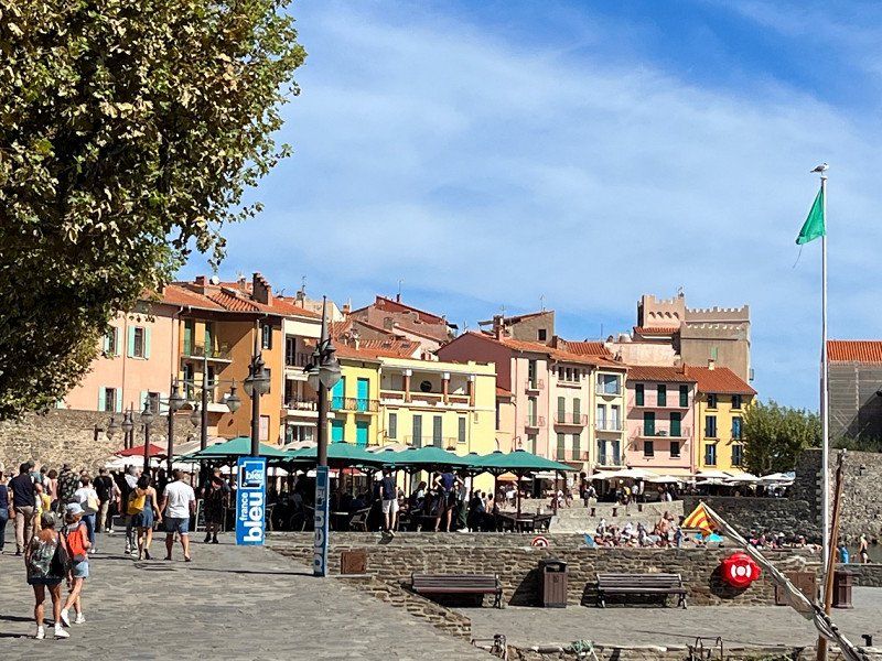
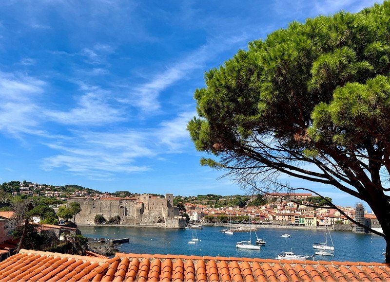
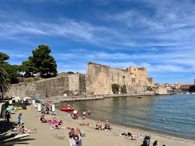
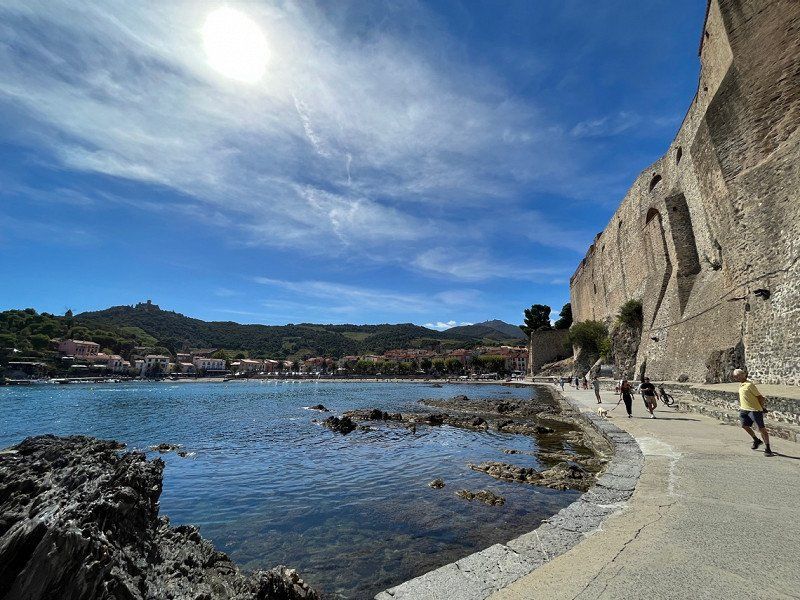
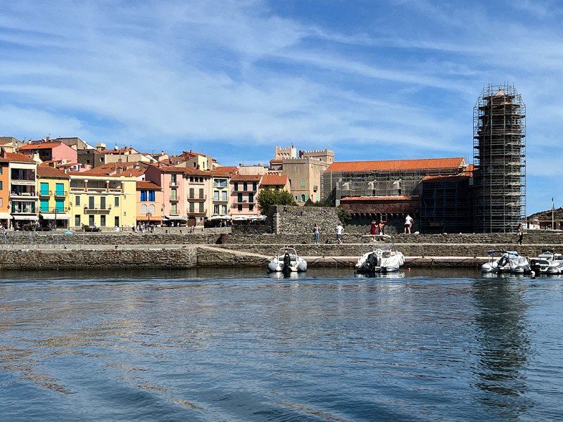
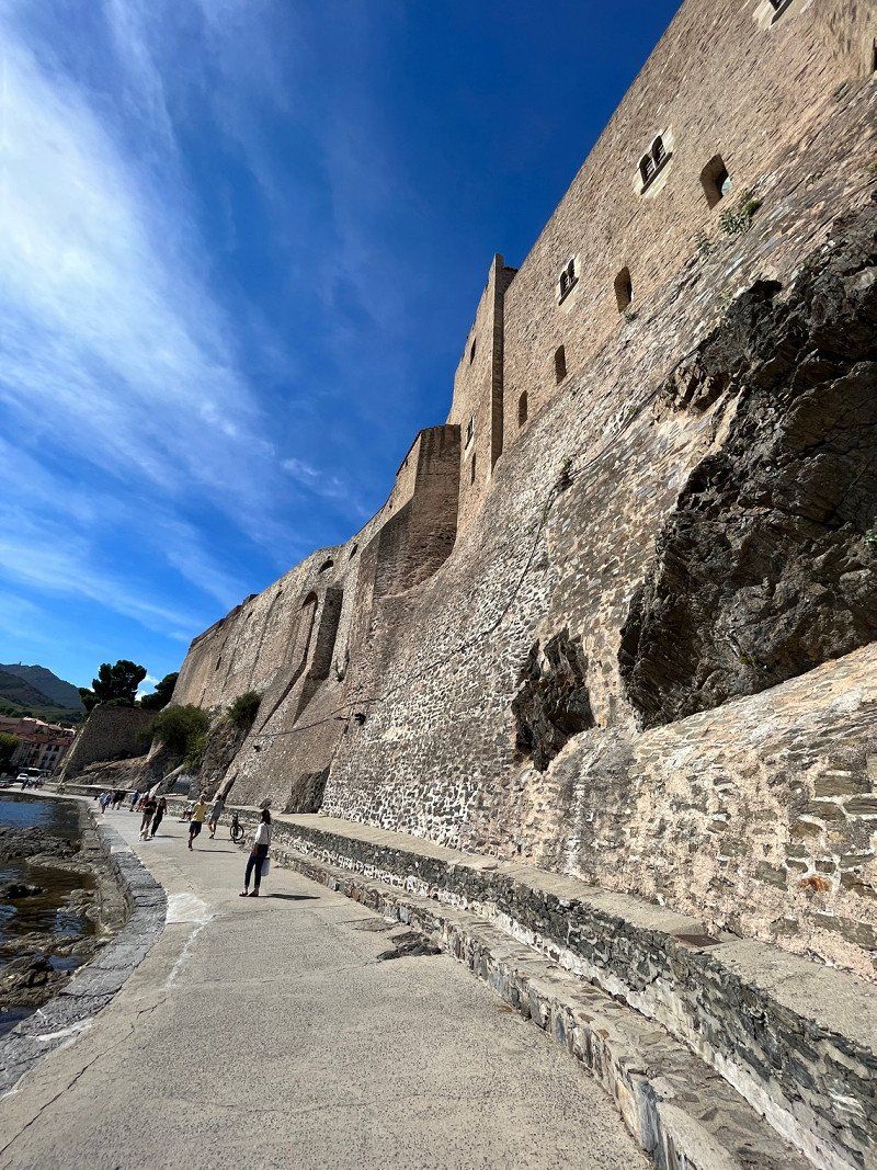
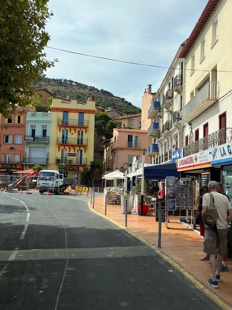
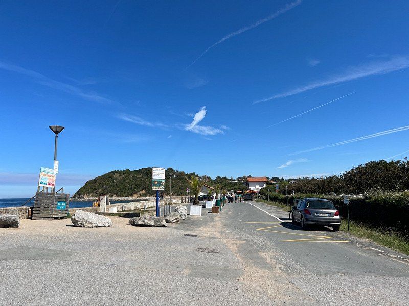
Collioure, Frankreich
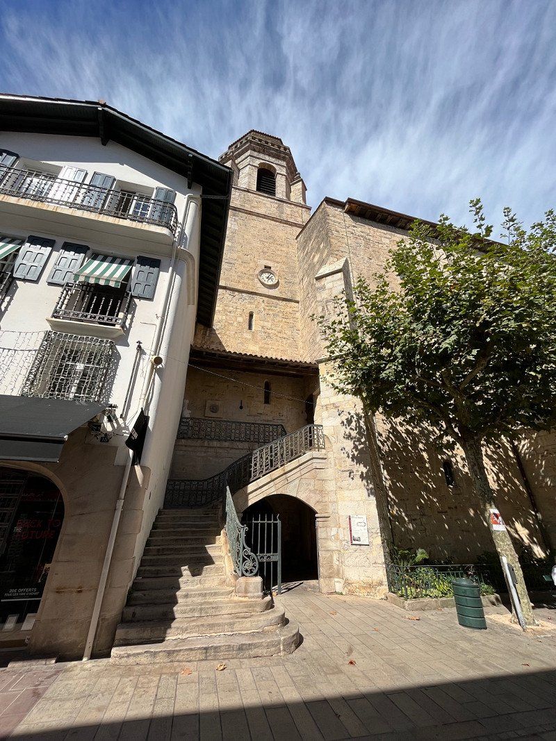
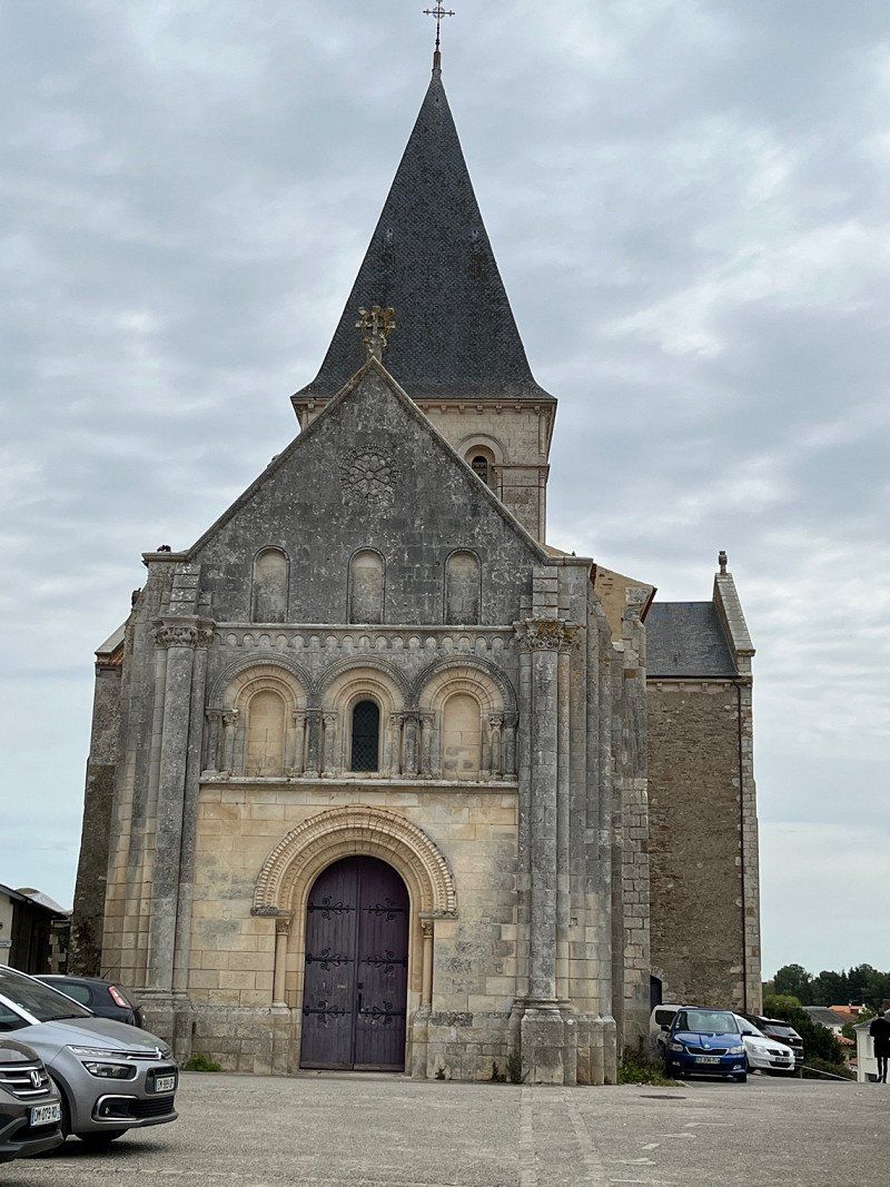
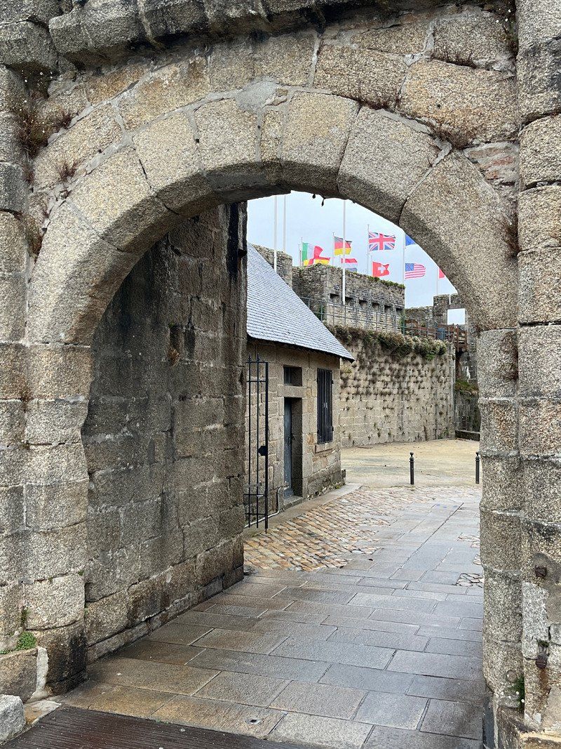
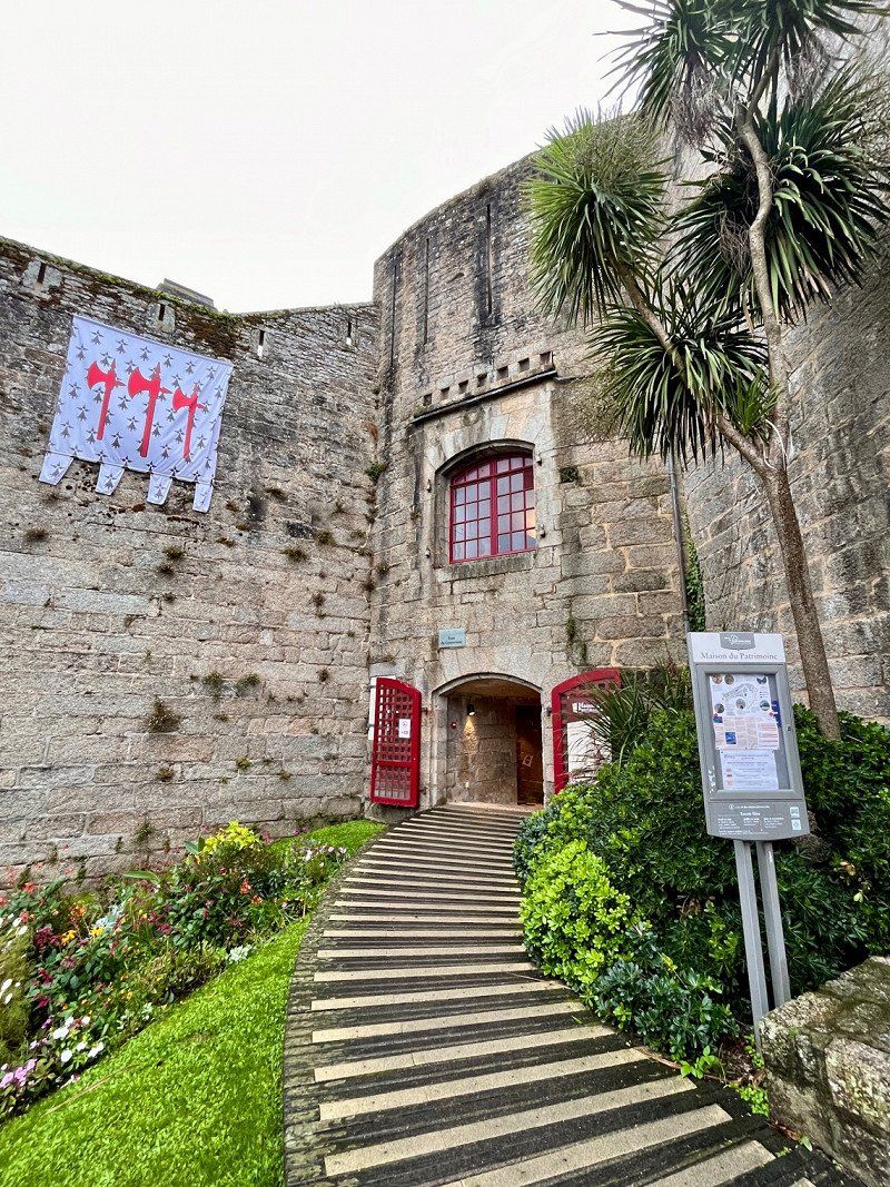
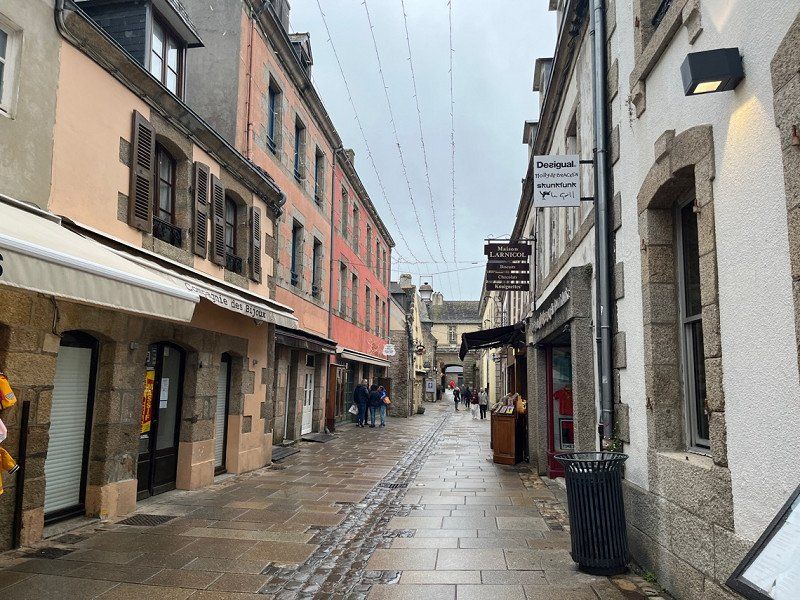
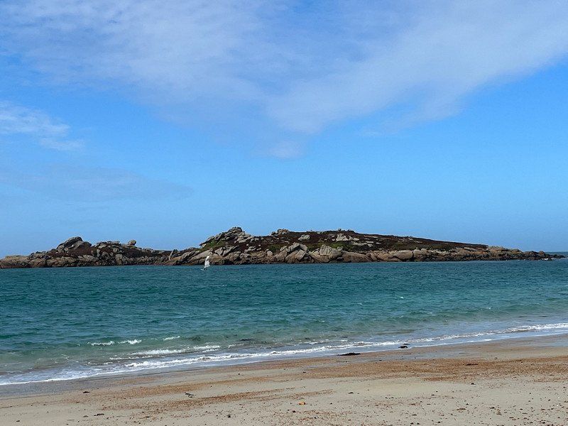
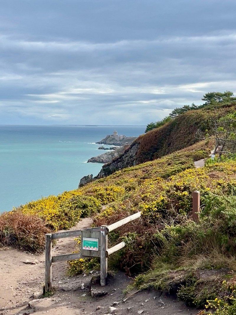
Collioure - with the medieval royal castle, a winding old town.
42° 31' 36.3" N 3° 5' 4.7" E
42.5267520 3.0846310
• Head toward Rue de la Prud'Homie on Place du 18 Juin. Go for 29 m.
• Turn right onto Rue du Boramar. Go for 32 m.
• Turn right onto Avenue Camille Pelletan. Go for 152 m.
• Turn right onto Rue Berthelot. Go for 36 m.
• Turn left onto Rue Pasteur. Go for 44 m.
• Turn slightly left onto Rue de la République. Go for 203 m.
• Take the 1st exit from Carrefour du Christ roundabout onto Route d'Argelès (D114). Go for 1.1 km.
• Take the 3rd exit from roundabout onto Route de Madeloc (D86). Go for 1.5 km.
• Take the 4th exit from roundabout onto D86. Go for 443 m.
• Take left ramp onto D914. Go for 6.3 km.
• Take the 3rd exit from roundabout onto D914 toward Cerbère. Go for 1.3 km.
• Take the 2nd exit from roundabout onto D914 toward Cerbère/Banyuls S/Mer. Go for 1.2 km.
• Take the 2nd exit from roundabout onto Avenue Alain Gerbault (D914) toward Cerbère/Centre Ville. Go for 1.0 km.
• Take the 2nd exit from Rond-Point Maréchal Leclerc roundabout onto Avenue de la République (D914) toward Cerbère. Go for 1.1 km.
• Take the 1st exit from roundabout onto Route de Cerbère (D914) toward Cerbère. Go for 5.6 km.
• Take the 1st exit from roundabout onto D914. Go for 2.6 km.
• Turn right onto Rue du Ribéral. Go for 173 m.
• Turn left onto Place de la République. Go for 53 m.
• Turn right onto Rue des Douaniers. Go for 30 m.
• Arrive at Rue des Douaniers. Your destination is on the right.
☍
23,0 km
( 33 min.)
Day
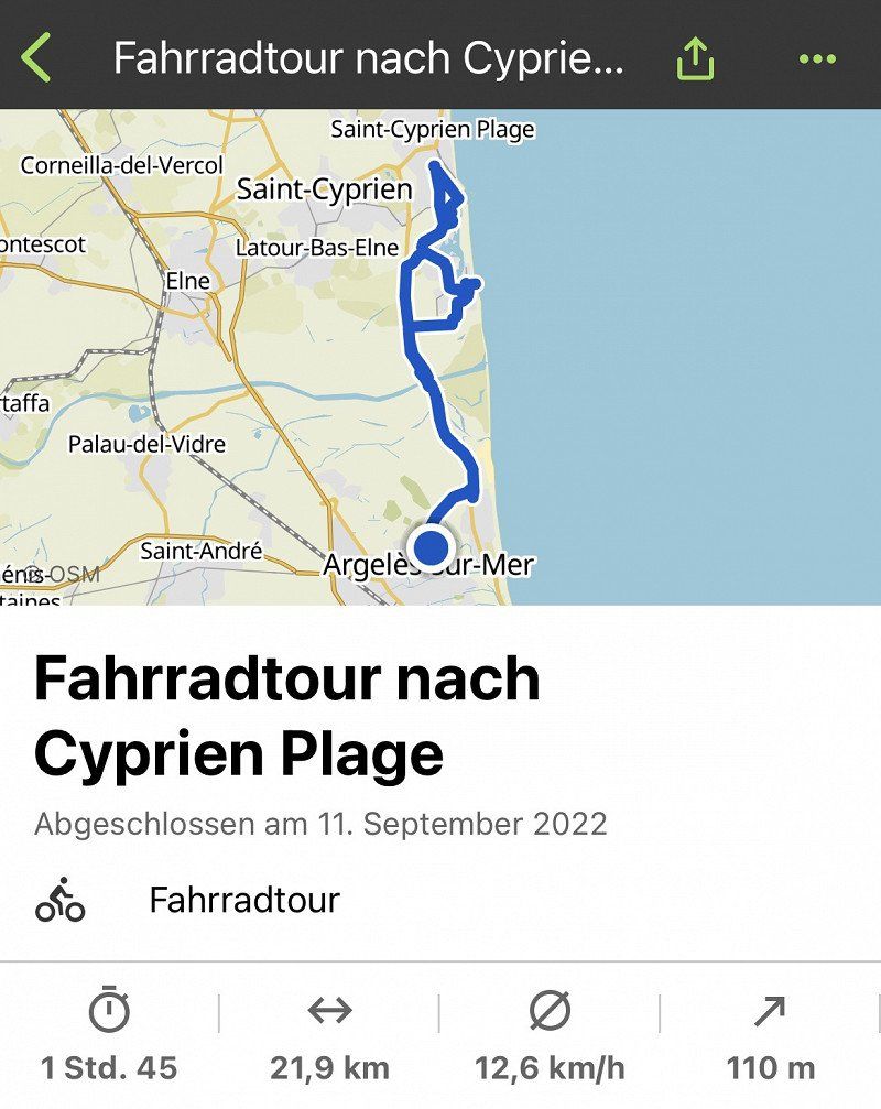
wieder radeln - jetzt in die andere Richtung
Cyprien plague
Day
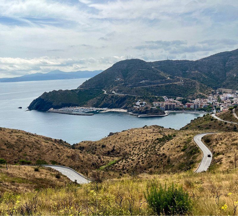
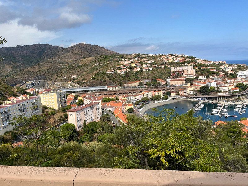
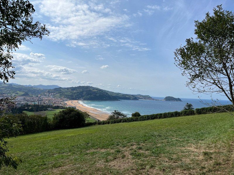
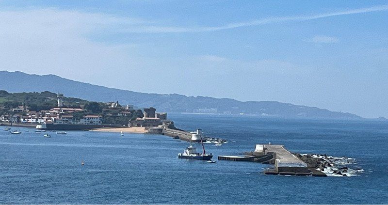
Cerbère, Frankreich
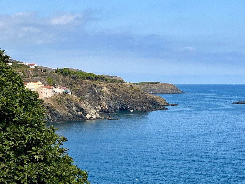
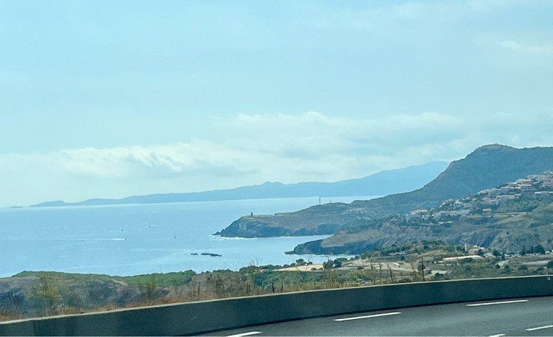
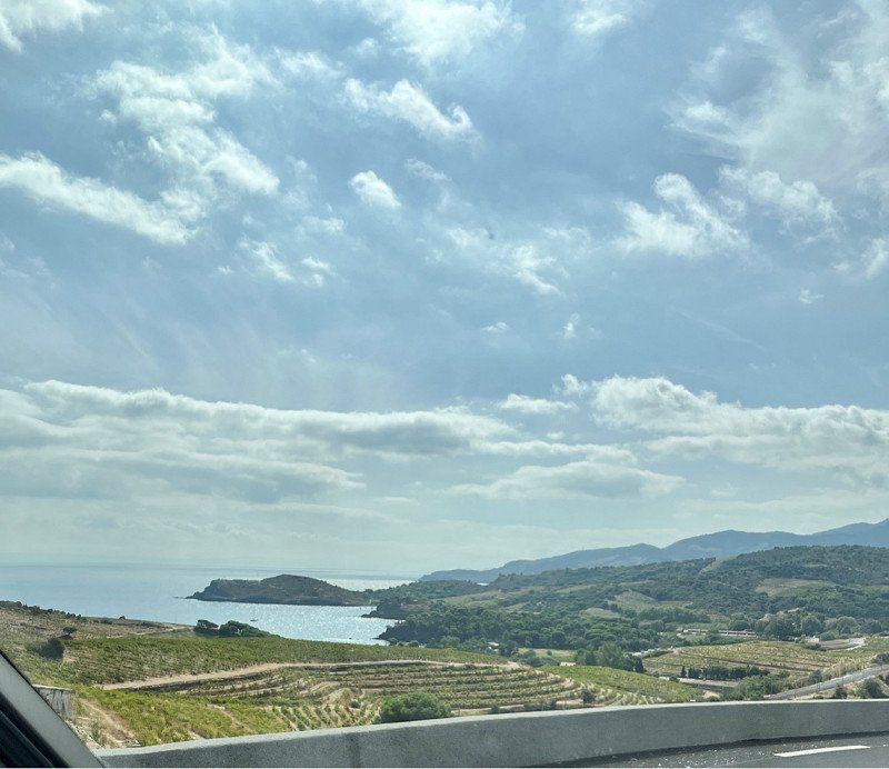
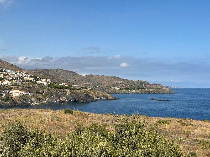
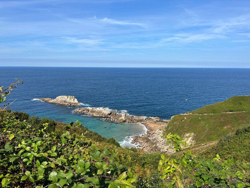
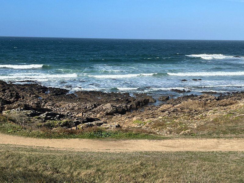
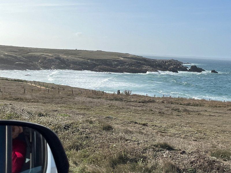
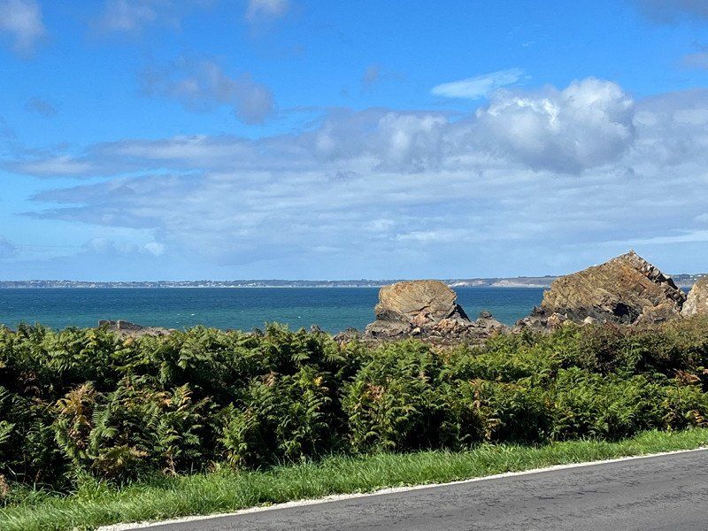
This route on the coast must be very beautiful and that's why this time we drive this route to Spain.
The landscape intoxicates us, if we didn't have an appointment now, we would look for a place in Banyulus sur Mer and stay 1 night. But …. Appointments Appointments 🤣🤣
42° 26' 27.5" N 3° 9' 53" E
42.4409650 3.1647230
• Head toward Rue Julien Cruzel on Rue des Douaniers. Go for 31 m.
• Turn sharp right onto Rue Julien Cruzel. Go for 39 m.
• Turn left onto Place de la République. Go for 19 m.
• Turn right onto Rue du Ribéral. Go for 29 m.
• Turn right onto Rue Anatole France. Go for 58 m.
• Turn right onto Avenue Général de Gaulle (D914). Go for 3.8 km.
• Continue on N-260. Go for 2.7 km.
• Turn left onto Carrer de Cerbère. Go for 102 m.
• Arrive at Carrer de Cerbère. Your destination is on the left.
☍
6,8 km
( 11 min.)
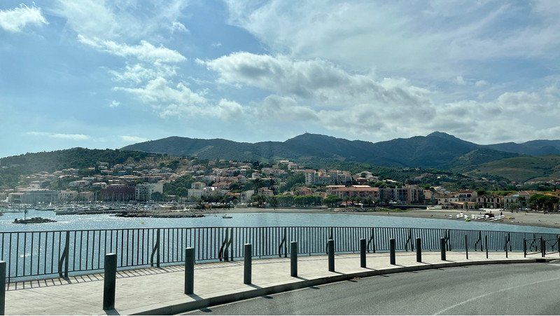
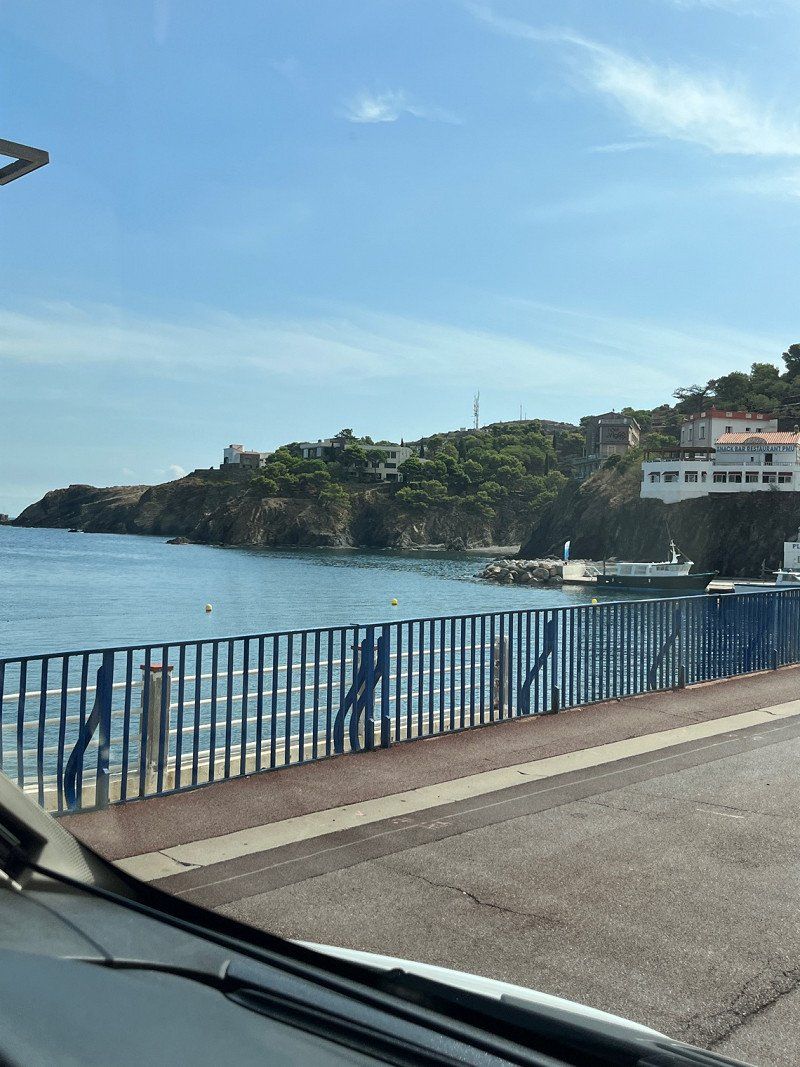
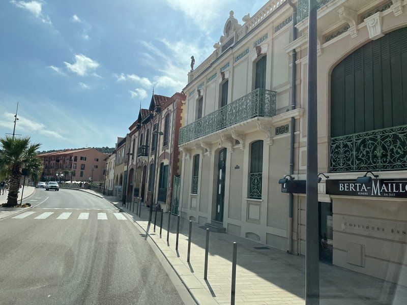
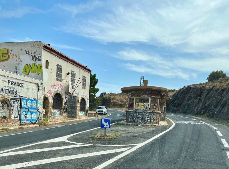
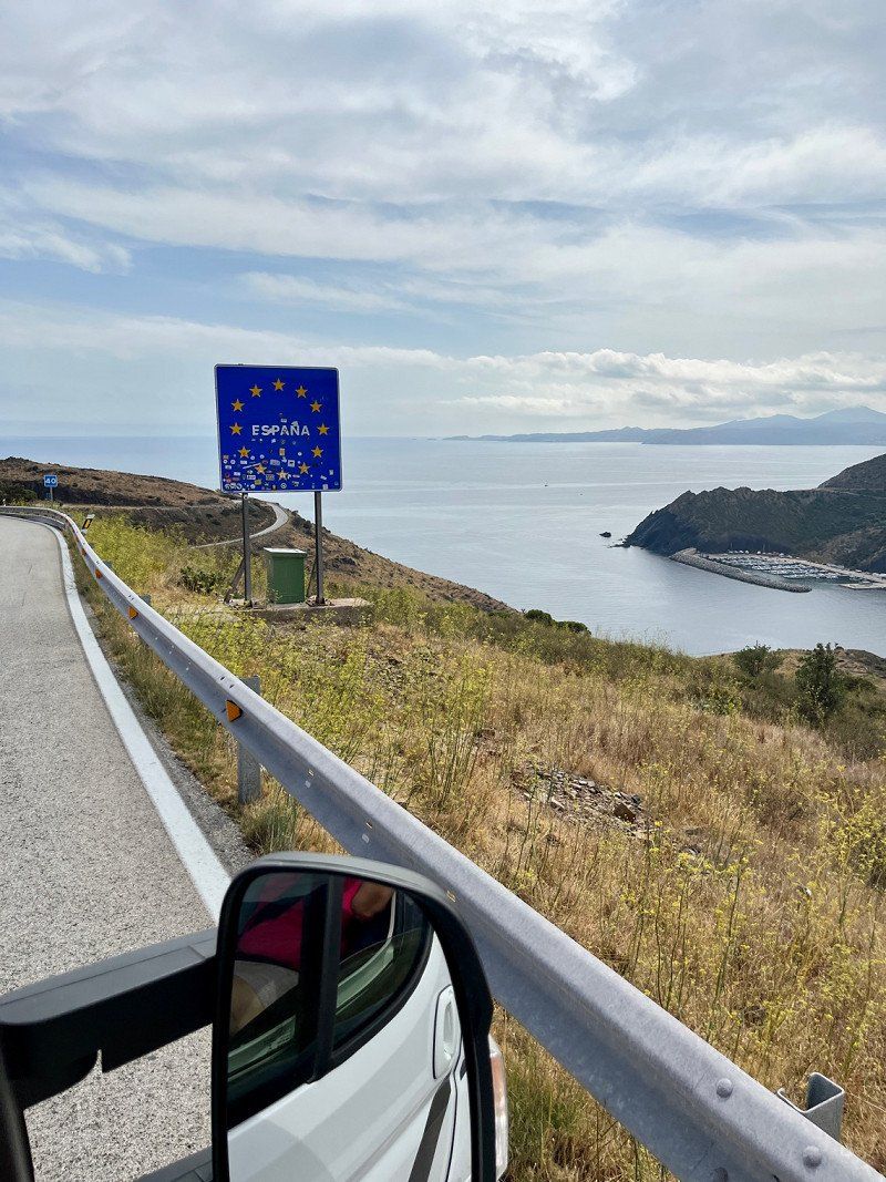
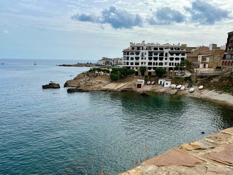
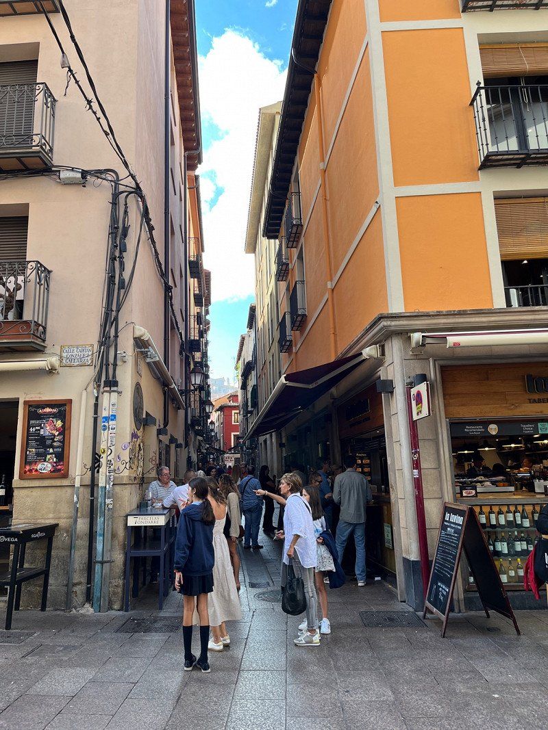
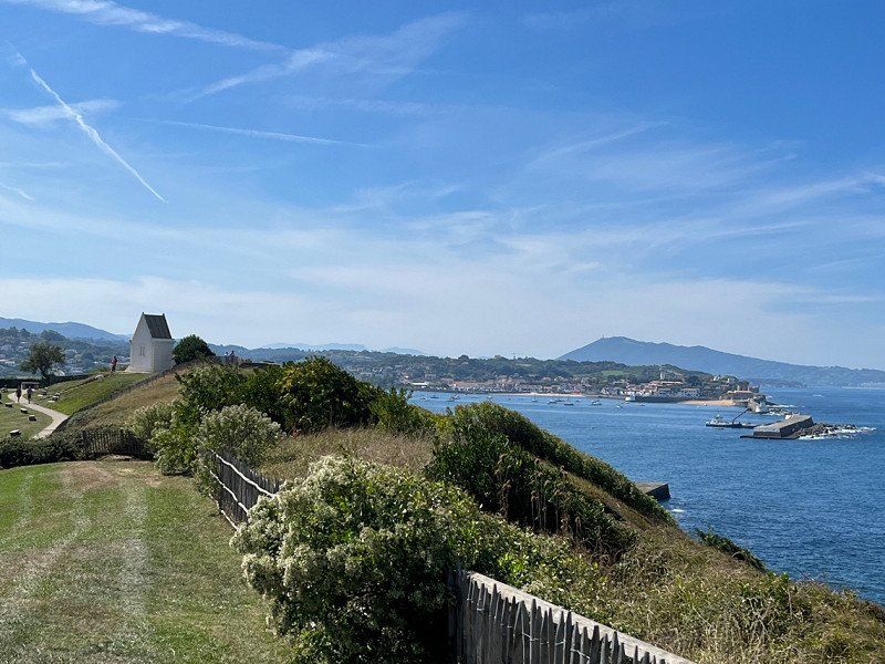
Portbou, Spanien
The old border crossing is still there and gives us hope that there will never be any more border crossings in Europe. We still know it well enough, passport controls and foreign currencies, converting and also a bit of uncertainty.
Today it is so easy to travel around Europe, English is spoken almost everywhere, you can pay for everything with your national bank card, you travel so relaxed!!! 🥰☀️
17497 Portbou, Girona, Spanien
42° 25' 37.9" N 3° 9' 35.2" E
42.4272031 3.1597695
• Head west on Carrer de Cerbère. Go for 25 m.
• Turn left onto Carrer de Cerbère. Go for 18 m.
• Turn left onto Carrer de Cerbère (N-260). Go for 25.6 km.
• Turn right toward Peralada/Vilanova de la Muga/Llançà. Go for 133 m.
• Take the 1st exit from roundabout toward Castelló d'E. Go for 250 m.
• Turn right onto GIP-6042 toward Vilanova de la Muga. Go for 162 m.
• Turn left onto GIP-6042. Go for 2.1 km.
• Continue on Carrer Major (GIP-6042). Go for 317 m.
• Continue on Carrer Castelló (GIV-6043). Go for 109 m.
• Continue on GIV-6043. Go for 2.7 km.
• Continue on Carretera Castelló d'Empúries a Vilanova (GIV-6043). Go for 167 m.
• Take the 2nd exit from roundabout onto Carrer Figueres (GIV-6043) toward Figueres. Go for 901 m.
• Take the 2nd exit from roundabout onto Carrer Santa Clara toward Roses/Cadaqués/Sant Pere Pescador/l'Escala/Empuriabrava. Go for 245 m.
• Continue on Carrer Camí Vell a Sant Pere Pescador. Go for 20 m.
• Take the 1st exit from roundabout toward Roses/Cadaqués/Empuriabrava/Sant Pere Pescador/l'Escala. Go for 217 m.
• Take the 3rd exit from roundabout onto Carretera de Sant Miquel de Fluvià (GIV-6216) toward St. Pere Pescador/l'Escala. Go for 264 m.
• Continue on GIV-6216. Go for 6.5 km.
• Continue on Carretera de Sant Miquel de Fluvià (GIV-6216). Go for 278 m.
• Take the 2nd exit from roundabout onto Carrer Sant Sebastià (GIV-6216) toward Centre Ciutat. Go for 242 m.
• Continue on Carretera d'Armentera a Viladamat (GIV-6303). Go for 197 m.
• Turn left onto Carrer Carme (GIV-6303) toward l'Armentera/l'Escala/Oficina de Turisme. Go for 105 m.
• Turn right onto Pont de Sant Pere Pescador (GIV-6303). Go for 198 m.
• Continue on GIV-6303. Go for 21 m.
• Take the 2nd exit from roundabout toward l'Escala. Go for 432 m.
• Continue on Carrer Empordà. Go for 77 m.
• Take the 3rd exit from roundabout. Go for 158 m.
• Turn slightly right onto Carretera de la Platja. Go for 966 m.
• Turn right. Go for 19 m.
• Arrive at your destination on the right.
☍
42,4 km
( 48 min.)
Camping las Palmeras Costa Brava, Carretera de la platja, Spanien
Our friends stand in this place.
€22.80 without electricity/night, we stay 2 nights. It is very crowded and also very touristy. We know the area quite well, since we used to come here with our children at Easter 25 years ago.
It was still an idyllic little village and the pitches weren't that big. everything changes
Carr. de la platja, 17470, Girona, Spanien
42° 11' 16.8" N 3° 6' 9.2" E
42.1879885 3.1025663
• Head toward Carretera de la Platja. Go for 19 m.
• Turn left onto Carretera de la Platja. Go for 966 m.
• Turn slightly left toward Carrer d'Empori. Go for 110 m.
• Take the 3rd exit from roundabout onto Carrer d'Empori. Go for 387 m.
• Continue on Avinguda d'Empúries. Go for 557 m.
• Continue on Carretera San Martín de Empúries. Go for 4.2 km.
• Continue on Càmping La Ballena Alegre. Go for 140 m.
• Continue on Carretera San Martín de Empúries. Go for 1.1 km.
• Continue on Ronda de Sant Pere Pescador. Go for 418 m.
• Take the 1st exit from roundabout onto GIP-6307 toward l'Escala. Go for 1.4 km.
• Take the 3rd exit from roundabout onto GI-623 toward l'Escala. Go for 1.0 km.
• Take the 2nd exit from roundabout onto Carretera de Vilademat a l'Escala (GI-623) toward l'Escala. Go for 1.1 km.
• Keep right toward Bellcaire d'E./La Bisbal d'Empordà/l'Escala. Go for 175 m.
• Continue on Carretera Escala a Viladamat toward Puig-Sec/Riells de Dalt/Port-la Clota/Montgó/Torroella de Montgrí. Go for 287 m.
• Continue on Carretera Bellcaire d'Empúries (GI-632). Go for 220 m.
• Take the 3rd exit from roundabout onto Carrer dels Recs toward Riells de Dalt/La Clota/Montgó. Go for 688 m.
• Take the 1st exit from roundabout onto Carrer del Puig. Go for 636 m.
• Take the 2nd exit from roundabout onto Carrer dels Mallols. Go for 721 m.
• Turn left onto Carrer de Sant Briu. Go for 313 m.
• Turn right onto Passatge Sant Briu 77. Go for 90 m.
• Arrive at Passatge Sant Briu 77. Your destination is on the left.
☍
14,5 km
( 21 min.)
Day
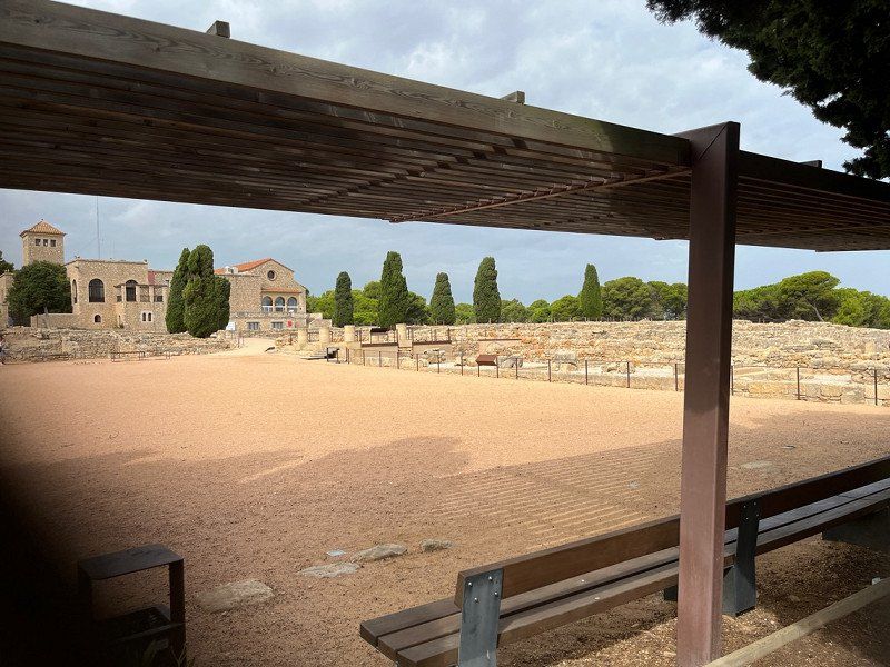
L'Escala, Spanien
By bike along the coast past the excavation site to L' Escala and had a delicious tappa just before the port.
17130 L'Escala, Provinz Girona, Spanien
42° 6' 33.9" N 3° 8' 34.2" E
42.1094266 3.1428341
• Head toward Carrer de Sant Briu on Passatge Sant Briu 77. Go for 90 m.
• Turn left onto Carrer de Sant Briu. Go for 313 m.
• Turn right onto Carrer dels Mallols. Go for 676 m.
• Take the 1st exit from roundabout onto Carrer del Puig. Go for 610 m.
• Take the 1st exit from roundabout onto Carrer dels Recs. Go for 645 m.
• Take the 1st exit from roundabout onto Carretera Bellcaire d'Empúries (GI-632) toward l'Escala/Figueres. Go for 412 m.
• Take the 3rd exit from roundabout onto Carretera de Vilademat a l'Escala (GI-623) toward Figueres/Girona. Go for 1.4 km.
• Take the 3rd exit from roundabout onto GI-623 toward AP-7/Figueres/Girona. Go for 964 m.
• Pass 2 roundabouts and continue on GI-623. Go for 3.0 km.
• Continue on Carretera de Vilademat a l'Escala (GI-623). Go for 711 m.
• Continue on GI-623. Go for 416 m.
• Take the 2nd exit from roundabout onto GI-623 toward AP-7/Girona/Figueres. Go for 128 m.
• Take ramp onto C-31 toward Figueres/Roses. Go for 14.6 km.
• Take the 2nd exit from roundabout onto C-31 toward Sta. Llogaia d'Àlguema/Figueres. Go for 812 m.
• Take the 2nd exit from roundabout onto N-2A toward AP-7/Girona/Barcelona. Go for 1.3 km.
• Take the 2nd exit from roundabout onto N-2A toward Girona. Go for 555 m.
• Take the 2nd exit from roundabout onto C-26 toward Borrassà/Olot. Go for 1.5 km.
• Keep left onto C-26 toward Creixell/Banyoles/Olot. Go for 1.1 km.
• Pass 3 roundabouts and continue on C-26. Go for 4.8 km.
• Turn left onto N-260 toward GIP-5121/Banyoles/A-26/Olot. Go for 13.7 km.
• Take ramp toward Besalú. Go for 722 m.
• Take ramp toward Besalú/Beuda. Go for 613 m.
• Take the 4th exit from roundabout toward N-260/Besalú. Go for 228 m.
• Take the 1st exit from roundabout onto N-260z toward Besalú. Go for 95 m.
• Continue on Carretera de Figueres (N-260z). Go for 627 m.
• Turn right onto Carretera d'Olot (N-260z) toward Olot. Go for 288 m.
• Enter the roundabout. Go for 22 m.
• Arrive at your destination on the left.
☍
50,3 km
( 44 min.)
Day
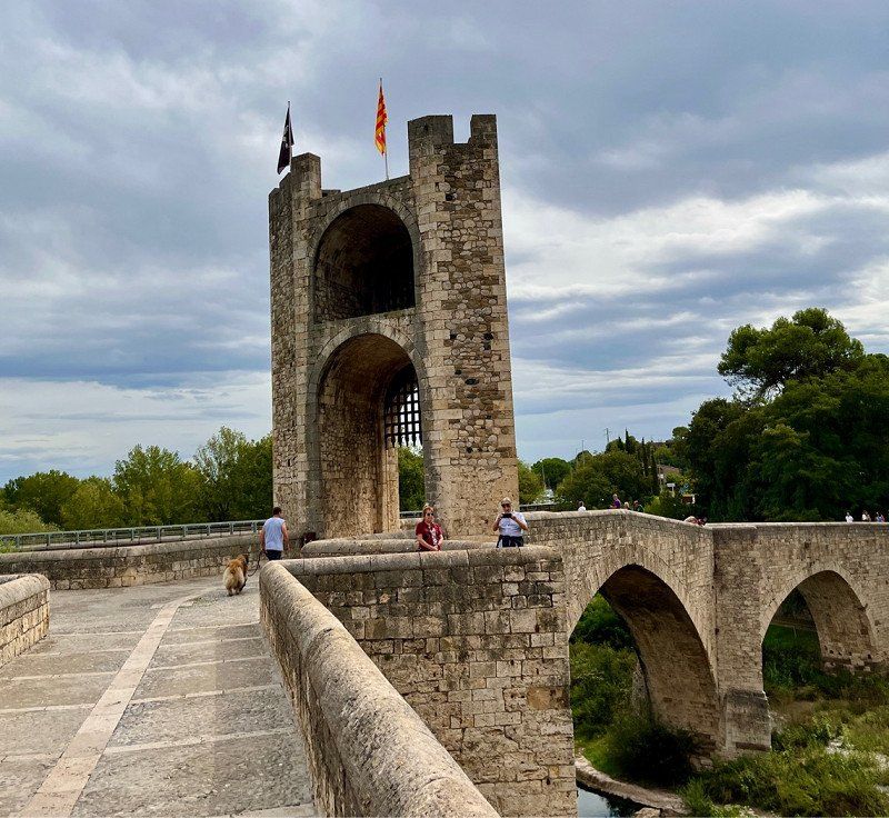
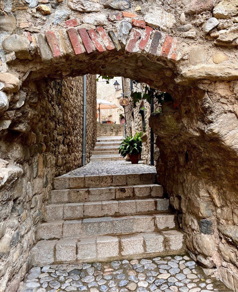
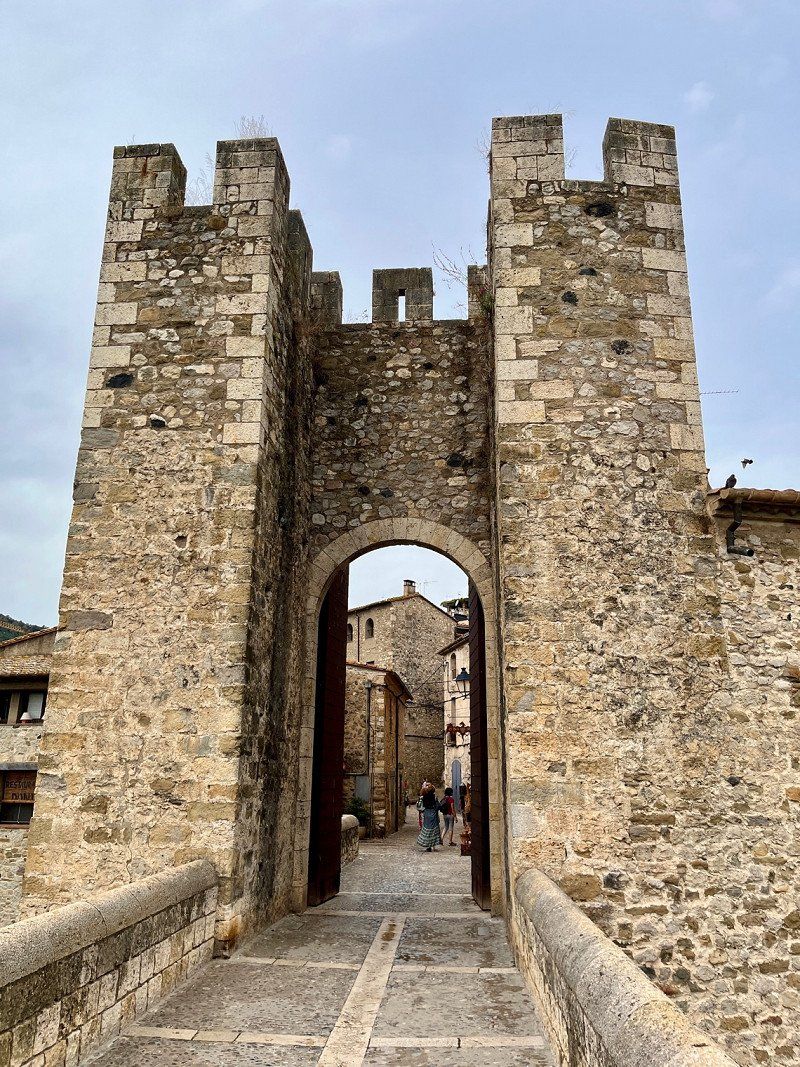
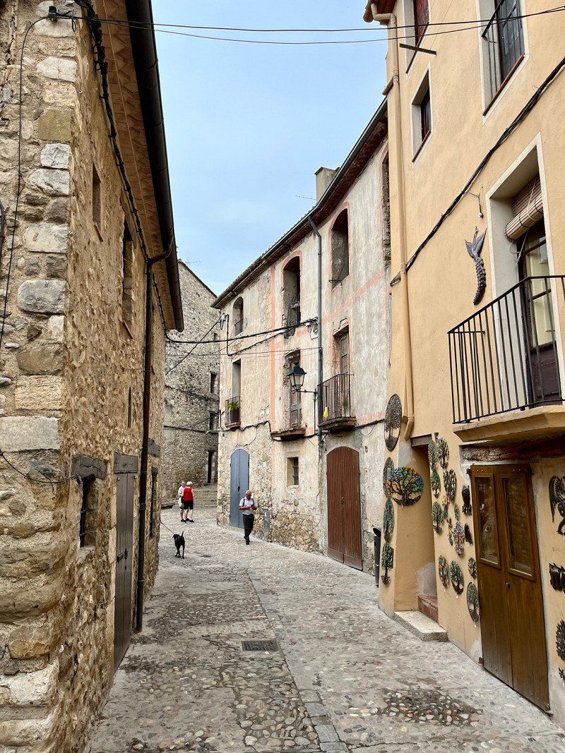
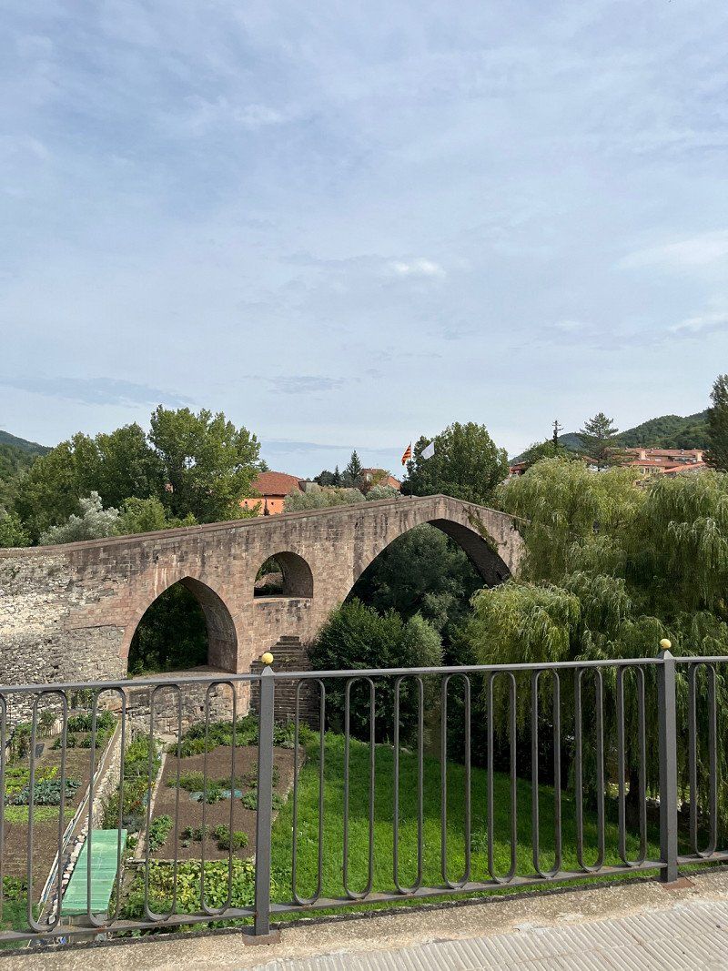
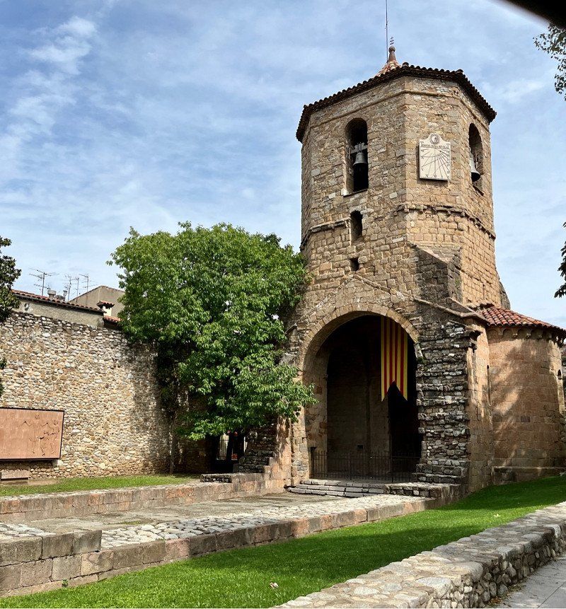
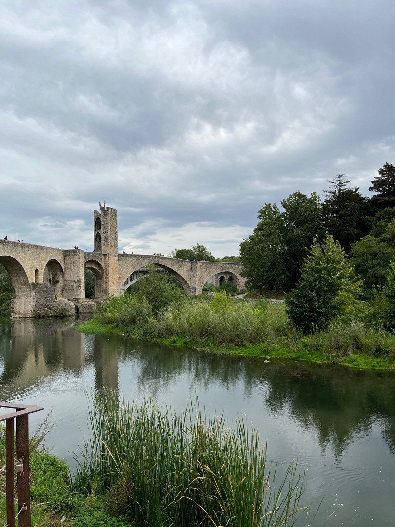
Besalú, Spanien
Old village worth seeing, but a tourist attraction. We are on our way to travel across the country to get to the Atlantic. The climate on the east coast is currently too hot and humid for us.
17850 Besalú, Provinz Girona, Spanien
42° 12' 0.8" N 2° 41' 43.2" E
42.2002357 2.6953375
• Follow the roundabout. Go for 37 m.
• Take the 3rd exit from roundabout onto Carretera d'Olot (N-260z) toward Olot/Argelaguer. Go for 543 m.
• Continue on N-260z. Go for 1.0 km.
• Take the 2nd exit from roundabout onto A-26 toward Olot. Go for 17.0 km.
• Take ramp toward Ripoll. Go for 210 m.
• Pass 2 roundabouts and continue on Carretera de la Canya (N-260). Go for 1.3 km.
• Take the 2nd exit from roundabout onto N-260 toward La Vall de Bianya/St. Joan de les Abadesses/Ripoll/Camprodon. Go for 2.2 km.
• Take the 2nd exit from roundabout onto N-260 toward Camprodon/Ripoll/Andorra. Go for 14.8 km.
• Take the 2nd exit from roundabout onto N-260 toward St. Joan A./Ripoll/Andorra. Go for 1.2 km.
• Take the 2nd exit from roundabout onto N-260. Go for 2.2 km.
• Take the 3rd exit from roundabout onto Carretera de Camprodon (N-260). Go for 626 m.
• Turn right onto Carrer de Sant Pol. Go for 38 m.
• Turn right onto Carrer Somatenista Ramon d'Urg. Go for 44 m.
• Arrive at Carrer Somatenista Ramon d'Urg. Your destination is on the right.
☍
41,1 km
( 32 min.)
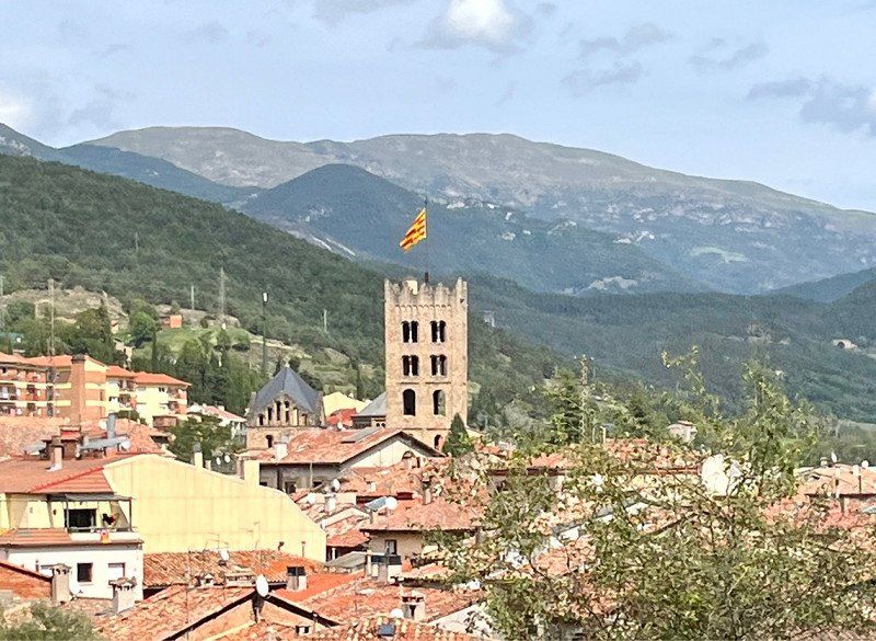
Sant Joan de les Abadesses, Spanien
winding route, scenic for us to drive beautifully. Short lunch break here in the village.
17860 Sant Joan de les Abadesses, Provinz Girona, Spanien
42° 14' 2.9" N 2° 17' 10.7" E
42.2341290 2.2863069
• Head toward Carrer Sant Isidre on Carrer Somatenista Ramon d'Urg. Go for 99 m.
• Turn right onto Carrer de l'Abat Ramon de la Bisbal. Go for 36 m.
• Turn right onto Carretera de Camprodon (N-260). Go for 238 m.
• Turn right onto Avinguda del Comte Guifré (N-260). Go for 7.3 km.
• Take the 2nd exit from roundabout onto C-151a toward Ripoll/Puigcerdà/Andorra. Go for 962 m.
• Continue on Carretera Sant Joan (C-151a). Go for 1.0 km.
• Continue on Carrer del Doctor Raguer. Go for 360 m.
• Continue on Plaça de l'Ajuntament. Go for 11 m.
• Continue on Carrer de Berenguer el Vell. Go for 103 m.
• Turn left onto Carrer Trinitat. Go for 123 m.
• Turn left onto Carrer Vinyes. Go for 25 m.
• Continue on Plaça Llibertat. Go for 22 m.
• Continue on Carrer Vinyes. Go for 22 m.
• Continue on Carrer Sant Pere. Go for 7 m.
• Continue on Carrer Vinyes. Go for 34 m.
• Turn right onto Carrer Vell. Go for 35 m.
• Turn right onto Plaça de Sant Eudald. Go for 18 m.
• Arrive at Plaça de Sant Eudald. Your destination is on the left.
☍
10,4 km
( 11 min.)
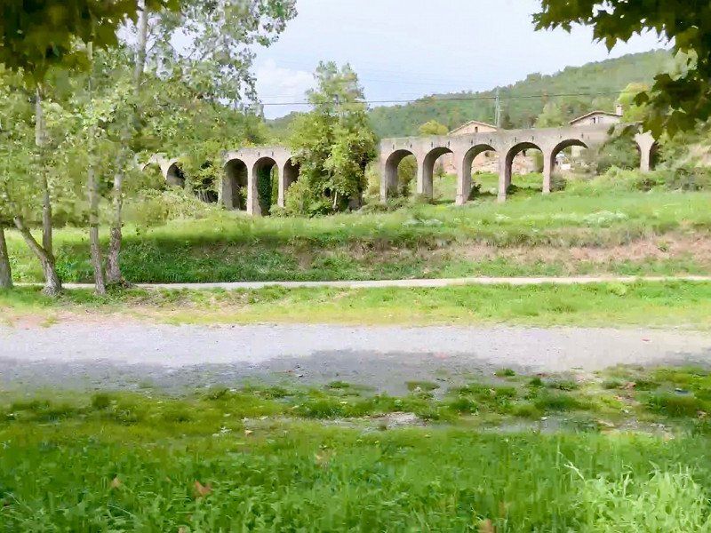
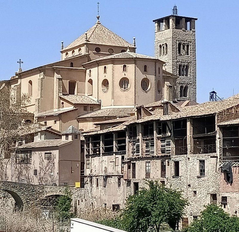
Ripoll, Spanien
Drove past the monastery, nice town
17500 Ripoll, Provinz Girona, Spanien
42° 11' 58.1" N 2° 11' 26.7" E
42.1994589 2.1907618
• Head toward Carrer Sant Pere on Plaça de Sant Eudald. Go for 14 m.
• Turn left onto Plaça de Sant Eudald. Go for 34 m.
• Turn left onto Plaça de Sant Eudald. Go for 23 m.
• Turn left onto Plaça de Sant Eudald. Go for 12 m.
• Turn slightly right onto Carrer Vell. Go for 35 m.
• Turn left onto Carrer Vinyes. Go for 34 m.
• Continue on Carrer Sant Pere. Go for 7 m.
• Continue on Carrer Vinyes. Go for 22 m.
• Continue on Plaça Llibertat. Go for 22 m.
• Turn left onto Plaça Espanya. Go for 45 m.
• Continue on Carrer de Donya Estàsia. Go for 26 m.
• Turn left onto Carrer Prat. Go for 25 m.
• Continue on Plaça Nova. Go for 73 m.
• Continue on Plaça Gran. Go for 17 m.
• Turn right onto Plaça Gran. Go for 42 m.
• Continue on Pont de l'Arquet. Go for 61 m.
• Turn left onto Passeig de Ragull. Go for 248 m.
• Continue on Carretera de Barcelona. Go for 414 m.
• Turn right onto Carretera de Barcelona. Go for 282 m.
• Take the 4th exit from roundabout onto Carretera de Barcelona a Puigcerdà (C-17) toward Vic/Berga/Barcelona. Go for 387 m.
• Pass 2 roundabouts and continue on C-17. Go for 1.4 km.
• Keep right onto C-17 (Túnel del Turó de la Farga) toward Vic/Barcelona. Go for 27.1 km.
• Take exit 64 toward Girona/C-25. Go for 423 m.
• Take the 2nd exit from roundabout onto N-152a toward C-25/Girona/Gurb/Vic. Go for 234 m.
• Take the 3rd exit from roundabout onto N-152a toward Vic nord. Go for 523 m.
• Take the 2nd exit from roundabout onto N-152a toward St. Bartomeu de G./BV-4601/Polígon Industrial de Mas Galí/Polígon Industrial de l'Eperança. Go for 1.1 km.
• Take the 2nd exit from roundabout onto Camí 152 Barcelona a Puigcerdà. Go for 80 m.
• Continue on Camí de Barcelona a Puigcerdà (N-152a). Go for 440 m.
• Take the 2nd exit from roundabout onto Eix Onze de Setembre (N-152a) toward Centre Ciutat Vic/Barcelona. Go for 247 m.
• Turn right. Go for 67 m.
• Continue toward Carrer Vilà Cañellas. Go for 298 m.
• Turn right onto Carrer Vilà Cañellas. Go for 327 m.
• Arrive at Carrer Vilà Cañellas. Your destination is on the left.
☍
34,1 km
( 27 min.)
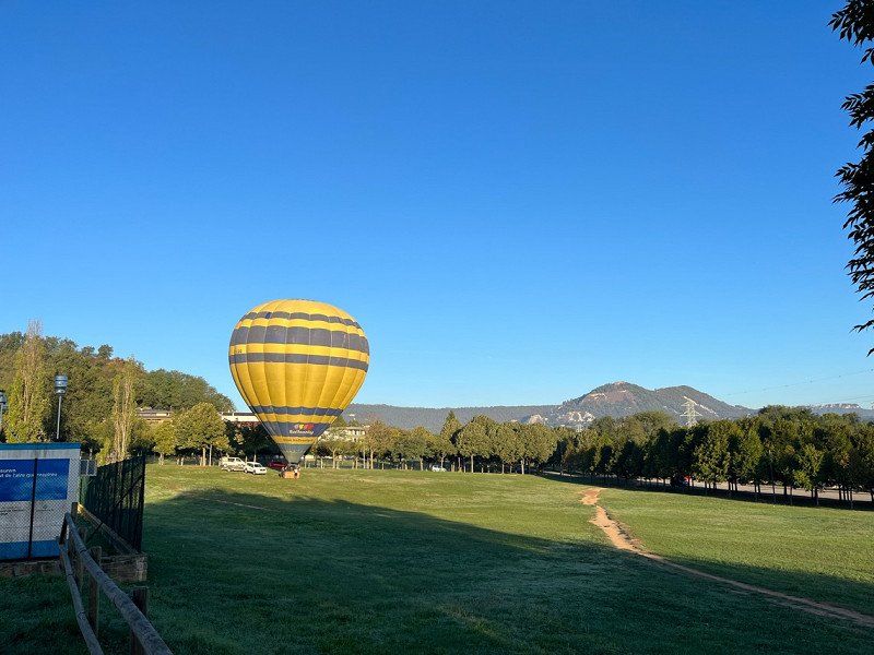
Vic, Spanien
Pitch for 5€/1 night and 2€ water
Very quiet and cycled into town
A hot air balloon takes off in the morning
Plaça Castell Planes-Zesport, 2, 08503 Vic, Barcelona, Spanien
41° 56' 7.5" N 2° 14' 22.1" E
41.9354134 2.2394638
• Head toward Carrer del Mas d'Osona on Carrer Vilà Cañellas. Go for 94 m.
• Turn left onto Carrer del Mas d'Osona. Go for 334 m.
• Turn sharp left onto Avinguda d'Olímpia. Go for 358 m.
• Turn right. Go for 18 m.
• Take ramp toward Barcelona. Go for 253 m.
• Take the 2nd exit from roundabout onto Eix Onze de Setembre (N-152a). Go for 385 m.
• Take the 1st exit from roundabout onto Carrer de M. S. Salarich i Torrents toward C-154/Olost/C-25/Manresa. Go for 31 m.
• Continue on Carrer Miquel Salarich i Torrents. Go for 338 m.
• Take the 1st exit from roundabout onto Carrer de M. S. Salarich i Torrents (C-154) toward Girona/Lleida/C-25/Olost. Go for 104 m.
• Continue on C-154. Go for 1.0 km.
• Continue on C-25d. Go for 1.6 km.
• Take ramp onto C-25 (Eix Transversal). Go for 94.4 km.
• Continue on A-2 (Autovia Lleida-Barcelona). Go for 12.0 km.
• Take exit 507 toward Agramunt. Go for 308 m.
• Turn slightly right onto C-14. Go for 208 m.
• Keep left toward Carretera de Salou a Ponts/C-14. Go for 91 m.
• Turn slightly left onto Carretera de Salou a Ponts (C-14). Go for 497 m.
• Take the 2nd exit from Plaça d'Andorra roundabout onto Carrer de Sant Pelegrí (C-14). Go for 1.1 km.
• Arrive at Plaça del Carme (C-14). Your destination is on the right.
☍
113,1 km
(1 hrs. 4 min.)
Day
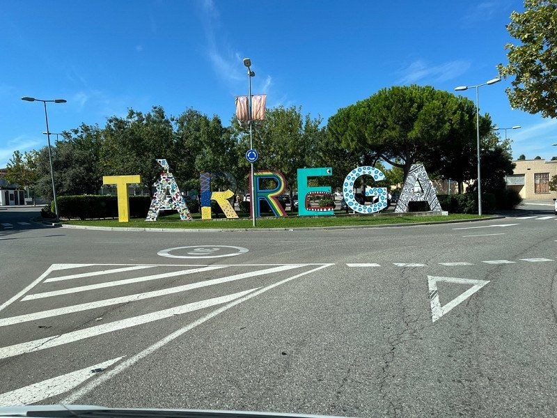
Tàrrega, Spanien
In Tàrrega we find a cheap petrol station and go shopping directly in the Mercadona.
25300 Tàrrega, Provinz Lleida, Spanien
41° 38' 53.1" N 1° 8' 27.4" E
41.6480797 1.1409432
• Head toward Avinguda de la Raval del Carme on Plaça del Carme (C-14). Go for 1.0 km.
• Take the 2nd exit from Plaça d'Andorra roundabout onto Carretera Tàrrega a Guissona (C-14). Go for 783 m.
• Keep left toward Autovia Lleida-Barcelona/A-2. Go for 91 m.
• Take ramp onto A-2 (Autovia Lleida-Barcelona) toward Mollerussa/Lleida. Go for 32.8 km.
• Take exit 474 toward Lleida (Centre)/Tarragona/N-240/Tortosa/C-12 onto LL-11. Go for 3.3 km.
• Take the 2nd exit from roundabout onto LL-11 toward Lleida/Tarragona/N-240/Tortosa/C-12. Go for 1.7 km.
• Take the 4th exit from roundabout onto C-13b toward N-240/Tarragona/C-12/Tortosa. Go for 4.3 km.
• Continue on C-13. Go for 3.8 km.
• Continue on C-230a. Go for 481 m.
• Take ramp onto LL-12 toward Tortosa/E-90/AP-2/Zaragoza/Barcelona/Tarragona/C-12. Go for 2.7 km.
• Take the 2nd exit from roundabout onto LL-12 toward Barcelona/Zaragoza. Go for 596 m.
• Take the exit toward Zaragoza onto AP-2 (Autopista Saragossa Mediterrània). Go for 121 km.
• Continue on A-2 (Autopista Zaragoza Mediterráneo). Go for 16.7 km.
• Take exit 323 toward avda. Ranillas/Campus Río Ebro. Go for 2.8 km.
• Take the 1st exit from roundabout onto Ronda de Boltaña toward A-23/Huesca/Juslibol/Parque Goya. Go for 755 m.
• Take the 1st exit from roundabout onto Ronda de Boltaña. Go for 330 m.
• Take the 1st exit from roundabout onto Calle Poeta Luciano Gracia. Go for 743 m.
• Turn right. Go for 376 m.
• Turn right. Go for 64 m.
• Arrive at your destination on the right.
☍
194,8 km
(1 hrs. 43 min.)
Área Autocaravanas de Zaragoza, Calle de Mariano Esquillor Gómez, Saragossa, Spanien
Free parking space, with V+E also free!
Quiet despite the large street with tram connection. Many parking spaces also to the sports arena.
Well done by the city!
C. de Mariano Esquillor Gómez, 3124, 50018 Zaragoza, Spanien
41° 40' 58.7" N 0° 53' 25.1" W
41.6829838 -0.8903110
• Head south. Go for 85 m.
• Turn right toward Calle Poeta Luciano Gracia. Go for 140 m.
• Turn right onto Calle Poeta Luciano Gracia. Go for 582 m.
• Continue on Calle Gertrudis Gómez Avellaneda. Go for 605 m.
• Turn right onto Avenida Pintor Pablo Ruiz Picasso. Go for 168 m.
• Continue on Calle Pintor Pablo Ruiz Picasso. Go for 20 m.
• Continue on Avenida Pintor Pablo Ruiz Picasso. Go for 12 m.
• Continue on Calle Pintor Pablo Ruiz Picasso. Go for 16 m.
• Continue on Avenida Pintor Pablo Ruiz Picasso. Go for 283 m.
• Turn right. Go for 65 m.
• Keep left toward Avenida José Atarés. Go for 197 m.
• Turn right onto Avenida José Atarés. Go for 554 m.
• Take the 1st exit from roundabout onto Avenida José Atarés. Go for 675 m.
• Turn right onto Puente de la Almozara. Go for 404 m.
• Take the 3rd exit from Plaza Europa roundabout onto Paseo María Agustín toward Portillo/Plaza B. Paraíso. Go for 684 m.
• Keep left onto Paseo María Agustín toward Plaza Paraiso. Go for 639 m.
• Turn right toward avda. de Goya. Go for 16 m.
• Turn right onto Calle de Hernán Cortés. Go for 142 m.
• Arrive at Calle de Hernán Cortés.
☍
5,3 km
( 9 min.)
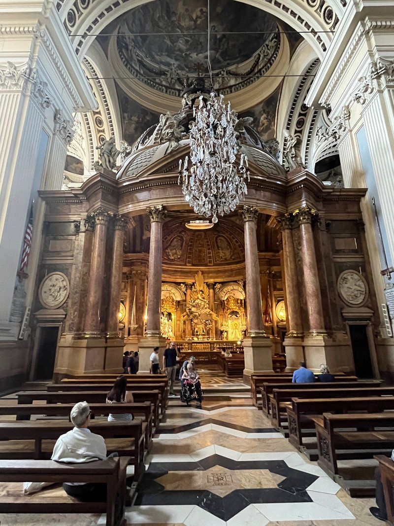
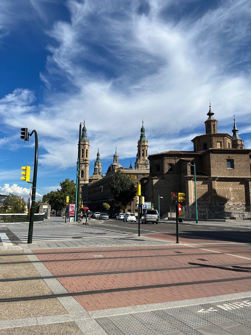
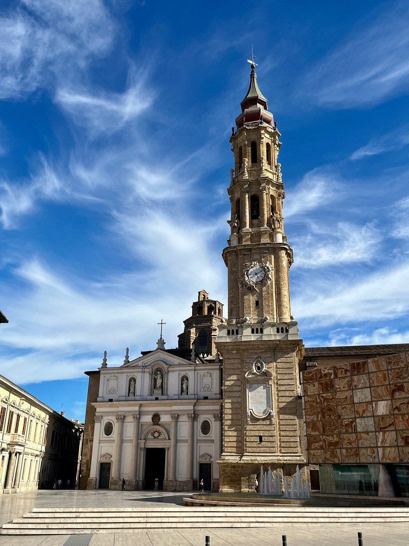
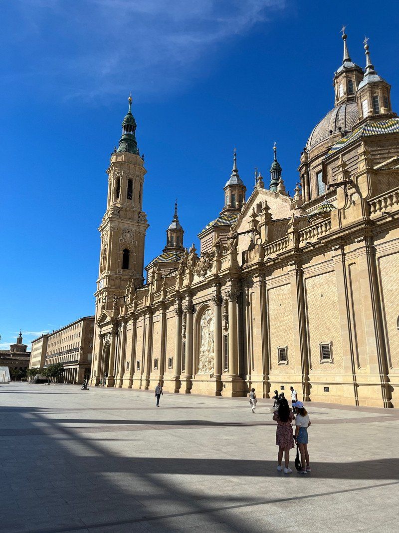
Zaragoza, Spanien
We visit the old town of Zaragoza and of course the Basilica.
Very impressive this basilica, also inside. I like such old churches and buildings.
Tomorrow we continue to Logroño, the capital of the Rioja region.
Saragossa, Spanien
41° 38' 55.8" N 0° 53' 20.7" W
41.6488226 -0.8890853
• Head southwest on Calle de Hernán Cortés.
• Turn right onto Calle Madre Sacramento. Go for 450 m.
• Turn right onto Calle José Anselmo Clavé. Go for 103 m.
• Turn right onto Calle General Mayandía toward Lérida/A-2/N-2/Huesca/N-330/Plaza del Pilar. Go for 169 m.
• Turn left onto Paseo María Agustín. Go for 208 m.
• Turn left onto Calle San José María Escrivá de Balaguer toward La Almozara/Estación Delicias. Go for 408 m.
• Take the 2nd exit from Plaza de la Ciudadanía roundabout onto A-68 toward La Almozara/Estación Delicias/Puente del Tercer Milenio. Go for 1.0 km.
• Keep left onto A-68 toward Z-40. Go for 5.4 km.
• Keep left onto AP-68 (Autopista del Ebro) toward Logroño/Pamplona/Soria. Go for 153 km.
• Take exit 12B toward Pamplona/LO-20/Logroño Este. Go for 860 m.
• Take the 2nd exit from roundabout toward LO-20/Logroño/Soria/Burgos/Pamplona. Go for 135 m.
• Take the 3rd exit from roundabout onto Circunvalación Sur de Logroño (LO-20) toward Logroño/Soria/Burgos/Pamplona. Go for 6.5 km.
• Take exit 6 toward Logroño (Este)/Pamplona/A-13. Go for 836 m.
• Take the 2nd exit from roundabout onto A-13 (Carretera Circunvalación) toward Viana/Pamplona. Go for 982 m.
• Take the exit toward Pamplona/A-12/Mendavia/LR-131/Pol. Cantabria. Go for 329 m.
• Take the 3rd exit from roundabout onto Avenida de Mendavia (LR-131). Go for 2.7 km.
• Take the 2nd exit from roundabout onto Calle del Ebro. Go for 272 m.
• Continue on Calle Cabo Noval. Go for 229 m.
• Turn slightly left onto Calle Cabo Noval. Go for 121 m.
• Continue on Paseo de las Norias. Go for 161 m.
• Turn left onto Paseo de las Norias. Go for 269 m.
• Turn left onto Paseo de las Norias. Go for 9 m.
• Turn right onto Paseo de las Norias. Go for 60 m.
• Arrive at Paseo de las Norias.
☍
173,7 km
(1 hrs. 35 min.)
Day
Camping la Playa
Expensive place (€29.70/1 night with electricity), as it is very close to the center.
Narrow places, very crowded because the big wine festival is taking place on the WE, which we didn't know.
But the night was quiet.
Sanitary in the 70's style, but immaculately clean.
Avda. de la Playa, 6-8 Logroño 6-8, 26006, Logroño, Spanien
42° 28' 18" N 2° 27' 20" W
42.4716600 -2.4555500
• Head northeast on Paseo de las Norias. Go for 60 m.
• Turn right onto Avenida La Playa. Go for 384 m.
• Turn right onto Calle Cabo Noval. Go for 350 m.
• Continue on Calle del Ebro. Go for 229 m.
• Take the 1st exit from roundabout onto Calle María Dolores Malumbres (N-111a). Go for 264 m.
• Take the 4th exit from roundabout onto Avenida de Viana. Go for 224 m.
• Turn right onto Avenida de Navarra. Go for 233 m.
• Turn right onto Calle Muro de Cervantes. Go for 81 m.
• Continue on Calle Muro del Carmen. Go for 136 m.
• Continue on Calle General Vara del Rey. Go for 273 m.
• Enter the roundabout. Go for 43 m.
• Arrive at your destination on the left.
☍
2,3 km
( 5 min.)
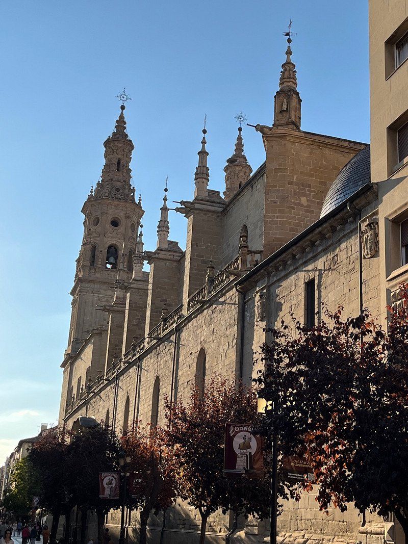
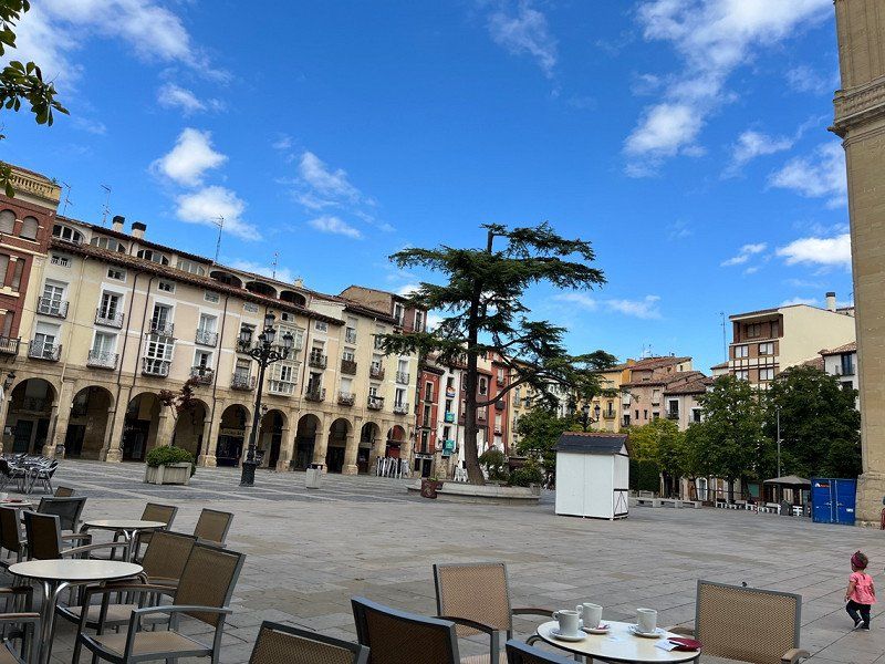
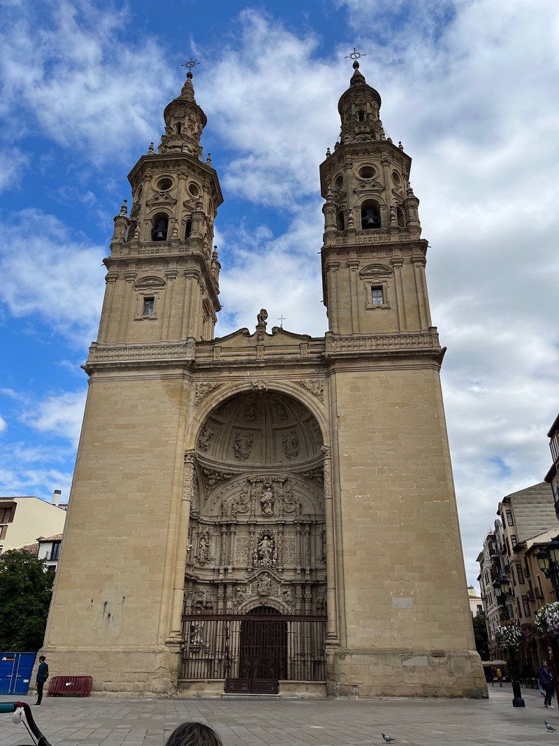
Logroño, Spanien
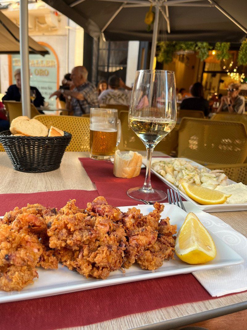
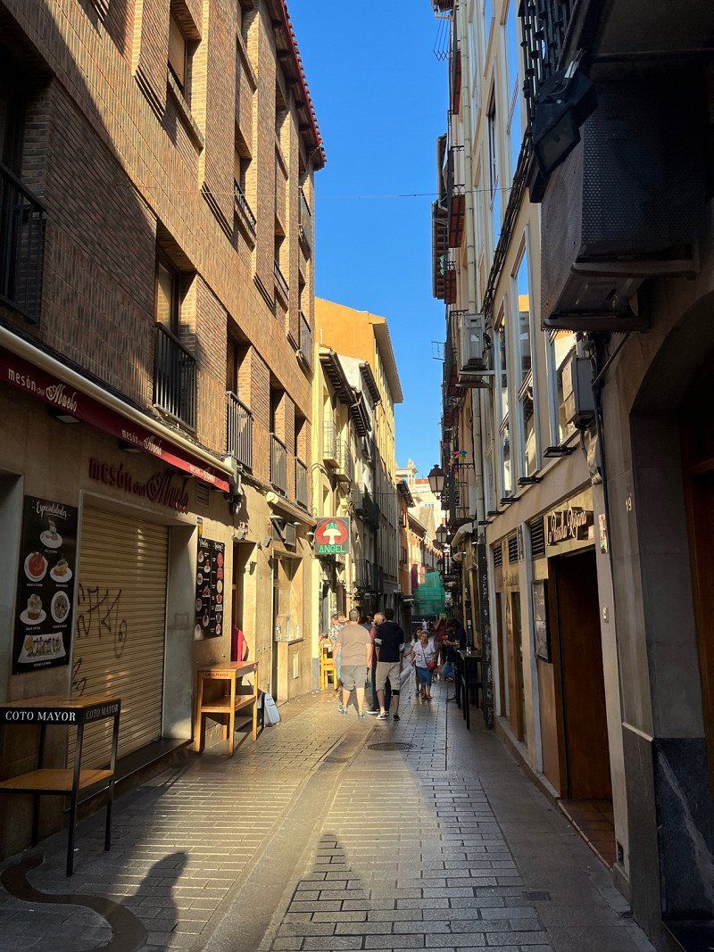
Visit of the old town, Cathedral, and Calle Laurel. We also eat two delicious squid dishes and of course a wine is part of it (Rioja).
In the evening there is a lot going on in the squares and small bars.
Logroño, La Rioja, Spanien
42° 27' 45.8" N 2° 26' 41.9" W
42.4627195 -2.4449852
• Follow the roundabout.
• Take the 1st exit from roundabout onto Calle General Vara del Rey. Go for 789 m.
• Continue on Avenida de Madrid. Go for 226 m.
• Take the 3rd exit from roundabout onto Avenida Lope de Vega toward Pamplona/A-13/Zaragoza/N-232/Aeropuerto. Go for 215 m.
• Take left ramp onto LO-20 (Circunvalación Sur de Logroño) toward Pamplona/A-13/Zaragoza/N-232/Aeropuerto. Go for 5.9 km.
• Take exit 2 toward Pamplona onto A-12 (Autovía del Camino de Santiago). Go for 74.7 km.
• Continue on Avenida de Aróstegui. Go for 431 m.
• Take the 2nd exit from roundabout onto Avenida de Aróstegui toward Pamplona/Iruña. Go for 1.0 km.
• Continue on Avenida de Pío XII. Go for 2.0 km.
• Turn right onto Avenida del Ejército. Go for 620 m.
• Arrive at Avenida del Ejército. Your destination is on the right.
☍
85,9 km
( 48 min.)
Day
Pamplona, Spanien
We're going on this morning. Actually it was thought that we would look at Pamplona, but somehow we prefer to go to the water now. So we continue to the coast.
The track is winding and hilly, very nice to drive.
Pamplona, Navarre, Spanien
42° 48' 45.1" N 1° 38' 44.8" W
42.8125260 -1.6457745
• Head east on Avenida del Ejército.
• Turn right onto Plaza de la Paz. Go for 28 m.
• Turn left onto Plaza de la Paz. Go for 55 m.
• Turn slightly left onto Avenida del Ejército. Go for 645 m.
• Keep right onto Avenida del Ejército. Go for 148 m.
• Turn slightly left onto Avenida de Bayona. Go for 395 m.
• Take the 1st exit from roundabout onto Calle del Monasterio de Belate. Go for 198 m.
• Take the 2nd exit from roundabout onto Calle del Monasterio de la Oliva. Go for 322 m.
• Take the 2nd exit from roundabout onto Calle del Monasterio de la Oliva. Go for 144 m.
• Take the 2nd exit from roundabout onto Avenida de Navarra toward Donostia/S. Sebastián/Vitoria-Gasteiz/Francia/Polígono Industrial Landaben. Go for 623 m.
• Pass 2 roundabouts and continue on Avenida de Navarra (PA-30). Go for 769 m.
• Keep left onto Avenida de Navarra (PA-34) toward Francia/Vitoria-Gasteiz/Donostia/S. Sebastián. Go for 2.7 km.
• Take ramp onto AP-15 (Autopista de Navarra). Go for 15.0 km.
• Continue on A-15. Go for 44.8 km.
• Continue on N-1. Go for 7.7 km.
• Take exit 453 toward Donostia/S. Sebastián/E-5/E-70/E-80/AP-1/AP-8/Bilbao/Vitoria-Gasteiz onto GI-11. Go for 2.1 km.
• Take exit 2 toward E-5/E-70/E-80/AP-1/AP-8/Zarautz/Bilbao/Vitoria-Gasteiz onto GI-20. Go for 2.8 km.
• Continue on AP-1/AP-8 (Autopista del Cantábrico). Go for 10.0 km.
• Take exit 38 toward N-634/Zarautz/Getaria. Go for 578 m.
• Take the 2nd exit from roundabout onto Calle Irita. Go for 119 m.
• Take the 2nd exit from roundabout onto Camino Mendibeltz. Go for 162 m.
• Turn left onto Camino Sorginmuno. Go for 18 m.
• Turn right toward Camino Talaimendi. Go for 203 m.
• Turn slightly left onto Camino Talaimendi. Go for 87 m.
• Turn right toward Camino Talaimendi. Go for 373 m.
• Continue on Camino Talaimendi. Go for 212 m.
• Turn slightly left onto Camino Talaimendi. Go for 262 m.
• Turn right toward Camino Talaimendi. Go for 77 m.
• Turn slightly left onto Camino Talaimendi. Go for 10 m.
• Turn left onto Laurgain kalea. Go for 16 m.
• Continue toward Camino Talaimendi. Go for 57 m.
• Turn left onto Camino Talaimendi. Go for 5 m.
• Turn right. Go for 27 m.
• Turn left. Go for 28 m.
• Arrive at your destination on the left.
☍
90,6 km
(1 hrs. 2 min.)
Camping Gran Camping Zarautz
The ASCI place (20€/1 night) is fully occupied, but there is still a spot available for us.
A lot of surfers and young people are here on the weekend.
To get to the beach, you have to walk down the mountain via an extra path over 439 steps (and then all up again) to the small town of Zarautz. Beach promenade invites you to have a coffee and watch the many surfers.
Monte Talai-mendi Zarautz, 20800, Zarautz, Spanien
43° 17' 26" N 2° 8' 48" W
43.2905600 -2.1466700
• Head east. Go for 28 m.
• Turn right toward Camino Talaimendi. Go for 27 m.
• Turn left onto Camino Talaimendi. Go for 5 m.
• Turn right toward Laurgain kalea. Go for 57 m.
• Continue on Laurgain kalea. Go for 16 m.
• Turn right onto Camino Talaimendi. Go for 10 m.
• Turn slightly right toward Camino Talaimendi. Go for 77 m.
• Turn left onto Camino Talaimendi. Go for 262 m.
• Turn slightly right onto Camino Talaimendi. Go for 212 m.
• Turn left toward Camino Talaimendi. Go for 373 m.
• Turn left onto Camino Talaimendi. Go for 87 m.
• Turn slightly right toward Camino Sorginmuno. Go for 203 m.
• Turn left onto Camino Sorginmuno. Go for 18 m.
• Turn right onto Camino Mendibeltz. Go for 112 m.
• Take the 2nd exit from roundabout onto Calle Irita toward Bilbao/A-8/Donostia/S. Sebastián. Go for 133 m.
• Take the 2nd exit from roundabout toward Donostia/San Sebastián/Bilbo/Vitoria/Gasteiz. Go for 75 m.
• Take ramp onto AP-1/AP-8 (Autopista del Cantábrico) toward Donostia/S. Sebastián. Go for 10.8 km.
• Take the exit toward Hernani/Pasaia/Irun/Baiona/Bordeaux onto AP-1/AP-8 (Segundo Cinturón de San Sebastián). Go for 14.6 km.
• Take the exit onto AP-8. Go for 12.7 km.
• Continue on A63 (Autoroute de la Côte Basque). Go for 13.0 km.
• Take exit 3 toward Guéthary/Bidart/Ascain. Go for 319 m.
• Continue on Avenue Lahanchipia. Go for 192 m.
• Turn left onto D810. Go for 72 m.
• Turn right onto Avenue Claude Farrère. Go for 845 m.
• Turn left onto Chemin d'Erromardi. Go for 136 m.
• Turn left onto Chemin d'Erromardi. Go for 28 m.
• Arrive at Chemin d'Erromardi. Your destination is on the left.
☍
54,4 km
( 40 min.)
Day
Day
Flower camping la Ferme Erromardie
Nicely located ACSI CP for 16€/1 night
We decide to stay here for 2 nights at short notice. The place is quiet, right on the sea and has everything you need.
Because the weather is so nice, it is also well occupied. Fresh bread is also available in the morning.
64500, St Jean De Luz, Frankreich
43° 24' 20.4" N 1° 38' 30.7" W
43.4056800 -1.6418500
• Head west on Chemin d'Erromardi. Go for 28 m.
• Turn left onto Chemin d'Erromardi. Go for 984 m.
• Take the 2nd exit from roundabout onto Avenue André Ithurralde (D810) toward St Jean de Luz-Centre. Go for 1.1 km.
• Take the 3rd exit from roundabout onto Avenue de Chantaco (D810) toward St Sébastien. Go for 352 m.
• Take the 1st exit from roundabout onto Avenue des Pyrénées (D810) toward St Sébastien/Ciboure. Go for 443 m.
• Take the 5th exit from roundabout onto Boulevard du Commandant Passicot (D810) toward St Sébastien/Ciboure/Donostia. Go for 356 m.
• Take the 2nd exit from Avenue de Verdun roundabout. Go for 109 m.
• Take the 1st exit from roundabout onto Avenue Pierre Larramendy. Go for 63 m.
• Continue on Boulevard Victor Hugo. Go for 25 m.
• Turn right onto Boulevard Victor Hugo. Go for 66 m.
• Turn right onto Place des Corsaires. Go for 36 m.
• Turn sharp right onto Place des Corsaires. Go for 20 m.
• Turn left onto Place du Maréchal Foch. Go for 36 m.
• Turn left onto Rue Pierre-Louis Tourasse. Go for 73 m.
• Arrive at Rue Pierre-Louis Tourasse. Your destination is on the right.
☍
3,6 km
( 7 min.)
Saint-Jean-de-Luz, Frankreich
Rode the bike into town, very crowded everywhere.
Coffee on the beach promenade (8€ for 2 coffees 😡)
64500 Saint-Jean-de-Luz, Frankreich
43° 23' 17" N 1° 39' 47" W
43.3880510 -1.6630550
• Head north on Rue Pierre-Louis Tourasse. Go for 154 m.
• Turn right onto Promenade Jacques Thibaud. Go for 241 m.
• Turn slightly right onto Promenade Jacques Thibaud. Go for 66 m.
• Continue on Place Maurice Ravel. Go for 48 m.
• Turn left onto Rue Luis Fortuné Loquin. Go for 58 m.
• Turn right onto Avenue Jean Dornaldeguy. Go for 70 m.
• Turn right onto Boulevard Thiers. Go for 277 m.
• Turn left onto Boulevard Victor Hugo. Go for 204 m.
• Continue on Avenue André Ithurralde. Go for 199 m.
• Pass 2 roundabouts and continue on Avenue André Ithurralde (D810). Go for 1.5 km.
• Take the 3rd exit from roundabout onto Avenue André Ithurralde (D810) toward Bayonne/Biarritz. Go for 360 m.
• Turn right onto Avenue Lahanchipia toward Bayonne/St Sébastien/Biarritz. Go for 279 m.
• Take left ramp onto A63 (Autoroute de la Côte Basque) toward Biarritz/Bayonne. Go for 8.4 km.
• Take exit 4 toward Biarritz/Aéroport Biarritz-Parme. Go for 1.1 km.
• Turn right toward Biarritz. Go for 135 m.
• Continue on Boulevard Marcel Dassault (D810). Go for 2.2 km.
• Take the 4th exit from Rond-Point du Mousse roundabout onto D260 toward Biarritz-Centre/Bayonne/Anglet/Aguiléra. Go for 1.2 km.
• Take the 1st exit from Giratoire Kléber roundabout onto Boulevard de Cascais (D260) toward Bayonne/Aguiléra. Go for 755 m.
• Take the 3rd exit from Rond-Point de l'Europe roundabout onto Avenue de la Marne (D910). Go for 553 m.
• Turn right onto Avenue de la Reine Nathalie. Go for 918 m.
• Keep left onto Avenue de la Reine Victoria. Go for 44 m.
• Continue on Avenue Édouard VII (D5). Go for 291 m.
• Arrive at Avenue Édouard VII (D910). Your destination is on the left.
☍
19,0 km
( 21 min.)
Day
Biarritz, Frankreich
Bike ride from the campsite to Biarritz
Great city and worth seeing, busy despite the off-season, probably due to the nice weather
Ate very good pizza at La Trattoria
64200 Biarritz, Frankreich
43° 28' 59.3" N 1° 33' 31.1" W
43.4831519 -1.5586260
• Head toward Avenue Joseph Petit on Avenue Édouard VII (D910). Go for 439 m.
• Take the 3rd exit from roundabout onto Avenue du Maréchal Foch (D910). Go for 231 m.
• Turn left onto Rue Jean Jaurès. Go for 20 m.
• Take the 4th exit from roundabout onto Avenue de la Gare. Go for 111 m.
• Turn right onto Rue Guy Petit. Go for 145 m.
• Take the 1st exit from Rond-Point Porte de Biarritz roundabout onto Boulevard d'Augusta. Go for 615 m.
• Continue on Bretelle Sabaou. Go for 214 m.
• Take the 2nd exit from roundabout onto Bretelle Sabaou. Go for 75 m.
• Take the 1st exit from Giratoire Kléber roundabout onto D260 toward St Jean de Luz/Aéroport B.A.B./Gare la Negresse/Z.A. Maysonnabe/Z.A. la Négresse. Go for 1.0 km.
• Take the 1st exit from Rond-Point du Mousse roundabout onto Boulevard Marcel Dassault (D810) toward St Jean de Luz/St Sébastien/Bidart/Izarbel/La Négresse/Gare. Go for 2.2 km.
• Take the 4th exit from roundabout toward A63/A63-A64/Saint Jean de Luz/San Sébastien/Bayonne/Bordeaux. Go for 190 m.
• Take ramp onto A63 (Autoroute de la Côte Basque) toward Bordeaux/Bayonne. Go for 163 km.
• Take exit 23 toward Le Barp/Marcheprime/Lacanau. Go for 226 m.
• Take the 3rd exit from roundabout onto Route du Barp (D5). Go for 238 m.
• Pass 8 roundabouts and continue on Route de Saumos (D5). Go for 32.6 km.
• Continue on Avenue de l'Océan (D5 E3). Go for 8.1 km.
• Turn sharp left onto Avenue de Bordeaux (D6). Go for 1.2 km.
• Take the 1st exit from roundabout onto D6 toward Lacanau Océan/Carcans/Brach/Royan Par Pointe de Grave/Route des Lacs. Go for 371 m.
• Take the 2nd exit from roundabout onto D6 toward Lacanau-Océan/Carcans/Royan Par Pointe de Grave/Route des Lacs/Réserve Naturelle de l'Étang de Cousseau. Go for 1.7 km.
• Take the 1st exit from roundabout onto Route de Carcans (D650) toward Carcans/Royan Par Pointe de Grave/Route des Lacs. Go for 3.8 km.
• Continue on Route Da Lacanau (D3). Go for 6.4 km.
• Take the 2nd exit from roundabout onto Place des Combattants (D3). Go for 12.0 km.
• Turn left onto Place de l'Église (D4). Go for 122 m.
• Turn right onto Place de l'Église (D101). Go for 2.8 km.
• Take the 2nd exit from roundabout onto Route de Vendays (D101) toward Vendays-Montalivet/Pte de Grave. Go for 16.9 km.
• Take the 2nd exit from roundabout onto Route de Lesparre (D102). Go for 616 m.
• Keep right onto Route de Lesparre (D102). Go for 286 m.
• Continue on D102. Go for 294 m.
• Continue on Lieu-dit Régueyra (D102). Go for 122 m.
• Continue on D102. Go for 766 m.
• Continue on Route de Montalivet (D102). Go for 1.7 km.
• Turn left onto Route de Soulac (D1215) toward Vensac/Le Verdon. Go for 24.1 km.
• Take the 1st exit from roundabout onto Rue du Capitaine Henri de Bournazel (D1 E3) toward Centre Ville. Go for 280 m.
• Turn left onto Rue Marcel Desblaches. Go for 211 m.
• Continue on Boulevard Lahens. Go for 128 m.
• Turn right onto Rue André et Marcel Tart. Go for 45 m.
• Arrive at Rue André et Marcel Tart.
☍
283,2 km
(3 hrs. 12 min.)
Day
Le Verdon-sur-Mer, Frankreich
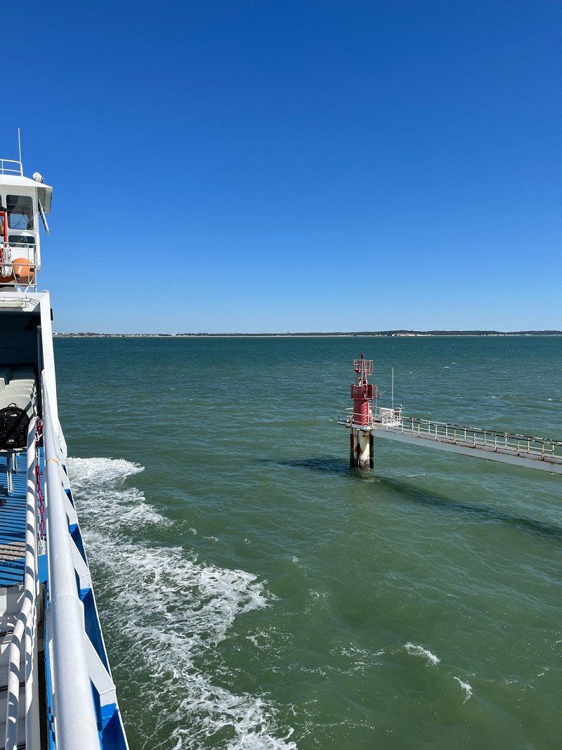
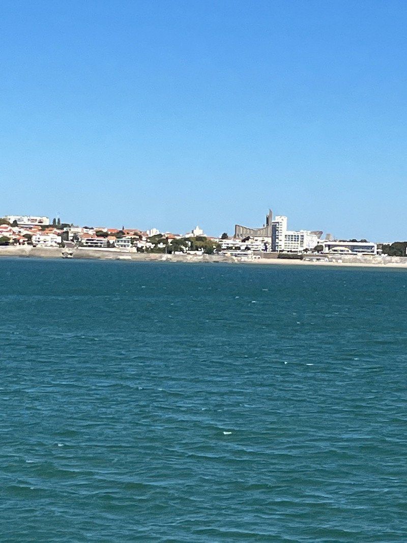
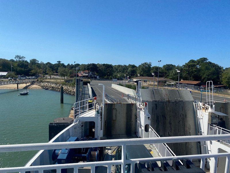
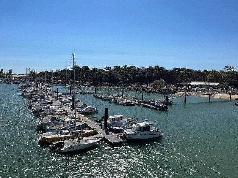
A stretch past many wineries to the ferry dock at le Verdon sur Mer to get to Royan. From there we want to continue to the Ill de Oléron.
45° 32' 46.9" N 1° 3' 42.1" W
45.5463710 -1.0617010
• Head toward Rue François Lebreton on Rue André et Marcel Tart. Go for 29 m.
• Turn left onto Rue François Lebreton (D1 E2). Go for 94 m.
• Turn left onto Rue de la Briqueterie (D1 E1). Go for 272 m.
• Continue on Rue de la Batterie (D1 E1). Go for 425 m.
• Turn right onto Avenue de la Chambrette (D1 E1). Go for 874 m.
• Turn left onto Allée Déclide (D1 E1). Go for 30 m.
• Turn right onto Avenue de la Pointe de Grave (D1215). Go for 1.2 km.
• Turn right onto D1215 toward Royan-Embarquement. Go for 308 m.
• Turn left onto D1215. Go for 209 m.
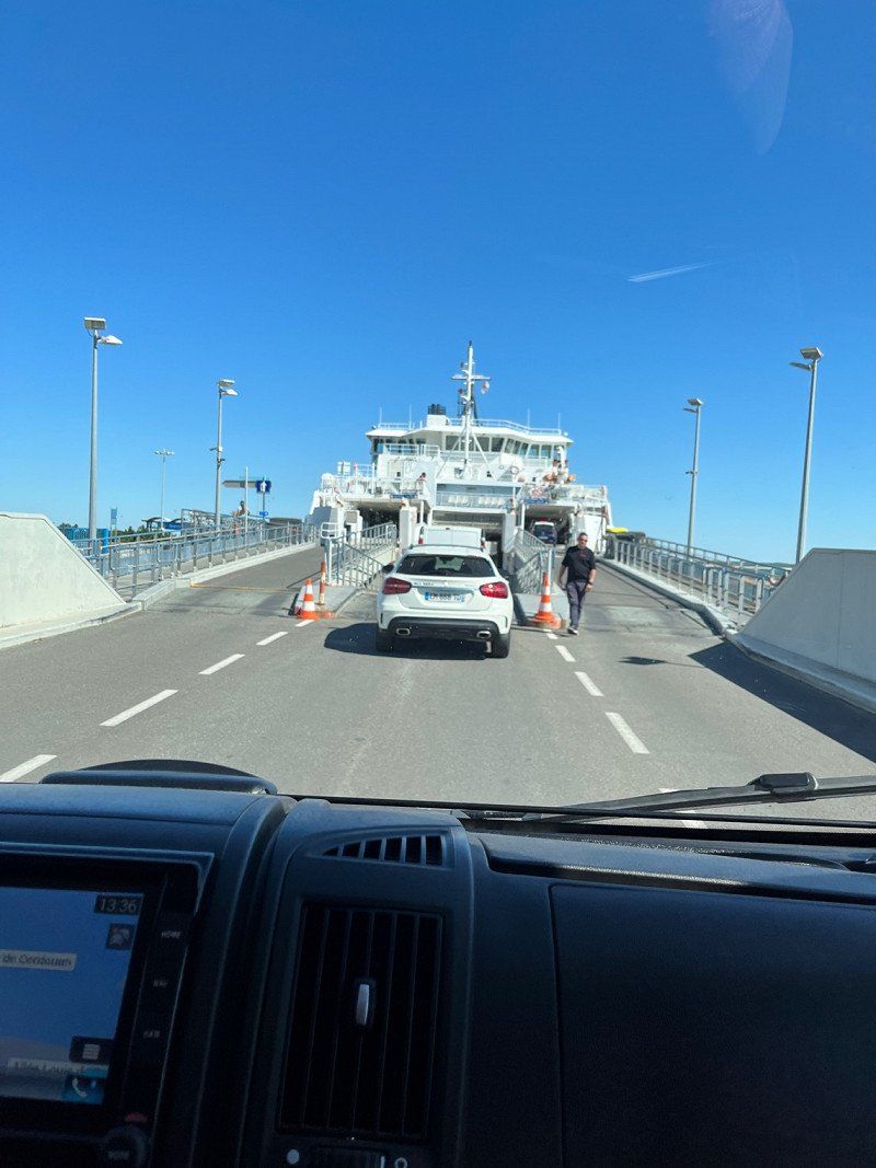
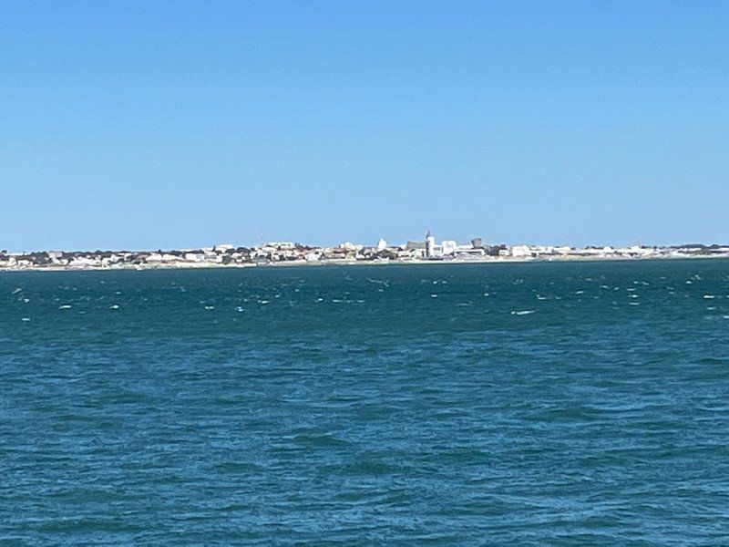
• Take the Royan-Le-Verdon-sur-Mer Ferry. Stay on for 6.1 km.
• Head toward Quai des Sabliers on Rue de la Galiote. Go for 115 m.
• Turn right onto Rue de la Tartane. Go for 257 m.
• Turn right onto Quai Amiral Meyer toward Centre Ville. Go for 133 m.
• Keep left onto Rue Gambetta toward Centre Ville. Go for 418 m.
• Continue on Square de la Brigade Rac. Go for 127 m.
• Turn left onto Place Charles de Gaulle. Go for 72 m.
• Continue on Rue Font de Cherves. Go for 498 m.
• Take the 1st exit from roundabout onto Avenue Daniel Heddé. Go for 389 m.
• Continue on Avenue Daniel Heddé toward A10/Clinique Pasteur. Go for 569 m.
• Take the 2nd exit from roundabout onto Avenue Daniel Heddé toward Rochefort/Île d'Oléron/A10. Go for 405 m.
• Take the 2nd exit from roundabout onto Avenue de Rochefort (D733) toward Rochefort/Île d'Oléron/Breuillet/La Tremblade/St Sulpice de Royan. Go for 1.2 km.
• Pass 6 roundabouts and continue on Chemin des 4 Allées (D733). Go for 11.4 km.
• Take the 3rd exit from roundabout onto D131 toward Île d'Oléron/Marennes/St Sornin/Nieulle S/Seudre. Go for 5.0 km.
• Turn left onto D728. Go for 5.6 km.
• Pass 3 roundabouts and continue on Route de Bourcefranc (D728). Go for 8.6 km.
• Take the 3rd exit from roundabout onto D26. Go for 1.2 km.
• Take the 2nd exit from roundabout onto D26. Go for 4.7 km.
• Turn right onto Rue de la Pointe Blanche (D734). Go for 2.2 km.
• Pass 3 roundabouts and continue on Chemin de Ronde (D734). Go for 1.1 km.
• Take the 2nd exit from roundabout onto Boulevard Philippe Daste. Go for 292 m.
• Arrive at Boulevard Philippe Daste. Your destination is on the left.
☍
53,9 km
(1 hrs. 38 min.)
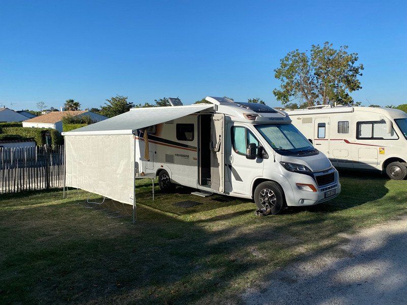
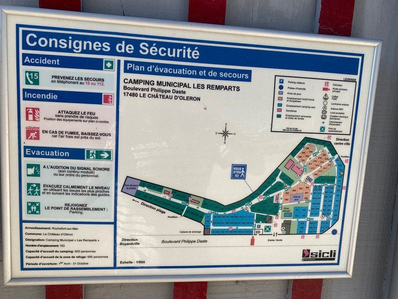
Camping Les Remparts
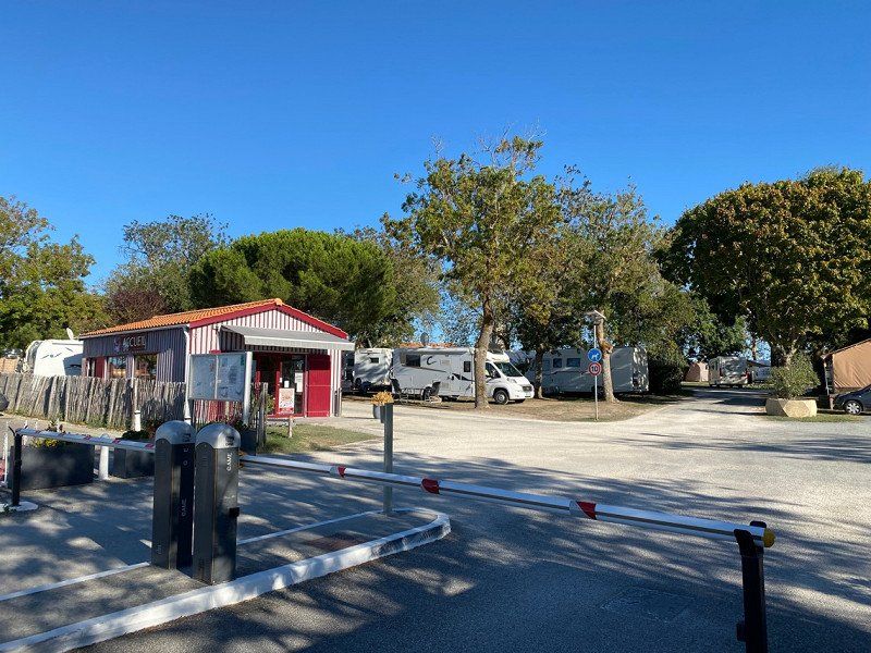
ST for 14.50/night with electricity
Unfortunately, the places are very crooked and despite our drive-on wedges, we are not able to put the camper straight. On the 2nd day we look for another place, which also works after consultation. Then it was better.
Sanitary building new, everything available.
17480, Le Château D'oleron, Frankreich
45° 53' 23.6" N 1° 12' 0" W
45.8899000 -1.2000000
• Head southwest on Boulevard Philippe Daste. Go for 260 m.
• Take the 2nd exit from roundabout onto Chemin de Ronde (D734). Go for 804 m.
• Take the 2nd exit from roundabout onto Route d'Ors (D734). Go for 46 m.
• Take the 1st exit from roundabout onto Avenue du Port (D734). Go for 254 m.
• Take the 1st exit from roundabout onto Rue de la Pointe Blanche (D734). Go for 2.1 km.
• Turn left onto Rue de la Pointe Blanche (D734). Go for 67 m.
• Continue on Avenue de la Beaucoursière (D26). Go for 4.8 km.
• Take the 2nd exit from roundabout onto D26. Go for 1.2 km.
• Take the 2nd exit from roundabout onto Route de Marennes (D728). Go for 1.7 km.
• Take the 4th exit from roundabout onto Route de Bourcefranc (D728). Go for 2.3 km.
• Take the 2nd exit from roundabout onto Route du Chapus (D728). Go for 877 m.
• Turn slightly left onto D123. Go for 10.8 km.
• Take ramp onto D733 toward Rochefort/St Agnant/St Hippolyte/Aéroport Rochefort-St Agnant. Go for 7.1 km.
• Keep left onto D733. Go for 2.1 km.
• Take the 2nd exit from Rond-Point Albert Bignon roundabout onto Boulevard Albert Bignon (D733) toward A837 (A10)/Saintes/Niort/La Rochelle/Fouras. Go for 1.3 km.
• Take the 2nd exit from roundabout onto Boulevard Albert Bignon (D733) toward A837/A10/Saintes/La Rochelle. Go for 1.5 km.
• Take the 3rd exit from Rond-Point du Brillouet roundabout onto Route de la Rochelle (D733) toward La Rochelle/St Laurent de la Prée/Fouras/Vergeroux-Nord. Go for 1.1 km.
• Take the 1st exit from roundabout onto Route de la Rochelle (D137) toward La Rochelle/St Laurent de la Prée/Fouras. Go for 21.6 km.
• Continue on N137. Go for 6.1 km.
• Take ramp onto N11 toward E3/Poitiers/Nantes/Niort/La Roche S Yon. Go for 2.4 km.
• Take ramp toward Chagnolet/St Xandre/La Roche S Yon/Luçon/Villedoux. Go for 236 m.
• Take the 5th exit from roundabout onto D9. Go for 274 m.
• Pass 3 roundabouts and continue on D9. Go for 6.5 km.
• Take the 3rd exit from roundabout onto D9. Go for 1.1 km.
• Take the 2nd exit from roundabout onto D10. Go for 1.6 km.
• Take the 2nd exit from roundabout onto D9. Go for 6.3 km.
• Take the 2nd exit from roundabout onto Chemin de la Rochelle (D9). Go for 1.4 km.
• Continue on D10 A. Go for 6.6 km.
• Take the 2nd exit from roundabout onto D10 A. Go for 6.3 km.
• Take the 3rd exit from roundabout onto D137 toward A83/Nantes/Angers/St Nazaire/La Roche S/Yon/Luçon. Go for 4.8 km.
• Take the 3rd exit from roundabout onto Chemin de Fontenay-le-Comte (D949) toward Les Sables/Luçon. Go for 673 m.
• Pass 4 roundabouts and continue on D949. Go for 5.7 km.
• Take the 1st exit from Giratoire des Anciens d'A.F.N. roundabout onto D746 toward St Nazaire. Go for 7.8 km.
• Turn left onto Rue du Lay. Go for 195 m.
• Turn right onto Rue du Lay. Go for 152 m.
• Turn right onto Rue des Gabares. Go for 38 m.
• Arrive at Rue des Gabares. Your destination is on the right.
☍
118,0 km
(1 hrs. 43 min.)
Day
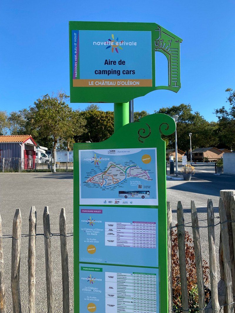
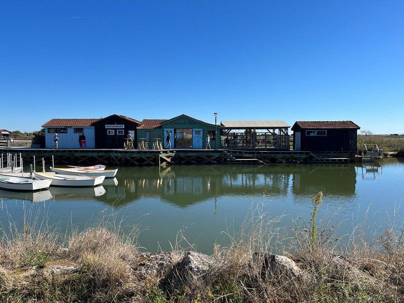
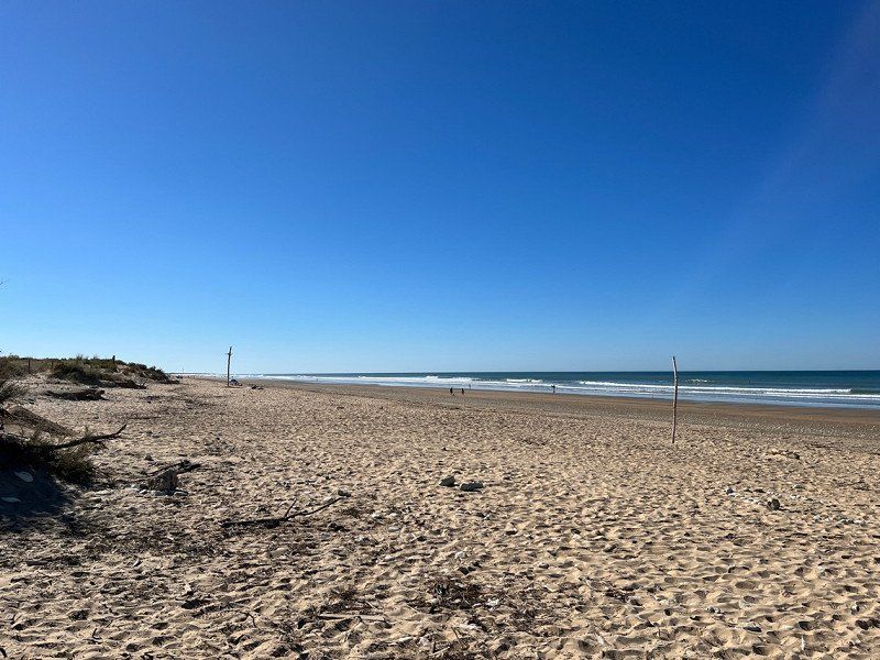
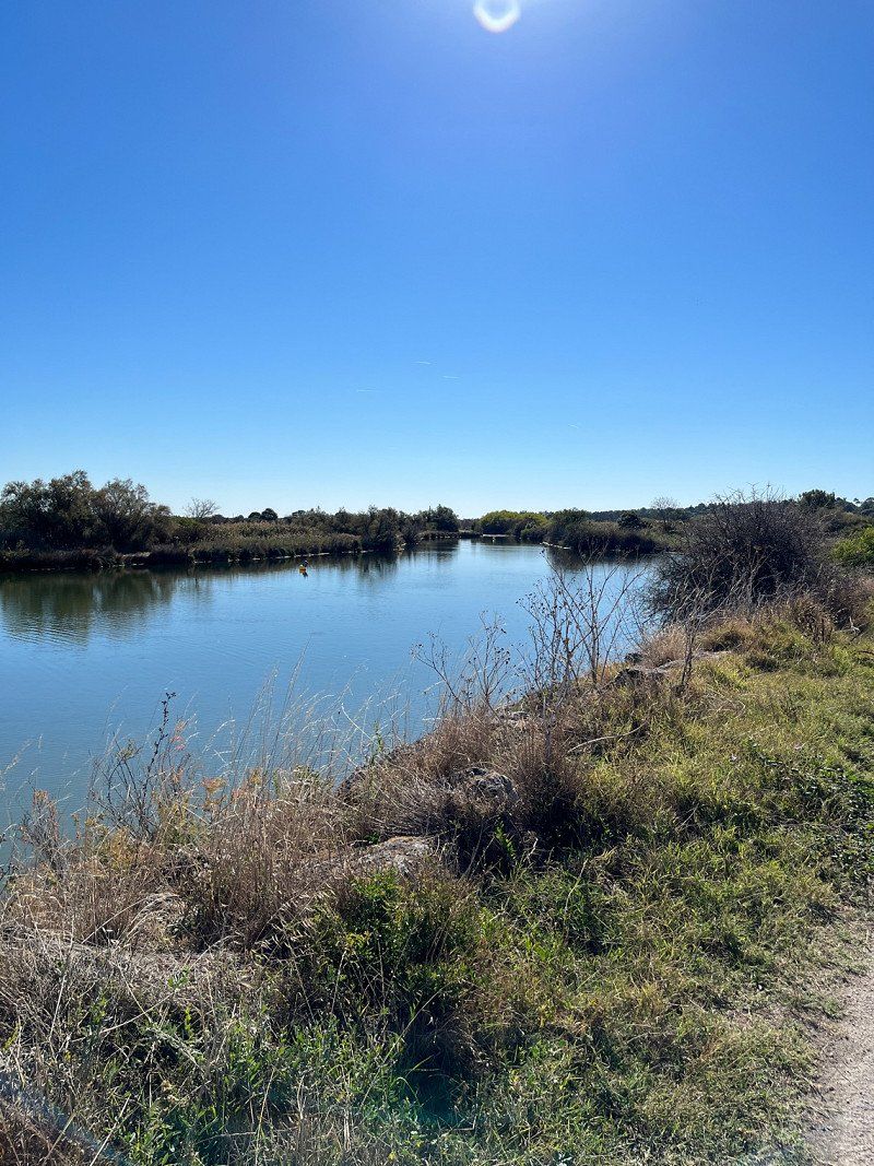
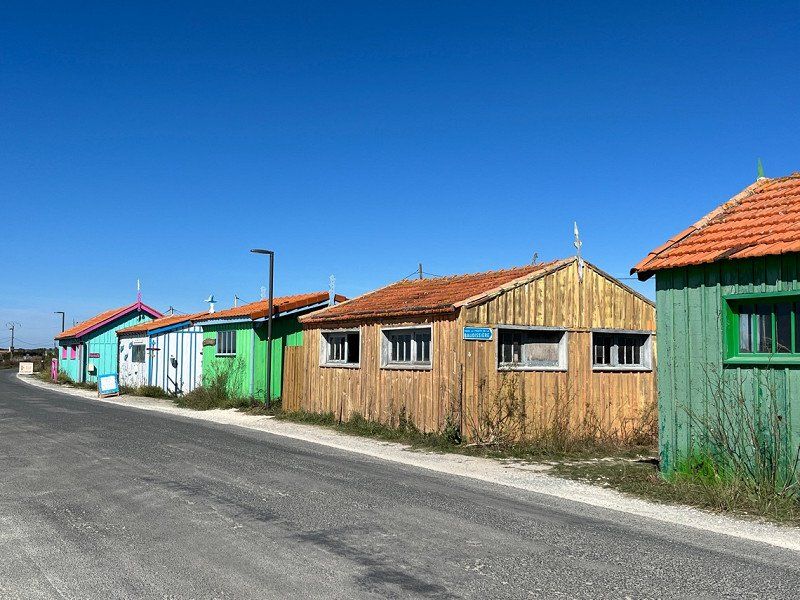
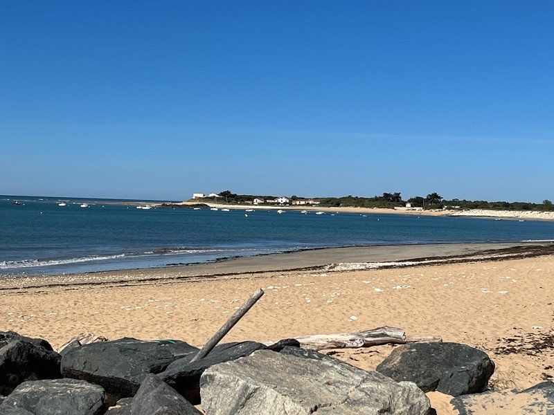
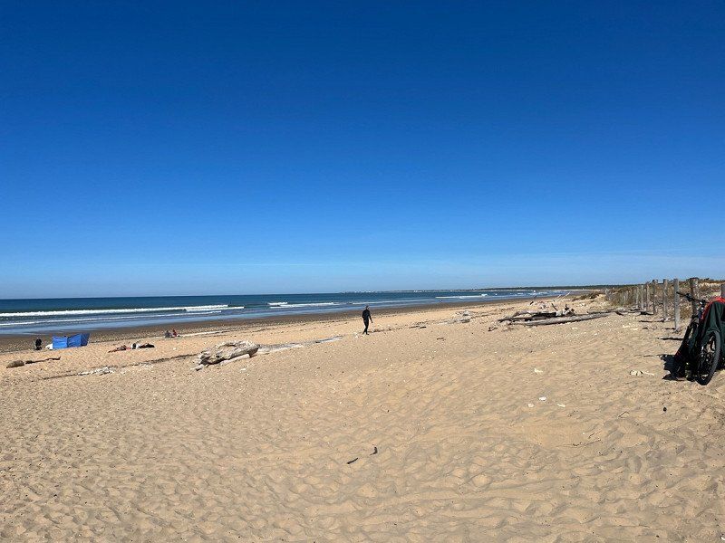
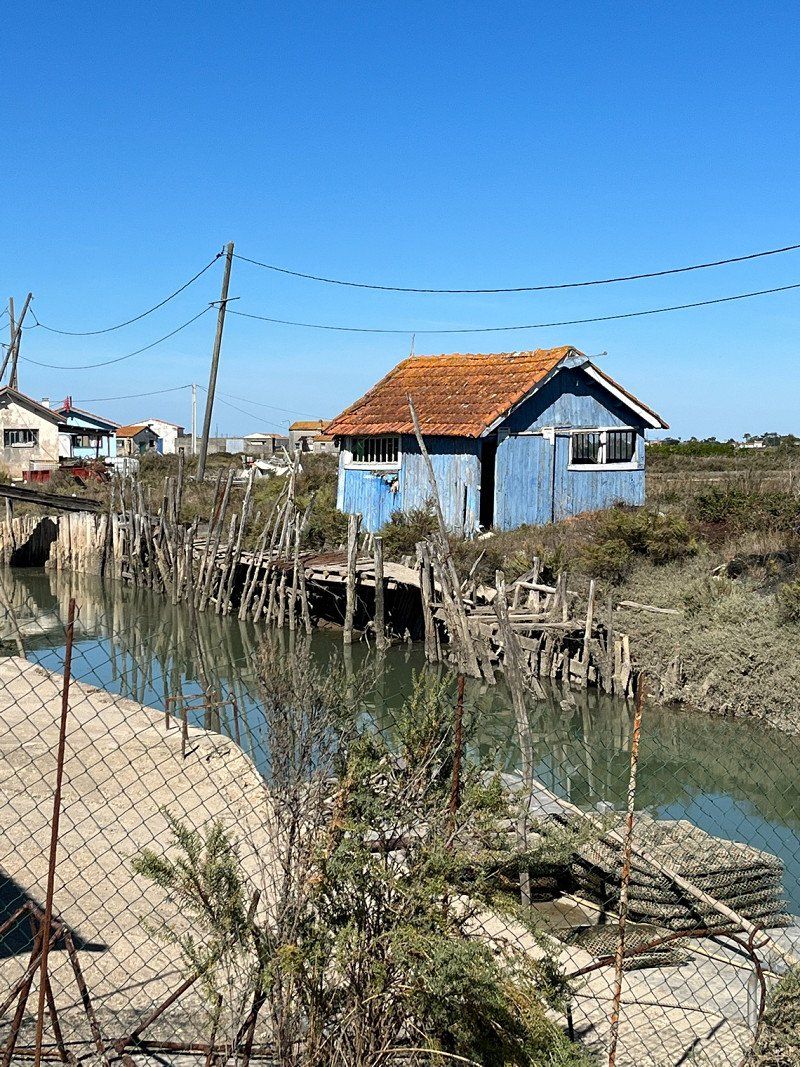
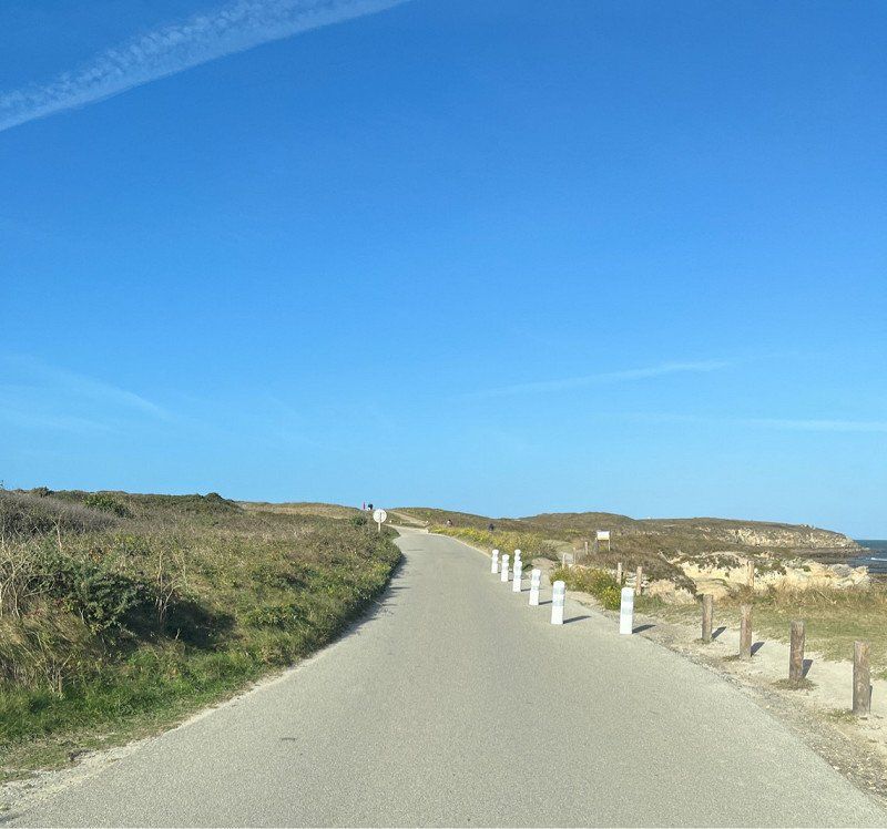
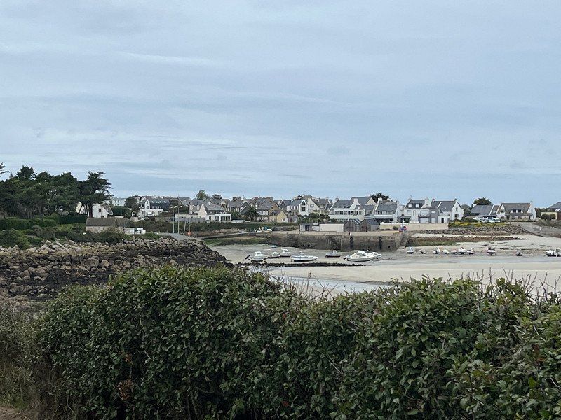
Fahrradtour auf der Ill de Oléron
30 km cycled on designated cycle paths. To the Grand Village Plage then to the small town of Dolus de Oléron and back to the SP on the Route de Hurites.
Day
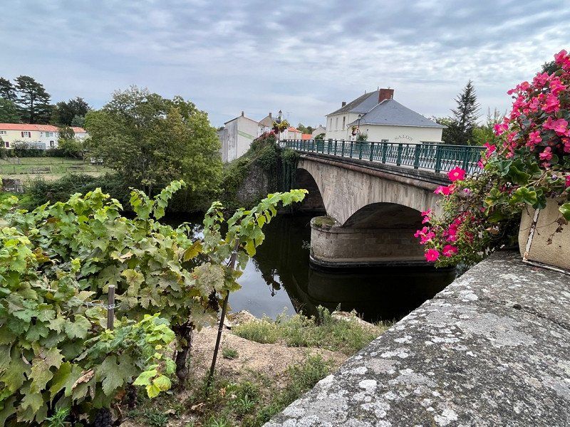
Mareuil-sur-Lay-Dissais, Frankreich
Lunch break on free SP with V+E and electricity for those who need it (of course it has to be paid for)
Bakery and coffee right across the street. There were 7 SPs, 5 were occupied.
I walked to church, there must be a bit of movement while driving 😃
85320 Mareuil-sur-Lay-Dissais, Frankreich
46° 32' 1.7" N 1° 13' 24.1" W
46.5338143 -1.2233481
• Head toward Rue de la Prée on Rue des Gabares. Go for 38 m.
• Turn left onto Rue du Lay. Go for 152 m.
• Turn left onto Rue du Lay. Go for 195 m.
• Turn left onto Rue Hervé de Mareuil (D746). Go for 320 m.
• Take the 2nd exit from roundabout onto Rue Hervé de Mareuil (D746). Go for 9.5 km.
• Turn right onto Rue de la Maison Neuve (D36) toward Thorigny/Bournezeau/La Chaize le V. Go for 182 m.
• Turn left onto Route de la Limouzinière (D101). Go for 1.1 km.
• Continue on D101. Go for 1.1 km.
• Continue on Route de la Limouzinière (D101). Go for 1.7 km.
• Continue on Route de la Limouzinière (D88). Go for 88 m.
• Turn left onto Route de la Limouzinière (D101 E). Go for 1.7 km.
• Continue on D101 E. Go for 636 m.
• Continue on Lieu-dit La Martinière (D101 E). Go for 88 m.
• Continue on D101 E. Go for 526 m.
• Continue on Lieu-dit La Jaulnière (D101 E). Go for 66 m.
• Continue on D101 E. Go for 184 m.
• Turn right onto Lieu-dit La Blanchardière (D101 E). Go for 47 m.
• Continue on Route des Essarts Gouin (D101 E). Go for 707 m.
• Continue on Lieu-dit Le Penaud (D101 E). Go for 206 m.
• Continue on D101 E. Go for 204 m.
• Continue on Lieu-dit La Trichardière (D101). Go for 35 m.
• Continue on D101. Go for 322 m.
• Continue on Lieu-dit Le Brûlot (D101). Go for 90 m.
• Continue on D101. Go for 27 m.
• Continue on D101 A. Go for 21 m.
• Continue on Lieu-dit Le Brûlot de Saint-Mars (D101 A). Go for 43 m.
• Continue on D101 A. Go for 202 m.
• Take the 3rd exit from roundabout onto D101 A. Go for 397 m.
• Take the 5th exit from roundabout onto D948. Go for 5.5 km.
• Continue on D160. Go for 3.9 km.
• Take ramp toward Noirmoutier/St Nazaire/Aizenay/St Jean de Monts. Go for 330 m.
• Pass 3 roundabouts and continue on Route de la Roche-sur-Yon (D948). Go for 36.5 km.
• Take ramp toward Porte de La Roche S/Yon/St Gilles Croix de Vie/St Hilaire de Riez/Les Sables d'Olonne. Go for 337 m.
• Continue on Rue de la Roche-sur-Yon. Go for 801 m.
• Take the 2nd exit from Rond-Point de la Rémonière roundabout onto Rue de la Roche-sur-Yon. Go for 808 m.
• Take the 3rd exit from roundabout onto Rue des Marzelles. Go for 265 m.
• Take the 1st exit from roundabout onto Rue des Sables (D32). Go for 82 m.
• Take the 2nd exit from roundabout onto Boulevard Lucien Dodin. Go for 225 m.
• Take the 2nd exit from roundabout onto Boulevard Lucien Dodin. Go for 286 m.
• Continue on Place de la Mairie (D753). Go for 17 m.
• Turn left onto Rue de l'Hôtel de Ville (D69). Go for 221 m.
• Turn left onto Rue de l'Hôtel de Ville. Go for 44 m.
• Arrive at Rue de l'Hôtel de Ville. Your destination is on the right.
☍
69,3 km
( 55 min.)
Challans, Frankreich
85300 Challans, Frankreich
46° 50' 41.4" N 1° 52' 49.5" W
46.8448280 -1.8804120
• Head southwest on Rue de l'Hôtel de Ville. Go for 18 m.
• Turn left onto Rue de l'Hôtel de Ville (D69). Go for 205 m.
• Turn left onto Boulevard Lucien Dodin. Go for 32 m.
• Turn right onto Rue du Maréchal de Lattre de Tassigny (D753). Go for 104 m.
• Continue on Place du Général de Gaulle (D32/D753). Go for 25 m.
• Continue on Place de Gaulle (D753). Go for 45 m.
• Continue on Rue Bonne Fontaine (D753). Go for 243 m.
• Turn left onto Rue de la Concorde. Go for 139 m.
• Continue on Rue Montorcy. Go for 79 m.
• Take the 2nd exit from roundabout onto Rue Montorcy. Go for 84 m.
• Continue on Boulevard Clemenceau. Go for 13 m.
• Turn right onto Rue de Bois de Cène (D58). Go for 250 m.
• Pass 2 roundabouts and continue on Rue de Bois de Cène (D58). Go for 685 m.
• Take the 3rd exit from Rond-Point de la Terrière roundabout onto Rue de Bois de Cène (D58). Go for 278 m.
• Take the 1st exit from Rond-Point de la Fillaudière roundabout onto Rue de Bois de Cène (D58). Go for 258 m.
• Continue on Route de Bois-de-Céné (D58). Go for 1.6 km.
• Continue on Route du Marais (D58). Go for 4.0 km.
• Continue on Lieu-dit Le Progrès (D58). Go for 49 m.
• Continue on Route de Challans (D58). Go for 507 m.
• Continue on Lieu-dit L'Égalité (D58). Go for 83 m.
• Continue on Route de Challans (D58). Go for 147 m.
• Continue on Lieu-dit Le Fourin (D58). Go for 100 m.
• Continue on Lieu-dit Saint-Joseph (D58). Go for 180 m.
• Continue on Route de Challans (D58). Go for 298 m.
• Continue on Lieu-dit Le Chêne Vert (D58). Go for 100 m.
• Continue on D58. Go for 304 m.
• Continue on Lieu-dit Le Manoir (D58). Go for 102 m.
• Continue on Rue de Challans (D58). Go for 663 m.
• Take the 2nd exit from roundabout onto Rue Jan et Joël Martel (D21). Go for 413 m.
• Turn left onto Rue de la Motte (D21). Go for 343 m.
• Turn right onto Rue des Vallées. Go for 236 m.
• Continue on Rue du Grand Marais (D21 A). Go for 5.6 km.
• Turn right onto D59. Go for 266 m.
• Continue on D64. Go for 576 m.
• Turn left onto D80. Go for 131 m.
• Continue on Lieu-dit Les Morandières (D80). Go for 60 m.
• Continue on D80. Go for 218 m.
• Turn left onto Lieu-dit Le Port La Roche (D80). Go for 1.1 km.
• Turn right onto Lieu-dit Le Port La Roche (D80) toward St Cyr en Retz. Go for 22 m.
• Continue on Lieu-dit La Pouzinière (D80). Go for 1.4 km.
• Continue on Lieu-dit Le Bossis Rousseau (D80). Go for 63 m.
• Continue on D80. Go for 186 m.
• Continue on Lieu-dit La Boutetterie (D80). Go for 68 m.
• Continue on D80. Go for 838 m.
• Continue on Lieu-dit La Chilois (D80). Go for 53 m.
• Continue on D80. Go for 188 m.
• Continue on Lieu-dit La Croix des Marais (D80). Go for 121 m.
• Continue on D80. Go for 258 m.
• Continue on Lieu-dit Saint-Joseph (D80). Go for 149 m.
• Continue on Lieu-dit La Maison Blanche (D80). Go for 65 m.
• Continue on D80. Go for 431 m.
• Continue on Lieu-dit Les Jalberges (D80). Go for 965 m.
• Continue on Route de Port-la-Roche (D80). Go for 70 m.
• Take the 3rd exit from roundabout onto Route de Machecoul (D13) toward St Nazaire/Bourgneuf en Retz. Go for 4.4 km.
• Take the 2nd exit from Giratoire de la Corderie roundabout onto Route Bleue (D13) toward St Nazaire/Pornic. Go for 941 m.
• Take the 2nd exit from Giratoire du Moulin Saint-Laurent roundabout onto Route Bleue (D13) toward St Nazaire/Les Moutiers en Retz/La Bernerie en Retz/Pornic. Go for 536 m.
• Take the 3rd exit from Giratoire Les Puymains roundabout onto Route Bleue (D13) toward St Nazaire/Les Moutiers en Retz/La Bernerie en Retz/Pornic. Go for 13.5 km.
• Take ramp toward Pornic-Centre/St Père en Retz. Go for 63 m.
• Turn right onto Route de Saint-Père-en-Retz (D86). Go for 30 m.
• Turn right onto D86. Go for 473 m.
• Turn left onto Route de Saint-Père-en-Retz. Go for 291 m.
• Take the 2nd exit from Rond-Point Saint-Gilles roundabout onto Rue de Verdun (D13). Go for 454 m.
• Turn sharp right onto Place du Marchix. Go for 162 m.
• Arrive at Rue de l'Église. Your destination is on the right.
☍
45,1 km
( 46 min.)
Pornic, Frankreich
44210 Pornic, Frankreich
47° 6' 55.8" N 2° 6' 16" W
47.1154910 -2.1044440
• Head toward Rue Fernand de Mun on Rue de l'Église. Go for 20 m.
• Turn right onto Rue Voisin. Go for 43 m.
• Turn right onto Place des Halles. Go for 32 m.
• Turn right onto Rue Georges Clemenceau. Go for 88 m.
• Turn slightly left onto Rue de l'Église. Go for 108 m.
• Continue on Rue du Maréchal Foch (D13). Go for 179 m.
• Turn left onto Rue Sainte-Anne. Go for 130 m.
• Continue on Rue Tartifume. Go for 40 m.
• Turn left onto Rue de Tourte. Go for 236 m.
• Take the 2nd exit from Rue des Peupliers roundabout onto Rue de Tourte. Go for 157 m.
• Take the 1st exit from Rond-Point Saint-Gilles roundabout onto Route de Saint-Père-en-Retz. Go for 286 m.
• Turn right onto D86. Go for 474 m.
• Turn left onto Route de Saint-Père-en-Retz (D86). Go for 30 m.
• Take ramp onto Route Bleue (D213). Go for 23.6 km.
• Take ramp onto N171 toward Rennes/Vannes/Nantes/Pont-Château/Savenay/Trignac. Go for 9.9 km.
• Take ramp onto D4 toward Rennes/Vannes/Lorient/Donges/Besné/Pont-Château. Go for 2.1 km.
• Continue on D773. Go for 4.3 km.
• Pass 2 roundabouts and continue on D773. Go for 4.8 km.
• Take the 4th exit from roundabout onto D773 toward Vannes/Rennes/Redon. Go for 479 m.
• Take the 2nd exit from roundabout onto D33 toward Vannes/Rennes/Ste Anne S/Brivet/Redon. Go for 319 m.
• Take the 2nd exit from roundabout onto Lieu-dit La Hirtais (D33) toward Vannes/Rennes/Ste Anne S/Brivet. Go for 516 m.
• Take ramp onto N165 toward Vannes/Lorient/Rennes/La Roche Bernard/Redon. Go for 37.5 km.
• Take ramp toward Muzillac-Ouest/Ambon/Sarzeau/Damgan. Go for 320 m.
• Take the 3rd exit from Giratoire de Terre-Océan roundabout onto D20 toward Ambon/Damgan/Sarzeau. Go for 706 m.
• Pass 7 roundabouts and continue on Lieu-dit Le Clos Sapin (D20). Go for 16.5 km.
• Continue on D20. Go for 933 m.
• Take the 3rd exit from roundabout onto D780. Go for 5.2 km.
• Take the 3rd exit from Giratoire de Kergroës roundabout onto C9. Go for 155 m.
• Continue on Lieu-dit Kergroës (C9). Go for 103 m.
• Continue on C9. Go for 210 m.
• Continue on Rue Voltaire (C9). Go for 2.0 km.
• Take the 1st exit from roundabout onto Rue Tal Er Chapel (VC203). Go for 1.1 km.
• Continue on Rue Clos Er Bert. Go for 1.0 km.
• Turn right onto Place de la Butte. Go for 73 m.
• Turn left onto Rue Hent Morice. Go for 304 m.
• Turn right onto Impasse Gren Gal. Go for 23 m.
• Turn left onto Rue Puns Koz. Go for 104 m.
• Turn right onto Rue du Sens. Go for 219 m.
• Arrive at Rue du Sens. Your destination is on the right.
☍
114,3 km
(1 hrs. 33 min.)
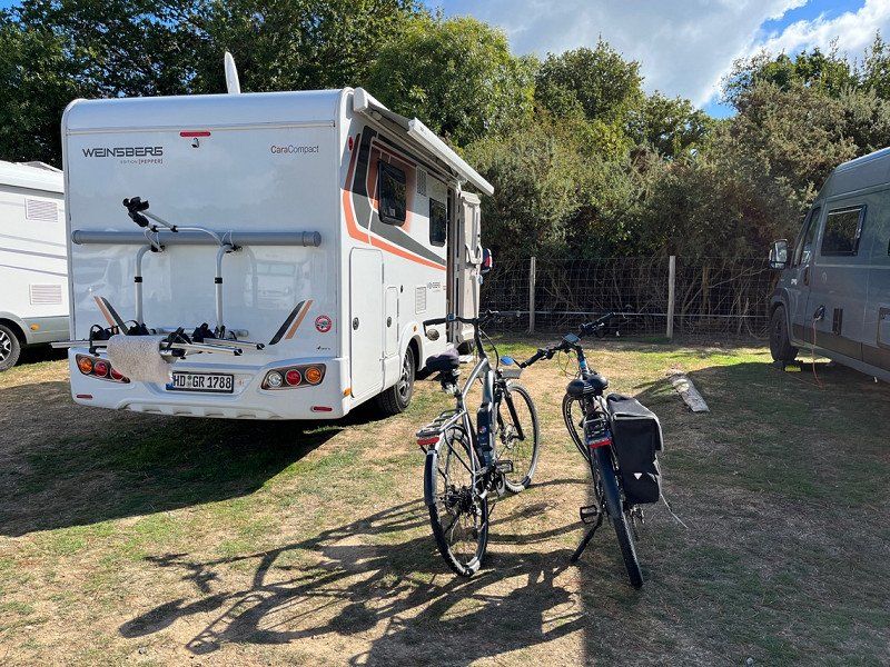
Camping les Genêts ***
ACSI CP for 16€/1 night + tourist tax
It was ok for one night, but we would like to be closer to the beach. So we continue towards Arzon
Rue du Sens - St Jacques 30, 56370, Sarzeau, Frankreich
47° 29' 44.8" N 2° 47' 57.9" W
47.4957679 -2.7994046
• Head toward Impasse de la Bome on Rue du Sens. Go for 317 m.
• Turn right onto Rue Hent Morice. Go for 306 m.
• Continue on Route du Cossay. Go for 1.4 km.
• Turn left onto Route de Kernolivès (C4). Go for 530 m.
• Take the 1st exit from roundabout onto Route de Goahssiny (C3). Go for 699 m.
• Turn left onto Rue de Pen-Er-Bot (C3). Go for 213 m.
• Continue on Chemin de la Fontaine Saint-Félix (C3). Go for 505 m.
• Turn right onto Rue Saint-Goustan. Go for 192 m.
• Take the 2nd exit from roundabout onto Route de l'Ancienne Gare (D198). Go for 398 m.
• Take the 1st exit from roundabout onto Route d'Arzon (D198). Go for 42 m.
• Take the 2nd exit from roundabout onto Avenue Raymond Marcellin (D198). Go for 1.3 km.
• Take the 1st exit from roundabout onto Route d'Arzon (D198). Go for 1.3 km.
• Turn left onto Rue des Paluds. Go for 534 m.
• Continue on Rue Bodo Braz. Go for 336 m.
• Turn right onto Chemin de Pen Er Pont. Go for 209 m.
• Turn left onto Lieu-dit Kerver (C101). Go for 169 m.
• Turn slightly left onto C101. Go for 236 m.
• Arrive at C101. Your destination is on the right.
☍
8,7 km
( 15 min.)
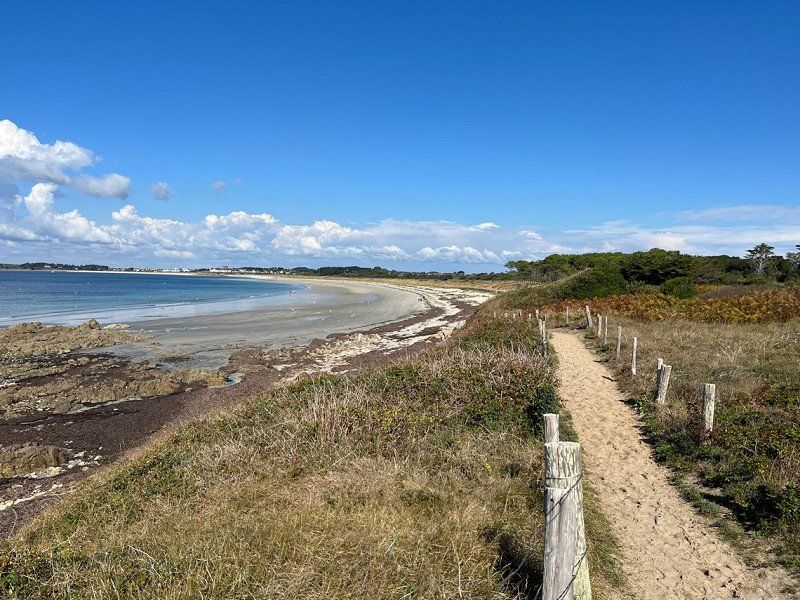
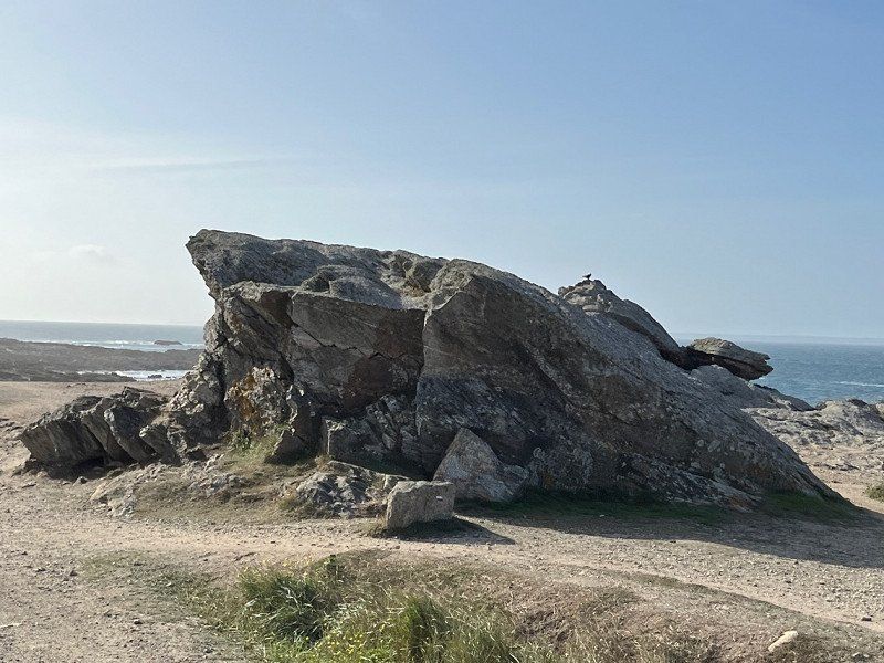
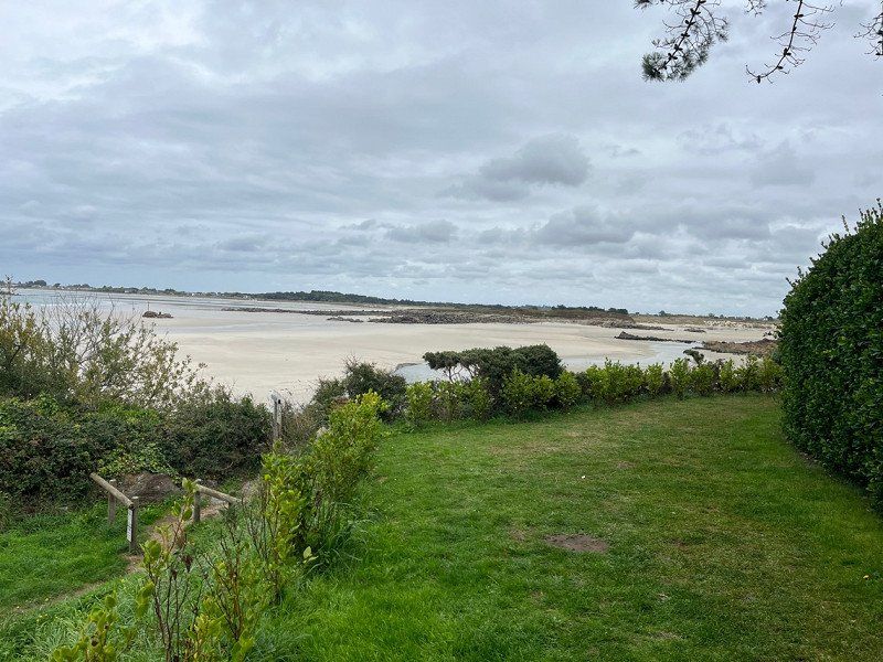
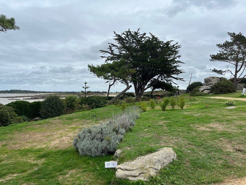
Day
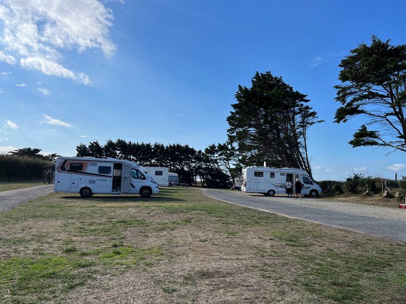
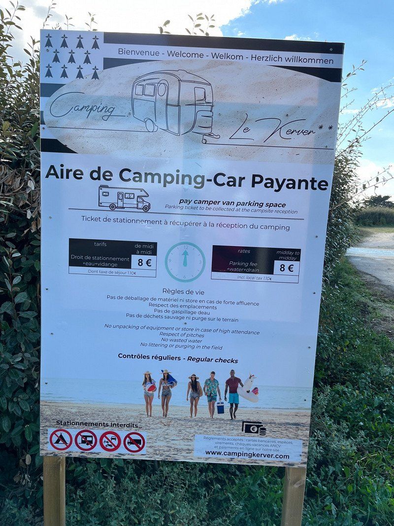
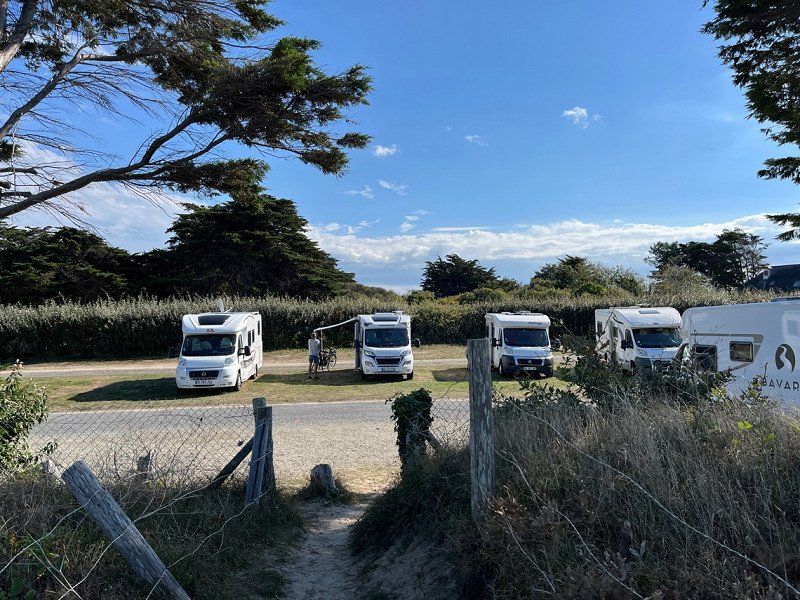
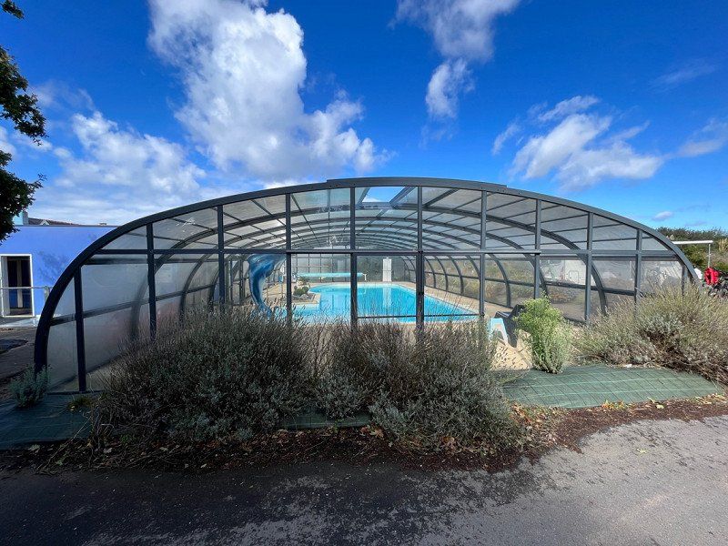
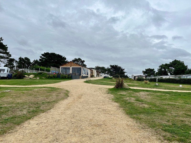
Camping Municipal De Kerver
In front of the CP there is a SP without electricity but with V+E 8€/night
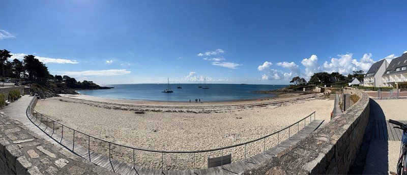
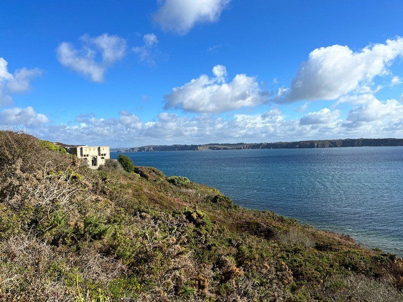
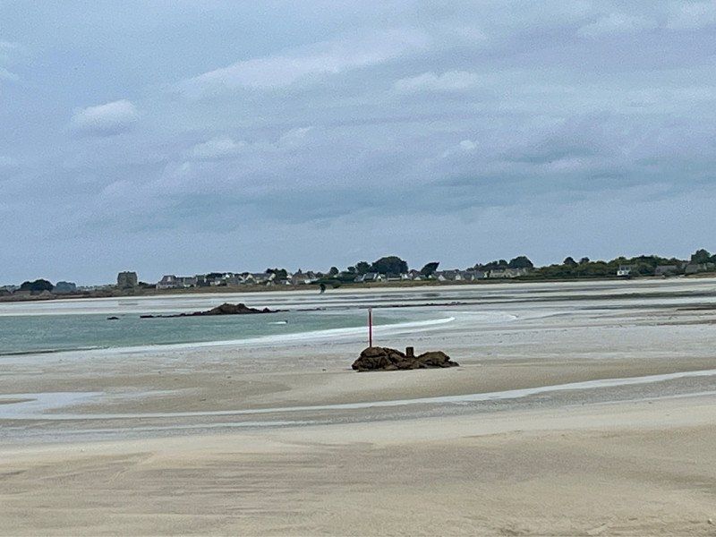
Nice place with a great view of the bay
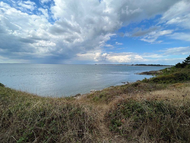
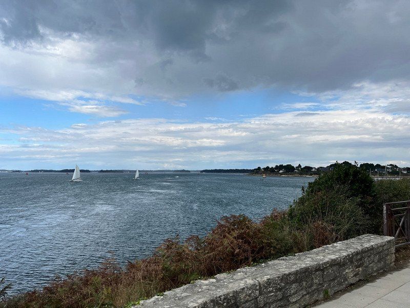
Direct access and great bike paths to Arzon. There are shops there.
We were cycling to Arzon.
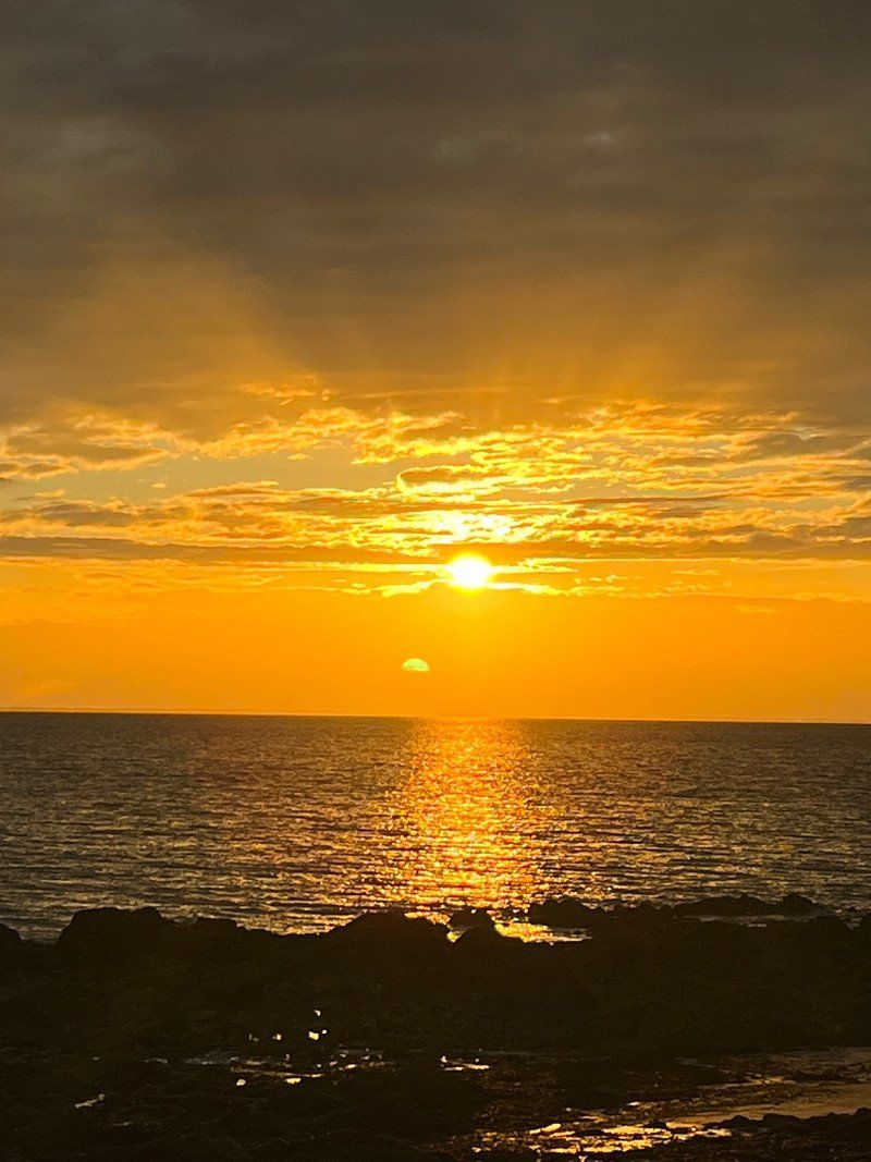
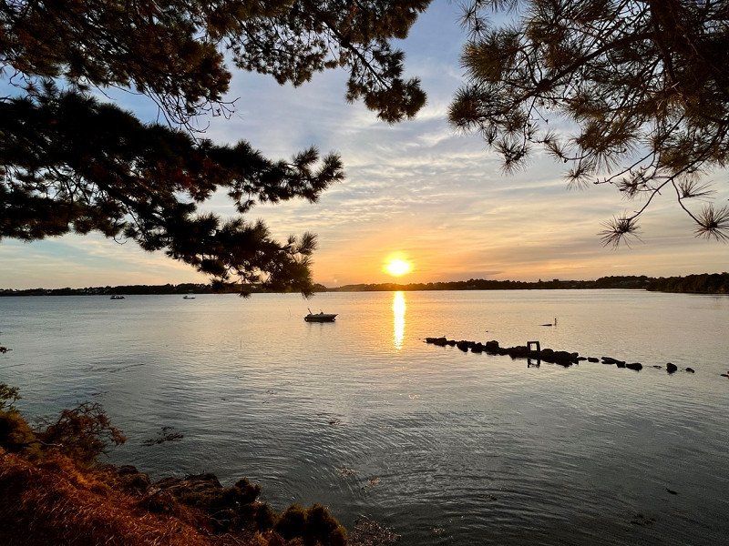
In the evening we had a beautiful sunset.
56730, St Gildas De Rhuys, Frankreich
47° 31' 28.6" N 2° 51' 31.3" W
47.5246000 -2.8587000
• Head northwest on C101. Go for 236 m.
• Turn slightly right onto Lieu-dit Kerver (C101). Go for 169 m.
• Continue on Allée des Tamaris (C101). Go for 1.4 km.
• Take the 2nd exit from roundabout onto D780. Go for 451 m.
• Continue on Lieu-dit Larguéven (D780). Go for 140 m.
• Continue on Route d'Arzon (D780). Go for 3.4 km.
• Continue toward D780. Go for 32 m.
• Take the 3rd exit from Giratoire du Spernec roundabout onto D780. Go for 380 m.
• Continue on Route de Vannes à Port-Navalo (D780). Go for 68 m.
• Continue on D780. Go for 956 m.
• Take the 2nd exit from Giratoire de Kerollaire roundabout onto D780. Go for 287 m.
• Continue on Route de Port-Navalo (D780). Go for 410 m.
• Continue on D780. Go for 89 m.
• Take the 2nd exit from Giratoire de Kergroës roundabout onto D780. Go for 4.6 km.
• Keep left onto D780. Go for 611 m.
• Take the 3rd exit from roundabout onto D780. Go for 2.0 km.
• Take the 3rd exit from Giratoire du Clos Salomon roundabout onto D780. Go for 2.1 km.
• Pass 4 roundabouts and continue on D780. Go for 6.7 km.
• Take ramp onto N165. Go for 1.7 km.
• Keep left onto N165 toward Vannes-Centre/Lorient/Brest/Rennes. Go for 6.8 km.
• Keep left onto Rocade de Vannes (N165) toward Lorient/Brest/Vannes-Ouest/Arradon/Auray. Go for 1.7 km.
• Take ramp toward Arradon/Île aux Moines. Go for 265 m.
• Take the 4th exit from Giratoire de Luscanen roundabout onto D779 toward Vannes-Sud/Arradon/Île aux Moines. Go for 413 m.
• Take the 2nd exit from Giratoire de Keranguen roundabout onto Avenue de Keranguen toward Vannes-Sud/Arradon/Île aux Moines/Le Port/Parc des Expositions/Zone de Keranguen. Go for 465 m.
• Take the 1st exit from Giratoire de la Mare roundabout onto Rue du Vincin (C10). Go for 844 m.
• Take the 1st exit from Giratoire du Vincin roundabout onto Route de la Côte du Vincin (D101). Go for 970 m.
• Take the 4th exit from Giratoire du Petit Molac roundabout onto Lieu-dit La Salette (D101). Go for 595 m.
• Take the 2nd exit from Giratoire de Botquelen roundabout onto Lieu-dit Toul Baden (D101). Go for 1.1 km.
• Take the 2nd exit from Route de la Lande de Lignol roundabout onto D101. Go for 3.0 km.
• Take the 2nd exit from roundabout onto D101. Go for 928 m.
• Take the 2nd exit from roundabout. Go for 100 m.
• Continue on Hameau de Kerispert (D316). Go for 344 m.
• Continue on D316. Go for 608 m.
• Continue on Lieu-dit Tréver (D316). Go for 188 m.
• Continue on D316. Go for 246 m.
• Take the 3rd exit from roundabout onto Route de Port Blanc (D316 A). Go for 139 m.
• Continue on Route du Port Blanc (D316 A). Go for 13 m.
• Continue on Route de Port Blanc (D316 A). Go for 76 m.
• Continue on Route du Port Blanc (D316 A). Go for 6 m.
• Continue on Route de Port Blanc (D316 A). Go for 913 m.
• Turn left. Go for 27 m.
• Turn right. Go for 13 m.
• Turn right. Go for 11 m.
• Turn right. Go for 88 m.
• Arrive at your destination on the left.
☍
45,6 km
( 47 min.)
Day
23 Route de Port Blanc
SP for 12.80 € / night incl. electricity + visitor's tax
We will probably stay here for 2 nights to sit out the rainy weather a bit.
Did a short bike ride this afternoon, but the weather is set to rain.
Evening walk to Port Blanc en Baden
47° 36' 24.2" N 2° 52' 24.2" W
47.6067200 -2.8733929
• Head northwest. Go for 28 m.
• Turn right. Go for 66 m.
• Turn left. Go for 13 m.
• Turn right toward Route de Port Blanc/D316 A. Go for 40 m.
• Turn right onto Route de Port Blanc (D316 A). Go for 861 m.
• Continue on Route du Port Blanc (D316 A). Go for 6 m.
• Continue on Route de Port Blanc (D316 A). Go for 76 m.
• Continue on Route du Port Blanc (D316 A). Go for 13 m.
• Turn slightly right onto Route de Port Blanc (D316 A). Go for 33 m.
• Take the 1st exit from roundabout onto D316. Go for 272 m.
• Continue on Lieu-dit Tréver (D316). Go for 188 m.
• Continue on D316. Go for 608 m.
• Continue on Hameau de Kerispert (D316). Go for 377 m.
• Take the 4th exit from roundabout onto D101. Go for 2.8 km.
• Pass 5 roundabouts and continue on D101. Go for 7.8 km.
• Continue on D17. Go for 101 m.
• Take the 1st exit from roundabout onto D17. Go for 93 m.
• Take the 2nd exit from Rond-Point du Branhoc roundabout onto D765. Go for 770 m.
• Take the 1st exit from Rond-Point de Kergoho roundabout onto N165 toward Lorient. Go for 4.5 km.
• Take ramp toward Quiberon/La Trinité S/ Mer/Carnac/Auray-Z.A. Go for 318 m.
• Take the 4th exit from Giratoire de Kerbois roundabout onto Route de Quiberon (D768) toward La Trinité S/ Mer/Carnac/Quiberon/Belle Île en Mer/Plouharnel/Z.A. de Toul-Garros. Go for 795 m.
• Take the 3rd exit from roundabout onto D768. Go for 920 m.
• Pass 3 roundabouts and continue on Lieu-dit Le Paradis (D768). Go for 7.1 km.
• Take the 3rd exit from roundabout onto D768. Go for 2.0 km.
• Take the 3rd exit from Rond-Point de l'Océan roundabout onto Avenue d'Auray (D768). Go for 255 m.
• Take the 4th exit from roundabout onto Avenue de l'Océan (D768). Go for 3.9 km.
• Pass 3 roundabouts and continue on Rue de la Baie (D768). Go for 6.0 km.
• Take the 2nd exit from roundabout. Go for 25 m.
• Take the 1st exit from roundabout onto Avenue de Bretagne (D768). Go for 306 m.
• Pass 7 roundabouts and continue on Avenue du Général de Gaulle (D768). Go for 4.0 km.
• Take the 1st exit from roundabout onto Rue du Port de Pêche. Go for 551 m.
• Take the 3rd exit from roundabout onto Rue Victor Golvan. Go for 83 m.
• Take the 1st exit from roundabout onto Place du Varquez. Go for 141 m.
• Turn left onto Place du Varquez. Go for 76 m.
• Turn right. Go for 63 m.
• Turn left. Go for 12 m.
• Turn right. Go for 21 m.
• Arrive at your destination on the left.
☍
45,0 km
( 52 min.)
Day
Ein Regentag
Break - wait for bad weather - 😟
Day
Abstecher zur Insel Quiberon
The weather is very mixed this week. It's not supposed to rain this morning, so we'll drive to the island. There is a narrow coastal road right on the island all the way up into town. We drove on them, unfortunately there are no parking spaces for mobile homes. Everything height limited to 1.90/2.00m
And we didn't want to drive on an SP now.
We hope that the weather is still kind to us and that we don't just have rainy days ahead of us.
Then we continue in the direction of Qimper.
Quiberon, Frankreich
Once along the coast!!!
47° 28' 55.7" N 3° 7' 15.8" W
47.4821330 -3.1210530
• Head west. Go for 21 m.
• Turn left. Go for 12 m.
• Turn right toward Place du Varquez. Go for 63 m.
• Turn right onto Place du Varquez. Go for 99 m.
• Turn left onto Rue Victor Golvan. Go for 23 m.
• Take the 1st exit from roundabout onto Rue Victor Golvan. Go for 29 m.
• Turn right onto Rue du Lioric. Go for 71 m.
• Turn right onto Rue du Port de Pêche. Go for 453 m.
• Take the 2nd exit from roundabout onto Avenue du Général de Gaulle (D768). Go for 439 m.
• Pass 5 roundabouts and continue on Route de Quiberon (D768). Go for 3.4 km.
• Turn left onto Avenue de l'Atlantique. Go for 178 m.
• Take the 2nd exit from roundabout onto Avenue de l'Atlantique. Go for 264 m.
• Turn right onto Route du Prado (D186 A). Go for 7 m.
• Turn left onto Route des Tamaris. Go for 385 m.
• Continue on Rue de la Grande Côte. Go for 79 m.
• Continue on Rue des Albatros. Go for 223 m.
• Turn slightly left onto Rue de Port Rhu. Go for 126 m.
• Turn slightly left onto Rue de Port Rhu. Go for 40 m.
• Continue on Route Côtière. Go for 30 m.
• Arrive at Route Côtière. Your destination is on the left.
☍
5,9 km
( 12 min.)
GV83+G9 Saint-Pierre-Quiberon, Frankreich
47° 30' 58.7" N 3° 8' 47.6" W
47.5162928 -3.1465530
• Head north on Route Côtière. Go for 30 m.
• Keep right onto Rue de Port Rhu. Go for 348 m.
• Turn right onto Rue de la Grande Côte. Go for 8 m.
• Turn slightly left onto Rue de Kergroix. Go for 476 m.
• Continue on Route du Prado (D186 A). Go for 462 m.
• Turn right onto Route du Roch (D186 A). Go for 223 m.
• Take the 2nd exit from roundabout onto Route du Roch (D186 A). Go for 281 m.
• Take the 2nd exit from roundabout onto Avenue de Saint-Pierre (D768). Go for 1.2 km.
• Pass 3 roundabouts and continue on Route de Quiberon (D768). Go for 8.6 km.
• Take the 3rd exit from roundabout onto Place du Général de Gaulle. Go for 144 m.
• Take the 4th exit from roundabout onto Rue du Préleran (D781). Go for 1.9 km.
• Pass 2 roundabouts and continue on Route d'Erdeven (D781). Go for 3.1 km.
• Arrive at Rue des Menhirs (D781). Your destination is on the left.
☍
16,8 km
( 22 min.)
40 Rue des Menhirs, 56410 Erdeven, Frankreich
47° 38' 12" N 3° 9' 4.8" W
47.6366787 -3.1513371
• Head toward Rue du Calvaire on Rue des Menhirs (D781). Go for 368 m.
• Take the 3rd exit from roundabout onto Rue des Menhirs (D781). Go for 902 m.
• Pass 5 roundabouts and continue on Route des Quatre Chemins (D781). Go for 4.4 km.
• Take the 3rd exit from roundabout onto Route de Pont-Lorois (D781). Go for 1.4 km.
• Take the 2nd exit from roundabout onto Rue du Pont Lorois (D781). Go for 432 m.
• Take the 2nd exit from roundabout onto D9. Go for 2.5 km.
• Take the 2nd exit from roundabout onto Lieu-dit Manéguen (D9). Go for 3.9 km.
• Take the 3rd exit from roundabout. Go for 160 m.
• Continue on D9. Go for 2.0 km.
• Continue on D194. Go for 2.5 km.
• Take the 2nd exit from roundabout onto D194. Go for 1.1 km.
• Take the 2nd exit from roundabout onto D194. Go for 284 m.
• Pass 2 roundabouts and continue on Avenue du 8 Mai 1945 (D194). Go for 3.5 km.
• Take the 3rd exit from roundabout onto Avenue du Président Salvador Allende (D326). Go for 365 m.
• Take the 1st exit from Rond-Point du 18 Juin 1940 roundabout onto Avenue du Général de Gaulle. Go for 686 m.
• Continue on Avenue du Colonel Fabien. Go for 504 m.
• Continue on Avenue Lénine. Go for 198 m.
• Take the 2nd exit from roundabout onto Avenue François Billoux. Go for 277 m.
• Take the 2nd exit from roundabout onto Place Auguste Delaune. Go for 445 m.
• Take the 2nd exit from roundabout onto Avenue Gabriel Péri. Go for 220 m.
• Continue on Pont des Indes. Go for 302 m.
• Take the 2nd exit from roundabout onto Boulevard Laënnec. Go for 34 m.
• Continue on Rue Jean-Baptiste Chaigneau. Go for 37 m.
• Take the 1st exit from roundabout onto Rue Jean-Baptiste Chaigneau. Go for 188 m.
• Pass 2 roundabouts and continue on Rue Jean-Baptiste Chaigneau. Go for 475 m.
• Continue on Cours de Chazelles. Go for 17 m.
• Turn left onto Cours de Chazelles. Go for 108 m.
• Turn right onto Boulevard Maréchal Joffre. Go for 278 m.
• Take the 1st exit from Place de la Légion d'Honneur roundabout onto Boulevard Louis Franchet d'Espèrey. Go for 295 m.
• Turn right onto Boulevard Cosmao Dumanoir. Go for 86 m.
• Arrive at Boulevard Cosmao Dumanoir. Your destination is on the left.
☍
27,9 km
( 36 min.)
36bis Bd Cosmao Dumanoir, 56100 Lorient, Frankreich
47° 45' 16.3" N 3° 21' 54.3" W
47.7545193 -3.3650930
• Head toward Cours de Chazelles on Boulevard Cosmao Dumanoir. Go for 151 m.
• Turn right onto Cours de Chazelles. Go for 253 m.
• Turn right onto Boulevard Maréchal Joffre. Go for 278 m.
• Take the 2nd exit from Place de la Légion d'Honneur roundabout onto Boulevard Maréchal Joffre. Go for 150 m.
• Continue on Place de la Libération. Go for 57 m.
• Take the 3rd exit from Rond-Point de l'Australie roundabout onto Boulevard du Général Leclerc. Go for 290 m.
• Take the 1st exit from roundabout onto Avenue Anatole France. Go for 121 m.
• Pass 2 roundabouts and continue on Avenue Anatole France. Go for 218 m.
• Take the 2nd exit from roundabout onto Avenue de la Marne. Go for 326 m.
• Turn right onto Avenue du Général de Gaulle. Go for 390 m.
• Take the 2nd exit from Rond-Point du Pays de Galle roundabout onto Avenue du Général de Gaulle. Go for 557 m.
• Take the 2nd exit from Rond-Point de Bir Hakeim roundabout onto Pont de la Puce Qui Renifle (D29). Go for 118 m.
• Continue on Rue Monistrol (D29). Go for 211 m.
• Pass 3 roundabouts and continue on Rue Monistrol (D29). Go for 1.1 km.
• Continue on D29. Go for 7 m.
• Continue on D23. Go for 9 m.
• Keep left onto D23. Go for 909 m.
• Continue on D29. Go for 10 m.
• Continue on D23. Go for 271 m.
• Take the 2nd exit from Giratoire du Minio roundabout onto D23. Go for 233 m.
• Keep left onto Avenue du Président Kennedy (D29). Go for 24 m.
• Continue on D152. Go for 1.1 km.
• Pass 4 roundabouts and continue on Boulevard de l'Atlantique (D152). Go for 5.4 km.
• Turn left onto Route du Courégant (C311). Go for 352 m.
• Arrive at Route du Courégant (C311).
☍
12,6 km
( 18 min.)
PG4P+3J Ploemeur, Frankreich
47° 42' 18.8" N 3° 27' 48.5" W
47.7052200 -3.4634738
• Head northwest on Route du Courégant (C311). Go for 352 m.
• Turn left onto Route du Courégant (D152). Go for 3.8 km.
• Take the 2nd exit from Rond-Point Keragan roundabout onto Boulevard de l'Océan (D152). Go for 5.1 km.
• Take the 2nd exit from roundabout onto Lieu-dit La Pitié (C527). Go for 44 m.
• Turn slightly right onto Route de Kerbrest (C527). Go for 26 m.
• Arrive at Route de Kerbrest (C527). Your destination is on the left.
☍
9,3 km
( 12 min.)
4 Rue du Port, 56520 Guidel, Frankreich
47° 46' 21.5" N 3° 31' 33.8" W
47.7726441 -3.5260493
• Head toward Rue du Port on Route de Kerbrest (C527). Go for 26 m.
• Turn slightly left onto Lieu-dit La Pitié (C527). Go for 15 m.
• Take the 2nd exit from roundabout onto Route des Plages (D306). Go for 144 m.
• Pass 4 roundabouts and continue on D306. Go for 3.0 km.
• Take the 3rd exit from roundabout onto Rue de Carrigaline. Go for 221 m.
• Take the 4th exit from roundabout onto Rue Joseph Léna (D162). Go for 264 m.
• Turn right onto Rue Joseph Léna (D162). Go for 82 m.
• Turn right onto Place de Polignac (D306). Go for 131 m.
• Turn right onto Rue Marc Mouelo (D306). Go for 781 m.
• Keep right onto D306. Go for 26 m.
• Take the 4th exit from roundabout onto Rue des Chevaliers. Go for 311 m.
• Take the 3rd exit from roundabout onto Rue de Brocéliande. Go for 170 m.
• Arrive at Rue de Brocéliande. Your destination is on the right.
☍
5,1 km
( 8 min.)
Guidel, Frankreich
56520 Guidel, Frankreich
47° 47' 42.1" N 3° 29' 13.4" W
47.7950170 -3.4870620
• Head north on Rue de Brocéliande. Go for 128 m.
• Take the 1st exit from roundabout onto Rue des Chevaliers. Go for 245 m.
• Take the 3rd exit from roundabout onto D306. Go for 646 m.
• Take the 3rd exit from roundabout. Go for 68 m.
• Continue on Lieu-dit Les Cinq Chemins (D765). Go for 263 m.
• Pass 2 roundabouts and continue on Rue de Lorient (D765). Go for 9.1 km.
• Take the 1st exit from roundabout onto Rue d'Arzano (D22). Go for 34 m.
• Turn left onto Rue de Saint-Jalmes. Go for 83 m.
• Turn right onto Rue de Lavoisier. Go for 57 m.
• Arrive at Rue de Lavoisier. Your destination is on the right.
☍
10,6 km
( 11 min.)
6 Rue Lavoisier, 29300 Quimperlé, Frankreich
47° 52' 9.1" N 3° 32' 14.4" W
47.8691982 -3.5373262
• Head toward Avenue du Moulin du Coq on Rue de Lavoisier. Go for 78 m.
• Turn right onto Avenue du Moulin du Coq. Go for 151 m.
• Turn right onto Rue d'Arzano (D22). Go for 141 m.
• Take the 1st exit from roundabout onto Rue de Lorient (D765). Go for 743 m.
• Take the 2nd exit from roundabout onto Place Charles de Gaulle (D765). Go for 78 m.
• Take the 1st exit from roundabout onto Rue de la Tour d'Auvergne (D765). Go for 131 m.
• Take the 2nd exit from roundabout onto Rue Thiers (D783). Go for 336 m.
• Take the 2nd exit from roundabout onto Rue de Pont-Aven (D6). Go for 280 m.
• Pass 3 roundabouts and continue on Rue de Pont-Aven (D783). Go for 2.4 km.
• Take the 3rd exit from Rond-Point Soweto roundabout onto D783 toward Nantes/Lorient/Riec S/Bélon/Baye/Le Trévoux/Kervidanou 1-2/Manoir de Kernault. Go for 501 m.
• Take the 3rd exit from Rond-Point Chicago roundabout onto Pôle Dactivités Kervidanou 2 (D783). Go for 1.3 km.
• Take the 2nd exit from roundabout onto Route de Quimperlé (D783). Go for 6.1 km.
• Arrive at Lieu-dit La Fontaine aux Chats (D783). Your destination is on the left.
☍
12,2 km
( 16 min.)
308 Font des Chats, 29340 Riec-sur-Bélon, Frankreich
47° 50' 57.3" N 3° 40' 36.7" W
47.8492380 -3.6768545
• Head toward Route de Trévoux on Lieu-dit La Fontaine aux Chats (D783). Go for 924 m.
• Take the 3rd exit from roundabout onto Rue de la Gare (D783). Go for 548 m.
• Take the 2nd exit from roundabout onto Rue Alain Berthou (D783). Go for 4.4 km.
• Take the 2nd exit from roundabout onto Rue du Général de Gaulle (D783). Go for 376 m.
• Turn right onto Rue Émile Bernard (D783). Go for 409 m.
• Arrive at Rue Émile Bernard (D783). Your destination is on the left.
☍
6,7 km
( 8 min.)
41 Rue Emile Bernard, 29930 Pont-Aven, Frankreich
47° 51' 28.3" N 3° 45' 0.4" W
47.8578636 -3.7501144
• Head west on Rue Émile Bernard (D783). Go for 655 m.
• Pass 3 roundabouts and continue on Place de la Mairie (D783). Go for 7.2 km.
• Take the 2nd exit from roundabout onto Place de la Mairie (D783). Go for 514 m.
• Pass 6 roundabouts and continue on D783. Go for 6.4 km.
• Take the 4th exit from Rond-Point Kérampéru roundabout onto Rue de Quimper. Go for 375 m.
• Take the 2nd exit from roundabout onto Rue de Quimper. Go for 391 m.
• Take the 1st exit from roundabout onto Rue de Kernéac'h. Go for 307 m.
• Take the 1st exit from roundabout onto Rue de Kernéac'h. Go for 118 m.
• Take the 3rd exit from Rue Coat-Bras roundabout onto Avenue Robert Jan. Go for 752 m.
• Take the 1st exit from Rond-Point Robert Jan roundabout onto Avenue Robert Jan. Go for 305 m.
• Turn right onto Rue Henri Cevaër. Go for 84 m.
• Take the 1st exit from Rond-Point des Sables Blancs roundabout onto Rue des Sables Blancs. Go for 438 m.
• Take the 1st exit from roundabout onto Avenue du Dorlett. Go for 79 m.
• Continue on Avenue du Dorlett. Go for 251 m.
• Arrive at Avenue du Dorlett. Your destination is on the right.
☍
17,9 km
( 22 min.)
Camping Les Sables Blancs - Camping Finistère (Espace Aquatique, Location Mobil Home), Avenue du Dorlett, Concarneau, Frankreich
ASCI - CP for 18€/night + visitor's tax, bread can be ordered, terraced camping, WiFi free,
Well booked, but we have a place. If it stops raining, I would like to visit the old town. According to the CP_employee, it is a short way to get there.
17 Av. du Dorlett, 29900 Concarneau, Frankreich
47° 52' 55.4" N 3° 55' 41.5" W
47.8820481 -3.9282002
• Head east on Avenue du Dorlett.
• Turn right. Go for 41 m.
• Turn right. Go for 16 m.
• Turn right. Go for 107 m.
• Turn right toward Avenue du Dorlett. Go for 17 m.
• Turn left onto Avenue du Dorlett. Go for 228 m.
• Take the 2nd exit from roundabout onto Rue des Sables Blancs. Go for 464 m.
• Take the 1st exit from Rond-Point des Sables Blancs roundabout onto Boulevard Alfred Guillou. Go for 1.4 km.
• Continue on Boulevard Bougainville. Go for 108 m.
• Arrive at Boulevard Bougainville. Your destination is on the left.
☍
2,4 km
( 4 min.)
Concarneau, Frankreich
Walked to Concarneau from the CP on the coast. Walked along the city wall into the old town center for sightseeing.
Walked about 6 km.
6bis Bd Bougainville, 29900 Concarneau, Frankreich
47° 52' 12" N 3° 55' 17" W
47.8700015 -3.9213919
• Head toward Rue Bayard on Boulevard Bougainville. Go for 331 m.
• Continue on Place de la Croix. Go for 198 m.
• Take the 1st exit from roundabout onto Quai Pénéroff. Go for 307 m.
• Take the 2nd exit from roundabout onto Avenue Pierre Guéguin. Go for 329 m.
• Pass 2 roundabouts and continue on Avenue de la Gare. Go for 1.0 km.
• Continue on Rue de Quimper. Go for 175 m.
• Pass 2 roundabouts and continue on Rue de Quimper. Go for 677 m.
• Take the 3rd exit from Rond-Point Kérampéru roundabout onto Route de Quimper (D783). Go for 558 m.
• Take the 2nd exit from Giratoire de Villeneuve roundabout onto Rue de la Villeneuve (D783). Go for 701 m.
• Take the 1st exit from Rond-Point Keramporiel roundabout onto D70. Go for 247 m.
• Take the 3rd exit from roundabout onto Rue de Colguen (D70). Go for 2.4 km.
• Take the 2nd exit from Giratoire de la Boissière roundabout onto D70 toward N165/Rosporden. Go for 718 m.
• Take the 1st exit from roundabout onto N165 toward Quimper/Brest. Go for 19.4 km.
• Take ramp toward Park Poullig/Audierne/Douarnenez/Locronan/Quimper-Nord/Quimper-Ouest/Parc des Expositions. Go for 486 m.
• Take the 1st exit from roundabout onto D770 toward Lorient/Quimper/Douarnenez/Audierne/Locronan/Parc des Expositions. Go for 382 m.
• Take the 1st exit from Rond-Point de Park Poullig roundabout onto Boulevard de la Pointe du van (D100) toward Douarnenez/Aéroport Pont l'Abbé/Audierne/Locronan/Quimper-Nord et Ouest/Parc des Expositions. Go for 1.8 km.
• Take ramp toward Locronan/Plogonnec/Quimper-Nord/Parc des Expositions. Go for 285 m.
• Take the 1st exit from Rond-Point de Kergariou roundabout onto Route de Plogonnec (D39). Go for 7.2 km.
• Pass 7 roundabouts and continue on Rue des Troènes (D63). Go for 16.1 km.
• Turn left onto Rue du Porzay (D63). Go for 845 m.
• Continue on Rue de la Presqu'Île (D63). Go for 533 m.
• Continue on Lieu-dit Prategannec (D63). Go for 29 m.
• Continue on D63. Go for 1.1 km.
• Continue on Lieu-dit Lézivy (D63). Go for 97 m.
• Continue on D63. Go for 1.4 km.
• Continue on Lieu-dit Mez Gouez (D63). Go for 279 m.
• Continue on D63. Go for 85 m.
• Continue on Lieu-dit Pouloupry (D63). Go for 180 m.
• Continue on D63. Go for 325 m.
• Continue on Lieu-dit Pennavouez (D63). Go for 858 m.
• Turn left onto Rue de Goulitquer. Go for 14 m.
• Arrive at Rue de Goulitquer.
☍
59,1 km
( 51 min.)
Day
Saint-Nic, Frankreich
48° 12' 7.7" N 4° 16' 59.5" W
48.2021340 -4.2831950
• Head northwest on Rue de Goulitquer. Go for 103 m.
• Take the 3rd exit from roundabout onto Rue Saint-Jean (D63). Go for 601 m.
• Continue on Lieu-dit Kerolier (D63). Go for 1.6 km.
• Continue on D63. Go for 1.6 km.
• Turn left onto D887. Go for 9.1 km.
• Take the 3rd exit from roundabout onto Route de Crozon (D887). Go for 2.1 km.
• Take the 2nd exit from roundabout onto D887. Go for 1.9 km.
• Take the 1st exit from Giratoire de Sligo roundabout onto Boulevard Pierre Mendès France. Go for 318 m.
• Take the 3rd exit from roundabout onto Boulevard Pierre Mendès France. Go for 1.4 km.
• Take the 1st exit from roundabout onto Boulevard Pierre Mendès France. Go for 255 m.
• Take the 1st exit from roundabout onto Rue Charles Lévenèz (D155). Go for 135 m.
• Continue on Rue Nominoë (D155). Go for 100 m.
• Pass 2 roundabouts and continue on Rue Nominoë (D155). Go for 716 m.
• Continue on Lieu-dit Coadic (D155). Go for 129 m.
• Continue on D155. Go for 499 m.
• Continue on Lieu-dit Lescoat (D155). Go for 190 m.
• Continue on D155. Go for 190 m.
• Continue on Lieu-dit Saint-Jean Leïdez (D155). Go for 194 m.
• Continue on D155. Go for 165 m.
• Turn left onto D355. Go for 844 m.
• Continue on Lieu-dit Guenvenez (D355). Go for 78 m.
• Continue on D355. Go for 1.9 km.
• Take the 2nd exit from roundabout onto D355. Go for 252 m.
• Continue on Lieu-dit Saint-Fiacre (D355). Go for 561 m.
• Continue on D355. Go for 237 m.
• Continue on Lieu-dit Meznot (D355). Go for 102 m.
• Continue on D355. Go for 1.8 km.
• Continue on Lieu-dit Quélern (D355). Go for 188 m.
• Turn left onto Route des Fortifications. Go for 581 m.
• Turn left onto D355. Go for 1.2 km.
• Turn left. Go for 30 m.
• Arrive at your destination on the right.
☍
29,0 km
( 29 min.)
Camping Plage de Trez Rouz
ACSI CP for 18€/1 night + tourist tax
Swimming pool included, bread and small bistro
Here we stay for 2 nights.
Nice view and small beach
29160, Crozon, Frankreich
48° 17' 16.4" N 4° 33' 54.7" W
48.2879000 -4.5652000
• Head northwest. Go for 30 m.
• Turn left onto D355. Go for 223 m.
• Continue on Lieu-dit Trez Rouz (D355). Go for 131 m.
• Continue on Route de Quélern (D355). Go for 2.4 km.
• Take the 1st exit from roundabout onto Rue de Crozon (D8). Go for 275 m.
• Take the 2nd exit from roundabout onto Rue du Chanoine Bossënec (D8). Go for 373 m.
• Pass 2 roundabouts and continue on Rue du Chanoine Bossënec. Go for 153 m.
• Continue on Rue du Chanoine Bossennec. Go for 57 m.
• Continue on Place Saint-Rémy. Go for 26 m.
• Turn slightly right onto Place Saint-Rémy. Go for 38 m.
• Continue on Rue de Verdun. Go for 116 m.
• Continue on Place d'Estienne d'Orves. Go for 75 m.
• Continue on Rue Toussaint Le Garrec. Go for 44 m.
• Turn right onto Rue du Doué. Go for 30 m.
• Arrive at Rue du Doué. Your destination is on the left.
☍
4,0 km
( 6 min.)
Day
Camaret-sur-Mer, Frankreich
Bike tour with the aim of Pointe de Pin Hir.
We cycle past megaliths, a ruined castle that was built in 1904 and now only remains of it, bunker museum with many anchor statues to Point de Pen Hir.
Apart from extreme wind, the weather is quite good. Clouds gather quickly, but they're gone just as quickly. We stay dry and have a coffee at the port.
Tomorrow we continue towards Brest or above to the coast. We've already seen where the weather is still kind to us.
48° 16' 33" N 4° 35' 49.6" W
48.2758360 -4.5971140
• Head east on Rue du Doué. Go for 69 m.
• Turn left onto Rue du Pré. Go for 35 m.
• Turn right onto Rue Alsace-Lorraine. Go for 73 m.
• Turn right onto Place Charles de Gaulle. Go for 246 m.
• Continue on Rue des Quatre Vents (D8 A). Go for 365 m.
• Take the 3rd exit from roundabout onto Rue de Crozon (D8). Go for 291 m.
• Take the 2nd exit from roundabout onto Rue de Crozon (D8). Go for 194 m.
• Continue on Route de Crozon (D8). Go for 1.2 km.
• Continue on Lieu-dit Keranguyader (D8). Go for 1.4 km.
• Continue on D8. Go for 3.1 km.
• Continue on Route de Camaret (D8). Go for 1.7 km.
• Take the 3rd exit from roundabout onto Boulevard de Pralognan. Go for 740 m.
• Take the 2nd exit from roundabout onto Boulevard Pierre Mendès France. Go for 265 m.
• Take the 2nd exit from roundabout onto Boulevard Pierre Mendès France. Go for 1.3 km.
• Take the 1st exit from roundabout onto Boulevard Pierre Mendès France. Go for 311 m.
• Take the 4th exit from Giratoire de Sligo roundabout onto Rue de Poulpatre (D887). Go for 2.0 km.
• Take the 2nd exit from roundabout onto D887. Go for 2.1 km.
• Take the 3rd exit from roundabout onto Route de Brest (D791). Go for 22.3 km.
• Turn right onto Place aux Foires. Go for 68 m.
• Turn right onto Place aux Foires (D42). Go for 663 m.
• Take ramp onto N165 toward Brest/Daoulas/Landerneau/Abbaye de Daoulas/Sizun. Go for 23.3 km.
• Keep left onto Pénétrante Sud (N165) toward Brest-Centre/Brest-Ports/Océanopolis. Go for 4.4 km.
• Take the 1st exit from Rond-Point des Foulques roundabout onto Route du Vieux Saint-Marc (E60) toward Brest-Centre/Port du Château. Go for 1.0 km.
• Take the 3rd exit from Rond-Point Herman Melville roundabout onto Rue Amiral Troude. Go for 305 m.
• Turn right onto Rampe du Moulin Grivart. Go for 130 m.
• Turn slightly left onto Rue Poullic-al-Lor. Go for 484 m.
• Turn right onto Avenue Salaun Penquer. Go for 86 m.
• Take the 2nd exit from Rond-Point Henri Rol-Tanguy roundabout onto Avenue Clemenceau toward Brest-Ouest/Hôpital Morvan. Go for 512 m.
• Arrive at Avenue Clemenceau. Your destination is on the right.
☍
68,6 km
( 56 min.)
Day
Brest, Frankreich
48° 23' 25.4" N 4° 29' 9.9" W
48.3903940 -4.4860760
• Head toward Place de la Liberté on Avenue Clemenceau. Go for 382 m.
• Continue on Avenue Georges Clemenceau. Go for 48 m.
• Continue on Place de l'Harteloire. Go for 47 m.
• Continue on Rue de l'Harteloire. Go for 215 m.
• Turn right onto Rue la Motte Picquet. Go for 301 m.
• Keep right onto Rue la Motte Picquet. Go for 199 m.
• Take the 3rd exit from Place Albert 1er roundabout onto Place Albert 1er toward Morlaix. Go for 50 m.
• Continue on Rue Paul Doumer. Go for 375 m.
• Continue on Boulevard Montaigne. Go for 132 m.
• Turn slightly left onto Boulevard Léon Blum toward Morlaix/Plabennec/Lambézellec/Gouesnou. Go for 862 m.
• Turn right onto Rue Bertrand d'Argentré toward Morlaix/Landerneau/Plabennec/Gouesnou. Go for 98 m.
• Continue on Rue Jules Lesven. Go for 76 m.
• Take the 2nd exit from Rond-Point de Kertatupage roundabout onto Avenue Georges Pompidou toward Morlaix/Gouesnou/Plabennec/Landerneau. Go for 639 m.
• Take the 3rd exit from Rond-Point de Pen Ar CH'Leuz roundabout onto D112 toward Morlaix. Go for 4.0 km.
• Keep left onto N12. Go for 26.8 km.
• Take ramp toward D32/Bodilis/Landivisiau-Centre. Go for 519 m.
• Continue on Lieu-dit La Croix des Malotiers. Go for 241 m.
• Take the 3rd exit from Rond-Point de la Croix des Maltotiers roundabout onto D32 toward Brest/Morlaix/Lesneven/Plouescat/Bodilis/Saint-Servais/Saint-Derrien/Z.A. Croix des Maltotiers. Go for 416 m.
• Keep left onto Chemin de Landivisiau à Lesneven (D32). Go for 1.0 km.
• Take the 1st exit from roundabout onto D30. Go for 9.4 km.
• Take the 1st exit from Rond-Point de Kergroas roundabout onto Lieu-dit Kergodalar (D229). Go for 554 m.
• Continue on Chemin de Plounéventer Vers Berven (D229). Go for 486 m.
• Continue on D229. Go for 738 m.
• Take the 2nd exit from Rond-Point de Roz-Avel roundabout onto D35. Go for 1.1 km.
• Continue on Chemin de Saint-Éloy à la Mer (D35). Go for 546 m.
• Keep right onto C6. Go for 218 m.
• Continue on Lieu-dit Lanrioul (C6). Go for 45 m.
• Continue on C6. Go for 391 m.
• Continue on Lieu-dit Kermeriadec. Go for 556 m.
• Continue on Lieu-dit Roz Avel. Go for 178 m.
• Continue on Lieu-dit Kerzournan. Go for 114 m.
• Continue on Lieu-dit Kerdreïn. Go for 415 m.
• Continue on Lieu-dit Kernilis. Go for 190 m.
• Continue on Lieu-dit Le Bourg. Go for 197 m.
• Take the 2nd exit from roundabout onto Lieu-dit Kerbalanec. Go for 189 m.
• Turn left onto Lieu-dit Kerbalanec. Go for 760 m.
• Continue on Lieu-dit Odéven. Go for 161 m.
• Continue on Lieu-dit Lodeven. Go for 246 m.
• Continue on Lieu-dit Begadou. Go for 326 m.
• Continue on VC2. Go for 31 m.
• Turn right onto Lieu-dit Pont Riou (VC2). Go for 80 m.
• Continue on VC2. Go for 523 m.
• Continue on Lieu-dit Kerzibou (VC2). Go for 113 m.
• Continue on VC2. Go for 289 m.
• Continue on Lieu-dit Bel-Air (VC2). Go for 53 m.
• Continue on VC2. Go for 456 m.
• Continue on VC4. Go for 13 m.
• Continue on Lieu-dit Keringar (VC4). Go for 852 m.
• Continue on VC4. Go for 450 m.
• Continue on Lieu-dit Kerhouilec (VC4). Go for 88 m.
• Continue on Rue de la Croix (VC4). Go for 393 m.
• Turn left onto Route de Cléder (D10). Go for 1.0 km.
• Turn right onto VC15. Go for 133 m.
• Continue on Lieu-dit Le Band (VC15). Go for 119 m.
• Continue on VC15. Go for 128 m.
• Continue on Lieu-dit Rumeur (VC15). Go for 36 m.
• Continue on VC15. Go for 170 m.
• Continue on Lieu-dit Kersingar (VC15). Go for 112 m.
• Continue on VC15. Go for 178 m.
• Continue on Lieu-dit Le Croissant (VC15). Go for 161 m.
• Continue on VC2. Go for 106 m.
• Continue on VC5. Go for 683 m.
• Continue on Poul Ar Streat (VC5). Go for 334 m.
• Take the 1st exit from roundabout onto Route de Kersauzon (VC6). Go for 390 m.
• Turn left onto Lieu-dit Moguériec. Go for 51 m.
• Arrive at Lieu-dit Moguériec. Your destination is on the right.
☍
60,2 km
( 47 min.)
Camping Ar Roc'h
Nice ACSI CP for 14€/1 night + tourist tax
The view is wonderful, but unfortunately the weather is very autumnal.
Circular path directly on the CP to the beautiful beach.
367 route de Kersauzon, 29250, Sibiril, Frankreich
48° 41' 11.2" N 4° 4' 35.6" W
48.6864440 -4.0765450
• Head toward Route de Kersauzon on Lieu-dit Moguériec. Go for 51 m.
• Turn right onto Quai Mogueriec (VC6). Go for 375 m.
• Take the 2nd exit from roundabout onto Poul Ar Streat (VC5). Go for 389 m.
• Continue on VC5. Go for 683 m.
• Continue on VC2. Go for 106 m.
• Continue on Lieu-dit Le Croissant (VC15). Go for 161 m.
• Continue on VC15. Go for 178 m.
• Continue on Lieu-dit Kersingar (VC15). Go for 112 m.
• Continue on VC15. Go for 170 m.
• Continue on Lieu-dit Rumeur (VC15). Go for 36 m.
• Continue on VC15. Go for 128 m.
• Continue on Lieu-dit Le Band (VC15). Go for 119 m.
• Continue on VC15. Go for 133 m.
• Turn left onto D10. Go for 5.9 km.
• Take the 1st exit from Rond-Point de Kergompez roundabout onto Route de Brest à Saint-Pol-de-Léon (D788) toward Morlaix/Landivisiau/Brest. Go for 809 m.
• Take the 2nd exit from Rond-Point de Lesvestric roundabout onto D58 toward Morlaix/Carantec. Go for 1.7 km.
• Pass 2 roundabouts and continue on Route Départementale No58 (D58). Go for 13.9 km.
• Keep left onto D19. Go for 1.6 km.
• Take the 2nd exit from roundabout onto Route de Plouvorn (D19) toward Morlaix/St Martin des C. Go for 399 m.
• Take the 4th exit from Rond-Point du Puits roundabout onto N12 toward St Brieuc/Rennes. Go for 4.0 km.
• Take ramp toward Lannion/Lanmeur. Go for 405 m.
• Take the 1st exit from Rond-Point du 19 Mars 1962 roundabout onto D786 toward Lannion/Lanmeur/Z.A. la Boissière. Go for 9.7 km.
• Pass 2 roundabouts and continue on Lieu-dit Lescorre (D786). Go for 7.3 km.
• Turn slightly right onto Rue de Morlaix (D42) toward Trémel/Z.A. le Chatel. Go for 237 m.
• Turn left onto Place de la Mairie (D42). Go for 41 m.
• Arrive at Place de la Mairie (D42). Your destination is on the right.
☍
48,7 km
( 39 min.)
Day
Plestin-les-Grèves, Frankreich
What a great bay - we had to stop here for a moment!!
22310 Plestin-les-Grèves, Frankreich
48° 39' 14.7" N 3° 37' 50.8" W
48.6540850 -3.6307680
• Head northeast on Place de la Mairie (D42). Go for 23 m.
• Turn left onto Place de la Mairie. Go for 71 m.
• Continue on Place de l'Église. Go for 44 m.
• Turn right onto Rue de Kergus. Go for 687 m.
• Turn right onto Avenue des Frères le Gall (D786). Go for 302 m.
• Take the 2nd exit from roundabout onto Avenue des Frères le Gall (D786). Go for 5.9 km.
• Turn left onto Rue de la Côte des Bruyères. Go for 39 m.
• Arrive at Rue de la Côte des Bruyères. Your destination is on the right.
☍
7,1 km
( 8 min.)
Saint-Michel-en-Grève, Frankreich
Here, too, is another beautiful bay for surfers and kiters
48° 41' 5.3" N 3° 33' 54.2" W
48.6847920 -3.5650430
• Head west on Rue de la Côte des Bruyères. Go for 39 m.
• Turn left onto Rue de la Côte des Bruyères (D786). Go for 2.6 km.
• Pass 3 roundabouts and continue on Route de Morlaix (D786). Go for 5.4 km.
• Take the 4th exit from Rond-Point du Bel Air roundabout onto Boulevard Pierre Mendès France (D786) toward Lannion. Go for 1.9 km.
• Take the 2nd exit from roundabout onto Pont Viarmes (D786) toward Perros-Guirec. Go for 75 m.
• Take the 2nd exit from roundabout onto Quai du Maréchal Joffre (D788) toward Perros-Guirec/Trégastel/Pleumeur-Bodou/Trébeurden/Servel/Beg Leguer. Go for 770 m.
• Keep left onto Avenue de la Résistance (D788) toward Perros-Guirec/Trégastel/Aéroport. Go for 27 m.
• Continue on Avenue de la Résistance (D788). Go for 1.1 km.
• Take the 3rd exit from Rond-Point Armor roundabout onto Avenue de la Résistance (D788). Go for 763 m.
• Take the 6th exit from Rond-Point Pégase roundabout onto Avenue Pierre Marzin (D11). Go for 1.3 km.
• Pass 2 roundabouts and continue on Route de Trégastel (D11). Go for 7.4 km.
• Take the 3rd exit from roundabout onto Route du Dolmen. Go for 497 m.
• Turn left onto Z.A. du Dolmen. Go for 49 m.
• Arrive at Z.A. du Dolmen. Your destination is on the right.
☍
21,9 km
( 22 min.)
Trégastel, Frankreich
Spent lunchtime here. Definitely worth seeing!
48° 49' 1.2" N 3° 30' 48.1" W
48.8169880 -3.5133490
• Head northwest on Z.A. du Dolmen. Go for 49 m.
• Turn right onto Route du Dolmen. Go for 467 m.
• Take the 1st exit from roundabout onto Route de Lannion (D11). Go for 3.8 km.
• Take the 1st exit from roundabout onto Route de Trégastel (D6). Go for 373 m.
• Keep left onto Route de Trégastel (D6). Go for 3.2 km.
• Take the 3rd exit from Rond-Point de l'Aéroport roundabout onto Avenue Pierre Marzin (D11). Go for 1.3 km.
• Take the 3rd exit from Rond-Point Pégase roundabout onto Rue Saint-Pierre. Go for 474 m.
• Take the 2nd exit from Rond-Point Saint-Pierre roundabout onto Rue Saint-Pierre. Go for 272 m.
• Take the 1st exit from Rond-Point du Rusquet roundabout onto D767. Go for 2.0 km.
• Take the 2nd exit from roundabout onto Route de Perros (D767). Go for 1.4 km.
• Take the 3rd exit from Rond-Point Kroafhent-Tro Boutilh roundabout onto Route de Guingamp (D767) toward St Brieuc/Guingamp/Caouënnec-Lanvézéac/Rospez/Buhulien. Go for 25.8 km.
• Take the 2nd exit from roundabout onto N12 toward St Brieuc/Guingamp-Centre. Go for 54.6 km.
• Take ramp toward D768/La Ville Ès Landais/Plancoët/Z.I. de Lamballe. Go for 176 m.
• Take the 4th exit from roundabout onto C58. Go for 471 m.
• Take the 3rd exit from roundabout onto D768. Go for 2.7 km.
• Take the 2nd exit from roundabout onto D768. Go for 1.2 km.
• Take the 4th exit from Rond-Point de Lanjouan roundabout onto D768. Go for 633 m.
• Take the 2nd exit from roundabout onto D768. Go for 8.2 km.
• Turn left onto D13. Go for 6.2 km.
• Turn left onto D43. Go for 1.9 km.
• Continue on Rue de la Forge (D43). Go for 406 m.
• Turn right onto Rue de la Forge (D14). Go for 152 m.
• Continue on Rue de la Fresnaye (D43). Go for 812 m.
• Continue on Lieu-dit La Commodité (D43). Go for 115 m.
• Continue on D43. Go for 779 m.
• Continue on Rue des Rochettes (D43). Go for 309 m.
• Turn right onto Rue du Volondion (D16). Go for 26 m.
• Turn left onto Lieu-dit Frêche à las. Go for 27 m.
• Turn slightly right onto Rue du Champ Saint-Paul. Go for 63 m.
• Arrive at Rue du Champ Saint-Paul.
☍
118,0 km
(1 hrs. 20 min.)
Camping Le Frêche A L' âne, Rue du Champ Saint-Paul, Pléboulle, Frankreich
Small but very fine CP for €13/1 night including electricity!
Bread can be ordered at reception.
Very friendly welcome in English.
Sanitary building clean, everything whole and immaculate, the doors can be closed so that it is not so cold in the building.
If the nice weather from today lasts, we will cycle tomorrow and stay here for another night.
The Cap Frêhel is not that far away.
6 Rue du Champ Saint-Paul, 22550 Pléboulle, Frankreich
48° 36' 31.1" N 2° 20' 10.7" W
48.6086480 -2.3363170
• Head toward Lieu-dit Frêche à las on Rue du Champ Saint-Paul. Go for 63 m.
• Turn slightly left onto Lieu-dit Frêche à las. Go for 27 m.
• Turn right onto Rue du Volondion (D16). Go for 26 m.
• Continue on Rue du Tertre Baron (D16). Go for 608 m.
• Turn left onto Lieu-dit Le Peuplier (D786). Go for 1.7 km.
• Turn right onto Lieu-dit Saint-Aide (D34) toward Plévenon/Cap Fréhel/Fort la Latte. Go for 7.9 km.
• Take the 1st exit from roundabout onto D34. Go for 275 m.
• Continue on D34. Go for 384 m.
• Arrive at D34. Your destination is on the right.
☍
11,0 km
( 13 min.)
Day
Phare du Cap Fréhel, Plévenon, Frankreich
Even if the weather is not that ideal today, I cycled almost 30km by bike. First to Fort la Latte, which I could only see from the outside and from a distance, because it costs €7.20 for an adult, I didn't want that. Then continue to the lighthouse on well-signposted cycle paths, sometimes a bit bumpy, but on the whole well developed.
At the lighthouse there was a narrow footpath up to the cliffs with a great view.
You can also hike along the cliffs from Fort la Latte to the lighthouse, everything is very well signposted and marked. However, the path was too narrow and rocky for bicycles. Overall a worthwhile view and a nice cap.
Phare du Cap Fréhel, 22240 Plévenon, Frankreich
48° 41' 2.9" N 2° 19' 7.6" W
48.6841267 -2.3187882
• Head south on D34. Go for 641 m.
• Take the 2nd exit from roundabout onto D34. Go for 8.0 km.
• Turn left onto Rue de la Vieille Côte (D786). Go for 6.1 km.
• Turn right onto Place Rioust des Villes Audrains (D786). Go for 3.3 km.
• Take the 1st exit from roundabout onto D786 toward N.D. du Guildo/St Malo. Go for 1.5 km.
• Take the 3rd exit from roundabout onto Rue de la Croix aux Merles (D786) toward Dinard/Ploubalay. Go for 4.4 km.
• Take the 2nd exit from roundabout onto Rue de la Côte d'Émeraude (D768) toward Dinard/Ploubalay. Go for 1.5 km.
• Pass 3 roundabouts and continue on Lieu-dit Brenan (D768). Go for 2.6 km.
• Take the 1st exit from Giratoire de la Côte d'Émeraude roundabout onto Rue du Colonel Pleven (D768) toward Dinard/St Malo/Centre Ville. Go for 407 m.
• Pass 2 roundabouts and continue on Rue du Général de Gaulle (D768). Go for 1.9 km.
• Continue on D168. Go for 4.6 km.
• Take the 2nd exit from roundabout onto Rue de la Ville-Ès-Passants (D168) toward St Malo/Dinard/Rennes/Barrage de la Rance. Go for 6.5 km.
• Take ramp onto D137 toward Rennes/Mont St Michel/Dol de Bretagne/St Jouan de G./Châteauneuf d'I. et V. Go for 9.9 km.
• Take ramp onto N176 toward Caen/Mt St Michel. Go for 29.5 km.
• Take ramp toward Pontorson. Go for 400 m.
• Take the 1st exit from roundabout onto D997 toward Pontorson/Pleine-Fougères. Go for 1.5 km.
• Take the 2nd exit from roundabout onto Chaussée de Ville Chérel (D776). Go for 261 m.
• Take the 2nd exit from Rue Couesnon roundabout onto Boulevard du Général Patton (D19) toward Le Mont St Michel/Beauvoir. Go for 643 m.
• Take the 3rd exit from roundabout onto Boulevard Général de Gaulle (D776). Go for 5.8 km.
• Turn left onto Route du Mont-Saint-Michel. Go for 256 m.
• Turn right. Go for 144 m.
• Turn left toward Lieu-dit Le Bas Pays. Go for 190 m.
• Turn left onto Lieu-dit Le Bas Pays. Go for 165 m.
• Turn right onto Route du Mont-Saint-Michel. Go for 195 m.
• Continue on Route du Mont-Saint-Michel. Go for 2.5 km.
• Turn left onto Montée aux Poulains. Go for 261 m.
• Arrive at Montée aux Poulains. Your destination is on the left.
☍
93,1 km
(1 hrs. 24 min.)
Day
Mont Saint-Michel, Frankreich
Parking for Womo, parking fee was €12.90, we could certainly have stayed longer, but there were too many visitors on site for us.
We like it a little quieter. We were there for 3 hours.
There is also the possibility to take a shuttle bus from the parking lot. €3.10 per trip and person.
We walked, it was a total of almost 8km.
But you have to see it, at least that's my opinion.
50170 Le Mont-Saint-Michel, Frankreich
48° 38' 9.8" N 1° 30' 41.2" W
48.6360630 -1.5114570
• Head west on Montée aux Poulains. Go for 261 m.
• Turn right toward Route du Mont-Saint-Michel. Go for 104 m.
• Continue on Route du Mont-Saint-Michel. Go for 2.6 km.
• Turn left onto Lieu-dit Le Bas Pays. Go for 178 m.
• Turn sharp right toward D776. Go for 443 m.
• Turn left onto D776. Go for 806 m.
• Take the 1st exit from roundabout onto D275. Go for 4.6 km.
• Continue on Rue du Mont Saint-Michel (D75). Go for 6.9 km.
• Take left ramp onto N175 toward Saint-Lô/Caen/Cherbourg/Avranches. Go for 1.8 km.
• Take ramp onto N175. Go for 11.3 km.
• Keep left onto A84 toward Cherbourg/Caen/Saint-Lô/Villedieu-les-Poêles. Go for 44.2 km.
• Take exit 40 toward Cherbourg. Go for 481 m.
• Take the 4th exit from roundabout onto N174 toward Cherbourg/Saint Lô/Z.A. de la Détourbe. Go for 48.7 km.
• Take ramp onto N13. Go for 49.2 km.
• Keep left onto N13 toward Cherbourg/La Glacerie. Go for 155 m.
• Take the 2nd exit from Rond-Point André Malraux roundabout onto Lieu-dit La Banque à Genêts (N2013) toward La Glacerie Centre. Go for 662 m.
• Pass 2 roundabouts and continue on Rue Lucet (N2013). Go for 4.0 km.
• Turn left onto Avenue Jean François Millet. Go for 360 m.
• Continue on Boulevard Mendès France. Go for 682 m.
• Continue on Boulevard Guillaume le Conquérant. Go for 1.2 km.
• Continue on Rue de l'Abbaye (D901). Go for 305 m.
• Keep right onto Rue de l'Abbaye (D901). Go for 45 m.
• Continue on Boulevard de la Saline. Go for 2.4 km.
• Take the 1st exit from Rond-Point de Capel roundabout onto Boulevard de la Mer. Go for 1.2 km.
• Take the 1st exit from roundabout onto Rue René Fouquet (D45). Go for 533 m.
• Continue on Boulevard de la Hague (D45). Go for 1.5 km.
• Continue on D45. Go for 334 m.
• Continue on Lieu-dit La Rivière de Nacqueville (D45). Go for 507 m.
• Continue on D45. Go for 7 m.
• Continue on Lieu-dit La Housserie (D45). Go for 667 m.
• Continue on Lieu-dit Le Manoir-Urville-Nacqueville (D45). Go for 102 m.
• Continue on Rue Saint-Laurent (D45). Go for 237 m.
• Turn right onto Chemin de la Charrière. Go for 90 m.
• Turn right onto Chemin de la Charrière. Go for 659 m.
• Turn right onto Route du Fort. Go for 439 m.
• Turn right. Go for 83 m.
• Arrive at your destination on the right.
☍
187,9 km
(2 hrs. 12 min.)
Camping Municipal Les Dunes
Very, very simple CP, the beach is huge, but it's not entirely clear whether we'll stay here longer 🤪
The sanitary building is old, clean, but I don't really want to go in there. Not mine in terms of smell and I had the feeling that the French live on it.
At the reception, the young girl didn't even take our data. She said if we drive again, we should pay.
I'm curious what she asks for!
route du fort 426, 50460, Urville Nacqueville, Frankreich
49° 40' 38.2" N 1° 43' 23.4" W
49.6772700 -1.7231700
• Head south.
• Turn left. Go for 44 m.
• Turn left. Go for 103 m.
• Turn right toward Route du Fort. Go for 16 m.
• Turn left onto Route du Fort. Go for 439 m.
• Turn left onto Chemin de la Charrière. Go for 726 m.
• Take the 3rd exit from roundabout onto Rue Saint-Laurent (D45). Go for 347 m.
• Continue on Lieu-dit Le Manoir-Urville-Nacqueville (D45). Go for 102 m.
• Continue on Lieu-dit La Housserie (D45). Go for 667 m.
• Continue on D45. Go for 7 m.
• Continue on Lieu-dit La Rivière (D45). Go for 507 m.
• Continue on D45. Go for 334 m.
• Continue on Boulevard de la Hague (D45). Go for 1.5 km.
• Continue on Rue René Fouquet (D45). Go for 512 m.
• Take the 3rd exit from roundabout onto Boulevard de la Mer. Go for 1.2 km.
• Take the 4th exit from Rond-Point de Capel roundabout onto Boulevard de la Saline. Go for 2.4 km.
• Keep left onto Boulevard de la Saline. Go for 186 m.
• Continue on Rue de l'Abbaye (D901). Go for 319 m.
• Turn right onto Boulevard Guillaume le Conquérant. Go for 1.2 km.
• Continue on Boulevard Mendès France. Go for 684 m.
• Continue on Avenue Jean François Millet. Go for 97 m.
• Keep right onto Avenue Jean François Millet. Go for 264 m.
• Turn right onto Avenue de Paris (N2013). Go for 2.0 km.
• Pass 2 roundabouts and continue on Lieu-dit La Banque à Genêts (N2013). Go for 2.6 km.
• Take the 2nd exit from Rond-Point André Malraux roundabout onto N13 toward Saint Lô/Caen/Rennes/Saint Joseph/Valognes. Go for 122 km.
• Take ramp toward Deauville/Trouville/Rouen. Go for 456 m.
• Keep left onto A13 (Autoroute de Normandie) toward Deauville/Trouville/Le Havre/Rouen/Paris/Troarn/Dozulé. Go for 110 km.
• Take exit 22 toward E46/E402/Calais/Amiens/Reims/Oissel/St Étienne du Rouvray/Sotteville lès Rouen/Rouen-Est onto D18 E. Go for 1.3 km.
• Pass 2 roundabouts and continue on Boulevard Lénine (D18 E). Go for 11.0 km.
• Take ramp onto Pont Mathilde (N28) toward D6028/Reims/Amiens/Calais/Aéroport Rouen-Boos/C.H.U. Ch. Nicolle. Go for 826 m.
• Keep left onto Pont Mathilde (N28) toward Reims/Amiens/Calais/Darnétal/C.H.U. Ch. Nicolle. Go for 1.5 km.
• Take ramp onto Voie Rapide Est (N31) toward Beauvais/Darnétal/Gournay en Bray/Z.A. des Deux Rivières. Go for 6.3 km.
• Pass 6 roundabouts and continue on Route de Rouen (N31). Go for 36.0 km.
• Continue on Route de Rouen (N31). Go for 5.9 km.
• Turn left onto Avenue de l'Europe (D930) toward Z.I. de l'Europe. Go for 266 m.
• Take the 1st exit from roundabout onto D930. Go for 436 m.
• Keep right toward D930. Go for 59 m.
• Take the 2nd exit from roundabout onto D930. Go for 12.0 km.
• Turn right toward D133. Go for 111 m.
• Turn right onto D133. Go for 12.4 km.
• Take the 3rd exit from roundabout. Go for 705 m.
• Continue toward D901. Go for 38 m.
• Take the 3rd exit from roundabout onto D901 toward A1/Beauvais. Go for 9.7 km.
• Take ramp toward Clermont. Go for 206 m.
• Take the 5th exit from roundabout onto D931 toward Clermont. Go for 471 m.
• Take the 1st exit from roundabout onto N31 toward Creil/Compiègne/Reims/Mouy/Clermont. Go for 9.3 km.
• Take ramp toward Bresles-Sucrerie/Froissy. Go for 291 m.
• Take the 2nd exit from roundabout onto D34 toward Bresles. Go for 210 m.
• Continue on Rue du Maréchal Leclerc (D34). Go for 562 m.
• Continue on Rue du Président Roosevelt (D931). Go for 294 m.
• Continue on Rue de l'Herbier (D125). Go for 550 m.
• Turn left onto Rue de la Chaussée (D125). Go for 135 m.
• Turn right onto Rue Charles Deneux. Go for 344 m.
• Turn right onto Rue de Trye. Go for 162 m.
• Arrive at Rue de Trye. Your destination is on the right.
☍
360,6 km
(4 hrs. 22 min.)
Day
Camping de la Trye
This morning after looking at the sky and then in the weather app, we decided to head home.
Up to this CP we only drove on country roads.
Small ACSI - CP, 18 €/1 night with electricity, reception only occupied in the evening, we have already picked out a place and put it there.
First drink coffee.
34 Rue de Trye, 60510, Bresles, Frankreich
49° 24' 18.4" N 2° 15' 29.7" E
49.4051000 2.2582400
• Head north on Rue de Trye. Go for 112 m.
• Turn right onto Voirie des Muitres. Go for 985 m.
• Turn right onto D931. Go for 1.4 km.
• Continue on Rue de Courlieu (D931). Go for 1.2 km.
• Turn left onto D9. Go for 395 m.
• Take ramp onto N31 toward Agnetz/Clermont. Go for 17.5 km.
• Take the 1st exit from roundabout onto N31 toward Compiègne/Estrées St D./Avrigny/Sacy le Grand/Catenoy. Go for 536 m.
• Take the 2nd exit from roundabout onto N31 toward A1/Compiègne/Estrées St D./Avrigny. Go for 4.3 km.
• Pass 6 roundabouts and continue on N31. Go for 24.1 km.
• Take the 3rd exit from roundabout onto N31 toward Trosly-Breuil. Go for 9.3 km.
• Pass 2 roundabouts and continue on N31. Go for 24.0 km.
• Take the 3rd exit from Carrefour de l'Archer roundabout onto N2 toward Laon/Reims/St Quentin/Château-Th./Belleu/Villeneuve St G. Go for 3.9 km.
• Take ramp onto Route de Reims (N31) toward Reims/Venizel/Braine. Go for 728 m.
• Pass 3 roundabouts and continue on N31. Go for 25.5 km.
• Take the 2nd exit from roundabout onto Allée des Missions (N31) toward Reims. Go for 703 m.
• Take the 3rd exit from roundabout onto Allée des Missions (N31) toward Reims. Go for 2.0 km.
• Take the 2nd exit from roundabout onto N31. Go for 4.8 km.
• Continue on N31. Go for 9.5 km.
• Take the 2nd exit from roundabout onto N31. Go for 5.1 km.
• Take the 3rd exit from roundabout onto N31 toward A4 (A26)/Reims/Tinqueux. Go for 1.3 km.
• Take the 2nd exit from roundabout onto N31 toward Reims/Tinqueux. Go for 277 m.
• Keep right onto N31 toward Reims-Centre. Go for 304 m.
• Take ramp onto A344 (Voie Jean Taittinger) toward Reims-Centre. Go for 8.1 km.
• Continue on A34 (Autoroute de l'Est) toward A4/E50/E17/Metz/Nancy/Troyes/Châlons en Ch. Go for 2.4 km.
• Take the exit toward Lyon/Troyes/Strasbourg/Metz/Nancy/Châlons en Ch. onto A4 (Autoroute de l'Est). Go for 226 km.
• Take the exit toward Forbach onto A320. Go for 14.6 km.
• Continue on A6. Go for 14.7 km.
• Take exit 5 toward St. Ingbert/Sulzbach/Dudweiler/Flughafen Saarbrücken. Go for 234 m.
• Keep right toward L126. Go for 63 m.
• Continue on L126. Go for 1.3 km.
• Turn right onto Weststraße toward St. Ingbert City/Rentrisch. Go for 625 m.
• Turn right onto Saarbrücker Straße (L119) toward B40/Homburg/Kirkel/Sankt Ingbert. Go for 1.7 km.
• Turn left onto Schlachthofstraße (L119). Go for 120 m.
• Turn right onto Poststraße. Go for 33 m.
• Arrive at Poststraße. Your destination is on the right.
☍
408,0 km
(4 hrs. 24 min.)
Day
Sankt Ingbert, Deutschland
Mc Cafe - Break
For the last stretch until we get home.
66386 St. Ingbert, Deutschland
49° 16' 38.8" N 7° 6' 42.8" E
49.2774456 7.1118995
• Head toward Am Markt on Poststraße. Go for 551 m.
• Turn right onto Maxplatz (L119). Go for 87 m.
• Turn right onto Kaiserstraße (L111). Go for 356 m.
• Turn left onto Blieskasteler Straße (L111) toward A6/Saarbrücken/Mannheim/Blieskastel/Hassel. Go for 766 m.
• Turn right onto Oststraße (L111). Go for 151 m.
• Take the 2nd exit from roundabout onto Oststraße (L111). Go for 763 m.
• Take the 2nd exit from roundabout onto Sankt-Ingberter-Straße (L111) toward Mannheim/A6/Kaiserslautern/Blieskastel/Niederwürzbach/Hassel. Go for 355 m.
• Take ramp onto A6 toward Mannheim/Kaiserslautern. Go for 114 km.
• Take exit 25 toward Stuttgart/Basel/Karlsruhe/Mannheim onto A6. Go for 3.2 km.
• Take exit 26 toward Weinheim/Viernheim onto A659. Go for 7.4 km.
• Continue on B38. Go for 388 m.
• Turn right onto Mannheimer Straße (L3408) toward W.-Stadtmitte/W.-West. Go for 2.4 km.
• Continue on Bergstraße (B3). Go for 483 m.
• Turn right onto Birkenauer Talstraße (L3408) toward Fürth/Odw./Birkenau/Gorxheimertal. Go for 2.5 km.
• Turn right onto Am Schönherrnberg. Go for 405 m.
• Continue on Am Klingelbach. Go for 585 m.
• Continue on Lindenstraße. Go for 65 m.
• Turn right onto Obergasse (L3408). Go for 6.9 km.
• Turn left onto Neckarstraße (L535) toward Wald-Michelbach/Siedelsbrunn. Go for 3.7 km.
• Take the 1st exit from roundabout onto L3120 toward Wald-Michelbach. Go for 2.6 km.
• Turn left onto Friedhofsweg. Go for 56 m.
• Arrive at Friedhofsweg.
☍
147,7 km
(1 hrs. 43 min.)
Wald-Michelbach, Deutschland
69483 Wald-Michelbach, Deutschland
49° 34' 12.7" N 8° 49' 51.4" E
49.5701937 8.8309380
Day