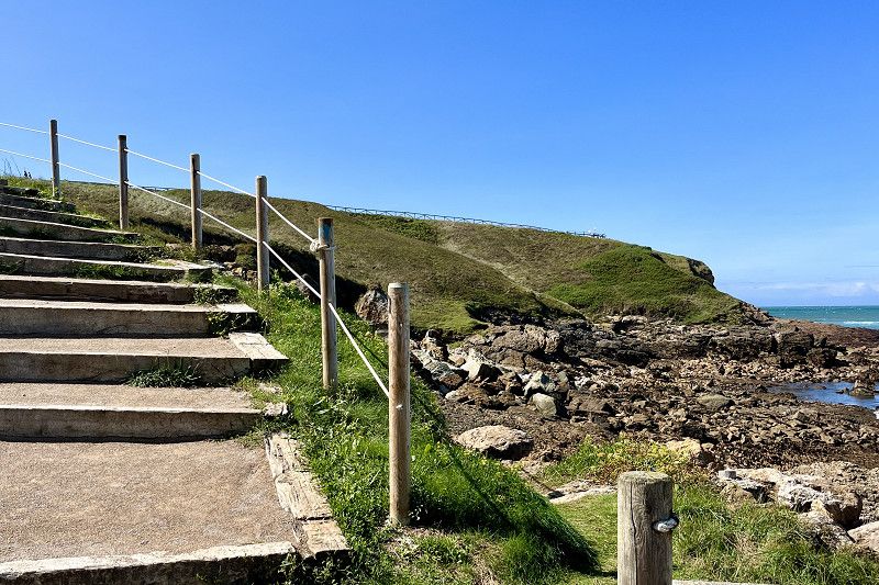
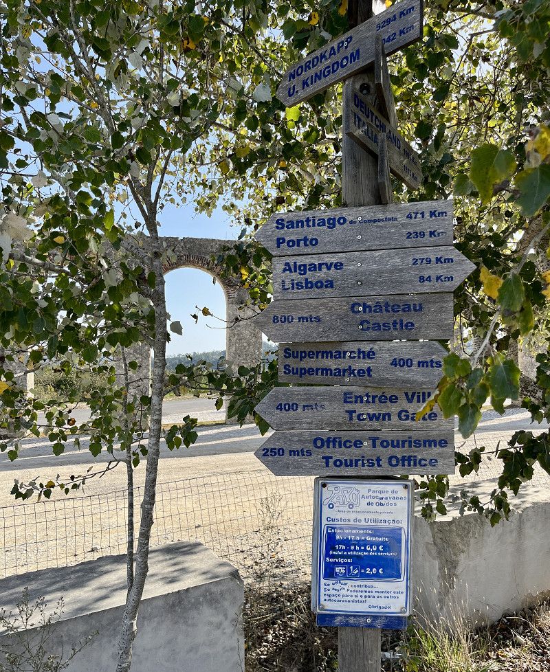
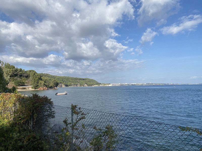
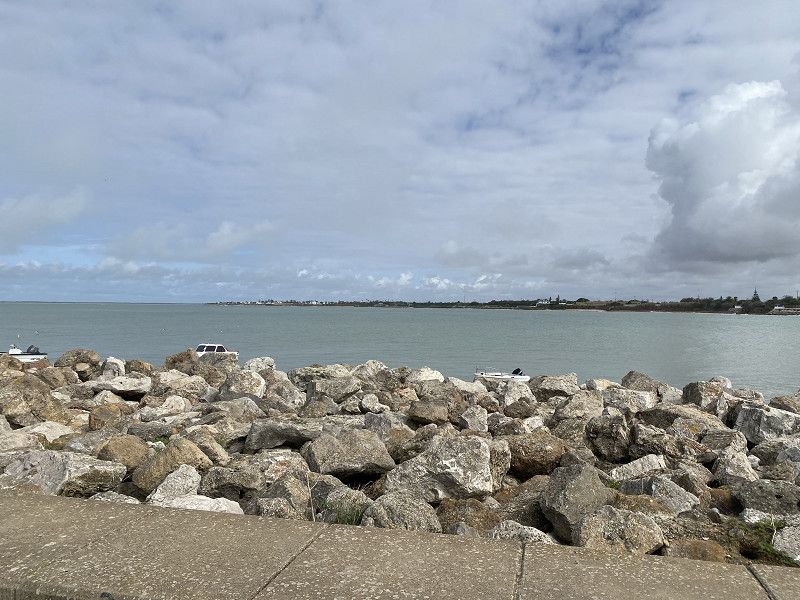
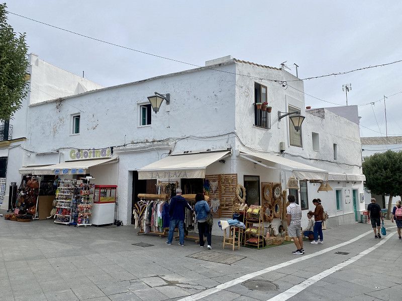
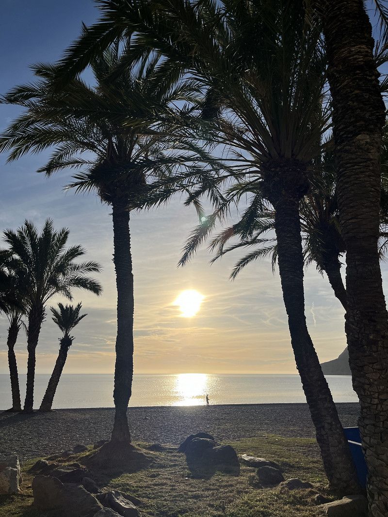
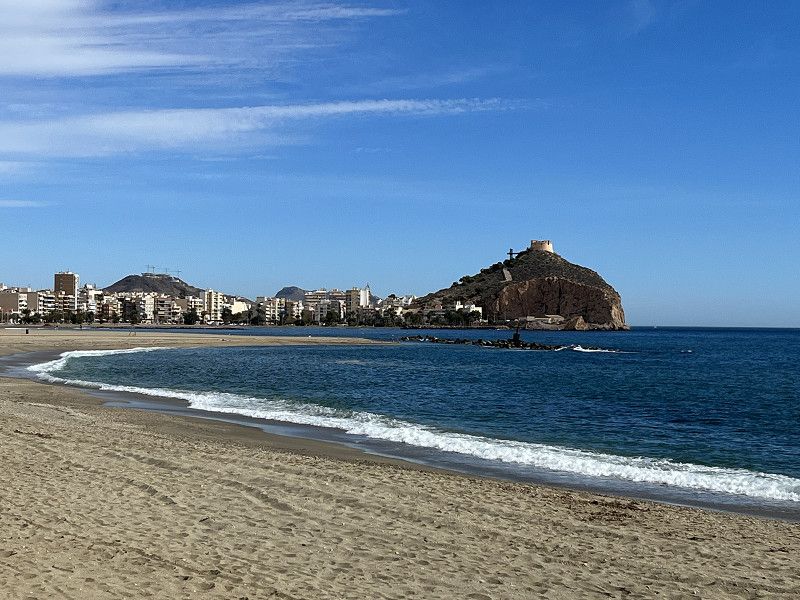
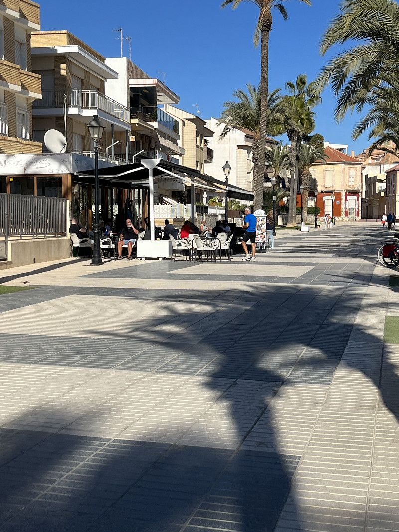
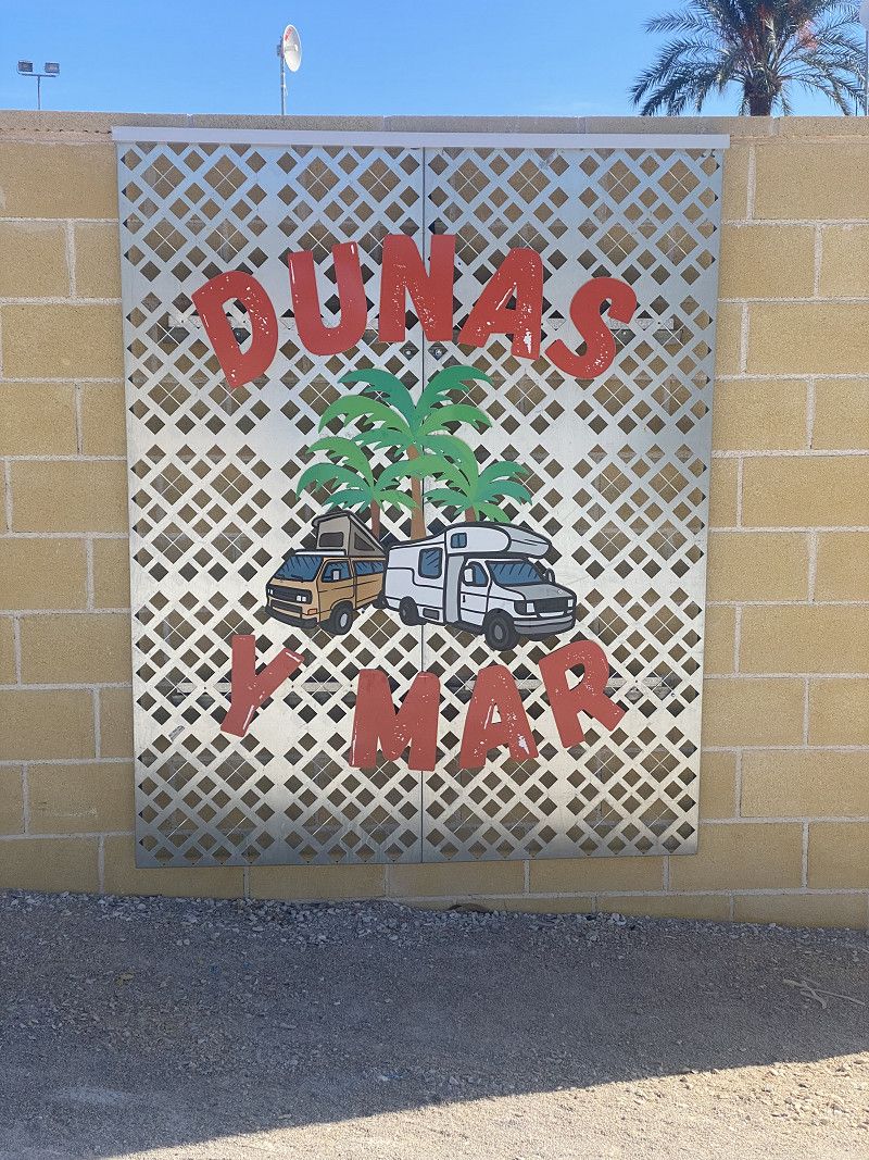
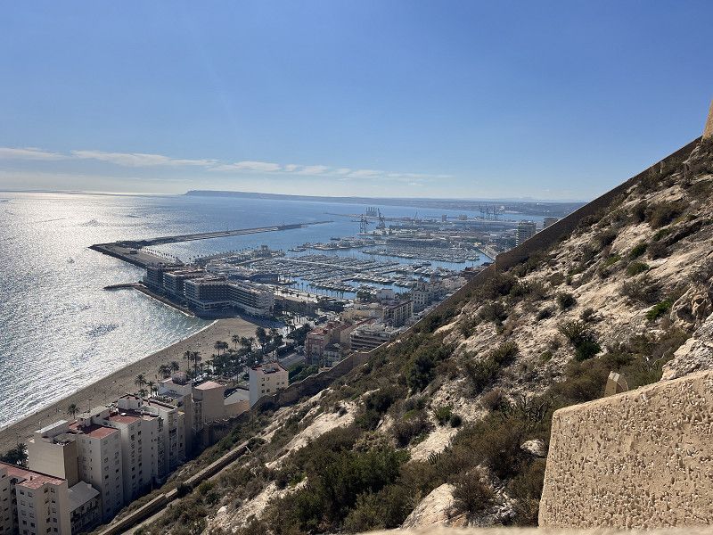
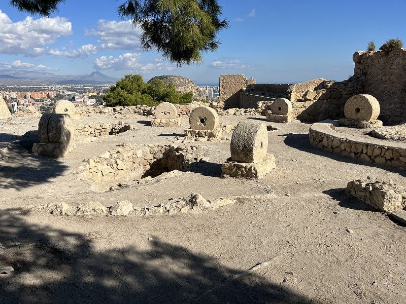
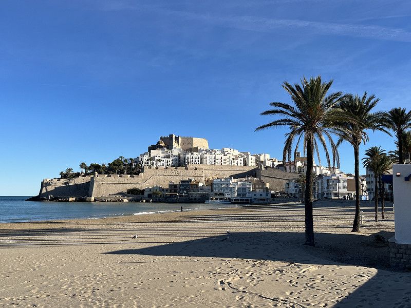
First we go through the Black Forest to France. Then toll-free through France to Bayonne.
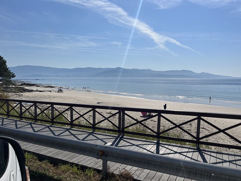
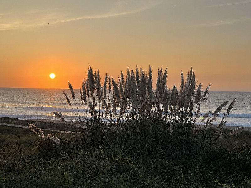
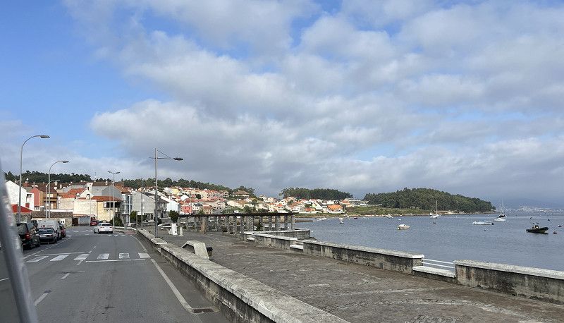
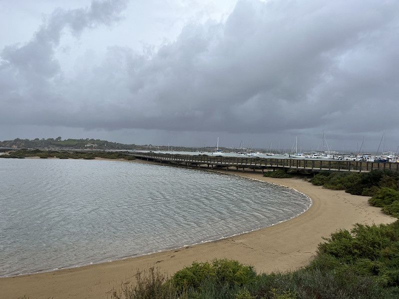
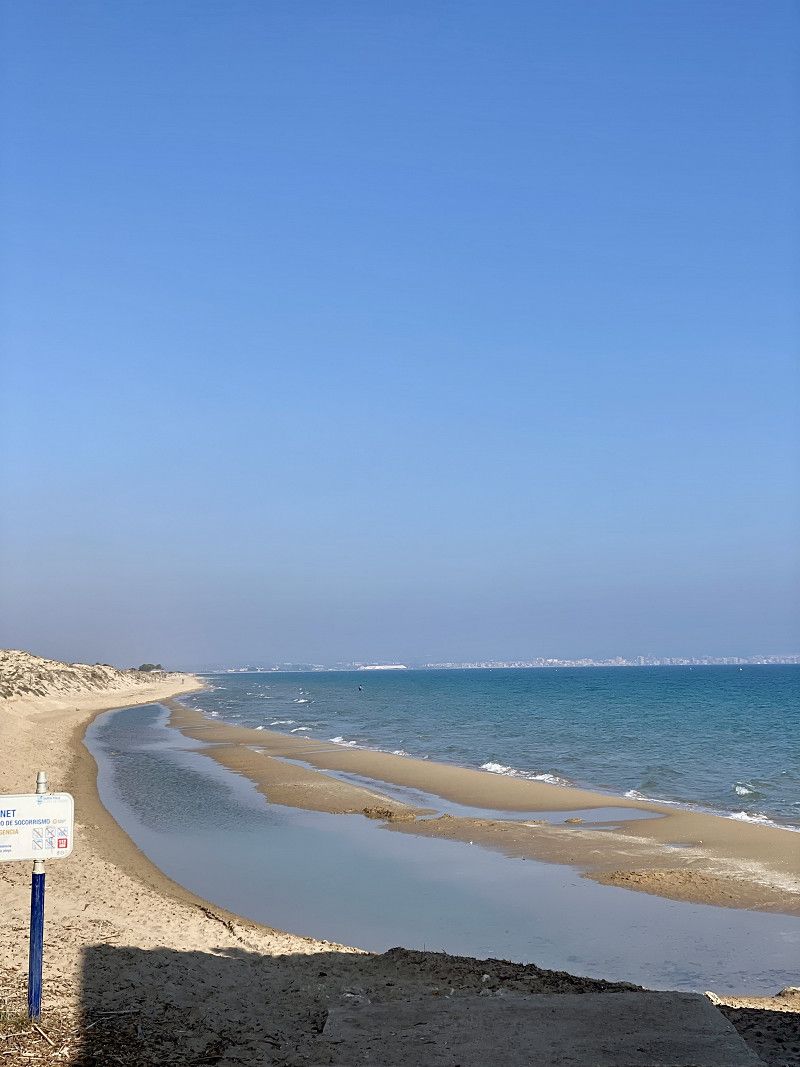
From there it goes to the beaches of Cantabria, Asturias and Galicia.
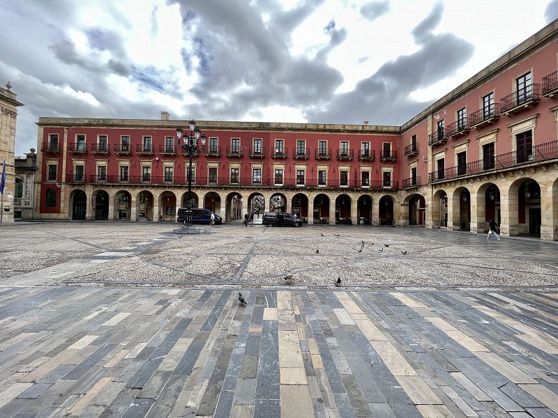
The entire coast “Costa Verde to Rias Baixas” with its large cities such as Bilbao, Santander, Santiago de Compostela, Lugo, Ponteverda and Vigo are on the list this time.
Then we go to Portugal, where we haven't been to Braga, Porto or Lisbon yet. Maybe we'll end up there this time.
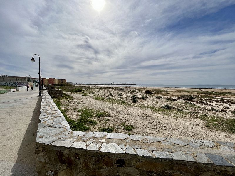
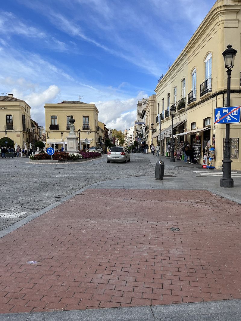
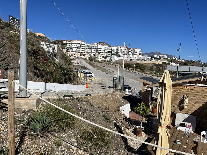
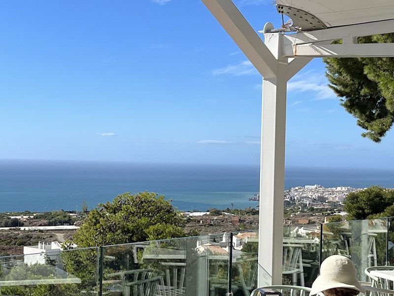
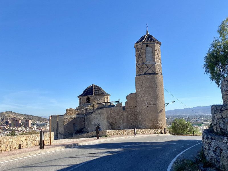
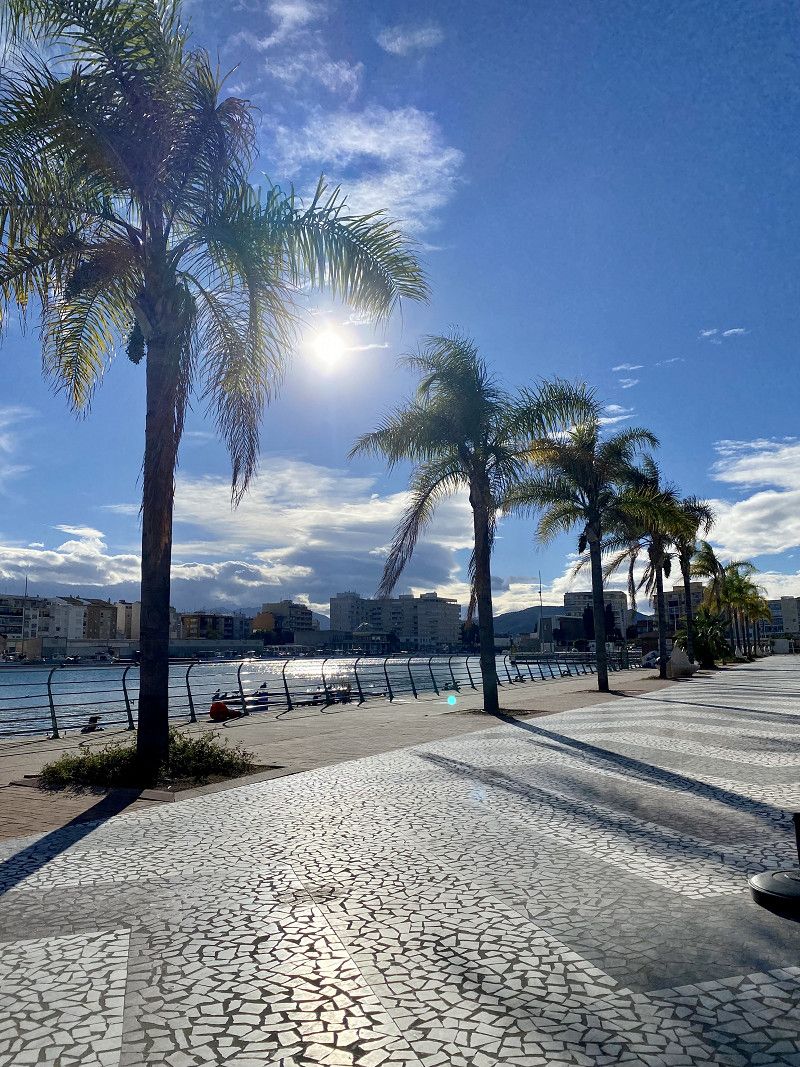
Since we are traveling throughout the fall (3 months), we will definitely be in Andalusia again. We love Spain and let ourselves drift, depending on our mood and the sun.
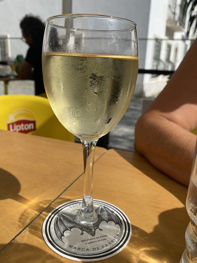
🇪🇸 ❤️🚐☀️🍫🏍️🇵🇹 🇫🇷🌭🍷🌅⛵️
Day
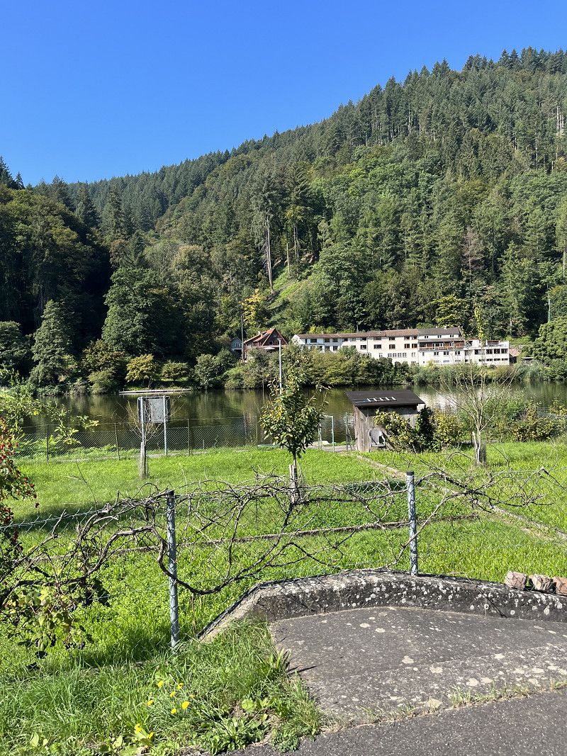
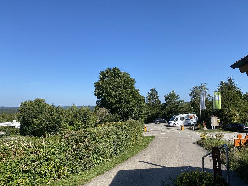
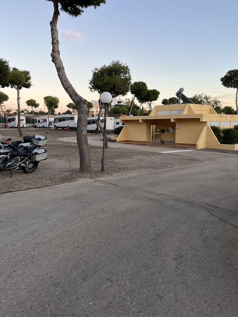
Wald-Michelbach
Kreis Bergstraße, Hessen, Deutschland
49° 34' 24.3" N 8° 49' 22.5" E
49.5734150 8.8229151
• Head toward Ludwigstraße on Schulstraße. Go for 36 m.
• Turn left onto Ludwigstraße (L3120). Go for 1.9 km.
• Pass 2 roundabouts and continue on Weiherer Straße (L3120). Go for 8.5 km.
• Turn left onto Weinheimer Straße (B38) toward Mannheim/Heppenheim. Go for 9.3 km.
• Turn right onto B38 toward Mannheim/Gewerbegebiet W.-West. Go for 1.6 km.
• Continue on A659. Go for 345 m.
• Take the exit toward Karlsruhe/Heidelberg onto A5. Go for 67.8 km.
• Take exit 46 toward München/Stuttgart/Pforzheim onto A8. Go for 60.8 km.
• Take exit 51 toward Singen/Böblingen/Sindelfingen onto A81. Go for 33.1 km.
• Take exit 29 toward Rottenburg a.N./Tübingen onto B28. Go for 11.0 km.
• Turn right onto Siebenlindenstraße toward Gewerbegebiet Siebenlinden II. Go for 551 m.
• Turn left onto Ulmenweg. Go for 48 m.
• Arrive at Ulmenweg.
☍
194,9 km
(2 hrs. 6 min.)
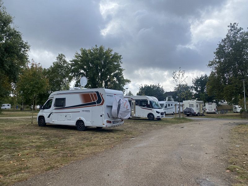
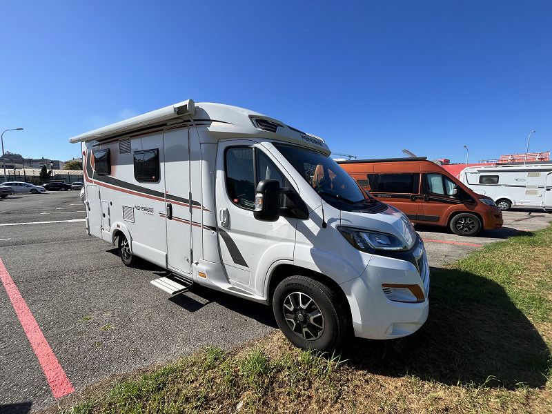
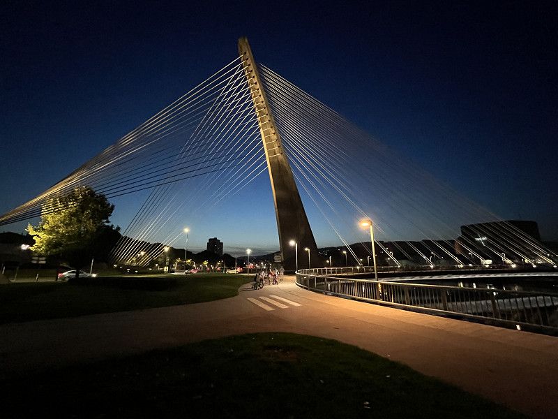
Start unserer Herbstour 2023
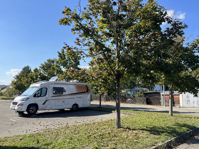
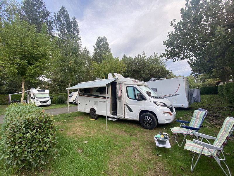
It's starting today. Our motorhome came out of inspection earlier, we got everything ready yesterday and so we're starting today.
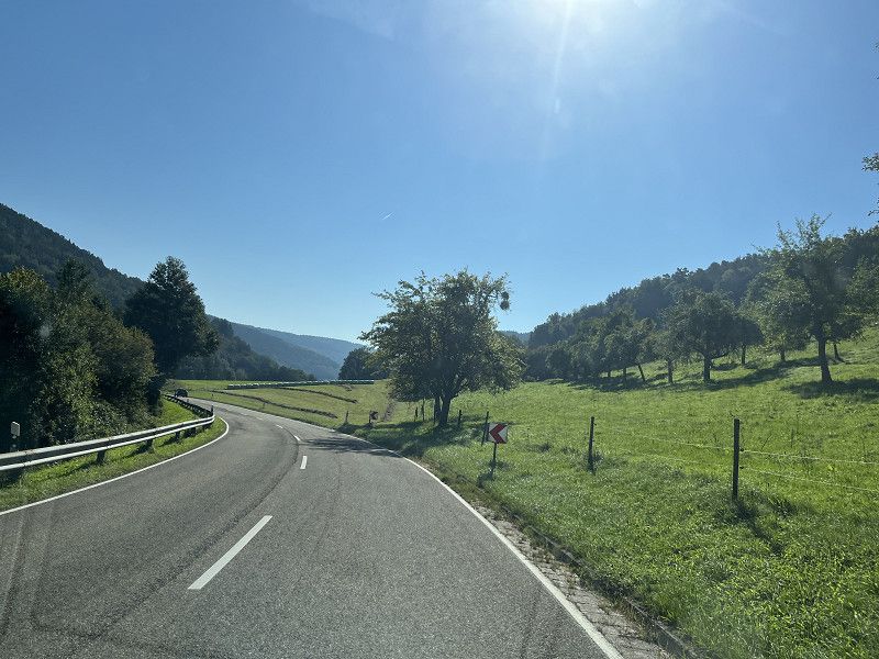
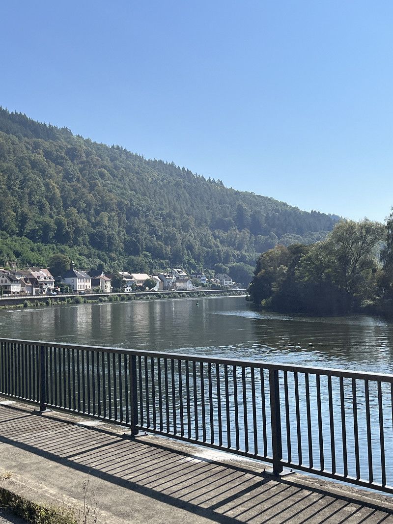
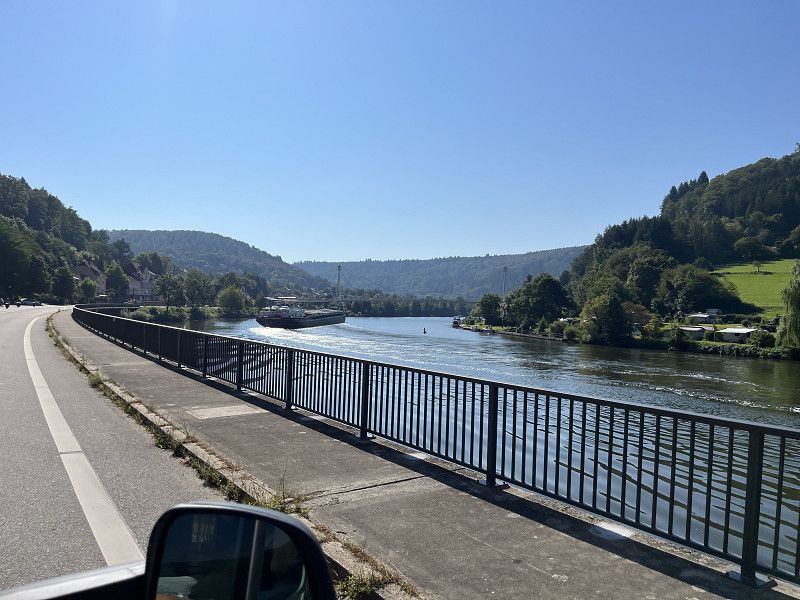
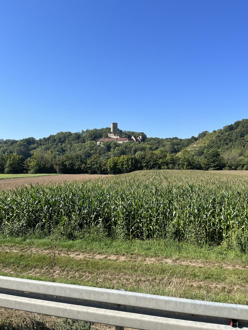
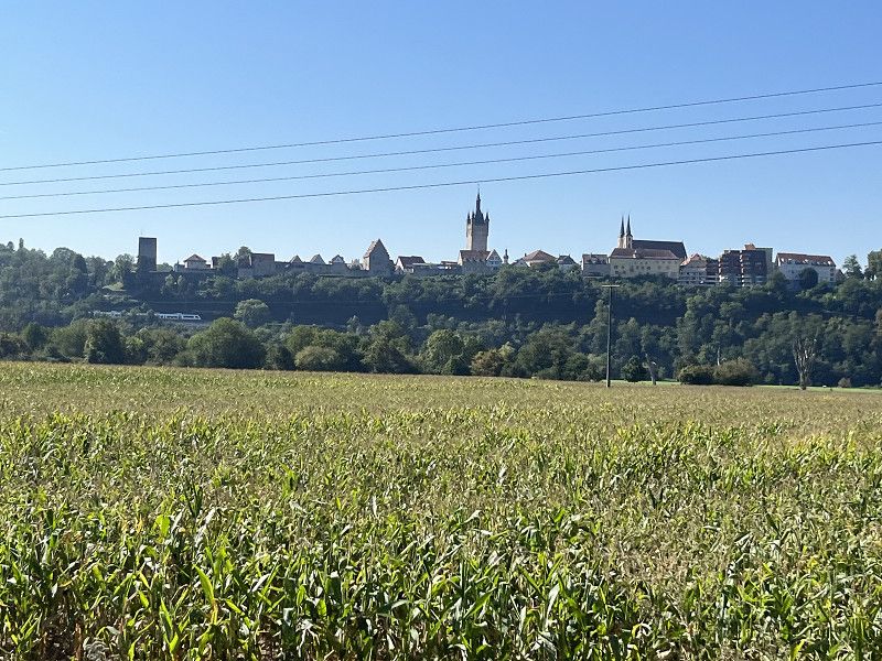
It continues along the beautiful Neckar until just behind Heilbronn. We will avoid Stuttgart generously. The plan is to go to Rottenburg today.
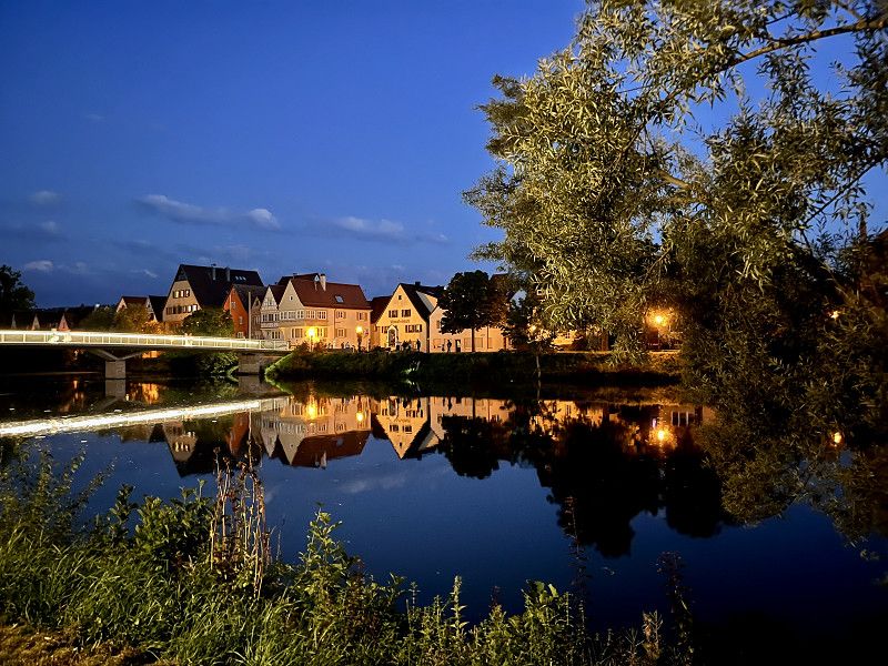
Tomorrow we will meet relatives in Horb am Neckar. That's not so far away anymore.
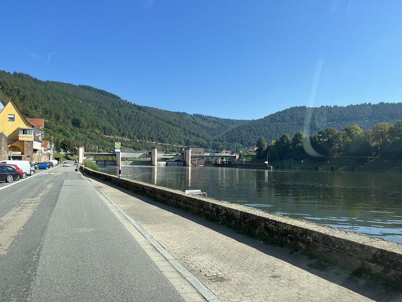
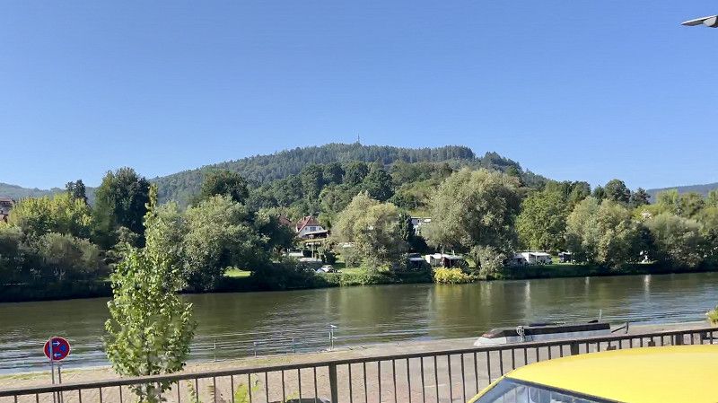
Stellplatz am Neckarufer
The SP is located directly on the Neckar, the parking fee is €10/24 hours. Water and electricity costs extra. Disposal is also possible.
There is a pizzeria in the immediate vicinity, very good pizza.
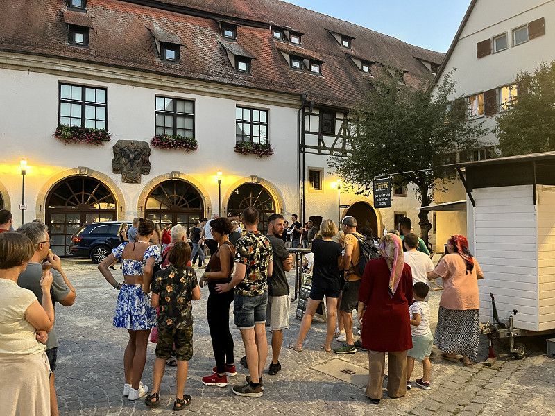
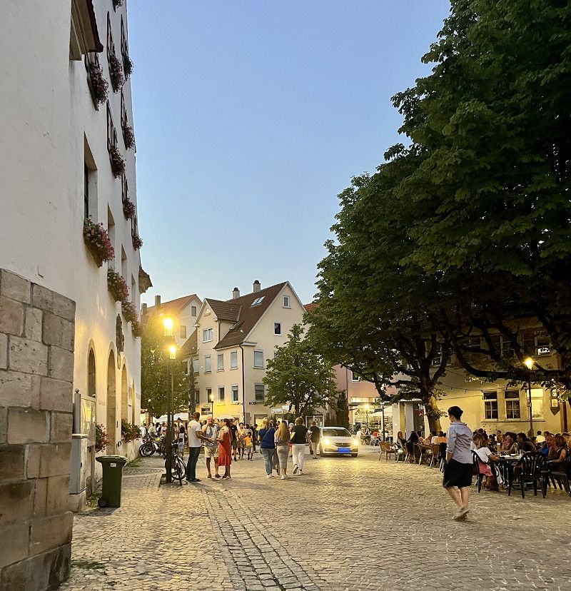
In the evening we walk (20 minutes) to the old town. There is a festival here right now and it feels like the south. Very nice
Ulmenweg, 72108, Rottenburg/Neckar, Germany
48° 28' 21" N 8° 57' 0" E
48.4725000 8.9500000
• Head south on Ulmenweg. Go for 20 m.
• Turn left toward Rutenweg. Go for 101 m.
• Turn left onto Rutenweg. Go for 91 m.
• Turn right onto Siebenlindenstraße. Go for 443 m.
• Turn left onto Osttangente (B28). Go for 23.5 km.
• Turn right onto B28 toward Freudenstadt/Talheim/Gewerbegebiet Horb a.N./Gewerbegebiet Hohenberg. Go for 450 m.
• Take the 2nd exit from roundabout onto B28 toward Freudenstadt/Talheim. Go for 1.4 km.
• Turn left onto B28 toward Freudenstadt. Go for 1.0 km.
• Take the 2nd exit from roundabout onto Käppeleshof (B28). Go for 167 m.
• Take the 1st exit from roundabout onto B28. Go for 241 m.
• Turn left onto Innere Breite. Go for 441 m.
• Continue on Mohnmichel. Go for 646 m.
• Turn left toward Schütteberg. Go for 178 m.
• Turn right onto Schütteberg. Go for 92 m.
• Arrive at Schütteberg.
☍
28,9 km
( 28 min.)
Day
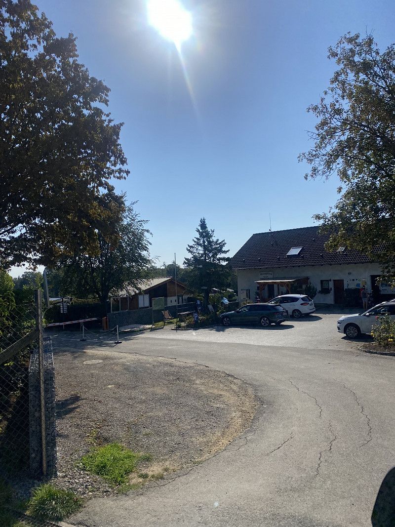
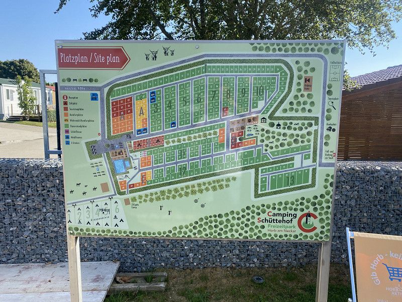
Camping Schüttehof
Campsite on the outskirts of Horb
25€/night without electricity. Ideal for our meeting with relatives in Horb.
Schütteberg 7 - 9, 72160, Horb am Neckar, Deutschland
48° 26' 45.3" N 8° 40' 33.9" E
48.4459100 8.6760700
• Head north on Schütteberg. Go for 92 m.
• Turn left. Go for 178 m.
• Turn right toward Mohnmichel. Go for 469 m.
• Turn slightly left onto Mohnmichel. Go for 177 m.
• Continue on Innere Breite. Go for 441 m.
• Turn left onto Äußere Breite (B28). Go for 14.7 km.
• Take ramp toward Dornstetten. Go for 178 m.
• Turn right onto K4776. Go for 567 m.
• Turn right onto Köpfle. Go for 239 m.
• Turn right onto Freizeitweg. Go for 103 m.
• Turn left. Go for 12 m.
• Turn right. Go for 39 m.
• Arrive at your destination on the left.
☍
17,2 km
( 15 min.)
Day
Höhencamping Königskanzel
Here we visit friends who are vacationing here.
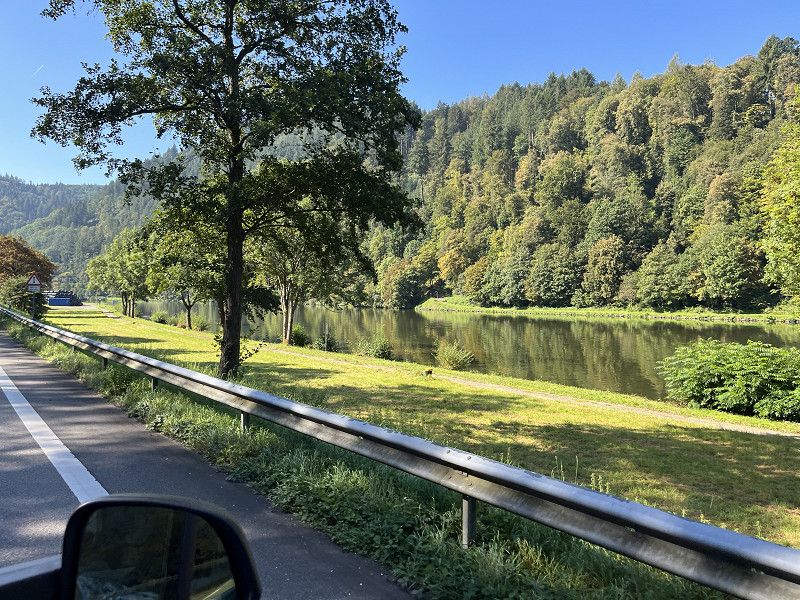
The campsite is on a hill, which gives you an excellent view of the Black Forest.
The sanitary facilities are very clean. Unfortunately, the CP restaurant only has food if you order in advance, which is difficult if you visit spontaneously.
Freizeitweg 1, 72280, Dornstetten-Hallwangen, Germany
48° 28' 49" N 8° 30' 2" E
48.4802700 8.5005500
• Head south. Go for 12 m.
• Turn left. Go for 60 m.
• Turn left toward Freizeitweg. Go for 81 m.
• Turn right onto Freizeitweg. Go for 103 m.
• Turn left onto Köpfle. Go for 239 m.
• Turn right onto Alte Poststraße (K4776). Go for 226 m.
• Turn left onto Stuttgarter Straße (L404). Go for 8.2 km.
• Turn left onto Loßburger Straße (B28) toward Straßburg. Go for 321 m.
• Take the 1st exit from roundabout onto Straßburger Straße (B28) toward Strasbourg/Baden-Baden/Kniebis. Go for 11.9 km.
• Turn right onto Schwarzwaldhochstraße (B500) toward Baden-Baden/Ruhestein. Go for 2.6 km.
• Turn left onto L402 toward Oppenau/Zuflucht. Go for 841 m.
• Continue on Zuflucht (L92). Go for 8.2 km.
• Turn left onto Hauptstraße (L92). Go for 583 m.
• Continue on Straßburger Straße. Go for 633 m.
• Pass 3 roundabouts and continue on B28. Go for 20.7 km.
• Take ramp onto A5 toward Basel. Go for 7.7 km.
• Take exit 55 toward Flughafen onto L98. Go for 6.4 km.
• Pass 2 roundabouts and continue on L98. Go for 4.7 km.
• Continue on Pont Pierre Pflimlin (M353). Go for 5.3 km.
• Take ramp toward M83/St Dié par Tunnel/Colmar/Fegersheim. Go for 1.5 km.
• Turn right onto Rue de Lyon (M83) toward Colmar/Erstein/Lipsheim/Fegersheim. Go for 2.7 km.
• Take the 1st exit from roundabout onto D83. Go for 21.9 km.
• Take ramp onto D83 toward Hilsenheim/Ebersmunster/Ebersheim. Go for 2.1 km.
• Pass 2 roundabouts and continue on Route Nationale (D83). Go for 732 m.
• Turn right onto Route de Scherwiller (D81). Go for 528 m.
• Continue on D81. Go for 2.6 km.
• Take the 2nd exit from roundabout onto D81 toward Scherwiller. Go for 2.0 km.
• Continue on Route d'Ebersheim (D81). Go for 334 m.
• Take the 2nd exit from Rond-Point de Fautenbach roundabout onto Route d'Ebersheim (D81). Go for 99 m.
• Continue on Rue de la Gare (D81). Go for 733 m.
• Turn right onto Rue de Dambach (D81). Go for 472 m.
• Continue straight ahead. Go for 32 m.
• Take the 4th exit from roundabout toward Châtenois. Go for 101 m.
• Arrive at your destination on the left.
☍
114,6 km
(1 hrs. 39 min.)
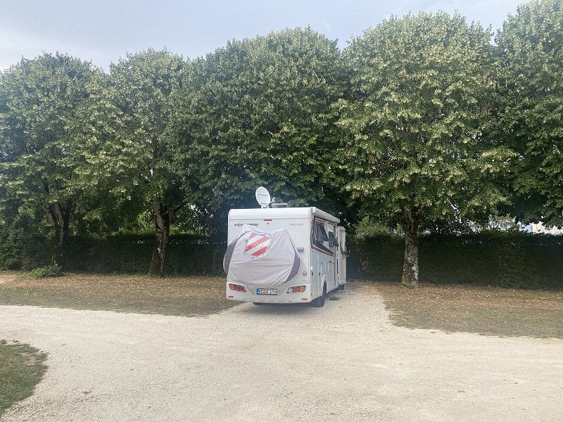
Dambach-la-Ville
Camping car park parking space
As always, electricity, supply and disposal, everything is there and perfect.
It's just a place for us to stay overnight on our journey to the southwest.
Unterelsass, Großer Osten, Frankreich
48° 17' 27.7" N 7° 25' 22" E
48.2910294 7.4227873
• Head southwest on Rue de Dambach (D35). Go for 429 m.
• Turn left onto Rue de Dambach (D81) toward A35/Ebersheim/Sélestat/Centre-Bourg. Go for 64 m.
• Turn left onto Rue de la Gare (D81). Go for 733 m.
• Continue on Route d'Ebersheim (D81). Go for 70 m.
• Take the 2nd exit from Rond-Point de Fautenbach roundabout onto Route d'Ebersheim (D81). Go for 364 m.
• Continue on D81. Go for 1.9 km.
• Take the 1st exit from roundabout onto D1422 toward A35/(Colmar)/Sélestat. Go for 958 m.
• Take ramp onto A35 toward Saint-Dié/Colmar/Sélestat-Ouest. Go for 10.1 km.
• Continue on D83. Go for 10.7 km.
• Keep left onto A35. Go for 38.5 km.
• Continue on Échangeur de Bâle-Mulhouse toward A35/Mulhouse/Lyon/Paris. Go for 1.5 km.
• Continue on A36 (La Comtoise). Go for 186 km.
• Take the exit toward Paris Par A5/Dijon onto A39 (Autoroute Verte). Go for 33.2 km.
• Take the exit toward Paris/A38/Dijon-Nord onto M274 (Voie Georges Pompidou). Go for 1.2 km.
• Keep left onto Voie Georges Pompidou (M274) toward N274/Paris/A38/Nancy/Troyes/Dijon-Nord. Go for 7.9 km.
• Take the 1st exit from roundabout onto M274 toward Paris/A38/Troyes/Dijon-Ouest. Go for 2.2 km.
• Keep left onto M274 toward N274/Paris/Troyes/Dijon-Ouest. Go for 891 m.
• Take the 2nd exit from roundabout onto D971 toward Troyes/Talant/Circuit-Dijon-Prenois. Go for 209 m.
• Turn right onto Route de Troyes (D971) toward Châtillon S/Seine/St Seine l'Abbaye/Hauteville lès Dijon/Circuit Dijon-Prenois/Darois. Go for 33.6 km.
• Turn right onto Cour du Ponsot. Go for 28 m.
• Arrive at Cour du Ponsot. Your destination is on the left.
☍
330,0 km
(3 hrs. 6 min.)
Day
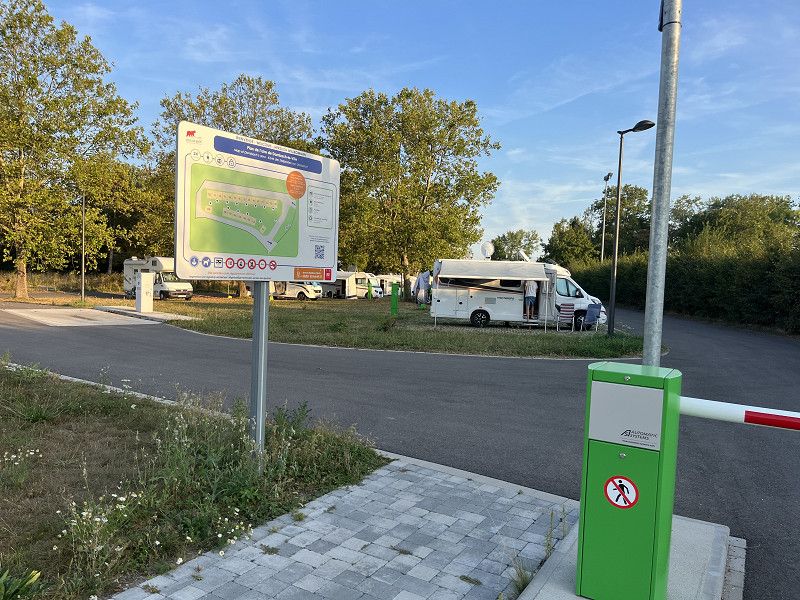
Chanceaux
CCP pitch for one night with the usual facilities
Côte-d'Or, Burgund und Freigrafschaft, Frankreich
47° 31' 12.2" N 4° 43' 6" E
47.5200549 4.7183333
• Head toward Rue du Ponsot on Cour du Ponsot. Go for 36 m.
• Turn right onto Rue du Ponsot. Go for 52 m.
• Turn left onto Grande Rue (D971). Go for 11.8 km.
• Turn right onto Route de Sombernon (D16) toward A38/Sombernon/Bordes-Bricard. Go for 14.5 km.
• Continue on D7. Go for 3.2 km.
• Take the 2nd exit from Avenue de la Brenne roundabout onto Avenue de la Brenne (D9). Go for 445 m.
• Turn sharp right onto Rue Ferdinand Mercusot (D7 A). Go for 805 m.
• Take the 1st exit from roundabout onto Rond-Point de l'Abreuvoir (D905). Go for 235 m.
• Turn left onto D16 toward Pouilly-en-Auxois/Autun. Go for 4.4 km.
• Take ramp onto A38 toward Civry en M./Pouilly en A. Go for 8.3 km.
• Take exit 24 toward Autun/Nevers. Go for 397 m.
• Turn left onto D981. Go for 203 m.
• Pass 2 roundabouts and continue on D981. Go for 15.1 km.
• Turn slightly left onto Rue Saint-Jacques (D906) toward Autun/Nevers/Nolay. Go for 811 m.
• Turn right onto Rue Claude Guyot (D981) toward Autun/Nevers/Épinac/Fontaine. Go for 400 m.
• Turn left onto Rue Jacques Seure (D981) toward Autun/Nevers/Voudenay/Épinac. Go for 25.5 km.
• Take the 2nd exit from roundabout onto Route d'Arnay-le-Duc (D681). Go for 903 m.
• Turn right onto Avenue de la République (D681) toward Moulins/Roanne/Nevers/Centre Hospitalier/Clinique du Parc/Centre Ville/Parc du Morvan/Porte d'Arroux. Go for 1.7 km.
• Take the 2nd exit from Carrefour de la Légion roundabout onto Avenue du Commandant Neuchèze (D681) toward Moulins/Roanne/Vichy/Luzy. Go for 19.5 km.
• Continue on D981. Go for 12.8 km.
• Turn right onto Avenue du Docteur Alain Benoist toward Moulins/Decize/Nevers/St Honoré les B./Château-Chinon. Go for 321 m.
• Continue on Place du Champ de Foire. Go for 121 m.
• Continue on Place Chanzy. Go for 185 m.
• Turn right onto Avenue Marceau (D981). Go for 219 m.
• Turn right onto Route de Fours (D981) toward Fours/Decize/Nevers. Go for 6.5 km.
• Turn left onto Route du Morvan (D191) toward Savigny-Poil-Fol/La Nocle-Maulaix. Go for 4.7 km.
• Continue on Route de la Sarrée (D191). Go for 1.7 km.
• Keep right onto D191. Go for 1.8 km.
• Continue on Route du Grand Chemin (D30). Go for 2.3 km.
• Continue on Route du Grand Chemin (D3). Go for 200 m.
• Turn right onto Route du Marnant (D30). Go for 2.4 km.
• Continue on D30. Go for 2.0 km.
• Continue on Lieu-dit Le Grand Domaine (D30). Go for 570 m.
• Continue on Domaine Bresson (D30). Go for 877 m.
• Continue on Lieu-dit Bresson (D30). Go for 104 m.
• Continue on Domaine Bresson (D30). Go for 769 m.
• Continue on Domaine de la Croix Séguin (D30). Go for 15 m.
• Continue on Route de la Nocle (D30). Go for 3.2 km.
• Continue on D30. Go for 1.1 km.
• Turn slightly left onto Lieu-dit Chez Thibaut (D30). Go for 222 m.
• Continue on D30. Go for 1.3 km.
• Continue on Lieu-dit La Lerdriche (D30). Go for 106 m.
• Continue on D30. Go for 943 m.
• Continue on Lieu-dit Les Terriens (D30). Go for 135 m.
• Continue on D30. Go for 718 m.
• Turn right onto Route de Garnat (D15). Go for 886 m.
• Turn left onto Rue de la Mairie (D30). Go for 1.6 km.
• Turn left onto D30. Go for 141 m.
• Continue on Lieu-dit La Cadrole (D30). Go for 114 m.
• Continue on D30. Go for 310 m.
• Continue on Lieu-dit La Terasse (D30). Go for 92 m.
• Continue on D30. Go for 616 m.
• Continue on Lieu-dit Le Crot à l'Âne (D30). Go for 93 m.
• Continue on D30. Go for 534 m.
• Continue on Lieu-dit Montapeine (D30). Go for 115 m.
• Continue on D30. Go for 266 m.
• Continue on Lieu-dit Saint-Joseph (D30). Go for 100 m.
• Continue on D30. Go for 2.0 km.
• Continue on Lieu-dit L'Étang de Bas (D30). Go for 98 m.
• Continue on D30. Go for 1.1 km.
• Continue on Lieu-dit Le Creux de l'Heume (D30). Go for 79 m.
• Continue on D30. Go for 1.6 km.
• Continue on Lieu-dit La Garenne (D30). Go for 151 m.
• Continue on D30. Go for 2.2 km.
• Continue on Lieu-dit Magny (D30). Go for 64 m.
• Continue on D30. Go for 671 m.
• Continue on Lieu-dit Montapeine (D30). Go for 35 m.
• Continue on D30. Go for 812 m.
• Continue on Lieu-dit Beaufrenay d'en Bas (D30). Go for 104 m.
• Continue on D30. Go for 120 m.
• Continue on Lieu-dit Beaufrenay d'en Haut (D30). Go for 116 m.
• Continue on D30. Go for 2.8 km.
• Continue on Lieu-dit Les Jeanduvets (D30). Go for 106 m.
• Continue on D30. Go for 6.8 km.
• Continue on Lieu-dit La Grille des Bordes (D30). Go for 45 m.
• Continue on D30. Go for 1.9 km.
• Turn right onto D779. Go for 2.8 km.
• Take the 2nd exit from roundabout onto Route de Bourgogne (D779). Go for 1.4 km.
• Continue on Rue de Bourgogne. Go for 226 m.
• Arrive at Rue de Bourgogne.
☍
183,6 km
(2 hrs. 19 min.)
Day
Moulins
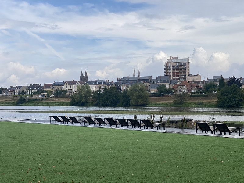
Again we stand on this large parking space in front of the town of Moulins.
It is located directly on the Allier River, has plenty of space and is incredibly cheap. 4€/entrance + tourist tax and every hour you stand there costs 10 cents. Water and electricity can be purchased as needed.
The baker is nearby and an InterMarche is in the immediate vicinity.
We were here in spring and took a look at the city, which is worth seeing. This time the weather was a bit unsettled so a walk along the river bank was enough.
Rue de Bourgogne 1, Moulins, Allier, Auvergne-Rhône-Alpes, France
46° 33' 58.5" N 3° 20' 7.1" E
46.5662466 3.3352964
• Head southwest on Rue de Bourgogne.
• Turn slightly left onto Cours Jean Jaurès. Go for 194 m.
• Turn left onto Avenue Théodore de Banville. Go for 227 m.
• Take the 1st exit from Avenue Théodore de Banville roundabout onto Boulevard de Courtais. Go for 331 m.
• Continue on Boulevard Ledru-Rollin. Go for 501 m.
• Turn right onto Avenue d'Orvilliers. Go for 191 m.
• Take the 3rd exit from roundabout onto Pont Regemortes toward A71/Montluçon/Clermont-Fd. Go for 407 m.
• Take the 4th exit from roundabout onto Route de Clermont (D2009). Go for 9.4 km.
• Take the 1st exit from roundabout onto A79 toward Clermont-Fd/Montluçon. Go for 33.5 km.
• Take the left exit toward E62/Paris/Montluçon onto A71. Go for 23.0 km.
• Take exit 10 toward Guéret/Montluçon onto A714. Go for 10.1 km.
• Continue on N145. Go for 108 km.
• Take the 3rd exit from roundabout onto N145 toward Châteauroux/Limoges/Poitiers/Angoulême. Go for 905 m.
• Take the 2nd exit from roundabout onto N145 toward Poitiers/Angoulême/Bellac. Go for 27.5 km.
• Take the 3rd exit from roundabout onto N147 toward Limoges/Angoulême. Go for 2.0 km.
• Take the 1st exit from roundabout toward Bellac. Go for 1.1 km.
• Continue on Route de Limoges. Go for 409 m.
• Turn left onto D3. Go for 302 m.
• Continue on Route de Blond (D3). Go for 156 m.
• Continue on D3. Go for 206 m.
• Continue on Lieu-dit le moulin Vaugelade (D3). Go for 164 m.
• Continue on D3. Go for 528 m.
• Turn right onto Rue du Haut Thoveyrat (D3). Go for 1.9 km.
• Continue on D3. Go for 5.5 km.
• Continue on Rue Jean Giraudoux (D3). Go for 683 m.
• Continue on D3. Go for 5.2 km.
• Continue on Route de Blond (D3). Go for 1.2 km.
• Continue on Rue du 11 Novembre 1918 (D711). Go for 198 m.
• Turn right onto Rue du Collège. Go for 110 m.
• Arrive at Rue du Collège.
☍
234,3 km
(2 hrs. 24 min.)
Day
Cieux
Another CCP place, this time with sanitary facilities. Very clean, simple facilities.
In the afternoon we walk a bit by the lake. Unfortunately the path doesn't go completely around the outside, so the way back is the same.
Rue du Collège, Cieux, Haute-Vienne, Nouvelle-Aquitaine, France
45° 59' 27" N 1° 2' 41.6" E
45.9908278 1.0448764
• Head southwest on Rue du Collège. Go for 33 m.
• Turn right onto Rue de la Basse-Cour. Go for 120 m.
• Turn right onto Rue des Écoles. Go for 57 m.
• Turn right onto Rue du 11 Novembre 1918 (D711). Go for 111 m.
• Turn right onto Avenue du Lac (D3). Go for 815 m.
• Turn left onto Route de Limoges (D39). Go for 710 m.
• Turn right onto D80. Go for 2.9 km.
• Continue on Route de Cieux à la Bouteille (D80). Go for 1.0 km.
• Continue on Route d'Oradour à Chamboret (D80). Go for 535 m.
• Continue on Route de la Chapelle du Queyroix (D80). Go for 293 m.
• Turn left onto Route de la Chapelle du Queyroix (D80). Go for 432 m.
• Continue on Route du Queyroix (D80). Go for 496 m.
• Continue on Route du Mas de Glane (D80). Go for 398 m.
• Continue on D80. Go for 3.8 km.
• Continue on Lieu-dit La Côte d'Or (D80). Go for 138 m.
• Continue on D80. Go for 185 m.
• Turn slightly right onto D28. Go for 1.0 km.
• Take the 3rd exit from roundabout onto Route de Limoges (D9). Go for 2.1 km.
• Turn right and take ramp onto N141 toward Limoges/Verneuil S/Vienne/Aéroport Bellegarde. Go for 5.8 km.
• Take ramp toward A20/Poitiers/Périgueux/Aixe S/ Vienne/Couzeix/Aéroport Bellegarde. Go for 262 m.
• Take the 1st exit from roundabout onto D2000 toward Périgueux/Aixe S/Vienne. Go for 1.1 km.
• Pass 2 roundabouts and continue on D2000. Go for 7.4 km.
• Take the 1st exit from roundabout onto Avenue de Bordeaux (N21) toward Périgueux/Châlus/Séreilhac. Go for 16.8 km.
• Continue on N21. Go for 30.8 km.
• Take the 2nd exit from roundabout onto N21 toward Périgueux/Sorges. Go for 13.1 km.
• Turn right toward Agonac/Les Piles/Les Potences/Centre Hospitalier de Lanmary. Go for 37 m.
• Turn left onto Avenue de la Voie Romaine (D8). Go for 2.1 km.
• Continue on Lieu-dit La Chiroulette Ouest (D8). Go for 411 m.
• Continue on Lieu-dit La Chiroulette (D8). Go for 591 m.
• Continue on D8. Go for 2.2 km.
• Continue on Lieu-dit Pied de Lièvre (D8). Go for 123 m.
• Continue on D8. Go for 845 m.
• Continue on Lieu-dit Les Quatre Routes (D8). Go for 73 m.
• Continue on Avenue de la Résistance (D8). Go for 2.1 km.
• Continue on Rue Valentine Bussière (D8). Go for 373 m.
• Continue on Rue Valentine Bussière (D8). Go for 1.4 km.
• Continue on Lieu-dit Les Tavernes (D8). Go for 858 m.
• Continue on D8. Go for 139 m.
• Continue on Lieu-dit Charetier (D8). Go for 557 m.
• Continue on Route des Piles (D8). Go for 1.5 km.
• Continue on D8. Go for 56 m.
• Continue on Lieu-dit Barbaleix (D8). Go for 266 m.
• Continue on D8. Go for 192 m.
• Continue on Lieu-dit Barbeleix (D8). Go for 73 m.
• Continue on Lieu-dit Barbaleix (D8). Go for 310 m.
• Continue on Lieu-dit Sept Fonts (D8). Go for 114 m.
• Continue on D8. Go for 806 m.
• Continue on Route de Paris (D8). Go for 574 m.
• Pass 4 roundabouts and continue on Avenue Georges Pompidou (D8). Go for 4.0 km.
• Take the 2nd exit from roundabout onto Boulevard Michel Montaigne (D939). Go for 486 m.
• Continue on Place Francheville. Go for 386 m.
• Turn right onto Cours Fénelon (D6089) toward Brive/Bergerac/Limoges/Cahors/Aéroport de Périgueux-Bassillac/St Georges. Go for 218 m.
• Turn right onto Boulevard Lakanal. Go for 329 m.
• Take the 2nd exit from roundabout onto Boulevard Lakanal. Go for 176 m.
• Turn left onto Lieu-dit Moulin de Sainte-Claire. Go for 255 m.
• Take the 2nd exit from roundabout onto Route de Bergerac (D6021) toward A89/Bergerac/Agen/Bordeaux/Brive/Notre Dame de S./Vergt. Go for 4.5 km.
• Take the 3rd exit from roundabout onto N21 toward Brive la G./Limoges/Clermont-Fd/Bergerac/Agen. Go for 378 m.
• Take the 1st exit from roundabout onto N21 toward Bergerac/Agen/N.D. de Sanilhac/Vergt/Villamblard. Go for 380 m.
• Take the 3rd exit from roundabout onto Route de Vergt (D8) toward N.D. de Sanilhac/Vergt. Go for 612 m.
• Pass 2 roundabouts and continue on Avenue Jean et Léonce Petithomme Lafaye (D8). Go for 10.2 km.
• Turn left toward Lieu-dit Le Claud. Go for 325 m.
• Continue on Lieu-dit Le Claud. Go for 249 m.
• Turn slightly left toward Lieu-dit Les Lissas. Go for 1.3 km.
• Continue on Lieu-dit Les Lissas. Go for 131 m.
• Turn left onto C7. Go for 321 m.
• Continue on Route de Breuilh (C7). Go for 138 m.
• Turn slightly right onto Route de Breuilh (C7). Go for 96 m.
• Arrive at Route de Breuilh (C7). Your destination is on the right.
☍
130,8 km
(1 hrs. 51 min.)
Day
Besuch bei Freunden
Route De Breuilh 368, Marsaneix, Saint-Pierre-de-Chignac, Dordogne, France
45° 3' 23.2" N 0° 45' 12.5" E
45.0564385 0.7534702
• Head northwest on Route de Breuilh (C7). Go for 234 m.
• Continue on C7. Go for 321 m.
• Turn right onto Lieu-dit Les Lissas. Go for 1.6 km.
• Continue on Lieu-dit Le Claud. Go for 481 m.
• Turn right onto D8. Go for 8.3 km.
• Pass 2 roundabouts and continue on Route de Vergt (D8). Go for 2.4 km.
• Take the 2nd exit from roundabout onto N21 toward A89/Périgueux. Go for 357 m.
• Take the 3rd exit from roundabout onto N21 toward Angoulême/Bordeaux/Périgueux. Go for 370 m.
• Take the 3rd exit from roundabout onto A89 toward Angoulême/Bordeaux. Go for 98.1 km.
• Continue on N89. Go for 17.8 km.
• Keep left onto N89 toward Arcachon/Bayonne/Toulouse/Bordeaux-St Jean/Z.I. Artigues. Go for 217 m.
• Take ramp onto Rocade de Bordeaux (N230) toward Arcachon/Bayonne/Toulouse/Bordeaux-Centre/Bordeaux-St Jean/Z.I. Artigues. Go for 17.7 km.
• Take exit 15 toward Saint Sébastien/Bayonne/Mont de Marsan/Bassin d'Arcachon onto A63. Go for 198 km.
• Take exit 2 toward St Jean de Luz-Sud/Ciboure/Hendaye/Urrugne/Col d'Ibardin. Go for 541 m.
• Turn right onto D810 toward St Jean de Luz/Ciboure-Centre. Go for 1.5 km.
• Turn left onto Avenue du Docteur Speraber. Go for 93 m.
• Arrive at Avenue du Docteur Speraber. Your destination is on the left.
☍
348,1 km
(3 hrs. 13 min.)
Day
Saint Jean de Lutz
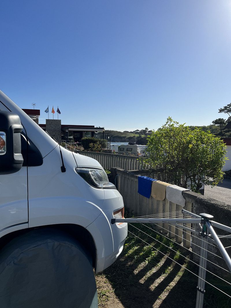
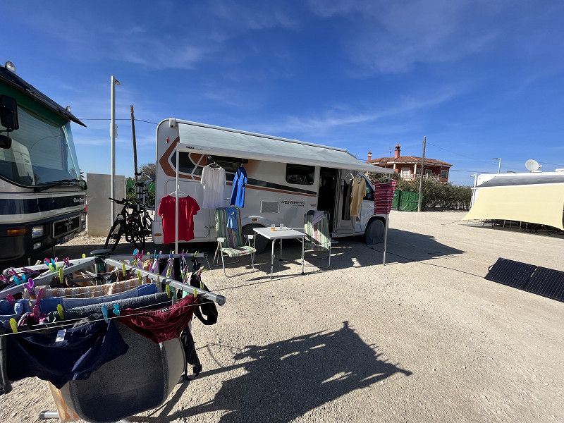
This morning, after a hearty breakfast with our friends, we start a little later than usual. We continue to drive toll-free through France to Biarritz. Unfortunately, 3 CP and all 3 parking spaces are completely occupied. So we drive to a campsite a little behind Saint Jean de Lutz (towards Spain).
We get a place here for 1 night, but we don't yet know whether we will stay here for 2 nights.
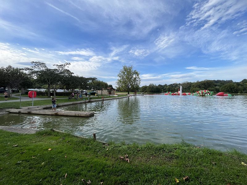
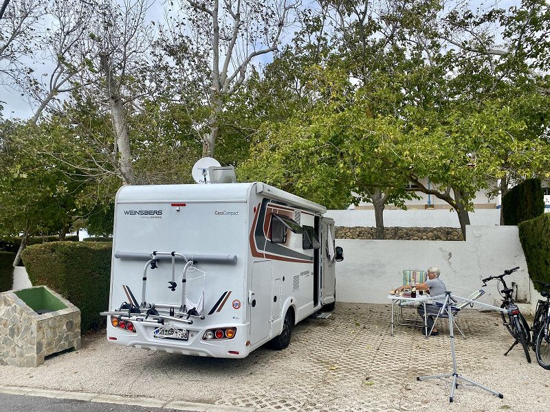
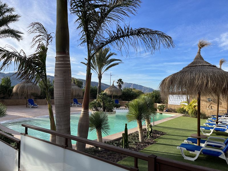
The campsite is nice and big, with lots of parking spaces (many are still free), an indoor swimming pool, a large lake with a beach, several sanitary facilities, a bistro/bar/restaurant where you can also get bread in the morning. We didn't eat because it's a bit more expensive there.
A lot of infrastructure, which is of course also reflected in the price (€25.50/night). we pay €19.00/night with ACSI. The night was very quiet. The sanitary building is clean. Bread is available without prior ordering
Rue De La Croix Rouge 2, Ciboure, Hendaye, Pyrénées-Atlantiques, France
43° 22' 55" N 1° 40' 7.2" W
43.3819509 -1.6686698
• Head north on Avenue du Docteur Speraber.
• Turn right onto Rue de la Croix Rouge. Go for 68 m.
• Turn right onto Rue de la Croix Rouge. Go for 56 m.
• Turn left onto Avenue Jean Jaurès (D912). Go for 262 m.
• Take the 3rd exit from Place du 8 Mai 1945 roundabout onto Quai Maurice Ravel (D912). Go for 517 m.
• Continue on Rue Pocalette (D912). Go for 16 m.
• Arrive at Rue Pocalette (D912). Your destination is on the right.
☍
0,9 km
( 2 min.)
Day
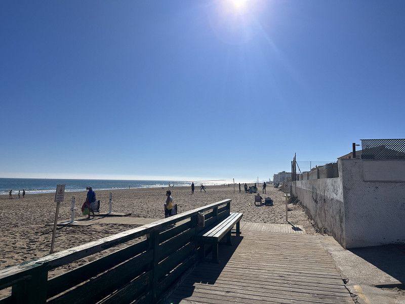
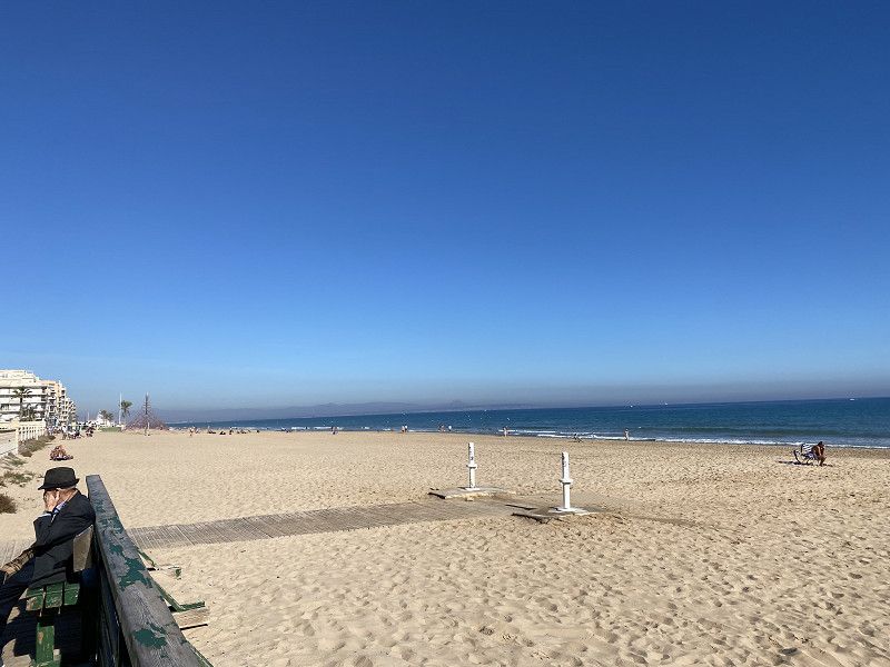
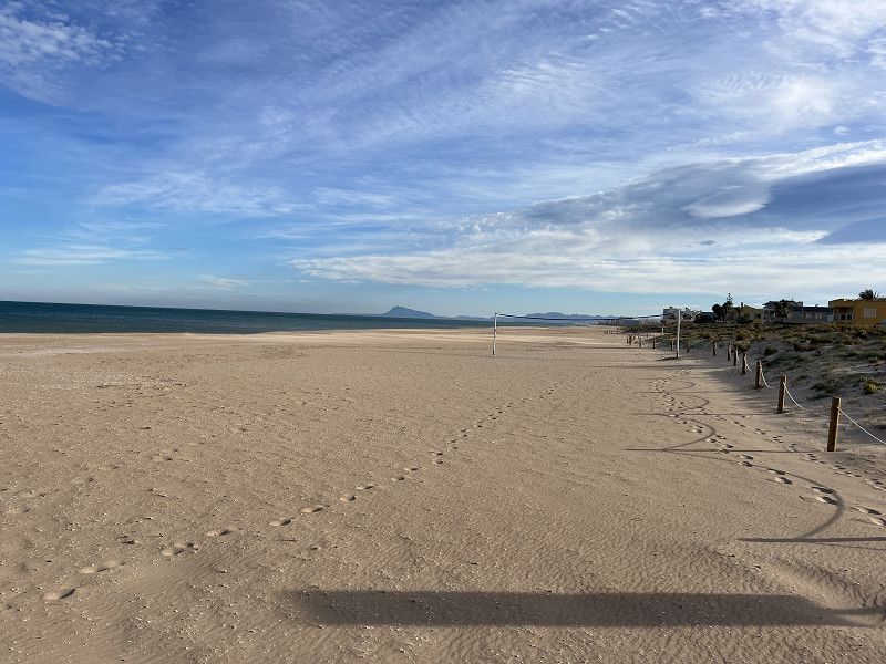
Plage de Ciboure
Frankreich
43° 23' 16.3" N 1° 40' 12.6" W
43.3878539 -1.6701764
• Head toward Rue du Docteur Mice on Rue Pocalette (D912). Go for 8 m.
• Continue on Boulevard Pierre Benoit (D912). Go for 1.3 km.
• Continue on Route de la Corniche (D912). Go for 1.7 km.
• Pass 3 roundabouts and continue on Route de la Corniche (D912). Go for 5.4 km.
• Turn left onto Avenue de Lissardy (D358). Go for 191 m.
• Take the 3rd exit from roundabout onto Boulevard de l'Empereur (D358). Go for 804 m.
• Take the 2nd exit from roundabout onto Boulevard de l'Empereur (D358). Go for 442 m.
• Turn right onto Rue Philippe Labourdette. Go for 26 m.
• Arrive at Rue Philippe Labourdette. Your destination is on the left.
☍
9,9 km
( 13 min.)
Day
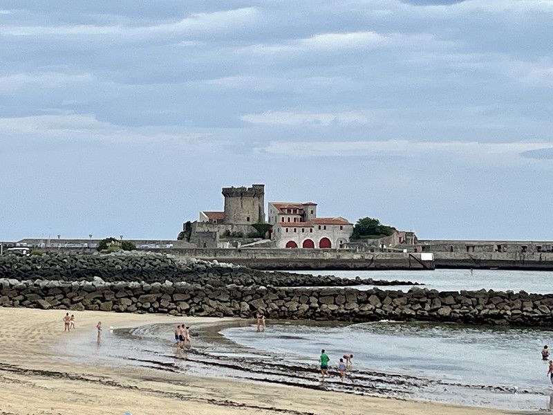
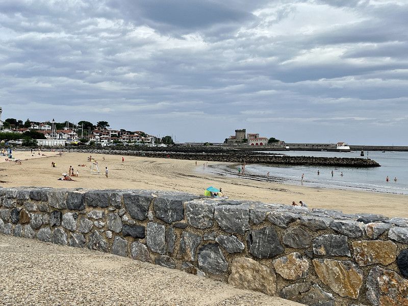
Hendaye
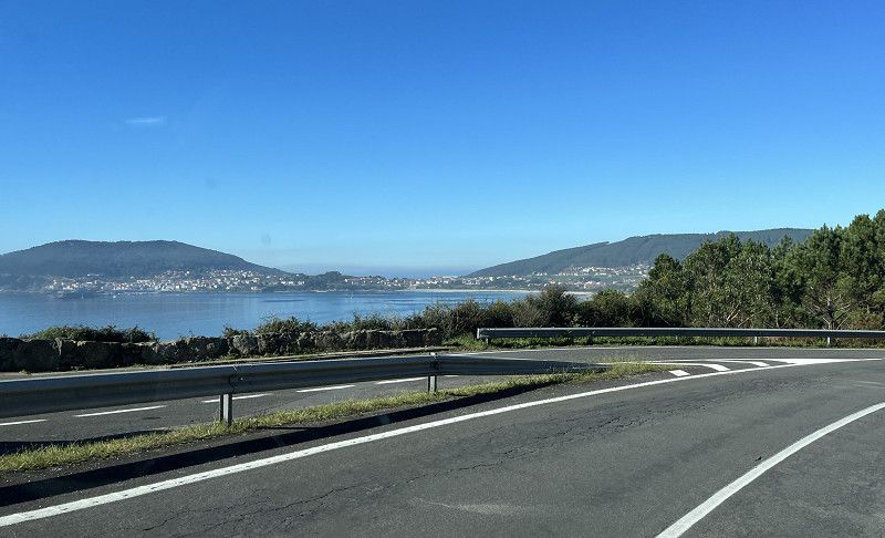
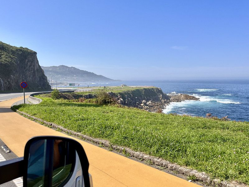
Very nice coastal road to Spain, driving this for the first time.
Pyrenäen-Atlantik, Neu-Aquitanien, Frankreich
43° 21' 50.9" N 1° 45' 41.9" W
43.3641518 -1.7616499
• Head toward Boulevard de l'Empereur on Rue Philippe Labourdette. Go for 26 m.
• Turn right onto Boulevard de l'Empereur (D358). Go for 191 m.
• Take the 2nd exit from roundabout onto Boulevard de l'Empereur (D358). Go for 349 m.
• Take the 2nd exit from roundabout onto Boulevard de l'Empereur (D358). Go for 684 m.
• Take the 2nd exit from roundabout onto Rue des Réservoirs (D358). Go for 325 m.
• Take the 3rd exit from roundabout onto Rue de Hapetenia (D358). Go for 573 m.
• Take the 3rd exit from Rue de Hapetenia roundabout onto Rue de Béhobie (D811). Go for 713 m.
• Take the 2nd exit from roundabout onto Rue Charles Pucheu (D810) toward Bayonne/St Sébastien/Biriatou. Go for 156 m.
• Take the 1st exit from roundabout. Go for 62 m.
• Continue on N-1. Go for 165 m.
• Turn right toward N-1. Go for 31 m.
• Take the 2nd exit from roundabout onto Avenida Endarlaza (N-121-A) toward Donostia/E-70/N-121/San Sebastián/A-8/Iruña/Pamplona. Go for 222 m.
• Take the 2nd exit from roundabout toward A-8/Donostia/S. Sebastián/E-5/E-70/E-80/AP-1/AP-8/Donostia-San Sebastián. Go for 68 m.
• Take ramp onto AP-8 (Autopista del Cantábrico). Go for 12.0 km.
• Take the exit toward Bilbao/Vitoria-Gasteiz/Burgos/Hernani/A-15/Iruña/Pamplona onto AP-1/AP-8. Go for 14.8 km.
• Take the exit onto AP-1/AP-8 (Autopista del Cantábrico). Go for 41.9 km.
• Continue on AP-8 (Autopista del Cantábrico) toward Eibar/Bilbao. Go for 34.2 km.
• Take exit 103 toward N-637/Aireportua/Centro Ciudad Bilbao/Barakaldo/Getxo onto BI-30. Go for 19.8 km.
• Take the exit toward Sestao/Portua/Santander onto A-8 (Autovía del Cantábrico). Go for 35.8 km.
• Arrive at Autovía del Cantábrico (A-8). Your destination is on the right.
☍
162,0 km
(1 hrs. 39 min.)
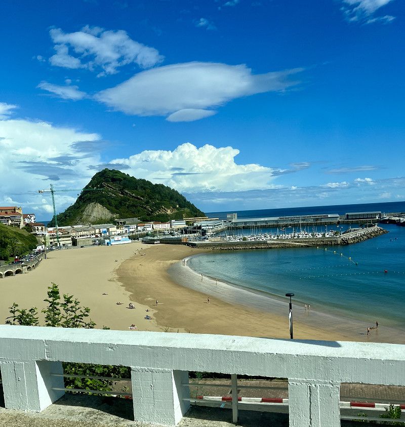
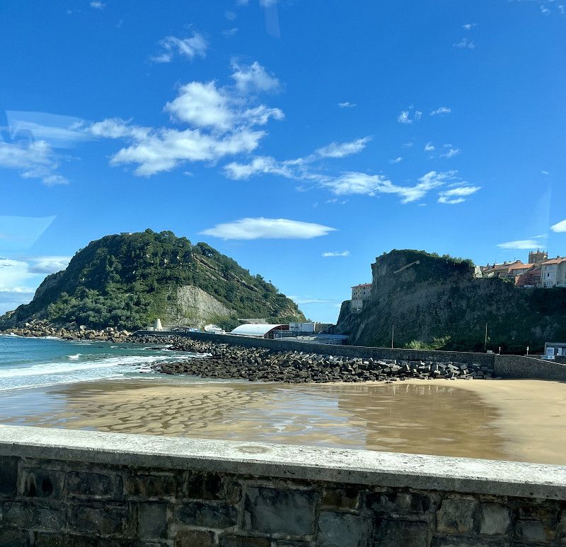
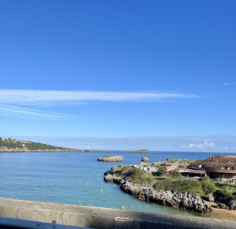
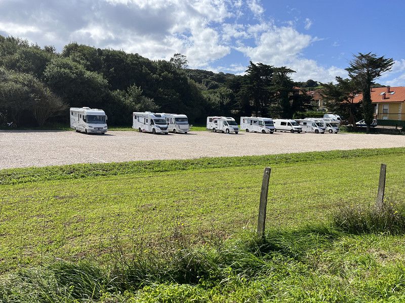
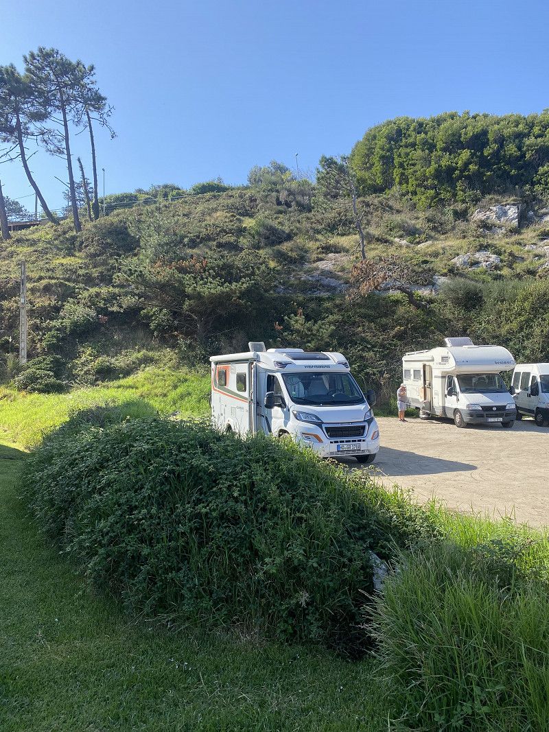
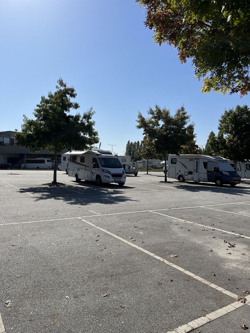
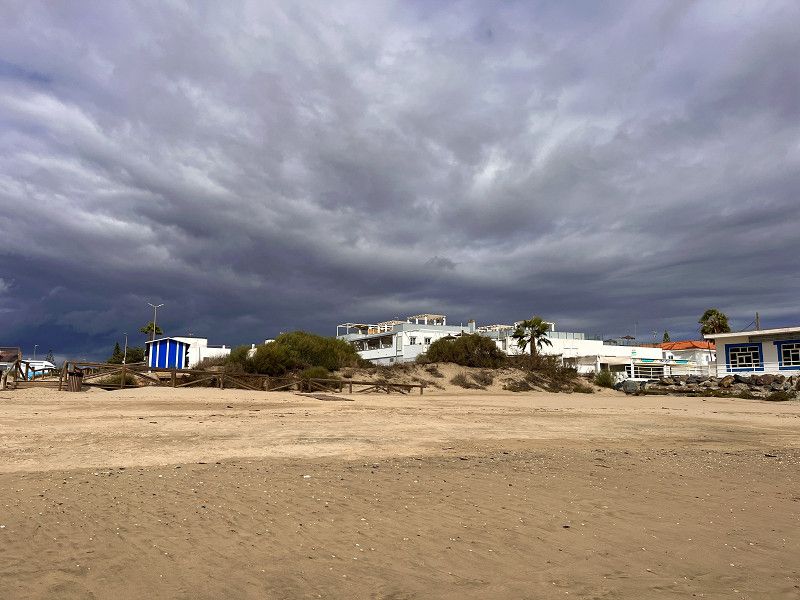
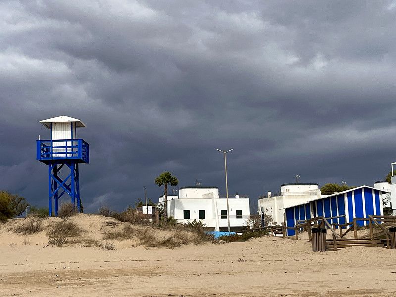
Volle Stellplätze
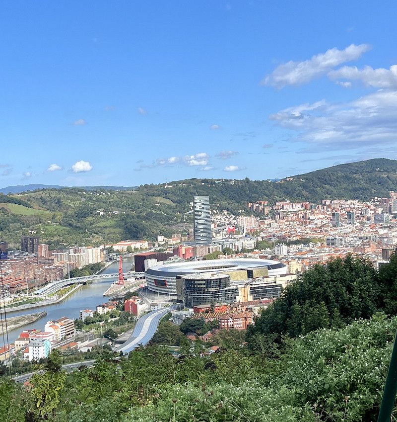
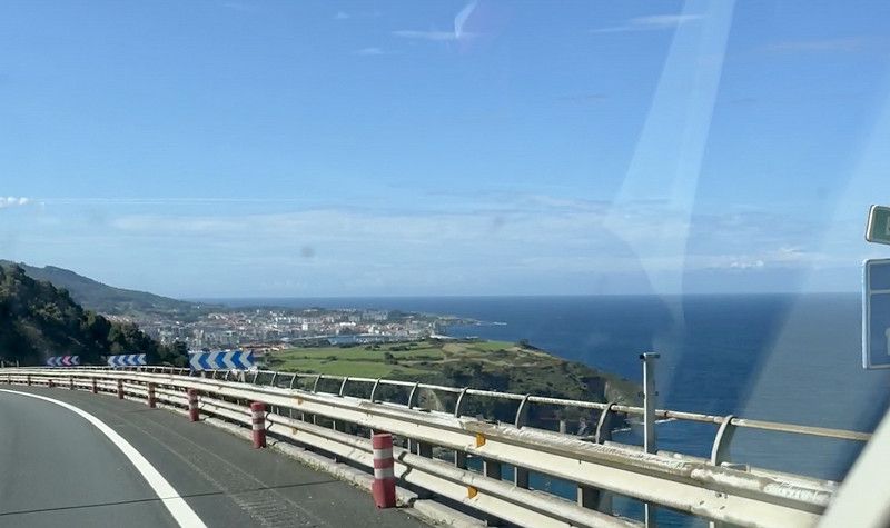
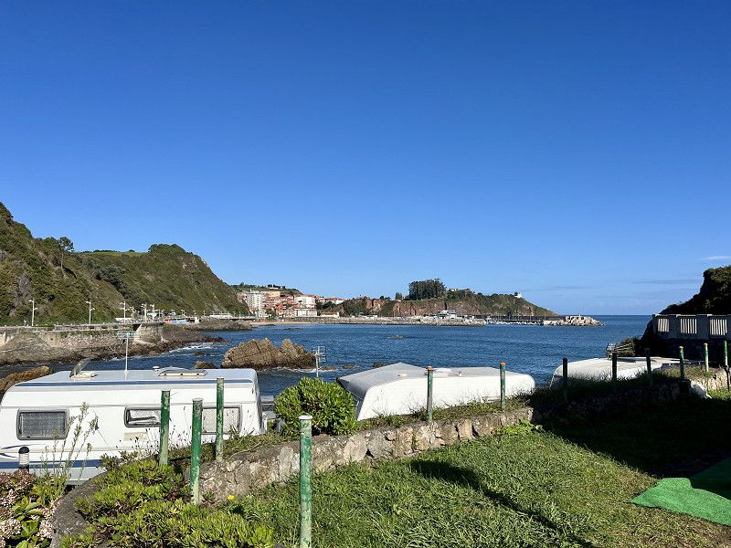
We drive on the Basque coast to San Sebastian on the SP. But everything here is fully occupied. So we continue via Getaria to Zumaia, here too the CP is “Complete” and the parking spaces are only possible in the industrial area. Which is out of the question for us. So we continue to Bilbao. Here too it's the same game, if you don't have a reservation you won't get a place.
Slightly frustrated, we drive on and find a place at a campsite in Islares.
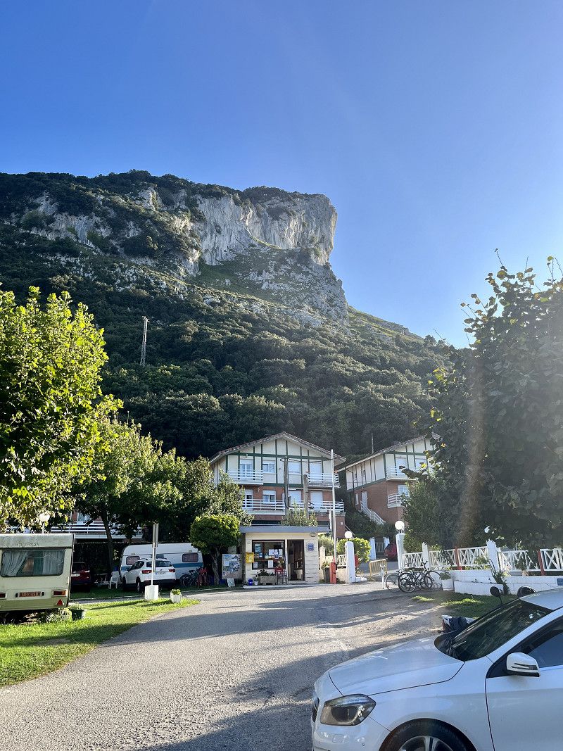
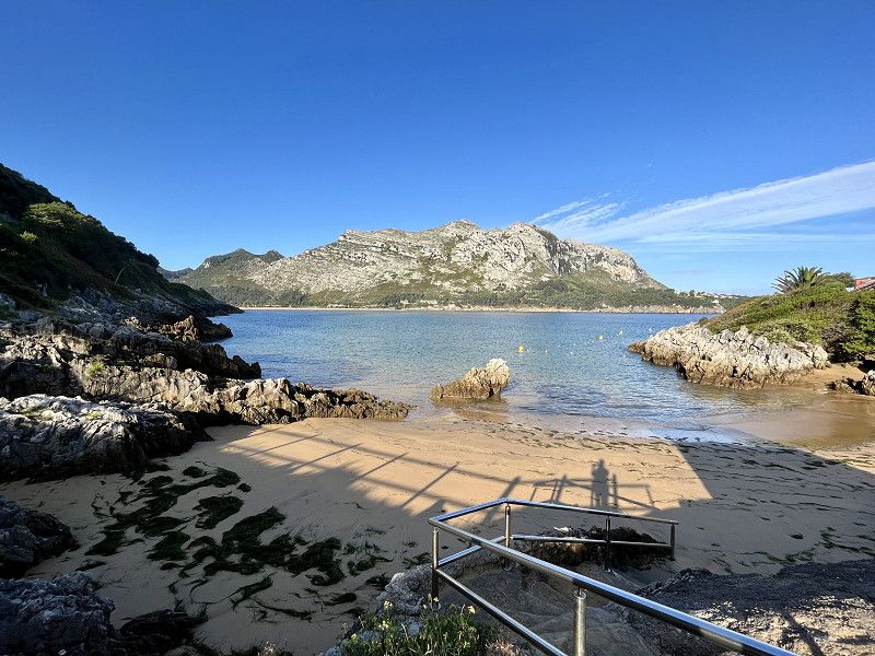
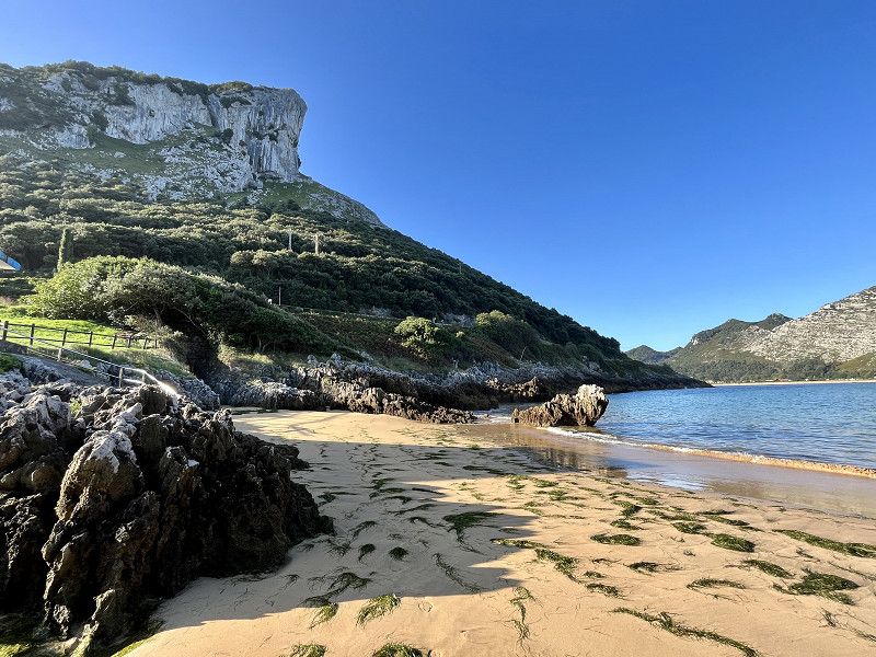
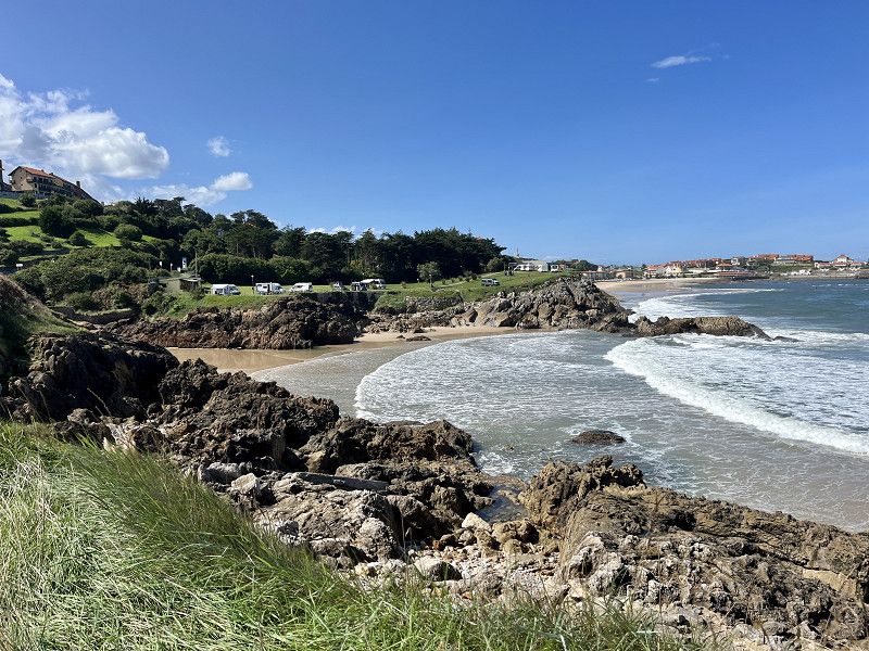
Camping Playa Arenillas
ACSI place right by the sea and mountain
23€/night with electricity. The bay is very idyllic and there are 2 restaurants. Bread or even breakfast is available in the camping restaurant. The 2 sanitary facilities are clean and the showers are hot!
Ctra. Santader-Bilbao, K. 64 I, 39798, Islares, Spain
43° 24' 10" N 3° 18' 38" W
43.4027700 -3.3105500
• Head west on A-8 (Autovía del Cantábrico). Go for 13.4 km.
• Take exit 172 toward Laredo. Go for 514 m.
• Take the 3rd exit from roundabout onto Calle Duque de Ahumada (N-634) toward N-629/Colindres. Go for 191 m.
• Pass 2 roundabouts and continue on Calle Wenceslao López Albo (N-634). Go for 737 m.
• Turn right onto Calle Pedrosa. Go for 156 m.
• Continue toward Calle Menéndez Pelayo. Go for 110 m.
• Continue on Calle Menéndez Pelayo. Go for 342 m.
• Take the 1st exit from roundabout. Go for 29 m.
• Turn slightly left onto Calle Santander. Go for 313 m.
• Arrive at Calle Santander. Your destination is on the left.
☍
15,8 km
( 12 min.)
Day
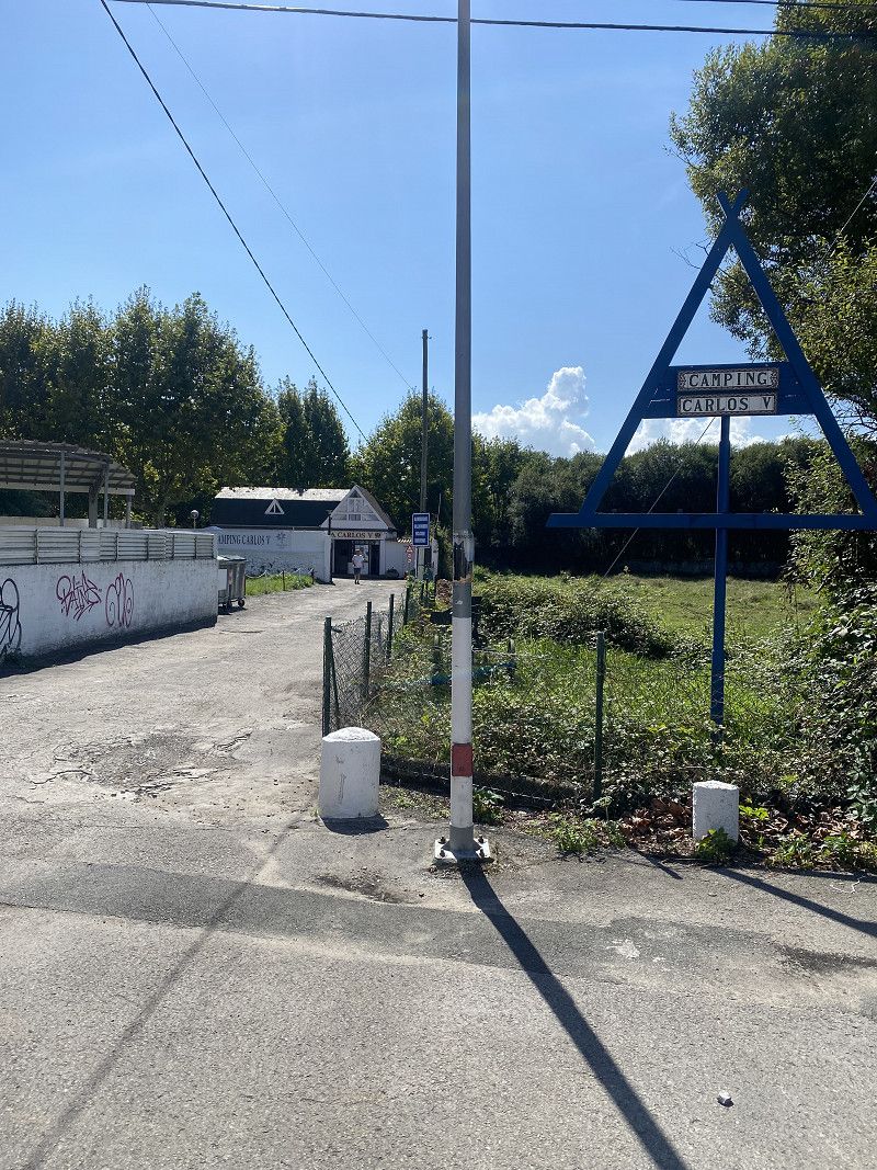
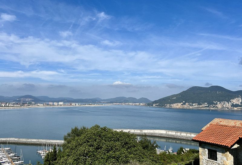
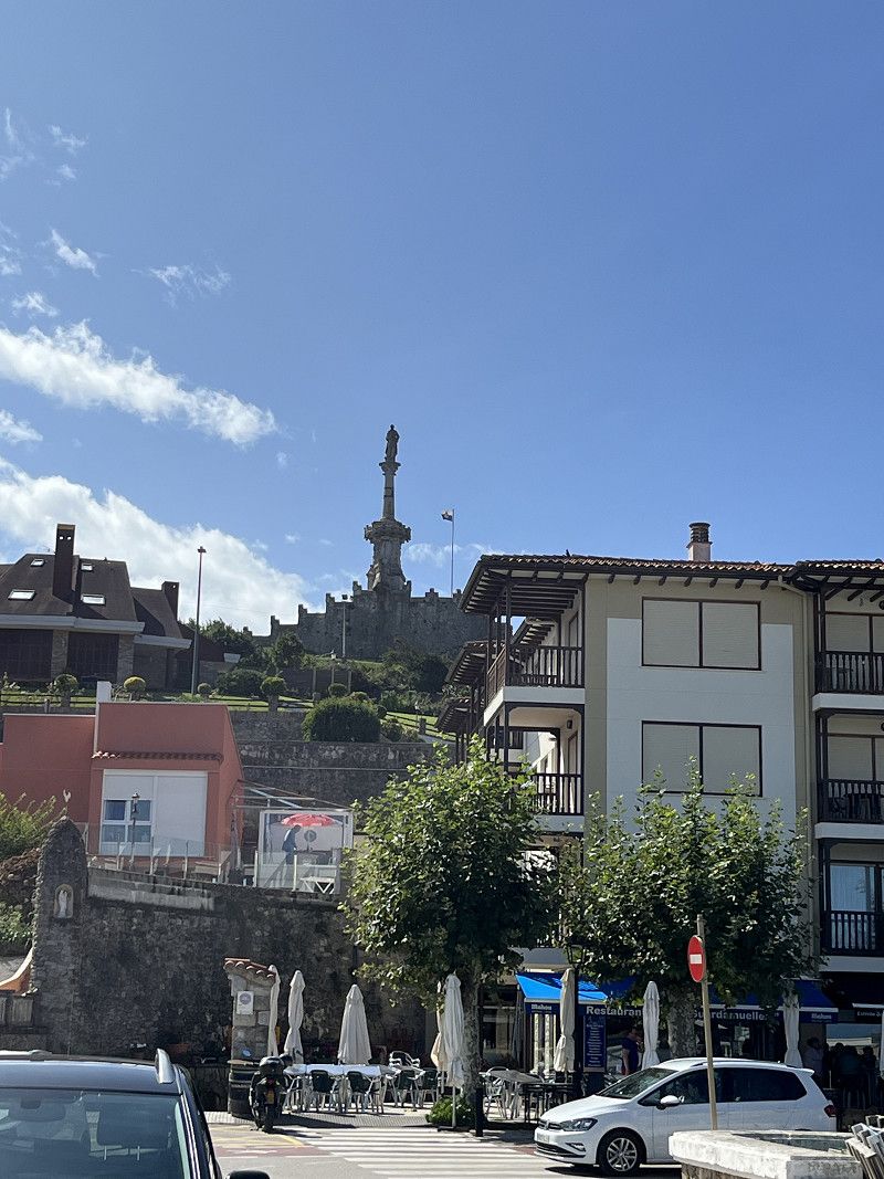
Laredo - Carlos V
Simple city CP, old sanitary facility, but clean. There is only hot water in the shower, otherwise only cold water taps.
We are without electricity for 26€/night
The place is very central in the city and close to the beach, but still quiet. Maybe that's why it costs so much.
Cantabria, Spain
43° 24' 11.7" N 3° 27' 9.8" W
43.4032541 -3.4527301
• Head south on Calle Santander. Go for 313 m.
• Turn slightly right toward Calle Santander. Go for 9 m.
• Take the 2nd exit from roundabout onto Calle Santander. Go for 187 m.
• Take the 3rd exit from roundabout onto Calle Santander. Go for 442 m.
• Turn right onto Calle Ramón Pelayo (N-634). Go for 78 m.
• Take the 2nd exit from roundabout onto Calle La Quinta (N-629). Go for 592 m.
• Take the 1st exit from roundabout onto A-8 (Autovía del Cantábrico) toward Santander. Go for 26.0 km.
• Take exit 199 toward Torrelavega/Oviedo onto A-8 (Autovía del Cantábrico). Go for 49.9 km.
• Take exit 249 toward Comillas. Go for 246 m.
• Take the 2nd exit from roundabout onto CA-135 toward Comillas. Go for 175 m.
• Continue on Cabezón de la Sal (CA-135). Go for 254 m.
• Continue on CA-135. Go for 3.6 km.
• Continue on Barrio Canales (CA-135). Go for 74 m.
• Continue on Urbanización Canales (CA-135). Go for 34 m.
• Continue on CA-135. Go for 2.1 km.
• Turn right onto CA-359 toward Ruilobuca/Ruiloba/Liandres. Go for 593 m.
• Continue on CA-359. Go for 1.5 km.
• Turn slightly right onto Barrio Ruilobuca (CA-359). Go for 91 m.
• Continue on Barrio Ruilobuca (CA-358). Go for 112 m.
• Turn left onto CA-358. Go for 717 m.
• Arrive at CA-358. Your destination is on the right.
☍
87,0 km
( 54 min.)
Day
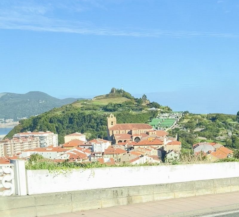
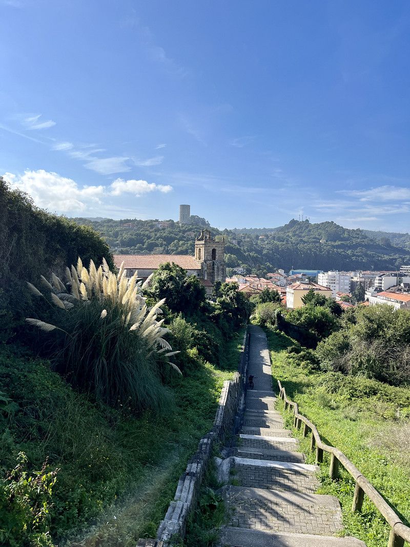
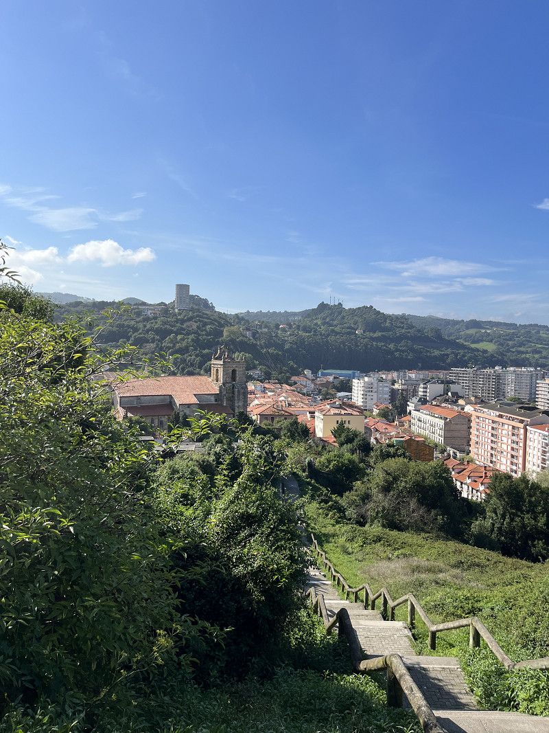
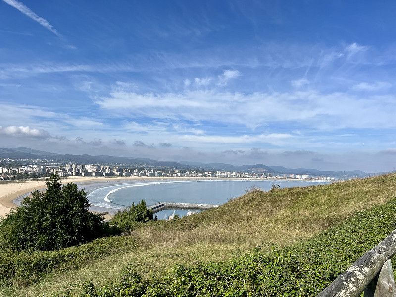
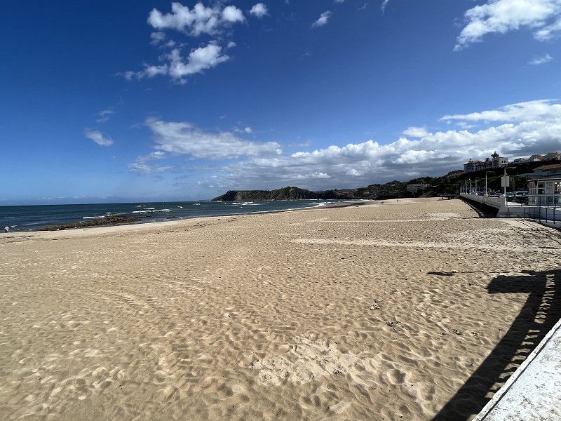
2.ter Tag Laredo
First into the old town, up to the church and then a little further up. Magnificent views over the entire beach and city. We bike to the top and then to Playa de Regaton.
Day
Somo-Suesa
SP a bit remote but not crowded.
Ruiloba
12€/night without electricity, very quiet even though the new SP is on the street. V+E also has a bathroom on site, but we didn't use it.
Costa Occidental, Kantabrien, Spanien
43° 22' 50.8" N 4° 15' 7.2" W
43.3807640 -4.2519889
• Head north on CA-358. Go for 43 m.
• Continue on Barrio Ruiloba-Iglesia (CA-358). Go for 152 m.
• Continue on Barrio Ruiloba-Iglesia. Go for 901 m.
• Continue on Barrio Liandres. Go for 205 m.
• Turn right onto Barrio Liandres. Go for 154 m.
• Turn right toward CA-131. Go for 36 m.
• Turn right onto CA-131. Go for 2.8 km.
• Turn left onto Calle Joaquín Calvo Sotelo. Go for 524 m.
• Continue on Calle Antonio López. Go for 9 m.
• Turn left onto Calle San Jerónimo. Go for 111 m.
• Turn right onto Calle Germán Castro Uriona. Go for 109 m.
• Arrive at Calle Germán Castro Uriona. Your destination is on the right.
☍
5,1 km
( 8 min.)
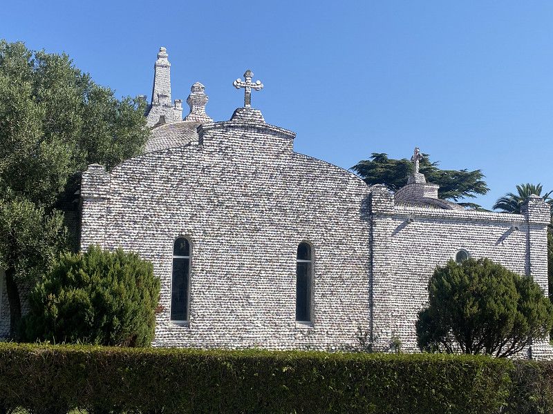
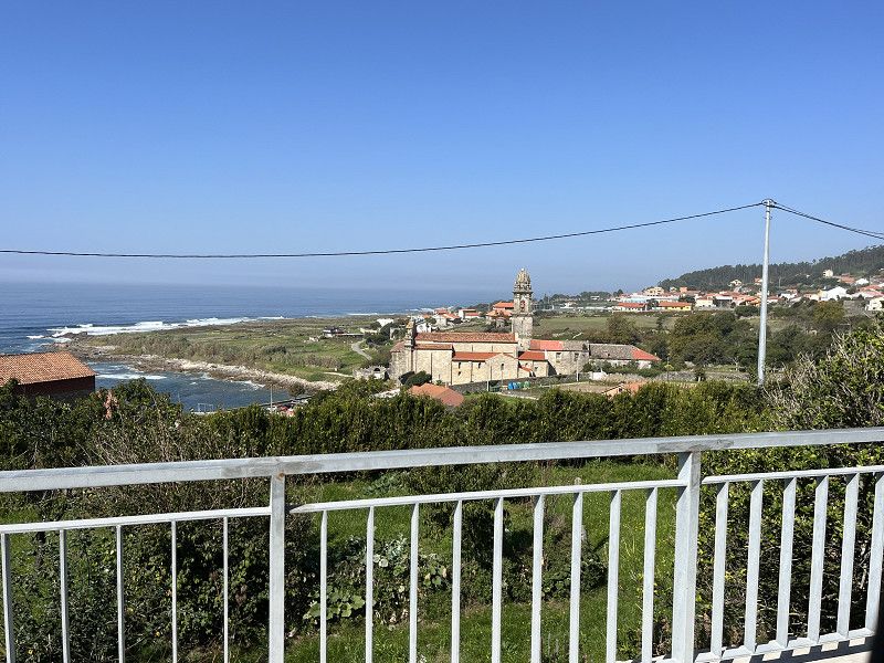
Comillas - eine sehenswerte Stadt
The town of Comillas is within walking distance (1.5km), very beautiful old town and also the beach.
Costa Occidental, Kantabrien, Spanien
43° 23' 7.9" N 4° 17' 24.5" W
43.3855344 -4.2901505
• Head south on Calle Germán Castro Uriona. Go for 23 m.
• Turn right onto Calle Germán Castro Uriona. Go for 44 m.
• Turn left onto Calle Carlos Díaz de la Campa. Go for 36 m.
• Turn right onto Calle General Piélago. Go for 101 m.
• Turn right onto Travesía Ocejo. Go for 29 m.
• Turn left onto Travesía Ocejo. Go for 52 m.
• Turn right onto Paseo Estrada (CA-135). Go for 117 m.
• Turn left onto Calle Marqués de Comillas (CA-135). Go for 78 m.
• Continue on CA-135. Go for 39 m.
• Continue on Calle Marqués de Comillas (CA-135). Go for 282 m.
• Take the 3rd exit from Rotonda Doctor Santiago García Castellón roundabout onto CA-131. Go for 7.1 km.
• Turn right onto N-634. Go for 2.4 km.
• Take the 2nd exit from roundabout onto Puente Maza (N-634). Go for 631 m.
• Take the 3rd exit from roundabout onto CA-843. Go for 1.7 km.
• Continue toward CA-847. Go for 47 m.
• Take the 1st exit from roundabout onto A-8 (Autovía del Cantábrico) toward Unquera/Oviedo. Go for 97.0 km.
• Take exit 360 toward Gijón/A Coruña/Aeropuerto de Asturias onto A-8 (Autovía del Cantábrico). Go for 18.6 km.
• Take exit 379 toward Gijón/El Llano/Pola de Siero. Go for 627 m.
• Take the 2nd exit from roundabout onto Prolongación Avenida del Llano (AS-246). Go for 909 m.
• Continue on Avenida del Llano. Go for 790 m.
• Take the 2nd exit from roundabout onto Avenida del Llano. Go for 491 m.
• Continue on Avenida Hermanos Felgueroso. Go for 106 m.
• Turn right onto Avenida de la Costa. Go for 44 m.
• Turn slightly left onto Calle San Bernardo. Go for 817 m.
• Turn right onto Calle Ventura Álvarez Sala. Go for 63 m.
• Turn left onto Calle Cabrales. Go for 54 m.
• Turn left onto Plaza Mayor. Go for 73 m.
• Arrive at Plaza Mayor. Your destination is on the right.
☍
132,2 km
(1 hrs. 27 min.)
Day
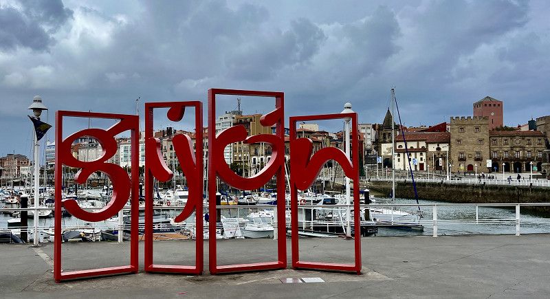
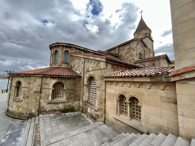
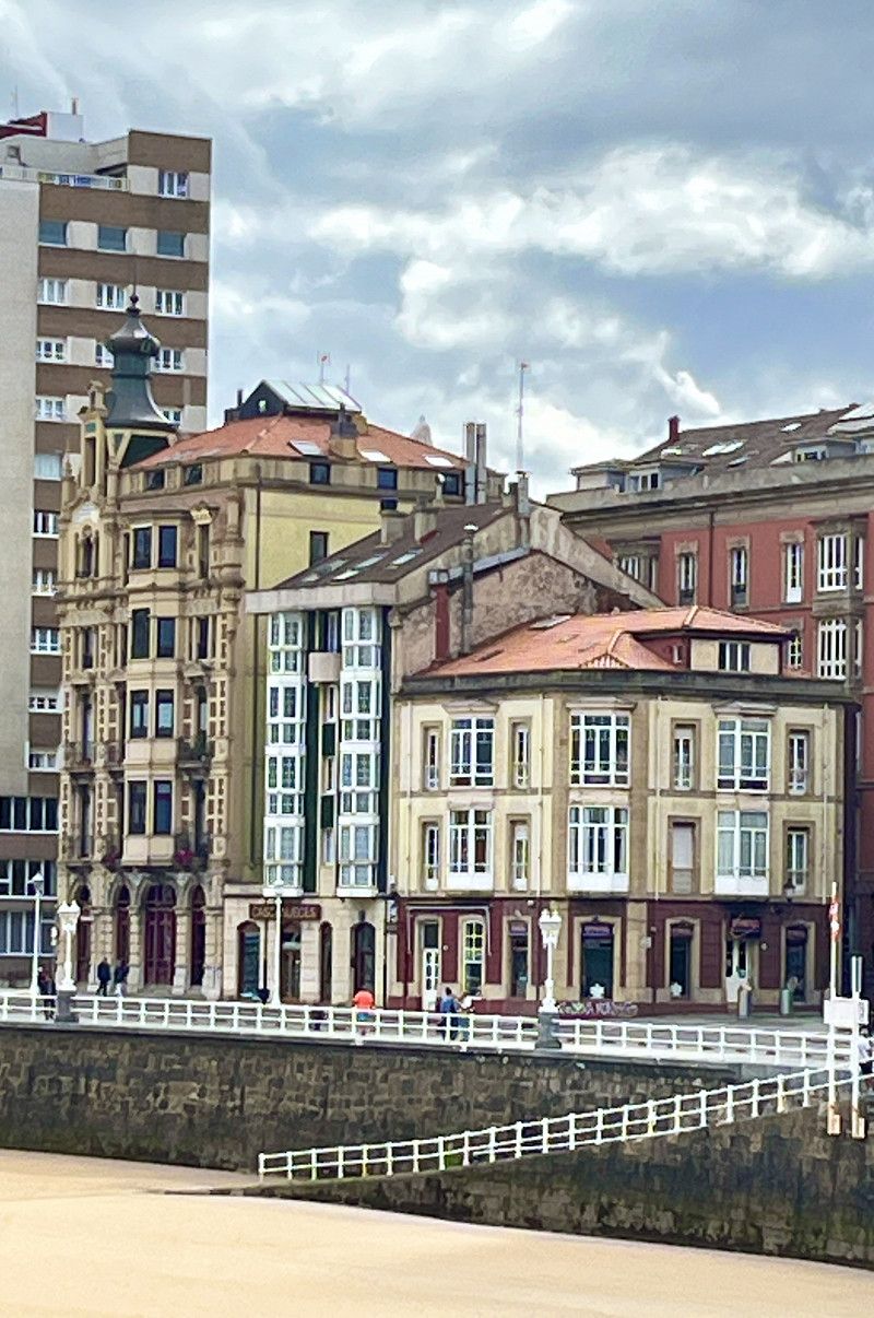
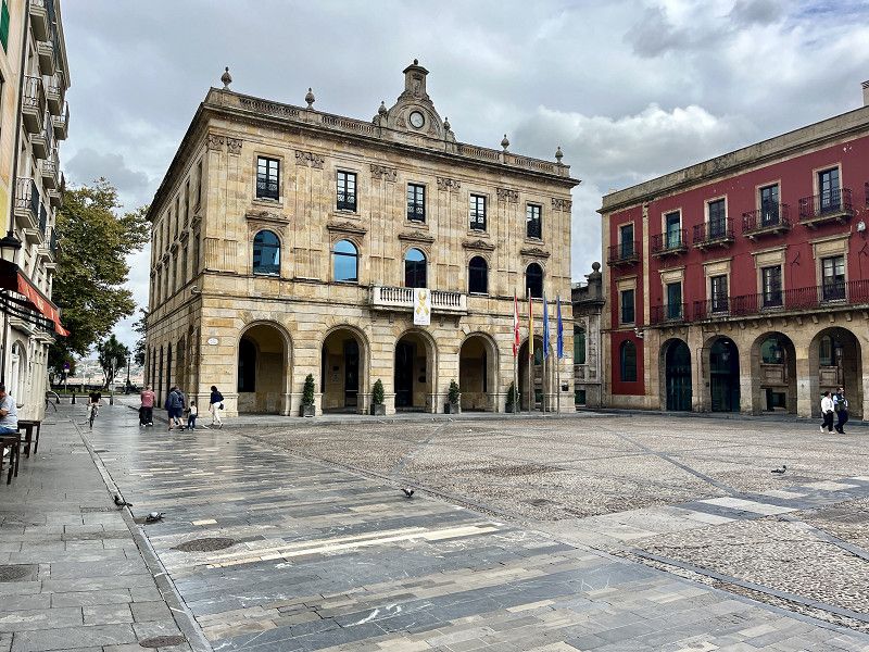
Gijón / Xixón - einst eine Industriestadt
Simple, free parking space on the street, V+E is possible, but the actual parking space is always occupied (long-term parkers), so we stand in the parking lot in front of it.
But that's enough for us to visit Gijón for now.
The weather is also very mixed today. For us, Gijón is not the most beautiful city, the old town with its church is quite nice.
Asturien, Fürstentum Asturien, Spanien
43° 32' 41.8" N 5° 39' 45.9" W
43.5449422 -5.6627500
• Head toward Plaza del Marqués on Plaza Mayor. Go for 38 m.
• Continue on Calle Recoletas. Go for 29 m.
• Turn right onto Travesía Jovellanos. Go for 70 m.
• Turn slightly right onto Plaza del Campo Valdés. Go for 50 m.
• Turn slightly right onto Calle Cabrales. Go for 312 m.
• Turn right onto Calle Domínguez Gil. Go for 60 m.
• Turn right onto Calle San Bernardo. Go for 28 m.
• Turn left onto Calle Munuza. Go for 195 m.
• Continue toward Calle Álvarez Garaya. Go for 21 m.
• Take the 1st exit from Plaza del Carmen roundabout. Go for 59 m.
• Continue on Calle Álvarez Garaya. Go for 196 m.
• Keep right onto Plaza Humedal (N-632). Go for 820 m.
• Take the 1st exit from roundabout onto Calle Carlos Marx. Go for 240 m.
• Take the 1st exit from roundabout onto Avenida Portugal. Go for 674 m.
• Take the 3rd exit from roundabout onto Calle Bohemia. Go for 171 m.
• Continue on GJ-81. Go for 1.4 km.
• Take the exit toward Tremañes/GJ-10/Polígono Industrial Somonte/AS-19/Candas/AS-118/Luanco onto Ronda de Tremañes. Go for 1.5 km.
• Take the 2nd exit from roundabout onto Ronda de Tremañes (AS-19). Go for 1.2 km.
• Take the 2nd exit from roundabout. Go for 110 m.
• Continue on Carretera de Avilés (AS-19). Go for 2.2 km.
• Keep right. Go for 119 m.
• Continue toward AS-118. Go for 45 m.
• Take the 2nd exit from roundabout onto AS-118 toward Candas/AS-239/Luanco. Go for 5.0 km.
• Take ramp toward Perán/Perlora. Go for 152 m.
• Turn right onto CE-2. Go for 18 m.
• Continue on Monte (CE-2). Go for 125 m.
• Continue on CE-2. Go for 905 m.
• Arrive at CE-2. Your destination is on the right.
☍
15,7 km
( 18 min.)
Day
Camping Perlora
Today is laundry day, so we're going to a campsite. Here we stand directly on the cliffs with a fantastic view
25€/night including electricity and showers.
The place is quite full, but she finds a place for us, just not with the view (you have to reserve that)
For us it's completely fine
Asturien, Fürstentum Asturien, Spanien
43° 34' 56.2" N 5° 45' 26.4" W
43.5822643 -5.7573369
• Head east on CE-2. Go for 17 m.
• Turn left onto AS-239a. Go for 74 m.
• Continue on Paseo Marítimo (AS-239a). Go for 796 m.
• Continue on Astilleros (AS-239a). Go for 97 m.
• Take the 2nd exit from roundabout onto Calle Pedro Herrero (AS-239a). Go for 315 m.
• Turn right onto Calle Carlos Albo Kay (AS-239a). Go for 42 m.
• Turn right onto Calle Doctor Braulio Busto. Go for 42 m.
• Turn left onto Plaza Baragaña. Go for 31 m.
• Continue on Calle Rosal. Go for 28 m.
• Take the 1st exit from roundabout onto Calle Tenderina. Go for 29 m.
• Turn left onto Calle Valdés Pumarino. Go for 57 m.
• Turn slightly right onto Calle Valdés Pumarino. Go for 138 m.
• Take the 2nd exit from Calle Valdés Pumarino roundabout onto Calle San Antonio. Go for 157 m.
• Turn slightly right onto Carretera Faro. Go for 359 m.
• Arrive at Carretera Faro. Your destination is on the right.
☍
2,2 km
( 6 min.)
Day
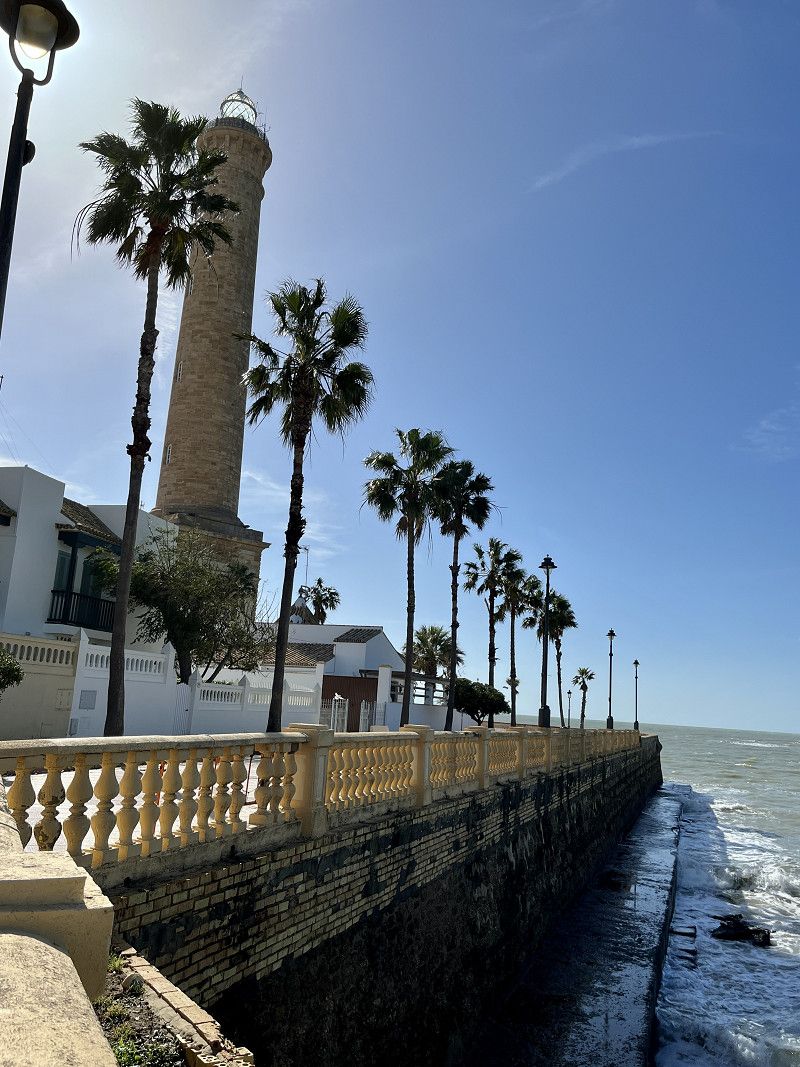
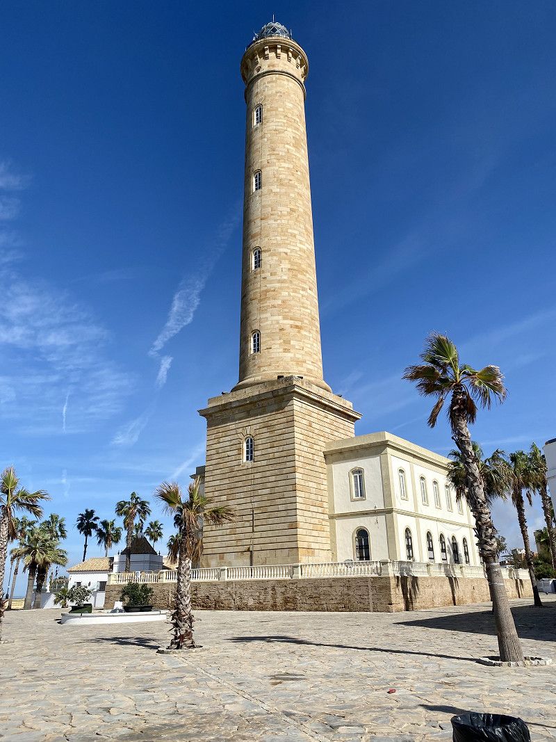
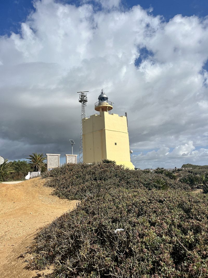
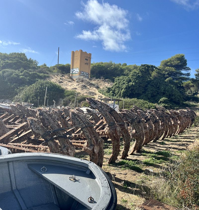
Faro de San Antonio
We walk a bit along the coast to the lighthouse, then to the town of Candàs to have lunch and let the Spanish flair work its magic on us.
There is a street with lots of goodies, bars and restaurants. Since today is Sunday, everyone is out and about and it feels like we are the only tourists 😂. The food was very good and then we went down to the harbor before heading back to the campsite.
Carretera al Faro, Carreño, Asturien, Fürstentum Asturien, Spanien
43° 35' 34.6" N 5° 45' 42.8" W
43.5929328 -5.7618756
• Head toward Calle San Antonio on Carretera Faro. Go for 359 m.
• Turn right onto Calle San Antonio. Go for 203 m.
• Turn left onto Calle Pepe la Mata. Go for 58 m.
• Continue on Calle Pardies. Go for 203 m.
• Turn right onto Calle Bernardo Alfageme (AS-239a). Go for 97 m.
• Continue on AS-239a. Go for 321 m.
• Turn left onto Carretera Candas Tabaza (AS-110). Go for 1.3 km.
• Turn right onto Calle Doctor Fleming (AS-110). Go for 107 m.
• Take the 3rd exit from roundabout onto AS-110 toward Tabaza/E-70/A-8. Go for 1.2 km.
• Continue on Noval (AS-110). Go for 214 m.
• Continue on AS-110. Go for 3.8 km.
• Continue on La Machina (AS-110). Go for 65 m.
• Continue on AS-110. Go for 414 m.
• Continue on Llantero (AS-110). Go for 161 m.
• Continue on AS-110. Go for 560 m.
• Take the 2nd exit from roundabout onto AS-110. Go for 1.9 km.
• Take the 2nd exit from roundabout toward A-8/E-70/Cancienes. Go for 250 m.
• Take ramp onto A-8 (Autovía del Cantábrico) toward Avilés/Aeropuerto. Go for 43.9 km.
• Take exit 441 toward N-632/Novellana/Sta. Marina. Go for 291 m.
• Take the 3rd exit from roundabout. Go for 272 m.
• Keep left toward N-632a. Go for 21 m.
• Turn left onto N-632a. Go for 1.9 km.
• Turn right. Go for 1.1 km.
• Turn left. Go for 50 m.
• Arrive at your destination on the right.
☍
58,8 km
( 41 min.)
Day
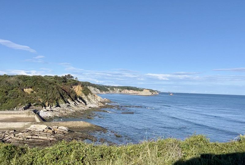
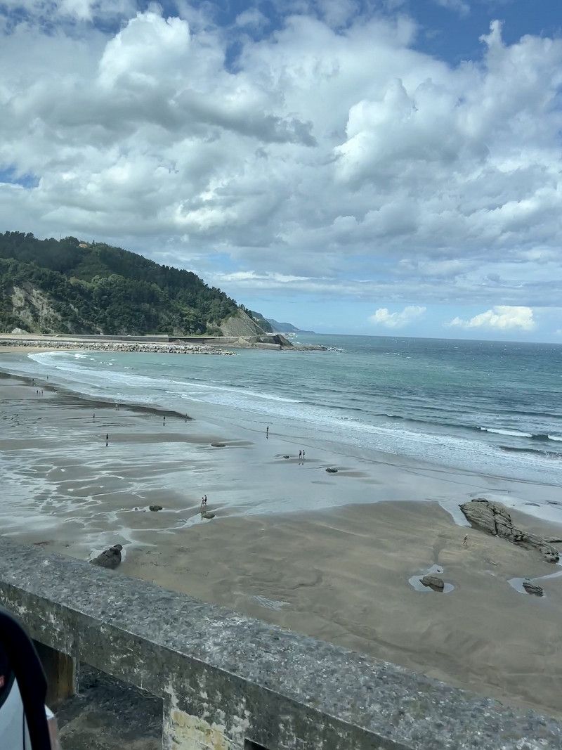
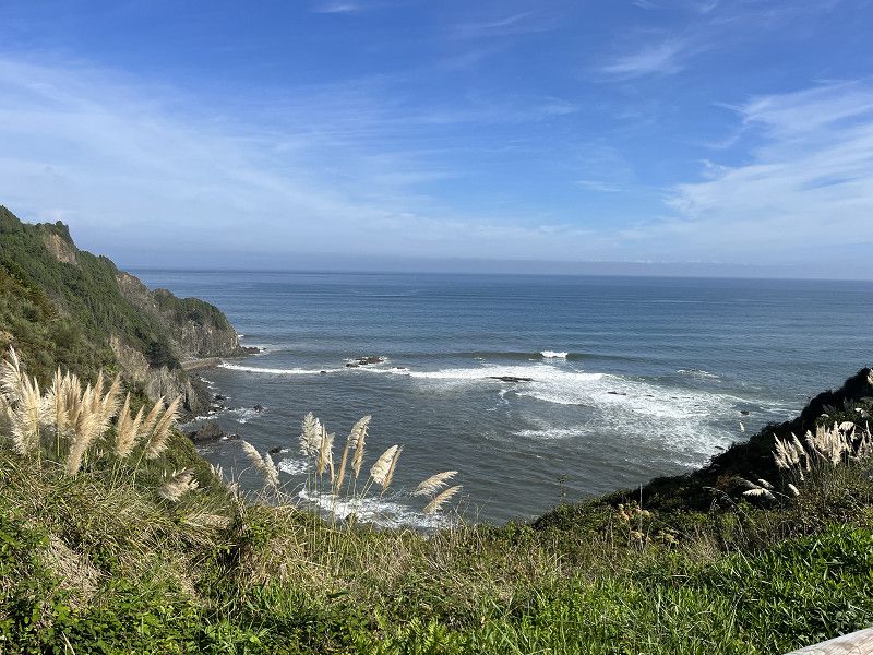
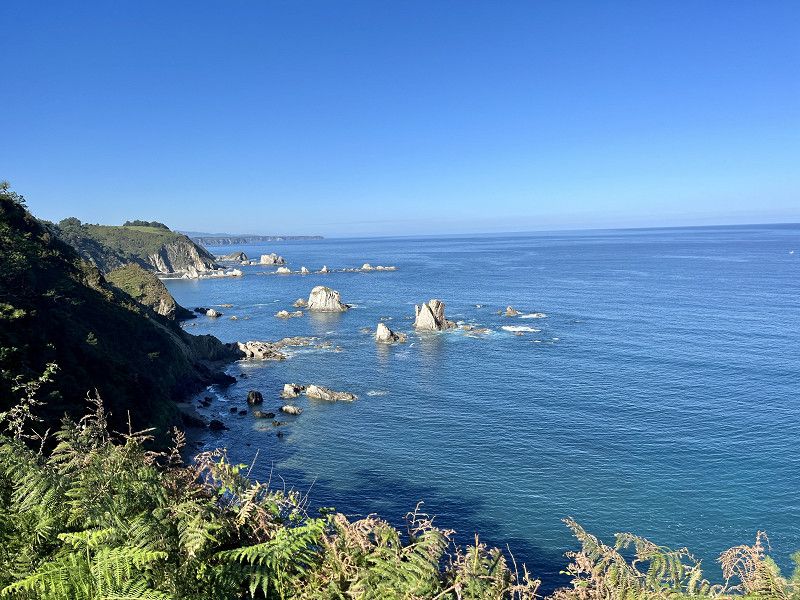
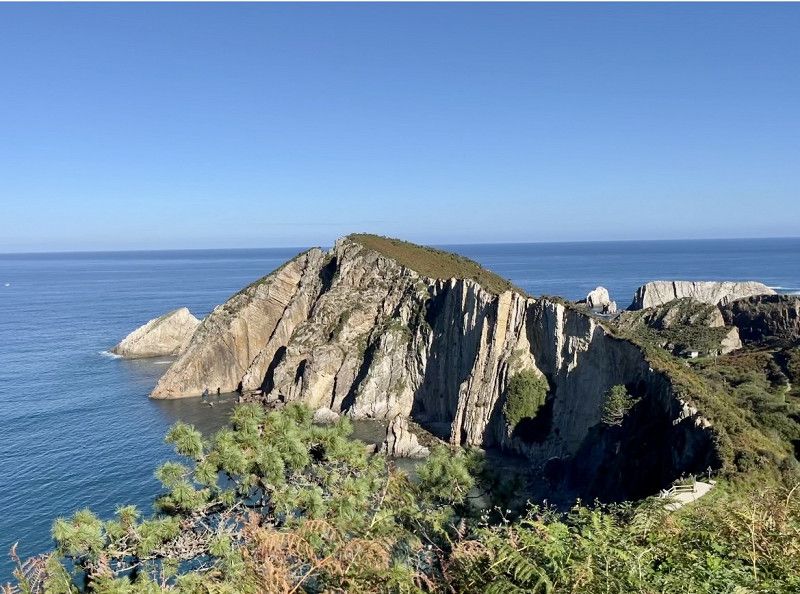
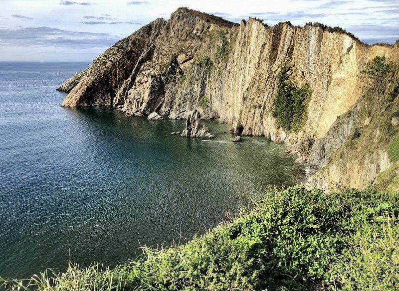
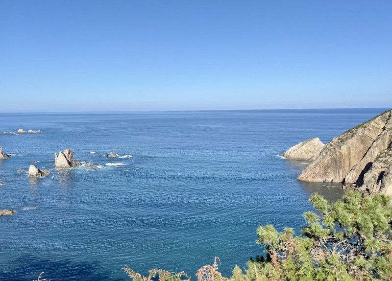
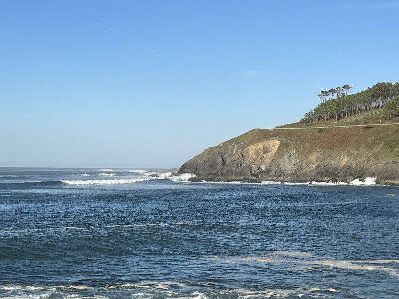
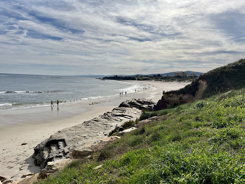
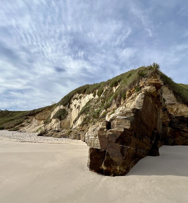
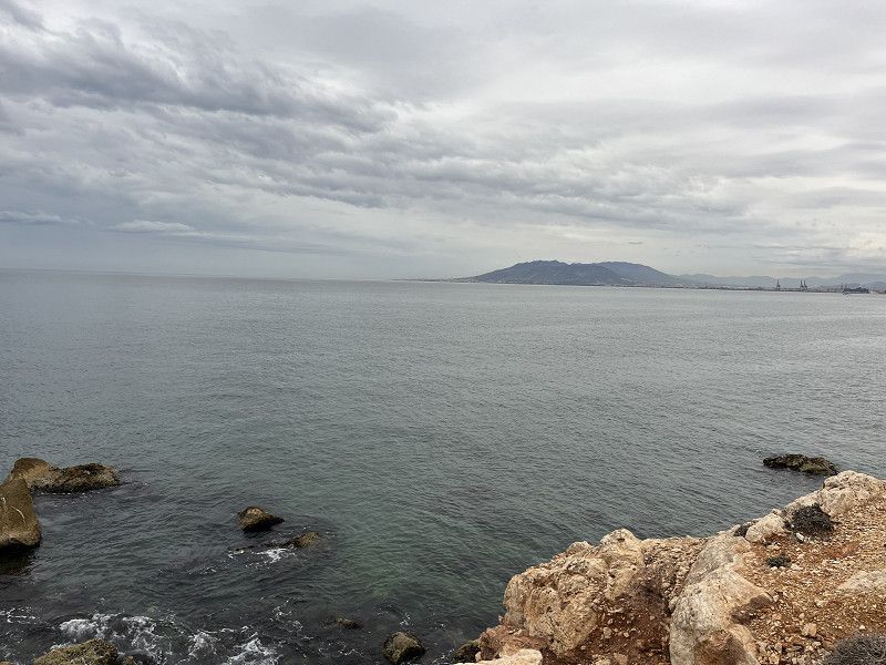
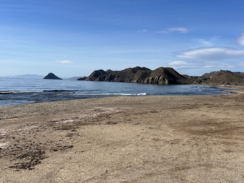
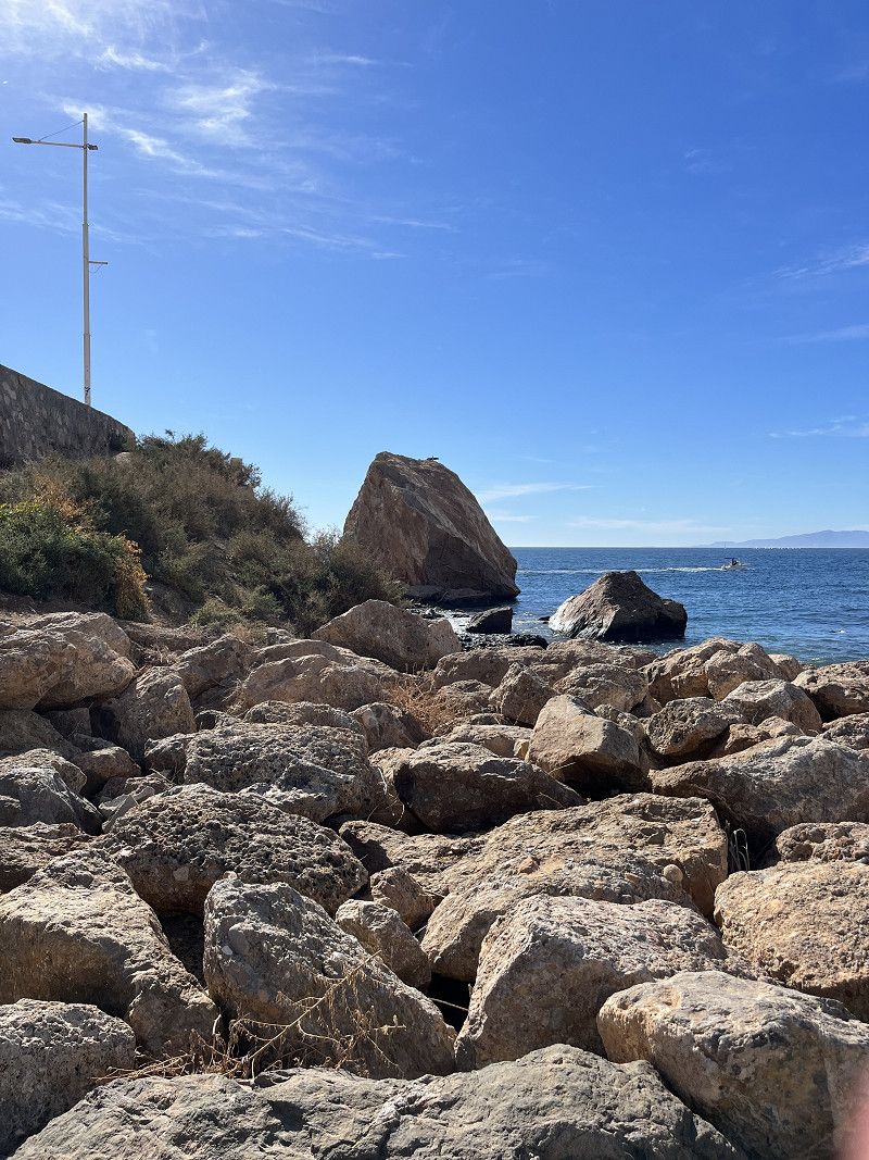
Playa del Silencio
What a great view, but what a disastrous way to get there. The parking lot (both) were closed. Fortunately, the path, extremely narrow, very uneven and steep, only goes in one direction, namely always downhill. Then there is a stopping bay for cars only, but after a short stop we make our way back up. We climb up in first gear and are happy to have reached the top without any damage.
Carretera Llovio - Canero, Cudillero, Asturien, Fürstentum Asturien, Spanien
43° 34' 2.6" N 6° 17' 41.5" W
43.5673936 -6.2948710
• Head southeast. Go for 50 m.
• Turn right. Go for 222 m.
• Turn sharp left toward N-632a. Go for 700 m.
• Turn left onto N-632a. Go for 1.8 km.
• Turn right toward Autovía del Cantábrico/A-8. Go for 245 m.
• Take the 1st exit from roundabout onto A-8 (Autovía del Cantábrico) toward Luarca/A Coruña. Go for 35.7 km.
• Take exit 477 toward Navia. Go for 340 m.
• Take the 3rd exit from roundabout onto N-634 toward Navia. Go for 771 m.
• Take the 2nd exit from roundabout onto N-634. Go for 2.8 km.
• Turn right onto Calle Ramón y Cajal. Go for 53 m.
• Continue on Plaza Constitución. Go for 63 m.
• Continue on Calle Real. Go for 21 m.
• Arrive at Calle Real. Your destination is on the right.
☍
42,8 km
( 29 min.)
Navia - am Rio Navia und Playa
First we stood in Navia on the RV parking space behind the Eroski gas station. There is V+E and a large supermarket here.
Afterwards we walked through the park to the beach and found another SP there. Right on the beach. So we parked the motorhome and now we're having a coffee on the beach. Towards the evening more motorhomes arrived.
Asturien, Fürstentum Asturien, Spanien
43° 32' 20.8" N 6° 43' 24.1" W
43.5391112 -6.7233704
• Head toward Calle Párroco Trueba on Calle Real. Go for 29 m.
• Continue on Plaza Placina de los Concejos. Go for 26 m.
• Continue on Calle Ramón Campoamor. Go for 156 m.
• Turn left onto Avenida Manuel Suárez. Go for 166 m.
• Turn slightly left onto Avenida Manuel Suárez. Go for 12 m.
• Take the 2nd exit from roundabout. Go for 21 m.
• Continue on Avenida Principado de Asturias. Go for 96 m.
• Continue on Avenida Principado. Go for 11 m.
• Turn left onto Avenida La Dársena. Go for 26 m.
• Turn right onto Avenida del Pardo. Go for 21 m.
• Continue on Avenida Ramón Valdés. Go for 56 m.
• Turn right onto Avenida Regueral. Go for 14 m.
• Turn right onto Avenida Regueral (N-634). Go for 3.9 km.
• Take the 3rd exit from roundabout onto A-8 (Viaducto Arroyo Miudes) toward Ribadeo/A Coruña. Go for 32.6 km.
• Take exit 516 toward Reinante/Rinlo. Go for 1.3 km.
• Take ramp. Go for 45 m.
• Take the 2nd exit from roundabout onto Estrada LU-P-5206 toward Playa de as Catedrais. Go for 603 m.
• Take the 2nd exit from roundabout onto Estrada LU-P-5206. Go for 658 m.
• Arrive at Estrada LU-P-5206. Your destination is on the right.
☍
39,8 km
( 26 min.)
Day
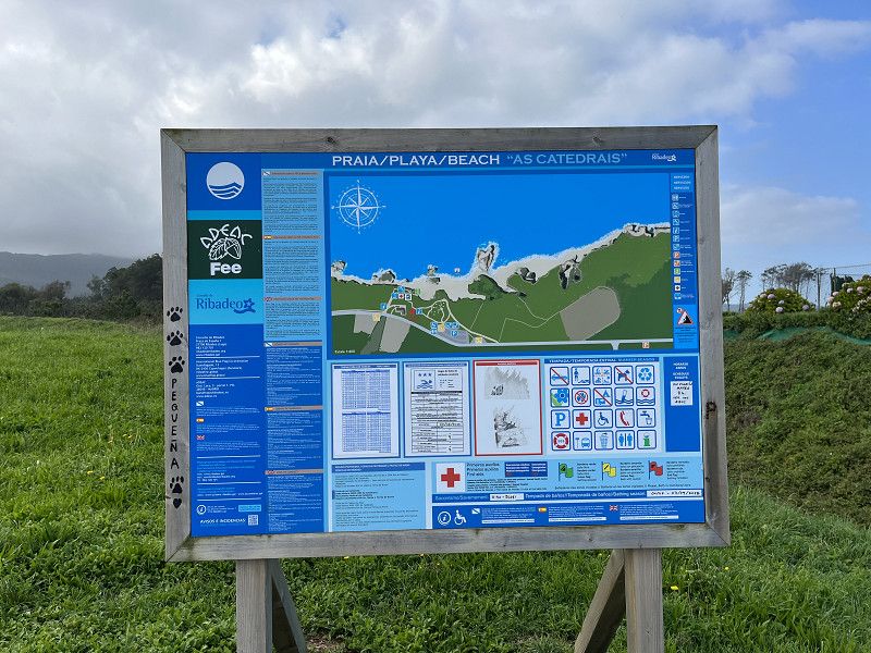
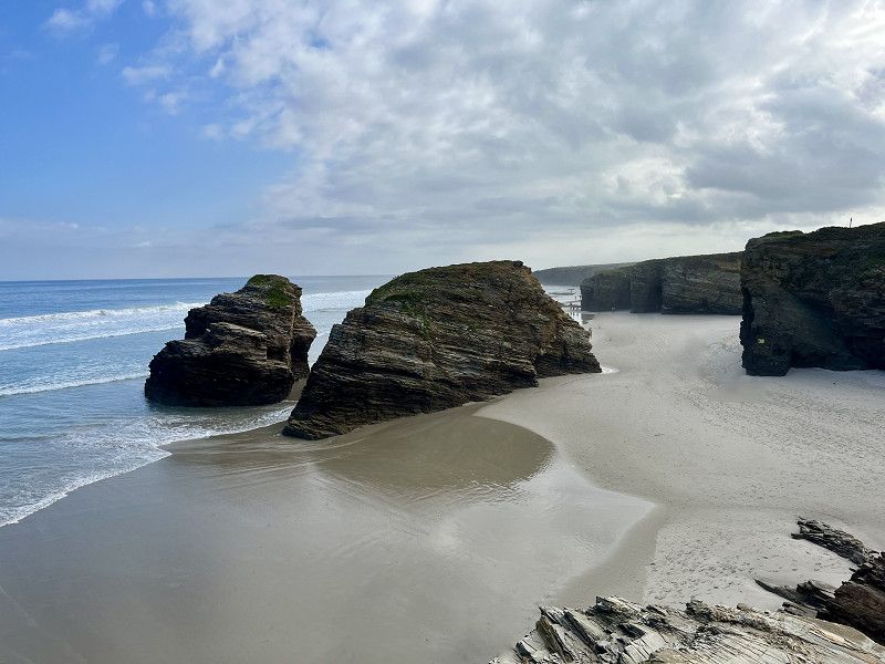
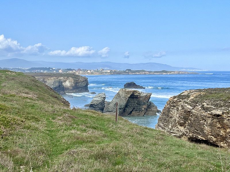
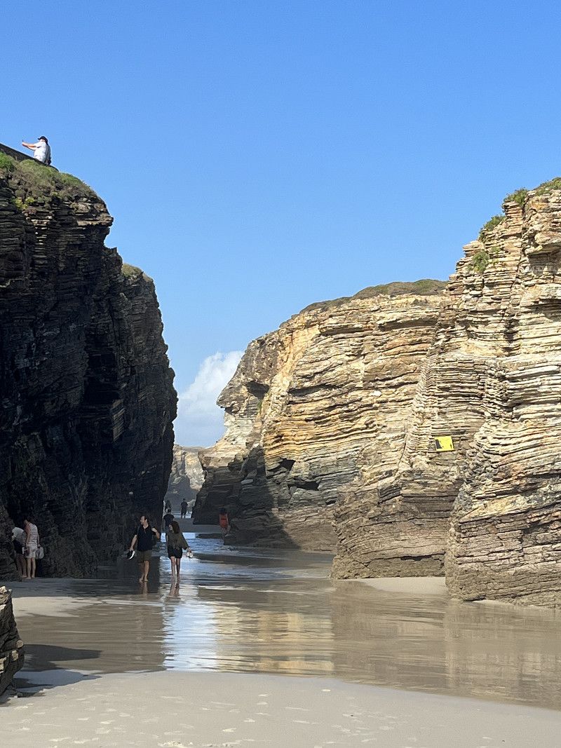
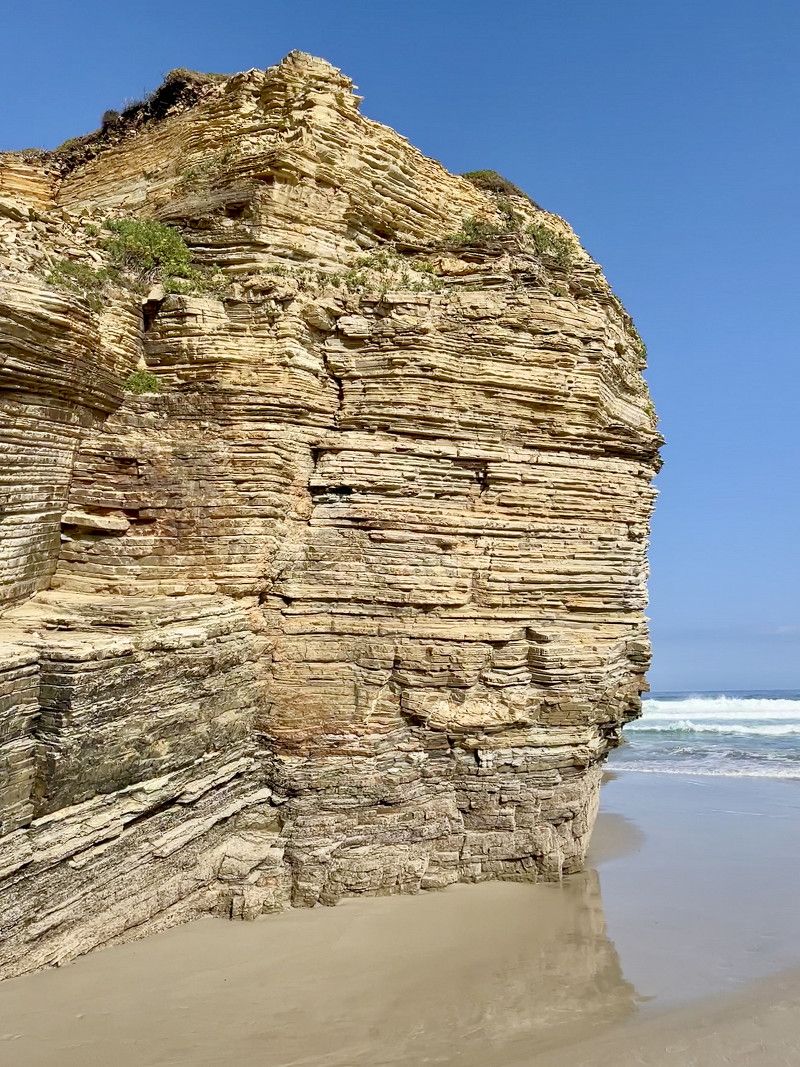
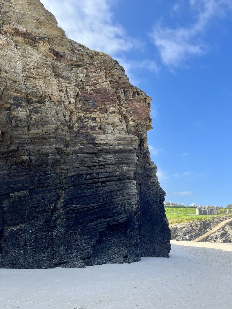
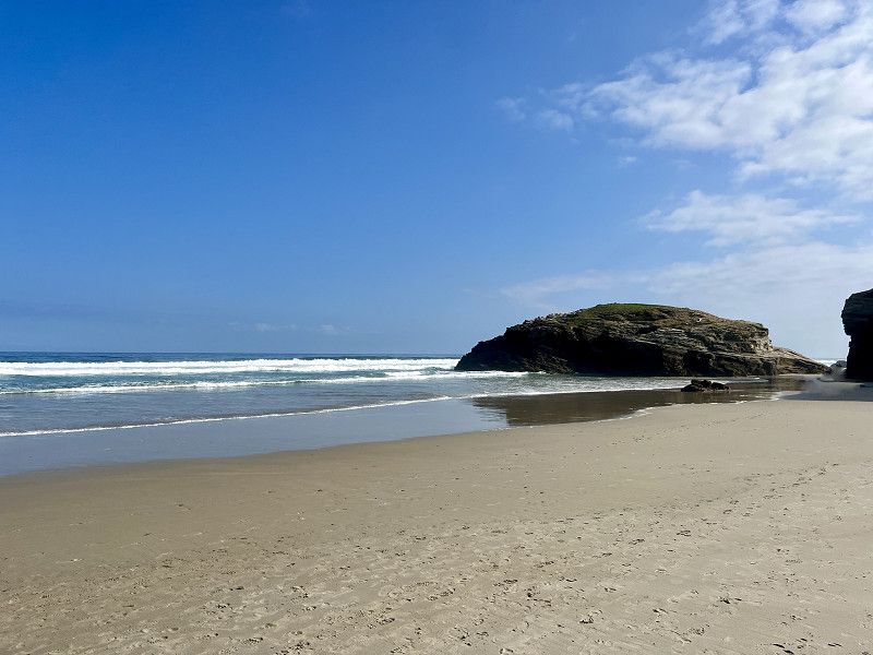
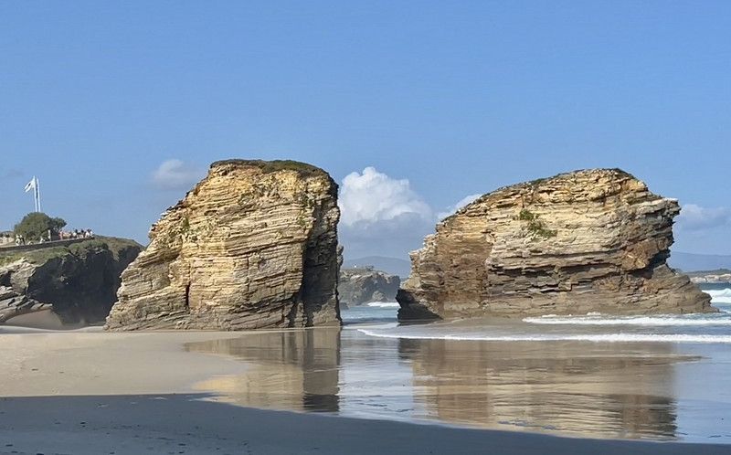
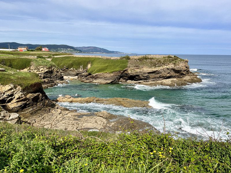
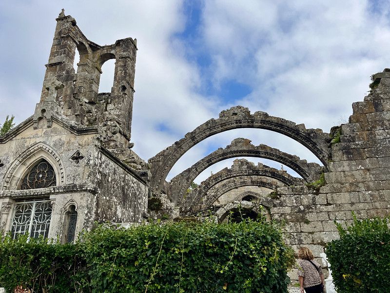
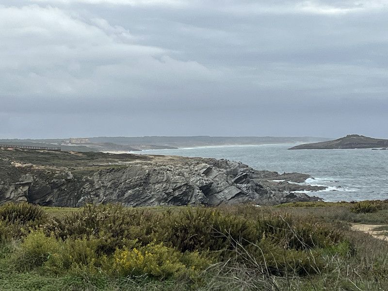
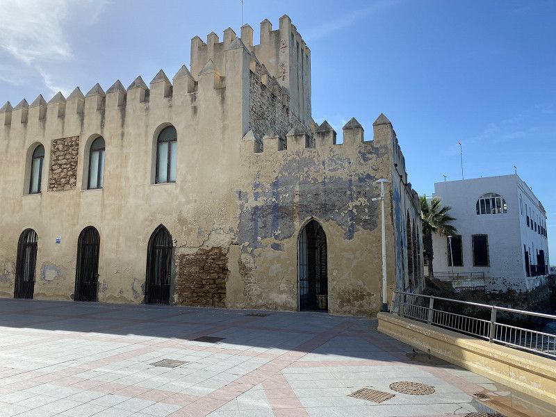
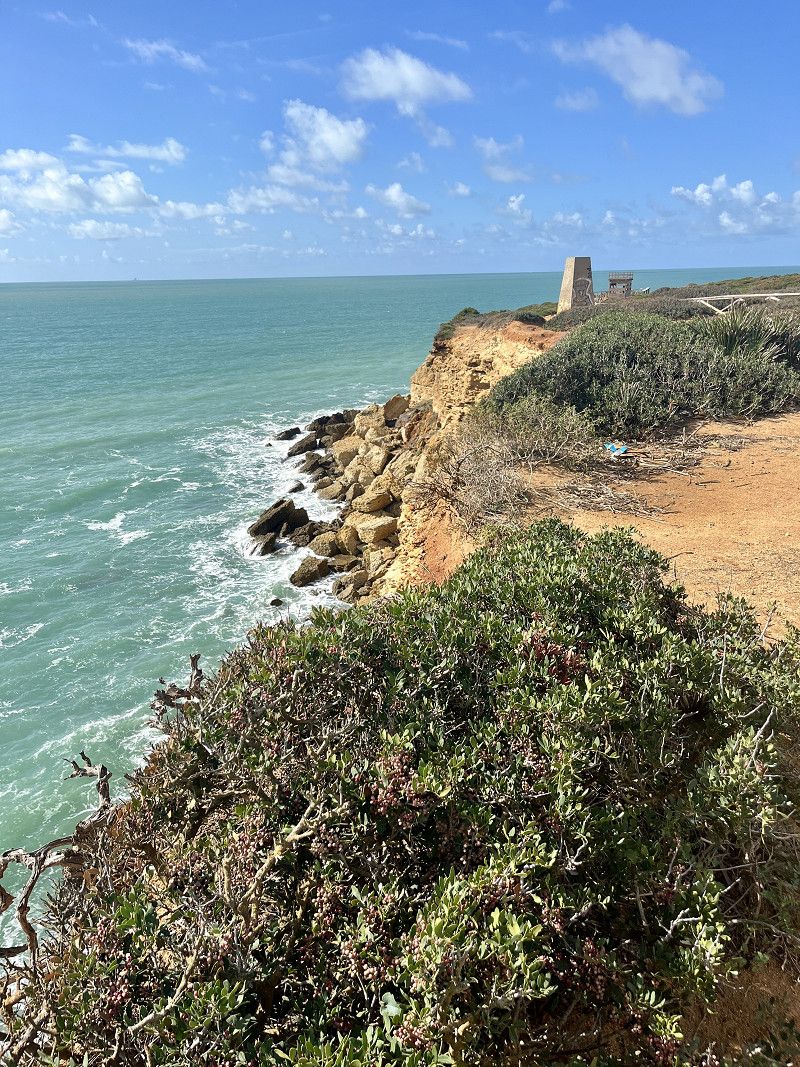
As Catedrais
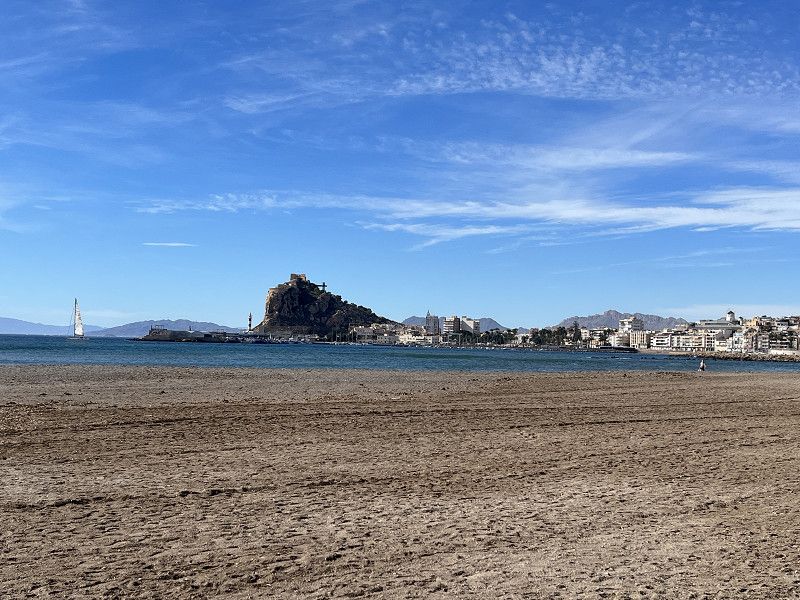
A must when passing through Ribadeo. Now in September mannshoch still has to register. But there was little going on.
Estrada da Costa, Barreiros, A Mariña Oriental, Galicien, Spanien
43° 33' 12.6" N 7° 9' 31.5" W
43.5535125 -7.1587420
• Head west on Estrada LU-P-5206. Go for 246 m.
• Turn left onto Barrio Novo. Go for 719 m.
• Continue on Liñeiro. Go for 287 m.
• Turn right onto Liñeiro (N-634). Go for 7.5 km.
• Keep right onto A Anea. Go for 4.3 km.
• Take the 2nd exit from roundabout onto Caizal (N-642). Go for 3.2 km.
• Take the 1st exit from roundabout onto A Ermida (N-642). Go for 1.1 km.
• Arrive at Forxán (N-642).
☍
17,4 km
( 18 min.)
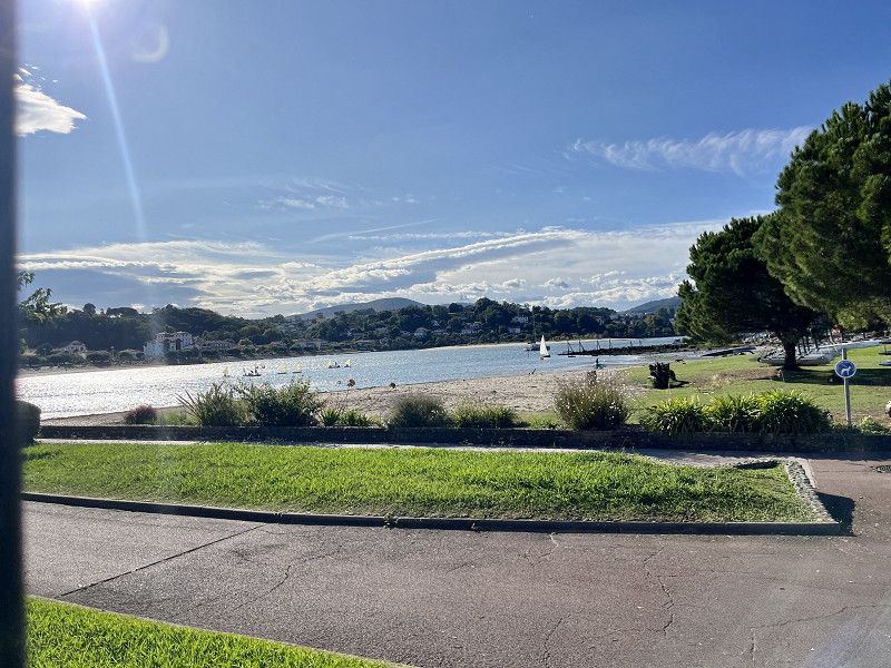
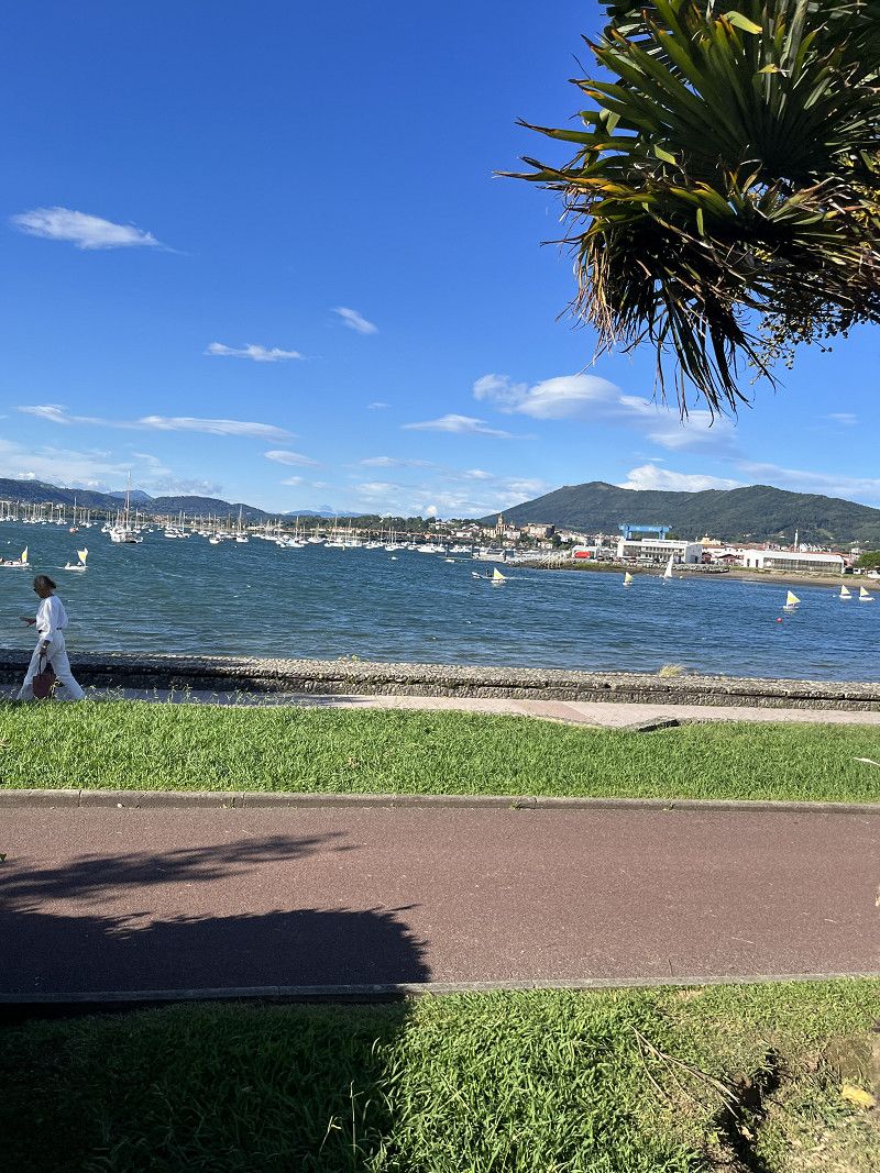
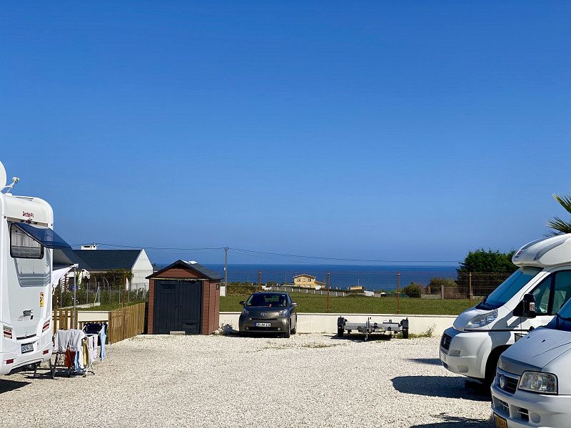
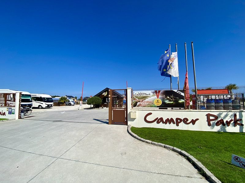
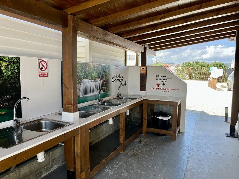
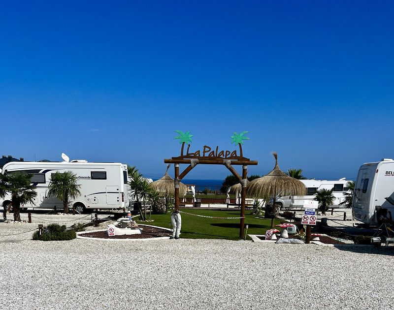
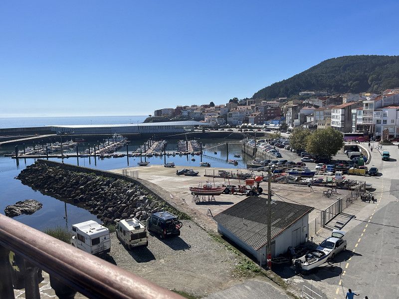
Atalaia Camper Park - Avenida de Viveiro, A Mariña Central, Galicien, Spanien
Great SP for 13€/night including electricity. 1€ showers. Bread service. Very very friendly reception. Well located.
Avenida de Viveiro, A Mariña Central, Galicien, Spanien
43° 34' 46.7" N 7° 16' 28.5" W
43.5796430 -7.2745802
• Head southeast on Forxán (N-642). Go for 1.3 km.
• Continue on Rúa Cervantes (N-642). Go for 446 m.
• Take the 1st exit from roundabout onto Avenida Álvaro Cunqueiro (N-642). Go for 563 m.
• Take the 3rd exit from roundabout onto Rúa Concello de Barreros. Go for 182 m.
• Continue on Rúa Curbeiro. Go for 316 m.
• Turn slightly left onto Barrio Fondós. Go for 82 m.
• Turn right. Go for 222 m.
• Arrive at your destination.
☍
3,1 km
( 7 min.)
Day
Ría de Foz
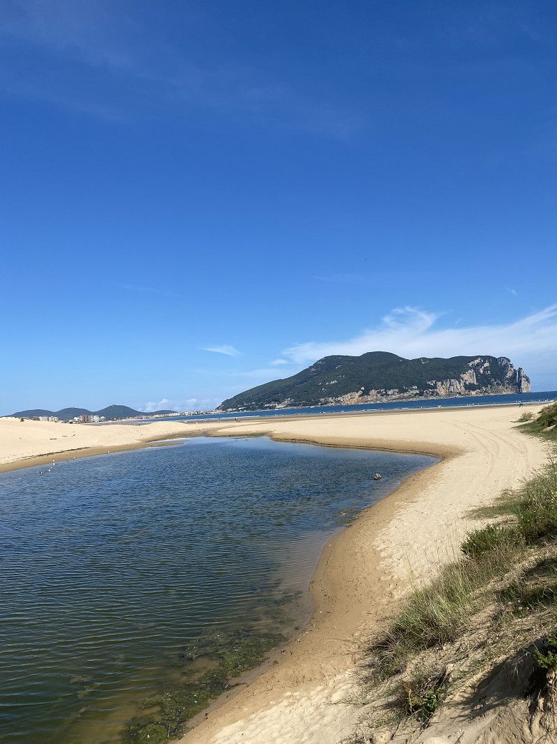
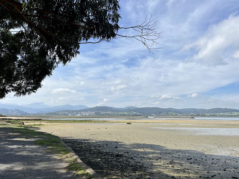
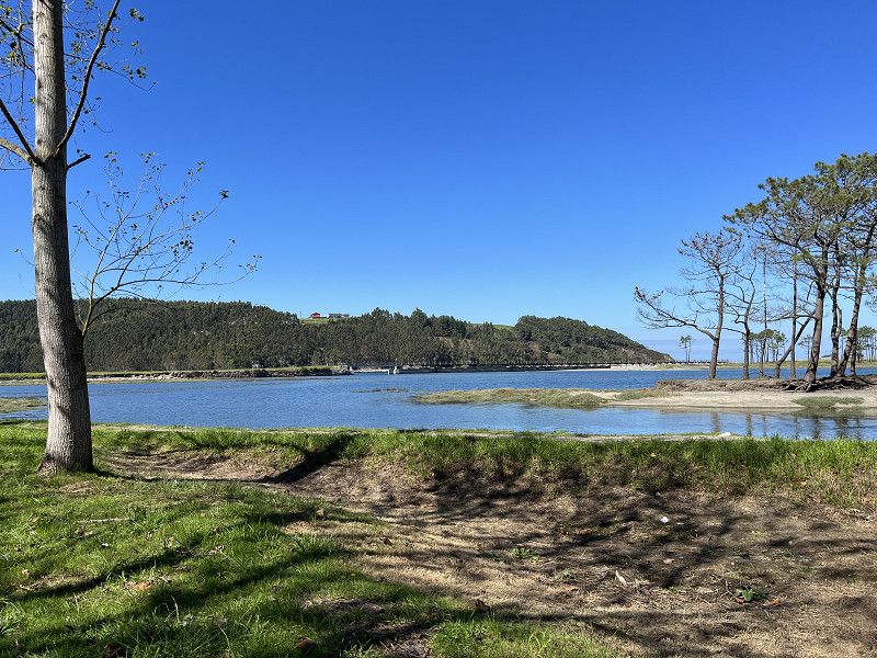
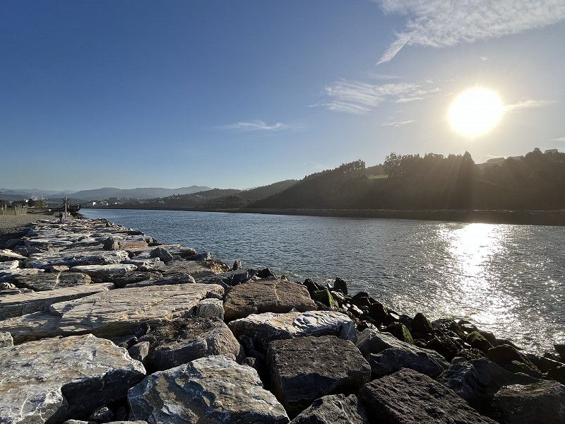
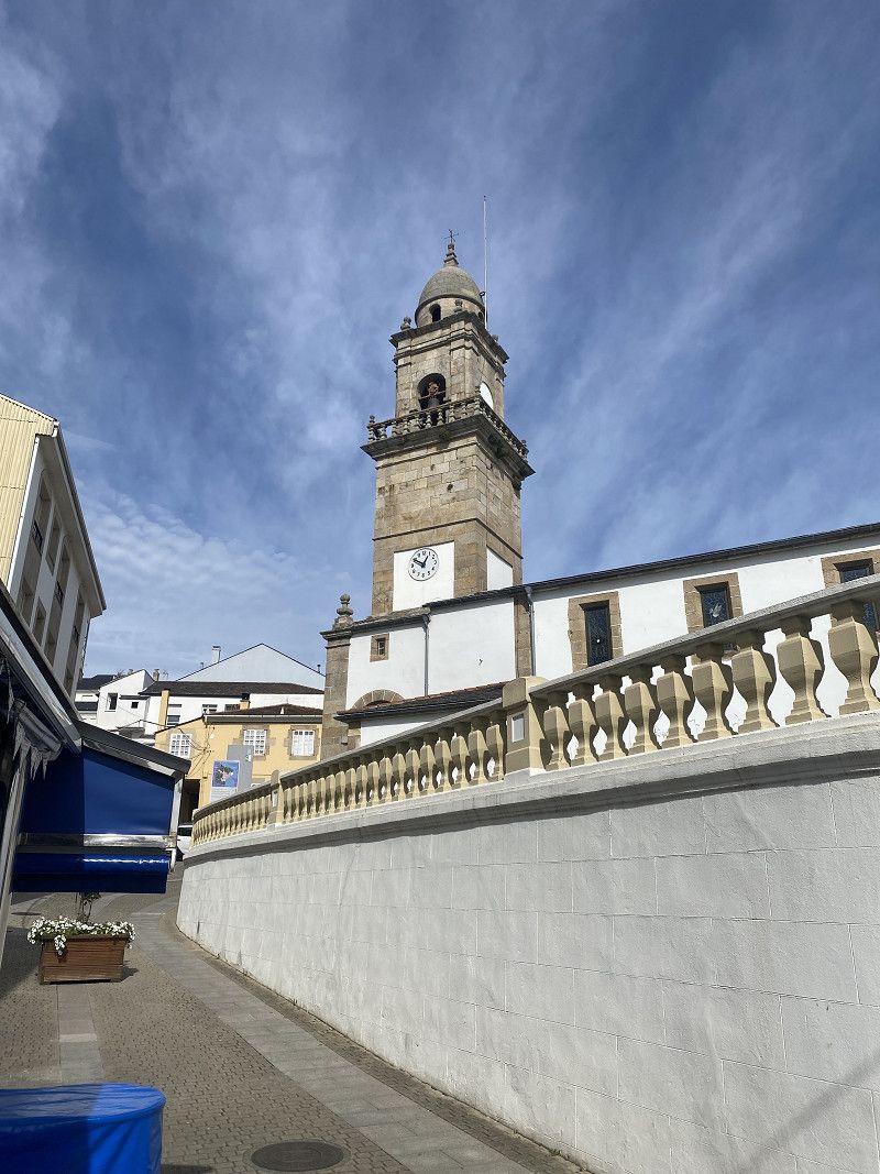
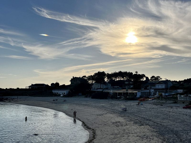
Today we walked from the pitch to Playa de Llàs and then walked along a very beautiful coastal path to Ria de Foz. Had a good meal in the harbor and then went back again. We weren't in the city of Foz itself, it's cloudier today but it's humid and warm. In total we traveled 10km, enough for us in the warm weather. The weather will stay like this for the next few days.
Spanien
43° 33' 33.3" N 7° 15' 14.8" W
43.5592440 -7.2541180
• Head toward Rúa dos Asteleiros. Go for 222 m.
• Turn left toward Barrio Fondós. Go for 47 m.
• Continue on Barrio Fondós. Go for 35 m.
• Turn slightly right onto Rúa Curbeiro. Go for 316 m.
• Continue on Foz. Go for 137 m.
• Take the 3rd exit from roundabout onto Rúa de Ribadeo (N-642). Go for 209 m.
• Continue on Avenida Asturias (N-642). Go for 418 m.
• Continue on Vilaxuane (N-642). Go for 247 m.
• Continue on Vilaxuane (N-642). Go for 113 m.
• Take the 3rd exit from roundabout onto Vilaxuane (N-642). Go for 4.2 km.
• Take the 2nd exit from roundabout onto N-634. Go for 752 m.
• Take the 3rd exit from roundabout onto A Anea. Go for 509 m.
• Take ramp onto A-8 (Autovía do Cantábrico) toward Vilalba/A Coruña. Go for 34.7 km.
• Take exit 558 toward Abadín/N-634/Rozas/LU-113. Go for 386 m.
• Take the 3rd exit from roundabout onto LU-113. Go for 8.0 km.
• Turn right onto LU-121. Go for 3.7 km.
• Continue on O Santo (LU-111). Go for 4.5 km.
• Pass 2 roundabouts and continue on LU-111. Go for 14.0 km.
• Take the 5th exit from roundabout onto A-6 (Autovía do Noroeste) toward Lugo/Madrid. Go for 9.6 km.
• Take exit 500 toward Pol. Industrial O Ceao/Lugo/N-6/Ourense/N-540 onto Avenida Benigno Rivera. Go for 1.5 km.
• Take the 2nd exit from roundabout onto Avenida Benigno Rivera. Go for 158 m.
• Take the 3rd exit from roundabout onto Avenida Benigno Rivera. Go for 322 m.
• Take the 3rd exit from roundabout onto Avenida Benigno Rivera. Go for 554 m.
• Take the 2nd exit from roundabout onto Avenida Benigno Rivera. Go for 544 m.
• Take the 3rd exit from roundabout onto Estrada da Coruña N-6. Go for 239 m.
• Continue on Estrada da Coruña (N-6). Go for 3.0 km.
• Take ramp onto Estrada a Santiago (N-540) toward Ourense/N-547/Santiago. Go for 3.1 km.
• Take ramp toward Friol/LU-232/Estrada Vella de Santiago. Go for 180 m.
• Take the 2nd exit from roundabout onto LU-232. Go for 897 m.
• Turn left toward LU-P-2901. Go for 9 m.
• Turn right onto LU-P-2901. Go for 832 m.
• Turn left onto Camiño das Cabadas. Go for 449 m.
• Turn left onto Pista Vilaestévez. Go for 91 m.
• Turn left onto Pista Vilaestévez. Go for 205 m.
• Arrive at Pista Vilaestévez. Your destination is on the left.
☍
94,1 km
(1 hrs. 10 min.)
Day
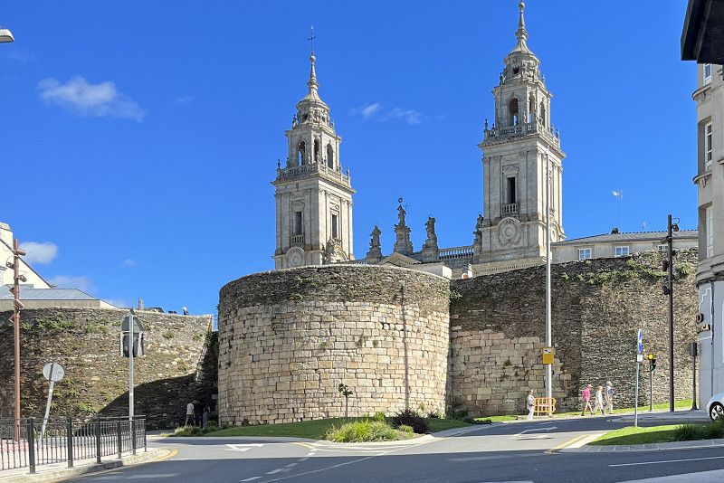
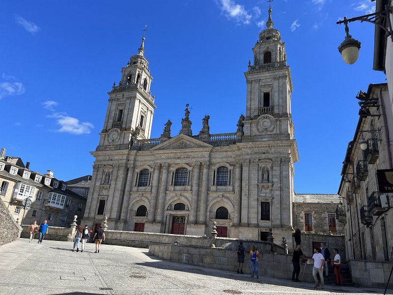
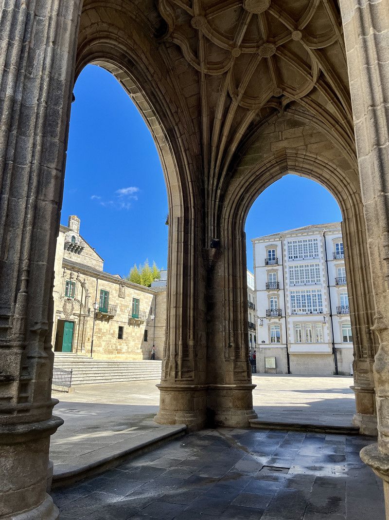
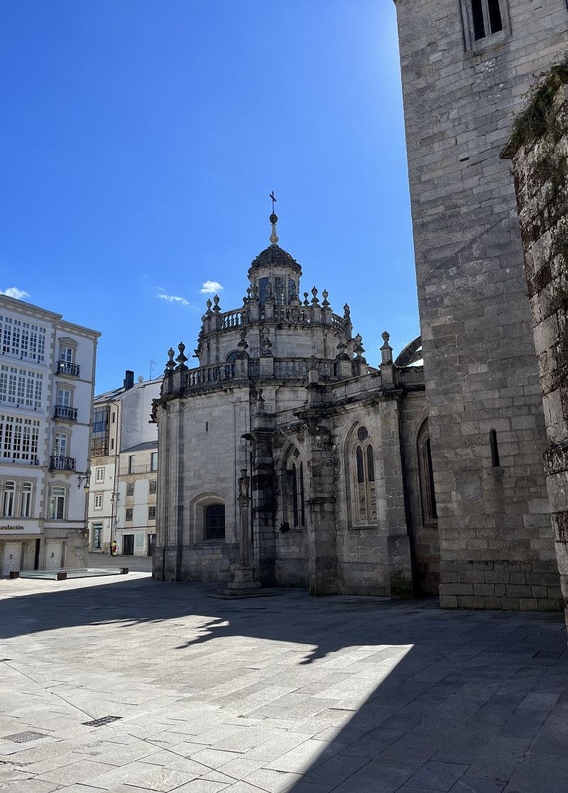
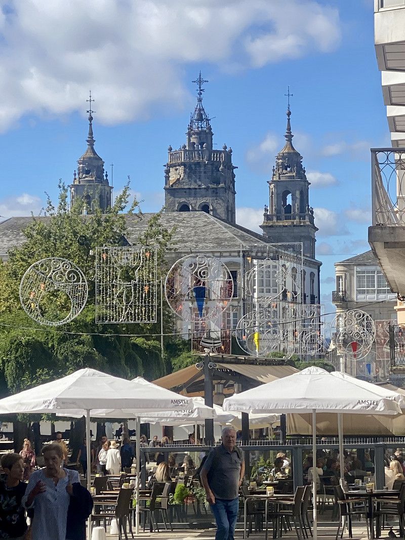
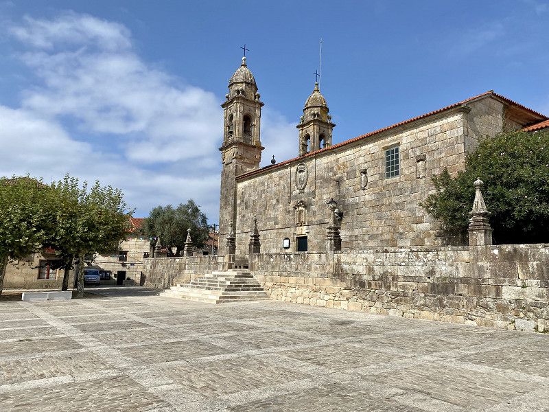
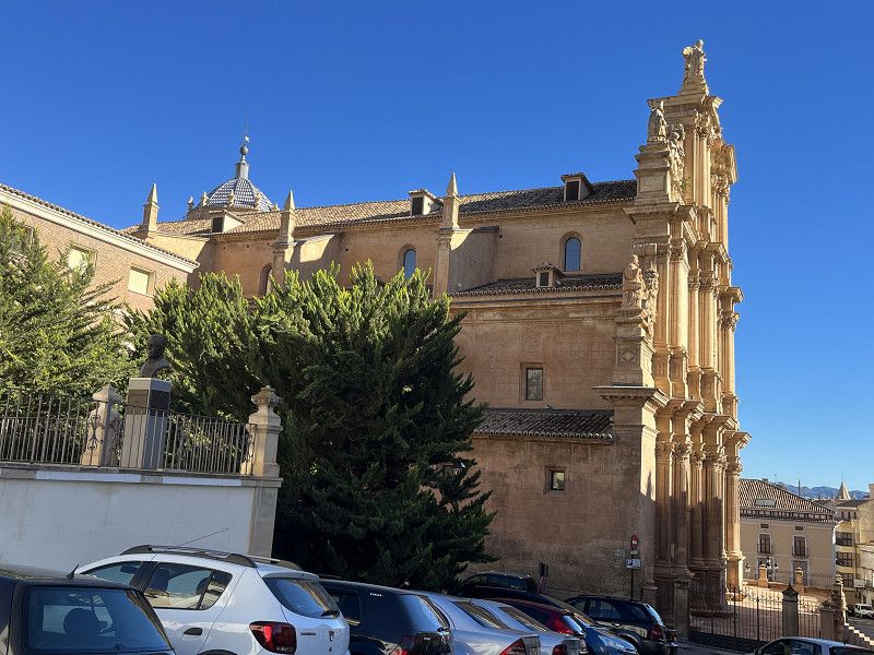
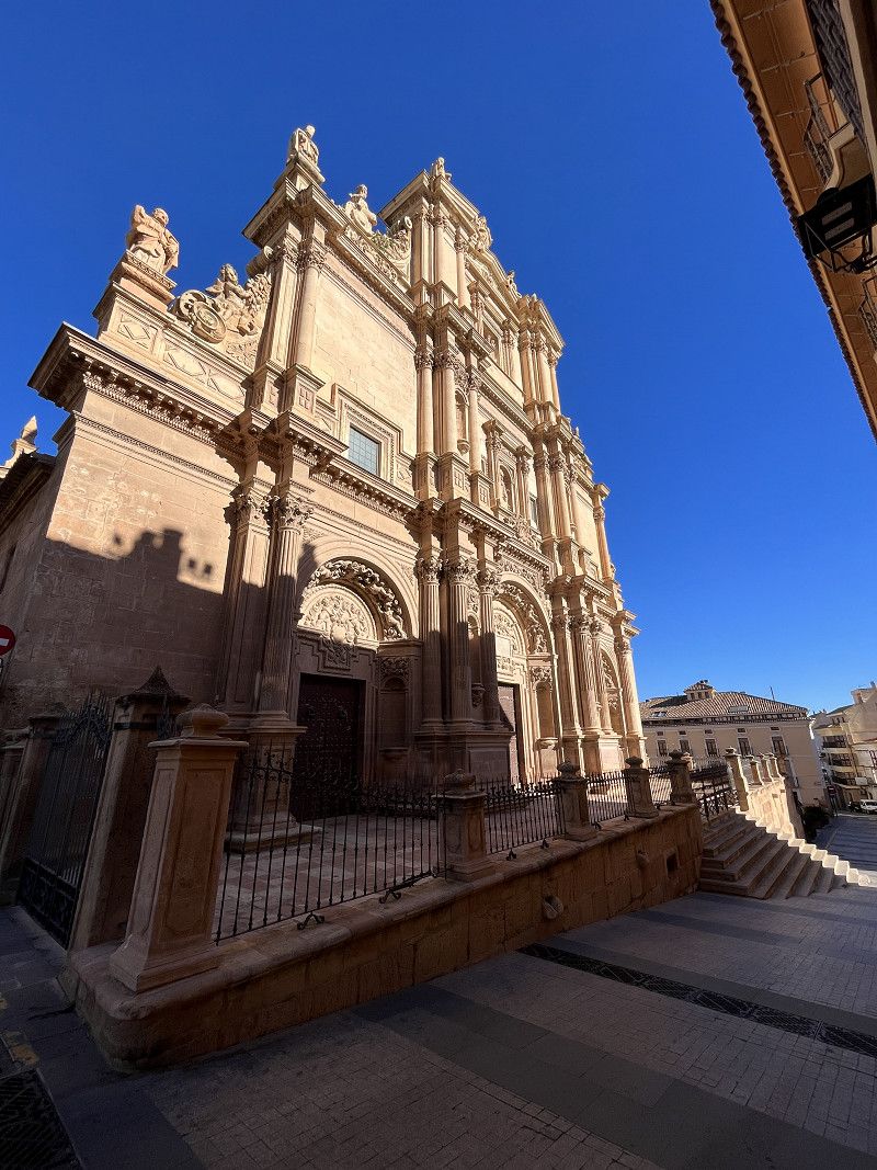
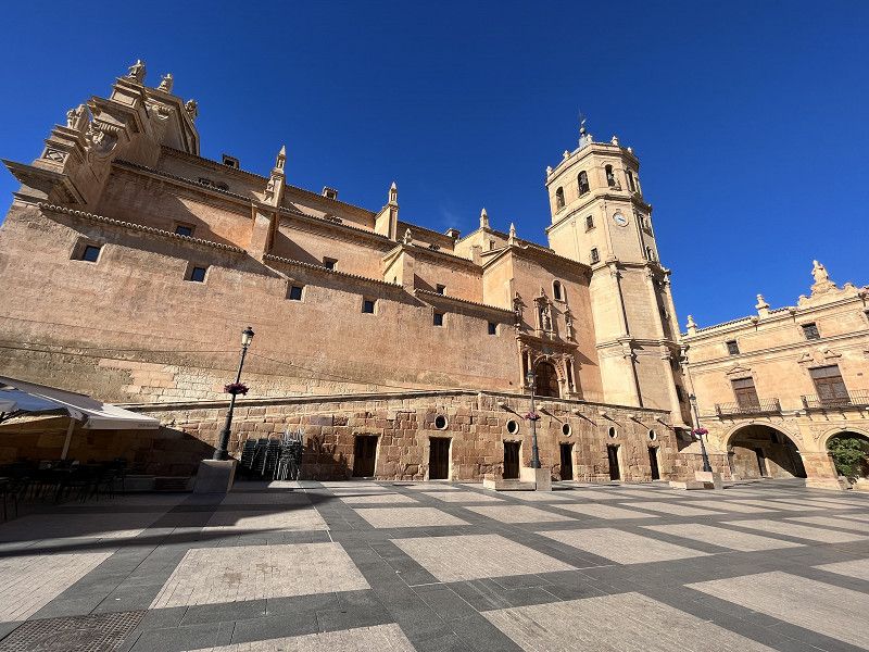
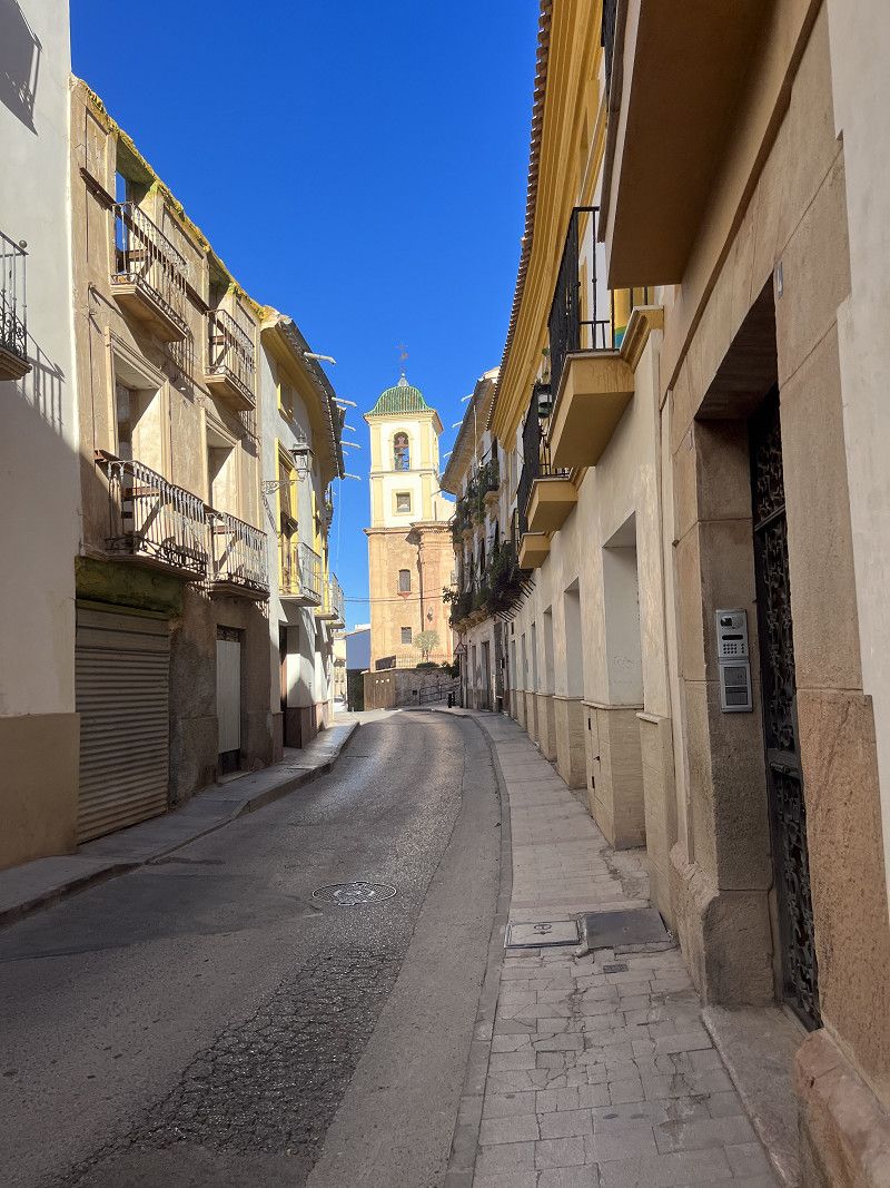
Lugo - Porta de Santiago
Today there is an old town to visit.
And we're going to eat in a little bar here. There are also many small ones here. Tappa bars, restaurants and cafés
We can walk along the city wall, which we do for a while, but then prefer to stroll in the old town.
We found an overnight spot behind the stadium in a very large parking lot by the river. There is still a motorhome here, otherwise it is totally quiet here.
The parking space in the city would also have been possible.
Lugo, Galicia, Spain
42° 59' 12.7" N 7° 36' 19.8" W
42.9868531 -7.6054887
• Head east on Pista Vilaestévez. Go for 556 m.
• Turn left onto Pista Vilaestévez. Go for 921 m.
• Turn slightly right onto Camiño Xesta Vilaestévez. Go for 303 m.
• Continue on LU-232. Go for 63 m.
• Take the 2nd exit from roundabout toward Santiago/Ourense/Portugal. Go for 20 m.
• Take ramp onto N-540. Go for 724 m.
• Take the 1st exit from roundabout toward Ourense/Santiago. Go for 123 m.
• Continue on N-540 toward Ourense/Santiago/Hospital Calde. Go for 5.9 km.
• Take the 1st exit from roundabout onto A-54 (Autovía Lugo-Santiago) toward Santiago. Go for 37.3 km.
• Take the exit. Go for 415 m.
• Take the 1st exit from roundabout onto AC-840. Go for 2.1 km.
• Take the 3rd exit from roundabout onto Rúa Progreso (N-547) toward Santiago. Go for 19.1 km.
• Take the 1st exit from roundabout onto A-54 toward O Pedrouzo/Santiago. Go for 24.4 km.
• Take exit 91 toward E-1/AP-9/A Coruña/Pontevedra/Santiago de Compostela. Go for 199 m.
• Turn right onto SC-30 toward E-1/AP-9/A Coruña/Pontevedra/Santiago de Compostela. Go for 176 m.
• Arrive at SC-30.
☍
92,3 km
(1 hrs. 2 min.)
Day
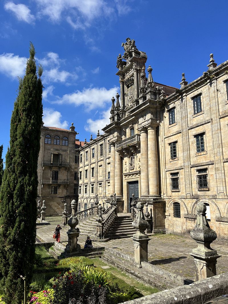
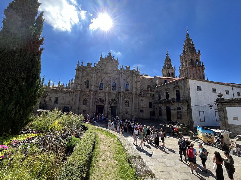
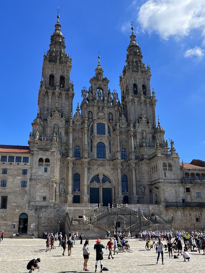
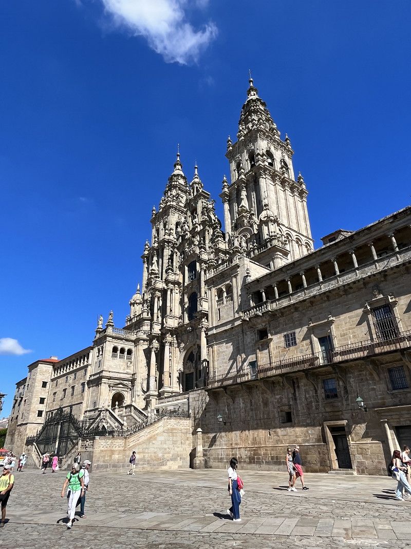
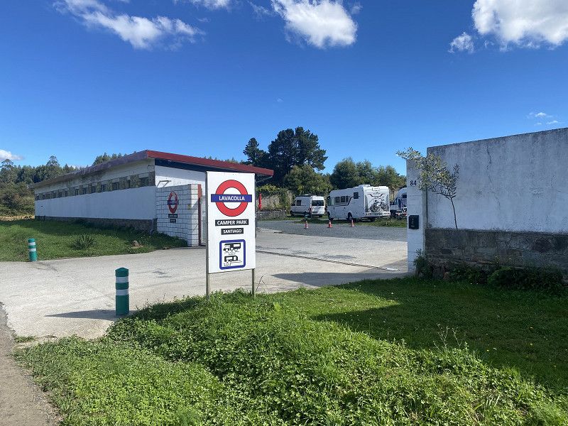
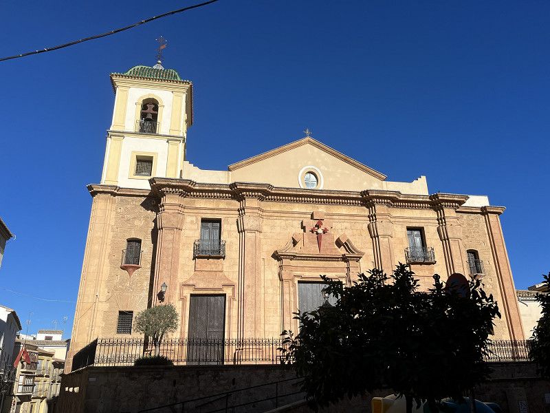
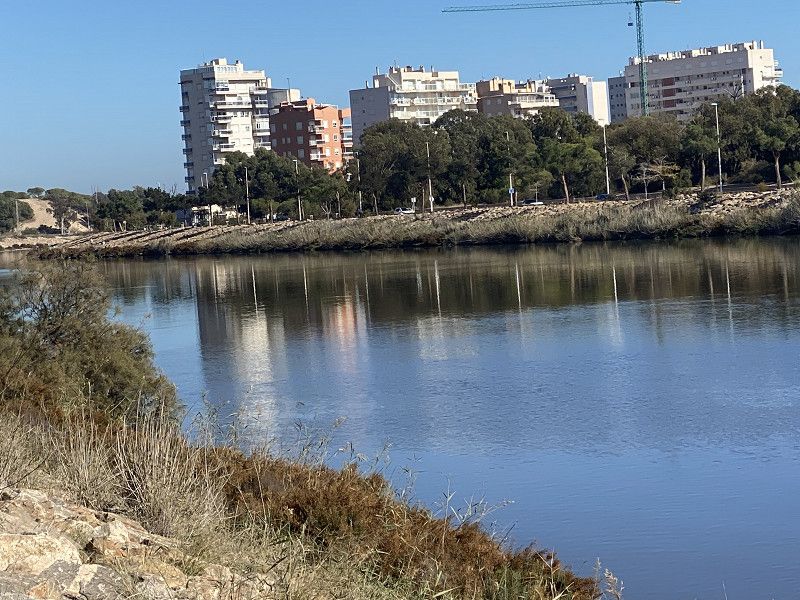
Santiago de Compostela - ohne Pilgern
We drove past here on our last tour in spring 22. This time the weather was perfect and we stayed for 1 night at the SP Lavacolla Camper Park just outside Santiago de Campostela. (12€/night without electricity)
The bus (No. 6) goes 500m away (the stop is called San Marcos) into the city. Costs an unbeatable €1/person.
This is also where you get out again on the way back.
The city itself was very full (pilgrims and more), the cathedral is worth seeing. We also ate well. Today we have almost 30° and a lot ☀️
Enlace Orbital de Santiago de Compostela, Santiago, Galicia, Spain
42° 53' 54.3" N 8° 28' 57.5" W
42.8984262 -8.4826346
• Head north on SC-30. Go for 763 m.
• Take the 3rd exit from roundabout onto AP-9 (Autoestrada do Atlántico) toward Santiago/Pontevedra/Ourense. Go for 10.4 km.
• Take exit 75 toward Noia/Milladoiro/Santiago/SC-20/Hospital onto AG-56. Go for 7.7 km.
• Take exit 7 toward Bertamiráns Norte/Negreira/Ames. Go for 604 m.
• Take the 2nd exit from roundabout onto Caroubáns (AC-544). Go for 6.1 km.
• Pass 4 roundabouts and continue on A Pereiriña (AC-546). Go for 18.5 km.
• Take the 2nd exit from roundabout onto AC-441. Go for 21.1 km.
• Turn left onto Berdoias (AC-552). Go for 14.2 km.
• Take the 2nd exit from roundabout onto VG-1.4. Go for 4.9 km.
• Take the 1st exit from roundabout onto Rúa da Coruña (AC-445). Go for 1.2 km.
• Continue on AC-445. Go for 196 m.
• Continue on Sardiñeiro de Abaixo (AC-445). Go for 50 m.
• Continue on AC-445. Go for 17 m.
• Continue on Sardiñeiro de Abaixo (AC-445). Go for 211 m.
• Continue on AC-445. Go for 2.0 km.
• Continue on Calcova (AC-445). Go for 199 m.
• Turn left onto Calcova. Go for 207 m.
• Turn right onto Calcova. Go for 245 m.
• Turn left onto Calcova. Go for 39 m.
• Arrive at Calcova.
☍
88,6 km
(1 hrs. 6 min.)
Day
Am Ende der Welt - Fisterra
Simple SP with a great view for 10€/night without electricity.
Rúa Calcoba, Fisterra, Galicia, Spain
42° 55' 19.8" N 9° 15' 12.5" W
42.9221612 -9.2534756
• Head toward As Escaselas on Calcova. Go for 352 m.
• Turn right onto Calcova (AC-445). Go for 66 m.
• Continue on AC-445. Go for 120 m.
• Continue on Calcova (AC-445). Go for 222 m.
• Continue on AC-445. Go for 2.0 km.
• Continue on Sardiñeiro de Abaixo (AC-445). Go for 211 m.
• Continue on AC-445. Go for 17 m.
• Continue on Sardiñeiro de Abaixo (AC-445). Go for 50 m.
• Continue on AC-445. Go for 196 m.
• Continue on Rúa da Coruña (AC-445). Go for 1.2 km.
• Take the 2nd exit from roundabout onto VG-1.4. Go for 4.9 km.
• Take the 1st exit from roundabout onto Xallas (AC-552). Go for 625 m.
• Take the 2nd exit from roundabout onto O Vilar de Toba (AC-552). Go for 1.7 km.
• Turn left onto Avenida Fernando Blanco (AC-550). Go for 36.8 km.
• Turn right onto San Francisco. Go for 11 m.
• Turn right onto San Francisco. Go for 189 m.
• Turn right onto San Francisco. Go for 11 m.
• Turn left onto AC-550. Go for 87 m.
• Turn right. Go for 50 m.
• Arrive at your destination on the left.
☍
48,8 km
( 49 min.)
Day
Camping A Vouga
ACSI place with 2 price categories. The places inside cost €19/night and in front of the campsite with a view of the beach and sea €24/night. We treat ourselves to this beautiful place with this view.
Muros, Galicia, Spain
42° 45' 36.1" N 9° 4' 27.8" W
42.7600165 -9.0743983
• Head toward Barrio Louro. Go for 73 m.
• Turn right onto Barrio Louro. Go for 203 m.
• Turn slightly right onto Rúa San Francisco. Go for 192 m.
• Turn left onto AC-550. Go for 2.2 km.
• Keep left onto AC-550. Go for 3.0 km.
• Take the 1st exit from Rúa Acea roundabout onto Rueiro a Acea (AC-550). Go for 18.3 km.
• Take the 2nd exit from roundabout onto AC-554. Go for 4.2 km.
• Continue on AC-550. Go for 1.3 km.
• Take the 1st exit from roundabout onto AC-549 toward Testal/AC-550/Porto do Son/Ribeira. Go for 4.7 km.
• Take the 1st exit from roundabout onto AC-550 toward Porto do Son/Ribeira. Go for 4.0 km.
• Continue on Avenida Constitución. Go for 228 m.
• Take the 2nd exit from roundabout onto Avenida Constitución. Go for 6.6 km.
• Take the 1st exit from roundabout onto Avenida de Galicia. Go for 372 m.
• Turn left onto Rúa Espíritu Santo. Go for 49 m.
• Turn right. Go for 30 m.
• Arrive at your destination on the right.
☍
45,4 km
( 49 min.)
Day
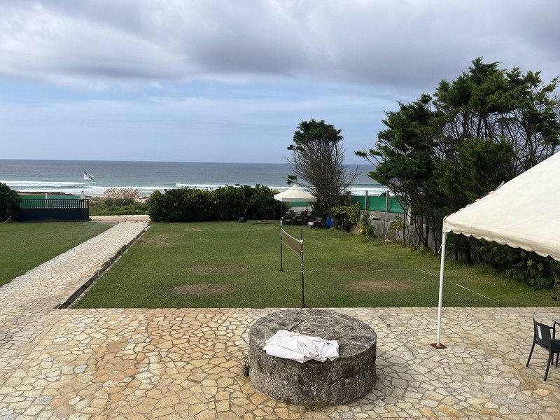
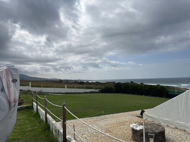
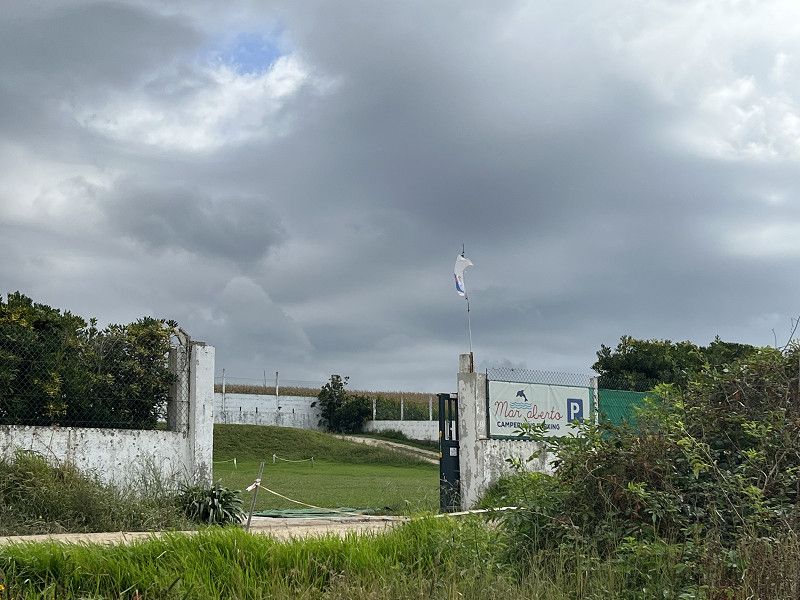
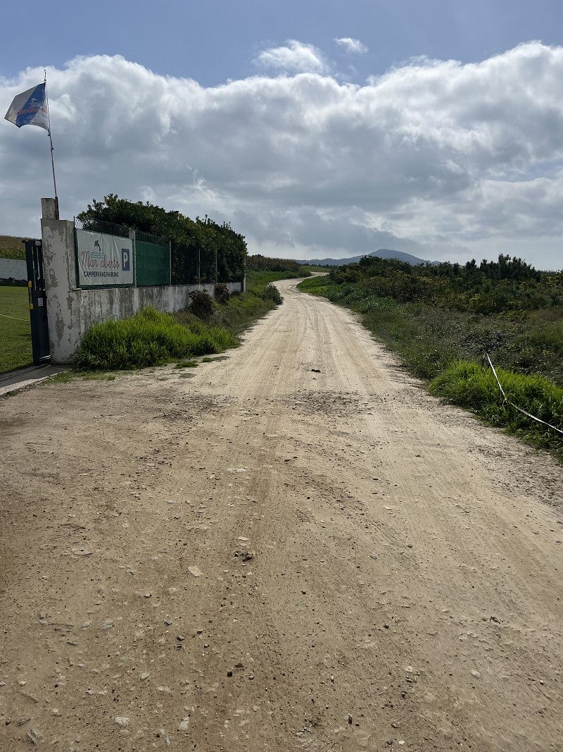
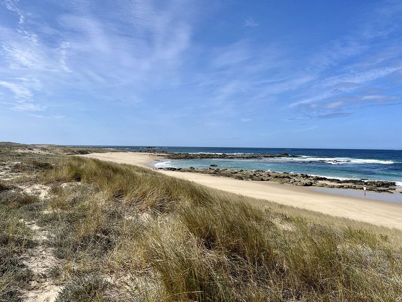
Porto do Son - Stellplatz Mar Aberto
Simple SP without V+E with a great view for 15€/night
The SP only has fresh water, otherwise there are beautiful plotted lawns. The village is 1km away. There is a bar next door but it is already closed. This is actually from October 1st. also closed, but we met the owner and asked. It wasn't a problem getting here.
Beach all to ourselves
Noia, Galicien, Spanien
42° 43' 33.7" N 9° 0' 17.7" W
42.7260230 -9.0049123
• Head northwest.
• Turn right onto Rúa Pastor. Go for 38 m.
• Take the 1st exit from roundabout onto Avenida de Galicia. Go for 174 m.
• Turn right onto Rúa Jesús. Go for 110 m.
• Continue on Rúa Luchana. Go for 41 m.
• Continue on Rúa Pilón. Go for 52 m.
• Turn left onto Rúa Pilón. Go for 7 m.
• Turn right onto Rúa Entremurallas. Go for 13 m.
• Turn left toward Avenida 13 de Septiembre/AC-550. Go for 26 m.
• Turn right onto Avenida 13 de Septiembre (AC-550). Go for 10.9 km.
• Take the 1st exit from roundabout onto Lugar Cruceiro. Go for 53 m.
• Turn slightly right onto Rúa Carrapatal. Go for 185 m.
• Turn left onto Rúa Carrapatal. Go for 188 m.
• Turn slightly right onto A Agra. Go for 129 m.
• Continue on Trasdoanes. Go for 150 m.
• Continue on O Carballal. Go for 350 m.
• Keep right onto O Carballal. Go for 137 m.
• Arrive at O Carballal. Your destination is on the left.
☍
12,6 km
( 15 min.)
Day
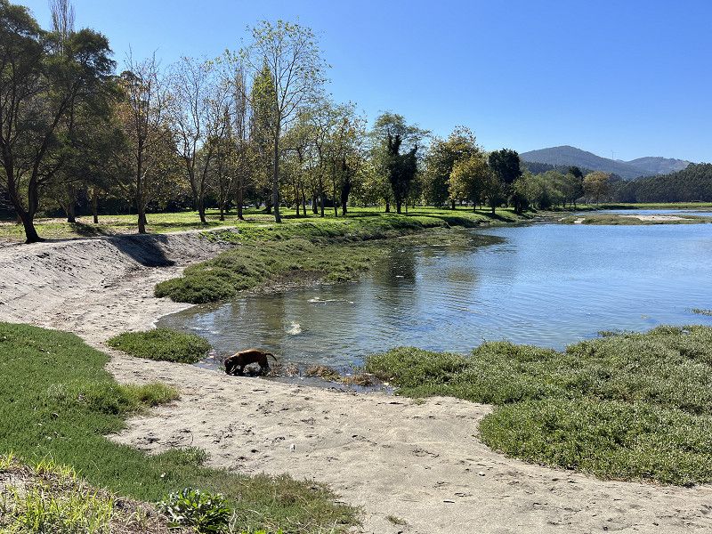
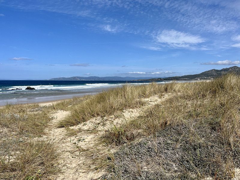
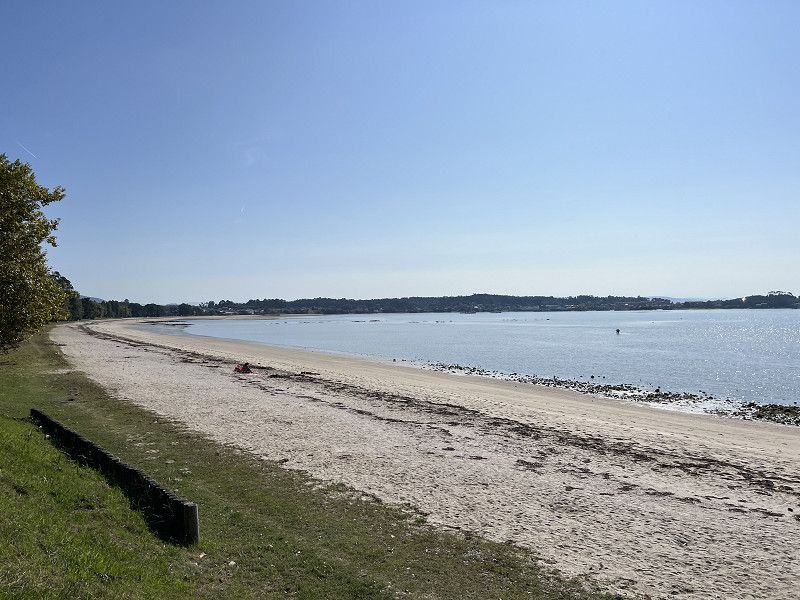
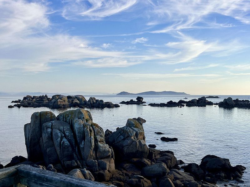
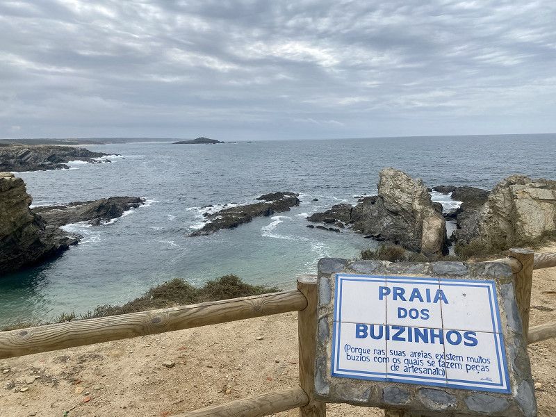
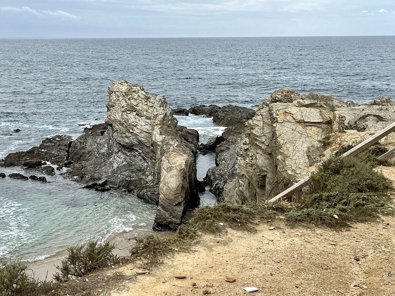
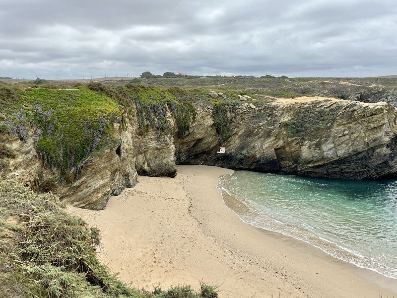
Camiño da praia das Furnas, Noia, Galicien, Spanien
We stand alone on the simple SP with a fantastic view of the sea and the coast.
Today the weather is a bit overcast and windy. But still just right for us and ☀️ is still coming.
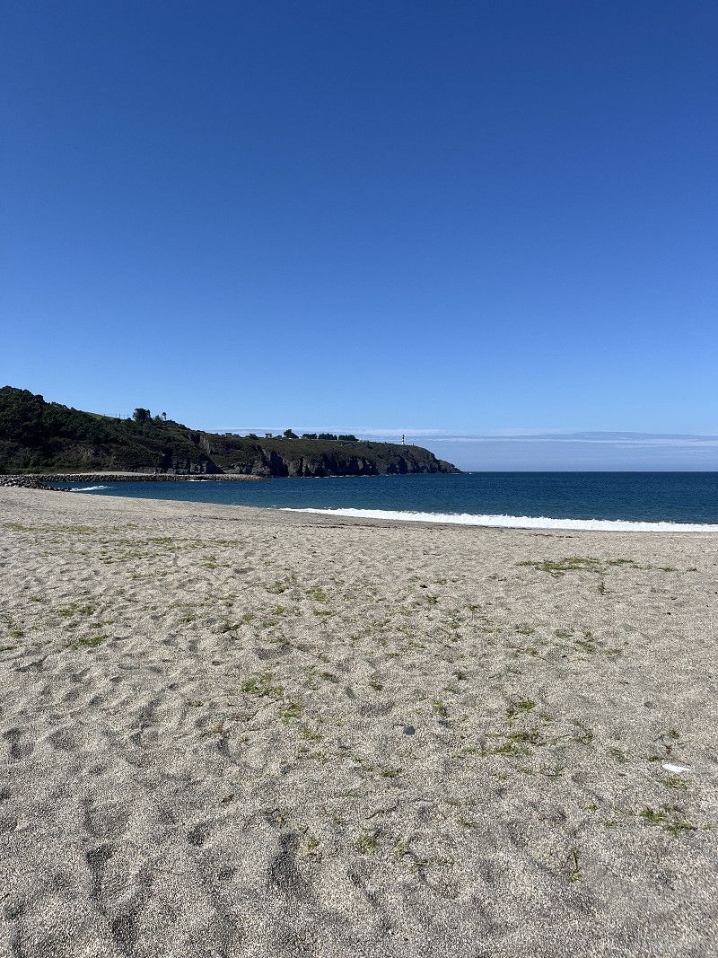
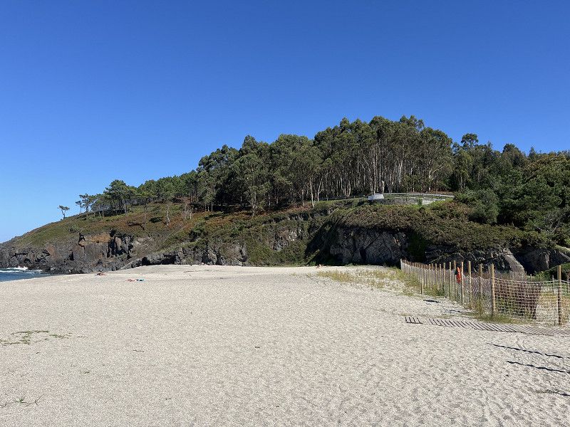
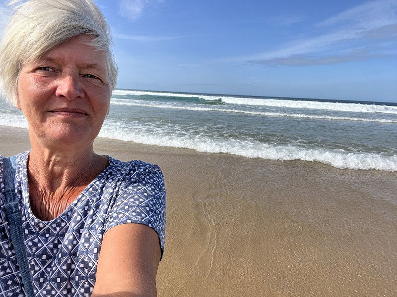
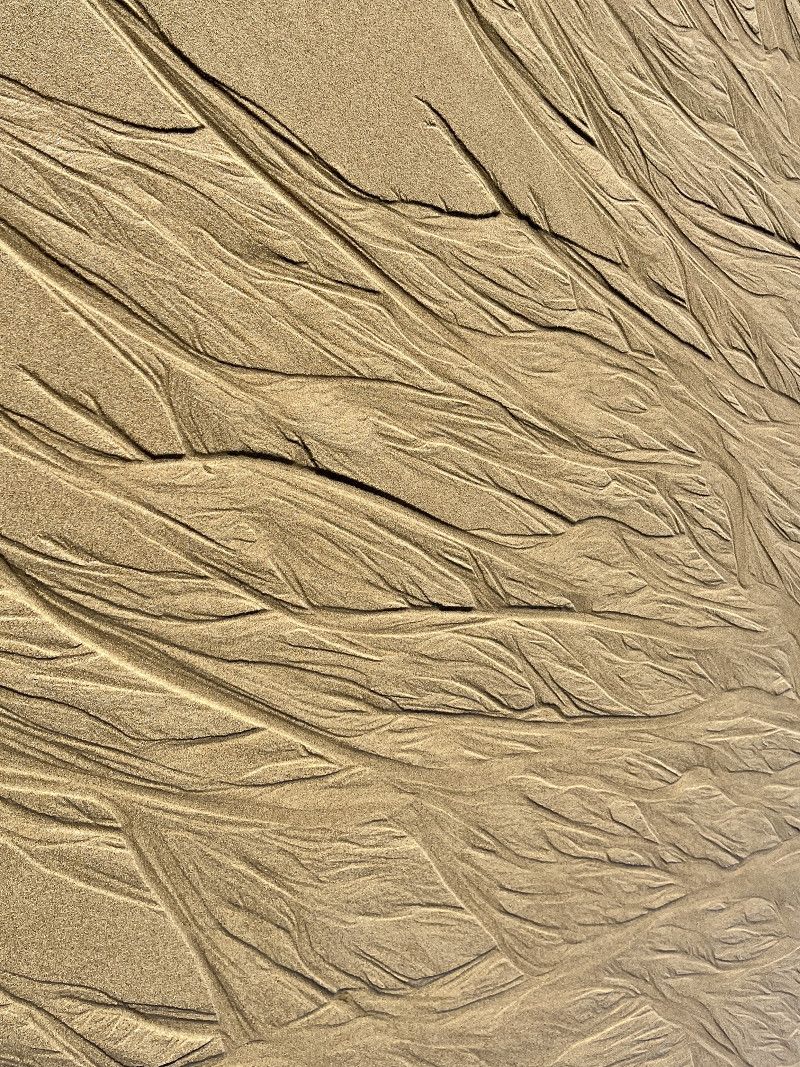
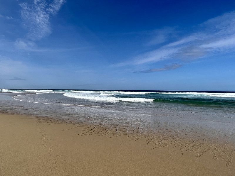
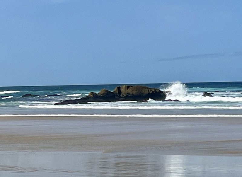
So we take a walk on the beach and take a few photos. The beach is large, very, very clean (no rubbish anywhere!!) and the water is apparently very clean too. Hopefully we humans can preserve this!!!
42° 38' 36.2" N 9° 2' 13.6" W
42.6434004 -9.0371022
• Head south on O Carballal. Go for 487 m.
• Continue on Trasdoanes. Go for 150 m.
• Continue on A Agra. Go for 129 m.
• Turn slightly right onto A Agra. Go for 305 m.
• Continue on O Cruceiro. Go for 53 m.
• Continue on O Campanario-Xuño. Go for 144 m.
• Turn right onto Rúa Agra (AC-550). Go for 5.2 km.
• Take the 2nd exit from roundabout onto A Granxa-Oleiros (AC-550). Go for 2.7 km.
• Take the 3rd exit from roundabout onto AC-550. Go for 90 m.
• Take the 2nd exit from roundabout. Go for 120 m.
• Continue on Deán Grande (AC-550). Go for 69 m.
• Continue on Deán Pequeno (AC-550). Go for 134 m.
• Continue on Avenida Ferrol (AC-550). Go for 1.1 km.
• Take the 2nd exit from roundabout onto Avenida García Bayon. Go for 94 m.
• Turn right onto Avenida García Bayon. Go for 165 m.
• Take the 1st exit from roundabout onto Praza Concordia. Go for 70 m.
• Continue on Avenida Malecón. Go for 535 m.
• Take the 3rd exit from roundabout onto Santa Uxía de Ribeira. Go for 62 m.
• Arrive at Santa Uxía de Ribeira. Your destination is on the left.
☍
11,6 km
( 15 min.)
Day
Ribeira
Today it was time to fill up and go shopping. We were able to do that well in Ribeira. Then we continued to Boiro
Praza do Malecón, S/N, Ribeira, Corunna, Spanien
42° 33' 16.9" N 8° 59' 20.6" W
42.5547050 -8.9890490
• Head southwest on Santa Uxía de Ribeira. Go for 22 m.
• Take the 2nd exit from roundabout onto Avenida Malecón. Go for 527 m.
• Continue on Praza Concordia. Go for 39 m.
• Take the 2nd exit from roundabout onto Avenida García Bayon. Go for 195 m.
• Turn left onto Avenida García Bayon. Go for 64 m.
• Take the 2nd exit from roundabout onto Avenida Ferrol (AC-550). Go for 1.1 km.
• Continue on Deán Pequeno (AC-550). Go for 134 m.
• Continue on Deán Grande (AC-550). Go for 106 m.
• Take the 1st exit from roundabout onto AG-11. Go for 9.4 km.
• Take exit 31 toward AC-305/A Pobra do Caramiñal (Norte). Go for 320 m.
• Continue on A Mercé. Go for 129 m.
• Continue on Saborido. Go for 162 m.
• Take the 2nd exit from roundabout onto AC-305. Go for 117 m.
• Continue on A Mercé (AC-305). Go for 257 m.
• Continue on O Freixo (AC-305). Go for 516 m.
• Continue on A Ribeiriña (AC-305). Go for 496 m.
• Continue on O Conchido (AC-305). Go for 37 m.
• Continue on A Ribeiriña (AC-305). Go for 12 m.
• Continue on O Conchido (AC-305). Go for 556 m.
• Continue on AC-305. Go for 796 m.
• Turn right. Go for 826 m.
• Turn left. Go for 20 m.
• Arrive at your destination.
☍
15,8 km
( 15 min.)
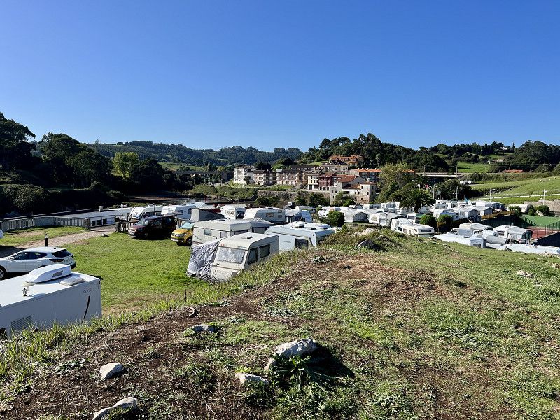
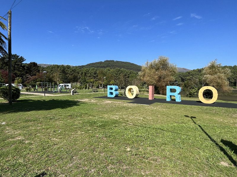
Área de Autocaravanas
Simple SP from the municipality for 6.07/night. You can stand for a maximum of 3 nights. V+E included. Only no electricity and public toilets are on the beach. There are also showers on the beach (not for me, the water is cold)
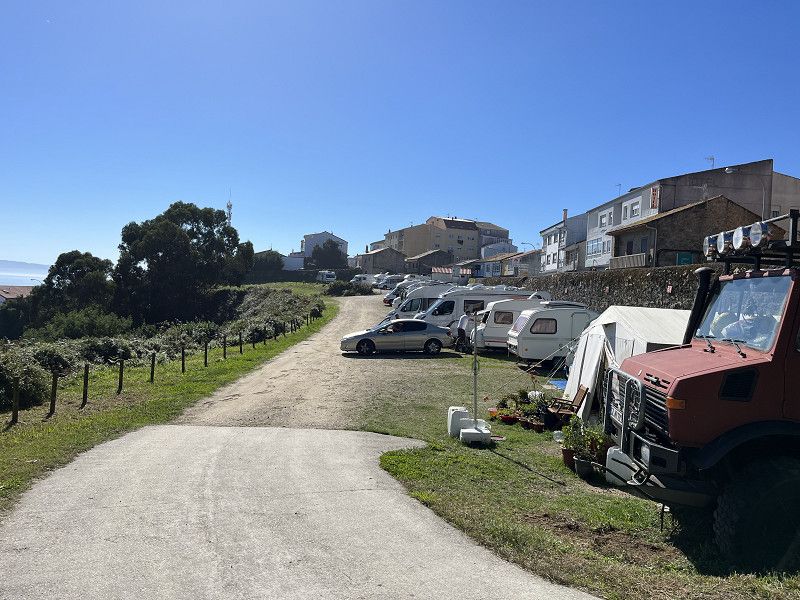
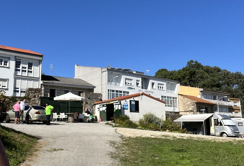
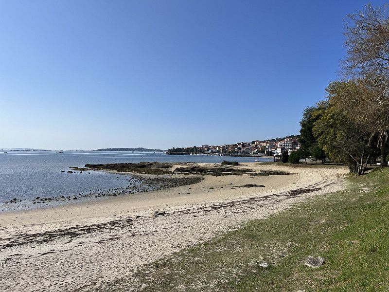
Boiro is a small town in the bay. Idyllic and little tourism. We ate here and are now staying at the place.
We met an older Spanish couple (Gurus and Antonio) here on the SP. She comes from the Basque Country (Oundarroa) and he from Andalusia (Barbate)
Very nice chat (Google Translater makes it possible)
Avenida de la Compostela, 15930, Boiro, Spain
42° 38' 30" N 8° 53' 49" W
42.6416667 -8.8969444
• Head south. Go for 20 m.
• Turn left onto Avenida Compostela. Go for 683 m.
• Take the 3rd exit from roundabout onto Avenida Constitución. Go for 115 m.
• Turn left onto Rúa Principal (AC-305). Go for 66 m.
• Continue on AC-305. Go for 161 m.
• Turn right onto DP-1105. Go for 399 m.
• Continue on Brazos (DP-1105). Go for 231 m.
• Continue on DP-1105. Go for 867 m.
• Take the 1st exit from roundabout. Go for 127 m.
• Continue on Bermo. Go for 458 m.
• Take the 2nd exit from roundabout toward Padrón. Go for 48 m.
• Take ramp onto AG-11. Go for 13.2 km.
• Take exit 11 toward Catoira/PO-548/Vilagarcía/Pontevedra/AP-9. Go for 317 m.
• Take the 1st exit from roundabout onto AC-553. Go for 1.4 km.
• Take the 2nd exit from roundabout onto EP-8001. Go for 1.9 km.
• Take the 1st exit from roundabout onto Avenida da Ponte (PO-548). Go for 1.2 km.
• Take the 2nd exit from roundabout onto PO-548. Go for 425 m.
• Take the 3rd exit from roundabout onto Rúa do Concello (PO-548). Go for 6.9 km.
• Take the 2nd exit from roundabout onto VG-4.7. Go for 7.6 km.
• Take the 1st exit from roundabout onto N-640 toward Vilagarcía/Porto. Go for 4.0 km.
• Take ramp toward Cornazo/Santa Mariña/Cambados. Go for 409 m.
• Take the 2nd exit from roundabout onto VG-4.3 toward Cambados/Illa de Arousa/Vilanova. Go for 3.7 km.
• Take ramp toward Vilanova de Arousa/Illa de Arousa. Go for 372 m.
• Take the 1st exit from roundabout onto VG-4.3. Go for 1.4 km.
• Take the 2nd exit from roundabout. Go for 52 m.
• Continue on A Pantrigueira (PO-307). Go for 452 m.
• Continue on San Roque do Monte (PO-307). Go for 482 m.
• Continue on PO-307. Go for 132 m.
• Continue on San Roque do Monte (PO-307). Go for 181 m.
• Continue on O Terrón (PO-307). Go for 99 m.
• Continue on PO-307. Go for 23 m.
• Turn right toward PO-307. Go for 34 m.
• Take the 2nd exit from roundabout onto PO-307. Go for 98 m.
• Continue on O Terrón (PO-307). Go for 282 m.
• Continue on PO-307. Go for 1.6 km.
• Continue on Estrada Illa de Arousa (PO-307). Go for 634 m.
• Take the 1st exit from roundabout. Go for 65 m.
• Continue on Barrio Pedrouzas (PO-307). Go for 408 m.
• Take the 3rd exit from roundabout onto Barrio Pedrouzas. Go for 156 m.
• Turn sharp right onto Barrio Pedrouzas. Go for 89 m.
• Turn left onto Barrio Pedrouzas. Go for 112 m.
• Arrive at Barrio Pedrouzas. Your destination is on the left.
☍
50,8 km
( 43 min.)
Day
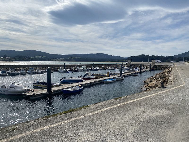
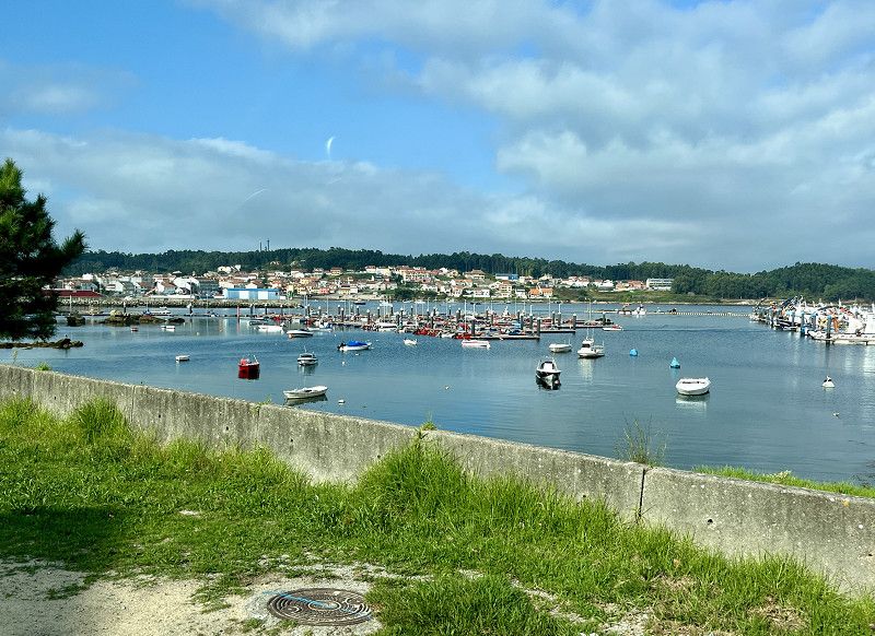
Illa de Arousa
The island is beautiful, but unfortunately we can only find a parking space for the motorhome next to the big bridge. CPs are closed
So we only stay for a short time and then drive on to Cambados
Spanien
42° 33' 0.1" N 8° 52' 1.8" W
42.5500390 -8.8671561
• Head southeast on Barrio Pedrouzas. Go for 112 m.
• Turn right onto Barrio Pedrouzas. Go for 89 m.
• Turn sharp left onto Barrio Pedrouzas. Go for 45 m.
• Take the 1st exit from roundabout onto Barrio Pedrouzas (PO-307). Go for 498 m.
• Take the 2nd exit from roundabout. Go for 64 m.
• Continue on Estrada Illa de Arousa (PO-307). Go for 596 m.
• Continue on PO-307. Go for 1.6 km.
• Continue on O Terrón (PO-307). Go for 282 m.
• Continue on PO-307. Go for 77 m.
• Take the 1st exit from roundabout onto PO-307. Go for 69 m.
• Continue on O Terrón (PO-307). Go for 99 m.
• Continue on San Roque do Monte (PO-307). Go for 181 m.
• Continue on PO-307. Go for 132 m.
• Continue on San Roque do Monte (PO-307). Go for 482 m.
• Continue on A Pantrigueira (PO-307). Go for 480 m.
• Take the 1st exit from roundabout onto Cardalda (PO-549). Go for 2.5 km.
• Take the 2nd exit from roundabout onto Avenida de Vilagarcía (PO-549). Go for 228 m.
• Arrive at Avenida de Vilagarcía (PO-549).
☍
7,5 km
( 9 min.)
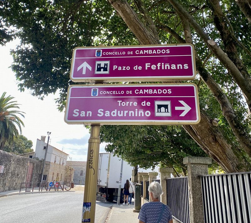
Cambados - eine mittelalterliche Stadt
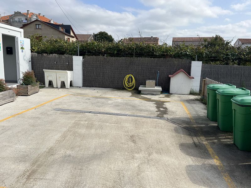
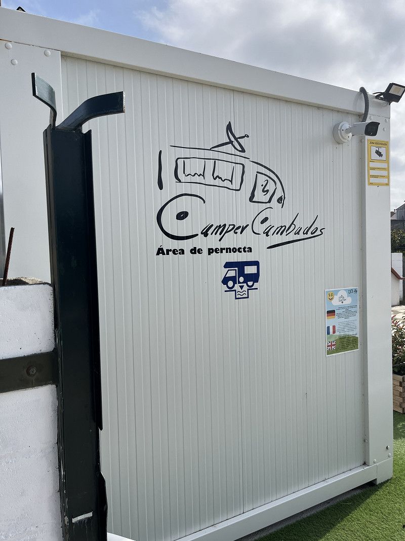
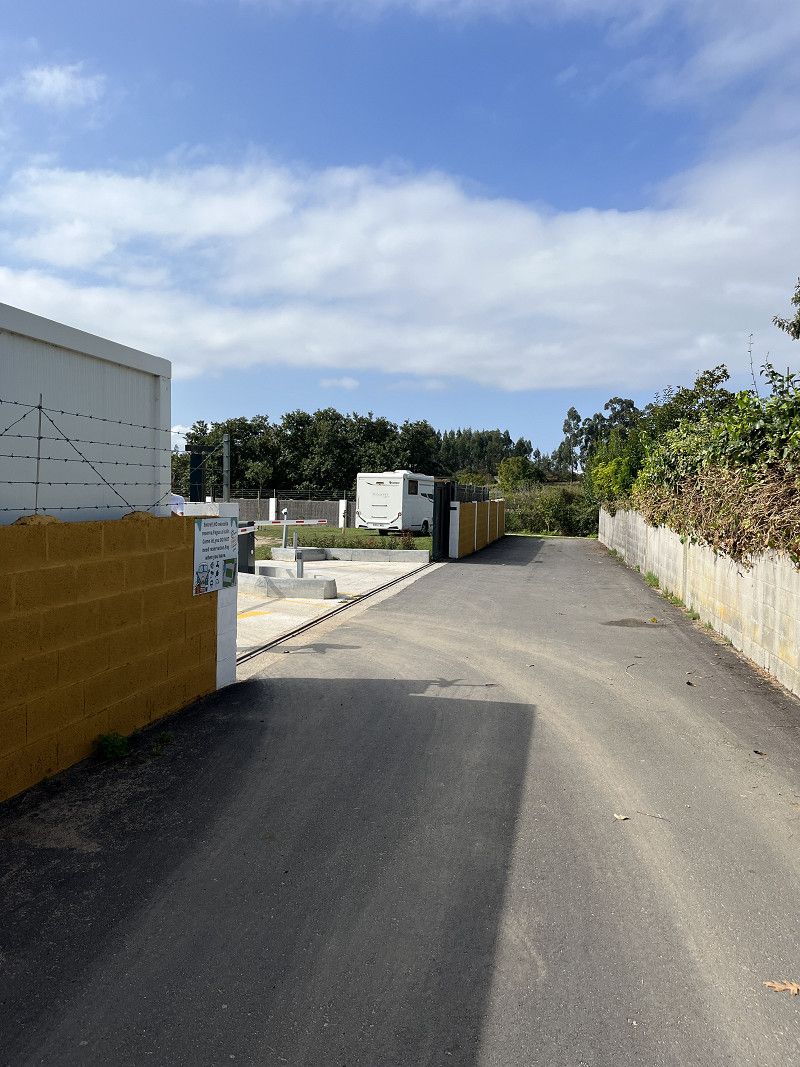
Camper Cambados pitch for 10€/night without electricity but with V+E
Not much going on, the cupboard opens automatically as soon as you drive up. Inside there is a poster with an explanation and a QR code to then pay. Otherwise there is also a TEL.Nr. if you don't want to pay with the QR code. I'm excited tomorrow.
It worked great! QR code and then pay. You are guided step by step.
Cambados is worth a visit! Behind the SP there is a footpath to Hagen and into the city!
Avenida de Vilagarcía, Cambados, Pontevedra, Spanien
42° 31' 40.5" N 8° 48' 40.1" W
42.5279170 -8.8111420
• Head toward Rúa Vilanova de Arousa on Avenida de Vilagarcía (PO-549). Go for 216 m.
• Take the 4th exit from roundabout. Go for 403 m.
• Take the 1st exit from roundabout onto VG-4.3 toward Cambados/AG-41/Pontevedra/Sanxenxo/O Grove. Go for 1.3 km.
• Take the 2nd exit from roundabout onto VG-4.2. Go for 3.4 km.
• Take the 2nd exit from roundabout onto VG-4.2. Go for 1.2 km.
• Take the 1st exit from roundabout onto AG-41 toward Sanxenxo/O Grove. Go for 9.6 km.
• Continue on VG-4.1 toward O Grove. Go for 7.0 km.
• Take the 1st exit from roundabout onto PO-308. Go for 411 m.
• Take the 2nd exit from roundabout onto PO-316. Go for 883 m.
• Take the 1st exit from roundabout onto PO-316. Go for 939 m.
• Take the 2nd exit from roundabout onto PO-317. Go for 869 m.
• Continue on A Lanzada (PO-317). Go for 315 m.
• Continue on PO-317. Go for 250 m.
• Continue on A Lanzada (PO-317). Go for 108 m.
• Continue on PO-317. Go for 170 m.
• Continue on A Lanzada (PO-317). Go for 502 m.
• Continue on PO-317. Go for 509 m.
• Continue on Reboredo (PO-317). Go for 99 m.
• Continue on A Granxa (PO-317). Go for 83 m.
• Continue on Rúa San Vicente do Mar B (PO-317). Go for 892 m.
• Continue on PO-317. Go for 160 m.
• Continue on A Granxa (PO-317). Go for 95 m.
• Continue on Os Campos (PO-317). Go for 141 m.
• Continue on PO-317. Go for 250 m.
• Continue on Os Campos (PO-317). Go for 184 m.
• Continue on PO-317. Go for 56 m.
• Continue on Estrada San Vicente a Lanzada (PO-317). Go for 210 m.
• Turn right. Go for 18 m.
• Arrive at your destination on the right.
☍
30,2 km
( 23 min.)
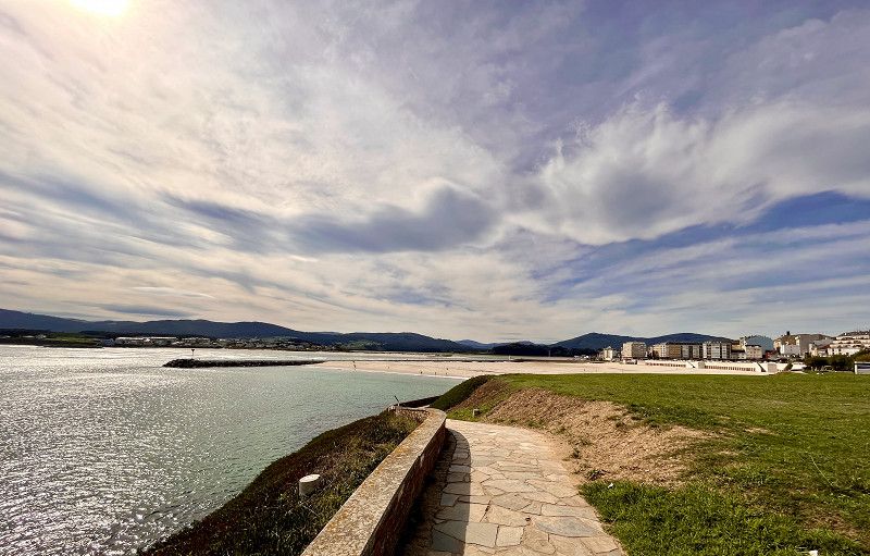
Day
San Vicente do Mar
ACSI space, well-kept campsite, everything was available with bread service, washing machines which we used again.
In the evening we walk to the great beach
O Salnés, Galicien, Spanien
42° 27' 26.7" N 8° 55' 22.5" W
42.4574139 -8.9229132
• Head toward Avenida A Lanzada. Go for 18 m.
• Turn left onto Avenida A Lanzada (PO-317). Go for 210 m.
• Continue on PO-317. Go for 56 m.
• Continue on Os Campos (PO-317). Go for 184 m.
• Continue on PO-317. Go for 250 m.
• Continue on Os Campos (PO-317). Go for 141 m.
• Continue on A Granxa (PO-317). Go for 95 m.
• Continue on PO-317. Go for 160 m.
• Continue on Rúa San Vicente do Mar B (PO-317). Go for 892 m.
• Continue on A Granxa (PO-317). Go for 83 m.
• Continue on Reboredo (PO-317). Go for 99 m.
• Continue on PO-317. Go for 509 m.
• Continue on A Lanzada (PO-317). Go for 502 m.
• Continue on PO-317. Go for 170 m.
• Continue on A Lanzada (PO-317). Go for 108 m.
• Continue on PO-317. Go for 250 m.
• Continue on A Lanzada (PO-317). Go for 315 m.
• Continue on PO-317. Go for 796 m.
• Take the 2nd exit from roundabout onto PO-316. Go for 940 m.
• Take the 2nd exit from roundabout onto PO-316. Go for 107 m.
• Continue on Estonllo (PO-316). Go for 450 m.
• Continue on PO-316. Go for 1.2 km.
• Take the 1st exit from roundabout onto Avenida Teniente Domínguez (PO-312). Go for 780 m.
• Take the 1st exit from roundabout onto Ponte de A Toxa (PO-312). Go for 407 m.
• Take the 2nd exit from roundabout onto Rúa Don Pedro. Go for 293 m.
• Turn left onto Rúa Condesa. Go for 241 m.
• Arrive at Rúa Condesa. Your destination is on the left.
☍
9,3 km
( 12 min.)
Day
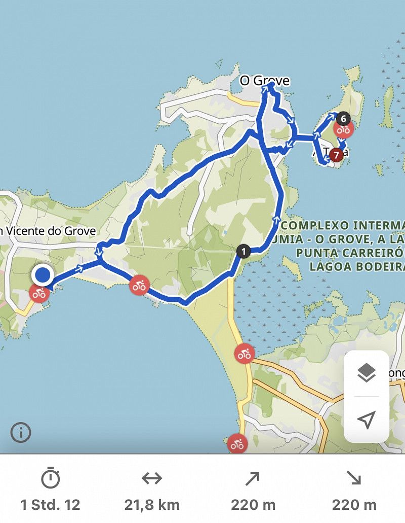
Illa da Toxa
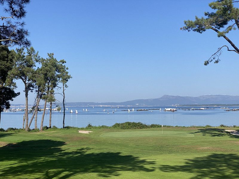
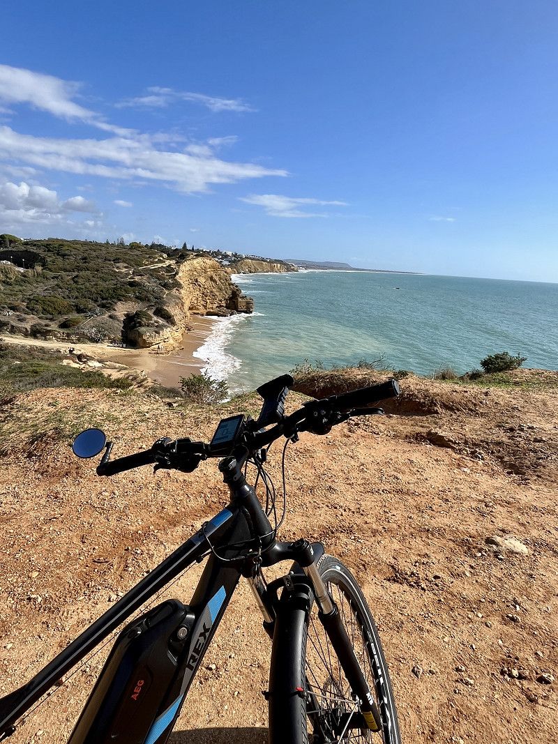
Today we're going to Illa da Toxa by bike. There we cycle as far as we can (large part is a golf course) around the small island
In O Grove we have a lot of tourism (today is Saturday). In the harbor you can book boat tours with eating mussels and drinking wine. Visitors arrive by the busload. That's not for us.
Back to the pitch and we have enough sun for today!!
It's still 30° and 11 hours of sunshine.
Spanien
42° 29' 17.7" N 8° 50' 54.4" W
42.4882516 -8.8484450
• Head southeast on Rúa Condesa. Go for 241 m.
• Turn right onto Rúa Don Pedro. Go for 275 m.
• Take the 2nd exit from roundabout onto Ponte de A Toxa (PO-312). Go for 419 m.
• Take the 2nd exit from roundabout onto Avenida Teniente Domínguez (PO-312). Go for 770 m.
• Continue toward PO-316. Go for 33 m.
• Take the 2nd exit from roundabout onto PO-316. Go for 1.3 km.
• Continue on Estonllo (PO-316). Go for 450 m.
• Continue on PO-316. Go for 79 m.
• Take the 3rd exit from roundabout onto PO-316. Go for 864 m.
• Pass 2 roundabouts and continue on PO-316. Go for 1.8 km.
• Take the 1st exit from roundabout onto PO-308. Go for 457 m.
• Take the 2nd exit from roundabout onto VG-4.1. Go for 7.0 km.
• Continue on AG-41. Go for 18.7 km.
• Take the exit toward Pontevedra onto AP-9 (Autoestrada do Atlántico). Go for 9.6 km.
• Take exit 129 toward Poio/C-550. Go for 490 m.
• Turn left onto O Vao (PO-531). Go for 180 m.
• Take the 2nd exit from roundabout onto Paseo Domingo Fontán. Go for 459 m.
• Take the 1st exit from roundabout onto Ponte das Correntes toward Marín/PO-11/Ourense. Go for 151 m.
• Take the 2nd exit from Avenida de Uruguay roundabout onto Avenida de Uruguay. Go for 157 m.
• Take the 2nd exit from roundabout onto Avenida de Uruguay. Go for 199 m.
• Continue on Avenida de Buenos Aires. Go for 74 m.
• Turn right onto Rúa Valentín García Escudero. Go for 61 m.
• Turn left onto Rúa Valentín García Escudero. Go for 24 m.
• Turn slightly left onto Rúa Serra. Go for 38 m.
• Turn right onto Rúa San Xulián. Go for 40 m.
• Turn left onto Rúa do Arco. Go for 28 m.
• Continue on Praza da Pedreira. Go for 60 m.
• Turn right onto Praza da Pedreira. Go for 30 m.
• Turn right onto Rúa Gregorio Fernández. Go for 56 m.
• Turn right onto Rúa Sarmiento. Go for 12 m.
• Turn left onto Rúa Pasantería. Go for 104 m.
• Turn left onto Rúa Naranjo. Go for 16 m.
• Continue on Travesía da Aduana. Go for 17 m.
• Arrive at Travesía da Aduana. Your destination is on the left.
☍
44,2 km
( 36 min.)
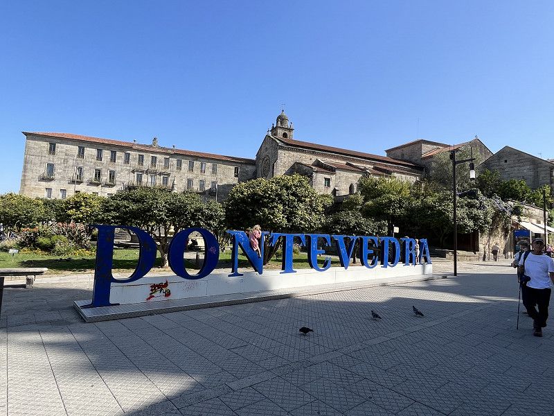
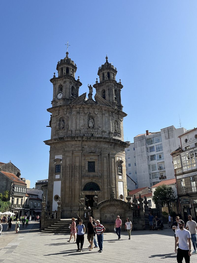
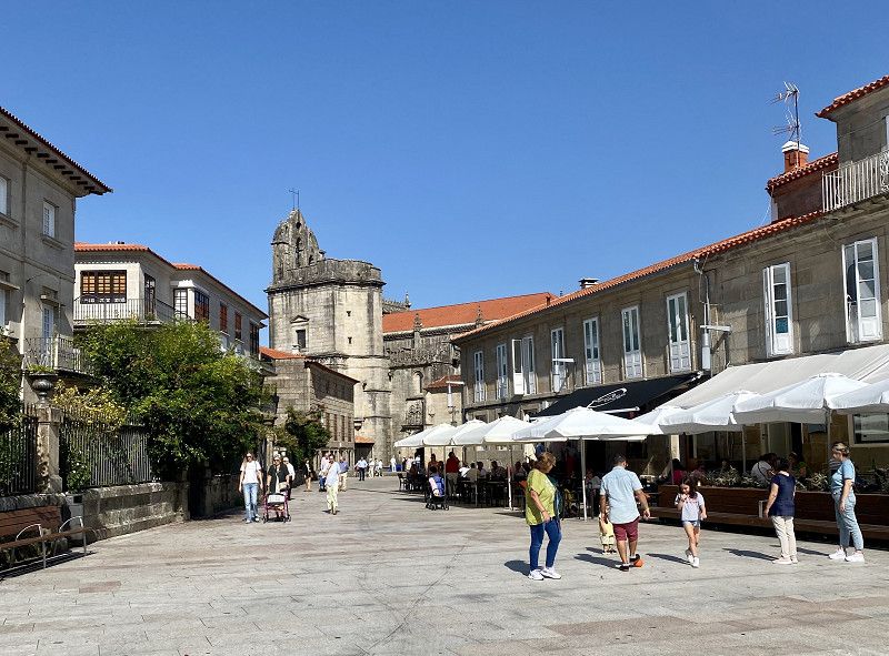
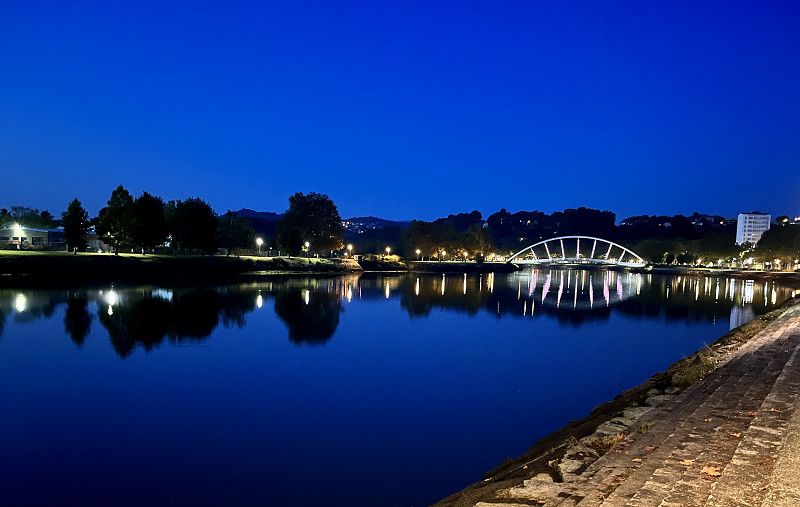
Day
Pontevedra
Free SP in the city of Ponteverda. With V+E for 24 hours.
We visit the historic old town. Very busy this Sunday and lots of tappa bars/restaurants and cafeteria
Pontevedra, Galicien, Spanien
42° 25' 54.8" N 8° 38' 35.4" W
42.4318876 -8.6431592
• Head toward Rúa Naranjo on Travesía da Aduana. Go for 17 m.
• Turn right onto Rúa Naranjo. Go for 64 m.
• Turn right onto Rúa do Padre Luis María Fernández. Go for 85 m.
• Turn left onto Rúa Cobián Roffignac. Go for 96 m.
• Continue on Rúa Padre Amoedo Carballo. Go for 135 m.
• Take the 3rd exit from roundabout onto Avenida de Buenos Aires toward Tui/N-550/Vigo. Go for 325 m.
• Continue on Avenida de Uruguay. Go for 173 m.
• Take the 1st exit from roundabout onto Avenida de Uruguay. Go for 106 m.
• Take the 1st exit from Avenida de Uruguay roundabout onto Ponte das Correntes. Go for 155 m.
• Take the 2nd exit from roundabout onto Paseo Domingo Fontán toward Poio/Sanxenxo/Vilagarcía/Vigo/AP-9/A Coruña. Go for 360 m.
• Take the 1st exit from roundabout onto PO-531 toward Cambados/VG-4.1/Sanxenxo/O Grove/Vilagarcía/Vigo/Santiago. Go for 66 m.
• Take ramp onto AP-9 (Autoestrada do Atlántico) toward Vigo/Ourense. Go for 31.7 km.
• Take exit 161 toward Vigo-Porto T. Bouzas/VG-20/Baiona/AG-57 onto AP-9 (Autoestrada do Atlántico). Go for 1.2 km.
• Continue on VG-20 (Autovía de Circunvalación de Vigo). Go for 2.3 km.
• Continue on AG-57 (Autoestrada do Val Miñor) toward Nigrán/VG-20/Baiona. Go for 22.7 km.
• Take the 1st exit from roundabout onto PO-552. Go for 1.7 km.
• Take the 2nd exit from roundabout onto Avenida Joselín (PO-552). Go for 165 m.
• Turn right onto Rúa Marqués de Quintanar. Go for 190 m.
• Take the 2nd exit from Glorieta Colón roundabout onto Rúa Marqués de Quintanar. Go for 150 m.
• Turn left onto Rúa Huertas Reales. Go for 48 m.
• Turn left onto Rúa Diego Carmona. Go for 7 m.
• Turn left onto Rúa Huertas Reales. Go for 67 m.
• Arrive at Rúa Huertas Reales. Your destination is on the right.
☍
61,9 km
( 41 min.)
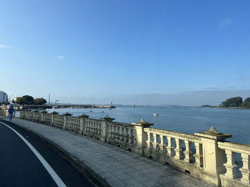
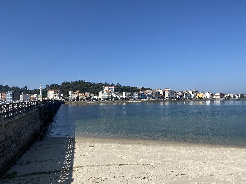
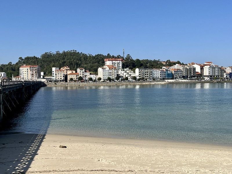
Day
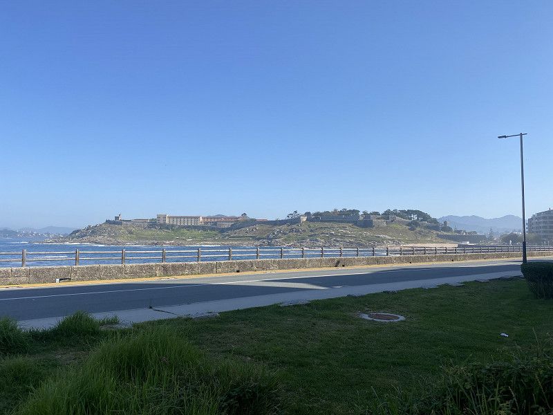
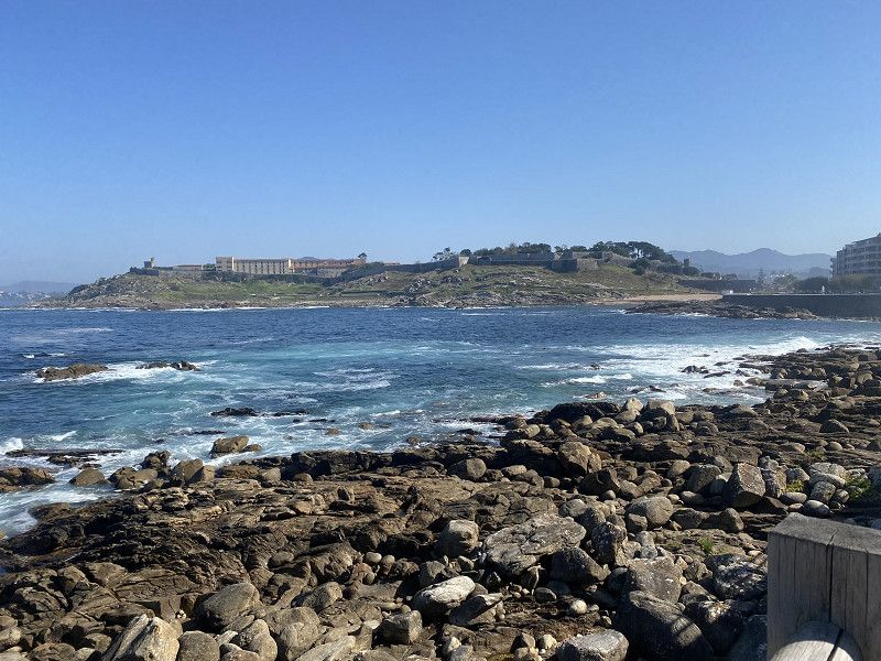
Baiona
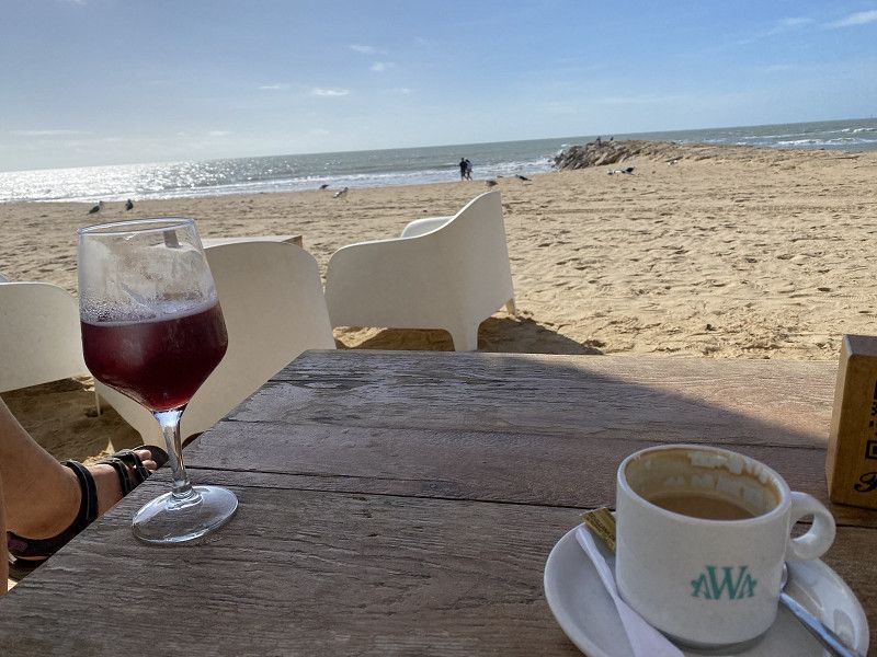
Lunch break with a great view
Vigo, Galicien, Spanien
42° 7' 11" N 8° 51' 3.7" W
42.1197105 -8.8510295
• Head south on Rúa Huertas Reales. Go for 67 m.
• Turn right onto Rúa Diego Carmona. Go for 7 m.
• Turn right onto Rúa Huertas Reales. Go for 48 m.
• Turn slightly right onto Camiño As Fontiñas. Go for 29 m.
• Turn right onto Rúa Ecuador. Go for 120 m.
• Turn right onto Rúa Palos de la Frontera. Go for 24 m.
• Take the 3rd exit from Glorieta Colón roundabout onto Rúa Palos de la Frontera. Go for 212 m.
• Take the 1st exit from Glorieta República Argentina roundabout onto Rúa Palos de la Frontera. Go for 32 m.
• Keep right onto Rúa Tomás Mirambelle. Go for 163 m.
• Take the 2nd exit from roundabout onto Avenida Joselín (PO-552). Go for 1.8 km.
• Take the 3rd exit from roundabout onto Autoestrada do Val Miñor (AG-57). Go for 4.4 km.
• Keep left onto Autoestrada do Val Miñor (AG-57) toward Tui/Vigo/Pontevedra/A-52/Ourense. Go for 3.9 km.
• Take exit 9 toward A Ramallosa/Gondomar. Go for 513 m.
• Take the 1st exit from Tomada roundabout onto Vilariño de Abaixo (PO-340). Go for 2.1 km.
• Take the 1st exit from roundabout onto Avenida Curros Enriques (PO-340). Go for 312 m.
• Pass 4 roundabouts and continue on PO-344. Go for 14.3 km.
• Continue on Rúa Gondomar (PO-344). Go for 276 m.
• Take the 3rd exit from roundabout onto Rúa Gondomar (PO-344). Go for 757 m.
• Pass 2 roundabouts. Go for 1.8 km.
• Continue on Vilar de Matos-Tomiño (PO-552). Go for 1.9 km.
• Take the 2nd exit from roundabout onto PO-552. Go for 910 m.
• Continue toward Vilanova de Cerveira. Go for 49 m.
• Take the 4th exit from roundabout onto PO-553 toward Vilanova de Cerveira. Go for 1.8 km.
• Continue toward Avenida de Tomino. Go for 288 m.
• Turn right onto Avenida de Tomino. Go for 394 m.
• Continue toward Avenida das Comunidades Portuguesas. Go for 84 m.
• Take the 1st exit from roundabout onto Avenida das Comunidades Portuguesas. Go for 234 m.
• Continue on Avenida Heróis do Ultramar. Go for 419 m.
• Turn right onto Praça Alto Minho. Go for 95 m.
• Continue on Praça da Liberdade. Go for 10 m.
• Arrive at Praça da Liberdade. Your destination is on the left.
☍
37,0 km
( 35 min.)
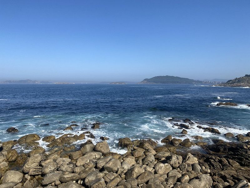
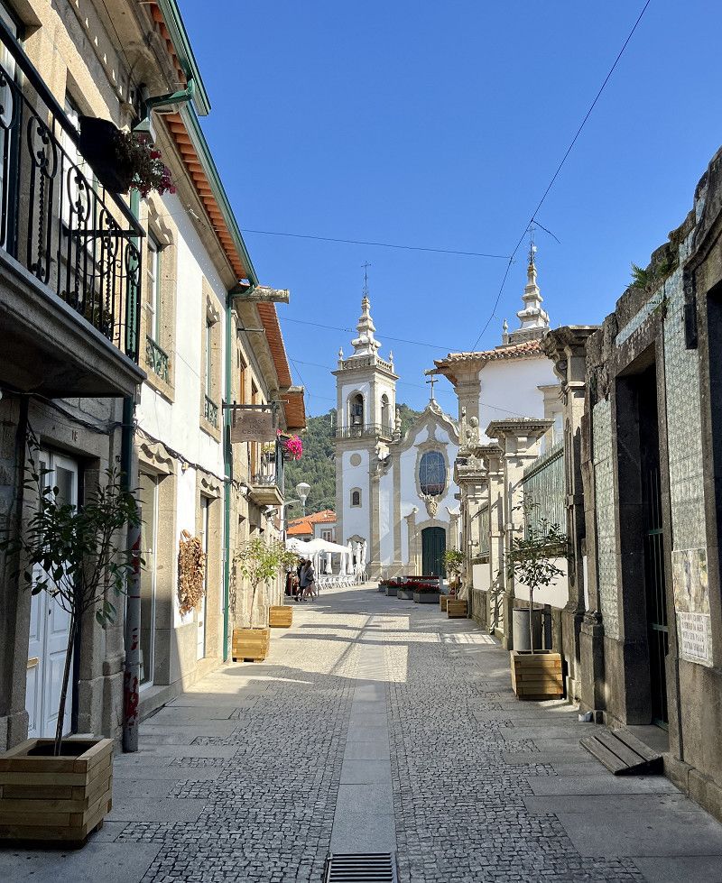
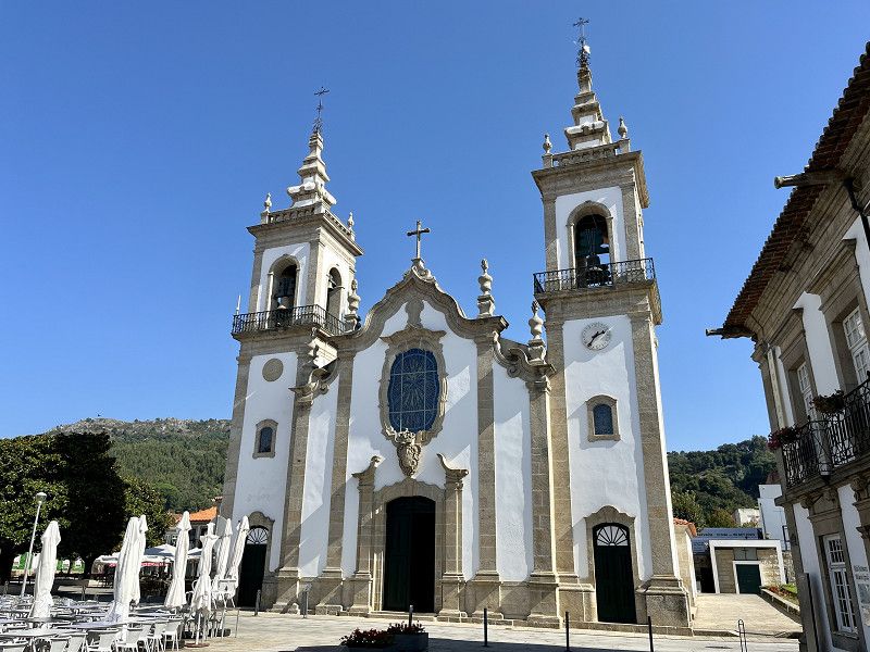
Bom dia Portugal- Vila Nova de Cerveira
Today we drove a long distance. We didn't look at Vigo, it's not supposed to be very nice. And honestly some cities aren't that important right now, I think Vigo is one of them.
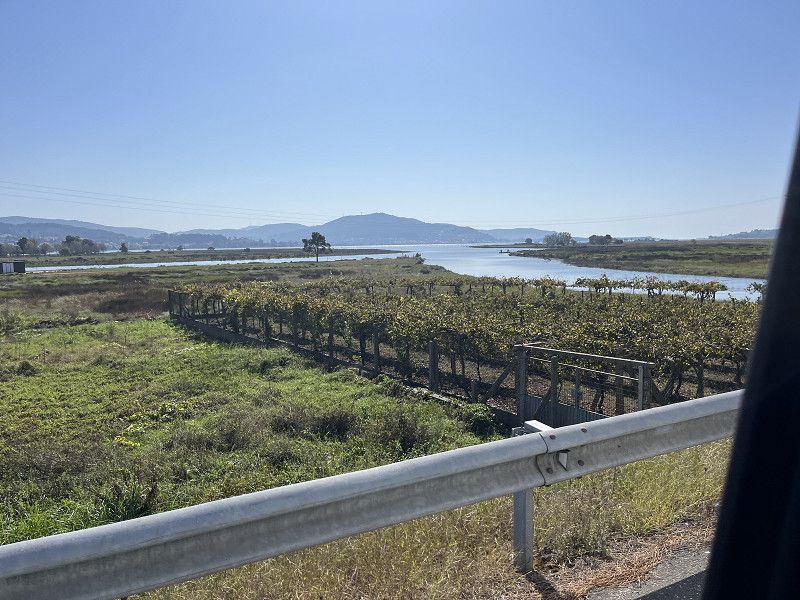
We also want to drive along the coast and enjoy the view. We have lunch in Baiona and then continue along the coast to Guarda. Maybe we can go to the campsite there or we can continue on to Portugal. The route on the Spanish coast from Baiona to Vila Nova de Cereiva is fun to drive. And so we end up on the free, urban asphalt SP with V+E. The town is beautiful and easy to reach on foot from the SP.
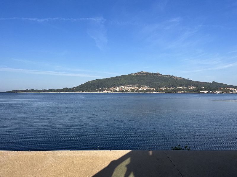
Viana do Castelo, Portugal
41° 56' 25.4" N 8° 44' 37" W
41.9403912 -8.7436068
• Head southwest on Praça da Liberdade. Go for 52 m.
• Continue on Praça do Município. Go for 110 m.
• Continue on Largo Município. Go for 89 m.
• Take the 1st exit from roundabout onto Rua Santo António (N13) toward Viana do Castelo/Caminha. Go for 1.8 km.
• Take the 1st exit from roundabout onto N13 toward Viana do Castelo/Caminha. Go for 2.0 km.
• Keep left onto Autoestrada do Litoral Norte (A28) toward Porto/Viana C.lo. Go for 27.1 km.
• Take exit 24 toward Porto onto A27/A28 (Autoestrada do Litoral Norte). Go for 729 m.
• Continue on A28 (Autoestrada do Litoral Norte). Go for 67.7 km.
• Take ramp onto A20/A28 (Autoestrada do Litoral Norte) toward P.te Arrábida/Gaia/Lisboa/A1. Go for 438 m.
• Continue on A28 (Autoestrada do Litoral Norte). Go for 2.1 km.
• Continue on A1 (Autoestrada do Norte). Go for 55.2 km.
• Take exit 16 toward Aveiro onto A25 (Autoestrada da Costa da Prata). Go for 10.7 km.
• Take the exit toward Aveiro onto A25 (Autoestrada Beiras Litoral e Alta). Go for 14.1 km.
• Turn right toward N109-7. Go for 107 m.
• Continue on N109-7. Go for 96 m.
• Continue on Avenida de Nossa Senhora da Saúde (N109-7). Go for 993 m.
• Keep left onto Avenida José Estevão (N109-7). Go for 1.8 km.
• Continue on M592. Go for 5.1 km.
• Take the 1st exit from roundabout onto Avenida João Vaz da Silva. Go for 418 m.
• Continue on Avenida João Vaz. Go for 28 m.
• Turn left onto Rua Onze. Go for 68 m.
• Turn left onto Avenida Claudino Santos Costa (M592). Go for 343 m.
• Continue on M591-2. Go for 468 m.
• Take the 1st exit from roundabout onto Rua Principal (M591). Go for 2.0 km.
• Turn left toward M591-1. Go for 442 m.
• Turn right onto M591-1. Go for 15 m.
• Turn left. Go for 26 m.
• Arrive at your destination on the left.
☍
194,0 km
(2 hrs. )
Day
Gafanha da Boa Hora
This morning we were awake early (Portugal is an hour behind and our internal clock won't change that quickly 😜) and there is also a railway line next to the SP and the train runs again from 7 a.m. and the buses next door.
So today we decide to drive to just outside Porto. Porto is also on our list, but we're there at lunchtime and it's 30° and I don't want to walk around the city. So we will visit Porto another time.
We continue towards Aveiro and then on to the Costa Nova. (Very nice little town with colorful striped houses.
We know this SP from our last stay in Portugal, we know that it is right behind the dune and that it is beautiful for us. 9€/night without electricity, bread service and there are showers and toilets at the swimming pool. V+E is also there. Very friendly welcome in English and first we stay here for 1 night.
Aveiro, Portugal
40° 32' 29.7" N 8° 45' 19.3" W
40.5415762 -8.7553714
• Head toward Rua da Floresta. Go for 26 m.
• Turn right onto M591-1. Go for 15 m.
• Turn left toward Rua Principal/M591. Go for 442 m.
• Turn left onto Rua Principal (M591). Go for 6.4 km.
• Turn left onto Rua do Leque Florestal. Go for 7.7 km.
• Continue toward Autoestrada do Litoral Centro/A17. Go for 286 m.
• Take the 3rd exit from roundabout onto A17 (Autoestrada do Litoral Centro) toward Lisboa/Fig.ra Foz. Go for 93.9 km.
• Continue on A8 (Autoestrada do Oeste). Go for 31.5 km.
• Take exit 21 toward Alfeizerão/S. Martinho do Porto. Go for 722 m.
• Take the 1st exit from roundabout onto Rua 25 de Abril (N242). Go for 3.6 km.
• Take the 3rd exit from Rotunda de São Martinho roundabout onto Rua Conde de Avellar. Go for 915 m.
• Continue on Rua Conde de Avellar. Go for 35 m.
• Continue on Largo Vitorino Fróis. Go for 78 m.
• Turn right onto Rua Doutor Rafael Gagliardini Graça. Go for 84 m.
• Turn left onto Rua Francisco Martins. Go for 122 m.
• Arrive at Rua Francisco Martins. Your destination is on the left.
☍
145,8 km
(1 hrs. 26 min.)
Day
São Martinho do Porto
Actually, it says it all, my “Gutster” wants to go to Nazaré because that’s where the big waves are supposed to be. But the weather (despite October, when there could be waves) is just too good 😂☀️
So we're going there anyway. And this time too (we were there in April 2022) there is hardly any parking space for the motorhome and there are no waves.
We continue to the next bay (São Martinho do Porto) and here we find a simple campsite for 15.35€/night without electricity (we still don't need it because there's a lot ☀️)
Showers are included and a beautiful view of the bay. The campsite is visually not the prettiest, everything is old and there is little shade.
We also had dinner in the town, everything was fine. We also know camper neighbors because we have already stood next to each other on a SP in Comillas. What a coincidence 🤪
The night was quiet.
Leiria, Portugal
39° 30' 48.7" N 9° 8' 0.9" W
39.5135311 -9.1335905
• Head northeast on Rua Francisco Martins. Go for 14 m.
• Turn slightly right onto Travessa do Norte. Go for 14 m.
• Turn right onto Rua do Norte. Go for 63 m.
• Turn slightly right onto Calçada da Rua do Norte. Go for 84 m.
• Turn left onto Rua Doutor Rafael Gagliardini Graça. Go for 12 m.
• Turn right onto Estrada do Facho (N242-7). Go for 124 m.
• Turn right onto Rua Marechal Carmona. Go for 333 m.
• Turn left onto Rua Conde de Avellar. Go for 806 m.
• Take the 2nd exit from Rotunda de São Martinho roundabout onto N242. Go for 3.6 km.
• Take the 2nd exit from roundabout onto A8 (Autoestrada do Oeste) toward Lisboa/Caldas da Rainha. Go for 20.0 km.
• Take exit 15 toward Óbidos/Peniche. Go for 669 m.
• Take the 2nd exit from roundabout onto N8 toward Peniche. Go for 735 m.
• Take the 3rd exit from roundabout onto Estrada da Capeleira. Go for 173 m.
• Turn right. Go for 16 m.
• Arrive at your destination on the left.
☍
26,6 km
( 20 min.)
Day
Óbidos - Stadt der Königinnen
Short stop after about 25km in Obidos. Designated SP which is free during the day until 5 p.m.
A lot of tourists (buses, mass tourism)
And then still warm. So 30 minutes is enough for me and we drive on to Peniche on the small peninsula
King Alfonso II bequeathed the city to his wife Urraca as a wedding gift. Since then and until the 16th century, various kings repeated this custom, which is why the city was also called Vila das Rainhas (City of the Queens).
R. dos Arcos, 2510-086, Óbidos, Portugal
39° 21' 23" N 9° 9' 24" W
39.3563889 -9.1566667
• Head toward Estrada da Capeleira. Go for 16 m.
• Turn left onto Estrada da Capeleira. Go for 129 m.
• Take the 1st exit from roundabout onto N8. Go for 665 m.
• Take the 1st exit from roundabout onto A8 (Autoestrada do Oeste) toward Lisboa. Go for 3.0 km.
• Take exit 14 toward Peniche onto IP6. Go for 16.5 km.
• Pass 2 roundabouts and continue on Avenida Mons. Manuel Bastos Rod. de Sousa (IP6). Go for 2.9 km.
• Take the 3rd exit from roundabout. Go for 290 m.
• Take the 1st exit from roundabout onto Avenida do Porto de Pesca. Go for 517 m.
• Pass 2 roundabouts and continue on Avenida do Porto de Pesca. Go for 505 m.
• Take the 2nd exit from Largo do Município roundabout onto Travessa dos Mareantes. Go for 97 m.
• Turn left onto Rua José Estêvão. Go for 102 m.
• Turn right onto Rua Doutor Francisco Seia. Go for 78 m.
• Turn right onto Rua Marquês de Pombal. Go for 21 m.
• Turn left onto Rua Nossa Senhora da Conceição. Go for 110 m.
• Turn right onto Rua das Amoreiras. Go for 45 m.
• Arrive at Rua das Amoreiras.
☍
24,9 km
( 19 min.)
Peniche - Halbinsel aus der Jurazeit
Peniche has an SP that we were on 1.5 years ago and found to be good. We'll stay here for 2 or 3 days.
Leiria, Portugal
39° 21' 23.8" N 9° 22' 52.6" W
39.3566221 -9.3812853
• Head toward Rua dos Hermínios on Rua das Amoreiras. Go for 3 m.
• Turn right onto Rua dos Hermínios. Go for 116 m.
• Turn left onto Rua Marquês de Pombal. Go for 133 m.
• Turn right onto Praça Jacob Rodrigues Pereira. Go for 28 m.
• Turn right onto Rua 13 de Infantaria. Go for 172 m.
• Take the 3rd exit from Largo do Município roundabout onto Avenida do Porto de Pesca. Go for 208 m.
• Pass 2 roundabouts and continue on Avenida do Porto de Pesca. Go for 783 m.
• Take the 3rd exit from roundabout. Go for 339 m.
• Take the 1st exit from roundabout onto Avenida Mons. Manuel Bastos Rod. de Sousa (IP6). Go for 1.1 km.
• Take the 3rd exit from roundabout onto IP6. Go for 1.8 km.
• Take the 2nd exit from roundabout onto IP6. Go for 16.2 km.
• Take ramp onto A8 (Autoestrada do Oeste) toward Lisboa/Bombarral. Go for 52.5 km.
• Take exit 5 toward Venda do Pinheiro/Ericeira/Mafra/Malveira onto A21 (Autoestrada de Mafra). Go for 8.6 km.
• Take exit 3 toward N9/Mafra/Sintra. Go for 674 m.
• Take the 1st exit from roundabout onto N116. Go for 517 m.
• Take the 2nd exit from roundabout onto N9. Go for 262 m.
• Continue on Avenida Movimento das Forças Armadas (N9). Go for 1.2 km.
• Take the 2nd exit from roundabout onto Avenida Movimento das Forças Armadas (N9). Go for 83 m.
• Turn slightly right onto Avenida Movimento das Forças Armadas (N9). Go for 362 m.
• Take the 1st exit from roundabout onto Alameda da Escola Prática de Infantaria. Go for 176 m.
• Arrive at Alameda da Escola Prática de Infantaria.
☍
85,3 km
( 53 min.)
Day
Day
Palácio Nacional de Mafra
Free SP in Mafra for 7 RVs. When we arrived everything was full, but there was enough free space in the parking lot so we stood there for 2 hours.
We visited the Palácio and the basilica. The Palácio costs €8 entrance fee, which I think was worth it. The basilica is free entry.
Alameda da Escola Prática de Infantaria, Mafra, Lissabon, Portugal
38° 56' 12.8" N 9° 19' 32.8" W
38.9368915 -9.3257732
• Head toward Rua do Canal on Alameda da Escola Prática de Infantaria. Go for 160 m.
• Take the 3rd exit from roundabout onto Avenida Movimento das Forças Armadas (N9). Go for 380 m.
• Turn left onto Avenida Movimento das Forças Armadas (N9). Go for 94 m.
• Take the 2nd exit from roundabout onto Avenida Movimento das Forças Armadas (N9). Go for 1.2 km.
• Continue on N9. Go for 240 m.
• Take the 2nd exit from roundabout onto N116. Go for 551 m.
• Take the 2nd exit from roundabout onto A21 (Autoestrada de Mafra) toward Lisboa/A8/Malveira. Go for 9.2 km.
• Take the exit toward Lisboa/Loures onto A8 (Autoestrada do Oeste). Go for 15.4 km.
• Take exit 1 toward Sul/A12/P.te V. Gama/Aeroporto. Go for 985 m.
• Take ramp onto CRIL (A36) toward Eixo N-S/IP7/Sul/A2/Lisboa/Camarate. Go for 2.9 km.
• Keep left onto A36 (CRIL) toward A12/Sul/P.te V. Gama. Go for 1.4 km.
• Continue on A12 (Autoestrada Sul do Tejo). Go for 41.2 km.
• Take the 2nd exit from roundabout onto Avenida Pedro Álvares Cabral toward Setúbal. Go for 479 m.
• Take the 2nd exit from roundabout onto Avenida Pedro Álvares Cabral toward Setúbal Nascente. Go for 226 m.
• Take the 1st exit from Praça de Portugal roundabout onto Avenida Dom João II. Go for 638 m.
• Take the 2nd exit from roundabout onto Avenida Bento Gonçalves. Go for 531 m.
• Continue on Praça General Luís Domingues. Go for 204 m.
• Continue on Rua do Doutor Vicente José de Carvalho. Go for 45 m.
• Turn right onto Ladeira da Ponte de São Sebastião. Go for 166 m.
• Continue on Avenida Luísa Todi. Go for 944 m.
• Keep right onto Avenida Luísa Todi (N10-4). Go for 489 m.
• Turn right onto Rua Amália Rodrigues (N10-4). Go for 334 m.
• Continue on Estrada da Rasca (N10-4). Go for 3.5 km.
• Continue on Rua Orlando Curto (N379-1). Go for 172 m.
• Arrive at Rua Orlando Curto (N379-1). Your destination is on the left.
☍
81,4 km
( 59 min.)
Ecoparque do Outão
SP for €13.65/night including electricity, view of the Troia headland and the Rio Sado.
We've been here before.
R. do Outão n/n, 2900 - 182, Setúbal, Portugal
38° 30' 9.9" N 8° 55' 43" W
38.5027500 -8.9286000
• Head northeast on Rua Orlando Curto (N379-1). Go for 172 m.
• Continue on Estrada da Rasca (N10-4). Go for 3.5 km.
• Continue on Rua Amália Rodrigues (N10-4). Go for 323 m.
• Continue on Avenida Luísa Todi (N10-4). Go for 798 m.
• Make a U-Turn onto Avenida Luísa Todi (N10-4). Go for 69 m.
• Turn right onto Avenida 22 de Dezembro. Go for 395 m.
• Pass 3 roundabouts. Go for 515 m.
• Continue on Avenida República da Guiné-Bissau. Go for 284 m.
• Continue on Praça do Brasil. Go for 100 m.
• Turn left onto Praça do Brasil (N252). Go for 596 m.
• Turn right onto Avenida Antero de Quental (N10) toward Lisboa/A2/Algarve/A12/Pte. Vasco da Gama. Go for 857 m.
• Take the 3rd exit from roundabout onto Autoestrada Sul do Tejo (A12) toward Lisboa/Algarve/Espanha. Go for 4.8 km.
• Keep right onto Nó Pinhal Novo toward A2/Lisboa (Sul)/Almada/Palmela/Algarve/Évora. Go for 185 m.
• Take exit 1 toward Algarve/Évora onto A2 (Autoestrada do Sul). Go for 67.1 km.
• Take exit 9 toward Sines/IC1/Grândola. Go for 1.1 km.
• Continue on IP8. Go for 38.1 km.
• Continue on A26 (Autoestrada do Baixo Alentejo). Go for 7.6 km.
• Take exit 1 toward (N120)/Odemira. Go for 569 m.
• Take the 3rd exit from roundabout onto IP8 toward Odemira. Go for 2.2 km.
• Take the 2nd exit from roundabout onto IP8 toward Odemira. Go for 1.7 km.
• Take the 3rd exit from roundabout onto IC4 toward Algarve. Go for 2.5 km.
• Turn right onto M1109 toward Porto Covo/São Torpes. Go for 1.6 km.
• Take the 1st exit from roundabout onto M1109. Go for 6.8 km.
• Continue on Rua do Mar (M1109). Go for 903 m.
• Turn right onto Rua Conde Bandeira. Go for 177 m.
• Arrive at your destination on the left.
☍
142,9 km
(1 hrs. 31 min.)
Day
Parque de Campismo de Porto Covo
CP in Porto Covo for €15.65/night without electricity
We were here on our first tour in Portugal. We really like the little fishing village. From the campsite we were in the center (pedestrian zone) in 10 minutes and bought a little something in the Mercado Municipal. (open until 2 p.m. on Sundays) in the pedestrian zone there is one restaurant/bar next to the other. The pizzeria, right at the beginning, is still there (very tasty)
The weather isn't as bad as predicted, so we sit down at the viewing platform and watch the birds and the waves.
Estrada Municipal 554, 7520 - 437, Porto Côvo, Portugal
37° 51' 2" N 8° 47' 42" W
37.8505500 -8.7950000
• Head southeast. Go for 46 m.
• Turn left toward Rua da Praia Pequena. Go for 62 m.
• Turn left onto Rua da Praia Pequena. Go for 24 m.
• Turn right onto Rua José Faial. Go for 95 m.
• Turn left onto Rua do Mar (M1109). Go for 50 m.
• Turn sharp right onto Rua Conde Bandeira. Go for 203 m.
• Turn right onto Rua do Norte. Go for 69 m.
• Turn left onto M554. Go for 2.5 km.
• Take the 1st exit from roundabout onto M554-1. Go for 344 m.
• Turn left onto M1116. Go for 2.4 km.
• Turn left onto Rua 1 de Maio. Go for 3.7 km.
• Turn right toward IC4. Go for 152 m.
• Turn right onto IC4. Go for 1.7 km.
• Continue on N120 toward Lagos/Odemira/Cercal. Go for 7.2 km.
• Take the 1st exit from Largo dos Caieiros roundabout onto Rua 25 de Abril (N390) toward Lagos/Milfontes. Go for 10.7 km.
• Pass 2 roundabouts and continue on N390. Go for 2.4 km.
• Take the 2nd exit from roundabout onto N393 toward Odemira. Go for 9.0 km.
• Take the 2nd exit from roundabout onto N393 toward Odemira. Go for 5.9 km.
• Turn right onto M502 toward Zambujeira. Go for 8.3 km.
• Turn left onto M502-1. Go for 4.2 km.
• Take the 1st exit from roundabout onto N120 toward Lagos/Aljezur. Go for 1.1 km.
• Take the 2nd exit from roundabout onto N120 toward Lagos. Go for 26.9 km.
• Take the 1st exit from roundabout onto Avenida General Humberto Delgado (N120) toward Lagos/Bordeira. Go for 21.7 km.
• Take the 1st exit from roundabout onto A22 (Via Infante de Sagres) toward Lisboa/(A2)/Sagres/Lagos/Faro. Go for 3.0 km.
• Take exit 1 toward Vila do Bispo/Sagres/Lagos. Go for 4.4 km.
• Take the 3rd exit from roundabout toward Lagos/Portimão. Go for 818 m.
• Take the 2nd exit from roundabout onto Avenida da Fonte Coberta toward Meia Praia. Go for 840 m.
• Take the 2nd exit from roundabout onto Avenida dos Descobrimentos (N125). Go for 393 m.
• Take the 2nd exit from roundabout onto Avenida dos Descobrimentos (N125). Go for 1.1 km.
• Arrive at Avenida dos Descobrimentos (N125). Your destination is on the right.
☍
119,4 km
(1 hrs. 46 min.)
Day
Parque de Campismo da Trindade
Centrally located, very, very simple campsite with a moody employee who sent us away twice until we could check in three times. €12.50/night without electricity is cheap for a campsite so close to the center. The CP as such can really only be used as a SP, the sanitary facilities are very unkempt and the place is also run down.
Since we like the old town of Lagos (we already know it from our last tour) and the beach with its rock formations is also worth seeing, we accept this campsite.
We stroll through the old town, we don't visit the beach because it's high tide (rock formations are worth seeing at low tide)
Estrada da Ponta da Piedade, 8600 - 669, Lagos, Portugal
37° 6' 6.8" N 8° 40' 16.2" W
37.1018800 -8.6711800
• Head toward Praça Infante Dom Henrique on Avenida dos Descobrimentos (N125). Go for 290 m.
• Turn left toward Avenida dos Descobrimentos/N125. Go for 80 m.
• Continue on Avenida dos Descobrimentos (N125). Go for 1.3 km.
• Take the 1st exit from roundabout onto N125. Go for 52 m.
• Continue on Ponte Dona Maria II (N125). Go for 212 m.
• Continue on N125. Go for 111 m.
• Take the 2nd exit from roundabout onto N125. Go for 104 m.
• Turn right onto N125 toward Portimão/Faro. Go for 1.3 km.
• Pass 3 roundabouts and continue on N125. Go for 5.6 km.
• Continue toward N125. Go for 35 m.
• Take the 1st exit from roundabout onto N125. Go for 2.0 km.
• Pass 4 roundabouts and continue on N125. Go for 4.2 km.
• Take ramp toward Alvor/Faro/A22. Go for 168 m.
• Take the 1st exit from roundabout onto M531-1. Go for 1.8 km.
• Arrive at Rua Serpa Pinto (M531-1). Your destination is on the right.
☍
17,2 km
( 21 min.)
Day
Camping Alvor
ACSI-CP for 17€/night, very hilly and terraced, unfortunately the front seats are all occupied so we have to choose a spot in the back part of the site.
Lots of trees and also a lot of natural soil, which is rather unpleasant after the rain. Sanitary facilities are clean and plentiful.
Alvor is a cute little town with lots of tourist shops/restaurants, restaurants and bars. Boat tours can also be booked from here.
We're unlucky with the weather today, so we're hoping for tomorrow.
Rua Serpa Pinto, 8500 - 087, Alvor Portimão, Portugal
37° 8' 52" N 8° 34' 47" W
37.1477900 -8.5797200
• Head toward Rua Colina Mourisca on Rua Serpa Pinto (M531-1). Go for 1.7 km.
• Take the 2nd exit from roundabout. Go for 279 m.
• Take the 1st exit from roundabout. Go for 1.4 km.
• Take ramp onto A22 (Via Infante de Sagres) toward Lisboa/Faro. Go for 20.4 km.
• Take exit 7 toward Alcantarilha/Armação de Pêra. Go for 359 m.
• Take the 4th exit from roundabout onto N125. Go for 1.1 km.
• Continue toward N125. Go for 43 m.
• Take the 2nd exit from roundabout onto N125. Go for 537 m.
• Take the 2nd exit from roundabout onto N269-1. Go for 385 m.
• Pass 5 roundabouts and continue on N269-1. Go for 2.8 km.
• Take the 3rd exit from roundabout onto Avenida General Humberto Delgado (N269-1). Go for 82 m.
• Turn right. Go for 54 m.
• Turn left. Go for 25 m.
• Arrive at your destination on the left.
☍
29,2 km
( 22 min.)
Day
Armação de Pêra - Strand mit Felsformationen
Large ACSI CP with fewer trees and not terraced. The site is not parceled out and there are some sanitary facilities.
At lunchtime we walk to the beach. The sun comes out and we enjoy lunch on the beach
But then we head back, it's supposed to be stormy and a lot of rain starting tonight
Faro, Portugal
37° 6' 13.2" N 8° 21' 47.7" W
37.1036672 -8.3632550
• Head south. Go for 39 m.
• Turn right toward Avenida General Humberto Delgado/N269-1. Go for 75 m.
• Turn left onto Avenida General Humberto Delgado (N269-1). Go for 35 m.
• Take the 1st exit from roundabout onto N269-1. Go for 395 m.
• Pass 2 roundabouts and continue on N269-1. Go for 652 m.
• Take the 3rd exit from roundabout onto N269-1. Go for 1.1 km.
• Pass 2 roundabouts and continue on N269-1. Go for 1.0 km.
• Take the 3rd exit from roundabout onto N125. Go for 585 m.
• Take the 2nd exit from roundabout onto N125. Go for 895 m.
• Continue toward Via Infante de Sagres/A22. Go for 58 m.
• Take the 1st exit from roundabout onto A22 (Via Infante de Sagres) toward Lagos/Portimão. Go for 9.5 km.
• Take exit 6 toward N124-1/Lagoa/Silves. Go for 270 m.
• Take the 1st exit from roundabout onto N124-1 toward Silves. Go for 4.3 km.
• Turn left onto N124-1. Go for 225 m.
• Turn left onto N124. Go for 275 m.
• Continue on Estrada Nacional 124 (N124). Go for 59 m.
• Continue on N124. Go for 180 m.
• Turn right toward N124. Go for 30 m.
• Pass 2 roundabouts and continue on N124. Go for 928 m.
• Arrive at N124. Your destination is on the left.
☍
20,6 km
( 20 min.)
Day
Sturm und Regen
In the morning we went to the beach again; from 1 p.m. it's supposed to be very windy and then there will be heavy rain
Day
Algarve Motorhome Park Silves
N 124 Lugar da Tapada, 8300-038, Silves, Portugal
37° 11' 13" N 8° 27' 5" W
37.1869444 -8.4513889
• Head east on N124. Go for 509 m.
• Pass 2 roundabouts and continue on N124. Go for 626 m.
• Continue on Estrada Nacional 124 (N124). Go for 59 m.
• Continue on N124. Go for 1.0 km.
• Take the 2nd exit from roundabout. Go for 112 m.
• Continue on Rua do Cemitério. Go for 122 m.
• Turn right. Go for 167 m.
• Turn right toward Rua do Encalhe. Go for 323 m.
• Continue on Rua do Encalhe. Go for 3.2 km.
• Arrive at your destination on the left.
☍
6,1 km
( 9 min.)
Silves - Besuch des Castello
SP below the castle. At first we just wanted to park and look at the castle. But the weather is great, we like the SP and we stay here for 1 night. €8.50/night without electricity.
V+E is available, shower too. Shopping opportunities right next door.
We have a view of the castle!
The entrance fee to the castle is very moderate at €2.80 and for pensioners (65+) only €1.40.
Avenida António Sérgio, Silves, Faro, Portugal
37° 13' 21.9" N 8° 26' 31.7" W
37.2227388 -8.4421266
• Head south. Go for 2.8 km.
• Continue on Rua do Encalhe. Go for 723 m.
• Continue on Rua do Encalhe. Go for 153 m.
• Take the 3rd exit from roundabout onto Rua do Cemitério. Go for 351 m.
• Take the 1st exit from roundabout onto N124. Go for 784 m.
• Turn left onto N124-1. Go for 178 m.
• Turn right onto N124-1. Go for 4.2 km.
• Continue toward N124-1. Go for 43 m.
• Take the 2nd exit from roundabout onto N124-1. Go for 235 m.
• Take the 2nd exit from roundabout onto A22 (Via Infante de Sagres) toward Faro/Lisboa/(A2). Go for 75.1 km.
• Take exit 16 toward Tavira/N270. Go for 306 m.
• Take ramp. Go for 50 m.
• Take the 3rd exit from roundabout onto N270. Go for 3.7 km.
• Take the 3rd exit from roundabout onto N125. Go for 2.4 km.
• Take the 2nd exit from roundabout. Go for 148 m.
• Continue on N125. Go for 487 m.
• Take the 1st exit from roundabout. Go for 39 m.
• Continue toward Rua de Vale de Caranguejo. Go for 451 m.
• Take the 4th exit from roundabout onto Rua de Vale de Caranguejo. Go for 669 m.
• Arrive at Rua de Vale de Caranguejo. Your destination is on the left.
☍
92,8 km
( 59 min.)
Allerheiligenmesse Ende Oktober
At the end of October, the All Saints' Day mass with Portuguese delicacies takes place in the parking lot opposite the SP. We left there again, but I think it was a nice experience.
The Feira de Todos os Santos de Silves "is one of the oldest and most traditional fairs in the Algarve. It was born at the end of the 15th century (November 1491) when King João II granted the city of Silves his "fair letter", which came into force in 1492 (i.e. 530 years ago).
Day
ALGARVE MOTORHOME PARK TAVIRA
Rua de Vale Caranguejo, 8800-228, TAVIRA, Portugal
37° 7' 57.7" N 7° 37' 52" W
37.1326920 -7.6311200
• Head northeast on Rua de Vale de Caranguejo.
• Arrive at Rua de Vale de Caranguejo. Your destination is on the left.
☍
Distance not available
(Duration not available)
Tavira - gefällt uns auch beim 2. Besuch
Day
ALGARVE MOTORHOME PARK TAVIRA
Storm, rain and 16 hours.
Rua de Vale Caranguejo, 8800-228, TAVIRA, Portugal
37° 7' 57.7" N 7° 37' 52" W
37.1326920 -7.6311200
• Head northeast on Rua de Vale de Caranguejo.
• Arrive at Rua de Vale de Caranguejo. Your destination is on the left.
☍
Distance not available
(Duration not available)
Day
ALGARVE MOTORHOME PARK TAVIRA
Rua de Vale Caranguejo, 8800-228, TAVIRA, Portugal
37° 7' 57.7" N 7° 37' 52" W
37.1326920 -7.6311200
• Head southwest on Rua de Vale de Caranguejo. Go for 546 m.
• Take the 1st exit from roundabout. Go for 445 m.
• Continue toward N125. Go for 48 m.
• Take the 1st exit from roundabout onto N125. Go for 1.2 km.
• Pass 6 roundabouts and continue on N125. Go for 13.4 km.
• Take the 3rd exit from roundabout toward A22/Faro/Espanha. Go for 1.9 km.
• Take ramp onto A22 (Via Infante de Sagres) toward Espanha/Beja. Go for 9.1 km.
• Continue on A-49 (Autopista del V Centenario). Go for 3.3 km.
• Take exit 129 toward Ayamonte Este. Go for 334 m.
• Take the 2nd exit from roundabout onto N-431 toward Ayamonte Este. Go for 6.4 km.
• Turn right onto El Empalme (A-5150) toward Isla Cristina. Go for 114 m.
• Continue on A-5150. Go for 616 m.
• Continue on Villa Elena (A-5150). Go for 120 m.
• Continue on A-5150. Go for 366 m.
• Continue on Villa Emilia (A-5150). Go for 71 m.
• Continue on A-5150. Go for 90 m.
• Continue on Carretera Huelva (A-5150). Go for 841 m.
• Take the 3rd exit from roundabout onto HU-3300 toward La Redondela. Go for 4.0 km.
• Continue on Calle Cervantes (HU-3300). Go for 257 m.
• Continue on Plaza del Concejo (HU-3300). Go for 23 m.
• Continue on Calle Real (HU-3300). Go for 261 m.
• Turn right onto HU-3400. Go for 190 m.
• Continue on Avenida Antonio Machado (HU-3400). Go for 149 m.
• Continue on HU-3400. Go for 1.7 km.
• Take the 3rd exit from roundabout onto A-5054 toward La Antilla. Go for 139 m.
• Arrive at A-5054. Your destination is on the left.
☍
45,4 km
( 42 min.)
Day
Camping Playa Taray
ACSI place, but it almost looks closed. There are 5 RVs in there, the sanitary facilities are functional and clean. The warm water in the showers is a challenge, but the 3 showers have warm water🤣
However, we always take a walk on the beach with a view of the sky.
Ctra. La Antilla-isla Cristina, 21430, Isla Cristina, Spain
37° 12' 19.1" N 7° 15' 56.9" W
37.2053000 -7.2658000
• Head east on A-5054. Go for 624 m.
• Continue on Camino de las Colas (A-5054). Go for 1.5 km.
• Take the 2nd exit from roundabout onto A-5054 toward La Antilla. Go for 649 m.
• Take the 2nd exit from roundabout onto Carretera a Isla Cristina (A-5054). Go for 460 m.
• Continue on A-5054. Go for 178 m.
• Take the 2nd exit from roundabout onto A-5054 toward La Antilla. Go for 1.1 km.
• Take the 3rd exit from roundabout onto A-5056 toward Lepe. Go for 322 m.
• Take the 2nd exit from roundabout onto A-5076 toward N-431/A-49/Huelva/Portugal. Go for 1.1 km.
• Take the 2nd exit from roundabout onto A-5076. Go for 1.4 km.
• Take the 4th exit from roundabout onto A-5076 toward N-431/A-49/Huelva/Portugal. Go for 1.1 km.
• Take the 2nd exit from roundabout onto A-5076 toward N-431/A-49/Huelva/Portugal. Go for 1.8 km.
• Take the 3rd exit from roundabout onto N-445 toward Portugal/Huelva. Go for 2.4 km.
• Pass 2 roundabouts. Go for 885 m.
• Take ramp onto A-49 (Autopista del V Centenario). Go for 117 km.
• Take exit OB toward Coria del Río/E-5/Cádiz/A-4/Granada/A-92 onto A-66. Go for 7.3 km.
• Take exit 9A toward Cádiz onto A-4 (Autovía del Sur). Go for 13.3 km.
• Continue on AP-4 (Autopista del Sur). Go for 31.6 km.
• Take exit 44 toward Lebrija/A-471. Go for 1.2 km.
• Take the 2nd exit from roundabout onto A-471r toward Lebrija/A-471/Sanlúcar/Chipiona/A-480. Go for 751 m.
• Take the 2nd exit from roundabout onto A-471 toward Sanlúcar de Bda. Go for 46.0 km.
• Continue on A-480. Go for 5.0 km.
• Take the 3rd exit from roundabout onto A-480 toward Chipiona. Go for 620 m.
• Pass 6 roundabouts and continue on Avenida de Granada (A-480). Go for 4.1 km.
• Keep right onto Avenida de Granada. Go for 410 m.
• Turn right onto Calle Río Guadalquivir. Go for 351 m.
• Turn right onto Calle Mar del Caribe. Go for 208 m.
• Take the 3rd exit from roundabout. Go for 949 m.
• Arrive at your destination on the right.
☍
242,0 km
(2 hrs. 28 min.)
Day
Parque del Puerto de Chipiona
Large SP with V+E for €13.15 without electricity. Electricity costs an extra €2.
The machine works with license plate recognition, after driving in you have 10 minutes to register at the machine. Works perfectly. In total there are 98 SP of which only 40 are with electricity. In the harbor it is possible to use the bathroom, which is included in the price, but the bathroom is on the other side of the SP.
The way to town and the beach is not far. Very beautiful city.
Spanien
36° 44' 39.6" N 6° 25' 49.7" W
36.7443445 -6.4304761
• Head southeast. Go for 852 m.
• Take the 1st exit from roundabout onto Calle Mar del Caribe. Go for 288 m.
• Take the 2nd exit from roundabout onto Avenida Rocío Jurado. Go for 389 m.
• Take the 3rd exit from roundabout onto Avenida de Granada. Go for 449 m.
• Take the 4th exit from roundabout onto Avenida de Granada. Go for 502 m.
• Take the 3rd exit from roundabout onto A-480 toward Sanlúcar. Go for 568 m.
• Pass 6 roundabouts and continue on A-480. Go for 8.8 km.
• Take the exit toward Jerez de la Frontera onto A-480. Go for 15.1 km.
• Take the exit toward Cádiz onto A-4 (Autovía del Sur). Go for 27.6 km.
• Keep left onto N-4 toward Chiclana/A-48/Algeciras. Go for 781 m.
• Take ramp onto A-48 (Autovía de la Costa de la Luz) toward Chiclana de la F./Algeciras/Málaga. Go for 15.6 km.
• Take exit 15 toward El Colorado. Go for 423 m.
• Take the 3rd exit from roundabout onto N-340 toward Conil/El Colorado/Cabo Roche. Go for 1.7 km.
• Pass 4 roundabouts and continue on N-340. Go for 1.3 km.
• Keep right onto CA-3208. Go for 51 m.
• Keep right onto CA-3208. Go for 2.1 km.
• Turn left onto CA-3208. Go for 2.8 km.
• Take the 2nd exit from roundabout onto CA-3208. Go for 727 m.
• Turn left. Go for 15 m.
• Turn slightly right. Go for 61 m.
• Turn slightly left. Go for 15 m.
• Arrive at your destination.
☍
80,1 km
(1 hrs. 1 min.)
Day
Camping La Rosaleda
ACSI CP well-kept place, with German-speaking receptionist.
Ctra. Pradillo, Km. 1,3., 11140, Conil de la Frontera, Spain
36° 17' 35.9" N 6° 5' 44.2" W
36.2933000 -6.0956000
• Head west.
• Arrive at your destination.
☍
Distance not available
(Duration not available)
Day
Camping La Rosaleda
Today we're going into town by bike. The weather is getting better again after it rained again yesterday.
For lunch we eat delicious tappas.
In the early evening we find a bike shop in Conil and my bike gets new brake pads. Perfect!
The campsite is very full, there are campers standing in front of the barrier waiting to be let in, an incredible number of people want to come here.
I read on the Internet that in Andalusia the Halloween festival is celebrated for 3 days and November 1st. is also a holiday.
It starts in many towns on October 31st. at 5.30 p.m. with parties in large squares, some theater performances, etc.
On November 1st people continue to celebrate and eat and remember the dead. On November 2nd is celebrated in the cemeteries with lights and lots of flowers. The Spaniards simply celebrate extensively and really enjoy it.
Ctra. Pradillo, Km. 1,3., 11140, Conil de la Frontera, Spain
36° 17' 35.9" N 6° 5' 44.2" W
36.2933000 -6.0956000
• Head west.
• Arrive at your destination.
☍
Distance not available
(Duration not available)
Day
Camping La Rosaleda
Bike tour to Cabo Roche and then to Conil for cafe time
Ctra. Pradillo, Km. 1,3., 11140, Conil de la Frontera, Spain
36° 17' 35.9" N 6° 5' 44.2" W
36.2933000 -6.0956000
• Head west. Go for 2 m.
• Turn slightly right toward CA-3208. Go for 78 m.
• Turn left onto CA-3208. Go for 462 m.
• Pass 2 roundabouts and continue on CA-3208. Go for 794 m.
• Take the 4th exit from roundabout onto Avenida de la Música toward N-340. Go for 220 m.
• Pass 2 roundabouts and continue on Avenida de la Música. Go for 476 m.
• Continue on Calle Joaquín Rodrigo. Go for 10 m.
• Continue on Avenida de la Música. Go for 186 m.
• Take the 3rd exit from roundabout onto CA-213. Go for 444 m.
• Pass 2 roundabouts. Go for 1.2 km.
• Turn right onto N-340. Go for 508 m.
• Continue on Casas de los García (N-340). Go for 121 m.
• Continue on N-340. Go for 36 m.
• Take the 3rd exit from roundabout toward E-5/A-48/Algeciras/Málaga/Cádiz/Sevilla. Go for 638 m.
• Take the 1st exit from roundabout onto A-48 (Autovía de la Costa de la Luz) toward Málaga/Algeciras. Go for 10.5 km.
• Continue on N-340. Go for 1.3 km.
• Take the 1st exit from roundabout onto N-340. Go for 441 m.
• Take the 2nd exit from roundabout onto N-340. Go for 47.7 km.
• Turn right toward Tarifa. Go for 89 m.
• Continue on Carretera Cádiz-Málaga. Go for 57 m.
• Continue on Carretera Cádiz-Málaga. Go for 277 m.
• Take the 2nd exit from roundabout onto Calle Amador de los Ríos. Go for 648 m.
• Turn left onto Calle Calzadilla de Téllez. Go for 214 m.
• Continue on Calle María de Molina. Go for 296 m.
• Turn right onto Calle María Coronel. Go for 29 m.
• Turn right onto Calle Aljaranda. Go for 110 m.
• Turn slightly left onto Plazuela del Viento. Go for 19 m.
• Turn left onto Calle Amargura. Go for 64 m.
• Turn right onto Plaza de Santa María. Go for 37 m.
• Turn left onto Plaza de Santa María. Go for 25 m.
• Turn left onto Plaza de Santa María. Go for 36 m.
• Turn right onto Plaza de Santa María. Go for 23 m.
• Arrive at Plaza de Santa María.
☍
67,1 km
( 55 min.)
Day
Tarifa - Stellplatz
SP for 8€/night, although the V+E is closed from 1 p.m., but you can drive to the SP.
According to the sign, it will be open again from 10 a.m. Incomprehensible, but that's how it is.
We've been to Tarifa before and walk into the old town, which we like better than the rest.
Plaza de Santa María 2, Tarifa, Campo de Gibraltar, Andalusia, Spain
36° 0' 42.5" N 5° 36' 7.7" W
36.0118130 -5.6021368
• Head southwest on Plaza de Santa María. Go for 118 m.
• Turn left onto Plaza de Santa María. Go for 28 m.
• Continue on Calle Amargura. Go for 64 m.
• Turn right onto Plazuela del Viento. Go for 19 m.
• Turn slightly right onto Calle Aljaranda. Go for 110 m.
• Turn right onto Calle María Coronel. Go for 442 m.
• Turn left onto Calle Sancho IV El Bravo. Go for 19 m.
• Take the 1st exit from roundabout onto Calle Manuel de Mora Figueras. Go for 202 m.
• Continue on Avenida de la Constitución. Go for 80 m.
• Turn right onto Avenida de Andalucía. Go for 137 m.
• Continue on Calle Amador de los Ríos. Go for 784 m.
• Take the 2nd exit from roundabout. Go for 50 m.
• Continue on Carretera Cádiz-Málaga. Go for 257 m.
• Keep right onto Carretera Cádiz-Málaga toward Algeciras/Málaga. Go for 221 m.
• Continue on N-340. Go for 16.6 km.
• Take the 1st exit from roundabout onto N-340 toward Málaga. Go for 572 m.
• Take the 3rd exit from roundabout onto Calle Maestro Luis Cano Toba toward Barriada Los Pastores. Go for 449 m.
• Turn right onto Pasaje Carretera del Cobre. Go for 131 m.
• Turn right onto Carretera al Cobre (CA-9208). Go for 369 m.
• Keep right onto Carretera al Cobre. Go for 22 m.
• Turn right toward Autovía del Mediterráneo/A-7. Go for 74 m.
• Take the 5th exit from roundabout onto A-7 (Autovía del Mediterráneo) toward Estepona/Málaga. Go for 4.8 km.
• Continue on N-340 toward A-7/San Roque/Málaga/Sevilla. Go for 1.3 km.
• Continue on A-7 (Autovía del Mediterráneo). Go for 24.5 km.
• Continue on AP-7 (Autopista del Mediterráneo) toward Estepona/Málaga. Go for 9.5 km.
• Take exit 142 toward Casares. Go for 1.2 km.
• Take the 3rd exit from roundabout onto A-377 toward Casares. Go for 24.7 km.
• Turn right toward A-369. Go for 20 m.
• Turn right onto A-369 toward Ronda. Go for 34.0 km.
• Turn left onto Carretera Ronda-Algeciras toward Ronda Oeste. Go for 217 m.
• Continue on Calle Pila Doña Gaspara. Go for 504 m.
• Take the 2nd exit from roundabout onto Calle Pila Doña Gaspara toward Centro Urbano. Go for 170 m.
• Continue on Calle Torrejones. Go for 493 m.
• Take the 3rd exit from roundabout onto Calle Cuesta de las Imágenes toward Centro Urbano. Go for 237 m.
• Continue on Calle Armiñán. Go for 550 m.
• Continue on Puente Nuevo. Go for 69 m.
• Continue on Plaza España. Go for 19 m.
• Take the 2nd exit from Plaza España roundabout onto Calle Virgen de la Paz. Go for 123 m.
• Turn left onto Plaza Teniente Arce. Go for 12 m.
• Arrive at Plaza Teniente Arce. Your destination is on the right.
☍
123,3 km
(2 hrs. )
Day
Ronda
Ronda is absolutely worth seeing!
Serranía de Ronda, Andalusien, Spanien
36° 44' 31.7" N 5° 9' 59.7" W
36.7421339 -5.1665916
• Head toward Calle Virgen de la Paz on Plaza Teniente Arce. Go for 12 m.
• Turn left onto Calle Virgen de la Paz. Go for 166 m.
• Turn right onto Calle Padre Mariano Soubirón. Go for 160 m.
• Continue on Calle Infantes. Go for 426 m.
• Take the 2nd exit from Plaza del Ahorro roundabout onto Calle Jaén. Go for 98 m.
• Turn right onto Avenida Martínez Astein. Go for 77 m.
• Turn left onto Avenida de Málaga. Go for 335 m.
• Pass 4 roundabouts and continue on Avenida de Málaga. Go for 1.0 km.
• Take the 3rd exit from roundabout onto A-367 toward Campillos. Go for 40.8 km.
• Take the 1st exit from roundabout onto A-357 toward Ardales/Málaga. Go for 49.4 km.
• Take exit 63 toward AP-46/A-45/Córdoba. Go for 399 m.
• Take the 3rd exit from roundabout toward E-15/Almería/A-7. Go for 339 m.
• Take the 2nd exit from roundabout toward Almería/E-15/A-7. Go for 1.7 km.
• Continue on A-7 (Autovía del Mediterráneo). Go for 18.7 km.
• Keep right toward La Cala del Moral/El Candado/Olías/La Araña. Go for 230 m.
• Continue on MA-24. Go for 2.4 km.
• Take exit 4 toward Málaga Este/El Palo onto N-340a (Carretera de Málaga a Almería). Go for 1.4 km.
• Take the 2nd exit from roundabout onto Carretera de Almería (N-340a). Go for 887 m.
• Turn right onto Calle Almería. Go for 102 m.
• Turn slightly left. Go for 15 m.
• Arrive at your destination.
☍
118,7 km
(1 hrs. 26 min.)
Day
Parking del Peñón del Cuervo
Parking lot with a view of the coast, about 6km behind (for us, since we come from below) Malaga.
Today it's just a simple parking lot. Since the weather isn't particularly good anyway and we can't do much, we stay here for one night.
Read, do nothing and hope for tomorrow and better weather.
Today is Halloween and Malaga is said to be a stronghold of the festival, so the city is full. We celebrated here until November 2nd. and tomorrow is a holiday.
Spanien
36° 42' 46.1" N 4° 20' 8.2" W
36.7128109 -4.3356087
• Head north. Go for 15 m.
• Turn slightly right toward Calle Almería/N-340a. Go for 84 m.
• Turn right onto Calle Almería (N-340a). Go for 329 m.
• Take ramp onto MA-24 (Carretera de Málaga a Almería). Go for 3.5 km.
• Take the 1st exit from roundabout onto A-7 (Autovía del Mediterráneo) toward Rincón de la Victoria/Almería. Go for 32.9 km.
• Take exit 940 toward Torrox/N-340a/Cómpeta/A-7207. Go for 606 m.
• Take the 1st exit from roundabout onto A-7207 toward Torrox Costa/N-340a. Go for 1.2 km.
• Pass 2 roundabouts and continue on A-7207. Go for 1.2 km.
• Turn right onto Avenida de Andalucía (N-340a). Go for 292 m.
• Turn left onto Avenida Esperanto. Go for 25 m.
• Turn right onto Avenida Esperanto. Go for 161 m.
• Arrive at Avenida Esperanto. Your destination is on the left.
☍
40,4 km
( 26 min.)
Day
Torrox-Costa
SP on the hill, MiluCar Camping, 15€/night without electricity, shower 1€, bread service,
Only got a place for 1 night because everything is reserved.
La Axarquía, Andalusien, Spanien
36° 43' 50.6" N 3° 57' 54.2" W
36.7307283 -3.9650488
• Head toward Avenida Mediterráneo on Avenida Esperanto. Go for 291 m.
• Continue on Avenida Mediterráneo. Go for 171 m.
• Turn right onto Avenida Mediterráneo. Go for 19 m.
• Turn right onto Avenida de Andalucía (N-340a). Go for 885 m.
• Pass 2 roundabouts and continue on Carretera de Almería (N-340a). Go for 1.4 km.
• Arrive at Carretera de Almería (N-340a). Your destination is on the left.
☍
2,8 km
( 4 min.)
Day
Autocaravanas Miramar
Simple SP also in Torrox Costa. 12€/night without electricity,
Shower container with 1 shower, toilet and sink.
The operator is very friendly and explains a lot.
Avenida El Peñoncillo, Torrox, La Axarquía, Andalusien, Spanien
36° 43' 55.5" N 3° 56' 40.5" W
36.7320813 -3.9445859
• Head east on Carretera de Almería (N-340a).
• Arrive at Carretera de Almería (N-340a). Your destination is on the left.
☍
Distance not available
(Duration not available)
Day
Autocaravanas Miramar
Avenida El Peñoncillo, Torrox, La Axarquía, Andalusien, Spanien
36° 43' 55.5" N 3° 56' 40.5" W
36.7320813 -3.9445859
• Head east on Carretera de Almería (N-340a). Go for 986 m.
• Pass 3 roundabouts and continue on N-340a. Go for 5.0 km.
• Take the 3rd exit from roundabout. Go for 150 m.
• Continue on Avenida Alcalde Antonio Villasclaras. Go for 526 m.
• Take the 1st exit from roundabout. Go for 65 m.
• Continue on Avenida Alcalde Antonio Villasclaras. Go for 330 m.
• Continue on Avenida Alcalde Antonio Villasclaras Rosas. Go for 20 m.
• Take the 2nd exit from roundabout. Go for 208 m.
• Continue on Avenida Alcalde Antonio Villasclaras. Go for 372 m.
• Take the 2nd exit from roundabout onto MA-5105. Go for 155 m.
• Take the 1st exit from roundabout onto MA-5105. Go for 3.0 km.
• Take the 3rd exit from roundabout onto Carretera de Circunvalación (MA-5105). Go for 961 m.
• Arrive at Carretera de Circunvalación (MA-5105). Your destination is on the left.
☍
11,7 km
( 15 min.)
Day
Cueva de Nerja - Höhle von Nerja
Worth seeing cave just outside Nerja. Entry costs 15€/pensioner and 17€/adult (you can also do it online then it would probably be 2€ cheaper)
We took the bus (ALSA for €1.34 per person each way) to the cave. There are only seats on the bus, so when it's full it moves on and you have to wait for the next one. What happened to us yesterday was that the bus didn't stop. But we didn't know that, today we saw it.
Then strolled in Nerja
Day
Frigiliana
La Axarquía, Andalusien, Spanien
36° 47' 27.3" N 3° 53' 43.4" W
36.7909126 -3.8953919
• Head north on Carretera de Circunvalación (MA-5105). Go for 15 m.
• Take the 3rd exit from roundabout onto Carretera de Circunvalación (MA-5105). Go for 948 m.
• Take the 1st exit from roundabout onto MA-5105 toward Málaga/E-15/Almería/N-340/Nerja. Go for 3.0 km.
• Take the 2nd exit from roundabout onto MA-5105. Go for 139 m.
• Take the 2nd exit from roundabout onto A-7 (Autovía del Mediterráneo) toward Almuñécar/Motril/Almería. Go for 12.6 km.
• Take exit 920 toward N-340a/La Herradura/Almuñécar. Go for 496 m.
• Take the 1st exit from roundabout toward N-340a/La Herradura/Almuñécar/E-15/N-340/Granada/Almería. Go for 890 m.
• Take the 2nd exit from roundabout onto N-340 toward La Herradura/N-340a/Granada/Almería. Go for 351 m.
• Turn right onto Barranco de la Cuesta. Go for 40 m.
• Turn left onto Barranco de la Cuesta. Go for 473 m.
• Turn slightly right onto Calle Peña Parda. Go for 285 m.
• Turn left onto Calle General. Go for 50 m.
• Arrive at Calle General. Your destination is on the left.
☍
19,2 km
( 18 min.)
Day
Nuevo Camping la Herradura
SP in La Herradura for 13€/night without electricity. Nice place in the city, but still quiet. Bakery right next door. Beach only 70m away. Showers for 1€/5min. Washing machine, dryer, 2 dishwashers with warm water, residual waste disposal on site, everything else on the street parallel to the site. There is a supermarket and also a pharmacy.
This small town is called that because this bay is shaped like a horseshoe. We really like it because there are no monster skyscrapers right up to the beach, everything is just 4 floors. The beach with its small bars and cafes reminds us of the past.
Actually we only want to stay here for 1 night, but….
Let's see, we could stay longer (according to the receptionist, who also speaks some English and is extremely courteous and helpful)
We feel good!
Update: It's been 3 nights here
P.º Marítimo Andrés Segovia-la Herradura Almuñécar 67, 18697, la herradura, Spain
36° 44' 23.2" N 3° 45' 14.1" W
36.7397900 -3.7539200
• Head toward Paseo Andrés Segovia on Calle General. Go for 135 m.
• Turn left onto Paseo Andrés Segovia. Go for 714 m.
• Turn left toward Barrio Las Tejas. Go for 272 m.
• Turn right onto Barrio Las Tejas. Go for 32 m.
• Turn right toward N-340. Go for 38 m.
• Turn right onto N-340. Go for 1.4 km.
• Turn right toward Málaga/E-15/Almería/A-7. Go for 904 m.
• Continue toward Motril/Almería. Go for 49 m.
• Take the 1st exit from roundabout onto A-7 (Autovía del Mediterráneo) toward Motril/Almería. Go for 220 km.
• Take exit 695A toward E-15/AP-7/Cartagena. Go for 1.3 km.
• Continue on AP-7. Go for 33.4 km.
• Take exit 878 toward Águilas. Go for 1.1 km.
• Take the 3rd exit from roundabout onto RM-D24 toward Águilas/Los Arejos. Go for 147 m.
• Take the 1st exit from roundabout onto RM-11 toward Águilas. Go for 3.9 km.
• Take the 4th exit from roundabout onto Vial de Circunvalación (RM-D14) toward Calabardina. Go for 1.4 km.
• Pass 2 roundabouts and continue on Vial de Circunvalación (RM-D14). Go for 2.3 km.
• Take the 3rd exit from roundabout onto RM-D14 toward Calabardina/Cabo Cope. Go for 366 m.
• Continue on RM-D14. Go for 451 m.
• Continue on Isla del Fraile (RM-D14). Go for 109 m.
• Continue on RM-D14. Go for 594 m.
• Turn left toward Calle Geranios. Go for 10 m.
• Turn left onto Calle Geranios. Go for 92 m.
• Continue on Urbanización Los Geráneos. Go for 130 m.
• Turn slightly left onto Calle Geranios. Go for 52 m.
• Turn slightly right onto Urbanización Los Geráneos. Go for 24 m.
• Continue on Calle Geranios. Go for 226 m.
• Turn right. Go for 180 m.
• Arrive at your destination.
☍
269,8 km
(2 hrs. 28 min.)
Day
Day
La Herradura - Strand
Wash day and have a cozy time.
Day
Camping Águilas
SP Camperpark Dümo for 15€/night without electricity, bread service, there is a bar, sanitary facilities very clean. Very friendly reception in German/English
Urb. Los Geráneos Águilas, 30880, Águilas, Spain
37° 25' 39" N 1° 33' 5" W
37.4275000 -1.5513800
• Head toward Calle Geranios. Go for 180 m.
• Turn left onto Calle Geranios. Go for 226 m.
• Continue on Urbanización Los Geráneos. Go for 24 m.
• Turn slightly left onto Calle Geranios. Go for 52 m.
• Turn slightly right onto Urbanización Los Geráneos. Go for 130 m.
• Continue on Calle Geranios. Go for 92 m.
• Turn right toward RM-D14. Go for 10 m.
• Turn right onto RM-D14. Go for 594 m.
• Continue on Isla del Fraile (RM-D14). Go for 109 m.
• Continue on RM-D14. Go for 724 m.
• Take the 1st exit from roundabout onto Vial de Circunvalación (RM-D14) toward RM-11/Lorca/Murcia/AP-7/Vera/Cartagena. Go for 999 m.
• Pass 2 roundabouts and continue on Vial de Circunvalación (RM-D14). Go for 2.6 km.
• Take the 2nd exit from roundabout onto RM-11 toward N-332/E-15/Vera/AP-7/Almería/Cartagena/Lorca. Go for 31.7 km.
• Take the 2nd exit from roundabout onto Avenida Alcalde José López Fuentes (RM-711) toward Lorca. Go for 1.1 km.
• Take the 3rd exit from roundabout onto Avenida Alcalde Jose Antonio Gallego López (RM-711) toward Virgen de las Huertas. Go for 741 m.
• Take the 3rd exit from roundabout onto Ronda Central toward A-7/Murcia/Recinto Ferial IFELOR. Go for 595 m.
• Take the 2nd exit from roundabout onto Avenida Alcalde Leoncio Collado. Go for 507 m.
• Take the 3rd exit from roundabout onto Calle Juan Antonio Dimas. Go for 255 m.
• Turn left. Go for 10 m.
• Turn right. Go for 28 m.
• Take the 2nd exit from roundabout. Go for 135 m.
• Turn left. Go for 61 m.
• Arrive at your destination on the right.
☍
40,8 km
( 31 min.)
Day
Day
Àugilás - Strand - Hafen - Promenade
Day
Lorca - die Barrockstadt
SP from CCP with electricity for 1€/night, but you can only stay a maximum of 2 nights. Which in my opinion is completely sufficient to explore Lorca. The city is easy to reach on foot.
Today (Sunday) we just went for a short walk to the Plaza de España and we have to eat sometimes.
Camino Casa Mata, Lorca, Alto Guadalentín, Region Murcia, Spanien
37° 40' 42.7" N 1° 41' 27.9" W
37.6785173 -1.6910840
• Head northwest. Go for 9 m.
• Turn right. Go for 70 m.
• Turn right. Go for 43 m.
• Turn right toward Calle Juan Antonio Dimas. Go for 10 m.
• Turn right onto Calle Juan Antonio Dimas. Go for 159 m.
• Take the 3rd exit from roundabout onto Ronda Central toward A-7/Murcia/Andalucía. Go for 1.2 km.
• Take the 2nd exit from roundabout onto Ronda Central toward A-7/Murcia/Andalucía. Go for 455 m.
• Take the 1st exit from roundabout onto N-340 toward A-7/Murcia/Andalucía. Go for 1.4 km.
• Take the 2nd exit from roundabout onto N-340 toward E-15/A-7/Murcia/Almería/Granada. Go for 298 m.
• Take the 2nd exit from roundabout toward E-15/A-7/Murcia/Almería/Granada. Go for 566 m.
• Take ramp onto A-7 (Autovía del Mediterráneo) toward Murcia. Go for 17.7 km.
• Take exit 611 toward Totana/Aledo/Parque Natural Sierra Espuña. Go for 323 m.
• Take the 1st exit from roundabout onto RM-3 (Autovía de Mazarrón) toward Mazarrón. Go for 26.0 km.
• Take the 2nd exit from roundabout onto RM-332 toward Puerto de Mazarrón. Go for 2.4 km.
• Take the 1st exit from roundabout onto D-6 toward Bolnuevo. Go for 226 m.
• Continue on Moreras (D-6). Go for 165 m.
• Continue on D-6. Go for 3.0 km.
• Take the 1st exit from roundabout onto Avenida de Pedro López Meca toward Bolnuevo. Go for 418 m.
• Turn left. Go for 130 m.
• Turn left. Go for 37 m.
• Arrive at your destination.
☍
54,6 km
( 33 min.)
Day
Radeln zum Castillo, durch die Stadt
Day
Camping Playa de Mazarrón
ACSi CP in Bolnueva for 19€/night.
The weather is great, we have been here before and will stay for 2 nights this time.
The place is full and firmly in German hands. Many long-term campers are here.
Calle Torre de los Caballos, Mazarrón, Bajo Guadalentín, Region Murcia, Spanien
37° 33' 46.6" N 1° 18' 9.2" W
37.5629365 -1.3025545
• Head northeast.
• Arrive at your destination.
☍
Distance not available
(Duration not available)
Day
Camping Playa de Mazarrón
Calle Torre de los Caballos, Mazarrón, Bajo Guadalentín, Region Murcia, Spanien
37° 33' 46.6" N 1° 18' 9.2" W
37.5629365 -1.3025545
• Head northeast. Go for 11 m.
• Turn left. Go for 71 m.
• Turn left. Go for 59 m.
• Turn right toward Avenida de Pedro López Meca. Go for 47 m.
• Turn left onto Avenida de Pedro López Meca. Go for 12 m.
• Arrive at Avenida de Pedro López Meca. Your destination is on the left.
☍
0,2 km
( )
Day
Camping Playa De Mazarrón
Ctra. Puerto de Mazarrón-bolnuevo Mazarrón, 30877, Bolnuevo, Spain
37° 33' 47.3" N 1° 18' 14.6" W
37.5631400 -1.3040600
• Head northeast on Avenida de Pedro López Meca. Go for 412 m.
• Take the 3rd exit from roundabout onto D-6. Go for 3.0 km.
• Continue on Moreras (D-6). Go for 165 m.
• Continue on D-6. Go for 199 m.
• Take the 2nd exit from roundabout onto RM-332 toward N-332/E-15/AP-7/Vera/Almería/Cartagena/Águilas/RM-3/Murcia/RM-D4/Morata. Go for 2.3 km.
• Take the 1st exit from roundabout onto RM-3 (Autovía de Mazarrón) toward Águilas/Vera/E-15/AP-7/Almería/Cartagena/Totana/Alhama de Murcia/Murcia. Go for 825 m.
• Take exit 25 toward E-15/AP-7/Vera/Almería/Cartagena/Morata/RM-D4/Mazarrón onto D-4. Go for 335 m.
• Take the 2nd exit from roundabout onto AP-7 toward Cartagena. Go for 45.1 km.
• Take the left exit toward E-15/Los Alcázares/Alicante onto AP-7 (Autopista del Mediterráneo). Go for 7.1 km.
• Take exit 794 toward El Carmolí/Los Urrutias/Los Alcázares (Sur). Go for 361 m.
• Take the 2nd exit from roundabout onto N-332. Go for 1.1 km.
• Take the 2nd exit from roundabout. Go for 73 m.
• Continue on N-332. Go for 1.3 km.
• Pass 2 roundabouts and continue on N-332. Go for 1.2 km.
• Continue on Avenida de la Libertad (N-332). Go for 581 m.
• Turn right onto Avenida Trece de Octubre. Go for 151 m.
• Continue on Calle de Telégrafos. Go for 19 m.
• Arrive at Calle de Telégrafos. Your destination is on the left.
☍
64,3 km
( 38 min.)
Day
Los Alcázares
SP on a former bus station, there are 30 seats. V+E available, right on the street
Bicycle path behind the square, you can easily walk into the town (20 minutes comfortably)
It's good for us for one night
Campo de Cartagena y Mar Menor, Region Murcia, Spanien
37° 44' 17.9" N 0° 51' 2.6" W
37.7383035 -0.8507288
• Head toward Calle de Cartagena on Calle de Telégrafos. Go for 34 m.
• Turn right onto Calle de los Dolores. Go for 88 m.
• Turn right onto Calle de San Enrique. Go for 220 m.
• Turn right onto Avenida de la Libertad (N-332). Go for 187 m.
• Continue on N-332. Go for 11 m.
• Continue on Avenida de la Libertad (N-332). Go for 1.3 km.
• Take the 3rd exit from roundabout onto Avenida de la Libertad (N-332). Go for 478 m.
• Take the 2nd exit from roundabout onto Avenida de Cartagena (N-332). Go for 288 m.
• Take the 3rd exit from roundabout onto Avenida de Cartagena (N-332). Go for 449 m.
• Take the 3rd exit from roundabout onto Avenida de Cartagena (N-332). Go for 606 m.
• Take the 4th exit from roundabout onto AP-7 (Autopista del Mediterráneo) toward San Javier/Alicante. Go for 22.7 km.
• Take exit 763 toward La Zenia/Orihuela Costa onto Calle del Ópalo. Go for 621 m.
• Turn right onto Carretera de Villamartín. Go for 251 m.
• Take the 2nd exit from roundabout onto Carretera de Villamartín. Go for 273 m.
• Take the 4th exit from roundabout onto N-332 toward Alicante. Go for 1.6 km.
• Take the 2nd exit from roundabout onto N-332 toward Alicante. Go for 1.3 km.
• Take the 2nd exit from roundabout onto Carretera de Circunvalación (N-332) toward Alicante. Go for 951 m.
• Keep left onto Carretera de Circunvalación (N-332) toward Guardamar del Segura/Alicante. Go for 3.6 km.
• Keep left onto Carretera de Circunvalación (N-332) toward Alacant/Alicante. Go for 4.3 km.
• Take the 2nd exit from roundabout onto N-332 toward Guardamar/Alacant/Alicante. Go for 1.3 km.
• Take the 2nd exit from roundabout onto Carretera de Alicante (N-332) toward Guardamar/Alacant/Alicante. Go for 1.2 km.
• Pass 6 roundabouts and continue on N-332. Go for 9.8 km.
• Take the 3rd exit from roundabout onto Calle del Mar Cantábrico toward San Fulgencio (Urbanizaciones). Go for 232 m.
• Take the 2nd exit from roundabout onto Calle del Mar Cantábrico. Go for 358 m.
• Arrive at Calle del Mar Cantábrico. Your destination is on the left.
☍
52,1 km
( 42 min.)
Day
Camper Park Dunas y Mar, San Fulgencio
New SP directly on the N332, good infrastructure within walking distance. Sanitary facility new and very clean. Places very generous. 14€/night without electricity, electricity is billed according to consumption (0.70€/kw). Washing machine (€4) and dryer also available and used. There is a key for the gate, for which you pay a deposit of €15.
Bus stop also easily accessible on foot.
We want to see the area here, by bike and also by bus.
Mar Cantabrico 7, 03177, San Fulgencio, Spain
38° 7' 15" N 0° 39' 36" W
38.1208333 -0.6600000
• Head west on Calle del Mar Cantábrico. Go for 66 m.
• Turn left. Go for 67 m.
• Turn left. Go for 56 m.
• Arrive at your destination on the left.
☍
0,2 km
( )
Day
Radeln nach Guadarma de Segura
Calle Mar del Norte, San Fulgencio, el Baix Segura / La Vega Baja del Segura, Valencianische Gemeinschaft, Spanien
38° 7' 14" N 0° 39' 36.4" W
38.1205686 -0.6601071
• Head east. Go for 56 m.
• Turn left onto Calle Mar Menor. Go for 96 m.
• Turn right onto Calle del Mar Cantábrico. Go for 199 m.
• Take the 2nd exit from roundabout onto Calle del Mar Cantábrico. Go for 177 m.
• Take the 3rd exit from roundabout onto N-332 toward Santa Pola/Alicante. Go for 23.9 km.
• Take ramp onto N-338 (Carretera del Aeropuerto) toward Aeropuerto/A-70/Valencia/València/Murcia/A-31/Madrid. Go for 4.8 km.
• Take the exit toward Alacant/Alicante/Benidorm/València/Valencia onto A-70 (Autovía del Mediterráneo). Go for 21.7 km.
• Continue on AP-7 (Autovía del Mediterráneo). Go for 30.3 km.
• Take exit 65 toward N-332/Benidorm/Llevant/CV-70/La Nucia onto Avenida de la Comunidad Europea. Go for 846 m.
• Take ramp onto N-332 toward Altea/Valencia. Go for 4.3 km.
• Pass 2 roundabouts and continue on Avenida de Europa (N-332). Go for 1.1 km.
• Take the 3rd exit from roundabout. Go for 69 m.
• Turn right onto Avenida del Albir. Go for 178 m.
• Turn right onto Camino del Sarandó. Go for 508 m.
• Turn left onto Camino dels Alguers. Go for 1.0 km.
• Arrive at Camino dels Alguers. Your destination is on the right.
☍
89,4 km
(1 hrs. )
Day
Radeln zu den Flamingos
From the SP we cycle to La Marina and then to the salt lakes. We see flamingos.
La Marina is a long community and also has a few restaurants on the beach.
We witness the flight practice of a seaplane
Day
Mit dem Bus nach Alicante
Bus stop is just a few minutes away from the SP. The travel time to Alicante is 45 minutes.
In Alicante we walk to the elevator that takes us up to the castle. Pensioners over 65 pay nothing, adults €2.70. The castle is free to visit. Great view
We spend the rest of the afternoon strolling along the promenade.
Day
Camperpark Orange Grove
SP who we know well and like to be here, that's why we made a reservation here 4 days ago. Which turns out to be a good thing, because the place is full.
Camí dels Alguers, l’Alfàs del Pi, la Marina Baixa, Valencianische Gemeinschaft, Spanien
38° 35' 9" N 0° 5' 2.4" W
38.5858414 -0.0839896
• Head northwest on Camino dels Alguers.
• Arrive at Camino dels Alguers. Your destination is on the right.
☍
Distance not available
(Duration not available)
Day
Camperpark Orange Grove
Camí dels Alguers, l’Alfàs del Pi, la Marina Baixa, Valencianische Gemeinschaft, Spanien
38° 35' 9" N 0° 5' 2.4" W
38.5858414 -0.0839896
• Head toward Camino Les Flors on Camino dels Alguers. Go for 1.0 km.
• Turn right onto Camino del Sarandó. Go for 528 m.
• Turn left toward Avenida del Albir. Go for 63 m.
• Continue on Avenida del Albir. Go for 124 m.
• Take the 1st exit from roundabout onto Avenida de Europa (N-332). Go for 262 m.
• Pass 2 roundabouts and continue on Avenida de Europa (N-332). Go for 4.6 km.
• Take ramp onto AP-7 (Autopista del Mediterráneo) toward Valencia. Go for 74.9 km.
• Take exit 60 toward Xeresa/Tavernes. Go for 1.1 km.
• Continue toward N-322/Xeresa/Valencia. Go for 42 m.
• Take the 1st exit from roundabout toward Xeresa/Valencia. Go for 165 m.
• Turn right onto Camino de la Estación toward Xeresa. Go for 216 m.
• Take the 4th exit from roundabout onto Camino de la Estación toward AP-7/Valencia/Alicante. Go for 290 m.
• Continue toward CV-605. Go for 2.2 km.
• Turn left onto CV-605 toward Platja de Xeraco. Go for 1.3 km.
• Continue on Partida La Calzada (CV-605). Go for 1.2 km.
• Take the 1st exit from roundabout onto Camino del Mar toward Platja de Xeraxo. Go for 546 m.
• Turn right onto Polígono 5. Go for 28 m.
• Turn slightly right. Go for 71 m.
• Turn right. Go for 26 m.
• Arrive at your destination on the right.
☍
88,6 km
( 54 min.)
Day
Area Autocaravanas Xeraco Campers ***
Large SP for €12.50/night without electricity, clean sanitary facility.
Well-kept, parceled out space with bar, restaurant and pool.
You can buy bread at the bar in the morning.
Large sandy beach within easy walking distance
Carrer Arnau Bosquets 175, Xeraco, la Safor, Valencianische Gemeinschaft, Spanien
39° 2' 44.3" N 0° 11' 55.9" W
39.0456261 -0.1988730
• Head southwest.
• Arrive at your destination on the right.
☍
Distance not available
(Duration not available)
Day
Area Autocaravanas Xeraco Campers ***
Carrer Arnau Bosquets 175, Xeraco, la Safor, Valencianische Gemeinschaft, Spanien
39° 2' 44.3" N 0° 11' 55.9" W
39.0456261 -0.1988730
• Head southwest.
• Arrive at your destination on the right.
☍
Distance not available
(Duration not available)
Day
Area Autocaravanas Xeraco Campers ***
Carrer Arnau Bosquets 175, Xeraco, la Safor, Valencianische Gemeinschaft, Spanien
39° 2' 44.3" N 0° 11' 55.9" W
39.0456261 -0.1988730
• Head southwest.
• Arrive at your destination on the right.
☍
Distance not available
(Duration not available)
Day
Area Autocaravanas Xeraco Campers ***
Cycling tour to Gandia and eating paella, despite lots of dark clouds and a lot of wind.
Carrer Arnau Bosquets 175, Xeraco, la Safor, Valencianische Gemeinschaft, Spanien
39° 2' 44.3" N 0° 11' 55.9" W
39.0456261 -0.1988730
• Head southwest.
• Arrive at your destination on the right.
☍
Distance not available
(Duration not available)
Day
Area Autocaravanas Xeraco Campers ***
Carrer Arnau Bosquets 175, Xeraco, la Safor, Valencianische Gemeinschaft, Spanien
39° 2' 44.3" N 0° 11' 55.9" W
39.0456261 -0.1988730
• Head southwest. Go for 24 m.
• Turn right. Go for 47 m.
• Turn left toward Polígono 5. Go for 36 m.
• Turn slightly left onto Polígono 5. Go for 28 m.
• Turn left onto Camino del Mar. Go for 534 m.
• Take the 1st exit from roundabout onto CV-605 toward Cullera. Go for 2.3 km.
• Continue on Camino de la Acequia de la Bova (CV-605). Go for 115 m.
• Continue on CV-605. Go for 2.3 km.
• Take the 3rd exit from roundabout onto CV-603 toward N-332/Valencia/Alacant. Go for 433 m.
• Take the 2nd exit from roundabout onto CV-603 toward N-332/Valencia/Alacant. Go for 1.0 km.
• Take the 1st exit from roundabout onto CV-50 toward N-332/Cullera/Valencia. Go for 83 m.
• Take the 2nd exit from roundabout toward Cullera. Go for 161 m.
• Take ramp onto N-332 toward Valencia. Go for 4.1 km.
• Keep left onto A-38 toward València. Go for 23.0 km.
• Take the exit onto AP-7 (Autopista del Mediterráneo). Go for 9.7 km.
• Continue on A-7 (Autovía del Mediterráneo). Go for 45.8 km.
• Keep left onto A-7 (Autovía del Mediterráneo) toward AP-7/Castelló/Castellón/Barcelona. Go for 485 m.
• Continue on AP-7 (Autovía del Mediterráneo). Go for 114 km.
• Take exit 43 toward N-340/Peníscola/Peñíscola/Benicarló/Vinarós. Go for 809 m.
• Turn right. Go for 24 m.
• Turn right. Go for 442 m.
• Turn left toward Avenida de la Estación/CV-141. Go for 600 m.
• Turn left onto Avenida de la Estación (CV-141). Go for 2.2 km.
• Take the 3rd exit from roundabout onto Avenida de la Cruz. Go for 526 m.
• Arrive at Avenida de la Cruz. Your destination is on the left.
☍
208,5 km
(1 hrs. 56 min.)
Day
Camping el Cid
ACSI CP for 15€
We've been here before. Aldi is almost next door.
The path to the beach leads through the nature reserve, it takes 15 minutes on foot. It's another 15 minutes along the beautiful beach to Peñiscola.
Always worth a visit!!
Apdo. De Correos 83, 12598, Peñíscola, Spain
40° 22' 38" N 0° 23' 35" E
40.3772200 0.3930600
• Head west on Avenida de la Cruz. Go for 458 m.
• Take the 2nd exit from roundabout onto Avenida de la Estación (CV-141). Go for 3.5 km.
• Continue on CV-141 toward Benicarló/Tarragona/E-15/AP-7/Valencia/Barcelona. Go for 70 m.
• Take the 2nd exit from roundabout onto N-340 toward Benicarló/Tarragona/E-15/AP-7/Valencia/Barcelona. Go for 1.8 km.
• Take ramp toward N-340a/Benicarló sud/Benicarló Sur/Castelló/Castellón/E-15/AP-7/Tarragona. Go for 332 m.
• Take the 1st exit from roundabout onto AP-7 (Autopista del Mediterráneo) toward Barcelona. Go for 337 km.
• Take exit 4 toward Figueres S/Roses. Go for 1.5 km.
• Take the 3rd exit from roundabout toward La Jonquera/Perpignan/C-260/Roses/Cadaqués/N-260/Llançà/Centre Duaner Vilamalla. Go for 308 m.
• Take ramp onto N-2. Go for 5.8 km.
• Take ramp onto Carretera de Roses (C-260) toward Roses/Castelló d'Empúries. Go for 1.1 km.
• Pass 2 roundabouts and continue on C-260. Go for 3.4 km.
• Take the 3rd exit from roundabout onto C-260 toward Castelló d'Empúries/Roses/Cadaqués. Go for 1.9 km.
• Take the 4th exit from roundabout onto C-260 toward Roses/Cadaqués. Go for 1.8 km.
• Take the 4th exit from roundabout onto C-260 toward Empuriabrava/Roses/Cadaqués. Go for 2.0 km.
• Pass 5 roundabouts and continue on Carretera de Besalú a Roses (C-260). Go for 5.5 km.
• Take the 3rd exit from roundabout onto Carretera de Besalú a Roses (C-260) toward Centre Ciutat. Go for 760 m.
• Take the 1st exit from roundabout onto Carrer Bernat Metge. Go for 166 m.
• Arrive at Carrer Bernat Metge. Your destination is on the left.
☍
367,5 km
(3 hrs. 29 min.)
Day
Camping Joncar Mar
C/ Bernat Metge 9-10, 17480, Roses, Spain
42° 15' 56" N 3° 9' 47" E
42.2655600 3.1630600
• Head south on Carrer Bernat Metge.
• Arrive at Carrer Bernat Metge. Your destination is on the left.
☍
Distance not available
(Duration not available)
Day
Camping Joncar Mar
C/ Bernat Metge 9-10, 17480, Roses, Spain
42° 15' 56" N 3° 9' 47" E
42.2655600 3.1630600
• Head toward Carrer Joanot Martorell on Carrer Bernat Metge. Go for 148 m.
• Take the 3rd exit from roundabout onto Carretera de Besalú a Roses (C-260) toward Santa Margarida/Figueres/Girona/AP-7/N-2. Go for 750 m.
• Take the 2nd exit from roundabout onto Carretera de Besalú a Roses (C-260) toward AP-7/Figueres/Girona/Sta. Margarida. Go for 665 m.
• Take the 3rd exit from roundabout onto Carretera de Besalú a Roses (C-260) toward AP-7/Empuriabrava/Figueres/Girona. Go for 1.1 km.
• Pass 9 roundabouts. Go for 12.7 km.
• Keep left onto C-260. Go for 696 m.
• Take ramp onto Cinturó de Ronda (N-2) toward La Jonquera/Perpinyà. Go for 5.4 km.
• Take ramp onto AP-7 (Autopista de la Mediterrània) toward La Jonquera. Go for 21.8 km.
• Continue on A9 (La Catalane). Go for 266 km.
• Take exit 22 toward Roquemaure/Bagnols S/Cèze/Z.I. l'Ardoise/Marcoule onto Échangeur de Roquemaure. Go for 1.1 km.
• Take the 2nd exit from roundabout onto N580. Go for 4.0 km.
• Pass 2 roundabouts and continue on N580. Go for 5.0 km.
• Take the 1st exit from roundabout onto N580 toward Bagnols-sur-Cèze/L'Ardoise/C.E.A Marcoule/Port de l'Ardoise. Go for 225 m.
• Take the 3rd exit from roundabout onto Route de Bagnols (N580). Go for 4.1 km.
• Continue toward Chusclan/Orsan. Go for 44 m.
• Take the 2nd exit from roundabout onto D138 toward Chusclan. Go for 239 m.
• Turn right onto D138 toward Chusclan. Go for 721 m.
• Continue on Route d'Orsan (D138). Go for 636 m.
• Continue on Chemin des Gâches (D138). Go for 261 m.
• Turn left onto D138. Go for 69 m.
• Continue on Avenue du Pont (D138). Go for 349 m.
• Take the 1st exit from roundabout onto Rue du Colombier (D138). Go for 221 m.
• Turn right onto Rue Olivier de Serres (D138). Go for 5 m.
• Turn slightly left onto Rue Olivier de Serres (D138). Go for 80 m.
• Turn right onto Place de la Fontaine. Go for 13 m.
• Arrive at Place de la Fontaine. Your destination is on the left.
☍
326,2 km
(3 hrs. 4 min.)
Day
Chusclan
SP at a winery with V+E, waste disposal.
There are several motorhomes here, ideal for us on the journey home
You can buy lots of delicious things in the winery.
Gard, Okzitanien, Frankreich
44° 8' 57.2" N 4° 41' 0" E
44.1492192 4.6833371
• Head toward Place du Baron Le Roy on Place de la Fontaine. Go for 49 m.
• Turn left onto Rue de l'Église. Go for 36 m.
• Turn right onto Place Monseigneur Menjaud. Go for 22 m.
• Turn left onto Rue de la Mairie. Go for 35 m.
• Continue on Place Monseigneur Menjaud. Go for 51 m.
• Continue on Rue du Ruisseau. Go for 54 m.
• Turn right onto Chemin du Rhône (D138). Go for 472 m.
• Turn left onto D138. Go for 2.5 km.
• Continue on Lieu-dit Grange des Moines (D138). Go for 49 m.
• Turn left onto D138. Go for 1.1 km.
• Continue on Chemin d'Avignon (D138). Go for 2.3 km.
• Continue on Place La Canaux (D138). Go for 18 m.
• Take the 1st exit from roundabout onto Avenue du Mistral (D138). Go for 313 m.
• Take the 1st exit from roundabout onto Avenue du Rhône (D138). Go for 1.2 km.
• Continue on D138. Go for 1.5 km.
• Continue on Route de Pont Saint-Esprit (D138). Go for 883 m.
• Continue on D138. Go for 135 m.
• Turn right onto Route de Pont-Saint-Esprit (D138) toward Pont St Esprit. Go for 206 m.
• Continue on D138. Go for 64 m.
• Continue on Route de Pont-Saint-Esprit (D138). Go for 154 m.
• Continue on D138. Go for 1.7 km.
• Continue on Lieu-dit Le Grand Pré (D138). Go for 106 m.
• Continue on D138. Go for 712 m.
• Continue on Route de Saint-Étienne-des-Sorts (D138). Go for 417 m.
• Continue on Lieu-dit La Rehaussée (D138). Go for 99 m.
• Continue on Route de Saint-Étienne-des-Sorts (D138). Go for 133 m.
• Continue on D138. Go for 1.1 km.
• Continue on Route de Saint-Étienne-des-Sorts (D138). Go for 1.0 km.
• Take the 1st exit from roundabout onto N86 toward A7/Montélimar/Bollène/Pierrelatte/Orange. Go for 1.7 km.
• Pass 2 roundabouts and continue on N86. Go for 3.5 km.
• Continue on D994 toward Montélimar/Pierrelatte/Lapalud/N7. Go for 2.7 km.
• Pass 2 roundabouts and continue on Avenue Jean Monnet (D994). Go for 2.0 km.
• Take the 5th exit from Rond-Point des Portes de Provence roundabout toward A7-A9/Lyon/Montélimar/Marseille/Nîmes/Orange. Go for 399 m.
• Take ramp onto A7 (Autoroute du Soleil) toward Montélimar/Valence/Lyon. Go for 176 km.
• Keep right onto Autoroute du Soleil (M7) toward Paris/A6/Clermont-Fd/A89/Roanne. Go for 64.4 km.
• Take exit 29 toward Bourg en B. Go for 754 m.
• Take the 3rd exit from roundabout onto A406 toward Bourg en B./Villefranche/Lyon. Go for 6.2 km.
• Take exit 1 toward Châtillon S/Ch./Vonnas/Replonges/Pont de Veyle. Go for 957 m.
• Take the 2nd exit from roundabout onto D1179 toward A40/Bourg en B./Pont de Vaux/Feillens/St Cyr S/M. Go for 1.9 km.
• Take the 1st exit from roundabout onto D1079 toward Bourg en B./St Cyr S/ M./Z.A. de Crottet. Go for 240 m.
• Take the 2nd exit from roundabout onto D1079 toward Bourg en B./Vonnas/St Cyr S/M./Z.A. de Crottet. Go for 1.4 km.
• Take the 3rd exit from roundabout onto Grande Rue (D28) toward Montrevel en B/Bâgé la Ville/Bâgé Le Châtel/St André de Bâgé/Église Romane/Z.A. la Croisée-la Teppe. Go for 5.2 km.
• Turn left onto Route de Dommartin (D80) toward Dommartin. Go for 857 m.
• Continue on Route de la Boutique (D80). Go for 1.2 km.
• Continue on D80. Go for 1.5 km.
• Continue on Route de Béréziat (D80). Go for 2.2 km.
• Continue on Lieu-dit Blanchet (D80). Go for 128 m.
• Continue on Route de Béréziat (D80). Go for 283 m.
• Continue on Lieu-dit Les Cornalières (D80). Go for 723 m.
• Continue on Route de Dommartin (D80). Go for 995 m.
• Continue on D80. Go for 60 m.
• Continue on Route de Dommartin (D80). Go for 1.1 km.
• Turn right onto Route de Marsonnas (D26) toward Montrevel en B./Béréziat. Go for 794 m.
• Turn left onto Route de Saint-Jean (D80) toward St Trivier de C./St Jean S/ R. Go for 747 m.
• Continue on D80. Go for 793 m.
• Continue on Route des Pelus (D80). Go for 2.0 km.
• Continue on Rue des Écoles (D80). Go for 188 m.
• Turn right onto Rue de Montfleury (D1). Go for 2.0 km.
• Continue on D1. Go for 630 m.
• Continue on Route de Saint-Jean (D1). Go for 1.1 km.
• Turn left onto Route de Châlon (D975). Go for 2.5 km.
• Arrive at Route de Bourg (D975). Your destination is on the left.
☍
303,6 km
(3 hrs. 12 min.)
Day
Mantenay-Montlin
SP from Camping-Car Park,
Another overnight stay on our journey home.
As always, decent SP with V+E, garbage disposal and including electricity for €10/night.
Ain, Auvergne-Rhone-Alpen, Frankreich
46° 25' 24.2" N 5° 5' 57.4" E
46.4233982 5.0992912
• Head north on Route de Bourg (D975). Go for 3.7 km.
• Turn right onto D975 toward Chalon S/S./Tournus. Go for 559 m.
• Take the 1st exit from roundabout onto Route de Curciat (D2) toward A39/St Amour/Varennes/St Nizier le B. Go for 3.0 km.
• Take the 1st exit from roundabout onto D56. Go for 9.1 km.
• Take the 2nd exit from roundabout onto D56 toward A39/St Amour/Z.A. les Reisses. Go for 2.9 km.
• Take the 3rd exit from Giratoire du Biolay roundabout toward A39/Lyon/Bourg en B./Strasbourg/Lons le S. Go for 165 m.
• Continue straight ahead. Go for 105 m.
• Turn slightly right toward A39. Go for 86 m.
• Take ramp onto A39 (Autoroute Verte) toward Strasbourg/Lons le S. Go for 88.6 km.
• Take the exit toward Strasbourg/Besançon/Dole/Authume onto A36 (La Comtoise). Go for 123 km.
• Keep left onto A36 (La Comtoise) toward Strasbourg/Mulhouse/Belfort/Montbéliard. Go for 63.0 km.
• Take the exit toward A35/E25/Strasbourg/Colmar onto Échangeur de Bâle-Mulhouse. Go for 2.4 km.
• Continue on A35. Go for 38.3 km.
• Continue on D83. Go for 10.7 km.
• Keep left onto A35. Go for 39.0 km.
• Keep left onto A355 toward E25/A4/Paris/A35/Karlsruhe/Strasbourg. Go for 23.6 km.
• Keep right toward A35/A4/Schiltigheim/Karlsruhe/Lauterbourg/Hoerdt. Go for 2.5 km.
• Continue on A35. Go for 25.3 km.
• Take exit 55 toward Haguenau/Rountzenheim/Roeschwoog. Go for 287 m.
• Turn left onto D1063 toward Bischwiller/Strasbourg/Haguenau/Soufflenheim. Go for 1.2 km.
• Take the 1st exit from roundabout onto D2063 toward Soufflenheim. Go for 728 m.
• Continue on Rue de Rountzenheim (D2063). Go for 769 m.
• Continue on Grand Rue (D2063). Go for 185 m.
• Turn right onto Grand Rue. Go for 55 m.
• Continue on Rue du Moulin. Go for 40 m.
• Arrive at Rue du Moulin. Your destination is on the right.
☍
439,5 km
(3 hrs. 51 min.)
Day
Sufflenheim
Our last place to stay overnight is a CCP parking space in the city.
Clean as usual, pitches parceled out on asphalt, with electricity, V+E and waste disposal with tourist tax for €12.36.
We like CCPARK pitches because the water supply works here even in winter.
Unterelsass, Großer Osten, Frankreich
48° 49' 50.2" N 7° 57' 49.3" E
48.8306043 7.9636887
• Head toward Place du Maréchal Leclerc on Rue du Moulin. Go for 40 m.
• Continue on Grand Rue. Go for 240 m.
• Continue on Rue de Rountzenheim (D2063). Go for 769 m.
• Continue on D2063. Go for 691 m.
• Take the 2nd exit from roundabout onto D1063 toward A35/Karlsruhe/Lauterbourg/Roeschwoog/Rountzenheim. Go for 1.2 km.
• Turn left and take ramp onto A35 toward Rastatt/Karlsruhe/Lauterbourg. Go for 5.3 km.
• Take exit 56 toward Forstfeld/Karlsruhe/Bâle/Rastatt/Baden-Baden/Roppenheim/Beinheim onto D504. Go for 1.2 km.
• Pass 2 roundabouts and continue on D504. Go for 3.8 km.
• Continue on B500. Go for 6.4 km.
• Take ramp onto A5 toward Karlsruhe. Go for 97.9 km.
• Take exit 33 toward Weinheim onto A659. Go for 671 m.
• Continue on B38. Go for 1.6 km.
• Turn left onto Westtangente (B38) toward Fürth/Odw./W.-Sulzbach/Gewerbegebiet W.-Nord/Industriepark Freudenberg/Zwei Burgen. Go for 9.4 km.
• Turn right onto Weiherer Straße (L3120). Go for 692 m.
• Pass 2 roundabouts and continue on L3120. Go for 9.1 km.
• Turn right toward Finkenstraße. Go for 81 m.
• Turn right onto Finkenstraße. Go for 103 m.
• Turn left onto Schwalbengasse. Go for 48 m.
• Turn right onto Schulstraße. Go for 92 m.
• Arrive at Schulstraße. Your destination is on the right.
☍
139,3 km
(1 hrs. 31 min.)
Day
Wald-Michelbach
Arrived home after 7160 km in 92 days.
Kreis Bergstraße, Hessen, Deutschland
49° 34' 24.3" N 8° 49' 22.5" E
49.5734150 8.8229151