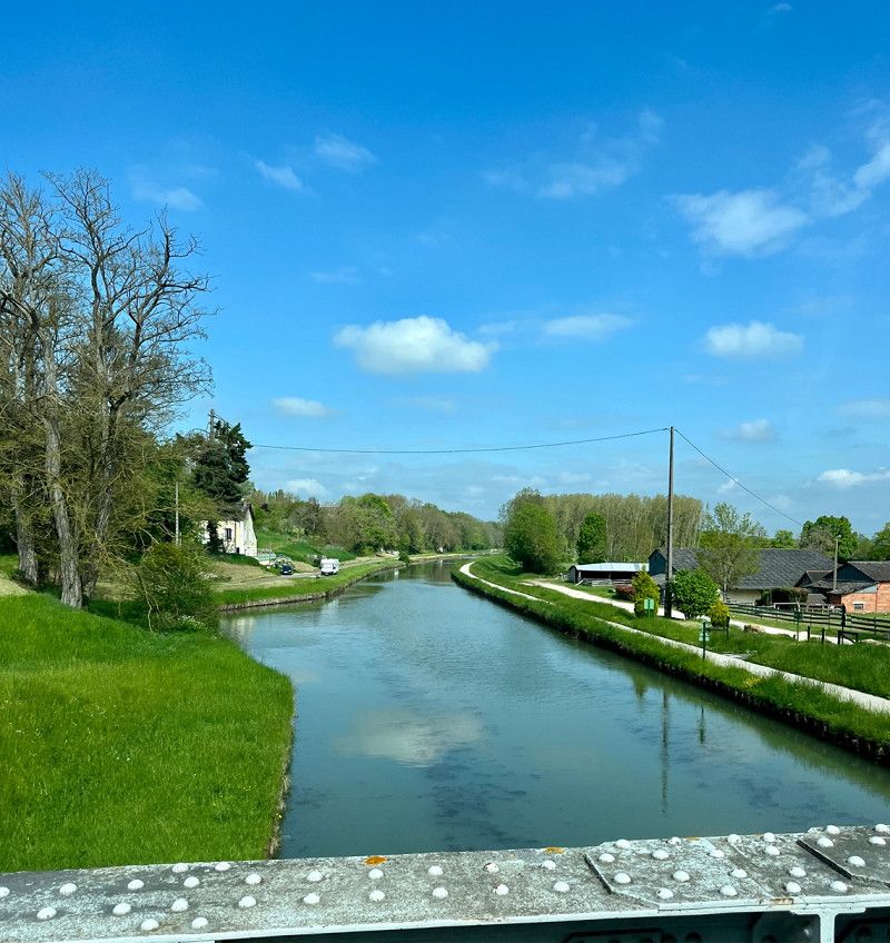
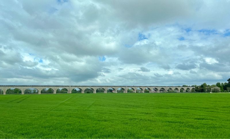
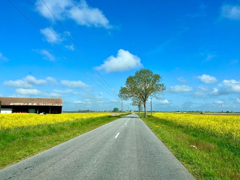
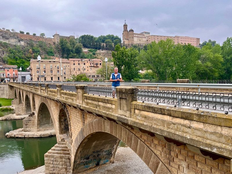
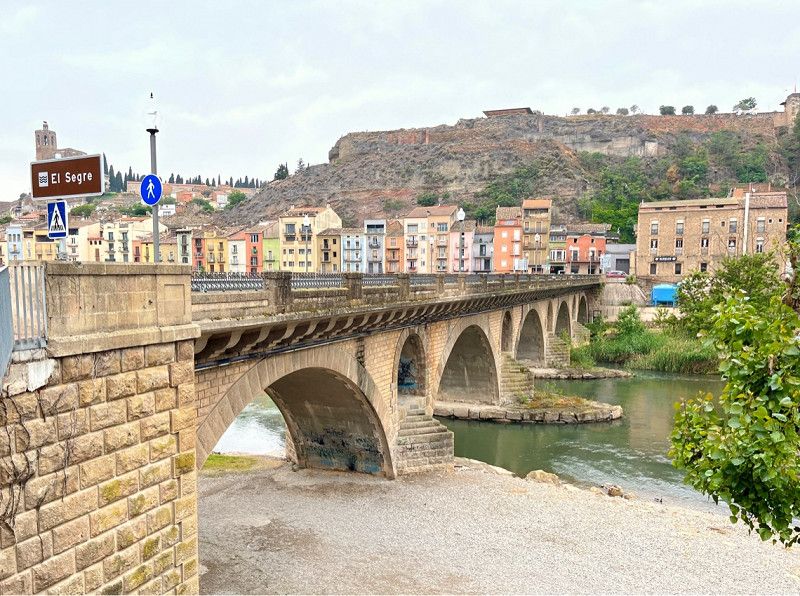
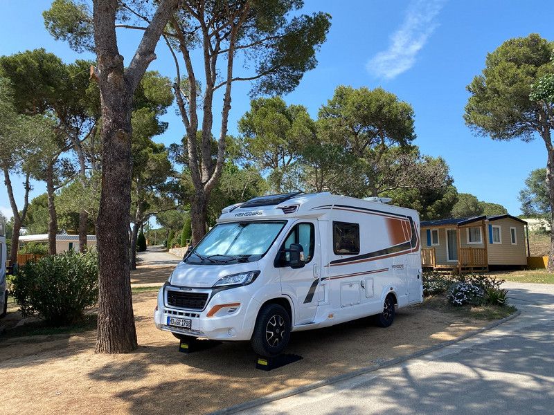
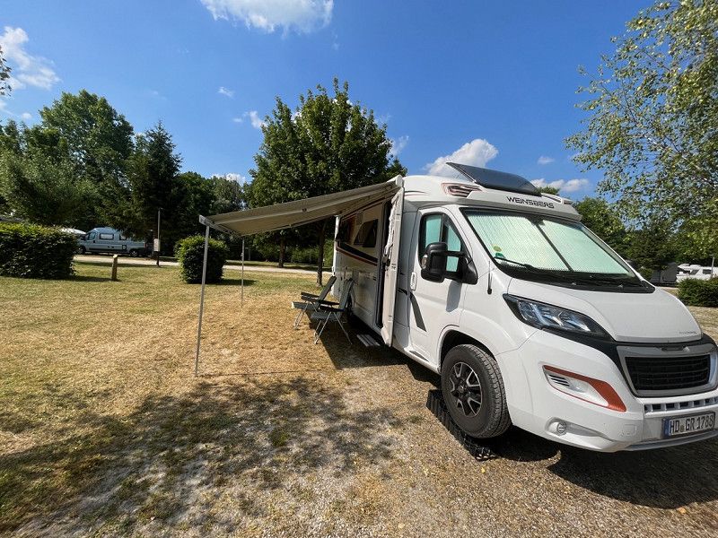
The longing for the sea is great again, of course, the bad weather in Germany also contributed to it. So we pack our camper again, think about the direction in which we are going (of course the weather map is also decisive). We like it very much in France on the Atlantic, as well as in Holland on the North Sea. So we start in the direction of France, with the hope of going to the ☀️. We've always wanted to drive the Loire Valley and now we're going to do it when the weather is good. Unfortunately, the weather on the Atlantic is not what we would like and so we decide to drive towards Spain first.
Day
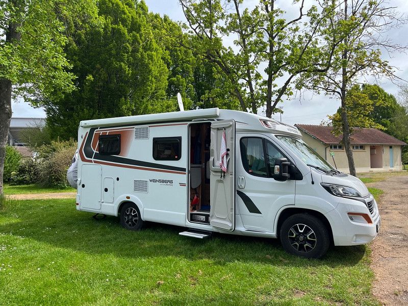
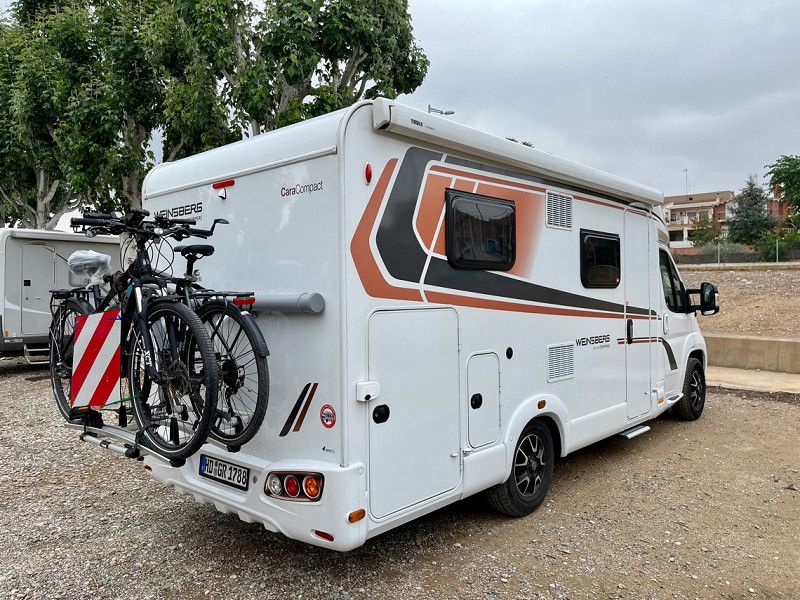
Wald-Michelbach, Deutschland
04/27/2023 Departure
Wald-Michelbach, 69483, Deutschland
49° 34' 24.3" N 8° 49' 22.5" E
49.5734150 8.8229151
• Head toward Ludwigstraße on Schulstraße. Go for 36 m.
• Turn left onto Ludwigstraße (L3120). Go for 1.9 km.
• Pass 2 roundabouts and continue on Weiherer Straße (L3120). Go for 8.5 km.
• Turn left onto Weinheimer Straße (B38) toward Mannheim/Heppenheim. Go for 9.3 km.
• Turn right onto B38 toward Mannheim/Gewerbegebiet W.-West. Go for 1.6 km.
• Continue on A659. Go for 5.6 km.
• Take the exit toward Hannover/Frankfurt/Köln/Saarbrücken onto A6. Go for 2.9 km.
• Take exit 25 toward Saarbrücken/Kaiserslautern/Ludwigshafen onto A6. Go for 131 km.
• Take exit 2 toward Saarbrücken/Gewerbegebiet-Süd. Go for 688 m.
• Take the 2nd exit from roundabout toward A1/A620/Forbach/Saarbrücken. Go for 320 m.
• Take the 3rd exit from roundabout onto Metzer Straße (B41) toward Alt-Saarbrücken. Go for 841 m.
• Turn left. Go for 37 m.
• Arrive at your destination on the left.
☍
163,1 km
(1 hrs. 45 min.)
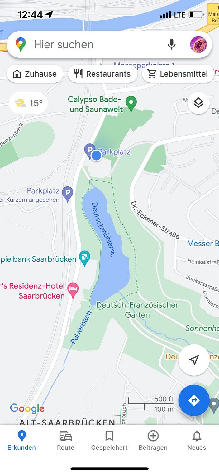
Deutsch-Französischer Garten, Deutschland
Here we take our lunch break after we have filled up very cheaply in Saarbrücken. So in comparison, a liter of diesel cost €1.849 here and €1.509 here. Then we continue in the direction of Nancy. We avoid toll roads again as far as possible.
Ehrentalweg, 66117, Saarbrücken, Deutschland
49° 13' 18" N 6° 58' 16.9" E
49.2216583 6.9713564
• Head toward In der Galgendell. Go for 37 m.
• Turn right onto Metzer Straße (B41). Go for 697 m.
• Turn right toward A6/Metz/Mannheim/Flughafen Saarbrücken. Go for 104 m.
• Take ramp. Go for 247 m.
• Take the 1st exit from roundabout toward Metz/A6/Mannheim/Flughafen Saarbrücken. Go for 295 m.
• Take ramp onto A6 toward Paris/Straßburg/Metz/St. Avold. Go for 1.4 km.
• Continue on A320. Go for 13.5 km.
• Continue on E50 (Échangeur de Freyming). Go for 259 m.
• Take the left exit toward Paris/Metz/St Avold/Carling onto A4 (Autoroute de l'Est). Go for 7.2 km.
• Take exit 37 toward Saint-Avold onto D633. Go for 2.7 km.
• Take the 1st exit from Avenue du Général Patton roundabout onto Avenue du Général Patton (D633) toward St Avold-Centre. Go for 731 m.
• Turn right and take ramp toward Metz/Pont-à-Mousson/Longeville-les-St Avold/Faulquemont/Boulay/Z.I. Furst/Z.I. Actival. Go for 234 m.
• Turn right onto D603. Go for 613 m.
• Pass 3 roundabouts and continue on Route Nationale (D603). Go for 2.7 km.
• Take the 3rd exit from roundabout onto Route de Faulquemont (D910) toward Pont à Mousson/Faulquemont. Go for 11.3 km.
• Arrive at D910.
☍
41,9 km
( 31 min.)
Vahl-lès-Faulquemont, Grand Est, France
D 910, 57380, France
49° 2' 15.5" N 6° 37' 16.7" E
49.0376336 6.6212944
• Head southwest on D910. Go for 1.9 km.
• Pass 2 roundabouts and continue on D910. Go for 14.0 km.
• Take the 1st exit from Rue des Roses roundabout onto Rue des Roses (D999) toward Pont à Mousson/Metz/Remilly. Go for 623 m.
• Turn left onto D910 toward Pont à Mousson/Metz/Béchy. Go for 151 m.
• Keep right onto D910 toward Pont à Mousson/Metz/Béchy. Go for 10.6 km.
• Take the 2nd exit from roundabout onto D910 toward Pont à Mousson/Buchy. Go for 5.4 km.
• Take the 3rd exit from roundabout onto D910 toward Metz/Nancy/Pont à Mousson/Louvigny. Go for 1.5 km.
• Pass 2 roundabouts and continue on D910. Go for 7.1 km.
• Take the 3rd exit from roundabout onto Route Nationale (D910) toward Nancy/Verdun/Pont à Mousson/Lesménils/Z.A. la Louvière. Go for 352 m.
• Take left ramp onto A31 toward Nancy. Go for 13.6 km.
• Take exit 25 toward Belleville/Dieulouard onto D657 (Route Nationale 57). Go for 3.9 km.
• Turn left onto Avenue Charles Roth (D611) toward Toul/Domèvre en H./Rosières en H./Stade M. Crusem. Go for 22.0 km.
• Continue on Avenue Albert 1er (D111). Go for 335 m.
• Take the 2nd exit from roundabout onto Avenue du Colonel Péchot (D111). Go for 625 m.
• Take the 4th exit from roundabout onto Avenue Victor Hugo (D400). Go for 407 m.
• Turn sharp left onto Rue Monseigneur Maillet. Go for 28 m.
• Turn left onto Rue Monseigneur Maillet. Go for 69 m.
• Arrive at Rue Monseigneur Maillet. Your destination is on the left.
☍
82,6 km
(1 hrs. 12 min.)
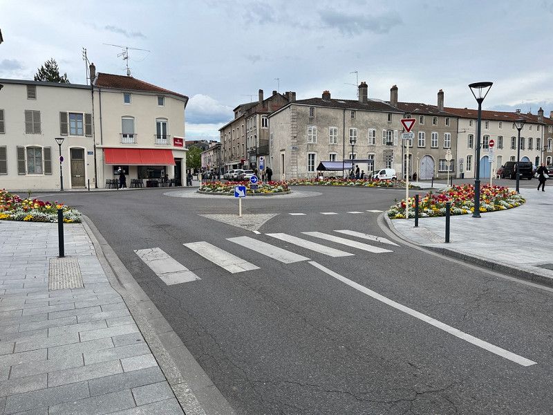
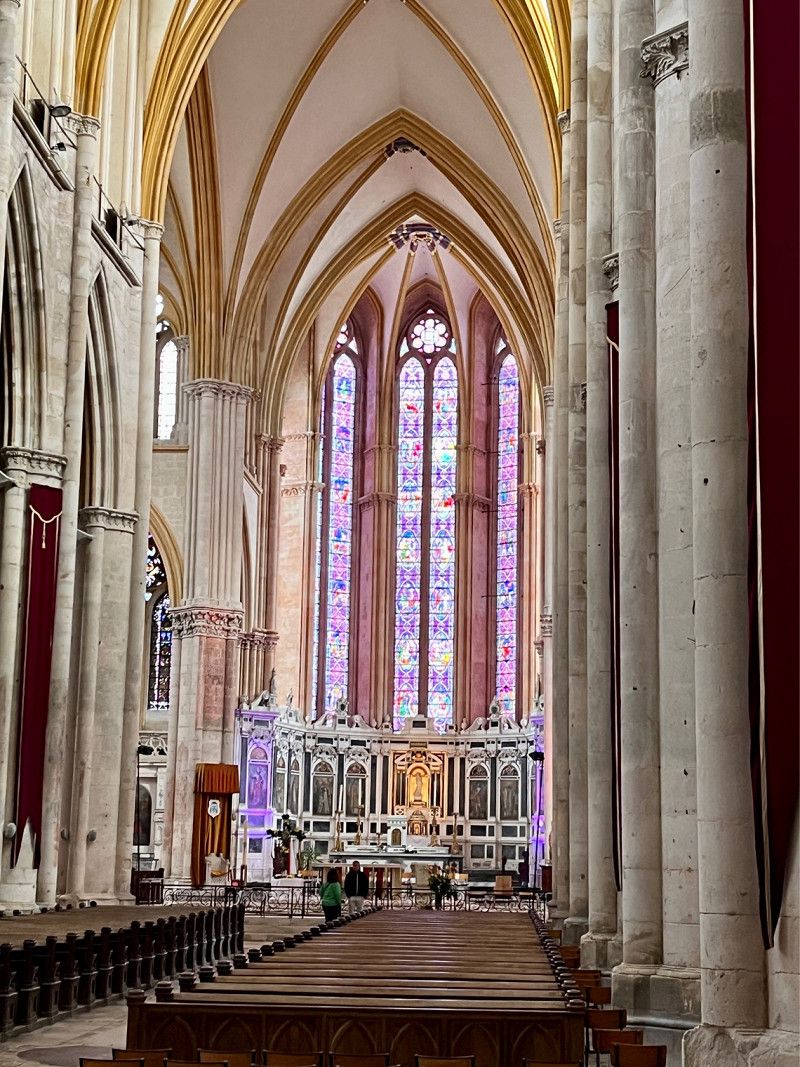
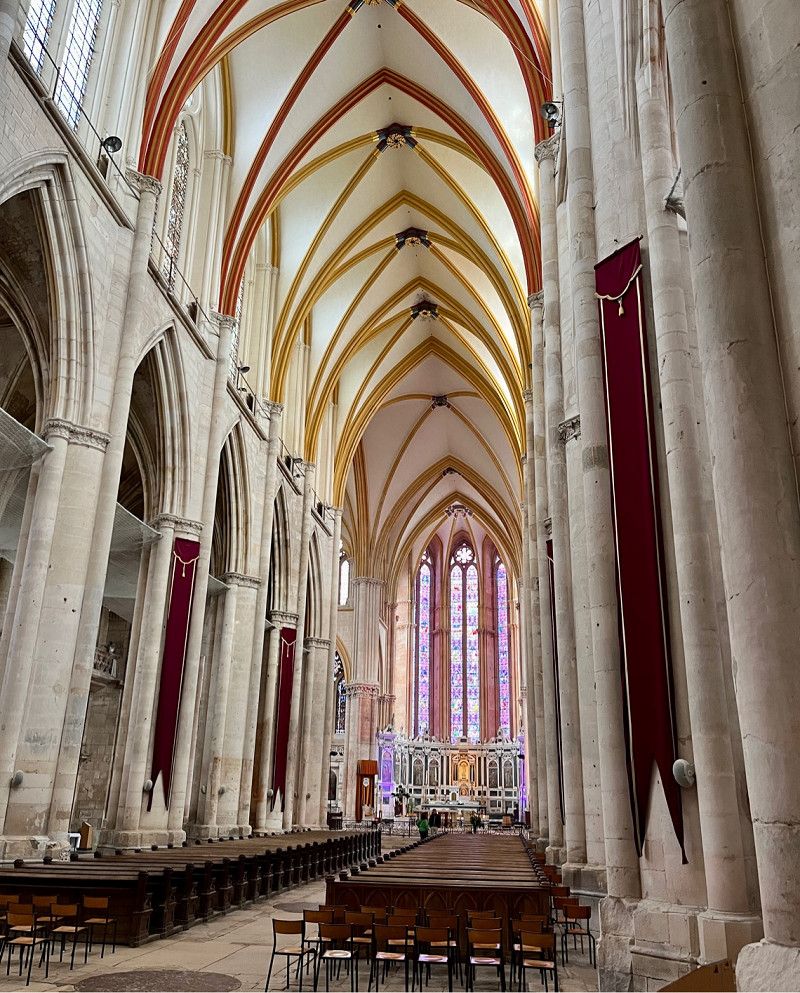
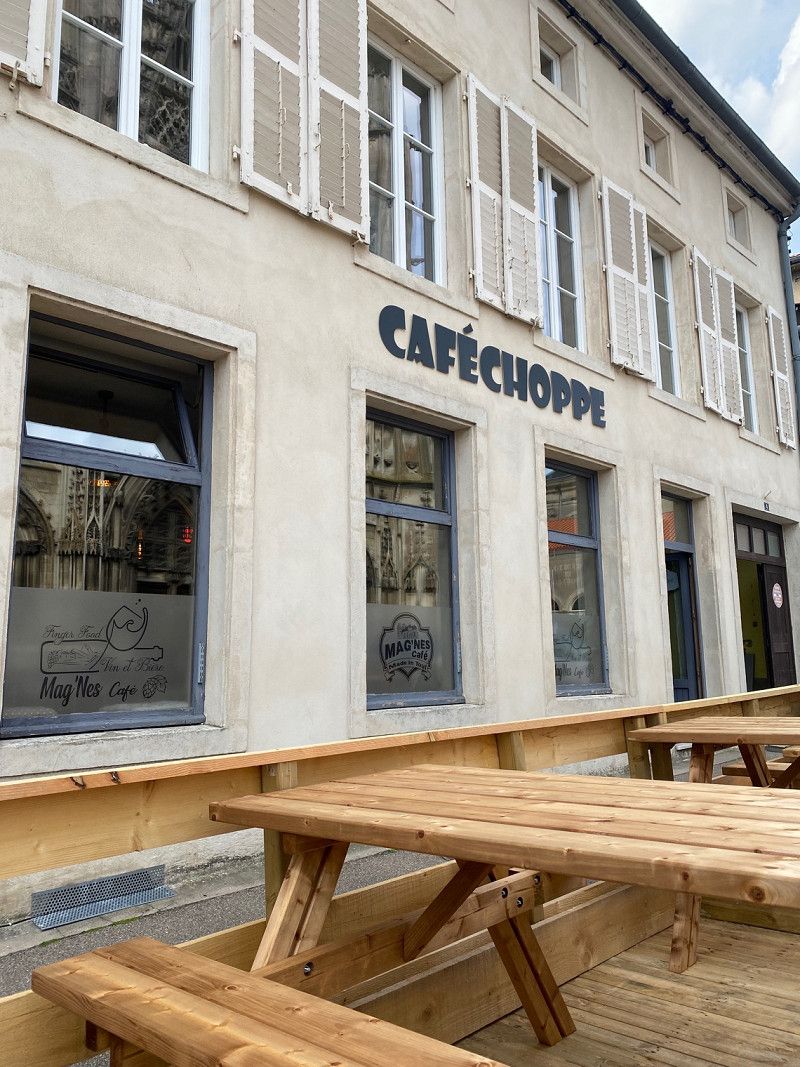
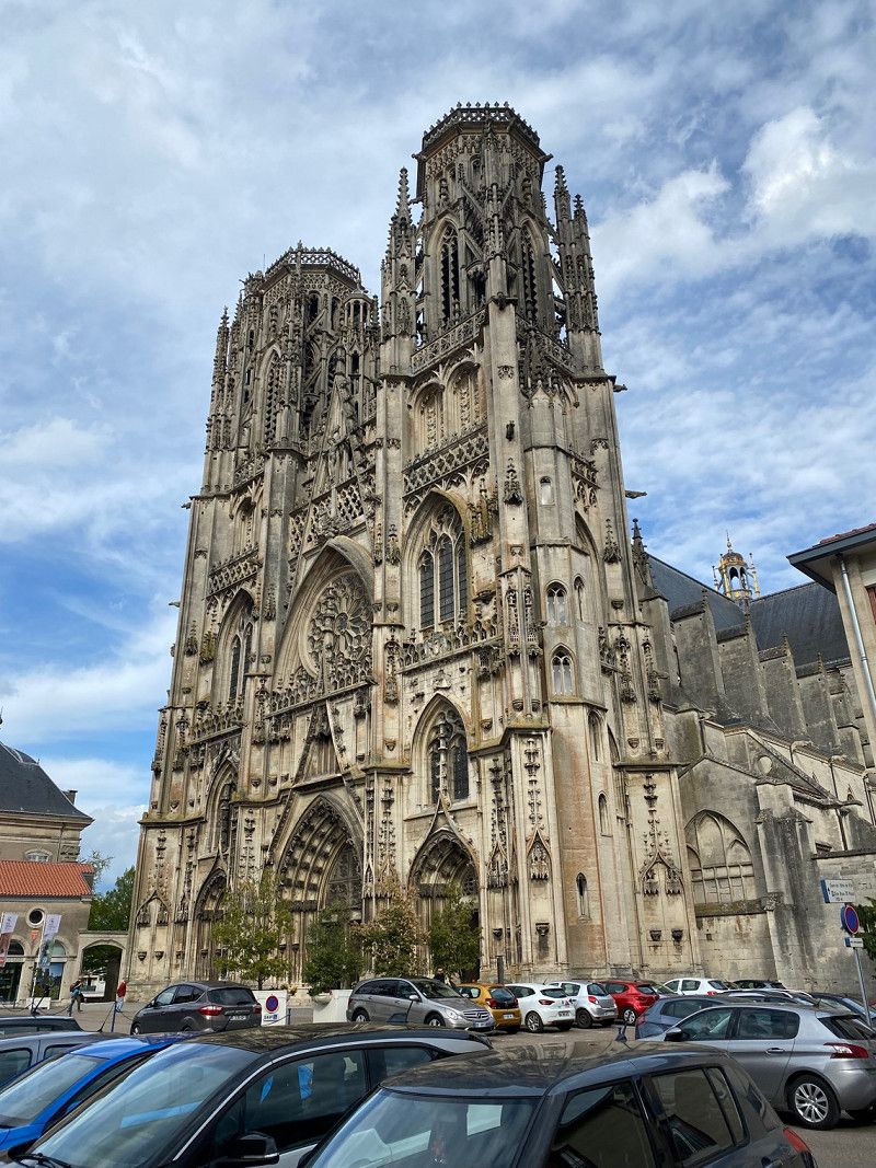
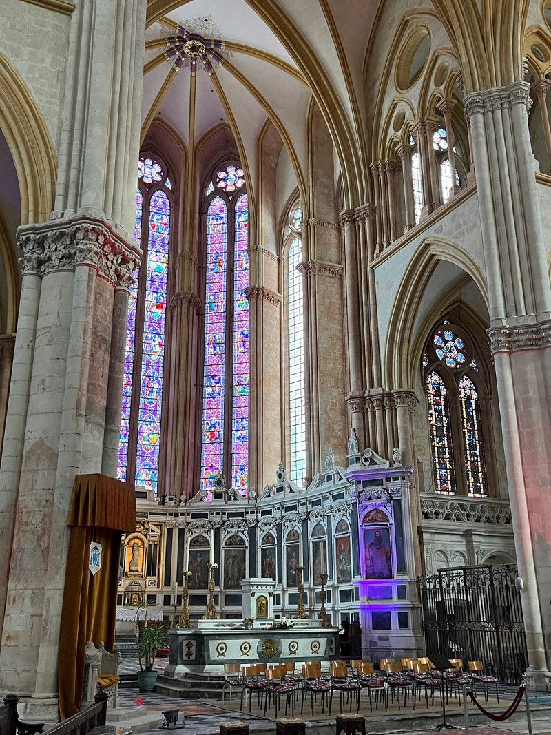
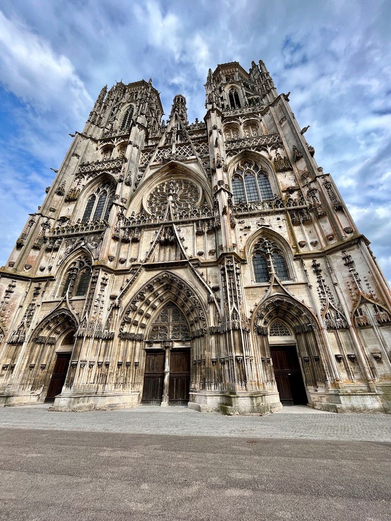
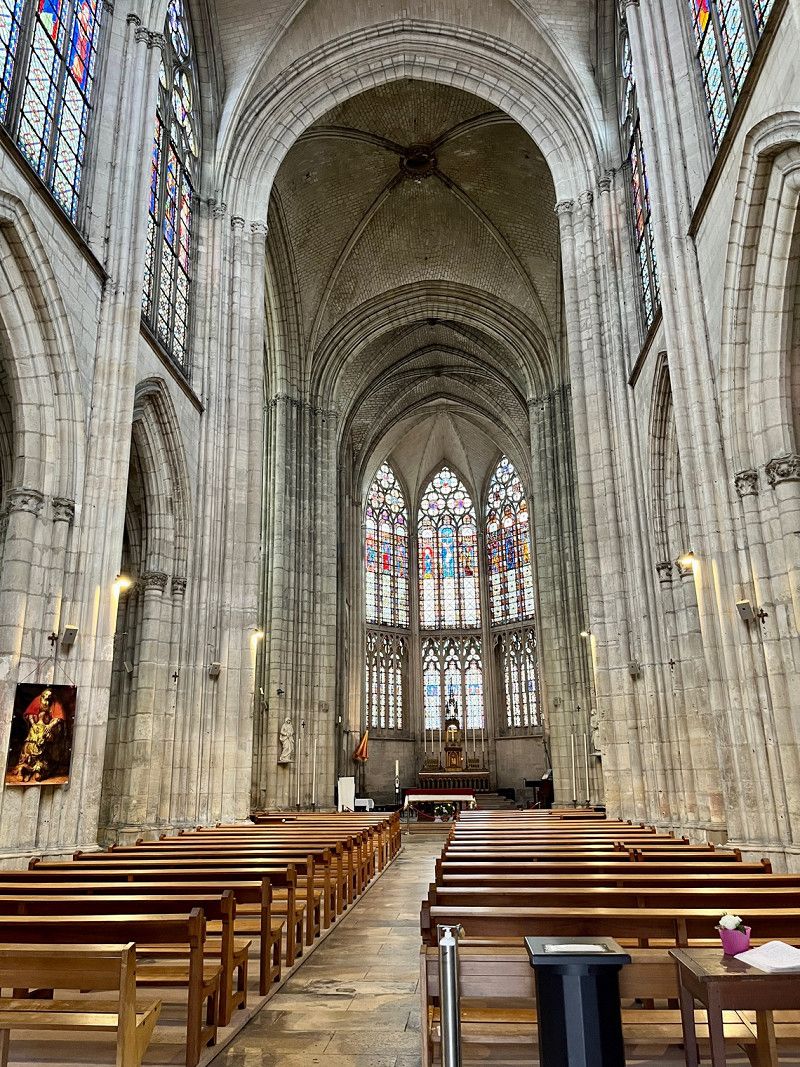
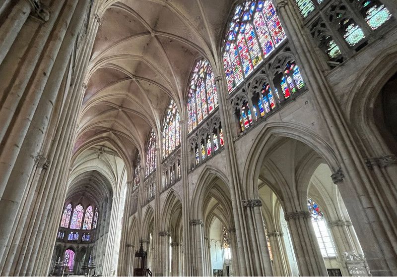
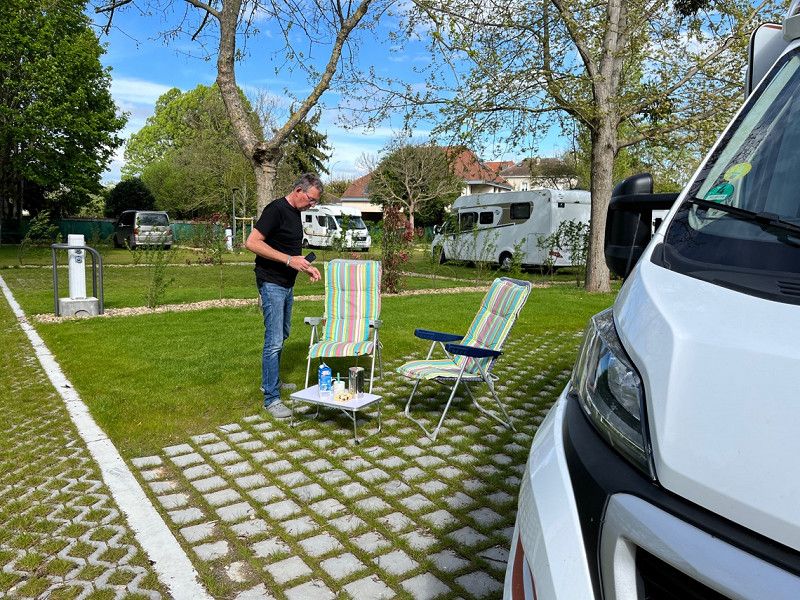
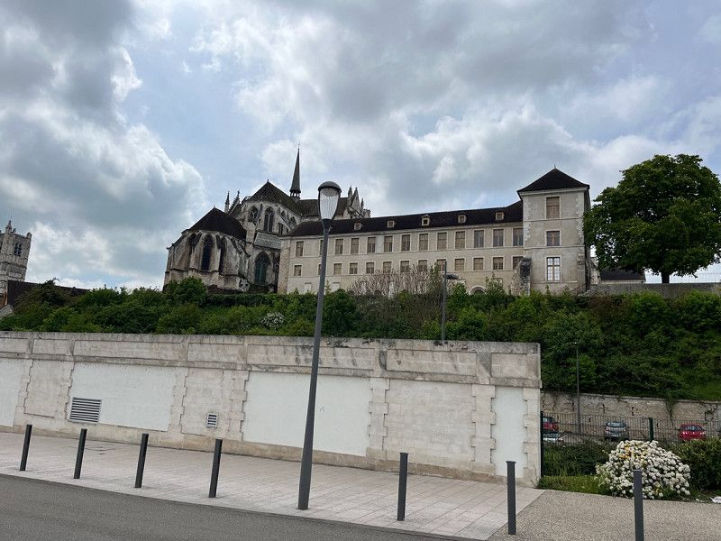
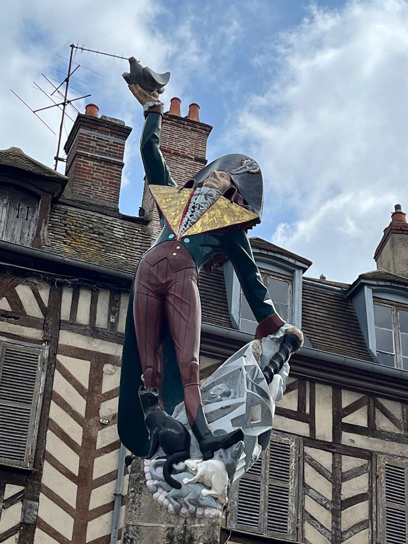
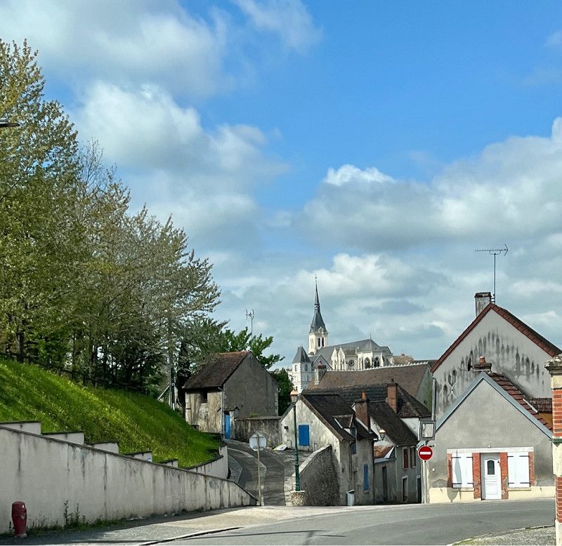
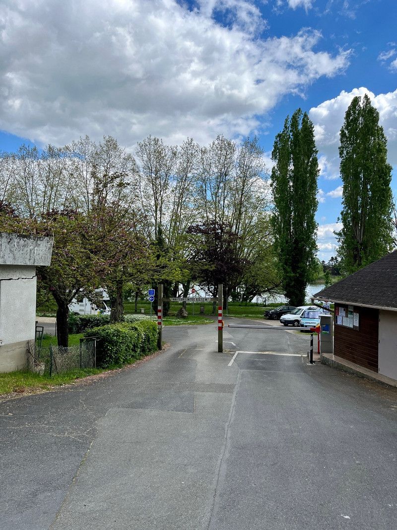
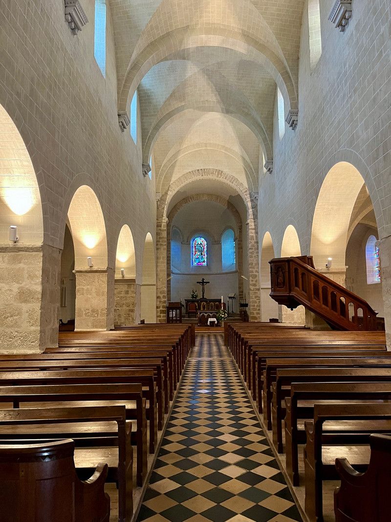
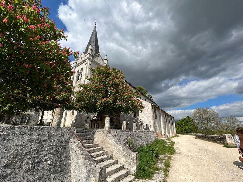
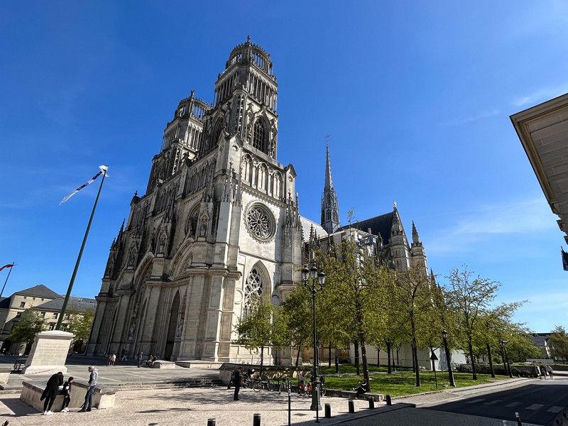
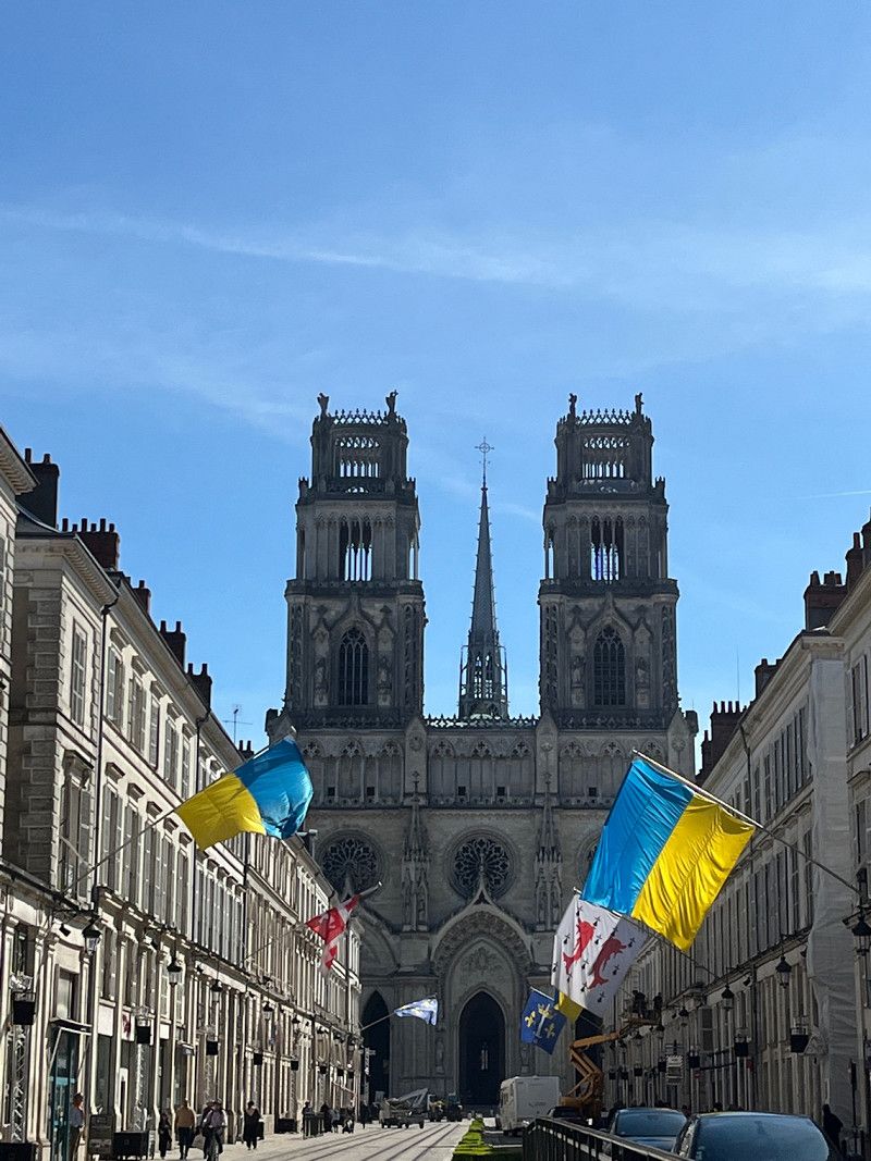
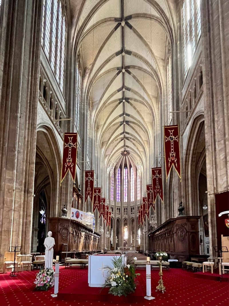
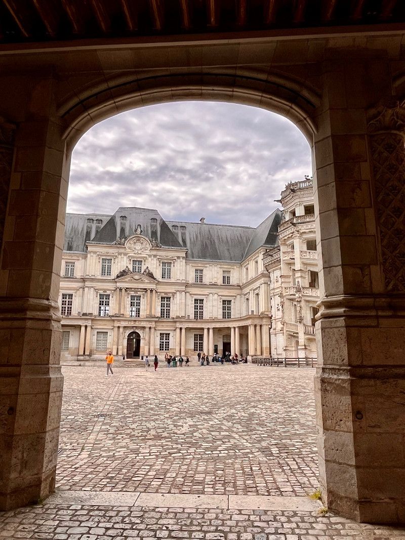
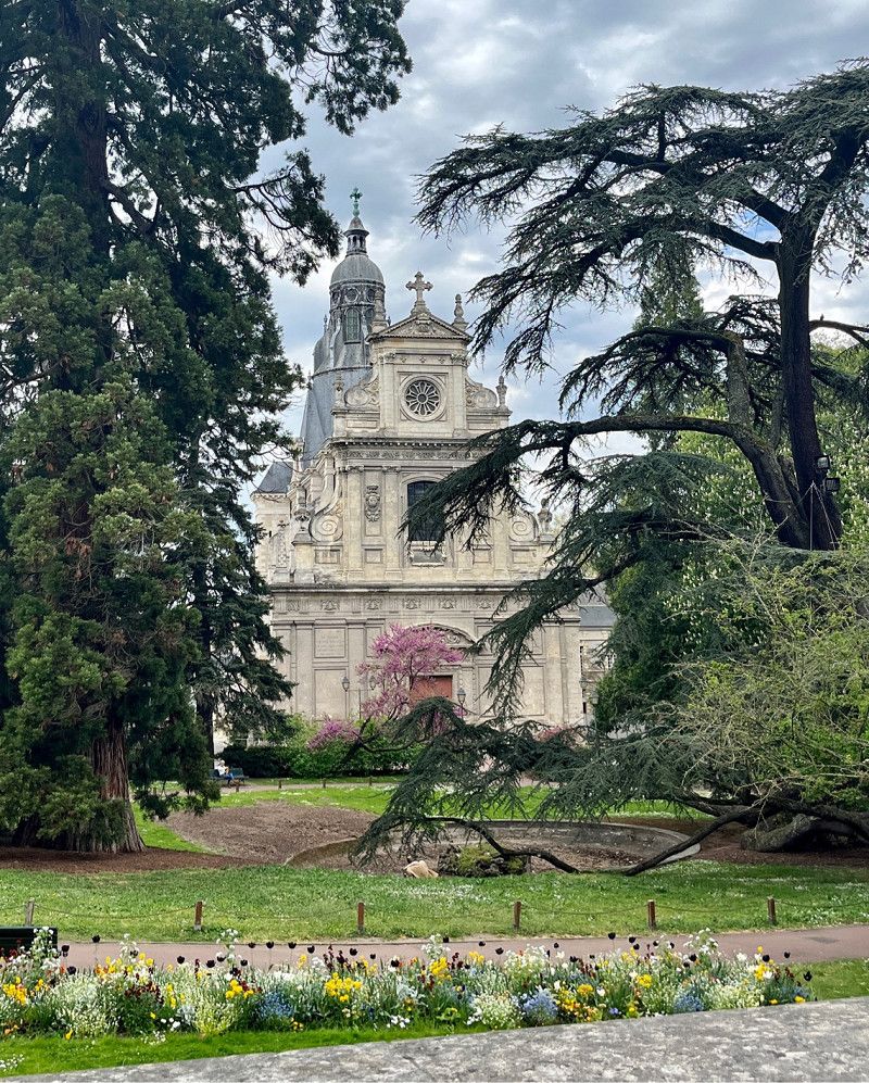
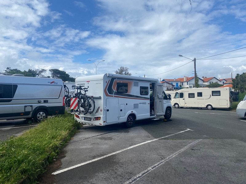
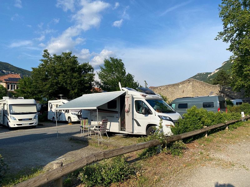
Toul, Grand Est, France
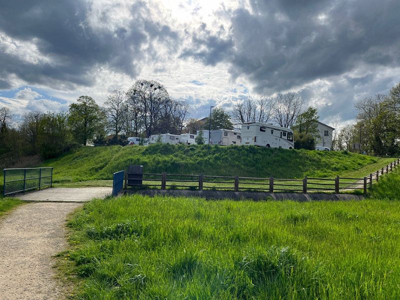
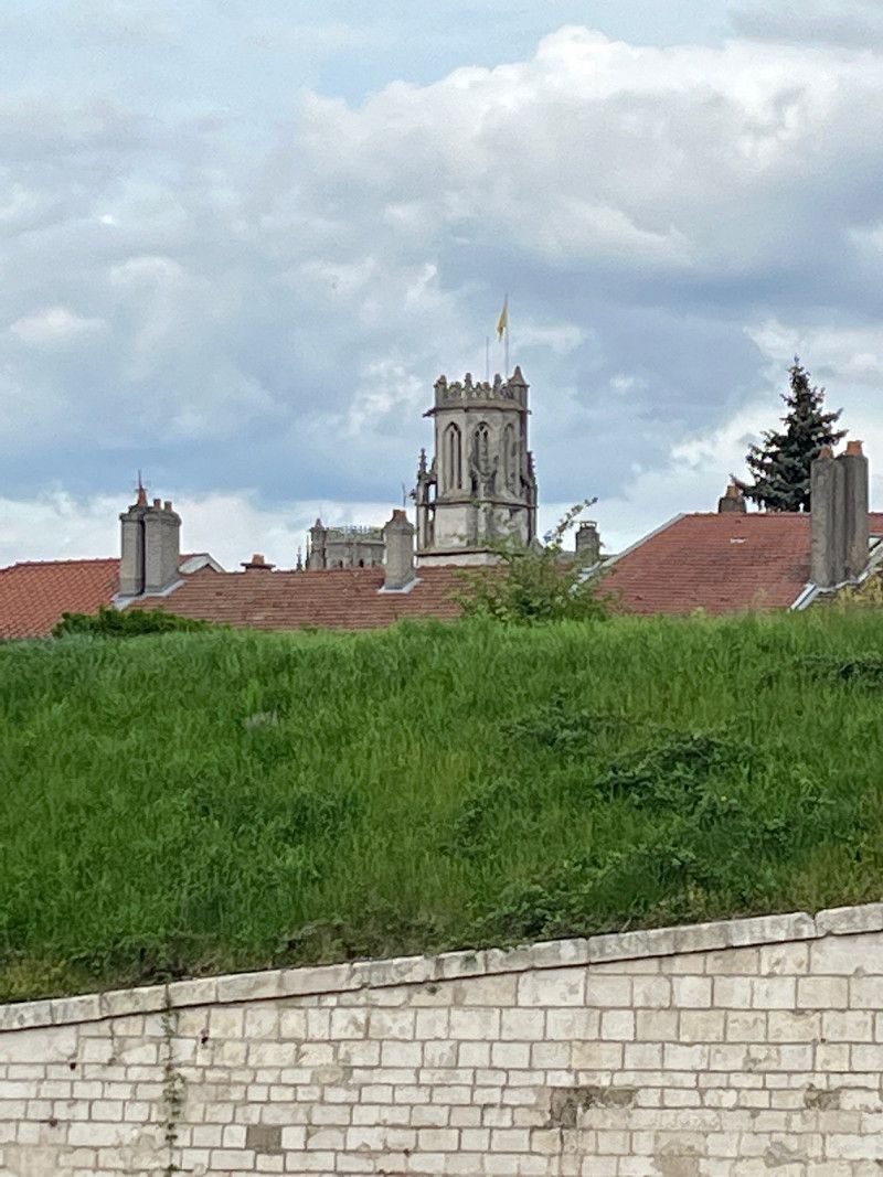
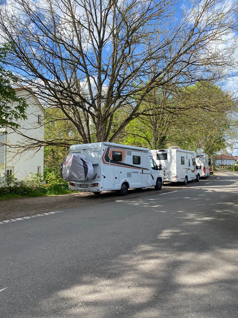
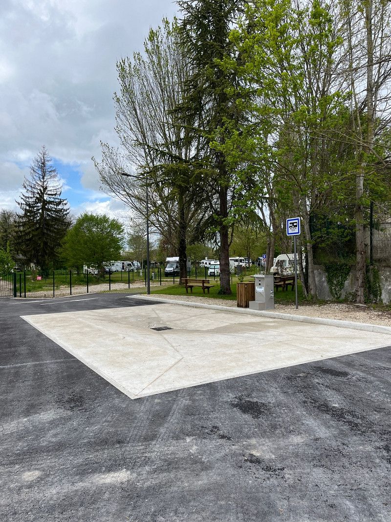
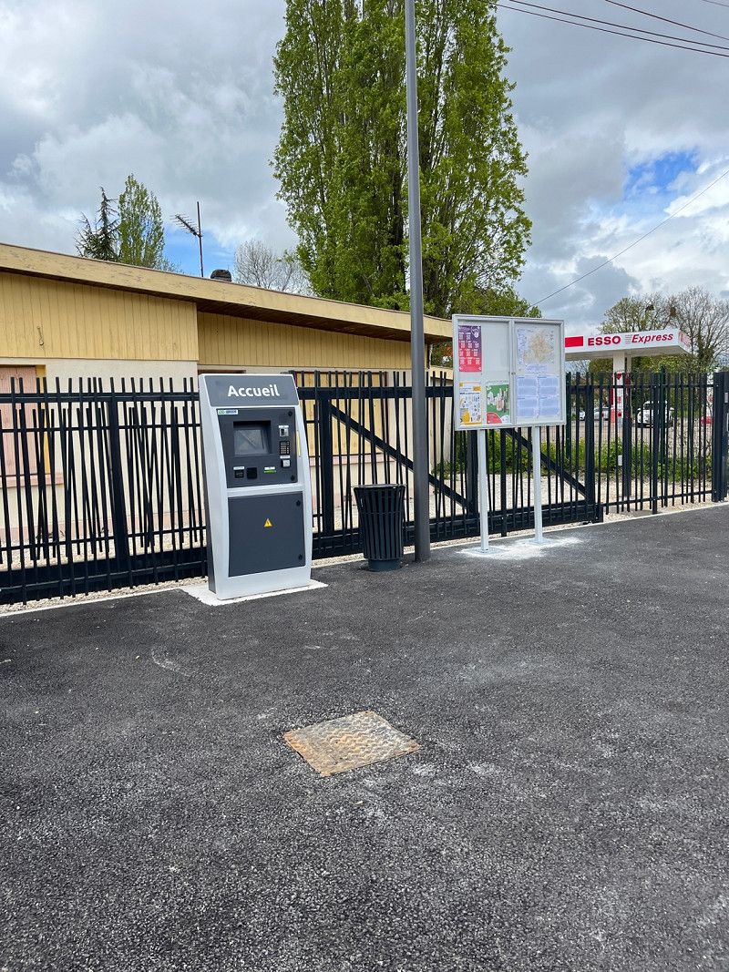
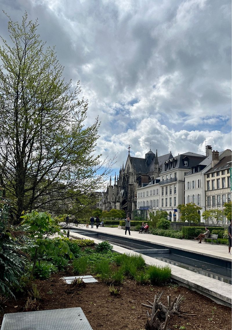
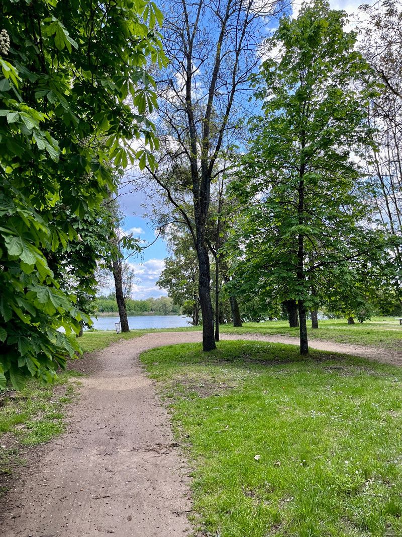
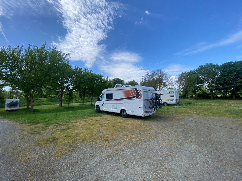
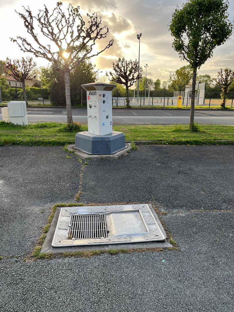
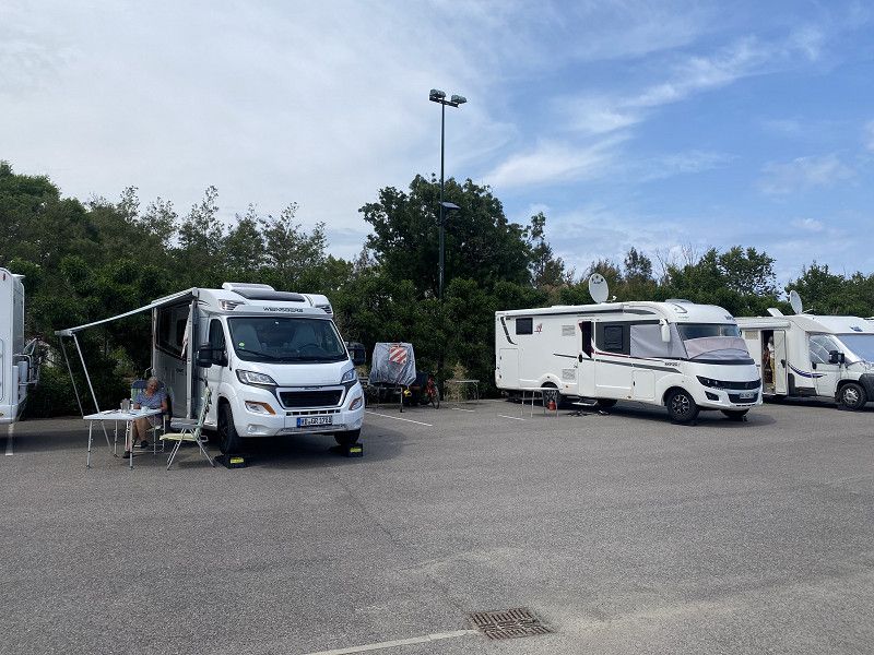
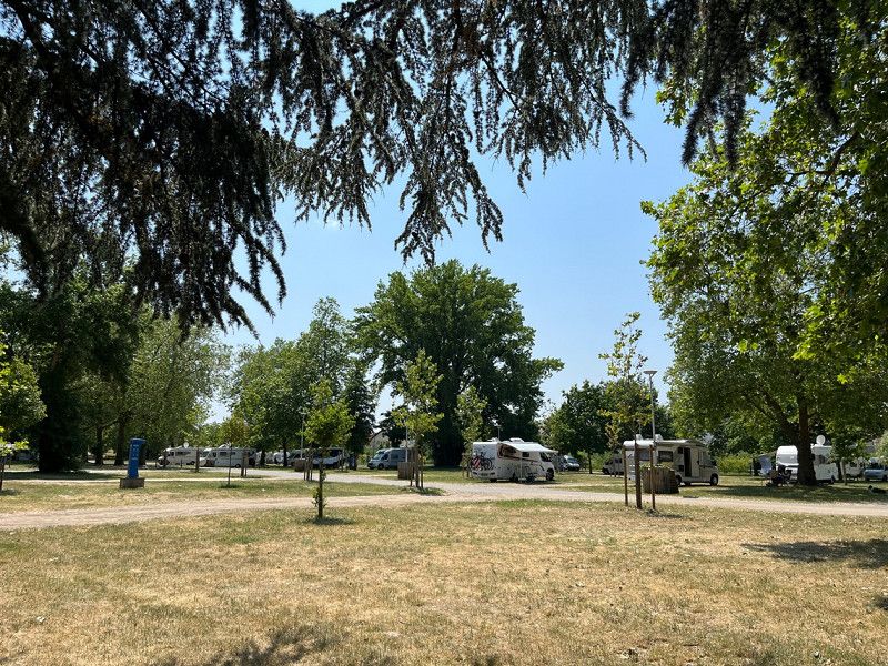
Here we find an SP for 12 vehicles via the park4night app. Now let's hope we get a place. It's already late afternoon and we get the penultimate place.
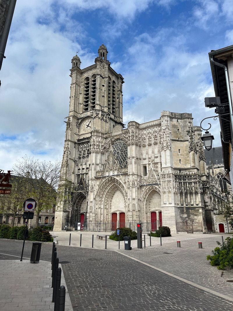
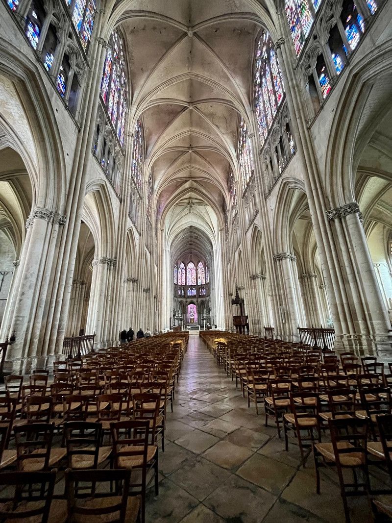
The SP is for €7/night including electricity and V&E. Then we walk into town via a "hiking trail" to the left of the parking space. Visit the Saint Étienne Cathedral and have a coffee there. In the evening we plan our further journey for tomorrow.
• Z
About the weather: sun and clouds
• Regarding the weather: there is supposed to be a thunderstorm this afternoon, otherwise there will be sun and clouds alternately, the temperature will be a pleasant 18°
38, Rue Monseigneur Maillet, Résidence Port de France, Saint-Mansuy, Toul, Meurthe-et-Moselle, Grand Est, Metropolitan France, 54200, France
48° 40' 34.8" N 5° 53' 3.2" E
48.6763283 5.8842148
• Head north on Rue Monseigneur Maillet. Go for 38 m.
• Turn left onto Rue Monseigneur Maillet. Go for 93 m.
• Turn right onto Rue Monseigneur Maillet. Go for 80 m.
• Turn slightly right onto Boulevard de Pinteville (D960). Go for 416 m.
• Turn right onto Rue Albert Denis (D960) toward Chaumont/Dijon/St Dizier/Vaucouleurs/St Evre. Go for 117 m.
• Turn right onto Rue Albert Denis (D960). Go for 605 m.
• Take the 2nd exit from roundabout onto Avenue 1ère Armée Française 1944-1945 (D960). Go for 1.9 km.
• Take ramp onto N4 toward Bar-le-Duc/St Dizier. Go for 83.1 km.
• Take ramp onto Rue de l'Europe toward Perthes/Ambrières/Sapignicourt. Go for 534 m.
• Turn left onto C4. Go for 183 m.
• Turn right onto Route de Sapignicourt (D660). Go for 487 m.
• Continue on D660. Go for 15 m.
• Turn left onto Route de Sapignicourt (D660). Go for 223 m.
• Continue on D660. Go for 24 m.
• Continue on Rue de Perthes (D660). Go for 363 m.
• Continue on Grande Rue (D660). Go for 739 m.
• Continue on D660. Go for 7.1 km.
• Continue on Rue de Saint-Dizier (D660). Go for 214 m.
• Turn left onto Rue des Dames (D59). Go for 342 m.
• Continue on Rue du Lavoir (D59). Go for 401 m.
• Turn left onto D13. Go for 1.1 km.
• Turn right onto Rue de Saint-Rémy (D57). Go for 737 m.
• Continue on D57. Go for 3.3 km.
• Turn left onto D57. Go for 604 m.
• Continue on Rue de Moncetz (D57). Go for 853 m.
• Turn right onto Grande Rue (D57). Go for 410 m.
• Continue on D57. Go for 830 m.
• Turn left onto D256. Go for 1.8 km.
• Continue on Rue du Lac (D256). Go for 1.6 km.
• Continue on Lieu-dit Les Hurets (D256). Go for 141 m.
• Continue on Rue du Lac (D256). Go for 581 m.
• Turn left onto Rue du Lac (D56). Go for 87 m.
• Continue on Rue Sainte-Pétronille (D56). Go for 316 m.
• Continue on D56. Go for 1.2 km.
• Turn right onto D78. Go for 722 m.
• Turn left onto D396. Go for 5.5 km.
• Turn right onto D455. Go for 1.6 km.
• Continue on D355. Go for 109 m.
• Continue on Rue de l'Église (D355). Go for 925 m.
• Continue on Rue de Saint-Léger (D355). Go for 497 m.
• Continue on Rue de Saint-Léger-sous-Margerie (D355). Go for 872 m.
• Continue on Lieu-dit L'Espérance (D355). Go for 36 m.
• Continue on Rue Principale (D156). Go for 2.2 km.
• Continue on Lieu-dit Plaisance (D156). Go for 66 m.
• Continue on D156. Go for 470 m.
• Continue on Lieu-dit Suzémont (D156). Go for 139 m.
• Continue on D156. Go for 756 m.
• Continue on Rue de Saint-Léger (D156). Go for 191 m.
• Continue on Rue du Colonel de Bange (D56). Go for 622 m.
• Continue on Chemin de Donnement (D56). Go for 846 m.
• Continue on Rue de Saint-Armand (D56). Go for 502 m.
• Continue on Rue du Bois Mary (D56). Go for 1.3 km.
• Continue on D56. Go for 1.9 km.
• Continue on Grande Rue (D56). Go for 1.5 km.
• Continue on D56. Go for 737 m.
• Turn left onto D133. Go for 1.2 km.
• Continue on Lieu-dit Sainte-Thuise (D133). Go for 805 m.
• Continue on D133. Go for 1.8 km.
• Continue on Rue du Moulin (D5). Go for 500 m.
• Turn right onto Grande Rue (D441). Go for 335 m.
• Turn left onto D5. Go for 102 m.
• Continue on Lotissement Les Brichards (D5). Go for 39 m.
• Continue on D5. Go for 855 m.
• Continue on Route de Troyes (D5). Go for 4.3 km.
• Continue on D5. Go for 4.6 km.
• Continue on Lieu-dit Mortée (D5). Go for 62 m.
• Continue on D5. Go for 5.1 km.
• Continue on Rue des Commandos "M" (D5). Go for 3.6 km.
• Continue on Lieu-dit Montmoret (D5). Go for 141 m.
• Continue on Route de Luyeres (D5). Go for 2.8 km.
• Continue on Rue Saint-Louis (D5). Go for 13 m.
• Continue on Rue de la République (D5). Go for 1.7 km.
• Turn right onto Route Claude Bertrand (D960). Go for 328 m.
• Take the 3rd exit from roundabout onto D960 toward A5/Paris/Lyon/Troyes/Chaumont. Go for 398 m.
• Take the 2nd exit from roundabout onto Avenue Jules Guesde (D960). Go for 1.7 km.
• Continue on Place Charles de Gaulle. Go for 31 m.
• Arrive at Place Charles de Gaulle. Your destination is on the right.
☍
162,2 km
(2 hrs. 6 min.)
Day
Rue Roger Salengro, Frankreich
04/28/2023
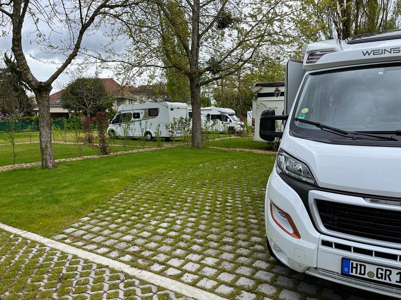
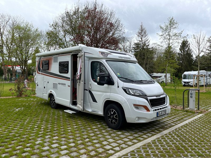
New pitch, spacious pitches with electricity, €12/night including tourist tax. V&E possible, waste disposal. Next door there is an Aldi and a bus stop. We took bus 1 into town.
Rue Roger Salengro, 10150, Pont-Sainte-Marie, Frankreich
48° 18' 50.8" N 4° 5' 54.7" E
48.3141088 4.0985357
• Head southwest on Place Charles de Gaulle. Go for 8 m.
• Continue on Rue Roger Salengro. Go for 451 m.
• Continue on Avenue Robert Schuman. Go for 662 m.
• Continue on Carrefour de l'Europe. Go for 61 m.
• Continue on Avenue du 1er Mai. Go for 372 m.
• Turn right onto Cours Jacquin. Go for 610 m.
• Continue on Boulevard Danton. Go for 427 m.
• Take the 2nd exit from roundabout onto Quai de Dampierre. Go for 150 m.
• Take the 1st exit from roundabout onto Boulevard Gambetta. Go for 264 m.
• Turn left toward Place Jean Moulin. Go for 66 m.
• Turn right onto Rue de la République. Go for 218 m.
• Continue on Place Maréchal Foch. Go for 49 m.
• Turn right onto Rue Urbain IV. Go for 34 m.
• Turn right onto Place Maréchal Foch. Go for 21 m.
• Arrive at Place Maréchal Foch. Your destination is on the right.
☍
3,4 km
( 7 min.)
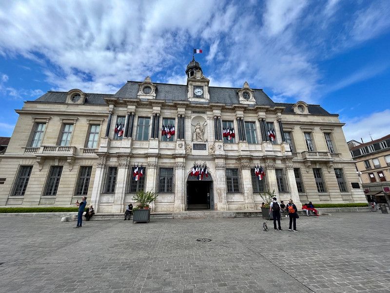
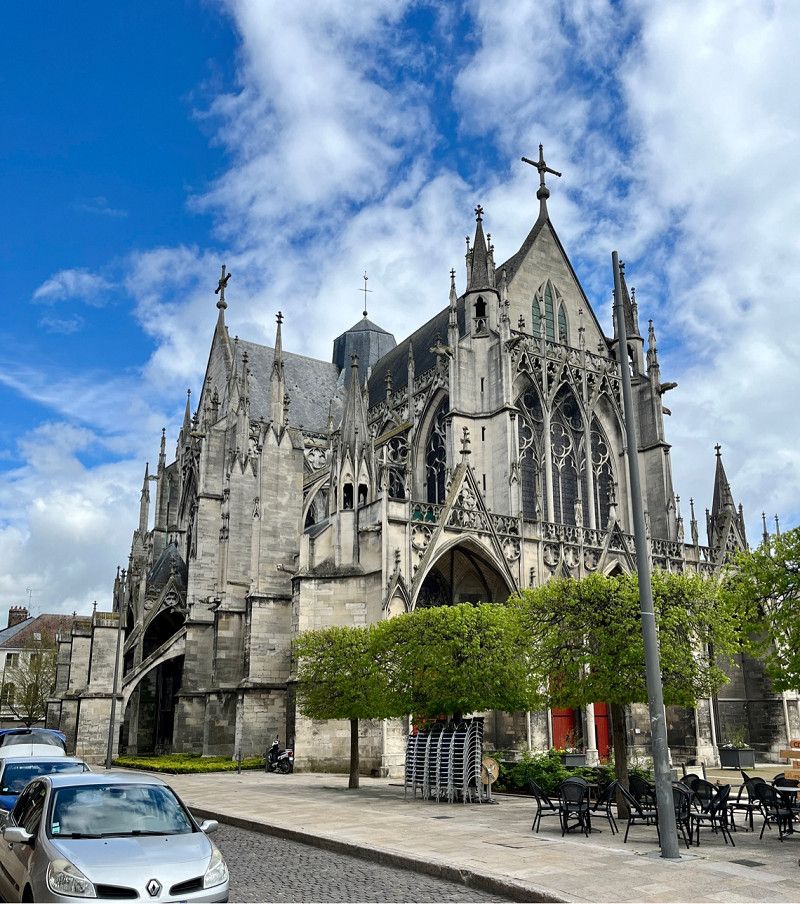
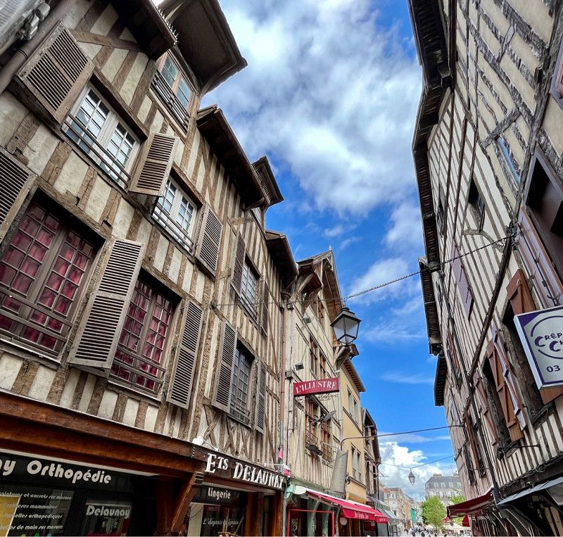
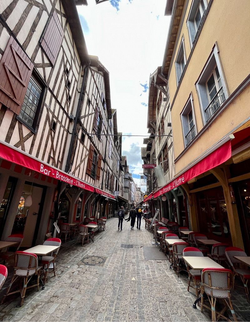
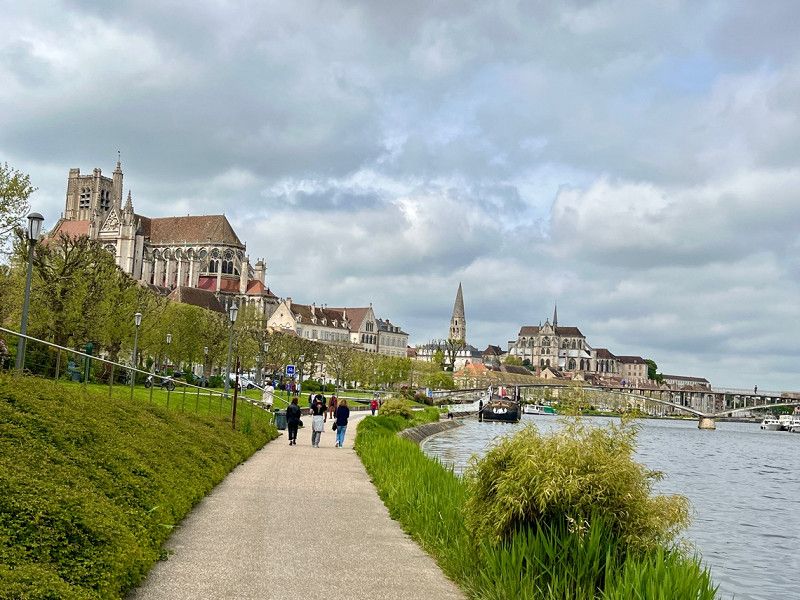
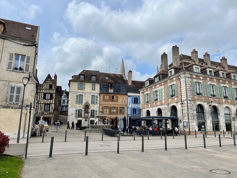
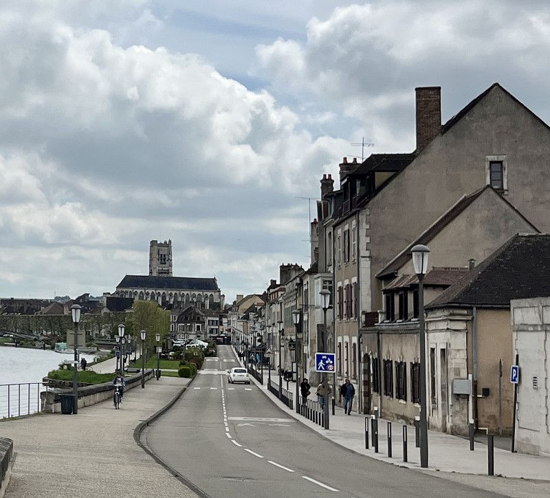
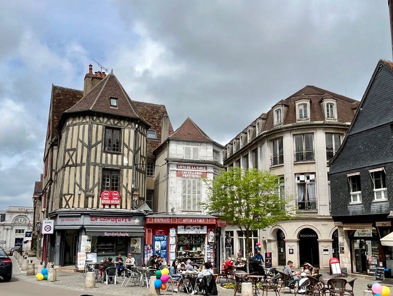
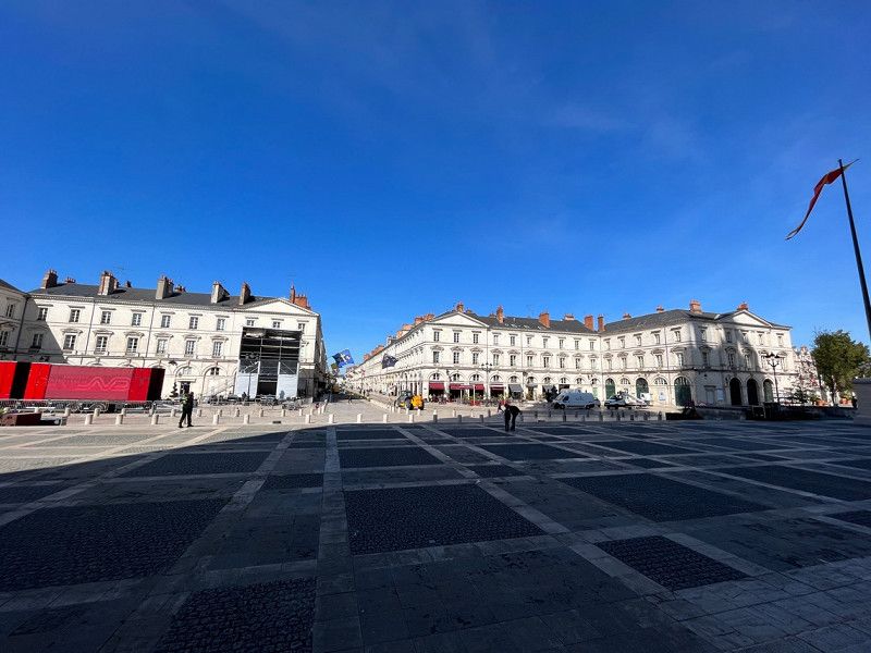
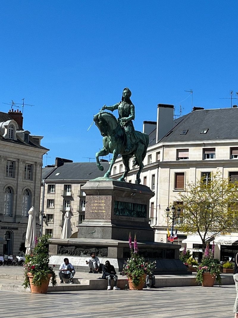
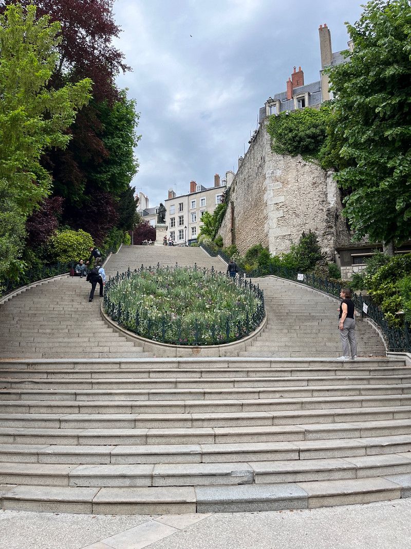
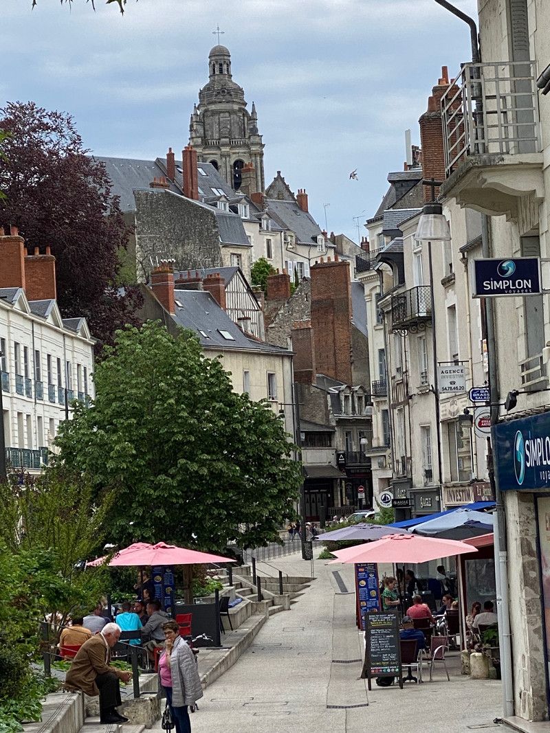
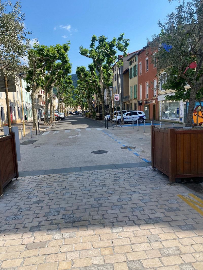
Troyes, Frankreich
Troyes is an old town with many churches and old half-timbered houses, a pedestrian street with many shops. It's worth a visit!
• Regarding the weather: there is a lot of sun today, the temperature is a pleasant 18°
Troyes, 10000, Frankreich
48° 17' 49.8" N 4° 4' 28.7" E
48.2971626 4.0746257
• Head toward Place Alexandre Israël on Place Maréchal Foch. Go for 37 m.
• Turn slightly right onto Rue Aristide Briand. Go for 95 m.
• Turn left onto Rue Claude Huez. Go for 53 m.
• Continue on Rue Charbonnet. Go for 108 m.
• Continue on Rue du Palais de Justice. Go for 240 m.
• Turn left onto Rue Jaillant Deschaînets. Go for 102 m.
• Turn right onto Rue Colonel Driant. Go for 98 m.
• Continue toward Boulevard Victor Hugo. Go for 42 m.
• Take the 3rd exit from Place du Général Patton roundabout onto Boulevard Victor Hugo. Go for 529 m.
• Continue on Boulevard Général Charles Delestraint. Go for 452 m.
• Continue on Rue Pierre Gillon. Go for 174 m.
• Turn right onto Avenue Anatole France. Go for 1.1 km.
• Pass 2 roundabouts and continue on Route d'Auxerre (N77). Go for 3.0 km.
• Take the 3rd exit from roundabout onto Rue de Troyes (N77) toward Auxerre/St Florentin/Bouilly. Go for 43.7 km.
• Turn right onto Route de la Gare (D43) toward Vérigny. Go for 1.5 km.
• Continue on Rue Bernard Liège (D43). Go for 530 m.
• Continue on Rue Bernard Liège (D43). Go for 714 m.
• Turn left onto D203. Go for 312 m.
• Continue on Chemin d'Auxerre à Saint-Florentin (D203). Go for 5.1 km.
• Continue on Route d'Auxerre à Saint-Florentin (D203). Go for 964 m.
• Continue on Rue d'Auxerre (D203). Go for 130 m.
• Continue on Rue de Saint-Florentin (D203). Go for 2.7 km.
• Take the 2nd exit from roundabout onto Rue de Sougères (D203). Go for 450 m.
• Continue on Route d'Auxerre à Saint-Florentin (D203). Go for 3.1 km.
• Continue on D203. Go for 866 m.
• Continue on Route d'Auxerre à Saint-Florentin (D203). Go for 489 m.
• Continue on Rue Saint-Laurent-Sougères (D203). Go for 70 m.
• Take the 1st exit from roundabout onto Rue Saint-Laurent-Sougères (D203). Go for 550 m.
• Continue on Route d'Auxerre à Saint-Florentin (D203). Go for 2.0 km.
• Turn right onto Route d'Auxerre à Châlons-sur-Marne (N77). Go for 2.4 km.
• Take the 3rd exit from roundabout onto Avenue Jean Mermoz (N77) toward Z.I. Champoulains/Auxerrexpo/Nevers/Auxerre Centre/Z.I. les Champoulains. Go for 904 m.
• Keep left onto Avenue Jean Mermoz (N77) toward A6 (Sud)/Centre Ville. Go for 1.9 km.
• Take the 2nd exit from roundabout onto Place Jean Jaurès (N151) toward Nevers/Bourges/Orléans/Centre Ville. Go for 129 m.
• Turn left onto Quai de la République (N151) toward Nevers/Bourges/Orléans. Go for 308 m.
• Turn left onto Rue de Preuilly (D163). Go for 486 m.
• Continue on Rue de Preuilly (D163) toward Vaux. Go for 302 m.
• Continue on Route de Vaux (D163). Go for 578 m.
• Turn right onto Route de Vaux. Go for 224 m.
• Arrive at Route de Vaux.
☍
76,6 km
(1 hrs. 21 min.)
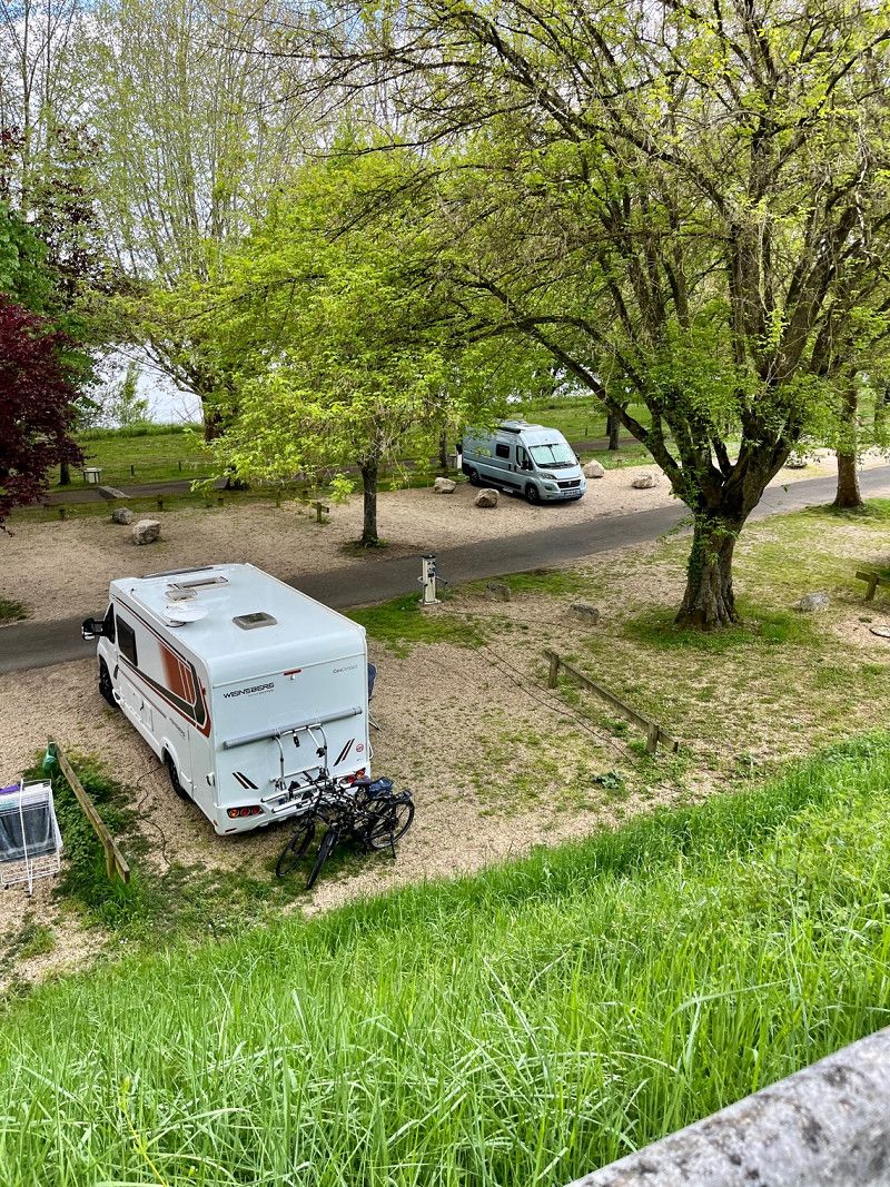
Day
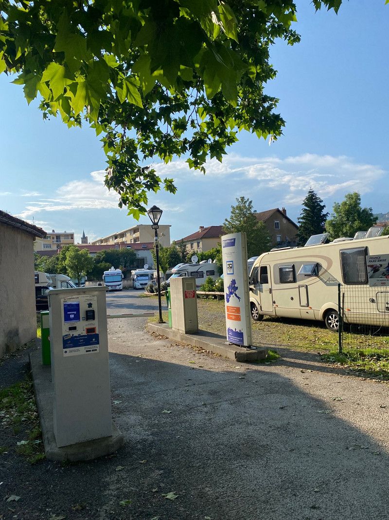
Camping Municipal d'Auxerre, Frankreich
04/29/2023
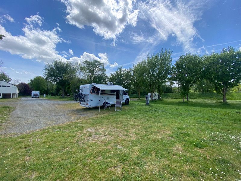
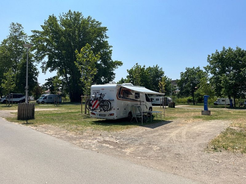
Small CP with ACSI card for €15 plus tourist tax/night.
Large pitches with trees, bread service, heated sanitary building and very large showers.
Here we stay for 2 nights.
Route de Vaux, 89000, Auxerre, Frankreich
47° 47' 7" N 3° 35' 13" E
47.7852682 3.5869423
• Head southeast on Route de Vaux. Go for 224 m.
• Turn left onto Route de Vaux (D163). Go for 578 m.
• Continue on Rue de Preuilly (D163). Go for 302 m.
• Continue on Rue de Preuilly (D163). Go for 481 m.
• Turn left onto Boulevard Vaulabelle (N151) toward A6 (Nord)/Nevers/Bourges/Orléans/Toucy. Go for 449 m.
• Turn right onto Rue Germain Benard toward Centre Ville. Go for 133 m.
• Turn right onto Rue Marie Noël. Go for 43 m.
• Turn left onto Rue Paul Bert. Go for 254 m.
• Turn right onto Place Charles Surugue. Go for 90 m.
• Turn right onto Place Charles Lepère. Go for 55 m.
• Continue on Rue de Paris. Go for 10 m.
• Turn right onto Place des Cordeliers. Go for 143 m.
• Continue on Rue Fourier. Go for 65 m.
• Turn right onto Rue Maison-Fort. Go for 54 m.
• Turn right onto Rue Philibert Roux. Go for 100 m.
• Arrive at Rue Philibert Roux. Your destination is on the right.
☍
3,0 km
( 8 min.)
Day
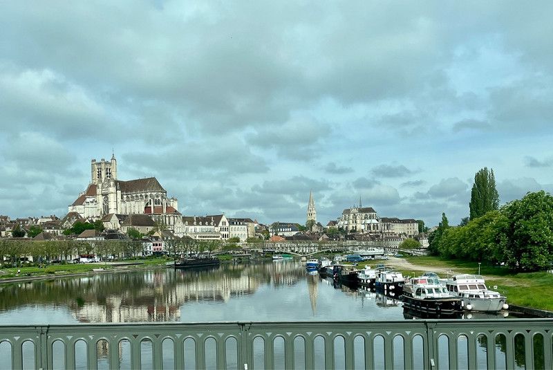
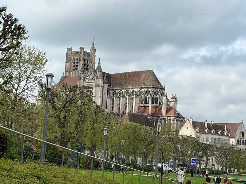
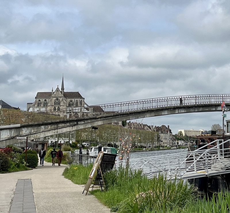
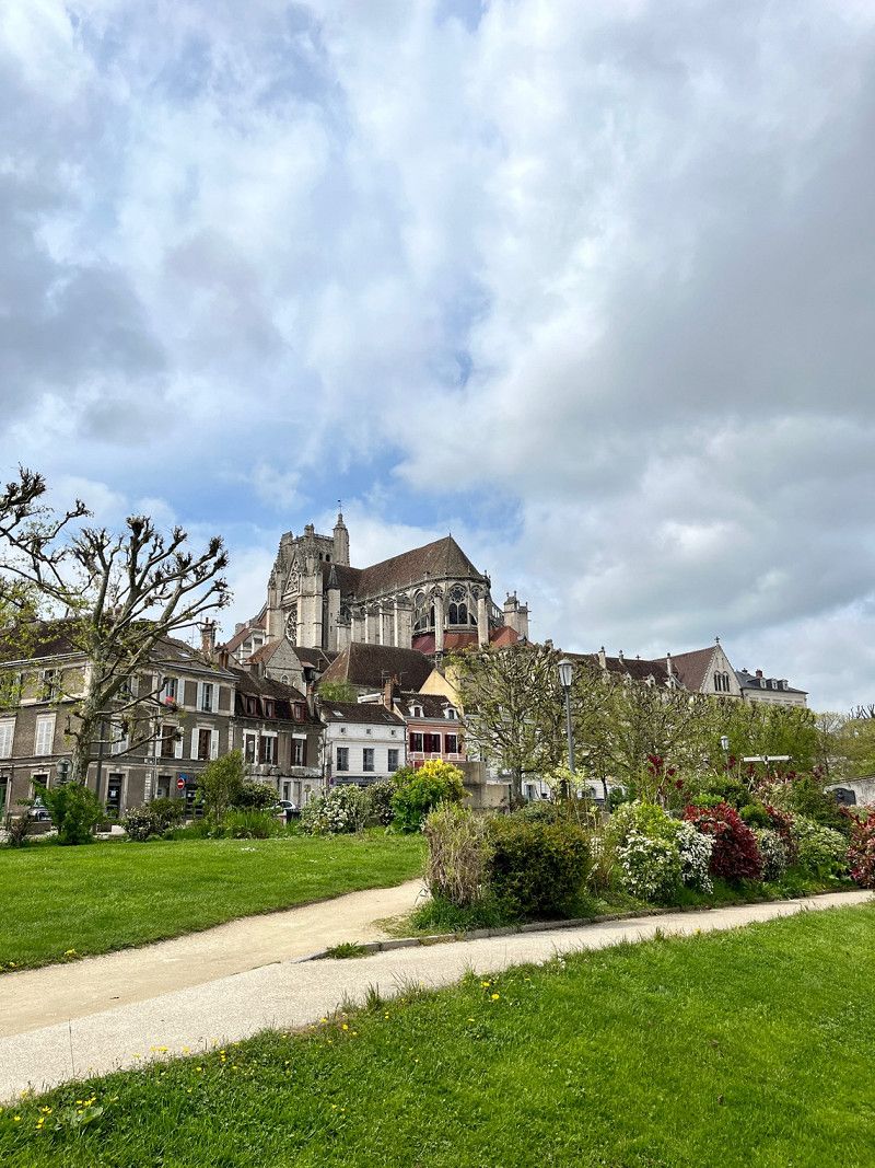
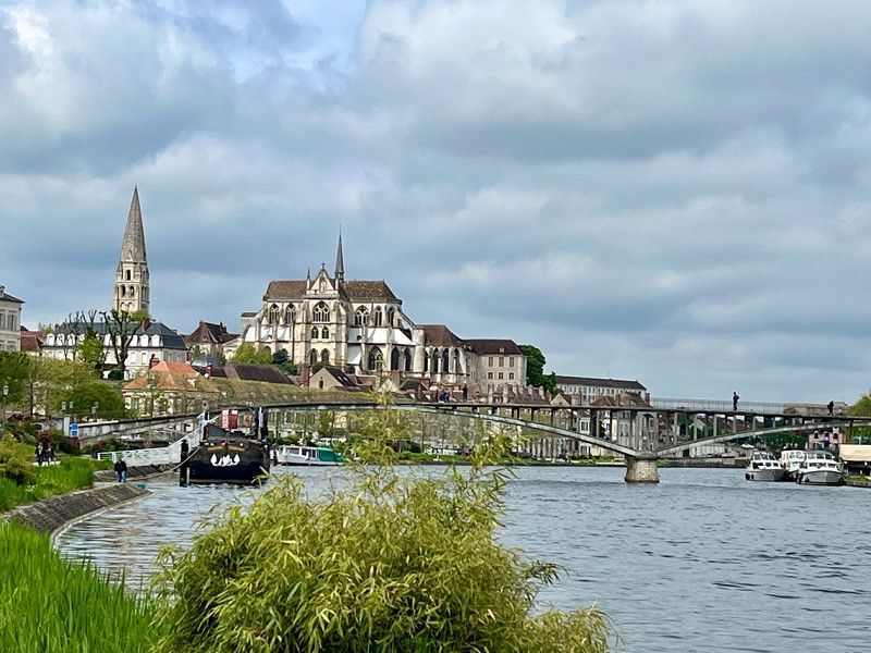
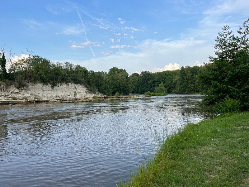
Auxerre, Frankreich
04/30/2023
You cycle along the Yonne river. sightseeing
Auxerre, 89000;89290, Frankreich
47° 47' 46.1" N 3° 34' 14.1" E
47.7961287 3.5705790
• Head toward Rue Maison-Fort on Rue Philibert Roux. Go for 100 m.
• Turn right onto Rue Joubert. Go for 91 m.
• Turn right onto Rue des Bons Enfants. Go for 98 m.
• Turn slightly left onto Place des Véens. Go for 25 m.
• Turn left onto Place des Véens. Go for 45 m.
• Turn right onto Rue Milliaux. Go for 53 m.
• Turn right onto Rue Marie Noël. Go for 135 m.
• Turn left onto Rue Germain Benard. Go for 133 m.
• Turn right onto Boulevard Davout (N151). Go for 219 m.
• Take the 1st exit from roundabout onto Boulevard Davout (D965) toward A6 (Nord)/Sens/Montargis. Go for 169 m.
• Turn left onto Rue du 24 Août (D965). Go for 242 m.
• Pass 2 roundabouts and continue on D965. Go for 22.5 km.
• Keep left onto Rue Émile Genet (D965). Go for 20.7 km.
• Turn right onto Promenade du Grillon (D965) toward A77/Orléans/Lavau/Bonny S/L. Go for 1.9 km.
• Take the 2nd exit from roundabout onto D965 toward A77/Orléans/Lavau/Bonny S/Loire. Go for 15.5 km.
• Take the 3rd exit from roundabout onto A77 toward Montargis/Paris/Orléans/Briare. Go for 13.6 km.
• Take exit 20 toward Orléans/Gien/Briare. Go for 985 m.
• Continue toward Orléans/Briare/Gien/Châtillon S/L. Go for 47 m.
• Pass 3 roundabouts and continue on D952. Go for 5.7 km.
• Take the 3rd exit from roundabout onto Route de Briare (D952) toward Orléans/Z.I. et Z.A. Gien Hôpital/Gien-Centre. Go for 3.7 km.
• Turn right onto Place Saint-Louis. Go for 78 m.
• Continue on Rue Victor Hugo Prolongée. Go for 69 m.
• Turn left onto Rue Albert Marchand. Go for 66 m.
• Turn left onto Avenue du Maréchal Leclerc (D44). Go for 446 m.
• Take the 1st exit from roundabout onto Place du Maréchal Foch (D951). Go for 21.9 km.
• Turn right onto Chemin de la Salle Verte. Go for 545 m.
• Turn right onto Chemin de la Salle Verte. Go for 379 m.
• Arrive at Chemin de la Salle Verte. Your destination is on the left.
☍
109,3 km
(1 hrs. 38 min.)
Day
Stellplatz an der Loire
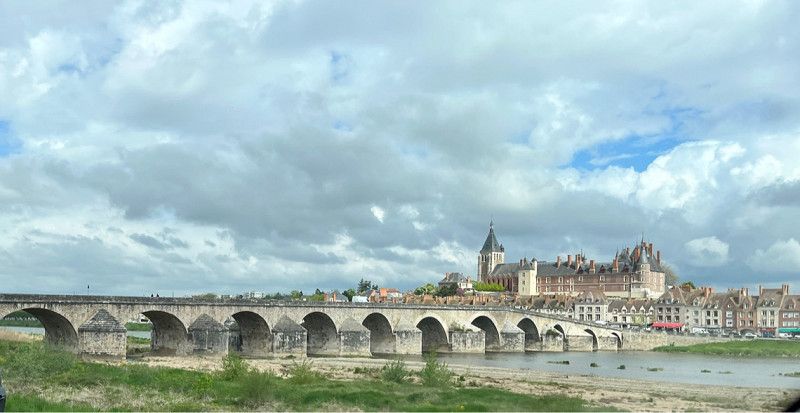
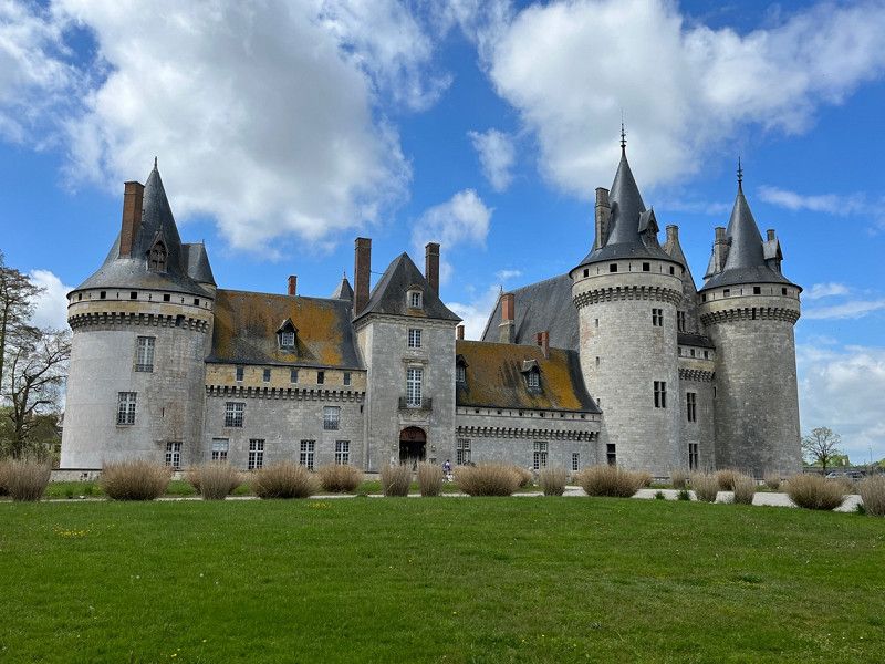
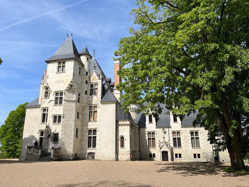
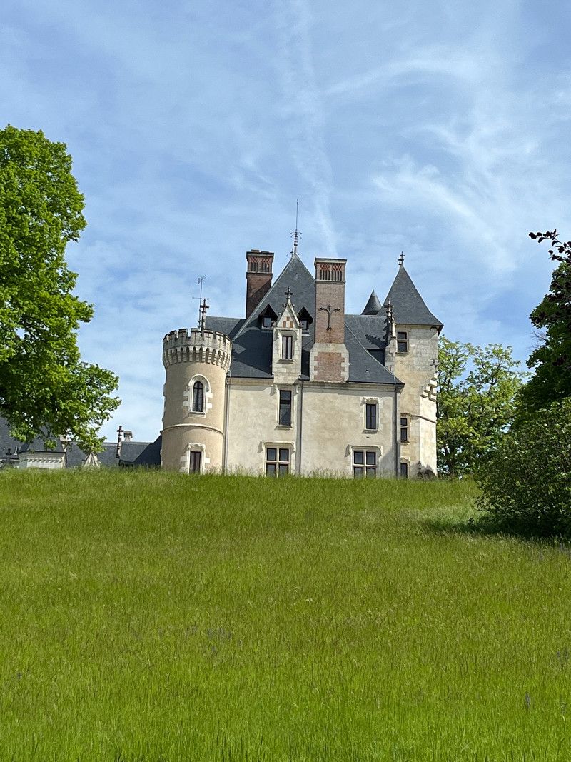
The castle in Sully-sur-Loire cannot be overlooked, on the right behind the castle a road leads to the SP.
Free, with V&E, waste disposal and right on the Loire. Lots of space.
Chemin de la Salle Verte, 45600, Sully-sur-Loire, France
47° 46' 14" N 2° 23' 4" E
47.7705556 2.3844444
• Head northwest on Chemin de la Salle Verte. Go for 88 m.
• Take the 2nd exit from roundabout onto Avenue de Béthune. Go for 859 m.
• Turn left onto Avenue de Béthune (D948). Go for 175 m.
• Turn left onto Boulevard Jeanne d'Arc (D948). Go for 193 m.
• Arrive at Boulevard Jeanne d'Arc (D948). Your destination is on the right.
☍
1,3 km
( 3 min.)
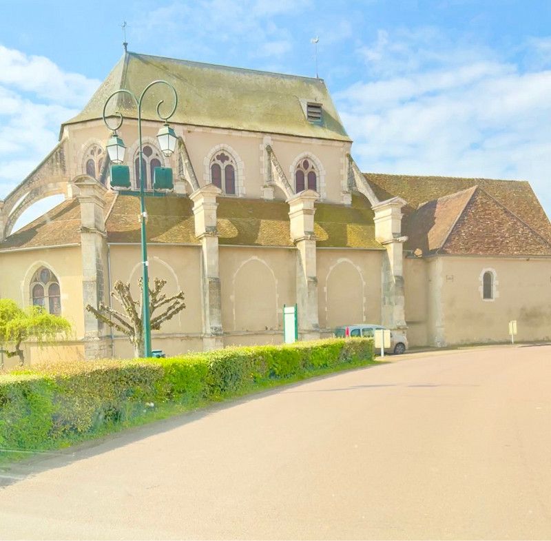
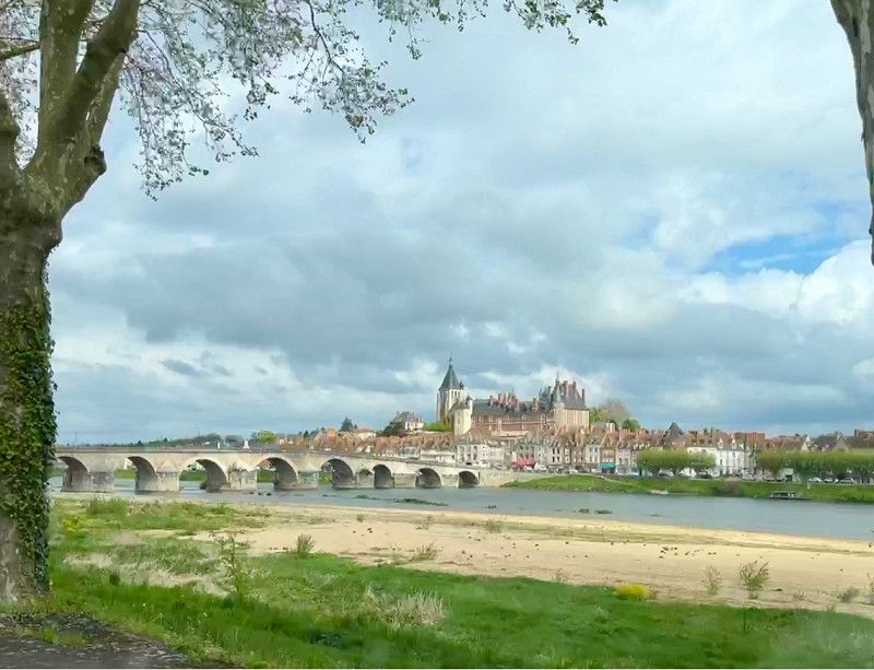
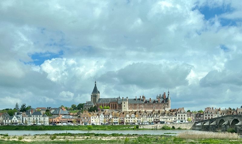
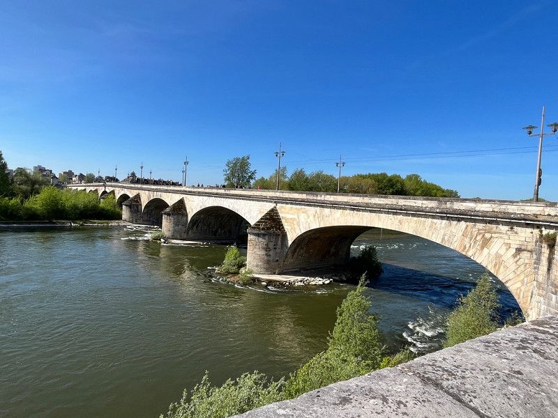
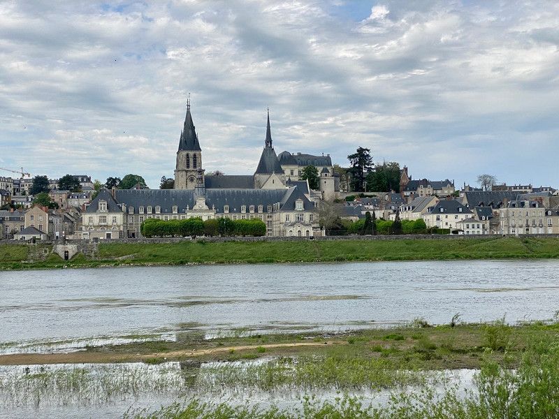
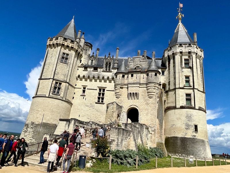
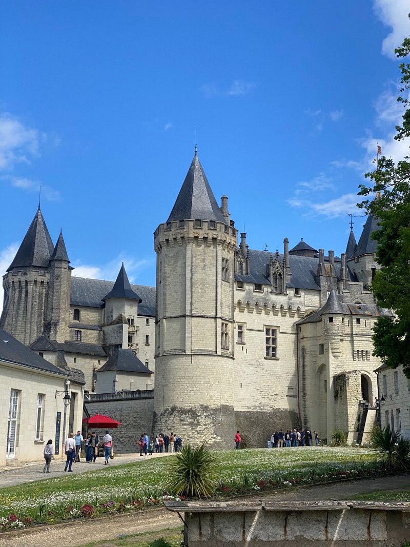
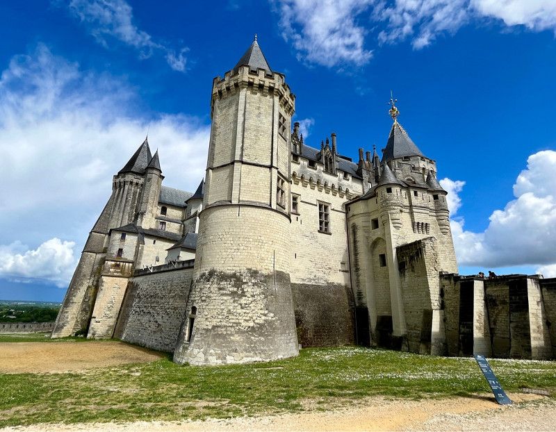
Sully-sur-Loire, Frankreich
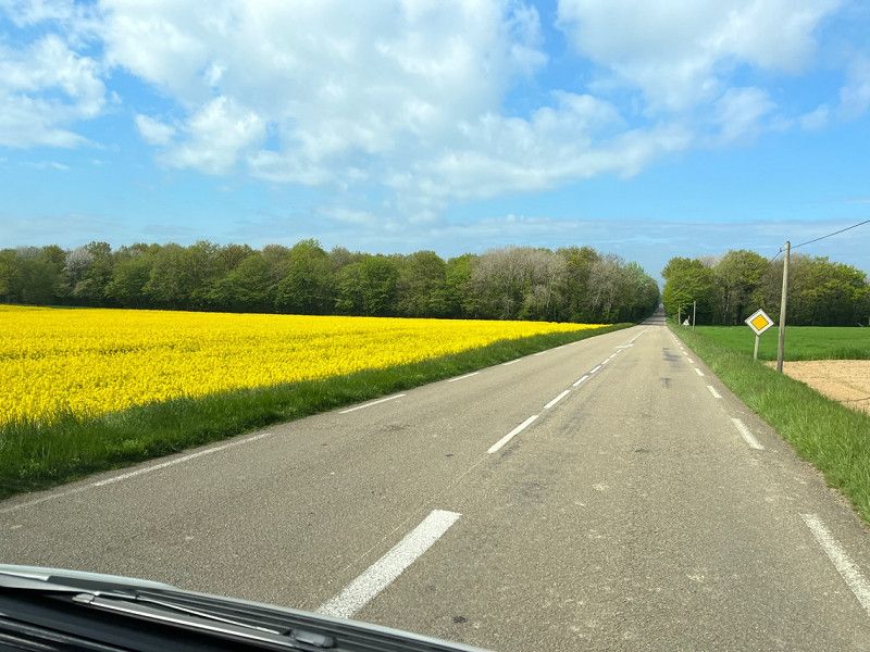
05/01/2023 - this morning the sun tickles us awake and we start in the direction of the Loire. The route takes us via Toucy, St. Fargeau, Bonny-sur-Loire, from there we drive left of the Loire via Gien to Sully-sur-Loire.
We walk to the castle, then to the center and eat a pizza.
• Regarding the weather: there is supposed to be a thunderstorm this afternoon, otherwise there will be sun and clouds alternately, the temperature will be a pleasant 18°
Sully-sur-Loire, 45600, Frankreich
47° 45' 55.5" N 2° 22' 26" E
47.7654098 2.3738968
• Head toward Rue du Marché on Boulevard Jeanne d'Arc (D948). Go for 121 m.
• Turn right onto Rue Porte de Sologne (D948). Go for 61 m.
• Turn right onto Avenue de la Gare (D59). Go for 395 m.
• Turn right onto Avenue de la Gare (D59). Go for 178 m.
• Take the 2nd exit from roundabout onto Avenue du Hameau. Go for 650 m.
• Take the 2nd exit from roundabout onto Route d'Orléans (D951). Go for 11.5 km.
• Turn left onto Lieu-dit La Guette Brûlée. Go for 491 m.
• Arrive at your destination.
☍
13,4 km
( 13 min.)
Day
Tigy, Centre-Val de Loire, France
45510, France
47° 47' 21.3" N 2° 13' 4" E
47.7892526 2.2177784
• Head toward Rue de Sully. Go for 406 m.
• Continue on Lieu-dit La Guette Brûlée. Go for 85 m.
• Turn left onto Rue de Sully (D951). Go for 1.6 km.
• Turn right onto Rue du Val (D951). Go for 191 m.
• Keep left onto Route de Jargeau (D951). Go for 9.8 km.
• Turn left onto Rue Serin-Moulin (D951). Go for 60 m.
• Arrive at Rue Serin-Moulin (D951). Your destination is on the right.
☍
12,2 km
( 12 min.)
Jargeau, Centre-Val de Loire, France
Rue Serin Moulin 1 B, 45150, France
47° 51' 47.8" N 2° 7' 18.3" E
47.8632762 2.1217363
• Head west on Rue Serin-Moulin (D951). Go for 553 m.
• Continue on Route d'Orléans (D951). Go for 1.4 km.
• Continue on Route d'Orléans. Go for 2.7 km.
• Take the 3rd exit from roundabout onto Route de Jargeau (D951). Go for 2.5 km.
• Turn slightly right onto Rue du Maquis de Samatha (D951). Go for 610 m.
• Continue on Route d'Orléans (D951). Go for 3.8 km.
• Pass 2 roundabouts and continue on Route de Sandillon (D951). Go for 3.0 km.
• Take the 4th exit from roundabout onto Rue de la Cornaillère. Go for 164 m.
• Turn right. Go for 65 m.
• Arrive at your destination on the left.
☍
14,9 km
( 17 min.)
Saint-Jean-le-Blanc, Centre-Val de Loire, France
Route de Sandillon, 45650, France
47° 52' 29" N 1° 56' 36.3" E
47.8747236 1.9434116
• Head northwest. Go for 39 m.
• Turn right toward Route de Sandillon/D951. Go for 45 m.
• Turn left onto Route de Sandillon (D951). Go for 3.0 km.
• Continue on Place Saint-Charles (D951). Go for 122 m.
• Continue on Quai des Augustins (D951). Go for 435 m.
• Continue on Quai du Fort des Tourelles (D951). Go for 162 m.
• Take the 2nd exit from roundabout onto Quai de Prague (D951). Go for 221 m.
• Keep right onto Avenue de Trévise. Go for 237 m.
• Turn right toward Avenue de Trévise. Go for 205 m.
• Continue on Avenue de Trévise. Go for 20 m.
• Turn right onto D2020. Go for 447 m.
• Keep right onto Boulevard Jean Jaurès toward Paris/Blois/Le Mans/Montargis/St Jean de la Ruelle/Fg Madeleine/Fg St Jean/C.H.R.O.-Porte Madeleine. Go for 28 m.
• Turn right onto Rue du Canon toward Paris/Blois/Le Mans/Montargis/St Jean de la Ruelle. Go for 90 m.
• Turn right onto Rue Creuse. Go for 112 m.
• Turn right onto Quai Barentin (D2152) toward Paris/Blois/Le Mans/Montargis/St Jean-de-la-Ruelle/Hôpital S.O.S.-Mains. Go for 1.7 km.
• Turn slightly left onto Avenue Georges Clemenceau (D2152) toward Blois/Paris/Vierzon/La Chapelle St Min/Beaugency/Parc d'Activité d'Ingre-St Jean de la R. Go for 1.9 km.
• Pass 2 roundabouts and continue on Route d'Orléans (D2152). Go for 865 m.
• Turn left onto Rue de Verdun. Go for 288 m.
• Turn right onto Rue du Four. Go for 81 m.
• Turn left onto Rue du Château. Go for 129 m.
• Continue on Chemin de Fourneaux. Go for 58 m.
• Turn right onto Chemin de Fourneaux. Go for 119 m.
• Arrive at Chemin de Fourneaux. Your destination is on the left.
☍
10,3 km
( 21 min.)
Centre-Val de Loire, France
05/02/2023
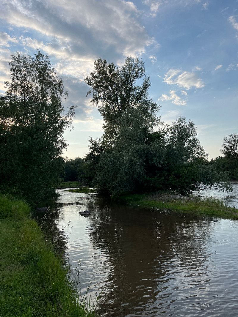
Continue towards Orleans. We are in La Chapelle-Saint-Mesmin on an SP directly on the Loire. The SP can be booked with a machine for a maximum of 72 hours. Garbage, electricity, fresh water is incl. View of the Loire, lots of trees. This afternoon we're going to walk a little longer here on the Loire. It is only 5km to the big city, which we will cycle tomorrow.
• Regarding the weather: A lot of sun and only a few clouds. Temperatures 19°, very pleasant.
La Chapelle Saint-Mesmin, GR 3, La Chapelle-Saint-Mesmin, Orléans, Loiret, Centre-Val de Loire, Metropolitan France, 45380, France
47° 53' 7" N 1° 50' 24.1" E
47.8852750 1.8400410
• Head northeast on Chemin de Fourneaux. Go for 119 m.
• Turn left onto Chemin de Fourneaux. Go for 58 m.
• Turn right onto Rue du Petit Château. Go for 162 m.
• Continue on Place de l'Église. Go for 33 m.
• Continue on Rue de l'Église. Go for 41 m.
• Continue on Place du Bourg. Go for 25 m.
• Turn left onto Place du Bourg. Go for 60 m.
• Turn right onto Rue de la Bredauche. Go for 373 m.
• Turn left onto Rue Nationale (D2152). Go for 3.0 km.
• Take the 2nd exit from roundabout onto Route d'Orléans (D2152) toward Blois/Chaingy-Centre/Meung S/L. Go for 1.7 km.
• Arrive at Route de Blois (D2152). Your destination is on the right.
☍
5,5 km
( 9 min.)
Day
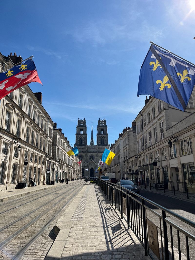
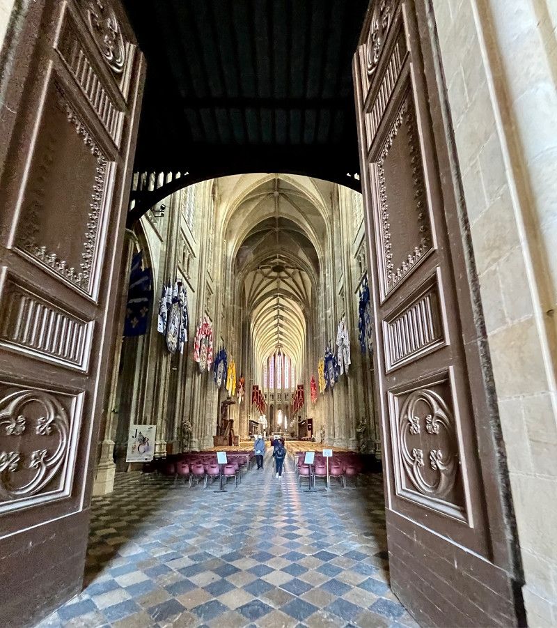
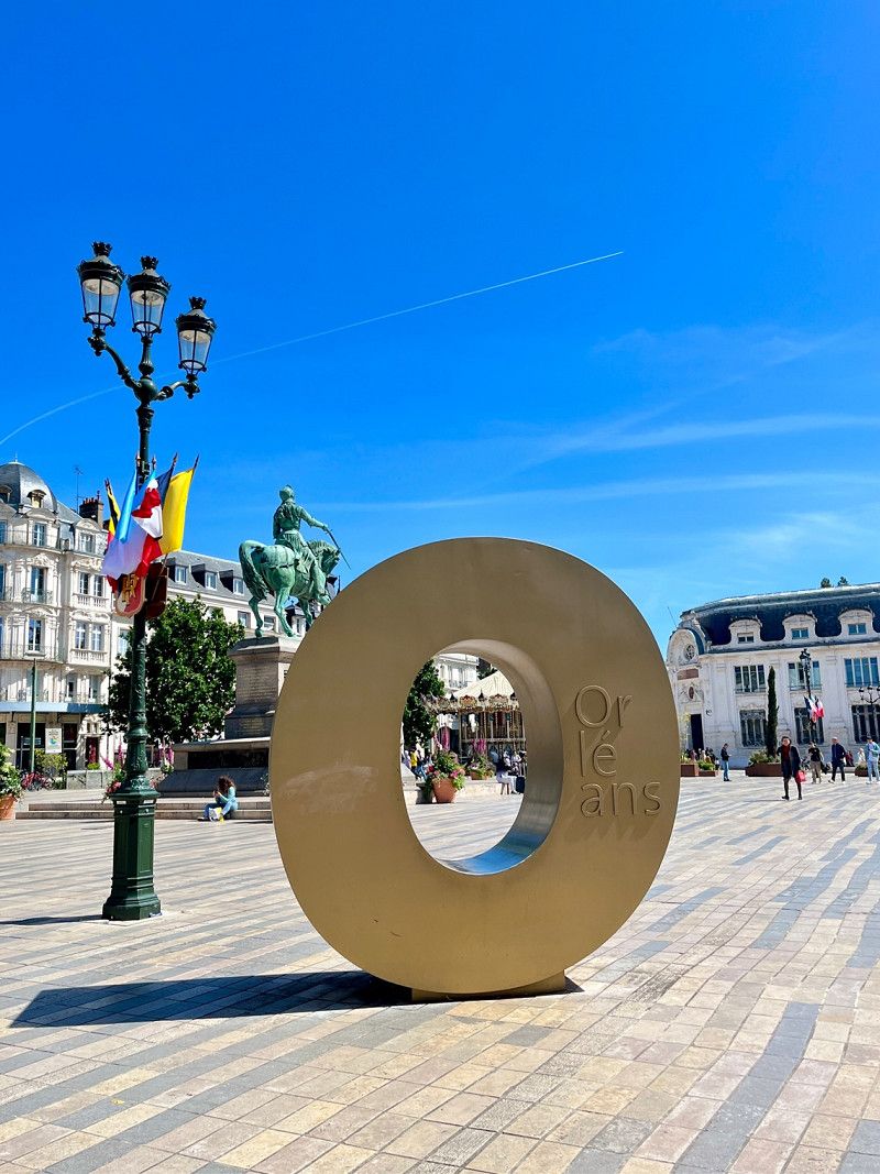
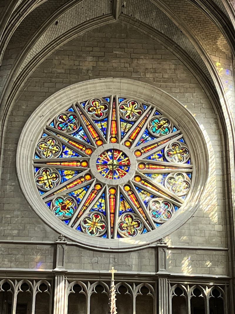
Fahrradtour nach Orléans
05/03/2023
5.5 km of well-developed bike path. Cathedral and center visited.
About the weather: 14 hours ☀️☀️ at 22°
Day
Saint-Ay, Centre-Val de Loire, France
Route de Blois 46, 45130, France
47° 52' 14.6" N 1° 47' 8" E
47.8707209 1.7855650
• Head toward Passage de Rollainville on Route de Blois (D2152). Go for 2.2 km.
• Pass 2 roundabouts and continue on Rue d'Orléans (D2152). Go for 6.4 km.
• Turn slightly left onto Rue de Blois (D2152) toward A10/Blois/Beaugency/Ozouer le M./Châteaudun. Go for 1.0 km.
• Take the 3rd exit from roundabout onto D2152 toward Blois/Beaugency/Baule. Go for 480 m.
• Pass 3 roundabouts and continue on Avenue de Blois (D2152). Go for 7.8 km.
• Take the 3rd exit from roundabout onto Route Nationale (D2152) toward Blois. Go for 5.5 km.
• Arrive at D2152. Your destination is on the right.
☍
23,4 km
( 29 min.)
Avaray, Centre-Val de Loire, France
D 2152, 41500, France
47° 43' 58.4" N 1° 33' 27.7" E
47.7328872 1.5576914
• Head southwest on D2152. Go for 3.2 km.
• Take the 2nd exit from roundabout onto Route d'Orléans (D2152) toward Blois/Mer. Go for 958 m.
• Take the 2nd exit from roundabout onto Route d'Orléans (D112) toward Muides-sur-Loire/Saint-Laurent-Nouan/Muides/Chambord/St Laurent. Go for 486 m.
• Pass 2 roundabouts and continue on Rue du Goulet des Prés (D112). Go for 1.7 km.
• Take the 3rd exit from roundabout onto D112. Go for 2.8 km.
• Take the 2nd exit from roundabout onto Route de Sologne (D112). Go for 894 m.
• Continue on D103. Go for 222 m.
• Turn right onto D112. Go for 2.9 km.
• Pass 2 roundabouts and continue on D112. Go for 2.9 km.
• Turn left onto D33. Go for 32 m.
• Arrive at D33. Your destination is on the right.
☍
16,1 km
( 16 min.)
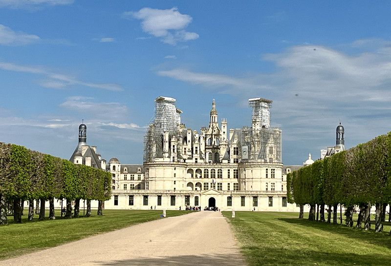
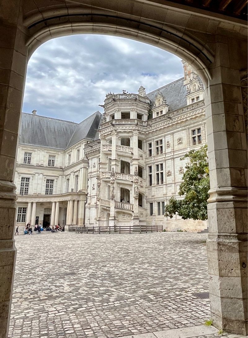
Chambord, Centre-Val de Loire, France
Unfortunately, the castle is covered and the parking lot for 2 hours was too expensive for us, we wouldn't want to stay longer. It's a shame, but there are more castles to come
Route Charles X, 41250, France
47° 36' 49.6" N 1° 30' 38.1" E
47.6137640 1.5105872
• Head southwest on D33. Go for 5.2 km.
• Turn right onto Rue du Pont (D72). Go for 179 m.
• Take the 2nd exit from roundabout onto Rue de Biou. Go for 689 m.
• Take the 1st exit from roundabout onto Rue de Biou. Go for 1.7 km.
• Continue on Rue du Petit Chambord. Go for 2.5 km.
• Continue on Avenue des Noëls (D72). Go for 396 m.
• Continue on D72. Go for 2.0 km.
• Take the 2nd exit from roundabout onto D951 toward Tours/Châteauroux/Vierzon/Amboise/Chaumont S/L./Blois-Sud. Go for 235 m.
• Pass 2 roundabouts and continue on Levée de Saint-Dyé (D951). Go for 667 m.
• Continue on Quai Henri Chavigny (D951). Go for 647 m.
• Continue on Quai Amédée Contant (D951). Go for 244 m.
• Continue on Carrefour de la Libération (D951). Go for 23 m.
• Continue on Carrefour de la Libération (D751). Go for 1.5 km.
• Take the 2nd exit from Rond-Point Joseph-Paul Boncour roundabout onto Levée de Chailles (D751) toward Montrichard/Chailles/Chaumont S/L./Amboise. Go for 4.7 km.
• Turn left onto Rue de la Forêt. Go for 148 m.
• Turn left onto Rue de la Forêt. Go for 75 m.
• Arrive at Rue de la Forêt. Your destination is on the left.
☍
20,9 km
( 25 min.)
Camping Le Cosson
05/04/2023
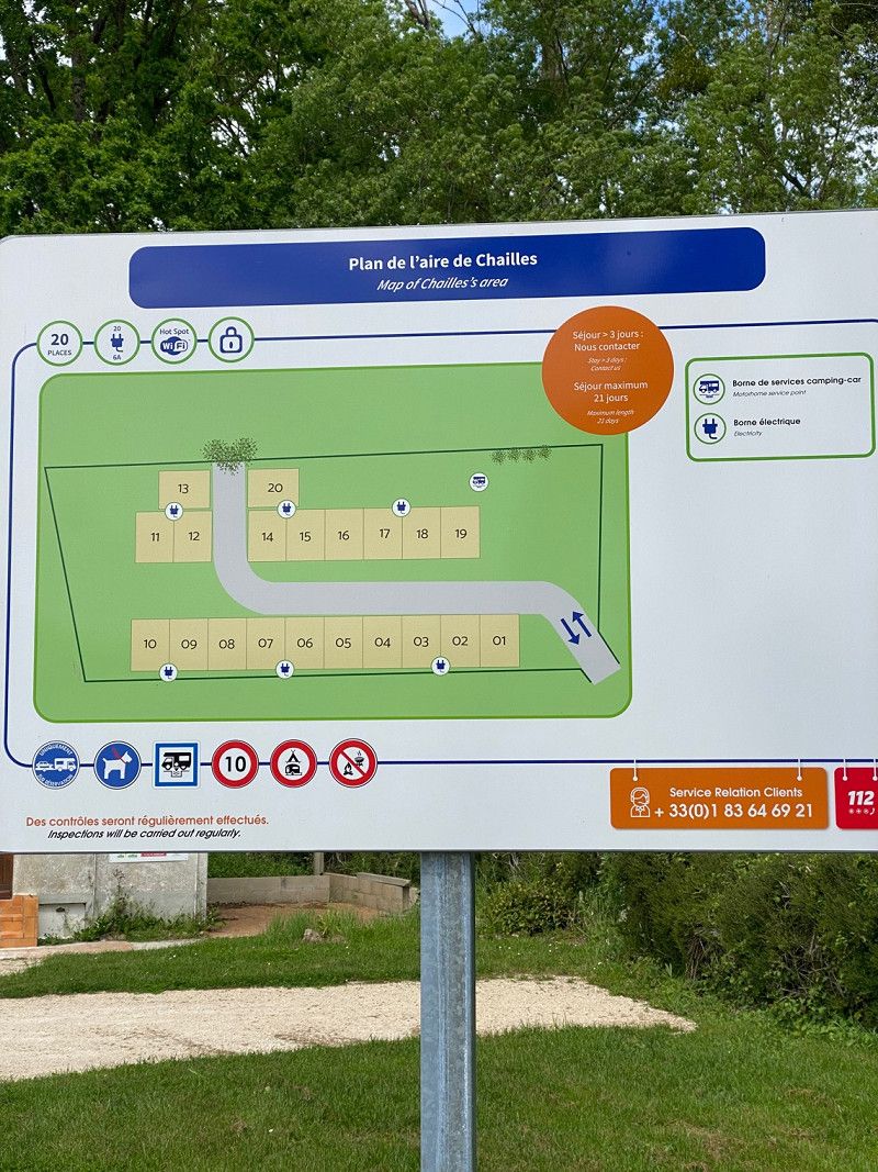
SP from CAMPING-CAR Park, night €13.90 incl. electricity, garbage and V&E. Places gravel and with green. Good cycle path to Blois. Look at the old town and the castle
• Regarding the weather: sun and clouds, pleasant 23°, wind from the afternoon. 7 hours of sunshine
41120, Chailles, Frankreich
47° 32' 37.3" N 1° 18' 38.5" E
47.5437000 1.3107000
• Head southeast on Rue de la Forêt. Go for 75 m.
• Turn right onto Rue de la Forêt. Go for 148 m.
• Turn left onto Rue Nationale (D751). Go for 3.7 km.
• Take the 2nd exit from roundabout onto Route de Blois (D764). Go for 16.5 km.
• Arrive at Route de Montrichard (D764).
☍
20,4 km
( 22 min.)
Day
Pontlevoy, Centre-Val de Loire, France
D 764, 41400, France
47° 22' 46.3" N 1° 14' 10.1" E
47.3795191 1.2361368
• Head southwest on Route de Montrichard (D764). Go for 6.0 km.
• Turn right onto Rue de Tours (D176). Go for 591 m.
• Turn right onto Avenue de la Gare (D115). Go for 129 m.
• Turn left onto Avenue de la Gare. Go for 164 m.
• Arrive at Avenue de la Gare. Your destination is on the left.
☍
6,8 km
( 7 min.)
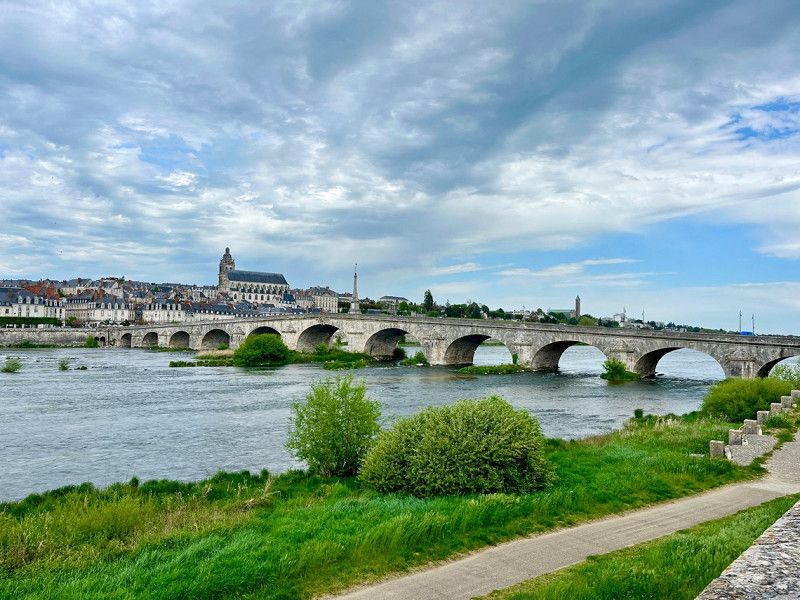
Montrichard Val de Cher, Centre-Val de Loire, France
Avenue de la Gare, 41400, Montrichard Val de Cher, France
47° 20' 36.6" N 1° 10' 20.9" E
47.3435050 1.1724617
• Head west on Avenue de la Gare. Go for 58 m.
• Turn slightly left onto Rue du Pré des Pélerins. Go for 96 m.
• Turn right onto Rue du Clos Rimbault. Go for 54 m.
• Turn right onto Rue de Tours (D176). Go for 5.0 km.
• Continue on D40. Go for 3.0 km.
• Turn left onto Rue du Château. Go for 190 m.
• Turn right. Go for 40 m.
• Turn left. Go for 72 m.
• Arrive at your destination on the left.
☍
8,6 km
( 12 min.)
Chenonceaux, Centre-Val de Loire, France
Here we had to look at the castle. The parking lot was already full of big buses and of course (I could have guessed it) the entrance fee is 16€ per person. We decide to continue driving. There are also no pictures because we didn't get there.
Rue du Château, 37150, France
47° 19' 45.5" N 1° 3' 59.5" E
47.3293164 1.0665321
• Head northeast. Go for 72 m.
• Turn right toward Rue du Château. Go for 40 m.
• Turn left onto Rue du Château. Go for 190 m.
• Turn left onto Rue Bretonneau (D40). Go for 1.7 km.
• Turn left onto Rue de la Gare (D81). Go for 92 m.
• Continue on Rue du Pont (D81). Go for 1.1 km.
• Continue on Rue de la Canardière (D81). Go for 321 m.
• Take the 3rd exit from roundabout onto Rue d'Orget (C12) toward Les Fougères/Thoré. Go for 204 m.
• Arrive at Rue d'Orget (C12). Your destination is on the right.
☍
3,7 km
( 7 min.)
Civray-de-Touraine, Centre-Val de Loire, France
Rue d'Orget, 37150, France
47° 19' 15.6" N 1° 2' 5.7" E
47.3210098 1.0349220
• Head north on Rue d'Orget (C12). Go for 87 m.
• Take the 4th exit from roundabout onto D976 toward A85/Civray de T./Amboise/Montlouis S/L./Loches. Go for 6.1 km.
• Continue on D31. Go for 7.8 km.
• Take the 2nd exit from roundabout onto Avenue Émile Gounin (D431) toward Amboise-Centre. Go for 2.3 km.
• Turn right onto Quai du Général de Gaulle (D751). Go for 338 m.
• Keep left onto Quai du Général de Gaulle (D431). Go for 382 m.
• Turn right onto Quai du Maréchal Foch. Go for 254 m.
• Take the 3rd exit from Place Émile Gounin roundabout onto Allée de la Chapelle Saint-Jean. Go for 142 m.
• Turn right onto Allée des Mariniers. Go for 45 m.
• Arrive at Allée des Mariniers. Your destination is on the left.
☍
17,4 km
( 18 min.)
Camping Municipal De L'Île D'Or
05/05/2023
CP for 1 night without electricity €17.09 including tourist tax
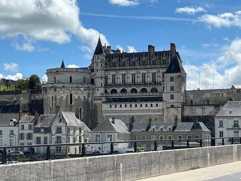
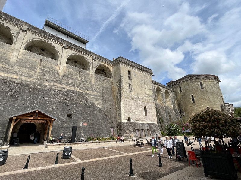
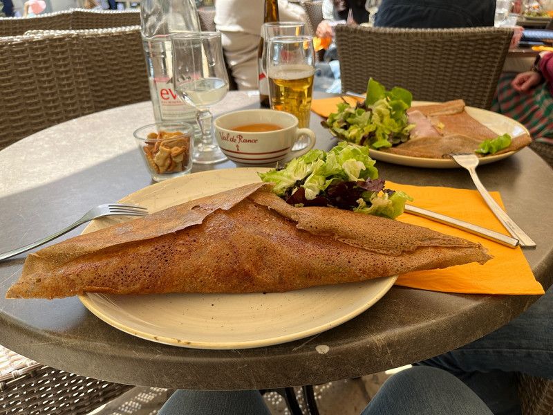
We walk to the center and eat very good crêpes in the pedestrian zone right at the entrance to the castle.
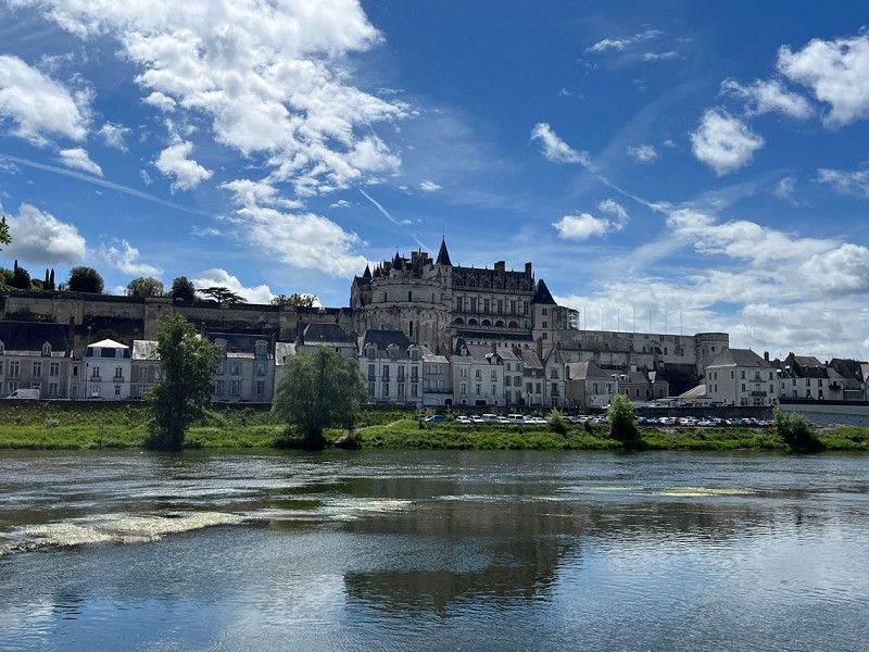
We only look at this castle from the outside, as there is an entrance fee. Since I can't remember all the information anyway, I can't do anything with the deceased and buried 🤣😜 let's go eat some delicious ice cream !!!
4 Allée des Mariniers, 37400, Amboise, Frankreich
47° 25' 1" N 0° 59' 14" E
47.4169400 0.9872200
• Head southeast on Allée des Mariniers. Go for 41 m.
• Turn right onto Allée des Mariniers. Go for 138 m.
• Take the 2nd exit from Place Émile Gounin roundabout onto Quai du Maréchal Foch. Go for 291 m.
• Turn right onto Pont Général Leclerc (D431). Go for 204 m.
• Take the 2nd exit from Rue de Blois roundabout onto Rue de Blois (D952). Go for 14.0 km.
• Take the 2nd exit from roundabout onto Pont Charles de Gaulle (D142) toward Montlouis S/Loire/Tours-Sud. Go for 1.5 km.
• Take the 3rd exit from roundabout onto D751. Go for 1.9 km.
• Take the 2nd exit from roundabout onto Lieu-dit La Boisselière (D751). Go for 5.2 km.
• Take the 2nd exit from Carrefour des Français Libres roundabout onto Avenue Georges Pompidou toward A10/A85/Tours-Sud/C.H.U. Trousseau/St Pierre des Corps. Go for 327 m.
• Take the 2nd exit from roundabout onto Avenue Georges Pompidou toward A10-A85/Tours-Sud. Go for 106 m.
• Take ramp onto A10 (L'Aquitaine) toward A85/Poitiers/Châteauroux/Vierzon/Tours-Sud. Go for 4.8 km.
• Take exit 23 toward Chambray lès Tours/Montbazon onto D910 (Avenue du Grand Sud). Go for 2.7 km.
• Pass 5 roundabouts and continue on Avenue du Grand Sud (D910). Go for 2.6 km.
• Take the 1st exit from roundabout onto Route du Ripault (D87) toward Monts. Go for 698 m.
• Continue on D87. Go for 1.1 km.
• Take the 2nd exit from roundabout onto D87. Go for 226 m.
• Continue on Lieu-dit Thorigny (D87). Go for 99 m.
• Continue on D87. Go for 264 m.
• Continue on Carrefour de la Maugerie (D87). Go for 806 m.
• Continue on Lieu-dit La Maugerie (D87). Go for 46 m.
• Continue on D87. Go for 396 m.
• Continue on Lieu-dit Le Ripault (D87). Go for 9 m.
• Continue on D87. Go for 1.1 km.
• Turn right toward Lieu-dit Château de Candé. Go for 125 m.
• Continue on Lieu-dit Château de Candé. Go for 163 m.
• Arrive at Lieu-dit Château de Candé.
☍
38,7 km
( 41 min.)
Day
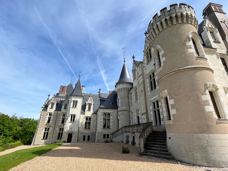
Château de Candé, Monts, Frankreich
05/06/2023
Candé Castle is a small castle with a beautiful garden. Many hiking trails throughout the area. Parking lot generous, it was very little going on.
We are not in the castle, because entry is required here.
Château de Candé, 37260 Monts, Frankreich
47° 17' 45.2" N 0° 39' 52.3" E
47.2958932 0.6645275
• Head west on Lieu-dit Château de Candé. Go for 288 m.
• Turn right onto Lieu-dit La Horaie (D87). Go for 208 m.
• Continue on Rue du Viaduc (D87). Go for 361 m.
• Continue on Rue des Chênes (D87). Go for 324 m.
• Continue on Rue du Viaduc (D87). Go for 756 m.
• Take the 1st exit from roundabout onto Rue du Val de l'Indre (D17). Go for 2.8 km.
• Pass 2 roundabouts and continue on Avenue de la Vallée du Lys (D17). Go for 3.6 km.
• Turn right onto Rue de l'Allouette (D84). Go for 1.9 km.
• Arrive at D84. Your destination is on the left.
☍
10,2 km
( 14 min.)
Pont-de-Ruan, Centre-Val de Loire, France
D 84, 37260, France
47° 16' 0.3" N 0° 33' 46.8" E
47.2667455 0.5629879
• Head toward Voie de la Sablonnière à Druye on D84. Go for 7.6 km.
• Take the 2nd exit from roundabout onto Rue de Pineau (D84). Go for 252 m.
• Turn right onto Place de la République (D84). Go for 58 m.
• Turn left onto Place de la République (D84). Go for 139 m.
• Turn left onto Rue Nationale (D84). Go for 55 m.
• Arrive at Rue Nationale (D84). Your destination is on the right.
☍
8,2 km
( 10 min.)
Azay-le-Rideau, Frankreich
37190 Azay-le-Rideau, Frankreich
47° 15' 42.4" N 0° 27' 56.7" E
47.2617700 0.4657400
• Head south on Rue Nationale (D84).
• Turn right onto Rue Carnot (D57). Go for 1.5 km.
• Take the 2nd exit from roundabout onto Route de Langeais (D57). Go for 7.8 km.
• Take the 2nd exit from roundabout onto Rue Honoré de Balzac (D952) toward Saumur/Bourgueil. Go for 267 m.
• Pass 2 roundabouts and continue on Rue Nationale des Redouets (D952). Go for 36.5 km.
• Turn right toward Villebernier-Centre. Go for 26 m.
• Continue on Rue de la Mairie. Go for 158 m.
• Continue on Rue Jacques Cailleau. Go for 22 m.
• Turn right onto Rue de Beauvoyer. Go for 65 m.
• Arrive at Rue de Beauvoyer. Your destination is on the right.
☍
46,3 km
( 42 min.)
Villebernier, Frankreich
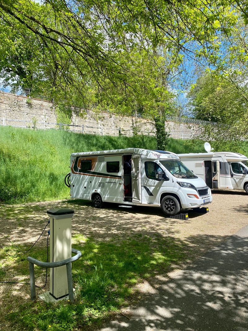
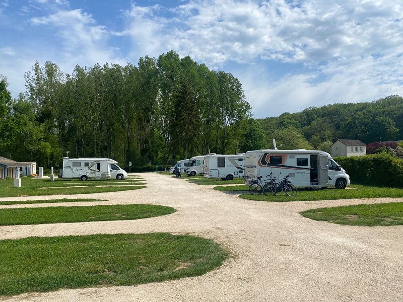
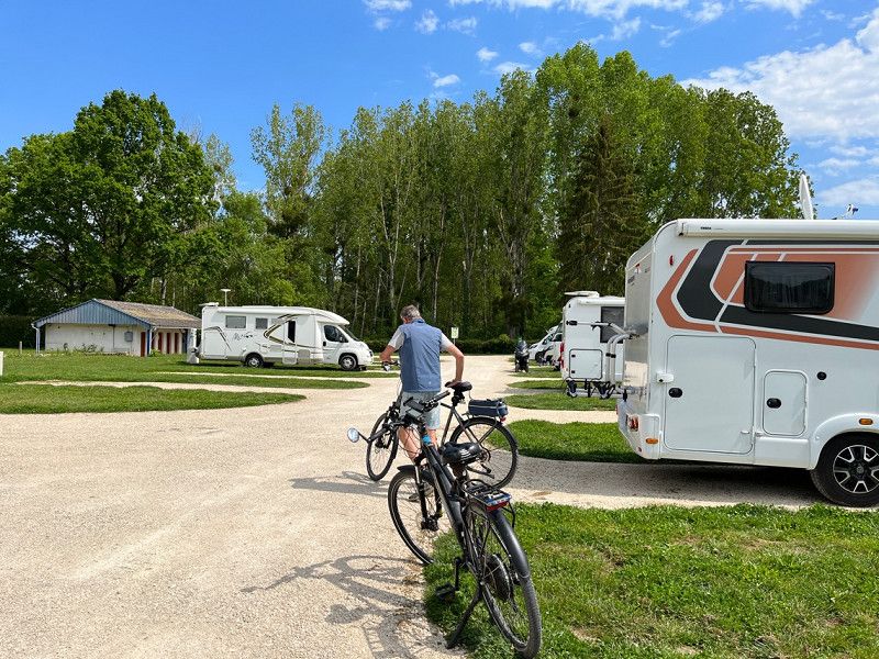
Pitch via camping car park directly on the Loire with a view of Saumur. €11.80/night including tourist tax and electricity. The place is indicated with a sanitary building, but everything is closed here. It is a large meadow on 2 levels with electricity columns. Very quiet and lots of green. The city is 5km away.
We are staying here for 2 nights as we want to go to Saumur tomorrow.
49400 Villebernier, Frankreich
47° 15' 11.2" N 0° 1' 47.7" W
47.2531090 -0.0299260
• Head toward Rue Jacques Cailleau on Rue de Beauvoyer. Go for 65 m.
• Turn left onto Rue Jacques Cailleau. Go for 22 m.
• Continue on Rue de la Mairie. Go for 184 m.
• Turn left onto Route de Tours (D952). Go for 6.7 km.
• Pass 2 roundabouts and continue on Rue Honoré de Balzac (D952). Go for 30.1 km.
• Take the 1st exit from roundabout onto D57 toward Azay le Rideau/Lignières/Bréhémont/La Chapelle aux Naux/Château de Rigny-Ussé. Go for 2.9 km.
• Turn right onto Rue de Rigny-Ussé (D7). Go for 49 m.
• Turn left onto Rue des Complans. Go for 17 m.
• Turn left onto Rue des Complans. Go for 55 m.
• Arrive at Rue des Complans. Your destination is on the left.
☍
40,0 km
( 35 min.)
Day
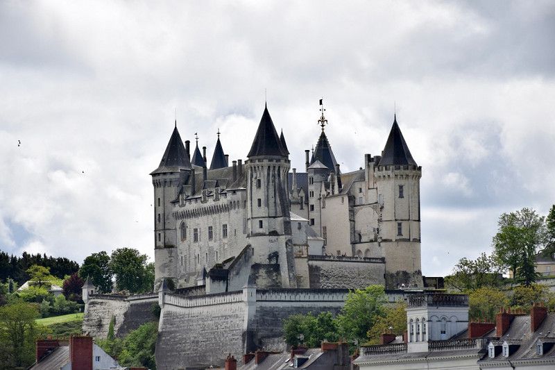
Saumur - Schloss Saumur
07.05.2023 - 23° 🌤️🌦️
We walk to Saumur after it rained again and again in the morning. (10km in total with a warm 25°C and sunshine). We have lunch in the large square by the church. Afterwards we walk up to the castle. Great view. The way back is somehow more difficult than the way there (probably because it's much warmer) and seems longer than this morning.
• Regarding the weather: Alternating sun and clouds. Temperatures 23°°, again and again rain showers.
Day
Lignières-de-Touraine, Centre-Val de Loire, France
Rue des Complans, 37130, France
47° 17' 48.9" N 0° 24' 59.2" E
47.2969279 0.4164505
• Head toward Impasse des Collinets on Rue des Complans. Go for 133 m.
• Turn left toward Rue d'Azay le Rideau/D57. Go for 17 m.
• Turn left onto Rue d'Azay le Rideau (D57). Go for 3.0 km.
• Take the 1st exit from roundabout onto Levée de la Loire (D952) toward A85/Tours/Villandry/Azay le R./Cinq Mars la Pile. Go for 1.6 km.
• Take the 1st exit from roundabout onto D952 toward A85/Tours/Luynes/Fondettes. Go for 1.8 km.
• Take the 3rd exit from roundabout toward Angers/Saumur/Tours/Azay le Rideau/Villandry. Go for 307 m.
• Take left ramp onto A85 toward Nantes/Angers/Saumur. Go for 56.6 km.
• Take exit 2 toward Baugé/Longué-Jumelles/Saumur/Longué. Go for 699 m.
• Take the 1st exit from roundabout onto D938 toward Saumur/Longué. Go for 1.7 km.
• Take the 1st exit from roundabout onto Route de Beaufort (D347) toward Angers/Beaufort en Vallée. Go for 6.3 km.
• Take the 2nd exit from roundabout onto Route de Saumur (D347) toward Angers/Beaufort en V. Go for 2.1 km.
• Take the 3rd exit from roundabout onto D347 toward A87/Angers/Beaufort-Centre/Mazé. Go for 1.5 km.
• Take the 4th exit from roundabout onto D7 toward La Ménitré. Go for 1.3 km.
• Continue on Lieu-dit Canada (D7). Go for 74 m.
• Continue on D7. Go for 783 m.
• Continue on Lieu-dit Le Pont Rouge (D7). Go for 121 m.
• Continue on D7. Go for 133 m.
• Continue on Route de Beaufort (D7). Go for 227 m.
• Continue on D7. Go for 457 m.
• Continue on Lieu-dit La Butte du Montil (D7). Go for 24 m.
• Continue on D7. Go for 1.1 km.
• Take the 2nd exit from roundabout onto Rue du Roi René (D7). Go for 1.1 km.
• Continue on Rue Marc Leclerc (D7). Go for 721 m.
• Take the 1st exit from roundabout onto D952. Go for 1.9 km.
• Arrive at Levée Jeanne de Laval (D952). Your destination is on the right.
☍
83,8 km
( 55 min.)
Saint-Mathurin-sur-Loire, Pays de la Loire, France
Route de la Levée, 49250, France
47° 24' 27.4" N 0° 17' 40.3" W
47.4076249 -0.2945197
• Head toward Rue du Pont du Rateau on Levée Jeanne de Laval (D952). Go for 1.9 km.
• Take the 1st exit from roundabout onto Levée Jeanne de Laval (D952). Go for 8.8 km.
• Take the 2nd exit from roundabout onto D952. Go for 1.4 km.
• Take the 2nd exit from roundabout onto D952. Go for 3.7 km.
• Take the 3rd exit from Giratoire de la Levée roundabout onto Rue Camille Perdriau (D4). Go for 1.2 km.
• Pass 2 roundabouts and continue on Avenue du Moulin Marcillé (D4). Go for 819 m.
• Take the 4th exit from Giratoire du Moulin de Marcille roundabout onto A87 toward Angers/St Barthélemy. Go for 3.4 km.
• Take exit 18A toward Angers-Est/Z.I. Croix-Blanche/Angers-Centre onto Rue du Hanipet. Go for 915 m.
• Take the 2nd exit from roundabout onto Rue Gandhi toward Paris/Le Mans/Tours/Parc des Expositions. Go for 224 m.
• Continue on Boulevard Gaston Birgé. Go for 1.3 km.
• Turn left onto Avenue Pasteur. Go for 90 m.
• Arrive at Avenue Pasteur. Your destination is on the right.
☍
23,7 km
( 24 min.)
Angers, Pays de la Loire, France
Avenue Pasteur, 49100, Angers, France
47° 28' 53.9" N 0° 31' 23.6" W
47.4816394 -0.5232239
• Head toward Rue des Mimosas on Avenue Pasteur. Go for 1.4 km.
• Keep right onto Boulevard Saint-Michel. Go for 534 m.
• Take the 1st exit from roundabout onto Boulevard Carnot. Go for 360 m.
• Continue on Boulevard Ayrault. Go for 414 m.
• Turn left and take ramp onto Voie des Berges (D323) toward Nantes/Laval/Rennes/Angers Technopole. Go for 5.1 km.
• Keep right onto Avenue de l'Atlantique (D523) toward Nantes/Bouchemaine/Beaucouzé/Angers. Go for 1.0 km.
• Keep left onto D523 toward Nantes/Ancenis/Châteaubriant. Go for 1.6 km.
• Take ramp onto D723 toward Ancenis/Chalonnes S/ L./St Jean de Linières/St Jean de Linières-Centre. Go for 1.4 km.
• Pass 6 roundabouts and continue on Rue Nationale (D723). Go for 9.6 km.
• Turn left onto Place de l'Hôtel de Ville. Go for 31 m.
• Turn left onto Passerelle de l'Hôtel de Ville. Go for 61 m.
• Turn slightly left onto Rue Tuboeuf. Go for 28 m.
• Arrive at Rue Tuboeuf. Your destination is on the right.
☍
21,6 km
( 23 min.)
Saint-Georges-sur-Loire, Pays de la Loire, France
Rue Tuboeuf 4, 49170, France
47° 24' 29.2" N 0° 45' 36.6" W
47.4081157 -0.7601572
• Head northeast on Rue Tuboeuf. Go for 212 m.
• Turn left onto Rue Nationale. Go for 22 m.
• Turn left onto Rue Nationale (D723). Go for 5.5 km.
• Take the 3rd exit from roundabout onto D723 toward Nantes/Champtocé S/L./Varades/Ancenis/Montjean S/L./Beaupréau. Go for 1.2 km.
• Pass 4 roundabouts and continue on Rue du Général de Gaulle (D723). Go for 14.2 km.
• Take the 3rd exit from roundabout onto Rue du Général de Gaulle (D723). Go for 1.0 km.
• Take the 3rd exit from roundabout onto Rue du Maréchal Foch (D723) toward Nantes/Ancenis/St Herblon/Anetz. Go for 5.7 km.
• Take the 2nd exit from roundabout onto Route d'Ancenis (D723) toward Nantes. Go for 3.4 km.
• Arrive at D723. Your destination is on the left.
☍
31,3 km
( 26 min.)
Vair-sur-Loire, Pays de la Loire, France
D 723, 44150, Vair-sur-Loire, France
47° 22' 37.2" N 1° 8' 38.7" W
47.3770137 -1.1440799
• Head toward Lieu-dit Le Jarrier d'Ancenis on D723. Go for 2.0 km.
• Pass 3 roundabouts and continue on Boulevard de Bad Brückenau (D723). Go for 1.6 km.
• Take the 3rd exit from Rond-Point des 13 Prés roundabout onto D723. Go for 801 m.
• Pass 2 roundabouts and continue on D723. Go for 1.2 km.
• Take the 3rd exit from Rond-Point des Loges roundabout onto D723 toward Nantes/Oudon. Go for 7.8 km.
• Arrive at D723. Your destination is on the left.
☍
13,4 km
( 12 min.)
Oudon, Pays de la Loire, France
Route de Paris à Paimboeuf, 44521, France
47° 21' 33.9" N 1° 18' 20.2" W
47.3594204 -1.3056182
• Head northwest on D723. Go for 732 m.
• Pass 3 roundabouts and continue on Route de Nantes (D723). Go for 8.5 km.
• Continue on Route de Paris (M723). Go for 984 m.
• Pass 2 roundabouts and continue on Route de Paris (M723). Go for 4.9 km.
• Take the 3rd exit from Rond-Point de la Belle Étoile roundabout onto Route de Paris (M723) toward A11/Nantes. Go for 1.4 km.
• Take the 2nd exit from Rond-Point des Bornes roundabout onto Route de Paris (M723) toward A11/Nantes/Ste Luce S/Loire/Z.I. Nantes-Carquefou. Go for 1.2 km.
• Take ramp onto A811 toward Périphérique-Sud/Bordeaux/Poitiers/Ste Luce-Centre/Nantes-Centre/Aéroport Nantes-Atlantique. Go for 3.4 km.
• Take ramp onto Périphérique Est (N844) toward Périphérique-Sud/Poitiers/Bordeaux/Noirmoutier/Aéroport Nantes-Atlantique. Go for 18.3 km.
• Take ramp onto M723 toward Noirmoutier/Pornic. Go for 773 m.
• Keep left onto Route de Pornic (M723) toward D723/Noirmoutier/La Montagne/Pornic/St Brevin. Go for 5.1 km.
• Take ramp onto M751 toward Noirmoutier/Bouaye-les Côteaux/Port St Père/Machecoul/Pornic/Planète Sauvage. Go for 7.2 km.
• Continue on D751. Go for 5.2 km.
• Pass 3 roundabouts and continue on D751. Go for 19.5 km.
• Take the 3rd exit from roundabout onto D97. Go for 746 m.
• Turn right and take ramp onto Route Bleue (D213) toward Pornic. Go for 5.6 km.
• Take ramp toward Pornic-Ouest/Ste Marie S/Mer/La Plaine S/Mer/Préfailles. Go for 228 m.
• Take the 3rd exit from roundabout onto D286 toward Préfailles/La Plaine S/Mer/Ste Marie S/Mer-Bourg/Pornic-Ouest. Go for 179 m.
• Take the 2nd exit from roundabout onto Boulevard de Baïona (D286) toward Préfailles/La Plaine S/Mer/Ste Marie S/Mer-Bourg. Go for 725 m.
• Take the 2nd exit from roundabout onto Lieu-dit Les Granges (D13) toward Préfailles/La Plaine S/Mer. Go for 662 m.
• Take the 3rd exit from roundabout onto D13 toward La Plaine sur Mer/Préfailles. Go for 4.0 km.
• Take the 3rd exit from roundabout onto D313. Go for 543 m.
• Take the 2nd exit from roundabout onto Rue de la Croix Bouteau (D313). Go for 607 m.
• Take the 4th exit from roundabout onto D313. Go for 508 m.
• Take the 2nd exit from roundabout onto D313. Go for 2.7 km.
• Continue on Rue des Fossettes (D313). Go for 276 m.
• Turn right onto Chemin des Pinettes. Go for 95 m.
• Arrive at Chemin des Pinettes. Your destination is on the left.
☍
94,0 km
(1 hrs. 12 min.)
Parking des Pinettes
05/08/2023
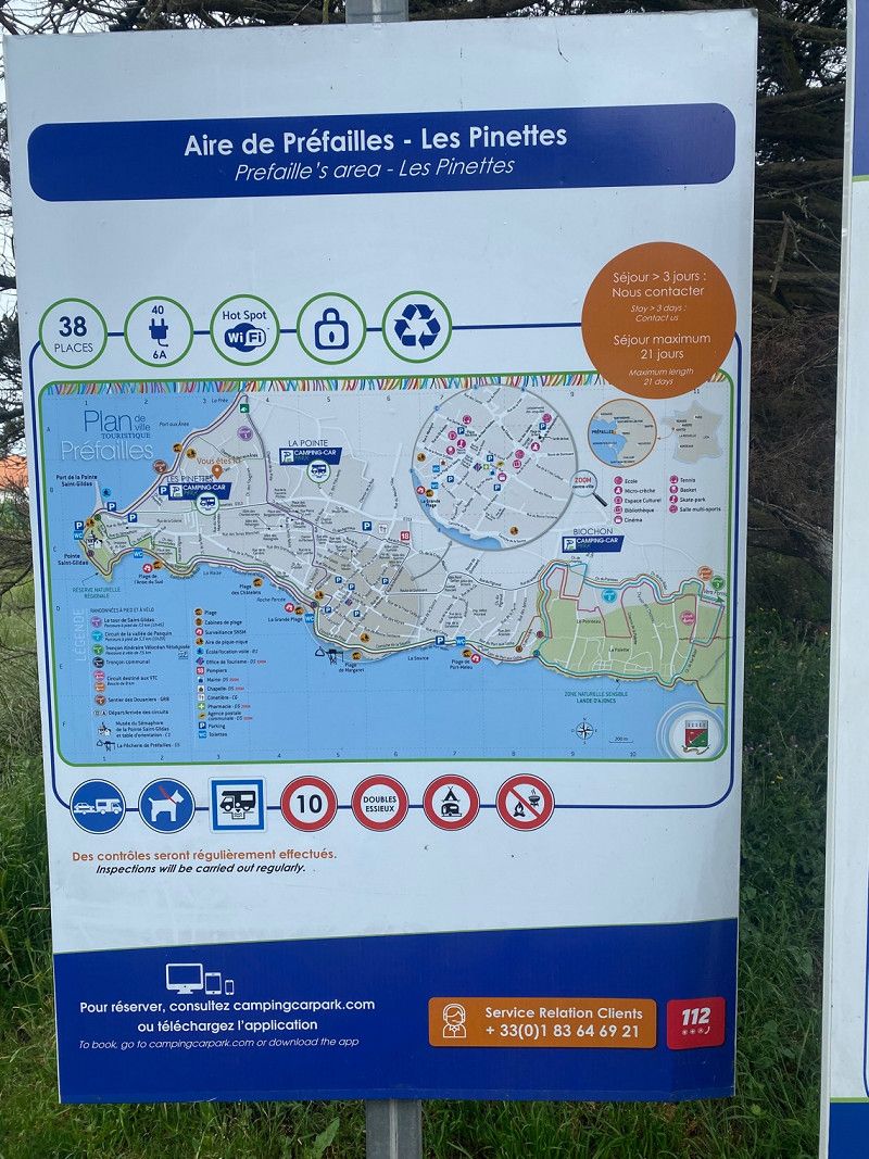
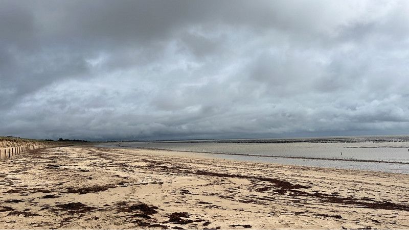
Today we decide to drive a longer stage. The total length of the Loire is over 1000km and we've ridden a good 300km of it. The estuary into the Atlantic at Saint Nazaire/Saint Brevin les Pins we were there in spring 2022, so we are looking for a place around Pornic.
We chose this SP directly on the Atlantic for one night for €14.10 including electricity and tourist tax. Tomorrow we want to go to the island of Noirmoutier.
• Regarding the weather: Very cloudy today and light wind. Heavy rain is expected during the night. 16° only clouds, no hours of sunshine.
Chemin de Pinettes, 44770, Préfailles, Frankreich
47° 8' 13" N 2° 14' 19" W
47.1369444 -2.2386111
• Head toward Rue des Fossettes on Chemin des Pinettes. Go for 95 m.
• Turn left onto Rue des Fossettes (D313). Go for 276 m.
• Continue on D313. Go for 2.6 km.
• Take the 3rd exit from roundabout onto D313. Go for 476 m.
• Take the 1st exit from roundabout onto Rue de la Croix Bouteau (D313). Go for 599 m.
• Take the 2nd exit from roundabout onto D313. Go for 538 m.
• Take the 2nd exit from roundabout onto D13. Go for 4.0 km.
• Take the 2nd exit from roundabout onto D13 toward Pornic. Go for 681 m.
• Take the 3rd exit from roundabout onto Boulevard de Baïona (D286) toward St Nazaire/Nantes. Go for 713 m.
• Take the 2nd exit from roundabout onto Route Bleue (D213) toward Noirmoutier/Nantes. Go for 15.0 km.
• Take the 3rd exit from Giratoire Les Puymains roundabout onto Route Bleue (D13) toward Noirmoutier/La Roche S/Yon/La Rochelle/Bourgneuf en Retz/Machecoul. Go for 542 m.
• Take the 2nd exit from Giratoire du Moulin Saint-Laurent roundabout onto Route Bleue (D13) toward Noirmoutier/La Roche S/Yon/La Rochelle/Nantes/Machecoul. Go for 909 m.
• Take the 2nd exit from Giratoire de la Corderie roundabout onto D758 toward Noirmoutier/Les Sables d'Olne/Bouin. Go for 8.0 km.
• Pass 3 roundabouts and continue on Rue de Nantes (D758). Go for 8.6 km.
• Take the 2nd exit from Carrefour de la Croix Blanche roundabout onto Rue des Sables (D22). Go for 568 m.
• Pass 3 roundabouts and continue on Avenue de l'Estacade (D22). Go for 6.4 km.
• Take the 2nd exit from roundabout onto Route de Saint-Jean de Monts (D38 C). Go for 688 m.
• Take the 2nd exit from roundabout onto Route de Saint-Jean de Monts (D38 C). Go for 231 m.
• Turn right onto Route de la Grande Côte (D38 B). Go for 395 m.
• Take the 3rd exit from roundabout onto Chemin de la Rive. Go for 64 m.
• Take the 1st exit from roundabout onto D38. Go for 3.7 km.
• Pass 5 roundabouts and continue on D38. Go for 9.6 km.
• Take the 3rd exit from Rond-Point du Bonhomme roundabout onto Rue Nationale (D948). Go for 213 m.
• Turn left. Go for 42 m.
• Arrive at your destination on the right.
☍
65,0 km
( 56 min.)
Day
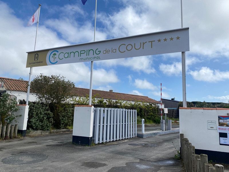
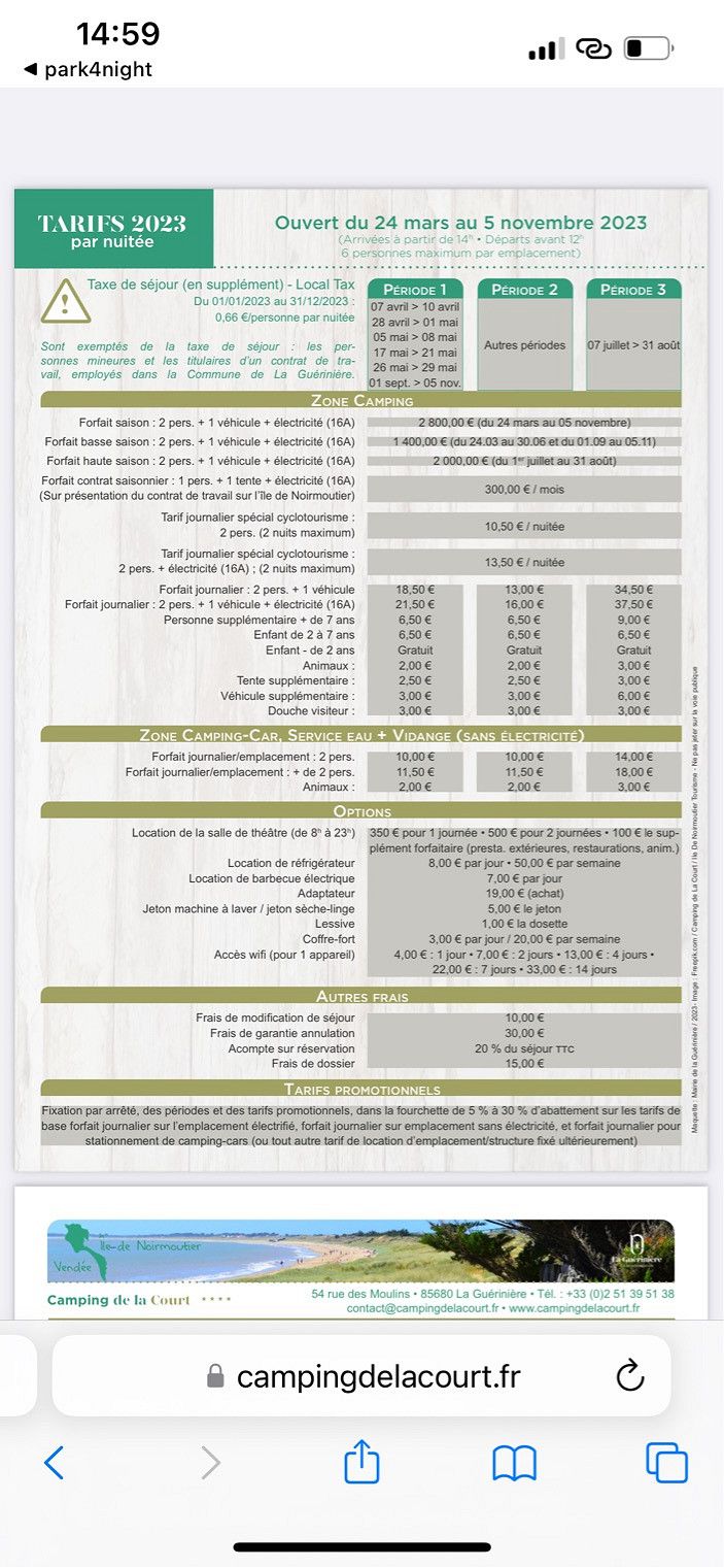
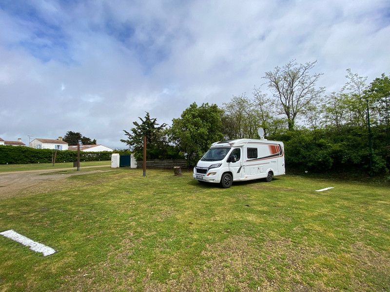
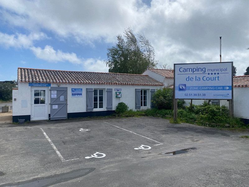
Camping Municipal de la Court ****, Rue des Moulins, La Guérinière, Frankreich
05/09/2023
Today we went to the island of Noirmouthier. There is a very cheap CP with special WomoSP without electricity, just right for us. We pay €11.32 for 1 night and can use the sanitary facilities. Everything nicely maintained and clean. water is hot!!
Tomorrow we want to cycle around the island and see it.
Regarding the weather: still raining this morning (it rained all night) but this afternoon the sun keeps coming out. 16°, wind gusty, and about 5 hours of sunshine
54 Rue des Moulins, 85680 La Guérinière, Frankreich
46° 57' 59.3" N 2° 13' 1.7" W
46.9664640 -2.2171340
• Head toward Rue Nationale. Go for 42 m.
• Turn right onto Rue Nationale (D948). Go for 51 m.
• Take the 1st exit from Rond-Point du Bonhomme roundabout onto Route de l'Île (D38). Go for 1.1 km.
• Take the 2nd exit from roundabout onto D38. Go for 1.3 km.
• Take the 3rd exit from roundabout onto D38. Go for 3.0 km.
• Pass 2 roundabouts and continue on D38. Go for 4.2 km.
• Take the 3rd exit from roundabout onto Rue de l'Estacade (D38). Go for 3.8 km.
• Take the 3rd exit from roundabout onto Chemin de la Rive. Go for 88 m.
• Take the 1st exit from roundabout onto Route de la Grande Côte (D38 B). Go for 409 m.
• Turn left onto Route de Saint-Jean de Monts (D38 C). Go for 203 m.
• Take the 2nd exit from roundabout onto Route de Saint-Jean de Monts (D38 C). Go for 653 m.
• Take the 1st exit from roundabout onto Avenue de l'Estacade (D22). Go for 1.1 km.
• Take the 2nd exit from roundabout onto Avenue de l'Estacade (D22). Go for 2.7 km.
• Take the 1st exit from roundabout onto Lieu-dit Saint-Philbert (D51). Go for 1.8 km.
• Turn left onto D103. Go for 281 m.
• Continue on Lieu-dit La Tiercerie (D103). Go for 78 m.
• Continue on D103. Go for 238 m.
• Continue on Lieu-dit Les Airaudes (D103). Go for 138 m.
• Continue on D103. Go for 260 m.
• Continue on Lieu-dit Le Serin (D103). Go for 100 m.
• Continue on D103. Go for 1.3 km.
• Continue on Lieu-dit La Flocellière (D103). Go for 70 m.
• Continue on D103. Go for 240 m.
• Continue on Lieu-dit La Maison Rousse (D103). Go for 66 m.
• Continue on Rue de la Sablière (D103). Go for 562 m.
• Continue on D103. Go for 36 m.
• Continue on Rue de la Sablière (D103). Go for 847 m.
• Take the 3rd exit from roundabout onto Rue de la Croix de Mission (D59). Go for 521 m.
• Take the 1st exit from roundabout onto Route de Taizan (D120). Go for 1.7 km.
• Continue on Lieu-dit Bellevue (D120). Go for 80 m.
• Continue on Route de Taizan (D120). Go for 993 m.
• Continue on Lieu-dit Le Grand Taizan (D120). Go for 20 m.
• Turn right onto D948. Go for 6.9 km.
• Take the 2nd exit from roundabout onto Rue de Beauvoir (D948). Go for 58 m.
• Take the 3rd exit from Rond-Point de Noirmoutier roundabout onto D948. Go for 2.6 km.
• Keep right onto D948 toward La Roche S/ Yon/Cholet. Go for 4.8 km.
• Pass 2 roundabouts and continue on D948. Go for 35.0 km.
• Take the 4th exit from Rond-Point de l'Atlantique roundabout onto Rue des Terres Noires (D160) toward La Rochelle/Cholet/Les Terres Noires. Go for 4.4 km.
• Keep left onto D948. Go for 20.4 km.
• Take the 3rd exit from roundabout toward Nantes/Angers/Bordeaux/Poitiers/Niort. Go for 139 m.
• Take ramp onto A83 toward Poitiers/Niort/Bordeaux. Go for 81.6 km.
• Take the exit toward E5/Bordeaux/Saintes/Limoges/Angoulême onto A10 (Échangeur Niort-Nord). Go for 96.5 km.
• Take exit 36 toward Jonzac/Pons. Go for 1.2 km.
• Take the 3rd exit from roundabout onto D732 toward Cognac/Pons/Jonzac. Go for 2.7 km.
• Take the 1st exit from roundabout onto D732 toward Saintes/Cognac/Pons/Jonzac. Go for 249 m.
• Take the 1st exit from roundabout onto Avenue de Royan (D732) toward Cognac/Pons/Jonzac/Z.I. du Chail. Go for 680 m.
• Take the 4th exit from roundabout onto Place Saint-Vivien. Go for 134 m.
• Continue on Rue du Maréchal Leclerc. Go for 237 m.
• Turn right onto Rue Thiers. Go for 358 m.
• Arrive at Rue Thiers. Your destination is on the left.
☍
285,9 km
(2 hrs. 42 min.)
Day
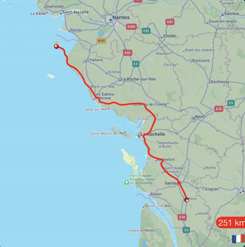
Pons, Frankreich
10.5.2023
After it rained all morning, meaning our bike tour fell through, we continue our journey.
In Pons in front of the Camping Municipal we can stand for 1 night free of charge. A small restaurant right on the square we enjoy a small dinner. The night was very quiet.
Tomorrow we continue towards Spain and hopefully sun and warmer.
17800 Pons, Frankreich
45° 34' 41.2" N 0° 32' 49.2" W
45.5781070 -0.5469889
• Head toward Rue des Jardins on Rue Thiers. Go for 358 m.
• Turn left onto Rue du Maréchal Leclerc. Go for 237 m.
• Continue on Place Saint-Vivien. Go for 65 m.
• Take the 1st exit from roundabout onto Avenue de Royan (D732). Go for 642 m.
• Take the 2nd exit from roundabout onto D732 toward A10/A837/Bordeaux/Paris/Gemozac/Royan/St Genis de S. Go for 267 m.
• Take the 4th exit from roundabout onto Route de Marennes (D732) toward Gemozac/Royan. Go for 2.7 km.
• Take the 2nd exit from roundabout onto A10 (L'Aquitaine) toward Bordeaux. Go for 83.6 km.
• Take exit 1 toward Toulouse/Bayonne/Bassin d'Arcachon/Bordeaux/Périgueux onto N230 (Rocade de Bordeaux). Go for 19.8 km.
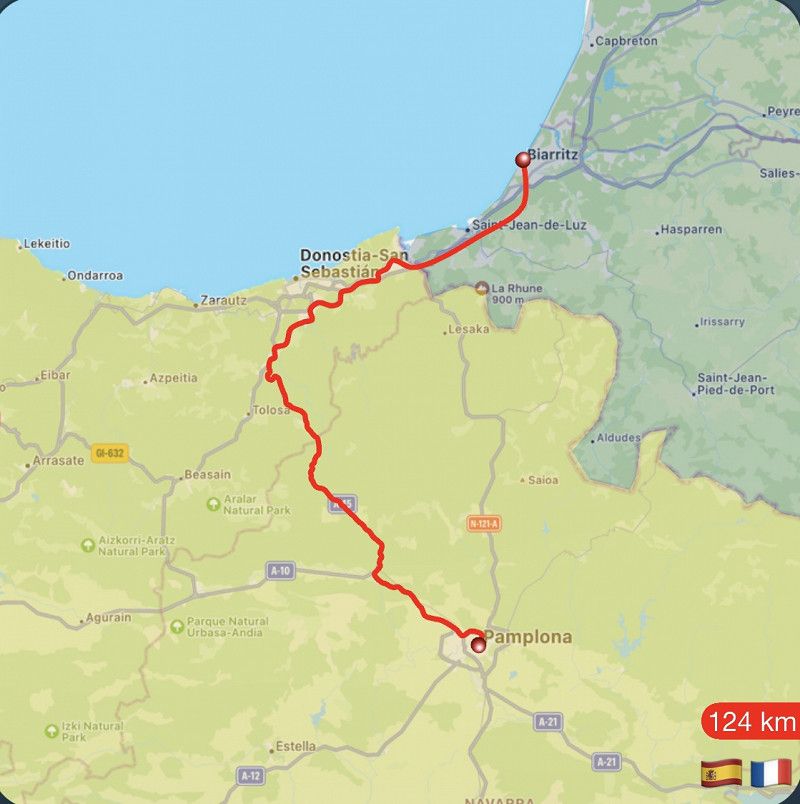
• Take exit 15 toward Saint Sébastien/Bayonne/Mont de Marsan/Bassin d'Arcachon onto A63. Go for 184 km.
• Take exit 4 toward Biarritz/Aéroport Biarritz-Parme/Bidart/St Pée S/Nivelle. Go for 636 m.
• Continue toward Boulevard Marcel Dassault/D810. Go for 46 m.
• Take the 3rd exit from roundabout onto Boulevard Marcel Dassault (D810) toward St Jean de Luz/St Sébastien/Bidart/Donostia. Go for 1.5 km.
• Take the 3rd exit from roundabout onto Avenue de Bayonne (D810) toward Biarritz. Go for 295 m.
• Take the 1st exit from roundabout onto Rue de l'Étape (D655) toward Biarritz. Go for 498 m.
• Continue on Avenue de Biarritz (D911). Go for 826 m.
• Take the 3rd exit from Rond-Point Maïté Barnetche roundabout onto Avenue de Biarritz (D911). Go for 498 m.
• Take the 1st exit from Avenue de la Milady roundabout onto Avenue de la Milady (D911). Go for 373 m.
• Take the 1st exit from Avenue de la Milady roundabout onto Chemin des Prés. Go for 109 m.
• Arrive at your destination on the right.
☍
296,4 km
(2 hrs. 45 min.)
Day
Parking de la Milady
05/11/2023
It's ok for 1 night. Camping car park, paved, electricity, garbage disposal and fresh water. Gray water and black water also possible to dispose of. Fee €14.32
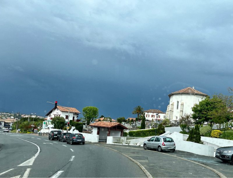
We know Biarritz and also the beautiful area.
About the weather: very cool today, windy, lots of showers, 14°/16°, 5 hours of sunshine
Avenue de la Milady, 64200, Biarritz, Frankreich
43° 27' 58" N 1° 34' 18" W
43.4661111 -1.5716667
• Head north. Go for 147 m.
• Turn right toward Chemin des Prés. Go for 18 m.
• Continue on Chemin des Prés. Go for 46 m.
• Take the 3rd exit from Avenue de la Milady roundabout onto Avenue de la Milady (D911). Go for 382 m.
• Take the 2nd exit from Avenue de la Milady roundabout onto Avenue de la Milady (D911). Go for 500 m.
• Keep right onto Avenue de Biarritz (D911). Go for 39 m.
• Take the 2nd exit from Rond-Point Maïté Barnetche roundabout onto Avenue de Biarritz (D911). Go for 870 m.
• Turn left onto Rue de l'Étape (D655). Go for 475 m.
• Take the 3rd exit from roundabout onto Parc d'Acivités de la Source (D810). Go for 362 m.
• Take the 3rd exit from roundabout. Go for 75 m.
• Continue on Avenue de Bayonne (D810). Go for 1.4 km.
• Take the 2nd exit from roundabout toward A63/A63-A64/Saint Jean de Luz/San Sébastien/Bayonne/Bordeaux. Go for 130 m.
• Take ramp onto A63 (Autoroute de la Côte Basque) toward St Jean de Luz/St Sébastien. Go for 22.4 km.
• Continue on AP-8 (Autopista del Cantábrico). Go for 12.2 km.
• Take the exit toward Bilbao/Vitoria-Gasteiz/Burgos/Hernani/A-15/Iruña/Pamplona onto AP-1/AP-8. Go for 6.9 km.
• Take exit 19 toward Hernani/Iruña/Pamplona onto A-15 (Autovía del Urumea). Go for 10.6 km.
• Take the exit onto N-1. Go for 2.7 km.
• Keep right onto A-15 (Agaraitz auzoa) toward Irurtzun/Iruña/Pamplona. Go for 44.4 km.
• Continue on AP-15 (Autopista de Navarra). Go for 15.5 km.
• Continue on A-15 (Ronda Oeste). Go for 13.2 km.
• Continue on AP-15 (Autopista de Navarra). Go for 25.7 km.
• Take exit 56A toward Tafalla (Norte)/N-121 onto NA-8607. Go for 3.6 km.
• Pass 2 roundabouts and continue on Avenida Pamplona (NA-8607). Go for 669 m.
• Take the 3rd exit from roundabout onto Avenida Severino Fernández (NA-8607). Go for 737 m.
• Take the 1st exit from roundabout onto Calle Recoletas (NA-8607). Go for 128 m.
• Turn right onto Calle Raimundo Lanas (NA-132). Go for 141 m.
• Turn right onto Calle Escuela María. Go for 60 m.
• Arrive at Calle Escuela María. Your destination is on the left.
☍
163,5 km
(1 hrs. 43 min.)
Day
Tafalla, Spanien
05/12/2023
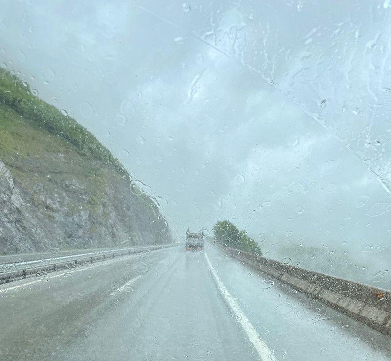
This morning dark clouds gather as we drive off.
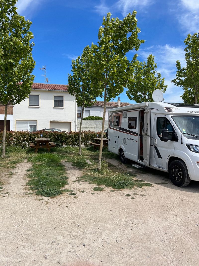
Our first goal is Pamplona. Unfortunately it was too cold for us (8°) in Pamplona so we just go shopping and drive 40km further. As we arrive it is 13° and in the afternoon it will be 16°.
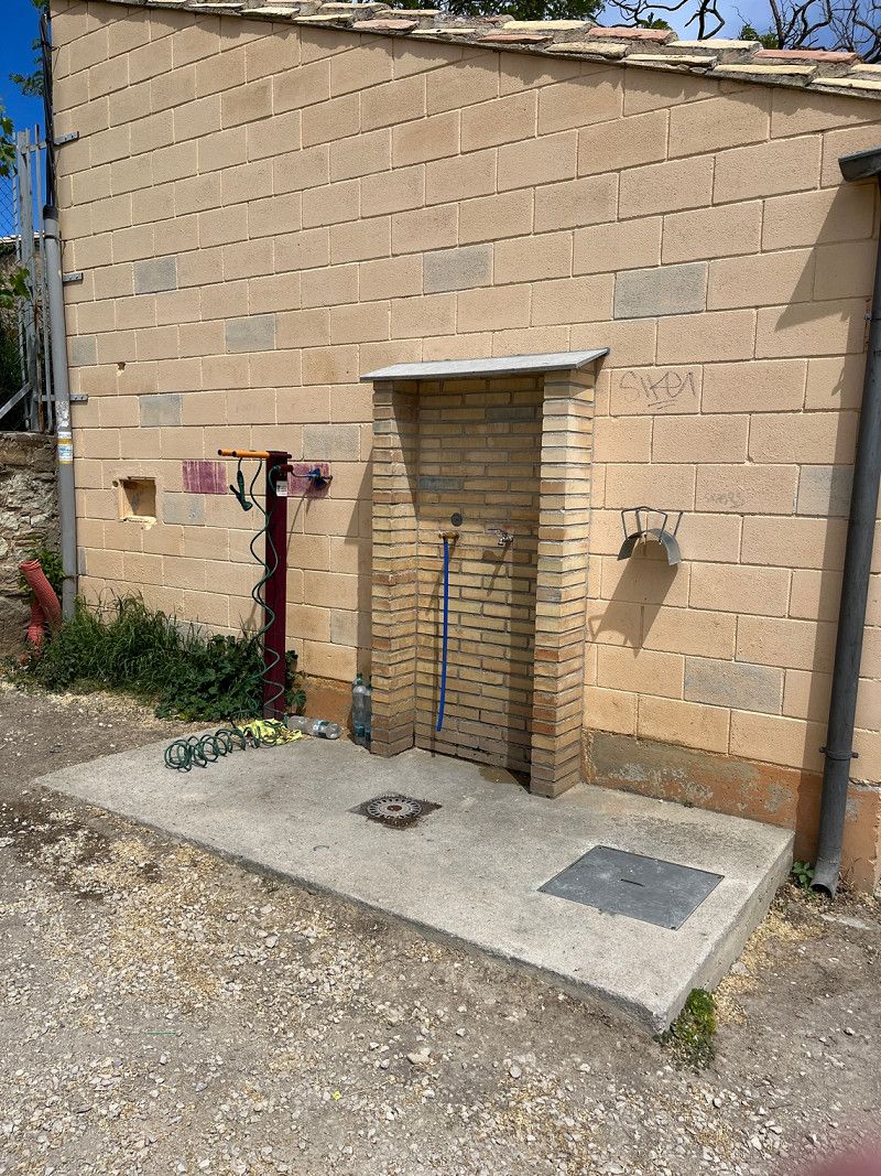
The municipality provides an SP free of charge. Max for 48 hours Garbage disposal, fresh water and gray water disposal possible. 6 places with picnic tables. In the evening there are more than places.
We finally have a bit of sun and enjoy our coffee outside.
31300 Tafalla, Navarre, Spanien
42° 31' 36.5" N 1° 40' 39.6" W
42.5267993 -1.6776784
• Head north on Calle Escuela María.
• Turn slightly right onto Calle Tubal. Go for 73 m.
• Turn right onto Calle Garcés de los Fayos. Go for 79 m.
• Turn slightly right onto Calle Navaz y Vides. Go for 17 m.
• Continue on Calle Cuatro Esquinas. Go for 83 m.
• Take the 1st exit from roundabout onto Calle Recoletas (NA-8607). Go for 125 m.
• Turn left onto Avenida Tudela (NA-8607). Go for 398 m.
• Pass 2 roundabouts and continue on Avenida Tudela (NA-8607). Go for 1.3 km.
• Take the 2nd exit from roundabout onto N-121 toward Zaragoza/AP-15/Madrid/Olite/NA-132/Estella-Lizarra. Go for 404 m.
• Take the 3rd exit from roundabout onto N-121 toward Olite/Erriberri/Zaragoza/Madrid. Go for 1.2 km.
• Take the 5th exit from roundabout onto NA-8602. Go for 627 m.
• Continue on Calle Rua Romana (NA-8602). Go for 152 m.
• Take the 1st exit from roundabout onto Calle Rua Romana (NA-8602). Go for 1.6 km.
• Turn left onto Calle de la Estación. Go for 40 m.
• Continue on Calle Castillo. Go for 257 m.
• Turn right onto NA-5300. Go for 41 m.
• Arrive at NA-5300. Your destination is on the right.
☍
6,4 km
( 9 min.)
Day
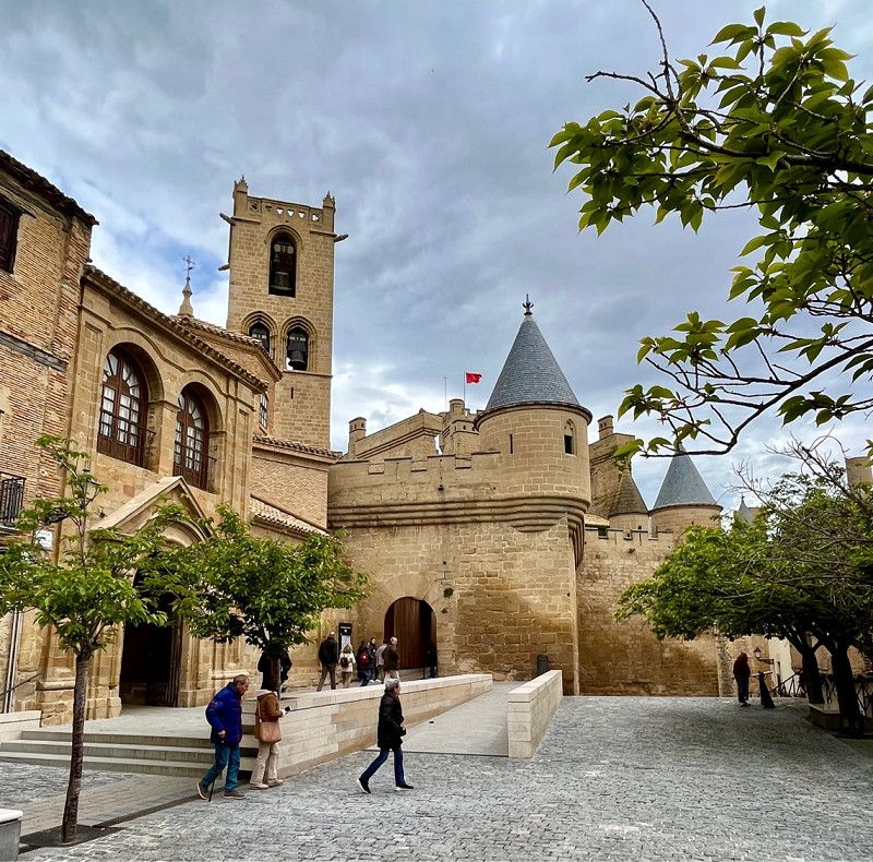
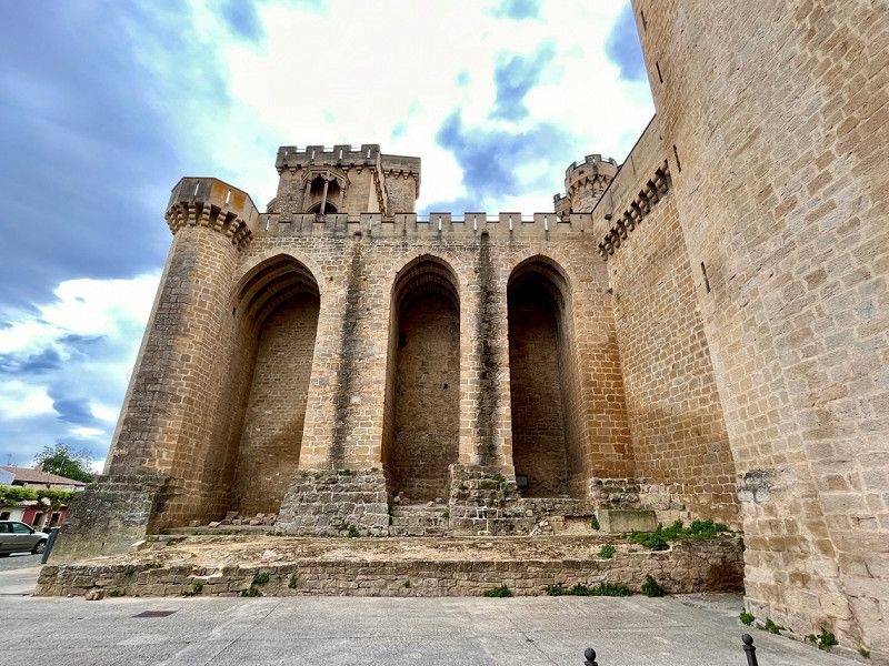
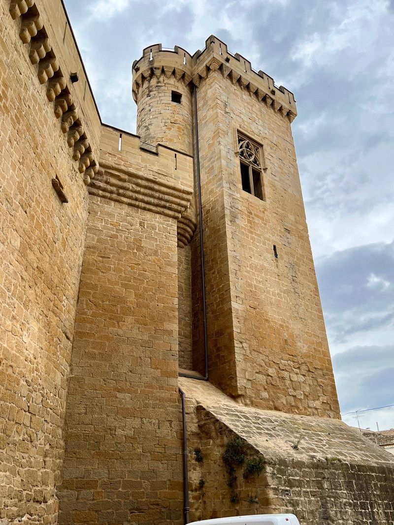
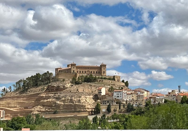
Palacio Real de Olite, Spanien
05/13/2023 - 9°/21° ⛅️ 🌤️ - 17th day
The Royal Palace of Olite
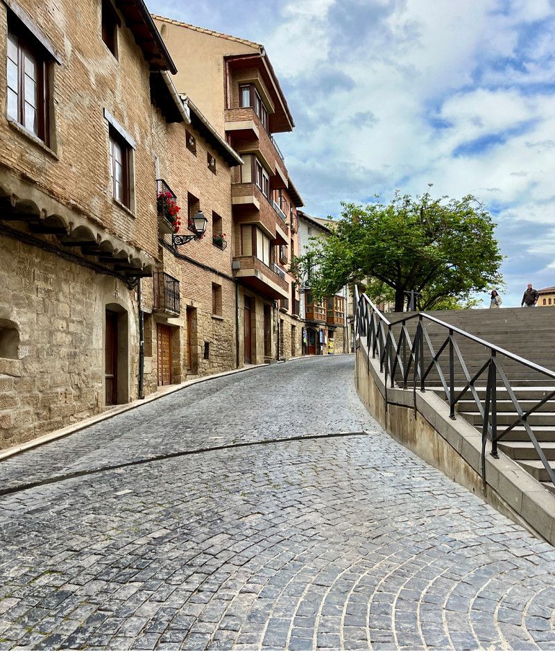
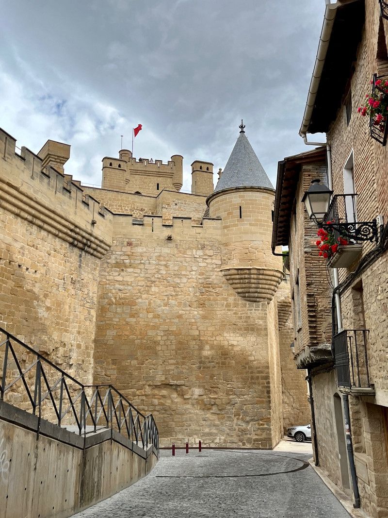
After a quiet night with many other campers on the community square, we continue towards the east coast. Today, too, we first drive on the country road. The small town of Olite is only 6.5 km away. Here is a castle from the 11th or 14th century. It was the seat of Charles III the Noble, King of Navarre. Worth a visit!! Even the small village is rustic and very well maintained. Unfortunately, the temperatures (9°) are not so tempting to linger on the market square.
Rúa del Fondo, 31390, Olite/Erriberri, Spanien
42° 28' 54.3" N 1° 38' 57.7" W
42.4817420 -1.6493477
• Head toward Plaza Carlos III El Noble on NA-5300. Go for 20 m.
• Continue on Calle Fondo (NA-5300). Go for 49 m.
• Turn left onto Calle Cantarería. Go for 43 m.
• Turn slightly right onto Calle del Rebose. Go for 74 m.
• Turn right onto Calle San Pedro. Go for 19 m.
• Turn left onto Calle Mayor. Go for 101 m.
• Take the 1st exit from roundabout onto Plaza San Antón. Go for 112 m.
• Turn left onto Calle Alcalde Maillata (NA-8602). Go for 530 m.
• Continue on NA-8602. Go for 1.1 km.
• Turn left onto N-121. Go for 4.2 km.
• Turn left onto NA-5330 toward Pitillas/Santacara/Mélida/Murillo El Fruto/Carcastillo. Go for 1.6 km.
• Continue on Avenida Navarra (NA-5330). Go for 627 m.
• Continue on NA-5330. Go for 7.4 km.
• Continue on Calle Nuestra Señora de Ujué (NA-5330). Go for 453 m.
• Turn left onto Carretera de Aibar (NA-1240). Go for 582 m.
• Continue on NA-1240. Go for 2.9 km.
• Continue on Carretera Caparroso-Carcastillo (NA-1240). Go for 5.9 km.
• Continue on NA-1240. Go for 147 m.
• Continue on Calle Carretera (NA-1240). Go for 303 m.
• Turn left onto Calle Carretera (NA-1240). Go for 153 m.
• Turn right onto Avenida Aragón (NA-534). Go for 800 m.
• Take the 1st exit from roundabout onto NA-534. Go for 8.4 km.
• Continue on A-1201. Go for 5.1 km.
• Turn right onto Carretera a Pinsoro (A-1208). Go for 10.7 km.
• Continue on Carretera de Pinsoro a Valareña (A-1208). Go for 840 m.
• Turn right. Go for 134 m.
• Continue straight ahead. Go for 281 m.
• Turn left. Go for 3.9 km.
• Turn right. Go for 669 m.
• Turn slightly left. Go for 11 m.
• Turn left. Go for 797 m.
• Turn right. Go for 677 m.
• Turn right. Go for 695 m.
• Turn left. Go for 1.5 km.
• Turn left. Go for 3.8 km.
• Arrive at your destination.
☍
64,7 km
(1 hrs. 11 min.)
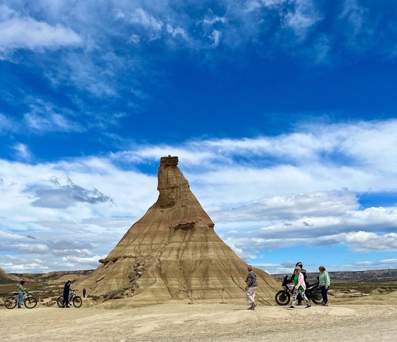
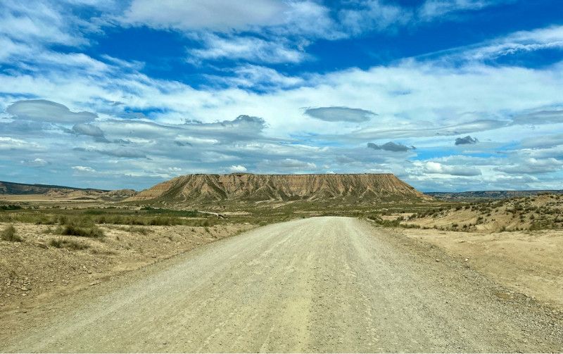
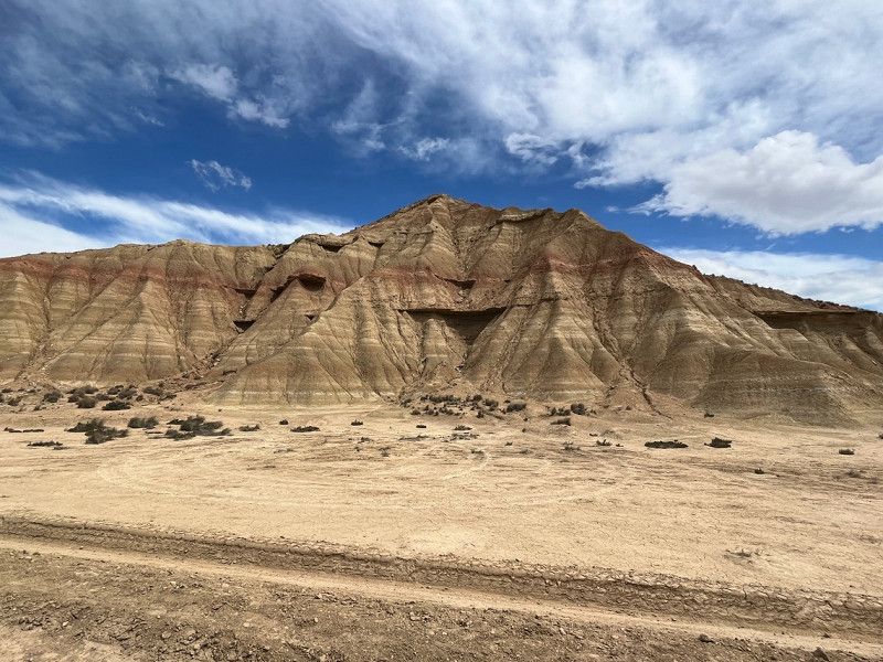
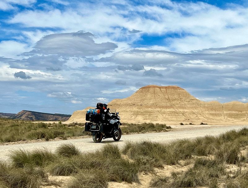
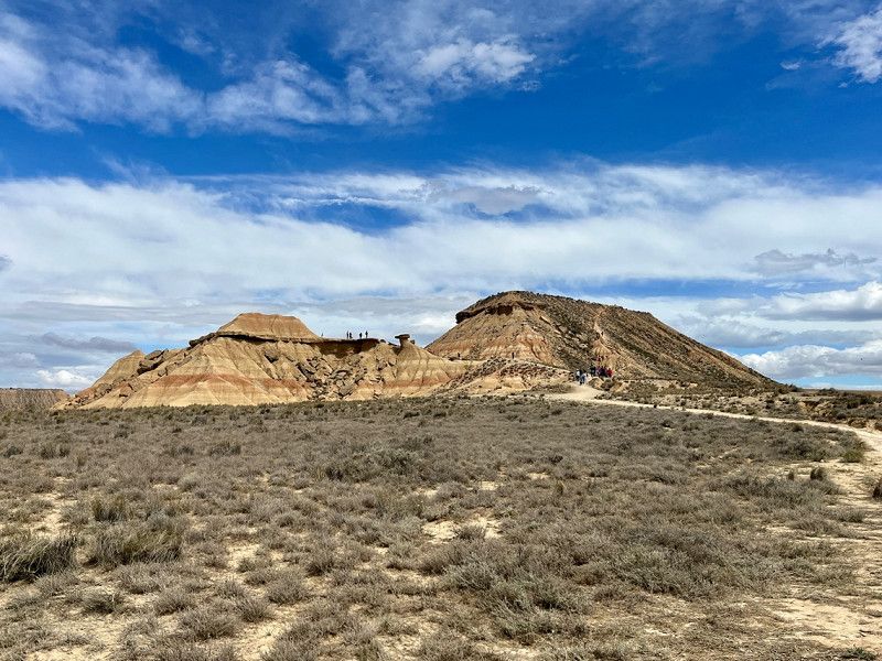
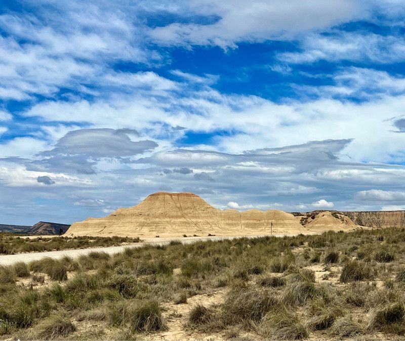
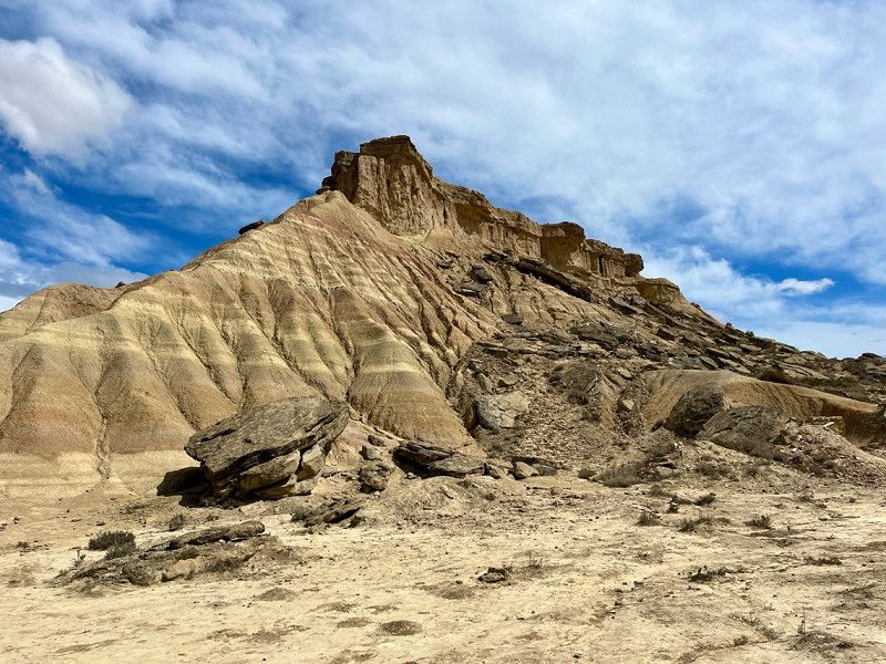
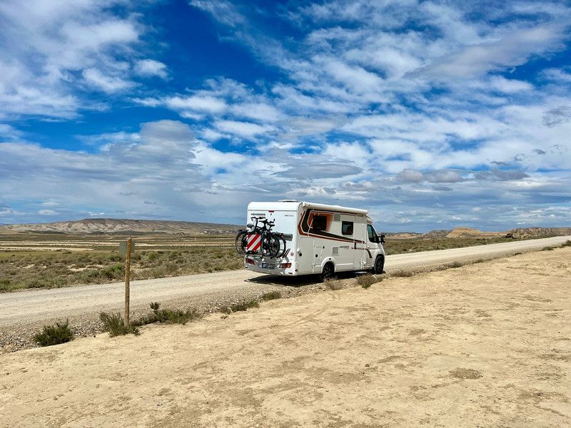
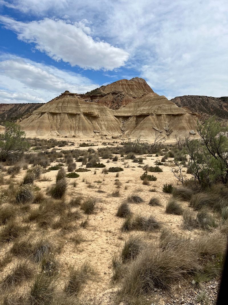
Parque Natural de las Bardenas Reales, Spanien
Bardenas Reales semi-desert
The road is getting narrower and narrower, but we proceed cautiously. We turn onto the gravel road to see some of the spectacular rock formations. The wind is strong today (6-7bfr). Lunch break in the parking lot after the gravel road. The temperature is finally at 16° and the sun comes out again and again.
Parque Natural de las Bardenas Reales, Bardenas Reales de Navarra, Spanien
42° 9' 40.2" N 1° 27' 58.5" W
42.1611684 -1.4662507
• Head southeast. Go for 2.1 km.
• Turn right. Go for 2.3 km.
• Turn sharp right. Go for 1.4 km.
• Turn right. Go for 1.8 km.
• Turn left. Go for 882 m.
• Turn right toward A-125. Go for 3.6 km.
• Turn left onto A-125. Go for 4.2 km.
• Take the 1st exit from roundabout. Go for 63 m.
• Continue on Carretera del Sabinar (A-1208). Go for 215 m.
• Continue on Carretera a El Sabinar (A-1208). Go for 8.1 km.
• Continue on Carretera de Sabinar a Sancho Abarca (A-1208). Go for 12.3 km.
• Continue on Carretera de Tauste a Sancho Abarca (A-1208). Go for 7.5 km.
• Take the 1st exit from roundabout onto A-127. Go for 2.0 km.
• Take the 3rd exit from roundabout onto A-126. Go for 2.3 km.
• Take the 2nd exit from roundabout onto A-126. Go for 17.5 km.
• Take left ramp onto AP-68 (Autopista del Ebro) toward Zaragoza/Barcelona. Go for 18.1 km.
• Continue on A-68 (Autopista del Ebro). Go for 3.2 km.
• Continue on A-2 (Autovía del Nordeste). Go for 2.3 km.
• Take exit 321 toward Z-30/El Pilar onto Calle Comandante E. Che Guevara. Go for 1.6 km.
• Take ramp onto Calle Pintor Pablo Ruiz Picasso. Go for 277 m.
• Arrive at Calle Pintor Pablo Ruiz Picasso.
☍
91,7 km
(1 hrs. 22 min.)
Zaragoza, Zaragoza, Spain
Cl Aznar, Adolfo (cineasta) 38, 50018, Zaragoza, Spain
41° 40' 27" N 0° 52' 55.9" W
41.6741594 -0.8821849
• Head west on Calle Pintor Pablo Ruiz Picasso. Go for 543 m.
• Take the 1st exit from roundabout. Go for 89 m.
• Continue on Avenida Pintor Pablo Ruiz Picasso. Go for 168 m.
• Continue on Calle Pintor Pablo Ruiz Picasso. Go for 20 m.
• Continue on Avenida Pintor Pablo Ruiz Picasso. Go for 12 m.
• Continue on Calle Pintor Pablo Ruiz Picasso. Go for 16 m.
• Continue on Avenida Pintor Pablo Ruiz Picasso. Go for 283 m.
• Turn right toward Avenida José Atarés. Go for 65 m.
• Turn right onto Avenida José Atarés. Go for 407 m.
• Take the 2nd exit from roundabout onto Avenida José Atarés. Go for 351 m.
• Take the 1st exit from roundabout onto A-2 (Autovía del Nordeste) toward Barcelona. Go for 19.5 km.
• Continue on AP-2 (Autopista Zaragoza Mediterráneo). Go for 4.4 km.
• Take exit 1B toward Belchite/A-222/Alcañiz/Castellón/N-232 onto ARA-A1. Go for 4.8 km.
• Take the 5th exit from roundabout onto N-232 toward Castellón. Go for 81.0 km.
• Take ramp toward Alcañiz. Go for 266 m.
• Take the 5th exit from roundabout onto Calle Aguas toward Alcañiz/N-232/Zaragoza. Go for 458 m.
• Take the 1st exit from roundabout onto Avenida de Zaragoza (N-232a) toward Alcañiz. Go for 665 m.
• Pass 4 roundabouts and continue on Avenida de Zaragoza (N-232a). Go for 2.0 km.
• Continue on Calle Muro de Santa María (N-232a). Go for 15 m.
• Turn left onto Calle Mayor. Go for 187 m.
• Turn slightly left onto Calle Mayor. Go for 23 m.
• Turn slightly right onto Plaza Cabañero. Go for 24 m.
• Continue on Calle Palomar. Go for 55 m.
• Arrive at Calle Palomar. Your destination is on the left.
☍
115,3 km
(1 hrs. 23 min.)
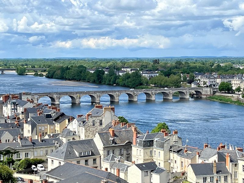
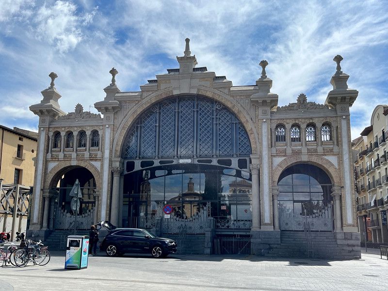
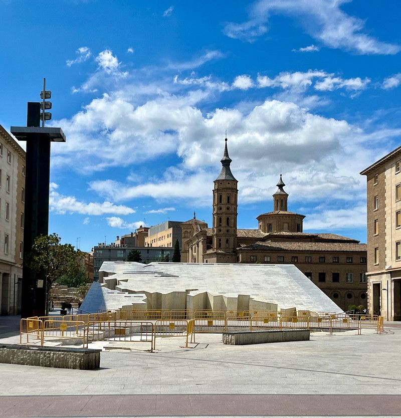
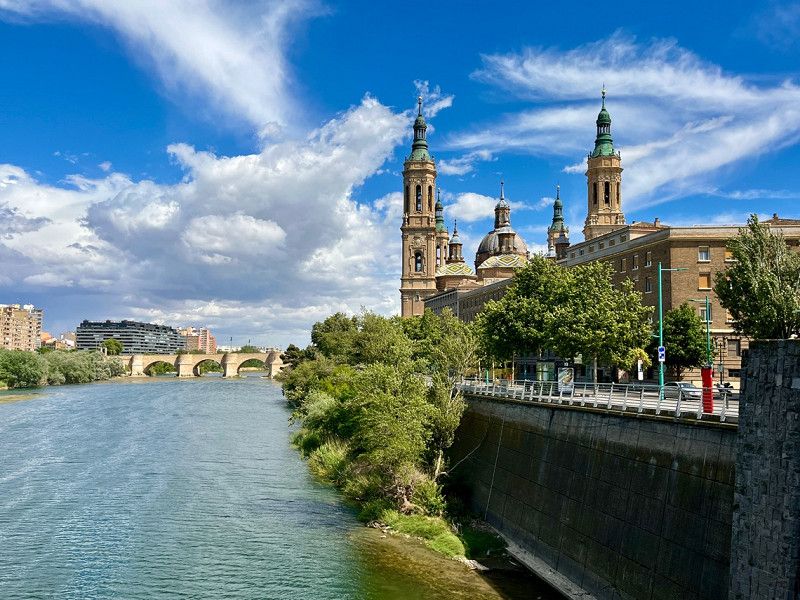
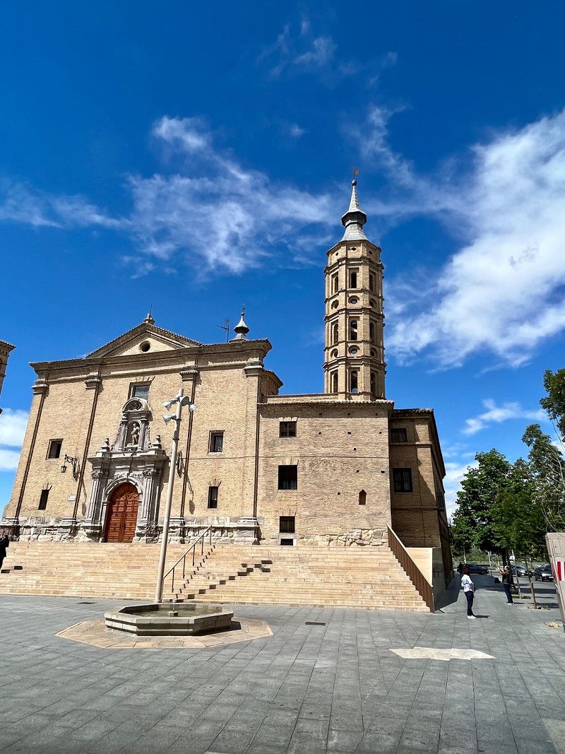
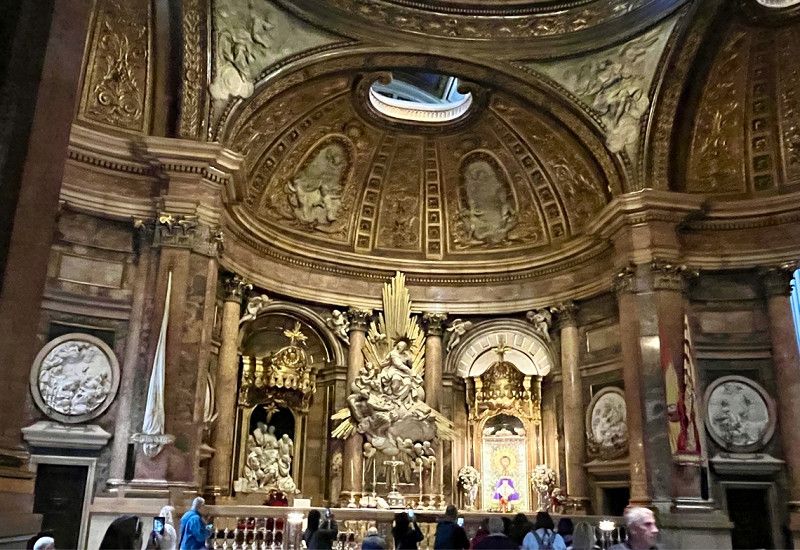
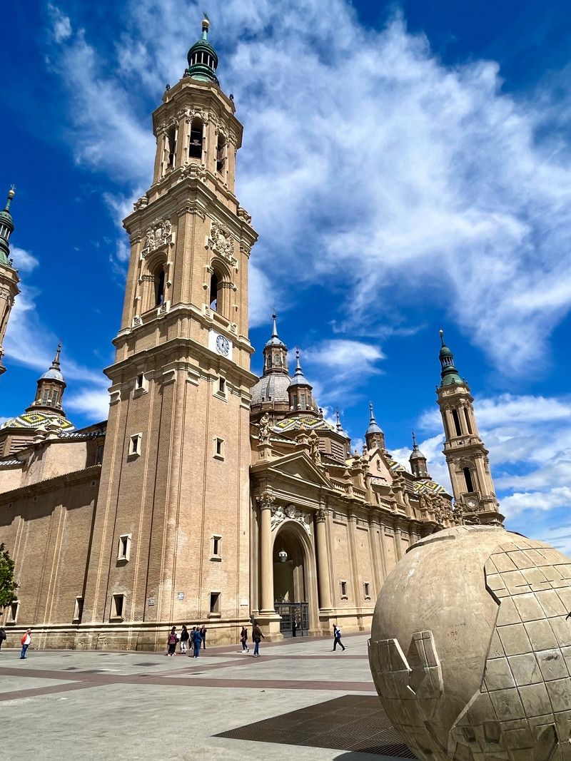
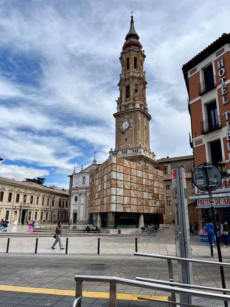
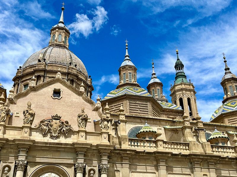
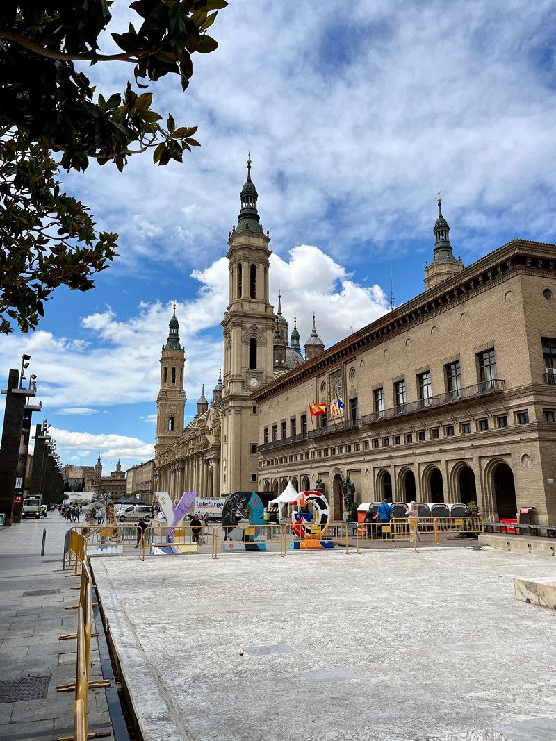
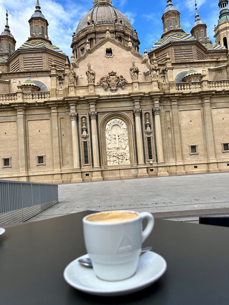
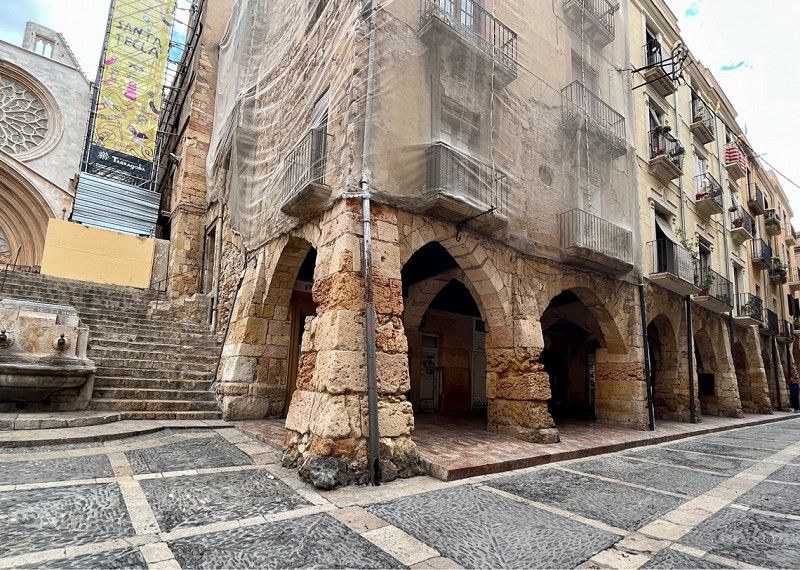
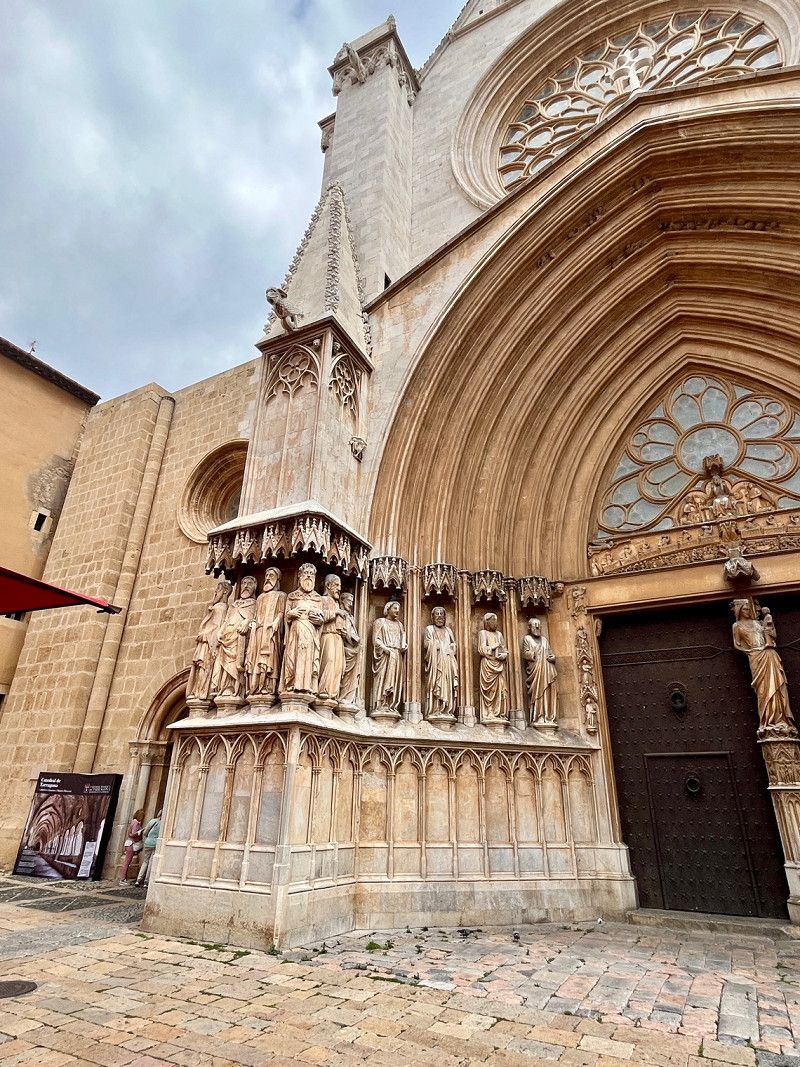
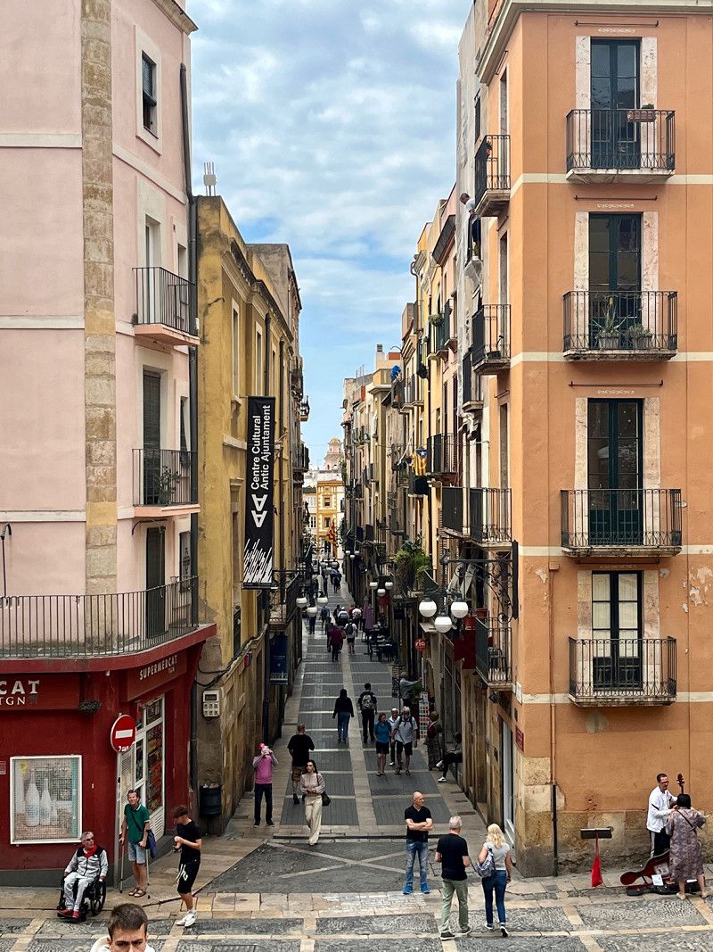
Saragossa - zum Kaffee an der Kathedrale
Zaragoza - for coffee at the Cathedral
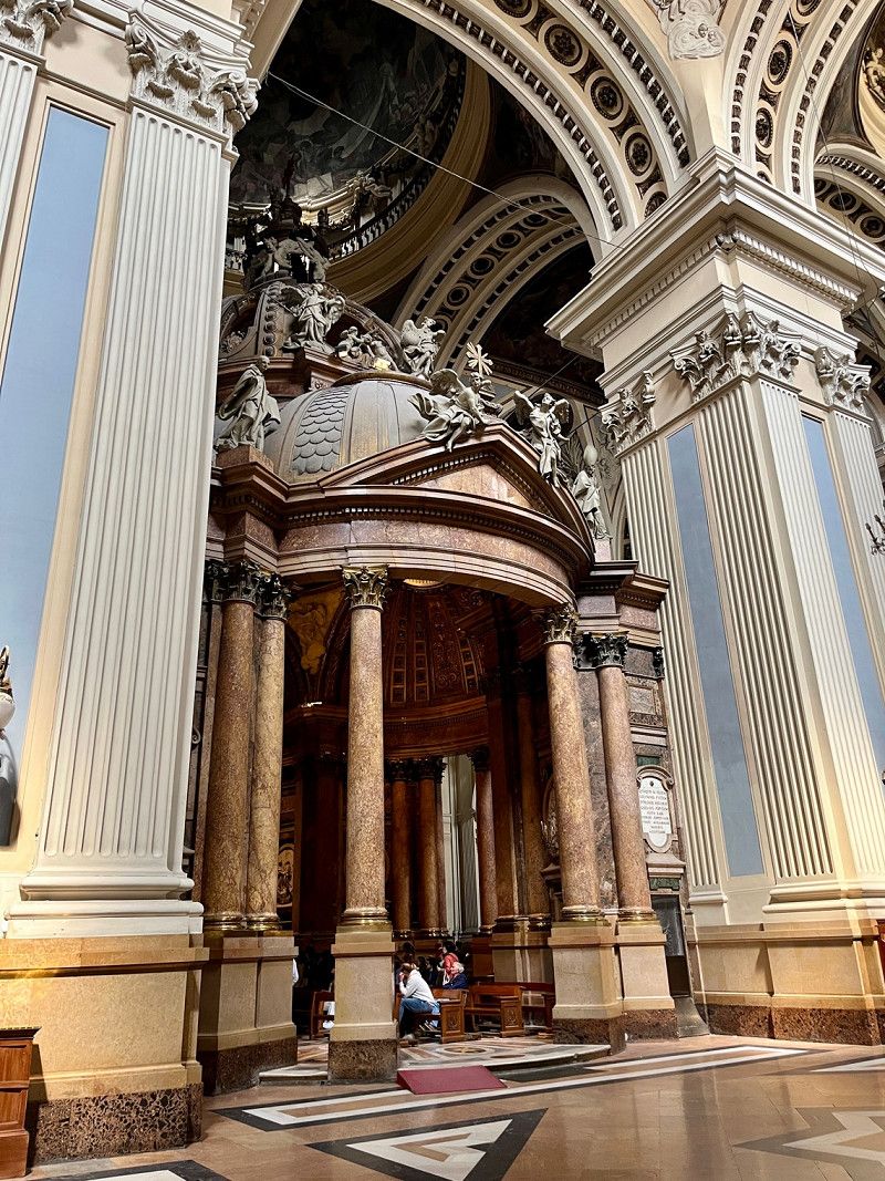
We already know SP in Zaragoza, so we're going there again. We take the tram (stop directly at the SP) for €1.50 per person to the Plaza de España in the old town. After a short walk we drink coffee and then visit the cathedral. It's enough for today and we'll end the evening comfortably in the Womo.
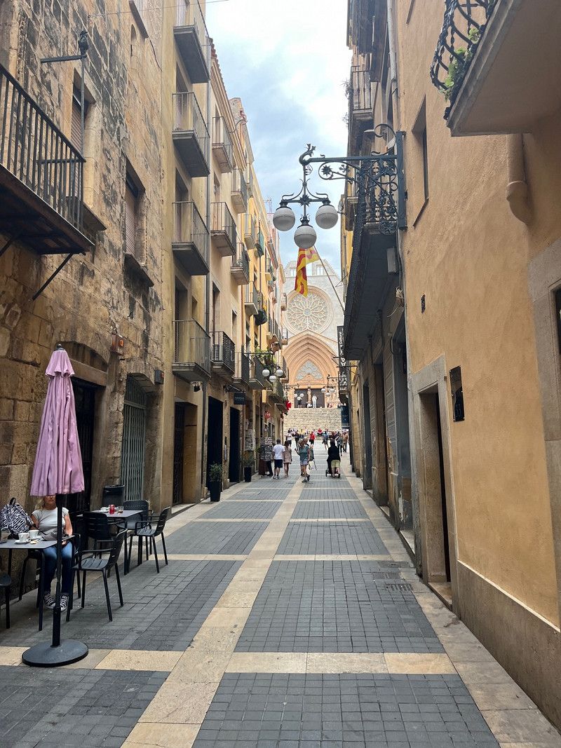
• About the weather: this morning a fresh 9° and clouds, the further we drive towards the east coast, the warmer it gets. In the afternoon we have 21° - sunshine with occasional clouds. The wind continues to be fierce with 6-7bfr.
Day
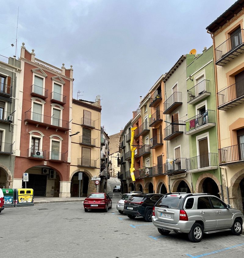
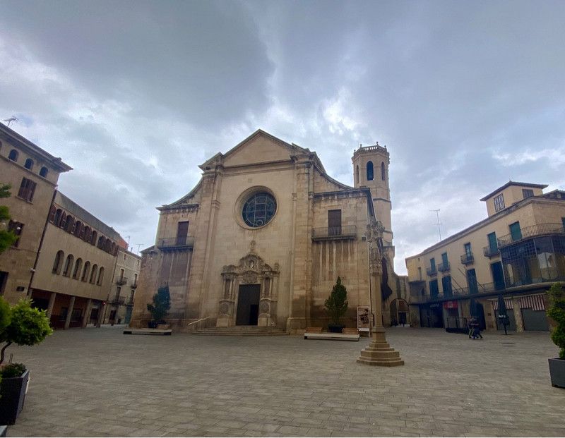
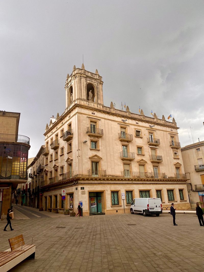
Alcañiz, Spanien
05/14/2023 - 14°/21° 🌤️ - 18th day
After a quiet night on the SP in Zaragoza, we continue towards the Mediterranean Sea in glorious weather. Our route takes us through very beautiful scenic areas. Since today is Sunday, there is very little going on on the streets.
41° 3' 0.9" N 0° 7' 58.6" W
41.0502540 -0.1329565
• Head toward Subida Encomienda on Calle Palomar. Go for 45 m.
• Turn slightly left onto Plaza Galo Leoz. Go for 8 m.
• Turn left onto Plaza Galo Leoz. Go for 33 m.
• Continue on Calle Ángel Ruiz. Go for 46 m.
• Continue on Plaza España. Go for 29 m.
• Continue on Plaza España. Go for 17 m.
• Turn right onto Plaza del Mercado. Go for 29 m.
• Turn left onto Calle Pruneda. Go for 85 m.
• Turn right onto Plaza San José. Go for 19 m.
• Turn right onto Avenida de Galán Bergua. Go for 82 m.
• Turn right onto Avenida de Aragón. Go for 922 m.
• Turn right toward Avenida del Maestrazgo/N-232a. Go for 33 m.
• Take the 2nd exit from roundabout onto Avenida del Maestrazgo (N-232a). Go for 195 m.
• Continue on N-232a. Go for 1.4 km.
• Take the 1st exit from roundabout onto N-211. Go for 204 m.
• Keep left onto N-211 toward Castellón. Go for 126 m.
• Continue on N-232. Go for 11.8 km.
• Take ramp toward Torrecilla/A-231/Valjunquera/Valderrobres. Go for 171 m.
• Continue straight ahead. Go for 45 m.
• Take the 2nd exit from roundabout. Go for 235 m.
• Continue toward A-231. Go for 34 m.
• Take the 1st exit from roundabout onto A-231. Go for 19.4 km.
• Continue on Avenida Cortes de Aragón (A-231). Go for 1.0 km.
• Turn right onto Calle Santiago Hernández Ruiz (A-231). Go for 449 m.
• Take the 2nd exit from roundabout onto A-231. Go for 9.8 km.
• Continue on T-330. Go for 7.7 km.
• Continue on T-330. Go for 6.7 km.
• Continue on T-333 toward Prat de Comte/El Pinell de Brai/Tortosa. Go for 1.4 km.
• Take the 2nd exit from roundabout onto T-333 toward El Pinell de Brai/Xerta/Tortosa. Go for 4.3 km.
• Turn right onto N-230b toward Xerta/Tortosa/Móra. Go for 7.2 km.
• Turn right onto C-12 toward Xerta/Tortosa. Go for 13.5 km.
• Pass 2 roundabouts and continue on Avinguda de Marcel.lí Domingo (C-12). Go for 1.6 km.
• Take the 3rd exit from roundabout onto Avinguda de Marcel.lí Domingo (C-12) toward AP-7/Amposta/Castelló. Go for 688 m.
• Take the 3rd exit from roundabout onto Pont del Mil.lenari (C-42) toward AP-7/l'Aldea. Go for 1.3 km.
• Take the 3rd exit from roundabout onto Avinguda de la Generalitat (T-301) toward Bítem/Tivenys. Go for 364 m.
• Turn right onto Carrer de Verges Paül. Go for 201 m.
• Turn right onto Avinguda Ferran d'Aragó. Go for 42 m.
• Arrive at Avinguda Ferran d'Aragó. Your destination is on the right.
☍
91,1 km
(1 hrs. 18 min.)
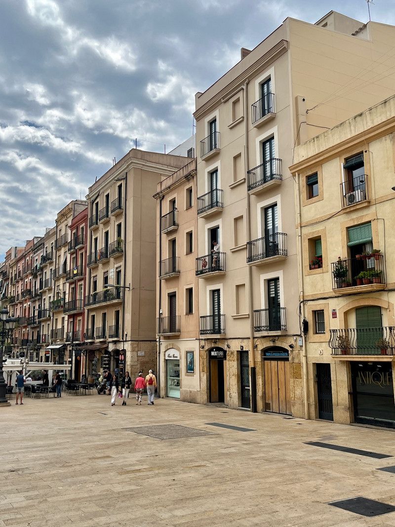
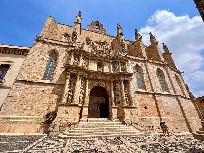
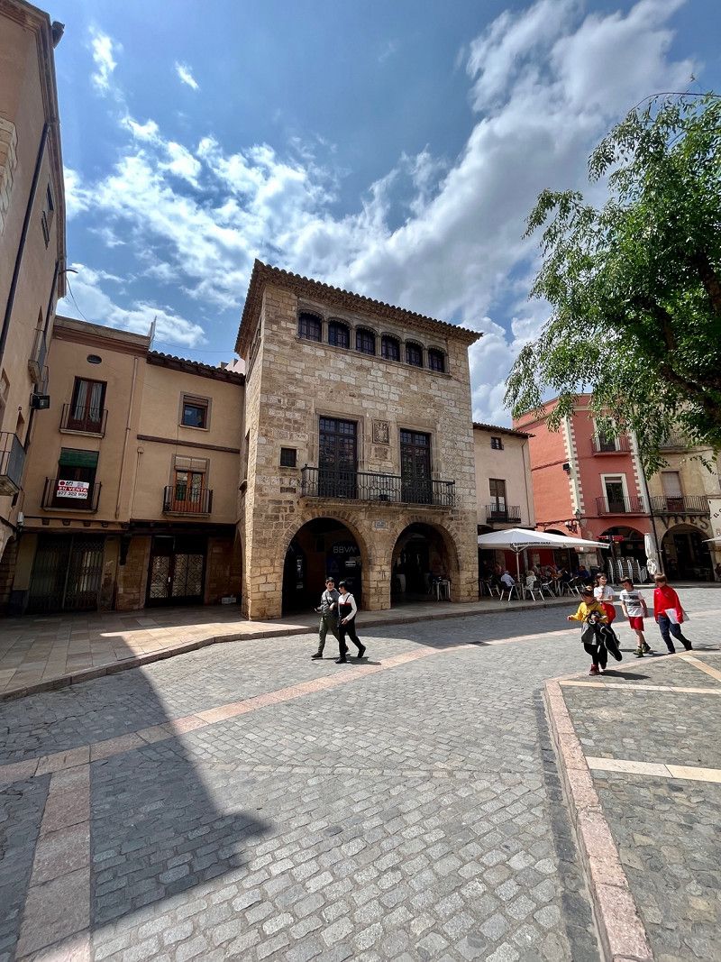
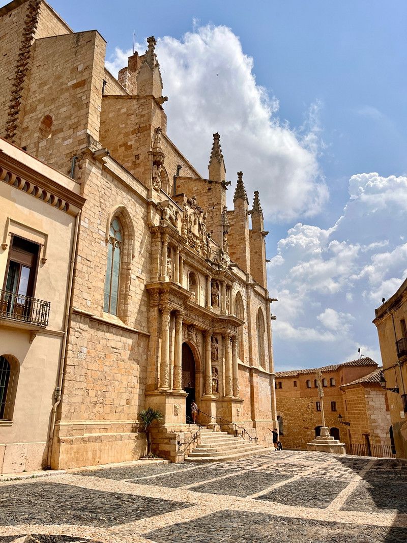
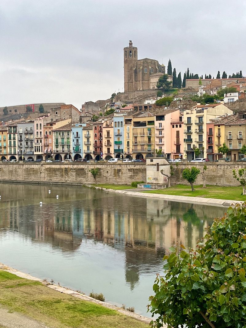
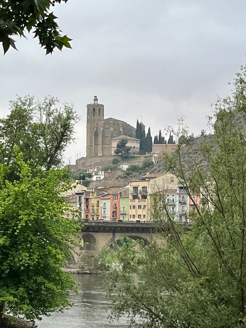
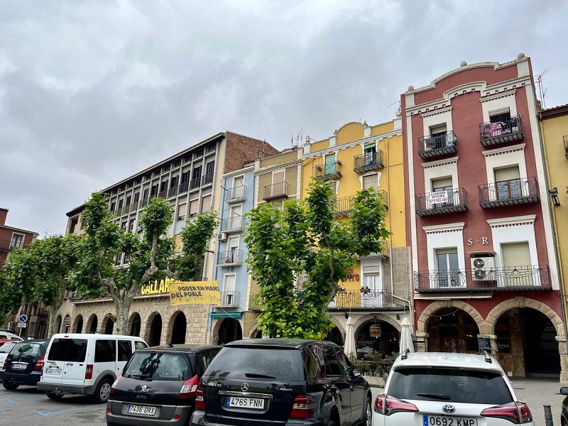
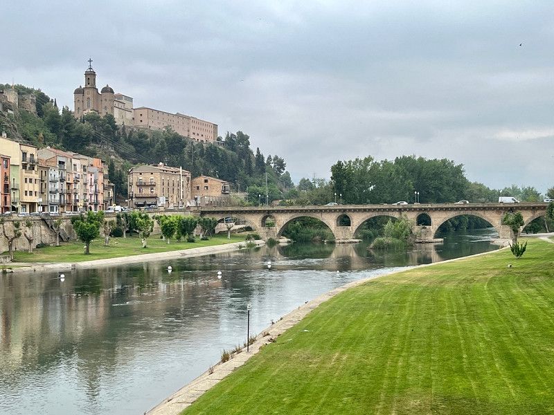
Tortosa, Tarragona, Spain
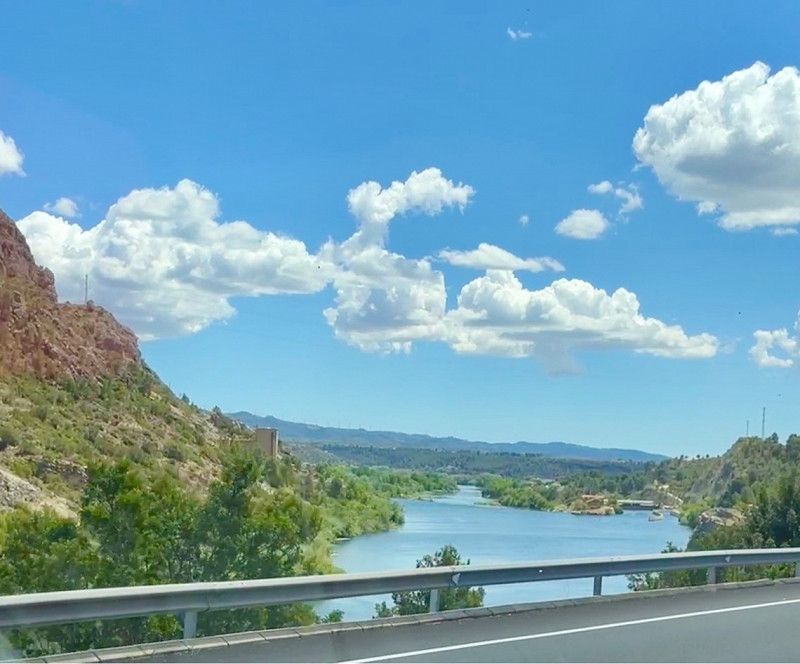
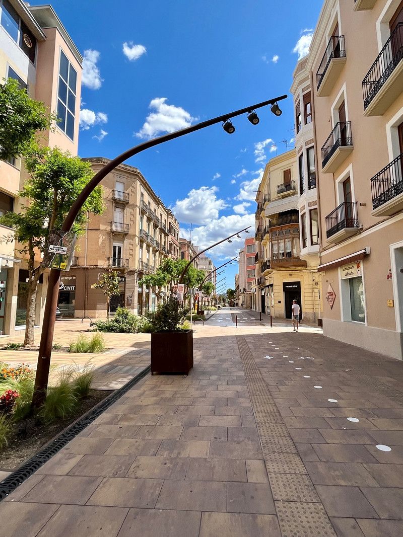
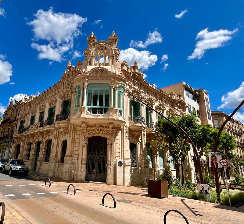
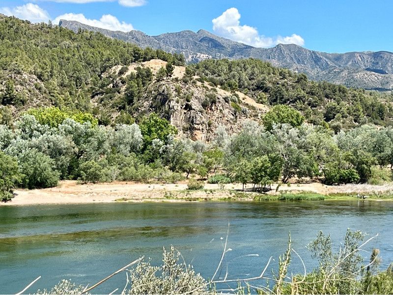
After lunch we drive the last stretch on the C12 along the big river L'Ebre to Tortosa. Here we find the free SP of the municipality. A short walk into town in the afternoon, but it's very quiet here today.
• Regarding the weather: sunny, cloudy in the late afternoon and a small shower. windy, 12h Sunshine.
Cl Bernat De Vil·lamari 1, 43518, Tortosa, Spain
40° 48' 16.1" N 0° 31' 22.3" E
40.8044661 0.5228606
• Head south on Avinguda Ferran d'Aragó. Go for 42 m.
• Turn right onto Carrer del Barranc dels Caputxins. Go for 204 m.
• Turn left onto Avinguda de la Generalitat (T-301). Go for 199 m.
• Take the 2nd exit from roundabout onto Avinguda de la Generalitat (C-42) toward AP-7/Campredó/l'Aldea/Tarragona. Go for 416 m.
• Pass 3 roundabouts and continue on Carretera a Castelló (C-42). Go for 1.8 km.
• Take the 3rd exit from roundabout onto C-42 toward Campredó/l'Aldea/Tarragona/AP-7. Go for 7.5 km.
• Take the 2nd exit from roundabout onto N-235 toward l'Aldea/Amposta/Tarragona. Go for 680 m.
• Take the 1st exit from roundabout onto N-340 toward Castelló. Go for 16.4 km.
• Pass 2 roundabouts and continue on N-340. Go for 13.8 km.
• Take ramp toward N-340a/Vinaròs/Carretera Costa. Go for 336 m.
• Take the 4th exit from roundabout toward Vinaròs/Carretera Costa. Go for 524 m.
• Take the 1st exit from roundabout. Go for 80 m.
• Turn right onto Camino de la Partició de la Sunyera. Go for 161 m.
• Arrive at Camino de la Partició de la Sunyera. Your destination is on the left.
☍
42,2 km
( 34 min.)
Day
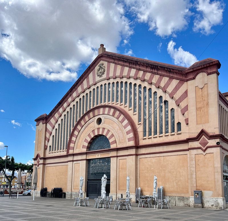
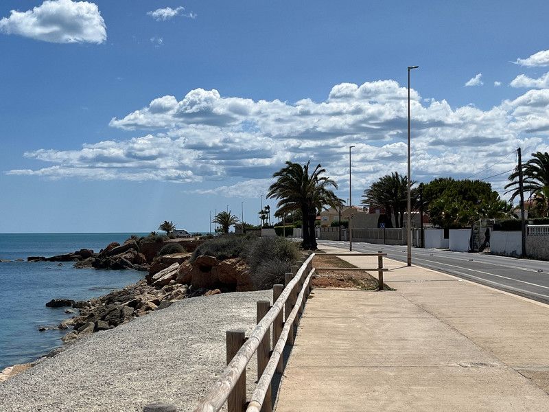
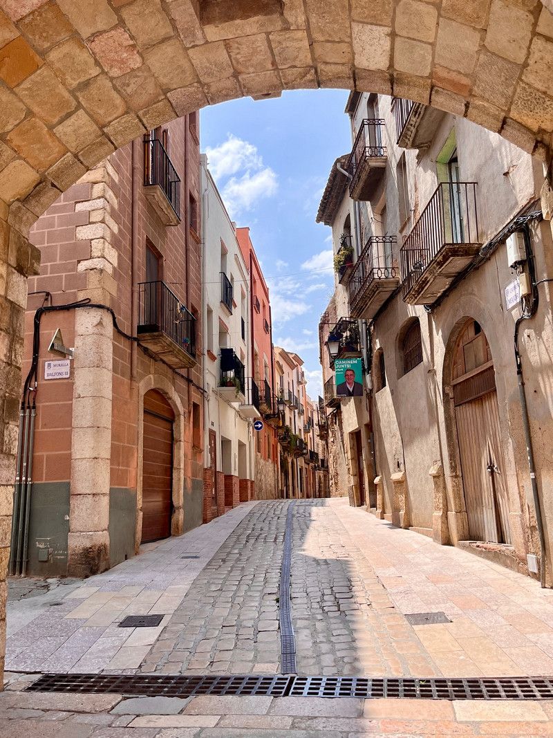
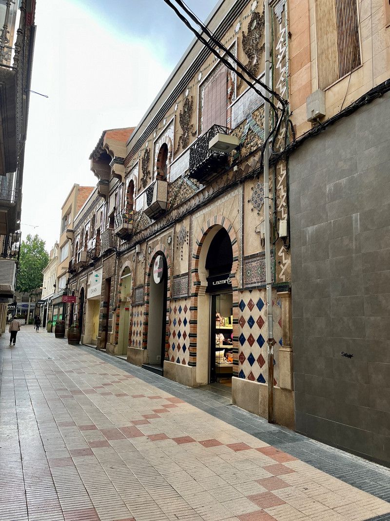
Vinaròs, Castellon, Spain
Aldea de Francisco José Balada, Vinaròs, Spain
40° 31' 2.8" N 0° 30' 5" E
40.5174532 0.5013886
• Head southeast on Camino de la Partició de la Sunyera. Go for 161 m.
• Turn left. Go for 46 m.
• Take the 5th exit from roundabout toward N-340/Castelló/Castellón. Go for 617 m.
• Take the 1st exit from roundabout onto N-340 toward Castellón. Go for 18.5 km.
• Take ramp toward Peñíscola. Go for 428 m.
• Take the 3rd exit from roundabout onto CV-141 toward Peñíscola. Go for 274 m.
• Continue on Avenida de la Estación (CV-141). Go for 3.5 km.
• Take the 3rd exit from roundabout onto Avenida de la Cruz. Go for 526 m.
• Arrive at Avenida de la Cruz. Your destination is on the left.
☍
24,0 km
( 19 min.)
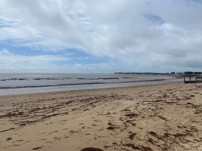
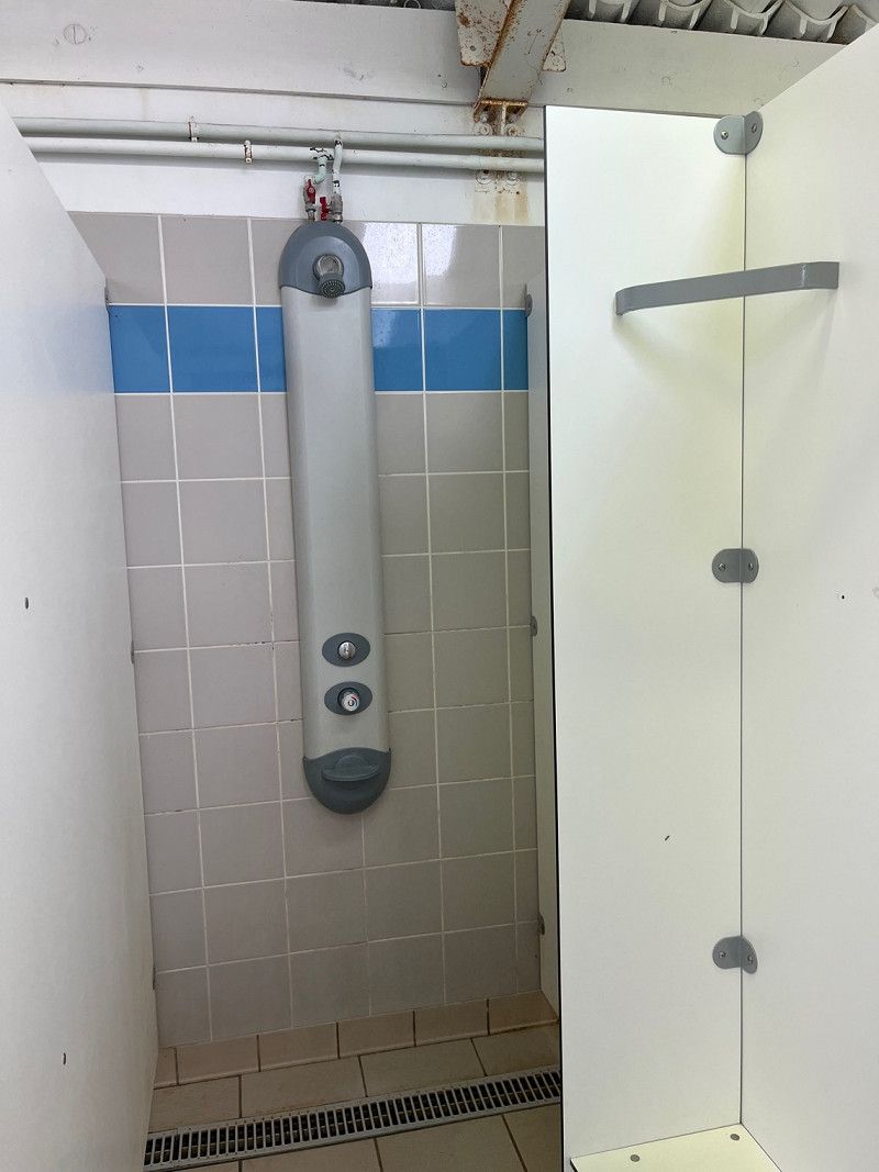
Camping el Cid
ACSI space for incredible €15/night including everything.
We wash our laundry here for €4/10kg. The showers are modern and most importantly a large shower head with really hot water.
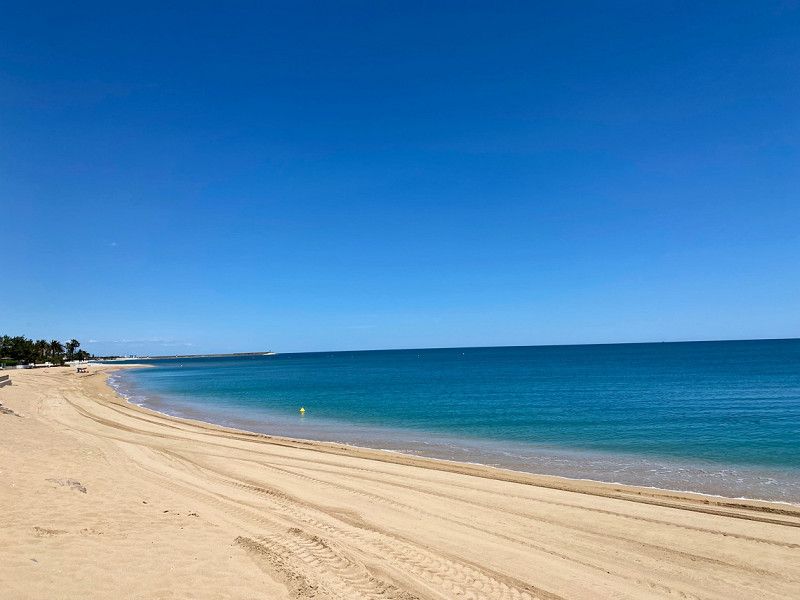
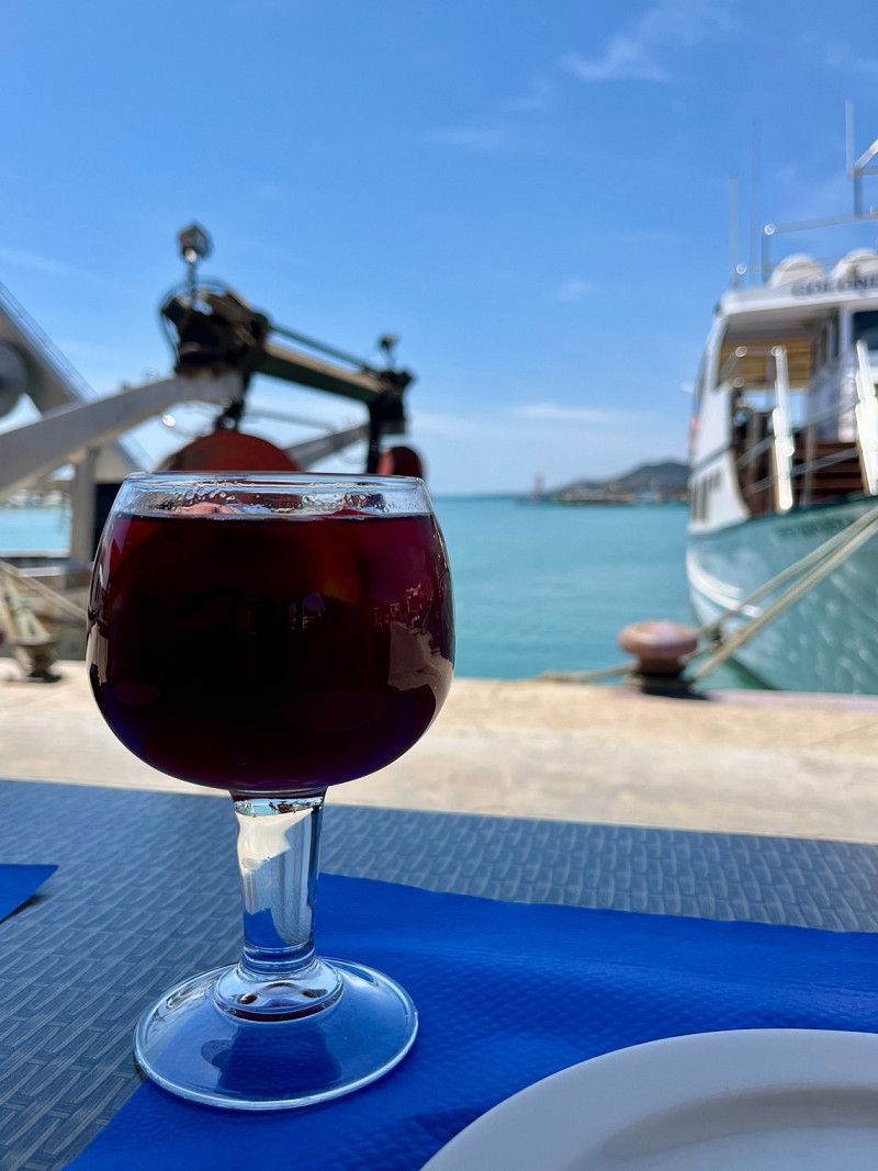
It's not far to Peñiscola, so in the evening we walk to the beach and drink a glass of wine in a bar.
• About the weather: 14 hours of sunshine, lots of wind and 24°
Apdo. De Correos 83, 12598, Peñíscola, Spanien
40° 22' 38" N 0° 23' 35" E
40.3772200 0.3930600
• Head west on Avenida de la Cruz. Go for 458 m.
• Take the 2nd exit from roundabout onto Avenida de la Estación (CV-141). Go for 3.5 km.
• Continue on CV-141 toward Benicarló/Tarragona/E-15/AP-7/Valencia/Barcelona. Go for 70 m.
• Take the 2nd exit from roundabout onto N-340 toward Benicarló/Tarragona/E-15/AP-7/Valencia/Barcelona. Go for 1.8 km.
• Take ramp toward N-340a/Benicarló sud/Benicarló Sur/Castelló/Castellón/E-15/AP-7/Tarragona. Go for 332 m.
• Take the 1st exit from roundabout onto AP-7 (Autopista del Mediterráneo) toward Barcelona. Go for 85.4 km.
• Take exit 38 toward N-340/C-44/l'Hospitalet de l'Infant/Móra la Nova. Go for 766 m.
• Take the 4th exit from roundabout onto A-7 (Autovia de la Mediterrània) toward Cambrils/Tarragona. Go for 37.2 km.
• Take exit 1164 toward Centre Ciutat Tarragona. Go for 277 m.
• Take the 1st exit from roundabout onto Carretera Llorito toward Centre Ciutat Tarragona. Go for 869 m.
• Continue toward Barcelona/Altafulla/Cala Romana. Go for 46 m.
• Take the 2nd exit from roundabout onto Carrer de la Via Augusta (N-340) toward Altafulla/Barcelona/Cala Romana. Go for 2.5 km.
• Take the 2nd exit from roundabout onto Carretera de Cádiz a Barcelona (N-340) toward Altafulla/Barcelona. Go for 616 m.
• Turn right onto Camí Platja Llarga. Go for 253 m.
• Arrive at Camí Platja Llarga. Your destination is on the right.
☍
134,1 km
(1 hrs. 20 min.)
Day
stürmische Nacht/Tag - Rad fahren
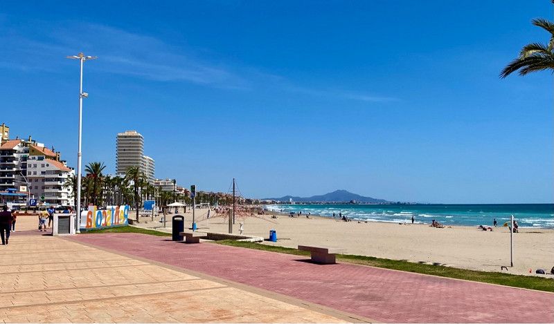
05/16/2023 - 15°/26° ☀️ 💨- 20th day 14 hours of sunshine
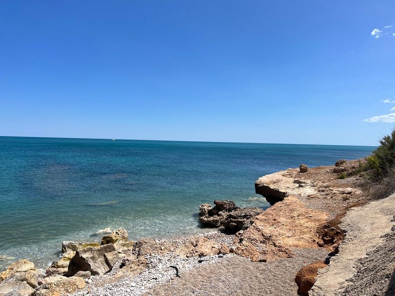
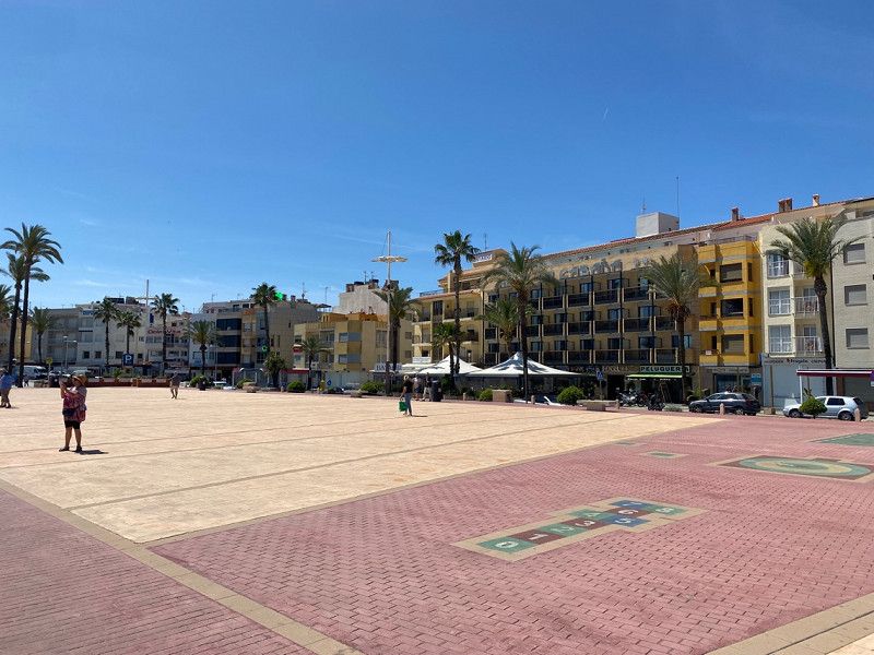
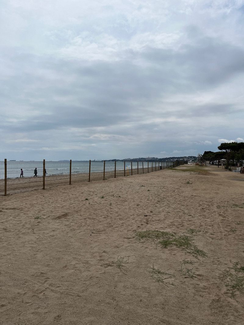
The night was very stormy (8bfr - it's already shaking in the camper 🤣) until lunch it stays stormy, then it gets a little less and we cycle to Benicarlò and also to the next town to Vinaròs.. Bike paths are well signposted and also well developed. We can't find an ice cream parlor that's open, so we cycle back and drink coffee at the Womo. We cycled a total of 32km. Enough for today.
• About the weather: 26° - 14 hours of sunshine with strong winds and occasional clouds (fortunately the wind is nice too, otherwise it would be too hot for me).
Day
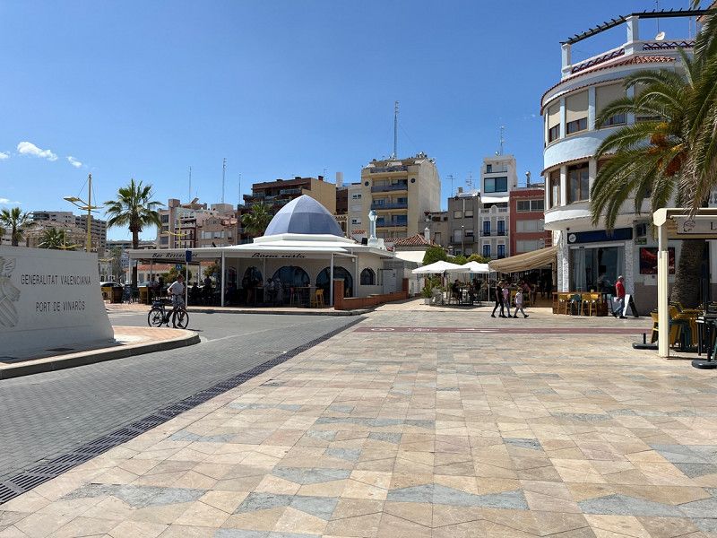
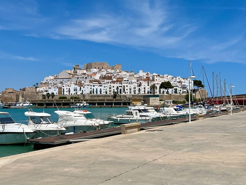
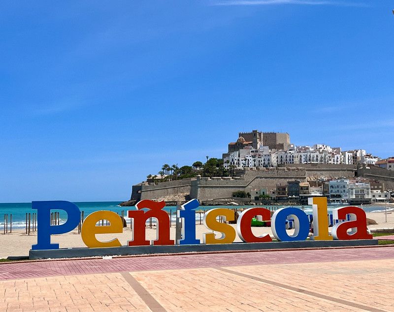
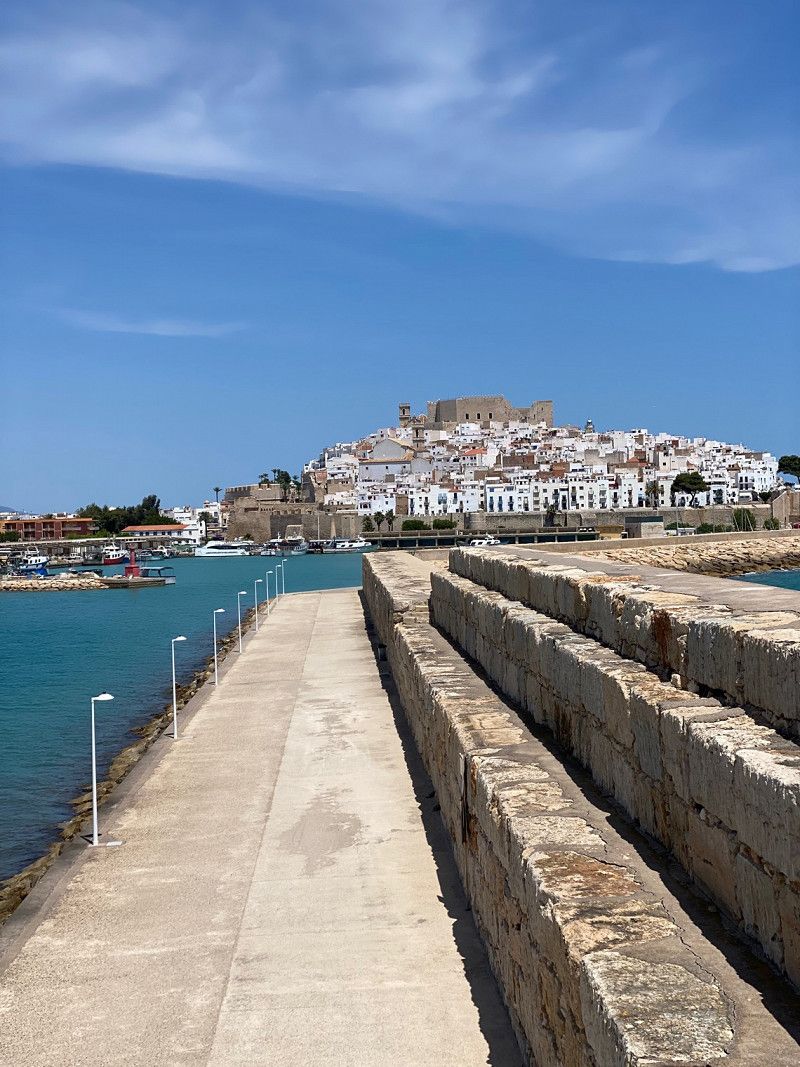
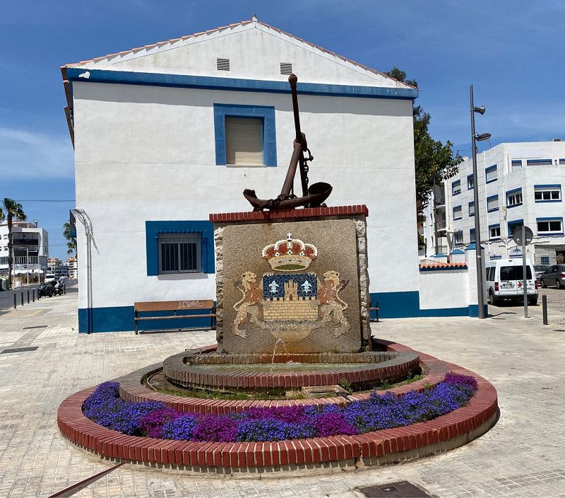
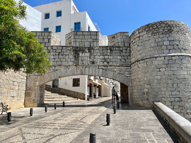
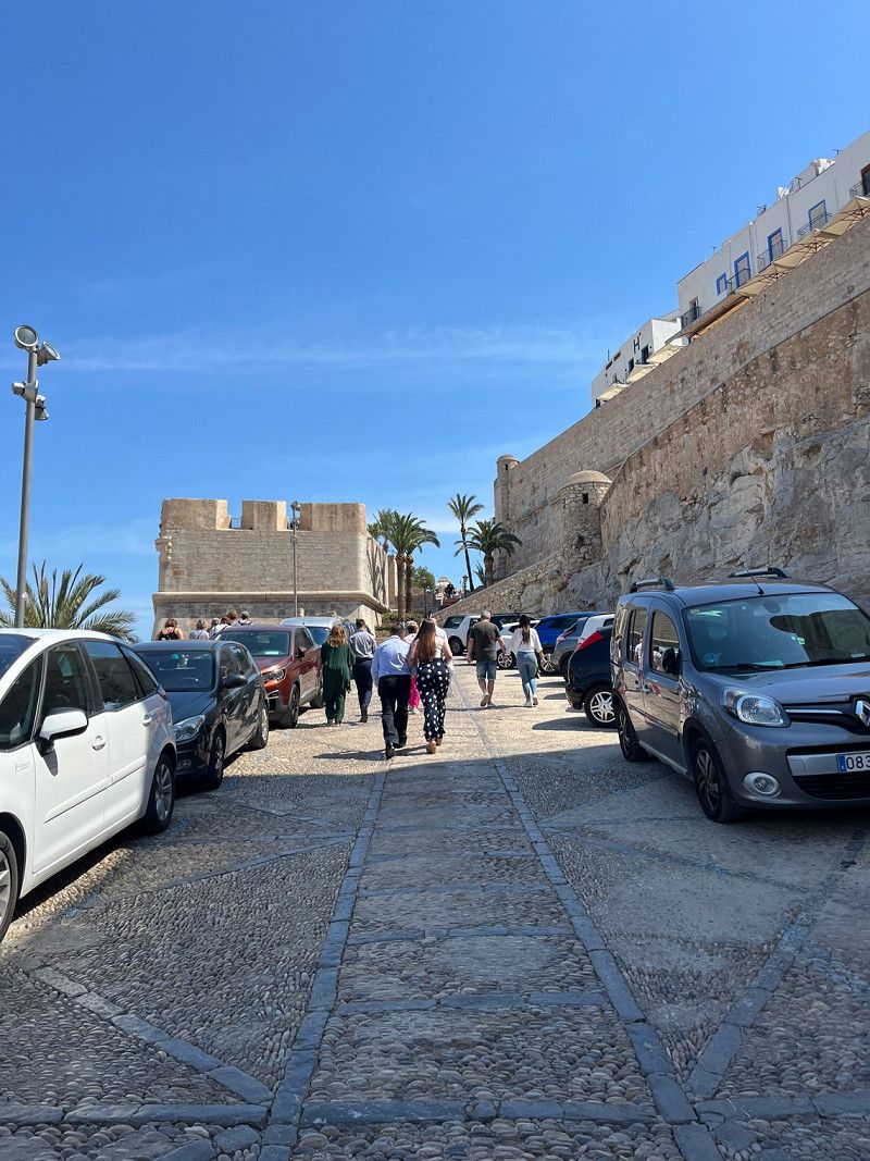
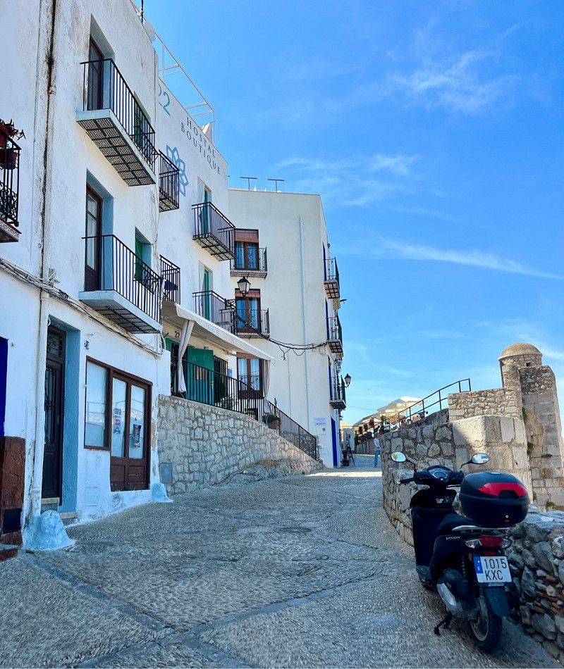
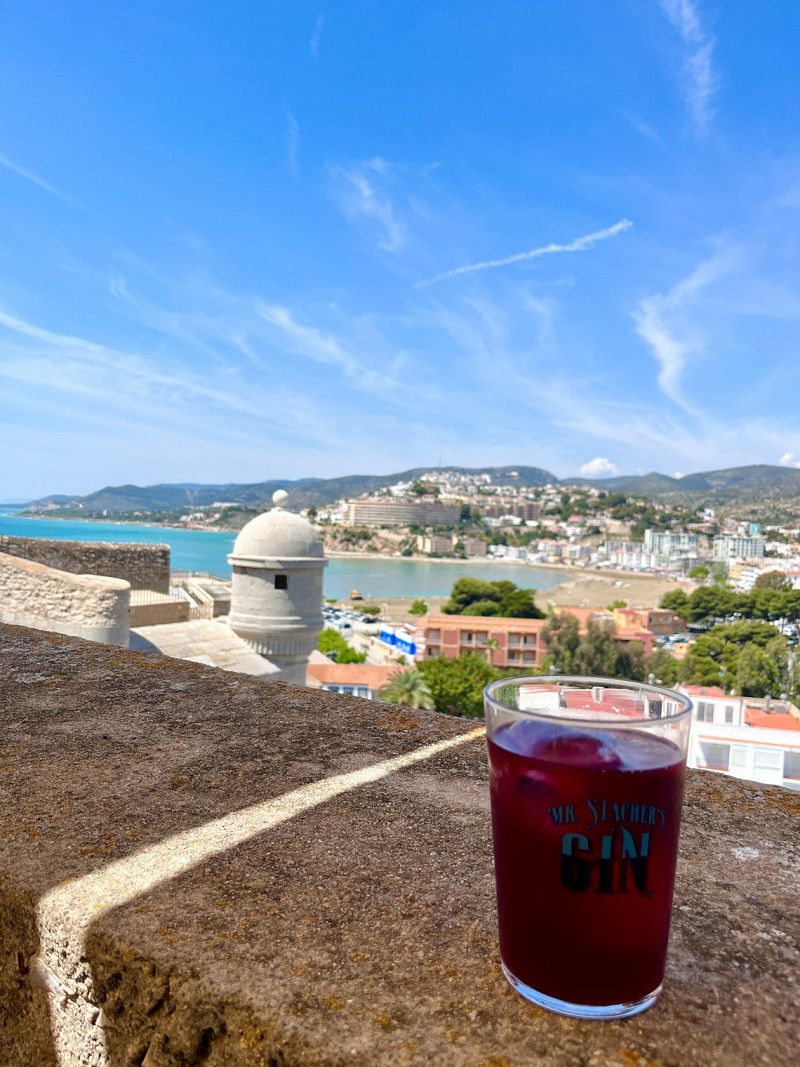
Peñiscola besuchen
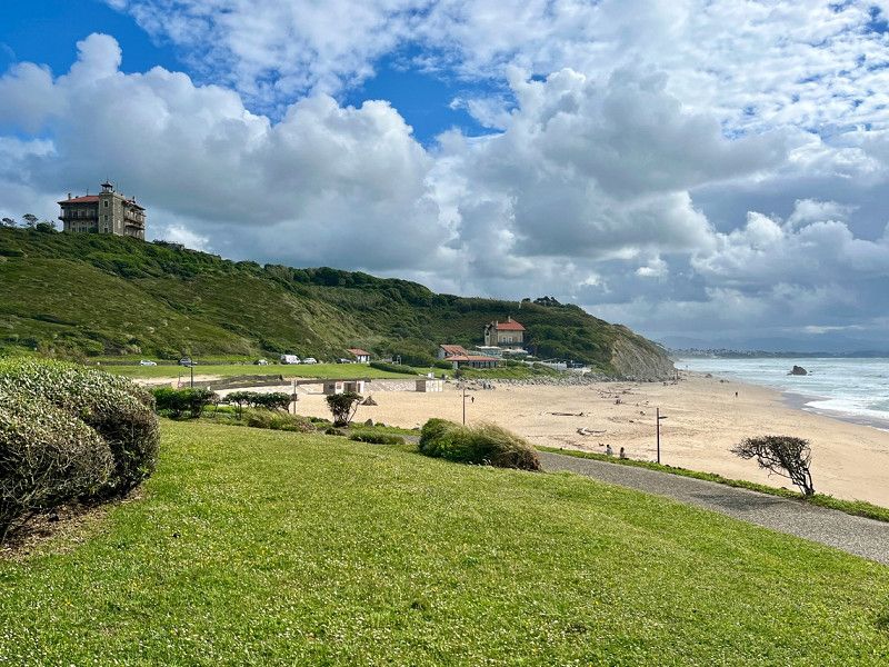
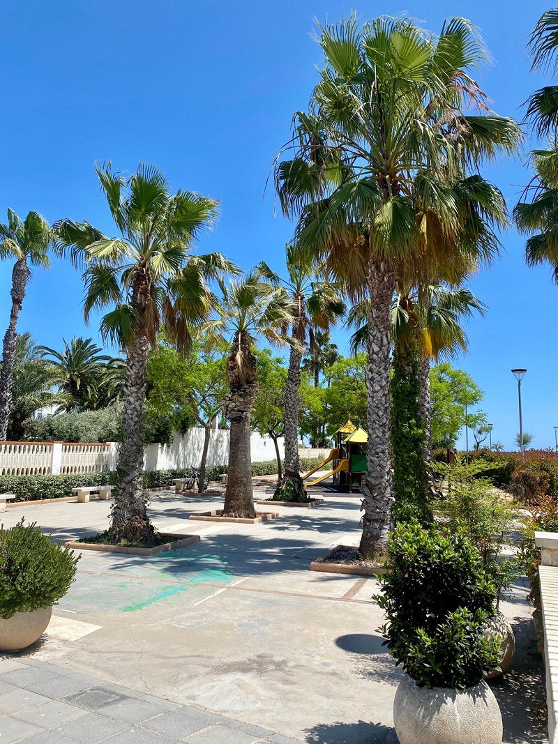
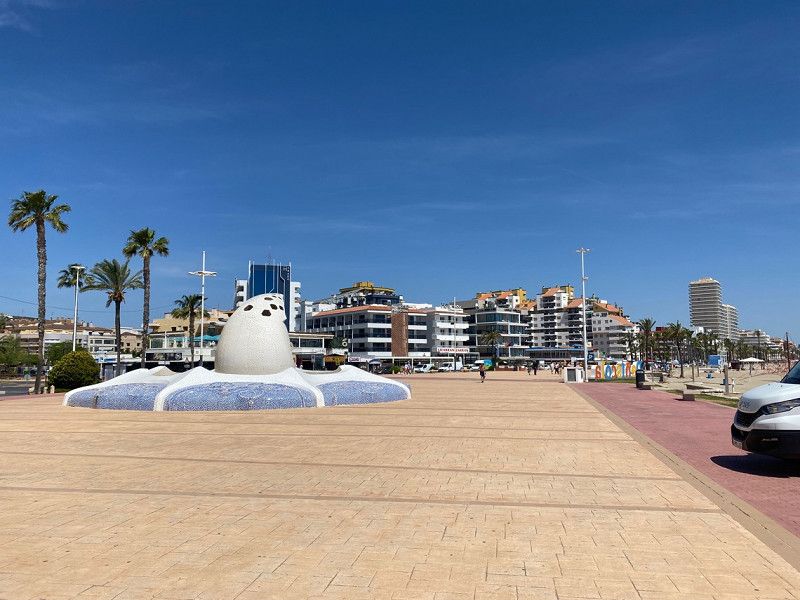
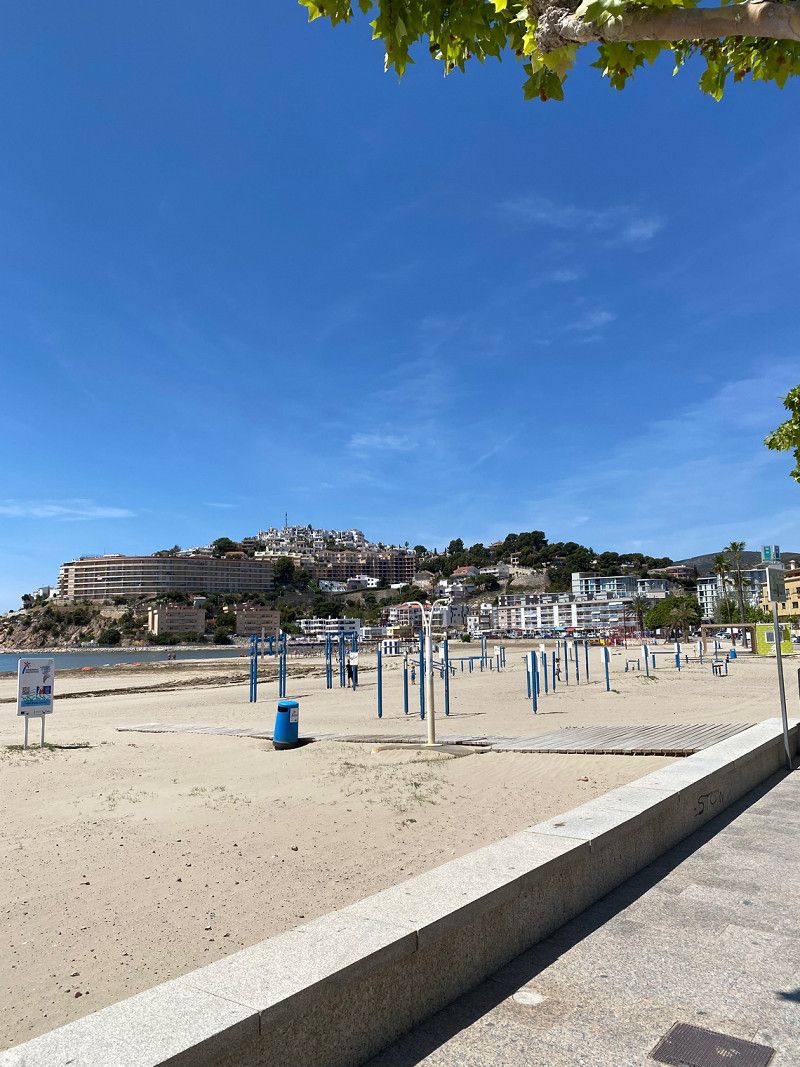
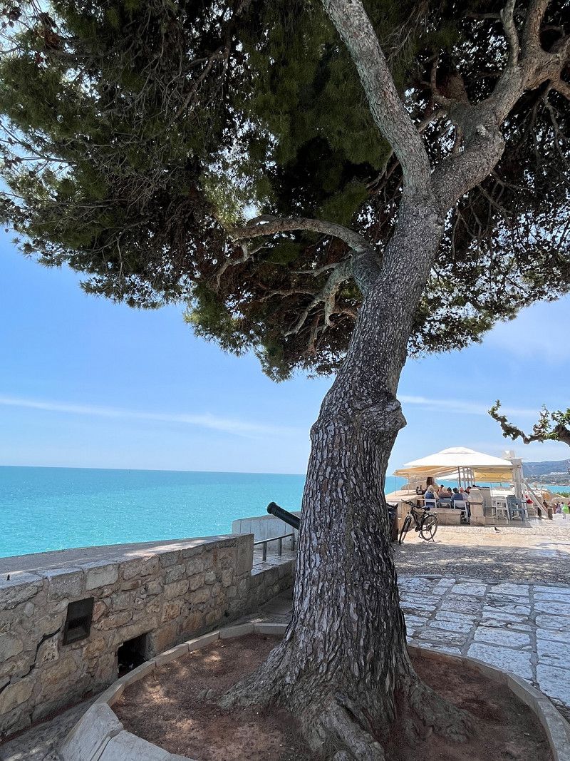
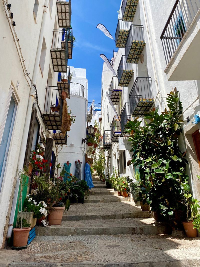
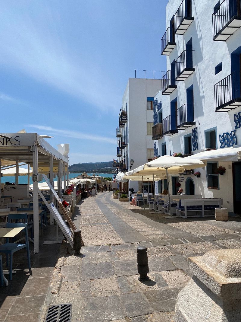
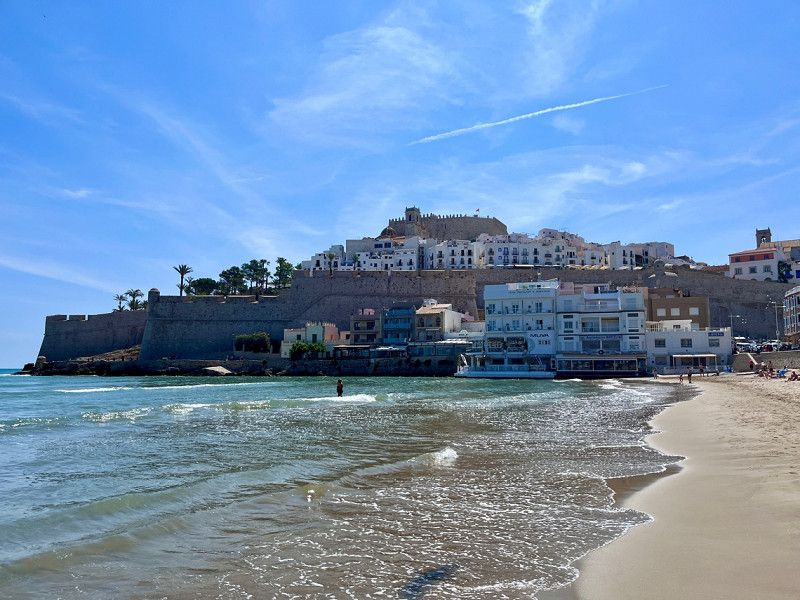
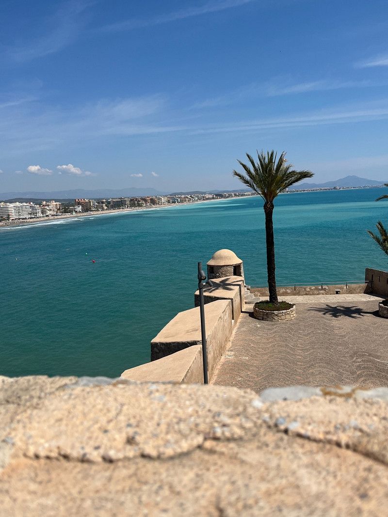
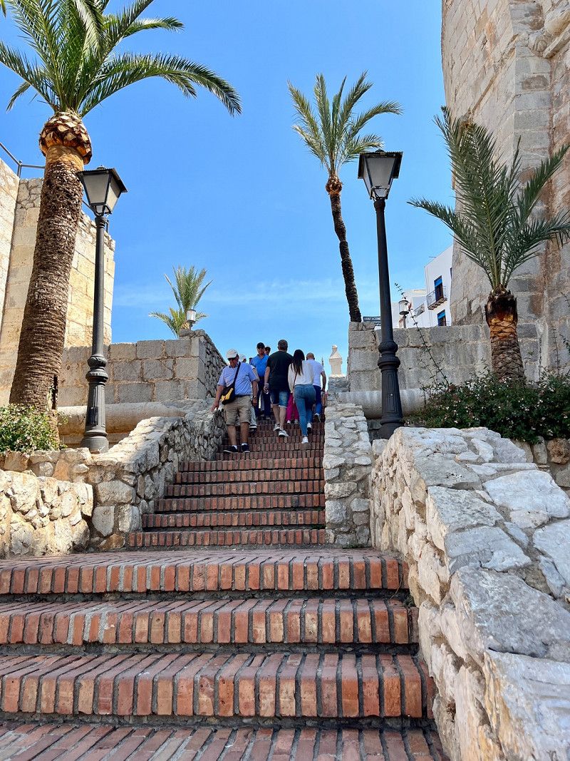
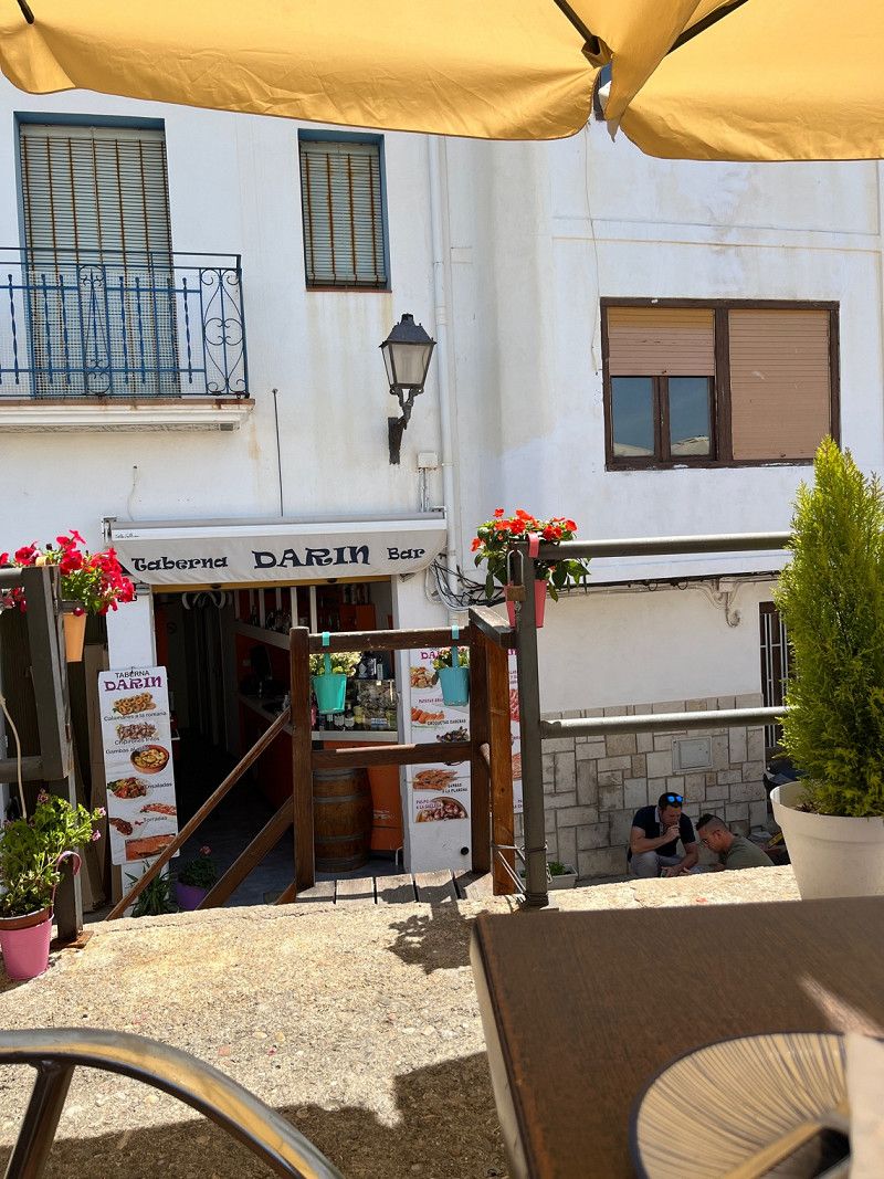
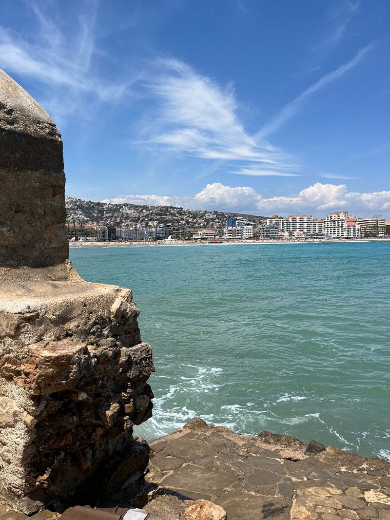
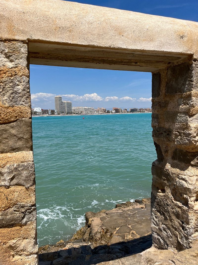
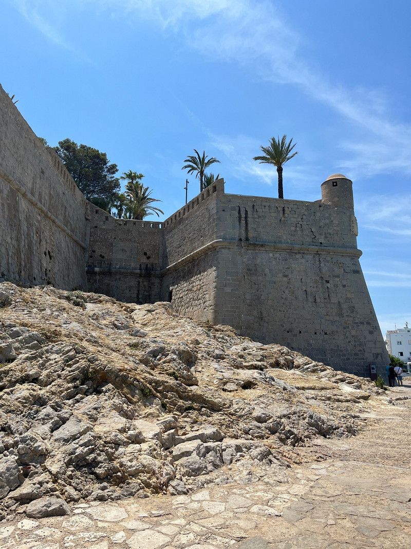
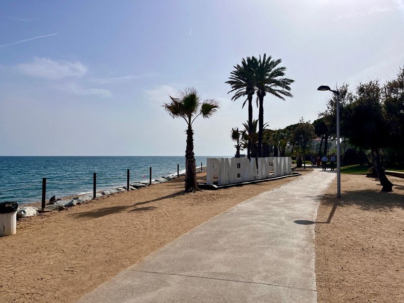
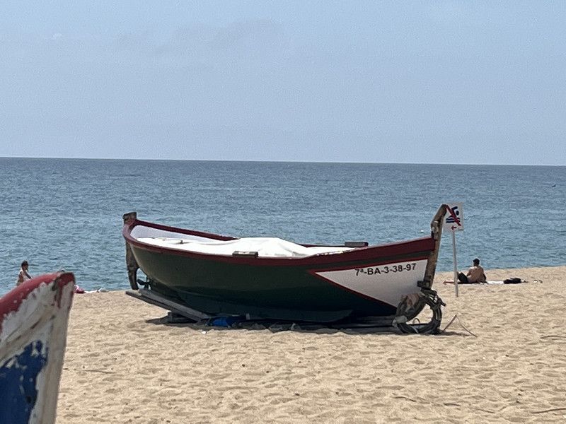
I believe the pictures speak for themselves. Everyone can watch what they like. We like it here very much. We are here for the 2nd time.
The city has its own flair and many locals come here to vacation.
Day
Day
Day
Day
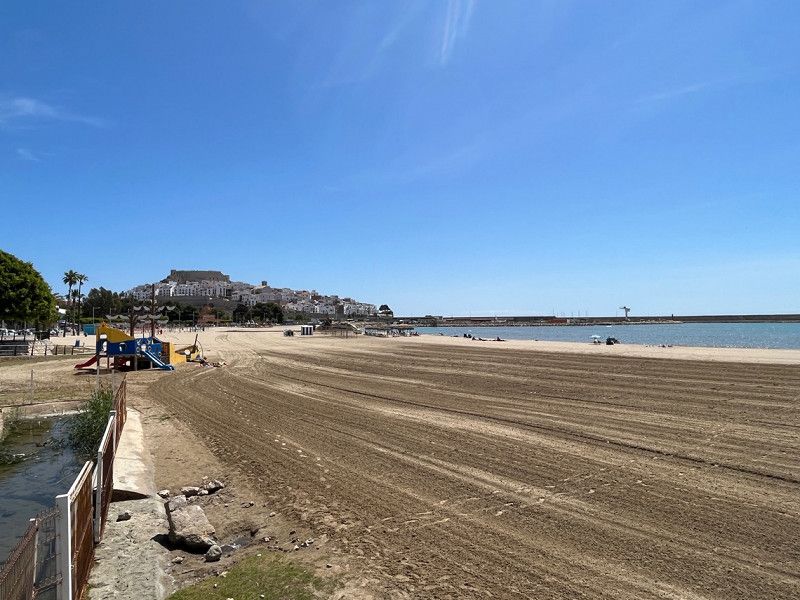
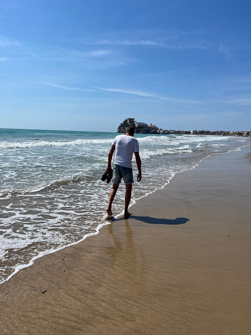
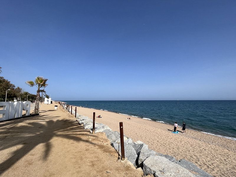
Sonntags am Strand/Burg in Peñiscola
Day
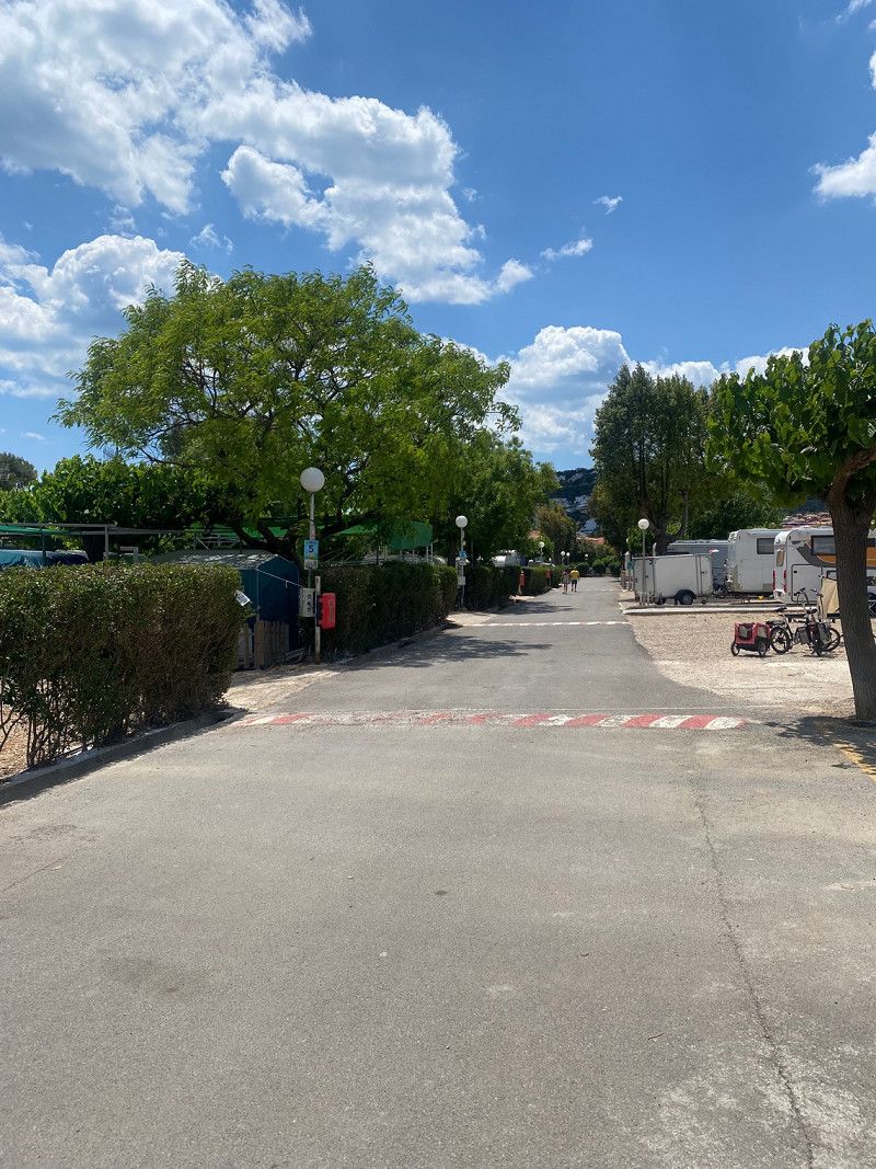
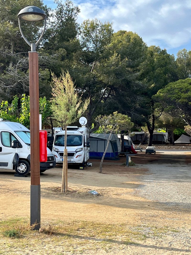
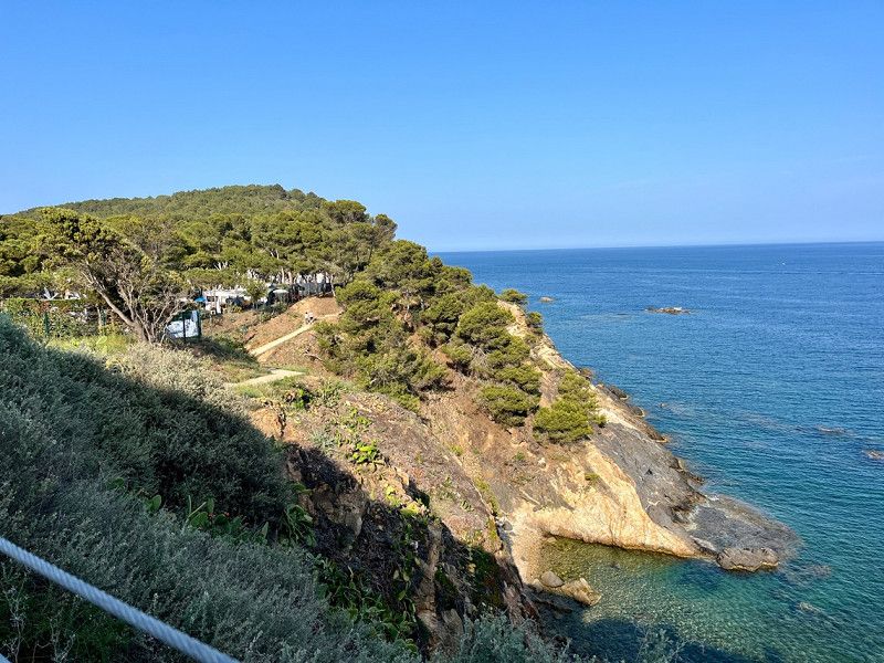
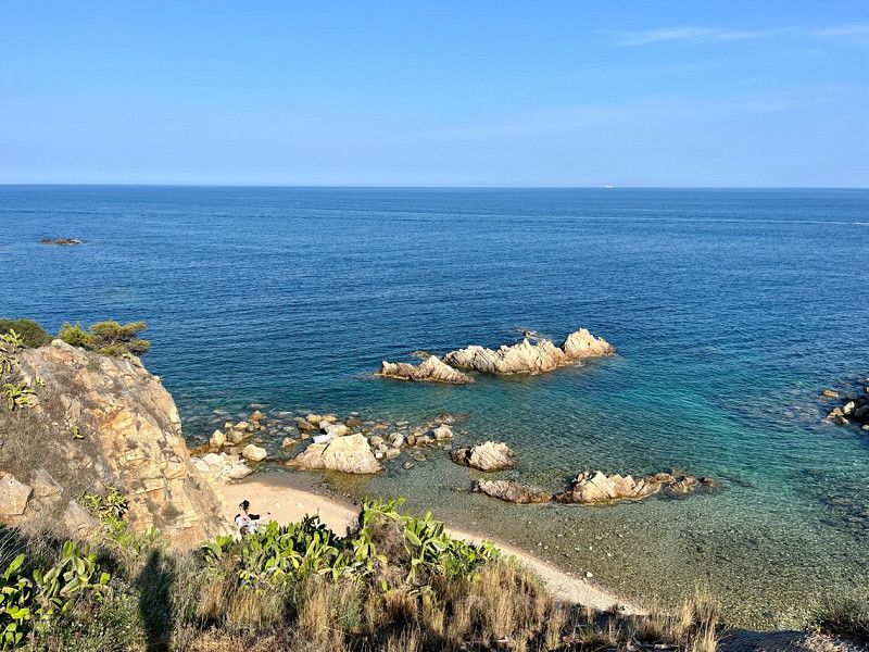
Camping las Palmeras
05/22/2023
A large CP (ACSI) with all comforts. 21€/night plus tourist tax. We get a nice spot near the beach.
Sanitary facilities are clean and modern. The train tracks are really close to the square, just behind the sanitary building. Except for maybe 3 hours at night there was train traffic. During the day we don't find it disturbing, especially since we were out and about.
About the weather: very mixed today with occasional showers and in the evening the sun will come out.
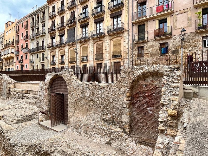
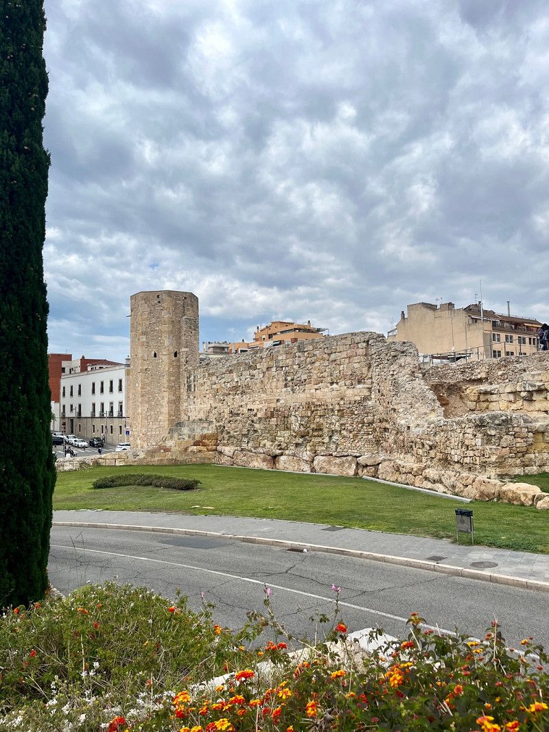
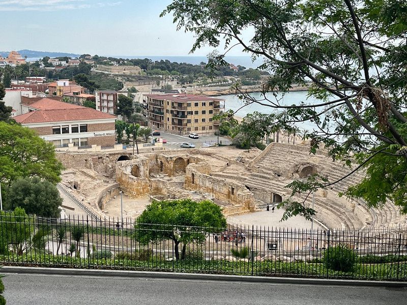
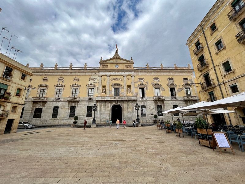
Carretera N-340 km 1168, 43007, Tarragona, Spanien
41° 7' 49.8" N 1° 18' 42.9" E
41.1304900 1.3119300
• Head north on Camí Platja Llarga. Go for 194 m.
• Turn sharp right onto Carretera de Cádiz a Barcelona (N-340). Go for 2.8 km.
• Take ramp. Go for 249 m.
• Take the 5th exit from roundabout onto A-7 toward Tarragona/Castelló. Go for 11.9 km.
• Take exit 1160 toward Lleida/Constantí/T-721 onto A-27. Go for 27.4 km.
• Continue on N-240. Go for 1.6 km.
• Take ramp onto N-240a toward Montblanc/C-14/Reus. Go for 2.6 km.
• Take the 2nd exit from roundabout onto Avinguda Lluís Companys. Go for 162 m.
• Turn right onto Carrer Miquel Alfons. Go for 83 m.
• Continue on Plaça Sant Francesc. Go for 11 m.
• Continue on Carrer Miquel Alfons. Go for 28 m.
• Continue on Carrer Major. Go for 110 m.
• Continue on Plaça Sant Miquel. Go for 14 m.
• Continue on Carrer Major. Go for 37 m.
• Arrive at Carrer Major. Your destination is on the left.
☍
47,2 km
( 31 min.)
Day
Mit dem Bus nach Tarragona
We take the 12 bus (bus stop 10 minutes away from the campsite) for €1.60 per person. in the center.
Tarragona has many archaeological sites dating back to Roman times. Otherwise it's not such an attractive city for us. (unfortunately we compare a lot with Cádiz, Seville and Valencia, so almost nothing can keep up 😜)
So everyone has to decide for themselves what they like and what not!
About the weather: 21° - sunshine and clouds from time to time, but the predicted rain didn't materialize.
Day
Weiterfahrt - Region um Lleida
05/24/2023
Since the weather forecast for the coast is not that great, we decide to drive a bit inland, especially since we would like to see the region around Lleida.
Montblanc, Spanien
Montblanc is a Catalan city in the province of Tarragona in northeastern Spain. The medieval city center has been a listed building since 1947. It is surrounded by an almost completely preserved city wall with originally 31 towers and 5 gates.
The old town with its narrow, medieval streets invites you to stroll.
Montblanc, 43400, Montblanc, Spanien
41° 22' 34.4" N 1° 9' 43.5" E
41.3762309 1.1620703
• Head toward Carrer Riber on Carrer Major. Go for 86 m.
• Turn right onto Carrer Sant Josep. Go for 100 m.
• Continue on Carrer de Jueus. Go for 65 m.
• Turn left onto Muralla de Santa Tecla (N-240a). Go for 542 m.
• Pass 2 roundabouts and continue on N-240a. Go for 979 m.
• Take ramp onto N-240. Go for 31.5 km.
• Take ramp toward Les Borges Blanques/Arbeca/Mollerussa/L-200. Go for 298 m.
• Take the 2nd exit from roundabout onto C-233 toward Arbeca/Mollerussa/Bellpuig. Go for 1.5 km.
• Take the 2nd exit from roundabout onto Avinguda d'Arbeca (C-233). Go for 1.4 km.
• Continue on L-200. Go for 2.6 km.
• Continue toward Carretera de Mollerussa/L-200. Go for 47 m.
• Continue on L-200. Go for 5.0 km.
• Pass 2 roundabouts and continue on L-200. Go for 1.8 km.
• Take the 2nd exit from roundabout onto L-200. Go for 723 m.
• Continue on Carretera de les Borges Blanques (L-200). Go for 233 m.
• Take the 5th exit from roundabout onto Camí de Fondarella a Arbeca. Go for 703 m.
• Take the 2nd exit from roundabout onto Camí de Fondarella a Arbeca. Go for 719 m.
• Take the 4th exit from roundabout onto Avinguda del President Macià (N-2A). Go for 408 m.
• Take the 3rd exit from roundabout onto Avinguda del President Macià (N-2A). Go for 370 m.
• Take the 2nd exit from roundabout onto N-2A. Go for 2.9 km.
• Take the 1st exit from roundabout onto N-2A. Go for 376 m.
• Continue on Carrer Carretera (N-2A). Go for 220 m.
• Continue on N-2A. Go for 23 m.
• Continue on Carrer Carretera (N-2A). Go for 94 m.
• Continue on N-2A. Go for 11 m.
• Continue on Carrer Carretera (N-2A). Go for 47 m.
• Turn right onto Carrer Balmes. Go for 36 m.
• Turn right onto Carrer del Mig. Go for 45 m.
• Arrive at Carrer del Mig. Your destination is on the left.
☍
52,7 km
( 41 min.)
Sidamon, Spanien
We continue to Sidamon, here there is a free SP with V&E. A bakery is in the immediate vicinity (3min walk), on the SP there is a playground and picnic tables, as well as a bowling alley. The SP is right on the street, which was hardly audible at night.
But depending on the wind direction, you can smell the multitude of cattle breeding sites. For us it was really enough after one night!!
Sidamon, 25222, Sidamon, Spanien
41° 37' 44.2" N 0° 49' 54.7" E
41.6289346 0.8318491
• Head toward Carrer Major on Carrer del Mig. Go for 65 m.
• Turn slightly right onto Carrer Sant Bartomeu. Go for 70 m.
• Turn right onto Carrer Sant Bartomeu. Go for 13 m.
• Turn right onto Carrer Carretera (N-2A). Go for 94 m.
• Continue on N-2A. Go for 11 m.
• Continue on Carrer Carretera (N-2A). Go for 194 m.
• Continue on N-2A. Go for 3.1 km.
• Continue on Carretera de Madrid a França (N-2A). Go for 219 m.
• Continue on Carrer de Josep Pané (N-2A). Go for 421 m.
• Take the 4th exit from roundabout onto Carrer de Josep Pané (N-2A). Go for 1.3 km.
• Continue on N-2A. Go for 1.6 km.
• Take ramp onto LL-11. Go for 2.7 km.
• Pass 4 roundabouts and continue on Avinguda de Barcelona (LL-11). Go for 5.9 km.
• Take the 3rd exit from roundabout onto Avinguda de Barcelona (LL-11). Go for 1.1 km.
• Take the 2nd exit from roundabout onto Avinguda de Barcelona (LL-11). Go for 432 m.
• Take ramp toward Lleida/Centre Ciutat/Albatàrrec/Artesa de Lleida. Go for 162 m.
• Take the 2nd exit from roundabout onto Avinguda de les Garrigues (L-900). Go for 863 m.
• Turn left onto Avinguda de Blondel. Go for 67 m.
• Arrive at Avinguda de Blondel. Your destination is on the right.
☍
18,4 km
( 18 min.)
Day
Hoffnung auf einen Parkplatz um Lleida an zuschauen
05/25/2023
It's supposed to rain all day today, so we make our way to Lleida to park our camper in a parking lot and then visit the old town.
Of course, we don't really feel like it when the weather is bad, and the parking lots are far away, or very dirty and therefore not trustworthy for us.
So only seen the old town from the Womo and then drove on.
Lleida, Spanien
Lleida, Lleida, Spanien
41° 36' 53.1" N 0° 37' 36.4" E
41.6147605 0.6267842
• Head southwest on Avinguda de Blondel. Go for 118 m.
• Continue on Avinguda de Madrid. Go for 484 m.
• Turn right onto Plaça d'Espanya. Go for 347 m.
• Continue on Rambla d'Aragó. Go for 405 m.
• Continue on Plaça de Cervantes. Go for 57 m.
• Continue on Avinguda de Balmes. Go for 303 m.
• Take the 1st exit from Plaça Ricard Vinyes roundabout onto Avinguda de Prat de la Riba. Go for 1.2 km.
• Take the 2nd exit from roundabout onto Avinguda de Prat de la Riba. Go for 1.3 km.
• Take the 3rd exit from roundabout onto C-12. Go for 7.2 km.
• Continue on Carretera de Lleida a Balaguer (C-12). Go for 1.0 km.
• Continue on C-12. Go for 6.3 km.
• Continue on Carretera de Lleida a Balaguer (C-12). Go for 1.6 km.
• Continue on C-12. Go for 4.0 km.
• Keep right onto C-12f. Go for 305 m.
• Take the 2nd exit from roundabout onto C-12f. Go for 793 m.
• Continue on Carretera de Menàrguens (C-12f). Go for 438 m.
• Take the 1st exit from roundabout onto C-12f. Go for 324 m.
• Take the 2nd exit from roundabout onto C-12f. Go for 588 m.
• Continue on Avinguda Francesc Macià (C-12f). Go for 395 m.
• Turn left onto Carrer Sant Francesc. Go for 168 m.
• Turn right onto Carrer Divina Pastora. Go for 211 m.
• Continue on Carrer del Barrinou. Go for 171 m.
• Turn right onto Plaça Mercadal. Go for 77 m.
• Turn left onto Plaça Mercadal. Go for 38 m.
• Arrive at Plaça Mercadal. Your destination is on the left.
☍
27,9 km
( 29 min.)
Balaguer, Spanien
A small old town on the Segre River
We are still too early for lunchtime, but we stroll through the town anyway.
Here there is an extra free SP for Womos, also for overnight stays.
After a stroll through town we continue
Balaguer, 25600, Balaguer, Spanien
41° 47' 23" N 0° 48' 19.8" E
41.7897204 0.8054914
• Head toward Carrer Avall on Plaça Mercadal. Go for 15 m.
• Turn right onto Passatge Gaspar de Portolà. Go for 61 m.
• Turn right onto Carrer El Portalet (C-12). Go for 189 m.
• Continue on Avinguda Francesc Macià. Go for 502 m.
• Take ramp onto Carretera Tàrrega a Alfarràs (C-26) toward Balaguer est/Barcelona/Tàrrega. Go for 2.1 km.
• Continue on C-53. Go for 27.5 km.
• Take the 3rd exit from roundabout onto C-53 toward Vilagrassa/Tàrrega. Go for 159 m.
• Take ramp onto A-2 (Autovia Lleida-Barcelona) toward Barcelona. Go for 3.3 km.
• Take exit 507 toward Tàrrega Centre Ciutat/Agramunt/L-310/Guissona/Tàrrega onto C-14 (Carretera de Salou a Ponts). Go for 656 m.
• Take the 2nd exit from Plaça d'Andorra roundabout onto Carrer de Sant Pelegrí (C-14). Go for 1.2 km.
• Turn right onto Plaça del Carme. Go for 30 m.
• Turn right onto Plaça del Carme. Go for 74 m.
• Turn left onto Carrer Carme. Go for 24 m.
• Turn left onto Carrer Torras i Bages. Go for 83 m.
• Arrive at Carrer Torras i Bages. Your destination is on the right.
☍
35,8 km
( 32 min.)
Tàrrega, Spanien
There is also an SP for Womos (right next to the police) with V&E. Here we also walk into the old town and go out to eat.
Unfortunately, the storm is coming while we are eating.
Tomorrow the weather will be better again, the rain is of course urgently needed here.
Tàrrega, Tàrrega, Spanien
41° 38' 50.2" N 1° 8' 27.3" E
41.6472761 1.1409115
• Head toward Carrer d'Agoders on Carrer Torras i Bages. Go for 26 m.
• Turn left onto Carrer d'Agoders. Go for 15 m.
• Continue on Plaça del Carme. Go for 21 m.
• Turn left onto Carrer d'en Joan Maragall (C-14). Go for 1.1 km.
• Take the 2nd exit from Plaça d'Andorra roundabout onto Carretera Tàrrega a Guissona (C-14). Go for 398 m.
• Take ramp onto A-2 (Autovia Lleida-Barcelona) toward Barcelona. Go for 101 km.
• Take exit 609 toward Aeroport el Prat/Tarragona/Barcelona onto B-20. Go for 3.2 km.
• Take exit 54 toward Castelldefels/C-31/Aeroport onto B-22. Go for 1.7 km.
• Take exit 2 toward Castelldefels/Aeroport Terminal T1/Aeroport Cargoparc onto C-31 (Autovia de Castelldefels). Go for 7.1 km.
• Keep right toward Gavà Mar. Go for 115 m.
• Continue on Carrer Autovia de Castelldefels toward Gavà Mar. Go for 81 m.
• Take ramp toward Gavà Mar. Go for 445 m.
• Take the 1st exit from roundabout onto Avinguda d'Europa toward Gavà/Barcelona. Go for 251 m.
• Take the 1st exit from roundabout toward C-31/Barcelona. Go for 46 m.
• Turn right onto Carrer Autovia de Castelldefels. Go for 258 m.
• Continue on Autovia de Castelldefels (C-31). Go for 381 m.
• Turn right onto Carrer Autovia de Castelldefels. Go for 44 m.
• Arrive at Carrer Autovia de Castelldefels. Your destination is on the left.
☍
116,2 km
(1 hrs. 13 min.)
Day
Camping 3 Estrellas, Spanien
05/26/2023
This CP is really only for us to visit Barcelona. Beautiful is different. ACSI pitch for €21 plus tourist tax, but these pitches are not beach-facing. We stood under trees and our Womo sticks from head to toe. (something is dripping from the trees). The "forest floor" is more in the camper than outside.
The sanitary building is open and due to the large number of people it is sometimes clean and sometimes not so clean. It is rather difficult to get away by bike or you can cycle on this expressway that leads directly past and to the campsite. Bus drives 500m away from the CP, that worked out well.
But what has had the most negative impact on us is the extremely large number of aircraft that fly a curve over the CP right after take-off. There were 336 starts on the first day until 11 p.m. Then all of a sudden it was quiet (depending on the neighbors) and in the morning it starts again at 7.00 a.m. sharp. That's why we really only stay 2 nights. It's not so nice here.
C-31, km 186,2, 08850, Barcelona, Spanien
41° 16' 20.6" N 2° 2' 33.9" E
41.2724010 2.0427398
• Head northwest on Carrer Autovia de Castelldefels. Go for 21 m.
• Turn right onto Autovia de Castelldefels (C-31). Go for 9.6 km.
• Take exit 196AB toward Barcelona/Polígon Industrial de Z. Franca-ZAL/Girona-Lleida/A-2/Lleida/Girona/Tarragona/Rda. de Dalt onto B-10 (Ronda del Litoral). Go for 1.2 km.
• Continue on A-2 (Ronda del Litoral) toward Tarragona/Lleida/Girona. Go for 6.9 km.
• Take left exit 604A toward AP-2/Lleida/Zaragoza/Tarragona/Girona onto B-23. Go for 7.9 km.
• Keep right toward Girona/Rubí-Sant Cugat/B-30/E-9/Manresa/C-16. Go for 1.3 km.
• Continue on AP-7 (Autopista de la Mediterrània). Go for 19.2 km.
• Take exit 17 toward Sta. Perpètua/Mollet del Vallès S./Palau-S. i Plegamans/Polígon Industrial de C.I.M. Vallès. Go for 93 m.
• Arrive at your destination on the right.
☍
46,1 km
( 31 min.)
Day
Barcelona besichtig
05/27/2023
A big city, but we kind of compare everything to Seville, Cadiz and Valencia and still think that those were our 3 most beautiful big cities in Spain so far.
There was a lot going on in Barcelona, which of course is a challenge for us country bumpkins.
It is best to decide individually what to look at. For many tourist strongholds you have to book tickets online, otherwise entry is not possible.
Day
Santa Perpètua De Mogoda, Barcelona, Spain
Pl C.xiol-c.sirera-cementiri S/N, 8130, Santa Perpètua De Mogoda, Spain
41° 32' 21" N 2° 10' 33.5" E
41.5391649 2.1759796
• Take ramp onto AP-7 (Autopista de la Mediterrània) toward E-5/Girona. Go for 15.5 km.
• Take exit 12B toward Centre Ciutat la Roca del V./Granollers est/Mataró/C-60. Go for 1.1 km.
• Take the left exit toward La Roca del V./Mataró onto C-60 (Autovia Mataró Granollers). Go for 9.8 km.
• Take the exit toward Mataró oest Hospital/Girona onto C-32 (Autopista de Barcelona a Mataró). Go for 18.6 km.
• Take exit 117 toward St. Pol de Mar/St. Cebrià de V./St. Iscle de V. Go for 671 m.
• Take the 3rd exit from roundabout onto BV-5128 toward Sant Pol de Mar. Go for 1.1 km.
• Take the 2nd exit from roundabout toward Barcelona/Girona/Arenys de Mar/Calella/Escola Universitària d'Hoteleria i Turisme. Go for 186 m.
• Turn left toward N-2/Calella/Girona/E. U. d'Hosteleria i Turisme. Go for 112 m.
• Take ramp onto N-2 toward Malgrat de Mar/Girona/Calella. Go for 1.1 km.
• Arrive at N-2. Your destination is on the right.
☍
48,2 km
( 31 min.)
Sant Pol de Mar, Barcelona, Spain
Cl Sant Pau 60, 8395, Sant Pol de Mar, Spain
41° 36' 14.9" N 2° 37' 28.4" E
41.6041264 2.6245598
• Head toward Carrer de Bonaventura Adroher on N-2. Go for 2.3 km.
• Take the 1st exit from roundabout onto Carrer Sant Jaume (N-2) toward Girona. Go for 647 m.
• Take the 3rd exit from roundabout onto Carrer Sant Jaume (N-2). Go for 1.8 km.
• Take the 3rd exit from roundabout onto Carrer Garbí (N-2) toward Girona. Go for 367 m.
• Pass 2 roundabouts and continue on Carrer Garbí (N-2). Go for 800 m.
• Turn right onto Avinguda Montserrat toward Centre Urbà/Barri de les Creus. Go for 59 m.
• Turn left onto Avinguda Montserrat. Go for 219 m.
• Turn slightly right onto Plaça de la Pagesia. Go for 179 m.
• Take the 1st exit from roundabout onto Avinguda de la Mare de Déu de la Mercè. Go for 54 m.
• Continue on Plaça de l'Estatut. Go for 106 m.
• Turn left onto Carrer d'Ignasi Iglesias. Go for 215 m.
• Turn right onto Carrer de Moragas i Barret. Go for 95 m.
• Turn right onto Carrer Tarragona. Go for 61 m.
• Turn right. Go for 29 m.
• Arrive at your destination on the right.
☍
7,0 km
( 11 min.)
Pineda de Mar, Barcelona, Spain
05/28/2023
SP for 18€/night incl. V&E and electricity. We don't need electricity and therefore only pay 15€/night.
Who likes showers (I don't think I shower here) pays 1€. So my husband was taking a shower, very hot water, he said everything was fine. Sure it's easy!!
Fenced area, entry only with code, which is not a problem by phone (English spoken)
Very close to the center and under the train you can get to the beach.
Carrer de Tarragona 24, 08397, Pineda de Mar, Spain
41° 37' 20.2" N 2° 41' 21.9" E
41.6222652 2.6894090
• Head toward Carrer Tarragona. Go for 29 m.
• Turn right onto Carrer Tarragona. Go for 68 m.
• Turn right onto Carrer de la Tribala. Go for 357 m.
• Take the 2nd exit from roundabout onto Plaça de la Pagesia. Go for 128 m.
• Continue on Avinguda Montserrat. Go for 219 m.
• Turn right onto Avinguda Montserrat toward Girona. Go for 31 m.
• Turn right onto Carrer Riera (N-2). Go for 910 m.
• Take the 4th exit from roundabout onto Carrer Sant Joan (N-2) toward Girona. Go for 398 m.
• Pass 3 roundabouts and continue on N-2. Go for 4.2 km.
• Take ramp onto B-682 toward Palafolls/Blanes/Lloret/Tossa. Go for 725 m.
• Pass 6 roundabouts and continue on Carretera d'Accés a la Costa Brava (GI-682). Go for 6.0 km.
• Take the 3rd exit from roundabout onto Carretera de Blanes a Sant Feliu de Guíxols (GI-682) toward Hospital Comarcal/Lloret de Mar. Go for 568 m.
• Pass 4 roundabouts and continue on Avinguda de la Vila de Blanes (GI-682). Go for 3.6 km.
• Take the 2nd exit from roundabout onto Avinguda de la Vila de Blanes (GI-682). Go for 699 m.
• Pass 3 roundabouts and continue on Avinguda de la Vila de Lloret (GI-682). Go for 10.4 km.
• Take the 2nd exit from Plaça de les Nacions Sense Estat roundabout onto Avinguda de Ferran Agulló (GI-682) toward Centre Ciutat/St. Feliu de G./Llagostera/Girona. Go for 201 m.
• Take the 2nd exit from roundabout onto Carretera Tossa a Sant Feliu (GI-682) toward St. Feliu de Guíxols/St. Feliu de G. Go for 88 m.
• Turn right onto Avinguda de la Palma. Go for 346 m.
• Take the 2nd exit from roundabout onto Avinguda Sant Ramon de Penyafort. Go for 164 m.
• Turn left onto Passeig del Mar. Go for 213 m.
• Turn right onto Carrer Pont Vell. Go for 35 m.
• Arrive at Carrer Pont Vell. Your destination is on the left.
☍
29,4 km
( 42 min.)
Day
einfach Radeln bis nach Calella
Calella has a very long pedestrian street and cute little bars and cafes. It's busy here and we find souvenirs for our grandchildren.
At the small church we eat crepes with spinach, walnuts and cheese.
In the afternoon we sit at the Womo and enjoy the shade.
Day
Weiter an der Küste
05/30/2023
Today we continue along the Costa Brava. Although we have been to northern Spain many times, we have never been to Lloret de Mar and Tossa de Mar. So that's our goal today.
Tossa de Mar, Girona, Spain
Nice stretch on the coastal/mountain road. In Tossa de Mar it is unfortunately not possible to park the mobile home, all parking spaces (subject to a fee) only take cars and parking somewhere on the street can be expensive. So unfortunately we are denied it and we drive on. Very bad!!
Cl Pont Vell 7, 17320, Tossa de Mar, Spain
41° 43' 1.5" N 2° 55' 57.6" E
41.7170695 2.9326724
• Head toward Carrer Portal on Carrer Pont Vell. Go for 17 m.
• Continue on Passatge dels Peixaters. Go for 5 m.
• Turn right onto Carrer Portal. Go for 86 m.
• Turn right onto Carrer Peixeteries. Go for 26 m.
• Turn left onto Passeig del Mar. Go for 154 m.
• Turn right onto Avinguda Sant Ramon de Penyafort. Go for 144 m.
• Take the 2nd exit from roundabout onto Avinguda de la Palma. Go for 122 m.
• Turn left onto Carrer Pou de la Vila. Go for 110 m.
• Turn right onto Carrer de Pola. Go for 304 m.
• Turn right onto Avinguda de Ferran Agulló (GI-682). Go for 71 m.
• Take the 3rd exit from roundabout onto Avinguda de Catalunya (GI-681) toward Llagostera/Girona. Go for 295 m.
• Pass 3 roundabouts and continue on Carretera Tossa a Llagostera (GI-681). Go for 14.8 km.
• Take the 1st exit from roundabout onto C-35 toward Platja A./St. Feliu G. Go for 6.4 km.
• Continue on C-65. Go for 5.8 km.
• Continue on C-31 toward Palamós/Platja d'Aro/St. Feliu G. nord. Go for 15.9 km.
• Take exit 326 toward La Fosca/St. Joan P./Palamós Hospital. Go for 397 m.
• Take the 2nd exit from roundabout onto Carrer Àngel Guimerà toward Palamós/St. Joan de Palamós. Go for 537 m.
• Take the 3rd exit from roundabout toward Port de Palamós/Centre Urbà/Hospital/La Fosca/Marina Palamós. Go for 556 m.
• Take the 3rd exit from roundabout onto Ronda de l'Est. Go for 289 m.
• Take the 2nd exit from roundabout onto Ronda de l'Est. Go for 473 m.
• Take the 2nd exit from roundabout onto Carretera La Fosca toward La Fosca. Go for 122 m.
• Turn left. Go for 80 m.
• Arrive at your destination on the right.
☍
46,7 km
( 39 min.)
Camping Palamos, Spanien
CP with large pitches, both with a view of the sea (24€/night without electricity in the low season) and in the back under the trees (14€/night without electricity in the low season). We find €6 electricity/night a lot, we are self-sufficient and don't need electricity. Visitor's tax of 65 cents is added daily, but that's normal.
Sanitary building everything available, clean and with toilet paper. We'll stay here for a bit until mid-season starts, because then this place will also be more expensive.
There are many great restaurants in the city. We ate at CanPaco. Very good and not that expensive.
carretera de la Fosca 12, 17230, Palamós, Spanien
41° 51' 4.1" N 3° 8' 18.7" E
41.8511412 3.1385177
• Head toward Carrer Cala Margarida. Go for 80 m.
• Turn right onto Carretera La Fosca. Go for 49 m.
• Take the 1st exit from roundabout onto Ronda de l'Est. Go for 459 m.
• Pass 2 roundabouts. Go for 808 m.
• Take the 1st exit from roundabout onto Carrer Àngel Guimerà toward A-7/C-31/Barcelona/Girona/Palafrugell. Go for 509 m.
• Take the 3rd exit from roundabout onto C-31 toward Palafrugell. Go for 7.4 km.
• Take the 2nd exit from roundabout onto Carretera de Girona a Palamós (C-66) toward Girona. Go for 629 m.
• Pass 4 roundabouts and continue on C-66. Go for 7.7 km.
• Take the 1st exit from roundabout onto GI-644 toward Peratallada/Ullastret/Torroella de Montgrí. Go for 2.3 km.
• Take the 3rd exit from roundabout onto GI-644 toward Ullastret. Go for 2.5 km.
• Continue on Carretera de Vulpellac a Serra de Daró (GI-644). Go for 266 m.
• Take the 2nd exit from roundabout onto Carretera de Vulpellac a Serra de Daró (GI-644) toward Serra de Daró/Torroella de Montgrí/Poblat Ibèric. Go for 333 m.
• Continue on GI-644. Go for 2.3 km.
• Take the 2nd exit from roundabout onto GI-644 toward Girona/Serra de Daró. Go for 226 m.
• Continue on Carretera a Ullastret (GI-644). Go for 349 m.
• Turn left toward AP-7/Girona. Go for 45 m.
• Take the 3rd exit from roundabout onto Carretera a Ullastret (GI-643) toward AP-7/Girona/Banyoles. Go for 111 m.
• Continue on Carrer de Torroella (GI-643). Go for 20 m.
• Continue on GI-643. Go for 2.9 km.
• Continue on Carretera de Torroella de Montgrí a Parlavà (GI-643). Go for 299 m.
• Take the 1st exit from roundabout onto Carrer de la Salvetat (C-252) toward Figueres. Go for 4.5 km.
• Pass 2 roundabouts and continue on C-31. Go for 24.9 km.
• Take the 2nd exit from roundabout onto N-2A toward AP-7/Girona/Barcelona. Go for 1.3 km.
• Take the 2nd exit from roundabout onto N-2A toward Girona. Go for 555 m.
• Take the 1st exit from roundabout toward Barcelona/Girona. Go for 889 m.
• Take ramp onto AP-7 (Autopista de la Mediterrània) toward França/Francia. Go for 29.2 km.
• Continue on A9 (La Catalane). Go for 8.4 km.
• Take exit 43 toward Le Boulou/Céret/Argelès sur Mer/Port-Vendres. Go for 1.1 km.
• Continue toward Gérone/Le Boulou/Argelès S/Mer/Port-Vendres/Le Perthus. Go for 30 m.
• Take the 3rd exit from roundabout onto D900 toward Gérone/Le Boulou/Le Perthus/Argelès S/Mer/Port-Vendres. Go for 499 m.
• Take the 1st exit from Rond-Point de l'Ordre National du Mérite roundabout onto D900 toward Gérone/Le Perthus/Les Thermes/Argelès S/Mer/Port-Vendres. Go for 1.0 km.
• Continue on D618. Go for 15.0 km.
• Take the 3rd exit from roundabout onto D618. Go for 881 m.
• Pass 2 roundabouts and continue on Avenue de Montgat (D618). Go for 942 m.
• Turn right onto Avenue de Hürth (D114). Go for 264 m.
• Turn left onto Allée Ferdinand Buisson. Go for 56 m.
• Take the 2nd exit from roundabout onto Allée Ferdinand Buisson. Go for 442 m.
• Take the 3rd exit from roundabout onto Rue des Trabucaires. Go for 394 m.
• Take the 2nd exit from Rond-Point de Pujol roundabout onto Avenue de la Retirada (C4). Go for 1.8 km.
• Keep left onto Avenue de la Retirada (C4). Go for 143 m.
• Turn left onto Route du Littoral (D81). Go for 377 m.
• Turn right. Go for 693 m.
• Arrive at your destination on the right.
☍
122,6 km
(1 hrs. 35 min.)
Day
Neuer Bericht
05/31/2023
This morning we are woken up by raindrops and unfortunately it rains again and again. Of course the rain is important for Spain, hopefully we'll only sit out it for a day, but we'll make a plan anyway if we don't continue.
Just sitting around in the camper isn't that great, so let's see.
Occitania, France
Impasse Copernic, 66700, France
42° 34' 33" N 3° 2' 33" E
42.5758239 3.0424960
• Head south. Go for 43 m.
• Turn left. Go for 114 m.
• Arrive at your destination on the left.
☍
0,2 km
( )
Aire de Camping-cars Argeles Sur Mer
We then drove on to the SP from Camping-Car Park directly at CP Solei in Argeles Sur Mer.
€13.44/1 night including electricity and visitor's tax
First for 1 night then we'll see what the weather is doing
Impasse Copernic, 66700, France
42° 34' 32.5" N 3° 2' 37.6" E
42.5757001 3.0437791
• Head west. Go for 114 m.
• Turn left toward Route du Littoral/D81. Go for 650 m.
• Turn left onto Route du Littoral (D81). Go for 377 m.
• Turn right onto Avenue de la Retirada (C4). Go for 1.9 km.
• Take the 1st exit from Rond-Point de Pujol roundabout onto Chemin de Nèguebous (C2). Go for 227 m.
• Pass 2 roundabouts. Go for 2.2 km.
• Continue on D914. Go for 14.3 km.
• Keep left onto D914 toward A9/Porte d'Espagne/Gd St Charles. Go for 1.3 km.
• Pass 2 roundabouts and continue on D914. Go for 2.0 km.
• Continue on D900. Go for 771 m.
• Take the 2nd exit from Rond-Point du Serrat-d'en-Vaquer roundabout onto Rocade Sud (D900) toward A9/Narbonne/Andorre la V./Prades/Gd St Charles. Go for 479 m.
• Keep right toward A9/Andorre la V./Narbonne/Prades/Thuir/Gd St Charles. Go for 429 m.
• Continue on D900. Go for 1.1 km.
• Keep right toward Narbonne/Aéroport. Go for 171 m.
• Continue on Rocade Ouest (D900). Go for 860 m.
• Take the 4th exit from roundabout onto Rocade Ouest (D900) toward Narbonne/Canet en Roussillon/Aéroport. Go for 11.4 km.
• Take ramp onto D83 toward A9. Go for 614 m.
• Take the 2nd exit from roundabout onto D83 toward Barcelone/Toulouse/Montpellier/Narbonne. Go for 208 m.
• Take ramp onto A9 (La Catalane) toward Toulouse/Montpellier/Narbonne. Go for 80.9 km.
• Take the exit toward Clermont-Fd/Millau/Béziers-Centre/Aéroport Béziers-Cap d'Agde onto A75. Go for 99.8 km.
• Take exit 47 toward Millau-Centre/La Cavalerie/Ste Eulalie de Cernon/Gorges du Tarn. Go for 616 m.
• Take the 3rd exit from roundabout onto D809 toward Gorges du Tarn. Go for 17.0 km.
• Take the 2nd exit from Giratoire du Larzac roundabout onto Boulevard Pierre Bousquet (D809) toward Clermont-Fd/A75/Millau-Centre/Rodez/Mende/Gorges du Tarn. Go for 777 m.
• Take the 2nd exit from roundabout onto Rue de la Saunerie. Go for 118 m.
• Arrive at Rue de la Saunerie. Your destination is on the left.
☍
238,4 km
(2 hrs. 17 min.)
Day
Aire de Camping-cars de Millau
06/01/2023
SP from Camping-Carl PARK for one night.
In the afternoon we take a short walk first along the Tarn and then to the town.
Rue de la Saunerie, 12100, Millau, Frankreich
44° 5' 45" N 3° 5' 9" E
44.0958333 3.0858333
• Head toward Rue de la Croix de Gaven on Rue de la Saunerie. Go for 49 m.
• Take the 2nd exit from roundabout onto Boulevard Pierre Bousquet (D809). Go for 370 m.
• Pass 3 roundabouts and continue on Avenue Jean Jaurès (D809). Go for 1.6 km.
• Take the 3rd exit from roundabout onto Avenue Jean Jaurès (D809). Go for 714 m.
• Take the 2nd exit from Giratoire de Bellugues roundabout onto Boulevard du Puech d'Andan (D911) toward Clermont-Fd/A75. Go for 1.6 km.
• Take the 2nd exit from Rond-Point du Puech d'Andan roundabout onto Boulevard du Puech d'Andan (D911) toward Clermont-Fd/A75/Cahors/St Germain/Pont de Salars/Rodez/Lacs du Lévézou/Micropolis. Go for 433 m.
• Take the 1st exit from Giratoire des Hauts du Crès roundabout onto Route de Cahors (D911) toward Clermont-Fd/A75/Rodez/St Germain/Lacs du Lévézou/Micropolis. Go for 4.0 km.
• Take the 3rd exit from Giratoire des Bergers roundabout toward A75/Montpellier/Clermont-Fd/Cahors/Rodez/Pont de Salars. Go for 750 m.
• Take ramp onto A75 (La Méridienne) toward Clermont-Fd/Cahors/Mende/Rodez. Go for 216 km.
• Take the exit toward A89/Lyon/St Étienne/Thiers onto A711. Go for 3.6 km.
• Take exit 1.3 toward Lempdes-Z.A. Go for 379 m.
• Take the 3rd exit from roundabout onto Avenue de l'Europe (D766). Go for 844 m.
• Take the 2nd exit from roundabout onto Avenue de l'Europe (D766) toward Pont du Château/Lempdes/Aéroport Aulnat. Go for 282 m.
• Take ramp onto Avenue de l'Allier (D769) toward Lezoux/Vertaizon/Cournon/Lempdes-Z.A. Go for 710 m.
• Pass 2 roundabouts and continue on Route de Clermont-Ferrand au Pont de Dallet (D769). Go for 2.8 km.
• Take the 2nd exit from roundabout onto Route de Coudes à Pont-du-Château (D1). Go for 559 m.
• Turn left onto D780. Go for 409 m.
• Arrive at D780. Your destination is on the left.
☍
234,8 km
(2 hrs. 12 min.)
Day
Camping Les Ombrages
06/02/2023
ACSI pitch for €15 plus tourist tax, right on the Allier.
Sanitary facility very clean, large stock of trees, very quiet area. Little going on.
It's too remote for me 🤪 ok for 1 night.
route de pont du chateau, 63111, Dallet, Frankreich
45° 46' 31.4" N 3° 14' 30.5" E
45.7754000 3.2418000
• Head toward Quai de la Nef on D780. Go for 230 m.
• Continue on Rue de Pont-du-Château (D780). Go for 195 m.
• Turn right onto Square du Souvenir (D769 A). Go for 81 m.
• Continue on Pont de Dallet (D769 A). Go for 306 m.
• Continue on D783. Go for 99 m.
• Take the 3rd exit from roundabout onto Route de la Au Pont-de-Dallet (D769) toward Clermont Fd/Cournon/Lempdes. Go for 2.3 km.
• Turn right onto Rue Pierre Boulanger (D52). Go for 449 m.
• Take the 2nd exit from roundabout onto Rue Pierre Boulanger (D52). Go for 809 m.
• Take the 5th exit from Carrefour Giratoire de Chazal roundabout toward Clermont-Fd/St Étienne. Go for 394 m.
• Continue on Lieu-dit Chazal. Go for 663 m.
• Keep left toward A71/A75/Clermont-Fd. Go for 242 m.
• Take ramp onto A711. Go for 5.0 km.
• Take the exit toward Paris/A89/Bordeaux onto A71. Go for 23.5 km.
• Continue on A71 toward Paris/Montluçon/Vichy. Go for 46.7 km.
• Take exit 11 toward E62/Moulins/Bourbon l'Arch. onto A79. Go for 33.8 km.
• Take exit 31 toward Moulins-la Madeleine/Chemilly. Go for 497 m.
• Take the 1st exit from roundabout onto D2009 toward Moulins-la Madeleine/Chemilly. Go for 289 m.
• Take the 1st exit from roundabout onto D2009 toward Moulins-la Madeleine/Besson/Chemilly. Go for 9.2 km.
• Turn right onto Chemin de Halage. Go for 55 m.
• Turn left. Go for 438 m.
• Arrive at your destination on the left.
☍
125,2 km
(1 hrs. 12 min.)
Day
Aire de Camping-cars
06/03/2023
Super place, shady as well as sunny places, former CP that is only approved for campers or self-sufficient campers. There is a fee-based V&E (2€ for fresh water and black water disposal) in front of and on the pitch. Gray water is free. Electricity also has to be paid at 2€/h if you need it. We don't need electricity.
Entry to the site costs €4 plus €0.40 tourist tax. Then there is a fee of €0.10 per hour of downtime. The machine at the entrance works in the most important languages (German, English, French, Spanish, Dutch) At the end of your stay, you will be billed exactly, again at the machine.
Of course you can't drive in and out with the car, because then the 4 € are always due, but we never do that anyway.
There is a large bowling green, playground, small Beach with loungers and a public toilet there
The course is right on the Allier and the town of Moulins is a 20-minute walk away.
So we're going to eat tonight and see the little town.
By the way, it is also great for dogs here.
Chemin de Halage, 03000, Moulins, Frankreich
46° 33' 30" N 3° 19' 28" E
46.5583333 3.3244444
• Head north. Go for 393 m.
• Turn right onto Chemin de Halage. Go for 55 m.
• Turn left onto Route de Clermont (D2009). Go for 9.2 km.
• Take the 2nd exit from roundabout onto D2009. Go for 346 m.
• Take the 3rd exit from roundabout onto A79 toward Chalon S/S./Mâcon/Moulins Centre. Go for 57.9 km.
• Continue on N79. Go for 10.1 km.
• Continue on N70. Go for 43.7 km.
• Take the 2nd exit from Rond-Point Jeanne Rose roundabout onto N80 toward A6/Chalon S/S./A6/Chalon. Go for 26.6 km.
• Take the 1st exit from Giratoire de Cortelin roundabout onto Route Express Chalon Montceau (N80) toward Chalon S/Saône. Go for 450 m.
• Turn right toward A6/Paris/Dijon/Lyon/Bourg en B./Mâcon. Go for 332 m.
• Take ramp onto A6 (Autoroute du Soleil) toward Paris/Dijon. Go for 31.1 km.
• Continue on A31. Go for 5.3 km.
• Take the exit toward Mulhouse/Besançon/Dole onto A36 (La Comtoise). Go for 126 km.
• Take exit 5 toward Lure/Baume les Dames. Go for 487 m.
• Take the 2nd exit from roundabout. Go for 171 m.
• Turn right onto D50 toward Autechaux-Z.A. Europolys/Rougemont/Villersexel/Lure. Go for 928 m.
• Turn right onto Grande Rue (D271). Go for 988 m.
• Continue on Route de Clerval (D271). Go for 2.3 km.
• Continue on D271. Go for 2.1 km.
• Continue on Lieu-dit Aux Creux d'Alouettes (D271). Go for 220 m.
• Continue on D271. Go for 187 m.
• Continue on Lieu-dit Ferme de Glauderey (D271). Go for 140 m.
• Continue on D271. Go for 1.2 km.
• Turn right onto Rue Principale (D26). Go for 2.4 km.
• Continue on Rue Lionel de Moustier (D26). Go for 723 m.
• Turn right onto Rue Lionel de Moustier (D26). Go for 376 m.
• Turn right onto Avenue Gaston Renaud (D25). Go for 520 m.
• Turn left onto Avenue Gaston Renaud (D683). Go for 401 m.
• Turn left. Go for 54 m.
• Arrive at your destination.
☍
324,8 km
(3 hrs. 6 min.)
Day
Weiter gehts in Richtung Heimat
06/04/2023
We leave our beautiful and cheap place.
It should be noted that paying at the machine takes some time. It works with the normal bank card but only with the chip. If you swipe the bank card, you will receive an error message. After the 3rd attempt and a little patience when reading the bank card (I always held it too close to it 🤦🏻♀️) it worked. We paid a whopping €6.20 for a 22-hour stay.
We continue overland vll to Besançon. Let's see where we like it.
Camping Municipal Les Iles
Small but fine, right on the river. Very good for 1 night on our way home
€11.40 including everything.
Rue Porte des Noyes, 25340, Clerval, Frankreich
47° 23' 39.9" N 6° 29' 53.4" E
47.3944100 6.4981800
• Head toward Rue de la Porte des Noyes. Go for 54 m.
• Turn left onto Rue de la Porte des Noyes (D683). Go for 8.2 km.
• Turn right onto D31 toward A36/Glainans/Sancey le Grand/Châteaux de Belvoir. Go for 2.4 km.
• Turn right toward Strasbourg/Mulhouse/Belfort/Montbéliard/Paris/Lyon/Besançon. Go for 162 m.
• Take the 1st exit from roundabout. Go for 52 m.
• Take ramp onto A36 (La Comtoise) toward Strasbourg/Mulhouse/Belfort/Montbéliard. Go for 20.4 km.
• Keep left onto A36 (La Comtoise) toward Strasbourg/Mulhouse/Belfort/Montbéliard. Go for 74.2 km.
• Continue on A5/A36. Go for 87 m.
• Continue on A5. Go for 104 m.
• Take the left exit toward Karlsruhe/Stuttgart/Freiburg onto A5. Go for 230 km.
• Take exit 33 toward Weinheim onto A659. Go for 671 m.
• Continue on B38. Go for 1.6 km.
• Turn left onto Westtangente (B38) toward Fürth/Odw./W.-Sulzbach/Gewerbegebiet W.-Nord/Industriepark Freudenberg/Zwei Burgen. Go for 9.4 km.
• Turn right onto Weiherer Straße (L3120). Go for 692 m.
• Pass 2 roundabouts and continue on L3120. Go for 10.3 km.
• Turn left onto Friedhofsweg. Go for 56 m.
• Arrive at Friedhofsweg.
☍
358,0 km
(3 hrs. 38 min.)
Day
Wald-Michelbach, Deutschland
06/05/2023
Wonderful travel weather. The last stretch is going well.
Conclusion: we have again discovered very nice spots. We are looking forward to autumn when it starts again for a longer time.
69483 Wald-Michelbach, Deutschland
49° 34' 12.7" N 8° 49' 51.4" E
49.5701937 8.8309380