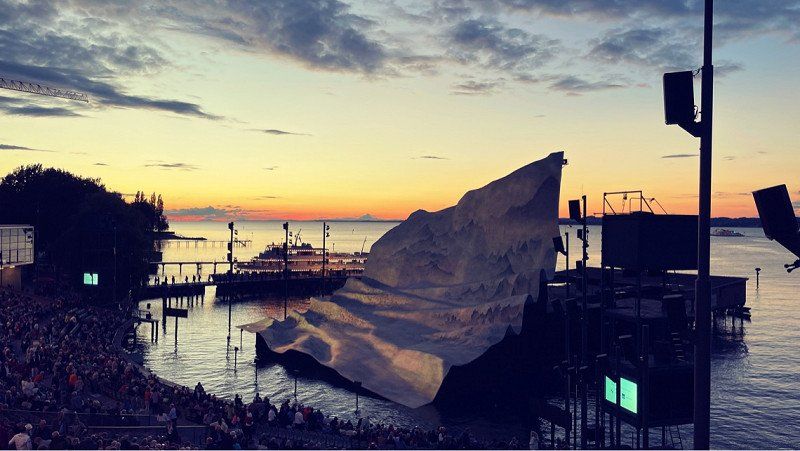
The lake stage in Bregenz once again attracts visitors with a spectacular event this year! Of course we don't want to miss that. To make the trip worthwhile, we visit the beautiful Allgäu. Hospitality and breathtaking nature await us for seven days. We haven't booked anything and we'll see where the wind blows us!
Day
Erfurt, Deutschland
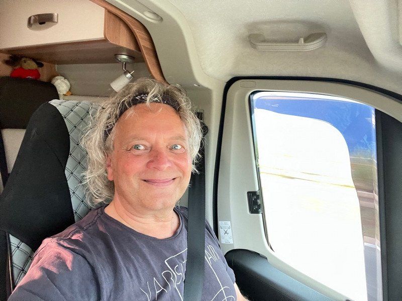
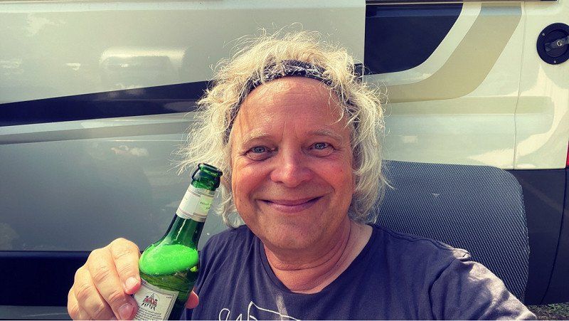
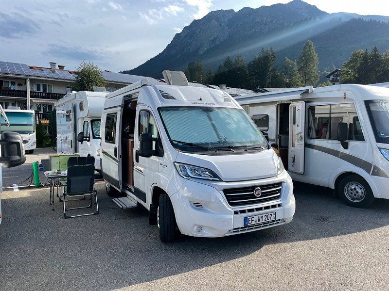
Here we go. The car is packed and ready to go! We don't have bikes this time. Yes, we want to go hiking. But first we go to the lake stage in Bregenz. We are very happy and hope for nice weather!
50° 59' 5.2" N 11° 1' 47.6" E
50.9847679 11.0298799
• Head northeast on Wallstraße. Go for 43 m.
• Turn right onto Wallstraße. Go for 166 m.
• Turn left onto Juri-Gagarin-Ring. Go for 1.8 km.
• Turn left onto Löberstraße toward A4/Arnstadt/Zum Stadtring. Go for 472 m.
• Continue on Arnstädter Straße (K35) toward A4/Arnstadt. Go for 9.0 km.
• Take ramp onto A4 toward Frankfurt a.M. Go for 3.6 km.
• Take exit 45 toward Schweinfurt onto A71. Go for 144 km.
• Take exit 31 toward Stuttgart/Würzburg/Ulm/Fulda onto A70. Go for 7.2 km.
• Take the exit toward Ulm/Würzburg/Stuttgart onto A7. Go for 238 km.
• Take exit 126 toward Dettingen a.d.Iller/Ochsenhausen/Erolzheim/Kirchdorf a.d. Iller/Gewerbegebiet Dettingen/Iller. Go for 365 m.
• Turn left onto L299 toward Gewerbegebiet Dettingen/Iller. Go for 698 m.
• Turn right toward Am Allmendsee. Go for 647 m.
• Turn right onto Am Allmendsee. Go for 193 m.
• Arrive at Am Allmendsee. Your destination is on the left.
☍
406,1 km
(3 hrs. 43 min.)
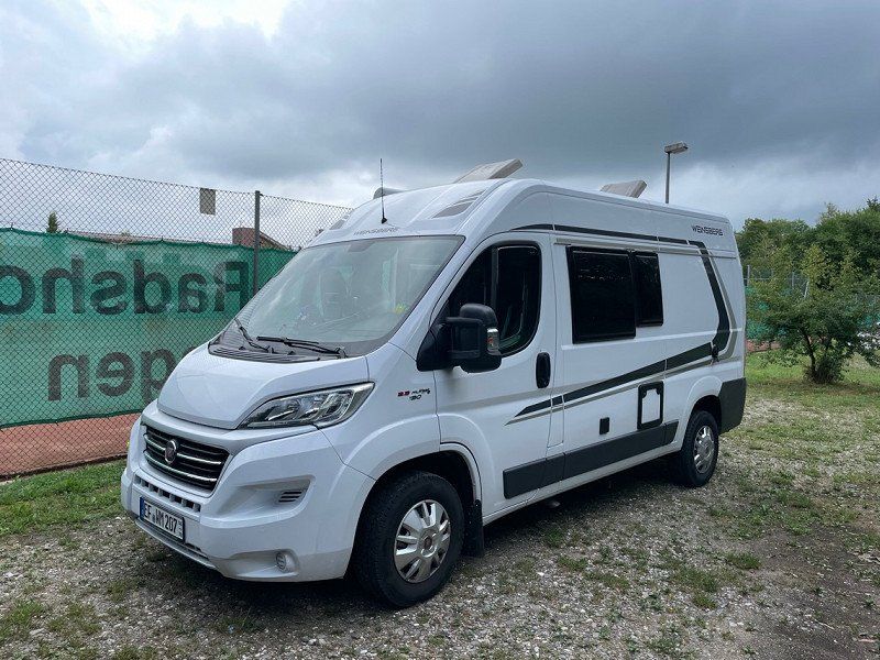
Übernachtungsplatz Dettingen
Arrived and we were very lucky. No traffic jams and just before the finish line, some rain. The autobahn towards Bregenz is closed anyway due to flooding. Certainly free again soon. Was a nice ride!
88451
48° 6' 23.5" N 10° 7' 50.9" E
48.1065369 10.1308154
• Head east on Am Allmendsee. Go for 193 m.
• Turn left. Go for 647 m.
• Turn left toward L299. Go for 643 m.
• Take ramp onto A7 toward Füssen. Go for 12.5 km.
• Take exit 128 toward Bregenz/Lindau onto A96. Go for 64.2 km.
• Continue on A14 (Rheintal Autobahn). Go for 8.8 km.
• Take exit 9 toward Bregenz onto A14 (Rheintal Autobahn). Go for 247 m.
• Keep left onto Rheintal Autobahn (A14) toward Bregenz-Zentrum/L202. Go for 1.8 km.
• Take ramp onto Rheinstraße (L202) toward Zentrum. Go for 186 m.
• Turn right onto Mehrerauer Straße. Go for 1.9 km.
• Continue on Neu Amerika. Go for 234 m.
• Turn right onto Hechtweg. Go for 249 m.
• Arrive at Hechtweg. Your destination is on the left.
☍
91,6 km
( 54 min.)
Day
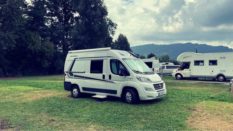
Seecamping Bregenz, Hechtweg, Bregenz, Österreich
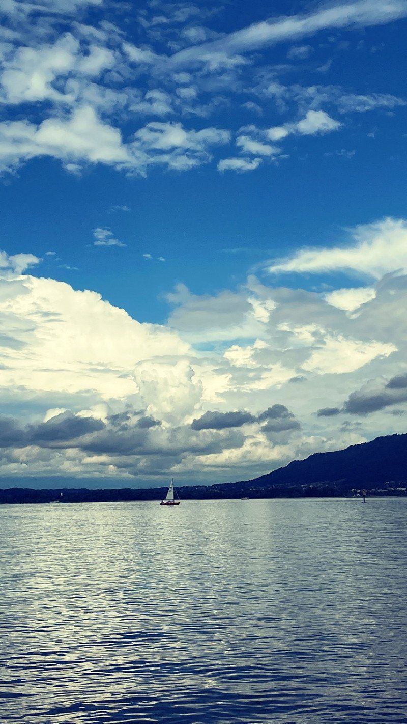
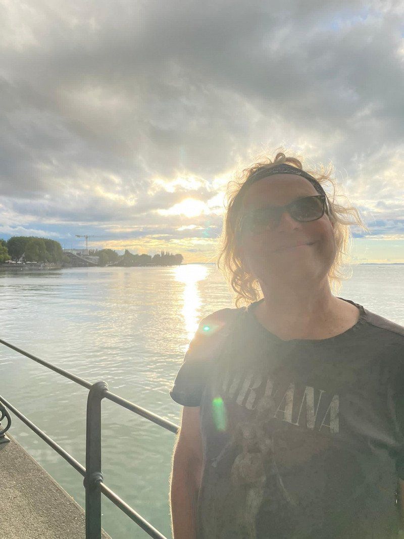
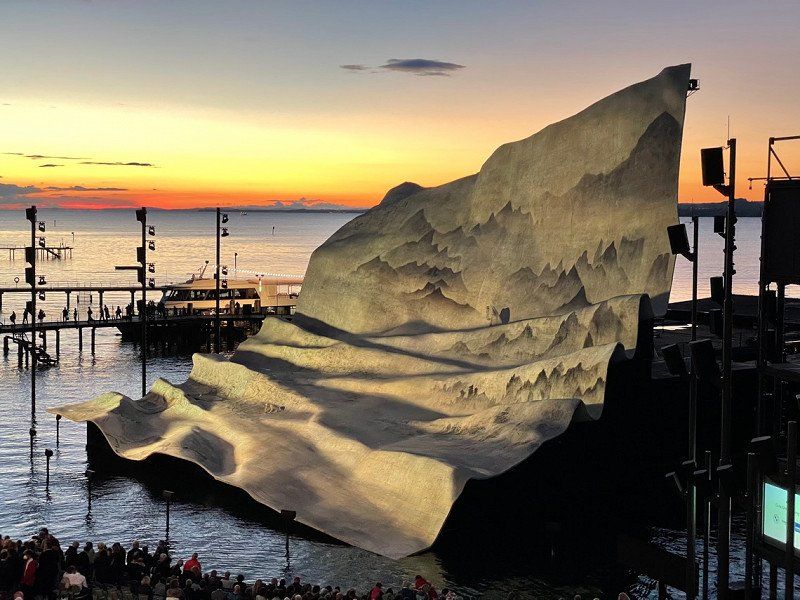
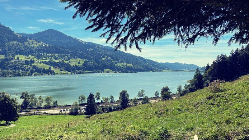
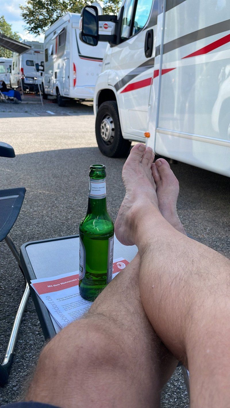
As always, we received a warm welcome. Right on the lake and pretty big. You can always find a spot there. Jumped straight to the water and chilled a bit. Dressed up after dinner and walked to the lake stage.
What a great idea. Always surprising. Went for a glass of wine with friends afterwards. Such a great day!!
Hechtweg 1, 6900 Bregenz, Österreich
47° 30' 20.3" N 9° 42' 43.6" E
47.5056404 9.7121072
• Head south on Hechtweg. Go for 249 m.
• Turn left onto Neu Amerika. Go for 234 m.
• Continue on Mehrerauer Straße. Go for 1.9 km.
• Turn right onto Bahnhofstraße (L202). Go for 1.2 km.
• Take the 3rd exit from roundabout onto Reichsstraße (L190). Go for 2.0 km.
• Turn right onto Landstraße (L1). Go for 886 m.
• Turn right onto Pfänderstraße. Go for 243 m.
• Continue on Pfänderstraße. Go for 1.8 km.
• Continue on Haggen. Go for 99 m.
• Turn slightly left onto Haggen. Go for 671 m.
• Continue on Pfänderstraße. Go for 23 m.
• Turn slightly right onto Buchenberg. Go for 3.4 km.
• Turn right onto Pfänder. Go for 341 m.
• Turn left onto Pfänder. Go for 314 m.
• Turn left onto Pfänder. Go for 298 m.
• Turn right onto Pfänder. Go for 150 m.
• Arrive at Pfänder. Your destination is on the left.
☍
13,8 km
( 28 min.)
Day
Pfänderbahn (Bergstation), Pfänder, Lochau, Österreich
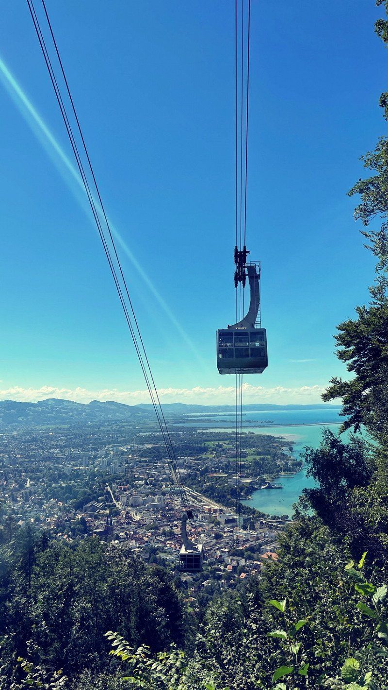
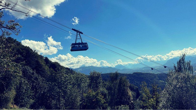
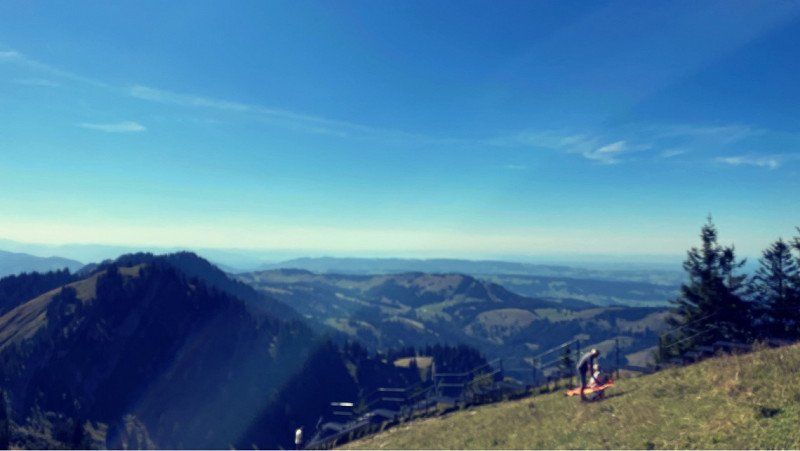
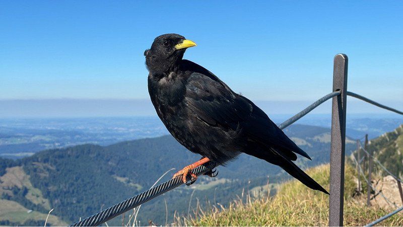
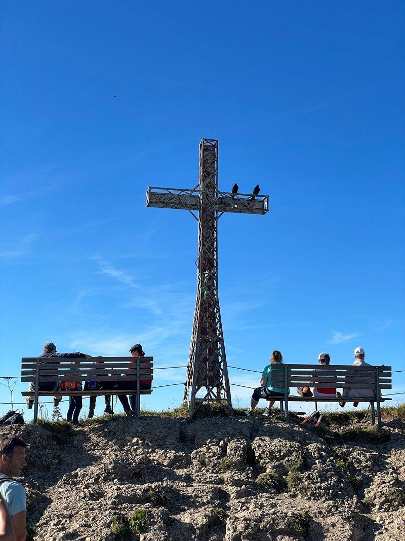
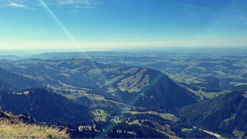
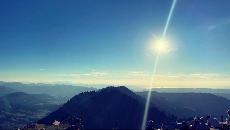
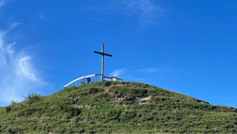
The weather is great and we decide to extend it by one day. Want to go hiking in Bregenz. The local mountain is worth a tour but not easy to climb after the storm. At the top there is a small animal park, a playground and of course a restaurant. Enjoyed the great view and descended via a beautiful path. In the evening we sat again at the lake stage and enjoyed the atmosphere. Was a great day!!
Pfänder 2, 6911 Lochau, Österreich
47° 30' 21.7" N 9° 46' 45.4" E
47.5060365 9.7792821
• Head toward Hintermoos on Pfänder. Go for 150 m.
• Turn left onto Pfänder. Go for 298 m.
• Turn right onto Pfänder. Go for 314 m.
• Turn right onto Pfänder. Go for 341 m.
• Continue on Moos. Go for 703 m.
• Continue on Hub. Go for 336 m.
• Continue on Hub. Go for 522 m.
• Continue on Jungholz. Go for 821 m.
• Continue on Hinteregg. Go for 100 m.
• Continue on Hinteregg. Go for 992 m.
• Continue on Trögen. Go for 1.3 km.
• Turn right onto Eichenberger Landesstraße (L11). Go for 3.4 km.
• Continue on Möggers (L11). Go for 2.5 km.
• Turn right onto Weienried (L9). Go for 744 m.
• Continue on St2378. Go for 1.8 km.
• Turn right onto St2378. Go for 150 m.
• Turn right onto Zollstraße (St2378). Go for 828 m.
• Take the 2nd exit from roundabout onto Haus (B308) toward Immenstadt/Lindenberg. Go for 1.1 km.
• Take the 1st exit from roundabout onto Pfänderstraße (B308). Go for 3.8 km.
• Take the 1st exit from roundabout onto B308. Go for 2.8 km.
• Take the 3rd exit from roundabout onto Auers (B32) toward Ravensburg/Heimenkirch. Go for 886 m.
• Turn right onto Auers (St2001) toward Kempten/Isny/Röthenbach. Go for 771 m.
• Turn right onto Dreiheiligen (St2001). Go for 2.7 km.
• Turn right onto Steinegaden (St2001). Go for 4.3 km.
• Turn left onto Hauptstraße (LI5). Go for 3.6 km.
• Turn left onto Hauptstraße. Go for 102 m.
• Arrive at Hauptstraße.
☍
35,3 km
( 45 min.)
Day
Eistobel, Hauptstraße, Grünenbach, Deutschland
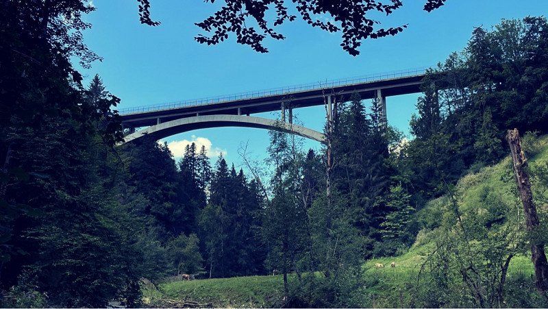
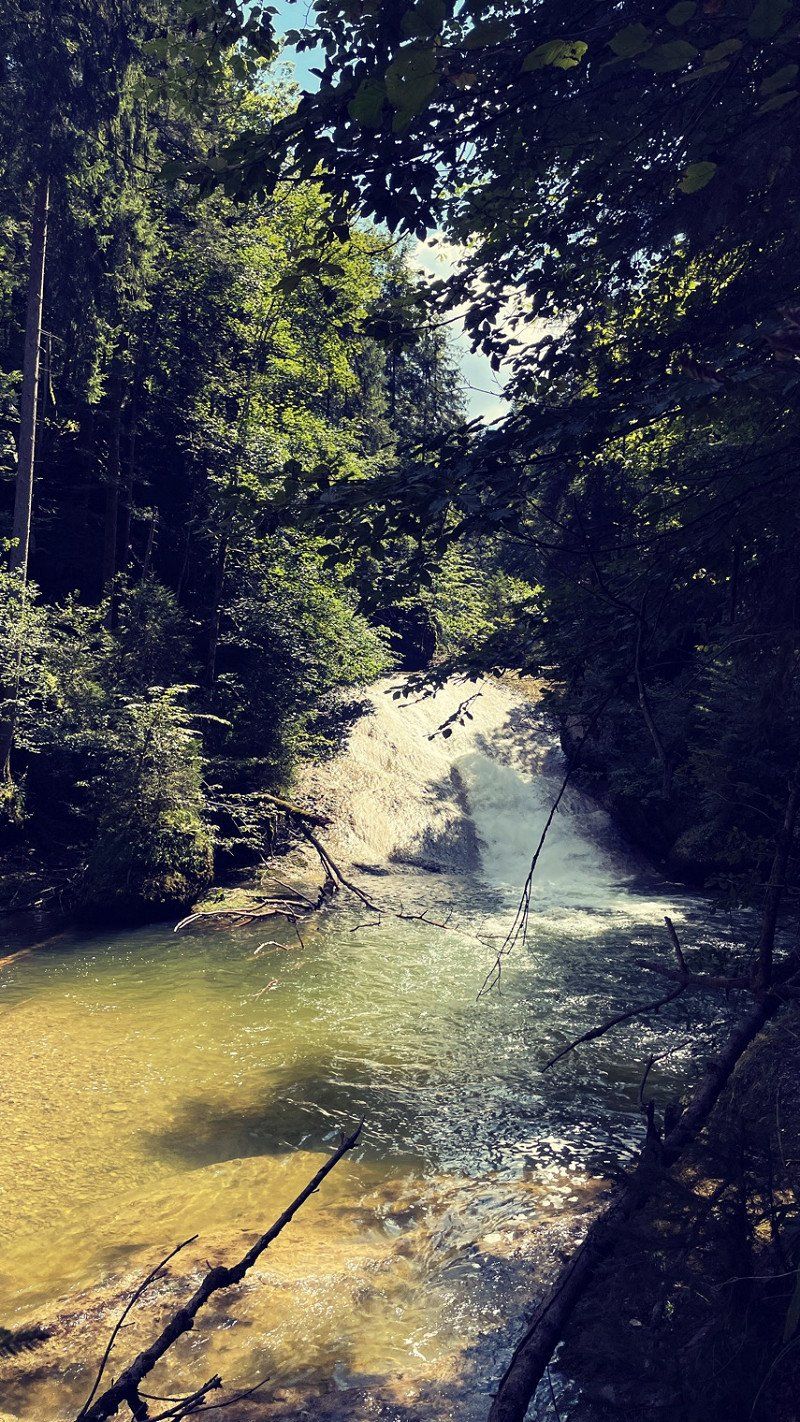
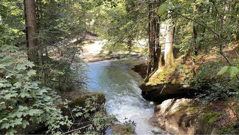
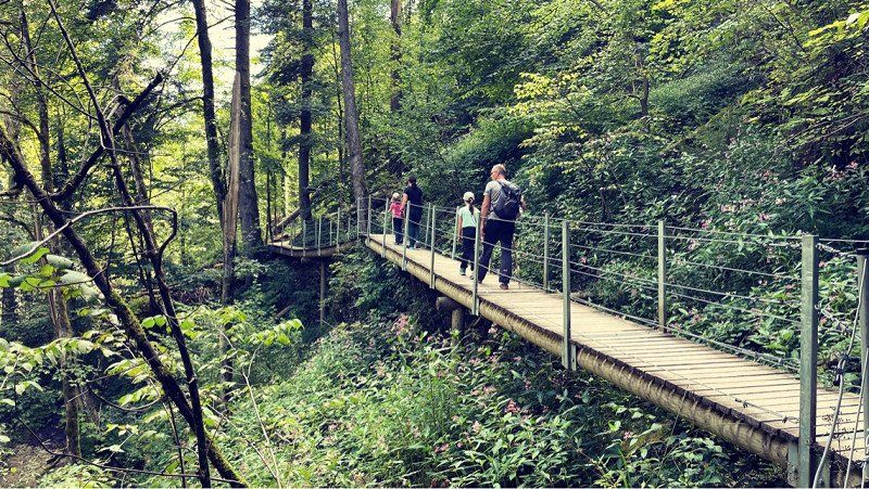
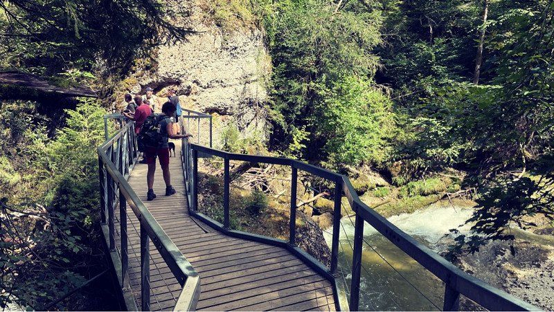
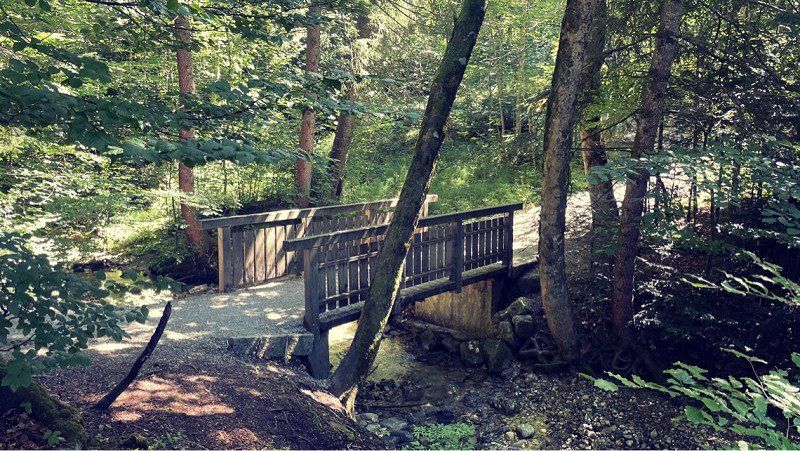
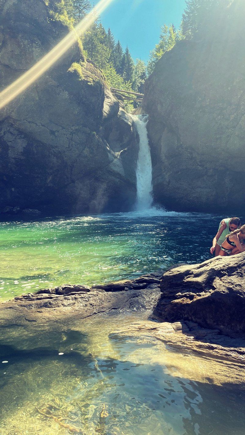
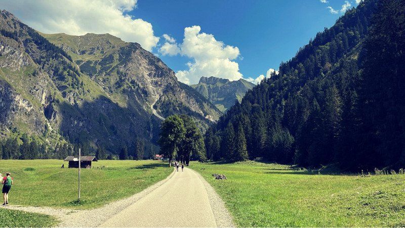
A new day and new plans. We actually wanted to stay a day longer, but the ships only go on weekends. Otherwise we would probably have explored the lake. So pack your things and let the journey continue. Didn't have to drive far. To the "Ice Creamer". A small gorge and really very beautiful. Two large parking lots await the numerous hikers. Be there early on weekends! Some also stay here. But we prefer to keep going. Tomorrow we're going up the mountain! But it was nice! Walked 6 km and enjoyed nature. A great introduction to the Allgäu!
Hauptstraße 85, 88167 Grünenbach, Deutschland
47° 38' 29.6" N 10° 1' 33.4" E
47.6415609 10.0259575
• Head west on Hauptstraße. Go for 281 m.
• Turn left onto Hauptstraße. Go for 40 m.
• Turn right onto Hauptstraße (St1318). Go for 1.7 km.
• Turn left onto Bergstraße (St1318). Go for 1.8 km.
• Continue on Lindauer Straße (St2001). Go for 660 m.
• Turn right onto Harbatshofen (St2005). Go for 5.9 km.
• Turn right onto Buflings. Go for 516 m.
• Continue on Isnyer Straße. Go for 800 m.
• Continue on Lindauer Straße. Go for 218 m.
• Continue on Rothenfelsstraße. Go for 142 m.
• Turn left onto Hugo-von-Königsegg-Straße. Go for 209 m.
• Continue on Kirchplatz. Go for 74 m.
• Continue on Rainwaldstraße. Go for 147 m.
• Turn right onto Rainwaldstraße. Go for 79 m.
• Continue on St2005. Go for 2.7 km.
• Turn left onto Höfen (OA25). Go for 1.7 km.
• Continue on OA25. Go for 419 m.
• Continue on Im Dorf (OA25). Go for 531 m.
• Continue on Am Hößl (OA25). Go for 121 m.
• Turn left. Go for 17 m.
• Arrive at your destination on the right.
☍
18,0 km
( 25 min.)
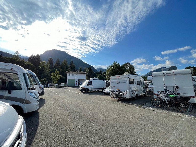
Wohnmobilstellplatz Hochgratblick, Im Dorf, Oberstaufen, Deutschland
Well, that was a nice ride... Allgäu, blue sky and sun - a dream. Found the place quickly. Located in the village of Steibis directly on the through road. Lots of curves up here. I would not have liked to go back there. But we find a nice place and set ourselves up comfortably. You have to register in the adjoining workshop. Just ring. Really nice here and everything well thought out. The ramps that are provided help against the incline. The view is great. Open the door and the mountains look in! Great! Unfortunately also the adjacent street! But you get used to it. Now let's explore and go to the beer garden!
Im Dorf 37, 87534 Oberstaufen, Deutschland
47° 31' 36.6" N 10° 1' 39" E
47.5268240 10.0275090
• Head northeast. Go for 9 m.
• Turn left toward Am Hößl/OA25. Go for 119 m.
• Turn right onto Am Hößl (OA25). Go for 27 m.
• Continue on Im Dorf (OA25). Go for 364 m.
• Keep right onto Im Dorf (OA25). Go for 167 m.
• Continue on OA25. Go for 419 m.
• Continue on Höfen (OA25). Go for 1.7 km.
• Turn right onto Mühlenstraße (St2005). Go for 2.4 km.
• Turn left onto St2005. Go for 23 m.
• Turn right onto B308. Go for 2.7 km.
• Pass 2 roundabouts and continue on Julius-Kunert-Straße (B308). Go for 12.9 km.
• Take the 1st exit from roundabout onto Bahnhofstraße toward Oberstdorf/Kempten/Sonthofen/Zentrum/Krankenhaus. Go for 277 m.
• Continue on Staufner Straße. Go for 414 m.
• Continue on Sonthofener Straße. Go for 996 m.
• Take the 1st exit from roundabout onto Blaichacher Straße (OA5). Go for 153 m.
• Take the 2nd exit from roundabout onto Blaichacher Straße (OA5). Go for 545 m.
• Continue on OA5. Go for 299 m.
• Continue on Altmummen (OA5). Go for 152 m.
• Continue on OA5. Go for 730 m.
• Continue on Hofen (OA5). Go for 438 m.
• Continue on Immenstädter Straße (OA5). Go for 178 m.
• Take the 2nd exit from roundabout onto Immenstädter Straße (OA5). Go for 501 m.
• Take the 2nd exit from roundabout onto Sonthofener Straße (OA5). Go for 1.3 km.
• Turn right onto OA27. Go for 327 m.
• Continue on Seifriedsberg (OA27). Go for 76 m.
• Continue on OA27. Go for 523 m.
• Turn slightly left onto OA27. Go for 389 m.
• Continue on Halden (OA27). Go for 462 m.
• Continue on Kapf (OA27). Go for 898 m.
• Continue on Kapf (OA27). Go for 376 m.
• Turn slightly right onto Talstraße (OA27). Go for 113 m.
• Turn slightly left onto Talstraße (OA27). Go for 108 m.
• Turn slightly right onto Moosackerweg. Go for 763 m.
• Turn slightly right onto Talstraße. Go for 162 m.
• Turn slightly left onto Talstraße. Go for 1.0 km.
• Continue on Säge. Go for 1.6 km.
• Continue on Autalweg. Go for 6.9 km.
• Arrive at your destination.
☍
40,5 km
(1 hrs. )
Day
Bergstation Hochgratbahn, Lanzenbach, Oberstaufen, Deutschland
We are still in Steibis and are happy about the great weather and the beautiful view. Had a good night and sunny morning. The road was not very disturbing at night. But during the day it is very present. But we're on the way there anyway.
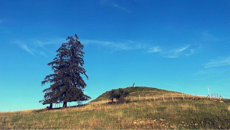
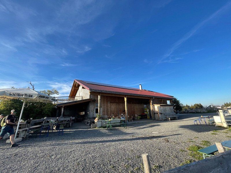
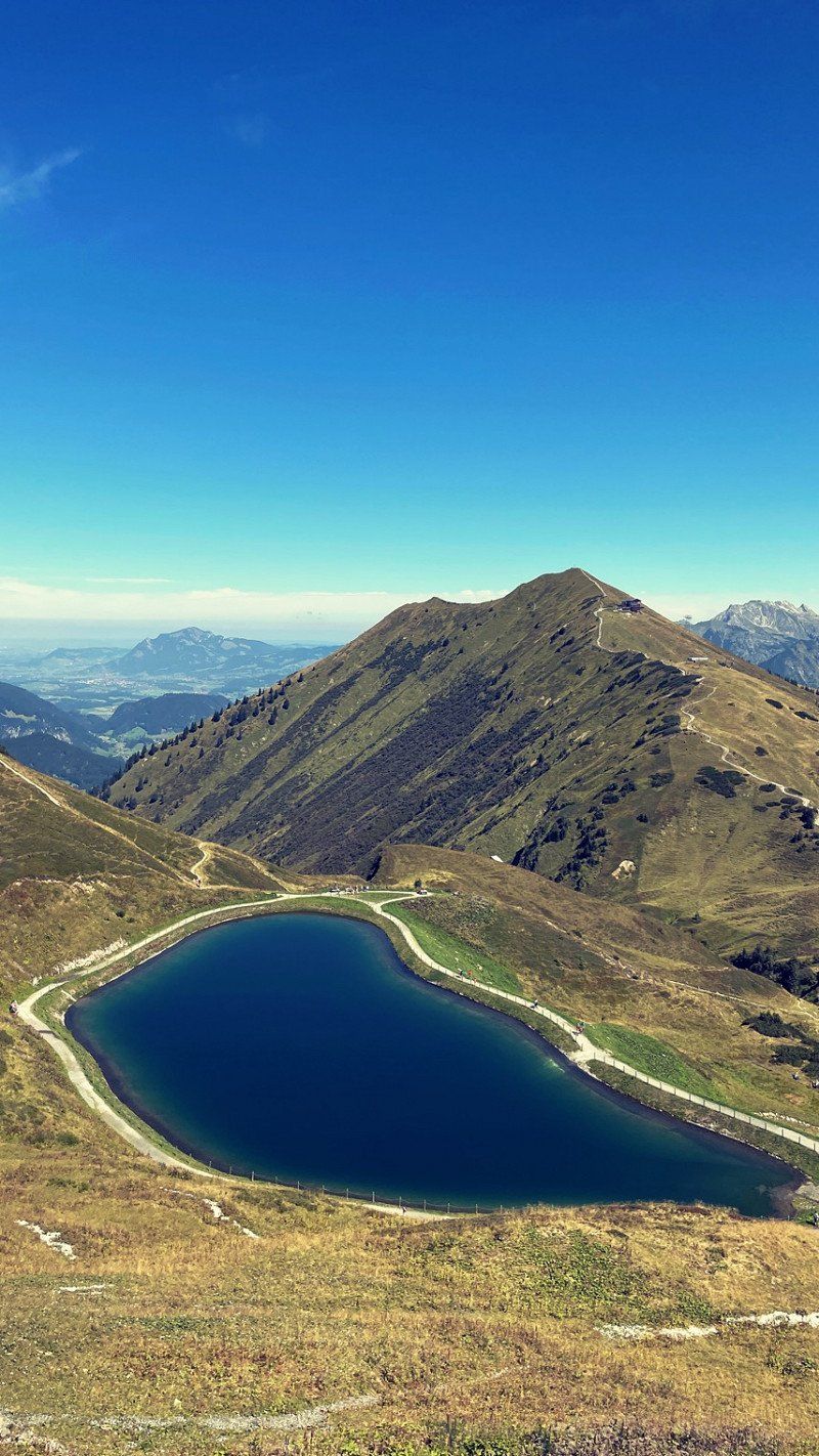
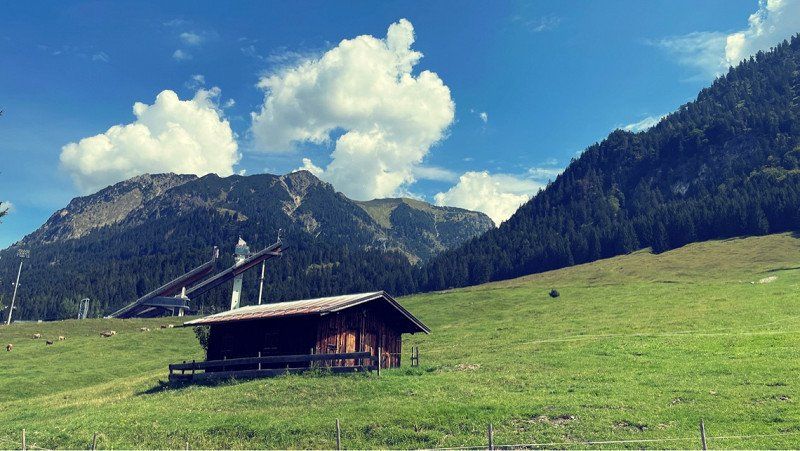
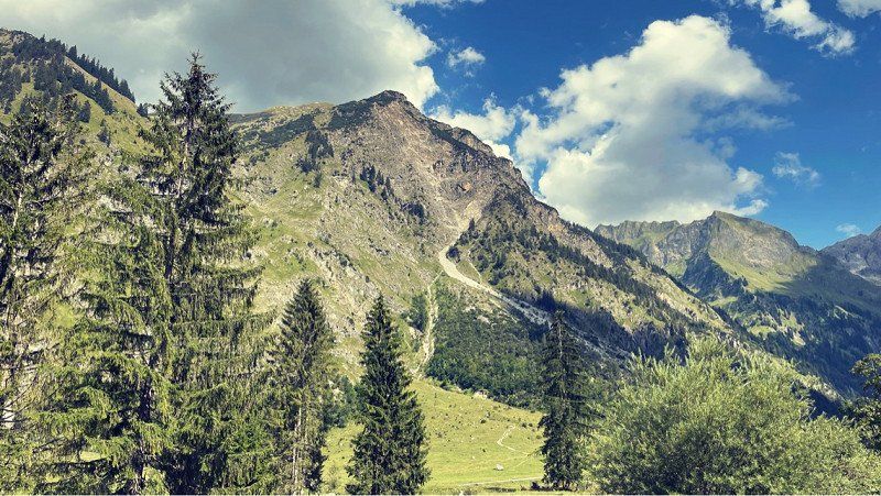
Yes, we had several ideas to spend the day. We then agreed on a nice hike. To the waterfall and the "Hochgrat". A neat way. Phew.... But it was worth it. There was a service on the mountain with a sunset party. A really good vibe. Even with a chapel! We had fun. You can find out about planned events on the Bergbahn website. It's really worth it!
The way home went through the dark forest. Huuuu... But that also had something.
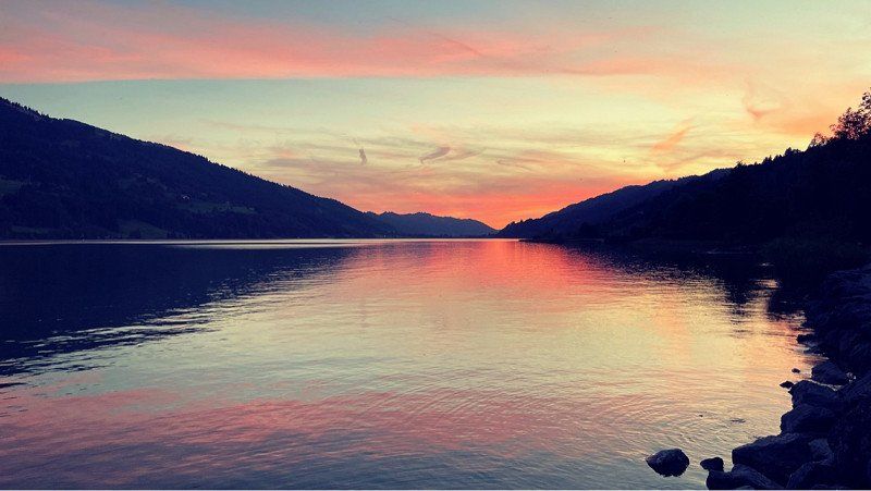
There was a delicious wine on the pitch and a great view of the starry sky. What a day!
Lanzenbach 5, 87534 Oberstaufen, Deutschland
47° 29' 32.2" N 10° 4' 19.7" E
47.4922812 10.0721276
• Head northeast. Go for 823 m.
• Continue on Autalweg. Go for 6.1 km.
• Continue on Säge. Go for 1.6 km.
• Continue on Talstraße. Go for 1.2 km.
• Continue on Talstraße. Go for 901 m.
• Turn slightly right onto Talstraße (OA27). Go for 471 m.
• Continue on Kapf (OA27). Go for 898 m.
• Continue on Halden (OA27). Go for 462 m.
• Continue on OA27. Go for 649 m.
• Turn slightly left onto OA27. Go for 263 m.
• Turn left onto Seifriedsberg (OA27). Go for 76 m.
• Continue on OA27. Go for 327 m.
• Turn left onto Sonthofener Straße (OA5). Go for 1.2 km.
• Take the 2nd exit from roundabout onto Immenstädter Straße (OA5). Go for 495 m.
• Take the 2nd exit from roundabout onto Immenstädter Straße (OA5). Go for 227 m.
• Continue on Hofen (OA5). Go for 438 m.
• Continue on OA5. Go for 730 m.
• Continue on Altmummen (OA5). Go for 152 m.
• Continue on OA5. Go for 299 m.
• Continue on Blaichacher Straße (OA5). Go for 492 m.
• Take the 1st exit from roundabout onto Blaichacher Straße (OA5). Go for 169 m.
• Take the 3rd exit from roundabout onto Sonthofener Straße. Go for 1.0 km.
• Continue on Staufner Straße. Go for 414 m.
• Continue on Bahnhofstraße. Go for 245 m.
• Take the 1st exit from roundabout onto Missener Straße (B308) toward Isny/Missen. Go for 166 m.
• Take the 2nd exit from roundabout onto Missener Straße (St2006) toward Isny/Missen. Go for 1.5 km.
• Turn left onto In der Hub. Go for 248 m.
• Turn right onto Trieblingser Weg. Go for 314 m.
• Turn left toward Seestraße. Go for 26 m.
• Continue on Seestraße. Go for 129 m.
• Arrive at Seestraße. Your destination is on the right.
☍
22,1 km
( 42 min.)
Day
Alpsee Camping
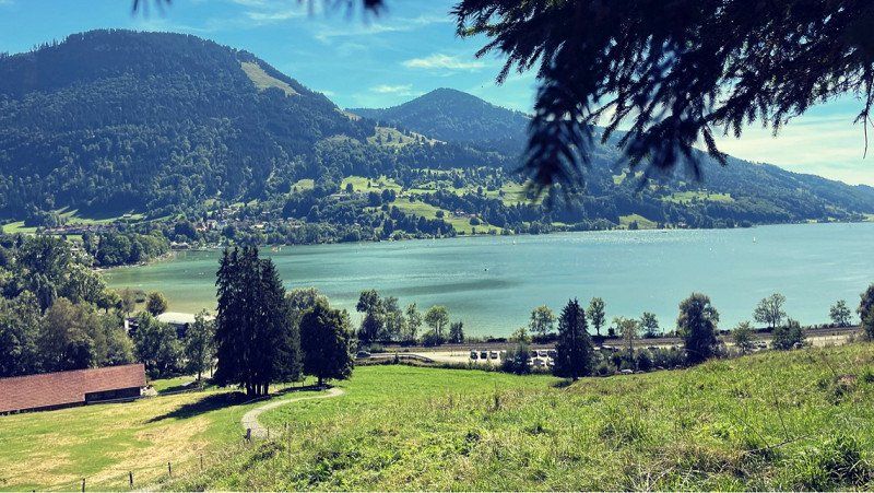
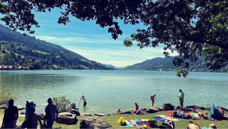
A new day and a new place! Even if it was very nice on the "Hochgrat", we wanted to continue! The Allgäu is quite large and there is still a lot to explore! After a short drive we move into a great place at the "Alpsee". What luck! Anyone who can is sitting by the water right now! We use the unexpected luxury to do the laundry. Very nice here and we were greeted nicely. Let's see what's going on. Here you can not only swim, but also great hiking!
Seestraße 25, 87509, Immenstadt-Bühl, Deutschland
47° 34' 21.3" N 10° 11' 35.6" E
47.5725700 10.1932100
• Head toward Riemengasse on Seestraße. Go for 155 m.
• Turn right onto Trieblingser Weg. Go for 314 m.
• Turn left onto In der Hub. Go for 248 m.
• Turn left onto Missener Straße (St2006). Go for 4.1 km.
• Turn left. Go for 2.1 km.
• Arrive at your destination on the right.
☍
6,9 km
( 11 min.)
Juget-Alpe, Immenstadt im Allgäu, Deutschland
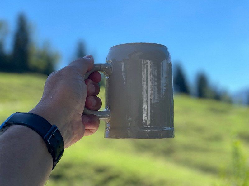
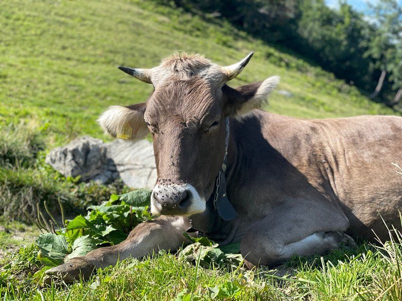
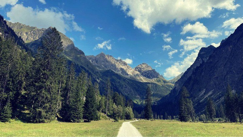
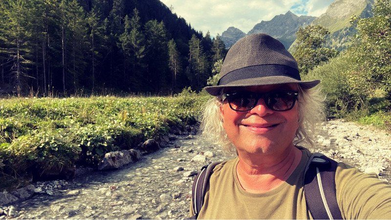
After the meal we started right away. Simply along the promenade and eventually into the forest. Everything well signposted. About 200 meters in altitude have to be mastered. But it is a nice path with a view of the lake. As a reward, there's a delicious snack on an alp and a cold beer. What a pleasure..... In addition funny guests. What more do you want. The way back leads across colourful, lush meadows and peaceful cows graze everywhere. Great! Once at the bottom, it's quite easy to follow the circular path to the campsite! We use the luxury offered and take a long shower. We want to continue tomorrow. It was nice here!!
Unnamed Road, 87509 Immenstadt im Allgäu, Deutschland
47° 35' 14.5" N 10° 9' 20.1" E
47.5873669 10.1555796
• Head east. Go for 2.1 km.
• Turn right onto St2006. Go for 1.5 km.
• Turn left onto Luitharz (OA31). Go for 546 m.
• Continue on Unterluitharz (OA31). Go for 391 m.
• Continue on Akams (OA31). Go for 539 m.
• Turn right onto Akams (OA31). Go for 371 m.
• Continue on OA31. Go for 969 m.
• Continue on Bergstättstraße (OA31). Go for 1.4 km.
• Turn right onto An der Bundesstraße (OA5). Go for 1.0 km.
• Continue on OA5. Go for 9 m.
• Continue on An der Bundesstraße (OA5). Go for 422 m.
• Continue on OA5. Go for 105 m.
• Take the 3rd exit from roundabout onto B308 toward Ulm-Füssen/A7/Kempten/B19/Oberstdorf/Bad Hindelang/Sonthofen/Immenstadt-Süd. Go for 628 m.
• Take ramp onto B19/B308 toward Oberstdorf/Immenstadt-Süd/Sonthofen/Reutte/Tirol/Bad Hindelang. Go for 17.7 km.
• Take the 2nd exit from roundabout onto Sonthofener Straße (OA4). Go for 902 m.
• Take the 3rd exit from roundabout onto Rubinger Straße (OA4). Go for 129 m.
• Turn right toward Alpgaustraße. Go for 12 m.
• Continue on Alpgaustraße. Go for 586 m.
• Turn left onto Im Steinach. Go for 443 m.
• Continue on Am Bannholz. Go for 341 m.
• Turn slightly left onto Hermann-von-Barth-Straße. Go for 600 m.
• Turn right onto Hermann-von-Barth-Straße. Go for 118 m.
• Arrive at your destination on the right.
☍
30,8 km
( 37 min.)
Day
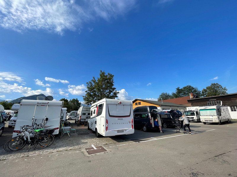
Wohnmobilstellplatz - Oberstdorf, Hermann-von-Barth-Straße, Oberstdorf, Deutschland
Well, after a short drive with the usual traffic jams, we arrived in Oberstdorf perfectly! A big square in the middle of the city. Parked safely and started straight away. Registration is only possible in the morning or in the evening! Simply fill out the form and hand it in. Here there are showers, toilets, etc. Shopping is also nearby. Very cool. Parking is close together. parking space. We are here to hike and we don't care. The main thing is a place to sleep. So we rush off to the bus station and drive to the Walsertal! Very cool. Much better than looking for a parking space there forever! Hope we can do it all!!
Hermann-von-Barth-Straße 9, 87561 Oberstdorf, Deutschland
47° 24' 29.2" N 10° 17' 6.6" E
47.4081136 10.2851566
• Head northeast. Go for 70 m.
• Continue on Hermann-von-Barth-Straße. Go for 48 m.
• Turn left onto Hermann-von-Barth-Straße. Go for 600 m.
• Turn slightly right onto Am Bannholz. Go for 341 m.
• Continue on Im Steinach. Go for 443 m.
• Turn right onto Alpgaustraße. Go for 598 m.
• Turn left onto Rubinger Straße (OA4). Go for 50 m.
• Take the 1st exit from roundabout onto Sonthofener Straße (OA4). Go for 856 m.
• Take the 3rd exit from roundabout onto B19. Go for 5.5 km.
• Continue on Walserschanz (L201). Go for 4.9 km.
• Turn left onto Köpfleweg. Go for 263 m.
• Turn right onto Köpfleweg. Go for 147 m.
• Arrive at Köpfleweg.
☍
13,8 km
( 20 min.)
Kanzelwandbahn Bergstation (1957 m), Walserstraße, Riezlern, Österreich
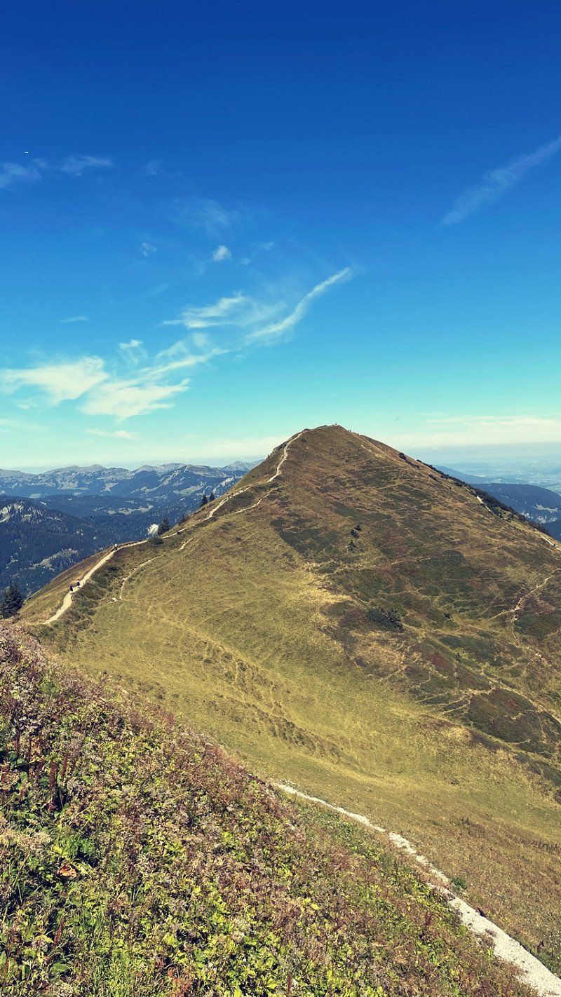
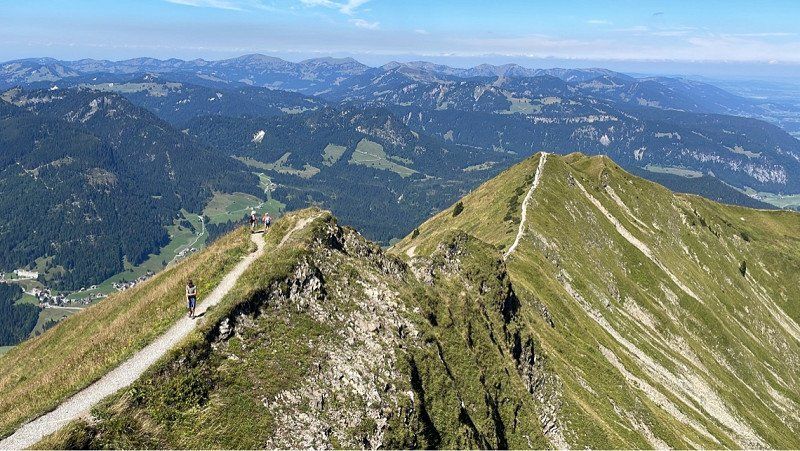
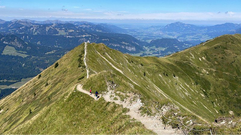
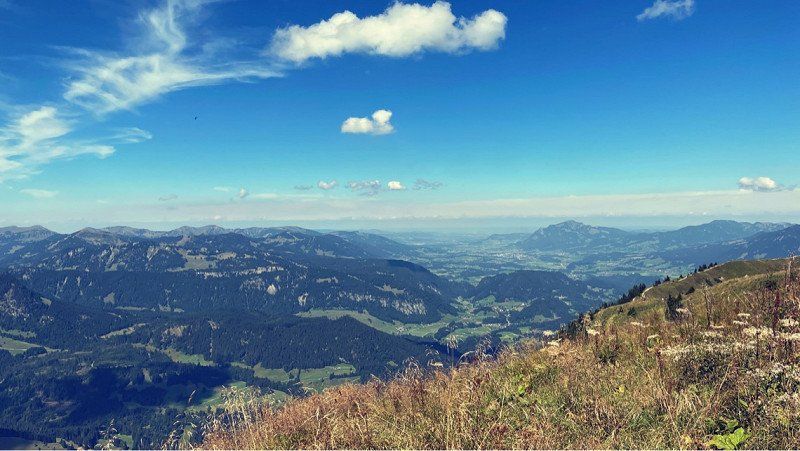
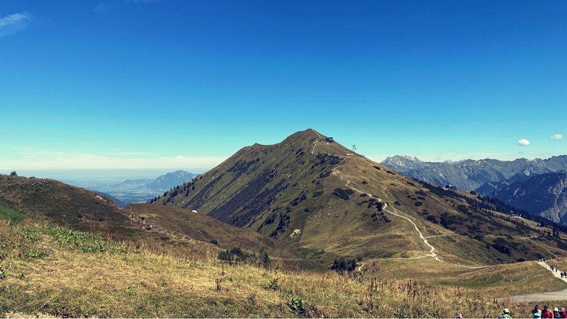
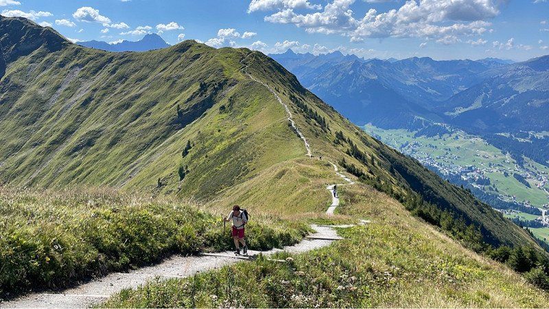
Great!! The bus stops right at the valley station and we drive straight up the mountain. This is great fun! What a view!! When we got to the top, we had to leave right away. About 9 km over the Fellhornstieg to the Söllerbahn. This is said to be one of the most beautiful hiking trails in the Allgäu. And that's it! The landscape is just terrific! In addition this great weather with the distant view. What luck! You should be at the station by 5 p.m. at the latest. So run fast and don't take too many breaks. Arrived at the mountain station at exactly 4 p.m. and was able to drink a delicious yeast! Was for a tour!! Perfect! A few meters of altitude are to be denied. Good shoes and walking sticks are recommended. On the last piece, some climbing is also announced. So better only do it in good weather! Then down the hill and take the bus back to the campsite! Worked great! In the evening again in the place. Good food!! Do we deserve it!
Walserstraße 77a, 6992 Riezlern, Österreich
47° 20' 16" N 10° 12' 5.2" E
47.3377713 10.2014357
• Head north on Köpfleweg. Go for 147 m.
• Turn left onto Köpfleweg. Go for 263 m.
• Turn right onto Walserstraße (L201). Go for 4.9 km.
• Continue on B19. Go for 5.4 km.
• Take the 1st exit from roundabout onto Sonthofener Straße (OA4). Go for 872 m.
• Take the 3rd exit from roundabout onto Rubinger Straße (OA4). Go for 129 m.
• Turn right toward Alpgaustraße. Go for 12 m.
• Continue on Alpgaustraße. Go for 586 m.
• Turn left onto Im Steinach. Go for 443 m.
• Continue on Am Bannholz. Go for 341 m.
• Turn slightly left onto Hermann-von-Barth-Straße. Go for 109 m.
• Turn left toward Plattenbichlstraße. Go for 58 m.
• Turn right onto Plattenbichlstraße. Go for 121 m.
• Turn slightly right onto Plattenbichlstraße. Go for 87 m.
• Turn right onto Plattenbichlstraße. Go for 351 m.
• Turn slightly left onto Soldanellenstraße. Go for 179 m.
• Turn right onto An der Flachsröste. Go for 44 m.
• Continue on An der Flachsröste. Go for 110 m.
• Turn left onto Schanzenstraße. Go for 192 m.
• Turn right toward Am Faltenbach. Go for 93 m.
• Continue on Am Faltenbach. Go for 56 m.
• Continue on Oytalstraße. Go for 757 m.
• Turn left onto Oytalstraße. Go for 346 m.
• Continue on Ins Oytal. Go for 3.6 km.
• Continue on Oytal. Go for 1.8 km.
• Arrive at Oytal. Your destination is on the right.
☍
21,0 km
( 40 min.)
Day
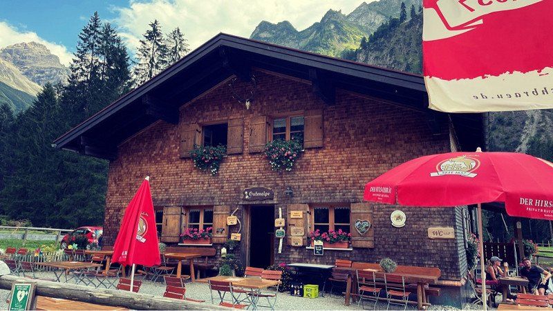
Gutenalpe, Oytalstraße, Oberstdorf, Deutschland
Still in Oberstdorf on the pitch. I have no idea why people are complaining here... we are very happy. Lots of space and a great wash house. Everything clean and quite new. Of course, some cars are very close together, but that's intentional. The shady places are just coveted! Overall a good location, couldn't be better. We'll definitely be back.
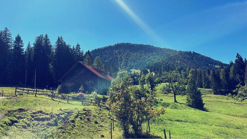
Of course we went hiking again today. Between the mountains to the "Gutenalp". No walk in the heat. Are about 250 meters. But they are really worth it. The path is easy to walk and at the end a really great hut awaits thirsty guests. A dream. Also easy to reach by bike. The way back by the water is a highlight …. You rarely see such clear water. There are a few ways to put your feet in the water. A good idea in the heat. When we arrived in town, we had to catch our breath. That was a few kilometers the last few days. But we experienced so many beautiful things... with a bit of melancholy we enjoy the last few hours here. Goods to buy. But I didn't feel like cooking today. A spectacle is taking place in the sky. Weather lights at their finest. It's rumbling and will probably rain soon. That makes saying goodbye a lot easier for us. Tomorrow evening we want to go home. Now let's enjoy the evening! It actually starts to rain. Hmm... sooo nice!
Oytalstraße, 87561 Oberstdorf, Deutschland
47° 22' 57.1" N 10° 21' 23.4" E
47.3825254 10.3564981
• Head west on Oytal. Go for 4.2 km.
• Continue on Ins Oytal. Go for 1.2 km.
• Continue on Oytalstraße. Go for 1.1 km.
• Continue on Am Faltenbach. Go for 56 m.
• Continue toward Schanzenstraße. Go for 93 m.
• Turn left onto Schanzenstraße. Go for 192 m.
• Turn right onto An der Flachsröste. Go for 154 m.
• Turn left onto Soldanellenstraße. Go for 179 m.
• Turn left onto Plattenbichlstraße. Go for 243 m.
• Turn right toward Hermann-von-Barth-Straße. Go for 63 m.
• Continue on Hermann-von-Barth-Straße. Go for 155 m.
• Turn left onto Hermann-von-Barth-Straße. Go for 118 m.
• Arrive at your destination on the right.
☍
7,8 km
( 21 min.)
Day
Wohnmobilstellplatz - Oberstdorf, Hermann-von-Barth-Straße, Oberstdorf, Deutschland
So it really rained last night! A nice thunderstorm. But only came down very moderately. No storm as predicted. That's why we stayed in Oberstdorf. The place is paved and certainly good in heavy rain.
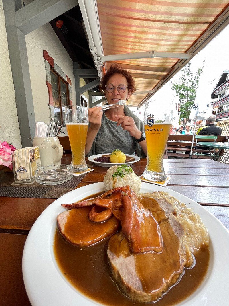
In anticipation of further rain, we decide to go on a city hike. Nice and fresh outside! Actually wanted to go to Nesselwang and climb the Alpspitz. Then just the next time and Oberstdorf is also quite pretty. Lots of fun shops with interesting local produce. Bought a lot of cheese. hmmm... it will be delicious when we get home. Still properly fed and back to the car.
The entrance barrier is closed at the weekend and you should try to get a coin. As a rule, an employee comes by and hands them out upon presentation of the receipt. So be sure to cancel!
Well, with a heavy heart we say goodbye to Oberstdorf and start our Frida. Just get rid of it and then get on the freeway. Since we like to drive in the evening, we expect a stress-free drive to enjoy the great scenery. It was nice again and see you next time!
Hermann-von-Barth-Straße 9, 87561 Oberstdorf, Deutschland
47° 24' 29.2" N 10° 17' 6.6" E
47.4081136 10.2851566
• Head northeast. Go for 70 m.
• Continue on Hermann-von-Barth-Straße. Go for 48 m.
• Turn left onto Hermann-von-Barth-Straße. Go for 600 m.
• Turn slightly right onto Am Bannholz. Go for 341 m.
• Turn right onto Am Bannholz. Go for 958 m.
• Turn right onto Rubinger Straße (OA4). Go for 634 m.
• Continue on OA4. Go for 763 m.
• Continue on Oberstdorfer Straße (OA4). Go for 474 m.
• Continue on Reichenbach (OA4). Go for 1.1 km.
• Continue on OA4. Go for 3.2 km.
• Continue on Hinang (OA4). Go for 327 m.
• Continue on OA4. Go for 1.1 km.
• Continue on Hinanger Straße (OA4). Go for 263 m.
• Continue on Am Anger (OA4). Go for 377 m.
• Continue on Sonthofer Straße (OA4). Go for 288 m.
• Continue on OA4. Go for 1.4 km.
• Continue on Altstädter Straße. Go for 115 m.
• Turn left onto Stadionweg. Go for 196 m.
• Turn right onto Sinwagstraße. Go for 606 m.
• Turn right onto Oberstdorfer Straße (OA5). Go for 75 m.
• Turn left toward Südliche Alpenstraße/B19. Go for 60 m.
• Take ramp onto Südliche Alpenstraße (B19). Go for 21.1 km.
• Take ramp onto A980 toward München/Augsburg/Ulm/Füssen. Go for 4.7 km.
• Take the exit toward Ulm/München/Stuttgart/Augsburg onto A7. Go for 291 km.
• Take exit 99 toward Bamberg/Schweinfurt/Werneck/Erfurt onto A70. Go for 6.6 km.
• Take exit 4 toward Erfurt/Suhl/Bad Neustadt/Schweinfurt-West onto A71. Go for 142 km.
• Take exit 12 toward Dresden/Erfurt-West onto A4. Go for 4.0 km.
• Take exit 46 toward Erfurt-West/Erfurt-Zentrum/Erfurt-Molsdorf/Eischleben/Zentrum/Waltersleben. Go for 335 m.
• Turn right onto L3004 toward Erfurt-Zentrum/Erfurt-Waltersleben. Go for 7.8 km.
• Keep left onto Martin-Andersen-Nexö-Straße (K35) toward Klinikum. Go for 1.5 km.
• Continue on Löberstraße. Go for 412 m.
• Turn right onto Juri-Gagarin-Ring toward Zentrum/Altstadt. Go for 1.9 km.
• Turn right onto Wallstraße. Go for 166 m.
• Turn left onto Wallstraße. Go for 43 m.
• Arrive at Wallstraße. Your destination is on the left.
☍
495,1 km
(4 hrs. 42 min.)
Erfurt, Deutschland
As expected, we arrived home after 4.5 hours of stress-free driving. Everything worked fine. No traffic jams, just the occasional heavy rain to clean the car! :-)
Unfortunately, the beautiful days are over now and we are looking forward to new adventures. Now let's go diving with the plane. Have a great time everyone and have fun exploring the world!
50° 59' 5.2" N 11° 1' 47.6" E
50.9847679 11.0298799