Auroraweg 10, 3185 Schmitten, Schweiz
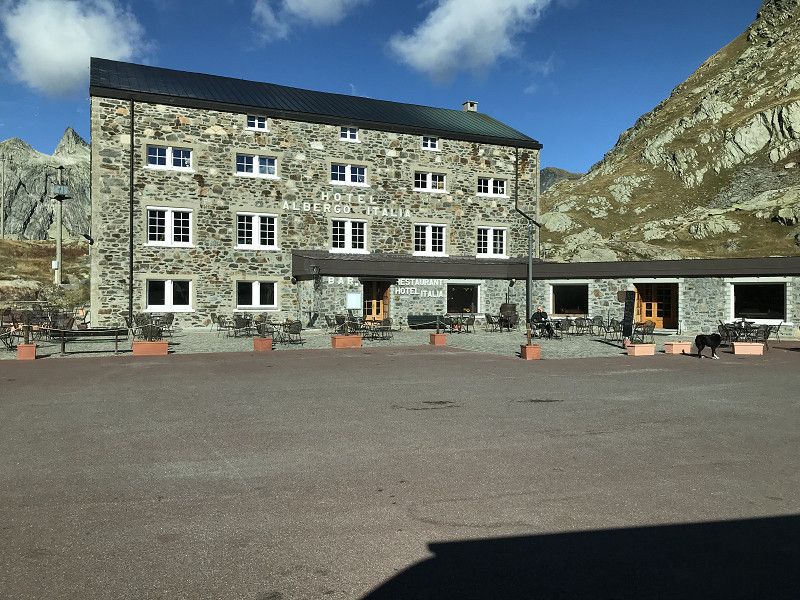
On September 9th, 2022 at 7:30 a.m. we start towards Genoa. We cross the Gr. St. Bernhard Pass, drive through the Aosta Valley to Genoa.
Auroraweg 10, 3185 Schmitten, Switzerland
46° 51' 6.1" N 7° 14' 49.3" E
46.8516851 7.2470280
• Head south on Auroraweg. Go for 62 m.
• Turn right onto Rainstrasse. Go for 255 m.
• Turn left onto Bagerstrasse. Go for 620 m.
• Continue on Berg. Go for 399 m.
• Turn right onto Berg. Go for 791 m.
• Continue on Heitiwil. Go for 1.7 km.
• Continue on Leimacker. Go for 354 m.
• Continue on Chännelmattstrasse. Go for 489 m.
• Take the 1st exit from roundabout onto Käsereistrasse. Go for 240 m.
• Take the 1st exit from roundabout onto Hauptstrasse. Go for 586 m.
• Pass 2 roundabouts and continue on Hauptstrasse. Go for 670 m.
• Take left ramp onto A12 toward Fribourg. Go for 55.5 km.
• Take the left exit toward Simplon/Gd-St-Bernard/Martigny/Montreux onto A9 (Autoroute du Léman). Go for 48.1 km.
• Take exit 22 toward Gd-St-Bernard/Verbier/Chamonix/Martigny-Expo onto A21 (Grand-Saint-Bernard). Go for 2.8 km.
• Continue on E27. Go for 2.4 km.
• Pass 4 roundabouts and continue on Route du Saint-Bernard (E27). Go for 28.1 km.
• Continue on Route du Gd-St-Bernard (E27). Go for 11.0 km.
• Continue on Traforo del Gran San Bernardo (T2). Go for 11.5 km.
• Continue on Strada Statale del Gran San Bernardo (SS27) toward Aosta/Gr.S.Bernardo. Go for 24.1 km.
• Keep left toward Aosta Centro/Aoste Centre/Genova/E25/Milano/A4/E64/Torino/A5/E612. Go for 465 m.
• Take ramp onto A5 (Ponte L'Eglise) toward Genova/A26/E25/E612/Torino/Milano/A4/E64. Go for 63.5 km.
• Take the exit onto A5 (Diramazione A4/A5). Go for 24.5 km.
• Continue on A26 (Diramazione A26/A4). Go for 29.8 km.
• Take the exit toward Alessandria/Genova onto A26 (Autostrada Genova Voltri-Gravellona Toce). Go for 105 km.
• Continue on A10 (Autostrada Genova-Ventimiglia). Go for 11.5 km.
• Take the left exit toward Genova Ovest onto A7 (Autostrada Milano-Genova). Go for 1.9 km.
• Take the left exit toward Porto Terminal Crociere onto Viadotto della Camionale. Go for 383 m.
• Keep right onto Viadotto della Camionale toward Porto Passeggeri. Go for 227 m.
• Arrive at Viadotto della Camionale. Your destination is on the right.
☍
426,4 km
(4 hrs. 21 min.)
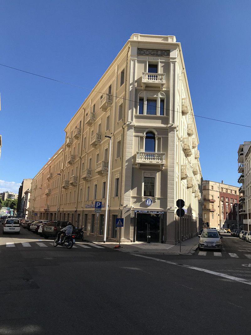
Genua Hafen, Via Balleydier, Genua, Italien
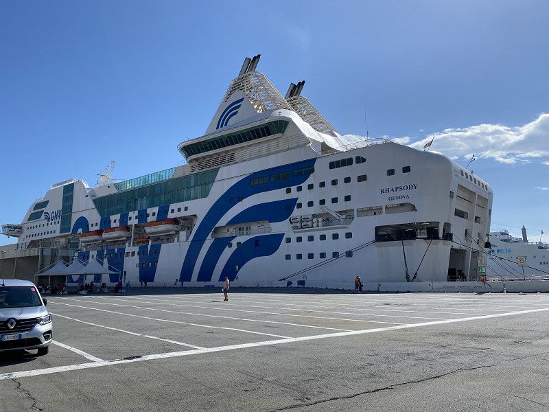
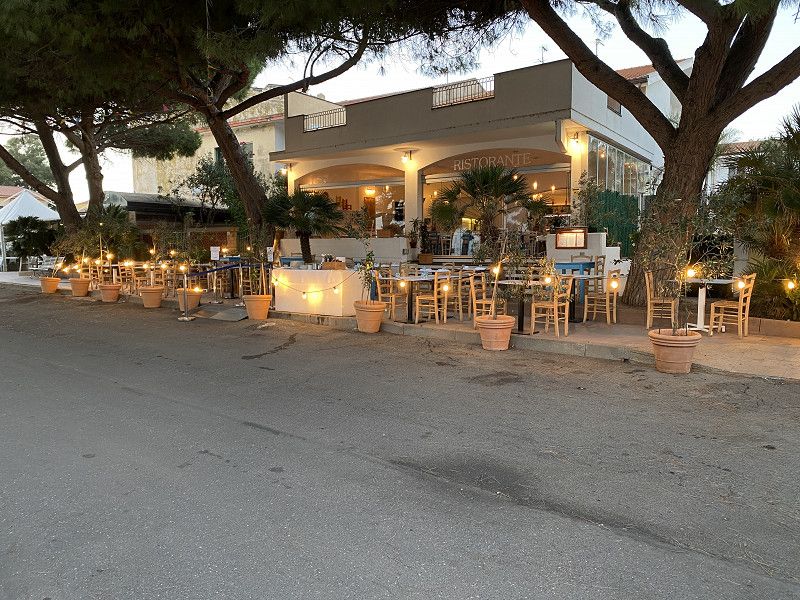
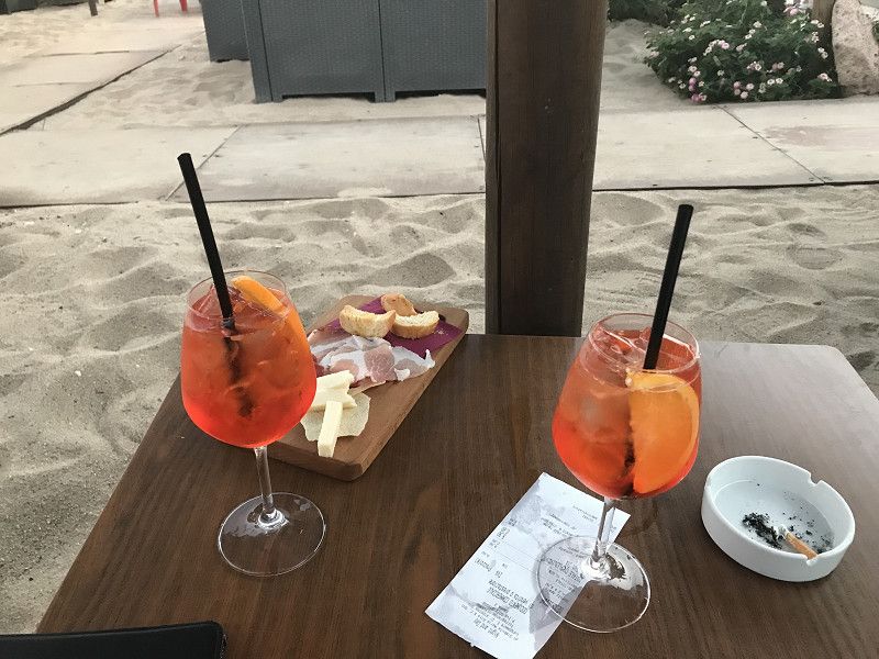
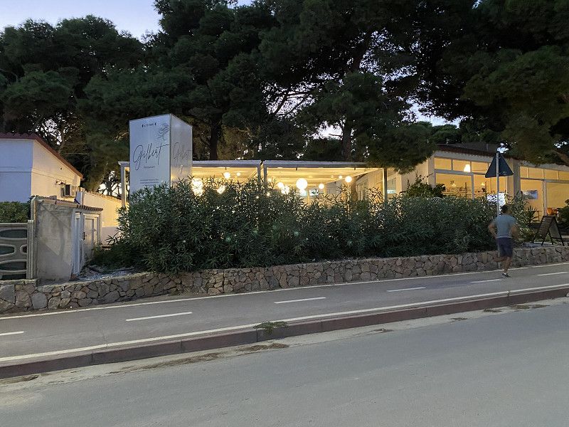
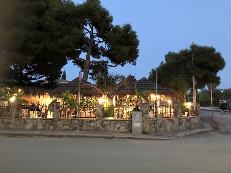
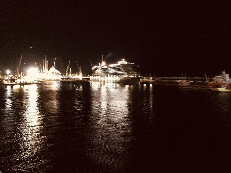
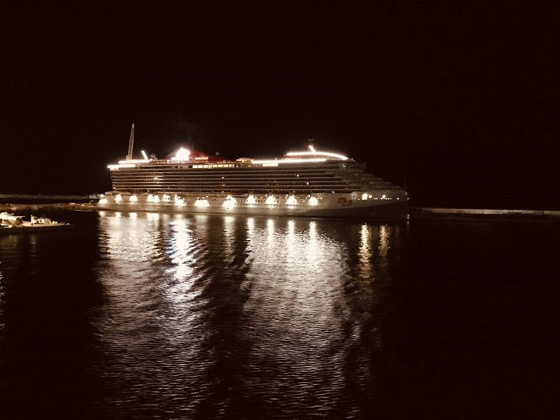
Arrived in Genoa we prepare for the crossing to Sardinia. Since we leave Genoa at 7:00 p.m. and arrive in Olbia at 7:00 a.m. the next day. We made a conscious decision to do without a cabin and settle for Pullman seats.
We arrived around 8:00 p.m. after a cozy aperitif on deck at the restaurant, where we got something to eat.
Around 11:30 p.m. we looked for our Pullman seats and tried to rest for a few hours.
Via Balleydier, 29, 16149 Genova GE, Italy
44° 24' 33.5" N 8° 54' 13.7" E
44.4092931 8.9038057
• Head west on Viadotto della Camionale. Go for 156 m.
• Keep left onto Viadotto della Camionale toward Centro/Nervi/Autostrade. Go for 154 m.
• Keep left onto Viadotto della Camionale toward Autostrade. Go for 99 m.
• Take ramp onto A7 (Autostrada Milano-Genova). Go for 4.6 km.
• Take the exit toward Genova Est/Livorno onto A12 (Autostrada Azzurra). Go for 169 km.
• Take the exit toward Livorno onto A12 (Autostrada Azzurra). Go for 3.8 km.
• Take the exit toward Stagno/SS1. Go for 1.0 km.
• Take the 2nd exit from roundabout onto Strada Statale Aurelia (SS1) toward Livorno Centro. Go for 1.1 km.
• Take the 2nd exit from roundabout onto Via Firenze (SS1). Go for 1.3 km.
• Keep left onto Strada Statale Aurelia (SS1). Go for 318 m.
• Turn right onto Viale Genova (SP224). Go for 546 m.
• Continue on Via delle Cateratte. Go for 1.2 km.
• Continue on Via Guido Donegani. Go for 635 m.
• Take the 2nd exit from roundabout onto Via Andrea Costa. Go for 376 m.
• Take the 3rd exit from roundabout onto Via Andrea Costa. Go for 213 m.
• Take the 1st exit from roundabout onto Calata Carrara. Go for 42 m.
• Turn right onto Piazza del Portuale. Go for 174 m.
• Continue on Calata Siena. Go for 135 m.
• Take the Livorno-Bastia Ferry. Stay on for 121 km.
• Head toward Quai Nord. Go for 230 m.
• Turn right toward Rue Chanoine Leschi. Go for 274 m.
• Take the 6th exit from roundabout toward Centre Ville/Ajaccio/Calvi/Bonifacio. Go for 249 m.
• Continue on Rue Chanoine Leschi. Go for 303 m.
• Keep left toward T11. Go for 207 m.
• Continue on T11. Go for 2.9 km.
• Keep left onto T11 toward Ajaccio/Bonifacio/Aéroport Poretta. Go for 1.7 km.
• Take the 2nd exit from roundabout onto Avenue Sampiero Corso (T11) toward Calvi/Ajaccio/Bonifacio/Aéroport Poretta. Go for 919 m.
• Keep right onto Avenue Sampiero Corso (T11) toward Calvi/Ajaccio/Bonifacio/Aéroport Poretta. Go for 113 m.
• Pass 4 roundabouts and continue on T11. Go for 19.0 km.
• Take the 3rd exit from roundabout onto T10 toward Aléria. Go for 997 m.
• Pass 19 roundabouts and continue on T10. Go for 117 km.
• Take the 2nd exit from roundabout onto T10 toward Ajaccio/Bonifacio/Aéroport Figari. Go for 680 m.
• Take the 3rd exit from roundabout onto T10 toward Ajaccio/Bonifacio/Aéroport Figari. Go for 1.2 km.
• Pass 2 roundabouts and continue on T10. Go for 998 m.
• Turn right onto T10 toward Ajaccio/Bonifacio/Aéroport Figari. Go for 624 m.
• Pass 4 roundabouts and continue on T10. Go for 22.5 km.
• Take the 3rd exit from roundabout onto Avenue Sylver Bohn (T40) toward Bonifacio/Centre-Ville. Go for 2.2 km.
• Continue on Rue Sauveur-Paul Étienne. Go for 193 m.
• Continue on Quai Sott a Portigliola toward Gare Maritime. Go for 207 m.
• Take the Bonifacio-Santa Teresa di Gallura Ferry. Stay on for 18.2 km.
• Head southwest on SP161. Go for 96 m.
• Turn left onto SP161. Go for 455 m.
• Turn left onto Via Sandro Pertini. Go for 202 m.
• Turn right onto Via Aa17. Go for 845 m.
• Continue toward Strada Statale Santa Teresa-Ponte Liscia/SS133bis. Go for 52 m.
• Turn left onto Strada Statale Santa Teresa-Ponte Liscia (SS133bis). Go for 15.5 km.
• Continue on SS133 toward Palau Porto/Olbia. Go for 5.5 km.
• Take the 1st exit from roundabout onto Strada Statale Orientale Sarda (SS125) toward Olbia Porto/Aeroporto Olbia. Go for 10.8 km.
• Keep right onto Viale Costa Smeralda (SP115) toward Bassacutena/Circonvallazione/Olbia/Tempio/Arzachena. Go for 267 m.
• Turn left toward Circonvallazione/Olbia/Tempio. Go for 57 m.
• Continue on Circonvallazione Arzachena. Go for 1.7 km.
• Take the 2nd exit from roundabout onto Circonvallazione Arzachena (SP14) toward Olbia. Go for 915 m.
• Take the 2nd exit from roundabout onto Circonvallazione Arzachena (SP14). Go for 3.5 km.
• Take the 1st exit from roundabout onto Strada Statale Orientale Sarda (SS125) toward Aeroporto Olbia/Olbia Porto. Go for 13.8 km.
• Pass 2 roundabouts and continue on Strada Statale Orientale Sarda (SS125). Go for 6.2 km.
• Take ramp toward Tempio. Go for 226 m.
• Turn right onto Via Alessandro Nanni. Go for 576 m.
• Turn left onto Via Gabriele D'Annunzio. Go for 435 m.
• Turn left onto Via San Simplicio. Go for 117 m.
• Arrive at Via San Simplicio. Your destination is on the left.
☍
557,3 km
(9 hrs. 59 min.)
Day
Olbia, Sassari, Italien
Already at 05:00 we were woken up by a loud gong. Which meant for us to get up and enjoy the harbor entrance. As soon as we docked, we were asked to go to our vehicles and prepare for the exit.
As soon as we got off the ferry, we visited Olbia. Around 4:00 p.m. we decide to travel on to Palau.
07026 Olbia, Province of Sassari, Italy
40° 55' 24.9" N 9° 29' 47.2" E
40.9235764 9.4964429
• Head south on Via San Simplicio.
• Turn left onto Corso Umberto I. Go for 311 m.
• Turn left onto Via San Giovanni. Go for 79 m.
• Turn right onto Via Giovanni Maria Angioj. Go for 31 m.
• Turn left onto Via Porto Romano. Go for 173 m.
• Turn right onto Via Alessandro Nanni. Go for 534 m.
• Turn right onto Viale Principe Umberto. Go for 23 m.
• Take the 4th exit from roundabout. Go for 92 m.
• Keep right. Go for 100 m.
• Take ramp toward Costa Smeralda/Arzachena/Palau/Porto Cervo. Go for 358 m.
• Continue on Strada Statale Orientale Sarda (SS125). Go for 2.1 km.
• Take the 2nd exit from roundabout onto Strada Statale Orientale Sarda (SS125). Go for 4.1 km.
• Take the 2nd exit from roundabout onto Strada Statale Orientale Sarda (SS125) toward Arzachena/Palau/Olbia. Go for 13.9 km.
• Take the 3rd exit from roundabout onto Circonvallazione Arzachena toward Palau/S.Teresa/Olbia Porto/Aeroporto Olbia. Go for 3.5 km.
• Pass 2 roundabouts and continue on Circonvallazione Arzachena. Go for 2.7 km.
• Turn right onto Viale Costa Smeralda (SP115) toward Arzachena/V.le C.Smeralda/Palau/S.Teresa di Gallura. Go for 275 m.
• Turn left onto Strada Statale Orientale Sarda (SS125). Go for 10.8 km.
• Take the 1st exit from roundabout onto SS133 toward Palau Porto. Go for 268 m.
• Take the 1st exit from roundabout onto SS133. Go for 229 m.
• Take the 1st exit from roundabout onto SS133. Go for 501 m.
• Continue on Via Nazionale (SS133). Go for 559 m.
• Turn right onto Via Gallura. Go for 92 m.
• Turn left onto Via Cagliari. Go for 31 m.
• Turn right onto Via Capo d'Orso. Go for 94 m.
• Take the 2nd exit from roundabout onto Via Capo d'Orso. Go for 479 m.
• Turn left onto Via del Vecchio Marino. Go for 523 m.
• Turn right onto Via del Vecchio Marino. Go for 51 m.
• Arrive at Via del Vecchio Marino. Your destination is on the right.
☍
42,0 km
( 51 min.)
Camping Baia Saraceno
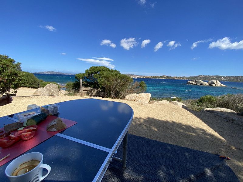
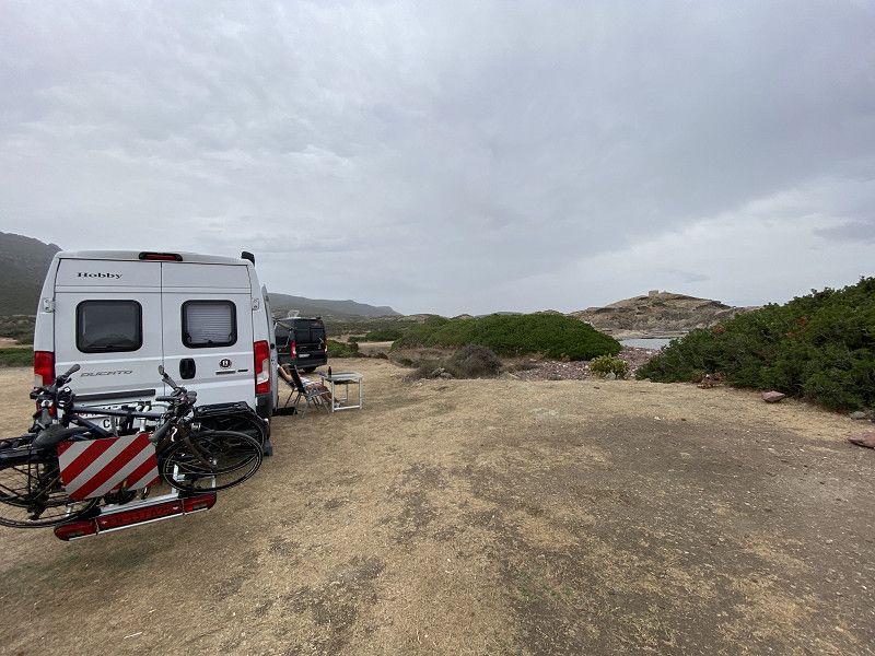
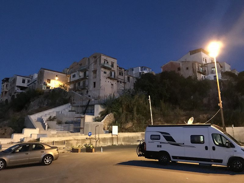
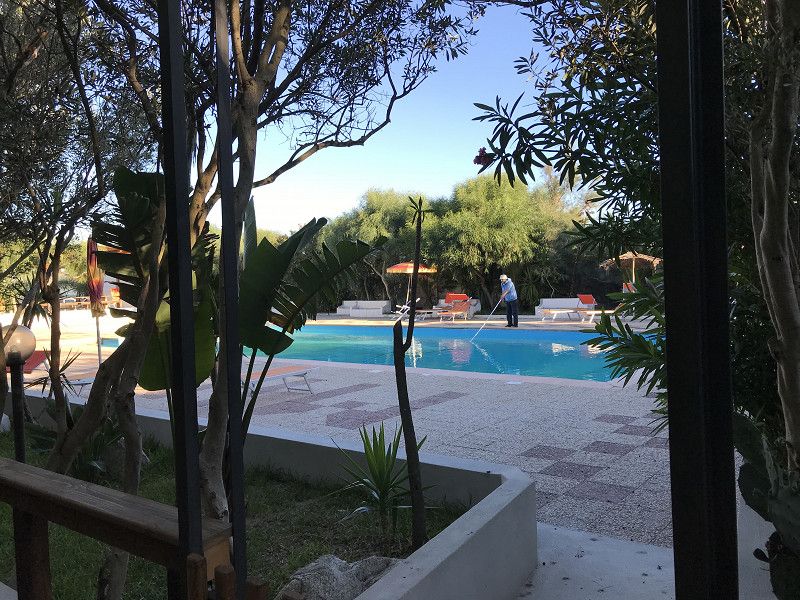
In the late afternoon we arrive at the Baia Saraceno campsite in Palau. And although we arrive in the late afternoon, luck is on our side and we unexpectedly get a place on the beach.
Hardly set up, we also see why this place was still free. Due to its exposed location, we were also exposed to the winds. Which blew heavily for the next two days.
Punta Palau, 07020, Palau, Italy
41° 10' 42" N 9° 23' 33" E
41.1783300 9.3925000
• Head northwest on Via del Vecchio Marino. Go for 574 m.
• Turn right onto Via Capo d'Orso. Go for 427 m.
• Take the 3rd exit from roundabout onto Via delle Ginestre. Go for 402 m.
• Turn right onto Via Baragge (SP121). Go for 188 m.
• Turn left onto Via Nazionale (SP121). Go for 241 m.
• Continue on SS133. Go for 485 m.
• Take the 1st exit from roundabout onto Località Villa Monte Atura. Go for 535 m.
• Turn right onto Località Villa Monte Atura. Go for 568 m.
• Turn slightly right onto Località Villa Monte Atura. Go for 194 m.
• Turn left onto Località Villa Monte Atura. Go for 298 m.
• Arrive at Località Villa Monte Atura. Your destination is on the right.
☍
3,9 km
( 9 min.)
Day
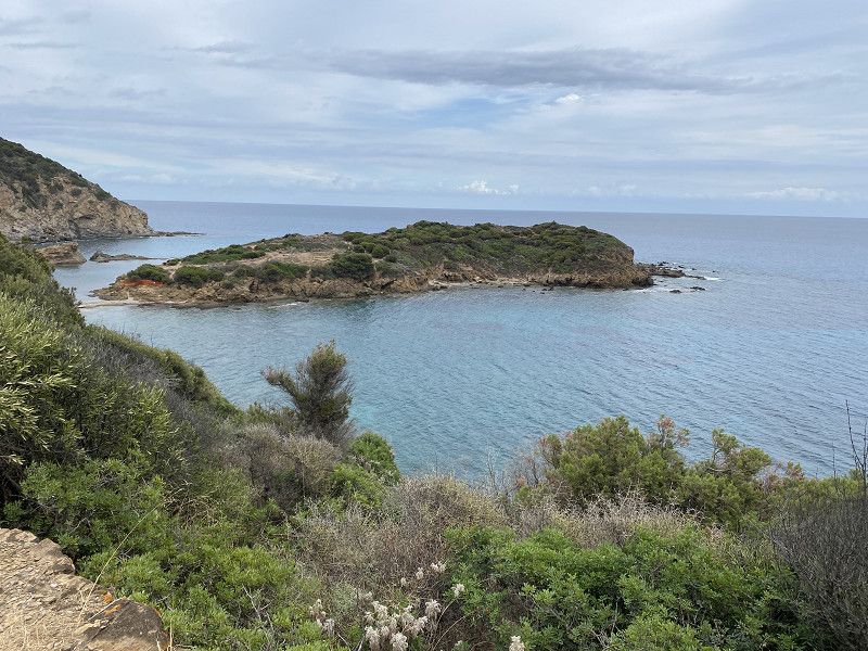
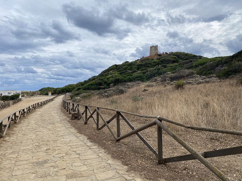
La Fortezza di Monte Altura, Palau, Sassari, Italien
Since strong winds are still blowing the next morning, we decide to take a bike tour to the Fortezza and visit it.
loc. Monte Altura, 07020 Palau SS, Italy
41° 11' 4.7" N 9° 21' 49.1" E
41.1846370 9.3636365
• Head south on Località Villa Monte Atura. Go for 298 m.
• Turn right onto Località Villa Monte Atura. Go for 1.3 km.
• Take the 1st exit from roundabout onto SS133. Go for 266 m.
• Take the 2nd exit from roundabout onto SS133. Go for 295 m.
• Take the 1st exit from roundabout onto SS133. Go for 2.7 km.
• Turn right onto SP98. Go for 60 m.
• Continue on Strada Provinciale Barrabisa. Go for 2.0 km.
• Continue on SP98. Go for 643 m.
• Continue on Località Porto Puddu. Go for 223 m.
• Take the 2nd exit from Località Porto Puddu roundabout onto Località Porto Puddu. Go for 212 m.
• Continue on Località Isola dei Gabbiani. Go for 426 m.
• Turn left onto Località l'Isuledda. Go for 191 m.
• Turn left onto Località Isola dei Gabbiani. Go for 292 m.
• Arrive at Località Isola dei Gabbiani. Your destination is on the left.
☍
8,9 km
( 16 min.)
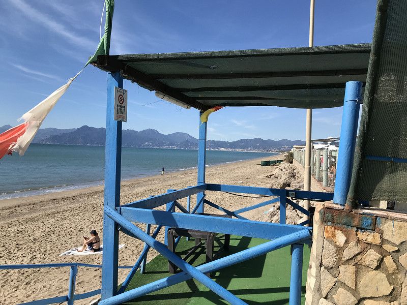
Isola dei Gabbiani, Italien
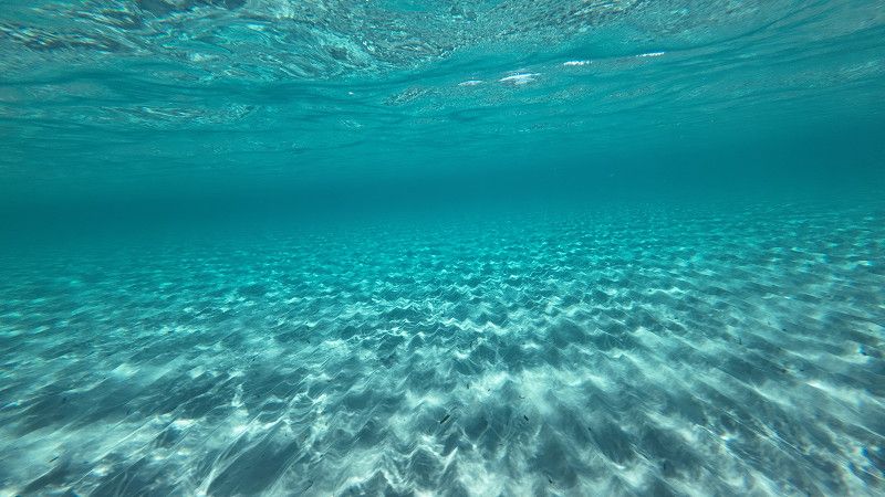
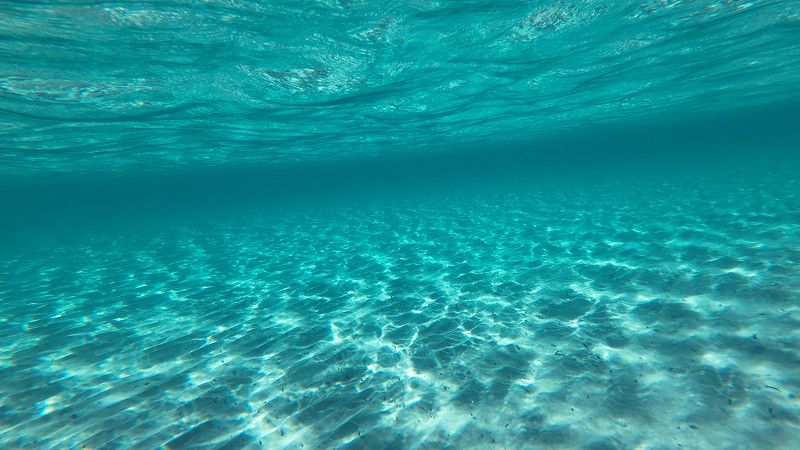
Our bike tour takes us from the Fortezza to the island of the Gabbiani. And since there are strong winds in this bay, one can speak of a real windsurfer's paradise. Before we start our return journey we enjoy the performances of the windsurfers.
L'Isuledda, Italy
41° 11' 57.2" N 9° 19' 10" E
41.1992240 9.3194545
• Head northeast on Località Isola dei Gabbiani. Go for 16 m.
• Turn right onto Località Isola dei Gabbiani. Go for 157 m.
• Turn left onto Località l'Isuledda. Go for 16 m.
• Turn slightly right onto Località Isola dei Gabbiani. Go for 42 m.
• Turn right onto Località l'Isuledda. Go for 106 m.
• Turn slightly right onto Località Isola dei Gabbiani. Go for 206 m.
• Turn left onto Località l'Isuledda. Go for 426 m.
• Continue on Località Porto Pollo. Go for 170 m.
• Take the 1st exit from Località Porto Puddu roundabout onto Località Porto Puddu. Go for 264 m.
• Continue on SP98. Go for 643 m.
• Continue on Strada Provinciale Barrabisa. Go for 2.0 km.
• Turn slightly right onto SP98. Go for 24 m.
• Turn right onto Strada Statale di Palau (SS133). Go for 2.8 km.
• Turn slightly left onto SS133 toward Tempio P./Sassari/Aglientu/Luogosanto/Bassacutena. Go for 18.5 km.
• Turn right toward SP5. Go for 8.1 km.
• Turn left onto SP5. Go for 10.0 km.
• Turn right toward SP74. Go for 6.1 km.
• Turn right onto SP74. Go for 3.0 km.
• Continue on Località Juncu (SP74). Go for 314 m.
• Continue toward SP74. Go for 43 m.
• Turn slightly left onto SP58. Go for 9.3 km.
• Continue on Via Tempio (SP58). Go for 720 m.
• Take the 2nd exit from roundabout onto Via Niccolò Machiavelli. Go for 247 m.
• Turn left onto Via Circonvallazione. Go for 514 m.
• Take the 2nd exit from roundabout onto Via Circonvallazione. Go for 51 m.
• Take the 1st exit from roundabout onto Via Circonvallazione. Go for 362 m.
• Take the 2nd exit from roundabout onto SP35. Go for 103 m.
• Take the 1st exit from roundabout onto SP33. Go for 182 m.
• Continue on Località Longareddu (SP33). Go for 630 m.
• Continue on SP33. Go for 153 m.
• Keep right onto SP33. Go for 1.8 km.
• Turn right onto SP33. Go for 2.0 km.
• Take left ramp. Go for 4.6 km.
• Continue on SP90. Go for 7.8 km.
• Take ramp. Go for 2.4 km.
• Continue on Strada Statale dell'Anglona (SS200). Go for 870 m.
• Arrive at Strada Statale dell'Anglona (SS200). Your destination is on the left.
☍
84,5 km
(1 hrs. 25 min.)
Day
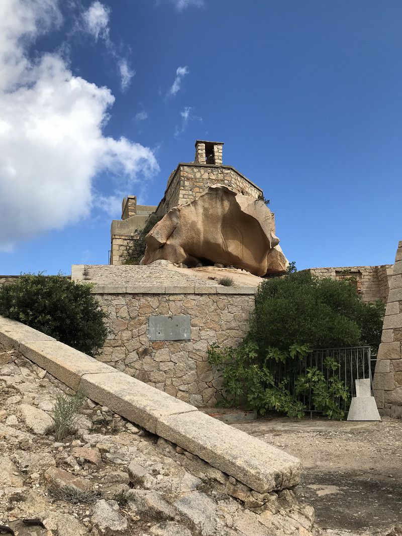
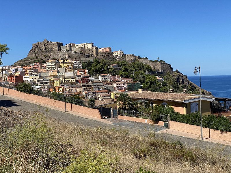
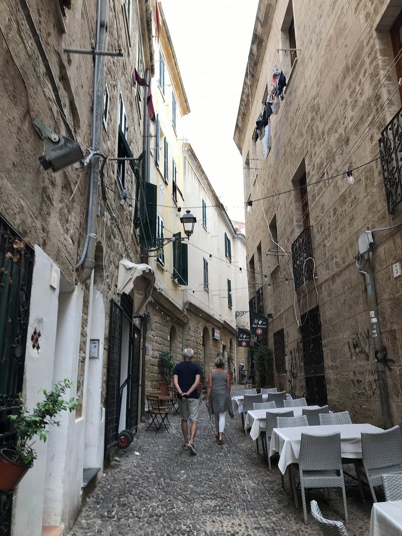
Castelsardo, Sassari, Italien
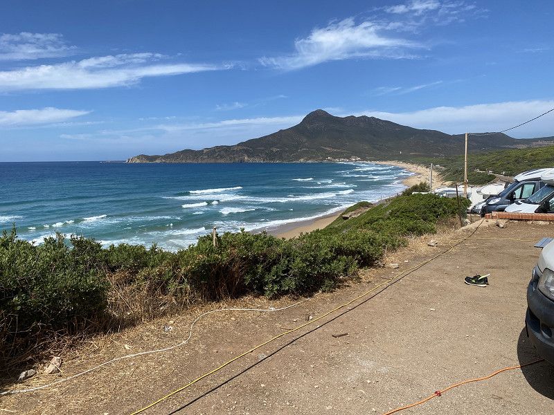
After two days of wind we decide to continue our journey to the west coast and head towards Castelsardo. But we don't want to take the direct route, but rather drive along the coast. As a result, it takes us longer, but we are rewarded with beautiful views and areas.
07031 Castelsardo, Province of Sassari, Italy
40° 54' 49.3" N 8° 42' 30.9" E
40.9136920 8.7085920
• Head toward Via Salvinu on Strada Statale dell'Anglona (SS200). Go for 870 m.
• Turn left toward Strada Provinciale Sassari Santa Teresa. Go for 2.2 km.
• Take ramp onto Strada Provinciale Sassari Santa Teresa. Go for 5.9 km.
• Turn left onto Strada Statale dell'Anglona (SS200). Go for 8.8 km.
• Turn right onto SP48. Go for 2.7 km.
• Take the 2nd exit from roundabout onto Località Lu Padru (SP48). Go for 3.9 km.
• Turn right onto Località Badde Fustiggiu (SP25). Go for 1.1 km.
• Take the 3rd exit from roundabout onto Via Buddi Buddi (SP60). Go for 1.8 km.
• Pass 3 roundabouts and continue on Via Buddi Buddi (SP60). Go for 3.7 km.
• Take the 1st exit from roundabout. Go for 301 m.
• Take ramp. Go for 658 m.
• Continue on Via Ortobene. Go for 150 m.
• Take the 1st exit from roundabout onto Via Buddi Buddi (SP60). Go for 421 m.
• Pass 2 roundabouts and continue on Via Buddi Buddi (SP60). Go for 1.4 km.
• Turn right onto Via Luigi Pirandello. Go for 484 m.
• Take the 2nd exit from roundabout onto Via Luigi Pirandello. Go for 522 m.
• Take the 3rd exit from roundabout onto Corso Giovanni Pascoli. Go for 139 m.
• Turn right onto Via Montello. Go for 118 m.
• Continue on Viale Sicilia. Go for 754 m.
• Continue on Via Aurelio Saffi. Go for 27 m.
• Continue on Via Aurelio Saffi. Go for 94 m.
• Continue on Piazza Sant'Antonio. Go for 40 m.
• Continue on Corso Francesco Vico. Go for 103 m.
• Continue on Piazza Stazione. Go for 71 m.
• Continue on Via 25 Aprile. Go for 219 m.
• Turn left onto Piazza Santa Maria. Go for 230 m.
• Arrive at Piazza Santa Maria. Your destination is on the left.
☍
36,8 km
( 37 min.)
Sassari, Italien
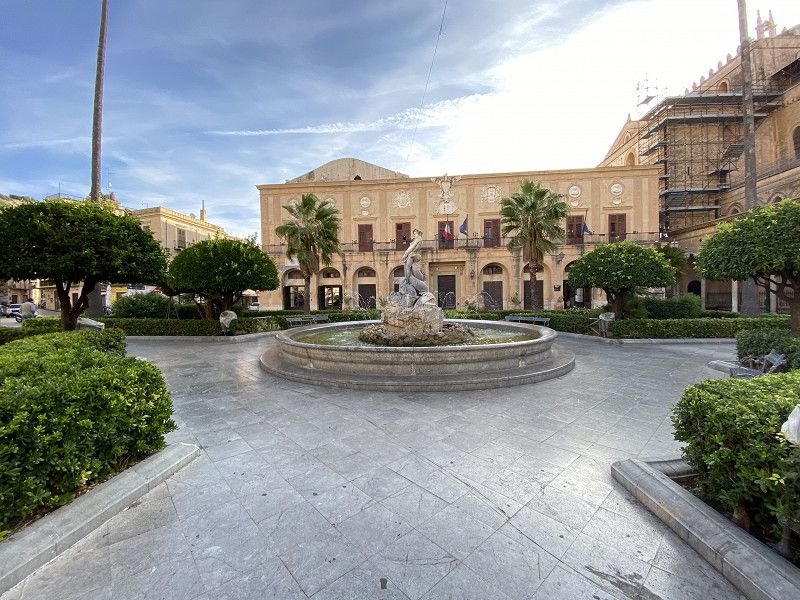
Although Sassari has some landmarks and sights to see, we decide to drive through Sassari and postpone the visit to another year.
07100 Sassari, Province of Sassari, Italy
40° 43' 33.3" N 8° 33' 20.5" E
40.7259269 8.5556826
• Head southeast on Piazza Santa Maria.
• Continue on Corso Margherita di Savoia. Go for 50 m.
• Turn slightly right onto Via Michele Coppino. Go for 116 m.
• Turn left onto Largo Macao. Go for 51 m.
• Turn left onto Corso Margherita di Savoia. Go for 149 m.
• Continue on Piazza Santa Maria. Go for 230 m.
• Continue on Via Predda Niedda. Go for 540 m.
• Take the 1st exit from roundabout onto Via Predda Niedda. Go for 803 m.
• Take the 3rd exit from roundabout onto Via Predda Niedda toward Cagliari/P.Torres/Alghero. Go for 303 m.
• Take ramp onto Circonvallazione Variante del Mascari (SS131) toward Porto Torres. Go for 1.8 km.
• Pass 4 roundabouts and continue on Via Sassari (SS131). Go for 14.6 km.
• Arrive at Via Sassari (SS131). Your destination is on the right.
☍
18,6 km
( 21 min.)
Porto Torres, Sassari, Italien
In Porto Torres we actually want to visit the Basilica di San Gavino. But since this was temporarily closed, our journey continues after a short stop.
07046 Porto Torres, Province of Sassari, Italy
40° 50' 0.1" N 8° 24' 8.3" E
40.8333682 8.4022929
• Head northwest on Via Sassari (SS131). Go for 128 m.
• Turn left onto Via Eleonora d'Arborea. Go for 316 m.
• Turn right onto Via Fontana Vecchia. Go for 36 m.
• Continue toward Via Giuseppe Mazzini. Go for 26 m.
• Turn left onto Via Stintino. Go for 455 m.
• Turn right onto Via dell'Industria. Go for 582 m.
• Take ramp onto SS131 toward Sassari/Olbia/Nuoro/Oristano/Cagliari. Go for 2.1 km.
• Take ramp toward Stintino/Alghero/Aeroporto Alghero. Go for 313 m.
• Take the 1st exit from roundabout onto SS131 toward Stintino/Alghero. Go for 570 m.
• Take the 2nd exit from roundabout onto Strada Provinciale Porto Torres-Stintino-la Pelosa (SP34). Go for 1.3 km.
• Continue toward SP42. Go for 45 m.
• Take the 4th exit from roundabout onto SP42. Go for 17.5 km.
• Take the 1st exit from roundabout onto Strada Statale della Nurra (SS291). Go for 4.8 km.
• Continue on SP55bis. Go for 7.7 km.
• Turn right. Go for 1.2 km.
• Arrive at your destination on the left.
☍
37,0 km
( 40 min.)
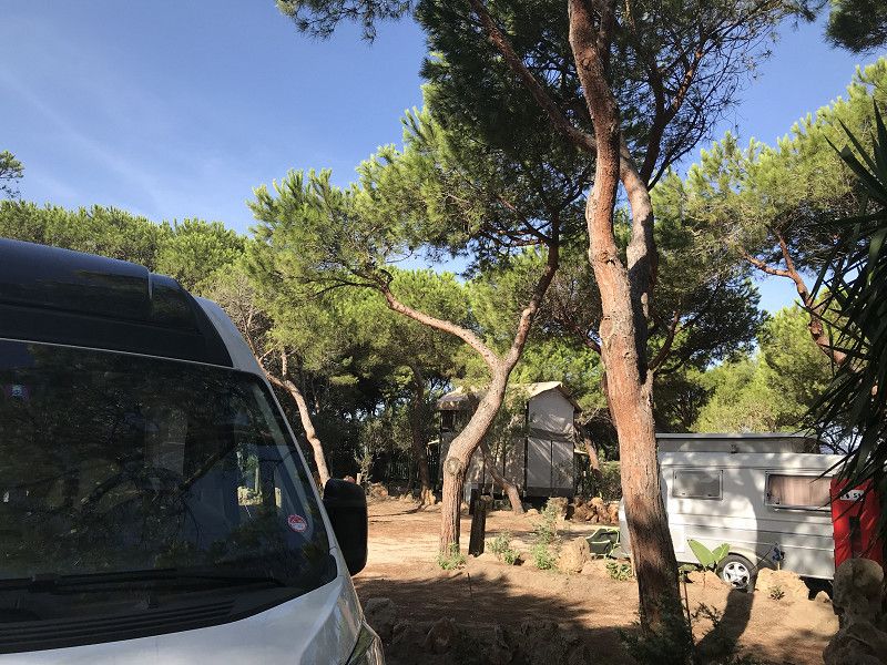
Camping Village Glamping Torre del Porticciolo
Around 7:00 p.m. we arrive in Porticciolo. So there is no longer a large choice of seats. But since we want to continue to Alghero the next day anyway, that doesn't matter to us.
Località Porticciolo, 07041, Alghero, Italy
40° 38' 33.8" N 8° 11' 24.7" E
40.6427276 8.1902057
• Head south. Go for 30 m.
• Turn left. Go for 64 m.
• Arrive at your destination on the right.
☍
0,1 km
( )
Day
Camping | Glamping | Village Torre del Porticciolo, Strada Vicinale Porticciolo, Alghero, Sassari, Italien
Our next destination is Alghero where we will take the time necessary to visit this place properly.
Str. Vicinale Porticciolo, 07041 Alghero SS, Italy
40° 38' 31.4" N 8° 11' 26.3" E
40.6420539 8.1906348
• Head southeast. Go for 135 m.
• Turn right. Go for 181 m.
• Turn left toward SP55bis. Go for 782 m.
• Turn left onto SP55bis. Go for 7.7 km.
• Turn right onto Strada Statale della Nurra (SS291). Go for 7.1 km.
• Take the 3rd exit from roundabout onto SS127bis. Go for 968 m.
• Take the 1st exit from roundabout onto Viale 1 Maggio. Go for 1.2 km.
• Continue on Viale 1 Maggio. Go for 1.2 km.
• Continue on Via Lido. Go for 1.3 km.
• Take the 1st exit from roundabout onto Via Giuseppe Garibaldi. Go for 1.1 km.
• Turn right onto Via Sassari. Go for 379 m.
• Turn right onto Via 20 Settembre. Go for 99 m.
• Continue on Piazza Sulis. Go for 40 m.
• Take the 2nd exit from roundabout onto Lungomare Dante. Go for 87 m.
• Keep right onto Lungomare Dante. Go for 66 m.
• Turn left onto Via Antonio Gramsci. Go for 382 m.
• Continue on Lungomare Dante. Go for 52 m.
• Keep right onto Lungomare Valencia. Go for 477 m.
• Continue on Viale della Resistenza. Go for 205 m.
• Turn right onto Strada Provinciale Alghero-Bosa (SP105). Go for 4.6 km.
• Continue on SP105. Go for 18.0 km.
• Continue on SP49. Go for 12.9 km.
• Arrive at SP49.
☍
59,0 km
(1 hrs. 16 min.)
Day
Day
Torre Argentina, Bosa, Oristano, Italien
At the Torre Agentina we spend the night self-sufficient for the first time.
Bosa, 08013 Bosa OR, Italy
40° 19' 9.9" N 8° 26' 38" E
40.3194082 8.4438910
• Head east on SP49. Go for 6.4 km.
• Pass 2 roundabouts. Go for 583 m.
• Continue on Via Cristoforo Colombo (SS129bis). Go for 151 m.
• Turn left onto Via Palermo. Go for 299 m.
• Turn right onto Via Sassari. Go for 135 m.
• Turn left onto Lungomare Mediterraneo. Go for 2.2 km.
• Turn right onto Strada Comunale Magomadas-Turas. Go for 4.6 km.
• Turn right onto Via Vittorio Emanuele III (SP35). Go for 328 m.
• Continue on Viale Vittorio Emanuele (SS292). Go for 11.3 km.
• Take the 1st exit from roundabout. Go for 2.2 km.
• Take the 1st exit from roundabout onto Strada Statale Nord Occidentale Sarda (SS292). Go for 26.5 km.
• Pass 3 roundabouts and continue on Corso Eleonora (SS292). Go for 9.9 km.
• Turn right toward Via Torre Grande. Go for 38 m.
• Turn right onto Via Torre Grande. Go for 3.4 km.
• Take the 4th exit from roundabout onto Strada Provinciale Oristano Torre Grande (SP1). Go for 1.9 km.
• Turn left onto SP2. Go for 921 m.
• Turn right onto Strada Consortile. Go for 53 m.
• Arrive at Strada Consortile. Your destination is on the right.
☍
71,0 km
(1 hrs. 15 min.)
Day
Campeggio Spinnaker
Since we weren't properly prepared, we didn't have enough drinking water with us. And had to continue our journey the next day.
Strada Torregrande-Pontile, 09071, Torre Grande-ORISTANO, Italy
39° 54' 13" N 8° 31' 50.1" E
39.9036202 8.5305957
• Head northeast on Strada Consortile. Go for 53 m.
• Turn left onto SP2. Go for 921 m.
• Turn left onto Via Stella Maris (SP1). Go for 472 m.
• Take the 1st exit from Piazza della Torre roundabout. Go for 55 m.
• Continue on Via Cristoforo Colombo (SP1). Go for 604 m.
• Continue on Via Tharros (SP1). Go for 723 m.
• Take the 2nd exit from roundabout onto Via Tharros (SP6). Go for 1.4 km.
• Turn left onto Via Felice Cavallotti. Go for 108 m.
• Turn right onto Via Custoza. Go for 52 m.
• Turn right onto Via Tharros (SP6). Go for 14 m.
• Arrive at Via Tharros (SP6).
☍
4,4 km
( 7 min.)
Day
Day
Day
Cabras, Oristano, Italien
Excursion to the nearby nature reserve, and in the evening we go to eat in the nearby town of Oristano.
09072 Cabras OR, Italy
39° 55' 44.7" N 8° 31' 50" E
39.9290726 8.5305514
• Head southwest on Via Tharros (SP6). Go for 79 m.
• Turn left onto Via Sassari (SP3). Go for 344 m.
• Turn right onto Corso Italia (SP3). Go for 306 m.
• Continue on SP3. Go for 14 m.
• Continue on Corso Italia (SP3). Go for 556 m.
• Continue on SP3. Go for 1.2 km.
• Keep left toward Strada Provinciale Oristano Torre Grande/SP1. Go for 34 m.
• Turn slightly left onto Strada Provinciale Oristano Torre Grande (SP1). Go for 2.4 km.
• Take the 1st exit from roundabout onto SP54. Go for 1.4 km.
• Take the 3rd exit from roundabout onto Via Cagliari (SP54). Go for 239 m.
• Turn right onto SP93. Go for 2.3 km.
• Turn slightly left onto Via Vandalino Casu (SP55). Go for 589 m.
• Turn right onto SP57. Go for 1.8 km.
• Turn right toward SP70. Go for 167 m.
• Turn right onto SP70. Go for 315 m.
• Take left ramp onto Strada Statale Carlo Felice (SS131) toward Cagliari. Go for 25.6 km.
• Take ramp toward Uras. Go for 332 m.
• Turn left onto Strada Statale di Laconi e di Uras (SS442) toward Uras/S. N. d'Arcidano/SP47. Go for 231 m.
• Turn right onto Via Eleonora d'Arborea. Go for 68 m.
• Turn left onto Strada Provinciale Uras San Nicolo d'Arcidano. Go for 5.0 km.
• Take the 2nd exit from roundabout onto Via Cagliari (SP47). Go for 409 m.
• Turn left onto Viale Repubblica (SS126). Go for 718 m.
• Pass 2 roundabouts and continue on Via Antonio Gramsci (SS126). Go for 16.4 km.
• Take the 2nd exit from roundabout onto Via Roma (SS197). Go for 132 m.
• Continue on Via Roma (SS197). Go for 149 m.
• Turn right onto Via Giacomo Matteotti (SS197). Go for 327 m.
• Continue on Via Giuseppe Mazzini (SS126). Go for 5.0 km.
• Turn left onto Viale Antonio Gramsci. Go for 309 m.
• Turn right onto Via Fratellanza Operaia. Go for 834 m.
• Turn right onto Via Dante Alighieri (SP67). Go for 419 m.
• Continue on Via Libertà (SP67). Go for 430 m.
• Continue on Via Is Strigas (SS126). Go for 18.3 km.
• Turn right onto SP83. Go for 11.2 km.
• Continue on Via Malfidano (SP83). Go for 206 m.
• Arrive at Via Malfidano (SP83). Your destination is on the left.
☍
97,7 km
(1 hrs. 36 min.)
Day
Day
Buggerru, South Sardinia, Italien
Today our journey to Bruggeru, the much-cited surfer's paradise, continues badly
Buggerru, South Sardinia, Italy
39° 23' 59" N 8° 24' 8.7" E
39.3997220 8.4024300
• Head southeast on Via Malfidano (SP83). Go for 972 m.
• Continue on Via Roma (SP83). Go for 254 m.
• Continue on SP83. Go for 7.0 km.
• Continue on Regione Canal Grande (SP83). Go for 852 m.
• Continue on SP83. Go for 5.5 km.
• Continue on Regione Monte Cani (SP83). Go for 1.3 km.
• Continue on SP83. Go for 1.8 km.
• Continue on Corso Pan di Zucchero (SP83). Go for 1.8 km.
• Continue on SP83. Go for 6.0 km.
• Take ramp. Go for 321 m.
• Continue on SS126. Go for 533 m.
• Pass 5 roundabouts and continue on SS126. Go for 10.4 km.
• Take the 3rd exit from roundabout onto SS126. Go for 1.9 km.
• Take the 2nd exit from roundabout onto Via Nazionale (SS126). Go for 1.3 km.
• Take the 3rd exit from roundabout onto Via Nazionale (SS126). Go for 1.3 km.
• Pass 2 roundabouts and continue on Via Nazionale (SS126). Go for 2.8 km.
• Take the 3rd exit from roundabout onto SS126. Go for 1.4 km.
• Turn left onto SS195. Go for 14.4 km.
• Turn right onto Via Roma (SS195). Go for 5.9 km.
• Take the 2nd exit from roundabout onto SS195. Go for 2.3 km.
• Turn right onto Via Porto Pino (SP73). Go for 759 m.
• Take the 3rd exit from roundabout onto Via Porto Pino (SP73). Go for 495 m.
• Continue on Via Is Cinus (SP73). Go for 940 m.
• Continue on Via Is Cinus (SP73). Go for 832 m.
• Continue on Via Is Pillonis (SP73). Go for 1.4 km.
• Continue on SP110. Go for 1.1 km.
• Continue on Via del Mare (SP110). Go for 504 m.
• Turn left onto Via del Porticciolo. Go for 241 m.
• Arrive at Via del Porticciolo. Your destination is on the right.
☍
74,3 km
(1 hrs. 22 min.)
Day
Porto Pino, South Sardinia, Italien
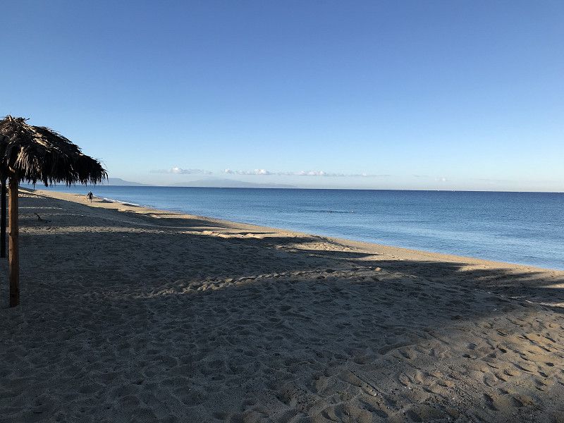
Today our journey continues to Porto Pino where we find the most beautiful beach in Sardinia. Unfortunately, the aging campsite here has been closed since Covid. But this place can score with a stand.
09010 Porto Pino SU, Italy
38° 57' 49" N 8° 35' 43.6" E
38.9636015 8.5954553
• Head toward Via Porto Pineddu on Via del Porticciolo. Go for 92 m.
• Turn right onto Via dei Pescatori. Go for 172 m.
• Turn right onto Via del Mare (SP110). Go for 763 m.
• Continue on SP110. Go for 1.1 km.
• Continue on Via Is Pillonis (SP110). Go for 620 m.
• Keep right onto Via Is Pillonis (SP110). Go for 753 m.
• Continue on Via Is Cinus (SP73). Go for 1.8 km.
• Continue on Via Porto Pino (SP73). Go for 434 m.
• Take the 2nd exit from roundabout onto Via Porto Pino (SP73). Go for 788 m.
• Turn right onto Via Italia (SS195). Go for 13.5 km.
• Turn right onto Via Costituzione. Go for 271 m.
• Turn left onto Piazza Fontana. Go for 38 m.
• Turn right onto Piazza Giuseppe Mazzini (SS195). Go for 17.4 km.
• Turn right onto SP71. Go for 1.5 km.
• Continue on Viale Chia (SP71). Go for 930 m.
• Take the 3rd exit from roundabout onto Viale del Porto. Go for 625 m.
• Arrive at Viale del Porto. Your destination is on the right.
☍
40,7 km
( 53 min.)
Day
Day
Day
Campeggio Torre Chia
At Domus de Maria we make our next longer stop.
Chia, 09010, Domus De Maria, Italy
38° 53' 54" N 8° 53' 1" E
38.8983300 8.8836100
• Head toward Viale di Bes on Viale del Porto. Go for 532 m.
• Take the 1st exit from roundabout onto Viale Chia (SP71). Go for 961 m.
• Continue on SP71. Go for 1.4 km.
• Turn slightly right toward SP71. Go for 61 m.
• Turn right onto SS195. Go for 8.0 km.
• Pass 5 roundabouts and continue on SS195. Go for 7.3 km.
• Take the 3rd exit from roundabout. Go for 976 m.
• Turn right. Go for 69 m.
• Turn right. Go for 3.5 km.
• Keep left toward Sa Nuraxedda. Go for 4.5 km.
• Continue on Sa Nuraxedda. Go for 2.6 km.
• Keep left. Go for 5.4 km.
• Take ramp. Go for 272 m.
• Take the 3rd exit from roundabout onto SP91. Go for 1.5 km.
• Take the 2nd exit from roundabout onto Strada Statale Sulcitana (SS195). Go for 507 m.
• Pass 2 roundabouts and continue on Strada Statale Sulcitana (SS195). Go for 12.8 km.
• Continue on Via Ponte Nuovo. Go for 534 m.
• Continue on Via San Paolo. Go for 156 m.
• Continue on Viale La Plaia. Go for 13 m.
• Continue on Via Riva di Ponente. Go for 531 m.
• Continue on Via Molo Sant'Agostino. Go for 135 m.
• Continue on Piazza Giacomo Matteotti. Go for 59 m.
• Continue on Lungomare New York 11 Settembre 2001. Go for 454 m.
• Continue on Calata Darsena. Go for 247 m.
• Take the 2nd exit from roundabout onto Viale Cristoforo Colombo. Go for 1.4 km.
• Keep right onto Viale Salvatore Ferrara toward Asse Mediano/Quartu S.E./SS121/Binaghi Ospedale/La Palma. Go for 47 m.
• Continue on Via Emanuele Pessagno. Go for 967 m.
• Continue on Nuovo Asse Mediano di Scorrimento. Go for 2.4 km.
• Keep right toward Genneruxi/Quartu S.E./SS125. Go for 369 m.
• Keep right toward Via Giuseppe Mercalli. Go for 912 m.
• Continue on Via Giuseppe Mercalli. Go for 253 m.
• Turn left onto Via Giuseppe Mercalli. Go for 158 m.
• Turn left onto Viale Guglielmo Marconi. Go for 107 m.
• Turn right onto Via Antonio Meucci. Go for 137 m.
• Turn left onto Via Gerolamo Cardano. Go for 88 m.
• Arrive at Via Gerolamo Cardano. Your destination is on the right.
☍
59,4 km
( 56 min.)
Day
Day
Wohnmobilstellplatz Campernow
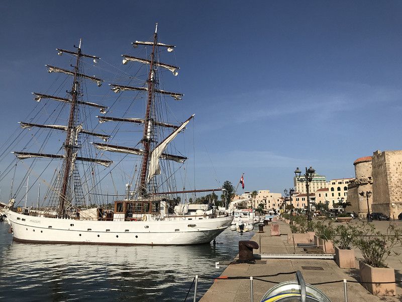
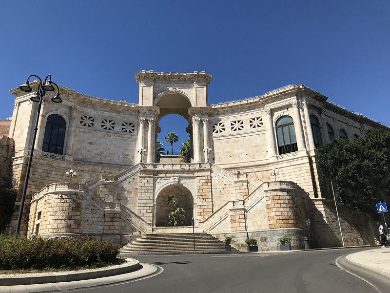
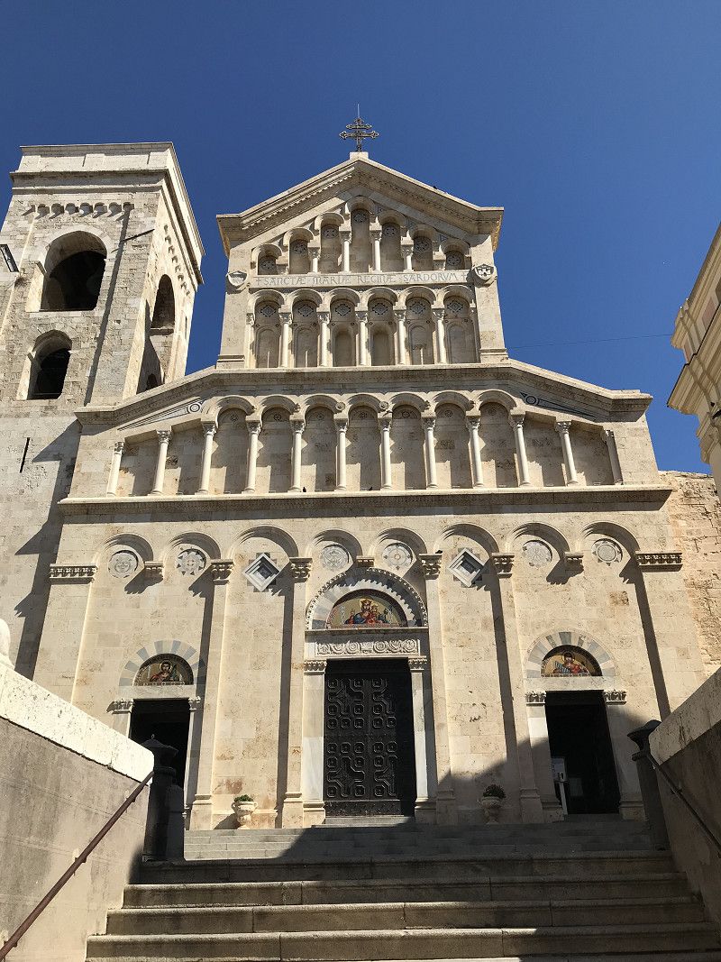
Next stop is Cagliari, a wonderful port city that has a lot to offer.
Via Gerolamo Cardano 4, 09131, Cagliari, Italy
39° 14' 9" N 9° 8' 18" E
39.2358333 9.1383333
• Head southeast on Via Gerolamo Cardano. Go for 76 m.
• Turn left onto Via Gerolamo Cardano. Go for 75 m.
• Turn right onto Via Antonio Meucci. Go for 36 m.
• Turn right onto Viale Guglielmo Marconi. Go for 1.5 km.
• Continue on Via San Benedetto. Go for 517 m.
• Continue on Piazza San Benedetto. Go for 31 m.
• Take the 3rd exit from roundabout onto Piazza San Benedetto. Go for 95 m.
• Continue on Via Pasquale Paoli. Go for 273 m.
• Continue on Piazza Giuseppe Garibaldi. Go for 67 m.
• Continue on Via Sidney Costantino Sonnino. Go for 643 m.
• Take the 3rd exit from Piazzetta Silvio Lippi roundabout onto Via Sidney Costantino Sonnino. Go for 140 m.
• Keep left onto Via Sidney Costantino Sonnino. Go for 131 m.
• Continue on Piazza Emilio Lussu. Go for 48 m.
• Continue on Via Sidney Costantino Sonnino. Go for 137 m.
• Turn right onto Viale Cristoforo Colombo. Go for 195 m.
• Take the 1st exit from roundabout onto Piazza Attilio Deffenu. Go for 127 m.
• Turn left onto Piazza Attilio Deffenu. Go for 153 m.
• Continue on Lungomare New York 11 Settembre 2001. Go for 454 m.
• Continue on Piazza Giacomo Matteotti. Go for 59 m.
• Continue on Via Molo Sant'Agostino. Go for 182 m.
• Continue on Viale La Plaia. Go for 417 m.
• Turn left toward Via Riva di Ponente. Go for 40 m.
• Continue on Via Riva di Ponente. Go for 153 m.
• Turn right onto Via Riva di Ponente. Go for 162 m.
• Turn left onto Calata Ponente. Go for 74 m.
• Turn right onto Molo Sabaudo. Go for 450 m.
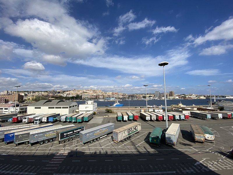
• Take the Cagliari-Palermo Ferry. Stay on for 418 km.
• Head toward Banchina Crispi. Go for 144 m.
• Turn left onto Via Francesco Crispi toward Ospedale Ismett/A19/Palermo-Catania/SS121/Agrigento. Go for 302 m.
• Keep right onto Via Francesco Crispi. Go for 180 m.
• Continue on Piazza Tredici Vittime. Go for 48 m.
• Turn right onto Piazza Tredici Vittime. Go for 40 m.
• Continue on Via Camillo Benso di Cavour. Go for 281 m.
• Turn left onto Via Roma. Go for 650 m.
• Turn right onto Via Vittorio Emanuele. Go for 29 m.
• Turn right onto Piazzetta Marchese Arezzo. Go for 137 m.
• Continue on Vicolo delle Vergini. Go for 44 m.
• Continue on Piazzetta del Parlatoio. Go for 25 m.
• Continue on Salita Castellana. Go for 40 m.
• Turn left onto Via Maqueda. Go for 147 m.
• Arrive at Via Maqueda. Your destination is on the right.
☍
426,1 km
(11 hrs. 16 min.)
Day
Palermo, Italien
Yesterday we left Cagliari at 5:00 p.m. and arrived in Palermo this morning at 5:00 a.m.
Palermo, PA, Italy
38° 6' 56.5" N 13° 21' 41.4" E
38.1156900 13.3614868
• Head southeast on Via Maqueda.
• Turn left onto Piazza Villena. Go for 182 m.
• Turn left onto Piazzetta Marchese Arezzo. Go for 137 m.
• Continue on Vicolo delle Vergini. Go for 44 m.
• Continue on Piazzetta del Parlatoio. Go for 25 m.
• Continue on Salita Castellana. Go for 40 m.
• Continue on Via del Celso. Go for 413 m.
• Turn left onto Via Sant'Agata alla Guilla. Go for 82 m.
• Turn right onto Piazza Sett'Angeli. Go for 46 m.
• Continue on Via dell'Incoronazione. Go for 122 m.
• Turn right onto Via Matteo Bonello. Go for 69 m.
• Keep left onto Piazza Papireto. Go for 107 m.
• Continue on Via Papireto. Go for 166 m.
• Turn left onto Via Cappuccinelle. Go for 72 m.
• Continue on Piazzetta D'Ossuna. Go for 44 m.
• Turn left onto Corso Alberto Amedeo. Go for 454 m.
• Turn right onto Corso Calatafimi. Go for 223 m.
• Continue on Corso Calatafimi. Go for 5.1 km.
• Continue on Strada Provinciale di Monreale (SP69). Go for 1.2 km.
• Continue on Via Palermo (SP69). Go for 369 m.
• Turn right onto Piazza Vittorio Emanuele (SP69). Go for 34 m.
• Continue on Via Roma (SP69). Go for 84 m.
• Turn right onto Via Antonio Veneziano (SP69). Go for 201 m.
• Arrive at Via Antonio Veneziano (SP69). Your destination is on the right.
☍
9,2 km
( 26 min.)
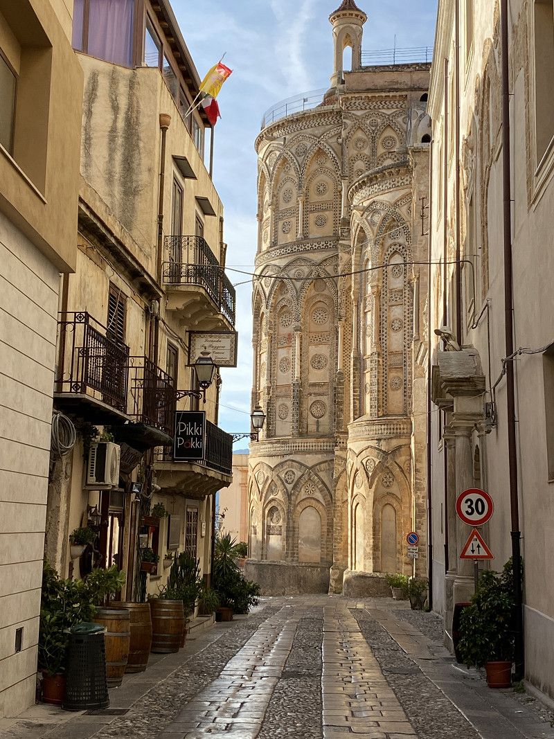
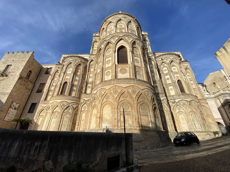
Monreale, Palermo, Italien
Arrived in Palermo we went to Monreale and visited this wonderful place.
90046 Monreale, PA, Italy
38° 4' 53.4" N 13° 17' 20.3" E
38.0814986 13.2889834
• Head toward Via Guido Baccelli on Via Antonio Veneziano (SP69). Go for 132 m.
• Continue on Via Pietro Novelli (SP69). Go for 2.1 km.
• Continue on SS186. Go for 6.3 km.
• Turn left onto SP20. Go for 2.5 km.
• Turn left toward Sciacca. Go for 78 m.
• Take ramp onto Scorrimento Veloce Palermo-Sciacca (SS624). Go for 68.3 km.
• Take ramp onto Strada Statale Sud Occidentale Sicula (SS115) toward Agrigento/Sciacca. Go for 7.6 km.
• Keep left onto Strada Statale Sud Occidentale Sicula (SS115). Go for 15.0 km.
• Pass 2 roundabouts and continue on Strada Statale Sud Occidentale Sicula (SS115). Go for 31.4 km.
• Turn right toward Realmonte. Go for 324 m.
• Turn right toward Contrada Giglione. Go for 37 m.
• Continue on Contrada Giglione. Go for 900 m.
• Continue on Via dei Garofani. Go for 36 m.
• Continue on Via Cardella. Go for 111 m.
• Turn left onto Via San Calogero. Go for 112 m.
• Continue on Piazza Vecchia. Go for 27 m.
• Continue on Via Piazza Vecchia. Go for 69 m.
• Continue on Via Roma (SP27). Go for 142 m.
• Continue on Via Miramare (SP27). Go for 720 m.
• Take the 1st exit from roundabout onto Via Paolo Sidoti (SP27). Go for 624 m.
• Turn left onto SP68. Go for 1.5 km.
• Continue on Contrada Punta Grande (SP68). Go for 151 m.
• Arrive at Contrada Punta Grande (SP68).
☍
138,1 km
(1 hrs. 52 min.)
Day
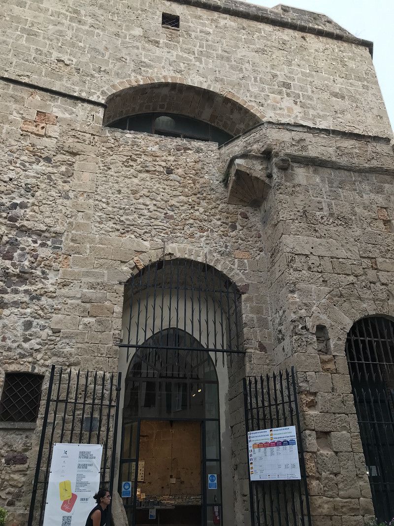
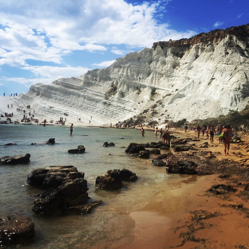
Scala dei Turchi, Realmonte, Agrigent, Italien
After visiting Monreale we continue to the Scale dei Turchi. As a result of many accidents in the past, these can no longer be climbed freely. And yet they are worth a detour.
Stair of the Turks, 92010 Realmonte, AG, Italy
37° 17' 23.9" N 13° 28' 21.9" E
37.2899672 13.4727618
• Head southeast on Contrada Punta Grande (SP68). Go for 477 m.
• Continue on SP68. Go for 947 m.
• Continue on Via Nereo. Go for 1.4 km.
• Continue on Via Nereo. Go for 63 m.
• Continue on Via Francesco Crispi. Go for 1.4 km.
• Continue on Via Vescovo Gioieni. Go for 261 m.
• Continue on Via Francesco Crispi. Go for 233 m.
• Continue on Via Vescovo Gioeni. Go for 388 m.
• Continue on Via Empedocle. Go for 454 m.
• Turn left onto Via Platone. Go for 119 m.
• Turn left onto Via Abramo Lincoln. Go for 31 m.
• Turn right onto Via Roma. Go for 75 m.
• Continue on Via Spinola. Go for 242 m.
• Continue on Via Vincenzella. Go for 691 m.
• Continue on Strada Statale Sud Occidentale Sicula (SS115). Go for 399 m.
• Keep right onto Viale Fosse Ardeatine toward Agrigento/Villaseta. Go for 735 m.
• Continue toward Agrigento. Go for 42 m.
• Take the 1st exit from roundabout onto Strada Statale della Valle del Platani (SS189) toward Agrigento/SS115. Go for 3.8 km.
• Continue on SS115 Quater. Go for 105 m.
• Continue toward Via Francesco Petrarca. Go for 42 m.
• Turn left onto Via Francesco Petrarca. Go for 62 m.
• Turn right. Go for 58 m.
• Turn right toward Via Alessandro Manzoni. Go for 51 m.
• Turn right onto Via Alessandro Manzoni. Go for 34 m.
• Turn right onto Via Alessandro Manzoni. Go for 22 m.
• Turn left onto Via Salomone Anello. Go for 111 m.
• Turn left onto Via Esseneto. Go for 20 m.
• Turn right onto Via Don Luigi Sturzo. Go for 249 m.
• Turn left onto Via Francesco Crispi. Go for 241 m.
• Continue on Viale della Vittoria. Go for 371 m.
• Arrive at Viale della Vittoria. Your destination is on the left.
☍
13,1 km
( 21 min.)
Day
Agrigento, Agrigent, Italien
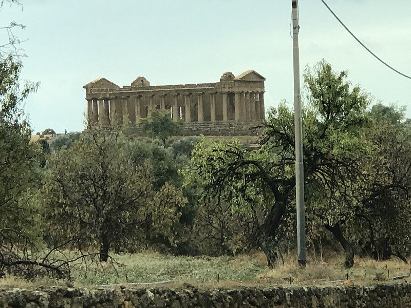
Before we continue our journey to Syracuse we visit the Valley of the Temples in Agrigento
92100 Agrigento, AG, Italy
37° 18' 31.9" N 13° 35' 8.7" E
37.3088512 13.5857528
• Head north on Viale della Vittoria.
• Continue on Piazzale Roma. Go for 66 m.
• Continue on Piazza Aldo Moro. Go for 107 m.
• Continue on Piazza Vittorio Emanuele. Go for 107 m.
• Turn right onto Piazza Vittorio Emanuele (SP80). Go for 67 m.
• Turn left onto Piazza Fratelli Rosselli. Go for 86 m.
• Continue toward Viadotto Imera. Go for 639 m.
• Take ramp onto Viadotto Imera. Go for 454 m.
• Continue on Strada Statale della Valle del Platani (SS189). Go for 120 m.
• Take ramp onto Strada Statale Agrigentina (SS122) toward Caltanissetta/Catania/Favara/Porto Empedocle/Siracusa/SS125. Go for 2.4 km.
• Take the 2nd exit from roundabout onto Strada Statale Agrigentina (SS122). Go for 211 m.
• Take the 3rd exit from roundabout onto Strada Statale Degli Scrittori (SS640) toward PA-CT/A19. Go for 42.4 km.
• Continue on SS640. Go for 78 m.
• Take ramp. Go for 388 m.
• Take the 2nd exit from roundabout onto Strada Statale Degli Scrittori (SS640). Go for 853 m.
• Take left ramp onto Strada Statale Degli Scrittori (SS640) toward Caltanissetta Centro. Go for 6.5 km.
• Take the 1st exit from roundabout onto Strada Statale Degli Scrittori (SS640). Go for 8.7 km.
• Take ramp onto A19 (Autostrada Palermo-Catania). Go for 86.3 km.
• Take the exit toward Siracusa/SS114/Ragusa/SS194/Catania Centro/Aeroporto onto RA15 (Tangenziale di Catania). Go for 5.1 km.
• Keep left onto A18 (Autostrada Catania-Siracusa) toward Siracusa/Augusta/Lentini-Carlentini/Ragusa/SS194. Go for 24.6 km.
• Continue on SS114 (Strada Statale Orientale Sicula). Go for 22.6 km.
• Take ramp onto Via per Floridia (SS124) toward Siracusa. Go for 1.5 km.
• Take the 4th exit from roundabout onto Via per Floridia (SS124). Go for 1.1 km.
• Take the 3rd exit from roundabout onto Via per Floridia (SS124). Go for 2.0 km.
• Turn right onto Via Necropoli del Fusco. Go for 100 m.
• Keep left onto Via Necropoli del Fusco. Go for 41 m.
• Turn right onto Viale Paolo Orsi. Go for 601 m.
• Pass 2 roundabouts and continue on Viale Paolo Orsi. Go for 410 m.
• Take the 2nd exit from roundabout onto Corso Gelone. Go for 119 m.
• Continue on Viale Teracati. Go for 83 m.
• Take the 1st exit from roundabout onto Viale Teocrito. Go for 254 m.
• Take the 1st exit from roundabout onto Viale Teocrito. Go for 205 m.
• Arrive at Viale Teocrito. Your destination is on the left.
☍
208,1 km
(2 hrs. 11 min.)
Day
Siracusa, Syrakus, Italien
In addition to the beautiful harbor in Syracuse we also visit the archaeological park with the Greek theater and the ear of Dyonissus
96100 Syracuse, Free municipal consortium of Syracuse, Italy
37° 4' 31.7" N 15° 17' 11.7" E
37.0754739 15.2865861
• Head west on Viale Teocrito. Go for 182 m.
• Take the 1st exit from roundabout onto Viale Teocrito. Go for 277 m.
• Take the 3rd exit from roundabout onto Viale Teracati. Go for 130 m.
• Continue on Corso Gelone. Go for 88 m.
• Take the 1st exit from roundabout onto Viale Paolo Orsi. Go for 101 m.
• Pass 2 roundabouts and continue on Viale Paolo Orsi. Go for 958 m.
• Turn right onto Viale Paolo Orsi. Go for 41 m.
• Continue on Viale Ermocrate (SS124). Go for 32 m.
• Keep right onto Viale Ermocrate (SS124) toward Catania/Floridia/Avola/Ragusa/Belvedere/Autostrade. Go for 2.0 km.
• Take the 3rd exit from roundabout onto Via per Floridia (SS124). Go for 1.1 km.
• Take the 3rd exit from roundabout onto Via per Floridia (SS124). Go for 1.1 km.
• Take ramp onto Strada Statale Orientale Sicula (SS114) toward Priolo/Augusta/Catania. Go for 22.6 km.
• Continue on A18 (Autostrada Catania-Siracusa). Go for 24.6 km.
• Continue on RA15 (Tangenziale di Catania). Go for 20.2 km.
• Continue on A18 (Autostrada Messina-Catania) toward Messina. Go for 40.7 km.
• Take the exit toward Taormina. Go for 459 m.
• Continue on Via Mario e Nicolò Garipoli. Go for 2.4 km.
• Take the 2nd exit from roundabout onto Via Mario e Nicolò Garipoli. Go for 298 m.
• Continue on Viale San Pancrazio. Go for 495 m.
• Turn slightly left onto Corso Umberto I. Go for 92 m.
• Continue on Corso Umberto I. Go for 383 m.
• Arrive at Corso Umberto I. Your destination is on the right.
☍
118,2 km
(1 hrs. 22 min.)
Day
Taormina, Messina, Italien
Before visiting Taormina we make our way to Castelmola. From here I have a wonderful overview of the archaeological finds in Taormina
98039 Taormina, Metropolitan City of Messina, Italy
37° 51' 5.9" N 15° 17' 7.1" E
37.8516366 15.2853127
• Head toward Via Sesto Pompeo on Corso Umberto I. Go for 356 m.
• Continue on Piazza Sant'Antonio Abate. Go for 30 m.
• Turn slightly right onto Via Crocifisso. Go for 99 m.
• Take the 2nd exit from roundabout onto Via Crocifisso. Go for 420 m.
• Continue on Via Crocefisso. Go for 26 m.
• Continue toward Galleria Montetauro. Go for 64 m.
• Continue on Galleria Montetauro. Go for 1.2 km.
• Take the 2nd exit from roundabout onto Via Mario e Nicolò Garipoli. Go for 2.6 km.
• Continue toward E45/Messina/A18/Catania. Go for 204 m.
• Take ramp onto A18 (Autostrada Messina-Catania) toward Messina. Go for 36.1 km.
• Continue on A20 (Autostrada Messina-Palermo) toward Palermo/E90/Messina Boccetta/Messina Centro/Messina Gazzi/Messina San Filippo. Go for 8.9 km.
• Take the exit toward Messina Boccetta/Traghetti. Go for 932 m.
• Continue on Contrada Scoppo. Go for 277 m.
• Continue on Viale Boccetta. Go for 1.0 km.
• Turn right onto Via Vittorio Emanuele II. Go for 998 m.
• Continue on Via Luigi Rizzo. Go for 368 m.
• Continue on Marittima. Go for 46 m.
• Turn left. Go for 35 m.
• Take the Messina-Villa San Giovanni Ferry. Stay on for 8.2 km.
• Head southeast. Go for 272 m.
• Continue on Piazzale Stazione Imbarco Automezzi. Go for 153 m.
• Continue toward Autostrada del Mediterraneo/A2. Go for 1.2 km.
• Take ramp onto A2 (Autostrada del Mediterraneo) toward Salerno. Go for 38.2 km.
• Take the exit toward Gioia Tauro. Go for 437 m.
• Take the 1st exit from roundabout toward Gioia Tauro. Go for 71 m.
• Continue on Strada Provinciale di Gioia Tauro e Locri (SS11). Go for 2.1 km.
• Take the 2nd exit from roundabout onto Via Giuseppe Lomoro toward Centro. Go for 524 m.
• Turn left onto Largo Trieste. Go for 9 m.
• Turn left onto Via Roma. Go for 84 m.
• Arrive at Via Roma. Your destination is on the right.
☍
104,8 km
(1 hrs. 58 min.)
Day
Gioia Tauro, Reggio Calabria, Italien
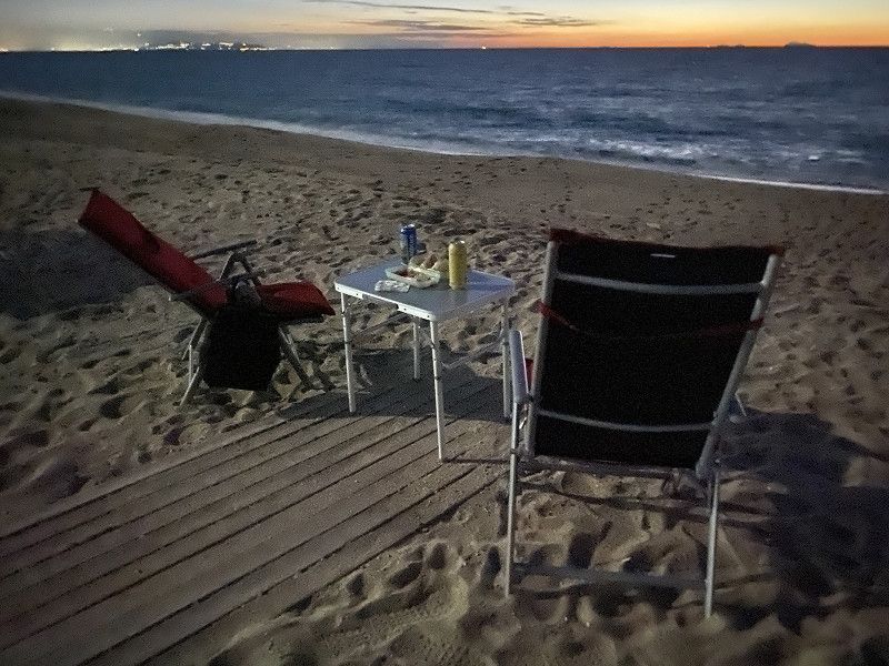
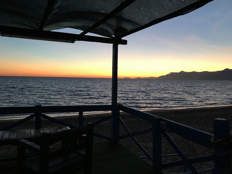
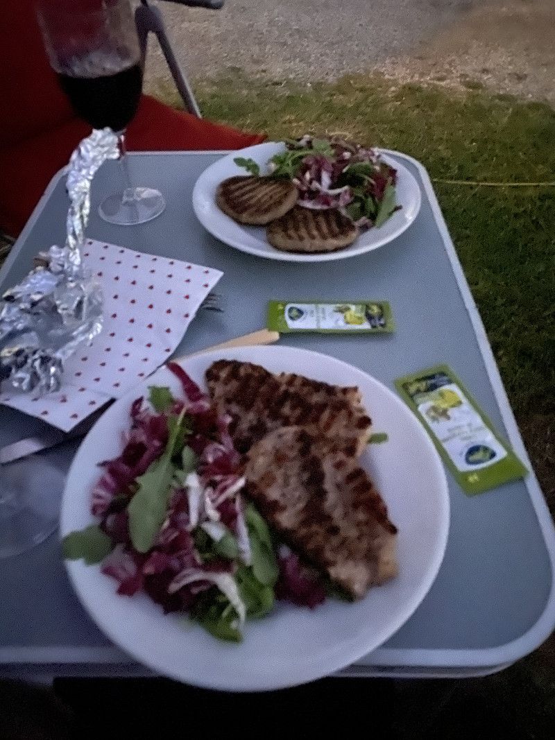
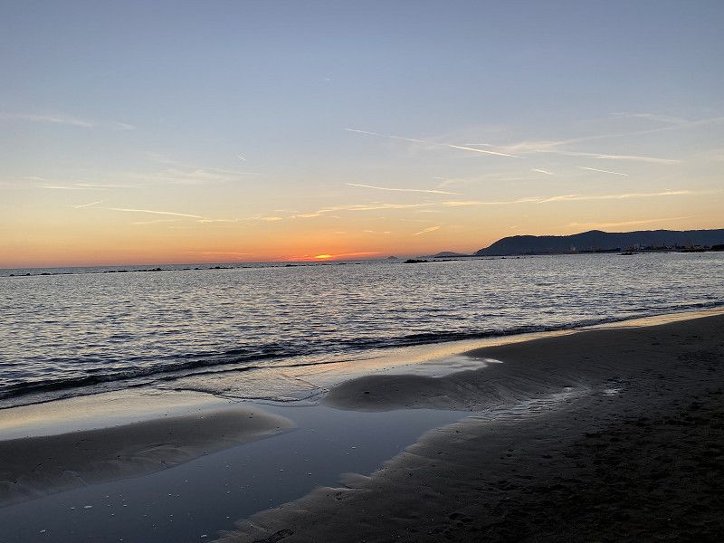
After we crossed over to Italy with the ferry, we continue to Valtur near Gioia Tauro on the campsite, we decided to stay at the campsite Salerno Lido di Salerno. Where we have a meal on the beach and enjoy the sunset.
89013 Gioia Tauro, Metropolitan City of Reggio Calabria, Italy
38° 25' 34.4" N 15° 53' 55.9" E
38.4262258 15.8988669
• Head southeast on Via Roma.
• Turn right onto Via Sarino Pugliese. Go for 173 m.
• Turn left onto Via Palermo. Go for 69 m.
• Turn left onto Via Stella Polare. Go for 93 m.
• Turn right toward Via Giuseppe Lomoro. Go for 58 m.
• Turn right onto Via Giuseppe Lomoro. Go for 105 m.
• Turn left onto Via Macallè. Go for 134 m.
• Continue on Via Monacelli. Go for 282 m.
• Turn left onto Strada Statale Tirrena Inferiore (SS18). Go for 7.6 km.
• Take ramp onto SS281 toward Autostrada/A3. Go for 3.9 km.
• Take left ramp onto A2 (Autostrada del Mediterraneo) toward Salerno. Go for 78.4 km.
• Take the exit toward Falerna/Nocera T./SP164. Go for 512 m.
• Take the 2nd exit from roundabout onto SS18dir toward Falerna/Gizzeria/Amantea/Paola. Go for 829 m.
• Turn right onto Località Cartolano (SS18) toward Salerno/Amantea/Paola. Go for 14.5 km.
• Take the 2nd exit from roundabout onto Strada Statale Tirrena Inferiore (SS18). Go for 27.6 km.
• Take the 2nd exit from roundabout. Go for 76 m.
• Continue on Via della Civiltà (SS18). Go for 1.3 km.
• Take the 1st exit from roundabout onto Via della Civiltà (SS18). Go for 1.9 km.
• Take the 3rd exit from roundabout onto Strada Statale Tirrena Inferiore (SS18). Go for 41.3 km.
• Pass 4 roundabouts and continue on Corso Mediterraneo (SS18). Go for 62.9 km.
• Take left ramp onto A2 (Autostrada del Mediterraneo) toward Salerno. Go for 104 km.
• Take the exit toward Montecorvino Pugliano/Pontecagnano Sud/Aeroporto. Go for 180 m.
• Take the 2nd exit from roundabout onto Strada Provinciale Pagliarone (SP323) toward Pontecagnano/SS18/Aeroporto/A3/Reggio C. Go for 365 m.
• Take the 2nd exit from roundabout onto Via Antonio Vivaldi (SP323) toward SS18/Pontecagnano/Aeroporto. Go for 298 m.
• Take the 2nd exit from roundabout onto Via Antonio Vivaldi (SP323). Go for 407 m.
• Turn right onto Via Amerigo Vespucci (SS18). Go for 89 m.
• Turn left toward Via Alessandro Manzoni. Go for 31 m.
• Turn left onto Via Alessandro Manzoni. Go for 28 m.
• Continue on Via Carmine Calò. Go for 25 m.
• Turn right onto Via Amerigo Vespucci (SS18). Go for 240 m.
• Turn right onto Via Carmine Calò (SP173). Go for 282 m.
• Turn slightly right onto Via Carmine Calò (SP173). Go for 345 m.
• Turn left onto Via Carmine Calò (SP173). Go for 224 m.
• Continue on Via Ferdinando Magellano (SP173). Go for 3.3 km.
• Take the 2nd exit from roundabout onto Via Ferdinando Magellano (SP173). Go for 1.4 km.
• Turn left onto Via Lago Trasimeno (SP175). Go for 642 m.
• Arrive at Via Lago Trasimeno (SP175). Your destination is on the right.
☍
354,1 km
(4 hrs. 17 min.)
Day
Camping Lido Di Salerno, Via Lago Trasimeno, Pontecagnano Faiano, Salerno, Italien
Our next stage takes us to just before Salerno, where we will stay overnight at Camping Lido, but first we will take public transport to the Amalfi Coast and do a tour of Salerno. Back at the campsite we enjoy the evening sun and a snack in front of the mobile home.
Via Lago Trasimeno, 84098 Pontecagnano Faiano SA, Italy
40° 35' 43.7" N 14° 52' 14.3" E
40.5954649 14.8706269
• Head southeast on Via Lago Trasimeno (SP175). Go for 1.3 km.
• Turn left onto Via Lago Lucrino (SP275). Go for 1.8 km.
• Take the 3rd exit from roundabout onto Via Lago Laceno (SP417). Go for 1.7 km.
• Pass 6 roundabouts and continue on Strada Provinciale Aversana (SP417). Go for 4.2 km.
• Take the 1st exit from roundabout onto Tangenziale (SS18) toward Salerno/A3/Reggio C. Go for 1.8 km.
• Keep left toward Salerno Est/Autostrade/Pontecagnano. Go for 281 m.
• Keep left toward Autostrade. Go for 689 m.
• Take left ramp onto A2 (Autostrada del Mediterraneo) toward Salerno/A3. Go for 10.1 km.
• Take the exit toward Roma/A30/Avellino/Caserta onto A2 (Autostrada del Mediterraneo). Go for 8.8 km.
• Keep left onto A30 (Autostrada Caserta-Salerno) toward Caserta/Roma/A1. Go for 54.8 km.
• Take the exit toward Roma/E45/Caserta Nord onto A1 (Autostrada del Sole). Go for 162 km.
• Take the exit toward Roma Centro/Grande Raccordo Anulare/Aeroporti/E80/Civitavecchia/A12 onto A1dir. Go for 19.5 km.
• Take the left exit toward Tuscolana/SS215/E80/Civitavecchia/A12/Aeroporti onto A90 (Grande Raccordo Anulare). Go for 20.9 km.
• Keep right toward Roma Centro-Eur/Aeroporto Fiumicino/Porto Civitavecchia/A12/Nuova Fiera di Roma/Via della Magliana/Via della Pisana/Via del Pescaccio. Go for 799 m.
• Take exit 30 toward Fiumicino/Civitavecchia/A12/Aeroporto Fiumicino onto A91 (Autostrada Roma-Fiumicino). Go for 6.8 km.
• Take the exit toward Porto Civitavecchia/Fregene onto A12 (Autostrada Azzurra). Go for 80.1 km.
• Continue on Via Aurelia (SS1). Go for 116 km.
• Take ramp onto Strada Provinciale Collacchia (SP31) toward Gavorrano Scalo/Ribolla. Go for 2.0 km.
• Turn left onto Strada Provinciale Accesa (SP49). Go for 7.1 km.
• Keep right onto Strada Provinciale Accesa (SP49). Go for 4.5 km.
• Turn right onto Strada Provinciale Massa Marittima (SP151). Go for 1.4 km.
• Take the 3rd exit from roundabout onto Via Massetana Sud (SP151). Go for 1.1 km.
• Arrive at Via Massetana Nord (SP151). Your destination is on the left.
☍
507,9 km
(4 hrs. 36 min.)
Day
Massa Marittima, Grosseto, Italien
The next stage takes us to Massa Marittima, where we will stay for a few days.
58024 Massa Marittima, Province of Grosseto, Italy
43° 3' 11.7" N 10° 53' 16.9" E
43.0532504 10.8880322
• Head south on Via Massetana Nord (SP151). Go for 1.1 km.
• Take the 1st exit from roundabout onto Via Massetana Sud (SP151). Go for 1.6 km.
• Turn right toward SR439. Go for 31 m.
• Take the 5th exit from roundabout onto SR439. Go for 9.0 km.
• Pass 2 roundabouts and continue on Strada Regionale Sarzanese Valdera (SR439). Go for 2.6 km.
• Turn left and take ramp onto Strada Statale Aurelia (SS1) toward Livorno. Go for 59.1 km.
• Continue on A12 (Autostrada Azzurra). Go for 210 km.
• Continue on A7 (Autostrada Milano-Genova). Go for 2.6 km.
• Take the exit toward Alessandria/A26/Ventimiglia/Aeroporto onto A10 (Ponte Genova San Giorgio). Go for 12.0 km.
• Take the exit toward Alessandria onto A26 (Autostrada Genova Voltri-Gravellona Toce). Go for 160 km.
• Take the exit toward Gravellona T./Strada Provinciale del Sempione/SP33 onto A26 (Autostrada Genova Voltri-Gravellona Toce). Go for 37.1 km.
• Keep left onto Strada Statale del Sempione (SS33) toward E62/Iselle. Go for 25.1 km.
• Keep left onto Strada Statale del Sempione (SS33) toward Sempione/Confine di Stato. Go for 25.1 km.
• Continue on San Marco (E62). Go for 19.5 km.
• Arrive at Simplonpass (E62).
☍
564,8 km
(5 hrs. 15 min.)
Day
Day
Day
Simplonpass, Simplon, Schweiz
As the crowning glory, before we go home, we spend the night on the Simplon Pass.
Simplon Pass, 3907 Simplon, Switzerland
46° 15' 2.1" N 8° 1' 55.9" E
46.2505944 8.0322074
• Head northeast on Simplonpass (E62). Go for 22.7 km.
• Take ramp onto A9 toward Lausanne/Sion/Autoverlad Lötschberg. Go for 10.7 km.
• Take the exit onto Visp West. Go for 887 m.
• Take the 1st exit from Kreisel Wehreya roundabout toward Sion. Go for 155 m.
• Take the 2nd exit from Kreisel Pomona roundabout toward Lausanne/Sion. Go for 422 m.
• Continue on Wehreyering. Go for 87 m.
• Take the 1st exit from Bockbart roundabout onto Kantonsstrasse (E62) toward Sion/Lausanne. Go for 551 m.
• Pass 5 roundabouts and continue on Kantonsstrasse (E62). Go for 9.5 km.
• Take ramp onto A9 toward Lausanne/Sion. Go for 6.3 km.
• Continue on Kantonsstrasse (E62). Go for 853 m.
• Take the 1st exit from Kreisel Roschätte roundabout onto Kantonsstrasse (E62) toward Lausanne/Sion/Leukerbad/Susten. Go for 654 m.
• Pass 3 roundabouts and continue on Pfynstrasse (E62). Go for 7.1 km.
• Continue on A9. Go for 88.6 km.
• Take exit 14 toward Bern/Fribourg onto A12. Go for 56.7 km.
• Take exit 9 toward Düdingen/Tafers/Laupen. Go for 433 m.
• Continue on Hauptstrasse. Go for 138 m.
• Pass 2 roundabouts and continue on Hauptstrasse. Go for 987 m.
• Take the 3rd exit from roundabout onto Käsereistrasse. Go for 278 m.
• Take the 3rd exit from roundabout onto Chännelmattstrasse. Go for 524 m.
• Continue on Leimacker. Go for 354 m.
• Continue on Heitiwil. Go for 1.7 km.
• Continue on Berg. Go for 709 m.
• Turn left onto Berg. Go for 399 m.
• Continue on Bagerstrasse. Go for 620 m.
• Turn right onto Rainstrasse. Go for 255 m.
• Turn left onto Auroraweg. Go for 62 m.
• Arrive at Auroraweg. Your destination is on the right.
☍
211,8 km
(2 hrs. 15 min.)
Day
Auroraweg 10, Schmitten, Schweiz
After exactly 30 days we arrive back home. What remains are many beautiful memories. And new destinations for our next trip
Auroraweg 10, 3185 Schmitten, Switzerland
46° 51' 6.1" N 7° 14' 49.3" E
46.8516851 7.2470280