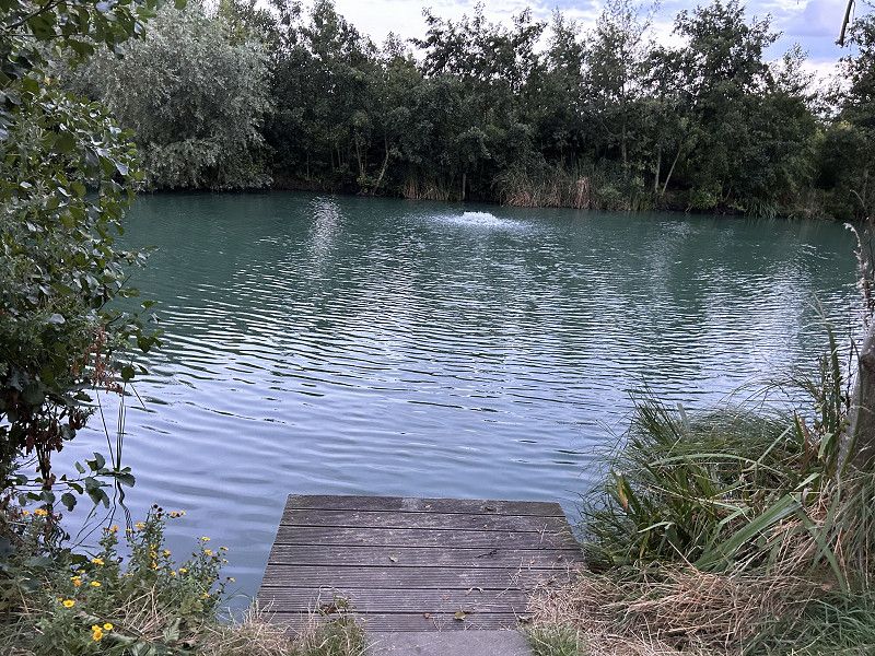
Scotland offers magnificent landscapes and extraordinary natural locations, so that we will hopefully experience an unforgettable trip.
Ludwigshafen am Rhein
Aug 13, 2023
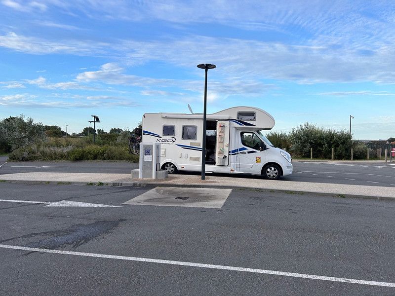
Departure on time
Rheinland-Pfalz, Deutschland
49° 28' 13.5" N 8° 26' 17.4" E
49.4704113 8.4381568
• Head toward Von-Weber-Straße on Saarlandstraße (B38). Go for 1.1 km.
• Turn left onto Kaiser-Wilhelm-Straße toward A650/A61/Kaiserslautern/A6. Go for 255 m.
• Take left ramp onto B37 toward A6/A61/A650. Go for 1.6 km.
• Continue on A650. Go for 7.5 km.
• Take exit 5 toward Koblenz/Mainz/Kaiserslautern onto A61. Go for 8.2 km.
• Take exit 59 toward Saarbrücken/Kaiserslautern onto A6. Go for 115 km.
• Continue on A320. Go for 13.5 km.
• Continue on E50 (Échangeur de Freyming). Go for 259 m.
• Take the left exit toward Paris/Metz/St Avold/Carling onto A4 (Autoroute de l'Est). Go for 237 km.
• Take the exit toward A26/E46/Bruxelles/Calais/Lille/Laon/Rouen/Reims-Nord onto E17. Go for 538 m.
• Continue on A26. Go for 263 km.
• Take the exit toward Boulogne/Tunnel sous la Manche/Calais-Ouest onto A16 (Autoroute des Estuaires). Go for 3.9 km.
• Take exit 44 toward Calais-St Pierre. Go for 251 m.
• Turn right onto Rue Chevreul (D245) toward Calais-St Pierre. Go for 99 m.
• Take the 2nd exit from roundabout onto Rue Chevreul. Go for 249 m.
• Continue on Rue des Prairies. Go for 709 m.
• Turn left onto Boulevard La Fayette. Go for 480 m.
• Turn right onto Boulevard Jacquard. Go for 463 m.
• Turn slightly right onto Place du Soldat Inconnu. Go for 59 m.
• Turn left onto Place du Soldat Inconnu. Go for 84 m.
• Turn right onto Place du Soldat Inconnu. Go for 33 m.
• Arrive at Place du Soldat Inconnu. Your destination is on the right.
☍
653,9 km
(5 hrs. 43 min.)
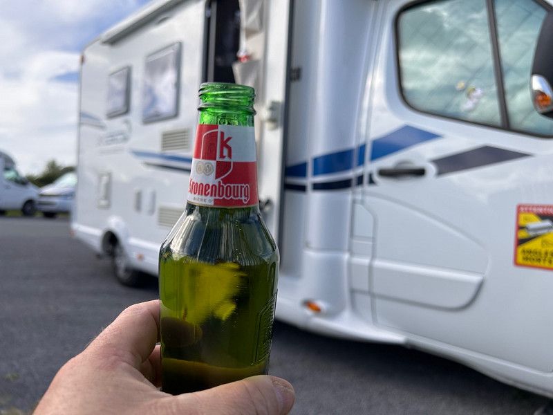
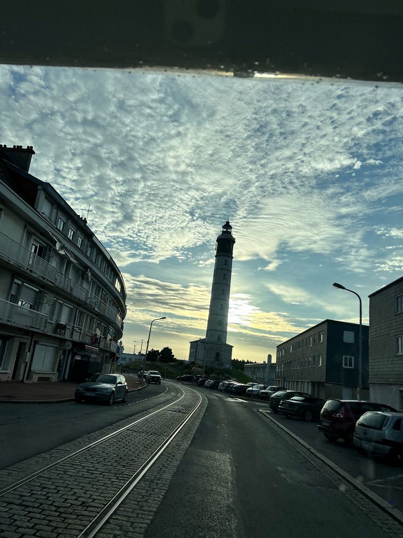
Calais
Av. you platier,
Pas-de-Calais, Nordfrankreich, Frankreich
50° 57' 8.9" N 1° 51' 13.8" E
50.9524769 1.8538446
• Head north on Place du Soldat Inconnu. Go for 79 m.
• Turn right onto Rue Paul Bert. Go for 277 m.
• Continue on Rue Mollien. Go for 180 m.
• Turn left onto Rue de la Batellerie. Go for 110 m.
• Take the 3rd exit from roundabout onto Rue de la Batellerie. Go for 180 m.
• Take the 1st exit from Place de Norvège roundabout onto Rue de Moscou. Go for 570 m.
• Continue on Place de Suède. Go for 11 m.
• Turn right onto Rue Lamy. Go for 71 m.
• Continue on Pont Vétillard. Go for 442 m.
• Continue toward Avenue du Commandant Cousteau. Go for 39 m.
• Take the 3rd exit from roundabout onto Avenue du Commandant Cousteau. Go for 873 m.
• Take the 2nd exit from roundabout onto Avenue du Commandant Cousteau toward A16/A26/Terminal Intermodal/Terminal Ferroviaire. Go for 316 m.
• Take the 2nd exit from roundabout. Go for 525 m.
• Continue straight ahead. Go for 18 m.
• Take the 2nd exit from roundabout. Go for 383 m.
• Continue straight ahead. Go for 22 m.
• Take the 2nd exit from roundabout. Go for 166 m.
• Take the 3rd exit from roundabout. Go for 847 m.
• Turn right toward Avenue de l'Embarquement. Go for 857 m.
• Continue on Avenue de l'Embarquement. Go for 852 m.
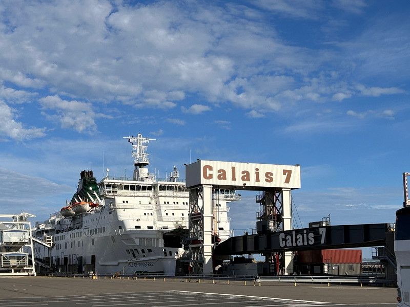
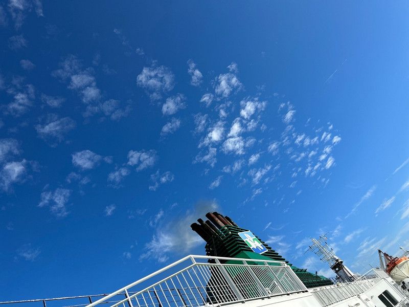
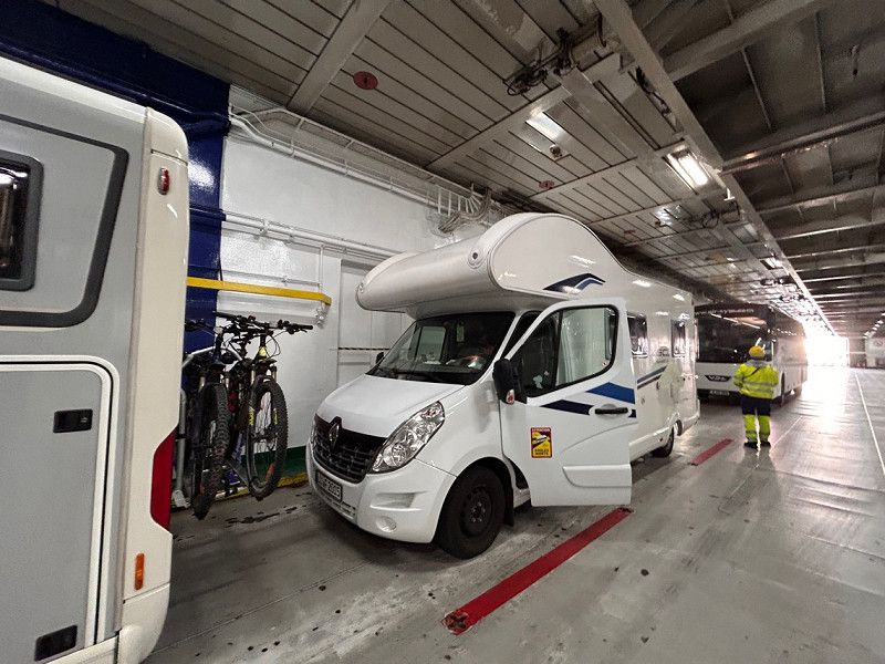
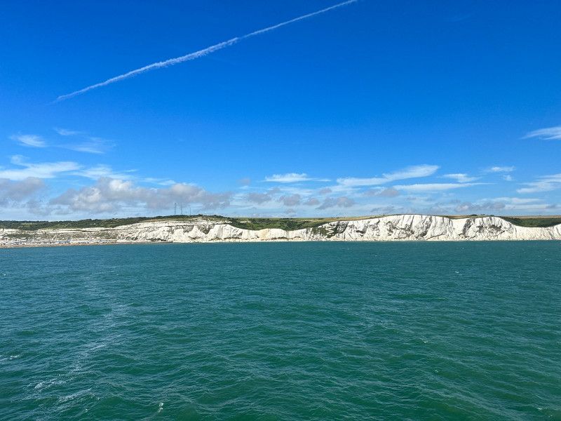
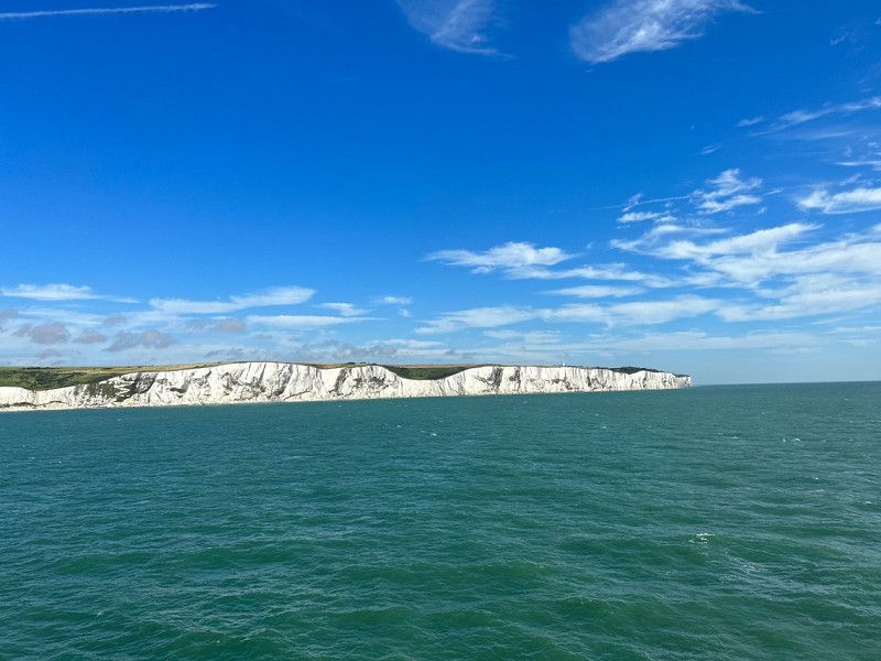
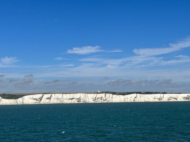
• Take the Calais-Dover Ferry. Stay on for 40.6 km.
• Head northwest. Go for 133 m.
• Turn right toward Ramp B. Go for 129 m.
• Continue on Ramp B. Go for 69 m.
• Turn right toward The Fan. Go for 143 m.
• Continue on The Fan. Go for 269 m.
• Keep right onto Inward Car Lanes. Go for 115 m.
• Keep left onto North Exit Road. Go for 438 m.
• Continue on Dock Exit Road. Go for 99 m.
• Keep left toward London/(M20)/Folkestone/Dover town centre. Go for 511 m.
• Continue on A20. Go for 482 m.
• Turn right onto Woolcomber Street (A256) toward Town Centre (South). Go for 231 m.
• Turn left onto Castle Street. Go for 259 m.
• Arrive at Castle Street. Your destination is on the right.
☍
50,3 km
(1 hrs. 50 min.)
Dover Fähre abfahrt 30.8.2023 9:00uhr
Crossing with the Irish Ferries ferry
Kent, England, Vereinigtes Königreich
51° 7' 30.5" N 1° 18' 48.3" E
51.1251275 1.3134228
• Head south on Castle Street.
• Turn slightly left onto King Street. Go for 88 m.
• Turn slightly right onto Queen Street. Go for 60 m.
• Turn left onto York Street (A20). Go for 105 m.
• Turn left onto Townwall Street (A20). Go for 1.0 km.
• Take the 2nd exit from Eastern Docks Roundabout roundabout onto Jubilee Way (A2) toward Canterbury/Deal/(A258)/Ramsgate/(A256)/Sandwich. Go for 2.3 km.
• Take the 2nd exit from roundabout onto A2 toward London/(M2)/Canterbury/Ramsgate/(A256). Go for 3.3 km.
• Take the 3rd exit from roundabout onto A2 toward Canterbury/(M2). Go for 32.5 km.
• Take the 2nd exit from Brenley Cor roundabout onto M2 toward London. Go for 41.3 km.
• Continue on Watling Street (A2). Go for 1.3 km.
• Keep right onto Watling Street (A2) toward (M25)/London/Dartford Crossing. Go for 9.9 km.
• Keep right onto Watling Street (A2) toward London/(M25)/Dartford Crossing. Go for 2.3 km.
• Keep right onto A2 toward M25(S)/(M23)/Dartford/(A225)/London/Bexleyheath. Go for 7.4 km.
• Keep right onto East Rochester Way (A2) toward C. London/Lewisham/Bexleyh'th/(A221). Go for 2.3 km.
• Keep right onto East Rochester Way (A2) toward C. London/Lewisham. Go for 2.6 km.
• Keep right onto East Rochester Way (A2) toward Central London/Lewisham/Blackwall Tnl/(A102). Go for 4.3 km.
• Keep right onto Rochester Way Relief Road (A2) toward Greenwich/Blackheath/Blackwall Tunnel/(A102). Go for 4.3 km.
• Keep right onto Silvertown Tunnel (A1026). Go for 1.9 km.
• Keep left onto Lower Lea Crossing (A1026) toward Stratford/(A12)/The City/(A13)/Blackwall Tunnel/Canary Wharf. Go for 831 m.
• Take the 2nd exit from roundabout onto Aspen Way (A1261) toward The CITY/(A13)/Canary Wharf/Isle of Dogs. Go for 472 m.
• Keep right onto Aspen Way (A1261) toward The CITY/Tower Bridge/Canary Wharf Parking. Go for 1.0 km.
• Keep right onto Aspen Way (A1261). Go for 51 m.
• Continue on Limehouse Link (A1203). Go for 4.1 km.
• Keep right onto East Smithfield (A1203) toward Shoreditch/Aldgate/Southwark Bridge. Go for 86 m.
• Keep left onto Tower Hill (A100) toward Westminster/(A3211). Go for 264 m.
• Continue on Byward Street (A100). Go for 162 m.
• Continue on Lower Thames Street (A3211). Go for 2.0 km.
• Continue on Victoria Embankment (A3211). Go for 1.2 km.
• Turn right onto Northumberland Avenue (A400). Go for 358 m.
• Enter the roundabout. Go for 23 m.
• Arrive at Charing Cross. Your destination is on the right.
☍
127,7 km
(1 hrs. 33 min.)
London 14.7.2023 - 16.8.2023
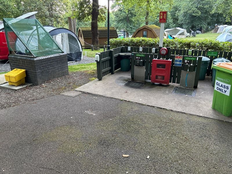
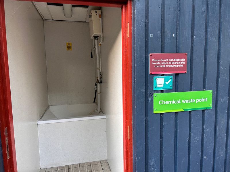
Abbey Wood Caravan and Motorhome
Federation Rd, Abbey Wood, London SE2 0LS, United Kingdom
Abbey Wood Caravan
Great campsite.
There are several houses with toilets and showers, so the walk isn't long. We actually saw foxes running around the neighborhood at dusk. Thanks to the nearby train station, the journey to London is also easy to manage with children.
Groß-London, England, Vereinigtes Königreich
51° 30' 26.4" N 0° 7' 39.5" W
51.5073359 -0.1276500
• Follow the roundabout.
• Arrive at Charing Cross. Your destination is on the right.
☍
Distance not available
(Duration not available)
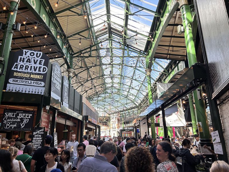
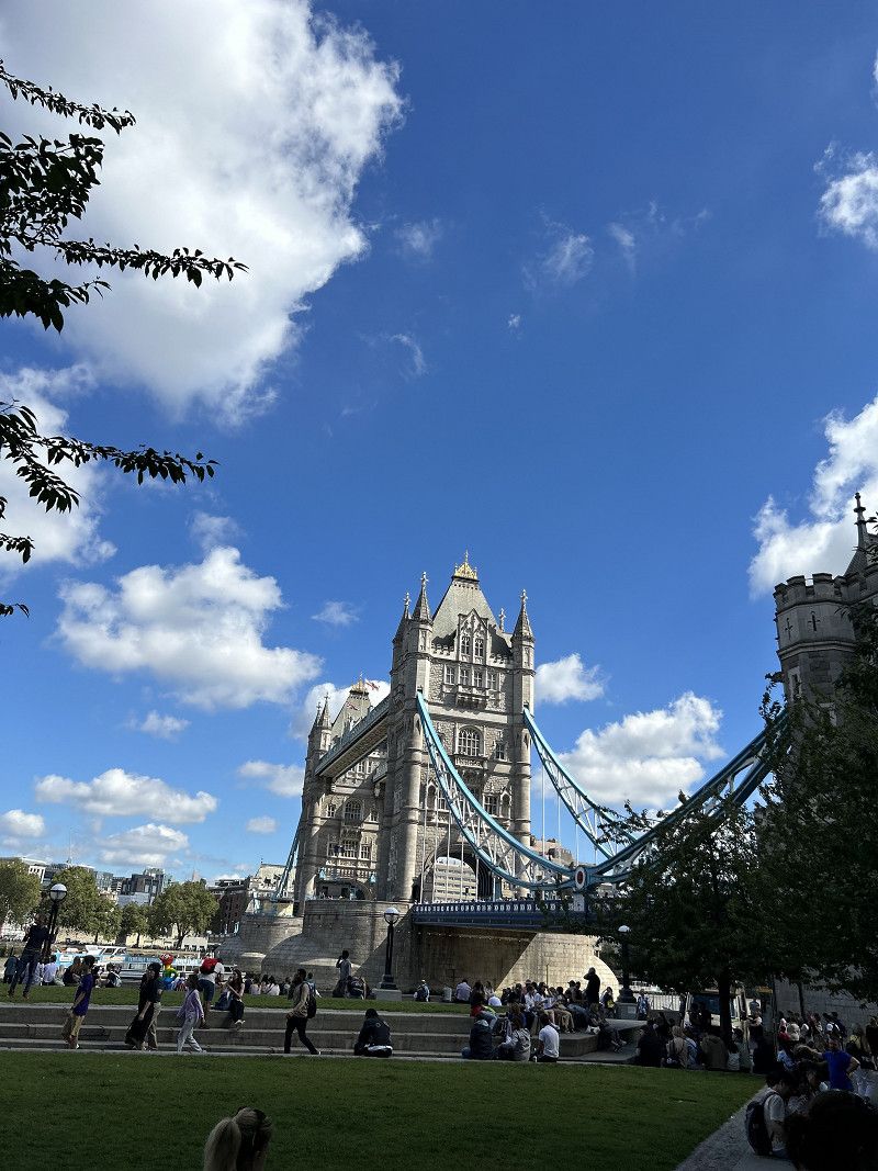
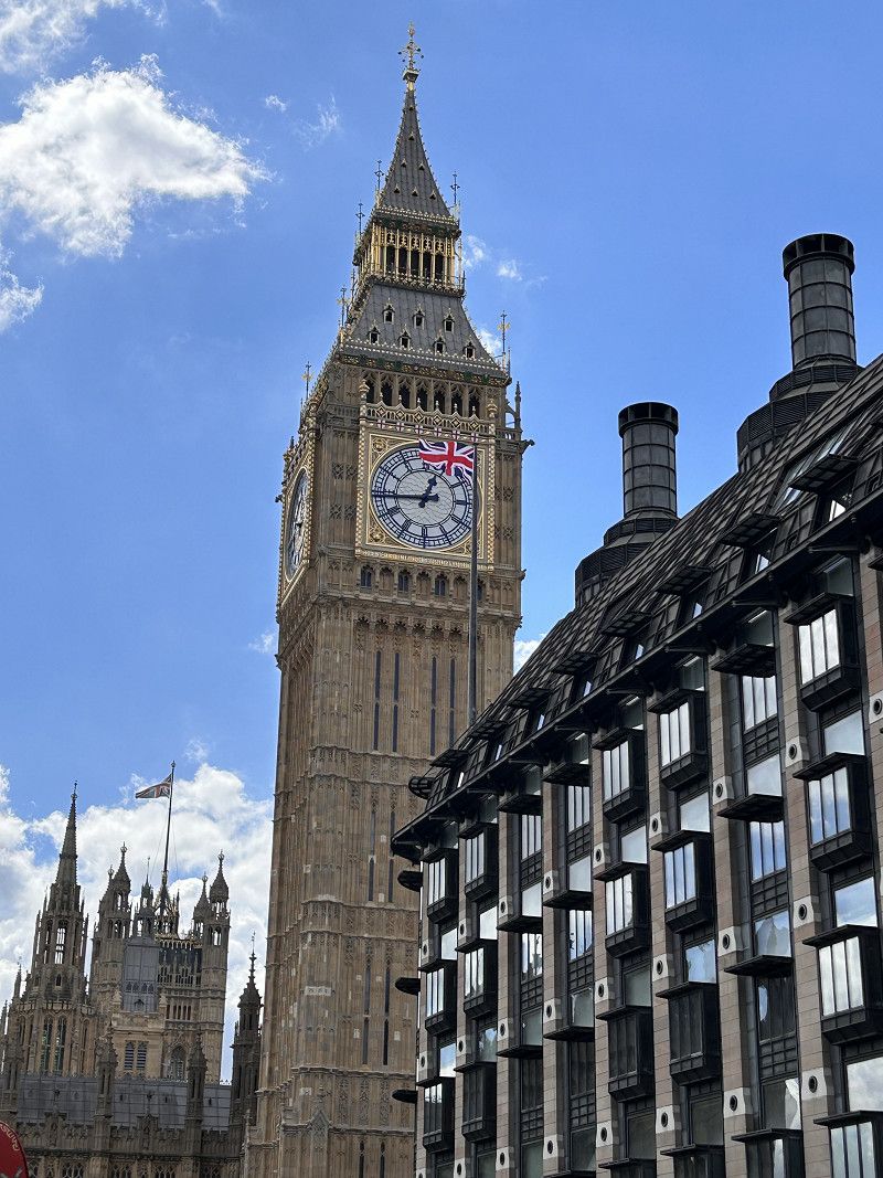
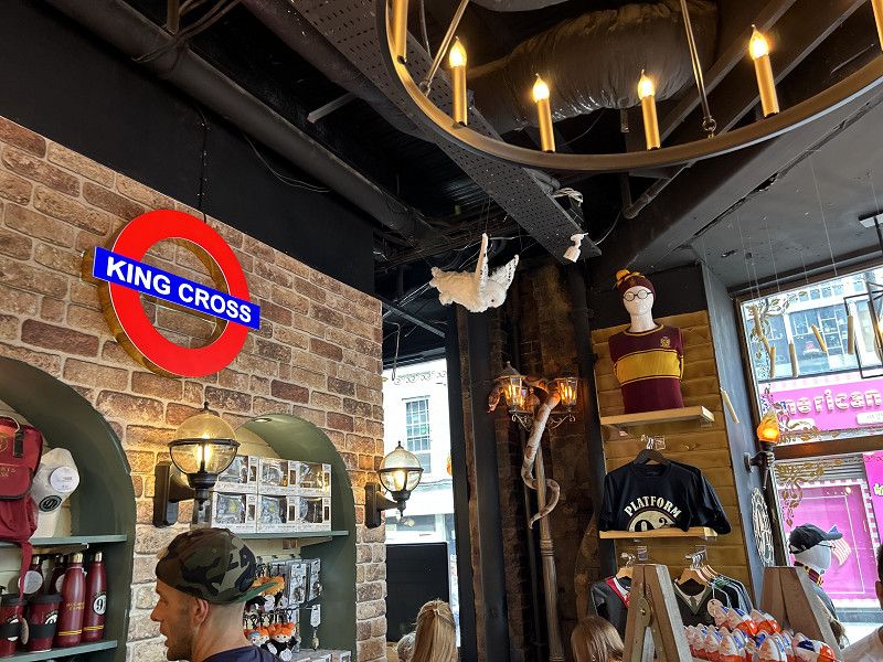
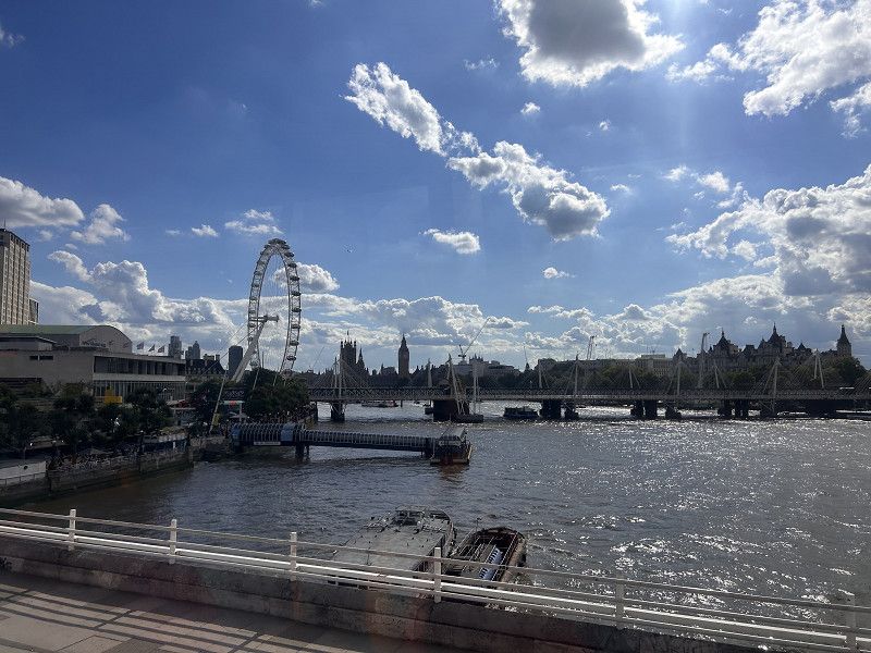
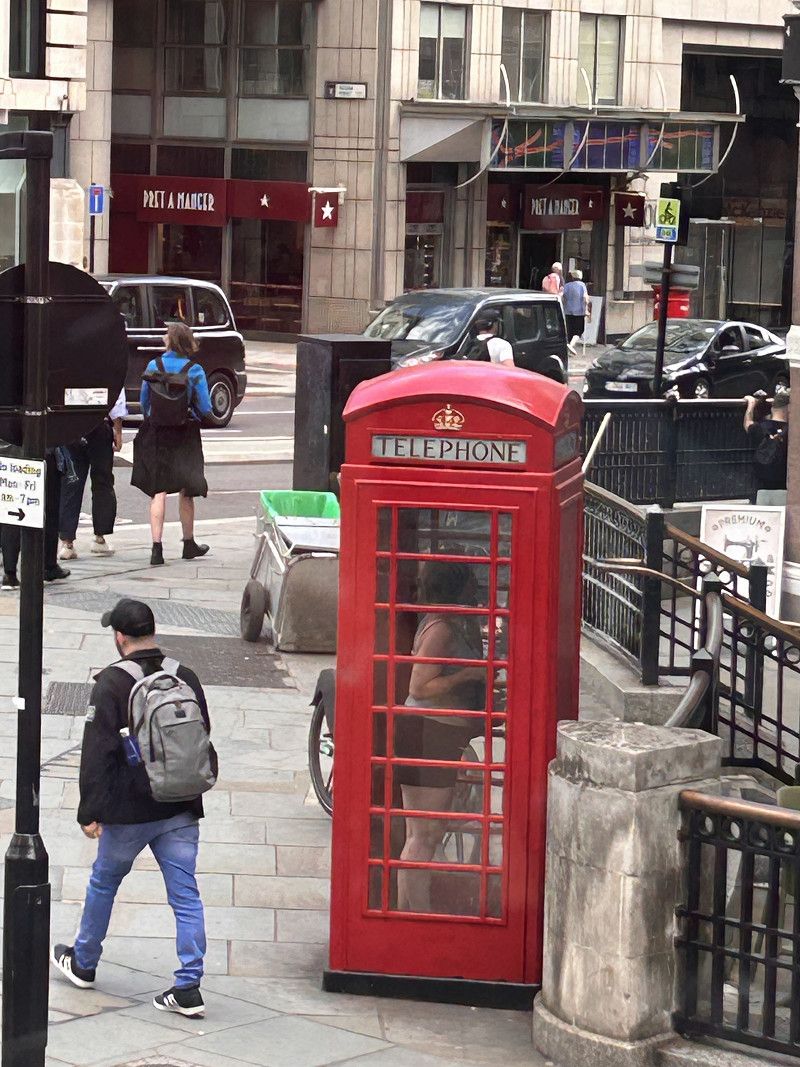
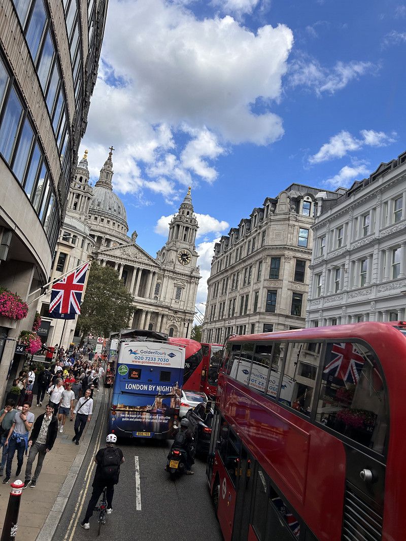
London
Explore London with the Hop on Hop Off bus.
Groß-London, England, Vereinigtes Königreich
51° 30' 26.4" N 0° 7' 39.5" W
51.5073359 -0.1276500
• Follow the roundabout. Go for 37 m.
• Take the 2nd exit from roundabout onto Trafalgar Square (A4). Go for 71 m.
• Continue on Cockspur Street (A4). Go for 149 m.
• Continue on Pall Mall (A4). Go for 97 m.
• Turn right onto Waterloo Place (A4). Go for 120 m.
• Continue on Regent Street St James's (A4). Go for 226 m.
• Continue on Piccadilly Circus (A4). Go for 12 m.
• Keep left onto Regent Street (A4201). Go for 1.0 km.
• Turn left onto Margaret Street. Go for 74 m.
• Continue on Cavendish Square. Go for 145 m.
• Continue on Henrietta Place. Go for 102 m.
• Continue on Henrietta Place. Go for 19 m.
• Continue on Wimpole Street. Go for 102 m.
• Turn left onto Wigmore Street (A5204). Go for 493 m.
• Continue on Portman Square (A5204). Go for 158 m.
• Turn right onto Portman Square (A41). Go for 107 m.
• Continue on Gloucester Place (A4380). Go for 1.1 km.
• Continue on Park Road (A41). Go for 653 m.
• Take the 1st exit from roundabout onto Wellington Road (A41). Go for 74 m.
• Keep right onto Wellington Road (A41) toward The NORTH/(M1)/Brent Cross/Kilburn/Hampstead/Swiss Cottage. Go for 1.6 km.
• Keep left onto Finchley Road (A41). Go for 2.4 km.
• Continue on Finchley Road (A41). Go for 61 m.
• Keep left onto Hendon Way (A41). Go for 2.3 km.
• Keep left toward The NORTH/Watford/(M1)/N.Circular/A406/Wood Green/Brent Cross. Go for 198 m.
• Take the 1st exit from Brent Cross Interchange roundabout onto North Circular Road (A406) toward The NORTH/Watford/(M1)/N.Circular/(A40)/(M4)/Harrow/Wembley/Neasden. Go for 375 m.
• Take ramp onto M1 toward The NORTH/Watford. Go for 175 km.
• Take exit 24 toward Stoke/Derby. Go for 477 m.
• Keep left onto A50 toward Stoke/Derby/Lockington/Hemington. Go for 7.6 km.
• Keep right onto A50 toward Uttoxeter/Stoke-on-Trent. Go for 25.7 km.
• Take the 2nd exit from roundabout onto A50 toward Stoke. Go for 7.7 km.
• Take the 2nd exit from roundabout onto A50 toward (M6)/Stoke. Go for 1.4 km.
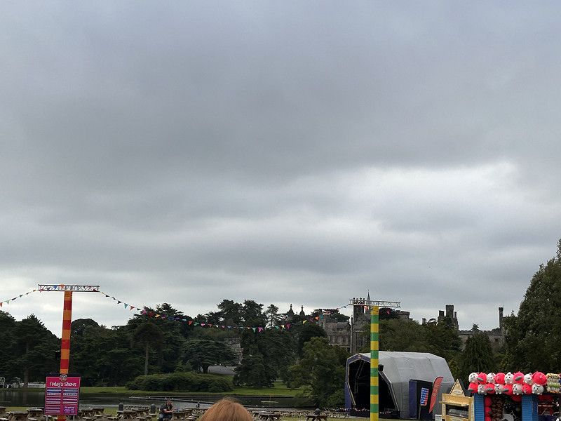
• Take the 3rd exit from roundabout onto Ashbourne Road (B5030) toward Rocester/Ashbourne/Stafford/(A518)/Alton Towers. Go for 270 m.
• Continue on B5030. Go for 197 m.
• Take the 1st exit from roundabout onto B5030. Go for 4.5 km.
• Take the 2nd exit from roundabout onto Station Road (B5030) toward Ashbourne/Rocester. Go for 122 m.
• Take the 1st exit from roundabout onto B5030 toward Ashbourne. Go for 754 m.
• Take the 1st exit from roundabout onto B5031. Go for 521 m.
• Take the 2nd exit from roundabout onto B5031. Go for 460 m.
• Continue on Elm View (B5031). Go for 145 m.
• Continue on B5031. Go for 332 m.
• Take the 1st exit from roundabout onto Denstone Lane (B5032) toward Ashbourne/Ellastone. Go for 317 m.
• Continue on Alton Road (B5032). Go for 990 m.
• Continue on Denstone Lane (B5032). Go for 1.6 km.
• Turn right onto Saltersford Lane. Go for 9 m.
• Continue on Uttoxeter Road. Go for 241 m.
• Continue on Limekiln Lane. Go for 219 m.
• Continue on Smithy Bank. Go for 112 m.
• Continue on Malthouse Road. Go for 33 m.
• Continue on New Road. Go for 315 m.
• Continue on Farley Lane. Go for 1.8 km.
• Turn left onto Wootton Lane. Go for 520 m.
• Continue on Beelow Lane. Go for 1.4 km.
• Turn right onto Star Bank (B5417). Go for 228 m.
• Turn right. Go for 61 m.
• Arrive at your destination on the left.
☍
244,9 km
(2 hrs. 44 min.)
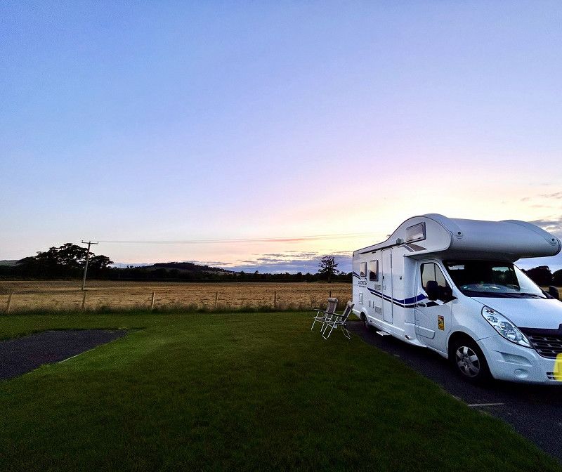
Staffordshire Moorlands
Alton, The Star Camping and Caravanning Club
Great campsite, close to everything and well maintained. Fantastic views and only 5 minutes from Alton Towers.
Star Bank, Staffordshire Moorlands, Staffordshire, England, Vereinigtes Königreich
53° 0' 33.7" N 1° 54' 4.6" W
53.0093615 -1.9012776
• Head toward Star Bank. Go for 61 m.
• Turn left onto Star Bank (B5417). Go for 1.7 km.
• Continue on B5417. Go for 205 m.
• Continue on Church Bank (B5417). Go for 527 m.
• Continue on Oakamoor Road (B5417). Go for 4.1 km.
• Continue on Queen Street (B5417). Go for 454 m.
• Take the 1st exit from roundabout onto Tape Street (A522). Go for 235 m.
• Take the 3rd exit from roundabout onto Chapel Street. Go for 235 m.
• Continue on Bank Street. Go for 171 m.
• Continue on Watt Place. Go for 72 m.
• Continue on The Terrace (A521). Go for 121 m.
• Continue on Town End (A521). Go for 458 m.
• Continue on The Green (A521). Go for 525 m.
• Continue on Delphouse Road (A521). Go for 1.6 km.
• Continue on Cheadle Road (A521). Go for 2.8 km.
• Turn right onto Uttoxeter Road (A521). Go for 1.8 km.
• Take the 3rd exit from roundabout onto Uttoxeter Road (A50). Go for 5.1 km.
• Keep right onto A50 toward (M6)/Stone/Newcastle/(A34). Go for 2.0 km.
• Take the 1st exit from Sideway roundabout onto Queensway (A500) toward Campbell Rd/Stone/(A34)/Newcastle/(M6). Go for 1.1 km.
• Keep right onto Queensway (A500) toward (M6)/Shrewsbury/(A53). Go for 2.2 km.
• Take the 2nd exit from roundabout onto M6 toward The South/The N. West/Manchester. Go for 260 km.
• Continue on A74(M). Go for 78.6 km.
• Continue on M74 toward The North/Glasgow. Go for 59.8 km.
• Take the exit toward Glasgow Airport/Greenock onto M8. Go for 17.0 km.
• Take exit 30 toward Erskine Bridge/Erskine/Bishopton onto M898 (Craigton Interchange). Go for 1.8 km.
• Continue on A898. Go for 2.2 km.
• Take ramp onto Great Western Road (A82) toward Crianlarich. Go for 3.7 km.
• Pass 3 roundabouts and continue on A82. Go for 10.8 km.
• Take the 2nd exit from Stoneymollan Roundabout roundabout onto A82 toward Tarbet/Crianlarich. Go for 4.1 km.
• Take the 2nd exit from roundabout onto A82 toward Crianlarich/Campbeltown/(A83). Go for 21.7 km.
• Turn right onto A82 toward Crianlarich/Ft. William/Oban/(A85). Go for 25.8 km.
• Take the 2nd exit from roundabout onto A82 toward An Gearasdan/Fort William/An t-Òban/Oban/(A85)/A' Chrìon-Làraich/Crianlarich. Go for 926 m.
• Take the 1st exit from roundabout onto A82 toward An Gearasdan/Fort William/An t-Òban/(A85)/Oban. Go for 56.1 km.
• Turn right. Go for 137 m.
• Turn left toward Lorn Drive. Go for 10 m.
• Continue on Lorn Drive. Go for 32 m.
• Turn left. Go for 23 m.
• Arrive at your destination on the left.
☍
568,1 km
(5 hrs. 58 min.)
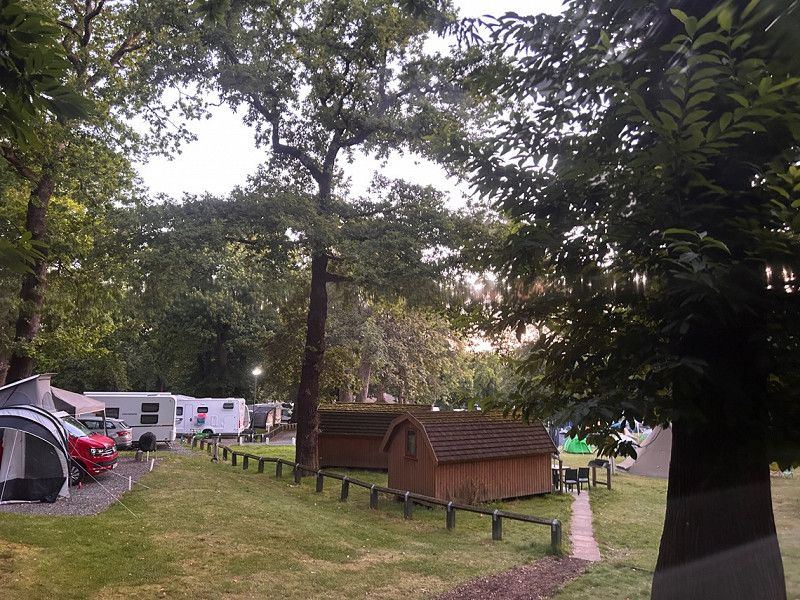
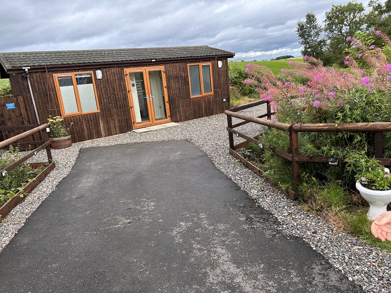
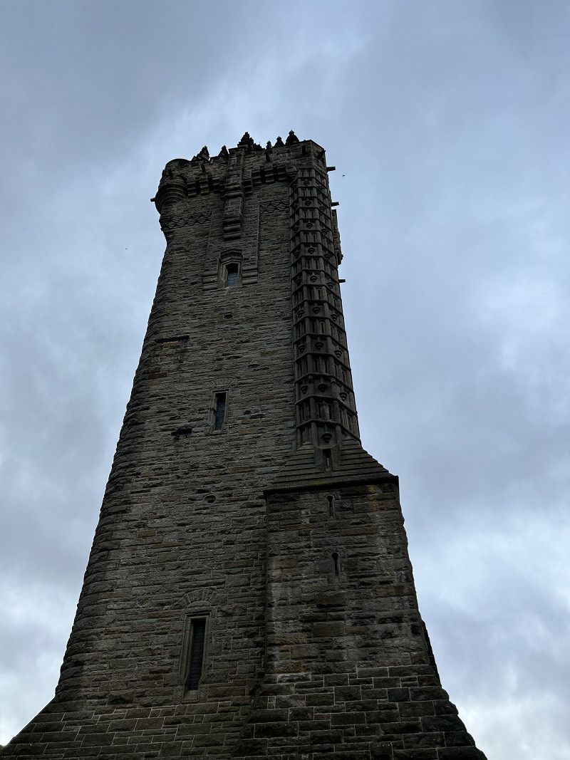
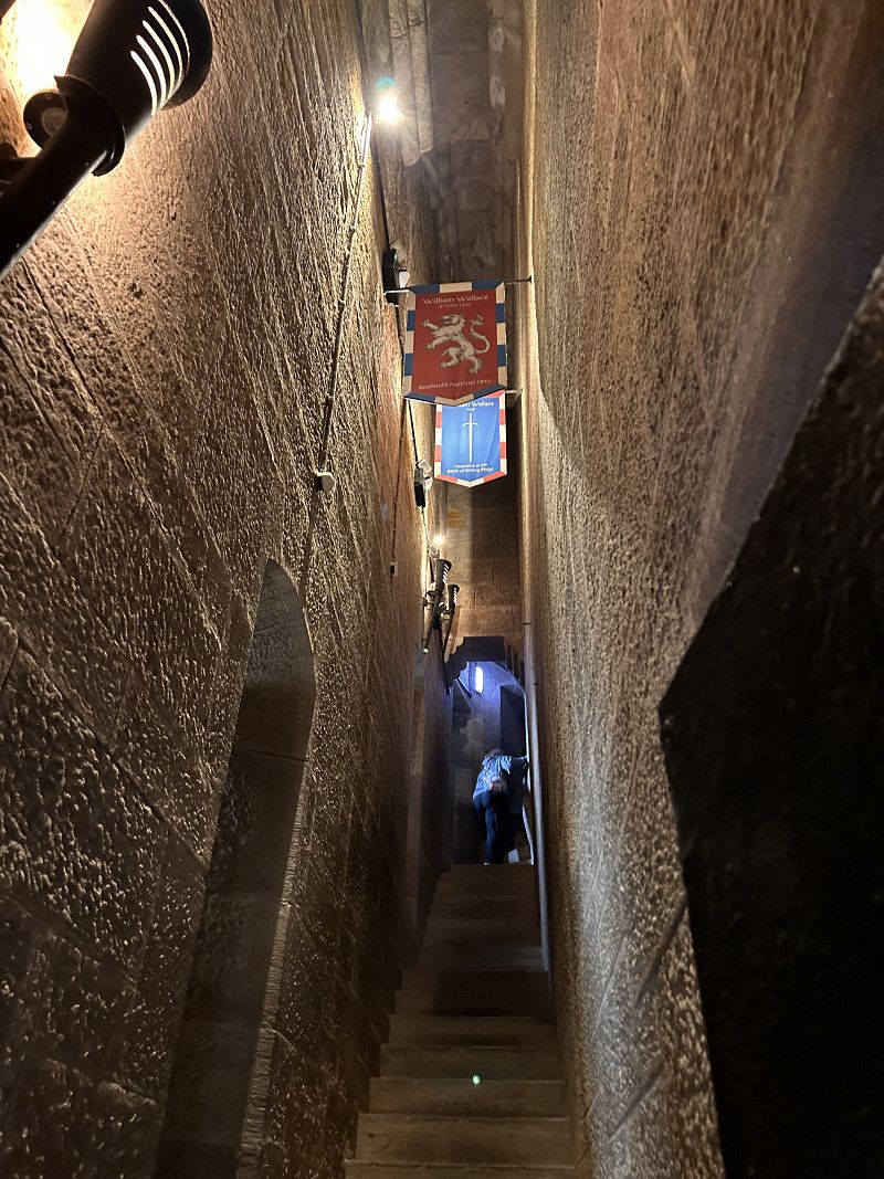
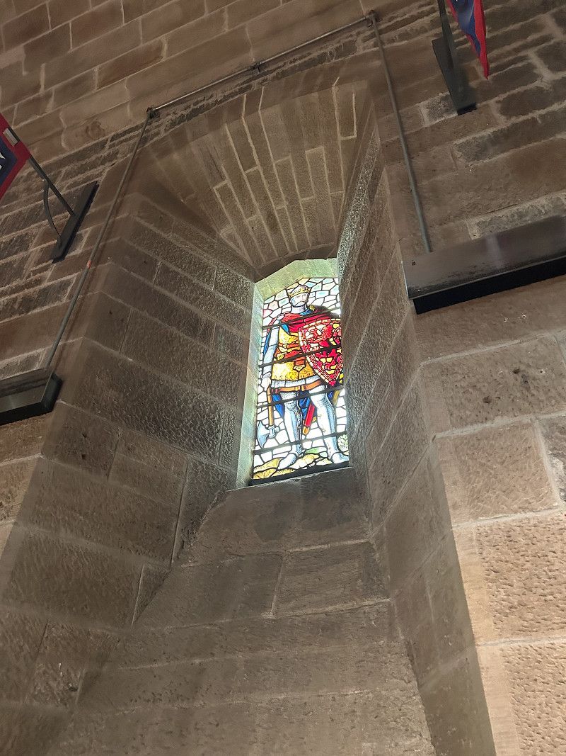
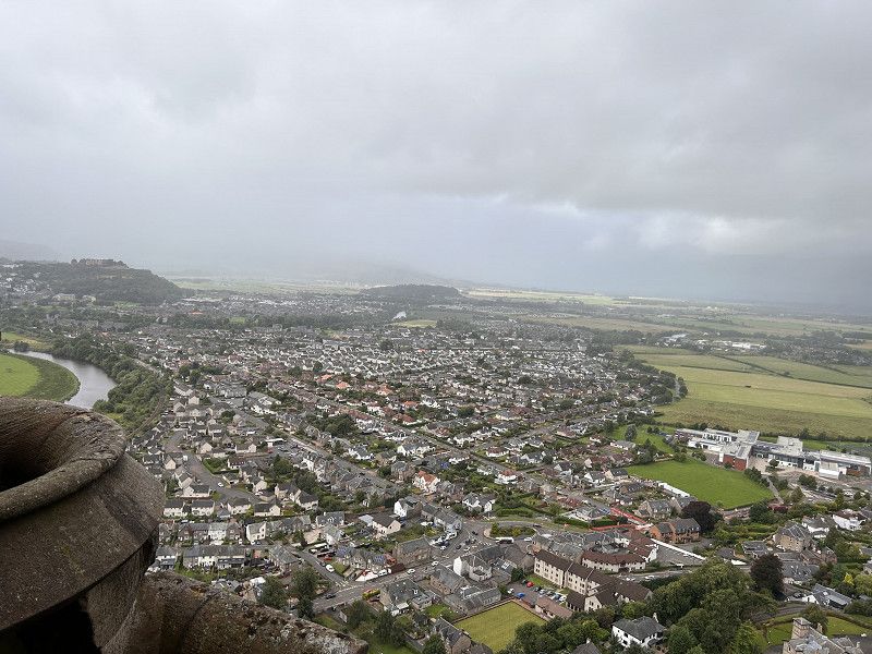
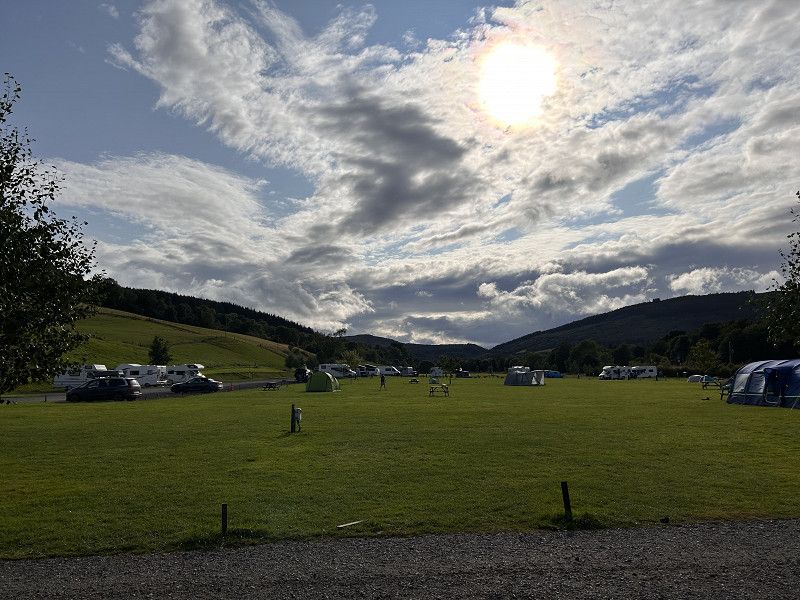
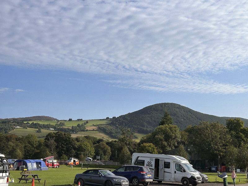
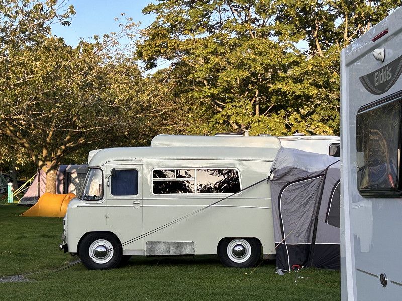
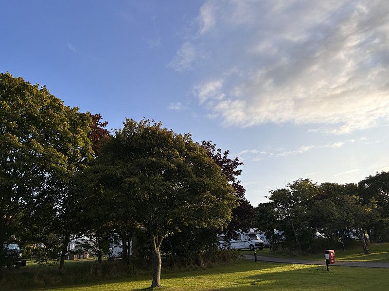
Stirling 20.8.2023 Carr´s Hill
Overnight: Carr's Hill
A small campsite, an oasis with the best infrastructure I've encountered so far. The pitches are spacious and quiet. A place to stop and rest and recharge your batteries.
Wallace Monument: Abbey Craig, Hillfoots Rd, Stirling FK9 5LF, United Kingdom
Highland, Schottland, Vereinigtes Königreich
56° 40' 55.3" N 5° 6' 13.9" W
56.6820148 -5.1038473
• Head toward Lorn Drive. Go for 23 m.
• Turn left onto Lorn Drive. Go for 224 m.
• Turn left onto B863. Go for 33 m.
• Turn right onto A82. Go for 4.4 km.
• Pass 2 roundabouts and continue on A82. Go for 21.1 km.
• Take the 2nd exit from roundabout onto Belford Road (A82) toward Inbhir Nis/Inverness/Mallaig/(A830)/Stèisean Train Station. Go for 955 m.
• Take the 1st exit from roundabout onto A82 toward Inverness/Mallaig/(A830). Go for 199 m.
• Pass 2 roundabouts and continue on A82. Go for 1.7 km.
• Take the 1st exit from Lochy Bridge Roundabout roundabout onto A830 toward Mallaig. Go for 828 m.
• Take the 2nd exit from roundabout onto A830. Go for 20.2 km.
• Turn right. Go for 1.5 km.
• Arrive at your destination.
☍
51,2 km
( 53 min.)
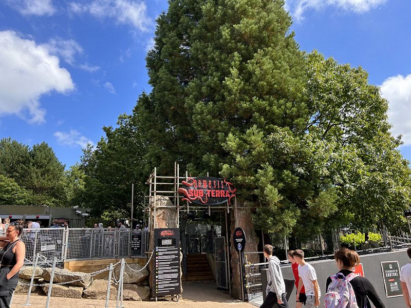
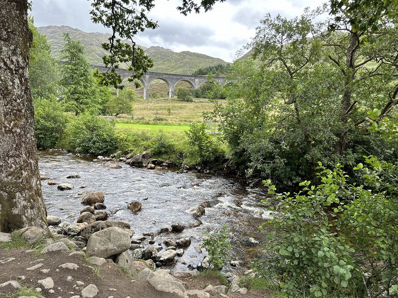
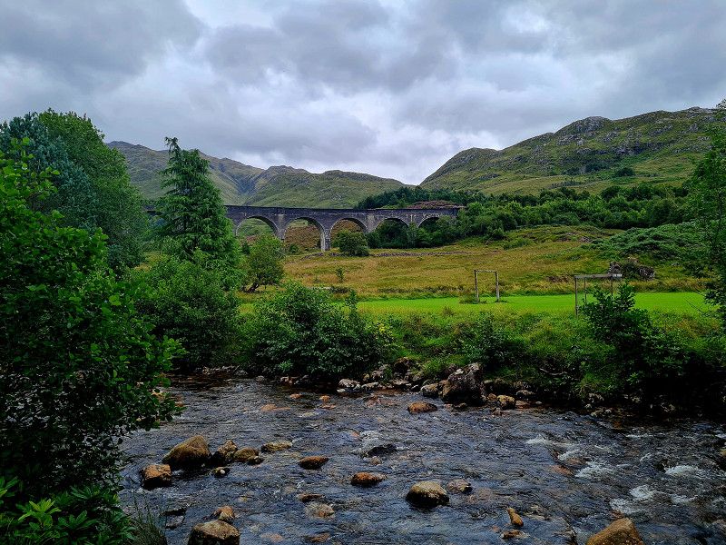
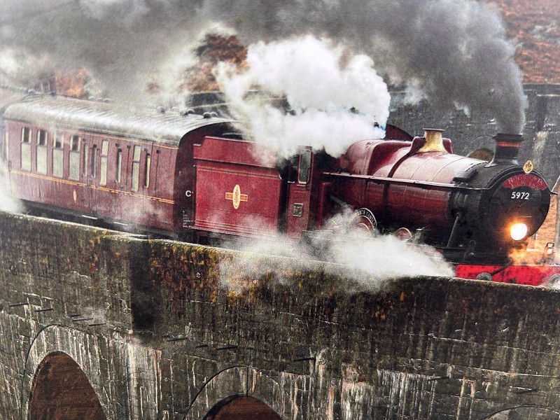
Glenfinnan Viaduct
Harry Potter Bridge
Glenfinnan Viaduct Trail, Glenfinnan, Highland, Schottland, Vereinigtes Königreich
56° 52' 33" N 5° 25' 45.6" W
56.8758236 -5.4293199
• Head east. Go for 1.5 km.
• Turn left onto A830. Go for 20.1 km.
• Take the 3rd exit from roundabout onto A830. Go for 877 m.
• Take the 2nd exit from Lochy Bridge Roundabout roundabout onto A82 toward An Gearasdan/Fort William. Go for 744 m.
• Take the 4th exit from roundabout onto North Road (A82). Go for 1.0 km.
• Take the 1st exit from roundabout onto A82 toward A' Chrìon-Làraich/Crianlarich/Meadhan A' Bhaile/Town Centre. Go for 206 m.
• Take the 3rd exit from roundabout onto Belford Road (A82) toward A' Chrìon-Làraich/Crianlarich/Meadhan A' Bhaile/Town centre. Go for 764 m.
• Turn left toward Meadhan a' Bhaile/Town centre. Go for 44 m.
• Turn left onto Fassifern Road. Go for 129 m.
• Turn slightly right onto Fassifern Road. Go for 26 m.
• Continue on Dudley Road. Go for 103 m.
• Turn right onto Bank Street. Go for 5 m.
• Turn left. Go for 125 m.
• Arrive at your destination on the right.
☍
25,7 km
( 29 min.)
Fort William - Linnhe Lochside Camping
Linnhe Lochside Holidays
Great parking space by the water, very unbureaucratic check-in. The pitches are laid out like terraces and you always have a wonderful view of Loch Linnhe. The toilets and shower were clean.
Highland, Schottland, Vereinigtes Königreich
56° 49' 4.2" N 5° 6' 39.5" W
56.8178285 -5.1109740
• Head east. Go for 125 m.
• Turn right onto Bank Street. Go for 5 m.
• Turn left onto Dudley Road. Go for 103 m.
• Continue on Fassifern Road. Go for 155 m.
• Turn right. Go for 9 m.
• Turn left toward Belford Road/A82. Go for 30 m.
• Continue on Belford Road (A82). Go for 123 m.
• Take the 3rd exit from roundabout onto Belford Road (A82) toward Inbhir Nis/Inverness/Mallaig/(A830)/Stèisean Train Station. Go for 994 m.
• Take the 1st exit from roundabout onto A82 toward Inverness/Mallaig/(A830). Go for 199 m.
• Pass 3 roundabouts and continue on A82. Go for 38.2 km.
• Turn left onto A87 toward Caol Loch Aillse/Kyle of Lochalsh/Isle of Skye. Go for 21.3 km.
• Turn left onto A87. Go for 44.5 km.
• Turn left. Go for 23 m.
• Take the 2nd exit from roundabout. Go for 81 m.
• Turn left. Go for 11 m.
• Arrive at your destination.
☍
105,9 km
(1 hrs. 33 min.)
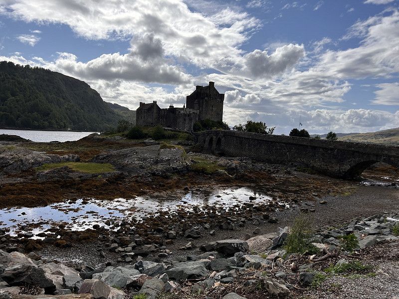
Burg Eilean Donan
Highland, Schottland, Vereinigtes Königreich
57° 16' 25.9" N 5° 30' 57.7" W
57.2738675 -5.5160336
• Head southwest. Go for 65 m.
• Take the 2nd exit from roundabout. Go for 37 m.
• Turn left onto A87. Go for 4.9 km.
• Continue on A87. Go for 1.3 km.
• Continue on Kirkton (A87). Go for 136 m.
• Continue on A87. Go for 7.2 km.
• Continue on Station Road (A87). Go for 277 m.
• Continue on A87. Go for 1.8 km.
• Continue on Skye Bridge (A87). Go for 480 m.
• Continue on A87. Go for 137 m.
• Take the 3rd exit from roundabout onto A87. Go for 6.0 km.
• Continue on Ashaig (A87). Go for 78 m.
• Continue on A87. Go for 3.2 km.
• Continue on Moorlands (A87). Go for 205 m.
• Continue on A87. Go for 725 m.
• Continue on Harrapool (A87). Go for 230 m.
• Continue on A87. Go for 551 m.
• Continue on Limepark Terrace (A87). Go for 58 m.
• Continue on A87. Go for 3.9 km.
• Continue on Scalpay Ho (A87). Go for 207 m.
• Continue on A87. Go for 3.9 km.
• Continue on Dunan (A87). Go for 122 m.
• Continue on A87. Go for 18.5 km.
• Turn left onto A863. Go for 3.8 km.
• Continue on Cuillin View (A863). Go for 71 m.
• Continue on A863. Go for 424 m.
• Continue on Crossal (A863). Go for 186 m.
• Continue on A863. Go for 3.9 km.
• Turn left onto Glendrynoch Lodge (B8009). Go for 280 m.
• Continue on B8009. Go for 821 m.
• Continue on Satran (B8009). Go for 187 m.
• Continue on B8009. Go for 1.2 km.
• Continue on Rosehall (B8009). Go for 16 m.
• Continue on B8009. Go for 127 m.
• Continue on Merkadale (B8009). Go for 131 m.
• Continue on B8009. Go for 57 m.
• Arrive at B8009. Your destination is on the left.
☍
65,3 km
( 58 min.)
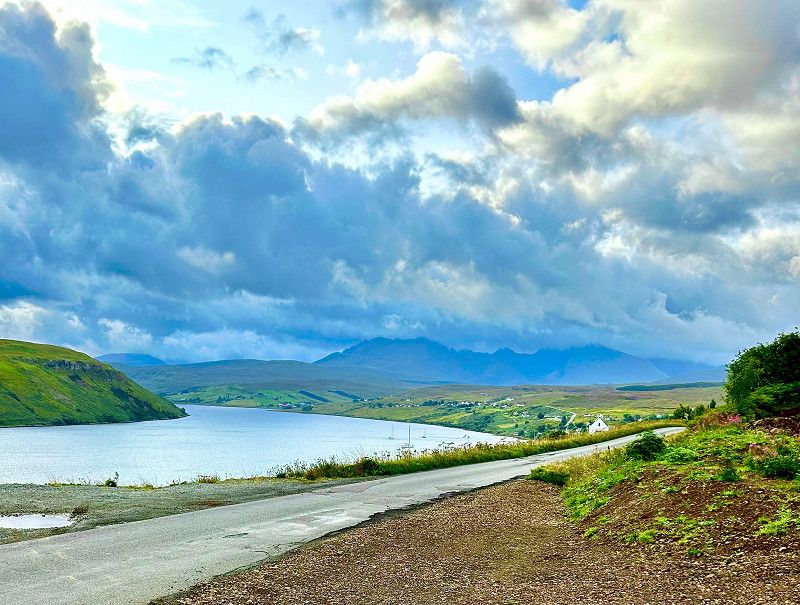
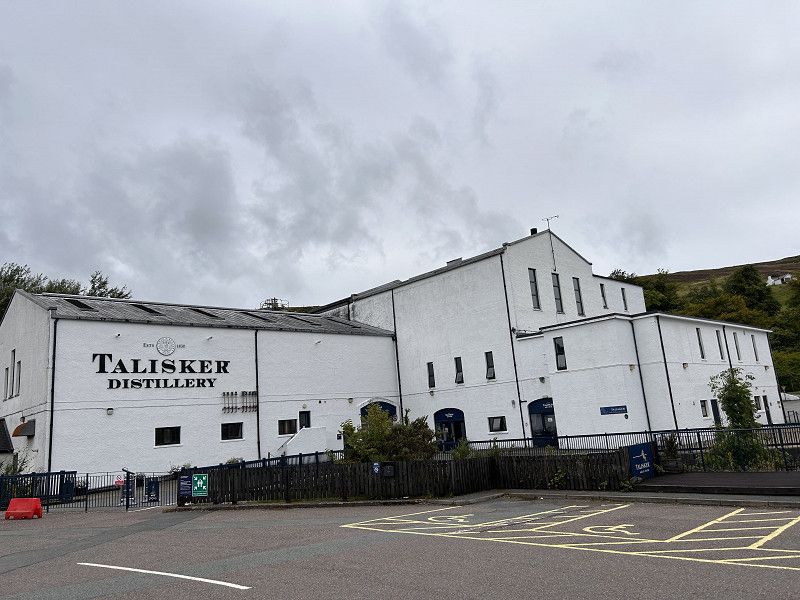
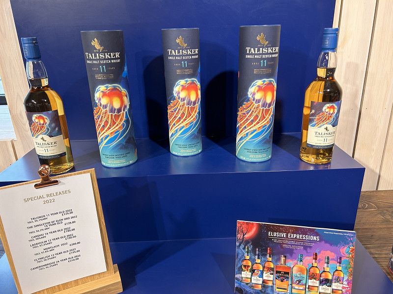
Talisker Brennerei 22.8.2023
We stayed here for one night
Highland, Schottland, Vereinigtes Königreich
57° 17' 41.6" N 6° 20' 7.5" W
57.2949027 -6.3354085
• Head east on B8009. Go for 57 m.
• Continue on Merkadale (B8009). Go for 131 m.
• Continue on B8009. Go for 127 m.
• Continue on Rosehall (B8009). Go for 16 m.
• Continue on B8009. Go for 1.2 km.
• Continue on Satran (B8009). Go for 187 m.
• Continue on B8009. Go for 821 m.
• Continue on Glendrynoch Lodge (B8009). Go for 280 m.
• Turn right onto A863. Go for 3.9 km.
• Continue on Crossal (A863). Go for 186 m.
• Continue on A863. Go for 424 m.
• Continue on Cuillin View (A863). Go for 71 m.
• Continue on A863. Go for 3.8 km.
• Turn left onto Sligachan Hotel (A87). Go for 127 m.
• Continue on Sligachan (A87). Go for 66 m.
• Continue on A87. Go for 13.7 km.
• Continue on Viewfield Road (A87). Go for 680 m.
• Continue on Bridge Road (A855). Go for 384 m.
• Continue on The Green (A855). Go for 70 m.
• Turn left onto Somerled Square. Go for 73 m.
• Turn right onto Somerled Square. Go for 24 m.
• Arrive at Somerled Square. Your destination is on the right.
☍
26,4 km
( 25 min.)
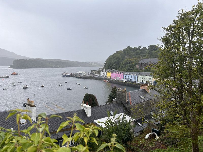
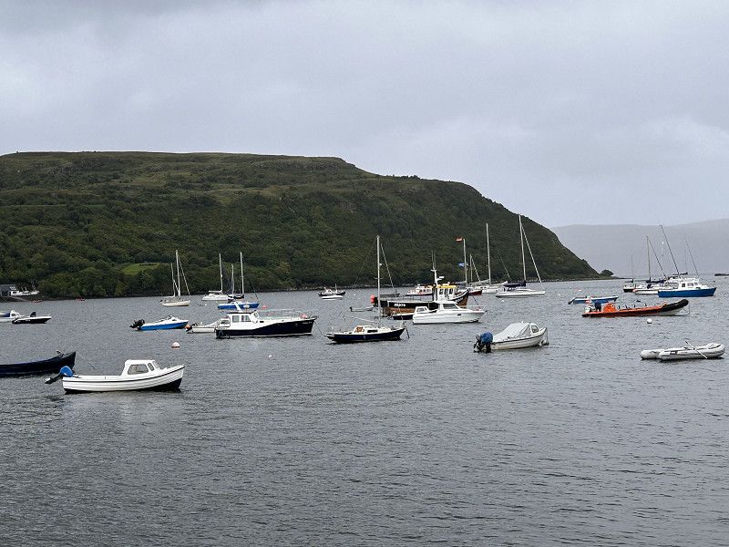
Portree - Port Rìgh
Highland, Schottland, Vereinigtes Königreich
57° 24' 47" N 6° 11' 40" W
57.4130532 -6.1944460
• Head northeast on Somerled Square.
• Arrive at Somerled Square. Your destination is on the right.
☍
Distance not available
(Duration not available)
Portree - Port Rìgh
Highland, Schottland, Vereinigtes Königreich
57° 24' 47" N 6° 11' 40" W
57.4130532 -6.1944460
• Head northeast on Somerled Square. Go for 23 m.
• Turn left onto Somerled Square. Go for 27 m.
• Turn left onto Somerled Square. Go for 84 m.
• Turn right onto Bridge Road (A855). Go for 384 m.
• Continue on Viewfield Road (A87). Go for 680 m.
• Continue on A87. Go for 2.2 km.
• Turn right onto A87. Go for 11.6 km.
• Continue on Sligachan (A87). Go for 66 m.
• Continue on Sligachan Hotel (A87). Go for 127 m.
• Continue on A87. Go for 18.5 km.
• Continue on Dunan (A87). Go for 122 m.
• Continue on A87. Go for 3.9 km.
• Continue on Scalpay Ho (A87). Go for 207 m.
• Continue on A87. Go for 2.8 km.
• Arrive at A87.
☍
40,7 km
( 34 min.)
Camping Skye
Camping Skye
The place is well located. The sanitary facilities are very well maintained. Like many others, my only complaints are the extra costs for the hairdryer and the high price of the washing machine.
Pairc nan Craobh, Broadford, Highland, Schottland, Vereinigtes Königreich
57° 14' 43.1" N 5° 55' 8.2" W
57.2453137 -5.9189427
• Head toward Ford Road on A87. Go for 1.1 km.
• Continue on Limepark Terrace (A87). Go for 58 m.
• Continue on A87. Go for 551 m.
• Continue on Harrapool (A87). Go for 230 m.
• Continue on A87. Go for 725 m.
• Continue on Moorlands (A87). Go for 205 m.
• Continue on A87. Go for 3.2 km.
• Continue on Ashaig (A87). Go for 78 m.
• Continue on A87. Go for 6.0 km.
• Take the 1st exit from roundabout onto A87. Go for 159 m.
• Continue on Skye Bridge (A87). Go for 480 m.
• Continue on A87. Go for 1.8 km.
• Continue on Station Road (A87). Go for 277 m.
• Continue on A87. Go for 7.2 km.
• Continue on Kirkton (A87). Go for 136 m.
• Continue on A87. Go for 50.8 km.
• Turn right onto A87. Go for 21.3 km.
• Turn left onto A82. Go for 5.9 km.
• Arrive at A82.
☍
100,1 km
(1 hrs. 23 min.)
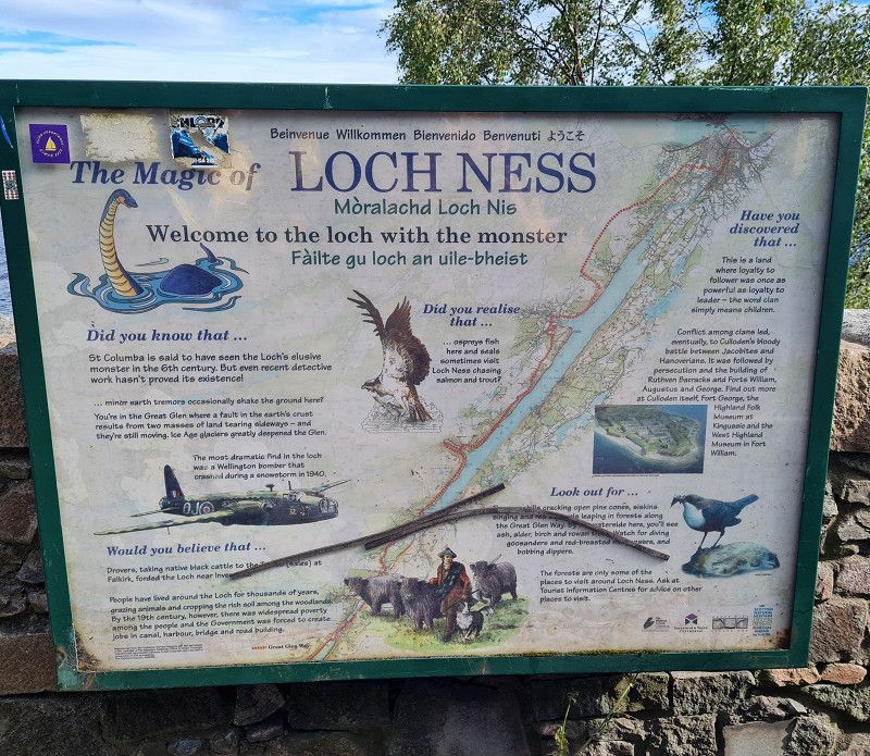
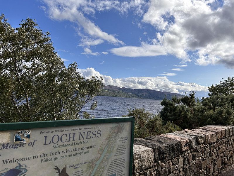
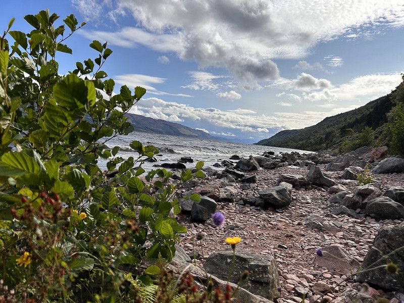
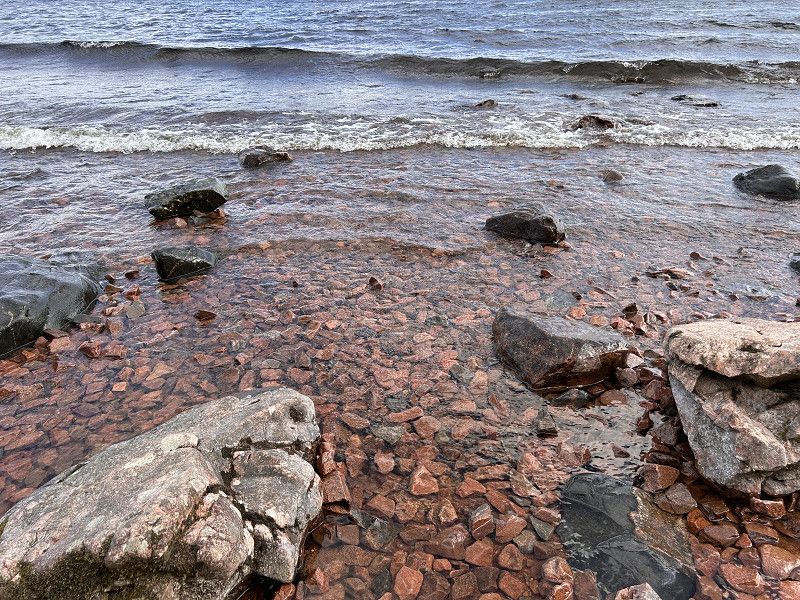
Loch Ness 23.8.2023
Loch Ness Bay Camping
Is a place for one or two nights. Nice big places in a circle. The middle is for tents. The sanitary facilities are functional and clean.
Schottland, Vereinigtes Königreich
57° 4' 60" N 4° 40' 0" W
57.0833330 -4.6666670
• Head northeast on A82. Go for 35.2 km.
• Pass 3 roundabouts and continue on Glenurquhart Road (A82). Go for 24.1 km.
• Continue on Tomnahurich Street (B861) toward Hilton/Culduthel/Dores/Holm Mills/(B862). Go for 265 m.
• Turn left onto Bank Street (B862). Go for 458 m.
• Turn right onto Church Street. Go for 202 m.
• Turn left onto Queensgate. Go for 64 m.
• Arrive at Queensgate. Your destination is on the right.
☍
60,3 km
( 57 min.)
Inverness
Highland, Schottland, Vereinigtes Königreich
57° 28' 44.4" N 4° 13' 32.7" W
57.4790124 -4.2257390
• Head northeast on Queensgate. Go for 58 m.
• Turn right onto Academy Street (B865). Go for 1.7 km.
• Take the 2nd exit from Millburn Roundabout roundabout onto Milburn Road (B865). Go for 437 m.
• Take the 3rd exit from Raigmore Interchange roundabout onto A9 toward Perth. Go for 20.7 km.
• Take the 2nd exit from roundabout onto A9. Go for 135 km.
• Continue on A9 toward Inverness. Go for 18.9 km.
• Take the 2nd exit from Inveralmound Roundabout roundabout onto A9 toward Stirling/Glasgow/Edinburgh/(M90)/Dundee/Football Stadium. Go for 4.1 km.
• Take the 2nd exit from Broxden Roundabout roundabout onto M90 toward Edinburgh/Dundee. Go for 4.1 km.
• Take right exit 10 toward Edinburgh onto M90. Go for 50.5 km.
• Continue on A90. Go for 2.0 km.
• Take ramp onto A90 toward Edinburgh. Go for 8.8 km.
• Keep right onto Hillhouse Road (A90) toward City Centre/Craigleith/West End. Go for 1.9 km.
• Take the 1st exit from roundabout onto Queensferry Road (A90). Go for 1.3 km.
• Turn left onto Randolph Crescent. Go for 94 m.
• Turn left onto Great Stuart Street. Go for 94 m.
• Turn right onto Ainslie Place. Go for 61 m.
• Turn right onto St Colme Street. Go for 153 m.
• Continue on Queen Street. Go for 819 m.
• Turn right onto North St David Street. Go for 100 m.
• Continue on St Andrew Square. Go for 131 m.
• Continue on South St David Street. Go for 101 m.
• Turn left onto Princes Street. Go for 274 m.
• Continue on Waterloo Place (A1). Go for 45 m.
• Arrive at Waterloo Place (A1). Your destination is on the right.
☍
251,7 km
(2 hrs. 49 min.)
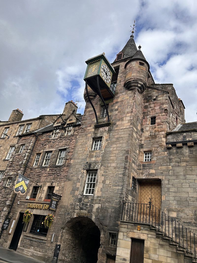
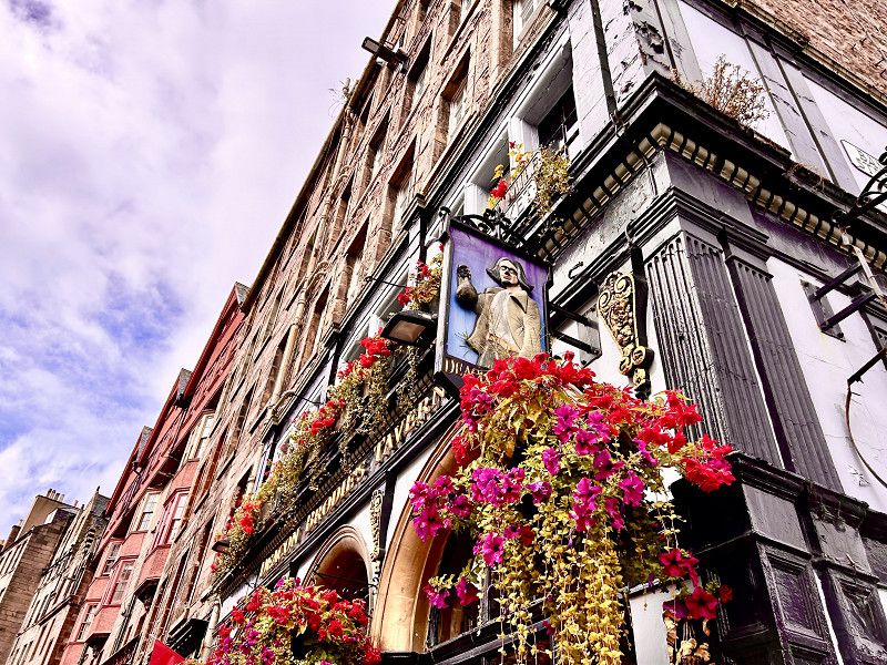
Edinburg 25.8.2023
Mortonhall Caravan & Camping Park
The campsite is very nicely located. The staff was very friendly.
The staff specifically points out that unfortunately bicycles and motorbikes are stolen at night.
Lukewarm water for washing up and showering.
Schottland, Vereinigtes Königreich
55° 57' 12" N 3° 11' 18.1" W
55.9533456 -3.1883749
• Head east on Waterloo Place (A1). Go for 203 m.
• Turn left onto Calton Hill. Go for 158 m.
• Turn right onto Leith Street (A900). Go for 246 m.
• Turn slightly left onto York Place. Go for 354 m.
• Continue on Queen Street. Go for 899 m.
• Turn left onto North Charlotte Street. Go for 114 m.
• Continue on Charlotte Square. Go for 151 m.
• Continue on South Charlotte Street (A90). Go for 101 m.
• Turn right onto Princes Street (A8). Go for 119 m.
• Turn left onto Lothian Road (A700). Go for 220 m.
• Turn right onto West Approach Road. Go for 2.5 km.
• Continue on Westfield Road. Go for 365 m.
• Continue on Stevenson Road. Go for 409 m.
• Take the 1st exit from Balgreen Road roundabout onto Balgreen Road. Go for 211 m.
• Turn right onto Gorgie Road (A71). Go for 1.8 km.
• Pass 3 roundabouts and continue on Calder Road (A71). Go for 2.3 km.
• Take the 3rd exit from Calder Junction roundabout onto M8 toward Livingston. Go for 6.1 km.
• Take exit 2 toward Forth Road Bridge/(A90)/Stirling onto M9. Go for 48.6 km.
• Take exit 10 toward Callander/(A85). Go for 563 m.
• Pass 2 roundabouts and continue on A84. Go for 6.6 km.
• Turn left. Go for 108 m.
• Arrive at your destination on the right.
☍
72,0 km
( 53 min.)
Blair Drummond Caravan Club Site
We stayed there for one night and were given a very warm welcome. The space and the sanitary facilities are super clean.
Cuthill Brae, FK9 4UX, Blair Drummond, United Kingdom
56° 9' 54.8" N 4° 3' 54.5" W
56.1652100 -4.0651300
• Head east. Go for 108 m.
• Turn right onto A84. Go for 5.9 km.
• Pass 2 roundabouts and continue on A84. Go for 1.3 km.
• Take the 4th exit from roundabout onto M9 toward Glasgow/(M80)/Edinburgh. Go for 47.3 km.
• Take exit 2 toward Edinburgh/City Bypass/(A720) onto M8. Go for 6.8 km.
• Take the 3rd exit from roundabout onto The City of Edinburgh Bypass (A720) toward City Bypass South. Go for 15.6 km.
• Take the 3rd exit from Sheriffhall Roundabout roundabout onto The City of Edinburgh Bypass (A720) toward Berwick upon Tweed/(A1). Go for 2.0 km.
• Take ramp toward Jedburgh. Go for 310 m.
• Take the 2nd exit from Millerhill Junction roundabout onto A68 toward Jedburgh. Go for 156 m.
• Take the 1st exit from Millerhill Junction roundabout onto A68 toward Jedburgh. Go for 25.2 km.
• Take the 1st exit from roundabout onto A697 toward Coldstream. Go for 38.4 km.
• Continue on A698 toward Coldstream/Newcastle/(A697). Go for 4.7 km.
• Arrive at Main Street (A698). Your destination is on the left.
☍
147,7 km
(1 hrs. 35 min.)
Cornhill on Tweed
Ford Bridge Campsite
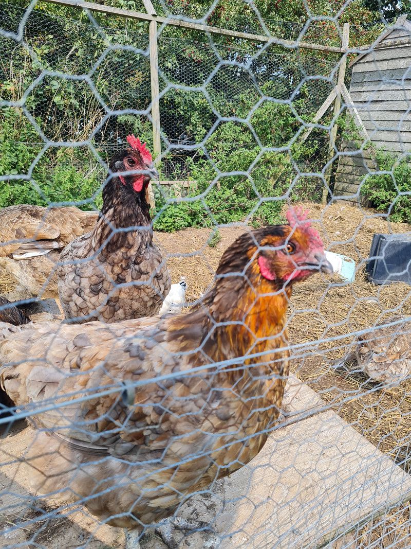
Beautifully located campsite. The operators are very friendly and helpful. Fresh eggs are also available straight from the chicken.
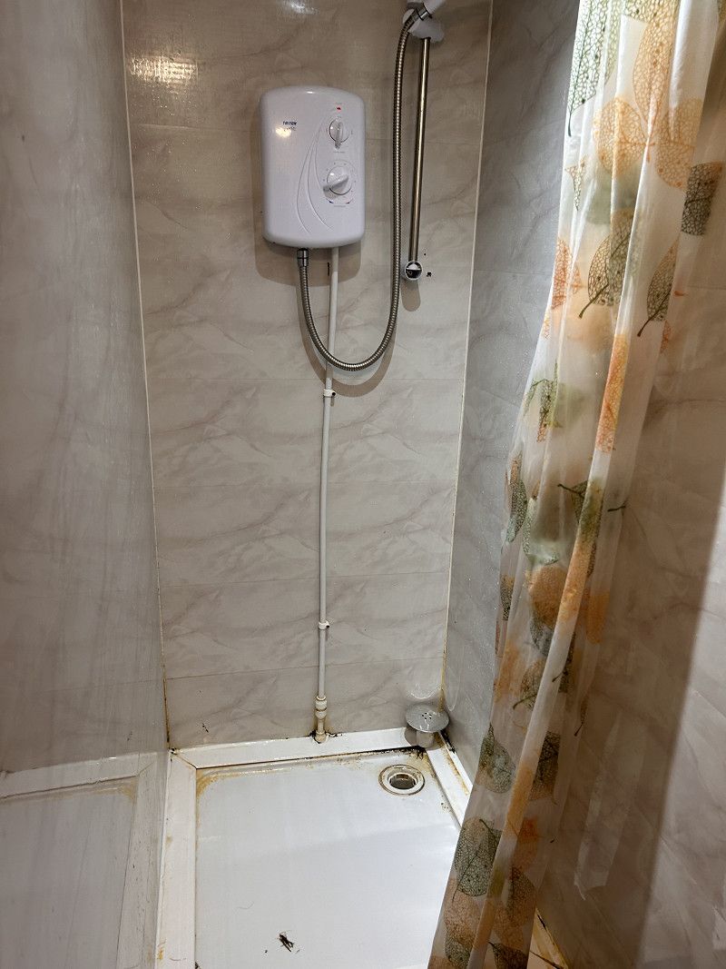
The shower was in its own stall and had no dry place to get dressed. There was no hot water when washing pots, but there was a sign that said, “Knock on the front door for hot
Northumberland, England, Vereinigtes Königreich
55° 38' 49.7" N 2° 13' 30" W
55.6471466 -2.2249901
• Head northeast on Main Street (A698). Go for 216 m.
• Take the 3rd exit from roundabout onto A697 toward Morpeth. Go for 30.0 km.
• Turn left onto B6346 toward Alnwick/Eglingham. Go for 2.1 km.
• Continue on New Bewick (B6346). Go for 182 m.
• Continue on B6346. Go for 1.2 km.
• Turn right onto B6346. Go for 1.3 km.
• Continue on Harehope (B6346). Go for 223 m.
• Continue on B6346. Go for 9.4 km.
• Continue on Hulne Priory (B6346). Go for 207 m.
• Continue on B6346. Go for 2.0 km.
• Continue on Abbeylands (B6346). Go for 176 m.
• Continue on B6346. Go for 520 m.
• Continue on Canongate (B6346). Go for 499 m.
• Continue on Bailiffgate (B6346). Go for 196 m.
• Turn left onto The Peth (B6341). Go for 20 m.
• Arrive at The Peth (B6341).
☍
48,2 km
( 38 min.)
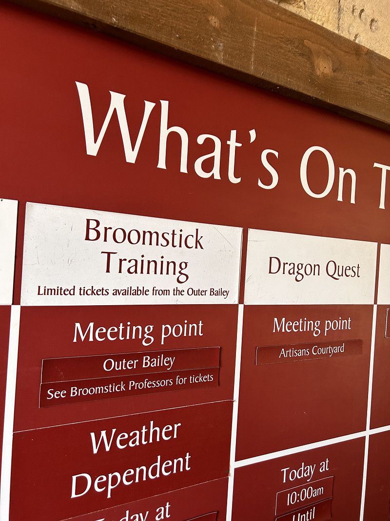
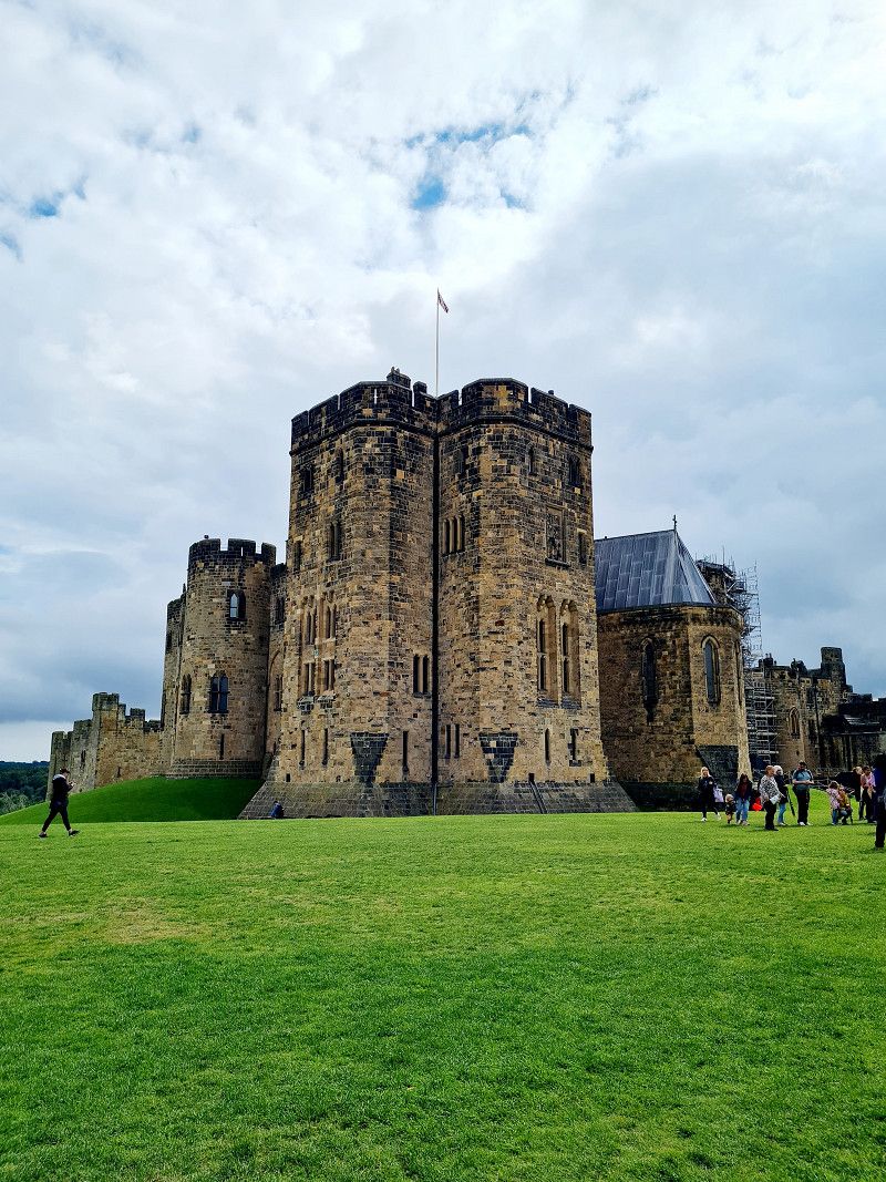
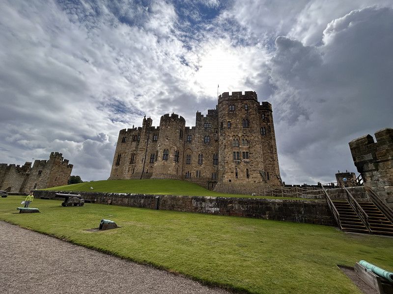
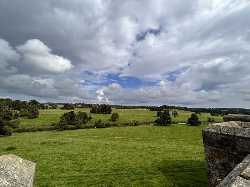
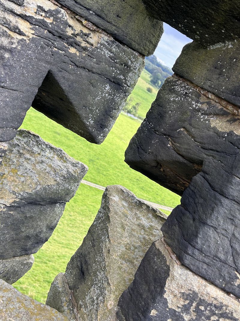
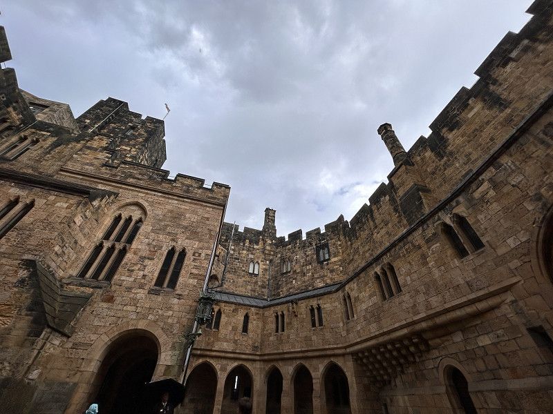
Alnwick Castle
A beautiful, old castle with history and used as a filming location for films and series such as Harry Potter, Downton Abby or Transformers.
Pottergate, Alnwick, Northumberland, England, Vereinigtes Königreich
55° 24' 55.7" N 1° 42' 23.5" W
55.4154610 -1.7065170
• Head northeast on The Peth (B6341). Go for 268 m.
• Continue on B6341. Go for 1.1 km.
• Take the 2nd exit from roundabout. Go for 1.4 km.
• Turn left onto B1340. Go for 111 m.
• Turn left and take ramp onto A1. Go for 52.3 km.
• Keep right onto A1 toward The South/(A1(M))/Gateshead. Go for 1.4 km.
• Keep right onto A1 toward The South/(A1(M))/Gateshead. Go for 1.2 km.
• Keep right onto A1 toward The South/(A1(M))/Gateshead. Go for 12.9 km.
• Keep right onto A1(M) toward The South/Durham. Go for 133 km.
• Take exit 43 toward A1/The SOUTH/(M62)/Hull onto A1(M). Go for 17.0 km.
• Continue on A1. Go for 828 m.
• Keep right onto A1 toward The South. Go for 12.4 km.
• Continue on A1(M) (Doncaster By-pass). Go for 11.8 km.
• Take exit 35 toward Sheffield/(M1)/Scunthorpe/(M180). Go for 542 m.
• Take the 3rd exit from roundabout onto M18 toward Sheffield/(M1). Go for 14.7 km.
• Keep right onto M18. Go for 180 m.
• Continue on M1. Go for 46.6 km.
• Take exit 26 toward Nottingham. Go for 442 m.
• Take the 1st exit from roundabout onto A610 toward Nottingham/Bulwell/A6002/Stapleford/Nuthall. Go for 626 m.
• Take the 2nd exit from roundabout toward Nottingham. Go for 133 m.
• Continue on A610 toward Nottingham/Arnold/(B6004). Go for 1.4 km.
• Take the 2nd exit from roundabout onto Nuthall Road (A610) toward Nottingham/Arnold/(B6004). Go for 2.1 km.
• Turn slightly right onto Nuthall Road (A610) toward City Centre. Go for 1.2 km.
• Turn left onto Gregory Boulevard (A6130) toward Nottingham Trent University/Park and Ride. Go for 1.6 km.
• Take the 2nd exit from roundabout onto Gregory Boulevard (A6130) toward City Centre/Loughboro'/Mansfield/(A60)/Park and Ride. Go for 87 m.
• Take the 2nd exit from roundabout onto Mansfield Road (A60). Go for 1.3 km.
• Continue on Shakespeare Street (A6008). Go for 55 m.
• Turn left onto North Church Street (A6008). Go for 28 m.
• Turn left onto North Church Street (A6008). Go for 211 m.
• Keep left onto South Sherwood Street (A6008). Go for 126 m.
• Arrive at South Sherwood Street (A6008).
☍
317,5 km
(3 hrs. 9 min.)
Nottingham
Boat lane caravan park
Welcome to Paradise. It ends here!
Smoke haze, loud, sanitary objects, well,
Extremely poor sanitary facilities, disgusting showers, dirty floors
Basically the site is just a field with substandard (you would call it rustic) facilities, near a river but nothing special otherwise. We won't be staying here again
Nottinghamshire, England, Vereinigtes Königreich
52° 57' 12.3" N 1° 8' 58.7" W
52.9534193 -1.1496461
• Head toward Norfolk Place on South Sherwood Street (A6008). Go for 309 m.
• Turn left onto Maid Marian Way (A6008). Go for 752 m.
• Continue on Castle Boulevard (A6008). Go for 16 m.
• Turn left onto Wilford Street (A6008) toward (M1 South)/(A453). Go for 376 m.
• Turn left onto Waterway Street West (A6008). Go for 334 m.
• Keep left onto Sheriffs Way (A6019) toward (A60)/(A612). Go for 593 m.
• Keep right toward Loughboro'/Southwell/(A612). Go for 45 m.
• Turn right onto London Road (A60) toward Loughboro'/Southwell/(A612). Go for 1.1 km.
• Turn left onto Radcliffe Road (A6520) toward Nottingham/Nottingham (Tollerton) Airport/Radcliffe/Grantham/(A52)/Southwell/(A612)/Newark/(A46)/National Water Sports Centre. Go for 519 m.
• Turn right onto Radcliffe Road (A6011) toward Grantham/(A52)/Newark/(A46). Go for 2.1 km.
• Take the 1st exit from roundabout onto Radcliffe Road (A52) toward Grantham/Newark/(A46)/Radcliffe-on-T/Bingham. Go for 8.5 km.
• Take the 3rd exit from roundabout onto A52 toward Grantham/Langar/Whatton/Bingham. Go for 472 m.
• Take the 4th exit from roundabout onto A52 toward Grantham/Stamford/(A1). Go for 21.6 km.
• Turn right and take ramp onto A1 toward The SOUTH/Stamford. Go for 52.5 km.
• Keep right onto A1(M) toward London. Go for 18.2 km.
• Keep right onto A1(M) toward (M11, A14)/London/Stansted Airport/Cambridge. Go for 2.6 km.
• Continue on A1. Go for 4.6 km.
• Take ramp onto Huntingdon Southern Bypass (A14) toward London (E)/Stansted Airport/(M11)/Felixstowe/Cambridge. Go for 23.3 km.
• Keep right onto Huntingdon Road (A14) toward London/Stansted Airport/Cambridge (S)/M11. Go for 67.9 km.
• Take exit 6 toward (M20, M23)/Dartford Crossing/Gatwick Airport onto M25. Go for 27.0 km.
• Continue on A282. Go for 6.7 km.
• Continue on M25. Go for 478 m.
• Take the exit toward Canterbury/(M2) onto A2. Go for 2.9 km.
• Keep right onto A2 toward Dover/(M2)/Canterbury. Go for 11.9 km.
• Keep right onto M2 toward Dover/Channel Tunnel/Canterbury/Chatham. Go for 40.8 km.
• Take exit 7 toward Canterbury/Dover. Go for 441 m.
• Take the 4th exit from Brenley Cor roundabout onto A2 toward Dover/Canterbury. Go for 15.5 km.
• Take ramp. Go for 260 m.
• Turn left toward Patrixbourne/Bekesbourne/Adisham. Go for 369 m.
• Continue on Bifrons Hill. Go for 611 m.
• Take the 1st exit from roundabout onto Station Road. Go for 739 m.
• Continue on Bekesbourne Lane. Go for 2.4 km.
• Turn right onto High Street (A257). Go for 3.7 km.
• Turn left onto High Street (A257). Go for 8.3 km.
• Take the 2nd exit from roundabout onto Ash Road toward Sandwich. Go for 995 m.
• Continue on Strand Street. Go for 564 m.
• Turn right onto Three Kings Yard. Go for 61 m.
• Arrive at Three Kings Yard. Your destination is on the left.
☍
329,5 km
(3 hrs. 24 min.)
Sandwich
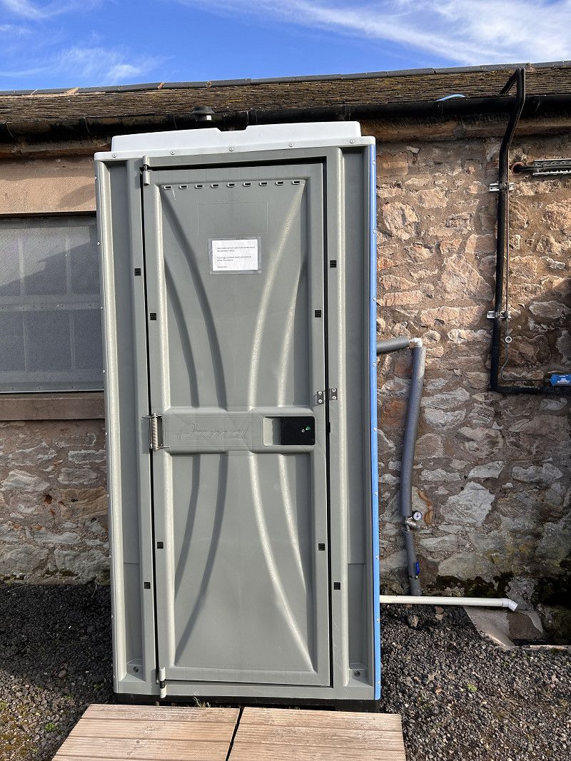
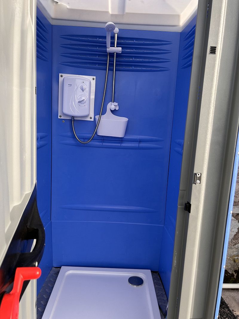
Sandwich Lakes CampsiteEverything you need, clean sanitary facilities, electricity. For WiFi you have to go to reception to have reception. Very nice stay near a very nice town.
Kent, England, Vereinigtes Königreich
51° 16' 30.9" N 1° 20' 27" E
51.2752527 1.3408309
• Head toward Strand Street on Three Kings Yard. Go for 61 m.
• Turn right onto Strand Street. Go for 46 m.
• Turn right onto High Street. Go for 203 m.
• Continue on The Chain. Go for 76 m.
• Continue on Galliard Street. Go for 52 m.
• Turn left onto New Street. Go for 250 m.
• Continue on Dover Road. Go for 380 m.
• Continue on Deal Road. Go for 716 m.
• Take the 2nd exit from roundabout onto A258. Go for 496 m.
• Take the 1st exit from roundabout onto Sandwich Road (A256) toward Dover/Eastry/Whitfield. Go for 3.5 km.
• Pass 2 roundabouts and continue on A256. Go for 8.9 km.
• Take the 1st exit from roundabout onto A256 toward Dover. Go for 673 m.
• Take the 1st exit from roundabout toward Dover. Go for 95 m.
• Take ramp onto A2. Go for 1.8 km.
• Take the 2nd exit from roundabout onto Jubilee Way (A2) toward Dover Docks. Go for 2.3 km.
• Keep right onto Jubilee Way (A2) toward Eastern Docks. Go for 27 m.
• Take the 2nd exit from Eastern Docks Roundabout roundabout toward Eastern Docks. Go for 66 m.
• Continue on Back Road West. Go for 273 m.
• Continue on West Ramp. Go for 700 m.
• Continue on North Camber Way. Go for 640 m.
• Turn left onto South Camber Way. Go for 111 m.
• Continue on Lower Road East. Go for 318 m.
• Turn left. Go for 263 m.
• Take the Dover-Calais Ferry. Stay on for 40.6 km.
• Head southeast. Go for 281 m.
• Continue on Boulevard du Débarquement. Go for 921 m.
• Turn right toward Avenue du Commandant Cousteau. Go for 221 m.
• Continue on Avenue du Commandant Cousteau. Go for 79 m.
• Take the 3rd exit from roundabout onto Quai de la Loire. Go for 1.1 km.
• Turn right onto Rue Mollien. Go for 500 m.
• Continue on Pont Mollien. Go for 277 m.
• Turn left onto Place du Soldat Inconnu. Go for 18 m.
• Turn slightly right onto Place du Soldat Inconnu. Go for 28 m.
• Turn slightly left onto Place du Soldat Inconnu. Go for 33 m.
• Arrive at Place du Soldat Inconnu. Your destination is on the right.
☍
66,0 km
(2 hrs. 2 min.)
Calais
Pas-de-Calais, Nordfrankreich, Frankreich
50° 57' 8.9" N 1° 51' 13.8" E
50.9524769 1.8538446
• Head north on Place du Soldat Inconnu. Go for 79 m.
• Turn right onto Rue Paul Bert. Go for 277 m.
• Turn right onto Quai de la Gendarmerie. Go for 618 m.
• Take the 2nd exit from roundabout onto Quai de l'Yser. Go for 455 m.
• Continue on Rue Watteau. Go for 143 m.
• Continue on Rue Delaroche. Go for 41 m.
• Turn right toward Boulevard de l'Égalité. Go for 16 m.
• Turn left onto Rue du Lieutenant Jacques Faguer. Go for 957 m.
• Take the 3rd exit from Rond-Point de la Nouvelle France roundabout onto Route de Saint-Omer (D119). Go for 1.2 km.
• Take the 3rd exit from roundabout onto A16 (Autoroute des Estuaires) toward Dunkerque/Lille. Go for 51.9 km.
• Continue on E40. Go for 133 km.
• Continue on A10 toward Brussel/Koekelberg. Go for 2.4 km.
• Continue on Keizer Karellaan (R20) toward Brussel/Koekelberg. Go for 2.0 km.
• Turn right onto Basiliektunnel (R20). Go for 4.4 km.
• Keep left onto Madoutunnel (R20). Go for 403 m.
• Take ramp. Go for 149 m.
• Turn right onto Wetstraat (N3a). Go for 439 m.
• Continue on Koloniënstraat. Go for 285 m.
• Continue on Houtmarkt. Go for 31 m.
• Continue on Kantersteen. Go for 191 m.
• Turn right onto Infante Isabellastraat. Go for 113 m.
• Turn left onto Putterij. Go for 52 m.
• Continue on Duquesnoystraat. Go for 146 m.
• Turn right onto Sint-Jansplein. Go for 61 m.
• Turn right onto Lombardstraat. Go for 260 m.
• Turn right onto Zuidstraat. Go for 43 m.
• Turn slightly right onto Kolenmarkt. Go for 87 m.
• Turn right onto Vruntstraat. Go for 29 m.
• Arrive at Vruntstraat. Your destination is on the left.
☍
200,0 km
(2 hrs. 15 min.)
Brüssel
atom
Nice, interesting construction and nice photo opportunity.
A visit here is okay but not an absolute must.
Brüssel-Hauptstadt, Brüssel-Hauptstadt, Belgien
50° 50' 47.6" N 4° 21' 6.1" E
50.8465573 4.3516970
• Head toward Brouwersstraat on Vruntstraat. Go for 45 m.
• Turn right onto Stoofstraat. Go for 11 m.
• Turn left onto Violetstraat. Go for 162 m.
• Turn right onto Sint-Jansplein. Go for 25 m.
• Turn left onto Lombardstraat. Go for 20 m.
• Continue on Gasthuisstraat. Go for 26 m.
• Turn left onto Sint-Jansplein. Go for 24 m.
• Turn right onto Sint-Jansstraat. Go for 146 m.
• Turn right onto Albertinaplein. Go for 43 m.
• Turn left onto Albertinaplein. Go for 61 m.
• Continue on Kantersteen. Go for 51 m.
• Turn right onto Kunstberg. Go for 182 m.
• Turn right onto Ravensteinstraat. Go for 24 m.
• Continue on Koudenberg. Go for 73 m.
• Continue on Hofberg. Go for 59 m.
• Take the 3rd exit from Koningsplein roundabout onto Koningsplein. Go for 184 m.
• Continue on Koningsstraat. Go for 64 m.
• Turn right onto Paleizenplein. Go for 314 m.
• Turn left onto Hertogsstraat. Go for 120 m.
• Turn right onto Lambermontstraat. Go for 117 m.
• Continue on N23. Go for 758 m.
• Keep left onto Belliard-Cortenberghtunnel (N23b) toward Liège/Luik/Antwerpen/Anvers/Luchthaven Brussel Nationaal/Aéroport Bruxelles National/Namur/Namen. Go for 538 m.
• Keep left onto Belliard-Cortenberghtunnel (N23b). Go for 1.5 km.
• Take ramp onto E40 toward Liège/Luik/Leuven/Louvain. Go for 3.1 km.
• Take exit 20 toward Kraainem/Machelen/Gent/E40/Gand/Antwerpen/E19/Anvers/Luchthaven Zaventem/Aéroport Zaventem/Brussel/N2/Bruxelles/Leuven/N2/Louvain/Brussel/E40 onto R22 (Woluwelaan). Go for 2.8 km.
• Take left ramp onto R22 toward Gent/E40/Antwerpen/E19/Luchthaven Zaventem. Go for 1.2 km.
• Take the left exit onto E40. Go for 1.8 km.
• Take the exit toward Antwerpen/Mechelen/Luchthaven Cargo onto E19. Go for 34.8 km.
• Take the exit toward Breda/Luik/Haven 1-999 onto E19/E34 (Kleine Ring). Go for 3.8 km.
• Continue on E19 (Ring Antwerpen 2) toward Ring 2/Breda/Haven. Go for 41.0 km.
• Continue on A16. Go for 4.1 km.
• Take the exit toward E312/Tilburg/Utrecht/Breda-Oost onto A58. Go for 26.5 km.
• Keep left onto A65 toward RING-Noord/'s-Hertogenbosch/Oisterwijk/RING. Go for 5.9 km.
• Continue on Bosscheweg (N65). Go for 2.0 km.
• Turn left onto Kreitenmolenstraat toward Udenhout/Loon op Zand/Industrieterrein 6000-7000. Go for 1.4 km.
• Take the 2nd exit from roundabout onto Kreitenmolenstraat. Go for 1.7 km.
• Continue on Schoorstraat. Go for 2.8 km.
• Arrive at Schoorstraat. Your destination is on the right.
☍
137,5 km
(1 hrs. 50 min.)
Camping De Zandley
Beautiful, well-kept place, also ideal for motorhomes. Friendly operator and an ideal starting point for hiking and visiting the Efteling.
Clean toilets and washing up room, nice little park and little things for children. Overall really great experience
Schoorstraat 30, 5071 RC, Udenhout, Netherlands
51° 37' 47.1" N 5° 6' 58.9" E
51.6297600 5.1163500
• Head toward Loonsehoek on Schoorstraat. Go for 2.8 km.
• Continue on Kreitenmolenstraat. Go for 1.7 km.
• Take the 1st exit from roundabout onto Kreitenmolenstraat. Go for 1.4 km.
• Turn right onto Bosscheweg (N65). Go for 2.1 km.
• Keep left onto A65 toward Tilburg/Breda/Industrieterrein Tilburg 0-5000/Industrieterrein Tilburg 7000-9900. Go for 2.6 km.
• Take exit 10 toward Eindhoven onto A58. Go for 21.3 km.
• Take the left exit toward Maastricht/Venlo/Eindhoven. Go for 842 m.
• Keep right onto Knooppunt Batadorp (N2) toward 29 t/m 33/Waalre/Veldhoven/Eindhoven. Go for 1.7 km.
• Keep left onto Randweg Eindhoven (N2) toward Randweg. Go for 1.6 km.
• Keep left onto Randweg Eindhoven (N2) toward Randweg. Go for 5.0 km.
• Keep right onto Knooppunt de Hogt (N2) toward Maastricht/Venlo/Waalre/Randweg. Go for 5.3 km.
• Take the 2nd exit from Knooppunt Leenderheide roundabout onto A67 toward Venlo. Go for 44.1 km.
• Take the exit toward Roermond/Maastricht onto A73. Go for 6.9 km.
• Keep left onto A74 (Knooppunt Tiglia) toward Koblenz/Mönchengladbach/Nettetal. Go for 1.9 km.
• Continue on A61. Go for 36.0 km.
• Continue on Autobahndreieck Mönchengladbach-Wanlo toward Koblenz/Aachen/Düsseldorf/A61. Go for 375 m.
• Take the exit onto A46. Go for 3.8 km.
• Take exit 11 toward Koblenz/Köln/Aachen/A61 onto A44. Go for 8.2 km.
• Take exit 16 toward Koblenz/Köln onto A61. Go for 40.7 km.
• Continue on A61 toward Koblenz/Weilerswist. Go for 210 km.
• Take exit 60 toward Ludwigshafen onto A650. Go for 8.9 km.
• Continue on B37 toward Mannheim/LU-Oppau/BASF/LU-Gartenstadt/Bruchwiesenstr. Go for 62 m.
• Take ramp toward LU-Gartenstadt. Go for 437 m.
• Turn left onto Bruchwiesenstraße (K5) toward LU-Gartenstadt/Krankenhaus St. Anna-Stift/Krankenhaus St. Marien. Go for 978 m.
• Turn left onto Schänzeldamm (K13) toward Krankenhaus St. Anna-Stift/Südwest-Stadion. Go for 888 m.
• Turn slightly left onto Saarlandstraße. Go for 761 m.
• Arrive at Saarlandstraße (B38). Your destination is on the right.
☍
410,7 km
(4 hrs. 22 min.)
Ludwigshafen am Rhein
Rheinland-Pfalz, Deutschland
49° 28' 13.5" N 8° 26' 17.4" E
49.4704113 8.4381568