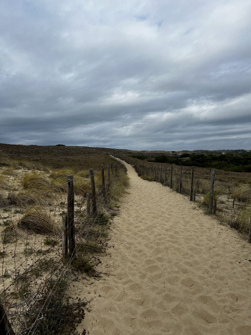
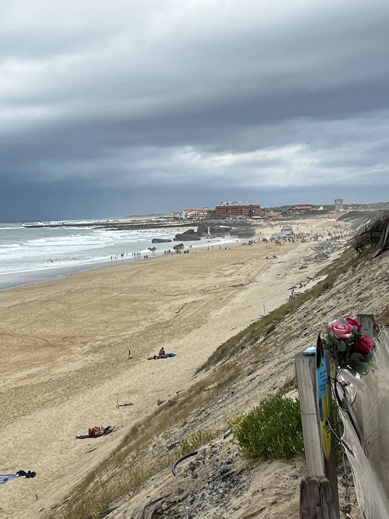
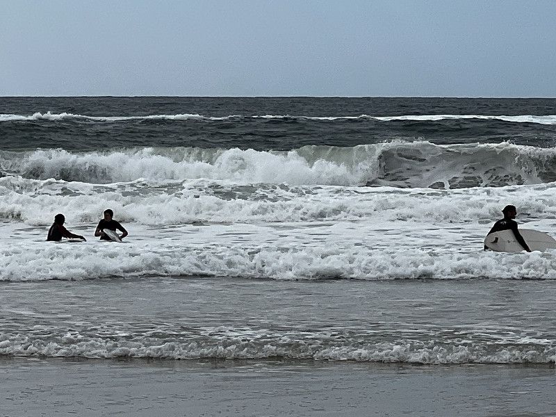
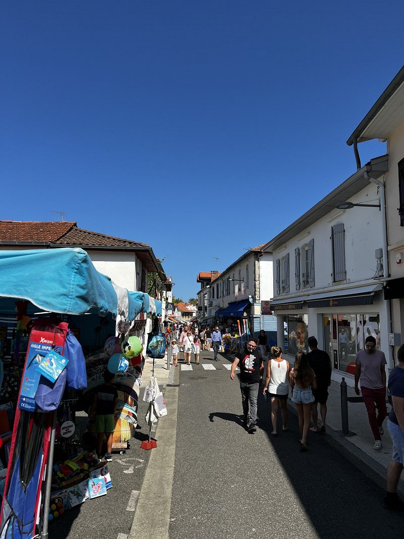
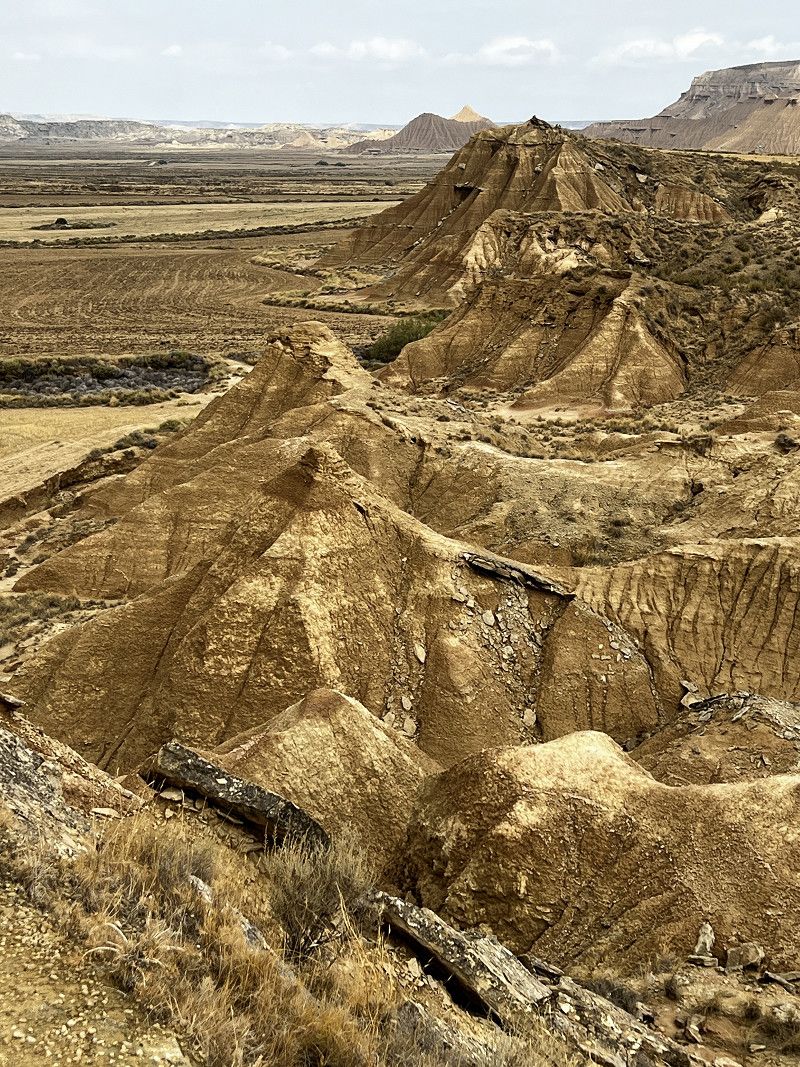
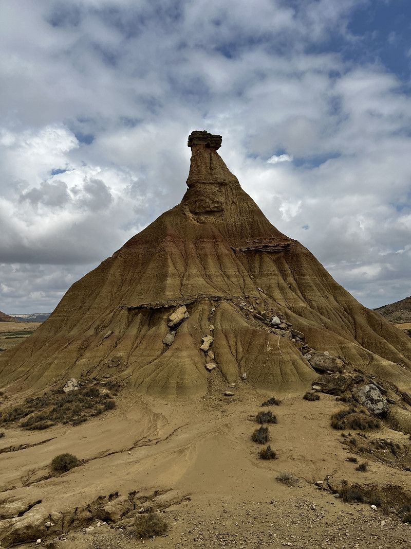
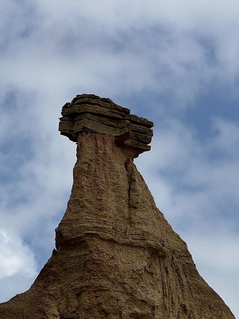
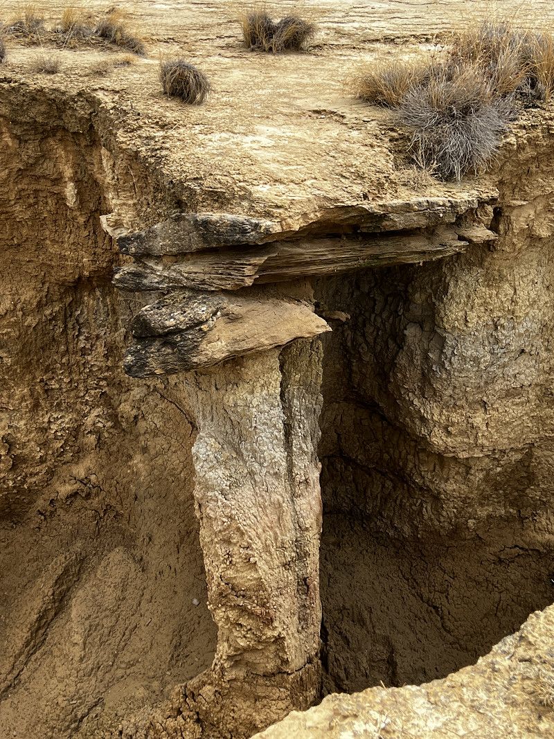
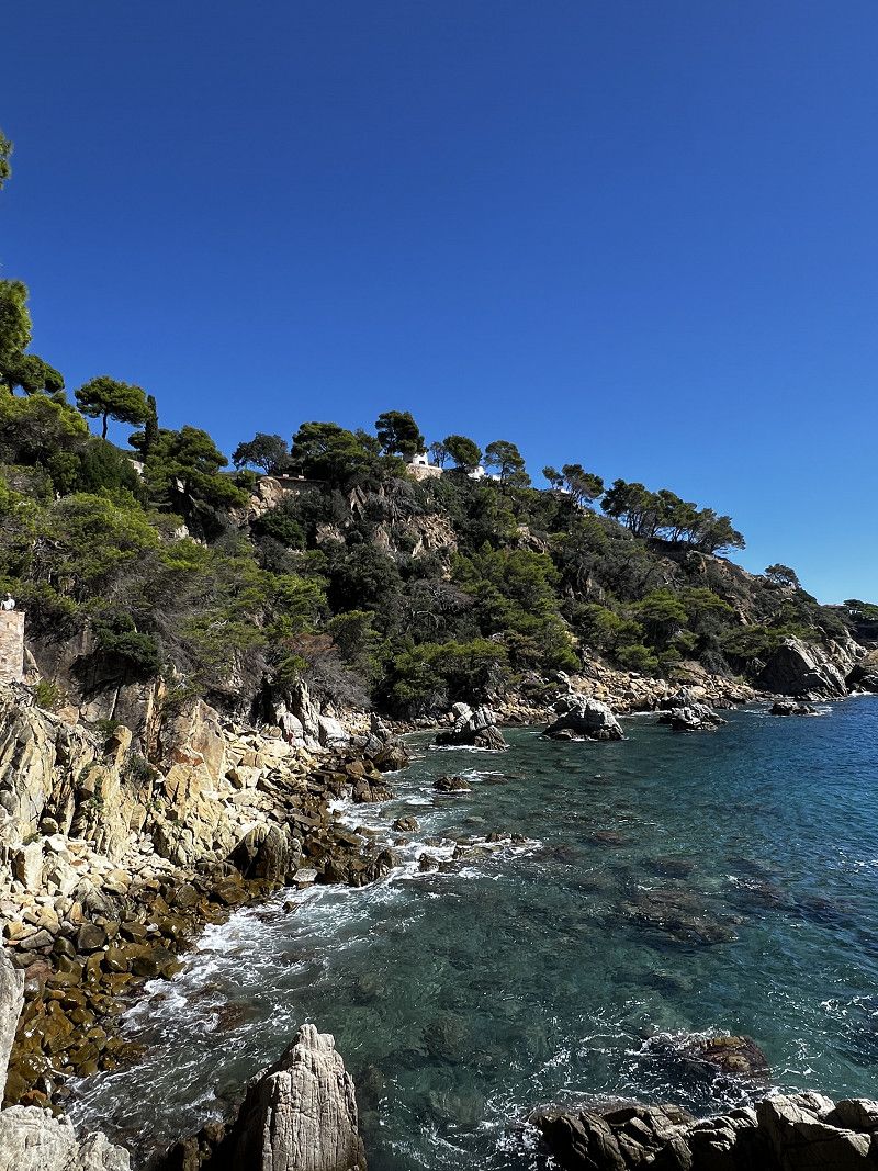
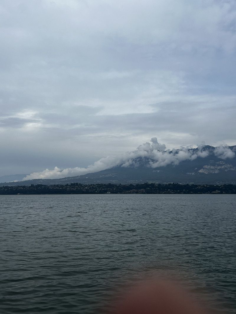
Big round trip, starting in southern Hesse, via Rügen on Sweden's east coast to Stockholm, then on to Oslo, via Gothenburg to Denmark and then the entire North Sea coast to Brittany in France. From there further south along the Atlantic coast.
Day
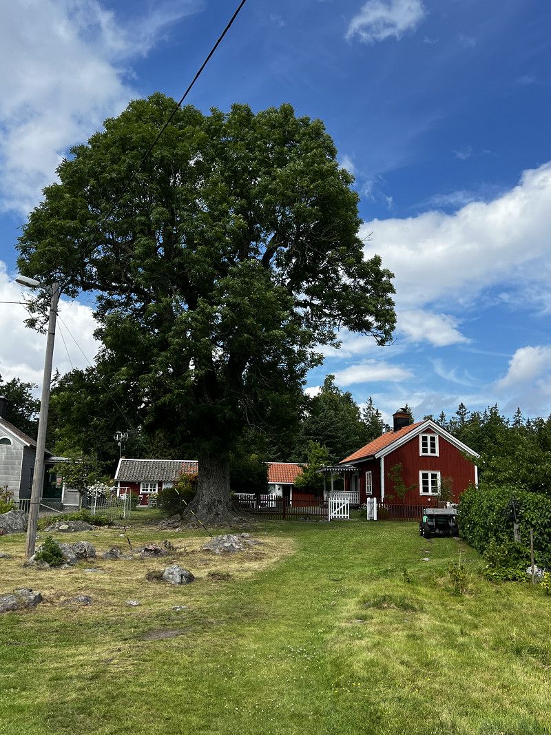
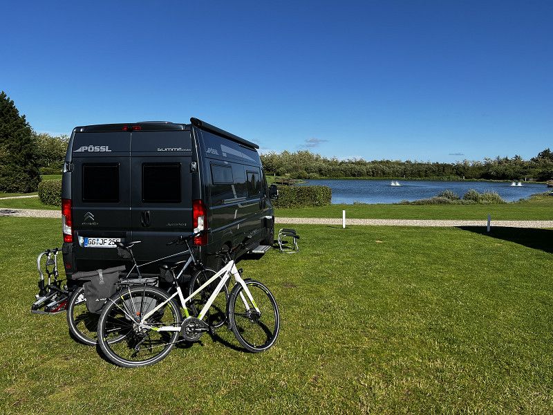
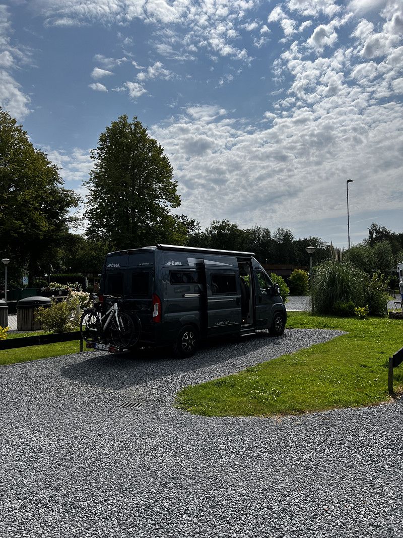
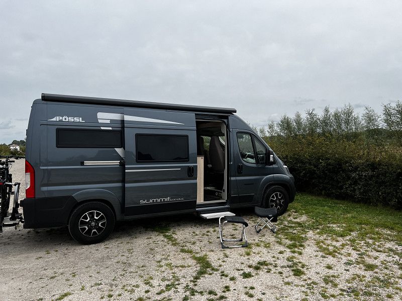
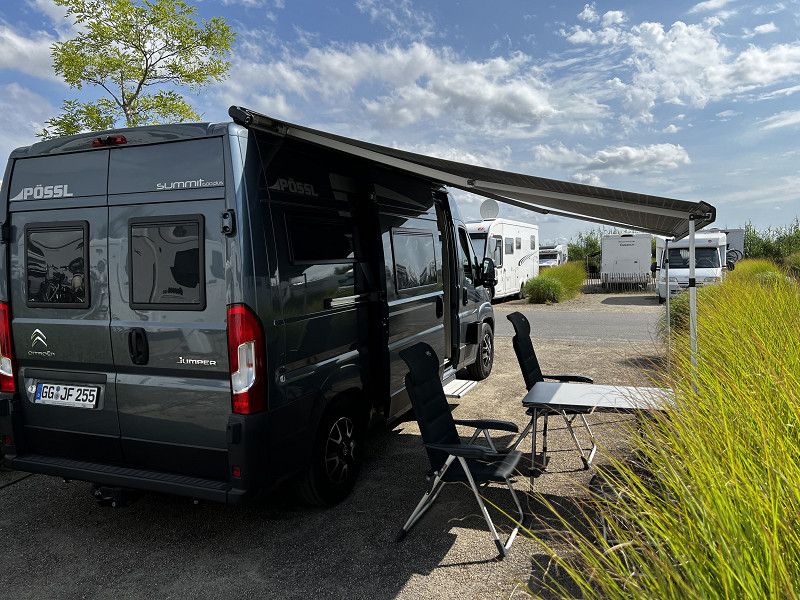
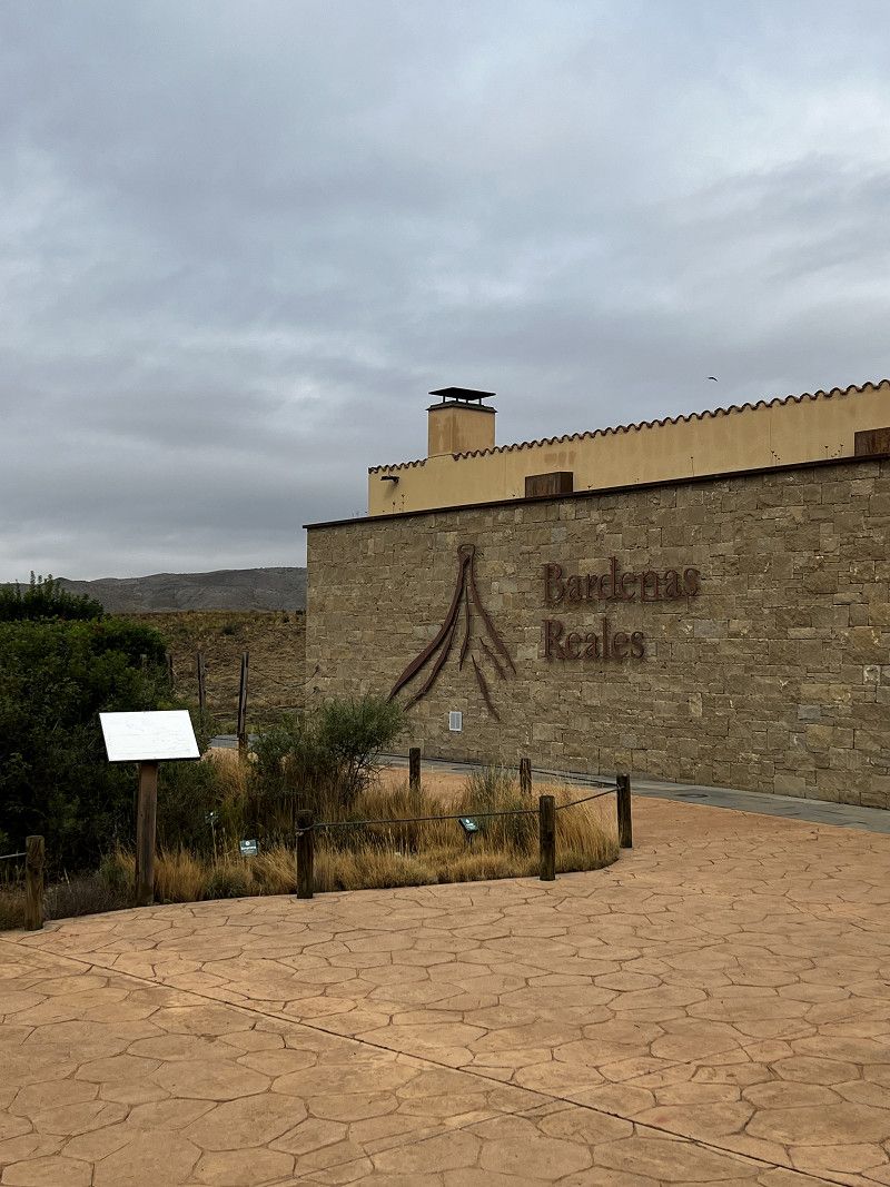
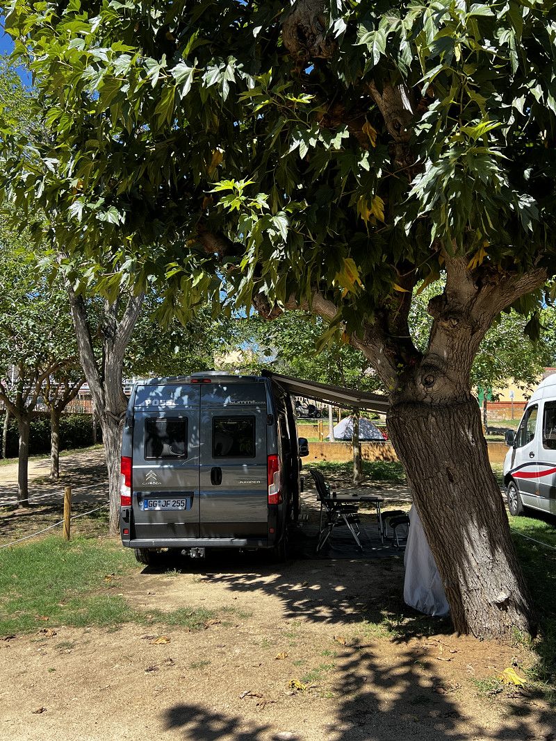
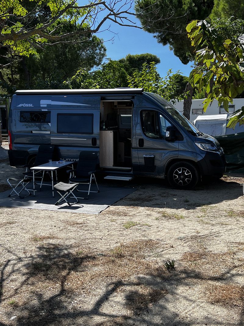
Wolfskehlen
Starting point
Kreis Groß-Gerau, Hessen, Deutschland
49° 51' 13.2" N 8° 29' 55.3" E
49.8536688 8.4986923
• Head toward Kirchplatz on Raiffeisenstraße. Go for 53 m.
• Turn left onto Kirchplatz. Go for 417 m.
• Turn right onto Griesheimer Straße. Go for 648 m.
• Turn left onto Griesheimer Straße (B26). Go for 7.1 km.
• Take left ramp onto A672 toward Frankfurt/Heidelberg/Köln/Mannheim/A5/A67. Go for 1.3 km.
• Take the exit toward Hannover/Kassel/Frankfurt onto A5. Go for 148 km.
• Continue on A7. Go for 3.7 km.
• Take the exit toward Berlin/Dresden/Erfurt/Bad Hersfeld onto A4. Go for 57.8 km.
• Take exit 39 toward Eisenach-West/Bad Salzungen/Treffurt/Creuzburg/B19. Go for 255 m.
• Turn right onto B19 toward Vacha/Bad Salzungen/Wutha-Farnroda/Eisenach. Go for 7.6 km.
• Take ramp toward Eisenach-Oststadt/Meiningen/Bad Salzungen. Go for 401 m.
• Turn left onto Langensalzaer Straße (B19) toward Meiningen/Bad Salzungen/Eisenach. Go for 1.6 km.
• Turn right onto Clemensstraße toward Vacha/Zentrum/Krankenhaus. Go for 396 m.
• Turn left onto Müllerstraße toward Meiningen/Bad Salzungen/Zentrum/Naturpark-Route Thüringer Wald/B19. Go for 80 m.
• Continue on Schillerstraße. Go for 56 m.
• Turn left onto Müllerstraße. Go for 134 m.
• Turn right onto Bahnhofstraße (B19) toward Zentrum/Wartburg/Bachhaus/Lutherhaus. Go for 136 m.
• Turn left onto Wartburgallee (B19) toward Meiningen/Bad Salzungen/Naturpark-Route Thüringer Wald/Wartburg/Bachhaus/Lutherhaus. Go for 1.1 km.
• Turn right onto Wartburgallee. Go for 2.0 km.
• Continue on Wartburgschleife. Go for 328 m.
• Continue on Auf der Wartburg. Go for 21 m.
• Turn slightly left onto Wartburgschleife. Go for 476 m.
• Continue on Auf der Wartburg. Go for 477 m.
• Arrive at Auf der Wartburg. Your destination is on the left.
☍
234,4 km
(2 hrs. 25 min.)
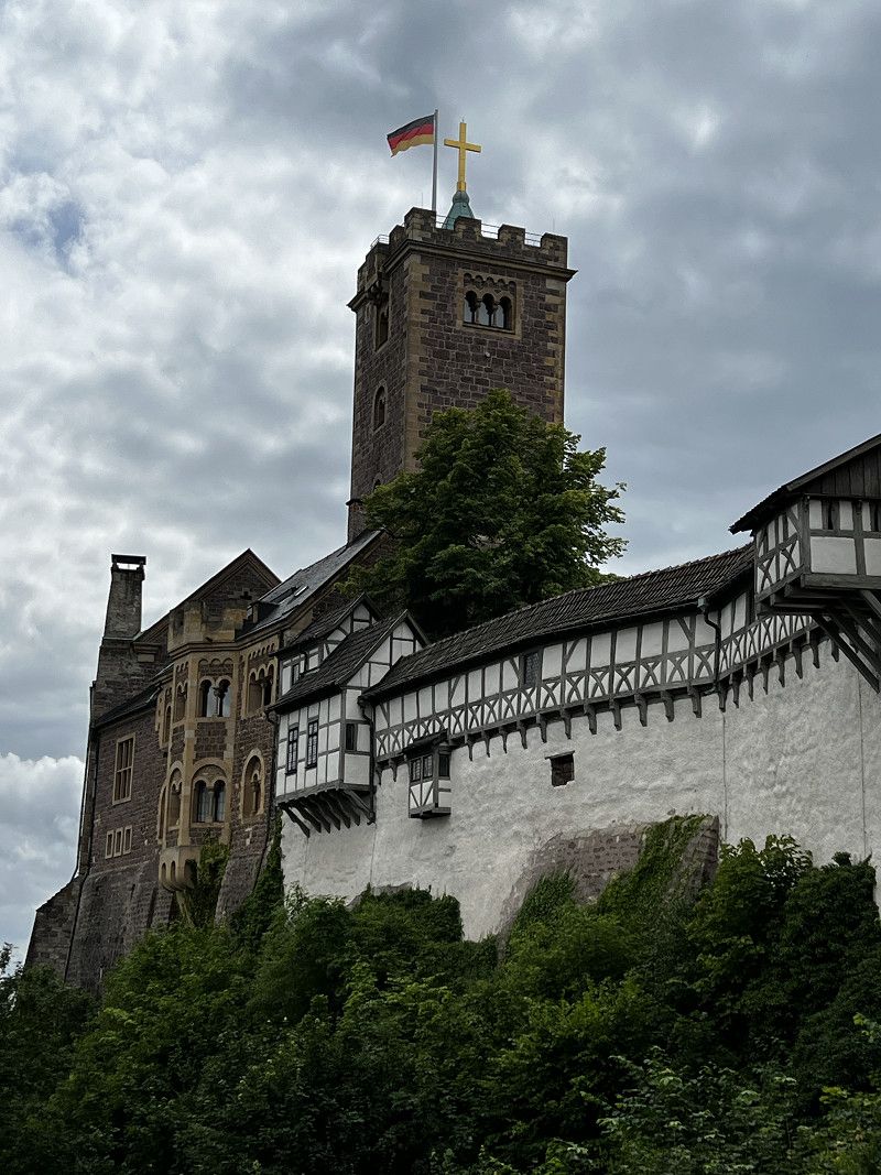
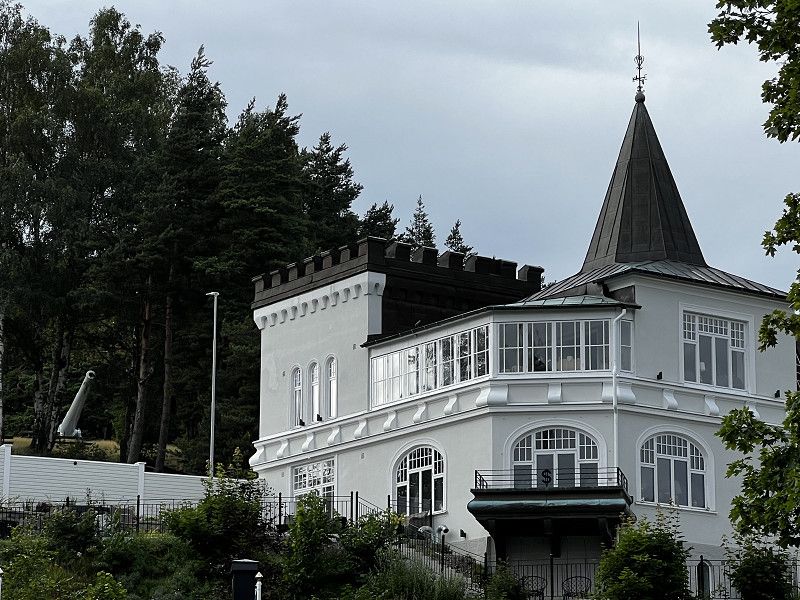
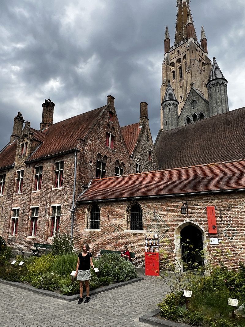
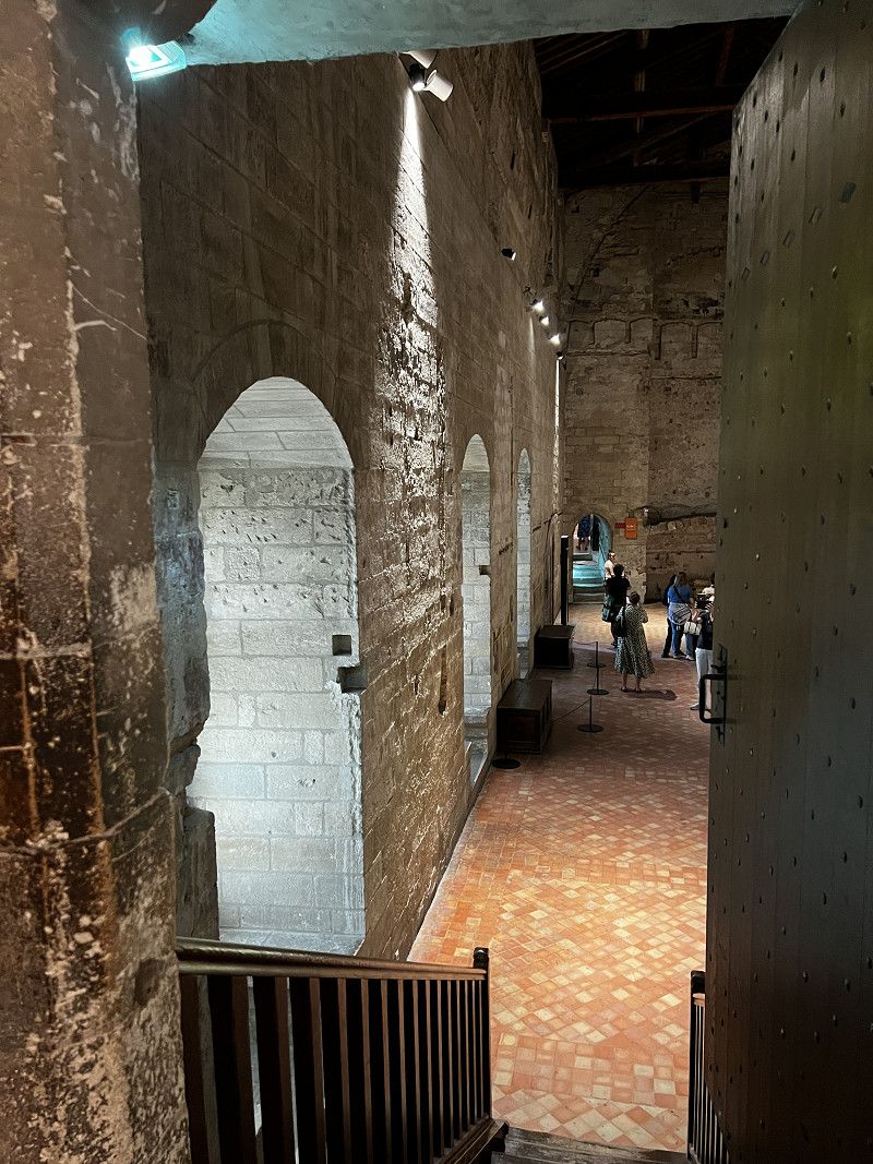
Wartburg
Intermediate destination: Wartburg
Auf der Wartburg 1, Eisenach, Wartburgkreis, Thüringen, Deutschland
50° 57' 57.2" N 10° 18' 22.7" E
50.9659020 10.3063142
• Head northeast on Auf der Wartburg. Go for 477 m.
• Turn right onto Wartburgallee. Go for 167 m.
• Turn slightly right onto Wartburgallee. Go for 1.9 km.
• Turn left onto Mariental (B19). Go for 1.1 km.
• Turn right onto Bahnhofstraße (B19) toward A4/Krankenhaus/Naturpark-Route Thüringer Wald. Go for 388 m.
• Take the 2nd exit from roundabout onto Bahnhofstraße (B19). Go for 566 m.
• Turn left onto B19. Go for 13 m.
• Turn right onto Clemensstraße (B19). Go for 1.7 km.
• Continue on Langensalzaer Straße (B84) toward Stockhausen. Go for 1.2 km.
• Continue on Nessetalstraße (B84). Go for 1.5 km.
• Continue on B84. Go for 1.2 km.
• Take the 2nd exit from roundabout onto A4 toward Dresden. Go for 113 km.
• Take exit 56A toward Berlin/Halle (Saale)/Leipzig onto A9. Go for 45.7 km.
• Take exit 19 toward Leipzig-Süd onto A38. Go for 25.2 km.
• Take exit 31 toward Leipzig-Süd/Markkleeberg onto A72. Go for 2.0 km.
• Continue on B2. Go for 6.9 km.
• Keep left onto Wundtstraße. Go for 781 m.
• Keep left onto Wundtstraße. Go for 1.3 km.
• Continue on Dufourstraße. Go for 112 m.
• Continue on Floßplatz. Go for 298 m.
• Continue on Harkortstraße. Go for 391 m.
• Turn right onto Martin-Luther-Ring. Go for 242 m.
• Continue on Roßplatz. Go for 529 m.
• Continue on Augustusplatz. Go for 191 m.
• Continue on Augustusplatz. Go for 150 m.
• Continue on Georgiring. Go for 745 m.
• Turn left onto Sachsenseite. Go for 132 m.
• Turn right onto Sachsenseite. Go for 154 m.
• Arrive at Sachsenseite.
☍
208,5 km
(2 hrs. 10 min.)
Leipzig
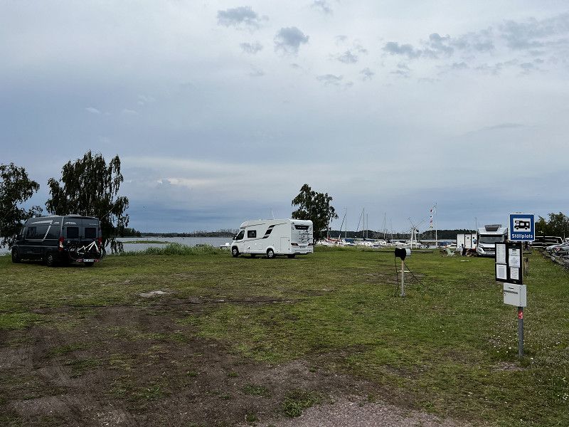
Parking space “Parking at Goldstück”
Sachsenseite, Leipzig, Sachsen, Deutschland
51° 20' 51.4" N 12° 23' 15" E
51.3476130 12.3874988
• Head southwest on Sachsenseite. Go for 154 m.
• Turn left onto Sachsenseite. Go for 122 m.
• Turn left onto Brandenburger Straße (B87). Go for 385 m.
• Turn left onto Lagerhofstraße (B2/B87) toward Flughafen/A14/Wittenberg/B6/Wurzen/Torgau. Go for 627 m.
• Turn slightly left onto Am Gothischen Bad (B2) toward Eutritzsch/Halle/A14/Flughafen/Wittenberg. Go for 112 m.
• Keep right onto Rackwitzer Straße (B2) toward A14/Flughafen/Wittenberg. Go for 6.3 km.
• Take ramp onto A14 toward Dresden/Chemnitz/Leipzig-Messegelände/Halle/Magdeburg/Flughafen. Go for 13.8 km.
• Take exit 20 toward Berlin/Dessau onto A9. Go for 115 km.
• Take exit 2 toward Fichtenwalde. Go for 266 m.
• Take the 1st exit from roundabout onto L88 toward Lehnin/Fichtenwalde. Go for 5.2 km.
• Turn right onto Glindower Straße (L90). Go for 777 m.
• Take the 1st exit from roundabout onto Glindower Straße (L90). Go for 2.2 km.
• Turn right and take ramp onto A10 (Berliner Ring) toward Hamburg/Magdeburg. Go for 4.4 km.
• Take exit 21 toward Prenzlau/Hamburg/Rostock onto A10 (Autobahndreieck Werder). Go for 47.8 km.
• Take exit 29 toward Hamburg/Rostock onto A24. Go for 63.3 km.
• Continue on A19 toward Rostock/Wittstock. Go for 118 km.
• Take exit 6 toward Rostock-Ost onto B105 (Rövershäger Chaussee). Go for 5.5 km.
• Turn right onto Am Strande. Go for 47 m.
• Continue on Warnowufer. Go for 49 m.
• Arrive at Warnowufer. Your destination is on the right.
☍
384,0 km
(3 hrs. 34 min.)
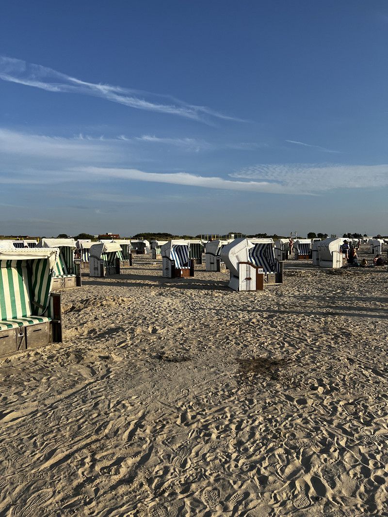
Day
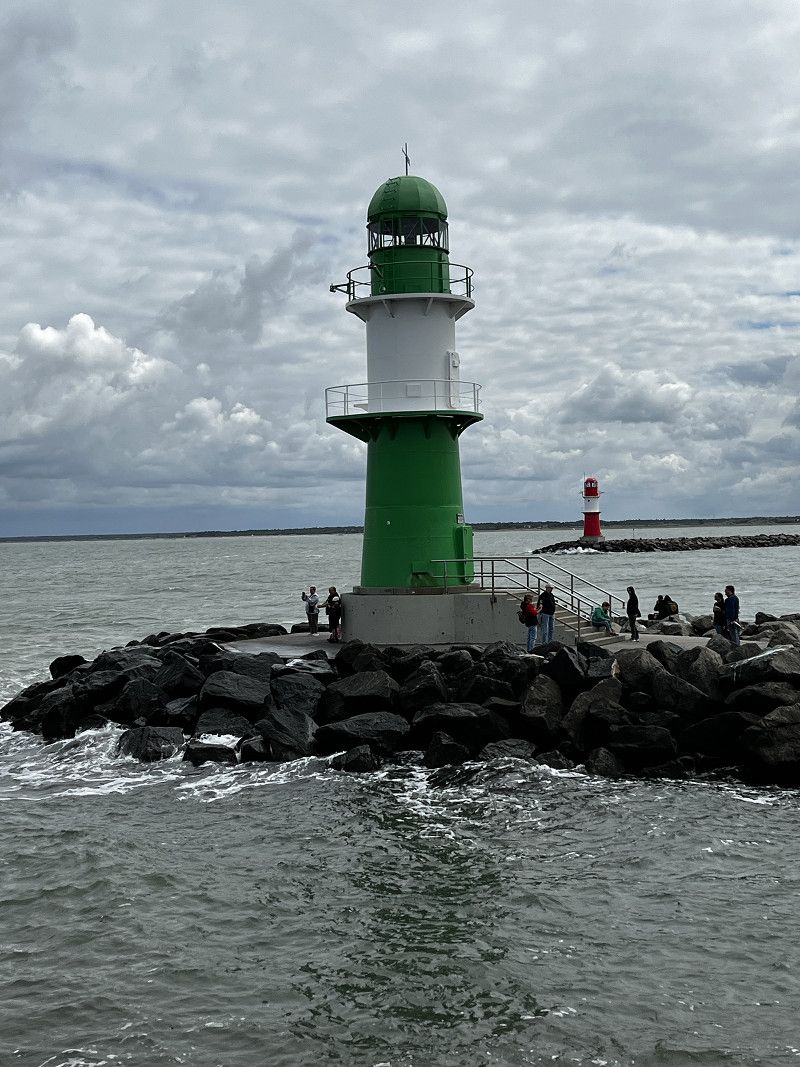
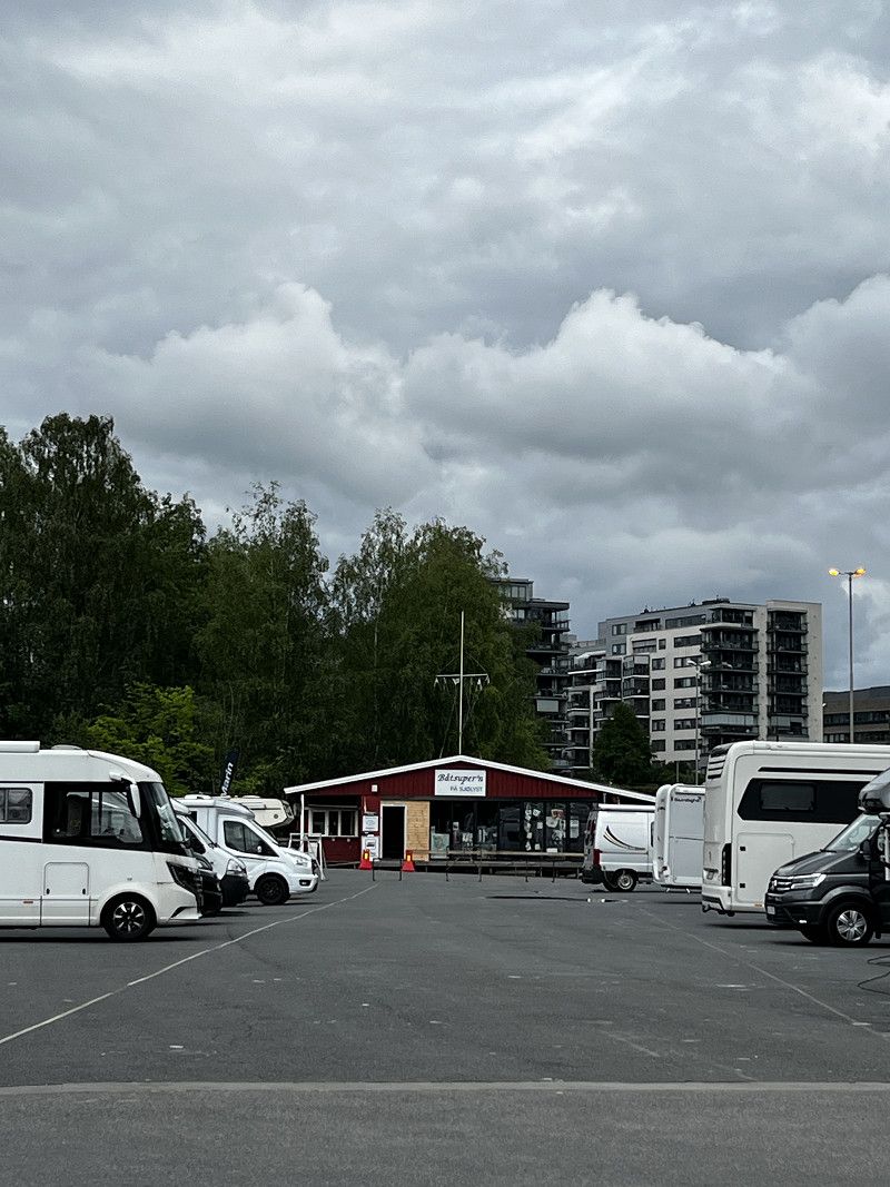
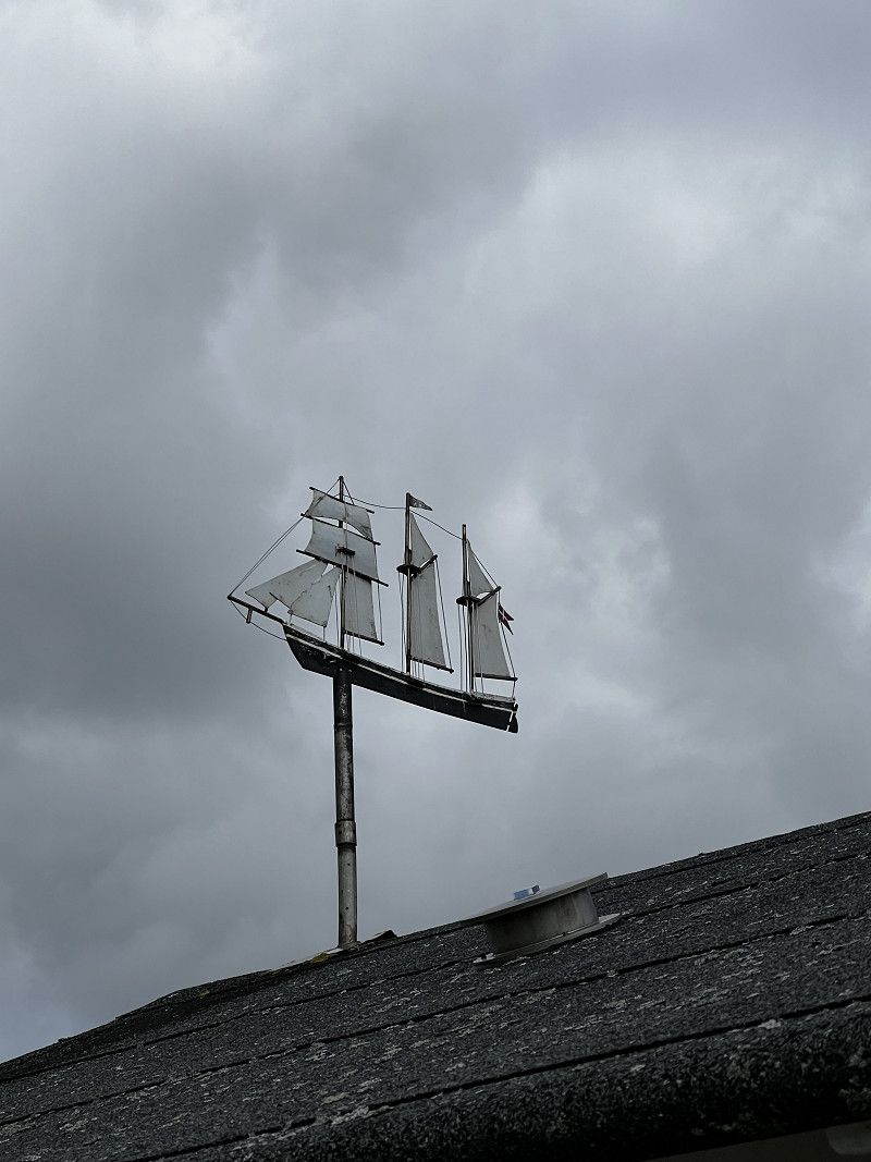
Rostock
Parking space Rostock Stadthafen, practically directly in the city center
Stadthafen, Rostock, Mecklenburg-Vorpommern, Deutschland
54° 5' 34.3" N 12° 7' 54.3" E
54.0928497 12.1317570
• Head south on Warnowufer. Go for 49 m.
• Continue on Am Strande. Go for 47 m.
• Turn right onto Am Strande (L22). Go for 4.9 km.
• Turn right and take ramp onto An der Stadtautobahn (B103) toward Warnemünde/Überseehafen/HanseMesse/B105. Go for 7.7 km.
• Turn left onto Richard-Wagner-Straße (L12). Go for 591 m.
• Turn right onto Laakstraße. Go for 244 m.
• Turn left onto Dänische Straße. Go for 193 m.
• Turn left onto Wachtlerstraße. Go for 169 m.
• Turn right onto Kurhausstraße. Go for 243 m.
• Continue on Seestraße. Go for 248 m.
• Arrive at Seestraße. Your destination is on the right.
☍
14,4 km
( 19 min.)
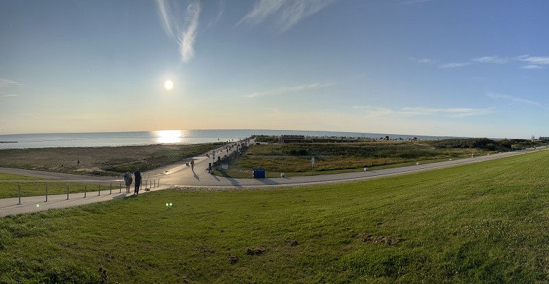
Day
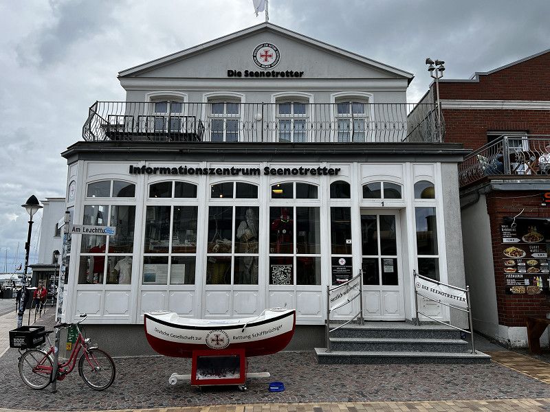
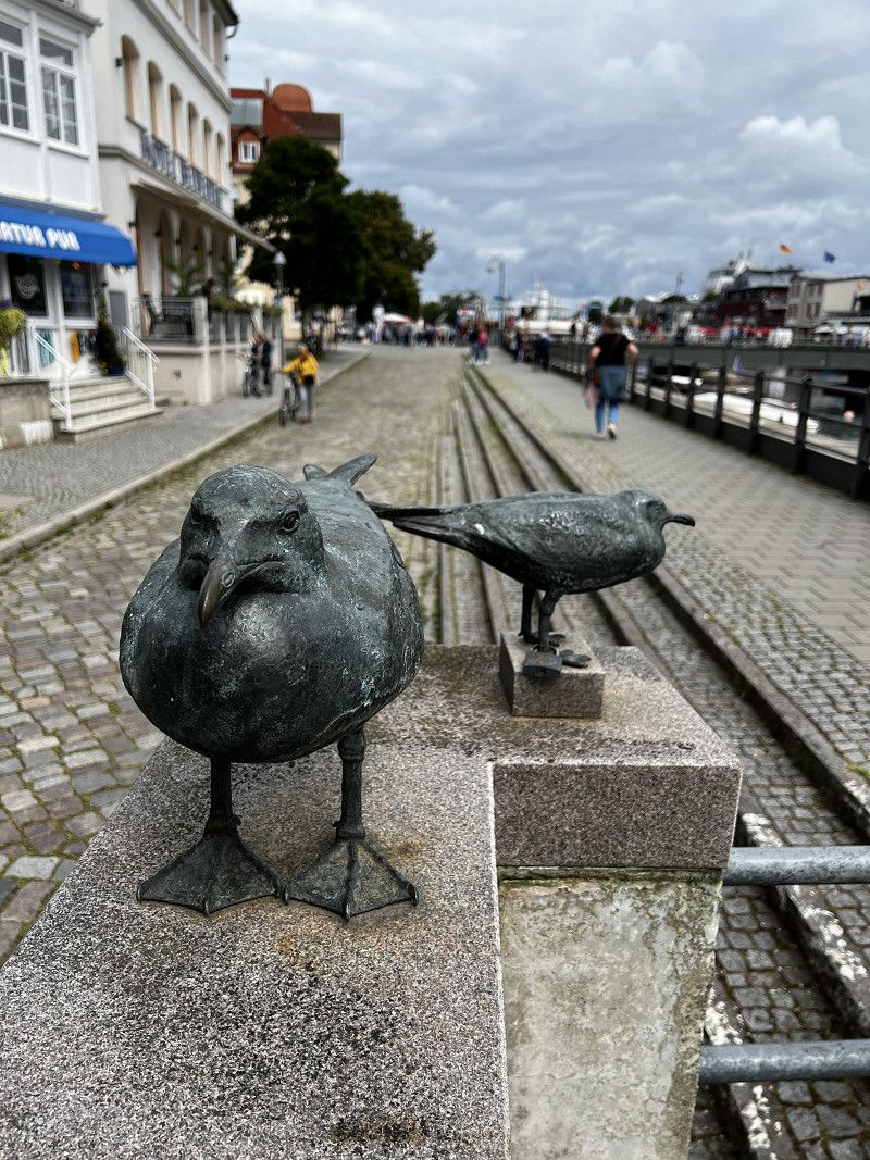
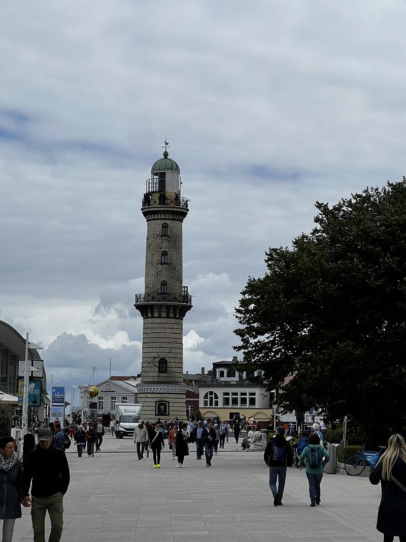
Warnemünde
Wonderful walk through the city.
Seestraße 13, Rostock, Mecklenburg-Vorpommern, Deutschland
54° 10' 48.8" N 12° 4' 55.3" E
54.1802136 12.0820250
• Head northeast on Seestraße. Go for 27 m.
• Turn right onto Heinrich-Heine-Straße. Go for 325 m.
• Turn right onto Wachtlerstraße. Go for 366 m.
• Turn left onto Schillerstraße. Go for 89 m.
• Continue on Richard-Wagner-Straße (L12). Go for 701 m.
• Turn right onto An der Stadtautobahn (B103). Go for 4.0 km.
• Take ramp onto B105 toward A19/Überseehafen/Groß Klein/Schmarl/HanseMesse. Go for 4.1 km.
• Continue on A19. Go for 5.6 km.
• Take exit 6 toward Ribnitz-Damgarten/Bentwisch onto B105 (Rövershäger Chaussee). Go for 68.8 km.
• Take left ramp onto B96 toward Sassnitz/Fähre/Insel Rügen/Stralsund-Altstadt. Go for 1.9 km.
• Keep left onto B96. Go for 845 m.
• Turn right onto L296 toward Gewerbegebiet Hafen. Go for 709 m.
• Turn left onto An der Hafenbahn. Go for 460 m.
• Arrive at An der Hafenbahn. Your destination is on the right.
☍
88,0 km
(1 hrs. 18 min.)
Day
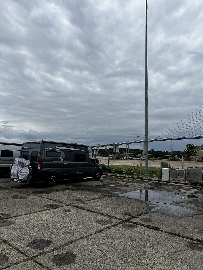
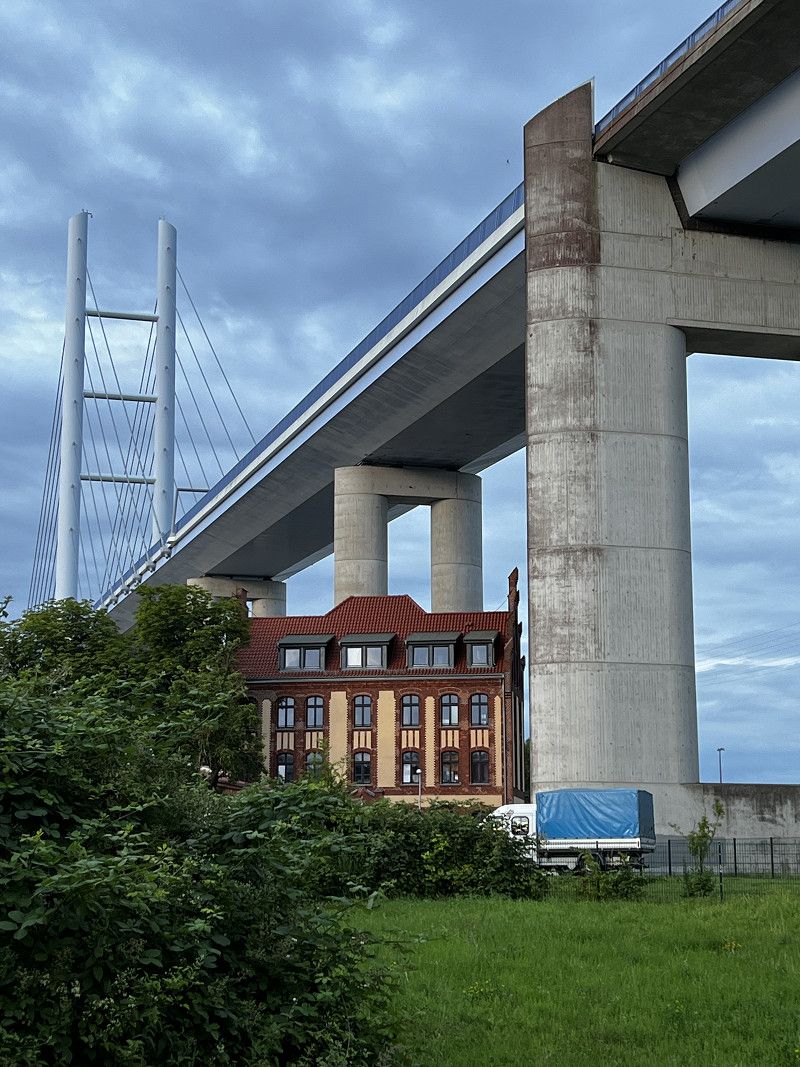
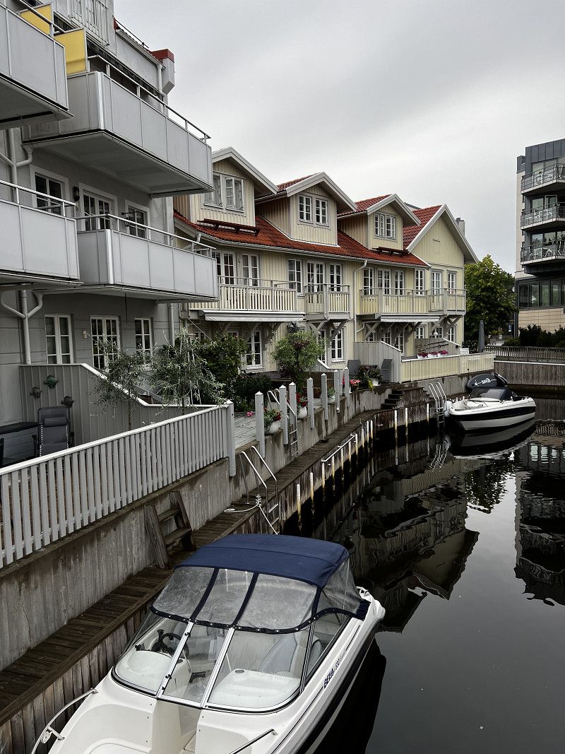
Stralsund
Small parking space near a boat slipway. Not particularly nice, but friendly owner and, above all, very suitable for exploring the city on foot.
Dänholmstraße 13a, Stralsund, Vorpommern-Rügen, Mecklenburg-Vorpommern, Deutschland
54° 18' 33.5" N 13° 6' 13.2" E
54.3093013 13.1036755
• Head toward Dänholmstraße on An der Hafenbahn. Go for 448 m.
• Turn left onto Platz des 17. Juni (L296). Go for 3.5 km.
• Take ramp onto B96 toward Sassnitz/Bergen. Go for 20.2 km.
• Keep left onto B196. Go for 8.0 km.
• Pass 2 roundabouts and continue on B196. Go for 14.5 km.
• Take the 1st exit from roundabout onto B196 toward Thiessow/Göhren. Go for 1.2 km.
• Turn left onto Göhrener Weg. Go for 2.1 km.
• Continue on Wasserwerk Försterei. Go for 218 m.
• Turn right onto Bahnhofstraße. Go for 80 m.
• Turn left onto B196. Go for 1.2 km.
• Take the 3rd exit from roundabout onto Poststraße toward Zentrum. Go for 267 m.
• Turn right onto Thiessower Straße. Go for 199 m.
• Turn right onto Thiessower Straße. Go for 381 m.
• Arrive at Thiessower Straße. Your destination is on the left.
☍
52,3 km
( 54 min.)
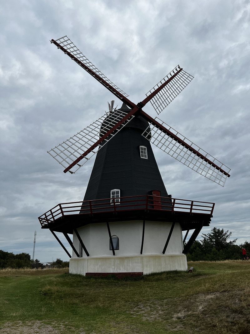
Göhren Südstrand
Thiessower Straße 15, Göhren, Vorpommern-Rügen, Mecklenburg-Vorpommern, Deutschland
54° 20' 11.9" N 13° 44' 24" E
54.3366432 13.7400059
• Head north on Thiessower Straße. Go for 580 m.
• Turn left onto Poststraße. Go for 243 m.
• Take the 2nd exit from roundabout onto Berliner Straße toward Bergen/Sellin. Go for 1.9 km.
• Take the 1st exit from roundabout. Go for 47 m.
• Continue on B196. Go for 3.2 km.
• Take the 2nd exit from roundabout onto An der B196 (B196) toward Bergen auf Rügen/Binz. Go for 907 m.
• Turn right onto Hauptstraße. Go for 502 m.
• Continue on August-Bebel-Straße. Go for 155 m.
• Turn left. Go for 127 m.
• Arrive at your destination.
☍
7,6 km
( 12 min.)
Sellin
Kirchstraße, Sellin, Vorpommern-Rügen, Mecklenburg-Vorpommern, Deutschland
54° 22' 43.3" N 13° 41' 34.1" E
54.3786923 13.6928042
• Head northwest. Go for 127 m.
• Turn right onto August-Bebel-Straße. Go for 155 m.
• Continue on Hauptstraße. Go for 502 m.
• Turn right onto Seestraße (B196). Go for 7.2 km.
• Pass 2 roundabouts and continue on Karow (B196). Go for 14.5 km.
• Continue on B96. Go for 26.6 km.
• Take ramp onto B105 toward Rostock/Stralsund-Grünhufe/B194. Go for 1.7 km.
• Keep left onto B105 toward Rostock. Go for 8.4 km.
• Continue on B105 toward Rostock. Go for 57.6 km.
• Take ramp onto A19 toward Rostock-Überseehafen/Rostock-Warnemünde. Go for 5.9 km.
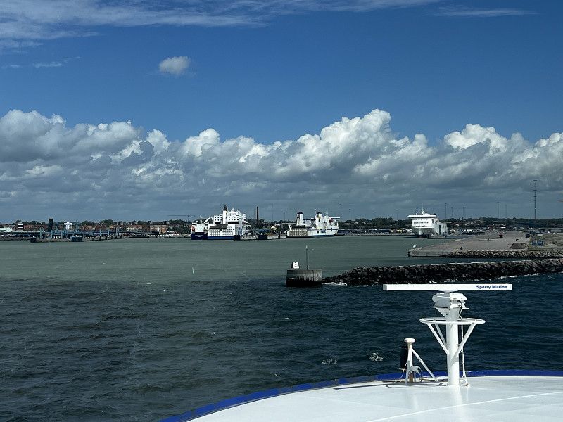
• Take exit 4 toward Ostsee-Fähren/Überseehafen/Ferries/Fähren onto E55 (Am Seehafen). Go for 749 m.
• Turn slightly left onto Zum Fährterminal (E55) toward Fähre Trelleborg/Fähre Gedser. Go for 606 m.
• Arrive at Zum Fährterminal (E55). Your destination is on the right.
☍
124,0 km
(1 hrs. 44 min.)
Rostock
Zum Fährterminal, Rostock, Mecklenburg-Vorpommern, Deutschland
54° 8' 29.5" N 12° 6' 10.7" E
54.1415373 12.1029706
• Head northwest on Zum Fährterminal (E55). Go for 10 m.
• Take the 1st exit from roundabout onto Simon-van-Utrecht-Straße toward GVZ Industriehafen/Fähre Helsinki. Go for 298 m.
• Turn right onto Ost-West-Straße. Go for 398 m.
• Turn right onto Am Seehafen. Go for 82 m.
• Make a U-Turn onto Am Seehafen. Go for 38 m.
• Make a U-Turn. Go for 68 m.
• Arrive at Am Seehafen. Your destination is on the right.
☍
0,9 km
( 2 min.)
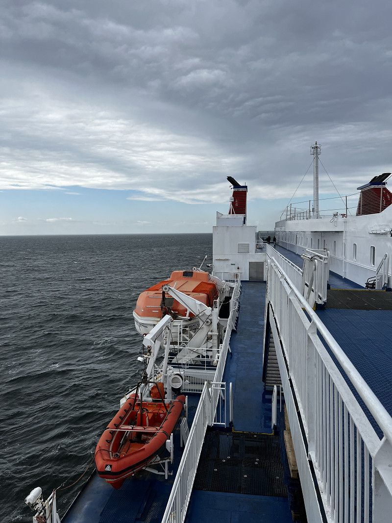
Day
Departure port: Am Seehafen
Mecklenburg-Vorpommern, Deutschland
54.1444395 12.1087060
Arrival port: Trelleborg
Provinz Schonen, Schweden
55.3759213.1461522
• Head toward Västra Vallgatan on Svenstorpsgatan. Go for 103 m.
• Turn left onto Västra Vallgatan. Go for 78 m.
• Turn right onto Västergatan. Go for 42 m.
• Turn left onto Östersjögatan. Go for 168 m.
• Turn right onto Slussgatan (9). Go for 408 m.
• Continue on E6/E22 toward Malmö. Go for 3.7 km.
• Take the 2nd exit from roundabout onto E6/E22 toward Malmö. Go for 19.3 km.
• Continue on E6.1 (Trelleborgsvägen) toward Malmö/Sjukhus. Go for 2.0 km.
• Take the exit toward Limhamn/Malmö Arena/Hyllievång. Go for 449 m.
• Take the 3rd exit from roundabout onto Inre Ringvägen toward Limhamn/Malmö Arena/Hyllievång. Go for 1.6 km.
• Continue on Annetorpsvägen. Go for 846 m.
• Take the 1st exit from roundabout onto Lorensborgsgatan toward Centrum. Go for 720 m.
• Take the 2nd exit from roundabout onto Lorensborgsgatan. Go for 503 m.
• Turn left onto Rudbecksgatan. Go for 590 m.
• Pass 3 roundabouts and continue on Rudbecksgatan. Go for 1.4 km.
• Turn left onto Linnégatan. Go for 79 m.
• Take the 1st exit from roundabout onto Västanväg. Go for 985 m.
• Turn left onto Geijersgatan. Go for 169 m.
• Take the 2nd exit from roundabout onto Geijersgatan. Go for 325 m.
• Continue on Vaktgatan. Go for 519 m.
• Turn right onto Vaktgatan. Go for 61 m.
• Arrive at Vaktgatan. Your destination is on the right.
☍
52,7 km
( 46 min.)
Überfahrt nach Schweden
Crossing to Sweden in the best weather
Malmö
Vaktgatan, Malmö, Provinz Schonen, Schweden
55° 35' 41.1" N 12° 55' 53.1" E
55.5947419 12.9314217
• Head southwest on Vaktgatan. Go for 61 m.
• Turn left onto Vaktgatan. Go for 519 m.
• Continue on Geijersgatan. Go for 294 m.
• Take the 3rd exit from roundabout onto Limhamnsvägen. Go for 2.1 km.
• Take the 2nd exit from roundabout onto Limhamnsvägen toward Centrum. Go for 826 m.
• Continue on Citadellsvägen toward E6/Göteborg/Centrum. Go for 280 m.
• Turn left onto Skeppsbyggaregatan. Go for 126 m.
• Turn right onto Norra Neptunigatan. Go for 990 m.
• Turn right onto Skeppsbron. Go for 135 m.
• Continue on Mälarbron. Go for 53 m.
• Turn left onto Norra Vallgatan. Go for 910 m.
• Take the 2nd exit from roundabout onto Hornsgatan toward E6/E20/E22/E11. Go for 201 m.
• Keep right onto Hornsgatan toward E22/E11. Go for 324 m.
• Turn left onto Hornsgatan toward E6/E20/E22/11. Go for 310 m.
• Turn slightly left onto Stockholmsvägen toward E4/E6/E22/11/Stockholm/Göteborg/Landskrona/Kalmar/Simrishamn/Lund. Go for 2.8 km.
• Continue on E22.10 (Stockholmsvägen). Go for 4.0 km.
• Continue on E22. Go for 80.4 km.
• Take exit 37 toward Kalmar/Kristianstad onto E22 (Hässleholmsvägen). Go for 29.9 km.
• Take exit 45 toward Sölvesborg. Go for 330 m.
• Continue on Kämpaslättsvägen (E22.1). Go for 1.1 km.
• Take the 3rd exit from roundabout onto Blekingevägen. Go for 1.9 km.
• Turn right toward Snapphanegatan. Go for 85 m.
• Turn left onto Snapphanegatan. Go for 1.7 km.
• Take the 2nd exit from roundabout onto Sölvevägen. Go for 318 m.
• Keep left onto Sölvevägen. Go for 87 m.
• Take the 2nd exit from roundabout onto Sölvevägen. Go for 1.1 km.
• Continue on Ysanevägen. Go for 5.2 km.
• Take the 2nd exit from roundabout onto Ysanevägen. Go for 1.2 km.
• Continue on Karlshamnsvägen. Go for 5.1 km.
• Take the 1st exit from roundabout. Go for 187 m.
• Continue on Björkenäsvägen. Go for 3.0 km.
• Turn left and take ramp toward E22/Kalmar/15/Elleholm/Mörrum. Go for 229 m.
• Turn right onto Elleholmsvägen. Go for 284 m.
• Take ramp onto E22. Go for 25.8 km.
• Take ramp toward Bräkne-Hoby/Järnavik/Tjärö. Go for 1.0 km.
• Turn right onto Gamla Riksvägen. Go for 7.1 km.
• Continue on Stora Silpingevägen. Go for 377 m.
• Continue on Gamla Riksvägen. Go for 2.1 km.
• Turn right onto 27 toward Ronneby/E22. Go for 1.5 km.
• Pass 5 roundabouts and continue on Strandgatan (E22.4). Go for 3.0 km.
• Turn right onto Söderbro. Go for 140 m.
• Continue on Blasius Königsgatan. Go for 288 m.
• Turn left onto Götgatan. Go for 317 m.
• Turn right onto Övre Brunnsvägen. Go for 824 m.
• Continue on Reddvägen. Go for 1.2 km.
• Arrive at Reddvägen. Your destination is on the right.
☍
189,9 km
(2 hrs. 21 min.)
Day
Ronneby
Pitch at Ronneby Golf Club
Rustorpsvägen, Ronnebyhamn, Provinz Blekinge, Schweden
56° 11' 24.9" N 15° 17' 38" E
56.1902630 15.2938891
• Head south on Reddvägen. Go for 1.6 km.
• Turn left onto Hamnvägen. Go for 791 m.
• Turn right toward Heabyvägen. Go for 360 m.
• Continue on Heabyvägen. Go for 1.6 km.
• Continue on Heabyvägen. Go for 225 m.
• Turn left onto Gövägen. Go for 1.9 km.
• Turn right onto Gärestadsvägen. Go for 640 m.
• Continue on Gärestadsvägen. Go for 89 m.
• Continue on Aspanvägen. Go for 372 m.
• Continue on Gärestadsvägen. Go for 460 m.
• Turn right onto E22. Go for 1.7 km.
• Pass 2 roundabouts and continue on E22. Go for 96.3 km.
• Take the exit toward Öland onto 137 (Ölandsleden). Go for 12.3 km.
• Continue on 136. Go for 24.8 km.
• Turn left onto Storgatan. Go for 779 m.
• Turn right onto Tullgatan. Go for 292 m.
• Turn left onto Sandgatan. Go for 712 m.
• Turn right onto Hamnvägen. Go for 198 m.
• Turn slightly left onto Hamnvägen. Go for 10 m.
• Arrive at Hamnvägen. Your destination is on the right.
☍
145,2 km
(1 hrs. 52 min.)
Day
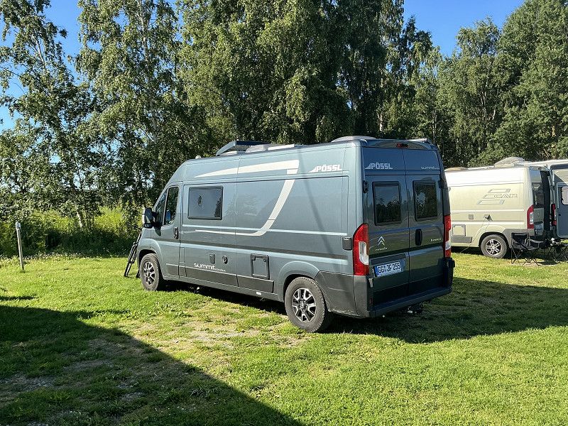
Borgholm
Hamnvägen, Borgholm, Provinz Kalmar, Schweden
56° 53' 1.6" N 16° 38' 49.5" E
56.8837646 16.6470856
• Head southeast on Hamnvägen. Go for 208 m.
• Turn left onto Sandgatan. Go for 795 m.
• Continue on Norra infarten. Go for 1.2 km.
• Take the 3rd exit from roundabout onto Köpingevägen (136). Go for 40.2 km.
• Pass 2 roundabouts and continue on 136. Go for 20.0 km.
• Take the 1st exit from roundabout onto Neptunivägen (136). Go for 6.3 km.
• Turn left onto Nabbelundsvägen (136). Go for 169 m.
• Turn slightly left onto Nabbelundsvägen (136). Go for 248 m.
• Arrive at Nabbelundsvägen (136).
☍
69,1 km
(1 hrs. 1 min.)
Day
Nabbelund / Öland
Parking space at the former ferry dock
Neptunivägen, Provinz Kalmar, Schweden
57° 20' 55.8" N 17° 5' 14.5" E
57.3488387 17.0873529
• Head west on Nabbelundsvägen (136). Go for 6.7 km.
• Pass 3 roundabouts and continue on 136. Go for 57.4 km.
• Turn left onto Öjvägen. Go for 66 m.
• Turn right onto Ramsättravägen. Go for 2.8 km.
• Continue on Mölle Kalles väg. Go for 126 m.
• Continue on Ramsättravägen. Go for 504 m.
• Continue on Ramsättravägen. Go for 283 m.
• Continue on Ramsättravägen. Go for 1.7 km.
• Continue on Ramsättravägen. Go for 139 m.
• Continue on Ramsättravägen. Go for 590 m.
• Continue on Ramsättravägen. Go for 306 m.
• Continue on Ramsättravägen. Go for 695 m.
• Continue on Ramsättravägen. Go for 427 m.
• Turn left onto Östra Sörbyvägen. Go for 777 m.
• Continue on Lergatvägen. Go for 792 m.
• Turn right onto Störlinge. Go for 595 m.
• Continue on Störlinge. Go for 1.8 km.
• Continue on Södra Gärdslösa. Go for 551 m.
• Continue on Södra Gärdslösa. Go for 1.2 km.
• Continue on Rosenborg. Go for 1.7 km.
• Continue on Långlöt. Go for 1.1 km.
• Continue on Långlötsmosse. Go for 983 m.
• Continue on Folkeslunda. Go for 937 m.
• Continue on Folkeslunda. Go for 745 m.
• Continue on Lerkaka. Go for 1.3 km.
• Continue on Bjärby. Go for 1.0 km.
• Continue on Runsten. Go for 1.4 km.
• Continue on Lopperstad. Go for 1.4 km.
• Continue on Åkerby. Go for 2.7 km.
• Continue on Norra Möckleby. Go for 1.3 km.
• Continue on Norra Möckleby. Go for 273 m.
• Continue on Norra Möckleby. Go for 507 m.
• Continue on Norra Möckleby. Go for 479 m.
• Continue on Dörby. Go for 894 m.
• Continue toward Dörby. Go for 57 m.
• Continue on Dörby. Go for 2.6 km.
• Continue on Gårdby. Go for 104 m.
• Continue on Stationsvägen. Go for 122 m.
• Continue on Gårdby. Go for 342 m.
• Continue on Gårdby. Go for 502 m.
• Continue on Gårdby. Go for 2.1 km.
• Continue on Vället. Go for 1.9 km.
• Continue on Södra Sandby. Go for 3.1 km.
• Continue on Norra Kvinneby. Go for 981 m.
• Continue on Norra Kvinneby. Go for 579 m.
• Continue on Stora Brunneby. Go for 576 m.
• Continue on Stora Brunneby. Go for 227 m.
• Continue on Lilla Brunneby. Go for 783 m.
• Continue on Stenåsa. Go for 1.1 km.
• Continue on Slagerstad. Go for 790 m.
• Continue on Södra Kvinneby. Go for 1.3 km.
• Continue on Alby. Go for 1.3 km.
• Continue on Alby. Go for 77 m.
• Continue on Triberga. Go for 735 m.
• Continue on Triberga. Go for 2.2 km.
• Continue on Hulterstad. Go for 1.4 km.
• Continue on Skärlöv. Go for 2.9 km.
• Continue on Skärlöv. Go for 904 m.
• Continue on Mellby. Go for 1.5 km.
• Continue on Mellby. Go for 638 m.
• Continue on Mellby. Go for 847 m.
• Continue on Segerstad. Go for 776 m.
• Continue on Nedra Segerstad. Go for 89 m.
• Continue on Nedra Segerstad. Go for 277 m.
• Continue on Nedra Segerstad. Go for 795 m.
• Continue on Segerstad. Go for 1.1 km.
• Continue on Seby. Go for 1.4 km.
• Continue on Seby. Go for 153 m.
• Continue on Seby. Go for 248 m.
• Continue toward Seby. Go for 184 m.
• Continue on Seby. Go for 207 m.
• Continue on Torngård. Go for 700 m.
• Continue on Gammalsby. Go for 776 m.
• Turn left toward Gammalsby. Go for 45 m.
• Continue on Gammalsby. Go for 796 m.
• Continue on Gräsgårds Fiskehamn. Go for 59 m.
• Arrive at Gräsgårds Fiskehamn. Your destination is on the left.
☍
131,5 km
(2 hrs. 5 min.)
Day
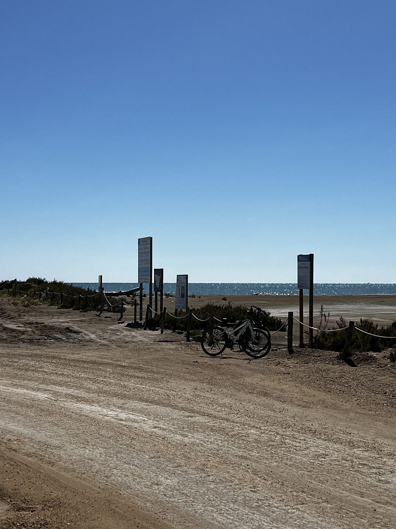
Långe Erik
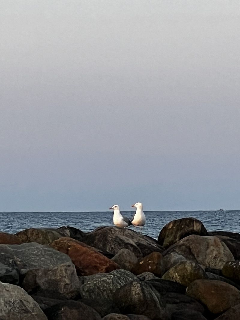
Bicycle tour to the northern tip of Öland
Gammalsby
Small parking space with snack bar (fish) at Gräsgårds fiskehamm
H 929, Provinz Kalmar, Schweden
56° 19' 2.2" N 16° 31' 53.7" E
56.3172812 16.5315931
• Head northwest on Gräsgårds Fiskehamn. Go for 59 m.
• Continue on Gammalsby. Go for 841 m.
• Turn left onto Gammalsby. Go for 241 m.
• Continue on Mellstaby. Go for 1.4 km.
• Continue on Gräsgård. Go for 2.7 km.
• Turn right toward Eketorp. Go for 362 m.
• Continue on Eketorp. Go for 655 m.
• Turn right onto Eketorp. Go for 529 m.
• Arrive at Eketorp. Your destination is on the right.
☍
6,8 km
( 8 min.)
Day
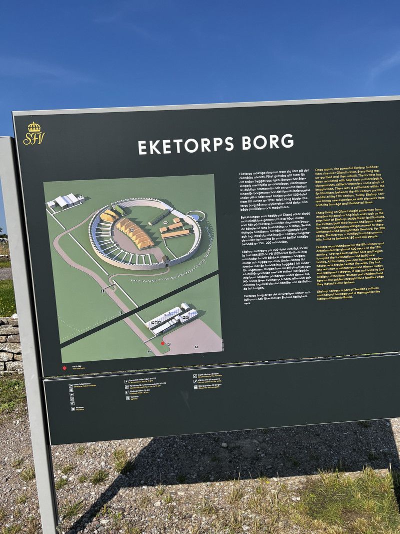
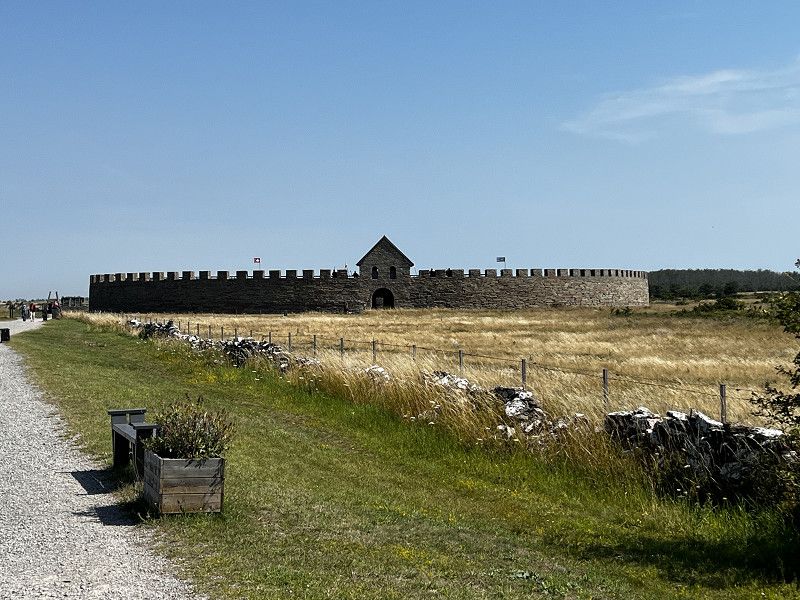
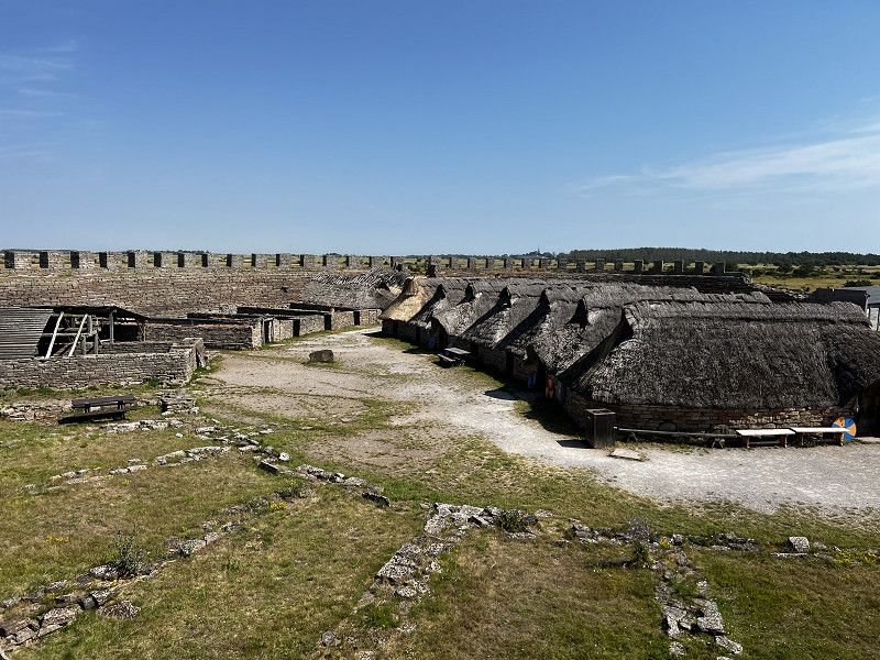
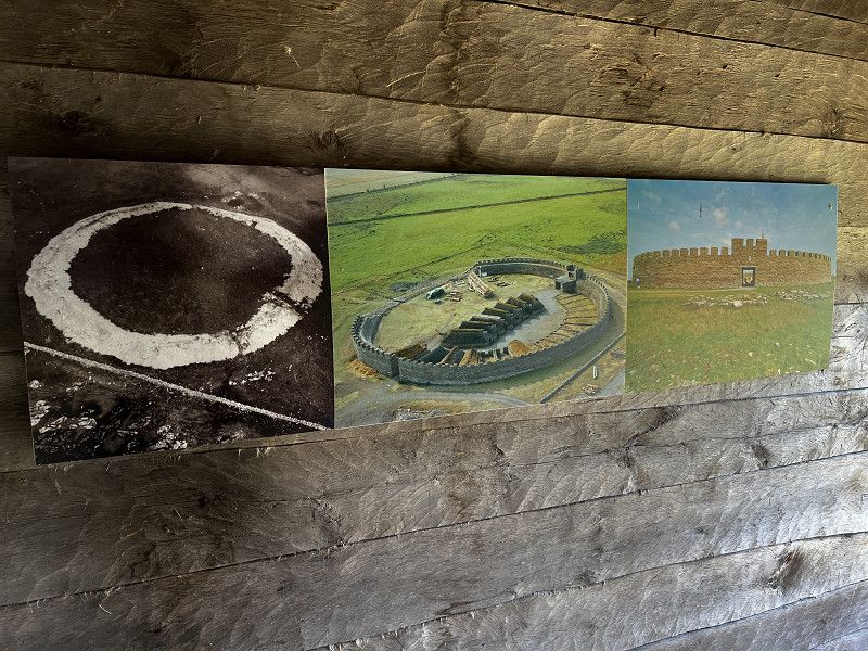
Eketorps Borg
Old settlement from the Iron Age around 300 AD.
Eketorpsvägen, Provinz Kalmar, Schweden
56° 17' 35.4" N 16° 29' 3" E
56.2931710 16.4841657
• Head south on Eketorp. Go for 529 m.
• Turn left onto Eketorp. Go for 1.0 km.
• Turn right toward Enetri. Go for 2.8 km.
• Continue on Enetri. Go for 958 m.
• Continue on Näsby. Go for 672 m.
• Arrive at Näsby. Your destination is on the left.
☍
5,9 km
( 7 min.)
Näsby
Provinz Kalmar, Schweden
56° 14' 53.3" N 16° 28' 10.7" E
56.2481512 16.4696420
• Head south on Näsby. Go for 1.2 km.
• Continue on Ottenby. Go for 864 m.
• Continue on Ottenby Jaktstugan. Go for 1.8 km.
• Turn left. Go for 4.2 km.
• Arrive at your destination.
☍
8,0 km
( 14 min.)
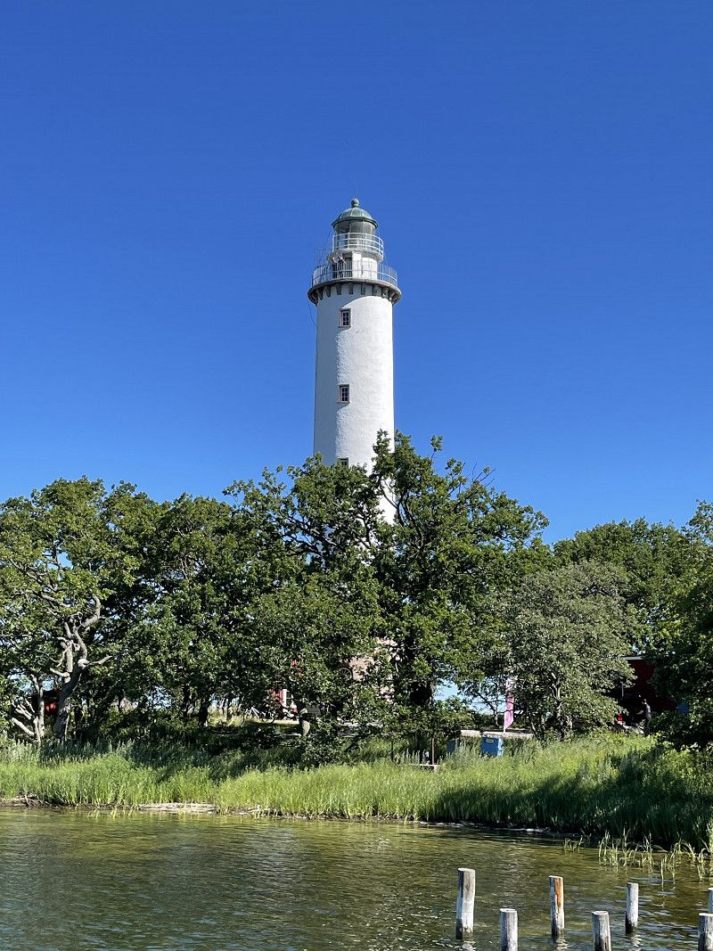
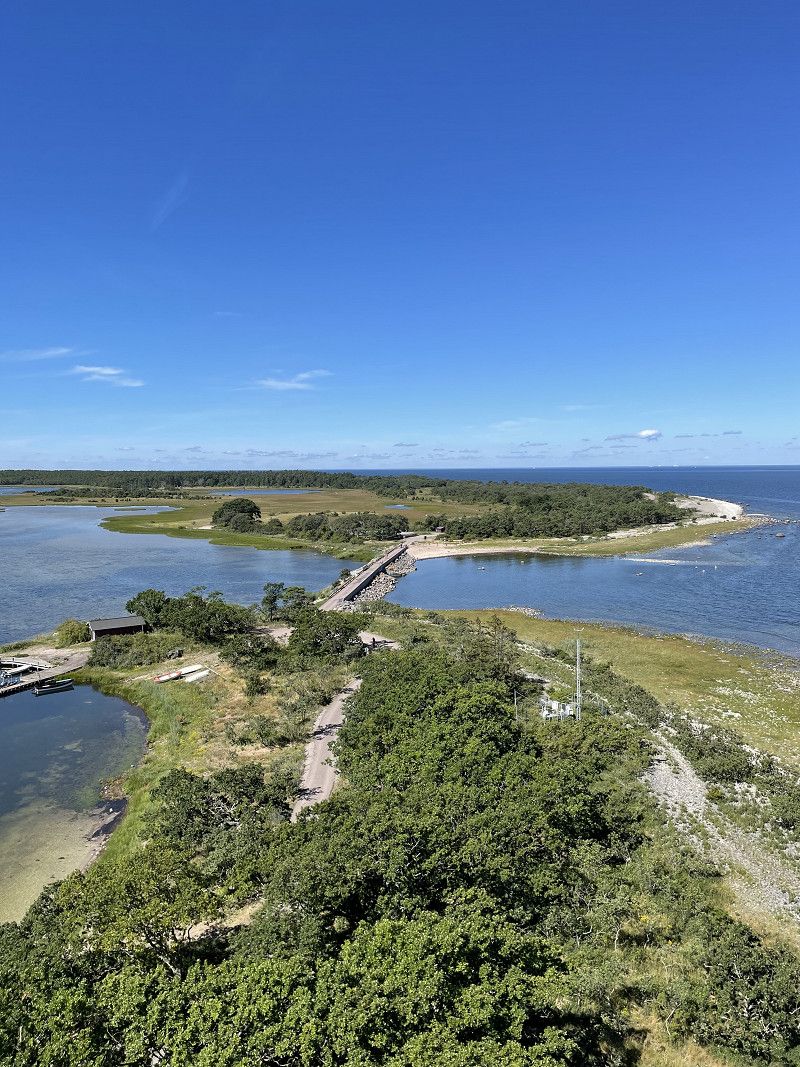
Långe Jan
Southern tip of Öland with lighthouse
H 924, Provinz Kalmar, Schweden
56° 11' 56" N 16° 23' 57.7" E
56.1989013 16.3993566
• Head south. Go for 22 m.
• Turn slightly right. Go for 103 m.
• Turn left toward 136. Go for 4.2 km.
• Turn left onto 136. Go for 51.1 km.
• Continue on Björnhovda. Go for 337 m.
• Take left ramp onto 137 toward Kalmar. Go for 12.4 km.
• Take ramp onto E22 toward Norrköping/Oskarshamn. Go for 32.4 km.
• Turn right onto Häradsvägen toward Timmernabben/Ålems Kyrkby. Go for 2.3 km.
• Continue on Strandavägen. Go for 401 m.
• Continue on Strandavägen. Go for 772 m.
• Turn right onto Varvsvägen. Go for 305 m.
• Turn right onto Varvsvägen. Go for 54 m.
• Turn left. Go for 241 m.
• Arrive at your destination on the right.
☍
104,6 km
(1 hrs. 34 min.)
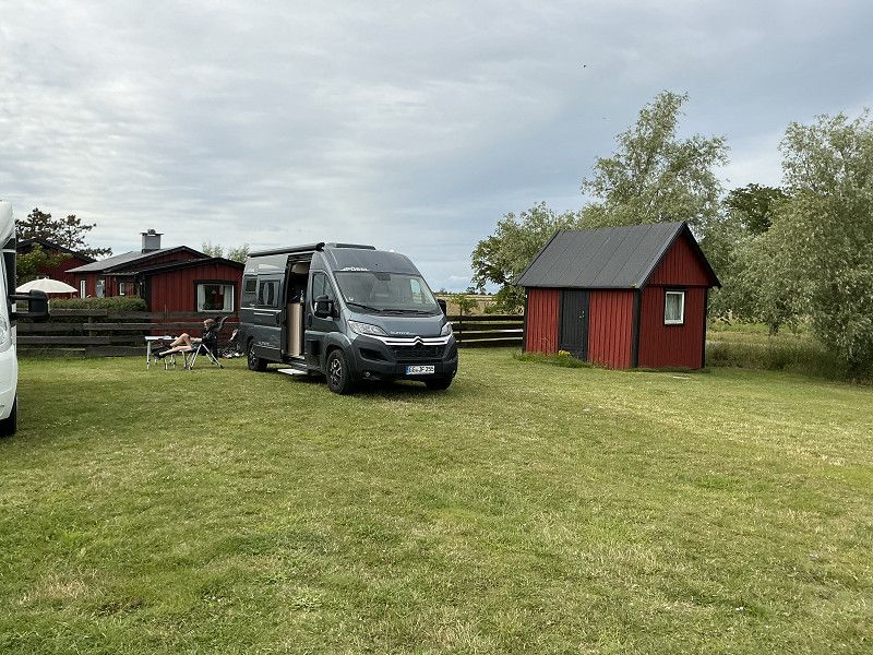
Timmernabben
Nice parking space at the harbor with restaurant
Skarvestensudde, Timmernabben, Provinz Kalmar, Schweden
56° 58' 0.5" N 16° 26' 40.1" E
56.9668145 16.4444602
• Head toward Varvsvägen. Go for 241 m.
• Turn right onto Varvsvägen. Go for 54 m.
• Turn left onto Varvsvägen. Go for 305 m.
• Turn left onto Strandavägen. Go for 616 m.
• Turn left toward Ingemåla. Go for 115 m.
• Continue on Ingemåla. Go for 845 m.
• Continue on Hedersrum. Go for 1.1 km.
• Continue on Hedersrum. Go for 1.3 km.
• Turn right onto Strömsrum. Go for 778 m.
• Turn left toward Strömsrum. Go for 43 m.
• Continue on Strömsrum. Go for 1.3 km.
• Continue on Strömsrum. Go for 985 m.
• Turn left onto Pataholm. Go for 247 m.
• Arrive at Pataholm.
☍
7,9 km
( 12 min.)
Day
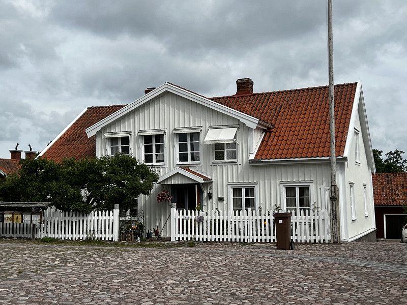
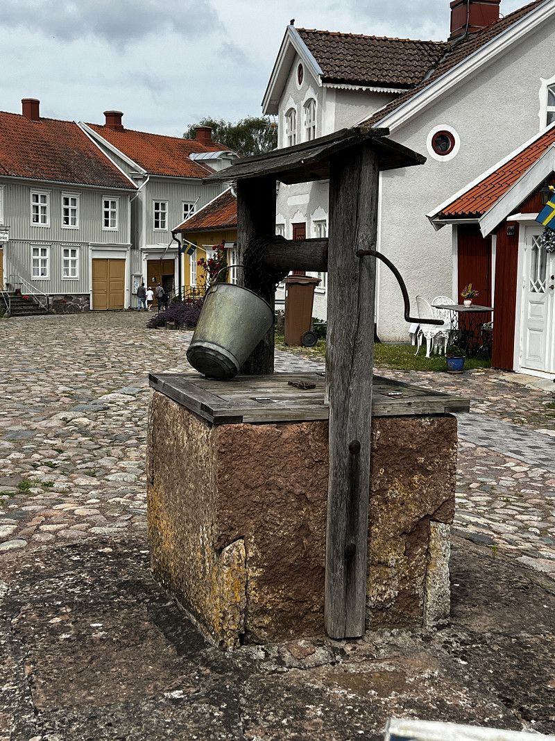
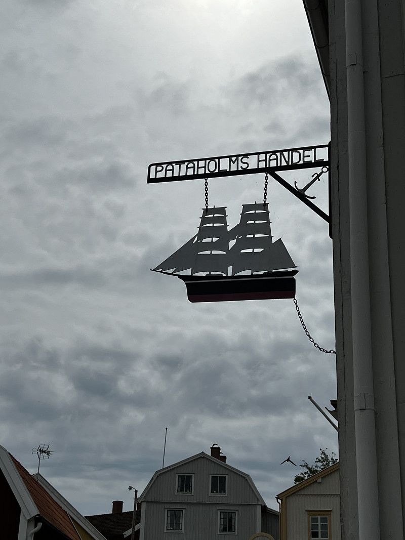
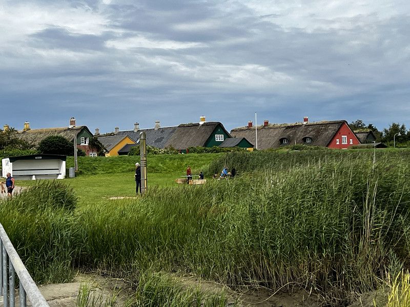
Pataholm
Swedish village, originally preserved.
H 593, Provinz Kalmar, Schweden
56° 55' 0.2" N 16° 25' 44.7" E
56.9167204 16.4290970
• Head west on Pataholm. Go for 247 m.
• Turn right toward Strömsrum. Go for 104 m.
• Continue on Strömsrum. Go for 1.2 km.
• Continue on Strömsrum. Go for 1.0 km.
• Continue on Strömsrum. Go for 1.6 km.
• Continue on Pataholmsvägen. Go for 271 m.
• Turn right onto E22. Go for 24.1 km.
• Continue on E22. Go for 77.7 km.
• Take ramp onto E22.8 toward Sjukhus/Västervik. Go for 1.5 km.
• Continue on Rullstensvägen (E22.8). Go for 95 m.
• Continue on E22.8. Go for 453 m.
• Continue on Stora Infartsvägen (E22.8). Go for 508 m.
• Take the 1st exit from roundabout onto Stora Infartsvägen (E22.8). Go for 426 m.
• Take the 2nd exit from roundabout onto Stora Infartsvägen (E22.8). Go for 399 m.
• Take the 2nd exit from roundabout onto Allén (E22.8). Go for 1.2 km.
• Turn right onto Albert Tengers väg (E22.8). Go for 464 m.
• Take the 2nd exit from roundabout onto Albert Tengers väg (E22.8). Go for 585 m.
• Take the 2nd exit from roundabout onto Östersjövägen. Go for 2.0 km.
• Arrive at Lucernavägen.
☍
113,9 km
(1 hrs. 25 min.)
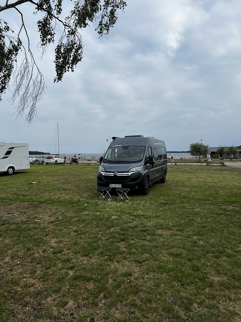
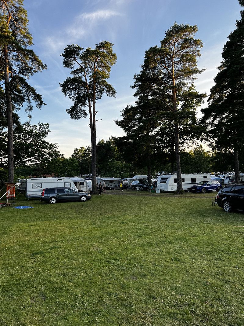
Västervik Resort
Large and busy campsite with lots of infrastructure.
59353, Västervik, Schweden
57° 44' 42.3" N 16° 39' 33.6" E
57.7450900 16.6593400
• Head toward Lysingsvägen on Lucernavägen. Go for 1.9 km.
• Take the 2nd exit from roundabout onto Albert Tengers väg (E22.8). Go for 619 m.
• Take the 2nd exit from roundabout onto Albert Tengers väg (E22.8). Go for 434 m.
• Turn left onto Allén (E22.8). Go for 1.2 km.
• Pass 2 roundabouts and continue on Stora Infartsvägen (E22.8). Go for 843 m.
• Take the 2nd exit from roundabout onto Stora Infartsvägen (E22.8). Go for 543 m.
• Continue on E22.8. Go for 453 m.
• Continue on Rullstensvägen (E22.8). Go for 95 m.
• Continue on E22.8. Go for 959 m.
• Take ramp onto E22 toward Norrköping/Linköping. Go for 99.8 km.
• Continue on Tingstad skola (E22). Go for 7.4 km.
• Take the 2nd exit from Ljurarondellen roundabout onto Söderköpingsvägen (E4.8) toward Centrum. Go for 2.2 km.
• Pass 2 roundabouts and continue on Ståthögavägen (E4.8). Go for 2.4 km.
• Take the 1st exit from Sandbyhovsrondellen roundabout onto Stockholmsvägen (E4.8) toward E4. Go for 223 m.
• Take the 2nd exit from Ingelstarondellen roundabout onto Stockholmsvägen (E4.8) toward E4/51/55/56. Go for 1.6 km.
• Continue on Stockholmsvägen. Go for 315 m.
• Continue toward Trafikplats Norrköping norra. Go for 297 m.
• Continue on Trafikplats Norrköping norra. Go for 395 m.
• Continue on E4 (Trafikplats Norrköping norra). Go for 152 km.
• Take exit 160A toward Stockholm C/Fridhemsplan/Vällingby/Bromma flygplats onto Drottningholmsvägen. Go for 5.0 km.
• Take the 4th exit from Brommaplan roundabout onto Drottningholmsvägen (261) toward Ekerö/Drottningholm. Go for 2.0 km.
• Continue on Nockebybron (261). Go for 1.1 km.
• Continue on Drottningholmsbron (261). Go for 3.3 km.
• Pass 2 roundabouts and continue on Ekerövägen (261). Go for 4.0 km.
• Take the 2nd exit from roundabout onto Ekerövägen toward Adelsö/Slagsta/Ekerö C. Go for 589 m.
• Pass 3 roundabouts and continue on Ekerövägen (816). Go for 10.2 km.
• Turn left onto Rastaholms allé. Go for 551 m.
• Turn left onto Rastaholms allé. Go for 385 m.
• Arrive at Rastaholms allé. Your destination is on the left.
☍
300,4 km
(3 hrs. 38 min.)
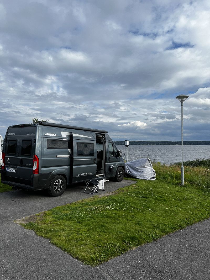
Day
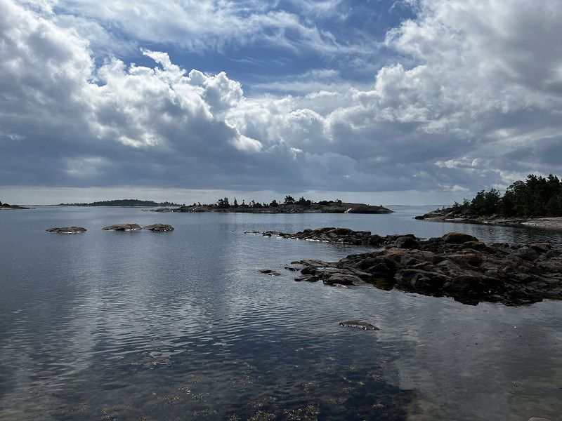
Idö
Tour with a small passenger ferry through the archipelago to the island of Idö. City tour of Västerwik
Day
Ekerö
Small parking space at the harbor, 7 minutes walk to the bus to Stockholm
Rastaholms Allé 27, Ekerö kommun, Provinz Stockholm, Schweden
59° 17' 30.1" N 17° 39' 10.7" E
59.2916848 17.6529743
• Head northeast on Rastaholms allé. Go for 385 m.
• Turn right onto Rastaholms allé. Go for 551 m.
• Turn right onto Ekerövägen (816). Go for 8.6 km.
• Pass 3 roundabouts and continue on Ekerövägen (816). Go for 2.1 km.
• Turn right onto Ekerövägen (261) toward Stockholm/Drottningholm. Go for 3.2 km.
• Pass 2 roundabouts and continue on Ekerövägen (261). Go for 4.2 km.
• Continue on Drottningholmsvägen (261). Go for 1.1 km.
• Continue on Drottningholmsvägen (261). Go for 1.9 km.
• Take the 3rd exit from Brommaplan roundabout onto Kvarnbacksvägen. Go for 1.3 km.
• Turn left onto Ulvsundavägen (279) toward Kista/E4/Bromma flygplats/E18. Go for 6.0 km.
• Take left ramp onto E18 (Hjulstavägen) toward Oslo/Tensta. Go for 193 km.
• Take exit 110A toward Oslo/Karlskoga/Örebro flygplats onto E18. Go for 39.6 km.
• Take ramp toward Bregården/Grönfeltsudden/Bohult. Go for 130 m.
• Turn right onto Boåsvägen. Go for 115 m.
• Turn right onto Hyttåsvägen. Go for 93 m.
• Turn left onto Mykrisvägen. Go for 390 m.
• Turn right. Go for 223 m.
• Arrive at your destination.
☍
263,3 km
(3 hrs. 2 min.)
Day
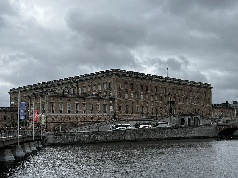
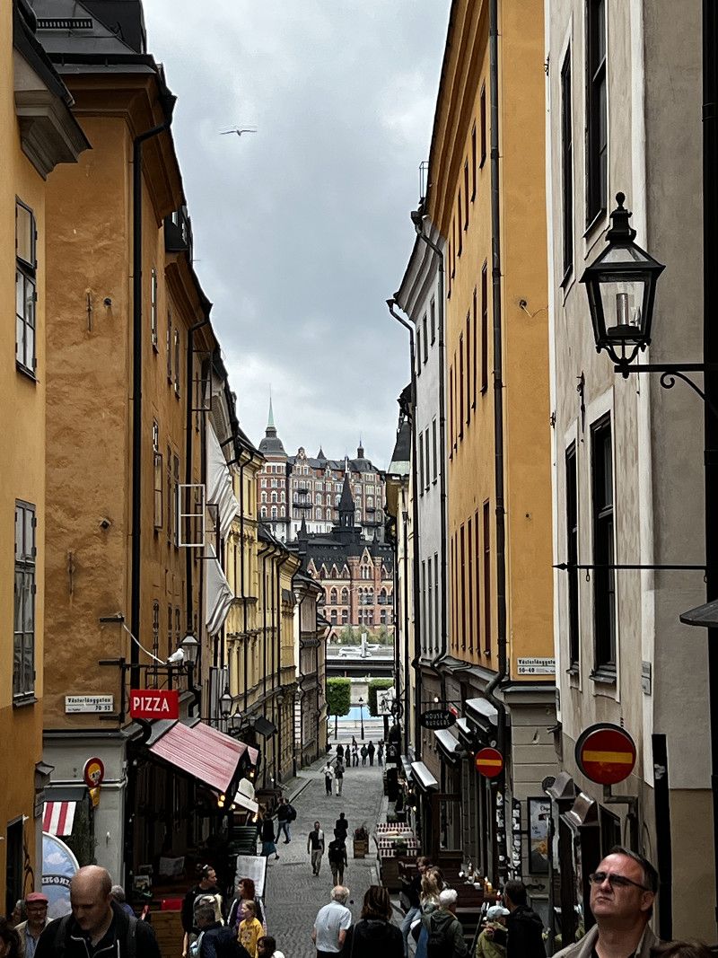
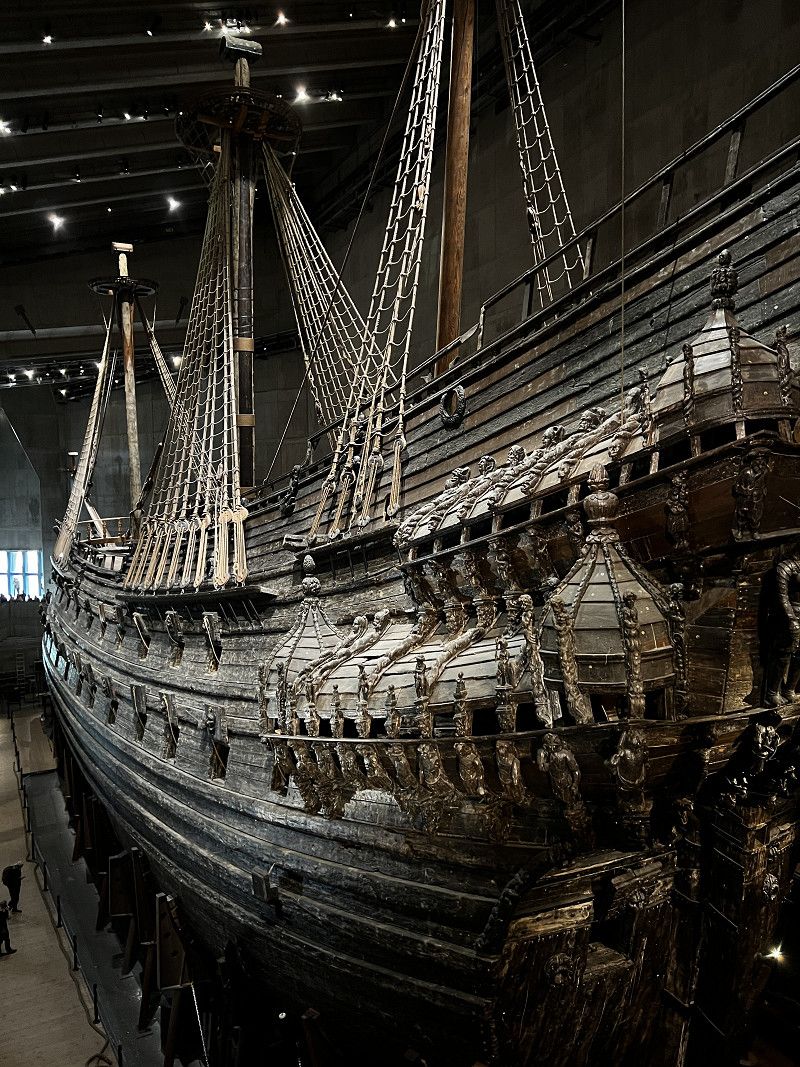
Stockholm
City tour of Stockholm Old Town and Vasa Museum
Day
Karlskoga
Nice parking space, is quickly occupied.
Industrivägen, Karlskoga, Provinz Örebro, Schweden
59° 19' 14.5" N 14° 32' 17.1" E
59.3207014 14.5380707
• Head north. Go for 223 m.
• Turn left onto Mykrisvägen. Go for 390 m.
• Turn right onto Hyttåsvägen. Go for 93 m.
• Turn left onto Boåsvägen. Go for 115 m.
• Turn left toward Örebrovägen/E18. Go for 70 m.
• Take ramp onto Örebrovägen (E18). Go for 330 m.
• Take the 2nd exit from roundabout onto Örebrovägen (E18) toward 205/237. Go for 1.2 km.
• Take the 3rd exit from roundabout onto E18 toward Oslo. Go for 541 m.
• Pass 2 roundabouts and continue on E18/E45. Go for 188 km.
• Continue on Svenskeveien (E18). Go for 56.2 km.
• Continue on Askimveien (E18). Go for 7.4 km.
• Take the 2nd exit from roundabout onto E18 toward Oslo. Go for 6.2 km.
• Take left ramp onto E6/E18 toward Oslo. Go for 1.2 km.
• Take exit 22 toward Drammen/Oslo Sentrum/Langhus/152/Tusenfryd onto E18. Go for 588 m.
• Keep left onto E18 toward Drammen/Oslo Sentrum. Go for 17.2 km.
• Keep left onto E18 toward Kristiansand/Sentrum V. Go for 3.7 km.
• Keep left onto Frognerstranda (E18). Go for 2.3 km.
• Take ramp toward Ring 2/Majorstuen. Go for 183 m.
• Turn right onto Drammensveien. Go for 18 m.
• Take the 5th exit from roundabout onto Sjølystveien toward Sjølyst Marina. Go for 160 m.
• Enter the roundabout. Go for 26 m.
• Arrive at your destination on the right.
☍
286,3 km
(3 hrs. 21 min.)
Day
Oslo / Sjølyst Marina Wohnmobilhafen
Large parking space on the outskirts of Oslo, short walk to Museum Island.
Sjølystveien, 0277, Oslo, Norwegen
59° 55' 14" N 10° 40' 32" E
59.9205556 10.6755556
• Follow the roundabout. Go for 2 m.
• Take the 2nd exit from roundabout onto Sjølystveien (E18). Go for 502 m.
• Take ramp toward Bygdøy. Go for 231 m.
• Take the 1st exit from roundabout onto Dronning Blancas vei toward Bygdøy. Go for 693 m.
• Continue on Bygdøyveien. Go for 588 m.
• Continue on Museumsveien. Go for 426 m.
• Continue on Langviksveien. Go for 109 m.
• Turn left onto Fredriksborgveien. Go for 121 m.
• Turn left onto Huk aveny. Go for 98 m.
• Turn left onto Museumsveien. Go for 104 m.
• Arrive at Museumsveien.
☍
2,9 km
( 4 min.)
Day
Oslo - Norsk Folkemuseum
Very nice open-air museum where you can spend the whole day.
Museumsveien 4A, Oslo, Norwegen
59° 54' 23.3" N 10° 41' 20.5" E
59.9064692 10.6890388
• Head northwest on Museumsveien. Go for 510 m.
• Continue on Bygdøyveien. Go for 588 m.
• Keep right onto Dronning Blancas vei. Go for 688 m.
• Take the 4th exit from roundabout onto Sjølystveien (E18) toward Drammen. Go for 593 m.
• Take ramp toward Ring 2/Majorstuen. Go for 183 m.
• Turn right onto Drammensveien. Go for 18 m.
• Take the 5th exit from roundabout onto Sjølystveien toward Sjølyst Marina. Go for 160 m.
• Take the 1st exit from roundabout. Go for 103 m.
• Arrive at your destination on the right.
☍
2,8 km
( 4 min.)
Oslo / Sjølyst Marina Wohnmobilhafen
Another night on the pitch
Drammensveien, Oslo, Norwegen
59° 55' 13" N 10° 40' 28.3" E
59.9202687 10.6745159
• Head northeast. Go for 77 m.
• Take the 1st exit from roundabout onto Sjølystveien (E18). Go for 5.6 km.
• Keep left onto Operatunnelen (190) toward E6/Trondheim/Gardermoen. Go for 1.4 km.
• Take ramp onto Operatunnelen (E6) toward Gøteborg. Go for 1.8 km.
• Take the 2nd exit from roundabout onto E6 toward Gøteborg/Stockholm/E18. Go for 694 m.
• Keep left onto E6 toward Gøteborg/E18/Stokholm. Go for 18.3 km.
• Continue on E6 toward Gøteborg. Go for 91.5 km.
• Continue on E6 (Svinesundsbron). Go for 14.6 km.
• Take exit 112 toward Strömstad N C/Näsinge. Go for 367 m.
• Turn right onto 176 toward E18/Strömstad. Go for 3.2 km.
• Take the 1st exit from roundabout onto Ringvägen. Go for 760 m.
• Turn left onto Kebalvägen. Go for 662 m.
• Turn right. Go for 33 m.
• Arrive at your destination on the right.
☍
139,0 km
(1 hrs. 30 min.)
Day
Strömstad
Well-visited, simple parking space.
Provinz Västra Götaland, Schweden
58° 57' 5.8" N 11° 10' 28.9" E
58.9516248 11.1746992
• Head toward Kebalvägen. Go for 33 m.
• Turn left onto Kebalvägen. Go for 662 m.
• Turn right onto Ringvägen. Go for 735 m.
• Take the 3rd exit from roundabout onto 176. Go for 3.2 km.
• Take the 1st exit from roundabout onto E6 toward Göteborg. Go for 160 km.
• Keep right onto Ringömotet. Go for 103 m.
• Continue on E6 (Tingstadstunneln). Go for 585 m.
• Take exit 75A toward Frederikshavn onto E45. Go for 4.4 km.
• Take ramp toward Frederikshavn/Majorna. Go for 196 m.
• Turn right onto E45. Go for 1.1 km.
• Arrive at Masthuggskajen (E45). Your destination is on the left.
☍
170,7 km
(1 hrs. 50 min.)
Day
Göteborg
Emigrantvägen 20, Göteborg, Provinz Västra Götaland, Schweden
57° 42' 5.9" N 11° 56' 44" E
57.7016427 11.9455422
• Head north on Masthuggskajen (E45).
• Turn left onto Masthuggskajen (E45). Go for 765 m.
• Turn left onto Emigrantvägen. Go for 1.2 km.
• Turn right onto Heurlins plats. Go for 161 m.
• Turn left onto Järntorgsgatan. Go for 90 m.
• Continue on Östra Pusterviksbron. Go for 52 m.
• Take the 2nd exit from Rosenlundsgatan roundabout onto Esperantoplatsen. Go for 538 m.
• Continue on Residensbron. Go for 61 m.
• Continue on Operagatan toward E6/E20/40/Karlstad/E45. Go for 143 m.
• Turn right onto Packhusplatsen. Go for 27 m.
• Continue on Packhusplatsen. Go for 152 m.
• Continue on Norra hamngatan. Go for 144 m.
• Turn slightly left onto Norra hamngatan. Go for 79 m.
• Turn left onto Tyggårdsgatan. Go for 70 m.
• Turn right onto Köpmansgatan. Go for 131 m.
• Continue on Gustaf Adolfs torg. Go for 61 m.
• Arrive at Gustaf Adolfs torg. Your destination is on the right.
☍
3,7 km
( 9 min.)
Departure port: Göteborg
Provinz Västra Götaland, Schweden
57.7072326 11.9670171
Arrival port: Frederikshavn
Region Nordjütland, Dänemark
57.441213410.5336225
• Head north on Parallelvej. Go for 61 m.
• Turn right onto Jernbanegade. Go for 116 m.
• Continue on Kirkepladsen. Go for 109 m.
• Turn left onto Havnepladsen (35/40). Go for 900 m.
• Continue on Skagensvej (40) toward Skagen. Go for 1.9 km.
• Take the 1st exit from roundabout onto Skagensvej. Go for 20 m.
• Continue on Apholmenvej. Go for 1.1 km.
• Turn right onto Nordre Strandvej. Go for 71 m.
• Turn left onto Nordre Strandvej. Go for 20 m.
• Arrive at Nordre Strandvej. Your destination is on the right.
☍
8,0 km
( 12 min.)
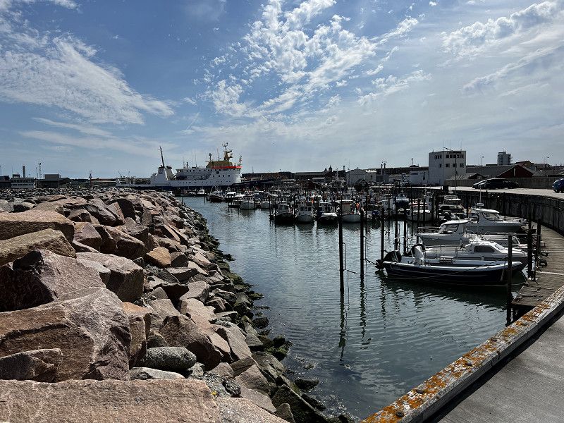
Frederikshavn
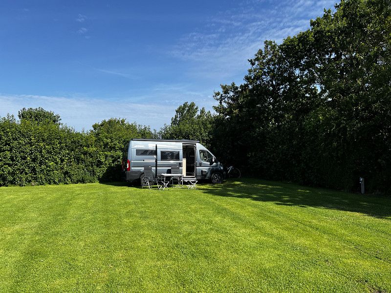
Nice pitch on lawn and surrounded by hedges
Region Nordjütland, Dänemark
57° 27' 58.3" N 10° 31' 59" E
57.4661911 10.5330495
• Head northeast on Nordre Strandvej. Go for 61 m.
• Turn left. Go for 16 m.
• Turn left toward Nordre Strandvej. Go for 78 m.
• Turn right onto Nordre Strandvej. Go for 48 m.
• Turn left onto Apholmenvej. Go for 1.1 km.
• Continue on Skagensvej. Go for 5 m.
• Take the 1st exit from roundabout onto Skagensvej (40). Go for 3.5 km.
• Pass 5 roundabouts and continue on Ålbækvej (40). Go for 30.6 km.
• Continue on Frederikshavnsvej (40). Go for 1.7 km.
• Take the 2nd exit from roundabout onto Kattegatvej. Go for 652 m.
• Turn left onto Buttervej. Go for 365 m.
• Take the 2nd exit from roundabout onto Bøjlevejen. Go for 3.3 km.
• Take the 2nd exit from roundabout onto Fyrvej (40). Go for 1.6 km.
• Arrive at Fyrvej (40).
☍
43,1 km
( 40 min.)
Day
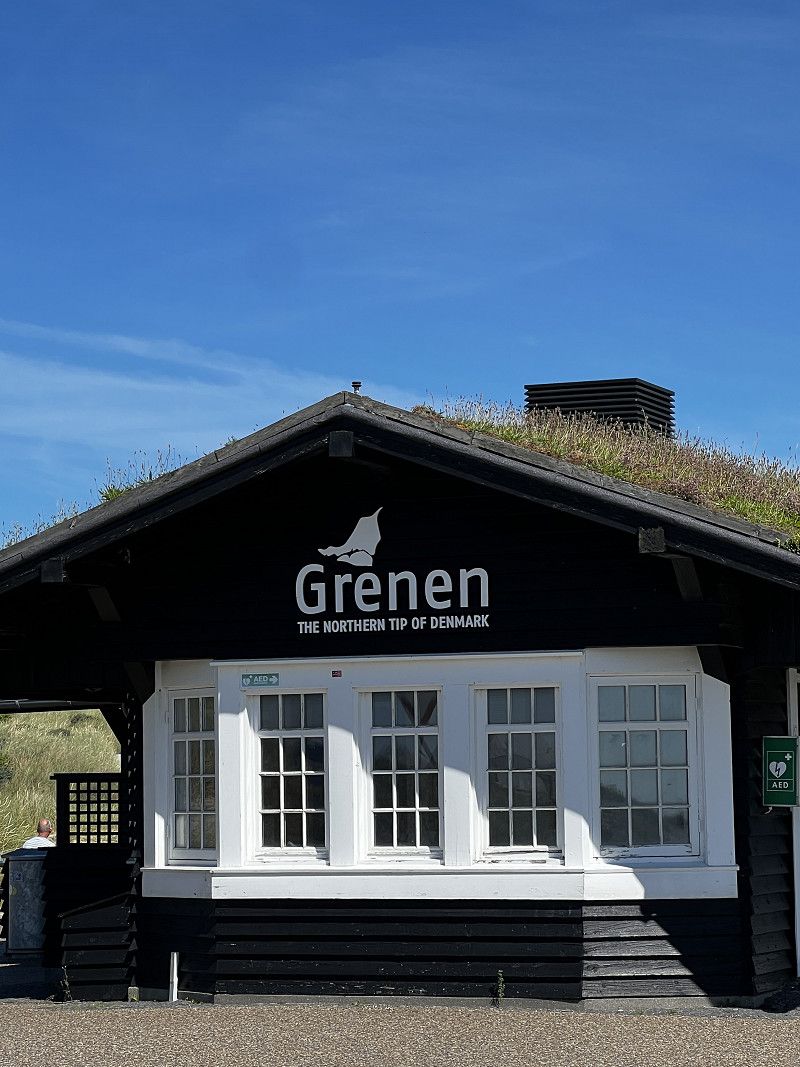
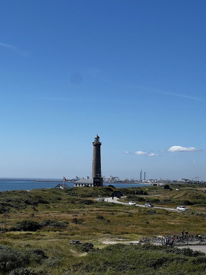
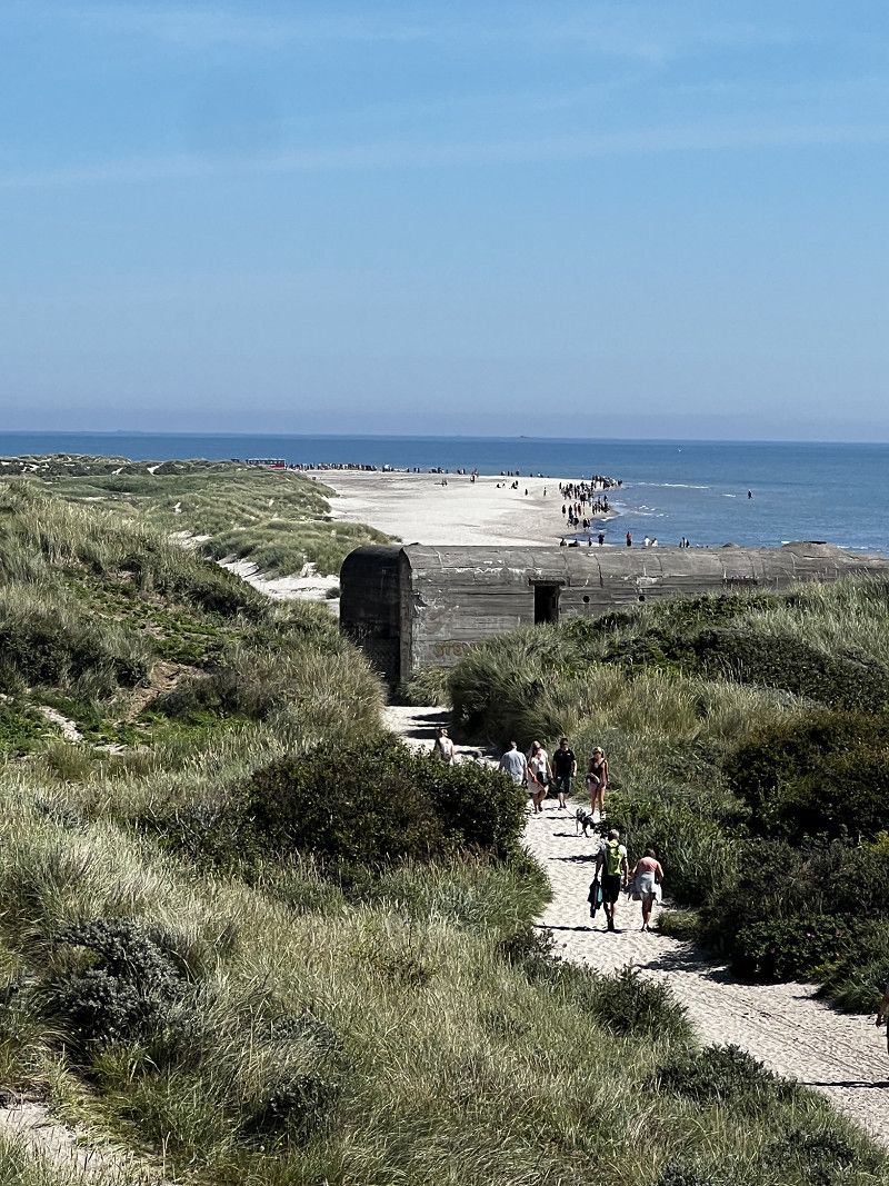
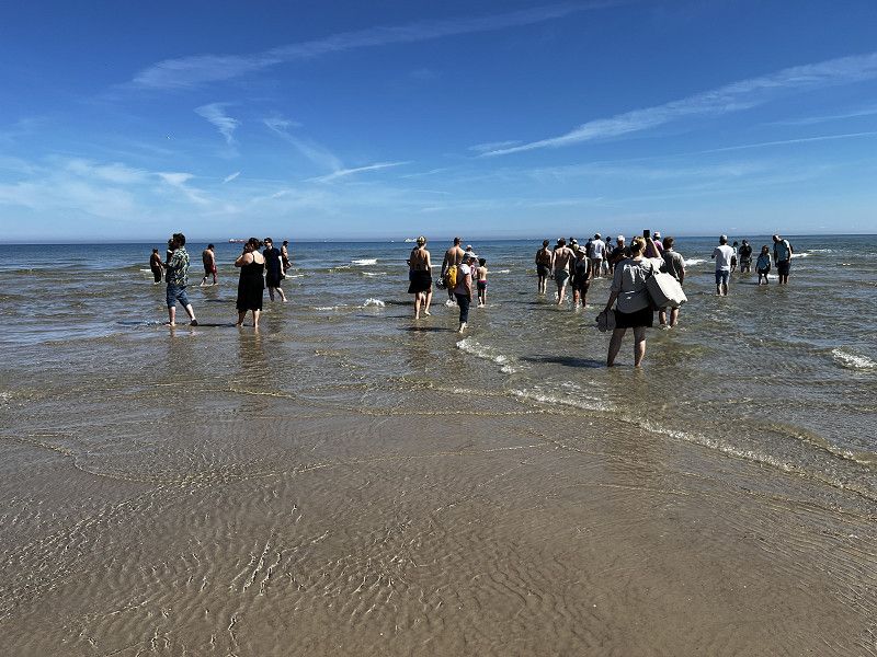
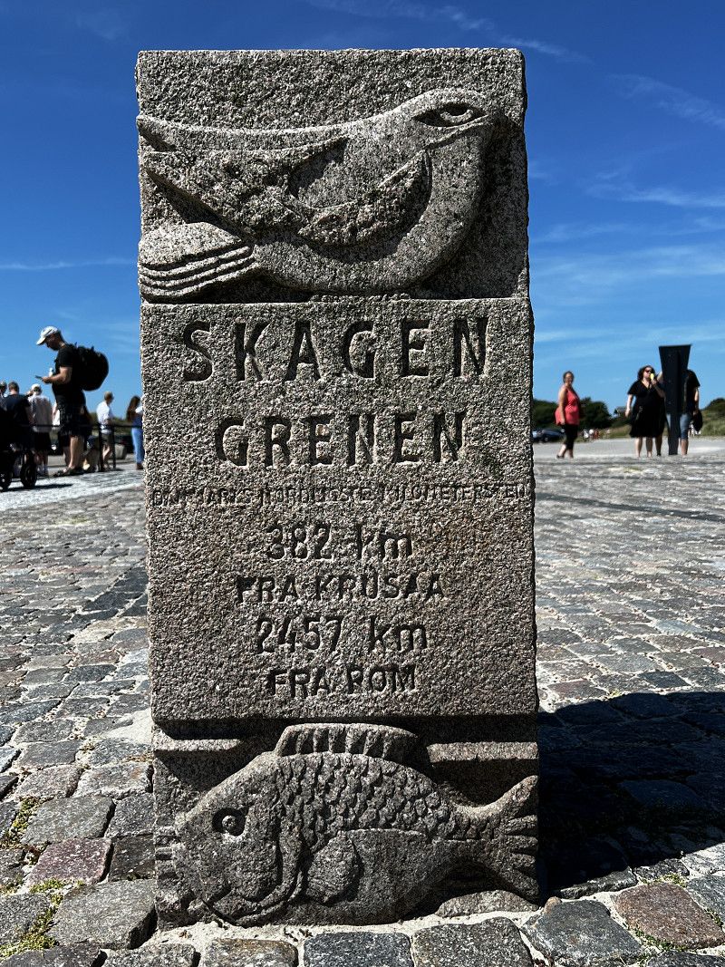
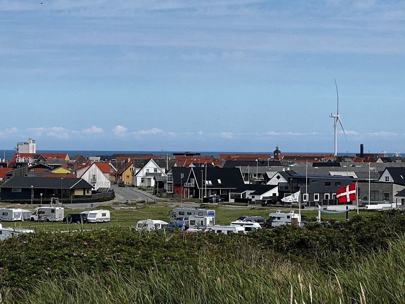
Skagen
Northernmost tip of Denmark
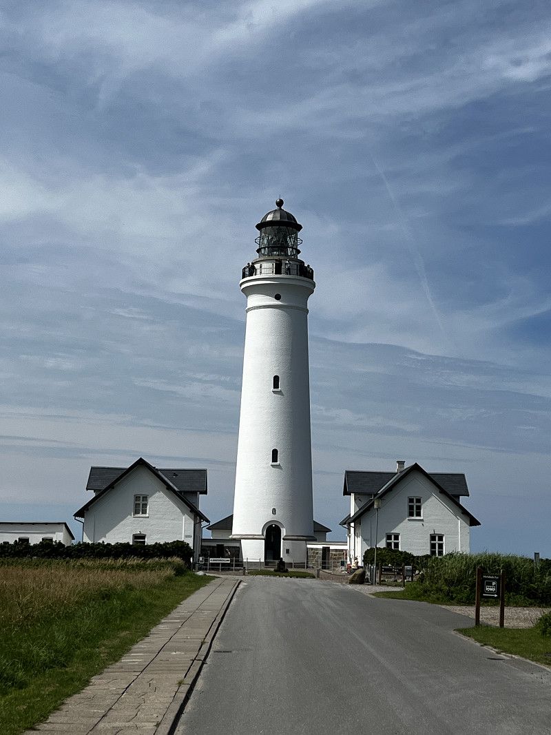
Fyrvej, Skagen, Region Nordjütland, Dänemark
57° 44' 12" N 10° 37' 53.2" E
57.7366530 10.6314464
• Head toward Gammel Fyrvej on Fyrvej (40). Go for 1.5 km.
• Take the 1st exit from roundabout onto Bøjlevejen. Go for 3.3 km.
• Take the 3rd exit from roundabout onto Buttervej. Go for 428 m.
• Turn right onto Kattegatvej. Go for 563 m.
• Take the 1st exit from roundabout onto Frederikshavnsvej (40). Go for 10.9 km.
• Take the 2nd exit from roundabout onto Ålbækvej (40). Go for 6.4 km.
• Take the 1st exit from roundabout onto Hirtshalsvej (597). Go for 15.3 km.
• Take the 1st exit from roundabout onto Tannisbugtvej. Go for 485 m.
• Turn slightly left onto Tannisbugtvej. Go for 597 m.
• Turn right onto Tannisbugtvej. Go for 93 m.
• Arrive at Tannisbugtvej.
☍
39,7 km
( 33 min.)
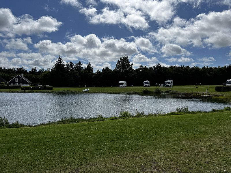
Tannisby Camping
Tannisbugtvej 86, 9881, Bindslev, Dänemark
57° 35' 25.9" N 10° 11' 18.1" E
57.5905400 10.1883700
• Head southwest on Tannisbugtvej. Go for 93 m.
• Turn left onto Tannisbugtvej. Go for 1.1 km.
• Take the 1st exit from roundabout onto Skagensvej (597). Go for 10.6 km.
• Take the 3rd exit from roundabout onto E39 (Hirtshalsmotorvejen) toward Aalborg. Go for 42.5 km.
• Take exit 8 toward Tylstrup/Blokhus/Hjallerup/Thisted. Go for 487 m.
• Take the 1st exit from roundabout onto Luneborgvej (515/559) toward Thisted/Blokhus/Store Vildmose. Go for 2.4 km.
• Turn left onto Luneborgvej (515/559). Go for 4.1 km.
• Take the 3rd exit from roundabout onto Centralgårdsvej (515). Go for 10.0 km.
• Turn left onto Brogårdsvej (55) toward Aalborg/Nørresundby/Thisted/11. Go for 1.2 km.
• Take the 1st exit from roundabout onto Thisted Landevej (11) toward Thisted/Brovst/Fjerritslev. Go for 2.0 km.
• Turn right onto Tranumvej toward Tranum/Tranumenge/Birkelse. Go for 386 m.
• Take the 2nd exit from roundabout onto Tranumvej. Go for 4.8 km.
• Continue on Tranum Engevej. Go for 2.1 km.
• Take the 2nd exit from roundabout onto Tranum Engevej. Go for 5.0 km.
• Continue on Dybdalsvej. Go for 1.3 km.
• Continue on Drosselvej. Go for 12 m.
• Continue on Dybdalsvej. Go for 898 m.
• Take the 2nd exit from roundabout onto Hjortdalvej. Go for 3.5 km.
• Turn left onto Bonderupvej. Go for 2.0 km.
• Continue on Mellemmøllevej. Go for 792 m.
• Turn right onto Ålborgvej (11). Go for 29.1 km.
• Take the 2nd exit from roundabout onto Aalborgvej (11/29) toward Hanstholm/Thisted. Go for 6.8 km.
• Turn right onto Hjardemålvej (29) toward Hanstholm/Frøstrup/Færge/Lufthavn. Go for 13.1 km.
• Take the 2nd exit from roundabout onto Thistedvej (26). Go for 334 m.
• Turn left onto Bybakken. Go for 119 m.
• Turn left onto Bybakken. Go for 217 m.
• Arrive at Bybakken. Your destination is on the right.
☍
144,9 km
(1 hrs. 44 min.)
Day
Hirtshals
Bike tour to Hirtshals
Day
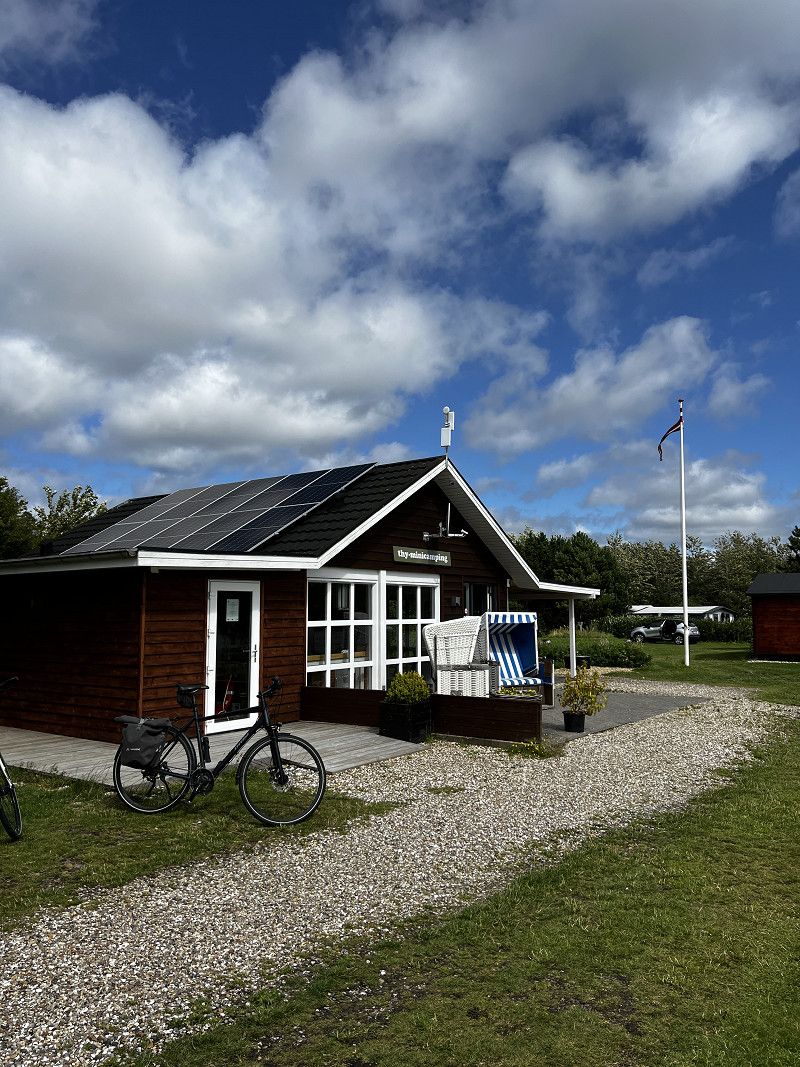
Minicamping Ræhr Fiskepark
Beautifully situated pitch by a small lake
Bybakken 3, 7730, Hanstholm, Dänemark
57° 5' 23" N 8° 40' 17" E
57.0897222 8.6713889
• Head toward Kærbakken on Bybakken. Go for 320 m.
• Turn slightly left onto Kærbakken. Go for 175 m.
• Turn right onto Bybakken. Go for 19 m.
• Turn right onto Thistedvej (26). Go for 292 m.
• Take the 1st exit from roundabout onto Hanstholmvej (26). Go for 13.0 km.
• Take the 1st exit from roundabout onto Oddesundvej (11/26) toward Holstebro/Nykøbing. Go for 5.4 km.
• Take the 1st exit from roundabout onto Oddesundvej (11/26) toward Holstebro/Nykøbing. Go for 57.9 km.
• Pass 2 roundabouts and continue on Holstebrovej (11). Go for 19.9 km.
• Continue on Ringvejen (11/16). Go for 1.2 km.
• Turn left onto Skjernvej (11) toward Varde/Skjern. Go for 30.5 km.
• Take the 2nd exit from roundabout onto Brejningvej (11) toward Varde. Go for 14.3 km.
• Take the 3rd exit from roundabout onto Ringvejen (11/28) toward Sdr. Omme/Tarm/Varde. Go for 1.7 km.
• Take the 2nd exit from roundabout onto Ringvejen (11/28) toward Varde/Sdr. Omme/Tarm. Go for 2.5 km.
• Turn left onto Vardevej (11/28) toward Varde/Sdr. Omme/Tarm. Go for 1.9 km.
• Turn right onto Vestre Kvartervej (11). Go for 36.3 km.
• Continue on Esbjergvej (12) toward Esbjerg. Go for 8.8 km.
• Take the 2nd exit from roundabout onto Tarp Hovedvej (12) toward Esbjerg. Go for 878 m.
• Pass 3 roundabouts and continue on Stormgade. Go for 6.2 km.
• Turn right onto Toldbodvej (E20) toward Fiskerihavn. Go for 96 m.
• Turn left onto Dokvej toward Fanø. Go for 353 m.
• Turn left onto Dokvej. Go for 52 m.
• Continue on Vestre Dokkaj. Go for 30 m.
• Continue on Dokvej. Go for 103 m.
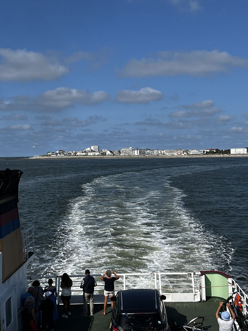
• Take the Esbjerg-Nordby Ferry. Stay on for 2.5 km.
• Head southwest. Go for 118 m.
• Continue on Langelinie. Go for 360 m.
• Continue on Postvejen. Go for 1.9 km.
• Turn right onto Kirkevejen. Go for 598 m.
• Arrive at Kirkevejen. Your destination is on the right.
☍
207,5 km
(3 hrs. 34 min.)
Hanstholm
Bike tour to Hanstholm
Day
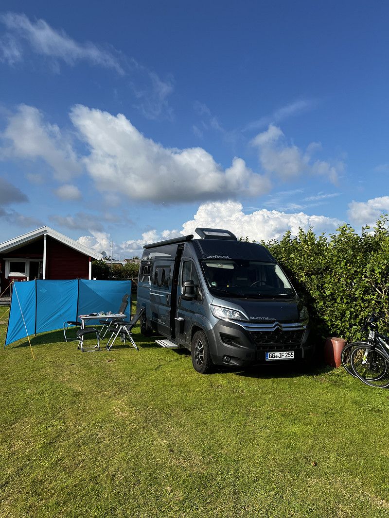
Rødgaard Camping Fanø
Very nice and large campsite, individual areas shielded by hedges
Kirkevejen 13, 6720, Fanø, Dänemark
55° 25' 35.1" N 8° 23' 25.5" E
55.4264300 8.3904200
• Head north on Kirkevejen. Go for 598 m.
• Turn left onto Postvejen. Go for 1.9 km.
• Continue on Langelinie. Go for 231 m.
• Turn right. Go for 242 m.
• Take the Nordby-Esbjerg Ferry. Stay on for 2.5 km.
• Head northeast on Dokvej. Go for 103 m.
• Continue on Vestre Dokkaj. Go for 30 m.
• Continue on Dokvej. Go for 405 m.
• Turn right onto Toldbodvej (E20) toward Kolding/Varde/Ribe/24/Centrum. Go for 648 m.
• Turn right onto Estrupvej (E20). Go for 955 m.
• Take the 2nd exit from roundabout onto Estrupvej (E20). Go for 1.0 km.
• Take the 2nd exit from roundabout onto Gammelby Ringvej (E20). Go for 1.1 km.
• Take the 2nd exit from roundabout onto Tjæreborgvej (E20). Go for 837 m.
• Keep right onto Tjæreborgvej toward Ribe. Go for 3.5 km.
• Pass 2 roundabouts and continue on Varde Hovedvej (11/24). Go for 21.9 km.
• Turn right onto Ringvejen (11/24) toward Tønder/Aabenraa. Go for 2.3 km.
• Keep right onto Tøndervej (11) toward Tønder/Rømø. Go for 758 m.
• Take the 2nd exit from roundabout onto Tøndervej (11) toward Tønder/Rømø. Go for 17.2 km.
• Take the 3rd exit from roundabout onto Ribevej (11) toward Tønder/Skærbæk. Go for 13.3 km.
• Pass 2 roundabouts and continue on Ribelandevej (11). Go for 8.7 km.
• Take the 2nd exit from roundabout onto Ribelandevej (11) toward Tønder. Go for 940 m.
• Take the 2nd exit from roundabout onto Ribelandevej (11) toward Tønder. Go for 1.7 km.
• Take the 2nd exit from roundabout onto 11 toward Husum/Kruså/8. Go for 2.1 km.
• Pass 2 roundabouts and continue on Sønderløgumlandevej (11). Go for 5.3 km.
• Turn left onto Den Gamlevej. Go for 11 m.
• Arrive at Den Gamlevej. Your destination is on the left.
☍
88,2 km
(1 hrs. 54 min.)
An Tondern vorbei
19, Den Gamlevej, Seth, Kommune Tondern, Region Süddänemark, 6270, Dänemark
54° 54' 24.5" N 8° 54' 32" E
54.9068174 8.9088845
• Head toward Sønderløgumlandevej on Den Gamlevej. Go for 11 m.
• Turn left onto Sønderløgumlandevej (11). Go for 338 m.
• Continue on B5. Go for 11.3 km.
• Continue on Klixbüller Deich (B5) toward Husum/Niebüll. Go for 2.2 km.
• Pass 2 roundabouts and continue on An der B5 (B5). Go for 22.8 km.
• Take the 3rd exit from Verteilerring roundabout onto Eisenbahnstraße (B5) toward Husum Hüsem. Go for 1.6 km.
• Take the 2nd exit from roundabout onto Husumer Straße (B5) toward Husum. Go for 34.1 km.
• Turn right onto Harblek (L36) toward Oldenswort. Go for 1.0 km.
• Turn right onto Harblek (L36). Go for 905 m.
• Turn left onto Kotzenbüller Chaussee (L311). Go for 4.5 km.
• Turn left onto Gardinger Chaussee (B202). Go for 3.1 km.
• Take ramp onto B5. Go for 17.4 km.
• Take ramp toward Heide Krankenhaus/Rendsburg/Büsum. Go for 357 m.
• Turn right onto B203 toward Rendsburg/Heide. Go for 1.9 km.
• Take the 2nd exit from roundabout onto Friedrichswerk (B203) toward Rendsburg/Heide. Go for 1.3 km.
• Turn right onto Markt. Go for 110 m.
• Turn left. Go for 111 m.
• Arrive at your destination on the right.
☍
103,0 km
(1 hrs. 33 min.)
Day
Nordby
Hike to Nordby
Day
Sønderho
Bike tour to Sønderho
Day
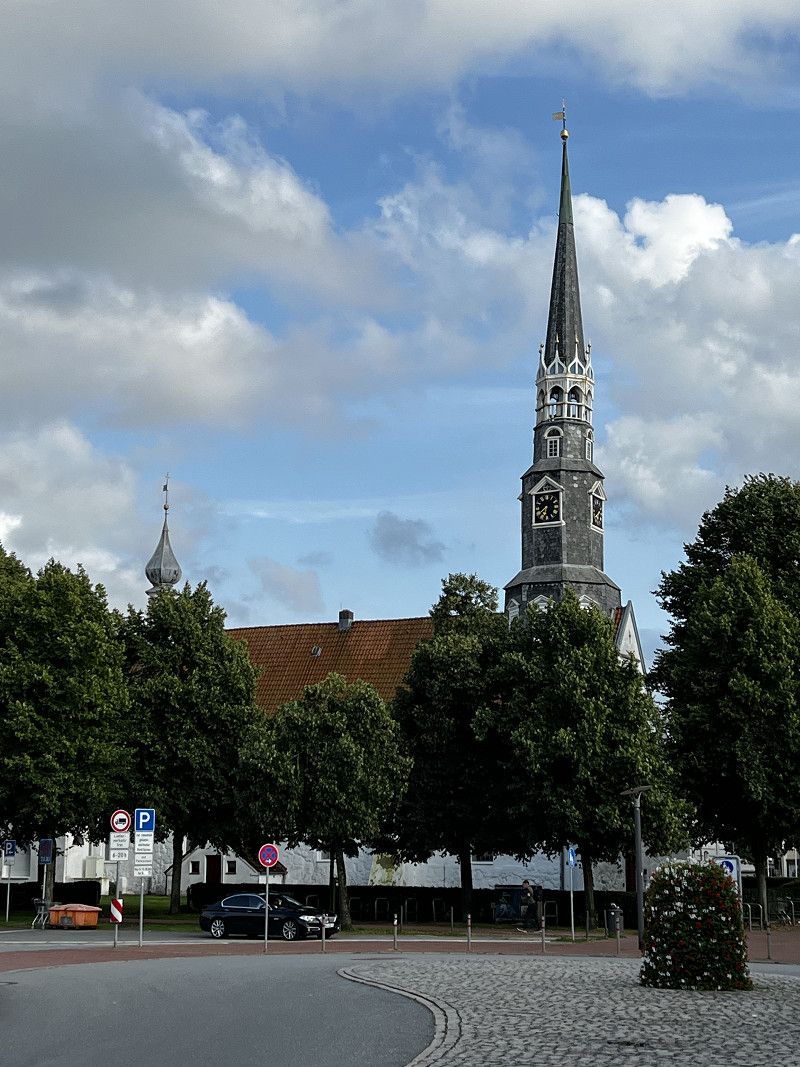
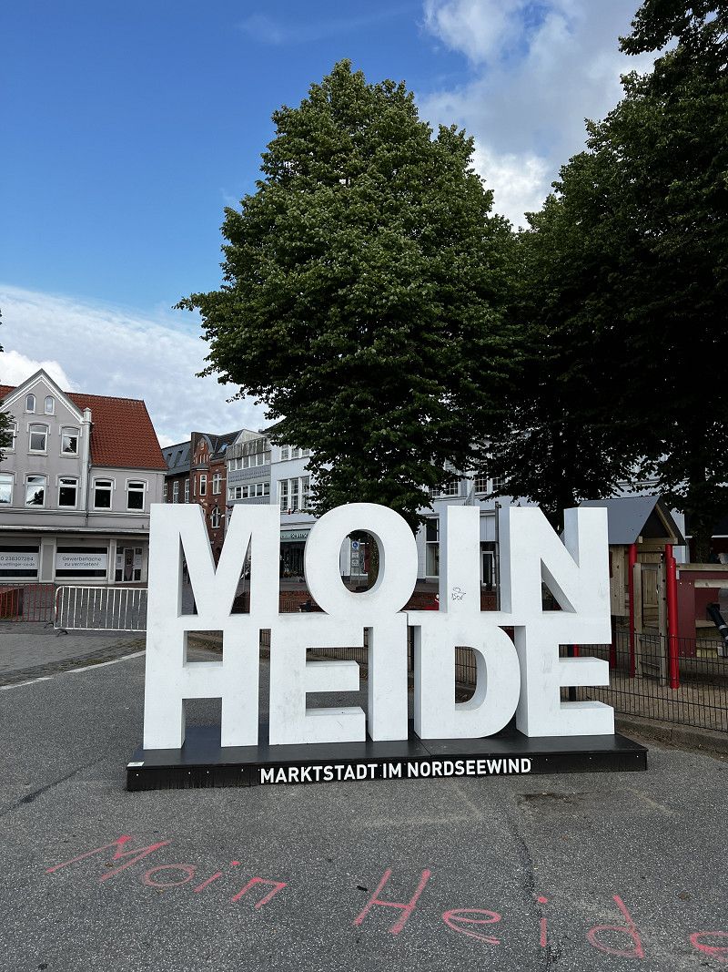
Heide
Visiting my hometown Heide
Marktdiagonale, Heide, Dithmarschen, Schleswig-Holstein, Deutschland
54° 11' 42.2" N 9° 5' 34" E
54.1950497 9.0927821
• Head northeast. Go for 97 m.
• Turn left. Go for 94 m.
• Turn right toward Markt/B203. Go for 22 m.
• Turn left onto Markt (B203). Go for 104 m.
• Continue on Marschstraße (B203). Go for 244 m.
• Turn left onto Westerweide (B5) toward Brunsbüttel. Go for 212 m.
• Turn slightly left onto Mühlenstraße (B5). Go for 275 m.
• Turn right onto Meldorfer Straße (B5). Go for 2.7 km.
• Take ramp onto A23 toward Hamburg. Go for 48.3 km.
• Take exit 10 toward Itzehoe-Süd. Go for 306 m.
• Take the 1st exit from roundabout onto L119 toward Elmshorn/Glückstadt/Dägeling. Go for 6.1 km.
• Continue on L112. Go for 202 m.
• Turn right onto Hauptstraße (L112). Go for 9.5 km.
• Turn right onto Blomeweg (B431). Go for 1.8 km.
• Turn left onto Sperforkenweg (B495). Go for 2.6 km.
• Take the Glückstadt-Wischhafen Ferry. Stay on for 5.3 km.
• Head west on Glückstädter Straße (B495). Go for 1.3 km.
• Turn left onto Stader Straße (B495) toward Bremervörde/Stade. Go for 4.0 km.
• Turn right onto Ostener Straße (B495) toward Bremervörde/Hemmoor. Go for 21.5 km.
• Turn right onto Mittelstenaher Straße (L116) toward Bad Bederkesa/Mittelstenahe. Go for 19.6 km.
• Pass 2 roundabouts and continue on L119. Go for 3.2 km.
• Take the 3rd exit from roundabout onto Drangstedter Straße (L120) toward A27/Bremen/Bremerhaven/Drangstedt. Go for 10.8 km.
• Take ramp onto A27. Go for 9.5 km.
• Take exit 7 toward Bremerhaven-Zentrum/Havenwelten/Nordenham onto B212 (Grimsbystraße). Go for 1.6 km.
• Keep left onto Grimsbystraße (B212) toward Nordenham/Zentrum/Havenwelten. Go for 1.8 km.
• Turn left onto Columbusstraße (B212). Go for 536 m.
• Turn left onto Obere Bürger. Go for 80 m.
• Turn right onto Am Alten Hafen. Go for 50 m.
• Arrive at Am Alten Hafen.
☍
151,7 km
(2 hrs. 40 min.)
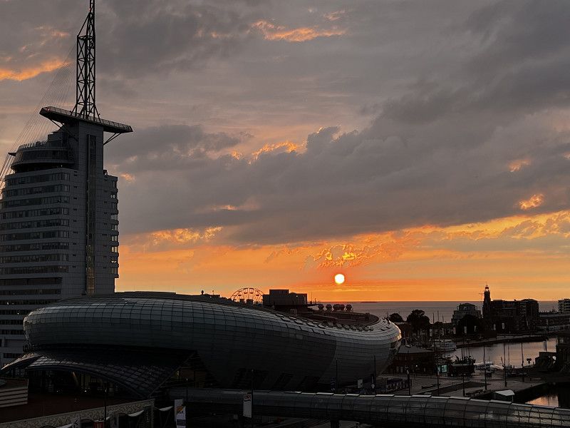
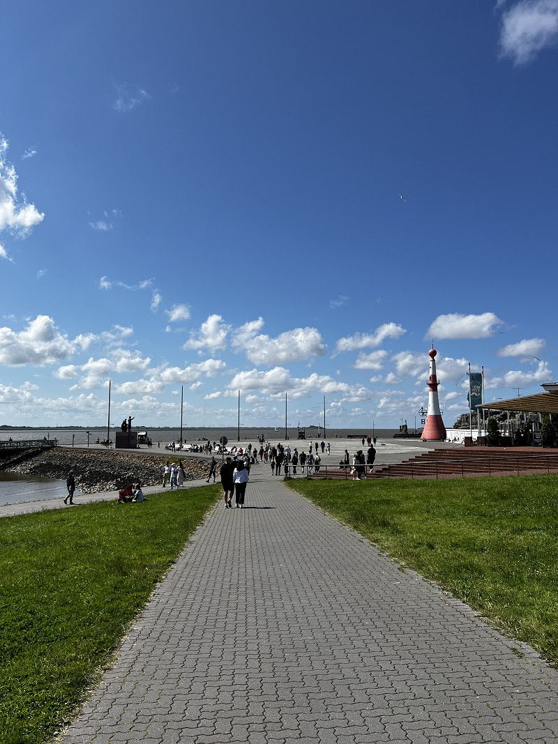
Day
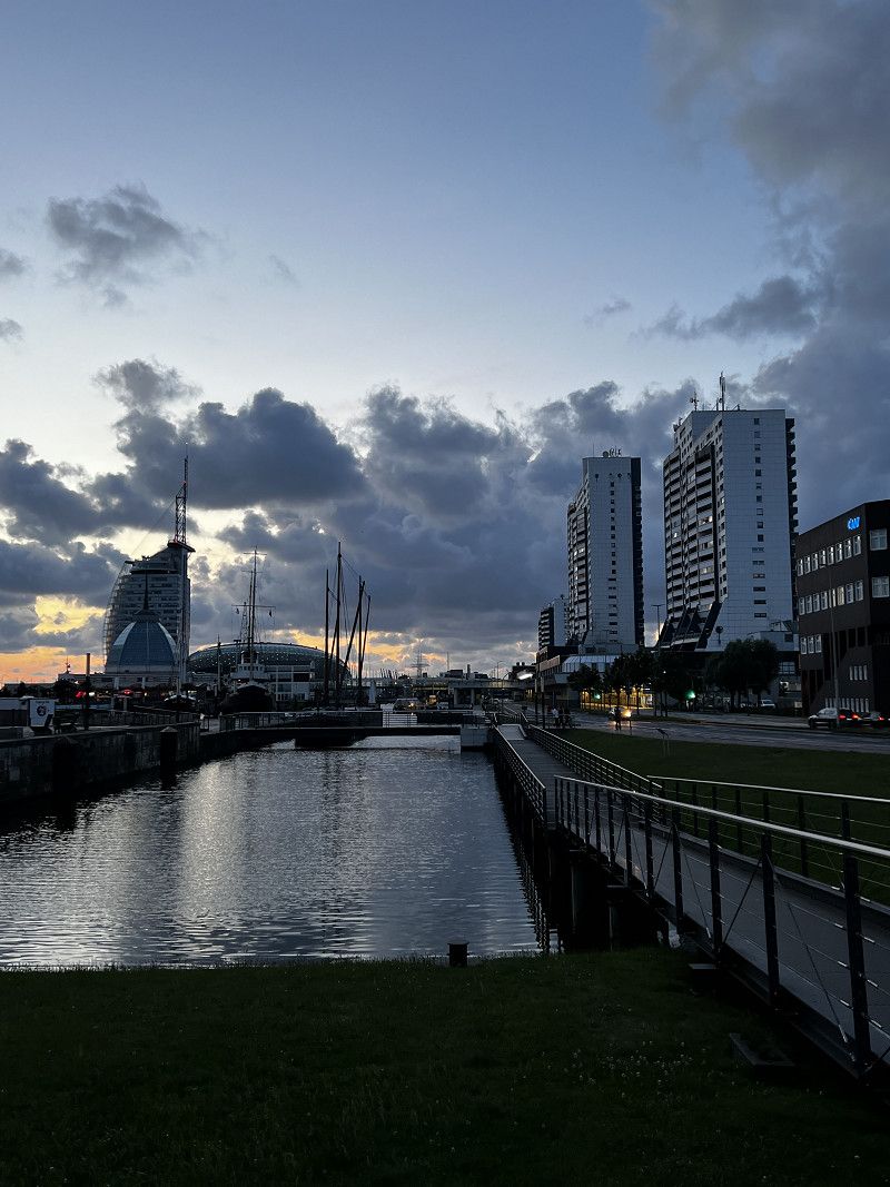
Bremerhaven
Short break in our holiday apartment
Am Alten Hafen 65, Bremerhaven, Bremen, Deutschland
53° 32' 34" N 8° 34' 42.2" E
53.5427900 8.5783986
• Head toward Mittelstraße on Am Alten Hafen. Go for 388 m.
• Turn right onto Columbusstraße (B212). Go for 959 m.
• Turn right onto Lloydstraße (B212). Go for 2.9 km.
• Take ramp onto A27 toward Bremen. Go for 12.5 km.
• Take exit 11 toward Oldenburg/A29/Wilhelmshaven. Go for 507 m.
• Continue on B437. Go for 9.8 km.
• Take ramp onto B212. Go for 3.4 km.
• Take ramp onto B437 toward A29/Oldenburg/Wilhelmshaven/Varel. Go for 21.3 km.
• Take the 2nd exit from roundabout onto Bürgermeister-Heidenreich-Straße (B437) toward Oldenburg/Wilhelmshaven/Friedeburg/B436. Go for 3.1 km.
• Take ramp onto A29 toward Wilhelmshaven. Go for 16.8 km.
• Take exit 5 toward Wittmund/Jever/Schortens onto B210. Go for 18.2 km.
• Turn left onto B461 toward Inseln/Esens/Carolinensiel/Gewerbegebiet Ost/REHAU. Go for 579 m.
• Pass 2 roundabouts and continue on B461. Go for 1.6 km.
• Take the 2nd exit from roundabout onto L10. Go for 1.1 km.
• Take the 1st exit from roundabout onto Blersumer Straße (L10) toward Langeoog/Esens. Go for 15.0 km.
• Continue on Hartsgaster Straße (K1) toward Dornum/Fulkum. Go for 2.7 km.
• Continue on Am Bahnsteig (K1). Go for 504 m.
• Continue on Ziegeleistraße (K1). Go for 2.4 km.
• Continue on Accumer Riege (K210). Go for 4.4 km.
• Continue on Alte-Post-Straße (K210). Go for 188 m.
• Turn right onto Schatthauser Straße (L7) toward Norden/Hage/Dornumersiel/Neßmersiel/Baltrum. Go for 3.0 km.
• Turn left onto Störtebekerstraße (L5). Go for 18.3 km.
• Take the 2nd exit from roundabout onto Ostermarscher Straße (L5). Go for 1.0 km.
• Continue on Itzendorfer Straße (K214) toward Norddeich-West. Go for 1.6 km.
• Turn right onto Bakenweg. Go for 43 m.
• Continue on Dörper Weg. Go for 124 m.
• Arrive at Dörper Weg.
☍
142,4 km
(1 hrs. 56 min.)
Day
Bremerhaven
Day
Bremerhaven
Day
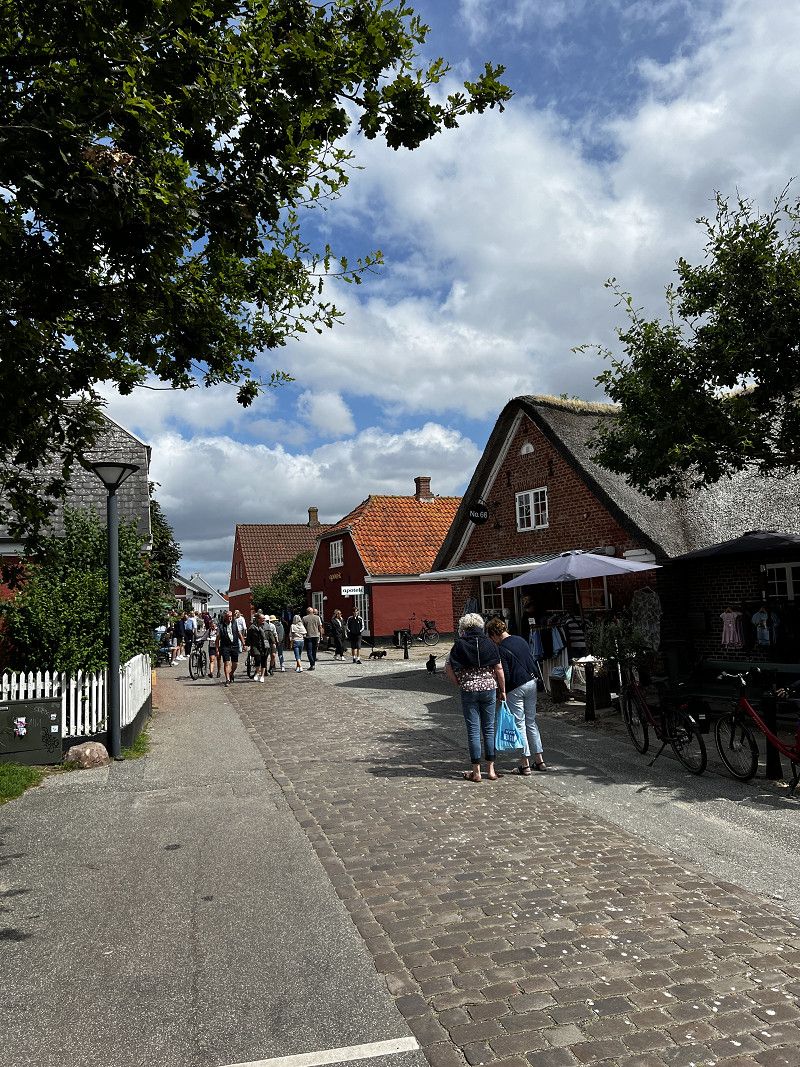
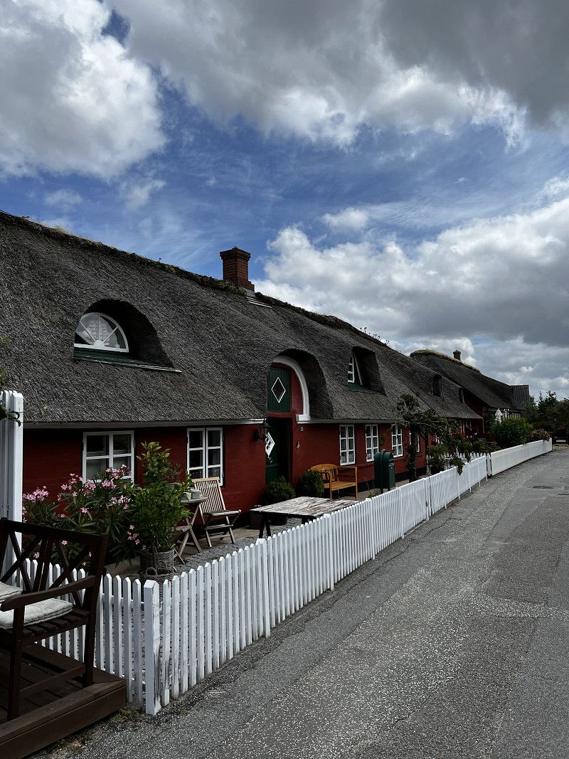
Norden / Norddeich
Motorhome port Norden. Very large parking space with supply and disposal, toilets in the parking lot are not recommended. No reservation possible, payment via a parking app.
Good starting point for a trip to Norderney.
Dörper Weg, Norden, Landkreis Aurich, Niedersachsen, Deutschland
53° 36' 38.8" N 7° 9' 23.1" E
53.6107873 7.1564122
• Head toward Itzendorfer Straße on Dörper Weg. Go for 124 m.
• Continue on Bakenweg. Go for 43 m.
• Turn left onto Itzendorfer Straße (K214). Go for 1.6 km.
• Continue on Ostermarscher Straße (L5). Go for 988 m.
• Take the 1st exit from roundabout onto B72. Go for 4.1 km.
• Take the 2nd exit from roundabout onto B72. Go for 4.4 km.
• Continue on Bundesstraße (B72). Go for 11.5 km.
• Turn right onto Emder Straße (B210) toward A31/Emden. Go for 12.9 km.
• Turn left and take ramp onto A31 toward Oberhausen/Leer/Gewerbegebiet Ost. Go for 26.8 km.
• Take exit 9 toward Meppen/Groningen/Leer-Nord onto A31. Go for 19.9 km.
• Take exit 14 toward Groningen/Bunde-West onto A280. Go for 4.8 km.
• Continue on A7. Go for 45.7 km.
• Take ramp onto Knooppunt Euvelgunne (N7) toward RING-Zuid/Amsterdam/Drachten/Assen (A28). Go for 18.3 km.
• Take exit 34 toward Leek/Tolbert/N372. Go for 598 m.
• Take the 1st exit from roundabout onto Oude Postweg (N372). Go for 144 m.
• Take the 2nd exit from roundabout onto Oude Postweg (N372). Go for 753 m.
• Take the 3rd exit from roundabout onto Hoofdstraat. Go for 101 m.
• Turn right onto Midwolderweg. Go for 762 m.
• Arrive at Midwolderweg. Your destination is on the left.
☍
153,6 km
(1 hrs. 39 min.)
Norddeich
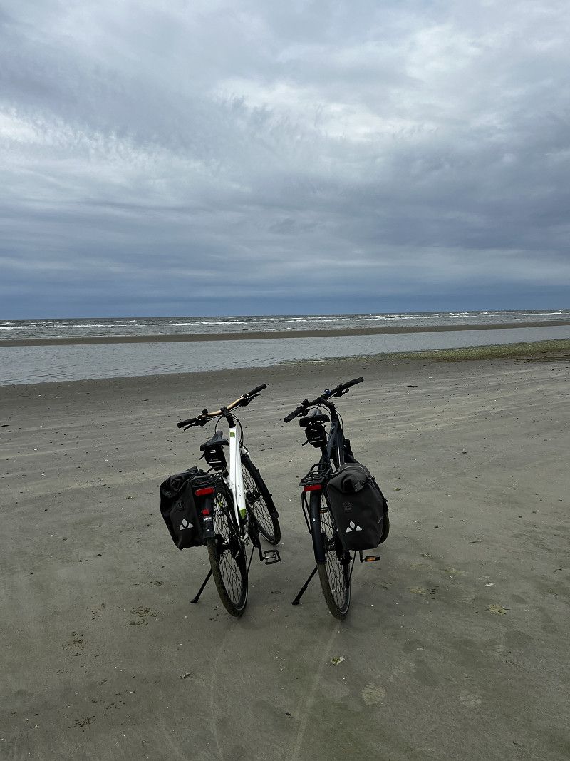
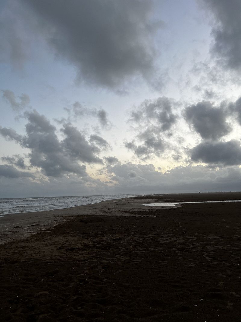
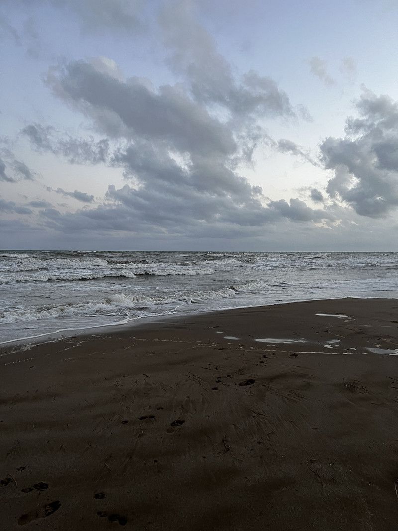
A modern tourist area, a great stretch of beach for swimming and relaxing.
Day
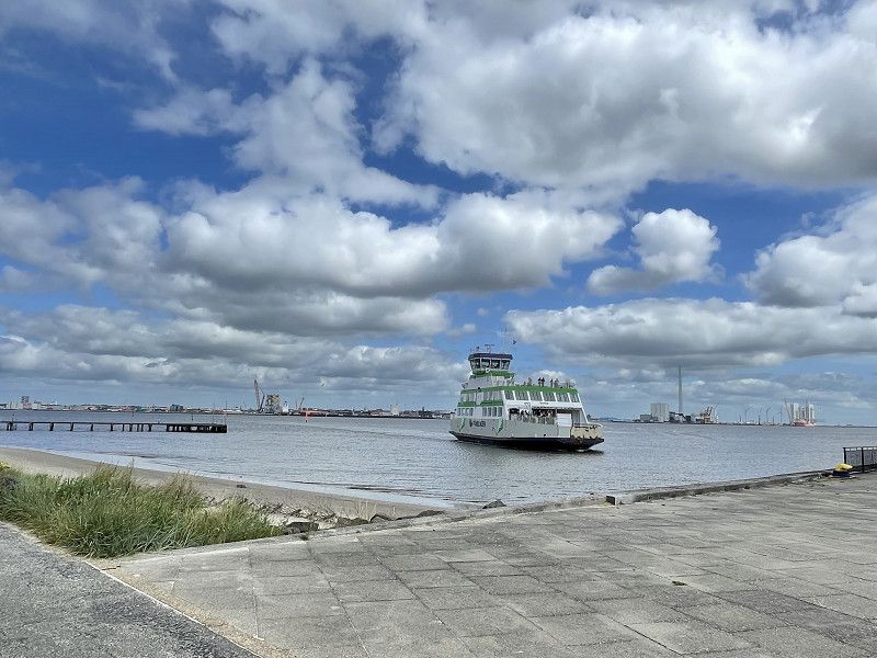
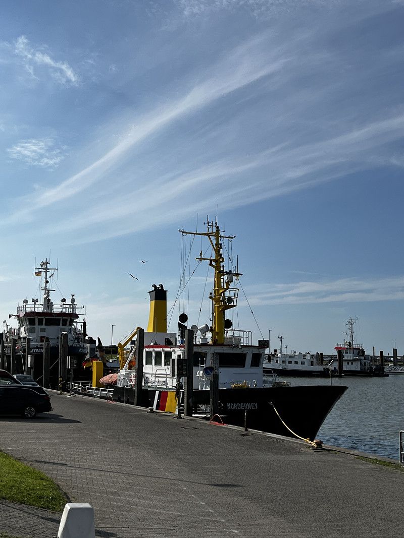
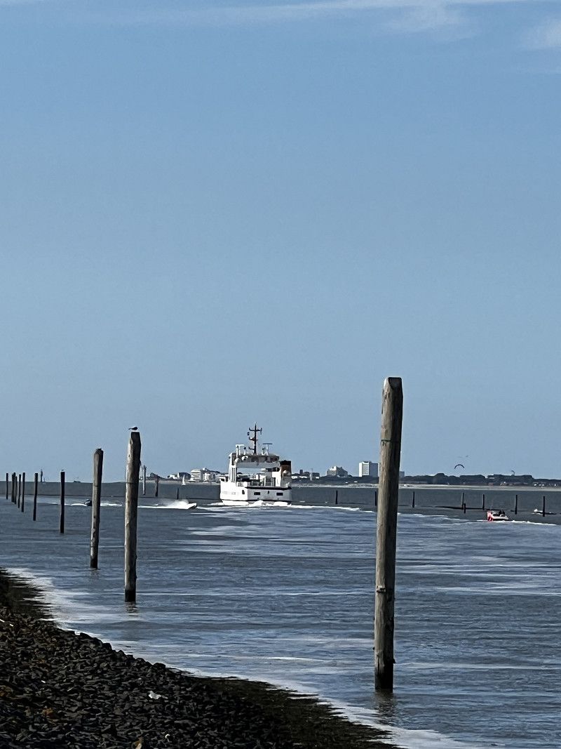
Tagesausflug Norderney
We took the bikes on the ferry to Norderney. The journey took about 45 minutes. The ferry leaves every hour. It costs €27.80 per person and €14.90 per bike.
Day
Landgoed Camping Nienoord
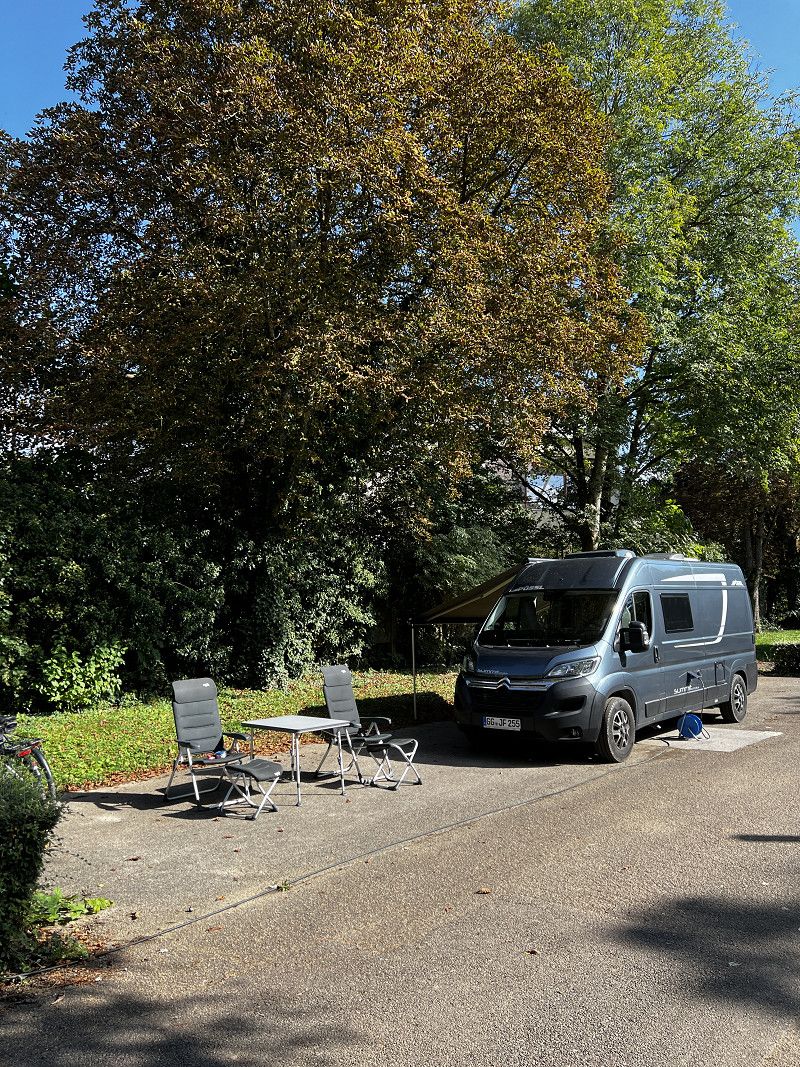
Spacious parking space for mobile homes and adjacent campsite. All pitches have electricity and water connections. The campsite's sanitary facilities can be used. We paid €24/night for the pitch with 2 people.
Midwolderweg 19, 9351 PG, Leek, Niederlande
53° 10' 16.5" N 6° 22' 55.5" E
53.1712500 6.3820800
• Head toward Hoofdstraat on Midwolderweg. Go for 762 m.
• Turn left onto Hoofdstraat. Go for 19 m.
• Take the 1st exit from roundabout onto Oude Postweg (N372). Go for 716 m.
• Take the 2nd exit from roundabout onto Oude Postweg (N372). Go for 195 m.
• Take the 4th exit from roundabout onto A7 toward Drachten. Go for 48.9 km.
• Continue on A6. Go for 12.3 km.
• Take exit 17 toward Lemmer. Go for 687 m.
• Turn left onto Rondweg (N359). Go for 98 m.
• Turn right onto Zeedijk. Go for 476 m.
• Take the 2nd exit from roundabout onto Sluisweg. Go for 709 m.
• Continue on Gemaalweg. Go for 4.0 km.
• Turn right onto Lemsterpoort (N712). Go for 199 m.
• Take the 2nd exit from roundabout onto Venelaan (N712). Go for 361 m.
• Take the 2nd exit from roundabout onto Venelaan (N712). Go for 92 m.
• Continue on Wrakkenweg (N712). Go for 4.3 km.
• Turn right onto Noorderringweg (N712). Go for 409 m.
• Continue on Galamalaan (N712). Go for 633 m.
• Take the 2nd exit from roundabout onto Westerringweg (N712). Go for 4.3 km.
• Take the 1st exit from roundabout onto Espelerringweg (N712). Go for 4.2 km.
• Turn right onto Staartweg (N712). Go for 536 m.
• Turn right onto Vormtweg. Go for 2.4 km.
• Turn left onto Vormtweg. Go for 23 m.
• Arrive at Vormtweg.
☍
86,3 km
( 55 min.)
Day
Camperpark Urk
Beautiful pitch in front of the campsite “Vakantipark ´t Urkerbos”. Payment is made at the machine in front of the barrier. Electricity optional.
https://www.camperpark-urk.nl/de/
Vormtweg, Urk, Flevoland, Niederlande
52° 40' 47.3" N 5° 36' 33.5" E
52.6798164 5.6093125
• Head northwest on Vormtweg. Go for 23 m.
• Turn left onto Vormtweg. Go for 1.3 km.
• Take the 1st exit from roundabout onto Staartweg (N712). Go for 637 m.
• Take the 2nd exit from roundabout onto Singel (N712). Go for 721 m.
• Take the 2nd exit from roundabout onto Sluisweg. Go for 357 m.
• Continue on Domineesweg. Go for 817 m.
• Pass 2 roundabouts and continue on Domineesweg (N352). Go for 4.5 km.
• Take the 1st exit from roundabout onto A6 toward Lelystad/Amsterdam. Go for 46.0 km.
• Keep left onto A6 toward Amsterdam. Go for 6.7 km.
• Keep left onto A6. Go for 5.9 km.
• Keep left onto A1. Go for 9.9 km.
• Take the exit toward Rotterdam/Luchthaven Schiphol onto A10 (Watergraafsmeer). Go for 10.3 km.
• Continue on E19 (Knooppunt de Nieuwe Meer) toward Rotterdam/Den Haag/Luchthaven Schiphol/Haarlem/A4. Go for 1.4 km.
• Continue on A4 (Nieuwe Haagseweg). Go for 19.3 km.
• Keep left onto A4. Go for 22.6 km.
• Keep right onto A4 (Leidschendam) toward E30/Afrit 8/Ring-Noord/Utrecht/Den Haag/Leidschendam/Voorburg/A12/N14. Go for 726 m.
• Take exit 8 toward Industrieterrein Forepark/Den Haag-Leidschenveen. Go for 360 m.
• Turn right onto Landscheidingsweg (N14) toward Den Haag-Leidschenveen. Go for 332 m.
• Continue on Zoetermeerse Rijweg (N469) toward Den Haag-Leidschenveen. Go for 588 m.
• Take the 2nd exit from roundabout onto Zoetermeerse Rijweg (N469). Go for 1.2 km.
• Keep right onto Zoetermeerse Rijweg. Go for 600 m.
• Take the 1st exit from roundabout onto Zoetermeerse Rijweg (N469). Go for 1.3 km.
• Turn left onto Leidschendamseweg. Go for 195 m.
• Turn left onto Leidschendamseweg. Go for 223 m.
• Arrive at Leidschendamseweg.
☍
135,8 km
(1 hrs. 20 min.)
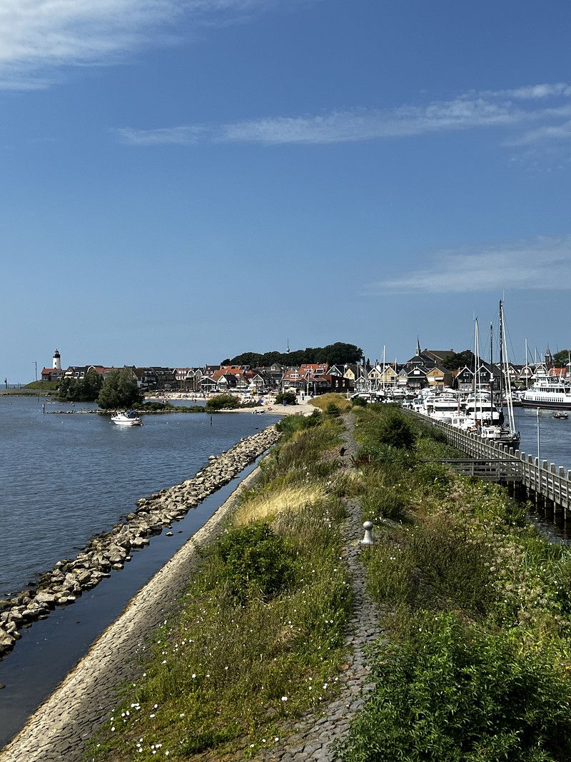
Urk
Trip by bike to Urk. Urk offers many restaurants, 2 small beaches for swimming and a beautiful little town center.
Day
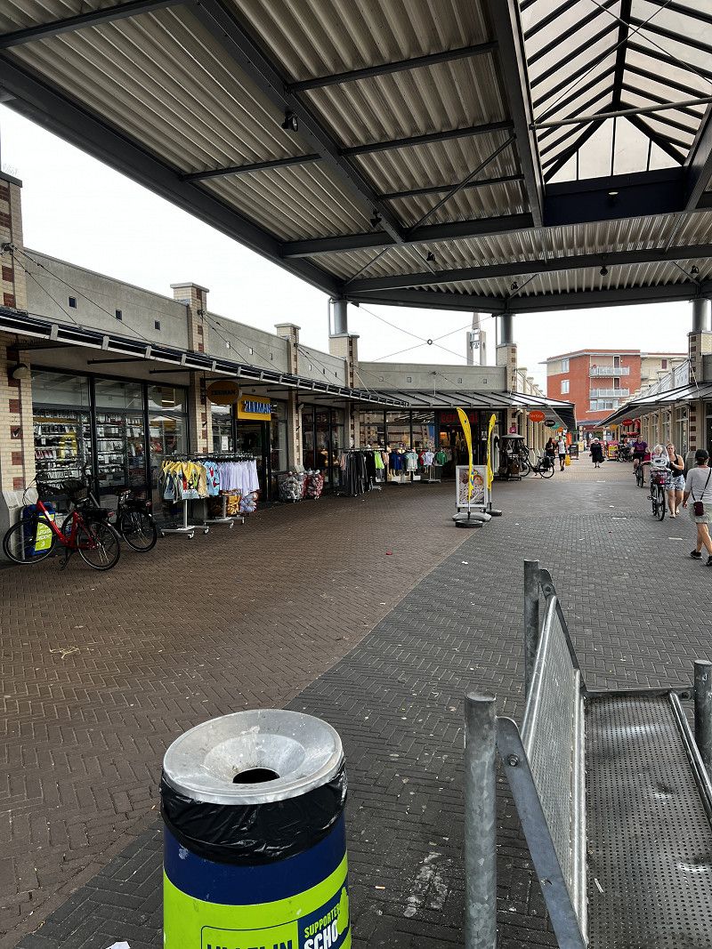
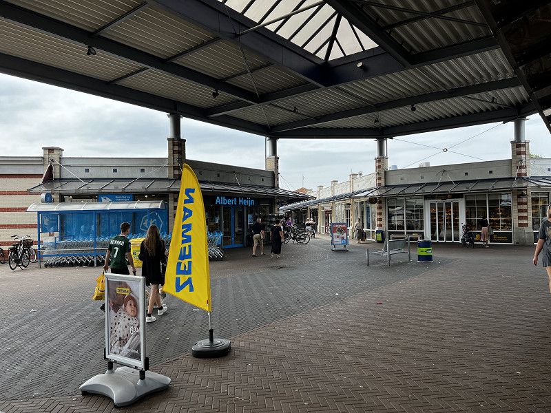
Urk
A day in Urk for shopping and relaxing.
Day
De Drie Morgen / Zoetermeer
Very nice and quiet parking spot on the outskirts of The Hague. 12km to the city centre of The Hague. Can be reached by bike on excellent cycle paths in around 40 minutes.
• Head southeast on Leidschendamseweg. Go for 223 m.
• Turn right onto Leidschendamseweg. Go for 188 m.
• Turn right onto Leidschendamseweg (N469). Go for 1.2 km.
• Pass 2 roundabouts and continue on Zoetermeerse Rijweg (N469). Go for 1.7 km.
• Turn right onto Zoetermeerse Rijweg. Go for 662 m.
• Continue on Landscheidingsweg (N14). Go for 350 m.
• Turn left and take ramp onto A4 toward Ring/Den Haag/Rotterdam/Utrecht (A12). Go for 1.1 km.
• Take the left exit toward E30/Rijswijk/Den Haag-Zuid/Rotterdam/Ring onto A4. Go for 1.5 km.
• Keep right onto E19 toward Breda/Rotterdam/Delft/Rijswijk-Zuid/A13. Go for 3.3 km.
• Continue on A13 (Rotterdamseweg). Go for 2.6 km.
• Take exit 9 toward Delft. Go for 480 m.
• Turn right onto Oostpoortweg. Go for 441 m.
• Continue on Oostplein. Go for 15 m.
• Turn left onto Julianalaan. Go for 365 m.
• Turn right onto Mijnbouwstraat. Go for 314 m.
• Turn left onto Michiel de Ruyterweg. Go for 142 m.
• Turn right onto Julianalaan. Go for 407 m.
• Continue on Rotterdamseweg. Go for 11 m.
• Turn right onto Rotterdamseweg. Go for 56 m.
• Arrive at Rotterdamseweg.
☍
15,1 km
( 15 min.)
Den Haag
Visit the city center and the “Mauritshuis” museum.
Day
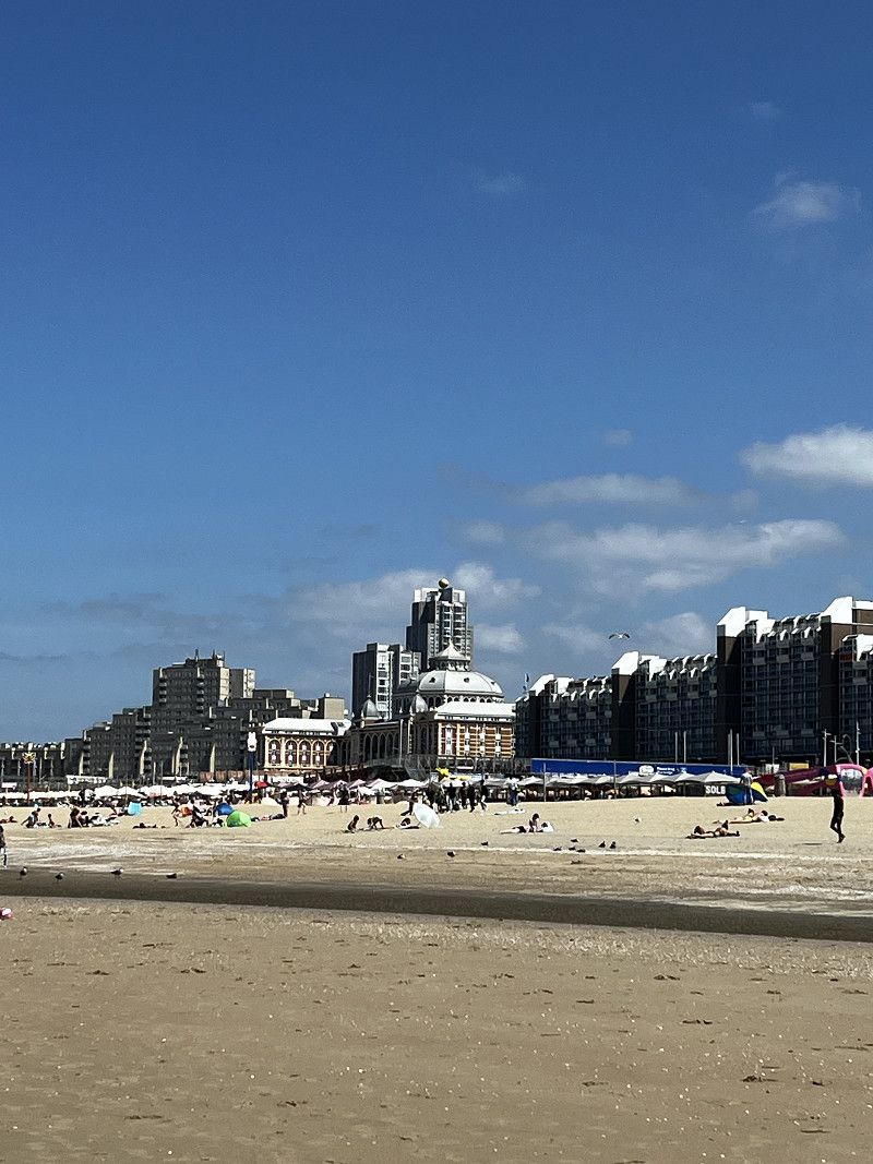
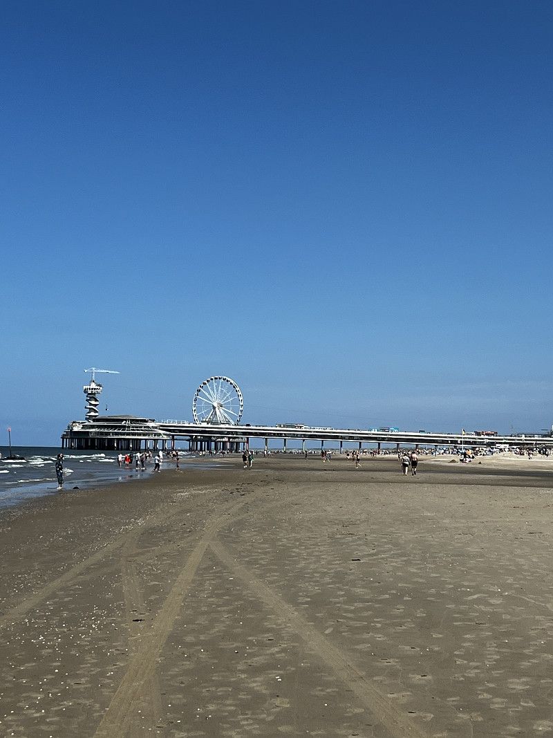
Scheveningen
Cycle tour from the campsite to the coast, 15km. Across The Hague on excellently developed cycle paths.
Day
Delft
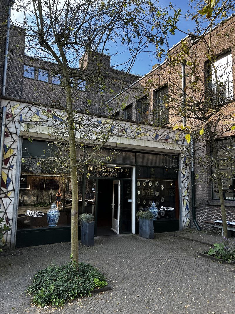
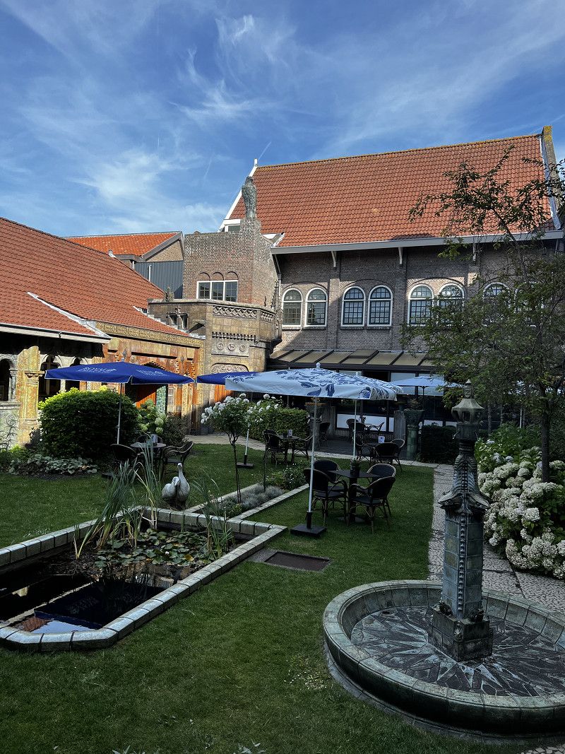
Visit to the "Royal Delft" museum. Opposite there are a few parking spaces that are big enough for a 6m van. We parked on the TU site "Landbergstraat". Payment via the "EasyPark" app. Cost: just a few cents.
• Turn left onto Duinenstraat (N316). Go for 151 m.
• Turn right onto Dorpsstraat (N316). Go for 107 m.
• Continue on Sluizenstraat (N316). Go for 1.7 km.
• Continue on Brugsesteenweg (N316). Go for 21 m.
• Take the 2nd exit from roundabout onto Brugsesteenweg (N316). Go for 166 m.
• Turn right onto Brugsesteenweg (N9) toward Bredene-Sas. Go for 423 m.
• Turn left onto Esperantolaan (N320). Go for 42 m.
• Take the 2nd exit from roundabout onto Esperantolaan (N320). Go for 1.2 km.
• Continue on Plassendalesteenweg (N320). Go for 125 m.
• Continue on Plassendaalsesteenweg (N320). Go for 451 m.
• Continue on Oudenburgsesteenweg (N358a). Go for 228 m.
• Continue on Plassendale (N358a). Go for 402 m.
• Continue on Stationsstraat (N358). Go for 587 m.
• Take the 2nd exit from roundabout. Go for 152 m.
• Take ramp onto A10. Go for 3.6 km.
• Take the left exit toward Calais/Veurne onto E40. Go for 42.1 km.
• Continue on A16 (Autoroute des Estuaires). Go for 60.8 km.
• Take exit 40 toward Peuplingues onto D215. Go for 420 m.
• Continue on Route d'Escalles (D243 E3). Go for 1.5 km.
• Take the 1st exit from roundabout onto Route d'Escalles (D243) toward Sangatte/Escalles. Go for 1.6 km.
• Continue on D243. Go for 961 m.
• Continue on La Haute Escalles (D243). Go for 306 m.
• Continue on Route de Peuplingues (D243). Go for 830 m.
• Continue on Rue de la Mer (D243). Go for 19 m.
• Turn left onto Rue de la Mer (D940) toward Wissant/Maison du Site des Deux-Caps/Cap Gris-Nez. Go for 2.9 km.
• Arrive at D940. Your destination is on the right.
☍
121,5 km
(1 hrs. 20 min.)
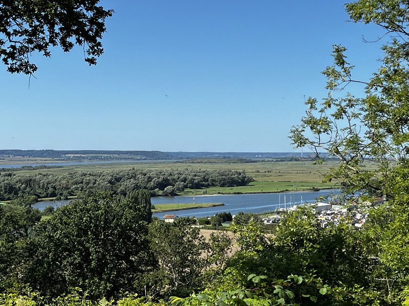
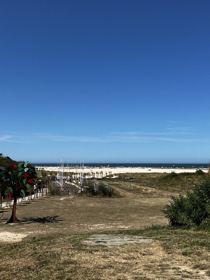
Day
Ostende
From the parking space it is a 10-minute bike ride to the beach. Walk along the beach to the pier in Ostend (approx. 50 minutes).
Day
Wissant
Parking is available at a junction of the D940. A small path leads from the cliff to the beach.
Chemin de la Plage, Wissant, Pas-de-Calais, Nordfrankreich, Frankreich
50° 54' 6.4" N 1° 40' 58.6" E
50.9017709 1.6829470
• Head south on D940. Go for 2.8 km.
• Take the 3rd exit from roundabout onto Rue Jean Moulin (D238). Go for 6.7 km.
• Take the 3rd exit from roundabout onto D191 toward A16/Boulogne/Calais/Tunnel S/S la Manche/Marquise. Go for 589 m.
• Turn left and take ramp onto A16 (Autoroute des Estuaires). Go for 52.8 km.
• Take exit 25 toward Berck/Fort-Mahon-Plage/Quend. Go for 824 m.
• Take the 2nd exit from roundabout onto D303 toward Berck/Merlimont. Go for 1.6 km.
• Take the 2nd exit from roundabout onto D303. Go for 1.1 km.
• Take the 2nd exit from roundabout onto Pénétrante Est de Berck (D303). Go for 545 m.
• Pass 3 roundabouts and continue on D303. Go for 3.8 km.
• Take the 1st exit from roundabout onto Avenue de Verdun (D940). Go for 557 m.
• Take the 2nd exit from roundabout onto Rue de Saint-Josse (D940). Go for 281 m.
• Take the 3rd exit from roundabout onto Avenue du Docteur Quettier (D917 E1). Go for 1.2 km.
• Take the 1st exit from roundabout. Go for 50 m.
• Continue on Avenue du 8 Mai 1945. Go for 539 m.
• Turn right onto Chemin Genty. Go for 79 m.
• Arrive at Chemin Genty.
☍
73,5 km
( 49 min.)
Berck
Small, practical pitch for 1-2 nights. No electricity, no toilet, but chemical and grey water disposal. Fresh water for a fee. 15 minutes walk to the beach.
Chemin Genty, Berck, Pas-de-Calais, Nordfrankreich, Frankreich
50° 24' 58.5" N 1° 34' 36.1" E
50.4162479 1.5766879
• Head east on Chemin Genty. Go for 39 m.
• Turn left onto Chemin Genty. Go for 32 m.
• Turn left toward Chemin Genty. Go for 65 m.
• Turn right onto Chemin Genty. Go for 86 m.
• Turn left onto Avenue du 8 Mai 1945. Go for 569 m.
• Take the 3rd exit from roundabout onto Avenue du Docteur Quettier. Go for 1.2 km.
• Take the 1st exit from roundabout onto Rue de Saint-Josse (D940). Go for 278 m.
• Take the 2nd exit from roundabout onto Avenue de Verdun (D940). Go for 574 m.
• Take the 2nd exit from roundabout onto D940. Go for 5.5 km.
• Turn right onto Rue du Maréchal Leclerc (D143). Go for 948 m.
• Continue on Rue de Berck (D940). Go for 7.5 km.
• Take the 2nd exit from roundabout onto D940. Go for 2.0 km.
• Pass 3 roundabouts and continue on D940. Go for 9.4 km.
• Take the 3rd exit from roundabout onto D940 toward Eu/Le Tréport/Abbeville/St Valery S/S. Go for 7.2 km.
• Take the 2nd exit from roundabout onto D940 toward Eu/Le Tréport/St Valery S/S. Go for 3.7 km.
• Take the 2nd exit from roundabout onto D940 toward Le Tréport/Cayeux S/Mer. Go for 978 m.
• Take the 3rd exit from roundabout onto D940 toward Eu/Le Tréport/Cayeux S/Mer. Go for 1.8 km.
• Take the 2nd exit from roundabout onto D940 toward Eu/Le Tréport/Cayeux S/Mer. Go for 1.4 km.
• Take the 3rd exit from roundabout onto Rue du Général de Gaulle (D940) toward Eu/Le Tréport/Ault. Go for 10.6 km.
• Take the 2nd exit from roundabout onto Rue d'Eu (D940). Go for 3.7 km.
• Take the 3rd exit from roundabout onto Route du Havre à Dunkerque (D940) toward Eu/Le Tréport/Mers les Bains/Bois de Cise. Go for 4.8 km.
• Take ramp onto D925. Go for 1.0 km.
• Take the 1st exit from Giratoire de Froidville roundabout onto Avenue Pierre et Marie Curie (D1015) toward Mers les Bains. Go for 177 m.
• Pass 2 roundabouts and continue on Avenue Pierre et Marie Curie (D1015). Go for 3.1 km.
• Arrive at Rue Albert Cauet (D1015). Your destination is on the left.
☍
66,6 km
(1 hrs. 2 min.)
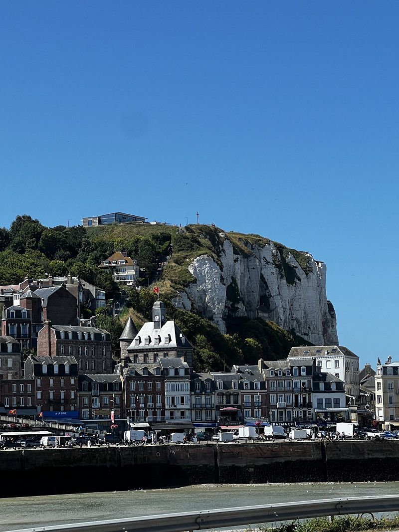
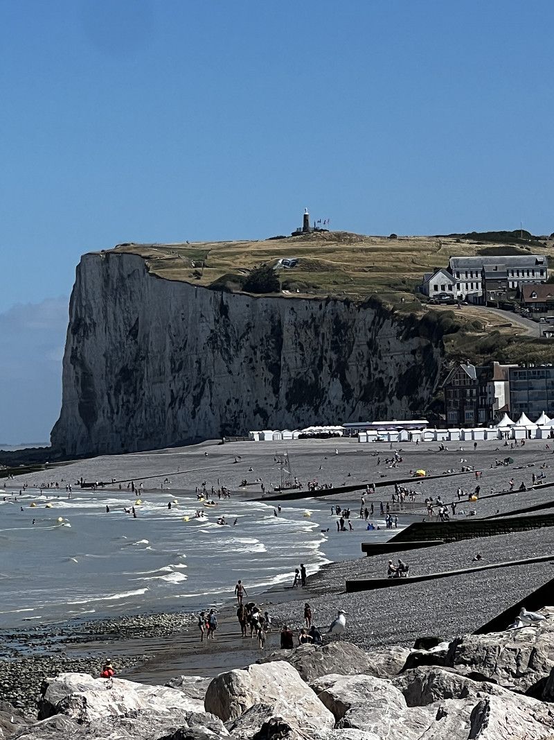
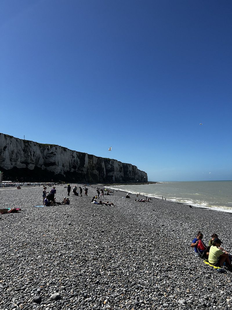
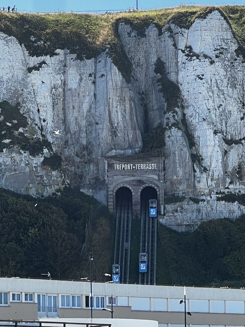
Day
Le Tréport
A very busy and interesting city. Parking with a motorhome is almost impossible; we were parked on the side of the road with several other motorhomes in a row.
Apparently, the best oysters are here. The street restaurants have plenty of seafood platters (€26-€36), but are crowded right next to the street.
Rue Albert Cauet, Le Tréport, Seine-Maritime, Normandie, Frankreich
50° 3' 48.9" N 1° 22' 55.2" E
50.0635779 1.3820138
• Head east on Rue Albert Cauet (D1015). Go for 639 m.
• Take the 1st exit from Carrefour Debeaurain roundabout onto Quai de la Retenue (D1015). Go for 218 m.
• Continue on Quai Sadi Carnot (D1915). Go for 340 m.
• Continue on Quai François 1er (D78). Go for 135 m.
• Turn left onto Quai François 1er (D78). Go for 109 m.
• Turn left onto Rue de la Commune de Paris (D78). Go for 110 m.
• Take the 1st exit from Place Charles de Gaulle roundabout onto Rue Saint-Michel. Go for 659 m.
• Turn left onto Boulevard du Calvaire (D126 E). Go for 32 m.
• Turn right onto Route de Dieppe (D940). Go for 870 m.
• Take the 3rd exit from roundabout onto Avenue des Canadiens (D940). Go for 1.0 km.
• Take the 1st exit from roundabout onto Place des Tilleuls (D940). Go for 2.1 km.
• Turn right onto D925. Go for 1.6 km.
• Pass 5 roundabouts and continue on D925. Go for 19.2 km.
• Continue on D925 toward Dieppe. Go for 120 m.
• Take the 3rd exit from roundabout onto D925 toward Dieppe. Go for 919 m.
• Take the 2nd exit from roundabout onto D485 toward (Rouen)/Paris/Rouen/Dieppe. Go for 2.2 km.
• Take the 2nd exit from roundabout onto D154 E toward Fécamp/Dieppe/Rouxmesnil-Bouteilles. Go for 1.4 km.
• Take the 2nd exit from roundabout onto Avenue Normandie Sussex toward Dieppe-Centre/Z.A. Normandie-Sussex. Go for 1.0 km.
• Continue on Rue de Stalingrad. Go for 93 m.
• Continue on Rue de l'Entrepôt. Go for 118 m.
• Turn left onto Quai du Tonkin. Go for 86 m.
• Continue on Quai Bérigny. Go for 83 m.
• Continue on Quai Duquesne. Go for 345 m.
• Take the 3rd exit from roundabout onto Arcades de la Bourse. Go for 123 m.
• Take the 1st exit from roundabout onto Quai Henri IV. Go for 442 m.
• Continue on Quai du Hâble. Go for 322 m.
• Continue on Boulevard de Verdun. Go for 31 m.
• Turn right onto Boulevard du Maréchal Foch. Go for 41 m.
• Arrive at Boulevard du Maréchal Foch. Your destination is on the left.
☍
34,3 km
( 36 min.)
Parkplatz am Strand
The city and of course the parking lot were overcrowded. The city didn't offer anything special for us, so we moved on.
Boulevard Maréchal Foch, 76200, Dieppe, Frankreich
49° 55' 55" N 1° 4' 60" E
49.9319444 1.0833333
• Head northwest on Boulevard du Maréchal Foch. Go for 235 m.
• Take the 2nd exit from roundabout. Go for 93 m.
• Turn right onto Boulevard de Verdun. Go for 685 m.
• Take the 1st exit from roundabout onto Boulevard de Verdun. Go for 283 m.
• Take the 2nd exit from roundabout onto Square du Canada. Go for 65 m.
• Continue on Rue de Sygogne. Go for 237 m.
• Continue on Place des Martyrs. Go for 61 m.
• Continue on Avenue Léon Gambetta (D925). Go for 887 m.
• Turn right onto Avenue Jean Jaurès. Go for 1.1 km.
• Turn right onto Route de Petit Appeville (D925). Go for 3.9 km.
• Take the 2nd exit from roundabout onto Route d'Ouville (D925) toward Fécamp/St Valery en Caux/Ouville la Rivière. Go for 5.9 km.
• Take the 2nd exit from roundabout onto Rue du Général de Gaulle (D152) toward Gueures/Brachy. Go for 1.0 km.
• Continue on Route des Étangs (D152). Go for 950 m.
• Continue on D152. Go for 564 m.
• Continue on Rue de la Vallée (D152). Go for 71 m.
• Arrive at Rue de la Vallée (D152). Your destination is on the right.
☍
16,0 km
( 19 min.)
Camping La Vallée
Beautifully located campsite, mostly occupied by mobile homes, right by the lake and river, also a few pitches for tents or RVs, some without electricity. No black or grey water disposal.
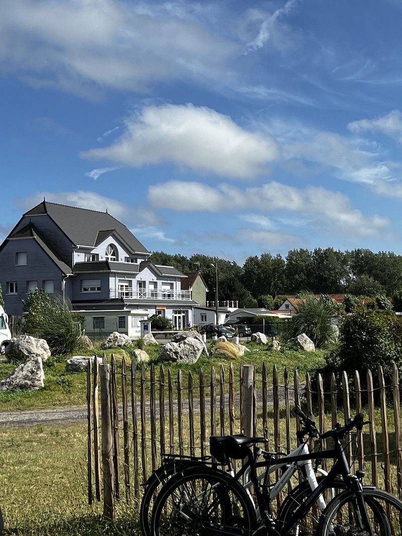
76730, Gueures, Frankreich
49° 51' 7.2" N 0° 57' 32" E
49.8520000 0.9589000
• Head toward Rue de l'Étang on Rue de la Vallée (D152). Go for 2.0 km.
• Continue on Lieu-dit Les Moulins (D152). Go for 360 m.
• Continue on Route de la Mer (D152). Go for 2.3 km.
• Continue on Route de la Vallée (D2). Go for 1.7 km.
• Continue on Route de la Vallée (D2). Go for 640 m.
• Continue on D2. Go for 253 m.
• Continue on Rue Eugène Flaman (D2). Go for 655 m.
• Continue on D2. Go for 13 m.
• Continue on Lieu-dit Petite Ville (D2). Go for 456 m.
• Continue on D2. Go for 175 m.
• Continue on Route de la Mer (D2). Go for 2.0 km.
• Continue on Lieu-dit L'Ancienne Gare (D2). Go for 93 m.
• Continue on Route de la Mer (D2). Go for 702 m.
• Turn right onto Route du Bois Brûlé (D149). Go for 3.4 km.
• Turn left onto Route de Rouen (D142). Go for 8.7 km.
• Take the 2nd exit from roundabout onto Route de Veules-les-Roses (D142). Go for 721 m.
• Turn slightly right onto Avenue Charles de Gaulle (D929). Go for 2.3 km.
• Take the 2nd exit from roundabout onto D929. Go for 2.4 km.
• Take the 1st exit from roundabout onto A29 toward Le Havre. Go for 33.0 km.
• Take exit 7 toward Bolbec/Lillebonne/Étretat/Pont de Tancarville. Go for 1.2 km.
• Take the 2nd exit from roundabout onto D910 toward Bolbec/Nointot/Lillebonne/Pont de Tancarville/Abbaye du Valasse. Go for 1.2 km.
• Take the 2nd exit from roundabout onto D487. Go for 1.8 km.
• Take the 1st exit from roundabout onto D6015. Go for 2.3 km.
• Take the 3rd exit from roundabout onto D910 toward Mélamare/La Remuée/La Cerlangue/Pont de Tancarville. Go for 3.3 km.
• Pass 2 roundabouts and continue on Rue du Pont (D910). Go for 6.6 km.
• Turn right. Go for 83 m.
• Arrive at your destination.
☍
78,2 km
(1 hrs. 1 min.)
Day
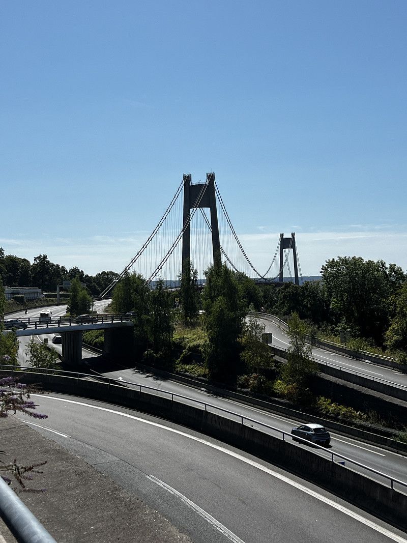
Tancarville
Small parking lot with a beautiful view of the bridge and the Seine.
N 182, Tancarville, Seine-Maritime, Normandie, Frankreich
49° 28' 43.2" N 0° 27' 24" E
49.4786547 0.4566661
• Head southeast. Go for 76 m.
• Turn right onto D910. Go for 60 m.
• Take the 2nd exit from roundabout toward Paris/Rouen/Évreux/Pt de Tancarville. Go for 171 m.
• Take the 2nd exit from roundabout onto N182 toward Paris/Rouen/Évreux/Pt de Tancarville. Go for 2.1 km.
• Take ramp toward Évreux/Beuzeville. Go for 326 m.
• Take the 2nd exit from roundabout onto D6178 toward Évreux/Beuzeville. Go for 14.7 km.
• Take the 1st exit from roundabout onto Route de Beuzeville (D675) toward A13/Beuzeville/Pt l'Évêque/Bernay. Go for 2.0 km.
• Take the 3rd exit from roundabout onto A13 (Autoroute de Normandie) toward Deauville/Trouville/Caen. Go for 56.6 km.
• Take the exit onto N814 (Périphérique). Go for 3.5 km.
• Take ramp onto D515 toward Hérouville St Clair/Ouistreham. Go for 8.0 km.
• Continue on D514. Go for 2.5 km.
• Take the 2nd exit from roundabout onto Avenue du Grand-Large (D84) toward Ouistreham Car Ferry/Le Port/Port Ouistreham Car Ferry Gare Maritime/Plage de Riva-Bella. Go for 835 m.
• Take the 3rd exit from roundabout onto Avenue du Grand-Large (D84). Go for 1.0 km.
• Turn right onto Place du Général de Gaulle toward Stade Kieffer. Go for 434 m.
• Keep left. Go for 33 m.
• Keep left. Go for 33 m.
• Continue toward Rue des Dunes. Go for 22 m.
• Continue on Rue des Dunes. Go for 506 m.
• Continue on Boulevard Maritime. Go for 22 m.
• Arrive at Boulevard Maritime. Your destination is on the left.
☍
92,9 km
(1 hrs. 3 min.)
Ouistreham / Aire de Camping-cars
RV parking space right by the harbor. Tickets for 24 hours or 48 hours including electricity (which usually doesn't work). Disposal of black/gray water possible. A space is only released as available when the time on a ticket has expired. We had to wait half an hour in front of the barrier, although there were still three free spaces. Short walk to the beach and into town. However, it is also quite loud due to the ferry service.
Boulevard Maritime , 14150, Ouistreham, Frankreich
49° 17' 14" N 0° 14' 59" W
49.2872222 -0.2497222
• Head northwest on Boulevard Maritime. Go for 69 m.
• Turn left onto Avenue de la Hève. Go for 89 m.
• Turn left onto Avenue du 6 Juin. Go for 114 m.
• Turn right onto Rue des Dunes. Go for 508 m.
• Continue on Place du Général de Gaulle. Go for 1.4 km.
• Take the 2nd exit from roundabout onto Avenue du Grand-Large (D84). Go for 816 m.
• Take the 3rd exit from roundabout onto D514 toward A13/Caen/Cabourg. Go for 2.5 km.
• Keep left onto D515. Go for 7.5 km.
• Take ramp onto Périphérique (N814) toward Périphérique Ouest/Rennes/Cherbourg/Bayeux/Hérouville-Ouest. Go for 6.8 km.
• Keep left onto N13 toward Bessin/Cherbourg/Bayeux/Aéroport Carpiquet. Go for 28.8 km.
• Take ramp toward Vaucelles/Tour en Bessin/Mosles. Go for 348 m.
• Take the 2nd exit from roundabout onto D613. Go for 277 m.
• Continue on Route de Bayeux (D613). Go for 1.8 km.
• Continue on D613. Go for 2.6 km.
• Continue on Lieu-dit Mosles (D613). Go for 648 m.
• Continue on Lieu-dit La Butte (D613). Go for 184 m.
• Continue on D613. Go for 249 m.
• Continue on Lieu-dit La Cavée (D613). Go for 75 m.
• Turn right onto Rue d'Argouges (D97). Go for 829 m.
• Continue on D97. Go for 902 m.
• Continue on Route du Fresne (D97). Go for 1.4 km.
• Continue on D97. Go for 1.0 km.
• Continue on Route de Mosles (D97). Go for 219 m.
• Turn left onto Route d'Omaha Beach (D514). Go for 2.8 km.
• Take the 1st exit from roundabout. Go for 803 m.
• Take the 2nd exit from roundabout. Go for 438 m.
• Turn left. Go for 41 m.
• Turn left. Go for 18 m.
• Arrive at your destination.
☍
63,3 km
( 53 min.)
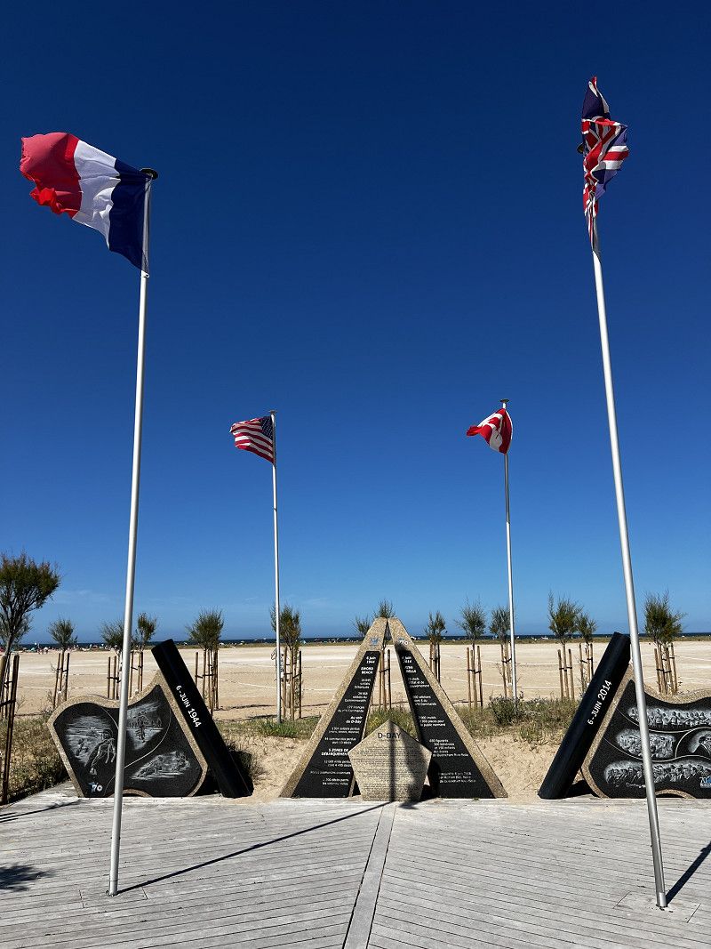
Day
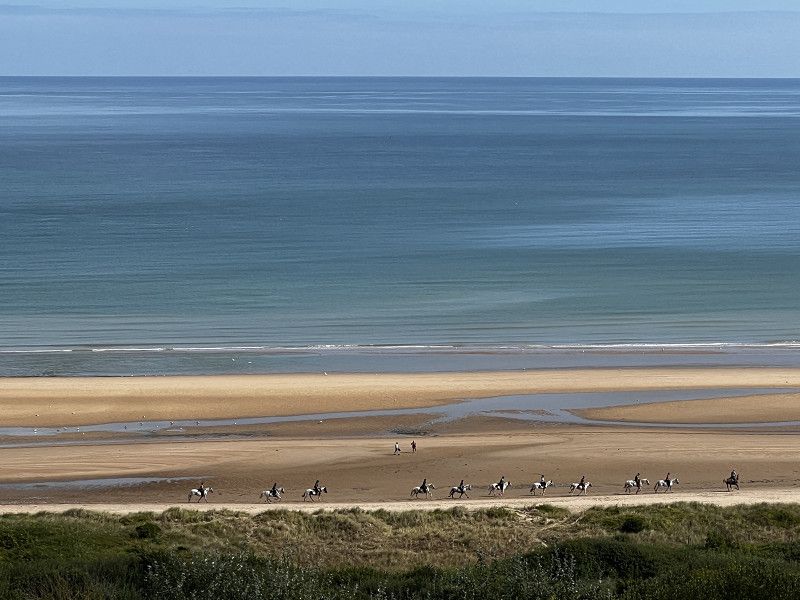
Sword Beach
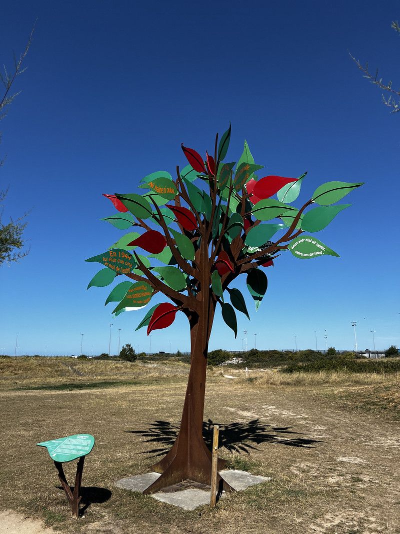
The easternmost section of the D-Day beaches.
Day
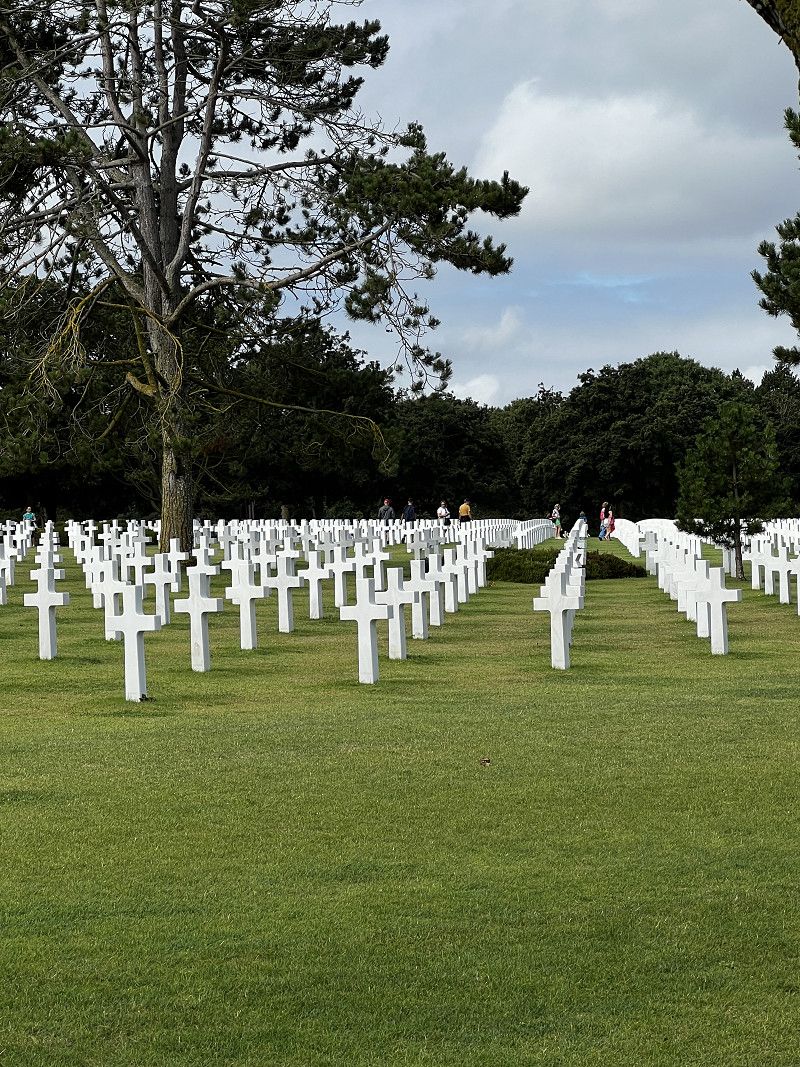
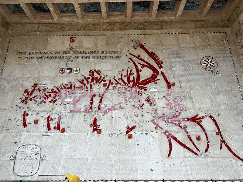
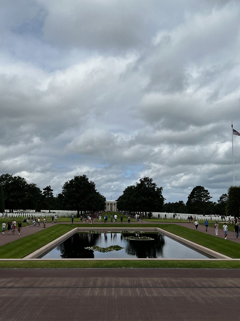
Colleville-sur-Mer
American military cemetery, very impressive. The American Museum is also nearby. Sufficient free parking, even for RVs.
Route du Capitaine Joe Dawson, Colleville-sur-Mer, Calvados, Normandie, Frankreich
49° 21' 26.6" N 0° 51' 6.1" W
49.3573984 -0.8516904
• Head south. Go for 42 m.
• Turn left. Go for 62 m.
• Turn right. Go for 19 m.
• Turn right. Go for 394 m.
• Take the 2nd exit from roundabout. Go for 813 m.
• Take the 1st exit from roundabout onto Route d'Omaha Beach (D514). Go for 2.4 km.
• Take the 3rd exit from roundabout onto Route de Formigny (D517). Go for 3.5 km.
• Turn right onto Lieu-dit Formigny (D613). Go for 1.5 km.
• Turn left and take ramp onto N13 toward Cherbourg/Grandchamp-Maisy/Isigny sur Mer/La Cambe. Go for 20.8 km.
• Take ramp onto N174 toward Rennes/Saint Lô/St Jean de Daye. Go for 48.9 km.
• Take the 1st exit from roundabout onto A84 toward Rennes/Villedieu les Poêles. Go for 44.7 km.
• Continue on N175. Go for 10.6 km.
• Take ramp onto N175 toward St Brieuc/St Malo/Le Mont-St Michel/Pontorson. Go for 10.3 km.
• Turn right onto Rue de la Saint-Côme (D80) toward Les Pas/Beauvoir. Go for 173 m.
• Take the 2nd exit from roundabout onto Rue de la Saint-Côme (D80). Go for 90 m.
• Take the 1st exit from roundabout onto Rue de la Saint-Côme (D80). Go for 990 m.
• Continue on D80. Go for 991 m.
• Continue on Rue de la Forge (D80). Go for 325 m.
• Continue on Rue de Beau Seuil (D80). Go for 216 m.
• Continue on Rue de Beau Seuil les Pas (D80). Go for 987 m.
• Continue on D80. Go for 587 m.
• Continue on Rue de Grandelle (D80). Go for 427 m.
• Continue on Rue d'Astériac (D80). Go for 648 m.
• Turn left onto Route du Mont-Saint-Michel (D776). Go for 395 m.
• Turn right. Go for 33 m.
• Arrive at your destination.
☍
149,8 km
(1 hrs. 38 min.)
Aire de Campig Car de Beauvoir
Large and beautifully laid out space for 180 mobile homes. Entry is only possible with the "Camping Car Park" card, which you have to buy at the entrance for €5 and top up with credit. (here, for example, for 2 nights €34.20 including electricity)
Route du Mont-Saint-Michel, Beauvoir, Manche, Normandie, Frankreich
48° 35' 39.2" N 1° 30' 44.7" W
48.5942274 -1.5124271
• Head toward Route du Mont-Saint-Michel. Go for 33 m.
• Turn right onto Route du Mont-Saint-Michel (D776). Go for 4.2 km.
• Take the 3rd exit from roundabout onto Boulevard Général de Gaulle (D776). Go for 530 m.
• Take the 2nd exit from roundabout onto Rue du Docteur Bailleul (D975) toward Fougères/Rennes/Boucey/Antrain. Go for 7.9 km.
• Continue on D175. Go for 3.4 km.
• Take the 3rd exit from roundabout onto Boulevard du Général de Gaulle (D175) toward Rennes/Fougères. Go for 189 m.
• Take the 2nd exit from roundabout onto Rue de Fougères (D175). Go for 967 m.
• Take the 3rd exit from roundabout onto D175 toward A84. Go for 349 m.
• Turn right onto D175 toward Tremblay/Rennes. Go for 14.2 km.
• Continue on Croix Zone Artisanale de la Couverte (D175) toward Rennes/St Aubin d'A. Go for 14.0 km.
• Take the 2nd exit from roundabout onto D175. Go for 8.9 km.
• Take the 3rd exit from roundabout onto Route de Saint-Sulpice-la-Forêt (D175) toward Rennes. Go for 1.6 km.
• Take the 1st exit from roundabout onto Rocade Nord (N136) toward St Malo/Brest. Go for 9.1 km.
• Take ramp onto Rue de Lorient (N24) toward Vannes/Lorient/Quimper/Le Rheu. Go for 3.5 km.
• Keep left onto N24 toward Le Rheu. Go for 59.2 km.
• Take ramp onto N166 toward Vannes/Malestroit. Go for 1.2 km.
• Take ramp toward La Gaudinais/Travoléon. Go for 778 m.
• Continue on D766 A. Go for 64 m.
• Continue on Lieu-dit Les Huttes (D766 A). Go for 104 m.
• Continue on D766 A. Go for 579 m.
• Turn left and take ramp onto N166. Go for 38.2 km.
• Keep left onto N166 toward N165/Nantes/Lorient/Auray/Sarzeau/Arradon/Z.I. du Prat. Go for 1.0 km.
• Take ramp onto Rocade de Vannes (N165) toward Lorient/Arradon/Auray. Go for 3.5 km.
• Keep left onto Rocade de Vannes (N165) toward Lorient/Brest/Vannes-Ouest/Arradon/Auray. Go for 19.0 km.
• Take ramp toward Quiberon/La Trinité S/ Mer/Carnac/Auray-Z.A. Go for 318 m.
• Take the 4th exit from Giratoire de Kerbois roundabout onto Route de Quiberon (D768) toward La Trinité S/ Mer/Carnac/Quiberon/Belle Île en Mer/Plouharnel/Z.A. de Toul-Garros. Go for 795 m.
• Take the 3rd exit from roundabout onto D768. Go for 920 m.
• Pass 2 roundabouts and continue on D768. Go for 4.5 km.
• Take the 3rd exit from roundabout onto Route du Purgatoire (D119). Go for 2.7 km.
• Take the 2nd exit from roundabout onto Route du Purgatoire (D119). Go for 1.1 km.
• Take the 1st exit from roundabout onto Route des Alignements (D196). Go for 854 m.
• Take the 3rd exit from roundabout onto Route du Ménec. Go for 75 m.
• Arrive at Route du Ménec.
☍
203,9 km
(2 hrs. 23 min.)
Day
Le Mont-Saint-Michel
In the best drizzle weather :-(
Day
Carnac
Stone rows of Carnac with beautiful hiking trails.
Route des Alignements, Carnac, Morbihan, Bretagne, Frankreich
47° 35' 25.6" N 3° 5' 3.9" W
47.5904530 -3.0844063
• Head southwest on Route du Ménec. Go for 43 m.
• Take the 2nd exit from roundabout onto Rue du Ménec (D196). Go for 422 m.
• Turn left onto Rue de Bellevue. Go for 462 m.
• Take the 2nd exit from roundabout onto Rue du Praden. Go for 80 m.
• Take the 2nd exit from roundabout onto Rue de Poul Person. Go for 88 m.
• Take the 2nd exit from roundabout onto Rue des Korrigans (D119). Go for 726 m.
• Pass 2 roundabouts and continue on Route du Purgatoire (D119). Go for 3.6 km.
• Keep right toward D768. Go for 280 m.
• Continue on D768. Go for 1.9 km.
• Pass 3 roundabouts and continue on D768. Go for 3.8 km.
• Take ramp onto N165 toward Vannes. Go for 12.4 km.
• Take ramp toward Ploeren/Arradon/Larmor Baden. Go for 158 m.
• Take the 4th exit from roundabout onto D127 toward Arradon/Baden/Larmor Baden/Ploeren-Centre. Go for 257 m.
• Take the 2nd exit from Giratoire de Guernehué roundabout onto D127. Go for 1.0 km.
• Continue on Lieu-dit Corn Er Hoët (D127). Go for 103 m.
• Continue on D127. Go for 550 m.
• Continue on Route de Lignol (D127). Go for 1.8 km.
• Take the 2nd exit from Route de la Lande de Lignol roundabout. Go for 115 m.
• Continue on D127. Go for 611 m.
• Take the 2nd exit from Giratoire de la Brèche roundabout onto D127. Go for 240 m.
• Continue on Lieu-dit Kerahuil (D127). Go for 194 m.
• Continue on D127. Go for 360 m.
• Continue on Lieu-dit Le Clayo (D127). Go for 134 m.
• Take the 2nd exit from roundabout onto D127. Go for 393 m.
• Arrive at D127.
☍
29,7 km
( 28 min.)
Arradon
Camping Car Park. Access with Camping Car Park membership card. Simple pitch.
V5 La Littorale, Arradon, Morbihan, Bretagne, Frankreich
47° 37' 25.4" N 2° 49' 36.5" W
47.6237303 -2.8267987
• Head northwest on D127. Go for 356 m.
• Take the 2nd exit from roundabout onto Lieu-dit Le Clayo (D127). Go for 179 m.
• Continue on D127. Go for 360 m.
• Continue on Lieu-dit Kerahuil (D127). Go for 194 m.
• Continue on D127. Go for 199 m.
• Take the 3rd exit from Giratoire de la Brèche roundabout onto Route de la Lande du Bourg (D101 A). Go for 557 m.
• Continue on Route de Parc Botquelen (D101 A). Go for 813 m.
• Take the 1st exit from Giratoire de Botquelen roundabout onto Lieu-dit La Salette (D101). Go for 553 m.
• Take the 3rd exit from Giratoire du Petit Molac roundabout onto Route de Vannes à Auray (D101). Go for 1.0 km.
• Take the 3rd exit from Giratoire du Vincin roundabout onto Rue du Vincin (C10). Go for 895 m.
• Take the 3rd exit from Giratoire de la Mare roundabout onto Avenue de Keranguen. Go for 463 m.
• Take the 2nd exit from Giratoire de Keranguen roundabout onto Lieu-dit Keranguen (D779) toward Plescop/Grand-Champ. Go for 154 m.
• Take ramp onto Rocade de Vannes (N165) toward Vannes-Centre/Nantes/St Brieuc/Rennes. Go for 10.0 km.
• Keep left onto N165 toward St Nazaire/Nantes/Theix/Muzillac. Go for 94.9 km.
• Keep left onto A82 toward Nantes-Nord/Orvault-Grand Val. Go for 1.5 km.
• Continue on A821. Go for 2.9 km.
• Continue on A844 (Périphérique Nord). Go for 1.5 km.
• Take the exit toward Poitiers/Angers Par RD/Porte de la Chapelle onto N844 (Périphérique Est). Go for 1.1 km.
• Take ramp toward Nantes-Centre/Nantes-Nord/Porte de la Chapelle. Go for 262 m.
• Take the 2nd exit from roundabout onto Boulevard Martin Luther King toward Nantes-Centre/Petit Port/P+R Recteur Schmitt. Go for 789 m.
• Continue on Rue Henri Picherit. Go for 233 m.
• Take the 2nd exit from roundabout onto Boulevard Guy Mollet. Go for 361 m.
• Pass 2 roundabouts and continue on Boulevard Guy Mollet. Go for 681 m.
• Take the 2nd exit from Place du 8 Mai 1945 roundabout onto Boulevard du Petit Port. Go for 164 m.
• Turn right onto Rue de la Perverie. Go for 14 m.
• Turn right onto Rue de la Perverie. Go for 86 m.
• Turn right. Go for 100 m.
• Arrive at your destination on the right.
☍
120,2 km
(1 hrs. 20 min.)
Day
Nantes - Aire de Camping Car
Pitch available via the “Camping Car Park” card. Adjacent to the pitch is a campsite with a restaurant.
Boulevard du Petit Port 21, Nantes, Loire-Atlantique, Pays de la Loire, Frankreich
47° 14' 35.9" N 1° 33' 29.7" W
47.2433054 -1.5582626
• Head toward Rue de la Perverie. Go for 306 m.
• Turn slightly left onto Rue de la Perverie. Go for 64 m.
• Turn left onto Rue de la Perverie. Go for 14 m.
• Turn left onto Boulevard du Petit Port. Go for 115 m.
• Take the 2nd exit from Place du 8 Mai 1945 roundabout onto Boulevard Guy Mollet. Go for 363 m.
• Take the 2nd exit from roundabout onto Boulevard Guy Mollet. Go for 323 m.
• Take the 3rd exit from roundabout onto Boulevard Guy Mollet. Go for 375 m.
• Take the 2nd exit from roundabout onto Rue Henri Picherit. Go for 270 m.
• Continue on Boulevard Martin Luther King. Go for 498 m.
• Take ramp onto Boulevard Alexander Fleming (N844) toward Angers Par RN/Poitiers/Bordeaux/Carquefou/La Beaujoire. Go for 15.3 km.
• Take ramp onto A83 toward Porte des Sorinières/Bordeaux/La Roche S/Yon/St Philbert de Gd L./Les Sorinières-Sud. Go for 3.8 km.
• Take exit 1 toward La Roche S/Yon Par RD/Les Sorinières/St Philbert de Gd L. onto M178. Go for 2.7 km.
• Continue on D178. Go for 4.7 km.
• Continue on D117. Go for 22.0 km.
• Take the 3rd exit from Rond-Point du Moulin Mocrat roundabout onto Route de Challans (D95) toward La Roche S/Yon/La Rochelle/La Garnache/Challans/Z.I. la Seiglerie. Go for 1.4 km.
• Take the 2nd exit from Rond-Point de la Seiglerie roundabout onto Route de Challans (D95) toward La Roche S/Yon/La Rochelle/La Garnache/Challans. Go for 3.6 km.
• Continue on D32. Go for 1.9 km.
• Take the 4th exit from roundabout onto D32 toward La Roche S/Yon/La Rochelle/La Garnache/Challans/Château de la Garnache. Go for 8.5 km.
• Take ramp toward Challans-Centre. Go for 298 m.
• Take the 3rd exit from roundabout onto D32 toward Challans-Centre. Go for 520 m.
• Take the 2nd exit from Rond-Point des Artisans roundabout onto Route de Nantes (D32). Go for 456 m.
• Take the 3rd exit from Rond-Point des 3 Monts roundabout onto Rue de Nantes (D32). Go for 399 m.
• Take the 1st exit from Rond-Point de la Jariette roundabout onto Rue Marcel Pagnol. Go for 35 m.
• Turn left onto Le Clos des Tulipes. Go for 15 m.
• Arrive at Le Clos des Tulipes.
☍
68,0 km
( 58 min.)
Nantes Innenstadt
You can reach the city center on foot in just under an hour (approx. 5 km), but there is also a very well-developed bike path that does not run along the main road. The city center is worth a visit.
Day
Challauns - Aire de Camping Car
Pitch available via the "Camping Car Park" card. 15 minutes walk to the city center, a shopping center is just a few minutes away. We chose this spot for 1 night to avoid the tourist crowds by the sea. We want to go further south anyway.
Le Clos des Tulipes, Challans, Vendée, Pays de la Loire, Frankreich
46° 51' 16.7" N 1° 52' 16.7" W
46.8546472 -1.8713082
• Head toward Rue Marcel Pagnol on Le Clos des Tulipes. Go for 15 m.
• Turn right onto Rue Marcel Pagnol. Go for 17 m.
• Take the 5th exit from Rond-Point de la Jariette roundabout onto Rue de Nantes (D32). Go for 481 m.
• Pass 2 roundabouts and continue on Route de Nantes (D32). Go for 845 m.
• Take the 1st exit from roundabout onto D948 toward Cholet/La Rochelle/La Roche S/Yon/Aizenay/Les Sables. Go for 4.5 km.
• Pass 2 roundabouts and continue on D948. Go for 35.0 km.
• Take the 4th exit from Rond-Point de l'Atlantique roundabout onto Rue des Terres Noires (D160) toward La Rochelle/Cholet/Les Terres Noires. Go for 4.4 km.
• Keep left onto D948. Go for 20.4 km.
• Take the 3rd exit from roundabout toward Nantes/Angers/Bordeaux/Poitiers/Niort. Go for 139 m.
• Take ramp onto A83 toward Poitiers/Niort/Bordeaux. Go for 12.4 km.
• Take exit 7 toward La Rochelle. Go for 952 m.
• Continue toward La Rochelle/Les Sables d'O./St Jean de Beugné. Go for 29 m.
• Take the 1st exit from roundabout onto D137 toward La Rochelle/St Jean de Beugné. Go for 699 m.
• Pass 5 roundabouts and continue on D137. Go for 11.9 km.
• Take the 2nd exit from roundabout onto D10 A toward Puyravault. Go for 6.2 km.
• Take the 2nd exit from roundabout onto D10 A. Go for 6.6 km.
• Continue on D9. Go for 1.4 km.
• Take the 2nd exit from roundabout onto Route de Villedoux (D9). Go for 6.3 km.
• Take the 1st exit from roundabout onto D10. Go for 1.6 km.
• Take the 4th exit from roundabout onto D9. Go for 1.2 km.
• Take the 1st exit from roundabout onto Rue de la Liberté (D9). Go for 2.3 km.
• Take the 3rd exit from roundabout onto D9. Go for 2.6 km.
• Take the 3rd exit from roundabout onto D9. Go for 1.6 km.
• Take the 2nd exit from roundabout onto N11 toward La Rochelle/Rochefort. Go for 2.6 km.
• Take ramp onto N237 toward Bordeaux/Rochefort/Angoulême. Go for 389 m.
• Keep left onto N137. Go for 6.3 km.
• Continue on D137. Go for 15.9 km.
• Take ramp toward D937/St Laurent de la Prée/Fouras/Port Île d'Aix. Go for 224 m.
• Take the 1st exit from roundabout onto Route de l'Océan (D937 C). Go for 1.5 km.
• Continue on D937 C. Go for 188 m.
• Continue on Lieu-dit Le Magnou (D937 C). Go for 175 m.
• Continue on D937 C. Go for 225 m.
• Take the 2nd exit from roundabout onto Route de Rochefort (D937). Go for 735 m.
• Continue on Avenue du Stade (D937). Go for 721 m.
• Take the 2nd exit from roundabout onto Avenue du Treuil Bussac (D937). Go for 248 m.
• Take the 1st exit from roundabout onto Rue Aristide Briand. Go for 20 m.
• Take the 2nd exit from roundabout onto Rue Rigault de Genouilly (D214). Go for 249 m.
• Continue on Rue Pierre Curie. Go for 50 m.
• Turn left onto Rue des Franches. Go for 76 m.
• Take the 2nd exit from roundabout onto Rue Rigault de Genouilly (D214). Go for 363 m.
• Turn right onto Rue Jean Mermoz. Go for 432 m.
• Continue on Rue de l'Espérance. Go for 130 m.
• Arrive at Rue de l'Espérance. Your destination is on the left.
☍
152,2 km
(1 hrs. 53 min.)
Day
Fouras - Aire de Camping Car
Nice parking spot right on the beach. Sanitary facilities available, but kept simple. Electricity costs are sometimes too far away.
Rue de l'Espérance, Fouras, Charente-Maritime, Neu-Aquitanien, Frankreich
45° 58' 41.4" N 1° 4' 57.8" W
45.9781602 -1.0827281
• Head toward Route de Soumard on Rue de l'Espérance. Go for 130 m.
• Continue on Rue Jean Mermoz. Go for 432 m.
• Turn left onto Rue Rigault de Genouilly (D214). Go for 346 m.
• Take the 1st exit from roundabout onto Rue Rigault de Genouilly (D214). Go for 104 m.
• Turn right onto Rue Rigault de Genouilly (D214). Go for 229 m.
• Take the 1st exit from roundabout onto Rue Aristide Briand. Go for 13 m.
• Take the 2nd exit from roundabout onto Avenue du Treuil Bussac (D937). Go for 230 m.
• Take the 2nd exit from roundabout onto Avenue du Stade (D937). Go for 742 m.
• Continue on Route de Rochefort (D937). Go for 669 m.
• Take the 1st exit from roundabout onto D937 C. Go for 261 m.
• Continue on Lieu-dit Le Magnou (D937 C). Go for 175 m.
• Continue on D937 C. Go for 188 m.
• Continue on Route de l'Océan (D937 C). Go for 1.5 km.
• Take the 2nd exit from roundabout onto D137. Go for 41.4 km.
• Continue on A10 (L'Aquitaine). Go for 107 km.
• Take exit 1 toward Toulouse/Bayonne/Bassin d'Arcachon/Bordeaux/Périgueux onto N230 (Rocade de Bordeaux). Go for 19.8 km.
• Take exit 15 toward Saint Sébastien/Bayonne/Mont de Marsan/Bassin d'Arcachon onto A63. Go for 25.4 km.
• Take exit 22 toward Bassin d'Arcachon/Biscarrosse onto A660. Go for 19.1 km.
• Continue on N250. Go for 4.1 km.
• Pass 2 roundabouts and continue on N250. Go for 2.2 km.
• Take ramp onto D259 toward Biscarrosse/Dune du Pyla/Plages Océanes. Go for 884 m.
• Take the 2nd exit from roundabout onto D259. Go for 3.5 km.
• Take the 3rd exit from roundabout onto Avenue de Biscarrosse (D218) toward Biscarrosse/Plages Océanes. Go for 15.8 km.
• Continue on D83. Go for 1.8 km.
• Take the 2nd exit from roundabout onto Avenue du Pyla (D83). Go for 888 m.
• Take the 2nd exit from roundabout onto Rue des Alouettes. Go for 279 m.
• Take the 1st exit from roundabout onto Rue du Tit. Go for 385 m.
• Turn left. Go for 379 m.
• Arrive at your destination on the right.
☍
248,0 km
(2 hrs. 28 min.)
Day
Fouras
From the current parking spot you can walk along the shore directly into the small town centre. There are numerous nice restaurants on the edge of the centre by the beach. The town centre boasts a very nice market hall.
Day
Biscarrosse
Pitch in the pine forest, just a few hundred metres from the beach. Can be booked using the “Camping Car Park” card.
Parking du Vivier, Biscarrosse, Parentis-en-Born, Landes, Frankreich
44° 27' 30.7" N 1° 14' 41.1" W
44.4585358 -1.2447521
• Head northwest. Go for 50 m.
• Turn sharp left toward Rue du Tit. Go for 445 m.
• Turn right onto Rue du Tit. Go for 369 m.
• Take the 2nd exit from roundabout onto Rue des Alouettes. Go for 250 m.
• Turn slightly right onto Rue des Alouettes. Go for 30 m.
• Take the 2nd exit from roundabout onto Avenue du Pyla (D83). Go for 1.0 km.
• Take the 3rd exit from roundabout onto Rue des Planètes. Go for 328 m.
• Continue on Rue du Soleil. Go for 200 m.
• Take the 3rd exit from roundabout onto Avenue de la Plage (D146). Go for 7.3 km.
• Take the 2nd exit from roundabout onto Avenue de Laouadie (D146). Go for 824 m.
• Take the 2nd exit from roundabout onto Avenue de Guyenne. Go for 553 m.
• Continue on Avenue de Caupos. Go for 907 m.
• Continue on Avenue Alphonse Daudet. Go for 637 m.
• Take the 2nd exit from roundabout onto Avenue Alphonse Daudet. Go for 151 m.
• Take the 2nd exit from roundabout onto Avenue du Maréchal Lyautey (D652). Go for 392 m.
• Take the 3rd exit from Avenue du Maréchal Lyautey roundabout onto Avenue du Maréchal Lyautey (D652). Go for 1.3 km.
• Take the 2nd exit from roundabout onto Route de Parentis (D652). Go for 1.4 km.
• Take the 3rd exit from roundabout onto Route de Parentis (D652). Go for 4.0 km.
• Pass 2 roundabouts and continue on Avenue Henri Guillaumet (D652). Go for 1.7 km.
• Turn right onto Avenue Pasteur (D43). Go for 425 m.
• Take the 1st exit from roundabout onto Route de Pontenx (D652). Go for 995 m.
• Take the 2nd exit from roundabout onto Chemin d'Arcachon à Bayonne (D652). Go for 1.2 km.
• Take the 3rd exit from roundabout onto Route de Ponteux-les-Forges (D652). Go for 1.0 km.
• Turn right onto Route de Gaste (D652). Go for 4.0 km.
• Take the 1st exit from roundabout onto Avenue du Lac. Go for 397 m.
• Take the 2nd exit from roundabout onto Avenue du Lac. Go for 153 m.
• Continue on Avenue du Lac. Go for 171 m.
• Arrive at Avenue du Lac. Your destination is on the left.
☍
30,3 km
( 34 min.)
Day
Strandtag in „Plage du Vivier“ / Biscarrosse
A beautiful, supervised beach is just a few minutes' walk from the pitch. Today is beach day 😎
Day
Gastes / Aire de Camping Car Park
Beautiful pitch right by the lake. But there is no electricity connection and only one toilet for everyone. There is a restaurant at the campsite within walking distance where you can sit very comfortably and there is a good menu.
Bord du lac, Gastes, Parentis-en-Born, Landes, Frankreich
44° 19' 44.5" N 1° 9' 3.2" W
44.3290413 -1.1509004
• Head west on Avenue du Lac.
• Turn left toward Avenue du Lac. Go for 112 m.
• Turn right onto Avenue du Lac. Go for 217 m.
• Continue on Avenue du Lac. Go for 123 m.
• Take the 1st exit from roundabout onto Avenue du Lac. Go for 390 m.
• Take the 3rd exit from roundabout onto Avenue de la Côte d'Argent (D652). Go for 4.0 km.
• Turn sharp right onto Route de Pontenx les Forges (D46). Go for 9.9 km.
• Turn left onto Avenue Gustave Caliot (D626). Go for 1.3 km.
• Turn right onto Route d'Escource (D46). Go for 10.3 km.
• Turn left onto D44. Go for 672 m.
• Take the 2nd exit from roundabout onto D44. Go for 5.0 km.
• Take the 3rd exit from roundabout onto A63 toward Bayonne. Go for 72.0 km.
• Take exit 8 toward Seignosse. Go for 879 m.
• Pass 5 roundabouts and continue on Avenue de Verdun (D28). Go for 3.2 km.
• Turn slightly right onto Avenue de Verdun. Go for 112 m.
• Turn left onto Boulevard Jean Lartigau (D133). Go for 56 m.
• Turn slightly right onto Avenue Jean Lartigau (D652). Go for 5 m.
• Take the 1st exit from roundabout onto Place Saint-Nicolas (D28). Go for 91 m.
• Continue on Rue Saint-Nicolas. Go for 57 m.
• Continue on Pont de la Halle. Go for 44 m.
• Continue on Avenue Georges Clemenceau. Go for 234 m.
• Take the 2nd exit from roundabout onto Rue des Vignerons. Go for 114 m.
• Turn left onto Avenue des Alouettes. Go for 224 m.
• Continue on Avenue de l'Adour. Go for 23 m.
• Turn right onto Avenue des Alouettes. Go for 566 m.
• Continue on Avenue des Alouettes. Go for 268 m.
• Continue straight ahead. Go for 17 m.
• Arrive at your destination.
☍
109,9 km
(1 hrs. 15 min.)
Day
Radtour nach Parentis
Short bike ride to the next larger town, Parentis. A very well laid out bike path connects the beach with the surrounding towns.
Day
Capbreton
“Camping Domaine de Fiberbois”. A beautifully landscaped campsite with a pool. The beach is about 20 minutes away through the dunes.
Avenue Des Alouettes 45, Capbreton, Saint-Vincent-de-Tyrosse, Landes, Frankreich
43° 37' 58.7" N 1° 26' 47.6" W
43.6329632 -1.4465543
• Head northeast. Go for 17 m.
• Continue on Avenue des Alouettes. Go for 834 m.
• Turn left onto Avenue de l'Adour. Go for 23 m.
• Continue on Avenue des Alouettes. Go for 300 m.
• Take the 1st exit from roundabout onto Avenue Georges Clemenceau. Go for 241 m.
• Continue on Pont de la Halle. Go for 44 m.
• Continue on Rue Saint-Nicolas. Go for 136 m.
• Take the 2nd exit from roundabout onto Avenue Jean Lartigau (D652). Go for 28 m.
• Continue on Rue de Poge (D28). Go for 82 m.
• Continue on Avenue de Verdun (D28). Go for 328 m.
• Pass 3 roundabouts and continue on D28. Go for 2.5 km.
• Take the 3rd exit from roundabout onto Route de Capbreton (D28) toward Bénesse-Mne/St V. de Tyrosse/Dax. Go for 140 m.
• Take ramp onto A63 toward Bayonne. Go for 27.9 km.
• Take exit 4 toward Biarritz/Aéroport Biarritz-Parme/Bidart/St Pée S/Nivelle. Go for 636 m.
• Continue toward Boulevard Marcel Dassault/D810. Go for 46 m.
• Take the 3rd exit from roundabout onto Boulevard Marcel Dassault (D810) toward St Jean de Luz/St Sébastien/Bidart/Donostia. Go for 1.5 km.
• Take the 3rd exit from roundabout onto Avenue de Bayonne (D810) toward St Jean de Luz/Bidart-Centre. Go for 295 m.
• Pass 2 roundabouts and continue on Avenue Chabadenia (D810). Go for 1.7 km.
• Turn left onto Rue des Écoles. Go for 235 m.
• Turn right onto Rue Chiripa. Go for 48 m.
• Turn left onto Rue Chiripa. Go for 257 m.
• Turn left onto Rue de la Chapelle. Go for 20 m.
• Arrive at Rue de la Chapelle. Your destination is on the right.
☍
37,4 km
( 31 min.)
Day
Capbreton
Break in Capbreton. From the campsite to the beach it is about a 10-minute walk through the holiday resorts or 20 minutes through the dune landscape.
Day
Capbreton
City tour. Capbreton has a small and beautifully laid out pedestrian zone with small shops and restaurants. It can be reached on foot from the campsite in 25 minutes.
Day
Capbreton
...and another night at the campsite. Today we went for a walk along the beach to the port of Capbreton.
Day
Campingplatz UR-ONEA / Bidart
We moved just a few kilometers further south to a very well-run campsite in Bidart. We booked a "comfort" pitch with electricity and were given a large spot for ourselves.
Rue des Écoles, Bidart, Pyrenäen-Atlantik, Neu-Aquitanien, Frankreich
43° 26' 2" N 1° 35' 26.7" W
43.4338779 -1.5907607
• Head toward Rue Chiripa on Rue de la Chapelle. Go for 20 m.
• Turn slightly right onto Rue de la Chapelle. Go for 339 m.
• Turn right onto Avenue Atherbéa (D810). Go for 522 m.
• Take the 3rd exit from roundabout onto Avenue Atherbéa (D810). Go for 895 m.
• Pass 2 roundabouts and continue on Route Nationale 10 (D810). Go for 4.9 km.
• Turn left onto Avenue Lahanchipia toward Bayonne/St Sébastien. Go for 75 m.
• Take ramp onto A63 (Autoroute de la Côte Basque) toward St Sébastien. Go for 13.3 km.
• Continue on AP-8 (Autopista del Cantábrico). Go for 276 m.
• Take exit 0 toward Iruña/Pamplona onto N-121-a (Avenida Endarlaza). Go for 650 m.
• Take the 2nd exit from roundabout onto N-121-A toward A-8/Donostia/S. Sebastián/Aireportua/GI-636/Bera/Iruña/Pamplona. Go for 403 m.
• Pass 4 roundabouts and continue on N-121-A. Go for 68.5 km.
• Take the 2nd exit from roundabout onto PA-30 toward Pamplona/Iruña. Go for 1.1 km.
• Turn right onto PA-30 toward Pamplona/Iruña/Fuente Álamo (Oeste)/Vitoria-Gasteiz/Donostia/San Sebastián. Go for 671 m.
• Pass 5 roundabouts and continue on PA-30. Go for 3.8 km.
• Take the 3rd exit from roundabout onto Avenida de Gipuzkoa (N-240-A) toward Centro Ciudad Pamplona/Iruña Hiri-Erdialdea. Go for 705 m.
• Take the 2nd exit from roundabout onto Avenida de Guipúzcoa (N-240-A). Go for 408 m.
• Continue toward Avenida de Guipúzcoa. Go for 27 m.
• Take the 3rd exit from Avenida de Guipúzcoa roundabout. Go for 107 m.
• Turn right onto Avenida de Guipúzcoa. Go for 371 m.
• Turn right onto Calle Trinitarios. Go for 106 m.
• Take the 2nd exit from roundabout onto Calle Trinitarios. Go for 249 m.
• Take the 5th exit from roundabout onto Calle Trinitarios. Go for 271 m.
• Arrive at Calle Trinitarios. Your destination is on the right.
☍
97,6 km
(1 hrs. 17 min.)
Day
Bidart
Walk into town.
Day
Biarritz
6 minutes from the campsite, on the D810, there is a bus stop for line 44, which goes directly to Biarritz. Journey time approximately 25 minutes.
Day
Pamplona-Stellplatz
Pamplona caravan park area. Parking space operated by the city for €10/24h. The pitches are large enough, as are electricity and waste disposal.
Avenida de Guipúzcoa, Pamplona, Provinz Navarra, Spanien
42° 49' 16.5" N 1° 39' 24" W
42.8212547 -1.6566712
• Head northeast on Calle Trinitarios. Go for 31 m.
• Take the 1st exit from roundabout onto Avenida de Guipúzcoa. Go for 324 m.
• Take the 1st exit from roundabout onto Calle Cuesta de la Reina. Go for 672 m.
• Continue on Plaza de Juan XXIII. Go for 26 m.
• Turn slightly left onto Avenida del Ejército. Go for 799 m.
• Turn right onto Plaza de la Paz. Go for 28 m.
• Keep right onto Calle de Yanguas y Miranda. Go for 260 m.
• Take the 1st exit from roundabout toward Aeropuerto. Go for 213 m.
• Turn right toward Avenida de Zaragoza. Go for 35 m.
• Continue on Avenida de Zaragoza. Go for 205 m.
• Pass 2 roundabouts and continue on Avenida de Zaragoza. Go for 1.4 km.
• Continue on Carretera de Zaragoza. Go for 555 m.
• Take the 2nd exit from roundabout onto Carretera de Zaragoza (PA-31). Go for 837 m.
• Take ramp onto A-15 (Autopista de Navarra). Go for 1.2 km.
• Continue on AP-15 (Autopista de Navarra). Go for 69.5 km.
• Take exit 13 toward Castejón/Valtierra/Sendaviva Parque de la Naturaleza. Go for 619 m.
• Take the 4th exit from roundabout onto N-113 toward Valtierra/Pamplona/AP-15/N-121/S. Sebastián. Go for 899 m.
• Continue toward N-113. Go for 49 m.
• Take the 1st exit from roundabout toward Valtierra/Pamplona/N-121/S. Sebastián. Go for 72 m.
• Continue on N-113. Go for 1.4 km.
• Turn right onto NA-134 toward Valtierra/Arguedas/Tudela. Go for 8.4 km.
• Turn left onto NA-6712 toward Arguedas. Go for 688 m.
• Turn right onto Camino de las Bárdenas Reales. Go for 1.2 km.
• Turn right onto Camino de las Bárdenas Reales. Go for 4.7 km.
• Arrive at Camino de las Bárdenas Reales. Your destination is on the left.
☍
94,2 km
(1 hrs. 8 min.)
Pamplona City Tour
The city can be reached on foot from the parking space in just a few minutes.
Day
Arguedas - Naturpark Bardenas Reales
Tourist Information Center Bardenas. Starting point for a tour through the large natural park “Bardenas Reales”.
Finca de Aguilares, Arguedas, Provinz Navarra, Spanien
42° 10' 45.8" N 1° 31' 58.9" W
42.1793914 -1.5330331
• Head northeast on Camino de las Bárdenas Reales. Go for 4.6 km.
• Turn right. Go for 53 m.
• Arrive at your destination on the left.
☍
4,6 km
( 12 min.)
Bardenas Reales de Navarra
Erribera / Ribera, Navarra, Spanien
42° 11' 10.2" N 1° 29' 3.4" W
42.1861734 -1.4842790
• Head south. Go for 2.5 km.
• Turn left onto Camino de las Bárdenas Reales. Go for 3.3 km.
• Arrive at Camino de las Bárdenas Reales. Your destination is on the left.
☍
5,8 km
( 15 min.)
Bardenas Reales de Navarra
Erribera / Ribera, Navarra, Spanien
42° 11' 48.3" N 1° 25' 40.5" W
42.1967490 -1.4279235
• Head northeast on Camino de las Bárdenas Reales.
• Turn left toward Camino de las Bárdenas Reales. Go for 3.6 km.
• Continue on Camino de las Bárdenas Reales. Go for 1.7 km.
• Arrive at Camino de las Bárdenas Reales. Your destination is on the left.
☍
5,3 km
( 13 min.)
Bardenas Reales de Navarra
Erribera / Ribera, Navarra, Spanien
42° 13' 34.6" N 1° 28' 33.9" W
42.2262830 -1.4760951
• Head west on Camino de las Bárdenas Reales. Go for 4.5 km.
• Turn slightly left onto Camino de las Bárdenas Reales. Go for 15 m.
• Arrive at Camino de las Bárdenas Reales.
☍
4,5 km
( 11 min.)
Bardenas Reales de Navarra
Erribera / Ribera, Navarra, Spanien
42° 12' 34.9" N 1° 30' 53.9" W
42.2096995 -1.5149640
• Head south on Camino de las Bárdenas Reales. Go for 3.8 km.
• Arrive at Camino de las Bárdenas Reales.
☍
3,8 km
( 9 min.)
Bardenas Reales de Navarra
Erribera / Ribera, Navarra, Spanien
42° 11' 12.4" N 1° 29' 3.7" W
42.1867739 -1.4843593
• Head south on Camino de las Bárdenas Reales. Go for 14 m.
• Turn right onto Camino de las Bárdenas Reales. Go for 9.3 km.
• Turn left onto Camino de las Bárdenas Reales. Go for 1.2 km.
• Turn left onto NA-6712. Go for 659 m.
• Turn right onto NA-134 toward Pamplona/Logroño. Go for 8.3 km.
• Turn right onto N-113. Go for 141 m.
• Continue on NA-134. Go for 154 m.
• Turn left onto NA-134 toward Cadreita/Logroño. Go for 1.3 km.
• Continue on Carretera Valtierra (NA-134). Go for 1.1 km.
• Take the 2nd exit from roundabout onto Carretera Valtierra (NA-134). Go for 851 m.
• Continue on NA-134. Go for 20.1 km.
• Continue on Carretera Variante Azagra (NA-134). Go for 345 m.
• Continue on Carretera San Adrián (NA-134). Go for 1.4 km.
• Continue on NA-134. Go for 2.7 km.
• Continue on Puente Nuevo del Eje (NA-134). Go for 322 m.
• Pass 2 roundabouts and continue on NA-134. Go for 1.6 km.
• Take the 3rd exit from roundabout onto Carretera Estella (NA-134). Go for 957 m.
• Pass 2 roundabouts and continue on NA-134. Go for 18.5 km.
• Continue on LR-131. Go for 3.1 km.
• Continue on NA-134. Go for 4.0 km.
• Pass 3 roundabouts and continue on NA-134. Go for 15.7 km.
• Take the 2nd exit from roundabout onto NA-134 toward Logroño/A-12/Logroño/LO-20/Zaragoza/N-111/N-232/Aeropuerto/E-804/AP-68. Go for 552 m.
• Take the 1st exit from roundabout onto NA-134 toward Logroño. Go for 3.6 km.
• Continue on LR-131. Go for 9 m.
• Pass 3 roundabouts and continue on Avenida de Mendavia (LR-131). Go for 3.8 km.
• Take the 2nd exit from roundabout onto Calle del Ebro. Go for 272 m.
• Continue on Calle Cabo Noval. Go for 229 m.
• Turn slightly left onto Calle Cabo Noval. Go for 121 m.
• Continue on Paseo de las Norias. Go for 161 m.
• Turn left onto Paseo de las Norias. Go for 269 m.
• Turn left onto Paseo de las Norias. Go for 9 m.
• Turn right onto Paseo de las Norias. Go for 60 m.
• Arrive at Paseo de las Norias. Your destination is on the right.
☍
101,0 km
(1 hrs. 31 min.)
Logroño
Small and very quiet campsite with very nice sanitary facilities. Short walk into town. The site is quite expensive though. We paid just under €75 for 2 nights with electricity.
Avenida de La Playa, Logroño, La Rioja, Spanien
42° 28' 17.2" N 2° 27' 15.6" W
42.4714566 -2.4543230
• Head northeast on Paseo de las Norias. Go for 60 m.
• Turn right onto Avenida La Playa. Go for 384 m.
• Turn right onto Calle Cabo Noval. Go for 350 m.
• Continue on Calle del Ebro. Go for 229 m.
• Pass 4 roundabouts and continue on LR-131. Go for 3.9 km.
• Continue on NA-134. Go for 3.5 km.
• Take the 1st exit from roundabout onto A-12 (Autovía del Camino de Santiago) toward LO-20/Logroño/Zaragoza/N-111/N-232/Aeropuerto/E-804/AP-68. Go for 1.7 km.
• Take left exit 78 toward Zaragoza/N-232/Aeropuerto/E-804/AP-68 onto LO-20 (Circunvalación Sur de Logroño). Go for 2.2 km.
• Take ramp toward Bilbao/AP-68/Zaragoza/N-232a. Go for 269 m.
• Take the 2nd exit from roundabout toward AP-68/Zaragoza/Bilbao. Go for 372 m.
• Take ramp onto AP-68 (Autopista del Ebro) toward Calahorra/Zaragoza. Go for 153 km.
• Continue on A-68 (Autopista del Ebro). Go for 3.2 km.
• Continue on A-2 (Autovía del Nordeste). Go for 1.4 km.
• Take exit 320 toward Campus Río Ebro. Go for 864 m.
• Take the 1st exit from roundabout onto Avenida José Atarés toward Juslibol. Go for 275 m.
• Pass 2 roundabouts and continue on Ronda de Boltaña. Go for 1.1 km.
• Take the 1st exit from roundabout onto Calle Poeta Luciano Gracia. Go for 743 m.
• Turn right. Go for 376 m.
• Turn right. Go for 89 m.
• Arrive at your destination.
☍
174,4 km
(1 hrs. 35 min.)
Day
Logroño
Tour through the beautiful city center.
Day
Saragossa - Stellplatz
Simple but free RV parking space in the city of Zaragoza with supply and disposal facilities.
Calle Poeta Luciano Gracia, Saragossa, Saragossa, Spanien
41° 40' 57.9" N 0° 53' 25" W
41.6827572 -0.8902777
• Head south. Go for 60 m.
• Turn right toward Calle Poeta Luciano Gracia. Go for 140 m.
• Turn right onto Calle Poeta Luciano Gracia. Go for 271 m.
• Turn right toward Calle Poeta Luciano Gracia. Go for 102 m.
• Turn left onto Calle Poeta Luciano Gracia. Go for 670 m.
• Take the 3rd exit from roundabout onto Ronda de Boltaña. Go for 406 m.
• Take the 1st exit from roundabout onto Ronda de Boltaña. Go for 824 m.
• Take the 3rd exit from roundabout onto A-2 (Autovía del Nordeste) toward Logroño/A-68/Pamplona/AP-68/Madrid/Teruel/A-23. Go for 8.7 km.
• Keep left onto Z-40 toward Teruel/A-23/Alcañiz/A-68/Castellón. Go for 4.8 km.
• Take exit 29 toward Cariñena/Teruel onto A-23 (Autovía Mudéjar). Go for 277 km.
• Take the exit toward Valencia onto V-23. Go for 4.5 km.
• Continue on N-340. Go for 437 m.
• Take left ramp onto V-21 toward Valencia. Go for 18.8 km.
• Take the 2nd exit from Plaza Cardenal Vicente Enrique y Tarancón roundabout onto Avenida de Aragón toward Estadi Mestalla/Av. Aragón/Av. d'Aragó/Grans Víes. Go for 749 m.
• Take the 2nd exit from roundabout onto Avenida de Aragón. Go for 209 m.
• Take the 3rd exit from Plaza Zaragoza roundabout. Go for 90 m.
• Continue on Puente de Aragón. Go for 208 m.
• Continue toward Avenida Jacinto Benavente. Go for 48 m.
• Turn left onto Avenida Jacinto Benavente toward Alicante/Alacant/Madrid/A-3/Ciudad de las Artes y Las Ciencias/El Saler. Go for 719 m.
• Continue on Calle del Alcalde Reig toward Ciudad de las Artes y Las Ciencias/El Saler. Go for 532 m.
• Take the 2nd exit from roundabout onto Avenida Profesor López Piñero (V-15) toward Madrid/Aeropuerto/A-3/Hospital La Fe/Ciutat de les Arts i les Ciències. Go for 107 m.
• Keep left onto Avenida Profesor López Piñero (V-15). Go for 3.4 km.
• Continue on CV-500. Go for 4.2 km.
• Take the exit toward El Saler. Go for 1.0 km.
• Take the 1st exit from roundabout toward El Saler. Go for 66 m.
• Continue on Carrera del Río (CV-5010). Go for 220 m.
• Arrive at Carrera del Río (CV-5010). Your destination is on the right.
☍
328,2 km
(3 hrs. 2 min.)
Saragossa - Stadtrundgang
With the TRA (every 7 minutes) you can travel from the parking space to the city center in 12 minutes for 1.60€.
Day
Valencia - Stellplatz
Very nicely laid out and safe parking space. The power connection is very limited at 4A. The site offers supply and disposal facilities and 2 toilet/shower rooms.
Carretera del Riu 556b, Valencia, Provinz Valencia, Spanien
39° 23' 11.9" N 0° 19' 55.5" W
39.3866478 -0.3320787
• Head south on Carrera del Río (CV-5010). Go for 100 m.
• Turn right. Go for 70 m.
• Turn right. Go for 25 m.
• Turn right. Go for 49 m.
• Turn right. Go for 24 m.
• Turn left toward Carrera del Río/CV-5010. Go for 19 m.
• Turn left onto Carrera del Río (CV-5010). Go for 360 m.
• Take the 3rd exit from roundabout onto CV-500 toward Valencia. Go for 5.2 km.
• Continue on V-15. Go for 3.4 km.
• Take the 1st exit from roundabout onto Calle del Alcalde Reig toward Centre Ciutat. Go for 614 m.
• Turn right onto Puente del Ángel Custodio toward Barcelona/Zaragoza/Saragossa/Palau de la Música. Go for 182 m.
• Take the 3rd exit from roundabout onto Calle Eduardo Boscá toward Castelló. Go for 483 m.
• Continue on Avenida Cardenal Benlloch toward V-21/Castelló/Barcelona/Teruel/Zaragoza. Go for 1.4 km.
• Keep right toward Castelló/Barcelona/Teruel/Zaragoza. Go for 9 m.
• Take left ramp onto V-21 toward Castelló/Barcelona/Teruel/Zaragoza. Go for 19.3 km.
• Continue on AP-7 (Autovía del Mediterráneo). Go for 113 km.
• Take exit 43 toward N-340/Peníscola/Peñíscola/Benicarló/Vinarós/Vinaròs/Tarragona. Go for 1.3 km.
• Take the 5th exit from roundabout onto N-340 toward Tarragona. Go for 22.4 km.
• Pass 2 roundabouts and continue on N-340. Go for 11.3 km.
• Take ramp onto Camí Salt toward Sant Carles de la Ràpita nord/St. Jaume d'Enveja. Go for 232 m.
• Turn left onto Camí Salt (TV-3406) toward Sant Carles de la Ràpita/Sant Jaume d'Enveja/IRTA. Go for 193 m.
• Continue on TV-3406. Go for 342 m.
• Take the 2nd exit from roundabout onto TV-3406 toward St. Jaume d'Enveja. Go for 9.9 km.
• Turn right onto TV-3405 toward Sant Jaume d'Enveja/Deltebre/els Muntells. Go for 1.7 km.
• Continue on Finca Iceberg (TV-3405). Go for 84 m.
• Continue on TV-3405. Go for 615 m.
• Pass 2 roundabouts. Go for 5.8 km.
• Arrive at your destination on the right.
☍
198,6 km
(2 hrs. 4 min.)
Valencia - Stadtrundgang
Diagonally opposite the parking space is the bus stop for lines 24 and 25, which go to the city center approximately every 20 minutes. The trip costs €1.50 and takes about 20 minutes to the old town.
Day
Camping Eucaliptus
Very nicely laid out campsite with very good sanitary facilities, washing machines and dryers. The beach is about 100 meters away via a wooden walkway through a rice field and vegetation in front of it.
Do laundry and relax. We had to change our pitch again because a heavy thunderstorm flooded our pitch. Some pitches tend to form puddles after heavy rain. The paths to the pitches also remain quite wet and muddy.
• Take the 3rd exit from roundabout onto TV-3405. Go for 5.7 km.
• Take the 1st exit from roundabout onto TV-3404 toward Sant Jaume d'Enveja/Deltebre. Go for 2.7 km.
• Continue on Avinguda Mallorca (TV-3404). Go for 338 m.
• Take the 4th exit from roundabout onto Carretera d'Amposta a Sant Jaume d'Enveja (TV-3403) toward Amposta/AP-7/St. Carles de la Ràpita. Go for 501 m.
• Continue on TV-3403 toward Deltebre. Go for 67 m.
• Take the 1st exit from roundabout onto TV-3403 toward Deltebre. Go for 812 m.
• Take the 3rd exit from roundabout onto Carrer Girona (TV-3404) toward Deltebre. Go for 563 m.
• Take the 2nd exit from roundabout onto Carrer Girona (TV-3404) toward Centre Ciutat. Go for 415 m.
• Turn right onto Avinguda de Robert Graupera (TV-3402). Go for 356 m.
• Turn left toward Avinguda Generalitat. Go for 62 m.
• Turn left onto Avinguda Generalitat. Go for 407 m.
• Take the 2nd exit from roundabout onto Avinguda Goles de l'Ebre (T-340). Go for 168 m.
• Take the 2nd exit from roundabout onto T-340 toward Camarles/l'Aldea/Tarragona. Go for 1.5 km.
• Take the 1st exit from roundabout onto TV-3401/TV-3409 toward Camarles. Go for 162 m.
• Turn right onto Carretera Camarles (TV-3401) toward l'Ampolla. Go for 306 m.
• Continue on TV-3401. Go for 7.8 km.
• Take the 1st exit from roundabout onto TV-3401 toward N-340/l'Ampolla. Go for 1.2 km.
• Turn right onto N-340. Go for 1.3 km.
• Take ramp toward E-15/AP-7/l'Ampolla Centre. Go for 346 m.
• Take the 4th exit from roundabout toward Tarragona/Castelló. Go for 251 m.
• Take ramp onto AP-7 (Autopista de la Mediterrània) toward Barcelona. Go for 223 km.
• Take the exit toward Maçanet de la Selva/Sta. Coloma de Farners/Lloret de Mar/St. Feliu de Guíxols/Port Palamós/Sant Feliu de G./Lloret de M./Vidreres/Sils/Caldes de M./Palamós onto C-35. Go for 2.6 km.
• Take exit 85 toward Sta. Coloma F./Lloret M./Vidreres/Lloret de Mar onto C-63. Go for 11.1 km.
• Take the 3rd exit from roundabout onto Avinguda de les Alegries (C-63) toward Centre Ciutat/Blanes/Tossa de Mar. Go for 589 m.
• Take the 4th exit from roundabout onto Carretera Lloret Vidreres toward El Molí. Go for 447 m.
• Take the 2nd exit from roundabout onto Carretera de Vidreres toward Veïnats el Mol/Mas Vilà. Go for 391 m.
• Continue on Avinguda de Vidreres. Go for 477 m.
• Take the 3rd exit from roundabout onto Avinguda de Vidreres toward Tossa de Mar/Centre Urbà. Go for 110 m.
• Turn left onto Avinguda Catalunya. Go for 97 m.
• Take the 1st exit from Plaça Lluís Companys roundabout onto Avinguda Catalunya. Go for 89 m.
• Turn right onto Carrer Barcelona. Go for 18 m.
• Arrive at Carrer Barcelona. Your destination is on the left.
☍
264,3 km
(2 hrs. 47 min.)
Day
Camping Lloret Blau
Campsite right in the city center. A bit dated in places, but still perfectly acceptable. The sanitary facilities are clean and OK, but everything seems a bit patched together.
Aiguaviva s/n, 17310, Lloret de Mar, Spain
41° 42' 19.4" N 2° 50' 41.6" E
41.7053990 2.8448980
• Head toward Carrer de Rovira de Dalt on Carrer Barcelona. Go for 33 m.
• Turn right onto Carrer de Rovira de Dalt. Go for 66 m.
• Turn right onto Carrer Girona. Go for 43 m.
• Take the 3rd exit from Plaça Lluís Companys roundabout onto Avinguda Catalunya. Go for 148 m.
• Turn right onto Avinguda de Vidreres. Go for 61 m.
• Take the 2nd exit from roundabout onto Avinguda de Vidreres. Go for 511 m.
• Continue on Carretera de Vidreres. Go for 372 m.
• Take the 2nd exit from roundabout onto Carretera Lloret Vidreres. Go for 423 m.
• Take the 1st exit from roundabout onto Avinguda de les Alegries (C-63) toward AP-7/Girona/Sta. Coloma de Farners. Go for 563 m.
• Take the 3rd exit from roundabout onto Avinguda de les Alegries (C-63) toward AP-7/Vidreres/Girona/Sta. Coloma de F./Les Alegries. Go for 10.8 km.
• Take ramp onto C-35 toward AP-7/N-2/Barcelona/França/Maçanet S. Go for 1.3 km.
• Take the exit toward N-2/Girona onto A-2 (Autovia del Nordest). Go for 18.0 km.
• Take the exit onto AP-7 (Autopista de la Mediterrània). Go for 67.2 km.
• Continue on A9 (La Catalane). Go for 8.4 km.
• Take exit 43 toward Le Boulou/Céret/Argelès sur Mer/Port-Vendres. Go for 1.1 km.
• Continue toward Gérone/Le Boulou/Argelès S/Mer/Port-Vendres/Le Perthus. Go for 30 m.
• Take the 3rd exit from roundabout onto D900 toward Gérone/Le Boulou/Le Perthus/Argelès S/Mer/Port-Vendres. Go for 499 m.
• Take the 1st exit from Rond-Point de l'Ordre National du Mérite roundabout onto D900 toward Gérone/Le Perthus/Les Thermes/Argelès S/Mer/Port-Vendres. Go for 1.0 km.
• Continue on D618. Go for 15.0 km.
• Take the 3rd exit from roundabout onto D618. Go for 881 m.
• Pass 2 roundabouts and continue on Avenue de Montgat (D618). Go for 942 m.
• Turn right onto Avenue de Hürth (D114). Go for 264 m.
• Turn left onto Allée Ferdinand Buisson. Go for 56 m.
• Take the 2nd exit from roundabout onto Allée Ferdinand Buisson. Go for 442 m.
• Take the 3rd exit from roundabout onto Rue des Trabucaires. Go for 394 m.
• Take the 2nd exit from Rond-Point de Pujol roundabout onto Avenue de la Retirada (C4). Go for 1.8 km.
• Keep left onto Avenue de la Retirada (C4). Go for 143 m.
• Turn left onto Route du Littoral (D81). Go for 266 m.
• Arrive at Route du Littoral (D81). Your destination is on the right.
☍
130,7 km
(1 hrs. 32 min.)
Day
Lloret de Mar
A day in Lloret de Mar. Of course, Lloret de Mar is a tourist hotspot and so the many kitsch shops and restaurants in a narrow shopping street are a must. But we didn't experience the often described drinking and party feeling in that dimension. The city also works effectively to counteract this.
Day
Camping Le Roussillonnais
Very nice and large campsite right by the sea. We took a pitch in the "Zone Platja" which seemed much nicer than the other pitches. The sanitary facilities are OK for French standards, the showers are small but hot.
66702, Argeles Sur Mer, France
42° 34' 8.8" N 3° 2' 30.1" E
42.5691000 3.0417000
• Head north on Route du Littoral (D81).
• Arrive at Route du Littoral (D81). Your destination is on the right.
☍
Distance not available
(Duration not available)
Day
Camping Le Roussillonnais
Beach day. We have such a nice spot with a view that we will extend our stay by 2 more days.
66702, Argeles Sur Mer, France
42° 34' 8.8" N 3° 2' 30.1" E
42.5691000 3.0417000
• Head north on Route du Littoral (D81).
• Arrive at Route du Littoral (D81). Your destination is on the right.
☍
Distance not available
(Duration not available)
Day
Camping Le Roussillonnais
66702, Argeles Sur Mer, France
42° 34' 8.8" N 3° 2' 30.1" E
42.5691000 3.0417000
• Head north on Route du Littoral (D81).
• Arrive at Route du Littoral (D81). Your destination is on the right.
☍
Distance not available
(Duration not available)
Argelès-sur-Mer - Radtour
Cycle ride from the campsite to Argelès-sur-Mer for shopping. Lidl and Aldi are on the outskirts of town. The town itself has a very nice inner city area with restaurants and bars.
Day
Camping Le Roussillonnais
Beach day and walk on the beach
66702, Argeles Sur Mer, France
42° 34' 8.8" N 3° 2' 30.1" E
42.5691000 3.0417000
• Head north on Route du Littoral (D81). Go for 940 m.
• Take the 2nd exit from roundabout onto D81. Go for 2.4 km.
• Take the 4th exit from roundabout onto D81. Go for 1.3 km.
• Take the 4th exit from roundabout onto D81. Go for 824 m.
• Take the 2nd exit from roundabout onto D81. Go for 1.2 km.
• Take the 1st exit from roundabout onto D81 A. Go for 638 m.
• Take the 2nd exit from roundabout onto Boulevard Aristide Maillol (D81 A). Go for 304 m.
• Take the 3rd exit from roundabout onto Boulevard François Desnoyer (D81 A). Go for 1.3 km.
• Pass 4 roundabouts and continue on Voie des Flamants Roses (D81 A). Go for 6.8 km.
• Take the 3rd exit from Rond-Point de l'Esparrou roundabout onto Voie de la Méditerranée (D617). Go for 642 m.
• Take ramp toward Narbonne/A9/D81/Le Barcarès/Sainte-Marie. Go for 204 m.
• Take the 1st exit from Rond-Point Charles de Gaulle roundabout onto D81. Go for 3.6 km.
• Take the 3rd exit from roundabout. Go for 320 m.
• Continue on D81. Go for 3.1 km.
• Take the 2nd exit from roundabout onto D81. Go for 2.4 km.
• Take ramp onto D83 toward Le Barcarès/Leucate. Go for 6.9 km.
• Continue on D627. Go for 8.6 km.
• Pass 2 roundabouts and continue on D627. Go for 8.3 km.
• Take ramp onto A9 (La Catalane) toward Narbonne/Montpellier/Toulouse. Go for 25.2 km.
• Take the exit toward Toulouse/E80/Carcassonne onto A61 (Autoroute des Deux Mers). Go for 49.5 km.
• Take exit 24 toward Carcassonne-Centre/Trèbes/Carcassonne-la Cité. Go for 677 m.
• Continue on Bretelle Echangeur Carcassonne-Est. Go for 522 m.
• Keep left toward Carcassonne/La Cité. Go for 395 m.
• Take ramp onto Route de Marseille à Bordeaux (D6113). Go for 2.2 km.
• Take ramp toward A61/Toulouse/Foix/Castres/Mazamet. Go for 300 m.
• Take the 3rd exit from roundabout onto D6113 toward A61/Narbonne. Go for 284 m.
• Continue on D6161. Go for 17 m.
• Keep left onto D6161. Go for 2.8 km.
• Take the 1st exit from Rond-Point Charlemagne roundabout onto Route de Saint-Hilaire (D42) toward Centre Ville/D342/Centre-Ville. Go for 445 m.
• Turn left onto D104. Go for 562 m.
• Arrive at D104.
☍
132,7 km
(1 hrs. 32 min.)
Day
Aire camping-car Carcassonne
Spacious pitch with water and waste disposal, but without electricity or toilet. The pitch is right next to the "Camping de la Cité" campsite. Both the campsite and the pitch were fully booked by 2 p.m. This was on a Wednesday in the low season.
Chemin Bernard Délicieux, Carcassonne, Aude, Okzitanien, Frankreich
43° 11' 58.9" N 2° 21' 11.6" E
43.1996973 2.3532173
• Head southwest on D104. Go for 40 m.
• Continue on Chemin Bernard Délicieux (D104). Go for 1.3 km.
• Take the 3rd exit from roundabout onto Rocade Sud (D104/D6161) toward Narbonne/St Hilaire/La Cité. Go for 2.8 km.
• Take the 3rd exit from Rond-Point Charlemagne roundabout onto Rocade Sud (D6161) toward Narbonne/A61/Trèbes/La Cité. Go for 2.8 km.
• Turn right toward A61/Narbonne/Lézignan-Corbières/Lagrasse/Capendu/Trèbes. Go for 139 m.
• Take the 2nd exit from roundabout onto Route de Narbonne (D6113) toward A61/Narbonne/Lézignan-Corbières/Lagrasse/Capendu/Trèbes. Go for 1.9 km.
• Take ramp onto Bretelle Echangeur Carcassonne-Est toward A61/Narbonne/Perpignan/Toulouse. Go for 1.2 km.
• Take ramp onto A61 (Autoroute des Deux Mers) toward Narbonne/Perpignan/Montpellier. Go for 48.2 km.
• Take the left exit toward E15/Lyon/Montpellier/Béziers onto A9 (La Languedocienne). Go for 165 km.
• Take exit 23 toward Avignon. Go for 1.0 km.
• Take the 1st exit from roundabout onto N100 toward A7/Avignon. Go for 3.5 km.
• Pass 5 roundabouts and continue on N100. Go for 13.2 km.
• Take ramp onto Rue d'Aramon (D2) toward Beaucaire/Aramon/Villeneuve lez A./Font d'Irac. Go for 330 m.
• Turn left onto Rue d'Aramon (D2) toward Bagnols S/ Cèze/Nîmes/Villeneuve les A. Go for 818 m.
• Turn left toward Avignon. Go for 45 m.
• Turn right onto Avenue Général Leclerc (D900). Go for 576 m.
• Turn right and take ramp. Go for 146 m.
• Take the 2nd exit from roundabout onto Chemin de l'Île de Piot. Go for 171 m.
• Turn right onto Allée Antoine Pinay. Go for 15 m.
• Arrive at Allée Antoine Pinay. Your destination is on the left.
☍
243,2 km
(2 hrs. 17 min.)
Day
Carcassonne
Today we took a detailed city tour of Carcassonne. Entry to the castle and the tour of the castle walls costs €12 and is well worth the money. But the actual city is also very worth seeing. The "Canal Du Midi" with its locks is also interesting.
Day
Camping Bagatelle - Avignon
Campsite right outside the city. You can hear the traffic, of course, but it's OK. The sanitary facilities are OK for French standards.
25 allée Antoine Pinay-Ile de la Barthelasse, 84000, Avignon, France
43° 57' 8.2" N 4° 47' 57.3" E
43.9522817 4.7992634
• Head toward Chemin de Bagatelle on Allée Antoine Pinay. Go for 15 m.
• Turn left onto Chemin de l'Île de Piot. Go for 124 m.
• Take the 1st exit from roundabout. Go for 162 m.
• Turn right onto Pont Édouard Daladier. Go for 372 m.
• Turn right and take ramp. Go for 205 m.
• Keep right toward Boulevard du Rhône. Go for 250 m.
• Continue on Boulevard du Rhône. Go for 209 m.
• Continue on Quai Joël Bameule. Go for 516 m.
• Continue on Boulevard Saint-Lazare. Go for 306 m.
• Take ramp onto Route Touristique du Docteur Pons (D225) toward A7/Orange/Carpentras. Go for 2.2 km.
• Take ramp onto D907. Go for 2.3 km.
• Keep left onto D225. Go for 2.3 km.
• Take ramp toward Valence/Marseille. Go for 289 m.
• Take the 2nd exit from roundabout toward A7/Cavaillon/Marseille. Go for 142 m.
• Take ramp onto A7 (Autoroute du Soleil) toward Orange/Valence/Lyon. Go for 97.1 km.
• Take exit 16 toward Privas/Crest/La Voulte/Livron/Loriol. Go for 882 m.
• Take the 1st exit from roundabout onto Lieu-dit Maison Soulier (D104 N) toward Privas/Le Pouzin/La Voulte S/R./Parc Industriel Rhône Vallée. Go for 1.8 km.
• Continue on D104. Go for 552 m.
• Take the 2nd exit from roundabout onto Route de Loriol (D104) toward Privas/Le Pouzin/La Voulte S/R. Go for 845 m.
• Turn right onto Quai René Révollat (D86). Go for 78 m.
• Turn right onto Quai René Révollat (D86) toward Valence/La Voulte S/Rhône. Go for 5.5 km.
• Take the 2nd exit from Rond-Point du 18 Juin 1940 roundabout onto Avenue Marx Dormoy (D86 E) toward Centre Ville/Le Cheylard/Les Ollières S/ Eyrieux/St Laurent du Pape/Z.A. la Vignasse. Go for 122 m.
• Turn right onto Place Jargeat. Go for 172 m.
• Turn right onto Rue Thiers (D86 F). Go for 438 m.
• Arrive at Quartier des Îles (D86 F). Your destination is on the left.
☍
116,9 km
(1 hrs. 10 min.)
Avignon
City tour through Avignon and the “Palais des papes”. Entrance fee 17€ for the palace, the garden and the bridge “Pont Saint Bénézet”. Highly recommended.
Day
Stellplatz - La Voulte-sur-Rhône
Parking space for 19 vehicles via the Camping Car Park map. The road is quite busy and therefore clearly audible. The place across the bridge doesn't really have much to offer.
Chemin De Ten Te Be 21, La Voulte-sur-Rhône, La Voulte-sur-Rhône, Ardèche, Frankreich
44° 47' 54.1" N 4° 47' 13.1" E
44.7983711 4.7869619
• Head northwest on Quartier des Îles (D86 F). Go for 438 m.
• Turn right onto Quai Jean Jaurès. Go for 234 m.
• Take the 1st exit from roundabout onto Rue René Cassin (C11). Go for 36 m.
• Turn left onto D86. Go for 4.5 km.
• Take the 1st exit from roundabout onto D86 toward Valence. Go for 2.7 km.
• Take the 2nd exit from roundabout onto Route de Charmes-sur-Rhône (D11) toward A7/A49/Portes lès Valence/Étoile S/ Rhône. Go for 698 m.
• Take the 1st exit from roundabout onto Route de Charmes-sur-Rhône (D11). Go for 1.5 km.
• Take the 2nd exit from roundabout onto N7. Go for 5.9 km.
• Take the 2nd exit from roundabout onto N7 toward Valence. Go for 1.1 km.
• Pass 2 roundabouts and continue on N7. Go for 531 m.
• Take the 3rd exit from roundabout onto N7 toward A49/Grenoble/Lyon. Go for 9.6 km.
• Continue on E713. Go for 168 m.
• Continue on N532. Go for 10.6 km.
• Keep left onto A49 toward Genève/Chambéry/Grenoble/Romans-Centre. Go for 61.1 km.
• Continue on A48. Go for 9.7 km.
• Keep right onto N481 toward St Martin le V./Bastille/Hôpital Nord/Presqu'Île. Go for 4.7 km.
• Continue on Place Aristide Briand (D1075). Go for 72 m.
• Turn right onto Pont de la Porte de France (D1075) toward Centre Ville/Hôpital Nord. Go for 170 m.
• Turn left onto Place Hubert Dubedout (D15) toward Chambéry/Hôpital Nord. Go for 870 m.
• Turn left onto Pont de la Citadelle (D590). Go for 90 m.
• Turn left onto Quai Mounier (D590). Go for 411 m.
• Turn right onto Rue Maurice Gignoux. Go for 605 m.
• Continue on Rue Maurice Gignoux. Go for 586 m.
• Arrive at Rue Maurice Gignoux. Your destination is on the left.
☍
116,2 km
(1 hrs. 14 min.)
Grenoble
Rue Maurice Gignoux, Grenoble, Grenoble, Isère, Frankreich
45° 11' 45.3" N 5° 43' 20.7" E
45.1959192 5.7224282
• Head southwest on Rue Maurice Gignoux. Go for 586 m.
• Continue on Rue Maurice Gignoux. Go for 605 m.
• Turn right onto Quai Perrière (D590). Go for 112 m.
• Keep left onto Pont Marius Gontard. Go for 103 m.
• Turn left onto Quai Stéphane Jay (D15). Go for 479 m.
• Turn right onto Quai Claude Brosse (D15) toward Chambéry. Go for 100 m.
• Turn right onto Place de Lavalette (D590). Go for 435 m.
• Turn right onto Boulevard Maréchal Leclerc (D15) toward Genève/Chambéry. Go for 586 m.
• Continue on Rue du 19 Mars 1962. Go for 406 m.
• Turn left onto D1090. Go for 1.6 km.
• Keep right toward A41/Chambéry/Albertville/St Martin d'Hères. Go for 257 m.
• Continue on A41 toward Turin/Milan/Chambéry/Sisteron/St-Martin d'Hères. Go for 40.8 km.
• Continue on A43. Go for 10.4 km.
• Continue on N201. Go for 6.3 km.
• Keep left onto Avenue du Bourget du Lac (D1201) toward N201. Go for 1.7 km.
• Take ramp toward Lyon/Savoie-Technolac. Go for 278 m.
• Take the 3rd exit from roundabout onto Route du Bourget (D1504) toward Lyon/Le Bourget du Lac/Savoie-Technolac/Villarcher. Go for 2.6 km.
• Pass 3 roundabouts and continue on D1504. Go for 2.1 km.
• Take ramp toward Le Bourget-du-Lac/Le Lac. Go for 84 m.
• Turn right onto Boulevard du Lac (D14). Go for 314 m.
• Turn right toward Boulevard Ernest Coudurier. Go for 49 m.
• Turn slightly right onto Boulevard Ernest Coudurier. Go for 161 m.
• Take the 1st exit from roundabout onto Boulevard Ernest Coudurier. Go for 295 m.
• Turn left onto Boulevard Ernest Coudurier. Go for 188 m.
• Arrive at Boulevard Ernest Coudurier.
☍
70,5 km
( 50 min.)
La Voulte-sur-Rhône
Hike along the Rhône to Beauchastel. Round trip approx. 2 hours.
Day
Stellplatz - Le Bourget-du-Lac
Beautifully located pitch, with the possibility of using the facilities of the campsite opposite. Fresh water costs €2.50, but can only be paid for via an app or internet with prior registration.
The campsite has its own beach area on the lake.
Boulevard Ernest Coudurier 501, Le Bourget-du-Lac, Savoyen, Auvergne-Rhone-Alpen, Frankreich
45° 39' 16.6" N 5° 51' 50.1" E
45.6546191 5.8639268
• Head south on Boulevard Ernest Coudurier. Go for 188 m.
• Turn right onto Boulevard Ernest Coudurier. Go for 276 m.
• Take the 2nd exit from roundabout onto Boulevard Ernest Coudurier. Go for 198 m.
• Turn slightly left toward Boulevard du Lac. Go for 49 m.
• Turn slightly right onto Boulevard du Lac. Go for 116 m.
• Turn left onto Route du Tunnel (D1504). Go for 909 m.
• Take the 1st exit from roundabout onto D1504 toward Chambéry/La Motte-Servolex/Savoie-Technolac. Go for 569 m.
• Take the 3rd exit from roundabout onto D1504 toward A41/A43/Chambéry. Go for 967 m.
• Take the 1st exit from roundabout onto Route de Chambéry (D1504) toward A41/A43/Chambéry. Go for 2.5 km.
• Take ramp onto Avenue du Bourget du Lac (D1201) toward N201/A41/A43/Chambéry/La Motte-Servolex/Z.I. les Landiers-Nord. Go for 1.3 km.
• Take ramp onto A43 toward Valence/Lyon. Go for 74.4 km.
• Take the exit toward Paris/Strasbourg/Clermont-Fd/Bourg en B./Aéroport Saint-Exupéry onto A432. Go for 33.0 km.
• Take the exit onto A46. Go for 19.2 km.
• Continue on A6 (Autoroute du Soleil). Go for 127 km.
• Continue on A31. Go for 27.9 km.
• Keep right onto A311 toward Dijon. Go for 3.9 km.
• Take exit 47 toward M122 R/Marsannay la C./Chenôve/Dijon-Sud/Longvic/Aéroport Dijon-Bourgogne. Go for 575 m.
• Take the 3rd exit from roundabout onto D122 A toward Marsannay la Côte/Chenôve/Dijon-Sud. Go for 222 m.
• Take the 2nd exit from roundabout onto D122 A toward Beaune/Marsannay la Côte/Chenôve/Dijon-Sud. Go for 1.8 km.
• Keep right toward Dijon/Les Portes du Sud-Z.A.E de Chenove. Go for 167 m.
• Continue on Boulevard Bernard Palissy (D123). Go for 381 m.
• Take the 2nd exit from Rond-Point de la Solidarité roundabout onto Boulevard Bernard Palissy (D123). Go for 1.7 km.
• Continue on Boulevard des Diables Bleus (D123). Go for 131 m.
• Take the 1st exit from roundabout onto Boulevard des Diables Bleus (D123). Go for 274 m.
• Turn left onto Boulevard Edmé-Nicolas Machureau. Go for 195 m.
• Continue on Boulevard des Peyvets. Go for 131 m.
• Continue on Boulevard des Bourroches. Go for 1.1 km.
• Turn left onto Avenue Gustave Eiffel (D108 G) toward Corcelles les Monts/Fontaine d'Ouche. Go for 410 m.
• Turn right onto Boulevard Maréchal Juin. Go for 161 m.
• Continue on Boulevard Gaston Bachelard. Go for 520 m.
• Take the 1st exit from roundabout onto Boulevard Chanoine Kir. Go for 581 m.
• Arrive at Boulevard Chanoine Kir. Your destination is on the right.
☍
301,0 km
(2 hrs. 41 min.)
Wanderung am Lac du Bourget
There is a very well-developed hiking/biking path around the entire lake. We hiked a few kilometers along the lake.
Day
Camping du Lac Kir - Dijon
A fairly large campsite in the city with new sanitary facilities. The campsite is very quiet but still central. A 25-minute walk along a beautiful hiking trail.
Boulevard Chanoine Kir 3, 21000, DIJON, France
47° 19' 14.3" N 5° 0' 33.4" E
47.3206300 5.0092900
• Head northeast on Boulevard Chanoine Kir. Go for 276 m.
• Turn right onto Avenue Albert 1er (D905) toward Centre Ville. Go for 1.3 km.
• Keep right onto Avenue Albert 1er (D905) toward Place du 1er Mai. Go for 34 m.
• Continue on Rue de l'Arquebuse (D974). Go for 809 m.
• Turn left onto Place du 1er Mai. Go for 251 m.
• Turn right onto Boulevard du Castel. Go for 645 m.
• Turn left onto Boulevard John F. Kennedy. Go for 305 m.
• Turn slightly right onto Rue Chevreul. Go for 809 m.
• Continue on Boulevard Robert Schuman. Go for 166 m.
• Continue on Boulevard Robert Schuman toward C.H.U François Mitterrand/Les Portes du Sud. Go for 298 m.
• Take the 4th exit from roundabout onto Boulevard Robert Schuman toward Nancy/A31/Gray/C.H.U. le Bocage. Go for 307 m.
• Turn right onto Place Roger Salengro. Go for 140 m.
• Turn right onto Rue d'Auxonne (D905) toward Besançon/Dole/Auxonne. Go for 1.7 km.
• Continue on A39 (Autoroute Verte). Go for 32.6 km.
• Take the exit toward Beaune/Mulhouse/Besançon/Dole/Authume onto A36 (La Comtoise). Go for 124 km.
• Keep left onto A36 (La Comtoise) toward Strasbourg/Mulhouse/Belfort/Montbéliard. Go for 63.0 km.
• Take the exit toward A35/E25/Strasbourg/Colmar onto Échangeur de Bâle-Mulhouse. Go for 2.4 km.
• Continue on A35. Go for 28.3 km.
• Take exit 26 toward Colmar-Centre onto D201. Go for 2.6 km.
• Take the 2nd exit from roundabout onto Avenue d'Alsace (D201) toward Colmar-Centre/Hôpital Albert Schweitzer. Go for 1.7 km.
• Turn right onto Rue du Rhin toward Freiburg/Horbourg-Wihr/Neuf-Brisach. Go for 248 m.
• Continue on Rue du Grillenbreit. Go for 469 m.
• Turn left onto Route de Neuf-Brisach (D418). Go for 79 m.
• Turn right onto Rue du Canal. Go for 158 m.
• Arrive at Rue du Canal.
☍
262,3 km
(2 hrs. 25 min.)
Day
Dijon
The city is highly recommended. Numerous small and very good shops invite you to take a stroll, and interesting buildings adorn the city center.
Day
Stellplatz - Colmar
Parking space 20 minutes walk from the city center.
Rue du Canal, Colmar, Oberelsass, Grand Est, Frankreich
48° 4' 49.7" N 7° 22' 25.4" E
48.0804856 7.3737234
• Head toward Route de Neuf-Brisach on Rue du Canal. Go for 158 m.
• Turn right onto Route de Neuf-Brisach (D418). Go for 592 m.
• Turn right onto Avenue d'Alsace (D201). Go for 1.4 km.
• Turn slightly right onto D201 toward D83/Strasbourg. Go for 847 m.
• Pass 2 roundabouts and continue on Avenue Gilbert Meyer (D83). Go for 2.3 km.
• Take the 2nd exit from roundabout onto D83. Go for 11.3 km.
• Keep left onto A35. Go for 39.0 km.
• Keep left onto A355 toward E25/A4/Paris/A35/Karlsruhe/Strasbourg. Go for 23.6 km.
• Keep right toward A35/A4/Schiltigheim/Karlsruhe/Lauterbourg/Hoerdt. Go for 2.5 km.
• Continue on A35. Go for 47.0 km.
• Continue on B9. Go for 6.1 km.
• Turn right onto K18 toward Hagenbach. Go for 2.0 km.
• Turn right onto K19 toward Hagenbach. Go for 1.6 km.
• Turn left onto L540 toward Hagenbach. Go for 280 m.
• Take the 2nd exit from roundabout onto L540. Go for 162 m.
• Continue on Habsburgerallee. Go for 1.0 km.
• Turn left onto Friedenstraße (L540). Go for 385 m.
• Take the 3rd exit from roundabout onto L540 toward A65/Germersheim/Wörth/B9. Go for 1.9 km.
• Continue on B9. Go for 41.1 km.
• Take ramp onto A61 toward Heidelberg/Walldorf/Heilbronn/Frankfurt. Go for 10.0 km.
• Take exit 65 toward Frankfurt/Mannheim onto A6. Go for 25.3 km.
• Continue on A67 toward Hannover/Frankfurt/Köln/Darmstadt. Go for 21.6 km.
• Take exit 8 toward Gernsheim/Biblis/Biebesheim/Zwingenberg. Go for 291 m.
• Turn left onto L3112 toward Biblis/Groß-Rohrheim/Gernsheim/Biebesheim. Go for 3.2 km.
• Turn right onto B44 toward Groß-Gerau/Gewerbegebiet Gernsheim. Go for 7.2 km.
• Turn left onto K154 toward Stockstadt. Go for 293 m.
• Turn right onto Friedrich-Ludwig-Jahn-Straße (K158). Go for 163 m.
• Continue on Starkenburger Straße (K158). Go for 3.8 km.
• Continue on Gernsheimer Straße (K158). Go for 404 m.
• Take the 2nd exit from roundabout onto Gernsheimer Straße (K158) toward Riedstadt-Wolfskehlen/Ortsmitte. Go for 706 m.
• Keep right onto Kirchplatz. Go for 63 m.
• Continue on Raiffeisenstraße. Go for 53 m.
• Arrive at Raiffeisenstraße. Your destination is on the left.