We are planning a four week caravan tour to southern Sweden in July 2022. We start in the canton of Thurgau and drive via Germany and Denmark over the Öresund Bridge to Sweden. On the way we will be with 2 caravans. We will stay between 3 and 4 nights at the different campsites, so that we have enough time to admire the sights and nature. It then goes back via ferry from Trelleborg to Rostock and through Germany back home.
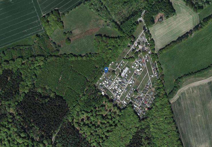
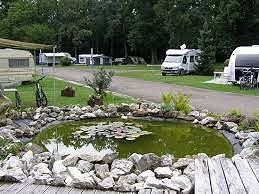
Bischofszell, Schweiz
Planning is in full swing at our home base.
October 2021: Itinerary decided together
January 2022: All campsites and the ferry are booked and paid for
April 2022: Sights during the trip are mostly determined
May 2022: All right, now it just has to be July and the trip can begin!
June 2022: Last but not least, we decided to book the ferry from Puttgarden to Rodby including the Öresund Bridge as a combination ticket!
Waldparkstrasse 7, 9220 Bischofszell, Schweiz
47° 29' 10.5" N 9° 14' 1.1" E
47.4862629 9.2336430
• Head toward Waldhofstrasse on Niederbürerstrasse. Go for 826 m.
• Continue on Scheidweg. Go for 514 m.
• Continue on Sorntal. Go for 198 m.
• Turn left onto Sorntal. Go for 584 m.
• Continue on Sornweid. Go for 97 m.
• Continue on Höfli. Go for 360 m.
• Continue on Sorntal. Go for 431 m.
• Continue on Sornthalstrasse. Go for 401 m.
• Turn right onto Hauptstrasse (470). Go for 7.2 km.
• Take ramp onto A1 toward St. Gallen/Appenzell/Herisau. Go for 37.6 km.
• Continue on A13. Go for 2.1 km.
• Take exit 2 toward Berneck/Lustenau. Go for 352 m.
• Take the 3rd exit from roundabout onto Zollstrasse (435) toward München/Lustenau. Go for 358 m.
• Continue on Lustenauer Straße (L204). Go for 383 m.
• Turn left onto Reichsstraße (L203) toward Bregenz/Höchst Hard/Industrie Nord. Go for 841 m.
• Turn left onto Maria-Theresien-Straße (L203). Go for 1.1 km.
• Turn right onto Zellgasse (L41). Go for 2.9 km.
• Continue on Senderstraße (L41). Go for 2.3 km.
• Turn left and take ramp onto A14 (Rheintal Autobahn) toward Deutschland/Bregenz. Go for 12.8 km.
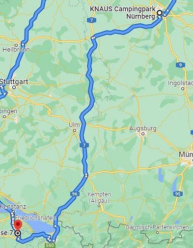
• Continue on A96. Go for 63.0 km.
• Take the left exit toward Würzburg/Ulm/Stuttgart onto A7. Go for 215 km.
• Arrive at A7. Your destination is on the right.
☍
349,2 km
(3 hrs. 21 min.)
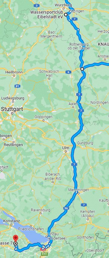
01.Juli 2022
Our journey begins on July 1st. We drive from Bischofszell to Eibelstadt and will spend one night there.
On the trip it rained all the way to Eibelstadt, the trip was very pleasant because there are not too many trucks on this route.
Wir fahren via Bregenz, Memmingen das Kreuz Feuchtwangen auf der A7 nach Eibelstadt
E43, 97318 Biebelried, Deutschland
49° 43' 26.1" N 10° 6' 10.5" E
49.7239135 10.1029041
• Head north on A7. Go for 5.8 km.
• Take exit 102 toward Frankfurt a.M./Würzburg onto A3. Go for 9.6 km.
• Take exit 71 toward Ochsenfurt. Go for 629 m.
• Continue on B13 toward Ansbach/Ochsenfurt/München. Go for 1.2 km.
• Take ramp. Go for 172 m.
• Turn slightly left onto Mainparkring. Go for 575 m.
• Arrive at Mainparkring.
☍
18,0 km
( 12 min.)
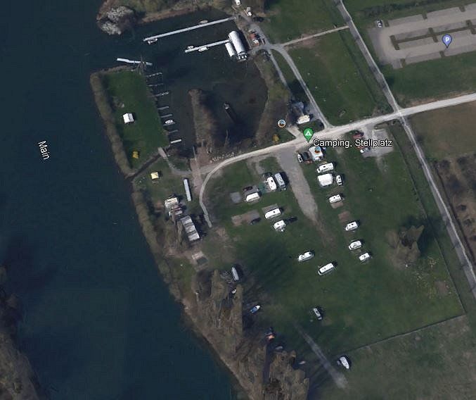
Camping, Stellplatz, Mainparkring, Eibelstadt, Deutschland
Here we will only make a stopover of one night.
Parking space:
Costs: 17 euros per night for 2 people including caravan and car
Sanitary facilities: Conveniently in containers, showers included in the price
Bread: could be ordered the evening before
Wi-Fi: none available
Terrain: level gravel pitch with grass cover
Electricity: included
Mainparkring, 97246 Eibelstadt, Deutschland
49° 43' 53.8" N 9° 59' 15" E
49.7316014 9.9875131
• Head east on Mainparkring. Go for 144 m.
• Turn right onto Mainparkring. Go for 246 m.
• Turn left onto Brückenstraße. Go for 97 m.
• Continue on Würzburger Straße. Go for 138 m.
• Take the 3rd exit from roundabout onto B13 toward A3/Würzburg. Go for 778 m.
• Take ramp onto A3 toward Kassel/Nürnberg. Go for 6.3 km.
• Take the exit toward Kassel/Erfurt/Schweinfurt/Ulm/Rothenburg onto A7. Go for 145 km.
• Continue on A7. Go for 324 km.
• Take exit 41 toward Egestorf/Lübberstedt/Eyendorf/Salzhausen. Go for 409 m.
• Turn left onto K5 toward Egestorf. Go for 1.4 km.
• Turn right onto Schätzendorfer Straße (L212) toward Hanstedt/Schützendorf/Undeloh/Sahrendorf. Go for 34 m.
• Turn right onto Garlstorfer Straße (L212). Go for 348 m.
• Continue on L212. Go for 3.6 km.
• Turn right. Go for 52 m.
• Turn right. Go for 102 m.
• Arrive at your destination.
☍
483,4 km
(4 hrs. 16 min.)
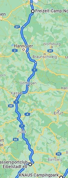
02.Juli 2022
On the 2nd day we drive from Eibelstadt to Garlstorf to spend a night there before we head towards Sweden.
On the way to Garlstorf, there were a few more trucks on the autobahn. Since it was Saturday, it was limited. Otherwise the ride was as we had imagined, first up and down a few hills and then more flat. Despite the long distance, we made good progress and arrived safely at our destination.
Freizeit-Camp-Nordheide e.V., Egestorfer Landstraße, Garlstorf, Deutschland
Also here in the vicinity of Hamburg only a transit stop is planned.
Campsite:
Costs: 28 euros per night for 2 people including caravan and car
Sanitary facilities: Clean and good, showering is included in the price
Bread: we didn't need any
Wi-Fi: none available
Terrain: level natural grass with some trees
Electricity: included
Egestorfer Landstraße 50, 21376 Garlstorf, Deutschland
53° 13' 23.7" N 10° 5' 17.4" E
53.2232630 10.0881531
• Head northeast. Go for 154 m.
• Turn right onto L212. Go for 201 m.
• Continue on Egestorfer Landstraße (L212). Go for 1.3 km.
• Turn right onto Egestorfer Landstraße (L212). Go for 92 m.
• Turn left onto Winsener Landstraße (L212) toward Winsen/Luhe/Toppenstedt. Go for 3.2 km.
• Turn left onto Tangendorfer Straße (K6). Go for 684 m.
• Continue on K6. Go for 2.7 km.
• Continue on Toppenstedter Straße (K6). Go for 742 m.
• Continue on Dorfstraße (K6). Go for 640 m.
• Continue on K6. Go for 1.2 km.
• Continue on Thieshoper Post (K6). Go for 207 m.
• Turn left onto Im Herrenkaben (L215). Go for 419 m.
• Turn left and take ramp onto A7 toward Hamburg. Go for 8.1 km.
• Keep left onto Horster Dreieck toward Lübeck/Berlin/Hamburg/Lüneburg/A1. Go for 2.5 km.
• Continue on A1. Go for 13.2 km.
• Take exit 36 toward Lübeck/Berlin/Hamburg-Südost onto A1. Go for 129 km.
• Continue on B207. Go for 21.2 km.
• Keep left onto B207 toward Puttgarden. Go for 126 m.
• Continue on E47. Go for 836 m.
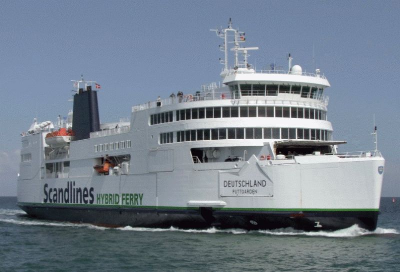
• Take the Puttgarden-Rødby Ferry. Stay on for 18.7 km.
• Head northeast. Go for 769 m.
• Keep left toward København/E47. Go for 135 m.
• Continue on Sydmotorvejen (E47). Go for 121 km.
• Continue on E20/E47 (Køge Vest). Go for 26.1 km.
• Continue on E20 (Avedøre) toward Malmø/Lufthavn/København C. Go for 27.7 km.
• Continue on E20 (Öresundsbron). Go for 27.8 km.
• Continue on E6/E20 toward E4/Göteborg/Stockholm. Go for 5.1 km.
• Take exit 20 toward Lomma onto 103. Go for 1.2 km.
• Continue toward Centrum. Go for 43 m.
• Take the 2nd exit from Prästbergarondellen roundabout toward Centrum. Go for 196 m.
• Continue on Tenngatan. Go for 377 m.
• Continue on Järngatan. Go for 854 m.
• Take the 1st exit from roundabout onto Södra Västkustvägen. Go for 1.5 km.
• Arrive at Södra Västkustvägen. Your destination is on the left.
☍
418,1 km
(5 hrs. 10 min.)
03.Juli 2022
On the 3rd day we travel via Lübeck by ferry from Puttgarden to Rodby and further over the Faro Bridges to Copenhagen and from there over the Öresund Bridge to Malmö. From there it is only a short drive to Lomma to the campsite.
Before this stage, I was most concerned about whether everything would work out with the ferry and the bridge, since we bought a combined ticket in advance.
Fähre Puttgarden - Rodby und Öresundbrücke
We decided to buy a combination ticket for the ferry and the Öresund Bridge. This allows us to use the ferry and the bridge without long waiting times. The ticket costs us 395 euros
We got to the ferry an hour early. Do we have to wait now or not? No ticket shown and off to the ferry. As soon as we had drunk the coffee, we had to leave the ferry again and continue the journey with our team.
When we arrived at the Öresund Bridge, we presented the ticket again and the crossing to Sweden could begin, where we arrived after a short drive.
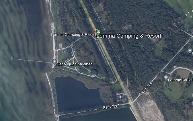
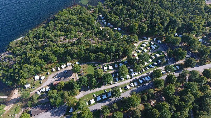
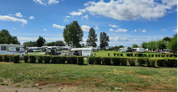
Lomma Camping & Resort, Södra Västkustvägen, Lomma, Schweden
Here in Lomma we stay for the first time 3 nights at the campsite.
campsite
Costs: 45 euros per night for 2 people including caravan and car
Sanitary facilities: rather old and in need of renovation, showers had to be paid extra
Bread: can be bought in the small camping shop
Wi-Fi: Free, but only within 30m of the beach bar
Terrain: Natural grass with few trees
Electricity: included
Activities:
In Malmö we visited the Museum of Disgusting Food, the Turning Torso and walked around the old town.
Lund Old Town is a must visit if you are in the area. This is really worth seeing and in the middle of the city there is an open-air museum with 30 historic buildings from Sweden's history.
Södra Västkustvägen 114, 234 34 Lomma, Schweden
55° 41' 24.6" N 13° 3' 35.7" E
55.6901791 13.0599238
• Head toward Fiskarhusvägen on Södra Västkustvägen. Go for 1.5 km.
• Take the 2nd exit from roundabout. Go for 553 m.
• Continue on Järngatan. Go for 410 m.
• Continue on Tenngatan. Go for 449 m.
• Take the 2nd exit from Prästbergarondellen roundabout toward E6/E20/Lund. Go for 295 m.
• Continue on 103 toward Lund/Göteborg/E6/E20/E4/Stockholm. Go for 2.5 km.
• Keep right toward Trelleborg/108/Flygplats Sturup/Staffanstorp/Lund S. Go for 187 m.
• Turn right onto 108. Go for 3.4 km.
• Take the 2nd exit from roundabout onto 108 toward Kalmar/Flygplats Sturup/Staffanstorp. Go for 176 m.
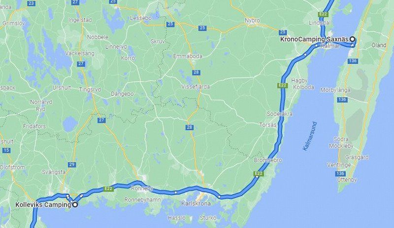
• Take the 2nd exit from roundabout onto E22 toward Kalmar. Go for 74.8 km.
• Take exit 37 toward Kalmar/Kristianstad onto E22 (Hässleholmsvägen). Go for 57.7 km.
• Take ramp onto Trafikplats Karlshamn norr toward Karlshamn N C/Asarum. Go for 276 m.
• Turn left onto Sölvesborgsvägen (E22.2) toward Karlshamn. Go for 4.0 km.
• Turn right onto Kolleviksvägen. Go for 1.4 km.
• Turn left onto Kolleviksvägen. Go for 15 m.
• Arrive at Kolleviksvägen. Your destination is on the left.
☍
147,6 km
(1 hrs. 41 min.)
06.Juli 2022
Now we continue from Lomma the way leads us to Karlshamn. Here again three nights are planned.
Now we had a short drive to Karlshamn.
Check-out at 12.00 p.m. and check-in at 3.00 p.m., so we had plenty of time and didn't have to rush.
Kolleviks Camping, Kolleviksvägen, Karlshamn, Schweden
3 nights are planned here in Karlshamn.
campsite
Costs: 41 euros per night for 2 people including caravan and car
Sanitary facilities: modern, clean and functional, showers had to be paid extra
Bread: can be ordered the evening before, or bought directly in the shop in the morning
Wi-Fi: subject to a charge of 5 euros per day, but reception is not available everywhere
Terrain: natural grass with different gradations
Electricity: included
Activities:
A must-visit junkyard in the middle of the forest near Ryd. This can be reached by car in about 1 hour.
We also did a 75 km long bike ride with our e-bikes in the really beautiful and worth seeing nature north of Karlshamn.
Kolleviksvägen 11, 374 30 Karlshamn, Schweden
56° 9' 36" N 14° 53' 42" E
56.1600000 14.8950000
• Head north on Kolleviksvägen. Go for 15 m.
• Turn right onto Kolleviksvägen. Go for 1.4 km.
• Turn left onto Ronnebyvägen (E22.3). Go for 3.2 km.
• Turn left onto Vekerumsvägen. Go for 1.2 km.
• Take the 1st exit from roundabout onto 15/29. Go for 6.2 km.
• Turn left onto Mariebergsvägen (126) toward Alvesta/Ryd/Svängsta. Go for 5.5 km.
• Continue on Holländarevägen. Go for 2.4 km.
• Continue on Norra Holländarevägen. Go for 12.8 km.
• Continue on Kompersmåla. Go for 2.1 km.
• Continue on Björkebråten Bokebo. Go for 476 m.
• Continue on Björkebråten. Go for 1.2 km.
• Continue on Olofsbol Olofsdal. Go for 145 m.
• Continue on Norra Rimshult. Go for 1.2 km.
• Continue on Norra Rimshult Ekebergslund. Go for 859 m.
• Continue on Kastensmåla Ekemoen. Go for 131 m.
• Continue on Kastensmåla. Go for 715 m.
• Continue on Kastensmåla. Go for 489 m.
• Continue on Kastensmåla. Go for 543 m.
• Continue on Idekulla. Go for 815 m.
• Continue on Storgatan. Go for 4.7 km.
• Turn left onto 120/126. Go for 4.4 km.
• Continue on 126. Go for 27.7 km.
• Turn left onto 23. Go for 128 m.
• Turn right onto 126. Go for 20.0 km.
• Take the 3rd exit from Bländarondellen roundabout onto Fabriksgatan. Go for 1.8 km.
• Turn left onto Värnamovägen. Go for 2.0 km.
• Continue straight ahead. Go for 44 m.
• Take the 2nd exit from roundabout. Go for 179 m.
• Take the 2nd exit from roundabout onto 25/27 toward Halmstad/Göteborg. Go for 4.2 km.
• Take the 1st exit from roundabout onto 27 toward Göteborg/Borås/Värnamo. Go for 38.3 km.
• Take the 3rd exit from Bredastenrondellen roundabout onto Trafikplats Värnamo södra toward Stockholm/Jönköping/127/Vetlanda. Go for 213 m.
• Take the 2nd exit from roundabout toward Stockholm/Jönköping/127. Go for 82 m.
• Take ramp onto E4. Go for 67.6 km.
• Take exit 95A toward Stockholm/31/40 Ö/47 Ö/Elmia onto E4. Go for 250 km.
• Take exit 136 toward Gnesta/224/Lästringe. Go for 359 m.
• Turn left toward Gärdestalund. Go for 379 m.
• Continue on Gärdestalund. Go for 833 m.
• Turn left onto 224. Go for 15.1 km.
• Turn left onto Lötbodalsvägen. Go for 1.1 km.
• Turn left onto Lötbodal. Go for 787 m.
• Continue on Lötbodal Fridhem. Go for 173 m.
• Arrive at Lötbodal Fridhem.
☍
481,2 km
(5 hrs. 29 min.)
Gnesta
Nysätter, Gnesta, Gnesta kommun, Provinz Södermanland, 646 30, Schweden
59° 1' 34.8" N 17° 18' 10.4" E
59.0263273 17.3028939
• Head northeast on Lötbodal Fridhem. Go for 173 m.
• Continue on Lötbodal. Go for 787 m.
• Turn right onto Lötbodalsvägen. Go for 1.1 km.
• Turn right onto Borg Bernhamra (224). Go for 15.1 km.
• Turn left toward E4. Go for 235 m.
• Turn right and take ramp onto E4 toward Helsingborg/Nyköping. Go for 42.7 km.
• Take exit 129 toward Arkösund/Jönåker/Kolmården Djurpark-Zoo. Go for 345 m.
• Turn left. Go for 1.9 km.
• Turn right toward Valsberg Lilla Rosenberg. Go for 666 m.
• Continue on Valsberg Lilla Rosenberg. Go for 237 m.
• Continue on Gevle Sofielund. Go for 3.2 km.
• Continue on Vilan. Go for 646 m.
• Continue on Gammelsta skola. Go for 981 m.
• Turn right toward 216. Go for 833 m.
• Continue on 216. Go for 366 m.
• Turn left and take ramp onto E4 toward Helsingborg/Norrköping. Go for 31.5 km.
• Keep right onto Trafikplats Norrköping norra toward Norrköping N C/55/Ingelsta/56. Go for 1.0 km.
• Continue toward 55/56. Go for 215 m.
• Continue on Stockholmsvägen toward 55/56. Go for 662 m.
• Continue on E4.8 (Stockholmsvägen). Go for 1.2 km.
• Take the 2nd exit from Ingelstarondellen roundabout onto Stockholmsvägen (E4.8) toward Centrum. Go for 275 m.
• Take the 3rd exit from Sandbyhovsrondellen roundabout onto Ståthögavägen (E4.8) toward Centrum. Go for 1.1 km.
• Pass 2 roundabouts and continue on Packhusgatan (E4.8). Go for 2.9 km.
• Continue on Söderköpingsvägen (E4.8). Go for 705 m.
• Take the 2nd exit from Ljurarondellen roundabout onto Söderköpingsvägen (E22) toward Kalmar/Söderköping. Go for 3.0 km.
• Keep left onto Söderköpingsvägen (E22) toward Kalmar. Go for 10.6 km.
• Continue on Erik Dahlbergsgatan (E22) toward 210. Go for 226 km.
• Take the exit toward Öland. Go for 450 m.
• Take the 3rd exit from Ölandsleden roundabout onto Ölandsleden (137) toward Öland. Go for 10.1 km.
• Take ramp toward Mörbylånga/Färjestaden/Saxnäs. Go for 322 m.
• Take the 5th exit from roundabout. Go for 419 m.
• Continue on Djurparksvägen. Go for 1.3 km.
• Continue on Strandskogen. Go for 759 m.
• Turn left onto Södra Saxnäsvägen. Go for 810 m.
• Turn slightly left onto Saxnäs. Go for 140 m.
• Continue straight ahead. Go for 11 m.
• Turn right. Go for 33 m.
• Arrive at your destination on the left.
☍
362,7 km
(4 hrs. 18 min.)
09.Juli 2022
Our journey now takes us to the island of Öland.
The journey took us mostly on country roads and almost no motorways. In some villages the speed is limited to 30 km/h. The route is peppered with a number of radar boxes, but these are indicated in advance with a traffic sign. nevertheless, we made good progress and arrived at our destination without stress.
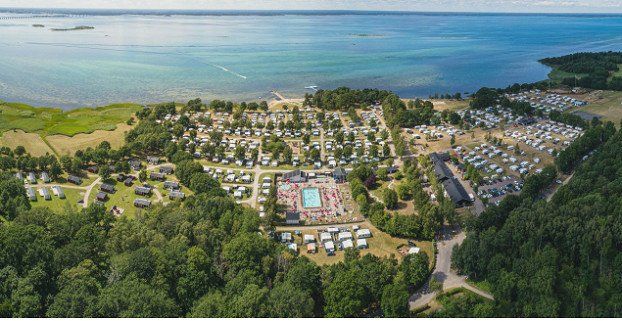
Kronocamping Saxnäs/Öland Camping & Stugby
3 overnight stays are also planned on the island of Öland.
campsite
Price: 54 euros per night for 2 people including caravan and car
Sanitary facilities: modern, well furnished and clean, showers had to be paid extra
Bread: can be bought in the campsite shop
Wi-Fi: Free and available throughout the campsite
Terrain: level natural grass terrain with a few trees
Electricity: included
The campsite is a holiday destination for campers with families, but it was also very pleasant for us
Activities:
We visited the north side of the island with the lighthouse "Langer Erik" and the ruins of Borgholm Castle. We didn't treat ourselves to a visit to the summer residence of the King of Sweden near Borgholm.
On the second day, the south side of the island with the lighthouse "Langer Jan" was on the agenda. We also visited the windmills at Lerkaka in the middle of the island.
Södra Saxnäs, 38695, Färjestaden, Sweden
56° 41' 15" N 16° 28' 54" E
56.6875000 16.4816600
• Head southwest. Go for 33 m.
• Turn left toward Saxnäs. Go for 11 m.
• Continue on Saxnäs. Go for 140 m.
• Turn slightly right onto Södra Saxnäsvägen. Go for 810 m.
• Turn right onto Strandskogen. Go for 1.9 km.
• Continue on Djurparksvägen. Go for 124 m.
• Turn left and take ramp onto 137 toward Kalmar. Go for 10.3 km.
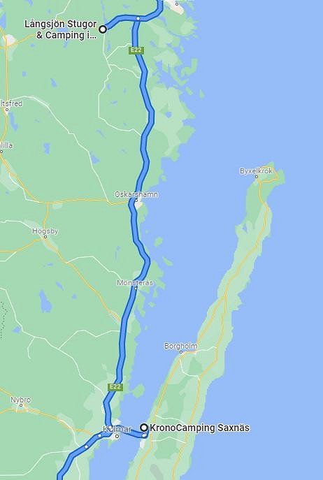
• Take ramp onto E22 toward Norrköping/Oskarshamn. Go for 55.1 km.
• Continue on E22. Go for 68.9 km.
• Turn left onto 40 toward Jönköping/Vimmerby/Ankarsrum. Go for 10.9 km.
• Turn left. Go for 54 m.
• Turn left. Go for 31 m.
• Arrive at your destination on the left.
☍
148,3 km
(1 hrs. 42 min.)
12.Juli 2022
After spending the night on the island of Öland, our journey continues. Of course, a visit to the Swiss-run campsite in Ankarsrum should not be missed. Here we hope to be able to communicate in Swiss German and to meet one or the other camper from Switzerland.
The journey was mostly on the same roads as the sections before.
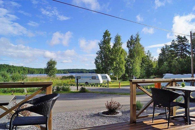
Långsjön Stugor & Camping i Ankarsrum AB, FAGERSAND, Ankarsrum, Schweden
Here we will once again park our caravans for 3 nights.
campsite
Costs: 38 euros per night for 2 people including caravan and car
Sanitary facilities: modern, clean and practical, showers included
Bread: pre-order the evening before, collection from 09.00 a.m
Wi-Fi: included but only available at the reception
Grounds: natural grass, partly gravel grass with trees
Electricity: included
Activities:
The campsite is visited by many Swiss people!
Ideal base for visiting Vimmerby, home of Astrid Lindgren. We also visited the MX World Museum (Motocross) in Vimmerby. A visit to the farms of the series "Wir Kinder von Bullerbü" was also included. A visit to "Katthult", the home of Michel from Löneberga, was also a must. At the end we made a detour to the Runkestein (wobble stone) of Mariannelund. On the second day we went on an extended boat tour on the "Langsjön" lake. As a campsite user, we could rent the boat directly from the reception.
FAGERSAND 2, 593 71 Ankarsrum, Schweden
57° 41' 44.4" N 16° 17' 23.1" E
57.6956596 16.2897453
• Head toward Fagersand. Go for 31 m.
• Turn right toward 40. Go for 54 m.
• Turn right onto 40. Go for 10.9 km.
• Turn left onto E22 toward Norrköping/Västervik. Go for 109 km.
• Continue on Tingstad skola (E22). Go for 7.4 km.
• Take the 2nd exit from Ljurarondellen roundabout onto Söderköpingsvägen (E4.8) toward Centrum. Go for 2.2 km.
• Pass 2 roundabouts and continue on Ståthögavägen (E4.8). Go for 2.4 km.
• Take the 1st exit from Sandbyhovsrondellen roundabout onto Stockholmsvägen (E4.8) toward E4. Go for 223 m.
• Take the 2nd exit from Ingelstarondellen roundabout onto Stockholmsvägen (E4.8) toward E4/51/55/56. Go for 1.6 km.
• Continue on Stockholmsvägen. Go for 315 m.
• Continue toward Trafikplats Norrköping norra. Go for 297 m.
• Continue on Trafikplats Norrköping norra. Go for 395 m.
• Continue on E4 (Trafikplats Norrköping norra). Go for 147 km.
• Take left exit 155 toward Nynäshamn/73/Årsta/222/226 onto 75 (Årstalänken). Go for 3.9 km.
• Take exit 4 toward Globen/Nynäshamn onto Skeppartunneln. Go for 632 m.
• Take ramp onto Nynäsvägen (73) toward Nynäshamn. Go for 3.2 km.
• Take the exit toward Tyresö/Sköndal onto 229 (Örbyleden). Go for 5.4 km.
• Take the exit toward Nacka/Älta/Lindalen/Flaten. Go for 329 m.
• Turn right onto Flatenvägen toward Flaten. Go for 351 m.
• Turn left onto Flatenvägen. Go for 113 m.
• Arrive at Flatenvägen.
☍
296,2 km
(3 hrs. 12 min.)
15.Juli 2022
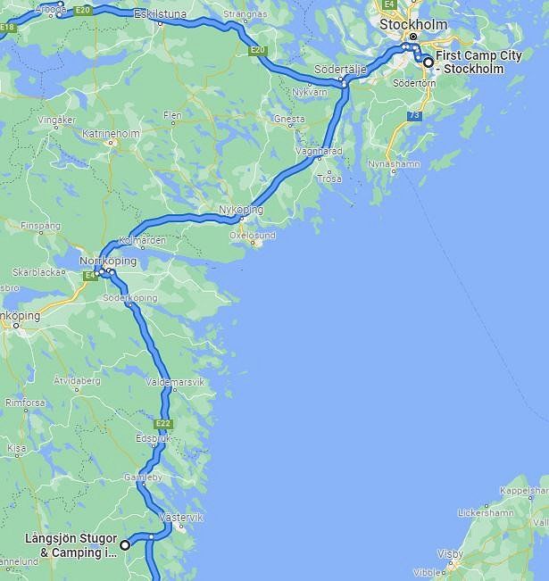
After the nights in Ankarsrum, our journey takes us to the capital of Sweden.
The drive to Stockholm was pleasant, the closer we got to Stockholm the more traffic there was and the motorways became like ours again.
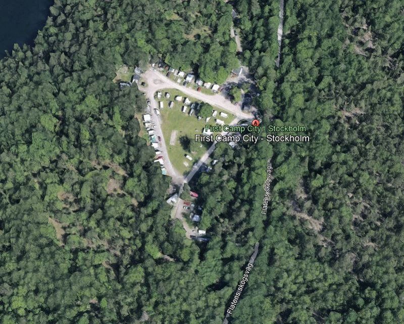
First City Camping, Stockholm
Here in the vicinity of Stockholm we will spend a first and last time 4 nights.
campsite
Costs: 62 euros per night for 2 people including caravan and car
Sanitary facilities: outdated and not maintained, and not clean, hot water was scarce
Bread: had to be procured by yourself
Wi-Fi: free but reception was very poor
Terrain: Gravel grass mixed with natural grass
Electricity: included
The campsite left a lot to be desired for its cost. It is an absolute tourist demolition!!!
Activities:
There was a lot to see in Stockholm, as we were about 20km from the city center we used public transport to get there and back.
On the one hand, the old town "Gamla Stan" is highly recommended with its many different shops and the really beautiful and well-kept houses. The island "Djurgarden" can be reached by scheduled boat included in the public transport ticket and houses an amusement park as well as the "Vasa Museum" and several other museums. Also on the island, which is close to the city center, is probably the most famous museum in Stockholm, namely the "ABBA" museum, which of course was also visited. The "Avicii Arena" or Globe Arena with the "Skyview" the outside elevator from which you have an outstanding view over the city should not be missing either. Right next to it is the "Tele 2 Arena", the football stadium. Of course, a boat trip from Stockholm to Vaxholm in the famous archipelago was a must.
Flatens skogsväg 30, 128 30 Skarpnäck, Schweden
59° 14' 53.7" N 18° 9' 41.4" E
59.2482592 18.1615068
• Head east on Flatenvägen. Go for 55 m.
• Turn right onto Flatenvägen. Go for 418 m.
• Continue on Ältavägen (260). Go for 154 m.
• Turn right and take ramp onto 229 (Tyresövägen) toward Stockholm. Go for 5.1 km.
• Take ramp onto 73 (Nynäsvägen) toward E4/E20/Stockholm. Go for 3.0 km.
• Take ramp onto Skräddartunneln toward E4/E20/222. Go for 800 m.
• Take left ramp onto 75 (Södra länken) toward E4/E20. Go for 3.5 km.
• Take the left exit toward Helsingborg/Göteborg onto E4/E20 (Södertäljevägen). Go for 27.9 km.
• Take exit 143 toward Göteborg/Strängnäs/Södertälje C onto E20. Go for 113 km.
• Take the 1st exit from roundabout onto E20 toward E18/Stockholm/249/Arboga N. Go for 3.8 km.
• Take ramp onto E18/E20 toward Oslo/Göteborg/Örebro/Lindesberg/249. Go for 51.0 km.
• Take exit 110A toward Oslo/Karlskoga/Örebro flygplats onto E18. Go for 39.9 km.
• Take the 2nd exit from roundabout onto Örebrovägen (E18) toward 205/237. Go for 1.2 km.
• Take the 3rd exit from roundabout onto E18 toward Oslo. Go for 541 m.
• Take the 2nd exit from Ekebyrondellen roundabout onto E18. Go for 60.4 km.
• Take the exit toward Ludvika/Filipstad/Hammarö/Lamberget. Go for 288 m.
• Take the 1st exit from roundabout onto Örsholmsleden (236). Go for 7.9 km.
• Take the 2nd exit from roundabout onto Skoghallsleden (236). Go for 1.1 km.
• Take ramp toward Hälltorp/Hammar/Klöverud. Go for 146 m.
• Turn right onto Slängomvägen. Go for 2.0 km.
• Turn right onto Hovlandavägen. Go for 323 m.
• Turn left onto Möruddsvägen. Go for 905 m.
• Arrive at Möruddsvägen. Your destination is on the left.
☍
323,1 km
(3 hrs. 26 min.)
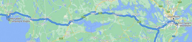
19.Juli 2022
After the days in Stockholm, our journey continues to Skoghall near Karlstadt.
Here we drove again as usual on the two-lane highway to Skoghall. the journey was pleasant, except for the 20 km long detour which was poorly signposted.
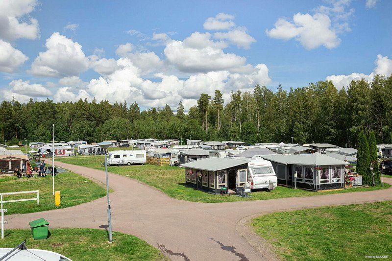
First Camp Mörudden-Karlstad
In Skoghall we will pitch our tents for 3 nights!
campsite
Costs: 57 euros per night for 2 people including caravan and car
Sanitary facilities: modern, clean and practical, showers are included
Bread: we had it with us!
Wi-Fi: free and good reception
Terrain: natural grass
Electricity: included
Activities:
If you like hiking, this is the right place for you in this area. The landscape with its lakes and forests is simply made for it. Here we dedicated a whole day to our hobby geocaching in order to achieve the goal of the 81 matrix in one day, which we finally succeeded in doing. Here we also had the only breakdown of the whole trip, a flat tire on the car. Anyone who imagined that the flat tire was fixed quickly was wrong. Either garage holidays or breakdown service doesn't come forever. After four hours of sitting around, we took the bus back to the campsite and returned the next day with a spare wheel and had the flat tire repaired in Karlstadt.
Möruddsvägen 700, 663 33, Skoghall, Schweden
59° 18' 45.3" N 13° 29' 52.3" E
59.3125860 13.4978520
• Head southwest on Möruddsvägen. Go for 42 m.
• Turn right. Go for 12 m.
• Turn sharp right. Go for 24 m.
• Turn left toward Möruddsvägen. Go for 27 m.
• Continue on Möruddsvägen. Go for 905 m.
• Turn left onto Hovlandavägen. Go for 1.5 km.
• Turn right onto Mörmovägen (236). Go for 539 m.
• Take the 4th exit from roundabout onto Industrileden. Go for 1.5 km.
• Turn right onto Dingelsundsvägen. Go for 5.4 km.
• Turn left onto Ullebergsleden. Go for 1.4 km.
• Take the 2nd exit from roundabout onto Hagalundsvägen. Go for 329 m.
• Take the 1st exit from roundabout onto E18 toward Flygplats/Oslo/E45/61/62. Go for 18.0 km.
• Take the 2nd exit from Wounded Knee roundabout onto E18/E45 toward Göteborg/Oslo. Go for 104 km.
• Continue on Svenskeveien (E18). Go for 38.2 km.
• Take the exit toward Trøgstad/Skiptvet/Askim sentrum. Go for 299 m.
• Take the 3rd exit from roundabout onto Vammaveien (115). Go for 142 m.
• Take the 1st exit from roundabout onto 115 toward Skiptvet. Go for 5.6 km.
• Turn left onto Askimveien (115). Go for 19.2 km.
• Turn left onto Missingmyrveien (279). Go for 5.9 km.
• Continue on Slangsvoldveien (279). Go for 4.8 km.
• Continue on Slangsvoldveien (279). Go for 1.3 km.
• Take the 2nd exit from roundabout onto 118. Go for 3.2 km.
• Take the 3rd exit from roundabout onto Desiderias vei (118). Go for 2.0 km.
• Turn sharp right onto Desiderias vei. Go for 48 m.
• Arrive at Desiderias vei. Your destination is on the right.
☍
214,2 km
(2 hrs. 43 min.)
22.Juli 2022
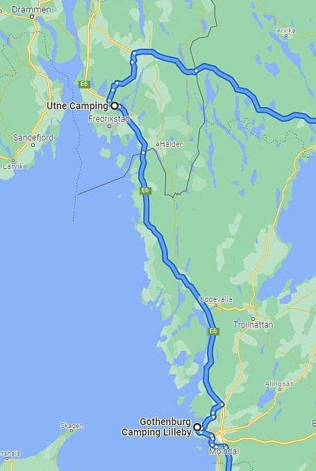
Our further way leads us to Norway to be precise to Greaker. From here, we will visit Oslo.
The route took us once again over normal motorways
to Norway. This stage was also pleasant to drive.
On this stretch, the topography of the landscape has changed from forest in the east to coastal mountains in the west.
Utne Camping AS, Greaker
Further excursions are planned from here, eg Oslo. We will also spend 3 nights here.
campsite
Costs: 25 euros per night for 2 people including caravan and car
Sanitary facilities: appropriately furnished, cleanliness left something to be desired, showers are included
Bread: we had it with us!
Wi-Fi: free but limited reception on the campsite
Terrain: natural grass
Electricity: included
Activities:
Since we had to realize that Oslo is just a bit far away with a journey time of just over an hour by car and not very good public transport connections, we changed our program. We rode our e-bikes to Frederikstad and made an extended visit to the beautiful and specially designed old town. Since we still had a second day available, geocaching was announced once more. We chose a round where we found pretty much everything in terms of terrain. From dirt roads to no path somewhere in the forest and sandy roads, everything was there.
Desiderias vei 43, 1719 Greåker, Norwegen
59° 19' 5.9" N 10° 58' 50.1" E
59.3182925 10.9805704
• Head east on Desiderias vei. Go for 48 m.
• Turn right onto Desiderias vei (118). Go for 2.9 km.
• Take the 1st exit from roundabout onto E6. Go for 30.1 km.
• Continue on E6 (Svinesundsbron). Go for 159 km.
• Take exit 85 toward Säve. Go for 280 m.
• Turn right onto Kongahällavägen toward Säve. Go for 7.6 km.
• Turn left onto Kongahällavägen. Go for 1.1 km.
• Take the 2nd exit from roundabout onto Kongahällavägen. Go for 1.2 km.
• Take the 1st exit from roundabout onto Kongahällavägen. Go for 6.2 km.
• Pass 4 roundabouts and continue on Kongahällavägen. Go for 4.0 km.
• Continue toward Lillebyvägen. Go for 31 m.
• Take the 1st exit from roundabout onto Lillebyvägen. Go for 3.0 km.
• Turn left onto Lillebyvägen. Go for 53 m.
• Arrive at Lillebyvägen. Your destination is on the right.
☍
215,6 km
(2 hrs. 29 min.)
25.Juli 2022
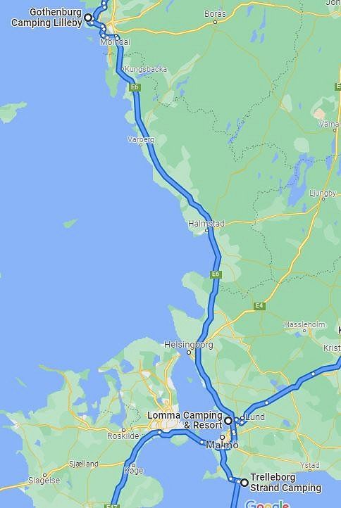
After our detour to Norway, our journey takes us back to Sweden. We will stay in Torslanda before moving on.
On the drive from Norway back to Sweden, we quickly noticed that this highway is the main traffic axis from Oslo to Malmö and beyond. Despite the additional traffic, the trip was good and easy to manage.
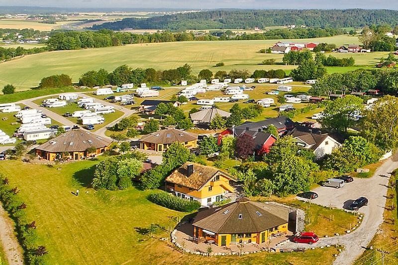
Göteborgs Camping AB, Torslanda
We will spend 3 nights at this campsite one last time before we start our return journey towards Switzerland.
campsite
Costs: 35 euros per night for 2 people including caravan and car
Sanitary facilities: are located on the other side of the street about 150m away, appropriately furnished, cleaned several times a day, showers are included
Bread: we had it with us!
Wi-Fi: free and good reception
Terrain: natural grass
Electricity: included
Specifics: The campsite is on the other side of the road from the site and is in poor condition as far as the meadows are concerned (depressions where a large lake forms when it rains).
Activities:
Since the campsite is about 20 km outside of Gothenburg, we used public transport to get to Gothenburg, which is absolutely no problem. In Gothenburg we visited the very beautiful old town "Haga" and looked around. In Haga in the Cafe Husaren there is the largest cinnamon roll in the world, called "Hagabulle". Of course we had to try them too. A Hagabulle is absolutely sufficient for two people to eat their fill. One day was planned for geocaching, in order to salvage the many solved question marks (81 pieces) with a fishing pole. However, we had to abandon the task of rescuing everyone because it would have taken far too long and we still had to ride our e-bikes back to the campsite.
Lillebyvägen 100, 423 53 Torslanda, Schweden
57° 44' 36.3" N 11° 45' 23.7" E
57.7434078 11.7565714
• Head north on Lillebyvägen. Go for 53 m.
• Turn right onto Lillebyvägen. Go for 3.0 km.
• Take the 1st exit from roundabout. Go for 25 m.
• Continue on Kongahällavägen. Go for 3.9 km.
• Take the 2nd exit from roundabout onto Torslandavägen. Go for 592 m.
• Take the 2nd exit from roundabout onto Torslandavägen (155). Go for 5.7 km.
• Continue on Hisingsleden (E6.20). Go for 436 m.
• Keep left onto Hisingsleden (E6.20) toward Malmö/E6/E20/E45/40/Flygplats/Centrum. Go for 2.9 km.
• Keep left onto Hisingsleden (E45.1) toward E6/E20/Malmö/158/Särö/Mölndal/Långedrag/Frölunda. Go for 786 m.
• Keep left onto Västerleden (E6.20) toward E6/E20/Malmö/158/Särö/Mölndal/Långedrag. Go for 10.3 km.
• Take left ramp onto E6/E20 (Kungsbackaleden) toward Malmö. Go for 206 km.
• Continue on E6/E20 (Trafikplats Helsingborg S). Go for 64.4 km.
• Take exit 12 toward Trelleborg onto E6/E22 (Trelleborgsvägen). Go for 20.9 km.
• Take the 2nd exit from roundabout onto E6/E22 toward Trelleborg. Go for 3.8 km.
• Continue on Slussgatan (9). Go for 3.1 km.
• Take the 2nd exit from roundabout onto Östra infarten (9) toward Ystad. Go for 1.5 km.
• Turn right onto Dalaleden. Go for 470 m.
• Turn right. Go for 48 m.
• Arrive at your destination on the left.
☍
327,8 km
(3 hrs. 27 min.)
28.Juli 2022
Slowly but surely we are heading home again. Our next destination is in Trelleborg. On the way to Trelleborg we will cross our itinerary from the beginning in Malmö.
Now that the trip is definitely going home, a longer route was on the plan. The Autobahn is well developed and we had a pleasant drive ahead of us.
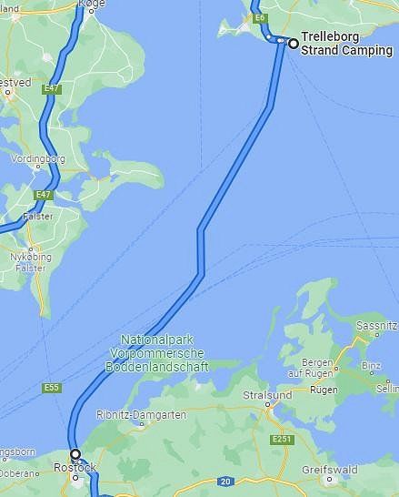
Trelleborg Strand Camping, Dalköpinge strandväg, Trelleborg, Schweden
We will spend 1 night at this campsite in order to catch the ferry to Rostock early in the morning the next day.
campsite
Costs: 40 euros per night for 2 people including caravan and car
Sanitary facilities: modern, clean and functional, showers had to be paid for separately
Bread: we had it with us!
Wi-Fi: free but once again weak reception
Terrain: natural grass
Electricity: included
Dalköpinge strandväg 2, 231 32 Trelleborg, Schweden
55° 21' 49.5" N 13° 12' 33.3" E
55.3637588 13.2092412
• Head southwest. Go for 35 m.
• Turn left. Go for 7 m.
• Turn right. Go for 62 m.
• Turn right toward Dalköpinge Strandväg. Go for 131 m.
• Turn left onto Dalköpinge Strandväg. Go for 470 m.
• Turn left onto Östra infarten (9) toward Centrum. Go for 1.4 km.
• Take the 2nd exit from roundabout onto Östra infarten (9) toward Centrum. Go for 3.2 km.
• Turn left onto Travemündeallén toward Travemünde/E6/Sassnitz/E22/Rostock/Swinoujscie. Go for 1.0 km.
• Turn right onto Norra kajgatan. Go for 9 m.
• Turn slightly right. Go for 40 m.
• Arrive at your destination on the right.
☍
6,4 km
( 12 min.)
29.Juli 2022
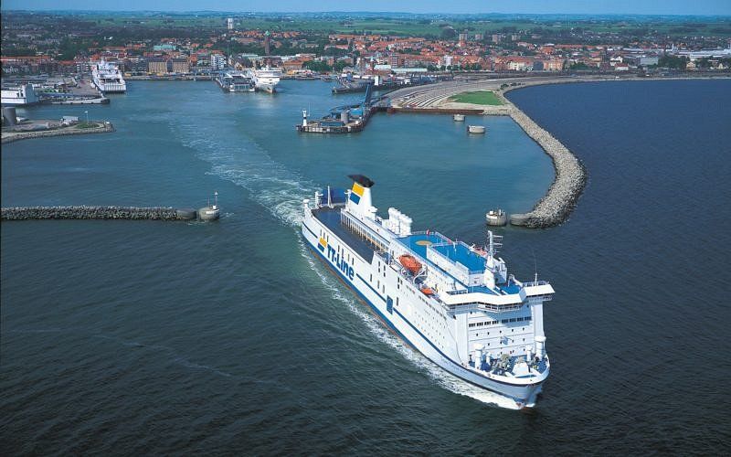
The ferry from Trelleborg to Rostock awaits us early in the morning.
We had to get up early as we had to check in at the ferry terminal by 6.30am at the latest.
Fähre Trelleborg nach Rostock, Fyrmästaregatan, Trelleborg, Schweden
At 7.30 a.m. our ferry to Rostock leaves Trelleborg!
Checking in and loading went smoothly and the crossing could start on time.
Fyrmästaregatan 11, 231 42 Trelleborg, Schweden
55° 22' 20.5" N 13° 9' 8.1" E
55.3723689 13.1522565
• Head toward Norra kajgatan. Go for 40 m.
• Turn slightly left onto Norra kajgatan. Go for 9 m.
• Continue on Travemündeallén. Go for 1.0 km.
• Turn left onto E6/E22 toward Malmö/Göteborg/Stockholm/E4. Go for 3.7 km.
• Take the 2nd exit from roundabout onto E6/E22 toward Malmö. Go for 19.3 km.
• Take exit 12 toward Flygplats/Köpenhamn onto E20 (Yttre Ringvägen). Go for 14.1 km.
• Continue on E20 (Øresundsbroen). Go for 53.5 km.
• Keep right onto E47/E55 (Køge Vest) toward Rødby/Gedser. Go for 77.6 km.
• Take exit 44 toward Gedser/Nykøbing/Eskilstrup onto E55 (Nykøbingvej). Go for 8.6 km.
• Take the 2nd exit from roundabout onto Skovalleen (E55). Go for 1.1 km.
• Take the 2nd exit from roundabout onto Nykøbing Falster Omfartsvej (E55) toward Gedser. Go for 5.7 km.
• Take the 2nd exit from roundabout onto Gedser Landevej (E55) toward Gedser. Go for 19.2 km.
• Turn right onto Gedser Landevej (E55) toward Rostock/Scandlines. Go for 118 m.
• Keep right. Go for 70 m.
• Keep left toward Gedser Landevej/E55. Go for 511 m.
• Turn right onto Gedser Landevej (E55). Go for 28 m.
• Take the Gedser-Rostock Ferry. Stay on for 48.2 km.
• Head south on Am Warnowkai. Go for 111 m.
• Arrive at Am Warnowkai.
☍
253,0 km
(3 hrs. 57 min.)
29.Juli 2022
If everything goes well, after 6 hours of crossing we will slowly have solid ground under our feet and wheels again.
The crossing was calm and pleasant with no rough seas, so we arrived in Rostock on time and were able to continue our journey.
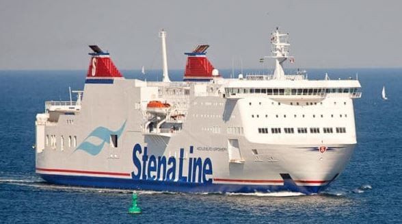
FS Mecklenburg-Vorpommern
On the ferry "FS Mecklenburg-Vorpommern" we continue on the Baltic Sea to Rostock. During the crossing we enjoy a rich breakfast on board. The ferry including breakfast costs us 259 euros!
We spent the time on the ferry eating breakfast, playing and reading. Unfortunately, it's the same here as everywhere else where the food is at the buffet and you can get as much as you want. There are people who fill their plates until they overflow and then throw half of them away.
Ostsee
54° 37' 47.2" N 12° 39' 47.2" E
54.6297694 12.6631167
• Head southwest on Am Warnowkai. Go for 611 m.
• Turn right onto Am Warnowkai. Go for 70 m.
• Turn right onto Zum Fährterminal. Go for 559 m.
• Take the 1st exit from roundabout onto Zum Fährterminal (E55). Go for 1.3 km.
• Turn right and take ramp onto A19 toward Berlin/Flugplatz Rostock-Laage/A20. Go for 124 km.
• Continue on A24. Go for 38.5 km.
• Take exit 23 toward Neuruppin-Süd. Go for 359 m.
• Turn right onto L16 toward Fehrbellin. Go for 1.4 km.
• Turn left onto Dammkrug (L164) toward Herzberg/Wustrau/Langen. Go for 5.4 km.
• Turn left onto Weinbergweg. Go for 618 m.
• Arrive at Hohes Ende. Your destination is on the right.
☍
172,4 km
(1 hrs. 34 min.)
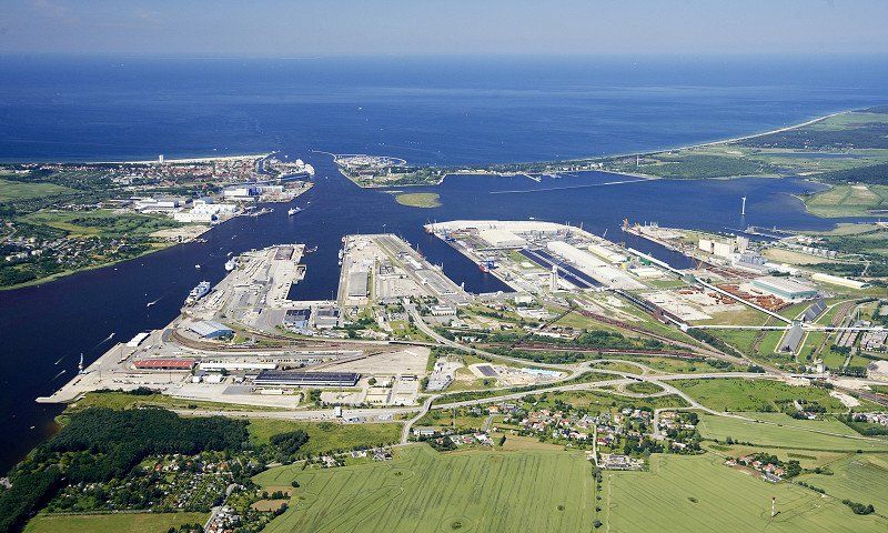
Rostock Fährterminal, Deutschland
So now we have reached the mainland again and we can continue on our journey.
Arrived at the ferry terminal, we went back to the mainland. Since three or four ferries had just docked, we had to be patient until the journey could be continued.
Rostock, 18147 Rostock, Deutschland
54° 9' 10.9" N 12° 5' 53.7" E
54.1530359 12.0982531
• Head northeast on Hohes Ende. Go for 97 m.
• Turn right onto Hohes Ende. Go for 162 m.
• Turn slightly right onto Zietenstraße. Go for 180 m.
• Turn slightly right onto Eichenallee. Go for 189 m.
• Turn right onto Ernst-Thälmann-Straße (L164). Go for 5.7 km.
• Turn right onto Dammkrug (L16). Go for 1.4 km.
• Turn left and take ramp onto A24 toward Berlin/A23. Go for 24.2 km.
• Take exit 26 toward Leipzig/Magdeburg/Potsdam onto A10 (Autobahndreieck Havelland). Go for 47.1 km.
• Take the left exit toward Frankfurt (Oder)/Berlin-Zentrum/Leipzig/Flughafen BER onto A10 (Berliner Ring). Go for 9.3 km.
• Take exit 19 toward München/Leipzig onto A9 (Autobahndreieck Potsdam). Go for 302 km.
• Take exit 41 toward Bindlach onto B2. Go for 1.2 km.
• Take the 4th exit from roundabout onto B2 toward Nürnberg/A9/Weiden i.d.OPf./Bayreuth/Industriegebiet St.-Georgen-West. Go for 3.5 km.
• Turn left onto Hohenzollernring (B2/B22/B85) toward Nürnberg/A9/Amberg/Weiden. Go for 672 m.
• Continue on Hohenzollernring (B2/B22/B85) toward Berlin-Nürnberg/A9/Amberg/Pegnitz. Go for 134 m.
• Turn left onto Richard-Wagner-Straße (B2/B22/B85) toward A9/Berlin/Nürnberg/Amberg/Pegnitz/Schloß Thiergarten. Go for 1.6 km.
• Continue toward Nürnberger Straße/B2/B22/B85. Go for 19 m.
• Turn left onto Äußere Nürnberger Straße (B2/B22/B85). Go for 250 m.
• Turn left and take ramp onto A9 toward München/Nürnberg. Go for 72.8 km.
• Take exit 52 toward Prag/Praha/Regensburg/Heilbronn/N.-Hafen/N.-Zentrum/N.-Messe/N.-Stadion onto B4. Go for 6.1 km.
• Turn left onto Hans-Kalb-Straße toward Messe/Stadion ARENA. Go for 586 m.
• Turn left onto Hans-Kalb-Straße. Go for 960 m.
• Arrive at Hans-Kalb-Straße. Your destination is on the left.
☍
478,4 km
(4 hrs. 26 min.)
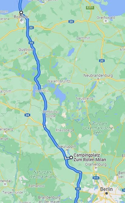
29.Juli 2022
After leaving the ferry in Rostock, we still have to drive to Wustrau and move into our next quarters.
The drive from Rostock to the campsite went without incident. This is despite the fact that the motorway is not in very good condition. It rumbled and jerked on all sides and the pace had to be kept rather low.
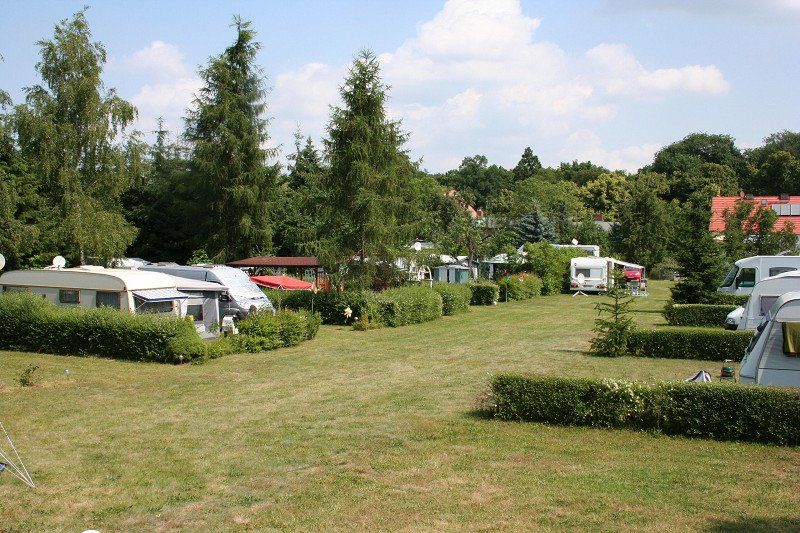
Campingplatz zum roten Milan
We will stay 1 night at this small campsite and then continue our return journey.
campsite
Costs: 19 euros per night for 2 people including caravan and car
Sanitary facilities: appropriately furnished, showers 2 euros per person and one shower
Bread: Bakery in town with a large selection
Wi-Fi: free and very good reception
Terrain: natural grass
Electricity: included
special:
The campsite is a fine but small place. The groundsman is very helpful and friendly. You can swim in the lake within a 5-minute walk. The village is exactly how we imagine a village in the former GDR to be.
Hohes Ende 3, 16818, Wustrau, Deutschland
52° 50' 57.9" N 12° 51' 42.1" E
52.8494110 12.8616960
• Head southeast on Hans-Kalb-Straße. Go for 965 m.
• Turn slightly left onto Max-Morlock-Platz. Go for 97 m.
• Turn right onto Karl-Steigelmann-Straße. Go for 188 m.
• Turn right onto Beuthener Straße. Go for 1.2 km.
• Continue on Karl-Schönleben-Straße. Go for 426 m.
• Continue on Karl-Schönleben-Straße. Go for 1.2 km.
• Turn left onto Münchener Straße (B8). Go for 2.4 km.
• Take ramp onto A73 (Südwesttangente) toward Feucht/München/Prag/Heilbronn. Go for 1.9 km.
• Take the exit toward Heilbronn onto A6. Go for 73.1 km.
• Take exit 48 toward Füssen/Ulm/Feuchtwangen-West onto A7. Go for 150 km.
• Take exit 128 toward Bregenz/Lindau onto A96. Go for 64.2 km.
• Continue on A14 (Rheintal Autobahn). Go for 17.5 km.
• Take exit 18 toward Lustenau onto L204 (Lustenauer Straße). Go for 2.9 km.
• Pass 2 roundabouts and continue on Dornbirner Straße (L204). Go for 942 m.
• Take the 2nd exit from roundabout onto Grindelstraße (L203) toward St. Gallen/Industrie Nord. Go for 1.8 km.
• Turn left onto Lustenauer Straße (L204) toward St. Gallen/Au. Go for 385 m.
• Continue on Zollstrasse (435). Go for 298 m.
• Take the 1st exit from roundabout onto A13 toward St. Gallen/St. Margrethen. Go for 2.9 km.
• Continue on A1 toward Rheineck. Go for 36.6 km.
• Take exit 79 toward Gossau/Bischofszell/Flawil onto 470. Go for 7.2 km.
• Turn left onto Sornthalstrasse. Go for 605 m.
• Continue on Sorntal. Go for 227 m.
• Continue on Höfli. Go for 360 m.
• Continue on Sornweid. Go for 652 m.
• Continue on Sorntal. Go for 29 m.
• Turn right onto Sorntal. Go for 198 m.
• Continue on Scheidweg. Go for 989 m.
• Continue on Niederbürerstrasse. Go for 352 m.
• Arrive at Niederbürerstrasse. Your destination is on the right.
☍
369,1 km
(3 hrs. 27 min.)
30.Juli 2022
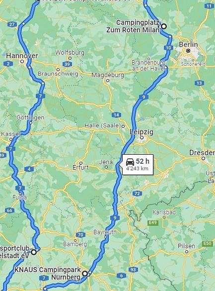
After spending the night in Wustrau, we take big steps towards home. Our last stop in Nuremberg.
Now came one of the longest stretches of our journey. The journey went south on the A7. The further south we got, the more traffic there was. Nevertheless, the route could be completed without any problems with one stopover.
KNAUS Campingpark Nürnberg
Here in Nuremberg is our last planned overnight stay before returning home.
campsite
Costs: 48 euros per night for 2 people including caravan and car
Sanitary facilities: modern, clean and practical, showers are included
Bread: we had it with us!
Wi-Fi: free and good reception
Terrain: natural grass
Electricity: included
special:
The campsite is right next to the 1.FC Nürnberg football stadium and the DEL Club Nürnberg Ice Tigers ice hockey stadium.
If you want to leave early the next morning, you have a problem. The barrier doesn't open until 8am and we could see the line in front of it getting longer and longer!
Hans-Kalb-Straße 56, 90471, Nürnberg, Deutschland
49° 25' 19" N 11° 7' 17" E
49.4219400 11.1213900
31.Juli 2022
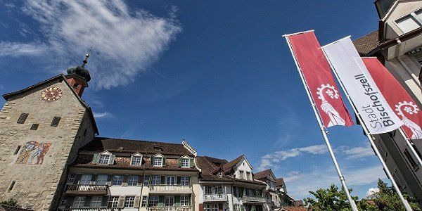
But now the trip is finally going home to Bischofszell without another planned overnight stay.
We were also able to complete the last stretch without incident. The closer we got to Bregenz, the more traffic there was, as the summer holidays in the federal states of Bavaria and Baden-Württemberg began this weekend. We made one last stop at the motorway service area near Bregenz before we cycled the last few kilometers.
Bischofszell, Schweiz
Hopefully we've gotten home safely. I already hope that we have taken a large backpack with memories and beautiful places home with us.
Happy and full of new impressions we are now back home and can state the following.
We covered a total of 4540 km (about 2000 km went through Germany twice)
We used diesel for 1065.- Fr. (thanks to the high diesel prices)
I would do the same again on a next tour like this. I would book and reserve the campsites and ferries and more in advance!
The duration of 3 nights per campsite has turned out to be optimal. There was enough time to see around the area.
Waldparkstrasse 7, 9220 Bischofszell, Schweiz
47° 29' 10.6" N 9° 14' 1.3" E
47.4862679 9.2336815